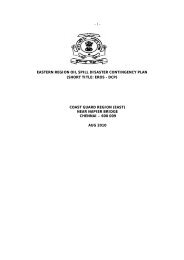
Jan 2008 edition - Indian Coast Guard
Jan 2008 edition - Indian Coast Guard
Jan 2008 edition - Indian Coast Guard

You also want an ePaper? Increase the reach of your titles
YUMPU automatically turns print PDFs into web optimized ePapers that Google loves.
Biannual <strong>Jan</strong>uary <strong>2008</strong> Vol IX Issue 1<br />
OIL SPILLS<br />
A THREAT TO OUR MARINE ENVIRONMENT<br />
A Publication of the <strong>Indian</strong> <strong>Coast</strong> <strong>Guard</strong>
<strong>Jan</strong> <strong>2008</strong> Vol IX Issue 1<br />
From the Director General’s Desk<br />
The 10 th NOS-DCP preparedness<br />
meeting which was held on 07 Sep<br />
2007 was an opportunity to interact<br />
with members from various<br />
participating agencies and discuss<br />
contemporary issues related to our<br />
disaster contingency planning in<br />
case of an oil spill at sea. Oil spill<br />
exercises, procurement of Tier – 1<br />
facilities, pollution control<br />
equipment for high current water<br />
bodies, use of dispersant, preparation of local contingency<br />
plan, developing software for combating oil spills, inclusion<br />
of new ports under NOS-DCP, declaring A&N island and<br />
Lakshdweep Islands as PSSA, oil spill response center at<br />
Gulf of Kutch region and legal regime for wreck removal<br />
constituted the major part of the discussions. I am happy<br />
to note that all stake holders are proactive and are keen to<br />
ensure that waters are clean.<br />
One of the most important discussions during the 10 th<br />
NOS-DCP Meeting was Dredger cum Pollution Response<br />
vessel. The role of Dredger cum Pollution vessel in combating<br />
oil spill in event of an unforeseen eventuality and use as a<br />
dredger in normal times is a very cost effective option for<br />
the ports to meet their contingency planning.<br />
We are living in an environment conscious world today<br />
and the need to institute stringent and strict measures such<br />
as pollution policing in our ports and imposition of penalties<br />
on defaulters was never felt so much in the past as it is felt<br />
today. A proactive approach by all the ports in this matter<br />
will pave a new path in ensuring clean and safe waters<br />
around us.<br />
I request all the readers to continue their support to our<br />
collective efforts in achieving pollution free clean waters in<br />
our marine environment.<br />
RF Contractor<br />
Vice Admiral<br />
Director General<br />
<strong>Indian</strong> <strong>Coast</strong> <strong>Guard</strong><br />
Editorial<br />
First of all I would like to wish all the readers a very<br />
happy New Year from editorial team of Blue Waters.<br />
It is indeed a pleasure to present the IX th volume of<br />
the Blue Waters. The Blue Waters has completed eight<br />
years and the readership continuous to increase with each<br />
volume.<br />
This <strong>edition</strong> contains an article on dredging–cum-oil<br />
recovery vessel. This article provides a brief description on<br />
this unique vessel, which can be, used both as dredger in<br />
daily use and as oil recovery vessel in case of oil spill<br />
contingency. Next article on the fragile flora and fauna of<br />
the Andhra Pradesh marine eco-system gives a detailed<br />
commentary on the various eco-systems of Andhra Pradesh.<br />
The effect of Global warming on this system and the<br />
recommendation thereon. In the next article, marine<br />
pollution by Hazardous Noxious Substances (HNS) and<br />
response has been discussed.<br />
I am sure this issue will be useful to understand the<br />
marine environment better.<br />
“Blue Waters” is the one of the pioneer magazines on<br />
Marine Environment and is well read among all the<br />
stakeholders. Suitable articles from the stakeholders are<br />
welcome for publishing. Feedback from our readers will<br />
certainly provide impetus to serve our readers with more<br />
zeal.<br />
(Shailindraa K Singh)<br />
Commandant<br />
Director (F&E)<br />
Contents<br />
ARTICLES<br />
Dredger-Cum-Pollution 3<br />
Control Vessels<br />
Andhra Pradesh Marine 4<br />
Environment – Way Ahead<br />
Hazardous Noxious Substances 11<br />
IMO NEWS<br />
New International Treaty on 16<br />
Wreck Removal adopted in Nairobi<br />
New International Rules allow 17<br />
storage of CO 2<br />
under the Seabed<br />
Ships to carry Emergency Plans 17<br />
to deal with HNS<br />
Consequential Amendments 18<br />
to the IBC Code<br />
REPORTS<br />
World Watch<br />
Oil Spill by MSC Napoli 18<br />
Cosco Busan 19<br />
Black Sea Storm 19<br />
Oil Spill off Seoul 20<br />
North Sea Oil Spill Norway 21<br />
India Watch<br />
Oil Spill Off Jakhau 22<br />
EVENTS<br />
Sagar Manthan IV 22<br />
Oil Spill Response Exercise off Kakinada 23<br />
Tenth NOS-DCP Meeting 23<br />
International <strong>Coast</strong>al Cleanup Day-2007 24<br />
INFORMATIONS<br />
Grounding & Sinking incidents 25<br />
of Merchant Vessels in <strong>Indian</strong> waters<br />
Minor and Major Oil Spills 27<br />
in <strong>Indian</strong> waters (since 1982)
ARTICLES<br />
<strong>Jan</strong> <strong>2008</strong> Vol IX Issue 1<br />
DREDGER –CUM- POLLUTION<br />
CONTROL VESSELS<br />
The Dredger-cum-Pollution Control Vessels are in<br />
use in Japan quite efficiently. These high-capability<br />
trailing suction hopper dredger with oil recovery<br />
system are highly advanced and multifunctional.<br />
Special features of these vessels are as<br />
follows :-<br />
(a) Capable of highly accurate leveled dredging<br />
and a new type drag head.<br />
(b) An environmentally-friendly land discharging<br />
system and a high-grade dredge recycling system<br />
which promotes both environment protection and<br />
dredging efficiency upgrading.<br />
(c) Oil recovery scoop capable of handling low-to<br />
high viscosity oil.<br />
(e) Capable of functioning as a disaster control<br />
center (Command Platform).<br />
(f) Integrated high-grade automated control<br />
system for dredging, land discharge, ship steering,<br />
oil recovery and engine room.<br />
Dredging system<br />
The dredging system of vessel is based on adoption<br />
of the world’s largest-class wide span drag head which<br />
permits high accuracy leveled dredging without leftover,<br />
excessive or stripe dredge. A monobloc type drag<br />
head has been used to obtain a high leveling effect.<br />
With these vessels, the drag head is divided into four<br />
sections, making it possible to follow the sea bed<br />
undulations. A recycling system that returns the water<br />
in top of the mud hold to the drag head has also been<br />
adopted to upgrade dredging efficiency. Adoption of<br />
the wide span drag head has resulted in a hull layout<br />
that can accommodate the aft center drag system. A<br />
side drag dredge normally has two drag arm systems,<br />
but this dredger has one system equipped with one<br />
dredging pump. In addition, this dredger does not<br />
operate the discharging pump and the recycling pump<br />
simultaneously, enabling the number of pumps to be<br />
reduced as the same pump is used for the two<br />
purposes. Accordingly, the numbers of dredging pipes<br />
and recycling pipes on the drag ladder have been<br />
reduced to half, facilitating maintenance. The aft center<br />
drag system also has the advantage that the dredged<br />
line is shown exactly by the ship’s wake, further improving<br />
dredging accuracy.<br />
Oil recovery system<br />
With regard to the oil recovery system, effective<br />
measures were devised and mounted on this dredger<br />
to promote efficiency of oil recovery equipment in rough<br />
3
<strong>Jan</strong> <strong>2008</strong> Vol IX Issue 1<br />
seas, collection of floating oil, recovery of high viscosity<br />
oil, and others. For oil recovery, a device capable of<br />
recovery operation in rough seas with wave height of<br />
2.5 m with whirlpool type oil recovery scoop has been<br />
provided. This has following special features :-<br />
(a) Increased height of the suction port.<br />
(b) Increased capacity of the jet water in the lower<br />
section of the oil recovery scoop for suction force<br />
upgrading.<br />
In order to improve the recovery efficiency, an oil<br />
collection system using a water jet is mounted on this<br />
ship. Conventionally, the recovery efficiency declines<br />
as the oil after entering the recovery equipment flows<br />
away under the effect of retreating waves or as the oil<br />
accumulated in front of the recovery equipment runs<br />
off. This oil collection system with water jet has<br />
drastically improved the oil collection performance as<br />
effective oil collection is made possible by optimal<br />
combination of jet power and direction. This system<br />
is extremely simple to operate compared with the<br />
conventional oil boom and similar systems, and it is<br />
safe in relation to ship navigation as no structure is<br />
in contact with the sea water surface. Also, the<br />
skipper type high-viscosity oil recovery equipment<br />
was developed and is mounted on this dredger,<br />
enabling oil to be scooped and recovered by means<br />
of a cage.<br />
Disaster control system<br />
These vessels also have a disaster control function.<br />
The vessel is provided with a helicopter deck for the<br />
purpose of transporting disaster control personnel and<br />
emergency materials at the time of large-scale<br />
disasters. These vessels also accommodate TV<br />
conference and disaster control rooms provided with<br />
the latest information and communication technology<br />
equipment having audio-visual support functions such as<br />
accident information collection, information distribution and<br />
accident prevention documentation.<br />
ANDHRA PRADESH MARINE<br />
ENVIRONMENT – WAY AHEAD<br />
GP Raj, Dy Inspector General<br />
Commander, <strong>Coast</strong> <strong>Guard</strong> Andhra Pradesh<br />
(DHQ-6)<br />
INTRODUCTION<br />
The state of Andhra Pradesh lies between 12° 37'<br />
and 19° 54' N latitudes and 76° 46' and 84° 46' E<br />
longitudes. The state can be classified into three<br />
geographic zones (i) The <strong>Coast</strong>al plain (ii) The Eastern<br />
Ghats and (iii) The Deccan Peninsular plain.<br />
The coastline of Andhra Pradesh is 974km and<br />
is located in between 13°24'-19° 54' N Latitudes and<br />
80° 02'-86° 46’E longitudes. The state has an area of<br />
2,75, 068 sq km and a population of 53.55 million.<br />
The coastal zone is potentially a rich terrain from the<br />
point of view of agriculture, fisheries, commerce and<br />
transportation. The coastline is smooth with inundations<br />
only in the extreme south and between Godavari and<br />
the Krishna delta. The sea is shallow off the coast and<br />
there are thirteen non-major small ports and a major<br />
premier port at Visakhapatnam. Andhra Pradesh has<br />
14 sanctuaries but does not have any national parks<br />
even though this is the biggest of the four southern states.<br />
The delta of the two important rivers namely Godavari<br />
and Krishna is very fertile. There is a mangrove forest<br />
along the estuaries and dry deciduous forest inland.<br />
The state has one of the longest lagoons in south Asia,<br />
called the Pulicat Lake, having a variety of resident as<br />
well as migratory birds. Summers are hot and dry with<br />
temperatures shooting up to 46°C while winter<br />
temperatures come down to 8-10° C. The Ecologically<br />
important areas of Andhra Pradesh includes the coastal<br />
lagoon ecosystem of Pulicat Lake in the south and the<br />
Mangrove ecosystem of Krishna Delta (Nizampatnam and<br />
Machilipatnam), and Coringa at Godavari estuary. The<br />
major problems in Andhra coast are erosion, storm<br />
surges and coastal pollution.<br />
4
<strong>Jan</strong> <strong>2008</strong> Vol IX Issue 1<br />
Andhra Pradesh is endowed with a long coast line with<br />
three monsoon fed rivers Godavari, Krishna and<br />
Penna flowing into Bay of Bengal, a lake at the extreme<br />
south and approximately nineteen rivulets opening into<br />
the Sea. This indicates that water is not a problem when<br />
compared to other states. The Bay of Bengal pours in<br />
loads of fresh water during two monsoon seasons for<br />
almost 9 months. Most importantly, all flowing rivers<br />
accord sustenance to a host of marine flora and fauna<br />
in this conducive marine environment. The water bodies<br />
south in Pulicat Lake propagate livelihood of land<br />
animals in addition to brackish water beings - in a sense,<br />
a rich beholder of bio-diversity. This is not the case with<br />
other states. Some states have flowing rivers but due<br />
to large number of check dams the water flow into the<br />
sea is stopped causing disappearance of breeding<br />
opportunities to the marine fauna. Thus natural<br />
endowments are bountiful for the state in terms<br />
of provisioning of life supporting elements of mother<br />
nature.<br />
BAY OF BENGAL FACTS<br />
The signature of cold-core eddies and their role<br />
in altering the biological productivity of the Bay of<br />
Bengal was examined using two recent sets of<br />
hydrographic data collected along the central and<br />
western Bay of Bengal during fall (14 September – 12<br />
October, 2002) and spring (12 April – 7 May, 2003) intermonsoons<br />
under the Bay of Bengal Process Studies<br />
(BOBPS) programme. Based on the thermohaline structure<br />
and the satellite-derived sea-level anomaly maps, nine<br />
cyclonic eddies were identified. Out of this, 4 cyclonic<br />
eddies – 2 each along the central Bay and along the<br />
western boundary – occurred during fall inter monsoon<br />
2002, while 5 occurred – 3 along the central Bay and 2<br />
along the western boundary – during spring intermonsoon.<br />
The eddy depressed the temperature, which<br />
varied from 3°C to 7°C at 120 m depth. Maximum<br />
depression of temperature was associated with springtime<br />
eddies in the northern Bay, where subsurface<br />
stability was low. The reduced water column stability in<br />
spring leads to greater eddy-pumping, thereby cooling the<br />
water to a greater extent. However, the cyclonic eddies<br />
were unable to break the stratification of the top 20m<br />
layer, thereby curtailing their effects below this depth during<br />
both seasons. Eddy-pumping not only cooled the water<br />
column but also enhanced the nutrient concentrations.<br />
This in turn increased the biological productivity of the<br />
Bay to 1½-2 times. In addition, the subsurface chlorophyll<br />
maximum (SCM), which is generally located between 40<br />
and 70 m in fall and 60 and 90 m in spring inter<br />
monsoons, shallowed under the influence of the eddies<br />
and also enhanced the chlorophyll concentration in the<br />
SCM to more than double. Thus, eddy-pumping of<br />
nutrients controls the biological productivity of the Bay<br />
of Bengal during both the seasons. In the fall inter<br />
monsoon, however, the riverine input of nutrients and<br />
sediments in the northern Bay also plays a role in altering<br />
the biological productivity. This has an overall implication<br />
to the basin-wide new production and export flux and,<br />
at least partly, resolves the reason for the comparable<br />
annual fluxes of organic carbon between the highproductivity<br />
Arabian Sea and low-productivity Bay<br />
of Bengal.<br />
ECOLOGICALLY IMPORTANT AREAS<br />
Pulicat Lake is located 40 km north of Chennai<br />
city and is the second largest brackish water lake in India<br />
after Chilka Lake. Geographically the lake is situated in<br />
between 13° 24'-13° 43' N latitude and 80°03'- 80 ° 18' E<br />
longitudes. The lake is over (above) 60 km in length and<br />
0.2 to 17.5 km in breadth. It has a high water spread area<br />
of 460 Km 2 and low water spread area of 250 Km 2 . Due<br />
to deltaic deposit, the lake is shallow with an average<br />
depth of above 1.5 m. The lake is separated from the Bay<br />
of Bengal, by an inland spit called the Sriharikota Island.<br />
The main source of freshwater is land runoff through<br />
three seasonal rivers that open into the lake. They are<br />
5
<strong>Jan</strong> <strong>2008</strong> Vol IX Issue 1<br />
Arani at its southern end, Kalanglat its mid-western<br />
side and Swarnamukhi at its northern end. Water flows<br />
in these rivers only during the monsoon season (October<br />
to December). A manmade Buckingham canal that runs<br />
parallel to the coast passes through the Pulicat Lake<br />
from its southern end and emerges onto the Sriharikota<br />
Island. Two islands in the northern part of the lake,<br />
Venadu and Irakkam are found on a bed of subfossilized<br />
shells. The hydrology of the Pulicat Lake<br />
is influenced by local climate, the regime of the<br />
inflowing river, the Buckingham canal which enters the<br />
lake, in addition to effect of the nereidic waters of the<br />
Bay of Bengal. An area of 172 km 2 of the lake is an<br />
extremely important area for a wide variety of resident<br />
and migratory waterfowl, notable pelicans, herons and<br />
egrets, storks, flamingos, ducks, shorebirds, gulls and<br />
terns. Pulicat is the third most important wetland<br />
for migratory shorebirds on the eastern seaboard of<br />
India, and is especially important during the spring<br />
and autumn migration seasons. The lagoon supports<br />
significant populations of Tachybaptus ruficollis, Pelican<br />
us philippensis, seven species of herons and egrets,<br />
Mycteria leucocephalus, Anastomus osticans,<br />
Threskiornis melanocephalus, Plataea leucorodia,<br />
dendrocygna javanica and Anas poecilorhyncha,<br />
P. philippensis and M leucocephalus which visit the<br />
lagoon in large numbers from breeding colonies at<br />
neighboring sites. Common passage migratories and<br />
winter visitors include Phoenicopterus rubber, Anser<br />
indicus, Tadorna ferruginea, Anas Penelope, A. strepera,<br />
A. crecca, A. acuta, A. querquedula, A. clypeata,<br />
Aythya ferina, about 20 species of shorebirds, Larus<br />
brunnicephalus, L, ridibundus, Chlidonias hybrida,<br />
Gelochelidon nilotica and Hydroprogne caspia. The<br />
large concentration of greater flamingos (P. rubera)<br />
occur in the Andhra Pradesh part of the sanctuary,<br />
around the islands of Vendadu and Irukka while Esacus<br />
recuruirostris and Burhinus oedicnemus are common<br />
residents of the scrub-fringed shores. The area is rich<br />
in birds of prey; Haliaeetus leucogaster breeds, and Pandion<br />
haliaetus, Circus spp., and Falco pergrinus that appear in<br />
winter.<br />
KRISHNA DELTA<br />
Krishna Delta is located 90 km south southeast of<br />
Vijayawada and 50 km south of Machillipatnam.<br />
Geographically it is situated between 15° 42'-15° 48' N<br />
latitude and 80° 50'- 81 ° 00' E longitudes and it covers<br />
an area of 200 sq km. Extensive mangrove forest with<br />
a network of narrow channels occur in the delta of<br />
the Krishna river. The Krishna divides into three major<br />
channels; much of the western part of the delta<br />
has been reclaimed for agriculture, and the remaining<br />
mangrove forests are concentrated in the eastern<br />
portion. The forests are bordered on their landward<br />
side by marshy land which is inundated by monsoon<br />
run-off in June-October, and dries out completely in<br />
April-June. This wetland has an area of ecologically<br />
important features such as mangrove, plantation,<br />
mud flat, sand bar etc. The area of important<br />
wetland classes in Krishna delta are presented in<br />
Table A below.<br />
BIO DIVERSITY<br />
Flora<br />
The mangrove vegetation in Krishna<br />
mangrove ecosystems encompass from giant forests<br />
of Avicennia officinalis and Sonneratia and the other<br />
species include Avicennia marina Excoeras<br />
agallocha, rhizopora apiculata, Bruguiera gymnorrhiza,<br />
Ceriops roxburghaina, Aegiceras corniclatum<br />
and Lumnitzera racemosa. 32 species of mangrove<br />
and mangrove associated plants belonging to 26<br />
genera and 18 families are recorded in Krishna<br />
mangrove ecosystem.<br />
6
<strong>Jan</strong> <strong>2008</strong> Vol IX Issue 1<br />
Table A<br />
Wetland classes and its area<br />
extent of Krishna delta<br />
Sl. Wetland classes Area in km 2<br />
No.<br />
1 Mangroves 105.7<br />
2 Forest 4.2<br />
3 Plantation 3.1<br />
4 Mud flat 75<br />
5 Sandy beach 30.2<br />
6 Aquaculture Ponds 0.4<br />
7 Salt pan 6.5<br />
8 Sand Dunes 14.9<br />
9 Salt Marsh 50.0<br />
Macrobenthos<br />
The macrobenthic animal of Krishna mangrove<br />
ecosystems are represented by 15 groups. They are:<br />
Sea anemones, Nemerteans, Polychaetes,<br />
Oligochaetes, Mysids, Isopods, Amphipods, Prawns<br />
Crabs, Halacarid mites, insect larvae, Univalves,<br />
Bivalves, Fish juveniles & Sipunculids. The group<br />
polychaetes are represented by 18 species. They are<br />
Phyllodoce castanea, phyllodoce malmgreni,<br />
Namalycastis indica, Dendronereis arborifera, Nereis<br />
indica, Nereis cricognatha, Nereis sp. Ceratomereis<br />
burmensis sp. Nephthys dibranchis, Lumbriconereis<br />
simplex, Glycera longipinnis, Laonice cirrata, Magi/ona<br />
sp. Capitella sp. Sternaspis scutsts, Streblosoma cespitosa<br />
and Laonome indica.<br />
Meiobenthos<br />
Meiobenthos comprises of 12 groups. The harpacticoid<br />
copepoda was represented by 22 species in Godavari<br />
mangrove habitats. The following were observed:<br />
Longipodia weberi, Canuella perplexa, sunaristes<br />
sp. Halectinosoma curticorne, Halectinosoma<br />
gothiceps, Tachidius disciples, Pseudostenhelia<br />
secunda, Stenhelia longifurca, St (D). madrasessis,<br />
robertsonia sp. Amphiasdcoides sp. Amiera parvula,<br />
Nitocra spin ipes, Phyllopodopsyllus longicaudatus,<br />
Stenocopia sp. Enhydrosoma buccholtzi, Enhydrosoma<br />
sp. Cletocamptus confluens, Nannops palustris,<br />
Limnocletodes behningi, Onychocamptus bengalensis,<br />
and Quinguelaophonte quinquespinosa .<br />
Molluscs<br />
Molluscs are represented by 23 species belonging to<br />
29 genera and 14 families. They are:<br />
Univalves: Neria chameleon, Neritina depress;<br />
Littorina scabra, L. melanostoma, L.intermediate; Assiminea<br />
brevicula; Cerithidae fluviatilis, C. decollate, Telescopium<br />
telescopium, Terebralia palustris; and Onchidium<br />
verruculatum.<br />
Bivalves: Anadara granosa; Perna viridis;<br />
Plancenta; Meretrix casta, Katelysia opima; Tellina ala<br />
and Solen sp.<br />
Prawns<br />
18 species of prawns belonging to 8 genera and<br />
3 families occur here. The genus Metapenaeus is<br />
represented by 5 species by the genera Penaeus and<br />
Macrobrachium.<br />
Crabs<br />
11 species of crabs belonging to 10 genera and<br />
3 family were recorded. They include: Scylla serrata,<br />
Portunus pelagic us, Charybdis cruciata, Uca<br />
dussumieri Macropthalmus crinitus, Pachygrapsus sp.<br />
Varuna, litterata, Sesarma oceanica, Sesarma quadrata,<br />
Metopograpsus messor and Grapsus strigous.<br />
7
<strong>Jan</strong> <strong>2008</strong> Vol IX Issue 1<br />
Finfish<br />
106 finfish species belonging to 78 genera and<br />
52 famillies were present. Mullets (mugi/ cephalus,<br />
Liza melanoptera, Valamugil cunnessius), Croackers<br />
(Dendrophysa resselli), indian shads (Hi/sa ilisha)<br />
catfish (Arius cae latus), grunters (Pomadasya<br />
hasta), Perches (Lates calcarifer), Pomfrets (Pampus<br />
argentitus), goatfish (Upeneus sulphureus) and eels<br />
(Anguill bicolor).<br />
Birds<br />
The following species of birds are seen in<br />
Krishna mangrove ecosystem. Podiceps ruficollis,<br />
Pelican us philippensis, Anhinga rufa, Palacrocorax niger,<br />
Ardea cinerea, Egretta sp. Ardeola greylil, Ibis<br />
leucocephalus, Pseudibis papillosa, Anser indicus and<br />
Anas sp.<br />
GODAVARI ECOSYSTEM<br />
Coringa<br />
The Godavari divides into two major tributaries at<br />
Dawaliswaram. The Godavari joins the sea at Coringa<br />
above 53 km upstream from Vrudha. The tidal<br />
channels are deep and usually U-shaped in cross section<br />
with steep banks and tidal creeks originate from these<br />
channels. Such creeks criss-cross the mangrove swamps.<br />
The mangroves are the Gautami’s gift and they grow<br />
on muddy flats formed due to silting activity spread<br />
over many centuries. The estuary meets the sea at<br />
Coringa. Geographically it is located between 16° 27'-16°<br />
59' N latitude and 82° 10'- 82° 22' E longitudes and it<br />
covers an area of 235 sq krn. A complex of mangrove<br />
swamps and coastal lagoons form the Coringa Wildlife<br />
sanctuary, in the northeastern part of the Godavari Delta.<br />
Table below shows the areas of various wetland classes<br />
of Coringa.<br />
Table B<br />
Various wetland classes and<br />
its areal extent of Coringa<br />
Sl. No. Wetland classes Area in km 2<br />
1 Mangroves 171.4<br />
2 Plantation 10.63<br />
3 Mud flat 48.4<br />
4 Sandy beach 20.8<br />
5 Aquaculture Ponds 2.8<br />
6 Salt pan 0.05<br />
7 Sand Dunes 14.9<br />
Biodiversity<br />
The mangrove vegetation in Godavari mangrove<br />
ecosystems encompass from giant forests of Avicennia<br />
officinalis and Sonneratia and the other species include<br />
Avicennia marina Excoeras agallocha, rhizopora apiculata,<br />
Bruguiera gymnorrhiza, Ceriops roxburghaina, Aegiceras<br />
corniclatum and Lumnitzera racemosa. 32 species of<br />
mangrove and mangrove associated plants belonging to<br />
26 genera and 18 families are recorded in Godavari<br />
mangrove ecosystem.<br />
Flora<br />
Zooplankton<br />
Godavari mangrove ecosystem has 27 groups of<br />
zooplanktons.<br />
MARITIME ZONES<br />
Territorial Waters<br />
An area of 12 nautical miles from the coast into the<br />
Sea is declared as territorial waters and India claims the<br />
sovereign right over this area where laws of the land<br />
are applicable. This land/area TERRITORIAL WATERS<br />
8
<strong>Jan</strong> <strong>2008</strong> Vol IX Issue 1<br />
can be utilised by the maritime province, in this case<br />
the State Government, for the purpose as good as the<br />
land. Probably this area will be useful for extension of<br />
the city limits for living.<br />
Contiguous Zone<br />
A sea area of 24 nautical miles from the coast is<br />
nominated as Contiguous Zone where few laws<br />
are applicable like sanitation laws, fiscal and immigration<br />
laws.<br />
Continental Shelf<br />
Sea bed area upto 350 mtrs can be exploited by the<br />
maritime province economically in the form of mining,<br />
drilling and other explorations. There are nine offshore<br />
rigs operating off KG Basin.<br />
Exclusive Economic Zone<br />
Sea area of 200 nautical miles can be reaped<br />
economically by fishing and other similar activity.<br />
IMPACT ARGUMENTS<br />
The Pulicat Bird sanctuary, which attracts flamingos<br />
and many other exotic water birds, now faces a threat<br />
from shrimp farms which have sprung up in the region.<br />
Migratory birds, that arrive from as far as the Arctic<br />
region, may now have to look for new places. The<br />
Pulicat Lake is ideal for aquaculture as the water from<br />
the pond could be readily mixed with fresh water.<br />
They also find it convenient to let the effluents into the<br />
lake, which will harm the natural feed of birds. The<br />
floodlights and the roaring of diesel engines and motor<br />
pumps have shattered the tranquility essential for a bird<br />
sanctuary. More than 1000 acres of wetland on the eastern<br />
part of the Pulicat Lake have been used for shrimp farming.<br />
This activity not only affects the Pulicat bird sanctuary,<br />
but also the livelihood security of the 30,000 fishermen<br />
in this area, apart from 20,000 agricultural laborers, for<br />
whom fishing is an off-season economic activity.<br />
The potential socio-economic impact of aquaculture<br />
development in lagoon is significant and far-reaching.<br />
Thus the flora and fauna of this lake ecosystem are<br />
presently being disturbed by both natural and<br />
anthropogenic factors and need immediate conservation<br />
measures.<br />
The Godavari mangrove ecosystem, like other<br />
biotopes, has been experiencing the human-impact in the<br />
form of resource utilization and resource alteration /<br />
modification. The utilization of mangrove resources has<br />
reached the stage of indiscriminate exploitation (e.g.)<br />
excessive deforestation, injudicious harvesting of<br />
juveniles and over seining of mangrove water for fish and<br />
shellfish seeds for aquaculture practice. Further, the<br />
current boom of aquaculture practice in brackish water<br />
habitats and expansion of agriculture in the hinterland<br />
have led to increased encroachment on the landward<br />
margin of the forests, and overgrazing by cattle from<br />
neighbouring villages is becoming a problem. The<br />
proposed construction of a new road from Nagayalanka<br />
town to Nagayalanka lighthouse would involve the<br />
destruction of some of the mangrove forest.<br />
Industrialisation of coastal corridor and chemical<br />
industries spewing their waste into sea is also seen as a<br />
threat to the pristine marine environment, in the near<br />
future.<br />
FISHING INDUSTRY IMPACT ON MARINE<br />
ENVIRONMENT<br />
Fishery resources replenish themselves within the<br />
natural environment. Fishing activities, if conducted on a<br />
suitable scale within the limits of the reproductive cycles<br />
of nature, should be sustainable with regard to the<br />
fishery resources. In fact, fishery activities can actually<br />
serve to increase the growth rate of the fish by what is<br />
known as the “thinning-out effect (reduction of density<br />
effect)”. However, when excessively large “fishing<br />
intensity” is applied to a certain resource over an<br />
extended period of time, the natural ecological balance<br />
breaks down and the resources will sooner or later be<br />
exhausted.<br />
9
<strong>Jan</strong> <strong>2008</strong> Vol IX Issue 1<br />
Bottom trawling, gill netting without scientific<br />
application will degrade the marine environment beyond<br />
repair. Depletion of natural resources in EAST ASIA is a<br />
known fact from which we need to learn.<br />
Turtle Excluder Devices when used would spare the<br />
turtles from dying in large number especially during Oct-<br />
<strong>Jan</strong> - their nesting season.<br />
Regulation of fishing for improving security, responsible<br />
exploitation of marine resources would go a long way in<br />
safe guarding national interests.<br />
IMPACT OF GLOBAL WARMING<br />
<strong>Coast</strong>al areas and cities like Mumbai and Chennai will<br />
be the first to feel the impact of global warming, which is<br />
bound to hit <strong>Indian</strong> economy, and environment badly, if<br />
the climate change predictions of the UN panel (IPCC),<br />
released recently, comes true. India could lose as much<br />
as 09 percent of its GDP, largely from events like<br />
submergence of low-lying coastal areas. A report by<br />
the Indira Gandhi Institute of Development Research,<br />
Mumbai, has put the quantum of loss at a staggering<br />
9 percent, but several studies predict direct (dire)<br />
consequences like flooding as well as fall in agricultural<br />
productivity. Rice yields could fall by as much as 40<br />
percent as sowing seasons and consequently, growth<br />
period of the crops, change.<br />
The direct impact of this change in climate is seen<br />
to be far worse. About 7.1 million people in India would<br />
be affected by submergence of coastal lands if<br />
temperatures rise by 2 degree Celsius. The economic<br />
loss, quite naturally, would be high in urban zones<br />
such as Mumbai and Chennai. Studies conclude that<br />
Mumbai alone could suffer loses up to $48 billion due<br />
to projected submergence.<br />
To accentuate the problem, urban sprawls, reeling<br />
under the impact of climate change, will also have to<br />
cater to migration of poor marginal farmers from<br />
submerged rural areas, further straining the damaged<br />
infrastructure in <strong>Coast</strong>al cities. Wheat yields, too, would<br />
get wiped out substantially, raising costs of grain and<br />
hitting overall GDP growth. Farmers would be hit as<br />
farm level incomes could be affected by as much as<br />
25 percent if temperatures change by a mere 2 to 3<br />
percent. The latest UN report pegs the temperature<br />
change by the end of the century at 4.5 percent.<br />
Climate change and an increasing population could<br />
trigger a global food crisis in the next half century as<br />
countries struggle for fertile land to grow crops and<br />
rear animals. In many countries, a combination of poor<br />
farming practices and deforestation will be exacerbated<br />
by climate change to steadily degrade soil fertility,<br />
leaving vast areas unsuitable for crops or grazing.<br />
Competition over sparse resources may lead to conflicts<br />
and environmental destruction. Policy changes that<br />
result in improved conservation of soil and vegetation,<br />
and restoration of degraded land, are fundamental to<br />
humanity’s future livelihood. This is an urgent task as<br />
the quality of land for food production, as well as water<br />
storage, is fundamental to future peace. Securing food<br />
and reducing poverty can have a strong impact on<br />
efforts to curb the flow of people, environmental refugees,<br />
inside countries as well as across national borders.<br />
There will be greater pressure on humans to innovate<br />
and create resources to meet the challenges.<br />
RECOMMENDATIONS<br />
Marine Environment is not taught in any of the<br />
educational institutions. Only Marine Biology/Zoology are<br />
particularly studied but holistic marine environment is<br />
not found in any curriculum. Awareness is the first step<br />
towards the right direction.<br />
There is a need to control fishery production through<br />
management measures such as seeds, as also improving<br />
fishing ports and fish markets with better cold storage<br />
and freezing facilities, and more effective transportation<br />
and distribution systems.<br />
We have the bad habit of not addressing disaster<br />
management at the grass root level. We wait for another<br />
10
<strong>Jan</strong> <strong>2008</strong> Vol IX Issue 1<br />
agency to conduct magic rescue be it search and rescue<br />
at sea or oil spill response. It is always a good idea to<br />
make own arrangements for worst case scenarios or have<br />
an understanding with agencies providing such service<br />
along with a contingency plan.<br />
HAZARDOUS NOXIOUS<br />
SUBSTANCES<br />
The volume of chemicals transported by sea is<br />
increasing but remains significantly lower than the<br />
seaborne trade in oil. In addition, spills of bunker fuel<br />
from all types of ships are at least as likely to occur as loss<br />
of cargo oil from a tanker. Consequently, chemical spills<br />
occur at a much lower frequency than spills of oil. However,<br />
the consequence of a chemical spill can be more wide<br />
reaching than that of oil and there is growing international<br />
awareness of the need for safe and effective contingency<br />
arrangements for chemical spills. The wide variety of<br />
chemicals transported, their varying physical and chemical<br />
properties, the different ways in which they behave in the<br />
environment and the potential for effects on human health<br />
mean that response to chemical spills is not as<br />
straightforward as for oil.<br />
A Hazardous and Noxious Substance is a term used to<br />
describe a substance other than oil which, if introduced<br />
into the marine environment is likely to create hazards to<br />
human health, to harm living resources and marine life,<br />
to damage amenities or to interfere with other legitimate<br />
uses of the sea.<br />
Whether a substance is classed as hazardous or<br />
noxious is largely determined by its inclusion in one or<br />
more lists found in a number of IMO Conventions and<br />
Codes (see Table 1) designed to ensure maritime safety<br />
and prevention of pollution. If the chemical transported<br />
has one or more of the following properties, it is likely to<br />
be considered as a ‘hazardous and noxious substance’.<br />
(Radioactive and infectious substances are outside the<br />
scope of the HNS regime.)<br />
Flammable<br />
Explosive<br />
Toxic<br />
Corrosive<br />
Reactive<br />
Table 1<br />
Example of IMO Conventions and Codes<br />
providing HNS lists<br />
Material<br />
Bulk<br />
Liquids<br />
Gases<br />
Solids in<br />
Bulk<br />
Packaged<br />
Goods<br />
Conventions & Codes<br />
Chapter 17 of International Code<br />
for the Construction and Equipment<br />
of ships Carrying Dangerous<br />
Chemicals in Bulk (IBC Code)<br />
Chapter 19 of International Code<br />
for the construction and Equipment<br />
of ships Carrying Liquefied Gases<br />
in Bulk (ICG Code)<br />
Appendix 9 of Code of Safe<br />
Practice for Solid Bulk Cargoes<br />
(BC Code) if also covered by IMDG<br />
Code in packaged form<br />
International Maritime<br />
Dangerous Code (IMDG Code)<br />
Manufacturers of Hazardous and Noxious Substances<br />
typically provide Material Safety Data Sheets (MSDS),<br />
which summarise the specific hazards associated with each<br />
substance. Over time these will be replaced by Safety Data<br />
Sheets (SDS) under the UN Globally Harmonized System<br />
of Classification and Labelling of Chemicals (GHS). GHS<br />
classifies chemicals by the types of hazard they represent<br />
and proposes harmonized hazard communication by<br />
consistent labelling and safety data sheets. It aims at<br />
ensuring that information on physical hazards and toxicity<br />
from chemicals is available to enhance the protection of<br />
human health and the environment during the handling,<br />
transport and use of these chemicals.<br />
11
<strong>Jan</strong> <strong>2008</strong> Vol IX Issue 1<br />
MSDS and SDS both follow the same format and<br />
provide the following information :<br />
1. Identification<br />
2. Hazard(s) identification<br />
3. Composition/ingredients<br />
4. First aid measures<br />
5. Fire fighting measures<br />
6. Accidental release measures<br />
7. Handling and storage<br />
8. Exposure controls/personal protection<br />
9. Physical & chemical properties<br />
10. Stability & reactivity<br />
11. Toxicological information<br />
12. Ecological information<br />
13. Disposal considerations<br />
14. Transport information<br />
15. Regulatory information<br />
16. Other information<br />
The effects of a chemical lost into the marine<br />
environment depend on a number of factors such as<br />
the toxicity of the material, the quantities involved and<br />
resulting concentrations in the water column, the length<br />
of time are exposed to that concentration and the<br />
sensitivity of the organisms to the particular chemical.<br />
Dilution is brought about by water movement due to<br />
tidal flow, ocean currents and turbulent diffusion but<br />
even if the concentration is below what would be<br />
considered lethal, sub-lethal concentrations can still<br />
lead to longer term impacts. Chemically-induced stress<br />
can reduce the overall ability of the organism to reproduce,<br />
grow, feed or otherwise function normally. The<br />
characteristics of some chemicals, particularly metals<br />
and some organic compounds, can result in the<br />
bio-accumulation of these materials. Sessile marine<br />
organisms that filter seawater for food, such as shellfish,<br />
are particularly vulnerable to this phenomenon.<br />
Bio-magnification may follow if the materials pass<br />
up the food chain.<br />
GESAMP<br />
The effects of chemicals on the marine environment<br />
have been summarised by GESAMP (the Group of Experts<br />
on Scientific Aspects of Marine Environmental Protection),<br />
an advisory body to the United Nations established in 1969.<br />
GESAMP comprises experts, drawn from a wide range of<br />
relevant disciplines, but who act in their individual capacity.<br />
GESAMP has published a Hazard Evaluation of Substances<br />
Transported by Ships for the most commonly transported<br />
chemicals. The properties of the chemicals have been<br />
evaluated in relation to a number of predefined effects<br />
should any of the listed chemicals be spilt at sea :<br />
1. Bioaccumulation<br />
2. Biodegradation<br />
3. Acute and chronic toxicity on marine organisms<br />
4. Long term health effects on humans<br />
5. Effects on marine wildlife, and on benthic habitats<br />
6. Effect on other marine resources<br />
MARPOL<br />
The MARPOL Convention is the main international<br />
convention covering prevention of pollution from the<br />
shipping industry. Within MARPOL are two annexes that<br />
are directly relevant to HNS :<br />
Annex II<br />
MARPOL Annex II contains regulations for bulk<br />
liquid cargos that may cause environmental pollution<br />
if lost at sea. Within the annex are four categories that<br />
are graded depending on the hazard the bulk liquid<br />
presents to marine resources, human health and amenities.<br />
Category X – liquid substances which are deemed to<br />
present a major hazard to either marine resources or<br />
human health, and therefore justify the prohibition of the<br />
discharge into the marine environment.<br />
Category Y – liquid substances which are deemed to<br />
present a hazard to either marine resources or human<br />
12
<strong>Jan</strong> <strong>2008</strong> Vol IX Issue 1<br />
health or cause harm to amenities or other uses of the<br />
sea and therefore justify a limitation on the quality and<br />
quantity of the discharge into the marine environment.<br />
Category Z – liquid substances which are deemed to<br />
present a minor hazard to either marine resources or<br />
human health and therefore justify less stringent<br />
restrictions on the quality and quantity of the discharge<br />
into the marine environment.<br />
Category OS – these “other substances” are deemed<br />
to fall outside of categories X, Y, and Z and are deemed to<br />
present no harm to marine resources, human health,<br />
amenities or other uses of the marine environment.<br />
In simple terms, a substance behaves in one or more<br />
of five ways when spilt:<br />
(a) Dissolve<br />
(b) Evaporate<br />
(c) Float<br />
(d) Gas<br />
(e) Sink<br />
Annex III<br />
Annex III deals with the provisions for the prevention<br />
of pollution by harmful substances carried by seas in<br />
packaged form. As part of these regulations, any<br />
compounds that are environmentally harmful (known as<br />
marine pollutants) must be clearly marked and labelled<br />
as a ‘marine pollutant” to distinguish them from less<br />
harmful cargos.<br />
Processes that can act on a chemical spilt into the<br />
marine environment<br />
Physical Behaviour<br />
“Marine Pollution” symbol<br />
When chemicals are spilt, they behave in a number of<br />
different ways. It is important to understand this<br />
behaviour, not only so that human health and safety<br />
implications are recognised but also to decide on the most<br />
effective response.<br />
Classifying the substances depending on the properties<br />
they exhibit when released into the marine environment<br />
is a useful response tool. The ‘fate’ of a substance is<br />
determined by the properties of volatility, solubility and<br />
density and in turn, the nature of the hazard presented by<br />
the substance (toxicity, flammability, reactivity, explosive,<br />
corrosive, etc). It also defines the most appropriate<br />
technique in dealing with it, e.g. it may be possible to<br />
contain and recover a chemical classed as a “floater” using<br />
a boom.<br />
The classification system covers gases, liquids and<br />
solids. HNS showing similar behaviour in water can be<br />
grouped together and classified into the following<br />
13
<strong>Jan</strong> <strong>2008</strong> Vol IX Issue 1<br />
12 groups on the basis of the five behavioural<br />
characteristics – See Table 3. However, it is important<br />
to be aware that this system only classifies chemicals<br />
according to their major property/properties relevant<br />
to spill response and a chemical may also exhibit other<br />
properties e.g. Benzene is classed according to its major<br />
property (evaporator) but it is also soluble to a certain<br />
extent and so this too may need to be considered.<br />
Table 3<br />
The European Classification System<br />
for chemicals<br />
Property Group<br />
Properties<br />
G Gas Evaporate<br />
immediately<br />
GD Gas/Dissolver Evaporate<br />
immediately<br />
E Evaporator Float,<br />
evaporate<br />
rapidly<br />
ED Evaporator/ Evaporate<br />
Dissolver<br />
rapidly,<br />
dissolve<br />
FE Floater/Evaporator Float /<br />
evaporate<br />
FED Floater/Evaporator/ Float,<br />
Dissolver<br />
Evaporate<br />
Dissolve<br />
F Floater Float<br />
FD Floater/Dissolver Float,<br />
Dissolve<br />
DE Dissolver/ Dissolve<br />
evaporator<br />
rapidly,<br />
evaporate<br />
D Dissolver Dissolve<br />
Rapidly<br />
SD Sinker/dissolver Dissolve<br />
Rapidly<br />
S Sinker Sink<br />
Chemical Response Strategies<br />
Once the main physical and chemical properties, and<br />
hence the behaviour of a spilt substance are known and<br />
the likely impacts to human health and marine resources<br />
have been taken into account, a suitable response can be<br />
considered. A brief summary of potential response<br />
techniques for the different groups of chemicals is given<br />
below. However, the response strategy eventually<br />
implemented will also be largely dependant on the specific<br />
circumstances of the incident.<br />
Gas & Evaporators - The release of a gas or chemical<br />
substance evaporating under the weather conditions<br />
prevailing at the time have the potential to generate large<br />
vapour clouds that might be toxic or form an explosive<br />
mixture with air. As a result, there may be potential health<br />
and safety implications for the vessel crew, responders<br />
and population nearby.<br />
In order to plan a response, it is important to know<br />
how the gas or vapour will behave and the likely trajectory<br />
of the hazardous cloud. Relevant computer modeling<br />
of the spreading of airborne contaminants is likely to<br />
help to forecast the movement and fate of the plume<br />
as it disperses. Appropriate safety zones can then be<br />
put into place as necessary and the public advised as<br />
appropriate.<br />
Issuing advice to the public to remain indoors for a<br />
short period may be given by the authorities. If the<br />
chemical is of a flammable nature, then all ignition sources<br />
must be eliminated. Techniques such as trying to “knock<br />
down” a water-soluble vapour cloud or trying to stop or<br />
deflect it using water sprays are other measures that may<br />
be available to responders. In such incidents occurring<br />
14
<strong>Jan</strong> <strong>2008</strong> Vol IX Issue 1<br />
near populations, the fire brigade are likely to have the<br />
commanding role in the response.<br />
In any case, responders must wear the appropriate<br />
Personal Protective Equipment (PPE) and response /<br />
monitoring crafts must be adequately designed should<br />
they need to enter the hazardous atmosphere.<br />
Chemicals that dissolve – A dissolving chemical<br />
will form a growing ‘plume’ of decreasing concentration<br />
in the water and eventually dilute. It is important to<br />
monitor the concentrations in the water to track the<br />
movement of the chemical and therefore to predict any<br />
hazard that may arise to the environment, fisheries, fresh<br />
water intakes, recreational areas, etc. Again, relevant<br />
computer models can give useful indications on the likely<br />
fate of the substance.<br />
The ability to contain and recover dissolved chemicals<br />
is extremely limited. Providing means to accelerate the<br />
natural processes of dispersion and dilution may be the<br />
only way to respond to such chemicals. Some dissolved<br />
chemical plumes may, in theory, be neutralised, oxidised,<br />
flocculated or reduced by the application of other<br />
chemicals. However, careful assessment of feasibility and<br />
expected efficiency in an open environment as well as<br />
approval of the relevant authorities is usually required<br />
before this response method is employed.<br />
Chemicals that float - Chemicals that float will<br />
spread under the effect of gravity to form a slick in a<br />
similar way to oil. However, unlike oil they may not be<br />
visible on the water. Nevertheless, in some cases remote<br />
sensing techniques may be employed to detect and monitor<br />
floating materials.<br />
Floating chemicals can be low or high viscosity liquids,<br />
or may even be solid. If the spilt chemical has a high<br />
vapour pressure it may evaporate quickly and form a gas<br />
cloud above the slick. In such cases air quality monitoring<br />
is usually undertaken to assess fire, explosion and toxicity<br />
risks.<br />
It may be possible to consider deploying booms to<br />
contain and control the movement of substances over<br />
the water surface. Skimmers and other oil spill response<br />
equipment may also be used to recover the material<br />
from the surface of the water. However, it is important to<br />
make sure, prior to use, that the spilt chemical will not<br />
react with the equipment by taking into account the<br />
chemical’s reactivity. Alternatively, emergency responders<br />
may have fire-fighting or suppressant foams that can be<br />
applied to reduce the evaporation and the risk of fire/<br />
explosions.<br />
Again, responders must wear the appropriate<br />
Personal Protective Equipment and response / monitoring<br />
crafts must be adequately designed should they need<br />
to enter a hazardous atmosphere.<br />
Chemicals that sink – Chemicals that sink have the<br />
potential to contaminate the seabed, and sometimes to<br />
persist in the sediment. The response to sunken chemicals<br />
may, therefore, need to consider the recovery of the<br />
chemical and any heavily contaminated sediment. Careful<br />
attention will also need to be paid to the removal and<br />
disposal of these contaminated sediments.<br />
In shallow waters, mechanical dredgers and pump/<br />
vacuum devices may be used to recover sunken substances.<br />
The use of submersibles and remotely controlled<br />
underwater cameras may identify and recover chemicals<br />
on the seabed.<br />
Bioaccumulation refers to the build up of a substance<br />
within a living organism, or certain tissues of a living<br />
organism, due to the rate of uptake of that substance<br />
being greater than the rate of elimination by metabolic<br />
transfer or excretion. The term tends to be associated with<br />
certain lipid-soluble organic chemicals that are not readily<br />
metabolized by living organisms such as pesticides (e.g.<br />
DDT) and organometallic compounds such as methyl<br />
mercury and tetra-ethyl lead (TEL).<br />
Biomagnification refers to the sequential build up<br />
of a bioaccumulative substance up the food chain through<br />
predation. Typically the highest concentrations of the<br />
substance are found with the tissues of the top predators<br />
within the food chain.<br />
15
IMO NEWS<br />
<strong>Jan</strong> <strong>2008</strong> Vol IX Issue 1<br />
NEW INTERNATIONAL TREATY ON<br />
WRECK REMOVAL ADOPTED IN<br />
NAIROBI<br />
A new international convention on wreck<br />
removal has been adopted in Kenya. The Nairobi<br />
International Convention on the Removal of Wrecks,<br />
2007, will provide the legal basis for States to<br />
remove, or have removed, shipwrecks that may<br />
have the potential to affect adversely the safety of<br />
lives, goods and property at sea, as well as the<br />
marine environment. The Convention was adopted<br />
by a five-day Diplomatic Conference - held from 14<br />
to 18 May, 2007 in the United Nations Office at<br />
Nairobi (UNON).<br />
The Convention will fill a gap in the existing<br />
international legal framework by providing the first<br />
set of uniform international rules aimed at ensuring<br />
the prompt and effective removal of wrecks located<br />
beyond the territorial sea. The new Convention also<br />
includes an optional clause enabling States Parties<br />
to apply certain provisions to their territory, including<br />
their territorial sea.<br />
covering the reporting of casualties to the nearest coastal<br />
State; warnings to mariners and coastal States about<br />
the wreck; and action by the coastal State to locate the<br />
ship or wreck;<br />
●<br />
Criteria for determining the hazard posed by<br />
wrecks, including depth of water above the wreck,<br />
proximity of shipping routes, traffic density and<br />
frequency, type of traffic and vulnerability of port<br />
facilities. Environmental criteria such as damage likely<br />
to result from the release into the marine environment<br />
of cargo or oil are also included;<br />
●<br />
Measures to facilitate the removal of wrecks,<br />
including rights and obligations to remove hazardous<br />
ships and wrecks - which sets out when the ship owner<br />
is responsible for removing the wreck and when a State<br />
may intervene;<br />
●<br />
Liability of the owner for the costs of locating,<br />
marking and removing ships and wrecks - the registered<br />
ship owner is required to maintain compulsory insurance<br />
or other financial security to cover liability under the<br />
convention; and<br />
●<br />
Settlement of disputes.<br />
Convention details<br />
The new Convention provides a sound legal basis<br />
for coastal States to remove, or have removed, from<br />
their coastlines, wrecks which pose a hazard to the<br />
safety of navigation or to the marine and coastal<br />
environments, or both. It will make ship owners<br />
financially liable and require them to take out<br />
insurance or provide other financial security to cover<br />
the costs of wreck removal. It will also provide States<br />
with a right of direct action against insurers.<br />
Articles in the Convention cover :<br />
● Reporting and locating ships and wrecks -<br />
16
<strong>Jan</strong> <strong>2008</strong> Vol IX Issue 1<br />
NEW INTERNATIONAL RULES<br />
ALLOW STORAGE OF CO 2<br />
UNDER<br />
THE SEABED<br />
Storage of Carbon Dioxide (CO 2<br />
) under the seabed in<br />
now permitted, under amendments to the 1996 Protocol<br />
to the Convention on the Prevention of Marine Pollution<br />
by Dumping of Wastes and other matter, 1972 (London<br />
Protocol).<br />
The amendments regulate the sequestration of CO 2<br />
streams from CO 2<br />
capture processes in sub-seabed<br />
geological formations, for permanent isolation, thereby<br />
creating a basis in international environmental law to<br />
regulate this practice. It is likely that this option would<br />
apply to large point sources of CO 2<br />
emissions, including<br />
power plants using fossil fuels, steel works and fuel<br />
processing plants.<br />
Sequestration of CO 2<br />
streams is intended to be part<br />
of a suite of measures to tackle the challenge of climatic<br />
change and ocean acidification, including, first and<br />
foremost, the need to further develop and use low carbon<br />
forms of energy and conservation measures to reduce<br />
emissions.<br />
Wastes or other matter which may be<br />
considered for dumping<br />
Annexure 1 to the 1996 Protocol lists the following<br />
wastes or other matter which may be considered for<br />
dumping :-<br />
●<br />
Dredged material Sewage sludge<br />
● Fish waste, or material resulting from industrial<br />
fish processing operations<br />
● Vessels and platforms or other man-made<br />
structures at sea<br />
●<br />
●<br />
Inert, inorganic geological material<br />
Organic material of natural origin<br />
●<br />
Bulky items primarily comprising iron, steel,<br />
concrete and similarly unharmful materials for which the<br />
concern is physical intact, and limited to those<br />
circumstances where such wastes are generated at<br />
locations, such as small islands with isolated communities,<br />
having no practicable access to disposal options other than<br />
dumping; and<br />
●<br />
sequestration.<br />
CO 2<br />
streams from CO 2<br />
capture processes for<br />
SHIPS TO CARRY EMERGENCY<br />
PLANS TO DEAL WITH HNS<br />
From 14 Jun 07, ships must carry a pollution<br />
emergency plan to deal specifically with incidents<br />
involving hazardous and noxious substances, such as<br />
chemicals.<br />
The new rule is included in the Protocol of<br />
Preparedness, Response and Co-operations to<br />
Pollution incidents by Hazardous and Noxious<br />
Substances (OPRC-HNS Protocol), of 2000, which<br />
entered into force on 14 Jun 07. The OPRC-HNS<br />
Protocol defines HNS as substances other than oil,<br />
which, if introduced into the marine environment,<br />
have the potential to create hazards to human health,<br />
to harm living resources and marine life, to damage<br />
amenities or to interfere with other legitimate uses of<br />
the sea.<br />
The OPRC-HNS Protocol was adopted in 2000, to<br />
expand the scope of the 1990 International Convention<br />
on Oil Pollution Preparedness, Response and Co-operation<br />
(OPRC Convention 1990), which entered into force on<br />
13 May 1995.<br />
Ships flying the flag of a party to the Protocol are<br />
required to carry a shipboard pollution emergency plan<br />
to deal specifically with incidents involving HNS.<br />
Seaports and offshore units, floating production and<br />
related facilities within the party’s jurisdiction must<br />
also have similar arrangements, which must be<br />
17
<strong>Jan</strong> <strong>2008</strong> Vol IX Issue 1<br />
coordinated with national systems for responding<br />
promptly and effectively to HNS pollution incidents.<br />
States, which are party to the OPRC-HNS Protocol,<br />
are required to establish a national system for<br />
responding to HNS, including a designated national<br />
authority, a national operational contact point and<br />
a national contingency plan. This needs to be<br />
backstopped by a minimum level of response<br />
equipment, communications plans, regular training<br />
and exercises.<br />
States must also provide assistance, to the extent<br />
possible and feasible, to other States in the event of<br />
a pollution emergency. There is a provision for the<br />
reimbursement of any assistance provided. States<br />
should also try to conclude bilateral or multilateral<br />
agreements for preparedness for and response to<br />
pollution incidents involving HNS.<br />
CONSEQUENTIAL AMENDMENTS<br />
TO THE IBC CODE<br />
An amended International Bulk Chemical Code<br />
(IBC Code) reflecting the changes to MARPOL<br />
Annex II, also entered into force on 1 <strong>Jan</strong>uary 2007.<br />
The amendments incorporate revisions to the<br />
categorization of certain products relating to their<br />
properties as potential marine pollutants, as well as<br />
revisions to ship type and carriage requirements<br />
following their evaluation by the Evaluation of<br />
Hazardous Substances Working Group.<br />
REPORTS<br />
WORLD WATCH<br />
OIL SPILL BY MSC NAPOLI<br />
On 18 <strong>Jan</strong>uary 2007 the MSC Napoli, a Panama<br />
container vessel built in 1991, was headed west in the<br />
English Channel en route to South Africa. In a force ten<br />
storm the vessel experienced structural failure leading the<br />
Captain to order the crew to abandon ship. She was<br />
transporting 2,394 containers, carrying nearly 42,000<br />
tonnes of merchandise, of which some 1,700 tonnes were<br />
classed as hazardous substances (explosives, flammable<br />
gases, liquids and solids, oxidants, toxic substances,<br />
corrosive materials...). In her bunkers, she held 3,000<br />
tonnes of heavy fuel oil.<br />
The crew was lifted from a life raft by a UK search and<br />
rescue crew who reported waves of forty feet above the<br />
underlying swell. Its hull damaged, the ship was subject<br />
to pitch, yaw and hogging and in the face of the prevailing<br />
storm was facing north.<br />
Ships constructed after 1986 carrying<br />
substances identified in chapter 17 of the IBC Code<br />
must follow the requirements for design, construction,<br />
equipment and operation of ships contained in the<br />
Code.<br />
18
<strong>Jan</strong> <strong>2008</strong> Vol IX Issue 1<br />
The risks in staying in the path of the storm<br />
included the Napoli breaking up and losing containers.<br />
The wreckage of the vessel and its containers would<br />
have risked collisions with tanker, cargo and passenger<br />
vessels using the channel, endangering life and<br />
the environment. To reduce these risks the vessel<br />
had to be towed away from the prevailing storm,<br />
to the east and into shallower, calmer, sheltered<br />
waters en route to its intended destination at<br />
Portland.<br />
The decision was taken by SOSRep (Secretary of<br />
States Representative) to tow the vessel to a refuge and<br />
to examine its condition in calm seas and in daylight.<br />
This led to the vessel being held in Lyme Bay.<br />
This inspection revealed damage that was more<br />
severe than had at first been thought. At this time<br />
it was clear that an attempt to have moved the<br />
vessel further or to have risked exposure to the<br />
prevailing storm would have had disastrous<br />
consequences.<br />
COSCO BUSAN<br />
On the morning of Wednesday 7 November 2007 at<br />
around 8:30 am, the container ship M/V Cosco Busan<br />
collided with one of the towers of San Francisco Bay<br />
Bridge in California. The crash resulted in a 100-foot<br />
gash in the hull of the vessel, causing around 50,000<br />
gallons of heavy fuel oil (IFO 380) to leak out into San<br />
Francisco Bay. The reason for the accident is as yet<br />
unknown.<br />
The Governor of California, Arnold Schwarzenegger,<br />
proclaimed a State of Emergency upon his visit to<br />
the area on 11 November so as to ensure that all<br />
the necessary resources were made available as<br />
quickly as possible. On the water, skimmers and<br />
booms have been deployed to contain and recover<br />
the oil. On the shore, a large number of beaches was<br />
cleaned.<br />
Operations to remove oil from the vessel were<br />
conducted and some 3,800 tons of oil was successfully<br />
pumped out and secured. The total spillage was about<br />
200 tons.<br />
The ship’s owners undertook to manage and pay<br />
for the on and off shore recovery and clean up<br />
operations.<br />
Several birds were found dead and wildlife recovery<br />
teams have been mobilised.<br />
BLACK SEA STORM<br />
On 10 and 11 November 2007 a severe storm hit the<br />
Kerch Strait, located between Ukraine in the west and<br />
Russia in the east and linking the Sea of Azov (in the<br />
19
●<br />
<strong>Jan</strong> <strong>2008</strong> Vol IX Issue 1<br />
The Russian vessel “Kovel” sank almost in the<br />
middle of the channel with 2,100 tonnes of sulphur<br />
onboard and drifted to near the Ukrainian shoreline. It<br />
is now at a depth of 9.3 m. Divers surveying the wreck<br />
observed a slight fuel leak due to the destruction of the<br />
engine compartment.<br />
The total amount of oil spilt was estimated at 1,300<br />
tonnes of heavy fuel oil, 2.3 tonnes of oil lubricants,<br />
25 tonnes of marine diesel fuel oil and 5.5 tonnes of<br />
heating oil.<br />
north) to the Black Sea (in the south). Winds of over<br />
110 km/h caused waves over 5 metres high in a sea where<br />
the depth varies from 7 to 12 metres.<br />
Many vessels ignored the Ukranian severe weather<br />
warning and found themselves in very rare sea and<br />
weather conditions for this region.<br />
These conditions caused serious damage to around<br />
ten vessels, most of which were anchored. At least six<br />
sailors are known to have died and many others went<br />
missing.<br />
On 11 November 2007, four vessels sank in the<br />
Kerch Strait.<br />
●<br />
The Russian tanker “Volgoneft-139” broke in<br />
two whilst carrying 3,500 tonnes of fuel oil. A spill of<br />
about 1,300 tonnes came from the tanks of the back<br />
part of the tanker “Volgoneft-139” and the 1,000 tonnes<br />
of oil that remained onboard were pumped out<br />
before the vessel was towed to Kavkaz Harbour. Slight<br />
residual leakage from the grounded front part was<br />
reported, where about 1000 tonnes of oil remained<br />
onboard.<br />
OIL SPILL OFF SEOUL<br />
A crane barge owned by Samsung Heavy<br />
Industries being towed by a tug collided with Hong<br />
Kong registered VLCC Hebei Spirit, carrying 260,000<br />
tonnes of crude oil on 07 Dec 07. The tanker was at<br />
anchor when incident occurred near the Port of<br />
●<br />
The Russian vessel “Volnogorsk” was shipwrecked<br />
and now lies at a depth of 10.6 m with<br />
2,500 tonnes of sulphur on board. There is no observed<br />
leakage of diesel oil.<br />
● The Russian vessel “Nahichevan” sank to a depth<br />
of 9.5 m with 2,400 tonnes of sulphur on board.<br />
20
<strong>Jan</strong> <strong>2008</strong> Vol IX Issue 1<br />
Daejeon off the coast of Taean in the yellow Sea.The<br />
barge was floating free after the cable linking it to the<br />
tug snapped in the rough seas.<br />
The collision punctured three of the five tanks<br />
aboard resulted in leakage of approx 10,800 tonnes<br />
of oil. The spill occurred near Mallipo Beach, considered<br />
to be one of South Korea’s most beautiful and<br />
popular beaches. The region affected by the spill is<br />
home to one of Asia’s largest wetland areas, used by<br />
migratory birds, and also contains a national maritime<br />
park and 445 sea farms.<br />
NORTH SEA OIL SPILL NORWAY<br />
Around 4,000 m 3 of crude oil were spilt into the<br />
North Sea at Statfjord, a offshore oil platform, some<br />
200 km west of the city of Bergen in Norway on<br />
12 Dec 07. Statfjord oil field is one of the largest<br />
Norwegian oil fields and is located near the border<br />
between British and Norwegian.<br />
It was initially believed the oil spill would not<br />
spread due to the cold winter temperatures. However,<br />
unseasonably warm weather, combined with strong<br />
waves and unexpected wind directions, resulted in<br />
the spill expanding beyond initial expectations.<br />
On 09 Dec 07 it was reported that the oil slick was already<br />
33 km long and 10 m wide and 10 cm thick in some<br />
areas.<br />
Statfjord A Platform<br />
The Government of RoK declared a state of<br />
disaster on the first day of the incident and<br />
immediately launched an emergency operation. The<br />
Government of RoK sought advice from the European<br />
Commission-United Nations rapid assessment team<br />
on a range of issues including: efficient clean-up<br />
procedures, environmental mitigation measures, as<br />
well as minimizing economic losses and long-term<br />
restoration.<br />
The company Statoil Hydro, operating the Statfjord<br />
oilfield, mobilised 8 vessels to observe and monitor the<br />
oil slick. A surveillance aircraft and two coast guard<br />
vessels were also mobilised. Four oil spill response vessels<br />
were deployed to neutralise the spill. All the vessels<br />
were equipped with booms and skimmers provided by<br />
the Norwegian Clean Seas Association for Operating<br />
Companies (NOFO). Two of the vessels were also<br />
equipped with dispersant spraying means. Statoil<br />
Hydro decided not to disperse because of the natural<br />
dispersion of this crude oil predicted by behaviour<br />
modelling.<br />
21
<strong>Jan</strong> <strong>2008</strong> Vol IX Issue 1<br />
Additionally, a vessel with a ROV (Remote Operating<br />
Vehicle) on board was mobilised to examine the<br />
loading buoy and oil hose. Extensive flights by<br />
surveillance aircraft were made available by<br />
the NCA (Norwegian <strong>Coast</strong>al Administration. Over<br />
flights by helicopters carried out on 13 and<br />
14 December by the Norwegian Institute for Nature<br />
Research observed many birds but no dead birds were<br />
reported.<br />
EVENTS<br />
SAGAR MANTHAN IV<br />
INDIA WATCH<br />
OIL SPILL OFF JAKHAU<br />
On, 15 Oct 07, at about 0300 hours, MV Star<br />
Leikanger while at anchorage in position 11 NM SW off<br />
Mitha port light was rammed by aft side bollard of<br />
barge Dhan Lakshmi of M/s Good Earth Maritime Ltd,<br />
Jakhau. The barge was transferring cargo to mother<br />
vessel when this incident happened. This resulted in a<br />
hole of 20 cms x 03 cms long with 01 cm opening<br />
approximately 2.5 m above waterline on the port side<br />
aft fuel oil storage tank of the merchant vessel and<br />
subsequent spillage of 13.9 MT fuel oil into the sea.<br />
The leakage was arrested at 0630 hours. <strong>Coast</strong> <strong>Guard</strong><br />
units were deployed for monitoring the oil spill. Minor oil<br />
traces and oil slick broke thin streaks without any traces<br />
of oil sheen. The oil film was observed and major portion<br />
of the oil has already dissipated leaving thinly spaced<br />
oil traces.<br />
Major oil spill response exercise was conducted off<br />
Sikka, Gulf of Kutchh on 09-10 Apr 07 by <strong>Coast</strong> <strong>Guard</strong><br />
Region (West). The aim of the exercise was to simulate<br />
major oil spill so as to establish and validate the procedures<br />
for activating the allocated responsibilities to various<br />
Governmental and resource agencies as laid down in the<br />
NOSDCP. One of the other aim was to evaluate synergy<br />
of ICG and resource agencies. Pollution Response<br />
22
<strong>Jan</strong> <strong>2008</strong> Vol IX Issue 1<br />
capabilities and to check completeness of gears and<br />
verify its ops status, the communication procedures and<br />
its effectiveness were also checked.<br />
The exercise was conducted in two phases i.e<br />
Table Top exercise and Mock Drill. A total of<br />
45 representatives from resource agencies, Govt<br />
organizations and from CG participated in table top<br />
exercise. The mock drill conducted simultaneously<br />
at five different locations of resource agencies in<br />
Gulf of Kutch. Five resource agencies were tasked<br />
for the pollution response exercise in their respective<br />
area of operation.<br />
OIL SPILL RESPONSE EXERCISE<br />
OFF KAKINADA<br />
<strong>Coast</strong> <strong>Guard</strong> Region (East) conducted major oil spill<br />
response exercise off Kakinada on 22 Aug 07 for all the<br />
stakeholders of east coast.<br />
10 TH NATIONAL OIL SPILL<br />
DISASTER CONTINGENCY PLAN<br />
AND PREPAREDNESS<br />
MEETING - 2007<br />
The 10 th annual National Oil Spill Disaster<br />
Contingency Plan (NOS-DCP) and preparedness<br />
meeting was held at Vigyan Bhavan, New Delhi on<br />
07 Sep 07. Director General <strong>Indian</strong> <strong>Coast</strong> <strong>Guard</strong> Vice<br />
Admiral RF Contractor, AVSM, NM chaired the meeting.<br />
A total of 75 delegates from ports, oil handling/<br />
resource agencies and various Govt organisations<br />
participated in the meeting.<br />
The important issues discussed and deliberated<br />
upon during the meeting included the major oil spill<br />
exercise, procurement of Tier-1 facilities, procurement<br />
of pollution control equipment for high current water<br />
bodies, use of dispersant, preparation of Local<br />
Contingency Plan, software for combating oil spills,<br />
procurement of pollution control vessels for ports,<br />
inclusion of new ports under NOSDCP, designation of<br />
Andaman & Nicobar Islands and Lakshadweep Islands<br />
as Particularly Sensitive Sea Area (PSSA), oil spill<br />
response centre at Gulf of Kutch region and legal<br />
regime for wreck removal etc. The issue regarding the<br />
use of oil cess was discussed in detail wherein<br />
the Director Ports, Ministry of Shipping, Road Transport<br />
and Highways requested the ports to have<br />
Tier-I facilities in place and any hold up in this regard<br />
to be intimated to Ministry for assistance. The meeting<br />
lauded the efforts of <strong>Coast</strong> <strong>Guard</strong>, Oil Industry Safety<br />
Directorate (OISD) and Ministry of Shipping, Road<br />
Transport & Highways for conducting the audit of<br />
Tier-1 facilities by resource agencies and ports<br />
efficiently. The forum also decided that henceforth the<br />
meeting will be held biannually.<br />
There were five presentations arranged for the<br />
benefit of the members during the meeting. The first<br />
presentation was on “Pollution Control Vessels for<br />
Ports” by Director (Fisheries & Environment) highlighting<br />
the dual role pollution control vessels. The second<br />
presentation was on “Environment Risk Analysis -<br />
An Overview” by Miss Swetha Bhati, IIT Delhi (for<br />
Professor Manju Mohan, IIT Delhi). The presentation<br />
discussed the study required to conduct risk analysis<br />
and the various factors required to be analysed for<br />
23
<strong>Jan</strong> <strong>2008</strong> Vol IX Issue 1<br />
INTERNATIONAL COASTAL<br />
CLEANUP DAY - 2007<br />
conducting risk analysis were also discussed. The third<br />
presentation was on “Oil Spill Disaster Management on<br />
East <strong>Coast</strong>” by Commandant Sharad Sharma, Oi/C<br />
Pollution Response Team (East). The presentation<br />
highlighted the sensitive and important areas in<br />
the East coast, sources of pollution, resources for<br />
pollution response, human resource and training<br />
and issues related to NOSDCP. The fourth presentation<br />
was on “Regulatory & Legislative Mechanism to<br />
Prevent & Control Marine Pollution Due to Oil and<br />
other Noxious Substances” by Shri M Subba Rao,<br />
Director in MoEF. The presentation highlighted the<br />
issues related to marine pollution and national as well<br />
as international laws and conventions to prevent and<br />
control the marine pollution from sea-based and landbased<br />
activities. The last presentation on “Marine<br />
Pollution Response Activities on West <strong>Coast</strong>” by<br />
Commandant SD Sonak, Dy Oi/C Pollution Response<br />
Team (West) discussed the marine accidents on the west<br />
coast, joint inspections carried out on west coast and<br />
training profile of PRT (W).<br />
The <strong>Indian</strong> <strong>Coast</strong> <strong>Guard</strong> is the lead agency in<br />
coordinating International <strong>Coast</strong>al Cleanup every year.<br />
This year <strong>Coast</strong> <strong>Guard</strong> organised ICC-2007 event<br />
in India to mark the occasion of International<br />
<strong>Coast</strong>al Cleanup day on 16 Sep 07 under the aegis<br />
of United Nations Environmental Programme (UNEP)<br />
-South Asia Cooperative Environment Programme as<br />
part of regional environmental programme on marine<br />
litter activity. Personnel from <strong>Coast</strong> <strong>Guard</strong> and their<br />
families, military/para military services, Police, Schools,<br />
Colleges, Educational Institutes, State /Central and<br />
NGO’s took part all over the West, East and Andaman<br />
Nicobar Island coasts and made the occasion a grand<br />
success.<br />
The conference ended with a commitment<br />
to positioning of Tier-1 facilities in a time bound<br />
manner by all stakeholders and institutionalisation<br />
of strict legal regime for pollution in <strong>Indian</strong><br />
waters.<br />
24
GROUNDING & SINKING INCIDENTS OF MERCHANT VESSELS<br />
IN INDIAN WATERS – JAN 07 – 31 DEC 07<br />
<strong>Jan</strong> <strong>2008</strong> Vol IX Issue 1<br />
S. Date of Name of Vessel Flag Area of Incident Nature of<br />
No. Incident Incident<br />
01 24.01.07 MSV Soni <strong>Indian</strong> Off North Brother Island, Grounding<br />
A & N Islands<br />
02 24.03.07 MT Jagpreet <strong>Indian</strong> Haldia Port, West Bengal Grounding<br />
03 08.04.07 MT Punita <strong>Indian</strong> Paradip Port, Orissa Grounding<br />
04 26.05.07 MV Mariam Trans Sierra Leone Off Porbandar, Gujarat Sinking<br />
05 26.05.07 Barge-05 <strong>Indian</strong> Off Adam’s Bridge, Tamil Nadu Grounding<br />
06 04.06.07 Tug Akash <strong>Indian</strong> Off Dwarka, Gujarat Sinking<br />
07 22.06.07 Tug Winpo and <strong>Indian</strong> Off Cannanore, Kerala Sinking<br />
Barge ASL 300<br />
08 23.06.07 MV Den Den Eritrea Off New Mangalore Port, Grounding<br />
Karnataka<br />
09 24.06.07 Tug Krishna I <strong>Indian</strong> Off Khanderi, Mumbai Grounding<br />
& Krishna II<br />
10 25.06.07 MV Sujaa-III Panama Off Porbandar, Gujarat Grounding<br />
11 25.06.07 MV Arcadia <strong>Indian</strong> Off Porbandar, Gujarat Grounding<br />
Progress<br />
12 26.06.07 MV Sea Glory Iraq Off Jakhau, Gujarat Grounding<br />
13 29.06.07 Jalparee-I <strong>Indian</strong> Off Paradip, Orissa Sinking<br />
14 30.06.07 MV Maria S Panama Off Kochi, Kerala Sinking<br />
15 30.06.07 MV Ronga Panama Muldwarka, Gujarat Grounding<br />
16 04.07.07 MV Clinker Carrier Panama Off Mumbai Sinking<br />
17 05.07.07 MV Vernal Grace Panama Off Budge Budge, West Bengal Grounding<br />
18 09.07.06 Samudra <strong>Indian</strong> Off Mumbai Sinking<br />
Suraksha-10<br />
25
<strong>Jan</strong> <strong>2008</strong> Vol IX Issue 1<br />
S. Date of Name of Vessel Flag Area of Incident Nature of<br />
No. Incident Incident<br />
19 13.07.07 MV Rajapur-I — Off Budge Budge, West Bengal Grounding<br />
20 03.08.07 Barge BB-1142 Bangladesh Off Nayachara Island, West Bengal Sinking<br />
21 05.09.07 MV Chang Le Men St Vincent Off New Mangalore Port, Karnataka Grounding<br />
22 29.9.07 MV Vien Dong 2 Vietnam Off Car Nicobar Islands, A&N Islands Grounding<br />
23 16.10.07 Mv Geradu Empire Male Off Kanyakumari, Tamil Nadu Sinking<br />
24 20.10.07 Tug ASL Pinto Singapore Off Yanam Beach, Kakinada, Sinking<br />
Andhra Pradesh<br />
25 08.11.07 MSV Lakshadweep India Off New Mangalore, Karnataka Sinking<br />
26 16.11.07 MT Ratna Shalini India Kochi Channel, Kerala Grounding<br />
27 20.11.07 Tug Jasmine-I India Off Pondicherry, Pondicherry Grounding<br />
28 25.11.07 Barge Transmer-8 India South of Chennai Port, Tamil Nadu Grounding<br />
29 14.12.07 Barge Aadya-I India Off Adam’s Bridge, Tamil Nadu Grounding<br />
30 18.12.07 Tug Sumangla India South of Velankanni, Tamil Nadu Grounding<br />
Advertisement<br />
“Blue Waters” is the one of the pioneer magazine on Marine Environment and is well read among<br />
all the stakeholders. This could be one of the best media to reach all the concerned in the industry.<br />
<strong>Indian</strong> <strong>Coast</strong> <strong>Guard</strong> invites the sponsorship for its back page, inner cover page, special page at<br />
the following rates :-<br />
Back cover - 20, 000/-<br />
Inner back/front cover - 15, 000/-<br />
Special page - 10, 000/-<br />
Full page - 8, 000/-<br />
Half page - 5, 000/-<br />
For further enquiries and booking of space please contact :<br />
Editor, Blue Waters, <strong>Coast</strong> <strong>Guard</strong> Headquarters, National Stadium Complex<br />
New Delhi – 110 001 Tel. : 011-23074131 E-mail : dfecghq@gmail.com<br />
26
MINOR & MAJOR OIL SPILLS IN INDIAN WATERS (SINCE 1982)<br />
S. No. Date Qty and Type of Spill Location Spilled by<br />
(Tonnes)<br />
01 1982 Not Assessed West <strong>Coast</strong> Sagar Vikas<br />
02 24/10/88 1000 Bombay Harbour Lajpat Rai<br />
03 1989 Not Assessed West <strong>Coast</strong> SEDCO 252<br />
04 1989 5500/Diesel Oil 795 nm SW of Bombay MT Puppy<br />
05 04/8/1989 Not Assessed Bombay Harbour ONGC Tanker<br />
06 29/8/1989 Not Assessed Saurashtra coast Merchant ship<br />
07 29/8/1989 Not Assessed Bombay Harbour Unknown<br />
08 22/3/1990 Not Assessed NW of Cochin Merchant Ship<br />
09 07/9/1991 692/FO Gulf of Mannar MT Jayabola<br />
10 14/11/1991 40000/Crude Bombay High MT Zakir Hussain<br />
11 22/2/1992 Tanker wash 40 NM S of New Moore Is Unknown<br />
12 2/4/1992 1000/Crude 54 NM west of Kochi MT Homi Bhabha<br />
13 16/8/1992 1060/SKO Madras Harbour MT Albert Ekka<br />
14 17/11/1992 300/FO Bombay Harbour MV Moon River<br />
15 21/1/1993 40000 Off Nicobar Islands Maersk Navigator<br />
16 28/3/1993 NK/Crude Off Narsapur ONGC shore rig at Kumarada<br />
17 29/4/1993 110/Crude Bombay Harbour MT Nand Shivchand<br />
18 10/5/1993 90/FO Bhavnagar MV Celelia<br />
19 17/5/1993 6000/Crude Bombay High BHN Riser pipe rupture<br />
20 02/8/1993 260/FO Off New Mangalore MV Challenge<br />
21 01/10/1993 90/Crude Cochin Harbour MT Nand Shiv Chand<br />
22 12/5/1994 1600/Crude Off Sacromento Pt. Innovative-1<br />
23 12/5/1994 Not Assessed/FO 360 NM SW of Porbandar MV Stolidi<br />
24 05/6/1994 1025/Crude Off Aguada Lt MV Sea Transporter<br />
25 20/7/1994 100/FO Bombay Harbour MV Maharshi Dayanand<br />
26 27/11/1994 288/HO Off Madras MV Sagar<br />
27 26/3/1995 200/Diesel Off Vizag Dredger Mandovi-2<br />
28 24/9/1995 Not Assessed/FO Off Dwaka MC Pearl<br />
29 13/11/1995 Tanker wash Eliot beach,Madras Unknown<br />
30 21/5/1996 370 FO Hooghly River MV Prem Tista<br />
31 16/6/1996 120 /FO Off Prongs, Mumbai MV Tupi Buzios<br />
32 18/6/1996 132 /FO Off Bandra, Mumbai MV Zhen Don<br />
33 18/6/1996 128 /FO Off Karanja, Mumbai MV <strong>Indian</strong> Prosperity<br />
34 23/6/1996 110/FO Off Worli, Mumbai MV Romanska<br />
<strong>Jan</strong> <strong>2008</strong> Vol IX Issue 1<br />
27
S. No. Date Qty and Type of Spill Location Spilled by<br />
(Tonnes)<br />
35 16/8/1996 124/FO Malabar <strong>Coast</strong> MV Al-Hadi<br />
36 25/1/1997 Tank wash Kakinada <strong>Coast</strong> Unknown<br />
37 19/6/1997 210/FO Off Prongs Lt, Mumbai MV Arcadia Pride<br />
38 19/6/1997 Not Assessed Hooghly river MV Green Opal<br />
39 14/9/1997 Naptha, DieselPetrol Vizag HPC refinery<br />
40 02/8/1997 70/FO Off Mumbai MV Sea Empress<br />
41 10/3/1998 Gas leak Bombay High Drill Rig Noble<br />
42 12/5/1998 Gas Leak Bombay High Bombay High platform<br />
43 01/6/1998 20/Crude Off Vadinar Vadinar,SBM<br />
44 09/6/1998 Not Assessed Off Porbandar Ocean Barge<br />
45 09/6/1998 Not Assessed Off Veraval Ocean Pacific<br />
46 08/7/1999 500/FO Mul Dwarka MV Pacific Acadian<br />
47 19/7/2000 Not Assessed Off Sagar Island MV Prime Value<br />
48 8/9/2000 Not Assessed Off Fort Aguada MV River Princess<br />
49 17/12/2000 1/FO Bombay Harbour MV STonnesewall Jackson<br />
50 08/6/2001 Not Assessed Vadinar Gulf of kutch Not known<br />
51 10/7/2001 1305/Diesel Oil Hooghly river MV Lucnam<br />
52 23/09/2002 Not Assessed Off Pt Calimare 220 NM MV HIDERBAHY<br />
53 29/04/2003 2000 Ltrs of Arab O5 miles off Kochi MT BR AMBEDKAR<br />
light crude oil<br />
54 09/05/2003 2000/Naphtha Mumbai harbour MT UPCO_III<br />
(sw of west Colaba Pt.)<br />
55 18/05/2003 145/FFO Off Haldia MV SEGITEGA BIRU<br />
56 10/08/2003 300/Crude Oil ONGC Rig (BHN) URAN Pipe Line<br />
57 28/02/2004 01/Crude Oil 36 inches ONGC pipe line During Cruide oil trasfer from<br />
at MPT Oil Jetty<br />
Jawahar Dweep to ONGC<br />
(Tata Jetty -OPL PIRPAU) -Trombay through 36 ‘ pipe<br />
58 01/10/2004 500 to 600 Ltrs Berth – MPT – 8 Goa During oil transfer<br />
59 23/03/2005 110 Off Goa (Aguada Lt) MV Maritime Wisdom<br />
off Aguada Lt.<br />
60 27/07/2005 80 Fire taken place on oil BHN Platform<br />
platform off Bombay high Bombay High<br />
61 30/08/2005 08 Sunken Ship off Tuticorin MV IIDA<br />
62 21/04/2006 90 Sunken Ship off Goa INS Prahar<br />
63 06/05/2006 Minor spill (less than Sunken Tug off Pt. Calimer DCI Tug-IV<br />
100 ltrs) Tamilnadu<br />
64 30/05/2006 70 tons of Furnace Grounded off Karawar Port MV Ocean Seraya<br />
Fuel Oil<br />
65 14/08/2006 4500 Outside <strong>Indian</strong> EEZ MV Bright Artemis &<br />
near A&N Islands<br />
MV Amar<br />
66 15/10/07 13.9/FO Off Jakhau MV Star Leikanger & barge<br />
Dhan Lakshmi due to collision<br />
67 17/10/07 Not assessed S Yanam Beach, Kakinada Oil drifted to shore from oil rigs<br />
Editorial Directorate of Fisheries & Environment<br />
Office : <strong>Coast</strong> <strong>Guard</strong> Headquarters, National Stadium Complex, New Delhi – 110 001, India<br />
Tel : (+91)(11) 23388668 Fax: (+91)(11) 23074131<br />
E-Mail: vprotect@vsnl.com, dfecghq@yahoo.co.in Website : www.indiancoastguard.nic.in<br />
... the updates will continue …