Big Bend Ranch Biking Guide - Texas Parks & Wildlife Department
Big Bend Ranch Biking Guide - Texas Parks & Wildlife Department Big Bend Ranch Biking Guide - Texas Parks & Wildlife Department
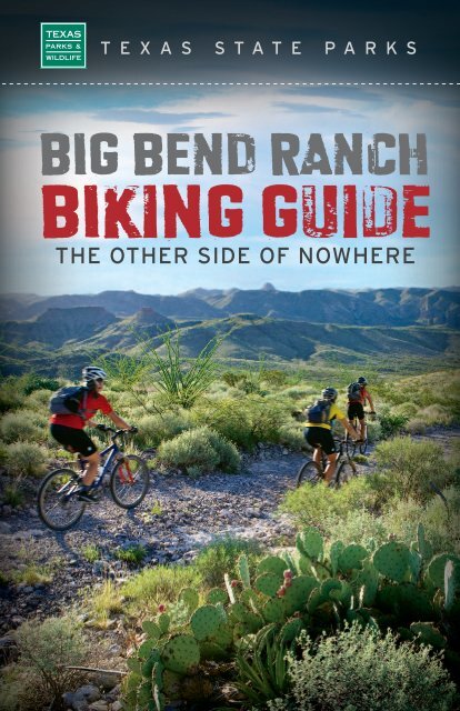
T E X A S S T A T E P A R K S BIG BEND RANCH BIking guide THE OTHER SIDE OF NOWHERE Earl Nottingham
- Page 2 and 3: A trek through the backcountry of B
- Page 4 and 5: introduction Whether you’re an ad
- Page 6 and 7: TRIP PLANNING Plan ahead of time: B
- Page 8 and 9: ide descriptions 1 Sauceda - Horset
- Page 10 and 11: 2 Sauceda - Tascate - Sauceda Loop
- Page 12 and 13: 3 Sauceda - Llano Loop - Sauceda Lo
- Page 14 and 15: 4 Sauceda - Chilicote Springs - Sau
- Page 16 and 17: 5 Sauceda - Encino Bike Trail - Sau
- Page 18 and 19: 6 Sauceda - La Posta - Fresno Canyo
- Page 20 and 21: 7 Sauceda - Arroyo Primero - Fresno
- Page 22 and 23: 8 Sauceda - Chorro Vista/Mexicano F
- Page 24 and 25: 9 Sauceda - La Mota Road - Sauceda
- Page 26 and 27: 10 Sauceda - Oso Loop - Sauceda Loo
- Page 28 and 29: 11 Sauceda - Yedra Trailhead - Sauc
- Page 30 and 31: 12 Sauceda - Rancherias - Sauceda L
- Page 32 and 33: 13 Sauceda - Las Burras Trailhead -
- Page 34 and 35: 14 Sauceda - Guale Mesa Trailhead -
- Page 36 and 37: 15 Agua Adentro Pens - Las Burras T
- Page 38 and 39: 16 Rancho Viejo Trailhead - Old Ent
- Page 40 and 41: 17 La Posta - Fresno Canyon Stage R
- Page 42 and 43: 18 Pila Montoya - Solitario Outer L
- Page 44 and 45: 19 Burnt Camp - Outer/Inner Solitar
- Page 46 and 47: 20 Tres Papalotes - Burnt Camp - So
- Page 48 and 49: 21 Tres Papalotes - Solitario “Ro
- Page 50 and 51: 22 Lajitas - Fresno Canyon - Rincon
T E X A S S T A T E P A R K S<br />
BIG BEND RANCH<br />
BIking guide<br />
THE OTHER SIDE OF NOWHERE<br />
Earl Nottingham
A trek through the backcountry<br />
of <strong>Big</strong> <strong>Bend</strong> <strong>Ranch</strong><br />
State Park is guaranteed to<br />
take you out of the ordinary<br />
and into “the Zone.”<br />
By Bundy Phillips, Dan Sholly,<br />
and Karen Hoffman Blizzard<br />
Maps by Chris Beckcom<br />
REVISED JANUARY 2011
CONTENTS<br />
2 Introduction<br />
3 How to Use this <strong>Guide</strong><br />
4 Trip Planning<br />
5 In Case of Emergency<br />
6 Ride Descriptions (LR = Loop Ride; T&B = There and Back)<br />
1. Sauceda – Horsetrap Trail LR (Easy/Moderate) 5.0 miles<br />
2. Sauceda – Tascate – Sauceda LR (Easy) 6.7 miles<br />
3. Sauceda – Llano Loop – Sauceda LR (Easy) 8.2 miles<br />
4. Sauceda – Chilicote Springs T&B (Easy/Moderate) 12.2 miles<br />
5. Sauceda – Encino Bike Trail – Sauceda LR (Moderate) 11.8 miles<br />
6. Sauceda – La Posta – Fresno Canyon Stage Road – Pila Montoya –<br />
North Encino Trail – Sauceda LR (Moderate/Difficult) 17.5 miles<br />
7. Sauceda – Arroyo Primero – Fresno Canyon – Sauceda LR (Difficult) 29.1 miles<br />
8. Sauceda – Chorro Vista/Mexicano Falls Trailhead – Sauceda T&B (Difficult) 22.4 miles<br />
9. Sauceda – La Mota Road – Sauceda T&B (Moderate) 14.8 miles<br />
10. Sauceda – Oso Loop – Sauceda LR (Moderate) 14.5 miles<br />
11. Sauceda – Yedra Trailhead – Sauceda T&B (Moderate) 13.6 miles<br />
12. Sauceda – <strong>Ranch</strong>erias – Sauceda LR (Difficult) 18.6 miles<br />
13. Sauceda – Las Burras Trailhead – Saudeda LR (Difficult) 25.6 miles<br />
14. Sauceda – Guale Mesa Trailhead – Sauceda T&B (Difficult) 22.4 miles<br />
15. Agua Adentro Pens – Las Burras Trailhead – Agua Adentro Pens T&B<br />
(Moderate/Difficult) 14.2 miles<br />
16. <strong>Ranch</strong>o Viejo Trailhead – Old Entrance Road – Agua Adentro –<br />
<strong>Ranch</strong>o Viejo Trailhead LR (Moderate/Difficult) 14.5 miles<br />
17. La Posta – Fresno Canyon Stage Road – Pila Montoya – La Posta LR<br />
(Moderate/Difficult) 9.9 miles<br />
18. Pila Montoya – Solitario Outer Loop – Pila Montoya LR (Difficult) 26.1 miles<br />
19. Burnt Camp – Outer/Inner Solitario Loop – Burnt Camp LR (Moderate/Difficult) 9.6 miles<br />
20. Tres Papalotes – Burnt Camp – Solitario Outer Loop – Tres Papalotes LR<br />
(Moderate/Difficult) 14.9 miles<br />
21. Tres Papalotes – Solitario “Road to Nowhere” – Tres Papalotes T&B (Moderate) 6.0 miles<br />
22. Lajitas – Fresno Canyon – Rincon Loop – Lajitas LR (Moderate) 30.4 miles<br />
23. Lajitas – Fresno Canyon – Sauceda – Lajitas EPIC RIDE (Difficult) 52-70 miles<br />
24. Lajitas – Fresno Canyon – Crawford-Smith House – Lajitas T&B (Moderate) 26.6 miles<br />
25. West Contrabando Trailhead – Dome Trail – West Contrabando Trailhead LR<br />
(Moderate) 11.0 miles<br />
26. East Contrabando Trailhead – Whit-Roy Mine – Dome Trail –<br />
West Contrabando Trailhead LR (Moderate) 22.6 miles<br />
27. East Contrabando Trailhead – Dome Trail – Contrabando Waterhole –<br />
East Contrabando Trailhead LR (Moderate) 17.8 miles<br />
28. “The Other Side of Nowhere” EPIC RIDE (Difficult) 107.0 miles
introduction<br />
Whether you’re an advanced<br />
biker or a physically fit novice,<br />
awesome backcountry adventures<br />
await you at <strong>Big</strong> <strong>Bend</strong><br />
<strong>Ranch</strong> State Park (BBRSP),<br />
<strong>Texas</strong>’ largest state park. From<br />
the dramatic mountain climbs<br />
and vistas of upper Fresno<br />
Canyon, to the swooping desert<br />
stretches of the Contrabando<br />
Loop Trail, to the rugged<br />
Solitario Outer and Inner Loop<br />
Trails, there is challenge, risk,<br />
and adventure for every level<br />
of biker.<br />
With over 300,000 acres and<br />
more than 200 miles of old jeep<br />
roads and trails, BBRSP offers a<br />
range of options, from short<br />
loop rides to multi-day, SAGsupported,<br />
camping rides and<br />
adventures. For multi-day trips,<br />
the remote and beautiful Fresno<br />
Canyon serves as a natural<br />
north-south corridor that<br />
enables bikers to connect with<br />
the park’s numerous loop trails.<br />
There are many options for side<br />
hikes and exploring throughout<br />
the park.<br />
It’s easy to plan multi-day trips<br />
because the park’s reservation<br />
system allows you to reserve<br />
specific campsites, lodging and<br />
meal service in advance. There<br />
are numerous backcountry<br />
campsites throughout the park,<br />
as well as lodging at the Sauceda<br />
Ranger Station (SRS).<br />
To add to the experience, the<br />
park is full of cultural reminders<br />
of the prehistoric people, Native<br />
Americans, Spanish explorers,<br />
ranchers and cinnabar miners<br />
who came before, including<br />
old mines, ranch-house ruins,<br />
ancient stone shelters, and more.<br />
The land here showcases 600<br />
million years of the Earth’s<br />
natural history. The park’s<br />
terrain was shaped by ancient<br />
seas, the shifting of tectonic<br />
plates and volcanic activity that<br />
left behind bizarre rock formations,<br />
caves, canyons, mountains,<br />
waterfalls, springs, arroyos, and<br />
a wide diversity of plant and<br />
animal life. The Solitario, a<br />
10-mile-diameter collapsed<br />
dome with a bike loop around<br />
the inside, is a signature feature<br />
of the park.<br />
Many ride possibilities exist in<br />
addition to those described in<br />
this booklet. Some rides can be<br />
combined or improvised upon; or<br />
combined with hikes and other<br />
side-trip adventures. Once you<br />
feel comfortable navigating your<br />
way around the park, feel free to<br />
create your own adventures!<br />
2<br />
Visit the <strong>Big</strong> <strong>Bend</strong> <strong>Ranch</strong> Web site for more information:<br />
www.tpwd.state.tx.us/bigbendranch, or email us at:<br />
ridebigbendranch@tpwd.state.tx.us
HOW TO USE THIS GUIDE<br />
This trail guide provides directional<br />
information for 28 specific<br />
rides. Interpretive information<br />
about the park’s natural and<br />
cultural treasures is described<br />
in separate publications, so be<br />
sure to ask for these at the<br />
visitor’s center. Taken together,<br />
these guides and materials are<br />
intended to help you fully<br />
experience the park.<br />
Because the trails at <strong>Big</strong> <strong>Bend</strong><br />
<strong>Ranch</strong> State Park are a “work in<br />
progress” and water sources<br />
are scarce, please pay careful<br />
attention to signage and think<br />
about where you are going at<br />
all times. In some areas signage<br />
may be incomplete, and rock<br />
cairns (stacked rocks) serve as<br />
the trail markers. A good sense<br />
of direction is helpful, as well as<br />
a bike odometer and GPS unit. A<br />
compass and map are essential.<br />
The mileages provided in this<br />
guide are approximate. Most<br />
of the trails and old roads are<br />
rugged and are not maintained<br />
to “city park” bike trail standards.<br />
Trail conditions can<br />
change due to weather or seasonal<br />
vegetation growth. Trails<br />
are not always perfectly<br />
cleared of rocks and cactus.<br />
Beware of white thorn! Check<br />
with park staff to determine the<br />
latest information about trail<br />
conditions.<br />
The guide provides “ride rating”<br />
and “ride time” information to<br />
help you gauge the length of your<br />
trip and how much water you<br />
may need. These ratings are<br />
subjective and will vary from<br />
person to person.<br />
Ride rating: Is determined based<br />
on how hard you will physically<br />
work on the ride, depending on<br />
your fitness level, length of ride,<br />
trail roughness and/or biking<br />
skills required. If you exercise<br />
rarely, you may find a ride rated<br />
“easy” to be “moderate.” Weather<br />
and temperature are also key<br />
factors; a ride that is “moderate”<br />
in difficulty in cool weather may<br />
be “difficult” in hot weather or<br />
heavy rain. While there are<br />
some very rough sections, there<br />
are no “technical” rated trail<br />
routes in BBRSP. However, beginner-level<br />
riders should stick<br />
to the routes rated “Easy” or<br />
“Easy/Moderate.”<br />
Ride time: Assumes a moderate<br />
level of physical fitness. Actual<br />
ride times will vary from person<br />
to person. These times do not<br />
include time spent changing<br />
tires, eating, resting, hiking<br />
or exploring.<br />
Please keep bikes on<br />
designated trails and roads.<br />
Remember that all natural,<br />
historical and cultural<br />
features are protected<br />
within the park.<br />
www.tpwd.state.tx.us/bigbendranch | 3
TRIP PLANNING<br />
Plan ahead of time: Because<br />
BBRSP is extremely remote and<br />
rugged, advance planning is<br />
crucial. Obtain maps and study<br />
them before going. If you are going<br />
on a multi-day trip, determine<br />
whether you need guide services<br />
and/or SAG support. Take containers<br />
large enough to carry 200-220<br />
ounces of water per day, depending<br />
on the ride and time of year. There<br />
are non-potable water sources<br />
on some of the rides, so consider<br />
bringing a small water purifier or<br />
purification tablets. Hard-soled<br />
shoes are recommended for<br />
walking in rocky arroyos and<br />
creekbeds. An odometer and a<br />
GPS unit are always helpful, and a<br />
MAP and COMPASS are a must.<br />
ALWAYS CARRY AT LEAST<br />
TWO SPARE TUBES!!<br />
Access: There are two access<br />
points: Sauceda Ranger Station, 30<br />
miles east of Presidio in the center<br />
of the park, and the East and West<br />
Contrabando trailheads on the<br />
southeast border of the park near<br />
Lajitas. Obtain a park permit from<br />
the Barton Warnock Visitor<br />
Center in Lajitas (432-424-3327);<br />
Fort Leaton State Historic Site in<br />
Presidio (432-229-3613); or Sauceda<br />
Ranger Station inside the park<br />
(432-358-4444). Office hours are<br />
8:00 a.m. – 4:30 p.m. every day.<br />
Maps and trail guides:<br />
Visit the TPWD Web site<br />
(www.tpwd.state.tx.us/bigbend<br />
ranch) before going. Maps are<br />
available at the park. Other online<br />
map sources include Google Earth,<br />
USGS (www.usgs.gov) and TNRIS<br />
maps (www.tnris.state.tx.us).<br />
Lodging: Park campsites are available<br />
by advance reservation; find<br />
descriptions, photos and GPS coordinates<br />
at www.tpwd.state.tx.us.<br />
The <strong>Big</strong> House and bunkhouse at<br />
Sauceda offer lodging and meals by<br />
advance reservation (432-358-4444).<br />
Outside the park, Lajitas Resort<br />
and Spa (www.lajitas.com) offers<br />
103 rooms, a restaurant, spa and<br />
pool. The nearby towns of Terlingua/<br />
Study Butte, Alpine, Presidio and<br />
Marfa have lodging and restaurants.<br />
Chinati Hot Springs (www.chinatihotsprings.com)<br />
offers cabins and<br />
spring-fed thermal pools.<br />
Commercial outfitters and bike<br />
rentals: Terlingua-based Desert<br />
Sports (888-989-6900 or www.<br />
desertsportstx.com) is the nearest<br />
outfitter and guide service, and<br />
offers bike rentals. Marfa-based<br />
Angell Expeditions (432-229-3713<br />
or www.angellexpeditions.com)<br />
also offers guide service and bike<br />
rentals. Quality, hardtail frontsuspension<br />
bikes are available for<br />
rent at Sauceda Ranger Station.<br />
Park and “special ride” information:<br />
For park information, visit www.tpwd.state.tx.us/bigbendranch. For bike<br />
trip planning assistance, e-mail ridebigbendranch@tpwd.state.tx.us.<br />
4
IN CASE OF EMERGENCY<br />
Cell phone and landline phone<br />
service is almost nonexistent in<br />
the park. In case of serious<br />
emergencies, riding or hiking out<br />
for help may be the only choice.<br />
For extra safety, carry a satellite<br />
phone or S.P.O.T. personal<br />
tracker.<br />
For park emergencies during<br />
business hours, call Sauceda<br />
Ranger Station at (432) 358-<br />
4444. For parks emergencies<br />
after business hours, call (432)<br />
229-4913 or (432) 358-4451<br />
and/or dial 911.<br />
911 is the emergency number<br />
where cell coverage is<br />
available.<br />
REMEMBER: Emergency<br />
response is usually hours away,<br />
if not a day or more. Be sure<br />
to carry sufficient water,<br />
food, spare tubes/tires, a<br />
map/compass, and a first-aid<br />
kit at all times.<br />
TPWD staff will do their best to<br />
assist park visitors, but if you<br />
drive a motorized vehicle in to a<br />
remote site to begin or assist<br />
your bike trip, it is possible that<br />
the services of a professional<br />
tow truck or mechanic may be<br />
required. The only local extraction<br />
and mechanic service is<br />
in Presidio:<br />
Rio Grande Wrecker Service:<br />
(432) 229-3312 (during business<br />
hours), or (432) 229-3740<br />
(after business hours).<br />
Weather in the park:<br />
Weather conditions in the park can be extreme. Check the<br />
weather forecast prior to your visit, and again once you reach<br />
the park. Temperatures vary from 100 degrees in early April<br />
through early October OR well below 32 degrees in winter.<br />
Many arroyos and other low-lying areas of the park are<br />
susceptible to flash-flooding, so seek higher ground in the<br />
event of heavy rains. Lightning storms can be severe.<br />
5
ide descriptions<br />
1<br />
Sauceda – Horsetrap Trail Loop Ride<br />
Distance:<br />
Ride time:<br />
Elevation:<br />
Ride rating:<br />
Route surface:<br />
Terrain:<br />
Access:<br />
5 miles round-trip<br />
1 hour (moderate pace)<br />
Sauceda - 4,160'; high point - 4,350'<br />
Easy/Moderate<br />
About half singletrack and half doubletrack<br />
Some rocky, loose conditions and a few short sandy areas;<br />
one hill, approximately one quarter-mile long<br />
Begin and end ride at Sauceda Ranger Station (SRS).<br />
Trail Notes<br />
This is a good beginner/intermediate ride. Beginners will need to ‘hike-a-bike’ up<br />
the hill in the singletrack section. There are some nice general all-around views<br />
along this route. Don’t preoccupy your mind with distant views for too long,<br />
because the lurking white thorn, cat claw and lechuguilla will reach out and<br />
get you. This route is described below for counter-clockwise travel, but can be<br />
traveled either direction. Clockwise allows for a gradual uphill for a longer<br />
distance, while counter-clockwise lets you get the up hill out of the way early,<br />
with easy riding after that.<br />
The Ride<br />
LOCATION<br />
miles from start<br />
DISTANCE<br />
NOTES<br />
6<br />
Sauceda (SRS)<br />
Horsetrap Trail –<br />
Presidio Road Jct.<br />
Top of the hill<br />
Horsetrap “mini-maze”<br />
Trail joins doubletrack<br />
road<br />
North singletrack Jct.<br />
Tascate Trail Jct.<br />
Horsetrap Springs<br />
Madrid Falls Road Jct.<br />
Sauceda (SRS)<br />
0<br />
0.3<br />
1.1<br />
2.3<br />
2.4<br />
3.0<br />
3.9<br />
4.3<br />
4.4<br />
5.0<br />
Head west on the Main Park Road.<br />
Turn left (south) from the Main Park Road onto the<br />
Horsetrap Trail (follow rock cairns). Shortly thereafter,<br />
you’ll begin to climb the hill.<br />
It’s easy going for the rest of the ride.<br />
The “mini-maze” provides access for bikers through<br />
a fence.<br />
Turn left (east) onto the doubletrack road.<br />
Turn left (north) onto the singletrack trail.<br />
Turn left (north) at this junction, where the Horsetrap<br />
Trail and the north end of the Tascate Trail meet.<br />
Cottonwood trees generally indicate springs and<br />
seasonal surface water.<br />
Turn left (north) onto Madrid Falls Road and head to<br />
Sauceda. There is a couple of hundred yards of<br />
traveling though some sand on this section.<br />
You’re back at Sauceda Ranger Station.
www.tpwd.state.tx.us/bigbendranch | 7
2<br />
Sauceda – Tascate – Sauceda Loop Ride<br />
Distance:<br />
Ride time:<br />
Elevation:<br />
Ride rating:<br />
Route surface:<br />
Terrain:<br />
Access:<br />
6.7 miles round-trip<br />
About 2 hours (moderate pace)<br />
Sauceda – 4,160'; high point – 4,355'<br />
Easy<br />
Doubletrack & non-motorized doubletrack/jeep road; dirt road<br />
Mostly flat with slight inclines, some sandy areas<br />
Begin and end ride at Sauceda Ranger Station (SRS).<br />
Trail Notes<br />
This is an excellent beginner ride for someone who is in reasonably good<br />
condition and who is developing mountain-biking skills. Riding is pleasant<br />
and relatively easy, with a few sandy areas to travel through. There are no<br />
steep hills or serious rocky or rough spots. There are some nice rock outcrops<br />
and small arroyos along the route to explore by hiking.<br />
The Ride<br />
LOCATION<br />
miles from start<br />
DISTANCE<br />
NOTES<br />
Sauceda (SRS)<br />
Madrid Falls/West Llano<br />
Road Jct.<br />
Llano Loop Jct.<br />
Papalote Llano<br />
campsite Jct.<br />
Tascate campsite road<br />
Tascate #2 campsite<br />
Tascate Trail Jct.<br />
Horsetrap Bike Trail Jct.<br />
Madrid Falls Road Jct.<br />
Sauceda (SRS)<br />
0<br />
0.1<br />
1.0<br />
2.8<br />
2.9<br />
3.4<br />
3.5<br />
5.6<br />
6.1<br />
6.7<br />
Travel west on the Main Park Road.<br />
Turn left (south) onto Madrid Falls Road.<br />
Keep straight (south).<br />
Pass the campsite junction.<br />
Turn right (west) onto the Tascate campsite road.<br />
Pass by this campsite on the left (south) side of<br />
the road<br />
Just past the Tascate #2 campsite, turn right (northward)<br />
onto the doubletrack/trail, which is closed to<br />
motor vehicles. (If you continued west on the welltraveled<br />
road, you would come to Tascate #1 campsite.)<br />
Continue northward past the junction where Tascate<br />
Trail joins Horsetrap Trail.<br />
Turn left (north) onto Madrid Falls Road to return<br />
to Sauceda<br />
You’re back where you started.<br />
8
www.tpwd.state.tx.us/bigbendranch | 9
3<br />
Sauceda – Llano Loop – Sauceda Loop Ride<br />
Distance:<br />
Ride time:<br />
Elevation:<br />
Ride rating:<br />
Route surface:<br />
Terrain:<br />
Access:<br />
8.0 miles round-trip<br />
2.5 hours (moderate pace)<br />
Sauceda – 4,160'; high point – 4,308'<br />
Easy<br />
2WD doubletrack/jeep road; dirt/gravel road<br />
Relatively flat; some sand and loose rock<br />
Begin and end ride at Sauceda Ranger Station (SRS).<br />
Trail Notes<br />
This is a good beginner, training, and/or orientation ride. There are also other<br />
bike rides that branch off of this route.<br />
The Ride<br />
LOCATION<br />
miles from start<br />
DISTANCE<br />
NOTES<br />
Sauceda (SRS)<br />
Madrid Falls Road/<br />
West Llano Loop Jct.<br />
Madrid Falls/<br />
Llano Loop Jct.<br />
Chilicote Jct.<br />
Main Park Road/<br />
East Llano Loop Jct.<br />
Main Park Road/<br />
La Mota Road Jct.<br />
Sauceda Airstrip<br />
Sauceda (SRS)<br />
0<br />
0.1<br />
1<br />
3.7<br />
5.5<br />
6.5<br />
7.1<br />
8.0<br />
Travel west a short distance on the Main Park Road.<br />
Turn left (south) here. There will be a couple of hundred<br />
yards of sandy surface to begin with.<br />
Turn left (northeast) to continue on the Llano Loop.<br />
Stay left (east) on the main doubletrack. You’ll pass the<br />
turnoff to Chilicote Springs on the right (south).<br />
Curve to the left (west) to get on the Main Park Road.<br />
Continue west past La Mota Road.<br />
You’ll pass the Sauceda International Airstrip on<br />
your left.<br />
Congratulations! You made it back.<br />
10
www.tpwd.state.tx.us/bigbendranch | 11
4<br />
Sauceda – Chilicote Springs –<br />
Sauceda Loop Ride<br />
Distance:<br />
Ride time:<br />
Elevation:<br />
Ride rating:<br />
Route surface:<br />
Terrain:<br />
Access:<br />
12.0 miles round-trip<br />
3.5 hours (moderate pace)<br />
Sauceda – 4,160'; high point – 4,318'; low point – 4,130'<br />
Easy/Moderate<br />
Doubletrack/jeep road; dirt/gravel road<br />
Short rolling hills; some short sandy areas<br />
Begin and end ride at Sauceda Ranger Station (SRS) or<br />
Chilicote junction. This route description is from SRS.<br />
Trail Notes<br />
This is a great and relatively easy ride for getting into some wild and exciting<br />
BBRSP backcountry. The bike travel ends at Chilicote Springs, which is located<br />
about 2 miles down (south) the doubletrack road that leads southward from<br />
Chilicote junction. The country around Chilicote Springs is awesomely rugged<br />
and beautiful, begging for hiking and exploring.<br />
The Ride<br />
LOCATION<br />
miles from start<br />
DISTANCE<br />
NOTES<br />
Sauceda (SRS)<br />
Madrid Falls Road/<br />
West Llano Loop Jct.<br />
Madrid Falls Road/<br />
Llano Loop Jct.<br />
Chilicote Jct.<br />
Puerta Chilicote TH<br />
End of road<br />
Chilicote Jct.<br />
Main Sauceda Road/<br />
East Llano Loop Jct.<br />
Main Park Road/<br />
La Mota Road Jct.<br />
0<br />
0.1<br />
1.0<br />
3.7<br />
5.1<br />
5.8<br />
7.9<br />
9.7<br />
10.7<br />
Travel west on the Main Park Road a short distance.<br />
Turn left (south) here. There will be a couple of hundred<br />
yards of sandy surface to begin with.<br />
Turn left (east) to continue on the Llano Loop to<br />
Chilicote junction<br />
Turn right (south) though the gate. Continue south<br />
1.4 miles on the doubletrack trail until you get to<br />
Puerta Chilicote Trailhead (TH).<br />
There are many hiking and exploring opportunities in<br />
any direction from the TH. Motorized vehicle access<br />
ends at the TH. Bikes can continue to the end of the road.<br />
The road ends 0.7 miles beyond the TH. Hike east for<br />
2.5 miles to enjoy a 700-foot vertical view into Fresno<br />
Canyon. When you’ve had your fill of the scenery,<br />
return the way you came.<br />
Turn right or left to Sauceda. The route described is to<br />
the right (east).<br />
Stay to the left (west) to get on the Main Park Road to<br />
Sauceda.<br />
Continue past La Mota Road.<br />
Sauceda (SRS)<br />
12.2<br />
Congratulations! You made it back.<br />
12
www.tpwd.state.tx.us/bigbendranch | 13
5<br />
Sauceda – Encino Bike Trail –<br />
Sauceda Loop Ride<br />
Distance:<br />
Ride time:<br />
Elevation:<br />
Ride rating:<br />
Route surface:<br />
Terrain:<br />
Access:<br />
11.8 miles round-trip<br />
3 hours (moderate pace)<br />
Sauceda – 4,160'; high point – 4,432'<br />
Moderate<br />
Doubletrack/jeep road; singletrack; dirt/gravel road<br />
Some rocky, loose conditions; some short sand sections<br />
Begin and end ride at Sauceda Ranger Station (SRS).<br />
Trail Notes<br />
This area of the park is generally more flat, with some nice distant views.<br />
Approximately half of the ride follows the Los Alamos power line feeder route.<br />
Ridden as described (counter-clockwise) the ascent is a bit more gradual, but is<br />
still over up-and-down small drainages. Once you arrive at the Papalote Encino<br />
campsite, the trail turns into an excellent singletrack for 3 miles as you head<br />
back to Sauceda.<br />
The Ride<br />
LOCATION<br />
miles from start<br />
DISTANCE<br />
NOTES<br />
Sauceda (SRS)<br />
Cattleguard/La Mota<br />
Road Jct.<br />
Encino Bike Trail Jct.<br />
Encino Bike Trail<br />
(bends northeast here)<br />
Main Park Road<br />
Papalote Encino<br />
campsite turnoff<br />
Papalote Encino<br />
campsite<br />
La Mota Road<br />
Encino Bike Trail cutoff<br />
Main Park Road<br />
Sauceda (SRS)<br />
0<br />
1.5<br />
2.3<br />
2.9<br />
5<br />
6.1<br />
6.4<br />
9.3<br />
9.5<br />
10.3<br />
11.8<br />
Travel east on the Main Park Road.<br />
Turn left (north) at this junction onto La Mota Road.<br />
You are under the power line; turn right (south) here, or<br />
continue 1/4 mile to other end of Encino Bike Trail. This<br />
description is written for turning right (south) here. The<br />
trail is non-motorized at this point.<br />
The power line splits here, and you will follow the<br />
eastern feeder.<br />
Please obey the traffic signal ☺. Turn left (northeast) to<br />
continue on Encino Bike Trail (coincides with the Main<br />
Park Road for 1.1 miles).<br />
Turn left (west) to continue on Encino Bike Trail.<br />
Continue past the campsite on the Encino Bike Trail.<br />
Great singletrack!<br />
For the direction-challenged, turn left here.<br />
(A right turn will take you farther out La Mota.)<br />
Continue past the cutoff where you turned earlier.<br />
Turn right to return to Sauceda.<br />
You’re back where you started.<br />
14
www.tpwd.state.tx.us/bigbendranch | 15
6<br />
Sauceda – La Posta – Fresno Canyon<br />
Stage Road – Pila Montoya –<br />
North Encino Trail – Sauceda Loop Ride<br />
Distance:<br />
Ride time:<br />
Elevation:<br />
Ride rating:<br />
Route surface:<br />
Terrain:<br />
Access:<br />
17.4 miles round-trip<br />
4.5 hours (moderate pace)<br />
Sauceda – 4,160'; high point – 4,520'; low point – 3,898'<br />
Moderate/Difficult<br />
Doubletrack/jeep road; dirt/gravel road/singletrack<br />
Some rocky, loose conditions; some sand and washboard<br />
sections; Rolling hills with some steep sections<br />
Begin and end ride at Sauceda Ranger Station (SRS).<br />
This trail description is for a counter-clockwise loop ride,<br />
but it could also be ridden clockwise.<br />
Trail Notes<br />
This loop ride is great for intermediate-level riders seeking varied terrain. It<br />
ranges from easy riding on the Main Park Road portions to steep, rocky ascents<br />
and descents on Fresno Hill and below Pila Montoya, as well as a singletrack<br />
section of the non-motorized Encino Bike Trail. The ride covers a short leg of<br />
the historic Old Stage Road, once used for stage and freight wagons traveling<br />
between Marfa and Terlingua. Whether you do the ride clockwise or counterclockwise,<br />
there is a steep uphill and downhill descent in the Fresno Canyon/<br />
Pila Montoya area of the ride.<br />
The Ride<br />
LOCATION<br />
miles from start<br />
DISTANCE<br />
NOTES<br />
Sauceda (SRS)<br />
Cattleguard/<br />
La Mota Jct.<br />
East Llano Loop Jct.<br />
Fresno Canyon Rd. Jct.<br />
La Posta TH &<br />
Fresno Hill<br />
Old Stage Rd. &<br />
Pila Montoya Jct.<br />
Pila Montoya 3<br />
Pila Montoya/<br />
Main Park Road Jct.<br />
0<br />
1.5<br />
2.6<br />
3.8<br />
4.4<br />
6.8<br />
8.7<br />
10.1<br />
Head east on the Main Park Road.<br />
Continue east on the Main Park Road.<br />
Continue on Main Park Road.<br />
Turn right (east) toward Fresno Canyon.<br />
Just past La Posta TH, begin the steep descent to<br />
Fresno Canyon.<br />
Turn left (north) onto the old stage road to Pila<br />
Montoya. The last 1/4 mile of this section is steep<br />
and rough.<br />
Travel past the campsite.<br />
Turn left (west) onto the Main Park Road.<br />
16
LOCATION<br />
miles from start<br />
DISTANCE<br />
NOTES<br />
Papalote Encino<br />
campsite/trail Jct.<br />
La Mota Jct.<br />
Main Park Road/<br />
La Mota Road/Jct.<br />
Sauceda (SRS)<br />
12.4<br />
15.3<br />
16.3<br />
17.7<br />
Turn right (west) and travel past Papalote Encino campsite<br />
to ride the northwest stretch of the Encino Bike<br />
Trail; or stay left on the Main Park Road to Sauceda.<br />
If on Encino Road, turn left onto La Mota Road.<br />
If coming from the Encinco Bike Trail, turn right (west)<br />
onto the Main Park Road to return to Sauceda. If<br />
already on the Main Park Road, keep going.<br />
You are back.<br />
www.tpwd.state.tx.us/bigbendranch | 17
7<br />
Sauceda – Arroyo Primero –<br />
Fresno Canyon – Sauceda Loop Ride<br />
Distance:<br />
Ride time:<br />
Elevation:<br />
Ride rating:<br />
Route surface:<br />
Terrain:<br />
Access:<br />
29.1 miles round-trip<br />
8.5 hours (moderate pace)<br />
Sauceda – 4,160'; Madrid Hill summit – 4,350';<br />
Fresno Canyon bottom – 3,106'<br />
Difficult<br />
Doubletrack/jeep road; dirt/gravel road<br />
Some steep hills and rocky conditions; great views;<br />
some sandy stretches and “hike-a-bike” sections<br />
Begin and end ride at Sauceda Ranger Station (SRS).<br />
Trail Notes<br />
This epic ride has it all—rugged terrain, solitude, historical sites, and great views.<br />
The ride is relatively easy for the first 5 or so miles along Madrid Falls Road.<br />
A steep climb up Madrid Hill (Cuesta de los Mexicanos) is followed by a long<br />
downhill stretch. Then you move into the upper reaches of Arroyo Primero, a nonmotorized-vehicle<br />
section that goes all the way down into Fresno Canyon. The ride<br />
continues north through upper Fresno Canyon along the 1890s-era stage/freight<br />
road. A climb takes you up Fresno Hill (Cuesta de la Avispa), and then it’s an easy<br />
5 miles back to Sauceda.<br />
The Ride<br />
LOCATION<br />
miles from start<br />
DISTANCE<br />
NOTES<br />
Sauceda (SRS)<br />
Javelin Pens Jct.<br />
Madrid Hill<br />
Pila de los<br />
Muchachos Jct.<br />
Madrid House<br />
Madrid/Fresno Canyon<br />
Road Jct.<br />
Fresno Creek Cascades<br />
Crawford-Smith House<br />
0<br />
4.8<br />
5.4<br />
8.2<br />
13.2<br />
14.5<br />
14.6<br />
16.1<br />
Travel south on Madrid Falls Road.<br />
Turn left (east) at the Jct.<br />
The first of several steep climbs, with great views.<br />
Turn right (south), go past the La Monilla campsite (0.1<br />
miles) and up the hill to Pila de los Muchachos pass,<br />
then down the steep hill, continuing to Arroyo Primero.<br />
Stop to visit this historical adobe house with a nearby<br />
spring (some seasonal restrictions may apply).<br />
Turn left (north) to travel up Fresno Canyon.<br />
Hike 0.1 miles to the right (east) to the cottonwood<br />
trees and creek to explore the cascades, rock shelter,<br />
and bedrock mortars.<br />
View the historical ranch-house ruins. Then continue<br />
across Fresno Creek and north on the Old Stage Road.<br />
There is usually water in Fresno Creek west of the<br />
house. Treat before drinking.<br />
18
LOCATION<br />
miles from start<br />
DISTANCE<br />
NOTES<br />
Upper Fresno Canyon<br />
“Manos Arriba”<br />
Pila Montoya Jct.<br />
Fresno Hill<br />
Main Park Road<br />
Sauceda (SRS)<br />
17.9<br />
20.7<br />
22.4<br />
23.1<br />
25.6<br />
29.1<br />
From here on, the trail crosses Fresno Creek numerous<br />
times and stays in the creek bed on occasion. Follow<br />
rock cairns (stacked rocks) and signs closely.<br />
View the rock art site in the small cave to the right.<br />
Continue left (west) past the Jct.<br />
Begin the steep climb up Fresno Hill.<br />
At the “Y” in the road, stay left (west).<br />
Congratulations!! You just survived one of the great<br />
epic one-day rides on the planet.<br />
www.tpwd.state.tx.us/bigbendranch | 19
8<br />
Sauceda – Chorro Vista/Mexicano<br />
Falls Trailhead – Sauceda “There<br />
and Back” Ride<br />
Distance:<br />
Ride time:<br />
Elevation:<br />
Ride rating:<br />
Route surface:<br />
Terrain:<br />
Access:<br />
22.4 miles round-trip<br />
4 to 5 hours (moderate pace)<br />
Sauceda – 4,160'; Madrid Hill – 4,464'; Chorro Vista – 4,030'<br />
Difficult<br />
Doubletrack/jeep road; dirt/gravel road<br />
Some steep hills and rocky conditions; great views;<br />
and a few short, sandy stretches<br />
Begin and end ride at Sauceda Ranger Station (SRS).<br />
Trail Notes<br />
This is a fun ride, with rugged terrain, solitude, wildlife, and great views. The<br />
riding is relatively easy for the first 5 or so miles from SRS along Madrid Falls<br />
Road. A steep climb up Madrid Hill (Cuesta de los Mexicanos) is followed by a<br />
longer downhill stretch, with great views into the Sierra Madre range in<br />
Mexico. For the rest of the ride, conditions vary from nice to rocky, but<br />
overall not too bad.<br />
The Ride<br />
LOCATION<br />
miles from start<br />
DISTANCE<br />
NOTES<br />
Sauceda (SRS)<br />
Madrid Falls Road Jct.<br />
Llano Loop Jct.<br />
Javelin Pens Jct.<br />
Madrid Hill<br />
Pila de los Muchachos<br />
Jct.<br />
Chorro Vista/Mexicano<br />
Falls Trailhead Jct.<br />
Mexicano Falls<br />
Overlook/Fresno<br />
Canyon Scenic Overlook<br />
Sauceda (SRS)<br />
0<br />
0.1<br />
1.0<br />
4.8<br />
5.4<br />
8.2<br />
9.6<br />
11.2<br />
22.4<br />
Travel west on the Main Park Road.<br />
Take the left (southwest) fork onto Madrid Falls Road,<br />
past the corrals.<br />
Continue straight (south) on the Madrid Falls Road.<br />
Turn left (east) on Madrid Falls Road.<br />
This is the steepest climb on the route, with great views<br />
along the way; descent begins at 5.9 miles.<br />
Continue straight (east) on the Main Park Road.<br />
Turn left (north) at the ‘T’ to go to Mexicano Falls<br />
Trailhead; OR turn right (south) and go 0.5 miles to<br />
Chorro Vista TH. From here, hike 0.5 miles south to<br />
Madrid Falls overlook.<br />
Once at Mexicano Falls Trailhead (approx. 0.5 mile),<br />
continue straight and then left another 0.5 mile to<br />
Mexicano Falls Overlook; OR, go straight .3 mile to a<br />
scenic overlook over Fresno Canyon.<br />
Reverse route to return to Sauceda.<br />
20
www.tpwd.state.tx.us/bigbendranch | 21
9<br />
Sauceda – La Mota Road –<br />
Sauceda “There and Back” Ride<br />
Distance:<br />
Ride time:<br />
Elevation:<br />
Ride rating:<br />
Route surface:<br />
Terrain:<br />
Access:<br />
14.8 miles there and back<br />
About 3.5 hours round-trip (moderate pace)<br />
Sauceda – 4,160'; high point on ride – 4,270'<br />
Moderate<br />
Doubletrack/jeep road; dirt and gravel with some sandy areas<br />
Rolling hills; nothing too steep<br />
Begin and end ride at Sauceda Ranger Station (SRS).<br />
Trail Notes<br />
This is a pretty straightforward ride into the northern section of the park. You<br />
will enjoy many scenic views along the way. This road also provides access for<br />
climbing La Mota Mountain (5,044 feet). This route travels over some loose rock<br />
and a little sand (one sand trap), but much of the riding surface is quite good.<br />
There is a dry-evaporative toilet (Eloo) and, usually, water at Escondido Pens<br />
campsite. Treat water prior to drinking.<br />
The Ride<br />
LOCATION<br />
miles from start<br />
DISTANCE<br />
NOTES<br />
Sauceda (SRS)<br />
Cattleguard/<br />
La Mota Road Jct.<br />
Escondido Pens/<br />
Eloo toilet<br />
Cairned cow trail/old<br />
sheep-rancher rock<br />
shelters<br />
La Mota Mountain<br />
climb<br />
Park boundary with<br />
La Mota <strong>Ranch</strong><br />
Sauceda (SRS)<br />
0<br />
1.5<br />
3.3<br />
4.7<br />
7<br />
7.4<br />
14.8<br />
Travel east on the Main Park Road.<br />
Turn left (north) onto La Mota Road. This road is rated<br />
2WD HC (two-wheel drive, high-clearance).<br />
Water faucet is on east side of small pens (nonpotable).<br />
This water is pipe-fed from a spring farther<br />
up the drainage.<br />
La Mota 1 campsite is just to east over the near rocks.<br />
The cairned cow trail leads down to some beautiful<br />
rocks.<br />
At the top of the hill in the pass, you can park to climb<br />
La Mota Mountain – up broken rocks along east broad<br />
shoulder (approx. 1 hour).<br />
“No Trespassing” to the north. (Private ranch.)<br />
Reverse route to Sauceda.<br />
22
www.tpwd.state.tx.us/bigbendranch | 23
10<br />
Sauceda – Oso Loop – Sauceda Loop Ride<br />
Distance:<br />
Ride time:<br />
Elevation:<br />
Ride rating:<br />
Route surface:<br />
Terrain:<br />
Access:<br />
14.5 miles round-trip<br />
4 hours (moderate pace)<br />
Sauceda – 4,160'; high point – 4,500'; low point – 4,084'<br />
Moderate<br />
Dirt/gravel road; doubletrack/jeep road<br />
Some rocky, loose conditions ; short, steep hills; great views<br />
Begin and end ride at Sauceda Ranger Station (SRS). This<br />
write-up describes the Oso Loop ride in a counter-clockwise<br />
direction.<br />
Trail Notes<br />
Regardless of whether you do the ride clockwise or counter-clockwise, there will<br />
be some short, steep hills either way. The road travels along the north side of Oso<br />
Peak, the highest point in the park at 5,135 feet. There are several stock watering<br />
troughs along this route that generally have water. None of the water is potable,<br />
so make sure you treat or filter before drinking. It’s great for soaking your head<br />
or splashing off your face to cool off. There are great views all along the way.<br />
If you choose, you could shorten the ride by driving out and parking at Agua<br />
Adentro Pens or East Oso turnoff. This would save 4.6 miles.<br />
SIDE HIKE: If time allows, you can hike up the northeast side of Oso Peak by<br />
leaving your bike just south of the Guale/Oso junction and hiking straight up the<br />
mountainside. The hike is brushy and rocky, but not technical, and has great views.<br />
The Ride<br />
LOCATION<br />
miles from start<br />
DISTANCE<br />
NOTES<br />
Sauceda (SRS)<br />
Cinco Tinajas Trailhead<br />
East Oso Loop/<br />
Guale Mesa Jct.<br />
Agua Adentro<br />
cattle pens<br />
Oso Loop/Las Burras<br />
Road Jct.<br />
Oso Loop/<br />
Guale Road Jct.<br />
East Oso Loop/Main<br />
Park Road Jct.<br />
Sauceda (SRS)<br />
0<br />
1.3<br />
2.3<br />
6.3<br />
7.9<br />
10.1<br />
12.2<br />
14.5<br />
Travel west on the Main Park Road.<br />
Continue past the trailhead and stay on the Main<br />
Park Road.<br />
Continue west on the Main Park Road. Your return trip<br />
will bring you out to this junction.<br />
Turn left (south) here, off the Main Park Road, to begin<br />
the Oso Loop. There is an Eloo (toilet) here.<br />
At the junction take the left (east) road.<br />
Turn left (north) at this junction onto the eastern<br />
stretch of Oso Loop/Guale Mesa Road.<br />
Turn right (east) to return to Sauceda.<br />
Congratulations; you made it back!<br />
24
www.tpwd.state.tx.us/bigbendranch | 25
11<br />
Sauceda – Yedra Trailhead –<br />
Sauceda “There and Back” Ride<br />
Distance: 13.6 miles round-trip (or 4.2 miles if shortened; see below)<br />
Ride time: About 4 hours (moderate pace)<br />
Elevation: Sauceda – 4,160'; high point – 4,250'<br />
Ride rating: Moderate<br />
Route surface: Doubletrack/jeep road; dirt/gravel road<br />
Terrain: Some steep hills and loose, rocky conditions beyond Yedra 1<br />
campsite; stretches of advanced riding<br />
Access: Begin and end ride at Sauceda Ranger Station (SRS).<br />
Trail Notes<br />
This ride could be shortened by about 9 miles by driving to Yedra turnoff and<br />
riding from near there. It is 2.1 miles to Yedra Trailhead (YTH) from the<br />
junction with the Main Park Road. At Yedra Trailhead there are numerous<br />
hiking options. Near the YTH, just down the ‘troad’ to the arroyo (Cañon de la<br />
Cueva Larga), the drainage, and the trail that heads west up a short drainage<br />
toward Papalote Alto, there’s a beautiful narrow canyon section on that drainage.<br />
Cueva Larga is visible from YTH and is a short hike down canyon. It is possible<br />
to bike (or better yet, hike) down Yedra Canyon on the official trail, but the wash<br />
is very sandy, so it could turn into a bike push rather than a bike ride. The word<br />
“yedra” is Spanish for “ivy,” likely poison ivy that is found growing in much of the<br />
riparian areas below YTH.<br />
The Ride<br />
LOCATION<br />
miles from start<br />
DISTANCE<br />
NOTES<br />
Sauceda (SRS)<br />
Yedra Road/Main Park<br />
Road Jct.<br />
Mileage below starts<br />
at Yedra turnoff.<br />
Arroyo crossing<br />
Yedra 1 primitive<br />
campsite<br />
Yedra 2 campsite<br />
Yedra Trailhead<br />
0<br />
4.7<br />
.4 or 5.1<br />
1.1 or 5.8<br />
1.7 or 6.4<br />
2.1 or 6.8<br />
Travel west on Main Park Road.<br />
Turn right (north) onto Yedra Road at the cattle guard.<br />
Add 4.7 miles to mileage below if biking from SRS.<br />
Visible just down this wash is Papalotito Colorado, the<br />
only old wooden papalote (windmill) still in operation at<br />
BBRSP.<br />
Below this site the road gets considerably rougher.<br />
Walk if you have to; it is worth it.<br />
Nice campsite tucked in among boulders.<br />
The large mountain that you have been heading toward<br />
and is now in front of you is Pico de la Cueva Larga.<br />
There are some excellent hikes from this trailhead.<br />
Reverse route to return to Sauceda.<br />
26
LOCATION<br />
BBRSP Road/Yedra Jct.<br />
Sauceda (SRS)<br />
miles from start<br />
DISTANCE<br />
4.2 or 8.9<br />
13.6<br />
NOTES<br />
Turn left (east) to return to Sauceda.<br />
You are back where you started.<br />
www.tpwd.state.tx.us/bigbendranch | 27
12<br />
Sauceda – <strong>Ranch</strong>erias – Sauceda Loop Ride<br />
Distance:<br />
Ride time:<br />
Elevation:<br />
Ride rating:<br />
Route surface:<br />
Terrain:<br />
Access:<br />
19.0 miles round-trip<br />
About 5 hours (moderate pace)<br />
Sauceda – 4,160'; high point – 4,550' (east of Oso Peak);<br />
low point – 3,984' (<strong>Ranch</strong>erias arroyo)<br />
Difficult<br />
Doubletrack/jeep road; dirt/gravel road<br />
Some rough, rocky conditions; hilly; numerous short hills<br />
Begin and end ride at Sauceda Ranger Station (SRS).<br />
Trail Notes<br />
This is a remote and rugged ride, providing the rider with some spectacular<br />
vistas in the deep backcountry of BBRSP. While approximately half of this ride<br />
is considered difficult, almost half of it is more moderate. Although the route is<br />
open to 4WD motor vehicles, it is unlikely that you will see many, if any, vehicles.<br />
There are some interesting hikes along this route. And aside from a steep,<br />
brushy hike, a climb of Oso Peak—the highest peak on BBRSP—is not technical<br />
and provides a spectacular vista of BBRSP and other areas of the <strong>Big</strong> <strong>Bend</strong>.<br />
The Ride<br />
LOCATION<br />
miles from start<br />
DISTANCE<br />
NOTES<br />
Sauceda (SRS)<br />
Guale/East Oso<br />
Loop Jct.<br />
Old Road Jct.<br />
Oso Loop Jct.<br />
Upper Los Cuates<br />
Campsite Jct.<br />
Lower Los Cuates<br />
Campsite Jct.<br />
Guale Mesa /<strong>Ranch</strong>erias<br />
Road Jct.<br />
<strong>Ranch</strong>erias Trail Jct.<br />
Old Road Jct.<br />
<strong>Ranch</strong>erias Trail Jct.<br />
Monilla Trail Jct.<br />
Javelin Pens<br />
0<br />
2.4<br />
4.0<br />
4.4<br />
5.7<br />
6.1<br />
6.2<br />
9.0<br />
11.0<br />
13.4<br />
13.5<br />
14.3<br />
Travel west on the Main Park Road.<br />
Turn left here and head south; it’s doubletrack for the<br />
rest of the trip.<br />
Continue straight (south).<br />
Take a left (south) turn. There should be water in the<br />
pila to the right at the top of the hill. Treat before<br />
drinking.<br />
Continue south.<br />
Continue south.<br />
Turn left (east) on to the “unmaintained” road.<br />
Stay on the doubletrack road, which travels left<br />
(eastward).<br />
Continue right (east) up the hill.<br />
Stay on the main doubletrack and head northeasterly.<br />
Take left (north) fork to Javelin Pens.<br />
Continue north – water may be available at well shack.<br />
28
LOCATION<br />
miles from start<br />
DISTANCE<br />
NOTES<br />
Madrid Falls Road Jct.<br />
Llano Loop Jct.<br />
Sauceda (SRS)<br />
14.9<br />
17.7<br />
18.6<br />
Turn left (north) at the “Y.”<br />
(A right turn would take you toward Madrid Falls.)<br />
Continue north on the main doubletrack.<br />
Congratulations; you made it back!<br />
www.tpwd.state.tx.us/bigbendranch | 29
13<br />
Sauceda – Las Burras Trailhead –<br />
Sauceda Loop Ride<br />
Distance:<br />
Ride time:<br />
Elevation:<br />
Ride rating:<br />
Route surface:<br />
Terrain:<br />
Access:<br />
25.6 miles round-trip<br />
About 6 hours (moderate pace)<br />
Sauceda – 4,160'; high point – 4,500';<br />
low point – 3,924' (Las Burras Trailhead)<br />
Difficult<br />
Doubletrack/jeep road; dirt/gravel road<br />
Some very rough rocky sections; some rolling and short,<br />
steep hills<br />
Begin and end ride at Sauceda Ranger Station (SRS).<br />
Trail Notes<br />
This is a very rugged and challenging ride through some remote and beautiful volcanic<br />
mountains in the western part of the park. The ancient volcanoes have left<br />
dikes, volcanic sills, and great places to explore, hike, and/or photograph. The last<br />
five miles is “out and back,” though the views are different going each way. The<br />
trip can be shortened by driving out and beginning and ending at Agua Adentro<br />
Pens, making it 12.6 miles shorter (see description of this ride). The Las Burras<br />
route is a mix of nice riding, to stretches of very rough and rocky endurance<br />
riding. At the end of the road you’ll find Las Burras Trailhead, which is the beginning<br />
of very rough, rocky and unmarked cross-country hiking opportunities.<br />
The Ride<br />
LOCATION<br />
miles from start<br />
DISTANCE<br />
NOTES<br />
Sauceda (SRS)<br />
East Oso Loop Jct.<br />
Agua Adentro/<br />
West Oso Loop Jct.<br />
Round water trough<br />
Oso Loop/Las Burras<br />
road Jct.<br />
Nopalera Trailhead<br />
(NTH)/Las Burras Jct.<br />
Cottonwoods and dam<br />
Las Burras 1 campsite<br />
Cut-Over to Oso Canyon<br />
Las Burras 3 campsite<br />
0<br />
2.3<br />
6.3<br />
7.8<br />
7.9<br />
8.4<br />
8.7<br />
10.2<br />
10.5<br />
11.9<br />
Travel west on the Main Park Road.<br />
Stay on the Main Park Road (west).<br />
Turn left (south) here, off the Main Park Road. There is<br />
an Eloo (toilet) here.<br />
There is good water here, especially during hot times of<br />
year (filter/treat).<br />
Lean right (south) here and continue the adventure.<br />
Pass NTH off to immediate right.<br />
This location is off to the east and could be a nice little<br />
side hike/exploration.<br />
Continue past this nice campsite with great rocks.<br />
On the Las Burras road, where the road “dog-legs” to a<br />
westerly direction, a rugged (but non-technical) hiking route<br />
begins down into the beautiful middle/upper Oso Canyon.<br />
Pass this nice campsite with great views down to Rio<br />
Grande/Presidio valley.<br />
30
LOCATION<br />
miles from start<br />
DISTANCE<br />
NOTES<br />
Wash<br />
Las Burras Trailhead<br />
(LBTH)<br />
Oso Loop/Las Burras<br />
Road Jct.<br />
Guale Mesa Road/<br />
Oso Loop Jct.<br />
East Oso Loop/Main<br />
Park Road Jct.<br />
Sauceda (SRS)<br />
12.7<br />
13.4<br />
18.9<br />
21.1<br />
23.3<br />
25.6<br />
Cross this wash and proceed for about 1 more mile to<br />
LBTH.<br />
You could hike on the “unmarked” Las Burras trail<br />
route beyond this point; otherwise, backtrack on Las<br />
Burras Road to the Oso Loop junction.<br />
Turn right (east), head up the hill, and continue east on<br />
the Oso Loop.<br />
Turn left (north), heading home.<br />
From here, turn right (east) to return to Sauceda.<br />
Congratulations; you made it back!<br />
www.tpwd.state.tx.us/bigbendranch | 31
14<br />
Sauceda – Guale Mesa Trailhead –<br />
Sauceda “There and Back” Ride<br />
Distance:<br />
Ride time:<br />
Elevation:<br />
Ride rating:<br />
Route surface:<br />
Terrain:<br />
Access:<br />
22.4 miles round-trip<br />
About 5 hours (moderate pace)<br />
Sauceda – 4,160'; high point – 4,550' (east of Oso Peak);<br />
low point – 4,084'<br />
Difficult<br />
Doubletrack/jeep road; dirt/gravel road<br />
Very rough, rocky conditions; numerous short hills<br />
Begin and end ride at Sauceda Ranger Station (SRS).<br />
Trail Notes<br />
This is a remote and very rugged ride, providing the rider some stunning vistas<br />
in the deep backcountry of BBRSP. Guale Mesa is one of the most beautiful<br />
locations in the park. While about half of the ride is considered difficult, almost<br />
half of it is more moderate. Although the route is open to 4WD HC motor vehicles,<br />
it is unlikely that you will see many, if any, vehicles. The road south of the<br />
<strong>Ranch</strong>erias junction has some very rough sections. Short hikes at the end of the<br />
road allow for spectacular views of Oso Canyon, Guale Mesa, and into Mexico.<br />
The Ride<br />
LOCATION<br />
miles from start<br />
DISTANCE<br />
NOTES<br />
Sauceda (SRS)<br />
Guale/East Oso Loop Jct.<br />
“Old Road” Jct.<br />
Oso Loop Jct.<br />
Los Cuates Campsite Jct.<br />
Guale Mesa Road/<br />
<strong>Ranch</strong>erias Road Jct.<br />
Guale 2 Campsite<br />
Road Jct.<br />
Guale Trailhead<br />
<strong>Ranch</strong>erias Road Jct.<br />
Oso Loop Jct.<br />
Guale Mesa Road/<br />
Main Park Road Jct.<br />
Sauceda (SRS)<br />
0<br />
2.4<br />
4.0<br />
4.4<br />
5.7<br />
6.2<br />
10.2<br />
11.2<br />
16.2<br />
18.0<br />
20.0<br />
22.4<br />
Travel west on the Main Park Road.<br />
Turn left (south).<br />
Continue straight (south).<br />
Turn left (south). There should be water in the pila<br />
(water tank) to the right at the top of the hill.<br />
Treat before drinking.<br />
Continue south.<br />
Stay on the doubletrack road to the right (south).<br />
Travel straight (south) to Guale TH and views of Oso<br />
Canyon. (A left turn here would take you .9 miles to<br />
Guale 2 campsite and the <strong>Ranch</strong>erias Trail spur, which<br />
is also the old wagon road to the Rio Grande.<br />
End of the road. Hike a quarter of a mile to the west for<br />
spectacular views of Oso Canyon, or east under the rim<br />
for some rock art. Backtrack to return the way you came.<br />
Stay left (north).<br />
There should be water in the pila 0.1 miles to the<br />
west. Treat before drinking.<br />
Turn right (east) onto the Main Park Road.<br />
You made it!<br />
32
www.tpwd.state.tx.us/bigbendranch | 33
15<br />
Agua Adentro Pens – Las Burras<br />
Trailhead – Agua Adentro Pens<br />
“There and Back” Ride<br />
Distance:<br />
Ride time:<br />
Elevation:<br />
Ride rating:<br />
Route surface:<br />
Terrain:<br />
Access:<br />
14.2 miles round-trip<br />
About 3.5 hours (moderate pace)<br />
Agua Adentro Pens – 4,213'; high point – 4,433';<br />
low point – Las Burras Trailhead – 3,924'<br />
Moderate/Difficult<br />
Dirt/gravel road; doubletrack/4WD ranch road<br />
Some very serious rocky and loose rock conditions; rolling,<br />
short, steep hills<br />
Begin and end ride at Agua Adentro Pens on the BBRSP/<br />
Presidio road<br />
Trail Notes<br />
This is a rugged and challenging ride out through some remote and beautiful<br />
volcanic mountains. The ancient volcanoes have left dikes, volcanic sills, and<br />
great places to explore, hike, and/or photograph. From Agua Adentro, this is an<br />
“out and back” route, though the views are different going each way. The Las<br />
Burras route is a mix of nice riding and stretches of very rough and rocky<br />
endurance riding. At the end of the road is Las Burras Trailhead, which leads<br />
to a very rough, rocky and unmarked trail.<br />
The Ride<br />
LOCATION<br />
miles from start<br />
DISTANCE<br />
NOTES<br />
Agua Adentro cattle<br />
pens/West Oso Loop/<br />
<strong>Ranch</strong>erias Road Jct.<br />
Round water trough<br />
Oso Loop/Las Burras<br />
Road Jct.<br />
Nopalera Trailhead<br />
(NTH)/Las Burras Jct.<br />
Cottonwoods and dam<br />
Las Burras 1 campsite<br />
Oso Canyon hike access<br />
Las Burras 3 campsite<br />
0<br />
1.5<br />
1.6<br />
2.1<br />
2.4<br />
3.9<br />
4.2<br />
5.6<br />
There is an Eloo (toilet) here. Head south on Oso Road.<br />
There is generally good water here (filter/treat before<br />
drinking).<br />
Lean right (south) here and continue the adventure.<br />
Pass NTH off to immediate right.<br />
This location is off to the east and could be a nice little<br />
side hike/exploration.<br />
Continue past this nice campsite with great rocks.<br />
A rugged (but non-technical) hiking route begins down<br />
into beautiful Oso Canyon about .3 mile south of Las<br />
Burras 1 campsite, where the road “dog-legs” to a<br />
westerly direction.<br />
Pass this nice campsite with great views down to<br />
Rio Grande/Presidio valley.<br />
34
LOCATION<br />
miles from start<br />
DISTANCE<br />
NOTES<br />
Wash<br />
Las Burras Trailhead<br />
(LBTH)<br />
Oso Loop/Las Burras<br />
Road Jct.<br />
Aqua Adentro<br />
6.4<br />
7.1<br />
12.6<br />
14.2<br />
Cross the wash and proceed for about 1 more mile to<br />
LBTH.<br />
Beyond the Las Burras TH is rough, rocky and not<br />
marked; backtrack to Oso Loop Jct.<br />
Stay left (north).<br />
Congratulations; you made it back!<br />
www.tpwd.state.tx.us/bigbendranch | 35
16<br />
<strong>Ranch</strong>o Viejo Trailhead – Old Entrance<br />
Road – Agua Adentro – <strong>Ranch</strong>o Viejo<br />
Trailhead Loop Ride<br />
Distance: 14.4 miles round-trip<br />
Ride time: About 3.5 hours (moderate pace)<br />
Elevation: <strong>Ranch</strong>o Viejo TH – 3,514'; high point – 4,211'<br />
Ride rating: Moderate/Difficult<br />
Route surface: Doubletrack/jeep road; dirt/gravel road<br />
Terrain: Short, steep hills; rocky and some loose conditions<br />
Access: Begin and end ride at <strong>Ranch</strong>o Viejo Trailhead. It is 2WD LC<br />
(two-wheel-drive, low-clearance) accessible.<br />
Trail Notes<br />
This is an excellent ride that circumnavigates Agua Adentro Mountain, a high,<br />
rugged peak that you pass in the shadows of when driving into the heart of the<br />
park’s Main Park Road from Presidio. You pass between Agua Adentro and<br />
Bofecillos Mountains as if it were a secret passage. This route description starts<br />
at <strong>Ranch</strong>o Viejo Trailhead (RVTH), travels clockwise to Agua Adentro Pens then<br />
back to RVTH by way of the Main Park Road. The route may be ridden in either<br />
direction. There are many places along this route where a science-fiction fairy<br />
tale could be filmed. Through much of this ride you pass through nice ocotillo<br />
forests, even if they are not leafed out or blooming.<br />
The Ride<br />
LOCATION<br />
miles from start<br />
DISTANCE<br />
NOTES<br />
<strong>Ranch</strong>o Viejo Trailhead<br />
High Point<br />
“Yedra Cut-across”<br />
Trail Jct.<br />
0<br />
3.3<br />
4.7<br />
From the trailhead, start up the hill.<br />
Check out the views of Fresno Peak off to the<br />
southeast.<br />
Continue past this cairned hiking trail; stay right.<br />
(This trail goes to the Yedra TH.)<br />
Old <strong>Ranch</strong> Road Jct.<br />
Main Park Road<br />
Agua Adentro Pens<br />
Bofecillos Trailhead (BT)<br />
Stone Corral Road<br />
4.9<br />
7.0<br />
7.2<br />
12.2<br />
13.4<br />
Take the left branch.<br />
Turn right (west) onto Main Park Road.<br />
Water (filter/treat) and an Eloo (toilet) are here.<br />
Just west of a cattle guard and north across the Main<br />
Park Road from the BT, the trail route continues to the<br />
northwest. There are rocks across the road indicating it<br />
is closed to motor vehicles, and a “trail” sign.<br />
After hitting the bottom of the trail, follow the wash<br />
down to find the dirt road up to the large stone corral.<br />
The corral walls are over 6 feet thick and made of<br />
neatly stacked rock. Continue down the wash/road.<br />
36
LOCATION<br />
Main Park Road/<br />
<strong>Ranch</strong>o Viejo Jct.<br />
<strong>Ranch</strong>o Viejo Trailhead<br />
miles from start<br />
DISTANCE<br />
13.7<br />
14.5<br />
NOTES<br />
Turn right (east) up the trailhead access road.<br />
You are back where you started.<br />
www.tpwd.state.tx.us/bigbendranch | 37
17<br />
La Posta – Fresno Canyon Stage Road –<br />
Pila Montoya – La Posta Loop Ride<br />
Distance:<br />
Ride time:<br />
Elevation:<br />
Ride rating:<br />
Route surface:<br />
Terrain:<br />
Access:<br />
10.4 miles round-trip<br />
3 hours (moderate pace)<br />
La Posta Trailhead – 4,346'; high point – 4,520';<br />
low point – 3,898'<br />
Moderate/Difficult<br />
Doubletrack/jeep road; dirt/gravel road<br />
Some rocky, loose conditions; some sand and washboard<br />
sections; hilly<br />
Begin and end ride at La Posta TH. This ride is counterclockwise;<br />
you could also do it clockwise; or you could begin<br />
and end at one of the Pila Montoya campsites. There’s a killer<br />
hill either way.<br />
Trail Notes<br />
This loop ride is great for intermediate-level riders seeking varied terrain. It<br />
ranges from easy riding on the Main Park Road portions to steep, rocky ascents<br />
and descents on Fresno Hill and at Pila Montoya. The ride covers a short leg of<br />
the historic Old Stage Road, once used for stage and freight wagons traveling<br />
between Marfa and Terlingua. Whether you do the ride clockwise or counterclockwise,<br />
there is a steep uphill and downhill descent in the Fresno Hill/Pila<br />
Montoya area of the ride. The hilly sections afford great views in all directions.<br />
The Ride<br />
LOCATION<br />
miles from start<br />
DISTANCE<br />
NOTES<br />
La Posta Trailhead<br />
Old Stage Road &<br />
Pila Montoya cutoff<br />
Pila Montoya III<br />
campsite<br />
Pila Montoya/<br />
Main Park Road Jct.<br />
Papalote Encino<br />
campsite Jct.<br />
Fresno Canyon cutoff<br />
La Posta Trailhead<br />
0<br />
2.4<br />
4.3<br />
5.7<br />
7.6<br />
9.4<br />
9.9<br />
Begin the ride by heading east, and making the steep<br />
descent of Fresno Hill.<br />
Turn left (northeast) onto the road to the Pila Montoya<br />
campsites. You’re now traveling on the Marfa-Terlingua<br />
Old Stage Road, which runs through Fresno Canyon.<br />
The first 1-1/2 miles is gradually uphill. Continue on the<br />
doubletrack Old Stage Road to the campsite. The last<br />
1/4 mile is very steep. Continue north to Pila Montoya.<br />
Turn left (west) onto the Main Park Road.<br />
Turn left (south) here and follow the Main Park Road<br />
back toward La Posta Trailhead. You’ll pass Papalote<br />
Nuevo campsite on the left.<br />
Turn left (east) here to return to La Posta Trailhead.<br />
Congratulations; you’re back where you started.<br />
38
www.tpwd.state.tx.us/bigbendranch | 39
18<br />
Pila Montoya – Solitario Outer Loop –<br />
Pila Montoya Loop Ride<br />
Distance:<br />
Ride time:<br />
Elevation:<br />
Ride rating:<br />
Route surface:<br />
Terrain:<br />
Access:<br />
26.1 miles round-trip<br />
6 to 7 hours (moderate pace)<br />
High point on ride – 4,600'; low point – 4,216'<br />
Difficult (Most of this ride is “Moderate,” but due to the Outer Loop<br />
section and overall distance, the rating is “Difficult.”)<br />
Doubletrack/jeep road; technical singletrack<br />
20 miles of well-maintained 2WD doubletrack; some very steep,<br />
rocky, and arroyo-bottom hike-a-bike sections; some rolling hills<br />
Begin and end ride at Pila Montoya Trailhead, which is accessible<br />
by 2WD LC (two-wheel drive, low-clearance) vehicles;<br />
or from other locations depending on vehicle clearance.<br />
Trail Notes<br />
The Solitario, a 10-mile-wide collapsed dome and signature feature of the park, is<br />
unique in the world. Inside the Solitario the landscape is not all that spectacular,<br />
and at first glance one might think it’s just a bunch of low hills. However, geologically<br />
speaking it is one of the many small wonders of the world. The process that<br />
created the Solitario is a phenomenal story. … And just to be inside the Solitario<br />
is a special experience.<br />
The Ride<br />
LOCATION<br />
miles from start<br />
DISTANCE<br />
NOTES<br />
Pila Montoya Trailhead<br />
Main Park Rd./<br />
Solitario Jct.<br />
Jackson Pens<br />
McGuirk’s Tanks Jct.<br />
McGuirk’s Tanks<br />
McGuirk’s Tanks<br />
campsite road Jct.<br />
Burnt Camp Trailhead<br />
Right Hand Shutup<br />
route Jct.<br />
Outer Loop Trail<br />
0<br />
0.8<br />
1.8<br />
5.6<br />
6.7<br />
6.9<br />
7.9<br />
9.1<br />
Park at the pila (water tank) and head northeast on the<br />
Main Park Road.<br />
Turn right (east) onto the Solitario Rd.<br />
Continue right, past the pens, where you will find the<br />
last water (treat/filter) on this trip until other wells are<br />
repaired.<br />
Turn right (west); Solitario Peak is visible to the west.<br />
Stay on the doubletrack road and continue past this<br />
old, dry stock tank.<br />
Stay right (west).<br />
Take the trail on the right (west) side of the trailhead<br />
parking lot and you’re now heading west on the Outer<br />
Loop Trail.<br />
Turn left (south) out of the creek bed and up the hill<br />
onto the Outer Loop Trail.<br />
There are some short sections of creek bed and steep<br />
hills that may require some hike-a-bike.<br />
40
LOCATION<br />
miles from start<br />
DISTANCE<br />
NOTES<br />
Lower Shutup Trailhead<br />
(LSTH)<br />
“Road to Nowhere” Jct.<br />
Tres Papalotes campsite<br />
McGuirk’s Tanks Road/<br />
Solitario Road Jct.<br />
Solitario Road/Main<br />
Park Road Jct.<br />
Pila Montoya<br />
14.3<br />
16.3<br />
17.1<br />
20.5<br />
25.3<br />
26.1<br />
Continue to the northeast on the main doubletrack<br />
road to Tres Papalotes.<br />
Side trip to “Nowhere” if you are up for it.<br />
Continue past the campsite. There is an Eloo (toilet) here.<br />
Continue straight ahead (north). You are now back at<br />
the road you came in on.<br />
Turn left (west) on the Main Park Road to return to<br />
Pila Montoya.<br />
Congratulations; you made it!<br />
www.tpwd.state.tx.us/bigbendranch | 41
19<br />
Burnt Camp – Outer/Inner Solitario Loop –<br />
Burnt Camp Loop Ride<br />
Distance:<br />
Ride time:<br />
Elevation:<br />
Ride rating:<br />
Route surface:<br />
Terrain:<br />
Access:<br />
9.6 miles round-trip<br />
3 hours (moderate pace)<br />
Burnt Camp Trailhead – 4,480'; high point – 4,587';<br />
low point – 4,216'<br />
Moderate/Difficult<br />
Doubletrack/jeep road<br />
Rolling hills; a few steep, rocky hills and arroyo-bottom hike-abike<br />
sections<br />
Begin and end ride at Burnt Camp Trailhead. This location is<br />
accessible by 2WD HC (two-wheel drive, high-clearance)<br />
vehicles. It is recommended that the ride be taken counterclockwise,<br />
as described below.<br />
Trail Notes<br />
The Solitario, a 10-mile-wide collapsed dome and signature feature of the park, is<br />
unique in the world. Inside the Solitario the landscape is not all that spectacular,<br />
and at first glance one might think it’s just a bunch of low hills. However, geologically<br />
speaking it is one of the many small wonders of the world. The process that<br />
created the Solitario is a phenomenal story. … And just to be inside the Solitario<br />
is a special experience. This is a great bike ride through the western interior of<br />
the Solitario.<br />
The Ride<br />
LOCATION<br />
miles from start<br />
DISTANCE<br />
NOTES<br />
Burnt Camp Trailhead<br />
Right Hand Shutup<br />
route Jct.<br />
Papalote Ramon<br />
Outer Loop Trail<br />
Lower Shutup Trailhead<br />
0<br />
1.2<br />
1.9<br />
6.4<br />
Follow the trail on the right (west) side of the trailhead<br />
parking lot and you’re now heading west on the Outer<br />
Loop Trail, which also leads to the Right Hand Shutup<br />
route to Fresno Canyon.<br />
Follow the Outer Loop Trail left (south) out of the creek<br />
bed and up the hill. (The Right Hand Shutup route<br />
continues down the creek bed.)<br />
Continue past the old broken-down windmill in a pretty<br />
canyon.<br />
There are some short sections of creek bed and steep<br />
hills that may require some hike-a-bike.<br />
Take the trail to the left (northwest) out of the parking<br />
lot and across the creek bed, and you are now on the<br />
Inner Loop Trail. (The doubletrack to the northeast<br />
goes to Tres Papalotes.)<br />
42
LOCATION<br />
miles from start<br />
DISTANCE<br />
NOTES<br />
Inner Loop Trail<br />
Burnt Camp Trailhead<br />
9.6<br />
Keep going and cross a rough, rocky arroyo (hike-abike)<br />
for about 150 yards.<br />
You are back where you started.<br />
www.tpwd.state.tx.us/bigbendranch | 43
20<br />
Tres Papalotes – Burnt Camp – Solitario<br />
Outer Loop – Tres Papalotes Loop Ride<br />
Distance:<br />
Ride time:<br />
Elevation:<br />
Ride rating:<br />
Route surface:<br />
Terrain:<br />
Access:<br />
14.9 miles round-trip<br />
3.5 hours (moderate pace)<br />
Tres Papalotes – 4,255'; high point on ride – 4,547';<br />
low point – 4,145' (Left Hand Shutup)<br />
Moderate/Difficult<br />
Doubletrack/jeep road; some technical singletrack<br />
Rolling hills; a few steep, rocky hills and arroyo-bottom hike-abike<br />
sections<br />
Begin and end ride at Tres Papalotes campsite. This location is<br />
accessible by 2WD HC (two-wheel drive, high-clearance)<br />
vehicles. This description is for a counter-clockwise ride.<br />
Trail Notes<br />
The Solitario, a 10-mile-wide collapsed dome and signature feature of the park, is<br />
unique in the world. Inside the Solitario the landscape is not all that spectacular,<br />
and at first glance one might think it’s just a bunch of low hills. However, geologically<br />
speaking it is one of the many small wonders of the world. The process that<br />
created the Solitario is a phenomenal story. … And just to be inside the Solitario<br />
is a special experience. The well at Tres Papalotes is being restored. Check at<br />
ranger station before counting on water.<br />
The Ride<br />
LOCATION<br />
miles from start<br />
DISTANCE<br />
NOTES<br />
Tres Papalotes campsite<br />
McGuirk’s Tanks Jct.<br />
McGuirk’s Tanks<br />
McGuirk’s tanks<br />
campsite road Jct.<br />
Burnt Camp Trailhead<br />
Right Hand Shutup<br />
route Jct.<br />
“Road to Nowhere” Jct.<br />
0<br />
3.4<br />
4.5<br />
4.7<br />
5.7<br />
6.9<br />
8.9<br />
Travel north on the Solitario Road. There is an Eloo<br />
(toilet) at this site.<br />
Turn left (west); Solitario Peak is visible to the west.<br />
Stay on the doubletrack road and continue past this<br />
old, dry stock tank.<br />
Stay right (west).<br />
Follow the trail on the right (west) side of the trailhead<br />
parking lot and you’re now on the Outer Loop Trail,<br />
which also leads to the Right Hand Shutup hiking route<br />
to Fresno Canyon. The trail to the south from the<br />
parking lot is the Inner Loop Trail. Taking this route<br />
would save 3.2 miles from this trip’s total distance.<br />
Follow the Outer Loop Trail left (south) out of the creek<br />
bed and up the hill. (The Right Hand Shutup route<br />
continues down the creek bed.)<br />
If you have interest, head to “Nowhere.”<br />
44
LOCATION<br />
miles from start<br />
DISTANCE<br />
NOTES<br />
Outer Loop Trail<br />
Lower Shutup Trailhead<br />
(LSTH)<br />
Side road up to<br />
some mines<br />
Tres Papalotes campsite<br />
12.1<br />
13.6<br />
14.9<br />
There are some short sections of creek bed and steep<br />
hills that may require some hike-a-bike.<br />
Continue to the northeast on the main doubletrack<br />
road to Tres Papalotes. The trail to the left (west) is<br />
where the Inner Loop Trail comes into the LSTH.<br />
You are back where you started.<br />
www.tpwd.state.tx.us/bigbendranch | 45
21<br />
Tres Papalotes – Solitario “Road to<br />
Nowhere” – Tres Papalotes “There and<br />
Back” Ride<br />
Distance:<br />
Ride time:<br />
Elevation:<br />
Ride rating:<br />
Route surface:<br />
Terrain:<br />
Access:<br />
6.0 miles round-trip<br />
2.5 hours (moderate pace)<br />
Tres Papalotes/low point – 4,255'; high point on ride – 4,620'<br />
Moderate<br />
Doubletrack/jeep road; dirt/gravel road<br />
Rolling hills with one long .8-mile hill<br />
Begin and end ride at Tres Papalotes campsite. This location<br />
is accessible by 2WD HC (two-wheel drive, high-clearance)<br />
vehicles.<br />
Trail Notes<br />
Experience a narrow, unmaintained dead-end prospect road that leads into the<br />
heart of the Solitario. This old 4WD jeep road climbs the flank of the ridge north<br />
of Tres Papalotes campsite and angles toward a scenic pass. Here (the pass), on<br />
an isolated outcrop of tuff, is a series of bedrock mortars used by ancient people<br />
thousands of years ago. “Nowhere” offers good day-hike access to interior ridges<br />
of the Solitario. It also allows access to “The Other Side of Nowhere.” Follow the<br />
route northward of the pass for another 1.5 miles on relatively level ground to the<br />
end of the road. Return is the same route in reverse.<br />
NOTE: The “Road to Nowhere” is open to 4WD HC vehicles, though it is<br />
unlikely you will encounter them.<br />
The Ride<br />
LOCATION<br />
miles from start<br />
DISTANCE<br />
NOTES<br />
Tres Papalotes campsite<br />
“Road to Nowhere” Jct.<br />
“Road to Nowhere”<br />
pass<br />
“Road to Nowhere”<br />
end<br />
Tres Papalotes<br />
campsite<br />
0<br />
0.7<br />
1.4<br />
3.0<br />
6.0<br />
There is an Eloo toilet at this site. Begin here and<br />
head southwest on the Solitario Road.<br />
At the first road junction, turn right on the unmarked<br />
“Road to Nowhere,” and head up the long hill<br />
(0.7 miles) to the pass.<br />
Check out the bedrock mortars on the north side of<br />
the pass.<br />
Road ends. Return to Tres Papalotes by the<br />
same route.<br />
You are back where you began.<br />
46
www.tpwd.state.tx.us/bigbendranch | 47
22<br />
Lajitas – Fresno Canyon – Rincon Loop –<br />
Lajitas Loop Ride<br />
Distance:<br />
Ride time:<br />
Elevation:<br />
Ride rating:<br />
Route surface:<br />
Terrain:<br />
Access:<br />
30.4 miles round-trip<br />
About 6-7 hours (moderate pace)<br />
Lajitas – 2,350'; Crawford-Smith House – 3,106'<br />
Moderate<br />
Doubletrack/jeep road; dirt/gravel; smooth singletrack<br />
Some rolling hills; rocky/sandy sections; great views<br />
Begin and end at the East Contrabando Trailhead, located<br />
1.7 miles east of Lajitas across from the Barton Warnock<br />
Visitor Center.<br />
Trail Notes<br />
You will experience rugged and varied terrain, cultural treasures from the<br />
prehistoric era and the more recent cinnabar mining period, beautiful vistas,<br />
solitude, and incredible natural beauty. The riding is relatively easy for the first<br />
8 miles. In Fresno Canyon the trail becomes more rugged, with occasional<br />
stretches of sand. Pay close attention to trail markings (rock cairns) in<br />
Fresno Canyon. There should be non-potable water in Fresno Creek, west<br />
of Crawford-Smith House and at Fresno Cascades (treat before drinking).<br />
The Ride<br />
LOCATION<br />
miles from start<br />
DISTANCE<br />
NOTES<br />
East Contrabando Trailhead/Barton<br />
Warnock<br />
Visitor Center<br />
Camino Viejo Jct.<br />
Old Stage Road Jct.<br />
Whit-Roy mine<br />
Lower Fresno Creek<br />
Rincon TH<br />
0<br />
3.7<br />
4.0<br />
7.5<br />
8.3<br />
14.2<br />
Check in at the Barton Warnock Visitor Center, find the<br />
TH across the road, and ride the East Main Trail into the<br />
park. If time allows, you can ride numerous marked<br />
singletrack spurs along the way: Dog Cholla, Crystal<br />
Trail, and/or Camino Viejo.<br />
At the sign for this junction, keep to the right on the<br />
East Contrabando Trail for the easier ride, or go left to<br />
the singletrack version.<br />
Turn left (west) at this junction and stay on the main<br />
trail.<br />
Turn left (west) at the Jct. You’ll pass the now-defunct<br />
Whit-Roy cinnabar mine on the right.<br />
Travel north in the main creek bed 0.2 miles. Take the<br />
first creek junction to the right to get on the Old Government<br />
Road. Travel north past the Lower Shutup route<br />
junction, and on to Rincon TH (at Rincon 2 campsite).<br />
At Rincon TH, continue west about 0.7 miles to Fresno<br />
Creek. At the creek, travel upstream (north) about<br />
0.2 miles, then travel to the west side of the creek and<br />
head south.<br />
48
LOCATION<br />
miles from start<br />
DISTANCE<br />
NOTES<br />
Old Stage/Freight Road<br />
Crawford-Smith House<br />
Madrid/Fresno Jct.<br />
Fresno Cascades<br />
East Main TH/Barton<br />
Warnock Visitor Center<br />
15.2<br />
17.1<br />
19.0<br />
19.2<br />
30.4<br />
You will run into the Old Stage/Freight Road. Travel<br />
south on the old road toward the Crawford-Smith House.<br />
Old ranch-house ruins. There is usually water in<br />
Fresno Creek, west of the house (treat before<br />
drinking). Continue south on the old road.<br />
Take left road to Fresno Creek.<br />
Park your bike and walk upstream 0.3 miles to springs<br />
and archeological sites. Then continue south to return<br />
the Lajitas by the same route you came on.<br />
You’re back where you started.<br />
www.tpwd.state.tx.us/bigbendranch | 49
23<br />
Lajitas – Fresno Canyon – Sauceda –<br />
Lajitas EPIC RIDE<br />
Distance:<br />
Ride time:<br />
Elevation:<br />
Ride rating:<br />
Route surface:<br />
Terrain:<br />
Access:<br />
52-70 miles round-trip<br />
2 days (moderate pace) or 1 long day (expert pace)<br />
Lajitas – 2,350'; Madrid Hill summit – 4,350'<br />
Difficult<br />
Doubletrack/jeep road; dirt/gravel<br />
Some long, steep hills; some rocky and sandy conditions<br />
Begin and end at the East Contrabando Trailhead, located 1.7 miles<br />
east of Lajitas. At the end of the first day’s ride, spend the night at<br />
Sauceda. This description is written for a counter-clockwise ride.<br />
Trail Notes<br />
This is an epic ride at BBRSP—both as a stand-alone two-day ride, and as the<br />
“core” of other multiday rides. You will experience rugged and varied terrain,<br />
amazing vistas, cultural history, and incredible natural beauty. The riding is relatively<br />
easy for the first 8 miles. In Fresno Canyon the trail becomes more rugged,<br />
with stretches of sand, creek crossings, and steep hills. There is an overall elevation<br />
gain of about 1,800 feet from Lajitas to Sauceda. Pay close attention to trail<br />
markings (rock cairns) in Fresno Canyon. There should be non-potable water<br />
in Fresno Creek, west of Crawford-Smith House (treat before drinking).<br />
The Ride – DAY 1<br />
LOCATION<br />
miles from start<br />
DISTANCE<br />
NOTES<br />
50<br />
Lajitas/East Contrabando<br />
Trailhead<br />
Old Stage Rd. Jct.<br />
Whit-Roy mine<br />
Lower Fresno creek<br />
crossings<br />
Fresno Creek Cascades<br />
Madrid/Fresno Jct.<br />
Crawford-Smith House<br />
“Manos Arriba”<br />
Pila Montoya Jct.<br />
Fresno Hill<br />
Main Park Road<br />
Sauceda (SRS)<br />
0<br />
4.0<br />
7.5<br />
8.3<br />
11.2<br />
11.4<br />
13.3<br />
17.9<br />
19.6<br />
20.3<br />
22.8<br />
26.3<br />
Check in at the Barton Warnock Visitor Center, find the<br />
TH across the road, and ride the East Contrabando Trail<br />
into the park.<br />
Turn left (west) at this junction.<br />
Turn left (west) at the “T” Jct. The now-defunct<br />
Whit-Roy cinnabar mine is on the right.<br />
Travel in and out of sand; continue north in the main<br />
creek bed for 0.5 miles.<br />
Park your bike and walk upstream for 0.3 miles to<br />
explore cascades/rock shelters.<br />
Turn right (north) at the “Y.”<br />
Old ranch-house ruins. Continue across Fresno Creek and<br />
north on the old road. There is usually water in Fresno<br />
Creek, west of the house (treat before drinking).<br />
Rock art site in cave on your right.<br />
Take left road for shortest route to Sauceda. Or, take<br />
right trail to Pila Montoya TH, then west to Papalote<br />
Encino and on to Sauceda. Adds 4 miles to ride. Good<br />
singletrack on North Encino.<br />
Begin the steep climb up Fresno Hill.<br />
At the “Y” in the road, continue west.<br />
You are halfway through the trip.
The Ride – DAY 2 (or afternoon of DAY 1)<br />
LOCATION<br />
miles from start<br />
DISTANCE<br />
NOTES<br />
Sauceda (SRS)<br />
Javelin Jct.<br />
Pila de los Muchachos<br />
Jct.<br />
Madrid House<br />
Fresno Canyon Road<br />
Jct.<br />
East Contrabando<br />
Trailhead<br />
0 / 26.3 Travel south on Madrid Falls Road.<br />
4.8 / 32.1 Turn left (east) at junction to take north route to Arroyo<br />
Primero. Or, take right road to Javelin TH (1.4 miles) and<br />
then left (east) on Monilla Trail to Arroyo Primero.<br />
8.2 / 34.5 Turn right (south) and head up the hill.<br />
13.2 / 39.5 A historical location with a good spring.<br />
14.5 / 40.8 Turn right (southeast) at the “Y” onto Fresno Canyon<br />
Road. Retrace route back to East Contrabando TH.<br />
25.9 / 52.2 Congratulations!! You are back.<br />
www.tpwd.state.tx.us/bigbendranch | 51
24<br />
Lajitas – Fresno Canyon – Crawford-Smith<br />
House – Lajitas “There and Back” Ride<br />
Distance:<br />
Ride time:<br />
Elevation:<br />
Ride rating:<br />
Route surface:<br />
Terrain:<br />
Access:<br />
26.6 miles round-trip<br />
5.5 hours (moderate pace)<br />
Lajitas – 2,350'; Crawford-Smith House – 3,106'<br />
Moderate<br />
Doubletrack/jeep road; dirt/gravel; smooth singletrack<br />
Some rolling hills; rocky/sandy sections; great views<br />
Begin and end ride at the East Contrabando Trailhead, located<br />
1.7 miles east of Lajitas across the road from the Barton<br />
Warnock Visitor Center.<br />
Trail Notes<br />
On this ride you will experience rugged and varied terrain, cultural treasures<br />
from the prehistoric era and the more recent cinnabar mining period, beautiful<br />
vistas, solitude, and incredible natural beauty. The riding is relatively easy for the<br />
first 8 miles. In Fresno Canyon the trail becomes more rugged, with occasional<br />
stretches of sand. Pay close attention to trail markings (rock cairns) in<br />
Fresno Canyon. There should be non-potable water in Fresno Creek,<br />
west of Crawford-Smith Houste (treat before drinking).<br />
The Ride<br />
LOCATION<br />
miles from start<br />
DISTANCE<br />
NOTES<br />
East Contrabando Trailhead/Barton<br />
Warnock<br />
Visitor Center<br />
Camino Viejo Jct.<br />
Old Stage Road Jct.<br />
Whit-Roy mine<br />
Lower Fresno creek<br />
crossings<br />
Fresno Creek Cascades<br />
Madrid /Fresno<br />
Canyon Rd. Jct.<br />
0<br />
3.7<br />
4.0<br />
7.5<br />
8.3<br />
11.2<br />
11.4<br />
Check in at the Barton Warnock Visitor Center, find the<br />
TH across the road, and ride the East Contrabando Trail<br />
into the park. If time allows, you can ride numerous<br />
marked singletrack spurs along the way: Dog Cholla,<br />
Crystal Trail, and/or Camino Viejo.<br />
At the sign for this junction, keep to the right on the<br />
East Contrabando Trail for the easier ride or go left to<br />
the singletrack version.<br />
Turn left (west) at this junction and stay on the<br />
main trail.<br />
Turn left (west) at the Jct. You’ll pass the Whit-Roy<br />
cinnabar mine on your right.<br />
Travel in and out of sand as you negotiate the creek<br />
crossings. Travel north in the main creek bed 0.5 miles.<br />
Park your bike and walk upstream for 0.3 miles to<br />
explore cascades/rock shelters.<br />
Turn right (north) at the “Y.”<br />
52
LOCATION<br />
miles from start<br />
DISTANCE<br />
NOTES<br />
Crawford-Smith House<br />
East Main Trailhead/<br />
Barton Warnock<br />
Visitor Center<br />
13.3<br />
26.6<br />
Old historical ranch-house ruins. Return to Lajitas by<br />
the same route you came on. There is usually water<br />
in Fresno Creek, west of the house (treat before<br />
drinking).<br />
You’re back where you started.<br />
www.tpwd.state.tx.us/bigbendranch | 53
25<br />
West Contrabando Trailhead –<br />
Dome Trail – West Contrabando<br />
Trailhead Loop Ride<br />
Distance:<br />
Ride time:<br />
Elevation:<br />
Ride rating:<br />
Route surface:<br />
Terrain:<br />
Access:<br />
Approx. 11.0 miles round-trip<br />
2.5 hours (moderate pace)<br />
West Contrabando Trailhead – 2,484'; Dome Trail – up to 2,870'<br />
Moderate<br />
Doubletrack/jeep road; smooth singletrack;<br />
some technical singletrack<br />
Great desert riding; some very good beginner sections combined<br />
with more advanced hills and arroyo crossings<br />
Begin and end at the West Contrabando Trailhead, about<br />
7 miles west of Lajitas.<br />
Trail Notes<br />
This desert ride meanders through great landscapes—up and down hills, across<br />
flat stretches, through historic cinnabar mining territory. You’ll see cultural<br />
markers, ruins. The ride ranges from easy to moderately advanced. Because of<br />
the low elevation and lack of shade, the biggest challenge in warmer months is<br />
the heat, which can climb over 100 degrees even in April. Be prepared by carrying<br />
more water than you think you may need. On the Dome Trail you’ll see some<br />
interpretive signs about historic cinnabar mines.<br />
The Ride<br />
LOCATION<br />
miles from start<br />
DISTANCE<br />
NOTES<br />
West Contrabando<br />
Trailhead (WCT)<br />
West Contrabando<br />
Trail/West Dome Trail<br />
junction<br />
Contrabando Waterhole<br />
interpretive sign<br />
West Contrabando<br />
Trail/East Dome Trail<br />
junction<br />
0<br />
2.3<br />
3.8<br />
4.2<br />
Check in at the Barton Warnock Visitor Center near<br />
Lajitas. Then drive approximately 7 miles west to begin<br />
ride at WCT and head northward on the West Contrabando<br />
Trail, along the Contrabando Trail System.<br />
Stay right (northeast) up the hill, to stay on the West<br />
Contrabando Trail. This junction will be marked by a<br />
rock cairn and/or arrow sign.<br />
Read the interpretive sign about the historic Contrabando<br />
Water Hole, and view the nearby rock-house<br />
ruin, or hike over to the house via the arroyo to the<br />
east.<br />
Stay left (northwest) where the West Contrabando Trail<br />
turns to the right (east). You are now riding the Dome<br />
Trail in a counter-clockwise direction. Enjoy the ups and<br />
downs of this idyllic stretch of desert singletrack for<br />
the next 4 miles.<br />
54
LOCATION<br />
miles from start<br />
DISTANCE<br />
NOTES<br />
Dome Trail/West<br />
Contrabando Trail<br />
junction<br />
WCT<br />
8.7<br />
11.0<br />
Turn right (south) back onto the West Contrabando<br />
Trail and enjoy a mostly-downhill return to the trailhead.<br />
You’re back where you started.<br />
www.tpwd.state.tx.us/bigbendranch | 55
26<br />
East Contrabando – Whit-Roy Mine –<br />
Dome Trail – West Contrabando Loop Ride<br />
Distance:<br />
Ride time:<br />
Elevation:<br />
Ride rating:<br />
Route surface:<br />
Terrain:<br />
Access:<br />
22.6 miles round-trip<br />
4 hours (moderate pace)<br />
Low point – East Contrabando Trailhead – 2,350';<br />
high point – 2,800' at Dome Trail<br />
Moderate<br />
Doubletrack/jeep road; smooth singletrack; some technical<br />
singletrack<br />
Great desert riding; some very good beginner sections combined<br />
with more advanced hills and arroyo crossings<br />
Begin and end at the East Contrabando Trailhead, across from<br />
the Barton Warnock Visitor Center, 1.7 miles east of Lajitas.<br />
This description is for a counter-clockwise ride, but it could be<br />
done clockwise. Alternatively, to avoid riding the 7-mile stretch<br />
of FM 170 at the end, you could do a “there-and-back” variation<br />
or leave a second vehicle parked at the West Contrabando<br />
Trailhead.<br />
Trail Notes<br />
This beautiful desert ride along the Contrabando Multi-Use Trail System<br />
meanders through dramatic landscapes—up and down rolling hills, across flat<br />
winding stretches, through historic cinnabar mining territory. It includes a stop<br />
at the old Whit-Roy mine, where you can stop to look at the abandoned structures<br />
and peer down the old mine shaft. You’ll see other cultural sites along this<br />
ride as well. The ride ranges from easy to moderately advanced. Because of the<br />
low elevation and lack of shade, the biggest challenge in warmer months is the<br />
heat, which can climb over 100 degrees even in April. Be prepared by carrying<br />
more water than you think you need. Many of the trail cutoffs are unnamed,<br />
and trail signage consists of rock cairns and arrow markers.<br />
The Ride<br />
LOCATION<br />
miles from start<br />
DISTANCE<br />
NOTES<br />
East Contrabando Trail<br />
(ECT)/Barton Warnock<br />
Visitor Center<br />
Old Stage Road Jct.<br />
Whit-Roy mine<br />
Turn around<br />
Main Road/Dome<br />
Trail spur junction<br />
0<br />
4.0<br />
7.5<br />
7.5<br />
8.0<br />
Check in at the Barton Warnock Visitor Center. Then<br />
follow the doubletrack East Contrabando Trail (ECT)<br />
north into the park. You can ride numerous marked<br />
singletrack spurs along the way: Dog Cholla, Crystal<br />
Trail, and/or Camino Viejo.<br />
Turn left (west) at the “T” onto the main road.<br />
Check out the now-defunct Whit-Roy cinnabar mine on<br />
your right (north).<br />
Head back south on the main trail.<br />
Once south of the gate, start looking for the Dome trail<br />
cutoff on the right—marked by a rock cairn and/or small<br />
arrow sign. When you find it, ride over the berm to the<br />
right (southwest) and start riding the trail that leads to<br />
the Dome Trail junction.<br />
56
LOCATION<br />
miles from start<br />
DISTANCE<br />
NOTES<br />
Dome Trail spur/<br />
Dome Trail junction<br />
Dome Trail/West Contrabando<br />
Trail junction<br />
West Contrabando<br />
Trailhead<br />
East Contrabando<br />
Trailhead<br />
Approx.<br />
8.6<br />
11.3<br />
13.6<br />
22.6<br />
When you reach the Dome Trail, you can turn left<br />
(southeast) to ride the singletrack northeast side of the<br />
loop. Or, you can continue straight (west) to ride the<br />
west side (1 mile shorter).<br />
When you reach the West Main Trail, turn right (south).<br />
Or, turn left to go back to the East Contrabando TH.<br />
When you reach the trailhead, continue biking out to<br />
the Main Park Road, FM 170, and turn left (south). Bike<br />
along the road for about 7 miles to Lajitas.<br />
You’re back where you started, across the road from<br />
the Barton Warnock Visitor Center.<br />
www.tpwd.state.tx.us/bigbendranch | 57
27<br />
East Contrabando Trailhead –<br />
Dome Loop – Contrabando Waterhole –<br />
East Contrabando Trailhead<br />
Distance:<br />
Ride time:<br />
Elevation:<br />
Ride rating:<br />
Route surface:<br />
Terrain:<br />
Access:<br />
17.8 miles round-trip<br />
4 hours (moderate pace)<br />
Low point – East Contrabando Trailhead – 2,350';<br />
high point – 2,800' at Dome Trail<br />
Moderate<br />
Doubletrack/jeep road; smooth singletrack;<br />
some technical singletrack<br />
Great desert riding; some very good beginner sections<br />
combined with more advanced hills and arroyo crossings<br />
Begin and end at the East Contrabando Trailhead, across the<br />
road from the Barton Warnock Visitor Center, 1.7 miles east of<br />
Lajitas. This description is for a counter-clockwise ride.<br />
Trail Notes<br />
This beautiful desert ride along the Contrabando Multi-Use Trail System and<br />
the Dome Trail Loop meanders through dramatic landscapes—up and down<br />
rolling hills, across flat winding stretches, through historic cinnabar mining<br />
territory. You’ll see numerous cultural sites along this ride. The ride ranges from<br />
easy to moderately advanced. Because of the low elevation and lack of shade, the<br />
biggest challenge in warmer months is the heat, which can climb over 100 degrees<br />
even in April. Be prepared by carrying more water than you think you need.<br />
Many of the trail cutoffs are unnamed, and trail signage consists of cairns and<br />
arrow markers. For singletrack enthusiasts, try the Dog Cholla, Crystal and/or<br />
Camino Viejo trails on the way out and the Rock Quarry on the return.<br />
The Ride<br />
LOCATION<br />
miles from start<br />
DISTANCE<br />
NOTES<br />
East Contrabando Trail<br />
(ECT) and Barton<br />
Warnock Visitor<br />
Center<br />
Old Stage Rd. Jct.<br />
East Contrabando/West<br />
Contrabando Trail Jct.<br />
Dome/West Contrabando<br />
Jct.<br />
0<br />
4.0<br />
5.3<br />
5.7<br />
Check in at the Barton Warnock Visitor Center. Then<br />
follow the doubletrack East Contrabando Trail (ECT)<br />
north. You can ride numerous marked singletrack spurs<br />
along the way: Dog Cholla, Crystal Trail, and/or<br />
Camino Viejo.<br />
Turn left (west) at the “T” junction and stay on the<br />
main road.<br />
Turn left (west) onto the West Contrabando Trail,<br />
marked by a sign.<br />
At about .04 miles west of the previous jct., turn right<br />
(northwest) onto the Dome singletrack trail.<br />
58
LOCATION<br />
miles from start<br />
DISTANCE<br />
NOTES<br />
Dome/West Contrabando<br />
Trail Jct.<br />
Contrabando Waterhole<br />
interpretive sign<br />
Dome Tr. Jct.<br />
West/East Jct.<br />
East Contrabando TH<br />
10.2<br />
11.7<br />
12.1<br />
12.5<br />
17.8<br />
Turn left (northeast) up the hill on to the main trail.<br />
Interpretive sign about the historic Contrabando Water<br />
Hole, and nearby rock-house ruin. Hike over to the<br />
house via the arroyo to the east.<br />
Stay right (east).<br />
Turn right (southeast) onto the East Contrabando Trail.<br />
Retrace your path back to the trailhead/or try the Rock<br />
Quarry singletrack.<br />
You’re back!<br />
www.tpwd.state.tx.us/bigbendranch | 59
28<br />
“The Other Side of Nowhere” EPIC RIDE:<br />
Lajitas – Fresno Canyon – Solitario –<br />
Sauceda – <strong>Ranch</strong>erias – Arroyo Primero –<br />
Lajitas 4-DAY Loop Ride<br />
Distance:<br />
Ride time:<br />
Elevation:<br />
Ride rating:<br />
Route surface:<br />
Terrain:<br />
Access:<br />
107.0 miles round-trip<br />
4 days (moderate pace) or less (expert pace)<br />
Lajitas – 2,350'; “Nowhere Road” summit – 4,620'<br />
Difficult<br />
Doubletrack/jeep road; dirt/gravel; smooth singletrack<br />
Some long, steep hills; some rocky and sandy conditions<br />
Begin and end at the East Contrabando Trailhead, located 1.7 miles<br />
east of Lajitas. Description is written for a counter-clockwise ride.<br />
Trail Notes<br />
This is THE Epic Ride at BBRSP. “The Other Side of Nowhere” bike route is<br />
an arduous trek through rugged and varied terrain, with amazing vistas, cultural<br />
history and incredible natural beauty. If you like being in the desert, this trip will<br />
be a life-enhancing experience. Many of the miles are relatively easy doubletrack<br />
jeep roads, but the cumulative efforts of the trip result in an epic journey through<br />
the Chihuahuan Desert mountains.<br />
SAG support and good planning is required for successful navigation of this<br />
route. A 4WD/high-clearance vehicle allows more options, though a 2WD/highclearance<br />
vehicle can support a good trip also. The trip described here is a 107-<br />
mile route. Various designated campsites along the route allow for individual trip<br />
planning, depending on your time and abilities, including shorter-mileage days,<br />
time of year (weather) considerations, time of day start, etc. The trip requires<br />
excellent physical conditioning and at least intermediate bike skills. Bring<br />
multiple spares of everything, though one of the authors has made the trip<br />
without a flat (tubeless).<br />
This ride is made up of numerous other rides described in this guide book.<br />
For more detailed assistance with planning the trip, e-mail State <strong>Parks</strong><br />
staff at ridebigbendranch@tpwd.state.tx.us.<br />
The Ride – DAY 1: 22 miles Fresno Canyon<br />
Begin the ride at the East Contrabando Trailhead (1.7 miles east of Lajitas). If<br />
time allows, ride numerous marked singletrack spurs along the way. Travel up<br />
Fresno Canyon on the old 1890s-era stage road, all the way to Pila Montoya 3<br />
campsite. Pay close attention to trail markings (rock cairns) in Fresno<br />
Canyon because of numerous creek crossings.<br />
The Ride – Day 2: 39.5 miles Solitario – “The Road to Nowhere”<br />
This day takes you into and around the inside of the Solitario. Most of this day is<br />
on good jeep trails or roads. About 12 miles has some more serious hills, including<br />
0.7 miles up to “Nowhere Pass” on the “Road to Nowhere.” From Tres Papalotes,<br />
it’s mostly a cruise (OK, a few hills) to the campsite at Escondido Pens.<br />
60
The Ride – Day 3: 19 miles <strong>Ranch</strong>erias<br />
The day begins with a short ride to Sauceda Ranger Station and a hot shower if<br />
desired. The ride continues to the west-central part of the park and into spectacular<br />
scenery, looking into the mountains of Mexico. There are a few miles of<br />
rough jeep doubletrack, but it’s mostly a great day of riding, ending at Mexicano<br />
2 campsite.<br />
The Ride – Day 4: 27 miles Madrid Falls – Lajitas<br />
This day is nothing but great riding and big vistas. Fresno Peak and the Chisos<br />
are almost ever-present to the east. A 6-mile side trip to Mexicano Falls and or<br />
Madrid Falls overlooks (requires a 0.5-mile hike) is well worth the effort. Whatever<br />
you do, you will end up at Pila de los Muchahos Pass with about 18 miles left<br />
in the trip, much of which is somewhat downhill. You will end up back at the<br />
East Contrabando Trailhead/Lajitas. There is a great place to get pizza just west<br />
of Terlingua.<br />
www.tpwd.state.tx.us/bigbendranch | 61
Bundy Phillips biking the Horsetrap Trail<br />
Bundy<br />
Phillips’<br />
Las Burras<br />
Bicycle<br />
Adventure<br />
The following is excerpted from Bundy Phillips’ notes of his neardisaster<br />
in a <strong>Big</strong> <strong>Bend</strong> <strong>Ranch</strong> torrential rain and lightning storm.<br />
Bundy would say, “It’s only an adventure if you survive it” — and<br />
fortunately he did. Phillips is a seasoned National Park Service<br />
ranger, now retired, with decades of backcountry biking, hiking<br />
and camping experience. His story details what can happen to even<br />
the most experienced mountain bikers in a wild place like <strong>Big</strong><br />
<strong>Bend</strong> <strong>Ranch</strong>.<br />
“This morning, May 22, weather pretty nice and not threatening, puffy<br />
clouds, little thunderhead buildup. Biked down toward the Las Burras<br />
Trailhead. West of Las Burras saw big, black and down funnel of rain<br />
over Presidio. The puffy clouds rapidly became black clouds, accompanied<br />
by approaching thunder and lightning. By then I was down by<br />
Las Burras Trailhead. I turned tail and headed back. Lightning and<br />
thunder popping all around the nearby peaks, very close by and over<br />
Bofecillos Mountain. Rain began … drip, drip, drip, drip. Then I was<br />
suddenly surrounded by dozens of lightning strikes, very close.<br />
Lightning, then immediate thunder. This storm was right on top of me.<br />
I hunkered down behind the Nopalera Trailhead concrete water trough. I<br />
left my bike in the middle of the road; no need to lie down next to a metal<br />
bike frame turned lightning rod. At first it did not seem too dangerous.<br />
Began thinking: please stop, give me a break. Very hard rain and wind,<br />
luckily no hail. I’m lying face down behind the concrete trough; water is<br />
rushing into my mouth and I’m lying in several inches of a fast-moving<br />
runoff. I’m drifting off thinking that maybe they’ll find my dead carcass<br />
62
tomorrow, or maybe the next day. I always carry my driver’s license for<br />
identification ... maybe this time it will be put to good use.<br />
Had to get up and move; I’m getting cold. There is absolutely no place to<br />
get out of the weather, except maybe behind a creosote bush. Ha, I laugh to<br />
myself. The Nopalera Road had a foot of water, almost covering my bike.<br />
Impossible to ride in a foot of water; began pushing bike in moderate rain<br />
back up the road toward the truck. Rain is moderate. Finally, I can ride a<br />
bit. Stumble through mud, sand and rocks, mostly covered with runoff.<br />
Feels good to get back on; riding helps the circulation and I feel warmer …<br />
but not much. All washes that cross the road are filled, most with a foot of<br />
water, some with more.<br />
I can’t believe the amount of water — it is unbelievable — and I think<br />
about the campers that checked in today, whether the roads they drove<br />
over are now flooding. I am closer to getting out … maybe. I really don’t<br />
believe that, either — crossed several washes flowing knee-deep that<br />
nearly snatched my bike out of my hands. The last few washes are<br />
flooding, so I take to the Longhorn cattle trails.<br />
The truck! Wow, I made<br />
it back. Can’t feel my<br />
fingers … get out of wet<br />
clothes and into something<br />
dry. The storm is<br />
passing; it is beautiful<br />
now. Head back to<br />
Sauceda in 4WD<br />
through major rocks —<br />
sand and mud over the<br />
road — some flowing<br />
water up to the running<br />
boards. Crossed Levya<br />
close to the <strong>Big</strong> House<br />
at Sauceda; looks like<br />
water was 5 to 6 feet<br />
deep. But I’ve made it.<br />
Lived to see another<br />
glorious day at <strong>Big</strong><br />
<strong>Bend</strong> <strong>Ranch</strong>.”<br />
!<br />
BUNDY’S Take -<br />
home messages:<br />
1. Learn about <strong>Big</strong> <strong>Bend</strong> weather,<br />
particularly rain storms and flash<br />
floods. Ask for and follow the<br />
advice of locals;<br />
2. Tell someone where you’re<br />
going and when you’ll be back;<br />
3. Maintain your bike and take<br />
proper repair supplies;<br />
4. Have a backup plan if the<br />
weather turns bad;<br />
5. Try not to do anything dangerous<br />
like wading or driving across<br />
flooding washes and creekbeds.<br />
www.tpwd.state.tx.us/bigbendranch | 63
We would love to hear about your<br />
experiences riding <strong>Big</strong> <strong>Bend</strong> <strong>Ranch</strong>!<br />
Please send any feedback, comments,<br />
photos, or stories you would like to share, to:<br />
ridebigbendranch@tpwd.state.tx.us<br />
Front cover photo: Earl Nottingham<br />
Inside cover photo: Karen Hoffman Blizzard<br />
TEXAS PARKS AND WILDLIFE DEPARTMENT MISSION STATEMENT<br />
To manage and conserve the natural and cultural resources of <strong>Texas</strong> and to provide hunting, fishing<br />
and outdoor recreation opportunities for the use and enjoyment of present and future generations.<br />
You may view this and other publications through the TPWD Web site: www.tpwd.state.tx.us/publications/.<br />
In accordance with <strong>Texas</strong> State Depository Law, this publication is available at the <strong>Texas</strong> State Publications Clearinghouse and/or<br />
<strong>Texas</strong> Depository Libraries.<br />
TPWD receives federal assistance from the U.S. Fish and <strong>Wildlife</strong> Service and other federal agencies. TPWD is therefore subject to Title VI<br />
of the Civil Rights Act of 1964, Section 504 of the Rehabilitation Act of 1973, Title II of the Americans with Disabilities Act of 1990, the Age<br />
Discrimination Act of 1975, Title IX of the Education Amendments of 1972, in addition to state anti-discrimination laws. TPWD will comply<br />
with state and federal laws prohibiting discrimination based on race, color, national origin, age, sex or disability. If you believe that you<br />
have been discriminated against in any TPWD program, activity or event, you may contact the U.S. Fish and <strong>Wildlife</strong> Service, Division of<br />
Federal Assistance, 4401 N. Fairfax Drive, Mail Stop: MBSP-4020, Arlington, VA 22203, Attention: Civil Rights Coordinator for Public Access.<br />
© 2011 <strong>Texas</strong> <strong>Parks</strong> and <strong>Wildlife</strong> <strong>Department</strong> PWD BK P4501-0152L (1/11)
www.tpwd.state.tx.us/bigbendranch
Cerro Tren<br />
4286<br />
k<br />
e<br />
r<br />
o<br />
l<br />
l<br />
C<br />
e k<br />
r<br />
e<br />
k<br />
Cienega Peak<br />
5223<br />
Bofecillos Peak<br />
5002<br />
Cerro de las Burras<br />
4345<br />
a<br />
Yedra 2<br />
Agua Adentro Mountain<br />
4938<br />
Oso Mountain<br />
(Highest Point in Park)<br />
5135<br />
La Viuda<br />
4080<br />
La Mota Mountain<br />
5046<br />
Panther Mountain<br />
4922<br />
Cerro Boludo<br />
4740<br />
r<br />
C<br />
San Jacinto Mountain<br />
4965<br />
n<br />
n<br />
l<br />
La Posta Mountain<br />
4630<br />
Rincon Mountain<br />
F r e s n o<br />
Solitario Peak<br />
4786<br />
Fresno Peak<br />
5131<br />
Wax Factory Laccolith<br />
3139<br />
Needle Peak<br />
4608<br />
Eagle Mountain<br />
4819<br />
Contrabando<br />
Waterhole<br />
Contrabando Mountain<br />
3214<br />
Amarilla Mountain<br />
3013<br />
Tres Cuevas Mountain<br />
<strong>Big</strong> <strong>Bend</strong> ranch<br />
State Park<br />
Cienega Camp<br />
C i e n e g a M o u n t a i n s<br />
Papalote de la Sierra<br />
Casa<br />
Piedra<br />
C i e<br />
n<br />
e g a<br />
Casa Ramon<br />
B<br />
a n<br />
Legend<br />
Campsite<br />
Group Campsite<br />
Equestrian Staging Campsite<br />
Campground<br />
River Access<br />
2WD High Clearance<br />
4-Wheel Drive<br />
4-Wheel Drive - Unmaintained<br />
County<br />
Graded<br />
Trailheads<br />
Highway<br />
Backcountry Ranger Residence<br />
Closed Road<br />
Locked Gate<br />
Trails<br />
d e<br />
Route or Road<br />
r a<br />
Lower Alamito<br />
East Casa Piedra Trailhead<br />
West Casa Piedra Trailhead<br />
A l a m i t<br />
o C r e e<br />
169<br />
B l a c k H i l l s<br />
T a<br />
s c<br />
o t<br />
a l<br />
M e s a<br />
P u b<br />
l i c A<br />
c c e s s<br />
M e<br />
P e n d i<br />
n g<br />
s a<br />
R<br />
C as a<br />
P i ed r a R o ad<br />
i<br />
T<br />
Ft. Leaton<br />
4 miles<br />
e<br />
B l a c<br />
r n<br />
o<br />
k<br />
H i<br />
s<br />
s<br />
C r<br />
C r<br />
e e<br />
e<br />
k<br />
e<br />
Botella Residence<br />
Vista del Bofecillos<br />
Park Entrance<br />
<strong>Ranch</strong>o Viejo Trailhead<br />
— Por tal de Presidio<br />
Papalote <strong>Ranch</strong>o Viejo<br />
Yedra Trailhead<br />
170<br />
Nopalera Trailhead<br />
Redford<br />
Las Burras Trailhead<br />
G<br />
Bo f ec i l l o s<br />
R oa d<br />
B o f<br />
r<br />
e c i l<br />
l o s C<br />
a n y<br />
A u r a s C a<br />
L<br />
a<br />
s<br />
a n d<br />
n<br />
B u r<br />
y<br />
o n<br />
o<br />
r a<br />
n<br />
s<br />
C<br />
T a p a d o C y n .<br />
a<br />
n<br />
y<br />
o n<br />
O<br />
Ojito Adentro Trailhead<br />
Ojito<br />
Adentro<br />
Agua Adentro Pens<br />
Las Burras 1<br />
Las Burras 2<br />
Las Burras 3<br />
Guale 1<br />
Guale Trailhead<br />
s<br />
o<br />
y<br />
C a n<br />
G u a<br />
o n<br />
l eM e s a<br />
Cinco Tinajas Trailhead<br />
South Leyva<br />
Campground<br />
La Posta<br />
3TE3<br />
Los Ojitos<br />
Sauceda<br />
Tascate 1<br />
<strong>Ranch</strong>erias<br />
Javelin<br />
Javelin Trailhead<br />
Los Alamos Residence<br />
La Mota 2<br />
Los Alamos<br />
Pila Montoya<br />
Trailhead<br />
Jackson Pens<br />
Escondido<br />
Papalote Encino<br />
Pila Montoya 1<br />
Leyva Trailhead<br />
La Mota 1<br />
Yedra 1<br />
Ojo Escondido<br />
Fresno Vista<br />
Paso al Solitario<br />
Pila Montoya 2<br />
Papalotito Colorado<br />
Escondido Pens<br />
Papalote Nuevo<br />
Pila Montoya 3<br />
Puerta Chilicote<br />
Trailhead<br />
Papalote<br />
Los Cuates<br />
Llano Nuevo<br />
Papalote Llano<br />
Tascate 2<br />
Javelin Pens<br />
Mexicano<br />
Falls<br />
Los<br />
Mexicano 2 Hermanos<br />
Mexicano 1<br />
Guale 2<br />
Vista del Chisos<br />
Madrid<br />
La Monilla Primero Falls<br />
Trailhead<br />
n c<br />
h e<br />
L e y<br />
v a<br />
r i a s C a<br />
n y o n<br />
T e<br />
C a n y o<br />
n<br />
r n e r<br />
o<br />
a n y o n<br />
s C r e e k<br />
M<br />
A r<br />
r<br />
o<br />
y<br />
o n i l l<br />
o<br />
d e<br />
A r<br />
o<br />
s<br />
r o<br />
M<br />
e<br />
y o<br />
La Posta Trailhead<br />
Vista de los<br />
Portales<br />
Fresno Canyon<br />
x i<br />
c<br />
a n<br />
o<br />
s<br />
Rincon 1<br />
Rincon 2<br />
Mexicano Falls Trailhead<br />
P r i<br />
m e<br />
r o<br />
Right Hand<br />
Shutup<br />
Por tal del Nor te<br />
McGuirk's Tanks<br />
Burnt Camp Trailhead<br />
Tres Papalotes<br />
T h e S o l i t a r i o<br />
Lower Shutup<br />
Left<br />
Hand<br />
Lower Shutup Trailhead<br />
Crawford - Smith <strong>Ranch</strong><br />
Masada Ridge<br />
Wilderness Unit<br />
Chorro Vista<br />
(BBR State Park)<br />
Shutup<br />
Disclaimer:<br />
Property boundaries are for representation only.<br />
Not all private property is shown on map. Map does<br />
not depict all trails and roads. Additional trails and<br />
roads depicted for informational and wayfinding<br />
purposes only.<br />
Route or Road<br />
Private Property<br />
e<br />
R<br />
Arenosa<br />
Colorado Canyon<br />
Closed Canyon Trailhead<br />
<strong>Ranch</strong>erias West Trailhead<br />
<strong>Ranch</strong>erias East Trailhead<br />
C l o s e d C a n y o n<br />
C o l o r a d o C<br />
a n y o n<br />
P<br />
n t h e<br />
a<br />
S a n t a n a M e s a<br />
La Cuesta<br />
C a<br />
y o<br />
a<br />
West Contrabando Trailhead<br />
Madera Canyon<br />
Contrabando<br />
Movie Set<br />
1 2 3 4<br />
0 5 10<br />
Grassy Banks<br />
East Contrabando Trailhead<br />
Barton Warnock Enviro Ed Center<br />
Lajitas


