Homer Full Report.pdf - Will County Land Use
Homer Full Report.pdf - Will County Land Use
Homer Full Report.pdf - Will County Land Use

You also want an ePaper? Increase the reach of your titles
YUMPU automatically turns print PDFs into web optimized ePapers that Google loves.
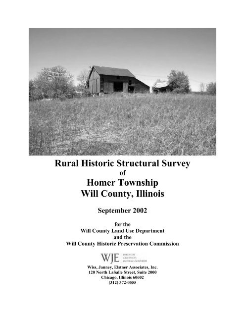
Rural Historic Structural Survey<br />
of<br />
<strong>Homer</strong> Township<br />
<strong>Will</strong> <strong>County</strong>, Illinois<br />
September 2002<br />
for the<br />
<strong>Will</strong> <strong>County</strong> <strong>Land</strong> <strong>Use</strong> Department<br />
and the<br />
<strong>Will</strong> <strong>County</strong> Historic Preservation Commission<br />
Wiss, Janney, Elstner Associates, Inc.<br />
120 North LaSalle Street, Suite 2000<br />
Chicago, Illinois 60602<br />
(312) 372-0555
Wiss, Janney, Elstner Associates, Inc.
Wiss, Janney, Elstner Associates, Inc.<br />
Rural Historic Structural Survey of<br />
<strong>Homer</strong> Township<br />
<strong>Will</strong> <strong>County</strong>, Illinois<br />
TABLE OF CONTENTS<br />
Cover photograph: The Three-bay Threshing barn on the Tilsy Farmstead, Section 24, <strong>Homer</strong> Township, as viewed from<br />
Spring Creek Trails of the Messenger Woods Nature Preserve.<br />
EXECUTIVE SUMMARY ..................................................................................................................... E-1<br />
FEDERAL ASSISTANCE ACKNOWLEDGEMENT<br />
CHAPTER I: CONTEXT HISTORY OF THE RURAL SURVEY REGION<br />
Geologic and Topographic Background to the Illinois Region .............................................................I – 1<br />
First Nations in the Illinois Region ............................................................................................................I – 4<br />
The Arrival of European Settlers<br />
French Explorers and Settlers in the Illinois Territory .............................................................................I – 5<br />
Illinois in the English Colonial Period and Revolutionary War ...............................................................I – 8<br />
<strong>Land</strong> Division and Distribution in the New Nation..................................................................................I – 9<br />
Development of the Northwestern Territory ..........................................................................................I – 10<br />
Illinois Statehood....................................................................................................................................I – 12<br />
Settlement and Development of <strong>Will</strong> <strong>County</strong>.........................................................................................I – 14<br />
Development of the Illinois and Michigan Canal...................................................................................I – 19<br />
Early Roads in <strong>Will</strong> <strong>County</strong> ...................................................................................................................I – 25<br />
Agricultural Development of the State and <strong>County</strong> ...............................................................................I – 26<br />
Twentieth Century Developments..........................................................................................................I – 29<br />
American Rural Architecture<br />
Farmstead Planning ...............................................................................................................................I – 37<br />
Development of Ballon Framing............................................................................................................I – 43<br />
Masonry Construction ............................................................................................................................I – 47<br />
Local Limestone.....................................................................................................................................I – 47<br />
Joliet Limestone ..............................................................................................................................I – 47<br />
Quarries in Lemont .........................................................................................................................I – 49<br />
Development of the Limestone Industry ..........................................................................................I – 50<br />
Reinforced Concrete...............................................................................................................................I – 57<br />
Concrete Block.......................................................................................................................................I – 59<br />
Classification of Farmhouse Types ........................................................................................................I – 63<br />
Architectural Style..................................................................................................................................I – 63<br />
Greek Revival..................................................................................................................................I – 64<br />
Gothic Revival.................................................................................................................................I – 65<br />
Italianate .........................................................................................................................................I – 67<br />
Queen Anne.....................................................................................................................................I – 67<br />
Colonial and Georgian Revival.......................................................................................................I – 68<br />
Craftsman or Arts and Crafts Style .................................................................................................I – 68<br />
Prairie Style ....................................................................................................................................I – 69<br />
Ranch ..............................................................................................................................................I – 69
Wiss, Janney, Elstner Associates, Inc.<br />
House Types...........................................................................................................................................I – 70<br />
Log House .......................................................................................................................................I – 71<br />
I House ............................................................................................................................................I – 72<br />
Hall and Parlor...............................................................................................................................I – 72<br />
Upright and Wing............................................................................................................................I – 73<br />
Gabled Ell .......................................................................................................................................I – 73<br />
Side Hallway ...................................................................................................................................I – 74<br />
Four-over-Four...............................................................................................................................I – 74<br />
Gable Front.....................................................................................................................................I – 75<br />
American Foursquare .....................................................................................................................I – 75<br />
Cape Cod.........................................................................................................................................I – 76<br />
Schoolhouses...................................................................................................................................I – 76<br />
Development of the Barn .......................................................................................................................I – 77<br />
Barn Types .............................................................................................................................................I – 84<br />
English Barn or Three-bay Threshing Barn....................................................................................I – 84<br />
Raised, Bank, and Basement Barns.................................................................................................I – 85<br />
German Barn...................................................................................................................................I – 86<br />
Wisconsin Dairy Barn.....................................................................................................................I – 86<br />
Plank Frame Barn...........................................................................................................................I – 87<br />
Three-ended Barn............................................................................................................................I – 87<br />
Feeder Barn ....................................................................................................................................I – 87<br />
Round Roof Barn.............................................................................................................................I – 88<br />
Pole Barn ........................................................................................................................................I – 88<br />
Quonsets..........................................................................................................................................I – 88<br />
Manufactured Buildings..................................................................................................................I – 89<br />
Grain Elevators.......................................................................................................................................I – 89<br />
Corncribs................................................................................................................................................I – 91<br />
Crib Barns ..............................................................................................................................................I – 92<br />
Metal Bins ..............................................................................................................................................I – 95<br />
Silos........................................................................................................................................................I – 96<br />
Other Farm Structures ..........................................................................................................................I – 102<br />
Chicken Houses.............................................................................................................................I – 102<br />
Milk Houses...................................................................................................................................I – 102<br />
Smokehouses .................................................................................................................................I – 103<br />
Windmills ......................................................................................................................................I – 104<br />
Miscellaneous Buildings ...............................................................................................................I – 105<br />
The American Post-war Suburb: Successor or Annihilator of the Rural Community? ...............................I – 106<br />
CHAPTER II: HOMER TOWNSHIP<br />
Settlement Patterns of <strong>Homer</strong> Township .................................................................................................II – 1<br />
The Rural Crossroads of <strong>Homer</strong> Township...........................................................................................II – 11<br />
Hadley and the Hadley Baptist Church..........................................................................................II – 11<br />
Hawley Hill ....................................................................................................................................II – 19<br />
Goodings Grove .............................................................................................................................II – 20<br />
Wells Corner and the <strong>Homer</strong> Congregational Church ..................................................................II – 24<br />
Marley ............................................................................................................................................II – 26<br />
Development of Agriculture in <strong>Homer</strong> Township ................................................................................II – 28<br />
Schoolhouses in <strong>Homer</strong> Township .......................................................................................................II – 29<br />
Cemeteries of <strong>Homer</strong> Township ...........................................................................................................II – 30<br />
<strong>Homer</strong> Glen...........................................................................................................................................II – 33<br />
Neighboring Communities in Cook <strong>County</strong>..........................................................................................II – 37
Wiss, Janney, Elstner Associates, Inc.<br />
Significant and Contributing Farmsteads in <strong>Homer</strong> Township<br />
Mitchell–Sodawasser–Parker–Marshall........................................................................................II – 38<br />
Ziemetz–Petrulis.............................................................................................................................II – 39<br />
Kobliski–Trantina ..........................................................................................................................II – 41<br />
Ingersoll–Ludwig ...........................................................................................................................II – 41<br />
Brooks–Paddock–Hallis.................................................................................................................II – 43<br />
Brooks–Reed–Bentley–Mortz–Bengston ........................................................................................II – 44<br />
Weis–Bengston ...............................................................................................................................II – 45<br />
Austin–Welter.................................................................................................................................II – 46<br />
Rudd–Welter...................................................................................................................................II – 48<br />
Lucas–Gee......................................................................................................................................II – 49<br />
Kolar–Meyers.................................................................................................................................II – 50<br />
Engles–Vollrath–Menkin–Paul ......................................................................................................II – 51<br />
Rowley............................................................................................................................................II – 52<br />
Lane–Fiddyment–Reed–Zielke–Boyce ...........................................................................................II – 53<br />
Hartwell–Rowley–Kolar ................................................................................................................II – 55<br />
Davis–Corwin–Jungels–Beaver–De Pra .......................................................................................II – 56<br />
Wells–Rodgers–Schroll..................................................................................................................II – 59<br />
Akin Gorham ..................................................................................................................................II – 63<br />
Tilsy................................................................................................................................................II – 64<br />
Simpson–Lauffer ............................................................................................................................II – 66<br />
Gorham–Frazer .............................................................................................................................II – 67<br />
Doig–Lauffer..................................................................................................................................II – 71<br />
Lanfear–Cagwin–Vander...............................................................................................................II – 75<br />
Van Duser–Gooding–Peck–Weir–Cagwin.....................................................................................II – 76<br />
Frazer–Knapp–Beaver–McNamara...............................................................................................II – 77<br />
Brinkerhoff–Watkins–Murphy–Meader..........................................................................................II – 79<br />
Johnson–Buck ................................................................................................................................II – 80<br />
Messenger–Reiter...........................................................................................................................II – 83<br />
Rowley–Morse–Buckholdt–Morse–Dailey–Anderson....................................................................II – 85<br />
Lauffer............................................................................................................................................II – 87<br />
Haley–Savage–Sass........................................................................................................................II – 87<br />
CHAPTER III: SURVEY SUMMARY AND RECOMMENDATIONS<br />
Period of Significance: 1830 to 1970 ..................................................................................................... III – 1<br />
Significance<br />
National Register and Local <strong>Land</strong>mark Criteria.................................................................................... III – 3<br />
Integrity................................................................................................................................................. III – 6<br />
Contributing and Non-contributing Properties ...................................................................................... III – 6<br />
<strong>Will</strong> <strong>County</strong> <strong>Land</strong> <strong>Use</strong> Department Planning Documents..................................................................... III – 6<br />
Potential Historic Districts and <strong>Land</strong>marks<br />
Hadley Road and Chicago-Bloomington Road Heritage Route ............................................................ III – 7<br />
Limestone Multiple Property Historic District...................................................................................... III – 9<br />
Individual <strong>Land</strong>marks ......................................................................................................................... III – 10<br />
Survey Summary ..................................................................................................................................... III – 11<br />
Table of Farmsteads and Agriculturally-related Sites (Sort by PIN)................................................... III – 13<br />
Table of Farmhouses (Sort by PIN)..................................................................................................... III – 15<br />
Table of Barns (Sort by PIN) .............................................................................................................. III – 16<br />
Table of Support Buildings (Sort by PIN)........................................................................................... III – 17<br />
Recommendations for Additional Survey Work................................................................................. III – 19<br />
<strong>Land</strong>scape Features ............................................................................................................................. III – 22<br />
Archaeological Features...................................................................................................................... III – 23
Wiss, Janney, Elstner Associates, Inc.<br />
CHAPTER IV: SURVEY METHODOLOGY............................................................................................. IV – 1<br />
BIBLIOGRAPHY<br />
Previous Surveys<br />
Books, Articles, and Other Publications<br />
Maps and Aerial Photographs<br />
TABLES<br />
Table 1 – Selected <strong>Homer</strong> Township Survey Sites<br />
APPENDIX A: Reproductions of Plat Maps<br />
<strong>Will</strong> <strong>County</strong> Plat Maps of <strong>Homer</strong> Township<br />
Cook <strong>County</strong> Maps of Lemont and Orland Townships<br />
APPENDIX B: Maps<br />
APPENDIX C: <strong>Will</strong> <strong>County</strong> Neighboring Communities in Cook <strong>County</strong>
Wiss, Janney, Elstner Associates, Inc.
Wiss, Janney, Elstner Associates, Inc.<br />
September 2002<br />
EXECUTIVE SUMMARY<br />
At the request of the <strong>Will</strong> <strong>County</strong> <strong>Land</strong> <strong>Use</strong> Department (<strong>Will</strong> <strong>County</strong>), acting as liaison for the <strong>Will</strong><br />
<strong>County</strong> Historic Preservation Commission (Historic Preservation Commission), Wiss, Janney, Elstner<br />
Associates, Inc. (WJE) has prepared the following report of the intensive survey of existing farmsteads in<br />
unincorporated <strong>Homer</strong> Township in <strong>Will</strong> <strong>County</strong>, Illinois. 1 The survey of <strong>Homer</strong> Township was<br />
performed between December 2001 and June 2002, and includes 36 square miles with 76 farmsteads and<br />
agriculturally related sites containing 343 individual structures. This intensive survey was performed to<br />
update the previous survey of the township performed in 1988, which had identified 126 farmsteads with<br />
approximately 568 individual structures. Of the 76 farmsteads and agriculturally-related sites identified in<br />
the current survey, 12 are individually eligible for or are currently designated as <strong>Will</strong> <strong>County</strong> Historic<br />
<strong>Land</strong>marks and/or National Register of Historic Places properties; 49 have sufficient integrity to<br />
contribute to a potential <strong>Will</strong> <strong>County</strong> or National Register rural heritage historic district; and 15 lack<br />
historic integrity and are non-contributing to a historic district. Approximately half of the remaining<br />
farmsteads in the township are actively engaged in some form of agricultural production, and numerous<br />
others are utilized as liveries. However, although many farmsteads in <strong>Homer</strong> Township survive, they are<br />
under increasing threat from development.<br />
Northern <strong>Will</strong> <strong>County</strong> was settled by pioneer farmers of European origin beginning in the late 1820s.<br />
<strong>Homer</strong> Township was first settled between 1831 and 1833. Two subsequent historical developments led<br />
to an increase in settlement. First, the region became more accessible after the Treaty of Chicago of 1833<br />
expelled the remaining Native Americans to land west of the Mississippi. Second, the Illinois and<br />
Michigan Canal, begun in 1836 and completed in 1848, opened up transportation and trade in the region.<br />
The towns of Plainfield and Lockport were founded in 1834 and 1836, respectively, and farmers became<br />
established in Wheatland, Du Page, and <strong>Homer</strong> Townships in the decades that followed. While the canal<br />
and railroads helped farmers move their harvests and livestock to market, residents of <strong>Homer</strong> Township<br />
did not have direct access to either transportation route within the boundaries of the region. This was one<br />
of the reasons early settlements in <strong>Homer</strong> like Hadley and Goodings Grove failed to grow into towns.<br />
Road construction improved in the early 1900s in response to the introduction of the automobile, giving<br />
the farmers in <strong>Homer</strong> and elsewhere better access to outside markets.<br />
The Rural Structures Survey of unincorporated <strong>Will</strong> <strong>County</strong> performed in 1988 identified approximately<br />
21,000 structures, 343 of which were noted to be potentially significant. The 1988 survey documented<br />
sites with photographs and survey data on standard Illinois Historic Preservation Agency format cards.<br />
For most sites, the data for the 1988 survey was gathered from the public right-of-way. WJE has<br />
previously performed an intensive survey of Wheatland, Plainfield, and Lockport Townships, with a final<br />
report dated November 2000; and an intensive survey of Du Page Township, with a report dated<br />
November 2001. These previous surveys covered 144 square miles of land, 255 farmsteads and<br />
agriculturally-related sites, and 1,091 individual structures. This report incorporates information from the<br />
two previous intensive survey reports.<br />
Because of the numerous changes that have occurred in the years since the first rural survey in 1988, the<br />
<strong>Will</strong> <strong>County</strong> Historic Preservation Commission recognized the need to reassess the agricultural heritage<br />
in the region. Northern <strong>Will</strong> <strong>County</strong> in particular is one of the fastest developing areas of the state, and for<br />
this reason was selected as the first area in the county to be reassessed. In April 2001, a referendum<br />
passed in <strong>Homer</strong> Township for the incorporation of approximately one-half of the region.<br />
1 In addition to unincorporated <strong>Homer</strong> Township, a select number of incorporated farmsteads in <strong>Homer</strong> Glen were<br />
surveyed through the cooperation of village and county officials.<br />
<strong>Will</strong> <strong>County</strong> Rural Historic Structural Survey<br />
<strong>Homer</strong> Township Executive Summary - E – 1
Wiss, Janney, Elstner Associates, Inc.<br />
The <strong>Will</strong> <strong>County</strong> Rural Historic Structural Survey described in this report was conducted on an intensive<br />
level, reconfirming the data gathered in the 1988 survey, and also including additional information such<br />
as sketch site plans and identification of more detailed building features. (The intensive level of the<br />
survey was possible because only one township was included in the present survey, as opposed to the<br />
entire county for the 1988 survey.) Survey work was conducted on farmstead and agriculturally related<br />
sites on unincorporated land, although a limited number of significant sites on incorporated land were<br />
included as well. Access to each site was sought from property owners to allow for closer examination of<br />
structures documented in the survey. This also allowed for photographs taken at close range to be<br />
included in the survey data. Rural structures constructed before 1950 were documented, as a minimum<br />
age of 50 years is the basic criteria for elements to be considered for nomination to the National Register<br />
of Historic Places (National Register). Each of the structures was documented on a separate survey form.<br />
Database software was used to organize written survey data for each structure and each farmstead site.<br />
Mapping software using geographic information system (GIS) technology was used to plot a graphic<br />
database showing the location of each farmstead.<br />
The intensive survey conducted to date of the five northern <strong>Will</strong> <strong>County</strong> townships has identified several<br />
historic resources worthy of preservation, including a large, semi-contiguous region in Wheatland<br />
Township and northwestern Plainfield Township; a small settlement, the Wheatland Presbyterian Church<br />
rural crossroads; several extant buildings constructed of locally quarried limestone (including two large<br />
farmhouses in <strong>Homer</strong> Township); and a region forming a “heritage trail” in southeast <strong>Homer</strong> Township<br />
with numerous architectural resources (including intact farmsteads) and unique landscape views. The<br />
survey also identified a select number of architecturally distinctive or historically significant sites and<br />
structures not defined by either of the latter two categories. These sites and structures merit local<br />
landmark designation, but after additional research is performed, a few may merit designation to the<br />
National Register as well.<br />
Chapters I and II provide the context in which the surveyed farmsteads were established, grew, and in<br />
many cases have been divided into separate properties. Chapter I covers the geological, historical, and<br />
architectural contexts of <strong>Will</strong> <strong>County</strong> agriculture. Chapter II discusses the historical context of <strong>Homer</strong><br />
Township and focuses on a select number of historically and/or architecturally significant farmsteads.<br />
Chapter III describes the survey results, and includes a discussion of the National Register and local <strong>Will</strong><br />
<strong>County</strong> criteria for determination of historical and architectural significance; a listing of the significant<br />
farmsteads in the survey region and potential individual or group designation; tabulation of individual<br />
building types; and recommendations for future survey work. Chapter IV contains a description of the<br />
survey methodology. A bibliography of research sources and appendices, including historic and current<br />
maps of the survey region, are contained at the end of the report.<br />
Executive Summary - E – 2<br />
<strong>Will</strong> <strong>County</strong> Rural Historic Structural Survey<br />
<strong>Homer</strong> Township
Wiss, Janney, Elstner Associates, Inc.<br />
FEDERAL ASSISTANCE ACKNOWLEDGEMENT<br />
This program receives federal financial assistance for identification and protection of historic properties.<br />
Under Title VI of the Civil Rights Act of 1964, Section 504 of the Rehabilitation Act of 1973, and the Age<br />
Discrimination Act of 1975, as amended, the U.S. Department of the Interior prohibits discrimination on the<br />
basis of race, color, national origin, or disability or age in its federally assisted programs. If you believe you<br />
have been discriminated against in any program, activity, or facility as described above, or if you desire<br />
further information, please write to:<br />
Office for Equal Opportunity<br />
National Park Service<br />
P.O. Box 37127<br />
Washington, DC 20013-7127<br />
or<br />
Equal Employment Opportunity Officer<br />
Illinois Historic Preservation Agency<br />
One Old State Capitol Plaza<br />
Springfield, IL 62701<br />
The activity which is the subject of the “Rural Historic Structural Survey of <strong>Homer</strong> Township, September<br />
2002” had been financed in part with federal funds from the Department of the Interior, administered by<br />
the Illinois Historic Preservation Agency. However, the contents and opinions do not necessarily reflect<br />
the views or policies of the Department of the Interior, nor the Illinois Historic Preservation Agency, nor<br />
does the mention of trade names or commercial products constitute endorsement or recommendation by<br />
the U.S. Department of the Interior or the Illinois Historic Preservation Agency.<br />
<strong>Will</strong> <strong>County</strong> Rural Historic Structural Survey<br />
<strong>Homer</strong> Township
Wiss, Janney, Elstner Associates, Inc.<br />
Illustrated above is the view northeast from Brooks Cemetery on Parker Road in Section 10 of <strong>Homer</strong> Township. Visible on the<br />
horizon, in the northeast quadrant of Section 11, is the cluster of roofs of a suburban housing development.<br />
<strong>Will</strong> <strong>County</strong> Rural Historic Structural Survey<br />
<strong>Homer</strong> Township
Wiss, Janney, Elstner Associates, Inc.<br />
CHAPTER I<br />
CONTEXT HISTORY OF THE RURAL SURVEY AREA<br />
Geologic and Topographic Background to the Illinois Region<br />
Northern <strong>Will</strong> <strong>County</strong> (which includes Du Page, Wheatland, Plainfield, Lockport, and <strong>Homer</strong> Townships) is<br />
located at the northeast edge of the Mississippi River drainage basin. The region contains two rivers, the Des<br />
Plaines River and its largest tributary, the Du Page River, which in turn flows to the Illinois River and on to<br />
the Mississippi. Each of the rivers has a number of tributary creeks and streams. In Lockport and <strong>Homer</strong><br />
Townships, the Des Plaines River has Long Run, Fraction Run, and Spring Creek as tributaries. The Du<br />
Page River has Spring Brook in northeast Wheatland Township and Lily Cache Creek (and its tributary,<br />
Mink Creek) in the eastern half of Plainfield Township.<br />
As with most of Illinois, the survey area was profoundly altered by glaciation. The region surrounding<br />
Joliet is a zone of fairly old limestones, sandstones, and shales where older rocks of Ordovician and<br />
Silurian age to the north give way near the surface to younger coal-rich rocks of Pennsylvanian age to the<br />
south. The surface topography of the land often bears little resemblance to that of the bedrock beneath.<br />
For example, although the Des Plaines River occupies a true rock valley, the Du Page River only does so<br />
for a portion of its run. Northwest of the survey area in <strong>Homer</strong> Township, the East Branch of the Du Page<br />
River occupies a glacial drift valley over a rock valley; however, the drift valley slopes south and the rock<br />
valley slopes north. 1<br />
Over approximately one million years, the northern hemisphere was alternately covered by and free of large<br />
ice sheets that were hundreds to a few thousand feet thick during the Pleistocene era. In the United States,<br />
portions of New England and the upper Midwest were the most affected by glaciation, with nearly all of the<br />
these areas covered by ice at one time or another. 2 Illinois was covered by ice sheets in four major periods,<br />
with only the far northwest and far southern portions of the state relatively unaffected. Most of the glacial<br />
deposits in the state date from the last two periods: the Illinoian and the Wisconsin. Lake Michigan was<br />
formed by successive advances, but took its current form during the Wisconsin Period. The Illinoian reached<br />
as far south as Carbondale and Harrisburg, the Wisconsin only to Mattoon and Peoria. In addition to<br />
deposits from glaciation, streams and rivers formed by the melting glaciers deposited sand and gravel across<br />
the landscape.<br />
Pleistocene glaciers and the waters melting from them changed the landscapes they covered. The ice scraped<br />
and smeared the landforms it overrode, leveling and filling many of the minor valleys and even some of the<br />
larger ones. Moving ice carried colossal amounts of rock and earth, for much of what the glaciers wore off<br />
the ground was kneaded into the moving ice and carried along, often for hundreds of miles. Wisconsinan drift<br />
was deposited on the weathered Illinoian drift in much of Illinois.<br />
A significant feature left by the advance and retreat of glaciers in the northeast corner of the state are glacial<br />
moraines—low mounds tens of miles long left by the furthest advance of a glaciers in the Wisconsinan<br />
period. <strong>Homer</strong> Township lies within the Valparaiso Morainic System. It is 10 to 12 miles wide and 219 feet<br />
above the level of Lake Michigan (equating to 800 feet above sea level) at the head of Fraction Run in<br />
1 D.J. Fisher, Geology and Mineral Resources of the Joliet Quadrangle, Bulletin No. 51 of the Illinois State<br />
Geological Survey (Urbana, Illinois, 1925), 95. This reference was brought to the attention of the project team by<br />
Mr. Michael A. Lambert of Plainfield.<br />
2 Besides the physical impact of the ice sheets in the above named regions was the overall climatic changes that<br />
occurred in North America. See E.C. Pielou, After the Ice Age: The Return of Life to Glaciated North America<br />
(Chicago: University of Chicago Press, 1991) for an analysis of the biological recovery after the retreat of last ice<br />
sheets.<br />
<strong>Will</strong> <strong>County</strong> Rural Historic Structural Survey<br />
<strong>Homer</strong> Township Chapter I – 1
Wiss, Janney, Elstner Associates, Inc.<br />
Illustrated at left are the moraine systems in<br />
northeastern Illinois. The rural survey region<br />
lies between the Valparaiso Morainic System to<br />
the east (which includes the West Chicago,<br />
Wheaton, and Keeneyville moraines), the much<br />
smaller Minooka Ridge to the west, with the<br />
intermittent Rockdale Moraine extending from<br />
the Valparaiso system. (H.B. <strong>Will</strong>man,<br />
Summary of the Geology of the Chicago Area,<br />
Illinois State Geological Survey Circular 460<br />
(Urbana, Illinois, 1971), 43.)<br />
Sections 21 and 22 of <strong>Homer</strong> Township. Immediately west of the Des Plaines River Valley in Lockport<br />
Township is the smaller Rockdale Moraine. Along the western edge of Wheatland and Plainfield Townships<br />
is the Minooka Ridge, which is a minor topographic feature compared to the Valparaiso Moraine. 3<br />
The last ice sheets in this area began to retreat approximately 13,500 years ago. The retreating and<br />
melting glaciers continued to impact the area for a few more thousand years, as the outflow deposited<br />
sand and gravel, such as those found east of Plainfield. 4<br />
3 Nonetheless, the Minooka Ridge is perceptible when looking west across the farm fields of western Wheatland and<br />
Plainfield Townships. This is particularly true when traveling by westbound in a car toward the western edge of each<br />
township. The Valparaiso Moraine, on the other hand, is perhaps less perceptible because of the greater amount of<br />
development that has occurred in that area.<br />
4 Fisher, Geology and Mineral Resources of the Joliet Quadrangle, 84–85. The following table lists some of the<br />
predominant soil types present in rural areas of the survey area. The numbers are based on United States Department<br />
Chapter I – 2<br />
<strong>Will</strong> <strong>County</strong> Rural Historic Structural Survey<br />
<strong>Homer</strong> Township
Wiss, Janney, Elstner Associates, Inc.<br />
of Agriculture, Soil Conservation Service; subcategories such as 23A and 23B, which consider the overall slope of<br />
the land, have not been included in this table. Note that each of the townships has different but closely related soil<br />
types, reflecting localized variations formed during and after the last period of glaciation:<br />
Soil Type Description <strong>Homer</strong><br />
Township<br />
Lockport<br />
Township<br />
Plainfield<br />
Township<br />
Wheatland<br />
Township<br />
Du Page<br />
Township<br />
23 Blount silt loam X X<br />
27B Miami silt loam X<br />
27C2 Miami loam X<br />
59 Lisbon silt loam X X X<br />
67 Harpster silty clay loam X X<br />
82 Millington loam X X<br />
93 Rodman gravelly loam X<br />
103 Houghton muck X<br />
134 Camden silt loam X X X<br />
145 Saybrook silt loam X X X<br />
146 Elliot silt loam X X X X<br />
148 Proctor silt loam X X X X X<br />
149 Brenton silt loam X X X X<br />
152 Drummer silty clay loam X X X X X<br />
194 Morley silt/silty clay loam X X X<br />
197 Troxel silt loam X<br />
210 Lena muck X<br />
219 Millbrook silt loam X<br />
223 Varna silt loam X X X<br />
232 Ashkum silty clay loam X X X X<br />
240 Platville silt loam X<br />
290 Warsaw silt loam X X X<br />
293 Andres silt loam X X<br />
294 Symerton silt loam X X X<br />
298 Beecher silt loam X X<br />
313 Rodman loam X<br />
314 Joliet silty clay loam X X<br />
315 Channahon silt loam X<br />
316 Romeo silt loam X X<br />
317 Millsdale silty clay loam X<br />
318 Lorenzo silt loam X X X X X<br />
321 Du Page silt loam X X<br />
325 Dresden silt loam X X X<br />
326 <strong>Homer</strong> silt loam X<br />
327 Fox silt loam X X X<br />
329 <strong>Will</strong> silty clay loam X X<br />
330 Peotone silty clay loam X X X<br />
451 Lawson silt loam X<br />
504 Sogn loam X<br />
531 Markham silt loam X X<br />
<strong>Will</strong> <strong>County</strong> Rural Historic Structural Survey<br />
<strong>Homer</strong> Township Chapter I – 3
Wiss, Janney, Elstner Associates, Inc.<br />
At left is a naturalist photograph dating from the early<br />
1900s along Fraction Run (which originates in <strong>Homer</strong><br />
Township) in Dellwood Park south of Lockport. Shown<br />
exposed are the Niagara limestone bluffs that line the Des<br />
Plaines River Valley. (University of Chicago Department of<br />
Botany Records, Reproduction No. AEP-ILP79.) Dellwood<br />
Park is illustrated above from James Walter Goldthwait,<br />
Physical Features of the Des Plaines Valley, Illinois State<br />
Geological Society Survey Bulletin No. 11 (Urbana,<br />
Illinois: University of Illinois, 1909).<br />
First Nations in the Illinois Region<br />
Human inhabitation of the North American continent from the Paleo-Indian culture has been dated to the<br />
end of the last glacial advance (about 15,000 to 12,000 years ago). Increasing warmth toward the close of<br />
the Pleistocene Era caused the melting and disappearance of the ice sheet in approximately 9000 B.C. The<br />
arrival of the First Nations, or Native Americans, in the region between the middle Mississippi valley and<br />
Lake Michigan appears to date from the earliest period following the retreat of the polar ice sheet. This<br />
time is known as the Paleo-Indian Period, when peoples in the region briefly occupied campsites while<br />
subsisting on deer, small mammals, nuts, and wild vegetables and other plants.<br />
The first signs of specific colonization date from the Archaic Period, prior to 1000 B.C., when deer<br />
hunting and wild plant gathering supported a dispersed population. As climatic conditions changed over<br />
the next several thousand years, populations tended to concentrate near river floodplains and adjacent<br />
areas. In the Woodland Period (1000 B.C. to 1000 A.D.), crude grit-tempered pottery appeared in<br />
northeastern Illinois. The end of this period saw the advent of large fortified towns with platform mounds,<br />
such as the community at Cahokia located east of St. Louis. Further north, villages in the upper Illinois<br />
River Valley lacked large platform mounds. 5 It was also a period of a widespread trading network known<br />
to modern anthropology as the Hopewell Interaction Sphere. The villages of this period were typically<br />
located on valley bottom lands, close to river transportation. Agricultural development included<br />
cultivation of floodplain lands; by 650 A.D. maize was being grown in the Illinois River valley. 6<br />
The time span between 1000 A.D. and the coming of European explorers and settlers is known as the<br />
Mississippian Period. Northeast Illinois was at the fringe of the larger Middle Mississippi culture present<br />
in central and southern Illinois. At the beginning of this period, the communities of large fortified towns<br />
and ceremonial platform mounds reached their zenith. Among these sites in northeastern Illinois is the<br />
Fisher site in <strong>Will</strong> <strong>County</strong>, located in Channahon Township.<br />
5 Several Woodland sites are present in the river valleys of the Des Plaines and Du Page Rivers. (John Doershuk,<br />
Plenemuk Mound and the Archaeology of <strong>Will</strong> <strong>County</strong>, Illinois Cultural Resource Study No. 3 (Springfield, Illinois:<br />
Illinois Historic Preservation Agency, 1988), 11–14).<br />
6 James E. Davis, Frontier Illinois (Bloomington, Indiana: Indiana University Press, 1998), 25.<br />
Chapter I – 4<br />
<strong>Will</strong> <strong>County</strong> Rural Historic Structural Survey<br />
<strong>Homer</strong> Township
Wiss, Janney, Elstner Associates, Inc.<br />
The Arrival of European Settlers<br />
Now the Lenapées had a village by the sea. They often looked out, but they saw nothing. One day something came.<br />
When it came near the land, it stopped. Then the people were afraid. They ran into the woods. The next day two Indians<br />
went quietly to look It was lying there in the water. Then something just like it [a rowboat] came out of it and walked<br />
on two legs over the water. When it came to land, two men stepped out of it. They were different from us. They made<br />
signs for the Lenapées to come out of the woods. They gave presents. Then the Lenapées gave them skin clothes.<br />
The white men went away. They came back many times. They asked the Indians for room to put a chair on the land. So<br />
it was given. But soon they began to pull the lacing out of the bottom and walk inland with it. They have not yet come to<br />
the end of the string.<br />
Wyandot tale, “The Coming of the White Man” 7<br />
French Explorers and Settlers in the Illinois Territory<br />
By the time of the French explorations of the seventeenth century, the native inhabitants of Illinois as a<br />
group belonged to the Algonquian linguistic family, closely related to the Chippewa. The specific tribes<br />
in the northeast Illinois region included the Miami (located on sites near the Calumet River, the juncture<br />
of the Des Plaines and Kankakee Rivers, and the Fox River) and the Illinois (present throughout the rest<br />
of modern-day Illinois). “Illinois” was a native word signifying “men” or “people.” 8 By the early to mid-<br />
1700s, the Potawatomi moved into the area from the region of Michigan and northern Wisconsin.<br />
In 1673, the expedition of Father Jacques Marquette and Louis Jolliet traveled primarily along the<br />
Mississippi River and up the Illinois River to the region of Cook and <strong>Will</strong> Counties. 9 The expedition<br />
claimed the region for France. An expedition in 1678, led by Robert de La Salle with Henry Tonti and<br />
Father Hennepin, explored the region along the Mississippi River and adjacent territory on behalf of<br />
France. A Jesuit mission was established at Chicago in 1696 by Father Pierre Pinet, but it failed to last<br />
more than a year. French settlement centered in the middle Mississippi valley, focusing on Fort de<br />
Chartres near Kaskaskia and its connections via the Ohio, Maumee, and Wabash rivers with Québec via<br />
the Great Lakes, well to the south and east of the upper Illinois valley.<br />
Detail of a mural in the Illinois State Capitol, Springfield, showing<br />
Marquette and Jolliet on their travels.<br />
7 Native American Legends of the Great Lakes and Mississippi Valley, Katherine B. Judson, ed. (1914, reprinted<br />
DeKalb, Illinois: Northern Illinois University Press, 2000), 195.<br />
8 John R. Swanton, The Indian Tribes of North America (1952, Bureau of American Ethnology Bulletin Number<br />
145; reprint, Washington, D.C.: Smithsonian Institution Press, 1969), 241.<br />
9 Louis Jolliet was born at Beauport, near Québec, in September 1645. He began to study at the Jesuit College of<br />
Québec in 1655 and in 1662 he received minor religious orders from Bishop Laval. After leaving the seminary and<br />
becoming a fur trader, he gained proficiency in surveying and mapmaking. Jolliet was chosen by the government of<br />
France to be a member of a delegation meeting with the chieftains of the Indian tribes assembled at Sault Sainte<br />
Marie in 1671. Beginning the next year, Jolliet led an expedition down the Mississippi, during which he traveled up<br />
the Illinois and Des Plaines Rivers. According to historical legend, Jolliet camped at a large gravel and clay mound<br />
that would later be named for him. During this expedition, he surmised that digging a canal from to connect the<br />
waterways in this region would allow transportation from the Great Lakes to the Mississippi and the Gulf of Mexico.<br />
The Illinois and Michigan Canal constructed in the 1830s and 1840s was the realization of this route.<br />
<strong>Will</strong> <strong>County</strong> Rural Historic Structural Survey<br />
<strong>Homer</strong> Township Chapter I – 5
Wiss, Janney, Elstner Associates, Inc.<br />
Detail of a map dating from 1688 drawn by Jean-Baptiste Louis Franquelin, Lake Michigan is labeled “Lac des Ilinois”; modern<br />
day Chicago lies where “Fort Checagou” is shown on the map; to the east of “Fort S. Louis” (near modern day Starved Rock) is<br />
the confluence of the Kankakee and Des Plaines Rivers. (Map reproduced from Atlas and Supplement: Indian Villages of the<br />
Illinois Country, compiled by Sara Jones Tucker (1942) with supplement compiled by Wayne C. Temple (1975) (Springfield,<br />
Illinois: Illinois State Museum, 1975), Plate XIB.)<br />
Chapter I – 6<br />
<strong>Will</strong> <strong>County</strong> Rural Historic Structural Survey<br />
<strong>Homer</strong> Township
Wiss, Janney, Elstner Associates, Inc.<br />
The above map is an excerpt of Indian Trails and Villages of Chicago and of Cook, Du Page, and <strong>Will</strong> Counties, Illinois (1804)<br />
prepared by Albert F. Scharf, 1900. The network of Native American trails in northeastern Illinois served the purposes of<br />
European settlers in the 1830s and 1840s, and many of these routes developed into roads that are in use today. Among these in<br />
<strong>Will</strong> <strong>County</strong> are Hadley and Parker Roads and Archer Avenue in <strong>Homer</strong> Township; Route 53 in Lockport Township; and<br />
Interstate 55 (originally Chicago Road) in Du Page Township. (Map reproduced from Milo M. Quaife, Chicago’s Highways Old<br />
and New: From Indian Trail to Motor Road (Chicago: D.F. Keller and Company, 1923), facing page 236.)<br />
During this period, the Native Americans were undergoing migrations, often leading to conflict with each<br />
other. The Sauk, Fox, Kickapoo, and Potawatomi displaced the Miami and Illinois in the lands bordering<br />
Lake Michigan on the south and west. French traders first encountered the Potawatomi in the early 1600s<br />
along Lake Huron during the latter’s westward migration. The Potawatomi, followed by the Sauk and the<br />
Fox, were the predominant peoples in the northeastern Illinois by the later 1700s. The Winnebago and<br />
Shawnee were also present in the region. 10<br />
French colonial settlers in the southern and central portions of Illinois brought with them traditional<br />
agricultural practices from northern France, including open-field plowlands, divided into longlots, and<br />
communal pasturing areas. 11 However, unlike labor practices in France, colonial settlers utilized African<br />
slaves. By the middle of the eighteenth century, black slaves were one-third of the region’s population.<br />
10 Jean L. Herath, Indians and Pioneers: A Prelude to Plainfield, Illinois (Hinckley, Illinois: The Hinckley Review,<br />
1975), 20–21.<br />
11 Carl J. Ekberg, French Roots in the Illinois Country: The Mississippi Frontier in Colonial Times (Urbana, Illinois:<br />
University of Illinois Press, 1998), 2–3. “Longlots” are, as the name implies, long narrow plots of cultivated land<br />
that developed because of the difficulty for plowing teams to turn around. Forms of longlots date back to ancient<br />
<strong>Will</strong> <strong>County</strong> Rural Historic Structural Survey<br />
<strong>Homer</strong> Township Chapter I – 7
Wiss, Janney, Elstner Associates, Inc.<br />
Shown at left is a portion of a map<br />
dating from 1755 titled A Map of the<br />
British and French Dominions in<br />
North America (…), drawn by Dr.<br />
John Mitchell. The map shows “Port<br />
Chicagou” and the portage between<br />
the Lake Michigan watershed and the<br />
Illinois River. The Chicago River is<br />
mistakenly shown as flowing into the<br />
Illinois River. (Map reproduced from<br />
Atlas and Supplement: Indian Villages<br />
of the Illinois Country, compiled by<br />
Sara Jones Tucker (1942) with<br />
supplement compiled by Wayne C.<br />
Temple (1975) (Springfield, Illinois:<br />
Illinois State Museum, 1975), Plate<br />
LXX.)<br />
Early settlements founded as missions and fur trading posts, such as Cahokia and Kaskaskia, developed<br />
into the core of agricultural communities. 12 French colonial farms produced wheat for human<br />
consumption and maize as feed for hogs. A staple of the settlers’ diet was wheat bread. Livestock for use<br />
as dairy production, meat consumption, and draft animals were also present on the region’s farms. The<br />
open field agriculture system continued in use beyond the era of French domination, and ended only with<br />
the influx of settlers from the east coast. 13<br />
Illinois in the English Colonial Period and Revolutionary War<br />
<strong>Land</strong> ownership was not an original right when the Virginia Company settled Jamestown in 1607. The<br />
company owned the land, and paid its employees for their labor in food and supplies out of a common<br />
storehouse, limiting their motivation as well. After a period of starvation that nearly wiped out the<br />
settlement, the company gave each employee an incentive of a three acre garden, which led to regular land<br />
distribution consisting of a 50 acre “headright.” 14 Unencumbered private access to land in the English<br />
colonies to the east prevented rigorous land use planning.<br />
Mesopotamia; French colonial forms developed from Medieval European models. The longlots in Illinois typically<br />
had length to width ratios of 10 to 1.<br />
12 Ibid., 33.<br />
13 Ibid., 173–251.<br />
14 John Opie, The Law of the <strong>Land</strong>: Two Hundred Years of Farm Policy (Lincoln: University of Nebraska: 1994),<br />
19.<br />
Chapter I – 8<br />
<strong>Will</strong> <strong>County</strong> Rural Historic Structural Survey<br />
<strong>Homer</strong> Township
Wiss, Janney, Elstner Associates, Inc.<br />
French influence in the Illinois territory began to wane by the mid-1700s. Québec on the St. Lawrence<br />
River fell to the British in September 1759 during the French and Indian War, opening a route through the<br />
Great Lakes to the middle part of the continent. In 1763, the French ceded land east of the Mississippi to<br />
the British. In October 1765, the British took possession of Fort Chartres (and briefly renamed it<br />
Cavendish), extending British authority across the continent east of the Mississippi River. British control<br />
of the Illinois region lasted until challenged during Revolutionary War. In 1778, at the direction of the<br />
Governor of Virginia, George Rogers Clark led an expedition against the British and captured their posts<br />
in the frontier northwest. Clark marched across southern Illinois, and by July 1778 had disarmed the<br />
British-held frontier forts of Kaskaskia, Cahokia, and Vincennes, claiming the region for the<br />
independence-seeking American colonies.<br />
Shown at left is a portion of a map dating from<br />
1778 titled A New Map of the Western Parts of<br />
Virginia, Pennsylvania, Maryland and North<br />
Carolina (…), drawn by Thomas Hutchins. The<br />
map shows “Chakago,” the “River Plan” (Des<br />
Plaines River), and “Lake Du Page,” and “Mount<br />
Juliet.” The Chicago and Des Plaines Rivers are<br />
shown correctly as not flowing one to the other.<br />
(Map reproduced from Atlas and Supplement:<br />
Indian Villages of the Illinois Country, compiled<br />
by Sara Jones Tucker (1942) with supplement<br />
compiled by Wayne C. Temple (1975)<br />
(Springfield, Illinois: Illinois State Museum,<br />
1975), Plate XXIX.)<br />
<strong>Land</strong> Division and Distribution in the New Nation<br />
When land claims of several of the newly independent states overlapped, Congress, under the Articles of<br />
Confederation, struggled to maintain control over the territory extending to the Mississippi River. After<br />
making all land west of the Pennsylvania Line to the Mississippi common national property, a system of<br />
land division was developed based on meridians and base lines, which were subdivided further into a<br />
series of rectangular grids. In the “Rectangular System,” distances and bearing were measured from two<br />
<strong>Will</strong> <strong>County</strong> Rural Historic Structural Survey<br />
<strong>Homer</strong> Township Chapter I – 9
Wiss, Janney, Elstner Associates, Inc.<br />
lines which are at right angles to each other: the Principal Meridians, which run north and south, and the<br />
Base Lines, which run east and west. Subdividing lines called Range Lines are spaced at six mile intervals<br />
between the meridians and base lines. Range Lines defined territories known as townships. 15<br />
On 20 May 1785, Congress adopted this system as the <strong>Land</strong> Survey Ordinance of 1785. (Eventually,<br />
frontier settlers west of Pennsylvania and north of Texas could walk up to a plat map on the wall of a<br />
regional land office and locate a one quarter section property for farming, which was thought to be<br />
sufficient to sustain individual farmers. 16 ) In 1787, after about twenty months of surveying work, the first<br />
national public land sales occurred, consisting of 72,934 acres with $117,108.22 in revenue. 17 Also in that<br />
year, the Ordinance of 1787 organized the Northwestern Territory, consisting of what would become<br />
Illinois, Indiana, Michigan, Ohio, and Wisconsin.<br />
After the ratification of the new United State Constitution, land legislation was not addressed for several<br />
years. Meanwhile, settlement continued on the portions already surveyed and sold by the government, and<br />
extended into unsurveyed land with settlement by squatters (many of whom were later evicted by federal<br />
troops). Additional federal land sales took place in 1796, and in 1800 the government opened land offices<br />
in Cincinnati, Chillicothe, Marietta, and Steubenville, all in Ohio. In the ensuing decades, as European<br />
settlement pushed westward into the Illinois region, land offices were set up across the newly admitted<br />
State of Illinois. Chicago, Galena, Danville, Quincy, Springfield, Palestine, Vandalia, Edwardsville,<br />
Kaskaskia, and Shawneetown all had <strong>Land</strong> District Offices by the 1830s.<br />
Development of the Northwestern Territory<br />
In 1801 Illinois, then part of the Northwestern Territory, became part of the Indiana Territory. Eight years<br />
later the Illinois Territory was formed, including the region of Wisconsin. By 1800, fewer than 5,000<br />
settlers lived in the territorial region, with most located in the southern portion of what became Illinois<br />
along the Mississippi, Ohio, and Wabash Rivers. The northern portion of the state was more sparsely<br />
populated, as European settlers did not begin to enter this area until the early years of the 1800s.<br />
In 1795, a peace treaty with warring Native Americans included the ceding of “one piece of land, six miles<br />
square, at the mouth of the Chicago River, emptying into the southwest end of Lake Michigan, where a fort<br />
formerly stood.” 18 It was on this land that Fort Dearborn was established in 1803, where a settlement of<br />
French traders and their Native American wives developed. The site grew initially from the fur trade, and<br />
despite the Fort Dearborn Massacre of 1812, more settlers came to the area.<br />
15 Township were the largest subdivision of land platted by the United States. After the Township Corners were<br />
located, the Section and Quarter Section Corners were established. Each Township was six miles square and<br />
contained 23,040 acres, or 36 square miles, as near as possible to fit specific geographic conditions such as lakes and<br />
rivers, political boundaries such as State boundaries, as well as survey errors. Each Township, unless irregular in<br />
shape due to the reasons cited above, was divided into 36 squares called Sections. These Sections were intended to<br />
be one mile, or 320 rods, square and contained 640 acres of land. Sections were numbered consecutively from 1 to<br />
36, utilizing the same criss-cross numbering pattern on each section regardless of national location or actual<br />
township configuration. Sections are may be subdivided in different ways. A half section contains 320 acres; a<br />
quarter section contains 160 acres; half of a quarter contains 80 acres, and quarter of a quarter contains 40 acres, and<br />
so on. Each piece of land is described according to the portion of the section within which it is located.<br />
16 Opie, The Law of the <strong>Land</strong>, 10.<br />
17 Ibid., 15.<br />
18 As quoted by A.T. Andreas in his History of Chicago, from the Earliest Period to the Present Time (Chicago: A.T.<br />
Andreas, 1884), 79.<br />
Chapter I – 10<br />
<strong>Will</strong> <strong>County</strong> Rural Historic Structural Survey<br />
<strong>Homer</strong> Township
Wiss, Janney, Elstner Associates, Inc.<br />
The map at left dates from 1812, six years prior to<br />
Illinois becoming a state but over 150 years after<br />
European settlers first came to the region. The<br />
makeup of the Native American presence had<br />
changed during this same period, and the<br />
Potawatomi were as new to the region as the<br />
Europeans. (Map reproduced from Atlas and<br />
Supplement: Indian Villages of the Illinois Country,<br />
compiled by Sara Jones Tucker (1942) with<br />
supplement compiled by Wayne C. Temple (1975)<br />
(Springfield, Illinois: Illinois State Museum, 1975),<br />
Plate LXXXI.)<br />
A series of treaties with Native American populations influenced the future of northeast Illinois. Cutting<br />
across the western half of the region later known as <strong>Will</strong> <strong>County</strong> was a land corridor ceded by the<br />
Potawatomi, Ottawa, and Chippewa in a treaty signed in St. Louis on 24 August 1816, under territory<br />
commissioners Ninian Edwards, <strong>Will</strong>iam Clark, and Auguste Chouteau. The corridor, defined by the<br />
cartographic features now known as the Indian Boundary Lines (and still present on many maps of the area),<br />
was meant for allow European settlers access to Lake Michigan for the construction of a canal (developed as<br />
the Illinois and Michigan Canal, discussed later in this chapter). The corridor was surveyed by James M.<br />
Duncan and T.C. Sullivan in 1819; its southern boundary was defined by a point on the shore of Lake<br />
Michigan, ten miles south of the Chicago River, to a point on the Kankakee River, ten miles upstream of its<br />
mouth. 19<br />
19 <strong>Will</strong> <strong>County</strong> Property Owners, 1842 (Joliet, Illinois: <strong>Will</strong> <strong>County</strong> Historical Society, 1973), 1.<br />
<strong>Will</strong> <strong>County</strong> Rural Historic Structural Survey<br />
<strong>Homer</strong> Township Chapter I – 11
Wiss, Janney, Elstner Associates, Inc.<br />
Illinois Statehood<br />
A bill had passed Congress in early 1818 moving the northern boundary northward to include the mouth<br />
of the Chicago River within the Illinois Territory. 20 The United States Congress passed an enabling act on<br />
18 April 1818 admitting Illinois as the twenty-first state as of 3 December 1818, despite the fact that the<br />
population of the state was only 40,258, less than the 60,000 required by the Ordinance of 1787. The state<br />
capital was established first at Kaskaskia and moved to Vandalia two years later. Much of the land in the<br />
state not still under Native American control was the property of the United States government. Early<br />
sales offices were located at Kaskaskia, Shawneetown, and Vincennes. Until the financial panic of 1819,<br />
there was an initial rush of sales and settlement at the southern end of the state where navigable streams<br />
and the only road system were located. 21 State legislation regulating agriculture began in 1819 with acts<br />
addressing the rights of settlers to the land they occupied and regulation of land enclosures and cultivation<br />
of common fields. 22 Agricultural advocacy and scientific study also began in 1819, with the founding of<br />
the Illinois Agricultural Society on 23 February of that year. 23<br />
The Native Americans who occupied the area at this time were divided into powerful tribes who at times<br />
fought the European settlers to hold their hunting grounds. Chief among these tribes was the Kickapoo,<br />
who were among the first to engage in war with European settlers and the last to enter into treaties with<br />
the United States government. On 30 July 1819, by the Treaty at Edwardsville, the Kickapoo ceded their<br />
land to United States and began to retreat to Osage <strong>County</strong>. By 1822, only 400 Kickapoo were left in the<br />
state.<br />
By 1826, more European settlers began to move to the northeast Illinois region, so that by 1831 a few<br />
hamlets were present between LaSalle and Chicago along the Illinois, Fox, and Des Plaines River<br />
Valleys. At the beginning of the Black Hawk War, in 1832, the largest settlement north of the Illinois<br />
River (except for Chicago) was on Bureau Creek, where there were about 30 families. A few other settlers<br />
had located on the river at Peru and LaSalle, and a considerable number at Ottawa. In Yankee Settlement,<br />
which embraced part of the townships of <strong>Homer</strong>, Lockport, and New Lenox, there were 20 or 25 families.<br />
Along the Hickory in the town of New Lenox, including the Zarley settlement in Joliet Township, there<br />
were approximately 20 more families, and at Reed’s Grove and Jackson’s Grove there were 6 or 8 more. 24<br />
The early 1830s saw the greatest land boom thus far in American history. <strong>Land</strong> sales gradually came<br />
under the control of the General <strong>Land</strong> Office as the survey moved westward. In 1834 and 1835 alone, 28<br />
million acres were shifted from closed to open land for purchase. Two years later the Van Buren<br />
administration placed 56,686,000 acres on the market. These lands were located in some of the most<br />
fertile farming regions of the nation: Illinois, Iowa, Alabama, Mississippi, Arkansas, and Missouri. 25 The<br />
building of the Illinois and Michigan Canal in the 1830s and 1840s (discussed later in this chapter) led to<br />
a land boom in Chicago, which had been platted in 1830 and incorporated in 1833. 26 The rate of growth in<br />
northern Illinois soon matched and then surpassed that of the southern portion of the state.<br />
20 The northern boundary of the Illinois Territory was on an east-west line from the southern line of Lake Michigan.<br />
In order to give the future state a portage on Lake Michigan, the boundary line was moved 10 miles north of the<br />
initial boundary. The Congressional legislation was amended before passage moving the future state’s northern<br />
boundary a total of 51 miles north. In addition to the added economic security, it lessened the potential for the region<br />
to be sympathetic to the slave states in the south.<br />
21 Olin Dee Morrison, Prairie State, A History: Social, Political, Economical (Athens, Ohio: E. M. Morrison, 1960),<br />
24–25.<br />
22 History of State Departments, Illinois Government, 1787–1943, compiled by Margaret C. Norton, Illinois State<br />
Archives; Illinois Laws 1819, 23, 37, and 44.<br />
23 However, the society had a short life, being disbanded in 1825.<br />
24 Ibid.<br />
25 Ibid., 51.<br />
26 Between 1840 and 1860 the population of Chicago increased from 4,470 to nearly 100,000, growth tied to the<br />
economic boom started by the opening of the Illinois and Michigan Canal. By 1890, Chicago’s population was more<br />
Chapter I – 12<br />
<strong>Will</strong> <strong>County</strong> Rural Historic Structural Survey<br />
<strong>Homer</strong> Township
Wiss, Janney, Elstner Associates, Inc.<br />
Shown at left is a map of Illinois dating from 1819 with the<br />
corridor defined by treaties that established the “Indian<br />
Boundary Lines” in the northeast portion of the state. The<br />
region of <strong>Homer</strong> Township was located entirely within the<br />
boundaries of the treaty lines. (Map reproduced from Atlas<br />
and Supplement: Indian Villages of the Illinois Country,<br />
compiled by Sara Jones Tucker (1942) with supplement<br />
compiled by Wayne C. Temple (1975) (Springfield,<br />
Illinois: Illinois State Museum, 1975), Plate XLVI. The<br />
survey map below, showing the potential route for a canal<br />
connecting Chicago River and the Des Plaines River, dates<br />
from 1821 and was prepared by John Walls (Ulrich<br />
Danckers and Jane Meredith, Early Chicago (River Forest,<br />
Illinois: Early Chicago, Incorporated, 1999), 53). As<br />
recorded by George Woodruff, “in 1821, an appropriation<br />
of ten thousand dollars was voted for a survey, which was<br />
made, and the project was pronounced eminently<br />
practicable” (Woodruff, Forty Years Ago: A Contribution<br />
to the Early History of Joliet and <strong>Will</strong> <strong>County</strong>, Lecture I<br />
(Joliet, Illinois: Joliet Republican Steam Printing House,<br />
1874), 8).)<br />
than 1,000,000 persons (Harry Hansen, ed., Illinois: A Descriptive and Historical Guide (New York: Hastings<br />
House Publishers, 1974), 176–83).<br />
<strong>Will</strong> <strong>County</strong> Rural Historic Structural Survey<br />
<strong>Homer</strong> Township Chapter I – 13
Wiss, Janney, Elstner Associates, Inc.<br />
Settlement and Development of <strong>Will</strong> <strong>County</strong><br />
In 1832, a band of Sauk Indians led by Black Sparrow Hawk, resisted their deportation by Europeans<br />
settlers from their ancestral lands. Although most of the fighting occurred in the Rock River area in<br />
Northwest Illinois and southern Wisconsin, an Indian panic swept through <strong>Will</strong> <strong>County</strong> settlements. The<br />
settlers in Walker’s Grove together with about 25 fugitives from the Fox River area hurriedly constructed<br />
a stockade from the logs of Stephen Begg’s pigpen, outbuildings, and fences (“Fort Beggs”). The prospect<br />
of engaging Indians in pitched battle from the confines of “Fort Beggs” prompted the settlers to leave the<br />
makeshift stockade in favor of Fort Dearborn in Chicago. Meanwhile homesteaders in the eastern <strong>Will</strong><br />
<strong>County</strong> area gathered at the Gougar homestead (in future New Lenox Township) and decided to flee to<br />
Indiana. 27<br />
Present in the region at this time was a tribe of nearly 1,000 Potawatomi in the area along the Du Page<br />
River south of what would become Plainfield. 28 Northern <strong>Will</strong> <strong>County</strong> was the scene of an epidemic of<br />
smallpox among the Potawatomi, inflicting a mortality rate at least twice that of European settlers.<br />
Approximately one-third of the Native American population in the region died during the epidemic. 29 The<br />
end of the Black Hawk War in September 1832 brought about the expulsion of the Sauks and Foxes from<br />
lands east of the Mississippi River. The Winnebago ceded their lands in Wisconsin south and east of the<br />
Wisconsin River and east of the Fox River to Green Bay that same year.<br />
The Potawatomi, Ottawa, and Chippewa tribes still held title to land in northern Illinois outside of the<br />
Indian Treaty Boundary lines. Early northeastern Illinois settler, and later Illinois Supreme Court chief<br />
justice, John Dean Caton was witness to the native peoples of the region:<br />
…I found this whole country occupied as the hunting grounds of the Pottawatomie [sic] Indians. I<br />
soon formed the acquaintance of many of their chiefs, and this acquaintance ripened into a cordial<br />
friendship. I found them really intelligent and possessed of much information resulting from their<br />
careful observation of natural objects. I traveled with them over the prairies, I hunted and I fished<br />
with them, I camped with them in groves, I drank with them at the native springs, of which they<br />
were never at a loss to find one, and I partook of their hospitality around their camp fire. 30<br />
The illustration at right is from a diorama that formerly<br />
was in the Illinois State Museum (it is no longer on<br />
display). It shows two Native American chiefs who have<br />
been plied with alcohol to force a signature on the 1833<br />
Chicago treaty agreeing to Indian removals to lands<br />
west of Mississippi. Whether historically accurate or<br />
not, the diorama is noteworthy in the honesty that it<br />
portrays the subtle treachery of European-American<br />
negotiators. (Reproduced from Virginia S. Eifert, The<br />
Story of Illinois: Indian and Pioneer, Story of Illinois<br />
Series No. 1, Fourth revised edition (Springfield, Illinois,<br />
1954).)<br />
27 Robert E. Sterling, A Pictorial History of <strong>Will</strong> <strong>County</strong>, Volume 1 (Joliet: <strong>Will</strong> <strong>County</strong> Historical Publications,<br />
1975).<br />
28 Herath, Indians and Pioneers: A Prelude to Plainfield, Illinois, 21.<br />
29 Tanner, ed., Atlas of Great Lakes Indian History, 173.<br />
30 John Dean Caton, “The Last of the Illinois, with a Sketch of the Pottawatomies [sic],” Miscellanies (Boston:<br />
Houghton, Osgood and Company, 1880), 117.<br />
Chapter I – 14<br />
<strong>Will</strong> <strong>County</strong> Rural Historic Structural Survey<br />
<strong>Homer</strong> Township
Wiss, Janney, Elstner Associates, Inc.<br />
In September 1833, a gathering of Native American chiefs and leaders was held in Chicago to “negotiate<br />
a treaty whereby the lands might be peaceably ceded, and the Indians removed therefrom, to make way<br />
for the tide of white emigration which had begun to set irresistibly and with ever increasing volume to the<br />
coveted region.” 31 Chicago historian A.T. Andreas, writing in the 1880s, emphasized the disadvantaged<br />
position of the Native Americans, who had seen the effects of war on other Native Americans and<br />
experienced the ravages of epidemic on their own peoples:<br />
Black Hawk’s ill-starred campaign, followed by the subsequent treaty made by his tribe, showed<br />
them the inevitable result [that] must follow resistance. They knew quite well that they had no<br />
alternative. They must sell their lands for such a sum and on such terms as the Government agents<br />
might deem it politic or just or generous to grant. The result of the treaty was what might have been<br />
expected. The Indians gave up their lands and agreed for certain considerations, the most of which<br />
did not redound to their profit, to cede all their lands to the Government, and to leave forever their<br />
homes and the graves of their fathers for a land far toward the setting sun, which they had never seen<br />
and of which they knew nothing. 32<br />
In the resulting treaty, the three tribes ceded land “along the western shore of Lake Michigan, and<br />
between this lake and the land ceded to the United States by the Winnebago nation at the treaty of Fort<br />
Armstrong….” 33 As compensation, the tribes received land on the east bank of the Missouri River and a<br />
series of monetary payments. 34<br />
The force behind Native American expulsions was the rapid influx of settlers of European origin. In 1833,<br />
only four ships of any size arrived in Chicago. The following year, the number of ships increased to 180. In<br />
1836, 400 hundred vessels brought trade and new settlers to Chicago and northeastern Illinois. 35 Other<br />
settlers arrived by early roads, many based on Native American trails. These trails developed “first as a<br />
bridle path, then as a public highway, stage and mail route.” 36 Among these was Hubbard’s Trail, later<br />
known as State Road, that led from Chicago to Danville. Wagon trains operated on the route and an off-road<br />
between Chicago and Kankakee. From this point, boats carried trade and new settlers along the Kankakee<br />
and Illinois Rivers to lands further inland. 37<br />
Settlement in the <strong>Will</strong> <strong>County</strong> region (then still part of Cook <strong>County</strong>) was given a boost with the June<br />
1835 land sale in Chicago, as “farmers, speculators, and city promoters jostled each other in their attempts<br />
to acquire the more desirable portions.” 38 Some of these speculators platted towns in the area that never<br />
truly developed, towns with names like Palmyra, <strong>Will</strong>iamsburg, Middletown, New Rochester, and<br />
Buffalo. The selection of these names was significant, as many of the pioneering settlers came from New<br />
England and New York State. Other settlers from Ohio chose land in the open prairies of the eastern <strong>Will</strong><br />
<strong>County</strong> region, leading to the founding of Monee. 39<br />
31 Andreas, History of Chicago, 123.<br />
32 Ibid.<br />
33 As quoted in Andreas, History of Chicago, 124.<br />
34 It has been reported that Native Americans returned to <strong>Will</strong> <strong>County</strong> as late as 1900 on pilgrimages (Herath, Indians<br />
and Pioneers: A Prelude to Plainfield, Illinois, 21):<br />
Though officially ousted, the Indians, being great travelers, made pilgrimages back to the land of their childhood<br />
for many years. Small ragtag bands of women and children were seen as late as the 1870s along the Du Page,<br />
wending their way north in the spring and south in the fall. In 1900 an old Indian man, a small boy and a horse<br />
pulling a travois were seen along the Kankakee River.<br />
35 <strong>Will</strong>iam Vipond Pooley, The Settlement of Illinois from 1830 to 1850. (Madison, Wisconsin, 1908; Reprint, Ann<br />
Arbor, Michigan: University Microfilms, 1968), 72.<br />
36 Juliet and Joliet: Around the Locks, Bluffs and Bridges, Forty, Fifty, Sixty Years Ago, N.p., n.d. [circa 1900], 52.<br />
37 Ibid., 73.<br />
38 Ibid., 100.<br />
39 Ibid.<br />
<strong>Will</strong> <strong>County</strong> Rural Historic Structural Survey<br />
<strong>Homer</strong> Township Chapter I – 15
Wiss, Janney, Elstner Associates, Inc.<br />
Map of northeast Illinois and northwest Indiana showing lands forfeited by Native Americans through treaties negotiated<br />
between 1829 and 1835. (Map reproduced from Atlas and Supplement: Indian Villages of the Illinois Country, compiled by Sara<br />
Jones Tucker (1942) with supplement compiled by Wayne C. Temple (1975) (Springfield, Illinois: Illinois State Museum, 1975),<br />
Plate XCIII.)<br />
Emigration into this area increased so markedly that settlers began agitating for separation from Cook<br />
<strong>County</strong>, which had been formed from Putnam <strong>County</strong> only in 1831. Residents of settlements and pioneers<br />
in outlying areas of southwest Cook <strong>County</strong> demanded a more convenient place to record their land<br />
purchases and to pay their taxes. Accordingly, Dr. A. W. Bowen of Juliet and James Walker of Plainfield<br />
went to the state capital of Vandalia and successfully lobbied a detachment petition through the General<br />
Assembly. On 12 January 1836, an act was passed creating <strong>Will</strong> <strong>County</strong> from portions of Cook, Iroquois,<br />
and Vermilion Counties. <strong>Will</strong> <strong>County</strong> also included at that time the northern part of what would later<br />
become Kankakee <strong>County</strong>. In 1853, the boundaries of <strong>Will</strong> <strong>County</strong> were changed to their present<br />
locations. The county was named in honor of Dr. Conrad <strong>Will</strong>, a member of the state legislature who<br />
lived in the southern part of Illinois. 40<br />
40 Born near Philadelphia, Pennsylvania, on 3 June 1779, Conrad <strong>Will</strong> emigrated westward after studying medicine.<br />
First homesteading on the Big Muddy River in the Illinois Territory in 1813, he established a salt works in 1816<br />
using the salt springs in the area. He was instrumental in the formation of Jackson <strong>County</strong> from the lower half of<br />
Randolph <strong>County</strong> and part of present day Perry <strong>County</strong>. When the salt business did not prosper, <strong>Will</strong> entered<br />
politics, becoming a state senator in the newly formed State of Illinois in 1818. In 1820 he became a member of the<br />
state House of Representatives, an office he held until his death on 11 June 1835. On the following 12 January, the<br />
state legislature passed an act sectioning the southern portion of Cook <strong>County</strong> in northern Illinois, naming it after<br />
Conrad <strong>Will</strong>. (Alice C. Storm, Doctor Conrad <strong>Will</strong> (Joliet, Illinois: Louis Joliet Chapter of the Daughters of the<br />
American Revolution, 1917), 1–5.)<br />
Chapter I – 16<br />
<strong>Will</strong> <strong>County</strong> Rural Historic Structural Survey<br />
<strong>Homer</strong> Township
Wiss, Janney, Elstner Associates, Inc.<br />
Putnam <strong>County</strong>, 1825 to 1827<br />
Illinois, 1820<br />
Illinois, 1830<br />
Putnam <strong>County</strong>, 1827 to 1831<br />
Cook <strong>County</strong>, 1831 to 1836 Illinois, 1840<br />
Illustrated on this page are maps of Illinois from the period after the state’s admission to the Union, and show the emergence of<br />
<strong>Will</strong> <strong>County</strong> from Clark, Putnam, and Cook Counties. The rapid change in population distribution, as shown by the degree of<br />
county divisions, between 1820 and 1840 is visible in these maps. As shown below center, <strong>Will</strong> <strong>County</strong> contained several of the<br />
northern townships of Kankakee <strong>County</strong> for 17 years until the latter was established in 1853. (Atlas of Historical <strong>County</strong><br />
Boundaries: Illinois. edited by John H. Long and compiled by Gordon DenBoer (New York: Charles Scribner’s Sons, 1997).)<br />
Illinois, 1850 <strong>Will</strong> <strong>County</strong>, 1836 to 1853 Illinois, 1860<br />
<strong>Will</strong> <strong>County</strong> Rural Historic Structural Survey<br />
<strong>Homer</strong> Township Chapter I – 17
Wiss, Janney, Elstner Associates, Inc.<br />
A plat of survey for Wheatland Township in northwest <strong>Will</strong><br />
<strong>County</strong>, dated 21 May 1839 is reproduced at left. The<br />
diagonal line in the lower righthand corner is the Indian<br />
Boundary Line. As explained above, the land shown platted<br />
here was not officially accessible to settlers until after the<br />
Treaty of Chicago of 1833 since it had belonged to Native<br />
American tribes in the region.<br />
On 7 March 1836, an election was held to select <strong>Will</strong> <strong>County</strong>’s first public officials. They in turn set the<br />
price of tavern licenses and created a book for recording the ear markings of livestock. Since swine,<br />
sheep, cows, and other livestock freely roamed the city streets and open fields, settlers devised special ear<br />
markings consisting of slits, crops, and holes to identify their animals. These “brands” were recorded with<br />
pen and ink drawings in the county clerk’s office. 41<br />
The primary concern of pioneer farmers was providing food for his family and livestock. Most farmers<br />
homesteaded around wooded land to provide building materials and fuel. These early settlers believed<br />
that the lack of trees on open prairies meant that the land had poor fertility, something they did not<br />
discover was typically false until prairie lands were cultivated by later settlers. 42 After cutting down trees<br />
and grubbing out tree stumps, the prairie sod was broken with a walking plow. This latter activity was<br />
often difficult, since the soil tended to ball up on the plow. In 1833, John Lane of Lockport invented the<br />
breaking plow, which eliminated this problem. Lane’s innovation developed from an improvised steel<br />
plow attached to the plow molding board. It successfully cut the prairie sod so that the soil could be<br />
turned over. 43 A national economic depression in 1837 led to a temporary curtailment of settlement. Work<br />
on the Illinois and Michigan Canal, begun in 1836, ceased for a time. During this period, those land<br />
holders in the region who participated in the canal’s construction were able to concentrate on developing<br />
their farmlands.<br />
Life on these early farms was hard for the new settlers. In addition to building a settlement house and<br />
preparing the soil, the weather was a significant factor with which they had to contend. For the settlers<br />
from New England, the climate was basically similar, although the extremes of temperature and rapidity<br />
41 Address of George H. Woodruff, Sixth Annual Reunion of the <strong>Will</strong> <strong>County</strong> Pioneer Association (Joliet: The Press<br />
Company, 1886), 5–6.<br />
42 Wooded land was so important an issue that some settlers were dissuaded from buying land in Wheatland<br />
Township until the later 1830s and 1840s, when land in surrounding townships was selling out.<br />
43 Fayette Baldwin Shaw, <strong>Will</strong> <strong>County</strong> Agriculture (<strong>Will</strong> <strong>County</strong> Historical Society, 1980), 1. The site of Lane’s<br />
farmstead is discussed in Chapter II.<br />
Chapter I – 18<br />
<strong>Will</strong> <strong>County</strong> Rural Historic Structural Survey<br />
<strong>Homer</strong> Township
Wiss, Janney, Elstner Associates, Inc.<br />
of change was a new challenge. Snow could fall in greater quantities than the northeastern United States.<br />
Severe cold and the open expanses of prairies led to drifts that were hazardous to farm animals. The<br />
winter of 1830–1831, just prior to the great influx of European settlers, was particularly difficult and was<br />
known as that of the “Deep Snow.” Beginning a few days before Christmas, snow fell to a depth of three<br />
feet with drifts of four to six feet. High winds and bitterly cold temperatures continued over the next two<br />
months, leaving many homesteaders trapped on their land.<br />
The health of settlers could suffer as a result of overwork and environmental conditions. Settlers in<br />
lowland areas, adjacent to waterways and ponds, were susceptible to fevers. This was a significant enough<br />
question for newspapers and settler guide books to discuss the issue, if only to reassure emigrants to the<br />
area:<br />
The season in which I visited the United States was one remarkable for sickness, and the southern<br />
and western states [which included Illinois] suffered much, but with the exception of such<br />
visitations, it would appear that the inhabitants of Illinois enjoy a very fair amount of good health;<br />
indeed, it appeared to me that they were exempted from such a variety of diseases as we see in this<br />
country—that there was some predisposing cause to bilious complaints, to the exclusion of other<br />
types. There, as in other parts of the world, much of the disease encountered is a result of rashness<br />
and folly…. 44<br />
Although most early settlers were occupied with subsistence farming, transportation became an important<br />
issue for moving their yields to markets as they became more established. Before the opening of the<br />
Illinois and Michigan Canal in 1848, regular passage for people could be obtained on stage coach routes.<br />
Three such services included the Chicago and Ottawa route, which passed from Chicago through<br />
Lockport and Joliet and on to Ottawa (a total of 85 miles); another Chicago and Ottawa route, and another<br />
by way of Naperville and Plainfield (which was several miles longer). Many of these early routes<br />
followed roads that had been established by Native Americans moving through the region to hunting<br />
grounds and settlements, although necessarily improved to allow the passage of horse-drawn coaches.<br />
The Chicago and Ottawa route was inaugurated on 1 January 1834.<br />
Development of the Illinois and Michigan Canal<br />
The proximity of the headwaters of the Illinois River to Lake Michigan led early explorers to propose the<br />
construction of a canal to link the two, thus allowing river traffic to move from the Great Lakes to the<br />
Mississippi River. In 1673 the French explorers Marquette and Jolliet were commissioned to verify the<br />
extent of the Mississippi River. While in northeast Illinois, they were required to make a short portage<br />
across the land dividing the waterways in the region. The northern branch of the Illinois River is the Des<br />
Plaines River, which at the closest point flows about five miles west of the shore of Lake Michigan before<br />
turning southwest in the region now called Summit. The usefulness of a canal to link Lake Michigan with<br />
the Illinois watershed was apparent to the two explorers. The Des Plaines River flowed into the Illinois,<br />
which then flowed to the Mississippi, and the Chicago River flowed to Lake Michigan. Canals would<br />
eliminate the portages, providing useful water routes between the Gulf of Mexico and the Great Lakes.<br />
During periods of spring rains the two waterways were frequently linked as floodwaters spread across the<br />
portage and part of the Des Plaines River spilled into the Chicago.<br />
As early as 1794, plans were made to establish the Illinois waterway link with the lake. The Louisiana<br />
Purchase of 1803 gave a further impetus to the development of a canal. Army engineers began surveying<br />
the area after the War of 1812. <strong>Land</strong> acquisition began when a treaty with Native American tribes was<br />
signed at St. Louis in 1816, leading to the acquisition of a corridor from Chicago to Ottawa, Illinois.<br />
Debate on the canal project continued for several years until 1834 when Joseph Duncan, a strong<br />
supporter of the canal, was elected governor of Illinois. Governor Duncan supported legislation in 1836 to<br />
44 <strong>Will</strong>iam Oliver, Eight Months in Illinois with Information to Immigrants (1843; Reprint, Carbondale, Illinois:<br />
Southern Illinois University Press, 2002), 251.<br />
<strong>Will</strong> <strong>County</strong> Rural Historic Structural Survey<br />
<strong>Homer</strong> Township Chapter I – 19
Wiss, Janney, Elstner Associates, Inc.<br />
assist financing for the construction of a canal. Construction began on 4 July 1836, with ground broken at<br />
Bridgeport in Chicago. 45<br />
The canal route followed the south branch of the Chicago River and followed the Des Plaines River and<br />
Illinois River to a western terminus at LaSalle. 46 The canal was subsidized with a federal land grant of<br />
325,000 acres to the State of Illinois of alternate sections of land along the canal route, which then were<br />
sold to settlers. After little progress was made during the first year of construction, financial problems<br />
developed. By 1840 the canal was two-thirds completed when another series of funding problems delayed<br />
completion of the canal until 1848.<br />
Labor for the project was attracted to Illinois, with many new immigrants from Ireland. Bridgeport, now a<br />
Chicago neighborhood, was the eastern terminus of the canal and began as a settlement to house Irish<br />
canal workers. Numerous towns were founded as a result of the construction and operation of the canal.<br />
Until the canal was completed, farmers in northeast Illinois who wished to sell their crops and livestock in<br />
the Chicago markets had to move it there by wagon cart. The son of one of the early settlers described the<br />
journey, writing that “in 1844, we began to haul wheat to Chicago, the trip taking three or four days. The<br />
hauling was generally done in the fall when the roads were good. We killed and dressed our hogs at home<br />
and hauled them to Chicago markets in cold weather.” 47<br />
Completion of the canal in 1848 revolutionized freight and passenger traffic on the Illinois River route by<br />
allowing shippers to utilize Chicago as their route to the eastern United States as shipping prices dropped.<br />
During the early years of operation the canal’s eastbound traffic included corn, wheat, sugar, and coal;<br />
westbound traffic included lumber, salt, and merchandise. The improvements to transportation brought by<br />
the canal helped to spur further agricultural development in northern Illinois. 48 During the first three years<br />
of the canal’s operation, 1.4 million bushels of wheat and 1.6 million bushels of corn were transported to<br />
markets. 49 In the ensuing years, the railroad first supplemented and then supplanted the canal as a<br />
significant traffic route. But one of the most significant contributions of the canal was the benefit it gave<br />
to Chicago as a trading center. The canal effected a reorientation of the state, from downstate<br />
communities focused on markets in St. Louis to more economically successful northern communities<br />
focused on the port of Chicago.<br />
By 1851, traffic was already showing signs of having outgrown the canal, and it was necessary to restrict<br />
its use to boats to those with a draught of not more than four and a half feet. Railroad service from the<br />
Chicago and Alton Railroad was initiated in 1854, running nearly parallel to the canal for much of its<br />
45 Leslie C. Swanson, Canals of Mid-America, 35.<br />
46 The eastern entrance into the canal was near the present intersection of Archer and Ashland Avenues and followed<br />
the right-of-way of the contemporary Stevenson Expressway (Interstate 55) to the town of Summit, where it turned<br />
to the southwest, paralleling the east bank of the Des Plaines River to Joliet. At Joliet the canal crossed the Des<br />
Plaines at river level. Continuing southwest it made a level crossing of the Du Page River at Channahon. The canal<br />
then followed the west banks of the Du Page and Des Plaines Rivers and the north bank of the Illinois. It ended in a<br />
riverboat turning basin at La Salle/Peru.<br />
47 Michael Henry Crider (source unknown), as quoted in Herath, Indians and Pioneers: A Prelude to Plainfield,<br />
Illinois, 65.<br />
48 Michael P. Conzen, “1848: The Birth of Modern Chicago,” in 1848: Turning Point for Chicago, Turning Point for<br />
the Region (Chicago: The Newberry Library, 1998), 11.<br />
49 Statistics cited in John G. Clark, The Grain Trade in the Old Northwest (Urbana, Illinois: University of Illinois,<br />
1966), 88. Clark goes on to state that corn soon supplanted wheat as a major crop in the middle upper Illinois River<br />
area, a fact shown by the agricultural statistics cited for individual farmsteads in this chapter. Wheat production<br />
shifted to Wisconsin and other near western states.<br />
Chapter I – 20<br />
<strong>Will</strong> <strong>County</strong> Rural Historic Structural Survey<br />
<strong>Homer</strong> Township
Wiss, Janney, Elstner Associates, Inc.<br />
The route of the canal from Chicago to Ottawa is shown above on a map prepared in the 1930s when the Civilian Conservation<br />
Corps transformed the canal into a recreational park (Illinois Park, Parkway, and Recreational Area Plan (Chicago, Illinois:<br />
Illinois State Planning Commission, 1938).)<br />
length. Business continued to increase for over two decades, especially during the Civil War when<br />
commercial traffic was restricted on the Mississippi. In 1871 the last of the canal debt was paid. The<br />
decline of the canal began in the late 1870s, when the waterway showed a deficit of $40,000 a year while<br />
the railroads began to supplant the canal as a transportation route. 50<br />
Chicago had an influence on the future of the canal in an unusual way. Because the city dumped its<br />
sewage effluents into Lake Michigan, the source of its drinking water, the risk of pollution leading to<br />
epidemics was high. Plans were implemented to reverse the flow of the Chicago River, passing wastes<br />
down to the Illinois River. This also provided a widened and deepened waterway from Chicago to<br />
Lockport. The new canal, the Sanitary and Ship Canal, was constructed between 1890 and 1900.<br />
Traffic over the Chicago to Joliet segment of the Illinois and Michigan Canal halted after 1900 with the<br />
opening of the Sanitary and Ship Canal. Other portions of the Illinois and Michigan Canal continued to be<br />
navigable until 1933 when the Illinois Waterway was completed. In the same year, the Civilian<br />
Conservation Corps (CCC) in Illinois selected the waterway for transformation into a recreational park. 51<br />
50 Swanson, Canals of Mid-America, 37.<br />
51 Gerald W. Adelmann, “A Preservation History of the Illinois and Michigan Canal,” in Illinois and Michigan<br />
Canal National Heritage Corridor: A Guide to Its History and Sources, Michael P. Conzen and Kay J. Carr, ed.<br />
(DeKalb, Illinois: Northern Illinois University Press, 1988), 43.<br />
<strong>Will</strong> <strong>County</strong> Rural Historic Structural Survey<br />
<strong>Homer</strong> Township Chapter I – 21
Wiss, Janney, Elstner Associates, Inc.<br />
Illustrated at left is an excerpt of<br />
Sectional Map of the State of Illinois<br />
of 1861, showing <strong>Will</strong> <strong>County</strong> in<br />
relation to Chicago and the railroad<br />
lines radiating from the latter. The<br />
Chicago and Alton Railroad roughly<br />
parallels the route of the Illinois and<br />
Michigan Canal. The hamlet of<br />
Hadley in <strong>Homer</strong> Township is one of<br />
the communities identified on the<br />
map. (Leopold Richter, State<br />
Topographer, Spring-field, Illinois,<br />
Sectional Map of the State of Illinois<br />
(St. Louis: Leopold Gast, Brother &<br />
Co., 1861).)<br />
Subsequent to the rehabilitation work of the CCC, recognition of the canal’s regional and national<br />
significance began to grow. To mark the centenary of the canal in 1948, Illinois Governor Dwight Green<br />
presided of the placing of a marker at 28 th Street and Ashland Avenue in Chicago, where he gave the<br />
following speech, focusing importance on the region’s pioneer farmers:<br />
In placing this marker, we also mark an era. The Illinois-Michigan Canal was really a great<br />
achievement for a state only 30 years old, with little wealth and small population. It pulled the<br />
farmers out of the sticky mud of the Illinois prairie, the mud that also forced the birth of the<br />
modern steel plow [on the John Lane farm in <strong>Homer</strong> Township in 1833]. It may well have been<br />
the turning point which made Chicago such a great city and also Illinois a leading farming state.<br />
The pioneers were farseeing people. They knew, somehow, that the fertile soil and the confluence<br />
of transport had the potential to make Illinois a great state. And it was a testimonial to the<br />
hardheaded promoters of the canal that they went ahead with their project in the face of the<br />
knowledge that the railroad had arrived.<br />
Chapter I – 22<br />
<strong>Will</strong> <strong>County</strong> Rural Historic Structural Survey<br />
<strong>Homer</strong> Township
Wiss, Janney, Elstner Associates, Inc.<br />
The engineering plat and profile drawing above shows the Sanitary and Ship Canal, designed to reverse the flow of the<br />
Chicago River and allow larger barges and ships to traverse the Illinois waterway system (Illinois State Archives collection).<br />
Shown at below is a construction progress photograph of a portion of the Sanitary and Ship Canal north of Lockport, circa<br />
1890s, showing the derricks constructed to remove limestone from the canal channel (Historical Encyclopedia of Illinois,<br />
edited by Newton Bateman and Paul Selby (Chicago: Munsell Publishing Company, 1914)). The lock gates at Lockport, the<br />
largest constructed during improvements to the Sanitary and Ship Canal in the 1920s, are illustrated bottom left (Illinois<br />
Progress 1921–1928 (Springfield, Illinois, 1928)). The dramatic increase in size of the Sanitary and Ship Canal is illustrated<br />
bottom right, where it is compared to the original Illinois and Michigan Canal (Historical Encyclopedia of Illinois, edited by<br />
Newton Bateman and Paul Selby (Chicago: Munsell Publishing Company, 1914)).<br />
<strong>Will</strong> <strong>County</strong> Rural Historic Structural Survey<br />
<strong>Homer</strong> Township Chapter I – 23
Wiss, Janney, Elstner Associates, Inc.<br />
Eventually, the old canal had to be abandoned, but only because it wasn’t big enough to handle the<br />
many developments in waterway transport. There came instead the Illinois deep waterway–and<br />
today there are people who think a waterway connecting the St. Lawrence waterway and the Gulf<br />
of Mexico is a necessity. 52<br />
The surviving portions of the canal were designated a National Historic <strong>Land</strong>mark in 1963. The canal<br />
corridor was transferred to the control of the Illinois Department of Conservation in 1974. In 1984, the<br />
canal was named the first National Heritage Corridor following special legislation passed by Congress. 53<br />
In recent years, the U.S. Army Corps of Engineers has coordinated the study of twenty-four separate<br />
cultural, historical, natural, and recreational resource projects along the length of the canal route.<br />
After the Illinois and Michigan<br />
Canal ceased to be a functioning<br />
waterway, it deteriorated until<br />
the work of the Civilian<br />
Conservation Corps in the 1930s<br />
rehabilitated portions of it for<br />
recreational use. The map as left<br />
shows how the canal linked the<br />
forest preserve areas in<br />
southwest Cook <strong>County</strong> and<br />
northern <strong>Will</strong> <strong>County</strong>. Messenger<br />
Woods, one of the earliest nature<br />
preserve areas in <strong>Will</strong> <strong>County</strong>, is<br />
identified on the map in<br />
southeastern <strong>Homer</strong> Township.<br />
(Illinois Park, Parkway, and<br />
Recreational Area Plan (Chicago,<br />
Illinois: Illinois State Planning<br />
Commission, 1938).)<br />
52 “Illinois-Michigan Canal Reaches Century Mark,” Illinois Public Works 6, no. 2 (summer 1948), 15.<br />
53 Ibid., 50.<br />
Chapter I – 24<br />
<strong>Will</strong> <strong>County</strong> Rural Historic Structural Survey<br />
<strong>Homer</strong> Township
Wiss, Janney, Elstner Associates, Inc.<br />
Early Roads in <strong>Will</strong> <strong>County</strong><br />
The map excerpt illustrated above dates from 1851 and shows the roads present in northern <strong>Will</strong> <strong>County</strong>, including the plank<br />
roads leading from Plainfield to Joliet and Plainfield to Lockport. Also noted is Godfrey Tavern in eastern Du Page Township, a<br />
stopping point on the stage coach route from Chicago to Plainfield where travelers rested and horses for the coach were<br />
changed. Other roads in the area include Chicago Road, leading from Chicago to Lockport and known today as Archer Avenue,<br />
and Hadley Road, located in southeastern <strong>Homer</strong> Township. According to the map compiled by Scharf and reproduced on page 7<br />
of this chapter, both roads were originally Native American trails. (Illustration above excerpted from Map of the Counties of<br />
Cook, Du Page, the East Part of Kane and Kendall, the Northern Part of <strong>Will</strong>, State of Illinois (Chicago: James H. Rees, 1851).)<br />
The boom in agricultural production coincided with the opening of the Illinois and Michigan Canal in<br />
1848 was soon followed by the introduction of railroad service in the following decade. Plank roads were<br />
also a significant mode of transportation in the mid-eighteenth century. In 1849, the state legislature<br />
passed a law allowing the construction of plank roads. Two years later the Chicago and Oswego Plank<br />
Road was incorporated with a scheme to connect Oswego, Plainfield, and Joliet by plank road with a plan<br />
to extend it eventually to the Indiana state line. 54 The road between Plainfield and Joliet was opened on 1<br />
December 1851, but the connection to Oswego was never constructed. The toll rate was 2 cents a mile<br />
one way, 3 cents round trip. In use until 1869, the road eventually failed since farmers would drive miles<br />
out of their way to avoid tolls and because of lack of proper maintenance. 55 Other early roads included<br />
Archer Avenue, named Chicago Road on the map above, which served Lockport as a supply route during<br />
the construction of the Illinois and Michigan Canal. Another Chicago Road crossed Du Page Township to<br />
connect Plainfield to the city to the northeast. As stated earlier in this chapter, this served as a stage route<br />
but developed in the early twentieth century as the right of way for Route 66.<br />
54 Construction of a plank road involved grading the dirt road bed to a width of 21 feet with ditches on both sides.<br />
Wood stringers were laid six feet apart and dirt was packed in between (similar to a subfloor). With planks laid<br />
lengthwise on the stringers, the road was approximately eight feet wide.<br />
55 Joliet Herald News, 2 September 1961, as quoted in A History of Plainfield “Then and Now,” 77. Toll houses<br />
were located at the northwest corner of U.S. Route 30 and Renwick Road and in Joliet at the corner of Raynor<br />
Avenue, Black Road, and Ruby Street. A third toll house was located in Plainfield at Lockport Road and Van Dyke<br />
Road. Twenty years later a similar radial route around the outlying Chicago area was followed in the alignment of<br />
the Elgin, Joliet, and Eastern Railroad.<br />
<strong>Will</strong> <strong>County</strong> Rural Historic Structural Survey<br />
<strong>Homer</strong> Township Chapter I – 25
Wiss, Janney, Elstner Associates, Inc.<br />
These and other non-orthogonal roads developed from Native American trails and/or as expedients to<br />
meet the needs of early settlers. The orthogonal grid of roads on the mile (or on occasion, half-mile)<br />
developed from the section lines and property boundaries within each township. This grid served as a<br />
unifying characteristic across the regional landscape, present everywhere except where pre-existing or<br />
non-orthogonal roads dominated, or where natural features (typically rivers) prevented extending the road<br />
network.<br />
Agricultural Development of the State and <strong>County</strong><br />
In the late 1840s, the United States still owned 14,060,308 acres of land in Illinois. Between 1848 and<br />
1857, much of this land passed into private hands. In addition to land that could be purchased from the<br />
government, alternate five mile sections each side of the route planned for the Illinois and Michigan<br />
Canal in western <strong>Will</strong> <strong>County</strong> were offered for sale by the canal authority. Later, alternate six mile<br />
sections each side of the route granted to the Illinois Central Railroad (which passed through eastern <strong>Will</strong><br />
<strong>County</strong>) was available for purchase from the railroad. 56<br />
Another attempt was made as establishing a state agriculture organization, with the founding of the Union<br />
Agricultural Society in 1839. The organization existed the state legislature passed an act on 8 February<br />
1853 to incorporate the Illinois State Agricultural Society to promote agricultural, horticultural, and<br />
household arts. The society sponsored a State Fair annually between 1853 and 1871 at different places<br />
around the state, including at Chicago on four occasions. 57 <strong>Will</strong> <strong>County</strong> had a local chapter of the Illinois<br />
State Agricultural Society, although it remained active only intermittently and was not a strong voice in<br />
the organization. In 1871, the Department of Agriculture was formed with business conducted by a “State<br />
Board of Agriculture.” 58<br />
Illinois’ corn production was 57.65 million bushels in 1850, which increased to 115.2 million in 1860,<br />
making it the leading corn producer in the nation. 59 Wheat was also a major crop—the state was fifth in<br />
wheat production in 1850 and first in 1860. 60 Acreage in improved farmland increased two and one half<br />
56 The lands were sold to actual settlers and speculators. It is estimated that six million acres passed into the hands of<br />
speculators between 1849 and 1856. There were several types of speculators. Small farmers bought the land for<br />
pasturage, timber, or simply as an investment. Small businessmen also bought land as an investment, and in this<br />
group was included practically every prominent politician in Illinois except Abraham Lincoln. Professional<br />
speculators operated on a large scale, with corporations or individuals owning land in many states. Finally, East<br />
Coast capitalists who invested in western lands—Samuel Allerton, a wealthy resident of New York, owned 2,000<br />
acres in Frankfort, New Lenox, and <strong>Homer</strong> Townships in <strong>Will</strong> <strong>County</strong> and an additional 400 acres in Cook <strong>County</strong>.<br />
In time, settlers purchased the land from speculators. The Chicago <strong>Land</strong> Office was the last one in the state opened<br />
and the last one closed, except for Springfield, which took over all the unfinished work of all offices and remained<br />
open until 1877. (Shaw, <strong>Will</strong> <strong>County</strong> Agriculture, 1–2.)<br />
57 History of State Departments, Illinois Government, 1787–1943, compiled by Margaret C. Norton, Illinois State<br />
Archives.<br />
58 Illinois Laws 1871–1872.<br />
59 “Corn” was the term used in the Old World to what was later known as wheat to settlers in the New World.<br />
Settlers given “Indian corn” by the Native Americans began to sow it themselves, with corn becoming one of the<br />
leading grain crops by the 1800s. Farmers were cognizant of the numerous factors that led to a successful corn crop,<br />
including planting time, soil treatments, and pest prevention. In Illinois, the Illinois Corn Breeders association was<br />
founded in 1890 to disseminate information and develop better seed stock. Beginning in the 1920s, the University of<br />
Illinois began studies that led to improvements in corn varieties. In Illinois alone, sixteen breeds were reported in<br />
1936, one of which was called “<strong>Will</strong> <strong>County</strong> Favorite.” (United States Department of Agriculture, Yearbook of<br />
Agriculture (1936), 496.)<br />
60 Wheat was one of the earliest crops sown by settlers in the New World. The process of developing hybrid strains<br />
of wheat was initiated by individuals and educational institutions before this work was addressed by the U.S.<br />
Department of Agriculture and state agricultural experiment stations. Numerous other grains grown historically in<br />
<strong>Will</strong> <strong>County</strong>, including oats and barley, benefited from hybrid research conducted by university and governmental<br />
agriculture studies. The first Agriculture administrative body in the United States was in New York, where a State<br />
Chapter I – 26<br />
<strong>Will</strong> <strong>County</strong> Rural Historic Structural Survey<br />
<strong>Homer</strong> Township
Wiss, Janney, Elstner Associates, Inc.<br />
The three advertisements at left all date<br />
from 1898, early in the period of farming<br />
mechanization. Along with barbed wire,<br />
woven wire fencing was invented in<br />
Illinois. (All illustrations from Souvenir<br />
Sketch of the Wheatland Plowing Match<br />
with Programme for Meeting of 1898<br />
(Joliet, Illinois: Republican Printing Co.,<br />
1898).) The Joliet Manufacturing<br />
Company had been in business for at<br />
least 35 years by the time this<br />
advertisement was published, building “a<br />
large number of Reapers and Mowers,<br />
Corn Shellers, etc.” 61<br />
Board of Agriculture was established in 1819. The U.S. Department of Agriculture was established in 1862, and was<br />
raised to cabinet status in 1880. State agricultural experiment stations, operated by the U.S. Department of<br />
Agriculture, were established in 1887.<br />
61 B.F. Russell, “<strong>Will</strong> <strong>County</strong>,” Transactions of the Illinois State Agricultural Society, Volume VI, 1865–66<br />
(Springfield, Illinois: Baker, Bailhache and Co., 1868), 256.<br />
<strong>Will</strong> <strong>County</strong> Rural Historic Structural Survey<br />
<strong>Homer</strong> Township Chapter I – 27
Wiss, Janney, Elstner Associates, Inc.<br />
times in the decade. Other principal farm crops were oats, rye, and barley. The average price for corn and<br />
wheat was $1.25 per bushel. Of the 16,703 persons living in <strong>Will</strong> <strong>County</strong> in 1850, 8,850 were male and<br />
7,820 female; there were also 21 “colored” males and 12 “colored” females. A total of 2,833 families<br />
were living in 2,796 dwellings. The census of 1860 gives the population of the county as 29,321. Ten<br />
years later the population had reached 43,013 and in 1880 it was 53,422. 62<br />
In the early- to mid-1800s, agricultural methods were primitive with reapers, iron plowshares, and hay<br />
tenders. The first McCormick reaper in the county appeared in Du Page Township in 1846 on the farm of<br />
Harry Boardman. 63 Some local inventions that could be attached to modify the McCormick included<br />
gearing developed by W. Holmes of Hickory Creek in <strong>Will</strong> <strong>County</strong>, produced at Adams’ Foundry,<br />
followed later by a turf and stubble plow. 64<br />
The major crops in <strong>Will</strong> <strong>County</strong> historically have been corn and wheat, although wheat production<br />
declined in the later 1800s after infestations of the chinch bug and the army worm. (Wheat farming<br />
revived during World War I due to incentives from the U.S. government.) As early at 1850, corn was the<br />
leading crop in the county, since it could be fed to livestock as well as processed into other products. 65<br />
Other grain crops included oats, barley (used in beer production), and rye. Potatoes were also grown in<br />
the region up through the late 1800s, but several seasons of wet summers led to rotting crops, followed in<br />
subsequent years by potato bugs. Strawberries and grapes were grown in limited areas by at least the<br />
1870s. 66<br />
The change from self-sufficient farming to cash crop farming occurred during the mid-nineteenth century.<br />
Prior to that time, farmsteads typically had less than ten acres. Most farms were 80 acres in size by the<br />
end of the century, sometimes with additional parcels of 40 and 80 acres. 67 However, a few individuals in<br />
<strong>Will</strong> <strong>County</strong> owned larger parcels of land. C.C. Smith of Channahon owned about 1,800 acres in various<br />
parcels, while J.D. Caton, at one time Chief Justice of the Illinois Supreme Court, owned two full sections<br />
(1,200 acres) in Plainfield Township. 68 In order to divide their parcels of land and enclosure pasturage,<br />
farmers used split-rail fencing and vegetation such as osage hedges. Other means included wire fencing,<br />
available after 1860, and barbed wire, introduced in the 1880s. (As discussed in Chapter II in conjunction<br />
with the development of Joliet, the steel and wire industry was significant to the local economy.) 69<br />
62 Souvenir of Settlement and Progress of <strong>Will</strong> <strong>County</strong> Illinois (Chicago: Historical Directory Publishing Co., 1884),<br />
243.<br />
63 Harry Boardman in Section 3 of Du Page Township is discussed in Chapter II.<br />
64 Shaw, <strong>Will</strong> <strong>County</strong> Agriculture, 13.<br />
65 Improved land in <strong>Will</strong> <strong>County</strong> in 1850 was valued at $102,578, unimproved $82,789; cash value of farms,<br />
$1,950,289, value of farm implements, $103,469. There were 3,674 horses, 16 asses and mules, 5,868 milch cows,<br />
1,171 working oxen, and 9,628 other cattle; 21,703 sheep, 8,650 swine, $404,806 value of livestock, $62,576 value<br />
of slaughtered animals. The largest crop in 1850 was corn (527,903 bushels) followed by oats (334,360 bushels),<br />
wheat (230,885 bushels), Irish potatoes (64,274 bushels), buckwheat (8,136 bushels), barley (1,795 bushels), peas<br />
and beans (1,109 bushels), and sweet potatoes (508 bushels). In addition there were 50,237 pounds of wool, 2,760<br />
pounds of tobacco, 9,617 pounds of maple sugar, 319,054 pounds of butter, 55,735 pounds of cheese, 32043 tons of<br />
hay, 167 pounds of molasses, 15, 175 pounds of honey and beeswax. Homemade manufactures totaled $4,742<br />
(Souvenir of Settlement and Progress of <strong>Will</strong> <strong>County</strong> Illinois (Chicago: Historical Directory Publishing Co., 1884),<br />
244).<br />
66 Shaw, <strong>Will</strong> <strong>County</strong> Agriculture, 8.<br />
67 However, it should be noted that plat maps from the period reflect land ownership, not tilled land or the extent<br />
(through land leasing or barter) of a farmstead.<br />
68 Shaw, <strong>Will</strong> <strong>County</strong> Agriculture, 3. The Caton Farm is discussed in Chapter II.<br />
69 Ibid., 5.<br />
Chapter I – 28<br />
<strong>Will</strong> <strong>County</strong> Rural Historic Structural Survey<br />
<strong>Homer</strong> Township
Wiss, Janney, Elstner Associates, Inc.<br />
By 1890, there were 3,452 farms in the county. This number remained fairly constant over the next 30<br />
years (3,584 in 1900, 3,588 in 1910, and 3,385 in 1920). 70 The average value of a southern Illinois farm in<br />
1910 was $15,000; in the northern part of the state it was $20,700. The value of farm products measured<br />
in dollars rose from $186 million in 1896 to $277 million annually in 1912; this was accompanied by an<br />
increase in production of field crops by 70 percent and 76 percent respectively for those years. During this<br />
time, wheat, rye, and oat production was on the decline. Livestock production remained fairly constant in<br />
overall value but sales of animals decreased by 50 percent during this period. Vegetable production was<br />
led by root crops like potatoes, turnips, and carrots. Of orchard fruits, apples had the greatest production. 71<br />
The two maps illustrated above show the production of corn (left) and wheat (right) as recorded by the 1900 federal census.<br />
Northern Illinois lies in the heart of the “corn belt,” while for wheat production there is a noticeable void in the map. (Twelfth<br />
Census of the United States: 1900, Census of Agriculture (Washington, D.C.: 1901).)<br />
Twentieth Century Developments<br />
With the development of the gasoline engine and adaptation to the tractor, work on the farm improved<br />
considerably. Water could be pumped using gasoline engines instead of depending on the wind to run<br />
windmills. Engines also provided power to operate milking machines, grind feed, and run various kinds<br />
of machinery. The coming of the automobile and truck led to demands for better roads in Illinois, at a<br />
time when responsibility for local road construction lay with individual townships in counties in the state.<br />
At the 1913 meeting of the Illinois Farmers’ Institute, Illinois State Highway Engineer A.N. Johnson<br />
recognized these needs:<br />
Already truck farmers in the vicinity of Chicago have clubbed together in the purchase of a motor truck<br />
by which a 24-hour trip has been reduced to 8 hours, while the delivery of milk from the farm to the city<br />
by motor truck is already an economic proposition. It is believed, therefore, that the construction to be<br />
undertaken on our main roads should be a character that can withstand the heavy motor traffic, heavy<br />
horse drawn traffic, as well as the lighter forms of traffic, and that a serious mistake will be made to put<br />
down any other than rigid, durable forms of pavement. In Illinois, this reduces the choice of the road<br />
surface to brick and concrete. 72<br />
In the years prior to this 1913 meeting, gravel was available for townships and local governments by the<br />
Illinois State Highway Commission. Some of this gravel was either quarried or broken at the Joliet State<br />
70 Eleventh Census of the United States: 1890, Part 3: Agriculture (Washington, D.C.: n.d.); Twelfth Census of the<br />
United States: 1900, Census of Agriculture (Washington, D.C.: 1901); and Fourteenth Census of the United States:<br />
1920, Agriculture: Part V: General <strong>Report</strong> and Analytical Tables (Washington, D.C.: 1922).<br />
71 Morrison, Prairie State, A History, 98.<br />
72 A.N. Johnson, “Cost of a System of Durable Roads for Illinois,” in Eighteenth Annual <strong>Report</strong> of the Illinois<br />
Farmers’ Institute, edited by H.A. McKeene (Springfield, Illinois: Illinois State Journal Company, 1913), 149.<br />
<strong>Will</strong> <strong>County</strong> Rural Historic Structural Survey<br />
<strong>Homer</strong> Township Chapter I – 29
Wiss, Janney, Elstner Associates, Inc.<br />
Rural roads were often poor, and their improvement<br />
was a significant issue for farmers in some townships.<br />
Shown at upper left is the construction of the Pontiac<br />
Trail (later renamed Route 66) in near downstate<br />
Dwight, circa 1920s (Illinois State Police collection).<br />
The historic photograph at upper right is of Maple<br />
Road in northeast Joliet Township, showing<br />
improvements with limestone macadam paving (Second<br />
Annual <strong>Report</strong> of the Illinois Highway Commission for<br />
the Year 1907 (Springfield, 1908)). Shown at left are<br />
two state highway maps from 1921 and 1928<br />
respectively, showing the growth in road construction<br />
during the period (Illinois Progress 1921–1928<br />
(Springfield, Illinois, 1928)). The two maps below show<br />
the state highways in the Chicago area in 1930 (Map of<br />
Illinois Showing State Highways, State of Illinois<br />
Department of Public Works and Buildings, Division of<br />
Highways, 1 July 1930. Contained in Illinois Tourists<br />
Guide, 1930).<br />
Chapter I – 30<br />
<strong>Will</strong> <strong>County</strong> Rural Historic Structural Survey<br />
<strong>Homer</strong> Township
Wiss, Janney, Elstner Associates, Inc.<br />
Penitentiary. The following is a summary of requests and deliveries of gravel for townships of <strong>Will</strong><br />
<strong>County</strong>; note that <strong>Homer</strong> Township made the largest request, which was not granted: 73<br />
1910 1911 1912<br />
Requests (Cu. Yards) Deliveries (Cu. Yards) Requests (Cu. Yards) Deliveries (Cu. Yards) Requests (Cu. Yards) Deliveries (Cu. Yards)<br />
Frankfort (5,500) Florence (2,137) Crete (30,000) Crete (2,236) Florence (5,000) Crete (433)<br />
Lockport (2,500) Frankfort (2,229) Florence (8,500) Florence (3,445) Frankfort (3,000) Florence (2,634)<br />
Reed (500) Joliet (1,287) Jackson (1,000) Lockport (89) <strong>Homer</strong> (25,000) Frankfort (2,760)<br />
Wilmington (2,000) Lockport (1,537) Joliet (10,000) Manhattan (1,958) Lockport (6,000) Joliet (2,961)<br />
Wilton (6,000)<br />
New Lenox (61) Manhattan (3,375) Peotone (427) Manhattan (6,000) Lockport (3,092)<br />
Wilton (1,836) Monee (1,800) Reed (202) Monee (1,500) Peotone (209)<br />
New Lenox (4,500) Symerton (212) Reed (2,000) Reed (1,004)<br />
Reed (1,000) Wilmington (616) Wesley (3,000) Wesley (1,633)<br />
Wilton (10,000) Wilton (906)<br />
Wilton (1,941)<br />
The rise of the automobile demanded the development of a safe, structurally sound roadways across the<br />
United States. Most road networks were dirt; few were gravel, and even fewer were paved. In 1912, the<br />
Lincoln Highway Association planned a road to extend from New York to San Francisco. Lincoln<br />
Highway—also known as U.S. Route 30—was routed through Joliet and Plainfield in the 1920s. In 1915,<br />
work on the Pontiac Trail extending from Chicago to Los Angeles, California, was begun. In 1917, the<br />
federal government initiated the practice of granting fund to the states for the construction of highways. 74<br />
Pontiac Trail was renamed State Bond Issue 4 (SBI 4) in 1921. Five years later the road was given the<br />
name that later became a modern legend: Route 66. The roadway passed through northern and western<br />
<strong>Will</strong> <strong>County</strong>. 75<br />
Also in 1917, the State of Illinois Civil Administrative Code was enacted, forming the departmental<br />
structure within the executive branch. One of the agencies established was the Illinois Department of<br />
Agriculture.<br />
<strong>Land</strong> area of farms in the Chicago area declined from 88.7 percent of total area in 1900 to 84.9 percent in<br />
1920 and to 80 percent in 1925. Between 1830 to 1925, the number of farms reached its maximum in<br />
1900. In 1925, the total number of farms was 5,000 less than in 1880. 76 During that same period livestock<br />
production (including swine) peaked in 1900. For the counties within 50 miles of Chicago, the number of<br />
dairy cows per square mile of farmland declined from 46.1 in 1900 to 42.8 in 1925. Acreage in grain<br />
production showed a gradual increase after 1925. Sheep and wool production peaked in 1880 and horses<br />
and mules in 1920, declining as a direct result of the introduction of the tractor and motor truck. Dairy<br />
production in the Chicago region peaked in 1900 and declined markedly in the following two decades. 77<br />
73 Fourth <strong>Report</strong> of the Illinois Highway Commission for the Years 1910, 1911, and 1912 (Springfield, Illinois:<br />
Illinois State Journal Company, 1913), 27–37. Counties in northern Illinois could receive gravel from Joliet State<br />
Penitentiary, while those in southern Illinois could receive gravel from Menard State Penitentiary at Chester.<br />
Additional information on the State Highway Commission’s use of gravel from Joliet State Penitentiary is provided<br />
later in this chapter under the discussion of local limestone.<br />
74 This was the first federal aid given for road construction since the abandonment in 1820 a national road between<br />
Cumberland, Maryland and St. Louis, Missouri. The road was completed as far as Vandalia, Illinois.<br />
75 Unlike Lincoln Highway and Dixie Highway (which ran between Sault St. Marie, Ontario, Canada and Miami,<br />
Florida), Route 66 did not follow a linear course. Its diagonal course linked hundreds of rural communities in<br />
Illinois, Missouri, and Kansas to Chicago, enabling farmers to transport grain and produce for redistribution.<br />
76 Edward A. Duddy, Agriculture in the Chicago Region (Chicago: University of Chicago, 1929), 3.<br />
77 Ibid., 4.<br />
<strong>Will</strong> <strong>County</strong> Rural Historic Structural Survey<br />
<strong>Homer</strong> Township Chapter I – 31
Wiss, Janney, Elstner Associates, Inc.<br />
The illustration above is a notice from the Illinois Agricultural Association<br />
Record of 1 May 1926 shows how charged an issue farm relief was in the 1920s.<br />
Although the Great Depression of the 1930s had a dramatic impact on all Americans, for American<br />
farmers the economic decline began a decade earlier. This decline is reflected in the census figures for<br />
<strong>Will</strong> <strong>County</strong>, where an approximately 6 percent decline in the number of farms occurred between 1910<br />
and 1920, followed by an additional decline of approximately 14 percent between 1920 and 1930. During<br />
the period same period (1910 to 1930), the number of owner-operated farms decreased from 2,102 to<br />
1,516, while the number of tenant-operated farms increased from 1,367 to 1,411. 78 Numerous factors led<br />
to the decline of the farm economy in the post-World War I era. To meet the needs of the wartime<br />
economy that was feeding American and European populations, American farmers increased production<br />
by cultivating lands that were formerly kept fallow. Following the war, farmers continued this trend,<br />
overproducing despite reductions in demand. As commodity prices fell, so did the standard of living of<br />
many farmers since prices in the rest of the economy were increasing. Farmers went into debt, mortgaged<br />
their property, and in many cases lost their farms to creditors.<br />
The first table shown below summarizes the number of farms in <strong>Will</strong> <strong>County</strong> as listed in the 1930 census;<br />
the second table shows the trend towards larger farms between 1900 and 1930: 79<br />
78 Twelfth Census of the United States: 1900 – Census of Agriculture (Washington, D.C.: 1901); Thirteenth Census<br />
of the United States: 1910, Census of Agriculture (Washington, D.C.: 1914); Fourteenth Census of the United<br />
States: 1920, Agriculture: Part V: General <strong>Report</strong> and Analytical Tables (Washington, D.C.: 1922); and Fifteenth<br />
Census of the United States: 1930 – Agriculture, Volume II: Part I – The Northern States, <strong>Report</strong>s by States, with<br />
Statistics for Counties and a Summary for the United States (Washington, D.C.: 1931). Twenty years earlier, there<br />
were 3,452 farms in <strong>Will</strong> <strong>County</strong>, 2,325 were owner-operated and 1,127 operated by tenants, which shows that the<br />
trend had been occurring over an extended period of time. (Eleventh Census of the United States: 1890 – Part 3:<br />
Agriculture (Washington, D.C.).)<br />
79 Twelfth Census of the United States: 1900 – Census of Agriculture (Washington, D.C.: 1901); Fifteenth Census of<br />
the United States: 1930 – Agriculture, Volume II: Part I – The Northern States, <strong>Report</strong>s by States, with Statistics for<br />
Counties and a Summary for the United States, (Washington, D.C.: 1931).<br />
Chapter I – 32<br />
<strong>Will</strong> <strong>County</strong> Rural Historic Structural Survey<br />
<strong>Homer</strong> Township
Wiss, Janney, Elstner Associates, Inc.<br />
Township<br />
Farms within Each Township, 1 April 1930<br />
Total Number<br />
of Farms<br />
Township<br />
Total Number<br />
of Farms<br />
Channahon 98 Monee 129<br />
Crete 150 New Lenox 140<br />
Custer 70 Peotone 133<br />
Du Page 128 Plainfield 144<br />
Florence 121 Reed 46<br />
Frankfort 154 Troy 107<br />
Green Garden 161 Washington 196<br />
<strong>Homer</strong> 137 Wesley 78<br />
Jackson 159 Wheatland 133<br />
Joliet 88 <strong>Will</strong> 141<br />
Lockport 111 Wilmington 96<br />
Manhattan 123 Wilton 126<br />
Size of Farms in <strong>Will</strong> <strong>County</strong> – 1900 and 1930<br />
Size of Farms 1900 Percent of<br />
Total<br />
1930 Percent of<br />
Total<br />
Under 3 acres 35 1% 7 0.2%<br />
3 to 9 acres 110 3.1% 54 1.8%<br />
10 to 19 acres 115 3.2% 79 2.6%<br />
20 to 49 acres 232 6.5% 158 5.3%<br />
50 to 99 acres 785 21.9% 468 15.9%<br />
100 to 174 acres 1,373 38.3% 1,273 42.9%<br />
175 to 259 acres 623 17.4% 633 21.4%<br />
260 to 499 acres 292 8.1% 276 9.3%<br />
500 to 999 acres 16 0.4% 20 0.5%<br />
1,000 to 4,999 acres 3 0.08% 1 0.03%<br />
The coming of the Great Depression deepened the crisis further. Agricultural production in Illinois<br />
collapsed from almost $6.25 billion in 1929 to $2.5 billion in 1933. As unemployment in industrial<br />
centers soared, some people fled to rural communities, putting additional pressure on rural areas as most<br />
did not have access to welfare relief. 80 Within days of the inauguration of Franklin Roosevelt, legislation<br />
was formulated that would later pass Congress as the Agricultural Adjustment Act. The legislation was<br />
intended to regulate production in order to raise prices to an acceptable level. In 1934, 15,734,600 acres<br />
of land were in production, for a total crop value of $218,569,000 nationally, which grew to 17,692,100<br />
acres and a crop value of $273,931,000 the following year. 81 The numerous adjustment programs initiated<br />
under the New Deal led to limitations in agricultural production in order to raise crop prices to acceptable<br />
levels. These included 20 percent of the land or 1,218,062 acres used in corn production being retired;<br />
over 1,000,000 acres of land in wheat production were also retired. 82<br />
In the 1930 census in <strong>Will</strong> <strong>County</strong>, 12 percent of farm reported as being general farms, 48 percent as cash<br />
grain farms (primarily corn), 25 percent dairy farms, 7 percent cattle, swine, or poultry as specialization,<br />
80 Morrison, Prairie State, A History, 108.<br />
81 United States Department of Agriculture, Yearbook of Agriculture (1936), 1146.<br />
82 Ibid., 1155–6.<br />
<strong>Will</strong> <strong>County</strong> Rural Historic Structural Survey<br />
<strong>Homer</strong> Township Chapter I – 33
Wiss, Janney, Elstner Associates, Inc.<br />
and the remaining percentage in other categories including crop specialization and fruit farm. 83 In 1940,<br />
after ten years of the Depression, 16 farms, about average for most counties in the state, were reported as<br />
being idle or abandoned in <strong>Will</strong> <strong>County</strong>, compared with 128 in downstate <strong>Will</strong>iamson <strong>County</strong>. The 1945<br />
Census of Agriculture recorded 2,817 farms in <strong>Will</strong> <strong>County</strong>, 40.6 percent of which had running water,<br />
82.6 percent had electricity, 89.8 percent had a radio, and 63.8 percent had telephones. Other statistics<br />
included 34 percent of the farms with trucks, 83 percent had motorized tractors, and 91 percent with at<br />
least one car. The breakdown of farm types included 18.7 percent classified as general farms, 37 percent<br />
as crop producing farms, 12.6 percent as livestock farms, 5 percent as poultry farms, 17.1 percent as dairy<br />
farms, 7.2 percent as subsistence farms, and the remainder classified in other categories including<br />
vegetable, horticulture, and forest product farms. Also as recorded in the 1945 agricultural census, 43<br />
percent of the farms in <strong>Will</strong> <strong>County</strong> were rented or leased by tenants, the remainder being owner occupied<br />
and operated. 84<br />
Soybeans were first planted in the late 1930s as a forage crop mainly to be fed to dairy cows and cattle.<br />
Although some soybeans were processed through a threshing machine and sold on the market it was not<br />
at that time a very popular grain product. Ten or fifteen years later, however, soybeans became a valuable<br />
food and commercial product as new uses were developed with the assistance of state and federal<br />
agricultural programs. The 1945 agricultural census recorded 56 percent of the farms in <strong>Will</strong> <strong>County</strong> as<br />
growing soybeans, although this represented only 14 percent of the farmland in the county. 85 By the mid-<br />
1960s, 79 percent of the farms in the county grew soybeans on 37 percent of the farmland. 86<br />
A significant portion of <strong>Will</strong> <strong>County</strong> agricultural land was obtained by the U.S. Army in 1940 for the<br />
construction of two ammunition plants, the Elwood Ordnance Plant and the Kankakee Ordnance Works.<br />
Both plants, comprising the Joliet Army Ammunition Plant, were located on 23,554 acres of farmland<br />
that had been settled in the 1830s and 1840s, and contained a total of six cemeteries. The Elwood<br />
Ordnance Plant was located in the northern half of Florence Township and the southern portion of<br />
Jackson Township. The Kankakee Ordnance Works was located to the west in northeastern Wilmington<br />
Township and southeastern Channahon Township. Construction on both facilities began in the fall of<br />
1940 and continued throughout World War II. Ten farmhouses on the tract of land were retained as staff<br />
housing and were still present when the site was documented for the Historic American Engineering<br />
Record in 1984. Eight of these were wood frame and were relocated to a residential area within the site.<br />
Two houses were brick and remained in their original location. 87<br />
During World War II, farmers were encouraged by the federal government to increase production by the<br />
use of power machinery and the latest scientific processes. When a decline in demand arose, the farmer<br />
was forced to continue his heavy production rate in order to compensate for lower farm prices. Cash crop<br />
income in 1950 was $2.038 billion nationally. Of this amount livestock and livestock products accounted<br />
for $1.26 billion; crops, $763 million; and government pay for adaptation of production program, $10.6<br />
83 Fifteenth Census of the United States: 1930 – Agriculture, Volume II: Part I – The Northern States, <strong>Report</strong>s by<br />
States, with Statistics for Counties and a Summary for the United States, (Washington, D.C.: 1931).<br />
84 United States Census of Agriculture: 1945 – Volume I, Part 5: Illinois, Statistics for Counties (Washington, D.C.:<br />
1946).<br />
85 Ibid.<br />
86 United States Census of Agriculture: 1964 – Volume I, Part 12: Illinois (Washington, D.C.: 1967).<br />
87 Historic American Engineering Record IL-18, 20–22. The plant remained intermittently opened until 1976, when<br />
it was mothballed. In 1995, the Illinois <strong>Land</strong> Conservation Act established the Midewin National Tallgrass Prairie to<br />
manage the environmental resources of the former ammunition plant. In 1997, 16,000 acres of the former Joliet<br />
Army Ammunition Plant were officially transferred to the U.S. Department of Agriculture Forest Service for the<br />
Midewin National Tallgrass Prairie preserve. Although only a small portion of the land was undisturbed prairie,<br />
there were numerous important plant species and the size of the preserve provided an important wildlife habitat in<br />
northeastern Illinois. (U.S. Department of Agriculture Forest Service, Draft Environmental Impact Statement,<br />
Midewin National Tallgrass Prairie <strong>Land</strong> and Resource Management Plan (Wilmington, Illinois, 7 May 2001), 1.)<br />
Chapter I – 34<br />
<strong>Will</strong> <strong>County</strong> Rural Historic Structural Survey<br />
<strong>Homer</strong> Township
Wiss, Janney, Elstner Associates, Inc.<br />
million paid to the farmers in Illinois. Principal crops were corn, soybeans, wheat, oats, hay, fruits, and<br />
greenhouse products. The average value of an Illinois farm in 1950 was $28,400. 88 The farm population in<br />
Illinois declined from 1,341,104 in 1900 to 772,521 in 1950. 89<br />
The map at left diagrams the predominant types of agriculture in<br />
Illinois during the mid-1950s. Note that northern <strong>Will</strong> <strong>County</strong> lies<br />
near the dividing line between dairy, livestock and grain, and cash<br />
grain farming. (Robert C. Ross and Harold C.M. Case, “Types of<br />
Farming in Illinois – An Analysis of Differences by Areas,”<br />
University of Illinois Agricultural Experiment Station Bulletin No.<br />
601, April 1956.)<br />
In 1964, when there were 1,859 active farms in <strong>Will</strong> <strong>County</strong>, the size distribution of farms was as follows<br />
(compared with the 1930 census data): 90<br />
Size of Farms 1930 Percent of<br />
Total<br />
Size of Farms in <strong>Will</strong> <strong>County</strong> – 1930 and 1964<br />
Size of Farms 1964 Percent of<br />
Total<br />
Under 3 acres 7 0.2% 1 to 9 acres 63 3.4%<br />
3 to 9 acres 54 1.8% 10 to 19 acres 71 3.8%<br />
10 to 19 acres 79 2.6% 20 to 29 acres 37 2%<br />
20 to 49 acres 158 5.3% 30 to 49 acres 96 5.1%<br />
50 to 99 acres 468 15.9% 50 to 99 acres 335 18%<br />
100 to 174 acres 1,273 42.9% 100 to 199 acres 690 37%<br />
175 to 259 acres 633 21.4% 200 to 499 acres 520 28%<br />
260 to 499 acres 276 9.3%<br />
500 to 999 acres 20 0.5% 500 to 999 acres 44 2.4%<br />
1,000 to 4,999 acres 1 0.03% 1,000 acres or more 3 1.6%<br />
88 Morrison, Prairie State, A History, 116.<br />
89 Salamon, 35.<br />
90 United States Census of Agriculture: 1964 – Volume I, Part 12: Illinois (Washington, D.C.: 1967).<br />
<strong>Will</strong> <strong>County</strong> Rural Historic Structural Survey<br />
<strong>Homer</strong> Township Chapter I – 35
Wiss, Janney, Elstner Associates, Inc.<br />
By 1970, when the population of <strong>Will</strong> <strong>County</strong> was 247,800, 90 percent of the population was located in<br />
the 11 northern and northeastern township. In Lockport, Du Page, and Plainfield Townships, populations<br />
numbered in the tens of thousands (33,354, 20,037, and 11,028, respectively). Wheatland Township<br />
reflected the rural character of the southern half of the county, with a population of 1,794. Compared to<br />
population figures from 1950, Du Page had increased the most (324.1 percent, primarily due to the<br />
establishment of Bolingbrook), while the townships of Lockport (24.1 percent), Plainfield (65.7 percent),<br />
and Wheatland (75.4 percent) had smaller increases. Between 1969 and 1974, the total number of farms<br />
in <strong>Will</strong> <strong>County</strong> decreased from 1,660 to 1,430. 91<br />
By 1987, there were 1,239 farms in <strong>Will</strong> <strong>County</strong> on 328,729 acres. The surveyed total of 114,702 acres<br />
produced 13,514,967 bushels of corn for seed or grain; 1,016 acres produced 16,430 tons of corn for<br />
silage; 116,101 acres produced 4,500,809 bushels of soybeans; and 8,832 acres produced 26,615 dry tons<br />
of alfalfa. 92 Five years later, the continued decline in agricultural production in <strong>Will</strong> <strong>County</strong> was apparent.<br />
There were 1,057 farms in <strong>Will</strong> <strong>County</strong> with 325,227 acres of land involved with farming operations. The<br />
surveyed total of 144,035 acres produced 18,507,438 bushels of corn for grain or seed; 1,041 acres<br />
produced 20,231 tons of green silage; 1,868 acres produced 71,847 bushels of wheat; 125,298 acres<br />
produced 4,997,784 bushels of soybeans; and 8,861 acres produced 21,491 bushels of hay and alfalfa. 93<br />
The 1992 Census of Agriculture recorded the following breakdown of <strong>Will</strong> <strong>County</strong> farms according to<br />
size: 94 Size of Farms in <strong>Will</strong> <strong>County</strong> – 1964 and 1992<br />
Size of Farms 1964 Percent of<br />
Total<br />
Size of Farms 1992 Percent of<br />
Total<br />
1 to 9 acres 63 3.4% 1 to 9 acres 91 8.6%<br />
10 to 19 acres 71 3.8% 10 to 49 acres 240 22.7%<br />
20 to 29 acres 37 2%<br />
30 to 49 acres 96 5.1%<br />
50 to 199 acres 1025 55% 50 to 179 acres 265 25%<br />
200 to 499 acres 520 28% 180 to 499 acres 228 21.7%<br />
500 to 999 acres 44 2.4% 500 to 999 acres 158 14.9%<br />
1,000 acres or more 3 1.6% 1,000 acres or more 75 7.1%<br />
91 David Lyle Chicoine, “Farmland Values in an Urban Fringe: An Analysis of Market Data from <strong>Will</strong> <strong>County</strong>,<br />
Illinois” (Ph.D. diss., University of Illinois at Urbana-Champaign, 1979), 65–75.<br />
92 1992 Census of Agriculture – Volume I, Geographic Area Series; Part 13: Illinois (Washington, D.C.: 1994).<br />
93 Ibid.<br />
94 Ibid.<br />
Chapter I – 36<br />
<strong>Will</strong> <strong>County</strong> Rural Historic Structural Survey<br />
<strong>Homer</strong> Township
Wiss, Janney, Elstner Associates, Inc.<br />
American Rural Architecture<br />
Farmstead Planning<br />
The relationship of the farmhouse to the barn and other farm buildings was generally determined by five<br />
factors: topography, weather conditions, convenience and labor efficiency, land survey organization, and,<br />
most importantly for some settlers, ethnic or regional tradition. A south facing orientation secured<br />
maximum light; an orientation toward the east allowed a barn to place its back against west prevailing<br />
winds. Local snow accumulation also influenced barn locations. In much of the Midwest, the geometric<br />
grid of roads and survey lines was basically aligned with compass directions, and farmers often lined up<br />
their barns and farm buildings in conformity. Where the terrain was more rugged, farmers followed the<br />
contours of the land in laying out buildings. In terms of labor efficiency, the barn did not need to be near<br />
the house except in areas where winters were cold and harsh. It was desirable to locate the barn closer to<br />
the field and other outbuildings than to the house. Midwestern farmers usually laid out their farmsteads in<br />
one of two basic patterns influenced by the five factors listed above. The most common site plan was one<br />
with all of the buildings in the same orientation in a courtyard arrangement, where the house and barn<br />
formed two sides of an open square and smaller outbuildings and roads formed the other two sides. The<br />
third pattern was a more free form arrangement in which buildings varied in alignment, but generally<br />
followed the contour of the land. 95<br />
Illustrated above and at left are three different<br />
early plans for farmsteads. All three give much<br />
attention to the picturesque qualities of the<br />
farmhouse and surrounding yard, although the<br />
agricultural support are arranged in a rational<br />
manner. (Upper left and above illustrations from<br />
The Register of Rural Affairs, 1857 and 1858,<br />
respectively; plan sketch at left from Frances E.<br />
<strong>Will</strong>ard, “On the Embellishment of a Country<br />
Home,” Transactions of the Illinois State<br />
Agricultural Society, Volume III, 1857–58.)<br />
95 Allen G. Noble and Hubert G.H. Wilhelm, “The Farm Barns of the American Midwest” in Barns of the Midwest,<br />
Allen G. Noble and Hubert G.H. Wilhelm, ed. (Athens: Ohio University Press, 1995), 9–10.<br />
<strong>Will</strong> <strong>County</strong> Rural Historic Structural Survey<br />
<strong>Homer</strong> Township Chapter I – 37
Wiss, Janney, Elstner Associates, Inc.<br />
Illustrated at left is a model 160 acres farm and farmstead, showing<br />
the relationship of the buildings to the fields. (Farm Buildings<br />
(Chicago: The Breeder’s Gazette, 1911).<br />
Scientific planning of farmsteads, adapted to contemporary farming techniques, developed in the twentieth<br />
century. However, in the nineteenth century, agricultural publications illustrated and discussed various<br />
planning techniques. One set of early recommendations came from the eighteen or nineteen year old<br />
Frances E. <strong>Will</strong>ard, who later in life would serve as president of the Women’s Christian Temperance<br />
Union and support of women’s suffrage. Miss <strong>Will</strong>ard received a First Premium award from the Illinois<br />
State Agricultural Society in 1858 for her essay “On the Embellishment of a <strong>County</strong> Home,” where she<br />
seems to be describing her own family’s farmstead in Janesville, Wisconsin. 96 Like many of the<br />
recommendations set forth in architectural pattern books and early agricultural guides, her comments deal<br />
more with the beautification and the picturesque. However, her essay includes the drawings shown here,<br />
as well as the following practical suggestions:<br />
The yard in front of the barn should be seeded down and used only as a rendezvous for the teams,<br />
etc., preparatory to going to the fields.<br />
The cattle yards should be dry and large. If the animals are sheltered instead of stabled, the shelter<br />
should face the south. The fence surrounding this yard should be high and tight.<br />
Swine ought not to be allowed to run at large, except perhaps in acorn time. They should be made<br />
comfortable and happy at home, which can be done by furnishing them with plenty of food and<br />
drink and straw to sleep on.<br />
The poultry yard should be picketed, and the fowls should not be allowed to visit the lawn or the<br />
garden, though they may be permitted to run at large back of their own yard. There can be no<br />
greater nuisance than to have fowls ranging where they will, and few greater additions to a farm<br />
establishment than a well selected, well governed yard of poultry.<br />
The location of the well is a good one [as shown on the plan on the previous page], being equally<br />
accessible to the barn, poultry yard, and house.<br />
———<br />
Swine should be kept as much as in the “background” as possible. Indeed, all animals should have<br />
their “sphere of action in the territory back of the barn. 97<br />
96 Frances E. <strong>Will</strong>ard, “On the Embellishment of a Country Home,” Transactions of the Illinois State Agricultural<br />
Society, Volume III, 1857–58 (Springfield, Illinois: Bailhache and Baker, 1859), 466–71.<br />
97 Ibid., 469–70. With respect to farmhouse architecture, Miss <strong>Will</strong>ard states that “story and a half houses are<br />
preferable for the country” since “high, mansion-looking houses” are more appropriate for town living. Stone was<br />
recommended as the best material for constructing a house since it would be durable and not need painting. (Ibid.,<br />
469.)<br />
Chapter I – 38<br />
<strong>Will</strong> <strong>County</strong> Rural Historic Structural Survey<br />
<strong>Homer</strong> Township
Wiss, Janney, Elstner Associates, Inc.<br />
The siting of the farmstead on the land was a significant issue as well. It needed to be near the public road<br />
as well as the tillable fields or pasturage, with drives and cart paths laid out to avoid steep pitches. Fences<br />
were a significant problem, one that was more readily solved after barbed and straight wire became<br />
available in the 1860s and 1870s. Compass orientation of the farmstead was also important. It was<br />
recommended that the buildings and plantings be arranged to offer protection from the northern<br />
northwestern winds, unless natural features such a hill or a stand of trees was available. 98<br />
With the development of federal and state agriculture departments, and with the founding of organizations<br />
such as the American Society of Agricultural Engineers in 1907, rational planning farmsteads developed.<br />
These methods often applied labor-saving principles, studied in tandem with the benefits that newly<br />
available farming implements could bring. The Breeder’s Gazette discussed proper drainage of the land<br />
(including the farmstead site), optimal distances between farm buildings and between buildings and<br />
driveways, and environmental and sanitary concerns. 99<br />
Farmers were advised by agricultural extension services to draw a plan of their farms to study the<br />
arrangement of the house, barn, yards, trees and shrubbery, and fields. 100 Farmers could see which tasks<br />
could be improved immediately and which required construction or removal of buildings to optimize<br />
operations. Farmers were also given recommendations to remove useless machinery and material; repair<br />
salvageable structures and fences; tear down worn out buildings; follow the plan when constructing new<br />
buildings and fences; remove overgrown and unnecessary trees and shrubs and plant anew following the<br />
plan; improve grading and drainage; construct walks and drives where needed; improve the appearance of<br />
the lawn and plantings near the farmhouse; and continue to study literature for new building techniques<br />
and add them to the plan when it improves the efficiency of the farmstead. 101<br />
Shown at left is an example of a scaled plan that farmers should<br />
develop to improve their farmstead (Developing the Farmstead:<br />
The Plan (Lafayette, Indiana: Purdue University Agricultural<br />
Extension Service, n.d. [circa 1940s])). The schematic above is an<br />
example of zone planning (Hugh J. Hansen, et al., “Farmstead<br />
Planning and Services,” Farmstead Engineering (St. Joseph,<br />
Missouri: American Society of Agricultural Engineers, 1981)).<br />
98 Concepts taken from an article in The American Agriculturalist, 1864, as reprinted in Donald J. Berg, American<br />
Country Building Design (New York: Sterling Publishing Co., 1997), 122.<br />
99 Farm Buildings (Chicago: The Breeder’s Gazette, 1911), 13–18.<br />
100 M.C. Betts and W.R. Humphries, Planning the Farmstead, U.S. Department of Agriculture Farmers’ Bulletin<br />
1132 (1931), n.p.<br />
101 These recommendations are derived from Developing the Farmstead: The Plan (Lafayette, Indiana: Purdue<br />
University Agricultural Extension Service, n.d. [circa 1940s]), 18.<br />
<strong>Will</strong> <strong>County</strong> Rural Historic Structural Survey<br />
<strong>Homer</strong> Township Chapter I – 39
Wiss, Janney, Elstner Associates, Inc.<br />
Lucas–Gee Farmstead<br />
Compared with the example shown below, the Lucas–Gee farmstead in Section 15 of <strong>Homer</strong> Township has a more sophisticated<br />
layout, with the house shown at lower right and the entrance drive extending to reach nearly all of the farm buildings. The farm<br />
structures on Haley–Savage–Sass farmstead in Section 36 are aligned in a row behind the house and parallel with the street. It<br />
should be noted, however, that the Haley–Savage–Sass farmstead predates the Lucas–Gee farmstead by at least 20 years.<br />
Haley–Savage–Sass Farmstead<br />
Contemporary farmstead planning builds on previous techniques but adds a conceptual tool with zone<br />
planning. Each of the zones groups activities that relate to each other. This also separates activities that<br />
require distance. Zone 1 contains the farmhouse and other domestic items, buffered from the noise, dust,<br />
and odors of the farming activities and the public road. Zone 2 serves as an additional buffer, containing<br />
shops and storage that are relatively free from odor and dust. Zones 3 and 4 contain the primary animal<br />
raising activities, located in close proximity to the house. Beyond the four zones would be the tilled fields<br />
and pasturage. <strong>Homer</strong> Township, the subject of this report, contains a unique type of farmstead planning:<br />
the divided or split farmstead. This type has the farmhouse and a few smaller agricultural support<br />
structures on one side of a road and the main barn, barnyard, and other larger agricultural buildings on the<br />
other side. The split farmstead is not well documented in historical references and the reasons for this<br />
farmstead concept is not discussed in the texts it is illustrated. 102 Only three others of this type (two<br />
adjoining farmsteads in Wheatland Township and one in Du Page Township) were found in the four other<br />
townships intensively surveyed to date. In the survey of <strong>Homer</strong> Township, four farmsteads were<br />
identified at the time of survey, and a few of these are illustrated on the following pages.<br />
102 Glenn T. Trewartha, “Some Regional Characteristics of American Farmsteads,” Annals of the Association of<br />
American Geographers 38 (1948): 169–225. Trewartha shows this type present in the Midwestern corn belt farms<br />
and northeastern dairy farms.<br />
Chapter I – 40<br />
<strong>Will</strong> <strong>County</strong> Rural Historic Structural Survey<br />
<strong>Homer</strong> Township
Wiss, Janney, Elstner Associates, Inc.<br />
Illustrated above is the Weis-Bengston farmstead in Sections 11 and 14 of <strong>Homer</strong> Township. The farmhouse and barnyard are<br />
separated by 151st Street. At the time of survey, the farmyard had been converted to commercial use for the “Bengston Pumpkin<br />
Festival,” which takes place in the autumn. The drawing at lower right shows a farm in the corn belt, and its grouping of the<br />
homestead on one side of the road and farmyard on the other matches the unique layout found in <strong>Homer</strong> Township. (Drawing at<br />
lower right from Glenn T. Trewartha, “Some Regional Characteristics of American Farmsteads,” Annals of the Association of<br />
American Geographers 38 (1948): 169–225.)<br />
<strong>Will</strong> <strong>County</strong> Rural Historic Structural Survey<br />
<strong>Homer</strong> Township Chapter I – 41
Wiss, Janney, Elstner Associates, Inc.<br />
The farmstead illustrated above on Chicago-Bloomington Road in Section 34 of <strong>Homer</strong> Township has passed through a number<br />
of family owners since it was established in the middle 1800s, around the time that Hadley was a thriving settlement. Illustrated<br />
below are two of the three split farmstead sites identified outside of <strong>Homer</strong> Township. They were established by Jacob and<br />
Catherine Fry in the 1850s, around the time that many of the split farmsteads were founded in <strong>Homer</strong> Township. (Illustration<br />
below from Combination Atlas of <strong>Will</strong> <strong>County</strong>, 1873.) The third split farmstead identified outside of <strong>Homer</strong> Township is the<br />
Dyer–Rathbun–Mather–Hageman–Scholz farmstead in Section 31 of Du Page Township, although its farmyard is no longer<br />
extant.<br />
Chapter I – 42<br />
<strong>Will</strong> <strong>County</strong> Rural Historic Structural Survey<br />
<strong>Homer</strong> Township
Wiss, Janney, Elstner Associates, Inc.<br />
Development of Balloon Framing<br />
The settlement of northern <strong>Will</strong> <strong>County</strong> coincided with one of the most revolutionary developments in<br />
American building construction: the introduction of the balloon frame. Log houses were often the first<br />
structures constructed by early settlers, but “as the pioneers moved farther and farther from the timber the<br />
labor of hauling logs grew greater, and other expedients seemed necessary.” 103 Cutting, preparing, and<br />
hauling larger wood members was equally as arduous, as well as expensive. Referred to as “that most<br />
democratic of building technologies,” 104 the balloon frame allowed the construction of a house with a<br />
minimum of labor and moderate amount of carpentry skills: the key to the success of the balloon frame<br />
was the proper construction and erection sequence of its components. Prior to the development of the<br />
balloon frame, builders using timber for the construction of houses and other structures used structural<br />
systems such as the box frame or braced frame. It utilized heavy timbers to form posts, girts, girders,<br />
braces, and rafters, all fastened together with traditional carpentry joining such as mortise and tenons,<br />
splices, dovetails, and others. This type of structural system required builders to have a crew of five or six<br />
men to raise and set the heavy timbers. 105 The materials used in the construction of a balloon frame<br />
structure consisted of milled lumber that was much lighter in weight than heavy timbers and cut nails. 106<br />
At right is the box or braced frame, showing the heavy timbers<br />
necessary for the corner posts, girts, and top plates. The balloon<br />
frame has many similarities with this structural system, although the<br />
use of lighter weight milled lumber in a unique combination to<br />
achieve the same end was revolutionary (Masonry, Carpentry,<br />
Joinery, International Library of Technology Vol. 30 (1889, reprint<br />
Chicago: Chicago Review Press, 1980), Carpentry Section, page 34).<br />
103 Pooley, The Settlement of Illinois from 1830 to 1850, 257.<br />
104 Michael P. Conzen, “The Birth of Modern Chicago,” in 1848: Turning Point for Chicago, Turning Point for the<br />
Region (Chicago: The Newberry Library, 1998), 22.<br />
105 For a thorough discussion of the early architectural history of Illinois, see Thomas Edward O’Donnell, “An<br />
Outline of the History of Architecture in Illinois,” Transactions of the Illinois State Historical Society (Springfield,<br />
Illinois, 1931); and Thomas Edward O’Donnell, “Recording the Early Architecture of Illinois in the Historic<br />
American Buildings Survey,” Illinois State Historical Society, Transactions for the Year 1934 (Springfield, Illinois,<br />
1934).<br />
106 Advances in milling techniques in the early 1800s and the invention and development of machinery to produce<br />
nails from iron in the late 1700s and early 1800s preceded the development of the balloon frame.<br />
<strong>Will</strong> <strong>County</strong> Rural Historic Structural Survey<br />
<strong>Homer</strong> Township Chapter I – 43
Wiss, Janney, Elstner Associates, Inc.<br />
Credit for the development of the balloon frame is usually given to George Washington Snow of<br />
Chicago, 107 although others give note that the originator of the system was a carpenter, Augustine Taylor,<br />
who with Snow built the first structure using balloon frame construction, St. Mary’s Church, in 1833. 108<br />
At that time Chicago lacked a sawmill to produce the cut lumber, mills were present in Indiana and in<br />
Plainfield, Illinois. 109 However, these mills were relatively far away, and transportation of milled heavy<br />
timbers difficult and expensive. Therefore, it was necessary to develop a more economical construction<br />
system.<br />
The classic balloon frame consists of the following elements: 110<br />
A sill, made from a large section of milled lumber (e.g., 4x8) or two or more smaller pieces (two<br />
2x8s), set on a masonry or concrete foundation,<br />
Floor joists (2x10, 2x12, etc.), typically at 16 inches on center, 111 reinforced by diagonal bridging,<br />
nailed to the sill and nailed to:<br />
Studs (2x4 or 2x6), also set at 16 inches on center, running the full height of the building wall, to<br />
which is nailed:<br />
Ledgers to support the second floor joints,<br />
Exterior wall sheathing, consisting of wood boards (1x8), often set at a diagonal to create a<br />
structural diaphragm,<br />
A top plate on the stud wall, on which are set:<br />
Roof rafters (2x10, 2x12, etc.) set at 16 to 24 inches on center, to which roof sheathing consisting<br />
of wood boards are nailed, followed by wood roofing shingles,<br />
Exterior wall siding,<br />
Flooring nailed to the wood joists, consisting of two layers of wood boards (a rough board<br />
subfloor followed by a finished wood strip surface,<br />
Interior wall finish, consisting of wood lath nailed to the wood studs, covered by two to three<br />
layers of plaster.<br />
Since a carpenter with one or two helpers could frame and sheath a small one story house in one week,<br />
the balloon allowed a settler to have a dwelling on their land in a short amount of time. In addition, there<br />
was a 40 percent savings in the amount of material to enclose the same volume as compared to the braced<br />
frame. 112 Additions were as easy to construct as the original house, and easier to frame into than if braced<br />
framing was used. Another benefit because of the balloon frame’s light weight was how it allowed a<br />
structure to be moved easier, something that pioneers occasionally took advantage of when they needed to<br />
allow more room on a property for other buildings or if additional land was obtained.<br />
107 Paul E. Sprague, “Chicago Balloon Frame: The Evolution During the 19 th Century of George W. Snow’s System<br />
for Erecting Light Frame Buildings from Dimension Lumber and Machine-made Nails,” in The Technology of<br />
Historic American Buildings, H. Ward Jandl, ed. (Washington, D.C.: Foundation for Preservation Technology for<br />
the Association for Preservation Technology, 1983), 36.<br />
108 Fred W. Peterson, Homes in the Heartland: Balloon Frame Farmhouses of the Upper Midwest, 1850–1920<br />
(Lawrence, Kansas: University Press of Kansas, 1992), 14.<br />
109 Sprague, “Chicago Balloon Frame,” 37. The Plainfield mill was the first James Walker mill, built between 1830<br />
and 1832 (see Chapter III).<br />
110 As with any new system or technique, there was a period of transition where older framing methods were use<br />
along side balloon framing. This is discussed in Sprague, “Chicago Balloon Frame.”<br />
111 Platform framing, also called Western framing, developed from balloon framing, allowing floor joists to be space<br />
up to 24 inches on center. Platform framing involved setting each floor level as a platform on the stud walls,<br />
allowing the use of shorter stud walls.<br />
112 Peterson, Homes in the Heartland, 9 and 11.<br />
Chapter I – 44<br />
<strong>Will</strong> <strong>County</strong> Rural Historic Structural Survey<br />
<strong>Homer</strong> Township
Wiss, Janney, Elstner Associates, Inc.<br />
The balloon frame derived its name from the lightweight framing that allowed a large volume of space to be enclosed<br />
economically. The drawing shown above is from was published nearly 60 years after the system was developed (Masonry,<br />
Carpentry, Joinery, International Library of Technology Vol. 30 (1889, reprint Chicago: Chicago Review Press, 1980),<br />
Carpentry section, drawing between pages 101 and 102). Below right is a drawing of balloon framing from 1894 (<strong>Will</strong>iam E.<br />
Bell, Carpentry Made Easy, or the Science and Art of Framing (Philadelphia: Ferguson Bros. & Co., 1894), plate 5). Below left<br />
is a drawing of platform or Western framing construction, a development from balloon framing, published in the 1930s (Charles<br />
George Ramsey and Harold Reeve Sleeper, Architectural Graphic Standards, 3 rd Edition (New York: John Wiley and Sons,<br />
1941).<br />
<strong>Will</strong> <strong>County</strong> Rural Historic Structural Survey<br />
<strong>Homer</strong> Township Chapter I – 45
Wiss, Janney, Elstner Associates, Inc.<br />
The Hartwell–Rowley–Kolar farmhouse in Section 20 of <strong>Homer</strong> Township, illustrated above left, shows the degree of flexibility<br />
afforded by the use of the balloon frame. Additions could be constructed over time to meet the needs of its inhabitants. The small<br />
Greek Revival farmhouse shown above right is located in the Pioneer Village of the <strong>Will</strong> <strong>County</strong> Historical Society in Lockport.<br />
This view shows another aspect of the balloon frame: planar walls with openings placed where desired, and ornamental<br />
moldings at the gable end applied to the building and not arising out of its structural system or configuration.<br />
Farming trade publications touted the benefits of the balloon frame to their audience. 113 All of its inherit<br />
advantages led American farmers to adopt it as the standard structural framing system for houses by the<br />
end of the century. Although many ethnic groups brought their own techniques of constructing<br />
farmhouses and farm buildings with them to the United States, they often adopted balloon framing<br />
techniques in whole or in part and adapted it to their traditions. 114 Within the area of the rural survey are a<br />
few examples of this, such as the first Spangler farmhouse (illustrated in this chapter as an example of a<br />
German stone farmhouse), where additions have been constructed using balloon frame.<br />
As different architectural styles were introduced, the balloon frame was easily adaptable to create the<br />
forms and spaces required. Albert Britt of Illinois, in his book An America That Was, describes his<br />
family’s new farmhouse that “cost nearly a thousand dollars”: 115<br />
Farmhouses were built without benefit of architect or reference to a particular style or period. Such<br />
plans as existed were principally in the head of the local carpenter who bossed the job. Ours was<br />
named Perkins and he came from Alexis, all of six miles away….A model of our house could have<br />
been made easily with a set of child’s building blocks, but it was roomy and comfortable without<br />
dormers, turrets, or scrollsaw ornamentation, which unpleasantly common on dwellings of that<br />
time. Prime consideration was enough interior space to suite a family needs, and if the house was<br />
leakproof through rain and snow and windproof for anything short of a cyclone, all hands were<br />
satisfied. Houses were painted white, window blinds green. Barns were always painted red and as<br />
the color weathered some of the barns were beautiful. If a barn was in sight of from the road it<br />
usually had the year of construction painted on it in large white numerals. 116<br />
113 Peterson, Homes in the Heartland, 15–24.<br />
114 One example was German-Russian farmers from Eastern Europe: “German-Russians eventually combined Batsa<br />
brick with balloon-frame construction, placing clay brick in walls between the studs to stabilize and insulate the<br />
dwelling.” (Michael Koop, “German-Russians,” in America’s Architectural Roots: Ethnic Groups that Built<br />
America, Dell Upton, ed. (New York: Preservation Press, John Wiley & Sons, 1986), 131.)<br />
115 Albert Britt, An America That Was (Barre, Massachusetts: Barre Publishers, 1964), 33.<br />
116 Ibid.<br />
Chapter I – 46<br />
<strong>Will</strong> <strong>County</strong> Rural Historic Structural Survey<br />
<strong>Homer</strong> Township
Wiss, Janney, Elstner Associates, Inc.<br />
With the completion of the new farmhouse, Britt goes on to describe how the older farm structures were<br />
adapted for new functions: “with the building of a new home the little old one became a stable for horses,<br />
and the lean-to kitchen the family smokehouse.” 117 This shows the flexibility that the framing system<br />
allowed, since these new functions required new or larger openings, relocating the structure, or adding<br />
onto the structure.<br />
The Dague-Stewart farmhouse in Section 26 of Wheatland Township, shown above left, is a rare example of a nineteenth century<br />
brick masonry farmhouse – most of the house structures in that period were wood frame, or if built with masonry construction<br />
used local limestone. The Eagle Hotel in downtown Wilmington, shown above right, is an early example of brick masonry in an<br />
urban setting.<br />
Masonry Construction<br />
Although brick masonry structures were somewhat rare in the rural areas surveyed in 1999-2000 (the<br />
Herzog farmhouse illustrated above being the most prominent example), a few more were identified<br />
during the period of survey of Du Page Township. Two structures, both farmhouses and illustrated below,<br />
were identified on land that is now incorporated into Bolingbrook. The presence of these brick masonry<br />
farmhouses and the relative similarities of architectural style indicate several potential conditions: the<br />
affluence of the farm owner, the availability of brick, or a common builder to all three farmhouses.<br />
Stone masonry was a more common practice of building construction survey region. (A full discussion of<br />
the Des Plaines River and Du Page River Valleys’ stone industry, with illustrations of some of the<br />
structures within the survey area of northern <strong>Will</strong> <strong>County</strong>, is provided later in this chapter.) Many of the<br />
structures in the survey area have limestone foundations.<br />
Local Limestone<br />
One building material dating from the earliest period of European settlement in northern <strong>Will</strong> <strong>County</strong> was<br />
limestone quarried from the Des Plaines and Du Page River Valleys. These same regions later provided<br />
gravel for use in concrete construction in <strong>Will</strong> <strong>County</strong> and the Chicago area. The Des Plaines River<br />
Valley in Du Page and Lockport Townships of <strong>Will</strong> <strong>County</strong> contains numerous quarries of limestone,<br />
often referred to as Joliet limestone. Quarries in the Du Page River Valley were utilized first for their cut<br />
stone reserves but are primarily used today as sources of gravel. The following is an overview of the<br />
history of the stone industry in the region.<br />
Joliet Limestone<br />
The area surrounding Joliet contains abundant supplies of limestone, derived predominantly from the<br />
Niagaran strata. Owing to oxidation of ferrous minerals contained in the stone, the color of the stone<br />
ranges from buff near the surface to gray tones at deeper levels. Its surface is a hard, compact and slightly<br />
117 Ibid.<br />
<strong>Will</strong> <strong>County</strong> Rural Historic Structural Survey<br />
<strong>Homer</strong> Township Chapter I – 47
Wiss, Janney, Elstner Associates, Inc.<br />
porous, brittle dolomite. The stone has thin seams of greenish clay (chert) running through the whole<br />
mass, which upon long exposure to alternate wetting and drying causes the solid calcium carbonate layers<br />
to delaminate. 118<br />
The period of prosperity for stone quarrying in the Joliet area began during the 1830s. D.H. Demmond<br />
was the first to quarry stone in the Joliet district, most likely on the bluffs west of Des Plaines River<br />
overlooking the fledgling Joliet settlement. His was the first stone house in the area, built in 1835. The<br />
local limestone was used in the construction of the Illinois and Michigan Canal, such as the locks and<br />
foundations of buildings used in the canal operation. Stone quarrying spread quickly and by 1850 a chain<br />
of quarries was developing against the bluffs on the western bank of the river. <strong>Will</strong>iam Davidson and his<br />
brother opened the first of their quarries in 1845, one mile south of Joliet at a point where the canal turns<br />
west-southwest with the curve of the river. By the mid-1850s tracks for the Chicago and Rock Island<br />
Railroad had been laid within the same curve, between river and canal, affording this quarry access to<br />
good transportation facilities. By 1897, it had grown to cover about 60 acres and employed about 130<br />
men, and shipped to customers up to 500 miles away. The quarry produced flagstone, dimension stone,<br />
rough stone, dressed stone, cut stone, and rubble for use in construction and ornamentation of buildings<br />
and for the roadbeds of highways and railroads.<br />
Around 1852, James Bruce established his quarry just to the south of Lockport. He had already<br />
established quarries in Romeo and Drummond in 1848. In March 1851, Oak Hill Quarry was opened by<br />
Isaac Noble and G. A. Cousens Company, just south of Lockport and adjacent to the Bruce quarry. These<br />
quarries provided dimension stone, flagging stone, bridge stone, and rubble stone, shipped by rail and<br />
canal from their location approximately one mile north of the Illinois State Penitentiary (constructed 1858<br />
to 1868) in northern Joliet. The penitentiary, too, had a quarry roughly triangular and about 1,000 feet in<br />
length on the longest side. Another early quarryman was <strong>Will</strong>iam Kronmeyer who opened a stone yard<br />
near the canal lock, 1 1/2 miles north of downtown Joliet.<br />
The limestone industry grew steadily, both in number and acreage size of firms. By the beginning of 1856<br />
there were 8 quarries in operation near Joliet, the smallest of which employed 5 men and the largest of<br />
which employed 48. The total number of men employed by the quarries during that year was 120. Of<br />
these 23 worked for Francis Schwalm and 48 for A.H. Taylor and Company, the largest quarries in<br />
operation at that time. In July of 1865, W.A. Steel, together with his father-in-law, Colonel Lorenzo P.<br />
Sanger, opened Sanger and Steel, In early 1871, Steel purchased Sanger’s interests and became the sole<br />
proprietor of the Joliet Stone Quarries. Steel furnished stone for the United States Custom Houses in Des<br />
Moines, Iowa, and Madison, Wisconsin, as well as the Michigan State Capitol. Moreover, he supplied<br />
stone for about sixty courthouses and jails in Illinois and Michigan, St. Louis court building, and<br />
government buildings at the Rock Island Arsenal.<br />
Lime was also a significant product of the stone industry, especially with numerous masonry structures<br />
erected due to local economic development after the opening of the Illinois and Michigan Canal in 1848.<br />
In that year, local physician Dr. J. F. Daggett bought a considerable amount of land south of Lockport and<br />
approximately three miles north of Joliet where he opened a quarry. Daggett and Hiram Norton had a kiln<br />
for making lime for mortar used in building construction.<br />
118 Linda Ponte, “The Celebrated Joliet Marble Field,” in An Historical Geography of the Lower Des Plaines Valley<br />
Limestone Industry, Time and Place in Joliet, Michael Conzen, ed. (Chicago: The University of Chicago, 1988), 15–<br />
22.<br />
Chapter I – 48<br />
<strong>Will</strong> <strong>County</strong> Rural Historic Structural Survey<br />
<strong>Homer</strong> Township
Wiss, Janney, Elstner Associates, Inc.<br />
Shown above left is the Joliet Quarries<br />
of W.A. Steel (Combination Atlas Map of<br />
<strong>Will</strong> <strong>County</strong> (Elgin, Illinois: Thompson<br />
Brothers & Burr, 1873)). In addition to<br />
railroads, limestone was transported on<br />
the Illinois and Michigan Canal, whose<br />
construction led to the identification of<br />
many of the quarry sites. The historic<br />
photograph below left shows a tow boat<br />
on the canal at the Illinois Stone<br />
Company dock in Lemont, date unknown<br />
(Lemont Area Historical Society,<br />
reproduced from Amy D. Alberts,<br />
“Athens Marble: The Rise and Fall of a<br />
Building Stone,” in Looking for Lemont:<br />
Place and People in an Illinois Canal<br />
Town, edited by Michael P. Conzen and<br />
Carl A. Zimring (Chicago: Committee on<br />
Geographical Studies, University of<br />
Chicago, 1994)).<br />
Quarries in Lemont 119<br />
Nathaniel Brown, a contractor for the Illinois and Michigan Canal, recognized the value of the stone,<br />
known locally as Athens Marble, when soon after completion of the canal he began the first known<br />
quarrying operations in Lemont, located in the township of the same name in Cook <strong>County</strong>. Geologically<br />
known as Waukesha Dolomite, a limestone that has undergone intense pressure, and is pale buff when<br />
quarried. As it ages, the color mellows to a pale yellow. The color of the stone was typically uniform<br />
throughout the geologic formation, making it more adaptable to carved ornamentation. Chemical analysis<br />
of the stone by the Smithsonian Institute found magnesium, calcium, and smaller amounts of silica,<br />
aluminum, iron, and alkalis. Strength characteristics of the stone were found to be good, able to withstand<br />
22.300 kips (kilopounds) per square inch. Although it was hoped that Lemont limestone could be used to<br />
119 Historical background information on Lemont Township is contained in Appendix C.<br />
<strong>Will</strong> <strong>County</strong> Rural Historic Structural Survey<br />
<strong>Homer</strong> Township Chapter I – 49
Wiss, Janney, Elstner Associates, Inc.<br />
extract its minerals for manufacturing glass, lime, poultry grit, and explosives, it proved too hard and uses<br />
as a building and road base material were pursued. 120<br />
After Brown, other stone companies were soon established in Lemont Township of Cook <strong>County</strong>, including<br />
the Illinois Stone and Lime Company in 1852, Singer and Talcott Stone Company in 1854, Excelsior and<br />
Riordan in 1864, Edwin Walker in the late 1860s, Boyer and Corneau in 1870, Bodenschatz and Earnshaw<br />
in 1872, and Chicago and Lemont Stone Company in 1879. Most of the quarries were located north of the<br />
canal or on the west side of Lemont.<br />
Open pit quarries were cut the valley floor, where the dolomite was excavated in layers corresponding to<br />
its bedding planes. The limestone from these pits was of better quality than that available from the cliffs<br />
surrounding the valleys. The highest quality stone was obtained when large slabs of dolomite could be<br />
removed from the ground intact. By cutting blocks from the valley floor allowed the fabrication of large<br />
finished stone units, such as that needed for the construction of the Illinois State Capitol in the 1870s.<br />
By the end of the Civil War, Singer and Talcott was the largest limestone producing company in the world,<br />
maintaining a cut stone mill employing 30 men to handle special orders. 121 The company introduced<br />
innovations such as steam derricks for moving heavy stone blocks and steam-driven canal boats to transport<br />
the stone along the canal to Chicago. Singer and Talcott acquired Boyer and Corneau Stone Company, one<br />
of the smaller quarries, in 1884. By 1894, the company was employing over 400 men in manufacturing,<br />
quarrying, and transportation. 122<br />
Development of the Limestone Industry<br />
The Great Chicago Fire of 1871 provided enormous stimulation to the stone quarrying industry. Not only<br />
was stone needed at once to replace destroyed buildings, especially in the city center, but new building<br />
ordinances created a “fire” zone in which wood construction was in theory prohibited. Many new quarries<br />
were catered to the increased demand. For example, the Joliet Stone Company incorporated in 1872. 123<br />
As the quarry industry peaked in the 1880s, many smaller businesses were bought out by much larger<br />
operations or forced by competition to abandon their sites. The consolidation of established quarries<br />
changed the methods of the business. Tools to crush, cut, rub, and saw stone became more advanced and<br />
increased production, while some of the old established quarries saw themselves eclipsed by newer and<br />
larger enterprises. Lemont quarries developed branch offices and storage yards in Chicago as early as the<br />
1870s; those of Joliet and Lockport quarries appeared in the 1880s. It was reported in Economical<br />
120 Amy D. Alberts, “Athens Marble: The Rise and Fall of a Building Stone,” in Looking for Lemont: Place and<br />
People in an Illinois Canal Town, edited by Michael P. Conzen and Carl A. Zimring (Chicago: Committee on<br />
Geographical Studies, University of Chicago, 1994), 58–59.<br />
121 Historic American Buildings Survey IL-311, Town of Lemont, 2–3.<br />
122 The Lemont and Joliet limestone quarries were the scene of dramatic labor strikes in 1885. When the quarries<br />
opened for the work year on 1 April 1885, quarry workers at the Joliet Stone Quarry refused to work for the standard<br />
wage of $1.50 per day (work days lasted 10 to 12 hours). The Lemont workers also joined the strike. For two weeks,<br />
the strike continued despite the presence of striker breakers and the withdrawal of credit by merchants. Knowing that<br />
the workers were particularly vulnerable after not working since the previous November, the owners held their ground.<br />
By the end of April, the Joliet and Lockport workers returned to work, but Lemont quarry workers organized a march<br />
to the two towns that resulted in a clash between the two groups in Joliet. On 25 April, Horace Singer, president of the<br />
Quarry Owners Association, appealed to Governor Richard Oglesby to call in the militia. When the militia arrived in<br />
Lemont on 4 May 1885, a clash led to two townspeople being fatally wounded. The strike was broken by the end of<br />
May with no concessions made to the quarry workers. In 1893, the quarry men again struck after wages were reduced<br />
from $1.75 per day to $1.50. Canal contractors for the construction of the Sanitary and Ship Canal had met with the<br />
quarry owners and agreed to the same pay scale for their unskilled labor. The quarry workers began a campaign to have<br />
the wages for the canal workers raised. Once again calls for the military action were made. However, Governor John<br />
Altgeld sided with the strikers, and the $1.75 wage scale was reinstated.<br />
123 Ibid.<br />
Chapter I – 50<br />
<strong>Will</strong> <strong>County</strong> Rural Historic Structural Survey<br />
<strong>Homer</strong> Township
Wiss, Janney, Elstner Associates, Inc.<br />
Geology of Illinois (1882) that “the amount of stone accessible here is almost unlimited.” 124 Quarries were<br />
removing only the top 12 to 15 feet to supply building stone, since it was unnecessary to go any deeper:<br />
Possible quarry sites are abundant along the Des Plaines Valley, but favorable locations are<br />
limited to areas near some railroad where the overburden is not too great and water will not be too<br />
abundant. In general, the higher the elevation of a quarry, the less difficulty with water will be<br />
encountered. 125<br />
Despite the development of more direct links with customers in metropolitan areas, it did not offset<br />
competition from alternative sources with superior building stone. The availability of more durable<br />
Indiana limestone and the discovery of the lack of long-term durability of the Joliet stone, in addition to<br />
the introduction of other building materials such as concrete, led to the decline of the Joliet, Lemont, and<br />
Lockport stone industry.<br />
Throughout the first two decades of the twentieth century, the industry continued to decline. In 1913, the<br />
Western Stone Company, which had bought out many a smaller company during the boom years of the<br />
later nineteenth century, closed its doors. 126 In an Illinois Geological Survey report of 1925, it was<br />
reported that “the main uses of dolomite from this area are for road metal [stone for road beds], concrete,<br />
flux, agricultural purposes, building stone, and sidewalks.” 127 The report also stated that building stone or<br />
124 A.H. Worthen, Economical Geology of Illinois, Volume II (Springfield, Illinois, 1882), 482. Another source of<br />
gravel was Joliet Mound, the legendary site where Louis Jolliet’s camped during his travels through the region. It<br />
was primarily a large till mound of gravel mixed with clay formed by the drainage runoff from the melting glaciers<br />
at the end of the most recent ice age. It was located southwest of downtown Joliet near Rockdale, in Sections 19 and<br />
20 of Joliet Township. The mound was the site of the Drain Tile Manufactory of the Joliet Mound Company, which<br />
was engaged in mining the clay to produce its wares. In 1868, the mound was described in a letter by George<br />
Goodrich to H.M. Bannister, Assistant Geologist of Illinois (contained in A.W. Worthen, Economical Geology of<br />
Illinois, volume 2 (Springfield, Illinois, 1882), 484–5):<br />
As regards the Joliet Mound, situated one and a half miles southwest of the City of Joliet: It is about one-fourth<br />
of a mile in length, and two to three hundred feet in width. As its northeast extremity is solid limestone rock,<br />
overlaid with a thin stratum of blue clay, above which is about twenty feet of fine gravel, containing a large<br />
percentage of cement, and many boulders of various sizes and species. The rock dips toward the southwest, and<br />
when it reaches the gravel pit, at or neat its extreme end, the gravel bed is forty or fifty feet in thickness in the<br />
centre, while beneath it is a bed of fine, blue, earthen clay, six feet in thickness, and remarkably free from stones<br />
and other impurities, though strongly impregnated with salts and lime, and so solid as to require a sharp pick to<br />
excavate it. The top of the bed is stratified, and colored with oxide of iron, producing a fine slip or glaze for<br />
pottery ware. The lower portions of the bed is solid and rather impure clay. The bed dips with the rock, and<br />
increases in thickness in the same proportion as the gravel.<br />
Many Indian remains have been exhumed while excavating the gravel, and an old flint-lock pistol was found ten<br />
feet in the gravel while excavating the clay….<br />
Under this bed of clay are boulders, gravel, and clay, and under that a stronger brown clay, beneath which are<br />
strong evidences of the same formation as that above it, and then rock.<br />
One-half mile further to the southwest is Mount Flat-head, one mile in length, one-quarter in width, and about<br />
sixty feet in height, composed of boulders and gravel, with very little cement and not clay under it. The rock in<br />
this mound dips in directly the opposite direction from that in Mount Joliet.<br />
Although it surely was a geologically and historically significant site, Joliet Mound was gradually quarried away in<br />
the last half of the 1800s. By 1930, only small remnants of the mound remained. (See Robert Knight and Lucius<br />
Zeuch, “Mount Joliet: Its Place in Illinois History and Its Location,” Journal of the Illinois State Historical Society<br />
23, no. 1 (April 1930).)<br />
125 Fisher, Geology and Mineral Resources of the Joliet Quadrangle, 118.<br />
126 Ponte, “The Celebrated Joliet Marble Field,” 23.<br />
127 Fisher, Geology and Mineral Resources of the Joliet Quadrangle, 118. In the mid-1920s, the Illinois State<br />
Penitentiary at Stateville (now Stateville Correctional Center) was under construction and utilized concrete<br />
extensively. Gravel for the concrete mixing was quarried by inmates in the region. But the primary involvement of<br />
the Illinois prison system with the Des Plaines valley limestone industry was the quarry at the “old prison” at Joliet<br />
(now Joliet Correctional Center). The quarry at the prison, using inmate labor, produced a not insignificant amount<br />
<strong>Will</strong> <strong>County</strong> Rural Historic Structural Survey<br />
<strong>Homer</strong> Township Chapter I – 51
Wiss, Janney, Elstner Associates, Inc.<br />
flagstone (for sidewalks) was no longer a major product of the quarries, and that “with the present<br />
tendency towards the use of brick and artificial stone, it seems fairly certain that the dimension stone<br />
industry of this area is not a growing industry.” 128 Also in 1925, the National Stone Company, controlling<br />
about 30 acres, became the largest quarry in <strong>Will</strong> <strong>County</strong>. This quarry reflected a new emphasis on<br />
crushed stone and the declining demand for building stone. A number of quarries remained in business,<br />
depending on the demand for crushed stone to keep their sites open and active. 129 The demand for crushed<br />
stone with the increase in reinforced concrete construction in the 1910s and 1920s.<br />
Shown at left is a detail of a plat map from<br />
1886 of quarries north of Lemont. Quarries<br />
for Singer and Talcott, Illinois Stone<br />
Company, Chicago and Lemont Stone<br />
Company, and Edwin Walker are marked.<br />
Most of these quarries were obliterated when<br />
the Sanitary and Ship Canal was routed<br />
through the sites in the 1890s (Snyder’s Real<br />
Estate Map of Cook <strong>County</strong>, Illinois<br />
(Chicago: L.M. Snyder and Co., 1886)).<br />
The Consumers Company, formerly the Illinois Stone Company, located in Lemont, was operating a<br />
quarry in mid-1920s that was 2,000 feet long and 1,500 feet wide, with a 22 foot face (roughly<br />
corresponding to depth). Other technical aspects of the quarry included the following:<br />
The rock is drilled by Clipper well drills, and the entire face is shot down at one time with 40<br />
percent dynamite….The primary crusher is a No. 18 Allis-Chalmers….Any sized stone can be<br />
made, and the product is run from the screens to bins having a total capacity of 800 cubic yards.<br />
The daily production of this plan is about 1500 tons; the annual production about 400,000 tons.<br />
Quarrying is carried on for about 8 months of the year. 130<br />
Stone at this quarry was used for railroad ballast, concrete aggregate, road base, and agricultural lime.<br />
Also reported in the mid-1920s were abandoned quarries along the Sanitary and Ship Canal at Lemont.<br />
The Western Stone Company quarry north of the canal retained some of its equipment, while another<br />
quarry south of the canal had been stripped of equipment. 131<br />
Numerous other stone quarries turned to gravel production with the downturn in the dimension stone<br />
industry. Joliet Penitentiary’s quarry, located in Section 3 of Lockport Township, was a roughly triangular<br />
pit 500 by 700 by 1,000 feet that used inmate labor for production. It was producing aggregate for<br />
concrete and gravel for road beds for state and local government use, as authorized by an Act of the state<br />
of stone material, although use of this stone began to be restricted to state agencies after the early 1900s.<br />
128 Ibid., 119.<br />
129 Ibid.<br />
130 Frank Krey and J.E. Lamar, Limestone Resources of Illinois (Urbana, Illinois: State of Illinois Department of<br />
Registration and Education, Division of the State Geological Survey, 1925), 99–102.<br />
131 Ibid., 111.<br />
Chapter I – 52<br />
<strong>Will</strong> <strong>County</strong> Rural Historic Structural Survey<br />
<strong>Homer</strong> Township
Wiss, Janney, Elstner Associates, Inc.<br />
legislature back on 1 July 1905 “empowering the employment of convicts and prisoners in the penal and<br />
reformatory institutions of the State of Illinois…for preparing road and building and ballasting<br />
material.” 132 Rock was broken in four Austin gryatory crushers, which produced aggregated in three sizes:<br />
dust to 3/8 inch (18 percent); 3/8 to 3/4 inch (32 percent); and 3/4 inch to 2 inches (50 percent). Screens<br />
were used to separate the stone sizes. 133<br />
The quarry at Joliet Penitentiary produced “cheap” gravel for Illinois roads through the use of inmate<br />
labor. But this was not the only source of gravel in the region. Construction of the Sanitary and Ship<br />
Canal in the early 1900s, discussed earlier in this chapter, led to the build-up of spoil banks of stone along<br />
its route:<br />
The spoil banks are found on both sides of both canals for nearly their entire length. They are<br />
composed of earth and rock removed in digging the canals. Where the canals were cut through<br />
rock, which did not have a heavy surficial covering, these piles afford an excellent source of<br />
stone….The spoil banks…extend from the vicinity of Lockport, <strong>Will</strong> <strong>County</strong>, northward into<br />
Cook <strong>County</strong> to a point about 800 feet north of the <strong>Will</strong>ow Springs bridge. In some places<br />
deposits lie on both sides of the canal, but most commonly they are found on the west side only. 134<br />
Limestone was also quarried in the Du Page River Valley, but its use as a building stone was primarily in<br />
the early years of European settlement. 135<br />
The Fitzpatrick House, built in 1848 and located in<br />
Section 15 of Lockport Township, is shown at left in a<br />
cutaway view to show the exterior stone bearing walls.<br />
(HABS IL-1153, drawing by Mark Igleski, 1987.) The<br />
house was listed on the National Register of Historic<br />
Places in 1984 and was named a <strong>Will</strong> <strong>County</strong> <strong>Land</strong>mark<br />
in 2002.<br />
132 Fourth <strong>Report</strong> of the Illinois Highway Commission for the Years 1910, 1911, and 1912 (Springfield, Illinois:<br />
Illinois State Journal Company, 1913), 21. The act of 1905 was amended in 1907 to read as follows (ibid.):<br />
The commissioners of highways in any township in counties under township organization or the commissioners<br />
of highways or boards of county commissioners in counties not under township organization may make<br />
application to the said State Highway Commission [of Illinois] for such road building material, tile, culvert pipe,<br />
road making machinery, tools, and other appliances as may be needed of required by them for the construction,<br />
improvement, or repairing of the wagon roads in their respective townships or road districts, and where by<br />
agreement of the commissioners of highways…with the city council of any city, or the board of trustees of any<br />
village within the limits of such town, any gravel, rock, macadam, or other hard road is extended within or<br />
through the corporate limits of such city or village then for construction, improvements, or repairing of so much<br />
of said road as lies within the corporate limits of such city or village, provided such extension…shall be of the<br />
same cost and kind of material as the road outside such city or village, obligating themselves to use such material<br />
according to the rules and regulations formulated and approved by the State Highway Commission.<br />
133 Ibid., 186–7. The stone was reserved for use by state agencies and local governments because of laws that<br />
prevented sales of prison-made goods to the private sector.<br />
134 Ibid., 112.<br />
135 Previously issued rural survey reports on Du Page Township (November 2001) and on Wheatland, Plainfield, and<br />
Lockport Townships (November 2000) contain information on the Du Page River Valley stone industry.<br />
<strong>Will</strong> <strong>County</strong> Rural Historic Structural Survey<br />
<strong>Homer</strong> Township Chapter I – 53
Wiss, Janney, Elstner Associates, Inc.<br />
Des Plaines River Valley Limestone. Illustrated here are some of the<br />
extant Des Plaines River Valley limestone buildings, all in Lockport and<br />
Du Page Townships. Top left and right are two views of the Ketchum-<br />
Heeg-Hullett farmhouse in Section 24 of Du Page Township. Middle left<br />
is the Zipf-Waldvogel-Theobald farmhouse in Section 35 of Lockport<br />
Township; middle right is the Poor-Kronmeyer-Kirman farmhouse in<br />
Section 10 on Route 53 in Lockport Township. Above left is a detail view<br />
of the Harder farmhouse in Section 22 and above right is the Fitzpatrick<br />
farmhouse (recently named a <strong>Will</strong> <strong>County</strong> <strong>Land</strong>mark) in Section 15. Both<br />
of these houses are also on Route 53 in Lockport Township. At right is a<br />
smoke house on the Simeon Lonergan farmstead in Section 9 in Lockport<br />
Township.<br />
Chapter I – 54<br />
<strong>Will</strong> <strong>County</strong> Rural Historic Structural Survey<br />
<strong>Homer</strong> Township
Wiss, Janney, Elstner Associates, Inc.<br />
Des Plaines River Valley Limestone. <strong>Homer</strong> Township has two significant Des<br />
Plaines River Valley limestone houses: the Gorham–Frazer house, known as “Stone<br />
Manor” and shown at top, and the Messenger–Reiter house, shown immediately above<br />
and at right. The detail of the northwest corner of the Messenger–Reiter house shows<br />
the different grades of limestone. Better quality stone is used on the front facade of the<br />
house, which faces Bruce Road, and with the belt courses, window sills, and other<br />
ornament on the front, sides, and rear. The foundation courses and the majority of the<br />
walls on the sides and rear of the house are built with a somewhat lesser grade of<br />
stone for, which has experienced a greater degree of erosion.<br />
<strong>Will</strong> <strong>County</strong> Rural Historic Structural Survey<br />
<strong>Homer</strong> Township Chapter I – 55
Wiss, Janney, Elstner Associates, Inc.<br />
An issue of Illinois Farmer and Farmer’s Call (vol. 58, no. 1, 1 January<br />
1911), which had as its feature article “Concrete on the Farm.”<br />
Chapter I – 56<br />
<strong>Will</strong> <strong>County</strong> Rural Historic Structural Survey<br />
<strong>Homer</strong> Township
Wiss, Janney, Elstner Associates, Inc.<br />
The two examples shown above are located in <strong>Homer</strong> Township. Early silos were built with wood stave walls, but cast-in-place<br />
silos were promoted as a suitable substitute. These were later superceded by silos of concrete stave and steel hoop silo<br />
construction. Located adjacent to the ruins of the barn on the Ingersoll–Ludwig farmstead is a concrete silo with an external<br />
elevator. A concrete structure, still extant, connected the barn to the silo. At right is a small silo on the Kobliski–Trantina<br />
farmstead, now owned by <strong>Homer</strong> Township, located between the main barn and a larger concrete stave and steel hoop silo.<br />
Reinforced Concrete<br />
Although concrete-like material was used by the Ancient Romans, its use in recent times dates only from<br />
the mid-nineteenth century. In 1860, S.T. Fowler patented a type of reinforced concrete wall construction,<br />
but it was not until the 1870s and 1880s that examples had actually been constructed. By 1900, there were<br />
numerous patented systems of reinforced concrete construction. 136<br />
Numerous early twentieth century publications discussed the<br />
simplicity of concrete. (Illustration at left from Plans for Concrete<br />
Farm Buildings (N.p.: Portland Cement Association, n.d. [circa<br />
1920s]); illustration above from Concrete on the Dairy Farm (N.p.:<br />
Portland Cement Association, n.d. [circa 1920s]).)<br />
136 <strong>Will</strong>iam B. Coney, “Preservation of Historic Concrete: Problems and General Approaches,” National Park<br />
Service Preservation Brief 15, 2.<br />
<strong>Will</strong> <strong>County</strong> Rural Historic Structural Survey<br />
<strong>Homer</strong> Township Chapter I – 57
Wiss, Janney, Elstner Associates, Inc.<br />
Concrete was seen as a material with great potential for use on the farm. Farmers were given guidance in<br />
using concrete on the farm, recommending its use in a variety of structures:<br />
Concrete can be used on the farm for residences, barns, poultry houses, garages, piggeries, stalls<br />
and mangers, milk houses, machine sheds, ice houses, silos, all kinds of tanks and troughs, vats<br />
and wallows, manure pits, septic tanks, piers and foundations, sidewalls, steps, driveways, hen<br />
nests, pump pits, fence posts, etc.<br />
—————<br />
Of all the buildings on the farm, which should be built of concrete, probably none is more<br />
important than the silo. Here is a structure in which it is essential to keep the silage fresh in order<br />
that the stock may be keep thrifty and growing all winter.…The concrete silo is ratproof,<br />
windproof, fireproof and will withstand cyclones. It will not dry out in the hot summer months,<br />
keeps the silage in perfect condition and can be constructed at a moderate first cost. There are four<br />
types of silos: monolithic, cement block, stave, and cement plaster construction.<br />
—————<br />
Concrete buildings contain no crevices in which to harbor vermin….The first requirement of a<br />
milk house is that it is scrupulously clean, and the construction should be such as to eliminate<br />
breeding places for germs and cracks or crevices for dirt to collect, making cleaning difficult or<br />
impossible. A milk house properly constructed of concrete fulfills these requirements, and<br />
concrete floors are recommended for sanitary reasons, with proper provisions for draining. The<br />
milk house should be located with reference to other buildings, such as stables and manure pits. 137<br />
The survey area contains numerous examples of cast-in-place concrete structures, including silos, milk<br />
houses, pump houses, paving, and building foundations.<br />
The Foursquare house on Maple Street (Illinois Route 6) in eastern Joliet Township was constructed with poured concrete walls<br />
with a type of finish known as “popcorn concrete.” Concrete was poured in lifts, or layers, with heights apparent from the detail<br />
photograph shown at right. These lifts were approximately the same height as the exterior formwork boards. The resulting finish<br />
is uniquely decorative, resulting in horizontal banding that made it attractive to a number of Prairie style architects. Frank Lloyd<br />
Wright used a similar wall construction and exterior finish technique on Unity Temple in Oak Park, and W. Carbys Zimmerman<br />
designed numerous structures for the Chicago Park District with similar poured concrete walls as well.<br />
137 “The <strong>Use</strong> of Concrete Work on the Farm,” Building Age (February 1917), 102–3.<br />
Chapter I – 58<br />
<strong>Will</strong> <strong>County</strong> Rural Historic Structural Survey<br />
<strong>Homer</strong> Township
Wiss, Janney, Elstner Associates, Inc.<br />
Concrete Block<br />
Beginning in the early 1900s, mass production of concrete block units succeeded after several earlier<br />
developments failed to lead to widespread production. 138 Harmon S. Palmer patented a cast iron machine<br />
with a removable core and adjustable sides in 1900, allowing companies and cottage industries to spring<br />
up across the country. Palmer founded the Hollow Building Block Company in 1902, selling $200 block<br />
machines. Other manufacturers who flooded the market with similar machines (without directly<br />
infringing on Palmer’s patent) led to more use of concrete block in building construction.<br />
Farmers in the early twentieth century could purchase concrete block<br />
from local building material suppliers. (Illustration at left from<br />
Prairie Farmer’s Reliable Directory of Farmers and Breeders of <strong>Will</strong><br />
and Southern Cook Counties, Illinois (Chicago: Prairie Farmer<br />
Publishing Company, 1918); illustration above from Concrete on the<br />
Dairy Farm (N.p.: Portland Cement Association, n.d. [circa 1920s]).)<br />
The blocks were produced by mixing Portland cement, water, sand, and gravel aggregate (typically one<br />
part cement to two or three parts sand to four to six parts aggregate); placing the mixture in the machine<br />
and tamping it down to eliminate voids; and pulling a lever to release the block from the machine. Newly<br />
made blocks were stacked until the concrete cured, usually recommended to be a one month period of<br />
time. Blocks were made with a variety of face textures and even color, with “rockface” block being one of<br />
the most popular. 139<br />
Although early block machines and block manufacturers produced units relatively larger than<br />
contemporary units, by the mid-1920s standards were introduced by concrete products organizations that<br />
included fabrication of units 8 by 8 by 16 inches in size. Other standards, produced by the National<br />
Association of Cement <strong>Use</strong>rs, the Concrete Producers Association, and the Concrete Block Manufacturers<br />
Association, promoted testing to improve quality. 140 However, concrete block began to fall out of favor as<br />
a building facing material during this same period. During the 1930s, smooth-faced block began to<br />
138 Pamela H. Simpson, Cheap, Quick, and Easy: Imitative Architectural Materials, 1870–1930 (Knoxville,<br />
Tennessee: University of Tennessee Press, 1999), 11.<br />
139 Ibid., 24.<br />
140 Ibid., 21–22.<br />
<strong>Will</strong> <strong>County</strong> Rural Historic Structural Survey<br />
<strong>Homer</strong> Township Chapter I – 59
Wiss, Janney, Elstner Associates, Inc.<br />
dominate the industry as architectural styles changed. Also by the later 1930s, large scale manufacturers<br />
of block units introduced mass production techniques, supplanting the use of concrete block machines.<br />
Just as with concrete, farmers were encouraged to use concrete block for their structures. At the annual<br />
meeting of the Illinois Farmers’ Institute in 1913, one lecturer discussed concrete block for silos:<br />
It is clear that the cash outlay for material becomes of the first importance and cost of labor<br />
becomes second. To illustrate, a man in such circumstances might have gravel on his farm. Also,<br />
he might have lumber, which he could use temporarily for the scaffold. The cost of cement block<br />
molds is slight, and if this man were somewhat of a mechanic, he would find it advantageous to<br />
secure a mold or molds and make his own cement blocks at odd times. In this way a cement block<br />
silo could be built with less cash outlay than any other form of silo. 141<br />
Building trade journals also promoted the use of concrete block on the farm:<br />
If one may judge from the demand and the variety of uses to which it is put, the concrete block is<br />
the most important of all cement products. When properly made it has not failed to give<br />
satisfaction as a building material and much of its popularity has resulted from the pleasing<br />
architectural effects that have been brought about. Hollow blocks represent a considerable saving<br />
in cost, without reducing the strength so as to impair the safety of the building. The use of facings<br />
to bring about pleasing exterior treatments has its advantages while the interior air chambers allow<br />
them to conduct heat or cold but slowly. This fact makes buildings of this material warm in winter<br />
and cool in summer and tends to prevent sweating of walls. 142<br />
The milk house on the Haley–Savage–Sass farmstead in Section 36 of <strong>Homer</strong> Township, shown above left, is constructed of<br />
concrete block. Concrete block was used instead of wood because of its perceived sanitary qualities, since the interior could be<br />
painted and was less likely to serve as a host for insects and “vermin.” Cast-in-place concrete was used occasionally for these<br />
same reasons. Another example of a concrete block milk house is an abandoned structure on the Addison–Collins–Haas–<br />
Anderson farmstead in Section 34 in <strong>Homer</strong> Township, which lies adjacent to a wood frame structure that might have also been a<br />
milk house.<br />
141 M.L. King, “Planning the Silo,” in Eighteenth Annual <strong>Report</strong> of the Illinois Farmers’ Institute, H.A. McKeene,<br />
ed. (Springfield, Illinois: Illinois State Journal Company, 1914), 64.<br />
142 “The <strong>Use</strong> of Concrete Work on the Farm,” 100.<br />
Chapter I – 60<br />
<strong>Will</strong> <strong>County</strong> Rural Historic Structural Survey<br />
<strong>Homer</strong> Township
Wiss, Janney, Elstner Associates, Inc.<br />
The survey area of northern <strong>Will</strong> <strong>County</strong> has many fine examples of concrete block structures, ranging from Foursquare<br />
farmhouses to utilitarian farm structures. At top left is the G.W. Adelmann farmhouse in Section 15 of Lockport Township; at top<br />
right is an illustration from Wm. A Radford’s Cement Houses and How to Build Them (c. 1910). The wood frame Foursquare<br />
above left is on the Burch farmstead in Section 34 of <strong>Homer</strong> Township has a porch built with concrete block and Ionic columns<br />
of cast concrete. The concrete block schoolhouse shown above right is located in Orland Township of Cook <strong>County</strong>. At middle<br />
far right is a detail view of a concrete stave/steel hoop silo on the Myers (later Elliot) farmstead in Section 10 of Wheatland<br />
Township. Middle left and center is a corn crib in Section 16 of Wheatland Township. Shown below left is the silo on the<br />
Ingersoll-Ludwig farmstead in Section 9 of <strong>Homer</strong> Township (the adjacent barn structure burned in the 1980s). Below right is<br />
the concrete stave/steel hoop crib barn on the Russell–Hoyt–Wilbourn–White–Parker farmstead in Section 15 of <strong>Homer</strong><br />
Township.<br />
<strong>Will</strong> <strong>County</strong> Rural Historic Structural Survey<br />
<strong>Homer</strong> Township Chapter I – 61
Wiss, Janney, Elstner Associates, Inc.<br />
By the 1910s, farmers had several choices of silos using concrete block. Both advertisements are from the farm journal Hoard’s<br />
Dairyman, 1909.<br />
The survey area of <strong>Homer</strong>, Wheatland, Du Page, Plainfield, Lockport Townships has many good<br />
examples of concrete block buildings. Most of the houses are American Foursquare types, since that was<br />
the most popular style of rural residential construction in the first two decades of the twentieth century.<br />
Most of the structures are agricultural support buildings, including silos, milk houses, and implement<br />
sheds, which use concrete block for their perceived sanitary qualities and potential durability over wood<br />
structures.<br />
The Lucas–Gee farmstead in Section 15 of<br />
<strong>Homer</strong> Township has a horse barn that uses<br />
concrete pipe in a unique way. As shown in<br />
this detail view at left of a gable end, the<br />
structure has a sheltered porch reminiscent<br />
of a temple front.<br />
Chapter I – 62<br />
<strong>Will</strong> <strong>County</strong> Rural Historic Structural Survey<br />
<strong>Homer</strong> Township
Wiss, Janney, Elstner Associates, Inc.<br />
Classification of Farmhouse Types<br />
Building construction includes three areas of stylistic classification: “high style,” where the building<br />
clearly relates to a defined architectural style in form and detail; vernacular of “folk architecture,” where<br />
builders or owners without formal architectural training construct buildings based on regional or cultural<br />
customs, and where stylistic elements derived from stylebooks are applied or mixed within the same<br />
structure; and utilitarian, where style is entirely secondary and efficient use of materials is the primary<br />
factor in the design. Most buildings fall into the categories of vernacular and utilitarian. Farmhouses were<br />
usually built by a builder or carpenter, and reflect general types of houses popular at the time. A<br />
discussion of the utilitarian types of farm buildings is covered later in this chapter. The discussion below<br />
first describes the architectural styles found to some degree in the survey area. This is followed by an<br />
outline of the types farmhouses, since most of these structures are better categorized by this means, with<br />
only the applied ornament being classified by style. There are a few houses in the survey area that have<br />
undergone extensive renovations, making identification difficult. In these situations, the an assessment<br />
has been made as to possible original style or type with notes made in the comment portion of each<br />
survey form giving additional information on additions or alterations.<br />
Architectural Style<br />
In the second half of the nineteenth century, architectural styles were disseminated through stylebooks<br />
promoting not only aesthetic features of houses but also the orderly qualities for a proper domestic<br />
environment. 143 Another source of building ideas was agricultural journals. Although carpenters and<br />
builders rarely followed such books and journals exactly, they did influence the types of houses being<br />
constructed (and discussed in the next section) as well as the stylistic elements applied to those houses.<br />
Although it is unlikely that many of the buildings in the survey area were built using designs or<br />
supervision of academically trained architects, many of the farmhouses were built by carpenters and<br />
builders competent at applying fashionable architectural styles in their work.<br />
A significant number of farmhouses in <strong>Homer</strong> Township are not based on typical farmhouse types such as<br />
Upright and Wing or Gabled Ell (which are discussed in the following section of this chapter). This<br />
reflects the influence of architectural styles present in Lockport and Lemont. <strong>Homer</strong> Township also has<br />
two fine limestone farmhouses with Italianate architectural details.<br />
The two farmhouses above are examples of the subtle influence of “high style” architectural design in <strong>Homer</strong> Township. The<br />
Rudd-Welter farmhouse in Section 14 has arched Victorian windows and other subtle ornamental features. The Rowley<br />
farmhouse in Section 19 is a Gothic Revival cottage.<br />
143 Peterson, Homes in the Heartland, 68.<br />
<strong>Will</strong> <strong>County</strong> Rural Historic Structural Survey<br />
<strong>Homer</strong> Township Chapter I – 63
Wiss, Janney, Elstner Associates, Inc.<br />
Shown at top left is the Greek Revival style Brooks–Paddock–Hallis farmhouse in Section 10 of <strong>Homer</strong> Township, whose gable<br />
end moldings are still present despite the installation of artificial siding. The Doig–Lauffer farmhouse shown top right in Section<br />
26 of <strong>Homer</strong> Township is a Side Hallway type with a later transverse addition. Shown at above left is “Halfway House” on the<br />
former stage coach road in Plainfield. The farmhouse shown above right is located in northwest New Lenox Township on Route<br />
6; note the similarity of this house with the Doig–Lauffer farmhouse.<br />
Greek Revival<br />
The Greek Revival style was popular beginning in the 1820s and continued in some regions until the<br />
1870s. Inspired by archaeological excavations and measured drawings of ancient Greek temples, the style<br />
was developed by America’s first trained architects and spread by pattern books that influenced<br />
carpenters and builders across the relatively young United States. American culture found an<br />
identification with the democracy in Ancient Greece. Greek Revival buildings have simple rectilinear<br />
forms, prominent classical ornament, molded cornices and window lintels, and other ornamental motifs<br />
inspired by Classical architecture. The style’s simple massing and details went along with the sometimes<br />
limited materials and resources of rural areas.<br />
Several of the buildings in the survey area have Classical details. Two of the houses that relate best to the<br />
Greek Revival style are the Coe-Cheeny farmhouse in Plainfield Township and Abraham Matter<br />
farmhouse in Wheatland Township. The Wheatland Zion Lutheran Church, shown in Chapter II, is a fine<br />
example of Greek Revival as well. Several other farmhouses have the basic rectilinear form inspired by<br />
Classical architecture even if they do not have dominant Greek Revival detailing.<br />
Chapter I – 64<br />
<strong>Will</strong> <strong>County</strong> Rural Historic Structural Survey<br />
<strong>Homer</strong> Township
Wiss, Janney, Elstner Associates, Inc.<br />
The Messenger–Reiter farmhouse on Bruce Road, shown above right, is a limestone farmhouse that is Italianate in architectural<br />
style, but as visible on the south elevation has a gable end with a Greek Revival raking cornice. The Wells Corner schoolhouse<br />
shown below left, now located in Lockport at the Pioneer Settlement of the <strong>Will</strong> <strong>County</strong> Historical Society but once in use at the<br />
intersection of 167th Street and Cedar Road in <strong>Homer</strong> Township, also has Greek Revival detailing. Shown at bottom right is the<br />
<strong>Homer</strong> Congregational Church, formerly located in Section 21 of <strong>Homer</strong> Township adjacent to the schoolhouse, which burned in<br />
1952. It was also a good example of Greek Revival detailing.<br />
<strong>Will</strong> <strong>County</strong> Rural Historic Structural Survey<br />
<strong>Homer</strong> Township Chapter I – 65
Wiss, Janney, Elstner Associates, Inc.<br />
Gothic Revival<br />
Gothic Revival was roughly contemporary with Greek Revival, although with very different inspiration. It<br />
utilized late Medieval Gothic forms that have vertically oriented massing with steeply sloped roofs, and<br />
detail features such as pointed arches, narrow lancet windows, decorative bargeboards and finials,<br />
battlemented parapets, and clusters of chimney stacks. Like Greek Revival, pattern book guided architects<br />
and builders, such as Andrew Jackson Downing’s The Architecture of Country Houses. Gothic Revival<br />
architecture is not strongly present in Wheatland, Plainfield, or Lockport Townships, although some<br />
buildings have ornamental features inspired by the style.<br />
The three farmhouses illustrated here are located in <strong>Homer</strong> Township. Above is the Rowley farmhouse in Section 19, which is a<br />
Gothic Revival cottage in architectural form and detailing. Illustrated below left is the Brooks–Reed–Bentley–Mortz–Bengston<br />
farmhouse in Section 11, with a circular quatrefoil window in the gable end. The farmhouse with steeply pitched roof in below<br />
right is on the Brinkerhoff–Watkins–Murphy–Meader in Section 31.<br />
Chapter I – 66<br />
<strong>Will</strong> <strong>County</strong> Rural Historic Structural Survey<br />
<strong>Homer</strong> Township
Wiss, Janney, Elstner Associates, Inc.<br />
The two limestone farmhouses shown above, both with Italianate detailing, are in <strong>Homer</strong> Township. Above left is the Messenger-<br />
Reiter farmhouse in Section 33, and above right is the Gorham-Frazer farmhouse in Section 26.<br />
Italianate<br />
Italianate, or Italianate Victorian as it is sometimes called, was one of the most popular and fashionable<br />
building styles in the mid-1800s, popular from about 1850 to 1880. Inspired by Italian Renaissance<br />
architecture (in fact Renaissance Revival was a related architectural style), Italianate style houses feature<br />
rectilinear massing, low pitched roofs, overhanging eaves with and bracketed cornice, and tall rectangular<br />
windows. Other features often present are moldings or hoods around window lintel (which are sometimes<br />
arched) and polygonal or rectangular bays or towers. Numerous examples of Italianate are present in the<br />
survey region. There are also several farmhouses with Italianate detailing, such as window hoods or<br />
brackets.<br />
The Wilson–McCabe–Meader farmhouse in Section 30 of <strong>Homer</strong> Township has gabled<br />
dormers and a bay window almost partially obscured by landscaping.<br />
Queen Anne<br />
Popular in the last two decades of the nineteenth century, this building style in its purest form utilized<br />
irregular, asymmetrical massing and floor plans, several types of building materials, and extensive<br />
ornament to create an eclectic architectural tapestry that was often picturesque and entertaining. None of<br />
the farmhouses in the survey region reflect all of the primary elements of Queen Anne, although the<br />
massing and details of some of them show Queen Anne influence, likely due to the influence of the style<br />
on builders and carpenters.<br />
<strong>Will</strong> <strong>County</strong> Rural Historic Structural Survey<br />
<strong>Homer</strong> Township Chapter I – 67
Wiss, Janney, Elstner Associates, Inc.<br />
The house above was constructed by Akin Gorham in the 1860s. Located in Section 23 of <strong>Homer</strong><br />
Township, subsequent owners probably added the pilasters and pediment facade to give what was<br />
originally a Victorian-era Italianate farmhouse a Georgian Revival appearance.<br />
Colonial and Georgian Revival<br />
After the comparative excesses of the Italianate, Second Empire, and Queen Anne styles, the Colonial and<br />
Georgian Revival styles are more restrained and utilize stricter use of ornament and proportion.<br />
Introduced on the east coast at the end of the nineteenth century, it spread to the Midwest over the next<br />
decade and became an influential style for larger homes and public buildings until the 1930s (although it<br />
is still being implemented on many structures today). The rectilinear forms of Colonial Revival structures<br />
are often symmetrical and have gabled roofs with dormers, classical columns and ornament, and<br />
ornamental window shutters. Georgian Revival buildings differ in that they adhere more closely to<br />
symmetrical floor plans, have strong cornice lines, Flemish bond brick coursing, watertables, and other<br />
elements of traditional Colonial period architecture. The survey area does have a few farmhouses that<br />
have the same massing and proportions of Colonial and Georgian revival models, although without much<br />
of the detailing present in “high style” examples.<br />
Shown at left is the former Barnett School at the northwest corner<br />
Gougar and Bruce Roads in <strong>Homer</strong> Township. The projecting<br />
eaves, the use of stucco, and overall bungalow form shows the<br />
influence of the Arts and Crafts Style.<br />
Craftsman or Arts and Crafts Style<br />
The Arts and Crafts movement originated in England in the mid-nineteenth century, although it did not<br />
become fashionable in the United States until the first two decades of the twentieth century. The style<br />
favored simple designs with natural materials, low-pitched roofs, battered wall treatments, exposed<br />
rafters, and casement and double hung windows. Although there are no true examples of Craftsman or<br />
Arts and Crafts farmhouses in the region, there are a few with elements having its stylistic influence.<br />
Chapter I – 68<br />
<strong>Will</strong> <strong>County</strong> Rural Historic Structural Survey<br />
<strong>Homer</strong> Township
Wiss, Janney, Elstner Associates, Inc.<br />
Prairie Style<br />
The Prairie Style was developed by several architects in the Midwest but originated chiefly from the<br />
Chicago area, where Frank Lloyd Wright, Walter Burley Griffin, Marion Mahony Griffin, <strong>Will</strong>iam<br />
Purcell, and George Elmslie (among several others) formulated a set of principles uniquely suited to and<br />
inspired by the American suburban and rural landscape. In many ways it developed from the Arts and<br />
Crafts movement, although it was a distinct style with its own characteristics. Prairie Style structures are<br />
characterized by broad, horizontal massing, hipped and gabled roofs with deep overhangs, asymmetrical<br />
floor plans, and geometric detailing based on nature motifs. Natural and earth-toned materials such as<br />
wood, stucco, and brick predominate, and windows often have leaded glass windows that repeat and<br />
develop nature motifs. The style was fashionable from around 1895 to 1920.<br />
The survey area does not have any “high style” Prairie Style houses, although there are a few that shows<br />
its influence. The second farmhouse on the Jacob Matter farmstead has broad overhangs inspired by<br />
Prairie Style houses, although the structure is basically an American Foursquare. The Hafenrichter<br />
farmhouse, built in Section 6, dates from late in the era when the Prairie Style was in vogue, and although<br />
this house too is basically a Foursquare. Bungalows often have architectural massing or ornamental<br />
elements that relate to the Arts and Crafts Style and the Prairie Style, although bungalows developed from<br />
somewhat different origins (Bungalows are discussed on a subsequent page in this chapter in the section<br />
on house types).<br />
Illustrated at left is a “typical” ranch<br />
style house on the Reed–Doctor–Burch<br />
farmstead in Section 20 of <strong>Homer</strong><br />
Township.<br />
Ranch<br />
Because it is a relatively recent domestic architecture development (it generally dates from the post-<br />
World War II era), ranch style houses were generally not recorded in the rural survey. The presence of a<br />
ranch style house was noted on the site plan of surveyed farmsteads to indicate that these houses likely<br />
replaced the original house on the site or provided an additional dwelling on the property. Ranch style<br />
houses are usually one or at most two stories and have rambling floor plans and relatively low-pitched<br />
hipped or gabled roofs. Although much of the housing on newly developed areas have features and<br />
elements reminiscent of older architectural styles (Colonial Revival, Dutch Colonial, or even Queen<br />
Anne), their true architectural lineage traces back to the ranch houses of the 1950s and 1960s.<br />
<strong>Will</strong> <strong>County</strong> Rural Historic Structural Survey<br />
<strong>Homer</strong> Township Chapter I – 69
Wiss, Janney, Elstner Associates, Inc.<br />
House Types<br />
Vernacular residential dwellings are not always suited to classification by architectural style because style<br />
is not the primary organizing principle in their design. Most vernacular houses relate to a type that<br />
describes or classifies its massing and floor plan. This section discusses the different types of housing<br />
found specifically in the survey area. Additional types and subtypes do exist but have been excluded<br />
because they are not pertinent to the discussion of northern <strong>Will</strong> <strong>County</strong>.<br />
During the survey, there were not any readily identifiable structures dating from the earliest period of<br />
settlement (approximately the 1820s to the 1840s). House types dating from the earliest settlement may<br />
have used configurations known as single pen or double pen, which basically are one or two room houses<br />
respectively. A double pen dogtrot separates the two rooms with a space in between covered by the roof.<br />
A saddlebag house is similar to the double pen except for the inclusion of a central chimney between the<br />
two rooms.<br />
The house types classified below are those that are typically found in the survey area. As with any<br />
classification system, there are alternate systems that could be utilized. Most of the definitions provided<br />
below were derived from How to Complete the Ohio Historic Inventory by Stephen C. Gordon and<br />
published by the Ohio Historic Preservation Office. Building forms followed the movement of settlers<br />
from New England westward through the Ohio Valley to Illinois. 144 However, a significant number of the<br />
settlers in the survey area were new immigrants to the United States. Their influence on the region’s<br />
buildings is visible in some of the extant house types, but more readily visible in the barns and other farm<br />
structures.<br />
Shown above is the Gable Front farmhouse on the Frazer–Knapp–Beaver–<br />
McNamara farmstead in Section 31 of <strong>Homer</strong> Township. The rear addition is<br />
connected to the historic main house by a one story wing and side porch.<br />
144 The settlers discussed in Chapter IV, if they were not new immigrants to the United States, mainly originated in<br />
the New England states. For overviews of this pattern of diffusion, see Fred B. Kniffen, “Folk Housing: Key to<br />
Diffusion,” in Common Places: Readings in American Vernacular Architecture, Dell Upton and John Michael<br />
Vlack, ed. (Athens, Georgia: University of Georgia Press, 1986); and John A. Jakle, Robert W. Bastian, and Douglas<br />
K. Meyer, Common Houses in America’s Small Towns: The Atlantic Seaboard to the Mississippi Valley (Athens,<br />
Georgia: University of Georgia Press, 1989). Jakle, et al., provide another classification system for house types as<br />
well. Yet another system of house type classification is provided by Fred W. Peterson in Homes in the Heartland:<br />
Balloon Frame Farmhouses of the Upper Midwest, 1850–1920.<br />
Chapter I – 70<br />
<strong>Will</strong> <strong>County</strong> Rural Historic Structural Survey<br />
<strong>Homer</strong> Township
Wiss, Janney, Elstner Associates, Inc.<br />
Log House<br />
Early settlers needed shelter from the elements immediately upon arriving on their homesteads. A log<br />
house offered an immediate solution, but some settlers would build a mud brick, earth, or timber shanty<br />
until a more permanent wood frame or stone house was complete. Log structures use cut timbers stripped<br />
of bark with ends notched for joining at right angle corners. Smaller straight wood timber members were<br />
used for roof rafters and purlins. Shingles for roofing were cut by the settlers as well. Chinking, the<br />
material used to seal the openings between logs, could be made from mixtures of mud, vegetable fibers,<br />
and any number of items available to the settlers. Such structures were typically built near existing stands<br />
of trees in order to have access to fuel and to take advantage of the shelter they provided from north<br />
winds. While most log structures enclosed only one room, a few were larger and could have two or more<br />
rooms. Windows, however, were rare. Glass was usually unavailable and oiled parchments used for<br />
translucent openings were kept small to prevent heat loss in winter.<br />
Few log structures appear to have survived the first few decades after the settlement of the survey region.<br />
Of the five townships intensively surveyed to date in <strong>Will</strong> <strong>County</strong>, only one visible log structure was<br />
identified, the small barn that reportedly was the original settlement house on the Robert Clow farmstead<br />
in Section 22 of Wheatland Township. There may be several structures, however, that may be log<br />
structures in some part of their construction, such as the rear wing of the farmhouse illustrated below.<br />
Illustrated above left is the combination barn and original homestead on the Robert Clow farm in Section 22 of Wheatland<br />
Township. A portion of the structure is log construction. The farmhouse on the Eaton-Weinhold-Schafer-Schoenherr farmstead<br />
on Ferguson Road in Section 30 of Du Page Township is a Gabled Ell type house, although the rear wing is a much simpler<br />
construct. <strong>Report</strong>edly, the original building, shown above left, is a log structure beneath the clapboard siding on this rear wing.<br />
The logs settlement house shown below left was built by <strong>Will</strong>iam Wells in Section 21 of <strong>Homer</strong> Township in 1848. The cabin<br />
shown below center was also built in <strong>Homer</strong> Township in 1848, on Thomas Bump’s land a few miles from the Wells homestead.<br />
The reconstructed log homestead below right is at the Pioneer Settlement of the <strong>Will</strong> <strong>County</strong> Historical Society in Lockport.<br />
<strong>Will</strong> <strong>County</strong> Rural Historic Structural Survey<br />
<strong>Homer</strong> Township Chapter I – 71
Wiss, Janney, Elstner Associates, Inc.<br />
There are several examples of I Houses in northern <strong>Will</strong> <strong>County</strong>. Illustrated above left is the Russell–Hoyt–Wilbourn–White–<br />
Parker farmhouse in Section 15 of <strong>Homer</strong> Township. The Wells–Rodgers–Schroll farmhouse in Section 21 of <strong>Homer</strong> Township,<br />
shown above right, was originally an I House before additions on the rear gave the structure a salt box house appearance.<br />
I House<br />
The name “I House” was first recognized in 1930 as a housing type in Indiana that had originated in the<br />
Middle Atlantic states. The form was later identified in the other Midwestern “I” states of Illinois and<br />
Iowa. 145 The form consists of a two story, one room deep plan that was at least two rooms wide.<br />
Chimneys were often placed at each end of the floor plan. Several I houses were noted in the rural survey,<br />
constituting some of the oldest extant farmhouses in the survey area.<br />
At left is the Davis–Corwin–Jungels–Beaver–De Pra<br />
farmhouse in Section 21 of <strong>Homer</strong> Township, which has<br />
had several additions; however, the original portion of<br />
the house was likely a Hall and Parlor structure.<br />
Hall and Parlor<br />
The Hall and Parlor house is a simple rectangular plan dwelling one to one-and-a-half stories in height,<br />
with a sideways oriented gable roof. In plan, these types of houses have one larger room for the kitchen<br />
and daily living and a side room used as a more formal parlor or a bedroom. There is often an addition at<br />
the rear of the house extending from the parlor side. Chimneys are often placed at each end of the house.<br />
The type was used less often after the late 1800s. 146 Few Hall and Parlor houses were identified in the<br />
survey area. Other houses in the survey may have started our as Hall and Parlor types, but through<br />
renovations and additions have evolved into other forms.<br />
145 Kniffen, “Folk Housing: Key to Diffusion,” in Common Places: Readings in American Vernacular Architecture,<br />
7–8.<br />
146 Stephen C. Gordon, How to Complete the Ohio Historic Inventory (Columbus, Ohio: Ohio Historic Preservation<br />
Office, 1992), 125. Since the form can be confused with later cottage-types of houses, one feature that can date it<br />
properly is the height to width ratios of the window openings: tall window openings usually date a house to the<br />
1800s.<br />
Chapter I – 72<br />
<strong>Will</strong> <strong>County</strong> Rural Historic Structural Survey<br />
<strong>Homer</strong> Township
Wiss, Janney, Elstner Associates, Inc.<br />
Upright and Wing farmhouses are fairly common in the survey area. Above left is the Hartwell–Rowley–Kolar farmhouse in<br />
Section 20 of <strong>Homer</strong> Township. The Haley–Savage–Sass farmhouse in Section 36 of <strong>Homer</strong> Township (above right) has had<br />
several additions and alterations that obscure its Upright and Wing origins.<br />
Upright and Wing<br />
The Upright and Wing was popular in the mid to late 1800s. 147 The type consists of an “upright” portion<br />
with a gable end, usually one-and-a-half to two stories, and a one to one-and-a-half story wing. The gable<br />
end of the wing is usually at or below the eave of the upright. Upright and Wing type houses have T- or<br />
L-shaped floor plans. Inside, the wing contains a kitchen and one or two bedrooms and the upright a<br />
parlor and additional bedrooms. 148<br />
Gabled Ell farmhouses are not commonly found in <strong>Homer</strong> Township. Illustrated above left is the Bengston–Weis farmhouse in<br />
Section 11. Above right is the Jungels–Hutchinson farmhouse in Section 13.<br />
Gabled Ell<br />
This type of farmhouse usually dates from the two decades after the Civil War. 149 It has an L-shaped plan,<br />
sometimes has with additions to make a T-shaped plan, and usually is two stories in height with a gabled<br />
roof. Within the main “L” there is often a porch. In most arrangements, the gable end of the shorter of the<br />
two wings faces the street or main approach with the broad side of the other wing at the side. It is not<br />
commonly found in <strong>Homer</strong> Township.<br />
147 Peterson classifies the Upright and Wing with the Gabled Ell type (both being forms of ell or T-plan houses),<br />
making it “the most numerous and familiar farmhouse type in the Upper Midwest….” (Peterson, Homes in the<br />
Heartland, 96.).<br />
148 Gordon, How to Complete the Ohio Historic Inventory, 132.<br />
149 Ibid., 136.<br />
<strong>Will</strong> <strong>County</strong> Rural Historic Structural Survey<br />
<strong>Homer</strong> Township Chapter I – 73
Wiss, Janney, Elstner Associates, Inc.<br />
Shown above are two examples of houses with Side Hallway type characteristics. The Rowley–Morse–Buckholdt–Dailey–<br />
Anderson farmhouse in Section 34 of <strong>Homer</strong> Township began as a Side Hallway type house with later additions. The front gable<br />
of the Doig–Lauffer farmhouse in Section 26 appears to be organized as a Side Hallway structure. The transverse wing of this<br />
house is a simpler construct, leading to the possibility that the house may have been built originally as a Side Hallway type.<br />
Side Hallway<br />
Side Hallway houses are typically simple rectilinear volumes, two stories in height, and often with gable<br />
roofs oriented to the front or the side. In plan the entry is at the end bay of the front elevation, opening<br />
into the main stair hall. Adjacent to the hall is the main parlor with additional rooms at the rear of the<br />
house. The form was popular until the 1880s. 150<br />
Shown above is the farmhouse on the Van Duser–Gooding–Peck–<br />
Weir–Cagwin farmstead in Section 31 of <strong>Homer</strong> Township.<br />
Four-over-Four<br />
The Four-over-Four basically consists of a central hallway flanked by two rooms each side in a house two<br />
to two-and-a-half stories in height. Exploiting balloon frame construction, the form was popular in the<br />
middle 1800s, although it returned during the vogue of the Colonial and Georgian Revival styles. A few<br />
Four-over-Four farmhouses are present in the survey area.<br />
150 Ibid., 126.<br />
Chapter I – 74<br />
<strong>Will</strong> <strong>County</strong> Rural Historic Structural Survey<br />
<strong>Homer</strong> Township
Wiss, Janney, Elstner Associates, Inc.<br />
The simple structure shown above left, once likely a small Gable Front farmhouse, is on the Doig–Lauffer farmstead in Section<br />
26 of <strong>Homer</strong> Township. The more elaborate Paddock–Jones–Anderson farmhouse in Section 21, shown above right, is Queen<br />
Anne in architectural style. It has a Palladian second floor window and spindlework detailing on the front porch.<br />
Gable Front<br />
The Gable Front house describes a variety of house types dating from the mid-1800s through the 1920s. It<br />
is similar to the Four-over-Four, except that the main entrance at the gable end facing the street or main<br />
approach. It is also similar to the Side Hallway type, and usually has a rectangular floor plan. A relatively<br />
economical type of house, the Gable Front is found throughout the rural survey area.<br />
The American Foursquare is another farmhouse type that is often<br />
found in rural areas, although somewhat rare in <strong>Homer</strong> Township.<br />
The house shown above is in Section 29 of <strong>Homer</strong> Township.<br />
American Foursquare<br />
The American Foursquare 151 was introduced around 1900 and continued to be popular until the 1920s. It<br />
consists of a two to two-and-a-half story block with a roughly square floor plan with four rooms each<br />
floor. Roofs are hipped or pyramidal, with dormer windows (hipped and gable) on at least the front<br />
elevation and sometimes the side and rear elevations. Foursquares usually have front porches, but they<br />
could also have bay windows (some extending both stories) and one story rear additions. Many<br />
Foursquares were built from plans developed by local lumber companies or mail order sources that<br />
advertised in farm journals; others were purchased whole and delivered as pre-cut, ready-to-assemble<br />
houses from Sears, Roebuck and Company or home manufacturers.<br />
151 The term “American Foursquare” was coined by Clem Labine, former editor of the Old-House Journal. (Gordon,<br />
How to Complete the Ohio Historic Inventory, 137.)<br />
<strong>Will</strong> <strong>County</strong> Rural Historic Structural Survey<br />
<strong>Homer</strong> Township Chapter I – 75
Wiss, Janney, Elstner Associates, Inc.<br />
The Cape Cod is a simple rectangular block with a gabled roof, often<br />
with a pair of gabled dormers. Shown above is an example from<br />
Section 21 of <strong>Homer</strong> Township, which is currently abandoned.<br />
Cape Cod<br />
In the quarter century after the mid-1920s, the Cape Cod was a popular house type. The type was inspired<br />
by eighteenth century cottages in Massachusetts and Virginia. 152 The Cape Cod has a simple rectangular<br />
plan, one story in height, and a gable roof.<br />
The former Barnett schoolhouse (above left), now a residence, is located at the intersection of Gougar and Bruce Roads in<br />
<strong>Homer</strong> Township. The former Salterman schoolhouse at 147th and Creme Road was also converted to a house, visible above<br />
right behind a newer one story addition.<br />
Schoolhouses<br />
Historic plat maps for the survey area illustrate the relative frequent spacing of schools. Many of these<br />
early schools were typical “one room” schoolhouses: a rectangular volume with a gabled roof. As the<br />
need for larger schools grew, and as schools were consolidated in the 1950s, the one room schoolhouses<br />
were replaced with multiple room school buildings that were still relatively small. Many of these former<br />
schoolhouses were converted to single family houses, like the examples shown above.<br />
152 Ibid., 140.<br />
Chapter I – 76<br />
<strong>Will</strong> <strong>County</strong> Rural Historic Structural Survey<br />
<strong>Homer</strong> Township
Wiss, Janney, Elstner Associates, Inc.<br />
Development of the Barn<br />
The barns of the American Midwest have several typical functions: animal shelter, crop storage, crop<br />
processing, equipment storage, and machinery repair. However, barns also have specialized functions,<br />
with its designation carrying adjectives such as “sheep” barn or “dairy” barn. In some instances a<br />
substitute term was used such as hog house or implement shed, especially if a larger multipurpose “barn”<br />
is also on the farm. Nonetheless, these structures shared some similar forms and structural systems. 153<br />
In Britain, traces of barns built by the Romans are still discernible. Most surviving European barns date<br />
from the sixteenth century, the beginning of the “second agricultural revolution,” 154 a period characterized<br />
by expanding populations following the ravages of the Black Death; transfer of communal landholdings<br />
to private ownership; and improved methods of crop rotation, fertilization, and innovations in agricultural<br />
tools and machinery. One of the most common forms of Old World farm shelter was the housebarn, a<br />
large rectangular structure with a house unit sharing a common wall with the larger barn. 155<br />
European colonists, with some exceptions, did not bring the practice with them of constructing large<br />
housebarns. Many reasons explain the discontinuance of housebarns, including “geographic abundance, a<br />
penchant for individualism, freedom, and persistent search for privacy and comfort.” 156 Faced with<br />
clearing virgin forest or breaking sod, pioneer settlers had little time to do more than erect a roughhouse<br />
and perhaps a crude animal shelter in the early years. Not until after some ten years after settlement, or<br />
perhaps not even until the second generation, did the pioneer have the means to construct a large barn. 157<br />
The skeletal framework of barns consists typically of sill timbers resting directly on the foundation<br />
(usually stone, although concrete was introduced in the early 1900s). The sills also form the substructure<br />
for the floor joists and wall framing. The barn’s joists sometimes remained round, except for the top side<br />
where the top was flattened to accommodate floorboards. Most early barns had a gable roof composed of<br />
rafters, rough sawn boards, and wooden shingles. Vertically attached boards, some as large as fourteen<br />
inches wide, ran from the sill to the top plate of the wall for siding on timber frame barns. 158<br />
The need for large barns necessitated the development of structural systems to enclose large volumes of<br />
space. As the frontier of settlement passed into the Midwest, many early barns were constructed of logs<br />
by settlers who either possessed log-building skills or gained these techniques by association with other<br />
ethnic or cultural groups. Although the eastern Midwest was well forested, providing sufficient log<br />
materials, the prairies of the central Midwest (including Illinois) had less forested land to supply log<br />
construction. Therefore, other solutions were required. 159<br />
As discussed earlier in this chapter, light framing techniques and advanced wood milling machines<br />
influenced the development of Midwestern farmhouses. However, barns continued to be built as with<br />
heavy timber. As these large framing members became scarce and expensive in the early twentieth<br />
century, new innovations were sought, such as plank framing that featured the substitution of heavy long,<br />
square timbers with plank lumber. 160<br />
153 Allen G. Noble and Hubert G.H. Wilhelm, “The Farm Barns of the American Midwest,” in Barns of the Midwest,<br />
Allen G. Noble and Hubert G.H. Wilhelm, ed. (Athens, Ohio: Ohio University Press, 1995), 9.<br />
154 Ibid.<br />
155 Ibid.<br />
156 Hubert G.H. Wilhelm, “Midwestern Barns and Their Germanic Connections,” in Barns of the Midwest, Allen G.<br />
Noble and Hubert G.H. Wilhelm, ed. (Athens, Ohio: Ohio University Press, 1995), 65.<br />
157 Ibid.<br />
158 Ibid., 48–50.<br />
159 Ibid.<br />
160 Lowell J. Soike, “Within the Reach of All: Midwest Barns Perfected,” in Barns of the Midwest, Allen G. Noble<br />
and Hubert G.H. Wilhelm, ed. (Athens, Ohio: Ohio University Press, 1995), 147. Two major forms of plank framing<br />
<strong>Will</strong> <strong>County</strong> Rural Historic Structural Survey<br />
<strong>Homer</strong> Township Chapter I – 77
Wiss, Janney, Elstner Associates, Inc.<br />
The drawing above left of heavy timber barn framing dates from<br />
1894 (<strong>Will</strong>iam E. Bell, Carpentry Made Easy, or the Science and<br />
Art of Framing (Philadelphia: Ferguson Bros. & Co., 1894),<br />
plate 7). The axonometric drawing shown below left is an<br />
axonometric diagram of typical heavy timber barn framing<br />
(Audels Carpenters and Builders Guide #3 (New York: Theo.<br />
Audel & Co., 1923), figure 1.786).<br />
developed. The first took dimension plank lumber and imitated heavy timber framing, carrying the loads through<br />
posts and beams. The second type opened up the center of the barn by using a truss for the framing bents. This was<br />
followed by an adaptation of the balloon framing for barn construction. Stud walls replaced posts and girts for<br />
handling loads; roof loads were carried by trusses made from lighter weight lumber (Ibid., 155–156).<br />
Chapter I – 78<br />
<strong>Will</strong> <strong>County</strong> Rural Historic Structural Survey<br />
<strong>Homer</strong> Township
Wiss, Janney, Elstner Associates, Inc.<br />
At the beginning of the twentieth century, new barn building ideas emerged from a growing field of<br />
experts: agricultural engineers, experiment station researchers, and commercial farm planning services.<br />
The American Society of Agricultural Engineers (ASAE) soon contained a committee on farm structures<br />
after its formation. The result of these efforts widened the variety of barn building plans available to<br />
farmers and encouraged improved building standards. 161 Round barns, constructed in limited numbers but<br />
found throughout the Midwest, were often promoted by state university agriculture departments and other<br />
public and private advocacy agencies in the early twentieth century. At about this time, manufacturers and<br />
marketers of pre-cut, ready-to-assemble houses (such as the American Foursquare house type discussed<br />
above) entered the market for barn construction. Two major Iowa firms, the Louden Machinery Company<br />
of Fairfield and the Gordon-Van Tine Company of Davenport advertised plans for their pre-cut barns<br />
along with their pre-cut homes.<br />
Engineering research led to the development of framing for gambrel roofs, culminating in the Clyde or<br />
Iowa truss. (The shape of the gambrel roof allowed a larger loft space to store hay than the gable roof<br />
allowed.) The first step in this development was the work of John Shawver of Ohio, who developed a<br />
gambrel truss form using sawn lumber. The Iowa truss was developed by A.W. Clyde, an engineer with<br />
the Iowa State College farm extension service, around 1920. It had a stiff frame at a far cheaper cost than<br />
the Shawver truss, which required expensive extra-length material. 162<br />
The open loft, free from interior braces like those used in the Shawver and Iowa trusses, was finally<br />
achieved with the laminated gothic arch roof. The gothic roof was developed over a two decade period,<br />
with an early system using sawn boards 12 inches wide, 1 inch thick, and 3 to 4 feet long from which the<br />
outside edge was shaved to the needed curvature. Three or four plies were laminated together with nails,<br />
with splices staggered along the curve. These rafters were placed 2 feet on center. However, due to the<br />
material wasted in shaving the lumber and the labor consumed in sawing and nailing, farmers and<br />
builders were slow to adopt this system. Bent or sprung arches were the second major type of curved<br />
rafter construction, first used in an experiment in Davis, California, in 1916. The perceived savings in<br />
material and labor required to produce the same contour, by bending instead of sawing, made this system<br />
more popular. Bent-rafter gothic arch construction, although more economical in labor and material,<br />
proved less rigid that the more expensive sawed type. For this reason, many farmers adopted a<br />
combination of the two, with the sawed rafters spaced every 8 to 12 feet and the bent rafters spaced<br />
between, twenty-four inches on center.<br />
During the 1930s, the gothic roof entered the last phase of its evolution. At Iowa State Agricultural<br />
College, Henry Giese tested existing types of laminated bent rafters in an attempt to solve their<br />
shortcomings. Working in collaboration with Rock Island Lumber Company, distributor of Weyerhauser<br />
Forest Products, he explored the potential of modern glues to yield a stronger bent rafter. Using Douglas<br />
fir, clear of knots and defects, glue-laminated under approximately 100 pounds per square inch of<br />
pressure and shaped to an arch form, the rafter was stronger than those laminated conventionally with<br />
nails and bolts (either the shaved- or bent-lumber techniques). Rafter performance was also improved<br />
with the use of hinge connections at the supports. Weyerhauser was marketing these factory-built rafters<br />
under the trademark of Rilco by 1938. 163 The United States Forest Products Laboratory also performed<br />
tests on glued laminated construction. Their laboratory tests showed that laminated rafters were two to<br />
four times stronger than ordinary bent and sawed rafters laminated with nails. 164<br />
161 Ibid., 158.<br />
162 Ibid., 161–2.<br />
163 Ibid., 162–3.<br />
164 Ibid., 164.<br />
<strong>Will</strong> <strong>County</strong> Rural Historic Structural Survey<br />
<strong>Homer</strong> Township Chapter I – 79
Wiss, Janney, Elstner Associates, Inc.<br />
The Shawver, Iowa, laminated gothic arch, and sawn<br />
gothic arch barn roof rafters are illustrated in the<br />
four figures shown above (Deane G. Carter and W.A.<br />
Foster, Farm Buildings, 3 rd ed. New York: John Wiley<br />
& Sons, 1941), 136, 138, 140, and 141). Shown at left<br />
is an axonometric diagram of a plank framing for a<br />
barn (Audels Carpenters and Builders Guide #3 (New<br />
York: Theo. Audel & Co., 1923), figure 1.787).<br />
Chapter I – 80<br />
<strong>Will</strong> <strong>County</strong> Rural Historic Structural Survey<br />
<strong>Homer</strong> Township
Wiss, Janney, Elstner Associates, Inc.<br />
Shown above and on the facing page is an article from 1915 discussing the construction of plank frame barns.<br />
(Smith & Betts Farm and Building Book (Chicago: The Radford Architectural Company, 1915), 6.)<br />
<strong>Will</strong> <strong>County</strong> Rural Historic Structural Survey<br />
<strong>Homer</strong> Township Chapter I – 81
Wiss, Janney, Elstner Associates, Inc.<br />
As shown in the above illustrations, milled lumber could be used to enclosed a large volume of space, making barn<br />
structures more economical to construct. (Smith & Betts Farm and Building Book (Chicago: The Radford<br />
Architectural Company, 1915), 7.)<br />
Chapter I – 82<br />
<strong>Will</strong> <strong>County</strong> Rural Historic Structural Survey<br />
<strong>Homer</strong> Township
Wiss, Janney, Elstner Associates, Inc.<br />
The two-story loft barn ceased to be built after World War II. 165 In the first half of the twentieth century<br />
the dependence on draft animals waned and mechanical power in the form of tractors increased, and<br />
farmers needed less loft space. 166 Less custom wood frame structures were built as manufactured<br />
buildings using steel became available. One early metal-barn type, such as Quonsets using corrugate<br />
metal, gained a notable measure of popularity among some Midwestern farmers immediately after World<br />
War II. Corrugated metal was also a suggested covering for wooden barn siding, and organizations as the<br />
Asbestos Farm Service Bureau promoted the use of large asbestos-based cement boards for siding. 167<br />
Because lofts were no longer needed, one story barn construction became more standard in the post-war<br />
years. The shift from loose to baled or chopped hay reduced the need for haymows as many farmers<br />
adopted the “loose-housing” or “loafing” system for housing cattle. University of Wisconsin agricultural<br />
scientists argued that cows would be more content and give more milk if they were allowed to roam in<br />
and out of the barn at will. The loose-housing system resulted in the construction of one-story galvanized<br />
all-steel barns. 168 The pole barn was a simple method for constructing the necessary enclosure for farm<br />
implements and the limited amount of hay still required on the farm. Pole barns use round poles set into<br />
small, individual foundations, to which engineered roof trusses and wall girts and siding are attached. The<br />
structural concept for the modern pole barn was developed by H. Howard Doane of St. Louis in the early<br />
1930s. He and George Perkins, his farm manager, used creosoted wood poles (which were commonly<br />
used for telephone poles) for the vertical structural members. 169<br />
The rural survey area contained a few<br />
fairly unremarkable pole barn structures.<br />
Perhaps more distinctive were the few<br />
Quonset structures dating from the 1930s<br />
through 1950s. The illustration shown at<br />
left is from the Peoria publication The<br />
Illinois Farmers Guide, August 1939.<br />
165 Ibid., 165.<br />
166 In 1930, 61,000 combines were counted by the U.S. Census; in 1953, 918,000. One in six farmers already owned<br />
a tractor by 1932. In 1944, 14 percent of the nation’s hay was harvested with windrow balers; by 1948, the figure<br />
was 46 percent (Glenn A. Harper and Steve Gordon, “The Modern Midwestern Barn, 1900–Present,” in Barns of the<br />
Midwest, Allen G. Noble and Hubert G.H. Wilhelm, ed. (Athens: Ohio University Press, 1995), 225.)<br />
167 Ibid.,226.<br />
168 Glenn A Harper and Steve Gordon, “The Modern Midwestern Barn, 1900–Present” in Barns of the Midwest,<br />
Allen G. Noble and Hubert G.H. Wilhelm, ed. (Athens, Ohio: Ohio University Press, 1995), 225.<br />
169 Ibid.<br />
<strong>Will</strong> <strong>County</strong> Rural Historic Structural Survey<br />
<strong>Homer</strong> Township Chapter I – 83
Wiss, Janney, Elstner Associates, Inc.<br />
Barn Types<br />
As with house types, there are several systems that have been used to classify barns, either by function,<br />
shape and structural system; ethnic traditions and their influence; or regional characteristics and<br />
commonalties. 170 The classification types developed below are based on Allen G. Noble and Richard K.<br />
Cleek’s The Old Barn Book: A Field Guide to North American Barns & Other Farm Structures and Allen<br />
G. Noble’s Wood, Brick & Stone. Classification is often by ethnic influence, which is appropriate to the<br />
region of the rural survey because of the Scottish, Irish, and German origins and ancestry of many of its<br />
settlers; or it is by shape and configuration.<br />
The barn on the Ingersoll–Ludwig farmstead in Section 9 of <strong>Homer</strong> Township is no longer extant (the photograph shown above<br />
left was copied from an original in current owner’s collection). Only the foundation of this barn is still extant and is illustrated<br />
on pages 57 and 61 of this chapter and page 42 of Chapter II. Shown above right is a small Three-bay Threshing barn on the<br />
Norton farmstead in Section 3 of Plainfield Township, where the siding has deteriorated and blown off or has been removed,<br />
exposing the heavy timber framing.<br />
English Barn or Three-bay Threshing Barn<br />
The English barn (also called the Three-bay Threshing barn) was introduced into North America through<br />
English colonial settlement in southern New England. 171 The English and continental European<br />
immigrants of the early 1800s introduced this barn type to the Midwest. It was originally designed as a<br />
single function barn to store or process grain and was most suitable for small-scale, subsistence farms. It<br />
is a single level, rectangular structure divided into three parts or sections, each termed a bay.<br />
Large double doors are centered on both long sides of the structure. Hand threshing with a grain flail was<br />
done in the central bay, sometimes called the threshing bay. Following threshing, the large doors were<br />
opened to create a draft, which, during winnowing, would separate the chaff from the heavier grain, and<br />
carry it away. Flanking the central bay were the other two bays of generally equal dimensions. One was<br />
used during the fall or winter to store sheaves of harvested grain, awaiting threshing. The other bay was<br />
used for storing the threshed grain, commonly in bins, and straw, which was used as feed and bedding for<br />
horses and cattle. 172 Early examples had steeply pitched (over 45 degrees) gable roofs and low stone<br />
foundations. They were sided in vertical boards with small ventilation openings high on the gable ends.<br />
170 Often there are more conflicts than agreements between different classification systems. The types defined herein<br />
seem to best describe the structures actually present and the social and ethnic origins of their builders.<br />
171 Fred B. Kniffen “Folk-Housing: Key to Diffusion,” in Common Places, Readings in American Vernacular<br />
Architecture, Dell Upton and John Michael Vlach, ed. (Athens, Georgia: University of Georgia Press, 1986), 11.<br />
172 Charles Calkins and Martin Perkins, “The Three-bay Threshing Barn,” in Barns of the Midwest, Allen G. Noble<br />
and Hubert G.H. Wilhelm, ed. (Athens, Ohio: Ohio University Press, 1995), 40–41.<br />
Chapter I – 84<br />
<strong>Will</strong> <strong>County</strong> Rural Historic Structural Survey<br />
<strong>Homer</strong> Township
Wiss, Janney, Elstner Associates, Inc.<br />
Windows are largely absent, although later versions included them at animal stall locations. Gable-end<br />
sheds were a common addition. 173<br />
Eventually as dairying replaced wheat production in the agricultural economy, threshing/storage function<br />
of this barn type was no longer as important. At first no animals were housed in the structure, although<br />
subsequently internal rearrangements often were made to introduce animal stalls in one of the two side<br />
bays. This effectively reduced the grain storage and processing function and only offered shelter for a<br />
modest number of animals. 174 In some cases this barn type was raised and placed over a basement, which<br />
then could house the animals, especially dairy cows. 175<br />
Illustrated above left is the large Three-bay Threshing barn on the Haley–Savage–Sass farmstead in Section 36 of <strong>Homer</strong><br />
Township, which is constructed on a limestone foundation. The barn above right on the Frazer–Knapp–Beaver–McNamara<br />
farmstead in Section 31 of <strong>Homer</strong> Township is constructed on a poured concrete foundation, and has a small gabled addition on<br />
its northeast corner.<br />
Shown at left is a raised barn dating from around 1900 on<br />
the Konow farmstead in Section 28 of <strong>Homer</strong> Township.<br />
Raised, Bank, and Basement Barns<br />
The Raised or Bank barn originated in central New York as a shelter for dairy cattle. It was the first multipurpose<br />
barn to gain widespread popularity. They are usually larger than Three-bay Threshing barns and<br />
have a ground floor level for cattle and dairy cows with an upper level for hay and feed storage. This<br />
173 Allen G. Noble and Richard K. Cleek, The Old Barn Book: A Field Guide to North American Barns and Other<br />
Farm Structures (New Brunswick, New Jersey: Rutgers University Press, 1995), 77.<br />
174 Allen G. Noble, Wood, Brick and Stone, The North American Settlement <strong>Land</strong>scape, Volume 2: Barns and Farm<br />
Structures (Amherst, Massachusetts: University of Massachusetts Press, 1984), 56–58.<br />
175 Calkins and Perkins, “The Three-bay Threshing Barn,” in Barns of the Midwest, 59.<br />
<strong>Will</strong> <strong>County</strong> Rural Historic Structural Survey<br />
<strong>Homer</strong> Township Chapter I – 85
Wiss, Janney, Elstner Associates, Inc.<br />
upper level is reached by an earthen ramp, bridge, or the natural slope of an embankment. Basement barns<br />
are similar to Raised barns, in that the foundation walls extend up to the bottom of the second floor.<br />
However, Basement barns do not have ramps nor are sited to utilize the natural topography to access the<br />
second floor. The survey area has only a few Basement barns. Raised, Bank, and Basement barns often<br />
have very similar characteristics with German barns. Although similar, Raised barns do not usually have<br />
the forebay or other features of German barns. Nonetheless, many of the barns in the survey area could be<br />
categorized to either grouping.<br />
German Barn<br />
German barns, also called a German/Swiss barn or Pennsylvania barns, includes a group of barns<br />
introduced into the Delaware valley by German-speaking settlers. It was one of the first American barn<br />
types to combine crop storage and animal shelter. It became a structure synonymous with Pennsylvania<br />
Dutch culture and its mixed grain-livestock agriculture. These barns had a lower story partially cut into<br />
the natural slope of the land and an upper level that was accessed from a slope or ramp. A forebay is<br />
formed by recessing the ground floor wall and enclosing it at each end with the masonry gable end walls.<br />
Another distinctive feature is the use of a combination of stone masonry and wood framed and sheathed<br />
walls: stone was typically reserved for gable end walls and/or north facing walls.<br />
In the late nineteenth and early twentieth centuries, northern <strong>Will</strong> <strong>County</strong> lay at the southern end of the dairy farm region west of<br />
Chicago. Shown above left is a dairy barn on the site where John Lane had his farmstead (Section 20 in <strong>Homer</strong> Township) a<br />
century before. The dairy barn above right is located in Section 2 of <strong>Homer</strong> Township.<br />
Wisconsin Dairy Barn<br />
A barn associated with dairying is the Wisconsin Dairy barn, which originated at the Wisconsin’s<br />
Agricultural Experiment Station at Madison around 1915. It was specially designed to provide a structure<br />
for efficient dairy farming. This large barn was typically 36 by 100 feet or larger. It had a gambrel roof or<br />
occasionally a round roof, although early versions were often gable-roofed with horizontal boarding.<br />
Rows of small windows and gable-end doors were typical. There was usually a large gable-end loft<br />
opening and a triangular hay hood. Frequently there are roof ventilators. 176<br />
176 Noble and Cleek, The Old Barn Book, 77.<br />
Chapter I – 86<br />
<strong>Will</strong> <strong>County</strong> Rural Historic Structural Survey<br />
<strong>Homer</strong> Township
Wiss, Janney, Elstner Associates, Inc.<br />
The plank frame barn above left is located on the Lahman–Czerwinski farmstead in Section 36 of <strong>Homer</strong> Township. Shown above<br />
right is an illustration of a “small general farm barn” from Smith & Betts Farm and Building Book (Chicago: The Radford<br />
Architectural Company, 1915).<br />
Plank Frame Barn<br />
This relatively small barn type originated in the eastern Midwest in around 1875. 177 They often have<br />
gambrel roofs, one story in height plus a large hay loft, small ground floor windows, and a large sliding<br />
door to allow dairy cows to pass. Their floor plans are approximately 30 feet by 40 feet in dimension.<br />
They had multiple functions: dairy barn, hay storage, workshop, and later tractor shed.<br />
Three-ended Barn<br />
This barn type is a modification to the Three-bay Threshing barn, adding a hay storage barn addition<br />
perpendicular to an existing barn. This addition, sometimes called a straw shed, could have less height<br />
than the main portion of the barn or (as shown above at right) be taller than the main barn. The additions<br />
could also have an open bay at ground level for a cart to drive into for unloading hay into the loft space.<br />
There are no extant Three-ended barn types in <strong>Homer</strong> Township.<br />
Shown above is a feeder barn located on the Reed–<br />
Doctor–Burch farmstead in Section 20 of <strong>Homer</strong><br />
Township.<br />
Feeder Barn<br />
During the last two decades of the nineteenth century, Illinois and Iowa developed into the regional center<br />
for beef production. Farmers with rougher land, fit more for raising cattle than crops, raised their cattle<br />
from birth to finished beef. They fattened their stock on surplus corn, alfalfa and feed supplements, and<br />
sold them to the rail-connected beef-processing industry in Chicago. The industry was also aided by the<br />
177 Noble and Cleek, The Old Barn Book, 117.<br />
<strong>Will</strong> <strong>County</strong> Rural Historic Structural Survey<br />
<strong>Homer</strong> Township Chapter I – 87
Wiss, Janney, Elstner Associates, Inc.<br />
introduction of the refrigerated box car. In order to build a barn to hold cattle and hay, the feeder barn<br />
(sometimes called the hay barn) was developed. Cattle are housed and fed on the ground floor with a loft<br />
above to hold hay.<br />
The historic photograph above is from Smith & Betts Farm and<br />
Building Book (Chicago: The Radford Architectural Company, 1915).<br />
Round Roof Barn<br />
Round Roof Barns came into existence with structural advances in the first quarter of the twentieth<br />
century. Although called round, roof shapes for this type are often gothic arch in form. The name<br />
describes the roof shape, although the configuration of their floor plans were usually based on more<br />
typical barn types such as plank frame, Dairy, or Raised barns.<br />
The structure illustrated at left is located on the<br />
Kobliski–Trantina farmstead in Section 8 of <strong>Homer</strong><br />
Township. While it may not be aesthetically pleasing,<br />
it demonstrates the flexibility of configurations<br />
possible with pole barn structures.<br />
Pole Barn<br />
The latest major barn type, called the pole barn, evolved in the eastern Midwest. The walls of the building<br />
are hung on poles that are driven into individual footings buried in the ground below the frost line. The<br />
floor is typically concrete slab or dirt. There is no loft. Later versions are of metal construction, especially<br />
those erected after World War II. 178 The pole barn has no folk antecedents or ethnic connections at all. 179<br />
Quonsets<br />
Sometime referred to as Quonset “huts,” this building type is named for their use at the U.S. Naval Air<br />
Station at Quonset Point in Davisville, Rhode Island, in 1942. However, the building type was introduced<br />
178 Noble and Cleek, The Old Barn Book, 120.<br />
179 Noble, Wood, Brick and Stone, 64.<br />
Chapter I – 88<br />
<strong>Will</strong> <strong>County</strong> Rural Historic Structural Survey<br />
<strong>Homer</strong> Township
Wiss, Janney, Elstner Associates, Inc.<br />
in the United States in the 1930s, and similar structures were used by the British and French during World<br />
War I. Their universal use by American military forces made it seem to be an ideal economical building<br />
type in the post-war years, finding use as storage facilities, offices, homes, and commercial ventures such<br />
as movie theaters. Military Quonsets often had steel framing members to support the corrugated<br />
galvanized metal sheathing, but civilian examples used wood framing as well. Where it could be<br />
observed, the examples present in the rural survey area usually have wood framing. Their use in the<br />
survey area of <strong>Homer</strong> Township includes garages and small implement sheds.<br />
The illustration above left is from an advertising postcard for a Morton Building, manufactured by Interlocking Fence Company<br />
of Morton, Illinois. Similar structures are found throughout <strong>Homer</strong> Township, such as those on the Johnson–Buck farmstead in<br />
Section 32. The wood board siding at the base of the building is as easily replaceable material that isolates the metal siding<br />
panels from ground moisture and resulting corrosion.<br />
Manufactured Buildings<br />
While pole barn structures use manufactured materials assembled by a local builder or the farmer himself,<br />
manufactured buildings were developed as a complete system. Such buildings offer farms quick<br />
construction time and potentially lower cost because of the use of standardized components. The<br />
buildings also allow for large floor areas, giving farmers flexibility in usage. <strong>Homer</strong> Township has<br />
numerous manufactured buildings, most of which are located on liveries in the region.<br />
Grain Elevators<br />
Grain elevators began to be constructed alongside developing rail systems during the second half of the<br />
nineteenth century. Early elevators were often associated with the flour mills they served. They were<br />
usually timber-framed structures, as were the mills themselves. 180 Concrete grain elevators and silos,<br />
usually constructed in banks of two to ten or more, were constructed in the early decades of the twentieth<br />
century. Besides the single concrete silo constructed at Normantown (shown above) along the former<br />
route of the Elgin, Joliet, and Eastern Railroad, a grain elevator is located on the eastern edge of Kendall<br />
<strong>County</strong> at the crossing of the railroad and Wolf’s Crossing Road. Located within Plainfield is the grain<br />
elevator of the Plainfield Grain Company.<br />
180 Keith E. Roe, Corncribs in History, Folklife, and Architecture (Ames, Iowa: Iowa State University Press, 1988),<br />
176.<br />
<strong>Will</strong> <strong>County</strong> Rural Historic Structural Survey<br />
<strong>Homer</strong> Township Chapter I – 89
Wiss, Janney, Elstner Associates, Inc.<br />
Shown at left is the grain elevator in Manhattan, Illinois,<br />
which was destroyed by fire on 19 September 2002.<br />
Illustrated below is the elevator of the Farmer’s Elevator<br />
Company, once located near 135th Street and the former<br />
Chicago and Alton Railroad tracks in Romeoville (HAER<br />
No. IL-90).<br />
Chapter I – 90<br />
<strong>Will</strong> <strong>County</strong> Rural Historic Structural Survey<br />
<strong>Homer</strong> Township
Wiss, Janney, Elstner Associates, Inc.<br />
Farmers in northern <strong>Will</strong> <strong>County</strong> had the option of setting up temporary corn cribs using<br />
materials from Illinois Wire and Manufacturing Company in Joliet (Prairie Farmer’s<br />
Reliable Directory of Farmers and Breeders of <strong>Will</strong> and Southern Cook Counties, Illinois<br />
(Chicago: Prairie Farmer Publishing Company, 1918)). Illustrated above are two corn<br />
cribs identified during the survey of <strong>Homer</strong> Township. At left is a wood crib on the Haley–<br />
Savage–Sass farmstead on Haas Road in Section 36. The wire mesh crib above right was<br />
photographed on the Lucas–Gee farmstead on Parker Road in Section 15.<br />
Corncribs<br />
The history of the corncribs can be traced back to pre-Columbian days. Advanced Native American<br />
civilizations such as the Aztecs of Mexico had log and stone granaries. Early European explorers reported<br />
seeing Indian corn stored in houses fashioned from saplings bound together with strips of hickory bark<br />
and set above the ground on poles to keep them out of reach of squirrels and mice. Native Americans in<br />
drier climates built pits for underground crop storage. 181<br />
European settlers first stored their corn in baskets in hovels and later in lofts over their kitchens. Soon<br />
they built crude barns to house their animals, although their feed corn was kept in piles or in bins. Only<br />
later did separate corn houses or cratches come to be built. By 1681 the terms “corn cribb,” “corn house,”<br />
and “corn barne” were in general use. The term “cratch” was also in use to describe a small corn storage<br />
bin or building. The Indian method of storing corn in underground pits or mounds, though well known,<br />
was not adopted by the colonists for grain storage. 182<br />
Pioneer farmers frequently built log corncribs during their two centuries of migration into and settlement<br />
of the Midwest. Most crude frontier log cribs were little more than bins, loosely constructed of saplings or<br />
split rails and laid up with saddle notching to hold them together. 183 Sometimes the logs were skinned to<br />
lessen the danger of infestation by worms and insect. The bin-like cribs were typically covered with<br />
thatch or cornstalks to help shed the rain; a board and shingle roof took more effort, required nails, and<br />
thus was more expensive. Unfortunately, thatch roofs served as housing for rodents and the crib often<br />
became their pantry. Log construction of corncribs remained popular through the 1800s in areas where<br />
timber resources proved readily accessible.<br />
The invention of the circular saw in 1860 and its growing adaptation to steam power by mid-century<br />
made lumber cheap enough for general use on out buildings such as corncribs enabling later versions to<br />
be built of narrow lumber slats. 184 The corncrib usually rested on log or stone piers. 185 In constructing a<br />
framed corncrib, two ways of attaching the slat siding or cribbing were used. The slats were put on either<br />
181 Ibid., 4.<br />
182 Ibid.<br />
183 Noble and Cleek, The Old Barn Book, 170–1.<br />
184 Roe, Corncribs in History, Folklife, and Architecture, 26.<br />
185 Noble and Cleek, The Old Barn Book, 155.<br />
<strong>Will</strong> <strong>County</strong> Rural Historic Structural Survey<br />
<strong>Homer</strong> Township Chapter I – 91
Wiss, Janney, Elstner Associates, Inc.<br />
horizontally or vertically (cribbing attached diagonally for extra strength seems to have come into practice<br />
about 1900). 186<br />
The size of the corncribs remained small, even as corn production rose, during much of the nineteenth<br />
century, in part due to the practice of corn shocking. Corn could be gradually “shucked out” as needed<br />
and hauled to the crib or barn for milling and feeding to livestock. Large corncribs were unnecessary<br />
since farmers could leave much of their corn in the field until spring. 187 Crib width was influenced by the<br />
climate of a region; drier conditions allowed for wider cribs with no increased loss of corn due to mold.<br />
As corn production outgrew the single crib in the developing Corn Belt, double cribs were formed by<br />
extending the roof over a pair of cribs to form a gable roof. If the gap between the cribs was then lofted<br />
over, extra space was gained beneath the roof for overflow storage of ear corn. Spreading the cribs apart<br />
not only increased the loft space but created a storage area below for wagons, tools and implements.<br />
These structures, called crib barns, became common in the Midwest by 1900. 188 The creation of larger<br />
corncribs and their overhead grain bins depended upon the invention of new methods to raise the grain<br />
and ear corn higher than a farmer could scoop it. High cribs were made possible by the commercial<br />
adaptation of continuous belt and cup elevators from grain mills and by the portable grain elevator grain.<br />
In the early decades of the twentieth century, both concrete and steel were promoted as alternative<br />
construction materials for corncribs and grain elevators. The use of hollow clay tiles was also encouraged<br />
in those parts of the Midwest where they were manufactured, notably in Iowa, Illinois and Indiana. 189 The<br />
most common variety of concrete corncrib was made of interlocking stave blocks, which had been cast<br />
with ventilating slots in them. In some cases, steel wires or rods were incorporated in the vents to keep<br />
rats out. The blocks were laid up in the form of a circular bin. These were encircled with steel rods,<br />
enabling the structure to withstand side pressures from the corn heaped within. Single and double bin<br />
corncribs of this type were most common, although four-bin corncribs were not unusual. Between 1900<br />
and 1940, concrete was promoted as a do-it-yourself material, poured into rented forms, for building<br />
corncribs. 190<br />
Wood frame corn cribs are relatively rare in the rural survey area, or if they are present are often unused<br />
and in poor condition. Crib barns and silos are much more common.<br />
Crib Barns<br />
Crib barns are simple structures formed of pens or cribs that have a space between the cribs for implement<br />
storage. There are two basics types: crib barns with the gable or roofline parallel to the cribs, and<br />
transverse crib barns with the roofline perpendicular to the pens. The configuration of crib barns<br />
developed from practical limitations and needs, such as the height that a scoopful of corn could be pitched<br />
from a wagon (which dictated the bin height) and the size of farm equipment (which dictated the spacing<br />
between bins). Later crib barns, including most in <strong>Homer</strong> Township, have mechanical elevators houses in<br />
a small projecting cupola at the ridge of the crib barn roof.<br />
Although both types are present in northern <strong>Will</strong> <strong>County</strong>, crib barns with the gable parallel to the cribs are<br />
more prevalent in <strong>Homer</strong> Township. Crib barns constructed of concrete block are also present in the<br />
survey area.<br />
186 Roe, Corncribs in History, Folklife, and Architecture, 27.<br />
187 Keith E. Roe, “Corncribs to Grain Elevators: Extensions of the Barn, ” in Barns of the Midwest, Allen G. Noble<br />
and Hubert G.H. Wilhelm, ed. (Athens, Ohio: Ohio University Press, 1995), 170.<br />
188 Roe, Corncribs in History, Folklife, and Architecture, 60.<br />
189 Ibid., 177.<br />
190 Ibid., 176.<br />
Chapter I – 92<br />
<strong>Will</strong> <strong>County</strong> Rural Historic Structural Survey<br />
<strong>Homer</strong> Township
Wiss, Janney, Elstner Associates, Inc.<br />
Crib barns, usually with two bins, abound in the survey area.<br />
Illustrated at left are framing details of a crib barn (Smith & Betts<br />
Farm and Building Book (Chicago: The Radford Architectural<br />
Company, 1915). The unusual photograph above is the partially<br />
ruined crib barn on the Tilsy farmstead in Section 24 of <strong>Homer</strong><br />
Township. A side wall of the structure was missing, showing<br />
framing members in the loft. The crib barn with a transverse<br />
elevator monitor shown at below left is on the Wells-Rodgers-<br />
Schroll farmstead in Section 21 of <strong>Homer</strong> Township. Shown below<br />
right is detail of a watercolor of a unique crib barn southwest of<br />
Monee, with an asymmetrical transverse elevator. (Watercolor by<br />
Jeff Koerber, primary author of this report, May 1987.)<br />
<strong>Will</strong> <strong>County</strong> Rural Historic Structural Survey<br />
<strong>Homer</strong> Township Chapter I – 93
Wiss, Janney, Elstner Associates, Inc.<br />
The concrete block crib barn shown below right was illustrated on a previous page and is located on the Russell–Hoyt–<br />
Wilbourn–White–Parker farmstead in Section 15 of <strong>Homer</strong> Township. With the exception of the slight gambrel bend in the<br />
roofline, it is very similar to the published example shown above left (Plans for Concrete Farm Buildings (N.p.: Portland Cement<br />
Association, n.d. [circa 1920s])).<br />
Chapter I – 94<br />
<strong>Will</strong> <strong>County</strong> Rural Historic Structural Survey<br />
<strong>Homer</strong> Township
Wiss, Janney, Elstner Associates, Inc.<br />
The large metal bins and elevators above left is on the Johnson–Buck farmstead in Section 33 of <strong>Homer</strong> Township. Also shown<br />
above right and below are several other types of metal bins, all located in <strong>Homer</strong> Township.<br />
Metal and Mesh Bins<br />
Metal construction for corn storage came into use early in the twentieth century and was promoted by the<br />
steel industry during World War I as a crop saver for the patriotic farmer. Rectangular or hexagonal<br />
corncribs were constructed from flat, galvanized-steel sheet metal with ventilating perforations.<br />
Corrugated, curved sheets created the more common cylindrical bin type, which was usually topped with<br />
a conical roof. The steel corncrib had wall ventilation slits and, most times, a roof ventilator at its peak. 191<br />
Steel was ideal for fabricating standard parts, as well as being vermin-proof. Proper design of metal bins<br />
included such factors as ventilation, consideration of structural loads from the feed to be contained, and<br />
use of a concrete or heavy timber foundation with the exterior walls anchored to the foundation. Roofs<br />
usually consisted of overlapping sheets to form a conical form. 192 Corncribs manufactured of steel rods or<br />
heavy wire mesh also became available in the 1930s. The wire mesh type was particularly popular after<br />
World War II because of its low cost, ease of filling, and low maintenance.<br />
191 Ibid.<br />
192 R.E. Martin, “Steel Bin Design for Farm Storage of Grain,” Agricultural Engineering (April 1940): 144 and 146.<br />
<strong>Will</strong> <strong>County</strong> Rural Historic Structural Survey<br />
<strong>Homer</strong> Township Chapter I – 95
Wiss, Janney, Elstner Associates, Inc.<br />
These four structures in <strong>Homer</strong> Township show the<br />
progression in construction techniques for silos. The<br />
wood stave silo at top left is on the Mitchell–<br />
Sodawasser–Parker–Marshall farmstead in Section<br />
1. The cast-in-place concrete structure at top center<br />
is located on the Brooks–Reed–Bentley–Mortz–<br />
Bengston farmstead in Section 11. At top right is a<br />
clay tile block silo in Section 15 along 159th Street.<br />
The concrete stave/steel hoop silo at left is located on<br />
the Haley–Savage–Sass farmstead in Section 36.<br />
Domical sheet metal roofs are common on silos,<br />
although three of the four silos illustrated here are<br />
roofless.<br />
Silos<br />
Silos, structures used for preserving green fodder crops, principally field corn, in a succulent condition,<br />
are a recent phenomenon, employed only after 1875 and not truly established until shortly before the turn<br />
of the century. The stored green fodder material is termed ensilage, which is shortened to silage. The<br />
acceptance of silos was gradual but eventually came to be enthusiastically embraced by farmers because it<br />
offered certain advantages. First, larger numbers of cattle could be kept on the farm because the food<br />
value of corn is greater than that of a combination of hay and grain. Second, less water was needed for<br />
stock in the winter, making labor requirements less strenuous as frequent ice breaking and thawing was<br />
no longer required. Finally, because succulent green fodder could be fed throughout the year, cows<br />
produced milk during the entire winter season, increasing the income of the farm. 193<br />
The first silos were pits excavated inside the barn. The earliest upright or tower silos date from the end of<br />
the 1880s and were rectangular or square in form and constructed with the same materials and techniques<br />
as those used in the barn itself, with framed lumber walls. 194 Many were constructed within the barn<br />
193 Noble, Wood, Brick and Stone, 71–72.<br />
194 Noble and Cleek, The Old Barn Book, 158.<br />
Chapter I – 96<br />
<strong>Will</strong> <strong>County</strong> Rural Historic Structural Survey<br />
<strong>Homer</strong> Township
Wiss, Janney, Elstner Associates, Inc.<br />
building. 195 Later examples of this silo type had rounded corners on the inside formed by a vertical<br />
tongue-in-groove lining. The rectangular silo appeared in some areas as late as 1910. The octagonal silo<br />
type that followed attempted to achieve the advantages of a circular silo while keeping the ease of angular<br />
construction. In the 1890s circular forms began to be seen. A shift from the rectangular to the circular<br />
stems from the efficiency of the circular form in storing corn ensilage by eliminating air space and<br />
thereby reducing spoilage.<br />
The wooden-hoop silo was formed with wood, soaked and shaped into gigantic circular hoop forms and<br />
then fastened together horizontally in the tower shape. This style did not become popular because the<br />
hoops tended to spring apart. A more common type of wood silo was the panel or Minneapolis silo, also<br />
known by several other names. It was advertised in numerous farm journals in the early twentieth century.<br />
It consisted of ribs set about 20 inches to 24 inches apart and horizontal matched boards (known as<br />
staves) set in grooves in the ribs. Steel hoops were placed around silo, which locked boards in place. This<br />
type silo was made with either single or double wall construction and was polygonal in plan.<br />
Masonry silos, constructed of either hollow clay tile, brick, or concrete block, appeared in the first decades<br />
of the twentieth century. In comparison with the other two types of silos, brick silos were more difficult to<br />
construct because of the time required to erect the relatively small masonry units. There were many patents<br />
on concrete blocks for silo purposes, with some blocks curved and other finished with rock-faced building<br />
blocks. Some patented blocks had reinforcing sold with the blocks or integral with the block units. 196<br />
Concrete block silos were finished on the interior with a layer of cement mortar to seal joints that might leak<br />
air or water. The hollow clay tile block silo, generally known as the “Iowa Silo,” was developed by the<br />
Experiment Station of the Iowa State College and erected during the summer of 1908 on the college farm. 197<br />
Brick and tile companies manufactured curved clock for silos, advertising them in farm journals. The main<br />
complaint regarding the hollow block silo was that the masonry units were porous and leaked water. The<br />
mortar joints on both inside and outside of wall needed to be properly pointed as a further precaution against<br />
leakage. Some silo builders washed the interior of the wall with cement mortar as a further precaution. Steel<br />
reinforcing consisted of heavy wire embedded in the mortar joints. 198<br />
A Mason & Lawrence precast concrete stave silo is located on the site of the Haag farmstead in Section 18 of Wheatland<br />
Township. Although the other farm buildings on the abandoned site were demolished in early 2000, the silo was still standing in<br />
June 2002.<br />
195 Ingolf Vogeler, “Dairying and Dairy Barns in the Northern Midwest,” Barns of the Midwest (Athens: Ohio<br />
University Press, 1995), 108.<br />
196 W.A. Foster, “Silo Types and Essentials,” Hoard’s Dairyman (21 February 1919): 201, 216, 217, and 232.<br />
197 Ibid.<br />
198 Clay tile block silos are not found in the rural survey area included in this study and are somewhat rare in<br />
northern Illinois.<br />
<strong>Will</strong> <strong>County</strong> Rural Historic Structural Survey<br />
<strong>Homer</strong> Township Chapter I – 97
Wiss, Janney, Elstner Associates, Inc.<br />
Cement stave silos were constructed as early as 1904 in Cassopolis, Missouri, which used book-shaped<br />
staves. 199 Several patents existed for cement stave silos, including that of the Mason & Lawrence of Elgin,<br />
Illinois, dating from 1914. 200 Farmers also could make concrete staves or blocks to construct a silo or other<br />
farm structure using a block mix, either by the dry tamp method or the wet cast process. The dry tamp<br />
method involved making a relatively dry concrete mix and removing the block after being compressed in<br />
a molding machine. The wet cast process used a concrete mix with more water added, which was placed<br />
in a series of molds for 24 to 48 hours. Curing of the staves (allowing the concrete mix to attain proper<br />
strength) for two or three days was important with either method. After removal from the curing room,<br />
the staves were to be sprinkled with water periodically until they were a week to ten days old. Further<br />
open air curing continued over an additional three weeks. Concrete staves could vary in size, but were<br />
often approximately 30 inches long, 10 inches wide, and 2 1/2 inches thick. One end of the block was<br />
concave and the other convex to allow fitting the blocks in the assembled structure. 201<br />
Detail views of the steel hoops and<br />
turnbuckles on a concrete stave silo.<br />
199 Foster, “Silo Types and Essentials.” Patents were granted on this type stave in 1908 and was known<br />
commercially Playford patent cement stave silo.<br />
200 “How to Make and Sell Concrete Silo Staves,” Concrete (October 1927): 32–35. In addition to their own<br />
manufacturing plant, Mason & Lawrence licensed seven other companies to produce their design for concrete<br />
staves. Other patents for cement stave silos included the Interlocking patent, with an interlocking end joint; the<br />
Caldwell patent, with a stepped end joint and a steel reinforcing bar embedded in the stave; and the Perfection<br />
patent, with a hollow side joint filled with cement mortar upon erection (Foster, “Silo Types and Essentials”).<br />
201 David Mocine, “Keep Workmen Busy the Year Round,” Concrete Products (January 1948): 161. The<br />
manufacture and construction of the Mason & Lawrence precast concrete silo was described as follows (Ibid., 161–<br />
2):<br />
Staves are formed in flat sections measuring 12 x 30 in. by 21/2 in. thick, with the curvature of the completed<br />
silo being taken care of by the slight angle made at the joint between each successive stave. Compressive<br />
strength of the concrete at 28 days is 70 p.s.i. and flexural strength of the completed stave at 28 days is 1400<br />
pounds. Reinforcing is provided by 1/4-in. smooth round steel bars running the full length of the two vertical<br />
sides (concave and convex edges). Each course of staves in the silo is held in place and further reinforced by a 58<br />
in. rolled steel ban around the outside. The stave design is so engineered that these bands pull the staves against<br />
each other, forming a true curve, which is a basic point of the patent, according to Mr. Lawrence. The completed<br />
silo may be from 10 to 18 feet in diameter, and any height up to 60 feet. Chutes, receiving rooms and doorways<br />
are also formed to reinforced concrete and designed to fit the silo.<br />
Chapter I – 98<br />
<strong>Will</strong> <strong>County</strong> Rural Historic Structural Survey<br />
<strong>Homer</strong> Township
Wiss, Janney, Elstner Associates, Inc.<br />
The finished staves (or blocks) were then ready for assembly. This excerpt from Concrete magazine from<br />
1927 outlines the erection procedure for a concrete stave silo:<br />
Concrete stave silos are quickly and easily erected. Three men can easily erect two average sized<br />
silos each week and some crews can do better than that, especially when the proper equipment is<br />
at hand. The concrete window and door frames used are precast, made in the plant where the<br />
staves are made. A light, adjustable erecting scaffold is a necessary piece of equipment. Scaffolds<br />
are of two general types those supported by a center mast and those hooked over the silo wall.<br />
Staves are fitted to position by means of a light derrick, which comes as a part of the erecting<br />
equipment.<br />
Concrete staves are generally set up dry, no mortar being used in the joints. In some types a grove<br />
is molded entirely around the edge of the stave….The hoops or steel rods, placed to reinforce the<br />
silo, are set as the erection of the wall progressed. Hoops are usually composed of two or three<br />
sections, depending upon the diameter of the silo. The sections are joined by means of special<br />
lugs. After the hoops are placed in position they are drawn tight enough to hold them in<br />
position….After the entire silo walls are completed, the hoops are drawn tight, care being<br />
exercised to draw them all to the same tension.<br />
The number of hoops to be used depends on the size of the silo and the material it is to store. The<br />
silage or other material exerts and outward pressure which would burst the silo, unless the proper<br />
number of steel hoops was provided. This pressure increases in proportion to the depth of the silage.<br />
At the top of the silo, where the pressure is light, hoops are usually spaced 30 inches apart. Because<br />
the silo staves are 30 inches high, this is the maximum spacing that can be used. A little farther from<br />
the top the silos are double hooped, that is, the hoops are spaced fifteen inches apart. Some silo<br />
manufacturers double-hoop the silo for its entire height, believing that this adds to its appearance as<br />
well as to its strength. The 9/16 inch rod with rolled threads is now most generally used for silo<br />
hoops.<br />
After the walls are erected and the hoops tightened, the interior walls are ready for a wash that seals<br />
the joints and produces a smooth, impervious surface. A cement wash, made of a mixture of cement<br />
and water and of the consistency of thick paint, is often used. 202<br />
Silos constructed with monolithic concrete walls also appeared in the early decades of the twentieth<br />
century. Concrete silos were built using “slip-forms,” with the forms usually about two feet high and<br />
lifted once the level below had cured sufficiently, leaving cold joints between each level. 203 Such silos<br />
could be expensive to construct since labor was required to prepare the concrete and lift the forms.<br />
However, forms could be rented from contractors or cement manufacturers. Farmers who chose to build a<br />
concrete silo were given guidance from farm and building trade journals. Qualities of the reinforcing steel<br />
and type, concrete components and mixing, formwork, and concrete placement were outlined, as stated in<br />
this excerpt from Hoard’s Dairyman from 1919:<br />
When used, the cement should be in perfect condition and contain no lumps, which cannot readily be<br />
pulverized between the fingers. Sand and gravel or broken stone should conform to the requirements<br />
of proper grading and cleanliness….Water must be clean, free from oil, alkali, silt, loam, and clay in<br />
suspension. Steel used in reinforcement should be secured from one of the manufacturers<br />
specializing in steel for use in concrete construction.<br />
———<br />
Wire mesh fabrics may be used instead of steel bars but if used should contain an amount of metal<br />
equal in cross-section area to the rods for which substituted. Reinforcing rods must be properly<br />
placed to meet the stresses and strains that are to be imposed upon them. The quantity and placing of<br />
these cannot be stated without knowing the size of the structure, except that it may be said all<br />
reinforcements, whether mesh or rods, should be placed at the center of the silo walls.<br />
202 “How to Make and Sell Concrete Silo Staves,” Concrete (October 1927): 32–35.<br />
203 The presence of cold joints had the potential to allow air to enter the silo. Therefore, it was important to coat the<br />
silo interior with a layer of cement mortar. Like other silo types, this mortar layer would need to be renewed<br />
periodically.<br />
<strong>Will</strong> <strong>County</strong> Rural Historic Structural Survey<br />
<strong>Homer</strong> Township Chapter I – 99
Wiss, Janney, Elstner Associates, Inc.<br />
Materials should be mixed with sufficient water to produce a concrete which, when deposited, will of<br />
its own weight gradually settle to a flat mass, but not wet enough to result in a separation of the<br />
mortar from the gravel or broken stone. The most desirable consistency is generally described as<br />
“quaky.” Wall foundations of footings should be made of a 1:3:5 mixture. Walls should be made of a<br />
1:21/2:4 mixture. Roof, floors, and walls, and floors of tanks should be of a 1:2:3 mixture….Forms<br />
may be made of wood or metal but must be free from warp and sufficiently strong to resist springing<br />
out of shape when concrete is being placed. The soil will not exceed 3,000 pounds per square<br />
foot….Walls should be uniformly 6 inches thick and in the doorways of block silos the horizontal<br />
bars should be bent around the vertical bars alongside the doorways and twisted back upon<br />
themselves. 204<br />
In 1913, farmers were lectured at the annual gathering of the Illinois Farmers’ Institute about not only the<br />
utility of the silo but also other issues to consider:<br />
The question of general arrangement of the farm buildings is too often neglected. This should be of<br />
second consideration, as there is beauty in utility. Often the upper portion of a well-built silo<br />
showing above the sloping roof of some of the other buildings adds very materially to the general<br />
appearance of the group of buildings. Also the side near the top often affords the best place for the<br />
farm name. 205<br />
Farm journals gave their readers the essential information for constructing a silo with the “essential<br />
features…necessary to secure good, sweet silage,” 206 mostly focusing on the silo walls. Wall strength,<br />
smoothness of interior walls, and air and water tightness were considered essential features. The<br />
foundation for the silo could consist of a wall ten inches minimum in width extending below the frost line<br />
and six to eight inches above grade. Conical roof shapes were common on some early silos, but gambrel<br />
and, later, domical roofs became more prevalent. 207 An essential feature of any roof was a snug fit to<br />
prevent birds from entering the silo.<br />
By the late 1940s, a new type of silo appeared: the blue Harvestore silos. Constructed of fiberglass<br />
bonded to sheets of metal, they were first introduced in Wisconsin. The glass-coated interior surface<br />
prevented silage from freezing and rust from forming, and because the container is airtight, the silage<br />
does not spoil. Augers, derived from coal-mining equipment, are used to boar the silage out at the bottom<br />
of the silo, a great change from the earlier top-unloaded silos. 208 In 1974 the company launched another<br />
line of products for the containment of manure called Slurrystore. By 1999, over 70,000 of the Harvestore<br />
structures of various sizes (tall and short, narrow and stout) had been built. 209<br />
204 H. Colin Campbell, “Concrete Silo Construction,” Hoard’s Dairyman (21 February 1919): 200.<br />
205 King, “Planning the Silo,” in Eighteenth Annual <strong>Report</strong> of the Illinois Farmers’ Institute, 64.<br />
206 W.A. Foster, “Silo Types and Essentials,” Hoard’s Dairyman (21 February 1919): 201.<br />
207 Gambrel and domical roofs allowed for filling the silo to the top of the outer wall, maximizing the storage<br />
capacity.<br />
208 Noble and Cleek, The Old Barn Book, 108–9.<br />
209 Information from the website of A.O. Smith Harvestore Products, Inc., at www.slurrystore.com/56/Sp99/<br />
spri99nl.htm.<br />
Chapter I – 100<br />
<strong>Will</strong> <strong>County</strong> Rural Historic Structural Survey<br />
<strong>Homer</strong> Township
Wiss, Janney, Elstner Associates, Inc.<br />
Immediately recognizable for their blue color, Harvestore<br />
silos are a post-World War II phenomenon on American<br />
farms. The silo at left is on the Lucas–Gee farmstead in<br />
Section 15 of <strong>Homer</strong> Township.<br />
<strong>Will</strong> <strong>County</strong> Rural Historic Structural Survey<br />
<strong>Homer</strong> Township Chapter I – 101
Wiss, Janney, Elstner Associates, Inc.<br />
Other Farm Structures<br />
We did much of our own carpentering as a matter of course. The farmer who couldn’t build his<br />
own henhouse or woodshed wasn’t much of a farmer. 210<br />
Farmhouses, barns, corn cribs, and silos make up approximately half of the buildings in the survey area.<br />
The remaining structures include many of the structures illustrated below. They include chicken houses,<br />
hog houses, milk houses, smokehouses, and windmills. As implied by the above quote, many of these<br />
structures likely were built by the farmers themselves.<br />
Chicken Houses<br />
The two chicken houses shown above may have different roof forms, but they both have windows facing south to warm the<br />
interior. The shed roof chicken house above left is on the Haley–Savage–Sass farmstead in Section 36 of <strong>Homer</strong> Township. The<br />
gable roofed chicken house above right is on the Konow farmstead in Section 22 of <strong>Homer</strong> Township.<br />
Milk Houses<br />
Illustrated above are two milk houses located in <strong>Homer</strong> Township, which were used for the temporary storage of milk until<br />
picked up for transport to a dairy. Milk houses are located near the main dairy barn but separated for sanitary reasons. Concrete<br />
was utilized for foundations and sometimes walls and roofs because of its perceived sanitary characteristics: “Concrete<br />
buildings contain no crevices in which to harbor vermin….” The unique structure with sloping side at above left is in Section 1.<br />
The milk house at above right is on the Frazer–Knapp–Beaver–McNamara farmstead in Section 31.<br />
210 Britt, An America That Was, 127.<br />
Chapter I – 102<br />
<strong>Will</strong> <strong>County</strong> Rural Historic Structural Survey<br />
<strong>Homer</strong> Township
Wiss, Janney, Elstner Associates, Inc.<br />
Smokehouses<br />
Shown above is a small concrete smokehouse on the Kobliski–Trantina farmstead in Section 8 of <strong>Homer</strong><br />
Township. Smokehouses continued to be a necessary rural structure into the twentieth century, when concrete<br />
became a new material for building construction, such as the example below from Plans for Concrete Farm<br />
Buildings (N.p.: Portland Cement Association, n.d. [circa 1920s]).<br />
<strong>Will</strong> <strong>County</strong> Rural Historic Structural Survey<br />
<strong>Homer</strong> Township Chapter I – 103
Wiss, Janney, Elstner Associates, Inc.<br />
Windmills<br />
Most of the windmills in the survey area are in poor condition, although the one above right still has portions of its wind vanes.<br />
Both of these examples, sited in the middle of the entrance yard, are in Section 36 of <strong>Homer</strong> Township and have milk houses<br />
located adjacent.<br />
Chapter I – 104<br />
<strong>Will</strong> <strong>County</strong> Rural Historic Structural Survey<br />
<strong>Homer</strong> Township
Wiss, Janney, Elstner Associates, Inc.<br />
Miscellaneous Buildings<br />
Shown in the top row are two prefabricated structures that have been used for two different purposes despite their physical<br />
similarities. The structure at top left is located on the Addison–Collins–Haas–Anderson farmstead in Section 34 of <strong>Homer</strong><br />
Township, and was used as a house. The structure at top right is located on the Paddock–Jones–Addison farmstead in Section 21<br />
of <strong>Homer</strong>, and was used for storage or as a chicken house. The deteriorated International vehicle shown above left is obviously<br />
not a building, but its presence on the Weis–Bengston farmstead in Sections 14 is a reminder of past methods of rural<br />
transportation. The building located next to a small pond, shown above right, is in Section 34 south of Bruce Road. According to<br />
<strong>Homer</strong> Township local historian David Krivickas, the building was once part of a steam powered saw mill. It is quite similar,<br />
however, in overall form to the published example shown below for ice storage and milk room (Smith & Betts Farm and Building<br />
Book (Chicago: The Radford Architectural Company, 1915).<br />
<strong>Will</strong> <strong>County</strong> Rural Historic Structural Survey<br />
<strong>Homer</strong> Township Chapter I – 105
Wiss, Janney, Elstner Associates, Inc.<br />
The American Post-war Suburb: Successor or Annihilator of the Rural Community?<br />
Beginning in 1940 and continuing during and after American involvement in the Second World War, the<br />
marriage and birth rate increased dramatically in the United States. This increase followed a decade long<br />
decline during the Depression that paralleled a mostly dormant residential building industry. After the<br />
war, demand for housing moved to the forefront of consumer needs. In many cities and surrounding areas<br />
the shortages became acute, and in many cases temporary buildings (such as army barracks) were<br />
constructed as an interim measure.<br />
Perhaps the most influential solutions for the housing shortage in the United States were developed and<br />
implemented by Abraham Levitt and his sons, <strong>Will</strong>iam and Alfred. Abraham Levitt had begun his career<br />
in housing construction on Long Island, New York, in 1929. Levitt continued development on a small<br />
scale periodically during the 1930s. In 1941, Levitt and Sons received an important contract from the<br />
federal government to construct 1,600 war worker houses in Norfolk, Virginia. Despite numerous<br />
construction difficulties and an increase in the contract to 2,350 houses, the Levitts managed to pour<br />
dozens of concrete foundations each day and developed techniques for prefabricating wall and roof<br />
components. Additional contracts followed during the war for more housing at Portsmouth, Virginia, and<br />
Pearl Harbor, Hawaii. 211<br />
Father of the post-war suburb? Abraham Levitt and<br />
his sons, <strong>Will</strong>iam and Alfred, built approximately<br />
140,000 homes in the United States between the late<br />
1930s and the 1970s. In the 1970s, Levitt Residential<br />
developed a portion of Section 6 in Du Page<br />
Township. (Abraham Levitt photograph from the<br />
Saturday Evening Post, 28 October 1944; plat map<br />
from Atlas & Plat Book, <strong>Will</strong> <strong>County</strong>, Illinois<br />
(Rockford, Illinois: Rockford Map Publishers, 1976).)<br />
Concurrent with the development of Levitt and Sons’ expertise was the establishment of war veteran<br />
financial assistance programs for education and housing purchase. The Servicemen’s Readjustment Act of<br />
1944 (known popularly as the GI Bill) had set up a mortgage assistance program similar to the Federal<br />
Housing Administration (FHA) dating from a decade earlier. 212 The Federal Housing Administration had<br />
211 Kenneth T. Jackson, Crabgrass Frontier: The Suburbanization of the United States (New York: Oxford<br />
University Press, 1985), 234–36.<br />
212 These programs were developed in response to the inadequacies in compensation that World War I veterans had<br />
received, as evidenced by the Bonus March on Washington, D.C., from May to July 1932 by veterans demanding<br />
Chapter I – 106<br />
<strong>Will</strong> <strong>County</strong> Rural Historic Structural Survey<br />
<strong>Homer</strong> Township
Wiss, Janney, Elstner Associates, Inc.<br />
been established as part of the National Housing Act of 27 June 1934, as a method to stimulate the<br />
building economy in the United States. The primary means to achieve this was through the availability of<br />
affordable mortgage insurance and interest rates. The agency also encouraged the improvement in<br />
housing standards.<br />
The Levitts applied the techniques developed during their war work to the construction of a series of<br />
“Levittowns” in the suburban areas of New York City and Philadelphia. The first of these to utilize mass<br />
production techniques that passed the savings along to the home buyer was established near the town of<br />
Hempstead, Long Island, and was named Island Trees (later changed to Levittown). After clearing the<br />
trees at the site, the construction formula included placing building materials at 60 foot intervals (the<br />
width of each residential lot), pouring of flat concrete slabs with perimeter foundation walls (no<br />
basements were excavated), and use of prefabricated building materials in the structure, exterior cladding,<br />
and interior finishes in the house. Like the assembly line developed by Henry Ford for his Model T,<br />
workers were trained to perform one trade, moving from house to house to complete each structure. The<br />
development ultimately included 17,400 houses. Two later developments were established near<br />
Philadelphia in the 1950s and 1960s. The Levitts had many imitators during the 1950s and 1960s. Among<br />
these were Joseph Kelly in Boston, Louis H. Boyar and Fritz B. Burns in Los Angeles, Del Webb in<br />
Phoenix, and Irving Blietz and Phillip Klutznick in Chicago.<br />
“Levittown,” whether actually<br />
called that name and built by the<br />
Levitt brothers, or contemporary<br />
with the Levitt’s construction<br />
projects in the post-World War II<br />
era, was a watershed in suburban<br />
development. Illustrated above is<br />
the house of Mrs. Robert Berman<br />
at 3626 Regent Lane, Levittown,<br />
New York (Gottscho-Schleisner,<br />
Inc., photographer, 28 August<br />
1958; Library of Congress<br />
Collection.)<br />
Another postwar development was the construction of the interstate system throughout the United States.<br />
The highway system was the result of several concurrent forces, including military strategists who needed<br />
to move missiles with nuclear warheads, Cold War planners who encouraged decentralization of cities,<br />
contractors who wanted to build highways, auto companies who wanted to sell cars, and numerous others<br />
with public interests and private desires. President Dwight Eisenhower appointed a study committee in<br />
early payment of the bonus due to them from their national service. The FHA alone was responsible to tens of<br />
thousands of post-World War II insurance policies on mortgages, including at least 8,000 in Phillip Klutznick’s<br />
development in Park Forest, Illinois, located in far southern Cook <strong>County</strong> bordering eastern <strong>Will</strong> <strong>County</strong> (Jackson,<br />
Crabgrass Frontier, 238.)<br />
<strong>Will</strong> <strong>County</strong> Rural Historic Structural Survey<br />
<strong>Homer</strong> Township Chapter I – 107
Wiss, Janney, Elstner Associates, Inc.<br />
1954 that led to legislation passed in 1956 as the Interstate Highway Act, which provided for 41,000<br />
miles of highway with 90 percent of the cost subsidized by the federal government. Funding for this<br />
massive project came in part from gasoline taxes, so that as more fuel was consumed, more funds became<br />
available.<br />
Recent decades have seen tremendous suburban growth in rural areas of <strong>Will</strong> <strong>County</strong>, particularly in the<br />
northwestern portions of the county bordering Naperville, Plainfield, and Bolingbrook; areas of eastern<br />
<strong>Homer</strong> Township bordering Orland Township of Cook <strong>County</strong>; and other communities in the eastern<br />
portions of the county. Conflict has occurred in some areas between the “new” settlers and established<br />
farmers:<br />
A while back, farmer Ray Dettmering was arrested for plowing his fields late at night in Matteson,<br />
Illinois, a rural community 30 miles southwest of Chicago. The 28-year-old farmer told police<br />
officers that he needed to prepare his fields for spring planting after days of rain had put him<br />
behind schedule. The real problem? A few years earlier, subdivisions had been built near<br />
Dettmering’s corn and soy bean fields. The new residents claimed they couldn’t hear their TVs<br />
above the tractor noise. Others were having trouble sleeping. Two neighbors complained to the<br />
police, and Dettmering was booked and fingerprinted. “What where these people thinking when<br />
they moved to the country?” he asked. “It’s not like these farms snuck up on them.” 213<br />
Perhaps in response the incidents like these, the Illinois Farm Bureau issued a booklet in 1999 titled The<br />
Code of Country Living, aimed at city dwellers and suburbanites who move out to rural areas as a sort of<br />
nouveau homesteading. The booklet discusses the comparative limitations of rural living versus urban or<br />
suburban living:<br />
In rural Illinois, you’ll find working farms. You’ll also find a level of infrastructure and services<br />
generally below that provided through the collective wealth of an urban community. Many other<br />
factors, too, make the country living experience very different from what may be found in the<br />
city. 214<br />
Several key issues are discussed in the booklet: access (quality of roads and rural traffic); utilities<br />
(extension of power lines, drilling of wells, and fire protection); private property (zoning, fences, and<br />
flood plains); and agriculture (cropland and associated pests, farm animals, and noise from machinery).<br />
The information in The Code of Country Living probably applies more to the remainder of <strong>Will</strong> <strong>County</strong><br />
townships outside of the five townships intensively surveyed since 1999. However, some sections within<br />
<strong>Homer</strong> Township show signs of the conflict that comes with suburban development of agricultural land.<br />
When the rural survey was being performed in 1999 in Wheatland Township, the survey team met a<br />
descendant of a longtime farming family on what had been his farm in Section 17. The gentleman was<br />
renting the farmstead from the development company that had purchased the land. As he put it, “Well, as<br />
I see it, we used to raise corn and soybeans, and the people who will live here in the houses [that will<br />
likely be there in the future] will be raising children.”<br />
213 Charles Lockwood, “Sprawl,” Hemispheres [United Airlines in-flight magazine] (September 1999), 82–84.<br />
214 The Code of Country Living (Bloomington, Illinois: Illinois Farm Bureau, 1999), 3.<br />
Chapter I – 108<br />
<strong>Will</strong> <strong>County</strong> Rural Historic Structural Survey<br />
<strong>Homer</strong> Township
Wiss, Janney, Elstner Associates, Inc.<br />
CHAPTER II<br />
HOMER TOWNSHIP<br />
Settlement Patterns in <strong>Homer</strong> Township<br />
<strong>Homer</strong> Township lies entirely within the Valparaiso Morainic System, and its undulating terrain is a result<br />
of the melting of the glacier that formed the moraine and the runoff that scoured and carved the shallow<br />
valleys bordering the present-day creeks that cross from the northeast to the southwest. Glacial forces also left<br />
lowlands in which ponds and marshes are also present. One of the aspects that made this land attractive to<br />
settlers was the abundance of timber on the land, with approximately half of the eastern portion of the<br />
township covered with forest, much of it white oak. 1 Between the streams, ponds, marshes, and forests<br />
were the prairie lands found throughout the remainder of <strong>Will</strong> <strong>County</strong> and the Midwest.<br />
The unique topography of <strong>Homer</strong> Township is a product of glacial forces from the Pleistocene Era. As the ice sheet that formed<br />
the Valporaiso Morainic System melted, valleys were scoured that are present today. The top two illustrations show the<br />
progression of formation of Long Run, Big Run, Fraction Run, and Spring Creek that cross <strong>Homer</strong> Township. The nature<br />
conservation photograph from the early 1900s at lower left shows the scoured embankment present along portions of Spring<br />
Creek in the vicinity of present day Messenger Woods Nature Preserve of the Forest Preserve District of <strong>Will</strong> <strong>County</strong>. (All three<br />
illustrations from James Walter Goldthwait, Physical Features of the Des Plaines Valley, Illinois Geological Society Bulletin No.<br />
11 (Urbana, Illinois: University of Illinois, 1909).) The M.J. and M.E. Cagwin in the southern half of Section 30, illustrated at<br />
lower right, shows the varied landscape, with a stream valley adjacent to a knoll where the farmstead is located (This is <strong>Will</strong><br />
<strong>County</strong>, Illinois, The American Aerial <strong>County</strong> History Series, No. 26 (1955)).<br />
1 W.W. Stevens, Past and Present of <strong>Will</strong> <strong>County</strong>, Illinois (Chicago: S.J. Clarke Publishing, 1907), 84. George<br />
Woodruff reported in History of <strong>Will</strong> <strong>County</strong>, Illinois (Chicago: Wm. Le Baron Jr., & Company, 1878) that one<br />
quarter of the township was covered with white oak timber in the 1870s.<br />
<strong>Will</strong> <strong>County</strong> Rural Historic Structural Survey<br />
<strong>Homer</strong> Township Chapter II – 1
Wiss, Janney, Elstner Associates, Inc.<br />
Prior to the arrival of settlers from the eastern states of the young country, other humans lived on the land.<br />
Native Americans peoples from the Early Archaic (circa 9,000 B.C. to 6,000 B.C.) to the Mississippian<br />
Period (1,000 A.D. to the arrival of French settlers) left several remnants in <strong>Homer</strong> Township. Eleven<br />
sites had been identified as of 1988, broken down in the following table below by type, size, and<br />
geographic location:<br />
<strong>Homer</strong> Township Archaeological Sites 2<br />
Topographic Location (Number) Bluff (2) Floodplain (2) Upland (7)<br />
Type of Site (Number) Architectural (5) Camps (1) Mound (2) Unspecified<br />
Prehistoric (3)<br />
The region of “Yankee Settlement,” extending from the Des Plaines River to Hickory Creek in New Lenox Township, is shown in<br />
the early plat map above left from 1851. Also shown are the roads established in area (Map of the Counties of Cook, Du Page,<br />
the East Part of Kane and Kendall, the Northern Part of <strong>Will</strong>, State of Illinois (Chicago: James H. Rees, 1851)). The historic<br />
woodlands of <strong>Homer</strong> Township, still largely extant today, are shown in the plat map illustrated above right (Combination Atlas<br />
Map of <strong>Will</strong> <strong>County</strong> (Elgin, Illinois: Thompson Brothers & Burr, 1873)).<br />
The Des Plaines River Valley wraps <strong>Homer</strong> Township a few miles to the north and west. It is within this<br />
natural boundary, along with Sauganashkee Slough and other swampland on the east and Hickory Creek<br />
on the south, that settlers of European origin established a region known as “Yankee Settlement” in the<br />
1830s. 3 This was in the years before the beginning of construction on the Illinois and Michigan Canal, and<br />
Yankee Settlement encompassed the region of the soon-to-be-established Lockport and Lemont. A guide<br />
book to Illinois dating from 1837 defined Yankee Settlement as being “in the southwestern part of Cook<br />
and corner of <strong>Will</strong> county, a large settlement in a rich undulating prairie, between Hickory Creek, and the<br />
Sauganaskee.” 4<br />
2 John Doershuk, Plenemuk Mound and the Archaeology of <strong>Will</strong> <strong>County</strong>, Illinois Cultural Resources Study No. 3<br />
(Springfield, Illinois: Illinois Historic Preservation Agency, 1988), 96–8.<br />
3 Sauganashkee Slough is a shallow lake east of Lemont in Cook <strong>County</strong> and lies in lowlands formed at the end of<br />
the last Ice Age. Hickory Creek lies to the north of contemporary New Lenox, and flows into the Des Plaines River<br />
south of Joliet, opposite of the former site of Joliet Mound.<br />
4 J.M. Peck, A Gazetteer of Illinois, in Three Parts: Containing a General View of the State, a General View of Each<br />
Chapter II – 2<br />
<strong>Will</strong> <strong>County</strong> Rural Historic Structural Survey<br />
<strong>Homer</strong> Township
Wiss, Janney, Elstner Associates, Inc.<br />
The map top left shows <strong>Homer</strong> Township the year the region received that name. The settlement of Hadley, marked at the time of the<br />
apex of its development, and Blackstone’s Grove are noted. The sawmill established by Reuben Beach on Spring Creek, with a<br />
dammed portion of the creek to supply the mill with water power. Given the flow of the creek, however, the dammed pond is located<br />
on the wrong side of the sawmill. The farming family names of Champlin, Austin, and Paddock are noted as well. Hadley Road is<br />
shown extending to the southwest across Sections 31 through 33. (See page __ for the ghosting of the alignment of Hadley Road<br />
through Section 31 still visible during the mid-twentieth century.) The population of <strong>Homer</strong> Township is recorded as being 801<br />
persons (map excerpted from Map of the Counties of Cook, Du Page, the East Part of Kane and Kendall, the Northern Part of <strong>Will</strong>,<br />
State of Illinois (Chicago: James H. Rees, 1851)). Shown top right is an excerpt of a map produced by Albert F. Scharf, Indian Trails<br />
and Villages of Chicago and of Cook, Du Page, and <strong>Will</strong> Counties, Illinois (1804), 1900 (map reproduced in Milo M Quaife,<br />
Chicago’s Highways Old and New: From Indian Trail to Motor Road (Chicago: D.F. Keller and Company, 1923)). This map has<br />
provided some aid to modern archeologists “if used cautiously” (Doershuk, Plenemuk Mound and the Archaeology of <strong>Will</strong> <strong>County</strong>,<br />
55). Note that the route of the later dating Hadley Road closely follows the former Native American trail. The map immediately<br />
above is a composite, prepared by Milo M Quaife from a map dating from 1852 and reproduced in Chicago’s Highways Old and<br />
New, showing the road system of <strong>Homer</strong> Township in the context of the region. Quaife mistakenly records the population as being<br />
only 80 persons.<br />
<strong>County</strong>, and a Particular Description of Each Town, Settlement, Stream, Prairie, Bottom, Bluff, Etc.; Alphabetically<br />
Arranged (Philadelphia: Grigg & Elliot, 1837), 313.<br />
<strong>Will</strong> <strong>County</strong> Rural Historic Structural Survey<br />
<strong>Homer</strong> Township Chapter II – 3
Wiss, Janney, Elstner Associates, Inc.<br />
Joseph Johnson and his two sons are said to be the first settlers of European origin in <strong>Homer</strong> Township.<br />
Originally from Ohio, they came in the fall of 1830, in time for the winter of 1830–1831 known as that of<br />
the “Deep Snow.” Beginning a few days before Christmas, snow fell to a depth of three feet with drifts of<br />
four to six feet. High winds and bitterly cold temperatures continued over the next two months, leaving<br />
many homesteaders trapped on their land.<br />
After the Johnstons, the Ritcheys were the second farming family to settle in the <strong>Homer</strong> Township region.<br />
James Ritchey was born in Bedford <strong>County</strong>, Pennsylvania, on 30 October 1800. When he was 30 years<br />
old, Ritchey explored the region later named <strong>Will</strong> <strong>County</strong>, staking a claim in the future <strong>Homer</strong> Township.<br />
He brought his family, whom he had left in Fountain <strong>County</strong>, Indiana, to his farmstead in the fall of 1831.<br />
During the Black Hawk War, the Ritcheys sought refuge in Fort Dearborn, and James sent his family<br />
back to Indiana until the fall of 1832. James Ritchey’s farm in Section 9 did not produce a crop until<br />
1834. His wife was born Eve Thatcher in Ross <strong>County</strong>, Virginia, in August 1801, and the couple had<br />
eight children. 5<br />
James Ritchey settled in Section 9 of the township in the spring of 1831 and also came from Ohio after<br />
having first visited Yankee Settlement the previous November. Edward Poor, who had served in the War<br />
of 1812, moved westward from North Carolina via Tennessee and Indiana; he also arrived in the spring of<br />
1831. 6 In 1832, numerous other settlers arrived in Yankee Settlement, including Selah Lanfear, David and<br />
Alva Crandall, Thomas Fitzsimmons, and Arthur C. Chamberlain, all from New York.<br />
The first settler in Gooding’s Grove was John McMahon, who made a claim there and sold it to James<br />
Gooding upon his arrival in 1832. Like Johnson and Ritchey, McMahon was also from Ohio, although he<br />
arrived in Illinois after first settling in Indiana. John Helm came from Indiana and settled in region later<br />
known as Gooding’s Grove in 1832. He returned from the Black Hawk War to find James Gooding on his<br />
claim. Helm sold it to him for $10 and left Yankee Settlement for Champaign <strong>County</strong>. 7<br />
Like many other early settlers of European origin, James Gooding was from New York. He was nearly 60<br />
years when he arrived in Illinois with sons <strong>Will</strong>iam (later a chief engineer during the construction of the<br />
Illinois and Michigan Canal), Jasper, and James Gooding Jr. The settlement in northeastern <strong>Homer</strong><br />
Township takes its name from the large orchard and nursery that <strong>Will</strong>iam Gooding planted here soon after<br />
the family’s settlement, reportedly one of the first efforts at fruit-growing in the township or perhaps even<br />
<strong>Will</strong> <strong>County</strong>. 8<br />
The earliest post office of the area had been established in 1832 in the log cabin of John Gougar on<br />
Hickory Creek, and was the first post office in <strong>Will</strong> <strong>County</strong>. 9 This post office, located in what would later<br />
be New Lenox Township, was operated by postmaster C.C. Van Horne.<br />
Yankee Settlement lay well within the corridor defined by the Indian Boundary Lines, and its natural<br />
boundaries may have implied protection from feared Native American attacks. When such an incident<br />
occurred in 1832, when Chief Black Hawk led approximately 1,000 Sauk and Mesquakie warriors into<br />
northwest Illinois and Wisconsin in a conflict later known as the Black Hawk War, the effect on Yankee<br />
5 Woodruff, History of <strong>Will</strong> <strong>County</strong>, Illinois, 774.<br />
6 George H. Woodruff, History of <strong>Will</strong> <strong>County</strong>, Illinois (Chicago: Wm. Le Baron Jr., & Company, 1878), 516–17.<br />
7 According to the Illinois Public Domain <strong>Land</strong> Tract Sales Database (www.ilsos.net/departments/archives/<br />
genealogy/landsrch.html), a person named John McMahon purchased 80 acres in Champaign <strong>County</strong> in 1836.<br />
8 Woodruff, History of <strong>Will</strong> <strong>County</strong>, Illinois, 519. After <strong>Will</strong>iam Gooding moved to Lockport in 1846, the farm<br />
appears to have passed to James Gooding. The 1850 Federal Census listed the value of orchard produce as being<br />
$120, a fairly large amount compared to other farms in <strong>Homer</strong> Township. Other farms had larger produce yields,<br />
such as the B. Mason farm, with $200 of farm produce; the Calvin Rowley farm, with $140 of produce; and the<br />
Edward Poor and John Lane farms, as well as one other whose occupant’s name is illegible in the Agricultural<br />
Schedules, each with $100 of produce.<br />
9 Ibid., 502.<br />
Chapter II – 4<br />
<strong>Will</strong> <strong>County</strong> Rural Historic Structural Survey<br />
<strong>Homer</strong> Township
Wiss, Janney, Elstner Associates, Inc.<br />
Illustrated at left is <strong>Will</strong>iam Gooding, son of early <strong>Homer</strong> Township settler<br />
James Gooding. <strong>Will</strong>iam was born in Bristol, Ontario <strong>County</strong>, New York in<br />
1803 and arrived in Illinois with his father and brothers in 1832. He trained<br />
as a surveyor and engineer by working on the Welland Canal near Niagara<br />
Falls, and later on the Ohio Canal, where he served as Assistant Engineer. He<br />
settled in <strong>Homer</strong> Township in 1833 and took a position as Assistant Engineer<br />
on the Illinois and Michigan Canal in 1836. Six years later he was appointed<br />
Chief Engineer, continuing in that capacity until the canal’s completion in<br />
1848. Gooding was then named Secretary of the Canal Board. <strong>Will</strong>iam<br />
Gooding died in Lockport in May 1878. <strong>Will</strong>iam Gooding’s home (the<br />
Gooding–Hull House) in Lockport was designated a <strong>Will</strong> <strong>County</strong> <strong>Land</strong>mark on<br />
15 June 2000. (Historical information from Historical Encyclopedia of<br />
Illinois, edited by Newton Bateman and Paul Selby (Chicago: Munsell<br />
Publishing Company, 1914), 203–4; illustration from George H. Woodruff,<br />
History of <strong>Will</strong> <strong>County</strong>, Illinois (Chicago: Wm. Le Baron Jr., & Company,<br />
1878)).<br />
Settlement was slight. Nonetheless, a number of early settlers from the region answered the call to arms,<br />
including Benjamin Butterfield, Thomas Fitzsimmons, James Glover, John McMahon, Joseph Johnson,<br />
James Ritchey, Edward Poor, Joseph and James Cox, John Helm, Salmon Goodenow, Joseph McCune,<br />
Selah Lanfear, Peter Polly, and David and Alva Crandall. Several of the men enlisted in Captain Sisson’s<br />
company and occupied the blockhouse built by him on his farm west of Lockport. Other residents of the<br />
area traveled to Chicago to take refuge in Fort Dearborn. 10<br />
In 1833, after the cessation of hostilities, even more settlers arrived in Yankee Settlement. These included<br />
Jireh Rowley, Oscar L. Hawley, Abram Snapp, and several others. Jireh Rowley originated from Monroe<br />
<strong>County</strong>, New York, and had been a contractor on the Erie Canal. The family had had a long history in the<br />
New World, as discussed by George Woodruff in his History of <strong>Will</strong> <strong>County</strong>, Illinois:<br />
After years of research, my conclusions are that the Rowleys are all related; that Moses Rowley<br />
who emigrated from South Wales in the year 1700, was the original Rowley in this country; he<br />
married at Cape Cod, Massachusetts, and settled in East Haddam, Connecticut. Joseph Rowley, the<br />
grandfather of Hiram, resided in Richmond, Mass., where he enlisted October 1, 1775, in the<br />
Revolutionary War; was in Col. Simon’s regiment; marched to Lake George, thence by boats to<br />
Ticonderoga, New York, where trace is lost of his exploits. In 1776, he served under Col. Ford,<br />
hunting Tories; in 1777, was in the same service under Col. Ashley. During 1778, 1779, and 1780,<br />
[he] frequently volunteered to go out in scouting parties after Tories and Indiana. He was a brave<br />
soldier, and would have served longer had it not been for an accidental fall, when rendered him<br />
unfit for hard service. He was born in Colchester, Connecticut, in 1752, and died at Victor, New<br />
York, December 23, 1835. Col. Aaron Rowley, of Revolutionary [War] fame, was a brother of<br />
his. 11<br />
Jireh Rowley first settled in Section 19. After three years he relocated to Section 34 in 1836, remaining there<br />
until his death in December 1844. The elder Rowley had been preceded in the future <strong>Homer</strong> Township<br />
region by his son Calvin Rowley, who had arrived in 1832. Calvin Rowley had already built a settlement<br />
cabin in Section 19, which was where the Rowleys came to in 1833. Calvin, the eldest son of Jireh Rowley,<br />
10<br />
“Splendid Review by Mrs. J.D. Frazer, the Oldest Pioneer” (1906). Article transcription contained in “Materials<br />
and Historical Data Concerning John Lane, the Inventor of [the] First Steel Plow, 1833, Yankee Settlement, <strong>Homer</strong><br />
Township, Section 20, <strong>Will</strong> <strong>County</strong>, Illinois,” compiled by Dorothy Frazer Francis, Manhattan, Illinois. Manuscript<br />
in the collection of the New Lenox Public Library.<br />
11 Woodruff, History of <strong>Will</strong> <strong>County</strong>, Illinois, 775. Some grammatical editing has been applied to this excerpt.<br />
<strong>Will</strong> <strong>County</strong> Rural Historic Structural Survey<br />
<strong>Homer</strong> Township Chapter II – 5
Wiss, Janney, Elstner Associates, Inc.<br />
came to <strong>Will</strong> <strong>County</strong> about 1830 and engaged in trading with the Native Americans in the area, having a<br />
store near what is now Lockport. 12 Four other sons came with Jireh Rowley: Hiram, Joseph Brace (J.B.),<br />
Phineas, 13 and Alfred. J.B. and Phineas remained in <strong>Homer</strong> Township long enough to establish farms that<br />
were passed down to their descendents. 14 The Rowleys landed in Chicago on 17 July 1833. In a narrative<br />
by Alfred Rowley, the family’s adventure is described:<br />
…The sail-vessel Amaranth anchored in Lake Michigan nearly opposite Fort Dearborn (Chicago),<br />
after a voyage of three weeks out from Buffalo, New York, and having on board about 75<br />
souls….The vessel was relived of her cargo by means of small boats, and the passengers, after<br />
being taken on shore, were entertained as best they could be, “in and around” the residence of<br />
Herman Bond, which was built of logs and sods, and was located near the foot of Monroe Street.<br />
Chicago then consisted of the fort at the mouth of the river, the house of John Kinzie, some French<br />
shanties on the North Side, the hotel kept by Ingersoll at the forks, a store at Wolf Point…the<br />
frame of what was afterward called the Mansion House…and the “palatial residence” of our host.<br />
After taking in Chicago the next day, three of the several families who had journeyed together thus<br />
far chartered some “prairie schooners” and “set sail” for their destination, in what is now the town<br />
of <strong>Homer</strong>, <strong>Will</strong> <strong>County</strong>. This colony was composed of the families of Captain Jireh Rowley, John<br />
Lane, and Charles M. Gray….We made our way as we could through the tall rosin weeds, with<br />
very little track, to Lawton’s (now Riverside) and thence to Flagg Creek. Here we found the body<br />
of a log cabin, and the owner, Mr. E. Wentworth, whose place in [later] years became quite a<br />
noted stage stand. We fought the mosquitoes until morning, and after partaking of our frugal meal,<br />
we launched out upon the prairie, and at noon halted at the Big Spring near Lilly Cache Grove,<br />
and upon what is now the farm of Thomas J. Sprague. After refreshments, we moved on, crossing<br />
the Des Plaines River at what was known as Butterfield’s Ford, opposite the present town of<br />
Lockport, and near nightfall arrived at our destination, all weary and sad. Calvin Rowley (now of<br />
Rockford) who came on prior to the Sac war, was here and had erected a log cabin in the timber,<br />
about a mile and a half east of the river. Here we stayed until other and better places could be<br />
provided. On looking around we found already here Selah Lanfear, Luther Chamberlain, Holder<br />
Sisson, Captain <strong>Full</strong>er, Armstead Runyon, Edward Poor, James Ritchey, John Blackstone, John<br />
Stitt and a few others settled in what was afterward called the Yankee Settlement. 15<br />
Phineas Rowley is discussed at length later in this chapter. J.B. Rowley was born in Ontario <strong>County</strong>, New<br />
York, on 11 February 1811. After arriving in the area with his father and brothers, he staked a claim in<br />
Section 20 of the township, later purchasing the land. J.B. Rowley married Ardelia Lanfear on 13 April<br />
1836; the couple had six children. 16 Hiram Rowley was born 16 November 1813. Unlike his father and<br />
several of his brothers, Hiram settled on a tract of 376 acres of land at Beebe’s Grove, three miles east of<br />
Crete in eastern <strong>Will</strong> <strong>County</strong> near the Illinois and Indiana border. He married Cynthia Kile in 1837.<br />
Several years later, Hiram and Cynthia moved to <strong>Homer</strong> Township, settling on the east half of his father’s<br />
homestead in Section 34, located west of Hadley. The couple had four children. A Methodist by faith, he<br />
viewed “the success of the Roman Catholic Church in this county [with] much uneasiness,” and was “a<br />
warm advocate of free schools and of having the Bible read in them.” 17<br />
12 After a number of years, Calvin Rowley went to Rockford, Illinois, where he died at the age of 78. He made<br />
several trips to California, the first being in 1849, after which he returned east with a considerable amount of gold<br />
(Genealogical and Biographical Record of <strong>Will</strong> <strong>County</strong>, Illinois (Chicago: Biographical Publishing Company,<br />
1900), 598).<br />
13 Phineas Rowley’s farm in Section 19 is discussed later in this chapter.<br />
14 Woodruff, History of <strong>Will</strong> <strong>County</strong>, Illinois, 519<br />
15 Ibid., 520. Woodruff transcribed the Phineas Rowley narrative from an article that appeared in the Joliet Sun circa<br />
1876. Some grammatical editing has been applied to this excerpt. The Thomas Sprague farm mentioned by Rowley<br />
was located in Section 33 of Du Page Township of <strong>Will</strong> <strong>County</strong>. It is discussed in the section on Sprague’s Corner in<br />
Chapter II of the rural survey report for Du Page Township.<br />
16 Woodruff, History of <strong>Will</strong> <strong>County</strong>, Illinois, 775.<br />
17 Woodruff, History of <strong>Will</strong> <strong>County</strong>, Illinois, 776.<br />
Chapter II – 6<br />
<strong>Will</strong> <strong>County</strong> Rural Historic Structural Survey<br />
<strong>Homer</strong> Township
Wiss, Janney, Elstner Associates, Inc.<br />
John Lane, a blacksmith and farmer from New York, settled in Yankee Settlement in 1833 as well. Lane<br />
was born in Amhurst, New Hampshire, on 2 January 1793. After his first marriage, to Patty Hopkins, Lane<br />
and his wife moved to Pittsford, New York, and the couple had four daughters. After Patty’s death during<br />
childbirth, Lane remarried, to Lucy Olmstead, and the couple had a daughter (who died when an infant) and<br />
a son, John Jr. Lane was a friend of Jireh Rowley, and when the Rowleys traveled west to Illinois in 1833,<br />
John Lane and his family joined them. The Lanes, located in Section 20, settled in an abandoned log house<br />
less than a half mile to the east of the Rowleys’ initial homestead in Section 19. (Additional information on<br />
John Lane and his farmstead is provided later in this chapter.) One of John Lane’s daughters, Mary,<br />
remembered the start of the family’s homesteading:<br />
My people suffered many hardships. The first winter the house wasn’t properly “chinked” and<br />
mother used to tack up quilts and blankets to keep out the cold. The chimney was poor. The lower<br />
part was built of stones and then topped out with sticks and clay. It was built outside of the house and<br />
sometimes it used to catch fire and how it used to smoke….Father has another built as soon as be<br />
could get it done and a great black log was rolled on every morning. Mother did the cooking a<br />
number of years in that old fireplace….With what pleasure I remember that old fireplace…. 18<br />
Repairing the found log house and construction of a workshop consumed most of John Lane’s efforts in<br />
the remainder of 1833. It was in his farmstead’s workshop that John Lane fabricated the first steel plow,<br />
using strips of steel (a very expensive material at the time) cut from a worn-out saw blade from the Colonel<br />
Sayre’s mill on Hickory Creek. The strips of steel were used as to face a wood molding board. The<br />
following account was compiled by Dr. John Daggett, who was appointed by a committee of the old<br />
settlers of <strong>Will</strong> <strong>County</strong> for their ninth annual meeting held in Joliet in September 1890:<br />
The older members of this community can recall the inconvenience and vexation caused by the old<br />
wooden plow. The history of the plow is interesting and important, as by its use the civilized<br />
nations of the globe are fed and nourished….<br />
The principal object of this address is to do a deserved but long neglected honor to the memory of<br />
John Lane Sr., who was the inventor and maker of the first steel plow that was ever made in this or<br />
any other country. The value of this invention to the world cannot be overestimated….<br />
The first steel plow was made in 1835 by Mr. Lane (who was an accomplished mechanic as well as<br />
practical farmer) at his shop on Section 20, in the town of <strong>Homer</strong> (early and commonly known as<br />
Yankee Settlement), in the county of <strong>Will</strong>, state of Illinois.<br />
He was assisted in the making of the plow by Levi Hartwell, who was then quite a young man. In<br />
1835, after years of hard labor and delay in cleaning his old wooden or cast iron plow (using a<br />
wooden paddle to remove the sticky soil), Mr. Lane was inspired with the idea of making a plow<br />
of steel, which he thought would keep bright and need no cleaning.<br />
At that time there was no steel manufactory in the United States where the mould board of a plow<br />
could be constructed. Mr. Lane secured an old mill saw from the West Lockport sawmill. The saw<br />
was cut in pieces of the required length, and the edges welded together to get the needed width for<br />
the mould board. This was then hammered or pressed into proper shape, then ground and polished<br />
to working condition.<br />
To get the best shape, Mr. Lane would test the workings of the plow in his own fields, and alter the<br />
shapes as his judgement dictated. The woodwork of the plow was made by John Griswold of<br />
Lockport, as was the woodwork of hundreds of Lane plows thereafter. The plow was sold to<br />
Comstock Hanford of Lockport, and used until it wore out.<br />
Mr. Lane continued to manufacture the plow for a year or more before steel was manufactured wide<br />
enough for a mould board. The mould boards of the first two hundred plows were made of old<br />
sawmill saws, obtained in Chicago at $1 per foot.<br />
18 “Splendid Review by Mrs. J.D. Frazer, the Oldest Pioneer” (1906). The article refers to the house not being<br />
properly “chinked.” Chinking is the filler material used to fill in the gaps between logs in the wall structure.<br />
<strong>Will</strong> <strong>County</strong> Rural Historic Structural Survey<br />
<strong>Homer</strong> Township Chapter II – 7
Wiss, Janney, Elstner Associates, Inc.<br />
It took an Act of Congress to attempt to declare John Lane the inventor of the first steel plow in the United States, not John Deere<br />
of Moline. Shown at right is the House of Representatives resolution of 1937 introduced by Congressman Chauncey H. Reed<br />
(copy contained in “Materials and Historical Data Concerning John Lane, the Inventor of [the] First Steel Plow, 1833, Yankee<br />
Settlement, <strong>Homer</strong> Township, Section 20, <strong>Will</strong> <strong>County</strong>, Illinois,” compiled by Dorothy Frazer Francis, Manhattan, Illinois.<br />
Manuscript in the collection of the New Lenox Public Library). The resolution failed to pass in 1937 and was reintroduced in<br />
1939, although more research is necessary to confirm if it was put up to a vote. Shown at left are two near-contemporary<br />
advertisements for steel plows by Lane and Loomer of Lockport (<strong>Will</strong> <strong>County</strong> Directory for 1859–60, Compiled by John C.W.<br />
Bailey (Chicago: <strong>Will</strong>iam H. Rand, 1859)) and Deere and Company of Moline (Transactions of the Illinois State Agricultural<br />
Society, edited by John P. Reynolds (Springfield, Illinois: Baker, Bailhache and Company, 1868), 79).<br />
Chapter II – 8<br />
<strong>Will</strong> <strong>County</strong> Rural Historic Structural Survey<br />
<strong>Homer</strong> Township
Wiss, Janney, Elstner Associates, Inc.<br />
The first steel plate wide enough to use was obtained from a firm in Pittsburgh, Pennsylvania.<br />
From that date he manufactured with Mr. Hartwell, but the demand was greater than the supply<br />
and in time became worldwide. Factories were established and shipments made to distant points.<br />
In 1854, one hundred plows were shipped via New York and the cape to California, and were the<br />
first steel plows sent to the Pacific coast. After the death of Mr. Lane, which occurred October 5,<br />
1857, when he was sixty-five years of age, Mr. Hartwell continued the manufacture of the plow,<br />
and John Lane Jr., who had learned the trade in his fathers shop, carried on the manufacture in<br />
Lockport for many years. He became the inventor and patentee of a number of important<br />
improvements in the manufacture of plate steel for plows.<br />
Though often advised to do so, John Lane Sr., absolutely refused to have his invention patented,<br />
saying that if others could be benefited by his ideas he was glad to be of service to them and<br />
wished no remuneration for it. 19<br />
Although the farmstead in Section 20 has been ascribed as the location of the plow’s invention, Lane<br />
maintained a factory in Lockport, operated first with a Mr. Wilson and then with a Mr. Loomer.<br />
Manufacture of plows and steel elements were continued by John Lane Jr. after the death of his father in<br />
1857. John Jr.’s shop in Chicago burned in the fire of 1871.<br />
Returning to the chronicle of early settlement, several prominent persons arrived in 1834 from New York,<br />
including Asa Lanfear, who settled on what was known as “Hawley Hill,” and Alanson Granger, Cyrus<br />
Cross, Levi Savage, Reuben Beach, Nathan Hopkins, Samuel Anderson, and Horace Messenger. Like those<br />
who had arrived in the two or three years previous, these early settlers arrived in a region they perceived as<br />
so vast, that “the prairies of <strong>Homer</strong> would never be settled in their life-time, and they would always have it<br />
for the range of their own stock.” 20 By the end of the 1830s, however, the land of Yankee Settlement was<br />
nearly all occupied. 21<br />
Among the early farming settlers who arrived in the 1830s was Jacob and Lydia Bump. They settled in<br />
Section 15 of the region later known as <strong>Homer</strong> Township of <strong>Will</strong> <strong>County</strong> in 1834. They originated in<br />
Otsego <strong>County</strong>, New York. They moved several times, first to Crawford <strong>County</strong>, Pennsylvania, in 1815,<br />
then to Chautauqua <strong>County</strong>, New York, four year later. Jacob Bump died on 12 August 1849, and Lydia two<br />
and a half years later. 22<br />
Cut timber and lumber for use in constructing dwellings and farm structures was a critical element to<br />
early settlers. Early sawmills in the <strong>Homer</strong> Township region included one constructed on Hickory Creek<br />
by Colonel Sayre. This mill was located on the eastern edge of the area later designated Joliet Township.<br />
Since this mill was a few miles to the southwest, Reuben Beach built a water powered sawmill around<br />
19 Genealogical and Biographical Record of <strong>Will</strong> <strong>County</strong>, Illinois (Chicago: Biographical Publishing Company,<br />
1900), 466–8.<br />
20 Woodruff, History of <strong>Will</strong> <strong>County</strong>, Illinois, 519. Recollection of S.S. Chamberlain of a conversation between<br />
Arthur C. Chamberlin and Jireh Rowley.<br />
21 Stevens, Past and Present of <strong>Will</strong> <strong>County</strong>, Illinois (Chicago: S.J. Clarke Publishing, 1907), 86.<br />
22 Woodruff, History of <strong>Will</strong> <strong>County</strong>, Illinois, 767. One of their sons, Lender Bump, was born 7 May 1809 in Otsego<br />
<strong>County</strong>, New York. Lender inherited the farm from his mother, and he married Elizabeth Lucy Dixon, a native of<br />
Mowbray, Leiestershire, England, in 1859. The couple had four children, three of whom survived infancy: Walter<br />
James, born in 1860; Florence Ann, born in 1863; and Lydia Jane, born in 1867. Another son of Jacob and Lydia<br />
Bump was Thomas, born 7 June 1819. Thomas Bump inherited the family lands in Section 24, where he lived until<br />
his death in 1877. With his wife Mary, Thomas Bump had ten children. A third son was Jefferson Bump, who was<br />
born 31 January 1826. Jefferson traveled to California to prospect and tend pack trains of mules across the<br />
mountains until 1859. He then returned to <strong>Will</strong> <strong>County</strong> in 1860 and purchased a farm in Section 15 of <strong>Homer</strong><br />
Township. (Woodruff, History of <strong>Will</strong> <strong>County</strong>, Illinois, 765–6.)<br />
<strong>Will</strong> <strong>County</strong> Rural Historic Structural Survey<br />
<strong>Homer</strong> Township Chapter II – 9
Wiss, Janney, Elstner Associates, Inc.<br />
1838 or 1839 by constructing a dam across Spring Creek. 23 The mill was probably located in the<br />
southeastern quarter section of Section 27, although the exact location remains to be determined. 24 The<br />
Beach sawmill was later sold to man named Cole. Several years later, Jacques and Morse built a steam<br />
powered sawmill in the northeast corner of Section 34.<br />
Log structures were some of the first structures built by early settlers of European origin. <strong>Will</strong>iam Wells built the cabin shown<br />
above left on his newly established farm in Section 21 upon his arrival in <strong>Homer</strong> Township in 1848. It was described as a<br />
“spacious double log cabin” that was “ model of neatness and good housekeeping” (quoted from the eulogy of Eliza Wells, 1892,<br />
collection of Faye (Rodgers) Schroll). The cabin shown above right was built by Thomas Bump, also in 1848, from white oak<br />
timber on his farm. It remained occupied until it burned in the 1930s. (Historic photograph above left from the family albums of<br />
Faye (Rodgers) Schroll; historic photograph above right reproduced from Iva Gillett Sproat, Heritage of Faith, Heritage of <strong>Land</strong><br />
(Coal City, Illinois: Bailey Printing and Publishing Company, 1983)).<br />
With their farms established, the new settlers of Yankee Settlement sought to establish two other<br />
institutions: education and religion. The first school in the <strong>Homer</strong> area was taught by D.C. Baldwin in the<br />
winter of 1834–1835. The school, a small log structure that was an abandoned claim hut, was located in<br />
Section 19. During the summer of 1835, Abigail Raymond taught a small group of the area’s children in a<br />
cow stable on Asa Lanfear’s farmstead in Section 29. 25<br />
When <strong>Will</strong> <strong>County</strong> was organized in 1836, the region later known as <strong>Homer</strong> Township was included in<br />
Canal Precinct, was one of ten districts in the new county. Canal Precinct’s boundaries encompassed<br />
Lockport and <strong>Homer</strong> Townships. The following year, however, the two areas were split into Lockport and<br />
Spring Creek Precincts, each six miles square. These names were retained until the reorganization of<br />
county governments across the state into townships in 1851. The name <strong>Homer</strong> was selected by Alanson<br />
Granger in that year, with the name coming from the town of <strong>Homer</strong> in Cortland <strong>County</strong>, New York. 26<br />
23 Ibid., 522.<br />
24 As shown in the reproduction of the 1851 plat map of on page 3, the sawmill was located in 27 within the area of<br />
Messenger Woods. The same oval pond adjacent to the sawmill shown on the 1851 plat map is visible on the aerial<br />
photograph reproduced on page 19.<br />
25 Woodruff, History of <strong>Will</strong> <strong>County</strong>, Illinois, 522–3. The Lanfear–Cagwin–Vander farmstead is discussed later in<br />
this chapter.<br />
26 Woodruff, History of <strong>Will</strong> <strong>County</strong>, Illinois, 524–5.<br />
Chapter II – 10<br />
<strong>Will</strong> <strong>County</strong> Rural Historic Structural Survey<br />
<strong>Homer</strong> Township
Wiss, Janney, Elstner Associates, Inc.<br />
John Kettering’s farm in Section 34 of Lemont Township, Cook<br />
<strong>County</strong>, has an Italianate limestone farmhouse with a<br />
monumental Greek Revival portico. It lies immediately north of<br />
the <strong>Will</strong> and Cook <strong>County</strong> line. Kettering owned 240 acres of<br />
land in Section 3 of <strong>Homer</strong> Township. (Historic photograph<br />
above right is from John Drury, This is <strong>Will</strong> <strong>County</strong>, Illinois,<br />
The American Aerial <strong>County</strong> History Series, No. 26 (Chicago:<br />
The Loree Company, 1955); recent photograph of the Kettering<br />
farmhouse shown at right is by Michael Conzen and is<br />
reproduced from Jonathan J. Keyes, “Agricultural Hinterland:<br />
A Profile of the Lemont Township Community in 1860,” in<br />
Looking for Lemont: Place and People in an Illinois Canal<br />
Town, edited by Michael P. Conzen and Carl A. Zimring<br />
(Chicago: Committee on Geographical Studies, University of<br />
Chicago, 1994).)<br />
The Rural Crossroads of <strong>Homer</strong> Township<br />
Hadley and the Hadley Baptist Church<br />
Hadley, a post office and settlement, in <strong>Will</strong> county, eight miles northeast of<br />
Juliett, and on the road to Chicago. 27<br />
I cherish these memories. The old Hadley Baptist Church helped make this a<br />
community of loving Christian people. 28<br />
Upon coming to the prairies, the initial priorities of early settlers included provision for shelter and<br />
developing sufficient agricultural resources for basic subsistence. Soon thereafter, long before agricultural<br />
production became market oriented, settlers established educational, social, and religious institutions to<br />
meet less tangible needs. These led to the opening of schools and the gathering of settlers with a common<br />
faith. Christianity was common to most new arrivals, and many of the earliest settlers ascribed to<br />
Protestant denominations. Oftentimes, a log schoolhouse was the first community structure to be erected<br />
in an area of habitation. The schoolhouse sometimes was utilized for religious services until a separate<br />
structure could be built by the congregation. These community buildings were also used for local political<br />
and administrative functions, such as early township meetings, as well as the first meeting places of<br />
religious worship.<br />
27 Peck, A Gazetteer of Illinois, 215.<br />
28 Quote from Mrs. Isabella (Rowley) Francis at the 125th anniversary of the Marley Baptist Church in<br />
1958 (Ibid., 55).<br />
<strong>Will</strong> <strong>County</strong> Rural Historic Structural Survey<br />
<strong>Homer</strong> Township Chapter II – 11
Wiss, Janney, Elstner Associates, Inc.<br />
Hadley is shown in historic plat maps from 1862 (above left) and 1893. The 1862 map shows the settlement approximately ten<br />
years after its apex. The map from 1893 shows Hadley after it had been bypassed by the railroad and most of the commercial<br />
enterprises in the area had folded. (S.H. Burhans and J. Van Vechten, Map of <strong>Will</strong> <strong>County</strong>, Illinois (1862) and Geo. A. Ogle &<br />
Co., Plat Book, <strong>Will</strong> <strong>County</strong>, Illinois (Chicago, 1893).)<br />
One of the early settlers was Abraham Snapp, who arrived in the future <strong>Homer</strong> Township region in 1833.<br />
He had been influenced in his decision to come to the area by Luther C. Chamberlain, who had come<br />
from New York the previous year and laid claim to 160 acres of land in Yankee Settlement. Chamberlain<br />
returned to New York and, in January 1833, set out from for Illinois with his two sons to settle on the<br />
prairie claim. One of the sons, Samuel S. Chamberlain, rode the entire distance from New York on a pony<br />
that the previous year his father had purchased in Walker’s Grove from Native Americans from the<br />
nearby camp. Abram Snapp journeyed with the Chamberlain party in January 1833 and laid claim to land<br />
in what is now Section 29 of <strong>Homer</strong> Township. Snapp then returned to New York for his family.<br />
Snapp, then 39 years of age, accompanied by his wife, Sarah and four children (Elizabeth, Clarissa,<br />
Henry, and May) left Rochester, New York, for Illinois, in July 1833. The Snapps traveled as far as<br />
Detroit and hired a wagon for a 40 day overland trip to the new homestead, at that time consisting of a log<br />
cabin. Abraham Snapp purchased 160 acres of land in Section 32 of the township in 1835. 29 Mr. Snapp<br />
and his family, members of the Rochester Baptist Church, gathered other Baptists in their home. George<br />
Woodruff described the meetings of these early farming settlers:<br />
On Sunday they would hitch their oxen to his wagon, and both families jump in, and off they<br />
would go ten miles to “meeting.” Churches there were none. Religious services were held in the<br />
groves—“God’s first temples”—and at the cabins of the settlers. 30<br />
This congregation was the beginning of the future Hadley Baptist Church. In May 1833, Reverend<br />
Jeremiah G. Porter, a Presbyterian minister from Hadley, Massachusetts, arrived in Chicago from military<br />
base at Green Bay where he had been chaplain. Porter organized the First Presbyterian Church in Chicago<br />
in June 1833 in the carpenter shop of Fort Dearborn. 31 While at Fort Dearborn, Reverend Porter met a<br />
young officer and his wife, Lieutenant John and Jane Blackstone, who had arrived in the region in 1832<br />
29 Illinois Public Domain <strong>Land</strong> Tract Sales Database.<br />
30 Woodruff, History of <strong>Will</strong> <strong>County</strong>, Illinois, 523.<br />
31 Iva Gillett Sproat, Heritage of Faith, Heritage of <strong>Land</strong> (Coal City, Illinois: Bailey Printing and Publishing<br />
Company, 1983), 39.<br />
Chapter II – 12<br />
<strong>Will</strong> <strong>County</strong> Rural Historic Structural Survey<br />
<strong>Homer</strong> Township
Wiss, Janney, Elstner Associates, Inc.<br />
with Jane Blackstone’s brother, John Ray. 32 After Chief Black Hawk was defeated at the battle of Bad<br />
Axe in southern Wisconsin, the settlers returned to their homes and farms. During the summer of 1833,<br />
while on his regular monthly trips to care for the religious needs of the scattered settlers in the area south<br />
and west of Chicago, Reverend Porter visited with his friends, the Blackstones. They lived in a log cabin<br />
in a grove on the property later owned by Elijah Gorham and James Frazer east of the present corner of<br />
Parker and Hadley Roads in <strong>Homer</strong> Township. As other families from the eastern states were continually<br />
moving into the area, the need for a church became apparent.<br />
Reverend Porter accepted an invitation from the Blackstones to a meeting with their neighbors. Porter was<br />
accompanied by several regional church leaders, including John Wright, a lay delegate from Chicago, and<br />
Reverend Nathaniel C. Clark of Fountaindale, the first settlement in Du Page Township of <strong>Will</strong> <strong>County</strong>.<br />
Clark was a Congregationalist minister from Vermont who was responsible for founding 34 churches in<br />
the Fox River Valley, as well as the First Presbyterian Church of Du Page in Du Page Township, <strong>Will</strong><br />
<strong>County</strong>. On the weekend of Saturday, 17 August, and Sunday, 18 August, Porter, Wright, and Clark<br />
joined eight settlers in the Blackstones’ log cabin at for the purpose of organizing a church.<br />
The Baptist and Presbyterian congregations formed the religious and social core of Blackstone’s Grove.<br />
Allen B. Freeman, a 26 year old young man whose father and brothers were also Baptist ministers, arrived<br />
in Chicago on 18 August 1833. The next Sunday, Pastor Freeman and his wife, Hannah, arrived at<br />
Blackstone’s Grove to preach in the church in Yankee Settlement founded by Reverend Porter. In these<br />
early days, the Presbyterians and Baptists worshipped together. 33<br />
In 1834, Reverend Porter and his family arrived in the area then called Blackstone’s Grove, but he did not<br />
become the pastor of the new church. In April 1834, Reverend <strong>Will</strong>iam Kirby, one of the original seven<br />
members of the Yale Band, was called as pastor. The Yale Band was a group of seven Yale divinity students<br />
who had decided in February 1829 to become missionaries in Illinois to establish a seminary and to serve as<br />
preachers in the surrounding area. Later in 1829, Illinois College was established in Jacksonville, Illinois,<br />
leading to the formation of numerous Congregational and Presbyterian churches.<br />
With the arrival of Reverend Kirby as full-time pastor, the church membership grew with the addition of<br />
nineteen more persons. An analysis of the thirty-seven members at the end of 1834 revealed that eighteen<br />
were Presbyterians, seventeen were Congregationalists, and two were undetermined. Relative to<br />
geographical background, twenty-six members were from New York State, three from Ohio, two from<br />
Illinois, and two unknown.<br />
A post office was established near the intersection of the present Parker and Chicago-Bloomington Road<br />
on 27 July 1835, named Hadley in by the settlers in the region from Hadley, Massachusetts. Reuben<br />
Beach was the first postmaster. The small post office furnished mail for a large area, including the<br />
settlements of Worth and Oak Lawn, with mail carried on horseback from Chicago. Post riders came from<br />
Worth and Oak Lawn to claim their mail until their own post offices were established. Later the mail<br />
came by stagecoach, by which time the post office was then located in the blacksmith shop of Charles<br />
Haley, a native of Germany discussed below. Hadley became the name of the village as well. 34<br />
Besides the post office, Hadley had two goods stores, a church, a post office, a blacksmith shop, and<br />
numerous dwellings by the 1840s. Pratt and Howard had opened a clothing store in Hadley, along with a<br />
grocery store. In 1870, a business directory for <strong>Homer</strong> Township listed O. Nichols as owner of the general<br />
store and Joseph Beales as the tailor. 35 Hadley was on a public highway called the State Road or the<br />
Bloomington Trail. Known today as Chicago-Bloomington Road, it later became a stagecoach and mail<br />
32 Stevens, Past and Present of <strong>Will</strong> <strong>County</strong>, Illinois, 85. John Blackstone would eventually purchase approximately<br />
3,000 acres in northeast Illinois.<br />
33 Sproat, Heritage of Faith, Heritage of <strong>Land</strong>, 40.<br />
34 Woodruff, History of <strong>Will</strong> <strong>County</strong>, Illinois, 522.<br />
35 Sproat, Heritage of Faith, Heritage of <strong>Land</strong>, 47.<br />
<strong>Will</strong> <strong>County</strong> Rural Historic Structural Survey<br />
<strong>Homer</strong> Township Chapter II – 13
Wiss, Janney, Elstner Associates, Inc.<br />
route from Chicago to Joliet. The road followed the reported route of a Native American trail through the<br />
region. 36 Several other roads passed through or terminated in Hadley, as shown on the plat map from<br />
1851: Bell Road, which is shown curving west to run through the settlement; “Thornton Road,” which ran<br />
to the northeast; a “State Road,” which took a winding route due east and actually passed through<br />
Thornton in southeast Cook <strong>County</strong>; and the present Bruce Road, which followed the township’s section<br />
lines due west. 37 West of the settlement, another road is shown running north-south near the Reuben<br />
Beach sawmill on Spring Creek. The settlement had a brief moment of celebrity, when Samuel Clemens<br />
(Mark Twain) and Bill Nye stopped at Hadley’s Blacksmith Shop and signed autographs for the<br />
blacksmith’s son. 38<br />
The historic photographs at top (dates unknown) show the entrance to Hadley Baptist Church along Parker Road and the interior<br />
of the church. The photographs immediately above show the site at present. The church building is no longer extant, but the edge<br />
of the property along Parker Road has a chain link fence that was a replacement for the wood fence shown at top left. (Historic<br />
photographs reproduced from Iva Gillett Sproat, Heritage of Faith, Heritage of <strong>Land</strong> (Coal City, Illinois: Bailey Printing and<br />
Publishing Company, 1983).)<br />
36 Albert F. Scharf, Indian Trails and Villages of Chicago and of Cook, Du Page, and <strong>Will</strong> Counties, Illinois (1804),<br />
1900, reproduced in Milo M Quaife, Chicago’s Highways Old and New: From Indian Trail to Motor Road<br />
(Chicago: D.F. Keller and Company, 1923).<br />
37 Map of the Counties of Cook, Du Page, the East Part of Kane and Kendall, the Northern Part of <strong>Will</strong>, State of<br />
Illinois (Chicago: James H. Rees, 1851). It is possible that some inaccuracies are present in the 1851 map, since the<br />
region around Hadley shows a confusing juncture of the roads discussed above.<br />
38 Krivickas, David. “<strong>Homer</strong> Township’s History,” <strong>Homer</strong> Township Newsletter, N.d.<br />
Chapter II – 14<br />
<strong>Will</strong> <strong>County</strong> Rural Historic Structural Survey<br />
<strong>Homer</strong> Township
Wiss, Janney, Elstner Associates, Inc.<br />
In 1840, Reverend Solomon Knapp of New York arrived in Yankee Settlement and purchased 120 acres<br />
opposite the Abram Snapp farm. Knapp was married to Eliza Lanfear. In addition to owning a farm in<br />
Yankee Settlement, Reverend Knapp began to work with the O’Plain Baptist Church in 1841, becoming<br />
their pastor in 1845. 39 The Baptists of <strong>Homer</strong> Township (as it was named as of 1851) journeyed to<br />
worship with this congregation. Four years later, the church in O’Plain, which was without a permanent<br />
home, accepted the invitation of the Presbyterians of Yankee Settlement to use their small house of<br />
worship at Hadley part of the time on Sunday. This early structure, built in 1838 and located near Bruce<br />
Road and Parker Road on the property of Reverend Porter, was a small double log house serving as a<br />
church and a school. 40<br />
The joining of the congregations in the log structure coincided with a significant reorganization, when on 5<br />
April 1849 the church changed its mode of government from Presbyterian to Congregational. In January<br />
1850, the church voted to join the Fox River Union of Congregational Churches. Baptisms were conducted<br />
in the nearby Spring Creek and in Hickory Creek located to the south. Also in 1850, a building committee<br />
was appointed to build a permanent house of worship, with the cost of construction paid by member<br />
subscriptions. Since Hadley was the central point for the two congregations, and land was donated by<br />
Reverend Porter east of what is now Parker Road a few hundred yards south of Hadley Road, the new<br />
church was constructed in a new location. Trees were cut from church members’ own land and hauled to the<br />
sawmill on Spring Creek. Local walnut was used for top rails, pews, and the pulpit, fashioned by a cabinet<br />
maker. During the building of the church, Reverend Knapp retired. 41 Reverend Knapp was replaced by<br />
Jonathan B. Dibell in 1850, who had come from Eaton, Ohio, with his wife Louisa and their son Dorrance.<br />
The building, known as the Hadley Baptist Church, was completed at the end of 1850. It was a whitewashed<br />
frame structure, a picket fence framing the streetscape on Parker Road. A parsonage was later constructed at<br />
the rear of the site. 42 Rollin Marshall, who had a farm located to the southeast in the future New Lenox<br />
Township, wrote the following in his diary at the close of construction for the new church:<br />
October 15 and 16, 1850: Worked on the meeting house. The lathing is done and ready for<br />
plastering. November 9, 1850: Caroline and I went to Hadley to help clean the meeting house and<br />
set up the stoves and seats to be ready for the meeting tomorrow. November 28, 1850: Went to<br />
Hadley and listened to a Thanksgiving sermon by Elder Dibell, text Num. 23-23 “What hath God<br />
wrought.” 43<br />
At this date, Reverend Dibell received a meager salary and donations were given by the congregation to<br />
supply him and his family with food and goods. The lack of resources to support the Dibell family appears<br />
to be a sign of the gradual economic decline of the settlement. For many years, Hadley had been the social<br />
center of the area, when area farmers made the trip to the stores, mills, blacksmith shop, and post office.<br />
With the continual decline of the town of Hadley, a group of church members voted on 19 February 1860 to<br />
relocate to Well’s Corner, approximately three miles northwest of Hadley. Other members of the Hadley<br />
Baptist Church later transferred to new churches in Mokena, New Lenox, Lockport, and Joliet, towns that<br />
prospered because of the opening of the Illinois and Michigan Canal in 1848 and the arrival of railroads in<br />
1852. Both of these transportation phenomena by-passed Hadley. In 1860, membership in the Hadley<br />
Baptist Church was 57; in 1870, it was 37; and by 1877, it was only 23.<br />
39 O’Plain, O’Plane, and Aux Plaines were names applied to the Des Plaines River. The O’Plain Baptist Church was<br />
located in the vicinity of Lockport.<br />
40 Sproat, Heritage of Faith, Heritage of <strong>Land</strong>, 45. The school was operated by Mary <strong>Will</strong>iams, wife of John<br />
<strong>Will</strong>iams, owner of the farmstead site that was later purchased by Elijah Gorham in Section 26.<br />
41 Upon his death, Reverend Knapp was buried in Barnett Cemetery. The Knapp family monument is cast zinc,<br />
which was used for statues and monuments during the late nineteenth and early twentieth centuries. It is illustrated<br />
in the section on cemeteries of <strong>Homer</strong> Township later in this chapter.<br />
42 Sproat, Heritage of Faith, Heritage of <strong>Land</strong>, 48.<br />
43 Sproat, Heritage of Faith, Heritage of <strong>Land</strong>, 49; passage quoted from Marley Church records researched by Mrs.<br />
Sproat.<br />
<strong>Will</strong> <strong>County</strong> Rural Historic Structural Survey<br />
<strong>Homer</strong> Township Chapter II – 15
Wiss, Janney, Elstner Associates, Inc.<br />
One of the region’s citizens was Charles Haley, who at the age of 25 in 1847 emigrated from Waldec,<br />
Prussia, to Wayne <strong>County</strong>, New York. In 1853, Haley moved to Canada, staying there seven years before<br />
settling in <strong>Homer</strong> Township. In addition to his blacksmith shop, Haley had a 250 acre farm in Section __.<br />
Haley and his wife Elizabeth Kunzen, also from Prussia, had a family of eight children. 44 (Haleys were<br />
important residents in others areas of the region, such as Goodings Grove and Marley, discussed below.)<br />
Members of the Haley family are shown at<br />
left in the 1880s during a blackberry picking<br />
afternoon in wooded land now known as the<br />
Messenger Woods Nature Preserve (Iva<br />
Gillett Sproat, Heritage of Faith, Heritage of<br />
<strong>Land</strong> (Coal City, Illinois: Bailey Printing<br />
and Publishing Company, 1983)). Shown<br />
above is a contemporary view of Spring<br />
Creek in Messenger Woods Nature Preserve.<br />
The historic photograph at left shows<br />
Charles Haley and his son Adolph, who<br />
later operated a blacksmith shop at<br />
Gooding’s Grove. It was at this show that<br />
Samuel Clemens (Mark Twain) and Bill Nye<br />
reportedly stopped, signing autographs for<br />
Adolph Haley. (Photograph reproduced<br />
from Iva Gillett Sproat, Heritage of Faith,<br />
Heritage of <strong>Land</strong> (Coal City, Illinois: Bailey<br />
Printing and Publishing Company, 1983).)<br />
Reverend Jonathan Dibell retired in October 1869. Four years later was the national economic depression,<br />
leading to a downturn at Hadley as well; competition from businesses in Lemont, Lockport, Joliet, New<br />
Lenox, and Mokena certainly did not help matters. The arrival of the Wabash Railroad in 1881, one and a<br />
half miles to the southeast, led to the growth of a new settlement called Marley. The Hadley Post Office<br />
was dissolved on 22 September 1882, spelling the end of the settlement as a viable core for a future<br />
community. By the early 1900s, Hadley was described as “something of a village fifty or sixty years ago.” 45<br />
44 Woodruff, History of <strong>Will</strong> <strong>County</strong>, Illinois, 770.<br />
45 Stevens, Past and Present of <strong>Will</strong> <strong>County</strong>, Illinois, 85.<br />
Chapter II – 16<br />
<strong>Will</strong> <strong>County</strong> Rural Historic Structural Survey<br />
<strong>Homer</strong> Township
Wiss, Janney, Elstner Associates, Inc.<br />
Once having “a church, several stores, a post office, and a number of very neat, comfortable dwellings,” it<br />
had declined in activity and “would now puzzle an inhabitant of the township to tell where the village was<br />
located.”<br />
Hadley may have had a new lease on life if the Chicago, Joliet, and Peoria Railroad had succeeded in<br />
extending through the valley of Spring Creek. This rail line was not built, but the Wabash, St. Louis, and<br />
Pacific Railway was completed in 1881 approximately a mile and a half to the southeast, leading the<br />
establishment of Marley in New Lenox Township. (Combination Atlas Map of <strong>Will</strong> <strong>County</strong>, (Elgin, Illinois:<br />
Thompson Brothers & Burr, 1873).)<br />
Seventeen ministers, some students from the Baptist Seminary in Chicago, preached between 1871 and<br />
1900. Lack of funds to adequately pay the ministers, a reflection of the decline in local population and the<br />
fortunes of remaining farmers, was the primary reason for this turnover. The church even closed during<br />
the winter of 1874–1875. On 13 October 1878, Dr. J.W. Conley, of Morgan Park Theological Institute<br />
began his ministry at Hadley Baptist Church. During his tenure, church membership increased to 38. In<br />
April 1880, a committee was appointed to ascertain where and how a lot could be procured for the<br />
purpose of building a parsonage. Three propositions were reported, none of which were approved. In<br />
August, a committee was appointed to build a parsonage on the rear of the church lot. C.H. Marshall,<br />
Curtis Morse and Addison Collins were appointed to take care of the building plans for a 20 feet by 26<br />
<strong>Will</strong> <strong>County</strong> Rural Historic Structural Survey<br />
<strong>Homer</strong> Township Chapter II – 17
Wiss, Janney, Elstner Associates, Inc.<br />
feet house. When funds were deficient, the church authorized the trustees to borrow money to complete<br />
the work<br />
Reverend Conley left to lead the Baptist church in Joliet and was succeeded by W. L. Wolfe in 1881 and<br />
A. W. Sneider in 1882. After the arrival of H.C. Nash as pastor in 1883, the Hadley Baptist Church<br />
reached 46 members. (By 1889, however, there were only 22 members. 46 ) At a jubilee service at the<br />
Hadley Baptist Church in 1883, Mrs. Clarissa Johnson of Kankakee, one of the original members, read a<br />
paper of the early times in the Hadley Church:<br />
In retracing the events of the half century, just closed, sadness and pleasure mingle. The fathers,<br />
where are they? Those, who in the flush of early manhood, pushed out beyond the home comforts<br />
in which they had been reared, beyond the schools and churches in which they had been trained<br />
and consecrated, to bring to their new sphere of activity the intelligence, energy and piety which<br />
have caused the desert to blossom as the rose and churches to spring up in every part of our<br />
beautiful state. Most of them have passed away, but their works do follow them. I should be<br />
derelict in duty should I fail in this connection to pay a tribute of praise to the noble women, who,<br />
in the early history of the church, sacrificed personal comfort and convenience and devoted the<br />
best energies of their life to its interest. Their houses were open for its public services and their<br />
homes for the entertainment of its ministers. I rejoice that I live to see this Jubilee day. I am glad<br />
that I share the honor of having been one of the constituent members of this church, which was<br />
planted in the wilderness fifty years ago. 47<br />
In December 1897, a small barn was constructed on the church property at a cost of $47.50. Despite<br />
continuing struggles to keep the church operating, and by the close of the century Sunday evening<br />
services were being held in Haley’s Hall above the new general store at Gooding’s Grove and Sunday<br />
School services were being held at the Marley school building. This was the beginning of the transfer of<br />
church operations from Hadley to Marley. A new church building was built in Marley in the early 1900s.<br />
Southeastern <strong>Homer</strong> Township<br />
is shown above in an aerial<br />
photograph from 1998.<br />
Messenger Woods Nature<br />
Preserve lies at the center of<br />
the area, with the right-of-way<br />
of Commonwealth Edison<br />
power lines crossing from north<br />
to south. Much of the area<br />
retains it rural character, with<br />
only one sizable residential<br />
subdivision located southwest<br />
of the intersection of Parker<br />
and Chicago-Bloomington<br />
Roads. Note that the center of<br />
Messenger Woods has an oval<br />
shaped area that corresponds<br />
to the dammed pond that was<br />
used for water power for<br />
Reuben Beach’s sawmill (see<br />
page 3 for the 1851 map of the<br />
region).<br />
46 Ibid., 51.<br />
47 Ibid., 52. Mrs. Johnson was the daughter of Abram and Sarah Snapp. Iva Gillett Sproat had obtained a copy of<br />
Mrs. Johnson’s reminiscence from the American Baptist Historical Society in Rochester, New York.<br />
Chapter II – 18<br />
<strong>Will</strong> <strong>County</strong> Rural Historic Structural Survey<br />
<strong>Homer</strong> Township
Wiss, Janney, Elstner Associates, Inc.<br />
Hadley has few historic remnants of its former life. Shown above is the intersection of Hadley and Parker Roads, where the two<br />
houses illustrated below are extant at the center of the picture in the southeast corner of the crossing. The house below left, once<br />
owned by C. Haas, is relatively intact, although the small barn on the property probably dates from the early 1900s. The I-house<br />
shown below right, once owned by C. Haley, has been significantly altered, with a transverse gable constructed to replace the<br />
original longitudinal gable. The house’s original entrance was at the center of the structure’s long facade.<br />
The small settlement on Hawley Hill contains only one remaining site: the Lanfear–Cagwin–Vander farmstead, located on the<br />
east side of Gougar Road. The farmhouse on the property is illustrated later in this chapter. The aerial view above left was taken<br />
in the early 1950s and published in This is <strong>Will</strong> <strong>County</strong>, Illinois (1955). The plat map above right dates from 1862 and shows the<br />
James D. Frazer farm in Section 30 (illustrated on a previous page from the Combination Atlas Map of <strong>Will</strong> <strong>County</strong> (1873)) on<br />
the west side of Gougar Road and the Asa “Lanfir” farm in Section 29.<br />
Hawley Hill<br />
Located on Gougar Road between Sections 29 and 30 of <strong>Homer</strong> Township, at the brow of a hill was a<br />
very small gathering of settlers known as Hawley Hill. The first goods store in <strong>Homer</strong> Township opened<br />
here in 1835, maintained by Norman Hawley. The goods were hauled from Chicago by ox-team express.<br />
Asa Lanfear built the first house on the hill. As discussed on a previous page, the first schoolhouse in the<br />
township was built there, followed by a blacksmith-shop. The Lanfear–Cagwin–Vander farmstead,<br />
discussed later in this chapter, is the only site remaining of this very early settlement.<br />
<strong>Will</strong> <strong>County</strong> Rural Historic Structural Survey<br />
<strong>Homer</strong> Township Chapter II – 19
Wiss, Janney, Elstner Associates, Inc.<br />
1862 1873 1893<br />
1909 Circa 1940 1966<br />
Shown above are a series of plat maps of Goodings Grove. Note the<br />
progressive complexity with which the surrounding land was subdivided.<br />
Goodings Grove<br />
The history of Goodings Grove roughly parallels that of Hadley, although it had a longer period of<br />
economic vibrancy. Originally named Gooding’s Grove, it eventually lost its apostrophe like so many<br />
such settlements. As discussed earlier in this chapter, the first settler in Gooding’s Grove was John<br />
McMahon, who sold his claim James Gooding 1832. Gooding was from New York, and arrived with his<br />
sons <strong>Will</strong>iam, Jasper, and James Jr. The settlement took its name from <strong>Will</strong>iam Gooding’s orchard and<br />
nursery. Goodings Grove post office was established on 7 March 1846, but was originally located in<br />
Cook <strong>County</strong> until 10 September 1847, when it was moved to <strong>Will</strong> <strong>County</strong>. The crossroads eventually<br />
had a schoolhouse, located a half mile west; three stores, a cider mill, a creamery that was owned by the<br />
Ludwig family, and Haley’s blacksmith shop; and a village pump. A Methodist church was located a third<br />
of a mile west on the south side of the road.<br />
The decline in <strong>Homer</strong> Township’s fortunes in the late nineteenth century and the arrival of the internal<br />
combustion engine in the early twentieth century had an effect on Goodings Grove. The former prevented<br />
further growth at the crossroads, but the former allowed farmers to replace horses with automobiles. They<br />
not only no longer need to re-shoe their horse, but they could travel further to larger shopping and supply<br />
centers. The post office at the crossroads was disbanded on 29 June 1901. 48 The arrival of the Old Oak<br />
Golf Club in the 1920s on the former J. McCord farm a mile west of Goodings Grove helped to maintain<br />
some of its businesses. Many of the historic buildings reportedly survived into the 1980s before being<br />
demolished for the gas stations, fast food restaurants, and bank that now occupy the crossroads.<br />
48 Illinois Place Names, <strong>Will</strong>iam E. Keller, editor, and James N. Adams, compiler (Springfield, Illinois: Illinois State<br />
Historical Society, 1989), 375–76.<br />
Chapter II – 20<br />
<strong>Will</strong> <strong>County</strong> Rural Historic Structural Survey<br />
<strong>Homer</strong> Township
Wiss, Janney, Elstner Associates, Inc.<br />
The intersection of 143rd Street and Bell Road had<br />
several different commercial structures. Parrish’s store,<br />
shown top left, was located at the northwest corner. A.W.<br />
Crisler’s store, shown top right, was located across the<br />
street at the northeast corner, adjacent to the Ludwig<br />
Creamery, shown above. The illustrations at middle left<br />
and at immediate left show the Adolph Haley blacksmith<br />
shop in the southwest corner at Goodings Grove. In the<br />
lower photograph, Adolph Haley is standing at center,<br />
with his father, Charles, at left. (Top four historic<br />
photographs reproduced from Robert E. Sterling, A<br />
Pictorial History of <strong>Will</strong> <strong>County</strong>: Volume II (Joliet,<br />
Illinois: <strong>Will</strong> <strong>County</strong> Historical Publications Company,<br />
1976); photograph at left reproduced from Iva Gillett<br />
Sproat, Heritage of Faith, Heritage of <strong>Land</strong> (Coal City,<br />
Illinois: Bailey Printing and Publishing Company,<br />
1983).)<br />
<strong>Will</strong> <strong>County</strong> Rural Historic Structural Survey<br />
<strong>Homer</strong> Township Chapter II – 21
Wiss, Janney, Elstner Associates, Inc.<br />
The diversity of institutions at once located at<br />
Goodings Grove is indicated by the dance hall,<br />
shown above, popularly known as “puckerville”<br />
by local residents (This is <strong>Will</strong> <strong>County</strong>, Illinois<br />
(1955)). St. Bernard’s Catholic Church, shown<br />
at left is located a quarter mile west of the<br />
intersection of Bell Road and 143rd Street.<br />
Almost no historic elements remain at the intersection of Bell Road and 143rd Street, where a bank, a small office building, and<br />
two gas stations occupy the site. Shown below right is a wood frame house that may date from the period of historical<br />
significance of the intersection. Perhaps it is significant that these businesses are thriving at the same site of Goodings Grove,<br />
reinforcing the meaning of the old real estate phrase “location, location, location.”<br />
Chapter II – 22<br />
<strong>Will</strong> <strong>County</strong> Rural Historic Structural Survey<br />
<strong>Homer</strong> Township
Wiss, Janney, Elstner Associates, Inc.<br />
The intersection of Cedar Road and 167th Street was known as Wells Corner, since it was in the southwest corner that the Wells<br />
family and their descendants have maintained their farmstead. The <strong>Homer</strong> Congregational Church is shown above in two<br />
historic photographs (dates unknown). The photograph above right, taken from the yard north of the Wells family farmhouse,<br />
shows the church with the Wells Corner School on the adjacent property. The wood frame church building burned in 1952 and<br />
was replaced by the brick church shown a lower right. (Historic photographs above and newspaper clipping below from the<br />
collection of Henry and Faye (Rodgers) Schroll, owners of the Wells–Rodgers–Schroll farmhouse at Cedar Road and 167th<br />
Street; aerial view of the <strong>Homer</strong> Congregational Church from This is <strong>Will</strong> <strong>County</strong>, Illinois (1955).)<br />
<strong>Will</strong> <strong>County</strong> Rural Historic Structural Survey<br />
<strong>Homer</strong> Township Chapter II – 23
Wiss, Janney, Elstner Associates, Inc.<br />
Wells Corner and the <strong>Homer</strong> Congregational Church<br />
Wells Corner takes its name from the Wells family, who established the farmstead at the southwest corner<br />
of Cedar Road and 163rd Street. This farmstead is discussed later in this chapter. Two significant<br />
institutions were also established at this crossing: <strong>Homer</strong> Congregational Church and Wells Corner School.<br />
With the division of the churches of Hadley and Wells Corner in 1860, the members of the new<br />
Congregational Church of <strong>Homer</strong> met in the schoolhouse on 4 March 1860, receiving 32 persons into its<br />
membership. Following a series of evening revival services in the schoolhouse during the winter of 1860–<br />
1861 when several more members were received, it was decided to construct a church building. Despite the<br />
energies of the country focused on the Civil War, a wood frame church building costing $1,500 was<br />
constructed in 1862 on land donated by Henry Hatch. The church opened two years later. A church<br />
parsonage was constructed in 1868 with volunteer labor on additional land donated by the Hatch family.<br />
The presence of the school dates from at least 1873, since it appears on the plat map of that year. In addition<br />
to the church and school, a creamery was located a half mile to the west on 163rd Street on S.W. Jones’<br />
property, as shown by the plat map from 1909.<br />
The farmlands to the east of Cedar Road consisted of one and a half square miles, and no road extended<br />
across the interior of this parcel of land. Original documents for the <strong>Homer</strong> Township highway<br />
commission show the process that area farmers used to build roads and improve access to their farms. In<br />
1900, the commissioners were presented with a petition by several area residents, including S.W. Jones,<br />
Jerome Paddock, E. Paddock, S.A. Brooks, C.A. Hank, E.A. Gotts, Henry Dollinger, Ben Ingersoll, Pat<br />
Dunn, and George, Lucy, and Walter Bump. These <strong>Homer</strong> Township citizens were paying for the laying<br />
of a road 1 rod wide (1 rod = 16.5 feet) from the center of Section 21, running on the south side of the<br />
northeast quarter of Section 21 and part of the northwest quarter of Section 22. The road described is an<br />
extension of 163rd Street (East 7th Street), and appears to have been needed since there was no previous<br />
access to the center portion this region, one and a half sections in area. Several land owners were<br />
compensated for the use of their land for this new road, including <strong>Will</strong>iam C. Wells of Section 21 and<br />
Lydia Jungels and Patrick Dunn of Section 22. The cost for compensating these land owners was paid by<br />
the taxpayers of the township.<br />
The sketch shown above is reproduced from the <strong>Homer</strong> Township documents that record the planning and construction of the<br />
new road to extend east from Cedar Road. Bordering the road is land owned by <strong>Will</strong>iam Charles Wells, his son Henry Wells,<br />
John Kinsella, Lydia Jungels, Patrick Dunn, and Benjamin Ingersoll.<br />
Chapter II – 24<br />
<strong>Will</strong> <strong>County</strong> Rural Historic Structural Survey<br />
<strong>Homer</strong> Township
Wiss, Janney, Elstner Associates, Inc.<br />
Shown at left is a view down 163rd Street (East 7th<br />
Street) from the intersection with Cedar Road. This<br />
was the country road built in 1900 to serve the<br />
farmers in Sections 21 and 22. Although there are no<br />
active farmsteads on the road, and some dispersed<br />
residential development has occurred in the recent<br />
past, the road is still bordered by large farm fields.<br />
Also, the road retains a rustic “country road”<br />
atmosphere without being unduly rough. At the east<br />
end of the road is a residential development of large<br />
homes in the forested land bordering the northwest<br />
edge of Messenger Woods Nature Preserve.<br />
The wood frame building of the <strong>Homer</strong> Congregational Church continued to serve the needs of area<br />
residents for nearly nine more decades. As the congregation was preparing to attend services on Sunday<br />
morning, 2 March 1952, the church was destroyed by a fire caused by either an overheated coal furnace or<br />
a defective chimney. The 70 members started a fund-raising drive to build a new brick church on the site<br />
of the devastated wood frame church. The new church was dedicated on 7 March 1954. Twelve years<br />
later, the wood frame parsonage was sold and relocated, and a new brick parsonage was completed on<br />
land donated by Otto Konow Sr. 49<br />
The schoolhouse at Wells Corner remained in operation until the 1950s, when the school districts in<br />
<strong>Homer</strong> Township were consolidated. As a sign of the long lasting Wells family dominance at the<br />
crossroads, the last teacher at the schoolhouse was Pearl (Wells) Rodgers, granddaughter of the founder<br />
of the farmstead at the crossing.<br />
Located north of Wells Corner on Cedar<br />
Road is <strong>Homer</strong> Township’s meeting hall,<br />
which reportedly contains some interior<br />
elements dating back to the last decades<br />
of the 1800s. The original structure was<br />
substantially renovated, but these few<br />
interior elements remain.<br />
49 “<strong>Homer</strong> Congregational Church One of Oldest in <strong>County</strong>.” [unknown newspaper], 17 October 1968.<br />
<strong>Will</strong> <strong>County</strong> Rural Historic Structural Survey<br />
<strong>Homer</strong> Township Chapter II – 25
Wiss, Janney, Elstner Associates, Inc.<br />
<strong>Homer</strong> Township once had several commercial and recreational structures, such as JJ’s, shown below right, located on 159th<br />
Street near the <strong>Will</strong> and Cook <strong>County</strong> line. The aerial views above and below show some of these buildings, whose functions<br />
appear to be a roadside gas station (above left), a store (above right), and a commercial business (below left). (John Drury, This<br />
is <strong>Will</strong> <strong>County</strong>, Illinois, The American Aerial <strong>County</strong> History Series, No. 26 (Chicago: The Loree Company, 1955).)<br />
Marley<br />
Located in New Lenox Township, the hamlet of Marley influenced the development of southeastern<br />
<strong>Homer</strong> Township. It would be more accurate, however, to state that southeastern <strong>Homer</strong> Township had an<br />
influence over the development of Marley. It was the farmers of <strong>Homer</strong> and other surrounding townships<br />
that brought their harvest to the railroad depot in Marley, and supported the businesses of the hamlet.<br />
Marley is located on a rise in the landscape adjacent to Marley Creek, which flows to Hickory Creek, in<br />
northeastern New Lenox Township. Prior to the arrival of settlers of European origin, much of the future<br />
hamlet site was covered with forest. The land was purchased initially by Peter Bolles on 23 June 1835, 50 a<br />
portion of whose original 82.35 acres were later purchased by Myron Nathan Marshall in June 1850.<br />
Marshall obtained 40 acres of the Bolles farm, along with another 40 acres to the north. Other members of<br />
the Marshall family owned land in Sections 1 and 12 (located immediately to the south) of New Lenox<br />
Township. 51<br />
Soon after the arrival of settlers of European origin, a dirt road ran through the northern part of Section 1<br />
of New Lenox Township that connected Joliet with settlements to the east. (This road roughly followed<br />
the path known since the 1930s as Illinois Route 6, Southwest Highway.) The road was lined with maple<br />
50 Illinois Public Domain <strong>Land</strong> Tract Sales Database.<br />
51 Sproat, Heritage of Faith, Heritage of <strong>Land</strong>, 59.<br />
Chapter II – 26<br />
<strong>Will</strong> <strong>County</strong> Rural Historic Structural Survey<br />
<strong>Homer</strong> Township
Wiss, Janney, Elstner Associates, Inc.<br />
Illustrated above are two contemporary views of Marley, with houses lining Maple Road (above left) and the general area of the<br />
small station that was adjacent to the railroad tracks (above right).<br />
trees along portions of its length planted by Charles Snoad, who owned several hundred acres of land in<br />
Sections 5 and 6 of New Lenox Township. In planting these trees, Snoad established the straight<br />
alignment of Route 6. It was given the name Maple Street in the 1860s.<br />
In 1870, Myron Nathan Marshall sold 2,500 acres of land in New Lenox, <strong>Homer</strong>, and Frankfort<br />
Townships in <strong>Will</strong> <strong>County</strong> and Orland Township in Cook <strong>County</strong> were sold to Archibald Allerton and his<br />
partner, a Mr. Staley from New York City, for the purpose of raising buffaloes, cattle, and horses. The<br />
southern boundary of this estate was Maple Street, with the main entrance located on land now occupied<br />
by the hamlet of Marley. This venture lasted a brief two years and the land was divided into smaller<br />
farms. In 1879, Allerton sold some of the remaining land to the Chicago and Strawn Railway Company<br />
for a railway right-of-way. Soon thereafter, Allerton sold 160 acres to George Haley southeast of the<br />
right-of-way.<br />
Unfortunately, the Chicago and Strawn Railroad was not built, and George Haley obtained the land.<br />
Colonel Ralph Plumb of Streator, Illinois, obtained a contract on 4 May 1880 to build a rail line from<br />
Forrest, Illinois (located in Livingston <strong>County</strong>, southeast of Pontiac), to Chicago. This was to be an<br />
extension of the Wabash, St. Louis, and Pacific Railway. The rail line was completed in 1881, and a depot<br />
was built on the east side of the tracks north of Maple Road. Coal chutes were built east of the tracks,<br />
although these burned down in 1904. 52<br />
The triangular piece of land bounded by the railroad tracks and Maple Street were owned by George<br />
Haley sixteen acres in size. To capitalize on the railroad’s imminent arrival, Haley hired F. M. Wood of<br />
Streator in April 1880 to survey the sixteen acres into lots. Initially this subdivision with 111 lots was<br />
named Maple Street. In the center of this acreage, Griffin Marshall and his son, Edward, had purchased<br />
land to construct a frame building for a post office and general store on the first floor. Living quarters<br />
were provided on the second floor and a shed roof addition on one end. The name Marley was used for<br />
the post office when “Mar” and “ley” were taken from the Marshall and Haley family names. 53<br />
52 Ibid.<br />
53 Ibid., 59–60.<br />
<strong>Will</strong> <strong>County</strong> Rural Historic Structural Survey<br />
<strong>Homer</strong> Township Chapter II – 27
Wiss, Janney, Elstner Associates, Inc.<br />
Marley Church lies at near the east end of Maple Street, with Haley Park<br />
adjacent. Although located in New Lenox Township, the church and park<br />
have served as religious and social centers for residents of southeastern<br />
<strong>Homer</strong> Township for over a hundred years.<br />
Development of Agriculture in <strong>Homer</strong> Township<br />
The Agriculture Schedules for the 1860 Federal Census listed a total of 2,598 acres of improved (tilled)<br />
land and 961 acres of unimproved woodland and pasturage. Totals for animals included 157 horses, 7<br />
mules, and 2 working oxen were present. Dairy cattle numbered 153 head and beef cattle 180 head. Sheep<br />
were quite numerous at this time, with 268 head, and swine numbered 174 head. The spring wheat crop at<br />
that time was only 943 bushels. Corn yields were much larger, with 16,700 bushels recorded, and oat<br />
yields were 9,860 bushels. Among other crops produced, the largest yields were in potatoes, with 2,330<br />
bushels. 54 The following table, based on records from the 1870 Federal Census, summarizes diary<br />
production in <strong>Homer</strong> Township as compared to other selected regions of the county, including the<br />
adjacent townships:<br />
Item<br />
Butter<br />
(pounds)<br />
Cheese<br />
(pounds)<br />
Milk<br />
(gallons)<br />
Du Page<br />
Township<br />
Wheatland<br />
Township<br />
Plainfield<br />
Township<br />
Lockport<br />
Township<br />
<strong>Homer</strong><br />
Township<br />
Channahon<br />
Township<br />
(southwest <strong>Will</strong><br />
<strong>County</strong>)<br />
Crete<br />
Township<br />
(eastern <strong>Will</strong><br />
<strong>County</strong>)<br />
68,605 60,335 56,780 1,180 65,915 45,664 84,660<br />
21,340 6,810 Not listed Not listed 660 300 19,200<br />
9,944 Not listed Not listed Not listed Not listed Not listed 72,790<br />
By 1870, the population of <strong>Homer</strong> Township was 1,280 inhabitants. Between 1880 and 1920, however,<br />
the township’s population decreased from 1,233 to 889. By the early twentieth century, farmland in the<br />
eastern part of the township, which dated from the earliest periods of European settlement, was described<br />
as having been depleted of fertility. This was reflected in the condition of the farmsteads, since “the<br />
buildings have gone very much into decay [and] the whole of that part of the township has very much the<br />
appearance of having seen its best days.” 55<br />
54 Productions of Agriculture, Agriculture Schedules for Illinois, Ninth Federal Census, 1870. Illinois State<br />
Archives, Record Group 951.010. Du Page Township hay production as listed in the schedule was 6,579 bushels.<br />
55 Stevens, Past and Present of <strong>Will</strong> <strong>County</strong>, Illinois, 85.<br />
Chapter II – 28<br />
<strong>Will</strong> <strong>County</strong> Rural Historic Structural Survey<br />
<strong>Homer</strong> Township
Wiss, Janney, Elstner Associates, Inc.<br />
Schoolhouses in <strong>Homer</strong> Township<br />
The historic context above discusses a few of the early schoolhouses in <strong>Homer</strong> Township. Several more<br />
were present in the region. Organized education developed in the 1850s after the establishment of<br />
township government, and by 1860 there were eight school districts in the township, each centered on a<br />
one-room schoolhouse. The total student population was 339, with 16 teachers. 56 By 1878, one more<br />
school district was in existence, and student enrollment was 416. 57<br />
Two former schoolhouses of <strong>Homer</strong> Township have been preserved relatively intact, although neither is at its original location.<br />
The Wells Corner schoolhouse (above left), once located immediately west of the <strong>Homer</strong> Congregational Church on 167th Street<br />
(shown at top left from This is <strong>Will</strong> <strong>County</strong>, Illinois (1955)), has been moved to the building museum collection behind the <strong>Will</strong><br />
<strong>County</strong> Historical Society in Lockport. The Ross schoolhouse (above left), located on the grounds of <strong>Homer</strong> Junior High School,<br />
was originally located on 159th Street between Parker and Bell Roads. The Hadley schoolhouse (top right), located at the<br />
intersection of Meader and Chicago-Bloomington Roads, is no longer extant. The three houses shown below are former<br />
schoolhouses. The one at left is located at the northwest corner of the intersection of Gougar and Bruce Roads. At center, the<br />
house Bruce east of Haas Road in southeastern <strong>Homer</strong> Township has been significantly altered. The house at right, located at the<br />
northwest corner of Creme Road and 147th Street has had an addition constructed on the south side, but the steeper gable of the<br />
original schoolhouse structure is visible behind it.<br />
56 Leslie Joseph Farrington, “Development of Public School Administration in the Public Schools of <strong>Will</strong> <strong>County</strong>,<br />
Illinois, As Shown in a Comparison of Three Selected Years: 1877, 1920, and 1965” (Ph.D. diss., Northern Illinois<br />
University, 1967), 89–91.<br />
57 Woodruff, History of <strong>Will</strong> <strong>County</strong>, Illinois, 523.<br />
<strong>Will</strong> <strong>County</strong> Rural Historic Structural Survey<br />
<strong>Homer</strong> Township Chapter II – 29
Wiss, Janney, Elstner Associates, Inc.<br />
<strong>Homer</strong> Township’s population began to decline in the 1880s, as did school enrollment. As stated above,<br />
the township’s population decreased between 1880 and 1920. By the end of the first decade of the<br />
twentieth century, the student population was 204, with 10 teachers serving the 9 schoolhouses. 58 Only<br />
146 students were enrolled in the eight school districts in the township by 1920. 59 The eight schoolhouses<br />
in the township were Barnett (Gougar and Bruce Roads, Section 30); Hadley (Meader and Chicago-<br />
Bloomington Roads, Section 34); Lauffer (Bruce Road east of Haas Road, Section 25); Ross (159th Street<br />
between Parker and Bell Roads); Wells Corner (167th Street west of Cedar Road, Section 21); Harrington<br />
(151st Street west of Gougar Road); Salterman (Creme Road and 147th Street, Section 9); and Goodings<br />
Grove (143rd Street a half mile west of Bell Road, Section 2).<br />
The school districts in <strong>Homer</strong> Township were consolidated in the early to mid 1950s, about the same time<br />
that the one room schoolhouse districts were combined in adjacent Lockport and Du Page Townships. Six<br />
of the schools were combined to form <strong>Homer</strong> Community Consolidated School District 33C. These were<br />
Barnett, Hadley, Lauffer, Ross, Wells Corner, and Goodings Grove. The remaining schools were<br />
incorporated into District 92, which also served Lockport and Du Page Townships. One of the first<br />
actions of the new District 92 was to build Reed Grade School, located on 143rd Street east of Lemont<br />
Road.<br />
Shown at left is the first portion built of Reed Grade<br />
School (now Reed School) as published in This is<br />
<strong>Will</strong> <strong>County</strong>, Illinois (1955). Multi-room masonry<br />
school buildings such as this supplanted the one<br />
room schoolhouses of <strong>Homer</strong> Township as school<br />
districts were consolidated.<br />
Cemeteries of <strong>Homer</strong> Township<br />
There are four cemeteries in <strong>Homer</strong> Township dating back to the early decades of farming settlement.<br />
Each of these contains the resting places of significant farming families of <strong>Homer</strong>. The oldest of these is<br />
either Barnett Cemetery on Gougar Road in Section 30 or Hadley Cemetery off Hadley Road in Section<br />
34. Brooks Cemetery on Parker Road in Section 10 is the largest of the four, and St. Mary’s Catholic<br />
Cemetery on <strong>Will</strong> Cook Road in Section 13 is the smallest.<br />
On the following pages are photographs of each of these cemeteries. All of them have monuments<br />
fabricated of fine materials: granite, limestone, marble, and cast zinc. Barnett Cemetery has some of the<br />
most endangered monuments. Many of the oldest markers are marble, and were observed during the<br />
survey to be severely weathered and broken. Past conservation efforts may have repaired broken markers,<br />
but the use of ferrous metals will eventually lead to additional distress. Barnett Cemetery has been<br />
developed on three sides with suburban residences and a golf course. Hadley Cemetery is relatively<br />
isolated, and future development in the area should be monitored to see it is not threatened. Brooks<br />
Cemetery has a fine cast iron fence and gate along Parker Road, and may require conservation to maintain<br />
this important feature.<br />
58 Stevens, Past and Present of <strong>Will</strong> <strong>County</strong>, Illinois, 86.<br />
59 Farrington, “Development of Public School Administration in the Public Schools of <strong>Will</strong> <strong>County</strong>, Illinois,” 168.<br />
Chapter II – 30<br />
<strong>Will</strong> <strong>County</strong> Rural Historic Structural Survey<br />
<strong>Homer</strong> Township
Wiss, Janney, Elstner Associates, Inc.<br />
Barnett Cemetery in Section 30 contained some of the most architecturally significant markers in <strong>Homer</strong> Township. Many of the<br />
markers are in need of appropriate conservation treatment. Shown top right is the marble grave marker for Ludwig Barnett<br />
(1774–1856), which lies broken on the ground. Several of the markers that are still standing are displaced, as shown above left.<br />
The marker on the left in the photograph above center has been repaired with ferrous metal straps, which eventually will cause<br />
additional damage to it. The Reverend Soloman Knapp monument, shown above right, is fabricated of cast zinc, a material<br />
popular for grave marker and statuary construction in the later 1800s and early 1900s. The three monument illustrated below<br />
are constructed with local Joliet-Lemont limestone for the base and marble for the upper portions. The Horace Messenger<br />
marker lower center is capped with an urn carved from Indiana limestone.<br />
<strong>Will</strong> <strong>County</strong> Rural Historic Structural Survey<br />
<strong>Homer</strong> Township Chapter II – 31
Wiss, Janney, Elstner Associates, Inc.<br />
Hadley Cemetery, located in Section 34, is one of the significant remaining historic resources of the Hadley and Chicago-<br />
Bloomington Road Heritage Corridor. The cemetery lies at the brow of a hill overlooking farmland in the region. Among the<br />
markers are Andrew Doig (below left), who owned farmland in Section 36 of <strong>Homer</strong> Township before he relocated to New Lenox<br />
Township. The Fritz Kopelmann marker (below center) is delicately carved from Indiana limestone. The Alex Haley monument<br />
(below right) contains a symbol of the darker side of rural life. In addition to a Christian cross, the initials “K.K.K.” are carved,<br />
which is a bitter irony considering that the occupant of the grave has the same name as the author of the American literary<br />
landmark Roots. Additional views of the cemetery are shown in the bottom row.<br />
Chapter II – 32<br />
<strong>Will</strong> <strong>County</strong> Rural Historic Structural Survey<br />
<strong>Homer</strong> Township
Wiss, Janney, Elstner Associates, Inc.<br />
Brooks Cemetery on Parker Road north of 151st Street is the largest cemetery in <strong>Homer</strong> Township. The ornamental cast iron<br />
gate and fence along Parker Road is illustrated above.<br />
St. Michael’s Catholic Cemetery is located at the northwest corner 159th Street and <strong>Will</strong>-Cook Road. Among the farming families<br />
laid to rest there are members of the <strong>Homer</strong>ding family. On the marker shown above right the name is spelled Hommerding,<br />
possibly indicating that the spelling of the family name changed.<br />
<strong>Homer</strong> Glen<br />
In the years between Hadley’s period of existence in the 1840s and 1850s and the end of the nineteenth<br />
century, the population of <strong>Homer</strong> Township declined. The growth of communities in adjacent townships<br />
(such as Lemont, Lockport, Joliet, and New Lenox) contributed to a collateral decline in <strong>Homer</strong>. These<br />
settlements also had better access to railroad transportation, something that <strong>Homer</strong> never attained.<br />
Agricultural produce in the township may have declined because of improper farming techniques. For<br />
example, the sloping landscape of <strong>Homer</strong> may not have been properly tilled by area farmers, contributing to<br />
erosion of the soil. Despite this period of decline in the township’s fortunes, agriculture remained the basis<br />
of the life and livelihood of its citizens throughout most of the twentieth century. The diffusion of<br />
<strong>Will</strong> <strong>County</strong> Rural Historic Structural Survey<br />
<strong>Homer</strong> Township Chapter II – 33
Wiss, Janney, Elstner Associates, Inc.<br />
agricultural knowledge from state and federal institutions led to better farming techniques. New immigrants<br />
to area bought farms in the township and infused new energy into region’s farms.<br />
Although both Hadley and Goodings Grove had chances at becoming the core of a hamlet or a town,<br />
neither had sufficient growth to meet these ends. In the post-World War II years, however, suburban<br />
development arrived in <strong>Homer</strong> Township, centered around these former rural crossroads. Between 1940<br />
and 1948, several hundred acres in Sections 3 through 10 in the north central and northwest portion of the<br />
township were subdivided for new homes. The largest parcels of land had been owned by Joseph Frank<br />
(over 350 acres in Sections 3 and 4) and Harry Reed (240 acres in Sections 9 and 10) in 1940. 60 Lots in<br />
these subdivisions were relatively large, averaging approximately one acre, satisfying the desire of a new<br />
generation of “pioneers” for a place in the country. Additional residential development occurred in the<br />
1960s and 1970s in northeast <strong>Homer</strong> Township around the crossroads of Goodings Grove.<br />
Commonwealth Edison obtained right-of-ways in the north and east portions of the township, with a 130<br />
acre parcel in northeast Section 11 for a transformer station. Development in around the former site of<br />
Hadley occurred around 1980.<br />
The suburban areas of <strong>Homer</strong> remained unincorporated until April 2001, when the residents of more than<br />
half of the township voted to incorporate after several previous referendums had failed. 61 The name of<br />
Goodings Grove may have been a natural choice for the new community; however, this was already used<br />
as the name of a residential subdivision. Therefore, the name of <strong>Homer</strong> Glen was selected. Considering<br />
the pressures of development from Orland Park to the east, New Lenox from the south, and Lockport to<br />
the west, <strong>Homer</strong> Glen has a unique mission statement:<br />
The Village of <strong>Homer</strong> Glen is committed to preserving, protecting, and enhancing our<br />
community’s quality of life through responsible residential and economic development while<br />
utilizing sound fiscal management. We will strive to maintain open space, preserve our unique<br />
rural character, and safeguard our natural resources. The Village encourages community<br />
involvement in order to maintain and cultivate a balance of family, agriculture, business,<br />
environment, and cultural diversity for present and future generations. 62<br />
<strong>Homer</strong> Township is the owner of a slightly<br />
dilapidated farmstead on 151st Street in Section<br />
8 between Gougar and Cedar Roads. The<br />
farmstead, owned and operated by the Kobliski<br />
and Trantina families, contains an impressive<br />
number of rural structures, including a<br />
farmhouse, barn, crib barn, implement sheds,<br />
smoke house, and a unique detached sleeping<br />
porch. The township intends to preserve<br />
significant elements of the farmstead as funding<br />
allows, with the eventual intent of using the site<br />
for educational purposes. On the following page<br />
are photographs of the structures on the<br />
farmstead.<br />
60 The 1873 plat map shows this area to be woodland, and probably was still when it was sold and subdivided.<br />
61 One only needs to look at a map to see potential reasons for the move to incorporate, since the development of<br />
Orland Park has extended to almost the entire length of the <strong>Will</strong> <strong>County</strong> and Cook <strong>County</strong> border. The incorporation<br />
of <strong>Homer</strong> Glen serves as a defense against annexation from communities in Orland Township, as well as potential<br />
annexation from New Lenox located to the south.<br />
62 Website of the Village of <strong>Homer</strong> Glen, www.homerglen.org.<br />
Chapter II – 34<br />
<strong>Will</strong> <strong>County</strong> Rural Historic Structural Survey<br />
<strong>Homer</strong> Township
Wiss, Janney, Elstner Associates, Inc.<br />
Illustrated above is the entrance to the main portion of the Kobliski–Trantina farmstead. At top left is<br />
the Gabled Ell farmhouse, with a crib barn shown at top right. Above left is a cast-in-place concrete<br />
structure that was used as a smoke house. The screened porch structure above right may have been used<br />
as a sleeping porch. It is possible that a member of one of the families that owned the farm in the 1930s<br />
or 1940s had a respiratory problem such as tuberculosis, because ready access to fresh air, especially<br />
during sleep, was a primary part of the treatment.<br />
<strong>Will</strong> <strong>County</strong> Rural Historic Structural Survey<br />
<strong>Homer</strong> Township Chapter II – 35
Wiss, Janney, Elstner Associates, Inc.<br />
The Plank Frame barn on the Kobliski–Trantina farmstead may be in poor condition, but it retains an interesting series of<br />
additions that give the structure the form of a feeder barn. The east and west side have shed roof additions, likely for cattle or<br />
dairy cows. The north side of the barn has two gabled addition whose function is unknown at present. At top right is a shed roof<br />
structure that may have been for chickens. Shown below are two implement sheds or animal shelters. Although the structures<br />
shown here appear to be in poor condition on the exterior, additional investigation is necessary to determine the extent of<br />
deterioration present in the building’s structural framing.<br />
Chapter II – 36<br />
<strong>Will</strong> <strong>County</strong> Rural Historic Structural Survey<br />
<strong>Homer</strong> Township
Wiss, Janney, Elstner Associates, Inc.<br />
This philosophy recognizes that the overwhelming majority of <strong>Homer</strong> Township is still rural in character.<br />
Although much of this land is still utilized for productive agriculture, numerous horse farms and liveries,<br />
large and small, have been established in the last 50 years. Some of these were founded on the early<br />
subdivisions in north and northwest areas of the township, but today they are found throughout the region.<br />
In addition to the Village of <strong>Homer</strong> Glen, <strong>Homer</strong> Township has taken steps to preserve open space. Their<br />
efforts in recent years has led to the acquisition of the Bob Trantina farmstead in Section 8 on 151st<br />
Street. The farmstead is illustrated on the previous pages, and while its somewhat poor condition may not<br />
make it an obvious choice, the site does have potential to fulfill the township’s goal to make it an<br />
educational and recreational resource for the region. Historically, the farm was owned by the Kobliski and<br />
Trantina families since the 1860s and is discussed later in this chapter. The farmstead has a variety of<br />
structures, with a good sized farmhouse; a unique barn once used for dairy cows; two silos, one built of<br />
poured concrete and the other of concrete staves and steel hoops; and several sheds and implement<br />
storage buildings.<br />
Two recent newspaper reports describe the development forces that are breaking up farms in <strong>Homer</strong><br />
Township. The first discusses the sale of the Harlow and Jean Cagwin farm in Section 31, which is<br />
discussed in the following section of this chapter. The 118 acre farm, soon to be annexed into Lockport,<br />
was being sold prior to demolition of the property for a suburban development. The farmhouse, illustrated<br />
later in this chapter, dates from the 1860s. The newspaper story also reported that between 1950 and<br />
1999, Illinois lost 4 million acres, or 13 percent, of its farmland. <strong>Will</strong> <strong>County</strong> lost 79,000 acres of<br />
farmland, mostly in the northwest portion of the county, to development between 1981 and 1999 alone. 63<br />
Another recent story in the <strong>Homer</strong> Glen, Lockport, and Lemont Sun discussed the sale of the Polley farm<br />
near Plainfield. The report also discussed <strong>Homer</strong> Glen and <strong>Homer</strong> Township and the current situation:<br />
<strong>Homer</strong> Township is a prime example of a community in the midst of an identity crisis. While it<br />
has been primarily agricultural for years, that has shifted a bit since the 1980s. While there are still<br />
several large, working farms in the area, <strong>Homer</strong> Township and <strong>Homer</strong> Glen officials are trying to<br />
figure out what identity they want the area to adopt. “We’re trying to keep our rural character,<br />
though we do know we’re also becoming somewhat more suburban,” said John McIntyre,<br />
community development director for <strong>Homer</strong> Township and <strong>Homer</strong> Glen.<br />
Holding on to the farming community label is important to village and township officials,<br />
McIntyre said, because that label is the reason a lot of <strong>Homer</strong> Township’s residents moved there in<br />
the first place. “I think most people are willing to put up with some of the rural inconveniences,”<br />
he said. “Sure, you might have to drive behind the slow-moving tractor once in a while, but if you<br />
can see deer prancing through your backyard...it’s worth the trade-off.” 64<br />
Neighboring Communities in Cook <strong>County</strong><br />
Appendix C contains historical information on Lemont and Orland Park in Cook <strong>County</strong>.<br />
63 Nick Reiher, “Final Days on the Farm,” Joliet Herald News, 22 July 2001.<br />
64 Janet Prasad, “Boxed in,” <strong>Homer</strong> Glen, Lockport, and Lemont Sun, 2 May 2002.<br />
<strong>Will</strong> <strong>County</strong> Rural Historic Structural Survey<br />
<strong>Homer</strong> Township Chapter II – 37
Wiss, Janney, Elstner Associates, Inc.<br />
Significant and Contributing Farmsteads in <strong>Homer</strong> Township 65<br />
Because it has retained so many active or recently active farms despite the pace of development in<br />
adjacent townships (including those in Cook <strong>County</strong>, <strong>Homer</strong> Township contains an abundance of<br />
farmsteads that are significant or contributing by <strong>Will</strong> <strong>County</strong> <strong>Land</strong>mark and National Register criteria.<br />
There are several farmhouses that were designed in architectural “high styles” such as Greek Revival,<br />
Gothic Revival, and Italianate. It also has agricultural structures and individual features that are unique<br />
within northwestern <strong>Will</strong> <strong>County</strong>. These include the development of “split type” farmsteads, where the<br />
farmhouse and farmyard were positioned on opposite side of the road; architectural high style limestone<br />
farmhouses; lantern style ridge ventilators on barns; and a few other architectural styles and elements that<br />
are not so easily classified.<br />
There are several possible reasons for the presence of so many architecturally significant structures. The<br />
farmhouses share architectural similarities with buildings in adjacent Lockport and Lemont. With respect<br />
to the agricultural support structures, such as the barns, silos, and sheds, it may be a reflection of the<br />
relative success of the township’s farms at the time of original construction.<br />
Another unique and significant aspect of <strong>Homer</strong> Township is its landscape. Formed at the end of the last<br />
Ice Age, it has rolling terrain that is part of the Valparaiso Moraine, cut and shaped by run-off channels<br />
formed during the melting of glaciers. These channels today contain the creeks that cut through the<br />
township generally from northeast to southwest, such as Long Run, Fiddyment Creek, and Spring Creek.<br />
Along with the township’s architecture, landscape is a significant resource worthy of preservation.<br />
Although the documentation and study of the landscape was beyond the scope of this survey, certain<br />
aspects of the landscape are discussed in many of the farmstead and agriculturally-related sites discussed<br />
herein.<br />
The detailed descriptions provided below focus on significant farmsteads and structures in <strong>Homer</strong><br />
Township, either from <strong>Will</strong> <strong>County</strong> <strong>Land</strong>mark or National Register criteria, and on selected farmsteads<br />
and structures that are contributing to the agricultural heritage of the region. Contributing sites that are not<br />
discussed have been left out only because they repeat many of the same themes discussed below.<br />
Mitchell–Sodawasser–Parker–Marshall<br />
Lying on the edge of the <strong>Will</strong>–Cook <strong>County</strong> border in Section 1 of <strong>Homer</strong> Township is the Mitchell–<br />
Sodawasser–Parker–Marshall farmstead (PIN 05-01-100-009), containing several unique structures.<br />
While the farmhouse has been altered several times throughout its’ life, the Three-bay Threshing barn<br />
retains its lantern style ridge ventilators and the wood stave steel hoop silo is one of the few such<br />
structures intact in northwestern <strong>Will</strong> <strong>County</strong>. Also extant of the farmstead site is a building, illustrated on<br />
the next page, that may have been a summer kitchen. Although it appears that some agriculture activities<br />
are carried out on the farm, the site also contain offices for a commercial venture for the construction of<br />
tennis courts.<br />
The farm was established by James Mitchell in 1854, with 80 acres purchased on 9 May of that year. 66 In<br />
the 1870 Agriculture Schedules of the Federal Census, the John Mitchell farm was listed as being 80 acres<br />
65 This portion of the narrative describes the families who occupied significant extant farmstead sites in the threetownship<br />
survey area. A few, although by no means all, of the families who had a significant impact on <strong>Will</strong> <strong>County</strong><br />
agriculture and whose farmstead sites have not survived are also described. Sources of information have included<br />
the plat maps listed in the bibliography to this report as well as a variety of historical writings, including <strong>Will</strong> <strong>County</strong><br />
Property Owners (1842); George H. Woodruff, History of <strong>Will</strong> <strong>County</strong> Illinois (1878); Souvenir of Settlement and<br />
Progress of <strong>Will</strong> <strong>County</strong>, Illinois: A Review (1884); Portrait and Biographical Album of <strong>Will</strong> <strong>County</strong>, Illinois (1890);<br />
Genealogical and Biographical Record of <strong>Will</strong> <strong>County</strong>, Illinois (1900), W.W. Stevens, Past and Present of <strong>Will</strong><br />
<strong>County</strong>, Illinois (1907); August Maue, History of <strong>Will</strong> <strong>County</strong>, Illinois (1927); census data and the Agricultural<br />
Schedules from the 1850, 1860, 1870, and 1880 Federal Censuses; and other references footnoted in the text.<br />
66 Illinois Public Domain <strong>Land</strong> Tract Sales Database.<br />
Chapter II – 38<br />
<strong>Will</strong> <strong>County</strong> Rural Historic Structural Survey<br />
<strong>Homer</strong> Township
Wiss, Janney, Elstner Associates, Inc.<br />
Illustrated above are the Gable Front farmhouse, Three-bay Threshing barn, wood stave silo, and a cottage<br />
that possibly was a summer kitchen on the Mitchell–Sodawasser–Parker–Marshall farm on Bell Road,<br />
Section 1, of <strong>Homer</strong> Township.<br />
of tilled crop land in size. Farm animals included 2 horses, 7 dairy cows (producing milk for 400 pounds<br />
of butter), 1 head of cattle, and 8 hogs. Crop yields included 30 bushels of wheat, 200 bushels of corn,<br />
900 bushels of oats, 110 bushels of potatoes, and 20 tons of hay. Ten years later, the Agriculture<br />
Schedules of the 1880 Federal Census 67 listed the Mitchell farm as having 80 acres of crop land, 54 acres<br />
of pasture land, and 11 acres of woodland. 68 Animals included 2 horses, 18 dairy cows (producing 1,000<br />
gallons of milk and 1,000 pounds of butter), 7 head of cattle, 40 sheep (producing 140 pounds of fleece),<br />
54 hogs, and 100 chickens. Crops included 1,000 bushels of corn from 35 acres, 800 bushels of oats from<br />
13 acres, 150 bushels of potatoes from 2 acres, and 90 tons of hay. A 2 acre apple orchard produced 40<br />
bushels. Farm laborers worked 32 man weeks for $179 in wages.<br />
On the 1893 and 1909 plat maps, Fred Sodawasser was documented as the farm’s owner. The 1920 through<br />
1948 plat maps showed J.S. Parker as the next owner. Between 1966 and 1985, Mrs. C. Marshall and John<br />
Voss were documented as the farm’s owner. In 1990, the farm was recorded under the ownership of a Harris<br />
Bank trust. By the year 2000 the land around the farmstead had been subdivided.<br />
Ziemetz–Petrulis<br />
The Ziemetz–Petrulis farmstead (PIN 05-02-300-007) dates from the 1870s, before which the land was<br />
part of a large 320 acre farm on the western half of Section 2 of <strong>Homer</strong> Township. From the 1850 and<br />
1860 Federal Census’ Agriculture Schedules, it is not clear who was the owner of this large farm, since no<br />
map accompanies the census. The 1862 plat map shows the land owned by Mrs. E. Gooding. This plat<br />
map also shows that the farmstead site documented in the survey was located near the former site of the<br />
Goodings Grove School, a small schoolhouse operational until the 1950s.<br />
The 1873 plat map shows Pembroke P. Thomas as the owner of the 318 farm. Agriculture statistics for the<br />
1870 census listed the farm as being 320 acres of crop land. Animals on the farm included 13 horses, 6 dairy<br />
67 The agricultural statistics for the 1880 Federal Census reported yields for the year 1879.<br />
68 The 1880 census listed James Mitchell as the tenant on the farm in Section 1.<br />
<strong>Will</strong> <strong>County</strong> Rural Historic Structural Survey<br />
<strong>Homer</strong> Township Chapter II – 39
Wiss, Janney, Elstner Associates, Inc.<br />
cows (producing milk for 400 pounds of cheese), 6 head of cattle, 250 sheep (producing 800 pounds of<br />
fleece), and 40 hogs. Crop yields included 10 bushels of wheat, 800 bushels of corn, 100 bushels of oats, 80<br />
bushels of potatoes, and 200 tons of hay.<br />
Between the dates of the 1870 and 1880 census, the Thomas farm was divided, with the western and<br />
northern 218 acres retained by Pembroke Thomas and the southeastern 99 acres acquired by an unknown<br />
party. 69 By 1893, the plat map of that year shows the farm owned by J. Ziemetz, followed by Peter<br />
Ziemetz through the 1920s. In the 1940s, B.S. Petrulis owned the farm. Since that time, the property has<br />
been officially owned by several trusts. The large, 17 acres site is fairly wooded and, apart from several<br />
sites on nearby Bell Road, is one of the few undeveloped properties in the region. Unfortunately, signs on<br />
the property notify that is it for sale and may be at risk for development.<br />
The Ziemetz–Petrulis farmstead contains a historic Three-bay Threshing barn and milk house, both shown above. Like several<br />
barns in <strong>Homer</strong> Township, it retains its lantern style ridge ventilators. The house on the property probably dates from the 1940s<br />
(or is a substantial renovation of an earlier structure) and is not shown here. The large site, consisting of approximately 17<br />
acres, is one of the few undeveloped properties on 143rd Street near the former location of Gooding’s Grove. The aerial view at<br />
lower left dates from the early 1950s (This is <strong>Will</strong> <strong>County</strong>, Illinois, The American Aerial <strong>County</strong> History Series, No. 26 (1955)).<br />
69 Ownership of the 99 acre farm split off from the Thomas farm is difficult to ascertain because the next known<br />
owner, J. Ziemetz, who is named on the 1893 plat map, is not listed in the 1880 Agriculture Schedules of the census.<br />
Several farms of similar size are listed in the 1880 census, including those owned by Mary Rehame and Joseph<br />
Brooks; however, additional research is necessary to determine if one of these persons was the owner (or interim<br />
owner) or if the farm went unrecorded in the 1880 census.<br />
In the 1880 census, the Pembroke farm is reported as being 180 acres of crop land, 15 acres of pasturage, and 25<br />
acres of woodland. Animals included 15 horses, 2 mules, 4 dairy cows (producing milk for 250 pounds of butter), 90<br />
head of cattle, 49 sheep (producing 112 pounds of fleece), 40 hogs, and 100 chickens. Crop yields included 1,500<br />
bushels of corn from 35 acres, 399 bushels of oats from 11 acres, 80 bushels of potatoes from 1 acre, and 50 tons of<br />
hay from 40 acres of grassland. The farm had a nine acre apple orchard (yields were not reported). Laborer wages<br />
were $900.<br />
Chapter II – 40<br />
<strong>Will</strong> <strong>County</strong> Rural Historic Structural Survey<br />
<strong>Homer</strong> Township
Wiss, Janney, Elstner Associates, Inc.<br />
Kobliski–Trantina 70<br />
<strong>Homer</strong> Township is the current owner of a dilapidated farmstead on 151st Street (05-08-400-022), now<br />
designated as <strong>Homer</strong> Glen Open Space. The township is looking to develop plans to preserve significant<br />
aspects of the farm for educational and recreational use. Other than the name Soblink (possibly a<br />
misspelling of Kobliski) on the 1862 plat map and Kobliski on the 1873 plat map. On the Agricultural<br />
Schedules of the 1870 Federal Census, the Francis “Cobliski” farm is listed as being 134 acres of tilled<br />
land, with 5 horses, 5 dairy cows (producing 320 pounds of butter), 15 head of cattle, and 4 swine. Crop<br />
yields included 120 bushels of wheat, 40 bushels of rye, 24 bushels of corn, 450 bushels of oats, 100<br />
bushels of barley, 150 bushels of potatoes, and 10 tons of hay. Ten years later, the farm appears to have<br />
been divided between John and Francis Kobliski. The Agricultural Schedules for 1880 listed the John<br />
Kobliski farm, the larger of the two, as being 80 acres of tilled land. There were 4 horses, 9 dairy cows<br />
(producing 150 pounds of butter), 2 head of cattle, and 5 swine recorded in the census. Crops for the year<br />
1879 included 1,100 bushels of corn, 700 bushels of oats, and 200 bushels of potatoes. The Trantina<br />
family has been associated with the farmstead in Section 8 since the time of the 1893 plat map. 71<br />
The historic photographs shown above were generously provided by the current resident of the house constructed on the property<br />
in the 1970s or 1980s. The Plank Frame barn was reportedly burned circa 1985, but these photographs document its condition in<br />
the late 1970s, when the current owner purchased the farmyard site. The aerial photograph shows the farmstead in the early<br />
1950s when the farmhouse and adjacent buildings were extant (This is <strong>Will</strong> <strong>County</strong>, Illinois, The American Aerial <strong>County</strong><br />
History Series, No. 26 (1955)).<br />
Ingersoll–Ludwig<br />
The Ingersoll–Ludwig farmstead (PIN 05-09-405-001) was of the “split” variety, a farmstead planning type,<br />
with the farmhouse on the west side of Creme Road and the farmyard on the east side. The farmhouse and<br />
adjacent structures are no longer extant. Of the farmyard, consisting of the Plank Frame barn, silos, and<br />
implement shed, only ruins or deteriorated structures remain. Nonetheless, the foundations and adjacent<br />
silos retain sufficient interest to merit documentation in this report.<br />
70 See pages 35 through 37 of this chapter for recent photographs of the Trantina farmstead.<br />
71 Illinois Public Domain <strong>Land</strong> Sales Database.<br />
<strong>Will</strong> <strong>County</strong> Rural Historic Structural Survey<br />
<strong>Homer</strong> Township Chapter II – 41
Wiss, Janney, Elstner Associates, Inc.<br />
A.A. Ingersoll was born in Plainfield in 1839. At the age of 23, Ingersoll enlisted in the northern army,<br />
serving in Company G of the 100th Regiment, and was first transferred to the Pioneer Corps of the Army of<br />
the Cumberland, then to the First U.S. Vet. V. Engineers until his discharge in 1865. Ingersoll and his wife,<br />
Fanny Myrick, had three children. 72 The Agriculture Schedules of the 1850 Federal Census listed the<br />
Ingersoll farm as having 100 acres of crop land and 40 acres of “unimproved” land that likely included<br />
pasture and woodland. Farm animals included 5 horses, 7 dairy cows (producing milk for 300 pounds of<br />
butter and 400 pounds of cheese), 2 oxen, 8 head of cattle, and 19 hogs. Crop land yielded 300 bushels of<br />
wheat, 400 bushels of corn, 450 bushels of oats, and 20 tons of hay.<br />
The farm does not appear to be listed in either the 1860 or 1870 Agriculture Schedules of the census. In the<br />
1880 listing, the farm was noted as having 147 acres of crop land and 15 acres of wooded land. Animals on<br />
the farm included 7 dairy cows (producing milk for 600 pounds of butter), and 19 head of cattle. The farm<br />
had 28 acres of corn producing 1,160 bushels, 13 acres of oats producing 800 bushels, 22 acres of rye<br />
producing 990 bushels, and 28 acres of grass lands producing 50 tons of hay. Six acres of apple trees<br />
produced 75 bushels. Fifteen dollars of wood were harvested from the farm’s forest. Farm laborers assisted<br />
for 96 man weeks with total wages of $272. The business directory attached to the Plat Book, <strong>Will</strong> <strong>County</strong>,<br />
Illinois for 1893 listed A.A. Ingersoll as a farmer and dealer in Norman horses.<br />
In subsequent years, A.A. Ingersoll followed by W.J. Ingersoll was documented on plat maps as owners<br />
through the date of the 1920 plat map. The Ludwig family owned the farmstead through the date of the<br />
1976 plat maps. As noted in the caption above, the current owner purchased the farmyard in the late<br />
1970s. Although the site has been designated as “non-contributing” for local landmark or National<br />
Register designation, the barn foundation and adjacent silos should be studied further and documented if<br />
endangered by demolition. The current owner of the property should be encouraged to retain the surviving<br />
fragments in their current state as a ruin.<br />
Although the barn on the Ingersoll–Ludwig farm burned in the mid-1980s,<br />
the foundation and two adjacent silos, one cast-in-place concrete and the<br />
other concrete stave, are extant, revealing the historical development of the<br />
structure. Limestone masonry, poured concrete, and concrete block are all<br />
present. Also extant on the farmstead site are a Quonset-style implement<br />
shed, the foundation of a crib barn (shown with the illustrations on a<br />
previous page), and foundations for two additional concrete stave silos.<br />
72 Woodruff, History of <strong>Will</strong> <strong>County</strong>, 771.<br />
Chapter II – 42<br />
<strong>Will</strong> <strong>County</strong> Rural Historic Structural Survey<br />
<strong>Homer</strong> Township
Wiss, Janney, Elstner Associates, Inc.<br />
The farmhouse of the Brooks–Paddock–Hallis<br />
farmstead is the only historically significant element<br />
on the site. Despite the installation of artificial<br />
siding, and the possible eradication of small halfwindows<br />
on the second floor of the main facade, the<br />
house retains its general appearance, including the<br />
Greek Revival detail at the gable ends.<br />
Brooks–Paddock–Hallis<br />
A.B. Brooks purchased the land for his farm on 8 June 1838. 73 A.B. Brooks was born in Ostego <strong>County</strong>,<br />
New York, on 14 February 1809. When he was 10, Brooks and his parents, Benjamin and Annie, moved to<br />
Delaware <strong>County</strong> of New York, remaining seven years before moving again to Erie <strong>County</strong>. The Brooks<br />
family settled in Section 10 of <strong>Homer</strong> Township in 1837. A.B. Brooks had married his first wife, Annie<br />
Edmonds of Delaware <strong>County</strong>, in October 1831, and the couple had one son, Joseph E. 74 Annie died soon<br />
after arriving in <strong>Will</strong> <strong>County</strong>. He married second wife, Jane Weaver, in <strong>Homer</strong> Township in 1838, and they<br />
had five children, one of whom, Sterling Brooks, lived to adulthood. A.B. Brooks served as Justice of the<br />
Peace for nearly 20 years, as well as local Assessor, Highway Commissioner, School Director, and president<br />
of the <strong>Homer</strong> Mutual Insurance Company. 75<br />
In the 1850 Agriculture Schedules, the A.B. Brooks farm was listed as having 160 acres of crop land and 90<br />
acres of pasture and wooded land. Animals on the farm included 4 horses, 4 mules, 6 dairy cows (producing<br />
milk for 150 pounds of butter and 300 pounds of cheese), 3 head of cattle, and 6 hogs. Crop yields included<br />
550 bushels of wheat, 350 bushels of corn, 700 bushels of oats, 30 bushels of potatoes, and 25 tons of hay.<br />
In the 1870 census, the Brooks farm consisted of 160 acres of tilled crop land and 20 acres of woodland.<br />
Animals on the farm included 12 horses, 7 dairy cows (producing milk for 450 pounds of butter), 5 head of<br />
cattle, and 10 hogs. Crops grown on the farm included 200 bushels of corn, 1,800 bushels of oats, 14<br />
bushels of buckwheat, 200 bushels of potatoes, and 75 tons of hay. Orchard produce included 30 bushels of<br />
apples. Ten years later the farm was listed in the census as having 155 acres of tilled land, 37 acres of<br />
pasturage, and 10 acres of woodland. Three dairy cows produced milk that yielded 200 pounds of butter.<br />
Crops on the farm included corn (62 acres yielding 1,960 bushels), rye (23 acres yielding 750 bushels), and<br />
hay (29 acres of grass lands yielding 25 tons). A six acre apple orchard yielded 100 bushels.<br />
73 Illinois Public Domain <strong>Land</strong> Tract Sales Database.<br />
74 The struggles of early settlers to establish a farm and build a proper home is shown by the fact that, after the death<br />
of his mother soon after the family arrived in <strong>Homer</strong> Township, Joseph E. Brooks went to live for nearly a year with<br />
Holder Sisson and <strong>Will</strong>iam Frazer. A.B. Brooks probably could not care for his son until he had remarried in 1838.<br />
Joseph E. Brooks worked on his father’s farm until he was 21, when he married Eunice Coon of Mokena. In 1867,<br />
Joseph established his own farm in Section 10. Two years later he moved to Cass <strong>County</strong>, Missouri, remaining four<br />
years before returning to his farm in <strong>Homer</strong> Township. Joseph and Eunice Brooks had three children: Louis,<br />
<strong>Will</strong>iam, and Annis. (Woodruff, History of <strong>Will</strong> <strong>County</strong>, Illinois, 767.)<br />
75 Ibid.<br />
<strong>Will</strong> <strong>County</strong> Rural Historic Structural Survey<br />
<strong>Homer</strong> Township Chapter II – 43
Wiss, Janney, Elstner Associates, Inc.<br />
The Brooks family owned the farm through the date of the 1893 plat map. The business directory attached<br />
to the Plat Book, <strong>Will</strong> <strong>County</strong>, Illinois for that year listed A.B. Brooks as a breeder of Norman horses, cattle,<br />
and hogs. The Paddock family, one of the old farming families of the township, owned the farm from the<br />
early 1900s through the mid-1940s, when Edward Hallis owned the farm through at least 1976. The site<br />
(PIN 05-10-400-021) has been held by a bank trust since at least 1985.<br />
Brooks–Reed–Bentley–Mortz–Bengston<br />
In the 1850 Federal Census’ Agriculture Schedules, the J.B. Brooks farm (PIN 05-11-100-033) was listed as<br />
having 120 acres of crop land and 20 acres of pasturage and wooded land. Farm animals included 4 horses,<br />
3 dairy cows (producing milk for 150 pounds of butter), and 9 hogs. Crop yields included 150 bushels of<br />
wheat, 200 bushels of corn, 850 bushels of oats, and 100 bushels of buckwheat. The 1860 Federal Census<br />
listed the Brooks farm as being 120 acres in size, of which 110 acres was crop land. Animals on the farm<br />
included 14 horses, 2 dairy cows, 6 head of cattle, 20 sheep, and 5 hogs. Crop yields were listed as being<br />
300 bushels of wheat, 400 bushels of corn, 300 bushels of potatoes, and 40 tons of hay.<br />
The farmstead discussed here<br />
on Parker Road has passed<br />
through many owners, but<br />
contains several agricultural<br />
structure as well as the<br />
farmhouse and cast-in-place<br />
concrete silo shown above. The<br />
aerial photograph illustrated at<br />
upper left is from (This is <strong>Will</strong><br />
<strong>County</strong>, Illinois, The American<br />
Aerial <strong>County</strong> History Series,<br />
No. 26 (1955)).<br />
Chapter II – 44<br />
<strong>Will</strong> <strong>County</strong> Rural Historic Structural Survey<br />
<strong>Homer</strong> Township
Wiss, Janney, Elstner Associates, Inc.<br />
By the time of the 1870 census, J.B. Brooks may not have been the owner of the farmstead on Parker<br />
Road. The 1873 plat map shows Orestes Reed as owner of the farm, labeled as 95 acres in size. This is the<br />
same acreage listed in the 1870 census for Orestes Reed. Other statistics for the Reed farm included 3<br />
horses, 4 dairy cows (150 pounds of butter were produced from their milk), and 6 hogs. Crop yields<br />
included 20 bushels of wheat, 100 bushels of corn, 200 bushels of oats, 180 bushels of barley, 20 bushels<br />
of potatoes, and 12 tons of hay. The 1880 census listed the Reed farmstead as having 68 acres of crop<br />
land, 52 acres of pasturage, and 20 acres of woodland. Farm animals included 5 horses, 10 dairy cows<br />
(1,290 pounds of butter were produced from their milk), 26 hogs, and 90 chickens. Crop yields included<br />
700 bushels of corn from 20 acres, 525 bushels of oats from 9 acres, 45 bushels of rye from 3 acres, 50<br />
bushels of potatoes from 1 acre, and 15 tons of hay from 8 acres of grass lands. A five acre apple orchard<br />
produced 100 bushels. Laborers worked 52 man weeks for $256 in wages.<br />
The 1893 plat map listed W.J. Bentley as the farm’s owner, 76 followed by Anna Mortz on the 1909 plat<br />
map. By 1920, John Bengston owned the farm on Parker Road, and it has remained in the Bengston family<br />
to the present.<br />
Weis–Bengston<br />
The Weis farmstead (PIN 05-11-300-022 and 05-14-100-004) was developed in the last decade of the<br />
nineteenth century, later than many of the farms discussed in detail in this chapter. The farmstead recently<br />
passed to a new owner, and the farmstead functions for “autumn carnivals.” The buildings are well<br />
maintained, as viewed from the exterior, and the site retains its agricultural character while functioning<br />
under a new commercial use.<br />
The land of the Weis family farm south of 151st Street was, in 1850, part of the A.D. Peck farm. In the<br />
Agriculture Schedules of the Federal Census of that year the farmstead was listed as having 160 acres of<br />
tilled crop land and 90 acres of pasturage and wooded land. Animals on the farm included 4 horses, 6<br />
dairy cows (producing milk for 200 pounds of butter), 10 head of cattle, 30 sheep, and 5 hogs. Crop yields<br />
included 100 bushels of wheat, 300 bushels of corn, 1,000 bushels of oats, and 40 tons of hay. The 1860<br />
Federal Census listed the Peck farm as being 130 acres of tilled land and 30 acres of unimproved<br />
pasturage woodland in size. 77 Animals included 6 horses, 8 dairy cows (producing milk for 500 pounds of<br />
butter), 12 head of cattle, and 3 hogs. Crop lands produced 100 bushels of wheat, 200 bushels of corn,<br />
100 bushels of oats, 60 bushels of potatoes, and 40 tons of hay.<br />
In 1870, the Agriculture Schedules of the Federal Census listed the A.D. Peck as being 160 acres of tilled<br />
land in size. 78 Farm animals included 8 horses, 6 dairy cows (producing milk for 400 pounds of butter), 4<br />
head of cattle, 28 sheep, and 10 hogs. Crop yields included 55 bushels of spring wheat, 150 bushels of<br />
corn, 400 bushels of oats, 60 bushels of potatoes, and 50 tons of hay. The farm also produced $50 in<br />
orchard produced and 87 pounds of wood. The 1880 Federal Census listed the A.D. Peck farm as being<br />
87 acres of tilled land, 20 acres of woodland, and 5 acres of pasturage. The farm had 6 horses, 10 dairy<br />
cows (producing milk that yielded an astounding 1,500 pounds of butter), 9 head of cattle, 10 hogs, and<br />
28 chickens. Crop yields included 800 bushels of corn from 30 acres of land, 720 acres of oats from 18<br />
acres, 120 bushels of wheat from 8 acres, and 40 bushels of potatoes from 1 acre. Four acres of apple<br />
orchards yielded 20 bushels of apples. Laborers assisted at the farm for 92 man weeks with $276 in<br />
wages.<br />
In 1862, the land north of 151st Street belonged to the A.B. Brooks farm. (For information on the Brooks<br />
farm at in 1850, 1860, and 1870, see the discussion for the Brooks–Paddock–Hallis farm provided above.)<br />
76 The 1850 Federal Census listed <strong>Will</strong>iam J., 7 years of age, as the eldest child of Robert and Catherine Bentley.<br />
77 The 1862 plat map, however, shows A.D. Peck as owning only 40 acres, meaning that much of the land reported<br />
in 1860 was rented by Peck, possibly 1850 as well. Additional research is needed to confirm this possibility.<br />
78 Since the 1873 plat map still shows the farm as being 40 acres in size, see the previous footnote for comments on<br />
the true amount of land owned by Peck.<br />
<strong>Will</strong> <strong>County</strong> Rural Historic Structural Survey<br />
<strong>Homer</strong> Township Chapter II – 45
Wiss, Janney, Elstner Associates, Inc.<br />
The Weis farmstead on 151st Street is a split type, with the farmhouse, garages, and one implement shed in Section 11 and the<br />
barn and remaining buildings in Section 14. The farmstead is still active, but primarily for commercial use for the Bengston<br />
Pumpkin Festival. The barn is used as a haunted house (complete with a small “graveyard”) and several former agricultural<br />
support buildings converted for concession stands and other functions. In its current state, the buildings are maintained and the<br />
site provides a valued function for the community.<br />
The 1880 census statistics for the Peter Weis farm is described as 70 acres of improved crop land and 10<br />
acres of pasturage and wooded land. Farm animals included 9 horses, 5 dairy cows (with 600 pound of<br />
butter production), 7 head of cattle, 14 hogs, and 56 chickens. Crop land yielded 350 bushels of corn from<br />
18 acres, 725 bushels of oats from 24 acres, and 15 tons of hay from 16 acres of grass lands. During the<br />
1880s, the Weis and Peck lands were joined into the farm that spans 151st Street, as shown on the 1893 plat<br />
map. The Weis family retained ownership throughout the twentieth century and only recently passed to new<br />
owners in the Bengston Family.<br />
Austin–Welter<br />
The Austin–Welter farmstead (PIN 05-11-400-010) may lie abandoned on Bell Road, but it contains several<br />
buildings that form a complete ensemble of agricultural structures. The farm was established by James B.<br />
Austin, who purchased his land in 1853 and 1854. 79 He had been listed in the 1850 Federal Census as part of<br />
the Ira and Harriet Austin family, the eldest of four children. James B. Austin was born in Ontario <strong>County</strong>,<br />
New York, on 4 July 1824. When he was 14, he traveled to <strong>Will</strong> <strong>County</strong> with his uncle, Ira Austin, who<br />
settled near Gooding’s Grove. After a career on the Illinois and Michigan Canal, where he was one of the<br />
first canal boat captains, James Austin purchased his own farm in Section 11 in 1851. James had four<br />
children with his first wife, Laura Sanders of New York, until her death in 1865. With his second wife,<br />
Betsey McGregor, he had another family of seven children between 1867 and 1878. Austin served three<br />
years in the Commissary Department during the Civil War. 80<br />
79 Illinois Public Domain <strong>Land</strong> Tract Sales Database.<br />
80 Woodruff, History of <strong>Will</strong> <strong>County</strong>, Illinois, 765.<br />
Chapter II – 46<br />
<strong>Will</strong> <strong>County</strong> Rural Historic Structural Survey<br />
<strong>Homer</strong> Township
Wiss, Janney, Elstner Associates, Inc.<br />
The Austin–Welter farmstead lies abandoned on Bell Road, although the buildings are in fair to fair/poor condition as viewed<br />
from the exterior. The farm dates from the early decades of European settlement. The drawing illustrated at upper left is from the<br />
Combination Atlas Map of <strong>Will</strong> <strong>County</strong> of 1873; it shows the farmhouse and main barn in the same position on the site as at<br />
present.<br />
The 1850 Federal Census shows the James B. Austin farm as being 120 acres of crop land and 20 acres of<br />
pasturage and woodland. Animals on the farm included 4 horses, 3 dairy cows (producing milk for 150<br />
pounds of butter), and 9 hogs. Crop yields included 150 bushels of wheat, 200 bushels of corn, 850 bushels<br />
of oats, 100 bushels of buckwheat, and 10 tons of hay. Ten years later the farm was reported as 110 acres of<br />
crop land and 10 acres of pasturage and woodland. Animals included 14 horses, 3 dairy cows (dairy<br />
production included 500 pounds of butter), 6 head of cattle, 20 sheep (fleece production was 175 pounds),<br />
and 5 hogs. Crops included 300 bushels of corn, 400 bushels of oats, 300 bushels of potatoes, 20 bushels of<br />
buckwheat, and 40 tons of hay.<br />
The 1870 Agriculture Schedules of the Federal Census recorded the farm as being 110 acres of crop land<br />
and 5 acres of woodland. Farm animals included 11 horses, 6 dairy cows (producing milk for 480 pounds of<br />
butter), 4 head of cattle, and 8 hogs. Crops included 60 bushels of wheat, 200 bushels of corn, 250 bushels<br />
of oats, 30 bushels of barley, 75 bushels of potatoes, and 15 tons of hay. The 1880 census recorded the main<br />
barn, and other selected buildings should be retained to preserve a sense of its agricultural character. The<br />
type and quality of development on the adjacent farmland should be sensitive to the farmstead site. Further<br />
study should be performed of the farmstead site, including an inspection to determine the condition of the<br />
surviving buildings. Planning for development of the site would need to be studied further as well if<br />
preservation of the farmstead is pursued.<br />
<strong>Will</strong> <strong>County</strong> Rural Historic Structural Survey<br />
<strong>Homer</strong> Township Chapter II – 47
Wiss, Janney, Elstner Associates, Inc.<br />
Rudd–Welter<br />
The Rudd–Welter farmstead (PIN 05-14-200-010) was established in the 1850s, but only the farmhouse<br />
survives today. The farmyard buildings, located opposite the house across Bell Road, were demolished in<br />
the past few years and a sports complex was under construction at the time of survey.<br />
The 1862 plat map shows the farm owned by A.J. Rudd; however, Rudd is not listed in the 1850<br />
Agriculture Schedules of the Federal Census. The 1860 census lists the Alexander J. Rudd farm as being<br />
very large: 440 acres of tilled crop land and 70 acres of pasturage and woodland. Animals on the farm<br />
included 15 horses, 6 dairy cows (producing milk for 600 pounds of butter), 20 head of cattle, and 140<br />
hogs. Crop yields included 100 bushels of wheat, over 1,000 bushels of corn, 81 1,000 bushels of oats, 600<br />
bushels of potatoes, 150 bushels of sweet potatoes, 25 bushels of barley, 50 bushels of buckwheat, and<br />
300 tons of hay.<br />
The Rudd–Welter farmstead was<br />
documented about four years too late,<br />
since the farmyard east of Bell Road<br />
was still extant in 1998. Like the<br />
Ingersoll–Ludwig and Weis farmsteads,<br />
it was a split type with the<br />
farmhouse and farmyard on opposite<br />
sides of the road. The aerial<br />
photograph shown at upper left dates<br />
from the early 1950s, in which two<br />
large barns are visible (This is <strong>Will</strong><br />
<strong>County</strong>, Illinois, The American Aerial<br />
<strong>County</strong> History Series, No. 26 (1955)).<br />
A “sportsplex” commercial complex<br />
was under construction on the<br />
farmyard site at the time of survey. The<br />
farmhouse, however, is still extant,<br />
appears to be in good condition, and is<br />
one of the architecturally significant<br />
buildings in <strong>Homer</strong> Township because<br />
of its Italianate style.<br />
81 The amount of corn yields was not legible in the census statistics.<br />
Chapter II – 48<br />
<strong>Will</strong> <strong>County</strong> Rural Historic Structural Survey<br />
<strong>Homer</strong> Township
Wiss, Janney, Elstner Associates, Inc.<br />
Nicholas Welter was born in Moltzh, Rhenish Prussia, Germany, on 16 November 1841. He arrived in<br />
America in 1857, working in Chicago for several years. He married Magger Meyer in 1862 in Chicago. In<br />
1864, he purchased a farm in <strong>Homer</strong> Township. Welter opened a store at Gooding’s Grove in 1872,<br />
moving to the farm in Section 14 the following year. Nicholas and Magger Welter had nine children. 82<br />
The Welter farm was reported in the 1870 census as being 120 acres of crop land. Farm animals included<br />
3 horses, 3 dairy cows (producing milk for 180 pounds of butter), 12 head of cattle, and 4 hogs. Crops<br />
included 60 bushels of wheat, 100 bushels of corn, 1,000 bushels of oats, 50 bushels of potatoes, and 20<br />
tons of hay. Ten years later, the farm was reported as being 99 acres of crop land, 12 acres of pasturage,<br />
and 6 acres of woodland. Animals included 6 horses, 8 dairy cows (producing milk for 600 pounds of<br />
butter), 10 hogs, and 15 chickens. Crop yields included 200 bushels of corn from 7 acres, 900 bushels of<br />
oats from 6 acres, and 100 bushels of potatoes from 1 acre. The Welter family has retained ownership of<br />
the farmstead up to the present. It should be noted that, despite the apparent historical and architectural<br />
significance of the surviving farmhouse, the current owners did not want their property to be documented<br />
for the survey.<br />
Lucas–Gee<br />
The Lucas–Gee farmstead (PIN 05-15-200-017) was established around 1900, and so postdates many of the<br />
sites documented in detail in this chapter. The land was once the location of another farm that had<br />
farmsteads on the south side of 151st Street. The Russell and Hoyt farms are not listed in the Agriculture<br />
Schedules of the Federal Census between 1850 and 1880. During this period, the two farmsteads present on<br />
the land were located on contemporary 151st Street. The Lucas–Gee farmstead is located on the west side of<br />
Parker Road, and the oldest buildings on the farmstead date from the last decades of the 1800s. This agrees<br />
with the approximate date of the subdivision of the Russell–Hoyt farm, which occurred between 1893 and<br />
1909, as shown by the plat maps of those years. 83<br />
“Julia Lucas et al.” were documented as the farm’s owner on the 1909 plat map. Gee and Sayers were the<br />
owners shown on the 1920 plat map, followed by George Gee on the plat map from circa 1940. Mr. Gee<br />
and his wife Harriet own the farm at present. Should the farmstead and surrounding farmland be at risk<br />
for development, consideration should be given to retain the farmstead and a significant portion of the<br />
adjacent land in order to preserve its’ agricultural character.<br />
Shown above is a 180° view of the Lucas–Gee farmstead as viewed from the driveway along Parker Road. Additional<br />
photographs of the farmstead are shown below.<br />
82 Woodruff, History of <strong>Will</strong> <strong>County</strong>, Illinois, 778.<br />
83 It is possible that the farmhouse on the Lucas–Gee farmstead was relocated from another site, from either of the<br />
Russell/Hoyt farms or from the Boniface Ott farmstead, which was located directly across on the east side of Parker<br />
Road. At the time that the Lucas–Gee farmstead was established, the Ott farmstead was still extant. The Ott farm<br />
had been owned by G. Barnes at the time of the 1862 plat mapping, but by 1873 it was owned by Boniface Ott, a<br />
native of Baden, Germany. Born in 1821, he trained as a weaver before coming to America at the age of 21. He<br />
worked for a year in a salt factory in Onondaga <strong>County</strong>, New York (where several other <strong>Homer</strong> Township settlers<br />
originated). Ott then went to Canada to farm for two years. He arrived in Illinois in 1846, settling on a farm in Du<br />
Page <strong>County</strong>, and he married Elizabeth Walter five years later. Ott and his family (which eventually included 13<br />
children) moved to <strong>Homer</strong> Township in 1865. (Woodruff, History of <strong>Will</strong> <strong>County</strong>, Illinois, 773.)<br />
<strong>Will</strong> <strong>County</strong> Rural Historic Structural Survey<br />
<strong>Homer</strong> Township Chapter II – 49
Wiss, Janney, Elstner Associates, Inc.<br />
The Lucas–Gee farmstead was established in the late 1890s or very early 1900s. The farm is still active in agriculture, although<br />
its apparent primary use is as a horse farm. Shown at upper left dates from the early 1950s (This is <strong>Will</strong> <strong>County</strong>, Illinois, The<br />
American Aerial <strong>County</strong> History Series, No. 26 (1955)). The remaining images above were taken at the time of survey and show<br />
the I-House type farmhouse, the Three-bay Threshing barn with addition, silos (including a post-World War II Harvestore silo)<br />
and animal shelters that today house horses. The use of concrete pipe at one end of the animal shed creates a unique vernacular<br />
reminiscent of a temple front.<br />
The aerial photograph above left dates from the early 1950s (This is <strong>Will</strong> <strong>County</strong>, Illinois, The American Aerial <strong>County</strong> History<br />
Series, No. 26 (1955)). The land adjacent to the farmstead is not significantly developed, allowing this site to retain its unique<br />
pastoral image for passers-by on Gougar and 159th Street.<br />
Kolar–Meyers<br />
The Kolar–Meyers farm (PIN 05-17-300-013) appears to have been established around 1870, since prior to<br />
this time the land was divided among several successive owners. Its placement on the landscape, situated on<br />
a small hill set back from Gougar Road and 159th Street, creates a picturesque agricultural image. However,<br />
the buildings on the farmstead are in fair condition at best, and the current residents were reluctant to allow<br />
the intensive survey to be performed.<br />
Chapter II – 50<br />
<strong>Will</strong> <strong>County</strong> Rural Historic Structural Survey<br />
<strong>Homer</strong> Township
Wiss, Janney, Elstner Associates, Inc.<br />
The earliest available plat map of <strong>Homer</strong> Township dates from 1862, when the farm was divided between<br />
two owners: J.Y. Smith, owner of the western half, and Rowley (whose first name is not specified), owner<br />
of the eastern half. The 1850 Federal Census’ Agriculture Schedules record the farm of Alban Smith,<br />
whose farm was 40 acres of crop land and 20 acres of “unimproved” pasturage and woodland. It is not<br />
clear if this was the 20 acre J.Y. Smith farm in Section 17 of the township shown on the 1862 plat map,<br />
but it is similar in size to the small farm listed in the 1850 census. The name of Smith is not listed in the<br />
1860 Agriculture Schedules of the census. Review of the 1850 and 1860 census statistics does not clearly<br />
identify which Rowley owned the land adjacent to the Smith farm, and it is on this land that the Kolar–<br />
Meyers farmstead is actually located.<br />
On the 1873 plat map, the west half of the farm was labeled as owned by Joel S. Lanfear, and the east half<br />
as owned by J. Kolar. The 1870 census statistics do not list either person, although a Lucinda J. Coler<br />
with a 76 acre farm was listed. A farm owned by John B. Smith was listed as well, which was 65 acres of<br />
tilled crop land. Additional research, however, is necessary to determine if the “Coler” farm is the Kolar<br />
farm, and if the John B. Smith farm is the same as the “J.Y. Smith” farm shown on the 1862 plat map.<br />
(However, this also presumes that the John B./J.Y. Smith farm is the Alban Smith farm recorded in the<br />
1850 census.)<br />
With the 1880 Federal Census’ Agriculture Schedules, the Joel S. Lanfear farm is clearly listed as being<br />
120 acres of crop land, 25 pasturage, and 5 acres of woodland. Animals on the farm included 7 horses, 7<br />
dairy cows (producing milk for 1,000 pounds of butter), 12 head of cattle, 7 hogs, and 15 chickens. Crop<br />
yields included 1,000 bushels of corn from 35 acres, 1,208 bushels of oats from 24 acres, 100 bushels of<br />
potatoes from 1 acre, and 95 tons of hay from 90 acres of grassland. A four acre apple orchard produced<br />
100 bushels. Farm laborers worked 122 man weeks with $600 in wages. The John Kolar farm was listed<br />
as well, being 95 acres of crop land and 5 acres of woodland. Animals included 2 horses, 8 dairy cows<br />
(producing 1,900 pounds of butter), 15 head of cattle, 2 hogs, and 40 chickens. Crops included 350<br />
bushels of corn from 8 acres, 148 bushels of oats from 3 acres, 48 bushels of rye from 2 acres, 95 bushels<br />
of potatoes from 1 acre, and 10 tons of hay from 8 acres of grassland.<br />
The farmland appears to have consolidated under one owner from the farmstead site to Gougar Road on<br />
the west by 1940. The Kolar family retained ownership through the date of the 1985 plat map. The 1990<br />
and 2000 plat maps showed that Marion L. Meyers has been the farmstead’s owner.<br />
Engles–Vollrath–Menkin–Paul<br />
Unique because of the use of brick masonry for the farmhouse and barn, the Engles–Vollrath–Menkin–<br />
Paul farmstead (PIN 05-19-400-009) has obviously passed through many owners. It is unfortunate that the<br />
current residents did not allow intensive close-up survey, since this would be a valuable addition to the<br />
architectural history of <strong>Homer</strong> Township.<br />
Gaylord and Company of Lockport is listed as the farm’s owner on the 1862 plat map, indicating that this<br />
farm was either owned by them and rented to a tenant farmer or was obtained in a foreclosure. Additional<br />
research is necessary to determine the details of the farm’s ownership at this point in time and who were<br />
the previous owners. Between 1862 and 1870, the farm was obtained by Nicholas Engles. The Federal<br />
Census of 1870 reported the Engles farm as being 110 acres of tilled crop land. Animals on the farm<br />
included 10 horses, 8 dairy cows (producing milk for 400 pounds of butter), 12 head of cattle, and 3 hogs.<br />
Crops included 100 bushels of wheat, 100 bushels of corn, 700 bushels of oats, 100 bushels of potatoes,<br />
and 15 tons of hay.<br />
The Engles farm is not listed in the 1880 Federal Census’ Agriculture Schedules, and neither is the name<br />
of the next known owner, F. Vollrath, who is shown on the 1893 plat map. The 1880 census does record<br />
the farm occupied by tenant Henry George, which was 100 acres of tilled land and 10 acres of woodland.<br />
<strong>Will</strong> <strong>County</strong> Rural Historic Structural Survey<br />
<strong>Homer</strong> Township Chapter II – 51
Wiss, Janney, Elstner Associates, Inc.<br />
This farm may be the farm documented in the survey in Section 18. 84 Animals on the George farm<br />
included 2 horses, 11 dairy cows (producing milk for 1,000 pounds of butter), 8 head of cattle, 2 hogs,<br />
and 20 chickens. Crop yields included 600 bushels of corn from 30 acres, 1,000 bushels of oats from 30<br />
acres, 20 bushels of potatoes of 1 acre, and 8 tons of hay from 7 acres of grassland. An apple orchard 5<br />
acres in size produced 50 bushels.<br />
The Engles–Vollrath–Menkin–Paul farmstead is unique in its use of brick masonry for the farmhouse and main barn. The aerial<br />
view above left is from (This is <strong>Will</strong> <strong>County</strong>, Illinois, The American Aerial <strong>County</strong> History Series, No. 26 (1955)).<br />
As noted above, F. Vollrath is listed as the farm’s owner on the 1893 plat map. M. Vollrath owned the farm<br />
as shown by the 1909 and 1920 plat maps. Later owners of the farm, as documented by plat maps, included<br />
Alex Menkin (circa 1940), Joseph Paul (1948 through 1976), and Anna Paul (1985 through 1990). The<br />
farmstead is now on land owned by the State of Illinois Department of Transportation.<br />
The Gothic Revival farmhouse is shown above in an early 1950s aerial view (This is <strong>Will</strong> <strong>County</strong>, Illinois, The American Aerial<br />
<strong>County</strong> History Series, No. 26 (1955)), and at the time of survey.<br />
Rowley<br />
The Phineas Rowley farmstead site (PIN 05-19-400-009) has a fine Gothic Revival farmhouse. Rowley<br />
was the son Jireh Rowley, of one of <strong>Homer</strong> Township’s early settlers. He purchased the land for the<br />
farmstead on 11 September 1848, although he had purchased land across the road in Section 18 on 23<br />
June 1835. 85 Phineas K. Rowley was born in New York State in 1816, coming to <strong>Homer</strong> Township with<br />
his father, Jireh Rowley, and brothers in 1833. He married Jane Sanford, a native of Massachusetts, in<br />
84 The 1873 and 1893 plan maps do not record a farm owned by Henry or any other George family member, giving<br />
credence to possibility that the Henry George farm was the one documented in Section 18.<br />
85 Illinois Public Domain <strong>Land</strong> Tract Sales Database.<br />
Chapter II – 52<br />
<strong>Will</strong> <strong>County</strong> Rural Historic Structural Survey<br />
<strong>Homer</strong> Township
Wiss, Janney, Elstner Associates, Inc.<br />
1824, after which the couple established a farm in Section 19. Eventually his farm was 180 acres in size.<br />
Phineas and Jane Rowley had seven children, five of whom survived to mature adulthood: Adelbert, who<br />
married Sarah B. Phillips, settled in Kane <strong>County</strong>; Mary, who married John Mitchell; Fred, who settled in<br />
Livingston <strong>County</strong>; Alice, who married Jerome Paddock of <strong>Homer</strong> Township; and Frank, who married<br />
Helen Savage and settled on a farm in <strong>Homer</strong> Township. 86<br />
The Phineas Rowley farm is recorded in the 1850 Federal Census’ Agriculture Schedules as having 80<br />
acres of tilled crop land and 80 acres of unimproved pasturage and woodland. Animals included 3 horses,<br />
4 dairy cows (producing milk for 200 pounds of butter and 100 pounds of cheese), 2 working oxen, 6<br />
head of cattle, and 5 hogs. Crop yields included 400 bushels of corn, 400 bushels of oats, 30 bushels of<br />
potatoes, and 50 tons of hay. The census data recorded Phineas Rowley, 33 years old, and three children.<br />
Ten years later, the farm had reduced in size to 80 acres of crop land and 20 acres of pasturage and<br />
woodland. Animals included 6 horses, 4 mules, 7 dairy cows (producing 700 pounds of butter), 8 head of<br />
cattle, and 3 hogs. Crops included 100 bushels of wheat, 600 bushels of corn, 300 bushels of oats, 70<br />
bushels of potatoes, and 40 tons of hay. Rowley harvested his grapes to produce 8 gallons of wine.<br />
In the 1870 Federal Census, the Phineas Rowley farm is reported to be larger than in 1860, with 140 acres of<br />
crop land. Farm animals included 4 horses, 3 mules, 6 dairy cows (producing milk for 400 pounds of butter),<br />
4 head of cattle, and 6 hogs. Crop yields included 50 bushels of wheat, 200 bushels of corn, 400 bushels of<br />
oats, 200 bushels of barley, 100 bushels of potatoes, and 35 tons of hay. The 1880 census reported that the<br />
farm was once again 80 acres of crop land and 20 acres of wooded land. Animals included several horses<br />
(number illegible), 6 dairy cows (producing milk for 400 pounds of butter), 6 hogs, and 75 chickens. Crops<br />
included 900 bushels of corn from 28 acres, 500 bushels of oats from 9 acres, 40 bushels of potatoes from 1<br />
acre, and 15 tons of hay from 12 acres of grassland. Farm laborers worked 15 man weeks with total wages<br />
of $105.<br />
Phineas Rowley passed away by the time of the 1893 plat map, which documents the farm as part of his<br />
estate. Frank H. Rowley owned the farm through its’ documentation on the 1920 plat map. <strong>Will</strong>ard Rowley<br />
has owned the farm to the present day.<br />
Lane–Fiddyment–Reed–Zielke–Boyce<br />
The farmstead remnants at the northeast corner of Gougar Road and 163rd Street (PIN 05-20-100-033) is<br />
the site of the farm of John Lane, inventor of the first steel plow in the western United States. The site<br />
contains three intact buildings of significant size: a barn, a silo, and a pole barn. All of these structures<br />
post-date the period of historical significance (roughly 1834 to the end of the century) by several<br />
decades. 87 However, a stone monument in place since 1916 marks the southwest corner of the farmstead<br />
site.<br />
John Lane purchased 160 acres of land for his farm on 12 June 1835. 88 Lane still owned the farm when it<br />
was recorded in the Agriculture Schedules of the 1850 Federal Census. 89 The farm’s size was 200 acres of<br />
crop land and 80 acres of pasturage and woodland. Animals included 8 horses, 6 dairy cows (producing<br />
milk for 300 pounds of butter), 35 sheep (producing 100 pounds of fleece), and 28 hogs. Crops included<br />
250 bushels of wheat, 225 bushels of corn, 1,200 of oats, 100 bushels of potatoes, and 40 tons of hay.<br />
86 Genealogical and Biographical Record of <strong>Will</strong> <strong>County</strong>, Illinois (Chicago: Biographical Publishing Company,<br />
1900), 585–6.<br />
87 The initial log settlement home of John and Lucy Lane survived within the structure of the farmhouse on the<br />
property until the 1940s, when the Zielke family had the house destroyed during a controlled burn by the <strong>Homer</strong><br />
Township Fire Department so they could build a new house. (Dorothy Frazer Francis, “John Lane: Inventor of the<br />
First Steel Plow, 1833” (1995), 7; manuscript in the collection of the New Lenox Public Library.)<br />
88 Illinois Public Domain <strong>Land</strong> Tract Sales Database. Lane purchased an additional 40 acres in Section 19 on 11<br />
September 1848.<br />
89 The 1850 census listed John Lane, 58 years of age, with his wife Lucy and one daughter still remaining at home.<br />
<strong>Will</strong> <strong>County</strong> Rural Historic Structural Survey<br />
<strong>Homer</strong> Township Chapter II – 53
Wiss, Janney, Elstner Associates, Inc.<br />
John Lane is shown above left in an early photograph. The image above center is from<br />
Farm Implement News 58, no. 12 (17 June 1937). At right is an advertisement of Lane &<br />
Loomer’s manufacturing shop in Lockport. Below left is the first monument placed on the<br />
Lane farmstead site around 1915, with an illustration of the current monument at bottom<br />
left. At below right is an aerial view of the farmstead, then owned by H. Zielke, from the<br />
early 1950s (This is <strong>Will</strong> <strong>County</strong>, Illinois, The American Aerial <strong>County</strong> History Series, No.<br />
26 (1955)). At bottom center and right are photographs of the largest surviving buildings<br />
on the farmstead site: a gambrel roof dairy barn and a metal-sided pole barn. Both<br />
structures date from the twentieth century.<br />
By the time of the 1862 plat map, the farm was owned by Jonathan Fiddyment. In the 1860 Federal Census,<br />
neither Lane nor Fiddyment is listed in the Agriculture Schedules, and none of the existing entries clearly<br />
reflect the circa 1850 size of the Lane farm. The 1873 plat map records the farm as being owned by Henry<br />
Reed, whose farm was recorded as being 120 acres of tilled crop land. Animals on the farm included 3<br />
horses, 5 dairy cows (producing milk for 400 pounds of butter), 15 head of cattle, and 5 hogs. Crops<br />
included 50 bushels of wheat, 550 bushels of corn, 300 bushels of oats, 150 bushels of barley, 50 bushels of<br />
potatoes, and 50 tons of hay.<br />
Chapter II – 54<br />
<strong>Will</strong> <strong>County</strong> Rural Historic Structural Survey<br />
<strong>Homer</strong> Township
Wiss, Janney, Elstner Associates, Inc.<br />
Henry Reed’s farm was listed in the 1880 Federal Census’ Agriculture Schedules as being 100 acres of tilled<br />
crop land, 20 acres of pasturage, and 40 acres of woodland. 90 Farm animals included 8 horses, 18 dairy cows<br />
(producing a prodigious one and a quarter tons of butter), 59 sheep (producing an equally prodigious<br />
971pounds of fleece), 12 hogs, and 60 chickens. Crop yields included 450 bushels of corn from 9 acres,<br />
1,260 bushel of oats from 20 acres, 50 bushels of potatoes from 1/2 acre, and 40 tons of hay from 99 acres<br />
of grassland. An apple orchard 5 acres in size produced 100 bushels. Laborers worked on the farm for 14<br />
man weeks were hired with total wages of $80.<br />
By the time of the 1909 plat map, Henry Reed had passed away and the farm was part of his estate. H.B.<br />
Reed was documented as the owner on the 1920 plat map and on the plat map from circa 1940. Mrs. Clara<br />
Zielke is shown as the owner on the 1948 plat map, followed by H. and A. Zielke through the time of the<br />
1976 plat map. Agnes Z. Boyce has been documented as the owner from the time of the 1985 and 1990<br />
plat maps. The monument at the intersection of Gougar Road and 163rd Street was designated a <strong>Will</strong><br />
<strong>County</strong> Historic <strong>Land</strong>mark on 21 September 1995.<br />
The Levi Hartwell farmstead is shown above left from<br />
an illustration in the Combination Atlas Map of <strong>Will</strong><br />
<strong>County</strong> of 1873. The farmhouse is shown below left at<br />
the time of survey.<br />
Hartwell–Rowley–Kolar<br />
Levi Hartwell was one of the blacksmiths in <strong>Homer</strong> Township, and it is interesting to note that his farm was<br />
only a short distance from the more experienced blacksmith John Lane. Levi Hartwell was born in Hadley,<br />
Massachusetts, on 10 December 1817. Leaving home at the age of 11, Hartwell ended up apprenticing seven<br />
years with John Lane beginning when he was 12. The first four years of his apprenticeship was spent in<br />
New York prior to Lane’s moving to <strong>Homer</strong> Township in 1833. Hartwell lived for a year in Galena in 1837,<br />
90 Henry Reed’s farm was the first one listed in the 1880 Federal Census.<br />
<strong>Will</strong> <strong>County</strong> Rural Historic Structural Survey<br />
<strong>Homer</strong> Township Chapter II – 55
Wiss, Janney, Elstner Associates, Inc.<br />
returning to <strong>Will</strong> <strong>County</strong> and Lane’s employment in 1838. He established his own modest farm (PIN 05-20-<br />
300-002) of 30 acres in Section 20 in 1842. For a period of 20 years, Hartwell manufactured steel plows<br />
along with farming, after which he devoted his efforts to agriculture exclusively. With his first wife, Louisa<br />
Poor, he had a family of five children, only one of whom survived to adulthood. 91 After Louisa Hartwell’s<br />
death in 1867, Levi remarried the following year to Emma Trask. 92 He was listed in the Plat Book, <strong>Will</strong><br />
<strong>County</strong>, Illinois of 1893 as a stock grower and farmer.<br />
Levi Hartwell is listed 1850 Federal Census as being 32 years of age, with his wife Louisa and two children.<br />
In the 1850 Agriculture Schedules, the Levi Hartwell farm was listed as being fairly small, with 30 acres of<br />
crop land and 40 acres of pasture and wooded land. Animals on the farm included 2 horses, 2 dairy cows<br />
(producing enough milk for 200 pounds of butter), 1 head of cattle, and 7 hogs. Despite the small size of the<br />
farm, crop yields were prolific: 200 bushels of wheat, 250 bushels of corn, 250 bushels of oats, 50 bushels<br />
of potatoes, and 18 tons of hay. Ten years later the farm had greatly increased in size, having 150 bushels of<br />
crop land and 20 acres of pasture and wooded land. Animals included 6 horses, 6 dairy cows (producing<br />
milk for 600 pounds of butter and 200 pounds of cheese), 6 head of cattle, and 3 hogs. Crop yields were<br />
somewhat smaller than in 1850, given the amount of additional land within the farm: 200 bushels of corn,<br />
300 bushels of oats, 8 bushels of peas and beans, 150 bushels of potatoes, and 100 tons of hay.<br />
The 1870 Agriculture Schedules of the Federal Census, the farm had reduced in size to 85 acres of crop<br />
land. Farm animals included 2 horses, 4 dairy cows (producing milk for 500 pounds of butter), 5 head of<br />
cattle, and 6 hogs. Crop yields were either not reported or were very small: 15 bushels of potatoes and 80<br />
tons of hay. The 1880 census reported the farm as being 76 acres of crop land and 14 acres of pasturage.<br />
Animals included 9 horses, 10 dairy cows (producing 1,500 pounds of butter), 14 hogs, and 40 chickens.<br />
Crops included 1,960 acres of corn from 96 acres, 93 500 acres of oats from 12 acres, 60 acres of potatoes<br />
from 2 acres, and 32 acres of grassland mown for hay. A 4 acres apple orchard produced 200 bushels.<br />
Farm laborers worked a total of 52 man weeks with $257 in wages.<br />
Davis–Corwin–Jungels–Beaver–De Pra<br />
The land on which the farmstead is located was originally purchased by <strong>Will</strong>iam Wells and Joseph<br />
Bentley on 8 June 1842. 94 By the time of the 1862 plat map, the 40 acre farm was owned by Clark Davis.<br />
The 1850 Federal Census listed Clark Davis, 54, originally from Vermont and also occupied as a wagon<br />
maker, and his wife Eliza Davis, 47, and house servant Eunice Lee, 14, and farmer Byron Cleaveland, 19.<br />
The Agricultural Schedules of the census listed the farmstead as being 40 acres of tilled land, with 2<br />
horses, 2 dairy cows (producing 300 pounds of butter, and 2 working oxen. Crop yields included 1,000<br />
bushels of oats, 20 bushels of potatoes, and 10 tons of hay.<br />
The farm was owned by H.E. Corwin by the date of the 1873 plat map. Corwin family members owned<br />
the farm until the date of the 1893 plat map, when Lydia Jungels is listed as owner. Peter Beaver owned<br />
the farm next, as listed on the 1909 plat map. By the 1940s, E. and M. Beaver are listed as owners,<br />
followed by Angelo and Evelyn De Pra on the 1976 plat map. Evelyn De Pra has been the owner of the<br />
farmstead from 1985 to the present.<br />
91 Levi and Louisa Hartwell’s son <strong>Will</strong>iam enlisted in the Union Army in January 1865 and died in Eastport,<br />
Mississippi, on 18 May 1865, a month after the cessation of hostilities (“<strong>Homer</strong>’s Roll of Honor” (Lockport, Illinois:<br />
<strong>Will</strong> <strong>County</strong> Historical Society, October 1973), 7).<br />
92 Woodruff, History of <strong>Will</strong> <strong>County</strong>, Illinois, 771.<br />
93 It appears that Hartwell rented land in addition to the 76 acres of crop land reported in the census.<br />
94 Illinois Public Domain <strong>Land</strong> Sales Database. The purchase date of 1842 appears to be six years before <strong>Will</strong>iam<br />
Wells settled on the main portion of his land in the southwestern and southeastern quarter sections of Section 21.<br />
Chapter II – 56<br />
<strong>Will</strong> <strong>County</strong> Rural Historic Structural Survey<br />
<strong>Homer</strong> Township
Wiss, Janney, Elstner Associates, Inc.<br />
Illustrated above are the remaining structures on the Davis–Corwin–Jungels–Beaver–De Pra farmstead, one of the oldest<br />
remaining in <strong>Homer</strong> Township. The farmhouse may have started out as a Hall and Parlor configuration and has had several<br />
additions. The small barn has a lantern type found on several barns in <strong>Homer</strong> Township. The implement shed and attached<br />
animal shelters are shown above right. Shown below is a view of the farmyard.<br />
<strong>Will</strong> <strong>County</strong> Rural Historic Structural Survey<br />
<strong>Homer</strong> Township Chapter II – 57
Wiss, Janney, Elstner Associates, Inc.<br />
These historic photographs of the Wells–Rodgers–Schroll farm were generously shared<br />
by Faye (Rodgers) Schroll. The Wells farmstead is shown in historic photographs from<br />
the late 1800s and early 1900s. At left is the historic photograph of the original log<br />
settlement house shown earlier in the chapter, reportedly demolished around 1875.<br />
Below left are detail views of the farmhouse. The <strong>Will</strong>iam Charles Wells family is shown<br />
below right, with <strong>Will</strong>iam Charles and Grace (Bell) Wells shown above in front of their<br />
farmhouse’s front porch. The farmhouse, along with its hipped roof southwest addition, is shown in the detail below left.<br />
Additional views of the barn (no longer extant) and the farmhouse are shown in the bottom row. The rather curious photograph<br />
at bottom center shows draft horses that <strong>Will</strong>iam Charles Wells raised standing in front of the northeast corner of the house. At<br />
bottom right is Pearl Wells, who inherited the farm in 1929. She later married Henry Rodgers and owned the farm until 1988..<br />
Chapter II – 58<br />
<strong>Will</strong> <strong>County</strong> Rural Historic Structural Survey<br />
<strong>Homer</strong> Township
Wiss, Janney, Elstner Associates, Inc.<br />
The top two photographs show a bridal wreath bush in the front yard of the farmhouse planted by Pearl Wells Rodgers in 1917.<br />
The historic photograph at top left probably dates from the 1920s and the photograph at top right was taken at the time of survey.<br />
The two aerial photographs were taken in the early 1950s, and show the Wells–Rodgers–Schroll farmstead and the Wells Corner<br />
schoolhouse, which is now located in the building museum of the <strong>Will</strong> <strong>County</strong> Historical Society in Lockport. <strong>Homer</strong><br />
Congregational Church, the other institutional structure at Wells Corner, is illustrated earlier in this chapter in the discussion of<br />
churches of <strong>Homer</strong> Township. The bottom row shows the farmhouse, which is relatively intact when compared to the historic<br />
photographs on the facing page, and the crib barn.<br />
Wells–Rodgers–Schroll<br />
The Wells–Rodgers–Schroll farm (PIN 05-21-300-028) has a history dating back over 150 years. <strong>Will</strong>iam<br />
C. Wells purchased 200 acres in Section 21 on 11 September 1848. 95 He is listed in the 1850 Federal Census<br />
as being 35 years old, with his wife Eliza Mary (Marney); sons Isaac, Sol, and Artemus; 96 and parents Isaac<br />
and Wealthy. According to the 1850 Federal Census’ Agriculture Schedules, the Wells farm consisted of<br />
210 acres of crop land and 80 acres of unimproved pasture and wooded land. The farm had 7 horses, 5 dairy<br />
cows, 90 head of cattle, 10 sheep, and 7 hogs. Crop yields were 300 bushels of wheat, 500 bushels of corn,<br />
1,500 bushels of oats, and 75 tons of hay. Dairy produce was 300 pounds of butter. Ten years later the farm<br />
had 130 acres of crop land with yields that included 1,500 bushels of corn, 300 bushels of oats, 40 bushels<br />
95 Illinois Public Domain <strong>Land</strong> Tract Sales Database.<br />
96 <strong>Will</strong>iam Charles and Eliza Mary Wells had nine children in all: Phillip, Solomon, Artemus, Mary, Minnie,<br />
George, <strong>Will</strong>iam Charles, Frank, and Emma (Eulogy of Eliza Wells, 1892; Family Tree of Pearl E. (Wells) Rodgers;<br />
both from the collection of Faye (Rodgers) Schroll).<br />
<strong>Will</strong> <strong>County</strong> Rural Historic Structural Survey<br />
<strong>Homer</strong> Township Chapter II – 59
Wiss, Janney, Elstner Associates, Inc.<br />
of potatoes, and 30 tons of hay. Farm animals included 6 horses, 5 dairy cows (producing milk for 500<br />
pounds of butter), 5 head of cattle, 18 sheep, and 12 hogs.<br />
The Agriculture Schedules in the 1870 Federal Census lists the farm (having passed to <strong>Will</strong>iam Wells’<br />
widow, Eliza, after his death in 1868) as being 162 acres of improved crop land. Farm animals included 9<br />
horses, 3 dairy cows (producing milk for 320 pounds of butter), 18 head of cattle, 43 sheep, and 8 hogs.<br />
Crop yields included 110 bushels of spring wheat, 100 bushels of corn, 600 bushels of oats, 25 bushels of<br />
potatoes, and 70 tons of hay. Tree harvesting yielded 140 pounds of wood, and orchard produce earned $120<br />
for the farm. The 1880 Federal Census listed the farm as having 180 acres of crop land and 80 acres of<br />
pasture and wooded land. 97 Farm laborers, working a total of 36 man weeks, were paid $262 in wages. The<br />
farm’s 40 acres of corn yielded 1,600 bushels, 20 acres of oats yielded 1,200 bushels, and 40 tons of hay<br />
from 35 acres of grass lands. Six acres of land, with several hundred apple trees, yielded 80 bushels,<br />
indicating that this segment of the farm had increased since 1870. Animals on the farm included 4 dairy<br />
cows (producing milk for 400 pounds of butter) and 14 head of cattle. Other animals included 10 hogs and<br />
70 chickens. Outside laborers worked a total of 96 man weeks with $262 in wages.<br />
Eliza Wells retained ownership of the farm until her death in 1892. <strong>Will</strong>iam Charles Wells was the next<br />
owner until his death in 1925, when the farm passed to <strong>Will</strong>iam Charles’ wife, Grace Bell Wells. After<br />
the death of Grace Wells four years later, Pearl Wells inherited the farm. Pearl later married Henry<br />
Rodgers. After the death of Henry Rodgers in 1966, Pearl retained ownership of the farm until purchased<br />
by her daughter, Faye, and Faye’s husband, Henry Schroll, in 1988. The barn on the Wells–Rodgers–<br />
Schroll farmstead was demolished around 1970. However, other significant agricultural structures remain<br />
on the farmstead site, including a crib barn, a milk house, and a shed, as well as the farmhouse. The<br />
corner site at 163rd Street and Cedar Road is well maintained, with many cedar trees, 98 and contains a<br />
pond. The west side of the farmstead site is bordered by a wind-break of trees, which is visible early after<br />
its planting in a historic photograph of the <strong>Homer</strong> Congregation Church and Wells Corner School from<br />
the early 1900s. 99 Four acres south of the crib barn are still farmed today. The site retains sufficient<br />
historical integrity to merit recognition of its contribution to the agricultural heritage of <strong>Homer</strong> Township.<br />
The Wells–Rodgers–Schroll farmhouse lies partially on a limestone foundation. The basement contains such<br />
historic elements as a former coal bin, shown at upper left, and a brick-lined cistern, enclosed with limestone<br />
walls and shown at upper right. A rough-hewn heavy timber beam supporting the ground floor structure is<br />
also visible at upper right.<br />
97 Mrs. Wells had purchased 20 acres in Section 17 on 12 September 1878 (Illinois Public Domain <strong>Land</strong> Tract Sales<br />
Database).<br />
98 According the Henry Schroll, the name “Cedar Road” was for the many cedar trees at the Wells–Rodgers–Schroll<br />
farmstead, and people going to <strong>Homer</strong> Congregational Church knew to turn at the stand of cedars. Additional<br />
research is needed to verify this story, which even Mr. Schroll admits is apocryphal.<br />
99 This historic photograph is reproduced with the discussion of Wells Corner earlier in this chapter.<br />
Chapter II – 60<br />
<strong>Will</strong> <strong>County</strong> Rural Historic Structural Survey<br />
<strong>Homer</strong> Township
Wiss, Janney, Elstner Associates, Inc.<br />
The historic aerial photograph shown above dates from 12 July 1939, and shows Gougar Road and Cedar Road running northsouth<br />
(up-down) and 151st Street, 159th Street, 163rd Street, and 167th Street running east-west (right-left). Visible in the upper<br />
third of this photograph is Big Run, one of the drainage streams running east-west and northeast-southwest in across <strong>Homer</strong><br />
Township. The Engles–Vollrath–Menkin–Paul farmstead is located on 151st west of Gougar Road. The Kolar–Meyers farmstead<br />
is located near the intersection of 159th and Gougar. The Phineas Rowley farmstead is located on 163rd west of Gougar, on the<br />
south side of the road. The Lane–Fiddyment–Reed–Zielke–Boyce is located at the northeast corner of 163rd and Gougar. The<br />
Hartwell–Rowley–Kolar farmstead is located on 163rd east of Gougar on the south side of the street. The Wells–Rodgers–Schroll<br />
farmstead is located southwest of the intersection of 163rd and Cedar, “Wells Corner.” (Collection of the Grainger Engineering<br />
Library, University of Illinois at Urbana-Champaign.<br />
<strong>Will</strong> <strong>County</strong> Rural Historic Structural Survey<br />
<strong>Homer</strong> Township Chapter II – 61
Wiss, Janney, Elstner Associates, Inc.<br />
As shown by this aerial photograph, taken 11 April 1998, the west central region of <strong>Homer</strong> Township has retained some of its<br />
historic agricultural character, although residential development has been established in several areas, the largest being Section<br />
30 located in the lower lefthand corner of the photograph.<br />
Chapter II – 62<br />
<strong>Will</strong> <strong>County</strong> Rural Historic Structural Survey<br />
<strong>Homer</strong> Township
Wiss, Janney, Elstner Associates, Inc.<br />
The Akin Gorham farmhouse dates from the 1860s,<br />
but has probably had numerous additions and<br />
renovations, most significantly the Colonial Revival<br />
style portico. As discussed below and shown on a<br />
subsequent page, the Italianate style Gorham–Frazer<br />
farmhouse is similar in size and massing.<br />
Akin Gorham<br />
The Akin Gorham farmhouse is a monumental presence on 167th Street within the valley flanking Spring<br />
Creek in east central <strong>Homer</strong> Township. The architectural style of the house, with its Colonial Revival<br />
portico, makes it difficult to designate. Comparison of the Akin Gorham farmhouse with the Italianate<br />
Elijah Gorham farmhouse on Hadley Road aids in determining the style. Both houses were built around<br />
the same time period. Stripping away the portico, as well as the rectangular bays projecting from the front<br />
corner, reveals a basic architectural massing that is similar to the two houses. The hipped roof of the Akin<br />
Gorham house, with a low-sloped deck portion, was a stylistic element of the Italianate style. The<br />
Colonial Revival portico, as well as the screened connecting wing and adjacent one story wood frame<br />
cottage to the east, were likely added in the early twentieth century. 100 It is also possible that the corner<br />
bays were not original to the house, and perhaps were added in the last decades of the nineteenth century<br />
when elements like these were fashionable during the popularity of the Queen Anne style. The presence<br />
of so many additions and modifications does not detract from the house’s integrity but actually adds to it,<br />
since it reflects the influence of each of the structure’s successive owners.<br />
The Akin Gorham farm site is has a historical relationship with the sawmill built by Reuben Beach on<br />
Spring Creek. The sawmill was later sold to a man named Cole. In 1860, Akin Gorham purchased the<br />
Cole property, later inherited by his son, Richard. 101 The 1860 census data reported it as being 160 acres<br />
of crop land and 200 acres of pasturage and woodland. 102 The farm had 5 horses, 3 dairy cows (producing<br />
400 pounds of butter), and 13 hogs. Crop yields included 100 bushels of wheat, 250 bushels of corn, 250<br />
bushels of oats, 50 bushels of potatoes, and 40 tons of hay. The 1870 Federal Census recorded the farm as<br />
being 330 of tilled crop land. Animals included 4 horses, 6 dairy cows (again producing 400 pounds of<br />
butter), 6 head of cattle, 70 sheep (producing 300 pounds of fleece), and 4 hogs. Crops included 105<br />
bushels of wheat, 200 bushels of corn, 500 bushels of oats, 150 bushels of potatoes, and 30 tons of hay. In<br />
the 1880 Federal Census, the Agriculture Schedules reported the Akin Gorham farm as having reduced in<br />
size to 5 acres of crop land, 40 acres of wooded land, and 40 acres of fallow fields and young forest.<br />
100 The Colonial Revival style was fashionable between 1910 through the 1920s, meaning that the additions listed<br />
above may have been constructed when the house was owned by Marsh and Wood or <strong>Will</strong>iam Stoner. It is also<br />
possible that the cottage adjacent to the house was constructed much earlier, perhaps as a summer kitchen or other<br />
farm structure and converted to its present use. Additional research, including closer exterior and interior visual<br />
examination, may reveal more information to determine the original configuration of the house and dates of the<br />
various additions.<br />
101 Sproat, Heritage of Faith, Heritage of <strong>Land</strong>, 47.<br />
102 The Akin Gorham farm was located on land bordering Spring Creek and located north of the present day<br />
Messenger Woods Nature Preserve.<br />
<strong>Will</strong> <strong>County</strong> Rural Historic Structural Survey<br />
<strong>Homer</strong> Township Chapter II – 63
Wiss, Janney, Elstner Associates, Inc.<br />
Animals on the farm included 2 horses, 1 dairy cow (producing 100 pounds of butter), and 20 chickens.<br />
Crops reported in the census were limited to 20 bushels of potatoes.<br />
Akin Gorham died in the early 1890s and the farm passed to a series of owners. The 1893 plat map<br />
documents the farm owned by the Akin Gorham Estate. By 1909, Marsh and Wood were reported as the<br />
farm’s owner. The 1920 plat map documents <strong>Will</strong>iam Stoner as owner. By 1940, Dr. H.C. Good was<br />
owner, followed by Neil T. Garrabrant between 1948 and 1970. The land surrounding the Akin Gorham<br />
farm was subdivided by 1976.<br />
The former Tilsy farmstead has survived with a farmhouse (somewhat modified and not shown here) on the west side of Bell<br />
Road and the Three-bay Threshing barn, crib barn, milk house (shown at middle right), and a small barrel roofed shed on the<br />
east side. The latter four structures are on land now maintained by the Forest Preserve District of <strong>Will</strong> <strong>County</strong> as <strong>Homer</strong> Trails.<br />
An aerial view of the farmstead is shown at top left (This is <strong>Will</strong> <strong>County</strong>, Illinois, The American Aerial <strong>County</strong> History Series,<br />
No. 26 (1955)). The barn is the most significant structure on the site, but is in poor condition at present. Nonetheless, the barn<br />
merits preservation since it serves as a visual landmark on Bell Road and from the grounds of <strong>Homer</strong> Trails.<br />
Tilsy<br />
The former Tilsy farmstead (PIN 05-24-300-027) is a split type, like so many in <strong>Homer</strong> Township. The<br />
farmhouse remains in the hands of private owners, but the farmyard, including the Three-bay Threshing<br />
barn, crib barn, milk house, and shed, are now part of the <strong>Homer</strong> Township nature preserve and owned by<br />
the Forest Preserve District of <strong>Will</strong> <strong>County</strong>. While the house retains only some aspects of its architectural<br />
integrity because of contemporary additions and modifications, the farmyard structures have more of their<br />
Chapter II – 64<br />
<strong>Will</strong> <strong>County</strong> Rural Historic Structural Survey<br />
<strong>Homer</strong> Township
Wiss, Janney, Elstner Associates, Inc.<br />
original features despite their poor condition. The crib barn is in especially bad condition, since the south<br />
wall has been partially removed, and the barn appears to have structural problems as well, including a<br />
visible displacement of the south foundation wall. However, it is possible that the barn could be<br />
stabilized, and the Forest Preserve District of <strong>Will</strong> <strong>County</strong> should consider repairing the structure. The<br />
barn serves as an important landmark of the former farmstead on the brow of a hill on Bell Road, as well<br />
as its visibility from the grounds of <strong>Homer</strong> Trails, part of the Spring Creek Greenway of the Forest<br />
Preserve District of <strong>Will</strong> <strong>County</strong>.<br />
The land west of Bell Road, where the historic farmhouse still lies, was once owned by Peter Marshall. The<br />
1850 Federal Census listed the Marshall farm as being 25 acres of tilled land and 55 acres of unimproved<br />
pasturage and woodland. This relatively small farm had 1 horse, 6 dairy cows (their milk produced 600<br />
pounds of butter), 4 working oxen, 6 head of cattle, and 10 hogs. Crop yields included 125 bushels of wheat,<br />
200 bushels of corn, 100 bushels of oats, 50 bushels of potatoes, and 25 tons of hay. By 1860, the Marshall<br />
farm consisted of 40 acres of tilled land and 40 acres of pasturage and wooded land. Farm animals included<br />
2 horses and 10 dairy cows (their milk produced 600 pounds of butter). Crops from the farm included 200<br />
bushels of corn, 50 bushels of potatoes, and 40 tons of hay.<br />
<strong>Will</strong>iam Tilsy appears to have obtained the land east of Bell Road between 1860 and 1862, since Tilsy is<br />
not listed in the 1860 Federal Census’ agriculture schedule and he is noted as the owner on the plat map<br />
of 1862. <strong>Will</strong>iam Tilsy was born in Mecklenburg, Germany, in 1834. In 1857, he married Dorothea<br />
Holm, also of Mecklenburg, and the couple came to the United States soon thereafter. The Tilsy’s raised<br />
five children: Louis, a farmer in Orland Township of Cook <strong>County</strong>; <strong>Will</strong>iam, who inherited his farm in<br />
Section 24; Mary, whose husband was Charles Doctor, a farmer in Orland Township; and Henry and<br />
Caroline.<br />
On the 1870 Agriculture Schedules of the Federal Census, Tilsy’s farm was listed as 50 acres of tilled<br />
land in size. Farm animals included 5 horses, 3 dairy cows (producing 200 pounds of butter), 1 head of<br />
cattle, and 2 hogs. Crop yields included 24 bushels of wheat, 100 bushels of corn, 90 bushels of oats, 30<br />
bushels of potatoes, and 10 tons of hay. Peter Marshall’s farm was listed in the 1870 Federal Census as<br />
being 80 acres of tilled land. Farm animals included 4 horses, 6 dairy cows (producing 490 pounds of<br />
butter), 3 head of cattle, and 3 hogs. Crop yields included 70 bushels of wheat, 50 bushels of corn, 165<br />
bushels of oats, 75 bushels of potatoes, and 30 tons of hay.<br />
On the 1873 plat map, <strong>Will</strong>iam Tilsy was shown as the owner of the land formerly owned by Peter<br />
Marshall. The 1880 Federal Census’s Agriculture Schedules listed the farm as having 135 acres of tilled<br />
land, 17 acres of pasture, 6 acres of woodland, and 25 acres of other unimproved land. Farm animals<br />
included 6 horses, 9 dairy cows (dairy production included 600 pounds of butter), 14 head of cattle, 26 hogs,<br />
and 95 chickens. Crop yields included 700 bushels of corn from 20 acres, 924 bushels of oats from 25 acres,<br />
50 bushels of potatoes from 1 acre, and 55 tons of hay from 95 acres of grass lands. Seventy-five bushels of<br />
apples were harvested from an 8 acre orchard.<br />
<strong>Will</strong>iam Tilsy the younger was born on 3 May 1862 and was educated in the schoolhouses of in <strong>Homer</strong><br />
Township and Mokena. He inherited the 110 acres farm after the passing of his father in September 1884<br />
and subsequently added 20 more acres. <strong>Will</strong>iam Tilsy married Sarah Ross, who was born in Centralia,<br />
Missouri, but grew up in <strong>Homer</strong> Township, in 1895. The couple had four children: two girls and two boys.<br />
<strong>Will</strong>iam Tilsy was a successful raiser of Percheron horses and was a stockholder in the Percheron Horse<br />
Company of <strong>Homer</strong> Township. Tilsy maintained a home approximately a half mile west of Gooding’s<br />
Grove in addition to his farm. 103 The farm remained in the Tilsy family through the 1980s.<br />
103 Stevens, Past and Present of <strong>Will</strong> <strong>County</strong>, Illinois, 379–80.<br />
<strong>Will</strong> <strong>County</strong> Rural Historic Structural Survey<br />
<strong>Homer</strong> Township Chapter II – 65
Wiss, Janney, Elstner Associates, Inc.<br />
The former Tilsy farm is shown at the<br />
center of the 1998 aerial photograph at<br />
left. The wetlands of <strong>Homer</strong> Trails are<br />
located at right with the remainder of<br />
the Spring Creek Greenway at left.<br />
Simpson–Lauffer<br />
John Simpson established his farm in Section 24 in 1835, as documented by the Illinois Public Domain<br />
<strong>Land</strong> Tract Sales Database. 104 The 1850 Federal Census reported John Simpson, 52 years old, and his wife<br />
Elsie and six children. The John Simpson farm was listed in the 1850 Federal Census as having 160 acres<br />
of tilled and 320 acres of pasturage and woodland. Animals included 2 horses, 8 dairy cows (producing<br />
milk for 800 pounds of butter and 100 pounds of cheese), 12 head of cattle, 180 sheep (the most in the<br />
township, as recorded by the census), and 10 hogs. Crop yields included 150 bushels of wheat, 300<br />
bushels of corn, 300 bushels of oats, 12 bushels of potatoes, 5 bushels of sweet potatoes, 30 bushels of<br />
buckwheat, and 60 tons of hay. Thirty dollars in produce were earned from the farm’s apple orchard.<br />
The Simpson farm is not listed in either the 1860, 1870, or 1880 Agriculture Schedules of the Federal<br />
Census, meaning that it may have been occupied by a tenant. George Simpson was shown as owner on the<br />
1873 and 1893 plat maps. Nick Lauffer was the name shown on the plat maps for the farm in 1909 and<br />
1920. Nicholas Lauffer, a son of George and Eve Lauffer, was born on 15 March 1853, and was educated in<br />
the public schools of Frankfort Township. He remained on his father’s farm until he was 29 years of age,<br />
when he purchased his own 160 acre farm. He was a stock raiser and also did general farming. Nicholas<br />
Lauffer married Florence Sayers, and the couple had six children: Ella, Arthur, Charles, Elsie, Viola, and<br />
Lester. He continued to buy land until he had a farm and a home near Mokena, where he retired later in<br />
life. 105<br />
A.G. Lauffer owned the farm in the 1940s, followed by Edna Lauffer through 1970. According to the plat<br />
map of 1976, the land was in trust with the First National Bank of Blue Island at that time. The barn from<br />
the farmstead (PIN 05-24-405-009) is the only remaining element of the farm. By the time of the 1985 plat<br />
mapping, the land was subdivided. Many of the houses adjacent to the surviving barn structure appear to<br />
date from the 1970s. Based on exterior observations, the barn is in fair condition and despite the fact it no<br />
longer is used for farming activities, the structure is a significant landmark, symbolizing the agricultural<br />
heritage on Hadley Road.<br />
104 The Illinois Public Domain <strong>Land</strong> Tract Sales Database listed 80 acres purchased on 27 October 1835, with an<br />
additional 160 acres purchased on 29 May 1840.<br />
105 Maue, History of <strong>Will</strong> <strong>County</strong>, 715–6.<br />
Chapter II – 66<br />
<strong>Will</strong> <strong>County</strong> Rural Historic Structural Survey<br />
<strong>Homer</strong> Township
Wiss, Janney, Elstner Associates, Inc.<br />
Shown above left is the Simpson–Lauffer farmstead, split by Hadley Road, as shown in an aerial view from the early 1950s (This<br />
is <strong>Will</strong> <strong>County</strong>, Illinois, The American Aerial <strong>County</strong> History Series, No. 26 (1955)). The Three-bay Threshing barn is the only<br />
element to remain of the farmstead.<br />
The Gorham–Frazer farmstead, discussed on the next page, is shown above a few years after the completion of the limestone<br />
Italianate farmhouse (Combination Atlas Map of <strong>Will</strong> <strong>County</strong> (1873)). The limestone posts that either formed the entrance gate<br />
immediately in front of the house or the hitching posts flanking the gate are still extant. The barn at the rear of the house has<br />
either been replaced or altered, since it no longer has a lantern style ridge ventilator or a gable or the main door.<br />
Gorham–Frazer<br />
Built around 1865, the limestone farmhouse on Hadley Road (PIN 05-26-400-011) is a distinguished<br />
example of Italianate domestic architecture. Joliet–Lemont limestone blocks 19 inches thick, reportedly<br />
quarried at Joliet State Penitentiary by inmate labor, were used in the construction of the walls and wood<br />
cut from the farmstead supplied material for the trim. Most of the original features of the house are<br />
present with a few relatively minor exceptions. The original wood shingle roof is now covered with<br />
asphalt shingles. All of the large 6 foot high windows were originally shuttered. Although most of the<br />
<strong>Will</strong> <strong>County</strong> Rural Historic Structural Survey<br />
<strong>Homer</strong> Township Chapter II – 67
Wiss, Janney, Elstner Associates, Inc.<br />
The Italianate Gorham–Frazer farmhouse was named to the National Register of Historic Places on 26 November 1980, and is<br />
marked by a plaque adjacent to the front entrance. Illustrated above are views of the rough ashlar and cut stone of the house,<br />
reportedly quarried at Joliet Penitentiary. Also shown is a detail of the wooden spindle brackets at the roof eaves. Along with the<br />
Messenger–Reiter farmhouse on Bruce Road, the Gorham–Frazer farmhouse is probably the most significant high style<br />
architectural resource in <strong>Homer</strong> Township.<br />
original wood shutters have been replaced, the iron window brackets remain in place and are used by the<br />
existing shutters. 106 The nomination form for the National Register of Historic Places describes some of<br />
the significant interior features of the house:<br />
The interior consists of a full basement with limestone slab floors, an attic, 6 rooms on the first floor,<br />
5 on the second, and the cupola. Important features include the original hand carved walnut doors<br />
and trim; but the focal point of the interior is a stunning walnut staircase that ascends from the first<br />
floor hallway to the attic entrance. 107<br />
106 An addition with wood siding, containing an office for the current owner’s construction company, was built after<br />
the house was placed on the National Register. It was constructed above the original one story limestone rear wing<br />
and supported at the north face by wood posts. The addition is slightly out of proportion to the rest of the house, but<br />
it is not visible from Hadley Road. Furthermore, the addition is reminiscent of additions to other Victorian era<br />
houses.<br />
107 United States Department of the Interior, National Register of Historic Places Nomination Form, Stone Manor,<br />
listed 26 November 1980. The nomination also contains the following statement recognizing the architectural<br />
significance of the house and site:<br />
The Stone Manor represents one of the finest examples of Italianate architecture in the region as well as a<br />
place of historical significance. The quality of this building’s construction is superior to that of most of its<br />
contemporaries. Timber was cut on the farmstead and exchanged for limestone blocks quarried at the Joliet<br />
Penitentiary, which along with the walnut woodwork, dramatically exemplify the utilization of local building<br />
materials. Moreover, to have such a structure and surrounding landscape so little touched by the ravages of<br />
time is truly remarkable. Likewise, the barn has remained well preserved. The hand hewn beams and notched<br />
and pegged construction typify barns built during this period.<br />
Chapter II – 68<br />
<strong>Will</strong> <strong>County</strong> Rural Historic Structural Survey<br />
<strong>Homer</strong> Township
Wiss, Janney, Elstner Associates, Inc.<br />
In addition to the limestone farmhouse, the farm has several historic structures as shown above, including a<br />
Three-bay Threshing barn (which has a limestone foundation with numerous concrete reinforcements), a<br />
crib barn, a milk house (which possibly was converted to use as smoke house but is in poor condition), a<br />
shed, and a small feed shed.<br />
Shown at top left is a view of the second floor wood frame addition at the rear of the Gorham Frazer farmhouse. The Three-bay<br />
Threshing barn is shown at top right and middle center and right. These views show the exterior, which is clad with composition<br />
shingles, the barn interior, and the limestone foundation, which has been reinforced with concrete buttresses. The milk house,<br />
which possibly was converted to a smoke house, is illustrated at bottom left. At bottom right is an aerial view of the farmstead<br />
from the early 1950s (This is <strong>Will</strong> <strong>County</strong>, Illinois, The American Aerial <strong>County</strong> History Series, No. 26 (1955)).<br />
<strong>Will</strong> <strong>County</strong> Rural Historic Structural Survey<br />
<strong>Homer</strong> Township Chapter II – 69
Wiss, Janney, Elstner Associates, Inc.<br />
The house known as Stone Manor was built near Hadley on land originally owned by Judge John<br />
Blackstone. In 1832, Blackstone had come up from the Wabash Valley with produce to sell in Chicago.<br />
Passing by the wooded land on Spring Creek, he may have seen the land and decided to purchase it. 108<br />
Blackstone was recorded as purchasing 80 acres in Section 26 in 1835 and another 80 acres in 1836. 109<br />
Later in the 1830s, most of Judge Blackstone’s property was sold to <strong>Will</strong>iam L. <strong>Will</strong>iams and his son,<br />
John C. <strong>Will</strong>iams. John <strong>Will</strong>iams was an Elder in the Presbyterian Church. When his three small children<br />
died from scarlet fever, his wife Mary was devastated. Mary <strong>Will</strong>iams subsequently opened a school in<br />
the extra room of the Presbyterian log church at Hadley. 110<br />
Elijah Dodge Gorham immigrated to <strong>Homer</strong> Township from Dutchess <strong>County</strong>, New York, in 1853. Elijah<br />
Gorham’s first farm, located elsewhere in <strong>Homer</strong> Township, is listed in the 1860 Federal Census’<br />
Agriculture Schedules as having 50 acres of crop land and 30 acres of unimproved land, probably<br />
woodland. Animals on the farm included 5 horses, 14 dairy cows (producing milk for 1,400 pounds of<br />
butter, one of the largest yields in the township), 9 head of cattle, and 10 hogs. Crop yields included 40<br />
bushels of wheat, 600 bushels of corn, 800 bushels of oats, 90 bushels of potatoes, 30 bushels of<br />
buckwheat, and 30 tons of hay.<br />
Gorham purchased the farmland and built the house, named Stone Manor in the National Register of<br />
Historic Places listing, in 1865. In the 1870 Federal Census, Gorham’s farm was reported as being 400<br />
acres of crop land. Farm animals included 6 horses, 6 dairy cows (producing milk for 480 pounds of<br />
butter), 14 head of cattle, 300 sheep (producing 900 pounds of fleece), and 4 hogs. Crops included 40<br />
bushels of wheat, 600 bushels of corn, 1,000 bushels of oats, 100 bushels of potatoes, and 100 tons of<br />
hay. With Elijah Gorham’s departure from Illinois in the late 1870s, the census figures in 1880 for the<br />
farm show that much of the farmland was probably rented out to others in the region. The Agriculture<br />
Schedules reported that Rolland F. Gorham was in residence, with 15 acres of crop land and 5 acres of<br />
wooded land. Animals included 1 horse, 2 dairy cows (producing milk for 900 pounds of butter), 1 swine,<br />
and 18 chickens. Crops included 75 bushels of corn from 2 acres and 12 bushels of potatoes from 1/2<br />
acres. A one acre apple orchard produced 40 bushels. Eight cords of wood were sold for $20. The<br />
business directory included in the Plat Book, <strong>Will</strong> <strong>County</strong>, Illinois of 1893 listed R.F. Gorham as a farmer<br />
and builder. 111<br />
In the late 1870s, he moved to Kansas where he brokered land for the Union Pacific Railroad. Gorham<br />
also founded a town in his name located nine miles west of Russell, Kansas. He remained there until his<br />
death in 1906, but retained ownership of the house on Hadley Road until then. The month following<br />
Gorham’s death, James D. Frazer, a member of one of <strong>Homer</strong> Township’s pioneer families, purchased the<br />
property from Elijah’s widow.<br />
James D. Frazer was born in Pittsford, Monroe <strong>County</strong>, New York, on 5 October 1821, the son of James<br />
G. Frazer, a native of Massachusetts, and Mary (Hawkins) Frazer, a native of Connecticut. His maternal<br />
ancestors came from Holland, and his paternal from Scotland. James G. Frazer had served in the War of<br />
1812 served in the American army near Lake Champlain. He later moved to New York State and became<br />
a farmer; previously he had learned the trade of hatter. James G. brought his family to Illinois in 1850.<br />
James G. Frazer operated his farm in <strong>Homer</strong> Township until his death in 1869. His wife outlived him,<br />
108 Judge John Blackstone became well known in the town of Chicago, becoming Justice of the Peace in Cook<br />
<strong>County</strong>. He was made a First Lieutenant during the Black Hawk War. He died in 1848 and was buried in Hadley<br />
Cemetery. (Sproat, Heritage of Faith, Heritage of <strong>Land</strong>, 47.)<br />
109 Illinois Public Domain <strong>Land</strong> Tract Sales Database.<br />
110 Sproat, Heritage of Faith, Heritage of <strong>Land</strong>, 46–48.<br />
111 Additional research is needed to identify types of buildings that R.F. Gorham constructed, and if any of these<br />
structures are still extant.<br />
Chapter II – 70<br />
<strong>Will</strong> <strong>County</strong> Rural Historic Structural Survey<br />
<strong>Homer</strong> Township
Wiss, Janney, Elstner Associates, Inc.<br />
dying at the age of 72. Of the elder Frazers’ nine children, three lived to later adulthood: James D.,<br />
Martha, and Jane.<br />
Because of the limited financial resources of his family, James D. Frazer sought work as a farm hand for<br />
several years before he was 19, after which he was employed in collecting and driving cattle from Ohio,<br />
Pennsylvania, and western New York to Boston. He preceded his family to Illinois by year, arrive in June<br />
1849. Except for a period of time in 1852 and 1853, when he worked successfully as a miner in the Mount<br />
Shasta region of California, James D. Frazer was engaged in farming in <strong>Homer</strong> Township. For several<br />
years he served as a supervisor of the township, and he aided in the building of schools and churches. He<br />
also assisted in organizing the <strong>Homer</strong> Mutual Fire Insurance Company, of which he was the president for<br />
a number of years. The younger James Frazer married Mary Lane, daughter of John Lane. The couple had<br />
three children: John D., who also farmed in <strong>Homer</strong> Township; Mattie J., and Mary F. 112<br />
Ownership of the property remained with the Frazer family until purchase by the current owner in 1977.<br />
The house was recorded on the National Register of Historic Places on 26 November 1980.<br />
Doig–Lauffer<br />
The Doig–Lauffer farm (PIN 05-26-400-019) is locally significant as a complete ensemble of farm<br />
structures. Buildings on the farm include the Greek Revival farmhouse, on the few historic rural high style<br />
structures in the township; the gambrel roofed dairy barn; a small Gable Front house probably built for farm<br />
laborers, now converted to a garage; a concrete block milk house; and several other structures. <strong>Report</strong>edly,<br />
the farmhouse on the Doig–Lauffer farm was built in part with forced labor from Confederate prisoners of<br />
war during the Civil War. 113<br />
Andrew Doig and his son, Andrew Doig Jr., operated two large farms in the middle 1800s in southeastern<br />
<strong>Homer</strong> Township. The 1850 Agriculture Schedules of the Federal Census list a 100 acre farm (80 acres of<br />
crop land and 20 acres of unimproved land) owned by Andrew Doig, although it is not clear if this is Doig<br />
senior or Doig junior. The 1860 census lists both of the Doig farms, with the Andrew Doig Jr. farm as<br />
being 130 acres of crop land and 104 acres of pasturage and woodland. 114 Animals on the farm included 8<br />
horses, 8 dairy cows (producing milk for 500 pounds of butter and 100 pounds of cheese), 2 working<br />
oxen, 8 head of cattle, 20 sheep (producing 60 pounds of fleece), and 4 hogs. Crop yields included 25<br />
bushels of wheat, 400 bushels of corn, 250 bushels of oats, 30 bushels of potatoes, 18 bushels of<br />
buckwheat, and 70 tons of hay. The 1860 census data recorded Andrew Doig, 32, his wife Kate and son<br />
James.<br />
In 1869, Andrew Doig and Andrew Doig Jr. moved to New Lenox Township. George Lauffer purchased the<br />
Andrew Doig Jr. farm in that year. (He later purchased 160 acres in Orland Township of Cook <strong>County</strong>.)<br />
George Lauffer was a farmer born in Germany who arrived in the United States with his mother, Philipina,<br />
in July 1846. He settled with other Germans in Frankfort Township of <strong>Will</strong> <strong>County</strong>. With no work available<br />
in the fall of 1846, he walked all the way to St. Louis, returning a year later to establish his farm in Frankfort<br />
Township. Philipina Lauffer died in 1863 and was the first person to be buried in Mokena Cemetery.<br />
George Lauffer wife’s, Eve Utzinger, was a native of Germany, and the couple had six children: Sarah,<br />
Nicholas, George, Caroline, Daniel, and Elizabeth.<br />
112 Genealogical and Biographical Record of <strong>Will</strong> <strong>County</strong>, Illinois (Chicago: Biographical Publishing Company,<br />
1900), 466–7.<br />
113 This information was provided by <strong>Homer</strong> Township historian David Krivickas, who also has related that a<br />
prisoner of war transit camp was located at the intersection of Gougar Road and Oak Road in Section 31 of the<br />
township. The transit camp was used during the transfer of Confederate prisoners from Camp Butler in downstate<br />
Springfield to Camp Douglas in Chicago. Additional research is necessary to find documentation of these events.<br />
114 The elder Doig farm was reported as being 160 acres of crop land and 20 acres of pasturage and woodland.<br />
<strong>Will</strong> <strong>County</strong> Rural Historic Structural Survey<br />
<strong>Homer</strong> Township Chapter II – 71
Wiss, Janney, Elstner Associates, Inc.<br />
The illustration at upper left is from (Combination Atlas Map of <strong>Will</strong> <strong>County</strong> (1873)). The aerial view at upper right was taken in<br />
the early 1950s (This is <strong>Will</strong> <strong>County</strong>, Illinois, The American Aerial <strong>County</strong> History Series, No. 26 (1955)). The lower two<br />
photographs, taken at the time of survey, show that the high style Greek Revival ornament is only present on the main facade; the<br />
side facades are simpler in design.<br />
The 1870 Federal Census reported the George Lauffer farm as being 265 acres of crop land. Animals<br />
included 10 horses, 15 dairy cows (producing a 1,600 pounds of butter), 30 head of cattle, and 8 hogs. Crop<br />
yields included 50 bushels of wheat, 20 bushels of rye, 600 bushels of corn, 1,800 bushels of oats, 200<br />
bushels of potatoes, and 100 tons of hay. Ten year later the Lauffer farm was reported as having increased in<br />
size to 418 acres of crop land, 20 acres of pasturage, and 80 acres of wooded land. Farm animals included<br />
15 horses, 2 dairy cows (producing milk for 900 pounds of butter), and 7 hogs. Crops included 5 bushels of<br />
buckwheat from 1/4 acre, 1,500 bushels of corn from 50 acres, 2,500 bushels of oats from 50 acres, 50<br />
bushels of wheat from 4 acres, 50 bushel of potatoes from 1/2 acre, and 110 tons of hay from 90 acres of<br />
grassland. Laborers worked 44 man weeks for $288 in wages.<br />
The farm passed to George Lauffer’s son Daniel by the time of the 1893 plat map. Daniel Lauffer owned the<br />
farm through the date of the circa 1940 plat map, with Fred Lauffer documented as owner from the time of<br />
the 1948 plat map through the 1976 plat map. A trust identified as the Kenneth Lauffer Trust has owned the<br />
farm until the present.<br />
Chapter II – 72<br />
<strong>Will</strong> <strong>County</strong> Rural Historic Structural Survey<br />
<strong>Homer</strong> Township
Wiss, Janney, Elstner Associates, Inc.<br />
The Doig-Lauffer farm, located at the split of Hadley Road and Lauffer Road, is shown at center left in this aerial photograph from<br />
14 November 1938 (collection of the Grainger Engineering Library, University of Illinois and Urbana-Champaign.<br />
<strong>Will</strong> <strong>County</strong> Rural Historic Structural Survey<br />
<strong>Homer</strong> Township Chapter II – 73
Wiss, Janney, Elstner Associates, Inc.<br />
The aerial photograph shown above was taken on 11 April 1998. It shows that although residential development has occurred in<br />
the vicinity of the Doig–Lauffer farm, the overall sense of open space has remained the same.<br />
Chapter II – 74<br />
<strong>Will</strong> <strong>County</strong> Rural Historic Structural Survey<br />
<strong>Homer</strong> Township
Wiss, Janney, Elstner Associates, Inc.<br />
The photographs above include a small Gable Front farmhouse on the Doig–Lauffer farmstead that may have been built for farm<br />
laborers; the gambrel roofed dairy barn and concrete stave silo; a concrete block milk house; a crib barn; and a corrugated<br />
sheet metal Quonset style implement shed.<br />
Above left is the Niles Cagwin farmstead in the early 1950s, when the barn and other farm structures were extant (This is <strong>Will</strong><br />
<strong>County</strong>, Illinois, The American Aerial <strong>County</strong> History Series, No. 26 (1955)). The farmhouse is the only remaining structure of a<br />
small settlement on “Hawley Hill” established in the 1830s.<br />
Lanfear–Cagwin–Vander<br />
At the brow of a small hill on Gougar Road between Sections 29 and 30 of <strong>Homer</strong> Township, a small<br />
settlement called Hawley Hill (after Norman Hawley, one of the early settlers of European-origin) once<br />
existed. Established in the 1830s, it had a general store, a schoolhouse, a blacksmith shop, and a farmstead<br />
site founded by Asa Lanfear. 115 Today, the Hall and Parlor farmhouse on the east side of Gougar Road (PIN<br />
05-29-100-005) is the only remaining element of this settlement, although the farmhouse probably dates<br />
from the 1850s or perhaps the 1840s.<br />
115 Asa Lanfear purchased 80 acres of land in Section 29 on 2 July 1840, with an additional 20 acres in Section 17<br />
purchased on 25 June 1842 (Illinois Public Domain <strong>Land</strong> Tract Sales Database).<br />
<strong>Will</strong> <strong>County</strong> Rural Historic Structural Survey<br />
<strong>Homer</strong> Township Chapter II – 75
Wiss, Janney, Elstner Associates, Inc.<br />
The Asa Lanfear farm was reported in the 1850 Federal Census’ Agriculture Schedules as being 160 acres<br />
of crop land and 20 acres of pasturage and woodland. Farm animals included 4 horses, 5 dairy cows<br />
(producing milk for 300 pounds of butter and 30 pounds of cheese), 9 head of cattle, 20 sheep (producing 75<br />
pounds of fleece), and 17 hogs. Crop yields included 200 bushels of wheat, 500 bushels of corn, 400 bushels<br />
of oats, 70 bushels of potatoes, and 12 tons of hay. The 1850 Federal Census listed Asa Lanfear, 57 years of<br />
age, and his wife Olive and six children still in the home (including son Joel, discussed below). Ten years<br />
later the farm had reduced in size to 150 acres of crop land and 20 acres of woodland. Animals included 6<br />
horses, 5 dairy cows (producing milk for 450 pounds of butter), 10 head of cattle, 10 sheep (producing 44<br />
pounds of fleece), and 4 hogs. Crops included 90 bushels of wheat, 900 bushels of corn, 1,000 bushels of<br />
oats, 100 bushels of potatoes, and 30 tons of hay.<br />
Between 1870 and 1873, the date of the next available plat map, the farm had passed from Asa to Joseph<br />
A. Lanfear. On the 1880 Agriculture Schedules of the Federal Census, the Joseph A. Lanfear farm was<br />
reported as being 120 acres of crop land, 25 acres of pasturage, and 5 acres of woodland. Animals on the<br />
farm included 7 horses, 7 dairy cows (producing milk for 1,000 pounds of butter), 7 hogs, and 15<br />
chickens. Crop yields included 1,000 bushels of corn from 35 acres, 1,208 bushels of oats from 24 acres,<br />
100 bushels of potatoes from 1 acre, and 35 tons of hay from 30 acres of grassland. Laborers worked 122<br />
man weeks for $600 in wages.<br />
Joseph A. Lanfear was documented as the farm’s owner through the date of the 1920 plat map. By the time<br />
of the circa 1940 plat map, D’etta Cagwin was shown as the farm’s owner. The Cagwin family retained<br />
ownership of the farm through the date of the 1976 plat map. The 1985 plat map shows Laan C. Vander as<br />
the farm’s owner, with the First National Bank of Evergreen Park as the owner in 1990 and First Midwest<br />
Trust Company in 2000.<br />
Van Duser–Gooding–Peck–Weir–Cagwin<br />
The John R. Van Duser farm was listed in the 1850 Federal Census as being 80 acres of crop land and 20<br />
acres of pasturage and wooded land in size. Farm animals included 4 horses, 6 dairy cows (producing milk<br />
for 500 pounds of butter), 10 head of cattle, 20 sheep, and 5 hogs. Crop land produced 150 bushels of wheat,<br />
500 bushels of corn, 100 bushels of oats, 15 bushels of potatoes, and 10 tons of hay. The census in 1850<br />
listed John R. Van Duser, 27, and his wife Emeline and daughter Emily. In 1860, the farm included 110<br />
acres of crop land and 17 acres of pasturage and woodland. Farm animals included 9 horses, 10 dairy cows<br />
(producing milk for 350 pounds of butter), 16 head of cattle, and 5 hogs. Crop yields included 150 bushels<br />
of wheat, 700 bushels of corn, 520 bushels of oats, 100 bushels of potatoes, and 45 tons of hay. Van Duser<br />
kept bees, producing 100 pounds of honey and beeswax in 1850 and 18 pounds of honey in 1860.<br />
Lorenzo Gooding, a member of the locally renowned Gooding family, owned the farm in Section 31 by<br />
1870, when the farm was reported in the Federal Census as being 118 acres of tilled land and 20 acres of<br />
pasture and wooded land. Animals on the farm included 4 horses, 9 dairy cows (producing 800 pounds of<br />
butter from their milk), 10 head of cattle, 58 sheep, and 10 hogs. Crop lands produced 70 bushels of wheat,<br />
800 bushels of corn, 500 bushels of oats, 240 bushels of barley, 2 bushels of peas and beans, 300 bushels of<br />
potatoes, and 25 tons of hay. Gooding grew grapes as well, producing 25 gallons of wine. The 1880 census<br />
listed the farm as being 110 acres of tilled land, 40 acres of pasturage, and 28 acres of woodland. Animals<br />
included 6 horses, 10 dairy cows (producing 500 pounds of butter), 9 head of cattle, 200 sheep, 20 hogs, and<br />
50 chickens. Yields included 750 bushels of corn from 25 acres, 1,300 bushels of oats from 25 acres, 300<br />
bushels of potatoes from 9 acres, and 90 tons of hay from 25 acres of grass lands. Four acres were planted<br />
with an apple orchard. Laborers worked on the farm worked 68 man weeks for $400.<br />
Chapter II – 76<br />
<strong>Will</strong> <strong>County</strong> Rural Historic Structural Survey<br />
<strong>Homer</strong> Township
Wiss, Janney, Elstner Associates, Inc.<br />
The Van Duser–Gooding–Peck–Weir–Cagwin<br />
farmstead was extant at the time of survey, but<br />
given the residential development in progress at<br />
the time of survey on the adjacent land it may be<br />
at risk for demolition. The Four-over-Four<br />
farmhouse is clad with asphalt shingle siding, a<br />
material homeowners turned to before artificial<br />
siding became available, and is set on a<br />
limestone foundation. The aerial view at upper<br />
left was taken in the early 1950s (This is <strong>Will</strong><br />
<strong>County</strong>, Illinois, The American Aerial <strong>County</strong><br />
History Series, No. 26 (1955)).<br />
Charles Peck was the farm’s owner from at least the time of the 1893 plat map through the 1920 plat map.<br />
Yet another change in ownership occurred by the time of the circa 1940 plat map, when Grace Weir<br />
owned the farm. The farm was owned by members of the Cagwin family between the late 1940s and the<br />
recent past. The year 2000 plat map showed that Alta Cagwin et al. as owner. The land surrounding the<br />
farmstead (PIN 05-31-102-002) is currently being developed for residential use. The site should be<br />
monitored to see if demolition is imminent, and documentation of at least the farmhouse should be<br />
considered since it is a fine example of vernacular rural architecture.<br />
Frazer–Knapp–Beaver–McNamara<br />
The <strong>Will</strong>iam H. Frazer farm (PIN 05-31-200-009) was listed in the 1850 Federal Census’ Agriculture<br />
Schedules as being 80 acres of crop land and 40 acres of unimproved pasture and wooded land. Farm<br />
animals included 4 horses, 6 dairy cows (producing 500 pounds of butter), 2 working oxen, 10 head of<br />
cattle, 30 sheep (producing 100 pounds of fleece), and 7 hogs. Crop yields included 200 bushels of wheat,<br />
400 bushels of corn, 200 bushels of oats, 50 bushels of potatoes, and 20 tons of hay. Ten years later, the<br />
Frazer farm was reported as being 80 acres of crops land and 10 acres of pasturage and woodland.<br />
Animals included 16 horses, 5 dairy cows (producing 450 pounds of butter), 13 head of cattle, 60 sheep,<br />
and 2 hogs. Crops included 40 bushels of wheat, 900 bushels of corn, 600 bushels of oats,<br />
<strong>Will</strong> <strong>County</strong> Rural Historic Structural Survey<br />
<strong>Homer</strong> Township Chapter II – 77
Wiss, Janney, Elstner Associates, Inc.<br />
The east portion of the Gable Front farmhouse with Greek Revival detailing, shown upper left on the Frazer–Knapp–Beaver–<br />
McNamara farmstead likely dates from the 1870s. West of the house is a one story connecting wing and a one and a half story<br />
addition constructed within the last decade or two. The Plank Frame barn with a one story addition on the northeast corner,<br />
shown above right, dates from the early 1900s, as does the milk house shown at lower left.<br />
5 bushels of peas and beans, 100 bushels of potatoes, and 18 tons of hay. Grapes were harvested to make<br />
2 gallons of wine.<br />
On the 1870 Agriculture Schedules of the Federal Census, the farm was reported as being 80 acres of crop<br />
land. Animals included 4 horses, 4 dairy cows (producing 320 pounds of butter), 5 head of cattle, 90<br />
sheep (producing 360 pounds of fleece), and 11 hogs. Crops included 50 bushels of wheat, 400 bushels of<br />
corn, 1,500 bushels of oats, 25 bushels of potatoes, and 30 tons of hay. Between 1873 and 1880, the farm<br />
passed from <strong>Will</strong>iam Frazer to Selah Knapp. The 1880 Federal Census statistics reported that the farm<br />
was 120 acres of crop land. Animals on the farm included 5 horses, 7 dairy cows (producing 700 pounds<br />
of butter), 10 head of cattle, 4 hogs, and 19 chickens. Crops included 1,200 bushels of corn from 35 acres,<br />
1,000 bushels of oats from 24 acres, 50 bushels of potatoes from 1/2 acre, and 20 tons of hay from 15<br />
acres of grassland. An apple orchard 14 acres in size produced 200 bushels. Farm laborers worked 19 man<br />
weeks for $900 in wages.<br />
Selah Knapp is still shown as the farm’s owner on the 1893 plat map. By 1909, Mike Beaver owned the<br />
farm, retaining ownership through the date of the 1976 plat map. 116 By 1985, the farm had passed to<br />
James McNamara, followed by Timothy McNamara et al. as shown on the 1990 plat map. On the 2000<br />
plat map, the land at an around the farmstead is shown to be subdivided.<br />
116 Mike Beaver had previously owned a farm in Section 13 of <strong>Homer</strong> Township.<br />
Chapter II – 78<br />
<strong>Will</strong> <strong>County</strong> Rural Historic Structural Survey<br />
<strong>Homer</strong> Township
Wiss, Janney, Elstner Associates, Inc.<br />
The Gothic Revival farmhouse on the Brinkerhoff–Watkins–Murphy–Meader farmstead in Section 31 lies at the brow of a hill,<br />
with the farmyard below the hill. The site is an example of farmstead planning adapted to the topography of the land.<br />
Brinkerhoff–Watkins–Murphy–Meader<br />
Martin B. Brinkerhoff was born in Albany, New York, on 11 July 1806. He worked as a farm laborer<br />
from the age of 14 to the age of 20, and traveled west to Illinois in 1838, settling in Section 31 of the later<br />
named <strong>Homer</strong> Township. He had married Eliza Van Duser in Montgomery <strong>County</strong>, New York, on 24<br />
December 1827, and the couple had seven children, three of whom survived to later adulthood: Gertrude,<br />
John, and Mary. 117<br />
M.B. Brinkerhoff is listed in the 1850 Federal Census as 44 years of age, with his wife Elizabeth and five<br />
children. 118 The 1850 Agriculture Schedules listed his farm as being 100 acres of tilled land and 60 acres<br />
of pasture and wooded land in size. Farm animals included 5 horses, 2 dairy cows (which somehow<br />
produced enough milk for 500 pounds of butter), 9 head of cattle, 23 sheep, and 13 hogs. Crop yields<br />
included 80 bushels of wheat, 500 bushels of corn, 400 bushels of oats, 80 bushels of potatoes, and 10<br />
tons of hay. Ten years later, the farm was 107 acres of tilled land and 8 acres of pasture and wooded land.<br />
Animals and crop yields are not listed in the Agriculture Schedules.<br />
The farm next passed to Martin’s son John Brinkerhoff, who purchased the farm from his father in 1869<br />
after running a grocery business in Chicago. John was born in Watervliet, New York, on 15 May 1836, and<br />
married Rebecca Breckenridge, a native of Canada then living in New Lenox Township, on 19 August<br />
1858. The couple had six children: Clarence Eugene, George Erwin, Martin Schuyler, John Jerome, Howard<br />
Horace, and Gertrude Rebecca. 119<br />
117 Woodruff, History of <strong>Will</strong> <strong>County</strong>, Illinois, 767–8.<br />
118 M.B. Brinkerhoff’s son Martin, who enlisted in the Union Army in August 1862 and served in Company C of the<br />
100th Illinois, died in Nashville, Tennessee on 7 February 1863 (“<strong>Homer</strong>’s Roll of Honor,” 4).<br />
119 Ibid.<br />
<strong>Will</strong> <strong>County</strong> Rural Historic Structural Survey<br />
<strong>Homer</strong> Township Chapter II – 79
Wiss, Janney, Elstner Associates, Inc.<br />
By 1870, M.R. Brinkerhoff had moved to a larger 160 acre farm on Gougar Road in Section 31 of <strong>Homer</strong><br />
Township. The farm on Oak Road, then 90 acres of tilled land and owned by John Brinkerhoff, was<br />
rented by <strong>Will</strong>iam Watkins. Farm animals included 4 horses, 3 dairy cows (producing milk for 400<br />
pounds of butter), and 20 hogs. Crop lands produced yields of 75 bushels of wheat, 600 bushels of corn,<br />
400 bushels of oats, 120 bushels of potatoes, and 15 tons of hay. The 1880 Federal Census listed the farm,<br />
then rented by Patrick Murphy, as being 74 acres of tilled land, 15 acres of pasture, and 6 acres of<br />
woodland. Animals included 5 horses, 5 dairy cows (producing milk for 600 pounds of butter), 9 head of<br />
cattle, and 27 hogs. Crops included 800 bushels of corn from 20 acres, 550 bushels of oats from 15 acres,<br />
200 bushels of potatoes from 1 acre, and 96 tons of hay from 91 acres of grass lands. Six acres of apple<br />
orchards produced one hundred bushels.<br />
In succeeding decades, the farm was owned by first Pattrick and then J. Paul Murphy (the 1890s through the<br />
1920s), followed by Louis Meader (as documented on the plat map from circa 1940). The Meader family<br />
has owned the farm to the present.<br />
The Johnson–Buck farmstead is an example of a contemporary agricultural installation, and while few structures remain from<br />
the main period of historic significance (1830 to 1970), it has significance because of its modernity. The two photographs in the<br />
top row show the north-south entrance drive leading from Bruce Road (top left) and a driveway that formerly crossed Sections 32<br />
and 33 to connect with Chicago-Bloomington Road.<br />
Johnson–Buck<br />
The Johnson–Buck farm once was two separate farms, each approximately 160 acres in size. The<br />
Gardner–Rowley–Beaver–Buck farm, fronting Bruce Road and located in the northeastern quarter-section<br />
of Section 32, operated as a successful farm for several generations until eventually subsumed by the<br />
Johnson–Buck farm immediately to the south. Available historical documentation reveals that the<br />
Gardner–Rowley–Beaver–Buck and Johnson–Buck farms had a long history of agricultural and family<br />
relationships.<br />
Chapter II – 80<br />
<strong>Will</strong> <strong>County</strong> Rural Historic Structural Survey<br />
<strong>Homer</strong> Township
Wiss, Janney, Elstner Associates, Inc.<br />
No structures from the Gardner–Rowley–Beaver–Buck farm remain. Almost all of the structures on the<br />
Johnson–Buck farm date from the post-World War II period. However, the farmstead is a good example of<br />
farmstead architecture and planning of the 1930s through the 1970s as recommended by state and national<br />
agriculture advisors. Most of the buildings, including the ranch-style farmhouse, pole barns, and metal bins<br />
are in fair to good condition. The group of large metal granary bins is a significant local visual landmark<br />
from the roads bounding Section 32 of <strong>Homer</strong> Township.<br />
At the time of 1850 Federal Census, the farm in the southeastern quadrant of Section 32 was likely owned<br />
by James Johnson, whose farm was reported in the Agriculture Schedules as being 100 acres of tilled land<br />
and 65 acres of pasturage and woodland. Animals on the farm included 8 horses, 5 dairy cows (300<br />
pounds of butter produced from their milk), 3 head of cattle, 6 sheep, and 7 hogs. Crop yields included<br />
300 bushels of wheat, 200 bushels of corn, 700 bushels of oats, and 20 tons of hay. The George Gardner<br />
farm was reported in the 1850 Federal Census as being 160 acres of tilled land and 40 acres of pasture and<br />
wooded land. Farm animals included 6 horses, 14 dairy cows (producing milk for 500 pounds of butter),<br />
40 head of cattle, 100 sheep, and 7 hogs. Two hundred and fifty pound of fleece were shorn from the<br />
farm’s sheep. Crop yields included 200 bushels of wheat, 500 bushels of corn, 1,000 bushels of oats, 200<br />
bushels of potatoes, and 60 tons of hay.<br />
Ten years later, the farm in the southeast quarter-section had passed to Alexander Johnson. It was<br />
recorded as being 140 acres of tilled crop land. Farm animals included 8 horses, 10 dairy cows (producing<br />
milk for 500 pounds of butter and 50 pounds of cheese), 25 head of cattle, 1 sheep, and 1 hogs. Crop yield<br />
included 56 bushels of wheat, 500 bushels of corn, 600 bushels of oats, 50 bushels of potatoes, and 15<br />
tons of hay. The Gardner farm was recorded in the same census figures to be 200 acres of crop land and<br />
60 acres of pasturage and woodland. Animals included 16 horses, 8 dairy cows (producing milk for 700<br />
pounds of butter and 100 pounds of cheese), 21 head of cattle, and 6 hogs. Crops included 120 bushels of<br />
wheat, 300 bushels of corn, 300 bushels of oats, 5 bushels of peas, 115 bushels of potatoes, 15 bushels of<br />
sweet potatoes, 10 bushels of barley, and 300 tons of hay.<br />
In the 1870 census, the Agriculture Schedules recorded the Johnson farm as 140 acres of crop land and 5<br />
acres of wooded land. Animals included 7 horses, 9 dairy cows (production included 450 pounds of<br />
butter), 12 head of cattle, 15 sheep (producing 50 pounds of fleece), and 7 hogs. Crops included 60<br />
bushels of wheat, 300 bushels of corn, 800 bushels of oats, 20 bushels of potatoes, and 20 tons of hay.<br />
The adjacent Gardner farm was recorded as being 240 acres of crop land. Animals included 15 horses, 6<br />
dairy cows (production included 800 pounds of butter), 36 head of cattle, 21 sheep (producing 60 pounds<br />
of fleece), and 10 hogs. Crops included 40 bushels of wheat, 500 bushels of corn, 1,700 bushels of oats, 3<br />
bushels of buckwheat, 50 bushels of potatoes, and 65 tons of hay.<br />
In decade between 1870 and 1880, a period of transition appears to have occurred for the two farms in<br />
Section 32. The 1870 census and the 1873 plat map document the Gardner farm in the northeast quartersection<br />
and the Johnson farm in the southeast quarter-section. The 1893 plat map still shows the Gardner<br />
farm in the northeast quarter-section, with Thomas Murray as the owner of the farm in the southeast<br />
quarter-section. The 1880 Federal Census does not record George Gardner in the Agriculture Schedules,<br />
but it does document the Thomas Murray farm (acting as tenant, probably on the Gardner farm) and the<br />
“Alexander Johnston” farm. The Murray farm was recorded as having 128 acres of tilled land and 72<br />
acres of pasturage. By comparison, the “Alexander Johnston” farm (presumably the Alexander Johnson<br />
farm) was recorded as having 115 acres of tilled land, 25 acres of pasturage, and 5 acres of woodland.<br />
Comparing the sizes of the Murray and Johnson farms with the earlier historic sizes of the Gardner and<br />
Johnson farms, and the lack of records for the Gardner farm, there is some confusion over the farms’<br />
ownerships in subsequent years. By 1893, the year of the next available plat map, ownership appears to<br />
have changed, with the Murray farm in the southeastern quarter-section and the Gardner farm in the<br />
northeastern quarter-section.<br />
<strong>Will</strong> <strong>County</strong> Rural Historic Structural Survey<br />
<strong>Homer</strong> Township Chapter II – 81
Wiss, Janney, Elstner Associates, Inc.<br />
Further records for the 1880 census records the Murray (Gardner) farm as having 8 horses, 12 dairy cows<br />
(producing 480 gallons of milk and 2,000 pounds of butter), 25 head of cattle, 8 hogs, and 96 chickens.<br />
Crop yields included 500 bushels of corn from 90 acres, 700 bushels of oats from 12 acres, 50 bushels of<br />
potatoes from 1 acre, and 29 tons of hay from 18 acres of grass lands. Farm laborers worked 92 man<br />
weeks with total wages of $990. The “Johnston” or Johnson farm had 6 horses, 90 dairy cows (producing<br />
only 25 pounds of butter and an astounding 8,760 gallons of milk), 10 head of cattle, 5 hogs, and 60<br />
chickens. Crops included 2,100 bushels of corn from 70 acres, 1,900 bushels of oats form 45 acres, and<br />
80 tons of hay from 40 acres of grass lands. An 8 acre apple orchard produced 60 bushels. The Johnson<br />
farm had laborers working 52 man weeks with total wages of $900.<br />
As stated above, George Gardner was documented as the owner of the farm at the northeastern quartersection<br />
of Section 32, fronting on Bruce Road, and the farm in the southeastern quarter-section was<br />
owned by Thomas Murray. On the 1909 plat map, Fred Rowley owned the farm on Bruce Road and the<br />
farm in the southeastern quarter-section was owned by the Axel Johnson Estate. The next available plat<br />
map showed that Jennie Rowley owned the farm on Bruce Road, with the other farm still owned by the<br />
Axel Johnson Estate. Between 1940 and 1970, the Bruce Road farm was owned by H. and A. Beaver<br />
(later Henry A. Beaver) with B. Buck owner of the farm in the southeastern quarter-section. Vivian Buck<br />
owned both farms as of the 1976 plat map, and between 1985 and the present the northeastern farm has<br />
been owned by Robert and Donna Buck and the southeastern farm by Vivian C. Buck.<br />
The aerial photograph illustrated above, taken 22 June 1954, shows Spring Creek meandering through<br />
Sections 31, 32, and 33 of <strong>Homer</strong> Township. It also shows the ghosting of a road in the lower lefthand<br />
corner, which may be the remnants of Hadley Road’s alignment through Section 31 that is shown in the<br />
historic maps from a century earlier. See page 3 for a reproduction of the <strong>Homer</strong> Township map from 1851.<br />
Chapter II – 82<br />
<strong>Will</strong> <strong>County</strong> Rural Historic Structural Survey<br />
<strong>Homer</strong> Township
Wiss, Janney, Elstner Associates, Inc.<br />
The Messenger–Reiter farmstead is shown above from the Combination Atlas Map of <strong>Will</strong> <strong>County</strong> of 1873. The abundant horse<br />
and cattle population is illustrated in the drawing. Note also the rolling landscape of southern <strong>Homer</strong> Township, with the valley<br />
of Spring Creek beyond with fences bordering pasture and crop land.<br />
Messenger–Reiter<br />
The Horace Messenger was one of the largest farms in southern <strong>Homer</strong> Township, and judging from the<br />
Federal Census statistics between 1850 and 1880, one of the most successful as well. Horace Messenger<br />
was born in Chenango <strong>County</strong>, New York, on 26 April 1807. His first farm was located in Onondaga<br />
<strong>County</strong>, New York, which he held from 1827 to 1834, when he moved to the region two years later would<br />
be <strong>Will</strong> <strong>County</strong>. He settled on the land in Sections 28 and 33 that later grew to over 280 acres. Like many<br />
other prominent citizens of <strong>Homer</strong> Township, Messenger held public office, serving as Highway<br />
Commissioner; however, he refused any other office, despite repeated requests to stand for election.<br />
Messenger and his wife, Fanny, had six children that survived to adulthood. 120<br />
Horace Messenger is listed in the 1850 Federal Census as being 43 years of age, along with his wife<br />
Frances and four children. The Messenger farm was listed in the 1850 Federal Census’ Agriculture<br />
Schedules as being 200 acres of tilled land in size. Animals on the farm included 8 horses, 10 dairy cows<br />
(one of the larger herds in the township, producing enough milk for 600 pounds of butter and 150 pounds<br />
of cheese), 121 2 working oxen, 10 head of cattle, 122 50 sheep, and 14 hogs. Crop yields included 200<br />
120 Woodruff, History of <strong>Will</strong> <strong>County</strong>, 773.<br />
121 The 340 acre A. Granger farm in Section 32 had 30 dairy cows, with production of 1,000 pounds of butter; the<br />
560 acre George Barnett farm in Sections 30 and 31 had 20 dairy cows with production of 300 pounds of butter; and<br />
the 200 acre George Gardner farm in Section 32 and discussed on a previous page had 14 dairy cows with<br />
production of 400 pounds of butter and 300 pounds of cheese. Several other farms in <strong>Homer</strong> Township had 10 or 11<br />
dairy cows as recorded on the 1850 census.<br />
122 While several farms in the township had between 10 and 20 head of cattle in 1850, three farms had even large<br />
herds. The 290 acre <strong>Will</strong>iam C. Wells farm in Section 21, discussed on a previous page, had 90 head of cattle; the<br />
<strong>Will</strong> <strong>County</strong> Rural Historic Structural Survey<br />
<strong>Homer</strong> Township Chapter II – 83
Wiss, Janney, Elstner Associates, Inc.<br />
The Reiter farmstead is shown at top left in an aerial view from the early 1950s when the agricultural support structures were<br />
extant (This is <strong>Will</strong> <strong>County</strong>, Illinois, The American Aerial <strong>County</strong> History Series, No. 26 (1955)). Current views of the Italianate<br />
Messenger–Reiter farmhouse is shown above as well. Additional photographs of the limestone farmhouse are contained in<br />
Chapter I.<br />
bushels of wheat, 2,400 bushels of corn, 123 2,500 bushels of oats, 124 50 bushels of potatoes, and 50 tons of<br />
hay. 125 Two hundred pounds of fleece was shorn from the farm’s sheep. As reported in the 1860 census,<br />
the Messenger farm was reported to be 160 acres in size, 40 acres less than in 1850. Farm animals<br />
included 8 horses, 11 dairy cows (production included 600 pounds of butter), 80 sheep (producing 300<br />
pounds of fleece), and 10 hogs. Crops included 300 bushels of wheat, 800 bushels of corn, 900 bushels of<br />
oats, 300 bushels of potatoes, 100 bushels of barley, and 60 tons of hay.<br />
The 1870 Agriculture Schedules of the Federal Census reported that the farm had grown considerably,<br />
with 320 acres of tilled land and 60 acres of wooded land. The number of farm animals grew in<br />
proportion to the size of the farm: 29 horses, 24 dairy cows (producing milk for 1,440 pounds of<br />
butter), 126 35 head of cattle (one of the larger herds in the township), 25 sheep (producing 210 pounds of<br />
200 acre George Gardner farm in Section 32 and discussed on a previous page had 40 head of cattle; and the 400<br />
acre A.B. Gooding farm, possibly located in Section 2, had 30 head of cattle (and 21 working oxen, the largest<br />
number in the township). By the time of the 1860 census, each of these herds were substantially reduced in size.<br />
123 Other farms with large corn crop yields in 1850 included the 170 acre George Geddes farm, with 2,500 bushels of<br />
corn; the 240 acres Benjamin Dancer farm in Sections 24 and 25 and straddling Hadley Road, with 1,500 bushels of<br />
corn; and the 160 acre Daniel Bedee farm, with 1,300 bushels of corn.<br />
124 The 560 acre George Barnett farm in Sections 30 and 31 had yields of 2,000 bushels of oats, as recorded in 1850.<br />
A few other farms in <strong>Homer</strong> Township had recorded yields in the 1,000 to 1,500 bushels of oats.<br />
125 Fifty tons was at the high end of hay production as reported in the 1850 census. The 400 acre A.B. Gooding farm<br />
produced 200 tons of hay; and the enormous 770 acre Calvin Rowley farm produced 180 tons of hay.<br />
126 Only one other farm had larger dairy production as recorded by the 1870 census. The George Lanfer farm,<br />
located in Sections 25 and 26 and discussed on a subsequent page, had only 15 dairy cows but produced 1,600<br />
pounds of butter.<br />
Chapter II – 84<br />
<strong>Will</strong> <strong>County</strong> Rural Historic Structural Survey<br />
<strong>Homer</strong> Township
Wiss, Janney, Elstner Associates, Inc.<br />
fleece), and 9 hogs. Crops included 45 bushels of wheat, 400 bushels of corn, 800 bushels of oats, 950<br />
bushels of barley, 127 600 bushels of potatoes, and 8 tons of hay. The Messenger farm apparently had the<br />
largest orchard in the township, since it earned $300 from its produce. 128 The 1880 census reported that<br />
the Messenger farm as having 237 acres of tilled land, 40 acres of woodland (located in the present<br />
Messenger Woods Nature Preserve), and 84 acres of other unimproved land that included former crop<br />
land. Animals on the farm included 89 horses, 129 25 dairy cows (producing milk for 2,600 pounds of<br />
butter), 130 90 head of cattle, 90 hogs, and 98 chickens (producing 100 pounds of eggs in 1869). Crop<br />
yields included 7,850 bushels of corn from 187 acres, 9,000 bushels of oats from 80 acres, 131 600 bushels<br />
of potatoes from 4 acres, and 78 tons of hay from 50 acres of grass lands. One hundred bushels of apples<br />
were produced from a five acre orchard. The Messenger farm had laborers working 156 man weeks with<br />
total wages of $800. The business directory of the Plat Book, <strong>Will</strong> <strong>County</strong>, Illinois for 1893 listed Horace<br />
Messenger as a farmer and breeder of Norman horses.<br />
Horace Messenger was recorded as the farm’s owner through the 1909 plat map, with F. Messenger<br />
(possibly Frances or Flora Messenger) recorded on the 1920 plat map. Flora (Messenger?) White was<br />
shown as the owner on the circa 1940 plat map. Between 1948 and 1976, John W. Reiter was recorded on<br />
the plat maps, and over the same period the farm reduced in size from 287.5 acres to 143.67 acres. As of<br />
the 1985 plat map, the farm’s land had been subdivided.<br />
Rowley–Morse–Buckholdt–Morse–Dailey–Anderson<br />
One of the few remaining farms on Chicago-Bloomington Road is the Rowley–Morse–Buckholdt–<br />
Morse–Dailey–Anderson farm in Section 33 (PIN 05-34-100-027 and 05-34-100-017). The farm was<br />
established by Hiram Rowley, with 80 acres of land purchased on 23 June 1835. 132 The 1860 Federal<br />
Census listed Hiram Rowley, 46 years old, with his wife Cynthia, and children Andrew, Asa, and Sarah.<br />
In the 1850 agricultural schedules of the Federal Census, the Hiram Rowley farm was listed as 120 acres<br />
of tilled land and 20 acres of pasture and wooded land. Animals on the farm included 7 horses, 6 dairy<br />
cows (their milk produced 500 pounds of butter and 200 pounds of cheese), 11 head of cattle, 100 sheep,<br />
and 7 hogs. Crop yields included 300 bushels of wheat, 350 bushels of corn, 300 bushels of oats, 75<br />
bushels of potatoes, and 20 tons of hay. Relatively large amounts of fleece (310 pounds) were shorn from<br />
the farm’s sheep. 133 Ten years later, the farm was listed as having 120 acres of tilled crop land. Farm<br />
animals<br />
127 Messenger produced the largest crop of barley in the township as recorded by the 1870 census. The next largest<br />
barley crop was on the 125 acre Walter Paddock farm in Section 16 straddling Cedar Road, with 500 bushels.<br />
128 The orchard was likely planted with apple trees, given the prevalence of apple orchards recorded in the<br />
Agriculture Schedules of the 1880 Federal Census.<br />
129 The Messenger farm had a much larger number of horses than other farms in the township. The Albert Granger<br />
farm in Section 32 had 35 horses as recorded by the 1880 census; several farms had between 10 and 20 horses.<br />
130 Comparable dairy yields over 2,000 pounds of butter in <strong>Homer</strong> Township recorded by the 1880 census (which<br />
reported the yields of the year 1879) included the Curtis Morse farm in Section 20, which produced 2,900 pounds of<br />
butter from 11 cows; the Albert Granger farm in Section 32, which produced 2,500 pounds of butter from 24 cows;<br />
the Henry Reed farm located in Section 20, discussed earlier in this chapter and the historic site of the John Lane<br />
farm, which produced 2,500 pounds of butter from 18 cows; the <strong>Will</strong>iam Paddock farm in Section 21, which<br />
produced 2,450 pounds of butter from 19 cows; and the Amos Savage farm, which produced 2,100 pounds of butter<br />
from 22 cows. Three farms produced 2,000 pounds of butter, and several other produced over 1,000 pounds.<br />
131 Despite the apparent success of the Messenger farm, the crop yields reported seem inordinately large. A few<br />
other farms reported yields over 1,000 bushels for corn and oats, but none over 2,000 bushels. It is possible that<br />
yields are reported over a several year period.<br />
132 Illinois Public Domain <strong>Land</strong> Tract Sales Database. Rowley also purchased 80 acres on the same day in Section<br />
26 to the north.<br />
133 By comparison, as listed in the 1850 census, only two other farmers harvested more fleece: the Porter farm, with<br />
350 pounds; and the Simpson farm in Section 24 discussed above, with 400 pounds.<br />
<strong>Will</strong> <strong>County</strong> Rural Historic Structural Survey<br />
<strong>Homer</strong> Township Chapter II – 85
Wiss, Janney, Elstner Associates, Inc.<br />
The farmstead illustrated above has passed through a succession of owners, and is still active in agriculture, primarily in the<br />
raising of horses. Like numerous others in the township, the farmstead is a split type, as shown in the aerial view from the early<br />
1950s (This is <strong>Will</strong> <strong>County</strong>, Illinois, The American Aerial <strong>County</strong> History Series, No. 26 (1955)). Shown as lower right is a small<br />
creek that feeds into Spring Creek beyond.<br />
included 8 horses, 4 dairy cows (their milk produced 350 pounds of butter and 100 pounds of cheese), 2<br />
head of cattle, 8 sheep, and 1 hogs. Crops included 75 bushels of wheat, 300 bushels of corn, 400 bushels<br />
of oats, 60 bushels of potatoes, and 30 tons of hay. Twenty-five dollars was earned from orchard produce.<br />
The 1870 Federal Census listed Alfred G. Rowley as the owner of the farm in Section 34. The farm was<br />
listed as being 120 acres of tilled land and 20 acres of unimproved pasture and wooded land in size.<br />
Animals on the farm included 4 horses, 4 dairy cows (400 pounds of butter produced from their milk), 10<br />
head of cattle, 70 sheep, and 9 hogs. Crop yields included 70 bushels of wheat, 300 bushels of corn, 500<br />
bushels of oats, 100 bushels of potatoes, and 35 tons of hay. The census reported 180 pounds of fleece<br />
were shorn from the farm’s sheep. Although A.G. Rowley owned the farm through 1870, the plat map<br />
from 1873 shows that <strong>Will</strong>iam Morse, son of Jacob Morse, was the next owner of the farm. The 1880<br />
Agriculture Schedules of the census listed the farm as being 120 acres of crop land and 4 acres of<br />
woodland. Animals included 4 horses, 9 dairy cows (producing milk for 1,800 pounds of butter), 9 head<br />
of cattle, 12 hogs, and 50 chickens. Crops included 1,000 bushels of corn from 40 acres, 325 bushels of<br />
oats from 33 acres, 45 bushels of potatoes from 1 acre, and 40 tons of hay from 25 acres of grass lands.<br />
Ninety bushels of apples were grown on nine acres of land. Hired laborers on the farm worked a total of<br />
92 man weeks for total wages of $200.<br />
The farm passed to Louis Buckholdt by the time the 1893 plat map was produced. Buckholdt owned the<br />
land as documented on the 1909 plat map. By 1920, the farm was owned by E.O. Morse, descendant of<br />
another farming family of <strong>Homer</strong> Township. The plat map from circa 1940 documented A.P. Dailey as<br />
the farm’s owner. Bruce Anderson owned the farm next, as shown on the 1966 plat map. The farm has<br />
remained in the Anderson family to the present.<br />
Chapter II – 86<br />
<strong>Will</strong> <strong>County</strong> Rural Historic Structural Survey<br />
<strong>Homer</strong> Township
Wiss, Janney, Elstner Associates, Inc.<br />
The Lauffer farmstead in Section 36 is no longer active in agricultural pursuits has only a few structures to mark its historic<br />
origin. Shown above left is a windmill and milk house. The crib barn above left lies next to an artificial lake with housing across<br />
the boundary line in Cook <strong>County</strong> beyond.<br />
Lauffer<br />
The Lauffer farmstead (PIN 05-36-200-004) was once the center of a productive farm in southeastern<br />
<strong>Homer</strong> Township. The farmstead was first established by Walter Shed, who was listed on the 1850 and<br />
1860 Agriculture Schedules of the Federal Census. The 1850 census listed the farmstead as being 80 acres<br />
of tilled land and 10 acres of unimproved pasture and wooded land. Farm animals included 2 horses, 2<br />
dairy cows (producing 100 pounds of butter), 3 head of cattle, and 3 hogs. Crop yields included 150<br />
bushels of wheat, 250 bushels of corn, 100 bushels of oats, 75 bushels of potatoes, and 15 tons of hay. By<br />
1860, the Shed farm was the same size as in 1850. Animals included 3 horses, 4 dairy cows (producing<br />
350 pounds of butter), 4 head of cattle, and 1 hogs. Crops included 80 bushels of wheat, 400 bushels of<br />
corn, 300 bushels of oats, 80 bushels of potatoes, and 40 tons of hay. A.M. Allerton and Company was<br />
listed as the owner on the 1873 plat map, indicating that they had purchased the Shed farm, foreclosed on<br />
its mortgage, or was the mortgage holder for the next owner, Nicholas Lauffer. The Agriculture Schedules<br />
of the 1880 Federal Census are not clear as to the owner of the farm in Section 36. Nicholas Lauffer was<br />
listed as the owner on the 1893 plat map. The Lauffer family has owned the farm and farmstead until the<br />
present, although it is no longer active in farming. Besides the historic farmhouse, at least two other<br />
houses are located on the site, as well as a garage for a limousine service. A crib barn, milk house, and the<br />
remnants of a windmill are also present.<br />
Haley–Savage–Sass<br />
The land on which the farmstead is located was first purchased by John C. <strong>Will</strong>iams on 23 June 1835. 134<br />
G. Gall owned the land as listed on the 1862 plat map, but this was prior to the date that the farmstead<br />
documented in the survey was established. John Haley owned the land next and established the farmstead<br />
as shown on the 1873 plat map. Prior to building this farmstead, John Haley had operated a blacksmith’s<br />
shop at Gooding’s Grove. When he was 25 year old, Haley emigrated from Waldec, Prussia, to Wayne<br />
<strong>County</strong>, New York. In 1853, Haley moved to Canada, staying there seven years before settling in <strong>Homer</strong><br />
Township. In addition to his blacksmith shop, Haley had 250 acres of farmland in Sections 35 and 36.<br />
Haley and his wife Elizabeth Kunzen, also from Prussia, had a family of eight children. 135<br />
The 1880 Federal Census documented the John Haley farm in the Agricultural Schedules as being 275 acres<br />
of tilled land, 5 acres of pasturage, and 10 acres of woodland. Farm animals included 18 horses, 11 dairy<br />
134 Illinois Public Domain <strong>Land</strong> Tract Sales Database. <strong>Will</strong>iams purchased 80 acres in the west half of the southwest<br />
quarter section and the west half of the northwest quarter section in Section 36. <strong>Will</strong>iam <strong>Will</strong>iams purchased the east<br />
half of each quarter section on the same date.<br />
135 Woodruff, History of <strong>Will</strong> <strong>County</strong>, Illinois, 770.<br />
<strong>Will</strong> <strong>County</strong> Rural Historic Structural Survey<br />
<strong>Homer</strong> Township Chapter II – 87
Wiss, Janney, Elstner Associates, Inc.<br />
cows (producing 1,500 pounds of butter), 99 head of cattle, 24 swine, and 50 chickens. Recorded crop yields<br />
were relatively small, with only 75 bushels of corn and 75 bushels of potatoes.<br />
By 1893, John Haley had passed away and the farm was part of his estate, the farmstead documented in<br />
the survey was owned by F. Savage as a subdivision of the original farm. By the 1940s, Savage had<br />
obtained much of the land in Section 36 that Haley had formerly owned. By 1948, the land passed to<br />
other owners and was subdivided again. Daniel Sass owned the farm and the farmstead as shown on the<br />
1948 plat map, and has remained the owner to the present.<br />
The farmhouse on the Haley–Savage–Sass farmstead in Section 36 is an Upright and Wing type with several additions. Top right<br />
is the large Three-bay Threshing barn with a limestone foundation visible, along with an adjacent concrete stave and steel hoop<br />
silo. Above left is a chicken house clad with rolled asphalt siding. The milk house above right is location immediately behind the<br />
farmhouse next to the farm’s driveway, and has wall with rock face concrete block.<br />
Chapter II – 88<br />
<strong>Will</strong> <strong>County</strong> Rural Historic Structural Survey<br />
<strong>Homer</strong> Township
Wiss, Janney, Elstner Associates, Inc.<br />
CHAPTER III<br />
SURVEY SUMMARY AND RECOMMENDATIONS<br />
Period of Significance: 1830 to 1970<br />
The five townships that have been intensively surveyed to date were first settled by farmers of European<br />
origin in the late 1820s and early 1830s. Farming settlers first came to the region they would initially call<br />
“Yankee Settlement” and later <strong>Homer</strong> Township in 1831, 1832, and 1833. A significant number of<br />
settlers were present in the area prior to 1836, the year construction began on the Illinois and Michigan<br />
Canal. In the remainder of northern <strong>Will</strong> <strong>County</strong>, the east branch of the Du Page River Valley in northern<br />
Du Page Township was settled as early as the late 1820s, and several of these settlers later made<br />
significant contributions to the development of Du Page <strong>County</strong>. Plainfield was platted in 1834 and 1835.<br />
After construction began on the Illinois and Michigan Canal, Lockport was platted in 1837. Most of<br />
Wheatland Township was not officially available for settlement until the expulsion of Native American<br />
with the Treaty of Chicago in 1833. Based upon these development trends, a general date of 1830 seems<br />
appropriate for a beginning date of European-influenced agricultural development.<br />
Farming would continue to be the dominant use of the land in the survey region until the recent past.<br />
Suburban development, the defining element that would alter the economic development of the region,<br />
did not begin on a large scale until the post-World War II era. Subdivisions were established outside of<br />
Joliet as early as the late 1930s and Orland (later Orland Park) in the 1950s. Therefore, a closing date for<br />
a period of agricultural significance would fall approximately around 1970, when agriculture declined as<br />
amajor social and economic force in the region.<br />
The map shown above, dating from 1851, and that shown on the next page roughly frame the period of significance for the survey<br />
area. The map also shows portions of Lemont, Palos, and Orland Townships in Cook <strong>County</strong>. (Map of the Counties of Cook, Du<br />
Page, the East Part of Kane and Kendall, the Northern Part of <strong>Will</strong>, State of Illinois (Chicago: James H. Rees, 1851).)<br />
<strong>Will</strong> <strong>County</strong> Rural Historic Structural Survey<br />
<strong>Homer</strong> Township Chapter III – 1
Wiss, Janney, Elstner Associates, Inc.<br />
The map shown at left dates from 1980, prior to the recent period of suburban development in the five northwestern townships of<br />
<strong>Will</strong> <strong>County</strong>. The middle gray tone covering most of the area on the map shows that the land was mostly used for agricultural<br />
purposes. <strong>Homer</strong> Township, the subject of the current survey efforts, has patches of less used agricultural land, primarily due to<br />
the many slopes, ravines, and wetlands that are present in the region. (U.S. Department of Agriculture, Soil Conservation<br />
Service, <strong>Will</strong> <strong>County</strong>, Illinois (Washington, D.C., May 1980).)<br />
<strong>Homer</strong> Township, however, did not have an organized suburban municipality until the 1990s, when<br />
Lockport annexed land in the region. The Village of <strong>Homer</strong> Glen was established in April 2001. In the<br />
years between 1970 and the present, agriculture has remained a dominating phenomenon on the landscape<br />
of <strong>Homer</strong> Township. One of the ways that agriculture has remained a viable economic aspect of <strong>Homer</strong><br />
has been through the development of horse farms and liveries. But <strong>Homer</strong> Township cannot be viewed in<br />
economic isolation from its neighbors. Therefore, the closing date of 1970 would still apply to <strong>Homer</strong><br />
Township, as the economic life of the entire region reached a nexus at that time.<br />
The use of the closing date of 1970, however, does not mean that all elements constructed prior to that<br />
time were surveyed. Only a select number obviously constructed between 1950 and 1970 have been<br />
included. Horse farms in <strong>Homer</strong> Township generally have not been included. Although many of these<br />
institutions are situated on former farmsteads, they are not part of the phenomenon of productive<br />
agriculture present in the region beginning in the 1830s. The ones included in the survey were chosen for<br />
their importance as part of the overall rural landscape, unique structures, or an apparent connection to the<br />
earlier economic life of the region.<br />
Chapter III – 2<br />
<strong>Will</strong> <strong>County</strong> Rural Historic Structural Survey<br />
<strong>Homer</strong> Township
Wiss, Janney, Elstner Associates, Inc.<br />
Significance<br />
National Register and Local <strong>Land</strong>mark Criteria<br />
A selected number of properties within the rural survey area are potentially eligible for listing on the<br />
National Register of Historic Places. The National Register Criteria for Evaluation, as cited below,<br />
provide standards that significant historic properties are required to meet in order to be listed in the<br />
register:<br />
The quality of significance in American history, architecture, archeology, engineering, and culture<br />
is present in districts, sites, buildings, structures, and objects that possess integrity of location,<br />
design, setting, materials, workmanship, feeling, and association, and:<br />
A. That are associated with events that have made a significant contribution to the broad patterns<br />
of our history; or<br />
B. That are associated with the lives of persons significant in our past; or<br />
C. That embody the distinctive characteristics of a type, period, or method of construction, or<br />
that represent the work of a master, or that possess high artistic values, or that represent a<br />
significant and distinguishable entity whose components may lack individual distinction; or<br />
D. That have yielded, or may be likely to yield, information in prehistory or history. 1<br />
The three criteria that are most applicable to the rural survey area are A, B, and C. Under Criterion A, the<br />
survey region has significance as a region with over 100 years of productive agricultural history. The<br />
survey region has less significance under Criterion B, except on a local level as discussed below. Under<br />
Criterion C, the survey region contains architecturally significant structures that represent the diverse<br />
range of agricultural practices that occurred during the period of significance.<br />
Under the criteria for National Register listing, the area that has been intensively surveyed since 1999 has<br />
several properties with an appropriate degree of significance. These fall into five general themes: a rural<br />
heritage district in Wheatland Township and portions of Plainfield Township; a limestone building district<br />
on multiple sites in northern <strong>Will</strong> <strong>County</strong>; a multiple property listing at the Wheatland Presbyterian<br />
Church Rural Crossroads; a rural heritage corridor along Hadley and Chicago-Bloomington Roads in<br />
southeastern <strong>Homer</strong> Township; and a select number of structures, primarily farmhouses, in <strong>Homer</strong><br />
Township. 2<br />
In addition to eligibility for national listing, properties within the survey region are also eligible for local<br />
<strong>Will</strong> <strong>County</strong> listing, either individually as landmarks or as a group as a preservation district. The<br />
following are the criteria for <strong>Will</strong> <strong>County</strong> landmark listing as given in the <strong>Will</strong> <strong>County</strong> Preservation<br />
Ordinance:<br />
Criteria for Consideration of Nomination. The Commission may recommend to the <strong>County</strong> Board<br />
the designation of landmarks and preservation districts, where not more than fifty percent (50%) of<br />
the property owners whose property is located within the boundaries of the proposed district object<br />
to designation, when after a thorough investigation results in a determination that a property,<br />
structure or improvement, or area so recommended meets one (1) or more of the following criteria:<br />
a) It has character, interest, or value which is part of the development, heritage, or cultural<br />
characteristics of a local community, the <strong>County</strong> of <strong>Will</strong>, State of Illinois or the Nation;<br />
b) Its location is a site of a significant local, <strong>County</strong>, State, or National event;<br />
1 Quoted from National Register Bulletin 15, How to Apply the National Register Criteria for Evaluation<br />
(Washington, D.C.: U.S. Department of the Interior, National Park Service, Cultural Resources Division, 1997), 2;<br />
originally published in Code of Federal Regulations, Title 36, Part 60.<br />
2 Detailed information on a rural heritage district in Wheatland Township and portions of Plainfield Township,<br />
limestone buildings in Wheatland, Du Page, Plainfield, and Lockport Townships, and a multiple property listing at<br />
the Wheatland Presbyterian Church Rural Crossroads is provided in the two previous intensive rural survey reports<br />
issued in November 2000 and November 2001, respectively. The concepts for a limestone building district and the<br />
Wheatland Presbyterian Church Rural Crossroads originated with Mr. Michael A. Lambert, former chairperson of<br />
the Historic Preservation Commission.<br />
<strong>Will</strong> <strong>County</strong> Rural Historic Structural Survey<br />
<strong>Homer</strong> Township Chapter III – 3
Wiss, Janney, Elstner Associates, Inc.<br />
c) It is identified with a person or persons who significantly contributed to the development of the<br />
local community <strong>County</strong> or <strong>Will</strong>, State of Illinois, or the Nation;<br />
d) It embodies distinguishing characteristics of an architectural style valuable for the study of a<br />
period, type, method of construction, or use of indigenous materials;<br />
e) It is identified with the work of a master builder, designer, architect, engineer, or landscape<br />
architect whose individual work has influenced the development of the local area, <strong>County</strong> of<br />
<strong>Will</strong>, State of Illinois, or the Nation;<br />
f) It embodies elements of design, detailing, materials, or craftsmanship that render it<br />
architecturally significant;<br />
g) It embodies design elements that make it structurally or architecturally innovative;<br />
h) It has a unique location or singular physical characteristics that make it an established or<br />
familiar visual feature;<br />
i) It has character which is a particularly fine or unique example of a utilitarian structure with a<br />
high level of integrity or architectural significance;<br />
j) It is suitable for preservation or restoration;<br />
k) It is included in the National Register of Historic Places and/or the Illinois Register of Historic<br />
Places.<br />
l) It has yielded, or may be likely to yield, information important to pre-history, history or other<br />
areas of archaeological significance.<br />
In the event a property, structure, or an area is found to be of such significant character and quality<br />
where it is determined that its designation as a landmark or preservation district is in the overall best<br />
interest of the general welfare, any person may nominate and the Commission may recommend to<br />
the <strong>County</strong> Board such appropriate designation.<br />
In addition to the themes discussed above for potential National Register listing, there are numerous<br />
properties in the survey region that are potentially eligible for listing as <strong>Will</strong> <strong>County</strong> <strong>Land</strong>marks. These<br />
include the individual properties or sites listed below. The primary difference between national and local<br />
listing is that local significance is easier to justify than national significance. 3 The suggested properties<br />
have been researched sufficiently in performing this survey to merit consideration as <strong>Will</strong> <strong>County</strong><br />
<strong>Land</strong>marks. 4 It should be noted that some of the properties with local landmark potential could be<br />
determined, after performing additional research, to have sufficient significance for National Register<br />
designation.<br />
3 Properties that are eligible and listed as local landmarks, but are more difficult to nominate for the National<br />
Register, receive important recognition and thereby afforded a certain measure of protection. Eventually, these<br />
properties could be nominated and listed as National Register properties.<br />
4 It is useful at this point to provide general readers of this report with information on the issues surrounding the<br />
designation of a property as a <strong>Land</strong>mark as embodied in the <strong>Will</strong> <strong>County</strong> Preservation Ordinance. (The issues<br />
discussed herein are current as of the date of this report.) <strong>Land</strong>marks may be properties (including districts),<br />
structures, or natural features. Any individual or group may propose a property for designation to the Historic<br />
Preservation Commission. Although the property owner does not need to be the party proposing designation, and the<br />
property owner does not need to grant consent in event of approval by the Historic Preservation Commission and the<br />
<strong>Will</strong> <strong>County</strong> Board, the property owner is notified in accordance with legal requirements of public hearings<br />
(adjacent property owners are notified as well).<br />
The <strong>Will</strong> <strong>County</strong> Preservation Ordinance protects historic sites designated as <strong>Land</strong>marks from alteration and<br />
demolition. (The ordinance also has a clause that provides for the review of demolition permits on buildings and<br />
structures 30 years and older.) All work on the <strong>Land</strong>mark (with the exception of normal maintenance) must be<br />
reviewed by the Historic Preservation Commission prior to beginning work, although work limited by economic<br />
hardship or in response to emergency situations is allowable with proper documentation. Demolition of a <strong>Land</strong>mark<br />
is permitted only after review of the demolition application by the Historic Preservation Commission, who may<br />
require written, graphic, and/or photographic documentation of the <strong>Land</strong>mark prior to demolition. Owners of <strong>Will</strong><br />
<strong>County</strong> <strong>Land</strong>marks are not obligated to preserve, rehabilitate, or restore their properties; however, owners may be<br />
eligible for low-interest loans, tax credits, or grants to assist with such actions. (Source: “<strong>Will</strong> <strong>County</strong> <strong>Land</strong>mark<br />
Nomination Questions,” n.d.)<br />
Chapter III – 4<br />
<strong>Will</strong> <strong>County</strong> Rural Historic Structural Survey<br />
<strong>Homer</strong> Township
Wiss, Janney, Elstner Associates, Inc.<br />
Another measure of recognition is the listing of farmsteads that have been “owned by a straight or<br />
collateral line of descendants of the original owner for at least 100 years.” 5 Since 1972, the Illinois<br />
Department of Agriculture has administered the Illinois Centennial Farms Program. Illinois has been<br />
settled by farmers since the early 1800s, meaning that some farms have been in the same family for more<br />
than 100 years. To recognize the achievement of 150 years of ownership, the Illinois Sesquicentennial<br />
Farms Program was established in 2000. Application for either program requires a written legal description<br />
and the familial line of farmer owners. 6 Several farmsteads in the five townships intensively surveyed in<br />
<strong>Will</strong> <strong>County</strong> are currently listed or are potentially eligible for listing as Centennial or Sesquicentennial<br />
Farms, a summarized in the following list. 7 Additional research is necessary to confirm eligibility for each<br />
site.<br />
Farms with Potential for Centennial or Sesquicentennial Farm Status in <strong>Homer</strong> Township<br />
STREET<br />
NUMBER<br />
STREET NAME<br />
PARCEL<br />
IDENTIFICATION<br />
NUMBER (PIN)<br />
TOWNSHIP<br />
HISTORIC<br />
FARMING<br />
FAMILY<br />
LIKELIHOOD OF<br />
CENTENNIAL<br />
STATUS 8<br />
LOCAL LANDMARK<br />
POTENTIAL 9<br />
14663 PARKER 05-11-100-033 HOMER BENGSTON REQUIRES<br />
CONTRIBUTING<br />
ADDITIONAL<br />
RESEARCH<br />
15324 PARKER 05-15-200-017 HOMER GEE GOOD SIGNIFICANT LOCAL<br />
LANDMARK<br />
16253 163RD 05-19-400-009 HOMER ROWLEY GOOD SIGNIFICANT LOCAL<br />
LANDMARK<br />
16336 CEDAR 05-21-300-028 HOMER WELLS, RODGERS,<br />
AND SCHROLL<br />
OWNER HAS<br />
APPLIED FOR<br />
CENTENNIAL FARM<br />
LISTING<br />
SIGNIFICANT LOCAL<br />
LANDMARK<br />
12840 LAUFFER ROAD 05-26-400-019 HOMER LAUFFER GOOD SIGNIFICANT LOCAL<br />
LANDMARK<br />
5 Introduction to the Illinois Centennial Farms Program application form, Illinois Department of Agriculture.<br />
6 Additional information on the form is optional, and includes from whom the farm was originally purchased; the<br />
size of the original farm; the purchase price per acre; where the first familial owner was born; if this first owner had<br />
any other farms previously; was the land farmed before it was originally purchased; did the first familial owner have<br />
any other occupations while operating the farm; if any of the original structures or portions of structure still extant;<br />
when the present farmhouse was constructed; and what the crops are on the farm at present.<br />
7 Potential sites in Wheatland, Du Page, Plainfield, and Lockport Townships include the following:<br />
STREET<br />
NUMBER<br />
STREET NAME<br />
PARCEL<br />
IDENTIFICATION<br />
NUMBER (PIN)<br />
TOWNSHIP<br />
HISTORIC<br />
FARMING FAMILY<br />
LIKELIHOOD OF<br />
CENTENNIAL<br />
STATUS<br />
LOCAL LANDMARK<br />
POTENTIAL<br />
25950 HAFENRICHTER 01-06-400-005 WHEATLAND HAFENRICHTER GOOD CONTRIBUTING<br />
9500 HEGGS ROAD 01-06-300-005 WHEATLAND HAFENRICHTER GOOD CONTRIBUTING<br />
9900 ROUTE 59 01-09-400-001 WHEATLAND PATTERSON REQUIRES<br />
CONTRIBUTING<br />
ADDITIONAL<br />
RESEARCH<br />
111TH STREET 01-14-300-002 WHEATLAND BROSSMAN REQUIRES<br />
ADDITIONAL<br />
SIGNIFICANT LOCAL<br />
LANDMARK<br />
RESEARCH<br />
BOOK ROAD<br />
AND 103RD ST<br />
INCORPORATED<br />
NAPERVILLE<br />
WHEATLAND CLOW GOOD SIGNIFICANT LOCAL<br />
LANDMARK<br />
12550 SOUTH 252ND 01-29-300-002 WHEATLAND KING ALREADY LISTED A<br />
CENTENNIAL FARM<br />
SIGNIFICANT LOCAL<br />
LANDMARK<br />
12264 HEGGS ROAD 01-30-100-005 WHEATLAND STEWART GOOD CONTRIBUTING<br />
2005 143RD<br />
(WHISKEY RD.)<br />
03-05-300-004 PLAINFIELD STEIGEL AND<br />
CLARKSON<br />
REQUIRES<br />
ADDITIONAL<br />
CONTRIBUTING<br />
1052 143RD STREET 03-11-200-006 PLAINFIELD SPANGLER AND<br />
AVERY<br />
16523 INDIAN<br />
BOUNDARY RD<br />
03-19-300-001 PLAINFIELD BROWN AND<br />
FOSTER<br />
RESEARCH<br />
REQUIRES<br />
ADDITIONAL<br />
RESEARCH<br />
REQUIRES<br />
ADDITIONAL<br />
RESEARCH<br />
SIGNIFICANT LOCAL<br />
LANDMARK<br />
CONTRIBUTING<br />
8 The likelihood of Centennial or Sesquicentennial status has been based on a brief review available plat maps.<br />
9 Local landmark potential statement is based on recent rural survey report evaluations, not on current <strong>Will</strong> <strong>County</strong><br />
<strong>Land</strong>mark status.<br />
<strong>Will</strong> <strong>County</strong> Rural Historic Structural Survey<br />
<strong>Homer</strong> Township Chapter III – 5
Wiss, Janney, Elstner Associates, Inc.<br />
Integrity<br />
One important issue in the consideration of significance of a property or site is its historical and<br />
architectural integrity. There are many properties in the survey region, including several that were built or<br />
are located on the farmsteads of some of the region’s earliest settlers. These include farmsteads<br />
throughout northwest <strong>Will</strong> <strong>County</strong> where the property has been substantially altered, making it difficult to<br />
recognize the agricultural origins of the site.<br />
Another example of a farmstead with eroded integrity but with one significant structure is the Rudd-<br />
Welter farmhouse in Section 14 of <strong>Homer</strong> Township, illustrated in Chapter II. At this site, the farmhouse<br />
is relatively intact but the farm service structures, located across Bell Road, were demolished a few years<br />
ago. Despite the lack of a coherent, multi-structured farmstead at the Rudd-Welter site, the strong<br />
presence of the farmhouse communicates its agricultural origin.<br />
Contributing and Non-contributing Properties<br />
For potential historic districts based on rural heritage, the three-township survey area contains many more<br />
farmsteads and supporting rural sites that can be considered contributing than are not contributing. In<br />
evaluating the sites in this survey, a contributing site is one that retains a coherent appearance as a<br />
farmstead or whatever its original function once was. Most of the structures on the property were<br />
observed to be in good or fair condition, although a few of the structures might be considered to be in<br />
poor condition. Non-contributing sites are listed as such because they lack integrity, or the structures on<br />
the site were observed to be in poor condition.<br />
<strong>Will</strong> <strong>County</strong> <strong>Land</strong> <strong>Use</strong> Department Planning Documents<br />
In April 2002, <strong>Will</strong> <strong>County</strong> adopted a new <strong>Land</strong> Resource Management Plan. The plan addresses the<br />
importance of <strong>Will</strong> <strong>County</strong> <strong>Land</strong>marks and National Register designated properties and sites through<br />
preservation planning. The new document is also very realistic, recognizing that growth likely will occur<br />
and, if not regulated properly, could have a detrimental impact on the character of the county’s rural<br />
areas. Although the management plan addresses land use and is not specific to buildings or structures, by<br />
implication the preservation of rural areas should include the preservation of those elements significant to<br />
agricultural production and the agricultural landscape, which would include rural structures. Therefore,<br />
the <strong>Land</strong> Resource Management Plan supports the goals for the preservation of rural structures.<br />
The new <strong>Land</strong> Resource Management Plan also includes discussion of different forms of development in<br />
rural areas, both historically and at present. This includes preserving the character of hamlets and other<br />
small rural crossroad settlements. Contemporary development trends include Conservation Design<br />
Subdivisions, which rearrange the typical layout of streets and housing lots, setting aside a substantial<br />
amount of land as permanent open space. (Conventional Suburban Residential subdivisions typically<br />
consume the entire development parcel.)<br />
A detailed review of the new <strong>Land</strong> Resource Management Plan, and its application to the rural survey area<br />
of <strong>Homer</strong> Township, is beyond the scope of this report. However, the information provided in this new<br />
document should be considered in the development of protection measures for the rural heritage areas and<br />
sites discussed below.<br />
Chapter III – 6<br />
<strong>Will</strong> <strong>County</strong> Rural Historic Structural Survey<br />
<strong>Homer</strong> Township
Wiss, Janney, Elstner Associates, Inc.<br />
Potential Heritage Routes, Historic Districts, and <strong>Land</strong>marks<br />
Hadley Road and Chicago Bloomington Road Heritage Route<br />
Hadley was an early rural crossroads settlement in northwest <strong>Will</strong> <strong>County</strong>, located along a route that had<br />
been a Native American Trail. The settlement had approximately two to three decades of growth before it<br />
declined in the post-Civil War era. Although few structures from the original settlement remain, several<br />
intact farmsteads and other elements (including individual structures) are extant along Hadley and<br />
Chicago-Bloomington Roads. These include the limestone farmhouse known as Stone Manor, a structure<br />
listed on the National Register of Historic Places. The route also parallels the gentle valley of Spring<br />
Creek.<br />
The topography of <strong>Homer</strong> Township has long been<br />
recognized for its unique nature. Illustrated at right<br />
is an illustration from the Combination Atlas Map<br />
of <strong>Will</strong> <strong>County</strong> (1873), showing the rolling terrain<br />
of the region. The panoramic photograph below<br />
was taken during the survey along Bruce Road in<br />
Section 34. This view of open farmland north of<br />
Chicago-Bloomington Road has the wooded land of<br />
the proposed “heritage corridor” framing the<br />
landscape.<br />
1862 1893 2000<br />
Hadley Road and Chicago Bloomington Road Heritage Route. Illustrated in the row above are details of <strong>Homer</strong> Township plat<br />
maps from 1862, 1893, and 2000 showing the region bordering Hadley and Chicago-Bloomington Roads.<br />
<strong>Will</strong> <strong>County</strong> Rural Historic Structural Survey<br />
<strong>Homer</strong> Township Chapter III – 7
Wiss, Janney, Elstner Associates, Inc.<br />
Hadley Road and Chicago Bloomington Road Heritage Route. The photographs show the views along this route, which is<br />
alternately bordered by woodlands and agricultural open space. At left in the top row of photographs is the east end of Hadley<br />
Road in <strong>Will</strong> <strong>County</strong>, along which the barn of the former Simpson–Lauffer farmstead is the first agricultural structure that is<br />
encountered. Following the winding, wooded road across Sections 25 and 26, the next landmark encountered is the Doig–Lauffer<br />
farmstead at the forked intersection of Hadley and Lauffer Roads. After passing the Gorham–Frazer farmhouse (known by the<br />
name “Stone Manor”), two houses that likely date from the closing years of Hadley’s existence are encountered near the<br />
intersection with Parker Road. Hadley Road then leads to the fork of Bruce Road and Chicago-Bloomington Roads in Section 35.<br />
Bruce Road leads to Messenger Woods and another limestone farmhouse about two mile west in Section 33. Chicago-<br />
Bloomington Road leads near Hadley Cemetery and farmsteads such as the Rowley–Morse–Buckholdt–Dailey–Anderson<br />
farmstead in Section 34. Shown at bottom right is the view across the intersection of Chicago-Bloomington Road and Cedar<br />
Road, where the former once continued across Sections 32 and 33.<br />
Hadley and Chicago-Bloomington Road, as illustrated above, is a unique example in the region due to its<br />
topography, the heritage of its path through the region (originally an Native American trail, it is one of the<br />
few non-orthogonal roads in the area), and the remaining historic structures and farmstead sites.<br />
Additional research and planning is necessary to define and implement the preservation of the proposed<br />
Hadley Road and Chicago Bloomington Road Heritage Route. One area of research may be the<br />
archaeological examination of the region, both for remnants of Hadley (such as the former blacksmith<br />
Chapter III – 8<br />
<strong>Will</strong> <strong>County</strong> Rural Historic Structural Survey<br />
<strong>Homer</strong> Township
Wiss, Janney, Elstner Associates, Inc.<br />
shop and other early buildings) and for Native American artifacts in the area of Spring Creek. Planning<br />
efforts should be performed under the auspices of <strong>Homer</strong> Glen and <strong>Homer</strong> Township officials.<br />
One of the important issues to preserving this landscape will be the results of the rural survey of New<br />
Lenox Township, the next region to be intensively surveyed in <strong>Will</strong> <strong>County</strong>. An aspect of this<br />
preservation will be the hamlet of Marley, which lies almost as an island on the north side of Interstate 80<br />
in northeast New Lenox Township. Marley was in some ways a successor of Hadley. It grew out of a<br />
railroad link that Hadley never attained and, ironically perhaps, the construction of Interstate 80 helped to<br />
isolate Marley from development in adjacent areas.<br />
Portions of the following sections were contained in the intensive survey reports for Wheatland, Du Page,<br />
Plainfield, and Lockport Townships. Reassessment should be made to see if principles and ideas set forth<br />
in the new <strong>Land</strong> Resource Management Plan benefit efforts for preservation of these specific elements.<br />
Limestone Multiple Property Historic District<br />
Previous survey efforts in the region by Mr. Michael A. Lambert recognized several properties that<br />
interrelate because of the use of local limestone as a building material. This use of limestone occurred<br />
early in the development of the region because of the lack of sufficient milled lumber and the ready<br />
supply of limestone for building. Therefore, these structures fall under Criterion C, due to their unique<br />
construction. The following properties contain structures and sites with potential for inclusion in a<br />
limestone structure historic district (unshaded rows are sites in <strong>Homer</strong> Township):<br />
NUMBER<br />
STREET<br />
NAME<br />
PARCEL<br />
IDENTIFICATION<br />
NUMBER (PIN)<br />
NATIONAL LANDMARK<br />
POTENTIAL<br />
104TH STREET 01-14-200-000 SIGNIFICANT AS PART OF A “LIMESTONE<br />
DISTRICT”<br />
111TH STREET 01-14-300-002 SIGNIFICANT AS PART OF A “LIMESTONE<br />
DISTRICT”<br />
01-14-400-003 SIGNIFICANT AS PART OF A “LIMESTONE<br />
DISTRICT”<br />
10856 PLAINFIELD-<br />
NAPERVILLE<br />
BOOK ROAD &<br />
103RD ST<br />
01-15-200-000 SIGNIFICANT AS PART OF A “LIMESTONE<br />
DISTRICT”<br />
BOOK ROAD 01-22-200-000 SIGNIFICANT AS PART OF A “LIMESTONE<br />
DISTRICT”<br />
LOCAL LANDMARK POTENTIAL<br />
SIGNIFICANT LOCAL LANDMARK, AS A<br />
FARMSTEAD SITE DATING FROM THE 1850S<br />
(ALTHOUGH ONLY THE LIMESTONE<br />
FARMHOUSE REMAINS)<br />
SIGNIFICANT LOCAL LANDMARK<br />
SIGNIFICANT LOCAL LANDMARK, MANY<br />
BUILDINGS INTACT ON FARMSTEAD SITE<br />
DATING FROM THE 1850S<br />
SIGNIFICANT LOCAL LANDMARK<br />
SIGNIFICANT LOCAL LANDMARK, MANY<br />
BUILDINGS INTACT ON FARMSTEAD SITE<br />
DATING FROM 1850S<br />
BOOK ROAD 01-22-400-005 NON-CONTRIBUTING NON-CONTRIBUTING<br />
11314 PLAINFIELD- 01-23-200-016 SIGNIFICANT AS PART OF A “LIMESTONE SIGNIFICANT LOCAL LANDMARK<br />
NAPERVILLE<br />
DISTRICT”<br />
11313 KATHERINE’S 02-24-102-045 SIGNIFICANT AS PART OF A “LIMESTONE SIGNIFICANT LOCAL LANDMARK<br />
CROSSING<br />
DISTRICT”<br />
14216 BUDLER 03-01-300-009 SIGNIFICANT AS PART OF A “LIMESTONE SIGNIFICANT LOCAL LANDMARK<br />
DISTRICT”<br />
143RD STREET 03-02-400-000 SIGNIFICANT AS PART OF A “LIMESTONE SIGNIFICANT LOCAL LANDMARK<br />
DISTRICT”<br />
1019 143RD STREET 03-02-400-016 SIGNIFICANT AS PART OF A “LIMESTONE SIGNIFICANT LOCAL LANDMARK<br />
DISTRICT”<br />
1052 143RD STREET 03-11-200-006 SIGNIFICANT AS PART OF A “LIMESTONE SIGNIFICANT LOCAL LANDMARK<br />
DISTRICT”<br />
19425 TAYLOR 04-09-200-001 CONTRIBUTING, ALTHOUGH COULD BE<br />
SIGNIFICANT IF SMOKEHOUSE IS<br />
CONSIDERED PART OF “LIMESTONE<br />
CONTRIBUTING; SMOKEHOUSE IS<br />
SIGNIFICANT LOCAL LANDMARK AS<br />
LIMESTONE BUILDING<br />
DISTRICT”<br />
ROUTE 53 04-10-100-014 SIGNIFICANT AS PART OF A “LIMESTONE SIGNIFICANT LOCAL LANDMARK<br />
DISTRICT”<br />
1053 NORTH STATE 04-13-100-018 SIGNIFICANT AS PART OF A “LIMESTONE SIGNIFICANT LOCAL LANDMARK<br />
DISTRICT”<br />
ROUTE 53 04-15-400-014 ALREADY ON THE NATIONAL REGISTER<br />
OF HISTORIC PLACES (ENTERED<br />
FEBRUARY 9, 1984); SIGNIFICANT AS<br />
PART OF A “LIMESTONE DISTRICT”<br />
SIGNIFICANT LOCAL LANDMARK<br />
510 BRUCE 04-35-200-027 SIGNIFICANT AS PART OF A “LIMESTONE<br />
DISTRICT”<br />
SIGNIFICANT LOCAL LANDMARK<br />
<strong>Will</strong> <strong>County</strong> Rural Historic Structural Survey<br />
<strong>Homer</strong> Township Chapter III – 9
Wiss, Janney, Elstner Associates, Inc.<br />
NUMBER<br />
STREET<br />
NAME<br />
PARCEL<br />
IDENTIFICATION<br />
NUMBER (PIN)<br />
NATIONAL LANDMARK<br />
POTENTIAL<br />
17121 OAK 04-36-400-022 SIGNIFICANT AS PART OF A “LIMESTONE<br />
DISTRICT”<br />
13044 CHICAGO- 05-26-400-011 LISTED ON NATIONAL REGISTER IN<br />
BLOOMINGTON<br />
1980; SIGNIFICANT AS PART OF A<br />
“LIMESTONE DISTRICT”<br />
15065 BRUCE 05-33-100-006 SIGNIFICANT AS PART OF A<br />
“LIMESTONE DISTRICT”<br />
LOCAL LANDMARK POTENTIAL<br />
SIGNIFICANT LOCAL LANDMARK<br />
SIGNIFICANT LOCAL LANDMARK<br />
SIGNIFICANT LOCAL LANDMARK<br />
Individual <strong>Land</strong>marks<br />
In addition the themes discussed above, there area several individual structures and sites that have<br />
potential for local landmark status. As noted above, some of these sites may have potential for National<br />
Register nomination after additional research. The following sites in <strong>Homer</strong> Township are recommended<br />
for possible <strong>Will</strong> <strong>County</strong> <strong>Land</strong>mark nomination:<br />
NUMBER<br />
STREET<br />
NAME<br />
PARCEL<br />
IDENTIFICATION<br />
NUMBER (PIN)<br />
NATIONAL LANDMARK<br />
POTENTIAL<br />
LOCAL LANDMARK POTENTIAL<br />
BELL ROAD 05-11-400-010 CONTRIBUTING LOCALLY SIGNIFICANT AS AN INTACT<br />
GROUP OF ARGRICULTURAL<br />
STRUCTURES; OPEN LANDSCAPE<br />
SURROUNDING FARMSTEAD ALSO<br />
ADDS TO SIGNIFICANCE<br />
BELL ROAD 05-14-200-010 CONTRIBUTING SIGNIFICANT AS A WORK OF<br />
ARCHITECTURE<br />
15324 PARKER 05-15-200-017 CONTRIBUTING LOCALLY SIGNIFICANT AS AN INTACT<br />
GROUP OF ARGRICULTURAL<br />
STRUCTURES; OPEN LANDSCAPE<br />
SURROUNDING FARMSTEAD ALSO<br />
ADDS TO SIGNIFICANCE<br />
16253 163RD 05-19-400-009 CONTRIBUTING POTENTIALLY LOCALLY SIGNIFICANT<br />
AS HOMESTEAD OF EARLY SETTERS<br />
(ROWLEY FAMILY); FARMSTEAD STILL<br />
OWNED BY ROWLEY FAMILY<br />
163RD 05-20-100-033 POTENTIALLY SIGNIFICANT WILL COUNTY LANDMARK (JOHN<br />
LANE FARMSTEAD SITE)<br />
CEDAR ROAD 05-21-200-000 CONTRIBUTING POTENTIALLY LOCALLY SIGNIFICANT<br />
AS A WORK OF ARCHITECTURE (AN<br />
EXAMPLE OF AN EARLY FARMHOUSE<br />
TYPE)<br />
16336 CEDAR 05-21-300-028 CONTRIBUTING POTENTIALLY LOCALLY SIGNIFICANT<br />
12960 167TH 05-23-400-006 CONTRIBUTING POTENTIALLY LOCALLY SIGNIFICANT<br />
AS A WORK OF ARCHITECTURE<br />
12840 LAUFFER<br />
ROAD<br />
05-26-400-019 CONTRIBUTING LOCALLY SIGNIFICANT AS AN INTACT<br />
GROUP OF ARGRICULTURAL<br />
STRUCTURES; OPEN LANDSCAPE<br />
SURROUNDING FARMSTEAD ALSO<br />
ADDS TO SIGNIFICANCE<br />
16909 GOUGAR 05-29-100-005 CONTRIBUTING POTENTIALLY LOCALLY SIGNIFICANT<br />
AS A VERY EARLY FARMHOUSE IN<br />
HOMER TOWNSHIP<br />
Chapter III – 10<br />
<strong>Will</strong> <strong>County</strong> Rural Historic Structural Survey<br />
<strong>Homer</strong> Township
Wiss, Janney, Elstner Associates, Inc.<br />
Survey Summary<br />
The survey of <strong>Homer</strong> Township documented 343 structures, including 60 houses, 33 barns, and 250<br />
agricultural support structures on 76 sites. The previous survey of Lockport, Plainfield, Wheatland, and<br />
Du Page Townships documented a total of 1,091 structures, including 230 houses, 125 barns, and 666<br />
agricultural support structures on 255 sites. 10 The following tables give a breakdown for the five<br />
townships intensively surveyed to date for each of the building types discussed in Chapter I:<br />
Farmhouses<br />
House Type Wheatland Du Page Plainfield Lockport <strong>Homer</strong> Totals<br />
I House 4 1 3 3 2 13<br />
Hall and Parlor 4 2 3 4 5 18<br />
German Farmhouse 1 1 2<br />
Four over Four 11 6 11 8 6 42<br />
Side Hallway 1 1 1 3<br />
Gothic Revival 1 1<br />
Italianate 1 1 3 5<br />
Upright and Wing 27 3 8 7 16 61<br />
Gabled Ell 15 8 15 6 4 48<br />
Gable Front 5 3 3 6 11 28<br />
Queen Anne 2 2 4<br />
Foursquare 11 1 8 4 2 26<br />
Bungalow 4 1 7 12<br />
Tudor Revival 1 1<br />
Cape Cod 7 1 1 4 13<br />
Other 4 11 2 12 2 13 1 14 4 15 13<br />
Totals 97 26 57 50 60 290<br />
Barns<br />
Barn Type Wheatland Du Page Plainfield Lockport <strong>Homer</strong> Totals<br />
Three-bay Threshing 16 9 7 10 13 55<br />
Bank 1 1 1 2 5<br />
Raised 2 1 1 1 1 6<br />
Pennsylvania German 7 1 8<br />
Three-ended 3 1 4<br />
Plank Frame 14 2 15 4 6 41<br />
Feeder 6 1 1 8<br />
Dairy 8 3 5 3 19<br />
Round Roof 1 1 2<br />
Other or unknown 1 16 2 17 1 6 10<br />
Totals 59 17 28 21 33 158<br />
10 Wheatland Township contained 101 sites with a total of 499 structures. Plainfield Township contained 70 sites<br />
with a total of 225 structures and elements. Lockport Township contained 56 sites with a total of 166 structures and<br />
elements. Du Page Township contained 28 sites with a total of 131 structures.<br />
11 In Wheatland Township, two former schoolhouses (now residences), one International Style house (discussed in<br />
Chapter I), and one “cottage” were identified in the survey.<br />
12 In Du Page Township, two ranch houses were identified in the survey.<br />
13 In Plainfield Township, two “cottages” were identified in the survey.<br />
14 In Lockport Township, one “cottage” was identified in the survey.<br />
15 In <strong>Homer</strong> Township, one “cottage,” one 1950s ranch house, one eclectic Colonial Revival and “Queen Anne,” and<br />
one side gabled farmhouse were identified in the survey.<br />
16 A barn on the Hafenrichter farmstead in Section 7 of Wheatland Township appeared to be similar to a Quebec<br />
long barn, although this type is unusual for the region.<br />
17 In Du Page Township, two unclassified barns were identified in the survey.<br />
<strong>Will</strong> <strong>County</strong> Rural Historic Structural Survey<br />
<strong>Homer</strong> Township Chapter III – 11
Wiss, Janney, Elstner Associates, Inc.<br />
Support Buildings<br />
Building Type Wheatland Du Page Plainfield Lockport <strong>Homer</strong> Totals<br />
Animal Shed/Shelter 27 2 1 2 8 40<br />
Small Barn 4 1 7 2 14<br />
Cellar 1 1 2<br />
Chicken House/Coop 18 3 6 4 14 45<br />
Corn Crib 3 1 1 4 9<br />
Crib Barn 48 13 24 14 26 125<br />
Foundation 18 10 2 1 1 10 24<br />
Garage 36 3 15 8 18 80<br />
Hog House 3 1 1 5<br />
Implement Shed 41 7 35 14 25 122<br />
Machine Shed 1 1 1 3<br />
Mesh Bin 4 7 8 6 25<br />
Metal Bin 10 9 1 2 22 44<br />
Milk House 3 4 19 26<br />
Pole Barn 10 1 5 20 36<br />
Privy 3 1 4<br />
Pump House 16 3 12 10 41<br />
Shed 36 12 11 2 25 86<br />
Silo 46 11 16 15 30 118<br />
Smoke House 3 2 6 11<br />
Summer Kitchen 5 1 1 1 8<br />
Windmill 10 3 4 5 4 26<br />
Other 5 19 1 20 4 21 1 22 10 23 21<br />
Totals 343 88 140 95 250 915<br />
The following series of tables list farmsteads and agriculturally-related sites and their status toward<br />
landmark potential; farmhouse types; barn types; and all other support buildings. The tables cover only<br />
<strong>Homer</strong> Township.<br />
18 Most foundations appeared to be for sheds or other small buildings. Larger foundations for barns were present at a<br />
few farmsteads.<br />
19 In Wheatland Township, other structures include a water tank tower, a prefabricated cottage, a mechanical sorter,<br />
a cistern, and a gas pump.<br />
20 In Du Page Township, the other structure was a concrete slab dated “July 1934.”<br />
21 In Plainfield Township, other structures include a well, a cistern, and two concrete troughs.<br />
22 In Lockport Township, a trough was surveyed as well.<br />
23 In <strong>Homer</strong> Township, support buildings in the “other” category included two prefabricated cottages, a small Gable<br />
Front house converted to a garage, two concrete well caps, and a concrete slab used as a bridge over a creek.<br />
Chapter III – 12<br />
<strong>Will</strong> <strong>County</strong> Rural Historic Structural Survey<br />
<strong>Homer</strong> Township
Wiss, Janney, Elstner Associates, Inc.<br />
NUMBER STREET NAME<br />
Farmsteads and Agriculturally-related Sites (Sort by PIN)<br />
PARCEL<br />
IDENTIFICATION<br />
NUMBER (PIN)<br />
NATIONAL LANDMARK<br />
POTENTIAL<br />
LOCAL LANDMARK POTENTIAL<br />
13847 BELL ROAD 05-01-100-007 CONTRIBUTING CONTRIBUTING<br />
13517 BELL ROAD 05-01-100-009 CONTRIBUTING CONTRIBUTING<br />
13948 BELL ROAD 05-02-200-016 CONTRIBUTING CONTRIBUTING<br />
13556 BELL ROAD 05-02-200-019 CONTRIBUTING CONTRIBUTING<br />
143RD 05-02-300-007 CONTRIBUTING CONTRIBUTING<br />
143RD 05-07-200-001 NON-CONTRIBUTING NON-CONTRIBUTING<br />
15039 143RD 05-08-200-006 CONTRIBUTING CONTRIBUTING<br />
147TH 05-08-200-018 NON-CONTRIBUTING NON-CONTRIBUTING<br />
15744 151ST 05-08-300-008 CONTRIBUTING CONTRIBUTING<br />
15414 151ST 05-08-400-022 CONTRIBUTING CONTRIBUTING<br />
151ST 05-09-300-003 NON-CONTRIBUTING NON-CONTRIBUTING<br />
15005 CREME 05-09-405-001 NON-CONTRIBUTING CONTRIBUTING<br />
13910 151ST 05-10-400-021 CONTRIBUTING CONTRIBUTING<br />
14663 PARKER 05-11-100-033 CONTRIBUTING CONTRIBUTING<br />
13341 151ST 05-11-300-022 CONTRIBUTING CONTRIBUTING<br />
BELL ROAD 05-11-400-010 CONTRIBUTING LOCALLY SIGNIFICANT AS AN INTACT<br />
GROUP OF ARGRICULTURAL<br />
STRUCTURES; OPEN LANDSCAPE<br />
SURROUNDING FARMSTEAD ALSO<br />
ADDS TO SIGNIFICANCE<br />
151ST 05-12-400-002 CONTRIBUTING CONTRIBUTING<br />
151ST 05-13-100-004 CONTRIBUTING CONTRIBUTING<br />
WILL-COOK 05-13-200-000 NON-CONTRIBUTING NON-CONTRIBUTING<br />
ROAD<br />
13341 151ST 05-14-100-004 CONTRIBUTING CONTRIBUTING<br />
BELL ROAD 05-14-200-010 CONTRIBUTING SIGNIFICANT AS A WORK OF<br />
ARCHITECTURE<br />
14247 151ST 05-15-100-006 CONTRIBUTING CONTRIBUTING<br />
15324 PARKER 05-15-200-017 CONTRIBUTING LOCALLY SIGNIFICANT AS AN INTACT<br />
GROUP OF ARGRICULTURAL<br />
STRUCTURES; OPEN LANDSCAPE<br />
SURROUNDING FARMSTEAD ALSO<br />
ADDS TO SIGNIFICANCE<br />
14056 159TH 05-15-300-015 CONTRIBUTING CONTRIBUTING<br />
PARKER 05-15-400-013 CONTRIBUTING CONTRIBUTING<br />
CEDAR ROAD 05-16-100-009 CONTRIBUTING CONTRIBUTING<br />
15949 151ST 05-17-100-024 CONTRIBUTING CONTRIBUTING<br />
159TH 05-17-300-013 CONTRIBUTING CONTRIBUTING<br />
159TH 05-18-000-000 NON-CONTRIBUTING NON-CONTRIBUTING<br />
151ST 05-18-200-000 CONTRIBUTING CONTRIBUTING<br />
16320? 163RD 05-19-200-015 CONTRIBUTING CONTRIBUTING<br />
16253 163RD 05-19-400-009 CONTRIBUTING POTENTIALLY LOCALLY SIGNIFICANT<br />
AS HOMESTEAD OF EARLY SETTERS<br />
(ROWLEY FAMILY); FARMSTEAD STILL<br />
OWNED BY ROWLEY FAMILY<br />
15440 163RD 05-20-100-027 NON-CONTRIBUTING NON-CONTRIBUTING<br />
163RD 05-20-100-033 POTENTIALLY SIGNIFICANT WILL COUNTY LANDMARK<br />
163RD 05-20-300-002 CONTRIBUTING CONTRIBUTING<br />
163RD 05-20-400-013 CONTRIBUTING CONTRIBUTING<br />
167TH 05-20-400-023 CONTRIBUTING CONTRIBUTING<br />
CEDAR ROAD 05-21-200-000 CONTRIBUTING POTENTIALLY LOCALLY SIGNIFICANT<br />
AS A WORK OF ARCHITECTURE (AN<br />
EXAMPLE OF AN EARLY FARMHOUSE<br />
TYPE)<br />
159TH 05-21-200-018 NON-CONTRIBUTING NON-CONTRIBUTING<br />
15253 163RD 05-21-300-002 CONTRIBUTING CONTRIBUTING<br />
CEDAR 05-21-300-012 CONTRIBUTING CONTRIBUTING<br />
16336 CEDAR 05-21-300-028 CONTRIBUTING POTENTIALLY LOCALLY SIGNIFICANT<br />
14059 159TH 05-22-100-003 CONTRIBUTING CONTRIBUTING<br />
<strong>Will</strong> <strong>County</strong> Rural Historic Structural Survey<br />
<strong>Homer</strong> Township Chapter III – 13
Wiss, Janney, Elstner Associates, Inc.<br />
NUMBER STREET NAME<br />
Farmsteads and Agriculturally-related Sites (Sort by PIN)<br />
PARCEL<br />
IDENTIFICATION<br />
NUMBER (PIN)<br />
NATIONAL LANDMARK<br />
POTENTIAL<br />
LOCAL LANDMARK POTENTIAL<br />
12960 167TH 05-23-400-006 CONTRIBUTING POTENTIALLY LOCALLY SIGNIFICANT<br />
AS A WORK OF ARCHITECTURE<br />
159TH 05-24-200-026 NON-CONTRIBUTING NON-CONTRIBUTING<br />
16320 BELL ROAD 05-24-300-027 CONTRIBUTING CONTRIBUTING<br />
HADLEY 05-24-405-009 CONTRIBUTING CONTRIBUTING<br />
HADLEY 05-25-100-030 CONTRIBUTING CONTRIBUTING<br />
HADLEY 05-26-302-005 CONTRIBUTING CONTRIBUTING<br />
CHICAGO- 05-26-302-016 CONTRIBUTING CONTRIBUTING<br />
BLOOMINGTON<br />
13044 CHICAGO- 05-26-400-011 LISTED ON NATIONAL REGISTER SIGNIFICANT<br />
BLOOMINGTON<br />
12840 LAUFFER 05-26-400-019 CONTRIBUTING SIGNIFICANT<br />
ROAD<br />
CEDAR 05-28-100-009 NON-CONTRIBUTING NON-CONTRIBUTING<br />
167TH 05-28-200-005 CONTRIBUTING CONTRIBUTING<br />
CEDAR 05-28-200-011 CONTRIBUTING CONTRIBUTING<br />
16909 GOUGAR 05-29-100-005 CONTRIBUTING POTENTIALLY LOCALLY SIGNIFICANT<br />
AS A VERY EARLY FARMHOUSE IN<br />
HOMER TOWNSHIP<br />
05-29-200-006 CONTRIBUTING CONTRIBUTING<br />
GOUGAR 05-29-300-012 CONTRIBUTING CONTRIBUTING<br />
16657 167TH 05-30-100-007 CONTRIBUTING CONTRIBUTING<br />
OAK ROAD 05-31-102-002 CONTRIBUTING CONTRIBUTING<br />
17560 GOUGAR 05-31-200-009 CONTRIBUTING CONTRIBUTING<br />
OAK ROAD 05-31-300-023 CONTRIBUTING CONTRIBUTING<br />
15235 BRUCE 05-32-200-003 NON-CONTRIBUTING NON-CONTRIBUTING<br />
15559 BRUCE 05-32-400-004 CONTRIBUTING CONTRIBUTING<br />
BRUCE ROAD 05-33-100-002 NON-CONTRIBUTING NON-CONTRIBUTING<br />
15065 BRUCE 05-33-100-006 SIGNIFICANT (LIMESTONE<br />
SIGNIFICANT<br />
FARMHOUSE)<br />
CEDAR 05-33-400-002 CONTRIBUTING CONTRIBUTING<br />
CEDAR 05-34-100-005 NON-CONTRIBUTING NON-CONTRIBUTING<br />
13922 CHICAGO- 05-34-100-027 CONTRIBUTING CONTRIBUTING<br />
BLOOMINGTON<br />
BRUCE 05-34-200-000 NON-CONTRIBUTING NON-CONTRIBUTING<br />
BRUCE 05-34-200-004 CONTRIBUTING CONTRIBUTING<br />
PARKER 05-35-102-002 NON-CONTRIBUTING NON-CONTRIBUTING<br />
179TH 05-36-200-004 NON-CONTRIBUTING NON-CONTRIBUTING<br />
HAAS ROAD 05-36-400-000 CONTRIBUTING CONTRIBUTING<br />
179TH 05-36-400-005 CONTRIBUTING CONTRIBUTING<br />
Chapter III – 14<br />
<strong>Will</strong> <strong>County</strong> Rural Historic Structural Survey<br />
<strong>Homer</strong> Township
Wiss, Janney, Elstner Associates, Inc.<br />
Farmhouses (Sorted by PIN)<br />
NUMBER STREET NAME PARCEL<br />
IDENTIFICATION<br />
BUILDING STYLE<br />
DETAILS STYLE<br />
NUMBER (PIN)<br />
13847 BELL ROAD 05-01-100-007 L COTTAGE STICK STYLE<br />
13517 BELL ROAD 05-01-100-009 GABLE FRONT VERNACULAR<br />
13948 BELL ROAD 05-02-200-016 QUEEN ANNE VERNACULAR<br />
13556 BELL ROAD 05-02-200-019 FOUR-OVER-FOUR VERNACULAR<br />
143RD 05-02-300-007 CAPE COD VERNACULAR<br />
15039 143RD 05-08-200-006 UPRIGHT AND WING VERNACULAR<br />
147TH 05-08-200-018 CAPE COD VERNACULAR<br />
15744 151ST 05-08-300-008 UPRIGHT AND WING VERNACULAR<br />
15414 151ST 05-08-400-022 GABLE FRONT VERNACULAR<br />
13910 151ST 05-10-400-021 HALL & PARLOR GREEK REVIVAL<br />
14663 PARKER 05-11-100-033 UPRIGHT AND WING GOTHIC REVIVAL<br />
13341 151ST 05-11-300-022 GABLED ELL VERNACULAR<br />
BELL ROAD 05-11-400-010 FOUR-OVER-FOUR QUEEN ANNE<br />
151ST 05-12-400-002 GABLE FRONT<br />
151ST 05-13-100-004 GABLED ELL<br />
WILL-COOK ROAD 05-13-200-000 UPRIGHT AND WING VERNACULAR<br />
BELL ROAD 05-14-200-010 FOUR-OVER-FOUR ITALIANATE<br />
14247 151ST 05-15-100-006 I-HOUSE VERNACULAR<br />
15324 PARKER 05-15-200-017 FOUR-OVER-FOUR VERNACULAR<br />
14056 159TH 05-15-300-015 UPRIGHT AND WING VERNACULAR<br />
PARKER 05-15-400-013 GABLE FRONT VERNACULAR<br />
CEDAR ROAD 05-16-100-009 GABLE FRONT GREEK REVIVAL<br />
15949 151ST 05-17-100-024 GABLE FRONT QUEEN ANNE<br />
159TH 05-18-000-000 UPRIGHT AND WING VERNACULAR<br />
159TH 05-18-000-000 UPRIGHT AND WING ITALIANATE<br />
151ST 05-18-200-000 GABLE FRONT VERNACULAR<br />
16253 163RD 05-19-400-009 GOTHIC REVIVAL GOTHIC REVIVAL<br />
15440 163RD 05-20-100-027 UPRIGHT AND WING VERNACULAR<br />
163RD 05-20-300-002 UPRIGHT AND WING VERNACULAR<br />
163RD 05-20-400-013 FOUR-OVER-FOUR GREEK REVIVAL<br />
167TH 05-20-400-023 RANCH VERNACULAR<br />
CEDAR ROAD 05-21-200-000 HALL & PARLOR VERNACULAR<br />
159TH 05-21-200-018 HALL & PARLOR VERNACULAR<br />
15253 163RD 05-21-300-002 GABLE FRONT QUEEN ANNE<br />
CEDAR 05-21-300-012 UPRIGHT AND WING VERNACULAR<br />
16336 CEDAR 05-21-300-028 I HOUSE VERNACULAR<br />
14059 159TH 05-22-100-003 UPRIGHT AND WING GREEK REVIVAL<br />
12960 167TH 05-23-400-006 QUEEN ANNE/GREEK REVIVAL COLONIAL REVIVAL<br />
159TH 05-24-200-026 QUEEN ANNE REVIVAL VERNACULAR<br />
16320 BELL ROAD 05-24-300-027 UPRIGHT AND WING VERNACULAR<br />
HADLEY 05-25-100-030 GABLED ELL VERNACULAR<br />
HADLEY 05-26-302-005 GABLE SIDE VERNACULAR<br />
CHICAGO- 05-26-302-016 FOUR-OVER-FOUR VERNACULAR<br />
BLOOMINGTON<br />
13044 CHICAGO- 05-26-400-011 FOUR-OVER-FOUR ITALIANATE<br />
BLOOMINGTON<br />
12840 LAUFFER ROAD 05-26-400-019 GABLED ELL GREEK REVIVAL<br />
CEDAR 05-28-100-009 CAPE COD VERNACULAR<br />
167TH 05-28-200-005 FOURSQUARE VERNACULAR<br />
16909 GOUGAR 05-29-100-005 HALL & PARLOR VERNACULAR<br />
05-29-200-006 FOURSQUARE VERNACULAR<br />
GOUGAR 05-29-300-012 UPRIGHT AND WING VERNACULAR<br />
16657 167TH 05-30-100-007 FOUR-OVER-FOUR QUEEN ANNE<br />
OAK ROAD 05-31-102-002 FOUR-OVER-FOUR VERNACULAR<br />
17560 GOUGAR 05-31-200-009 GABLE FRONT GREEK REVIVAL<br />
OAK ROAD 05-31-300-023 UPRIGHT AND WING GOTHIC REVIVAL<br />
15235 BRUCE 05-32-200-003 CAPE COD VERNACULAR<br />
15065 BRUCE 05-33-100-006 UPRIGHT AND WING ITALIANATE<br />
CEDAR 05-33-400-002 GABLE SIDE VERNACULAR<br />
CEDAR 05-34-100-005 HALL & PARLOR GREEK REVIVAL<br />
<strong>Will</strong> <strong>County</strong> Rural Historic Structural Survey<br />
<strong>Homer</strong> Township Chapter III – 15
Wiss, Janney, Elstner Associates, Inc.<br />
Farmhouses (Sorted by PIN)<br />
NUMBER STREET NAME PARCEL<br />
IDENTIFICATION<br />
BUILDING STYLE<br />
DETAILS STYLE<br />
NUMBER (PIN)<br />
13922 CHICAGO- 05-34-100-027 GABLE FRONT VERNACULAR<br />
BLOOMINGTON<br />
BRUCE 05-34-200-000 CAPE COD VERNACULAR<br />
179TH 05-36-200-004 GABLED ELL VERNACULAR<br />
HAAS ROAD 05-36-400-000 UPRIGHT AND WING VERNACULAR<br />
179TH 05-36-400-005 GABLE FRONT VERNACULAR<br />
Barns (Sorted by PIN)<br />
NUMBER STREET NAME PARCEL<br />
IDENTIFICATION<br />
BARN TYPE(S)<br />
NUMBER (PIN)<br />
13847 BELL ROAD 05-01-100-007 ROUND-ROOF BARN<br />
13517 BELL ROAD 05-01-100-009 THREE-BAY THRESHING<br />
13948 BELL ROAD 05-02-200-016 PLANK FRAME BARN<br />
143RD 05-02-300-007 THREE-BAY THRESHING<br />
143RD 05-07-200-001 IMPLEMENT OR MACHINE SHED<br />
15039 143RD 05-08-200-006 PLANK FRAME BARN<br />
15744 151ST 05-08-300-008 THREE-BAY THRESHING<br />
15414 151ST 05-08-400-022 HORSE BARN<br />
15005 CREME 05-09-405-001 RUIN<br />
BELL ROAD 05-11-400-010 THREE-BAY THRESHING<br />
151ST 05-12-400-002 THREE-BAY THRESHING<br />
151ST 05-13-100-004 FEEDER BARN<br />
13341 151ST 05-14-100-004 THREE-BAY THRESHING<br />
15324 PARKER 05-15-200-017 THREE-BAY THRESHING<br />
CEDAR ROAD 05-16-100-009 HORSE BARN<br />
151ST 05-18-200-000 THREE-BAY THRESHING<br />
16320? 163RD 05-19-200-015 PLANK FRAME<br />
163RD 05-20-100-033 DAIRY BARN<br />
163RD 05-20-300-002 THREE-BAY THRESHING<br />
167TH 05-20-400-023 FEEDER BARN<br />
CEDAR ROAD 05-21-200-000 UNKNOWN<br />
14059 159TH 05-22-100-003 THREE-BAY THRESHING<br />
16320 BELL ROAD 05-24-300-027 BANK BARN<br />
HADLEY 05-24-405-009 THREE-BAY THRESHING<br />
HADLEY 05-25-100-030 HORSE BARN<br />
13044 CHICAGO-<br />
05-26-400-011 BANK BARN<br />
BLOOMINGTON<br />
12840 LAUFFER ROAD 05-26-400-019 DAIRY BARN<br />
167TH 05-28-200-005 RAISED BARN<br />
OAK ROAD 05-31-102-002 PLANK FRAME BARN<br />
17560 GOUGAR 05-31-200-009 PLANK FRAME BARN<br />
OAK ROAD 05-31-300-023 THREE-BAY THRESHING<br />
15235 BRUCE 05-32-200-003 ROUND-ROOF BARN<br />
13922 CHICAGO-<br />
05-34-100-027 DAIRY BARN<br />
BLOOMINGTON<br />
HAAS ROAD 05-36-400-000 THREE-BAY THRESHING<br />
179TH 05-36-400-005 PLANK FRAME BARN<br />
Chapter III – 16<br />
<strong>Will</strong> <strong>County</strong> Rural Historic Structural Survey<br />
<strong>Homer</strong> Township
Wiss, Janney, Elstner Associates, Inc.<br />
NUMBER<br />
STREET<br />
NAME<br />
PARCEL<br />
IDENTIFICATION<br />
NUMBER (PIN)<br />
Support Buildings (Sort by PIN)<br />
STRUCTURE 1 STRUCTURE 2 STRUCTURE 3 STRUCTURE 4 STRUCTURE 5 ADDITIONAL<br />
STRUCTURES<br />
13847 BELL ROAD 05-01-100-007 CRIB BARN IMPLEMENT MILK HOUSE<br />
SHED<br />
13517 BELL ROAD 05-01-100-009 SILO POLE BARN CRIB BARN CHICKEN<br />
HOUSES 1 & 2<br />
SUMMER<br />
KITCHEN<br />
13948 BELL ROAD 05-02-200-016 FARM OFFICE MILK HOUSE ? CRIB BARN<br />
13556 BELL ROAD 05-02-200-019 MILK HOUSE<br />
143RD 05-02-300-007 SILO CRIB BARN MILK HOUSE<br />
15039 143RD 05-08-200-006 SILO<br />
15744 151ST 05-08-300-008 SILO POLE BARN<br />
15744 151ST 05-08-300-008 SUN PORCH MILK HOUSE POLE BARN POLE BARN SILO<br />
15744 151ST 05-08-300-008 SMOKE HOUSE CHICKEN MESH BINS (2) MESH BIN CRIB BARN<br />
HOUSE<br />
15414 151ST 05-08-400-022 POLE BARN HORSE SHED<br />
151ST 05-09-300-003 METAL BIN METAL BIN METAL BIN POLE BARN<br />
15005 CREME 05-09-405-001 IMPLEMENT SILO 1 SILO 2 SILO<br />
FOUNDATION<br />
SHED<br />
FOUNDATION<br />
13910 151ST 05-10-400-021 IMPLEMENT<br />
SHED<br />
14663 PARKER 05-11-100-033 SHED CRIB BARN SILO IMPLEMENT<br />
SHED 1<br />
IMPLEMENT<br />
SHED 2<br />
FORMER BARN<br />
SITE AND<br />
CONCRETE PIT<br />
13341 151ST 05-11-300-022 IMPLEMENT GARAGE 1 GARAGE 2<br />
SHED 1<br />
BELL ROAD 05-11-400-010 CRIB BARN SILO POLE BARN METAL BIN CRIB BARN METAL BIN;<br />
POLE BARN<br />
151ST 05-12-400-002 SILO COACH HOUSE<br />
13341 151ST 05-14-100-004 IMPLEMENT IMPLEMENT SHED SILO CRIB BARN<br />
SHED 2 SHED 3<br />
14247 151ST 05-15-100-006 CORN CRIB CHICKEN<br />
HOUSE<br />
15324 PARKER 05-15-200-017 CORN CRIB IMPLEMENT<br />
SHED 1<br />
IMPLEMENT<br />
SHED 2<br />
IMPLEMENT<br />
SHED 3<br />
IMPLEMENT<br />
SHED 4<br />
15324 PARKER 05-15-200-017 SILO 4 HORSE BARN SHED POLE BARN 1 ANIMAL<br />
SHELTER<br />
15324 PARKER 05-15-200-017 MILK HOUSE CRIB BARN SILO 1 SILO 2 SILO 3<br />
14056 159TH 05-15-300-015 CRIB BARN GARAGE SMOKE HOUSE SILO FOUNDATION FOUNDATION<br />
RUIN BARN<br />
PARKER 05-15-400-013 CRIB BARN<br />
CEDAR ROAD 05-16-100-009 IMPLEMENT<br />
SHED<br />
CRIB BARN SHED<br />
15949 151ST 05-17-100-024 GARAGE POLE BARN<br />
151ST 05-18-200-000 SILO<br />
16320? 163RD 05-19-200-015 WINDMILL FEED SHED<br />
16253 163RD 05-19-400-009 CRIB BARN<br />
163RD 05-20-100-033 SILO GARAGE IMPLEMENT<br />
SHED<br />
163RD 05-20-300-002 SMOKE HOUSE GARAGE FEED SHED CHICKEN<br />
HOUSE<br />
SILO<br />
163RD 05-20-400-013 POLE BARN<br />
167TH 05-20-400-023 CRIB BARN GARAGE IMPLEMENT<br />
SHED<br />
CEDAR ROAD 05-21-200-000 IMPLEMENT ANIMAL<br />
SHED<br />
SHEDS<br />
159TH 05-21-200-018 POLE BARN CHICKEN MOBILE HOME<br />
HOUSE<br />
15253 163RD 05-21-300-002 CRIB BARN GARAGE/IMPL CHICKEN<br />
EMENT SHED HOUSE<br />
CEDAR 05-21-300-012 GARAGE IMPLEMENT<br />
SHED<br />
16336 CEDAR 05-21-300-028 CRIB BARN MILK HOUSE TANK SHED CONCRETE<br />
SLAB<br />
14059 159TH 05-22-100-003 SHED POLE BARN<br />
14059 159TH 05-22-100-003 SILO ANIMAL SHED SMOKE HOUSE MESH BIN METAL BIN<br />
14059 159TH 05-22-100-003 POLE BARN IMPLEMENT CHICKEN IMPLEMENT GARAGE<br />
SHED<br />
HOUSE SHED<br />
14059 159TH 05-22-100-003 MILK HOUSE SHED METAL BIN SILO CORN CRIB<br />
12960 167TH 05-23-400-006 CRIB BARN<br />
16320 BELL ROAD 05-24-300-027 CRIB BARN MILK HOUSE SHED<br />
FOUNDATION<br />
RUIN<br />
<strong>Will</strong> <strong>County</strong> Rural Historic Structural Survey<br />
<strong>Homer</strong> Township Chapter III – 17
Wiss, Janney, Elstner Associates, Inc.<br />
NUMBER<br />
STREET<br />
NAME<br />
PARCEL<br />
IDENTIFICATION<br />
NUMBER (PIN)<br />
Support Buildings (Sort by PIN)<br />
STRUCTURE 1 STRUCTURE 2 STRUCTURE 3 STRUCTURE 4 STRUCTURE 5 ADDITIONAL<br />
STRUCTURES<br />
HADLEY 05-25-100-030 SMALL HORSE<br />
BARN<br />
13044 CHICAGO- 05-26-400-011 CRIB BARN MILK HOUSE SHED FEED SHED<br />
BLOOMINGT<br />
ON<br />
12840 LAUFFER 05-26-400-019 METAL BIN SMOKE HOUSE FOUNDATION<br />
ROAD<br />
12840 LAUFFER<br />
ROAD<br />
05-26-400-019 CHICKEN<br />
HOUSE<br />
SHED SHED GABLE FRONT<br />
HOUSE<br />
IMPLEMENT<br />
SHED<br />
12840 LAUFFER 05-26-400-019 SHED METAL AND IMPLEMENT SILO<br />
CRIB BARN<br />
ROAD<br />
MESH BINS (3) SHED<br />
CEDAR 05-28-100-009 GARAGE METAL BIN GARAGE SILO<br />
167TH 05-28-200-005 CHICKEN CHICKEN FEED SHED<br />
HOUSE HOUSE<br />
167TH 05-28-200-005 SILO MILK HOUSE CRIB BARN MACHINE GARAGE<br />
SHED<br />
05-29-200-006 IMPLEMENT<br />
SHED<br />
GARAGE SHED SILO SHED HARVESTORE<br />
SILO AND<br />
METAL BIN<br />
16657 167TH 05-30-100-007 GARAGE SILO<br />
OAK ROAD 05-31-102-002 SMOKE HOUSE CRIB BARN POLE BARN<br />
17560 GOUGAR 05-31-200-009 CHICKEN<br />
HOUSE<br />
SHED 1 SHED 2 GARAGE HOG HOUSE MILK HOUSE<br />
OAK ROAD 05-31-300-023 SHED POLE BARN SILO<br />
15235 BRUCE 05-32-200-003 WINDMILL<br />
15559 BRUCE 05-32-400-004 METAL BIN POLE BARN METAL BIN<br />
GROUP<br />
BRUCE ROAD 05-33-100-002 POLE BARN SHED<br />
15065 BRUCE 05-33-100-006 GARAGE 1 GARAGE 2<br />
CEDAR 05-33-400-002 MESH BIN<br />
CEDAR 05-34-100-005 IMPLEMENT PREFABRICAT MILK HOUSE<br />
SHED<br />
ED COTTAGE<br />
13922 CHICAGO- 05-34-100-027 CRIB BARN CHICKEN<br />
BLOOMINGTON<br />
HOUSE<br />
13922 CHICAGO-<br />
BLOOMINGTON<br />
13922 CHICAGO-<br />
BLOOMINGTON<br />
METAL BIN<br />
MILK HOUSE<br />
POLE BARNS<br />
(2)<br />
SHED SILO MILK HOUSE<br />
05-34-100-027 CONCRETE<br />
BRIDGE AT<br />
CREEK<br />
WELL HORSE BARN MESH BIN SHED<br />
05-34-100-027 SHED IMPLEMENT<br />
SHED<br />
179TH 05-36-200-004 CRIB BARN MILK HOUSE WINDMILL<br />
HAAS ROAD 05-36-400-000 FOUNDATION CHICKEN CORN CRIB METAL BIN SILO<br />
RUIN<br />
HOUSE<br />
HAAS ROAD 05-36-400-000 MILK HOUSE CHICKEN<br />
HOUSE<br />
WELL GARAGE CONCRETE<br />
TANK/FOUND<br />
ATION<br />
179TH 05-36-400-005 CRIB BARN MILK HOUSE WINDMILL METAL BINS<br />
(2)<br />
CONCRETE<br />
WELL<br />
Chapter III – 18<br />
<strong>Will</strong> <strong>County</strong> Rural Historic Structural Survey<br />
<strong>Homer</strong> Township
Wiss, Janney, Elstner Associates, Inc.<br />
Although this crib barn shown above left was not located in the survey area (photographed in the summer of 1999, it was located<br />
along Route 59 in southern Naperville in Du Page <strong>County</strong> and was no longer extant by September 2000), it illustrates the sad<br />
fate of many farmsteads and farm structures. No longer used in farming operations, it served as a billboard for the type of<br />
development that will lead to its destruction. Shown above left is the former Paddock farmstead in Section 21 of <strong>Homer</strong><br />
Township. The farmhouse has been used as an office for the developers and builders during the construction of the adjacent<br />
housing development. Suburban development in Wheatland Township since the region was surveyed in 1999 has begun to<br />
encroach on historic properties, including the Fry farmstead in Section 35 illustrated below left (1999) and right (2002). Note<br />
how the new tract house dwarfs the domestically-scaled limestone farmhouse.<br />
Recommendations for Additional Survey Work<br />
Based on the townships included in the intensive survey to date, the following are the immediate priorities<br />
for additional survey work:<br />
1. Several other areas of <strong>Will</strong> <strong>County</strong> are experiencing development that potentially threatens rural<br />
historic resources. These include the following townships: New Lenox, Joliet, Troy, Jackson,<br />
Frankfort, Green Garden, and Crete. We understand that the Historic Preservation Commission,<br />
through <strong>Will</strong> <strong>County</strong> <strong>Land</strong> <strong>Use</strong> Department staff, will be documenting New Lenox Township next.<br />
2. Eastern <strong>Will</strong> <strong>County</strong> will be affected dramatically if a “third regional airport” is developed. Under the<br />
current plans, the townships that would be immediately affected by the airport development include<br />
Washington, Monee, and <strong>Will</strong>.<br />
3. An extension of Interstate 355 between Interstate 80 and Interstate 57 through central <strong>Will</strong> <strong>County</strong> is<br />
also in the preliminary stages of consideration. Such an extension is more likely to occur if a third<br />
airport proceeds. Townships that would be affected include New Lenox, Frankfort, Green Garden,<br />
Manhattan, Monee, and Crete Townships. The Historic Preservation Commission should consider<br />
documenting these townships while the extension is still in the planning stages.<br />
<strong>Will</strong> <strong>County</strong> Rural Historic Structural Survey<br />
<strong>Homer</strong> Township Chapter III – 19
Wiss, Janney, Elstner Associates, Inc.<br />
The map at left was obtained from the website<br />
of the Environmental Law and Policy Center,<br />
a private non-profit advocacy group in<br />
Chicago that has examined the potential<br />
affects of development in <strong>Will</strong> <strong>County</strong>. The<br />
map highlights the impact that the extension of<br />
I-355 beyond I-80 would have on Manhattan,<br />
Wilton, and Peotone Townships in central<br />
<strong>Will</strong> <strong>County</strong>. The recently issued <strong>Land</strong><br />
Resource Management Plan recommends a<br />
means to mitigate the tollway extension,<br />
through “land planning efforts along the I-355<br />
Extension [to] incorporate a ‘scenic corridor’<br />
theme, encouraging open space preservation,<br />
with high quality development encouraged in<br />
carefully planned nodes.” (<strong>Land</strong> Resource<br />
Management Plan, Policy Gateway, 16.)<br />
4. An extension of Interstate 355 between Interstate 55 and Interstate 80 is in an advanced state of<br />
planning, with extensive amounts of property already purchased by the Illinois State Toll Highway<br />
Authority. This extension will immediately impact Du Page, <strong>Homer</strong>, and New Lenox Townships.<br />
Because Du Page and <strong>Homer</strong> Townships have already been surveyed, and New Lenox Township will<br />
be surveyed next, the Historic Preservation Commission should carefully review the results of the<br />
intensive surveys to assess the impact of the tollway extension.<br />
<strong>Will</strong> <strong>County</strong> performed a rural survey in 1988 that identified approximately 4,867 structures. (A<br />
discussion of this survey is provided in the bibliography.) However, numerous changes have occurred in<br />
the 14 years since the original survey and a reassessment should be performed in the remaining townships<br />
in the county. For the most historically and architecturally significant area, this reassessment should be an<br />
intensive survey as this report documents for <strong>Homer</strong> Township.<br />
We understand that with the survey of <strong>Homer</strong> Township report, Phase I of the re-survey of <strong>Will</strong> <strong>County</strong> is<br />
about half completed (Troy, Joliet, New Lenox, and Frankfort Township remain in Phase I). Several areas<br />
of <strong>Will</strong> <strong>County</strong> are experiencing residential and industrial development that will potentially affect<br />
farmsteads and other historic rural resources. According to information provided by the <strong>Land</strong> <strong>Use</strong><br />
Department, New Lenox, Troy, Joliet, Jackson, and Frankfort Townships are experiencing widespread<br />
development and therefore should be considered for future rural survey action. Another area of recent<br />
growth is eastern <strong>Will</strong> <strong>County</strong>, including Crete Township.<br />
Chapter III – 20<br />
<strong>Will</strong> <strong>County</strong> Rural Historic Structural Survey<br />
<strong>Homer</strong> Township
Wiss, Janney, Elstner Associates, Inc.<br />
The farmstead illustrated here was located at the intersection of Illinois Route 6 (Maple Road) and Farrell Road on the border<br />
between New Lenox Township and Joliet Township. It was owned by the Forest Preserve District of <strong>Will</strong> <strong>County</strong> at the time of the<br />
survey of <strong>Homer</strong> Township. The farmhouse, barn, and crib barn were all destroyed in a controlled burn in June 2002; however,<br />
the <strong>Will</strong> <strong>County</strong> Historic Preservation Commission required the Forest Preserve District to document the site with rectified<br />
photography prior to demolition. The Gabled Ell farmhouse (above left) was small, with a cottage-like appearance. Because of<br />
its concrete foundation, however, it seems to have been built in the early twentieth century. The large Three-bay Threshing barn<br />
on the other hand was much older, and had a unique gabled dormer for hoisting hay to the loft and sliding doors with arched<br />
windows. Its loss is significant, but the many other important farmsteads remaining in New Lenox Township have a chance to be<br />
saved.<br />
We understand that the Historic Preservation Commission has obtained matching funds from the Illinois<br />
Historic Preservation Agency for funds to survey New Lenox Township. A brief recognizance of the New<br />
Lenox area by WJE identified numerous potentially historic and architecturally significant structures<br />
along U.S. Highway 6. Like Lockport, Plainfield, and <strong>Homer</strong>, New Lenox has a rich history with an<br />
economic basis in agriculture.<br />
<strong>Will</strong> <strong>County</strong> Rural Historic Structural Survey<br />
<strong>Homer</strong> Township Chapter III – 21
Wiss, Janney, Elstner Associates, Inc.<br />
Illustrated above and below are some of the rural heritage resources of southeastern <strong>Will</strong> <strong>County</strong>, all located within or near the<br />
site of the proposed airport. The Greek Revival four-over-four farmhouse at upper left is located on Goodenow Road in Crete<br />
Township. The farmstead below left is on Offner Road on the northern edge of Washington Township. The Queen Anne<br />
farmhouse above right is located due east of Peotone on Corning Road in <strong>Will</strong> Township. The large plank frame barn shown at<br />
lower right is also located along Corning Road. Large barns are an interesting feature of southeastern <strong>Will</strong> <strong>County</strong>.<br />
<strong>Land</strong>scape Features<br />
One overall issue to consider in performing additional surveys is to include a component that examines<br />
the rural landscape as well as the rural architecture. In performing this survey, efforts were made to<br />
comment on certain significant landscape features, although unlike the survey of the rural architecture this<br />
has not been performed in a comprehensive manner. <strong>Land</strong>scape is more than the spaces between buildings<br />
– it is what binds and defines the rural environment.<br />
National Register Bulletin 30 is titled “Guidelines for Evaluating and Documenting Rural Historic<br />
<strong>Land</strong>scapes,” which is a document meant to guide the process of assessing rural environments toward<br />
nomination on the National Register of Historic Places. The document states that the examination may<br />
require using “the combined efforts of historians, landscape historians, architectural historians, architects,<br />
landscape architects, archaeologists, and anthropologists.” 24 Therefore, the <strong>Land</strong> <strong>Use</strong> Department and<br />
<strong>Will</strong> <strong>County</strong> Historic Preservation Commission should consider performing a limited landscape survey or<br />
a landscape survey component for the survey of rural architecture in the areas described below. It should<br />
be noted, however, that the <strong>Will</strong> <strong>County</strong> Historic Preservation Commission has sponsored a recent<br />
workshop, “Reading the Rural <strong>Land</strong>scape,” which covered the evaluation of rural historic landscapes and<br />
the techniques for its preservation.<br />
24<br />
National Register Bulletin 30, Guidelines for Evaluating and Documenting Rural Historic <strong>Land</strong>scapes<br />
(Washington, D.C.: U.S. Department of the Interior, National Park Service, Interagency Resources Division, n.d.), 7.<br />
Chapter III – 22<br />
<strong>Will</strong> <strong>County</strong> Rural Historic Structural Survey<br />
<strong>Homer</strong> Township
Wiss, Janney, Elstner Associates, Inc.<br />
Illustrated above is a former farmstead site in southeastern Wheatland Township. Lining 127th Street is a set of four large<br />
Sycamore trees, all that remains of the farmstead.<br />
Archaeological Features<br />
Identification and documentation of potential archaeological elements is beyond the scope of this study.<br />
As was discussed earlier in this chapter, however, regarding the potential Hadley and Chicago-<br />
Bloomington Road Heritage Route, archaeological elements may be an element for future study in some<br />
areas. One site with potential as a cultural resource is the former settlement of Hadley, which had a<br />
blacksmith shop amongst its businesses.<br />
Illustrated at left is a type of hearth used by blacksmiths in the 1800s. The former<br />
blacksmith shop in Hadley may have had a hearth with substantial enough<br />
construction to survive buried beneath the present level of soil. Additional<br />
research and field investigation is necessary to identify the location of the<br />
blacksmith shop and any potential remains. (Illustration from Blacksmith Shop<br />
and Iron Forging (1906, reprint Bradley, Illinois: Lindsay Publications, 1983).)<br />
<strong>Will</strong> <strong>County</strong> Rural Historic Structural Survey<br />
<strong>Homer</strong> Township Chapter III – 23
Wiss, Janney, Elstner Associates, Inc.<br />
The awareness of the toll that suburban development has on rural communities and the rural landscape is present in this Zippy<br />
cartoon of the very urban Chicago Reader (24 May 2002, Section 4, p. 45).<br />
<strong>Will</strong> <strong>County</strong> Rural Historic Structural Survey<br />
<strong>Homer</strong> Township
Wiss, Janney, Elstner Associates, Inc.<br />
CHAPTER IV<br />
SURVEY METHODOLOGY<br />
Survey Team<br />
The survey team for this report from WJE consisted of Jeffrey Koerber, Project Manager and Architect;<br />
Craig J. Droba, Project Architect, and Joshua D. Freedland, Project Conservator. The majority of the field<br />
survey was performed by Mr. Droba and Mr. Freedland. Mr. Koerber compiled the survey data and wrote<br />
the survey report. This report incorporates information from the previous reports on Du Page Township<br />
dated November 2001; and Wheatland, Plainfield, and Lockport Townships dated November 2000, which<br />
included historical research by Kaaren R. Staveteig and Marci R. Uihlein.<br />
Background Research<br />
Work on the rural survey of <strong>Homer</strong> Township began in December 2001, with background research<br />
performed at the State of Illinois Archives, Springfield, the Joliet Public Library, and the Chicago Public<br />
Library. This report incorporates material from the previous two rural survey reports in northwestern <strong>Will</strong><br />
<strong>County</strong>, which included research performed at the following institutions:<br />
<br />
<br />
<br />
<br />
<br />
<br />
State of Illinois Archives, Springfield<br />
University of Illinois Libraries<br />
Joliet Public Library<br />
Des Plaines Valley Library (Lockport)<br />
Plainfield Public Library<br />
Lemont Public Library<br />
<br />
<br />
<br />
<br />
<br />
<br />
Chicago Public Library<br />
<strong>Will</strong> <strong>County</strong> Historical Society<br />
Joliet Area Historical Society<br />
Plainfield Historical Society<br />
<strong>Homer</strong> Township Public Library<br />
New Lenox Public Library<br />
Additional information provided by Mr. David Krivickas of <strong>Homer</strong> Glen contributed greatly to the<br />
historical context of <strong>Homer</strong> Township. Henry and Faye Schroll of <strong>Homer</strong> Township provided specific<br />
information on the Wells–Rodgers–Schroll farmstead in Section 21. Mrs. Evelyn De Pra also provided<br />
historical information on her career as a schoolteacher in <strong>Homer</strong> Township.<br />
The rural survey report Wheatland, Plainfield, and Lockport Townships, dated November 2000, included<br />
additional historical information provided by Mr. Michael A. Lambert, former chair of the <strong>Will</strong> <strong>County</strong><br />
Historic Preservation Commission, and current commission member Mr. John Lamb. Mr. Lambert<br />
provided information on the development of Plainfield, the rural crossroads of Wheatland Township, and<br />
the Du Page River Valley limestone industry. Mr. Lamb provided comments on the development of<br />
Lockport.<br />
Historical information included development of northwestern <strong>Will</strong> <strong>County</strong> and the surrounding region.<br />
This information was used by the survey teams to understand the pattern of agricultural growth in the<br />
region. In addition, general background research was performed in a variety of areas, including the<br />
development of agriculture in the United States, immigration of major ethnic groups, and types of<br />
agricultural structures.<br />
Field Survey<br />
Field survey of Du Page Township was performed by Mr. Shure, Mr. Koerber, and Mr. Freedland in<br />
April and May 2001, utilizing the survey forms developed during the 1999–2000 rural survey work. The<br />
database (using Microsoft Access), developed previously by Mr. Shure, was then used to compile the<br />
field survey information.<br />
<strong>Will</strong> <strong>County</strong> Rural Historic Structural Survey<br />
<strong>Homer</strong> Township Chapter IV – 1
Wiss, Janney, Elstner Associates, Inc.<br />
On a typical day of survey, drive-through identification of former or current farmsteads and related<br />
support structures was performed in a given location (usually about one to three square mile sections in<br />
area, depending on farmstead density) before the site-to-site survey. Maps produced using ArcView GIS<br />
were used in the field in conjunction with detailed road maps. Approximately five to twelve farmsteads<br />
were surveyed in a typical day, for a total of 7 personnel days until completion of the field survey in mid-<br />
May 2001.<br />
Each site was entered by first approaching the house on each property and requesting permission to<br />
survey from the property owner or occupant. (Survey teams were in possession of a letter from the <strong>Land</strong><br />
<strong>Use</strong> Department that requested that owners allow the survey to be conducted.) If residents were not home,<br />
survey was conducted from the main driveway to the site, staying in open view should the resident return.<br />
In instances where the property owner or occupant requested that the survey team leave, the survey was<br />
conducted from the public right-of-way; this occurred at only a few sites.<br />
Rural survey work gives a person the<br />
opportunity to make some new<br />
friends. Many farm animals were as<br />
interested in us as we were in their<br />
“homes.” Some dogs are friendlier<br />
than others, however.<br />
Using a minimum age of 50 years as a general limit for structures to be included in the survey, each<br />
structure built before 1950 was documented on a printed version of the database input form, with the most<br />
detailed information taken on the farmhouse and primary barn. Each structure was photographed with a<br />
35mm camera with a 28 to 90 mm zoom lens. Kodak Plus-X or Tri-X film was used for all photographs.<br />
Many structures dating from approximately 1950 to 1960 were also included in the survey, given that this<br />
would allow the data to be used for several years following the completion of this report. Very few<br />
structures less than 40 years old were documented – one of the exceptions was Harvestore silos, which<br />
were included because their construction demonstrated the continued vitality of the farm economy in the<br />
post-World War II era. During each day of field survey, the taxpayer identification numbers (referred to<br />
as “PIN”) were looked up at the <strong>Will</strong> <strong>County</strong> Office Building in Joliet.<br />
Presentations<br />
A presentation of the survey finding was given to the Historic Preservation Commission at its monthly<br />
meeting in June 2002. WJE received verbal comments that were subsequently reviewed and included in<br />
this report.<br />
Database and Base Map Preparation<br />
Mr. Koerber was responsible for entering the field data into the Microsoft Access database. At the time of<br />
data entry, details such as house style and barn type were re-examined based on the photographic<br />
documentation. Enlarged contact sheets were made of each roll of film, resulting in black and white prints<br />
approximately 2-1/4 inches by 3-1/2 inches.<br />
Concurrent with the field survey, the base map for the survey region was prepared using ArcView GIS<br />
Version 3.2. (GIS stands for Geographical Information System.) Base map information was downloaded<br />
from the website of the Illinois Natural Resources Geospatial Data Clearinghouse at www.isgs.uiuc.edu/<br />
nsdihome/ISGSindex.html. Information on the geographical data included in the base map is contained at<br />
Chapter IV – 2<br />
<strong>Will</strong> <strong>County</strong> Rural Historic Structural Survey<br />
<strong>Homer</strong> Township
Wiss, Janney, Elstner Associates, Inc.<br />
the end of Appendix C. The sites included in the survey were plotted on the base map during June and<br />
July 2001, identifying sites as being significant, contributing, or non-contributing according the<br />
evaluation criteria.<br />
Survey Sheets<br />
Two original copies of the survey sheets and five xerographic copies are being provided to the <strong>Land</strong> <strong>Use</strong><br />
Department under separate cover. The survey sheets were generated from Microsoft Access with each<br />
structure (or site in the case of elements such as baseball fields or cemeteries) having one page. General<br />
information for the site was provided on each page, including address or street intersection, PIN number,<br />
property name, site plan sketch, and survey date. The database was set up assuming that each site had one<br />
farmhouse, one main barn, and up to five additional structures. For most sites, this was sufficient.<br />
However, when a site had numerous additional structures, another line of data in the database was entered<br />
and the PIN and other identifying information repeated.<br />
Information on the survey sheets included building type, features, and condition. The general condition of<br />
the exterior walls, trim, porches, and roofs was noted as good, fair, or poor. Condition was determined<br />
based solely on brief visual examination and does not consider comprehensive structural or material<br />
condition.<br />
Although PIN were looked up for all of the properties within the rural survey area, sites that were<br />
recorded in the database but were outside the scope of the survey work were recorded generically, with<br />
township number, section number, and quarter section number with “-000” at the end. In this manner, it is<br />
possible to sort these properties in the database.<br />
<strong>Will</strong> <strong>County</strong> Rural Historic Structural Survey<br />
<strong>Homer</strong> Township Chapter IV – 3
Wiss, Janney, Elstner Associates, Inc.<br />
The reproduction shown above is a watercolor by Jeff Koerber, primary author of this report, of a Three-ended barn, silo, and crib<br />
barn in eastern <strong>Will</strong> <strong>County</strong>, probably west of Monee. This was one of several dozen such rural scenes that Mr. Koerber painted<br />
during 1986 and 1987.<br />
Chapter IV – 4<br />
<strong>Will</strong> <strong>County</strong> Rural Historic Structural Survey<br />
<strong>Homer</strong> Township
Wiss, Janney, Elstner Associates, Inc.<br />
BIBLIOGRAPHY<br />
Previous Surveys<br />
In 1988, <strong>Will</strong> <strong>County</strong> performed a survey of unincorporated rural areas, documenting approximately<br />
4,867 structures dating from before 1945. The documentation, performed by architect Michael A.<br />
Lambert, consisted of black and white photographs and a completed information card utilizing a format<br />
established by the Illinois Historic Preservation Agency. Recorded information included the approximate<br />
age, architectural style, construction materials, noticeable additions or alterations, and overall condition<br />
of the structure. For most sites, survey data was gathered from the public right-of-way. In addition to the<br />
survey a report was prepared, “Historic Structures of <strong>Will</strong> <strong>County</strong>,” dated 1991. The report examined the<br />
overall rural themes present in the county and identification of noteworthy structures.<br />
In 1999, the <strong>Will</strong> <strong>County</strong> <strong>Land</strong> <strong>Use</strong> Department, acting as liaisons for the <strong>Will</strong> <strong>County</strong> Historic<br />
Preservation Commission, engaged Wiss, Janney, Elstner Associates, Inc. to perform an intensive survey<br />
of Wheatland, Plainfield, and Lockport Townships in northwest <strong>Will</strong> <strong>County</strong>, Illinois. In 2001, an<br />
intensive survey was performed of Du Page Township in <strong>Will</strong> <strong>County</strong>. The resulting reports, dated<br />
November 2000 and November 2001, respectively, were used as a basis for developing this report on<br />
<strong>Homer</strong> Township.<br />
Books, Articles, and Other Publications<br />
Adelmann, Gerald W. “A Preservation History of the Illinois and Michigan Canal.” In Illinois and Michigan<br />
Canal National Heritage Corridor: A Guide to Its History and Sources. Edited by Michael P.<br />
Conzen and Kay J. Carr. DeKalb, Illinois: Northern Illinois University Press, 1988.<br />
Agricultural Schedules for Illinois (7 th Federal Census). 1850. Record Series 951.008, Illinois State<br />
Archives.<br />
In comparing cumulative data for <strong>Will</strong> <strong>County</strong> from the 1850 census with later census data, it<br />
should be noted that the land of Kankakee <strong>County</strong> was part of <strong>Will</strong> <strong>County</strong> until 1851.<br />
Agricultural Schedules for Illinois (8 th<br />
Archives.<br />
Agricultural Schedules for Illinois (9 th<br />
Archives.<br />
Federal Census). 1860. Record Series 951.009, Illinois State<br />
Federal Census). 1870. Record Series 951.010, Illinois State<br />
Agricultural Schedules for Illinois (10 th Federal Census). 1880. Record Series 951.011, Illinois State<br />
Archives.<br />
Alberts, Amy D. “Athens Marble: The Rise and Fall of a Building Stone.” In Looking for Lemont: Place<br />
and People in an Illinois Canal Town. Studies on the Illinois and Michigan Canal Corridor, no. 7.<br />
Edited by Michael P. Conzen and Carl A. Zimring. Chicago: Committee on Geographical<br />
Studies, University of Chicago, 1994.<br />
Alvord, Clarence Walworth. The Illinois Country: 1673–1818. The Sesquicentennial History of Illinois,<br />
Volume One. Urbana, Illinois: University of Illinois Press, 1920.<br />
Andreas, A.T. History of Chicago, from the Earliest Period to the Present Time. Three volumes. Chicago:<br />
A.T. Andreas, 1884.<br />
<strong>Will</strong> <strong>County</strong> Rural Historic Structural Survey<br />
<strong>Homer</strong> Township Bibliography – 1
Wiss, Janney, Elstner Associates, Inc.<br />
Arris Architects and Planners [Michael A. Lambert, principal author]. Dyer–Rathbun Farm, Bolingbrook,<br />
Illinois. October 1997.<br />
Bale, D. Andrew, editor. A Necrology of <strong>Will</strong> <strong>County</strong> Pioneers, 1886-1890. Wilmington, Illinois:<br />
<strong>Will</strong>/Grundy Counties Genealogical Society, 1992.<br />
. A Necrology of <strong>Will</strong> <strong>County</strong> Pioneers, 1890-1897. Wilmington, Illinois: <strong>Will</strong>/Grundy Counties<br />
Genealogical Society, 1993.<br />
. A Necrology of <strong>Will</strong> <strong>County</strong> Pioneers, 1902-1907. Wilmington, Illinois: <strong>Will</strong>/Grundy Counties<br />
Genealogical Society, 1994.<br />
. A Necrology of <strong>Will</strong> <strong>County</strong> Pioneers, 1911-1921. Wilmington, Illinois: <strong>Will</strong>/Grundy Counties<br />
Genealogical Society, 1998.<br />
Benedetti, Michael M. “Urban and Municipal Development, 1836-1900.” In Lockport Legacy: Themes in<br />
the Historical Geography of an Illinois Canal Town. Edited by Michael P. Conzen and Adam R.<br />
Daniel. Chicago: University of Chicago, 1990.<br />
Berg, Donald J. American Country Building Design. New York: Sterling Publishing Co., 1997.<br />
Bingle, James D, compiler. Bolingbrook Does Too Have a History. Bolingbrook, Illinois: Bolingbrook<br />
Historical Society, n.d. [circa late 1970s].<br />
. Bolingbrook Has Even More History. Bolingbrook, Illinois: Bolingbrook Historical Society, n.d.<br />
[circa 1980].<br />
. Bolingbrook Keeps Making History. Bolingbrook, Illinois: Bolingbrook Historic Preservation<br />
Commission, n.d. [circa 1995].<br />
Blair, Emma Helen [translator and editor]. The Indian Tribes of the Upper Mississippi Valley and Region<br />
of the Great Lakes. 1911. Reprint, Lincoln, Nebraska: University of Nebraska Press, 1996.<br />
Block, Daniel Ralston. “The Development of Regional Institutions in Agriculture: The Chicago Milk<br />
Marketing Order.” Ph.D. diss., University of California at Los Angeles, 1997.<br />
“Bolingbrook Parade Huge Success.” Bolingbrook Beacon. 29 September 1966,<br />
Britt, Albert. An America That Was: What Life Was Like on an Illinois Farm Seventy Years Ago. Barre,<br />
Massachusetts: Barre Publishers, 1964.<br />
Bruce, Alfred, and Harold Sandbank. A History of Prefabrication. Research Study 3. Raritan, New<br />
Jersey: John B. Pierce Foundation, Housing Research Division, 1945.<br />
Calkins, Charles F. The Barn as an Element in the Cultural <strong>Land</strong>scape of North America: A Bibliography.<br />
Monticello, Illinois: Vance Bibliography, September 1979.<br />
Campbell, H. Colin. “Concrete Silo Construction.” Hoard’s Dairyman (21 February 1919): 200.<br />
Carter, Deane G. and W.A. Foster. Farm Buildings, 3 rd ed. New York: John Wiley & Sons, 1941.<br />
Bibliography – 2<br />
<strong>Will</strong> <strong>County</strong> Rural Historic Structural Survey<br />
<strong>Homer</strong> Township
Wiss, Janney, Elstner Associates, Inc.<br />
Caton, John Dean. Miscellanies. Boston: Houghton, Osgood and Company, 1880.<br />
Chicoine, David Lyle. “Farmland Values in an Urban Fringe: An Analysis of Market Data from <strong>Will</strong><br />
<strong>County</strong>, Illinois.” Ph.D. diss., University of Illinois at Urbana-Champaign, 1979.<br />
The Code of Country Living. Bloomington, Illinois: Illinois Farm Bureau, 1999.<br />
Clark, W.L., Moline Plow Company, to John Frazer, Lockport, Illinois. 7 April 1913. Letter contained in<br />
“Materials and Historical Data Concerning John Lane, the Inventor of [the] First Steel Plow, 1833,<br />
Yankee Settlement, <strong>Homer</strong> Township, Section 20, <strong>Will</strong> <strong>County</strong>, Illinois,” compiled by Dorothy<br />
Frazer Francis, Manhattan, Illinois. Manuscript in the collection of the New Lenox Public Library.<br />
Colton, J.H. (Joseph Hutchins). Colton’s Railroad & Township Map, Western States Compiled from the<br />
United States Surveys. New York, 1853.<br />
Concrete for the Farmer. Chicago: Universal Portland Cement Co., 1914.<br />
Concrete on the Dairy Farm. N.p.: Portland Cement Association, n.d. [circa 1920s].<br />
Concrete Silos: A Booklet of Practical Information for the Farmer and Rural Contractor. Chicago:<br />
Universal Portland Cement Co., 1914.<br />
Conzen, Michael P. “1848: The Birth of Modern Chicago.” In 1848: Turning Point for Chicago, Turning<br />
Point for the Region. Chicago: The Newberry Library, 1998.<br />
Cooley, Verna. “Illinois and the Underground Railroad to Canada.” Transactions of the Illinois State<br />
Historical Society XXIII (1916).<br />
Coppa & Avery Consultants. Farm Architecture: A Guide to Farmhouses and Buildings. Monticello,<br />
Illinois: Vance Bibliography, April 1982.<br />
Cremin, Dennis H. “The Region in 1848: A View Down the I&M Canal Corridor.” In 1848: Turning<br />
Point for Chicago, Turning Point for the Region. Chicago: The Newberry Library, 1998.<br />
Cultural & Historical Preservation Plan. <strong>Will</strong> <strong>County</strong>, Illinois: <strong>Will</strong> <strong>County</strong> Regional Planning<br />
Commission, 1976.<br />
Curtis, Mitchell. “<strong>Will</strong> <strong>County</strong> Settler Built 1 st Steel Plow.” Chicago Daily News, 8 May 1936. Article<br />
contained in “Materials and Historical Data Concerning John Lane, the Inventor of [the] First Steel<br />
Plow, 1833, Yankee Settlement, <strong>Homer</strong> Township, Section 20, <strong>Will</strong> <strong>County</strong>, Illinois,” compiled by<br />
Dorothy Frazer Francis, Manhattan, Illinois. Manuscript in the collection of the New Lenox Public<br />
Library.<br />
Danckers, Ulrich, and Jane Meredith. Early Chicago. River Forest, Illinois: Early Chicago, Incorporated,<br />
1999.<br />
Davis, James E. Frontier Illinois. Bloomington, Indiana: Indiana University Press, 1998.<br />
<strong>Will</strong> <strong>County</strong> Rural Historic Structural Survey<br />
<strong>Homer</strong> Township Bibliography – 3
Wiss, Janney, Elstner Associates, Inc.<br />
“Disputes Claim Made by Deeres.” Joliet Daily News, 11 December 1912. Article contained in “Materials<br />
and Historical Data Concerning John Lane, the Inventor of [the] First Steel Plow, 1833, Yankee<br />
Settlement, <strong>Homer</strong> Township, Section 20, <strong>Will</strong> <strong>County</strong>, Illinois,” compiled by Dorothy Frazer<br />
Francis, Manhattan, Illinois. Manuscript in the collection of the New Lenox Public Library.<br />
Doane Ideas on Farm Buildings. St. Louis: Doane Agricultural Service, 1955.<br />
Doershuk, John. Plenemuk Mound and the Archaeology of <strong>Will</strong> <strong>County</strong>. Illinois Cultural Resources Study<br />
No. 3. Springfield, Illinois: Illinois Historic Preservation Agency, 1988.<br />
Drury, John. This is <strong>Will</strong> <strong>County</strong>, Illinois. The American Aerial <strong>County</strong> History Series, No. 26. Chicago:<br />
The Loree Company, 1955.<br />
Duddy, Edward A. Agriculture in the Chicago Region. Chicago: University of Chicago Press, 1929.<br />
Ekberg, Carl J. French Roots in the Illinois Country: The Mississippi Frontier in Colonial Times. Urbana,<br />
Illinois: University of Illinois Press, 1998.<br />
Eichelberger, Elizabeth. “Octogenanian [sic] Tells How it <strong>Use</strong>d To Be in the Old Days.” Bolingbrook<br />
Beacon. 17 November 1971, p. 6.<br />
Ellis, Edward Robb. A Nation in Torment: The Great American Depression, 1929-1939. 1970. Reprint<br />
New York: Kodansha International, 1995.<br />
Eulogy of Eliza Wells. 1892. Collection of Faye (Rodgers) Schroll.<br />
Family Tree of Pearl E. (Wells) Rodgers. Collection of Faye (Rodgers) Schroll.<br />
Farm Buildings. Chicago: Sanders Publishing, 1905.<br />
Farm Buildings. Chicago: Sanders Publishing, 1911.<br />
Farm Buildings: How to Build Them. Charles City, Iowa: W.E. Frudden, 1916.<br />
Farm Buildings: New and Enlarged Edition. Chicago: The Breeder’s Gazette, 1913.<br />
“Farmers’ Hall of Fame.” Unknown newspaper, 1913. Article contained in “Materials and Historical Data<br />
Concerning John Lane, the Inventor of [the] First Steel Plow, 1833, Yankee Settlement, <strong>Homer</strong><br />
Township, Section 20, <strong>Will</strong> <strong>County</strong>, Illinois,” compiled by Dorothy Frazer Francis, Manhattan,<br />
Illinois. Manuscript in the collection of the New Lenox Public Library.<br />
Farrington, Leslie Joseph. “Development of Public School Administration in the Public Schools of <strong>Will</strong><br />
<strong>County</strong>, Illinois, As Shown in a Comparison of Three Selected Years: 1877, 1920, and 1965.”<br />
Ph.D. diss., Northern Illinois University, 1967.<br />
Fetherston, David. Farm Tractor Advertising In America: 1900-1960. Osceola, Wisconsin: Motorbooks<br />
International, 1996.<br />
Bibliography – 4<br />
<strong>Will</strong> <strong>County</strong> Rural Historic Structural Survey<br />
<strong>Homer</strong> Township
Wiss, Janney, Elstner Associates, Inc.<br />
“Find Old Likeness of Giant Plowman.” Unknown Joliet, Illinois, newspaper, 11 June 1913. Article<br />
contained in “Materials and Historical Data Concerning John Lane, the Inventor of [the] First Steel<br />
Plow, 1833, Yankee Settlement, <strong>Homer</strong> Township, Section 20, <strong>Will</strong> <strong>County</strong>, Illinois,” compiled by<br />
Dorothy Frazer Francis, Manhattan, Illinois. Manuscript in the collection of the New Lenox Public<br />
Library.<br />
“The First Steel Plow.” The Farm Home 39 (August 1913). The article includes an account by Dr. John F.<br />
Daggett on the creation of the first steel plow, read at the ninth annual meeting of the old soldiers of<br />
<strong>Will</strong> <strong>County</strong>, 1890. It is contained in “Materials and Historical Data Concerning John Lane, the<br />
Inventor of [the] First Steel Plow, 1833, Yankee Settlement, <strong>Homer</strong> Township, Section 20, <strong>Will</strong><br />
<strong>County</strong>, Illinois,” compiled by Dorothy Frazer Francis, Manhattan, Illinois. Manuscript in the<br />
collection of the New Lenox Public Library.<br />
Fisher, D.J. Geology and Mineral Resources of the Joliet Quadrangle. Bulletin No. 51 of the Illinois State<br />
Geological Survey. Urbana, Illinois, 1925.<br />
Fitzgerald, Deborah. “Farmers Deskilled: Hybrid Corn and Farmers’ Work.” In Technology and<br />
American History: A Historical Anthology from “Technology & Culture.” Edited by Stephen H.<br />
Cutcliffe and Terry S. Reynolds. Chicago: University of Chicago Press, 1997.<br />
Foster, W.A. “Silo Types and Essentials.” Hoard’s Dairyman (21 February 1919): 201, 216, 217, and<br />
232.<br />
Francis, Dorothy Frazer. “John Lane: Inventor of the First Steel Plow, 1833.” 1995. Manuscript in the<br />
collection of the New Lenox Public Library.<br />
Gardner, John S., editor. The Fitzpatrick Homestead: A University of Illinois Case Study in Recording<br />
Historic Buildings. Springfield, Illinois: Illinois Historic Preservation Agency, n.d.<br />
Genealogical and Biographical Record of <strong>Will</strong> <strong>County</strong>, Illinois. Chicago: Biographical Publishing<br />
Company, 1900.<br />
Goldthwait, James Walter. Physical Features of the Des Plaines Valley. Illinois State Geological Society<br />
Bulletin No. 11. Urbana, Illinois: University of Illinois, 1909.<br />
Gordon, Stephen C. How to Complete the Ohio Historic Inventory. Columbus, Ohio: Ohio Historical<br />
Society, 1992.<br />
Halsted, Dr. Byron D., and Edwin C. Powell, editors. Barn Plans and Outbuildings. New York: Orange<br />
Judd Company, 1917.<br />
Hardick, Jane E. “Suburbanization and Annexation since 1930.” Time and Place in Joliet: Essays on the<br />
Geographical Evolution of the City. Edited by Michael P. Conzen. Chicago: University of Chicago,<br />
1988.<br />
Harris, Emily J. Prairie Passage: The Illinois and Michigan Canal Corridor. Urbana, Illinois: University<br />
of Illinois Press, 1998.<br />
<strong>Will</strong> <strong>County</strong> Rural Historic Structural Survey<br />
<strong>Homer</strong> Township Bibliography – 5
Wiss, Janney, Elstner Associates, Inc.<br />
Hartwell, Levi, Altamont, Kansas, to Nelson Lynk, Home Insurance Company, Manhattan, Illinois. 11<br />
May 1937. Letter contained in “Materials and Historical Data Concerning John Lane, the Inventor<br />
of [the] First Steel Plow, 1833, Yankee Settlement, <strong>Homer</strong> Township, Section 20, <strong>Will</strong> <strong>County</strong>,<br />
Illinois,” compiled by Dorothy Frazer Francis, Manhattan, Illinois. Manuscript in the collection of<br />
the New Lenox Public Library.<br />
Herath, Jean L. Indians and Pioneers: A Prelude to Plainfield, Illinois. Hinckley, Illinois: The Hinckley<br />
Review, 1975.<br />
Historic American Buildings Survey IL-311, Town of Lemont.<br />
Historic American Engineering Record IL-18, Joliet Army Ammunition Plant.<br />
“Historical Marker Commemorates Old Barber’s Corners of the Past.” Bolingbrook Beacon. 12<br />
September 1979, p. 4.<br />
The History and Genealogy of the Family John and Jane Hall Patterson of Kirtlehead, Dumfriesshire,<br />
Scotland. N.p., n.d.<br />
History of Du Page <strong>County</strong>, Illinois. Aurora, Illinois: Knickerbocker & Hodder, 1877.<br />
A History of Plainfield “Then and Now.” N.p., n.d.<br />
History of State Departments, Illinois Government, 1787–1943. Compiled by Margaret C. Norton, Illinois<br />
State Archives.<br />
“<strong>Homer</strong> Benefactor Formally Nominated.” Unknown newspaper, 1913. Article contained in “Materials<br />
and Historical Data Concerning John Lane, the Inventor of [the] First Steel Plow, 1833, Yankee<br />
Settlement, <strong>Homer</strong> Township, Section 20, <strong>Will</strong> <strong>County</strong>, Illinois,” compiled by Dorothy Frazer<br />
Francis, Manhattan, Illinois. Manuscript in the collection of the New Lenox Public Library.<br />
“<strong>Homer</strong>’s Roll of Honor.” Lockport, Illinois: <strong>Will</strong> <strong>County</strong> Historical Society, October 1973.<br />
“Honor Inventor of First Plow.” Unknown Joliet, Illinois, newspaper, 26 November 1915. Article<br />
contained in “Materials and Historical Data Concerning John Lane, the Inventor of [the] First Steel<br />
Plow, 1833, Yankee Settlement, <strong>Homer</strong> Township, Section 20, <strong>Will</strong> <strong>County</strong>, Illinois,” compiled by<br />
Dorothy Frazer Francis, Manhattan, Illinois. Manuscript in the collection of the New Lenox Public<br />
Library.<br />
House Joint Resolution 388, 75 th Congress, 1 st Session, 27 May 1937. Article contained in “Materials and<br />
Historical Data Concerning John Lane, the Inventor of [the] First Steel Plow, 1833, Yankee<br />
Settlement, <strong>Homer</strong> Township, Section 20, <strong>Will</strong> <strong>County</strong>, Illinois,” compiled by Dorothy Frazer<br />
Francis, Manhattan, Illinois. Manuscript in the collection of the New Lenox Public Library.<br />
“How to Make and Sell Concrete Silo Staves.” Concrete (October 1927): 32-35.<br />
Hrpcha, Mabel. Romeoville, Illinois. N.p., 1967.<br />
Hull, Harry H. “John Lane, Blacksmith.” 1994. Manuscript in the collection of the New Lenox Public<br />
Library.<br />
Bibliography – 6<br />
<strong>Will</strong> <strong>County</strong> Rural Historic Structural Survey<br />
<strong>Homer</strong> Township
Wiss, Janney, Elstner Associates, Inc.<br />
Illinois Department of Public Works and Buildings, Division of State Parks. Illinois Park, Parkway and<br />
Recreational Area Plan. Chicago: Illinois State Planning Commission, 1938.<br />
“Illinois-Michigan Canal Reaches Century Mark.” Illinois Public Works 6, no. 2 (summer 1948): 14–16.<br />
Illinois Place Names. Edited by <strong>Will</strong>iam E. Keller and compiled by James N. Adams with an addendum<br />
by Lowell E. Volkel. Springfield, Illinois: Illinois State Historical Society, 1989.<br />
Illinois Public Domain <strong>Land</strong> Tract Sales Database, website located at http://www.cyberdriveillinois.com/<br />
departments/archives/genealogy/landsrch.html (State of Illinois Secretary of State).<br />
Jackson, Kenneth T. Crabgrass Frontier: The Suburbanization of the United States. New York: Oxford<br />
University Press, 1985.<br />
Jessup, Theodore. “Starved Rock and Its Neighborhood.” Transactions of the Illinois State Historical<br />
Society XI (1906).<br />
“Joe Henebry Celebrates 25 Years at Plainfield.” Farmer’s Elevator Guide. 5 April 1937.<br />
“The John Lane Steel Plow Tradition.” Farm Implement News 58, no. 12 (17 June 1937). Article<br />
contained in “Materials and Historical Data Concerning John Lane, the Inventor of [the] First Steel<br />
Plow, 1833, Yankee Settlement, <strong>Homer</strong> Township, Section 20, <strong>Will</strong> <strong>County</strong>, Illinois,” compiled by<br />
Dorothy Frazer Francis, Manhattan, Illinois. Manuscript in the collection of the New Lenox Public<br />
Library.<br />
Johnson, A.N. “Cost of a System of Durable Roads for Illinois.” The Eighteenth Annual <strong>Report</strong> of the<br />
Illinois Farmers’ Institute. Edited by H.A. McKeene. Springfield, Illinois: Illinois State Journal<br />
Company, 1913.<br />
Jones, Edward Richard. Farm Structures. Madison, Wisconsin: University of Wisconsin Press, 1933.<br />
Kallick, Sonia Aamot. Lemont and Its People, 1673–1910. Louisville, Kentucky: Chicago Spectrum<br />
Press, 1998.<br />
Kane <strong>County</strong> Development Department, Planning and Projects Division. Built for Farming: A Guide to<br />
the Historic Rural Architecture of Kane <strong>County</strong>. N.p., 1991.<br />
Keyes, Jonathan J. “Agricultural Hinterland: A Profile of the Lemont Township Community in 1860.” In<br />
Looking for Lemont: Place and People in an Illinois Canal Town. Studies on the Illinois and<br />
Michigan Canal Corridor, no. 7. Edited by Michael P. Conzen and Carl A. Zimring. Chicago:<br />
Committee on Geographical Studies, University of Chicago, 1994.<br />
King, M.L. “Planning the Silo.” The Eighteenth Annual <strong>Report</strong> of the Illinois Farmers’ Institute. Edited<br />
by H.A. McKeene. Springfield, Illinois: Illinois State Journal Company, 1913.<br />
Knight, Robert, and Lucius Zeuch. “Mount Joliet: Its Place in Illinois History and Its Location.” Journal<br />
of the Illinois State Historical Society 23, no. 1 (April 1930).<br />
Krey, Frank, and J.E. Lamar. Limestone Resources of Illinois. Urbana, Illinois: State of Illinois<br />
Department of Registration and Education, Division of the State Geological Survey, 1925.<br />
<strong>Will</strong> <strong>County</strong> Rural Historic Structural Survey<br />
<strong>Homer</strong> Township Bibliography – 7
Wiss, Janney, Elstner Associates, Inc.<br />
Lamb, John. Lockport, Illinois: The Old Canal Town. Charleston, South Carolina: Arcadia, 1999.<br />
Lambert, Michael A. “Rural Crossroads: Meaning and Architecture.” [Master’s degree student paper,<br />
University of Illinois, 1985.]<br />
Lockport, Illinois: An HCRS Project <strong>Report</strong>. Washington, D.C.: U.S. Government Printing Office, n.d.<br />
Lockwood, Charles. “Sprawl.” Hemispheres. September 1999.<br />
Lynk, Nelson, Home Insurance Company, Manhattan, Illinois. [1936?] Transcription of letter by Sam<br />
Hartwell, son of Levi Hartwell, contained in “Materials and Historical Data Concerning John Lane,<br />
the Inventor of [the] First Steel Plow, 1833, Yankee Settlement, <strong>Homer</strong> Township, Section 20, <strong>Will</strong><br />
<strong>County</strong>, Illinois,” compiled by Dorothy Frazer Francis, Manhattan, Illinois. Manuscript in the<br />
collection of the New Lenox Public Library.<br />
MacMillan, Thomas C. “The Scots and Their Descendants in Illinois.” Transactions of the Illinois State<br />
Historical Society XXVI (1919).<br />
Martin, R.E. “Steel Bin Design for Farm Storage of Grain.” Agricultural Engineering (April 1940): 144<br />
and 146.<br />
Maue, August. History of <strong>Will</strong> <strong>County</strong>, Illinois. Indianapolis: Historical Publishing, 1928.<br />
McHugh, F.D., Scientific American, to F.A. Wirt, J.I. Case Company. 13 May 1937. Letter contained in<br />
“Materials and Historical Data Concerning John Lane, the Inventor of [the] First Steel Plow, 1833,<br />
Yankee Settlement, <strong>Homer</strong> Township, Section 20, <strong>Will</strong> <strong>County</strong>, Illinois,” compiled by Dorothy<br />
Frazer Francis, Manhattan, Illinois. Manuscript in the collection of the New Lenox Public Library.<br />
McKeene, H.A., editor. The Eighteenth Annual <strong>Report</strong> of the Illinois Farmers’ Institute. Springfield,<br />
Illinois: Illinois State Journal Co., State Printers, 1914.<br />
Meyer, Douglas K. Making the Heartland Quilt: A Geographical History of Settlement and Migration in<br />
Early-Nineteenth Century Illinois. Carbondale, Illinois: Southern Illinois University Press, 2000.<br />
The Midwest Farm Handbook. Ames, Iowa: Iowa State College Press, 1957.<br />
Morrison, Olin Dee. Prairie State, A History: Social, Political, Economical. Athens, Ohio: E. M.<br />
Morrison, 1960.<br />
Naperville Centennial. Naperville, Illinois: Fort Payne Chapter of the Daughters of the American<br />
Revolution, 1931.<br />
National Register Bulletin 15. How to Apply the National Register Criteria for Evaluation. Washington,<br />
D.C.: U.S. Department of the Interior, National Park Service, Cultural Resources Division, 1997.<br />
National Register Bulletin 30. Guidelines for Evaluating and Documenting Rural Historic <strong>Land</strong>scapes.<br />
Washington, D.C.: U.S. Department of the Interior, National Park Service, Interagency Resources<br />
Division, n.d.<br />
Neth, Mary. Preserving the Family Farm: Women, Community, and the Foundations of Agribusiness in<br />
the Midwest, 1900-1940. Baltimore: Johns Hopkins University Press, 1995.<br />
Bibliography – 8<br />
<strong>Will</strong> <strong>County</strong> Rural Historic Structural Survey<br />
<strong>Homer</strong> Township
Wiss, Janney, Elstner Associates, Inc.<br />
Noble, Allen G., and Richard K. Cleek. The Old Barn Book: A Field Guide to North American Barns &<br />
Other Farm Structures. New Brunswick, New Jersey: Rutgers University Press, 1995.<br />
Noble, Allen G., and G.H. Wilhelm, editors. Barns of the Midwest. Athens, Ohio: University of Ohio<br />
Press, 1995.<br />
Noble, Allen G. Wood, Brick, & Stone. The North American Settlement <strong>Land</strong>scape, Volume 2: Barns and<br />
Farm Structures. Amherst, Massachusetts: University of Massachusetts Press, 1984.<br />
Obituary of John Lane. Scientific American (21 November 1857). Article contained in “Materials and<br />
Historical Data Concerning John Lane, the Inventor of [the] First Steel Plow, 1833, Yankee<br />
Settlement, <strong>Homer</strong> Township, Section 20, <strong>Will</strong> <strong>County</strong>, Illinois,” compiled by Dorothy Frazer<br />
Francis, Manhattan, Illinois. Manuscript in the collection of the New Lenox Public Library.<br />
Opie, John. The Law of the <strong>Land</strong>: Two Hundred Years of American Farmland Policy. Lincoln, Nebraska:<br />
University of Nebraska Press, 1987.<br />
“Order Tablets to Mark Spots of Early Work.” Unknown newspaper, 1915. Article contained in<br />
“Materials and Historical Data Concerning John Lane, the Inventor of [the] First Steel Plow, 1833,<br />
Yankee Settlement, <strong>Homer</strong> Township, Section 20, <strong>Will</strong> <strong>County</strong>, Illinois,” compiled by Dorothy<br />
Frazer Francis, Manhattan, Illinois. Manuscript in the collection of the New Lenox Public Library.<br />
Ott, Elmer F. “Old Hickory School in Du Page First in <strong>Will</strong> <strong>County</strong>.” Joliet Herald-News. 27 October<br />
1962, p. 7.<br />
Peck, J.M. A Gazetteer of Illinois, in Three Parts: Containing a General View of the State, a General<br />
View of Each <strong>County</strong>, and a Particular Description of Each Town, Settlement, Stream, Prairie,<br />
Bottom, Bluff, Etc.; Alphabetically Arranged. Philadelphia: Grigg & Elliot, 1837.<br />
Peek, B.F., Deere and Company, to Paul M. Angle, Illinois State Historical Library, 14 September 1937.<br />
Article contained in “Materials and Historical Data Concerning John Lane, the Inventor of [the]<br />
First Steel Plow, 1833, Yankee Settlement, <strong>Homer</strong> Township, Section 20, <strong>Will</strong> <strong>County</strong>, Illinois,”<br />
compiled by Dorothy Frazer Francis, Manhattan, Illinois. Manuscript in the collection of the New<br />
Lenox Public Library.<br />
Peterson, Fred W. Homes in the Heartland: Balloon Frame Farmhouses of the Upper Midwest, 1850-<br />
1920. Lawrence, Kansas: University Press of Kansas, 1992.<br />
Plans for Concrete Farm Buildings. N.p.: Portland Cement Association, n.d. [circa 1920s].<br />
Portrait and Biographical Album of <strong>Will</strong> <strong>County</strong>, Illinois. Chicago: Chapman Bros., 1890.<br />
Pote, Linda T. “ ‘The Celebrated Joliet Marble Fields’: An Historical Geography of the Lower Des<br />
Plaines Valley Limestone Industry.” Time and Place in Joliet: Essays on the Geographical<br />
Evolution of the City. Edited by Michael P. Conzen. Chicago: University of Chicago, 1988.<br />
Prairie Farmer’s Reliable Directory of Farmers and Breeders of <strong>Will</strong> and Southern Cook Counties,<br />
Illinois. Chicago: Prairie Farmer Publishing Company, 1918.<br />
Prasad, Janet. “Boxed In.” <strong>Homer</strong> Glen, Lockport, and Lemont Sun. 2 May 2002.<br />
<strong>Will</strong> <strong>County</strong> Rural Historic Structural Survey<br />
<strong>Homer</strong> Township Bibliography – 9
Wiss, Janney, Elstner Associates, Inc.<br />
Radford, <strong>Will</strong>iam A. Cement Houses and How to Build Them. Chicago: The Radford Architectural<br />
Company, n.d. [Circa 1910s.]<br />
Roe, Keith E. Corncribs in History, Folklife, and Architecture. Ames, Iowa: Iowa State University Press,<br />
1988.<br />
Roll of Property Owners in <strong>Will</strong> <strong>County</strong>, Illinois, in the Year 1842. <strong>Will</strong> <strong>County</strong>, Illinois: <strong>Will</strong> <strong>County</strong><br />
Historical Society, 1992.<br />
Rowley, Alfred. “Early Recollections.”<br />
Salamon, Sonya. Prairie Patrimony: Family, Farming, & Community in the Midwest. Chapel Hill, North<br />
Carolina: University of North Carolina Press, 1992.<br />
Sanders, J.H. Practical Hints About Barn Building. Chicago: J.H. Sanders, 1892.<br />
Shaw, Fayette Baldwin, Ph.D. <strong>Will</strong> <strong>County</strong> Agriculture. <strong>Will</strong> <strong>County</strong> Historical Society, 1980. [This<br />
publication is “a selected portion of a thesis written and submitted by Dr. Shaw in partial fulfillment<br />
of the requirements for the degree of Doctor of Philisophy, Harvard University, 1933.”]<br />
Silos: Types and Construction. Washington, D.C.: U.S. Department of Agriculture, 1948.<br />
Simpson, Pamela H. Cheap, Quick, & Easy: Imitative Architectural Materials, 1870-1930. Knoxville:<br />
University of Tennessee Press, 1999.<br />
Small Farm Buildings of Concrete: A Booklet of Practical Information for the Farmer and Rural<br />
Contractor. Chicago: Universal Portland Cement Co., 1914.<br />
Smith & Betts Farm and Building Book. Chicago: The Radford Architectural Company, 1915.<br />
Souvenir of Settlement and Progress of <strong>Will</strong> <strong>County</strong>, Illinois: A Review. Chicago: Historical Directory<br />
Publishing, 1884.<br />
Souvenir Sketch of the Wheatland Plowing Match with Programme for Meeting of 1898. Joliet, Illinois:<br />
Republican Printing Co., 1898.<br />
“Splendid Review by Mrs. J.D. Frazer, the Oldest Pioneer.” 1906. Article transcription contained in<br />
“Materials and Historical Data Concerning John Lane, the Inventor of [the] First Steel Plow, 1833,<br />
Yankee Settlement, <strong>Homer</strong> Township, Section 20, <strong>Will</strong> <strong>County</strong>, Illinois,” compiled by Dorothy<br />
Frazer Francis, Manhattan, Illinois. Manuscript in the collection of the New Lenox Public Library.<br />
Sprague, Paul E. “Chicago Balloon Frame: The Evolution During the 19 th Century of George W. Snow’s<br />
System for Erecting Light Frame Buildings from Dimension Lumber and Machine-made Nails.”<br />
The Technology of Historic American Buildings. Edited by H. Ward Jandl. Washington, D.C.:<br />
Foundation for Preservation Technology for the Association for Preservation Technology, 1983.<br />
Spies, L.A. “How to Make Money Dairying on <strong>Land</strong> Worth Two Hundred Dollars per Acre.” The<br />
Eighteenth Annual <strong>Report</strong> of the Illinois Farmers’ Institute. Edited by H.A. McKeene. Springfield,<br />
Illinois: Illinois State Journal Company, 1913.<br />
Bibliography – 10<br />
<strong>Will</strong> <strong>County</strong> Rural Historic Structural Survey<br />
<strong>Homer</strong> Township
Wiss, Janney, Elstner Associates, Inc.<br />
Sproat, Iva Gillett. Heritage of Faith, Heritage of <strong>Land</strong>. Coal City, Illinois: Bailey Printing and<br />
Publishing Company, 1983.<br />
“State May Honor Name of Late John Lane Sr.” Unknown newspaper, 1913. Article contained in<br />
“Materials and Historical Data Concerning John Lane, the Inventor of [the] First Steel Plow, 1833,<br />
Yankee Settlement, <strong>Homer</strong> Township, Section 20, <strong>Will</strong> <strong>County</strong>, Illinois,” compiled by Dorothy<br />
Frazer Francis, Manhattan, Illinois. Manuscript in the collection of the New Lenox Public Library.<br />
Sterling, Robert E. A Pictorial History of <strong>Will</strong> <strong>County</strong>: Volume I. Joliet, Illinois: 2H Printing, 1975.<br />
Sterling, Robert E. A Pictorial History of <strong>Will</strong> <strong>County</strong>: Volume II. Joliet, Illinois: <strong>Will</strong> <strong>County</strong> Historical<br />
Publications Company, 1976.<br />
Stevens, W.W. Past and Present of <strong>Will</strong> <strong>County</strong>, Illinois. Chicago: S.J. Clarke Publishing, 1907.<br />
Stewart, John T. Engineering on the Farm: A Treatise on the Application of Engineering Principles to<br />
Agriculture. Chicago: Rand McNally and Co., 1923.<br />
“ ‘Stop Deere,’ Lane Slogan in Plow Dispute.” Unknown newspaper, [1937?]. Article contained in<br />
“Materials and Historical Data Concerning John Lane, the Inventor of [the] First Steel Plow, 1833,<br />
Yankee Settlement, <strong>Homer</strong> Township, Section 20, <strong>Will</strong> <strong>County</strong>, Illinois,” compiled by Dorothy<br />
Frazer Francis, Manhattan, Illinois. Manuscript in the collection of the New Lenox Public Library.<br />
Storm, Alice C. Doctor Conrad <strong>Will</strong>. Joliet, Illinois: Louis Joliet Chapter of the Daughters of the<br />
American Revolution, 1917.<br />
Tanner, Helen Hornbeck, editor. Atlas of Great Lakes Indian History. Norman, Oklahoma: University of<br />
Oklahoma Press, 1987.<br />
Taylor, Florence Walton. “Culture in Illinois in Lincoln’s Day.” Transactions of the Illinois State<br />
Historical Society 42 (1935).<br />
Teska Associates, Inc., and <strong>Will</strong> <strong>County</strong> <strong>Land</strong> <strong>Use</strong> Department, Planning Division. <strong>Will</strong> <strong>County</strong> <strong>Land</strong><br />
Resource Management Plan. October 1990, amended November 1996.<br />
“The Tool Which Holds a World in Debt.” Farm Implement News (6 February 1913). Article contained in<br />
“Materials and Historical Data Concerning John Lane, the Inventor of [the] First Steel Plow, 1833,<br />
Yankee Settlement, <strong>Homer</strong> Township, Section 20, <strong>Will</strong> <strong>County</strong>, Illinois,” compiled by Dorothy<br />
Frazer Francis, Manhattan, Illinois. Manuscript in the collection of the New Lenox Public Library.<br />
Towsley, Genevieve. “A Letter from Fort Payne,” in A View from Historic Naperville, N.p., n.d.<br />
. “Pioneer Triumvirate on East Branch of Du Page.” Naperville Sun. Part I, 12 September 1979;<br />
part II, 14 September 1979.<br />
United States Department of Agriculture. Yearbook of Agriculture. Washington, DC: United States<br />
Government Printing Office, 1936.<br />
United States Department of Agriculture Forest Service. Draft Environmental Impact Statement, Midewin<br />
National Tallgrass Prairie <strong>Land</strong> and Resource Management Plan. Wilmington, Illinois, 7 May<br />
2001.<br />
<strong>Will</strong> <strong>County</strong> Rural Historic Structural Survey<br />
<strong>Homer</strong> Township Bibliography – 11
Wiss, Janney, Elstner Associates, Inc.<br />
United States Department of Commerce, Bureau of the Census.<br />
Eleventh Census of the United States: 1890. Part 3: Agriculture. Washington, D.C.<br />
Twelfth Census of the United States: 1900. Census of Agriculture. Washington, D.C.: 1901.<br />
Thirteenth Census of the United States: 1910. Census of Agriculture. Washington, D.C.: 1914.<br />
Fourteenth Census of the United States: 1920. Agriculture: Part V: General <strong>Report</strong> and Analytical<br />
Tables. Washington, D.C.: 1922.<br />
Fifteenth Census of the United States: 1930.<br />
Agriculture, Volume I: Farm Acreage and Farm Values by Township or Other Minor Civil<br />
Divisions. Washington, D.C.: 1931.<br />
Agriculture, Volume II: Part I – The Northern States, <strong>Report</strong>s by States, with Statistics for<br />
Counties and a Summary for the United States. Washington, D.C.: 1931.<br />
United States Census of Agriculture: 1935.<br />
Volume II: <strong>Report</strong>s for States with Statistics for Counties and a Summary for the United<br />
States. Washington, D.C., 1936.<br />
Sixteenth Census of the United States: 1940.<br />
Agriculture, Volume III: General <strong>Report</strong>. Washington, D.C.: 1943.<br />
Agriculture: Value of Farm Products by Color and Tenure of Farm Operator. A Special<br />
Study by Irvin Holmes, Principal Statistician for Income and Value. Washington, D.C.:<br />
1944.<br />
Agriculture: Abandoned or Idle Farms. A Special Study. Washington, D.C.: 1943.<br />
United States Census of Agriculture: 1945.<br />
Volume I, Part 5: Illinois. Statistics for Counties. Washington, D.C.: 1946.<br />
United States Census of Agriculture: 1954.<br />
Volume I: Counties and State Economic Areas; Part 5: Illinois. Washington, D.C.: 1957.<br />
United States Census of Agriculture: 1964.<br />
Volume I, Part 12: Illinois. Washington, D.C.: 1967.<br />
1974 Census of Agriculture.<br />
Volume I, Part 13: Illinois. Washington, D.C.: 1977.<br />
1982 Census of Agriculture.<br />
Volume I, Geographic Area Series; Part 13: Illinois. Washington, D.C.: 1984.<br />
1992 Census of Agriculture.<br />
Volume I, Geographic Area Series; Part 13: Illinois. Washington, D.C.: 1994.<br />
Bibliography – 12<br />
<strong>Will</strong> <strong>County</strong> Rural Historic Structural Survey<br />
<strong>Homer</strong> Township
Wiss, Janney, Elstner Associates, Inc.<br />
United States Department of the Interior. National Register of Historic Places Nomination Form for Stone<br />
Manor. Lockport, Illinois, vicinity. Listed 26 November 1980.<br />
Upton, Dell, and John Michael Vlach, editors. Common Places: Readings in American Vernacular<br />
Architecture. Athens, Georgia: University of Georgia Press, 1986.<br />
Upton, Dell, editor. America’s Architectural Roots: Ethnic Groups that Built America. New York:<br />
Preservation Press, John Wiley & Sons, 1986.<br />
“The <strong>Use</strong> of Concrete Work on the Farm.” Building Age. (February 1917): 99-105.<br />
Ward, Carrington R. “Staying On the Farm: Persistence, Growth, and Turnover in Lemont and Palos<br />
Townships, 1870–1880.” In Looking for Lemont: Place and People in an Illinois Canal Town.<br />
Studies on the Illinois and Michigan Canal Corridor, no. 7. Edited by Michael P. Conzen and Carl<br />
A. Zimring. Chicago: Committee on Geographical Studies, University of Chicago, 1994.<br />
What the Farmer Can Do with Concrete. Montreal, Quebec: Canada Cement Company Limited, n.d.<br />
[Circa 1920s.]<br />
<strong>Will</strong> <strong>County</strong> Directory for 1859–60. Compiled by John C.W. Bailey. Chicago: <strong>Will</strong>iam H. Rand, 1859.<br />
<strong>Will</strong> <strong>County</strong>, Illinois: <strong>Land</strong> Resource Management Plan. 18 April 2002.<br />
<strong>Will</strong> <strong>County</strong> Places, Old and New. <strong>Will</strong> <strong>County</strong> Historical Society, 1982.<br />
<strong>Will</strong> <strong>County</strong> Property Owners, 1842. Reprint, Joliet, Illinois: <strong>Will</strong> <strong>County</strong> Historical Society, 1973.<br />
“<strong>Will</strong>iam Gougar I was born in Northumberland <strong>County</strong>, Pennsylvania.” 1928. Handwritten manuscript in<br />
the collection of the New Lenox Public Library.<br />
<strong>Will</strong>man, H.B. Summary of the Geology of the Chicago Area. Illinois State Geological Survey Circular<br />
460. Urbana, Illinois, 1971.<br />
Winds of Fury: The <strong>Will</strong> <strong>County</strong> Tornado of 1990. Sun City West, Arizona: C.F. Boone, 1990.<br />
Wirt, F.A., J.I. Case Company, to Bernice G. Frazer, Lockport, Illinois. 18 February 1939. Article<br />
contained in “Materials and Historical Data Concerning John Lane, the Inventor of [the] First Steel<br />
Plow, 1833, Yankee Settlement, <strong>Homer</strong> Township, Section 20, <strong>Will</strong> <strong>County</strong>, Illinois,” compiled by<br />
Dorothy Frazer Francis, Manhattan, Illinois. Manuscript in the collection of the New Lenox Public<br />
Library.<br />
Woodruff, George H. Forty Years Ago: A Contribution to the Early History of Joliet and <strong>Will</strong> <strong>County</strong>.<br />
Joliet, Illinois: Joliet Republican Steam Printing House, 1874.<br />
. Patriotism of <strong>Will</strong> <strong>County</strong>: Designed to Preserve the Names and Memory of <strong>Will</strong> <strong>County</strong><br />
Soldiers. Joliet, Illinois: Joliet Republican Book and Job Steam Printing House, 1876.<br />
. History of <strong>Will</strong> <strong>County</strong>, Illinois. Chicago: Wm. Le Baron Jr., & Company, 1878.<br />
Wooley, John C. M.S. Farm Buildings. New York: McGraw-Hill Book Company, 1941.<br />
<strong>Will</strong> <strong>County</strong> Rural Historic Structural Survey<br />
<strong>Homer</strong> Township Bibliography – 13
Wiss, Janney, Elstner Associates, Inc.<br />
Worthen, A.H. Economical Geology of Illinois. Volume II. Springfield, Illinois, 1882.<br />
Maps and Aerial Photographs<br />
Many of the historic maps listed below were viewed on the websites of the Library of Congress at<br />
memory.loc.gov and the Grainger Map Library of the University of Illinois at images.grainger.uiuc.edu.<br />
Atlas & Plat Book, <strong>Will</strong> <strong>County</strong>, Illinois. Rockford, Illinois: Rockford Map Publishers, 1976.<br />
Atlas and Supplement: Indian Villages of the Illinois Country. Compiled by Sara Jones Tucker (1942)<br />
with supplement compiled by Wayne C. Temple (1975). Springfield, Illinois: Illinois State<br />
Museum, 1975.<br />
Bateman, Newton, and Paul Selby, editors. Historical Encyclopedia of Illinois and History of Du Page<br />
<strong>County</strong>. Chicago: Munsell Publishing Company, 1913.<br />
Burhans, S.H., and J. Van Vechten. Map of Cook <strong>County</strong>, Illinois. 1861.<br />
. Map of Cook <strong>County</strong>, Illinois. 1862.<br />
. Map of <strong>Will</strong> <strong>County</strong>, Illinois. 1862.<br />
Certificate of Survey: Wheatland Township. St, Louis, Missouri: Surveyor’s Office, 1839.<br />
Chicago & Northwestern Railroad- <strong>Land</strong> Department. Map showing the Location of the Chicago &<br />
Northwestern Railway with its Branches & Connections through Illinois, Iowa, Nebraska,<br />
Wisconsin, Minnesota, Michigan. Chicago, 1862.<br />
Combination Atlas Map of Du Page <strong>County</strong>. Elgin, Illinois: Thompson Brothers & Burr, 1874.<br />
Combination Atlas Map of <strong>Will</strong> <strong>County</strong>. Elgin, Illinois: Thompson Brothers & Burr, 1873.<br />
Ensign, Bridgman & Fanning. Railroad and <strong>County</strong> Map of Illinois Showing Its Internal Improvements<br />
1854. New York, 1854.<br />
Farm Plat Book and Business Guide: <strong>Will</strong> <strong>County</strong>, Illinois. Joliet, Illinois: Rockford Map Publishers, Inc.,<br />
1948.<br />
G.W. & C.B. Colton & Company. Map of Danville, Olney & Ohio River Railroad and its Connections.<br />
New York, 1881.<br />
G.W. & C.B. Colton & Company. Map of the Chicago and Southwestern Railway and the Chicago, Rock<br />
Island & Pacific Railroad and their Connections. New York, 1869.<br />
Geo. A. Ogle & Co. Plat Book, <strong>Will</strong> <strong>County</strong>, Illinois. Chicago, 1893.<br />
Geo. A. Ogle & Co. Standard Atlas of <strong>Will</strong> <strong>County</strong>, Illinois. Chicago, 1909.<br />
Lambert, Michael. Preliminary Study Map – Wheatland and Plainfield Township Stone Building District.<br />
1 June 1992.<br />
Bibliography – 14<br />
<strong>Will</strong> <strong>County</strong> Rural Historic Structural Survey<br />
<strong>Homer</strong> Township
Wiss, Janney, Elstner Associates, Inc.<br />
<strong>Land</strong> Atlas and Plat Book, <strong>Will</strong> <strong>County</strong>, Illinois. Rockford, Illinois: Rockford Map Publishers, 1985.<br />
Map of the Counties of Cook, Du Page, the East Part of Kane and Kendall, the Northern Part of <strong>Will</strong>,<br />
State of Illinois. Chicago: James H. Rees, 1851.<br />
Map of Illinois Showing State Highways. State of Illinois Department of Public Works and Buildings,<br />
Division of Highways, 1 July 1930. Contained in Illinois Tourists Guide, 1930.<br />
Map of <strong>Will</strong> <strong>County</strong>, Illinois. Rockford, Illinois: Hixson Map Co., 1902.<br />
McBean, <strong>Will</strong>iams. A Map of a part of the Southern & Western States Showing the Contemplated Route<br />
of the New Orleans & Ohio Railroad and the Central Railroad of Illinois, also the Route of the<br />
Mobile & Ohio Railroad Representing the Most Central, Direct and Practical Route for a Great<br />
National and Commercial Highway Between the Gulf of Mexico and the Great Northern Lakes, and<br />
by Various Branches and Intersections with Other Railways Connecting With All the Principal<br />
Cities of the United States. New Orleans, 1850.<br />
Plat Book of Du Page <strong>County</strong>, Illinois. Rockford, Illinois: W.W. Hixson and Co., 1940.<br />
Plat Book of <strong>Will</strong> <strong>County</strong>, Illinois. Rockford, Illinois, W.W. Hixson and Co., 1920.<br />
Plat Book of <strong>Will</strong> <strong>County</strong>, Illinois. Rockford, Illinois: W.W. Hixson and Co., n.d. [Circa 1928.]<br />
Plat Book of <strong>Will</strong> <strong>County</strong>, Illinois. Rockford, Illinois, W.W. Hixson and Co., n.d. [Circa 1940.]<br />
Rand McNally and Company. Map of Illinois Central R.R. Chicago: 1892.<br />
Rand McNally and Company. Railroad Map of Illinois Prepared Under the Direction of, and presented<br />
by, Cicero J. Lindly, Chas. S. Rannells, and Jos. E. Bidwell, Railroad and Warehouse<br />
Commissioners. Chicago: April 1, 1898.<br />
Snyder’s Real Estate Map of Cook <strong>County</strong>, Illinois. Chicago: L.M. Snyder and Co., 1886.<br />
Snyder’s Real Estate Map of Cook, Du Page, and Part of <strong>Will</strong> Counties. Chicago: <strong>Will</strong>iam L. Mitchell,<br />
1898.<br />
State of Illinois Department of Registration and Education, State Geological Survey Division. Joliet<br />
Quadrangle. 1921.<br />
Tanner, H.S. Illinois and Missouri: Improved to 1825. [Map located in the collection of the Map and<br />
Geography Library, University of Illinois at Urbana-Champaign.]<br />
Tri-annual Atlas & Plat Book, Du Page <strong>County</strong>, Illinois. Rockford, Illinois: Rockford Map Publishers,<br />
1964.<br />
Tri-annual Atlas & Plat Book, <strong>Will</strong> <strong>County</strong>, Illinois. Rockford, Illinois: Rockford Map Publishers, 1966.<br />
United States Agricultural Adjustment Agency. Aerial photographs of <strong>Will</strong> <strong>County</strong>, 1939. [Images<br />
viewed on the website of the Grainger Map Library of the University of Illinois at<br />
images.grainger.uiuc.edu.]<br />
<strong>Will</strong> <strong>County</strong> Rural Historic Structural Survey<br />
<strong>Homer</strong> Township Bibliography – 15
Wiss, Janney, Elstner Associates, Inc.<br />
United States Commodity Stabilization Service. Aerial photographs of <strong>Will</strong> <strong>County</strong>, 1954. [Images<br />
viewed on the website of the Grainger Map Library of the University of Illinois at<br />
images.grainger.uiuc.edu.]<br />
United States Department of Agriculture, Soil Conservation Service, Soil Map – <strong>Will</strong> <strong>County</strong>, Illinois,<br />
1980.<br />
Van Vechten, J. Map of Cook and Du Page Counties. 1870.<br />
Wheatland Township. Tax Assessment, 15 September 1851.<br />
Wheatland Township. U.S. Federal Census, 1860.<br />
Wheatland Township. [Circa 1860–1865.]<br />
<strong>Will</strong> <strong>County</strong> & Plat Book: <strong>Will</strong> <strong>County</strong>, Illinois. Rockford, Illinois: Rockford Map Publishers, 1990.<br />
<strong>Will</strong> <strong>County</strong> & Plat Book: <strong>Will</strong> <strong>County</strong>, Illinois. Rockford, Illinois: Rockford Map Publishers, 1998.<br />
<strong>Will</strong> <strong>County</strong> & Plat Book: <strong>Will</strong> <strong>County</strong>, Illinois. Rockford, Illinois: Rockford Map Publishers, 2000.<br />
<strong>Will</strong> <strong>County</strong>, Illinois: Official Farm Plat Book and Directory. Joliet, Illinois: Dreher & Schorie, 1970.<br />
Bibliography – 16<br />
<strong>Will</strong> <strong>County</strong> Rural Historic Structural Survey<br />
<strong>Homer</strong> Township
Wiss, Janney, Elstner Associates, Inc.<br />
Tables<br />
The following table was developed for this report on the rural survey of <strong>Homer</strong> Township based on the<br />
following sources:<br />
S.H. Burhans and J. Van Vechten. Map of Cook <strong>County</strong>, Illinois. 1862.<br />
Combination Atlas Map of <strong>Will</strong> <strong>County</strong>. Elgin, Illinois: Thompson Brothers & Burr, 1873.<br />
Geo. A. Ogle & Co. Plat Book, <strong>Will</strong> <strong>County</strong>, Illinois. Chicago, 1893.<br />
Geo. A. Ogle & Co. Standard Atlas of <strong>Will</strong> <strong>County</strong>, Illinois. Chicago, 1909.<br />
Plat Book of <strong>Will</strong> <strong>County</strong>, Illinois. Rockford, Illinois, W.W. Hixson and Co., 1920.<br />
Plat Book of <strong>Will</strong> <strong>County</strong>, Illinois. Rockford, Illinois, n.d. [Circa 1940.]<br />
Farm Plat Book and Business Guide: <strong>Will</strong> <strong>County</strong>, Illinois. Joliet, Illinois: Rockford Map Publishers,<br />
<br />
Inc., 1948.<br />
Tri-annual Atlas & Plat Book, <strong>Will</strong> <strong>County</strong>, Illinois Rockford, Illinois: Rockford Map Publishers,<br />
1966.<br />
<strong>Will</strong> <strong>County</strong>, Illinois: Official Farm Plat Book and Directory. Joliet, Illinois: Dreher & Schorie, 1970.<br />
Atlas & Plat Book, <strong>Will</strong> <strong>County</strong>, Illinois. Rockford, Illinois: Rockford Map Publishers, 1976.<br />
<strong>Land</strong> Atlas and Plat Book, <strong>Will</strong> <strong>County</strong>, Illinois. Rockford, Illinois: Rockford Map Publishers, 1985.<br />
<strong>Will</strong> <strong>County</strong> & Plat Book: <strong>Will</strong> <strong>County</strong>, Illinois. Joliet, Illinois: Rockford Map Publishers, Inc., 2000.<br />
The table provides information on ownership as listed by the above referenced plat maps for farmsteads<br />
determined to be significant historic rural resources and a select number of contributing historic rural<br />
resources.<br />
<strong>Will</strong> <strong>County</strong> Rural Historic Structural Survey<br />
<strong>Homer</strong> Township
TABLE 1<br />
<strong>Will</strong> <strong>County</strong> Rural Historic Structural Survey<br />
<strong>Homer</strong> Township Survey Sites (December 2001 through May 2002)<br />
Names listed on historic plat maps listed in bibliography<br />
(Items in parenthesis indicate farmland owners before surveyed farmstead was likely constructed)<br />
Street<br />
Number<br />
Street<br />
Name<br />
PIN as<br />
Indicated in<br />
Sidwell<br />
Assessment of<br />
Significance<br />
13517 Bell Road 05-01-100-009 Contributing J. Mitchell J. Mitchell Fred<br />
Sodawasser<br />
143rd Street 05-02-300-007 Contributing (Mrs. E.<br />
Gooding)<br />
1862 1873 1893 1909 1920 Circa 1940 1948 1966 1970 1976 1985 1990 2000<br />
(Pembroke P.<br />
Thomas)<br />
Fred<br />
Sodawasser<br />
Estate<br />
J.S. Parker J.S. Parker J.S. Parker Mrs. C.<br />
Marshall,<br />
agent for John<br />
E. Voss<br />
J. Ziemetz Peter Ziemetz Peter Ziemetz B.S. Petrulis B.S. Petrulis Marquette<br />
National Bank<br />
Trust<br />
Mrs. C.<br />
Marshall and<br />
John E. Voss<br />
C.T. and Trust<br />
Company<br />
Mrs. C.<br />
Marshall and<br />
John E. Voss<br />
Mrs. C.<br />
Marshall and<br />
John Voss<br />
Justas Luponis Marquette<br />
National Bank<br />
Trust<br />
15005 Creme 05-09-405-001 Non-contributing A.A. Ingersoll A.A. Ingersoll A.A. Ingersoll W.J. Ingersoll W.J. Ingersoll J.B. Ludwig J.B. Ludwig John Ludwig John Ludwig John Ludwig Heritage First<br />
13910 151st Street 05-10-400-021 Contributing (house<br />
only)<br />
A.B. Brooks A.B. Brooks S.A. Brooks Elmer Paddock Maurice<br />
Paddock<br />
14663 Parker Road 05-11-100-033 Contributing J. Brooks Orestus Reed W.J. Bentley Anna Mortz John<br />
Bengston<br />
13341 151st Street<br />
05-11-300-022 Contributing (A.B. Brooks) (Peter Weis)<br />
05-14-100-004<br />
Bell Road 05-11-400-010 Locally significant<br />
as a complete<br />
ensemble of farm<br />
structures<br />
Bell Road 05-13-100-011 Farm support<br />
structures no longer<br />
extant<br />
(A. Peck) (C. Peck)<br />
Bell Road 05-14-200-010 House locally significant as a work<br />
of architecture<br />
15324 Parker Road 05-15-200-017 Locally significant<br />
as a complete<br />
ensemble of farm<br />
structures; this site<br />
is still active as a<br />
horse farm<br />
159th Street 05-17-300-013 Contributing<br />
National Bank<br />
Trust<br />
Maurice Paddock<br />
Edward Hallis Edward Hallis Edward Hallis Edward Hallis Marquette<br />
National Bank<br />
Trust<br />
John John Bengston John and John and John and Florence<br />
Bengston<br />
<strong>Will</strong>iam <strong>Will</strong>iam <strong>Will</strong>iam Bengston<br />
Bengston Bengston Bengston<br />
Peter Weis Peter Weis Peter Weis Peter Weis Peter Weis Catheryn Clarence J. Clarence J.<br />
Weis Weis Weis<br />
J.B. Austin J.B. Austin J.B. Austin N.L. Welter Jr. N.L. Welter<br />
Jr.<br />
Mrs. Anna<br />
Welter<br />
Barney Welter Barney Welter Barney Welter First National<br />
Bank of<br />
Lockport and<br />
Barney Welter<br />
Heritage First<br />
National Bank<br />
Trust<br />
Harris Bank<br />
Trust<br />
Marquette<br />
National Bank<br />
Trust<br />
Heritage First<br />
National Bank<br />
Trust<br />
(not clear<br />
from plat<br />
map)<br />
Marquette<br />
National Bank<br />
Trust<br />
B. and N.<br />
Welter Trust<br />
FIDC Inc. <strong>Land</strong><br />
subdivided<br />
Donald W. and<br />
Florence<br />
Bengston<br />
Eleanor M.<br />
Weis and<br />
Chicago Title<br />
and Trust<br />
Barney Welter Mary R. Welter<br />
and Barney<br />
Welter<br />
A.J. Rudd Heritage First<br />
Nicholas<br />
Welter<br />
(B.F. Russell) (Romeo H.<br />
Hoyt)<br />
151st Street 05-18-200-000 Contributing Gaylord and Nicholas<br />
Company 1 Engles<br />
16253 163rd Street<br />
05-19-400-009<br />
05-19-400-008<br />
Contributing Phineas<br />
Rowley<br />
Nicholas<br />
Welter<br />
(Romeo H.<br />
Hoyt Estate)<br />
Nicholas<br />
Welter<br />
Julia Lucas<br />
et.al.<br />
Nicholas<br />
Welter<br />
Gee and<br />
Sayers<br />
(J.Y. Smith) (J.S. Lanfear) (W.H. Lanfear) (W.H. Lanfear) (Frank. Kolar)<br />
(Rowley) J. Kolar J. Kolar J. Kolar J. Kolar<br />
Phineas<br />
Rowley<br />
Mrs. Anna<br />
Welter<br />
Barney Welter Barney Welter Barney Welter Barney Welter Barney and<br />
Mary Welter<br />
National Bank<br />
Trust<br />
Robert Welter<br />
Jr.<br />
George Gee George Gee George Gee George Gee George Gee George Gee George E. &<br />
Harriet Gee<br />
Frank Kolar<br />
and Iola<br />
Storm<br />
Frank Kolar<br />
and Iola Storm<br />
Frank Kolar Frank Kolar Frank Kolar Frank Kolar Marion L.<br />
Meyers<br />
Gallagher &<br />
Henry Trust<br />
Standard<br />
Bank & Trust<br />
B. and N.<br />
Welter Trust<br />
(not clear<br />
from plat<br />
map)<br />
Gallagher &<br />
Henry Trust<br />
Marion L.<br />
Meyers<br />
F. Vollrath M. Vollrath M. Vollrath Alex Menkin Joseph Paul Joseph Paul Joseph Paul Joseph Paul Anna Paul Anna Paul Illinois Department<br />
of Transportation<br />
Phineas<br />
Rowley Estate<br />
Frank H.<br />
Rowley<br />
Frank H.<br />
Rowley<br />
<strong>Will</strong>ard<br />
Rowley<br />
<strong>Will</strong>ard<br />
Rowley<br />
<strong>Will</strong>ard<br />
Rowley<br />
<strong>Will</strong>ard<br />
Rowley<br />
<strong>Will</strong>ard and<br />
Monna Rowley<br />
<strong>Will</strong>ard<br />
Rowley<br />
<strong>Will</strong>ard<br />
Rowley<br />
Illinois Department<br />
of Transportation<br />
1 It is possible that this farm was either owned by Gaylord and Company, or was obtained in a foreclosure. Additional research is necessary to determine the details of the farm’s ownership at this point in time and who were the previous owners.
TABLE 1<br />
<strong>Will</strong> <strong>County</strong> Rural Historic Structural Survey<br />
<strong>Homer</strong> Township Survey Sites (December 2001 through May 2002)<br />
Names listed on historic plat maps listed in bibliography<br />
(Items in parenthesis indicate farmland owners before surveyed farmstead was likely constructed)<br />
Street<br />
Number<br />
Street<br />
Name<br />
PIN as<br />
Indicated in<br />
Sidwell<br />
Assessment of<br />
Significance<br />
163rd Street 05-20-100-033 Locally significant J. Fiddyment Henry Reed Henry Reed Henry Reed<br />
historic site 2 Estate<br />
163rd Street 05-20-300-002 Contributing Levi Hartwell Levi Hartwell Levi Hartwell Frank A.<br />
Rowley<br />
16336 Cedar Road 05-21-300-028 Contributing <strong>Will</strong>iam C.<br />
Wells<br />
1862 1873 1893 1909 1920 Circa 1940 1948 1966 1970 1976 1985 1990 2000<br />
H.B. Reed H.B. Reed Mrs. Clara<br />
Zielke<br />
Frank A.<br />
Rowley<br />
Eliza Wells Eliza Wells W. C. Wells W. C. Wells Henry<br />
Rodgers<br />
H. and A.<br />
Zielke<br />
H. and A.<br />
Zielke<br />
H. and A.<br />
Zielke<br />
Agnes Z.<br />
Boyce<br />
Agnes Z.<br />
Boyce<br />
Illinois Department<br />
of Transportation<br />
Walter Kolar Walter Kolar Walter Kolar Walter Kolar Walter Kolar Evelyn Kolar Evelyn Kolar Evelyn Kolar<br />
Trust<br />
Pearl Rodgers Henry<br />
Rodgers<br />
Henry Rodgers Henry Rodgers Pearl Rodgers Pearl Rodgers Mr. and Mrs.<br />
Henry Schroll<br />
12960 167th Street 05-23-400-006 Contributing Akin H.<br />
Gorham<br />
Akin H.<br />
Gorham<br />
Akin H.<br />
Gorham Estate<br />
Marsh and<br />
Wood<br />
<strong>Will</strong>iam<br />
Stoner<br />
Dr. H.C.<br />
Good<br />
Neil T.<br />
Garrabrant<br />
Neil T.<br />
Garrabrant<br />
Neil T.<br />
Garrabrant<br />
<strong>Land</strong> subdivided<br />
16320 Bell Road<br />
05-24-300-018 Contributing P. Marshall W. Tilsy Dorothea Tilsy Dorothea Tilsy Henry Tilsy Mrs. Lewis Tilsy Mrs. Lewis Tilsy<br />
Helen Tilsy Helen Tilsy Helen Tilsy James Tilsy Standard Bank and Trust Co.<br />
(not clear from plat<br />
map)<br />
05-24-300-027 Contributing W. Tilsy<br />
Forest Preserve<br />
District of <strong>Will</strong><br />
<strong>County</strong><br />
<strong>Land</strong> subdivided<br />
Hadley Road 05-24-405-009 Contributing John Simpson George<br />
Simpson<br />
13044 Chicago–<br />
Bloomington<br />
Road<br />
05-26-400-011 House listed on the<br />
National Register of<br />
Historic Places<br />
12840 Lauffer Road 05-26-400-019 Locally significant<br />
Messenger Woods<br />
Forest Preserve<br />
as a complete<br />
ensemble of farm<br />
structures<br />
05-27-100-007 Site of an early saw<br />
mill in <strong>Homer</strong><br />
Township<br />
Elijah Gorham Elijah<br />
Gorham<br />
A. Doig Jr. George<br />
Lauffer<br />
George<br />
Simpson<br />
Nick Lauffer Nick Lauffer A.G. Lauffer A.G. Lauffer Edna Lauffer Edna Lauffer First National<br />
Bank of Blue<br />
Elijah Gorham John D. Frazer John D.<br />
Frazer<br />
Daniel Lauffer Daniel Lauffer Daniel<br />
Lauffer<br />
James D.<br />
Frazer<br />
Daniel<br />
Lauffer<br />
James D.<br />
Frazer<br />
James D.<br />
Frazer<br />
James D.<br />
Frazer<br />
Island<br />
James D.<br />
Frazer<br />
First National<br />
Bank of<br />
Morris Trust<br />
Fred Lauffer Fred Lauffer Fred Lauffer Fred Lauffer I.A.A. Trust<br />
Company<br />
Forest Preserve District of <strong>Will</strong> <strong>County</strong><br />
First National<br />
Bank of Morris<br />
Trust<br />
Kenneth<br />
Lauffer Trust<br />
First National<br />
Bank of<br />
Morris Trust<br />
Kenneth<br />
Lauffer Trust<br />
16909 Gougar 05-29-100-005 Contributing Asa Lanfear J.S. Lanfear J.S. Lanfear J.S. Lanfear J.S. Lanfear D’etta Cagwin D’etta Cagwin Mrs. Niles<br />
Cagwin<br />
Cagwin Gladys Cagwin Laan C.<br />
Vander<br />
First National<br />
Bank of<br />
Evergreen Park<br />
First Midwest<br />
Trust<br />
Company<br />
Oak Road 05-31-102-002 Contributing J.R. Van Duser Lorenzo E.<br />
Gooding<br />
17560 Gougar 05-31-200-009 Contributing <strong>Will</strong>iam H.<br />
Frazer<br />
Oak Road 05-31-300-023 Locally significant<br />
as a complete<br />
ensemble of farm<br />
structures<br />
M.B.<br />
Brinkerhoff<br />
<strong>Will</strong>iam H.<br />
Frazer<br />
<strong>Will</strong>iam<br />
Watkins<br />
Charles H.<br />
Peck<br />
Charles H.<br />
Peck<br />
Charles H.<br />
Peck<br />
Grace Weir Elrise E.<br />
Cagwin<br />
Elrise E.<br />
Cagwin<br />
Elvis Cagwin Alta Cagwin Alta Cagwin Alta Cagwin <strong>Land</strong><br />
subdivided<br />
Selah Knapp Mike Beaver Mike Beaver Mike Beaver Mike Beaver Mike Beaver Mike Beaver Mike Beaver James<br />
McNamara<br />
Pattrick<br />
Murphy<br />
Pattrick<br />
Murphy<br />
J. Paul<br />
Murphy<br />
Timothy J.<br />
McNamara<br />
et al.<br />
Louis Meader Louis Meader Henry Meader Henry Meader Henry Meader Henry Meader Henry and<br />
Mary Meader<br />
<strong>Land</strong><br />
subdivided<br />
Henry and<br />
Mary Meader<br />
2 The farmstead site contains three intact buildings: a barn, a silo, and a pole barn. All structures post-date the period of historical significance (roughly 1834 to the end of the century) by several decades. Additional discussion of the potential for this site is contained in Chapters<br />
II and III.
TABLE 1<br />
<strong>Will</strong> <strong>County</strong> Rural Historic Structural Survey<br />
<strong>Homer</strong> Township Survey Sites (December 2001 through May 2002)<br />
Names listed on historic plat maps listed in bibliography<br />
(Items in parenthesis indicate farmland owners before surveyed farmstead was likely constructed)<br />
Street<br />
Number<br />
15561<br />
and<br />
15563<br />
Street<br />
Name<br />
Bruce Road<br />
PIN as<br />
Indicated in<br />
Sidwell<br />
05-32-200-001<br />
05-32-200-002<br />
05-32-400-004<br />
05-32-400-007<br />
05-32-400-008<br />
Assessment of<br />
Significance<br />
<strong>Land</strong> part of<br />
farmstead listed in<br />
Quarter-section 400<br />
(George<br />
Gardner)<br />
Contributing 3 Alexander C.<br />
Johnson<br />
15065 Bruce Road 05-33-100-006 Significant Horace<br />
Messenger<br />
13922 Chicago–<br />
Bloomington<br />
Road<br />
05-34-100-027<br />
05-34-100-017<br />
Locally significant<br />
as a complete<br />
ensemble of farm<br />
structures<br />
1862 1873 1893 1909 1920 Circa 1940 1948 1966 1970 1976 1985 1990 2000<br />
Hiram Rowley<br />
(owner through<br />
1870)<br />
(George<br />
Gardner)<br />
Alexander C.<br />
Johnson<br />
Horace<br />
Messenger<br />
<strong>Will</strong>iam<br />
Morse<br />
Bruce Road 05-34-200-004 Contributing 4 Enin Lanfear <strong>Land</strong> subdivided<br />
(George<br />
Gardner)<br />
Thomas<br />
Murray<br />
Horace<br />
Messenger<br />
Louis<br />
Buckholdt<br />
(Fred Rowley) (Jennie<br />
Rowley)<br />
Axel Johnson<br />
Estate<br />
Horace<br />
Messenger<br />
Louis<br />
Buckholdt<br />
Axel Johnson<br />
Estate<br />
(H. and A.<br />
Beaver)<br />
(H. and A.<br />
Beaver)<br />
(Henry A.<br />
Beaver)<br />
B. Buck B. Buck V. and B.<br />
Buck<br />
F. Messenger Flora White John W. Reiter John W.<br />
Reiter<br />
E.O. Morse A. P. Dailey A.P. Dailey Bruce<br />
Anderson<br />
(Henry A.<br />
Beaver)<br />
(Vivian Buck) (Robert and<br />
Donna Buck)<br />
V. and B. Buck Vivian Buck Vivian C.<br />
Buck<br />
John W. Reiter John W. Reiter <strong>Land</strong> subdivided<br />
Bruce<br />
Anderson<br />
Bruce<br />
Anderson<br />
Bruce<br />
Anderson<br />
(Robert and<br />
Donna Buck)<br />
Vivian C. Buck<br />
B. & E.<br />
Anderson<br />
Robert and<br />
Donna Buck;<br />
Vivian C.<br />
Buck<br />
E. Anderson<br />
Trust<br />
179th Street 05-36-200-004 Contributing <strong>Will</strong>iam Shed A.M. Allerton<br />
& Co.<br />
Nicholas<br />
Lauffer<br />
Nicholas<br />
Lauffer<br />
C.W. Lauffer C.W. Lauffer C.W. Lauffer Charles<br />
Lauffer<br />
Charles Lauffer Charles Lauffer Russell<br />
Lauffer<br />
Russell H.<br />
Lauffer<br />
R. and F.<br />
Lauffer<br />
Illustrated above is the Austin–Welter farmstead on Bell Road in Section 11.<br />
3 Almost all of the structures on the farm date from the post-World War II period. However, the farmstead is a good example of farmstead architecture and planning of the 1930s through the 1970s as recommended by state and national agriculture agencies. Most of the buildings,<br />
including the ranch-style farmhouse, pole barns, and metal bins are in fair to good condition. The group of large metal granary bins is a significant local visual landmark from the roads bounding Section 32 of the township.<br />
4 The surviving structure from the period of historical significance is a tall gable-roofed shed or small barn. According to <strong>Homer</strong> Township local historian David Krivickas, the structure was formerly a steam-powered saw mill. The form of the structure is remarkably similar to<br />
an ice house, an example of which is shown in Chapter I.
Wiss, Janney, Elstner Associates, Inc.<br />
Appendix A<br />
Reproductions of Plat Maps<br />
<strong>Will</strong> <strong>County</strong> Plat Maps of <strong>Homer</strong> Township<br />
Cook <strong>County</strong> Maps of Lemont and Orland Townships<br />
Introduction<br />
In researching and analyzing the farmsteads included in this study, a range of historic plat maps were<br />
reviewed to determine the recorded owner of each of the more significant sites. As with any plat map, the<br />
owner of the property is listed and not necessarily the occupant. Nonetheless, these maps are useful in<br />
determining the overall patterns of settlement; tracking the uses of the land for farming and subsequent<br />
other uses (such as residential and industrial development or quarrying operations); and for understanding<br />
the patrimony of some of the more significant families, as farmsteads passed from generation to<br />
generation.<br />
Although this report focuses on <strong>Homer</strong> Township, maps of the other townships that have been included in<br />
intensive survey work since 1999 have been included for reference. Maps of Cook <strong>County</strong> have been<br />
provided to show the context of the land in adjacent counties, where farming also was once the<br />
predominant way of life. All maps are reproduced here from copies obtained from a variety of sources.<br />
For some of the maps, more legible or original copies may exist. Most maps dating between 1940 and<br />
2000 are copyright Rockford Map Publishers, Inc., and are used with permission; reproduction of these<br />
maps for commercial use is prohibited.<br />
For copyright purposes, the Rockford Historic Map and Atlas documents are not available on this<br />
online report at this time. The respective maps are available in the print form survey reports,<br />
please contact the <strong>Will</strong> <strong>County</strong> <strong>Land</strong> <strong>Use</strong> Department if you are interested in viewing them,<br />
815-774-3321. We apologize for any inconvenience this may cause you.<br />
<strong>Will</strong> <strong>County</strong> Rural Historic Structural Survey<br />
<strong>Homer</strong> Township Appendix A – 1
Wiss, Janney, Elstner Associates, Inc.<br />
Appendix B<br />
Maps<br />
<strong>Will</strong> <strong>County</strong> Rural Historic Structural Survey<br />
<strong>Homer</strong> Township
<strong>Will</strong> <strong>County</strong> Rural Historic Structural Survey<br />
<strong>Homer</strong> Township<br />
Wiss, Janney, Elstner Associates, Inc.
<strong>Will</strong> <strong>County</strong> Rural Historic Structural Survey<br />
<strong>Homer</strong> Township<br />
Wiss, Janney, Elstner Associates, Inc.
<strong>Will</strong> <strong>County</strong> Rural Historic Structural Survey<br />
<strong>Homer</strong> Township<br />
Wiss, Janney, Elstner Associates, Inc.
<strong>Will</strong> <strong>County</strong> Rural Historic Structural Survey<br />
<strong>Homer</strong> Township<br />
Wiss, Janney, Elstner Associates, Inc.
Wiss, Janney, Elstner Associates, Inc.<br />
Appendix C<br />
Communities Neighboring <strong>Will</strong> <strong>County</strong> in Cook <strong>County</strong><br />
Because of the proximity of Cook <strong>County</strong> to <strong>Homer</strong> Township, it is worth examining the historical<br />
development of this region in brief. Communities discussed here include Lemont, location to the north of<br />
<strong>Homer</strong>, and Orland, located to the east.<br />
Lemont<br />
Lying along the route of the Illinois and Michigan Canal, Lemont is one of the towns in the region with<br />
extensive historic architecture. Lemont is located in the southwestern portion of Cook <strong>County</strong>, bordered<br />
by <strong>Will</strong> <strong>County</strong> on the south and west and Du Page <strong>County</strong> on the north. The downtown area of the<br />
village is situated along the route of the Illinois and Michigan Canal and the Chicago and Alton Railroad.<br />
The town is located in the Des Plaines River Valley, with expansive outcroppings of yellow, tan, and gray<br />
limestone that provided ample building material for structures in the region and across the Midwest.<br />
The earliest permanent settlement in the Lemont area occurred in 1833, when Nathan Lee of Vermont,<br />
Jeremiah Luther of Castile, New York, and Forbes H. Miner of New York arrived to the region. W. R.<br />
Derby, Orange Chauncy, Joshua Smith, and Hylong Martin (all from Vermont) arrived during the<br />
following year. With the beginning of construction on the Illinois and Michigan Canal in 1837, shanty<br />
towns for laborers were set up outside what is now the present village limits. Early plats of land for the<br />
town of Lemont included Keepataw, which included the present-day central business district of Lemont,<br />
subdivided by Pearson and Hunter as early as July 1836. 1 This was re-subdivided again in July 1839 and<br />
in 1842, and was “vacated” or removed from the public laws on 27 January 1857. Athens, the name of the<br />
village prior to adopting the name Lemont, was subdivided by Hugen in August 1839, re-filed or resubdivided<br />
in 1843, and vacated around 1861. Athens was located east of Keepataw.<br />
Beginning with plat maps from 1862, the town formerly called Athens was shown on the map as being<br />
called Lemont. 2 However, the town was not officially incorporated until 1873. Elections were held on 9<br />
June 1873 that approved incorporation of the town, and further elections the following month selected the<br />
village officers and a board of trustees.<br />
Stone quarrying was the most important industry in the Lemont vicinity throughout the nineteenth<br />
century. The discovery of the high quality, easily quarried limestone during construction of the canal<br />
provided the industrial basis upon which permanent settlement depended. Soon after the completion of<br />
the canal in 1848, quarries were quickly opened. However, business was slow for the first ten years<br />
because of doubts as to the suitability of the stone for building purposes. Once the durability of the stone<br />
had been demonstrated, both the number of quarries and the amount of business grew, and with it the<br />
town of Lemont.<br />
The quarries dominated the economy and determined its development until the twentieth century. The<br />
seasonal nature of the work (the quarries were often closed from November to March) affected all aspects<br />
of the town economy. This one-industry economy also often left the workers vulnerable to control by the<br />
quarry owners. This inequity is illustrated in two labor strikes, one in 1885, and one in 1893.<br />
The construction of the Sanitary and Ship Canal provided another source of employment in the 1890s.<br />
However, with the decline in the stone industry in the same decade the economy of Lemont needed to<br />
become more diversified. Local officials, concerned over unemployment, began a campaign to attract new<br />
industry. One of their more important successes was an aluminum factory that moved to Lemont in 1892.<br />
1 Although Keepataw was platted on a true north-south grid, the arrival of the Chicago and Alton Railroad in the<br />
1850s influenced future development. Subsequent subdivisions in the town were aligned on a grid parallel with the<br />
railroad tracks running slightly northeast-southwest.<br />
2 S.H. Burhans and J. Van Vechten, Map of Cook <strong>County</strong>, Illinois (1861).<br />
<strong>Will</strong> <strong>County</strong> Rural Historic Structural Survey<br />
<strong>Homer</strong> Township Appendix C – 1
Wiss, Janney, Elstner Associates, Inc.<br />
These two plat maps trace the development of<br />
Lemont over 35 years of its history. The map<br />
above dates from 1861, and shows the layout of<br />
the town parallel with the Illinois and Michigan<br />
Canal, with the Joliet and Chicago Railroad<br />
alignment running through the central business<br />
district. By 1886, Lemont had grown with many<br />
blocks aligned on the same grid as the original<br />
portion of town and several more configured on<br />
a north-south axis. Also shown on the 1886 map<br />
is the Singer and Talcott Stone Company<br />
quarry, located between the Des Plaines River<br />
and the Illinois and Michigan Canal. These<br />
quarries were obliterated by the construction of<br />
the Chicago Ship and Sanitary Canal. (Map<br />
above from S.H. Burhans and J. Van Vechten,<br />
Map of Cook <strong>County</strong>, Illinois (1861); map at<br />
left from Snyder’s Real Estate Map of Cook<br />
<strong>County</strong>, Illinois (Chicago: L.M. Snyder and<br />
Co., 1886).)<br />
Practical uses for aluminum were still in the experimental stage and a commercially viable means of<br />
production had only been developed in 1886. Located at the corner of Talcott Avenue and Holmes, the<br />
Illinois Pure Aluminum Company opened in August 1892. By the following January the company was<br />
bought by Edwin Walker, who installed his son, George, as president. 3<br />
Other attempts at diversifying the economy included the passage of an ordinance in 1898 granting any<br />
company employing 50 adults a 10 year tax exemption. The list of the major industries contained in a<br />
promotional publication by the Lemont Commercial Association from 1913 confirms that the town was<br />
successful in diversifying the economy, although the stone industry remained very important. The<br />
industries listed included the Aluminum Products Company, Chicago Structural Tile Company, Lemont<br />
Limestone Company, Illinois Stone Company, Western Stone Company, The Flux Company, Illinois<br />
Pure Aluminum Company, Lemont Manufacturing Company, Nagel Cement Block Company, as well as<br />
warehouses for two breweries, one cigar manufacturer, and two lumber yards. The Chicago and Joliet<br />
Electric Railroad Company, which provided hourly service between the two cities, had a large substation<br />
in Lemont.<br />
Although the farms south and west of Lemont in <strong>Will</strong> and southern Cook Counties depended upon the<br />
town for grain storage and shipment, the economy of the town remained based in industry and quarrying.<br />
3 George Walker remained with the firm until his death in 1947. The company quickly developed a national market<br />
for its line of aluminum products including combs, thimbles, hairpins, cookware, and road signs. Their cookware,<br />
“Walker Ware,” was particularly successful; however, the company operated on a small scale and never employed<br />
more than 60 to 100 workers.<br />
Appendix C – 2<br />
<strong>Will</strong> <strong>County</strong> Rural Historic Structural Survey<br />
<strong>Homer</strong> Township
Wiss, Janney, Elstner Associates, Inc.<br />
Unlike the canal towns of Joliet and Lockport, Lemont was never a significant depot for the local farm<br />
population. Lemont did not have grain elevators along the railroad lines. Norton and Company’s elevator<br />
on the Illinois and Michigan Canal was the largest grain storage and shipment site in Lemont.<br />
In recent decades, the original industries, such as stone quarrying and aluminum manufacturing, no longer<br />
formed the economic base for the town. The stone industry went into decline early in the twentieth<br />
century and the aluminum industry after World War II. Newer industries in the region include petroleum<br />
refineries, which arrived in the 1930s. Lemont is no longer economically self-sufficient, being integrated<br />
into the metropolitan Chicago economy.<br />
Shown at left is an advertisement dating<br />
from 1918 for a farm implement dealer in<br />
Lemont (Prairie Farmer’s Reliable<br />
Directory of Farmers and Breeders of<br />
<strong>Will</strong> and Southern Cook Counties,<br />
Illinois (Chicago: Prairie Farmer<br />
Publishing Company, 1918)).<br />
Orland<br />
The topography of Orland Township in Cook <strong>County</strong>, immediately east of <strong>Homer</strong> Township, had<br />
relatively large regions of lowlands or marsh lands, discouraging settlement by farmer. Over the first few<br />
decades of European farmer settlement, the township was sparsely populated relative to adjacent areas of<br />
Cook or <strong>Will</strong> Counties. The first European settler was Henry Taylor, who arrived in 1834 or 1835 and<br />
settled in Section 15 of the future Orland Township. Little is known about Taylor, since he later moved<br />
further west. The poetically named Thomas Hardy came 1836, establishing a farm in the northwestern<br />
portion of the township near Gooding’s Grove in <strong>Homer</strong> Township and Lemont Township. Other farming<br />
settlers arrived later, including <strong>Will</strong>iam and Ichabod Myrick in 1844, whose farm was located in Section 6<br />
(also located in the northwest portion of the township); George H. Newman in 1845; the Bartlett family in<br />
1846, settling in Section 5; and Fergus Dickson the same year, with a farm in Section 12. 4<br />
The first post office was established in 1848 at the house of Alanson St. Clair, located in Section 9 in the<br />
north central portion of the township. The first school was established the following year. It was located<br />
in the west central portion of the township, about a mile or more west of the border with <strong>Homer</strong><br />
Township. The first church in the region was founded in 1850.<br />
4 A.T. Andreas, History of Cook <strong>County</strong>, Illinois (Chicago, A.T. Andreas, Publisher, 1884), 826.<br />
<strong>Will</strong> <strong>County</strong> Rural Historic Structural Survey<br />
<strong>Homer</strong> Township Appendix C – 3
Wiss, Janney, Elstner Associates, Inc.<br />
The marshy landscape of Orland<br />
Township is apparent from this<br />
1851 plat map excerpt. (Map of the<br />
Counties of Cook, Du Page, the<br />
East Part of Kane and Kendall, the<br />
Northern Part of <strong>Will</strong>, State of<br />
Illinois (Chicago: James H. Rees,<br />
1851).)<br />
Until 1850, Orland Township was situated in what was then called York Precinct, which was made up of<br />
the townships of Bremen, Worth, Palos, Lemont, and Orland. The first road laid out in the township<br />
commenced “in the middle of the highway leading from Jackson’s to Hickory Creek, and at the northeast<br />
corner of lands owned by Benjamin Briggs on Section 8, and running east, bearing south 22 1/2, one mile<br />
and thirty-six rods to the northeast corner of lands owned by Alanson St. Clair, in the center of Section 9;<br />
thence south along the east line of Mr. St Clair’s farm three fourths of a mile, and terminating at the<br />
highway which runs east and west in front of Amos Parmalee’s house.” 5<br />
By the early 1880s, Orland Township had three post offices with small hamlets surrounding them. The<br />
town of Orland, surveyed and platted in April 1880 for Colonel Fawcet Plum, was the largest of these. It<br />
consisted of 20 acres, lying in triangular form, in the northeast corner of Section 9, and platted into nearly<br />
two hundred lots. This plat was made under the name of Sedgwick, a name given by the Wabash, St.<br />
Louis, and Pacific Railway (the same railroad that ran through Marley). The name was changed to Orland<br />
at the wishes of area residents. The first house was constructed by G.H. Zahn in November 1880,<br />
followed by one built by John Humphrey in May of the following year. A store was established by Henry<br />
Laun in 1881. By 1884, Orland had two saloons, two general stores, a furniture store, and a blacksmith<br />
and wagon shop. 6 Another post office in the township was named Alpine located southwest of Orland on<br />
the railroad line, and had been established in 1881.<br />
5 Quoted in Andreas, History of Cook <strong>County</strong>, Illinois, 827.<br />
6 “It may be mentioned in passing, and as showing the extreme temperance proclivities of the citizens here, that in<br />
1883, at the spring election, the question of permitting a saloon to be established within the village limits, was<br />
Appendix C – 4<br />
<strong>Will</strong> <strong>County</strong> Rural Historic Structural Survey<br />
<strong>Homer</strong> Township
Wiss, Janney, Elstner Associates, Inc.<br />
The railroad was a significant transportation link for the town. After the spring rains, “Orland was a sea of<br />
mud,” as “wagons would groan in the hub deep mud and four horses were required to pull normal loads.” 7<br />
Besides the cattle and milk trains, there were many daily passenger trains between Orland and Chicago.<br />
Despite many people who came to Orland during the Fair, and some that bought lots, few settled in the<br />
area as a result. The train station has been described as “a fancy looking place, all fixed up with<br />
gingerbread ornaments.” 8 According to the 1911 railroad schedule, there were eight daily trains to<br />
Chicago.<br />
The Orland known today—Orland Park, Orland Hills, and Orland Square—is largely a post-World War<br />
II, even a post-1960s phenomenon. It was not until this period that the small size of Orland Township<br />
settlement changed. Like so many other suburban areas of Chicago, large scale development occurred in<br />
the 1950s and 1960s, eradicating the spartan rural heritage of the region.<br />
A century separates the plat map shown at left with the one on the previous page. Only fifty years<br />
ago, the majority of Orland Township was open land. (Township Maps of Cook <strong>County</strong> including<br />
City of Chicago (Chicago: Cook <strong>County</strong> Highway Department, 1956).)<br />
decided in the affirmative, by the exceedingly popular vote of 98 to 1. As the place has a population considerably<br />
less than two hundred, and now has two saloons, the above vote indicates the unanimity of opinion in regard to the<br />
beneficial influence, which their institutions wield over the morals of a community.” (Ibid., 827.)<br />
7 Grassroots Democracy: A Celebration of the Township Officials of Illinois, 75th Anniversary, 1907-1982,<br />
compiled by Frederick Mercer Van Sickle (Stevens Publishing Company, Astoria, Illinois, 1982), 150–1.<br />
8 Ibid., 151.<br />
<strong>Will</strong> <strong>County</strong> Rural Historic Structural Survey<br />
<strong>Homer</strong> Township Appendix C – 5
Wiss, Janney, Elstner Associates, Inc.<br />
Illustrated above and below are historic photographs of Orland. At top left is a view Middle Street (now 143rd Place) looking<br />
east toward the railroad tracks circa 1900, with a bakery and a general store at left. Top right is a view from Orland’s water<br />
tower of the town (date unknown). Above left is Woodman Hall, which contained a meeting hall and stage, circa 1900. Above<br />
right is the railroad depot, date unknown. The photographs below show two of the drinking establishments of Orland, with<br />
Barney’s Tavern (below left) and Kruspe’s Saloon (below right), dates unknown. All photographs from the collection of the<br />
Orland Historical Society.<br />
Appendix C – 6<br />
<strong>Will</strong> <strong>County</strong> Rural Historic Structural Survey<br />
<strong>Homer</strong> Township