Subdivision Application - Town Of DeWitt
Subdivision Application - Town Of DeWitt
Subdivision Application - Town Of DeWitt
Create successful ePaper yourself
Turn your PDF publications into a flip-book with our unique Google optimized e-Paper software.
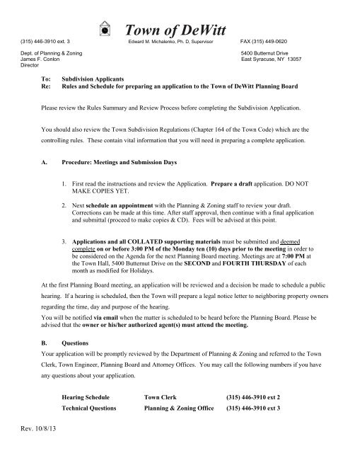
<strong>Town</strong> of <strong>DeWitt</strong><br />
(315) 446-3910 ext. 3 Edward M. Michalenko, Ph. D, Supervisor FAX (315) 449-0620<br />
Dept. of Planning & Zoning<br />
5400 Butternut Drive<br />
James F. Conlon East Syracuse, NY 13057<br />
Director<br />
To:<br />
Re:<br />
<strong>Subdivision</strong> Applicants<br />
Rules and Schedule for preparing an application to the <strong>Town</strong> of <strong>DeWitt</strong> Planning Board<br />
Please review the Rules Summary and Review Process before completing the <strong>Subdivision</strong> <strong>Application</strong>.<br />
You should also review the <strong>Town</strong> <strong>Subdivision</strong> Regulations (Chapter 164 of the <strong>Town</strong> Code) which are the<br />
controlling rules. These contain vital information that you will need in preparing a complete application.<br />
A. Procedure: Meetings and Submission Days<br />
1. First read the instructions and review the <strong>Application</strong>. Prepare a draft application. DO NOT<br />
MAKE COPIES YET.<br />
2. Next schedule an appointment with the Planning & Zoning staff to review your draft.<br />
Corrections can be made at this time. After staff approval, then continue with a final application<br />
and submittal (proceed to make copies & CD). Fees will be advised at this point.<br />
3. <strong>Application</strong>s and all COLLATED supporting materials must be submitted and deemed<br />
complete on or before 3:00 PM of the Monday ten (10) days prior to the meeting in order to<br />
be considered on the Agenda for the next Planning Board meeting. Meetings are at 7:00 PM at<br />
the <strong>Town</strong> Hall, 5400 Butternut Drive on the SECOND and FOURTH THURSDAY of each<br />
month as modified for Holidays.<br />
At the first Planning Board meeting, an application will be reviewed and a decision be made to schedule a public<br />
hearing. If a hearing is scheduled, then the <strong>Town</strong> will prepare a legal notice letter to neighboring property owners<br />
regarding the time, day and purpose of the hearing.<br />
You will be notified via email when the matter is scheduled to be heard before the Planning Board. Please be<br />
advised that the owner or his/her authorized agent(s) must attend the meeting.<br />
B. Questions<br />
Your application will be promptly reviewed by the Department of Planning & Zoning and referred to the <strong>Town</strong><br />
Clerk, <strong>Town</strong> Engineer, Planning Board and Attorney <strong>Of</strong>fices. You may call the following numbers if you have<br />
any questions about your application.<br />
Hearing Schedule <strong>Town</strong> Clerk (315) 446-3910 ext 2<br />
Technical Questions Planning & Zoning <strong>Of</strong>fice (315) 446-3910 ext 3<br />
Rev. 10/8/13
C. <strong>Application</strong> Materials to be submitted:<br />
1. Submit seven (7) copies each of the following:<br />
• Full sized originally stamped, current/updated survey.<br />
• Sketch plan or preliminary subdivision plan.<br />
• <strong>Application</strong> to the Planning Board – one application must have an original signature.<br />
• State Environmental Quality Review (SEQR) short form. Complete PART 1 only – one SEQR form<br />
must have an original signature.<br />
• One (1) CD in PDF format of all of the above documents. Any paper submission should be included<br />
on the CD. Please do not include the instructions as part of the application submission.<br />
2. Fees: $250.00 plus $30.00 per proposed lot payable to “<strong>Town</strong> of <strong>DeWitt</strong>”. Submit a separate check payable<br />
to “<strong>Town</strong> of <strong>DeWitt</strong>” for Technical Review fees, i.e. engineering, legal, etc. This will be held in escrow by the<br />
<strong>Town</strong> for professional service payments related to the review of your application. Check with the Planning &<br />
Zoning <strong>Of</strong>fice for the amount.<br />
3. Documents must be folded to no larger than 11” x 14”; collated in 7 sets; individually secured. Rolled or<br />
unfolded plans will not be accepted. ANY PLANS NOT FOLDED AND/OR COLLATED WILL BE<br />
CHARGED A FEE OF $25.<br />
4. All property owners involved in subdivision must sign application. One application must have original<br />
signatures.<br />
Thank you.<br />
www.townofdewitt.com<br />
Rev 10/8/13
S. FEE: _________RCPT:________<br />
T.R. FEE: _______RCPT:________<br />
EXISTING LOTS: ______________<br />
NO. OF PROPOSED LOTS: ______<br />
SUBDIVISION APPLICATION<br />
TOWN OF DEWITT<br />
PLANNING BOARD<br />
DATE FILED: _____________<br />
TO SOCPA: ______________<br />
CHECKED BY: ____________<br />
INFORMATION:<br />
Name of Applicant (Principal Contact): ________________________________________________________________<br />
Title_________________________ Phone #: ____________________ E-mail:__________________________________<br />
Applicant Address: _________________________________________________________________________________<br />
City/ST/Zip ________________________________________________________________________________<br />
Property Location:_______________________________________________________________________________<br />
City/ST/Zip_________________________________________________________________________________<br />
Tax Map #s involved: ____________________________ Zoning: _______________Total Area: _________________<br />
Property Owner’s Name: ___________________________________<br />
Phone #: _______________________________<br />
Additional:<br />
Property Location:________________________________________________________________________________<br />
City/ST/Zip_________________________________________________________________________________<br />
(2) Tax Map Number(s): ____________________________ Zoning: _______________Total Area: _________________<br />
(2) Property Owner’s Name: ___________________________________ Phone #: _______________________________<br />
Attorney (if applicable): _____________________________________________________________________________<br />
Phone #: ________________________________E-mail: ___________________________________________________<br />
Engineer/ Surveyor: ________________________________________________________________________________<br />
Phone #: ________________________________E-mail: ___________________________________________________<br />
Existing Land Use: _________________________________________________________________________________<br />
Is property in a FEMA floodplain or floodway? Yes __ No__ Or is property in Federal or State Wetland? Yes __ No__<br />
SUMMARY:<br />
Briefly describe the Proposal. Include the number of lots; intended use(s); development schedule; utility provisions; and<br />
land alteration intended.<br />
___________________________________________________________________________________________<br />
___________________________________________________________________________________________<br />
___________________________________________________________________________________________<br />
Rev 10/13
SUBMISSION REQUIREMENTS:<br />
Check “Yes” or “No” to indicate information included with this application. Insert “N/A” if information requested is not<br />
applicable.<br />
1. Yes ___ No___ Current Survey of the property signed by a New York State licensed surveyor including:<br />
legal restrictions and conditions; physical improvements both above and below ground; trees of 6<br />
in. or greater caliper; wetlands and flood plains; topography at 0.5 ft. contour extending offproperty;<br />
adjacent owners and zoning; easement, street lines and property lines; and appropriate<br />
titles and references. (Refer to Chapter 164 of the <strong>Town</strong> Code.)<br />
2. <strong>Subdivision</strong> Plans of entire holding:<br />
a. Yes ___ No___ <strong>Subdivision</strong> plat showing proposed lots, streets, easements, land/water features, proposed<br />
addresses and street names, etc.<br />
b. Yes ___ No___ Road profiles, typical construction details and cross sections<br />
c. Yes ___ No___ Utility plans, including drainage, sanitary, water, power, and communications<br />
d. Yes ___ No___ Grading plans and erosion control measures<br />
e. Yes ___ No___ Miscellaneous details i.e.: lighting, sidewalks, signage, traffic control, staging, street trees,<br />
monumentation, etc.<br />
f. Yes ___ No___ Deed description, proposed dedication and existing & proposed easements<br />
3. State Environmental Quality Review: Short _____ Long _____ DEIS _____<br />
4. Authorizations: (1)Owner: _____________________________________________Date: ______________<br />
(1)Subdivider: __________________________________________Date: ______________<br />
(2)Owner: _____________________________________________Date: ______________<br />
(2)Subdivider: __________________________________________Date: ______________<br />
Rev 10/13
617.20<br />
Appendix B<br />
Short Environmental Assessment Form<br />
Instructions for Completing<br />
Part 1 - Project Information. The applicant or project sponsor is responsible for the completion of Part 1. Responses<br />
become part of the application for approval or funding, are subject to public review, and may be subject to further verification.<br />
Complete Part 1 based on information currently available. If additional research or investigation would be needed to fully<br />
respond to any item, please answer as thoroughly as possible based on current information.<br />
Complete all items in Part 1. You may also provide any additional information which you believe will be needed by or useful<br />
to the lead agency; attach additional pages as necessary to supplement any item.<br />
Part 1 - Project and Sponsor Information<br />
Name of Action or Project:<br />
Project Location (describe, and attach a location map):<br />
Brief Description of Proposed Action:<br />
Name of Applicant or Sponsor:<br />
Address:<br />
Telephone:<br />
E-Mail:<br />
City/PO: State: Zip Code:<br />
1. Does the proposed action only involve the legislative adoption of a plan, local law, ordinance,<br />
administrative rule, or regulation?<br />
If Yes, attach a narrative description of the intent of the proposed action and the environmental resources that<br />
may be affected in the municipality and proceed to Part 2. If no, continue to question 2.<br />
2. Does the proposed action require a permit, approval or funding from any other governmental Agency?<br />
If Yes, list agency(s) name and permit or approval:<br />
NO<br />
NO<br />
YES<br />
YES<br />
3.a. Total acreage of the site of the proposed action?<br />
___________ acres<br />
b. Total acreage to be physically disturbed? ___________ acres<br />
c. Total acreage (project site and any contiguous properties) owned<br />
or controlled by the applicant or project sponsor?<br />
___________acres<br />
4. Check all land uses that occur on, adjoining and near the proposed action.<br />
9 Urban 9 Rural (non-agriculture) 9 Industrial 9 Commercial 9 Residential (suburban)<br />
9 Forest 9 Agriculture 9 Aquatic 9 Other (specify): _________________________<br />
9 Parkland<br />
Page 1 of 4
5. Is the proposed action,<br />
a. A permitted use under the zoning regulations?<br />
NO YES N/A<br />
b. Consistent with the adopted comprehensive plan?<br />
6. Is the proposed action consistent with the predominant character of the existing built or natural<br />
landscape?<br />
7. Is the site of the proposed action located in, or does it adjoin, a state listed Critical Environmental Area?<br />
If Yes, identify: __________________________________________________________________________<br />
_______________________________________________________________________________________<br />
8. a. Will the proposed action result in a substantial increase in traffic above present levels?<br />
NO<br />
NO<br />
NO<br />
YES<br />
YES<br />
YES<br />
b. Are public transportation service(s) available at or near the site of the proposed action?<br />
c. Are any pedestrian accommodations or bicycle routes available on or near site of the proposed action?<br />
9. Does the proposed action meet or exceed the state energy code requirements?<br />
If the proposed action will exceed requirements, describe design features and technologies:<br />
_______________________________________________________________________________________<br />
_______________________________________________________________________________________<br />
10. Will the proposed action connect to an existing public/private water supply?<br />
[If Yes, does the existing system have capacity to provide service? NO YES]<br />
If No, describe method for providing potable water: ______________________________________<br />
_______________________________________________________________________________________<br />
11. Will the proposed action connect to existing wastewater utilities?<br />
[If Yes, does the existing system have capacity to provide service? NO YES]<br />
If No, describe method for providing wastewater treatment: ________________________________<br />
_______________________________________________________________________________________<br />
12. a. Does the site contain a structure that is listed on either the State or National Register of Historic<br />
Places?<br />
b. Is the proposed action located in an archeological sensitive area?<br />
13. a. Does any portion of the site of the proposed action, or lands adjoining the proposed action, contain<br />
wetlands or other waterbodies regulated by a federal, state or local agency?<br />
b. Would the proposed action physically alter, or encroach into, any existing wetland or waterbody?<br />
If Yes, identify the wetland or waterbody and extent of alterations in square feet or acres: _______________<br />
_______________________________________________________________________________________<br />
_______________________________________________________________________________________<br />
NO<br />
NO<br />
NO<br />
NO<br />
NO<br />
YES<br />
YES<br />
YES<br />
YES<br />
YES<br />
14. Identify the typical habitat types that occur on, or are likely to be found on the project site. Check all that apply:<br />
Shoreline Forest Agricultural/grasslands Early mid-successional<br />
Wetland Urban Suburban<br />
15. Does the site of the proposed action contain any species of animal, or associated habitats, listed<br />
by the State or Federal government as threatened or endangered?<br />
NO<br />
YES<br />
16. Is the project site located in the 100 year flood plain? NO YES<br />
17. Will the proposed action create storm water discharge, either from point or non-point sources?<br />
If Yes,<br />
a. Will storm water discharges flow to adjacent properties? NO YES<br />
b. Will storm water discharges be directed to established conveyance systems (runoff and storm drains)?<br />
If Yes, briefly describe:<br />
NO YES<br />
_______________________________________________________________________________________<br />
_______________________________________________________________________________________<br />
NO<br />
YES<br />
Page 2 of 4
18. Does the proposed action include construction or other activities that result in the impoundment of<br />
water or other liquids (e.g. retention pond, waste lagoon, dam)?<br />
If Yes, explain purpose and size: ____________________________________________________________<br />
_______________________________________________________________________________________<br />
_______________________________________________________________________________________<br />
NO<br />
YES<br />
19. Has the site of the proposed action or an adjoining property been the location of an active or closed NO YES<br />
solid waste management facility?<br />
If Yes, describe: _________________________________________________________________________<br />
_______________________________________________________________________________________<br />
_______________________________________________________________________________________<br />
20. Has the site of the proposed action or an adjoining property been the subject of remediation (ongoing or NO YES<br />
completed) for hazardous waste?<br />
If Yes, describe: __________________________________________________________________________<br />
_______________________________________________________________________________________<br />
_______________________________________________________________________________________<br />
I AFFIRM THAT THE INFORMATION PROVIDED ABOVE IS TRUE AND ACCURATE TO THE BEST OF MY<br />
KNOWLEDGE<br />
Applicant/sponsor name: ___________________________________________<br />
Signature: _______________________________________________________<br />
Date: ___________________________<br />
Part 2 - Impact Assessment. The Lead Agency is responsible for the completion of Part 2. Answer all of the following<br />
questions in Part 2 using the information contained in Part 1 and other materials submitted by the project sponsor or<br />
otherwise available to the reviewer. When answering the questions the reviewer should be guided by the concept “Have my<br />
responses been reasonable considering the scale and context of the proposed action?”<br />
1. Will the proposed action create a material conflict with an adopted land use plan or zoning<br />
regulations?<br />
2. Will the proposed action result in a change in the use or intensity of use of land?<br />
3. Will the proposed action impair the character or quality of the existing community?<br />
4. Will the proposed action have an impact on the environmental characteristics that caused the<br />
establishment of a Critical Environmental Area (CEA)?<br />
5. Will the proposed action result in an adverse change in the existing level of traffic or<br />
affect existing infrastructure for mass transit, biking or walkway?<br />
6. Will the proposed action cause an increase in the use of energy and it fails to incorporate<br />
reasonably available energy conservation or renewable energy opportunities?<br />
7. Will the proposed action impact existing:<br />
a. public / private water supplies?<br />
b. public / private wastewater treatment utilities?<br />
8. Will the proposed action impair the character or quality of important historic, archaeological,<br />
architectural or aesthetic resources?<br />
9. Will the proposed action result in an adverse change to natural resources (e.g., wetlands,<br />
waterbodies, groundwater, air quality, flora and fauna)?<br />
No, or<br />
small<br />
impact<br />
may<br />
occur<br />
Moderate<br />
to large<br />
impact<br />
may<br />
occur<br />
Page 3 of 4
10. Will the proposed action result in an increase in the potential for erosion, flooding or drainage<br />
problems?<br />
11. Will the proposed action create a hazard to environmental resources or human health?<br />
No, or<br />
small<br />
impact<br />
may<br />
occur<br />
Moderate<br />
to large<br />
impact<br />
may<br />
occur<br />
Part 3 - Determination of significance. The Lead Agency is responsible for the completion of Part 3. For every<br />
question in Part 2 that was answered “moderate to large impact may occur”, or if there is a need to explain why a particular<br />
element of the proposed action may or will not result in a significant adverse environmental impact, please complete Part 3.<br />
Part 3 should, in sufficient detail, identify the impact, including any measures or design elements that have been included by<br />
the project sponsor to avoid or reduce impacts. Part 3 should also explain how the lead agency determined that the impact<br />
may or will not be significant. Each potential impact should be assessed considering its setting, probability of occurring,<br />
duration, irreversibility, geographic scope and magnitude. Also consider the potential for short-term, long-term and<br />
cumulative impacts.<br />
9 Check this box if you have determined, based on the information and analysis above, and any supporting documentation,<br />
that the proposed action may result in one or more potentially large or significant adverse impacts and an<br />
environmental impact statement is required.<br />
9 Check this box if you have determined, based on the information and analysis above, and any supporting documentation,<br />
that the proposed action will not result in any significant adverse environmental impacts.<br />
_________________________________________________<br />
Name of Lead Agency<br />
_________________________________________________<br />
Print or Type Name of Responsible <strong>Of</strong>ficer in Lead Agency<br />
_________________________________________________<br />
Signature of Responsible <strong>Of</strong>ficer in Lead Agency<br />
_______________________________________________<br />
Date<br />
_______________________________________________<br />
Title of Responsible <strong>Of</strong>ficer<br />
_______________________________________________<br />
Signature of Preparer (if different from Responsible <strong>Of</strong>ficer)<br />
Page 4 of 4


