407 East Environmental Assessment 2009 - Toronto Zoo
407 East Environmental Assessment 2009 - Toronto Zoo
407 East Environmental Assessment 2009 - Toronto Zoo

You also want an ePaper? Increase the reach of your titles
YUMPU automatically turns print PDFs into web optimized ePapers that Google loves.
Natural Environment (Terrestrial) Impact<br />
<strong>Assessment</strong> of the Recommended Design
Natural Environment (Terrestrial) Impact <strong>Assessment</strong><br />
of the Recommended Design<br />
Table of Contents<br />
Page<br />
1. Introduction ..................................................................................................... 1<br />
1.1 Study Overview .............................................................................................................. 1<br />
1.2 Report Overview............................................................................................................. 1<br />
1.3 Natural Environment Study Team .................................................................................. 3<br />
2. Study Area ....................................................................................................... 5<br />
3. Methodology .................................................................................................... 7<br />
4. Additional Field Investigations .................................................................... 12<br />
4.1 Vegetation .................................................................................................................... 12<br />
4.2 Wildlife.......................................................................................................................... 14<br />
4.2.1 Winter Resident and Spring Migrant Birds........................................................ 14<br />
4.2.2 Blanding’s Turtle Habitat Investigations............................................................ 14<br />
4.2.3 Wildlife Passage Analysis................................................................................. 15<br />
4.2.4 Habitat Sensitivity ............................................................................................. 16<br />
5. Detailed Description of the Environment Potentially Affected ................. 18<br />
5.1 <strong>East</strong> Duffins Creek Watershed (Refer to Figure 1 in Appendix A)................................ 19<br />
5.1.1 Vegetation......................................................................................................... 19<br />
5.1.1.1 General Overview .................................................................................................19<br />
5.1.1.2 Flora......................................................................................................................20<br />
5.1.1.3 Rare Species.........................................................................................................20<br />
5.1.2 Wildlife .............................................................................................................. 22<br />
5.1.2.1 General Overview .................................................................................................22<br />
5.1.2.2 Wildlife Habitat ......................................................................................................23<br />
5.1.2.3 Breeding Birds.......................................................................................................24<br />
5.1.2.4 Amphibians ...........................................................................................................25<br />
5.1.2.5 Rare Species.........................................................................................................26<br />
5.1.2.6 Landscape Connectivity ........................................................................................28<br />
5.2 Carruthers Creek Watershed (Refer to Figure 2 in Appendix A) .................................. 28<br />
5.2.1 Vegetation......................................................................................................... 28<br />
5.2.1.1 General Overview .................................................................................................28<br />
5.2.1.2 Flora......................................................................................................................29<br />
5.2.1.3 Rare Species.........................................................................................................29<br />
5.2.2 Wildlife .............................................................................................................. 30<br />
5.2.2.1 General Overview .................................................................................................30<br />
5.2.2.2 Wildlife Habitat ......................................................................................................30<br />
5.2.2.3 Breeding Birds.......................................................................................................31<br />
5.2.2.4 Amphibians ...........................................................................................................32<br />
5.2.2.5 Rare Species.........................................................................................................32<br />
5.2.2.6 Landscape Connectivity ........................................................................................33<br />
May, <strong>2009</strong><br />
i<br />
Gartner Lee Limited<br />
Ecoplans Limited
Natural Environment (Terrestrial) Impact <strong>Assessment</strong><br />
of the Recommended Design<br />
5.3 Lynde Creek Watershed............................................................................................... 33<br />
5.3.1 Vegetation......................................................................................................... 33<br />
5.3.1.1 Lynde Creek – Mainline (Refer to Figures 2 and 6 in Appendix A) .....................33<br />
5.3.1.2 Lynde Creek – West Durham Link (Refer to Figures 3, 4 and 5 in<br />
Appendix A).........................................................................................................35<br />
5.3.2 Wildlife .............................................................................................................. 37<br />
5.3.2.1 Lynde Creek – Mainline ........................................................................................37<br />
5.3.2.2 Wildlife Habitat ......................................................................................................38<br />
5.3.2.3 Breeding Birds.......................................................................................................39<br />
5.3.2.4 Amphibians ...........................................................................................................40<br />
5.3.2.5 Rare Species.........................................................................................................41<br />
5.3.2.6 Landscape Connectivity ........................................................................................41<br />
5.3.2.7 Lynde Creek – West Durham Link ........................................................................42<br />
5.3.2.8 Breeding Birds.......................................................................................................44<br />
5.3.2.9 Amphibians ...........................................................................................................46<br />
5.3.2.10 Rare Species.........................................................................................................46<br />
5.3.2.11 Landscape Connectivity ........................................................................................47<br />
5.4 Oshawa Creek Watershed (Refer to Figures 6, 7, and 8 in Appendix A) ..................... 48<br />
5.4.1 Vegetation......................................................................................................... 48<br />
5.4.1.1 General Overview .................................................................................................48<br />
5.4.1.2 Flora......................................................................................................................49<br />
5.4.1.3 Rare Species.........................................................................................................49<br />
5.4.2 Wildlife .............................................................................................................. 50<br />
5.4.2.1 General Overview .................................................................................................50<br />
5.4.2.2 Wildlife Habitat ......................................................................................................51<br />
5.4.2.3 Breeding Birds.......................................................................................................51<br />
5.4.2.4 Amphibians ...........................................................................................................52<br />
5.4.2.5 Rare Species.........................................................................................................52<br />
5.4.2.6 Landscape Connectivity ........................................................................................53<br />
5.5 Harmony Creek Watershed (Refer to Figure 8 in Appendix A) .................................... 53<br />
5.5.1 Vegetation......................................................................................................... 53<br />
5.5.1.1 General Overview .................................................................................................53<br />
5.5.1.2 Flora......................................................................................................................54<br />
5.5.1.3 Rare Species.........................................................................................................54<br />
5.5.2 Wildlife .............................................................................................................. 54<br />
5.5.2.1 General Overview .................................................................................................54<br />
5.5.2.2 Wildlife Habitat ......................................................................................................55<br />
5.5.2.3 Breeding Birds.......................................................................................................55<br />
5.5.2.4 Amphibians ...........................................................................................................56<br />
5.5.2.5 Rare Species.........................................................................................................56<br />
5.5.2.6 Landscape Connectivity ........................................................................................56<br />
5.6 <strong>East</strong> Mainline – Farewell Creek, Black Creek, Bowmanville Creek, Soper Creek<br />
and Wilmot Creek Watersheds..................................................................................... 57<br />
5.6.1 Central Lake Ontario Conservation (CLOCA) (Refer to Figures 9, 13 and<br />
14 in Appendix A) ............................................................................................. 57<br />
5.6.1.1 Vegetation .............................................................................................................57<br />
5.6.1.2 Wildlife...................................................................................................................59<br />
May, <strong>2009</strong><br />
ii<br />
Gartner Lee Limited<br />
Ecoplans Limited
Natural Environment (Terrestrial) Impact <strong>Assessment</strong><br />
of the Recommended Design<br />
5.6.2 Ganaraska Region Conservation (GRCA) (Refer to Figures 14 & 15 in<br />
Appendix A) ...................................................................................................... 62<br />
5.6.2.1 Vegetation .............................................................................................................62<br />
5.6.2.2 Wildlife...................................................................................................................64<br />
5.7 <strong>East</strong> Durham Link – Black Creek, Tooley Creek and Darlington Creek<br />
Watersheds (Refer to Figures 9, 10, 11 and 12 in Appendix A) ................................... 67<br />
5.7.1 Vegetation......................................................................................................... 67<br />
5.7.1.1 General Overview .................................................................................................67<br />
5.7.1.2 Flora......................................................................................................................68<br />
5.7.1.3 Rare Species.........................................................................................................68<br />
5.7.2 Wildlife .............................................................................................................. 69<br />
5.7.2.1 General Overview .................................................................................................69<br />
5.7.2.2 Wildlife Habitat ......................................................................................................70<br />
5.7.2.3 Breeding Birds.......................................................................................................70<br />
5.7.2.4 Amphibians ...........................................................................................................71<br />
5.7.2.5 Rare Species.........................................................................................................71<br />
5.7.2.6 Landscape Connectivity ........................................................................................72<br />
6. Potential Effects and Mitigation................................................................... 73<br />
6.1 Overview....................................................................................................................... 73<br />
6.1.1 Construction Effects.......................................................................................... 74<br />
6.1.1.1 Vegetation .............................................................................................................74<br />
6.1.1.2 Wildlife...................................................................................................................75<br />
6.1.2 Operation and Maintenance Effects ................................................................. 77<br />
6.1.2.1 Vegetation .............................................................................................................77<br />
6.1.2.2 Wildlife...................................................................................................................78<br />
6.1.3 Standard Mitigation Applied Across the Study Area ......................................... 79<br />
6.1.3.1 Mitigation During Planning and Design .................................................................79<br />
6.1.3.2 Construction Mitigation..........................................................................................80<br />
6.1.4 Site Specific Mitigation and Enhancement ....................................................... 84<br />
6.1.4.1 Edge Management Strategies...............................................................................84<br />
6.1.4.2 Butternut Mitigation Strategy.................................................................................85<br />
6.1.4.3 Invasive Plant Species Management Strategies...................................................86<br />
6.1.4.4 Vegetation Salvage Opportunities.........................................................................86<br />
6.1.4.5 Valley and Forest Restoration Plans.....................................................................87<br />
6.1.4.6 Wildlife Passage Structures ..................................................................................90<br />
6.1.4.7 Wildlife Passage Structure Design Criteria and Considerations ...........................91<br />
6.1.4.8 Restoration//Creation/Enhancement .....................................................................94<br />
6.1.5 Operation and Maintenance Mitigation ............................................................. 97<br />
6.2 <strong>East</strong> Duffins Creek Watershed ..................................................................................... 98<br />
6.2.1 Vegetation......................................................................................................... 98<br />
6.2.2 Wildlife ............................................................................................................ 102<br />
6.3 Carruthers Creek Watershed...................................................................................... 108<br />
6.3.1 Vegetation....................................................................................................... 108<br />
6.3.2 Wildlife ............................................................................................................ 111<br />
6.4 Lynde Creek Watershed............................................................................................. 115<br />
May, <strong>2009</strong><br />
iii<br />
Gartner Lee Limited<br />
Ecoplans Limited
Natural Environment (Terrestrial) Impact <strong>Assessment</strong><br />
of the Recommended Design<br />
6.4.1 Vegetation....................................................................................................... 115<br />
6.4.1.1 Lynde Creek - Mainline .......................................................................................115<br />
6.4.1.2 Lynde Creek – West Durham Link ......................................................................118<br />
6.4.2 Wildlife ............................................................................................................ 122<br />
6.4.2.1 Lynde Creek - Mainline .......................................................................................122<br />
6.4.2.2 Lynde Creek – West Durham Link ......................................................................126<br />
6.6 Oshawa Creek Watershed ......................................................................................... 130<br />
6.6.1 Vegetation....................................................................................................... 130<br />
6.6.2 Wildlife ............................................................................................................ 135<br />
6.7 Harmony Creek Watershed ........................................................................................ 139<br />
6.7.1 Vegetation....................................................................................................... 139<br />
6.7.2 Wildlife ............................................................................................................ 142<br />
6.8 <strong>East</strong> Mainline – Farewell Creek, Black Creek, Bowmanville Creek, Soper Creek<br />
and Wilmot Creek Watersheds................................................................................... 145<br />
6.8.1 Central Lake Ontario Conservation (CLOCA)................................................. 145<br />
6.8.1.1 Vegetation ...........................................................................................................145<br />
6.8.1.2 Wildlife.................................................................................................................148<br />
6.8.2 Ganaraska Region Conservation (GRCA)...................................................... 151<br />
6.8.2.1 Vegetation ...........................................................................................................151<br />
6.8.2.2 Wildlife.................................................................................................................153<br />
6.9 <strong>East</strong> Durham Link – Black Creek, Tooley Creek and Darlington Creek<br />
Watersheds ................................................................................................................ 156<br />
6.9.1 Vegetation....................................................................................................... 156<br />
6.9.2 Wildlife ............................................................................................................ 158<br />
6.10 Summary of Anticipated Effects and Residual Effects ............................................... 161<br />
7. Monitoring and Commitments for the Undertaking ................................. 163<br />
7.1 <strong>Environmental</strong> Effects Monitoring............................................................................... 163<br />
7.1.1 Species at Risk ............................................................................................... 163<br />
7.1.1.1 Butternut..............................................................................................................163<br />
7.1.2 Vegetation....................................................................................................... 163<br />
7.1.3 Groundwater Inputs to Wetlands .................................................................... 164<br />
7.1.4 Wildlife Passage ............................................................................................. 164<br />
7.2 Commitments ............................................................................................................. 164<br />
8. Terrestrial Approvals Required for the Undertaking ............................... 168<br />
8.1 Endangered Species Act – Ministry of Natural Resources......................................... 168<br />
9. Summary ...................................................................................................... 169<br />
9.1 Species at Risk........................................................................................................... 170<br />
9.1.1 Butternut ......................................................................................................... 170<br />
9.1.2 Blanding’s Turtle and Golden-winged Warbler ............................................... 170<br />
9.2 Vegetation .................................................................................................................. 170<br />
9.2.1 Wildlife ............................................................................................................ 172<br />
10. References ................................................................................................... 175<br />
May, <strong>2009</strong><br />
iv<br />
Gartner Lee Limited<br />
Ecoplans Limited
Natural Environment (Terrestrial) Impact <strong>Assessment</strong><br />
of the Recommended Design<br />
11. Glossary ....................................................................................................... 181<br />
List of Figures<br />
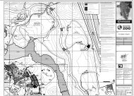
Figure A. Transportation Corridor Footprint/Sections...................................................................... 4<br />
Figure B. Roadmap ......................................................................................................................... 8<br />
List of Tables<br />
Table 1. Regionally Rare Flora in the Study Area of the <strong>East</strong> Duffins Creek Watershed ............ 21<br />
Table 2. Locally Rare Flora in the Study Area of the <strong>East</strong> Duffins Creek Watershed.................. 21<br />
Table 3. Summary of Specialized and Sensitive Wildlife Habitat (SSWH) Areas Within or<br />
Adjacent to the Transportation Corridor – <strong>East</strong> Duffins Creek Watershed .................... 23<br />
Table 4. Forest Area-sensitive Species in the Study Area of the <strong>East</strong> Duffins Creek<br />
Watershed ..................................................................................................................... 25<br />
Table 5. Rare Bird Species in the Study Area of the <strong>East</strong> Duffins Creek Watershed.................. 26<br />
Table 6. Locally Rare Flora in the Study Area of the Carruthers Creek Watershed .................... 30<br />
Table 7. Forest Area-sensitive Bird Species in the Study Area of the Carruthers Creek<br />
Watershed ..................................................................................................................... 31<br />
Table 8. Rare Bird Species in the Study Area of the Carruthers Creek Watershed ................... 32<br />
Table 9. Regionally Rare Plant Species in the Study Area of the Lynde Creek Watershed<br />
(Mainline)....................................................................................................................... 35<br />
Table 10. Regionally Rare Plant Species in the Study Area of the Lynde Creek Watershed<br />
(West Durham Link)....................................................................................................... 37<br />
Table 11. Summary of Specialized and Sensitive Wildlife Habitat Areas Within or Adjacent<br />
to the Transportation Corridor........................................................................................ 39<br />
Table 12. Forest Area-sensitive Species in the Study Area of the Lynde Creek Watershed<br />
(Mainline)....................................................................................................................... 40<br />
Table 13. Rare Bird Species in the Study Area of the Lynde Creek Watershed (Mainline)........... 41<br />
Table 14. Summary of Specialized and Sensitive Wildlife Habitat Areas Within or Adjacent<br />
to the Transportation Corridor........................................................................................ 44<br />
Table 15. Forest Area-sensitive Species in the Study Area of the Lynde Creek Watershed<br />
(West Durham Link)....................................................................................................... 45<br />
Table 16. Rare Bird Species in the Study Area of the Lynde Creek Watershed (West<br />
Durham Link) ................................................................................................................. 47<br />
Table 17. Regionally Rare Flora in the Study Area of the Oshawa Creek Watershed .................. 50<br />
Table 18. Summary of Specialized and Sensitive Wildlife Habitat Areas Within or Adjacent<br />
to the Transportation Corridor........................................................................................ 51<br />
Table 19. Forest Area-sensitive Species in the Study Area of the Oshawa Creek<br />
Watershed ..................................................................................................................... 52<br />
May, <strong>2009</strong><br />
v<br />
Gartner Lee Limited<br />
Ecoplans Limited
Natural Environment (Terrestrial) Impact <strong>Assessment</strong><br />
of the Recommended Design<br />
Table 20. Forest Area-sensitive Species in the Study Area of the Harmony Creek<br />
Watershed ..................................................................................................................... 55<br />
Table 21. Regionally Rare Flora in the Study Area of the Farwell Creek, Black Creek,<br />
Bowmanville Creek and Soper Creek Watersheds (<strong>East</strong> Mainline)............................... 59<br />
Table 22. Summary of Specialized and Sensitive Wildlife Habitat (SSWH) Areas Within or<br />
Adjacent to the Transportation Corridor......................................................................... 60<br />
Table 23. Forest Area Sensitive Species in the Study Area of the Farwell Creek, Black<br />
Creek, Bowmanville Creek and Soper Creek Watersheds............................................ 61<br />
Table 24. Rare Bird Species in the Study Area of the Farwell Creek, Black Creek,<br />
Bowmanville Creek and Soper Creek Watersheds........................................................ 62<br />
Table 25. Regionally Rare Flora in the Study Area of the Wilmot Creek Watershed .................... 63<br />
Table 26. Summary of Specialized and Sensitive Wildlife Habitat (SSWH) Areas Within or<br />
Adjacent to the Transportation Corridor......................................................................... 64<br />
Table 27. Forest Area-sensitive Species in the Study Area of the Wilmot Creek Watershed ....... 65<br />
Table 28. Rare Bird Species in the Study Area of the Wilmot Creek Watershed .......................... 67<br />
Table 29. Regionally Rare Flora in the Study Area of the Black Creek, Tooley Creek and<br />
Darlington Creek Watersheds........................................................................................ 69<br />
Table 30. Summary of Specialized and Sensitive Wildlife Habitat (SSWH) Areas Within or<br />
Adjacent to the Transportation Corridor......................................................................... 70<br />
Table 31. Forest Area-sensitive Species in the Study Area of the Black Creek, Tooley<br />
Creek and Darlington Creek Watersheds...................................................................... 71<br />
Table 32. Rare Bird Species of the Study Area of the Black Creek, Tooley Creek and<br />
Darlington Creek Watersheds........................................................................................ 72<br />
Table 33. Summary of Vegetation Removals .............................................................................. 161<br />
Table 34. Interior Forest Habitat Removed.................................................................................. 162<br />
Table 35. Summary of EA Commitments .................................................................................... 166<br />
Appendices<br />
A. Natural Environment Impact <strong>Assessment</strong> Tables and Mapping<br />
B. Plant Species Lists<br />
C. Butternut Health <strong>Assessment</strong><br />
D. Bird Species Lists<br />
E. Amphibian Species Lists<br />
F. Wildlife Passage Analysis<br />
G. Recommended Design Plans<br />
May, <strong>2009</strong><br />
vi<br />
Gartner Lee Limited<br />
Ecoplans Limited
Natural Environment (Terrestrial) Impact <strong>Assessment</strong><br />
of the Recommended Design<br />
1. Introduction<br />
1.1 Study Overview<br />
The Ontario Ministry of Transportation (MTO) in consultation with the Region of Durham, its<br />
constituents and surrounding municipalities, is undertaking an Individual <strong>Environmental</strong><br />
<strong>Assessment</strong> (EA) Study to address the long-term transportation needs in the Region of Durham<br />
and surrounding area. The study supports the transportation objectives of the provincial Growth<br />
Plan for the Greater Golden Horseshoe by providing for the efficient movement of people and<br />
goods within the study area. A proposed extension of the <strong>407</strong> transportation corridor, consisting of<br />
a highway and transitway, has been recommended as part of a number of transportation<br />
improvements, as defined in an earlier phase of the Individual EA.<br />
A technically preferred route (TPR) for the transportation corridor was presented in June 2008.<br />
The preferred route extends from the current terminus at Brock Road in Pickering to Highway<br />
35/115 in Clarington and includes two north-south links connecting Highway 401 to the proposed<br />
extension of the <strong>407</strong> corridor, one in West Durham (Whitby) and the other in <strong>East</strong> Durham<br />
(Clarington).<br />
Since the release of the TPR, further analysis and preliminary design work has been undertaken to<br />
define the transportation corridor in greater detail, including additional route refinements and the<br />
location / size of support facilities for the corridor. In addition, ongoing studies and analysis have<br />
been undertaken to determine potential environmental impacts and proposed mitigation measures<br />
and strategies. The Recommended Design for the proposed transportation corridor, including the<br />
two north-south links, was presented in January / February <strong>2009</strong>.<br />
1.2 Report Overview<br />
In Summary, this report documents the Terrestrial Impact <strong>Assessment</strong> of the Recommended<br />
Design associated with the <strong>407</strong> <strong>East</strong> <strong>Environmental</strong> <strong>Assessment</strong> (EA). Readers are encouraged to<br />
view this report in its entirety. Similarly, it is recommended that all Impact <strong>Assessment</strong> Reports<br />
(discussed further below) are to be read in tandem with this report, to gain a full understanding of<br />
the discipline specific impact assessment work undertaken for the Recommended Design and the<br />
proposed mitigation and compensation measures.<br />
In the preceding Alternative Methods phase of the Study, a comparative evaluation of the shortlisted<br />
routes was carried out to determine a Technically Recommended Route (TRR) 1 . To<br />
determine the TRR, the potential environmental effects, mitigation or compensation measures to<br />
address the negative potential environmental effects, and the remaining net effects were identified.<br />
1. Ministry of Transportation, Final Draft, <strong>407</strong> <strong>East</strong> <strong>Environmental</strong> <strong>Assessment</strong>, Alternative Methods Report, August 2007.<br />
May, <strong>2009</strong> 1<br />
Gartner Lee Limited<br />
Ecoplans Limited
Natural Environment (Terrestrial) Impact <strong>Assessment</strong><br />
of the Recommended Design<br />
Based on stakeholder input, further analysis and preliminary design work to define the preferred<br />
route in greater detail, including the location/size of support facilities for the corridor and to further<br />
avoid or mitigate environmental effects, the TRR was refined in a number of locations as part of<br />
determining the Technically Preferred Route (TPR). The footprint of the Recommended Design for<br />
the transportation corridor, including support facilities such as transitway stations, maintenance<br />
facilities and stormwater management ponds is illustrated in Figure A.<br />
The approved <strong>407</strong> <strong>East</strong> EA Terms of Reference (ToR) proposed that a concept design (including<br />
plan and profile) of the Recommended Design would be prepared so that the potential<br />
environmental effects and mitigation or compensation measures previously identified during the<br />
Alternative Methods phase, could be more accurately defined and include enhancement<br />
opportunities and approval requirements 2 . However, the Ministry of Transportation (MTO) has<br />
enhanced the design effort from Concept Design to Preliminary Design in order to further increase<br />
the level of detail for the Recommended Design and advance the overall project delivery schedule.<br />
The discipline specific work plans developed earlier in the <strong>407</strong> <strong>East</strong> EA, outlining how impacts<br />
associated with the Recommended Design would be assessed, were carried out within the context<br />
of Preliminary Design rather than Concept Design. The results from assessing the impacts are<br />
documented in the following 11 stand alone Impact <strong>Assessment</strong> Reports:<br />
<br />
<br />
<br />
<br />
<br />
<br />
Terrestrial<br />
Fisheries<br />
Hydrogeology<br />
Landscape Composition<br />
Socio-Economic (including Land Use)<br />
Noise<br />
<br />
<br />
<br />
<br />
<br />
Air Quality<br />
Agricultural<br />
Waste Management and Contamination<br />
Archaeology<br />
Cultural Heritage<br />
Not withstanding the fact that the Impact <strong>Assessment</strong> Reports are individual, stand alone<br />
documents, there are interrelationships between the reports with information discussed overlaps<br />
with related disciplines. Examples of this include the following:<br />
2. Ministry of Transportation, <strong>407</strong> <strong>East</strong> <strong>Environmental</strong> <strong>Assessment</strong> Terms of Reference, As amended November 29, 2004.<br />
May, <strong>2009</strong> 2<br />
Gartner Lee Limited<br />
Ecoplans Limited
Natural Environment (Terrestrial) Impact <strong>Assessment</strong><br />
of the Recommended Design<br />
<br />
<br />
<br />
Terrestrial, Fisheries, and Hydrogeology<br />
Socio-Economic (including Land Use), Agricultural<br />
Hydrogeology and Waste Management and Contamination<br />
A Landscape Composition Impact <strong>Assessment</strong> Report has also been developed which utilizes and<br />
builds on the mitigation and compensation measures outlined within this report and within those<br />
reports prepared by other disciplines. The landscape composition report and plans have combined<br />
the mitigation recommendations of all disciplines to generate a landscape composition plan for the<br />
entire transportation corridor, please refer to that report for those plans.<br />
1.3 Natural Environment Study Team<br />
A Study Team consisting of Gartner Lee Limited and Ecoplans Limited staff undertook the natural<br />
environment impact assessment. The team members and their roles are identified below:<br />
Michael Roy ............... Senior Ecologist – Natural Environment Lead and Fisheries Advisor<br />
Dale Leadbeater ........ Senior Ecologist – Terrestrial Advisor and Quality Control<br />
Steve Usher ............... Senior Hydrogeologist – Hydrogeology Lead<br />
James Kamstra.......... Senior Terrestrial Ecologist<br />
Jennifer Paterson....... Biogeographer - Natural Environment Co-ordinator<br />
Jason Cole................. Hydrogeologist<br />
Dan Gibson................ Fisheries <strong>Assessment</strong> Specialist<br />
Rosalind Chaundy...... Terrestrial Ecologist<br />
Anne MacMillan ......... Senior Fisheries Biologist and Advisor<br />
Geoff Gartshore ......... Senior Ecologist<br />
Gillian Thompson....... <strong>Environmental</strong> Planner - Natural Environment Co-ordinator<br />
Jeff Gross................... Senior Ecologist - Terrestrial Advisor and Quality Control<br />
Kim LeBrun ............... Fisheries Biologist<br />
Rebecca Hay ............. Botanist<br />
Holly Anderson........... Avian Biologist<br />
Stephen Dinka ........... Terrestrial Ecologist<br />
Stacey Litwiller........... Fisheries Biologist<br />
May, <strong>2009</strong> 3<br />
Gartner Lee Limited<br />
Ecoplans Limited
Natural Environment (Terrestrial) Impact <strong>Assessment</strong><br />
of the Recommended Design<br />
Figure A.<br />
Transportation Corridor Footprint/Sections<br />
May, <strong>2009</strong> 4<br />
Gartner Lee Limited<br />
Ecoplans Limited
Natural Environment (Terrestrial) Impact <strong>Assessment</strong><br />
of the Recommended Design<br />
2. Study Area<br />
As illustrated in Figure A, the study area associated with the Recommended Design is composed<br />
of seven sections; five sections for the mainline and one section each for the West and <strong>East</strong> links.<br />
These seven sections reflect how the TRR was subdivided during the Alternative Methods phase.<br />
A description of the transportation corridor for each of these sections is provided below.<br />
Transitway stations are proposed at all interchange locations with the exception of Thickson Road<br />
on the mainline.<br />
West Mainline – Section 1 (Brock Road to Audley Road)<br />
The transportation corridor commences at Brock Road in Pickering and continues easterly to<br />
Audley Road crossing Highway 7 at Sideline 16 . It is compatible with the proposed Brock Road<br />
realignment east of the Village of Brougham and the proposed Westney Road realignment east of<br />
the Hamlet of Greenwood. Interchanges are located at Brock Road By-Pass, Westney Road and<br />
Salem Road, with a realignment of Highway 7 required in the vicinity of Sideline 16 to<br />
accommodate the Brock Road Interchange. A highway maintenance facility and a Commercial<br />
Vehicle Inspection Facility (CVIF) are also proposed at Salem Road.<br />
West Mainline – Section 2 (Audley Road to Ashburn Road)<br />
Continuing easterly from Audley Road, the transportation corridor crosses to the south of Highway<br />
7 between Cochrane Street and Ashburn Road in Whitby. The corridor remains to the south of<br />
Brooklin and continues east past Baldwin Street. Interchanges are proposed at Lake Ridge Road<br />
and Baldwin Street and a freeway to freeway interchange is proposed just east of Lake Ridge<br />
Road to accommodate moves between the mainline and the West Durham Link. A transitway<br />
maintenance facility is also proposed at Lake Ridge Road.<br />
Central Mainline – Section 3 (Ashburn Road to Simcoe Street)<br />
From the Baldwin Street interchange, the transportation corridor heads directly east to Thickson<br />
Road and then northeast crossing Winchester Road in the vicinity of Thornton Road in Oshawa .<br />
Interchanges are proposed at Baldwin Street, Thickson Road and Simcoe Street.<br />
Central Mainline – Section 4 (Simcoe Street to Enfield Road)<br />
From Simcoe Street, the route continues easterly paralleling the hydro corridor north of Winchester<br />
Road. <strong>East</strong> of Harmony Road, the transportation corridor crosses the hydro corridor and heads in a<br />
southeasterly direction to Enfield Road in Clarington. Interchanges are proposed at Simcoe Street,<br />
Harmony Road, and Enfield Road within this section. A transitway maintenance facility is also<br />
proposed at Simcoe Street.<br />
<strong>East</strong> Mainline – Section 5 (Enfield Road to Highway 35/115)<br />
From Enfield Road, the transportation corridor continues to the east, remaining south of<br />
Winchester Road until Nixon Road, at which point the corridor heads north to connect with<br />
May, <strong>2009</strong> 5<br />
Gartner Lee Limited<br />
Ecoplans Limited
Natural Environment (Terrestrial) Impact <strong>Assessment</strong><br />
of the Recommended Design<br />
Highway 35/115. Local road realignments will be required for Winchester Road at Regional Road<br />
57 as well as Winchester Road at Darlington-Clarke Townline Road. Interchanges are proposed at<br />
Regional Road 57, Darlington-Clarke Townline Road and Highway 35/115. A freeway to freeway<br />
interchange is proposed just east of Solina Road to accommodate moves between the mainline<br />
and the <strong>East</strong> Durham Link. A highway maintenance facility is proposed at Regional Road 57 and a<br />
CVIF is proposed at Bethesda Road.<br />
West Durham Link – Section 6<br />
Commencing at Highway 401, the West Durham Link runs north east of Lake Ridge Road in<br />
Whitby. A realignment of Coronation Road is proposed from Dundas Street to Taunton Road. Full<br />
interchanges are proposed at Rossland Road and Taunton Road. Partial interchanges are<br />
proposed at Dundas Street and Highway 7. A freeway to freeway interchange is proposed to<br />
accommodate moves between Highway 401 and the West Durham Link, just east of Lake Ridge<br />
Road. Two CVIF lay-bys are also proposed north of Taunton Road.<br />
<strong>East</strong> Durham Link – Section 7<br />
Commencing at Highway 401, the <strong>East</strong> Durham Link runs to the west of Solina Road to Nash Road<br />
in Clarington, where it then crosses Solina Road, running parallel to Rundle Road on the west<br />
sideError! Reference source not found.. Realignments of Hancock Road at Highway 2 and of<br />
Rundle Road just south of Taunton Road are required. A full interchange is proposed Highway 2<br />
and a partial interchange is proposed at Taunton Road. A freeway to freeway interchange is<br />
proposed to accommodate moves between Highway 401 and the <strong>East</strong> Durham Link east of<br />
Courtice Road. A CVIF lay-by is also proposed just north of Bloor Street.<br />
The Recommended Design Plans for the seven sections are provided in Appendix G.<br />
While the Study Area is defined broadly as the Recommended Design (as described above),<br />
discipline-specific study areas were defined in accordance with the Ministry of Transportation<br />
<strong>Environmental</strong> Reference (ERD) for Highway Design (October 2006). Section 3.2.1 of the ERD<br />
defines the Study Area for the purposes of investigating the potential impacts of the project on all<br />
terrestrial ecosystems as within the proposed ROW and adjacent lands for 120 m unless a<br />
sensitive receptor greater than the distance of 120 m is likely to be adversely affected.<br />
The Study Area for the landscape connectivity and wildlife linkage analysis extends beyond the<br />
Recommended Design and the 120 m adjacent lands, to enable a regional assessment of habitat<br />
nodes and key linkages within southern Durham.<br />
May, <strong>2009</strong> 6<br />
Gartner Lee Limited<br />
Ecoplans Limited
Natural Environment (Terrestrial) Impact <strong>Assessment</strong><br />
of the Recommended Design<br />
3. Methodology<br />
The methodology chapter provides an overview of the approach taken to advance from the route<br />
planning/evaluation (Alternative Methods) to the assessment of impacts associated with the<br />
Preliminary Design of the transportation corridor (highway, transitway and ancillary facilities).<br />
Specific technical methodology associated with the field investigations and analyses are provided<br />
in Chapter 4.<br />
During the route planning/evaluation (Alternative Methods) stage, the overall objective of the<br />
terrestrial ecosystems planning work was to ensure that terrestrial features, and particularly<br />
significant and sensitive features, were comprehensively identified and integrated during<br />
development and evaluation of alternatives to select the TRR. The terrestrial ecosystem-related<br />
objective during the generation of alternatives was to ensure that alternatives avoided or minimized<br />
impacts to terrestrial features, and particularly sensitive and high quality features, to the extent<br />
possible while still meeting the technical planning design objectives and requirements.<br />
The evaluation of routes (Alternative Methods) and the preliminary determination of net effects<br />
associated with the various route alternatives is documented in the Alternative Methods Technical<br />
Report (Natural Environment, August 2007). The natural environmental background and field<br />
information that supported route planning/evaluation (Alternative Methods) is documented in the<br />
<strong>407</strong> <strong>East</strong> <strong>Environmental</strong> <strong>Assessment</strong> Natural Environment Field Investigations Report (March<br />
2008) (Figure B).<br />
Once the TRR was selected, the key objective of the terrestrial ecosystem work during Preliminary<br />
Design (including developing and evaluating design refinements and alternatives) was to augment<br />
the existing information base along the Recommended Design to a level of detail so that a<br />
comprehensive impact assessment and appropriate preliminary mitigation measures could be<br />
developed.<br />
Prior to conducting 2008 field surveys; the existing terrestrial ecosystems background information,<br />
previous field surveys and analysis compiled during route planning/evaluation (Alternative<br />
Methods) and summarized <strong>407</strong> <strong>East</strong> <strong>Environmental</strong> <strong>Assessment</strong> Natural Environment Field<br />
Investigations Report (March 2008) were reviewed with MTO and agency staff to identify<br />
sensitivities, issues and key areas of concern along the Recommended Design of the<br />
transportation corridor. The database was updated with new agency input.<br />
Field investigations were completed to ensure the database was sufficiently detailed to finalize the<br />
sensitivities analysis and support the Preliminary Design process, impact assessment and<br />
development of mitigation measures. An appropriate area of field investigation was identified<br />
along the transportation corridor and field surveys were conducted. The field data collection<br />
incorporated terrestrial ecosystem parameters outlined in the <strong>Environmental</strong> Reference for<br />
Highway Design (ERD), (MTO, 2006) as well as any additional site specific parameters of<br />
May, <strong>2009</strong> 7<br />
Gartner Lee Limited<br />
Ecoplans Limited
Natural Environment (Terrestrial) Impact <strong>Assessment</strong><br />
of the Recommended Design<br />
Figure B.<br />
Roadmap<br />
EA Schedule / Phase<br />
Previously Prepared Reports<br />
May, <strong>2009</strong> 8<br />
Gartner Lee Limited<br />
Ecoplans Limited
Natural Environment (Terrestrial) Impact <strong>Assessment</strong><br />
of the Recommended Design<br />
interest, scoped in accordance with the available database and understanding of existing terrestrial<br />
ecosystem conditions. As noted above, in Chapter 2, the area of investigation for terrestrial<br />
surveys encompassed the ROW for the Recommended Design and adjacent lands for 120 m<br />
unless a sensitive receptor greater than the distance of 120 m is likely to be adversely affected.<br />
The Study Area for the landscape connectivity and wildlife linkage analysis extends beyond the<br />
transportation corridor and the 120 m adjacent lands, to enable a regional assessment of habitat<br />
nodes and key linkages within southern Durham Region.<br />
Any specific concerns and potential issues raised by the Ministry of Natural Resources (MNR),<br />
<strong>Toronto</strong> Region Conservation (TRCA), Central Lake Ontario Region Conservation (CLOCA),<br />
Ganaraska Region Conservation (GRCA), Environment Canada (EC) and Fisheries and Oceans<br />
Canada (DFO) staff and other interested reviewers were also considered and incorporated into the<br />
field surveys where feasible. Furthermore, all relevant watershed management plans and fisheries<br />
management plans/resource studies continued to be used to inform the impact assessment and<br />
particularly the identification of enhancement opportunities. Specifically, the following CA/MNR<br />
plans were employed:<br />
<br />
<br />
<br />
<br />
<br />
<br />
A Watershed Plan for Duffins Creek and Carruthers Creek. <strong>Toronto</strong> and Region<br />
Conservation 2003.<br />
Fisheries Management Plan for Duffins Creek and Carruthers Creek. <strong>Toronto</strong> and<br />
Region Conservation 2004.<br />
Lynde Creek Aquatic Resource Management Plan. Central Lake Ontario Conservation<br />
Authority 2006.<br />
Lynde Creek Watershed Existing Conditions Report – Draft. Central Lake Ontario<br />
Conservation Authority 2007.<br />
Oshawa Creek Watershed Aquatic Resource Management Plan. Central Lake Ontario<br />
Conservation Authority 2002a.<br />
Oshawa Creek Watershed Management Plan. Central Lake Ontario Conservation<br />
Authority 2002b.<br />
Harmony Creek Subwatershed Plan Study: Final Report. Aquafor Beech Limited 2001.<br />
<br />
<br />
<br />
Central Lake Ontario Fisheries Management Plan. Draft July 2007. Central Lake<br />
Ontario Conservation, Department of Fisheries and Oceans and Ontario Ministry of<br />
Natural Resources<br />
Bowmanville/Soper Creek Watershed Aquatic Resource Management Plan. Central<br />
Lake Ontario Conservation Authority, Ontario Ministry of Natural Resources,<br />
Department of Fisheries and Oceans. 2000<br />
Wilmot Creek Fisheries Management Plan. Draft January 2007. Ganaraska Region<br />
Conservation, Ontario Ministry of Natural Resources and Department of Fisheries and<br />
Oceans<br />
May, <strong>2009</strong> 9<br />
Gartner Lee Limited<br />
Ecoplans Limited
Natural Environment (Terrestrial) Impact <strong>Assessment</strong><br />
of the Recommended Design<br />
The route planning/evaluation stage placed a priority on avoidance of the highest quality<br />
vegetation/habitat areas based on a characterization of woodland, wetland and other vegetation<br />
and wildlife habitat features. In the local and regional setting, updated terrestrial ecosystem<br />
information was collected along/near the TRR during the Preliminary Design stage with a view to<br />
assessing potential impacts of the construction and operation of the transportation corridor and all<br />
associated works. Implications of the specific siting and alignment of the various valley crossings,<br />
as well as the interchange footprints, all associated highway facilities, and associated<br />
municipal/regional road works (realignments, decommissioning) were specifically considered in<br />
relation to the vegetation and habitat present along/near the transportation corridor.<br />
All of the field information was analyzed to refine the identified sensitivities, significance and<br />
potential issues, constraints and opportunities of terrestrial habitat features along the transportation<br />
corridor. Functional sensitivities such as wildlife movement in relation to anticipated valley<br />
crossings was an important component of the analysis of sensitivities, as was the presence or<br />
potential for critical habitat, sensitive species or Species at Risk near the transportation corridor. A<br />
key part of this process was integrating the sensitivities analysis with the groundwater specialists,<br />
as well as with the aquatic biologists and design engineers to ensure a comprehensive<br />
understanding of the inter-relationships and dependencies critical to supporting key terrestrial<br />
habitat elements.<br />
A complete understanding of the sensitivities and inter-relationships was essential to developing<br />
appropriate design and construction measures to mitigate potential impacts. Hydrologic,<br />
hydrogeologic/groundwater and geotechnical (organics, sandy, silty soils) conditions influence<br />
terrestrial habitat features and functions. This information was integrated into the terrestrial<br />
inventory and analysis to ensure potential sensitivities such as groundwater discharge, organics<br />
and potentially erodible soils or unstable slopes were understood in relation to wetland, riparian<br />
and upland habitat functions, as well as potential impacts. Potential impacts identified in the<br />
Hydrogeology Impact <strong>Assessment</strong> of the Recommended Design (May <strong>2009</strong>) were also reviewed<br />
and considered in the context of potential associated effects on groundwater dependant and<br />
sensitive vegetation communities and habitats.<br />
The terrestrial habitat analysis refined the specific attribute and functional sensitivities and relative<br />
ranking developed during the route planning/evaluation (Alternative Methods) stage. The analysis,<br />
outlined in Chapter 4.2.4, continues to consider the significance of the attributes of vegetation<br />
features and sensitivity of the habitat functions. An overview of the key terrestrial ecosystem<br />
elements potentially affected by the Recommended Design are summarized in Chapter 5.<br />
The project biologists worked closely with the engineers to ensure an understanding of terrestrial<br />
ecosystem features and function was integrated into the Preliminary Design. For example, during<br />
the valley crossing siting and design phase, ecologists identified wildlife movement<br />
opportunities/corridors to ensure that ecological restoration and wildlife passage was provided at<br />
required locations such as rivers, creeks, valleys.<br />
May, <strong>2009</strong> 10<br />
Gartner Lee Limited<br />
Ecoplans Limited
Natural Environment (Terrestrial) Impact <strong>Assessment</strong><br />
of the Recommended Design<br />
The specific impacts of the proposed transportation corridor construction and associated activities<br />
were assessed in accordance with the ERD and considered all potentially relevant condition<br />
changes in relation to the transportation corridor construction and all associated works (Chapter<br />
6). The magnitude and duration of the impacts, as well as the ability to mitigate potential impacts<br />
of the transportation corridor project was assessed in specific consideration of the significance and<br />
sensitivity of the feature/habitat.<br />
The full range of direct/footprint impacts, as well as potential indirect impacts, was assessed. The<br />
range of impacts built upon the criteria developed to evaluate the relative impacts of the alternative<br />
routes during the route planning/evaluation (Alternative Methods) phase. A key part of the work<br />
was to identify terrestrial functions that may be affected by site access, staging, transportation<br />
corridor construction, any decommissioning work, and highway maintenance. Following this,<br />
ecologists identified the nature of anticipated terrestrial effects such as fragmentation, area<br />
removal, hydrological, loss or change of key functions, etc.<br />
The nature of anticipated woodland/forest effects such as fragmentation, area removal, loss of<br />
interior habitat, hydrogeological, loss or change of key functions (e.g., breeding, migratory staging),<br />
edge effects and corridor interruption, was initially assessed based on the detailed information<br />
gathered during the planning phase. This information was supplemented by the 2008 field review<br />
of vegetation features affected or potentially affected by the Recommended Design.<br />
The process of developing and integrating mitigation measures was conducted in a progressive<br />
and iterative manner as the project proceeded through route planning and Preliminary Design. All<br />
reasonable opportunities to avoid or minimize impacts to terrestrial features were identified and<br />
incorporated as feasible and appropriate, based on the character and sensitivities of the potentially<br />
affected features and associated habitat.<br />
A full suite of standard vegetation, wetland and wildlife mitigation measures are outlined in Chapter<br />
6.1.3. Site specific and more ‘tailored’ measures have been identified for aspects such as forest<br />
and wetland edge management, wetland and topsoil seedbank salvage, restoration/enhancement<br />
opportunities, salvage of significant plants (where warranted), wildlife passage, salt spray<br />
mitigation, and Butternut management (Chapter 6.1.4).<br />
Following this confirmation exercise, monitoring associated with the identified net effects was<br />
identified (see Chapter 7) as were any additional approvals required as part of implementing the<br />
Recommended Design (see Chapter 8).<br />
May, <strong>2009</strong> 11<br />
Gartner Lee Limited<br />
Ecoplans Limited
Natural Environment (Terrestrial) Impact <strong>Assessment</strong><br />
of the Recommended Design<br />
4. Additional Field Investigations<br />
This chapter outlines the specific field investigations and analyses undertaken in 2007 and 2008 to<br />
augment the information gathered previously during the planning phase and reported in the <strong>407</strong><br />
<strong>East</strong> <strong>Environmental</strong> <strong>Assessment</strong> Natural Environment Field Investigations Report (March 2008) for<br />
the <strong>407</strong> <strong>East</strong> Preliminary Design.<br />
4.1 Vegetation<br />
Field investigations were conducted in August and November 2007 and May, July to August, and<br />
October 2008 to augment and refine the vegetation field data collected in 2003 and 2006 which is<br />
presented in the <strong>407</strong> <strong>East</strong> <strong>Environmental</strong> <strong>Assessment</strong> Natural Environment Field Investigations<br />
Report (March 2008). The purpose of the 2007/2008 field season was to revisit vegetation units<br />
within 120m of the TRR where landowner permission was granted in order to collect additional<br />
information to assess the potential effects of the <strong>407</strong> transportation corridor on these features. The<br />
scope of the field work and analysis included the following activities:<br />
<br />
<br />
<br />
<br />
<br />
<br />
<br />
Verifying previous classifications for vegetation communities, using the Ecological Land<br />
Classification (ELC) System for Southern Ontario (Lee et al. 1998). (ELC data sheets<br />
are on file at Gartner Lee and Ecoplans).<br />
Evaluating the sensitivity and significance of vegetation communities, using the Natural<br />
Heritage Resources of Ontario: Vegetation Communities of Southern Ontario<br />
(Bakowsky 1996; NHIC 2006).<br />
Evaluating significance and sensitivity of flora recorded during field surveys at three<br />
scales: regional (Durham), provincial and national. The NHIC website (2006) was used<br />
for provincial and national significance, and Varga et al. (2000) was used for regional<br />
significance. Locations of Plant Species At Risk were noted during field surveys.<br />
Augmenting the vascular plant species list presented in the <strong>407</strong> <strong>East</strong> <strong>Environmental</strong><br />
<strong>Assessment</strong> Natural Environment Field Investigations Report (March 2008).<br />
Verifying the units identified as high quality in the <strong>407</strong> <strong>East</strong> <strong>Environmental</strong> <strong>Assessment</strong><br />
Natural Environment Field Investigations Report (March 2008) based on woodlot<br />
maturity (mature and old growth), level of disturbance (relatively little anthropogenic<br />
disturbance) and uniqueness of community.<br />
Assessing the sensitivity to potential indirect impacts in vegetation features to be<br />
retained adjacent to the ROW by noting the proximity of sensitive features to ROW and<br />
potential for mitigation. Examples of sensitive features include high quality valley<br />
habitat at new crossing locations, rare species, groundwater seepage areas, wetlands.<br />
Completing a Butternut Health <strong>Assessment</strong> of all Butternuts within approximately 120 m<br />
of the TRR. This assessment followed the approach outlined in Butternut Health<br />
<strong>Assessment</strong> in Ontario: Finding Retainable Trees (Forest Gene Conservation<br />
May, <strong>2009</strong> 12<br />
Gartner Lee Limited<br />
Ecoplans Limited
Natural Environment (Terrestrial) Impact <strong>Assessment</strong><br />
of the Recommended Design<br />
Association 2008) and in Butternut – Strategies for Managing a Threatened Tree (Ostry<br />
et al. 1994). Where health assessments were completed, the data was analyzed to<br />
identify which Butternut trees would be considered ‘retainable’ using the “70-20-50” rule<br />
provided in Butternut – Strategies for Managing a Threatened Tree (Ostry et al. 1994)<br />
which is excerpted here:<br />
<br />
<br />
“Retain all trees with more that 70 percent live crown and less than 20 percent of the<br />
combined circumference of the bole and root flares affected by cankers.<br />
Retain all trees with at least 50 percent live crown and no cankers on the bole or<br />
root flares.”<br />
The “70-20-50 rule” (also referred to as the “Ostry guideline”) is the accepted assessment<br />
protocol of the Ministry of Natural Resources (pers comm. Bohdan Kowalyk, Ministry of<br />
Natural Resources, 2008). Due to the recent changes to Ontario’s Endangered Species<br />
Act (ESA) and a subsequent regulation (O. Reg. 242/08) which identifies exemptions to the<br />
ESA that apply to specific species including Butternut, the assessment of Butternut health<br />
as it pertains to the ESA is relatively new and MNR direction and guidelines are still under<br />
development. There is currently some uncertainty on how to apply the Ostry guideline;<br />
specifically, how to interpret “less than 20 percent of the combined circumference of the<br />
bole and root flares affected by cankers”. The Study Team interpreted this statement as<br />
follows:<br />
Add the widths of all cankers on the bole and root flare and divide that total by the<br />
circumference of the tree at breast height. This approach was confirmed with Michael Ostry<br />
of the United States Department of Agriculture who is one of the authors of the 70-20-50<br />
Rule (pers comm. <strong>2009</strong>). However, only the cankers on the bole were included in the<br />
analysis, because cankers on the root flare can be due to diseases other than Butternut<br />
Canker and this analysis was based on the information originally requested by the MNR<br />
(i.e., percent canker of bole circumference).<br />
Due to the evolving nature of the application of health assessment in Ontario, it is<br />
anticipated that the conclusions made in this Impact <strong>Assessment</strong> Report regarding which<br />
Butternuts are considered retainable will change during subsequent design stages. This is<br />
a result of anticipated clarification on how to apply the “70-20-50 rule” for the purposes of<br />
the ESA and field confirmation of the assessments by the MNR.<br />
<br />
Taking representative site photographs (on file at Ecoplans and Gartner Lee).<br />
Vegetation community polygons, delineated by Study Team, are shown on Figures 1-15 in<br />
Appendix A.<br />
May, <strong>2009</strong> 13<br />
Gartner Lee Limited<br />
Ecoplans Limited
Natural Environment (Terrestrial) Impact <strong>Assessment</strong><br />
of the Recommended Design<br />
4.2 Wildlife<br />
4.2.1 Winter Resident and Spring Migrant Birds<br />
Winter resident and spring migrant bird surveys were conducted within the Study Area and<br />
immediately surrounding lands in winter and spring of 2008 to augment information gathered<br />
during previous breeding bird surveys conducted in 2003, 2006 and 2007.<br />
Vegetation units to be surveyed were selected by a review of aerial photos in combination with<br />
information collected during previous field surveys based on habitat attributes and representation<br />
(i.e., vegetation community health, interior forest, rare species presence, potential wildlife corridor<br />
etc.). These surveys were conducted by qualified, experienced staff under appropriate conditions.<br />
Incidental wildlife observations were recorded during these surveys.<br />
Wildlife species status was evaluated using TRCA (2004) (L-rank) (used only in the Duffins and<br />
Carruthers Watersheds); and Durham Region (Henshaw 1993) for regional significance; the<br />
Natural Heritage Information Centre (NHIC <strong>2009</strong>) website for Provincial significance; and the<br />
Committee on the Status of Endangered Wildlife in Canada (COSEWIC <strong>2009</strong>) website for Federal<br />
(National) significance. Species of Conservation Concern include federally G-ranked species (G1-<br />
G3), provincially S-ranked species (S1-S3) and/or species designated by COSEWIC or the<br />
Committee on the Status of Species at Risk in Ontario (COSSARO) or species considered of<br />
conservation concern in <strong>Toronto</strong> or Durham Region (TRCA, 2004; Henshaw 1993). Area-sensitive<br />
birds were identified based on the Ministry of Natural Resources (MNR) Significant Wildlife Habitat<br />
Technical Guide (SWHTG) (MNR 2000).<br />
4.2.2 Blanding’s Turtle Habitat Investigations<br />
A record of Blanding’s Turtle, a Species at Risk (SAR) was reported by a local resident and<br />
included in the <strong>407</strong> <strong>East</strong> <strong>Environmental</strong> <strong>Assessment</strong> Natural Environment Field Investigations<br />
Report (March 2008). Since the completion and release of the Field Investigations Report, followup<br />
field-visits were conducted to the property where the Blanding’s Turtle was reported.<br />
A terrestrial ecologist and fisheries assessment specialists from the Natural Environment Study<br />
Team visited the property on September 25, 2008 to assess the habitat within and surrounding the<br />
pond. This field visit included vegetation surveys (Ecological Land Classification), pond depth<br />
measurements and description of habitat characteristics. A subsequent site visit was conducted<br />
November 7, 2008, attended by a Study Team herpetologist and an Ecologist from MNR (Aurora<br />
District) to further assess the suitability of the property as Blanding’s Turtle habitat.<br />
May, <strong>2009</strong> 14<br />
Gartner Lee Limited<br />
Ecoplans Limited
Natural Environment (Terrestrial) Impact <strong>Assessment</strong><br />
of the Recommended Design<br />
4.2.3 Wildlife Passage Analysis<br />
During the <strong>407</strong> <strong>East</strong> EA Route Planning Phase, a landscape connectivity and wildlife linkage<br />
analysis was undertaken. As reported in the Natural Environment Field Investigations Report<br />
(March 2008), this initial analysis was based on the following:<br />
<br />
<br />
<br />
<br />
<br />
Gartner Lee Limited and Ecoplans Limited wildlife, habitat and vegetation field surveys<br />
(2003, 2006 and 2007);<br />
A review of applicable subwatershed studies and other background natural heritage<br />
studies (including TRCA’s Terrestrial Natural Heritage System Strategy);<br />
Review of municipal land use mapping to determine anticipated build out areas (for<br />
example, existing and future subdivisions) and to identify natural resource features that<br />
are anticipated to be retained and protected over the long term (such as Open Space<br />
Areas, Greenbelt areas, other designated natural areas);<br />
Review of current aerial photography; and<br />
Input provided by agency staff, the public and the <strong>Toronto</strong> <strong>Zoo</strong> Ontario Road Ecology<br />
Group during the course of the study.<br />
The wildlife movement and linkage analysis undertaken by the Study Team as part of the<br />
Preliminary Design process builds on the previous landscape level assessment and examines, in<br />
more detail, regional and local linkages. This analysis was also conducted in parallel with the<br />
drainage design process and culvert/structure assessment, with the objective of providing specific<br />
recommendations for the watercourse crossings and associated transportation corridor design to<br />
address specific wildlife movement functions, as warranted.<br />
The analysis also considers the following key principles in designing for highway permeability<br />
based on discussions with other researchers, attendance at international and local (<strong>Toronto</strong> <strong>Zoo</strong>)<br />
symposia, review of the literature (including those listed in Appendix F and EMS Inc. 2007;<br />
Doddet al. 2004; Mata et al. 2005; Clevenger and Waltho 2005; Gagnon et al. 2005;<br />
Massachusetts River and Stream Crossing Standards 2006; Donaldson 2006; Little et al. 2002;<br />
Bissonette and Hammer 2000), remote camera monitoring (Ecoplans Limited 2006a; 2007), and<br />
professional judgement.<br />
The potential for north-south wildlife movement along the <strong>407</strong> transportation corridor mainline, and<br />
east-west movement along the West Durham Link and the <strong>East</strong> Durham Link was assessed.<br />
Opportunities to maintain existing linkages were identified based on the following key factors:<br />
<br />
The specific nature and potential connectivity of terrestrial and aquatic habitats on either<br />
side of the transportation corridor (considering patch size, vegetation communities,<br />
anthropogenic or other disturbance, habitat quality and wildlife abundance/diversity<br />
based on breeding bird/amphibian surveys). All of these factors have been described in<br />
the <strong>407</strong> <strong>East</strong> <strong>Environmental</strong> <strong>Assessment</strong> Natural Environment Field Investigations<br />
Report (March 2008);<br />
May, <strong>2009</strong> 15<br />
Gartner Lee Limited<br />
Ecoplans Limited
Natural Environment (Terrestrial) Impact <strong>Assessment</strong><br />
of the Recommended Design<br />
<br />
<br />
<br />
<br />
<br />
The landscape character and potential existing wildlife movement patterns, including<br />
assessment of areas where discrete or linear habitats such as defined watercourses or<br />
wetlands, or defined topographic features cross the transportation corridor and provide<br />
potential linkages to larger habitat nodes beyond the transportation corridor ROW;<br />
Observations/records of Species at Risk (SAR) or species of conservation concern, or,<br />
taking into account the generally limited database, presence of high potential habitat for<br />
SAR;<br />
Known or potential areas of specialized wildlife habitat such as potential deer winter<br />
habitat areas, amphibian/reptile breeding ponds, forest areas with interior habitat and/or<br />
seepage habitats that were associated with or likely areas for wildlife movement across<br />
the landscape;<br />
Any other features that might restrict or discourage movement of wildlife, including<br />
urban development or other cultural landscape changes or features that might<br />
otherwise funnel or direct animal movement; and<br />
Greenbelt Plan and land use designations from municipal/regional Official Plans to<br />
confirm future urban growth areas and green space to determine where existing<br />
linkages are expected to persist over the long term or may be impacted by future land<br />
use changes.<br />
As a separate exercise, the Ontario Road Ecology Group developed an independent GIS-based<br />
model to indicate potential herpetofauna mortality hotspots along the <strong>407</strong> transportation corridor.<br />
This model prioritized drainage sites that connect natural wetland-forest habitat on either side of<br />
the transportation corridor. The model output was shared with the <strong>407</strong> Study Team and served to<br />
support and corroborate the Study Team’s analysis and ecopassage system recommendations.<br />
4.2.4 Habitat Sensitivity<br />
The findings of the 2007 and 2008 faunal and floral inventories were integrated with the work<br />
carried out during route planning/evaluation (Alternative Methods) and used to refine our<br />
understanding of the habitat quality present along the transportation corridor, relative to the other<br />
units in the Study Area. As outlined in the <strong>407</strong> <strong>East</strong> <strong>Environmental</strong> <strong>Assessment</strong> Natural<br />
Environment Field Investigations Report (March 2008), the habitat quality descriptions are a<br />
qualitative assessment developed by the Study Team based on consideration of the following<br />
factors; some of which are based on the Ministry of Natural Resources (MNR) Significant Wildlife<br />
Habitat Technical Guide (SWHTG) (MNR 2000):<br />
<br />
<br />
<br />
<br />
<br />
breeding bird species richness / diversity;<br />
habitat diversity;<br />
species of conservation concern;<br />
significant habitat types;<br />
presence of specialized wildlife habitat (e.g., groundwater seepage, sedge meadows,<br />
open water, alvar, etc.);<br />
May, <strong>2009</strong> 16<br />
Gartner Lee Limited<br />
Ecoplans Limited
Natural Environment (Terrestrial) Impact <strong>Assessment</strong><br />
of the Recommended Design<br />
<br />
<br />
<br />
<br />
<br />
amphibian breeding habitat;<br />
level of anthropogenic disturbance;<br />
community maturity;<br />
habitat block size (including potential for forest ‘interior’ species); and<br />
habitat continuity and/or proximity to other natural areas.<br />
These factors were used to better describe and assess habitat including specialized or sensitive<br />
wildlife habitat (SSWH). Within the Detailed Descriptions of the Environment Potentially Affected<br />
(Chapter 5), tables have been prepared for each watershed/route section that describe the<br />
specialized or sensitive wildlife habitat features, referencing the Vegetation Unit where they were<br />
identified.<br />
May, <strong>2009</strong> 17<br />
Gartner Lee Limited<br />
Ecoplans Limited
Natural Environment (Terrestrial) Impact <strong>Assessment</strong><br />
of the Recommended Design<br />
5. Detailed Description of the Environment Potentially<br />
Affected<br />
This chapter provides an overview of the key terrestrial ecosystem (vegetation and wildlife)<br />
elements potentially affected by the Recommended Design of the transportation corridor. This<br />
chapter should be read in conjunction with the impact assessment tables and mapping provided in<br />
Appendix A that have been prepared to support this chapter and Chapter 6 (Potential Effects and<br />
Mitigation) and are referenced throughout these chapters. A glossary of terms is provided in<br />
Chapter 11.<br />
Impact <strong>Assessment</strong> Mapping<br />
The 15 figures in Appendix A cover the transportation corridor from west (Brock Road) to east<br />
(Highway 35/115), including the West Durham Link and <strong>East</strong> Durham Link. Each figure depicts<br />
three windows of information, each covering the same geographic extent. The topmost window<br />
shows the surficial geology, the existing topographic profile and the proposed transportation<br />
corridor profile (shown as a red line).<br />
The middle window displays orthophotography and the transportation corridor preliminary design<br />
plans, overlaid with the results of the vegetation community assessment [Ecological Land<br />
Classification (ELC)]. In order to spatially reference the vegetation units referenced throughout this<br />
chapter, vegetation units are labelled with a Vegetation Unit identification code.<br />
The bottom window depicts the results of the forest habitat analysis, locations of rare species (flora<br />
and fauna), and any designated areas [<strong>Environmental</strong>ly Significant/Sensitive Areas (ESA)] overlaid<br />
with the orthophotography and the transportation corridor preliminary design plans. Watercourse<br />
crossings have been labelled with identification codes that are referenced throughout this report<br />
and the Aquatic Impact <strong>Assessment</strong> of the Recommended Design.<br />
Impact <strong>Assessment</strong> Tables<br />
The impact assessment tables have been prepared to provide a detailed description of the<br />
environment potentially affected, anticipated effects and mitigation measures. This information is<br />
reported by Vegetation Unit, which can be cross-referenced with the mapping described above.<br />
The first four columns provide an overview of existing conditions of natural areas within or adjacent<br />
to the transportation corridor. The remaining columns, referenced primarily in Chapter 6, describe<br />
information and considerations specific to the transportation corridor.<br />
May, <strong>2009</strong> 18<br />
Gartner Lee Limited<br />
Ecoplans Limited
Natural Environment (Terrestrial) Impact <strong>Assessment</strong><br />
of the Recommended Design<br />
5.1 <strong>East</strong> Duffins Creek Watershed (Refer to Figure 1 in Appendix A)<br />
5.1.1 Vegetation<br />
5.1.1.1 General Overview<br />
This section of the transportation corridor crosses approximately 5.9 km of the <strong>East</strong> Duffins Creek<br />
Watershed (Figure 1 in Appendix A). The majority of the vegetation features delineated by the<br />
Study Team in this watershed are found along watercourses and on valley slopes that generally<br />
extend in a north to south direction. Groundwater seepage was more common along the<br />
transportation corridor in this watershed than in any other watershed along the west half of the<br />
transportation corridor. The tablelands between these watercourses have largely been converted<br />
to agriculture with scattered rural residential development. There are 2 natural area designations<br />
within the vicinity of the transportation corridor and both are along portions of the <strong>East</strong> Duffins<br />
Creek Valley. The Byer-Saddler Area <strong>Environmental</strong>ly<br />
Significant Area (ESA) is north of the transportation<br />
corridor and encompasses the <strong>East</strong> Duffins Creek valley<br />
from Seventh Concession to approximately 200 m north of<br />
the transportation corridor. The Duffins Creek Valley<br />
Regional Life Science ANSI is along the valley from<br />
Highway 7 north to 8 th Concession (approximately 3 km<br />
north of the transportation corridor) and is crossed by the<br />
transportation corridor. All vegetation communities within<br />
120 m of the transportation corridor are provincially<br />
common (Bakowsky 1996).<br />
Black Ash Swamp (WPAD-1b) in the <strong>East</strong><br />
Duffins Creek Valley (Ecoplans)<br />
High quality units were determined on the basis of woodlot maturity (mature and old growth), level of<br />
disturbance (relatively little anthropogenic disturbance) and uniqueness of community. There are 2<br />
units within this section that were identified as high quality (These units are mapped on Figure 1):<br />
<br />
<br />
Units WPAD-1 and WPAD-2 comprise the forested valley along <strong>East</strong> Duffins Creek<br />
(north of Highway 7 and east of Paddock Road). This valley is this highest quality<br />
feature crossed by the transportation corridor in the west half of the Study Area. It<br />
includes a mosaic of upland and wetland units with some very high quality areas.<br />
Portions of this unit have a mature tree component, large well-rotted woody debris,<br />
abundant groundwater seepage (especially north of the transportation corridor in<br />
WPAD-2d), interior forest, and invasive and non-native species are primarily limited to<br />
the forest edge and areas south of the transportation corridor where the valley is more<br />
disturbed.<br />
Unit C5S16-1 is a large coniferous forest unit south of Highway 7 and east of Sideline<br />
16. It contains a high quality groundwater seepage area (C5S16-1b) with a high<br />
diversity of obligate wetland species and contains a cluster of approximately 20 mature<br />
Red Oak (~50 cm dbh) in the south half of C5S16-1c. This forest is also large enough<br />
to support interior habitat.<br />
May, <strong>2009</strong> 19<br />
Gartner Lee Limited<br />
Ecoplans Limited
Natural Environment (Terrestrial) Impact <strong>Assessment</strong><br />
of the Recommended Design<br />
Other units of note include those that were ranked as moderate to high quality:<br />
<br />
<br />
<br />
<br />
Unit C5BR-2 (north of Highway 7 and east of Brock Road) which is a small (1.1 ha)<br />
deciduous forest surrounded by agriculture and has relatively low flora diversity but<br />
contains a high proportion of Butternut trees (Endangered species).<br />
Unit WS16-1 (north of Highway 7 and east of Sideline 16) is a small (1.5 ha) coniferous<br />
swamp with abundant groundwater seepage. It is of similar floral composition to the<br />
coniferous swamp to the south of Highway 7 (C5S16-1b) but is smaller and more<br />
disturbed along its northern edge due to movement of fill.<br />
Unit WS14-9b (north of Highway 7 and east of Sideline 14) contains abundant<br />
groundwater seepage on a slope along the west edge of this unit. This area is<br />
dominated by a diversity of wetland dependent flora.<br />
Unit WS14-5 (north of Highway 7 and west of Paddock Road) is a mid-aged to mature<br />
coniferous forest with abundant groundwater seepage along the base of a steep slope.<br />
The remaining vegetation communities range from low to<br />
moderate quality due to human disturbance.<br />
5.1.1.2 Flora<br />
During field investigations, 224 plant species were identified<br />
within the Study Area of the <strong>East</strong> Duffins Creek watershed<br />
and 18 additional plants were identified to genus. Of these<br />
species, 59 are non-native (26%). The relatively high<br />
percentage of invasive species is typical of disturbed habitats.<br />
The vascular plant list is provided in Appendix B.<br />
5.1.1.3 Rare Species<br />
Species at Risk<br />
26 Butternuts (including saplings) were recorded within the<br />
<strong>East</strong> Duffins Creek Watershed, within or adjacent to the<br />
transportation corridor (C5BR-2, C5BR-6a, C5S16-1c, and<br />
WS14-5). This tree species is designated provincially and<br />
nationally as Endangered and is protected under Ontario’s<br />
Endangered Species Act. The trees range in size from 4 to<br />
Butternut tree with Butternut Canker (dark<br />
patches) on the trunk and root flare<br />
(Ecoplans)<br />
80 cm dbh. The majority of Butternuts showed signs of Butternut Canker to varying degrees. 6<br />
Butternuts were considered ‘retainable’ (per Ostry 70-20-50 guideline). The results of the Butternut<br />
Health <strong>Assessment</strong> are provided in Appendix C.<br />
Provincially Rare<br />
Field investigations in support of the impact assessment identified 1 provincially rare flora species.<br />
Provincially rare species are those ranked as S1-S3 according to the Natural Heritage Information<br />
May, <strong>2009</strong> 20<br />
Gartner Lee Limited<br />
Ecoplans Limited
Natural Environment (Terrestrial) Impact <strong>Assessment</strong><br />
of the Recommended Design<br />
Centre (NHIC). Butternut is ranked “S3?” meaning that it is considered “vulnerable”, however the<br />
“?” indicates the rank is uncertain. Butternut is discussed further above.<br />
Regionally Rare<br />
There were 5 regionally rare species identified within the Study Area of the <strong>East</strong> Duffins Creek<br />
Watershed and are listed in Table 1 below. Regionally rare species are those designated as “Rare”<br />
by Varga (2000).<br />
Table 1.<br />
Regionally Rare Flora in the Study Area of the <strong>East</strong> Duffins Creek<br />
Watershed<br />
Common Name Scientific Name Location<br />
Flora<br />
Canada Horse-balm Collinsonia canadensis Recorded in WPAD-2<br />
Shining Ladies’-tresses Spiranthes lucida Recorded in C5S16-1<br />
Virginia Stickseed Hackelia virginiana Recorded in WPAD-2<br />
Pale Jewel-weed Impatiens pallida Recorded in WPAD-1<br />
Wild Geranium Geranium maculatum Recorded in WS16-2<br />
Locally Rare<br />
There were 29 locally rare plant species within the Study Area of the <strong>East</strong> Duffins Creek<br />
Watershed and are listed in Table 2 below. Locally rare species are those ranked as L1, L2 and<br />
L3 by TRCA.<br />
Table 2.<br />
Locally Rare Flora in the Study Area of the <strong>East</strong> Duffins Creek<br />
Watershed<br />
Flora<br />
Common Name Scientific Name LRank Location<br />
Red Pine Pinus resinosa L1 Recorded in WPAD-2, WWES-1 and<br />
WWES-2 This species was planted in<br />
all of these locations.<br />
Shining Ladies’-tresses Spiranthes lucida L1 Recorded in C5S16-1<br />
Blue Cohosh Caulophyllum thalictroides L2 Recorded in WPAD-1 and WPAD-2<br />
Canada Horse-balm Collinsonia canadensis L2 Recorded in WPAD-2<br />
Goldthread Coptis trifolia ssp groenlandica L2 Recorded in WPAD-2<br />
Purple Avens Geum rivale L2 Recorded in WS14-9<br />
Cinnamon Fern Osmunda cinnamomea L2 Recorded in WPAD-2<br />
Royal Fern Osmunda regalis var spectabilis L2 Recorded in WS14-5<br />
Highbush Cranberry Viburnum trilobum L2 Recorded in C5BR-3 WPAD-2 and<br />
WS14-9<br />
Balsam Fir Abies balsamea L3 Recorded in WS14-5<br />
Wild Leek Allium tricoccum L3 Recorded in WPAD-2<br />
American Spikenard Aralia racemosa ssp racemosa L3 Recorded in C5S16-1 and WS14-5<br />
Bulb-bearing Water-hemlock Cicuta bulbifera L3 Recorded in WS14-8<br />
May, <strong>2009</strong> 21<br />
Gartner Lee Limited<br />
Ecoplans Limited
Natural Environment (Terrestrial) Impact <strong>Assessment</strong><br />
of the Recommended Design<br />
Table 2.<br />
Locally Rare Flora in the Study Area of the <strong>East</strong> Duffins Creek<br />
Watershed<br />
Flora<br />
Common Name Scientific Name LRank Location<br />
Crested Wood Fern Dryopteris cristata L3 Recorded in C5S16-1, WPAD-1 and<br />
WS14-5<br />
Meadow Horsetail Equisetum pratense L3 Recorded in WS14-9<br />
Dwarf Scouring Rush Equisetum scirpoides L3 Recorded in C5BR-3, C5S16-3 and<br />
WPAD-2<br />
Oak Fern Gymnocarpium dryopteris L3 Recorded in C5S16-1 and WS16-1<br />
American Water-pennywort Hydrocotyle americana L3 Recorded in C5S16-1<br />
Blueflag Iris versicolor L3 Recorded in WS14-8<br />
Butternut Juglans cinerea L3 Recorded in C5BR-2, C5BR-6a,<br />
C5S16-1c, and WS14-5<br />
American Larch Larix laricina L3 Recorded in WPAD-2 and WS14-5<br />
Great Blue Lobelia Lobelia siphilitica L3 Recorded in C5BR-1 C5BR-3, C5S16-<br />
1, WPAD-2, WS14-9 and WS16-1<br />
Naked Bishop’s-cap Mitella nuda L3 Recorded in WS14-5<br />
White Spruce Picea glauca L3 Recorded in C5BR-1, C5BR-6, WPAD-<br />
2, WS14-1, WS14-8 and WWES-3<br />
Downy Solomon’s Seal Polygonatum pubescens L3 Recorded in WPAD-1 and WS16-2<br />
Meadow Willow Salix petiolaris L3 Recorded in WPAD-2, WS14-5 and<br />
WS16-1<br />
Canadian Yew Taxus canadensis L3 Recorded in WPAD-2<br />
White Trillium Trillium grandiflorum L3 Recorded in C5S16-1 and WPAD-2<br />
Marsh Blue Violet Viola cucullata L3 Recorded in C5S16-1<br />
5.1.2 Wildlife<br />
5.1.2.1 General Overview<br />
The transportation corridor crosses a portion of the <strong>East</strong> Duffins Creek watershed that includes the<br />
hamlets of Brougham and Greenwood and surrounding rural residential, commercial, and<br />
agricultural land uses. As such, much of the natural vegetation cover was historically cleared for<br />
agriculture.<br />
The most prominent remaining natural habitat features along the transportation corridor are:<br />
<br />
The forested valley along <strong>East</strong> Duffins Creek (WPAD-1 and WPAD-2) that is comprised<br />
of a mosaic of upland and wetland units with some very high quality areas and a mature<br />
tree component. This large valley supports a greater number of wildlife species or<br />
more specialized habitat given the higher wildlife habitat quality and diversity associated<br />
with the terrain features.<br />
May, <strong>2009</strong> 22<br />
Gartner Lee Limited<br />
Ecoplans Limited
Natural Environment (Terrestrial) Impact <strong>Assessment</strong><br />
of the Recommended Design<br />
<br />
<br />
A larger coniferous forest (C5S16-1) abutting the south side of the transportation<br />
corridor east of the realigned Brock Road along a Brougham Creek tributary. This unit<br />
contains a high quality groundwater seepage area (especially in the northwest corner of<br />
C5S16-1b) with a high diversity of obligate wetland species.<br />
The broad valley of Spring Creek and its associated cultural meadow, meadow marsh<br />
and thicket riparian vegetation.<br />
These features serve as important habitat nodes and linkages to other habitat in a portion of the<br />
<strong>East</strong> Duffins Creek watershed that is generally transitioning from rural to urban land use.<br />
In general, the open agricultural fields, cultural / marsh meadows, thicket and forest areas that<br />
occupy the remaining portions of the transportation corridor and adjacent lands provide habitat for<br />
a suite of common, generalist species that are tolerant of semi-urban and rural/agricultural<br />
conditions.<br />
It should be noted that more extensive areas of natural features within the <strong>East</strong> Duffins Creek<br />
watershed are found beyond the transportation corridor; north of Regional Road 5 (Concession 9)<br />
on the Oak Ridges Moraine and south of Highway 7 along the Lake Iroquois Shoreline.<br />
5.1.2.2 Wildlife Habitat<br />
There is 1 known provincially rare terrestrial wildlife species (Carolina Wren) adjacent to the<br />
transportation corridor (within 120 m) crossing of the <strong>East</strong> Duffins Creek watershed. This is<br />
discussed below in Chapter 5.1.2.5.<br />
The transportation corridor crosses or is adjacent to several habitat units containing sensitive and<br />
specialized wildlife habitat (SSWH) as summarized in Table 3 below.<br />
Table 3.<br />
Summary of Specialized and Sensitive Wildlife Habitat (SSWH)<br />
Areas Within or Adjacent to the Transportation Corridor – <strong>East</strong><br />
Duffins Creek Watershed<br />
Summary of SSWH Features in the Study Area<br />
Potential Deer Winter Habitat<br />
Habitats that could potentially support deer winter use are found within and<br />
adjacent to the transportation corridor, namely in the <strong>East</strong> Duffins Creek valley<br />
through the crossing location and further north, and in the wetland south of Highway<br />
7 and east of Sideline 16(C5S16-1). These units are dominated by a variety of<br />
vegetation community types including cedar swamp, cedar forest, mixed forest and<br />
deciduous forests. C5S16-1 is dominated by cedar community types whereas the<br />
WPAD units are dominated by deciduous and mixed forest types. C5S16-1 and the<br />
<strong>East</strong> Duffins Creek valley offer shelter and forage for a variety of mammals and are<br />
typical of preferred winter habitat for deer. The valley corridor provides a linkage to<br />
larger habitat blocks further north.<br />
Unit Identification<br />
C5S16-1A<br />
WPAD 1B<br />
WPAD-2B<br />
WPAD-3<br />
WPAD-5<br />
May, <strong>2009</strong> 23<br />
Gartner Lee Limited<br />
Ecoplans Limited
Natural Environment (Terrestrial) Impact <strong>Assessment</strong><br />
of the Recommended Design<br />
Table 3.<br />
Summary of Specialized and Sensitive Wildlife Habitat (SSWH)<br />
Areas Within or Adjacent to the Transportation Corridor – <strong>East</strong><br />
Duffins Creek Watershed<br />
Summary of SSWH Features in the Study Area<br />
Groundwater Seepage<br />
The groundwater discharge areas found within several units provide the necessary<br />
hydrological input to support the swamp communities, wetland dependant flora, and<br />
vernal pool habitat for amphibian species. The <strong>East</strong> Duffins Creek valley and unit<br />
C5S16-1 were noted as having prominent groundwater discharge areas within the<br />
west portion of the transportation corridor. These areas would be particularly<br />
sensitive to interruption of groundwater flows.<br />
Mature Trees<br />
This unit has some very high quality areas, a mature tree component and generally<br />
has low disturbance. There are frequent snags and abundant downfall logs with<br />
groundwater seepage along the east valley slope. Mature trees provide habitat for a<br />
variety of wildlife species including cavity nesting birds and denning mammals as<br />
well as food source for woodpeckers, nuthatches and Brown Creepers. Mature nut<br />
trees provide food source for a variety of forest wildlife species. Over mature and<br />
declining trees provide nutrients to the soil and additional habitat and food sources<br />
as downed woody debris.<br />
Interior Forest Habitat<br />
Interior forest habitat (that which is 100 m from forest edge) is present in two areas<br />
in the <strong>East</strong> Duffins Creek watershed, within or adjacent (within 120 m) to the<br />
transportation corridor. These areas often coincide with those SSWH that contain<br />
area-sensitive bird species. There is no deep interior forest habitat (that which is<br />
200 m from forest edge) within this section.<br />
High Abundance of Breeding Birds<br />
Highest bird richness was recorded during field surveys in the <strong>East</strong> Duffins Creek<br />
valley relative to other units in this watershed and other units across the<br />
transportation corridor. The valley offers a diverse array of habitats including mixed<br />
forest, deciduous forest, coniferous swamp and cultural woodland. There were four<br />
forest area-sensitive species present: Pileated Woodpecker, Hairy Woodpecker,<br />
Veery and Chestnut sided Warbler. These are discussed below.<br />
Unit Identification<br />
C5BR-1B<br />
C5S16-1A<br />
WS14-5<br />
WS14-9B<br />
WS16-1<br />
WPAD-1B<br />
WPAD-2B<br />
WPAD-2B<br />
C5S16-1<br />
WPAD-1B<br />
WPAD-2B<br />
WPAD-2B<br />
Herpetofauna habitat is present generally along the watercourses and associated riparian areas, in<br />
local wetland habitats and in dug agricultural ponds. These areas provide habitat for localized<br />
breeding and movement of common amphibian species. <strong>East</strong> Duffins Creek has potential habitat<br />
for a variety of common turtle species.<br />
5.1.2.3 Breeding Birds<br />
A total of 60 breeding bird species (Appendix D) were recorded in 19 natural vegetation units in<br />
and adjacent to the transportation corridor (within 120m). The majority (98%) of the bird species<br />
observed are common, habitat generalist species that utilize a variety of habitats (such as<br />
agricultural fields, thickets, scattered forests, and meadows) that are common in this culturally<br />
influenced landscape (agriculture and suburban/urban development). The most abundantly<br />
recorded bird species in this area were Song Sparrow, Red-winged Blackbird, and American<br />
Goldfinch. These species are typical of a range of habitats including forest edges and openings,<br />
open fields, agricultural zones and wet areas.<br />
May, <strong>2009</strong> 24<br />
Gartner Lee Limited<br />
Ecoplans Limited
Natural Environment (Terrestrial) Impact <strong>Assessment</strong><br />
of the Recommended Design<br />
There were 4 forest area-sensitive bird species recorded in 6 of the 19 vegetation units in and<br />
adjacent to the transportation corridor (within 120 m). These are listed in Table 4 below.<br />
Table 4. Forest Area-sensitive Species in the Study Area of the <strong>East</strong> Duffins Creek<br />
Watershed<br />
Common Name Scientific Name Number Recorded<br />
Forest Area-Sensitive<br />
Hairy Woodpecker Picoides villosus 1<br />
Least Flycatcher Empidonax minimus 3<br />
Pileated Woodpecker Dryocopus pileatus 2<br />
Veery Catharus fuscescens 7<br />
Hairy Woodpeckers utilize a wide variety of trees and habitat for forage and nesting, this species<br />
was recorded in WPAD-1 (deciduous swamp). They are less sensitive to disturbance than other<br />
species and can be found in habitat ranging from forests, woodlands and thickets to residential<br />
backyards and urban centers.<br />
The Least Flycatcher prefers to use edge habitats of forests and riparian habitats along creeks for<br />
foraging, while nesting in forest cover. This species was observed in units C5BR-3, WS14-8 and<br />
WS14-9. These units are comprised of lowland deciduous forest, upland deciduous forest,<br />
deciduous swamp, cultural woodland and meadow habitats.<br />
The Pileated Woodpecker requires large expanses of forest for foraging and nesting, with ample<br />
dead standing trees and rotting logs. This species was observed in C5S16-1 (a mosaic of cedar<br />
dominated forest types), and WPAD-1 (deciduous swamp).<br />
The Veery nests on the ground in forests with dense understorey and groundcover (ferns), making<br />
them more sensitive to encroachment and pet predators. This species was recorded in the large<br />
forest units WPAD-1 and WPAD-2 (comprised of deciduous swamp, mixed swamp, mixed forest<br />
and cultural plantation).<br />
5.1.2.4 Amphibians<br />
Amphibian calling surveys were conducted in this<br />
section in 2003 and 2006. This included 3 units within<br />
and adjacent to the transportation corridor (WPAD-2<br />
(a,b,d,n), WS14-8, and WWES-1). 5 amphibian<br />
species; American Toad, Green Frog, Gray Treefrog,<br />
Spring Peeper, and Wood Frog were recorded.<br />
These species are common, expected for site<br />
conditions and typically abundant within Durham<br />
Region generally. They are often observed by the<br />
Green Frog (Ecoplans)<br />
May, <strong>2009</strong> 25<br />
Gartner Lee Limited<br />
Ecoplans Limited
Natural Environment (Terrestrial) Impact <strong>Assessment</strong><br />
of the Recommended Design<br />
Study Team wherever suitable habitat is present. This can include dug ponds, ditches, natural and<br />
man-made wetlands. Amphibian data by watershed and vegetation unit are provided in Appendix<br />
E.<br />
5.1.2.5 Rare Species<br />
There are no known federally (COSEWIC) or provincially (COSSARO) designated wildlife species<br />
at risk within or adjacent to the transportation corridor.<br />
The provincially rare species Carolina Wren was observed in the <strong>East</strong> Duffins Creek valley<br />
(WPAD-1). It is ranked as S3S4 (NHIC <strong>2009</strong>). This species can be found in a wide variety of<br />
habitats including forests, swamps, and urban areas. Their nests are cup shaped with a side<br />
entrance and are often placed in vine tangles, broken branch ends, and dense shrubs. No other<br />
provincially rare species (S1-S3) have been recorded.<br />
Regionally rare bird species are species designated L1-L3 by TRCA (2004 - L-rank 3 ) and<br />
recognized as regionally rare (in Durham Region) by Henshaw (1993).<br />
Rare bird species are listed in Table 5 below.<br />
Table 5.<br />
Rare Bird Species in the Study Area of the <strong>East</strong> Duffins Creek<br />
Watershed<br />
Common Name Scientific Name Number Recorded<br />
Provincially Rare<br />
Carolina Wren Thryothorus ludovicianus 1<br />
Regionally Rare and Forest Area-Sensitive<br />
Least Flycatcher Empidonax minimus 3<br />
Pileated Woodpecker Dryocopus pileatus 2<br />
Veery Catharus fuscescens 7<br />
Regionally Rare<br />
American Woodcock Scolopax minor 4<br />
Black-billed Cuckoo Coccyzus erythropthalmus 3<br />
Bobolink Dolichonyx oryzivorus 4<br />
Brown Thrasher Toxostoma rufum 1<br />
Chestnut-sided Warbler Dendroica pensylvanica 1<br />
Field Sparrow Spizella pusilla 2<br />
Wood Thrush Hylocicla mustelina 1<br />
3. L-rank (Local Rank) is the rank assigned by the TRCA to a species, vegetation community, or habitat patch which describes its status<br />
in the TRCA Region. Species of conservation concern, according to the TRCA methodology are any species with a local rank of L1<br />
to L3, and those L4 species found within the Urban (built-up area). Generally species which are disappearing in the regional<br />
landscape are primarily a result of land use changes. L1 – regional concern; L2 – regional concern; L3 – regional concern; L4 –<br />
urban concern.<br />
May, <strong>2009</strong> 26<br />
Gartner Lee Limited<br />
Ecoplans Limited
Natural Environment (Terrestrial) Impact <strong>Assessment</strong><br />
of the Recommended Design<br />
These species, which are highlighted below, are often common in rural settings and large forest<br />
blocks:<br />
As noted above, Carolina Wren was observed in the <strong>East</strong> Duffins Creek valley (WPAD-1). This<br />
species can be found in a wide variety of habitats from forests, to swamps to urban areas. This<br />
species is sensitive to cold and is at the northern limit of its range in southern Ontario. There is<br />
suitable habitat for this species both north and south of the transportation corridor.<br />
The Pileated Woodpecker was observed in the <strong>East</strong> Duffins Creek valley and in the large swamp<br />
south of the transportation corridor, immediately east of Brock Road (C5S16-1). This species<br />
requires large forest areas for foraging and nesting, with ample dead standing trees and rotting<br />
logs. They feed on insects, such as carpenter ant larvae, that are far beneath the bark, hammering<br />
large rectangular holes in trees. Often many woodlands are visited within the foraging area.<br />
The Veery and American Woodcock are ground nesting species. They nest in forests of varying<br />
composition with abundant groundcover (e.g., deciduous, mixed, coniferous forest stands). Their<br />
nesting habits make them more sensitive to urban development due to the influx of predators,<br />
parasitic bird species and anthropogenic influences (e.g., dumping, noise, and recreational trails).<br />
As noted above, Veery was observed in WPAD-1 and WPAD-2 and the American Woodcock was<br />
observed in WS14-1, WS14-8, and WWES-1/WWES-2<br />
As noted above the Hairy Woodpecker was observed in<br />
WPAD-1. This species utilizes a wide variety of trees<br />
and habitat for forage and nesting. They are less<br />
sensitive to disturbance than other species and can be<br />
found in habitat ranging from forests, woodlands and<br />
thickets to residential backyards and urban centers.<br />
Chestnut-sided Warblers and Least Flycatchers are<br />
common birds of the scrubby secondary growth<br />
Woodpecker Nest Cavity (Ecoplans)<br />
deciduous forests but are also common in dense<br />
thickets and forests with abundant understorey growth, and thick riparian habitats. The Least<br />
Flycatcher was observed in 3 units (C5BR-3, WS14-8 and WS14-9). The Chestnut-sided Warbler<br />
was observed in WPAD-2.<br />
Black-billed Cuckoos are quite secretive, often heard and not seen. This species was recorded in<br />
units C5BR-6, C5S16-3, and WPAD-3. They prefer to nest in small forests, groves of trees, forest<br />
edges, and thickets, and are often associated with water. They feed almost solely on caterpillars and<br />
will wait motionless for long periods of time for their prey to alert them to their position.<br />
Brown Thrashers, Bobolink and Field Sparrow are dependant on meadows, thickets and shrubby<br />
regenerating areas, habitats that are abundant in a rural setting. These species rely on these<br />
habitat types for nesting and foraging, making these species more sensitive to urban development<br />
since these vegetation communities are often comprised of common, disturbance tolerant plant<br />
May, <strong>2009</strong> 27<br />
Gartner Lee Limited<br />
Ecoplans Limited
Natural Environment (Terrestrial) Impact <strong>Assessment</strong><br />
of the Recommended Design<br />
species and therefore may be considered lower quality from a botanical perspective. The Brown<br />
Thrasher was observed in unit WWES-1/WWES-2; Bobolink in units WS14-11, WS14-8 and<br />
WS14-9; and Field Sparrow in unit C5S16-3.<br />
Wood Thrush nest in habitats with abundant Sugar Maple regeneration, as they prefer the lush<br />
sapling growth. They are considered to be an indicator species in terms of encroachment on<br />
forested habitat as they are a semi-colonial nesting species that appears to be sensitive to urban<br />
growth. This species was recorded in unit C5BR-3 (comprised of lowland deciduous and mixed<br />
forest).<br />
5.1.2.6 Landscape Connectivity<br />
The <strong>407</strong> transportation corridor crosses 6 valleys within the <strong>East</strong> Duffins Creek watershed. Of these, <strong>East</strong><br />
Duffins Creek is that largest valley (refer to Crossing 9 on Figure 1) and serves important regional<br />
landscape corridor functions. This valley connects large habitat areas on the Oak Ridges Moraine with<br />
natural areas along the Lake Iroquois Shoreline and the Lake Ontario shoreline.<br />
The valleys of Brougham Creek and Spring Creek (refer to Crossings 3 and 8 on Figure 1) also<br />
provide opportunities for wildlife use and movement; and although these systems are more limited<br />
in terms of width, natural vegetation cover, habitat diversity and wildlife habitat elements they<br />
should continue to provide opportunity for localized wildlife movement.<br />
The smaller valleys of the tributaries of Brougham Creek (refer to Crossings 4 and 7 on Figure 1)<br />
and the tributary to <strong>East</strong> Duffins Creek (refer to Crossing 10 on Figure 1) provide more limited and<br />
localized wildlife movement opportunities due to discontinuous natural cover in the valley within<br />
and north of the transportation corridor and the limited presence of habitat nodes to the north.<br />
These valleys tend to have increased natural vegetation cover and habitat diversity in areas south<br />
of the transportation corridor. Again, the potential for localized wildlife movement opportunity is<br />
recognized.<br />
Refer to Appendix F for a detailed review of the wildlife mitigation strategy, recommended<br />
ecopassages, and associated mapping for the entire <strong>407</strong> transportation corridor.<br />
5.2 Carruthers Creek Watershed (Refer to Figure 2 in Appendix A)<br />
5.2.1 Vegetation<br />
5.2.1.1 General Overview<br />
This section of the transportation corridor crosses approximately 2.6 km ha of the upper portion of<br />
the Carruthers Creek Watershed (Figure 2 in Appendix A). This area is primarily agricultural with<br />
scattered rural residential development. There are no designated natural areas and all vegetation<br />
communities within 120 m of the transportation corridor are provincially common. Vegetation<br />
communities are limited to linear features along watercourses with a single upland deciduous<br />
May, <strong>2009</strong> 28<br />
Gartner Lee Limited<br />
Ecoplans Limited
Natural Environment (Terrestrial) Impact <strong>Assessment</strong><br />
of the Recommended Design<br />
forest and a cultural mosaic of deciduous plantation, thicket and meadow. All vegetation units are<br />
adjacent to agricultural land.<br />
High quality units were determined on the basis of woodlot maturity (mature and old growth), level<br />
of disturbance (relatively little anthropogenic disturbance) and uniqueness of community. One unit<br />
within this section was identified as high quality (This unit is mapped on Figure 2):<br />
<br />
Unit WS8-1 (north of Highway 7 west of Salem Road): This Sugar Maple deciduous<br />
forest is mid-aged to mature with frequent trees over 50 cm dbh. This habitat type is<br />
uncommon in the local area because of its size, maturity and presence of native upland<br />
forest flora.<br />
The remaining vegetation communities are of low to moderate quality resulting from past and<br />
present cultural influences of vegetation clearing, invasive species encroachment, high<br />
susceptibility to edge effects due to patch shape and adjacent land use.<br />
5.2.1.2 Flora<br />
During field investigations, 143 plant species were identified within the Study Area of the<br />
Carruthers Creek watershed and 7 additional plants were identified to genus. Of these species, 39<br />
are non-native (27%). This high percentage of invasive species is typical of disturbed habitats.<br />
The vascular plant list is provided in Appendix B.<br />
5.2.1.3 Rare Species<br />
Species at Risk<br />
Field investigations in support of the impact assessment did not identify any Species at Risk flora.<br />
Species at Risk are those designated by COSEWIC or COSSARO as “Extirpated”, “Endangered”,<br />
“Threatened” or “Special Concern”.<br />
Provincially Rare<br />
Field investigations in support of the impact assessment did not identify any provincially rare flora<br />
species. Provincially rare species are those ranked as S1-S3 according to the Natural Heritage<br />
Information Centre (NHIC).<br />
Regionally Rare<br />
1 regionally rare species was identified within the Study Area of the Carruthers Creek Watershed.<br />
Regionally rare species are those ranked as “Rare” by Varga (2000). Marsh Bellflower<br />
(Campanula aparinoides) was observed in Unit WS8-2.<br />
Locally Rare<br />
12 locally rare plant species were identified within the Study Area of the Carruthers Creek<br />
Watershed and are listed in Table 6 below. Locally rare species are those ranked as L1, L2 and<br />
L3 by TRCA.<br />
May, <strong>2009</strong> 29<br />
Gartner Lee Limited<br />
Ecoplans Limited
Natural Environment (Terrestrial) Impact <strong>Assessment</strong><br />
of the Recommended Design<br />
Table 6.<br />
Locally Rare Flora in the Study Area of the Carruthers Creek Watershed<br />
Common Name Scientific Name LRank Location<br />
Flora<br />
Marsh Bellflower Campanula aparinoides L2 Recorded in WS8-2<br />
Blue Cohosh Caulophyllum thalictroides L2 Recorded in WS8-1<br />
Highbush Cranberry Viburnum trilobum L2 Recorded in WS4-4a and WSAL-1<br />
Wild Leek Allium tricoccum L3 Recorded in WS8-1<br />
Yellow Sedge Carex flava L3 Recorded in WSAL-4<br />
Bristly-stalk Sedge Carex leptalea ssp. leptalea L3 Recorded in WS8-1<br />
Michigan Lily Lilium michiganense L3 Recorded in WS8-1<br />
White Spruce Picea glauca L3 Recorded in WSAL-4<br />
Downy Solomon’s Seal Polygonatum pubescens L3 Recorded in WS8-1. WSAL-2 and WSAL-4<br />
Meadow Willow Salix petiolaris L3 Recorded in WS8-2<br />
Red Trillium Trillium erectum L3 Recorded in WS8-1<br />
White Trillium Trillium grandiflorum L3 Recorded in WS8-1<br />
5.2.2 Wildlife<br />
5.2.2.1 General Overview<br />
The transportation corridor crosses a portion of Carruthers Creek watershed that is dominated by<br />
agricultural land use. As such, most of the natural vegetation was historically cleared for<br />
agriculture and remaining natural habitat features along the transportation corridor are limited to a<br />
single remnant forest block and 4 small tributary valleys and other small pockets of meadow marsh<br />
that are too wet for agricultural production.<br />
In general, the open agricultural fields, cultural / marsh meadows, thicket and forest areas that<br />
occupy the transportation corridor and adjacent lands provide habitat for a suite of common,<br />
generalist species that are tolerant of semi-urban and rural/agricultural conditions.<br />
5.2.2.2 Wildlife Habitat<br />
There are no known terrestrial wildlife Species at Risk or known habitat for terrestrial wildlife<br />
Species at Risk within the transportation corridor crossing of the Carruthers Creek watershed.<br />
No areas of specialized or sensitive wildlife habitat features such as potential deer wintering<br />
habitat, vernal pools, seasonal concentration areas or habitats of rare species etc. have been<br />
identified within or directly adjacent to the transportation corridor.<br />
There is no forest ‘interior’ habitat (i.e., core forest areas greater that 100 m from edges) present<br />
within 500 m of the transportation corridor.<br />
The largest habitat node present in this area is a high quality deciduous forest block (WS8-1)<br />
located immediately south of the transportation corridor just west of Salem Road. This unit<br />
supports forest bird species including Great Crested Flycatcher, Red-eyed Vireo, Wood Thrush<br />
May, <strong>2009</strong> 30<br />
Gartner Lee Limited<br />
Ecoplans Limited
Natural Environment (Terrestrial) Impact <strong>Assessment</strong><br />
of the Recommended Design<br />
and a number of forest area-sensitive species (refer to Table 7). This forest also provides habitat to<br />
White-tailed deer as well as a variety of common small mammals (Grey Squirrel, Woodchuck,<br />
Raccoon, <strong>East</strong>ern Cottontail, and Striped Skunk).<br />
Although the vegetation communities along the Carruthers Creek and its tributaries are considered<br />
low to moderate quality from a botanical perspective, the mosaic of riparian meadow marsh, thicket<br />
and cultural meadow communities found along the tributaries had a relatively high bird abundance.<br />
While most of these are habitat generalist, disturbance tolerant, urban-adapted species such as<br />
American Robin, European Starling, Red-winged Blackbird, Common Grackle and Song Sparrow,<br />
a number of forest area-sensitive and/or regionally rare bird species were also observed (see<br />
Table 7 below).<br />
Table 7.<br />
Forest Area-sensitive Bird Species in the Study Area of the<br />
Carruthers Creek Watershed<br />
Common Name Scientific Name Number Recorded<br />
Forest Area-Sensitive<br />
American Redstart Setophaga ruticilla 4<br />
Broad-winged Hawk Buteo platypterus 1<br />
Hairy Woodpecker Picoides villosus 1<br />
Least Flycatcher Empidonax minimus 1<br />
Northern Harrier Circus cyaneus 1<br />
White-breasted Nuthatch Sitta carolinensis 2<br />
Herpetofauna habitat is present generally, along the watercourses and associated riparian areas,<br />
in local wetland habitats and in dug agricultural ponds. These areas provide habitat for localized<br />
breeding and movement of common amphibian species.<br />
5.2.2.3 Breeding Birds<br />
A total of 47 breeding bird species (Appendix D) were recorded in 8 natural vegetation units in and<br />
adjacent to the transportation corridor (within 120m). Many of the bird species (90%) observed are<br />
common, habitat generalist species that utilize a variety of habitats (such as agricultural fields,<br />
thickets, forests, and meadows) that are common of an anthropogenically (agriculture and<br />
suburban/urban development) influenced landscape which is present throughout Durham Region.<br />
The most abundantly recorded bird species in this area were Brown-headed Cowbird, Red-winged<br />
Blackbird, and European Starling. These species are typical of a range of habitats including forest<br />
edges and openings, open fields, agricultural zones and wet areas.<br />
There were 6 forest area-sensitive bird species recorded in 7 of the 8 vegetation units in and<br />
adjacent to the transportation corridor (within 120m). These are listed in Table 7.<br />
May, <strong>2009</strong> 31<br />
Gartner Lee Limited<br />
Ecoplans Limited
Natural Environment (Terrestrial) Impact <strong>Assessment</strong><br />
of the Recommended Design<br />
Northern Harriers need large areas of open field habitats for nesting (nest on the ground) and<br />
foraging. Broad-winged Hawks utilize large expanses of forests and forested riparian areas for<br />
hunting and breeding. As a result, these 2 species are more sensitive to urban development. The<br />
remainder of the area-sensitive species may require large amounts of habitat to support their<br />
populations; however, they are more tolerant of disturbance than the Northern Harrier and Broadwinged<br />
Hawk. They are found within a variety of habitats including forests, thickets, backyard<br />
birdfeeders, hydro corridors; habitats and features readily available in other parts of the Study Area<br />
and in Durham Region, generally.<br />
5.2.2.4 Amphibians<br />
Amphibian calling surveys were conducted in this section in 2003 and 2006, this included 5 units<br />
within the transportation corridor. 4 amphibian species were recorded in 3 units (WS8-2, WSAL-1<br />
and WSAL-2): American Toad, Green Frog, Northern Leopard Frog and Spring Peeper. All 3 of<br />
these units are associated with riparian habitat along the Carruthers Creek tributaries and WSAL-2<br />
is near a dug irrigation pond.<br />
These species are common, expected for site conditions and typically abundant within Durham<br />
Region generally. They are often observed by the Study Team wherever suitable habitat is<br />
present. This can include dug ponds, ditches, natural and man-made wetlands, etc. Amphibian<br />
data by watershed and vegetation unit are provided in Appendix E.<br />
5.2.2.5 Rare Species<br />
No provincially rare species (S1-S3), federally (COSEWIC) or provincially (COSSARO) designated<br />
wildlife species at risk were recorded. Regionally rare bird species are species designated L1-L3<br />
by TRCA (2004) (L-rank 4 ) and recognized as regionally rare (in Durham Region) by Henshaw<br />
(1993). Rare bird species are listed in Table 8 below.<br />
Table 8.<br />
Rare Bird Species in the Study Area of the Carruthers Creek Watershed<br />
Common Name Scientific Name Number Recorded<br />
Regionally Rare and Forest Area-Sensitive<br />
American Redstart Setophaga ruticilla 4<br />
Broad-winged Hawk Buteo platypterus 1<br />
Least Flycatcher Empidonax minimus 1<br />
Northern Harrier Circus cyaneus 1<br />
White-breasted Nuthatch Sitta carolinensis 1<br />
Regionally Rare<br />
Bobolink Dolichonyx oryzivorus 4<br />
Field Sparrow Spizella pusilla 4<br />
4. L-rank (Local Rank) is the rank assigned by the TRCA to a species, vegetation community, or habitat patch which describes its status<br />
in the TRCA Region. Species of conservation concern, according to the TRCA methodology are any species with a local rank of L1<br />
to L3, and those L4 species found within the Urban (built-up area). Generally species which are disappearing in the regional<br />
landscape are primarily a result of land use changes. L1 – regional concern; L2 – regional concern; L3 – regional concern; L4 –<br />
urban concern.<br />
May, <strong>2009</strong> 32<br />
Gartner Lee Limited<br />
Ecoplans Limited
Natural Environment (Terrestrial) Impact <strong>Assessment</strong><br />
of the Recommended Design<br />
Bobolink and Field Sparrow are meadow habitat dependant species, a habitat that is abundant in a<br />
rural setting. These species rely on regenerating meadow habitat for nesting and foraging, making<br />
these species more sensitive to urban development since this vegetation community is often<br />
comprised of common, disturbance tolerant plant species and therefore may be considered lower<br />
quality from a botanical perspective.<br />
5.2.2.6 Landscape Connectivity<br />
There are 4 Carruthers Creek tributaries that are crossed by <strong>407</strong> transportation corridor mainline,<br />
east and west of Salem Road. These tributary valleys provide local opportunities for wildlife usage<br />
and movement however, these systems are limited in terms of width, natural vegetation cover,<br />
habitat diversity and wildlife habitat elements.<br />
Recognizing the local linkage function, and specific aspects such as the limited presence of habitat<br />
nodes in this portion of the watershed generally, as well as the nature of these valleys (wide,<br />
shallow with associated thicket and meadow riparian communities), it is important that these<br />
features continue to provide opportunity for localized wildlife movement.<br />
Refer to Appendix F for a the complete set of wildlife passages recommended and achieved as<br />
well as overall ecopassage mapping for the entire <strong>407</strong> transportation corridor.<br />
5.3 Lynde Creek Watershed<br />
5.3.1 Vegetation<br />
5.3.1.1 Lynde Creek – Mainline (Refer to Figures 2 and 6 in Appendix A)<br />
General Overview<br />
This chapter of the report addresses the mainline of the transportation corridor (north of<br />
Winchester Road) within the Lynde Creek Watershed. This section of the transportation corridor<br />
crosses approximately 8.2 km of Lynde Creek Watershed (north of Highway 7/Winchester Road).<br />
Similar to other watersheds along the transportation corridor, the majority of the vegetation<br />
features delineated by the Study Team in the mainline section of this watershed are found along<br />
watercourses and on valley slopes. The tablelands between these watercourses have largely<br />
been converted to agriculture with scattered rural residential development and some urban<br />
development (community of Brooklin). All vegetation communities within 120 m of the<br />
transportation corridor are provincially common (Bakowsky 1996). There are 2 natural area<br />
designations within the vicinity of the transportation corridor. Both are ESAs along valley features.<br />
The West Lynde Creek Valley (Till Plain) ESA extends along the valley of West Lynde Creek from<br />
an area north of the transportation corridor to Winchester Road. It is considered highly sensitive<br />
(Gartner Lee 1978). The Upper Lynde Creek to Chalk Lake ESA extends along Lynde Creek from<br />
Winchester Road south beyond the transportation corridor. It is also considered highly sensitive<br />
(Gartner Lee 1978).<br />
May, <strong>2009</strong> 33<br />
Gartner Lee Limited<br />
Ecoplans Limited
Natural Environment (Terrestrial) Impact <strong>Assessment</strong><br />
of the Recommended Design<br />
High quality units were determined on the basis of woodlot maturity (mature and old growth), level<br />
of disturbance (relatively little anthropogenic disturbance) and uniqueness of community. One unit<br />
within this section was identified as high quality (this unit is mapped on Figures 2 and 6):<br />
<br />
Unit WCOR-1 is a forested valley along<br />
West Lynde Creek and east of Coronation<br />
Road. This valley includes White Cedar<br />
dominated forest (WCOR-1a), Sugar Maple<br />
– Oak forest (WCOR-1b) and a coniferous<br />
plantation (WCOR-1c). This unit is large<br />
enough to support some interior habitat<br />
(north of the transportation corridor), has a<br />
mature tree component, some areas of<br />
groundwater seepage along slopes, and a<br />
moderate diversity of typical upland forest<br />
flora in b.<br />
Sugar Maple – Oak forest (WCOR-1b) along the<br />
West Lynde Creek valley. View is north of the ROW<br />
of the Transportation Corridor (Ecoplans)<br />
Other units of note:<br />
<br />
Units CGA-1, CGA-2 and CGA-4 are along a highly meandering section of Lynde<br />
Creek, near Brooklin (Figure 6). They are composed of common and tolerant<br />
vegetation community types (cultural meadow, cultural thicket, cultural woodland and<br />
meadow marsh) and flora, however meadow/thicket habitat of this size (30 ha) is not<br />
common in the Study Area and is the largest unit of this type in the west half of the<br />
Study Area.<br />
The remaining vegetation communities range from low to moderate quality and include small<br />
deciduous forests, cultural meadows, thickets and woodlands, and meadow marsh along<br />
watercourses traversing agricultural fields.<br />
Flora<br />
During field investigations, 212 plant species were identified within the Study Area of the Lynde<br />
Creek Watershed- Mainline and 26 additional plants were identified to genus. Of these species, 59<br />
are non-native (28%). This high percentage of invasive species is typical of disturbed habitats.<br />
The vascular plant list is provided in Appendix B.<br />
Rare Species<br />
Species at Risk<br />
32 Butternut trees and 10 saplings were recorded within the Lynde Creek Watershed- Mainline,<br />
within or adjacent to the transportation corridor (WHAL-1, WHAL-2, and WS4-1). This tree species<br />
is designated provincially and nationally as Endangered and is protected under Ontario’s<br />
Endangered Species Act. The trees range in size from 1 to 53 cm dbh. The majority of the<br />
Butternut trees, except the saplings, showed some signs of Butternut Canker. 23 Butternuts<br />
May, <strong>2009</strong> 34<br />
Gartner Lee Limited<br />
Ecoplans Limited
Natural Environment (Terrestrial) Impact <strong>Assessment</strong><br />
of the Recommended Design<br />
(including saplings) are considered retainable (per Ostry 70-20-50 guideline). The results of the<br />
Butternut Health <strong>Assessment</strong> are provided in Appendix C.<br />
Provincially Rare<br />
Field investigations in support of the impact assessment identified 1 provincially rare flora species.<br />
Provincially rare species are those ranked as S1-S3 according to the Natural Heritage Information<br />
Centre (NHIC). Butternut is ranked “S3?” meaning that it is considered “vulnerable”, however the<br />
“?” indicates the rank is uncertain. Butternut is discussed further above.<br />
Regionally Rare<br />
There were 7 regionally rare species identified within vegetation units crossed by the transportation<br />
corridor in the Lynde Creek Watershed-Mainline and are listed in Table 9 below. Regionally rare<br />
species are those designated as “Rare” by Varga (2000).<br />
Table 9.<br />
Regionally Rare Plant Species in the Study Area of the Lynde Creek<br />
Watershed (Mainline)<br />
Common Name Scientific Name Location<br />
Flora<br />
Horse Gentian Triosteum aurantiacum Recorded in WS4-1<br />
Gray Dogwood Cornus foemina ssp racemosa Recorded in WCOR-1<br />
Little Bluestem Schizachyrium scoparium Recorded in CAN-3 (planted along edge of SWM facility)<br />
Black Maple Acer saccharum ssp nigrum Recorded in WCOR-1<br />
Swamp Rose Rosa palustris Recorded in WHAL-1<br />
Black Willow Salix nigra Recorded in C5COC-1<br />
Pale Jewel-weed Impatiens pallida Recorded in CGA-1<br />
5.3.1.2 Lynde Creek – West Durham Link (Refer to Figures 3, 4 and 5 in Appendix A)<br />
General Overview<br />
This West Durham Link portion of the transportation corridor crosses approximately 9.4 km of the<br />
Lynde Creek Watershed (south of Winchester Road). Vegetation features are primarily located<br />
along watercourses or scattered across the tablelands within a matrix of agricultural land and rural<br />
residential development. This portion of the transportation corridor is between the urban areas of<br />
Whitby to the east and Ajax to the west. There are 4 natural area designations within the vicinity of<br />
the West Durham Link including 3 ESAs and 1 Provincially Significant Wetland (PSW). The Lynde<br />
Valley – Iroquois Beach ESA includes Lynde Creek and tributaries of Lynde Creek as well as<br />
wetlands and forests of the Heber Down area. It is considered highly sensitive (Gartner Lee 1978).<br />
The Lynde Creek Valley ESA encompasses the forested valley along West Lynde Creek from just<br />
south of 5th Concession to Highway 401. It is also considered highly sensitive (Gartner Lee 1978).<br />
The Westerly Creek Valleys ESA is considered low to moderate sensitivity (Gartner Lee 1978). It<br />
includes the narrow vegetated areas along several watercourses west of Lynde Creek. The Lynde<br />
Creek Coastal Provincially Significant Wetland Complex includes two areas adjacent to the<br />
May, <strong>2009</strong> 35<br />
Gartner Lee Limited<br />
Ecoplans Limited
Natural Environment (Terrestrial) Impact <strong>Assessment</strong><br />
of the Recommended Design<br />
transportation corridor near Highway 401. All vegetation communities within 120 m of the<br />
transportation corridor are provincially common (Bakowsky 1996).<br />
High quality units were determined on the basis of woodlot maturity (mature and old growth), level<br />
of disturbance (relatively little anthropogenic disturbance) and uniqueness of community. Three<br />
units within 120 m of the transportation corridor in this section were identified as high quality (these<br />
units are mapped on Figures 3 and 4):<br />
<br />
<br />
<br />
Unit C5HAL-1e (north of Taunton Road and east of Halls Road) is a forb dominated<br />
groundwater seepage dependent shallow marsh within a large coniferous plantation unit.<br />
This seepage area supports a diversity of wetland flora with limited non-native species.<br />
Unit C5HAL-1f (north of Taunton Road and east of Halls Road) is a large mixed forest<br />
community that supports some interior forest habitat. It is composed of a Hardwood –<br />
Hemlock community with some disturbed areas along the east and north edge where<br />
cultural thicket is present.<br />
Units RLAK-1a and RLAK-1d (north of Rossland Road and west of Coronation Road)<br />
are part of a diverse assemblage of community types. RLAK-1a is a mid-aged maple<br />
swamp with occasional deadfall logs and high botanical quality. Several large vernal<br />
pools occur in series over the entire length of the unit. RLAK-1d is an upland Sugar<br />
Maple forest with moderate diversity and few non-native species.<br />
The remaining vegetation communities range from low to moderate quality due to human<br />
disturbance.<br />
Flora<br />
During field investigations, 221 plant species were identified within the Study Area of the Lynde<br />
Creek Watershed- West Durham Link and 36 additional plants were identified to genus. Of these<br />
species, 52 are non-native (24%). This relatively high percentage of invasive species is typical of<br />
disturbed habitats. The vascular plant list is provided in Appendix B.<br />
Rare Species<br />
Species at Risk<br />
20 Butternuts were recorded within the Lynde Creek Watershed- West Durham Link, within or<br />
adjacent to the transportation corridor (Units 401HAR-1, RLAK-1f, THAL-2a, TLAK-3). This tree<br />
species is designated provincially and nationally as Endangered and is protected under Ontario’s<br />
Endangered Species Act. The trees range in size from 10 to 52 cm dbh. There was 1 Butternut<br />
located in RLAK-1f but was not assessed as retainable (per Ostry 70-20-50 guideline). Five of the<br />
6 Butternuts observed in Unit 401HAR-1 are suspected to be planted because they were found in a<br />
row along with Black Walnut and all 6 Butternuts in Unit 401HAR-1 were assessed as not<br />
retainable due to Butternut Canker. Of the 12 Butternuts located in Unit THAL-2a, 1 was assessed<br />
as not retainable, 2 were assessed as retainable and the remaining 9 could not be assessed due<br />
to a lack of permission to enter this property. Additionally, a health assessment was not<br />
May, <strong>2009</strong> 36<br />
Gartner Lee Limited<br />
Ecoplans Limited
Natural Environment (Terrestrial) Impact <strong>Assessment</strong><br />
of the Recommended Design<br />
completed on the Butternut located in Unit TLAK-3 as the design did not directly impact this unit at<br />
the time when in-season health assessment surveys were undertaken. Subsequent changes to<br />
the Recommended Design resulted in direct impacts to Units TLAK-3. As such additional field work<br />
will need to be undertaken in subsequent design phases to locate and assess the Butternuts in<br />
Units THAL-2a and TLAK-3. The results of the Butternut Health <strong>Assessment</strong> are provided in<br />
Appendix C.<br />
Provincially Rare<br />
Field investigations in support of the impact assessment identified 1 provincially rare flora species.<br />
Provincially rare species are those ranked as S1-S3 according to the Natural Heritage Information<br />
Centre (NHIC). Butternut is ranked “S3?” meaning that it is considered “vulnerable”, however the<br />
“?” indicates the rank is uncertain. Butternut is discussed further above.<br />
Regionally Rare<br />
9 regionally rare species were identified in vegetation units crossed by the transportation corridor<br />
within the West Durham Link portion of the Lynde Creek Watershed and are listed in Table 10<br />
below. Regionally rare species are those designated as “Rare” by Varga (2000).<br />
Table 10.<br />
Regionally Rare Plant Species in the Study Area of the Lynde Creek<br />
Watershed (West Durham Link)<br />
Common Name Common Name Common Name<br />
Flora<br />
Long-fruited Anemone Anemone cylindrica Recorded in RLAK-1a<br />
Showy Lady’s-slipper Cypripedium reginae Recorded in RLAK-1a<br />
Round-lobed Hepatica Anemone americana Recorded in 401HAR-1d<br />
Gray Dogwood Cornus foemina ssp racemosa Recorded in 401LAK-11b and 401LAK-5a<br />
Bottle-brush Grass Elymus hystrix Recorded in RLAK-4<br />
Black Maple Acer saccharum ssp nigrum Recorded in RLAK-1f<br />
Virginia Stickseed Hackelia virginiana Recorded in 401LAK-3a, 401LAK-5a and KHAL-2<br />
White Rattlesnake-root Prenanthes alba Recorded in 401HAR-1d<br />
Canada Waterleaf Hydrophyllum canadense Recorded in THAL-2b<br />
5.3.2 Wildlife<br />
5.3.2.1 Lynde Creek – Mainline<br />
General Overview<br />
The transportation corridor mainline crosses a portion of the Lynde Creek watershed that is<br />
dominated by urban uses (community of Brooklin), rural residential, commercial and agricultural<br />
land use. As such, most of the natural vegetation was historically cleared for agriculture and more<br />
recently for urban development.<br />
May, <strong>2009</strong> 37<br />
Gartner Lee Limited<br />
Ecoplans Limited
Natural Environment (Terrestrial) Impact <strong>Assessment</strong><br />
of the Recommended Design<br />
The most prominent remaining natural habitat features along the <strong>407</strong> transportation corridor<br />
mainline are:<br />
<br />
<br />
<br />
The West Lynde Creek valley with a large, high quality forest block (WCOR-1)<br />
comprised of a mosaic of cedar forest, mixed forest, and cultural meadow, located north<br />
and south of the transportation corridor along West Lynde Creek. This valley contains<br />
specialized and sensitive wildlife habitat including: interior forest, potential deer winter<br />
habitat, mature trees, and groundwater seepage.<br />
The Lynde Creek valley dominated by extensive cultural meadow and cultural thicket<br />
riparian communities with smaller woodland patches scattered along the valley.<br />
Although this type of habitat may be considered lower quality from a botanical<br />
perspective, it offers habitat to a variety of common meadow and forest edge wildlife<br />
species.<br />
Several small tributary valleys and their associated riparian vegetation communities<br />
(comprised of coniferous forest, deciduous forest, cultural woodland, cultural<br />
plantations, and meadow marsh) that offer habitat to a variety of common meadow and<br />
forest edge wildlife species.<br />
These features serve as important habitat nodes and linkages to other habitat in a portion of the<br />
Lynde Creek watershed that is generally transitioning from rural to urban land use.<br />
In general, the open agricultural fields, cultural / marsh meadows, thicket and forest areas that<br />
occupy the remaining portions of the transportation corridor and adjacent lands provide habitat for<br />
a suite of common, generalist species that are tolerant of semi-urban and rural/agricultural<br />
conditions and are considered low to moderate quality.<br />
5.3.2.2 Wildlife Habitat<br />
No provincially rare species (S1-S3), federally (COSEWIC) or provincially (COSSARO) designated<br />
wildlife species at risk were recorded within the transportation corridor mainline crossing of the<br />
Lynde Creek watershed.<br />
The transportation corridor mainline crosses or is adjacent to several habitat units containing<br />
sensitive and specialized wildlife habitat (SSWH). These are summarized in Table 11 below and<br />
units are illustrated on Figures 2, 3 and 6.<br />
Herpetofauna habitat is generally present in the Study Area along the watercourses and<br />
associated riparian areas, in the local wetland habitats and in dug agricultural ponds. These areas<br />
provide habitat for localized breeding and movement of common amphibian species.<br />
May, <strong>2009</strong> 38<br />
Gartner Lee Limited<br />
Ecoplans Limited
Natural Environment (Terrestrial) Impact <strong>Assessment</strong><br />
of the Recommended Design<br />
Table 11.<br />
Summary of Specialized and Sensitive Wildlife Habitat Areas<br />
Within or Adjacent to the Transportation Corridor<br />
Summary of SSWH Features in the Study Area<br />
Potential Winter Deer Habitat<br />
Potential Deer Winter Habitat is present in the West Lynde Creek valley, north and south of<br />
the <strong>407</strong> transportation corridor. This valley is dominated by a variety of vegetation<br />
community types including cedar forest, mixed upland forest, and conifer plantations. This<br />
unit offers shelter and forage for a variety of mammals and provides conditions typical of<br />
preferred winter habitat for deer. The valley corridor provides a linkage to larger habitat<br />
blocks further north.<br />
Groundwater Seepage<br />
The seepage areas found within the West Lynde Creek valley provide the necessary<br />
hydrological input to support the moisture regimes for specialized vegetation communities,<br />
water dependant flora, and vernal pool habitat for amphibian species.<br />
Mature Trees<br />
The West Lynde Creek valley contains very high quality vegetation and a mature tree<br />
component and generally has low disturbance. WCOR-1 is a large, mid-aged to mature<br />
forest with primarily Cedar forest in the valley and mixed upland forest along the top of the<br />
slope. On the east side of the slope large mature Hemlocks were frequent. There are<br />
frequent snags and abundant downfall logs with groundwater seepage along the slopes.<br />
Mature trees provide habitat for a variety of wildlife species including cavity nesting birds<br />
and denning mammals as well as food source for woodpeckers, nuthatches and Brown<br />
Creepers. Mature nut trees provide food source for a variety of forest wildlife species. Over<br />
mature and declining trees provide nutrients to the soil and additional habitat and food<br />
sources as downed woody debris.<br />
Interior Forest Habitat<br />
Interior forest habitat (that which is 100 m from forest edge) is provided in the large<br />
forested portion of the West Lynde Creek valley, approximately 200 – 250 m north of the<br />
transportation corridor. The interior habitat is associated with the West Lynde conifer forest<br />
valley slopes and adjacent upland deciduous and conifer forests. WCOR-1 is a large, midaged<br />
to mature forest with primarily cedar forest in the valley and mixed upland forest along<br />
the top of the slope. These areas often coincide with those SSWH that contain Area-<br />
Sensitive bird species (Broad-winged Hawk). There is no deep interior forest habitat (that<br />
which is 200 m from forest edge) within this section.<br />
High Abundance of Breeding Birds<br />
The Lynde Creek valley, just south of Brooklin, had the highest bird species abundance<br />
recorded during field surveys relative to other units in this watershed. The valley offers a<br />
diverse array of habitats dominated by cultural meadow and cultural thicket with elements<br />
of mixed forest, deciduous forest, coniferous swamp and cultural woodland. The majority of<br />
bird species recorded are common and habitat generalists.<br />
Unit Identification<br />
WCOR-1<br />
WCOR-1<br />
WCOR-1<br />
WCOR-1<br />
WAU-2, WHAL-1<br />
and 2<br />
5.3.2.3 Breeding Birds<br />
A total of 55 breeding bird species (Appendix D) were recorded in 33 natural vegetation units in<br />
and adjacent to the transportation corridor (within 120m). All of the bird species (100%) observed<br />
are habitat generalist species that utilize a variety of habitats (such as agricultural fields, thickets,<br />
forests, and meadows) that are common of the culturally influenced (agriculture and<br />
suburban/urban development) landscape which is present throughout Durham Region. The most<br />
abundantly recorded bird species along the transportation corridor mainline through the Lynde<br />
May, <strong>2009</strong> 39<br />
Gartner Lee Limited<br />
Ecoplans Limited
Natural Environment (Terrestrial) Impact <strong>Assessment</strong><br />
of the Recommended Design<br />
Creek watershed were Song Sparrow, Red-winged Blackbird, and American Goldfinch. These<br />
species are typical of a range of habitats including forest edges and openings, open fields,<br />
agricultural zones and wet areas.<br />
There were 4 forest area-sensitive bird species recorded in 5 of the 15 vegetation units in and<br />
adjacent to the transportation corridor (within 120m). These are listed in Table 12 below.<br />
Table 12.<br />
Forest Area-sensitive Species in the Study Area of the Lynde Creek<br />
Watershed (Mainline)<br />
Common Name Scientific Name Number Recorded<br />
Forest Area-Sensitive<br />
American Redstart Setophaga ruticilla 1<br />
Broad-winged Hawk Buteo platypterus 1<br />
Least Flycatcher Empidonax minimus 1<br />
White-breasted Nuthatch Sitta carolinensis 2<br />
A summary of where these birds were observed and their habitat characteristics is provided below:<br />
American Redstart was observed in unit WAU-2, a mosaic of cultural meadow, thicket, meadow<br />
marsh and lowland deciduous forest. This species typically forages in the understorey of deciduous<br />
forests, gleaning insects from the leaves.<br />
Broad-winged Hawk was observed in conifer forested valley land associated with West Lynde<br />
Creek (WCOR). Broad-winged Hawks utilize large expanses of forests and forested riparian areas<br />
for hunting and breeding, making these species more sensitive to urban development.<br />
Least Flycatcher was observed in narrow deciduous riparian forest associated with a tributary of<br />
Lynde Creek (WHAL-2). Least Flycatcher prefers to use edge habitats of forests and riparian<br />
habitats along creeks for foraging, while nesting in forest cover.<br />
White-breasted Nuthatch was observed in WHAL-1 (upland and lowland deciduous forest and<br />
cultural thicket) and WLAK-1 (upland deciduous forest). This species will utilize a wide variety of<br />
trees and habitat for forage and nesting. They are less sensitive to disturbance than other forest<br />
bird species and can be found in habitat ranging from forests, woodlands and thickets to residential<br />
backyards and urban centers.<br />
5.3.2.4 Amphibians<br />
Amphibian calling surveys were conducted in this section in 2003 and 2006. There were 3<br />
amphibian species in 4 of the 6 units surveyed within or adjacent to the transportation corridor<br />
(CGA-4, WCOR-1, WHAL-1 and WS4-1) including: American Toad, Spring Peeper, and <strong>East</strong>ern<br />
Grey Treefrog.<br />
May, <strong>2009</strong> 40<br />
Gartner Lee Limited<br />
Ecoplans Limited
Natural Environment (Terrestrial) Impact <strong>Assessment</strong><br />
of the Recommended Design<br />
These species are common, expected for site conditions and typically abundant within Durham<br />
Region generally. They are often observed by the Study Team wherever suitable habitat is<br />
present. This can include dug ponds, ditches, as well as natural and man-made wetlands.<br />
Amphibian data by watershed and vegetation unit are provided in Appendix E.<br />
5.3.2.5 Rare Species<br />
There are no known provincially rare species (S1-S3), federally (COSEWIC) or provincially<br />
(COSSARO) designated wildlife species at risk within or adjacent to the transportation corridor<br />
(within 120 m). Rare bird species are listed in Table 13 below.<br />
Regionally rare bird species are designated by Central Lake Ontario Conservation Authority<br />
(CLOCA) (Henshaw 1993). There was 1 regionally rare bird, Broad-winged Hawk, recorded within<br />
or adjacent to (within 120 m) of the transportation corridor (Table 13 below).<br />
Table 13.<br />
Rare Bird Species in the Study Area of the Lynde Creek Watershed<br />
(Mainline)<br />
Common Name Scientific Name Number Recorded<br />
Regionally Rare and Forest Area-Sensitive<br />
Broad-winged Hawk Buteo platypterus 1<br />
As noted above, Broad-winged Hawk was observed in conifer forested valley land associated with<br />
West Lynde Creek. Broad-winged Hawks utilize large expanses of forests and forested riparian<br />
areas for hunting and breeding, making these species more sensitive to urban development. This<br />
bird is considered regionally rare because this species typically breeds in northern and central<br />
Ontario.<br />
5.3.2.6 Landscape Connectivity<br />
The <strong>407</strong> mainline crosses 7 valleys within the Lynde Creek watershed. Of these, 2 are large valley<br />
systems that serve important landscape corridor functions; along the West Lynde Creek and Lynde<br />
Creek (refer to Crossings 19 and 24 on Figure 6).<br />
The West Lynde Creek valley is considered to be a high quality linkage as it connects large habitat<br />
areas north and south of the transportation corridor including a wide forested portion of the West<br />
Lynde Creek valley that is large enough to provide interior forest habitat, north of the transportation<br />
corridor, and the large habitat mosaic associated with Heber Down, west of the transportation<br />
corridor. Lynde Creek is considered to be of lower quality given the discontinuous nature of the<br />
vegetative cover and the limited connectivity to natural areas north due to the presence of the<br />
community of Brooklin. These valleys should continue to provide regional wildlife linkages.<br />
May, <strong>2009</strong> 41<br />
Gartner Lee Limited<br />
Ecoplans Limited
Natural Environment (Terrestrial) Impact <strong>Assessment</strong><br />
of the Recommended Design<br />
The remaining smaller tributary valleys (refer to Crossings 16, 17, 18, 20, and 21 on Figures 2 and 6)<br />
provide some local linkage opportunities for wildlife use and movement; and although these systems<br />
are more limited in terms of width, natural vegetation cover, habitat diversity and wildlife habitat<br />
elements they should continue to provide opportunity for localized wildlife movement.<br />
Refer to Appendix F for a detailed review of the wildlife mitigation strategy, recommended<br />
ecopassages, and associated mapping for the entire Highway <strong>407</strong> transportation corridor.<br />
5.3.2.7 Lynde Creek – West Durham Link<br />
General Overview<br />
The Recommended Design of the West Durham Link (WDL) crosses a portion of the Lynde Creek<br />
watershed that is transitioning from agricultural to urban land use, particularly in the areas east of<br />
Lakeridge Road in the Town of Whitby. As such, most of the natural vegetation was historically<br />
cleared for agriculture and more recently for urban development.<br />
The most prominent remaining natural habitat features along the Recommended Design of the<br />
WDL are:<br />
<br />
<br />
<br />
A large forest block is located along the east side of the transportation corridor just west of<br />
Coronation Road (C5HAL-1a, e, and f). Within this forest block, the highest quality area is<br />
in C5HAL-1f which is comprised of Hardwood-Hemlock Mixed Forest with moderate<br />
diversity and few non-native species, and C5HAL-1e which is a Forb Organic Shallow<br />
Marsh fed by groundwater seepage, whereas, C5HAL-1a is a mid-aged Coniferous<br />
Plantation. These units (along with the adjacent C5HAL-1b, c, and d) had the highest avian<br />
species richness of all the units surveyed in the Lynde Creek watershed. This unit contains<br />
some potential interior forest and 3 area-sensitive species were observed within this unit<br />
during field surveys (American Redstart, Ovenbird and Veery).<br />
2 linear forest bands cross the transportation corridor connecting the large habitat patch<br />
of C5HAL-1 with other large habitat blocks to the west, including interior and deep<br />
interior forest habitat (C5AU). These habitat blocks are part of the mosaic of habitats<br />
that are generally oriented east-west along the Lake Iroquois Shoreline and form an<br />
important regional corridor and wildlife movement linkage that connects large habitat<br />
areas such as Heber Down in the Lynde Creek watershed with other natural areas in<br />
the Duffins and Carruthers Creek watersheds, and further west to the Rouge River<br />
watershed.<br />
The RLAK-1 unit located along the east side of the transportation corridor just south of<br />
the CPR rail line. This patch is divided into several units with various quality ranks.<br />
There was 1 area-sensitive bird species observed in this group (Brown Creeper). The<br />
highest quality areas are found in RLAK-1d and RLAK-1a. RLAK-1d is a small unit<br />
composed of mature Sugar Maple – Beech Forest with moderate diversity and few nonnative<br />
species. RLAK-1a is a Maple Mineral Deciduous Swamp. There are also large<br />
vernal pools in a series along the length of the unit.<br />
May, <strong>2009</strong> 42<br />
Gartner Lee Limited<br />
Ecoplans Limited
Natural Environment (Terrestrial) Impact <strong>Assessment</strong><br />
of the Recommended Design<br />
Other habitat patches along the Recommended Design of the WDL include:<br />
<br />
<br />
<br />
401LAK-11 – a mosaic of open water (shallow aquatic), cattail marsh, cultural thicket,<br />
and cultural meadow that includes a portion of the Lynde Creek Coastal Wetland<br />
Complex Provincially Significant Wetland (PSW). Despite the PSW designation, this<br />
area is considered to be of low to moderate habitat quality given the low abundance of<br />
breeding bird species and low habitat diversity and proximity to Highway 401.<br />
401HAR-1 – a small upland deciduous<br />
forest patch located adjacent to existing<br />
Highway 401. Vernal pools were noted<br />
along the west edge of this unit. Proximity<br />
to Highway 401 reduces the habitat quality<br />
in this unit.<br />
401LAK-1, 2 and 3 – a mosaic of culturally<br />
influenced deciduous forest and meadow<br />
habitat. Given the proximity to the<br />
residential settlement of Almond Village<br />
and the high level of cultural disturbance<br />
(trails, dumping etc.) this area is<br />
considered to be of lower quality.<br />
In general, the open agricultural fields, cultural / marsh<br />
meadows, thicket and forest areas that occupy the<br />
remaining portions of the transportation corridor and<br />
adjacent lands provide habitat for a suite of common, generalist species that are tolerant of semiurban<br />
and rural/agricultural conditions.<br />
Wildlife Habitat<br />
Cultural Meadow and Meadow Marsh mosaic<br />
(401LAK-1) along Lynde Creek at Highway 401 with<br />
a Willow Swamp (401LAK-2) in the background<br />
(Ecoplans)<br />
There are 2 provincially rare terrestrial wildlife species (Rough-legged Hawk and Bohemian<br />
Waxwing) recorded within the transportation corridor (WDL) crossing of the Lynde Creek<br />
watershed. Neither of these species are considered to be breeding within the watershed. This is<br />
discussed below in Chapter 5.3.2.10<br />
The transportation corridor crosses or is adjacent to several habitat units containing sensitive and<br />
specialized wildlife habitat (SSWH). These are summarized in Table 14 below and units are<br />
illustrated on Figures 3, 4 and 5.<br />
Herpetofauna habitat is present generally, along the watercourses and associated riparian areas,<br />
in local wetland habitats and in dug agricultural ponds. These areas provide habitat for localized<br />
breeding and movement of common amphibian species. The larger valley systems have potential<br />
habitat for a variety of common turtle species.<br />
May, <strong>2009</strong> 43<br />
Gartner Lee Limited<br />
Ecoplans Limited
Natural Environment (Terrestrial) Impact <strong>Assessment</strong><br />
of the Recommended Design<br />
Table 14.<br />
Summary of Specialized and Sensitive Wildlife Habitat Areas Within or<br />
Adjacent to the Transportation Corridor<br />
Summary of SSWH Features in the Study Area<br />
Potential Deer Winter Habitat<br />
Potential Deer Winter Habitat is present in unit C5HAL-1, the large forested block located<br />
along the east side of the transportation corridor (WDL). This unit is dominated by a variety<br />
of vegetation community types including hardwood-hemlock mixed forest, coniferous<br />
plantation, and cultural meadow. This type of habitat offers shelter and forage for a variety<br />
of mammals and is typical of preferred winter habitat for deer. Vegetated linkages provide<br />
opportunities for wildlife movement to areas further east (Heber Down) and further west<br />
(C5AU) from this block.<br />
Groundwater Seepage<br />
Minor pockets of seepage were found in this unit and locally support dependant vegetation<br />
communities, water dependant flora, and vernal pool habitat for amphibian species.<br />
Vernal Pools<br />
Vernal pools were observed within the west portion of unit 401HAR-1A (a small deciduous<br />
forest located west of Lakeridge Road and abutting Highway 401. and RLAK-1a (a small<br />
deciduous swamp located east of the transportation corridor (WDL) and south of the CPR<br />
rail line). Vernal pools are forest pools that retain water for a short time in the spring and<br />
early summer and provide breeding habitat for amphibian species including salamanders,<br />
frogs and toads. Certain types of amphibians (e.g., Yellow-spotted Salamander) depend<br />
solely on these short-lived forest ponds to breed, relying on them to retain water long<br />
enough to have the eggs hatch and turn into salamanders before they dry up.<br />
Interior Forest Habitat<br />
Interior forest habitat (that which is 100 m from forest edge) is present in unit C5HAL-1, the<br />
large forested block located along the east side of the Transportation corridor (WDL).<br />
These areas often coincide with those SSWH that contain area-sensitive species. There is<br />
no deep interior forest habitat (that which is 200 m from forest edge) within this section.<br />
High Abundance of Breeding Birds<br />
The Lynde Creek tributary valleys and adjacent habitats along the West Durham Link have<br />
relatively high bird species abundance. These valleys offer a mosaic of habitat types<br />
dominated by cultural meadow and cultural thicket with elements of mixed forest,<br />
deciduous forest, coniferous swamp and cultural woodland. The majority of bird species<br />
recorded are common and habitat generalists.<br />
Unit<br />
Identification<br />
C5HAL-1<br />
THAL-1<br />
<br />
401HAR-1a<br />
RLAK-1a<br />
C5HAL-1a<br />
C5HAL-1, CGA-<br />
1a, 401LAK-1, 2,<br />
and 5a, and<br />
KHAL-2<br />
5.3.2.8 Breeding Birds<br />
A total of 66 breeding bird species (Appendix D) were recorded in 33 natural vegetation units in<br />
and adjacent to the transportation corridor (within 120m). All of the bird species (100%) observed<br />
are common, habitat generalist species that utilize a variety of habitats (such as agricultural fields,<br />
thickets, forests, and meadows) that are common of an anthropogenically (agriculture and<br />
suburban/urban development) influenced landscape which is present throughout Durham Region.<br />
The most abundantly recorded bird species in this area were Song Sparrow, Red-winged<br />
Blackbird, and American Goldfinch. These species are typical of a range of habitats including<br />
forest edges and openings, open fields, agricultural zones and wet areas.<br />
There were 11 forest area-sensitive bird species recorded in 20 of the 33 vegetation units in and<br />
adjacent to the transportation corridor (within 120m). These are listed in Table 15 below.<br />
May, <strong>2009</strong> 44<br />
Gartner Lee Limited<br />
Ecoplans Limited
Natural Environment (Terrestrial) Impact <strong>Assessment</strong><br />
of the Recommended Design<br />
Table 15.<br />
Forest Area-sensitive Species in the Study Area of the Lynde Creek<br />
Watershed (West Durham Link)<br />
Common Name Scientific Name Number Recorded<br />
Forest Area-Sensitive<br />
American Redstart Setophaga ruticilla 3<br />
Brown Creeper Certhia americana 2<br />
Cooper’s Hawk Accipiter cooperi 1<br />
Hairy Woodpecker Picoides villosus 2<br />
Northern Harrier Circus cyaneus 1<br />
Ovenbird Seiurus aurocapillus 2<br />
Pileated Woodpecker Dryocopus pileatus 1<br />
Red-breasted Nuthatch Sitta canadensis 1<br />
Sharp-shinned Hawk Accipiter striatus 1<br />
Veery Catharus fuscescens 2<br />
White-breasted Nuthatch Sitta carolinensis 1<br />
A summary of where these birds were observed and their habitat characteristics is provided below:<br />
<br />
<br />
<br />
<br />
<br />
American Redstart was observed at 3 sites (TLAK-6, 401LAK-2 and C5HAL-1), in<br />
communities dominated by cultural meadow/deciduous forest, deciduous swamp and<br />
swamp thicket. American Redstarts typically forage in the understorey of deciduous<br />
forests, gleaning insects from the leaves. They are common in forests with dense<br />
understorey vegetation and riparian thickets.<br />
Hairy Woodpecker was observed at 1 site (RLAK-4), in a community dominated by<br />
deciduous forest located within the transportation corridor just north of Rossland Road.<br />
Hairy Woodpeckers utilize a wide variety of trees and habitat for forage and nesting.<br />
They are less sensitive to disturbance than other species and can be found in habitat<br />
ranging from forests, woodlands and thickets to residential backyards and urban<br />
centers.<br />
Pileated Woodpecker was observed in THAL-3, a Moist Hemlock Coniferous Forest that<br />
is not directly impacted by the transportation corridor (WDL) but is mentioned because<br />
this species is considered more sensitive to cultural disturbance.<br />
Ovenbird and Veery were observed in C5HAL-1 and Veery was also observed in TLAK-<br />
3. These units are comprised of deciduous forest and cultural meadow. Ovenbird and<br />
Veery nest on the ground in forests with dense understorey and groundcover (ferns,<br />
grasses, and herbaceous vegetation). Their nesting habits make them more sensitive to<br />
urban development due to the influx of predators, parasitic bird species and<br />
anthropogenic influences (e.g., dumping, noise, and recreational trails)<br />
White-breasted Nuthatch was observed at 401LAK-5a, located east of the WDL and<br />
401 interchange in an area dominated by deciduous swamp and cultural woodland. This<br />
unit is associated with the Lynde Creek valley. White-breasted Nuthatch utilize a wide<br />
variety of trees and habitat for forage and nesting, creeping down trees gleaning insects<br />
May, <strong>2009</strong> 45<br />
Gartner Lee Limited<br />
Ecoplans Limited
Natural Environment (Terrestrial) Impact <strong>Assessment</strong><br />
of the Recommended Design<br />
from under the loose bark. They are less sensitive to disturbance than other species<br />
and can be found in habitat ranging from forests, woodlands and thickets to residential<br />
backyards and urban centers.<br />
<br />
<br />
<br />
Brown Creeper was observed at 2 sites (RLAK-1 and RLAK-2), in deciduous forests.<br />
Brown Creepers function much like a nuthatch but instead of creeping down trees they<br />
creep up gleaning insects from under the loose bark. They nest under the loose bark of<br />
trees that are often damaged or decaying - these types of trees are considered<br />
aesthetically unpleasing and dangerous in urban settings and are often removed.<br />
Northern Harrier was observed in THAL-6, a narrow, linear riparian meadow community<br />
along a Lynde Creek tributary, located just west of the transportation corridor (WDL).<br />
These birds need large areas of open field and marsh habitats for nesting and foraging.<br />
These vegetation communities are often comprised of common, disturbance tolerant<br />
plant species and may be considered lower quality from a botanical perspective.<br />
Sharp-shinned Hawk was observed at 1 site (401 LAK-1), in meadow marsh associated<br />
with the tributary of Lynde Creek located just west of the WDL and 401 interchange.<br />
Cooper’s Hawk was observed at 1 site (THAL-2). THAL-2 is comprised of a linear<br />
riparian cultural meadow and deciduous forest patches along a tributary to Lynde<br />
Creek, located within the transportation corridor (WDL). They are both forest birds that<br />
specialize on feeding on smaller birds and rodents. They often visit bird feeders and<br />
urban areas during the winter as these are easy sources of food.<br />
5.3.2.9 Amphibians<br />
Amphibian calling surveys were conducted in this section in 2003 and 2006. 3 amphibian species<br />
were recorded in 11 of the 15 units surveyed in and adjacent to the transportation corridor (within<br />
120 m) including: American Toad, Spring Peeper, and Grey Treefrog. 1 salamander species, Redbacked<br />
Salamander (Plethodon cinereus), was observed in Unit 401LAK-1.<br />
These species are common, expected for site conditions and typically abundant within Durham<br />
Region generally. They are often observed by the Study Team wherever suitable habitat is<br />
present. This can include dug ponds, ditches, as well as natural and man-made wetlands.<br />
Amphibian data by watershed and vegetation unit are provided in Appendix E.<br />
5.3.2.10 Rare Species<br />
During the 2008 winter resident bird surveys, 2 provincially rare species were observed: Roughlegged<br />
Hawk (designated S1B/SZN) was observed in 401HAR-1; and Bohemian Waxwing<br />
(designated as S2S3B/SZN) was observed in RLAK-1. The large numbers (35) of Bohemian<br />
Waxwing observed (and in consultation with other avian specialists) has lead to the conclusion that<br />
the presence of this species is likely a ‘southern interruption’; this is where northern resident birds<br />
infiltrate into southern habitats during particularly harsh winters in the north. Neither of these<br />
species are considered to be breeding within the watershed.<br />
May, <strong>2009</strong> 46<br />
Gartner Lee Limited<br />
Ecoplans Limited
Natural Environment (Terrestrial) Impact <strong>Assessment</strong><br />
of the Recommended Design<br />
No other provincially rare species (S1-S3), federally (COSEWIC) or provincially (COSSARO)<br />
designated wildlife species at risk were recorded within or adjacent to the transportation corridor<br />
(within 120 m).<br />
There were 2 regionally rare species in units within or adjacent to the transportation corridor (within<br />
120 m). Regionally rare bird species are designated by Central Lake Ontario Conservation<br />
Authority (CLOCA) (Henshaw 1993). Rare bird species are listed in Table 16 below.<br />
Table 16.<br />
Rare Bird Species in the Study Area of the Lynde Creek Watershed<br />
(West Durham Link)<br />
Common Name Scientific Name Number Recorded<br />
Provincially Rare<br />
Rough-legged Hawk Buteo lagopus 1<br />
Bohemian Waxwing Bombycilla garrulus 35<br />
Regionally Rare and Forest Area-Sensitive<br />
Cooper’s Hawk Accipiter cooperi 3<br />
Sharp-shinned Hawk Accipiter striatus 7<br />
These species and their observation locations are described in the chapters above.<br />
5.3.2.11 Landscape Connectivity<br />
The most prominent landscape linkage feature in this portion of the transportation corridor<br />
corresponds generally to the Lake Iroquois Shoreline. In the vicinity of the WDL, this feature is<br />
located approximately between Taunton Road and Highway 7 and is comprised of a relatively<br />
contiguous mosaic of natural vegetation (including cultural meadow, thicket, plantation, upland and<br />
lowland forest and wetlands). The importance of the corridor is associated with the fact that it<br />
forms a natural linkage between the Lynde Creek watershed and Duffins and Carruthers<br />
watersheds and further west to the Rouge River. Several prominent core habitat areas and natural<br />
areas are associated with this feature including Heber Down and Greenwood Conservation Areas.<br />
Watercourse crossing 43 is associated with a tributary of Lynde Creek that crosses the WDL on the<br />
Lake Iroquois Shoreline. Maintaining key wildlife linkage functions along the Lake Iroquois<br />
Shoreline will be important.<br />
Within the WDL portion of the transportation corridor, there are no north-south linkages that would<br />
be considered significant at a landscape level. South of the Lake Iroquois Shoreline, the<br />
transportation corridor (WDL) crosses 2 Lynde Creek tributaries, one of which is crossed several<br />
times (Figures 3 and 4).<br />
May, <strong>2009</strong> 47<br />
Gartner Lee Limited<br />
Ecoplans Limited
Natural Environment (Terrestrial) Impact <strong>Assessment</strong><br />
of the Recommended Design<br />
These smaller drainage systems provide local opportunities for wildlife use and movement,<br />
however these systems are limited in terms of width, natural vegetation cover, habitat diversity and<br />
wildlife habitat elements. These valleys function more on a local linkage scale and should continue<br />
to provide opportunity for localized wildlife movement. Adjacent agricultural practices (cattle<br />
grazing) reduces the quality of these linkages in some locations.<br />
An existing Highway 401 crossing of Lynde Creek will be replaced/upgraded and will continue to<br />
provide an important linkage to the Lynde Marsh and Lake Ontario shoreline, south of the 401.<br />
However, the CN/GO Transit crossing will not be replaced, as it is not under MTO jurisdiction to do<br />
so.<br />
Refer to Appendix F for a detailed review of the wildlife mitigation strategy, recommended<br />
ecopassages, and associated mapping for the entire transportation corridor.<br />
5.4 Oshawa Creek Watershed (Refer to Figures 6, 7, and 8 in Appendix A)<br />
5.4.1 Vegetation<br />
5.4.1.1 General Overview<br />
This section of the transportation corridor crosses approximately 7.1 km of the Oshawa Creek<br />
Watershed. This is 1 of the larger watersheds in the Study Area. For the purposes of this report,<br />
the Pringle Creek subwatershed is included in the discussion of Oshawa Creek watershed; this<br />
follows the Oshawa Creek Watershed Management Plan (OCWMP) which also includes Pringle<br />
Creek in its content. Within this section of the Study Area, the transportation corridor crosses 2<br />
<strong>Environmental</strong>ly Sensitive Areas (ESAs): West Branch of Oshawa Creek and <strong>East</strong> Branch of<br />
Oshawa Creek. Both ESAs generally encompass valley and associated upland vegetation along<br />
these watercourses and are considered highly sensitive within the Study Area according to<br />
CLOCA’s <strong>Environmental</strong> Sensitivity Mapping Project (Gartner Lee Limited 1978). Although not<br />
crossed by the transportation corridor at this location, the Oak Ridges Moraine (Countryside Area)<br />
is approximately 8 m from the transportation corridor, near the Harmony Road interchange.<br />
Similar to most of the Study Area, this section of the transportation corridor is primarily agricultural<br />
with rural residential development. Natural areas are primarily within the ESAs along the branches<br />
of Oshawa Creek with smaller isolated features scattered on the tablelands between these valleys.<br />
High quality units were determined on the basis of woodlot maturity (mature and old growth), level<br />
of disturbance (relatively little anthropogenic disturbance) and uniqueness of community. Three<br />
units within this section were identified as high quality. These units area mapped on Figures 7 and<br />
8 and are discussed below:<br />
May, <strong>2009</strong> 48<br />
Gartner Lee Limited<br />
Ecoplans Limited
Natural Environment (Terrestrial) Impact <strong>Assessment</strong><br />
of the Recommended Design<br />
<br />
<br />
<br />
Unit WHAR-3 is an upland Sugar Maple forest (FOD5-1) located north of Winchester<br />
Road and west of Grandview Street. Although this unit had limited diversity of<br />
woodland flora, mid-aged to mature<br />
deciduous forests of this size (7 ha)<br />
are uncommon in this region.<br />
Unit CTHO-5 is a forested valley<br />
along Oshawa Creek West (east of<br />
Thornton Road). It has limited<br />
disturbance and mature conditions<br />
(large diameter trees, few invasive<br />
and non-native species, frequent<br />
snags and downed logs). It is also<br />
large enough to support a small area<br />
(0.6 ha) of interior forest (based on<br />
100 m from the edge).<br />
Cultural Meadow with Meadow Marsh inclusions (WRIT-<br />
9) along Oshawa Creek <strong>East</strong> transitioning to White Cedar<br />
Forest (WRIT-10) in the background (Ecoplans)<br />
Unit WRIT-10 is a Cedar dominated<br />
forest patch along the <strong>East</strong> Branch of<br />
Oshawa Creek (north of Winchester Road). The northern half is the highest quality<br />
portion of the unit with mature trees and low disturbance.<br />
Also of interest is the valley along a tributary of Oshawa Creek <strong>East</strong> (east of Wilson Road and<br />
north of Winchester Road). Several small areas within this valley demonstrated notable features;<br />
however, they were often in close proximity to areas of high past disturbance (cultural meadow,<br />
cultural thicket, abundant invasive species (Common Buckthorn)). Features of note include the<br />
finding of 3 Leatherwood shrubs with a trunk diameter of approximately 10 cm in Unit WWA-5<br />
(Steyermark (1972) notes that Leatherwood of 5 cm diameter may be more that 100 years old),<br />
highly diverse riparian zone along (WWA-5), and pockets of mature trees.<br />
5.4.1.2 Flora<br />
During field investigations, 165 plant species were identified within the Study Area of the Oshawa<br />
Creek watershed and an additional 31 plants were identified to genus. Of these species, 46 are<br />
non-native (28%). This high percentage reflected the disturbed nature of many of the units within<br />
this watershed. The vascular plant list is provided in Appendix B.<br />
5.4.1.3 Rare Species<br />
Species at Risk<br />
5 Butternut trees and 1 sapling were recorded within the Oshawa Creek Watershed, within or<br />
adjacent to the transportation corridor (WRIT-10, WWA-2c, WWA-4, WWA-5). This tree species is<br />
designated provincially and nationally as Endangered and is protected under Ontario’s<br />
Endangered Species Act. The trees range in size from 2 to 57 cm dbh. All of the Butternut trees,<br />
except the sapling showed signs of Butternut Canker. 2 of the Butternuts were considered<br />
‘retainable’ (per Ostry 70-20-50 guideline). The results of the Butternut Health <strong>Assessment</strong> are<br />
provided in Appendix C.<br />
May, <strong>2009</strong> 49<br />
Gartner Lee Limited<br />
Ecoplans Limited
Natural Environment (Terrestrial) Impact <strong>Assessment</strong><br />
of the Recommended Design<br />
Provincially Rare<br />
Field investigations in support of the impact assessment identified 1 provincially rare flora species.<br />
Provincially rare species are those ranked as S1-S3 according to the Natural Heritage Information<br />
Centre (NHIC). Butternut is ranked “S3?” meaning that it is considered “vulnerable”, however the<br />
“?” indicates the rank is uncertain. Butternut is discussed further above.<br />
Regionally Rare<br />
4 regionally rare species were identified within the Study Area of the Oshawa Creek Watershed<br />
and are listed in Table 17 below. Regionally rare species are those designated as “Rare” by Varga<br />
(2000).<br />
Table 17.<br />
Regionally Rare Flora in the Study Area of the Oshawa Creek<br />
Watershed<br />
Common Name Scientific Name Location<br />
Flora<br />
Virginia Stickseed Hackelia virginiana Recorded in WWA-2c<br />
Canada Moonseed Menispermum canadense Recorded in CTHI-1a<br />
Black Willow Salix nigra Recorded in WRIT-9<br />
Rock Elm Ulmus thomasii Recorded in WWA-5<br />
5.4.2 Wildlife<br />
5.4.2.1 General Overview<br />
The transportation corridor crosses a portion of the Oshawa Creek watershed that is dominated by<br />
urban (community of Brooklin) and rural residential, agricultural and recreational (golf course) land<br />
uses. As such, most of the natural vegetation was historically cleared for agriculture and more<br />
recently for urban development. Remaining natural habitat features along the transportation<br />
corridor are limited to 3 large valley systems (Oshawa Creek West, <strong>East</strong> and a large tributary of<br />
Oshawa Creek <strong>East</strong>, near Harmony Road) and 4 small tributary valleys and their associated<br />
riparian vegetation communities (comprised of lowland deciduous forest, meadow marsh and<br />
cultural thicket).<br />
In general, the open agricultural fields, cultural / marsh meadows, thicket and forest areas that<br />
occupy the transportation corridor and adjacent lands provide habitat for a suite of common,<br />
generalist species that are tolerant of semi-urban and rural/agricultural conditions.<br />
The large forested valley systems are the most prominent habitat features in the Oshawa Creek<br />
watershed portion of the transportation corridor. These large valleys support a greater number of<br />
wildlife species or more specialized habitat given the higher wildlife habitat quality and diversity.<br />
These valleys serve as important regional linkages to habitat nodes further north on the Oak<br />
Ridges Moraine and provide wildlife refuge in a landscape that is transitioning from rural to urban.<br />
May, <strong>2009</strong> 50<br />
Gartner Lee Limited<br />
Ecoplans Limited
Natural Environment (Terrestrial) Impact <strong>Assessment</strong><br />
of the Recommended Design<br />
5.4.2.2 Wildlife Habitat<br />
There are no known terrestrial wildlife Species at Risk or known habitat for terrestrial wildlife<br />
Species at Risk within the transportation corridor crossing of the Oshawa Creek watershed.<br />
The transportation corridor crosses or is adjacent to several habitat units containing sensitive and<br />
specialized wildlife habitat (SSWH). These are summarized in Table 18 below and units are<br />
illustrated on Figure 7.<br />
Table 18.<br />
Summary of Specialized and Sensitive Wildlife Habitat Areas<br />
Within or Adjacent to the Transportation Corridor<br />
Summary of SSWH features<br />
Potential Deer Winter Habitat<br />
Present in the forest valley of Oshawa Creek <strong>East</strong>, north of the transportation<br />
corridor. This portion of the valley has high quality Hardwood-Hemlock Mixed forest<br />
that consists of mature trees that are frequently greater than 50 cm dbh with low<br />
anthropogenic disturbance. This large valley offers shelter and forage for a variety<br />
of mammals and is typical of preferred winter habitat for deer. The valley corridor<br />
provides a linkage to larger habitat blocks further north (including interior forest<br />
habitat approximately 1 km from the transportation corridor)<br />
High Abundance of Breeding Birds<br />
Present in Oshawa Creek West valley north and south of Winchester Road,<br />
including areas adjacent to the golf course. The valley offers a diverse array of<br />
habitats. CGAR-2 and 6 have valley slopes that are dominated by cedar-hardwood<br />
forest, whereas the bottomland is a mosaic of Aspen forest and patches of cultural<br />
meadow and meadow marsh. CGAR-5 and 9 are located in the bottomland along<br />
the confluence of Oshawa Creek West and a tributary of Oshawa Creek West. The<br />
vegetation is primarily cultural meadow with inclusions of meadow marsh, cedar<br />
forest and willow lowland. These units can be described as early successional<br />
communities with moderate diversity and frequent non-native species. The majority<br />
of bird species recorded are common and habitat generalists.<br />
Unit<br />
Identification<br />
WRIT-10<br />
CGAR-2/6<br />
CGAR-5/9<br />
There is no forest ‘interior’ habitat (i.e., core forest areas greater that 100 m from edges) present<br />
within 500 m of the transportation corridor.<br />
Herpetofauna habitat is present generally, along the watercourses and associated riparian areas,<br />
in local wetland habitats and in dug agricultural ponds. These areas provide habitat for localized<br />
breeding and movement of common amphibian species. The larger valley systems have potential<br />
habitat for a variety of common turtle species.<br />
5.4.2.3 Breeding Birds<br />
A total of 50 breeding bird species (Appendix D) were recorded in 17 natural vegetation units in<br />
and adjacent to the transportation corridor (within 120m). Many of the bird species (90%)<br />
May, <strong>2009</strong> 51<br />
Gartner Lee Limited<br />
Ecoplans Limited
Natural Environment (Terrestrial) Impact <strong>Assessment</strong><br />
of the Recommended Design<br />
observed are common, habitat generalist species that utilize a variety of habitats (such as<br />
agricultural fields, thickets, forests, and meadows) that are common of an anthropogenically<br />
(agriculture and suburban/urban development) influenced landscape which is present throughout<br />
Durham Region. The most abundantly recorded bird species in this area were Song Sparrow, Redwinged<br />
Blackbird, and American Goldfinch. These species are typical of a range of habitats<br />
including forest edges and openings, open fields, agricultural zones and wet areas.<br />
There were 3 forest area-sensitive bird species recorded in 9 of the 17 vegetation units in and<br />
adjacent to the transportation corridor (within 120m). These are listed in Table 19 below.<br />
Table 19.<br />
Forest Area-sensitive Species in the Study Area of the Oshawa Creek<br />
Watershed<br />
Common Name Scientific Name Number Recorded<br />
Forest Area-Sensitive<br />
American Redstart Setophaga ruticilla 5<br />
Black-and-white Warbler Mniotilta varia 1<br />
Pileated Woodpecker Dryocopus pileatus 1<br />
American Redstarts typically forage in the understorey of deciduous forests, gleaning insects off the<br />
leaves whereas Black-and-white Warblers function much like a nuthatch, foraging along branches and<br />
tree trunks. They are common in forests with dense understorey vegetation and riparian thickets such<br />
as unit WRIT-10 (dominated by cedar forest). The Pileated Woodpecker requires large expanses of<br />
forest for foraging and nesting, with ample dead standing trees and rotting logs.<br />
5.4.2.4 Amphibians<br />
Amphibian calling surveys were conducted in this section in 2003 and 2006, this included 5 units<br />
within the transportation corridor. 1 amphibian species, Spring Peeper, was recorded in unit WRIT-<br />
10; the valleyland of Oshawa Creek <strong>East</strong>. This species are common, expected for site conditions<br />
and typically abundant within Durham Region generally. They are often observed by the Study<br />
Team wherever suitable habitat is present. This can include dug ponds, ditches, natural and manmade<br />
wetlands, etc. Amphibian data by watershed and vegetation unit are provided in Appendix<br />
E.<br />
5.4.2.5 Rare Species<br />
No provincially rare species (S1-S3), federally (COSEWIC) or provincially (COSSARO) designated<br />
wildlife species at risk were recorded.<br />
No regionally rare bird species were recorded. Regionally rare bird species are designated by<br />
Central Lake Ontario Conservation Authority (CLOCA) (Henshaw 1993).<br />
May, <strong>2009</strong> 52<br />
Gartner Lee Limited<br />
Ecoplans Limited
Natural Environment (Terrestrial) Impact <strong>Assessment</strong><br />
of the Recommended Design<br />
5.4.2.6 Landscape Connectivity<br />
In general, conclusions of the Study Team’s analysis of landscape connectivity and wildlife<br />
movement opportunities within the portion of the Oshawa Creek watershed crossed by the <strong>407</strong> are<br />
consistent with the Oshawa Creek Watershed Management Plan.<br />
The <strong>407</strong> transportation corridor crosses 7 valleys within the Oshawa Creek watershed (including 1<br />
tributary of Pringle Creek). Of these, 2 are large valley systems, <strong>East</strong> and West branches of<br />
Oshawa Creek (refer to Crossings 28 and 35 on Figure 7), that serve important regional landscape<br />
corridor functions. These corridors connect large habitat areas in the northern portion of the<br />
watershed (near the communities of Mount Carmel and Raglan) with natural areas near Taunton<br />
Road. A third valley crossing of an eastern tributary of Oshawa Creek <strong>East</strong> (associated with<br />
Crossing 38, Figure 7) is also considered to be an important regional wildlife linkage, although it is<br />
a smaller valley system.<br />
The remaining smaller tributary valleys (refer to Crossings 27, 32, 34, 36 on Figures 6 and 7)<br />
provide some local linkage opportunities for wildlife use and movement; and although these<br />
systems are more limited in terms of width, natural vegetation cover, habitat diversity and wildlife<br />
habitat elements they should continue to provide opportunity for localized wildlife movement.<br />
Refer to Appendix F for a detailed review of the wildlife mitigation strategy, recommended<br />
ecopassages, and associated mapping for the entire <strong>407</strong> transportation corridor.<br />
5.5 Harmony Creek Watershed (Refer to Figure 8 in Appendix A)<br />
5.5.1 Vegetation<br />
5.5.1.1 General Overview<br />
The transportation corridor crosses approximately 3.0 km of the upper portion of the Harmony<br />
Creek watershed. This is a small section of the transportation corridor that is almost exclusively<br />
agricultural with scattered rural residential development. As a result, there are few natural<br />
vegetation communities within this section of the Study Area. There are no designated natural<br />
areas and all vegetation communities within 120 m of the transportation corridor are provincially<br />
common (Bakowsky 1996). Natural areas consist of small (2.5 - 4 ha), isolated deciduous forests,<br />
cultural plantations, cultural woodlands, a cultural thicket and a meadow marsh community.<br />
There were 2 units within this section that were identified as high quality. High quality units were<br />
determined on the basis of woodlot maturity (mature or old growth), level of disturbance (relatively<br />
little anthropogenic disturbance) and uniqueness of community. These units are mapped on<br />
Figure 8 and are discussed below:<br />
May, <strong>2009</strong> 53<br />
Gartner Lee Limited<br />
Ecoplans Limited
Natural Environment (Terrestrial) Impact <strong>Assessment</strong><br />
of the Recommended Design<br />
<br />
Unit TLAN-3 and TLAN-4: Although relatively small in size, these Sugar Maple-<br />
American Beech-White Ash forests (FOD5-1) are mature units with large diameter trees<br />
(>50 cm dbh) and an abundance of course woody debris (combination of snags and<br />
downed wood). Mature deciduous woodlots of this quality are uncommon in this region.<br />
5.5.1.2 Flora<br />
During field investigations, 61 plant species were identified in vegetation units within or adjacent to<br />
the transportation corridor footprint of the Harmony Creek watershed and an additional 9 plants<br />
were identified to genus. Of these species, 16 are non-native (26%). This relatively high<br />
percentage reflects the disturbed nature of this section of the route. The vascular plant list is<br />
provided in Appendix B.<br />
5.5.1.3 Rare Species<br />
Species at Risk<br />
Field investigations in support of the impact assessment did not identify any Species at Risk flora.<br />
Species at Risk are those designated by COSEWIC or COSSARO as “Extirpated”, “Endangered”,<br />
“Threatened” or “Special Concern”.<br />
Provincially Rare<br />
Field investigations in support of the impact assessment did not identify any provincially rare flora<br />
species. Provincially rare species are those ranked as S1-S3 according to the Natural Heritage<br />
Information Centre (NHIC).<br />
Regionally Rare<br />
1 regionally rare species was identified within the Study Area of the Harmony Creek Watershed.<br />
Regionally rare species are those ranked as “Rare” by Varga (2000). Black Willow (Salix nigra)<br />
was observed in Unit CHAR-4.<br />
5.5.2 Wildlife<br />
5.5.2.1 General Overview<br />
The transportation corridor crosses a portion of Harmony Creek watershed that is dominated by<br />
agricultural land use. As such, most of the natural vegetation was historically cleared for agriculture<br />
and remaining natural habitat features along the transportation corridor are generally limited to<br />
small, scattered remnant upland forest blocks and 2 small tributary valleys and their associated<br />
riparian vegetation communities (comprised of lowland deciduous forest, meadow marsh and<br />
cultural thicket) and other small pockets of meadow marsh vegetation that are too wet for<br />
agricultural production. There is 1 high quality upland deciduous forest patch (TLAN-3) located<br />
east of Langmaid Road and south of Concession 6.<br />
May, <strong>2009</strong> 54<br />
Gartner Lee Limited<br />
Ecoplans Limited
Natural Environment (Terrestrial) Impact <strong>Assessment</strong><br />
of the Recommended Design<br />
In general, the open agricultural fields, cultural / marsh meadows, thicket and forest areas that<br />
occupy the transportation corridor and adjacent lands provide habitat for a suite of common,<br />
generalist species that are tolerant of semi-urban and rural/agricultural conditions.<br />
5.5.2.2 Wildlife Habitat<br />
There are no known terrestrial wildlife Species at Risk or known habitat for terrestrial wildlife<br />
Species at Risk within the transportation corridor crossing of the Harmony Creek watershed.<br />
No areas of specialized or sensitive wildlife habitat features such as potential deer wintering<br />
habitat, vernal pools, seasonal concentration areas or habitats of rare species etc. have been<br />
identified within or directly adjacent to the transportation corridor.<br />
There is no forest ‘interior’ habitat (i.e., core forest areas greater that 100 m from edges) present<br />
within 500 m of the transportation corridor.<br />
The largest habitat node present in this area is a high quality upland deciduous forest block (TLAN-<br />
3) located immediately south and west of the transportation corridor, abutting the transitway station<br />
block near Enfield Road. This unit supports forest bird species including Great Crested Flycatcher,<br />
Red-eyed Vireo, Indigo Bunting (Appendix D). This forest also provides habitat to White-tailed deer<br />
as well as a variety of common small mammals (Grey Squirrel, Woodchuck, Raccoon, <strong>East</strong>ern<br />
Cottontail, and Striped Skunk).<br />
The vegetation communities along the Harmony Creek and its tributaries are considered low to<br />
moderate quality from a botanical perspective and had relatively low bird abundance. Most of<br />
these are habitat generalist, disturbance tolerant, urban-adapted species such as American,<br />
European Starling, Red-winged Blackbird, Common Grackle and Song Sparrow. 1 area-sensitive<br />
bird species was observed (see Table 20 below).<br />
Table 20.<br />
Forest Area-sensitive Species in the Study Area of the Harmony Creek<br />
Watershed<br />
Common Name Scientific Name Number Recorded<br />
Forest Area-Sensitive<br />
American Redstart Setophaga ruticilla 1<br />
Herpetofauna habitat may be present generally, along the watercourses and associated riparian<br />
areas, in local wetland habitats and in dug agricultural ponds. These areas may provide habitat for<br />
localized breeding and movement of common amphibian species.<br />
5.5.2.3 Breeding Birds<br />
A total of 18 breeding bird species (Appendix D) were recorded in 3 natural vegetation units in and<br />
adjacent to the transportation corridor (within 120m). Many of the bird species (90%) observed are<br />
common, habitat generalist species that utilize a variety of habitats (such as agricultural fields,<br />
thickets, forests, and meadows) that are common of an anthropogenically (agriculture and<br />
May, <strong>2009</strong> 55<br />
Gartner Lee Limited<br />
Ecoplans Limited
Natural Environment (Terrestrial) Impact <strong>Assessment</strong><br />
of the Recommended Design<br />
suburban/urban development) influenced landscape which is present throughout Durham Region.<br />
The most abundantly recorded bird species within area were Black-capped Chickadee, European<br />
Starling, and Song Sparrow. These species are typical of a range of habitats including forest edges<br />
and openings, open fields, agricultural zones and wet areas.<br />
There is 1 forest area-sensitive species recorded in the natural vegetation units in and adjacent to<br />
the Study Area. This is listed in Table 20. American Redstarts typically forage in the understorey<br />
of deciduous forests, gleaning insects off the leaves. They are common in forests with dense<br />
understorey vegetation and riparian thickets such as unit CHAR-3 (lowland deciduous forest)<br />
where it was observed.<br />
5.5.2.4 Amphibians<br />
No amphibian calling surveys were conducted in the Harmony Creek portion of the transportation<br />
corridor due to limited amphibian habitat present (vernal pool habitat and open water). Amphibian<br />
data by watershed and vegetation unit are provided in Appendix E.<br />
Amphibian potential of some of the very small, isolated wet pockets in the transportation corridor is<br />
not known, but would be governed by factors such as water depth and duration.<br />
5.5.2.5 Rare Species<br />
No provincially rare species (S1-S3), federally (COSEWIC) or provincially (COSSARO) designated<br />
wildlife species at risk were recorded.<br />
No regionally rare bird species were observed. Regionally rare bird species are designated by<br />
Central Lake Ontario Conservation Authority (CLOCA) (Henshaw 1993).<br />
5.5.2.6 Landscape Connectivity<br />
In general, conclusions of the Study Team’s analysis of landscape connectivity and wildlife<br />
movement opportunities within the portion of the Harmony Creek watershed crossed by the <strong>407</strong><br />
are consistent with the Harmony Creek Subwatershed Plan. Within the Study Area, there are no<br />
linkages that would be considered significant at a landscape level.<br />
The 2 Harmony Creek tributaries that are crossed by <strong>407</strong> transportation corridor are characterized<br />
as ‘weak’ linkages because natural vegetation cover along the creeks is sparse, discontinuous and<br />
highly disturbed by agricultural activities (refer to Crossings 54 and 56 on Figure 8). These<br />
drainage systems provide some local opportunities for wildlife use and movement. However, these<br />
systems are limited in terms of width, natural vegetation cover, habitat diversity and wildlife habitat<br />
elements. They are not considered significant ‘movement corridors’; instead, they function more on<br />
a local linkage scale and should continue to provide opportunity for localized wildlife movement.<br />
Refer to Appendix F for a detailed review of the wildlife mitigation strategy, recommended<br />
ecopassages, and associated mapping for the entire Highway <strong>407</strong> transportation corridor.<br />
May, <strong>2009</strong> 56<br />
Gartner Lee Limited<br />
Ecoplans Limited
Natural Environment (Terrestrial) Impact <strong>Assessment</strong><br />
of the Recommended Design<br />
5.6 <strong>East</strong> Mainline – Farewell Creek, Black Creek, Bowmanville Creek, Soper<br />
Creek and Wilmot Creek Watersheds<br />
5.6.1 Central Lake Ontario Conservation (CLOCA) (Refer to Figures 9, 13 and 14 in<br />
Appendix A)<br />
5.6.1.1 Vegetation<br />
General Overview<br />
This section of the transportation corridor crosses an evaluated wetland (a part of the Harmony-<br />
Farwell Iroquois Beach Wetland Complex) and it is immediately north of Solina Wetland. It also<br />
crosses the following 7 large, linear <strong>Environmental</strong>ly Sensitive Areas (ESAs) oriented in a northsouth<br />
direction: Solina Bog, Solina Woods, Upper Black Creek, Bowmanville Creek (<strong>East</strong><br />
Branches), Bowmanville Creek (West Branches), Mackie Creek Valley, Upper Soper Creek.<br />
The natural vegetation throughout this section is primarily characterized by large, contiguous<br />
forested valleylands. The tablelands between watercourses have largely been converted to<br />
agriculture. Cedar-dominated forests are the most common forest type along the transportation<br />
corridor in this area, with smaller areas of mixed and deciduous forest and plantation communities.<br />
The largest unevaluated wetland, a White Cedar – Conifer Organic Swamp was delineated along<br />
West Bowmanville Creek.<br />
High quality units were determined on the basis of woodlot maturity (mature and old growth), level<br />
of disturbance (relatively little anthropogenic disturbance) and uniqueness of community. 4 units<br />
within this section were identified as high quality. These units area mapped on Figures 9, 13 and<br />
14 and are discussed below:<br />
<br />
<br />
<br />
Unit TWAS-4: A tributary of Black Creek runs through this large woodlot. A mature,<br />
high quality Hemlock vegetation community (FOC3-1) is found along the valley slope. It<br />
has large diameter trees (>50 cm dbh), high structural diversity and a species<br />
composition indicative of low disturbance environments. A mature Sugar Maple-<br />
American Beech community (FOD5-2) is also found within this unit. High quality<br />
indicators such as large diameter trees, a diversity of age classes and structural layers<br />
are present within this unit.<br />
Unit TOS-2 2 vegetation communities (FOM7-2 and FOC4-1) within this unit have high<br />
quality indicators such as mature, large diameter trees (> 50 cm dbh), an abundance of<br />
coarse woody debris and few non-native species. They are part of a large, contiguous<br />
forested area that exist along the west branch of Bowmanville Creek.<br />
Unit TCOL-1: A tributary of Soper Creek flows through this large woodlot. A very unique<br />
groundwater-fed fen-like meadow marsh (MAM5-1) vegetation community is present<br />
May, <strong>2009</strong> 57<br />
Gartner Lee Limited<br />
Ecoplans Limited
Natural Environment (Terrestrial) Impact <strong>Assessment</strong><br />
of the Recommended Design<br />
<br />
TDCT-5: 2 mature Sugar Maple-White Ash-<br />
Black Cherry vegetation communities (FOD5-<br />
7 and FOD5-8) are found along the ravine in<br />
this unit. High quality indicators such as large<br />
diameter trees (> 50 cm dbh) and a welldeveloped<br />
layer of course woody debris<br />
(snags and downed wood) are present.<br />
Mature, undisturbed deciduous communities<br />
like this area uncommon in southern Durham.<br />
Flora<br />
Fen Meadow Marsh Community in TCOL-1 (GLL)<br />
During field investigations, 275 plant species were identified within the Study Area of the Farewell<br />
Creek, Black Creek, Bowmanville Creek and Soper Creek watersheds. Of these species, 67 are<br />
non-native (24%). Non-native species are most abundant in terms of cover and species richness<br />
in the cultural and woodland communities throughout this section. The list of vascular plants<br />
indentified in this section is provided in Appendix B.<br />
Rare Species<br />
Species at Risk<br />
8 Butternut trees and 1 seedling were recorded in this section, within or directly adjacent to the<br />
transportation corridor. This tree species is designated provincially and nationally as Endangered<br />
and is listed on Schedule 1 of the provincial Species at Risk Act. Butternut trees were recorded in<br />
Vegetation Units TOS-2, TDCT-5 and TDCT-7. There was 1 Butternut tree noted in each of<br />
Vegetation Units TOS-2 and TDCT-5. Both of these trees displayed signs of Butternut canker. 6<br />
Butternut trees were recorded in Unit TDCT-7. The trees within TDCT-7 range in size from 25 – 60<br />
cm dbh and all but 1 tree exhibited signs of the Butternut canker. A Butternut seedling was<br />
identified in Unit TCOL-2. The results of the Butternut Health <strong>Assessment</strong> are provided in<br />
Appendix C.<br />
Provincially Rare<br />
Field investigations conducted as part of the impact assessment identified 1 provincially rare flora<br />
species. Provincially rare species are those designated as S1-S3 according to the Natural<br />
Heritage Information Centre (NHIC). Butternut is ranked “S3?” meaning that it is considered<br />
“vulnerable”, however the “?” indicates the rank is uncertain. Butternut is discussed further above.<br />
Regionally Rare<br />
12 regionally rare species were identified within this section and are listed in Table 21 below.<br />
Regional significance was based on rarity rankings assigned by Varga et al. (2000).<br />
May, <strong>2009</strong> 58<br />
Gartner Lee Limited<br />
Ecoplans Limited
Natural Environment (Terrestrial) Impact <strong>Assessment</strong><br />
of the Recommended Design<br />
Table 21. Regionally Rare Flora in the Study Area of the Farwell Creek, Black<br />
Creek, Bowmanville Creek and Soper Creek Watersheds (<strong>East</strong> Mainline)<br />
Common Name Scientific Name Location<br />
Flora<br />
Pale Jewelweed Impatiens pallida Recorded in TWAS-4<br />
Recorded in TOS-2<br />
Recorded in TCED-1<br />
Wooly Sedge Carex lanuginosa Michx Recorded in TCED-1<br />
Tall Blue Lettuce Lactuca biennis (Moench) Fern Recorded in TCED-1<br />
Closed Gentian Gentiana andrewsii Griseb Recorded in TCED-1<br />
Fringed Gentian Gentiana crinita Froel Recorded in TCED-1<br />
Foxglove Beard-tongue Penstemon digitalis Nutt Recorded in TCED-1<br />
Recorded in TMID-1<br />
Muhly Grass Muhlenbergia glomerata Recorded in TCED-1<br />
Recorded in TCOL-1<br />
Common Juniper Juniperus communis L Recorded in TMID-1<br />
Slender Gerardia Agalinus tenuifolia (Vahl) Raf. Recorded in TMID-1<br />
Wood-sorrel Oxalis acetosella Recorded in TMID-1<br />
Nodding Ladies’ Tresses Spiranthes cernua<br />
Recorded in TMID-1<br />
Long-leaved Starwort Stellaria longifolia Recorded in TR-14-2<br />
5.6.1.2 Wildlife<br />
General Overview<br />
A wide variety of species occur within the Study Area, on account of the aerial extent of the project<br />
and the wide variety of habitats crossed. Natural habitats are primarily forest, thickets and field<br />
and as a result, terrestrial (upland) fauna is the dominant form. For instance, the bird list does not<br />
include many wetland species with the exception of some swamp species. The mostm commonly<br />
found southern Ontario frog species occur within the Study Area (with the exception of Chorus<br />
Frog), however breeding populations appear to be generally fairly small. Many mammal species<br />
that are common in southern Ontario occur here.<br />
Wildlife Habitat<br />
The transportation corridor crosses or is adjacent to several habitat areas containing specialized or<br />
sensitive wildlife habitat as illustrated on Figures 9, 13, and 14 and summarized in Table 22<br />
below.<br />
Interior forest habitat (that which is 100 m from edge) is provided in 6 areas (10 Vegetation Units),<br />
within or adjacent (within 120 m) to the transportation corridor. Interior forest is present within the<br />
forested valleys of Farewell Creek, Bowmanville Creek (east and west branches), Mackie Creek<br />
and Soper Creek. These areas often coincide with those SSWH that contain area-sensitive<br />
species. There is no deep interior forest habitat (that which is 200 m from edge) within this section.<br />
May, <strong>2009</strong> 59<br />
Gartner Lee Limited<br />
Ecoplans Limited
Natural Environment (Terrestrial) Impact <strong>Assessment</strong><br />
of the Recommended Design<br />
Table 22.<br />
Summary of Specialized and Sensitive Wildlife Habitat (SSWH) Areas<br />
Within or Adjacent to the Transportation Corridor<br />
Summary of SSWH Features in the Study Area<br />
Mature Trees<br />
This unit has some very high quality areas, a mature tree component and generally<br />
has low disturbance. Mature trees provide habitat for a variety of wildlife species<br />
including cavity nesting birds and denning mammals as well as food source for<br />
woodpeckers, nuthatches and Brown Creepers. Mature nut trees provide food<br />
source for a variety of forest wildlife species. Mature and declining trees provide<br />
nutrients to the soil and additional habitat and food sources as downed woody<br />
debris.<br />
High Abundance of Area- sensitive Bird Species<br />
The highest numbers of area-sensitive bird species were recorded in the<br />
Bowmanville Creek <strong>East</strong> and West Branches, Mackie Creek Valley and Soper<br />
Creek Valley, which offer a variety of habitat types and large areas of forest habitat.<br />
Productive/diverse Amphibian Breeding Habitat<br />
Potential productive/diverse amphibian breeding habitat was identified to the north of<br />
the transportation corridor in the mosaic of mixed forest, thicket swamp and open<br />
pond communities associated with a tributary of Bowmanville Creek. A small pond<br />
located along Darlington-Clarke Townline was identified as specialized and sensitive<br />
wildlife habitat based on the number of breeding amphibian species recorded.<br />
Unit Identification<br />
TOS-2<br />
TOS-2<br />
TR57-2<br />
TCED-1<br />
TR14-1<br />
TCOL-1<br />
C6R57-1<br />
C6R57-1<br />
TCOL-2<br />
C6LA-2<br />
TTRU-4<br />
Breeding Birds<br />
A total of 66 avian species were recorded within the natural vegetation units in and adjacent to the<br />
Study Area of the Farewell, Bowmanville and Soper Creek watersheds. The list of breeding birds<br />
by vegetation unit is provided in Appendix D. The majority (over 90%) of these species likely<br />
occur within the transportation corridor and adjacent areas (within 120 m).<br />
The most abundantly recorded birds within this portion of the Study Area include species such as<br />
American Robin, Song Sparrow, Red-winged Blackbird and Black-capped Chickadee, as well as<br />
others which are abundant southern Ontario species and found in a relatively wide range of<br />
habitats. The more specialized Black-and White Warbler and Black-throated Green Warbler were<br />
also amongst the most abundant species. Their presence reflects the prevalence of conifer<br />
dominated forests – a preferred habitat - along this portion of the corridor. These species are also<br />
area-sensitive as noted below.<br />
High numbers of forest area-sensitive species were recorded in the Study Area of the Farewell,<br />
Bowmanville and Soper Creek watersheds. There are 11 area-sensitive species recorded in the<br />
natural vegetation units in and adjacent to the transportation corridor. These are listed in Table 23<br />
below. The forest area-sensitive species inhabit a variety of forest types, however the most<br />
abundant species (Black-throated Green Warbler and Black and White Warbler) most often occur<br />
in coniferous or mixed forests as noted above. Ovenbird is found in mixed or deciduous forests.<br />
May, <strong>2009</strong> 60<br />
Gartner Lee Limited<br />
Ecoplans Limited
Natural Environment (Terrestrial) Impact <strong>Assessment</strong><br />
of the Recommended Design<br />
Table 23.<br />
Forest Area Sensitive Species in the Study Area of the Farwell Creek, Black<br />
Creek, Bowmanville Creek and Soper Creek Watersheds<br />
Common Name Scientific Name Number Recorded<br />
Forest Area-Sensitive<br />
American Redstart Setophaga ruticilla 2<br />
Black-and-white Warbler Mniotilta varia 24<br />
Black-throated Green Warbler Dendroica virens 19<br />
Hairy Woodpecker Picoides villosus 5<br />
Least Flycatcher Empidonax minimus 5<br />
Ovenbird Seiurus aurocapillus 19<br />
Pine Warbler Dendroica pinus 1<br />
Red-breasted Nuthatch Sitta canadensis 3<br />
Scarlet Tanager Piranga olivacea 1<br />
Veery Catharus fuscescens 16<br />
White-breasted Nuthatch Sitta carolinensis 2<br />
Amphibians<br />
There are 7 productive amphibian sites within or up to 120 m from the transportation corridor. Low<br />
numbers of 1 or 2 species of calling amphibians were recorded at these sites, with the exception of<br />
Units TTRU-4 (Solina Wetland) and TCOL-4. 5 species were recorded at Unit TTRU-4, including a<br />
chorus of <strong>East</strong>ern Gray Treefrogs. At Unit TCOL-4, a pond located on the west side of Darlington<br />
Clarke Townline, moderate to high numbers of 4 species were recorded.<br />
Amphibians recorded along this section of the transportation corridor include American Toad (Bufo<br />
americanus), Northern Leopard Frog, Wood Frog, Green Frog, Spring Peeper, and <strong>East</strong>ern Grey<br />
Treefrog. Amphibian data by watershed and vegetation unit are provided in Appendix E.<br />
Rare Species<br />
This chapter provides a discussion of Species at Risk and Provincially and Regionally Rare<br />
species. There was 1 Golden-winged Warbler recorded approximately 150 m north of the<br />
transportation corridor, east of Liberty Road (Figure 13). This thicket species has recently (May<br />
2006) been designated as Threatened in Canada and Special Concern provincially, due to<br />
competition and hybridization with the closely related Blue-winged Warbler. Field investigations in<br />
support of the impact assessment did not identify any provincially rare fauna species. Provincially<br />
rare species are those designated as S1-S3 according to the Natural Heritage Information Centre<br />
(NHIC). Rare bird species are listed in Table 24 below. Regionally rare species are those<br />
designated as “Rare” or “Very Rare” in The Durham Region Natural History Report 1993 (Bain and<br />
Henshaw 1994). Blackburnian Warbler, considered regionally rare and forest area-sensitive, was<br />
recorded in 1 location.<br />
May, <strong>2009</strong> 61<br />
Gartner Lee Limited<br />
Ecoplans Limited
Natural Environment (Terrestrial) Impact <strong>Assessment</strong><br />
of the Recommended Design<br />
Table 24.<br />
Rare Bird Species in the Study Area of the Farwell Creek, Black Creek,<br />
Bowmanville Creek and Soper Creek Watersheds<br />
Common Name Scientific Name Number Recorded<br />
Species at Risk<br />
Golden-winged Warbler Vermivora chrysoptera 1<br />
Regionally Rare and Forest Area-Sensitive<br />
Blackburnian Warbler Dendroica fusca 1<br />
Landscape Connectivity<br />
There are numerous, strong north-south areas of natural habitat, with much weaker connections in<br />
an east-west direction as a result of the intervening agricultural use. The Bowmanville Creek<br />
watershed in particular has several north-south oriented valleylands and tablelands (refer to<br />
Crossing 61, 64, 67 and 69 on Figure 13). With the exception of the main Farewell Creek valley<br />
(Crossing 58 on Figure 9), the area to the west of Holt Road is less well connected due to higher<br />
agricultural use. The large and fairly contiguous forest block along Mackie Creek and its tributaries<br />
(Crossings 71 and 72 on Figure 13) provides connections to a large habitat area south of the<br />
transportation corridor and along Mackie Creek to habitat areas in the northern portion of the<br />
watershed.<br />
Refer to Appendix F for a the complete set of wildlife passages recommended and achieved as<br />
well as overall ecopassage mapping for the entire <strong>407</strong>.<br />
5.6.2 Ganaraska Region Conservation (GRCA) (Refer to Figures 14 & 15 in Appendix A)<br />
5.6.2.1 Vegetation<br />
General Overview<br />
A portion (79 ha) of the transportation corridor encroaches into the Oak Ridges Moraine (ORM).<br />
The ORM is an ecologically important geological landform. The ecologically diverse moraine is the<br />
water source for many headwater streams flowing south into Lake Ontario and north into rivers<br />
draining into Georgian Bay and Lake Simcoe. The moraine has a unique concentration of<br />
environmental, geological and hydrological features. The wetlands, woodlands, watercourses,<br />
kettle lakes and bogs provide an environment suitable for significant flora and fauna communities<br />
to develop and thrive.<br />
The natural vegetation in the Wilmot Creek watershed is primarily characterized by the 2 forested<br />
valleys associated with Orono and Wilmot Creeks. The tablelands between these watercourses<br />
have largely been converted to agriculture.<br />
The Orono Creek valley, located to the east of Brown Road and north of Concession Road 7, is<br />
characterized as a fairly well-connected system of White Cedar forest and White Cedar swamp<br />
May, <strong>2009</strong> 62<br />
Gartner Lee Limited<br />
Ecoplans Limited
Natural Environment (Terrestrial) Impact <strong>Assessment</strong><br />
of the Recommended Design<br />
communities (Vegetation Unit C7DCT-1 on Figure 14). The Wilmot Creek Valley is a large and well<br />
connected valley system. The forested valley to the south of a hydro corridor (Vegetation Unit<br />
C7DCT-4), is composed of White Cedar and planted pine communities. There is a large, manmade<br />
pond within this unit. White Cedar forest and White Cedar Mineral swamp communities<br />
characterize the valley north of the hydro corridor (Vegetation Unit C7DCT-5). Small pockets of<br />
Mineral Meadow Marsh, Cattail Shallow Marsh and organic White Cedar swamp were delineated<br />
along the eastern tributary of Wilmot Creek. A large area (~ 40 ha) of thicket and meadow<br />
communities is located north of Concession Road 7 and west of Best Road.<br />
Flora<br />
During field investigations, 228 plant species were identified within the Study Area of the Wilmot<br />
Creek watershed. Of these species, 82 are non-native (36%). Non-native species are most<br />
abundant in terms of cover and species richness in the cultural and woodland communities<br />
throughout this section. The list of vascular plants identified in this section is provided in Appendix<br />
B.<br />
Rare Species<br />
Species at Risk<br />
Field investigations in support of the impact assessment did not identify any Species at Risk flora.<br />
Species at Risk are those designated by COSEWIC or COSSARO as “Extripated”, “Endangered”,<br />
“Threatened” or “Special Concern”.<br />
Provincially Rare<br />
Field Investigations in support of the impact assessment did not identify any provincially rare flora<br />
species. Provincially rare species are those ranked as S1-S3 according to the Natural Heritage<br />
Information Centre (NHIC).<br />
Regionally Rare<br />
There were 2 regionally rare species identified within the Study Area of the Wilmot Creek<br />
watershed and are listed in Table 25 below. Regional significance was based on rarity rankings<br />
assigned by Varga et al. (2000).<br />
Table 25.<br />
Regionally Rare Flora in the Study Area of the Wilmot Creek Watershed<br />
Common Name Scientific Name Location<br />
Flora<br />
Chair-maker’s Rush Scripus pungens. Recorded in C7DCT-1<br />
Clearweed Pilea Fontana (Lunell) Recorded in C7BES-5<br />
May, <strong>2009</strong> 63<br />
Gartner Lee Limited<br />
Ecoplans Limited
Natural Environment (Terrestrial) Impact <strong>Assessment</strong><br />
of the Recommended Design<br />
5.6.2.2 Wildlife<br />
General Overview<br />
Natural habitat features along the transportation corridor are predominately within the Wilmot<br />
Creek valley and to a lesser extent, the Orono Creek valley. Natural cover declines in the eastern<br />
portion of the watershed where agricultural uses are dominant.<br />
The large forested Wilmot Creek (C7DCT-5, C7DCT-4 and C7LES-3 on Figure 14) valley supports<br />
a diversity of habitat types and high numbers of area-sensitive species. The Wilmot Creek valley<br />
has been identified as core wildlife habitat that provides interior forest habitat.<br />
In general, the open agricultural fields, plantations, meadow marsh, thicket and woodland<br />
communities within and adjacent to the transportation corridor provide habitat for a suite of<br />
common, generalist species that are tolerant of rural/agricultural conditions.<br />
Wildlife Habitat<br />
The transportation corridor crosses several habitat areas containing specialized or sensitive wildlife<br />
habitat as illustrated on Figure 14 and summarized in Table 26 below.<br />
Table 26.<br />
Summary of Specialized and Sensitive Wildlife Habitat (SSWH) Areas<br />
Within or Adjacent to the Transportation Corridor<br />
Summary of SSWH Features in the Study Area<br />
High Abundance of Area- sensitive Bird Species<br />
The diverse array of habitat types within the Wilmot Creek Valley and in the large,<br />
contiguous forest associated with Orono Creek (south of the transportation corridor)<br />
support high numbers of area-sensitive bird species.<br />
Unit<br />
Identification<br />
C7DCT-4<br />
C7DCT-5<br />
TDCT-6<br />
Interior forest habitat (that which is 100 m from edge) is provided in two areas (3 vegetation units)<br />
within or adjacent (within 120 m) to the transportation corridor. Interior forest is present within the<br />
forested valley of Wilmot Creek. These areas often coincide with those SSWH that contain areasensitive<br />
species. There is no deep interior forest habitat (that which is 200 m from edge) within<br />
this section.<br />
Breeding Birds<br />
A total of 56 avian species were recorded within the natural vegetation units in and adjacent to the<br />
Study Area of the Wilmot Creek Watershed. The list of breeding birds by vegetation unit is<br />
provided in Appendix D. The majority (over 90%) of these species likely occur within the<br />
transportation corridor and adjacent areas (within 120 m).<br />
May, <strong>2009</strong> 64<br />
Gartner Lee Limited<br />
Ecoplans Limited
Natural Environment (Terrestrial) Impact <strong>Assessment</strong><br />
of the Recommended Design<br />
The most abundantly recorded birds within this portion of<br />
the Study Area include species such as American Robin<br />
and Song Sparrow as well as others which are abundant<br />
southern Ontario species and found in a relatively wide<br />
range of habitats. The more specialized Black-and White<br />
Warbler and Black-throated Green Warbler were also<br />
amongst the most abundant species. Their presence<br />
reflects the prevalence of conifer dominated forests – a<br />
preferred habitat - along this section of the transportation<br />
corridor. These species are also area-sensitive as noted<br />
below.<br />
American Robin chick begging for food<br />
(Ecoplans)<br />
There are 8 area-sensitive species recorded in the natural vegetation units in and adjacent to the<br />
Study Area. These are listed in Table 27 below. The forest area-sensitive species inhabit a<br />
variety of forest types, however the most abundant species (Black-throated Green Warbler and<br />
Black and White Warbler) most often occur in coniferous or mixed forests as noted above.<br />
Ovenbird is found in mixed or deciduous forests. Also present are grassland area-sensitive<br />
species including Upland Sandpiper, Bobolink and Grasshopper Sparrow. Both the Upland<br />
Sandpiper and Grasshopper Sparrow were recorded in a large area of upland thicket and meadow<br />
near Highway 35. Note that all Upland Sandpipers were recorded in 2003 and none were recorded<br />
in 2007.<br />
Table 27.<br />
Forest Area-sensitive Species in the Study Area of the Wilmot Creek<br />
Watershed<br />
Common Name Scientific Name Number Recorded<br />
Forest Area-Sensitive<br />
Black-and-white Warbler Mniotilta varia 10<br />
Black-throated Green Warbler Dendroica virens 10<br />
Hairy Woodpecker Picoides villosus 1<br />
Ovenbird Seiurus aurocapillus 9<br />
Pine Warbler Dendroica pinus 1<br />
Red-breasted Nuthatch Sitta canadensis 3<br />
Veery Catharus fuscescens 3<br />
Yellow-rumped Warbler Dendroica coronata 1<br />
Amphibians<br />
Amphibian calling surveys were conducted in the Wilmot Creek watershed in 2003 and 2006. No<br />
calling amphibian sites were recorded within or up to 120 m from the transportation corridor,<br />
however Green Frog were identified in CTDCT-4 during the day.<br />
4 productive amphibian sites were identified in areas between 400 m and 600 m from the<br />
transportation corridor. Amphibian data by watershed and vegetation unit are provided for these<br />
sites in Appendix E.<br />
May, <strong>2009</strong> 65<br />
Gartner Lee Limited<br />
Ecoplans Limited
Natural Environment (Terrestrial) Impact <strong>Assessment</strong><br />
of the Recommended Design<br />
Rare Species<br />
This chapter provides a discussion of Species at Risk and provincially and regionally rare species.<br />
As described in Chapter 4.2.2, Blanding’s Turtle has been recorded within the Study Area.<br />
Blanding’s Turtle is designated federally and<br />
provincially as Threatened. The Blanding’s Turtle was<br />
observed within the vicinity of the Wilmot Creek valley<br />
Figure 14).<br />
Blanding’s Turtle typically occur in large shallow<br />
waterbodies and wetlands (COSEWIC 2005). There<br />
is a dug pond within the Wilmot Creek valley that is off<br />
line with Creek. Some water from the creek is<br />
diverted from the creek through the pond at the north<br />
end. There is also an overflow outlet to the creek at<br />
the south end of the pond. The shoreline of the pond<br />
Blanding’s Turtle (GLL)<br />
is steep sided and consequently there is minimal<br />
emergent wetland vegetation along the shoreline. The shoreline areas are mowed and manicured<br />
amongst many trees. Dense White Cedar coniferous forest (FOC2-2) with very low diversity of<br />
plant species borders the east side of the pond berm and extends along the creek. Lawn and a<br />
senescing Scots Pine plantation with deciduous regeneration occur on the west side. The<br />
maximum pond depth is approximately 5 m, and the clear waters indicate there is likely<br />
groundwater input. The pond bottom is dominated by an<br />
almost continuous cover of stonewort (Chara sp.) with<br />
some occurrences of Sago Pondweed (Potamogeton<br />
pectinatus)<br />
The pond does not appear to provide good habitat for the<br />
Threatened Blanding’s Turtle since it has a steep sloping<br />
shoreline with minimal emergent marsh along the<br />
shoreline. Blanding’s typically occurs in shallow ponds<br />
with abundant emergent cover. The surrounding cedar<br />
forest and woodland is also not optimal habitat for the<br />
Common Snapping Turtle (Ecoplans) species. Both Snapping and Painted Turtles, which were<br />
observed using the pond, are more adaptable to a<br />
broader range of conditions and their presence is not an indication that Blanding’s Turtle is also<br />
likely to be present. Snapping Turtle has recently (November 2008) been designated as Special<br />
Concern by COSEWIC.<br />
Regionally rare bird species are those designated as “Rare” or “Very Rare” in The Durham Region<br />
Natural History Report 1993 (Bain and Henshaw 1994). Rare bird species are listed in Table 28<br />
below.<br />
May, <strong>2009</strong> 66<br />
Gartner Lee Limited<br />
Ecoplans Limited
Natural Environment (Terrestrial) Impact <strong>Assessment</strong><br />
of the Recommended Design<br />
Table 28.<br />
Rare Bird Species in the Study Area of the Wilmot Creek Watershed<br />
Common Name Scientific Name Number Recorded<br />
Regionally Rare and Forest Area-Sensitive<br />
Hermit Thrush Catharus guttatus 1<br />
Regionally Rare<br />
Upland Sandpiper Bartramia longicauda 3<br />
Landscape Connectivity<br />
A very strong north-south habitat corridor extends through the middle portion of the watershed<br />
along the Wilmot Creek valley (refer to Crossing 79 on Figure 14). Across the Study Area, the<br />
forested corridor along Wilmot Creek represents one of the largest blocks of contiguous habitat<br />
along the transportation corridor. It provides connectivity to natural areas for many kilometres to<br />
the north and south. The Orono Creek valley is considered to be a high quality linkage as a result<br />
of its connections to the Wilmot Creek Valley to the north and south of the transportation corridor.<br />
The eastern portion of the watershed (Wilmot Creek tributaries - Crossings 82 and 83 on Figure<br />
15) is considered to be lower quality with respect to connectivity, given the discontinuous nature of<br />
the vegetative cover and limited connections to natural areas as a result of the dominance of<br />
agricultural land uses in this area. These drainage features provide some local opportunities for<br />
wildlife use and movements. However, these systems are limited in terms of width and natural<br />
vegetation cover.<br />
Refer to Appendix F for a detailed review of the wildlife mitigation strategy, recommended<br />
ecopassages and associated mapping for the entire <strong>407</strong> transportation corridor.<br />
5.7 <strong>East</strong> Durham Link – Black Creek, Tooley Creek and Darlington Creek<br />
Watersheds (Refer to Figures 9, 10, 11 and 12 in Appendix A)<br />
5.7.1 Vegetation<br />
5.7.1.1 General Overview<br />
This section of the transportation corridor crosses the Harmony-Farewell Iroquois Beach Wetland<br />
and Maple Grove Wetland Complexes in 3 locations. It also crosses the following five<br />
<strong>Environmental</strong>ly Sensitive Areas (ESAs): Upper Black Creek, Courtice Wetlands, Farewell Creek<br />
Valley Through Beach, Black Creek Valley and Tooley Creek Valley.<br />
The <strong>East</strong> Durham Link (within and adjacent to the transportation corridor) is characterized<br />
predominately by agricultural land use, interspersed with large natural areas through its centre<br />
section, typically associated with the wetland complexes listed above. Natural areas in the<br />
southern section (south of Highway 2) are generally smaller, more fragmented and more highly<br />
disturbed than the area between Highway 2 to north of Taunton Road. A high diversity of wetland<br />
May, <strong>2009</strong> 67<br />
Gartner Lee Limited<br />
Ecoplans Limited
Natural Environment (Terrestrial) Impact <strong>Assessment</strong><br />
of the Recommended Design<br />
community types are represented along the <strong>East</strong> Durham Link including coniferous, mixed and<br />
deciduous swamp, thicket swamp, shallow and meadow marsh communities. There are notably<br />
smaller amounts of the latter two communities. Other natural areas in the <strong>East</strong> Durham Link Study<br />
Area consist of a fairly equal mix of common upland communities including coniferous, mixed and<br />
deciduous forest and cultural communities including cultural meadow, thicket and woodland<br />
communities and units of plantation.<br />
High quality units were determined on the basis of woodlot maturity (mature and old growth), level<br />
of disturbance (relatively little anthropogenic disturbance) and uniqueness of community. There<br />
were 2 units within this section identified as high quality. These units area mapped on Figures 9<br />
and 10 and are discussed below:<br />
Blueberry Thicket in Vegetation Unit NCOU-9 (GLL)<br />
<br />
<br />
Unit TSOL-1: 2 mature, high quality vegetation communities were identified within this<br />
unit. Both the White Cedar community (FOC4-1) and the Sugar Maple-Hemlock mixed<br />
forest (FOM3-2) have large diameter trees, a well-developed coarse woody debris layer<br />
and structural diversity.<br />
Unit TSOL-2: This unit supports a diversity of high quality of high quality vegetation<br />
communities. A White Cedar community (FOC4-1), a hardwood-Hemlock mixed forest<br />
(FOM3-1) and a White Cedar-Hemlock community (FOC4-2) are high quality, mature<br />
communities with large diameter trees, a well developed layer of coarse woody debris<br />
and structural diversity.<br />
5.7.1.2 Flora<br />
During field investigations 166 plant species were identified within the <strong>East</strong> Durham Link Study<br />
Area. Of these species, 52 are non-native (31%). Introduced species are most abundant in terms<br />
of cover and species richness in the cultural communities throughout the Study Area. The vascular<br />
plant list is provided in Appendix B.<br />
5.7.1.3 Rare Species<br />
Species at Risk<br />
There was 1 butternut tree and 3 seedlings were recorded in the <strong>East</strong> Durham Link Study Area,<br />
within or directly adjacent to the transportation corridor. This tree species is designated provincially<br />
and nationally as Endangered and is listed on Schedule 1 of the provincial Species at Risk Act. A<br />
Butternut tree was recorded in Vegetation Unit BHAN-11. This tree (15 cm dbh) shows signs of the<br />
Canker, but appeared healthy at the time of the health assessment (October 2008). Butternut<br />
seedlings were identified in Units NCOU-2 and BHAN-3. The results of the Butternut Health<br />
<strong>Assessment</strong> are provided in Appendix C.<br />
May, <strong>2009</strong> 68<br />
Gartner Lee Limited<br />
Ecoplans Limited
Natural Environment (Terrestrial) Impact <strong>Assessment</strong><br />
of the Recommended Design<br />
Provincially Rare<br />
Field investigations in support of the impact assessment identified 1 provincially rare flora species.<br />
Provincially rare species are those designated as S1-S3 according to the Natural Heritage<br />
Information Centre (NHIC). Butternut is ranked “S3?” meaning that it is considered “vulnerable”,<br />
however the “?” indicates the rank is uncertain. Butternut is discussed further above.<br />
Regionally Rare<br />
There were 9 regionally rare species within the <strong>East</strong> Durham Link Study Area and are listed in<br />
Table 29 below. Regional significance was based on rarity rankings assigned by Varga et al.<br />
(2000).<br />
Table 29.<br />
Regionally Rare Flora in the Study Area of the Black Creek, Tooley<br />
Creek and Darlington Creek Watersheds<br />
Common Name Scientific Name Location<br />
Tall Blue Lettuce Lactuca Biennis Recorded in NCOU-1<br />
Grey Dogwood Cornus foemina Recorded in NCOU-1<br />
False Loosestrife Ludwigia palustris Recorded in NCOU-1<br />
Fragrant Cudweed Gnaphalium obtusifolium Recorded in NCOU-9<br />
Slender Gerardia Agalinus tenuifolia Recorded in BHAN-11<br />
Recorded in BHAN-9<br />
Recorded in NSOL-4<br />
Swamp Dewberry Rubus hispidus Recorded in BHAN-9<br />
Recorded in BHAN-11<br />
Bog Goldenrod Solidago uliginosa Recorded in BHAN-9<br />
Mild Waterpepper Polygonum hydropiperoides Recorded in BHAN-9<br />
Closed Gentian Gentiana andrewsii Recorded in NSOL-4.<br />
5.7.2 Wildlife<br />
5.7.2.1 General Overview<br />
A wide variety of species occur within the <strong>East</strong> Durham Link Study Area, on account of the aerial<br />
extent of the project and the wide variety of habitats crossed. Natural habitats are primarily forest,<br />
thickets and field and as a result, terrestrial fauna are dominant. The bird list does not include<br />
many open wetland species. In the south end of this section at Highway 401, there are numerous<br />
young, early-successional communities which support disturbance tolerance species. Frog<br />
species recorded within the Study Area are amongst the most commonly found in southern Ontario<br />
with the exception of Chorus Frog, however breeding populations of all recorded species appear to<br />
be generally small. As expected, many mammal species that are common in southern Ontario<br />
occur across the <strong>East</strong> Durham Link Study Area.<br />
The forest/swamp Units NCOU-1, NSOL-2 and NSOL-4, which all occur in the central portion of<br />
this section, contain the greatest diversity of wildlife species in the <strong>East</strong> Durham Link Study Area.<br />
May, <strong>2009</strong> 69<br />
Gartner Lee Limited<br />
Ecoplans Limited
Natural Environment (Terrestrial) Impact <strong>Assessment</strong><br />
of the Recommended Design<br />
Two of these areas are large diverse areas of habitat while the relatively small NCOU-1 unit<br />
contained a relatively high diversity of bird species (32 species).<br />
5.7.2.2 Wildlife Habitat<br />
The transportation corridor crosses or is adjacent to several habitat areas containing specialized<br />
and sensitive wildlife habitat (SSWH) as illustrated on Figures 10 and 11 and summarized in<br />
Table 30 below.<br />
Table 30.<br />
Summary of Specialized and Sensitive Wildlife Habitat (SSWH) Areas<br />
Within or Adjacent to the Transportation Corridor<br />
Summary of SSWH Features in the Study Area<br />
High Abundance of Area- sensitive Bird Species<br />
The highest numbers of area-sensitive bird species were recorded in two large<br />
units that are part of the Harmony-Farewell Iroquois Beach Wetland Complex.<br />
These units are composed of a mosaic of wetland and upland vegetation<br />
communities.<br />
Productive/diverse Amphibian Breeding Habitat<br />
Potential productive/diverse amphibian breeding habitat was identified in the<br />
mosaic of pond and wetland communities associated with a former gravel pit<br />
(NCOU-2). A large unit located south of Pebblest1 Road, part of the provincially<br />
significant Harmony-Farewell Iroquois Beach Wetland complex was identified as<br />
specialized and sensitive wildlife habitat based on the number of breeding<br />
amphibian species recorded.<br />
Unit Identification<br />
NSOL-4<br />
NCOU-1<br />
NSOL-4<br />
NCOU-2<br />
Interior forest habitat (that which is 100 m from the edge) is provided in 6 areas, within or adjacent<br />
(within 120 m) to the transportation corridor in the <strong>East</strong> Durham Link Study Area. Interior forest is<br />
present in vegetation units which are complexed as part of the Harmony Farewell- Iroquois Beach<br />
and Maple Grove Wetland complexes. These areas often coincide with those SSWH that contain<br />
area-sensitive species. There is no deep interior forest habitat (that which is 200 m from edge)<br />
within this section.<br />
5.7.2.3 Breeding Birds<br />
A total of 68 species were recorded within the natural vegetation units in and adjacent to the Study<br />
Area in the <strong>East</strong> Durham Link. The list of observed breeding birds within each vegetation unit is<br />
provided in Appendix D. The majority (over 90%) of these species likely occur within the<br />
transportation corridor and adjacent areas (within 120 m).<br />
The most abundantly recorded birds within this portion of the Study Area include species such as<br />
American Robin, Song Sparrow, Black-capped Chickadee and Red-winged Blackbird as well as<br />
others which are abundant southern Ontario species and found in a relatively wide range of<br />
habitats.<br />
May, <strong>2009</strong> 70<br />
Gartner Lee Limited<br />
Ecoplans Limited
Natural Environment (Terrestrial) Impact <strong>Assessment</strong><br />
of the Recommended Design<br />
There are 11 area-sensitive species recorded in the natural vegetation units in and adjacent to the<br />
Study Area. These are listed in Table 31 below. The forest area-sensitive species inhabit a variety<br />
of forest types; however the most abundant species most often occur in occur in coniferous or<br />
mixed forests (Black and White Warbler) and in mixed or deciduous forests (Ovenbird). Veery is<br />
found in moist, mixed and deciduous young or disturbed large forest units.<br />
Table 31.<br />
Forest Area-sensitive Species in the Study Area of the Black Creek,<br />
Tooley Creek and Darlington Creek Watersheds<br />
Common Name Scientific Name Number Recorded<br />
Forest Area-Sensitive<br />
American Redstart Setophaga ruticilla 8<br />
Black-and-white Warbler Mniotilta varia 11<br />
Black-throated Green Warbler Dendroica virens 1<br />
Hairy Woodpecker Picoides villosus 1<br />
Ovenbird Seiurus aurocapillus 11<br />
Pileated Woodpecker Dryocopus pileatus 1<br />
Pine Warbler Dendroica pinus 1<br />
Red-breasted Nuthatch Sitta canadensis 1<br />
Scarlet Tanager Piranga olivacea 1<br />
Veery Catharus fuscescens 10<br />
White-breasted Nuthatch Sitta carolinensis 1<br />
5.7.2.4 Amphibians<br />
There are 7 productive amphibian sites in or adjacent to (within 120 m) the transportation corridor<br />
in the <strong>East</strong> Durham Link. Low numbers of 1 to 2 species of calling amphibians were recorded at<br />
these sites, with the exception of sites PSOL-1 and NSOL-4. There were 2 species recorded at<br />
Unit PSOL-1 (Figure 10), including a chorus of Spring Peeper. At Unit NSOL-4, 3 species were<br />
recorded, including a chorus of Wood Frogs.<br />
Amphibians recorded along the <strong>East</strong> Durham Link transportation corridor include American Toad,<br />
Northern Leopard Frog, Wood Frog, Green Frog, Spring Peeper and <strong>East</strong>ern Grey Treefrog.<br />
Amphibian data recorded by watershed and vegetation unit are provided in Appendix E.<br />
5.7.2.5 Rare Species<br />
Provincially rare species are those designated as S1-S3 according to the Natural Heritage<br />
Information Centre (NHIC). Regionally rare species are those designated as “Rare” or “Very Rare”<br />
in The Durham Region Natural History Report 1993 (Bain and Henshaw 1994).<br />
4 regionally rare forest bird species were recorded along the <strong>East</strong> Durham Link transportation<br />
corridor including Blackburnian Warbler, Cooper’s Hawk, Blue-gray Gnatcatcher and Yellow-billed<br />
Cuckoo (Table 32). These species inhabit deciduous or mixed forests (Blue-gray Gnatcatcher),<br />
large thickets or open woodlands (Yellow-billed Cuckoo), primarily coniferous forest (Blackburnian<br />
May, <strong>2009</strong> 71<br />
Gartner Lee Limited<br />
Ecoplans Limited
Natural Environment (Terrestrial) Impact <strong>Assessment</strong><br />
of the Recommended Design<br />
Warbler) and a variety of forests types including plantations (Cooper’s Hawk). Field investigations<br />
performed as part of the impact assessment did not identify any provincially rare fauna species.<br />
Table 32.<br />
Rare Bird Species of the Study Area of the Black Creek, Tooley Creek<br />
and Darlington Creek Watersheds<br />
Common Name Scientific Name Number Recorded<br />
Regionally Rare and Forest Area-Sensitive<br />
Blackburnian Warbler Dendroica fusca 1<br />
Cooper’s Hawk Accipiter cooperi 1<br />
Regionally Rare<br />
Blue-gray Gnatcatcher Polioptila caerulea 1<br />
Yellow-billed Cuckoo Coccyzus americanus 1<br />
No provincially rare species or federally or provincially designated amphibian species at risk were<br />
recorded.<br />
5.7.2.6 Landscape Connectivity<br />
Habitat connectivity within the north third of the <strong>East</strong> Durham Link is relatively poor with only<br />
narrow linear areas running north-south that are generally unconnected in an east-west direction<br />
as a result of agricultural land use. The central portion of the Link contains the large natural areas<br />
associated with the Harmony-Farewell Iroquois Beach Wetland and Maple Grove Wetland<br />
Complexes which provide east-west connectivity, as well as connectivity to areas to the north.<br />
There are also effective connections along the main Black Creek valley that connect a variety of<br />
habitat types. The connection is weaker at Nash Road. Within the south third of the route (mainly<br />
Tooley Creek and Darlington Creek watersheds) landscape connectivity is again generally poor.<br />
These areas are dominated by agricultural land use and remnant habitat areas.<br />
Refer to Appendix F for a the complete set of wildlife passages recommended and achieved as<br />
well as overall ecopassage mapping for the entire <strong>407</strong>.<br />
May, <strong>2009</strong> 72<br />
Gartner Lee Limited<br />
Ecoplans Limited
Natural Environment (Terrestrial) Impact <strong>Assessment</strong><br />
of the Recommended Design<br />
6. Potential Effects and Mitigation<br />
6.1 Overview<br />
This chapter has been prepared in accordance with the Ministry of Transportation <strong>Environmental</strong><br />
Reference for Highway Design (October 2006). The requirements outlined in Section 3.2.5<br />
(<strong>Assessment</strong> of Impacts) and Section 3.2.6 (<strong>Environmental</strong> Protection/Mitigation) of the ERD have<br />
been incorporated into the assessment of impacts and development of appropriate mitigation<br />
measures.<br />
This chapter is structured as follows:<br />
<br />
<br />
<br />
<br />
<br />
<br />
Chapter 6.1.1 presents an overview of the general anticipated ‘Construction Effects’ to<br />
the terrestrial ecosystem,<br />
Chapter 6.1.2 provides an overview of the general anticipated ‘Operation and<br />
Maintenance Effects’ to the terrestrial ecosystem,<br />
Chapter 6.1.3 describes standard mitigation measures that have been applied during<br />
design or are recommended during construction and operation/maintenance along the<br />
transportation corridor,<br />
Chapter 6.1.4 highlights mitigation measures that are recommended in site-specific<br />
locations along the transportation corridor,<br />
Chapter 6.1.5 highlights mitigation measures that are recommended during operation<br />
and maintenance of the facility,<br />
Chapters 6.2 to 6.8 are summaries of the detailed Impact <strong>Assessment</strong>s Tables<br />
provided in Appendix A. A summary of the anticipated effects, environmental<br />
protection and residual effects are reported as follows:<br />
Chapter 6.2 Duffins Creek Watershed<br />
Chapter 6.3 Carruthers Creek Watershed<br />
Chapter 6.4 Lynde Creek Watershed<br />
Chapter 6.5 Oshawa Creek Watershed<br />
Chapter 6.6 Harmony Creek Watershed<br />
Chapter 6.7 <strong>East</strong> Mainline (Farewell Creek, Black Creek, Bowmanville Creek,<br />
Soper Creek and Wilmot Creek Watersheds<br />
Chapter 6.8 <strong>East</strong> Durham Link (Black Creek, Tooley Creek and Darlington Creek<br />
Watersheds)<br />
May, <strong>2009</strong> 73<br />
Gartner Lee Limited<br />
Ecoplans Limited
Natural Environment (Terrestrial) Impact <strong>Assessment</strong><br />
of the Recommended Design<br />
The detailed account of anticipated effects, mitigation measures and residual effects is reported in<br />
the Terrestrial Impact <strong>Assessment</strong> Tables provided in Appendix A. The Anticipated Effects and<br />
Additional Mitigation and Enhancements columns of the Terrestrial Impact <strong>Assessment</strong> Tables<br />
(Appendix A) include detailed information on the adverse effects that are anticipated and the<br />
mitigation measures that are recommended for terrestrial features affected by the transportation<br />
corridor. Anticipated Effects are discussed under construction and Operation and Maintenance.<br />
The Residual Effects column identifies any residual effects that are expected after the<br />
implementation of the mitigation measures.<br />
Vegetation removals were calculated based on the Preliminary Design plans (February <strong>2009</strong>). The<br />
vegetation removals reported in the “Anticipated Effects” and Residual Effects” columns of the<br />
Impact <strong>Assessment</strong> tables (Appendix A), have been separated to reflect removals required for the<br />
construction of the corridor (110 m ROW) and all associated facilities and future removals required<br />
for the future transitway (60 m ROW). Stormwater management facilities, maintenance yards and<br />
transitway station footprints have been included with the transportation corridor footprint on the<br />
basis that these facilities will be constructed during or soon after the construction of the corridor.<br />
A detailed impact assessment of the transitway facility itself will be a future and separate<br />
undertaking, completed at the time of the transitway design. The scope of the current Impact<br />
<strong>Assessment</strong> is limited to an overview of direct footprint impacts associated with the 60 m transitway<br />
ROW.<br />
6.1.1 Construction Effects<br />
This chapter outlines the transportation project-related impacts on vegetation communities (e.g.,<br />
forest and wetland communities) and wildlife considered to be typical of construction works and is<br />
based on MTO’s <strong>Environmental</strong> Standards and Practices User Guides for Terrestrial Ecosystems<br />
for Woodlands, Wetlands and Wildlife Habitats and Movements (December 2006).<br />
6.1.1.1 Vegetation<br />
Vegetation clearing (and associated habitat removal) required to accommodate the corridor and all<br />
associated facilities is the primary direct effect related to construction of the transportation corridor.<br />
This includes vegetation removals to accommodate interchanges, vertical/horizontal alignment,<br />
grading, drainage design, temporary road access, bridges, culverts and channel realignments,<br />
traffic and noise barriers, utility relocation and general construction activities.<br />
The direct removal of forest vegetation often has the secondary effect of creating new forest edges<br />
that expose the retained vegetation to the effects of increased light, noise, wind, sun and salt<br />
spray. While the creation of the edge is a direct construction effect, the edge effects that influence<br />
the retained vegetation are considered indirect effects that will occur following construction and are<br />
discussed below in Chapter 6.1.2.1<br />
May, <strong>2009</strong> 74<br />
Gartner Lee Limited<br />
Ecoplans Limited
Natural Environment (Terrestrial) Impact <strong>Assessment</strong><br />
of the Recommended Design<br />
In addition to the effects described above, the construction of the corridor may result in the<br />
following adverse effects:<br />
<br />
<br />
<br />
Vegetation clearing/damage beyond the working area.<br />
Release of construction-generated sediment to adjacent vegetation areas.<br />
Spills of contaminants, fuels and other materials that may reach natural areas.<br />
While these are noted as possible adverse effects that may occur during construction, they can<br />
largely be avoided and/or mitigated through the standard mitigation measures outlined below. The<br />
vegetation clearing required to accommodate the transportation corridor (and transitway) footprint<br />
is a permanent vegetation removal.<br />
6.1.1.2 Wildlife<br />
Road construction can have a number of direct effects on wildlife. For example, the construction of<br />
a new road may displace individuals and/or their habitat, or obstruct their movement. These<br />
construction effects can have secondary effects by fragmenting habitat and isolating populations.<br />
Direct construction effects are generally associated with:<br />
1. habitat loss or modification including interference with noteworthy species and<br />
habitats including Species at Risk;<br />
2. wildlife injury or mortality; and<br />
3. effects on animal movement.<br />
Habitat Loss or Modification<br />
Loss of wildlife habitat may result in loss of species including Species At Risk, fragmentation<br />
of habitat and of wildlife populations, reduction of wildlife habitat quality, and loss of active<br />
nests of migratory birds, by:<br />
<br />
<br />
removal of vegetation or features used for shelter, feeding and/or breeding;<br />
and/or<br />
physical destruction and/or severing of habitat areas.<br />
As described in more detail further below in this Chapter, the construction of the alignment will<br />
result in the direct removal of terrestrial forest habitat and wetland habitat. The significance of<br />
these communities as wildlife habitat varies and is described in detail in the Impact<br />
<strong>Assessment</strong> tables (Appendix A). The implications of the habitat removal are reviewed in<br />
the Impact <strong>Assessment</strong> tables, primarily in the context of potential adverse effects to<br />
elements of specialized or sensitive wildlife habitat known or likely to be present in the Study<br />
Area.<br />
Wildlife Mortality or Injury<br />
May, <strong>2009</strong> 75<br />
Gartner Lee Limited<br />
Ecoplans Limited
Natural Environment (Terrestrial) Impact <strong>Assessment</strong><br />
of the Recommended Design<br />
Road construction typically involves the clearing of existing vegetation, the removal of<br />
overburden (grubbing) and the blasting of bedrock (where encountered). All activities require<br />
the operation of heavy machinery. These activities have some potential for wildlife injury or<br />
mortality within the construction zone.<br />
Wildlife species vary in their vulnerability to construction-related mortality. Three factors<br />
largely determine the potential for wildlife to be affected:<br />
<br />
<br />
<br />
wildlife sensitivity to human disturbance;<br />
wildlife vagility (i.e., an individual’s inherent power of movement – see Carr and<br />
Fahrig 2001); and/or<br />
the timing of construction activities.<br />
Species that are sensitive to disturbance and are capable of departing areas of increased<br />
human activity (i.e., most mammals and birds) are less likely to be affected by road<br />
construction. Species that avoid humans through mechanisms other than flight (e.g., crypsis)<br />
and/or move too slowly to flee disturbance (such as small mammals and some herpetofauna)<br />
are at some risk from construction activity.<br />
Timing also determines the vulnerability of wildlife to construction-related mortality. The<br />
greatest potential for adverse effects is during the spring and summer, when migratory birds<br />
are present in the Study Area, when most species (particularly mammals and birds) are<br />
rearing young in nests, burrows or dens, and when all species are most active, thus<br />
increasing their potential to enter into the construction zone.<br />
Wildlife vulnerability to construction is reduced during the fall and winter because migratory<br />
birds have left the Study Area, young-of-the-year have dispersed from nests, burrows and<br />
dens, and remaining species are generally less active and thus less likely to move into the<br />
construction zone.<br />
Effects on Animal Movement<br />
Terrestrial wildlife species will vary in their response to crossing the construction zone. Most<br />
tolerant species will continue to cross, but will likely adapt their movements to nonconstruction<br />
periods. Less mobile species may be deterred at some locations, and may seek<br />
other routes. Adjustments and changes can be anticipated during the construction period.<br />
May, <strong>2009</strong> 76<br />
Gartner Lee Limited<br />
Ecoplans Limited
Natural Environment (Terrestrial) Impact <strong>Assessment</strong><br />
of the Recommended Design<br />
6.1.2 Operation and Maintenance Effects<br />
6.1.2.1 Vegetation<br />
In addition to the direct construction effects outlined above and detailed in the Impact <strong>Assessment</strong><br />
Tables in Appendix A, the operation and maintenance of the corridor may also result in secondary<br />
effects to the adjacent vegetation features that are retained. The potential secondary effects to<br />
wetland, forest and other adjacent vegetation that may occur during the operation and<br />
maintenance of the transportation corridor are outlined below:<br />
<br />
<br />
<br />
<br />
<br />
Spills of contaminants, fuels and other materials that may reach natural areas.<br />
Damage from excessive or improper application of herbicides and pesticides for ROW<br />
maintenance requirements.<br />
Damage to adjacent natural vegetation from transportation corridor maintenance<br />
activities such as salting and sanding, structure/culvert repairs, ditch cleanout. Salt<br />
runoff and salt spray into vegetated areas may cause loss of vegetation vigour and in<br />
extreme cases, vegetation dieback, and spread of salt tolerant flora (halophytes).<br />
Increased light, noise, wind and sun exposure within the newly created edges of<br />
adjacent forest communities. These effects often lead to vegetation dieback, changes<br />
in the ground flora composition, windthrow, and/or spread of invasive species.<br />
Changes in drainage patterns (groundwater and/or surface runoff flow) that can affect<br />
dependant vegetation/wetland areas located either upgradient or downgradient of the<br />
ROW. Specifically:<br />
<br />
<br />
<br />
Blocking of existing surface/subsurface drainage patterns can result in<br />
upstream and downstream vegetation dieback/condition changes. An increase<br />
in downstream runoff can result in erosion effects on receiving vegetation.<br />
Potential for other temporary or permanent changes in vegetation community<br />
composition may occur as a result of temporary or permanent changes in<br />
groundwater levels, usually associated with localized dewatering during<br />
construction and with earth cuts that may intercept groundwater causing a<br />
permanent lowering of groundwater conditions. The extent and magnitude of<br />
the effect is related to soil type, depth of groundwater, topography and variable<br />
depth of the cut itself.<br />
Groundwater drawdown has the potential to shift vegetation species<br />
composition as a result of a change in moisture regime. At most locations,<br />
there are no impacts to terrestrial communities (forests, thickets, meadows)<br />
from permanent groundwater drawdown. This is because groundwater is at<br />
depth, and the infiltration of surface water is a more important source of water<br />
than is the influence of the groundwater table or the “capillary fringe” above. In<br />
a small number of locations, where the water table is currently at or near the<br />
May, <strong>2009</strong> 77<br />
Gartner Lee Limited<br />
Ecoplans Limited
Natural Environment (Terrestrial) Impact <strong>Assessment</strong><br />
of the Recommended Design<br />
surface, shifts in vegetation may occur, and might be followed by plant and<br />
tree die-off. These plants would later be naturally replaced with other plant<br />
species tolerant of drier conditions. Areas potentially or expected to be affected<br />
by permanent groundwater drawdown have been noted in the Impact<br />
<strong>Assessment</strong> Tables (Appendix A).<br />
These potential effects to vegetation and habitat features resulting from the operation and<br />
maintenance of the corridor can be managed through implementation of standard and site-specific<br />
mitigation measures, as outlined in Chapter 6.1.3 to 6.1.5. However, some of these effects may<br />
be unavoidable and can only be partially mitigated (e.g., loss of vegetation vigour and spread of<br />
salt-tolerant flora due to salt-spray).<br />
6.1.2.2 Wildlife<br />
Transportation corridor effects on wildlife have been discussed in a number of papers and reviews<br />
(see for example Aresco 2005; Carr and Fahrig 2001; Clevenger et al. 2003; Ecoplans Limited<br />
2006b; Forman and Deblinger 2000; Gibbs and Shriver 2002; Hels and Buchwald 2001; Oxley et<br />
al. 1974; Swihart et al. 1984; Trombulak and Frissell 2000;). Forman et al. (2003) have provided a<br />
comprehensive review of the science and solutions.<br />
The main effects that are condensed from these (and other) review are habitat loss, changes in<br />
habitat quality, wildlife mortality, and reduced connectivity resulting from:<br />
<br />
<br />
<br />
<br />
<br />
<br />
the creation of edge habitat that can affect off-site breeding, feeding, shelter quality,<br />
and/or movement opportunities for sensitive species;<br />
introduction of invasive species (disturbance/increased light/creation of movement<br />
passage along transportation facility);<br />
introduction of light and noise pollution to a habitat area;<br />
severing of woodlands (including woodlots) may result in residual sizes that are too<br />
small to support ‘area- sensitive’ wildlife species;<br />
fragmenting wildlife populations that may cause further endangerment of an already<br />
sensitive and rare species; and<br />
vehicular traffic collisions.<br />
Site-specific habitat loss and changes in habitat quality are specifically discussed in the Impact<br />
<strong>Assessment</strong> Tables, and a number of mitigation measures have been recommended (Chapter<br />
6.1.3.)<br />
Noise implications have been gaining increasing interest in the research community, although<br />
definitive studies are still limited and conclusions about the nature and extent of effects are variable<br />
(see recent review by the Federal Highway Administration [FHWA] 2004). There is a paucity of<br />
information on the response of many wildlife groups to noise. While birds have been more heavily<br />
May, <strong>2009</strong> 78<br />
Gartner Lee Limited<br />
Ecoplans Limited
Natural Environment (Terrestrial) Impact <strong>Assessment</strong><br />
of the Recommended Design<br />
studied, the nature and extent of noise effects is still not clear. Some species appear to be<br />
negatively affected by the presence of roads, others appear to be neutral, and a number of species<br />
directly benefit from the creation of roadside habitat (FHWA 2004). Noise effects and sensitivity to<br />
noise appear to vary considerably among bird species. This continues to be an active focus of<br />
research which may someday provide guidance concerning new mitigation approaches.<br />
Wildlife mortality and reduced connectivity at key areas in the landscape can be addressed by<br />
increasing transportation corridor permeability for wildlife through the provision of wildlife structures and<br />
funnel fencing. This is discussed further in the Impact <strong>Assessment</strong> tables (Appendix A and Appendix<br />
F).<br />
6.1.3 Standard Mitigation Applied Across the Study Area<br />
6.1.3.1 Mitigation During Planning and Design<br />
<strong>Environmental</strong> protection in transportation planning involves different strategies at different stages<br />
in the planning and design process. Protection of the terrestrial ecosystems on MTO projects is<br />
guided by MTO’s Terrestrial Ecosystems <strong>Environmental</strong> Protection Requirements for<br />
Transportation Planning and Highway Design, Construction, Operation and Maintenance (October<br />
2006) which identifies key requirements and associated policy/legislation.<br />
During the route planning/evaluation (Alternative Methods) stage, the focus of the terrestrial<br />
ecosystems work was to ensure that terrestrial features, and particularly significant and sensitive<br />
features, were comprehensively identified and integrated during the development and evaluation of<br />
alternatives to select the Recommended Design. The terrestrial ecosystem-related objective<br />
during the generation of alternatives was to ensure that alternatives avoided or minimized impacts<br />
to terrestrial features, and particularly sensitive and high quality features, to the extent possible<br />
while still meeting the technical planning design objectives and requirements. As an example of<br />
this, the Technically Recommended Route was selected to minimize intrusion into provincially<br />
significant wetlands (PSWs), which are the larger and more extensive habitat blocks, to the extent<br />
possible.<br />
During preliminary design, environmental protection may be further achieved through minor<br />
alignment shifts, modification of interchange design, refinement of valley, river, and wetland<br />
crossings and drainage design. During the <strong>407</strong> Preliminary Design process, implications of the<br />
specific siting and alignment of the various valley crossings, as well as the interchange footprint, all<br />
associated highway facilities, and associated municipal/regional road works (realignments,<br />
decommissioning) were specifically considered in relation to the vegetation and habitat present<br />
along and adjacent to the transportation corridor.<br />
May, <strong>2009</strong> 79<br />
Gartner Lee Limited<br />
Ecoplans Limited
Natural Environment (Terrestrial) Impact <strong>Assessment</strong><br />
of the Recommended Design<br />
Site-specific design considerations are noted in the Impact <strong>Assessment</strong> tables (Appendix A). For<br />
example, site-specific drainage and structural design to protect wetlands and large valley systems<br />
were specifically incorporated into the design including:<br />
<br />
<br />
<br />
<br />
Providing a 300 m long multi-span bridge along the <strong>East</strong> Durham Link to elevated a<br />
portion of the corridor across a section of PSW.<br />
Providing large multi-span bridges over the major valley systems including <strong>East</strong> Duffins<br />
Creek, West Lynde Creek, Oshawa Creeks <strong>East</strong> and West, Farewell Creek, Black<br />
Creek, Bowmanville Creek <strong>East</strong> and West Branches and Wilmot Creek.<br />
The commitment to explore the use of permeable sub-base material for the corridor<br />
through sensitive wetland areas such as the Harmony-Farewell Iroquois Beach Wetland<br />
and Maple Grove Wetland Complexes.<br />
Siting of stormwater management facilities outside of sensitive features and the<br />
provision to use liner treatments in both the facilities and their collection/discharge<br />
channels in areas associated with a high water table such as along the <strong>East</strong> Durham<br />
Link.<br />
Where impacts to terrestrial ecosystem features cannot be avoided through planning or design,<br />
additional mitigation measures applied during construction and operation/ maintenance are applied to<br />
further minimize negative effects. In situations where appropriate mitigation measures are not available,<br />
or significant net adverse effects will remain following the application of mitigation, compensation may<br />
be applied to offset the negative effect through replacement of the feature/function elsewhere.<br />
Opportunities for compensation are identified with MNR and the Conservation Authorities and may be<br />
focused on lands that are (or will be) under public ownership. Wherever possible, the opportunity<br />
should be taken to enhance the positive environmental effects associated with implementation rather<br />
than merely mitigating and/or compensating.<br />
6.1.3.2 Construction Mitigation<br />
During construction, environmental protection and mitigation involves: implementation of standard<br />
construction practices; conformance with commitments made during the environmental<br />
assessment process; and recognition of additional control measures that may be identified through<br />
good construction environmental practice.<br />
This chapter outlines a suite of mitigation measures that are recommended for incorporation in the<br />
subsequent design phases and future contract documents. These mitigation measures range from<br />
Best Management Practices (BMPs) to site specific strategies, which may be superseded by<br />
refined measures or techniques as time passes. Current measures and Best Management<br />
Practices available at the time of construction should be implemented.<br />
These measures are provided at this stage to reflect the expectation of the types of mitigation<br />
measures that should be incorporated to reduce the residual effects across the Study Area. It is<br />
recommended that an <strong>Environmental</strong> Management and Operations Plan be prepared during<br />
May, <strong>2009</strong> 80<br />
Gartner Lee Limited<br />
Ecoplans Limited
Natural Environment (Terrestrial) Impact <strong>Assessment</strong><br />
of the Recommended Design<br />
subsequent design phases to ensure that environmental protection measures are employed,<br />
inspected and maintained as intended.<br />
1. Clearing and Grubbing<br />
Mitigation measures will be applied during clearing and grubbing activities to minimize<br />
removal of native vegetation; minimize impact to retained features, maintain water balance<br />
and avoid native soil disturbance. Examples of measures that should be applied where<br />
applicable include:<br />
a) Limit clearing within the right-of-way (ROW) in areas not required for transportation<br />
corridor construction, such as the Transitway ROW. Specific areas where this<br />
applies have been identified in the Impact <strong>Assessment</strong> tables.<br />
b) Vegetated areas bordering the working area will be protected with temporary tree<br />
protection and sediment fencing as determined in the final grading plan.<br />
Equipment, storage of materials, and other construction activities will not be<br />
permitted in these zones.<br />
c) Tree removal will be restricted to the working area. Vegetation removals associated<br />
with clearing, site access and staging will occur outside the key breeding bird period<br />
identified by Environment Canada for migratory birds (typically April 21 – July 31 for<br />
this area) to ensure compliance with the Migratory Birds Convention Act, 1994<br />
(MBCA) and Migratory Bird Regulations (MBR).<br />
d) If works must be conducted during the breeding bird season, a nest survey will<br />
be conducted by a qualified avian biologist prior to commencement of works to<br />
identify and locate active nests of species covered by the MBCA. This will<br />
include the development of a mitigation plan to address any potential impacts on<br />
migratory birds and their active nests.<br />
e) Tree grubbing will be restricted to the required construction activity zone. Where<br />
possible, tree stumps will be cut flush to the ground and grubbing avoided to<br />
minimize soil disturbance, particularly in erosion prone areas.<br />
f) Trees will be felled into ROW to avoid damaging other standing vegetation and<br />
trees will be felled away from any watercourse where it is safe to do so.<br />
g) Cut and grubbed material will be disposed of through chipping. Where possible,<br />
cut material may be piled and re-used for wildlife habitat. Wood chip material may<br />
also be used in the edge plantings (at the identified edge management and<br />
landscape areas along the ROW). This material will help retain soil moisture,<br />
promote colonization of native species and prevent weed spread.<br />
h) Forest topsoil that can be re-spread within 6 months of initial storage will be used<br />
wherever practical and feasible at forest edge planting sites, stormwater<br />
management facility margins, and within the footprint of interchanges. This will<br />
be a practical measure to re-cycle substrates, maintain soil moisture, and provide<br />
a good growing medium for plantings.<br />
May, <strong>2009</strong> 81<br />
Gartner Lee Limited<br />
Ecoplans Limited
Natural Environment (Terrestrial) Impact <strong>Assessment</strong><br />
of the Recommended Design<br />
i) After clearing, the edges of the cleared area shall be checked and any trees<br />
damaged will be repaired or removed. An arborist is to inspect damage to trees.<br />
j) Relevant Ontario Provincial Standards Specifications (OPSS) – OPSS 201<br />
(Clearing and Grubbing), OPSS 503 (Site Preparation), OPSS 565 (Tree<br />
Protection), OPSS 182 (<strong>Environmental</strong> Protection for Construction in<br />
Waterbodies and on Waterbody Banks) will be followed.<br />
k) Adhere to permits, acts, guidelines: Permit to Burn (if required), Migratory Birds<br />
Convention Act and Regulations.<br />
2. Sediment and Erosion Control<br />
Mitigation measures will be used for erosion and sediment control to prohibit sediment from<br />
entering adjacent water bodies, wetlands and forested areas. The primary principles<br />
associated with erosion and sediment control (ESC) protection measures are to a) minimize<br />
soil mobilization; b) minimize the duration of soil exposure; c) retain existing vegetation where<br />
feasible; d) keep runoff velocities low; and, e) trap sediment as close to the source as<br />
possible.<br />
It is recommended that ESC measures developed during subsequent design phases follow the<br />
most current standard industry practices available. For example, the Greater Golden Horseshoe<br />
Area Conservation Authorities’ Erosion and Sediment Inspection Guide (2008) provides<br />
comprehensive direction for selection, deployment and inspection of ESC techniques. The<br />
following list summarizes the basic principles and performance guidelines that will be employed<br />
during the development of detailed design and contract documents and drawings.<br />
a) Erosion and sediment control measures will be installed prior to construction and<br />
maintained within their effective limits throughout the construction and until the<br />
restoration of disturbed vegetation, rock revetments or similar are successfully<br />
completed.<br />
b) Erosion and sediment control structures will be designed, installed, maintained,<br />
and removed according to Ontario Guidelines on Erosion and Sediment Control<br />
for Urban Construction Sites (1987), OPSS Guidelines, and/or established MTO<br />
procedures.<br />
c) Exposed soil areas will be temporarily stabilized as soon as possible (or covered<br />
with tarps, erosion control blankets, etc.) to control sediment transport and<br />
erosion. In addition, natural vegetation cover will be retained wherever possible<br />
(and root grubbing minimized where possible) to provide natural erosion control.<br />
d) Earth stockpiles shall be enclosed with appropriate sediment and erosion control<br />
fencing.<br />
e) Runoff from material stockpiles or site de-watering will be filtered through an<br />
appropriate device (temporary settling facility, filter bag, etc.) before release.<br />
May, <strong>2009</strong> 82<br />
Gartner Lee Limited<br />
Ecoplans Limited
Natural Environment (Terrestrial) Impact <strong>Assessment</strong><br />
of the Recommended Design<br />
3. Grading<br />
f) Sediment control structures will be regularly inspected, and checked after storms<br />
and repaired as required. The structures will be cleaned out when accumulated<br />
sediment reaches half the design height.<br />
g) Re-stabilize and re-vegetate exposed surfaces as soon as possible, using native<br />
vegetation seed mixes and plantings or other appropriate cover, in consultation<br />
with agencies.<br />
h) Adhere to permits, acts, guidelines: Canadian <strong>Environmental</strong> Protection Act;<br />
Ontario Water Resources Act, Federal Fisheries Act.<br />
Mitigation measures will be used during grading to minimize the overall grading footprint and<br />
keep gradients low. The primary principles associated with grading mitigation measures are<br />
similar to those described above for clearing/grubbing and sediment and erosion control.<br />
a) The design completed in subsequent design phases will ensure that drainage<br />
from any unstabilized surface is captured and adequately filtered prior to<br />
discharge to natural areas, including receiving drainage features.<br />
b) Erosion and sediment control measures will be designed and then installed on<br />
site prior to any grading.<br />
c) In dust sensitive areas, dust suppression methods (water, calcium chloride or other as<br />
appropriate) will be used as required to control off-site migration of particulates.<br />
d) Relevant Ontario Provincial Standards Specifications (OPSS) – OPSS 577<br />
(Erosion and Sediment Control Measures), OPSS 503 (Site Preparation), OPSS<br />
206 (Grading), OPSS 506 (Dust Control) will be followed.<br />
e) Adhere to permits, acts, guidelines: Dust suppressant license required from MOE<br />
for use of registered dust suppressants other than water.<br />
4. Equipment Maintenance and Materials Management and Disposal<br />
Mitigation measures will be used during equipment maintenance activities and material<br />
management to avoid release of chemicals and other materials from construction equipment<br />
and construction areas into natural areas and watercourses. These are outlined in greater<br />
detail in the Waste/Contaminated Property Impact <strong>Assessment</strong> Report (Ecoplans <strong>2009</strong>) and<br />
include:<br />
a) Refueling will not be permitted within 30 m of any woodland, wetland or<br />
watercourse, or the top of bank areas.<br />
b) Adhere to permits, acts guidelines: Fuels and hazardous materials shall be stored<br />
and handled in compliance with Ontario Regulation 347 of the EPA, the Gasoline<br />
Handling Act, Ministry of Consumer and Commercial Relations, and any license to<br />
operate a temporary explosives magazine (if blasting is required).<br />
May, <strong>2009</strong> 83<br />
Gartner Lee Limited<br />
Ecoplans Limited
Natural Environment (Terrestrial) Impact <strong>Assessment</strong><br />
of the Recommended Design<br />
6.1.4 Site Specific Mitigation and Enhancement<br />
In addition to the standard mitigation measures identified above, there are additional mitigation and<br />
enhancement measures identified for specific areas. The recommended locations for these efforts<br />
are identified in the Impact <strong>Assessment</strong> table (Appendix A) and the expanded descriptions are<br />
provided below.<br />
As noted under the standard mitigation measures, the following mitigation measures are<br />
recommended for incorporation during subsequent design phase and future contract documents.<br />
These measures may be superseded by refined measures or techniques. The most current<br />
measures and BMPs available at the time of construction should be implemented. These<br />
measures are provided at this stage to reflect our expectation of the types of mitigation measures<br />
that should be incorporated to reduce the net effects.<br />
6.1.4.1 Edge Management Strategies<br />
Edge management measures will be implemented to protect newly created forest edges where the<br />
adjacent retained habitat is large enough to warrant this measure. These measures will mitigate<br />
effects of increased sun, wind and change in humidity and shade at new vegetation edge.<br />
Measures will include retaining a narrow zone where no root grubbing will occur (in order to<br />
stimulate suckering of cut trees), removing hazard trees and installing edge plantings using<br />
appropriate native and salt-tolerant species. The final edge management design will be reviewed<br />
with appropriate agency staff (e.g., MNR) during subsequent design phases and will be finalized at<br />
that time when grading limits are identified in the field.<br />
Key edge management principles that will be developed further during subsequent design phases<br />
are as follows:<br />
1. Temporary vegetation protection fencing will be installed at the edge of the clearing<br />
limits where the edge of a forest community is removed. This fencing will delineate<br />
the clearing limits and prevent further intrusion into the adjacent forested habitat.<br />
2. Tree removal will be restricted to the working area. Wherever possible, vegetation will<br />
be retained in areas not requiring grading or other works. Grading requirements will be<br />
reviewed during subsequent design phases to facilitate that objective.<br />
3. Trees along the newly created edge will be flush cut (not grubbed) to stimulate<br />
suckering regeneration.<br />
4. Wood chip material will be applied in the edge plantings (at the identified edge<br />
management areas) that will be developed during subsequent design phases. This<br />
material will help retain soil moisture and prevent weed spread.<br />
5. Hazard tree management will be undertaken along the new edge as required.<br />
6. Buffer plantings will be installed to help increase shade, reduce wind in retained<br />
vegetation, particularly wetland vegetation and other sensitive natural areas and from<br />
the effects of the adjacent corridor (e.g., salt spray and contaminants). Spruce trees<br />
May, <strong>2009</strong> 84<br />
Gartner Lee Limited<br />
Ecoplans Limited
Natural Environment (Terrestrial) Impact <strong>Assessment</strong><br />
of the Recommended Design<br />
should be planted to seal the edges of new cuts on the north side only, where noted<br />
in the tables.<br />
7. Pre-stressing of forest edges will be implemented in selected areas as soon as<br />
possible. Pre-stressing involves advanced thinning of the future forest edge, prior to<br />
construction, to promote dense young shrub and tree growth in the understorey.<br />
This dense growth will help buffer the retained vegetation from the effects of the<br />
adjacent corridor. Incorporate pit and mound topography (to hold water) in areas<br />
where grade is to be reconstructed and planted.<br />
6.1.4.2 Butternut Mitigation Strategy<br />
A permit under the Ontario Endangered Species Act will be required for the removal of retainable<br />
Butternut trees. Measures will be implemented to mitigate effects of Butternut removal, recognizing<br />
its status under the ESA, and develop appropriate approaches in consultation with MNR and the<br />
Forest Gene Conservation Association (FGCA). Since a Recovery Strategy for Butternut, and<br />
Butternut related policies to support the implementation of the Endangered Species Act (ESA)<br />
(2007) have not yet been finalized, the following draft mitigation strategy is recommended. It is<br />
expected that the Butternut mitigation strategy will continue to evolve through subsequent design<br />
phases, once MNR has had an opportunity to complete their field review and the ESA permitting<br />
process is underway. In the meantime, several approaches are recommended for consideration to<br />
mitigate for the removal of Butternut depending on the results of the health assessment, the size of<br />
the tree and its location.<br />
1. Transplant retainable trees of a suitable size. This work should be carried out under<br />
the supervision of an experienced forester or arborist.<br />
2. If a ‘retainable’ Butternut is within the grading limits, reproductive material (i.e., nuts<br />
and/or cuttings) could be collected for propagation instead of transplanting, because<br />
transplant success generally decreases as tree size increases. Cuttings must be<br />
dormant and be conducted no later than March 1, following current methodology and<br />
delivered promptly to nursery for grafting. The replacement ratio for removed trees will<br />
be confirmed in consultation with the MNR. The propagation methods should be<br />
confirmed with MNR to determine appropriate timelines for collection and resources<br />
required (e.g., nursery location, skilled staff).<br />
3. Plant Butternut nursery stock in ratios to be determined through additional<br />
consultation with MNR and the ESA permitting process. Suitable nursery stock<br />
sources will be selected in consultation with the MNR/FGCA.<br />
4. Monitoring of the success of the transplants and /or grafts should be completed for a<br />
period of time (e.g., 5 years) to ensure survival of the trees. The timeline will be<br />
specified in the ESA permit issued by MNR. Where transplants and/or grafts are not<br />
successful, a suitable response / action will be identified (e.g., replacement<br />
plantings). Again, a replacement plan for failing stock will be part of the ESA permit<br />
requirements.<br />
May, <strong>2009</strong> 85<br />
Gartner Lee Limited<br />
Ecoplans Limited
Natural Environment (Terrestrial) Impact <strong>Assessment</strong><br />
of the Recommended Design<br />
5. Additional actions may be required to achieve overall benefit to the species. These<br />
could include removing competing species around Butternut trees that are retained in<br />
situ, and/or providing the cut logs to the MNR to sell with the proceeds going to the<br />
Butternut Recovery Fund.<br />
6. If Butternut planting sites are required, MTO lands which are surplus to transportation<br />
needs within the <strong>407</strong> transportation corridor or lands managed/owned by MNR,<br />
Durham Region, TRCA and CLOCA should be reviewed for suitability to receive<br />
Butternut plantings (i.e., canopy, soils etc). The sites should be carefully selected to<br />
ensure the success of the plantings. If the Butternut trees are planted as a requirement<br />
of a permit under the Endangered Species Act, these Butternut trees will then be<br />
protected by the Act from future removal.<br />
7. The FGCA/MNR will be provided with the data collected on retainable trees as per<br />
the FGCA’s Butternut Health <strong>Assessment</strong> in Ontario (2008) methods. The<br />
FGCA/MNR will also be provided with the opportunity to access these trees prior to<br />
removal, in order to collect additional genetic material from these trees for recovery<br />
efforts.<br />
6.1.4.3 Invasive Plant Species Management Strategies<br />
Specific areas within the <strong>407</strong> transportation corridor Study Area have been identified for invasive<br />
species management due to the abundance of an aggressive invasive species (Dog Strangling<br />
Vine) in proximity to a sensitive natural area. These areas are identified in Appendix A. To<br />
prevent the spread of invasive species from these locations during construction the following<br />
actions should be taken:<br />
1. The extent of the target invasive species will be indicated on contract drawings and<br />
in the field by a biologist.<br />
2. Prior to construction, the site will be treated with an herbicide application to reduce<br />
the size of the population (3 applications, 3 weeks apart).<br />
3. Equipment working in the identified invasive species location should be thoroughly<br />
cleaned prior to moving from the site.<br />
4. Soil from this site should not be removed unless it is placed in an area that will be<br />
actively managed (e.g., mowed park) or buried below an impervious surface (e.g.,<br />
road).<br />
6.1.4.4 Vegetation Salvage Opportunities<br />
MTO does not have the mandate to secure and manage lands for vegetation salvage and<br />
relocation opportunities. However, salvage/relocation opportunities will be explored on MTO lands<br />
which are surplus to transportation needs within the <strong>407</strong> transportation corridor project limits and/or<br />
properties managed/owned by MNR, Durham Region, TRCA and CLOCA where feasible and<br />
economically practical.<br />
May, <strong>2009</strong> 86<br />
Gartner Lee Limited<br />
Ecoplans Limited
Natural Environment (Terrestrial) Impact <strong>Assessment</strong><br />
of the Recommended Design<br />
1. A salvage plan should be developed as part of subsequent design phases, with<br />
agency input, prior to the construction program.<br />
2. Where regionally rare plants are the target species, a botanist should first locate and<br />
flag the relevant material. These locations are noted in the impact assessment<br />
tables.<br />
3. A salvage plan could include seedbank salvage of wetland substrates and/or soils at<br />
the location of annual target species which are to be re-located to a similar suitable<br />
habitat, ideally in the general area. Perennial species would be individually moved.<br />
4. Invasive plant species zones should be identified within the working area. Such<br />
material should not be used in the salvage/restoration work, but should be properly<br />
disposed of in consultation with agency staff. This would include regionally rare<br />
species that are intermixed with invasive species to transplant without transplanting<br />
the invasive species.<br />
5. In addition, MTO will provide opportunities for Durham Region, MNR, TRCA and<br />
CLOCA to access properties in advance of construction, when property ownership is<br />
secure, so that they can salvage any vegetation material that may be beneficial for<br />
their projects.<br />
6.1.4.5 Valley and Forest Restoration Plans<br />
Restoration plans at the major valley crossings and major forest blocks along <strong>407</strong> transportation<br />
corridor will be guided by the following mitigation principles and design elements.<br />
1. Upstream/Downstream Valley and Forest Vegetation Retention Zone<br />
These measures are recommended to protect and maintain valley vegetation of larger<br />
contiguous forested areas:<br />
a) Tree protection fencing and erosion control fencing should meet the most<br />
current and applicable OPSS and/or MTO standards available at the time of<br />
construction (and also for watercourse protection prior to and throughout<br />
construction).<br />
b) Implement and maintain measures prior to and throughout construction.<br />
c) Limit zone of construction impacts (i.e., vegetation removal, soil compaction)<br />
to the extent possible (e.g., keep staging areas outside of the forested valley,<br />
keep construction and maintenance access roads under or close to the<br />
centreline of proposed bridge structures).<br />
d) Construction and maintenance access should be provided under the bridge<br />
centreline wherever feasible. However if not possible, access is generally<br />
preferred along the north side of the structures (for structures located along<br />
the mainline). This is because the north side will be shaded by the structures<br />
and vegetation growth will be less vigorous and plantings less successful<br />
May, <strong>2009</strong> 87<br />
Gartner Lee Limited<br />
Ecoplans Limited
Natural Environment (Terrestrial) Impact <strong>Assessment</strong><br />
of the Recommended Design<br />
than on the south side. Additionally, some site specific recommendations<br />
regarding preferred valley access (east side vs. west side) are provided in<br />
Appendix A to avoid sensitive valley slopes, vegetation communities and / or<br />
species.<br />
e) The widths of access roads should at a maximum be 5 m and ideally 3 m<br />
within forests and wetlands.<br />
f) Retain and stockpile some of the woody debris removed from the unit – to be<br />
placed in the valley, particularly under the bridge, for habitat cover and to<br />
restore organic matter to soil.<br />
g) Where practical, leave cut stumps in situ to reduce erosion and retain organic<br />
matter.<br />
2. Maximize Tree Retention Near Bridges<br />
These measures are recommended to maximize retention of trees in ROW (as<br />
mentioned previously) particularly in areas adjacent to or within valleys. Reduce width of<br />
canopy “gap” across the road and facilitate valley passage by birds:<br />
a) Detailed tree assessment and working area requirements to identify feasible<br />
tree protection zones and measures.<br />
b) Tree protection fencing and erosion control fencing should meet applicable<br />
standards (see above).<br />
c) In order to maintain moisture regimes under bridges and maximize tree and<br />
other vegetation retention, runoff should be directed to these areas, with<br />
appropriate consideration of erosion protection at outfalls.<br />
d) Implement and maintain above measures prior to and throughout<br />
construction.<br />
3. Restoration of Areas Disturbed by Construction<br />
These measures are recommended to restore areas disturbed by construction, provide<br />
additional vegetation cover for habitat and to help funnel wildlife to wildlife passages.<br />
The first four points are based on the Highway <strong>407</strong> Expansion (<strong>East</strong> Partial and West<br />
Extensions) Valley Corridor Natural Area Restoration Monitoring (Conclusions and<br />
Management Recommendations section of Arthur and Associates and SNC-Lavalin<br />
Engineers and Constructors Inc. Annual Report – Dec 2006). Recommendations are<br />
appropriate for this section of the transportation corridor as well. Additional detailed<br />
recommendations (pp 46- 60 in the above document) on soil preparation, seeding and<br />
sourcing of seeds and woody species, management of weeds, monitoring etc should be<br />
referred to during subsequent design phases.<br />
a) Model restoration plans after natural reference habitat, based on site-specific<br />
conditions, with the overall objective of restoring/maintaining key ecological<br />
May, <strong>2009</strong> 88<br />
Gartner Lee Limited<br />
Ecoplans Limited
Natural Environment (Terrestrial) Impact <strong>Assessment</strong><br />
of the Recommended Design<br />
features and functions. Possible native shrub species suitable for cover,<br />
funnelling, and food sources are: Highbush Cranberry, Nannyberry, Redosier<br />
Dogwood, Staghorn Sumac, Grey Dogwood, Northern Prickly-Ash, and<br />
shrub willows.<br />
b) Use appropriate local genetic stock and species as an ecological restorations<br />
priority.<br />
c) Use a variety of seeding and planting methods, multiple species and<br />
relatively high planting densities for woody species to build natural<br />
redundancy into the restoration plans.<br />
d) Conduct a 5-year monitoring program as an integral tool for determining<br />
success of restoration works, and to identify and manage problems, and<br />
implement follow-up measures, as required, to meet the restoration<br />
objectives of the project.<br />
e) Balance construction site restoration objectives with minimizing the fill<br />
footprint associated with bridge embankments (i.e., recognize that softening<br />
fill embankment slopes to accommodate plantings may actually increase fill<br />
footprint in the valley and may be at odds with the objective to minimize the<br />
overall fill footprint).<br />
f) Prepare planting and restoration plan as a component of the final bridge<br />
design and final sediment/erosion control plan (developed during subsequent<br />
design phases with agency review and input).<br />
g) Replant temporary construction access roads with native trees and shrubs<br />
(may also require measures to address compacted soil).<br />
h) Use soil restoration (possibly reducing soil compaction and increasing<br />
organic matter) to facilitate the success of vegetation plantings (considering<br />
that described in Arthur and Associates and SNC-Lavalin Engineers and<br />
Constructors Inc. 2006).<br />
4. Highway Lighting<br />
Roadway lighting outside of the planned development areas, most notably through the<br />
Greenbelt in Clarington, is limited to interchange locations, except in the vicinity of the<br />
freeway to freeway interchanges. During subsequent design phases, it is recommended<br />
that lighting design consider means to minimize effects to wildlife (e.g., interference with<br />
migration, disorientation, disruption of hunting/food seeking, breeding and other key<br />
activities) and limit intrusion into sensitive habitats adjacent to the corridor. This may be<br />
achieved through the use of special shielding devices which prevent excessive light from<br />
infringing into areas beyond the transportation right of way and reduce sky glow which<br />
will help to preserve the dark night environment.<br />
May, <strong>2009</strong> 89<br />
Gartner Lee Limited<br />
Ecoplans Limited
Natural Environment (Terrestrial) Impact <strong>Assessment</strong><br />
of the Recommended Design<br />
6.1.4.6 Wildlife Passage Structures<br />
As noted in Chapter 3, details on the principles, analysis, and literature basis for the wildlife<br />
passage design and mitigation recommendations are in Appendix F. Specific design principles<br />
and mitigation aspects are summarized here however, the reader is directed to Appendix F for the<br />
complete discussion.<br />
As detailed in Appendix F, the following principles guided the design of the wildlife passage<br />
system:<br />
<br />
<br />
<br />
<br />
<br />
<br />
<br />
<br />
<br />
<br />
provide structures suitable for target species as well as structures capable of facilitating<br />
movement by a broad range of wildlife species/sizes (multi-species use);<br />
provide a mixed size array of structures that may assist in reducing predation risk while<br />
also providing diverse opportunities for wildlife passage;<br />
locate and space structures to take advantage of existing linkage features present in the<br />
landscape while also considering target wildlife species ability to travel along the ROW<br />
and find suitable structures for passage;<br />
wherever possible ensure that entrance and exits to the structures are reasonably level<br />
(no major grade changes) to provide an unimpeded view through the structure (and<br />
habitat beyond);<br />
ensure that wildlife structures are located where existing natural linkages are<br />
anticipated to be retained and protected over the long term, and not at locations where<br />
future urban build-out is likely or planned;<br />
provide suitable cover elements adjacent to the passage structure (either retained or<br />
planted vegetation) that can facilitate wildlife use of the structures (cover/shelter on<br />
route to structure) while not blocking the structure entrance or blocking movement along<br />
funnel walls;<br />
ensure natural substrates (native soil materials) are used inside the structures so they<br />
are more conducive to wildlife use. In addition, provide under-bridge cover elements for<br />
larger structures to facilitate wildlife passage through what might otherwise be a<br />
relatively open environment with limited or no vegetation cover (for example, boulder<br />
material, logs/stumps and other woody debris that can provide a continuous<br />
cover/shelter zone under the bridge structure for a variety of wildlife species);<br />
provide funnel fencing that can guide wildlife to the structures while also restricting the<br />
ability of wildlife to access the ROW;<br />
provide escape structures at suitable locations/intervals to enable wildlife trapped within<br />
the ROW to have an opportunity to safely exit to nearby cover and habitat; and<br />
final design details for the crossings will be prepared during subsequent design phases,<br />
with agency review and input. This will be included as part of the restoration and<br />
landscape plan.<br />
May, <strong>2009</strong> 90<br />
Gartner Lee Limited<br />
Ecoplans Limited
Natural Environment (Terrestrial) Impact <strong>Assessment</strong><br />
of the Recommended Design<br />
6.1.4.7 Wildlife Passage Structure Design Criteria and Considerations<br />
The following criteria were<br />
used to guide the<br />
Highway<br />
development of the wildlife<br />
Surface<br />
passage design. The<br />
cornerstone of wildlife<br />
passage design is the concept<br />
of Openness Ratio. Wildlife<br />
Height<br />
species are more likely to<br />
enter a culvert if they can see<br />
the light at the other end.<br />
Length<br />
Increasing the span of the<br />
Width<br />
culvert increases the amount<br />
of light that enters the culvert,<br />
Height (H) x Width (W) Divided by Length (L) = Openness Ratio<br />
thereby reducing the tunnel<br />
For example, if H = 4 metres, W = 7 metres, L = 30 metres:<br />
effect. Openness Ratio (OR),<br />
Openness Ratio = 28 / 30 = 0.9<br />
which is the cross-sectional<br />
area of a structure (square<br />
metres) divided by the distance wildlife must travel through (or under – metres), is a measure of the<br />
tunnel effect of a structure that may influence use by various wildlife species. As detailed in<br />
Appendix F, an understanding of wildlife OR requirements is gradually developing through<br />
research and monitoring. Openness Ratio criteria for various target species groups were<br />
developed by the Study Team, based on the growing body of Road Ecology literature.<br />
It is important to note that the size targets are minimum criteria. Actual Openness Ratios achieved<br />
for structures are in many cases much larger as the structure design is advanced to accommodate<br />
wildlife requirements, drainage requirements (fluviogeomorphology), and valley crossing<br />
topography.<br />
1. Wildlife Passage Design Elements<br />
a) A minimum target OR of 0.05 is to be achieved for crossings that will provide<br />
movement opportunities for smaller wildlife species that are adapted to nocturnal<br />
and/or tunnel like conditions in their life history (typically a variety of small to<br />
mid-size mammals and common amphibians).<br />
b) A minimum target OR of 0.1 is to be achieved for crossings that will provide<br />
movement opportunities for a range of common reptiles and amphibians,<br />
especially in areas with damp conditions that may be associated with hydro<br />
corridors, local linear drainage features, and other locations where suitable<br />
habitat conditions exist and will persist on either side of the transportation<br />
corridor over the long term.<br />
c) A minimum target OR of 0.25 is to be achieved for crossings that will provide<br />
movement opportunities for turtles and SAR herpetiles species such as<br />
May, <strong>2009</strong> 91<br />
Gartner Lee Limited<br />
Ecoplans Limited
Natural Environment (Terrestrial) Impact <strong>Assessment</strong><br />
of the Recommended Design<br />
Blanding’s Turtle and where such habitat conditions will persist on either side of<br />
the corridor over the long term.<br />
d) A minimum clearance height of 3 m for crossings that will provide movement<br />
opportunities for larger mammals such as deer. A corresponding minimum target<br />
OR of 0.6 is also recommended.<br />
e) Provide stable natural substrates with surface layer consisting of fine material for<br />
wildlife footing and minimum 200-300 mm in depth within or under the structure.<br />
f) Consider headwalls/wingwalls or open median to shorten culvert length.<br />
g) Wherever possible utilize root wads, tree trunks, and other woody debris<br />
obtained from the clearing zone to re-cycle this material for the underbridge<br />
elements. After vegetation is cleared, stock pile and retain some of the woody<br />
debris to be used for this purpose.<br />
h) Where practical, leave cut stumps in situ to reduce erosion, retain organic matter<br />
and provide under bridge cover elements for wildlife.<br />
i) Ensure that cover materials are suitably sized and secured to withstand periodic<br />
flood events.<br />
j) Ensure that any riprap stabilization areas contain a mix of interbedded fine<br />
materials to provide as smooth a travel area as possible.<br />
2. Other Wildlife Mitigation Design Elements<br />
a) Funnelling Measures<br />
Small Wildlife Species<br />
Where funnel fencing for smaller target wildlife species is required (small mammals,<br />
amphibians, reptiles) the following design guidelines are provided:<br />
<br />
<br />
<br />
Fencing for smaller wildlife species should be at least 0.6 to 0.9 m high<br />
and able to act as a barrier to small mammals, amphibians, turtles and<br />
snakes (see Forman et al. 2003; Ecoplans Limited 2006b; EMS Inc.<br />
2007). This can be achieved by installing an additional impermeable<br />
layer to the bottom of the standard fencing, or ungulate fencing, in<br />
sections where the target wildlife species are to be funnelled. Possible<br />
materials could consist of very fine wire mesh fencing or aluminum<br />
flashing. Other suitable materials available at the time of construction<br />
should also be considered.<br />
Length of fencing away from passageway will be determined on a sitespecific<br />
basis (see Appendix F), but generally extend about 25 m<br />
beyond the edge of the natural habitat area surrounding the passage.<br />
This supplementary fencing should be installed in a trench to reduce<br />
digging by smaller terrestrial species.<br />
May, <strong>2009</strong> 92<br />
Gartner Lee Limited<br />
Ecoplans Limited
Natural Environment (Terrestrial) Impact <strong>Assessment</strong><br />
of the Recommended Design<br />
Large Wildlife Species<br />
Where funnel fencing for large animals species is provided the following design<br />
guidelines should be considered:<br />
<br />
<br />
<br />
General<br />
<br />
<br />
<br />
Fence height should be 2.4 m with the mesh attached to the outside<br />
(habitat side) of the fence posts to resist pressure loading on the fencing<br />
from ungulates pushing on it and testing it for weakness (see Ecoplans<br />
Limited 2006b; EMS Inc. 2007).<br />
The higher fencing should typically extend beyond the prime habitat<br />
zone, and, where ungulate movement zones are relatively clear or<br />
known, fencing is typically installed extending from 400 m to 1600 m on<br />
either side of the wildlife structure (see for example, van Manen et al.<br />
2001; Gagnon et al. 2005; Ecoplans Limited 2006b) (Appendix F).<br />
Fencing should be installed either flush with the ground, or buried to<br />
reduce wildlife entry by digging (see EMS Inc. 2007; Clevenger et al.<br />
2001).<br />
Funnel fencing should be angled to tie into structure entrances, with no gap<br />
between the fencing and the structure, to ensure that wildlife is guided to the<br />
structure with limited opportunity to access the ROW.<br />
Where wildlife structures extend into an open highway median, the funnel fencing<br />
should be continued as two parallel sections across the median to ensure that<br />
wildlife are restricted from entering the ROW via the open median.<br />
All wildlife funnel fencing will require maintenance.<br />
b) Wildlife Escape Measures<br />
Wildlife researchers are increasingly<br />
recommending provision of escape<br />
measures to enable wildlife,<br />
particularly ungulates trapped within<br />
the ROW to safely exit the ROW (see<br />
Forman et al. 2003, Ecoplans Limited<br />
2006b; Bissonette and Hammer 2000;<br />
as well as Ecoplans Limited field<br />
observations of escape ramps in<br />
Arizona in 2005). Current findings are<br />
that earthen escape ramps are costeffective<br />
and 8 to 11 times more effective than one-way ungulate gates in providing<br />
opportunities for wildlife to exit the ROW (see Bissonette and Hammer 2000; Hardy<br />
et al. 2006; EMS Inc. 2007).<br />
May, <strong>2009</strong> 93<br />
Gartner Lee Limited<br />
Ecoplans Limited
Natural Environment (Terrestrial) Impact <strong>Assessment</strong><br />
of the Recommended Design<br />
Design guidelines for earthen escape ramps include:<br />
<br />
<br />
<br />
<br />
<br />
ramps constructed of earth materials, seeded and vegetated, with a<br />
gradual 3:1 slope, and vertical support at the exit (various suitable<br />
materials possible);<br />
escape ramps should be placed adjacent to the ROW fencing and ideally<br />
near natural cover;<br />
ramps should be located near the wildlife structure, on both sides of the<br />
ROW, with subsequent ramp spacing at 400 to 800 m intervals, within<br />
the ungulate fencing sections, depending on site and adjacent habitat<br />
conditions;<br />
ramp height at the exit should be between 1.8 and 2.4 m, with soft<br />
natural substrates (soil – not rock or boulder) present at the landing site,<br />
to enable safe exit of trapped wildlife while restricting possible entry to<br />
the ROW from the habitat side.<br />
ramp embankments should be stabilized with a typical (non-invasive)<br />
cover grass mixture but with no additional shrub or tree plantings. The<br />
intent is to make these zones relatively unattractive to wildlife and<br />
visually clear for drivers to reduce wildlife mortality risk in the approach<br />
areas.<br />
6.1.4.8 Restoration//Creation/Enhancement<br />
The transportation corridor will result in the permanent removal of natural vegetation communities<br />
and associated habitat (approximately 355 ha). As shown in Table 33, 50% of the vegetation<br />
removed is culturally influenced communities (meadow, thicket, cultural woodland, plantation –<br />
total approximately 175 ha). Wetland removal totals approximately 17% (62 ha) and comprises<br />
deciduous, conifer and mixed and thicket swamp, shallow and meadow marsh and shallow water<br />
wetland. The remaining 33% of removals is associated with upland deciduous, conifer and mixed<br />
forest vegetation (118 ha).<br />
However, the opportunity to offset vegetation removals through restoration/creation and/or<br />
enhancement has been identified by the Project Team during the preparation of the EA and<br />
opportunities will continue to be explored by MTO and plans developed, as appropriate and<br />
feasible, in subsequent design phases.<br />
Restoration/creation/enhancement of terrestrial vegetation may also be used to meet legislated<br />
compensation requirements associated with mitigating the loss of ‘retainable’ Butternut trees under<br />
the Ontario Endangered Species Act (ESA) as well as to compensate for harmful alteration,<br />
disruption and destruction (HADD) of fish habitat under the Federal Fisheries Act. MTO may also<br />
explore other means with regulatory agencies to offset impacts to vegetation communities, as well<br />
as compensation for Butternut removal and HADD.<br />
May, <strong>2009</strong> 94<br />
Gartner Lee Limited<br />
Ecoplans Limited
Natural Environment (Terrestrial) Impact <strong>Assessment</strong><br />
of the Recommended Design<br />
The term restoration refers to the return of habitat to a former condition (for systems that have<br />
been altered), for example, restoration of a wetland by dismantling agricultural tile drainage<br />
systems and returning hydrology, vegetation community and habitat to approximate original<br />
wetland conditions.<br />
The term creation refers to establishment of a new habitat condition where it did not previously<br />
exist.<br />
The term enhancement refers to activities intended to rehabilitate or improve an existing and<br />
degraded system where specific functions and/or values are enhanced beyond the existing<br />
condition. Enhancement may involve providing additional plantings within or adjacent to existing<br />
habitat to enhance the overall quality of the feature. However, enhancement may also be achieved<br />
through other means such as invasive vegetation species management and removal.<br />
MTO does not have a mandate to secure and manage lands for the purposes of terrestrial habitat<br />
restoration/creation/enhancement. However, MTO owned parcels and potential future surplus<br />
lands may be considered as candidate areas. In the short term, MTO will explore enhancement<br />
opportunities on MTO lands which are surplus to transportation needs within or adjacent to the <strong>407</strong><br />
transportation corridor.<br />
Once the EA is approved and MTO completes the property acquisition process, surplus portions of<br />
other properties will be identified /confirmed. These parcels will then be reviewed by the Project<br />
Team, including ecologists and landscape architects, to further identify/refine<br />
locations/opportunities that are feasible and economically practical for mitigating/offsetting the<br />
removal of forest/wetland vegetation within the transportation corridor. These opportunities would<br />
be reviewed and plans developed in consultation with MNR, TRCA, CLOCA and GRCA. Similarly,<br />
in consultation with the agencies, surplus properties identified for restoration/creation/enhancement<br />
may be turned over by MTO to MNR or a Conservation Authority for long term management.<br />
In some cases, agencies have identified other lands (public lands elsewhere in the watershed) that<br />
may be ideal candidates for focused restoration/enhancement effort. MTO will also continue to<br />
explore opportunities on properties managed/owned by MNR, Durham Region and TRCA, CLOCA<br />
and GRCA. Confirmation of these opportunities and detailed plans should be developed in<br />
consultation with the agencies during subsequent design phases.<br />
Given the confidential and sensitive nature of advanced willing seller/willing buyer negotiations and<br />
future property acquisition by MTO (once the EA is approved), and recognizing that there are other<br />
land interests and pressures (e.g., agricultural production or urban development), there is a high<br />
level of uncertainty about ‘how much’ land could be allocated to habitat<br />
restoration/creation/enhancement. However, the Project Team has identified ‘suggested’ areas for<br />
potential future consideration and this will form the basis of developing<br />
restoration/creation/enhancement plans during subsequent design phases.<br />
May, <strong>2009</strong> 95<br />
Gartner Lee Limited<br />
Ecoplans Limited
Natural Environment (Terrestrial) Impact <strong>Assessment</strong><br />
of the Recommended Design<br />
Based on this preliminary analysis, MTO has determined that it should be possible to offset<br />
permanent natural forest and wetland vegetation removals/habitat loss at a 1:1 ratio as MTO<br />
continues to secure lands for the transportation corridor. This represents approximately 174 ha<br />
(based on 170 m ROW and the assumption that all vegetation in the ROW will be removed) of land<br />
area and includes lands where Butternut would be planted to meet the requirements of the ESA.<br />
Some of this area would be allocated to compensate for HADD. Vegetation removal calculations<br />
are conservative as we expect that in some areas vegetation will be retained within the 170m. The<br />
final area of removal is associated with the highway that determines the 1:1 ratio will be confirmed<br />
during subsequent design phases. Final removals associated with the transitway will be clarified<br />
during the Preliminary Design and Detailed Design phases for that facility in the future and<br />
implementation of the 1:1 ratio for replacement will be based on final removal calculation<br />
determined at these phases. It should be noted however, this ratio does not necessarily imply “like<br />
for like” replacement. Restoration/creation/enhancement are tools by which removal of<br />
forest/wetland vegetation/habitat may be offset, although in many cases over a period of many<br />
years to account for vegetation establishment and maturation. Re-creating biologically complex<br />
forests and wetlands is not realistically feasible. However, habitat creation can embody a number<br />
of design principles targeted at initiating forest (or other habitat) development through a<br />
combination of terrain preparation, nodal plantings, seedbank salvage, natural seeding from<br />
nearby sources, quick cover initiation, and protection from herbivores. In addition, restoration,<br />
creation or enhancement at a new site can restore or create new functions and values which are<br />
equal to or exceed, overall, those at the original site. However, this does not mean that the original<br />
landscape functions are replaced at the new site.<br />
Guiding principles that will be used in the selection and planning of restoration/enhancement<br />
candidate sites will include the following, recognizing that these will continue to evolve through<br />
subsequent design phases, in consultation with the agencies:<br />
<br />
<br />
<br />
<br />
<br />
Proximity to or continuity with designated natural features including PSWs, ANSIs,<br />
ESAs, Greenbelt Plan areas, Oak Ridges Moraine Plan area and municipally<br />
designated land uses such as Greenlands and <strong>Environmental</strong> Protection Areas.<br />
Proximity to or continuity with Conservation Areas and Provincial Parks.<br />
Proximity to or continuity with existing and targeted natural heritage systems as<br />
applicable (e.g, TRCA’s Natural Heritage System Strategy) and consistency with the<br />
goals/recommendation of Natural Heritage System Strategies.<br />
Consistency with the goals/recommendations and management targets identified in the<br />
various Fisheries Management Plans and Watershed Plans. These can be discussed<br />
and prioritized in consultation with the agencies.<br />
Restoration/enhancement plans should be developed with consideration of appropriate<br />
goals for each site. Some examples include:<br />
<br />
<br />
riparian tree and shrub plantings to enhance coldwater fish habitat<br />
conditions;<br />
increasing the vegetated width of valleys (including adjacent tablelands);<br />
May, <strong>2009</strong> 96<br />
Gartner Lee Limited<br />
Ecoplans Limited
Natural Environment (Terrestrial) Impact <strong>Assessment</strong><br />
of the Recommended Design<br />
<br />
<br />
<br />
<br />
<br />
adding vegetated areas between valleys and other natural areas, and<br />
improving wildlife movement corridors;<br />
increasing forest size and interior forest potential by planting adjacent lands<br />
or gaps with compatible species; and<br />
improving existing habitat quality through invasive species management.<br />
Including 1 or more vegetation community types in a restoration plan may be<br />
encouraged at certain locations to complement the variety of site conditions (including<br />
drainage conditions) present and to create more diversity in habitat.<br />
Restoration ‘modes’ will be discussed with the agencies to determine the most practical<br />
and appropriate techniques to be applied at each site (or portions thereof). For<br />
example, criteria may be developed and applied to determine what sites will be<br />
passively (natural succession) or actively restored (plantings and managed succession),<br />
and where combinations of these approaches are warranted.<br />
In conclusion, MTO has committed to a restoration/creation/enhancement strategy to offset<br />
removals of natural forest and wetland along the transportation corridor (including HADD<br />
compensation and Butternut compensation) that will be developed co-operatively with the<br />
agencies, developed through detail design, and implemented through the construction phase.<br />
6.1.5 Operation and Maintenance Mitigation<br />
Many of the mitigation measures outlined in the previous sections will also work towards<br />
minimizing the Operation and Maintenance effects. For example, edge management measures<br />
and buffer plantings will reduce the effects to the retained adjacent habitats caused by the<br />
operation and maintenance of the transportation corridor.<br />
The corridor drainage system will incorporate a variety of environmental management measures<br />
(examples may include embankment filter strips, flat-bottom ditches, catch basins and stormwater<br />
management facilities). These measures, and any additional measures available at the time of<br />
construction, will be developed in more detail with agency consultation during subsequent design<br />
phases. This strategy will maximize runoff water quality for the protection of downstream resources.<br />
Details of the corridor drainage and mitigation strategies are provided in the <strong>407</strong> Waste Management<br />
and Contamination Impact <strong>Assessment</strong> Report (Ecoplans <strong>2009</strong>).<br />
MTO salt management policy related to salt application, storage and stockpiling of salt-laden snow<br />
should be implemented, as well as any new salt management initiatives in place at the time of<br />
construction. These measures will reduce salt use and wastage with benefits to the natural<br />
environment. Additional information with respect to mitigating effects of salt are provided in the<br />
<strong>407</strong> Waste/Contaminated Property Impact <strong>Assessment</strong> Report (Ecoplans <strong>2009</strong>).<br />
May, <strong>2009</strong> 97<br />
Gartner Lee Limited<br />
Ecoplans Limited
Natural Environment (Terrestrial) Impact <strong>Assessment</strong><br />
of the Recommended Design<br />
6.2 <strong>East</strong> Duffins Creek Watershed<br />
6.2.1 Vegetation<br />
Construction Effects<br />
There are 26 vegetation units intercepted by the transportation corridor right-of-way within the <strong>East</strong><br />
Duffins Creek watershed. The construction of the transportation corridor in this section will have a<br />
direct effect of removing 8.7 ha of terrestrial vegetation and 17.4 ha of wetland habitat within the<br />
transportation corridor footprint (see Chapter 6.1.1 for general effects related to construction). This<br />
includes removals across a range of community types including 3 upland deciduous forest types, 2<br />
upland coniferous forest types, 7 wetland types and 4 culturally influenced community types.<br />
However, none of these community types are provincially rare. The dominant vegetation types<br />
crossed by the transportation corridor in this watershed are listed below:<br />
<br />
<br />
<br />
<br />
Upland Deciduous Forest Types - Fresh - Moist Aspen Deciduous Forest Type<br />
(FOD8-1), Fresh-Moist Ash Lowland Deciduous Forest Type (FOD7-2), Fresh-Moist<br />
Lowland Deciduous Forest Type (FOD7).<br />
Upland Coniferous Forest Types - Fresh-Moist White Cedar Coniferous Forest Type<br />
(FOC4-1), Dry - Fresh White Cedar Coniferous Forest Type (FOC2-2).<br />
Wetland Types - Willow Mineral Deciduous Swamp Type (SWD4-1), Black Ash Mineral<br />
Deciduous Swamp Type (SWD2-1), White Cedar-Harwood Mineral Mixed Swamp Type<br />
(SWM1-1), White Cedar Mineral Coniferous Swamp Type (SWC1-1), White Cedar Organic<br />
Coniferous Swamp (SWC3-1), Reed-canary Grass Mineral Meadow Marsh Type (MAM2-<br />
2), Narrow-leaved Sedge Mineral Meadow Marsh (MAM2-5).<br />
Culturally Influenced Community Types –Dry - Moist Old Field Meadow Type<br />
(CUM1-1), Mineral Cultural Woodland (CUW1), Scotch Pine Coniferous Plantation Type<br />
(CUP3-3), Red Pine Coniferous Plantation Type (CUP3-1).<br />
West of Sideline 16 and south of Highway 7, the vegetation removals associated with the<br />
transportation corridor are primarily limited to edge removals since the transportation corridor<br />
follows the existing section of Highway <strong>407</strong> to Highway 7. This includes edge removals to some<br />
moderate to high, and high quality vegetation units (i.e., C5S16-1 and C5BR-2). Removals to Unit<br />
C5S16-1 are limited to the northwest corner of the unit which includes a groundwater seepage<br />
area with diverse wetland dependent flora. Efforts were made to limit encroachment into this unit<br />
by shifting the Brock Road ramp closer to the <strong>407</strong> mainline and there may be opportunity for the<br />
two portions of transportation corridor to share 1 structure. The future transitway alignment was<br />
also shifted adjacent to the mainline and ramp to further reduce vegetation encroachment. Unit<br />
C5BR-2 has low diversity, but is considered moderate to high quality due to the high proportion of<br />
Butternut trees in the canopy. Approximately half of this unit will be removed for the transportation<br />
corridor; however recommendations are made to retain as many Butternuts as possible.<br />
May, <strong>2009</strong> 98<br />
Gartner Lee Limited<br />
Ecoplans Limited
Natural Environment (Terrestrial) Impact <strong>Assessment</strong><br />
of the Recommended Design<br />
Just north of Highway 7 the transportation corridor crosses a relatively small coniferous swamp unit<br />
(WS16-1). Nearly all of this unit will be removed. Although this unit has some high quality<br />
features, impact to this unit was traded off by greater protection of Unit C5S16-1, a conifer forest<br />
south of Highway 7 that has areas with similar botanical composition to WS16-1, but is much larger<br />
and of higher quality.<br />
Between Sideline 14 and Paddock Road is a broad shallow valley feature along Spring Creek.<br />
Although human disturbance is evident in this area (e.g., cultural woodlands and plantation,<br />
abundant disturbance tolerant species), there are pockets of groundwater seepage near Sideline<br />
16 in Unit WS14-9b that are dominated by a diversity of wetland dependent flora. The southern<br />
portion of this seepage area will be removed by the transportation corridor.<br />
On the west side of Paddock Road is a coniferous swamp unit that is considered moderate to high<br />
quality. It also has abundant groundwater seepage along the lower slopes of this unit. The<br />
majority of this unit will be removed by the transportation corridor.<br />
The <strong>East</strong> Duffins Creek valley (WPAD-1 and WPAD-2) is a wide (approximately 400 m) forested<br />
valley on the east side of Paddock Road. This is the highest quality unit in the west half of the<br />
Study Area. It will be crossed by the transportation corridor with a large (270 m) multi-span bridge.<br />
A large bridge was proposed in order to maintain valley linkage function and minimize impacts to<br />
the valley features. However, as a result of the ultimate width of this structure, it will be difficult to<br />
maintain existing natural vegetation under the bridge due to the indirect effects of shading and rain<br />
shadow. Although the transportation corridor removes features in this unit such as mature trees<br />
and wetland communities with groundwater seepage, the alignment still avoids even more<br />
sensitive features north of the transportation corridor (WPAD-2d) where there are forested<br />
groundwater seepage slopes with a diversity of wetland dependent flora.<br />
Other natural vegetation units include small drainage features within agricultural fields, small,<br />
isolated forest units (less than 3 ha), cultural meadow, cultural plantation or cultural woodland.<br />
These community types are generally common and composed of tolerant flora that will continue to<br />
thrive in retained habitats.<br />
Regionally rare vascular plant species have been identified within vegetation units affected by the<br />
transportation corridor (Virginia Stickseed, Canada Horse-balm, Wild Geranium, Pale Jewel-weed,<br />
and Shining Ladies’-tresses). Recommendations to salvage these species if impacted by the<br />
transportation corridor are provided in Appendix A). The need for and feasibility of salvage of<br />
these species will be confirmed during subsequent design stages. Additionally, 23 species ranked<br />
by TRCA as L1 – L3 were recorded within 12 vegetation units affected by the transportation<br />
corridor within Duffins Creek Watershed. No site specific mitigation is recommended at this stage<br />
with the exception of some species that are also considered Regionally or Provincially rare. This<br />
does not preclude potential future opportunities for salvage of L1–L3 plant species. The Impact<br />
<strong>Assessment</strong> tables (Appendix A) note a recommendation to provide TRCA with access to<br />
properties prior to construction (once MTO ownership is secure) to salvage any vegetation material<br />
that may be beneficial to their projects. This recommendation is also extended to other CAs, MNR<br />
and Durham Region. Butternut was recorded in 4 units (C5BR-2, C5BR-6a, C5S16-1c, and WS14-<br />
5) adjacent to the transportation corridor and included 14 trees within the ROW. Of those 14 trees,<br />
May, <strong>2009</strong> 99<br />
Gartner Lee Limited<br />
Ecoplans Limited
Natural Environment (Terrestrial) Impact <strong>Assessment</strong><br />
of the Recommended Design<br />
4 are considered retainable (per Ostry 70-20-50 guideline). There may be opportunities to retain<br />
several of these trees in situ at the edge of the ROW. A tree survey to determine the location of<br />
each tree with respect to the final location of the ROW boundaries and to finalize documentation of<br />
the effects will be undertaken during subsequent design stages.<br />
In addition to the direct impacts discussed above, the construction and operation and maintenance<br />
of the transportation corridor may also result in indirect impacts to the adjacent vegetation features<br />
that are retained. Chapters 6.1.1 and 6.1.2 identify indirect effects to vegetation that may occur<br />
during and following the construction period. The retained vegetation along the <strong>East</strong> Duffins Creek<br />
valley (WPAD-1 and WPAD-2) and C5S16-1 will be the most susceptible to indirect effects due to<br />
the creation of new forest edges along sensitive features.<br />
Dewatering required during construction of bridge footings may impact adjacent vegetation<br />
features (e.g., dependent wetland and/or riparian vegetation) due to temporary lowering of<br />
groundwater. These effects are expected to be temporary in nature and reversible once<br />
construction is complete.<br />
<strong>Environmental</strong> Protection<br />
During Preliminary Design, refinements to the Technically Recommended Route (TRR) were made<br />
in key areas to minimize impacts to natural features. Route refinements were made based on input<br />
and consultation from Study Team specialists and upon external consultation with Review<br />
Agencies.<br />
At the Brock Road interchange, direct encroachment into the high quality cedar swamp wetland<br />
(C5S16-1) was minimized by combining the Brock Road ramp and mainline <strong>407</strong> structures and<br />
shifting the transitway to run immediately adjacent to <strong>407</strong> and Brock Road ramp. There was also a<br />
larger bridge (270 m span) designed for the crossing of <strong>East</strong> Duffins Creek in order to minimize<br />
valley encroachment and maximize valley openness following construction.<br />
Standard mitigation measures (Chapters 6.1.3 and 6.1.5) will be applied all vegetation units.<br />
Additional site-specific mitigation measures are recommended along sensitive features (e.g.,<br />
WPAD-1, WPAD-2, C5S16-1, and Butternuts). Additional mitigation measures include,<br />
implementing valley restoration/enhancement plans, edge management along exposed<br />
forested/wetland edges, keeping staging areas outside of valleys, locating and transplanting<br />
regionally rare perennial plants or salvaging soils (annual species), locating construction access in<br />
less sensitive areas, limiting the size of the construction footprint, invasive species control,<br />
maximizing retention of vegetation to the extent possible, and protecting retained Butternuts during<br />
construction (i.e., tree hoarding).<br />
Details regarding restoration, enhancement and compensation principles for ecological restoration<br />
and enhancement will be developed through ongoing consultation with review agencies (MNR,<br />
TRCA, CLOCA, GRCA and DFO).<br />
May, <strong>2009</strong> 100<br />
Gartner Lee Limited<br />
Ecoplans Limited
Natural Environment (Terrestrial) Impact <strong>Assessment</strong><br />
of the Recommended Design<br />
Residual Effects<br />
The following summarizes the residual effects:<br />
Magnitude:<br />
In total 8.7 ha of terrestrial habitat and 17.4 ha of wetland habitat are removed by the<br />
transportation corridor within the <strong>East</strong> Duffins Creek watershed. On a landscape scale (<strong>East</strong><br />
Duffins Creek watershed) these construction related impacts (i.e., removals) are very small<br />
(approximately 0.7%). in relation to the total wooded cover present in the watershed<br />
(approximately 3701 ha). Half of the wetland removals (8.0 ha) occur within the <strong>East</strong> Duffins Creek<br />
Valley (WPAD-1 and WPAD-2). Since this is the highest quality feature crossed by the<br />
transportation corridor in the west half of the route, efforts were taken to increase the size of the<br />
bridge across this valley. Further mitigation is also recommended to reduce the amount of<br />
encroachment into this feature. There are 14 Butternut (including 4 considered retainable) within<br />
the ROW and 5 regionally rare species were noted within units crossed by the transportation<br />
corridor. Mitigation is recommended to salvage these species wherever feasible and a<br />
compensation plan will be developed for removal of all retainable Butternuts. Vegetation removals<br />
will also be reduced through the implementation of a restoration plan, as discussed above.<br />
Operation and maintenance of the transportation corridor will have effects on retained adjacent<br />
vegetation, primarily through the influence of salt-spray and contaminants, particularity along the<br />
valleys and the adjacent deciduous forest. Therefore, edge management efforts are<br />
recommended to reduce this effect on these areas.<br />
Extent:<br />
Construction impacts (associated with vegetation removals) will be limited to within the ROW of the<br />
transportation corridor. Standard and site-specific vegetation protection measures detailed in<br />
Chapters 6.1.3, 6.1.4 and 6.1.5 will be utilized to protect<br />
the edges of the retained habitats.<br />
Operation and maintenance effects such as the<br />
influence of salt spray and other contaminants from the<br />
transportation corridor will primarily be limited to the<br />
ROW and vegetation immediately adjacent to the ROW.<br />
Stormwater management facilities will catch and treat<br />
highway runoff prior to release to natural areas beyond<br />
the ROW (e.g., C5S16-1, WPAD-5, WS14-8) and buffer<br />
plantings will alleviate salt spray drift to the sensitive<br />
forest units (e.g., C5S16-1, C5BR-2, WS14-9b, WPAD-<br />
1, WPAD-2).<br />
Willow Swamp in Vegetation Unit C5BR-1 along<br />
Brougham Creek (Ecoplans)<br />
Frequency:<br />
May, <strong>2009</strong> 101<br />
Gartner Lee Limited<br />
Ecoplans Limited
Natural Environment (Terrestrial) Impact <strong>Assessment</strong><br />
of the Recommended Design<br />
Construction effects are confined to the project construction period (approximately 2-3 years) and<br />
are not a recurring activity. Effects associated with operation and maintenance will occur as long<br />
as the corridor is in use.<br />
Duration:<br />
Vegetation removal is permanent. Clearing and grubbing will be limited to the construction period.<br />
Contract provisions are identified to minimize the duration soils are exposed. Other standard<br />
mitigation measures that will limit the duration of disturbance or define the timing of construction<br />
are found in Chapter 6.1.3.<br />
Operation and maintenance activities occur during the lifetime of the facility. Effects associated<br />
with operation and maintenance are addressed through implementation of the MTO standard<br />
maintenance practices as set out in their Maintenance Manuals addressing road maintenance<br />
activities, including snow and ice control (Chapter 6.1.5).<br />
Reversibility:<br />
Effects associated with the construction of the corridor are not reversible. However, vegetative features<br />
will naturally grow back or be replanted after construction, in areas where clearing was required to<br />
facilitate construction but are not required for operation of the transportation corridor (e.g., construction<br />
access roads, clearing and grubbing of ROW and around SWM facilities). Restoration and<br />
enhancement opportunities as discussed earlier can help “reverse” some of the required vegetation<br />
removals.<br />
Localized effects from salt and contaminant drift are not reversible, but can be managed with<br />
implementation of the most current management and mitigation measures in place at the time of<br />
corridor construction and operation (Chapter 6.1.5).<br />
6.2.2 Wildlife<br />
Construction Effects<br />
Road construction can have a number of direct effects on wildlife (Chapter 6.1.1). For example, the<br />
construction of a new transportation corridor may displace individuals and/or their habitat, or obstruct<br />
their movement. These construction effects can have secondary effects by fragmenting habitat and<br />
isolating wildlife populations. These are discussed further in Chapter 6.1.1.2.<br />
Secondary effects resulting from the operation and maintenance of the highway are discussed in<br />
the Operation and Maintenance Effects chapter (Chapter 6.1.2.2). These are mainly related to<br />
changes in habitat quality in areas adjacent to the transportation corridor.<br />
May, <strong>2009</strong> 102<br />
Gartner Lee Limited<br />
Ecoplans Limited
Natural Environment (Terrestrial) Impact <strong>Assessment</strong><br />
of the Recommended Design<br />
As described in Chapter 6.2.1 above, the construction of the transportation corridor will result in<br />
the direct removal of approximately 8.7 ha of terrestrial habitat and 17.4 ha of wetland of wetland<br />
habitat. This comprises a very small proportion (approximately 0.7%) of the total wooded cover<br />
present in the watershed (approximately 3701 ha).<br />
No SAR wildlife or habitats were recorded within or adjacent to the transportation corridor.<br />
While the majority of vegetation units impacted along the transportation corridor are considered,<br />
from a terrestrial perspective, to be largely of low to moderate quality, several high quality units that<br />
provide elements of specialized and sensitive wildlife habitat will be impacted.<br />
The main impacts to specialized and sensitive wildlife habitat are associated with the crossing of the<br />
<strong>East</strong> Duffins Creek valley. The transportation corridor fragments a large core habitat patch (unit<br />
WPAD) located north of Highway 7 and east of Paddock Road. There are 2 patches of interior forest<br />
within this potation of the valley. The transportation corridor crosses the southern patch of interior<br />
forest, maintaining the northern patch in it entirety. Forest interior within the southern patch is reduced<br />
by 4.8 ha (96 %), with approximately 0.22 ha of interior forest that will remain, south of the<br />
transportation corridor. The transportation corridor will also result in the removal of mature<br />
forest/habitat elements that include frequent snags and abundant downfall logs and areas of valley<br />
slope forest with abundant groundwater seepage. Deer winter habitat identified in the WPAD units of<br />
the <strong>East</strong> Duffins Creek valley will be removed within the transportation corridor. Other areas of<br />
potential deer winter habitat are present in the <strong>East</strong> Duffins Creek immediately north and south of the<br />
transportation corridor providing alternative areas for deer winter use.<br />
The portion of <strong>East</strong> Duffins Creek valley that is crossed provides habitat for 1 provincially rare bird<br />
species, Carolina Wren, and a number of area-sensitive and/or regionally rare bird species: American<br />
Woodcock, Black-billed Cuckoo, Bobolink, Brown Thrasher, Chestnut-sided Warbler, Field Sparrow,<br />
Hairy Woodpecker, Least Flycatcher, Pileated Woodpecker, Veery, and Wood Thrush. With the reduction<br />
of the forested and meadow habitat available, there will be a removal of area-sensitive and<br />
provincially/regionally rare breeding bird habitat within the transportation corridor.<br />
Birds are highly mobile and these species were found throughout the Study Area. Species that use<br />
the vegetation communities present will lose habitat to varying degrees as a result of the<br />
transportation corridor alignment. However, the habitat types (agricultural lands, forest and<br />
meadow) found within the transportation corridor occur within the broader watershed and Durham<br />
Region generally, providing similar habitat for displaced bird species. The restoration and<br />
enhancement work that will be developed further at subsequent design stages will also provide<br />
habitat enhancement opportunities that may benefit some of these species. In addition the bridge<br />
design and valley management components proposed for the crossing of the <strong>East</strong> Duffins Creek<br />
valley are intended to facilitate wildlife passage (under bridge design elements) and reduce the gap<br />
effect (to the extent possible) for birds by maximizing tree and shrub retention adjacent to the<br />
structure within the valley.<br />
During the route planning/evaluation (Alternative Methods) stage, only one route option was<br />
presented in this portion of the Study Area. However, in examining potential for developing routes<br />
May, <strong>2009</strong> 103<br />
Gartner Lee Limited<br />
Ecoplans Limited
Natural Environment (Terrestrial) Impact <strong>Assessment</strong><br />
of the Recommended Design<br />
north and south of the current transportation corridor, the Study Team concluded that effects to<br />
terrestrial ecosystems would be greater with both a more northerly and a more southerly route. A<br />
more northerly route would require crossings of 2 branches of <strong>East</strong> Duffins Creek in valley<br />
segments that are equally if not more sensitive. A more southerly crossing of <strong>East</strong> Duffins Creek<br />
would shift the route into the broad habitat mosaic that stretches across the Lake Iroquois<br />
Shoreline and forms a regional east-west connection between the Rough River and Lynde Creek<br />
watersheds.<br />
Although clearly there are permanent effects to specialized and sensitive wildlife habitat associated<br />
with the crossing of <strong>East</strong> Duffins Creek, the transportation corridor crossing in this location<br />
minimizes the impacts to the <strong>East</strong> Duffins Creek system, when viewed on a broader<br />
scale/watershed basis.<br />
As noted above, the <strong>East</strong> Duffins Creek valley in the vicinity of the crossing is approximately 400 m<br />
wide and will be crossed with a 270 m multi-span bridge. While a 210 m bridge met all the<br />
technical (hydrotechnical, geomorphological, fisheries and wildlife passage) requirements, a larger<br />
bridge was proposed in order to maintainvalley linkage function and minimize impacts to the valley<br />
features given the size of the valley and habitat sensitivity.<br />
The presence of common amphibian species recorded during field investigations was noted in<br />
units WPAD-2, WS14-8 and WWES-1. While the productivity of these units may decrease as a<br />
result of the indirect effects associated with the<br />
transportation corridor, habitat for these common<br />
species is represented in areas beyond the<br />
transportation corridor. Appropriate design and<br />
mitigation in this area for the transitway will be<br />
developed as part of a separate undertaking (i.e., as part<br />
of the transitway design).<br />
As a result of the direct removal of terrestrial and<br />
wetland habitat within the transportation corridor, there<br />
will be fragmentation of habitat areas for wildlife use and<br />
Spring Peeper (Ecoplans)<br />
movement, most notably within the <strong>East</strong> Duffins Creek<br />
Valley. In the smaller, already fragmented tableland<br />
habitat areas, it is anticipated that vegetation removals will have less of an effect on wildlife habitat.<br />
The provision of wildlife crossing structures with funnel fencing will minimize habitat fragmentation<br />
effects, encourage wildlife passage and help to reduce wildlife conflicts with motorists. This is<br />
discussed further under <strong>Environmental</strong> Protection below. In addition, the <strong>East</strong> Duffins Creek valley<br />
crossing design will provide a very large structure to maintain valley openness, as well as<br />
extensive under bridge habitat cover elements (such as boulders, woody debris, logs, stumps) to<br />
help re-connect the valley under the bridge structure.<br />
The transportation corridor encroaches slightly into unit C5S16-1 (south of the transportation<br />
corridor and east of Brock Road). The main portion of this unit has similar specialized and sensitive<br />
habitat elements to those of <strong>East</strong> Duffins Creek: mature swamp/habitat that includes frequent<br />
May, <strong>2009</strong> 104<br />
Gartner Lee Limited<br />
Ecoplans Limited
Natural Environment (Terrestrial) Impact <strong>Assessment</strong><br />
of the Recommended Design<br />
snags and abundant downfall logs and areas of valley slope forest with abundant groundwater<br />
discharge as well as potential deer winter habitat.<br />
Design modifications were made during the Preliminary Design process to reduce the<br />
transportation corridor footprint to the extent possible at this location. The Brock Road ramp was<br />
shifted closer to the <strong>407</strong> mainline and there may be opportunity for the two portions of<br />
transportation corridor to share one structure. The future transitway alignment was also shifted<br />
closer to the mainline and ramp to further reduce habitat encroachment. These design changes<br />
were successful in minimizing the direct footprint impacts to this sensitive feature. Additional<br />
measures to reduce the footprint should be explored during subsequent design phases.<br />
In addition to the direct impacts discussed above, the construction and operation/maintenance of<br />
the transportation corridor may also result in indirect impacts to adjacent habitat that is retained.<br />
Chapter 6.1.2 lists indirect effects to wildlife that may occur during and following the construction<br />
period including the creation of edge effects along newly exposed forest edges and noise impacts<br />
to remaining habitat adjacent to the alignment. These effects that may occur during and following<br />
the construction period include but are not limited to:<br />
<br />
<br />
<br />
<br />
edge effects<br />
lowered habitat quality (transportation corridor proximity)<br />
highway runoff/salt spray<br />
light effects<br />
<strong>Environmental</strong> Protection<br />
Any construction project has some potential for wildlife injury or mortality. This can be mitigated<br />
through Contractor awareness briefings, implementation of a wildlife encounter protocol, and<br />
scheduling of vegetation removals outside breeding periods (wherever possible and feasible).<br />
The standard and site-specific mitigation measures described in Chapters 6.1.3, 6.1.4 and 6.1.5<br />
and Appendix F will minimize effects to wildlife within and adjacent to the transportation corridor.<br />
The <strong>407</strong> corridor crosses 6 valleys within the <strong>East</strong> Duffins Creek watershed. Of these, <strong>East</strong> Duffins<br />
Creek is that largest valley (Crossing 9) and serves important regional landscape corridor<br />
functions. This valley connects large habitat areas on the Oak Ridges Moraine with natural areas<br />
along the Lake Iroquois Shoreline and the Lake Ontario shoreline. Passage for large animals, such<br />
as deer, was recommended at this valley crossings (minimum OR of 0.6 and a minimum clearance<br />
height of 3 m). <strong>East</strong> Duffins Creek is being crossed by a 270 m multi-span bridges that greatly<br />
exceed the minimum OR requirements (OR of 28 or greater). As such, and with implementation of<br />
under-bridge cover elements, this valley should continue to provide a regional wildlife linkage<br />
function.<br />
The valleys of Brougham Creek and Spring Creek (Crossings 3 and 8) also provide opportunities<br />
for wildlife use and movement; although these systems are more limited in terms of width, natural<br />
vegetation cover, habitat diversity and wildlife habitat elements. Passage for large animals, such<br />
May, <strong>2009</strong> 105<br />
Gartner Lee Limited<br />
Ecoplans Limited
Natural Environment (Terrestrial) Impact <strong>Assessment</strong><br />
of the Recommended Design<br />
as deer, was recommended at these valley crossings (minimum OR of 0.6 and a minimum<br />
clearance height of 3 m). Currently, based on the drainage design, the recommendation for deer<br />
passage will be achieved (the minimum OR met or exceeded) at these valleys.<br />
The remaining smaller tributary valleys (Crossings 4, 7 and 10) provide some local linkage<br />
opportunities for wildlife use and movement. However, these systems are more limited in terms of<br />
width, natural vegetation cover, habitat diversity and wildlife habitat elements and particularly<br />
connection to habitat features to the north. Passage for small animals (minimum OR of 0.05) was<br />
recommended at 2 of the 3 tributaries. Currently, based on the drainage design, small animal<br />
passage will be achieved (the minimum OR met or exceeded) at all 3 tributary crossings.<br />
Additional details regarding restoration, enhancement and compensation principles for ecological<br />
restoration and enhancement will be developed through ongoing consultation with review agencies<br />
(MNR, TRCA, CLOCA, GRCA and DFO) as property ownership and potential restoration sites are<br />
identified in subsequent design phases.<br />
Residual Effects<br />
The following summarizes the residual effects:<br />
Magnitude:<br />
In total 8.7 ha of terrestrial habitat and 17.4 ha of wetland habitat are removed by the<br />
transportation corridor. These numbers will be reduced through the implementation of a restoration<br />
plan, as discussed above. Any construction project has some potential for wildlife injury or<br />
mortality. This can be mitigated through Contractor awareness briefings, implementation of a<br />
wildlife encounter protocol, and scheduling of vegetation removals outside breeding periods<br />
(wherever possible and feasible). Habitat removal is recognized, but is a very small proportion<br />
(approximately 0.7%) of the total vegetation cover in the <strong>East</strong> Duffins Creek Watershed<br />
(approximately 3701 ha wooded of cover). Additionally, the removals of interior forest (loss of 4.8<br />
ha) is also a relatively small proportion (approximately 1%) of the 500 ha of interior forest present<br />
in the <strong>East</strong> Duffins Creek Watershed (based on GIS analysis of the NRVIS Wooded layer, 2006).<br />
Extent:<br />
Wildlife species within the area of impact will either be temporarily or permanently displaced due to<br />
the removal of terrestrial and wetland habitat. Habitat removals will be limited to the 170 m ROW.<br />
Some lowering of habitat quality can be anticipated within adjacent habitats bordering the<br />
transportation corridor, typically due to transportation corridor proximity (additional noise, possibly<br />
lighting, runoff/contaminant generation etc.). Buffer plantings and edge management, and lighting<br />
design can help minimize effects.<br />
Operation and maintenance effects such as the influence of salt spray and other contaminants<br />
from the corridor will primarily be limited to the ROW and vegetation immediately adjacent to the<br />
ROW. SWM facilities will catch and treat highway runoff prior to release to natural areas beyond<br />
May, <strong>2009</strong> 106<br />
Gartner Lee Limited<br />
Ecoplans Limited
Natural Environment (Terrestrial) Impact <strong>Assessment</strong><br />
of the Recommended Design<br />
the ROW (e.g., WPAD-5) and buffer plantings will alleviate salt spray drift to the adjacent natural<br />
areas. Standard and site-specific wildlife protection measures discussed above will be utilized to<br />
protect retained habitats adjacent to the alignment.<br />
Frequency:<br />
Construction effects are confined to the project construction period (not recurring) (approximately<br />
2-3 years). Highway operation is a long term and recurring activity. Effects associated with<br />
operation and maintenance will be recurring as long as the highway is in use (recurring). The<br />
wildlife structures will provide improved connectivity and will help reduce wildlife mortality during<br />
the operational period.<br />
Duration:<br />
Habitat removal is permanent; clearing work will be limited to the ROW during the construction<br />
period (approximately 2-3 years). Right-of-way management and runoff controls will maximize<br />
runoff quality. Wildlife structures will be long term mitigation measures to help maintain<br />
connectivity. Operation and maintenance activities occur during the lifetime of the facility. Effects<br />
associated with operation and maintenance are addressed through implementation of the MTO<br />
standard maintenance practices as set out in their Maintenance Manuals addressing road<br />
maintenance activities, including snow and ice control.<br />
Reversibility:<br />
Habitat removal is not reversible, although restoration and enhancement work can help offset<br />
some effects. However, many of the affected habitat types are themselves a rural product of a<br />
landscape (past clearing) and are not limited only to the transportation corridor location. Removal<br />
of habitat at the <strong>East</strong> Duffins Creek valley crossing is not reversible. However, this is a high priority<br />
area for both bridge design, valley restoration (disturbed areas), and under bridge habitat elements<br />
to help re-connect the valley. Other restoration and enhancement initiatives to be developed (as<br />
noted above) can also help improve habitat either locally or elsewhere in the watershed. Localized<br />
effects from salt and contaminant drift are not reversible, but can be managed with implementation<br />
of the most current Best Management Practices and mitigation measures in place at the time of<br />
transportation corridor construction and operation.<br />
The design and mitigation elements that are discussed in this report and will be developed by MTO<br />
with agency consultation (detail design) are intended to improve wildlife habitat connectivity at key<br />
locations to reduce and manage wildlife conflicts.<br />
May, <strong>2009</strong> 107<br />
Gartner Lee Limited<br />
Ecoplans Limited
Natural Environment (Terrestrial) Impact <strong>Assessment</strong><br />
of the Recommended Design<br />
6.3 Carruthers Creek Watershed<br />
6.3.1 Vegetation<br />
Construction Effects<br />
There are 8 vegetation units intercepted by the transportation corridor right-of-way within the<br />
Carruthers Creek watershed. The construction of the transportation corridor in this watershed will<br />
have a direct effect of removing 9.4 ha of terrestrial vegetation (See Chapter 6.1.1 for general<br />
effects related to construction). This includes removals of several community types including 1<br />
deciduous forest type, and 3 culturally influenced community types. The dominant vegetation<br />
types crossed by the Highway ROW in this section are listed below:<br />
<br />
<br />
Upland Deciduous Forest Types - Dry - Fresh Sugar Maple - Beech Deciduous<br />
Forest Type (FOD5-2)<br />
Culturally Influenced Community Types – Dry - Moist Old Field Meadow Type<br />
(CUM1-1), Mineral Cultural Woodland (CUW1), Deciduous Plantation (CUP1)<br />
Although all the dominant vegetation units identified above are upland community types, several of<br />
these units have inclusions of wetland habitat including Reed-canary Grass Mineral Meadow<br />
Marsh and Willow Mineral Thicket Swamp along riparian zones. Other inclusions include Fresh-<br />
Moist White Elm Lowland Deciduous Forest and Fresh-Moist Willow Lowland Deciduous Forest.<br />
Of the 8 vegetation units crossed, none are considered provincially rare community types (Bakowsky<br />
1996). Human disturbance is evident in 7 of the 8 units with abundant non-native species, pioneer or<br />
young to mid-aged communities, and are dominated by disturbance tolerant flora that are common in<br />
the surrounding area and will continue to thrive in retained habitats.<br />
The most notable unit intercepted by the transportation corridor within this watershed, is a<br />
deciduous forest primarily composed of Sugar Maple (WS8-1). The transportation corridor footprint<br />
removes the northwest projection of this unit which is a more disturbed area relative to the rest of<br />
the unit. The retained portion of the unit will be susceptible to indirect effects due to the proximity<br />
of the transportation corridor footprint (including the transportation corridor and transitway to the<br />
north and the transitway facilities to the east).<br />
There was 1 regionally rare vascular plant species (Marsh Bellflower) within vegetation units<br />
affected by the transportation corridor (WS8-2). The exact location of the plant is unknown. Since<br />
only 13% of this unit is within the ROW this plant may or may not be directly affected by vegetation<br />
removals. It is recommended that this species be located and if it occurs within the vegetation<br />
removal zone, it should be transplanted to another similar and appropriate location. Additionally,<br />
12 species ranked by TRCA as L1 – L2 were recorded within 6 vegetation units affected by the<br />
Transportation in the Carruthers Creek Watersheds. No site specific mitigation is recommended at<br />
this stage with the exception of some species that are also considered Regionally or Provincially<br />
rare. This does not preclude potential future opportunities for salvage of L1–L3 plant species. The<br />
May, <strong>2009</strong> 108<br />
Gartner Lee Limited<br />
Ecoplans Limited
Natural Environment (Terrestrial) Impact <strong>Assessment</strong><br />
of the Recommended Design<br />
Impact <strong>Assessment</strong> tables (Appendix A) note a recommendation to provide TRCA with access to<br />
properties prior to construction (once MTO ownership is secure) to salvage any vegetation material<br />
that may be beneficial to their projects. This recommendation is also extended to other CAs, MNR<br />
and Durham Region.<br />
In addition to the direct impacts discussed above, indirect effects to retained features are<br />
anticipated as a result of the construction and operation and maintenance of the transportation<br />
corridor. Chapter 6.2.1 lists indirect effects to vegetation that may occur during and following the<br />
construction period. Generally, indirect effects are expected to be limited in this section of the<br />
transportation corridor because retained vegetation is of low to moderate ecological quality.<br />
However as noted above indirect effects to the Sugar Maple forest (WS8-1) are of consideration<br />
due to the quality of this feature and the proximity of the proposed route.<br />
<strong>Environmental</strong> Protection<br />
Standard mitigation measures (Chapter 6.1.3) will be applied across all vegetation units.<br />
Additional site-specific mitigation measures are recommended for the upland deciduous forest<br />
(WS8-1) described above and include: edge management along exposed forested edges (buffer<br />
plantings), locating and transplanting regionally rare perennial plants, limiting construction zone<br />
size and maximizing retention of vegetation to the extent possible.<br />
Although the vegetation communities along Carruthers Creek and its tributaries are considered low<br />
to moderate quality from a terrestrial perspective, it is recognized that the riparian zones along<br />
these watercourses are important for Redside Dace habitat. Therefore, recommendations are also<br />
made to identify opportunities to enhance riparian cover either upstream or downstream in<br />
recognition of the importance of riparian vegetation to this rare species.<br />
Details regarding restoration, enhancement and compensation principles for ecological restoration<br />
and enhancement will be developed through ongoing consultation with review agencies (MNR,<br />
TRCA, CLOCA, GRCA and DFO) as property ownership and opportunity lands become known.<br />
Residual Effects<br />
The following summarizes the residual effects:<br />
Magnitude:<br />
In total 9.4 ha of terrestrial vegetation communities will be removed by the transportation corridor<br />
within the Carruthers Creek watershed. On a landscape scale (Carruthers watershed) these<br />
construction related impacts (i.e., removals) are very small (approximately 2%) in relation to the<br />
total wooded cover present in the watershed (approximately 441 ha). The majority of the<br />
vegetation units impacted are of low to moderate quality with only 1 high quality unit (upland<br />
deciduous forest) affected by edge removals. The plant species affected are also present in<br />
abundance outside of the Study Area (only 1 regionally rare species noted within a unit crossed by<br />
May, <strong>2009</strong> 109<br />
Gartner Lee Limited<br />
Ecoplans Limited
Natural Environment (Terrestrial) Impact <strong>Assessment</strong><br />
of the Recommended Design<br />
the transportation corridor). Vegetation removals will be reduced through the implementation of a<br />
restoration plan, as discussed above.<br />
Operation and maintenance of the transportation corridor will have limited adverse effects on<br />
retained adjacent vegetation, primarily through the influence of salt-spray and contaminants. This<br />
is due to the limited natural vegetation present and its low to moderate quality. These indirect<br />
impacts are anticipated to be greater on the upland deciduous forest (WS8-1), therefore, edge<br />
management efforts are recommended to reduce this effect on this high quality area.<br />
Extent:<br />
Construction impacts (associated with vegetation removals) will be limited to within the ROW of the<br />
transportation corridor. Standard and site-specific vegetation protection measures detailed in<br />
Chapters 6.1.3, 6.1.4 and 6.1.5 will be utilized to protect the edges of the retained habitats.<br />
Operation and maintenance effects such as the influence of salt spray and other contaminants<br />
from the transportation corridor will primarily be limited to the ROW and vegetation immediately<br />
adjacent to the ROW. SWM facilities will catch and treat highway runoff prior to release to natural<br />
areas beyond the ROW (e.g., WS8-1 and WS4-4) and buffer plantings will alleviate salt spray drift<br />
to the upland deciduous forest (WS8-1).<br />
Frequency:<br />
Construction effects are confined to the project construction period (approximately 2-3 years) and<br />
are not a recurring activity.<br />
Effects associated with operation and maintenance will occur as long as the transportation corridor<br />
is in use.<br />
Duration:<br />
Vegetation removal is permanent, but as noted above is limited in extent to features of low to<br />
moderate quality with the exception of edge removal of a deciduous forest. Clearing and grubbing<br />
will be limited to the construction period. Contract provisions are identified to minimize the duration<br />
soils are exposed. Other standard mitigation measures that will limit the duration of disturbance or<br />
define the timing of construction are found in Chapter 6.1.3.<br />
Operation and maintenance activities occur during the lifetime of the facility. Effects associated<br />
with operation and maintenance are addressed through implementation of the MTO standard<br />
maintenance practices as set out in their Maintenance Manuals addressing road maintenance<br />
activities, including snow and ice control (Chapter 6.1.5).<br />
May, <strong>2009</strong> 110<br />
Gartner Lee Limited<br />
Ecoplans Limited
Natural Environment (Terrestrial) Impact <strong>Assessment</strong><br />
of the Recommended Design<br />
Reversibility:<br />
Effects associated with the construction of the transportation corridor are not reversible. However,<br />
vegetative features will naturally grow back or be replanted after construction, in areas where<br />
clearing was required to facilitate construction but are not required for operation of the corridor<br />
(e.g., construction access roads, clearing and grubbing of ROW and around SWM facilities).<br />
Restoration and enhancement opportunities as discussed earlier can help “reverse” some of the<br />
required vegetation removals.<br />
Localized effects from salt and contaminant drift are not reversible, but can be managed with<br />
implementation of the most current management and mitigation measures in place at the time of<br />
transportation corridor construction and operation (Chapter 6.1.5).<br />
6.3.2 Wildlife<br />
Construction Effects<br />
Road construction can have a number of direct effects (Chapter 6.1.1) on wildlife. For example,<br />
the construction of a new road may displace individuals and/or their habitat, or obstruct their<br />
movement. These construction effects can have secondary effects by fragmenting habitat and<br />
isolating wildlife populations. These are discussed further in Chapter 6.1.1.2.<br />
Secondary effects resulting from the operation and maintenance of the transportation corridor are<br />
discussed in the Operation and Maintenance Effects chapter (Chapter 6.1.2). These are mainly<br />
related to changes in habitat quality in areas adjacent to the transportation corridor..<br />
As described in Chapter 6.3.1 above, the construction of the transportation corridor will result in<br />
the direct removal of approximately 9.4 ha of terrestrial habitat. These habitats are generally low to<br />
moderate quality riparian communities (cultural meadow, meadow marsh and shrub thicket) that<br />
are common and abundant in this type of rural landscape, throughout Durham Region.<br />
No SAR wildlife or habitats were recorded in the Carruthers Creek Watershed.<br />
No areas specialized or sensitive wildlife habitat features have been identified within or directly<br />
adjacent to the transportation corridor (e.g., forest interior habitat, deer wintering habitat). Linkages<br />
to surrounding habitat nodes and corridors (large forested patches or valley systems) are present<br />
but are generally weak. A large, high quality deciduous forest block (WS8-1) located south of the<br />
transportation corridor was largely avoided during the route planning stage. Effects to this unit are<br />
limited along the north edge (along a farm lane) and the east edge where a stormwater<br />
management facility will be located.<br />
Although the vegetation communities along the Carruthers Creek and its tributaries are considered<br />
low to moderate quality from a terrestrial perspective, they do provide habitat for a number of areasensitive<br />
and/or regionally rare bird species. With the reduction of the forested and meadow habitat<br />
May, <strong>2009</strong> 111<br />
Gartner Lee Limited<br />
Ecoplans Limited
Natural Environment (Terrestrial) Impact <strong>Assessment</strong><br />
of the Recommended Design<br />
available, there will be a removal of area-sensitive and regionally rare breeding bird habitat within<br />
the transportation corridor.<br />
Species considered area-sensitive and/or regionally rare within the Carruthers Creek Watershed<br />
Study Area include: American Redstart, Broad-winged Hawk, Least Flycatcher, Northern Harrier,<br />
White-breasted Nuthatch, Bobolink and Field Sparrow. Birds are highly mobile and these species<br />
were found throughout the Study Area. Species that use vegetation communities present will lose<br />
habitat to varying degrees as a result of the transportation corridor alignment. However, the habitat<br />
types (agricultural lands, forest and meadow) found within the transportation corridor occur within<br />
the broader watershed, providing similar habitat for displaced bird species. The restoration and<br />
enhancement work that will be developed further at detail design will also provide habitat<br />
enhancement opportunities that may benefit some of these species.<br />
The transportation corridor does not remove or encroach into any known active amphibian<br />
breeding sites. The presence of common amphibian species recorded during field investigations<br />
was noted in Units WS8-2, WSAL-1a, 1b and 2. While the productivity in these units may<br />
decrease as a result of the indirect effects associated with the corridor, habitat for these common<br />
species is represented in areas beyond the Study Area. Appropriate design and mitigation in this<br />
area, for the transitway will be developed as part of a separate undertaking (i.e., as part of the<br />
transitway design).<br />
The provision of wildlife crossing structures with funnel fencing will lessen habitat fragmentation,<br />
encourage wildlife passage and help to reduce wildlife conflicts with the transportation corridor and<br />
the transitway. This is discussed further under <strong>Environmental</strong> Protection below.<br />
In addition to the direct impacts discussed above, the construction and operation and maintenance<br />
of the corridor may also result in indirect impacts to adjacent habitat that is retained. Chapter 6.1.2<br />
lists indirect effects to wildlife that may occur during and following the construction period including<br />
the creation of edge effects along newly exposed forest edge and noise impacts to remaining<br />
habitat adjacent to the alignment. These effects that may occur during and following the<br />
construction period include but are not limited to:<br />
<br />
<br />
<br />
<br />
edge effects<br />
lowered habitat quality (transportation corridor proximity)<br />
highway runoff/salt spray<br />
light effects<br />
<strong>Environmental</strong> Protection<br />
Any construction project has some potential for wildlife injury or mortality. However, this can be<br />
mitigated through Contractor awareness briefings, implementation of a wildlife encounter protocol,<br />
and scheduling of vegetation removals outside breeding periods (wherever possible and feasible).<br />
May, <strong>2009</strong> 112<br />
Gartner Lee Limited<br />
Ecoplans Limited
Natural Environment (Terrestrial) Impact <strong>Assessment</strong><br />
of the Recommended Design<br />
The standard and site-specific mitigation measures described in Chapters 6.1.3, 6.1.4 and 6.1.5<br />
and Appendix F will minimize effects to wildlife within and adjacent to the transportation corridor.<br />
As described in Chapter 4.2.3 (methodology), wildlife passage recommendations were<br />
incorporated into the sizing and design of crossing structures associated with watercourse features<br />
(which will also provide “dry passage”).<br />
Additional site-specific mitigation measures are recommended for the upland deciduous forest<br />
(WS8-1) described above and include: edge management along exposed forested edges (buffer<br />
plantings), locating and transplanting regionally rare perennial plants, limiting construction zone<br />
size and maximizing retention of vegetation to the extent possible.<br />
Recognizing the local linkage function, and specific aspects such as the limited presence of habitat<br />
nodes in this portion of the watershed generally, as well as the nature of these valleys (wide,<br />
shallow with associated thicket and meadow riparian communities), passage for large animals,<br />
such as deer, (minimum OR of 0.6 and a minimum clearance height of 3 m) was recommended at<br />
3 of the 4 valley crossings (Crossings 11, 12 and 14). Passage for small animals (minimum OR of<br />
0.05) was recommended at remaining tributary (Crossing 15).<br />
All valleys are crossed by single span bridges. Resulting openness ratios (OR) and clearance<br />
heights at Crossings 11, 12 and 14 exceed the minimum requirements for large animals, including<br />
deer. Resulting openness ratios (OR) at Crossing 15 exceed the minimum requirement for small<br />
animals. Therefore 4 of the Carruthers Creek tributary valleys will accommodate wildlife passage<br />
and should continue to provide local wildlife linkages.<br />
Additional details regarding restoration, enhancement and compensation principles for ecological<br />
restoration and enhancement will be developed through ongoing consultation with review agencies<br />
(MNR, TRCA, CLOCA, GRCA and DFO) as property ownership and potential restoration sites are<br />
identified during subsequent design phases.<br />
Residual Effects<br />
The following summarizes the residual effects:<br />
Magnitude:<br />
In total 9.4 ha of terrestrial habitat is removed by the transportation corridor. This number will be<br />
reduced through the implementation of a restoration plan, as discussed above. Any construction<br />
project has some potential for wildlife injury or mortality. This can be mitigated through Contractor<br />
awareness briefings, implementation of a wildlife encounter protocol, and scheduling of vegetation<br />
removals outside breeding periods (wherever possible and feasible). Habitat removal is<br />
recognized, but is a very small proportion of the total vegetation cover in the larger setting. The<br />
transportation corridor was selected to avoid the larger and higher quality deciduous forest habitat<br />
block (WS8-1). Furthermore, no SAR wildlife or habitats were recorded in the Carruthers Creek<br />
Watershed.<br />
May, <strong>2009</strong> 113<br />
Gartner Lee Limited<br />
Ecoplans Limited
Natural Environment (Terrestrial) Impact <strong>Assessment</strong><br />
of the Recommended Design<br />
Extent:<br />
Wildlife species within the area of impact will either be temporarily or permanently displaced due to<br />
the removal of terrestrial and wetland habitat. Habitat removals will be limited to the 170 m ROW.<br />
Some lowering of habitat quality can be anticipated within adjacent habitats bordering the<br />
transportation corridor, typically due to transportation corridor proximity (additional noise, possibly<br />
lighting, runoff/contaminant generation etc.). Buffer plantings, edge management, and lighting<br />
design (or no lighting if safety permits) can help minimize effects. Runoff management and<br />
treatment (SWM and drainage design) will also soften impacts. Standard and site-specific wildlife<br />
protection measures discussed above will be utilized to protect retained habitats adjacent to the<br />
alignment.<br />
Frequency:<br />
Construction effects are confined to the project construction period (not recurring) (approximately<br />
2-3 years). Highway operation is a long term and recurring activity. Effects associated with<br />
operation and maintenance will be recurring as long as the corridor is in use (recurring). The<br />
wildlife structures will provide improved connectivity and will help reduce wildlife mortality during<br />
the operational period.<br />
Duration:<br />
Habitat removal is permanent. Clearing work will be limited to the ROW during the construction<br />
period (approximately 2-3 years). Right-of-way management and runoff controls will maximize<br />
runoff quality. Wildlife structures will be long term mitigation measures to help maintain<br />
connectivity. Operation and maintenance activities occur during the lifetime of the facility. Effects<br />
associated with operation and maintenance are addressed through implementation of the MTO<br />
standard maintenance practices as set out in their Maintenance Manuals addressing road<br />
maintenance activities, including snow and ice control.<br />
Reversibility:<br />
Habitat removal is not reversible, although restoration and enhancement work can help offset<br />
some effects. Affected habitat types are a product of a rural landscape (past clearing) and are not<br />
limited only to the transportation corridor location and are abundant throughout Durham Region<br />
generally. Localized effects from salt and contaminant drift are not reversible, but can be managed<br />
with implementation of the most current management and mitigation measures in place at the time<br />
of transportation corridor construction and operation.<br />
The design and mitigation elements that are discussed in this report and will be developed by MTO<br />
with agency consultation (detail design) are intended to improve wildlife habitat connectivity at key<br />
locations and to reduce and manage wildlife conflicts.<br />
May, <strong>2009</strong> 114<br />
Gartner Lee Limited<br />
Ecoplans Limited
Natural Environment (Terrestrial) Impact <strong>Assessment</strong><br />
of the Recommended Design<br />
6.4 Lynde Creek Watershed<br />
6.4.1 Vegetation<br />
6.4.1.1 Lynde Creek - Mainline<br />
Construction Effects<br />
There are 25 vegetation units intercepted by the transportation corridor right-of-way along the<br />
Mainline section of the Lynde Creek watershed. The construction of the transportation corridor in<br />
this section will have a direct effect of removing 53.2 ha of terrestrial vegetation and 0.4 ha of wetland<br />
habitat within the transportation corridor footprint (See Chapter 6.1.1 for general effects related to<br />
construction). This includes removals across a range of community types including 4 upland<br />
deciduous forest types, 1 upland coniferous forest type, 2 wetland types and 4 culturally influenced<br />
community types. None of these community types are provincially rare. The dominant vegetation<br />
types crossed by the transportation corridor in this watershed are listed below:<br />
<br />
<br />
<br />
<br />
Upland Deciduous Forest Types - Fresh-Moist Ash Lowland Deciduous Forest Type<br />
(FOD7-2), Fresh-Moist Lowland Deciduous Forest Type (FOD7), Fresh - Moist Sugar<br />
Maple - Lowland Ash Deciduous Forest Type (FOD6-1), Dry - Fresh Sugar Maple - Oak<br />
Deciduous Forest Type (FOD5-3).<br />
Upland Coniferous Forest Type - Fresh-Moist White Cedar Coniferous Forest Type<br />
(FOC4-1).<br />
Wetland Types - Shallow Aquatic (SA), Reed-canary Grass Mineral Meadow Marsh<br />
Type (MAM2-2).<br />
Culturally Influenced Community Types – Dry - Moist Old Field Meadow Type<br />
(CUM1-1), Mineral Cultural Thicket Ecosite (CUT1), Mineral Cultural Woodland<br />
(CUW1), Red Pine Coniferous Plantation Type (CUP3-1).<br />
The proposed Highway <strong>407</strong> – West Durham Link freeway to freeway interchange is located<br />
between Coronation Road and Lakeridge Road. The ramps associated with this interchange result<br />
in several crossings of a valley along a tributary to West Lynde Creek (WHAL-1 and WHAL-2).<br />
Table A-3 (Appendix A) provides the area (ha) removed by the transportation corridor for each<br />
unit. Removals to these 2 units are based on a conservative approach (all vegetation within<br />
ROW), however there may be opportunities to retain forest patches between the transportation<br />
corridor and interchange ramps to reduce the mount of vegetation removed. This valley also<br />
includes 33 Butternuts within the ROW, 20 of which are considered retainable.<br />
There may be opportunities to retain several of these trees in situ at the edge of the ROW or<br />
between the interchange ramps. A tree survey to determine the location of each tree with respect<br />
to the final location of the ROW boundaries and to finalize documentation of the effects will be<br />
undertaken during subsequent design stages.<br />
May, <strong>2009</strong> 115<br />
Gartner Lee Limited<br />
Ecoplans Limited
Natural Environment (Terrestrial) Impact <strong>Assessment</strong><br />
of the Recommended Design<br />
The West Lynde Creek valley is a high quality vegetation unit (WCOR-1) that is crossed by the<br />
transportation corridor. The transportation corridor crosses this valley at a relatively narrow section<br />
(approximately 200 m) reducing the amount of vegetation removal required relative to a more<br />
northerly or southerly shift in the transportation corridor. Although this unit is considered high<br />
quality it also demonstrates areas of past disturbance.<br />
The removed vegetation at the southern edge of a Sugar Maple – Oak forest (WCOR-1b) is more<br />
disturbed than the retained area of WCOR-1b as it includes younger trees and frequent Common<br />
Buckthorn (a non-native, invasive species).<br />
Similarly, the White Cedar forest (WCOR-1a) within the transportation corridor footprint includes<br />
areas of very young dense White Cedar (on the west side of West Lynde Creek) that are of lower<br />
quality than the portion of the unit on the east side of West Lynde Creek (also within the footprint).<br />
The Cedar forest on the east side of West Lynde Creek contains mid-aged and mature White<br />
Cedar (up to 50 cm dbh) with some groundwater seepage pockets along the slopes. However, the<br />
valley bottom in this area has been impacted by ATV use which has compacted the soil and<br />
removed ground layer flora. The valley will be crossed by the transportation corridor with a large<br />
(approximately 85 m span) bridge. A large bridge was proposed in order to maintain valley linkage<br />
function and minimize impacts to the valley features. However, as a result of the ultimate width of<br />
the bridge structure, the vegetation under the bridge will likely be minimal due to the indirect effects<br />
of shading and rain shadow.<br />
The Lynde Creek valley is a large vegetation feature composed of common and tolerant vegetation<br />
community types (cultural meadow, cultural thicket, cultural woodland and meadow marsh) and<br />
flora. A large bridge (130 m span) was proposed in order to maintain valley linkage function and<br />
minimize impacts to the valley features. However, as a result of the ultimate width of this structure,<br />
the vegetation under the bridge will likely be minimal due to the indirect effects of shading and rain<br />
shadow.<br />
Other natural vegetation units impacted by the transportation corridor are of low to moderate<br />
quality and include meadow marshes along drainage features surrounded by agricultural fields,<br />
very small, isolated deciduous forest units (less than 2 ha), or cultural thickets. These community<br />
types are common and generally composed of tolerant flora that are well represented elsewhere in<br />
the watershed.<br />
Regionally rare vascular plant species have been identified within vegetation units affected by the<br />
transportation corridor (Horse Gentian, Swamp Rose, Black Willow, Pale Jewel-weed).<br />
Recommendations to salvage these species if impacted by the transportation corridor are provided<br />
in Table A-3 (Appendix A). The need for and salvage feasibility of these species will be confirmed<br />
during subsequent design stages. There were 40 Butternuts were within the ROW in 3 units (WS4-<br />
1, WHAL-1 and WHAL-2). This includes 23 trees which were considered retainable. However,<br />
there may be opportunities to retain several of these trees in situ at the edge or the ROW or<br />
between the interchange ramps in especially in Units WHAL-1 and WHAL-2. A tree survey to<br />
May, <strong>2009</strong> 116<br />
Gartner Lee Limited<br />
Ecoplans Limited
Natural Environment (Terrestrial) Impact <strong>Assessment</strong><br />
of the Recommended Design<br />
determine the location of each tree with respect to the final location of the ROW boundaries and to<br />
finalize documentation of the effects will be undertaken during subsequent design stages.<br />
In addition to the direct impacts discussed above, the construction and operation and maintenance<br />
of the transportation corridor may also result in indirect impacts to the adjacent vegetation features<br />
that are retained. Chapter 6.1.1 and 6.1.2 identify indirect effects to vegetation that may occur<br />
during and following the construction period. The valley along West Lynde Creek will be the most<br />
susceptible to indirect effects due to the creation of new forest edges and the sensitivity of retained<br />
habitat.<br />
<strong>Environmental</strong> Protection<br />
During Preliminary Design, refinements to the Technically Recommended Route (TRR) were made<br />
in key areas to minimize impacts to natural features. Route refinements were made based on input<br />
and consultation from Study Team specialists and/or external consultation with Review Agencies.<br />
A larger bridge was designed at West Lynde Creek, increasing the span from approximately 43 m<br />
to approximately 85 m in response to a recommendation made by CLOCA. CLOCA has identified<br />
this valley as a landscape corridor. In order to maintain this function, CLOCA recommended a<br />
larger structure at this location, as a 100 m corridor width is currently being adopted by CLOCA<br />
through the development of Watershed Plans.<br />
Standard mitigation measures (Chapters 6.1.3 and 6.1.5) will be applied all vegetation units.<br />
Additional site-specific mitigation measures are recommended for the West Lynde Creek valley,<br />
Lynde Creek valley, units with rare species present, and units adjacent to proposed SWM facilities.<br />
Additional mitigation measures include, implementing valley restoration/enhancement plans, edge<br />
management along exposed forested/wetland edges, keeping staging areas outside of valleys,<br />
locating and transplanting regionally rare perennial plants or salvaging soils (annual species),<br />
locating construction access in less sensitive areas, replanting temporary construction access<br />
roads, limiting construction zone footprint, invasive species control, maximizing retention of<br />
vegetation to the extent possible, and protecting retained Butternuts during construction (tree<br />
protection fencing).<br />
Potential opportunities for restoration may include a parcel near Lynde Creek (Units CGA-1 and<br />
CGA-2). This area would be an ideal opportunity to establish riparian woody vegetation to<br />
enhance coldwater conditions, while retaining relatively large cultural meadow habitat for grassland<br />
birds. Planting woody riparian vegetation at this location is consistent with the recommendations of<br />
the Lynde Creek Aquatic Resource Management Plan (CLOCA 2006). Details regarding<br />
restoration, enhancement and compensation principles for ecological restoration and enhancement<br />
will be developed through ongoing consultation with review agencies (MNR, TRCA, CLOCA,<br />
GRCA and DFO) as property ownership and opportunities on these lands become known.<br />
May, <strong>2009</strong> 117<br />
Gartner Lee Limited<br />
Ecoplans Limited
Natural Environment (Terrestrial) Impact <strong>Assessment</strong><br />
of the Recommended Design<br />
Residual Effects<br />
Residual Effects for the Mainline of the Lynde Creek are addressed collectively with the West<br />
Durham Link portion of the watershed in Chapter 6.4.1.2 below.<br />
6.4.1.2 Lynde Creek – West Durham Link<br />
Construction Effects<br />
There are 45 vegetation units intercepted by the transportation corridor right-of-way within the<br />
Lynde Creek watershed (WDL). The construction of the transportation corridor in this section will<br />
have a direct effect of removing 49.1 ha of terrestrial vegetation and 10.2 ha of wetland habitat<br />
within the transportation corridor footprint (See Chapter 6.1.1 for general effects related to<br />
construction). This includes removals across a range of community types including 6 upland<br />
deciduous forest types, 1 upland coniferous forest type, 1 mixed forest type, 8 wetland types and 5<br />
culturally influenced community types. None of these community types are provincially rare. The<br />
dominant vegetation types crossed by the transportation corridor in this watershed are listed below:<br />
<br />
<br />
<br />
<br />
<br />
Upland Deciduous Forest Types - Fresh - Moist Aspen Deciduous Forest Type<br />
(FOD8-1), Fresh - Moist Willow Lowland Deciduous Forest Type (FOD7-3), Dry - Fresh<br />
Sugar Maple Deciduous Forest Type (FOD5-1), Dry - Fresh White Ash Deciduous<br />
Forest Type (FOD4-2), Dry-Fresh Sugar Maple-Beech Deciduous Forest Type (FOD5-<br />
2), Fresh-Moist Lowland Deciduous Forest Type (FOD7).<br />
Upland Coniferous Forest Type - Fresh - Moist Hemlock Coniferous Forest Type<br />
(FOC3-1).<br />
Mixed Forest Type - Dry - Fresh Hardwood – Hemlock Mixed Forest Type (FOM3-1).<br />
Wetland Types - Shallow Aquatic (SA), Mineral Deciduous Swamp Ecosite (SWD4),<br />
Red-osier Mineral Thicket Swamp Type (SWT2-5), Manitoba Maple Mineral Deciduous<br />
Swamp Type (SWD3-4), Willow Mineral Deciduous Swamp Type (SWD4-1), Reedcanary<br />
Grass Mineral Meadow Marsh Type (MAM2-2), Forb Mineral Meadow Marsh<br />
Type (MAM2-10), Cattail Mineral Shallow Marsh Type (MAS2-1).<br />
Culturally Influenced Community Types – Dry - Moist Old Field Meadow Type<br />
(CUM1-1), Mineral Cultural Thicket Ecosite (CUT1), Mineral Cultural Woodland<br />
(CUW1), Hawthorn Cultural Savannah Type (CUS1-1), Scotch Pine Coniferous<br />
Plantation Type (CUP3-3).<br />
Direct vegetation effects (i.e., removals) are primarily associated with vegetation units along<br />
watercourses within this portion of the transportation corridor, the majority of which are of low to<br />
moderate quality. Shifts were made in the transportation corridor alignment to avoid fragmenting<br />
large forest blocks with removals to high quality units limited to minor edge removals.<br />
A large forest block is located along the east edge of the transportation corridor and is composed<br />
of mixed forest in the north half (Unit C5HAL-1f) and coniferous plantation in the south half (Unit<br />
May, <strong>2009</strong> 118<br />
Gartner Lee Limited<br />
Ecoplans Limited
Natural Environment (Terrestrial) Impact <strong>Assessment</strong><br />
of the Recommended Design<br />
C5HAL-1a). Minor edge removals are required for the construction of the transportation corridor<br />
which may also increase edge effects along this forest block, which includes some high quality<br />
areas (C5HAL-1f and C5HAL-1e).<br />
The transportation corridor crosses several linear forest units that are primarily along watercourses<br />
(i.e., C5HAL-1c, C5HAL-1b, THAL-1, THAL-2a and 401LAK-1) which are of low to moderate quality<br />
largely due to the abundance of non-native and/or invasive species.<br />
The realignment of Coronation Road will fragment a deciduous forest unit (12.7 ha) composed of<br />
lowland forest and deciduous swamp (RLAK-2). Removals will include several mature Silver<br />
Maple in the southern half of this unit. The east half of this unit is more disturbed with canopy gaps<br />
and frequent non-native species.<br />
RLAK-1 contains 6 vegetation units of variable composition and quality. The transportation<br />
corridor will remove approximately half of a coniferous forest (RLAK-1f) along the west side of this<br />
group of units. This unit includes a valley dominated by mid-aged to mature Hemlock, however the<br />
removed area also includes the tableland along the west side of the watercourse which is disturbed<br />
and composed of young Trembling Aspen and planted Red Pine. The realignment of Coronation<br />
Road will remove the east edges of a coniferous plantation (RLAK-1b) and hedgerow inclusion of<br />
RLAK-1a.<br />
Unit 401HAR-1 includes a mid-aged Sugar Maple-Beech deciduous forest along the north side of<br />
Highway 401. Approximately half of this unit will be removed by the transportation corridor. This unit<br />
generally includes common upland deciduous flora with 2 regionally rare species observed.<br />
The Lynde Creek Coastal Provincially Significant Wetland (PSW) Complex is crossed in 2 areas of the<br />
West Durham Link, both are near Highway 401. This PSW is approximately 147 ha in area and<br />
extends as a complex of wetland patches from just north of Dundas Street West south to Lake Ontario.<br />
Removals (2.3 ha of PSW) are limited to the edges of existing roads (i.e., Dundas Street and Highway<br />
401). Wetland types removed include cattail marsh, and shallow aquatic.<br />
Removals to other natural vegetation units involve common, tolerant vegetation types including<br />
meadow marsh along small drainage features within agricultural fields, hedgerows, cultural<br />
meadow, a disturbed swamp thicket (TLAK-6), or are minor edge removals to low to moderate<br />
quality units or removals to very small forest units (1 to 2.5 ha). These community types are<br />
common and generally composed of tolerant flora that will continue to thrive in retained habitats.<br />
7 regionally rare vascular plant species potentially removed by the transportation corridor include<br />
Showy Lady’s-slipper, Round-lobed Hepatica, Gray Dogwood, Bottle-brush Grass, Black Maple,<br />
White Rattlesnake-root, and Canada Waterleaf. Recommendations to salvage these species if<br />
impacted by the transportation corridor are provided in Table A-4 (Appendix A). The need for and<br />
salvage feasibility of these species will be confirmed during subsequent design stages. There were<br />
19 Butternuts (including 3 that were assessed as retainable) recorded in 5 units (Units 401HAR-1b,<br />
401-HAR-1d, RLAK-1f, THAL-2a, and TLAK-3) within the ROW of the transportation corridor.<br />
There may be opportunities to retain several of these trees in situ at the edge of the ROW (i.e.,<br />
May, <strong>2009</strong> 119<br />
Gartner Lee Limited<br />
Ecoplans Limited
Natural Environment (Terrestrial) Impact <strong>Assessment</strong><br />
of the Recommended Design<br />
RLAK-1f and TLAK-3). A tree survey to determine the location of each tree with respect to the<br />
final location of the ROW boundaries and to finalize documentation of the effects will be<br />
undertaken during subsequent design stages.<br />
In addition to the direct impacts discussed above, the construction and operation and maintenance<br />
of the transportation corridor may also result in indirect impacts to the adjacent vegetation features<br />
that are retained. Chapters 6.1.1 and 6.1.2 identify indirect effects to vegetation that may occur<br />
during and following the construction period.<br />
<strong>Environmental</strong> Protection<br />
Standard mitigation measures (Chapters 6.1.3 and<br />
6.1.5) will be applied all vegetation units. Additional<br />
site-specific mitigation measures are recommended<br />
for C5HAL-1a, C5HAL-1f, RLAK-2, RLAK-1, units<br />
containing or adjacent to PSW (i.e., KHAL-7, 401LAK-<br />
5), 401HAR-1, units with rare species or units adjacent<br />
to SWM Facilities. Additional mitigation measures<br />
include, implementing valley restoration/enhancement<br />
plans, edge management along exposed<br />
forested/wetland edges, keeping staging areas<br />
outside of forests, locating and transplanting regionally<br />
rare perennial plants or salvaging soils (annual<br />
species), limiting the construction zone footprint, strict<br />
adherence to erosion and sediment control adjacent to<br />
Deciduous Swamp dominated by Black Ash in<br />
Vegetation Unit RLAK-2 (Ecoplans)<br />
PSWs, refining SWM facility design to avoid encroachment into adjacent vegetation units where<br />
possible, and protecting retained Butternuts during construction (tree hoarding).<br />
Once MTO purchases property for the transportation corridor there may be a surplus parcel<br />
associated with RLAK-1. Given the high quality vegetation and habitat including regionally rare<br />
species, it is strongly recommended that this wooded area be retained and enhanced. Potential<br />
opportunities include:<br />
<br />
<br />
Restoration/enhancement (e.g., wetland restoration, additional upland plantings to<br />
increase the size of the existing natural area and buffer existing wetlands); and<br />
Education opportunities due to the variety of vegetation communities present (such as<br />
upland deciduous and mixed forest, deciduous swamp, coniferous plantation) and<br />
proximity to existing residential communities.<br />
Residual Effects (Mainline and West Durham Link)<br />
The following summarizes the residual effects within the Lynde Creek watershed:<br />
May, <strong>2009</strong> 120<br />
Gartner Lee Limited<br />
Ecoplans Limited
Natural Environment (Terrestrial) Impact <strong>Assessment</strong><br />
of the Recommended Design<br />
Magnitude:<br />
In total 102.3 ha of terrestrial habitat and 10.6 ha of wetland habitat are removed by the<br />
transportation corridor within the Lynde Creek watershed. On a landscape scale (Lynde Creek<br />
watershed) these construction related impacts (i.e., removals) are very small (approximately 3%). in<br />
relation to the total wooded cover present in the watershed (approximately 3701 ha). Additionally,<br />
2.3 ha of PSW will be removed by the transportation corridor, however this represents a small<br />
portion (1.6%) of the remaining Lynde Creek Coastal Wetland Complex (147 ha) and an even<br />
smaller portion (0.6%) of the remaining PSW within this watershed (385 ha). Overall direct removals<br />
largely avoid large forests and sensitive vegetation features. The 3 high quality units along the<br />
transportation corridor are either avoided or only require minor edge removals. There are 59<br />
Butternuts located within the transportation corridor ROW, 26 are potentially retainable (per Ostry<br />
70-20-50 rule) and 10 more require further in-season field work to assess retainability. The Butternut<br />
mitigation strategy is outlined in Chapter 6.1.4 and a compensation plan will be developed for<br />
removal of all retainable Butternuts. Up to 5 regionally rare species were noted within the<br />
transportation corridor footprint and mitigation is recommended to salvage these species wherever<br />
feasible. Vegetation removals will also be reduced through the implementation of a restoration plan,<br />
as discussed above.<br />
Operation and maintenance of the transportation corridor will have effects on retained adjacent<br />
vegetation, primarily through the influence of salt-spray and contaminants, particularity along the<br />
valleys and the adjacent deciduous forests. Therefore, edge management efforts are<br />
recommended to reduce this effect on these areas.<br />
Extent:<br />
Construction impacts (associated with vegetation removals) will be limited to within the ROW of the<br />
transportation corridor. Standard and site-specific vegetation protection measures detailed in<br />
Chapters 6.1.3, 6.1.4 and 6.1.5 will be utilized to protect the edges of the retained habitats.<br />
Operation and maintenance effects such as the influence of salt spray and other contaminants<br />
from the transportation corridor will primarily be limited to the ROW and vegetation immediately<br />
adjacent to the ROW. SWM facilities will catch and<br />
treat highway runoff prior to release to natural areas<br />
beyond the ROW (e.g., C5HAL-7, C5HAL-4, C5HAL-<br />
3, THAL-1, THAL-2a, RLAK-4, KLAK-4, KLAK-1,<br />
401LAK-1, 401LAK-4) and edge management and<br />
buffer plantings will alleviate salt spray drift to the<br />
sensitive forest units (C5HAL-1a, C5HAL-1f, RLAK-1f,<br />
401HAR-1d, 401LAK-5b, 401LAK-11a).<br />
Young Poplar Forest with abundant Common<br />
Buckthorn in Vegetation Unit RLAK-4 along<br />
West Durham Link (Ecoplans)<br />
May, <strong>2009</strong> 121<br />
Gartner Lee Limited<br />
Ecoplans Limited
Natural Environment (Terrestrial) Impact <strong>Assessment</strong><br />
of the Recommended Design<br />
Frequency:<br />
Construction effects are confined to the project construction period (approximately 2-3 years) and<br />
are not a recurring activity.<br />
Effects associated with operation and maintenance will occur as long as the transportation corridor<br />
is in use.<br />
Duration:<br />
Vegetation removal is permanent but as noted above it is primarily limited in extent to features of<br />
low to moderate quality with the exception of edge removal of 2 high quality units. Clearing and<br />
grubbing will be limited to the construction period. Contract provisions are identified to minimize the<br />
duration soils are exposed. Other standard mitigation measures that will limit the duration of<br />
disturbance or define the timing of construction are found in Chapter 6.1.3.<br />
Operation and maintenance activities occur during the lifetime of the facility. Effects associated<br />
with operation and maintenance are addressed through implementation of the MTO standard<br />
maintenance practices as set out in their Maintenance Manuals addressing road maintenance<br />
activities, including snow and ice control (Chapter 6.1.5).<br />
Reversibility:<br />
Vegetation removals associated with the construction of the transportation corridor are not<br />
reversible. However, vegetation features will naturally grow back or be replanted after construction,<br />
in areas where clearing was required to facilitate construction but are not required for operation of<br />
the transportation corridor (e.g., construction access roads, clearing and grubbing of ROW and<br />
around SWM facilities). Restoration and enhancement opportunities as discussed earlier can help<br />
“reverse” some of the required vegetation removals.<br />
Localized effects from salt and contaminant drift are not reversible, but can be managed with<br />
implementation of the most current management and mitigation measures in place at the time of<br />
transportation corridor construction and operation (Chapter 6.1.5).<br />
6.4.2 Wildlife<br />
6.4.2.1 Lynde Creek - Mainline<br />
Construction Effects<br />
Road construction can have a number of direct effects on wildlife (Chapter 6.1.1). For example,<br />
the construction of a new road may displace individuals and/or their habitat, or obstruct their<br />
May, <strong>2009</strong> 122<br />
Gartner Lee Limited<br />
Ecoplans Limited
Natural Environment (Terrestrial) Impact <strong>Assessment</strong><br />
of the Recommended Design<br />
movement. These construction effects can have secondary effects by fragmenting habitat and<br />
isolating wildlife populations. These are discussed further in Chapter 6.1.1.2.<br />
Secondary effects resulting from the operation and maintenance of the transportation corridor are<br />
discussed in the Operation and Maintenance Effects chapter (Chapter 6.1.2.2). These are mainly<br />
related to changes in habitat quality in areas adjacent to the transportation corridor.<br />
As described in Chapter 6.6.1 above, the construction of the transportation corridor will result in<br />
the direct removal of approximately 53.2 ha of terrestrial vegetation and 0.4 ha of wetland habitat.<br />
No SAR wildlife or habitats were recorded within or adjacent to the transportation corridor.<br />
While the majority of vegetation units impacted along the transportation corridor are considered,<br />
from a terrestrial perspective, to be largely of low to moderate quality, several high quality units that<br />
provide elements of specialized and sensitive wildlife habitat will be impacted.<br />
The main impacts to specialized and sensitive wildlife habitat are associated with the crossing of<br />
West Lynde Creek valley. A positive aspect is that the transportation corridor crosses at a relatively<br />
narrow portion of the valley with larger and broader forested valley segments present beyond the<br />
transportation corridor to the north and south. The proximity of the transportation corridor and<br />
vegetation removal is expected to reduce interior habitat by about 3 % (reduction of calculated<br />
habitat from 3.3 ha to 3.2 ha). It is also anticipated that some lowering of habitat quality will occur<br />
in adjacent valley areas inevitably due to the proximity of a major highway facility (with heightened<br />
noise, contaminant drift).<br />
The transportation corridor valley crossing will remove a portion of habitat that is considered<br />
suitable for winter deer cover. The majority of suitable habitat for winter deer cover elsewhere in<br />
the valley will be retained. The crossing also<br />
affects some mature forest elements (such as<br />
snags, downfall logs) within the footprint removal<br />
zone.<br />
Recognizing the importance of the West Lynde<br />
Creek valley, and at the request of CLOCA, the<br />
West Lynde Creek bridge was increased in span<br />
during the design process (now approximately 85 m<br />
span) to improve valley daylighting and facilitate<br />
future wildlife movements. In addition the bridge<br />
<strong>East</strong>ern Phoebe Nest attached to bridge pier (Ecoplans) design and valley management components<br />
proposed for the crossing of the West Lynde Creek<br />
and Lynde Creek valleys are intended to facilitate wildlife passage (under bridge design elements)<br />
and reduce the gap effect (to the extent possible) for wildlife by maximizing tree and shrub<br />
retention adjacent to the structure within the valley.<br />
May, <strong>2009</strong> 123<br />
Gartner Lee Limited<br />
Ecoplans Limited
Natural Environment (Terrestrial) Impact <strong>Assessment</strong><br />
of the Recommended Design<br />
The portion of the West Lynde Creek valley that is crossed by the transportation corridor mainline,<br />
as well as upstream and downstream sections, provides some level of habitat for the following<br />
area-sensitive and/or regionally rare bird species: American Redstart, Broad-winged Hawk, Least<br />
Flycatcher and White-breasted Nuthatch. The vegetation removal required for the valley crossing<br />
will remove habitat that can be used by these species, although such habitat is not restricted to the<br />
crossing location and additional habitat is still retained elsewhere along the valley.<br />
Birds are highly mobile and these species listed above were found throughout the Study Area.<br />
Species that use the vegetation communities present will lose habitat to varying degrees as a result<br />
of the transportation corridor alignment. However, the habitat types (agricultural lands, forest and<br />
meadow) found within the transportation corridor occur within the broader watershed and Durham<br />
Region generally, providing similar habitat for displaced bird species. The restoration and<br />
enhancement work that will be developed further at subsequent design stages will also provide<br />
habitat enhancement opportunities that may benefit some of these species.<br />
The presence of common amphibian species recorded during field investigations was noted in<br />
units CGA-4, WCOR-1, WHAL-1, and WS4-1. While the productivity of these units may decrease<br />
as a result of the indirect effects associated with the transportation corridor, habitat for these<br />
common species is represented in areas beyond the transportation corridor. Appropriate design<br />
and mitigation in this area, for the transitway will be developed as part of a separate undertaking<br />
(i.e., as part of the transitway design).<br />
Outside of the main valley systems there is permanent removal of habitat for common, generalist<br />
species. In the smaller, already fragmented tableland habitat areas, it is anticipated that vegetation<br />
removals will have less of an effect on wildlife habitat. The provision of wildlife crossing structures<br />
with funnel fencing will minimize habitat fragmentation effects, encourage wildlife passage and help<br />
to reduce wildlife conflicts with motorists. This is discussed further under <strong>Environmental</strong> Protection<br />
below. In addition, the West Lynde Creek valley crossing design will provide a very large structure<br />
to maintain valley openness, as well as extensive under bridge habitat cover elements (such as<br />
boulders, woody debris, logs, stumps to help re-connect the valley under the bridge structure.<br />
In addition to the direct impacts discussed above, the construction and operation/maintenance of<br />
the transportation corridor may also result in indirect impacts to adjacent habitat that is retained.<br />
Chapter 6.1.2 lists indirect effects to wildlife that may occur during and following the construction<br />
period including the creation of edge effects along newly exposed forest edges and noise impacts<br />
to remaining habitat adjacent to the alignment. These effects that may occur during and following<br />
the construction period include but are not limited to:<br />
<br />
<br />
<br />
<br />
edge effects<br />
lowered habitat quality (transportation corridor proximity)<br />
highway runoff/salt spray<br />
light effects<br />
May, <strong>2009</strong> 124<br />
Gartner Lee Limited<br />
Ecoplans Limited
Natural Environment (Terrestrial) Impact <strong>Assessment</strong><br />
of the Recommended Design<br />
<strong>Environmental</strong> Protection<br />
Any construction project has some potential for wildlife injury or mortality. This can be mitigated<br />
through Contractor awareness briefings, implementation of a wildlife encounter protocol, and<br />
scheduling of vegetation removals outside breeding periods (wherever possible and feasible).<br />
The standard and site-specific mitigation measures described in Chapters 6.1.3, 6.1.4 and 6.1.5 and<br />
Appendix F will minimize effects to wildlife within and adjacent to the transportation corridor.<br />
The transportation corridor mainline crosses 7 valleys within the Lynde Creek watershed. Of<br />
these, 2 are large valley systems that serve important landscape corridor functions; along the West<br />
Lynde Creek and Lynde Creek (Crossings 19 and 24).<br />
The West Lynde Creek valley is considered to be a high quality linkage as it connects large habitat<br />
areas north and south of the transportation corridor including a wide forested portion of the West<br />
Lynde Creek valley that is large enough to provide interior forest habitat, north of the transportation<br />
corridor, and the large habitat mosaic associated with Heber Down, south of the transportation<br />
corridor. Lynde Creek is considered to be of lower quality given the discontinuous nature of the<br />
vegetative cover and the limited connectivity to natural areas north due to the presence of the<br />
community of Brooklin.<br />
Passage for large animals, such as deer, was recommended at these 2 valley crossings (minimum<br />
OR of 0.6 and a minimum clearance height of 3 m). Both valleys are crossed by large bridges that<br />
greatly exceed the minimum OR requirements. West Lynde creek will be crossed by an 85 m<br />
bridge and Lynde Creek by a 130 m multi span bridge. These structures will provide large<br />
openness (OR) for all wildlife groups and will facilitate future wildlife movement along the valley<br />
system.<br />
The remaining smaller tributary valleys (Crossings 16, 17, 18, 20, and 21) provide some local<br />
linkage opportunities for wildlife use and movement. However, these systems are more limited in<br />
terms of width, natural vegetation cover, habitat diversity and wildlife habitat elements. Passage for<br />
small animals (minimum OR of 0.05) was recommended at 4 of the 5 tributaries. The current<br />
structure design provides passage for small animals at Crossings 16 and 17 (OR target met or<br />
exceeded with range of 0.06 to 0.46), and passage opportunities for all animals (including White<br />
Tailed Deer) at Crossings 20 (OR = 2.55) and 21 (OR = 1.48).<br />
A small tributary of West Lynde Creek (Crossing 18) will be realigned and therefore will not be<br />
crossed by the transportation corridor. The small valley will be reinstated along the realigned<br />
watercourse to continue to provide a potential wildlife movement linkage.<br />
Additional details regarding restoration, enhancement and compensation principles for ecological<br />
restoration and enhancement will be developed through ongoing consultation with review agencies<br />
(MNR, CLOCA and DFO) as property ownership and potential restoration sites are identified in<br />
subsequent design phases.<br />
May, <strong>2009</strong> 125<br />
Gartner Lee Limited<br />
Ecoplans Limited
Natural Environment (Terrestrial) Impact <strong>Assessment</strong><br />
of the Recommended Design<br />
Residual Effects (Mainline)<br />
Residual Effects for the Mainline of the Lynde Creek are addressed collectively with the West<br />
Durham Link portion of the watershed in Chapter 6.4.2.2 below.<br />
6.4.2.2 Lynde Creek – West Durham Link<br />
Construction Effects<br />
Road construction can have a number of direct effects on wildlife (Chapter 6.2.1). For example,<br />
the construction of a new road may displace individuals and/or their habitat, or obstruct their<br />
movement. These construction effects can have secondary effects by fragmenting habitat and<br />
isolating wildlife populations. These are discussed further in Chapter 6.2.1.2.<br />
Secondary effects resulting from the operation and maintenance of the transportation corridor are<br />
discussed in the Operation and Maintenance Effects chapter (Chapter 6.2.2.2). These are mainly<br />
related to changes in habitat quality in areas adjacent to the corridor.<br />
As described in Chapter 6.6.1 above, the construction of the transportation corridor will result in the<br />
direct removal of approximately 49.1 ha of terrestrial vegetation and 10.2 ha of wetland habitat.<br />
No SAR terrestrial wildlife or habitats were recorded within or adjacent to the transportation<br />
corridor.<br />
2 provincially rare (S1-S3) terrestrial wildlife species were recorded within or adjacent to the<br />
transportation corridor; the Rough-legged Hawk and Bohemian Waxwing. Neither of these species<br />
are considered to be breeding within the Study Area as they were observed during the winter<br />
resident bird surveys.<br />
While the majority of vegetation units impacted along the transportation corridor are considered,<br />
from a terrestrial perspective, to be largely of low to moderate quality, several high quality units that<br />
provide elements of specialized and sensitive wildlife habitat will be affected or are near the<br />
transportation corridor. Careful route planning was successful in minimizing the direct impacts to<br />
the most sensitive habitat areas. Among the 9 route alternatives examined along the WDL, the<br />
route alternative carried forward as the Technically Recommended Route (TRR), and eventually<br />
accepted as the transportation corridor, was among 2 route alternatives that resulted in the lowest<br />
overall impact.<br />
Impacts to specialized and sensitive wildlife habitat are largely avoided since most of these<br />
features are located outside of the transportation corridor WDL footprint. The transportation<br />
corridor results in minor edge encroachment to unit C5HAL-1, therefore, direct effects to higher<br />
quality habitat areas will be avoided. With the proximity of this route to large forest patches,<br />
potential deer winter habitat and interior habitat (C5HAL-1), some lowering of habitat quality in<br />
areas adjacent to the transportation corridor can be expected.<br />
May, <strong>2009</strong> 126<br />
Gartner Lee Limited<br />
Ecoplans Limited
Natural Environment (Terrestrial) Impact <strong>Assessment</strong><br />
of the Recommended Design<br />
Vegetation communities within the local study setting or crossed by the transportation corridor<br />
provide habitat for a number of area-sensitive and/or regionally rare bird species including<br />
American Redstart, Ovenbird, Veery, Brown Creeper, Red-breasted Nuthatch, White-breasted<br />
Nuthatch, Cooper’s Hawk, Sharp-shinned Hawk, Northern Harrier, Hairy Woodpecker, Pileated<br />
Woodpecker. Reductions in forest habitat along the alignment will affect habitat to varying degrees<br />
for some of these species.<br />
Birds are highly mobile and these species were found throughout the study setting. Species that<br />
use the vegetation communities present will lose habitat to varying degrees as a result of the<br />
transportation corridor alignment. However, the habitat types (agricultural lands, forest and<br />
meadow) found within the transportation corridor occur within the broader watershed and Durham<br />
Region generally, providing similar habitat for displaced bird species. The restoration and<br />
enhancement work that will be developed further at subsequent design stages will also provide<br />
habitat enhancement opportunities that may benefit some of these species.<br />
The presence of common amphibian species recorded during field investigations was noted in Units<br />
401LAK-2N, C5HAL-1c, C5HAL-8, RLAK-1a, RLAK-2, RLAK-4, THAL-1, THAL-2a, THAL-6a, THAL-<br />
8a, and TLAK-3. While the productivity of these units may decrease as a result of the indirect effects<br />
associated with the transportation corridor, habitat for these common species is represented in areas<br />
beyond the transportation corridor. Appropriate design and mitigation in this area, for the transitway<br />
will be developed as part of a separate undertaking (i.e., as part of the transitway design).<br />
In addition to the direct impacts discussed above, the construction and operation/maintenance of<br />
the transportation corridor may also result in indirect impacts to adjacent habitat that is retained.<br />
Chapter 6.1.2 lists indirect effects to wildlife that may occur during and following the construction<br />
period including the creation of edge effects along newly exposed forest edges and noise impacts<br />
to remaining habitat adjacent to the alignment. These effects that may occur during and following<br />
the construction period include but are not limited to:<br />
<br />
<br />
<br />
<br />
edge effects<br />
lowered habitat quality (transportation corridor proximity)<br />
highway runoff/salt spray<br />
light effects<br />
<strong>Environmental</strong> Protection<br />
Any construction project has some potential for wildlife injury or mortality. This can be mitigated<br />
through Contractor awareness briefings, implementation of a wildlife encounter protocol, and<br />
scheduling of vegetation removals outside breeding periods (wherever possible and feasible).<br />
The standard and site-specific mitigation measures described in Chapters 6.1.3, 6.1.4 and 6.1.5 and<br />
Appendix F will minimize effects to wildlife within and adjacent to the transportation corridor.<br />
<strong>East</strong>-west wildlife movement opportunities will be provided at three locations along the Lake<br />
Iroquois Shoreline. Passage for large animals, such as deer, was recommended at 2 crossings<br />
May, <strong>2009</strong> 127<br />
Gartner Lee Limited<br />
Ecoplans Limited
Natural Environment (Terrestrial) Impact <strong>Assessment</strong><br />
of the Recommended Design<br />
(minimum OR of 0.6 and a minimum clearance height of 3 m); 1 associated with watercourse<br />
Crossing 43 and the other, to the south, associated with a micro drainage feature (referred to as<br />
43A). Passage for small animals (minimum OR of 0.10) was recommended at a third location<br />
(referred to as 43B), associated with the existing hydro corridor. Based on the current design,<br />
crossing 43 will be a single span bridge with an OR of 0.73 that will be suitable for passage by all<br />
animal groups (including White-tailed Deer). Crossing 43A will be a large open footing arch culvert<br />
with an OR of 1.0 that is also suitable for all animals including deer. Crossing 43 B (hydro corridor)<br />
will be an open footing culvert with an OR of 0.11 that is suitable for a range of small animals.<br />
These three structures and associated wildlife funnel fencing will provide good movement<br />
opportunities for wildlife at this east-west landscape feature.<br />
The remaining smaller tributary valleys (Crossings 44, 45, 47 and 47A, 49 and 51 and 51A-D)<br />
provide some local linkage opportunities for wildlife usage and movement; however, these systems<br />
are more limited in terms of width, natural vegetation cover, habitat diversity and wildlife habitat<br />
elements.<br />
Passage for small animals (minimum OR of 0.05) was recommended at Crossings 44, 45 and 47.<br />
Passage for all animals was recommended at Crossing 49, at CLOCA’s request. The original<br />
recommendation for Crossing 51 (and 51A-D) was for small animals - however, with the request of<br />
all animals being accommodated upstream at site 49, it is preferable if passage for all animals is<br />
also provided at 51.<br />
Based on the drainage design, small animal passage will be achieved (the minimum OR met or<br />
greatly exceeded) at Crossings 44, 45 (OR = 0.8) and 47 (OR = 0.76) and passage for all animals<br />
will be achieved at Crossing 49 (OR = 0.87).<br />
Watercourse crossing designs are not yet complete for Crossing 51 and passage details cannot be<br />
confirmed at this time.<br />
An existing Highway 401 crossing of Lynde Creek will be replaced/upgraded and will continue to<br />
provide an important linkage to the Lynde Marsh and Lake Ontario shoreline, south of the 401.<br />
Refer to Appendix F for a detailed review of the wildlife mitigation strategy, recommended<br />
ecopassages, and associated mapping for the entire Highway <strong>407</strong>.<br />
Additional details regarding restoration, enhancement and compensation principles for ecological<br />
restoration and enhancement will be developed through ongoing consultation with review agencies<br />
(MNR, CLOCA and DFO) as property ownership and potential restoration sites are identified in<br />
subsequent design phases.<br />
Residual Effects (Mainline and West Durham Link)<br />
The following summarizes the residual effects:<br />
May, <strong>2009</strong> 128<br />
Gartner Lee Limited<br />
Ecoplans Limited
Natural Environment (Terrestrial) Impact <strong>Assessment</strong><br />
of the Recommended Design<br />
Magnitude:<br />
In total 102.3 ha of terrestrial habitat and 10.6 ha of wetland habitat are removed by the transportation<br />
corridor within the Lynde Creek watershed. These numbers will be reduced through the<br />
implementation of a restoration plan, as discussed above. Any construction project has some potential<br />
for wildlife injury or mortality. This can be mitigated through Contractor awareness briefings,<br />
implementation of a wildlife encounter protocol, and scheduling of vegetation removals outside<br />
breeding periods (wherever possible and feasible). Habitat removal is recognized, but is a very small<br />
proportion (approximately 3%) of the total vegetation cover in the Lynde Creek Watershed<br />
(approximately 3701 ha). Additionally, the removals of interior forest (loss of 0.1 ha) is also a relatively<br />
small proportion (approximately 0.1%) of the 185 ha of interior forest present in the Lynde Creek<br />
Watershed (based on GIS analysis of the NRVIS Wooded layer, 2006).<br />
Extent:<br />
Wildlife species within the area of impact will either be temporarily or permanently displaced due to<br />
the removal of terrestrial and wetland habitat. Habitat removals will be limited to the 170 m ROW.<br />
Some lowering of habitat quality can be anticipated within adjacent habitats bordering the<br />
transportation corridor, typically due to transportation corridor proximity (additional noise, possibly<br />
lighting, runoff/contaminant generation etc.). Buffer plantings, edge management, and lighting<br />
design (or no lighting if safety permits) can help minimize effects.<br />
Operation and maintenance effects such as the influence of salt spray and other contaminants<br />
from the transportation corridor will primarily be limited to the ROW and vegetation immediately<br />
adjacent to the ROW. SWM facilities will catch and treat highway runoff prior to release to natural<br />
areas beyond the ROW (e.g., WPAD-5) and buffer plantings will alleviate salt spray drift to the<br />
adjacent natural areas. Standard and site-specific wildlife protection measures discussed above<br />
will be utilized to protect retained habitats adjacent to the alignment.<br />
Frequency:<br />
Construction effects are confined to the project construction period (not recurring) (approximately 2<br />
to 3 years). Transportation corridor operation is a long term and recurring activity. Effects<br />
associated with operation and maintenance will be recurring as long as the corridor is in use<br />
(recurring). The wildlife structures will provide improved connectivity and will help reduce wildlife<br />
mortality during the operational period.<br />
Duration:<br />
Habitat removal is permanent; clearing work will be limited to the ROW during the construction<br />
period (approximately 2 to 3 years). Right-of-way management and runoff controls will maximize<br />
runoff quality. Wildlife structures will be long term mitigation measures to help maintain<br />
connectivity. Operation and maintenance activities occur during the lifetime of the facility. Effects<br />
associated with operation and maintenance are addressed through implementation of the MTO<br />
standard maintenance practices as set out in their Maintenance Manuals addressing road<br />
maintenance activities, including snow and ice control.<br />
May, <strong>2009</strong> 129<br />
Gartner Lee Limited<br />
Ecoplans Limited
Natural Environment (Terrestrial) Impact <strong>Assessment</strong><br />
of the Recommended Design<br />
Reversibility:<br />
Habitat removal is not reversible, although restoration and enhancement work can help offset some<br />
effects. Many of the affected habitat types are themselves a rural product of a landscape (past<br />
clearing) and are not limited only to the transportation corridor location. Removal of habitat along the<br />
transportation corridor mainline at the West Lynde Creek and Lynde Creek valley crossings is not<br />
reversible. However, these are high priority areas for both bridge design, valley restoration<br />
(disturbed areas), and under bridge habitat elements to help re-connect the valley. Other restoration<br />
and enhancement initiatives to be developed (as noted above) can also help improve habitat either<br />
locally or elsewhere in the watershed. Localized effects from salt and contaminant drift are not<br />
reversible, but can be managed with implementation of the most current management and mitigation<br />
measures in place at the time of corridor construction and operation.<br />
The design and mitigation elements that are discussed in this report and will be developed by MTO<br />
with agency consultation (detail design) are intended to improve wildlife habitat connectivity at key<br />
locations and to reduce and manage wildlife conflicts.<br />
6.6 Oshawa Creek Watershed<br />
6.6.1 Vegetation<br />
Construction Effects<br />
There are 27 vegetation units intercepted by the transportation corridor right-of-way within the<br />
Oshawa Creek watershed. The construction of the transportation corridor in this section will have a<br />
direct effect of removing 25.6 ha of terrestrial vegetation and 1.2 ha of wetland habitat within the<br />
transportation corridor footprint (See Chapter 6.1.1 for general effects related to construction).<br />
This includes removals across a range of community types including 4 upland deciduous forest<br />
type, 2 upland coniferous forest types, 1 upland mixed forest type, 1 deciduous swamp, 4 wetland<br />
types and 4 culturally influenced community types. None of these community types are provincially<br />
rare. The dominant vegetation types crossed by the transportation corridor in this watershed are<br />
listed below:<br />
<br />
<br />
<br />
Upland Deciduous Forest Types - Dry - Fresh Sugar Maple Forest Type (FOD5-1),<br />
Fresh - Moist Aspen Deciduous Forest Type (FOD8-1), Dry - Fresh White Ash<br />
Deciduous Forest Type (FOD4-2), Fresh-Moist Lowland Deciduous Forest Type (FOD7)<br />
Upland Coniferous Forest Type - Fresh-Moist White Cedar Coniferous Forest Type<br />
(FOC4-1), Dry - Fresh White Cedar Coniferous Forest Type (FOC2-2)<br />
Upland Mixed Forest Type - Fresh-Moist White Cedar-Hardwood Mixed Forest Type<br />
(FOM7-2)<br />
May, <strong>2009</strong> 130<br />
Gartner Lee Limited<br />
Ecoplans Limited
Natural Environment (Terrestrial) Impact <strong>Assessment</strong><br />
of the Recommended Design<br />
<br />
Wetland Types - Willow Mineral Deciduous Swamp Type (SWD4-1), White Cedar-<br />
Harwood Mineral Mixed Swamp Type (SWM1-1), Forb Mineral Shallow Marsh Type<br />
(MAS2-9), Swamp Thicket (SWT)<br />
Culturally Influenced Community Types – Mineral Cultural Thicket (CUT1), Dry -<br />
Moist Old Field Meadow Type (CUM1-1), Mineral Cultural Woodland (CUW1),<br />
Hawthorn Cultural Savannah Type (CUS1-1)<br />
Vegetation units within this section are predominately<br />
associated with the valleys of the West Branch of<br />
Oshawa Creek ESA and the <strong>East</strong> Branch of the Oshawa<br />
Creek ESA.<br />
The transportation corridor crosses several units that are<br />
within and adjacent to the Oshawa Creek West valley<br />
(Units CGAR-2, CGAR-3, CGAR-4, CGAR-5, CGAR-6,<br />
CGAR-9). Within the transportation corridor, there are<br />
patches of coniferous and mixed forest (CGAR-2 and<br />
CGAR-3) along the valley slopes and cultural meadow<br />
(CGAR-5 and CGAR-9) along the valley bottom with<br />
some meadow marsh inclusions along the riparian zone.<br />
Cultural Meadow with Meadow Marsh inclusions<br />
(CGAR-5) along Oshawa Creek West with White<br />
Cedar Forest (CGAR-3) along the valley slope in<br />
the background (Ecoplans)<br />
The central meadow area which is not identified as a vegetation unit was the site of a residence<br />
surrounded by-lawn that was recently removed. The transportation corridor will fragment the valley<br />
vegetation, however, forest cover in the vicinity of the transportation corridor is already patchy and<br />
the valley is fragmented by Winchester Road upstream and the hydrolines and Thornton Road<br />
downstream. A large (152 m) multi-span bridge is proposed to cross this valley that will maintain<br />
valley linkage function and minimize impacts to valley features. However, due to the ultimate width<br />
of this structure, vegetation growth below the bridge will likely be minimal due to the shading and<br />
rain shadow caused by the bridge.<br />
The Oshawa Creek <strong>East</strong> valley on the east side of Ritson Road is crossed by the transportation<br />
corridor (Units WRIT-8, WRIT-9 and WRIT-10). This valley has patches of forest cover dominated<br />
by White Cedar (WRIT-8 and WRIT-10) that are separated by a cultural meadow (WRIT-9) with<br />
meadow marsh inclusions along the riparian zone. There is a large (165 m) multi-span bridge<br />
proposed to cross this valley in order to maintain valley linkage function and minimize impacts to<br />
valley features. However, as a result of the ultimate width of this structure, the vegetation under<br />
the bridge will be likely be minimal due to the indirect effects of shading and rain shadow.<br />
The branch of the Oshawa Creek <strong>East</strong> valley between Wilson Road and Harmony Road will also<br />
be crossed by the transportation corridor (Units WWA-2 to WWA-13). This valley is largely<br />
continuous between Harmony and Wilson Road, but will be fragmented by several bridge<br />
structures for the corridor, interchange ramps and transitway. This includes a large (105 m) multispan<br />
bridge that will maintain valley linkage function and minimize impacts to valley features. The<br />
impact assessment tables (Appendix A) provides the area (ha) removed by the transportation<br />
corridor for each unit. The areas noted in Appendix A are conservative and there may be<br />
May, <strong>2009</strong> 131<br />
Gartner Lee Limited<br />
Ecoplans Limited
Natural Environment (Terrestrial) Impact <strong>Assessment</strong><br />
of the Recommended Design<br />
opportunities to retain forest patches between the transportation corridor and ramps to reduce the<br />
mount of vegetation removed. The vegetation in this valley includes upland and lowland<br />
deciduous forest, coniferous forest, cultural thicket, cultural meadow, and cultural savannah.<br />
Similar to other structures in the west half of the Study Area, the ultimate width of the mainline<br />
bridge will limit vegetation growth below due to shading and a rain shadow.<br />
The transportation corridor crosses the south half of an isolated deciduous forest (WTHO-1) that<br />
was not surveyed due to a denial of permission to enter the property. If the property is obtained by<br />
the Ministry of Transportation, this unit will be revisited to assess the potential effects and identify if<br />
any site specific mitigation is warranted.<br />
Other natural vegetation units occur along small drainage features within agricultural fields, are<br />
very small, isolated forest units (less than 2 ha), cultural thicket or a highly disturbed swamp<br />
thicket. These community types are common and composed of tolerant flora that will continue to<br />
thrive in retained habitats.<br />
Regionally rare vascular plant species have been identified within vegetation units affected by the<br />
transportation corridor (Virginia Stickseed, Canada Moonseed, Rock Elm, and Black Willow).<br />
Recommendations to salvage these species if impacted by the transportation corridor are also<br />
provided in Appendix A. The need for and feasibility of salvage of these species will be confirmed<br />
during subsequent design stages. Butternut was recorded in 3 units (WRIT-10, WWA-4 and WWA-<br />
5) within the transportation corridor right-of-way. There are 5 Butternuts which are expected to be<br />
removed as they are located within the right-of-way, this includes 2 Butternuts that are considered<br />
retainable. However, there may be opportunities to retain several of these trees in situ at the edge<br />
or the ROW or between the interchange ramps. A tree survey to determine the location of each<br />
tree with respect to the final location of the ROW boundaries and to finalize documentation of the<br />
effects will be undertaken during subsequent design stages.<br />
In addition to the direct impacts discussed above, the construction and operation and maintenance of<br />
the transportation corridor may also result in indirect impacts to the adjacent vegetation features that<br />
are retained. Chapters 6.1.1 and 6.1.2 identify indirect effects to vegetation that may occur during and<br />
following the construction period. The valleys along the west and east braches of Oshawa Creek are<br />
the most susceptible to indirect effects due to the creation of new forest edges. Additionally the upland<br />
forest (WHAR-3), although not directly impacted by the transportation corridor will be susceptible to<br />
the indirect effects such as salt spray.<br />
<strong>Environmental</strong> Protection<br />
During Preliminary Design, refinements to the Technically Recommended Route (TRR) were made in<br />
key areas to minimize impacts to natural features. Route refinements were made based on input and<br />
consultation from Study Team specialists and on external consultation with Review Agencies.<br />
A refinement to the TRR was made at the Harmony Road interchange in order to shift the route<br />
south, which avoided encroachment into the Oak Ridges Moraine (Countryside Area) and avoided<br />
May, <strong>2009</strong> 132<br />
Gartner Lee Limited<br />
Ecoplans Limited
Natural Environment (Terrestrial) Impact <strong>Assessment</strong><br />
of the Recommended Design<br />
direct impacts to a deciduous forest unit (WHAR-3). There was also a modification of the Harmony<br />
Road interchange design which minimized impacts to the valley (i.e., ramp configuration and<br />
interchange skew).<br />
Standard mitigation measures (Chapters 6.1.3 and 6.1.5) will be applied all vegetation units.<br />
Additional site-specific mitigation measures are recommended for Oshawa Creek valleys.<br />
Additional mitigation measures include, implementing valley restoration/enhancement plans, edge<br />
management along exposed forested/wetland edges, keeping staging areas outside of valleys,<br />
locating and transplanting regionally rare perennial plants or salvaging soils (annual species),<br />
locating construction access in less sensitive areas, limiting construction zone, invasive species<br />
control and maximizing retention of vegetation to the extent possible.<br />
Potential opportunities for restoration may include surplus parcels near the transportation corridor<br />
in the valley and adjacent tableland of Oshawa Creek West and Oshawa Creek <strong>East</strong>. Details<br />
regarding restoration, enhancement and compensation principles for ecological restoration and<br />
enhancement will be developed through ongoing consultation with review agencies (MNR, TRCA,<br />
CLOCA, GRCA and DFO) as property ownership and opportunity lands become known.<br />
Residual Effects<br />
The following summarizes the residual effects:<br />
Magnitude:<br />
In total 25.6 ha of terrestrial habitat and 1.2 ha of wetland habitat are removed by the<br />
transportation corridor within the Oshawa Creek watershed. On a landscape scale (Oshawa<br />
watershed) these construction related impacts (i.e., removals) are very small (approximately 1.7%).<br />
in relation to the total wooded cover present in the watershed (approximately 1603 ha). Many of<br />
the vegetation units impacted are of low to moderate quality; however there are 3 valley crossings<br />
required, including 1 high quality unit. All of these valleys show evidence of disturbance and<br />
exhibit patchy forest cover. The majority of the flora species affected are found in abundance<br />
outside of the Study Area; however 5 Butternut, including 2 that were assessed as retainable were<br />
recorded within the right-of-way and 4 regionally rare species were noted within units crossed by<br />
the transportation corridor. Mitigation is recommended to salvage these species wherever feasible<br />
and a compensation plan will be developed for the removal of all retainable Butternuts. Vegetation<br />
removals will also be reduced through the implementation of a restoration plan, as discussed<br />
above.<br />
Operation and maintenance of the transportation corridor will have effects on retained adjacent<br />
vegetation, primarily through the influence of salt-spray and contaminants, particularity along the<br />
valleys and the adjacent deciduous forest. Therefore, edge management efforts are<br />
recommended to reduce this effect on these areas.<br />
Extent:<br />
May, <strong>2009</strong> 133<br />
Gartner Lee Limited<br />
Ecoplans Limited
Natural Environment (Terrestrial) Impact <strong>Assessment</strong><br />
of the Recommended Design<br />
Construction impacts (associated with vegetation removals) will be limited to within the ROW of the<br />
transportation corridor. Standard and site-specific vegetation protection measures detailed in<br />
Chapters 6.1.3, 6.1.4 and 6.1.5 will be utilized to protect the edges of the retained habitats.<br />
Operation and maintenance effects such as the influence of salt spray and other contaminants<br />
from the transportation corridor will primarily be limited to the ROW and vegetation immediately<br />
adjacent to the ROW. SWM facilities will catch and treat transportation corridor runoff prior to<br />
release to natural areas beyond the ROW (e.g., WRIT and WWA) and buffer plantings will alleviate<br />
salt spray drift to the upland deciduous forest (WHAR-3).<br />
Frequency:<br />
Construction effects are confined to the project construction period (approximately 2-3 years) and<br />
are not a recurring activity.<br />
Effects associated with operation and maintenance will occur as long as the transportation corridor<br />
is in use.<br />
Duration:<br />
Vegetation removal is permanent, but as noted above is limited in extent to features of low to<br />
moderate quality with the exception of edge removal of a deciduous forest. Clearing and grubbing<br />
will be limited to the construction period. Contract provisions are identified to minimize the duration<br />
soils are exposed. Other standard mitigation measures that will limit the duration of disturbance or<br />
define the timing of construction are found in Chapter 6.1.3.<br />
Operation and maintenance activities occur during the lifetime of the facility. Effects associated<br />
with operation and maintenance are addressed through implementation of the MTO standard<br />
maintenance practices as set out in their Maintenance Manuals addressing road maintenance<br />
activities, including snow and ice control (Chapter 6.1.5).<br />
Reversibility:<br />
Effects associated with the construction of the transportation corridor are not reversible. However,<br />
vegetative features will naturally grow back or be replanted after construction, in areas where<br />
clearing was required to facilitate construction but are not required for operation of the<br />
transportation corridor (e.g., construction access roads, clearing and grubbing of ROW and around<br />
SWM facilities). Restoration and enhancement opportunities as discussed earlier can help<br />
“reverse” some of the required vegetation removals.<br />
Localized effects from salt and contaminant drift are not reversible, but can be managed with<br />
implementation of the most current management and mitigation measures in place at the time of<br />
transportation corridor construction and operation (Chapter 6.1.5).<br />
May, <strong>2009</strong> 134<br />
Gartner Lee Limited<br />
Ecoplans Limited
Natural Environment (Terrestrial) Impact <strong>Assessment</strong><br />
of the Recommended Design<br />
6.6.2 Wildlife<br />
Construction Effects<br />
Road construction can have a number of direct effects on wildlife (Chapter 6.1.1). For example,<br />
the construction of a new road may displace individuals and/or their habitat, or obstruct their<br />
movement. These construction effects can have secondary effects by fragmenting habitat and<br />
isolating wildlife populations. These are discussed further in Chapter 6.1.1.2.<br />
Secondary effects resulting from the operation and maintenance of the transportation corridor are<br />
discussed in the Operation and Maintenance Effects chapter (Chapter 6.1.2.2). These are mainly<br />
related to changes in habitat quality in areas adjacent to the transportation corridor.<br />
As described in Chapter 6.5.1 above, the construction of the transportation corridor will result in<br />
the direct removal of approximately 25.6 ha of terrestrial habitat and approximately 1.2 ha of<br />
wetland habitat. Habitat removals range from generally low to moderate quality riparian<br />
communities (cultural meadow, meadow marsh and scattered trees/shrubs) that are common and<br />
abundant in this type of rural landscape, throughout Durham Region to higher quality forested<br />
valleyland habitat.<br />
During Preliminary Design, refinements to the Technically Recommended Route (TRR) were made<br />
in key areas to minimize impacts to natural features. Route refinements were made based on input<br />
and consultation from Study Team specialists and on external consultation with Review Agencies.<br />
A refinement to the TRR was made at the Harmony Road interchange in order to shift the route<br />
south, which avoided encroachment into the Oak Ridges Moraine (Countryside Area) and avoid<br />
direct impacts to a deciduous forest unit (WHAR-3). There was also a modification of the Harmony<br />
Road interchange design which minimized impacts to the valley (i.e., ramp configuration and<br />
interchange skew).<br />
There are no large forest blocks containing interior forest habitat (based on a 100 m edge) that<br />
have been identified within or directly adjacent to the transportation corridor. However, there is a<br />
large forested valley/tableland area located approximately 500 m to the north of the transportation<br />
corridor, on Oshawa Creek <strong>East</strong>.<br />
No SAR wildlife or habitats were recorded within or adjacent to the transportation corridor.<br />
There are 5 vegetation units containing specialized and sensitive wildlife habitats. Unit (WRIT-10)<br />
contains potential deer wintering habitat. However, the removals to this unit are marginal and the<br />
winter deer habitat is not anticipated to be encroached upon.<br />
Although the majority of vegetation units impacted along Oshawa Creek and its tributaries are<br />
considered to be of low to moderate quality from a terrestrial perspective, (except 1 high quality<br />
valley crossing of Oshawa Creek <strong>East</strong>) these units do provide habitat for a number of areasensitive<br />
and/or regionally rare bird species: American Redstart, Black-and-white Warbler, and<br />
Pileated Woodpecker. With the reduction of the forested and meadow habitat available, there will<br />
May, <strong>2009</strong> 135<br />
Gartner Lee Limited<br />
Ecoplans Limited
Natural Environment (Terrestrial) Impact <strong>Assessment</strong><br />
of the Recommended Design<br />
be a removal of area-sensitive and regionally rare breeding bird habitat within the transportation<br />
corridor.<br />
A high abundance of breeding birds were observed in units CGAR-2, 5, 6, and 9 within or directly<br />
adjacent to the transportation corridor. Birds are highly mobile and these species were found<br />
throughout the Study Area. Species that use vegetation communities present will lose habitat to<br />
varying degrees as a result of the transportation corridor alignment. However, the habitat types<br />
(agricultural lands, forest and meadow) found within the transportation corridor occur within the<br />
broader watershed and Durham Region generally, providing similar habitat for displaced bird<br />
species. The restoration and enhancement work that will be developed further at detail design will<br />
also provide habitat enhancement opportunities that may benefit some of these species.<br />
The transportation corridor does not remove or encroach into any known active amphibian breeding<br />
sites. The presence of common amphibian species recorded during field investigations was noted in<br />
Unit WRIT-10. While the productivity of this unit may decrease as a result of the indirect effects<br />
associated with the transportation corridor, habitat for these common species is represented in areas<br />
beyond the Study Area. Appropriate design and mitigation in this area, for the transitway will be<br />
developed as part of a separate undertaking (i.e., as part of the transitway design).<br />
As a result of the direct removal of terrestrial and wetland habitat within the transportation corridor,<br />
there will be fragmentation of these habitat areas for wildlife use and movement, most notably<br />
within the Oshawa Creeks <strong>East</strong> and West valleys and within the Oshawa Creek <strong>East</strong> tributary<br />
valley. In the smaller, already fragmented tableland habitat areas, it is anticipated that vegetation<br />
removals will have less of an effect on wildlife habitat. The provision of wildlife crossing structures<br />
with funnel fencing will lessen habitat fragmentation, encourage wildlife passage and help to<br />
reduce wildlife conflicts with motorists. This is discussed further under <strong>Environmental</strong> Protection<br />
below.<br />
In addition to the direct impacts discussed above, the construction and operation and maintenance<br />
of the transportation corridor may also result in indirect impacts to adjacent habitat that is retained.<br />
Chapter 6.1.2 lists indirect effects to wildlife that may occur during and following the construction<br />
period including the creation of edge effects along newly exposed forest edge and noise impacts to<br />
remaining habitat adjacent to the alignment. These effects that may occur during and following the<br />
construction period include but are not limited to:<br />
<br />
<br />
<br />
<br />
edge effects<br />
lowered habitat quality (transportation corridor proximity)<br />
highway runoff/salt spray<br />
light effects<br />
<strong>Environmental</strong> Protection<br />
Any construction project has some potential for wildlife injury or mortality. This can be mitigated<br />
through Contractor awareness briefings, implementation of wildlife encounter protocol, and<br />
scheduling of vegetation removals outside breeding periods (wherever possible and feasible).<br />
May, <strong>2009</strong> 136<br />
Gartner Lee Limited<br />
Ecoplans Limited
Natural Environment (Terrestrial) Impact <strong>Assessment</strong><br />
of the Recommended Design<br />
The standard and site-specific mitigation measures described in Chapters 6.1.3, 6.1.4 and 6.1.5<br />
and Appendix F will minimize effects to wildlife within and adjacent to the transportation corridor.<br />
The <strong>407</strong> crosses 7 valleys within the Oshawa Creek watershed (including 1 tributary of Pringle<br />
Creek). Three are moderate/large valley systems that serve important landscape corridor functions;<br />
the <strong>East</strong> and West branches of Oshawa Creek (Crossings 28 and 35) and the eastern tributary of<br />
Oshawa Creek <strong>East</strong> (associated with Crossing 38). Passage for large animals, such as deer, was<br />
recommended at these 3 valley crossings (minimum OR of 0.6 and a minimum clearance height of<br />
3 m). All valleys are crossed by large multi-span bridges that greatly exceed the minimum OR<br />
requirements. As such, these valleys should continue to provide regional wildlife linkages.<br />
The remaining smaller tributary valleys (Crossings 27, 32, 34, 36) provide some local linkage<br />
opportunities for wildlife use and movement. However, these systems are more limited in terms of<br />
width, natural vegetation cover, habitat diversity and wildlife habitat elements. Passage for small<br />
animals (minimum OR of 0.05) was recommended at 4 of the 5 tributaries. Currently, based on the<br />
drainage design, small animal passage will be achieved (the minimum OR met or exceeded) at all<br />
5 tributary crossings. An existing culvert crossing on Westney Road will be replaced with a larger<br />
structure to meet hydrotechnical requirements (Crossing 33), but has the added benefit of<br />
exceeding the minimum OR target for small animal passage.<br />
Additional details regarding restoration, enhancement and compensation principles for ecological<br />
restoration and enhancement will be developed through ongoing consultation with review agencies<br />
(MNR, TRCA, CLOCA, GRCA and DFO) as property ownership and potential restoration sites are<br />
identified in subsequent design phases.<br />
Residual Effects<br />
The following summarizes the residual effects:<br />
Magnitude:<br />
In total 25.6 ha of terrestrial habitat and 1.2 ha of wetland habitat are removed by the<br />
transportation corridor. These numbers will be reduced through the implementation of a<br />
restoration plan, as discussed above. Any construction project has some potential for wildlife injury<br />
or mortality. This can be mitigated through Contractor awareness briefings, implementation of a<br />
wildlife encounter protocol, and scheduling of vegetation removals outside breeding periods<br />
(wherever possible and feasible). Habitat removal is recognized, but is a very small proportion of<br />
the total vegetation cover in the larger setting. Furthermore, no SAR wildlife or habitats were<br />
recorded in the Oshawa Creek Watershed.<br />
Extent:<br />
Wildlife species within the area of impact will either be temporarily or permanently displaced due to<br />
the removal of terrestrial and wetland habitat. Habitat removals will be limited to the 170 m ROW.<br />
May, <strong>2009</strong> 137<br />
Gartner Lee Limited<br />
Ecoplans Limited
Natural Environment (Terrestrial) Impact <strong>Assessment</strong><br />
of the Recommended Design<br />
Some lowering of habitat quality can be anticipated within adjacent habitats bordering the<br />
transportation corridor, typically due to transportation corridor proximity (additional noise, possibly<br />
lighting, runoff/contaminant generation etc.). However, buffer plantings, edge management, and<br />
lighting design (or no lighting if safety permits) can help minimize effects.<br />
Operation and maintenance effects such as the influence of salt spray and other contaminants<br />
from the transportation corridor will primarily be limited to the ROW and vegetation immediately<br />
adjacent to the ROW. SWM facilities will catch and treat highway runoff prior to release to natural<br />
areas beyond the ROW (e.g., WRIT and WWA) and buffer plantings will alleviate salt spray drift to<br />
the upland deciduous forest (WHAR-3). Standard and site-specific wildlife protection measures<br />
discussed above will be utilized to protect retained habitats adjacent to the alignment.<br />
Frequency:<br />
Construction effects are confined to the project construction period (not recurring) (approximately 2<br />
to 3 years). Transportation corridor operation is a long term and recurring activity. Effects<br />
associated with operation and maintenance will be recurring as long as the corridor is in use<br />
(recurring). The wildlife structures will provide improved connectivity and will help reduce wildlife<br />
mortality during the operational period.<br />
Duration:<br />
Habitat removal is permanent; clearing work will be limited to the ROW during the construction<br />
period (approximately 2-3 years). Right-of-way management and runoff controls will maximize<br />
runoff quality. Wildlife structures will be long term mitigation measures to help maintain<br />
connectivity. Operation and maintenance activities occur during the lifetime of the facility. Effects<br />
associated with operation and maintenance are addressed through implementation of the MTO<br />
standard maintenance practices as set out in their Maintenance Manuals addressing road<br />
maintenance activities, including snow and ice control.<br />
Reversibility:<br />
Habitat removal is not reversible, although restoration and enhancement work can help offset<br />
some effects. Affected habitat types are themselves a rural product of a landscape (past clearing)<br />
and are not limited only to the transportation corridor location. Localized effects from salt and<br />
contaminant drift are not reversible, but can be managed with implementation of the most current<br />
management and mitigation measures in place at the time of corridor construction and operation.<br />
The design and mitigation elements that are discussed in this report and will be developed by MTO<br />
with agency consultation (detail design) are intended to improve wildlife habitat connectivity at key<br />
locations and to reduce and manage wildlife conflicts.<br />
May, <strong>2009</strong> 138<br />
Gartner Lee Limited<br />
Ecoplans Limited
Natural Environment (Terrestrial) Impact <strong>Assessment</strong><br />
of the Recommended Design<br />
6.7 Harmony Creek Watershed<br />
6.7.1 Vegetation<br />
Construction Effects<br />
There are 7 vegetation units intercepted by the transportation corridor right-of-way within the<br />
Harmony Creek watershed (See Chapter 6.1.1 for general effects related to construction). None<br />
are considered provincially rare community types (Bakowsky 1996). The construction of the<br />
transportation corridor and transitway in this section will have a direct effect of removing 3.2 ha of<br />
terrestrial vegetation communities and 5.4 ha of a wetland vegetation community. This includes<br />
removals of 2 deciduous forest types, 2 meadow marsh community types (wetland), and 3<br />
culturally influenced community types. The dominant vegetation types crossed by the<br />
transportation corridor are listed below:<br />
<br />
<br />
<br />
Upland Deciduous Forest Types - Dry-fresh Sugar Maple Deciduous Forest (FOD5-<br />
1), Fresh-Moist Willow Lowland Deciduous forest (FOD7-3)<br />
Meadow Marsh Community Type (Wetland) - Forb Mineral Meadow Marsh (MAM2-<br />
10), Meadow Marsh (MAM)<br />
Culturally Influenced Community Types – Mineral Cultural Thicket (CUT1),<br />
Coniferous Plantation (CUP3)<br />
In this watershed, 6 of the 7 vegetation units are directly impacted by construction of the<br />
transportation corridor are of limited ecological quality. Impacts to these features include minor<br />
edge removal of a small, isolated cultural woodland for a SWM facility; removal of a small<br />
coniferous plantation; and crossing of 2 tributaries of Harmony Creek and their associated riparian<br />
communities (meadow marsh, cultural meadow, cultural thicket and lowland deciduous forest).<br />
SWM facilities are located adjacent to these tributaries on agricultural land.<br />
The most notable impacts are the very minor edge removal (0.001 ha) of a mature Sugar Maple<br />
deciduous forest (TLAN-3) for the construction of the transitway. Although this is a relatively small<br />
unit, it is considered high quality due to its species composition and maturity.<br />
There was 1 regionally rare vascular plant species (Black Willow) within a vegetation unit affected<br />
by the transportation corridor (CHAR-4). There is a very small edge removal of this unit for a SWM<br />
facility and encroachment may be minimized during subsequent design stages to avoid impacts to<br />
the Black Willow. However, if impacts cannot be avoided, salvage of this species is recommended<br />
if feasible.<br />
In addition to the direct impacts discussed above, indirect effects to retained features are<br />
anticipated as a result of the construction and operation and maintenance of the transportation<br />
corridor. Chapters 6.1.1 and 6.1.2 identify indirect effects to vegetation that may occur during and<br />
following the construction period. Generally, indirect effects are expected to be minimal in this<br />
section of the transportation corridor because retained vegetation is of limited ecological quality.<br />
May, <strong>2009</strong> 139<br />
Gartner Lee Limited<br />
Ecoplans Limited
Natural Environment (Terrestrial) Impact <strong>Assessment</strong><br />
of the Recommended Design<br />
However indirect effects to the Sugar Maple forest (TLAN-3) are of consideration due to the quality<br />
of this feature and proximity of the unit to the ROW.<br />
<strong>Environmental</strong> Protection<br />
Standard mitigation measures (Chapters 6.1.3 and 6.1.5) will be applied across all vegetation<br />
units. Additional site-specific mitigation measures (Chapter 6.1.4) are recommended for the Sugar<br />
Maple deciduous forest (TLAN-3) described above. These additional mitigation measures include<br />
minimizing loss of forest cover to degree possible during design of the transitway and<br />
implementing edge management along the forest edge to reduce edge effects.<br />
There may be a surplus parcel of land available within this section of the Study Area, which<br />
includes CHAR-11a, CHAR-11b, and adjacent tableland. This surplus area could provide an<br />
opportunity for restoration/enhancement of the valley and tableland feature (e.g., increase size of<br />
the unit, invasive species control). Details regarding restoration, enhancement and compensation<br />
principles for ecological restoration and enhancement will be developed through ongoing<br />
consultation with review agencies (MNR, TRCA, CLOCA, GRCA and DFO) as property ownership<br />
and opportunity lands become known.<br />
Residual Effects<br />
The following summarizes the residual effects:<br />
Magnitude:<br />
In total 3.2 ha of terrestrial vegetation communities and 5.4 ha of wetland habitat are removed by<br />
the transportation corridor within the Harmony Creek watershed. On a landscape scale (Harmony<br />
watershed) these construction related impacts (i.e., removals) are very small (approximately 2%) in<br />
relation to the total wooded cover present in the watershed (approximately 354 ha). The majority<br />
of the vegetation units impacted are of limited ecological quality with only 1 high quality unit<br />
(upland deciduous forest) affected by minor edge removals. The majority of the flora species<br />
affected are found in abundance outside of the Study Area (only 1 regionally rare species noted<br />
adjacent to the ROW). Vegetation removals will be reduced through the implementation of a<br />
restoration plan, as discussed above.<br />
Operation and maintenance of the transportation corridor will have limited adverse effects on<br />
retained adjacent vegetation, primarily through the influence of salt-spray and contaminants. This is<br />
due to the limited natural vegetation present and its low to moderate quality. These indirect impacts<br />
are anticipated to be greater on the upland deciduous forest (TLAN-3), therefore, edge management<br />
efforts are recommended to reduce this effect on this high quality area.<br />
May, <strong>2009</strong> 140<br />
Gartner Lee Limited<br />
Ecoplans Limited
Natural Environment (Terrestrial) Impact <strong>Assessment</strong><br />
of the Recommended Design<br />
Extent:<br />
Construction impacts (associated with vegetation removals) will be limited to within ROW of the<br />
transportation corridor. Standard and site-specific vegetation protection measures detailed in<br />
Chapters 6.1.3, 6.1.4 and 6.1.5 will be utilized to protect the edges of the retained habitats.<br />
Operation and maintenance effects such as the influence of salt spray and other contaminants<br />
from the transportation corridor will primarily be limited to the ROW and vegetation immediately<br />
adjacent to the ROW. SWM facilities will catch and treat highway runoff prior to release to natural<br />
areas beyond the ROW (e.g., CHAR-3, CLEA-2) and buffer plantings will alleviate salt spray drift to<br />
TLAN-3.<br />
Frequency:<br />
Construction effects are confined to the project construction period (approximately 2-3 years) and<br />
are not a recurring activity.<br />
Effects associated with operation and maintenance will occur as long as the transportation corridor<br />
is in use.<br />
Duration:<br />
Vegetation removal is permanent, but as noted above is limited in extent to features of low to<br />
moderate quality with the exception of edge removal of a deciduous forest. Clearing and grubbing<br />
will be limited to the construction period. Contract provisions are identified to minimize the duration<br />
soils are exposed. Other standard mitigation measures that will limit the duration of disturbance or<br />
define the timing of construction are found in Chapter 6.1.3.<br />
Operation and maintenance activities occur during the lifetime of the facility. Effects associated<br />
with operation and maintenance are addressed through implementation of the MTO standard<br />
maintenance practices as set out in their Maintenance Manuals addressing road maintenance<br />
activities, including snow and ice control (Chapter 6.1.5).<br />
Reversibility:<br />
Effects associated with the construction of the transportation corridor are not reversible. However,<br />
vegetative features will naturally grow back or be replanted after construction, in areas where<br />
clearing was required to facilitate construction but are not required for operation of the<br />
transportation corridor (e.g., construction access roads, clearing and grubbing of ROW and around<br />
SWM facilities). Restoration and enhancement opportunities as discussed earlier can help<br />
“reverse” some of the required vegetation removals.<br />
May, <strong>2009</strong> 141<br />
Gartner Lee Limited<br />
Ecoplans Limited
Natural Environment (Terrestrial) Impact <strong>Assessment</strong><br />
of the Recommended Design<br />
Localized effects from salt and contaminant drift are not reversible, but can be managed with<br />
implementation of the most current management and mitigation measures in place at the time of<br />
corridor construction and operation (Chapter 6.1.5).<br />
6.7.2 Wildlife<br />
Construction Effects<br />
Road construction can have a number of direct effects (Chapter 6.1.1) on wildlife. For example,<br />
the construction of a new road may displace individuals, remove their habitat, or obstruct their<br />
movement. These construction effects can have secondary effects by fragmenting habitat and<br />
isolating wildlife populations. These are discussed further in Chapter 6.1.1.2.<br />
Secondary effects resulting from the operation and maintenance of the transportation corridor are<br />
discussed in the Operation and Maintenance Effects chapter (Chapter 6.1.2.2). These are mainly<br />
related to changes in habitat quality in areas adjacent to the corridor.<br />
As described in Chapter 6.6.1 above, the construction of the transportation corridor will result in<br />
the direct removal of approximately 3.2 ha of terrestrial habitat and approximately 5.4 ha of wetland<br />
habitat. These habitats are generally low to moderate quality riparian communities (cultural<br />
meadow, meadow marsh and scattered trees/shrubs) that are common and abundant in this type<br />
of rural landscape, throughout Durham Region.<br />
No areas specialized or sensitive wildlife habitat features have been identified within or directly<br />
adjacent to the transportation corridor (e.g., forest interior habitat, deer wintering habitat). Linkages<br />
to surrounding habitat nodes and corridors (large forested patches or valley systems) are weak<br />
(i.e., weak linkages to high quality habitat in the adjacent Oshawa Creek watershed).<br />
Although the majority of vegetation units impacted along Harmony Creek and its tributaries are<br />
considered to be of low to moderate quality from a terrestrial perspective, these units do provide<br />
habitat for 1 noted area-sensitive and/or regionally rare bird species (American Redstart). Habitat<br />
removals by the transportation corridor will affect some habitat for this species. However, similar<br />
habitats are present within the broader watershed. No SAR wildlife or habitats were recorded in<br />
the Harmony Creek Watershed. The restoration and enhancement work that will be developed<br />
further at detail design will also provide habitat enhancement opportunities that may benefit this<br />
species.<br />
The transportation corridor does not remove or encroach into any known active amphibian<br />
breeding sites. The presence of common amphibian species was not observed during field<br />
investigations. While the field investigations did not record any amphibian species within this<br />
section of the watershed within the transportation corridor, the potential remains, due to suitable<br />
habitat. Appropriate design and mitigation in this area, for the transitway will be developed as part<br />
of a separate undertaking (i.e., as part of the transitway design).<br />
May, <strong>2009</strong> 142<br />
Gartner Lee Limited<br />
Ecoplans Limited
Natural Environment (Terrestrial) Impact <strong>Assessment</strong><br />
of the Recommended Design<br />
In addition to the direct impacts discussed above, the construction and operation and maintenance<br />
of the transportation corridor may also result in indirect impacts to adjacent habitat that is retained.<br />
Chapter 6.1.2 lists indirect effects to wildlife that may occur during and following the construction<br />
period including the creation of edge effects along newly exposed forest edge and noise impacts to<br />
remaining habitat adjacent to the alignment. These effects that may occur during and following the<br />
construction period include but are not limited to:<br />
<br />
<br />
<br />
<br />
edge effects<br />
lowered habitat quality (transportation corridor proximity)<br />
highway runoff/salt spray<br />
light effects<br />
Mitigation Measures<br />
Any construction project has some potential for wildlife injury or mortality. This can be mitigated<br />
through Contractor awareness briefings, implementation of a wildlife encounter protocol, and<br />
scheduling of vegetation removals outside breeding periods (wherever possible and feasible).<br />
The standard and site-specific mitigation measures described in Chapters 6.1.3, 6.1.4, and 6.1.5<br />
and Appendix F will minimize effects to wildlife within and adjacent to the transportation corridor.<br />
As described in Chapter 4.2.3, wildlife passage recommendations were incorporated into the<br />
sizing and design of crossing structures associated with watercourse features (which will also<br />
provide “dry passage”).<br />
Recognizing the local linkage function of the Harmony Creek tributaries, the Study Team<br />
recommended that watercourse crossings at the 2 Harmony Creek tributary valleys crossed by <strong>407</strong><br />
be sized in order to provide passage opportunities for small animals and amphibians. Resulting<br />
openness ratios (OR) at Crossings 54 and 56 exceed the minimum targets of 0.05 for small<br />
animals and 0.1 for small animals and amphibians respectively therefore these crossings should<br />
continue to provide local wildlife linkages (See Appendix F for the details regarding wildlife<br />
passage).<br />
Additional details regarding restoration, enhancement and compensation principles for ecological<br />
restoration and enhancement will be developed through ongoing consultation with review agencies<br />
(MNR, TRCA, CLOCA, GRCA and DFO) as property ownership and potential restoration sites are<br />
identified in subsequent design phases.<br />
Residual Effects<br />
The following summarizes the residual effects:<br />
Magnitude:<br />
In total 3.2 ha of terrestrial habitat and 5.4 ha of wetland habitat are removed by the transportation<br />
corridor. These numbers will be reduced through the implementation of a restoration plan, as<br />
May, <strong>2009</strong> 143<br />
Gartner Lee Limited<br />
Ecoplans Limited
Natural Environment (Terrestrial) Impact <strong>Assessment</strong><br />
of the Recommended Design<br />
discussed above. Any construction project has some potential for wildlife injury or mortality. This<br />
can be mitigated through Contractor awareness briefings, implementation of a wildlife encounter<br />
protocol, and scheduling of vegetation removals outside breeding periods (wherever possible and<br />
feasible). Habitat removal is recognized, but is a very small proportion of the total vegetation cover<br />
in the larger setting. Furthermore, no SAR wildlife or habitats were recorded in the Harmony Creek<br />
Watershed.<br />
Extent:<br />
Wildlife species within the area of impact will either be temporarily or permanently displaced due to<br />
the removal of terrestrial and wetland habitat. Habitat removals will be limited to the 170 m ROW.<br />
Some lowering of habitat quality can be anticipated within adjacent habitats bordering the<br />
transportation corridor, typically due to corridor proximity (additional noise, possibly lighting,<br />
runoff/contaminant generation etc.). Buffer plantings, edge management, and lighting design (or no<br />
lighting if safety permits) can help minimize effects<br />
Operation and maintenance effects such as the influence of salt spray and other contaminants<br />
from the transportation corridor will primarily be limited to the ROW and vegetation immediately<br />
adjacent to the ROW. SWM facilities will catch and treat highway runoff prior to release to natural<br />
areas beyond the ROW and buffer plantings will alleviate salt spray drift to the forest blocks.<br />
Standard and site-specific wildlife protection measures discussed above will be utilized to protect<br />
retained habitats adjacent to the alignment.<br />
Frequency:<br />
Construction effects are confined to the project construction period (not recurring) (approximately<br />
2-3 years). Transportation corridor operation is a long term and recurring activity. Effects<br />
associated with operation and maintenance will be recurring as long as the corridor is in use<br />
(recurring). The wildlife structures will provide improved connectivity and will help reduce wildlife<br />
mortality during the operational period.<br />
Duration:<br />
Habitat removal is permanent; clearing work will be limited to the ROW during the construction period<br />
(approximately 2 to 3 years). Right-of-way management and runoff controls will maximize runoff quality.<br />
Wildlife structures will be long term mitigation measures to help maintain connectivity.<br />
Operation and maintenance activities occur during the lifetime of the facility. Effects associated<br />
with operation and maintenance are addressed through implementation of the MTO standard<br />
maintenance practices as set out in their Maintenance Manuals addressing road maintenance<br />
activities, including snow and ice control.<br />
May, <strong>2009</strong> 144<br />
Gartner Lee Limited<br />
Ecoplans Limited
Natural Environment (Terrestrial) Impact <strong>Assessment</strong><br />
of the Recommended Design<br />
Reversibility:<br />
Habitat removal is not reversible, although restoration and enhancement work can help offset<br />
some effects. Also affected habitat types are themselves a rural product of a landscape (past<br />
clearing) and are not limited only to the transportation corridor location. Effects associated with the<br />
construction and operation/maintenance of the corridor are not reversible. Localized effects from<br />
salt and contaminant drift are not reversible, but can be managed with implementation of the most<br />
current management and mitigation measures in place at the time of corridor construction and<br />
operation.<br />
The design and mitigation elements that are discussed in this report and will be developed by MTO<br />
with agency consultation (detail design) are intended to improve wildlife habitat connectivity at key<br />
locations and to reduce and manage wildlife conflicts.<br />
6.8 <strong>East</strong> Mainline – Farewell Creek, Black Creek, Bowmanville Creek, Soper<br />
Creek and Wilmot Creek Watersheds<br />
6.8.1 Central Lake Ontario Conservation (CLOCA)<br />
6.8.1.1 Vegetation<br />
Construction Effects<br />
There are 22 vegetation units intercepted by the transportation corridor through the Farwell Creek,<br />
Black Creek, Bowmanville Creek and Soper Creek watersheds. In total there will be approximately<br />
58.9 ha of terrestrial vegetation and 8.8 ha of wetland habitat removed by the transportation<br />
corridor footprint within these watersheds. Of the 8.8 ha of wetland vegetation to be removed, 0.9<br />
ha are designated as Provincially Significant Wetland (PSW).<br />
Vegetation units within this section are predominately associated with the large valley systems of<br />
the Farewell, Bowmanville and Soper Creeks. Other units of natural vegetation occur along<br />
smaller drainage features within agricultural fields and are composed of culturally modified<br />
woodland, plantation, thicket and meadow communities. These community types are common and<br />
composed of tolerant flora that will continue to thrive in retained habitats.<br />
The forested Farewell Creek Valley (TWAS-4) is bisected by the transportation corridor which<br />
fragments the continuity of the valley vegetation. In this location a large (262 m wide) bridge is<br />
proposed. As a result of spanning most of the valley, trees can be maintained beneath the<br />
structure. However, these communities will be susceptible to indirect effects as a result of bridge<br />
shading. A stormwater management (SWM) facility has been located outside the forested valley,<br />
in an agricultural field.<br />
The large cedar swamp dominated valley of Bowmanville Creek West Branch (TOS-2) will be<br />
crossed by the transportation corridor. Some vegetation will be retained beneath the large bridge<br />
structure proposed over Bowmanville Creek. The <strong>407</strong> transportation corridor crosses the<br />
May, <strong>2009</strong> 145<br />
Gartner Lee Limited<br />
Ecoplans Limited
Natural Environment (Terrestrial) Impact <strong>Assessment</strong><br />
of the Recommended Design<br />
predominately White Cedar, forested valleys of the Bowmanville Creek <strong>East</strong> Branches (TCED-1<br />
and TMID-1), fragmenting the vegetation continuity of these 2 valleys. A SWM facility has been<br />
located in a cultural meadow outside of the forested Bowmanville Creek <strong>East</strong> Branch valley (Unit<br />
TMID-1).<br />
Within the Soper Creek watershed, the transportation corridor crosses the Mackie Creek Valley<br />
(TR14-2) at its narrowest section, through predominately White Cedar forest and cultural thicket<br />
communities. SWM facilities were located such that there is only minor encroachment to the edge<br />
of a cedar forest community. The transportation corridor crosses the White Cedar forest<br />
communities of the Soper Creek valley. The bridge structure at this valley crossing was sized and<br />
designed to avoid direct impacts to an uncommon fen meadow marsh community located valley<br />
bottom. The plants within the fen meadow marsh may experience some impact from temporary<br />
groundwater drawdown due to bridge construction. Some forest will be maintained under this high<br />
bridge. SWM facilities have been located outside the forested valley and in adjacent agricultural<br />
fields.<br />
Regionally rare vascular plant species have been identified within vegetation units affected by the<br />
transportation corridor. Recommendations to salvage this species if affected by the Corridor are<br />
provided in Table A-7 (Appendix A). The need for and feasibility of salvage of any of these<br />
species will be assessed during subsequent project phases when the footprint limits are staked.<br />
Butternut was recorded in one area (Unit TOS-2), within the Transitway ROW. This tree is not<br />
considered retainable (per Ostry 70-20-50 guideline). A tree survey to determine the location of the<br />
tree with respect to the final location of the ROW boundaries and to finalize documentation of the<br />
effects will be undertaken during the design and impact assessment for the transitway facility.<br />
In addition to the direct impacts discussed above, the construction and operation and maintenance<br />
of the transportation corridor may also result in indirect impacts to the adjacent vegetation features<br />
that are retained. Chapter 6.1.2.1 lists indirect effects to vegetation that may occur during and<br />
following the construction period, including the creation of edge effects due to the length of the<br />
newly exposed forest edge in some areas, depending on the sensitivity of the forest communities,<br />
valley topography and openness of the retained forest understorey adjacent to the transportation<br />
corridor. Chapter 6.1.2.1 introduced the potential effects from permanent groundwater drawdown<br />
from deep cuts. Specifically within this section of the transportation corridor, where the deep cuts<br />
occur in till, the “zone of influence” from the cut varies between 10 to 15 m centred on the cut. In<br />
coarser siltly sands, the zone of influence extends up to several hundred metres. Most of these<br />
cuts do not affect natural vegetation, although there is one area (Bowmanville Creek West valley –<br />
TOS-2) which may experience vegetation changes due to deep cuts.<br />
<strong>Environmental</strong> Protection<br />
During Preliminary Design, refinements to the Technically Recommended Route (TRR) were made<br />
in key areas to minimize impacts to natural features. Route refinements were made based on<br />
input and consultation from Project Team specialists and on external consultation with Review<br />
Agencies. A refinement to the TRR at the Enfield Road interchange shifted the alignment, east of<br />
interchange, approximately 70 m to the north. As a result of the refinement in this location,<br />
May, <strong>2009</strong> 146<br />
Gartner Lee Limited<br />
Ecoplans Limited
Natural Environment (Terrestrial) Impact <strong>Assessment</strong><br />
of the Recommended Design<br />
potential indirect effects to Solina Wetland (Solina Bog) were reduced with the increased distance<br />
separating the Wetland and the alignment. A second Preliminary Design refinement was made at<br />
the Darlington-Clarke Townline interchange, which shifted a proposed transitway station slightly to<br />
the northwest of its original location. As a result of this transitway station refinement, the 6<br />
Butternut trees identified within the footprint of the original transitway station location will now be<br />
retained.<br />
Standard mitigation measures (Chapter 6.1.3) will be applied to all vegetation units. Additional<br />
site-specific mitigation measures (Chapter 6.1.4) are recommended for the forested valleys<br />
described above. These additional mitigation measure include valley restoration and enhancement,<br />
edge management along exposed forested edges, locating construction access in less sensitive<br />
areas, replanting construction access roads, locating and transplanting regionally rare perennial<br />
plants or salvaging soils (annual species), leaving stumps in situ wherever possible and limiting<br />
construction zone and maximizing retention of vegetation to the extent possible.<br />
Details regarding restoration, enhancement and compensation principles for ecological restoration<br />
and enhancement will be developed through ongoing consultation with review agencies (MNR,<br />
TRCA, CLOCA, GRCA and DFO).<br />
Residual Effects<br />
The following summarizes the residual effects:<br />
May, <strong>2009</strong> 147<br />
Gartner Lee Limited<br />
Ecoplans Limited
Natural Environment (Terrestrial) Impact <strong>Assessment</strong><br />
of the Recommended Design<br />
Magnitude:<br />
In total 58.9 ha of terrestrial habitat and 8.8 ha of wetland habitat are removed by the<br />
transportation corridor through the Farwell, Black, Bowmanville and Soper Creek watersheds. The<br />
majority of the vegetation species affected are found in abundance outside of the Study Area. The<br />
effect of these removals will be reduced through the implementation of a restoration plan, as<br />
discussed above. When considered on a regional scale, vegetation removals (prior to the<br />
implementation of a restoration plan), are 1.4% in relation to the total vegetation cover present in<br />
the Farewell Creek, Black Creek, Bowmanville Creek and Soper Creek watersheds.<br />
Extent:<br />
Impacts are refined to the physical loss and damage of vegetation within the ROW. The influence<br />
of salt spray and other contaminants from the transportation corridor should be limited to the ROW<br />
and vegetation immediately adjacent to the ROW. Stormwater management facilities will capture<br />
and treat highway runoff prior to release to natural areas beyond the ROW. Standard and sitespecific<br />
vegetation protection measures discussed above will be utilized to protect the edges of the<br />
retained habitats.<br />
Frequency:<br />
Construction effects are confined to the project construction period. Effects associated with<br />
operation and maintenance will be recurring as long as the corridor is in use.<br />
Duration:<br />
Vegetation removal is permanent. Operation and maintenance activities occur during the lifetime<br />
of the facility.<br />
Reversibility:<br />
Most effects associated with the construction of the transportation corridor are not reversible.<br />
Vegetative features will naturally grow back after construction in areas not directly affected by the<br />
transportation corridor footprint. Localized effects from salt and contaminant drift are not reversible,<br />
but can be managed with implementation of the most current management and mitigation<br />
measures in place at the time of corridor construction and operation.<br />
6.8.1.2 Wildlife<br />
Construction Effects<br />
As described in Chapter 6.7.1 above, the construction of the transportation corridor will result in<br />
the direct removal of approximately 58.9 ha of terrestrial habitat and approximately 8.8 of wetland<br />
habitat. The significance of these communities as wildlife habitat varies.<br />
May, <strong>2009</strong> 148<br />
Gartner Lee Limited<br />
Ecoplans Limited
Natural Environment (Terrestrial) Impact <strong>Assessment</strong><br />
of the Recommended Design<br />
The main impacts to specialized and sensitive wildlife habitats are associated with the crossings of<br />
the east and west branches of the Bowmanville Creek valley, which support diverse habitats and<br />
high numbers of area-sensitive species.<br />
The transportation corridor crosses ten units containing interior forest habitat (based on a 100 m<br />
edge), with the <strong>East</strong> Mainline – Farewell, Black, Bowmanville and Soper Creek watersheds. There<br />
is no loss of interior forest habitat in Units TOS-3 and C6R57-1 and only a negligible loss in Units<br />
TCOL-1, TR57-2 and TR14-1 associated with the transportation corridor. The interior habitat will<br />
be reduced in Units TWAS-4, TOS-2, TCED-1, TMID-1 and TR14-2. In total in the Farewell,<br />
Bowmanville and Soper Creek watersheds (<strong>East</strong> Mainline), interior forest habitat is reduced by<br />
15.5 ha.<br />
The transportation corridor does not remove or encroach into any known active amphibian<br />
breeding sites. The presence of common amphibian species recorded during field investigations<br />
was noted in Unit TCOL-2, which is an active amphibian site directly adjacent to the alignment.<br />
While the productivity of this pond may decrease as a result of the indirect effects associated with<br />
the corridor, habitat for these common species is represented in areas beyond the Study Area.<br />
Birds that use agricultural lands, forests and cultural thickets<br />
and meadows will lose habitat to varying degrees as a<br />
result of the transportation corridor alignment. With the<br />
reduction of habitat through large forested areas, there will<br />
be a removal of area-sensitive and regionally rare breeding<br />
bird territories within the transportation corridor. However,<br />
there are large forested blocks and other natural habitat<br />
types adjacent to the transportation corridor and in the<br />
broader region. There is a low potential to affect Goldenwinged<br />
Warbler habitat because it was recorded<br />
approximately 150 m from the ROW and only a small<br />
portion of the suitable habitat at this location is affected.<br />
Golden-winged Warbler (COSEWIC)<br />
As a result of the direct removal of terrestrial and wetland<br />
habitat within the transportation corridor, there will be fragmentation of these habitat areas, as well<br />
as some impact to wildlife movement, most notably in the forested valley systems and large,<br />
contiguous tableland forested habitat. In the smaller, more fragmented tableland habitat areas, it is<br />
anticipated that vegetation removals will have less of an effect on wildlife habitat. The provision of<br />
wildlife crossing structures with funnel fencing will lessen habitat fragmentation, encourage wildlife<br />
passage and help to reduce wildlife conflicts with motorists.<br />
In addition to the direct impacts discussed above, the construction and operation and maintenance<br />
of the transportation corridor may also result in indirect impacts to adjacent habitat that is retained.<br />
Chapter 6.1.2.2 lists indirect effects to wildlife that may occur during and following the construction<br />
period including the creation of edge effects along newly exposed forest edge and vehicular noise<br />
impacts to remaining habitat adjacent to the alignment.<br />
May, <strong>2009</strong> 149<br />
Gartner Lee Limited<br />
Ecoplans Limited
Natural Environment (Terrestrial) Impact <strong>Assessment</strong><br />
of the Recommended Design<br />
<strong>Environmental</strong> Protection<br />
The standard and site-specific mitigation measures described in Chapters 6.1.3, 6.1.4, 6.1.5 and<br />
Appendix F will minimize effects to wildlife within and adjacent to the transportation corridor. As<br />
described in Chapter 4.2.3, wildlife passage recommendations were incorporated into the sizing<br />
and design of crossing structures associated with watercourse features, and additional ‘dry<br />
passageways ‘ (i.e., those not associated with a watercourse) were designed.<br />
There are a total of 13 wildlife passage structures designed for the transportation corridor through<br />
the Farewell, Black, Bowmanville and Soper Creek watersheds (<strong>East</strong> Mainline) (Appendix F). 12<br />
of these are associated with watercourse crossings, and 1 is ‘dry’. It is possible for animals of all<br />
sizes, including deer, to move through 9 of these passageways. The remainder of the<br />
passageways target either small mammals or small mammals and herpetiles (See Appendix F for<br />
target groups).<br />
Details regarding restoration, enhancement and compensation principles for ecological restoration<br />
and enhancement will be developed through ongoing consultation with review agencies (MNR,<br />
TRCA, CLOCA, GRCA and DFO).<br />
Residual Effects<br />
The following summarizes the residual effects:<br />
Magnitude:<br />
In total 58.9 ha of terrestrial habitat and 8.8 ha of wetland habitat are removed by the<br />
transportation corridor through the Farewell, Black, Bowmanville and Soper Creek watersheds<br />
(<strong>East</strong> Mainline). The effect of these removals will be reduced through the implementation of a<br />
restoration plan, as discussed above. Habitat removal is 1.4 % of the total vegetation cover in the<br />
Farewell, Black, Bowmanville and Soper Creek watersheds. The removal of interior forest (loss of<br />
15.5 ha) is approximately 2.9% of the 592 ha of interior forest present in these watersheds.<br />
Extent:<br />
Wildlife within the area of impact will either be temporarily or permanently displaced due to the<br />
removal of terrestrial and wetland habitat. Habitat removals will be limited to the 170 m ROW.<br />
Indirect effects, such as noise and light will occur within the ROW and extend to habitats beyond<br />
the ROW. Noise effects are the furthest ranging effect and may have an impact as a far as several<br />
hundred metres to a kilometre or more depending on the species. Standard and site-specific<br />
wildlife protection measures discussed above will be utilized to protect retained habitats adjacent to<br />
the transportation corridor.<br />
May, <strong>2009</strong> 150<br />
Gartner Lee Limited<br />
Ecoplans Limited
Natural Environment (Terrestrial) Impact <strong>Assessment</strong><br />
of the Recommended Design<br />
Frequency:<br />
Construction effects are confined to the project construction period (not recurring). Effects<br />
associated with operation and maintenance will be recurring as long as the transportation corridor<br />
is in use (recurring).<br />
Duration:<br />
Habitat removal is permanent; clearing work will be limited to the ROW during the construction<br />
period. Operation and maintenance activities occur during the lifetime of the facility.<br />
Reversibility:<br />
Effects associated with the construction and operation of the transportation corridor are not<br />
reversible. The design and mitigation elements discussed in this report are intended to improve<br />
wildlife habitat connectivity at key locations and to reduce and manage wildlife conflicts.<br />
6.8.2 Ganaraska Region Conservation (GRCA)<br />
6.8.2.1 Vegetation<br />
Construction Effects<br />
There are 10 vegetation units intercepted by the transportation corridor in the Wilmot Creek<br />
watershed. In total there will be approximately 32.3 ha of terrestrial vegetation and 4.3 ha of wetland<br />
habitat removed by the transportation corridor footprint in the Wilmot Creek watershed.<br />
Vegetation units within this section are predominately associated with the large Wilmot Creek<br />
valley system and to a lesser extent, the Orono Creek valley. Other units of natural vegetation<br />
occur along the smaller drainage features within agricultural fields and are composed of culturally<br />
modified woodland, plantation, thicket and meadow communities. These community types are<br />
common and composed of tolerant flora that will continue to thrive in retained habitats.<br />
The forested Wilmot Creek Valley (C7DCT-4 and C7DCT-5) is crossed by the transportation<br />
corridor, through a relatively narrow section. The transportation corridor crosses the valley just<br />
north of an existing hydro corridor, through White Cedar forest and Cedar swamp, mixed forest and<br />
cultural woodland and plantation communities. The proposed transportation corridor profile through<br />
this area requires the placement of fill on both the east and west slopes of the Wilmot Creek valley.<br />
Vegetation communities within the areas requiring fill within the valley include a community<br />
classified as a White Cedar monoculture, which has been selectively logged and a Moist Poplar<br />
Mixed Forest, with areas of broken canopy. A stormwater management pond has been located in<br />
an area of open field outside of the forested Wilmot Creek Valley. The transportation corridor<br />
crosses the Orono Creek Valley (C7DCT-1) just north of Concession Road 7, through White Cedar<br />
forest, Cedar swamp and a small Forb mineral meadow marsh.<br />
May, <strong>2009</strong> 151<br />
Gartner Lee Limited<br />
Ecoplans Limited
Natural Environment (Terrestrial) Impact <strong>Assessment</strong><br />
of the Recommended Design<br />
Regionally rare vascular plant species have been identified within vegetation units affected by the<br />
transportation corridor. Recommendations to salvage these species if affected by the<br />
transportation corridor are provided in Table A-8 (Appendix A). The need for and feasibility of<br />
salvage of any of these species will be assessed during subsequent project phases when the<br />
footprint limits are staked.<br />
In addition to the direct impacts discussed above, the construction and operation and maintenance<br />
of the transportation corridor may also result in indirect impacts to the adjacent vegetation features<br />
that are retained. Chapter 6.1.2.1 lists indirect effects to vegetation that may occur during and<br />
following the construction period, including the creation of edge effects due to the length of the<br />
newly exposed forest edge in some areas, depending on the sensitivity of the forest communities,<br />
valley topography and openness of the retained forest understorey adjacent to the transportation<br />
corridor.<br />
<strong>Environmental</strong> Protection<br />
Standard mitigation measures (Chapter 6.1.3) will be applied all vegetation units. Additional sitespecific<br />
mitigation measures (Chapter 6.1.4) are recommended for the forested valleys described<br />
above. These additional mitigation measure include valley restoration and enhancement, edge<br />
management along exposed forested edges, locating construction access in less sensitive areas,<br />
replanting construction access roads, locating and transplanting regionally rare perennial plants or<br />
salvaging soils (annual species), leaving stumps in situ wherever possible and limiting construction<br />
zone and maximizing retention of vegetation to the extent possible.<br />
Details regarding restoration, enhancement and compensation principles for ecological restoration<br />
and enhancement will be developed through ongoing consultation with review agencies (MNR,<br />
TRCA, CLOCA, GRCA and DFO).<br />
Residual Effects<br />
The following summarizes the residual effects:<br />
Magnitude:<br />
In total 32.3 ha of terrestrial habitat and 4.3 ha of wetland habitat are removed by the<br />
transportation corridor through the Wilmot Creek watershed. The majority of the vegetation species<br />
affected are found in abundance outside of the Study Area. The effect of these removals will be<br />
reduced through the implementation of a restoration plan, as discussed above. When considered<br />
on a landscape scale (Wilmot Creek watershed), vegetation removals (prior to the implementation<br />
of a restoration plan), are 1.7% in relation to the total wooded cover present in the watershed.<br />
May, <strong>2009</strong> 152<br />
Gartner Lee Limited<br />
Ecoplans Limited
Natural Environment (Terrestrial) Impact <strong>Assessment</strong><br />
of the Recommended Design<br />
Extent:<br />
Impacts are confined to the physical loss and damage of vegetation within the ROW. The<br />
influence of salt spray and other contaminants from the corridor should be limited to the ROW and<br />
vegetation immediately adjacent to the ROW. Stormwater management facilities will capture and<br />
treat runoff prior to release to natural areas beyond the ROW. Standard and site-specific<br />
vegetation protection measures discussed above will be utilized to protect the edges of the<br />
retained habitats.<br />
Frequency:<br />
Construction effects are confined to the project construction period. Effects associated with<br />
operation and maintenance will be recurring as long as the transportation corridor is in use.<br />
Duration:<br />
Vegetation removal is permanent. Operation and maintenance activities occur during the lifetime<br />
of the facility.<br />
Reversibility:<br />
Most effects associated with the construction of the transportation corridor are not reversible.<br />
However, vegetative features will naturally grow back after construction in areas not directly<br />
affected by the transportation corridor footprint. Localized effects from salt and contaminant drift<br />
are not reversible, but can be managed with implementation of the most current management and<br />
mitigation measures in place at the time of corridor construction and operation.<br />
6.8.2.2 Wildlife<br />
Construction Effects<br />
As described in Chapter 6.7.1 above, the construction of the transportation corridor will result in<br />
the direct removal of approximately 32.3 ha of terrestrial habitat and approximately 4.3 of wetland<br />
habitat. The significance of these communities as wildlife habitat varies.<br />
The main impacts to specialized and sensitive wildlife habitat are associated with Wilmot Creek<br />
valley, which supports diverse habitat and high numbers of area-sensitive birds.<br />
Interior forest habitat (based on a 100 m edge) has been identified in 2 Units within the Wilmot<br />
Creek watershed. The interior habitat will be reduced in Units C7DCT-5 and C7LES-3. In total<br />
interior forest habitat is reduced by 5.8 ha in the watershed.<br />
The transportation corridor does not remove or encroach into any known active amphibian<br />
breeding sites. The transportation corridor ROW does not remove or encroach upon the large<br />
May, <strong>2009</strong> 153<br />
Gartner Lee Limited<br />
Ecoplans Limited
Natural Environment (Terrestrial) Impact <strong>Assessment</strong><br />
of the Recommended Design<br />
pond that is in the vicinity of the area where the<br />
Blanding’s Turtle was recorded (Wilmot Creek valley),<br />
however the transitway corridor and the relocated<br />
Hydro Tower corridor cross the north portion of this<br />
pond. Appropriate design and mitigation in this area,<br />
for the transitway corridor will be developed as part of<br />
subsequent design phases.<br />
Birds that use agricultural lands, forests and cultural<br />
thickets and meadows will lose habitat to varying<br />
degrees as a result of the transportation corridor<br />
Blanding’s Turtle (S. Gillingwater)<br />
alignment. With the reduction of habitat through large<br />
forested areas, there will be a removal of area-sensitive and regionally rare breeding bird territories<br />
within the transportation corridor. However, there are large forested blocks and other natural<br />
habitat types adjacent to the transportation corridor and in the broader region.<br />
As a result of the direct removal of terrestrial and wetland habitat within the transportation corridor,<br />
there will be fragmentation of these habitat areas, as well as some impact to wildlife movement,<br />
most notably in the forested Wilmot Creek valley system. In the smaller, more fragmented<br />
tableland habitat areas, it is anticipated that vegetation removals will have less of an effect on<br />
wildlife habitat. The provision of wildlife crossing structures with funnel fencing will lessen habitat<br />
fragmentation, encourage wildlife passage and help to reduce wildlife conflicts with motorists. This<br />
is discussed further in chapter below (Mitigation Measures).<br />
In addition to the direct impacts discussed above, the construction and operation and maintenance<br />
of the corridor may also result in indirect impacts to adjacent habitat that is retained. Chapter<br />
6.1.2.2 lists indirect effects to wildlife that may occur during and following the construction period<br />
including the creation of edge effects along newly exposed forest edge and vehicular noise impacts<br />
to remaining habitat adjacent to the alignment.<br />
<strong>Environmental</strong> Protection<br />
The standard and site-specific mitigation measures described in Chapters 6.1.3, 6.1.4 and<br />
Appendix F will minimize effects to wildlife within and adjacent to the transportation corridor. As<br />
described in Chapter 4.2.3, wildlife passage recommendations were incorporated into the sizing<br />
and design of crossing structures associated with watercourse features, and additional ‘dry<br />
passageways ‘ (i.e., those not associated with a watercourse) were designed.<br />
There are a total of 5 wildlife passage structures designed for the transportation corridor within the<br />
Wilmot Creek watershed (Appendix F). 4 of these are associated with watercourse crossings, and<br />
an additional 1 is ‘dry’. It is possible for animals of all sizes, including deer, to move through 3 of<br />
these passageways. The remainder of the passageways target small mammals (See Appendix F<br />
for target groups).<br />
May, <strong>2009</strong> 154<br />
Gartner Lee Limited<br />
Ecoplans Limited
Natural Environment (Terrestrial) Impact <strong>Assessment</strong><br />
of the Recommended Design<br />
Details regarding restoration, enhancement and compensation principles for ecological restoration<br />
and enhancement will be developed through ongoing consultation with review agencies (MNR,<br />
TRCA, CLOCA, GRCA and DFO).<br />
Residual Effects<br />
The following summarizes the residual effects:<br />
Magnitude:<br />
In total 32.3 ha of terrestrial habitat and 4.3 ha of wetland habitat are removed by the<br />
transportation corridor within the Wilmot Creek watershed. The effect of these removals will be<br />
reduced through the implementation of a restoration plan, as discussed above. Habitat removal is<br />
1.7% of the total vegetation cover in the Wilmot Creek watershed. The removals of interior forest<br />
(loss of 5.8 ha) is approximately 2.0% of the 294 ha of interior forest present in the watershed.<br />
Extent:<br />
Wildlife within the area of impact will either be temporarily or permanently displaced due to the<br />
removal of terrestrial and wetland habitat. Habitat removals will be limited to the 170 m ROW.<br />
Indirect effects, such as noise and light will occur within the ROW and extend to habitats beyond<br />
the ROW. Noise effects are the furthest ranging effect and may have an impact as a far as several<br />
hundred metres to a kilometre or more depending on the species. Standard and site-specific<br />
wildlife protection measures discussed above will be utilized to protect retained habitats adjacent to<br />
the transportation corridor.<br />
Frequency:<br />
Construction effects are confined to the project construction period (not recurring). Effects<br />
associated with operation and maintenance will be recurring as long as the transportation corridor<br />
is in use (recurring).<br />
Duration:<br />
Habitat removal is permanent; clearing work will be limited to the ROW during the construction<br />
period. Operation and maintenance activities occur during the lifetime of the facility.<br />
Reversibility:<br />
Effects associated with the construction and operation of the transportation corridor are not<br />
reversible. The design and mitigation elements discussed in this report are intended to improve<br />
wildlife habitat connectivity at key locations and to reduce and manage wildlife conflicts.<br />
May, <strong>2009</strong> 155<br />
Gartner Lee Limited<br />
Ecoplans Limited
Natural Environment (Terrestrial) Impact <strong>Assessment</strong><br />
of the Recommended Design<br />
6.9 <strong>East</strong> Durham Link – Black Creek, Tooley Creek and Darlington Creek<br />
Watersheds<br />
6.9.1 Vegetation<br />
Construction Effects<br />
As described in Chapter 5.7.1.1, large tracts of agricultural land are prevalent through the <strong>East</strong><br />
Durham Link (within and adjacent to the transportation corridor). While many smaller vegetation<br />
units occur along drainage features within agricultural fields, the larger, vegetation units within this<br />
section are predominately associated with the Harmony-Farewell Iroquois Beach and the Maple<br />
Grove Wetland Complexes.<br />
There are 25 vegetation units affected by the transportation corridor right-of-way of the <strong>East</strong><br />
Durham Link. In total there will be approximately 48.6 ha of terrestrial vegetation and 12.4 of<br />
wetland habitat removed by the transportation corridor footprint (Corridor and Transitway).<br />
Of the 12.4 ha of wetland vegetation to be removed, 5.5 ha are designated as Provincially<br />
Significant Wetland (PSW). 7 vegetation units contain PSW that is affected by the transportation<br />
corridor. Within the Black Creek Watershed, the PSW communities within 2 units (NSOL-2 and<br />
NCOU-1) are located outside of the transportation corridor and are therefore not subject to direct<br />
vegetation removal. There is minor encroachment into the edge of three units (TRUN-1, P RUN-6,<br />
TSOL-1). A large bridge (300 m span, 3-5 m rise) has been sized and designed to span and avoid<br />
the PSW communities within Unit NSOL-4.<br />
Other units of natural vegetation generally occur along smaller drainage features within agricultural<br />
fields and are composed of culturally modified woodland, plantation, thicket and meadow<br />
communities. These community types are common and composed of tolerant flora that should<br />
continue to thrive in retained habitats.<br />
Regionally rare vascular plant species have been identified within vegetation units affected by the<br />
transportation corridor. The need for and feasibility of salvage of any of these species will be<br />
assessed at subsequent design phases when the footprint limits are staked. Butternut was<br />
recorded in 3 areas (Units BHAN-11, BHAN-1 and NCOU-2) within the <strong>East</strong> Durham Link. The 1<br />
tree and 3 seedlings recorded in these units are considered retainable (per Ostry 70-20-50<br />
guideline). A tree survey to determine the location of the tree with respect to the final location of the<br />
ROW boundaries and to finalize documentation of the effects will be undertaken during subsequent<br />
design phases.<br />
In addition to the direct impacts discussed above, the construction and operation and maintenance<br />
of the transportation corridor may also result in indirect impacts to the adjacent vegetation features<br />
that are retained. Chapter 6.1.2.1 lists indirect effects to vegetation that may occur during and<br />
following the construction period, including the creation of edge effects due to the length of the<br />
newly exposed forest edge in some areas, depending on the sensitivity of the vegetation<br />
May, <strong>2009</strong> 156<br />
Gartner Lee Limited<br />
Ecoplans Limited
Natural Environment (Terrestrial) Impact <strong>Assessment</strong><br />
of the Recommended Design<br />
communities, topography and openness of the retained wetland/forest understorey adjacent to the<br />
transportation corridor. Chapter 6.1.2.1 introduced the potential effects from permanent<br />
groundwater drawdown from deep cuts. Specifically within this section of the transportation<br />
corridor, there is 1 deep cut which occurs in sandy soils. Here the zone of influence extends up to<br />
a few hundred metres. This deep cut has the potential to affect parts of the swamp community<br />
(past of NSOL-4).<br />
<strong>Environmental</strong> Protection<br />
During Preliminary Design, refinements to the Technically Recommended Route (TRR) were made<br />
in key areas to minimize impacts to natural features. Route refinements were made based on input<br />
and consultation from Study Team specialists and on external consultation with Review Agencies.<br />
A refinement to the TRR was made at the freeway-to-freeway interchange (<strong>East</strong> Mainline and <strong>East</strong><br />
Link). The route was shifted approximately 250 m to the northeast, which eliminated<br />
encroachment into a unit designated as Provincially Significant Wetland. A second refinement to<br />
the TRR was made to the north and south of Highway 2. The proposed alignment was shifted<br />
slightly to the east, which reduced direct impacts to PSWs, unevaluated wetlands and terrestrial<br />
vegetation.<br />
Standard mitigation measures (Chapter 6.1.3) will be applied all vegetation units. Additional sitespecific<br />
mitigation measures are recommended for the forested valleys described above. These<br />
additional mitigation measures include, edge management along exposed forested/wetland edges,<br />
locating construction access in less sensitive areas, replanting construction access roads, locating<br />
and transplanting regionally rare perennial plants or salvaging soils (annual species) and limiting<br />
construction zone and maximizing retention of vegetation to the extent possible.<br />
Details regarding restoration, enhancement and compensation principles for ecological restoration<br />
and enhancement will be developed through ongoing consultation with review agencies (MNR,<br />
TRCA, CLOCA, GRCA and DFO) as property ownership and opportunity lands become known. A<br />
wetland restoration project is proposed along the east side of the <strong>East</strong> Durham Link (at<br />
Pebblestone Road), which will be carried forward in the ecological restoration plan for the project.<br />
Residual Effects<br />
The following summarizes the residual effects:<br />
Magnitude:<br />
In total, 48.6 ha of terrestrial vegetation and 12.4 ha of wetland vegetation are removed by the<br />
transportation corridor. The effect of these removals will be reduced through the implementation of<br />
a restoration plan, as discussed. The TRR was selected to minimize intrusion into Provincially<br />
Significant Wetlands, which are the larger and more extensive habitat blocks, to the extent<br />
possible. In addition, refinements to the transportation corridor were made to further minimize<br />
intrusion into PSWs. When considered on a landscape scale, vegetation removals (prior to the<br />
May, <strong>2009</strong> 157<br />
Gartner Lee Limited<br />
Ecoplans Limited
Natural Environment (Terrestrial) Impact <strong>Assessment</strong><br />
of the Recommended Design<br />
implementation of a restoration plan), are 7% in relation to the total vegetation cover present in the<br />
Black Creek, Tooley Creek and Darlington Creek watersheds.<br />
Extent:<br />
Vegetation removals will be limited to the 170 m ROW. The influence of salt spray and other<br />
contaminants from the transportation corridor will be limited to the ROW and vegetation<br />
immediately adjacent to the ROW. SWM facilities will capture and treat highway runoff prior to<br />
release to natural areas beyond the ROW. Standard and site-specific vegetation protection<br />
measures discussed above will be utilized to protect the edges of the retained habitats.<br />
Frequency:<br />
Construction effects are confined to the project construction period. Effects associated with<br />
operation and maintenance will be recurring as long as the transportation corridor is in use.<br />
Duration:<br />
Vegetation removal is permanent, but as noted above is limited in extent. Operation and<br />
maintenance activities occur during the lifetime of the facility.<br />
Reversibility:<br />
Most effects associated with the construction of the transportation corridor are not reversible.<br />
Vegetative features will naturally grow back after construction in areas not directly affected by the<br />
corridor footprint. Localized effects from salt and contaminant drift are not reversible, but can be<br />
managed with implementation of the most current management and mitigation measures in place<br />
at the time of transportation corridor construction and operation.<br />
6.9.2 Wildlife<br />
Construction Effects<br />
As described in Chapter 6.8.1 above, the construction of the transportation corridor will result in<br />
the direct removal of approximately 48.6 ha of terrestrial habitat and approximately 12.4 ha of<br />
wetland habitat. The significance of these communities as wildlife habitat varies.<br />
The main impacts to specialized and sensitive wildlife habitat are associated with the crossing of<br />
units complexed as part of the Harmony Farewell Iroquois Beach Wetland Complex, which support<br />
productive amphibian breeding pools and habitat for high numbers of area-sensitive species.<br />
May, <strong>2009</strong> 158<br />
Gartner Lee Limited<br />
Ecoplans Limited
Natural Environment (Terrestrial) Impact <strong>Assessment</strong><br />
of the Recommended Design<br />
Interior forest habitat (based on a 100 m edge) has been<br />
identified in 6 Units in the <strong>East</strong> Durham Link Study Area within<br />
and adjacent to the transportation corridor. There is no<br />
anticipated loss of interior forest habitat in Units PRUN-6, NSOL-<br />
2 and BHAN-9. The interior habitat will be reduced in Unit<br />
NSOL-4, BLHAN-5 and NCOU-1. In total along the <strong>East</strong> Durham<br />
Link, interior forest habitat is reduced by 2.7 ha.<br />
Deciduous Swamp in Vegetation Unit BHAN-9<br />
(Maple Grove Wetland Complex) (GLL)<br />
The transportation corridor encroaches into 1 active amphibian<br />
breeding site (NCOU-2). During field investigation, 1 individual<br />
Wood Frog (Rana sylvatica) was recorded in this location. The<br />
transportation corridor removes a meadow marsh community in<br />
the southeastern corner of this unit, but open water and swamp<br />
communities are retained here and provide viable amphibian<br />
habitat. There were 2 species of calling amphibians (chorus of<br />
Spring Peeper and American Toad (5) in Unit PSOL-1, west of<br />
the transportation corridor.<br />
Birds that use agricultural lands, forests and cultural thickets and meadows will lose habitat to<br />
varying degrees as a result of the transportation corridor alignment. With the reduction of habitat<br />
through large forested areas, there will be a removal of area-sensitive and regionally rare breeding<br />
bird territories within the transportation corridor. However, there are large forested blocks and<br />
other natural habitat types adjacent to the transportation corridor and in the broader region.<br />
The transportation corridor through the <strong>East</strong> Durham Link has been sited such that fragmentation<br />
of large habitat blocks has been minimized. Effects to wildlife habitat are generally limited to<br />
encroachment into edge habitat. While fragmentation of individual habitat units is limited, the <strong>East</strong><br />
Durham Link transportation corridor creates a barrier to east-west habitat connectivity. The<br />
provision of wildlife crossing structures coupled with the use of funnel fencing will improve wildlife<br />
habitat connectivity at key locations and aid in the reduction and management of wildlife conflicts.<br />
This is discussed further in the <strong>Environmental</strong> Protection chapter below.<br />
In addition to the direct impacts discussed above, the construction and operation and maintenance<br />
of the transportation corridor may also result in indirect impacts to adjacent habitat that is retained.<br />
Chapter 6.1.2.2 lists indirect effects to wildlife that may occur during and following the construction<br />
period including the creation of edge effects along newly exposed forest edge and vehicular noise<br />
impacts to remaining habitat adjacent to the alignment.<br />
<strong>Environmental</strong> Protection<br />
The standard and site-specific mitigation measures described in Chapters 6.1.3, 6.1.4 and<br />
Appendix F should minimize effects to wildlife within and adjacent to the Transportation Corridor.<br />
As described in Chapter 4.2.3, wildlife passage recommendations were incorporated into the<br />
sizing and design of crossing structures associated with watercourse features and additional ‘dry<br />
passageways ‘ (i.e., those not associated with a watercourse) were designed.<br />
May, <strong>2009</strong> 159<br />
Gartner Lee Limited<br />
Ecoplans Limited
Natural Environment (Terrestrial) Impact <strong>Assessment</strong><br />
of the Recommended Design<br />
There are a total of 7 wildlife passage structures designed for the <strong>East</strong> Durham Link (Appendix F).<br />
6 of these are associated with watercourse crossing, and an additional two are ‘dry’. This total<br />
does not include additional culverts which were not specifically tailored or designed for wildlife, but<br />
which might be used by some wildlife. It is possible for animals of all sizes, including deer, to move<br />
through 2 of these passageways. A third passageway, although just below recommended sizes for<br />
deer, may be used by this species. The remainder of the passageways target either small<br />
mammals or small mammals and herpitiles (See Appendix F for target groups).<br />
Details regarding restoration, enhancement and compensation principles for ecological restoration<br />
and enhancement will be developed through ongoing consultation with review agencies (MNR,<br />
TRCA, CLOCA, GRCA and DFO) as property ownership and opportunity lands become known. A<br />
wetland restoration project is proposed along the east side of the <strong>East</strong> Durham Link (at<br />
Pebblestone Road), which will be carried forward in the ecological restoration plan for the project.<br />
Residual Effects<br />
The following summarizes the residual effects:<br />
Magnitude:<br />
In total 48.6 ha of terrestrial habitat and 12.4 ha of wetland habitat are removed by the<br />
Transportation Corridor. The effect of these removals will be reduced through the implementation<br />
of a restoration plan, as discussed above. Habitat removal is approximately 7% of the total<br />
vegetation cover in the <strong>East</strong> Durham link watersheds (Black Creek, Tooley Creek and Darlington<br />
Creek watersheds). The removals of interior forest (loss of 2.7 ha) is approximately 4% of the 70<br />
ha of interior forest present in these watersheds.<br />
Extent:<br />
Wildlife species within the area of impact will either be temporarily or permanently displaced due to<br />
the removal of terrestrial and wetland habitat. Habitat removals will be limited to the 170 m ROW.<br />
Indirect effects, such as noise and light will be limited to the ROW and habitat adjacent to the<br />
ROW. Noise effects are the furthest ranging effect and may have an impact as a far as several<br />
hundred metres to a kilometre or more depending on the species. Standard and site-specific<br />
wildlife protection measures discussed above will be utilized to protect retained habitats adjacent to<br />
the alignment.<br />
Frequency:<br />
Construction effects are confined to the project construction period (not recurring). Effects<br />
associated with operation and maintenance will be recurring as long as the transportation corridor<br />
is in use (recurring).<br />
May, <strong>2009</strong> 160<br />
Gartner Lee Limited<br />
Ecoplans Limited
Natural Environment (Terrestrial) Impact <strong>Assessment</strong><br />
of the Recommended Design<br />
Duration:<br />
Habitat removal is permanent; clearing work will be limited to the ROW during the construction<br />
period. Operation and maintenance activities occur during the lifetime of the facility.<br />
Reversibility:<br />
Effects associated with the construction of the transportation corridor are not reversible.<br />
However,the design and mitigation elements discussed in this report are intended to improve<br />
wildlife habitat connectivity at key locations and to reduce and manage wildlife conflicts.<br />
6.10 Summary of Anticipated Effects and Residual Effects<br />
The total amount of vegetation removed by the entire transportation corridor is provided in Table<br />
33 below. Vegetation removals are reported by watershed and by Ecological Land Classification<br />
community type.<br />
Table 33.<br />
Summary of Vegetation Removals<br />
ELC Community Type<br />
<strong>East</strong> Duffins Creek<br />
Carruthers Creek<br />
Lynde Creek<br />
Oshawa Creek<br />
Deciduous Forest (FOD) 4.3 2.0 35.0 6.0 0.7 0.6 1.3 2.2 0.8 1.2 2.2 56.3<br />
Coniferous Forest (FOC) 0.6 6.1 5.7 3.4 1.3 12.8 8.0 5.0 42.9<br />
Mixed Forest (FOM) 1.8 1.2 2.0 1.7 4.3 1.0 0.4 0.8 12.2<br />
Forest Subtotal 4.9 2.0 42.9 12.9 0.7 6.0 4.3 19.3 9.8 6.6 2.2 0.8 111.4<br />
Cultural Meadow (CUM) 2.3 3.6 29.9 11.6 0.3 5.3 3.2 0.7 2.2 10.5 69.6<br />
Cultural Thicket (CUT) 20.3 3.5 0.9 2.0 4.1 4.6 11.6 12.8 1.1 60.9<br />
Cultural Woodland (CUW) 0.1 2.3 5.5 0.2 0.9 2.3 0.4 2.5 3.8 7.7 25.7<br />
Plantation (CUP) 1.4 1.5 1.1 0.6 0.3 0.5 0.1 10.9 0.9 0.6 17.9<br />
Hedgerow 0.9 0.9<br />
Cultural Savannah (CUS) 0.6 0.6<br />
Cultural Subtotal 3.8 7.4 56.8 15.9 1.5 - 3.5 12.2 9.2 25.7 19.7 19.9 175.5<br />
Coniferous Swamp (SWC) 3.2 4.0 2.8 10.0<br />
Deciduous Swamp (SWD) 7.0 2.9 1.1 2.3 4.7 0.2 0.2 0.4 1.2 0.8 20.8<br />
Mixed Swamp (SWM) 3.4 0.1 0.9 0.7 5.1<br />
Thicket Swamp (SWT) 2.2 0.1 0.1 2.2 0.2 0.7 5.5<br />
Shallow Marsh (MAS) 2.6 0.1 0.4 0.4 0.1 3.6<br />
Meadow Marsh (MAM) 5.4 3.0 5.2 0.2 1.4 0.6 0.7 0.6 17.1<br />
Harmony Creek<br />
Farewell Creek<br />
Black Creek<br />
Bowmanville Creek<br />
Soper Creek<br />
Wilmot Creek<br />
Tooley Creek<br />
Darlington Creek<br />
Total Removed by ELC<br />
Community Type<br />
May, <strong>2009</strong> 161<br />
Gartner Lee Limited<br />
Ecoplans Limited
Natural Environment (Terrestrial) Impact <strong>Assessment</strong><br />
of the Recommended Design<br />
Shallow Water (SA)
Natural Environment (Terrestrial) Impact <strong>Assessment</strong><br />
of the Recommended Design<br />
7. Monitoring and Commitments for the Undertaking<br />
In order to ensure that the mitigation measures identified in Chapter 6 are implemented as<br />
envisioned, a strategy and schedule was developed for monitoring environmental effects. Further,<br />
commitments have also been proposed for ensuring that they are carried out as part of the<br />
construction, operation, and maintenance of the undertaking.<br />
7.1 <strong>Environmental</strong> Effects Monitoring<br />
This chapter describes the type of monitoring recommended for terrestrial ecosystems including<br />
the rationale and strategy for their implementation.<br />
7.1.1 Species at Risk<br />
7.1.1.1 Butternut<br />
Monitoring of the success of the transplants and /or grafts should be completed for a period of time<br />
(e.g., 5 years) to ensure survival of the trees. The timeline will be specified in the ESA permit<br />
issued by MNR. Where transplants and/or grafts are not successful, a suitable response / action<br />
will be identified (e.g., replacement plantings). Again, a replacement plan for failing stock will be<br />
part of the ESA permit requirements.<br />
7.1.2 Vegetation<br />
The collection of baseline vegetation conditions has been conducted between 2003 – 2008 as part<br />
of the route planning and Preliminary Design stages of the EA. Information collected included the<br />
structure and compositions of existing vegetation, i.e., dominate species, cover, community<br />
structure, disturbance and other notable features, with a particular emphasis on rare species<br />
occurrences.<br />
The baseline conditions were used in the impact assessment to recommend appropriate best<br />
management practices (BMPs) required during the construction phase, including appropriate<br />
vegetation hoarding and sediment control, and provide a benchmark to ensure post-construction<br />
site characteristics reflected the current conditions. Where post-construction plantings and/or<br />
ecological management is prescribed (i.e., invasive species management, forest/plantation<br />
thinning and planting, etc.), monitoring will target the restoration objective to ensure success of the<br />
program. For example, the monitoring program may include the following parameters: species<br />
identification prior to planting, plant survivorship post planting, site inspection and plan review,<br />
decline of invasive species, regeneration of native species, species composition, change in<br />
vegetation structure and/or cover, and change in floristic quality. Monitoring programs will vary<br />
depending on the issue being monitored and in terms of parameters, duration and outcome (i.e., to<br />
May, <strong>2009</strong> 163<br />
Gartner Lee Limited<br />
Ecoplans Limited
Natural Environment (Terrestrial) Impact <strong>Assessment</strong><br />
of the Recommended Design<br />
direct adaptive management, trigger the required replacement of dead planted material, etc.).<br />
Vegetation monitoring programs will be developed in greater detail during subsequent design<br />
phases.<br />
7.1.3 Groundwater Inputs to Wetlands<br />
Wetlands may be monitored where warranted based on the potential for temporary or permanent<br />
groundwater level lowering to impact wetland vegetation communities. Specific wetland<br />
communities (units) where monitoring may be warranted are noted in the Impact <strong>Assessment</strong><br />
Tables in Appendix A. An appropriate monitoring program will be developed in consultation with<br />
hydrogeologists in order to detect wetland vegetation stress. Where appropriate, wetlands will be<br />
closely monitored during water-taking activities associated with the construction of bridge<br />
structures to document changes in groundwater elevation (undertaken by the project<br />
hydrogeologists) and visual signs of vegetation stress (undertaken by an ecologist/botanist). This<br />
information will be used by the project hydrogeologists to determine the cause of any identified<br />
groundwater fluctuations, assess impacts of groundwater fluctuations and trigger the<br />
implementation of a contingency plan if necessary.<br />
7.1.4 Wildlife Passage<br />
Monitoring the use of wildlife passage structures is recommended, with monitoring approaches,<br />
responsibilities and duration to be determined, in consultation with the agencies, during<br />
subsequent design phases. Monitoring approaches would include decisions on the degree of postconstruction<br />
monitoring and the number of passageways to be monitored. Preferably, a minimum<br />
of several small and several larger passageways throughout the project area would be monitored.<br />
The purpose of monitoring wildlife passage structures is to determine the effectiveness of the<br />
structures. This is done in order to identify needed alterations to the mitigation structures (e.g.,<br />
add more funnel fencing, remove materials in underpasses etc.) as well as to determine which<br />
species or groups use the structures. Monitoring of this nature will provide information on the<br />
design and construction effectiveness of passage structures that can benefit future transportation<br />
corridor projects.<br />
7.2 Commitments<br />
MTO has made a number of commitments that will need to be followed through during subsequent<br />
design, construction, operation, maintenance phases of the <strong>407</strong> transportation corridor based on<br />
the impact assessment of the Recommended Design and in response to issues raised and<br />
comments received during the EA Study. A summary of theses commitments is provided in Table<br />
35.<br />
A considerable amount of information has been complied, collected and analyzed over years of<br />
planning of the proposed <strong>407</strong> transportation corridor. , as embodied in the provincially approved<br />
May, <strong>2009</strong> 164<br />
Gartner Lee Limited<br />
Ecoplans Limited
Natural Environment (Terrestrial) Impact <strong>Assessment</strong><br />
of the Recommended Design<br />
MTO Route Planning and <strong>Environmental</strong> <strong>Assessment</strong>, and further developed in the subsequent<br />
detailed planning and initial design activities that have been underway since 2006. This current<br />
phase of the process culminated in the development of a preliminary design for the transportation<br />
corridor, supported by a series of mitigation measures and commitments.<br />
The preliminary nature of the design and supporting mitigation measures is recognized throughout,<br />
however a comprehensive series of mitigation measures has been developed based on the project<br />
design to-date. Most importantly, given the scope and evolution of the design of this project, it is<br />
recognized that further data collection and analysis, as well as agency consultation, is required in<br />
order to properly develop and finalize many of the specific mitigation and environmental design<br />
measures.<br />
Therefore, it is now imperative that all of the mitigation measures and commitments to undertake<br />
further data collection, analysis, design and consultation be captured and carried forward into the<br />
subsequent design phases and ultimately construction and implementation of the project.<br />
This chapter of the report specifies MTO’s commitment to implementation of all of the mitigation<br />
measures outlined in the standard mitigation measures outlined in Chapter 6.1.3, the site specific<br />
impact assessment tables in Appendix A and the site-specific mitigation measures outlined in<br />
Chapter 6.1.4 and the operation and maintenance mitigation measures in Chapter 6.1.5. These<br />
mitigation measures and commitments to future work reinforce those measures and commitments<br />
made in the Route Planning and <strong>Environmental</strong> <strong>Assessment</strong>. Additional mitigation measures and<br />
commitments are anticipated to flow from both the Minister’s conditions of approval, as well as from<br />
refinements to reflect current, state-of-the-art practices.<br />
Ultimately, all of the mitigation measures must be distilled and captured in the Contract documents.<br />
MTO’s general conditions, standards, special provisions, operational constraints and specifications<br />
(see also MTO’s [2006] <strong>Environmental</strong> Reference for Contract Preparation) that pertain to general<br />
environment, wildlife and wildlife habitat, sediment and erosion control and vegetation<br />
management will capture many of the standard mitigation measures. However, it is anticipated that<br />
many of the site-specific measures will require preparation of specific specifications and drawings.<br />
Furthermore, the commitments to further work required to inform and develop the details of the<br />
design and mitigation measures, must be addressed during the subsequent design phases to<br />
ensure that the design and mitigation elements are properly integrated in the Contract documents.<br />
A summary of the mitigation commitments and commitments to further work is provided in Table<br />
35.<br />
May, <strong>2009</strong> 165<br />
Gartner Lee Limited<br />
Ecoplans Limited
Natural Environment (Terrestrial) Impact <strong>Assessment</strong><br />
of the Recommended Design<br />
Table 35.<br />
Summary of EA Commitments<br />
ID<br />
Summary of Commitments<br />
Site Specific Commitments to Mitigation and Further Work<br />
a<br />
b<br />
c<br />
d<br />
e<br />
f<br />
Develop edge management designs during subsequent design phases and finalize in consultation with<br />
MNR when grading limits are established at the following locations: WS8-1, TLAN-3, C5BR-2, WS14-9b,<br />
C5S16-1, WPAD-1, WPAD-2, C5HAL-1a, C5HAL-1f, RLAK-1f, 401HAR-1, 401LAK-5b and 401LAK-11a,<br />
TR57-2 and TMID-1<br />
Undertake further development of the Butternut Strategy in consultation with MNR and implement to<br />
include the following:<br />
1. Continue consultation with MNR during subsequent design phases and submit an application for<br />
permission to remove retainable Butternut trees under the Endangered Species Act.<br />
2. Undertake additional field visits to complete a health assessment of Butternuts on properties<br />
where access was not permitted during the <strong>407</strong> <strong>East</strong> EA or where there were subsequent design<br />
changes that now encroach into vegetation units with Butternut, not previously assessed. These<br />
vegetation units are C5BR-6, THAL-2a and TLAK-3.<br />
3. During subsequent design phases review the potential to minimize the number of Butternut trees<br />
removed during construction which are adjacent to the proposed ROW in the following vegetation<br />
units: WRIT-10, WWA-5, WWA-4, WS14-5, WHAL-1, WHAL-2, THAL-2, RLAK-1f, TOS-2, TDCT-<br />
7, NCOU-2 and BHAN-1.<br />
4. Develop approaches with MNR and the Forest Gene Conservation Association to mitigate the<br />
effects of Butternut removal.<br />
Carry out Invasive Plant Species Management at the following vegetation units as part of constructing the<br />
Recommended Design: WSIM-2, CGAR-3, and WCOR-1.<br />
Carry out salvage of regionally rare plant species where they are confirmed to occur within the ROW, in<br />
the following units: CTHI-1, RALK-1a, TWAS-4, TCED-1, TMID-1, TR14-2, TCOL-1, C7DCT-1, C7BES-5,<br />
NSOL-4, NCOU-9, NCOU-1, BHAN-11 and BHAN-9.<br />
Carry out field investigations during subsequent design phases to confirm the locations of other regionally<br />
rare plant in order to determine their location relative to the ROW. If they are present in the ROW, carry<br />
out salvage. These units include: WRIT-9, WWA-5, WS8-2, WSAL-4, WS16-2a, WPAD-1b, WHAL-1,<br />
WS4-1, C5COC-1a, CGA-1a, RLAK-4, 401LAK-5a, 401LAK-11b, 401HAR-1d, RLAK-1f, RLAK-1a, and<br />
THAL-2b<br />
Carry out wetland seedbank salvage in the northern portion of CGAR-5 if a suitable and appropriate<br />
receiving site is available (e.g., stormwater management facility).<br />
MTO and/or their agents will provide opportunities for Durham Region, MNR, CLOCA, GRCA and TRCA<br />
to access properties in advance of construction, so that they can salvage vegetation material.<br />
Undertake further development of vegetation restoration/enhancement plans including the following:<br />
1. Offset permanent forest and wetland vegetation removals/habitat loss at a 1:1 ratio as lands for<br />
the transportation corridor are secured during the subsequent design phases. This will be<br />
achieved through restoration/creation and enhancement.<br />
2. Prepare post-construction restoration plans for major valley crossings and forest blocks that will<br />
be disturbed during construction, during subsequent design phases in consultation with MNR,<br />
and the applicable CA(s) to offset vegetation removals<br />
3. Continue to explore opportunities for developing additional restoration plans during subsequent<br />
design phases, as appropriate and feasible.<br />
Build 6 dedicated Wildlife Passage Structures (i.e., structures not associated with watercourse crossings)<br />
as part of the Recommended Design in addition to the other multi-use (aquatic and terrestrial) crossing<br />
May, <strong>2009</strong> 166<br />
Gartner Lee Limited<br />
Ecoplans Limited
Natural Environment (Terrestrial) Impact <strong>Assessment</strong><br />
of the Recommended Design<br />
Table 35.<br />
Summary of EA Commitments<br />
ID<br />
g<br />
h<br />
j<br />
k<br />
locations (i.e., all watercourse crossing locations).<br />
Summary of Commitments<br />
Review opportunities during subsequent design phases to minimize encroachment into the following<br />
vegetation units:<br />
1. adjacent to Stormwater Management Facilities (WS14-1, C5S16-1, WS4-3, C5HAL-4 C5HAL-3,<br />
and RLAK-4),<br />
2. adjacent to the highway and associated facilities (TLAN-3, WS14-9b, C5S16-1, <strong>East</strong> Duffins<br />
Creek Valley, West Lynde Creek Valley, hedgerows [C5HAL-7 and C5HAL-5], RLAK-2 and<br />
RLAK-1f TTRU-7, TOS-2, TCOL-1, C6R57-1, C7DCT-3, Wilmot Creek valley)<br />
3. containing Provincially Significant Wetland (KHAL-7a, KHAL-7b, 401LAK-5b and 401LAK-11a,<br />
TWAS-4, NSOL-4, BHAN-9).<br />
For valley locations this could include consideration of bridge design and construction techniques that<br />
minimize zone of construction impacts.<br />
Locate construction access roads in valleys along the mainline under the centreline of the proposed<br />
bridge and where this is not feasible, then on the north side of the proposed bridge. With this in mind,<br />
prepare an access management plan during the subsequent design phases for review with MNR and the<br />
applicable CA(s) for the following valleys:<br />
1. Oshawa Creek <strong>East</strong> valley (Units WRIT) where access is preferred from the west side to avoid<br />
steeper slopes on the east,<br />
2. Tributary to Oshawa Creek <strong>East</strong> valley (Units WWA) where access is preferred from the east<br />
where slopes are more gradual,<br />
3. West Lynde Creek valley (Unit WCOR-1) where access is preferred from the west side to avoid<br />
steeper slopes and groundwater discharge locations along the east side of the valley,<br />
4. <strong>East</strong> Duffins Creek valley (Units WPAD-1 and 2) where access is preferred from the west side<br />
where slopes are more gradual,<br />
5. Farewell Creek Valley (TWAS-4) where access is preferred from the northeast side of the valley<br />
to minimize impacts to higher quality forest communities,<br />
6. Wilmot Creek valley (Unit C7DCT-4) where access is preferred from already disturbed areas (in<br />
the hydro corridor and laneways).<br />
Carry out additional field investigations during subsequent design phases to:<br />
7. confirm vegetation composition and wildlife use, assess anticipated effects and develop<br />
mitigation measures for 4 vegetation units due to lack of property access during EA (WBR-1,<br />
WTHO-1, TLAK-3 and CLEA-2).<br />
8. further assess the habitat for Blanding’s Turtle (Wilmot Creek Valley) and Golden-winged<br />
Warbler (Unit TR14-1) in support of an Endangered Species Act (ESA) permit, should one be<br />
required.<br />
Carry out additional field investigations during subsequent design phases to explore opportunities to<br />
minimize localized removals of more sensitive vegetation species/communities at stormwater<br />
management outfall locations.<br />
An <strong>Environmental</strong> Management Plan (EMPs) or Plans will be prepared following approval of the<br />
undertaking by the Minister of the Environment and prior to construction. The EMP(s) will include a<br />
description of the proposed mitigation, commitments and monitoring.<br />
May, <strong>2009</strong> 167<br />
Gartner Lee Limited<br />
Ecoplans Limited
Natural Environment (Terrestrial) Impact <strong>Assessment</strong><br />
of the Recommended Design<br />
8. Terrestrial Approvals Required for the Undertaking<br />
8.1 Endangered Species Act – Ministry of Natural Resources<br />
It is anticipated that permit acquisition under the Provincial Endangered Species Act (ESA) will be<br />
required for the removal of retainable Butternut trees. A permit may also be required for the habitat<br />
for Blanding’s Turtle (Wilmot Creek Valley) and Golden-winged Warbler (Unit TR14-1).<br />
Consultation with MNR will continue through subsequent design phases regarding the submission<br />
and acquisition of these permits.<br />
May, <strong>2009</strong> 168<br />
Gartner Lee Limited<br />
Ecoplans Limited
Natural Environment (Terrestrial) Impact <strong>Assessment</strong><br />
of the Recommended Design<br />
9. Summary<br />
Following the identification of the transportation corridor, an impact assessment of the<br />
Recommended Design was carried out to confirm the potential environmental effects, mitigation or<br />
compensation measures, and remaining net effects previously identified during the Alternative<br />
Methods phase. Further, a number of additional/continuing investigations were carried out for<br />
vegetation/habitat features including:<br />
<br />
<br />
<br />
<br />
<br />
<br />
<br />
<br />
Verifying previous classifications for vegetation communities, using the Ecological Land<br />
Classification (ELC) System for Southern Ontario (Lee et al. 1998 and evaluating the<br />
sensitivity and significance of vegetation communities, using the Natural Heritage<br />
Resources of Ontario: Vegetation Communities of Southern Ontario (Bakowsky 1996;<br />
NHIC 2006).<br />
Augmenting the vascular plant species list presented in the <strong>407</strong> <strong>East</strong> <strong>Environmental</strong><br />
<strong>Assessment</strong> Natural Environment Field Investigations Report (March 2008).<br />
Evaluating significance and sensitivity of flora recorded during field surveys at 3 scales:<br />
regional (Durham), provincial and national. The NHIC website (2006) was used for<br />
provincial and national significance, and Varga et al. (2000) was used for regional<br />
significance. Locations of Plant Species At Risk were noted during field surveys.<br />
Assessing the sensitivity to potential indirect impacts in vegetation features to be<br />
retained adjacent to the ROW by noting the proximity of sensitive features to ROW and<br />
potential for mitigation.<br />
Completing a Butternut Health <strong>Assessment</strong> of all Butternuts within approximately 120 m<br />
of the TRR.<br />
Winter Resident and Spring Migrant Birds Winter resident and spring migrant bird<br />
surveys to augment information gathered during previous breeding bird surveys<br />
conducted in 2003, 2006 and 2007.<br />
Blanding’s Turtle Habitat follow-up field-visits.<br />
Wildlife passage analysis to build on the previous landscape level assessment and<br />
examine, in more detail, regional and local linkages and address specific wildlife<br />
movement functions.<br />
Based on the new/continued investigations and analyses, the Project Team developed a more<br />
detailed understanding of the vegetation and habitat features and functions and anticipated effects.<br />
May, <strong>2009</strong> 169<br />
Gartner Lee Limited<br />
Ecoplans Limited
Natural Environment (Terrestrial) Impact <strong>Assessment</strong><br />
of the Recommended Design<br />
9.1 Species at Risk<br />
9.1.1 Butternut<br />
There will be 82 Butternut trees removed by the transportation corridor (i.e., within ROW). Based<br />
on a preliminary health assessment (i.e., pending MNR review) this includes 34 Butternuts that<br />
have been assessed as retainable.<br />
A permit under the Ontario Endangered Species Act will be required for the removal of retainable<br />
Butternut trees. Measures will be implemented to mitigate effects of Butternut removal, recognizing<br />
its status under the ESA, and develop appropriate approaches in consultation with MNR and the<br />
Forest Gene Conservation Association (FGCA). Since a Recovery Strategy for Butternut, and<br />
Butternut related policies to support the implementation of the Endangered Species Act (ESA) (2007)<br />
have not yet been finalized, a mitigation strategy is recommended. It is expected that the Butternut<br />
mitigation strategy will continue to evolve through subsequent design phases, once MNR has had an<br />
opportunity to complete their field review and the ESA permitting process is underway. In the<br />
meantime, several approaches are recommended for consideration to mitigate for the removal of<br />
Butternut depending on the results of the health assessment, the size of the tree and its location<br />
(Chapter 6.1.4.2).<br />
9.1.2 Blanding’s Turtle and Golden-winged Warbler<br />
Additional field investigations may be required for further assessment of the habitat for Blanding’s<br />
Turtle (Wilmot Creek Valley) and Golden-winged Warbler (Unit TR14-1) in support of an<br />
Endangered Species Act (ESA) permit, should one be required.<br />
9.2 Vegetation<br />
Vegetation clearing (and associated habitat removal) required to accommodate the transportation<br />
corridor and all associated facilities is the primary direct effect related to construction of the<br />
corridor. This includes permanent vegetation removals to accommodate interchanges,<br />
vertical/horizontal alignment, grading, drainage design, temporary road access, bridges, culverts<br />
and channel realignments, traffic and noise barriers, utility relocation and general construction<br />
activities. Vegetation removals are summarized in Tables 33 and 34.<br />
The transportation corridor will result in the removal of approximately 355 ha. Approximately 293<br />
ha (83%) is upland including: 175 ha of cultural influenced communities (meadow, thicket,<br />
plantation or woodland); and 118 ha of deciduous, conifer and mixed forest. The remaining 62 ha<br />
(17 %) of vegetation removed is wetland vegetation (swamp, marsh, shallow water).<br />
Forest vegetation removals associated with the transportation corridor will also result in a reduction<br />
in the amount of interior forest habitat. Approximately 28.9 ha of forest interior habitat will be<br />
May, <strong>2009</strong> 170<br />
Gartner Lee Limited<br />
Ecoplans Limited
Natural Environment (Terrestrial) Impact <strong>Assessment</strong><br />
of the Recommended Design<br />
removed or approximately 21 % of what is existing within and adjacent to the Transportation<br />
Corridor. Considering all of the interior forest habitat present on the broader landscape, that is,<br />
present in the watersheds within the Study Area, this represents a reduction of 0.02 % of total<br />
interior forest cumulatively in the 12 watersheds.<br />
As discussed in Chapter 6.1.4.7, the opportunity to offset vegetation removals through<br />
restoration/creation and/or enhancement has been identified by the Project Team during the<br />
preparation of the EA and opportunities will continue to be explored by MTO and plans developed,<br />
as appropriate and feasible, in subsequent design phases. MTO does not have a mandate to<br />
secure and mange lands for the purposes of terrestrial habitat restoration/creation/enhancement,<br />
however, MTO owned parcels and potential future surplus lands may be considered as candidate<br />
areas. In the short term, MTO will explore enhancement opportunities on MTO lands which are<br />
surplus to transportation needs within or adjacent to the <strong>407</strong> transportation corridor.<br />
Given the confidential and sensitive nature of advanced willing seller/willing buyer negotiations and<br />
future property acquisition by MTO, once the EA is approved, and recognizing that there are other<br />
land interests and pressures (e.g., agricultural production or urban development), there is a high<br />
level of uncertainty about ‘how much’ land could be allocated to habitat<br />
restoration/creation/enhancement. However, the Project Team has identified ‘suggested’ areas for<br />
potential future consideration and this will form the basis of developing<br />
restoration/creation/enhancement plans during subsequent design phases.<br />
Based on this preliminary analysis, MTO has determined that it should be possible to offset<br />
permanent forest and wetland vegetation removals/habitat loss at a 1:1 ratio as MTO continues to<br />
secure lands for the Transportation Corridor. This represents approximately 174 ha of land area<br />
(this corresponds to the preliminary estimates of wetland and forest vegetation removal provided in<br />
Table 34) and includes lands where Butternut would be planted to meet the requirements of the<br />
ESA. Some of this area would be allocated to compensate for HADD.<br />
The direct removal of forest vegetation often has the secondary effect of creating new forest edges<br />
that expose the retained vegetation to the effects of increased light, noise, wind, sun and salt<br />
spray. While the creation of the edge is a direct construction effect, the edge effects that influence<br />
the retained vegetation are considered indirect effects that will occur following construction.<br />
Construction of the transportation corridor may also result in the following effects:<br />
<br />
<br />
<br />
Vegetation clearing/damage beyond the working area.<br />
Release of construction-generated sediment to adjacent vegetation areas.<br />
Spills of contaminants, fuels and other materials that may reach natural areas.<br />
While these are noted as possible adverse effects that may occur during construction, they can<br />
largely be avoided and/or mitigated through the standard mitigation measures.<br />
May, <strong>2009</strong> 171<br />
Gartner Lee Limited<br />
Ecoplans Limited
Natural Environment (Terrestrial) Impact <strong>Assessment</strong><br />
of the Recommended Design<br />
The operation and maintenance of the transportation corridor may also result in secondary effects<br />
to the adjacent vegetation features that are retained:<br />
<br />
<br />
<br />
<br />
<br />
Spills of contaminants, fuels and other materials that may reach natural areas.<br />
Damage from excessive or improper application of herbicides and pesticides for ROW<br />
maintenance requirements.<br />
Damage to adjacent natural vegetation from transportation corridor maintenance<br />
activities such as salting and sanding, structure/culvert repairs, ditch cleanout. Salt<br />
runoff and salt spray into vegetated areas may cause loss of vegetation vigour and in<br />
extreme cases, vegetation dieback, and spread of salt tolerant flora (halophytes).<br />
Increased light, noise, wind and sun exposure within the newly created edges of adjacent<br />
forest communities. These effects often lead to vegetation dieback, changes in the<br />
ground flora composition, windthrow, and/or spread of invasive species.<br />
Changes in drainage patterns (groundwater and/or surface runoff flow) that can affect<br />
dependant vegetation/wetland areas located either upgradient or downgradient of the<br />
ROW.<br />
These potential effects to vegetation and habitat features resulting from the construction, operation and<br />
maintenance of the transportation corridor can be managed through implementation of standard and<br />
site-specific mitigation measures, as outlined in Chapter 6.1.3 to 6.1.5.<br />
9.2.1 Wildlife<br />
Direct construction effects on wildlife are generally associated with:<br />
<br />
<br />
<br />
habitat loss or modification including interference with noteworthy species and habitats<br />
including Species at Risk;<br />
wildlife injury or mortality; and<br />
effects on animal movement.<br />
Specifically, the main effects are habitat loss, changes in habitat quality, wildlife mortality, and<br />
reduced connectivity resulting from:<br />
<br />
<br />
<br />
<br />
<br />
<br />
the creation of edge habitat that can affect off-site breeding, feeding, shelter quality,<br />
and/or movement opportunities for sensitive species;<br />
introduction of invasive species (disturbance/increased light/creation of movement<br />
passage along transportation facility);<br />
introduction of light and noise pollution to a habitat area;<br />
severing of woodlands (including woodlots) may result in residual sizes that are too<br />
small to support ‘area- sensitive’ wildlife species;<br />
fragmenting wildlife populations that may cause further endangerment of an already<br />
sensitive and rare species; and<br />
vehicular traffic collisions.<br />
May, <strong>2009</strong> 172<br />
Gartner Lee Limited<br />
Ecoplans Limited
Natural Environment (Terrestrial) Impact <strong>Assessment</strong><br />
of the Recommended Design<br />
Reduction in wildlife habitat is related to the permanent removal of vegetation communities,<br />
described above. As discussed above and in Chapter 6.1.4.7, the opportunity to offset vegetation<br />
removals through restoration/creation and/or enhancement has been identified by the Project<br />
Team during the preparation of the EA and opportunities will continue to be explored by MTO and<br />
plans developed, as appropriate and feasible, in subsequent design phases.<br />
Wildlife passage, including the design of funnel fencing and escape facilities is outlined in<br />
Appendix F. Overall, there are 86 wildlife passages provided including where there are multiple<br />
crossings of a single watercourse). These include 6 terrestrial wildlife passages (i.e., not<br />
associated with watercourse crossings); 2 located on the West Durham Link, 2 located on the <strong>East</strong><br />
Durham Link and 2 located on the east mainline.<br />
Many of the mitigation measures outlined in the previous sections will also work towards<br />
minimizing the operation and maintenance effects on wildlife. For example, the dedicated wildlife<br />
crossing structures, as well as combined wildlife/drainage structures including major valley bridges,<br />
will work to reduce wildlife mortality by providing passage for a variety of terrestrial wildlife under<br />
the transportation corridor. These structures have been specifically located where the greatest<br />
potential for cross-corridor movements is anticipated.<br />
Furthermore, the standard and site-specific mitigation measures for the protection of vegetation<br />
features will also serve to protect wildlife habitat. In addition, the treatment of highway runoff in<br />
SWM facilities prior to release to adjacent natural areas will not only protect the adjacent<br />
vegetation, but also the associated wildlife habitat quality.<br />
In addition, monitoring of wildlife structure use will be commitment in the EA document, with<br />
monitoring approaches, responsibilities and duration to be determined, in consultation with the<br />
agencies, during subsequent design phases.<br />
Chapter 7.1 describes the type of monitoring recommended for terrestrial ecosystems including<br />
the rationale and strategy for their implementation. Specifically, monitoring is recommended for:<br />
<br />
<br />
<br />
Butternut - in accordance with the ESA permit requirements (to be determined in<br />
subsequent design phases).<br />
Vegetation - Where post-construction plantings and/or ecological management is<br />
prescribed (i.e., invasive species management, forest/plantation thinning and planting,<br />
etc.), monitoring will target the restoration objective to ensure success of the program.<br />
Monitoring programs will vary depending on the issue being monitored and in terms of<br />
parameters, duration and outcome (i.e., to direct adaptive management, trigger the<br />
required replacement of dead planted material, etc.). Vegetation monitoring programs<br />
will be developed in greater detail during subsequent design phases.<br />
Groundwater levels - in wetlands where warranted based on the potential for<br />
permanent groundwater level lowering may impact wetland vegetation communities.<br />
May, <strong>2009</strong> 173<br />
Gartner Lee Limited<br />
Ecoplans Limited
Natural Environment (Terrestrial) Impact <strong>Assessment</strong><br />
of the Recommended Design<br />
<br />
Wildlife passage - to determine the effectiveness of the structures and associated<br />
funnel fencing and identify needed alterations to the mitigation structures (e.g., add<br />
more funnel fencing, remove materials in underpasses etc.) as well as to determine<br />
which species or groups use the structures. Monitoring of this nature will provide<br />
information on the design and construction effectiveness of passage structures that can<br />
benefit future transportation corridor projects.<br />
Mitigation measures related to the protection of terrestrial ecosystem and commitments to further<br />
work are outlined in Chapter 7.2 (Table 35).<br />
May, <strong>2009</strong> 174<br />
Gartner Lee Limited<br />
Ecoplans Limited
Natural Environment (Terrestrial) Impact <strong>Assessment</strong><br />
of the Recommended Design<br />
10. References<br />
Aquafor Beech Limited. 2001.<br />
Harmony Creek Subwatershed Plan Study: Final Report. Prepared for The City of Oshawa.<br />
Oshawa, Ontario.<br />
Aresco, M.J. 2005.<br />
The effect of sex-specific terrestrial movements and roads on the sex ratio of freshwater<br />
turtles. Biological Conservation. 123: 37-44<br />
Arthur and Associates and SNC-Lavalin Engineers and Constructors Inc. 2006.<br />
Highway <strong>407</strong> Expansion (<strong>East</strong> Partial and West Extensions) Valley Corridor Natural Area<br />
Restoration Monitoring, Annual Report – Dec 2006. Prepared for <strong>407</strong> ETR Concession<br />
Company Ltd. 61 pp plus appendices.<br />
Bain, M. and B. Henshaw, 1995 (eds):<br />
The Durham Region Natural History Report 1993. The Pickering Field Naturalists.<br />
Bakowsky, W.D., 1996:<br />
Natural Heritage Resources of Ontario: Vegetation communities of southern Ontario.<br />
Natural Heritage Information Centre, Ontario Ministry of Natural Resources, Peterborough,<br />
Ontario.<br />
Bissonette, J.A., and M. Hammer. 2000.<br />
Effectiveness of earthen return ramps in reducing big game highway mortality in Utah.<br />
UTCFWRU Report Series 2000(1): 1-29.<br />
Carr L. W. and L. Fahrig. 2001.<br />
Effect of road traffic on 2 amphibian species of differing vagility. Conservation Biology.<br />
15:1071-1078.<br />
Central Lake Ontario Conservation Authority, Ontario Ministry of Natural Resources, Department of<br />
Fisheries and Oceans. 2000.<br />
Bowmanville/Soper Creek Watershed Aquatic Resource Management Plan.<br />
Central Lake Ontario Conservation, Department of Fisheries and Oceans and Ontario Ministry of<br />
Natural Resources. Central Lake Ontario Fisheries Management Plan. Draft July 2007.<br />
Central Lake Ontario Conservation. 2002a.<br />
Oshawa Creek Watershed Aquatic Resource Management Plan. Central Lake Ontario<br />
Conservation Authority. Oshawa, Ontario.<br />
Central Lake Ontario Conservation. 2002b.<br />
Oshawa Creek Watershed Management Plan. Central Lake Ontario Conservation<br />
Authority. Oshawa, Ontario.<br />
May, <strong>2009</strong> 175<br />
Gartner Lee Limited<br />
Ecoplans Limited
Natural Environment (Terrestrial) Impact <strong>Assessment</strong><br />
of the Recommended Design<br />
Central Lake Ontario Conservation. 2006.<br />
Lynde Creek Aquatic Resource Management Plan. Central Lake Ontario Conservation<br />
Authority. Oshawa, Ontario.<br />
Central Lake Ontario Conservation. 2007.<br />
Lynde Creek Watershed Existing Conditions Report – Draft. Central Lake Ontario<br />
Conservation Authority. Oshawa, Ontario.<br />
Clevenger, A.P. and N. Waltho. 2005.<br />
Performance indices to identify attributes of highway crossing structures facilitating<br />
movement of large mammals. Biological Conservation (121) 3: 453-464<br />
Clevenger, A.P., B. Chruszcz and K.E. Gunson. 2003.<br />
Spatial patterns and factors influencing small vertebrate fauna road-kill aggregations.<br />
Biological Conservation. 109: 15-26.<br />
Clevenger, A.P., B. Chruszcz, and K. Gunson. 2001.<br />
Drainage culverts as habitat and factors affecting passage by mammals. Journal of Applied<br />
Ecology 38: 1340-1349.<br />
COSEWIC 2005. COSEWIC assessment and update status report on the Blanding’s Turtle<br />
Emydoidea blandingii in Canada. Committee on the Status of Endangered Wildlife in<br />
Canada. Ottawa. viii + 40 pp. (www.sararegistry.gc.ca/status/status_e.cfm).<br />
COSEWIC 2006. COSEWIC assessment and status report on the Golden-winged Warbler<br />
Vermivora chrysoptera in Canada. Committee on the Status of Endangered Wildlife in<br />
Canada. Ottawa. vii + 30 pp. (www.sararegistry.gc.ca/status/status_e.cfm).<br />
Dodd Jr., K.C., W.J. Barichivich, and L.L. Smith. 2004. Effectiveness of a barrier wall and culverts<br />
in reducing wildlife mortality on a heavily travelled highway in Florida. Biological<br />
Conservation 5: 619-631.<br />
Donaldson, B.M. 2006.<br />
Use of highway underpasses by large mammals and other wildlife in Virginia and factors<br />
influencing their effectiveness. Transportation Research Record: Journal of the<br />
Transportation Research Board 2011: 157-164.<br />
Ecoplans Limited. 2006a<br />
Bayview Avenue Extension – York Region. Remote Wildlife Monitoring (Year 1 – 2006)<br />
Technical Brief. Prepared for the Regional Municipality of York.<br />
Ecoplans Limited. 2006b.<br />
Wildlife Reference for the Oak Ridges Moraine. Prepared as part of the <strong>Environmental</strong><br />
Standards Documentation for the Ontario Ministry of Transportation (see<br />
www.mto.gov.on.ca).<br />
May, <strong>2009</strong> 176<br />
Gartner Lee Limited<br />
Ecoplans Limited
Natural Environment (Terrestrial) Impact <strong>Assessment</strong><br />
of the Recommended Design<br />
Ecoplans Limited. 2007.<br />
Bayview Avenue Extension – York Region. Remote Wildlife Monitoring (Year 2 – 2007)<br />
Technical Brief. Prepared for the Regional Municipality of York.<br />
EMS Inc. 2007.<br />
Wildlife crossing literature review. Prepared for the Florida Department of Transportation:<br />
57 pp.<br />
Forest Gene Conservation Association, 2008:<br />
Butternut Health <strong>Assessment</strong> in Ontario: Finding Retainable Trees. The Foundation for<br />
Butternut Recovery. Peterborough, Ontario.<br />
Forman R. T. T. and R. D. Deblinger. 2000.<br />
The ecological road-effect Zone of a Massachusetts (U.S.A.) suburban highway.<br />
Conservation Biology. 14:36-46.<br />
Forman, R.T.T., D. Sperling, J.A. Bissonette, A.P. Clevenger, C.D. Cutshall, L. Fahrig, R. France,<br />
C.R. Goldman, K. Heanue, J.A. Jones, F.J. Swanson, T. Turrentine, and T.C. Winter 2003.<br />
Road Ecology: Science and Solutions. Island Press, Washington, DC.<br />
Gagnon, J.W., R.E. Schweinsburg, N’L. Dodd, and A.L. Manzo. 2005.<br />
Use of video surveillance to assess wildlife behaviour and use of wildlife underpasses.<br />
2005 Proceedings of the International Conference on Ecology and Transportation. Center<br />
for Transportation and the Environment: 534-544.<br />
Ganaraska Region Conservation, Ontario Ministry of Natural Resources and Department of<br />
Fisheries and Oceans. Janurary 2007.<br />
Wilmot Creek Fisheries Management Plan. Draft<br />
Gartner Lee Limited, 1978:<br />
<strong>Environmental</strong> Sensitivity Mapping Project. Central Lake Ontario Conservation Authority.<br />
Oshawa, Ontario.<br />
Gartner Lee Limited and Ecoplans Limited, 2008:<br />
<strong>407</strong> <strong>East</strong> <strong>Environmental</strong> <strong>Assessment</strong> Natural Environment Field Investigations Report,<br />
March 2008<br />
Gibbs J. P. and W. G. Shriver. 2002.<br />
Estimating the effects of road mortality on turtle populations. Conservation Biology.<br />
16:1647-1652.<br />
Greater Golden Horseshoe Area Conservation Authorities’ Erosion and Sediment Inspection Guide<br />
2008:<br />
http://www.sustainabletechnologies.ca/Portals/_Rainbow/Documents/Final_ESC_Inspection<br />
Guide_published_lowres_v2.pdf<br />
May, <strong>2009</strong> 177<br />
Gartner Lee Limited<br />
Ecoplans Limited
Natural Environment (Terrestrial) Impact <strong>Assessment</strong><br />
of the Recommended Design<br />
Hardy, A.R., J. Fuller, M.P. Huijser, A. Kociolek, and M. Evans. 2006.<br />
Evaluation of wildlife crossing structures and fencing on US Highway 93 Evaro to Polson:<br />
Phase 1. Preconstruction data collection and finalization of evaluation plan. Final Report.<br />
Western Transportation Institute, College of Engineering, Montana State University.<br />
Prepared for the Montana Department of Transportation.<br />
Hels T. and E. Buchwald. 2001.<br />
The effect of road kills on amphibian populations. Biological Conservation. 99:331-340.<br />
Henshaw, Brian. 1993:<br />
A Seasonal Checklist to the Birds of Durham Region, Ontario. The Pickering Naturalists.<br />
Lee, H.T., W.D. Bakowsky, J. Riley, J. Bowles, M. Puddister, P.Uhlig and S. McMurray, 1998:<br />
Ecological Land Classification for Southern Ontario: First Approximation and Its<br />
Application. Ontario Ministry of Natural Resources, Southcentral Science Section, Science<br />
Development and Transfer Branch. SCSS Field Guide FG-02. North Bay, Ontario.<br />
Little, S.J., R. G. Harcourt, and A.P. Clevenger. 2002.<br />
Do wildlife passages act as prey traps? Biological Conservation 107: 135-145.<br />
Massachusetts River and Stream Crossing Standards. 2006.<br />
Developed by the River and Stream Continuity Partnership. 18 pp.<br />
Mata, C., I. Hervas, J. Herranz, F. Suarez, and J.E. Malo. 2003.<br />
Effectiveness of wildlife crossing structures and adapted culverts in a highway in northwest<br />
Spain. 2003 Proceedings of the International Conference on Ecology and Transportation,<br />
Lake Placid, New York. 265-276.<br />
Mata, C., I. Hervas, J. Herranz, F. Suarez, and J.E. Malo. 2005.<br />
Complimentary use by vertebrates of crossing structures along a fenced Spanish<br />
motorway. Biological Conservation 124(3): 397-405.<br />
Ministry of Transportation Ontario, 2006:<br />
<strong>Environmental</strong> Reference for Highway Design, Section 3.2: Terrestrial Ecosystems<br />
Ministry of Transportation Ontario, 2007:<br />
<strong>407</strong> <strong>East</strong> <strong>Environmental</strong> <strong>Assessment</strong> Alternative Methods Report – Final Draft August 2007<br />
Natural Heritage Information Centre, 2007:<br />
Natural Heritage Information Centre Website. http://nhic.mnr.gov.on.ca/nhic_.cfm. Ontario<br />
Ministry of Natural Resources.<br />
Ontario Endangered Species Act. O Reg 242/08:<br />
http://www.e-laws.gov.on.ca/html/source/regs/english/2008/elaws_src_regs_r08242_e.htm<br />
May, <strong>2009</strong> 178<br />
Gartner Lee Limited<br />
Ecoplans Limited
Natural Environment (Terrestrial) Impact <strong>Assessment</strong><br />
of the Recommended Design<br />
Ontario Endangered Species Act.<br />
http://www.e-laws.gov.on.ca/html/statutes/english/elaws_statutes_07e06_e.htm<br />
Ontario Ministry of Natural Resources, 2000:<br />
Significant Wildlife Habitat Technical Guide. Fish and Wildlife Branch, Wildlife Section.<br />
Science Development and Transfer Branch, Southcentral Science Section. 151p. +<br />
Appendices.<br />
Ostry, M.E., M.E. Mielke and D.D. Skilling, 1994:<br />
Butternut- Strategies for Managing a Threatened Tree. Gen. Tech. Rep. NC-165. United<br />
States Department of Agriculture, Forest Service, North Central Forest Experiment Station.<br />
St. Paul, Minnesota.<br />
Oxley D. J., M.B. Fenton, and G. R. Carmody. 1974.<br />
The effects of roads on populations of small mammals. Journal of Applied Ecology. 11:55-<br />
59.<br />
Steyermark, J.A., 1972:<br />
Flora of Missouri. Iowa State University Press. Ames, Iowa.<br />
Swihart, R.K. and N.A. Slade. 1984.<br />
Road crossing in Sigmodon hispidus and Microtus ochrogaster. Journal of Mammalogy.<br />
65: 357-360.<br />
Terrestrial Ecosystems <strong>Environmental</strong> Protection Requirements for Transportation Planning and<br />
Highway Design, Construction, Operation and Maintenance.<br />
http://www.raqsa.mto.gov.on.ca/techpubs/eps.nsf/8cec129ccb70929b852572950068f16b/4<br />
b54053790f1feff852572f0005475b7/$FILE/MTO%20Env%20Protection%20Req-<br />
Section0.pdf<br />
<strong>Toronto</strong> and Region Conservation. 2004.<br />
Fisheries Management Plan for Duffins Creek and Carruthers Creek. <strong>Toronto</strong> and Region<br />
Conservation Authority. <strong>Toronto</strong>, ON.<br />
<strong>Toronto</strong> and Region Conservation. 2003.<br />
A Watershed Plan for Duffins Creek and Carruthers Creek. <strong>Toronto</strong> and Region<br />
Conservation. <strong>Toronto</strong>, Ontario.<br />
<strong>Toronto</strong> and Region Conservation Authority (TRCA). 2007:<br />
TerrestrialNatural Heritage System Strategy.<br />
Trombulak, S.C. and C.A. Frissel. 1999.<br />
Review of the ecological effects of roads on terrestrial and aquatic communities.<br />
Conservation Biology 14(1): 18-30<br />
May, <strong>2009</strong> 179<br />
Gartner Lee Limited<br />
Ecoplans Limited
Natural Environment (Terrestrial) Impact <strong>Assessment</strong><br />
of the Recommended Design<br />
van Manen, F.T., M.D. Jones, J.L. Kindall, and L.M. Thompson. 2001.<br />
Determining the potential mitigation effects of wildlife passages for Black Bears.<br />
Proceedings of the 2001 International Conference on Ecology and Transportation: 435-<br />
446.<br />
Varga, S. et al., 1999:<br />
The Vascular Plant Flora of the Greater <strong>Toronto</strong> Area (Rough Draft). Ontario Ministry of<br />
Natural Resources, Aurora ON. 82 pp.<br />
Varga, S., D. Leadbeater, J. Webber, J. Kaiser, B. Crins, J. Kamstra, D. Banville, E. Ashley, G.<br />
Miller, C. Kingsley, C. Jacobsen, K. Mewa, L. Tebby, E. Mosley, and E. Zajc. 2000:<br />
Distribution and status of the vascular plants of the greater <strong>Toronto</strong> Area. Ontario Ministry<br />
of Natural Resources, Aurora District. August 2000. 102 pages.<br />
May, <strong>2009</strong> 180<br />
Gartner Lee Limited<br />
Ecoplans Limited
Natural Environment (Terrestrial) Impact <strong>Assessment</strong><br />
of the Recommended Design<br />
11. Glossary<br />
Anthropogenic Disturbance<br />
Anticipated Effect<br />
Area of Natural and Scientific<br />
Interest (ANSI)<br />
Best Management Practices<br />
(BMP)<br />
Canker<br />
CLOCA<br />
Disturbance caused by human activity<br />
An effect that is deemed possible to result from the implementation of<br />
a particular alternative.<br />
Areas of land and water containing natural landscapes or features<br />
which have been identified as having values related to natural<br />
heritage protection, scientific study, or education. Depending on the<br />
features of particular areas, they may be referred to as life science or<br />
earth science sites. These areas vary in their level of significance and<br />
their vulnerability to environmental impacts. (NEC, 2003)<br />
A technique or methodology that, through experience or research,<br />
has been proven to reliably lead to a desired result. After researching<br />
all known management methods, the selection and adaptation of the<br />
most suitable practices for achieving the desired outcome.<br />
In relation to Butternut, canker is the reason for Butternut decline and<br />
current Endangered status. Butternut canker is widespread, hypervirulent,<br />
and fatal. Canker vectors are rain, wind and insects. Typical<br />
symptoms are crown dieback, long linear fissure/cracks often with<br />
black discharge, epicormic branching, and loose/sunken areas of<br />
bark<br />
Central Lake Ontario Conservation Authority<br />
Conservation Authority A community-based environmental organization dedicated to<br />
restoring, developing and managing natural resources using the<br />
watershed as a management unit (Conservation Ontario, 2005)<br />
Corridor<br />
COSEWIC<br />
COSEWIC status<br />
The naturally vegetated or potential revegetated areas that link or<br />
border natural areas and provide ecological functions such as habitat,<br />
passage, hydrological flow, connection or buffering from adjacent<br />
impacts<br />
COSEWIC (Committee on the Status of Endangered Wildlife in<br />
Canada) is a committee of experts that assesses and designates which<br />
wildlife species are in some danger of disappearing from Canada.<br />
Status assigned by the Committee on the Status of Endangered<br />
Wildlife in Canada:<br />
<br />
<br />
Extinct - A species that no longer exists.<br />
Extirpated - A species no longer existing in the wild in<br />
Canada, but occurring elsewhere.<br />
May, <strong>2009</strong> 181<br />
Gartner Lee Limited<br />
Ecoplans Limited
Natural Environment (Terrestrial) Impact <strong>Assessment</strong><br />
of the Recommended Design<br />
<br />
<br />
<br />
<br />
Endangered - A species facing imminent extirpation or<br />
extinction.<br />
Threatened - A species likely to become endangered if<br />
limiting factors are not reversed.<br />
Special Concern (formerly vulnerable) - A species that<br />
may become a threatened or an endangered species<br />
because of a combination of biological characteristics<br />
and identified threats.<br />
Not At Risk - A species that has been evaluated and<br />
found to be not at risk of extinction given the current<br />
circumstances.<br />
Cultural Communities<br />
Deep Cut<br />
Deer Wintering Areas<br />
In terms of vegetation, a vegetation community originating from, or<br />
maintained by, anthropogenic (human modified) influences and<br />
culturally based disturbances; often containing a large proportion of<br />
non-native species (Ecological Land Classification for Southern<br />
Ontario [MNR, 1998]).<br />
A deep highway cut is defined as any excavation lower than 4.5 m<br />
below original grade.<br />
Deer wintering areas are described by MNR as consisting of a “core<br />
area of mainly coniferous trees (pines, hemlock, cedar, spruce) with a<br />
canopy cover of more than 60% (MNR Significant Wildlife Habitat<br />
Technical Guide [SWHTG], MNR 2000). White-tailed deer<br />
congregate in these areas during severe winters when snow is deep.<br />
In milder winters deer may not congregate as densely but are still<br />
often found in loose congregations around core winter areas (mapped<br />
by MNR as low density deer wintering areas).<br />
Edge Habitat The interface between a habitat patch and its surroundings -<br />
particularly forest. Edge habitats tend to be inhabited by both<br />
generalist species that can use many kinds of habitat and species<br />
that specialize in edges.<br />
<strong>Environmental</strong> <strong>Assessment</strong><br />
Ecological Land Classification<br />
(ELC)<br />
The purpose of environmental assessment (EA) is to ensure that the<br />
environmental effects of a project receive due consideration before<br />
the proponent and responsible authorities take actions in connection<br />
with the project. It is a planning process that predicts, interprets and<br />
evaluates environmental effects, and identifies mitigation and<br />
environmental protection measures to reduce, eliminate or<br />
compensate for the environmental effects associated with a proposed<br />
undertaking.<br />
The system for the consistent description, identification, classification<br />
and mapping of ecological land units in Southern Ontario.<br />
May, <strong>2009</strong> 182<br />
Gartner Lee Limited<br />
Ecoplans Limited
Natural Environment (Terrestrial) Impact <strong>Assessment</strong><br />
of the Recommended Design<br />
<strong>Environmental</strong> Management<br />
Plan (EMP)<br />
<strong>Environmental</strong> Reference for<br />
Highway Design (ERD)<br />
<strong>Environmental</strong>ly<br />
Significant/Sensitive Area<br />
(ESA)<br />
Forest area-sensitive<br />
Generalist species<br />
G-Rank (Global Rank)<br />
An <strong>Environmental</strong> Management Plan (EMP) can be defined as “an<br />
environmental management tool used to ensure that undue or<br />
reasonably avoidable adverse impacts of the construction, operation<br />
and decommissioning of a project are prevented; and that the positive<br />
benefits of the projects are enhanced”. EMPs are tools for ensuring<br />
that the management actions arising from <strong>Environmental</strong> Impact<br />
<strong>Assessment</strong> (EIA) processes are clearly defined and implemented<br />
through all phases of the project life-cycle.<br />
A Ministry of MTO document provides guidance to managing<br />
environmental impacts of transportation projects in transportation<br />
project design. Full citation: <strong>Environmental</strong> Reference for Highway<br />
Design, Section 1: Introduction, October 2006. Ministry of<br />
Transportation Ontario.<br />
An <strong>Environmental</strong>ly Significant/Sensitive Area is a natural area<br />
identified by a municipality or Conservation Authority as fulfilling<br />
certain criteria for ecological significance or sensitivity.<br />
Area-sensitive breeding birds that require a relatively extensive forest<br />
habitat patch in which to successfully reproduce, or occur in higher<br />
densities in such patches.<br />
With reference to birds, “generalist” bird species occur in many<br />
different habitats, while habitat specialists will occur in only one or a<br />
few habitats.<br />
Global ranks are assigned by a consensus of the network of CDCs,<br />
scientific experts, and The Nature Conservancy to designate a rarity rank<br />
based on the range-wide status of a species, subspecies or variety.<br />
G1 Extremely rare; usually 5 or fewer occurrences in the<br />
overall range or very few remaining individuals; or because<br />
of some factor(s) making it especially vulnerable to<br />
extinction.<br />
G2 Very rare; usually between 5 and 20 occurrences in the<br />
overall range or with many individuals in fewer<br />
occurrences; or because of some factor(s) making it<br />
vulnerable to extinction.<br />
G3 Rare to uncommon; usually between 20 and 100<br />
occurrences; may have fewer occurrences, but with a large<br />
number of individuals in some populations; may be<br />
susceptible to large-scale disturbances.<br />
G4 Common; usually more than 100 occurrences; usually<br />
not susceptible to immediate threats.<br />
G5 Very common; demonstrably secure under present<br />
conditions.<br />
May, <strong>2009</strong> 183<br />
Gartner Lee Limited<br />
Ecoplans Limited
Natural Environment (Terrestrial) Impact <strong>Assessment</strong><br />
of the Recommended Design<br />
GRCA<br />
Groundwater<br />
Groundwater Discharge<br />
Groundwater Recharge<br />
Habitat Quality Categories<br />
Herpetofauna<br />
Interior Forest Habitat<br />
Ganaraska Region Conservation Authority<br />
Subsurface water, or water stored in the pores, cracks, and crevices<br />
in the ground below the water table; water passing through, or<br />
standing in, soil and underlying strata and free to move by gravity.<br />
Discharge areas are the opposite of recharge areas. They are the<br />
locations at which groundwater leaves the aquifer and flows to the<br />
surface. Groundwater discharge occurs where the water table or<br />
potentiometric surface intersects the land surface. Where this<br />
happens, springs or seeps are found. Springs and seeps may flow<br />
into fresh water bodies, such as lakes or streams, or they may flow<br />
into saltwater bodies<br />
Recharge is the process by which groundwater is replenished. A<br />
recharge area is where water from precipitation is transmitted<br />
downward to an aquifer<br />
Qualitative habitat quality categories were assigned as follows, based<br />
on the factors described above and professional judgement. All<br />
ratings were applied relative to others features within the Study Area:<br />
<br />
<br />
<br />
<br />
Very High: exceptional quality; highly diverse habitat and<br />
species composition; many rare and/or sensitive habitats<br />
and species; large size; relatively undisturbed / less<br />
disturbed;<br />
High: good species and habitat diversity; moderate to high<br />
numbers of rare species; typically low levels of<br />
anthropogenic disturbance; may have uncommon and /or<br />
specialized habitat elements.<br />
Moderate: lower relative habitat and species diversity;<br />
lower relative numbers of rare species; typically smaller,<br />
more disturbed woodlands and / or cultural mosaics;<br />
Low: common / tolerant habitats with limited species<br />
diversity and few or no rare / specialized species; small,<br />
isolated, highly disturbed features.<br />
The name for reptiles and amphibian species when they are put<br />
together in one group. This group includes frogs, toads, turtles,<br />
salamanders, snakes and lizards.<br />
The habitat found deep within woodlands, away from the influence of<br />
edge effects. The interior sections of forest, generally 100 m or more<br />
in from the forest edge, are darker, cooler and moister, and less<br />
prone to disturbances from outside of the forest (both human and<br />
environmental).<br />
May, <strong>2009</strong> 184<br />
Gartner Lee Limited<br />
Ecoplans Limited
Natural Environment (Terrestrial) Impact <strong>Assessment</strong><br />
of the Recommended Design<br />
Lake Iroquois Shoreline<br />
Landscape Connectivity<br />
L-rank<br />
Mitigation Measure<br />
Monitoring<br />
Non-native<br />
Oak Ridges Moraine<br />
Opennes Ratio<br />
Operation and Maintenance<br />
Provincial Ranks (S-ranks)<br />
The Glacial Lake Iroquois Shoreline Sediments are characterized by<br />
gravelly beach sediments along the former shoreline of the glacial<br />
lake. Nearshore glaciolacustrine deposits of sand and gravel overly<br />
the Newmarket Till and grade to the south into laminated silts and<br />
clays. The high permeability of the sandy Iroquois Shoreline deposits<br />
provides a pathway for local groundwater discharge that coincides<br />
with numerous wetlands and lowland stream headwaters.<br />
The degree to which the landscape facilitates or impedes movement<br />
[of species, individuals and genetic material] among habitat patches.<br />
(Taylor et al. 1993). The degree to which key natural heritage<br />
features are connected to one another by links such as plant and<br />
animal movement corridors, hydrological and nutrient cycling, genetic<br />
transfer, and energy flows through food webs.” (ORMCP, 2002)<br />
A rank assigned to a species, vegetation community, or habitat patch<br />
which describes its status in the TRCA Region<br />
Action(s) that remove or alleviate to some degree the negative effects<br />
associated with the implementation of an alternative.<br />
To keep track of systematically, usually for the purpose of collecting<br />
information; or to test or sample according to a schedule, typically<br />
using a system including measuring devices and standard<br />
observations.<br />
A species, subspecies, or lower taxon introduced outside its normal<br />
past or present distribution; includes any part, gametes, seeds, eggs,<br />
or propagules of such species that might survive and subsequently<br />
reproduce<br />
The Oak Ridges Moraine is an irregular ridge of sandy hills stretching<br />
160 km from the Trent River in the east to the Niagara Escarpment in<br />
the west and it generally found to the north of the proposed <strong>407</strong><br />
Transportation Corridor.<br />
A measure of the “tunnel effect” or “see- throughness” of a wildlife<br />
structure that may influence use by some species. OR is the crosssectional<br />
area of the structure opening divided by the travel distance<br />
through (or under) the structure.<br />
Refers to the operation and maintenance of the Transportation<br />
Corridor.<br />
Provincial (or Subnational) ranks are used by the Natural Heritage<br />
Information Centre (NHIC) to set protection priorities for rare species<br />
and natural communities. These ranks are not legal designations.<br />
Provincial ranks are assigned in a manner similar to that described for<br />
May, <strong>2009</strong> 185<br />
Gartner Lee Limited<br />
Ecoplans Limited
Natural Environment (Terrestrial) Impact <strong>Assessment</strong><br />
of the Recommended Design<br />
global ranks, but consider only those factors within the political<br />
boundaries of Ontario.<br />
S1 Critically Imperiled - Critically imperiled in the nation or<br />
state/province because of extreme rarity (often 5 or fewer<br />
occurrences) or because of some factor(s) such as very<br />
steep declines making it especially vulnerable to extirpation<br />
from the state/province.<br />
<br />
<br />
<br />
<br />
<br />
S3 <br />
<br />
<br />
<br />
<br />
S4 Apparently Secure - Uncommon but not rare; some<br />
cause for long-term concern due to declines or other factors.<br />
S5 Secure - Common, widespread, and abundant in the<br />
nation or state/province.<br />
Provincially Significant<br />
Wetlands<br />
Riparian<br />
Residual effect<br />
Road Ecology Group<br />
Specialized and Sensitive<br />
Wildlife Habitat (SSWH)<br />
These are wetlands evaluated as provincially significant using the<br />
Ontario Wetlands Evaluation system (OWES).<br />
Relating to, living, or located on the bank of a natural watercourse<br />
(such as a river) or sometimes of a lake or a tidewater. In the ELC,<br />
refers to aquatic communities adjacent to, or associated with, a river<br />
or stream as opposed to a lake or pond (cf. lacustrine)<br />
The remaining negative or positive effect of an alternative after the<br />
application of avoidance/ mitigation/ compensation/ enhancement<br />
measures.<br />
Championed by the <strong>Toronto</strong> <strong>Zoo</strong>, the ONTARIO ROAD ECOLOGY<br />
GROUP is comprised of government and non-government scientists,<br />
educators, and transportation planners. The Group’s goal is to raise<br />
awareness about the threat of roads to biodiversity in Ontario, and to<br />
research and apply solutions.<br />
The identification of areas of Specialized and Sensitive Wildlife Habitat<br />
(SSWH) was based on a qualitative assessment based on the<br />
consideration of a number of factors including: breeding bird species<br />
richness/diversity, area-sensitive species, habitat diversity, species of<br />
conservation concern, amphibian breeding habitat and habitat continuity.<br />
May, <strong>2009</strong> 186<br />
Gartner Lee Limited<br />
Ecoplans Limited
Natural Environment (Terrestrial) Impact <strong>Assessment</strong><br />
of the Recommended Design<br />
Species at Risk<br />
Species Diversity<br />
Species Richness<br />
Stormwater Management<br />
Tableland<br />
Terms of Reference<br />
Terrestrial<br />
TRR<br />
TRCA<br />
Upland<br />
Valleylands<br />
Vernal Pool<br />
Watercourse<br />
Means an extirpated, endangered or threatened species or a species<br />
of special concern (Species at Risk Act (2002) / Species at Risk Act<br />
Registry Glossary (2003).<br />
Refers to the number of different species within an assemblage,<br />
ecological community, area or sample; also known as species richness.<br />
Is the number of different species in a given area.<br />
Stormwater management is the management of stormwater runoff,<br />
often using water retention facilities, to provide controlled release into<br />
receiving streams.<br />
A relatively flat upland area outside of valley land.<br />
The first step in an application for approval to proceed with a project<br />
or undertaking under the <strong>Environmental</strong> <strong>Assessment</strong> Act (EAA) is the<br />
submission of a Terms of Reference (ToR) for the <strong>Environmental</strong><br />
<strong>Assessment</strong> (EA). Public and agency consultation is required on the<br />
preparation and submission of the ToR to the Ministry of the<br />
Environment. Approval is required by the Minister of the Environment.<br />
If approved, the ToR provides a framework / work plan for the EA.<br />
Refers to an environment that is of, or on the ground, or to animals<br />
and plants living or growing on the ground (land). Specifically<br />
referring to habitats where the water table is rarely or briefly above<br />
the substrate surface and hydric soils have not developed.<br />
Technically Recommended Route<br />
<strong>Toronto</strong> and Region Conservation Authority<br />
A general term for an area that is higher in elevation than the surrounding<br />
landscape (Ecological Land Classification for Southern Ontario<br />
(Ecological Land Classification for Southern Ontario [MNR, 1998]).<br />
A natural area that occurs in a valley or other landform depression<br />
that has water flowing through or standing for some period of the year<br />
(Provincial Policy Statement [MMAH, 2005]).<br />
A shallow natural or man-made depression in level ground where no<br />
permanent above ground outlet is present. These pools hold water<br />
seasonally and serve as nurseries for species such as frogs and<br />
salamanders.<br />
A stream, river or channel in which a flow of water occurs, either<br />
continuously or intermittently, with some degree of regularity<br />
(Glossary of Drainage Terms [MTO, 1999]).<br />
May, <strong>2009</strong> 187<br />
Gartner Lee Limited<br />
Ecoplans Limited
Natural Environment (Terrestrial) Impact <strong>Assessment</strong><br />
of the Recommended Design<br />
Watercourse Crossing<br />
Wetlands<br />
A culvert or bridge structure used to cross a water body<br />
(MTO/DFO/OMNR Protocol for Protecting Fish and Fish Habitat on<br />
Provincial Transportation Undertakings [2006]).<br />
Lands that are seasonally or permanently covered by shallow water,<br />
as well as lands where the water table is close to or at the surface. In<br />
either case the presence of abundant water has caused the formation<br />
of hydric soils and has favoured the dominance of either hydrophytic<br />
plants or water tolerant plants. The four major types of wetlands are<br />
swamps, marshes, bogs and fens.<br />
Periodically soaked or wet lands being used for agricultural purposes<br />
which no longer exhibit wetland characteristics are not considered to<br />
be wetlands for the purposes of this definition (Provincial Policy<br />
Statement [MMAH, 2005]).<br />
May, <strong>2009</strong> 188<br />
Gartner Lee Limited<br />
Ecoplans Limited