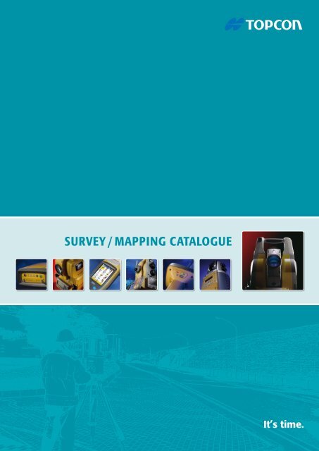
Survey / Mapping CaTaLOgue - ToppTopo A/S
Survey / Mapping CaTaLOgue - ToppTopo A/S
Survey / Mapping CaTaLOgue - ToppTopo A/S

Create successful ePaper yourself
Turn your PDF publications into a flip-book with our unique Google optimized e-Paper software.
<strong>Survey</strong> / <strong>Mapping</strong> CATALOGUE
Introduction<br />
Always innovative<br />
Topcon is the worldwide leading developer and manufacturer<br />
of precision positioning equipment and offers a<br />
wide selection of innovative <strong>Survey</strong>ing, Engineering, GNSS<br />
systems, Laser, Machine Control solutions, Mobile <strong>Mapping</strong><br />
and GIS products.<br />
At Topcon we know your geo-business world is getting increasingly<br />
competitive. Therefore it is vital to constantly investigate<br />
and utilise each and every competitive advantage<br />
available with your positioning solutions to stay at the top of<br />
your profession. We pride ourselves in continually developing<br />
innovative and potentially world leading technologies.<br />
Utilising unique technologies, our products provide the best<br />
solutions to simplify and improve your everyday tasks.<br />
Topcon’s innovations help you increase your productivity,<br />
satisfy challenging demands of your clients and assist you<br />
to enter new markets.<br />
At Topcon we understand that the choices available for<br />
positioning tools can sometimes seem a little bewildering;<br />
because of this, we have compiled this catalogue in order to<br />
assist you to make the right decisions as to what you need<br />
to for your specific projects.<br />
TOPCON<br />
Index of contens<br />
Page 2<br />
Introduction<br />
Page 13<br />
HiPer II – Dual Frequency GNSS Receiver<br />
Page 3<br />
Topcon Technologies<br />
Page 14<br />
GRS-1 - Dual Frequency GNSS Receiver<br />
Page 4-5<br />
The world of precision – Topcon solutions<br />
Page 15<br />
NET-G3A – GNSS Reference Station Receiver<br />
Page 6<br />
MS AX – Measuring Stations<br />
Page 16<br />
TopNET+ / TopconTools – Software<br />
Page 7<br />
IS-3 – Imaging Station<br />
Page 17<br />
IP-S2 Mobile <strong>Mapping</strong> System<br />
Page 8<br />
QS – Quick Station<br />
Page 18 - 19<br />
Rugged Field Controllers<br />
Page 9<br />
Manual Non-Prism Total Stations<br />
Page 20<br />
GLS-1500 - Laser Scanner / IS-3 Imaging Station<br />
Page 10<br />
DL-500 Series – Electronic digital level<br />
Page 21<br />
ImageMaster / ScanMaster - Office Software<br />
Page 11<br />
TopSURV / <strong>Survey</strong>Master – Software<br />
Page 22 - 23<br />
Product Application Matrix<br />
Page 12<br />
GR-5 – Advanced GNSS Receiver<br />
2
Technologies<br />
Overview Topcon Technologies used in diverse fields of application<br />
Capture Reality – With our imaging heritage, it is not<br />
surprising to find that many of our high end sensors incorporate<br />
imaging technology. These allow our users to not<br />
only measure, but to Capture Reality; using the IS Imaging<br />
Station, GLS-1500 laser scanner, IP-S2 mobile mapping and<br />
even from high resolution imagery from DSLR cameras.<br />
Long Range – Topcon total stations feature our incredible<br />
reflectorless technology which enables measurements of up<br />
to 2,000 m with pinpoint accuracy. Imagine being able to<br />
set up and carry out survey measurements from positions<br />
of inaccessible locations or scan quarry faces from great<br />
distances. Our QS, IS and GPT-7500 sensors all feature this<br />
capability.<br />
Matrix Detection – Available on our range of high precision<br />
MS AX sensors, this technology automatically locates<br />
any prisms within a specified area, totally eliminating the<br />
need for manual guidance even with close-up prisms adjacent<br />
to each other!<br />
technologies<br />
Universal Tracking – All of Topcon’s G3 GNSS receivers<br />
feature the latest Universal Tracking technology, which<br />
allows for reception of all currently available and future<br />
planned GNSS signals. Universal Tracking allows the future<br />
proofing of Topcon’s receivers by not restricting channel selection<br />
at the time of manufacture. Universal tracking gives<br />
the freedom to utilize the available signals all the time, now<br />
and in the future.<br />
G3 – Our innovative Paradigm G3 chipset is a true leap<br />
forward in technology in the positioning industry and is<br />
the world’s first multi-constellation processor utilising our<br />
Universal Tracking Channel technology. With a 75 percent<br />
reduction in size compared to the previous Paradigm chip<br />
and using less power, the G3 still has the added processing<br />
power to fully exploit the additional signals and satellite<br />
systems of the future<br />
XTRAC8 – Our top of the range QS robotic and IS-3 imaging<br />
stations both come as standard with our superior XTRAC8<br />
search, lock and tracking system. Employing entirely new<br />
optics, laser system, and further advanced algorithms, and<br />
in conjunction with our lightweight RC-4 remote control system,<br />
we can ensure that the operator has the most efficient<br />
tools available when working on site in one-person mode.<br />
3
The world of precision<br />
The world of precision – Topcon solutions<br />
Topcon offers – The most complete range of Total Stations<br />
on the Market today. With an ongoing commitment to only<br />
the best quality materials and ergonomic design characteristics,<br />
every instrument in the range is manufactured to exacting<br />
standards. This results in Total Stations that have a build<br />
quality that is second to none, high accuracy that will give<br />
years of reliable operation.<br />
Whether you are looking for a Total Station for a small<br />
construction project, a Robotic solution for <strong>Survey</strong>ing or a<br />
Monitoring Sensor, Topcon have the instrument to suit your<br />
needs. Topcon’s ethos of providing the best quality and attention<br />
to detail is evident throughout the range. The ease<br />
of use and dependability saves you time and money, no<br />
matter what your project.<br />
l Engineering<br />
l Monitoring<br />
l Cadastral<br />
l Topographic<br />
l <strong>Survey</strong><br />
l Construction<br />
<strong>Survey</strong><br />
Precision Measurement<br />
Topcon Solutions<br />
GIS / <strong>Mapping</strong><br />
Mobile Data Gathering<br />
l Utilities<br />
l Governmental<br />
l Environment<br />
l Agriculture<br />
l Forestry<br />
l Asset Management<br />
Efficient and Easy – Being able to offer easy to use<br />
software that integrates geographically related workflows<br />
in combination with our outstanding hardware is one of<br />
Topcon’s highest priorities. It doesn’t matter what industry<br />
you are from; Government, Utility and Infrastructure, Environment<br />
or Public Safety; with Topcon’s GIS and <strong>Mapping</strong><br />
solutions for handheld and Mobile <strong>Mapping</strong> systems you<br />
are able to fulfill all of your tasks in the most efficient and<br />
time-saving manner.<br />
Our comprehensive software solutions, which you are able<br />
to customise to your method of working, ensures that nonsurveyors<br />
are also able to carry out your required tasks and<br />
offers huge benefits to your organisation.<br />
4
Topcon solutions<br />
Topcon Imaging products enable you to Capture Reality<br />
and record all the detail on your project. What you see is<br />
what you get; the products focus on this unique functionality<br />
and combine the strengths of clear visual and accurate<br />
geometric information to allow you to communicate all<br />
job information and structure to your client. The Imaging<br />
product range ensures that you will always head back to the<br />
office with everything you need to deliver the end result,<br />
saving you time and money in the process.<br />
From discrete point measurement to complete full colour<br />
pointclouds the Imaging portfolio provides the right tool for<br />
every situation and scale of work. No job is too big or too<br />
small, Topcon have the solution you need to realise your<br />
vision.<br />
l Engineering<br />
l <strong>Survey</strong><br />
l Construction<br />
l Photogrammetry<br />
l Forensics<br />
l 3D Visualisation<br />
Imaging<br />
Capture Reality<br />
Topcon solutions<br />
GNSS<br />
Satellite Positioning<br />
l Engineering<br />
l Geomatics<br />
l Marine<br />
l Cadastral<br />
l <strong>Survey</strong><br />
l Networks<br />
Intelligent GNSS workflow – By working with Topcon’s<br />
GNSS solutions, you are automatically adding intelligence<br />
into your workflows and job practices. Our extensive GNSS<br />
product range ensures that you can pick the right solution<br />
that fits your work tasks and needs.<br />
GNSS technology not only is used for identifying simple<br />
positioning tasks, it is becoming a baseline technology<br />
that couples coordinated positions with advanced toolsets<br />
to provide further value added information to more fully<br />
analyse operations and maintenance phases. Make use of<br />
it with our patented GNSS solution technology. With a comprehensive<br />
range of networks, recievers and antennas, we<br />
can supply your exact requirements.<br />
5
Total Stations – MS05AX / MS1AX Series<br />
MS AX – Measuring Stations<br />
Topcon's MS AX range of robotic total<br />
stations are the highest precision sensors<br />
available. Whether your measurement<br />
task involves monitoring prisms on a damn wall,<br />
alignment observations through a tunnel or high accuracy<br />
infrastructure layout, the MS AX is the perfect tool for the job.<br />
Designed specifically for projects where accuracy can not<br />
be compromised, the MS AX is available with either a 1" or<br />
super precision 0.5" angular measurements and 0.5 mm<br />
distance measurement.<br />
Featuring the revolutionary Matrix Detection Monitoring<br />
technology, the MS AX can make the estabishment of large<br />
number targets on a monitoring or tunnelling project a rapid<br />
and simple task, completely eliminating user errors.<br />
key features - MS AX<br />
l 0.5” / 1” Angular Accuracy (MS05AX / MS1AX)<br />
l Distance Accuracy of 0.5mm<br />
l 1" / 1mm over 100m Auto-Collimation Accuracy<br />
l Matrix Detection for auto-target detection<br />
l Pinpoint 400m Reflectorless Range (MS1AX)<br />
<strong>Survey</strong><br />
TopSURV<br />
Monitoring Solutions – In addition to supplying you with<br />
the most accurate and durable Monitoring Sensor on the<br />
market -the Topcon MS Series, Topcon offer all the additional<br />
hardware and software required for any monitoring<br />
project. With off the shelf solutions to control and power<br />
one instrument. For multiple instrument networked solutions,<br />
we have a package which is suitable for you.<br />
Automatic and comprehensive reporting of displacement is<br />
available throughout the range, with SMS and mail notification<br />
when tolerances are exceeded.<br />
l Complete System<br />
— MS AX 0.5" or 1" Instrument<br />
— Dual Charging Cradle<br />
— Choice of optional field controllers<br />
— Li-Ion Batteries<br />
— Compact Carry Case<br />
— Instrument TopSURV Onboard for MS<br />
— Compatible with third party<br />
monitoring solutions<br />
— Manuals & Utility software<br />
MS AX Package<br />
6
Total Stations – IS-3 Series<br />
IS-3 – Imaging Station<br />
Take the power, accuracy and speed of the<br />
innovative Topcon robotic instruments,<br />
add our legendary imaging capabilities and<br />
faster scanning speeds... and you have the IS-3.<br />
With dual wide angle and coaxial imaging sensors, superior<br />
X-TRAC8 tracking technology, 2 Km reflectorless range, integrated<br />
WiFi and interference free 2.4 GHz Spread Spectrum<br />
data communications, the IS-3 is the most advanced and<br />
powerful imaging robotic station available. Incorparating<br />
our fast iSCAN measurement routine to enable thorough<br />
automated data collection defining your subject using realtime<br />
image capture: options include Feature Detection or<br />
Grid Scan to automatically measure significant points or a<br />
'regular' grid.<br />
key features - IS-3<br />
l Twin Cameras – wide angle and coaxial for true through the lens view<br />
l iSCAN intelligent feature scanning<br />
l 20 points per second scan rate, with 2000 m range<br />
l iDRIVE lets you visually operate from the controller and easily switch<br />
from imaging to prism tracking<br />
l Photo Fieldbook – creates a 360° panorama in seconds<br />
l Long range wireless with up to 10fps<br />
<strong>Survey</strong><br />
WT-100<br />
WT-100 – Using the new WT-100 wireless data link device,<br />
users can dramtically extend their wireless working range...<br />
now up to 300 m!<br />
This means that users are able to increase the range with<br />
which they can use the incredible 10 frames per second live<br />
video feed from the IS to lock on to the prism with pin point<br />
precision using iDRIVE.<br />
l Complete Imaging Robotic System<br />
— IS-3 1” or 3” Instrument<br />
— Charging Cradles<br />
— Choice of field controllers with TopSURV<br />
— WT-100 WiFi device<br />
— Lightweight 360° prism<br />
— TopSURV on Board for IS<br />
— ImageMaster (Remote Control<br />
and Office Processing software)<br />
— Manuals & Utility software<br />
IS Package<br />
7
Total Stations – QS1A / QS3A / QS5A Series<br />
QS – Quick Station<br />
With a modern, cable-free design,<br />
the QS offers the most advanced<br />
robotic technology available. Topcon’s<br />
one-touch Quick Lock feature that set the standard<br />
in robotic target acquisition has taken another<br />
step forward, with our XTRAC 8 offering stronger<br />
tracking and quicker re-acquisition in challenging<br />
environments. Our QS Series robotic systems offer reflec-<br />
torless measurement superior to any other instrument<br />
available – capable of precision measurements at a mindboggling<br />
2,000 m!<br />
The waterproof, dustproof instrument design is ready to<br />
take the punishment that can be expected on the harshest<br />
job site conditions.<br />
key features - QS<br />
l Super Fast RC-4 one-touch Quick Lock technology<br />
l XTRAC 8 – Robust Prism tracking even at close range<br />
l Advanced prism movement prediction<br />
l Industry leading (eye safe) 2 km Reflectorless Measurement<br />
l Interference Free 2.4 GHz Spread Spectrum Radio<br />
l Complete Cable-free Solution<br />
<strong>Survey</strong><br />
Integrated <strong>Survey</strong>ing<br />
By integrating GNSS RTN (Network RTK) and Robotic<br />
Total Station (RTS) technologies, your job site productivity<br />
can be increased dramatically.<br />
By using the QS robotic with our handheld GRS-1<br />
RTK controller & PG-A1 antenna and TopSURV,<br />
this method of working is easy!<br />
QS<br />
RC-4<br />
TopSURV<br />
l Cable-free package solution<br />
— All new QS Robotic Instrument<br />
— RC-4R Remote Control with<br />
2.4 GHz SS Radio<br />
— Choice of Field Controller<br />
— A7R 360 deg prism<br />
— TopSURV controller software<br />
Field Controllers<br />
FC-2500<br />
FC-250<br />
FC-25A<br />
QS Package<br />
GRS-1<br />
8
Total Stations – GPT-7500 / GPT-3100N Series<br />
Manual Non-Prism Total Stations<br />
GPT-7500 – Topcon’s reflectorless GPT-<br />
7500 Total Station provides a lighter,<br />
faster survey solution for handling your<br />
biggest jobs. Enjoy the benefits of the industries longest reflectorless<br />
range ... up to 2km! As well as the large onboard<br />
memory, with the dual USB sockets and CF slot, there's<br />
plenty of space to store all your positioning information.<br />
GPT-3100N – Available in 2, 3, 5, 7" versions with display<br />
resolution to 1”, the GPT-3100N satisfies the need for a<br />
compact, traversable total station with surveying practice<br />
accuracies guaranteed. The GPT-3100N Series have Ingress<br />
Protection rating of IP66, which make them perfect for the<br />
high demands of a construction site. It also offers a high accuracy<br />
reflectorless EDM mode for pinpoint measurements<br />
up to a 400m range.<br />
key features - GPT-7500<br />
l Rugged build design to withstand harsh site conditions<br />
l Longest non-prism range – 2000 metres<br />
l Fast On board Windows field collection software<br />
l Large, backlit keypad with bright, color LCD touch-screen display<br />
l CF card, USB Type A and USB mini slots delivers versatile<br />
memory capabilities<br />
<strong>Survey</strong><br />
key features - GPT-3100N<br />
l Fully waterproof with IP rating IP66<br />
l 400 m Reflectorless Range<br />
l Integrated (optional) Bluetooth communications<br />
l Fast measuring time<br />
l Multi-Pulse EDM Technology<br />
l Intuitive onboard <strong>Survey</strong> / Layout software<br />
GPT-3100 NW / FC-236 Controller<br />
l Standard packages<br />
— GPT-7500 / GTS-750 Series<br />
— Battery BT-65Q / Battery Charger BC-30<br />
— Plumb bomb set<br />
— Instruction Manual<br />
— Plastic Rain Cover<br />
— Tool Kit<br />
— Carrying Case<br />
— Stylus Pen<br />
— USB Cable F-25<br />
— Display Protection Sheet<br />
l Standard packages<br />
— GPT-3100N series<br />
— Battery BT-52QA<br />
— Battery charger<br />
BC-27BR (120 V) or<br />
BC-27CR (230 V)<br />
— Charging Cradles<br />
— Tool kit with case<br />
— Carrying case<br />
— Plumb bob set<br />
GTS-750 Package<br />
GPT-3000N Package<br />
9
Digital Level – DL-500 Series<br />
DL-500 Series – Electronic digital level<br />
Topcon’s DL-500 Series digital levels maximise work<br />
efficiency whilst at the same time minimise human errors,<br />
providing consistent measurement precision and speed<br />
regardless of the operator’s skill level.<br />
Incorporating cutting-edge Random-Bidirectional (RAB)<br />
coding technology, the DL-500 provides exceptional accuracy,<br />
stability and speed, under a variety of environmental<br />
conditions. Even when the staff surface is partially shaded,<br />
or in low lighting conditions the DL-500 instantly shows<br />
reliable results. Using the world’s first “Wave-and-Read”<br />
technology, the DL-500 allows the rod person to wave the<br />
staff back and forth, instead of keeping the staff plumb, so<br />
identifying the true and correct staff reading.<br />
key features - DL-500<br />
l Fast 1.5 second measuring time<br />
l Auto-detection of staff attitude<br />
l Ability to measure lowest height on rocking staff<br />
l Sub-millimetre mesaurement accuracy<br />
l Extended 16 hours battery life<br />
<strong>Survey</strong><br />
DL-502<br />
Applications<br />
Elevation – Calculates elevation of foresight (FS) with reference<br />
to backsight (BS) elevation. Elevation of the turning<br />
point (TP) is used for a new backsight, allowing for consecutive<br />
leveling.<br />
Cut and Fill – Cut and fill stakeout routines facilitate slope<br />
work.<br />
Ceiling Height – Two measurements provide a ceiling height;<br />
one with a staff placed on the ground, the other with an inverted<br />
staff put onto the ceiling. Ceiling elevation can also<br />
be calculated with reference to the benchmark elevation.<br />
DL-502 Package<br />
l Standard configuration<br />
– DL-502 / 503 Digital Level unit<br />
– BDC46B Li-ion battery<br />
– CDC68 charger<br />
– EDC113 AC power cable<br />
– Hex wrench<br />
– Vinyl cover<br />
– User manual<br />
– Carrying case<br />
Height Difference – Automatically displays the height difference<br />
between backsight (BS) and foresight (FS).<br />
10
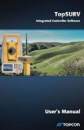
Software – TopSURV / <strong>Survey</strong>MASTER<br />
TopSURV – Field Controller Software / <strong>Survey</strong>Master – Office Software<br />
TopSURV is Topcon's powerful and intuitive field controller<br />
software package. Running on a number of different platforms,<br />
TopSURV takes care of all of your field operations<br />
from data transfer and management, control establishment,<br />
topographic survey, stakeout, scanning, monitoring, COGO<br />
and much much more besides. TopSURV8 makes it easy to<br />
integrate all of your Topcon sensors within a worksite and<br />
can switch seamlessly between total station mode to GNSS<br />
within any project. All device configurations are stored and<br />
are just a click away.<br />
With an incredible number of importing and exporting options<br />
available and with seamless integration with <strong>Survey</strong>-<br />
Master, you can synchronise jobs every time you connect<br />
your controller to the PC. With CAD interoperability, full colour<br />
graphic map views, extensive code, line and layer styles,<br />
a vast number of stakeout options as well as advanced<br />
Roading design and layout funcitonality, TopSURV has everything<br />
you need to get you job done, easily and efficiently!<br />
TopSURV<br />
key features - TopSURV<br />
l Intuitive Graphical User Interface (GUI)<br />
l Visual Stakeout<br />
l Map View data collection<br />
l Fast job management and storage<br />
l Advanced Roading<br />
<strong>Survey</strong><br />
key features - <strong>Survey</strong>Master<br />
l Totally transportable solution – runs ON the USB key<br />
l Two-way data synchronization with TopSURV jobs<br />
l <strong>Survey</strong> specific tools and full CoGo functionality<br />
l TIN / Surface and contour creation & Volume Analysis<br />
l Full long and cross section creation and analysis tools<br />
<strong>Survey</strong>MASTER<br />
<strong>Survey</strong>Master provides you with the complete desktop<br />
survey solution. Whether it’s a simple boundary survey with<br />
a one page print out of the site nd property or a complicated<br />
multi-surface construction jobsite with roads, utilities,<br />
machine control, and buildings, <strong>Survey</strong>Master gives you<br />
everything you need to complete a project. From field-tofinish,<br />
control the critical data flow from data collection, raw<br />
file analysis, engineering design, to final print efficiently with<br />
<strong>Survey</strong>Master.<br />
<strong>Survey</strong>Master Lite contains land survey specific functionality.<br />
Packed with drafting tools, survey data editors, adjustment<br />
routines and contouring, and with completely seamless<br />
integration with TopSURV powered field controllers,<br />
<strong>Survey</strong>Master Lite allows rapid contouring and production<br />
of the final plan. Exchange design information with other<br />
construction professionals and relay to the site team for<br />
setting-out.<br />
Both <strong>Survey</strong>Master and <strong>Survey</strong>Master Lite provide<br />
numerous COGO and survey specific routines. Everyday<br />
COGO functions such as bearing / dist intersections, point in<br />
direction calcs as well as calculation of point position from<br />
offset and distance data are all available. <strong>Survey</strong> specific<br />
tools such as traverse entry / editors, deed entry / editors,<br />
legal description writer, point translations, and many more<br />
are at your fingertips.<br />
<strong>Survey</strong>Master -<br />
Plug'n'Go USB Solution<br />
11
GNSS Receivers – GR-5 Series<br />
GR-5 – Advanced GNSS Receiver<br />
Offering advanced design features not<br />
found in other receivers, the GR-5’s<br />
modern design provides the flexibility<br />
and ease-of-use you demand.<br />
With a rugged magnesium I-beam construction for unbeatable<br />
strength and durability, and incorporating our Fence Antenna<br />
TM technology for unparalleled tracking performance,<br />
the GR-5 also boasts easily accessible SDHC card memory<br />
and dual hot-swappable batteries for unlimited continuous<br />
operation.<br />
As well as being totally committed to the GPS, GLONASS<br />
and Galileo satellite systems, Topcon is also committed to<br />
the precision signals from the developing systems from<br />
China, Japan and India.<br />
key features - GR-5<br />
l 216 Universal Tracking Channels<br />
l Multi-constellation (GPS, GLONASS, Galileo)<br />
l Fence Antenna Technology<br />
l Multiple Radio and Cellular Modem combinations<br />
l SDHC data storage support<br />
GNSS<br />
GR-5<br />
GR-5<br />
l Dual Receiver Package<br />
— Two GR-5 Receivers<br />
— Charging Cradles<br />
— PC Data Cables<br />
— Hard Carry Case<br />
— Radio Antennas<br />
— Manuals & Utility software<br />
— Fixed Height Tripod<br />
Field Controllers<br />
FC-2500<br />
FC-250<br />
GR-5 Package<br />
FC-25A<br />
FC-236<br />
12
GNSS Receivers – HiPer ll Series<br />
HiPer II – Dual Frequency GNSS Receiver<br />
Smaller. Lighter. Faster. More Affordable. The HiPer II<br />
receiver is designed on these clearcut concepts. This stateof-the-art<br />
receiver not only offers further enhanced ability,<br />
but also increases receiver performance and user-friendliness.<br />
The fully customisable structure provides maximum<br />
flexibility to choose your required options.<br />
Our GPS+GLONASS, dual-frequency signal tracking technology<br />
offers superior positioning capability over the GPS<br />
only receivers. It makes a real difference where sky visibility<br />
is limited such as in urban canyons or in woodlands, near tall<br />
fences or other blockages. With integrated UHF Radio and<br />
GSM Cellular Modems available it's simple to work in the<br />
environment of your choosing.<br />
key features - HiPer II<br />
l Dual frequency GPS & GLONASS<br />
l Magnesium-Alloy Construction<br />
l Bluetooth ® connectivity<br />
l Integrated UHF Radio & GSM Modems<br />
l SD / SDHC Memory Card Slot for flexible storage options<br />
GNSS<br />
TopSURV<br />
l Hiper II Package<br />
— Hiper II<br />
— Antenna<br />
— Charging Cradle<br />
— Hard Case<br />
— Data Cables<br />
— GNSS Detail Pole<br />
— Field Controller<br />
Field Controllers<br />
FC-2500<br />
Hiper II Package<br />
FC-250<br />
FC-25A<br />
FC-236<br />
13
GNSS Receiver – GRS-1 Series<br />
GRS-1 – Dual Frequency GNSS Receiver<br />
Topcon's GRS-1 is the world's smallest<br />
and lightest handheld RTK controller / receiver.<br />
By integrating a dual frequency GPS /<br />
GLONASS receiver board and L1 capable antenna within<br />
the unit, the GRS-1 can be used as the perfect handheld<br />
mapping grade unit. With the addition of a G3-A1 surveygrade<br />
external antenna the unit can be easily and quickly<br />
converted into RTK level device.<br />
The internal GSM cellular modem can be used to receive<br />
NTRIP based corrections from your local TopNET+<br />
network correction service, or you can use the optional<br />
RH-1 radio pack to connect into a local UHF based system.<br />
With an internal digital camera, integrated compass<br />
and fast, the GRS-1 has everything you need<br />
to get the job done quickly and efficiently!<br />
key features - GRS-1<br />
l Small and lightweight design<br />
l Internal GSM Modem for easy connectivity – ideal as part<br />
of a Network Rover<br />
l Scalable and expandable system for all applications,<br />
handheld or on the pole from cm to metres level accuracy<br />
l Integrated digital compass<br />
l Multi-function – <strong>Survey</strong> / Construct / Navigate / Communicate<br />
GNSS<br />
GRS-1<br />
The GRS-1 has a number of options available to allow it to<br />
connect into different corrections services. The internal cell<br />
modem and RH-1 UHF radio pack can be use to achieve<br />
centimetric level RTN positioning. You can also use the cell<br />
modem for DGNSS correction services, or the BR-1 Bluetooth<br />
® connected Beacon receiver can be used to get high<br />
accuracy mapping grade positons free of charge...<br />
l Standard configuration<br />
– GRS-1<br />
– BT-66Q Li-ion battery<br />
– BC-30 charger<br />
– AC power cable<br />
– Vinyl cover<br />
– User manual<br />
– Carrying case<br />
BR-1<br />
GRS-1 Package<br />
14
GNSS Receivers – NET-G3A / GB-3<br />
NET-G3A – GNSS CORS Receiver / GB-5 GNSS Receiver<br />
The NET-G3A is the World’s First reference<br />
receiver to provide Universal Signal<br />
Tracking. Using a patented technology,<br />
the NET-G3A incorporates 144 Universal Tracking Channels,<br />
capable of tracking signals from all available systems (GPS,<br />
GLONASS, Galileo) as well as all future planned satellite<br />
positioning constellations.<br />
The NET-G3A is intended for use as a highly sophisticated<br />
CORS (Continually Operating Reference Station), whether<br />
this is working alone as a standalone base station on a local<br />
worksite or as part of a regional or national network correction<br />
service. With an integrated web interface, the NET-G3A<br />
can be configured remotely via your standard web browser.<br />
key features - NET-G3A<br />
l 144 Universal Channel Paradigm-G3 Chip<br />
l Multi-Constellation Technology<br />
l Low power consumption<br />
l Superior Signal tracking and Performance<br />
l Compatible with ALL signals for existing and planned satellite<br />
navigation systems<br />
NET-G3A<br />
GNSS<br />
key features - GB-3<br />
l Dual frequency receiver<br />
l Flexible system<br />
l Suitable for base station static or backpack solutions<br />
l 72 Universal Channel G3 Chip Technology<br />
l Selectable Port Configuration<br />
GB-3<br />
The GB-3 introduces our incredible G3 technology to users<br />
who like to keep their options open when it comes to<br />
configurations. Featuring the latest 72 Universal Channel G3<br />
Technology capable of receiving signals from all present and<br />
future satellite constellations GPS, GLONASS and Galileo.<br />
A stand alone receiver without internal antenna or modem,<br />
the GB-3 offers maximum flexibility for use as a reference<br />
stations, mobile base station for RTK, static or kinematic<br />
survey of RTK rover backpack solutions.<br />
GB-3 - Versatile G3 GNSS Receiver<br />
G3-A1<br />
Geodetic Antenna<br />
15
Software – TopNET+ / TopconTools<br />
TopNET+ Correction Software / TopconTools – Processing Software<br />
TopNET+ – Is Topcon's dedicated GNSS network correction<br />
software which is in use throughout Europe providing<br />
correction services for end users. Subscribers to such services<br />
can carry out their usual surveying activities without<br />
the need for a GNSS base station, as network corrections<br />
are supplied to the rover using a low cost GPRS connection,<br />
offering real time positioning in the coordinate system<br />
of your choice. With a number of different accuracy levels<br />
available, TopNET+ subscription services can be used for<br />
mapping level activities such as local authoriuty asset management,<br />
precision agricultural tasks, up to the highest level<br />
of Network RTK suitable for most surveying, engineering<br />
and machine control projects.<br />
GPS<br />
GLONASS<br />
key features - TopNET Plus<br />
TopNET Plus<br />
DGNSS<br />
Handheld<br />
Reference<br />
Station<br />
l Multi-constellation system<br />
l Fully scalable solution<br />
l Choice of communications type<br />
l Quality monitoring of satellite and site parameters<br />
l Automated email based warning system Station<br />
l Upgrade from CORS to VRS Network Correction service<br />
GNSS<br />
key features - TopconTools<br />
l Compatible with Windows XP, Vista and 7<br />
l Modular system for all Topcon devices & controllers<br />
l Customisable interface to suit the way you work<br />
l Multiple graphical views of your data<br />
l Import CORS data from your national network provider<br />
TopconTools – Is our fully featured and intuitive Windows<br />
based software solution for downloading, managing, processing<br />
and adjusting field data from all of your survey<br />
measurement sensors. With a variety of modules available<br />
for GNSS post processing, RTK reporting, GIS processing,<br />
road design and much more!<br />
In addition, TopconTools allows you to collect, process and<br />
adjust data from total stations and digital levels. Download<br />
raw GNSS data directly from your Topcon GNSS receiver<br />
or remotely via an internet connection from your regional<br />
CORS network Post-process using Static, Kinematic, Stop<br />
and Go methods.<br />
Carry out full Least Squares adjustment and produce wideranging<br />
reports which can be output to Word, Excel or HTML.<br />
Choose from a number of graphical map, time based or<br />
tabular representations of the data.<br />
16
Mobile <strong>Mapping</strong> – IP-S2 Compact System<br />
IP-S2 Compact<br />
Topcon’s IP-S2 Mobile <strong>Mapping</strong> System<br />
overcomes the challenges of mapping 3D<br />
features at a high level of accuracy. Accurate<br />
vehicle positions are obtained using three technologies:<br />
– A dual frequency GNSS receiver<br />
– An Inertial Measurement Unit (IMU)<br />
– External wheel encoders<br />
These technologies work together to sustain a highly accurate<br />
3D position for the vehicle. IP-S2 Compact includes<br />
three LiDAR scanners oriented to cover the road surface and<br />
adjacent buildings up to 30 meters away. A high resolution<br />
digital camera provides 360 degree spherical images at fixed<br />
distance intervals. All sensor inputs are recorded and time<br />
stamped to a common clock driven by the IP-S2.<br />
1<br />
2<br />
3<br />
4<br />
5<br />
GNSS Antenna<br />
360° Digital Camera<br />
Laser scanners<br />
IMU<br />
Wheel encoders<br />
1<br />
2<br />
3<br />
4<br />
5<br />
GIS /<strong>Mapping</strong><br />
IP-S2 Compact<br />
Georeferenced panoramas can be produced for visual<br />
inspection and detailed analysis such as time-dependent<br />
changes in profile, geometry and location. An integrated<br />
dual frequency GNSS receiver tracks both GPS and<br />
GLONASS signals expanding the operation area.<br />
An inertial measurement unit (IMU) constantly monitors vehicle<br />
motion and attitude, allowing the IP-S2 system to track<br />
the vehicle position even when driving near obstructions or<br />
through tunnels where satellite signals can be blocked.<br />
Vehicle wheel encoders further enhance positioning accuracy<br />
and reliability. Retrofitted to rear wheel axles, the<br />
encoder detects rotation of each wheel. Vehicle attitude can<br />
be computed even more accurately by comparing difference<br />
in rotation speeds between two wheels.<br />
Orbit Asset Inventory management allows integration of<br />
IPS2 data with other sources like aerial imagery, maps, drawing<br />
or other data layers. The software offers full GIS software<br />
functionality and allows users, or teams of users, to collect to<br />
GIS data sets and create asset inventories with unparalleled<br />
ease of use and efficiency.<br />
Orbit software loads both the IP-S2 point cloud and images<br />
and allows flexible and efficient inventory creation. The<br />
Client-Server architecture allows team working within a<br />
single data set.<br />
17
Field Controllers – FC-250 / FC-2500 System<br />
Rugged Field Controllers<br />
If you are looking for a compact controller that provides incredible<br />
performance, look no further than Topcon’s FC-250.<br />
Incorporating Windows Mobile 6.5 operating system with<br />
a crisp, bright, colour touch screen display the FC-250 really<br />
makes your field data come alive. With the dual removable<br />
media for data storage and transfer, the easy to access<br />
rechargeable battery and the compact handheld design,<br />
FC-250 is the perfect field controller for any job. The FC-250<br />
also provides a wide range of wireless technologies, coming<br />
as standard with Bluetooth and WiFi. It also has the options<br />
to use the Snap-In RS-1 Spread Spectrum Radio for use with<br />
our QS & IS ranges of robotic total stations.<br />
key features - FC-250<br />
l Rugged environmental protection to IP66<br />
l WiFi, Bluetooth and optional RS-1 Wireless functionality<br />
l Ultra-bright full-colour 3.8” VGA touch-screen displayr<br />
l Ultra-bright full-colour 3.8” VGA touch-screen display<br />
l Fast 806MHz processor easily handles all processing needs<br />
l Multiple data transfer options, SD & CF Card and USB Sticks<br />
FC-250<br />
Field Controllers<br />
key features - FC-2500<br />
l High resolution 5MP digital camera<br />
l Industry leading IP67 and MIL-STD 810F Environmental<br />
and Shock Protection<br />
l 55 key alpha-numeric keyboard for ease of data entry<br />
l Hot-swappable Li-Ion batteries for infinite work-time<br />
l Comprehensive Wireless connectivity options<br />
FC-2500<br />
The FC-2500 is the perfect solution if you require a robust<br />
field controller with full alpha-numeric keyboard. With an<br />
ingress rating of IP67 and shock resistance to MIL-STD 810F,<br />
the FC-2500 will work in any conditions that you can! Along<br />
with the WiFi and Bluetooth wireless options, the FC-2500<br />
is compatible with our RS-1 Spread Spectrum radio for use<br />
with our robotic range of total stations.<br />
An integrated 5MP digital camera is also available featuring<br />
auto-focus and automatic flash. With an incredible battery<br />
life of up to 50 hours, the FC-2500 also features dual hotswappable<br />
Li-Ion batteries, meaning that there really is no<br />
limit to how long you can use this controller!<br />
18
Field Controllers – FC-236 / FC-25A Series<br />
Rugged Field Controllers<br />
Our FC-236 packs a huge number of features into a compact<br />
and lightweight unit. With full numeric keypad, extended<br />
and intelligent battery life, integrated cellular modem, 3 MP<br />
camera, internal L1 GPS receiver, compass and powerful<br />
Windows Mobile operating system, this controller has everything<br />
you could possibly need as a field computer system<br />
and more!<br />
Coming as standard with a 806 MHz processor, Windows<br />
Mobile, 4 GB of flash memory and 128 MB RAM, the integrated<br />
SDHC card slot allows for Secure Digital cards up to<br />
16 GB to be used for data storage and transport.<br />
key features - FC-236<br />
l Integrated SiRF Star III GPS receiver<br />
l WiFi, Bluetooth ® and Cell modem for wireless data exchange<br />
l Multiple connectivity options for data transfer<br />
l 3 Mega Pixel Auto-focus Camera<br />
l Industry leading IP67 & MIL-STD-810G Environmental Protection<br />
FC-236<br />
Field Controllers<br />
key features - FC-25A<br />
l Incredibly lightweight field controller (320g)<br />
l Rugged design with IP65 Ingress Protection<br />
l WLAN / Bluetooth ® Wireless<br />
l Field-exchangeable Li-ion Battery<br />
l Integrated digital camera, compass and altimeter<br />
FC-25A<br />
Featuring an exceptionally rugged, pocket-sized and lightweight<br />
construction, the Topcon FC-25A is the controller<br />
designed to work in the most severe work site conditions.<br />
With environmental rating of IP65 and MIL-STD-810G, the<br />
FC-25A will work where ever you need it to work. It is also<br />
the smallest and lightest controller available. Weighing in<br />
at only 320 gm and measuring only 144mm tall by 83 mm<br />
wide, you'll forget you are carrying it! The embedded<br />
20 channel GPS chipset provides positional information by<br />
point positioning or by DGPS using SBAS corrections.<br />
The FC-25A also incorporates a 3MP auto focus camera,<br />
electronic compass and an altimeter for GIS data collection<br />
applications.<br />
19
Laser Scanner – GLS-1500 / IS-3 Series<br />
GLS-1500 - Laser Scanner / IS-3 Imaging Station<br />
The GLS-1500 gives high quality observations<br />
with effective and simple<br />
field operation. With a scan range up to<br />
330 m the GLS is a versatile tool that lets you work many<br />
different environments. The stand-alone capability of this<br />
instrument easily manages the extremes of the measurement<br />
world.<br />
Emphasising the benefits of laser scanning on site, you are<br />
not tied to a PC, you do not have to worry about power<br />
and site work is easy because you are only dealing with one<br />
box. However you can always connect to the PC with the<br />
ScanMaster Software or Tablet with the ScanMaster Field<br />
software and see the data as it is being collected at up to<br />
30.000 points per second.<br />
key features - GLS-1500<br />
l Consistent 4 mm precision<br />
l Precise Scan Technology<br />
l 330 m maximum range<br />
l Class 1 eye safe laser<br />
l Integrated camera<br />
Imaging<br />
key features - IS-3<br />
l Two Digital Cameras – Wide Angle and 30x optical zoom<br />
l iSCAN Technology – Intelligent Scanning up to 20 points p.s.<br />
l iDRIVE – touch screen control<br />
l 2000 m reflectorless measurement<br />
l iCONTROL – WiFi Remote Control by PC or Field Controller<br />
IS-3 – Advanced imaging and high accuracy<br />
– in one. Take the power, accuracy and<br />
speed of the unsurpassed Topcon robotic<br />
technology, add our superb imaging capacity with 20 points<br />
per second scanning and 2 cameras, and you have the IS-3<br />
– a revolutionary approach to complete job site documentation.<br />
Capture discrete points with images, or scan key features<br />
to get a clear overview of exactly what was measured<br />
and where.<br />
With its exclusive coaxial 30x telescopic zoom, ImageMaster<br />
software, Superior X-TRAC8 tracking technology and integrated<br />
WiFi robotic data communications – the IS-3 is the<br />
most advanced, longest range, and most powerful imaging<br />
station of its time.<br />
Fast iSCAN measurement routines enable a thorough data<br />
collection to define your subject in real-time data as ‘photography<br />
with dimension’. Options include Feature Detection<br />
or Grid Scan to automatically measure significant points<br />
or a "regular" grid defined by rectangle, polygon, section or<br />
complete 360°.<br />
Topcon's IS-3 showcases our proven robotic technology. Its<br />
wide angle dual digital Imaging cameras allow you to view<br />
your data in-situ from a full colour, real-time image on a<br />
touch sensitive LCD display. Navigate around your point and<br />
zoom in to measure up to 2000 m away, and be confident<br />
that the point you see on the screen, is the point you see<br />
through the telescope thanks to digital imaging precision<br />
from Topcon.<br />
IS-3 – Imaging Station<br />
20
Software – Image Master / ScanMaster<br />
ImageMaster / ScanMaster Office Software<br />
Pictures and Pointclouds all in one location!<br />
ImageMaster Pro is the revolutionary<br />
approach to get the full picture and meaningfully<br />
represent your 3D data. Combining our proven software<br />
based photogrammetric tools with the management<br />
of scanner and total station data; it enables you to read<br />
remotely sensed and physically measured information in a<br />
single software environment. In one simple process, your<br />
3D data is turned into a snapshot of reality bringing your<br />
project to life.<br />
ImageMaster Photo creates 3D models from stereo images<br />
from an “off-the-shelf” cameras & measured individual<br />
points and can quickly generate contour lines, points, polylines<br />
and surface measurements-fast, powerful, effective<br />
and accurate.<br />
key features - ImageMaster<br />
l Effective & simple desktop Photogrammetry with professional<br />
quality output<br />
l Clear step-by-step interface<br />
l Make your “Off-the-shelf” digital camera a measurement tool<br />
l Complete Imaging data management – Combines Images,<br />
points & pointclouds in a single software<br />
l Produce models with accuracies up to 0.4 mm<br />
Imaging<br />
key features - ScanMaster<br />
l High volume scan and imaging data management<br />
l Intuitive and User-friendly solution<br />
l Automated Data extraction<br />
l Mass 3D pointcloud acquisition and manipulation<br />
l Compatible with many data formats<br />
ScanMaster<br />
Let the points paint the picture!<br />
ScanMaster is the fast, efficient way to handle mass 3D data<br />
and turn it into easy-read images that keep you and your<br />
customers, in the picture. The powerful GLS scanner control<br />
and processing software offers a modern, streamlined interface<br />
giving the perfect alternative to traditional point-cloud<br />
processing techniques.<br />
Unique tools enable you to extract CAD information directly<br />
from the pointcloud, without requiring meshing or TIN creation.<br />
Quickly extract sections, profiles, edges from regions;<br />
plane intersection; quick polyline sketches. You can easily<br />
prepare your data for presentation using slices, noise filtering,<br />
re-sampling of clouds. ScanMaster covers everything<br />
you need to work with your point-cloud.<br />
ScanMaster – Office Software<br />
It’s so simple. ScanMaster has been designed to minimize<br />
the learning curve for the operator so that the data is the<br />
focus NOT the skills of the operator, your project receives<br />
the best opportunity of being understood and showcasing<br />
your measurement expertise.<br />
ScanMaster Field version is a stripped-down implementation<br />
designed for use on Tablet PC, this graphical interface<br />
allows you to work with typical survey work-flows whilst<br />
viewing your data in 2D spherical view or 3D data view.<br />
21
Product Application Matrix GNSS<br />
Product Application Matrix – <strong>Survey</strong> & <strong>Mapping</strong><br />
Applications<br />
<strong>Survey</strong><br />
Engineering<br />
Construction<br />
Control<br />
Cadastral<br />
Topographic<br />
Archaelogical<br />
Forensics<br />
Hydrographic<br />
Measured Building<br />
Geodetic<br />
As-built<br />
Continually Operating Reference Station<br />
Imaging<br />
Photogrammetry<br />
Building Façade<br />
Structural<br />
Deformation Control<br />
Engineering<br />
Mine and Quarries<br />
Process Plant Modelling<br />
Slope Stability<br />
Volume Calculations<br />
Setting Out<br />
Roads<br />
Feature Location<br />
Optical<br />
MS AX<br />
IS-3<br />
QSA<br />
GPT-7500<br />
GPT-3100N<br />
DL-500<br />
GNSS<br />
Hiper II<br />
GR-5<br />
NetG3A<br />
GB-3<br />
GRS-1 RTK<br />
DGNSS<br />
GRS-1 DGNSS<br />
FC-236 DGNSS<br />
FC-25A DGNSS<br />
Mobile <strong>Mapping</strong><br />
IP-S2 Compact<br />
Laser Scanning<br />
GLS-1500<br />
22
Product Application Matrix GIS / <strong>Mapping</strong><br />
Product Application Matrix – <strong>Survey</strong> & <strong>Mapping</strong><br />
Governmental<br />
Field <strong>Mapping</strong><br />
Asset Maintenance<br />
Inspections<br />
Reporting<br />
Visualisation<br />
Disaster Management<br />
Homeland Security<br />
3D City Modelling<br />
Centerline Review and <strong>Mapping</strong><br />
Facility <strong>Mapping</strong><br />
Forest Boundary<br />
Wetlands <strong>Mapping</strong><br />
Minefield <strong>Mapping</strong><br />
Municipal Assets Inventory<br />
Cemetery Inventory<br />
Storm Water Inlet Inventory<br />
Vegetation <strong>Survey</strong><br />
Archaeological Site <strong>Survey</strong><br />
Fire Perimeter <strong>Mapping</strong><br />
Road & Pavement Condition <strong>Survey</strong><br />
Power Pole Maintenance<br />
Crop Management<br />
Drainage System Management<br />
Locating Buried Infrastructure<br />
Road Pavement Management<br />
Housing Condition<br />
Meter Reading<br />
Habitat Studies<br />
Damage Inspection<br />
Flood Risk Assessment<br />
<strong>Survey</strong> of fly-tipping<br />
Property Damage Assessment<br />
Accident Reporting<br />
23
About Us<br />
With over 75 years worth of experience in the manufacture,<br />
distribution and support of products, Topcon is<br />
well placed to offer comprehensive support to cater for<br />
all your needs.<br />
Established in 1932, the Topcon Group today is represented<br />
by a workforce of over 6,000. Topcon develop,<br />
manufacture, sell, and provide services for a wide range<br />
of high technology products for the capture, analysis and<br />
presentation of spatial datain the macro, micro and nano<br />
worlds.<br />
Investment in research and development leading to innovative<br />
new solutions and products is key to the Topcon<br />
philosophy and is evident in a number of industry firsts<br />
that include the first coaxial EDM total station, the GTS-1<br />
and the unique GPT-7000i series imaging total stations<br />
incorporating digital cameras.<br />
Additionally, Topcon has produced the first and only<br />
available millimetre GPS+ system, and the first to offer a<br />
true GNSS (Global Navigation Satellite System); dual frequency,<br />
dual constellation, GPS plus GLONASS geodetic<br />
grade receivers.<br />
Topcon recently developed the technology to add Galileo<br />
and Beidou 2 (Compass) in a new, state-of-the-art Universal<br />
Signal Tracking chip, ensuring total future-proofing<br />
of investment.<br />
www.topcon.eu<br />
Your local authorized Topcon distributor is:<br />
* Designs and specifications are subject to change without notice. T700EN - English - A<br />
grafit-werbeagentur.de