065 (Jul-Sep 1986) - National Speleological Society
065 (Jul-Sep 1986) - National Speleological Society
065 (Jul-Sep 1986) - National Speleological Society

Create successful ePaper yourself
Turn your PDF publications into a flip-book with our unique Google optimized e-Paper software.
..."'............. AI<br />
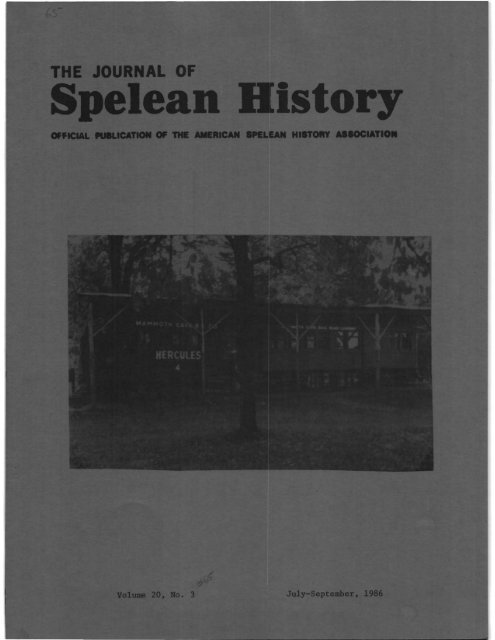
AL OF. History <br />
••c. _ILl... H....,......<br />
<strong>Jul</strong>y-<strong>Sep</strong>tUlbert<br />
<strong>1986</strong>
A HISTORY OF THE MAMMOTH CAVE RAILROAD<br />
Albert Churella<br />
Throughout much of its history, the commercial exploitation of Mammoth Cave<br />
has been hindered by the lack of adequate transportation facilities. For example,<br />
saltpeter mining was profitable only during the War of 1812, when its<br />
inflated price exceeded shipping costs. The mushroom growing enterprise in<br />
Audubon Avenue failed because there was no economical means of transporting<br />
the fungus to the tables of Eastern'restaurants. And, if it was difficult to<br />
get goods away from the cave, it was equally difficult to get people to the<br />
ca.ve.<br />
This natural barrier to the tourist trade was reduced in several steps.<br />
Tourists could reach the cave by stagecoach (1815-1859), then by railroad and<br />
stage (1859-1886), then entirely by rail (1886-l920's), and finally by motor<br />
car. One of these changes occurred in 1886 when the Mammoth Cave Railroad was<br />
constructed from Glasgow Junction (now called Park City) to the Mammoth Cave<br />
Hotel eight miles away. This paper will focus on the events that preceded<br />
the construction of this railroad, as well as those that transpired during<br />
its forty-five year history.<br />
The impact of the Mammoth Cave Railroad on the region was, alas, minimal.<br />
Unlike the earlier Louisville and Nashville Railroad, which was completed in<br />
1859, it did not lure hordes of additional tourists to Mammoth Cave. The pre<br />
1886 stagecoach trip from Cave City to the hotel, though uncomfortable, was<br />
so short that it discouraged few people from seeing the cave. The Mammoth<br />
Cave Railroad was never the exclusive servant of the Mammoth Cave Estate, since<br />
it provided station stops at three competing caves along its route. And in<br />
spite of the railroad, Glasgow Junction lost forever the superiority over Cave<br />
City that it had known in the days of Bell's Tavern, The tiny Mammoth Cave<br />
Railroad was a nuisance to the mighty Louisville and Nashville Railroad system,<br />
and only a mild convenience for the few tourists and the small number of local<br />
residents who used it. It was a nice little railroad, but not an important<br />
one. This lack of relative importance does not mean that the Mammoth Cave Railroad<br />
should be forgotten, since it was one of the more interesting above-ground<br />
institutions in the region.<br />
In the first half of the last century, the trip to Mammoth Cave was difficult<br />
at best. The poor traveling qualities of the stagecoach, combined with the<br />
difficult terrain of the region, caused the journey to Mammoth Cave to be<br />
scarcely less memoraBle than the tour of the cave itself. Few travelers before<br />
1859 fail to mention their experiences on the Mammoth Cave stage.<br />
In his book Health Trip to the Tropics, N. Parker Willis describes an overland<br />
stage journey that required him to spend one night in the plush and hospitaBle<br />
resort town of Bear Wallow, sixteen miles from the cave itself. After his<br />
tour of the cave, he departed for more civilized regions via Munfordsville, with<br />
the only delay in his journey being due to a broken wheel on the stagecoach.<br />
Another visitor, Leo Lesquereux, made a determined effort to enjoy his 1854<br />
stage ride to the cave in spite of the locals and their boorish customs. The<br />
scenery was quite beautiful, and he felt "only an instant of emotion caused by<br />
the contemplation of these wonders when they pass slowly before your eyes,<br />
JOURNAL OF SPELEAN HISTORY -51
without a single detail escaping . .<br />
distractions of a trip by train." 1<br />
is it not better than the deafening<br />
Difficult as this journey was, it must have been nearly impossible in the<br />
years shortly after the War of 1812. Franklin Gorin, despite all his efforts<br />
to improve the cave itself, was unable to force Barren and Edmonson counties<br />
to improve the stage route from Bell's Tavern to the cave. The situation did<br />
not improve until the property was purchased by Dr. Croghan in 1839. Croghan<br />
encouragelthe state to build a new stage road to the cave. This road, which<br />
is today US 255 north of Highland Springs and US 70 south of there, headed west<br />
from Cave City and not Glasgow Junction and thus bypassed Bell's Tavern. This<br />
tavern, which was once an important stop on the long and difficult trip to the<br />
cave, was destroyed by fire shortly before the Civil War.2<br />
The construction of the first railroad through the region eased transportation<br />
problems considerably. The Louisville and Nashville Railroad Company was incorporated<br />
on March 5, 1850, to build a railroad between the terminal points<br />
of Louisville, Kentucky, and Nashville, Tennessee. The main line was completed<br />
during November of 1859. From then on, cave expert Horace Hovey noted Mammoth<br />
Cave could Be "easily reached by trains on the Louisville and Nashville Railroad,<br />
all of them stopping at Cave City."3<br />
Although the Mammoth Cave Estate obviously benefited from having a railroad<br />
station less than ten miles away, the situation was far from ideal for many<br />
people. Tourists were still required to make the bothersome stage journey from<br />
Cave City to the Mammoth Cave Hotel. In addition to being slow and uncomfortaole,<br />
there was always the thrilling possibility of being robbed by the likes<br />
of .TesSe James, wfto was thought to have operated in the area. Glasgow Junction<br />
residents were no doubt upset at losing their earlier days of glory when everybody<br />
who was anybody stopped at Bell's Tavern before going on to Mammoth Cave.<br />
Local cave owners were not happy about the new stage route from the Cave City<br />
railroad station to the Mammoth Cave Hotel. This route did not pass any significant<br />
caves until the 1920's, when the New Entrance was blasted open. The<br />
old stage route from Glasgow Junction to the cave via Chaumont passed within a<br />
short distance of Grand Avenue Cave, Diamond Caverns, Short Cave, Long's Cave,<br />
and Proctor Cave. The Croghan heirs were of course not particularly interested<br />
in giving tourists the opportunity to visit other caves in the area. However,<br />
they were probably willing to lose some business to Diamond Caverns and Proctor<br />
Cave in order to gain the advantage of a railroad link with the L & N at Glasgow<br />
Junction.<br />
With this in mind, Whiteford R. Cole, Overton Lea, Jere Baster, J. Hill Eakin,<br />
R. H. Lacey, and L. J. Proctor founded the Mammoth Cave Railroad Company in<br />
1886. Both Eakin and Lacey later served as presidents of the railroad. L. J.<br />
Proctor is described as being "the owner of a cave and a hotel." This is of<br />
course Proctor Cave, which was conveniently located within a short distance of<br />
the proposed railroad line. This cave, with its "wonderful succession of domes,<br />
and an endless variety of stalactites, with many gypsum rosettes and other<br />
'formations'" would have been seen by few tourists had it not been for the<br />
presence of the railroad. 4<br />
Actual construction was begun on <strong>Jul</strong>y 3, 1886, and completed on November 17<br />
of that year. The total length of the railroad was 8.35 miles, not 8.7 as listed<br />
Vol. 20, No.3 -52
y Margaret M. Bridwell. Of this, 6.34 miles were located in Edmonson County,<br />
with the remaining 2.01 miles located in Barren County. Of the trackage in<br />
Barren County, .63 miles were located within the town of Glasgow Junction.<br />
Scheduled stops were listed as Glasgow Junction (L & N Railroad connection),<br />
Diamond Caverns, Chaumont Post Office, Union City, Proctor's Hotel, Sloan's<br />
Crossing, and the Mammoth Cave Hotel. Of the intermediate station stops,<br />
Chaumont, Sloan's Crossing, and Union City were each reported to contain a<br />
general store or some similar establishment. The various stations were not<br />
separated by great distances. A person standing in the station at Chaumont<br />
could probably see the Diamond Caverns and Glasgow Junction stations to the<br />
east. The total distance between Chaumont and Union City was only about four<br />
thousand feet. The one-way trip from Glasgow Junction to Mammoth Cave required<br />
thirty minutes, covered at the breathtaking average speed of seventeen miles<br />
per hour. Since the railroad had no facilities for turning its equipment at<br />
either Glasgow Junction or the cave, trains were forced to operate backwards<br />
half of the time, with the engine pushing the passenger car. 5<br />
The concept of building short, tourist-oriented railroads to major national<br />
parks and other natural wonders was not unusual. The Yosemite Valley Railroad<br />
Company was chartered in 1902 to build a seventy-eight mile line, now abandoned,<br />
to the entrance of Yosemite <strong>National</strong> Park. In 1901 the Santa Fe Railway organized<br />
a subsidiary, the Grand Canyon Railway Company, to construct a line from<br />
Flagstaff, Arizona, to the canyon rim. For many years, the Santa Fe offered<br />
through sleeper service from Chicago to the Grand Canyon. This sixty-four<br />
mile line was, until recently, used to transport water and other supplies to<br />
the south rim of the canyon. o<br />
Therefore, it is hardly surprising that someone would decide to construct a<br />
railroad to one of the most famous natural attractions in the eastern United<br />
States. What is unusual, however, is the low degree of quality with which this<br />
project was carried out. The Grand Canyon Railway was generously supported by<br />
the officials of its parent Santa Fe, who realized how much money they could<br />
make transporting pa-sengers from Chicago to Flagstaff. Even the independent<br />
Yosemite Valley Railroad was essentially a first-class operation throughout<br />
most of its history.<br />
The Mammoth Cave Railroad, however, was a poor quality operation from start<br />
to tinish. Surprisingly, the original founders of the company built the railroad<br />
using local labor and local financing. Apparently, neither the capital<br />
nor the experienced work crews of the L &NRailroad were used during its construction.<br />
It was not until <strong>Sep</strong>tember 15, 1886, when the railroad was nearing<br />
completion, that the L & N agreed to lease and operate it. The lack of L & N<br />
money and supervision may have resulted in the excessively cheap construction<br />
of the Mammoth Cave Railroad. The 1930 U. S. Geological Survey topographic<br />
map shows at least one curve of less than 400 foot radius, something that the<br />
L & N would not have permitted on its main line, except under extraordinary<br />
circums·tances. The line was originally laid to a four foot, nine ince gauge<br />
with steel rail weighing fifty pounds per yard, roughly half the weight of the<br />
rail used on the L & N main line. Rail of this weight is barely adequate to<br />
support the weight of a train and probably accounts for the small size and low<br />
weight of the locomotive Hercules. 7<br />
Mammoth Cave Railroad president J. Hill Eakin and L & N Railroad president<br />
JOURNAL OF SPELEAN HISTORY -53
Milton H. Smith must have finally realized the mutual advantages of consolidation,<br />
and the Mammoth Cave Railroad soon became a segment of the L & N.<br />
According to one author, this occurred in the form of a twenty-five year lease<br />
dated <strong>Sep</strong>tember 15, 1886. However, Poor's Manual of Railroads indicates that<br />
the Mammoth Cave Railroad was to be operated by the L & N only until such time<br />
as a receiver could be appointed by the court. This certainly casts doubt on<br />
the financial stability of the Mammoth Cave Railroad and seems to indicate<br />
that it was bankrupt right from the start. In any event, Poor's lists the<br />
Mammoth Cave Railroad as a separate entity from the L & N in the 1897 and all<br />
succeeding issues. This indicates that L & N operation of the Mammoth Cave<br />
Railroad ended sometime in 1896, ten years after the line was built. Throughout<br />
this period, the Mammoth Cave Railroad offices were located in Nashville,<br />
Tennessee, some distance from the cave and farther still from the L & N offices<br />
in Louisville. 8<br />
During that ten-year period, the mighty L & N probably considered the Mammoth<br />
Cave Railroad as more of a nuisance than anything else. At 8.35 miles, it was<br />
shorter than the other local L & N subsidiary, the 10.5 mile Glasgow Junction<br />
Railroad, whose li~ from Glasgow Junction to Glasgow was opened on March 1,<br />
1869. In fact, only three branches of the L & N were shorter than the Mammoth<br />
Cave Branch--the Pontchartrain Railroad (5.00 miles), the Louisville Railway<br />
Transfer (4.13 miles), and the Mud River Branch (4.39 mi1es).9<br />
Its short length produced equally short revenues. In 1889, the Mammoth Cave<br />
Branch of the L & N earned $8,393.07 in passenger revenues. This, combined<br />
with $1,374.40 in freight revenues and various other revenues, produced an inflow<br />
ot $9,767.47. Operating expenses for that year were $7,806.56, leaving a<br />
total net income of $1,960.91. This indicates that the Mammoth Cave Branch<br />
had a net income of roughly $234 per mile in 1889. In the same year, its<br />
corporate parent, the L & N, had a net income of $2,907 per mi1e. lO<br />
In 1889, the Mammoth Cave Railroad ran its trains a total of 17,676 miles<br />
in passenger service. When divided by the 16.7 mile length of a round trip<br />
over the line, this figure indicates that 1,052 round trips were made in that<br />
year. This averages about three trips per day. Those 1,052 trips accomodated<br />
8,314 passengers, indicating that the highly successful Mammoth Cave Railroad,<br />
on average, carried fewer than eight people per trip.ll<br />
It is therefore not difficult to understand why the L & N wanted to unload<br />
the Mammoth Cave Branch at the earliest available opportunity. Sometime during<br />
1892 or 1893, the Mammoth Cave Railroad Company authorized the construction of<br />
a .82 mile long branch line from Grand Avenue Junction to Grand Avenue Cave.<br />
This unwise expenditure of funds, combined with decreasing passenger revenues,<br />
was probably enough to bankrupt the railroad. The L & N could have-~asily<br />
prevented this situation by loaning or giving its subsidiary a few thousand<br />
dollars. Instead, they allowed the railroad to go into receivership. On August<br />
12, 1895, the L & N Railroad relinquished all control of the Mammoth Cave Railroad<br />
and turned it over to the court appointed receiver, J. A. McGoodwin of<br />
Franklin, Kentucky. The railroad was sold under foreclosure on March 7, 1898,<br />
to J. Hill Eakin, its president, for $16,000. This purchase was financed through<br />
the sale of 160 shares of stock at $100 per share. Mr. Eakin may have acquired<br />
the railroad at something under its fair market value, since the state of Kentucky,<br />
in 1897, valued the 8.35 mile main line at $50,100 for tax purposes. At<br />
Vol. 20, No. 3 -54
this time, the day-to-day operations of the railroad were still controlled<br />
by the receiver in Franklin rather than by the new owner in Nashville. After<br />
this time, the Mammoth Cave Railroad is no longer listed in conjunction with<br />
the Louisville and Nashville Railroad. 12<br />
The Mammoth Cave Railroad was finally released from receivership in 1903.<br />
R. H. Lacey was elected president, with the railroad's offices remaining in<br />
Nashville. 13 Around 1912, the company offices were removed to Franklin, Kentucky,<br />
where they remained until t~e railroad was abandoned.<br />
In 1910, the railroad issued $30,000 worth of twenty-five year, five percent<br />
bonds to retire a debt of $8,216 and to "allow some leeway for emergencies and<br />
unforeseen expense." The fact that the company borrowed 21,784 unneeded dollars<br />
at five percent interest indicates that its owners must have been anticipating<br />
a great deal of unforeseen expense. It is fortunate that the railroad did<br />
borrow this money, since its financial situation was becoming increasingly<br />
worse. In 1907, the company had the lowest net receipts of any railroad in<br />
Kentucky, $378, or $46 per mile, and its tax valuation had declined from $50,100<br />
to $17,500. By December 31, 1919, the railroad had accumulated a total profit/<br />
loss deficit of $23,076, indicating that expenses had exceeded revenues by that<br />
amount over the past sixteen years. Total passenger revenues for 1918, the<br />
year of America's greatest involvement in World War I, . were only $9,051, a<br />
substantial decrease from the $12,373 of two years earlier. The railroad<br />
operated at a loss in both years, however, $185 in 1916 and $421 in 1918. 14<br />
During 1~1~~20, the original fifty pound steel rail installed in 1886 was<br />
replaced with fifty-six pound rail. This may have occurred in response to a<br />
January 7, 1913, decision to upgrade the railroad to allow through sleeping<br />
car service in cooperation with the L & N Railroad. However, it is unlikely<br />
that this service was actually instituted. The low volume of traffic to the<br />
cave did not justify the use of an entire sleeping car, and it was not difficult<br />
to transfer passengers from one railroad to another at Glasgow Junction.<br />
In addition, the light rail and rotting ties of the Mammoth Cave Railroad were<br />
probably not capable of supporting the eighty-ton all-steel sleepers that were<br />
coming into service during the early 1920's.15<br />
The increasing number of automobiles bringing tourists to the cave made the<br />
continued operation of the railroad itself doubtful. The original stage road<br />
from Cave City to the Mammoth Cave Hotel was still unpaved, but it had been<br />
improved enough to allow fairly reliable auto travel. In addition to being<br />
more convenient, auto travel was cheaper. It cost as much to travel from Glasgow<br />
Junction to the cave by rail as it did to get into the cave itself, provided<br />
one took the short tour. The use of a car also made it easier to see Morrison's<br />
New Entrance to the cave, which was located close to the highway but far from<br />
the railroad.<br />
On February 1, 1928, the ailing Mammoth Cave Railroad was purchased by F. L.<br />
Gallup, "who had some plan of building a branch line to connect with the asphalt<br />
mines on the Green River." He probably intended to connect it to the Kyroc<br />
(Kentucky Rock Asphalt Company) Railroad north of the Green River, and visible<br />
at the upper left hand corner of the 1930 topographic map of the area. Unfortunately,<br />
it would probably have cost more to build a bridge over the ~reen<br />
River than what the entire line was worth. He soon abandoned his plans and<br />
JOURNAL OF SPELEAN HISTORY -55
sold the railroad in April, 1931, to the Mammoth Cave <strong>National</strong> Park Association,<br />
its fifth and final owner. 16<br />
The automobile, combined with the decrease in tourist travel brought about<br />
by the Great Depression, was enough to put the Mammoth Cave Railroad out of<br />
business. The steam locomotive Hercules made its last run in 1929. A diesel<br />
powered railbus was used for the next two years to transport the few remalnlng<br />
passengers. Finally, on June 8, 1931, the Mammoth Cave <strong>National</strong> Park Association<br />
voted to suspend operations of the railroad the following <strong>Sep</strong>tember 1.17 The<br />
equipment was sold or put on display and the rails were ripped up. The Mammoth<br />
Cave Railroad was no more.<br />
Although travelers could still reach Cave City and Glasgow Junction (Park<br />
City) by rail until the mid-1970's, the automobile is today the only means of<br />
reaching the cave itsel;f'. The "deafening distractions of a trip by train" have<br />
been replaced By the no less deafening distractions of a trip by car. Leo<br />
Lesquereux would have peen happy.<br />
FOOTNOTES<br />
IN. ~arker Willis, Health Trip to the Tropics (New York: Charles Schribner,<br />
1853), pp. 147, 208; ·· joseph B •. Rivlin, translator, "Daniel Boone and the Kentucky<br />
Gharacterin1855~-A Letter From America By Leo Lesquereux," Filson<br />
Club History Quarterly, XV (1941), pp. 224-26.<br />
2Roger W. Brucker and Richard A. Watson, The Longest Cave (New York: Alfred<br />
A. Knoph, 1976), p. 269.<br />
3~00rts Manual of Railroads (New York: J. J. Little and Company, 1886), p.<br />
49-; Horace C. Hovey, Celebrated American Caves (Cincinnati: Robert Clarke and<br />
Company, 1882), p. 66.<br />
4Margaret M.Bridwe1l, The Story of Mammoth Cave <strong>National</strong> Park, Kentucky<br />
(n. p.; ca. 1952), pp. 35-36; Poor's Manual of Railroads, 1890 edition, p.<br />
378; 1904 edition, p. 313; Hovey, Celebrated American Caves, p. 65, not to<br />
be taken seriously.<br />
5Bridwel1, The Story of Mammoth Cave <strong>National</strong> Park, p. 36; Poor's Manual of<br />
Raproads., 1890edition,p. 378; Eighteenth Annual Report of the Railroad<br />
Co~issioners oi Kentucky (Louisville: George G. Fetter Printing Company, 1897),<br />
pp. 6~~70; eordon Wilson, Sr., Folklore of the Mammoth Cave Region (Bowling<br />
Green, Ky.: The Kentucky Folklore <strong>Society</strong>, 1968), p. 31; U. S. Geological Survey,<br />
Topographic Map of the Mammoth Cave <strong>National</strong> Park, Kentucky (1930); Louisville<br />
and Nashville Railroad timetable (1923).<br />
6Poor's Manual of Railroads, 1920 edition.<br />
7Bridwell, The Story of Mammoth Cave <strong>National</strong> Park, p. 36; Poor's Manual of<br />
Railroads, 1890 edition, p. 378.<br />
8Bridwell, The Story of Mammoth Cave <strong>National</strong> Park, p. 36; Poor's Manual of<br />
Railroads, 1900 edition, p. 455; 1897 edition, p. 1296.<br />
9Ibid., 1890 edition, pp. 371, 377.<br />
10Ibid., p. 373.<br />
llIbid., p. 371.<br />
l2Ibid., 1894 edition, p. 505; 1900 edition, p. 455; 1915 edition, p. 788;<br />
Ei hteenth Annual Re ort of the Railroad Commissioners of Kentuck , p. 69.<br />
3Poor's Manual of Railroads, 1904 edition, p. 313.<br />
l4Bridwell, The Story of Mammoth Cave <strong>National</strong> Park, p. 37; Twenty-Ninth<br />
Annual Report of the Railroad Commission of Kentucky (Louisville: The Globe<br />
Printing Company, 1908); Poor's Manual of Railroads, 1920 edition, p. 1874.<br />
Vol. 20, No.3 -56
l5I bid.; Bridwell, The Story of Mammoth Cave <strong>National</strong> Park, p. 38.<br />
l6Ibid.<br />
l7Ibid.<br />
* * * * * * * * * *<br />
LETTER FROM A MINER'S WIFE<br />
Jane Price, with an introduction<br />
by James Hedges<br />
The following letter was written by Jane Price, the wife of a miner in the<br />
Iowa lead/zinc area, to Caroline Seymour of Vestal, Broome . County, New York. It<br />
was discovered by my father, Robert M. Hedges, in a box of philatelic covers<br />
which he purchased for their stamps and postmarks. The letter is dated 30 April<br />
and is postmarked 5 May. We think the year would have been about 1847.<br />
The center of the Iowa lead/zinc area is at Dubuque, on the Mississippi in the<br />
northeastern corner of the state. The Iowa area is part of the much larger<br />
"Tri-State District" centered around Shullsburg in Lafayette County, Wisconsin.<br />
Lead mines were being worked here by 1690, and from 1830 to 1871, the Tri-State<br />
District was America's most important lead-producing region. Production peaked<br />
about 1846, to the accompaniment of a mining "rush" similar to the California<br />
gold rush of 1849. Price's husband would have been part of the horde of treasureseekers<br />
which came to the area at this time and exploited the easily accessible,<br />
near-surface deposits. l<br />
Although virtually the only economic deposits of lead in Iowa were found in<br />
and near the city of Dubuque, "showings" of lead have been discovered in a large<br />
geographic area extending sixty miles south, west, and north from Dubuque and<br />
100 miles east. 2 The Prices lived in Cascade, about twenty miles southwest of<br />
Dubuque, but well within the zone of potential "strikes" (according to the knowledge<br />
of that time).<br />
The richest deposits of lead ore occurred as pure crystals of galena on the<br />
walls of caves ("gash veins") or mixed with clastic cave sediments. The "booths<br />
mineral cave" which Price describes probably is the Booth and Carter Crevice,<br />
now better known as Becker Quarry Cave, which is located in the 2000 block of<br />
Kaufman Avenue, Dubuque. In 1847, this would have been about a mile and a half<br />
from the city, along one of the principal roads. It really is about ninety feet<br />
below the surface, but is much less than a quarter-mile in length. Wooden rails<br />
and other mining artifacts yet remain in the cave.<br />
Pricets letter is here published with its original spellings and punctuation.<br />
Words in parentheses are indecipherable in the manuscript and have been supplied.<br />
Note that Price nowhere mentions what her husband is doing. I assume that he was<br />
a prospector, because she talks so much about mining. However, the Blackhawk War<br />
had just been concluded and the area west of Dubuque had just been opened for<br />
lawful white settlement. The Prices may have been homesteaders. Either way, it's<br />
an intimate picture of life on the frontier, in the mining/cave region near<br />
Dubuque.<br />
JOURNAL OF SPELEAN HISTORY -57
Dear Cousin<br />
How pleased I was with your letter two years ago yesterday I bid<br />
farewell to all but my little family that was dear to me on earth<br />
oh how time flies it seems but a few days ago that I left my native<br />
land the parting cene by me will never be forgotten I imagine I can<br />
see just how my dear mother looked when I kissed her lovely cheek<br />
for the last time Dear aunt Dolly how greived I felt when I heard<br />
that aunt Dolly was no more yes indeed dear Cousin we can sympathize<br />
with each other I have been very homesick since I have been here the<br />
first few months that I spent in Iowa was the lonesomest time that I<br />
ever spent in my life we wandered around from place to place (before)<br />
we found a location that suited us among strangers in a strange land<br />
felt deceived in the appearance of the country the (land) that now<br />
looks beautiful then looked wild and dreary five of the (travellers)<br />
from Pennsylvania that overtook us at Cincinatic soon returned back<br />
to there friends sick of the country this was not very comforting<br />
to us the first two weeks that I spent in Iowa I lived in an hired<br />
house five miles from Dubuque the lonesomest place that I ever saw<br />
most of the inhabitants following digging mineral for a living I<br />
could see them goinge in companies from one mineral bluff to another<br />
they were a blasting in a bluff a few rods from the house the rock<br />
lay so feel under the ground the report sounded like a heavy cannon<br />
some dig so deep or at least go so far under ground that they have<br />
to make air tubes they (call) them of cotton clothe -- to convey air<br />
to those who are at work some men in Dubuque have spent a greate<br />
deal of money and never raised but very little mineral while others<br />
have come there poor men and in a short time have struck a valuable<br />
lead and are now independent the rich employ men to dig for them and<br />
the digers the most of them are among the poorest class of people in<br />
the work they live in small cabins sod roofs sod chimneys puncheon<br />
floors on some of the roads from Dubuque into the Country it is not<br />
wise to travel in the night there is so many mineral holes anyone<br />
digs that has a mind to some will commence diging beside the road<br />
they will dig from 10 to 20 feet and if they do not find a prospect<br />
the will leave the place without filling it up and it is very<br />
dangerous a good many loose theire cattle they fall in the mineral<br />
holes and there die there has been a good many killed in the digins<br />
this Winter Deborah has been in booths mineral cave it is ninety<br />
feet from the top of the ground to the bottom of the cave they have<br />
a beautiful spring in the cave the water that drains off of the<br />
mineral in the cave forms it self in spars they call them they look<br />
something like a large icekle not quite as clear they are as hard<br />
as a stone r wish you could see some of them David Tallman is a<br />
prospecting the last news we heard from him was very faviourable I<br />
believe he has given up going east very soon we expected he was<br />
going east last fall I do not know why he did not go I expected if<br />
he went he would bring back an eastern lady David is an excelent<br />
young man he has had a good deal of trouble since he came west his<br />
expenses have been a good deal his mother and Brothers doctors bill<br />
and funeral charges were high no one to help him he has paid it all<br />
David Tallman left here this morning he is in good spirits he has<br />
raised some mineral he says the prospect is flattering the Congregationalist<br />
preacher has moved from Cascade 20 miles he moved this<br />
Vol. 20, No. 3 -58
week I feel lonely every time I think of it I think a greate deal<br />
of Mrs Turner Mrs Turner health is very poor & she has had one<br />
attack after another of the bilIous fever and the ague untill her<br />
constution is entirely broke to peices Mr and Mrs Turner are<br />
missiouries they are from Buffalow they have not been here 2<br />
years yet to all appearance her work will soon be done I know<br />
she will die in the piek of usefulness yes she will fall at here<br />
post I formed an acquaintance with her when I was very homesick<br />
and she appointed feemale prayer meeting at her house and a good<br />
many times none but Mrs Turner' and myself meet for prayer we enjoyed<br />
the meeting and this stregnthend (our) attachment we meet<br />
with a greate many hindeances and have to surmount difficulties<br />
that our eastern friends know nothing about dear Caroline I can<br />
not begin to tell you what I want to I do wish I could see you<br />
I could tell you a a greate many things that would be new and<br />
interesting how I would like to see you and talk with about dear<br />
aunt Dolly and my dear dear mother I have been looking at dear<br />
mothers and aunt Dolly hair I can not begin to tell you how I<br />
feel can it be that I shall never see you nor any the rest of<br />
my dear friends I enjoy myself better than I expected I should<br />
when I left my native land this is a very good Country the<br />
greatest objection is sickness Clarise Woodford is dead Mr<br />
Woodford has the ague yet dear Caroline do write soon farewell<br />
FOOTNOTES<br />
Jane Price<br />
lJa.mes Hedges and E. Calvin Alexa.nder, Jr., "Karst-Related Features of the<br />
Upper Mississippi Valley Region," Studies in Speleology, VI (<strong>1986</strong>), pp. 41-49.<br />
2A. V. Heyl, Jr., A. F. Agnew, E. J. Lyons, and C. H. Behre, Jr., The<br />
Geology of the Upper Mississippi Valley Zince-Lead District. U. S. Geological<br />
Survey, Professional Paper 309 (1959), 310 pages.<br />
THE HISTORY OF HELFRICH SPRINGS CAVE<br />
THE CAVE<br />
Dean H. Snyder and<br />
Bernie Szukalski<br />
Helfrich Springs Cave is located at the base of a limestone hill in the middle<br />
of a loop in the Jordan Creek near Whitehall, Pennsylvania. The cave is<br />
formed along the Allentown-Beekmantown contact, and is a linear passage roughly<br />
400 feet in length which extends in a westerly direction into the hillside.<br />
A bank on the right can be traversed from the entrance along the cave stream<br />
for approximately 200 feet. At this point the bank ends and a near-siphon is<br />
encountered. This usually allows six to twelve inches of airspace but reportedly<br />
siphons completely during flooding of the Jordan Creek after periods of heavy<br />
JOURNAL OF SPELEAN HISTORY -59
ainfall. Beyond this the passage is widened by breakdown and the stream flows<br />
along a channel under boulders. The main passage terminates at a breakdown<br />
choke, although it is possible to continue for a short distance through the<br />
breakdown. Some of the blocks are unstable. A short crawlway extends from<br />
the rear of the cave towards the entrance, paralleling the main passage, before<br />
becoming too tight.<br />
The rear of the cave lies in close proximity to the edge of the limestone<br />
hill where the Jordan Creek begins to loop around it. A cement wall is reported<br />
to have been built at the far end of the cave to prevent the Jordan Creek from<br />
flooding into it. No evidence of this wall can be found. However, the cave<br />
reportedly did have another entrance at one time.<br />
THE HISTORY<br />
The earliest inhabitants of Lehigh County were the Lenni Lenape Indians, a<br />
branch of the Algonkians. Although they never established permanent settlements,<br />
they used the woodlands as hunting, fishing, and camping grounds. The Lenni<br />
Lenapes certainly knew about the large limestone spring that never went dry, as<br />
arrowheads have been found in a garden near the cave. It is not known if the<br />
Indians entered the Helfrich Springs Cave.<br />
The Indians were friendly to the pioneers that settled the area. They traded<br />
furs, deerskins, and baskets for the tools and guns that they needed. However,<br />
the relationship with the Indians soured and became openly hostile. The infamous<br />
Walking Purchase of 1737, in which the Indians were cheated out of their hunting<br />
grounds, did much to cause unrest.<br />
The early settlers found fertile land and a dependable supply of water at<br />
Helfrich Springs. It was at the onset of Indian trouble that the springhouse<br />
was built at Helfrich Springs, or Cave Springs, as it was sometimes called. This<br />
springhouse is thought to date back to the Indian raids between 1756 and 1763.<br />
The water flowed through the cellar and the inhabitants lived on the upper<br />
floor. During times of hostile Indian activity, the family sought refuge in the<br />
stone building, content that a reliable supply of water was at hand.<br />
The stone farmhouse was built by John Helfrich about 1800, after Indian hostilites<br />
had ceased. The owners of the property today have restored the structure<br />
to this time period.<br />
Gordon's Gazetteer (1832) contained the following about the cave: "There is<br />
a remarkable limestone cave in North Whitehall t-ship, within 2 or 3 ms. of Allentown,<br />
on the bank of the Jordan Creek, near which is a spring equally remarkable,<br />
called the Cavern spring."<br />
The water from the Helfrich Springs Cave has been used to power a grist mill,<br />
which still stands today on the property of Whitehall Township next to the Jordan<br />
Creek. The first mill was probably built in 1753 by miller George Hoffman.<br />
After Christopher Blank bought the mill in 1766, the spring was called Blank<br />
Spring. George Blank inherited the farm in 1790. Peter Grim built the present<br />
day structure in 1807. The two and a half story mill was constructed of stone<br />
with large oak and chestnut beams held together with pegs. In 1872 Reuben Helfrich<br />
bought the mill and built a darn on the Jordan Creek to add water for powering<br />
Vol. 20, No. 3 -60
the wheel. The mill has been named to the <strong>National</strong> Register of Historic Places,<br />
in part because it lacks a keystone in the archway over the millrace. Helfrich<br />
Springs Grist Mill is presently being converted into a museum, although it cannot<br />
be reverted back into a working mill.<br />
Sylvester Helfrich inherited the spring, mill, and farm from his father in<br />
1891. He was the last Helfrich to own the spring. In 1908, large ponds were<br />
created in front of the cave for the Minsi Fishing Club. Trout were raised in<br />
the clear spring water that emergeq from the cave. Although the fish are no<br />
longer there, the ponds are still intact.<br />
Helfrich Springs Cave, or Indian Cave, received the most attention after<br />
William Erdell bought the property in 1925. Erdell sold his interests in the<br />
booming cement industry to become a wealthy gentleman farmer. Although he lived<br />
in a hotel in nearby Allentown, he constructed a summer cottage on top of the<br />
hill. Many minor improvements were made to the grounds. On the other side of<br />
the street a bridge was built to obtain access to an island in the Jordan Creek.<br />
Local groups used this area for summer picnics, and it was called Camp Virginia.<br />
It was at this time that a wooden boardwalk was built in the cave for a couple<br />
hundred feet. Electric lights were installed to allow visitors to inspect the<br />
cave.<br />
A few pieces of timber and some concrete are the only reminders of these<br />
improvements. The pure spring water has been tainted by the effects of urbanization.<br />
Helfrich Springs Cave is seldom visited today.<br />
Theaichway above· the millrace .. is unusual becau$ta .. it.<br />
lacks a keyst6ne~ ·<br />
JOURNAL OF SPELEAN HISTORY -61
Vol. 20,.,,0. ~ -62
·. ....: .o. . . ..<br />
. TOespringnouseatHelfdch$p:r;ings pr.(jvi Oed sh~lter<br />
fofsettlei$agairist .nostiletmUans. ·<br />
JOURNAL OF SPELEAN HISTORY<br />
-63
BIBLIOGRAPHY <br />
Miller, B. L., Lehigh County, Pennsylvania, Pennsylvania Geological Survey,<br />
Fourth Series, Bulletin C~39, 1941.<br />
Roberts, Stoudt, Krick, and Dietrich, History of Lehigh County, Pennsylvania~<br />
Allentown, Pa.: Lehigh Valley Publishing Company, Ltd., 1914, Volume I.<br />
Schaffer, Stan, "<strong>Society</strong> Sees Mill as Important Link to Township's Past. II<br />
Upper Lehigh Neighbors, The Morning Call, February 28, 1985.<br />
Stone, Ralph W., "Caves of Pennsylvania--The American Caver," <strong>National</strong> <strong>Speleological</strong><br />
<strong>Society</strong> Bulletin 15, December, 1953.<br />
Szukalski, "Hydrologic Investigations at Helfrich Springs Cave," Pack Rat<br />
Scat, No. 21, Autumn, 1985.<br />
Whitehall Commemorative Booklet 1730-1976, Commemorative Booklet Committee,<br />
1976.<br />
ADDITIONAL BIBLIOGRAPHIC NOTES ON OLD SALTPETER CAVE <br />
(MEBANE SALTPETER CAVE, VIRGINIA) AND THE 1863 UTAH CAVE <br />
William R. Halliday<br />
At the time of publication of my recent article on use of Old Saltpeter<br />
Cave, Dublin, Virginia, during the American Revolution for saltpeter production<br />
(JSH, Vol. 19, No.1, 1985, pp. 18~19), the full bibliographic reference<br />
on one publication was not known to me or to my source. Through the<br />
continued kindness of Mrs. Harry Bugel of Nashville, this now is available:<br />
Conway Howard Smith. In the Land that BecamePulaski County. Pulaski, Va.:<br />
B. D. Smith and Bros., printers Ilater Edmonds Printing ~ompany], 1975.<br />
The Utah cave described in the Chicago Tribune, <strong>Jul</strong>y 4, 1863 (JSH, Vol.<br />
19, No.1, 1985, p. 19), is clearly Clinton's Cave, called Black Rock Cave<br />
by Steward in 1937. Some references on this cave include:<br />
Halliday, William R. "Speleogenesis of Clinton's Cave, Utah." <br />
Salt Lake Grotto Techn., <strong>Sep</strong>tember, 1954, Note 18. <br />
Halliday, William R. "Littoral Caves of Ancient Lake Bonne<br />
ville." Salt Lake Grotto Techn., <strong>Sep</strong>tember, 1954, Note 19. <br />
Halliday, William R. "Clinton's Remarkable Cave." Pacific Dis<br />
covery, IX (March-April, 1956), pp. 26-29. <br />
Steward, <strong>Jul</strong>ian H. Ancient Caves of the Great Salt Lake Region.<br />
Bureau of American Ethnology, Bulletin 116. Washington, D. C.:<br />
Government Printing Office, 1937.<br />
XXXXXXXXXX<br />
Donald e. Davis, a well-known <strong>National</strong> <strong>Speleological</strong> <strong>Society</strong> member from<br />
~arachute, Colorado, has recently published an extremely well researched and<br />
illustrated article about the discovery of Cave of the Winds in Colorado Heritage,<br />
Issue 3 (<strong>1986</strong>), pages 34-47, under the title, "That Much-Discovered Cave."<br />
Vol. 20, No. 3 -64
MEXICAN SPELEAN EXCURSION OF ULYSSES S. GRANT AND HENRY HETH<br />
In the spring of 1848, a number of officers of the American army occupying<br />
Mexico obtained permission to visit the volcano Popocatapetl. Included in this<br />
party were Richard H. Anderson, H. H. Sibley, George B. Crittenden, Simon B.<br />
Buckner, Mansfield Lovell, Andrew Porter, Charles P. Stone, Z. B. Tower, R. H.<br />
Long, Montgomery P. Harrison, A. H. Seward, U. S. Grant, and Henry Heth, many<br />
of whom later became generals in the Union and Confederate armies during the<br />
Great Rebellion of 1861-65.<br />
The effort to reach the summit of Papa was frustrated by harsh weather, and<br />
the party withdrew to the village of Ameca Ameca. Soon the weather cleared<br />
and about half the crew, including Anderson, Stone, and Buckner, decided to<br />
tackle the volcano again. This time they "succeeded in reaching the crater at<br />
the top." The rest of the group, including Grant, Sibley, Porter, and Heth,<br />
decided to "visit the great caves of Mexico, some ninety miles [away] •.• on<br />
the road to Acapulco."<br />
They proceeded Itaking several days] "south down the valley to the town of<br />
Cuantla, some forty miles from Ameca Ameca" and westward through Cuernavaca,<br />
spending the last night "at a large coffee plantation, some eight miles from<br />
the cave." In later years, both Grant (1822-1885) and Heth (1825-1899 ,and a<br />
Confederate general) wrote about the cave in their memoirs. Grant was evidently<br />
more impressed:<br />
The nest morning we were at the mouth of the cave at an early<br />
hour, provided with guides, candles and rockets. We explored to<br />
a distance of about three miles from the entrance, and found a<br />
succession of chambers of great dimensions and of great beauty<br />
when lit up with our rockets. Stalactites and stalagmites of all<br />
sizes were discovered. Some of the former were many feet in diameter<br />
and extended from ceiling to floor; some of the latter were<br />
but a few feet high from the floor; but the formation is going on<br />
constantly, and many centuries hence these stalagmites will extend<br />
to the ceiling and become complete columns. The stalagmites were<br />
all a little concave, and the cavities were filled with water.<br />
The water percolates through the roof, a drop at a time--often the<br />
drops several minutes apart--and more or less charged with mineral<br />
matter. Evaporation goes on slowly, leaving the mineral behind.<br />
This in time makes the immense columns, many of them thousands of<br />
tons in weight, which serve to support the roofs over the vast<br />
chambers. I recollect that at one point in the cave one of these<br />
columns is of such huge proportions that there is only a narrow<br />
passage left on either side of it. Some of our party became satisfied<br />
with their explorations before we had reached the point to<br />
which the guides were accustomed to take explorers, and started<br />
back without guides. Coming to the large column spoken of, they<br />
followed it entirely around, and commenced retracing their steps<br />
into the bowels of the mountain, without being aware of the fact.<br />
When the rest of us had completed our explorations, we started<br />
out with our guides, but had not gone far before we saw the<br />
torches of an approaching party. We could not conceive who these<br />
could be, for all of us had come in together, and there were none<br />
JOURNAL OF SPELEAN HISTORY -65
ut ourselves at the entrance when we started in. Very soon we<br />
found it was our friends. It took them some time to conceive how<br />
they had got where they were. They were sure they had kept straight<br />
on for the mouth of the cave, and had gone about far enough to have<br />
reached it.<br />
In contrast, Heth only wrote that "There was nothing worth mentioning about<br />
this cave except its immense size. We were informed that its entire~y had<br />
never been explored. All caves are pretty much alike; stalagmites and stalactites<br />
abound, differing only in the queer shapes, which they assume."<br />
BIBLIOGRAPHY<br />
Personal Memoirs of U. S. Grant. 2 volumes. New York: Charles L. Webster & Company,<br />
1885, volume I, pages 180-90.<br />
Morrison, Jr., James L., ed. The Memoirs of Henry Heth. Westport, Conn.:<br />
Greenwood Press, 1974, pages 62-65.<br />
THE PUBLIC SPRING OF LEXINGTON, KENTUCKY<br />
Gary A. O'Dell<br />
Although tradition holds that Lexington was first named at the McConnell<br />
camp in 1775, it was not until four years later and a mile and a half east<br />
that the actual construction of the Lexington community began. In mid-April,<br />
l77~, Colonel Robert Patterson set out from the fort at Harrodsburg, thirty<br />
miles distant, to establish the first garrison north of the Kentucky River.<br />
With a party of twenty-five men, he reached the intended site on the evening<br />
of the 16th and camped "at a magnificent spring, whose grateful waters emptied<br />
into a stream nearby. ,,1<br />
This spring was previously known to Patterson. He had built a small hut<br />
of buckeye poles by the same spring in 1776 and planted some crops. Recovering<br />
from wounds at his Pennsylvania home early in 1777, he described the location<br />
of the spring and hut so well to his brother William, about to set<br />
out for Kentucky, that the latter had no trouble finding it in the wilderness.<br />
A few months later Robert had recovered suffieiently and made the trip to<br />
Harrodsburg, meeting William there, and with "a small armed party" had gone<br />
on to the spring and his cabin and "raised a small crop of turnips from seed<br />
I had brought along, about all we had to eat most of the winter except jerk,<br />
as the Indians had destroyed crops and run off the live stock." When the<br />
orders from Virginia came to find a suitable location for a fort north of .<br />
the river, Patterson knew just where to go.2<br />
On April 17 construction of the blockhouse was begun. The first tree was<br />
cut by Josiah Collins, a burr oak two feet in diameter that stood at the head<br />
of the spring. When trimmed, the log was used in the foundation of the blockhouse.<br />
The blockhouse and spripg were located near what is now the southwest<br />
VoL 20, No. 3 -66
corner of Mill and Main streets. By April of 1780 a stockade had been erected<br />
a few feet north of the spring, enclosing twenty-two cabins. The cabins were<br />
built so that the two outer rows formed part of the stockade walls, pickets<br />
filling the spaces between. 3<br />
The Public Spring, as it came to be called, supplied the water needs of<br />
the occupants of the fort and continued to do so for many years after the<br />
Indian alarms ceased and the community expanded beyond the bounds of the fort.<br />
Attempts were continually made to improve the spring as the demands of the<br />
town increased, originally be cleating out the opening of the spring. Martin<br />
Wymore, a resident, observed that they "dug that one in further and more, and<br />
it got stronger as they went further into the bank." When the stockade was<br />
finally torn down, more permanent improvements were made. The spring was dug<br />
even deeper and walled up, and a large tank constructed so that horses might<br />
be watered from the spring. 4<br />
The rapid growth of Lexington brought attendant problems with the usage of<br />
the spring by not only the residents of the community but also by the inhabitants<br />
of the county and travelers, for "there was but one spring and altho'<br />
forty or fifty persons only used to attend, the townsmen had to go and bring<br />
up all the water they needed before these persons would come, for the spring<br />
would be muddied then so as to be unfit for use." Several new springs eventually<br />
opened up along the banks of the Town Branch and eased the demand upon<br />
the single spring for a few years, but there still remained problems in keeping<br />
the spring clean and orderly. During the summer of 1790, the town trustees<br />
issued orders that "the public spring on Main Street and the one near the<br />
school house, no longer be used as washing places." Apparently not a great<br />
deal of attention was paid to this notice, for in <strong>Jul</strong>y of 1795 the trustees<br />
"issued threat§to prosecute anyone doing washing at the public spring." Evidently<br />
the unsanitary conditions at the spring were such that the trustees<br />
were required to appoint men to supervise their use. Maintenance costs for<br />
the Public Spring were also allocated out of the town budget. 5<br />
Sometime after the beginning of the nineteenth century the water supply<br />
was facilitated by piping the spring flow. The pipes used were wooded, made<br />
from logs that had been hollowed by burning through the interior, most likely<br />
with a red-hot iron rod. Some log pipes may have also been made by boring<br />
through the center with a long auger, a practice that is known to have been<br />
used at that time in other areas of the state. Each log was tapered at one<br />
end so it would fit snugly into its neighbor and form a continuous run of<br />
pipe. In April of 1981, during excavations for the new Vine Center in downtown<br />
Lexington, just such a log pipe was uncovered and rescued. In excellent<br />
condition, the pipe had the tapered end and its interior showed signs<br />
of charring. An extensive plumbing system could be constructed of these<br />
wooden conduits, leading to a reservoir. Along the twenty foot length of the<br />
pipe found in Lexington were holes bored at intervals through the sides;<br />
when fitted with a wooden stopper, these allowed the inhabitants to uncover<br />
the holes at will and collect a bucket of water--the origin of the word "fire<br />
plug."<br />
Property became more valuable in Lexington as the town continued to grow,<br />
and although many lots and houses were advertised to include a "spring of<br />
cold water," others were filled in so that better use of the land might be<br />
JOURNAL OF SPELEAN HISTORY -67
made. The Public Spring, however, continued to be used and was regarded as<br />
a valuable asset. In 1807 William W. Worsley subleased the Public Spring lot<br />
from Joseph Charless, who had obtained an eighteen year lease from the Town<br />
Trustees at an annual rent of eighty dollars. When Charless transferred his<br />
lease to Worsley, it was ruled that regardless of the leaseholder, it "was in<br />
no case to affect the privileges granted Englehart Yieser by the Trustees of<br />
Lexington to convey water from the Public Spring."6<br />
The Public Spring lot was eventually sold by the Trustees. The value of<br />
the land eventually caused it, like the other small springs in town, to be<br />
covered and buildings erected upon their sites.<br />
When, in December of 1980, heavy earth-moving equipment began excavating<br />
the Vine Plaza in downtown Lexington, they dug into the buried fragments of<br />
Lexington's pioneer days. From the rubble of two centuries' development,<br />
water seeped. Water that may well have been the long buried and diverted<br />
remnant of Robert Patterson's lovely spring, the spring that provided the<br />
first settlers with water. A little time passed, the machines renewed their<br />
work, and a giant building rose against the sky. Perhaps, in another century,<br />
the hidden spring may again be exposed to the light.<br />
FOOTNOTES<br />
lWilliam H. Perrin, History of Fayette County, Kentucky (Chicago, 1882),<br />
p. 225; John D. Shane's 1841 interview of Josiah Collins, Lyman C. Draper<br />
Collection, Wisconsin Historical <strong>Society</strong>, Madison, 12CC64-78, 97-110.<br />
2Charlotte R. Conover, Concerning the Forefathers (New York, 1902), pp.<br />
144, 163.<br />
3John D. Shane's 1841 interview of Josiah Collins.<br />
4John D. Shane's interview of Martin Wymore, Lyman C. Draper Collectian,<br />
Wisconsin Historical <strong>Society</strong>, Madison, llCC128; George W. Ranck, History of<br />
Lexington, Kentucky: Its Early Annals and Recent Progress (Cincinnati, 1872),<br />
p. 24.<br />
5John D. Shane's interview of Martin Wymore; The Kentucky Gazette,<br />
August 15, 1790, and <strong>Jul</strong>y 3, 1795; Charles R. Staples, The History of Pioneer<br />
Lexington (Lexington, Ky., 1939), p. 140.<br />
6J:bid:,p. 173; C. Frank Dunn, Old Houses of Lexington (unpublished manuscript,<br />
copy of Lexington Public Library), pp. 137-38.<br />
HUNTER'S CAVE, PENNSYLVANIA, POST OFFICE<br />
William R. Halliday<br />
Recently, I acquired a registered cover postmarked Hunter's Cave, Pennsylvania,<br />
dated February 1, 1880. This post office was unlisted in the Speleo<br />
Stamp Collector, and I can not recall ever hearing of a Hunter's Cave in<br />
Pennsylvania, much less one important enough to have a post office. In any<br />
reader has any information on this, please let me know.<br />
Vol. 20, No. 3 -68
HOW TO FIND LOST CAVES<br />
Russell Gurnee<br />
Often information about a cave is in elaborate detail--except where it is<br />
located. When this occurs it becomes "lost" and the description enters into<br />
legend and exists only as a tale that changes each time the story is told.<br />
The term "lost" might better describe the predicament of the searcher rather<br />
than that of the cave. Mystery seems to surround caves, and since a powerful<br />
motivation for cave search is the anticipation of an adventure, stories<br />
are passed from generation to generation.<br />
There are a number of ways to set about the search for a lost cave. First,<br />
there must be a substantial report regarding the cave. Widespread local knowledge<br />
is a good indication of substance in a story, but the physical evidence<br />
of written material or some artifact taken from the cave is a better starting<br />
point. So many caves have been discovered that have evidence of former visitation<br />
by man that a systematic search stands a good chance of success by the<br />
speleo-historian-explorer.<br />
We will assume that the reader has exhausted the files of the <strong>National</strong> <strong>Speleological</strong><br />
<strong>Society</strong> and there is no further information that can be gleaned<br />
from that source leading to the rediscovery of a specific cave.<br />
Some alternate<br />
routes. might be as follows.<br />
MYTHOLOGY AND LEGEND<br />
The underworld fascinated the early Greeks and it is possible that actual<br />
caves prompted some of the stories that feature events in caves. Zeus was<br />
born in a cave, the Minotaur lived in a cave in Crete, and Theseus and Ariadne<br />
started the practice of using string to escape from the first labyrinth.<br />
Later, Homer told of Ulysses's Odyssey over the "wine dark sea" of the Mediterranean<br />
and told of CYCLOP CAVE where a giant kept his sheep. Other legends<br />
from Greek Mythology concern caves and it is possible that they all contain<br />
some clue that might be traced to an actual cave.<br />
In the Valley of the Kings in Egypt, most of the tombs of the Pharaohs were<br />
looted by grave robbers. The priests despaired of protecting the sites so<br />
they took the remains of forty rulers and hid them in a natural cave high on<br />
the canyon wall. For a thousand years the munnnies lay undisturbed and "lost"<br />
until they were found by local tribesmen. More recently, the Dead Sea Scrolls,<br />
papyrus records of the early stories of the Jewish Bible, were also hidden in<br />
small caves in the Jordan Valley, forgotten until discovered by wandering<br />
Bedouins.<br />
One question about the caves of prehistory in the valleys of southern France<br />
is now they could have been lost. There caves were used for many thousands of<br />
years as a sanctuary for individuals to perform certain ceremonies. The speculation<br />
today assumes that these activities were only known to a few people of<br />
the community and the location of the cave a closely guarded secret. This<br />
knowledge could have been lost in a famine or common disaster by pinching off<br />
the leaders who took the secret of the access to the cave to their graves. No<br />
written history existed for the information to be passed on, so the link of<br />
JOURNAL OF SPELEAN HISTORY -69
oral communication was broken and the caves became "lost." These caves were<br />
rediscovered by explorer/archaeologists who decuced that they were known by<br />
early man and their search was rewarded.<br />
In 1924, Norbert Casteret was intrigued by the entrance of a small cave<br />
near Montespan in southern France. In spite of the waterfilled passageway<br />
that prevented access, he guessed that the cave might have evidence of early<br />
man. His exploration by solo diving into the stream and passing the water<br />
barrier discovered a sanctuary of prehistoric man and revealed the oldest<br />
statues made by man. He discovered deep within the cave several clay figures<br />
in the shape of animals that were formed by ancient hunters more than twenty<br />
thousand years ago.<br />
In the United States many caves were discovered during the Civil War by<br />
southern explorers in Virginia, Tennessee, and parts of Alabama. The blockade<br />
by the Union forces cut off the supply of gunpowder to the Confederates, setting<br />
off a search of the limestone areas of the south for "petre dirt" as an<br />
ingredient of this vital commodity. Some caves mined for this material were<br />
abandoned after the war and their locations forgotten. Other caves were discovered,<br />
searched, and, when they proved to be unsatisfactory as a source of<br />
niter, remained hidden and also unrecorded.<br />
Each state has legends of caves. Some are pure fantasy, but others are true<br />
and the caves described have been found and their features verified. However,<br />
more are still unproved, such as the lost cave of Pharaoh Mountain in New York<br />
State, reported in the early 1800's by two boys who visited a cave with an<br />
Indian playmate. Located near Ticonderoga in the Adirondack Mountains, the<br />
cave was reputedly covered with Indian paintings. The children took shelter<br />
in the cave during a storm and while there one boy picked up a piece of metal<br />
that later proved to be a gold coin with an etching of a mastadon. Many<br />
people have tried to locate the cave, but it has eluded the searchers. The<br />
only tangible evidence of the story is the enigmatic gold coin.<br />
This is enough information to give the idea that there are many tales and<br />
stories to be told about "lost" caves, and now it is necessary to select a<br />
likely tale, research it and then attempt to seek out the entrance of the cave.<br />
Sources for specific additional information can come from many areas.<br />
NEWSPAPERS<br />
Cave discoveries were always good news stories for newspaper editors. Before<br />
wire services, deadlines sometimes prompted editors to draw upon their<br />
imaginations and make up stories of interest and appeal for their readers. This<br />
manufactured news did not always report the truth and some of the most fanciful<br />
of cave descriptions come from the facile pens of practical jokers of the last<br />
century.<br />
One story, now called the MAGNETIC CAVE HOAX, was widely circulated. The<br />
original story was of a cave in California, reputedly with peculiar magnetic<br />
properties. In rooms, where most of the magnetism occurred, a hatchet carried<br />
by one of the original explorers was snatched away by invisible forces and<br />
hurled to the ceiling where it stuck fast. Later the magnetism was so strong<br />
it pulled nails from the adventurers' boots.<br />
Vol. 20, No. 3 -70
Another cave, also in California, was reported to have an enormous colony<br />
of honey bees that made such a roaring sound that they could be heard for<br />
miles. There is a cave in Kings Canyon in California that has a colony of<br />
bees, but it is only a tiny crevice and the noise no greater than an ordinary<br />
hive.<br />
The line between fact and fancy was drawn finely by the early newspaper<br />
writers and there was enough possibility in all of the stories to have it fall<br />
either way--partly true and partly ,false.<br />
The bizarre nature of the story did not always mean that the story was<br />
false. In 1950, Jose Storek of Guatemala City, wrote an article for the local<br />
paper describing experiences he had while searching for caves in the back<br />
country of Guatemala. He told of caves where live steam heated the baths of<br />
Indians; where Indians went deep within to an underground stream where they<br />
caught great fishes in baskets; a cave where the Indians mined liquid mercury<br />
by the drop from the walls; ceremonial sites within a cave where religious<br />
meetings were held and incense and resin were burned; and a great natural<br />
bridge formed of sinter, 1,600 feet long where one river crossed over another.<br />
All of these stories proved to be true and the caves existed to prove them.<br />
In the process of searching out and proving these stories there were caves<br />
visited that had skeleton remains, hundreds of skulls and desicated bones,<br />
pottery, alters, and idols all hidden from view for hundreds of years.<br />
Newspapers can also be useful in finding lost caves today by simply advertising<br />
in the local area for information regarding the cave. The most<br />
valuable research tool, however, is the microfilm record of many early newspapers.<br />
It is possible in most libraries to gets of newspapers that have been<br />
put on microfilm. These can be borrowed through inter-library loan for the<br />
study of a specific time and place. Some of the larger newspapers, such as<br />
the New York Times, have been indexed for reference for the past one hundred<br />
and fifty years.<br />
BOOKS<br />
One source of information on lost caves is the published word of books.<br />
Early travel writers were particularly interested in the natural sights along<br />
the way. Descriptions of caves by Alexander Von Humbolt, Thomas Jefferson,<br />
and Lewis and Clark aided in the further study of caves. Some of the caves<br />
described by early writers have been "lost" and it is uncertain that the information<br />
given in their accounts can ever be verified. An example might be<br />
the ice cave described by Captain Burslem of the British Army in 1840 while he<br />
was stationed in what was then Toorkistan. He told of the Cave of Yeermalik<br />
that he visited with some local tribesmen. The cave was held in superstitious<br />
fear by local people since the time Genghis Khan trapped the entire population<br />
of the local village in the cave in the twelfth century. When Genghis Khan<br />
could not get them to exit the cave he built a fire at the entrance and exhausted<br />
the oxygen from within thus killing more than seven hundred people.<br />
The visit of Captain Burslem verified the finding of the victims (more than<br />
600 skeletons), . some with small skeletons of children on their breasts. This<br />
description has not been verified in recent years and it is possible that the<br />
cave is not accessible or locally known as this time. With the political<br />
JOURNAL OF SPELEAN HISTORY -71
situation in Afghanistan near Kubul, it is doubtful that we will know more of<br />
the cave in the near future.<br />
MAPS AND DEEDS<br />
If the cave selected can be traced to a specific area, (and the local<br />
people do not know of it), it might be possible to consult old local maps or<br />
deeds that will give a clue to the location. If the cave has an individual's<br />
name associated with it, follow up on the property ownership and find some of<br />
the heirs of the property. If this is not successful, consult the geological<br />
maps to see where the limestone and favorable bedrock might be found. A local<br />
well driller has well logs that tell of the stone cut with his drill. He might<br />
also tell of voids struck in the course of this work that might lead to the<br />
discovery of the cave in question.<br />
LOCAL HUNTERS AND WOODSMEN<br />
There is no substitute in mountainous and wooded land to ask the local hunters<br />
and fishermen about the caves. The Rod and Gun Club of an area always has a<br />
few avid hunters who know the region and can help you with the search for the<br />
cave. Another source of information is the oldest citizen of the region to<br />
verify the tales that led you to the area.<br />
FIELD SEARCH<br />
If you have gathered all of your information regarding the cave and have an<br />
accurate description you are ready to start the field quest. The thrill of<br />
discovery after research is sweeter than the original discovery for you can<br />
savor the expectation of the goal. There is usually sufficient surprise in the<br />
exploration to compensate for not being the original discoverer. Treat the<br />
cave gently as it as afforded you the pleasure of search, discovery, and now<br />
enlightenment. This is a combination that is hard to duplicate in everyday<br />
endeavors.<br />
Good luck on your search.<br />
CIVIL WAR RAIDS ON GUERRILLA CAVES IN MISSOURI AND ARKANSAS<br />
The Official Records of the Rebellion contains several reports of skirmishes<br />
at caves in Missouri and Arkansas, where Confederate guerrillas were routed by<br />
Union patrols. On December 24, 1863, Lieutenant A. J. Garner, 2nd Arkansas<br />
[U. S.] Cavalry, was ordered away from Cassville, Missouri,<br />
to proceed in the direction of and beyond Pineville, and reconnoiter,<br />
with 50 men, and ascertain, if possible, the movements<br />
of [Confederate Brigadier General] Stand Watie, who was said to<br />
be in that neighborhood with 500 or 600 men. Lieutenant Garner<br />
arrived on Cowskin Creek; found that Stand Watie had been there,<br />
Vol. 20, No. 3 -72
ut left the day before. He followed his trail to the line', but<br />
the enemy being too far ahead, the pursuit was fruitless, and<br />
abandoned. At the headwaters of Butler's Creek, where he turned<br />
off, Lieutenant Garner found and took possession of a cave with<br />
a blacksmith's shop and about 100 bushels of corn in it. He destroyed<br />
all. Ten miles below, on the same stream, in another cave,<br />
of 3 guerrillas found there, 1 was killed and 1 wounded; the other<br />
escaped. In this cave Lieutenant Garner found a small parcel of<br />
dry goods, about 2 pounds of gunpowder, 1 bushel of salt, 1 shotgun<br />
and 1 rifle. These (but the dry-goods) he ordered destroyed. l<br />
On January 17, 1865, while at Springfield, Missouri, Captain William L.<br />
Fenex, Company M, 73rd Enrolled Missouri Militia, reported an affair which<br />
took place near Sugar Loaf Prairie, Carroll County, Arkansas, five days<br />
earlier:<br />
. . on the 8th instant I started a scout of twenty-five men,<br />
under the command of Lieutenant Kissel, to look after old Snavles'<br />
[Schnable's] whereabouts, and, if possible, to capture or exterminate<br />
Alfred Cook and his band. that had so long been a terror to the<br />
loyal people of Taney, Christian, and Stone Counties. After reaching<br />
the Sugar Loaf Mountains, about thirty miles south of Forsyth,<br />
Lieutenant Kissel there learned, through strategy, that Cook, with<br />
his band, was in a cave some two miles from his house, when he immediately<br />
determined to press Cookts son, a small boy, to pilot<br />
him to the cave, which he did, and found Cook and thirteen others<br />
with him. After surrounding the cave he demanded an unconditional<br />
surrender of all in the cave, which was refused. He then gave<br />
them four hours to consult, with the promise that all that surrendered<br />
in that time should be carried to Springfield and there be<br />
turned over to the proper authorities to be dealt with according<br />
to law. He made this proposition as the last hope of salvation<br />
for them. At the expiration of the time allowed nine of the party<br />
surrendered, leavingin the cave some five others [with] Alfred<br />
Cook, their leader, which explains the reason that Cook and Ed.<br />
Brown were not brought to Springfield. The lieutenant and his<br />
brave boys continued the siege until the next morning, when Cook<br />
and his party succeeded in getting their Southern rights ..<br />
Besides Cook and Brown, it was announced in a newspaper that the other men<br />
killed were "Hiram Russell and two others named Manly. ,,2<br />
On the morning of February 16, 1865, Captain James H.Sallee, with a detachment<br />
of Company B, 16th Missouri Cavalry, USA, left Lebanon, Missouri, on<br />
a scout<br />
• with fifteen days' rations, and proceeded to Little North<br />
Fork, in Ozark County, Mo. Here I met with four citizens of Douglas<br />
County, Mo., viz, Isham Lamar, Johnson Lamar, William Lamar, and<br />
George Lamar, who reported to me that they had been to White River,<br />
near the Widow Magness', and had found some rebels in a cave and<br />
wanted assistance to catch them. I immediately started in search<br />
of the cave, the Lamarsaccompanying me as guides. On arriving at<br />
JOURNAL OF SPELEAN HISTORY<br />
-73
the cave I found three bushwhackers, viz, Williams and Riddle,<br />
one unknown, who on our approach started to run, but Williams<br />
was killed and the others wounded, who made their escape in the<br />
bluffs and brush. After this affair I prepared to move on down<br />
the river and did so, but the Lamars would not go any farther. 3<br />
SOURCES<br />
10fficial Records of the Rebellion. 70 volumes in 128 parts. Washington, D. C.:<br />
Government Printing Office, 1880-1901. Series 1, Volume XXII, Part II,<br />
pages 768-69<br />
2Ibid., volume XLVIII, Part I, page 37; Memphis Bulletin, February 4, 1865,<br />
page 1, column 7.<br />
30fficia1 Records of the Rebellion, Series 1, volume XLVIII, Part I, pages<br />
116-17 .<br />
NASHVILLE SPELEOHISTORICAL MINI TRIP<br />
William R. Halliday<br />
Buffs of spelean history with a little free time in Nashville will enjoy a<br />
quick trip to DeMonbreun's Cave on the bluff of the Cumberland River. Actually<br />
it runs under an old house at 1700 River Hills Road. The rear entrance is on<br />
the other side of the road, at the lower end of a stream gully. The cave is<br />
about 150 feet long, four to twelve feet high and two to eight feet wide. It<br />
is a joint-controlled, slightly sinuous cave which occasionally floods to the<br />
ceiling but has a considerable biota. It is partly floored with a cement<br />
walk, which with the cement stairs at the rear entrance are said to have been<br />
installed by the WPA in the 1930's. It is almost entirely a single stream slot.<br />
The main interest of the cave is its pioneer use by the French trader who was<br />
the first white man to settle in the Nashville vicinity. A historical marker<br />
stands alongside Lebanon Road about a mile farther south. A good reference<br />
about the cave and its history is: "Cave Dweller," Nashville Tennessean,<br />
Sunday Magazine, <strong>Sep</strong>tember 10, 1950, page 26. Traditionally, the cave was the<br />
birthplace of the first Caucasian baby in Tennessee, but the cave appears uncomfortable<br />
for anything other than an emergency or overnight shelter, since<br />
a seasonal stream probably left puddles throughout the cave before construction<br />
of the cement walkway. Despite the indiscriminate dumping of trash unfortunately<br />
characteristic of the Tennessee-Kentucky cave area, the cave and the nearby<br />
river bluffs makes a pleasant one or two hour outing from almost any part of<br />
Nashville.<br />
* * * * * * * * * *<br />
John L. Smyre's massive report of Big Bone and other caves of Van Buren<br />
County, Tennessee, as of yet has not been printed. If things go better, it<br />
will finally appear in 1987.<br />
Vol. 20, No. 3 -74
• Peb.<br />
LBTTEll UCOGHIZING DR. WILLIAM BAZLETl" S <br />
SERVICES AT SAND CAVE, KENTUCKY, 1925 <br />
...._,<br />
Contributed by Willi_ I.. Halliday<br />
.............. III<br />
COMMONWOLTH OF KENTUCKY<br />
-<br />
FRANKFORT<br />
DlJ'AIITIIEIIT or ST"ftIlOADi A.D NlI..."'I· ...-<br />
It •• _<br />
20, 1925 ....<br />
-<br />
St. J.uke. Hasp! tal,<br />
14th Str.ot ~<br />
Cb.1 caso" Ill.<br />
OfnltleMft:<br />
It !ivee _<br />
~lch1"~ Hlvtd<br />
a great deal ot aatlaraction and plealure to thank the<br />
boo'pital tor choosinc or. ll11am Hazlett as the physician to co_<br />
W Ca.,e Cl ty dur tnr. tho rescue ot PloJd Col11ns.<br />
~. Hazlett, nt all times, was a pertect gentleman and ext~ded<br />
a7JlP&th7 and administered to the wOl'kers hie aid and encour~81Ilent<br />
dUPing tne tourteen days ot work in attempting to rescue ~01d<br />
Colline. nie counlel find ad.,loe Wf11 relpected b~ e.,ery 'lol"ker at<br />
SIU)d Co.". Ilnd his a,mputn:r to the injUl"ed cand to the Colllna<br />
t~lJ wal ~re than apprecillted by e.,erlone.<br />
Upon hia arrival at Sand cave t.here wal no orgllnization whataower<br />
toP the treating or ~njuri.a 01' wounds, and lJr. Hazlett tirat<br />
ordered a Red Cross tent and nurle. thrOUSh the Louiav1l1e ned<br />
croaa Chaptel", ar.d pot them on the eround 1JII1Iediatelf. Tb.e next<br />
step at hiB wa. to call. a l!l8otlna ot the Barren Count,. 1184100.1<br />
Aa'OOiation, and he p,ot all the doctors organized to take turn<br />
about In se~"ing ei~ht hours each at Sand Cave. '!'be phJaiclaaa<br />
ot Harren Count, respected him. and although atter three or tOUl"<br />
daya the: becllme lax In thel!' attendance at tho cave, Ul". Uulett<br />
at no tilDe e"er shirked In anl ,a,. at all. and wal on dutJ OV8l"<br />
2t houra at one tlme.<br />
\'here .... s01ll8thing 11::u ~·.Jrty to tortJ !llnof' lnJUl"le. treated<br />
each daJ or medicine r.!Ten for colds Il~d caughs. and ,..,erv WOMc8l"<br />
Who 0_ to the Hed Gro.s tent would tirst ask tor Dl". flulett in<br />
preterence to any local phJsiolan. H1s aal001&t'on with the<br />
"'orkel"l, Wi th hi. s encoUl""Rement, had a 6l'eat dfll'.l ot ettect upon<br />
tbe en,rBJ _nd endur~nce wbJc~ the rescue party aho.ed aurlng th1.<br />
wol"k, and he cooperated at all times with the tield l"epresentatl.,e,<br />
ita'. &u-rJ ot the ilmerlcan Hed Cros., and was \d th the dltterent<br />
a'ate ottlclals who were d.ftl~ated bJ Qovernor Fields In cbal"ce<br />
or tr~a reacue "ork.<br />
~ wtsb to extend to tn. bospital lIlY personal thanks tor chooaing<br />
Dl". Hulett. and oan auure ,"OU t!lI).t Ill. vleU to KentllckJ r,lll<br />
alwa.va be r8l!le"lb.r9d bJ c.,erlone "nom be came (n contact .itil, He<br />
;.o.ed biaaelt to be a tull-bloode~ AMerican citi.en and a ~t.ot<br />
8ent1..an ln e"~r~ relpeot•<br />
•/Sth the vel',. klc~_st re~arda to tho hospital start and ·specl.tlJ<br />
the One. lIho were t'el'p::ln(l1~l. tor chooai Jl6 lJr. lIazlett to make tni.<br />
trip to Kentuc~, 1 am<br />
Yourl verI trl 1,.,<br />
'M,..'.1.f........<br />
UBRP:CP.l<br />
(fJovernor'. Per.ona.l ;,e_resent.ati.,. at Cave 01_,<br />
IOTK: Wtll1aa H. Hazlett, a surgeon at Chicago'. St. Lukea'. Hospital, vas<br />
at SaDd Cave. lebruary 4-17, 1925, where he organized a field hospital. SM<br />
Bohart L Hurray and Roger W. Bruckner, TrappedI (New York: G. P. Putnam'. SODa,<br />
1"9), paae. 136, 137, 138, 218.<br />
JOUIIAL OF SPIUWf HISTORY -75