

Chapter 1 Minimum Flows and Levels - Southwest Florida Water ...
Chapter 1 Minimum Flows and Levels - Southwest Florida Water ...
Chapter 1 Minimum Flows and Levels - Southwest Florida Water ...

You also want an ePaper? Increase the reach of your titles
YUMPU automatically turns print PDFs into web optimized ePapers that Google loves.
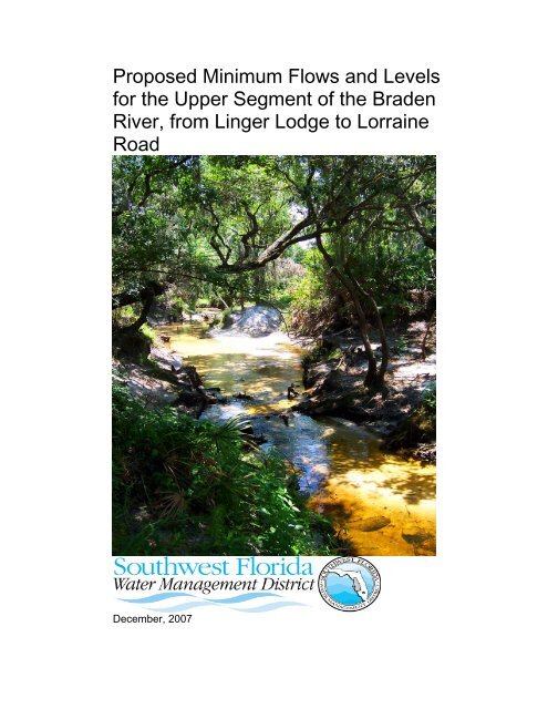
Proposed <strong>Minimum</strong> <strong>Flows</strong> <strong>and</strong> <strong>Levels</strong><br />
for the Upper Segment of the Braden<br />
River, from Linger Lodge to Lorraine<br />
Road<br />
December, 2007
Proposed <strong>Minimum</strong> <strong>Flows</strong> <strong>and</strong> <strong>Levels</strong> for<br />
the Upper Segment of the Braden River,<br />
from Linger Lodge to Lorraine Road<br />
December, 2007<br />
Ecologic Evaluation Section<br />
Resource Conservation <strong>and</strong> Development Department<br />
<strong>Southwest</strong> <strong>Florida</strong> <strong>Water</strong> Management District<br />
Brooksville, <strong>Florida</strong> 34604-6899<br />
Marty Kelly<br />
Adam B. Munson<br />
Jonathan Morales<br />
Douglas A. Leeper<br />
The <strong>Southwest</strong> <strong>Florida</strong> <strong>Water</strong> Management District (District) does not<br />
discriminate upon the basis of any individual’s disability status. This nondiscriminatory<br />
policy involves every aspect of the District’s functions, including<br />
one’s access to, participation, employment, or treatment in its programs or<br />
activities. Anyone requiring accommodation as provided for in the American with<br />
Disabilities Act should contact (352) 796-7211 or 1-800-423-1476, extension<br />
4215; TDD ONLY 1-800-231-6103; FAX (352) 754-6749.<br />
ii
Table of Contents<br />
TABLE OF CONTENTS.................................................................................................................................I<br />
TABLE OF FIGURES.................................................................................................................................. IV<br />
LIST OF TABLES...................................................................................................................................... VIII<br />
EXECUTIVE SUMMARY.............................................................................................................................. X<br />
ACKNOWLEDGEMENTS ......................................................................................................................... XIII<br />
CHAPTER 1 MINIMUM FLOWS AND LEVELS ....................................................................................... 1-1<br />
1.1 OVERVIEW AND LEGISLATIVE DIRECTION.......................................................1-1<br />
1.2 HISTORICAL PERSPECTIVE...........................................................................1-2<br />
1.3 THE FLOW REGIME .....................................................................................1-3<br />
1.4 ECOSYSTEM INTEGRITY AND SIGNIFICANT HARM ...........................................1-4<br />
1.5 SUMMARY OF THE SWFWMD APPROACH FOR DEVELOPING MINIMUM FLOWS.1-5<br />
1.5.1 A Building Block Approach.................................................................1-6<br />
1.6 FLOWS AND LEVELS ....................................................................................1-8<br />
1.7 CONTENT OF REMAINING CHAPTERS ............................................................1-9<br />
CHAPTER 2 BASIN DESCRIPTION WITH EMPHASIS ON LAND USE, HYDROLOGY AND<br />
WATER QUALITY..................................................................................................................................... 2-1<br />
2.1 OVERVIEW..................................................................................................2-1<br />
2.2 WATERSHED DESCRIPTION (MATERIAL IN THIS SECTION WAS TAKEN LARGELY<br />
FROM DELCHARCO AND LEWELLING, 1997). .......................................................2-1<br />
2.2.1 Geographic Location..........................................................................2-1<br />
2.2.2 Climate...............................................................................................2-2<br />
2.3 LAND USE CHANGES IN THE BRADEN RIVER WATERSHED ..............................2-3<br />
2.3.1 Braden River <strong>Water</strong>shed....................................................................2-3<br />
2.3.2 Upper Braden River Sub-Basin..........................................................2-7<br />
2.3.3 Lower Braden River Sub-Basin........................................................2-10<br />
2.4 HYDROLOGY.............................................................................................2-13<br />
2.4.1 Overview..........................................................................................2-13<br />
2.4.2 <strong>Florida</strong> River Flow Patterns <strong>and</strong> the AMO........................................2-13<br />
2.4.3 Braden River Flow Trends ...............................................................2-17<br />
2.4.4 Benchmark Periods .........................................................................2-22<br />
2.4.5 Seasonal Flow Patterns <strong>and</strong> the Building Block Approach ..............2-23<br />
WATER CHEMISTRY ........................................................................................2-26<br />
2.4.6 <strong>Water</strong> Quality Data ..........................................................................2-26<br />
2.4.7 Phosphorus......................................................................................2-26<br />
2.4.8 Nitrogen ...........................................................................................2-27<br />
2.4.9 Potassium ........................................................................................2-27<br />
CHAPTER 3 GOALS, ECOLOGICAL RESOURCES OF CONCERN AND KEY HABITAT<br />
INDICATORS ............................................................................................................................................ 3-1<br />
3.1 GOAL – PREVENTING SIGNIFICANT HARM......................................................3-1<br />
3.2 RESOURCES AND AREA OF CONCERN...........................................................3-2<br />
i
3.3 RESOURCE MANAGEMENT GOALS AND KEY HABITAT INDICATORS...................3-2<br />
3.3.1 Fish Passage <strong>and</strong> Recreational Use..................................................3-3<br />
3.3.2 Wetted Perimeter Inflection Point ......................................................3-3<br />
3.3.3 In-Channel Habitats for Fish <strong>and</strong> Macroinvertebrates........................3-4<br />
3.3.4 Woody Habitats .................................................................................3-5<br />
3.3.5 Hydrologic Connections Between the River Channel <strong>and</strong> Floodplain 3-6<br />
CHAPTER 4 TECHNICAL APPROACH FOR ESTABLISHING MINIMUM FLOWS AND LEVELS<br />
FOR THE UPPER BRADEN RIVER......................................................................................................... 4-1<br />
4.1 OVERVIEW..................................................................................................4-1<br />
4.2 TRANSECT LOCATIONS AND FIELD SAMPLING OF INSTREAM AND FLOODPLAIN<br />
HABITATS.........................................................................................................4-1<br />
4.2.1 HEC-RAS Cross-Sections .................................................................4-2<br />
4.2.2 PHABSIM Cross-Sections .................................................................4-3<br />
4.2.3 Instream Habitat Cross-Sections .......................................................4-3<br />
4.2.4 Floodplain Vegetation/Soils Cross Sections ......................................4-4<br />
4.3 MODELING APPROACHES.............................................................................4-7<br />
4.3.1 HEC-RAS Modeling ...........................................................................4-7<br />
4.3.2 Physical Habitat Simulation (PHABSIM) Modeling ..........................4-10<br />
4.3.3 Long-term Inundation Analyses .......................................................4-14<br />
4.4 SEASONAL FLOW AND DEVELOPMENT OF BLOCKS 1, 2, AND 3 ......................4-16<br />
4.5 LOW-FLOW THRESHOLD ............................................................................4-17<br />
4.5.1 Wetted Perimeter.............................................................................4-17<br />
4.5.2 Fish Passage ...................................................................................4-18<br />
4.6 PRESCRIBED FLOW REDUCTION FOR BLOCK 1.............................................4-19<br />
4.6.1 PHABSIM – Application for Block 1 .................................................4-19<br />
4.7 PRESCRIBED FLOW REDUCTION FOR BLOCK 2.............................................4-19<br />
4.7.1 PHABSIM – Application for Block 2 .................................................4-20<br />
4.7.2 Snag <strong>and</strong> Exposed Root Habitat Analyses ......................................4-20<br />
4.8 PRESCRIBED FLOW REDUCTION FOR BLOCK 3.............................................4-21<br />
4.8.1 Floodplain Connection Analyses – Application for Block 3 ..............4-21<br />
CHAPTER 5 RESULTS AND RECOMMENDED MINIMUM FLOWS ...................................................... 5-1<br />
5.1 OVERVIEW..................................................................................................5-1<br />
5.2 LOW-FLOW THRESHOLD ..............................................................................5-1<br />
5.2.1 Fish Passage Criteria.........................................................................5-1<br />
5.2.2 Wetted Perimeter Criteria ..................................................................5-2<br />
5.2.3 Low-Flow Threshold ..........................................................................5-3<br />
5.3 PRESCRIBED FLOW REDUCTION FOR BLOCK 1...............................................5-4<br />
5.3.1 PHABSIM Results for Block 1............................................................5-4<br />
5.3.2 Short-Term Compliance St<strong>and</strong>ards for Block 1..................................5-6<br />
5.4 PRESCRIBED FLOW REDUCTIONS FOR BLOCK 3.............................................5-6<br />
5.4.1 Inundation of Floodplain Features .....................................................5-6<br />
5.4.2 Inundation of Floodplain Vegetation Classes <strong>and</strong> Soils .....................5-9<br />
5.4.3 Percent-of-Flow Reductions for Floodplain Features, Vegetation<br />
Classes <strong>and</strong> Soils .....................................................................................5-15<br />
5.4.4 Short-Term Compliance St<strong>and</strong>ards for Block 3................................5-17<br />
ii
5.5 PRESCRIBED FLOW REDUCTION FOR BLOCK 2.............................................5-18<br />
5.5.1 PHABSIM Results for Block 2..........................................................5-18<br />
5.5.2 Instream Habitats.............................................................................5-20<br />
5.5.3 Flow Relationships with Woody Instream Habitats ..........................5-22<br />
5.5.4 Selection of the Prescribed Flow Reductions for Block 2.................5-24<br />
5.5.5 Short-Term Compliance St<strong>and</strong>ards for Block 2................................5-24<br />
5.6 COMPLIANCE STANDARDS AND PROPOSED MINIMUM FLOWS FOR THE BRADEN<br />
RIVER NEAR LORRAINE....................................................................................5-25<br />
CHAPTER 6 LITERATURE CITED........................................................................................................... 6-1<br />
CHAPTER 7 GLOSSARY OF TERMS ..................................................................................................... 7-1<br />
CHAPTER 8 APPENDIX A ....................................................................................................................... 8-1<br />
CHAPTER 9 APPENDIX B – STAFF RESPONSE TO THE PEER REVIEW REPORT.......................... 9-1<br />
iii
Table of Figures<br />
Figure 1-1. Mean (blue) <strong>and</strong> median (orange) daily flows for the USGS Braden<br />
River near Lorraine gage site <strong>and</strong> seasonal flow blocks (Blocks 1, 2 <strong>and</strong> 3)<br />
for the upper Braden River..........................................................................1-8<br />
Figure 2-1. Map of the Braden River watershed showing the Braden River mainstem<br />
<strong>and</strong> tributaries, sub-basins <strong>and</strong> USGS gage site locations. ...............2-2<br />
Figure 2-2. Average monthly rainfall at the Bradenton Experimental Station for<br />
the period from 1911 through 2004.............................................................2-3<br />
Figure 2-3. 1972 l<strong>and</strong> use/cover map of the Braden River watershed. .............2-5<br />
Figure 2-4. 1999 l<strong>and</strong> use/cover map of the Braden River watershed. .............2-6<br />
Figure 2-5. L<strong>and</strong> use/cover acreage in the Braden River watershed in 1972,<br />
1990 <strong>and</strong> 1999............................................................................................2-7<br />
Figure 2-6. L<strong>and</strong> use/cover acreage in the upper Braden River sub-basin in<br />
1972, 1990 <strong>and</strong> 1999..................................................................................2-8<br />
Figure 2-7. 1972 L<strong>and</strong> use/cover map of the upper Braden River sub-basin....2-9<br />
Figure 2-8. 1999 L<strong>and</strong> use/cover map of the upper Braden River sub-basin..2-10<br />
Figure 2-9. L<strong>and</strong> use/ cover in the lower Braden River sub-basin in 1972, 1990<br />
<strong>and</strong> 1999...................................................................................................2-11<br />
Figure 2-10. 1972 L<strong>and</strong> use/cover map of the lower Braden River sub-basin.2-12<br />
Figure 2-11. 1999 L<strong>and</strong> use/cover map of the lower Braden River sub-basin.2-13<br />
Figure 2-12. Examples of three river flow patterns: the Southern River Pattern<br />
(upper panel), the Northern River Pattern (center panel) <strong>and</strong> Bimodal River<br />
Pattern (bottom panel). .............................................................................2-15<br />
Figure 2-13. Median (orange line) <strong>and</strong> mean (blue line) daily flows for the USGS<br />
Braden River near Lorraine gage for the period of record (1988-2005). ...2-17<br />
Figure 2-14. Graphical results of Kendall's tau test of mean annual flows for the<br />
Peace River at Arcadia for the period 1940 to 1999 (upper panel), 1940 to<br />
1969 (middle panel), <strong>and</strong> 1970 to 1999 (lower panel). The red line is the<br />
Ordinary Least Squares line, <strong>and</strong> the blue line is the Kendall's tau Theil line.<br />
..................................................................................................................2-19<br />
Figure 2-15. Median daily flows for the Braden River near Lorraine gage site for<br />
two benchmark periods (1988 to 1994 <strong>and</strong> 1995 to 2005)........................2-23<br />
Figure 2-16. Median daily flows for 1988 through 2005 at the USGS Braden<br />
River near Lorraine gage site <strong>and</strong> seasonal flow blocks (Blocks 1, 2 <strong>and</strong> 3)<br />
for the upper Braden River........................................................................2-25<br />
Figure 2-17. Phosphorus concentrations in water samples collected by the<br />
USGS at the Braden River near Lorraine gage. Upper plot is time series<br />
plot; middle plot is time series plot with shorter time scale, <strong>and</strong> bottom plot is<br />
concentration versus flow. ........................................................................2-28<br />
Figure 2-18. Nitrate or Nitrate/Nitrite concentrations in water samples collected<br />
by the USGS at the Braden River near Lorraine gage. Upper plot is time<br />
series plot; middle plot is time series plot with shorter time scale, <strong>and</strong> bottom<br />
plot is concentration versus flow. ..............................................................2-29<br />
iv
Figure 2-19. Potassium concentrations in water samples collected by the USGS<br />
at the Peace River at Arcadia gage. Upper plot is time series plot; middle<br />
plot is concentration versus flow; <strong>and</strong> the bottom plot is time series plot of<br />
residuals of phosphorus concentration regressed against flow.................2-30<br />
Figure 2-20. Potassium concentrations in water samples collected by the USGS<br />
at the Braden River near Lorraine gage. Upper plot is time series plot;<br />
middle plot is time series plot with shorter time scale, <strong>and</strong> bottom plot is<br />
concentration versus flow. ........................................................................2-31<br />
Figure 3-1. Example of low flow in a riffle or shoal area. Many potential instream<br />
habitats such as limerock (foreground), snags, s<strong>and</strong>bars, <strong>and</strong><br />
exposed roots are not inundated under low flow conditions. ......................3-8<br />
Figure 4-1. Braden River watershed <strong>and</strong> location of USGS streamflow gaging<br />
stations. The USGS Braden River at Linger Lodge near Bradenton FL gage<br />
represented the most downstream extent of the MFLs study area. ............4-2<br />
Figure 4-2. Upstream vegetation cross-section locations <strong>and</strong> NWI classes on the<br />
Braden River (reprinted from PBS&J 2006). Transect 7 served as the most<br />
upstream or upper PHABSIM study site. ....................................................4-6<br />
Figure 4-3. Downstream vegetation cross-section locations <strong>and</strong> NWI classes on<br />
the Braden River (reprinted from PBS&J 2006). The downstream or lower<br />
PHABSIM study site is located near Transect 11. ......................................4-7<br />
Figure 4-4. Weighted usable area (WUA) versus discharge for three life history<br />
stages (fry, juvenile, adult) <strong>and</strong> spawning activity of spotted sunfish at the<br />
upstream PHABSIM site in the Braden River............................................4-11<br />
Figure 4-5. Example plot of habitat gain/loss relative to flow reductions of 10, 20,<br />
30, <strong>and</strong> 40%. Habitat loss is shown for spotted sunfish adults at the<br />
upstream Braden River site based on historic flow records from 1989 to<br />
1993..........................................................................................................4-12<br />
Figure 4-6. Percent-of-flow reductions that result in a 15% reduction in the<br />
number of days that flows on the Alafia, middle Peace, <strong>and</strong> Myakka rivers<br />
are reached. Horizontal lines represent the flow reduction st<strong>and</strong>ards<br />
identified by the District for specific flow ranges in each river. Graphs are<br />
adapted from Kelly et al. 2005a, b, <strong>and</strong> c. ................................................4-15<br />
Figure 4-7. Wetted perimeter versus discharge at HEC-RAS transect number<br />
44.9 in the Braden River. Wetted perimeter values for modeled flows up to<br />
25 cfs are shown <strong>and</strong> the lowest wetted perimeter inflection point for this<br />
cross-section is identified..........................................................................4-18<br />
Figure 5-1. Plot of flow required at the Braden River near Lorraine gage to<br />
inundate the deepest part of the channel at twenty HEC-RAS cross-sections<br />
in the Braden River to a depth of 0.6 ft. Cross-sections associated with the<br />
USGS Braden River near Lorraine, Braden River at Linger Lodge near<br />
Bradenton, <strong>and</strong> Braden River at Lorraine gage sites are indicated. Note that<br />
the scale of the x-axis is not linear..............................................................5-2<br />
Figure 5-2. Plot of local flow at the Braden River near Lorraine gage required to<br />
inundate the lowest wetted perimeter inflection point at twenty HEC-RAS<br />
cross-sections in the Braden River. Cross-sections associated with the<br />
USGS Braden River near Lorraine FL Braden River at Lorraine <strong>and</strong> Braden<br />
v
River at Linger Lodge near Bradenton gage sites are indicated. Note that<br />
the scale of the x-axis is not linear..............................................................5-3<br />
Figure 5-3. Summary results for the "upper" Braden River PHABSIM site for May<br />
<strong>and</strong> June. Descriptive statistics (N, mean, minimum <strong>and</strong> maximum) for<br />
percent-of-flow reductions associated with a 15% reduction in available<br />
habitat for selected biota are shown, based on review of ten, twenty, thirty<br />
<strong>and</strong> forty percent reductions in flows measured at the Braden River near<br />
Lorraine gage for two time periods (1988 through 1994 <strong>and</strong> 1995 through<br />
2005). .........................................................................................................5-5<br />
Figure 5-4. Summary results for the "lower" Braden River PHABSIM site for May<br />
<strong>and</strong> June. Descriptive statistics (N, mean, minimum <strong>and</strong> maximum) for<br />
percent-of-flow reductions associated with a 15% reduction in available<br />
habitat for selected biota are shown, based on review of ten, twenty, thirty<br />
<strong>and</strong> forty percent reductions in flows measured at the Braden River near<br />
Lorraine gage for two time periods (1988 through 1994 <strong>and</strong> 1995 through<br />
2005). .........................................................................................................5-5<br />
Figure 5-5. Elevation (Feet above NGVD) profile for floodplain vegetation/soils<br />
cross-section (transect) 2. Distances (cumulative length) are shown centered<br />
on the middle of the river channel...............................................................5-7<br />
Figure 5-6. Floodplain wetted perimeter versus elevation at floodplain<br />
vegetation/soils cross-section (Transect) 15. Vertical bars indicate mean<br />
elevations of two floodplain vegetation classes observed at the site. .........5-9<br />
Figure 5-7. Median elevations of vegetation classes at floodplain vegetation/soils<br />
transects along the Braden River..............................................................5-13<br />
Figure 5-8. Percent-of-flow reductions that result in a 15% reduction in the<br />
number of days flow are achieved, based on period of record (1988-2005)<br />
flow records from the USGS Braden River near Lorraine gage. ...............5-17<br />
Figure 5-9. Summary results for the "upper" Braden River PHABSIM site for<br />
October through April. Descriptive statistics (N, mean, minimum <strong>and</strong><br />
maximum) for percent-of-flow reductions associated with a 15% reduction in<br />
available habitat for selected biota are shown, based on review of ten,<br />
twenty, thirty <strong>and</strong> forty percent reductions in flows measured at the Braden<br />
River near Lorraine gage for two time periods (1988 through 1994 <strong>and</strong> 1995<br />
through 2005). ..........................................................................................5-19<br />
Figure 5-10. Summary results for the "lower" Braden River PHABSIM site for<br />
October through April. Descriptive statistics (N, mean, minimum <strong>and</strong><br />
maximum) for percent-of-flow reductions associated with a 15% reduction in<br />
available habitat for selected biota are shown, based on review of ten,<br />
twenty, thirty <strong>and</strong> forty percent reductions in flows measured at the Braden<br />
River near Lorraine gage for two time periods (1988 through 1994 <strong>and</strong> 1995<br />
through 2005). ..........................................................................................5-20<br />
Figure 5-11. Percent dominance of instream habitats based on linear extent of<br />
the habitats along fourteen cross-sections in the Braden River................5-21<br />
Figure 5-12. Mean elevations of instream habitats at fourteen cross-section sites<br />
on the Braden River..................................................................................5-22<br />
vi
Figure 5-13. Median daily flow at the USGS Braden River near Lorraine gage<br />
site plotted for each day of the Braden River Pattern <strong>Water</strong> Year with shortterm<br />
compliance st<strong>and</strong>ards for Blocks 1, 2 <strong>and</strong>, 3. The orange line is the<br />
natural flow. The blue line represents the natural flow, reduced by the<br />
maximum allowable withdrawal, without violating the proposed MFLs. The<br />
two red lines are the Low-Flow Threshold <strong>and</strong> the High-Flow Step. .........5-25<br />
vii
List of Tables<br />
Table 2-1. L<strong>and</strong> use <strong>and</strong> l<strong>and</strong> cover percentages in the 53,487-acre (84 square<br />
miles) Braden River watershed for three time periods: 1972, 1990 <strong>and</strong> 1999.<br />
....................................................................................................................2-7<br />
Table 2-2. L<strong>and</strong> use/cover <strong>and</strong> l<strong>and</strong> cover percentages in the upper Braden<br />
River sub-basin for three time periods: 1972, 1990 <strong>and</strong> 1999. ...................2-8<br />
Table 2-3. L<strong>and</strong> use/cover percentages in the lower Braden River sub-basin for<br />
three time periods: 1972, 1990 <strong>and</strong> 1999. ................................................2-11<br />
Table 2-4. Results of Kendall's tau test of mean annual (XAnnQ) <strong>and</strong> median<br />
annual (MedAnnQ) flows for selected <strong>Florida</strong> streamflow gage sites <strong>and</strong><br />
selected time periods. P values < 0.1 are highlighted in bold; those<br />
associated with flow decreases are shaded yellow, those that indicate flow<br />
increases are shaded blue. Table is an excerpt from a table in Kelly (2004).<br />
..................................................................................................................2-20<br />
Table 2-5. Results of Mann-Whitney tests for flow differences between mean<br />
annual flows at selected gage sites for two multidecadal time periods (1940<br />
to 1969 <strong>and</strong> 1970 to 1999). P values of 0.1 or less are highlighted in bold; p<br />
values that indicate a flow decrease between periods are shaded yellow.<br />
Excerpt of table from Kelly (2004).............................................................2-21<br />
Table 2-6. Beginning Julian days for seasonal periods of low <strong>and</strong> high-flow<br />
(Blocks 1 <strong>and</strong> 3) <strong>and</strong> ending date for the high flow period at five different<br />
gage stations in the SWFWMD. Mean values including <strong>and</strong> excluding the<br />
values for the Withlacoochee River are also listed. ..................................2-24<br />
Table 2-7. Beginning <strong>and</strong> ending calendar dates for annual flow Blocks 1, 2, <strong>and</strong><br />
3 for the Braden River for non-leap years. Calendar dates apply for both<br />
non-leap years <strong>and</strong> leap years..................................................................2-25<br />
Table 2-8. Summary statistics for Braden, Alafia, Peace, Myakka <strong>and</strong><br />
Withlacoochee Rivers water quality data <strong>and</strong> comparative values reported<br />
for <strong>Florida</strong> streams (Friedemann <strong>and</strong> H<strong>and</strong> 1989). ...................................2-32<br />
Table 4-1. Beginning <strong>and</strong> ending calendar dates (<strong>and</strong> Julian days) for seasonal<br />
flow Blocks 1, 2, <strong>and</strong> 3 for the upper Braden River...................................4-16<br />
Table 5-1. Recommended percent flow reductions based on PHABSIM analyses<br />
for two sites in the Braden River for the two month included in Block 1......5-4<br />
Table 5-2. Elevations <strong>and</strong> lengths of floodplain vegetation/soils cross-sections<br />
(transects) along the Braden River. N is the number of elevation<br />
measurements made along each transect. Median relative elevations are<br />
the vertical distance between the channel bottom <strong>and</strong> median elevations. 5-8<br />
Table 5-3. Mean (±SD) flows at the Braden River near Lorraine gage required<br />
for inundation of median elevation of wetl<strong>and</strong> (muck <strong>and</strong> hydric) soils,<br />
vegetation classes <strong>and</strong> selected geomorphological features at 15 floodplain<br />
vegetation/soils transects. Percent-of-flow reductions associated with up to<br />
a 15% reduction in the number of days of flow sufficient to inundate the<br />
viii
mean feature elevations are listed for two benchmark periods, 1988 through<br />
1994 <strong>and</strong> 1995 through 2005....................................................................5-11<br />
Table 5-4. Vegetation class percent composition of Braden River floodplain<br />
vegetation/soil transects. ..........................................................................5-12<br />
Table 5-5. Median relative elevations (height in feet above the river channel<br />
bottom), of vegetation classes at floodplain vegetation/soils transects along<br />
the Braden River.......................................................................................5-13<br />
Table 5-6. Median elevations in feet above NGVD of hydric <strong>and</strong> other soil<br />
characteristics along floodplain vegetation/soils transects on the Braden<br />
River. ........................................................................................................5-14<br />
Table 5-7. Median elevations, in feet above NGVD, <strong>and</strong> relative elevations<br />
(height in feet above the river channel bottom) of hydric <strong>and</strong> non-hydric soils<br />
in vegetation classes occurring along the floodplain vegetation/soils<br />
transects on the Braden River. .................................................................5-15<br />
Table 5-8. Recommended percent flow reductions based on PHABSIM analyses<br />
for two sites in the Braden River for the seven months included in Block 2..5-<br />
19<br />
Table 5-9. Mean elevation of instream woody habitats (exposed roots <strong>and</strong><br />
snags) at fourteen instream habitat cross-section sites, corresponding flows<br />
at the USGS Braden River near Lorraine gage site required for inundation of<br />
the mean elevations, <strong>and</strong> maximum percent-of-flow reductions associated<br />
with less than a 15% reduction in the number of days flow sufficient to<br />
inundate the mean habitat elevations for two benchmark periods.. ..........5-23<br />
Table 5-10. Proposed <strong>Minimum</strong> <strong>Flows</strong> for the upper, freshwater segment of the<br />
Braden River, including short-term <strong>and</strong> long-term compliance st<strong>and</strong>ards for<br />
the USGS Braden River near Lorraine FL gage site.................................5-27<br />
ix
Executive Summary<br />
The <strong>Southwest</strong> <strong>Florida</strong> <strong>Water</strong> Management District, by virtue of its responsibility<br />
to permit the consumptive use of water <strong>and</strong> a legislative m<strong>and</strong>ate to protect water<br />
resources from “significant harm," has been directed to establish minimum flows<br />
<strong>and</strong> levels (MFLs) for streams <strong>and</strong> rivers within its boundaries (Section 373.042,<br />
<strong>Florida</strong> Statutes). As currently defined by statute, "the minimum flow for a given<br />
watercourse shall be the limit at which further withdrawals would be significantly<br />
harmful to the water resources or ecology of the area." In this report, minimum<br />
flows are proposed for the upper or fresh water segment of the Braden River,<br />
defined as the stretch of the river from the United States Geological Survey<br />
(USGS) Braden River at Lorraine gage site, downstream to the USGS Braden<br />
River at Linger Lodge near Bradenton gage.<br />
Fundamental to the approach used for development of minimum flows <strong>and</strong> levels<br />
is the realization that a flow regime is necessary to protect the ecology of the<br />
river system. The initial step in this process requires an underst<strong>and</strong>ing of historic<br />
<strong>and</strong> current flow conditions to assess to what extent withdrawals or other<br />
anthropogenic factors have affected flows. To accomplish this task the District<br />
has evaluated the effects of climatic oscillations on regional river flows <strong>and</strong> has<br />
identified two benchmark periods for evaluating flows.<br />
For development of MFLs for the Braden River, the District identified seasonal<br />
blocks corresponding to periods of low, medium <strong>and</strong> high flows. Short-term<br />
minimum flow compliance st<strong>and</strong>ards for the Braden River near Lorraine gage site<br />
were developed for each of these seasonal periods using a "building block"<br />
approach. The compliance st<strong>and</strong>ards include prescribed flow reductions based<br />
on limiting potential changes in aquatic <strong>and</strong> wetl<strong>and</strong> habitat availability that may<br />
be associated with seasonal changes in flow. A low flow threshold, based on fish<br />
passage depth <strong>and</strong> wetted perimeter inflection points is also incorporated into the<br />
short-term compliance st<strong>and</strong>ards.<br />
The low flow threshold is defined to be a flow that serves to limit withdrawals,<br />
with no surface water withdrawals permitted unless the threshold is exceeded.<br />
For the Braden River near Lorraine gage site, the low flow threshold was<br />
determined to be 7 cubic feet per second. A prescribed flow reduction for the low<br />
flow period (Block 1, which runs from May 7 through June 19) was based on<br />
review of limiting factors developed using the Physical Habitat Simulation Model<br />
(PHABSIM) to evaluate flow related changes in habitat availability for several fish<br />
species <strong>and</strong> macroinvertebrate diversity. It was determined using PHABSIM that<br />
the most restrictive limiting factor was the loss of habitat for adult <strong>and</strong> spawning<br />
spotted sunfish. Adult <strong>and</strong> spawning spotted sunfish exhibit a 15% loss of<br />
habitat when flows are reduced by 10%. This determination was based on two<br />
PHABSIM sites on the Braden River <strong>and</strong> historic flow records from the Braden<br />
River near Lorraine gage.<br />
x
For the high flow season of the year (Block 3, which runs from June 20 to<br />
October 24), a prescribed flow reduction was based on review of limiting factors<br />
developed using the HEC-RAS floodplain model <strong>and</strong> long-term inundation<br />
analyses to evaluate percent of flow reductions associated with changes in the<br />
number of days of inundation of floodplain features. It was determined that<br />
stepped flow reductions of 19% <strong>and</strong> 10% of historic flows, with the step occurring<br />
at the 15% exceedance flow (54 cfs) resulted in a decrease of 15% or more in<br />
the number of days that flows would inundate floodplain features as measured at<br />
the Braden River near Lorraine gage.<br />
For the medium flow period (Block 2, which runs from October 25 of one year to<br />
May 6 of the next), PHABSIM analyses were used to model flows associated with<br />
potential changes in habitat availability for several fish species <strong>and</strong><br />
macroinvertebrate diversity. In addition, flows associated with inundation of<br />
instream woody habitats were evaluated using a HEC-RAS model <strong>and</strong> long-term<br />
inundation analyses. Using the more conservative of the two resulting flows, it<br />
was determined that PHABSIM results would define the percent flow reduction<br />
for Block 2. Results from the PHABSIM analyses indicated that more than 15%<br />
of historically available habitat would be lost for specific species life-stages if<br />
flows were reduced by more than 11% as measured at the Braden River near<br />
Lorraine gage site during the medium flow period.<br />
Because minimum flows are intended to protect the water resources or ecology<br />
of an area, <strong>and</strong> because climatic variation can influence river flow regimes, we<br />
developed long-term compliance st<strong>and</strong>ards for the Braden River near Lorraine<br />
gage site. The st<strong>and</strong>ards are hydrologic statistics that represent flows that may<br />
be expected to occur during long-term periods when short-term compliance<br />
st<strong>and</strong>ards are being met. The long-term compliance st<strong>and</strong>ards were generated<br />
using historic flow records that were altered under the assumption that allowable<br />
withdrawals identified by the short-term compliance st<strong>and</strong>ards actually occurred<br />
throughout the entire period of record. Hydrologic statistics for the altered flow<br />
data sets, including five <strong>and</strong> ten-year mean <strong>and</strong> median flows were determined<br />
<strong>and</strong> identified as long-term compliance st<strong>and</strong>ards. Because these long-term<br />
st<strong>and</strong>ards were developed using the short-term compliance st<strong>and</strong>ards <strong>and</strong><br />
historic flow records that were altered to reflect allowable withdrawals, it may be<br />
expected that the long-term st<strong>and</strong>ards will be met if compliance with short-term<br />
st<strong>and</strong>ards is achieved.<br />
Collectively, the short <strong>and</strong> long-term compliance st<strong>and</strong>ards proposed for the<br />
USGS Braden River near Lorraine gage site comprise the District's proposed<br />
minimum flows <strong>and</strong> levels for the upper or freshwater segment of the Braden<br />
River. The st<strong>and</strong>ards are intended to prevent significant harm to the water<br />
resources or ecology of the river that may result from water use. Since future<br />
structural alterations could potentially affect surface water or groundwater flow<br />
characteristics within the watershed <strong>and</strong> additional information pertaining to<br />
xi
minimum flows development may become available, the District is committed to<br />
revision of the proposed levels as necessary.<br />
xii
Acknowledgements<br />
The authors would like to thank Richard Gant, Lisa Henningsen, Jason Hood,<br />
<strong>and</strong> Michelle Dachsteiner of the <strong>Southwest</strong> <strong>Florida</strong> <strong>Water</strong> Management District<br />
for their assistance in data collection. We also thank Lisa Henningsen <strong>and</strong> Frank<br />
Sargent, also with the District, for assistance with development of l<strong>and</strong>-use maps.<br />
Dr. James Gore of the University of South <strong>Florida</strong> performed all PHABSIM<br />
modeling <strong>and</strong> consulted frequently on the application of PHABSIM analyses.<br />
xiii
<strong>Chapter</strong> 1 <strong>Minimum</strong> <strong>Flows</strong> <strong>and</strong> <strong>Levels</strong><br />
"There is no universally accepted method or combination of methods that is<br />
appropriate for establishing instream flow regimes on all rivers or streams.<br />
Rather, the combination or adaptation of methods should be determined on a<br />
case-by-case basis; . . . In a sense, there are few bad methods – only improper<br />
applications of methods. In fact, most . . . assessment tools . . . can afford<br />
adequate instream flow protection for all of a river's needs when they are used in<br />
conjunction with other techniques in ways that provide reasonable answers to<br />
specific questions asked for individual rivers <strong>and</strong> river segments. Therefore,<br />
whether a particular method 'works' is not based on its acceptance by all parties<br />
but whether it is based on sound science, basic ecological principles, <strong>and</strong><br />
documented logic that address a specific need" (Instream Flow Council 2002).<br />
1.1 Overview <strong>and</strong> Legislative Direction<br />
The <strong>Southwest</strong> <strong>Florida</strong> <strong>Water</strong> Management District (District or SWFWMD), by virtue of<br />
its responsibility to permit the consumptive use of water <strong>and</strong> a legislative m<strong>and</strong>ate to<br />
protect water resources from “significant harm”, has been directed to establish minimum<br />
flows <strong>and</strong> levels (MFLs) for streams <strong>and</strong> rivers within its boundaries (Section 373.042,<br />
<strong>Florida</strong> Statutes). As currently defined by statute, “the minimum flow for a given<br />
watercourse shall be the limit at which further withdrawals would be significantly harmful<br />
to the water resources or ecology of the area.” Development or adoption of a minimum<br />
flow or level does not in itself protect a water body from significant harm. However,<br />
protection, recovery or regulatory compliance can be gauged <strong>and</strong> achieved once a<br />
st<strong>and</strong>ard has been established. The District's purpose in establishing MFLs is to create<br />
a yardstick against which permitting <strong>and</strong>/or planning decisions regarding water<br />
withdrawals, either surface or groundwater, can be made. Should an amount of<br />
withdrawal requested cause “significant harm”, then a permit cannot be issued. If it is<br />
determined that a system is either not in compliance, or expected not to be in<br />
compliance during next 20 years, as a result of withdrawals, then a recovery plan is<br />
developed <strong>and</strong> implemented.<br />
According to state law, minimum flows <strong>and</strong> levels are to be established based upon the<br />
best available information (Section 373.042, F.S.), <strong>and</strong> shall be developed with<br />
consideration of “...changes <strong>and</strong> structural alterations to watersheds, surface waters<br />
<strong>and</strong> aquifers <strong>and</strong> the effects such changes or alterations have had, <strong>and</strong> the constraints<br />
such changes or alterations have placed, on the hydrology of the affected watershed,<br />
surface water, or aquifer...” (Section 373.0421, F.S.). Changes, alterations <strong>and</strong><br />
constraints associated with water withdrawals are not to be considered when<br />
developing minimum flows <strong>and</strong> levels. However, according to the State <strong>Water</strong><br />
Resources Implementation Rule (<strong>Chapter</strong> 62-40.473, <strong>Florida</strong> Administrative Code),<br />
“consideration shall be given to the protection of water resources, natural seasonal<br />
1-1
fluctuations in water flows or levels, <strong>and</strong> environmental values associated with coastal,<br />
estuarine, aquatic <strong>and</strong> wetl<strong>and</strong>s ecology, including:<br />
1) Recreation in <strong>and</strong> on the water;<br />
2) Fish <strong>and</strong> wildlife habitats <strong>and</strong> the passage of fish;<br />
3) Estuarine resources;<br />
4) Transfer of detrital material;<br />
5) Maintenance of freshwater storage <strong>and</strong> supply;<br />
6) Aesthetic <strong>and</strong> scenic attributes;<br />
7) Filtration <strong>and</strong> absorption of nutrients <strong>and</strong> other pollutants;<br />
8) Sediment loads;<br />
9) <strong>Water</strong> quality; <strong>and</strong><br />
10) Navigation.<br />
Because minimum flows are used for long-range planning <strong>and</strong> since the setting of<br />
minimum flows can potentially restrict the use <strong>and</strong> allocation of water, establishment of<br />
minimum flows will not go unnoticed or unchallenged. The science upon which a<br />
minimum flow is based, the assumptions made, <strong>and</strong> the policy used must, therefore, be<br />
clearly defined as each minimum flow is developed.<br />
1.2 Historical Perspective<br />
For freshwater streams <strong>and</strong> rivers, the development of instream flow legislation can be<br />
traced to recent work by fisheries biologists, dating back not much more than 35 to 40<br />
years. <strong>Florida</strong> has had minimum flow <strong>and</strong> levels incorporated into its <strong>Water</strong> Resource<br />
Act since its enactment in 1972. However, it was not until 1997 that the role of<br />
minimum flows <strong>and</strong> levels were clearly defined by the state (Munson et al. 2005). A<br />
survey completed in 1986 (Reiser et al. 1989) indicated that at that time only 15 states<br />
had legislation explicitly recognizing that fish <strong>and</strong> other aquatic resources required a<br />
certain level of instream flow for their protection. Nine of the 15 states were western<br />
states “where the concept for <strong>and</strong> impetus behind the preservation of instream flows for<br />
fish <strong>and</strong> wildlife had its origins” (Reiser et al. 1989). Stalnaker et al. (1995) have<br />
summarized the minimum flows approach as one of st<strong>and</strong>ards development, stating<br />
that, “[f]ollowing the large reservoir <strong>and</strong> water development era of the mid-twentieth<br />
century in North America, resource agencies became concerned over the loss of many<br />
miles of riverine fish <strong>and</strong> wildlife resources in the arid western United States.<br />
Consequently, several western states began issuing rules for protecting existing stream<br />
resources from future depletions caused by accelerated water development. Many<br />
assessment methods appeared during the 1960s <strong>and</strong> early 1970s. These techniques<br />
were based on hydrologic analysis of the water supply <strong>and</strong> hydraulic considerations of<br />
critical stream channel segments, coupled with empirical observations of habitat quality<br />
<strong>and</strong> an underst<strong>and</strong>ing of riverine fish ecology. Application of these methods usually<br />
resulted in a single threshold or ‘minimum’ flow value for a specified stream reach.”<br />
1-2
1.3 The Flow Regime<br />
The idea that a single minimum flow is not satisfactory for maintaining a river ecosystem<br />
was most emphatically stated by Stalnaker (1990) who declared that “minimum flow is a<br />
myth”. The purpose of his paper was to argue “multiple flow regimes are needed to<br />
maintain biotic <strong>and</strong> abiotic resources within a river ecosystem” (Hill et al. 1991). The<br />
logic is that “maintenance of stream ecosystems rests on streamflow management<br />
practices that protect physical processes which, in turn, influence biological systems.”<br />
Hill et al. (1991) identified four types of flows that should be considered when examining<br />
river flow requirements, including:<br />
1) flood flows that determine the boundaries of <strong>and</strong> shape floodplain <strong>and</strong> valley<br />
features;<br />
2) overbank flows that maintain riparian habitats;<br />
3) in-channel flows that keep immediate streambanks <strong>and</strong> channels functioning;<br />
<strong>and</strong><br />
4) in-stream flows that meet critical fish requirements.<br />
As emphasized by Hill et al. (1991), minimum flow methodologies should involve more<br />
than a consideration of immediate fish needs or the absolute minimum required to<br />
sustain a particular species or population of animals, <strong>and</strong> should take into consideration<br />
“how streamflows affect channels, transport sediments, <strong>and</strong> influence vegetation.”<br />
Although, not always appreciated, it should also be noted, “that the full range of natural<br />
intra- <strong>and</strong> inter-annual variation of hydrologic regimes is necessary to [fully] sustain the<br />
native biodiversity” (Richter et al. 1996). Successful completion of the life-cycle of many<br />
aquatic species is dependant upon a range of flows, <strong>and</strong> alterations to the flow regime<br />
may negatively impact these organisms as a result of changes in physical, chemical <strong>and</strong><br />
biological factors associated with particular flow conditions.<br />
Recently, South African researchers, as cited by Postel <strong>and</strong> Richter (2003), listed eight<br />
general principles for managing river flows:<br />
1) "A modified flow regime should mimic the natural one, so that the natural<br />
timing of different kinds of flows is preserved.<br />
2) A river's natural perenniality or nonperenniality should be retained.<br />
3) Most water should be harvested from a river during wet months; little should<br />
be taken during the dry months.<br />
4) The seasonal pattern of higher baseflows in wet season should be retained.<br />
5) Floods should be present during the natural wet season.<br />
6) The duration of floods could be shortened, but within limits.<br />
7) It is better to retain certain floods at full magnitude <strong>and</strong> to eliminate others<br />
entirely than to preserve all or most floods at diminished levels.<br />
8) The first flood (or one of the first) of the wet season should be fully retained."<br />
1-3
Common to this list <strong>and</strong> the flow requirements identified by Hill et al. (1991) is the<br />
recognition that in-stream flows <strong>and</strong> out of bank flows are important for ecosystem<br />
functioning, <strong>and</strong> that seasonal variability of flows should be maintained. Based on these<br />
concepts, the preconception that minimum flows (<strong>and</strong> levels) are a single value or the<br />
absolute minimum required to maintain ecologic health in most systems has been<br />
ab<strong>and</strong>oned in recognition of the important ecologic <strong>and</strong> hydrologic functions of streams<br />
<strong>and</strong> rivers that are maintained by a range of flows. And while the term “minimum flows”<br />
is still used, the concept has evolved to one that recognizes the need to maintain a<br />
“minimum flow regime”. In <strong>Florida</strong>, for example, the St. Johns River <strong>Water</strong> Management<br />
District typically develops multiple flow requirements when establishing minimum flows<br />
<strong>and</strong> levels (<strong>Chapter</strong> 40-C8, F.A.C) <strong>and</strong> for the Wekiva River noted that, “[s]etting<br />
multiple minimum levels <strong>and</strong> flows, rather than a single minimum level <strong>and</strong> flow,<br />
recognizes that lotic [running water] systems are inherently dynamic” (Hupalo et al.<br />
1994). Also, in 2005, changes that acknowledge the importance of retaining the<br />
hydrologic regime were made to the <strong>Florida</strong> Administrative Code. Specifically, <strong>Chapter</strong><br />
62-40.473(2) of the State <strong>Water</strong> Resources Implementation Rule currently directs that<br />
"minimum flows <strong>and</strong> levels should be expressed as multiple flows or levels defining a<br />
minimum hydrologic regime". This change was intended to protect variation in water<br />
flows <strong>and</strong> levels that contributes to significant functions of ecosystems.<br />
1.4 Ecosystem Integrity <strong>and</strong> Significant Harm<br />
“A goal of ecosystem management is to sustain ecosystem integrity by protecting native<br />
biodiversity <strong>and</strong> the ecological (<strong>and</strong> evolutionary) processes that create <strong>and</strong> maintain<br />
that diversity. Faced with the complexity inherent in natural systems, achieving that<br />
goal will require that resource managers explicitly describe desired ecosystem structure,<br />
function, <strong>and</strong> variability; characterize differences between current <strong>and</strong> desired<br />
conditions; define ecologically meaningful <strong>and</strong> measurable indicators that can mark<br />
progress toward ecosystem management <strong>and</strong> restoration goals; <strong>and</strong> incorporate<br />
adaptive strategies into resource management plans” (Richter et al. 1996). Although it<br />
is clear that multiple flows are needed to maintain the ecological systems that<br />
encompass streams, riparian zones <strong>and</strong> valleys, much of the fundamental research<br />
needed to quantify the ecological links between the instream <strong>and</strong> out of bank resources,<br />
because of expense <strong>and</strong> complexity, remains to be done. This research is needed to<br />
develop more refined methodologies, <strong>and</strong> will require a multi-disciplinary approach<br />
involving hydrologists, geomorphologists, aquatic <strong>and</strong> terrestrial biologists, <strong>and</strong><br />
botanists (Hill et al. 1991).<br />
To justify adoption of a minimum flow for purposes of maintaining ecologic integrity, it is<br />
necessary to demonstrate with site-specific information the ecological effects associated<br />
with flow alterations <strong>and</strong> to also identify thresholds for determining whether these effects<br />
constitute significant harm. As described in <strong>Florida</strong>’s legislative requirement to develop<br />
minimum flows, the minimum flow is to prevent “significant harm” to the state’s rivers<br />
<strong>and</strong> streams. Not only must “significant harm” be defined so that it can be measured, it<br />
is also implicit that some deviation from the purely natural or existing long-term<br />
1-4
hydrologic regime may occur before significant harm occurs. The goal of a minimum<br />
flow would, therefore, not be to preserve a hydrologic regime without modification, but<br />
rather to establish the threshold(s) at which modifications to the regime begin to affect<br />
the aquatic resource <strong>and</strong> at what level significant harm occurs. If recent changes have<br />
already “significantly harmed” the resource, or are expected to do so in the next twenty<br />
years, it will be necessary to develop a recovery or prevention plan.<br />
1.5 Summary of the SWFWMD Approach for Developing <strong>Minimum</strong><br />
<strong>Flows</strong><br />
As noted by Beecher (1990), “it is difficult [in most statutes] to either ascertain legislative<br />
intent or determine if a proposed instream flow regime would satisfy the legislative<br />
purpose”, but according to Beecher as cited by Stalnaker et al. (1995), an instream flow<br />
st<strong>and</strong>ard should include the following elements:<br />
1) a goal (e.g., non-degradation or, for the District’s purpose, protection from<br />
“significant harm”);<br />
2) identification of the resources of interest to be protected;<br />
3) a unit of measure (e.g., flow in cubic feet per second, habitat in usable area,<br />
inundation to a specific elevation for a specified duration);<br />
4) a benchmark period; <strong>and</strong><br />
5) a protection st<strong>and</strong>ard statistic.<br />
The District's approach for minimum flows development incorporates the five elements<br />
listed by Beecher (1990). The goal of a MFLs determination is to protect the resource<br />
from significant harm due to withdrawals <strong>and</strong> was broadly defined in the enacting<br />
legislation as "the limit at which further withdrawals would be significantly harmful to the<br />
water resources or ecology of the area." What constitutes "significant harm" was not<br />
defined. Impacts on the water resources or ecology are evaluated based on an<br />
identified subset of potential resources of interest. Ten potential resources were listed<br />
in Section 1.1. They are: recreation in <strong>and</strong> on the water; fish <strong>and</strong> wildlife habitats <strong>and</strong><br />
the passage of fish; estuarine resources; transfer of detrital material; maintenance of<br />
freshwater storage <strong>and</strong> supply; aesthetic <strong>and</strong> scenic attributes; filtration <strong>and</strong> absorption<br />
of nutrients <strong>and</strong> other pollutants; water quality <strong>and</strong> navigation. The approach outlined in<br />
this report identifies specific resources of interest <strong>and</strong> identifies when it is important<br />
seasonally to consider these resources.<br />
While the main unit of measure used by the District for defining minimum flows is flow or<br />
discharge (in cubic feet per second), it will become evident that several different<br />
measures of habitat, along with elevations in feet above the National Geodetic Vertical<br />
Datum of 1929 (NGVD 1929) associated with these habitats were employed.<br />
Ultimately, however, these different measures of habitat <strong>and</strong> inundation elevations were<br />
related to flows in order to derive the minimum flow recommendations.<br />
1-5
Fundamental to the approach used for development of minimum flows <strong>and</strong> levels is the<br />
realization that a flow regime is necessary to protect the ecology of the river system.<br />
The initial step in this process requires an underst<strong>and</strong>ing of historic <strong>and</strong> current flow<br />
conditions to determine if current flows reflect past conditions. If this is the case, the<br />
development of minimum flows <strong>and</strong> levels becomes a question of what can be allowed<br />
in terms of withdrawals before significant harm occurs. If there have been changes to<br />
the flow regime of a river, these must be assessed to determine if significant harm has<br />
already occurred. If significant harm has occurred, recovery becomes an issue. The<br />
District has adopted an approach for establishing benchmark flow periods that involves<br />
consideration of the effects of multidecadal climatic oscillations on river flow patterns.<br />
The approach, which led to identification of separate benchmark periods for flow<br />
records collected prior to <strong>and</strong> after 1970, was used for development of MFLs for the<br />
freshwater segment of the Alafia River, middle Peace River, <strong>and</strong> the Myakka River<br />
(Kelly et al. 2005a, Kelly et al. 2005b, Kelly et al. 2005c). This is not the case on the<br />
Braden River where the period of record on the longest term gage site date back only to<br />
the late nineteen-eighties.<br />
Following assessment of historic <strong>and</strong> current flow regimes <strong>and</strong> the factors that have<br />
affected their development, the District develops protection st<strong>and</strong>ard statistics or criteria<br />
for preventing significant harm to the water resource. For the upper segment of the<br />
Peace River, criteria associated with fish passage in the river channel <strong>and</strong> maximization<br />
of the wetted perimeter were used to recommend a minimum low flow (SWFWMD<br />
2002). Criteria associated with medium <strong>and</strong> higher flows that result in the inundation of<br />
woody habitats associated with the river channel <strong>and</strong> vegetative communities on the<br />
floodplain were described. These criteria were not, however, used to develop<br />
recommended levels, due to an inability to separate water withdrawal impacts on river<br />
flow from those associated with structural alterations within the watershed. For the<br />
middle segment of the Peace River, Alafia River, <strong>and</strong> the upper segment of the Myakka<br />
River, the District has used fish passage, wetted perimeter <strong>and</strong> other criteria to protect<br />
low flows <strong>and</strong> applied approaches associated with development of medium to high flow<br />
criteria per recommendations contained in the peer review of the proposed upper Peace<br />
River minimum flows (Gore et al. 2002). These efforts have included collection <strong>and</strong><br />
analyses of in-stream fish <strong>and</strong> macroinvertebrate habitat data using the Physical Habitat<br />
Simulation (PHABSIM) model, <strong>and</strong> evaluation of inundation characteristics of floodplain<br />
habitats.<br />
1.5.1 A Building Block Approach<br />
The peer-review report on proposed MFLs for the upper segment of the Peace River<br />
(Gore et al. 2002) identified a "building block" approach as "a way to more closely mirror<br />
original hydrologic <strong>and</strong> hydroperiodic conditions in the basin". Development of<br />
regulatory flow requirements using this type of approach typically involves description of<br />
the natural flow regime, identification of building blocks associated with flow needs for<br />
ecosystem specific functions, biological assemblages or populations, <strong>and</strong> assembly of<br />
1-6
the blocks to form a flow prescription (Postel <strong>and</strong> Richter 2003). As noted by the<br />
panelists comprising the Upper Peace River MFLs review panel, "assumptions behind<br />
building block techniques are based upon simple ecological theory; that organisms <strong>and</strong><br />
communities occupying that river have evolved <strong>and</strong> adapted their life cycles to flow<br />
conditions over a long period of pre-development history (Stanford et al. 1996). Thus<br />
with limited biological knowledge of flow requirements, the best alternative is to recreate<br />
the hydrographic conditions under which communities have existed prior to disturbance<br />
of the flow regime." Although in most cases, the District does not expect to recreate<br />
pre-disturbance hydrographic conditions through MFLs development <strong>and</strong><br />
implementation, the building block approach is viewed as a reasonable means for<br />
ensuring the maintenance of similar, although dampened, natural hydrographic<br />
conditions.<br />
For development of minimum flows <strong>and</strong> levels for the upper, freshwater segment of the<br />
Braden River, the District has explicitly identified three building blocks in its approach.<br />
The blocks correspond to seasonal periods of low, medium <strong>and</strong> high flows. The three<br />
distinct flow periods are evident in hydrographs of mean or median daily flows for the<br />
river (Figure 1-1). Lowest flows occur during Block 1, a 66-day period that extends from<br />
April 20 to June 25 (Julian day 110 to 176). Highest flows occur during Block 3, the<br />
123-day period that immediately follows the dry season (June 26 to October 26). This is<br />
the period when the floodplain is most likely to be inundated on an annual basis;<br />
although high flows can occur in early to mid-March. The remaining 176 days constitute<br />
an intermediate or medium flow period, which is referred to as Block 2.<br />
1-7
300<br />
250<br />
Block 1 Block 3 Block 2<br />
<strong>Flows</strong> (cfs)<br />
200<br />
150<br />
100<br />
50<br />
0<br />
0 100 200 300<br />
Braden River Pattern <strong>Water</strong> Year Day<br />
Figure 1-1. Mean (blue) <strong>and</strong> median (orange) daily flows for the USGS Braden River near Lorraine<br />
gage site <strong>and</strong> seasonal flow blocks (Blocks 1, 2 <strong>and</strong> 3) for the upper Braden River.<br />
1.6 <strong>Flows</strong> <strong>and</strong> <strong>Levels</strong><br />
Although somewhat semantic, there is a distinction between flows, levels <strong>and</strong> volumes<br />
that should be appreciated when considering MFLs development. The term “flow” may<br />
most legitimately equate to water velocity; which is typically measured by a flow meter.<br />
A certain velocity of water may be required to physically move particles heavier than<br />
water; for example, periodic higher velocities will transport s<strong>and</strong> from upstream to<br />
downstream; higher velocities will move gravel; <strong>and</strong> still higher velocities will move<br />
rubble or even boulders. <strong>Flows</strong> may also serve as a cue for some organisms; for<br />
example, certain fish species search out areas of specific flow for reproduction <strong>and</strong> may<br />
move against flow or into areas of reduced or low flow to spawn. Certain<br />
macroinvertebrates drift or release from stream substrates in response to changes in<br />
flow. This release <strong>and</strong> drift among other things allows for colonization of downstream<br />
areas. One group of macroinvertebrates, the caddisflies, spin nets in the stream to<br />
catch organisms <strong>and</strong> detritus carried downstream, <strong>and</strong> their success in<br />
gathering/filtering prey is at least partially a function of flow. Other aquatic species have<br />
specific morphologies that allow them to inhabit <strong>and</strong> exploit specialized niches located<br />
in flowing water; their bodies may be flattened (dorsally-ventrally compressed) to allow<br />
them to live under rocks or in crevices; they may have special holdfast structures such<br />
as hooks or even secrete a glue that allows them to attach to submerged objects.<br />
Discharge refers to the volume of water moving past a point per unit time, <strong>and</strong><br />
depending on the size of the stream (cross sectional area), similar volumes of water can<br />
be moved with quite large differences in the velocity. The volume of water moved<br />
1-8
through a stream can be particularly important to an estuary. It is the volume of<br />
freshwater that mixes with salt water that determines, to a large extent, what the salinity<br />
in a fixed area of an estuary will be. This is especially important for organisms that<br />
require a certain range of salinity. The volumes of fresh <strong>and</strong> marine water determine<br />
salinity, not the flow rate per se; therefore, volume rather than flow is the important<br />
variable to this biota. For the purpose of developing <strong>and</strong> evaluating minimum flows, the<br />
District identifies discharge in cubic feet per second for field-sampling sites <strong>and</strong> specific<br />
streamflow gaging stations.<br />
In some cases, the water level or the elevation of the water above a certain point is the<br />
critical issue to dependent biota. For example, the wetl<strong>and</strong> fringing a stream channel is<br />
dependent on a certain hydroperiod or seasonal pattern of inundation. On average, the<br />
associated wetl<strong>and</strong> requires a certain level <strong>and</strong> frequency of inundation. <strong>Water</strong> level<br />
<strong>and</strong> the duration that it is maintained will determine to a large degree the types of<br />
vegetation that can occur in an area. Flow <strong>and</strong> volume are not the critical criteria that<br />
need to be met, but rather water surface elevation or level.<br />
There is a distinction between volumes, levels <strong>and</strong> velocities that should be<br />
appreciated. Although levels can be related to flows <strong>and</strong> volumes in a given stream<br />
(stream gaging, in fact, depends on the relationship between stream stage or level <strong>and</strong><br />
discharge), the relationship varies between streams <strong>and</strong> as one progresses from<br />
upstream to downstream in the same system. Because relationships can be empirically<br />
determined between levels, flows <strong>and</strong> volumes, it is possible to speak in terms of, for<br />
example, minimum flows for a particular site (discharge in cubic feet per second);<br />
however, one needs to appreciate that individual species <strong>and</strong> many physical features<br />
may be most dependent on a given flow, level or volume or some combination of the<br />
three for their continued survival or occurrence. The resultant ecosystem is dependent<br />
on all three.<br />
1.7 Content of Remaining <strong>Chapter</strong>s<br />
In this chapter, we have summarized the requirements <strong>and</strong> rationale for developing<br />
minimum flows <strong>and</strong> levels in general <strong>and</strong> introduced the need for protection of the flow<br />
regime rather than protection of a single minimum flow. The remainder of this<br />
document considers the development of minimum flows <strong>and</strong> levels specific to the upper<br />
Braden River, which is defined as the river corridor upstream of the USGS Braden River<br />
at Linger Lodge near Bradenton FL gage site. In <strong>Chapter</strong> 2, we provide a short<br />
description of the river basin <strong>and</strong> its hydrogeologic setting, <strong>and</strong> consider historic <strong>and</strong><br />
current river flows <strong>and</strong> the factors that have influenced the flow regimes. Identification<br />
of benchmark periods of flow, resulting from natural climatic oscillations is noted <strong>and</strong><br />
seasonal blocks corresponding to low, medium <strong>and</strong> high flows are identified. <strong>Water</strong><br />
quality changes related to flow are also summarized in <strong>Chapter</strong> 2 to enhance<br />
underst<strong>and</strong>ing of historical flow changes in the watershed. <strong>Chapter</strong> 3 includes a<br />
discussion of the resources of concern <strong>and</strong> key habitat indicators used for developing<br />
minimum flows. Specific methodologies <strong>and</strong> tools used to develop the minimum flows<br />
1-9
are outlined in <strong>Chapter</strong> 4. In <strong>Chapter</strong> 5, we present results of our analyses <strong>and</strong> provide<br />
flow prescriptions that were used to develop short <strong>and</strong> long-term compliance st<strong>and</strong>ards<br />
that comprise the minimum flows for the USGS Braden River near Lorraine FL gage site<br />
on the upper Braden River. The report concludes with recommendations for evaluating<br />
compliance with the proposed minimum flows, based on the short <strong>and</strong> long-term<br />
compliance st<strong>and</strong>ards.<br />
1-10
<strong>Chapter</strong> 2 BASIN DESCRIPTION WITH EMPHASIS ON<br />
LAND USE, HYDROLOGY AND WATER QUALITY<br />
2.1 Overview<br />
This chapter includes a brief description of the Braden River watershed <strong>and</strong> is<br />
followed by a presentation <strong>and</strong> discussion of l<strong>and</strong> use, hydrology, <strong>and</strong> water<br />
quality data relevant to the development of MFLs on the upper, freshwater<br />
segment of the Braden River above the USGS Braden River at Linger Lodge<br />
near Bradenton FL gage site (or alternatively above the Bill Evers Reservoir).<br />
L<strong>and</strong> use changes within the basin are evaluated to support the hydrology<br />
discussion that follows <strong>and</strong> to address the potential impact of l<strong>and</strong> use changes<br />
on river flow volumes. Flow trends <strong>and</strong> their potential causes are discussed for<br />
the Braden River <strong>and</strong> compared with other regional rivers to provide a basis for<br />
identifying benchmark periods <strong>and</strong> seasonal flow blocks that are used for a<br />
building block approach in the establishment of minimum flows. <strong>Water</strong> chemistry<br />
changes are discussed to illustrate how l<strong>and</strong> use changes may have affected<br />
observed trends in certain water quality parameters, <strong>and</strong> to demonstrate how<br />
these trends are useful in interpreting flow changes over time.<br />
2.2 <strong>Water</strong>shed Description (material in this section was taken largely from<br />
DelCharco <strong>and</strong> Lewelling, 1997).<br />
2.2.1 Geographic Location<br />
The Braden River is the largest tributary to the Manatee River, which empties<br />
into the southern portion of Tampa Bay (Figure 2-1). In 1936, the Braden River<br />
was dammed approximately six miles upstream from its mouth with a weir<br />
structure, named the John Ward Dam, to provide a freshwater source for the City<br />
of Bradenton. The initial dam was a 838-foot broad-crested weir which created a<br />
backwater effect extending approximately 6 miles upstream. The resulting 167-<br />
acre reservoir was named Ward Lake <strong>and</strong> stored approximately 585 million<br />
gallons. The reservoir was exp<strong>and</strong>ed in 1985 to 359 acres <strong>and</strong> storage capacity<br />
was increased to 1,400 million gallons by dredging the channel <strong>and</strong> surrounding<br />
riverbank upstream of the weir. Ward Lake was renamed the Bill Evers<br />
Reservoir at that time. Approximately 90 percent of the 83 square mile<br />
watershed lies within Manatee County, <strong>and</strong> the remaining 10 percent lies in<br />
northern Sarasota County. DelCharco <strong>and</strong> Lewelling (1997) identified three<br />
segments to the Braden River; the lower, middle <strong>and</strong> upper. The lower segment<br />
is the area downstream of the Evers Reservoir <strong>and</strong> is the estuarine portion of the<br />
river. The middle segment is essentially the reservoir, <strong>and</strong> the upper segment<br />
was identified as an incised channel free of any backwater effect. For the<br />
establishment of MFLs outlined in this report, the upper Braden River is defined<br />
2-1
as the freshwater segment upstream of the USGS Braden River at Linger Lodge,<br />
near Bradenton gage site. For practical purposes, this is equivalent to the<br />
portion of the river upstream from the Bill Evers Reservoir. Development of<br />
MFLs, applicable to the estuarine segment of the Braden River, will be<br />
addressed as part of the Manatee River estuary system.<br />
Figure 2-1. Map of the Braden River watershed showing the Braden River main-stem <strong>and</strong><br />
tributaries, sub-basins <strong>and</strong> USGS gage site locations.<br />
2.2.2 Climate<br />
The climate of the watershed is characterized as subtropical with high average<br />
annual rainfall <strong>and</strong> temperatures. For the period of record (1911 to 2004), rainfall<br />
has averaged 54.9 inches with 61% occurring in the typical rainy season which<br />
extends from June through September (Figure 2-2). November is typically the<br />
driest month (averaging approximately 2 inches) <strong>and</strong> September the wettest<br />
(averaging 9.5 inches). Periodic cold fronts account for most of the rainfall from<br />
December through March, while heavy rainfall is often associated with tropical<br />
storms <strong>and</strong> hurricanes that typically occur between June <strong>and</strong> November. Annual<br />
air temperature averages 72ºF. Evaporation in Manatee County has been<br />
estimated at about 39 inches per year (Cherry et al. 1970), while average lake<br />
evaporation is reported to average about 52 inches per year (Kohler et al. 1959).<br />
2-2
Average Monthly Rainfall at Bradenton Experimental<br />
Station for Period 1911 to 2004<br />
10<br />
Rainfall (inches)<br />
8<br />
6<br />
4<br />
2<br />
0<br />
Jan Feb Mar Apr May Jun Jul Aug Sep Oct Nov Dec<br />
Figure 2-2. Average monthly rainfall at the Bradenton Experimental Station for the period<br />
from 1911 through 2004.<br />
2.3 L<strong>and</strong> Use Changes in the Braden River <strong>Water</strong>shed<br />
2.3.1 Braden River <strong>Water</strong>shed<br />
A series of maps, tables <strong>and</strong> figures were generated for the entire Braden River<br />
watershed for three specific years (1972, 1990 <strong>and</strong> 1999) for purposes of<br />
reviewing l<strong>and</strong> use changes that have occurred during the last several decades.<br />
The 1972 maps, tables, <strong>and</strong> figures represent l<strong>and</strong> use <strong>and</strong> l<strong>and</strong> cover generated<br />
using the USGS classification system (Anderson et al. 1976). The USGS<br />
classification system incorporates a minimum mapping unit of 10 acres for manmade<br />
features with a minimum width of 660 feet. The minimum mapping unit for<br />
non-urban <strong>and</strong> natural features is 40 acres with a minimum width of 1,320 feet.<br />
The 1990 <strong>and</strong> 1999 maps <strong>and</strong> data represent l<strong>and</strong> use <strong>and</strong> l<strong>and</strong> cover<br />
information developed using the <strong>Florida</strong> Department of Transportation's (1999)<br />
<strong>Florida</strong> L<strong>and</strong> Use, Cover <strong>and</strong> Forms Classification System (FLUCCS). The<br />
FLUCCS system is more detailed than the USGS system, with minimum<br />
mapping units of 5 acres for upl<strong>and</strong>s <strong>and</strong> 0.5 acres for wetl<strong>and</strong>s. Some<br />
differences in l<strong>and</strong>-use estimates for the three periods may therefore be<br />
2-3
attributed to analytic precision differences. However, for presentation <strong>and</strong><br />
discussion purposes, we combined numerous l<strong>and</strong> use types into fairly broad<br />
categories, <strong>and</strong> thereby eliminated some of the error associated with use of the<br />
two classification systems.<br />
For our analyses, l<strong>and</strong> use/cover types identified included: urban; upl<strong>and</strong>s<br />
(rangel<strong>and</strong> <strong>and</strong> upl<strong>and</strong> forests); wetl<strong>and</strong>s (wetl<strong>and</strong> forests <strong>and</strong> non-forested<br />
wetl<strong>and</strong>s); mines; water; citrus; <strong>and</strong> other agriculture. We examined changes in<br />
these use/cover types for the entire watershed <strong>and</strong> also for two major subbasins.<br />
Before discussing individual sub-basin l<strong>and</strong> use changes, it is informative to<br />
discuss the entire watershed of the Braden River to get an appreciation of the<br />
major l<strong>and</strong> uses/covers <strong>and</strong> the changes that have occurred during the nearly 30<br />
years for which l<strong>and</strong> use maps are available. L<strong>and</strong> use/cover maps for 1972 <strong>and</strong><br />
1999 for the entire Braden River watershed are shown in Figures 2-3 <strong>and</strong> 2-4.<br />
Based on these maps, the entire Braden River watershed is 83.6 square miles or<br />
53,487 acres in size (Table 2-1).<br />
Because we combine several agricultural l<strong>and</strong> use types for our analysis,<br />
temporal changes in l<strong>and</strong> use from 1972 to 1999 (see Figure 2-5) may not reflect<br />
the shift which has occurred from less intensive types of agricultural l<strong>and</strong> use to<br />
those requiring greater amounts of water. It should be noted, however, that of<br />
the major l<strong>and</strong> use categories, the amount of l<strong>and</strong> converted to urban uses has<br />
shown the single greatest increase. In many instances, within sub-basins, what<br />
appears to be a substantial decrease in upl<strong>and</strong>s <strong>and</strong> increase in wetl<strong>and</strong>s is<br />
actually an artifact of the disparity in resolution of features denoted in 1972 <strong>and</strong><br />
1999 mapping. While it appears that the amount of wetl<strong>and</strong>s has increased in<br />
most sub-basins, this is probably not the case. Because many wetl<strong>and</strong>s are<br />
small in size <strong>and</strong> interspersed within upl<strong>and</strong> areas, they were not delineated<br />
under the relatively coarser resolution employed in the 1972 mapping. Actual<br />
increases in wetl<strong>and</strong>s (resulting in a concomitant decrease in upl<strong>and</strong>s) were the<br />
consequence of increased resolution rather than the conversion of, for example,<br />
upl<strong>and</strong>s to wetl<strong>and</strong>s. In many cases what appear to be substantial declines in<br />
upl<strong>and</strong>s should more appropriately be interpreted as an improvement in map<br />
resolution. However, decreases in upl<strong>and</strong>s have occurred in some sub-basins.<br />
It is helpful when interpreting these data to view the sum of the wetl<strong>and</strong>s <strong>and</strong><br />
upl<strong>and</strong>s as natural area, <strong>and</strong> the decline in this total as a measure of conversion<br />
to some other more intensive l<strong>and</strong> use (e.g., agriculture, mining, urban).<br />
2-4
Figure 2-3. 1972 l<strong>and</strong> use/cover map of the Braden River watershed.<br />
2-5
Figure 2-4. 1999 l<strong>and</strong> use/cover map of the Braden River watershed.<br />
2-6
Table 2-1. L<strong>and</strong> use <strong>and</strong> l<strong>and</strong> cover percentages in the 53,487-acre (84 square miles)<br />
Braden River watershed for three time periods: 1972, 1990 <strong>and</strong> 1999.<br />
Braden River <strong>Water</strong>shed 1972 1990 1999 1999 % of Total<br />
Urban 2649 11311 18060 33.8<br />
Citrus 1562 1039 838 1.6<br />
Other Agriculture 20390 16545 14028 26.2<br />
Upl<strong>and</strong>s 24350 13590 9537 17.8<br />
Wetl<strong>and</strong>s 3757 7440 6615 12.4<br />
Mines 88 1506 1508 2.8<br />
<strong>Water</strong> 692 2056 2901 5.4<br />
Totals 53487 53487 53487 100.0<br />
L<strong>and</strong> Use/L<strong>and</strong> Cover - Braden River <strong>Water</strong>shed<br />
30000<br />
Area 25000 (acres)<br />
20000<br />
15000<br />
10000<br />
5000<br />
0<br />
Urban Citrus Other<br />
Agriculture<br />
Upl<strong>and</strong>s Wetl<strong>and</strong>s Mines <strong>Water</strong><br />
1972 1990 1999<br />
Figure 2-5. L<strong>and</strong> use/cover acreage in the Braden River watershed in 1972, 1990 <strong>and</strong> 1999.<br />
2.3.2 Upper Braden River Sub-Basin<br />
The predominant l<strong>and</strong> use in the Upper Braden River sub-basin is agriculture,<br />
although the amount of l<strong>and</strong> in this use category has declined between 1972 <strong>and</strong><br />
1999 (Table 2-2, Figures 2-6 through 2-8). Clearly, the single greatest increase<br />
in l<strong>and</strong> use during this time period was urban, which increased from 546 acres to<br />
10,550 acres by 1999. What appears to be an increase in wetl<strong>and</strong> area is<br />
probably largely an artifact attributable to the coarser resolution of the earlier l<strong>and</strong><br />
use map (i.e., 1972); the actual decline in acreage between 1990 <strong>and</strong> 1999 is<br />
believed to be real <strong>and</strong> amounts to 525 acres. The increase in urbanized area<br />
between 1972 <strong>and</strong> 1999 of slightly greater than 10,000 acres was essentially offset<br />
by the total decrease in natural l<strong>and</strong>s (i.e., upl<strong>and</strong>s + wetl<strong>and</strong>s) of over<br />
11,000 acres. Although agriculture remains a significant l<strong>and</strong> use in the upper<br />
basin (26% of total area), it should be noted that this l<strong>and</strong> use has declined by<br />
slightly over 1,000 acres since 1972.<br />
2-7
Table 2-2. L<strong>and</strong> use/cover <strong>and</strong> l<strong>and</strong> cover percentages in the upper Braden River subbasin<br />
for three time periods: 1972, 1990 <strong>and</strong> 1999.<br />
Upper Braden River 1972 1990 1999 1999 % of Total<br />
Urban 546 4525 10550 26.6<br />
Citrus 353 375 220 0.6<br />
Other Agriculture 13185 14223 12244 30.8<br />
Upl<strong>and</strong>s 22533 12228 8232 20.7<br />
Wetl<strong>and</strong>s 2770 5911 5386 13.6<br />
Mines 49 1403 1410 3.6<br />
<strong>Water</strong> 281 1052 1675 4.2<br />
Totals 39716 39716 39716 100.0<br />
L<strong>and</strong> Use/L<strong>and</strong> Cover - Upper Braden River<br />
25000<br />
Area 20000 (acres)<br />
15000<br />
10000<br />
5000<br />
0<br />
Urban Citrus Other<br />
Agriculture<br />
Upl<strong>and</strong>s Wetl<strong>and</strong>s Mines <strong>Water</strong><br />
1972 1990 1999<br />
Figure 2-6. L<strong>and</strong> use/cover acreage in the upper Braden River sub-basin in 1972, 1990 <strong>and</strong><br />
1999.<br />
2-8
Figure 2-7. 1972 L<strong>and</strong> use/cover map of the upper Braden River sub-basin.<br />
2-9
Figure 2-8. 1999 L<strong>and</strong> use/cover map of the upper Braden River sub-basin.<br />
2.3.3 Lower Braden River Sub-Basin<br />
Perhaps even more dramatic than the degree of urbanization that has occurred<br />
in the upper basin is the large amount of urbanization that has occurred in the<br />
lower sub-basin over the last 30 years; most of which occurred pre-1990 (Table<br />
2-3, Figures 2-9 through 2-11). The increase in urbanized area apparently<br />
occurred almost totally at the expense of agricultural l<strong>and</strong> which declined by over<br />
6,000 acres during this time.<br />
2-10
Table 2-3. L<strong>and</strong> use/cover percentages in the lower Braden River sub-basin for three time<br />
periods: 1972, 1990 <strong>and</strong> 1999.<br />
Lower Braden River 1972 1990 1999 1999 % of Total<br />
Urban 2103 6786 7510 54.5<br />
Citrus 1209 664 619 4.5<br />
Other Agriculture 7205 2322 1784 13. 0<br />
Upl<strong>and</strong>s 1817 1361 1305 9.5<br />
Wetl<strong>and</strong>s 986 1529 1229 8.9<br />
Mines 39 103 98 0.7<br />
<strong>Water</strong> 411 1004 1226 8.9<br />
Totals 13771 13771 13771 100.0<br />
L<strong>and</strong> Use/L<strong>and</strong> Cover - Lower Braden River<br />
8000<br />
7000<br />
Area (acres)<br />
6000<br />
5000<br />
4000<br />
3000<br />
2000<br />
1000<br />
0<br />
Urban Citrus Other<br />
Agriculture<br />
Upl<strong>and</strong>s Wetl<strong>and</strong>s Mines <strong>Water</strong><br />
1972 1990 1999<br />
Figure 2-9. L<strong>and</strong> use/ cover in the lower Braden River sub-basin in 1972, 1990 <strong>and</strong> 1999.<br />
2-11
Figure 2-10. 1972 L<strong>and</strong> use/cover map of the lower Braden River sub-basin.<br />
2-12
Figure 2-11. 1999 L<strong>and</strong> use/cover map of the lower Braden River sub-basin.<br />
2.4 Hydrology<br />
2.4.1 Overview<br />
The effect of the Atlantic Multidecadal Oscillation (AMO; see Enfield et al. 2001)<br />
on climate <strong>and</strong> river flows is considered briefly in this chapter, <strong>and</strong> its relevance<br />
<strong>and</strong> importance to developing MFLs in general is discussed. We conclude that<br />
climate is a major factor that must be considered when developing baseline or<br />
benchmark periods for evaluating flow reductions <strong>and</strong> establishing MFLs. The<br />
chapter concludes with a discussion of the development of seasonal flow blocks<br />
that are utilized for minimum flow development.<br />
2.4.2 <strong>Florida</strong> River Flow Patterns <strong>and</strong> the Atlantic Multidecadal<br />
Oscillation<br />
2-13
Smith <strong>and</strong> Stopp (1978) note that "it would be reasonable to assume that given a<br />
fairly constant climate, the amount of water flowing down a river's course each<br />
year would vary evenly about an average value." Statements such as this<br />
represent the historic paradigm with respect to the impact of climate on river flow.<br />
As a result, little attention has been paid to the potential for a climate change<br />
(oscillation) to affect river flows, <strong>and</strong> thus any change (trend) in flow other than<br />
expected annual variability has typically been assumed to be anthropogenic.<br />
While much of <strong>Florida</strong> has a summer monsoon, the north to northwest portion of<br />
the state experiences higher flows in the spring similar to most of the southeast<br />
United States. Spatial <strong>and</strong> temporal differences in flows for southeastern rivers<br />
were reviewed by Kelly (2004). By constructing plots of median daily flows (in<br />
cubic feet per second), seasonal flow patterns were clearly identified, <strong>and</strong> by<br />
dividing mean daily flows by the upstream watershed area, flows could be<br />
compared between watersheds of varying size. One of the more interesting<br />
features evident from this analysis was the existence of a distinctly bimodal flow<br />
pattern (Figure 2-12, bottom panel) which characterizes a number of streams in a<br />
rather narrow geographic b<strong>and</strong> that extends from the Georgia-<strong>Florida</strong> border in<br />
the northeastern part of the state where the St. Marys River discharges into the<br />
Atlantic Ocean towards the mouth of the Suwannee River in the Big Bend area.<br />
Rivers south of this line (most of peninsular <strong>Florida</strong>) exhibit highest flows in the<br />
summer (Figure 2-12, top panel), while those north of the line exhibit highest<br />
flows in the spring (Figure 2-12, middle panel).<br />
2-14
Period of Record Median Daily <strong>Flows</strong><br />
Braden River near Lorraine, FL<br />
60<br />
50<br />
Flow (cfs)<br />
40<br />
30<br />
20<br />
10<br />
0<br />
0 100 200 300<br />
Day of Year<br />
Period of Record Median Daily <strong>Flows</strong> for<br />
Apalachicola River at Chattahoochee, FL<br />
Flow (cfs)<br />
40000<br />
35000<br />
30000<br />
25000<br />
20000<br />
15000<br />
10000<br />
5000<br />
0<br />
0 50 100 150 200 250 300 350<br />
Day of Year<br />
Period of Record Median Daily <strong>Flows</strong> for St. Marys<br />
River near Macclenny, FL<br />
Flow (cfs)<br />
700<br />
600<br />
500<br />
400<br />
300<br />
200<br />
100<br />
0<br />
0 50 100 150 200 250 300 350<br />
Day of Year<br />
Figure 2-12. Examples of three river flow patterns: the Southern River Pattern (upper<br />
panel), the Northern River Pattern (center panel) <strong>and</strong> Bimodal River Pattern (bottom panel).<br />
2-15
2.4.2.1 Multidecadal Periods of High <strong>and</strong> Low <strong>Flows</strong><br />
Citing Enfield et al. (2001), Basso <strong>and</strong> Schultz (2003) noted that the Atlantic<br />
Multidecadal Oscillation (AMO) offered an apparent explanation for observed<br />
rainfall deficits throughout central <strong>Florida</strong>. Although the District <strong>and</strong> others<br />
(Hammett 1990, Hickey 1998) have discussed the lack of tropical storm activity<br />
<strong>and</strong> deficit rainfall in recent decades, the mechanism or mechanisms that would<br />
account for such differences were unknown. Based on an emerging body of<br />
research, climatologists now believe that multidecadal periods of warming <strong>and</strong><br />
cooling of the North Atlantic Ocean's surface waters ultimately affect precipitation<br />
patterns across much of the United States. What is particularly interesting is that<br />
unlike most of the continental United States, there is for most of <strong>Florida</strong> a positive<br />
(rather than negative) correlation between rainfall <strong>and</strong> prolonged periods of North<br />
Atlantic Ocean sea surface warming (Enfield et al. 2001). While periods of<br />
warmer ocean temperature generally resulted in less rainfall over most of the<br />
United States, there are some areas, including peninsular <strong>Florida</strong>, where rainfall<br />
increased.<br />
Since river flows are largely rainfall dependent, variation in rainfall should result<br />
in variations in river flows. To be consistent with Enfield et al.'s (2001)<br />
conclusions regarding the AMO <strong>and</strong> rainfall <strong>and</strong> with Basso <strong>and</strong> Schultz (2003),<br />
who examined long-term variations in rainfall in west-central <strong>Florida</strong>, Kelly (2004)<br />
reasoned that in <strong>Florida</strong>, flows would be highest at streamflow gage sites when<br />
sea surface temperatures in the North Atlantic are in a warm period (i.e.,<br />
positively correlated). At the same time, most of the continental United States<br />
would be expected to be in a period of lower flows. Conversely, the majority of<br />
continental gage sites would be expected to exhibit higher flows during AMO cool<br />
periods <strong>and</strong> much of peninsular <strong>Florida</strong> would be expected to be in a period of<br />
low flows.<br />
Based on these hypotheses, Kelly (2004) examined flow records for multidecadal<br />
periods corresponding to warming <strong>and</strong> cooling phases of the AMO for numerous<br />
gage sites within the District, the state, <strong>and</strong> the southeastern United States to<br />
discern if increases <strong>and</strong> decreases in river flows were consistent with AMO<br />
phases. He concluded that flow decreases <strong>and</strong> increases in the northern part of<br />
the state <strong>and</strong> flow increases <strong>and</strong> decreases in peninsular <strong>Florida</strong> are consistent<br />
with the AMO <strong>and</strong> the reported relationship with rainfall. When rivers in<br />
peninsular <strong>Florida</strong> were in a multidecadal period of higher flows (1940 to 1969),<br />
rivers in the north to northwestern part of the state were in a low-flow period.<br />
Conversely rivers in peninsular <strong>Florida</strong> exhibited generally lower flows (1970 to<br />
1999) when rivers in the northern portion of the state exhibited higher flows.<br />
Examination of streams with a bi-modal flow pattern offered particularly strong<br />
supporting evidence for a distinct difference in flows between northern <strong>and</strong><br />
southern rivers, since differences between pre- <strong>and</strong> post 1970 flows that<br />
occurred during the spring were similar to differences noted for northern river<br />
2-16
flows while differences in summer flows were similar to flow changes that<br />
occurred in southern rivers.<br />
2.4.3 Braden River Flow Trends<br />
2.4.3.1 Gage Sites <strong>and</strong> Periods of Record<br />
Data are available for three USGS gages within the Braden River MFLs study<br />
corridor. Gage height (water surface elevation) data are available from March<br />
2002 though October 2004 for the Braden River at Lorraine FL (02300029) site,<br />
the most upstream of the four sites. The Braden River near Lorraine FL gage<br />
(02300032) has the longest period of record, with gage height <strong>and</strong> stream flow<br />
measurements (Figure 2-13) available from July 1988 through the present date.<br />
Based on the availability of data for the Braden River near Lorraine site, the<br />
minimum flows <strong>and</strong> levels recommended in this report for the upper, freshwater<br />
segment of the Braden River were developed for flows measured at this gaging<br />
station. The most downstream gaging station in the study corridor is the Braden<br />
River at Linger Lodge near Bradenton FL (023000358) site. <strong>Water</strong> surface<br />
elevation values were recorded at this site form March 2002 through October<br />
2006. The Linger Lodge gage was installed to assist with MFLs development.<br />
Gage locations are marked on Figures 2-1 <strong>and</strong> 4-1.<br />
Braden River near Lorraine, FL<br />
250<br />
200<br />
Flow (cfs)<br />
150<br />
100<br />
50<br />
0<br />
0 50 100 150 200 250 300 350<br />
Day of Year<br />
Figure 2-13. Median (orange line) <strong>and</strong> mean (blue line) daily flows for the USGS Braden<br />
River near Lorraine gage for the period of record (1988-2005).<br />
2-17
2.4.3.2 Step Trend in River <strong>Flows</strong><br />
Kelly (2004) argued, similarly to McCabe <strong>and</strong> Wolock (2002), that there was a<br />
step change in <strong>Florida</strong> river flow volumes related to climatic change associated<br />
with the Atlantic Multidecadal Oscillation (AMO). This is shown graphically for<br />
the USGS Peace River at Arcadia FL gage site in Figure 2-14. The upper panel<br />
of the figure shows the results of a Kendall's tau regression of mean annual flows<br />
at the site versus time for the period 1940 to 1999. The Kendall's tau p-value<br />
was 0.0269 with a slope of –8.825 cfs/yr indicating a statistically significant<br />
declining trend. However, using 1970 as a break-point <strong>and</strong> repeating the<br />
analysis for the periods from 1940 to 1969 <strong>and</strong> 1970 to 1999 (periods<br />
corresponding to warm <strong>and</strong> cool-water phases of the AMO) indicated that there<br />
were no significant trends for either period. As can be seen in the middle panel<br />
of Figure 2-14, there was not a statistically significant trend in mean annual flows<br />
for the period 1940 to 1969; p = 0.8028, slope = –1.947. In the lower panel,<br />
Kendall's tau regression for the period 1970 to 1999 also showed no significant<br />
trend; p = 0.5680, slope = 3.759. A Mann-Whitney U Test for differences<br />
between mean annual flows for the two multidecadal time periods indicated that<br />
flows at the Arcadia gage site were significantly greater (p=0.0035) during the<br />
earlier period (1940 to 1969) as compared to the more recent period (1970 to<br />
1999). Similar results were found for other area rivers <strong>and</strong> are noted (Tables 2-4<br />
<strong>and</strong> 2-5), providing evidence for a step change in Peace River flows rather than a<br />
monotonic trend as suggested by Hammett (1990). To paraphrase slightly<br />
McCabe <strong>and</strong> Wolock (2002), the identification of an abrupt decrease in<br />
peninsular <strong>Florida</strong> streamflow rather than a gradual decreasing trend is important<br />
because the implications of a gradual trend is that the trend is likely to continue<br />
into the future whereas the interpretation of a step change is that the climate<br />
system has shifted to a new regime that will likely remain relatively constant until<br />
a new shift or step change occurs.<br />
2-18
Figure 2-14. Graphical results of Kendall's tau test of mean annual flows for the Peace<br />
River at Arcadia for the period 1940 to 1999 (upper panel), 1940 to 1969 (middle panel), <strong>and</strong><br />
1970 to 1999 (lower panel). The red line is the Ordinary Least Squares line, <strong>and</strong> the blue<br />
line is the Kendall's tau Theil line.<br />
2-19
Table 2-4. Results of Kendall's tau test of mean annual (XAnnQ) <strong>and</strong> median annual (MedAnnQ) flows for selected <strong>Florida</strong> streamflow<br />
gage sites <strong>and</strong> selected time periods. P values < 0.1 are highlighted in bold; those associated with flow decreases are shaded yellow,<br />
those that indicate flow increases are shaded blue. Table is an excerpt from a table in Kelly (2004).<br />
Site Name 1940 to 1999 1940 to 1969 1970 to 1999<br />
XAnnQ MedAnnQ Slope p XAnnQ MedAnnQ Slope p XAnnQ MedAnnQ Slope p<br />
Alafia River at Lithia 336 309 -2.122 0.0653 388 375 3.796 0.3353 284 268 0.1081 1.0000<br />
Hillsborough River near Tampa 454 387 -6.3982 0.0003 632 516 3.149 0.6947 276 264 0.1813 0.9147<br />
Hillsborough River at Zephyrhills 248 209 -1.223 0.0419 292 247 1.189 0.6427 202 187 1.703 0.4754<br />
Little Manatee River near Wimauma 171 159 -0.331 0.6324 184 178 0.3341 0.9431 158 139 2.318 0.0867<br />
Myakka River near Sarasota 251 227 0.4538 0.5966 261 215 1.721 0.5680 241 228 4.405 0.1435<br />
Peace River at Arcadia 1073 1006 -8.825 0.0268 1289 1113 -1.947 0.8028 856 738 3.759 0.5680<br />
Peace River at Bartow 228 183 -2.425 0.0075 295 241 -1.367 0.6427 161 145 3.335 0.2251<br />
Peace River at Zolfo Springs 614 547 -6.376 0.0031 751 636 -3.084 0.4754 477 422 1.231 0.8305<br />
Withlacoochee River at Croom 428 372 -0.5033 0.0228 531 431 1 0.7752 325 330 -0.3577 0.9147<br />
Withlacoochee River near Holder 1008 885 -8.9686 0.0055 1206 1028 1.153 0.9147 810 742 -9.271 0.3008<br />
Withlacoochee River at Trilby 322 270 -2.5065 0.0672 401 340 2.069 0.4537 244 244 1.301 0.8027<br />
XAnnQ = Mean Annual Flow (cfs)<br />
MedAnnQ = Median Annual Flow (cfs)<br />
2-20
Table 2-5. Results of Mann-Whitney tests for flow differences between mean annual flows at selected gage sites for two multidecadal<br />
time periods (1940 to 1969 <strong>and</strong> 1970 to 1999). P values of 0.1 or less are highlighted in bold; p values that indicate a flow decrease<br />
between periods are shaded yellow. Excerpt of table from Kelly (2004).<br />
Site Name Median of 1940 to 1969 Median of 1970 to 1999 Test p<br />
mean annual flows n mean annual flows n<br />
Alafia River at Lithia 374.9 30 268.1 30 Pre>Post 0.0054<br />
Hillsborough River at Zephyrhills 247 30 187 30 Pre>Post 0.0021<br />
Hillsborough River near Tampa 516 30 264 30 Pre>Post 0.0000<br />
Little Manatee River near Wimauma 178 30 139 30 Pre>Post 0.0954<br />
Myakka River near Sarasota 215 30 228 30 Pre>Post 0.4094<br />
Peace River at Arcadia 1113 30 738 30 Pre>Post 0.0035<br />
Peace River at Bartow 241 30 145 30 Pre>Post 0.0003<br />
Peace River at Zolfo Springs 636 30 422 30 Pre>Post 0.0007<br />
Withlacoochee River at Croom 431 30 330 30 Pre>Post 0.0033<br />
Withlacoochee River at Trilby 339 30 244 30 Pre>Post 0.0054<br />
Withlacoochee River near Holder 1038 30 742 30 Pre>Post 0.0023<br />
2-21
2.4.4 Benchmark Periods<br />
Climate-based differences in flows associated with ocean warming <strong>and</strong> cooling<br />
phases of the AMO <strong>and</strong> identification of step-trends for <strong>Florida</strong> river flows<br />
suggest that separate benchmark periods should be utilized for evaluating<br />
minimum flow criteria. For peninsular <strong>Florida</strong>, a benchmark period from 1940<br />
through 1969 corresponds to a warm phase of the AMO, <strong>and</strong> is correlated with a<br />
multidecadal period of higher rainfall <strong>and</strong> increased river flows; the period from<br />
1970 through 1994 corresponds to a cool phase of the AMO, <strong>and</strong> is correlated<br />
with a multidecadal period of lower rainfall <strong>and</strong> lower river flows. An apparent<br />
shift to a warmer AMO phase in the mid-1990s has recently been identified (e.g.,<br />
see Goldenberg et al. 2001, Sutton <strong>and</strong> Hodson 2005), suggesting that<br />
consideration of at least three benchmark periods may be appropriate for<br />
development of minimum flows <strong>and</strong> levels.<br />
Several approaches could be used to develop minimum flows <strong>and</strong> levels given<br />
that high <strong>and</strong> low flow benchmark periods have been identified. If permitting or<br />
allowing consumptive water use is conducted on a fixed-quantity basis (e.g., 50<br />
million gallons per day) a conservative approach for protecting the ecology <strong>and</strong><br />
aquatic resources of river systems would be to use the drier period as the<br />
benchmark period, since this would yield the lowest withdrawal recommendation.<br />
This approach would prevent significant harm from withdrawals during the low<br />
flow benchmark period, <strong>and</strong> provide greater protection during the period of higher<br />
flows. If, however, permits are issued on a percent-of-flow basis (e.g., 10% of<br />
the preceding day's flow is available for use), the most conservative approach<br />
would be to base permitting on the benchmark period that produces the lower<br />
percent-of-flow reduction associated with the criterion or key resources identified<br />
for protection from significant harm. This would allow the recommended percentof-flow<br />
reduction to be used in either benchmark period while affording protection<br />
to the key resource(s) during both flow periods. A third option would be to adjust<br />
either the fixed quantity or percent-of-flow withdrawal restrictions according to the<br />
current AMO period or phase. From a water supply perspective, this would<br />
probably be the most desirable approach, since it would allow the maximum<br />
amount of water to be withdrawn irrespective of the multidecadal phasing of the<br />
AMO. This option, however, would be difficult to apply since there is currently no<br />
method for determining when a step change to a new climatic regime has<br />
occurred, except in hindsight.<br />
Based on the difficulty of determining when a step change in flows has occurred<br />
<strong>and</strong> given that there are several advantages to the "percent-of-flow" approach<br />
(e.g., maintenance of the seasonality <strong>and</strong> distribution of flows in the natural flow<br />
regime) over the fixed-quantity approach, we have developed minimum flow<br />
criteria that are based on percent-of-flow reductions. Under most circumstances<br />
we anticipate that for most rivers, these criteria will be based on the most<br />
restrictive flow reductions associated with analyses involving two benchmark<br />
2-22
periods, from 1940 through 1969 <strong>and</strong> from 1970 through 1994. Although this<br />
approach was used for the middle Peace River (Kelly et al. 2005a), Alafia River<br />
(Kelly et al. 2005b) <strong>and</strong> upper Hillsborough River (Kelly et al. 2007), use of these<br />
two benchmark periods for the Braden River is problematic because of the<br />
relatively short flow record available for the Braden River. Flow records for the<br />
Braden River near Lorraine gage site were instead assigned to benchmark<br />
periods based on the mid-1990s shift from a cool to a warm AMO phase.<br />
Available flow records were split into two periods, 1988 through 1994 <strong>and</strong> 1995<br />
through 2005 (Figure 2-15), for analyses used to develop minimum flows <strong>and</strong><br />
levels criteria <strong>and</strong> st<strong>and</strong>ards.<br />
Comparison of Mean Daily Flow for Two Time Periods<br />
(1988-1994 green, 1995-2005 orange)<br />
Flow (cfs)<br />
400<br />
350<br />
300<br />
250<br />
200<br />
150<br />
100<br />
50<br />
0<br />
0 100 200 300<br />
Day of Year<br />
Figure 2-15. Median daily flows for the Braden River near Lorraine gage site for two<br />
benchmark periods (1988 to 1994 <strong>and</strong> 1995 to 2005).<br />
2.4.5 Seasonal Flow Patterns <strong>and</strong> the Building Block Approach<br />
For most rivers in the SWFWMD, there is a repetitive annual flow regime that can<br />
be described on the basis of three periods. These three periods are<br />
characterized by low, medium, <strong>and</strong> high flows <strong>and</strong> for the purpose of developing<br />
minimum flows <strong>and</strong> levels, are termed Block 1, Block 2, <strong>and</strong> Block 3,<br />
respectively. To determine when these blocks may be expected to occur<br />
seasonally, we evaluated flow records for several rivers in the region.<br />
For this analysis, flow records for long-term USGS gage sites including the<br />
Myakka River near Sarasota, the Alafia River at Lithia, the Hillsborough River at<br />
Zephyrhills, the Peace River at Arcadia, <strong>and</strong> the Withlacoochee River at Croom<br />
were reviewed. The mean annual 75 <strong>and</strong> 50% exceedance flows <strong>and</strong> average<br />
median daily flows for two time periods (1940 to 1969 <strong>and</strong> 1970 to 1999),<br />
corresponding to climatic phases associated with the Atlantic Multidecadal<br />
2-23
Oscillation were examined. On a seasonal basis, a low-flow period, Block 1, was<br />
defined as beginning when the average median daily flow for a given time period<br />
fell below <strong>and</strong> stayed below the annual 75% exceedance flow. Block 1 was<br />
defined as ending when the high-flow period, or Block, 3 began. Block 3 was<br />
defined as beginning when the average median daily flow exceeded <strong>and</strong> stayed<br />
above the mean annual 50% exceedance flow. The medium flow period, Block<br />
2, was defined as extending from the end of Block 3 to the beginning of Block 1.<br />
With the exception of the gage site on the Withlacoochee River, there was little<br />
difference in the dates that each defined period began <strong>and</strong> ended (Table 2-6).<br />
For the Alafia, Hillsborough, Myakka, <strong>and</strong> Peace Rivers, Block 1 was defined as<br />
beginning on Julian day 110 (April 20 in non-leap years) <strong>and</strong> ending on Julian<br />
day 175 (June 24). Block 3 was defined as beginning on Julian day 176 (June<br />
25) <strong>and</strong> ending on Julian day 300 (October 27). Block 2, the medium flow period,<br />
extends from Julian day 301 (October 28) to Julian day 109 (April 19) of the<br />
following calendar year. Using these definitions: Blocks 1, 2, <strong>and</strong> 3 for these<br />
rivers are 65, 176 <strong>and</strong> 124 days in length, respectively (Table 2-6).<br />
Based on the percent exceedance flows that have previously been used to define<br />
starting <strong>and</strong> ending dates for seasonal flow blocks, Block 1 on the Braden River<br />
would begin on Julian day 127 (rather than day 110 as used for the Alafia,<br />
Hillsborough, Myakka <strong>and</strong> Peace Rivers), <strong>and</strong> would end on Julian day 170<br />
(rather than 175). Block 3 for the Braden River would begin on Julian day 171<br />
<strong>and</strong> end on Julian day 297. Block 2 would therefore begin on Julian day 298<br />
(rather than 301) <strong>and</strong> extend to Julian day 126 of the following calendar year.<br />
Although slightly different than those used previously for other river systems,<br />
these three blocks (Table 2-7 <strong>and</strong> Figure 2-16) were used to develop<br />
recommended MFLs for the Braden River.<br />
Table 2-6. Beginning Julian days for seasonal periods of low <strong>and</strong> high-flow (Blocks 1 <strong>and</strong><br />
3) <strong>and</strong> ending date for the high flow period at five different gage stations in the SWFWMD.<br />
Mean values including <strong>and</strong> excluding the values for the Withlacoochee River are also<br />
listed.<br />
Begin Dry Begin Wet End Wet (Block 3)<br />
(Block 1) (Block 3)<br />
Alafia at Lithia 106 175 296<br />
Hillsborough at<br />
112 176 296<br />
Zephyrhills<br />
Myakka at Sarasota 115 181 306<br />
Peace at Arcadia 110 174 299<br />
Withlacoochee at Croom 130 208 306<br />
Mean w/o Withlacoochee 110 176 300<br />
Mean with Withlacoochee 114 183 301<br />
2-24
Table 2-7. Beginning <strong>and</strong> ending calendar dates for annual flow Blocks 1, 2, <strong>and</strong> 3 for the<br />
Braden River for non-leap years. Calendar dates apply for both non-leap years <strong>and</strong> leap<br />
years.<br />
Start Date (Julian day) End Date (Julian Day) Number of days<br />
Block 1 May 7 (127) June 19 (170) 44<br />
Block 2 October 25 (298) May 6 (126) 194<br />
Block 3 June 20 (171) October 24 (297) 127<br />
Period of Record (1988-2005) Median Daily <strong>Flows</strong><br />
Braden River near Lorraine, FL<br />
Flow (cfs)<br />
60<br />
50<br />
40<br />
30<br />
20<br />
10<br />
0<br />
Block 2 Block 1<br />
Block 3<br />
Block 2<br />
0 100 200 300<br />
Julian Day<br />
Figure 2-16. Median daily flows for 1988 through 2005 at the USGS Braden River near<br />
Lorraine gage site <strong>and</strong> seasonal flow blocks (Blocks 1, 2 <strong>and</strong> 3) for the upper Braden<br />
River.<br />
2-25
<strong>Water</strong> Chemistry<br />
2.4.6 <strong>Water</strong> Quality Data<br />
Although flow can affect water quality, it is not expected that the adoption <strong>and</strong><br />
achievement of minimum flows in the upper Braden River will necessarily lead to<br />
substantial changes in water quality. However, as part of the MFLs development<br />
process, available USGS water quality data for the Braden River were reviewed<br />
for identification of potential relationships between flow <strong>and</strong> water chemistry.<br />
For the following analyses, water quality data for the Braden River near Lorraine,<br />
FL gage were retrieved from the USGS on-line database. While some data are<br />
available on a number of water quality parameters, analysis was restricted to<br />
those parameters for which trends have been evaluated on other rivers for which<br />
MFLs have been developed. The USGS has long-term flow <strong>and</strong> water quality<br />
data for a number of gage sites throughout the District. Flow records at many<br />
sites exceed 50 to 60 years, <strong>and</strong> some of these have water quality records of 40<br />
years or more. Except for special studies of relatively short duration, water<br />
quality at most USGS sites was typically monitored on a quarterly basis at best.<br />
Unfortunately, the water quality record for the Braden River is not as extensive as<br />
that for many other rivers in the District.<br />
Data for each parameter discussed in the following sections of this chapter are<br />
typically presented in three plots, including two time-series plot <strong>and</strong> a plot of the<br />
parameter versus flow. Unlike previous studies (e.g., Kelly et al. 2005a, 2005b,<br />
<strong>and</strong> 2007), we have not presented plots of the residuals obtained from a<br />
LOWESS regression of the parameter versus flow simply because the flow <strong>and</strong><br />
water quality record were not sufficient for such an analysis.<br />
2.4.7 Phosphorus<br />
Phosphorus has over the years been variously reported by the USGS as total<br />
phosphorus, dissolved phosphate, <strong>and</strong> as ortho-phosphate. For our analyses, it<br />
was assumed that dissolved phosphate <strong>and</strong> ortho-phosphate are essentially<br />
equivalent. Although some of the older data were reported as mg/l phosphate,<br />
all values were converted <strong>and</strong> expressed as mg/l phosphorus (P).<br />
Friedemann <strong>and</strong> H<strong>and</strong> (1989) determined the typical ranges of various<br />
constituents found in <strong>Florida</strong> lakes, streams <strong>and</strong> estuaries. Based on their<br />
finding, 90% of all <strong>Florida</strong> streams exhibited total phosphorus concentrations less<br />
than 0.87 mg/l P. Although the record is not extensive, phosphorus<br />
concentrations in the upper Braden River (Figure 2-17) appear comparable to<br />
those observed in the upper Myakka River (see Table 2-8) <strong>and</strong> do not appear<br />
2-26
elevated. The extremely high phosphorus concentrations in the Alafia <strong>and</strong> Peace<br />
Rivers were associated with phosphate mining; although it is believed that even<br />
natural background concentrations (i.e., approximately 0.5 mg/l) in these two<br />
watersheds are still higher than would be found in the Braden River watershed.<br />
2.4.8 Nitrogen<br />
Nitrogen has most often been reported by the USGS as nitrate or nitrate+nitrite.<br />
For our analyses, it was assumed that total nitrate, dissolved nitrate, <strong>and</strong><br />
nitrate+nitrite are essentially equivalent, unless both were reported. In these<br />
cases, the highest concentration was used for data analysis. Total Kjeldahl<br />
nitrogen, total organic nitrogen, ammonia nitrogen <strong>and</strong> total nitrogen are not<br />
considered here, because considerably fewer observations were typically made<br />
for these parameters. Nitrate+nitrite concentrations (Figure 2-18) are on average<br />
the lowest found in any MFLs watershed examined to date, <strong>and</strong> are comparable<br />
to those found in the Withlacoochee River (see Table 2-8) which may be the<br />
most un-impacted watershed in the District.<br />
2.4.9 Potassium<br />
One of the more interesting <strong>and</strong> unanticipated findings of the analysis of gage<br />
site water quality data on the Peace River (SWFWMD 2002) was an apparent<br />
increasing trend in dissolved potassium (Figure 2-19). Statistical analysis<br />
revealed that the trend was significant <strong>and</strong> unrelated to increases or decreases in<br />
flow, indicating an increasing rate of loading from the watershed. It was<br />
speculated that the trend was most likely attributable to increasing fertilizer<br />
application within the watershed. Again, because of the relative paucity of data<br />
for the Lorraine gage site on the Braden River, it is difficult to speculate about a<br />
trend in potassium; however, of the parameters examined, this is the only one<br />
with a mean that is higher than the means for other rivers (Table 2-8). It,<br />
therefore, seems likely that this constituent's concentration is probably higher<br />
than would have occurred naturally. Given that this watershed is more highly<br />
urbanized than others studied thus far <strong>and</strong> still retains a relatively high<br />
percentage of l<strong>and</strong> in agricultural use, increased potassium concentrations may<br />
well be associated with increased use of fertilizer in the watershed. It should be<br />
noted, however, that we are not aware of any ecological consequence of this<br />
presumed increased loading.<br />
2-27
Braden River near Lorraine, FL<br />
0.6<br />
Phosphorus (mg/l P)<br />
0.5<br />
0.4<br />
0.3<br />
0.2<br />
0.1<br />
0<br />
Jan-60 Dec-69 Dec-79 Dec-89 Dec-99<br />
Braden River near Lorraine, FL<br />
0.6<br />
Phosphorus (mg/l P)<br />
0.5<br />
0.4<br />
0.3<br />
0.2<br />
0.1<br />
0<br />
Jan-90 Dec-92 Dec-95 Dec-98 Dec-01 Dec-04<br />
Braden River near Lorraine, FL<br />
0.6<br />
Phosphorus (mg/l P)<br />
0.5<br />
0.4<br />
0.3<br />
0.2<br />
0.1<br />
0<br />
0 50 100 150 200 250 300 350 400<br />
Flow (cfs)<br />
Figure 2-17. Phosphorus concentrations in water samples collected by the USGS at the<br />
Braden River near Lorraine gage. Upper plot is time series plot; middle plot is time series<br />
plot with shorter time scale, <strong>and</strong> bottom plot is concentration versus flow.<br />
2-28
Braden River near Lorraine, FL<br />
Nitrite+Nitrate N (mg/l N<br />
0.16<br />
0.14<br />
0.12<br />
0.1<br />
0.08<br />
0.06<br />
0.04<br />
0.02<br />
0<br />
Jan-60 Dec-69 Dec-79 Dec-89 Dec-99<br />
Braden River near Lorraine, FL<br />
Nitrite+Nitrate N (mg/l N<br />
0.16<br />
0.14<br />
0.12<br />
0.1<br />
0.08<br />
0.06<br />
0.04<br />
0.02<br />
0<br />
Jan-90 Dec-92 Dec-95 Dec-98 Dec-01 Dec-04<br />
Braden River near Lorraine, FL<br />
Nitrite+Nitrate N (mg/l N<br />
0.16<br />
0.14<br />
0.12<br />
0.1<br />
0.08<br />
0.06<br />
0.04<br />
0.02<br />
0<br />
0 50 100 150 200 250 300 350 400<br />
Flow (cfs)<br />
Figure 2-18. Nitrate or Nitrate/Nitrite concentrations in water samples collected by the<br />
USGS at the Braden River near Lorraine gage. Upper plot is time series plot; middle plot is<br />
time series plot with shorter time scale, <strong>and</strong> bottom plot is concentration versus flow.<br />
2-29
Peace River at Arcadia, FL<br />
10<br />
Potassium (mg/l)<br />
8<br />
6<br />
4<br />
2<br />
0<br />
Jan-50 Jan-60 Jan-70 Jan-80 Jan-90 Feb-00 Feb-10<br />
Peace River at Arcadia, FL<br />
Potassium (mg/l)<br />
10<br />
8<br />
6<br />
4<br />
2<br />
0<br />
0 5000 10000 15000 20000<br />
Flow (cfs)<br />
Potassium Residuals over Time<br />
for Peace River at Arcadia, FL<br />
Parameter Residuals (mg/l)<br />
8<br />
6<br />
4<br />
2<br />
0<br />
-2<br />
-4<br />
Jan-50 Jan-60 Jan-70 Jan-80 Jan-90 Feb-00<br />
Figure 2-19. Potassium concentrations in water samples collected by the USGS at the<br />
Peace River at Arcadia gage. Upper plot is time series plot; middle plot is concentration<br />
versus flow; <strong>and</strong> the bottom plot is time series plot of residuals of phosphorus<br />
concentration regressed against flow.<br />
2-30
Braden River near Lorraine, FL<br />
12<br />
Potassium (mg/l K)<br />
10<br />
8<br />
6<br />
4<br />
2<br />
0<br />
Jan-60 Dec-69 Dec-79 Dec-89 Dec-99<br />
Braden River near Lorraine, FL<br />
12<br />
Potassium (mg/l K)<br />
10<br />
8<br />
6<br />
4<br />
2<br />
0<br />
Jan-90 Dec-92 Dec-95 Dec-98 Dec-01 Dec-04<br />
Braden River near Lorraine, FL<br />
12<br />
Potassium (mg/l K)<br />
10<br />
8<br />
6<br />
4<br />
2<br />
0<br />
0 50 100 150 200 250 300 350 400<br />
Flow (cfs)<br />
Figure 2-20. Potassium concentrations in water samples collected by the USGS at the<br />
Braden River near Lorraine gage. Upper plot is time series plot; middle plot is time series<br />
plot with shorter time scale, <strong>and</strong> bottom plot is concentration versus flow.<br />
2-31
Table 2-8. Summary statistics for Braden, Alafia, Peace, Myakka <strong>and</strong> Withlacoochee Rivers water quality data <strong>and</strong> comparative values<br />
reported for <strong>Florida</strong> streams (Friedemann <strong>and</strong> H<strong>and</strong> 1989).<br />
Parameter Braden Alafia Peace Myakka Withlacoochee Friedemann <strong>and</strong> H<strong>and</strong> 1989<br />
at Lorraine at Lithia at Arcadia near Sarasota at Croom<br />
Conductance (umhos/cm)<br />
Percentile Conductance<br />
Average 439 441 309 170 233<br />
Median 424 423 306 140 255 50 366<br />
<strong>Minimum</strong> 172 96 22 41 55 5 42<br />
Maximum 917 1460 635 781 366 95 28600<br />
pH<br />
Percentile pH<br />
Average 7.1 7.0 7.2 6.6 7.1<br />
Median 7.2 7.1 7.2 6.7 7.2 50 7.2<br />
<strong>Minimum</strong> 5.9 3.7 3.8 4.6 5.3 5 5.7<br />
Maximum 7.8 8.7 9.1 8.5 8.9 95 8.0<br />
Nitrate+Nitrite Nitrogen (mg/l N)<br />
Average 0.05 1.07 0.81 0.06 0.07<br />
Median 0.04 0.81 0.67 0.02 0.10<br />
<strong>Minimum</strong> 0.02 0.00 0.00 0.00 0.00<br />
Maximum 0.14 5.90 3.90 0.45 0.20<br />
Phosphorus (mg/l P)<br />
Percentile Total Phosphorus<br />
Average 0.25 11.65 2.38 0.24 0.09<br />
Median 0.23 5.87 1.92 0.20 0.08 50 0.11<br />
<strong>Minimum</strong> 0.09 0.00 0.00 0.02 0.00 5 0.02<br />
Maximum 0.51 86.76 16.96 1.11 0.38 95 1.99<br />
Potassium (mg/l K)<br />
Average 4.76 2.20 2.30 1.77 0.98<br />
Median 4.15 2.10 2.00 1.00 0.90<br />
<strong>Minimum</strong> 0.90 0.10 0.00 0.00 0.10<br />
Maximum 10.00 12.00 8.50 8.80 6.40<br />
2-32
<strong>Chapter</strong> 3 Goals, Ecological Resources of Concern <strong>and</strong><br />
Key Habitat Indicators<br />
3.1 Goal – Preventing Significant Harm<br />
The goal of a MFLs determination is to protect the resource from significant harm<br />
due to withdrawals <strong>and</strong> was broadly defined in the enacting legislation as "the<br />
limit at which further withdrawals would be significantly harmful to the water<br />
resources or ecology of the area." What constitutes "significant harm" was not<br />
defined. The District has identified loss of flows associated with fish passage<br />
<strong>and</strong> maximization of stream bottom habitat with the least amount of flow as<br />
significantly harmful to river ecosystems. Also, based upon consideration of a<br />
recommendation of the peer review panel for the upper Peace River MFLs (Gore<br />
et al. 2002), significant harm in many cases can be defined as quantifiable<br />
reductions in habitat.<br />
In their peer review report on the upper Peace River, Gore et al. (2002) stated,<br />
"[i]n general, instream flow analysts consider a loss of more than 15% habitat, as<br />
compared to undisturbed or current conditions, to be a significant impact on that<br />
population or assemblage." This recommendation was made in consideration of<br />
employing the Physical Habitat Simulation Model (PHABSIM) for analyzing flow,<br />
water depth <strong>and</strong> substrate preferences that define aquatic species habitats.<br />
With some exceptions (e.g., loss of fish passage or wetted perimeter inflection<br />
point), there are few "bright lines" which can be relied upon to judge when<br />
"significant harm" occurs. Rather loss of habitat in many cases occurs<br />
incrementally as flows decline, often without a clear inflection point or threshold.<br />
Based on Gore et al. (2002) comments regarding significant impacts of habitat<br />
loss, we recommend use of a 15% change in habitat availability as a measure of<br />
significant harm for the purpose of MFLs development. Although we recommend<br />
a 15% change in habitat availability as a measure of unacceptable loss, it is<br />
important to note that percentage changes employed for other instream flow<br />
determinations have ranged from 10% to 33%. For example, Dunbar et al.<br />
(1998), in reference to the use of PHABSIM, noted, "an alternative approach is to<br />
select the flow giving 80% habitat exceedance percentile," which is equivalent to<br />
a 20% decrease. Jowett (1993) used a guideline of one-third loss (i.e., retention<br />
of two-thirds) of existing habitat at naturally occurring low flows, but<br />
acknowledged that "[n]o methodology exists for the selection of a percentage<br />
loss of "natural" habitat which would be considered acceptable."<br />
3-1
3.2 Resources <strong>and</strong> Area of Concern<br />
The resources addressed by the District's minimum flows <strong>and</strong> levels analyses<br />
include the surface waters <strong>and</strong> biological communities associated with the river<br />
system, including the river channel <strong>and</strong> its floodplain. A river system is<br />
physiographically complex, with a me<strong>and</strong>ering channel <strong>and</strong> associated floodplain<br />
wetl<strong>and</strong>s. This hydrologic <strong>and</strong> physical setting provides habitat for a diverse<br />
array of plant <strong>and</strong> animal populations. Because "[a]quatic species have evolved<br />
life history strategies primarily in direct response to the natural flow regimes"<br />
(Bunn <strong>and</strong> Arthington 2002), a primary objective of minimum flows <strong>and</strong> levels<br />
analysis is to provide for the hydrologic requirements of biological communities<br />
associated with the river system. Human uses of the natural resources are also<br />
an important consideration for the establishment of minimum flows <strong>and</strong> levels.<br />
Such uses include fishing, swimming, wildlife observation, aesthetic enjoyment,<br />
<strong>and</strong> boating.<br />
3.3 Resource Management Goals <strong>and</strong> Key Habitat Indicators<br />
The District approach for setting minimum flows <strong>and</strong> levels is habitat-based.<br />
Because river systems include a variety of aquatic <strong>and</strong> wetl<strong>and</strong> habitats that<br />
support a diversity of biological communities, it is necessary to identify key<br />
habitats for consideration, <strong>and</strong>, when possible, determine the hydrologic<br />
requirements for the specific biotic assemblages associated with the habitats. It<br />
is assumed that addressing these management goals will also provide for other<br />
ecological functions of the river system that are more difficult to quantify, such as<br />
organic matter transport <strong>and</strong> the maintenance of river channel geomorphology.<br />
Resource management goals for the Braden River addressed by our minimum<br />
flows analysis include:<br />
1) maintenance of minimum water depths in the river channel for fish<br />
passage <strong>and</strong> recreational use;<br />
2) maintenance of water depths above inflection points in the wetted<br />
perimeter of the river channel to maximize aquatic habitat with the least<br />
amount of flow;<br />
3) protection of in-channel habitat for selected fish species <strong>and</strong><br />
macroinvertebrate assemblages;<br />
4) inundation of woody habitats including snags <strong>and</strong> exposed roots in the<br />
stream channel; <strong>and</strong><br />
5) maintenance of seasonal hydrologic connections between the river<br />
channel <strong>and</strong> floodplain to ensure persistence of floodplain structure <strong>and</strong><br />
function.<br />
These goals are consistent with management goals identified by other<br />
researchers as discussed in <strong>Chapter</strong> 1. The rationale for identifying these goals<br />
3-2
<strong>and</strong> the habitats <strong>and</strong> ecological indicators associated with the goals are<br />
addressed in subsequent sections of this chapter. Field <strong>and</strong> analytical methods<br />
used to assess hydrologic requirements associated with the habitats <strong>and</strong><br />
indicators are presented in <strong>Chapter</strong> 4, <strong>and</strong> results of the minimum flows <strong>and</strong><br />
levels analyses are presented in <strong>Chapter</strong> 5.<br />
3.3.1 Fish Passage <strong>and</strong> Recreational Use<br />
Ensuring sufficient flows for the passage or movement of fishes is an important<br />
component of the development of minimum flows. Maintenance of these flows is<br />
expected to ensure continuous flow within the channel or river segment, allow for<br />
recreational navigation (e.g., canoeing), improve aesthetics, <strong>and</strong> avoid or lessen<br />
potential negative effects associated with pool isolation (e.g., high water<br />
temperatures, low dissolved oxygen concentrations, localized phytoplankton<br />
blooms, <strong>and</strong> increased predatory pressure resulting from loss of habitat/cover).<br />
Tharme <strong>and</strong> King (1998, as cited by Postel <strong>and</strong> Richter 2003), in developing a<br />
"building block" approach for South African rivers, listed the retention of a river's<br />
natural perenniality or nonperenniality as one of eight general principles for<br />
managing river flows. For many rivers within the District, flows <strong>and</strong><br />
corresponding water depths adequate for fish passage are currently or were<br />
historically maintained by baseflow during the dry season (Figure 3-1). For<br />
example, in the upper Peace River, historical flows were sufficient for maintaining<br />
a naturally perennial system <strong>and</strong> flow was sufficiently high during the low-flow<br />
season to permit passage of fish along most of the river segment (SWFWMD<br />
2002). Recent flows in the upper Peace River have not, however, been sufficient<br />
for fish passage much of the time. Historic flows in other District rivers, such as<br />
the Myakka River were probably intermittent, historically, but have increased in<br />
recent years. Evaluation of flows sufficient for fish in support of minimum flows<br />
development may, therefore, involve consideration of historic or recent flow<br />
conditions with respect to perenniality <strong>and</strong> the likelihood of fish passage being<br />
maintained naturally (i.e., in the absence of consumptive water use).<br />
3.3.2 Wetted Perimeter Inflection Point<br />
A useful technique for evaluating the relation between the quantity of stream<br />
habitat <strong>and</strong> the rate of streamflow involves an evaluation of the "wetted<br />
perimeter" of the stream bottom. Wetted perimeter is defined as the distance<br />
along the stream bed <strong>and</strong> banks at a cross section where there is contact with<br />
water. According to Annear <strong>and</strong> Conder (1984), wetted perimeter methods for<br />
evaluating streamflow requirements assume that there is a direct relationship<br />
between wetted perimeter <strong>and</strong> fish habitat. Studies on streams in the southeast<br />
have demonstrated that the greatest amount of macroinvertebrate biomass per<br />
unit reach of stream occurs on the stream bottom (e.g., Benke et al. 1985).<br />
Although production on a unit area basis may be greater on snag <strong>and</strong> root<br />
3-3
habitat, the greater area of stream bottom along a reach makes it the most<br />
productive habitat under low flow conditions. By plotting the response of wetted<br />
perimeter to incremental changes in discharge, an inflection can be identified in<br />
the resulting curve where small decreases in flow result in increasingly greater<br />
decreases in wetted perimeter. This point on the curve represents a flow at<br />
which the water surface recedes from stream banks <strong>and</strong> fish habitat is lost at an<br />
accelerated rate. Stalnaker et al. (1995) describe the wetted perimeter approach<br />
as a technique for using "the break" or inflection point in the stream's wetted<br />
perimeter versus discharge relation as a surrogate for minimally acceptable<br />
habitat. They note that when this approach is applied to riffle (shoal) areas, "the<br />
assumption is that minimum flow satisfies the needs for food production, fish<br />
passage <strong>and</strong> spawning."<br />
We view the wetted perimeter approach as an important technique for evaluating<br />
minimum flows <strong>and</strong> levels near the low end of the flow regime. The wetted<br />
perimeter inflection point in the channel provides for large increases in bottom<br />
habitat for relatively small increases of flow. This point is defined as the "lowest<br />
wetted perimeter inflection point". It is not assumed that flows associated with<br />
the lowest wetted perimeter inflection point meet fish passage needs or address<br />
other wetted perimeter inflection points outside the river channel. However,<br />
identification of the lowest wetted perimeter inflection point permits evaluation of<br />
flows that provide the greatest amount of inundated bottom habitat in the river<br />
channel on a per-unit flow basis.<br />
3.3.3 In-Channel Habitats for Fish <strong>and</strong> Macroinvertebrates<br />
Maintenance of flows greater than those allowing for fish passage <strong>and</strong><br />
maximization of wetted perimeter are needed to provide aquatic biota with<br />
sufficient resources for persistence within a river segment. Feeding, reproductive<br />
<strong>and</strong> cover requirements of riverine species have evolved in response to natural<br />
flow regimes, <strong>and</strong> these life history requirements can be used to develop<br />
protective minimum flows.<br />
To achieve this goal, Physical Habitat Simulation (PHABSIM) protocols are<br />
included in the District's approach for establishing minimum flows for river<br />
systems. PHABSIM provides a means to quantify changes in habitat that are<br />
associated with changes in stream flow. PHABSIM is the single most widely<br />
used methodology for establishing "minimum flows" on rivers (Postel <strong>and</strong> Richter<br />
2003), <strong>and</strong> its use was recommended in the peer review of proposed MFLs for<br />
the upper Peace River (Gore et al. 2002). The technique has, however, been<br />
criticized, because it is based on the specific requirements of a few select<br />
species (typically fish of economic or recreational value), <strong>and</strong> it is argued that<br />
such an approach ignores many ecosystem components. This criticism is<br />
overcome in the current District approach for MFLs development, since<br />
PHABSIM represents only one of several tools used to evaluate flow<br />
3-4
equirements. Results of PHABSIM analyses are used to assess flow needs<br />
during periods of low to medium flows.<br />
3.3.4 Woody Habitats<br />
Stream ecosystem theory emphasizes the role of instream habitats in<br />
maintaining ecosystem integrity. These habitats form a mosaic of<br />
geomorphically defined substrate patches (Brussock et al. 1985), each with<br />
characteristic disturbance regimes <strong>and</strong> macroinvertebrate assemblages (Huryn<br />
<strong>and</strong> Wallace 1987). For instance, invertebrate community composition <strong>and</strong><br />
production in a blackwater river varies greatly among different habitat types,<br />
where the habitats are distinguished by substrates of different stability (e.g.,<br />
s<strong>and</strong>, mud <strong>and</strong> woody debris) (Benke et al. 1984, Smock et al. 1985, Smock <strong>and</strong><br />
Roeding 1986). Ecosystem dynamics are influenced by the relative abundance<br />
of these different habitat types. Changes in community composition <strong>and</strong> function<br />
occurring along the river continuum are in part a consequence of the relative<br />
abundance of different habitat patches, which are under the control of channel<br />
geomorphology <strong>and</strong> flow. For determining MFLs, we identify key habitats <strong>and</strong><br />
features that play a significant role in the ecology of a river system using a<br />
habitat-based approach that includes a combination of best available data <strong>and</strong><br />
site-specific field work.<br />
Among the various instream habitats that can be influenced by different flow<br />
conditions, woody habitats (snags <strong>and</strong> exposed roots) are especially important.<br />
In low-gradient streams of the southeastern U.S.A. coastal plain, wood is<br />
recognized as important habitat (Cudney <strong>and</strong> Wallace 1980; Benke et al. 1984,<br />
Wallace <strong>and</strong> Benke 1984; Thorp et al. 1990; Benke <strong>and</strong> Wallace 1990). Wood<br />
habitats harbor the most biologically diverse instream fauna <strong>and</strong> are the most<br />
productive habitat on a per unit area basis (Benke et al. 1985). Comparisons of<br />
different instream habitats in a southeastern stream indicates that production on<br />
snags is at least twice as high as that found in any other habitat (Smock et al.<br />
1985).<br />
Wood provides advantages as habitat, as it is relatively stable <strong>and</strong> long lived<br />
compared to s<strong>and</strong> substrata, which constantly shift (Edwards <strong>and</strong> Meyer 1987).<br />
Even bedrock substrates, though the most stable of all, are susceptible to<br />
smothering by shifting s<strong>and</strong> <strong>and</strong> silt. Wood is a complex structural habitat with<br />
microhabitats (such as interstices that increase surface area) that provide cover<br />
for a variety of invertebrates. As an organic substrate, wood is also a food<br />
resource for utilization by microbial food chains, which in turn supports<br />
colonization <strong>and</strong> production of macroinvertebrates. As physical impediments to<br />
flow, woody structures enhance the formation of leaf packs <strong>and</strong> larger debris<br />
dams. These resulting habitats provide the same functions as woody substrata<br />
in addition to enhancing habitat diversity instream. Organisms in higher trophic<br />
3-5
levels such as fish have been shown to also depend on woody structures either<br />
for cover, as feeding grounds, or as nesting areas.<br />
Since woody habitats are potentially the most important instream habitat for<br />
macroinvertebrate production, inundation of these habitats for sufficient periods<br />
is considered critical to secondary production (including fish <strong>and</strong> other wildlife)<br />
<strong>and</strong> the maintenance of aquatic food webs. Not only is inundation considered<br />
important, but sustained inundation prior to colonization by invertebrates is<br />
necessary to allow for microbial conditioning <strong>and</strong> periphyton development.<br />
Without this preconditioning, the habitat offered by snags <strong>and</strong> wood is essentially<br />
a substrate for attachment without associated food resources. The development<br />
of food resources (microbes) on the substrate is needed by the assemblage of<br />
macroinvertebrates that typically inhabit these surfaces. After the proper<br />
conditioning period, continuous inundation is required for many species to<br />
complete development. The inundated woody substrate (both snags <strong>and</strong><br />
exposed roots) within the stream channel is viewed as an important riverine<br />
habitat <strong>and</strong> it is assumed that withdrawals or diversions of river flow could<br />
significantly decrease the availability of this habitat under medium to high flow<br />
conditions.<br />
3.3.5 Hydrologic Connections Between the River Channel <strong>and</strong><br />
Floodplain<br />
A goal of the District's minimum flows <strong>and</strong> levels approach is to ensure that the<br />
hydrologic requirements of biological communities associated with the river<br />
floodplain are met during seasonally predictable wet periods. Periodic inundation<br />
of riparian floodplains by high flows is closely linked with the overall biological<br />
productivity of river ecosystems (Crance 1988, Junk et al., 1989). Many fish <strong>and</strong><br />
wildlife species associated with rivers utilize both instream <strong>and</strong> floodplain<br />
habitats, <strong>and</strong> inundation of the river floodplains greatly exp<strong>and</strong>s the habitat <strong>and</strong><br />
food resources available to these organisms (Wharton et al. 1982, Ainsle et al.<br />
1999, Hill <strong>and</strong> Cichra 2002). Inundation during high flows also provides a<br />
subsidy of water <strong>and</strong> nutrients that supports high rates of primary production in<br />
river floodplains (Conner <strong>and</strong> Day 1979, Brinson et al. 1981). This primary<br />
production yields large amounts of organic detritus, which is critical to food webs<br />
on the floodplain <strong>and</strong> within the river channel (Vannote et al. 1980, Gregory et al.<br />
1991). Floodplain inundation also contributes to other physical-chemical<br />
processes that can affect biological production, uptake <strong>and</strong> transformation of<br />
macro-nutrients (Kuensler 1989, Walbridge <strong>and</strong> Lockaby 1994).<br />
Soils in river floodplains exhibit physical <strong>and</strong> chemical properties that are<br />
important to the overall function of the river ecosystem (Wharton et al. 1982,<br />
Stanturf <strong>and</strong> Schenholtz 1998). Anaerobic soil conditions can persist in areas<br />
where river flooding or soil saturation is of sufficient depth <strong>and</strong> duration. The<br />
decomposition of organic matter is much slower in anaerobic environments, <strong>and</strong><br />
3-6
mucky or peaty organic soils can develop in saturated or inundated floodplain<br />
zones (Tate 1980, Brown et al. 1990). Although these soils may dry out on a<br />
seasonal basis, typically long hydroperiods contribute to their high organic<br />
content. Plant species that grow on flooded, organic soils are tolerant of anoxic<br />
conditions <strong>and</strong> the physical structure of these soils (Hook <strong>and</strong> Brown 1973,<br />
McKevlin et al. 1998). Such adaptations can be an important selective<br />
mechanism that determines plant community composition. Because changes in<br />
river hydrology can potentially affect the distribution <strong>and</strong> characteristics of<br />
floodplain soils, soil distributions <strong>and</strong> their relationship to river hydrology are<br />
routinely investigated as part of minimum flows <strong>and</strong> levels determinations for<br />
District rivers.<br />
Compared to instream evaluations of MFLs requirements, there has been<br />
relatively little work done on river flows necessary for meeting the requirements<br />
of floodplain species, communities or functions. Our work on the Peace <strong>and</strong><br />
Alafia Rivers suggests that direct <strong>and</strong> continuous inundation of floodplain<br />
wetl<strong>and</strong>s by river flows is in many cases not sufficient to meet the published<br />
inundation needs of the dominant species found in the wetl<strong>and</strong>s. There are<br />
probably several reasons for this apparent inconsistency. Some floodplain<br />
systems likely include seepage wetl<strong>and</strong>s, dependent on hydrologic processes<br />
other than direct inundation from the river. Other wetl<strong>and</strong>s may occur in<br />
depressional areas where water is retained after subsidence of river flows.<br />
The District's approach to protection of flows associated with floodplain habitats,<br />
communities <strong>and</strong> functions involves consideration of the frequency <strong>and</strong> duration<br />
of direct connection between the river channel <strong>and</strong> the floodplain. As part of this<br />
process, plant communities <strong>and</strong> soils are identified across the river floodplain at a<br />
number of sites, <strong>and</strong> periods of inundation/connection with the river are<br />
reconstructed on an annual or seasonal basis. These data are used to<br />
characterize the frequency <strong>and</strong> duration of direct connection/ inundation of these<br />
communities to or by the river <strong>and</strong> to develop criteria for minimum flow<br />
development based on temporal loss of habitat (Munson <strong>and</strong> Delfino 2007).<br />
3-7
Figure 3-1. Example of low flow in a riffle or shoal area. Many potential in-stream habitats<br />
such as limerock (foreground), snags, s<strong>and</strong>bars, <strong>and</strong> exposed roots are not inundated<br />
under low flow conditions.<br />
3-8
<strong>Chapter</strong> 4 Technical Approach for Establishing<br />
<strong>Minimum</strong> <strong>Flows</strong> <strong>and</strong> <strong>Levels</strong> for the Upper Braden River<br />
4.1 Overview<br />
A number of methods were used to determine the minimum flow requirements for<br />
the upper, fresh water segment of the Braden River. The approach outlined for<br />
the river involves identification of a low flow threshold <strong>and</strong> development of<br />
prescribed flow reductions for periods of low, medium <strong>and</strong> high flows (Blocks 1, 2<br />
<strong>and</strong> 3). The low flow threshold is used to identify a minimum flow condition <strong>and</strong><br />
is expected to be applicable to river flows throughout the year. The prescribed<br />
flow reductions are based on limiting potential changes in aquatic <strong>and</strong> wetl<strong>and</strong><br />
habitat availability that may be associated with changes in river flow during<br />
Blocks 1, 2 <strong>and</strong> 3.<br />
4.2 Transect Locations <strong>and</strong> Field Sampling of Instream <strong>and</strong><br />
Floodplain Habitats<br />
The Braden River is the largest tributary to the Manatee River (Trommer et al.<br />
1999) <strong>and</strong> is a source of freshwater supply for the City of Bradenton, <strong>Florida</strong>. The<br />
river flows for approximately 22 miles in south-central Manatee County <strong>and</strong><br />
northern Sarasota County to the Manatee River <strong>and</strong> includes an 83 square mile<br />
watershed.<br />
The river segment delineated for MFLs determination was confined to areas<br />
upstream of the USGS Braden River at Linger Lodge near Bradenton gage site,<br />
which is located approximately 0.5 miles east of Interstate 75. This river<br />
segment includes 8.6 miles of relatively straight, naturally incised channel that<br />
drains 26 square miles of headwaters that are unaffected by backwater effects<br />
from Bill Evers Reservoir (Figure 4-1). Bill Evers Reservoir was created in 1985<br />
through excavation of Ward Lake to increase storage capacity in the basin to 1.4<br />
billion gallons of water. Permanent backwater conditions extend upstream from<br />
the reservoir dam for approximately six miles <strong>and</strong> the lower reaches of its<br />
tributaries are also affected.<br />
Field sampling in support of MFLs development for the upper Braden River<br />
involved characterization of cross-sectional physical, hydrologic <strong>and</strong> habitat<br />
features. Four types of cross-sectional information were collected, including data<br />
used for HEC-RAS modeling, Physical Habitat Simulation (PHABSIM) modeling,<br />
instream habitat assessment, <strong>and</strong> floodplain vegetation/soils assessments.<br />
HEC-RAS cross-sections were established to develop flow <strong>and</strong> inundation<br />
statistics for the other cross-section sites based on existing flow records for the<br />
4-1
USGS Braden River near Lorraine gage site which is located near Lorraine<br />
Road.<br />
Figure 4-1. Braden River watershed <strong>and</strong> location of USGS streamflow gaging stations.<br />
The USGS Braden River at Linger Lodge near Bradenton FL gage represented the most<br />
downstream extent of the MFLs study area.<br />
4.2.1 HEC-RAS Cross-Sections<br />
Cross-section channel geometry data used to generate a HEC-RAS model for<br />
the upper Braden River were developed from 15 transects that included the river<br />
channel <strong>and</strong> floodplain (Figures 4-2 <strong>and</strong> 4-3). Transect elevation data relative to<br />
the National Geodetic Vertical Datum of 1929 were obtained by District<br />
surveyors, <strong>and</strong> were subsequently converted to elevations relative to the North<br />
American Vertical Datum of 1988 based on conversion factors obtained from<br />
USGS. Further refinement of the HEC-RAS model included the use of additional<br />
channel elevation data (relative to the North American Vertical Datum of 1988)<br />
derived from airborne LiDAR mapping data of the watershed (see discussion in<br />
Modeling Approaches below). All or some of the 15 HEC-RAS transect sites<br />
were also used as locations for data collection in support of PHABSIM analyses,<br />
instream habitat evaluations, <strong>and</strong> for floodplain vegetation/soils characterization.<br />
4-2
4.2.2 PHABSIM Cross-Sections<br />
Physical Habitat Simulation (PHABSIM) cross-sections, designed to quantify<br />
specific habitats for fish <strong>and</strong> macroinvertebrates at differing flow conditions, were<br />
established at two representative sites on the Braden River (see Figure 4-2 <strong>and</strong><br />
4-3). The "upper" site was located a short distance downstream from the Braden<br />
River near Lorraine gage, at Vegetation Transect 7 (see Section 4.2.4), <strong>and</strong> the<br />
"lower" site was located approximately 1 mile upstream from the Linger Lodge<br />
gage, adjacent to Vegetation Transect 11. Both sites are bounded by 6-8 ft. high<br />
banks <strong>and</strong> the substrata consist mainly of shifting s<strong>and</strong>, distributed among shoal,<br />
run <strong>and</strong> pool areas.<br />
Identification of shoal locations in the study reach was important for PHABSIM<br />
analyses because these features represent hydraulic controls used in developing<br />
hydraulic simulation models with PHABSIM software. The shoals restrict flow<br />
<strong>and</strong> can be sites where loss of hydraulic connection may occur or may present<br />
barriers to fish migration or hamper recreational canoeing. Field reconnaissance<br />
of shoals in the entire study reach was conducted for selection of the two<br />
PHABSIM data collection cross-sections.<br />
PHABSIM analysis required acquisition of field data concerning channel habitat<br />
composition <strong>and</strong> hydraulics. At each PHABSIM site, tag lines were used to<br />
establish three cross-sections across the channel to the top of bank on either<br />
side of the river. <strong>Water</strong> velocity was measured with a Marsh-McBirney Model<br />
2000 flow meter <strong>and</strong>/or a Sontek Flow Tracker H<strong>and</strong>held Acoustic Doppler<br />
Velocimeter at two or four-foot intervals along each cross-section. Stream depth,<br />
substrate type <strong>and</strong> habitat/cover were recorded along the cross-sections. Other<br />
hydraulic descriptors measured included channel geometry (river bottom-ground<br />
elevations), water surface elevations across the channel <strong>and</strong> water surface slope<br />
determined from points upstream <strong>and</strong> downstream of the cross-sections.<br />
Elevation data were collected relative to temporary bench marks that were<br />
subsequently surveyed by District surveyors to establish absolute elevations,<br />
relative to the National Geodetic Vertical Datum of 1929). Data were collected<br />
under a range of flow conditions (low, medium <strong>and</strong> high flows) to provide the<br />
necessary information needed to run the PHABSIM model for each stream reach.<br />
4.2.3 Instream Habitat Cross-Sections<br />
Cross-sections for assessing instream habitats were examined at fourteen sites<br />
on the Braden River. Triplicate instream cross-sections, from the top of bank on<br />
one side of the channel through the river <strong>and</strong> up to the top of bank on the<br />
opposite channel, were established at each site perpendicular to flow in the<br />
channel. Typically, one of the three instream cross-sections at each site was<br />
situated along the floodplain vegetation transect line <strong>and</strong> the other two replicate<br />
cross-sections were located 50 ft upstream <strong>and</strong> downstream. A total of 42<br />
4-3
instream cross-sections were sampled (14 cross-sections x 3 replicates at each<br />
site).<br />
For each instream habitat cross-section, the range in elevations (feet above the<br />
National Geodetic Vertical Datum of 1929 <strong>and</strong> feet above the North American<br />
Vertical Datum of 1988) <strong>and</strong> linear extent (along the cross-section) for the<br />
following habitats were determined:<br />
• bottom substrates (which included s<strong>and</strong>, mud, or bedrock);<br />
• exposed roots;<br />
• snags or deadwood;<br />
• wetl<strong>and</strong> (herbaceous or shrubby) plants; <strong>and</strong><br />
• wetl<strong>and</strong> trees.<br />
4.2.4 Floodplain Vegetation/Soils Cross Sections<br />
For floodplain vegetation/soils cross-section site selection, the river corridor was<br />
stratified using criteria described by PBS&J (2006). Fifteen representative crosssections<br />
were established perpendicular to the river channel within dominant<br />
National Wetl<strong>and</strong> Inventory vegetation types (Figures 4-2 <strong>and</strong> 4-3). Crosssections<br />
were established between the 0.5 percent exceedance levels on either<br />
side of the river channel, based on previous determinations of the l<strong>and</strong>ward<br />
extent of floodplain wetl<strong>and</strong>s in the river corridor. Ground elevations, in feet<br />
above the National Geodetic Vertical Datum of 1929, were determined by District<br />
surveyors at 50-foot intervals along transects using st<strong>and</strong>ard surveying<br />
equipment, <strong>and</strong> were measured at shorter intervals where changes in elevation<br />
were conspicuous. For use in development of the HEC-RAS model of the upper<br />
Braden River, measured elevation data were converted to values relative to the<br />
North American Vertical Datum of 1988, using an offset provided by USGS for<br />
the Braden River near Lorraine gage.<br />
To characterize forested vegetation communities along each cross-section,<br />
changes in dominant vegetation communities were located <strong>and</strong> used to delineate<br />
boundaries between vegetation zones. Trees, rather than shrubs <strong>and</strong><br />
herbaceous species, were used to define vegetation communities, because<br />
relatively long-lived tree species are better integrators of long-term hydrologic<br />
conditions. At each change in vegetation zone, plant species composition,<br />
density, basal area <strong>and</strong> diameter at breast height (for woody vegetation with a<br />
dbh greater than 1 inch) were recorded. At least three samples located within<br />
each vegetation zone were collected using the Point Centered Quarter method<br />
(see Cottam <strong>and</strong> Curtis 1956, as cited in PBS&J 2006).<br />
Soils along the floodplain vegetation cross-sections were evaluated for the<br />
presence of hydric or flooding indicators, as well as saturation <strong>and</strong>/or inundation<br />
4-4
condition. At least three soil cores were examined to a minimum depth of 20<br />
inches within each vegetation zone at each cross section. Soils were classified<br />
as upl<strong>and</strong> (non-hydric), hydric or non-hydric with the presence of flooding<br />
indicators. Special consideration was placed on locating elevations of the upper<br />
<strong>and</strong> lower extent of muck soils (> 12 inches in thickness) at cross-sections where<br />
they occurred.<br />
Key physical indicators of historic inundation were identified, including: cypress<br />
buttress inflection elevations; cypress knees; lichen <strong>and</strong>/or moss lines;<br />
hypertrophied lenticels; stain lines; <strong>and</strong> scarps. The number of physical<br />
indicators of historic inundation varied by transect, depending on availability <strong>and</strong><br />
reproducibility.<br />
Ground elevation data were used to compare vegetation <strong>and</strong> soils within <strong>and</strong><br />
among cross-sections. For some comparisons, vegetation elevations were<br />
normalized to the lowest channel elevations at the cross-section to account for<br />
differences in absolute elevations among the cross-sections. Wetted perimeter<br />
was calculated for vegetation classes in the study corridor to evaluate the<br />
potential change in inundated habitat that may be anticipated due to changes in<br />
river stage. The wetted perimeter for a vegetation class is the linear distance<br />
inundated along a transect, below a particular elevation or water level (river<br />
stage). Consequently, as distance from the river channel increases, the total<br />
wetted perimeter also increases, but can vary among vegetation classes. The<br />
HEC-RAS floodplain model (see Section 4.2.1) was used to determine<br />
corresponding flows at the Braden River near Lorraine gage that would be<br />
necessary to inundate specific floodplain elevations (e.g., median vegetation<br />
zone <strong>and</strong> soils elevations).<br />
4-5
Figure 4-2. Upstream vegetation cross-section locations <strong>and</strong> NWI classes on the Braden<br />
River (reprinted from PBS&J 2006). Transect 7 served as the most upstream or upper<br />
PHABSIM study site.<br />
4-6
Figure 4-3. Downstream vegetation cross-section locations <strong>and</strong> NWI classes on the<br />
Braden River (reprinted from PBS&J 2006). The downstream or lower PHABSIM study site<br />
is located near Transect 11.<br />
4.3 Modeling Approaches<br />
A variety of modeling approaches was used to develop minimum flows <strong>and</strong> levels<br />
for the Braden River. A HEC-RAS model was developed to characterize flows at<br />
all study sites. Physical Habitat Simulation (PHABSIM) modeling was used to<br />
characterize potential changes in the availability of fish habitat <strong>and</strong><br />
macroinvertebrate habitat. Long-term inundation analysis was used to examine<br />
inundation durations for specific habitats or floodplain elevations <strong>and</strong> to also<br />
examine changes in inundation patterns that could be expected with changes to<br />
the flow regime.<br />
4.3.1 HEC-RAS Modeling<br />
The HEC-RAS model is a one-dimensional hydraulic model that can be used to<br />
analyze river flows. Version 3.1.3 of the HEC-RAS model was released by the<br />
U.S. Army Corps of Engineers Hydrologic Engineering Center in May 2005 <strong>and</strong><br />
4-7
supports water surface profile calculations for steady <strong>and</strong> unsteady flows,<br />
including subcritical, supercritical, or mixed flows. Profile computations begin at<br />
a cross-section with known or assumed starting condition <strong>and</strong> proceed upstream<br />
for subcritical flow or downstream for supercritical flow. The model resolves the<br />
one-dimensional energy equation. Energy losses between two neighboring cross<br />
sections are computed by the use of Manning's equation in the case of friction<br />
losses <strong>and</strong> derived from a coefficient multiplied by the change in velocity head for<br />
contraction/expansion losses. For areas where the water surface profile changes<br />
rapidly (e.g., hydraulic jumps, bridges, river confluences), the momentum<br />
equation is used (US Army Corps of Engineers 2001).<br />
A HEC-RAS model <strong>and</strong> available flow records for the USGS Braden River at<br />
Linger Lodge, Braden River near Lorraine, <strong>and</strong> Braden River at Lorraine<br />
streamflow gage sites were used to simulate flows at cross-section sites within<br />
the Braden River study area. The initial form of the Braden River HEC-RAS<br />
model was developed by the USGS (Lewelling 2004) <strong>and</strong> was modified using<br />
cross-section data acquired in support of the Braden River MFLs study. Data<br />
required for performing HEC-RAS simulations included geometric data <strong>and</strong><br />
steady-flow data. Geometric data used for our analyses consisted of connectivity<br />
data for the river system, cross-section elevation data for 20 cross-sections,<br />
reach length, energy loss coefficients due to friction <strong>and</strong> channel<br />
contraction/expansion, stream junction information, <strong>and</strong> hydraulic structure data,<br />
including information for bridges <strong>and</strong> culverts. Required steady-flow data<br />
included the USGS gage records, boundary conditions, <strong>and</strong> peak discharge<br />
information.<br />
Elevation data (in feet above the North American Vertical Datum of 1988) for the<br />
20 cross-sections were derived from District surveys <strong>and</strong> a digital elevation<br />
model of the Braden River. Surveyed cross-sections included the 15 floodplain<br />
vegetation/soils transects, with measured NGVD29 elevations converted to<br />
NAVD 88 elevations based on conversion factors supplied from USGS. Data for<br />
five additional cross-sections were derived from a digital terrain model based on<br />
a Triangular Irregular Network created with ESRI ArcView (version 8.3) from<br />
Light Detection <strong>and</strong> Ranging (LiDAR) data, break lines <strong>and</strong> the surveyed crosssections.<br />
LiDAR <strong>and</strong> break-line elevation data, in feet relative to NAVD88 (3001,<br />
Inc. Date unknown), were obtained from flights in 2005 using an ALS40 LiDAR<br />
system flown at an altitude of 5,000 feet, with a 30-degree field of view <strong>and</strong> 20%<br />
side overlap. Data acquisition/processing involved a 2-m post-spacing interval,<br />
digital one-foot orthophotographs <strong>and</strong> 3D breakline features necessary to<br />
produce a one-foot elevation contour interval product Vertical accuracy of the<br />
LiDAR data was specified at 10-cm in homogenous, unambiguous terrain.<br />
Known water surface elevations were used as downstream boundary conditions<br />
<strong>and</strong> a rating curve, supplied by USGS, was used to calibrate the HEC-RAS<br />
model to the Braden River near Lorraine gage. All elevation data associated with<br />
USGS gages, were converted to a NAVD88 st<strong>and</strong>ard when necessary.<br />
4-8
Calculations for subcritical flow in the HEC-RAS model begin downstream where<br />
a boundary condition is applied. For the Braden River, a known water-surface<br />
elevation, calculated from a stage-discharge relationship at the Braden River at<br />
Linger Lodge near Bradenton gage was used as a downstream boundary<br />
condition. The energy equation is then solved between the first <strong>and</strong> second<br />
(most downstream) cross sections. Once this is achieved, the model repeats this<br />
process working its way upstream balancing the energy equation (or momentum<br />
equation if appropriate) between adjacent cross-sections until the most upstream<br />
cross-section is reached.<br />
Model accuracy is evaluated by comparing calculated water-surface elevations at<br />
any gage location with a stage-discharge relationship derived from historic data<br />
for the location. The model is calibrated by adjusting factors in the model until<br />
calculated results closely approximate the observed relationship between stage<br />
<strong>and</strong> flow. While expansion <strong>and</strong> contraction coefficients can be altered, the major<br />
parameter altered during the calibration process is typically Manning's roughness<br />
coefficient (n), which describes the degree of flow resistance. Flow resistance is<br />
a function of a variety of factors including sediment composition, channel<br />
geometry, vegetation density, depth of flow <strong>and</strong> channel me<strong>and</strong>ering. For the<br />
Braden River HEC-RAS model, a rating curve at the most upstream gage site<br />
(Braden River at Lorraine) was not available from USGS. Calibration measures<br />
were made against the existing data for this site.<br />
The Braden River HEC-RAS model calculates profiles for a total of 21 steadyflow<br />
rates derived from historical flow data measured in the river. The boundary<br />
conditions were specified with known water surface elevations for each flow rate<br />
at the downstream boundaries. As was the case for the most upstream gage<br />
site, a USGS rating curve was not available for the most downstream gage site<br />
(Braden River at Linger Lodge). The lack of a rating curve for the site is due to<br />
the influences of backwater effects from Bill Evers Reservoir, an impoundment<br />
created by a broad–crested weir. Multiple regressions between the Braden River<br />
near Lorraine gage <strong>and</strong> the gage at Linger Lodge were used to generate a series<br />
of stage flow relationships at the Braden River at Linger Lodge near Bradenton<br />
gage.<br />
Accuracy of the step-backwater analysis for the Braden River was determined by<br />
comparing the modeled water surface elevations with rated water-surface<br />
elevations at the Braden River near Lorraine gage site. The HEC-RAS model<br />
was considered calibrated when calculated water surface elevations were within<br />
plus or minus 0.5 ft, in keeping with st<strong>and</strong>ard USGS practices where this range<br />
of error is based on the potential error associated with using data collected to a<br />
1-ft contour interval aerial mapping st<strong>and</strong>ard for model development (Lewelling<br />
2004). The greatest error associated with the model is likely to be the accuracy<br />
of the cross-sectional data.<br />
4-9
The HEC-RAS model was run using 21 steady-flow rates to determine stage vs.<br />
flow <strong>and</strong> wetted perimeter versus flow relationships for each surveyed crosssection.<br />
These relationships were also used to determine inundation<br />
characteristics of various habitats at instream habitat <strong>and</strong> floodplain vegetation<br />
cross-sections. The peer review panel assessing the "Upper Peace River; An<br />
Analysis of <strong>Minimum</strong> <strong>Flows</strong> <strong>and</strong> <strong>Levels</strong>" found HEC-RAS to be an "appropriate<br />
tool" for assessing these relationships <strong>and</strong> determined this to be a "scientifically<br />
reasonable approach" (Gore et al. 2002).<br />
4.3.2 Physical Habitat Simulation (PHABSIM) Modeling<br />
In their review of the District's minimum flow methods, Gore et. al (2002)<br />
suggested the use of procedures that link biological preferences for hydraulic<br />
habitats with hydrological <strong>and</strong> physical data. Specifically, Gore et al. (2002)<br />
endorsed use of the Physical Habitat Simulation (PHABSIM), a component of the<br />
Instream Flow Incremental Methodology (Bovee et al. 1998), <strong>and</strong> its associated<br />
software for determining changes in habitat availability associated with changes<br />
in flow. Following this recommendation, the PHABSIM system was used to<br />
support development of minimum flows for the Braden River.<br />
PHABSIM analysis requires acquisition of data concerning channel composition,<br />
hydraulics, <strong>and</strong> habitat suitability or preferences for individual species or groups<br />
of organisms. Required channel composition data includes dimensional data,<br />
such as channel geometry <strong>and</strong> distance between sampled cross-sections, <strong>and</strong><br />
descriptive data concerning substrate composition <strong>and</strong> cover characteristics.<br />
Hydraulic data requirements include measurement of water surface elevations<br />
<strong>and</strong> discharge at each cross section. These data are collected under a range of<br />
flow conditions for model calibration. Habitat suitability criteria are required for<br />
each species or group of interest. Criteria may be empirically derived or<br />
developed using published information.<br />
Hydraulic <strong>and</strong> physical data are utilized in PHABSIM to predict changes in<br />
velocity in individual cells of the channel cross-section as water surface elevation<br />
changes. Predictions are made through a series of back-step calculations using<br />
either Manning's equation or Chezy's equation. Predicted velocity values are<br />
used in a second program routine (HABTAT) to determine cell-by-cell the amount<br />
of weighted usable area (WUA) or habitat available for various organisms at<br />
specific life history stages or for spawning activities (Figure 4-4). The<br />
WUA/discharge relationship can then be used to evaluate modeled habitat gains<br />
<strong>and</strong> losses with changes in discharge. Once the relationships between hydraulic<br />
conditions <strong>and</strong> WUA are established, they are examined in the context of historic<br />
flows, <strong>and</strong> altered flow regimes. This process is accomplished using a time<br />
series analysis routine (TSLIB, Milhous et al. 1990) <strong>and</strong> historic/altered flow<br />
records.<br />
4-10
Braden River Upstream - Spotted Sunfish<br />
6000<br />
30000<br />
5000<br />
25000<br />
WUA (sq ft / 1000 linear ft)<br />
4000<br />
3000<br />
2000<br />
20000<br />
15000<br />
10000<br />
Juvenile<br />
Spawning<br />
Fry<br />
Adult<br />
1000<br />
5000<br />
0<br />
0<br />
0.6<br />
4.9<br />
9.2<br />
13.5<br />
17.8<br />
22.1<br />
26.4<br />
30.7<br />
34.9<br />
39.2<br />
43.5<br />
48<br />
52<br />
56<br />
60<br />
64.9<br />
69.2<br />
73.5<br />
77.8<br />
82.1<br />
86.4<br />
90.7<br />
95<br />
99.3<br />
104<br />
108<br />
113<br />
119<br />
Discharge (cfs)<br />
Figure 4-4. Weighted usable area (WUA) versus discharge for three life history stages (fry,<br />
juvenile, adult) <strong>and</strong> spawning activity of spotted sunfish at the upstream PHABSIM site in<br />
the Braden River.<br />
PHABSIM analysis does not prescribe an acceptable amount of habitat loss for<br />
any given species or assemblage. Rather, given hydrologic data <strong>and</strong> habitat<br />
preferences, it establishes a relationship between hydrology <strong>and</strong> WUA <strong>and</strong><br />
allows examination of habitat availability in terms of the historic <strong>and</strong> altered flow<br />
regimes. Determining from these data the amount of loss, or deviation from the<br />
optimum, that a system is capable of withst<strong>and</strong>ing is based on professional<br />
judgment. Gore et al. (2002) provided guidance regarding this issue, suggesting<br />
that "most often, no greater than a 15% loss of available habitat" is acceptable.<br />
For the purpose of minimum flows <strong>and</strong> levels development, we have defined<br />
percent-of-flow reductions that result in greater than a 15% reduction in habitat<br />
from historic conditions as limiting factors. Figure 4-5 shows an example of<br />
habitat gain/loss plots, which display changes in WUA (habitat) relative to flow<br />
reductions of 10 to 40%.<br />
4-11
Adult Spotted Sunfish Adults - Braden River Upstream (1989-1993)<br />
-5%<br />
-15%<br />
Habitat Gain/Loss<br />
-25%<br />
-35%<br />
-45%<br />
10% Flow Reduction<br />
20% Flow Reduction<br />
30% Flow Reduction<br />
40% Flow Reduction<br />
-55%<br />
-65%<br />
-75%<br />
January<br />
February<br />
March<br />
April<br />
May<br />
June<br />
July<br />
August<br />
September<br />
October<br />
November<br />
December<br />
Figure 4-5. Example plot of habitat gain/loss relative to flow reductions of 10, 20, 30, <strong>and</strong><br />
40%. Habitat loss is shown for spotted sunfish adults at the upstream Braden River site<br />
based on historic flow records from 1989 to 1993.<br />
4.3.2.1 Development of Habitat Suitability Curves<br />
Habitat suitability criteria used in the PHABSIM model include continuous<br />
variable or univariate curves designed to encompass the expected range of<br />
suitable conditions for water depth, water velocity, <strong>and</strong> substrate/cover type <strong>and</strong><br />
proximity. There are three types of suitability curves.<br />
Type I curves do not depend upon acquisition of additional field-data but are,<br />
instead, based on personal experience <strong>and</strong> professional judgment. Informal<br />
development of Type I curves typically involves a roundtable discussion (Scheele<br />
1975); stakeholders <strong>and</strong> experts meet to discuss habitat suitability information to<br />
be used for prediction of habitat availability for specific target organisms. A more<br />
formal process, known as the Delphi technique (Zuboy 1981) involves<br />
submission of a questionnaire to a large respondent group of experts. Results<br />
from this survey process are summarized by presenting a median <strong>and</strong><br />
interquartile range for each variable. Several iterations of this process must be<br />
used in order to stabilize the responses, with each expert being asked to justify<br />
why his/her answer may be outside the median or interquartile range when<br />
presented the results of the survey. The Delphi system lacks the rapid feedback<br />
of a roundtable discussion, but does remove the potential biases of a roundtable<br />
discussion by creating anonymity of expert opinion. The Delphi system does<br />
assume that experts are familiar with the creation of habitat suitability criteria <strong>and</strong><br />
4-12
can respond with sufficient detail to allow development of appropriate<br />
mathematical models of habitat use.<br />
Type II curves are based upon frequency distributions for use of certain variables<br />
(e.g., flow), which are measured at locations utilized by the target species.<br />
Curves for numerous species have been published by the U.S. Fish <strong>and</strong> Wildlife<br />
Service or the U.S. Geological Survey <strong>and</strong> are commonly referred to as “blue<br />
book” criteria.<br />
Type III curves are derived from direct observation of the utilization <strong>and</strong>/or<br />
preference of target organisms for a range of environmental variables (Manly et<br />
al. 1993). These curves are weighted by actual distribution of available<br />
environmental conditions in the stream (Bovee et al. 1998). Type III curves<br />
assume that the optimal conditions will be “preferred” over all others if individuals<br />
are presented equal proportions of less favorable conditions (Johnson 1980).<br />
Based on dominance of the spotted sunfish (Lepomis punctatus) in rivers within<br />
the District, a habitat suitability curve was created for this species. Since most of<br />
the regional experts in fish ecology were unfamiliar with development of habitat<br />
suitability criteria, a hybrid of the roundtable <strong>and</strong> Delphi techniques was used to<br />
develop a Type I curve. For this effort, a proposed working model of habitat<br />
suitability criteria was provided to 14 experts for initial evaluation. The proposed<br />
suitability curves were based on flow criteria for redbreast sunfish (Lepomis<br />
auritus) (Aho <strong>and</strong> Terrell 1986) modified according to published literature on the<br />
biology of spotted sunfish. Respondents were given approximately 30 days to<br />
review the proposed habitat suitability criteria <strong>and</strong> to suggest modifications. Six<br />
of the 14 experts provided comments. In accordance with Delphi techniques, the<br />
suggested modifications were incorporated into the proposed curves. Suggested<br />
modifications that fell outside of the median <strong>and</strong> 25% interquartile range of<br />
responses were not considered unless suitable justification could be provided.<br />
Modified Type II habitat suitability criteria for the largemouth bass (Micropterus<br />
salmoides) <strong>and</strong> bluegill (Lepomis macrochirus), two other common fish species in<br />
the Braden River, were established using USFWS/USGS “blue book” criteria<br />
(Stuber et al. 1982). Curves for these species have been widely used in<br />
PHABSIM applications.<br />
Type III habitat suitability criteria for macroinvertebrate community diversity were<br />
established based on suitability curves published by Gore et al. (2001). Modified<br />
substrate <strong>and</strong> cover codes used for criteria development were established<br />
through consultation with District <strong>and</strong> <strong>Florida</strong> Fish <strong>and</strong> Wildlife Conservation<br />
Commission staff. For this effort, emphasis was placed on invertebrate<br />
preference for macrophytes, inundated woody snags <strong>and</strong> exposed root habitats.<br />
Per recommendation of the peer review panel for the middle Peace River, the<br />
District intends to evaluate <strong>and</strong> develop additional habitat suitability curves for<br />
4-13
species of interest. For example curves could be refined for the spotted sunfish,<br />
new curves could be developed for species representative of feeding guilds,<br />
wading birds, <strong>and</strong> listed species.<br />
4.3.3 Long-term Inundation Analyses<br />
Long-term inundation analysis is used to identify the number of days during a<br />
defined period of record that a specific flow or level (elevation) was equaled or<br />
exceeded at individual river cross-sections, including streamflow gaging sites.<br />
For the analyses, spreadsheets <strong>and</strong> associated plots are developed using<br />
measured elevations for habitats or other features (that were converted from a<br />
NGVD29 to a NAVD88 st<strong>and</strong>ard), HEC-RAS model output <strong>and</strong> available flow<br />
records. For the purpose of developing minimum flows <strong>and</strong> levels, percent-offlow<br />
reductions that result in greater than a 15% reduction in the number of days<br />
of inundation from historic conditions are determined. In addition to identifying<br />
these flow reduction thresholds for specific target elevations (e.g., mean<br />
elevations of floodplain vegetation classes), flow reductions are also calculated<br />
for flows throughout the natural flow range <strong>and</strong> results are plotted (e.g., see<br />
Figure 4-6). Inspection of the plots allows identification of percent-of-flow<br />
reductions that can be associated with specific ranges of flow. These flow<br />
reductions identify potentially acceptable temporal habitat losses <strong>and</strong> also<br />
provide for wetl<strong>and</strong> habitat protection on a spatial basis (Munson <strong>and</strong> Delfino<br />
2007).<br />
4-14
Flow reduction (% ) resulting in a 15% reduction in the number of<br />
days the flow is reached<br />
30<br />
25<br />
20<br />
15<br />
10<br />
5<br />
0<br />
0 500 1000 1500 2000 2500 3000 3500<br />
Flow at USGS Alafia River at Lithia gage (cfs)<br />
Flow reduction (%) resulting in a 15% reduction in the number of<br />
days the flow is reached<br />
30<br />
25<br />
20<br />
15<br />
10<br />
5<br />
0<br />
0 1000 2000 3000 4000 5000 6000 7000<br />
Flow at USGS Peace River near Arcadia Gage (cfs)<br />
Flow reduction (%) resulting in a 15% reduction in the number o<br />
days the flow is reached<br />
30<br />
25<br />
20<br />
15<br />
10<br />
5<br />
0<br />
0 500 1000 1500 2000 2500<br />
Flow at USGS Myakka near Sarasota Gage (cfs)<br />
Figure 4-6. Percent-of-flow reductions that result in a 15% reduction in the number of days<br />
that flows on the Alafia, middle Peace, <strong>and</strong> Myakka rivers are reached. Horizontal lines<br />
represent the flow reduction st<strong>and</strong>ards identified by the District for specific flow ranges in<br />
each river. Graphs are adapted from Kelly et al. 2005a, b, <strong>and</strong> c.<br />
4-15
4.4 Seasonal Flow <strong>and</strong> Development of Blocks 1, 2, <strong>and</strong> 3<br />
For development of minimum flows <strong>and</strong> levels for the upper Braden River, three<br />
seasonal blocks corresponding to periods of low, medium, <strong>and</strong> high flows were<br />
identified. Lowest flows occur during Block 1, a 44-day period that extends from<br />
May 7 to June 19 (Julian day 127 to 170). Highest flows occur during Block 3,<br />
the 127-day period that immediately follows the low-flow block. This is the period<br />
when the floodplain is most likely to be inundated on an annual basis; although<br />
high flows can occur at other times. The remaining 194 days constitute an<br />
intermediate or medium flow period, which is referred to as Block 2 (Table 4-1).<br />
Table 4-1. Beginning <strong>and</strong> ending calendar dates (<strong>and</strong> Julian days) for seasonal flow<br />
Blocks 1, 2, <strong>and</strong> 3 for the upper Braden River.<br />
Block Start date (Julian Day) End Date (Julian Day) Number of Days<br />
1 May 7 (127) June 19 (170) 44<br />
2 October 25 (298) May 6 (126) 194<br />
3 June 20 (171) October 24 (297) 127<br />
4-16
4.5 Low-Flow Threshold<br />
Protection of aquatic resources associated with low flows is an important<br />
component of minimum flows <strong>and</strong> levels implementation. To accomplish this<br />
goal, it is necessary to develop a low-flow threshold, which identifies flows that<br />
are to be protected in their entirety (i.e., flows that are not available for<br />
consumptive-use). To determine this threshold, two low-flow criteria are<br />
developed. One is based on the lowest wetted perimeter inflection point; the<br />
other is based on maintaining fish passage along the river corridor. The low-flow<br />
threshold is established at the higher of the two low-flow criteria, provided that<br />
comparison of that criterion with historic flow records indicates that the criterion is<br />
reasonable. Although flows less than the low-flow threshold may be expected to<br />
occur throughout the year, they are most likely to occur during Block 1.<br />
4.5.1 Wetted Perimeter<br />
Output from multiple runs of the HEC-RAS model was used to generate a wetted<br />
perimeter versus flow plot for each HEC-RAS cross-section of the Braden River<br />
corridor (see Figure 4-7 for an example <strong>and</strong> Appendix WP for all plots). Plots<br />
were visually examined for inflection points, which identify flow ranges that are<br />
associated with relatively large changes in wetted perimeter. The lowest wetted<br />
perimeter inflection point for flows up to 25 cfs was identified for each crosssection.<br />
Inflection points for flows higher than 25 cfs were disregarded since the<br />
goal was to identify the lowest wetted perimeter infection point for flows<br />
contained within the stream channel. Many cross-section plots displayed no<br />
apparent inflection points between the lowest modeled flow <strong>and</strong> 25 cfs. These<br />
cross-sections were located in pool areas, where the water surface elevation<br />
may exceed the lowest wetted perimeter inflection point even during low flow<br />
periods. For these cross-sections, the lowest wetted perimeter inflection point<br />
was established at the lowest modeled flow. The lowest wetted perimeter<br />
inflection point flows at each HEC-RAS cross-section were used to develop a<br />
wetted perimeter criterion for the Braden River near Lorraine gage site.<br />
4-17
Wetted Perimeter - Sta. 44.9<br />
25<br />
20<br />
Flow (cfs)<br />
15<br />
10<br />
5<br />
0<br />
4.1 cfs<br />
0 20 40 60 80 100<br />
Wetted Perimeter (feet)<br />
Figure 4-7. Wetted perimeter versus discharge at HEC-RAS transect number 44.9 in the<br />
Braden River. Wetted perimeter values for modeled flows up to 25 cfs are shown <strong>and</strong> the<br />
lowest wetted perimeter inflection point for this cross-section is identified.<br />
4.5.2 Fish Passage<br />
For development of minimum flows, it is desirable to maintain longitudinal<br />
connectivity along a river corridor, to the extent that this connectivity has<br />
historically occurred. To secure the benefits associated with connectivity <strong>and</strong><br />
sustained low flows, a 0.6-ft fish-passage criterion was used to develop a low<br />
flow st<strong>and</strong>ard for the Braden River. The fish-passage criterion has been used by<br />
the District for development of proposed minimum flows <strong>and</strong> levels for the upper<br />
Peace (SWFWMD 2002), Alafia (Kelly et al. 2005a), middle Peace (Kelly et al.<br />
2005b) <strong>and</strong> Myakka (Kelly et. al. 2005c) rivers <strong>and</strong> was found to be acceptable<br />
by the panel that reviewed the proposed upper Peace River flows (Gore et al.<br />
2002). Further, Shaw et al. (2005) also found that “the 0.6-ft st<strong>and</strong>ard represents<br />
best available information <strong>and</strong> is reasonable”.<br />
<strong>Flows</strong> necessary for fish-passage at each HEC-RAS cross-section were<br />
identified using output from multiple runs of the HEC-RAS model. The flows<br />
were determined by adding the 0.6-ft depth fish-passage criterion to the elevation<br />
of the lowest spot in the channel cross-section <strong>and</strong> determining the flow<br />
necessary to achieve the resultant elevations. At many cross-sections, the<br />
minimum channel elevation plus 0.6-ft resulted in a water surface elevation lower<br />
than the elevation associated with the lowest modeled flow. These crosssections<br />
were located in pool or run areas, where fish passage could occur<br />
during periods of little or no flow. For these sites, the flow requirement for fish<br />
passage was established at the lowest modeled flow.<br />
4-18
Linear interpolation between modeled flows was used to determine flows at the<br />
Braden River near Lorraine gage that corresponded to the target fish-passage<br />
elevation at the cross sections. This approach was used rather than a more<br />
typical linear regression approach because the Braden River study reach is short<br />
enough that the reach was modeled with no inflow between the upstream <strong>and</strong><br />
downstream gage. The flow at the Braden River near Lorraine gage that was<br />
sufficient to provide for fish passage at all HEC-RAS cross sections was used to<br />
define the fish passage criterion.<br />
4.6 Prescribed Flow Reduction for Block 1<br />
When flows exceed the low-flow threshold during Block 1, it may be that some<br />
portion of the flows can be withdrawn for consumptive use without causing<br />
significant harm. To identify these quantities, the availability of aquatic habitat for<br />
selected fish species <strong>and</strong> macroinvertebrate populations for low flow periods can<br />
be estimated using the Physical Habitat Simulation Model (PHABSIM).<br />
4.6.1 PHABSIM – Application for Block 1<br />
PHABSIM was used to evaluate potential changes in habitat associated with<br />
variation in low flows in the upper Braden River. For the analyses, historic time<br />
series data from the Braden River near Lorraine gage site were used to model<br />
changes in habitat at two representative sites. <strong>Flows</strong> for two benchmark periods,<br />
from 1988-1994 <strong>and</strong> from 1995-2005, were used for the analyses.<br />
Simulations were conducted for various life-history stages of spotted sunfish,<br />
largemouth bass, bluegill, <strong>and</strong> for macroinvertebrate diversity at both sites on the<br />
Braden River. Flow reductions during Block 1, (i.e., from May 7 to June 19) that<br />
resulted in no more than a 15% reduction in habitat from historic conditions for<br />
either benchmark period were determined to be limiting factors. These factors<br />
were used to derive prescribed flow reductions, which identify acceptable flow<br />
requirements for the Braden River near Lorraine gage site during Block 1 when<br />
flows exceed the low-flow threshold.<br />
4.7 Prescribed Flow Reduction for Block 2<br />
During Block 2, flows are typically higher than in Block 1, but are typically<br />
contained within the channel. <strong>Minimum</strong> flows <strong>and</strong> levels are established for<br />
Block 2 for flows that exceed the low-flow threshold using PHABSIM to evaluate<br />
potential habitat losses, <strong>and</strong> through the use of HEC-RAS model output <strong>and</strong><br />
long-term inundation analyses to evaluate potential changes in the wetting of<br />
woody habitats. Results from the two modeling approaches define limiting<br />
4-19
factors, the most conservative of which is used to develop a prescribed flow<br />
reduction for Block 2.<br />
4.7.1 PHABSIM – Application for Block 2<br />
PHABSIM was used to evaluate potential changes in habitat associated with<br />
variation in medium flows. For the analyses, historic time series data from the<br />
Braden River near Lorraine gage site were used. The two benchmark periods,<br />
utilized for PHABSIM, ran from 1988-1993 <strong>and</strong> from 1994-2005.<br />
Simulations were conducted for various life-history stages of spotted sunfish,<br />
largemouth bass, bluegill, <strong>and</strong> macroinvertebrate diversity at two representative<br />
sites on the Braden River. Maximum flow reductions that resulted in no more<br />
than a 15% reduction in habitat from historic conditions during Block 2, which<br />
runs from October 25 of one year to May 6 of the following calendar year, were<br />
determined to be limiting factors. These factors were used to derive prescribed<br />
flow reductions, which identify acceptable flow requirements for the Braden River<br />
near Lorraine gage site during Block 2, when flows exceed the low flow<br />
thresholds.<br />
4.7.2 Snag <strong>and</strong> Exposed Root Habitat Analyses – Application for<br />
Block 2<br />
Mean elevations of snag <strong>and</strong> exposed root habitats were determined for fourteen<br />
instream habitat cross-section sites in the Braden River. <strong>Flows</strong> at the crosssection<br />
sites <strong>and</strong> corresponding flows at the Braden River near Lorraine gage<br />
that would result in inundation of the mean habitat elevations at each crosssection<br />
were determined using the HEC-RAS model. Long-term inundation<br />
analyses was used to determine the number of days that the mean elevations for<br />
the snag or root habitat were inundated. Flow records from two benchmark<br />
periods (1988 through 1994 <strong>and</strong> from 1995 through 2005) were examined to<br />
identify percent-of-flow reductions that would result in no more than a 15% loss<br />
of habitat defined as a reduction of no more than 15% of the number of days of<br />
inundation from direct river flow for the entire year, after prescribed flow<br />
reductions for Blocks 1 <strong>and</strong> 3 were applied. Although we acknowledge that a<br />
15% change in habitat availability based on a reduction in spatial extent of<br />
habitat may not be equivalent to a 15% change in habitat availability based on<br />
number of days a particular habitat is inundated (Munson <strong>and</strong> Delfino 2007), the<br />
peer review panel for the middle Peace River MFLs noted, “that the 15%<br />
threshold selected for preventing significant harm is appropriate” (Shaw et al.<br />
2005).<br />
Loss of days of direct connection with river flows was evaluated for the entire<br />
year since woody habitats in the river are expected to be inundated during<br />
4-20
periods of high flow (Block 3) <strong>and</strong> may also be inundated by flows occurring<br />
during Block 1 in some years. The percent-of-flow reductions derived for Block 2<br />
flows at the gage site were considered to be limiting factors <strong>and</strong> evaluated for<br />
development of prescribed flow reductions for Block 2 for the Braden River near<br />
Lorraine gage site when flows exceed the low-flow threshold.<br />
4.8 Prescribed Flow Reduction for Block 3<br />
Junk et al. (1989) note that the “driving force responsible for the existence,<br />
productivity, <strong>and</strong> interactions of the major river-floodplain systems is the flood<br />
pulse”. Floodplain vegetation development <strong>and</strong> persistence does not, however,<br />
necessarily depend wholly on inundation from the river channel. Groundwater<br />
seepage, hyporheic inputs, discharge from local tributaries, <strong>and</strong> precipitation can<br />
also lead to floodplain inundation (Mertes 1997). However, because river<br />
channel-floodplain connections are important, can be influenced by water use,<br />
<strong>and</strong> may be a function of out-of-bank flows, it is valuable to characterize this<br />
connectivity for development of minimum flows <strong>and</strong> levels.<br />
Highest flows, including out-of-bank flows, are most likely to occur during Block<br />
3, which for the Braden River extends from June 20 to October 24. <strong>Minimum</strong><br />
flows developed for this period are intended to protect ecological resources <strong>and</strong><br />
values associated with the floodplain by maintaining hydrologic connections<br />
between the river channel <strong>and</strong> the floodplain <strong>and</strong> maintaining the natural<br />
variability of the flow regime. This goal is accomplished through HEC-RAS<br />
modeling <strong>and</strong> use of long-term inundation analyses to evaluate floodplain feature<br />
inundation patterns associated with channel-floodplain connectivity. Based on<br />
these analyses, a prescribed flow reduction for Block 3 can be developed.<br />
4.8.1 Floodplain Connection Analyses – Application for Block 3<br />
HEC-RAS model output <strong>and</strong> long-term inundation analyses were used to<br />
evaluate floodplain inundation patterns associated with river flows at the 15<br />
floodplain vegetation cross-sections <strong>and</strong> associated flows at the Braden River<br />
near Lorraine gage site. Inundation of elevations associated with floodplain<br />
features, including vegetation classes <strong>and</strong> soils, was evaluated to establish<br />
percent-of-flow reductions that would result in no more than a 15% reduction in<br />
the number of days of inundation during Block 3, based on flows during two<br />
benchmark periods (1989 through 1993 <strong>and</strong> from 1994 through 2005). The<br />
percent-of-flow reductions were considered to be limiting factors <strong>and</strong> used for<br />
development of prescribed flow reductions for the Braden River near Lorraine<br />
gage site during Block 3.<br />
4-21
<strong>Chapter</strong> 5 Results <strong>and</strong> Recommended <strong>Minimum</strong> <strong>Flows</strong><br />
5.1 Overview<br />
Results from modeling <strong>and</strong> field investigations on the Braden River were<br />
assessed to develop minimum flow criteria/st<strong>and</strong>ards for ensuring that ecological<br />
functions associated with various flows <strong>and</strong> levels are protected from significant<br />
harm. A low-flow threshold based on historic flows is recommended for the<br />
USGS Braden River near Lorraine FL gage site, along with prescribed flow<br />
reductions for Blocks 1, 2, <strong>and</strong> 3. Based on the low-flow threshold <strong>and</strong><br />
prescribed flow reductions, short-term <strong>and</strong> long-term compliance st<strong>and</strong>ards are<br />
identified for establishing minimum flows <strong>and</strong> levels for the upper Braden River.<br />
5.2 Low-Flow Threshold<br />
The low-flow threshold defines flows that are to be protected throughout the year.<br />
The low-flow threshold is established at the higher of two flow criteria, which are<br />
based on maintaining fish passage <strong>and</strong> maximizing wetted perimeter for the least<br />
amount of flow in the river channel. The low flow must also be historically<br />
appropriate. For the upper Braden River, the low-flow threshold was developed<br />
for the USGS Braden River near Lorraine gage site.<br />
5.2.1 Fish Passage Criteria<br />
<strong>Flows</strong> necessary to reach a maximum water depth of 0.6 foot to allow for fish<br />
passage at each cross-section in the HEC-RAS model of the Braden River<br />
between the USGS Braden River at Linger Lodge <strong>and</strong> Braden River at Lorraine<br />
gage sites are shown in Figure 5-1. At most cross-sections, the minimum water<br />
surface elevation that would allow for fish passage was lower than the elevation<br />
associated with the lowest modeled flow. These cross-sections were located in<br />
pool or run areas, where fish passage would be possible during low-flow periods.<br />
Inspection of the data indicated that flows equal to or greater than 7.4 cfs at the<br />
Braden River near Lorraine gage would be sufficient for fish passage at all<br />
sampled sites. The fish passage criterion for the Braden River was, therefore,<br />
established at 7.4 cfs.<br />
5-1
FISH PASSAGE REQUIREMENTS<br />
Flow near Lorraine<br />
Flow at near Lorraine<br />
Gage (cfs)<br />
8<br />
7<br />
6<br />
5<br />
4<br />
3<br />
2<br />
1<br />
0<br />
At<br />
Lorraine<br />
Near<br />
Lorraine<br />
Linger Lodge<br />
8355.04<br />
8197.35<br />
7733.54<br />
7155.15<br />
6534.32<br />
4911.48<br />
4815.86<br />
4126.15<br />
2314.19<br />
1147.18<br />
<br />
Figure 5-1. Plot of flow required at the Braden River near Lorraine gage to inundate the<br />
deepest part of the channel at twenty HEC-RAS cross-sections in the Braden River to a<br />
depth of 0.6 ft. Cross-sections associated with the USGS Braden River near Lorraine,<br />
Braden River at Linger Lodge near Bradenton, <strong>and</strong> Braden River at Lorraine gage sites are<br />
indicated. Note that the scale of the x-axis is not linear.<br />
5.2.2 Wetted Perimeter Criteria<br />
Wetted perimeter plots (wetted perimeter versus local flow) <strong>and</strong> the lowest<br />
wetted perimeter inflection point were developed for each HEC-RAS crosssection<br />
of the Braden River between Lorraine Road <strong>and</strong> Linger Lodge based on<br />
modeled flow runs (see Appendix WP for all plots). The lowest wetted perimeter<br />
inflection point was below the lowest modeled flow for most sites (Figure 5-2). A<br />
flow of 5.1 cfs at the Braden River near Lorraine gage was sufficient to inundate<br />
the lowest wetted perimeter inflection point at each of the 20 HEC-RAS crosssections,<br />
so this flow was established as the wetted perimeter criterion.<br />
5-2
Wetted Perimeter Requirements<br />
Flow near Lorriane (cfs) vs River Station Number<br />
Flow near LorrianeGage (cfs)<br />
6<br />
5<br />
4<br />
3<br />
2<br />
1<br />
0<br />
8355.04<br />
At<br />
Lorraine<br />
8197.35<br />
7733.54<br />
7155.15<br />
6534.32<br />
Near<br />
Lorraine<br />
4911.48<br />
4815.86<br />
4126.15<br />
Linger Lodge<br />
2314.19<br />
1147.18<br />
<br />
Figure 5-2. Plot of local flow at the Braden River near Lorraine gage required to inundate<br />
the lowest wetted perimeter inflection point at twenty HEC-RAS cross-sections in the<br />
Braden River. Cross-sections associated with the USGS Braden River near Lorraine FL<br />
Braden River at Lorraine <strong>and</strong> Braden River at Linger Lodge near Bradenton gage sites are<br />
indicated. Note that the scale of the x-axis is not linear.<br />
5.2.3 Low-Flow Threshold<br />
A low-flow threshold of 7.4 cfs at the USGS Braden River near Lorraine gage<br />
was established for the upper Braden River. The low- flow threshold was<br />
established at the higher of the fish passage <strong>and</strong> wetted perimeter criteria <strong>and</strong> is,<br />
therefore, expected to provide protection for ecological <strong>and</strong> cultural values<br />
associated with both criteria. Although flows in the river may be expected to drop<br />
below the low-flow threshold naturally, the threshold is defined to be a flow that<br />
serves to limit surface water withdrawals.<br />
One point that has been made in past MFL reports is that a LFT is not always<br />
appropriate. The flashy nature of the Braden makes it appropriate to examine<br />
this. The lowest recorded flow is 0.08 cfs. However, the record does indicate<br />
flows below 7 cfs occur 194 day a year on average. <strong>Flows</strong> in block 1 exceed 7<br />
cfs on average only 8.3 days each year. While this means most days in Block 1<br />
are unavailable for withdrawals it is still appropriate to apply a LFT to protect the<br />
connectivity of the river, which appears not to be ephemeral.<br />
5-3
5.3 Prescribed Flow Reduction for Block 1<br />
A prescribed 10% flow reduction for Block 1 at the Braden River near Lorraine<br />
gage site was developed based on review of limiting factors established using<br />
PHABSIM to model potential changes in habitat availability for several fish<br />
species <strong>and</strong> macroinvertebrate diversity at two representative sites.<br />
5.3.1 PHABSIM Results for Block 1<br />
Physical Habitat Simulation analyses were conducted for two representative sites<br />
on the Braden River. The "upper" site was located downstream of the Braden<br />
River near Lorraine gage, <strong>and</strong> the "lower" site was located approximately one<br />
mile upstream from the Linger Lodge gage. For both sites, the Braden River<br />
near Lorraine flow record was utilized in the PHABSIM time-series analyses, The<br />
record was split into two benchmark time periods, 1988 through 1994 <strong>and</strong> 1995<br />
through 2005, based on Atlantic Multidecadal Oscillation cycle changes.<br />
Based on flow records from both benchmark periods, Block 1 flow reductions that<br />
would not be expected to result in more than a 15% reduction in available habitat<br />
were identified for 14 <strong>and</strong> 4 species/life history stages at the upper site for May<br />
<strong>and</strong> June, respectively (Figure 5-3), Analyses for the lower site identified a total<br />
of 7 <strong>and</strong> 2 species/life history stages that would be expected to be associated<br />
with a 15% reduction in available habitat in May <strong>and</strong> June, respectively (Figure 5-<br />
4).<br />
For both sites, flow reductions that would not reduce available habitat by more<br />
than 15% were most restrictive for spotted sunfish (adult <strong>and</strong> spawning classes)<br />
in May, when 10% flow reductions were identified (Figure 5-4). Only a few<br />
species/life stages of concern were identified for June, with lowest flow<br />
restrictions of 28 <strong>and</strong> 18 cfs identified for the 1988 through 1994 <strong>and</strong> 1995<br />
through 2005 time periods for the two sites, respectively (Figures 5-3 <strong>and</strong> 5-4).<br />
Based on these results, May is the most restrictive month in Block 1. This is not<br />
surprising, given that May is typically the month when lowest streamflows occur.<br />
The proposed PHABSIM Block 1 percent-of flow reduction st<strong>and</strong>ard of 10%, was<br />
derived by averaging the allowable percent flow reductions identified for May for<br />
the two study sites.<br />
Table 5-1. Recommended percent flow reductions based on PHABSIM analyses for two<br />
sites in the Braden River for the two month included in Block 1.<br />
Site May June<br />
Upper 10 28<br />
Lower 10 18<br />
5-4
40<br />
35<br />
30<br />
25<br />
20<br />
15<br />
10<br />
5<br />
0<br />
May<br />
June<br />
Mean 23 31<br />
<strong>Minimum</strong> 10 28<br />
Maximum 32 36<br />
N 14 4<br />
Figure 5-3. Summary results for the "upper" Braden River PHABSIM site for May <strong>and</strong><br />
June. Descriptive statistics (N, mean, minimum <strong>and</strong> maximum) for percent-of-flow<br />
reductions associated with a 15% reduction in available habitat for selected biota are<br />
shown, based on review of ten, twenty, thirty <strong>and</strong> forty percent reductions in flows<br />
measured at the Braden River near Lorraine gage for two time periods (1988 through 1994<br />
<strong>and</strong> 1995 through 2005).<br />
40<br />
Percent Flow Reduction<br />
35<br />
30<br />
25<br />
20<br />
15<br />
10<br />
5<br />
0<br />
May<br />
June<br />
Mean 22 24<br />
<strong>Minimum</strong> 10 18<br />
Maximum 34 30<br />
N 7 2<br />
Figure 5-4. Summary results for the "lower" Braden River PHABSIM site for May <strong>and</strong> June.<br />
Descriptive statistics (N, mean, minimum <strong>and</strong> maximum) for percent-of-flow reductions<br />
associated with a 15% reduction in available habitat for selected biota are shown, based<br />
on review of ten, twenty, thirty <strong>and</strong> forty percent reductions in flows measured at the<br />
5-5
Braden River near Lorraine gage for two time periods (1988 through 1994 <strong>and</strong> 1995<br />
through 2005).<br />
5.3.2 Short-Term Compliance St<strong>and</strong>ards for Block 1<br />
Short-Term Compliance St<strong>and</strong>ards represent a flow prescription that can be<br />
utilized for evaluating minimum flows compliance on a short-term basis, for<br />
example, based on measured daily flows. For the USGS Braden River near<br />
Lorraine gage site, the following Short-Term Compliance St<strong>and</strong>ards are<br />
proposed for Block 1, which begins on May 7 <strong>and</strong> ends on June 19:<br />
1) The low-flow threshold is 7 cfs;<br />
2) A 10% reduction of all flows is available for consumptive use when flows<br />
are above 7 cfs.<br />
The percent-of-flow reduction st<strong>and</strong>ard was developed to permit compliance with<br />
the Block 1 prescribed flow reduction without violation of the low-flow threshold.<br />
5.4 Prescribed Flow Reductions for Block 3<br />
The prescribed flow reductions for Block 3 flows at the Braden River near<br />
Lorraine gage site were based on review of limiting factors developed using the<br />
Braden River HEC-RAS model <strong>and</strong> long-term inundation analysis. Factors<br />
assessed included changes in the number of days that river flows were sufficient<br />
for inundation of identified floodplain features, including river banks, floodplain<br />
vegetation zones, floodplain wetted perimeter inflection points, <strong>and</strong> hydric soils.<br />
Change in the number of days specific flows occurred was assumed to be a good<br />
indication of potential changes in inundation patterns for floodplain features,<br />
including those that were not identified. During Block 3, which runs from June 20<br />
to October 24 for the Braden River, it was determined that a stepped reduction in<br />
historic flows was appropriate <strong>and</strong> would allow for consumptive uses <strong>and</strong> habitat<br />
protection. During Block 3 when flows are less than the 15% exceedance flow<br />
(54 cfs), a 19% reduction in historic flows can be accommodated without<br />
exceeding a 15% loss of days of connection. When flows exceed the 15%<br />
exceedance flow (54 cfs) more than a 10% reduction in historic flows resulted in<br />
a decrease of 15% or more in the number of days that flows would inundate<br />
floodplain features. Using these limiting conditions, the prescribed flow reduction<br />
for Block 3 for the Braden River near Lorraine gage site was defined as a 10%<br />
reduction in flows when flows exceed 54 cfs <strong>and</strong> a 19% reduction in flows when<br />
flows are below 54 cfs provided that no withdrawal results in failure to comply<br />
with the low-flow threshold.<br />
5.4.1 Inundation of Floodplain Features<br />
5-6
Floodplain profiles <strong>and</strong> vegetation communities occurring along the transects, as<br />
shown for cross section (transect) 2 in Figure 5-5, were developed for the fifteen<br />
floodplain vegetation/soils cross sections (see Appendix RH). The 100-year<br />
floodplain along the Braden River corridor consisted of cross sections ranging<br />
from 250 to 850 ft in length. The median elevation along the most upstream<br />
transect (Transect 1) was 25.9 feet above NGVD, about 22 feet higher than the<br />
median elevation at the most downstream transect (3.8 feet above NGVD at<br />
Transect 15). Median relative elevations (elevation relative to channel bottom)<br />
ranged from 6.0 feet at Transect 14 to 13.1 feet at Transect 10. Channel<br />
elevations decreased from 17.5 feet above NGVD at Transect 1 to 4.0 feet below<br />
NGVD at Transect 15, over a distance of approximately 10 miles (a slope of 2.1<br />
feet per mile) (Table 5-2).<br />
29<br />
27<br />
Hydrologic indicator<br />
Hydrologic indicator<br />
25<br />
Elevation (feet)<br />
23<br />
21<br />
19<br />
17<br />
Oak/cabbage<br />
palm<br />
Oak/Popash<br />
Oak/cabbage<br />
palm<br />
Hickory/oak<br />
15<br />
-350 -300 -250 -200 -150 -100 -50 0 50 100 150<br />
Distance (feet)<br />
Figure 5-5. Elevation (Feet above NGVD) profile for floodplain vegetation/soils crosssection<br />
(transect) 2. Distances (cumulative length) are shown centered on the middle of<br />
the river channel.<br />
5-7
Table 5-2. Elevations <strong>and</strong> lengths of floodplain vegetation/soils cross-sections (transects)<br />
along the Braden River. N is the number of elevation measurements made along each<br />
transect. Median relative elevations are the vertical distance between the channel bottom<br />
<strong>and</strong> median elevations.<br />
Downstream Upstream<br />
Transect<br />
Transect<br />
Length<br />
(feet)<br />
Maximum<br />
Elevation<br />
(NGVD)<br />
Channel<br />
Elevation<br />
(NGVD)<br />
Median<br />
Elevation<br />
(NGVD)<br />
Median<br />
Relative<br />
Elevation<br />
(feet)<br />
1 653 28.9 17.5 25.9 8.4 41<br />
2 500 28.1 17.6 24.8 7.2 45<br />
3 850 35.6 16.9 25.6 8.7 51<br />
4 650 27.1 15.0 23.2 8.2 34<br />
5 400 26.4 14.3 24.1 9.8 40<br />
6 450 26.5 13.6 21.6 8.0 40<br />
7 250 23.9 9.7 19.3 9.6 20<br />
8 300 21.3 6.6 15.8 9.2 24<br />
9 350 20.4 3.2 14.8 11.6 25<br />
10 400 20.6 -0.2 12.9 13.1 20<br />
11 380 19.0 2.8 12.9 10.1 31<br />
12 385 16.3 -3.4 8.6 12.0 33<br />
13 550 16.7 -1.2 5.7 6.9 44<br />
14 650 15.3 -2.2 3.8 6.0 62<br />
15 380 16.2 -4.0 3.8 7.8 33<br />
N<br />
Local (cross-section site) flows needed to overflow at least one of the river's<br />
banks were higher than the 1% exceedance level at 6 of the 15 sampled crosssections.<br />
Local flows required to top the bank on at least one side of the river at<br />
the other 9 cross-sections ranged from 372 to 625 cfs (see Appendix RH for<br />
channel bank <strong>and</strong> other floodplain feature elevations <strong>and</strong> associated flows for all<br />
cross-sections). The mean of corresponding flows at the Braden River near<br />
Lorraine gage needed to top one side of the river bank at the nine cross-sections<br />
was 507 cfs (see Table 5-3). <strong>Flows</strong> required to permit discharge over banks on<br />
both sides of the river exceed the 1% exceedance level at all but one crosssection<br />
site (Table 5-3), indicating that the riparian corridor in this portion of the<br />
watershed is infrequently inundated by out-of-bank flows.<br />
Floodplain wetted perimeter plots (patterned after the wetted perimeter plots<br />
used for identification of the lowest wetted perimeter inflection point) were<br />
developed for each floodplain vegetation cross section (see Appendix RH). The<br />
plots were developed to show the linear extent of inundated floodplain (wetted<br />
perimeter) associated with measured floodplain elevations, including the median<br />
elevations of the floodplain vegetation classes. For example, Figure 5-6 shows a<br />
floodplain perimeter plot for floodplain vegetation transect 15. Based on the plot,<br />
125 linear feet of floodplain would be inundated when the river is staged at the<br />
5-8
mean elevation of the Oak/popash vegetation class. Local flows necessary to<br />
inundate the first major slope change in wetted perimeter beyond the top of bank<br />
at each transect were evaluated using the HEC-RAS model (see Appendix RH).<br />
Analysis of flows at the Braden River near Lorraine gage corresponding to the<br />
local flows indicated that a mean flow of 112 cfs would be necessary at the gage<br />
to inundate the lowest major inflection point associated with maximizing<br />
floodplain inundation levels for the minimum amount of river flow (Table 5-3). If<br />
higher flows were to occur <strong>and</strong> inundate the floodplain, the next major breakpoint<br />
in the wetted perimeter would require a mean of 289 cfs at the Braden River near<br />
Lorraine gage site.<br />
400<br />
Wetted Perimeter (feet)<br />
350<br />
300<br />
250<br />
200<br />
150<br />
100<br />
50<br />
Oak/popash<br />
Hickory/oak<br />
0<br />
-7 -2 3 8 13 18<br />
Elevation (feet above NGVD)<br />
Figure 5-6. Floodplain wetted perimeter versus elevation at floodplain vegetation/soils<br />
cross-section (Transect) 15. Vertical bars indicate mean elevations of two floodplain<br />
vegetation classes observed at the site.<br />
5.4.2 Inundation of Floodplain Vegetation Classes <strong>and</strong> Soils<br />
Six distinct vegetation classes were identified along the Braden River study<br />
corridor based on woody species composition <strong>and</strong> importance values (PBS&J<br />
2006). Wetl<strong>and</strong> classes were characterized by obligate <strong>and</strong> facultative wetl<strong>and</strong><br />
species such as popash (Fraxinus caroliniana), willow (Salix caroliniana), <strong>and</strong><br />
dahoon holly (Ilex cassine). Upl<strong>and</strong> vegetation classes were dominated by laurel<br />
oak (Quercus laurifolia), pignut hickory (Carya glabra), <strong>and</strong> slash pine (Pinus<br />
elliottii). Cabbage palm (Sabal palmetto) occurred in all but one vegetation class.<br />
5-9
Six forested vegetation classes were identified <strong>and</strong> are listed below with species<br />
that characterized the class.<br />
• Popash (popash swamp): obligate wetl<strong>and</strong> species including popash,<br />
dahoon holly, <strong>and</strong> Carolina willow, <strong>and</strong> the facultative species, cabbage<br />
palm.<br />
• Oak/popash (wetl<strong>and</strong>): laurel oak, a facultative wetl<strong>and</strong> species, popash,<br />
<strong>and</strong> smaller components of willow <strong>and</strong> cabbage palm.<br />
• Hickory/oak (transition): nearly equal dominance of the facultative pignut<br />
hickory <strong>and</strong> laurel oak, with a substantial cabbage palm component.<br />
• Oak/cabbage palm (transition): almost exclusively laurel oak, with minor<br />
components of cabbage palm.<br />
• Pine/oak (transition): co-dominance by slash pine, a facultative wetl<strong>and</strong><br />
species, <strong>and</strong> laurel oak.<br />
• Oak mix (upl<strong>and</strong>): predominantly laurel oak, but with a much larger<br />
number of species, including upl<strong>and</strong> species such as myrtle oak (Q.<br />
myrtifolia), wild cherry (Prunus caroliniana), <strong>and</strong> live oak (Q. virginiana).<br />
Percent occurrence of vegetation classes along Transects are shown in Table 5-<br />
4. Based on National Wetl<strong>and</strong> Inventory data, upstream transects 1 – 6 <strong>and</strong><br />
downstream Transect 15 had larger deciduous tree components when compared<br />
with evergreen species, in contrast with downstream transects 11 – 14, which<br />
had larger evergreen components. This is generally consistent with vegetation<br />
classes identified in the field: popash, hickory, <strong>and</strong> oak were larger components<br />
at upstream transects 1 – 8 <strong>and</strong> 14 – 15, while cabbage palm, pine, <strong>and</strong> other<br />
species (e.g., oak mix vegetation class) characterized transects 9 – 13.<br />
5-10
Table 5-3. Mean (±SD) flows at the Braden River near Lorraine gage required for<br />
inundation of median elevation of wetl<strong>and</strong> (muck <strong>and</strong> hydric) soils, vegetation classes <strong>and</strong><br />
selected geomorphological features at 15 floodplain vegetation/soils transects. Percentof-flow<br />
reductions associated with up to a 15% reduction in the number of days of flow<br />
sufficient to inundate the mean feature elevations are listed for two benchmark periods,<br />
1988 through 1994 <strong>and</strong> 1995 through 2005.<br />
Floodplain Feature<br />
Number of<br />
floodplain<br />
transects<br />
containing<br />
feature<br />
(N)<br />
Mean Flow<br />
(±SD) Required<br />
for Inundation<br />
(cfs)<br />
Median Elevation of Muck Soils 6 357 (199)<br />
Median Elevation of Hydric Soils 9 377 (216)<br />
Percent -of-<br />
Flow<br />
Reduction<br />
(1988 – 1994)<br />
Percent -of-<br />
Flow<br />
Reduction<br />
(1995 – 2005)<br />
20 11<br />
15 11<br />
Median Elevation of Popash<br />
Vegetation Zone<br />
Median Elevation of Oak/Popash<br />
Vegetation Zone<br />
Median Elevation of Hickory/Oak<br />
Vegetation Zone<br />
Median Elevation of Oak/Cabbage<br />
Palm Vegetation Zone<br />
14 NA *<br />
7 287 (106)<br />
5 445 (190)<br />
4 541 (94)<br />
4 14<br />
8 13<br />
3 11<br />
Lowest Elevation to Inundate One<br />
6 13<br />
9 507 (71)<br />
Side of Floodplain<br />
Lowest Elevation to Inundate Both<br />
2 10<br />
1 625**<br />
Sides of Floodplain<br />
First major low inflection point on<br />
20 14<br />
13 112 (109)<br />
wetted perimeter<br />
First major high inflection point on<br />
4 13<br />
13 289 (165)<br />
wetted perimeter<br />
* NA = Flow required to inundate the median habitat elevation at each transect was lower than modeled flows.<br />
** <strong>Flows</strong> required to inundate the feature at 14 of the transects were higher than the 1% exceedance flow.<br />
5-11
Table 5-4. Vegetation class percent composition of Braden River floodplain<br />
vegetation/soil transects.<br />
Transect Popash Oak/popash Oak/cabbage palm Hickory/oak Pine/oak Oak mix<br />
Downstream Upstream<br />
1 21.5 78.5<br />
2 10.8 63.1 26.1<br />
3 3.0 35.4 61.6<br />
4 6.2 93.8<br />
5 100.0<br />
6 23.4 12.7 4.8 7.3 51.8<br />
7 100.0<br />
8 9.1 90.9<br />
9 10.6 89.4<br />
10 100.0<br />
11 100.0<br />
12 28.1 71.9<br />
13 100.0<br />
14 28.4 3.2 59.5 8.9<br />
15 25.7 74.3<br />
*Shaded cells indicate community absence on a transect.<br />
Relationships among vegetation classes along the upstream-downstream<br />
elevation gradient <strong>and</strong> along individual transects are presented in Figure 5-7 <strong>and</strong><br />
Table 5-5. Median absolute elevations of vegetation classes differed by about 10<br />
to 20 feet from the upper to lower end of the sampled river reach. At transects<br />
where they occurred, popash <strong>and</strong> oak/popash classes were typically the lowest<br />
vegetation classes, with median elevations less than 8 feet above the river<br />
channel bottom (Table 5-5). Median elevations of hickory/oak <strong>and</strong> oak/cabbage<br />
palm classes were intermediate, ranging from 5.5 to 13.2 feet above the river<br />
bottom. The oak mix <strong>and</strong> pine/oak classes occurred at the highest elevations as<br />
compared with the other classes. Median elevations of the oak mix class, which<br />
included the greatest number of upl<strong>and</strong> species, as well as the greatest number<br />
of species overall, ranged from 12.3 to 16.5 feet above the river bottom. Median<br />
elevations in the pine/oak class ranged from 10.7 to 19.2 feet above the bottom<br />
of the river channel.<br />
5-12
Elevaton (NGVD)<br />
27.0<br />
22.0<br />
17.0<br />
12.0<br />
Popash<br />
Oak/popash<br />
Hickory/oak<br />
Oak/cabbage palm<br />
Pine/oak<br />
Oak mix<br />
7.0<br />
2.0<br />
1 2 3 4 5 6 7 8 9 10 11 12 13 14 15<br />
Transect (Upstream<br />
Downstream)<br />
Figure 5-7. Median elevations of vegetation classes at floodplain vegetation/soils<br />
transects along the Braden River.<br />
Table 5-5. Median relative elevations (height in feet above the river channel bottom), of<br />
vegetation classes at floodplain vegetation/soils transects along the Braden River.<br />
Transect Popash Oak/ popash Hickory/oak<br />
Oak/cabbage<br />
Oak<br />
Pine/oak/<br />
palm<br />
mix<br />
1 7.8 9.1<br />
2 5.5 7.9 8.3<br />
3 7.5 7.8 9.4<br />
4 6.8 5.1 .<br />
5 10.2<br />
6 6.0 7.6 9.2 11.4<br />
7 10.7<br />
8 11.6 11.4<br />
9 11.6 16.8<br />
10 16.5<br />
11 11.2<br />
12 19.2 12.3<br />
13 8.1<br />
14 4.9 5.8 9.5 15.2<br />
15 7.6 13.2<br />
*Shaded cells indicate community absence of vegetation class on a transect.<br />
Downstream Upstream<br />
The soils along the Braden River are dominated by s<strong>and</strong>, limestone, <strong>and</strong> clay<br />
rather than by organic materials (USDA/SCS 1989). Hydric soil conditions along<br />
transects occurred at lower median elevations when compared with non-hydric<br />
(upl<strong>and</strong>) soils (Wilcoxon Sign Rank; S = 18; p < 0.01). Furthermore, hydric,<br />
muck, <strong>and</strong> saturated soils conditions were characterized by lower elevations<br />
5-13
when compared with non-hydric, non-muck, <strong>and</strong> non-saturated conditions (Table<br />
5-6). Hydric conditions were absent at Transects 9 through 12.<br />
Table 5-6. Median elevations in feet above NGVD of hydric <strong>and</strong> other soil characteristics<br />
along floodplain vegetation/soils transects on the Braden River.<br />
Transect Hydric Non-Hydric Muck Non-Muck Saturated<br />
Non-<br />
Saturated<br />
1 25.3 (3) 26.3 (4) 25.7 (7) 25.7 (7)<br />
2 24.4 (5) 25.8 (6) 25.6 (11) 25.6 (11)<br />
3 25.6 (2) 26.0 (9) 24.8 (1) 26.2 (10) 24.8 (1) 26.0 (10)<br />
4 19.2 (2) 20.9 (2) 19.2 (1) 20.9 (2) 19.2 (3)<br />
5 24.5 (6) 24.5 (6) 24.5 (6)<br />
6 20.7 (2) 21.7 (3) 20.7 (1) 21.7 (2) 20.1 (2) 21.7 (3)<br />
7 21.2 (2) 21.2 (5) 21.2 (2)<br />
8 18.0 (5) 17.4 (1) 18.0 (1) 17.4 (5) 17.7 (6)<br />
9 20.0 (5) 20.0 (7) 20.0 (5)<br />
10 15.5 (7) 15.5 (8) 15.5 (7)<br />
11 14.0 (8) 14.0 (8) 14.0 (8)<br />
12 9.1 (8) 9.1 (8) 9.1 (8)<br />
13 6.1 (1) 10.3 (4) 6.9 (5) 7.8 (2) 6.9 (5)<br />
14 3.1 (5) 11.1 (7) 3.8 (3) 10.1 (9) 2.5 (3) 10.1 (9)<br />
15 3.6 (3) 10.2 (3) 3.6 (1) 3.7 (5) 3.4 (4) 12.4 (2)<br />
* Shaded cells indicate absence of soil type/condition. Numbers in parentheses are N.<br />
Hydric soils occurred in all vegetation classes except the pine/oak <strong>and</strong> oak mix<br />
classes (Table 5-7). The popash class was the single vegetation class in which<br />
all soils sampled were hydric, <strong>and</strong> 36 of 40 soil samples from the oak/popash<br />
class were hydric. Samples in the remaining classes were primarily non-hydric,<br />
although 15 of 53 soil samples from the hickory/oak class were hydric. Hydric<br />
soils occurred at lower elevations than non-hydric soils in all vegetation classes<br />
except the oak/cabbage palm class, where the soil elevations were the same;<br />
although only five of the 104 soil samples collected in this vegetation class were<br />
hydric.<br />
5-14
Table 5-7. Median elevations, in feet above NGVD, <strong>and</strong> relative elevations (height in feet<br />
above the river channel bottom) of hydric <strong>and</strong> non-hydric soils in vegetation classes<br />
occurring along the floodplain vegetation/soils transects on the Braden River.<br />
Vegetation Class<br />
Hydric<br />
Non-hydric<br />
N Relative<br />
Elevation<br />
(ft)<br />
Elevation<br />
(ft<br />
NGVD)<br />
N Relative<br />
Elevation<br />
(ft)<br />
Elevation<br />
(ft<br />
NGVD)<br />
Popash 16 5.0 2.8<br />
Oak/popash 36 7.1 19.9 2 6.8 21.8<br />
Hickory/oak 15 7.8 25.2 53 9.1 15.8<br />
Oak/cabbage palm 5 9.4 18.0 99 9.4 24.5<br />
Pine/oak 24 14.3 19.5<br />
Oak mix 27 13.3 11.1<br />
Combined 72 7.1 207 10.6<br />
*Shaded cells indicate absence of soil type/condition<br />
Modeled flows at the Braden River near Lorraine gage needed to inundate the<br />
median elevations of floodplain vegetation classes <strong>and</strong> soils are listed in Table 5-<br />
3. Although the popash vegetation class occurred too infrequently for estimation<br />
of flows necessary for their inundation, mean flows of 287 to 541 cfs were<br />
determined to be necessary for inundation of other wetl<strong>and</strong> <strong>and</strong> transition<br />
vegetation classes.<br />
Muck <strong>and</strong> hydric soils require mean flows of 357 <strong>and</strong> 377 cfs, respectively, for<br />
inundation.<br />
5.4.3 Percent-of-Flow Reductions for Floodplain Features, Vegetation<br />
Classes <strong>and</strong> Soils<br />
Changes in flow at the Braden River near Lorraine gage during Block 3 that are<br />
expected to result in no more than a 15% reduction in the number of days of<br />
inundation of the median elevation of selected floodplain attributes were<br />
evaluated for two benchmark periods, 1988 through 1994 <strong>and</strong> 1995 through 2005<br />
(Table 5-3). Percent-of-flow reductions associated with inundation of<br />
geomorphological features (river banks <strong>and</strong> wetted perimeter inflection points)<br />
ranged from 2 to 20%. Identified flow reductions for elevations associated with<br />
wetl<strong>and</strong> soils were less variable, ranging from 11 to 20%. Percent-of-flow<br />
reductions identified for inundation of median wetl<strong>and</strong> or transitional vegetation<br />
classes ranged from 3 to 14%, <strong>and</strong> were lower for the period from 1988 through<br />
1994.<br />
5-15
To further investigate limiting factors associated with the Braden River floodplain,<br />
percent-of-flow reductions that would result in a 15% loss of the number of days<br />
river flows reached a range of flows were identified for the Braden River near<br />
Lorraine gage, using flow records for the period of record (Figure 5-8). The low<br />
end of the flow range examined reflects the approximate 50% exceedance flow<br />
for the period of record (6 cfs), a flow which defines the beginning of Block 3.<br />
The high end of the plotted flow range was selected to exclude rare flow events<br />
(approximately the 1% exceedance) that would be expected to occur for<br />
relatively short durations; durations for which 15% changes would be difficult to<br />
evaluate.<br />
Figure 5-8 indicates that for flows of approximately 100 cfs or greater, flow<br />
reductions that result in a 15% reduction in the number of days the flow is<br />
achieved, tend to stabilize around 10% for Braden River near Lorraine gage site.<br />
This percent-of-flow reduction is comparable to the flow reduction values derived<br />
for mean flows that would inundate dominant wetl<strong>and</strong> vegetation classes, mucky<br />
soils, <strong>and</strong> top of bank elevations (Table 5-3). Collectively, these data indicate<br />
that up to a 10% reduction in the flows necessary to inundate floodplain features<br />
of the Braden River, including those we have not identified, will result in a 15% or<br />
less reduction in the number of days the features are inundated. However,<br />
Figure 5-8 also shows that there is a range of flows that occur during Block 3<br />
which do not require flow reductions to be limited to 10% to avoid a 15%<br />
reduction in the number of days the flows are achieved. Using the period of<br />
record 15% exceedance flow of approximately 54 cfs at the Braden River near<br />
Lorraine gage as a cutoff for this range of flows, we can apply a stepped<br />
prescription, which allows a 10% reduction in flows when flow exceeds 54 cfs,<br />
<strong>and</strong> a 19% reduction in flows when the flow is below 54 cfs (Figure 5-8). While<br />
additional flow reduction steps or percentages could be identified, or an algorithm<br />
applied to determine allowable percent-of-flow reductions, the single step<br />
approach provides a conservative means for assuring that unidentified factors<br />
are likely to be protected <strong>and</strong> that flows not necessary for prevention of<br />
significant harm are available for consumptive use. Unidentified factors could<br />
include vegetative classes or species that we did not examine, or inundation of<br />
vegetative classes to specified depths.<br />
5-16
80<br />
70<br />
60<br />
Flow reduction (%)<br />
50<br />
40<br />
30<br />
20<br />
10<br />
0<br />
0 100 200 300 400 500 600 700 800<br />
Flow (cfs)<br />
Figure 5-8. Percent-of-flow reductions that result in a 15% reduction in the number of days<br />
flow are achieved, based on period of record (1988-2005) flow records from the USGS<br />
Braden River near Lorraine gage.<br />
5.4.4 Short-Term Compliance St<strong>and</strong>ards for Block 3<br />
Short-Term Compliance St<strong>and</strong>ards represent a flow prescription that can be<br />
utilized for evaluating minimum flows compliance on a short-term basis, for<br />
example, based on measured daily flows. For the USGS Braden River near<br />
Lorraine gage site, the following Short-Term Compliance St<strong>and</strong>ards are<br />
proposed for Block 3, which for the upper Braden River begins on June 20 <strong>and</strong><br />
ends on October 24:<br />
1) The low-flow threshold is 7 cfs;<br />
2) A 19% reduction of all flows between 7 cfs <strong>and</strong> 54 cfs are available for<br />
use, provided that the low-flow threshold is not violated; <strong>and</strong><br />
3) A 10% reduction of all flows above 54 cfs is available for use.<br />
5-17
The percent-of-flow reduction st<strong>and</strong>ards were developed using long-term<br />
inundation analysis to assure that the number of days that flows sufficient to<br />
inundate floodplain features are not reduced by 15% or more.<br />
5.5 Prescribed Flow Reduction for Block 2<br />
A prescribed flow reduction for Block 2 flows at the Braden River near Lorraine<br />
gage site was based on review of limiting factors developed using PHABSIM to<br />
model potential changes in habitat availability for several fish species <strong>and</strong><br />
macroinvertebrate diversity, <strong>and</strong> use of long-term inundation analyses to<br />
specifically evaluate changes in inundation patterns of woody habitats. The<br />
prescribed flow reductions were established by calculating the percent-of-flow<br />
reduction, which would result in no more than a 15% loss of habitat availability<br />
during Block 2, or no more than a 15% reduction in the number of days of<br />
inundation of exposed root habitat over the entire year, after prescribed flow<br />
reductions for Blocks 1 <strong>and</strong> 3 were applied. PHABSIM analyses yielded more<br />
conservative percent-of-flow reductions than the long-term inundation analyses<br />
for woody habitats. PHABSIM results were therefore used to establish a<br />
prescribed flow reduction of 11% for the Braden River near Lorraine gage site.<br />
5.5.1 PHABSIM Results for Block 2<br />
Physical Habitat Simulation analyses were conducted for two representative sites<br />
on the Braden River. The "upper" site was located downstream of the Braden<br />
River near Lorraine gage, <strong>and</strong> the "lower" site was located approximately one<br />
mile upstream from the Linger Lodge gage. For both sites, the Braden River<br />
near Lorraine flow record was utilized in the PHABSIM time-series analyses. The<br />
record was split into two benchmark time periods, 1988 through 1994 <strong>and</strong> 1995<br />
through 2005, based on Atlantic Multidecadal Oscillation cycle changes.<br />
Based on flow records from both benchmark periods, flow reductions that would<br />
not be expected to result in more than a 15% reduction in available habitat were<br />
identified for 2 to 10 species/life history stages at the upper site for the months<br />
from October through April (Figure 5-9). Analyses for the lower site identified a<br />
total of 1 to 9 species/life history stages that would be expected to be associated<br />
with a 15% reduction in available habitat during the seven months of Block 2<br />
(Figure 5-10).<br />
Based on these results, November <strong>and</strong> December are the most restrictive<br />
months in Block 2. An allowable percent-of-flow reduction of 11% based on<br />
PHABSIM results was determined by averaging results from the two sites for<br />
November <strong>and</strong> December.<br />
5-18
Table 5-8. Recommended percent flow reductions based on PHABSIM analyses for two<br />
sites in the Braden River for the seven months included in Block 2.<br />
Site Oct Nov Dec Jan Feb Mar Apr<br />
Upper 12 10 12 20 18 12 20<br />
Lower 16 12 10 16 34 28 14<br />
45<br />
40<br />
35<br />
30<br />
25<br />
20<br />
15<br />
10<br />
5<br />
0<br />
Oct Nov Dec Jan Feb Mar Apr<br />
Mean 28 24 25 28 31 25 22<br />
<strong>Minimum</strong> 12 10 12 20 18 12 20<br />
Maximum 34 34 34 38 38 40 24<br />
N 4 10 10 4 4 3 2<br />
Figure 5-9. Summary results for the "upper" Braden River PHABSIM site for October<br />
through April. Descriptive statistics (N, mean, minimum <strong>and</strong> maximum) for percent-of-flow<br />
reductions associated with a 15% reduction in available habitat for selected biota are<br />
shown, based on review of ten, twenty, thirty <strong>and</strong> forty percent reductions in flows<br />
measured at the Braden River near Lorraine gage for two time periods (1988 through 1994<br />
<strong>and</strong> 1995 through 2005).<br />
5-19
Percent Flow Reduction<br />
45<br />
40<br />
35<br />
30<br />
25<br />
20<br />
15<br />
10<br />
5<br />
0<br />
Oct Nov Dec Jan Feb Mar Apr<br />
Mean 25 24 21 27 34 33 18<br />
<strong>Minimum</strong> 16 12 10 16 34 28 14<br />
Maximum 34 36 32 38 34 40 24<br />
N 6 9 8 4 1 3 4<br />
Figure 5-10. Summary results for the "lower" Braden River PHABSIM site for October<br />
through April. Descriptive statistics (N, mean, minimum <strong>and</strong> maximum) for percent-of-flow<br />
reductions associated with a 15% reduction in available habitat for selected biota are<br />
shown, based on review of ten, twenty, thirty <strong>and</strong> forty percent reductions in flows<br />
measured at the Braden River near Lorraine gage for two time periods (1988 through 1994<br />
<strong>and</strong> 1995 through 2005).<br />
5.5.2 Instream Habitats<br />
Bottom substrates, such as bedrock, s<strong>and</strong> <strong>and</strong> mud were the dominant instream<br />
habitats, based on the linear extent of the habitat along the fourteen instream<br />
habitat cross-sections evaluated upstream of the USGS Braden River at Linger<br />
Lodge near Bradenton gage (Figure 5-11). Exposed roots, snags <strong>and</strong> wetl<strong>and</strong><br />
trees, though ubiquitous in all the cross-sections, were less dominant at most<br />
cross-section sites, in terms of the extent of linear habitat. Relative elevations of<br />
the habitats were consistent among the cross-sections (Figures 5-12). Wetl<strong>and</strong><br />
trees were typically situated near the top of the banks with wetl<strong>and</strong> plants <strong>and</strong><br />
exposed roots occurring at slightly lower elevations. Predictably, snags were<br />
found in association with the bottom substrates. The occurrence of exposed<br />
roots at relatively high elevations is important because inundation of this habitat<br />
results in inundation of habitats located at lower elevations. Maintaining a<br />
mosaic of aquatic <strong>and</strong> wetl<strong>and</strong> habitats provides the greatest potential for stream<br />
productivity <strong>and</strong> ecosystem integrity (Pringle et al.1988).<br />
5-20
100<br />
90<br />
80<br />
% DOMINANCE<br />
70<br />
60<br />
50<br />
40<br />
30<br />
20<br />
WETLAND TREES<br />
WETLAND PLANTS<br />
EXPOSED ROOTS<br />
10<br />
SNAGS<br />
0<br />
1<br />
2<br />
3<br />
4<br />
5<br />
6<br />
SITES<br />
7<br />
8<br />
9<br />
10<br />
12<br />
13<br />
14<br />
15<br />
BOTTOM<br />
SUBSTRATES<br />
Figure 5-11. Percent dominance of instream habitats based on linear extent of the habitats<br />
along fourteen cross-sections in the Braden River.<br />
5-21
30<br />
25<br />
Mean Habitat Elevation (ft NGVD)<br />
20<br />
15<br />
10<br />
5<br />
0<br />
Wetl<strong>and</strong> Trees<br />
Wetl<strong>and</strong> Plants<br />
Exposed Roots<br />
Snags<br />
Bottom Substrates<br />
-5<br />
15.00<br />
14.00<br />
USGS @ Lorraine<br />
13.00<br />
12.00<br />
11.00<br />
USGS near Lorraine<br />
Distance from Mouth of River (miles)<br />
10.00<br />
9.00<br />
Linger Lodge<br />
Figure 5-12. Mean elevations of instream habitats at fourteen cross-section sites on the<br />
Braden River.<br />
5.5.3 Flow Relationships with Woody Instream Habitats<br />
Based on the ecological importance of woody habitat, <strong>and</strong> its potential for use in<br />
development of a medium-flow st<strong>and</strong>ard, inundation patterns were examined for<br />
exposed root <strong>and</strong> snag habitats at fourteen Braden River instream habitat crosssections<br />
(Table 5-9). Based on HEC-RAS output, flows at the USGS Braden<br />
River near Lorraine gage that are sufficient for inundation of the mean elevation<br />
of exposed root habitat at the fourteen sites ranged from 26 to 315 cfs with a<br />
mean of 113 cfs. Snag habitat was observed at twelve of the cross-section sites,<br />
but flows required for inundation of mean snag elevation were estimated for only<br />
ten of the sites because the habitats occurred at two sites at elevations<br />
associated with flows that were lower than those modeled with HEC-RAS.<br />
Based on data for ten cross-section sites, flows at the Braden River near<br />
Lorraine gage ranging from 7 to 102 cfs, with a mean of 29 cfs, were sufficient for<br />
inundation of snag habitats.<br />
5-22
Table 5-9. Mean elevation of instream woody habitats (exposed roots <strong>and</strong> snags) at<br />
fourteen instream habitat cross-section sites, corresponding flows at the USGS Braden<br />
River near Lorraine gage site required for inundation of the mean elevations, <strong>and</strong><br />
maximum percent-of-flow reductions associated with less than a 15% reduction in the<br />
number of days flow sufficient to inundate the mean habitat elevations for two benchmark<br />
periods..<br />
Habitat<br />
Site<br />
Mean<br />
Elevation<br />
(ft<br />
NAVD88)<br />
Flow at<br />
Gage (cfs)<br />
Required<br />
for<br />
Inundation<br />
Percent -of-<br />
Flow Reduction<br />
1988-1994<br />
Percent -of-<br />
Flow<br />
Reduction<br />
1995-2005<br />
Exposed Root 1 22.8 88 16 15<br />
Exposed Root 2 21.8 90 15 15<br />
Exposed Root 3 20.1 62 18 13<br />
Exposed Root 4 18.7 80 13 14<br />
Exposed Root 5 18.6 164 10 14<br />
Exposed Root 6 15.7 65 15 16<br />
Exposed Root 7 15.7 76 11 11<br />
Exposed Root 8 10.6 84 14 14<br />
Exposed Root 9 8 44 13 17<br />
Exposed Root 10 5.6 26 10 13<br />
Exposed Root 12 6.4 315 7 11<br />
Exposed Root 13 4.1 203 19 21<br />
Exposed Root 14 3.1 58 17 14<br />
Exposed Root 15 3.5 233 10 27<br />
Mean 113 16 20<br />
a<br />
Snag 1 19.4 11 8 15<br />
Snag 2 19 14 12 17<br />
Snag 3 19.2 35 16 16<br />
Snag 4 15.6 7 50 50<br />
Snag 5 14.7 14 12 17<br />
Snag 6 16.6 102 17 16<br />
Snag 7 11.9 19 13 17<br />
Snag 8 8.6 38 13 5<br />
Snag 9 7.1 25 13 13<br />
Snag 10 5.1 22 18 15<br />
Snag 13 2.3 NA a<br />
Snag 14 2.2 NA a<br />
Mean 29 12 17<br />
NA = not available; flows required to inundate the habitat were below modeled flows.<br />
5-23
Based on historic flow records for the USGS Braden River near Lorraine gage,<br />
inundation of exposed roots in the river may not often be expected during Block<br />
2, but is more likely to occur during Block 3 when flows are higher. Percent-offlow<br />
reductions during Block 2 were derived for each gage site by calculating the<br />
flow reduction that would result in no more than a 15% loss of days of inundation<br />
of woody habitat during Block 2. Based on these criteria, percent-of-flow<br />
reductions of 12 to 20% were identified for woody habitats for mean flows<br />
required to inundate woody habitat on the Braden River for the two benchmark<br />
periods. However, it should be recognized that the mean snag habitat elevation<br />
requires a flow above the 25% exceedance flow to be inundated. Further, the<br />
mean exposed root habitat required flows above the 10% exceedance flow for<br />
inundation. In both cases the flows are above the normal median flows which<br />
occur during Block 2 <strong>and</strong> therefore, inundation of woody habitat is primarily a<br />
Block 3 event in the Braden River.<br />
5.5.4 Selection of the Prescribed Flow Reductions for Block 2<br />
Percent-of-flow reductions associated with PHABSIM modeling <strong>and</strong> long-term<br />
inundation analyses of woody habitats were compared for identification of<br />
prescribed flow reductions. Prescribed flow reductions were established for the<br />
Braden River near Lorraine gage site based on percent-of-flow reductions<br />
derived from PHABSIM analyses. These analyses indicated that up to an 11%<br />
reduction in flow would be acceptable, while analyses of the inundation of woody<br />
habitat yielded less restrictive percent-of-flow reductions. The more conservative<br />
st<strong>and</strong>ard was applied as the short-term compliance st<strong>and</strong>ard during Block 2.<br />
5.5.5 Short-Term Compliance St<strong>and</strong>ards for Block 2<br />
Short-Term Compliance St<strong>and</strong>ards represent a flow prescription that can be<br />
utilized for evaluating minimum flows compliance on a short-term basis, for<br />
example, based on measured daily flows. For the USGS Braden River near<br />
Lorraine gage site, the following Short-Term Compliance St<strong>and</strong>ards are<br />
proposed for Block 2, which for the upper Braden River begins on October 25<br />
<strong>and</strong> ends on May 6 of the subsequent year:<br />
1) The low-flow threshold is 7 cfs;<br />
2) An 11% reduction of all flows is available for consumptive use when flows<br />
are below 54 cfs <strong>and</strong> above 7 cfs.<br />
3) A 10% reduction of all flows is available for consumptive use when flows<br />
are above 54 cfs.<br />
5-24
The second st<strong>and</strong>ard was developed to assure that the prescribed flow reduction<br />
for Block 2 does not lead to a violation of the more conservative of the Block 2<br />
st<strong>and</strong>ards, in this case, the PHABSIM st<strong>and</strong>ard. The third st<strong>and</strong>ard was<br />
established to ensure that high river flows are protected as developed for Block<br />
3, regardless of the timing of the events.<br />
5.6 Compliance St<strong>and</strong>ards <strong>and</strong> Proposed <strong>Minimum</strong> <strong>Flows</strong> for<br />
the Braden River near Lorraine<br />
We have developed short-term compliance st<strong>and</strong>ards that comprise a flow<br />
prescription for preventing significant harm to the upper, freshwater segment of<br />
the Braden River. Compliance st<strong>and</strong>ards were developed for three blocks that<br />
represent periods of low (Block 1), medium (Block 2) <strong>and</strong> high (Block 3) flows at<br />
the USGS Braden River near Lorraine gage site (Table 5-10). During Block 1,<br />
which runs from May 7 to June 19, the allowable withdrawal from the Braden<br />
River, which will not violate the MFLs, is 10% of the natural daily flow as<br />
measured at the Braden River near Lorraine gage. During Block 2, which<br />
extends from October 25 of one year to May 6 of the next year, withdrawals of up<br />
to 11% of the natural daily flow at the gage site may be allowed. During Block 3,<br />
which extends from June 20 to October 24, withdrawals should be limited to a<br />
stepped flow reduction of 19% <strong>and</strong> 10% of natural flows, with the step occurring<br />
at 54 cfs as measured at the gage site (Figure 5-13).<br />
Comparison of Historic Median (blue) <strong>and</strong> Adjusted Flow (orange)<br />
Daily <strong>Flows</strong> for Period of Record<br />
<strong>Flows</strong> (cfs)<br />
80<br />
60<br />
40<br />
20<br />
0<br />
Block 1 Block 3 Block 2<br />
0 100 200 300<br />
Braden River Pattern <strong>Water</strong> Year Day<br />
Figure 5-13. Median daily flow at the USGS Braden River near Lorraine gage site plotted<br />
for each day of the Braden River Pattern <strong>Water</strong> Year with short-term compliance st<strong>and</strong>ards<br />
for Blocks 1, 2 <strong>and</strong>, 3. The orange line is the natural flow. The blue line represents the<br />
natural flow, reduced by the maximum allowable withdrawal, without violating the<br />
proposed MFLs. The two red lines are the Low-Flow Threshold <strong>and</strong> the High-Flow Step.<br />
5-25
Because climatic variation can influence river flow regimes, long-term compliance<br />
st<strong>and</strong>ards were also developed for the USGS Braden River near Lorraine, FL<br />
gage site. The st<strong>and</strong>ards are hydrologic statistics that represent flows expected<br />
to occur during long-term periods when short term-compliance st<strong>and</strong>ards are<br />
being met. The long-term compliance st<strong>and</strong>ards must be generated from flow<br />
records that are representative of a period devoid of significant anthropogenic<br />
impacts.<br />
Long-term compliance st<strong>and</strong>ards were developed using the entire Braden River<br />
near Lorraine flow record <strong>and</strong> the proposed short-term compliance st<strong>and</strong>ards for<br />
the river segment. For the analysis, daily gaged flow values were modified in<br />
accordance with the assumption that the maximum allowable withdrawals<br />
prescribed by the short-term compliance st<strong>and</strong>ards actually occurred. Hydrologic<br />
statistics for the modified flow data set, including five <strong>and</strong> ten-year mean <strong>and</strong><br />
median annual <strong>and</strong> block-specific flows, were calculated <strong>and</strong> the lowest statistics<br />
for the respective time periods were established as the long-term compliance<br />
st<strong>and</strong>ards (Table 5-10). The st<strong>and</strong>ards integrate duration <strong>and</strong> return frequency<br />
components of the flow regime for long-term (five or ten-year) periods. Because<br />
the st<strong>and</strong>ards were developed using short-term compliance st<strong>and</strong>ards <strong>and</strong> the<br />
presumed historic flow records, it may be expected that the long-term st<strong>and</strong>ards<br />
will be met if compliance with short-term st<strong>and</strong>ards is achieved<br />
Collectively, the short <strong>and</strong> long-term compliance st<strong>and</strong>ards proposed for the<br />
USGS Braden River near Lorraine gage site comprise the District's proposed<br />
minimum flows <strong>and</strong> levels for the upper, freshwater segment of the Braden River.<br />
The st<strong>and</strong>ards are intended to prevent significant harm to the water resources or<br />
ecology of the river that may result from water use. Since future structural<br />
alterations could potentially affect surface water or groundwater flow<br />
characteristics within the watershed <strong>and</strong> additional information pertaining to<br />
minimum flows development may become available, the District is committed to<br />
revision of the proposed levels, as necessary.<br />
5-26
Table 5-10. Proposed <strong>Minimum</strong> <strong>Flows</strong> for the upper, freshwater segment of the Braden River, including short-term <strong>and</strong> long-term<br />
compliance st<strong>and</strong>ards for the USGS Braden River near Lorraine FL gage site.<br />
Period<br />
Effective<br />
Dates<br />
Short-Term Compliance St<strong>and</strong>ards<br />
Flow on Previous Day<br />
Daily Flow Available for<br />
Proposed Use<br />
Long-Term Compliance St<strong>and</strong>ards<br />
Hydrologic Statistic<br />
Flow<br />
(cfs)<br />
Annually<br />
Block 1<br />
Block 2<br />
Block 3<br />
January 1 to<br />
December 31<br />
May 7 to June<br />
19<br />
October 25 to<br />
May 6<br />
June 20 to<br />
October 24<br />
7 cfs<br />
>54 cfs<br />
7 cfs<br />
7 cfs<br />
>54 cfs<br />
7 cfs <strong>and</strong> 54 cfs<br />
0% of flow<br />
Seasonally dependent<br />
(see below)<br />
0% of flow<br />
10% of flow<br />
0% of flow<br />
11% of flow<br />
10% of flow<br />
0% of flow<br />
19% of flow<br />
10% of flow<br />
10-Yr Mean<br />
10-Yr Median<br />
5-Yr Mean<br />
5-Yr Median<br />
10-Yr Mean<br />
10-Yr Median<br />
5-Yr Mean<br />
5-Yr Median<br />
10-Yr Mean<br />
10-Yr Median<br />
5-Yr Mean<br />
5-Yr Median<br />
10-Yr Mean<br />
10-Yr Median<br />
5-Yr Mean<br />
5-Yr Median<br />
31<br />
3<br />
26<br />
2<br />
5<br />
1<br />
2<br />
0<br />
20<br />
3<br />
10<br />
1<br />
65<br />
23<br />
43<br />
7<br />
5-27
<strong>Chapter</strong> 6 Literature Cited<br />
3001, Inc. Date Unknown. Manatee County LiDAR data. Fairfax, Virginia.<br />
Available from the Mapping <strong>and</strong> GIS Section of the <strong>Southwest</strong> <strong>Florida</strong> <strong>Water</strong><br />
Management District. Brooksville, <strong>Florida</strong>.<br />
Aho, J.M <strong>and</strong> J.W. Terrell. 1986. Habitat suitability index models <strong>and</strong> instream<br />
flow suitability curves: Redbreast sunfish. U.S. Fish <strong>and</strong> Wildlife Service<br />
Biological Report. 82(10.119).<br />
Ainsle, W.B., B.A. Pruitt, R.D. Smith, T.H. Roberts, E.J. Sparks, <strong>and</strong> M. Miller.<br />
1999. A regional guidebook for assessing the functions of low gradient<br />
riverine wetl<strong>and</strong>s in western Kentucky. U.S. Army Corps of Engineers <strong>Water</strong>ways<br />
Experiment Station. Technical Report WRP-DE-17. Vicksburg, MS.<br />
Anderson, J., E. Hardy, J. Roach, <strong>and</strong> R. Witmer. 1976. A l<strong>and</strong> use <strong>and</strong> l<strong>and</strong><br />
cover classification system for use with remote sensor data. Geological<br />
Survey Professional Paper 964. United States Government Printing Office,<br />
Washington, D.C.<br />
Annear, T.C. <strong>and</strong> A.L. Condor. 1984. Relative bias of several fisheries instream<br />
flow methods. North American Journal of Fisheries Management. 4:531-<br />
539.<br />
Basso, R. <strong>and</strong> R. Schultz. 2003. Long-term variation in rainfall <strong>and</strong> its effect on<br />
Peace River flow in West-Central <strong>Florida</strong>. Hydrologic Evaluation Section,<br />
<strong>Southwest</strong> <strong>Florida</strong> <strong>Water</strong> Management District. Brooksville, FL. 33 pp.<br />
Beecher, H. 1990. St<strong>and</strong>ards for instream flows. Rivers 1(2): 97-109.<br />
Benke, A.C., R.L Henry III, D.M. Gillespie, <strong>and</strong> R.J. Hunter. 1985. Importance of<br />
the snag habitat for animal production in a Southeastern stream. Fisheries 10:<br />
8 -13.<br />
Benke, A.C. <strong>and</strong> J.B. Wallace. 1990. Wood dynamics in coastal plain<br />
blackwater streams. Canadian Journal of Fisheries <strong>and</strong> Aquatic Sciences 47: 92-<br />
99.<br />
Benke, A.C., T.C. Van Arsdall Jr., D.M. Gillespie, <strong>and</strong> F.K. Parrish. 1984.<br />
Invertebrate productivity in a subtropical blackwater river: the importance<br />
of habitat <strong>and</strong> life history. Ecological Monographs 54: 25-63.<br />
Bovee, K.D., B.L. Lamb, J.M. Bartholow, C.B. Stalnaker, J. Taylor, <strong>and</strong> J.<br />
Hendrickson. 1998. Stream habitat analysis using the instream flow<br />
incremental methodology. U.S. Geological Survey, Biological Resources<br />
6-1
Division Information <strong>and</strong> Technology Report USGS/BRD-1998-0004.<br />
Brinson, M.M., B.L. Swift, R.C. Plantico, <strong>and</strong> J.S. Barclay. 1981. Riparian<br />
ecosystems: their ecology <strong>and</strong> status. U.S. Fish <strong>and</strong> Wildlife Service,<br />
Biological Services Program Report FWS/OBS-81/17. Washington, D.C.<br />
Brown, M.T., J.M. Schaefer, <strong>and</strong> K.H. Br<strong>and</strong>t. 1990. Buffer zones for water,<br />
wetl<strong>and</strong>s <strong>and</strong> wildlife in East Central <strong>Florida</strong>. CFW Publication #89-07. <strong>Florida</strong><br />
Agricultural Experiment Stations Journal Series No. T-00061. East Central<br />
<strong>Florida</strong> Regional Planning Council.<br />
Brussock , P.P., A.V. Brown, <strong>and</strong> J.C. Dixon. 1985. Channel form <strong>and</strong> stream<br />
ecosystem models. <strong>Water</strong> Resources Bulletin 21: 859-866.<br />
Bunn, S.E. <strong>and</strong> A.H. Arthington. 2002. Basic principles <strong>and</strong> ecological<br />
consequences of altered flow regimes for aquatic biodiversity. Environmental<br />
Management 30: 492-507.<br />
Cherry, R.N., Stewart, J.W., <strong>and</strong> J.A. Mann. 1970. General hydrology of the<br />
Middle Gulf area: Tallahassee, <strong>Florida</strong> Bureau of Geology, Report of<br />
Investigations no. 56, 96 pp.<br />
Conner, W.H. <strong>and</strong> J.W. Day. 1976. Productivity <strong>and</strong> composition of a bald<br />
cypress-water tupelo site <strong>and</strong> a bottoml<strong>and</strong> hardwood site in a Louisiana<br />
swamp. American Journal of Botany 63: 1354-1364.<br />
Cottam, G. <strong>and</strong> J.T. Curtis. 1956. The use of distance measures in<br />
phytosociological sampling. Ecology 37(3): 451-460.<br />
Crance, J.H. 1988. Relationships between palustrine forested wetl<strong>and</strong>s of<br />
forested riparian floodplains <strong>and</strong> fishery resources: a review. Biological<br />
Report 88(32). U.S. Fish <strong>and</strong> Wildlife Service. Washington, D.C.<br />
Cudney, M.D. <strong>and</strong> J.D. Wallace. 1980. Life cycles, microdistribution <strong>and</strong><br />
production dynamics of six net-spinning caddisflies in a large southeastern<br />
(USA) river. Holartic Ecology 3: 169-182.<br />
DelCharco, M. J. <strong>and</strong> B. R. Lewelling. 1997. Hydrologic description of the<br />
Braden River watershed, west-central <strong>Florida</strong>. USGS open file report 96-634,<br />
Tallahassee, <strong>Florida</strong>. 30 pp<br />
Dunbar, M.J., A. Gustard, M.C. Acreman, <strong>and</strong> C.R. Elliott. 1998. Overseas<br />
approaches to setting river flow objectives. Institute of Hydrology. R&D<br />
Technical Report W6-161. Oxon, Engl<strong>and</strong>. 83 pp.<br />
6-2
Edwards, R.T. <strong>and</strong> J. L. Meyer. 1987. Metabolism of a sub-tropical low gradient<br />
blackwater river. Freshwater Biology 17: 251-263.<br />
Enfield, D., A. Mestas-Nunez, <strong>and</strong> P. Trimble. 2001. The Atlantic Multidecadal<br />
Oscillation <strong>and</strong> its relation to rainfall <strong>and</strong> river flows in the continental U.S.<br />
Geophysical Research Letters 28(10): 2077-2080.<br />
Friedemann, M. <strong>and</strong> J. H<strong>and</strong>. 1989. Typical water quality values for <strong>Florida</strong>’s<br />
lakes, streams, <strong>and</strong> estuaries. Department of Environmental Regulation.<br />
State of <strong>Florida</strong>. Tallahassee, FL. 23 pp.+ appendices.<br />
Goldenberg, S.B., C.W. L<strong>and</strong>sea, A.M. Mestas-Nunez, <strong>and</strong> W.M. Gray. The<br />
recent increase in Atlantic hurricane activity: causes <strong>and</strong> implications. Science<br />
293: 474-479.<br />
Gore, J. A., C. Dahm, <strong>and</strong> C. Klimas. 2002. A review of "Upper Peace River: an<br />
analysis of minimum flows <strong>and</strong> levels". Prepared for the <strong>Southwest</strong> <strong>Florida</strong><br />
<strong>Water</strong> Management District. Brooksville, FL.<br />
Gore, J.A., J.B. Layzer, <strong>and</strong> J. Mead. 2001. Macroinvertebrate instream flow<br />
studies after 20 years: a role in stream <strong>and</strong> river restoration. Regulated Rivers<br />
17: 527-542.<br />
Gregory, S.V., F.J. Swanson, W.A. McKee, <strong>and</strong> K.W. Cummins. 1991. An<br />
ecosystem perspective on riparian zones. Bioscience 41: 540-551.<br />
Hammett, K. 1990. L<strong>and</strong> use, water use, streamflow characteristics, <strong>and</strong> waterquality<br />
characteristics of the Charlotte Harbor inflow area, <strong>Florida</strong>. United States<br />
Geological Survey <strong>Water</strong>-Supply Paper 2359. Prepared in cooperation with the<br />
<strong>Florida</strong> Department of Environmental Regulation. Tallahassee, FL. 64 pp.<br />
Hickey, J. 1998. Analysis of stream flow <strong>and</strong> rainfall at selected sites in westcentral<br />
<strong>Florida</strong>. SDI Environmental Services. Tampa, <strong>Florida</strong>. 53 pp.<br />
Hill, J. E. <strong>and</strong> C.E. Cichra. 2002. <strong>Minimum</strong> flows <strong>and</strong> levels criteria<br />
development. Evaluation of the importance of water depth <strong>and</strong> frequency of<br />
water levels / flows on fish population dynamics, literature review <strong>and</strong> summary:<br />
the effects of water levels on fish populations. Institute of Food <strong>and</strong> Agricultural<br />
Sciences, Department of Fisheries <strong>and</strong> Aquatic Sciences. University of <strong>Florida</strong>.<br />
Gainesville, FL. 40 pp.<br />
Hill, M.T., W.S. Platts, <strong>and</strong> R.L. Beschta. 1991. Ecological <strong>and</strong> geological<br />
concepts for instream <strong>and</strong> out-of-channel flow requirements. Rivers 2: 198-210.<br />
Hook, D.D. <strong>and</strong> C.L. Brown. 1973. Root adaptations <strong>and</strong> relative flood tolerance<br />
of five hardwood species. Forest Science 19(3): 225-229.<br />
6-3
Hupalo, R., C. Neubauer, L. Keenan, D. Clapp <strong>and</strong> E. Lowe. 1994.<br />
Establishment of minimum flows <strong>and</strong> levels for the Wekiva River system.<br />
Technical Publication SJ94-1. St. Johns River <strong>Water</strong> Management District.<br />
Palatka, FL.<br />
Huryn, A.D. <strong>and</strong> J.B. Wallace. 1987. Local geomorphology as a determinant of<br />
macrofaunal production in a mountain stream. Ecology 68: 1932-1942.<br />
Instream Flow Council. 2002. Instream <strong>Flows</strong> for Riverine Resource<br />
Stewardship. Instream Flow Council. 411 pp.<br />
Johnson, D.H. 1980. The comparison of usage <strong>and</strong> availability measurements<br />
for evaluating resource preference. Ecology 69: 125-134.<br />
Jowett, I.G. 1993. <strong>Minimum</strong> flow requirements for instream habitat in Welllington<br />
rivers. NZ Freshwater Miscellaneous Report No. 63. National Institute of <strong>Water</strong><br />
<strong>and</strong> Atmospheric Research, Christchurch. 33 pp.<br />
Junk, W. P., P.B. Bayley, <strong>and</strong> R.E. Sparks. 1989. The flood pulse concept in<br />
river-floodplain systems. Pp. 110-127 in D.P. Dodge (ed.), Proceedings of the<br />
International Large River Symposium. Special Publication of the Canadian<br />
Journal of Fisheries <strong>and</strong> Aquatic Sciences 106.<br />
Kelly, M.H. 2004. <strong>Florida</strong> river flow patterns <strong>and</strong> the Atlantic Multidecadal<br />
Oscillation. Draft report. Ecologic Evaluation Section. <strong>Southwest</strong> <strong>Florida</strong> <strong>Water</strong><br />
Management District. Brooksville, FL. 80 pp. + appendix.<br />
Kelly, M. H., A. B. Munson, J. Morales, <strong>and</strong> D. A. Leeper. 2005a. Proposed<br />
minimum flows for the middle segment of the Peace River, from Zolfo Springs to<br />
Arcadia. Ecologic Evaluation Section. <strong>Southwest</strong> <strong>Florida</strong> <strong>Water</strong> Management<br />
District. Brooksville, FL . 165 pp + appendix<br />
Kelly, M. H., A. B. Munson, J. Morales, <strong>and</strong> D. A. Leeper. 2005b. Alafia River<br />
minimum flows <strong>and</strong> levels; freshwater segment including Lithia <strong>and</strong> Buckhorn<br />
Springs. Ecologic Evaluation Section. <strong>Southwest</strong> <strong>Florida</strong> <strong>Water</strong> Management<br />
District. Brooksville, FL . 235 pp + appendix<br />
Kelly, M. H., A. B. Munson, J. Morales, <strong>and</strong> D. A. Leeper. 2005c. Proposed<br />
minimum flows <strong>and</strong> levels for the upper segment of the Myakka River, from<br />
Myakka City to SR 72. Ecologic Evaluation Section. <strong>Southwest</strong> <strong>Florida</strong> <strong>Water</strong><br />
Management District. Brooksville, FL . 164 pp + appendix<br />
Kelly, M. H., A. B. Munson, J. Morales, <strong>and</strong> D. Leeper. 2007. Proposed minimum<br />
flows <strong>and</strong> levels for the upper segment of the Hillsborough River, from Crystal<br />
Springs to Morris Bridge, <strong>and</strong> Crystal Springs. Ecologic Evaluation Section.<br />
6-4
<strong>Southwest</strong> <strong>Florida</strong> <strong>Water</strong> Management District. Brooksville, FL. 227 pp +<br />
appendix<br />
Kohler, M.A., Nordenson, <strong>and</strong> Baker, 1959. Evaporation maps for the United<br />
States, U.S. Weather Bureau Technical Paper 37, 13 pp.<br />
Kuensler, E.J. 1989. Values of forested wetl<strong>and</strong>s as filters for sediments <strong>and</strong><br />
nutrients. Pp. 85-96 in D.D. Hook <strong>and</strong> R. Lea (eds.), Proceedings of the<br />
Symposium: The Forested Wetl<strong>and</strong>s of the United States. USDA Forest Service,<br />
Southeastern Forest Experimental Station, General Technical Report SE-50.<br />
Lewelling, B.R. 2004. Extent of areal inundation of riverine wetl<strong>and</strong>s along five<br />
river systems in the upper Hillsborough River watershed, west-central <strong>Florida</strong>.<br />
U.S. Geological Survey <strong>Water</strong> Resources Investigations Report 2004-5133. 76<br />
pp.<br />
Manly, B.F.J., L.L. McDonald, <strong>and</strong> D.L. Thomas. 1993. Resource Selection by<br />
Animals: tatistical design <strong>and</strong> analysis for field studies. Chapman <strong>and</strong> Hall,<br />
London.<br />
McCabe, G. <strong>and</strong> D. Wolock. 2002. A step increase in streamflow in the<br />
conterminous United States. Geophysical Research Letters 29: 2185-2188.<br />
McKevlin, M.R., D.D. Hook, <strong>and</strong> A. A. Rozelle. 1998. Adaptations of plants to<br />
flooding <strong>and</strong> soil waterlogging. Pp 173 - 204. In Messina, M. G. <strong>and</strong> W H.<br />
Conner (eds.). Southern Forested Wetl<strong>and</strong>s: Ecology <strong>and</strong> Management. Lewis<br />
Publishers.<br />
Mertes, L. A. K. 1997. Documentation <strong>and</strong> significance of the perirheic zone on<br />
inundated floodplains. <strong>Water</strong> Resources Research 33(7): 1749-1762.<br />
Milhous, R.T., J.M. Bartholow, M.A. Updike, <strong>and</strong> A.R.Moos. 1990. Reference<br />
manual for generation <strong>and</strong> analysis of habit time series – version II. U.S. Fish<br />
<strong>and</strong> Wildlife Service, Biol. Rpt. 90(16).<br />
Munson, A. B., J. J. Delfino, <strong>and</strong> D. A. Leeper. 2005. Determining minimum<br />
levels: the <strong>Florida</strong> experience. Journal of the American <strong>Water</strong> Resources<br />
Association. 41(1):1-10.<br />
Munson, A. B. <strong>and</strong> J. J. Delfino. 2007. <strong>Minimum</strong> wet-season flows <strong>and</strong> levels in<br />
southwest <strong>Florida</strong> rivers. Journal of the American <strong>Water</strong> Resources Association.<br />
43(2): 522-532.<br />
PBS&J . 2006. Characterization of woody wetl<strong>and</strong> vegetation communities along<br />
the Braden River - Volume II of characterization of wetl<strong>and</strong> vegetation<br />
6-5
communities in the corridors of the Myakka <strong>and</strong> Braden Rivers. PBS&J, Tampa,<br />
<strong>Florida</strong>.<br />
Postel, S. <strong>and</strong> B. Richter. 2003. Rivers for life: managing water for people <strong>and</strong><br />
nature. Isl<strong>and</strong> Press. Washington, D.C. 253 pp.<br />
Pringle, C.M., R. Naiman, G. Bretchko, J. Karr, M. Oswood, J. Webster, R.<br />
Welcomme, <strong>and</strong> M.J. Winterbourn. 1988. Patch dynamics in lotic ecosystems:<br />
the stream as a mosaic. Journal of the North American Benthological Society 7:<br />
503-524.<br />
Reiser, D.W., T.A. Wesche, <strong>and</strong> C. Estes. 1989. Status of instream flow<br />
legislation <strong>and</strong> practices in North America. Fisheries 14: 22-29.<br />
Richter, B.D. , J.V. Baumgartner, J. Powell, <strong>and</strong> D.P. Braun. 1996. A method for<br />
assessing hydrologic alteration within ecosystems. Conservation Biology 10:<br />
1163-1174.<br />
Scheele, D.S. 1975. Reality construction as a product of Delphi interaction. Pp.<br />
37-41 in H.A. Linstone <strong>and</strong> M. Turoff (eds.), The Delphi method: techniques <strong>and</strong><br />
applications. Addison-Wesley, Reading, MA.<br />
Shaw, D. T., C. N. Dahm, <strong>and</strong> S. W. Golladay. 2005. A review of "Proposed<br />
minimum flows <strong>and</strong> levels for the middle segment of the Peace River, from Zolfo<br />
Springs to Arcadia". <strong>Southwest</strong> <strong>Florida</strong> <strong>Water</strong> Management District, Brooksville,<br />
FL. 23 pp.<br />
Smith, D.L. <strong>and</strong> P. Stopp. 1978. The River Basin: an introduction to the study of<br />
hydrology. Cambridge University Press. London, Engl<strong>and</strong>. 120 pp.<br />
Smock, L.A., E. Gilinsky, <strong>and</strong> D.L. Stoneburner. 1985. Macroinvertebrate<br />
production in a southeastern U.S. blackwater stream. Ecology 66: 1491-<br />
1503.<br />
Smock, L.A. <strong>and</strong> C.E. Roeding. 1986. The trophic basis of production of the<br />
macroinvertebrate community of a southeastern U.S.A. blackwater stream.<br />
Holarctic Ecology 9: 165-174.<br />
<strong>Southwest</strong> <strong>Florida</strong> <strong>Water</strong> Management District. 2002. Upper Peace River: an<br />
analysis of minimum flows <strong>and</strong> levels, Draft. Ecologic Evaluation Section.<br />
Resource Conservation <strong>and</strong> Development Department. Brooksville, FL.<br />
Stalnaker, C.B. 1990. <strong>Minimum</strong> flow is a myth. Pp. 31-33 in M.B. Bain (ed.),<br />
Ecology <strong>and</strong> assessment of warmwater streams: workshop synopsis. Biological<br />
Report 90(5). U.S. Fish <strong>and</strong> Wildlife Service. Washington, D.C.<br />
6-6
Stanturf, J.A. <strong>and</strong> S.H. Schoenholtz. 1998. Soils <strong>and</strong> l<strong>and</strong>form. P. 123-147. In<br />
M.G. Messina <strong>and</strong> W.H. Conner (eds.) Southern Forested Wetl<strong>and</strong>s: Ecology<br />
<strong>and</strong> Management. Lewis Publishers, Boca Raton, FL.<br />
Stalnaker, C., B.L. Lamb, J. Henriksen, K. Bovee, <strong>and</strong> J. Bartholow. 1995. The<br />
Instream Flow Incremental Methodology: a primer for IFIM. Biological Report 29.<br />
U.S. Department of the Interior. National Biological Service. Washington, D.C.<br />
46 pp.<br />
Stuber, R.J., G. Gebhardt, <strong>and</strong> O.E. Maughan. 1982. Habitat suitability index<br />
models: Largemouth bass. U.S. Fish <strong>and</strong> Wildlife Service, FWS/OBS-82/10.16.<br />
Sutton, R.T. <strong>and</strong> D.L.R. Hodson. 2005. Atlantic Ocean forcing of North<br />
American <strong>and</strong> European summer climate. Science 309: 115-118.<br />
Tate, R.L. III. 1980. Microbial oxidation of organic matter in Histosols. Advances<br />
in Microbial Ecology 4: 169-201.<br />
Tharme, R.E. <strong>and</strong> J.M. King. 1998. Development of the building block<br />
methodology for instream flow assessments <strong>and</strong> supporting research on the<br />
effects of different magnitude flows on riverine ecosystems. Cape Town, South<br />
Africa <strong>Water</strong> Research Commission.<br />
Thorp, J.H., E.M. McEwan, M.F. Flynn, <strong>and</strong> F.R. Hauer. 1990. Invertebrate<br />
colonization of submerged wood in a cypress-tupelo swamp <strong>and</strong> blackwater<br />
stream. American Midl<strong>and</strong> Naturalist 113: 56-68.<br />
Trommer, J.T., M.J. DelCharco, <strong>and</strong> B.R. Lewelling. 1999. <strong>Water</strong> budget <strong>and</strong><br />
water quality of Ward Lake, flow <strong>and</strong> water-quality characteristics of the Braden<br />
River estuary, <strong>and</strong> the effects of Ward Lake on the hydrologic system, West-<br />
Central <strong>Florida</strong>. U.S. Geological Survey, <strong>Water</strong>-Resources Investigations Report<br />
98-425. Tallahassee, <strong>Florida</strong>.<br />
U.S. Army Corps of Engineers 2001. HEC-RAS river analysis system user's<br />
manual. US Army Corps of Engineers, Davis, CA.<br />
Vannote, R.L., G.W. Minshall, K.W. Cummins, J.R. Sedell, <strong>and</strong> C.E. Cushing.<br />
1980. The river continuum concept. Canadian Journal of Fisheries <strong>and</strong> Aquatic<br />
Sciences 37: 130-137.<br />
Walbridge, M.R. <strong>and</strong> B.G. Lockaby. 1994. Effect of forest management of<br />
biogeochemical functions in southern forested wetl<strong>and</strong>s. Wetl<strong>and</strong>s 11: 417-439.<br />
Wallace, J.B. <strong>and</strong> A.C. Benke. 1984. Quantification of wood habitat in<br />
subtropical Coastal Plain streams. Canadian Journal of Fisheries <strong>and</strong> Aquatic<br />
Sciences 41: 1643-1652.<br />
6-7
Wharton, C.H., W.M. Kitchens, E.C. Pendleton, <strong>and</strong> T.W. Sipe. 1982. The<br />
ecology of bottoml<strong>and</strong> hardwood swamps of the southeast: a community profile.<br />
U.S. Fish <strong>and</strong> Wildlife Service FWX/OBS-81/37. 133 pp.<br />
Zuboy, J.R. 1981. A new tool for fisheries managers: the Delphi technique.<br />
North American Journal of Fisheries Management 1: 55-59.<br />
6-8
<strong>Chapter</strong> 7 Glossary of Terms<br />
Algae – Mostly single celled, colonial, or multi-celled plants containing<br />
chlorophyll <strong>and</strong> lacking roots, stems <strong>and</strong> leaves.<br />
Atlantic Multidecadal Oscillation (AMO) – A natural multidecadal cyclic<br />
variation in large-scale atmospheric flow <strong>and</strong> ocean currents in the North Atlantic<br />
Ocean that combine to alternately increase <strong>and</strong> decrease Atlantic sea surface<br />
temperatures. The cool <strong>and</strong> warm phases last for 25-45 years at a time, with a<br />
difference of about 1°F (0.6°C) between extremes.<br />
Aquifer – An underground geologic formation that contains sufficient saturated<br />
permeable material to yield significant quantities of water to wells or springs.<br />
Base Flow – Is flow in a channel sustained by ground-water discharge in the<br />
absence of direct runoff.<br />
Benchmark Period – A fixed, more or less permanent reference point in time<br />
expressed as a period of years where flows are thought to reflect conditions in<br />
the absences of withdrawals.<br />
Benthic – Associated with the bottom of a body of water.<br />
Biotic – Of or pertaining to the living components of an ecosystem.<br />
Block 1 – A time period in which recorded flows are at their lowest annually,<br />
defined as beginning when the average median daily flow falls below <strong>and</strong> stays<br />
below the annual 75% exceedance flow.<br />
Block 2 – A time period in which recorded flows are at their medium level<br />
annually. Usually seen when mean annual exceedance flows range between 50-<br />
75% exceedance flows.<br />
Block 3 – A time period in which recorded flows are at their highest annually,<br />
defined as beginning when the average median daily flow exceeds <strong>and</strong> stays<br />
above the mean annual 50% exceedance flow.<br />
Braden River <strong>Water</strong> Pattern Year – An annualized median daily flow<br />
hydrograph specific to the Braden River where the first day flow starts at the<br />
beginning of Block 1 <strong>and</strong> run through Block 3 <strong>and</strong> ends on the last day of Block<br />
2.<br />
cfs – Cubic feet per second is a measure of streamflow or discharge.<br />
7-1
Confined Aquifer – A term used to describe an aquifer containing water<br />
between relatively impermeable boundaries. The water level in a well tapping a<br />
confined aquifer st<strong>and</strong>s above the top of the confined aquifer <strong>and</strong> can be higher<br />
or lower than the water table that may be present in the material above it.<br />
Cross section – A plane across the stream channel perpendicular to the<br />
direction of water flow.<br />
Diameter at Breast Height (DBH) – The width of a plant stem as measured at<br />
4.5 ft. above the ground surface.<br />
Discharge – The rate of streamflow or the volume of water flowing at a location<br />
within a specified time interval. Usually expressed as cubic meters per second<br />
(cms) or cubic feet per second (cfs).<br />
Diversity – That attribute of a biotic (or abiotic) system describing the richness of<br />
plant or animal species or complexity of habitat.<br />
Ecosystem – Any complex of living organisms interacting with non-living<br />
chemical <strong>and</strong> physical components that form <strong>and</strong> function as a natural<br />
environmental unit.<br />
Emergent Plant – A rooted herbaceous plant species that has parts extending<br />
above a water surface.<br />
Exceedance – That probability of at least a minimal expectation being met, often<br />
measured in terms of annual probability of occurrence.<br />
Exposed Roots – Living root associated with riparian vegetation (shrubs <strong>and</strong><br />
trees) exposed along stream banks that provide structural habitat to instream<br />
biota.<br />
Fish Passage – Refers to a flow depth that is deep enough to allow for fish to<br />
migrate upstream <strong>and</strong> downstream in the river. The District has routinely used<br />
6/10 th of one foot as the depth that allows for passage of most fish.<br />
Floodplain – 1. The area along waterways that is subject to periodic inundation<br />
by out-of-bank flows. 2. L<strong>and</strong> beyond a stream channel that forms the perimeter<br />
for the maximum probability flood.<br />
Floodplain Wetted Perimeter –The cross-sectional distance along the stream<br />
bed, its banks <strong>and</strong> adjacent floodplains that is in contact with water seen during<br />
flooding events where stream banks are breached by high water flow.<br />
7-2
Flow Regime – The variable pattern (magnitude <strong>and</strong> frequency) of high <strong>and</strong> low<br />
flows exhibited by rivers <strong>and</strong> streams that are critical to the integrity of river<br />
ecosystems.<br />
Gage Height – The water surface elevation referenced to the gage datum. Gage<br />
height is often used interchangeably with the more general term "stage".<br />
Although gage height is more appropriate when used with a reading of a gage.<br />
Groundwater – In general, all subsurface water that is distinct from surface<br />
water, specifically, that part which is in the saturated zone of a defined aquifer.<br />
Habitat – The physical <strong>and</strong> biological surroundings in which an organism or<br />
population (living <strong>and</strong> non-living) lives; includes life requirements such as food or<br />
shelter.<br />
Habitat Suitability Curves – An input to the PHABSIM model where continuous<br />
variable or univariate curves designed to encompass the expected range of<br />
suitable conditions for water depth, water velocity <strong>and</strong> substrate/cover type<br />
unique to a given target species at a specific life stage is exhibited.<br />
HEC-RAS – The model acronym for Hydraulic Engineering Center-River Analysis<br />
System. It is a water-surface profile model for river simulation. In this report it is<br />
utilized to evaluate steady, one-dimensional, gradually varied flow.<br />
High Flow Step –.The high flow step is designed to assure that when out-ofbank<br />
flows occur they are protected by criterion specific to high flow conditions,<br />
rather then by criterion developed to protect in-channel features. The high flow<br />
step is therefore, a flow, often the 15% exceedance flow, above which the more<br />
restrictive of the seasonally specific percent-of-flow reduction is used, or the high<br />
flow percent-of-reduction, developed to protect floodplain inundation during block<br />
three.<br />
Hydric Soils – Any one of a class of soils usually formed under conditions of<br />
saturation, flooding, or ponding long enough during the growing season to<br />
develop anaerobic conditions in the upper part that favor the growth <strong>and</strong><br />
regeneration of hydrophytic vegetation.<br />
Hydrophytic Vegetation – The sum total of macrophytic plant life growing in<br />
water or on a substrate that is at least periodically deficient in oxygen as a result<br />
of excessive water content.<br />
Hypertrophied Lenticels – An exaggerated (oversized) pore on the surface of<br />
stems of woody plants through which gases are exchanged between the plant<br />
<strong>and</strong> the atmosphere. The enlarged lenticels serve as a mechanism for increasing<br />
oxygen to plant roots during periods of inundation <strong>and</strong>/or saturated soils.<br />
7-3
Instream Habitats – A specific type of area bounded within a stream's banks<br />
<strong>and</strong> its' associated (i.e., biological, chemical, or physical) characteristics used by<br />
an aquatic organism, population or community.<br />
Inundation – A condition in which water from any source temporarily or<br />
permanently covers a l<strong>and</strong> surface.<br />
Invertebrate – All animals without a vertebral column or backbone; for example,<br />
aquatic insects.<br />
Julian Day – Is the term for a day corresponding to the Julian calendar in which<br />
days are numbered consecutively. In the context of this report days are number<br />
from 1 to 356 (or 366) each year.<br />
Life Stage – A qualitative age classification of an organism into categories<br />
related to body morphology <strong>and</strong> reproductive potential, such as spawning, larva<br />
or fry, juvenile, <strong>and</strong> adult.<br />
Long-term Compliance St<strong>and</strong>ards – Represents a flow prescription that can be<br />
utilized for evaluating minimum flows compliance on a long-term basis, for<br />
instance, based on measured daily flows expressed over 5 or 10 years.<br />
Long-term Inundation Analyses – Process used to identify the number of days<br />
during a defined period of record that a specific flow or level (elevation) was<br />
equaled or exceeded at a specified location.<br />
Low Flow Threshold (LFT) – The lowest flow that serves to limit withdrawals.<br />
Main stem – The main channel of the river as opposed to tributary streams <strong>and</strong><br />
smaller rivers that feed into it.<br />
Macroinvertebrates – Any of the various fauna characterized without a<br />
backbone that can be seen without magnification.<br />
Mean Annual <strong>Flows</strong> – The arithmetic mean of the individual daily mean<br />
discharges for the year noted.<br />
Median Daily Flow – The middle flow value in a sequence of daily flow values,<br />
having as many above <strong>and</strong> below a certain daily flow value. If there is an even<br />
number of flow values, the median is the average of the two middle flow values.<br />
<strong>Minimum</strong> <strong>Flows</strong> – The point(s) or level(s) on a watercourse at which further<br />
withdrawals would be significantly harmful to the water resources or ecology of<br />
the area.<br />
7-4
Muck Soils – Type of organic soil consisting mainly of highly decomposed<br />
remains of plant material <strong>and</strong> other organisms.<br />
National Wetl<strong>and</strong>s Inventory (NWI) – A research program of the U.S. Fish <strong>and</strong><br />
Wildlife Service aimed at producing <strong>and</strong> providing information on the<br />
characteristics, extent <strong>and</strong> status of U.S. wetl<strong>and</strong>s, deep water habitats <strong>and</strong> other<br />
wildlife habitats.<br />
Natural Flow – A flow condition where variation in discharge (or river stage)<br />
exists in the absence of any human alteration or would occur under completely<br />
unregulated conditions; that is not subjected to reservoirs, diversions, or other<br />
human works, over a specific time period.<br />
Non-hydric Soil – A soil that has developed under predominantly aerobic soil<br />
conditions.<br />
Percent Dominance – A quantitative descriptor of habitat, expressed as a<br />
percent, of the relative size or cover of instream habitats in a cross-sectional<br />
transect.<br />
Percent-of-Flow Reductions – The percent-of-flow approach is a means of<br />
regulation in which a percent of the previous days natural flow is allocated as<br />
available for use.<br />
Period of Record – The length of time for which data for a variable has been<br />
collected on a regular <strong>and</strong> continuous basis.<br />
Physical Habitat Simulation Model (PHABSIM) – 1. A specific model designed<br />
to calculate an index to the amount of microhabitat available for different faunal<br />
life stages at different flow levels. PHABSIM has two major analytical<br />
components: stream hydraulics <strong>and</strong> life stage-specific habitat requirements. 2.<br />
This extensive set of programs is designed to predict the micro-habitat (depth,<br />
velocities, <strong>and</strong> channel indices) conditions in rivers as a function of streamflow,<br />
<strong>and</strong> the relative suitability of those conditions to aquatic life.<br />
Pool – Part of a stream with reduced velocity, often with water deeper than the<br />
surrounding areas, which is usable by fish for resting <strong>and</strong> cover.<br />
Prescribed Flow Reduction – A set of minimum flow rules tailored to seasonal<br />
blocks that summarize the extent of allowable flow reductions based on<br />
ecological criteria <strong>and</strong> maximum extent of loss allowed before significant harm<br />
takes place.<br />
Recharge – Process by which water is added to the zone of saturation as<br />
recharge of an aquifer.<br />
7-5
Riffle – A relatively shallow reach of stream in which the water flows swiftly <strong>and</strong><br />
the water surface is broken into waves by obstructions that are completely or<br />
partially submersed. In this report riffle is synonymous with the term shoal.<br />
Riparian Vegetation – Vegetation that is dependent upon an excess of moisture<br />
during a portion of the growing season on a site that is perceptively moister than<br />
the surrounding areas.<br />
Riparian Zone – The transitional zone or area between a body of water <strong>and</strong> the<br />
adjacent upl<strong>and</strong> identified by soil characteristics <strong>and</strong> distinctive vegetation that<br />
requires an excess of water. It includes wetl<strong>and</strong>s <strong>and</strong> those portions of<br />
floodplains that support riparian vegetation.<br />
Run – A portion of a stream with low surface turbulence that approximates<br />
uniform flow, <strong>and</strong> in which the slope of the water surface is roughly parallel to the<br />
overall gradient of the stream reach.<br />
Seasonal Blocks – Any one of three time periods where flow conditions among<br />
<strong>Southwest</strong> <strong>Florida</strong> rivers or streams exhibit similar frequency, duration <strong>and</strong><br />
magnitude in flow patterns that typically are linked to prevailing annual<br />
precipitation patterns. Currently differentiated into low (Block 1), medium (Block<br />
2) <strong>and</strong> high (Block 3) flows.<br />
Short-Term Compliance St<strong>and</strong>ard – Represents a block-specific flow<br />
prescription that can be utilized for evaluating minimum flows compliance on a<br />
short-term basis, for instance, based on measured daily flows. Short-term<br />
compliance st<strong>and</strong>ards are typically defined as a percent of the previous days<br />
natural flow.<br />
Snags – Dead or decaying woody debris material found lying along stream<br />
banks or in the channel <strong>and</strong> serve as structural habitats for instream biota.<br />
Stage – The distance of the water surface in a river above a known datum.<br />
Substrate – The material on the bottom of the stream channel, such as rock,<br />
s<strong>and</strong>, mud or vegetation.<br />
Thalweg – A longitudinal profile of the lowest elevations of a sequential series of<br />
cross-sections.<br />
Transect – A line on the ground along which observations are made at some<br />
interval.<br />
Tributary – A stream that feeds, joins or flows into a larger stream (at any point<br />
along its course or into a lake).<br />
7-6
Upl<strong>and</strong> – Any area that does not qualify as a wetl<strong>and</strong> because the associated<br />
hydrologic regime is not sufficiently wet to elicit development of vegetation, soils<br />
<strong>and</strong>/or hydrologic characteristics associated with wetl<strong>and</strong>s.<br />
<strong>Water</strong>shed – The total topographic region or area bounded peripherally by a<br />
divide <strong>and</strong> draining ultimately to a particular watercourse or body of water; also<br />
called catchment area, drainage area, <strong>and</strong> basin.<br />
Weighted Usable Area (WUA) – A component of PHABSIM which is an<br />
indicator of the net suitability of use of a given stream reach by a certain life<br />
stage of a certain species.<br />
Wetl<strong>and</strong>s – Those areas that are inundated or saturated by surface or<br />
groundwater at a frequency <strong>and</strong> duration sufficient to support, <strong>and</strong> that under<br />
normal circumstances do support a prevalence of vegetation typically adapted for<br />
life in saturated soil conditions. Wetl<strong>and</strong>s generally include swamps, marshes,<br />
bogs <strong>and</strong> similar areas.<br />
Wetl<strong>and</strong> Soils – A soil that has characteristics developed in a reducing<br />
atmosphere, which exists when periods of prolonged soil saturation results in<br />
anaerobic conditions.<br />
Wetl<strong>and</strong> Vegetation – The sum total of macrophytic plant life that occurs in<br />
areas where the frequency <strong>and</strong> duration of inundation or soil saturation produce<br />
permanently or periodically saturated soils of sufficient duration to exert a<br />
controlling influence on the plant species present.<br />
Wetted Perimeter – The cross-sectional distance along the stream bed <strong>and</strong><br />
banks that is in contact with water.<br />
Wetted Perimeter Inflection Point – A point on a curve relating wetted perimeter<br />
vs. discharge at which the slope of the line changes from convex to concave or<br />
vice versa.<br />
Woody Habitats – Any of the various living (e.g., exposed roots) or<br />
dead/decaying (e.g., snags) substrata composed of wood, usually originating<br />
from riparian vegetation that serve as habitation for various instream biota.<br />
7-7
<strong>Chapter</strong> 8 Appendix A<br />
A Review of<br />
“Proposed <strong>Minimum</strong> <strong>Flows</strong> <strong>and</strong> <strong>Levels</strong><br />
for the Upper Segment of the Braden<br />
River, from Linger Lodge to Lorraine<br />
Road”<br />
May 18, 2007 Peer Review Draft Revised<br />
by<br />
Ecological Evaluation Section<br />
Resource Conservation <strong>and</strong> Development Department<br />
<strong>Southwest</strong> <strong>Florida</strong> <strong>Water</strong> Management District<br />
Prepared by:<br />
Peer Review Panel:<br />
Charles E. Cichra, Ph.D.<br />
Clifford N. Dahm, Ph.D.<br />
Allan Locke, M.S.<br />
September 2007<br />
8-1
EXECUTIVE SUMMARY<br />
This is a summary of the Scientific Peer Review Panel’s (“Panel”) evaluation of<br />
the scientific <strong>and</strong> technical data, assumptions, <strong>and</strong> methodologies used by the<br />
<strong>Southwest</strong> <strong>Florida</strong> <strong>Water</strong> Management District (District) in the development of<br />
proposed minimum flows <strong>and</strong> levels (MFLs) for the upper Braden River, from<br />
Linger Lodge to Lorraine Road.<br />
The approach used in setting MFLs for the upper Braden River follows the<br />
established protocols that have been effectively used by the District in the past.<br />
The Panel continues to endorse the District’s overall approach for setting MFLs<br />
in riverine ecosystems <strong>and</strong> finds particularly merit in the use of seasonal building<br />
blocks, multiple benchmark periods based on multi-decadal climate variability,<br />
the use of multiple analysis tools for protecting both low <strong>and</strong> high-flow regimes,<br />
<strong>and</strong> the expression of MFLs as percent flow reductions. The application of this<br />
approach for the upper Braden River is thorough <strong>and</strong> defensible. The<br />
methodology is sound, the data are appropriate for the task, <strong>and</strong> the findings are<br />
based on best available science. The assumptions, that are inherent in the<br />
scientific approaches that are employed, are well documented <strong>and</strong> represent<br />
current underst<strong>and</strong>ing of how best to protect healthy aquatic ecosystems. The<br />
derived MFLs are reasonable <strong>and</strong> likely to sustain the ecological health of the<br />
Upper Braden River.<br />
Overall, the Panel finds the methodologies used are appropriate, even<br />
innovative. The District has added two new techniques for data acquisition <strong>and</strong><br />
presentation (the Light Detection <strong>and</strong> Ranging (LiDAR) method to collect transect<br />
data for the HEC-RAS models <strong>and</strong> statistical medians to present historical flow<br />
data). District staff members have clearly spent a great deal of time <strong>and</strong> effort<br />
trying to arrive at a scientifically reasonable set of recommendations <strong>and</strong> have<br />
largely succeeded.<br />
The authors are to be commended for addressing one of the most difficult issues<br />
when carrying out these types of studies, trying to interpret exactly the intention<br />
of the legislators when they drafted the legislation. The discussion, relating a<br />
good instream flow st<strong>and</strong>ard in the context of the legislation to prevent significant<br />
harm, is well thought out <strong>and</strong> articulate.<br />
However, the Panel continues to believe that the adequacy of the low-flow<br />
threshold <strong>and</strong> the use of a de facto significant-harm criterion, based on a 15%<br />
reduction in habitat availability, has not been rigorously demonstrated <strong>and</strong> will<br />
remain presumptive until such time as the District commits to the monitoring <strong>and</strong><br />
assessment necessary to determine whether these criteria are truly protective of<br />
the resource. We are concerned that the District, to date, has taken no visible<br />
8-2
steps to reduce the uncertainty <strong>and</strong> subjectivity associated with these criteria <strong>and</strong><br />
urge them to move forward quickly to develop <strong>and</strong> implement an adaptive<br />
management framework that that will facilitate such assessments.<br />
INTRODUCTION<br />
The <strong>Southwest</strong> <strong>Florida</strong> <strong>Water</strong> Management District (SWFWMD) under <strong>Florida</strong><br />
statutes provides for peer review of methodologies <strong>and</strong> studies that address the<br />
management of water resources within the jurisdiction of the District. The<br />
SWFWMD has been directed to establish minimum flows <strong>and</strong> levels (designated<br />
as MFLs) for priority water bodies within its boundaries. This directive is by virtue<br />
of SWFWMD’s obligation to permit consumptive use of water <strong>and</strong> a legislative<br />
m<strong>and</strong>ate to protect water resources from significant harm. According to the<br />
<strong>Water</strong> Resources Act of 1972, minimum flows are defined as “the minimum flow<br />
for a given watercourse shall be the limit at which further withdrawals would be<br />
significantly harmful to the water resources or ecology of the area” (Section<br />
373.042 F.S.). A minimum level is defined as “the level of groundwater in an<br />
aquifer <strong>and</strong> the level of surface water at which further withdrawals would be<br />
significantly harmful to the water resources of the area.” Statutes provide that<br />
MFLs shall be calculated using the best available information.<br />
The process of analyzing minimum flows <strong>and</strong> levels for the upper segment of the<br />
Braden River is built upon the analyses previously performed on the upper Peace<br />
River (SWFWMD 2002), peer reviewed by Gore et al. (2002), the middle Peace<br />
River (SWFWMD, 2005a), peer reviewed by Shaw et al. (2005), the Alafia <strong>and</strong><br />
Myakka Rivers (SWFWMD, 2005b, c), peer reviewed by Cichra et al. (2005), <strong>and</strong><br />
the upper Hillsborough River (SWFWMD 2007), peer reviewed by Cichra et al.<br />
(2007). The upper Braden River MFL methodologies incorporate many of the<br />
recommendations of these earlier peer reviews, as well as key improvements<br />
developed by District staff. Establishment of minimum flows <strong>and</strong> levels generally<br />
is designed to define thresholds at which further withdrawals would produce<br />
significant harm to existing water resources <strong>and</strong> ecological conditions, if these<br />
thresholds were exceeded in the future.<br />
This review follows the organization of the Charge to the Peer Review Panel <strong>and</strong><br />
the structure of the draft report. It is the job of the Peer Review Panel to assess<br />
the strengths <strong>and</strong> weaknesses of the overall approach, its conclusions, <strong>and</strong><br />
recommendations. This review is provided to the District with our<br />
encouragement to continue to enhance the scientific basis that is firmly<br />
established for the decision-making process by the SWFWMD. Extensive<br />
editorial comments <strong>and</strong> errata for the upper Braden River MFL draft report are<br />
provided as an Appendix.<br />
8-3
THE CHARGE<br />
The charge to the Peer Review Panel contains five basic requirements:<br />
1. Review the District’s draft document used to develop provisional<br />
minimum levels <strong>and</strong> flows for the upper Braden River.<br />
2. Review documents <strong>and</strong> other materials supporting the concepts <strong>and</strong><br />
data presented in the draft document.<br />
3. Participate in an open (public) meeting at the District’s Tampa Service<br />
Office for the purpose of discussing directly all issues <strong>and</strong> concerns<br />
regarding the draft report with a goal of developing this report.<br />
4. Provide to the District a written report that includes a review of the<br />
data, methodologies, analyses, <strong>and</strong> conclusions outlined in the draft<br />
report.<br />
5. Render follow-up services when required.<br />
We underst<strong>and</strong> that some statutory constraints <strong>and</strong> conditions affect the District’s<br />
development of MLFs <strong>and</strong> that the Governing Board may have also established<br />
certain assumptions, conditions <strong>and</strong> legal <strong>and</strong> policy interpretations. These<br />
givens include:<br />
1. the selection of water bodies or aquifers for which minimum levels<br />
have initially been set;<br />
2. the determination of the baseline from which “significant harm” is to be<br />
determined by the reviewers;<br />
3. the definition of what constitutes “significant harm” to the water<br />
resources or ecology of the area;<br />
4. the consideration given to changes <strong>and</strong> structural alterations to<br />
watersheds, surface waters, <strong>and</strong> aquifers, <strong>and</strong> the effects <strong>and</strong><br />
constraints that such changes or alterations have had or placed on the<br />
hydrology of a given watershed, surface water, or aquifer; <strong>and</strong><br />
5. the adopted method for establishing MFLs for other water bodies <strong>and</strong><br />
aquifers.<br />
RESULTS OF THE PEER REVIEW<br />
General Approach <strong>and</strong> MFLs for the Upper Braden River<br />
The general methodology employed in the setting of riverine MFLs by the<br />
SWFWMD has been reviewed in some detail <strong>and</strong> strongly endorsed by past peer<br />
reviews (e.g., Gore et al. 2002, Shaw et al. 2005, <strong>and</strong> Cichra et al. 2005 <strong>and</strong><br />
8-4
2007). In addition, the approach used by the SWFWMD has now been published<br />
in a peer-reviewed journal (Munson et al. 2005; Munson <strong>and</strong> Delfino 2007), <strong>and</strong><br />
these papers add further credibility to the procedures employed by the<br />
SWFWMD. The efficacy of the approach has been well received in past peer<br />
reviews. Thus in this peer review, the Panel has chosen to focus on new<br />
elements unique to the upper Braden River MFLs, new insights on the District’s<br />
approach, <strong>and</strong> increased elaboration or emphasis on key findings from past peer<br />
reviews.<br />
MFL Benchmarks <strong>and</strong> Resource Protection Goals<br />
Benchmarks <strong>and</strong> the Atlantic Multidecadal Oscillation (AMO)<br />
<strong>Chapter</strong> 2 provides a thorough <strong>and</strong> lengthy overview of the basin. Background<br />
information on geographic location, climate, l<strong>and</strong> use, hydrology, <strong>and</strong> aquatic<br />
chemistry is provided. The placing of the hydrology into the context of the<br />
Atlantic Multi-decadal Oscillation (AMO) is particularly forward thinking in terms<br />
of setting MFLs in systems throughout <strong>Florida</strong>, where state changes<br />
characterized by thresholds <strong>and</strong> step changes are a very real characteristic of<br />
these ecosystems in the past <strong>and</strong> may well be characteristic in the future.<br />
The Panel continues to endorse <strong>and</strong> applaud the District’s use of multiple<br />
benchmark periods for setting MFLs based on multi-decadal climate variability.<br />
Although the role of the AMO in influencing various ecological <strong>and</strong> climate<br />
phenomena (e.g., tropical storm frequency) continues to be debated, the<br />
District’s thorough analysis of climate-streamflow relationships in <strong>Florida</strong><br />
(SWFWMD 2004) provides a firm foundation for applying these concepts to the<br />
development of MFLs for <strong>Florida</strong>’s rivers. As with previous riverine MFLs,<br />
beginning with those for the Middle Peace River (SWFWMD 2005a), the District<br />
has fully embraced the climate-streamflow issue in developing the MFLs for the<br />
upper Braden River by evaluating <strong>and</strong> identifying limiting flow conditions for two<br />
separate benchmark periods based on different climate phases. Use of these<br />
two benchmark periods for the Braden River is somewhat problematic because<br />
of the relatively short flow record available for the Braden River. Flow records for<br />
the Braden River near Lorraine gage site were instead assigned to benchmark<br />
periods based on the mid-1990s shift from a cool to a warm AMO phase.<br />
Available flow records were split into two periods, 1988 through 1994 <strong>and</strong> 1995<br />
through 2005 (Figure 2-15 on page 2-23), for analyses used to develop minimum<br />
flows <strong>and</strong> levels criteria <strong>and</strong> st<strong>and</strong>ards. Recommended low-flow thresholds <strong>and</strong><br />
percent flow reduction criteria are based on the most conservative of these<br />
benchmark periods to ensure adequate protection during periods when less<br />
rainfall <strong>and</strong> lower streamflow prevail. The analysis of stream flows in <strong>Chapter</strong> 2<br />
also does a good job of placing the hydrology of the Braden River <strong>and</strong> other<br />
streams in the context of climate variability <strong>and</strong> clearly illustrates how such<br />
variability is revealed in the data as thresholds or step changes. The peer review<br />
panel strongly endorses this approach <strong>and</strong> recommends that similar approaches<br />
8-5
should routinely be incorporated when setting MFLs for all rivers in <strong>Florida</strong>. To<br />
our knowledge, SWFWMD is the only water management entity to have adopted<br />
such a sophisticated <strong>and</strong> forward-thinking approach for incorporating climate<br />
variability into instream flow determinations.<br />
The Panel feels that streams within the SWFWMD clearly have “lower-flow” <strong>and</strong><br />
“higher-flow” periods that persist for decades, <strong>and</strong> previous peer-reviewed work<br />
by the District make a strong case that such long-term variability is linked to<br />
different phases of the AMO (SWFWMD, 2004; Shaw et al., 2004). The decision<br />
to use the lower-flow period to set MFLs is appropriate, as this is conservative,<br />
<strong>and</strong> means that it is not necessary to try to predict the current or future climate<br />
cycle. However, the AMO label is not necessary to the analysis or the<br />
determination of the MFLs considered here, <strong>and</strong> pinning the MFL determination<br />
on a particular climate cycle potentially leaves the MFL determination open to<br />
challenge. We suggest simply referencing earlier District documents that propose<br />
the AMO link, <strong>and</strong> not making a big deal of it in the report. The hypothesized link<br />
with AMO has explanatory power, but no real predictive power. Although we are<br />
suggesting de-emphasizing the narrative connection with AMO, the panel<br />
strongly believes the idea of multidecadal variations in streamflow is valid.<br />
The period of hydrologic record is significantly shorter for the upper Braden<br />
River, compared to other river ecosystems where MFLs have been proposed by<br />
the SWFWMD in the past, <strong>and</strong> we feel that uncertainties associated with the<br />
limited hydrological record should be carefully acknowledged.<br />
On page 2-17, it is stated, “Based on the availability of data for the Braden River<br />
near Lorraine site, the minimum flows <strong>and</strong> levels recommended in this report for<br />
the upper, freshwater segment of the Braden River were developed for flows<br />
measured at this gaging station.” <strong>and</strong> on pages 4-19 <strong>and</strong> 4-20, it is stated,<br />
“historic time series data from the Braden River near Lorraine gage site was used<br />
to model changes in habitat at two representative sites”. It would be helpful to the<br />
reader if definitions for “natural”, “recorded” <strong>and</strong> “historic” flows were provided. If<br />
there are differences between historic <strong>and</strong> natural flows, then this should be<br />
clearly stated.<br />
Seasonal Building Blocks<br />
The SWFWMD has continued to employ a seasonal building block approach<br />
(e.g., Postel <strong>and</strong> Richter 2003) in establishing MFLs for the upper Braden River.<br />
The assumptions behind building block methods are based upon simple<br />
ecological theory. Organisms <strong>and</strong> communities, occupying a river, have evolved<br />
<strong>and</strong> adapted their life cycles to flow conditions over a long period of predevelopment<br />
history (Stanford et al. 1996, Bunn <strong>and</strong> Arthington 2002). Thus,<br />
8-6
with limited biological knowledge of specific flow requirements, the best<br />
alternative is to maintain or recreate the hydrological conditions under which<br />
communities had existed prior to disturbance of the flow regime or allocation of<br />
instream flows. Building-block models are the "first-best-approximation" of<br />
adequate conditions to meet ecological needs. More often than not, resource<br />
agencies have hydrographic records for long periods of time, while little or no<br />
biological data are available.<br />
Seasonal hydrological variability is a critical component of the flow regime, <strong>and</strong><br />
three blocks are defined in the report from the average long-term annual<br />
hydrograph. Block 1 considers the low-flow period that occurs during the spring<br />
dry season, Block 2 considers the base-flow period during the cooler portion of<br />
the year when evapotranspiration rates are often at their lowest levels, <strong>and</strong> Block<br />
3 considers the high-flow period during the summer/fall wet season. This is a<br />
valid approach for setting MFLs because it accounts for expected seasonal<br />
variability during a typical year. By contrast, MFLs focused solely upon low flow<br />
conditions are inadequate for protecting important river <strong>and</strong> riparian ecosystem<br />
functions that occur at other times of the year, <strong>and</strong> which are often critical to<br />
the viability of aquatic organisms. In response to previous peer review<br />
comments (e.g., Shaw et al. 2005), the District now applies the low-flow<br />
threshold developed for block 1 year-round, recognizing that low flow conditions<br />
can occur at any time. The building block approach is based upon predictably<br />
varying hydrological conditions <strong>and</strong> is a rigorous <strong>and</strong> defensible approach for the<br />
establishment of protective MFLs for the upper Braden River. It also has the<br />
advantage of insuring a flow regime with the range of variability essential to the<br />
maintenance of stream <strong>and</strong> river structure <strong>and</strong> function. Seasonal building<br />
blocks also remain a useful conceptual device for communicating MFLs to the<br />
public.<br />
The Panel continues to endorse this approach by the District. Nevertheless, as<br />
the District’s methodology for setting riverine MFLs has evolved, the need for<br />
pre-defined seasonal blocks has become less clear. The Panel wonders whether<br />
applying all of the tools used to set MFLs, described in the draft report, to all<br />
weeks of the year, <strong>and</strong> using the approach, that has been employed in this <strong>and</strong><br />
prior studies, of basing compliance st<strong>and</strong>ards on the most conservative, or<br />
protective, factor would eliminate the need to pre-assign flow blocks.<br />
In <strong>Chapter</strong> 1, the presentation of medians, in addition to averages, for the flow<br />
patterns of the upper Braden River, throughout the period of record (Figure 1.1<br />
on page 1-8) is an informative additional way to summarize the hydrological data.<br />
The Panel encourages personnel of the Ecologic Evaluation Section of the<br />
SWFWMD to provide both the mean <strong>and</strong> median of historical flows in all future<br />
reports for setting MFLs.<br />
8-7
One aspect of <strong>Chapter</strong> 2 should be exp<strong>and</strong>ed. It appears that the upper Braden<br />
River may be prone to intermittency. This appears to be a natural condition <strong>and</strong><br />
one for which the biota are likely adapted. There is, however, no specific spelling<br />
out of the very low flows <strong>and</strong> zero flows that have occurred during the period of<br />
record. Block 1 appears to be the period in which very low-flow or no-flow<br />
conditions occur reasonably regularly. How many days of zero flow or < 7 cfs<br />
flow occur in the three blocks? What is the range of zero flow or < 7 cfs flow days<br />
each year during the period of record? This is a river prone to very low flows <strong>and</strong><br />
possible intermittency, <strong>and</strong> the Panel thinks that the details of these conditions<br />
for the period of record should be clearly spelled out.<br />
The “building block” approach is most acceptable <strong>and</strong> is an excellent way to<br />
address the issue that flows vary significantly throughout the year <strong>and</strong> different<br />
tools need to be applied. For future studies, we encourage the District to explore<br />
the possibility of using alternative approaches. For example, develop hydrology<br />
data so that the flows for each week can be analyzed using all appropriate tools<br />
for that time of year <strong>and</strong> for that particular range of flows. Specifically, there may<br />
be some biological rationale for moving to a weekly time step instead of using a<br />
monthly time step when applying the PHABSIM models. With commercial<br />
spreadsheet software, analysis can easily be carried out on a weekly time step,<br />
or shorter if appropriate, <strong>and</strong> there may be some valuable knowledge gained. In<br />
essence, the District could test an infinite number of habitat evaluation metrics<br />
that could prove to be useful for their specific studies.<br />
Resource Protection Goals<br />
<strong>Chapter</strong> 3 clearly lays out the goals, ecological resources of concern, <strong>and</strong> key<br />
habitat indicators for setting MFLs on the upper Braden River. This discussion is<br />
appropriately drawn from past MFLs developed by the District <strong>and</strong> citations from<br />
a wide array of ecological literature. Emphasis here, as in other riverine MFLs in<br />
the SWFWMD, is on fish <strong>and</strong> invertebrate habitat <strong>and</strong> hydrologic connectivity,<br />
both upstream-downstream <strong>and</strong> laterally between channel <strong>and</strong> floodplain.<br />
Though these characteristics of the river ecosystem are clearly important, they<br />
are but a subset of the factors specifically listed in <strong>Florida</strong> Statutes that should be<br />
considered when setting MFLs (62-40.473 F.A.C.). The list (reproduced in<br />
<strong>Chapter</strong> 1 of the draft report) includes recreation, fish <strong>and</strong> wildlife habitat <strong>and</strong> fish<br />
passage, estuarine resources, transfer of detrital material, maintenance of<br />
freshwater storage <strong>and</strong> supply, aesthetic <strong>and</strong> scenic attributes, filtration <strong>and</strong><br />
absorption of nutrients <strong>and</strong> other pollutants, sediment loads, water quality <strong>and</strong><br />
navigation. The draft report includes a clear <strong>and</strong> well-justified argument for<br />
preserving ecologically meaningful elements of the flow regime, <strong>and</strong> at least<br />
some mention is made of setting low-flow thresholds to protect passive<br />
recreation uses such as canoeing. However, the report never completely<br />
addresses how the proposed MFL or the District’s approach addresses any of<br />
8-8
the other factors listed above or why only certain factors were selected for this<br />
water body. (Note that in at least one other water management district in <strong>Florida</strong>,<br />
draft MFLs are developed based on one or a few resource protection goals, then<br />
a separate assessment is conducted to evaluate how well the draft flows <strong>and</strong><br />
levels address the protection needs of other factors such as recreation, water<br />
quality <strong>and</strong> sediment loads).<br />
The Panel suggests that, for the upper Braden River <strong>and</strong> other rivers of <strong>Florida</strong>,<br />
there may be other important ecosystem processes or physical/chemical<br />
thresholds from the list that merit consideration by the District in setting MFLs.<br />
For example, should there be concern for maintaining a minimum dissolved<br />
oxygen level or sustaining temperature below some threshold? Such factors<br />
may be especially important in relation to setting the low-flow threshold, which is<br />
presently based solely on a presumptive fish passage criterion <strong>and</strong> an analysis of<br />
wetted perimeter. These may be particularly important for streams <strong>and</strong> rivers<br />
that have very low flow or periods of intermittency, such as the Braden River.<br />
Preventing Significant Harm – 15% Change in Habitat Availability<br />
The draft report describes the metrics used to define “the limit at which further<br />
withdrawals would be significantly harmful to the water resources or ecology of<br />
the area” as stated in <strong>Florida</strong> statutes. The authors note that “significant harm”<br />
was not defined in statute. The District chose to interpret significant harm as “the<br />
loss of flows associated with fish passage <strong>and</strong> maximization of stream bottom<br />
habitat with the least amount of flow <strong>and</strong> quantifiable reductions in habitat.”<br />
Overall, this is a reasonable approach from an ecological perspective <strong>and</strong> likely<br />
satisfies the intent of the statute.<br />
The authors state that, “[in] general, instream flow analysts consider a loss of<br />
more than 15% habitat, as compared to undisturbed or current conditions, to be a<br />
significant impact on that population or assemblage.” The authors further note, in<br />
our opinion, correctly, that “there are few ‘bright lines’ which can be relied upon to<br />
judge when ‘significant harm’ occurs. Rather loss of habitat in many cases occurs<br />
incrementally as flow decline, often without a clear inflection point or threshold.”<br />
Nevertheless, the 15% habitat loss criterion remains one of the least rigorous,<br />
most subjective aspects of the District’s approach to setting MFLs. Justification<br />
for this threshold is based on common professional practice in interpreting the<br />
results of PHABSIM analyses (Gore at al. 2002), a review of relevant literature<br />
where reported percentage changes ranged from 10 to 33%, <strong>and</strong> on previous<br />
peer reviews that found the 15% threshold to be “reasonable <strong>and</strong> prudent,<br />
especially given the absence of clear guidance in the statute or in the scientific<br />
literature on levels of change that would constitute significant harm…” (e.g.,<br />
Shaw et al. 2005).<br />
8-9
The draft upper Braden report continues the District’s practice of using a 15%<br />
change in habitat availability as the threshold for defining significant harm <strong>and</strong><br />
now applies this threshold broadly to include both spatial <strong>and</strong> temporal loss of<br />
habitat or connectivity.<br />
The Panel again acknowledges that the use of this criterion is rational <strong>and</strong><br />
pragmatic, but also recognizes that the specific value of 15% is subjective <strong>and</strong><br />
has only modest validation or support from the primary literature. Arguments can<br />
<strong>and</strong> likely will be made for both lower <strong>and</strong> higher percentages of habitat loss to<br />
be used for defining significant ecological harm. Other work has been done, in<br />
addition to the literature that is already cited, <strong>and</strong> the Panel believes it would be<br />
prudent to exp<strong>and</strong> the literature review to gather as much additional supporting<br />
documentation as possible, much of which will be gray literature. Where lower or<br />
higher percentages have been used elsewhere, it would be illuminating to<br />
underst<strong>and</strong> the rationale for these decisions (e.g., lower percentages used where<br />
imperiled or more sensitive species are concerned, higher percentages for more<br />
degraded systems, etc.).<br />
What happens if you use a 5% or a 33% reduction in habitat in your analyses?<br />
How would these values affect the recommendations for MFLs for an ecosystem<br />
like the upper Braden River? The Panel is not advocating doing the analyses on<br />
all rivers with multiple values for acceptable habitat loss, but it would be<br />
informative to do such a sensitivity analysis for a less difficult river like the upper<br />
Braden River. Such an analysis of the sensitivity of the MFLs to setting different<br />
thresholds of habitat loss where significant harm occurs would assist in the<br />
discussion of why a specific value (e.g., 15%) has been chosen.<br />
More importantly, however, is the need for the District to commit the resources<br />
necessary to validate the presumption, that a 15% decrease in spatial or<br />
temporal habitat availability or a 15% increase in violations of the low-flow<br />
threshold, does not cause significant harm. The District would appear to be in an<br />
excellent position to implement monitoring, natural experiments, <strong>and</strong> other<br />
analyses necessary to evaluate the effectiveness of this threshold <strong>and</strong> establish<br />
a framework for adaptive management. Several riverine MFLs<br />
8-10
have now been developed <strong>and</strong> adopted by the District using the same or similar<br />
criteria, <strong>and</strong> the infrastructure for field work used to develop these MFLs is still in<br />
place. The present drought conditions that prevail over most of <strong>Florida</strong> as this<br />
peer review is written would seem to make for ideal conditions for testing <strong>and</strong><br />
evaluating assumptions regarding minimum flows. Several previous peer<br />
reviews have called on the District to collect additional site-specific data to<br />
validate <strong>and</strong> refine assumptions used in the development of MFLs (Cichra et al.<br />
2005 <strong>and</strong> 2007; Gore et al. 2002; Shaw et al. 2005), <strong>and</strong> the District has<br />
committed to periodic re-evaluation of its MFLs as structural changes or changes<br />
in the watershed warrant. Despite this, the Panel has seen little evidence so far<br />
that the District is moving rapidly to implement the needed monitoring or<br />
assessment. The Panel strongly believes that without such follow-up, the 15%<br />
threshold remains a presumptive criterion vulnerable to legal <strong>and</strong> scientific<br />
challenge.<br />
Analytical Tools Used to Develop MFLs<br />
PHABSIM<br />
Previous peer review reports have discussed at length <strong>and</strong> affirmed the District’s<br />
use of the Instream Flow Incremental Methodology (IFIM) <strong>and</strong> the related<br />
Physical Habitat Simulation (PHABSIM) software (Cichra et al. 2005 <strong>and</strong> 2007;<br />
Gore et al. 2002; Shaw et al. 2005). The District likewise employs this<br />
methodology to the upper Braden River, using habitat suitability curves for the<br />
same suite of three common Centrarchid (sunfish) fish species, plus<br />
invertebrates that were used in developing MFLs for the Middle Peace, Myakka,<br />
Alafia, <strong>and</strong> upper Hillsborough Rivers. Overall, the District’s use of the<br />
methodology <strong>and</strong> its description of the development of habitat suitability curves<br />
are consistent with st<strong>and</strong>ard practice <strong>and</strong> follow the recommendations of<br />
previous peer reviews.<br />
Habitat suitability curves were developed for spotted sunfish (Lepomis punctatus),<br />
largemouth bass (Micropterus salmoides), bluegill (Lepomis macrochirus), <strong>and</strong><br />
macroinvertebrate community diversity (Gore et al. 2001, Stuber et al. 1982). These<br />
are appropriate species for consideration in rivers of the southern <strong>Florida</strong> peninsula,<br />
<strong>and</strong> their selection is validated by reported fish abundance data for these rivers.<br />
However, the Panel notes that both bluegill <strong>and</strong> largemouth bass are habitat<br />
generalists <strong>and</strong> are not especially sensitive to changes in hydrologic regime. As<br />
such, they may be rather poor choices for use in establishing MFLs, despite the<br />
merits of the IFIM/PHABSIM methodology.<br />
In keeping with previous peer reviews, the Panel recommends that the District<br />
invest the resources necessary to evaluate whether additional habitat suitability<br />
curves should be developed <strong>and</strong> PHABSIM analyses be conducted for other<br />
species that may be more sensitive to hydrological change than those used here.<br />
8-11
Of particular concern would be any listed, imperiled, or endemic species, species<br />
tracked by the <strong>Florida</strong> Natural Areas Inventory (FNAI), wading birds, <strong>and</strong> fish<br />
species with preferences for stream edges or banks that might be the first places<br />
to feel the effects of reduced flows.<br />
The description of the PHABSIM transect(s) location <strong>and</strong>, in particular, the<br />
number of transects should be made more clear. It is not until the third paragraph<br />
of section 4.2.2, where it is stated, “…At each PHABSIM site, tag lines were used<br />
to establish three cross-sections…” The discussion about transects should<br />
clearly indicate the number of transects, in this case three, <strong>and</strong> it would be<br />
beneficial to the reader to have an accompanying schematic that shows the<br />
exact location of these transects, along with some basic habitat descriptions (see<br />
comment below). There are some commonly accepted “guidelines” for applying<br />
PHABSIM, however, it is quite acceptable to deviate from these guidelines given<br />
site-specific circumstances. For example, it is generally accepted that 5-7<br />
transects are required to describe a riffle – pool sequence. However, given the<br />
upper Braden River has an extremely low gradient (it is basically a simple “U”<br />
shaped s<strong>and</strong> bed channel), there are no sudden changes in cover or substrate,<br />
the river has very subtle transitions from pools to runs <strong>and</strong>, the channel is very<br />
homogeneous in terms of habitat types, it is not necessary to have more than<br />
three transects to describe the available habitat in the river for the species of<br />
interest. Adding more transects would not add to the accuracy of the model<br />
output. Putting this rationale in the report would be beneficial to the reader.<br />
In Section 4.2.2, there should also be a description on the ratio of habitat types<br />
(riffle / run / pool) that are represented in the study site by the three transects. It<br />
should also be described somewhere in the report that the ratio of habitat types<br />
in the study site is equal to the ratio of these habitat types in the entire reach of<br />
the river that the study site represents. A general rule of thumb when using the<br />
PHABSIM models is the study site should include at least two entire cycles of<br />
riffles <strong>and</strong> pools or me<strong>and</strong>ers <strong>and</strong> crossing bars to describe the relative<br />
proportions of each feature. It is generally acknowledged these cycles are<br />
repeated at 5 to 7 times the width of the channel. Therefore, a representative<br />
study site should have a length that at a minimum is 10 to 14 times the channel<br />
width. Once again, it is quite acceptable to have a different length for the study<br />
site, since this is a “guideline” or “rule-of-thumb”, however, it would be beneficial<br />
to the reader to state the reasons for the departure from the general guidance.<br />
As mentioned above, having a schematic showing transects <strong>and</strong> some general<br />
features is informative to the reader (see figure below). It is highly recommended<br />
to include these diagrams in future reports.<br />
8-12
An example of the primary output from the PHABSIM models, namely weighted<br />
usable area versus discharge curves are shown in Figure 4-4 on page 4-11. The<br />
fry, juvenile <strong>and</strong> spawning curves seem reasonable <strong>and</strong> are in the “usual” shape<br />
for these types of curves. There are two things that are interesting. First, the<br />
adult curve shows that there is relatively the same amount of habitat for the 13 to<br />
100-cfs flow range. This is a fairly wide range of flow, where this life stage is<br />
relatively insensitive to changes in flow. The second thing is that the shapes are<br />
very different for the adult <strong>and</strong> juvenile curves. It seems odd that the curves<br />
would be so vastly different. Typically, the juvenile <strong>and</strong> adult life stage curves for<br />
a species are usually, but not always, quite similar in shape, with the magnitude<br />
for the adult life stage usually being somewhat greater <strong>and</strong> the mode for the adult<br />
curve being shifted slightly to the right. The District may want to re-visit these<br />
curves <strong>and</strong> provide a brief explanation for the apparent differences. Also, there<br />
are two scales for the Y-axis for Figure 4-4. Should there only be one scale?<br />
There is no discussion in this section, or elsewhere in the report, regarding<br />
species/life stage habitat suitability criteria validation or habitat modeling<br />
validation. Effort should be expended to demonstrate that there is generally good<br />
agreement between predicted <strong>and</strong> observed habitat use over different flow rates<br />
at the two study sites. For example, observations at 5 cfs should reveal that<br />
spotted sunfish juveniles are occupying “optimal” habitat locations as predicted<br />
by the model. Similarly, at 120 cfs, there should be observations of spotted<br />
sunfish adults in optimal habitat locations. Validation data, no matter how little,<br />
goes a long way towards gaining acceptance of the output of these types of<br />
predictive habitat models.<br />
The process for deriving Type I habitat suitability criteria (HSC) curves is<br />
reasonable in Section 4.3.2.1. However, we suggest that expert-opinion type<br />
8-13
curves can benefit greatly from even a few observed “use” data. Perhaps, it was<br />
not feasible for this study, however, the District should make collecting “use” data<br />
for the species of interest a regular program element. It is always reassuring to<br />
plot even a few data points to see they fall within the range of the experts’<br />
opinions. There is no substitute for real data. It is noted the authors recognize<br />
this when they state, “the District intends to evaluate <strong>and</strong> develop additional<br />
habitat suitability curves for species of interest.” Again, actual biological field<br />
data are most valuable.<br />
Using Type II HSC curves from another source has been a fairly common<br />
practice. There have been issues raised in the past with the application of “blue<br />
book” curves in other PHABSIM applications. Given that HSC curves account for<br />
the majority of what the weighted usable area (WUA) curve will be, it is prudent<br />
to provide good rationale for using “blue book” curves. Once again, having at<br />
least a few actual data points to show the “blue book” HSC curves are applicable,<br />
increases the credibility of the output.<br />
Habitat Criteria <strong>and</strong> Characterization Methods Used to Develop<br />
MFLs<br />
FISH PASSAGE<br />
The approach of defining a threshold for loss of fish habitat in terms of percent<br />
reduction of fish habitat <strong>and</strong> setting a low-flow threshold based on fish passage is<br />
consistent with today’s underst<strong>and</strong>ing of maintaining self sufficient populations of<br />
fish that are able to move upstream <strong>and</strong> downstream <strong>and</strong> between different kinds<br />
of aquatic habitat.<br />
Fish passage was used to estimate flows sufficient to permit fish movement<br />
throughout the upper Braden River. <strong>Flows</strong> of this magnitude would also likely<br />
permit recreation (i.e., canoeing), though this is not substantiated in the draft<br />
report. A fish passage criterion of 0.6 ft was used based in part on size data from<br />
large-bodied fishes in <strong>Florida</strong> streams <strong>and</strong> minimum fish passage depths used in<br />
other instream flow settings elsewhere in the U.S. This criterion has been used<br />
to develop previous MFLs (SWFWMD 2002, 2005a, b, c, <strong>and</strong> 2007) <strong>and</strong> has<br />
been found acceptable by previous peer reviewers (Gore et al. 2002; Cichra et<br />
al. 2005 <strong>and</strong> 2007; Shaw et al. 2005).<br />
This notwithst<strong>and</strong>ing, fish passage depths in the range of 0.5-0.8 ft were<br />
originally derived from requirements of migratory salmonids in cool, welloxygenated<br />
waters of the western U.S. The adequacy of these st<strong>and</strong>ards for use<br />
in <strong>Florida</strong>’s warmwater streams has been questioned by resource managers <strong>and</strong><br />
peer reviewers. Although no definitive research has yet been conducted on this<br />
issue (Hill <strong>and</strong> Cichra 2002), it is an emerging consensus that minimum depth<br />
criteria used in <strong>Florida</strong> need to be evaluated to ensure that they adequately<br />
8-14
prevent negative effects associated with low flows in warmwater ecosystems.<br />
These include high water temperatures, low dissolved oxygen, algal blooms,<br />
increased aquatic plant growth, <strong>and</strong> increased predatory pressure, in addition to<br />
mere physical passage of fish. If flows were to be lowered due to consumptive<br />
use of water to a depth of 0.6 ft, when depths would under natural-flow conditions<br />
be much greater, would water quality issues arise? Of concern would be<br />
dissolved oxygen (DO) <strong>and</strong> temperature conditions near the limit of tolerance for<br />
fish <strong>and</strong> other aquatic life. If these questions cannot be answered at this point,<br />
then the Panel strongly suggests the District commit to studying what the fish<br />
passage criterion set as the low-flow threshold means to the aquatic ecosystem<br />
(e.g., flow versus DO relationships, fish survival in pools, etc.). Similar to the<br />
15% habitat-loss threshold discussed above, the minimum fish-passage depth,<br />
used by the District in this <strong>and</strong> previous MFLs, is merely a presumptive criterion<br />
absent site-specific follow-up studies to evaluate ecological conditions under<br />
such a low-flow scenario.<br />
To ensure that there is 0.6 ft of water depth along the thalweg in the entire river<br />
reach being addressed, the authors would need to demonstrate that they have<br />
undertaken the necessary work to identify the most critical hydraulic control<br />
points in the river. This would presumably require a detailed survey of the<br />
thalweg for the entire river reach in question in order to determine this critical<br />
point of elevation. As the authors note, transects in pools or runs would not be in<br />
locations where this critical fish passage point is located. It would be on a rock<br />
ledge or other similar natural hydraulic control point. These are “critical”<br />
transects <strong>and</strong> are areas that go dry first as flows are lowered. Longitudinal<br />
studies of the thalweg may indeed have been conducted, but the Panel seeks<br />
assurances that the identification of hydraulic control points was done<br />
systematically, as there is no documentation in the draft report of how control<br />
points were selected.<br />
On page 4-18, in the last paragraph, it is stated, “The flows were determined by<br />
adding the 0.6-ft depth fish-passage criterion to the elevation of the lowest spot in<br />
the channel <strong>and</strong> determining the flow necessary to achieve the resultant<br />
elevations.” It would be helpful to the reader if the determination of “…the lowest<br />
spot in the channel…” was more thoroughly described in the report.<br />
WETTED PERIMETER<br />
The biological rationale for using the wetted perimeter, “…the greatest amount of<br />
macroinvertebrate biomass per unit reach of stream occurs on the stream<br />
bottom…” is sound, <strong>and</strong> it is widely accepted that a break point in the slope of the<br />
line represents the point at which there is an accelerated loss of habitat relative<br />
to reductions in flow. The authors also clearly point out that one of the difficulties<br />
in using this method is that there are no well-defined break points on the line. On<br />
page 4-17, it is stated, “Many cross-section plots displayed no apparent inflection<br />
8-15
points between the lowest modeled flow <strong>and</strong> 25 cfs. These cross-sections were<br />
located in pool areas, where the water surface elevation may exceed the lowest<br />
wetted perimeter inflection point even during low flow periods. For these crosssections,<br />
the lowest wetted perimeter inflection point was established at the<br />
lowest modeled flow.” Given that this method should only be applied in shallows,<br />
riffles or ledges, it is not clear why the authors choose to establish the “…wetted<br />
perimeter inflection point at the lowest modeled flow.” Perhaps, it would be better<br />
to simply eliminate these transects from the analysis since transects through<br />
pools should not be used. The difficulties encountered by the authors raise the<br />
question of how appropriate the use of the wetted-perimeter method is in a river<br />
like the upper Braden River. As shown in Figure 5-2 on page 5-3, a flow of 5.1<br />
cfs is required to inundate the lowest wetted perimeter inflection point at each of<br />
the 20 transects. Perhaps, it would be better to present only those transects that<br />
are in known shallow areas, <strong>and</strong> to not present those transects in pools or runs.<br />
The Instream Flow Council recommends this method should only be used in riffle<br />
mesohabitat types (Annear et al. 2004). If the transects are located in riffles, that<br />
are representative of food producing riffles in the river, then the basis for using<br />
the method should be adequate for this river.<br />
DAYS OF FLOODPLAIN INUNDATION<br />
Low-gradient rivers, like the upper Braden River, have extensive floodplains.<br />
Floodplains support complex <strong>and</strong> diverse plant communities, whose distribution<br />
is determined by small changes in microtopography <strong>and</strong> average length of<br />
annual inundation or hydroperiod. Plant communities are often adapted to the<br />
average annual flow regime <strong>and</strong> decline if flood frequency is altered. Extensive<br />
floodplains are often critical to many forms of aquatic life. For example, river biota<br />
migrate onto floodplains for foraging <strong>and</strong> spawning during floods. In addition,<br />
periodic flooding stimulates biogeochemical transformations in floodplain soils,<br />
which benefit both floodplain <strong>and</strong> riverine productivity.<br />
The District has recognized the critical role of floods in proposing minimum flows<br />
for the upper Braden River. Extensive vegetation <strong>and</strong> elevation surveys were<br />
used to characterize the structure <strong>and</strong> floristic composition of floodplains. HEC-<br />
RAS modeling was used to determine floodplain inundation patterns based on<br />
historical benchmark periods. Results of the models were then used to estimate<br />
percent-of-flow reductions for Block 3 that would result in no more than a 15%<br />
reduction in the number of days of floodplain inundation.<br />
The Panel feels that consideration of high flows <strong>and</strong> patterns of floodplain<br />
inundation is commendable <strong>and</strong> documentation of methods in the draft report is<br />
excellent. The District incorporated the use of LiDAR (Light Detection <strong>and</strong><br />
Ranging) data to increase the number of cross-sections used in the HEC-RAS<br />
modeling. It is commendable that the District continues to incorporate new<br />
8-16
methods, such as LiDAR, to improve on the quantity <strong>and</strong> quality of data used in<br />
its analyses to develop MFLs.<br />
COMPLIANCE STANDARDS AND PROPOSED MINIMUM FLOWS<br />
The compliance st<strong>and</strong>ards, or recommended instream-flow prescription to<br />
prevent significant harm, are well articulated. Figure 5-13 on page 5-25 is useful,<br />
as it shows how the flow reduction factors are applied to each seasonal flow<br />
block.<br />
It is always a challenge to know how much information to include (e.g., tables<br />
<strong>and</strong> graphs) to illustrate what is a very complex subject matter to a wide array of<br />
potential readers. The Panel notes that flow-duration curves (see figure below),<br />
the common currency of hydrologists, are a useful way to present information of<br />
this type <strong>and</strong> may be beneficial to the reader in that the full range of flows that<br />
can occur in any given time step can be seen. It also is easy to see where the<br />
low-flow threshold occurs in terms of a percent exceedance value relative to<br />
historic natural low flows. <strong>Water</strong> users, current <strong>and</strong> future, are interested in the<br />
low-flow threshold <strong>and</strong> this format quickly shows them the frequency, for any<br />
given time step, at which they would have to rely on storage <strong>and</strong> stop pumping<br />
directly from surface water.<br />
600<br />
500<br />
400<br />
IFN with EBF<br />
Natural Flow<br />
Discharge 300<br />
200<br />
100<br />
0<br />
0 20 40 60 80 100<br />
Percent Exceedance<br />
The peer review panel endorses the District’s proposed minimum flows for the<br />
upper Braden River <strong>and</strong> finds them to be based on sound science <strong>and</strong> best<br />
8-17
available information, subject to our comments <strong>and</strong> recommendations, as noted<br />
above. We believe that the consideration of two separate benchmark periods<br />
based on climate regimes <strong>and</strong> multiple assessment methods <strong>and</strong> habitat criteria<br />
for identifying the limiting-flow reductions in each seasonal block represents best<br />
practice for determining instream-flow needs <strong>and</strong> demonstrates a commitment to<br />
a comprehensive aquatic ecosystem approach to this very challenging issue.<br />
We again commend the District for specifying minimum flows in terms of<br />
allowable percent flow reductions for different seasonal blocks <strong>and</strong> a low-flow<br />
threshold applicable at all times of the year. This “percent-of-flow approach,”<br />
combined with seasonal building blocks, has been recognized as one of the best<br />
ways of protecting multiple functions <strong>and</strong> values of river systems under a wide<br />
range of flow conditions (Postel <strong>and</strong> Richter 2003). The proposed short <strong>and</strong><br />
long-term compliance st<strong>and</strong>ards proposed in the report are pragmatic <strong>and</strong> logical<br />
means of implementing the findings of the report in a regulatory context.<br />
It is interesting to note that ecosystem functions requiring higher flows tolerate a<br />
lower percent reduction than those for low flows, perhaps due to differences in<br />
the way the 15% habitat loss threshold is interpreted for different metrics (e.g.,<br />
temporal loss of habitat with floodplain functions vs. spatial loss of habitat for<br />
PHABSIM). The recommended percent-of-flow reductions for the upper Braden<br />
River appear to be quite consistent with those prescribed for other rivers in the<br />
SWFWMD. In fact, a table comparing the flow reduction values for upper Braden<br />
River with those of other rivers in the SWFWMD, with proposed or adopted<br />
MFLs, might be useful to include in the report.<br />
The specific recommendations for MFLs for the upper Braden River presented in<br />
<strong>Chapter</strong> 5 are reasonable <strong>and</strong> defensible. The approach presented in detail in<br />
the draft document is scientifically well justified <strong>and</strong> applies multiple metrics in<br />
making the recommendations for the MFLs. We endorse the derived<br />
recommendations within the report <strong>and</strong> believe that they provide adequate<br />
protection to the river, while permitting some human use of river water throughout<br />
the annual hydrograph, except under minimal-flow conditions (a low-flow<br />
threshold of 7 cfs). It would be informative to have additional hydrological<br />
information presented in <strong>Chapter</strong> 2 that allows the reader to place the low-flow<br />
threshold of 7 cfs into an historical context of flows that have occurred in the<br />
upper Braden River during the period of river gauging.<br />
Evaluating Assumptions <strong>and</strong> Adaptive Management<br />
We applaud the District’s commitment to periodic reassessment of the MFLs for<br />
the upper Braden River <strong>and</strong> other water bodies as structural alterations or<br />
substantial changes in watershed conditions occur. However, the Panel thinks<br />
that this commitment does not go far enough, <strong>and</strong> we are concerned that the<br />
District has so far taken no visible steps to assess some of the more uncertain<br />
<strong>and</strong> subjective elements of its MFL approach, namely the adequacy of the 15%<br />
8-18
habitat reduction criterion <strong>and</strong> the low-flow threshold. We strongly recommend<br />
that the District begin now to develop <strong>and</strong> implement the process <strong>and</strong><br />
methodology by which such assessment would occur. We recommend that an<br />
adaptive management framework be adopted for evaluating the effectiveness of<br />
the proposed MFLs for the upper Braden River <strong>and</strong> other rivers, where similar<br />
MFLs have already been adopted. Such a framework should include ongoing<br />
evaluation of the effectiveness of the MFLs based on long-term monitoring of key<br />
ecosystem <strong>and</strong> water resource values, specifically focusing on ecological<br />
conditions that occur at or near the low-flow threshold <strong>and</strong> 15% habitat reduction<br />
scenarios.<br />
Glossary of Terms<br />
The District is to be commended for using an inter-disciplinary team approach to<br />
setting MFLs in the upper Braden River. Addressing the varying flow ranges,<br />
extremely low flows to high flows that inundate the associated wetl<strong>and</strong>s, while<br />
using a variety of tools is commendable.<br />
When an inter-disciplinary team is assembled, one of the challenges is to ensure<br />
everyone has the same underst<strong>and</strong>ing of the many terms that are used in such<br />
studies. For example, the term “historical” flow can have different interpretations<br />
across disciplines. Also, if the intended audience for the report is other District<br />
staff, colleagues, Board Members <strong>and</strong> the public, then having a glossary would<br />
help the reader to better underst<strong>and</strong> the many terms that are common to such<br />
studies. Studies of this nature are inherently complex, they are never simple, so<br />
having a glossary helps to clarify the many terms that are used.<br />
8-19
REFERENCES<br />
Annear, T., I. Chisholm, H. Beecher, A. Locke, <strong>and</strong> 13 other authors. 2004.<br />
Instream flows for riverine resource stewardship, revised edition. Instream<br />
Flow Council, Cheyenne, WY. 268 pp.<br />
Bunn, S.E., <strong>and</strong> A.H. Arthington. 2002. Basic principles <strong>and</strong> ecological<br />
consequences of altered flow regimes for aquatic biodiversity. Environmental<br />
Management 30: 492-507.<br />
Bovee, K.D., B.L. Lamb, J.M. Bartholow, C.B. Stalnaker, J. Taylor, <strong>and</strong> J.<br />
Henriksen. 1998. Stream habitat analysis using the instream flow<br />
incremental methodology. U.S. Geological Survey, Biol. Res. Div., Info. <strong>and</strong><br />
Tech. Rpt. USGS/BRD-1998-004.<br />
Cichra, C.E., C.N. Dahm, <strong>and</strong> D.T. Shaw. 2005. A Review of “Alafia River<br />
<strong>Minimum</strong> <strong>Flows</strong> <strong>and</strong> <strong>Levels</strong> Freshwater Segment including Lithia <strong>and</strong><br />
Buckhorn Springs” March 21, 2005 Draft, <strong>and</strong> “Proposed <strong>Minimum</strong> <strong>Flows</strong> <strong>and</strong><br />
<strong>Levels</strong> for the Upper Segment of the Myakka River, from Myakka City to<br />
SR72” August 10, 2005 Draft. 33 pp.<br />
Cichra, C.E., C.N. Dahm, A. Locke, D.T. Shaw, <strong>and</strong> M. Stewart. 2007. A Review<br />
of “Proposed <strong>Minimum</strong> <strong>Flows</strong> <strong>and</strong> <strong>Levels</strong> for the Upper Segment of the<br />
Hillsborough River, from Crystal Springs to Morris Bridge, <strong>and</strong> Crystal<br />
Springs” January 20, 2007 Draft. 37 pp.<br />
Davies, B.R., M.C. Thoms, K.F. Walker, J.H. O'Keeffe, <strong>and</strong> J.A. Gore. 1994.<br />
Dryl<strong>and</strong> rivers: their ecology, conservation, <strong>and</strong> management. Pp. 484-511 in:<br />
P. Calow <strong>and</strong> G.E. Petts (eds.) The Rivers H<strong>and</strong>book. Volume 2. Blackwell<br />
Scientific Publishers, London.<br />
Enfield, D.B., A.M. Mestas-Nuñez, <strong>and</strong> P.J. Trimble. 2001. The Atlantic<br />
multidecadal oscillation <strong>and</strong> its relation to rainfall <strong>and</strong> river flows in the<br />
continental U.S. Geophysical Research Letters 28: 2077-2080.<br />
Gore, J.A., <strong>and</strong> R.M. Bryant, Jr. 1990. Temporal shifts in physical habitat of the<br />
crayfish, Orconectes neglectus (Faxon). Hydrobiologia 199: 131-142.<br />
Gore, J.A., J.B. Layzer, <strong>and</strong> J. Mead. 2001. Macroinvertebrate instream flow<br />
studies after 20 years: a role in stream <strong>and</strong> river restoration. Regulated<br />
Rivers 17: 527-542.<br />
Gore, J.A., <strong>and</strong> J. Mead. 2002. The benefits <strong>and</strong> dangers of ecohydrological<br />
models to water resource management decisions. In: Ecohydrology: A New<br />
Paradigm, United Nations/UNESCO, Geneva <strong>and</strong> Cambridge University<br />
Press.<br />
Gore, J.A., <strong>and</strong> J.M. Nestler. 1988. Instream flow studies in perspective.<br />
Regulated Rivers 2: 93-101.<br />
Gore, J.A., C. Dahm, <strong>and</strong> C. Klimas. 2002. A review of “Upper Peace River: an<br />
analysis of minimum flows <strong>and</strong> levels”. August 25, 2002 Draft. Prepared for<br />
the <strong>Southwest</strong> <strong>Florida</strong> <strong>Water</strong> Management District. Brooksville, FL. 30 pp.<br />
Hill, J.E., <strong>and</strong> C.E. Cichra. 2002. <strong>Minimum</strong> <strong>Flows</strong> <strong>and</strong> <strong>Levels</strong> Criteria<br />
Development, Evaluation of the Importance of <strong>Water</strong> Depth <strong>and</strong> Frequency of<br />
<strong>Water</strong> <strong>Levels</strong>/<strong>Flows</strong> on Fish Population Dynamics: Literature Review <strong>and</strong><br />
8-20
Summary, Special Publication SJ2002-SP1, St. Johns River <strong>Water</strong><br />
Management District, Palatka, <strong>Florida</strong>, February 2002. 40 pp<br />
HSW Engineering, Inc. 2004. Evaluation of the Effects of the Proposed<br />
<strong>Minimum</strong> <strong>Flows</strong> <strong>and</strong> <strong>Levels</strong> Regime on <strong>Water</strong> Resource Values on the St.<br />
Johns River between SR528 <strong>and</strong> SR46, Report prepared for St. Johns River<br />
<strong>Water</strong> Management District, Palatka, <strong>Florida</strong>, November 2004, 159 pp.<br />
Munson, A.B., J.J. Delfino, <strong>and</strong> D.A. Leeper. 2005. Determining minimum<br />
levels: The <strong>Florida</strong> experience. Journal of the American <strong>Water</strong> Resources<br />
Association 41:1-10.<br />
Munson, A.B., <strong>and</strong> J.J. Delfino. 2007. <strong>Minimum</strong> wet season flows <strong>and</strong> levels in<br />
southwest <strong>Florida</strong> Rivers. Journal of the American <strong>Water</strong> Resources<br />
Association 43:522 532.<br />
Odum, H.T. 1957. Trophic structure <strong>and</strong> productivity of Silver Spring, <strong>Florida</strong>.<br />
Ecological Monographs 27: 55-112.<br />
Poff, N.L., <strong>and</strong> J.V. Ward. 1989. Implications of streamflow variability <strong>and</strong><br />
predictability for lotic community structure: a regional analysis of streamflow<br />
patterns. Canadian Journal of Fisheries <strong>and</strong> Aquatic Sciences 46: 1805-1818.<br />
Postel, S., <strong>and</strong> B. Richter. 2003. Rivers for Life: Managing <strong>Water</strong> for People <strong>and</strong><br />
Nature. Isl<strong>and</strong> Press. Washington D.C. 253 pp.<br />
Resh, V.H., A.V. Brown, A.P. Covich, M.E. Gurtz, H.W. Li, G.W. Minshall, S.R.<br />
Reice, A.L. Sheldon, J.B. Wallace, <strong>and</strong> R. Wissmar. 1988. The role of<br />
disturbance in stream ecology. Journal of the North American Benthological<br />
Society 7: 433-455.<br />
Richter, B.D., J.V. Baumgartner, J. Powell, <strong>and</strong> D.P. Braun. 1996. A method for<br />
assessing hydrologic alteration within ecosystems. Conservation Biology 10:<br />
1163-1174.<br />
Richter, B.D., J.V. Baumgartner, R. Wiggington, <strong>and</strong> D.P. Braun. 1997. How much<br />
water does a river need? Freshwater Biology 37: 231-249.<br />
Shaw, D.T., D.S. Gutzler, <strong>and</strong> C.N. Dahm. 2004. Peer Review Comments on<br />
“<strong>Florida</strong> River Flow Patterns <strong>and</strong> the Atlantic Multidecadal Oscillation” Report<br />
prepared for <strong>Southwest</strong> <strong>Florida</strong> <strong>Water</strong> Management District, December 2004,<br />
10 pp.<br />
Shaw, D.T., C.N. Dahm, <strong>and</strong> S.W. Golladay. 2005. A Review of “Proposed<br />
<strong>Minimum</strong> <strong>Flows</strong> <strong>and</strong> <strong>Levels</strong> for the Middle Segment of the Peace River, from<br />
Zolfo Springs to Arcadia.” Report prepared for <strong>Southwest</strong> <strong>Florida</strong> <strong>Water</strong><br />
Management District, June 2005, 23 pp.<br />
<strong>Southwest</strong> <strong>Florida</strong> <strong>Water</strong> Management District. 2007. Proposed <strong>Minimum</strong> <strong>Flows</strong><br />
<strong>and</strong> <strong>Levels</strong> for the Upper Segment of the Hillsborough River, from Crystal<br />
Springs to Morris Bridge, <strong>and</strong> Crystal Springs. Peer Review Draft, January<br />
30, 2007. Ecologic Evaluation Section, Resource Conservation <strong>and</strong><br />
Development Department. Brooksville, FL.<br />
<strong>Southwest</strong> <strong>Florida</strong> <strong>Water</strong> Management District. 2005a. Proposed minimum flows<br />
<strong>and</strong> levels for the middle segment of the Peace River, from Zolfo Springs to<br />
Arcadia. Draft. Ecologic Evaluation Section. Resource Conservation <strong>and</strong><br />
Development Department. Brooksville, FL.<br />
8-21
<strong>Southwest</strong> <strong>Florida</strong> <strong>Water</strong> Management District. 2005b. Alafia River <strong>Minimum</strong><br />
<strong>Flows</strong> <strong>and</strong> <strong>Levels</strong> Freshwater Segment including Lithia <strong>and</strong> Buckhorn<br />
Springs. Draft – March 21, 2005. Ecologic Evaluation Section, Resource<br />
Conservation <strong>and</strong> Development Department. Brooksville, FL.<br />
<strong>Southwest</strong> <strong>Florida</strong> <strong>Water</strong> Management District, 2005c. Proposed <strong>Minimum</strong><br />
<strong>Flows</strong> <strong>and</strong> <strong>Levels</strong> for the Upper Segment of the Myakka River, from Myakka<br />
City to SR 72. Draft – August 10, 2005. Ecologic Evaluation Section,<br />
Resource Conservation <strong>and</strong> Development Department. Brooksville, FL.<br />
<strong>Southwest</strong> <strong>Florida</strong> <strong>Water</strong> Management District 2004. <strong>Florida</strong> river flow patterns<br />
<strong>and</strong> the Atlantic Multidecadal Oscillation. Draft. Ecologic Evaluation Section.<br />
Resource Conservation <strong>and</strong> Development Department. Brooksville, FL.<br />
<strong>Southwest</strong> <strong>Florida</strong> <strong>Water</strong> Management District 2002. Upper Peace River: an<br />
analysis of minimum flows <strong>and</strong> levels. Draft. Ecologic Evaluation Section.<br />
Resource Conservation <strong>and</strong> Development Department. Brooksville, FL.<br />
Stanford, J.A., J.V. Ward, W.J. Liss, C.A. Frissell, R.N. Williams, J.A. Lichatowich,<br />
<strong>and</strong> C.C. Coutant. 1996. A general protocol for restoration of regulated rivers.<br />
Regulated Rivers 12: 391-413.<br />
Statzner, B., J.A. Gore, <strong>and</strong> V.H. Resh. 1988. Hydraulic stream ecology: observed<br />
patterns <strong>and</strong> potential applications. Journal of the North American<br />
Benthological Society 7: 307-360.<br />
Stuber, R.J., G. Gebhardt, <strong>and</strong> O.E. Maughan. 1982. Habitat suitability index<br />
models: largemouth bass. U.S. Fish <strong>and</strong> Wildlife Service. FWS/OBS – 82/10.16.<br />
U.S. Government Printing Office. Washington D.C.<br />
8-22
Errata / comments by page number in May 18, 2007 upper Braden<br />
River MFL peer review draft report<br />
i 2.4.2 – fix page number at end of entry<br />
ii 4.7.2 – fix page number at end of entry<br />
iii 5.5.5 – remove “ .” after 5.5.5 <strong>and</strong> before “Short-Term Compliance….”<br />
iv Figure 2-14 – fix reference error at end of entry<br />
viii Table 5-8 – fix page number at end of entry<br />
ix Last sentence – change “site” to “sites”<br />
x 3rd paragraph, line 9 - change “period or record” to “period of record”<br />
1-1 1 st paragraph, line 3 – remove space in “determi ned”<br />
1-1 2 nd paragraph, line 13 – add comma after “significant harm”<br />
1-2 Top, point 10 - remove the ” after Navigation<br />
1-4 Line 10 – change “multiple flows” to “multiple flow”<br />
1-9 3 rd paragraph, line 9 - change “of three” to “of the three”<br />
2-1 Bottom paragraph, line 4 – add comma after “Dam”<br />
2-1 Bottom paragraph, line 7/8 – change “585 million gallon” to “585 million<br />
gallons”<br />
2-2 Line 4 – add commas after “MFLs” <strong>and</strong> “River”<br />
2-2 2 nd paragraph, line 2 – add comma after “(1911 to 2004)”<br />
2-4 Last line on page – add comma after “e.g.”<br />
2-7 Table 2-1 title – hyphenate “53,487 acre”<br />
2-7 Table 2-1, last column – delete “%” signs after numbers<br />
2-8 Table 2-2 title, line 2 – change comma to colon after “periods”<br />
2-8 Table 2-2, last column – delete “%” signs after numbers<br />
2-11 Table 2-3 title, line 2 – change comma to colon after “periods”<br />
2-11 Table 2-3, last column – delete “%” signs after numbers<br />
2-14 2 nd paragraph, line 11 – should “St. Mary’s” be possessive?<br />
2-15 Figure 2-12 – make all 3 x-axis labels the same<br />
2-16 2 nd paragraph, line 3 – add comma after “(2003)”<br />
2-16 2 nd paragraph, line 7 – add comma after “At the same time”<br />
2-16 3 rd paragraph, line 9 – hyphenate “low flow” when used as an adjective as<br />
in this sentence <strong>and</strong> in numerous places elsewhere in the text<br />
2-16 3 rd paragraph, line 12 – hyphenate “bimodal flow”<br />
2-18 Line 16 - change “multidecadal times periods” to “multidecadal time<br />
periods”<br />
2-19 Figure 2-14 title, last line – change “Thiel” to “Theil”<br />
2-19 Figure 2-14, 3 figure legends – Define “o”, “.”, <strong>and</strong> “..”<br />
2-20 Table 2-4 title - change (XAnnq) to (XAnnQ)<br />
2-21 Table 2-5, column titles – add space between “Median of” <strong>and</strong> “1970”<br />
2-22 1 st paragraph, line 7 – shouldn’t the benchmark period be “1970 through<br />
1999” rather than “1970 through 1994” – see Figure 2-14, Table 2-4, Table 2-5,<br />
last line of page?<br />
2-23 1 st line – shouldn’t “1994” be “1999”?<br />
2-23 Figure 2-15 – add “Day of Year” as x-axis label<br />
2-23 2 nd last line on page – delete space in “50 %” to be consistent with other<br />
8-23
Percentages 2-24 1 st paragraph, lines 2 <strong>and</strong> 5 – hyphenate “low flow” <strong>and</strong> “high<br />
flow”<br />
2-24 2 nd paragraph, line 1 – delete “very”<br />
2-24 2 nd paragraph, line 2/3 – “Table 2-7” should be “Table 2-6”<br />
2-24 3 rd paragraph, line 3 - change “day110” to “day 110”<br />
2-24 3 rd paragraph, line 5 – change “(rather than 176)” to “(rather than 175)”<br />
2-24 3 rd paragraph, line 8 – change “used for previously” to “used previously”<br />
2-24 Last line of text – add period at end of sentence<br />
2-24 Table 2-6 title, line 2 – hyphenate “high flow”<br />
2-27 Last paragraph, line 11 – change “seems like” to “seems likely”<br />
2-27 Last paragraph, line 13 - change “other studied” to “others studied”<br />
2-29 Figure 2-18 – add “)” to end of each of the 3 y-axis labels<br />
2-32 Table 2-8 - Is the minimum pH for the Peace at Arcadia really 0.7?<br />
2-32 Table 2-8 – Change “Nitroghen” to “Nitrogen” after “Nitrate+Nitrite”<br />
3-1 1 st Paragraph, line 1 - change “an MFLs determination” to “a MFLs<br />
determination”<br />
3-1 Last paragraph, line 7 – add comma after “(1998)”<br />
3-1 Last paragraph, line 7 – change “PHABSIM noted,” to “PHABSIM, noted”<br />
3-1 Last paragraph, line 11 – delete comma after “acknowledged that”<br />
3-3 1 st full paragraph, line 8 – add comma after “Richter 2003)”<br />
3-3 1 st full paragraph, line 9 – add comma after “African rivers”<br />
3-3 1 st full paragraph, line 15 – hyphenate “low flow”<br />
3-7 1 st paragraph, last sentence – change “effect” to “affect”<br />
4-1 1st sentence – change “Methods used were” to “A number of methods<br />
were used”<br />
4-1 3 rd paragraph, line 9 – change “<strong>and</strong> lower reaches of tributaries” to “<strong>and</strong><br />
the lower reaches of its tributaries”<br />
4-2 Last line – add period to end of sentence<br />
4-7 1 st sentence – change “A variety … were” to “A variety … was”<br />
4-8 3 rd paragraph, line 12 – change “20%side” to “20% side”<br />
4-8 3 rd paragraph, line 13 – change “othrophotographs” to “orthophotographs”<br />
4-12 Figure 4-5 title – change “40 %” to “40%”<br />
4-12 Last paragraph, line 12 – change “of the data.” to “of the survey.”<br />
4-17 Top title – hyphenate “Low Flow”<br />
4-17 1 st paragraph, lines 3,7, <strong>and</strong> 10 – hyphenate “low flow” before “threshold”<br />
4-18 Figure 4-7 - Consider significant figures when identifying the inflection<br />
point. A value of 4.1 or 4 cfs seems more realistic than 4.09 cfs.<br />
4-19 Section 4.6, lines 1 <strong>and</strong> 4 - hyphenate “low flow”<br />
4-19 Section 4.6.1, 2 nd paragraph, line 3 – based on Table 4-1, “April 20 to<br />
June 24”should be “May 7 to June 19”<br />
4-19 Section 4.6.1, 1 st paragraph, line 3 – change “was used” to “were used”<br />
4-19 Section 4.6.1, 2 nd paragraph, last line – hyphenate “low flow”<br />
4-20 1 st line - hyphenate “low flow”<br />
4-20 Section 4.7.1, 1 st paragraph, line 3 – add comma after “periods”<br />
4-20 Section 4.7.1, 1 st paragraph, line 4 – add comma after “PHABSIM”<br />
8-24
4-20 Section 4.7.1, 1 st paragraph, line 4 – shouldn’t “1988-1993 <strong>and</strong> from 1994-<br />
2005”read “1988-1994 <strong>and</strong> from 1995-2005”?<br />
4-20 Section 4.7.1, 2 nd paragraph, line 5 – based on Table 4-1, “October 28 of<br />
one year to April 19” should be “October 25 of one year to May 6”<br />
4-20 Section 4.7.1, 2 nd paragraph, line 8 – add comma after “Block 2”<br />
4-21 1 st full paragraph, last line – hyphenate “low flow”<br />
4-21 Section 4.8, 2 nd paragraph, line 2 - based on Table 4-1, “June 25 to<br />
October 27”<br />
Should be “June 20 to October 24”<br />
4-22 Section 4.8.1, line 8 – shouldn’t “1989 through 1993 <strong>and</strong> from 1994<br />
through<br />
2005” read “1988 through 1994 <strong>and</strong> from 1995 through 2005”?<br />
4-22 1 st line - change “Loraine” to “Lorraine”<br />
5-1 1 st 2 paragraphs – hyphenate “low flow” when used before “threshold” (5<br />
places)<br />
5-1 Section 5.2, heading - hyphenate “low flow”<br />
5-1 Section 5.2.1, line 7 – hyphenate “low flow” before “periods”<br />
5-2 Figure 5-1 title, line 3 – delete space after “Lorraine” <strong>and</strong> before “,”<br />
5-3 Section 5.2.3, heading - hyphenate “low flow”<br />
5-3 1 st paragraph – hyphenate “low flow” when used before “threshold” (3<br />
places)<br />
5-4 3 rd paragraph, line 3 – delete “the month of”<br />
5-4 3 rd paragraph, line 6 – change “time periods, respectively” to “time periods<br />
for the<br />
two sites, respectively”<br />
5-6 1 st 2 lines - move to bottom of page 5-5<br />
5-6 Section 5.3.2, point 1 - hyphenate “low flow”<br />
5-6 Section 5.3.2, last sentence - change “percent-of flow” to “percent-of-flow”<br />
5-6 Section 5.3.2, last sentence, last line - hyphenate “low flow”<br />
5-6 Section 5.4, line 3 - change “Long-term” to “long-term”<br />
5-6 Section 5.4, line 6 – add comma after “inflection points”<br />
5-6 Section 5.4, last line – hyphenate “low flow”<br />
5-8 Table 5-2 title, line 1 – delete extra space between “of” <strong>and</strong> “floodplain”<br />
5-8 Why reference Table 5-7 before Tables 5-3, 5-4, 5-5, <strong>and</strong> 5-6? Move<br />
contents of<br />
Table 5-7 to Table 5-3 <strong>and</strong> shifts contents of Tables 5-3 to 5-6 back one<br />
table<br />
5-10 Last paragraph – capitalize “transects” in 4 places (?)<br />
5-12 Last paragraph, lines 2 <strong>and</strong> 5 - change “soils conditions” to “soil<br />
conditions”<br />
5-13 1 st line – change “not saturated” to “non-saturated”<br />
5-13 2 nd line - capitalize “transects”<br />
5-13 Table 5-5, last column heading – change “Not Saturated” to “Non-<br />
Saturated”<br />
5-14 1 st paragraph, line 3 - change “too low” to “too infrequently”<br />
5-14 Last paragraph, line 6 - change “geomorhpological” to “geomorphological”<br />
8-25
5-14 Last paragraph, last line - change “through1994” to “through 1994”<br />
5-15 Table 5-7 title - change “geomorhpological” to “geomorphological”<br />
5-15 Table 5-7 last footnote – change “<strong>Flows</strong> required at to inundate” to “<strong>Flows</strong><br />
required to inundate”<br />
5-15 Table 5-7 last footnote – change “transect” to “transects”<br />
5-15 Table 5-7 last footnote – delete extra space between “than” <strong>and</strong> “the 1%”<br />
5-15 Last paragraph, line 6 - change “Block3” to “Block 3”<br />
5-15 Last paragraph, line 8 – change “1 %” “1%”<br />
5-16 Line 2 – add comma after “reductions”<br />
5-16 Line 3 – add comma after “achieved”<br />
5-16 Line 10 - change “also show that” to “also shows that”<br />
5-17 Figure 5-8 title, line 2 – change “from at the USGS” to “from the USGS”<br />
5-17 Section 5.4.4, point 1 – hyphenate “low flow”<br />
5-17 Section 5.4.4, point 2 – hyphenate “low flow”<br />
5-17 Section 5.4.4, point 3 – change “flow above 54” to “flows above 54”<br />
5-18 Section 5.5.1, 1 st paragraph, line 5 – change “,” to “.” after “time-series<br />
analyses”<br />
5-18 Section 5.5.1, 2 nd paragraph, line 4 – change “,” to “.” after “(Figure 5-9)”<br />
5-20 Last line – delete extra space between “Pringle et al.” <strong>and</strong> “1988”<br />
5-22 Line 2 – hyphenate “medium flow”<br />
5-24 Section 5.5.5, point 1 - hyphenate “low flow”<br />
5-25 Section 5.6, line 7 – add comma after “River” <strong>and</strong> “MFLs”<br />
5-25 Figure 5-13 title, line 4 – add comma after “natural flow”<br />
5-25 Figure 5-13 title, line 4 – add “withdrawal,” after “maximum allowable”<br />
5-25 Figure 5-13 title, line 5 – hyphenate “Low Flow” <strong>and</strong> “High Flow”<br />
6-2 Brussock et al. – add comma after “Brown”<br />
6-2 Bunn <strong>and</strong> Arthington - remove period after “Management”<br />
6-2 Cherry et al. – change “96 p” to “96 pp.”<br />
6-3 Goldenberg et al. - change “Nestas-Nunez” to “Mestas-Nunez”<br />
6-4 Junk et al. – add comma after “Bayley”<br />
6-4 All 3 Kelly et al. MFL reports are listed as “165 pp + appendix” – check for<br />
accuracy<br />
6-5 1 st line – delete space between “FL” <strong>and</strong> “.”<br />
6-5 Kohler et al. – missing initials for Nordenson <strong>and</strong> Baker<br />
6-5 Kohler et al. – change “13 p” to “13 pp.”<br />
6-5 Kuensler - capitalize the book title<br />
6-5 Manly et al. - capitalize book title<br />
6-5 Munson <strong>and</strong> Delfino (2007) - add page numbers for the reference (522-<br />
532), <strong>and</strong> Place the journal article title in lower case<br />
6-6 Shaw et al. - change “23pp” to “23 pp”<br />
6-6 Smith <strong>and</strong> Stopp - capitalize the book title<br />
6-7 Stuber et al. – add comma after “Gebhardt”<br />
6-7 Trommer et al. – add comma after “DelCharco”<br />
8-26
<strong>Chapter</strong> 9 Appendix B – Staff Response to the Peer<br />
Review Report<br />
Staff Response to<br />
"A Review of<br />
'Proposed <strong>Minimum</strong> <strong>Flows</strong> <strong>and</strong> <strong>Levels</strong><br />
for the Upper Segment of the Braden River, from Linger<br />
Lodge to Lorraine Road'"<br />
Specific comments identified by the peer review panel are reproduced below<br />
along with staff responses. Comments are organized under section headings<br />
used in the peer review report.<br />
9-1
MFL Benchmarks <strong>and</strong> Resource Protection Goals<br />
Benchmarks <strong>and</strong> the Atlantic Multidecadal Oscillation (AMO)<br />
1) The panel continues to "endorse <strong>and</strong> applaud" the use of the<br />
multiple benchmark periods, based on multidecadal climate<br />
variability, for MFL determinations. They, however, suggest<br />
removing more than a reference to the link between the variability in<br />
stream flow <strong>and</strong> the Atlantic Multi-decadal Oscillation (AMO). As<br />
they state: "Although we are suggesting de-emphasizing the narrative<br />
connection with AMO, the panel strongly believes the idea of multidecadal<br />
variations in streamflow is valid."<br />
Staff agrees that the link between streamflow <strong>and</strong> the AMO offers no predictive<br />
power. However, it does offer a mechanistic hypothesis for explaining long-term<br />
streamflow variability. Staff believes that dividing the flow record into periods of<br />
relatively high <strong>and</strong> low flows without offering some explanation for why we might<br />
expect continued phasing of these flow conditions reduces the value of observing<br />
past variations in stream flow. Though the AMO offers no predictive power in<br />
terms of when we might expect a change in flow conditions, the argument made<br />
by the District, which the panel terms "a strong case", is that future cycles can be<br />
expected, <strong>and</strong> that the shifts observed in the past, are not r<strong>and</strong>om or one-time<br />
steps but rather indicative of cyclic events. If there is not a case for linking the<br />
stream flow variations to a cyclic mechanism, then there is not necessarily any<br />
reason to use multiple benchmarks for developing minimum flows. Staff does<br />
however, agree that after publication of multiple peer reviewed MFLs documents,<br />
discussion of the AMO in subsequent reports can be minimized.<br />
9-2
2) The panel notes that the period of hydrologic record is significantly<br />
shorter for the upper Braden River, compared to other river<br />
ecosystems where MFLs have been proposed by the SWFWMD, <strong>and</strong><br />
they feel that uncertainties associated with the limited hydrological<br />
record should be carefully acknowledged. They note that on page 2-<br />
17, it is stated, “Based on the availability of data for the Braden River<br />
near Lorraine site, the minimum flows <strong>and</strong> levels recommended in this<br />
report for the upper, freshwater segment of the Braden River were<br />
developed for flows measured at this gaging station.” <strong>and</strong> on pages 4-19<br />
<strong>and</strong> 4-20, it is stated, “historic time series data from the Braden River near<br />
Lorraine gage site was used to model changes in habitat at two<br />
representative sites”. It would be helpful to the reader if definitions for<br />
“natural”, “recorded” <strong>and</strong> “historic” flows were provided. If there are<br />
differences between historic <strong>and</strong> natural flows, then this should be clearly<br />
stated.<br />
Staff agrees with the panel's recommendations outlined above <strong>and</strong> has adopted<br />
their suggestions by providing a glossary of terms in the revised version of the<br />
Braden River MFLs report, <strong>and</strong> plans to also include a glossary in future MFLs<br />
reports. In the case of the Braden River, no changes to the recorded or historic<br />
flow record were necessary for the MFLs analyses, so the record is also<br />
considered to be the natural flow record, i.e., the flow record expected in the<br />
absence of water withdrawal impacts. It should be noted that the natural flow<br />
record for MFLs determinations may not be the same as the flow record that<br />
would have been expected in the absence of l<strong>and</strong> use changes or other nonwithdrawal<br />
anthropogenic effects.<br />
9-3
Seasonal Building Blocks<br />
3) The peer review panel wonders if flow blocks need to be preassigned<br />
or could all the tools used in the approach be applied to all<br />
weeks of the year <strong>and</strong> then the most conservative, or protective,<br />
factor be applied. "For example, develop hydrology data so that the<br />
flows for each week can be analyzed using all appropriate tools for that<br />
time of year <strong>and</strong> for that particular range of flows. Specifically, there may<br />
be some biological rationale for moving to a weekly time step instead of<br />
using a monthly time step when applying the PHABSIM models. With<br />
commercial spreadsheet software, analysis can easily be carried out on a<br />
weekly time step, or shorter if appropriate, <strong>and</strong> there may be some<br />
valuable knowledge gained."<br />
Staff agree that pre-assigned flow blocks based on regional river systems are no<br />
longer necessary <strong>and</strong> for the Braden River <strong>and</strong> other river systems for which<br />
MFLs are currently being established, has developed flow blocks based on riverspecific<br />
flow records . Staff believes that use of a seasonal or flow-block<br />
approach is reasonable, given the presumed adaptation of stream-dependent<br />
biota to seasonal flow variability. However, staff acknowledges that the addition<br />
of flow-range specific tools may be appropriate for MFLs development. Staff will<br />
also examine the use of weekly time-steps in subsequent modeling efforts<br />
supporting MFLs development <strong>and</strong> will compare these results with seasonally<br />
based time-steps to determine whether the current approach should be modified.<br />
9-4
4) One aspect of <strong>Chapter</strong> 2 should be exp<strong>and</strong>ed. It appears that the<br />
upper Braden River may be prone to intermittency. There is,<br />
however, no specific spelling out of the very low flows <strong>and</strong> zero<br />
flows that have occurred during the period of record. How many<br />
days of zero flow or < 7 cfs flow occur in the three blocks? What is<br />
the range of zero flow or < 7 cfs flow days each year during the<br />
period of record? This is a river prone to very low flows <strong>and</strong> possible<br />
intermittency, <strong>and</strong> the Panel thinks that the details of these<br />
conditions for the period of record should be clearly spelled out.<br />
The lowest recorded flow is 0.08 cfs. The record does indicate flows below 7 cfs<br />
occurred 194 day a year on average. <strong>Flows</strong> in block 1 exceed 7 cfs on average<br />
only 8.3 days each year. These facts <strong>and</strong> a brief discussion of low flow<br />
conditions were added to page 5-3 of the revised report.<br />
Resource Protection Goals<br />
9-5
5) The panel suggests that the District has not fully addressed the<br />
subset of factors listed in the <strong>Florida</strong> Administrative Code (Rule 62-<br />
40.473 F.A.C) that are to be considered when setting MFLs.<br />
Specifically, they note that there should be concern from the District<br />
for maintaining a minimum dissolved oxygen level <strong>and</strong> sustaining<br />
temperature below some undefined threshold.<br />
Not every one of the ten factors listed in Rule 62-40.473, F.A.C. is expressly<br />
addressed in the MFLs documents generated by the District. Staff does believe,<br />
however, that the percent-of-flow approach to surface water regulation provides<br />
protection for each of the listed factors. Staff have not interpreted the F.A.C.<br />
directive to consider the listed factors to mean that each must be expressly<br />
studied on each river, when it is reasonable to assume that other factors<br />
examined would be expected to afford protection to the factors not explicitly<br />
studied. With respect to this position, the panel notes that another state water<br />
management districts has developed reports in which it has been concluded that<br />
many of the factors listed in the F.A.C are not applicable to specific water bodies.<br />
The District has engaged external expertise during the Rainbow River MFL<br />
process to evaluate the efficacy of such studies.<br />
Staff agree with the panel's specific comment that dissolved oxygen <strong>and</strong> water<br />
temperature should be considered when developing minimum flows. To address<br />
this issue, staff has recently concluded a study examining the effects of flow<br />
variability across river shoals on temperature <strong>and</strong> dissolved oxygen. Details on<br />
the study were not included in the Braden River MFLs report because they were<br />
not used in the generation of the recommended Braden River MFLs.<br />
9-6
Preventing Significant Harm – 15% Change n Habitat Availability<br />
6) The authors of the peer review report state that the 15% habitat loss<br />
criterion remains one of the most subjective aspects of the District's<br />
approach. They do, however, note that staff correctly points out that<br />
there are few thresholds or "bright lines" which can be identified for<br />
establishing MFLs, <strong>and</strong> that previous peer review panels found the<br />
criterion to be "reasonable <strong>and</strong> prudent." The panel acknowledges<br />
that the use of the criterion is rational <strong>and</strong> pragmatic, but claims that<br />
the specific value of 15% is subjective.<br />
Staff agrees that the use of the15% habitat loss criterion for establishing MFLs<br />
may be considered subjective. The criterion was, however, developed based on<br />
review of threshold values used for other minimum flow determinations reported<br />
in the literature <strong>and</strong> a previous peer review recommendation. Staff acknowledges<br />
that additional documentation could be gathered <strong>and</strong> reviewed to support or<br />
potentially refine use of a percentage-based habitat-loss criterion for MFLs<br />
development, <strong>and</strong> plans to hire a consultant to complete this effort. Staff has<br />
also engaged the peer review panel in discussions concerning a potential study<br />
for validating <strong>and</strong> refining the assumptions associated with use of the 15%<br />
habitat-loss criterion.<br />
9-7
Analytical Tools Used to Develop MFLs<br />
PHABSIM<br />
7) The peer review report notes that bluegill <strong>and</strong> largemouth bass are<br />
generalist <strong>and</strong> not especially sensitive to change in hydrologic<br />
regime <strong>and</strong> may, therefore, be inappropriate species for use in the<br />
PHABSIM analyses used to develop MFLs. The review panel<br />
suggests that the District generate habitat suitability curves (for use<br />
in the PHABSIM system) for species that are more sensitive to<br />
changes in flow <strong>and</strong> also suggests that it may be appropriate to<br />
incorporate species or community types tracked by the <strong>Florida</strong><br />
Natural Areas Inventory (e.g., peninsular floater, ironcolor shiner,<br />
Chapman's sedge. bald eagle, <strong>and</strong> hydric hammock) into the<br />
modeling effort.<br />
Staff agrees that development of additional habitat suitability curves, or<br />
refinement of existing curves would be a means of improving the PHABSIM<br />
analysis used in the MFLs process. The District has contracted Dr. James Gore<br />
of the University of South <strong>Florida</strong> to complete this work. To date Dr. Gore has<br />
developed <strong>and</strong> used <strong>Florida</strong>-specific data to refine about half of the curves<br />
currently used for District MFLs analyses,. Staff continues to work with Dr. Gore<br />
to identify the most practical <strong>and</strong> useful c<strong>and</strong>idates for development of new<br />
habitat suitability indeces or curves.<br />
Staff notes that it may be possible to incorporate species or community types<br />
tracked through the <strong>Florida</strong> Natural Areas Inventory program into the District's<br />
PHABSIM modeling efforts. With respect to the specific taxa <strong>and</strong> community<br />
identified by the panel, staff consulted with Dr. James Gore on the potential for<br />
developing data sets that could be used for PHABSIM analyses supporting MFLs<br />
development. Comments provided by Dr. Gore are summarized below.<br />
(1) Ironcolor shiner (Notropis chalybaeus) - Indices or curves for this small fish<br />
species could be developed if it is possible to identify this shiner in the field<br />
during electrofishing. Field identification of minnow species is typically difficult,<br />
however, <strong>and</strong> the ironcolor shiner is a relatively nondescript minnow. Use of a<br />
recently developed habitat suitability curves for "forage fish" a collection of small<br />
fish species, may be an appropriate substitute for species-specific curves for<br />
small fish taxa <strong>and</strong> will be used in future river MFLs studies.<br />
(2) Peninsular floater (Utterbackia peninsularis) – Development of habitat<br />
suitability curves for this mussel species would be problematic at best since<br />
mussels do not "respond" to changing flows in the same way that fish <strong>and</strong> mobile<br />
invertebrates do - their only choice is to either starve to death slowly because<br />
9-8
they aren't getting enough particulates delivered to them or they dry up <strong>and</strong> die<br />
Use of PHABSIM analyses is not appropriate for relatively stationary species.<br />
This issue is discussed in greater detail in the published paper listed below,<br />
which proposes an alternative way to address mussels <strong>and</strong> instream flows.<br />
Basically, the recommended approach would be to map mussel beds in river<br />
segments <strong>and</strong> use the PHABSIM modeling system to examine changes in<br />
inundation depths <strong>and</strong> flow velocities with changes in river flows. This can be an<br />
arduous process but has been accomplished for a couple of streams in<br />
Tennessee <strong>and</strong> Alabama.<br />
Gore, J.A., J.B. Layzer, <strong>and</strong> J. Mead. 2001. Macroinvertebrate instream<br />
flow studies after 20 years: a role in stream <strong>and</strong> river restoration.<br />
Regulated Rivers 17: 527-542<br />
(3) Chapman's sedge (Carex chapmanii), a wetl<strong>and</strong> plant, is also stationary. Like<br />
the peninsular floater <strong>and</strong> most mussel species, individual plants cannot relocate<br />
in response to changing flows, although it likely that distribution of propagules is<br />
influenced by variations in flow. Existing st<strong>and</strong>s of the sedge could be mapped<br />
<strong>and</strong> hydraulic models used to predict inundation of the st<strong>and</strong>s under varying flow<br />
regimes. Information on preferred habitat variables (e.g., water depth <strong>and</strong><br />
velocity) could be developed <strong>and</strong> used to predict potential habitat availability for<br />
the species.<br />
(4) Bald eagle (Haliaetus leucocephalus) - Field observations <strong>and</strong> photography<br />
from blinds could be used to pinpoint the "use" / capture points of fish, etc., for<br />
individual eagles <strong>and</strong> then water velocities, depths, <strong>and</strong> substrate conditions<br />
associated with the points could be used to create habitat suitability curves. This<br />
would probably be a difficult <strong>and</strong> potentially unreliable process as the species is<br />
not entirely water dependant.<br />
(5) Hydric hammock, a natural community of the river's floodplain. Hydraulic<br />
models could be used to predict inundation patterns for this floodplain<br />
community, but it seems unreasonable that PHABSIM could be utilized for<br />
evaluating changes in this habitat type. Current District methods for establishing<br />
MFLs include analysis of inundation patterns for this <strong>and</strong> other floodplain<br />
communities.<br />
As part of its adaptive management approach the District continues to develop<br />
new <strong>and</strong> refine existing habitat suitability curves. Consultants have already<br />
refined some of the initial curves used in MFL studies to be <strong>Florida</strong> specific. The<br />
newer curves are consistent with the earlier curves though they exhibit a higher<br />
level of detail.<br />
9-9
8) Peer reviewers mentioned that having a schematic or aerially-based map<br />
showing PHABSIM transects <strong>and</strong> some general features would be<br />
informative to the reader, <strong>and</strong> they recommend including this type of figure<br />
in future reports. There also note that a description of the ratio of habitat<br />
types (riffle / run / pool) that are represented in the study sites by the three<br />
PHABSIM transects should be include in future reports. They also note<br />
that future reports should include a discussion of the ratio of habitat types<br />
in the study sites relative to the ratio of these habitat types in the entire<br />
reach of the river that the study sites represent.<br />
Staff underst<strong>and</strong>s the points made <strong>and</strong> has tried to select representative site for<br />
location the PHABSIM transects in the past. As always access granted by<br />
private l<strong>and</strong> owners has played a role in site selection. The comments of the<br />
panel are appreciated <strong>and</strong> their suggestions for schematics <strong>and</strong> better<br />
description of the transect selection process will be incorporated into future MFLs<br />
reports.<br />
9-10
Habitat Criteria <strong>and</strong> Characterization Methods Used to Develop<br />
MFLs<br />
Fish Passage<br />
9) The peer review panel has questioned the adequacy of the fish<br />
passage depth for maintaining negative effects associated with low<br />
flows in warm water ecosystems (i.e., temperature, dissolved<br />
oxygen, <strong>and</strong> algal blooms). The peer review staff further seeks<br />
assurance that the hydrologic control points were systematically<br />
identified. On page 4-18, in the last paragraph, it is stated, “The flows<br />
were determined by adding the 0.6-ft depth fish-passage criterion to the<br />
elevation of the lowest spot in the channel <strong>and</strong> determining the flow<br />
necessary to achieve the resultant elevations.” It would be helpful to the<br />
reader if the determination of “…the lowest spot in the channel…” was<br />
more thoroughly described in the report.<br />
As noted in item (5) above the District has committed to the study <strong>and</strong><br />
confirmation of its low flow threshold criteria (e.g., fish passage water depth).<br />
The dissolved oxygen <strong>and</strong> water temperature study currently being conducted by<br />
staff seeks to validate or improve the fish passage estimate with regard to the<br />
implied protection of oxygenation <strong>and</strong> thermal characteristics associated with<br />
flow across river shoals.<br />
With respect to the panel's concerns regarding description of the "lowest spot in<br />
the channel", staff notes that the lowest spot in the channel refers to the lowest<br />
surveyed elevation in the respective shoal cross-section. Staff has revised the<br />
MFLs report to clarify this description.<br />
9-11
Wetted Perimeter<br />
10) Given that this method [identification of the lowest wetted perimeter<br />
inflection point for establishing a low flow threshold] should only be<br />
applied in shallows, riffles or ledges, it is not clear why the authors<br />
choose to establish the “…wetted perimeter inflection point at the<br />
lowest modeled flow.” Perhaps, it would be better to simply eliminate<br />
these transects from the analysis since transects through pools<br />
should not be used.<br />
Staff agree with this comment <strong>and</strong> actually use only the results from shallow<br />
areas for determination of low flow thresholds. Deep pools which have inflection<br />
points established below or at the lowest modeled flow are ignored when<br />
evaluating the lowest wetted perimeter inflection point. Clearly it would be<br />
inappropriate to do otherwise. Staff do however report this data for<br />
completeness, <strong>and</strong> view it as similar to a chemistry lab reporting below detection<br />
limits as the detection limit or Secchi disk depth which hits the bottom as being<br />
recorded as bottom depth.<br />
9-12
Compliance St<strong>and</strong>ards <strong>and</strong> Proposed <strong>Minimum</strong> <strong>Flows</strong><br />
11) The Panel notes that flow-duration curves, the common currency of<br />
hydrologists, are a useful way to present information of this type <strong>and</strong><br />
may be beneficial to the reader in that the full range of flows that can<br />
occur in any given time step can be seen.<br />
Staff agrees that flow duration curves are effective for conveying hydrologic<br />
information. However, staff believes that the median annual flow hydrographs<br />
presented in District MFLs reports are easily understood by both experts <strong>and</strong><br />
laypersons <strong>and</strong> that they are appropriate for comparing potential hydrologic<br />
regimes associated with the proposed minimum flows with historic or natural<br />
flows. Staff will consider the inclusion of flow-duration curves in future MFLs<br />
reports as an addition to the currently used hydrographs.<br />
9-13
Evaluating Assumptions <strong>and</strong> Adaptive Management<br />
12) The Panel thinks that the District should develop a methodology to<br />
confirm the adequacy of the 15% habitat reduction criterion <strong>and</strong> the<br />
low flow threshold. They recommend an adoptive management<br />
framework for this work <strong>and</strong> suggest ongoing monitoring of key<br />
ecosystems components, specifically focusing on ecological<br />
conditions that occur at or near the low-flow threshold <strong>and</strong> 15%<br />
habitat reduction scenarios.<br />
The 15% habitat reduction <strong>and</strong> low flow threshold criteria are used to identify<br />
acceptable ecological changes associated with long-term decreases in flow,<br />
not short-term flow variations that may occur on a seasonal basis.<br />
Manipulative studies, involving long-term flow reductions would be necessary<br />
to fully evaluate the adequacy of the flow criteria. Staff is evaluating the<br />
means by which such studies could be conducted.<br />
9-14
Glossary of Terms<br />
13) When an inter-disciplinary team is assembled, one of the challenges<br />
is to ensure everyone has the same underst<strong>and</strong>ing of the many<br />
terms that are used in such studies. Studies of this nature are<br />
inherently complex, they are never simple, so having a glossary<br />
helps to clarify the many terms that are used.<br />
The District has produced a glossary of terms <strong>and</strong> included in the revised version<br />
of the report. It is expected that the glossary will continue to develop as it is<br />
utilized in future MFLs reports.<br />
9-15
Errata / Comments by Page umber in the May 18, 2007 Upper<br />
Braden River MFL peer review draft report<br />
All errata listed in the peer review report were addressed in the revised<br />
version of the report with the exception of the following.<br />
2-22 1 st paragraph, line 7 – shouldn’t the benchmark period be “1970<br />
through 1999” rather than “1970 through 1994” – see Figure 2-14, Table 2-4,<br />
Table 2-5, last line of page?<br />
No, though in earlier MFLs reports the AMO cycle was taken to be 30 year<br />
periods recent climatologically papers <strong>and</strong> communication with NOAA staff has<br />
lead us to refine the most recent dry phase to reflect a shift back to the wet<br />
phase as of 1995.<br />
2-32 Table 2-8 - Is the minimum pH for the Peace at Arcadia really 0.7?<br />
Staff agree that this reported values seems low. Though our original files<br />
indicated three dates (11/12/63, 8/1/64, <strong>and</strong> 9/1/65) as having a pH of 0.73 when<br />
we went back to the USGS website on 11/27/2007 we found these numbers<br />
currently reported as 7.3 <strong>and</strong> the current minimum reported as 3.8 on 3/1/1963<br />
<strong>and</strong> have modified the revised report accordingly.<br />
4-20 Section 4.7.1, 1 st paragraph, line 4 – shouldn’t “1988-1993 <strong>and</strong> from<br />
1994-2005”read “1988-1994 <strong>and</strong> from 1995-2005”?<br />
No. It would have been correct to go from “1988-1994 <strong>and</strong> from 1995-2005” but<br />
the actual model runs from the consultant were from “1988-1993 <strong>and</strong> from 1994-<br />
2005”. This occurred because staff had not made a determination on when the<br />
AMO shifted phases until after the PHABSIM data was delivered to the<br />
consultant.<br />
4-22 Section 4.8.1, line 8 – shouldn’t “1989 through 1993 <strong>and</strong> from 1994<br />
through 2005” read “1988 through 1994 <strong>and</strong> from 1995 through 2005”?<br />
No. It would have been correct to go from “1988-1994 <strong>and</strong> from 1995-2005” but<br />
the actual model runs from the consultant were from “1988-1993 <strong>and</strong> from 1994-<br />
2005”. This occurred because staff had not made a determination on when the<br />
AMO shifted phases until after the PHABSIM data was delivered to the<br />
consultant.<br />
9-16


