Abstract Book - Soil and Water Conservation Society
Abstract Book - Soil and Water Conservation Society
Abstract Book - Soil and Water Conservation Society

Create successful ePaper yourself
Turn your PDF publications into a flip-book with our unique Google optimized e-Paper software.
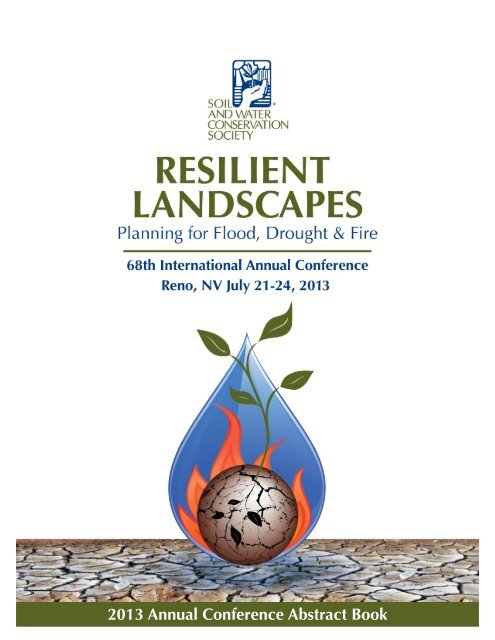
2013 Annual Conference <strong>Abstract</strong> <strong>Book</strong>
<strong>Abstract</strong> <strong>Book</strong> - 68th International SWCS Annual Conference<br />
68th SWCS International Annual Conference<br />
<strong>Abstract</strong> <strong>Book</strong><br />
Table of Contents<br />
Conference Schedule in Brief ....................................................................Page 3<br />
Presentation Schedules ..............................................................................Page 4<br />
Workshop <strong>Abstract</strong>s ...................................................................................Page 10<br />
Symposia Sessions <strong>Abstract</strong>s ......................................................................Page 12<br />
Oral Presentation <strong>Abstract</strong>s........................................................................Page 18<br />
Poster Presentation List .............................................................................Page 75<br />
Poster Presentation <strong>Abstract</strong>s ....................................................................Page 79<br />
NIFA Speed Science <strong>Abstract</strong>s ...................................................................Page 159<br />
Index Note: In lieu of attempting to predict what keywords are of interest<br />
to you, we have made the text of the pdf version of this document<br />
fully text searchable. Please use the find function to search the electronic<br />
version for the words or phrases you are seeking.<br />
Page 2
<strong>Abstract</strong> <strong>Book</strong> - 68th International SWCS Annual Conference<br />
Conference Schedule in Brief<br />
Sunday, July 21, 2013<br />
9:30 AM JSWC Editorial Board.................................................................... Tuscany 5<br />
11:00 AM Registration Opens........................................................................ Registration Desk<br />
12:00 PM House of Delegates, State of <strong>Society</strong> Address, <strong>and</strong><br />
Regional Roundtable Meetings...................................................... Tuscany 10/11<br />
1:00 PM *Social Indicators in <strong>Water</strong>shed Management Projects Workshop.Tuscany 1<br />
1:30 PM *Nitrogen Tools Workshop............................................................ Tuscany 3<br />
2:00 PM Leadership Practices in Today’s Dynamic World............................ Tuscany 2<br />
4:00 PM Berg <strong>and</strong> <strong>Society</strong> Fellows Forum.................................................... Tuscany 10/11<br />
6:00 PM New Members/First Timers Orientation......................................... Tuscany 9<br />
6:30 PM Welcome Reception...................................................................... Tuscany 5/6<br />
Monday, July 22, 2013<br />
7:30 AM Registration Opens........................................................................ Registration Desk<br />
7:30 AM Professional Development Committee Meeting............................. Tuscany 7<br />
8:30 AM Opening Plenary <strong>and</strong> Pritchard Lecture......................................... Tuscany 11/12<br />
10:00 AM Morning Break: Exhibit Hall <strong>and</strong> Poster Presentations Open.......... Tuscany D/E/F<br />
10:30 AM Concurrent Sessions...................................................................... See Page 25<br />
10:30 AM NIFA Special Symposium.............................................................. Tuscany 9 <strong>and</strong> 11/12<br />
12:00 PM Lunch Break.................................................................................. On your own<br />
12:00 PM *ARCSE Lunch <strong>and</strong> Annual Business Meeting................................ Oceano Restaurant<br />
1:30 PM Concurrent Sessions...................................................................... See Page 26<br />
3:00 PM ARCSE Board Meeting................................................................... Oceano Restaurant<br />
3:00 PM Afternoon Break............................................................................ Tuscany D/E/F<br />
3:30 PM Concurrent Sessions...................................................................... See Page 27<br />
5:00 PM Poster <strong>and</strong> Exhibitor Reception in Exhibit Hall.............................. Tuscany D/E/F<br />
7:00 PM Silent Auction Ends....................................................................... Tuscany D/E/F<br />
7:00 PM NIFA Grants Workshop................................................................. Tuscany 9<br />
Tuesday, July 23, 2013<br />
7:30 AM Registration Opens........................................................................ Registration Desk<br />
8:00 AM Tuesday Plenary............................................................................ Tuscany 11/12<br />
10:00 AM Morning Break in Exhibit Hall....................................................... Tuscany D/E/F<br />
10:30 AM Concurrent Sessions...................................................................... See Page 34<br />
12:00 PM *Awards Luncheon........................................................................ Tuscany 10<br />
12:00 PM Lunch Break.................................................................................. On your own<br />
1:30 PM Concurrent Sessions...................................................................... See Page 35<br />
3:30 PM Concurrent Sessions...................................................................... See Page 36<br />
5:15 PM SWCS Annual Conference Program Committee............................. Tuscany 10<br />
Wednesday, July 24, 2013<br />
7:00 AM *Tour #1 – Perrazzo <strong>Water</strong>shed <strong>and</strong> US Forest Service Aspen/Forest<br />
Restoration Projects Tour.............................................................. Valet Parking Area<br />
7:00 AM *Tour #2 – Mount Rose Summit Snow Survey, Lake Tahoe<br />
<strong>Conservation</strong> District <strong>and</strong> Forestry Restoration Tour ..................... Valet Parking Area<br />
8:00 AM *Tour #3 – Eagles <strong>and</strong> Agriculture Program................................... Valet Parking Area<br />
*Not included in st<strong>and</strong>ard registrations. Additional cost <strong>and</strong> ticket(s) required to attend.<br />
Page 3
<strong>Abstract</strong> <strong>Book</strong> - 68th International SWCS Annual Conference<br />
Conference Presentation Schedule<br />
Monday 10:30 a.m. 10:50 a.m. 11:10 a.m. 11:30 a.m.<br />
Tuscany 1<br />
Symposium<br />
Tuscany 9 <strong>and</strong> 11/12<br />
Symposium<br />
Tuscany 2<br />
Symposium<br />
Tuscany 3<br />
Symposium<br />
Tuscany 4<br />
Concurrent Sessions<br />
Tuscany 5<br />
Concurrent Sessions<br />
Tuscany 6<br />
Concurrent Sessions<br />
CEAP Rangel<strong>and</strong> Assessment Symposium: Determining Benefits of <strong>Conservation</strong> on Western Rangel<strong>and</strong>s – Arnold King, Texas AgriLife Research<br />
NIFA Special Symposium: <strong>Water</strong> Resources Research, Education, <strong>and</strong> Outreach (NIFA L<strong>and</strong> Grant/Sea Grant 406 <strong>and</strong> NRI) – Mary Ann<br />
Rozum, USDA<br />
<strong>Conservation</strong> Delivery: New Concepts in <strong>Conservation</strong> Planning – Cheryl Simmons, USDA NRCS (<strong>Conservation</strong> Models, Tools <strong>and</strong> Technology)<br />
OPEN<br />
Collaborative Approach to<br />
L<strong>and</strong>scape Scale Restoration <strong>and</strong><br />
Wildfire Mitigation<br />
Tom Esgate, Lassen County Fire<br />
Safe Council<br />
(<strong>Conservation</strong> <strong>and</strong> Environmental<br />
Policy <strong>and</strong> Program Design)<br />
Use of Drought Indicators in Decision-Making<br />
Process of Drought<br />
Management<br />
Ekaterina Altman, University of<br />
South California<br />
(Adaptation <strong>and</strong> Mitigation Planning<br />
for Drought)<br />
Groundwater Hydrology<br />
<strong>and</strong> Producer <strong>Water</strong> Use: An<br />
Integrated Hyro-Economic Model<br />
Chenggang Wang, Texas Tech<br />
University<br />
(Agriculture <strong>and</strong> <strong>Conservation</strong><br />
Economics)<br />
<strong>Conservation</strong>, Protection, <strong>and</strong><br />
Restoration of Critical L<strong>and</strong>s<br />
Using the Clean Ohio Fund<br />
Jerome Iles, Ohio State University<br />
Extension<br />
(<strong>Conservation</strong> <strong>and</strong> Environmental<br />
Policy <strong>and</strong> Program Design)<br />
Greater Quantities of Grain,<br />
Cellulosic Biomass <strong>and</strong> Vegetables<br />
are Produced with Less <strong>Water</strong><br />
<strong>and</strong> Lower Nutrient Leaching on<br />
Highly Permeable Marginal <strong>Soil</strong><br />
Alvin Smucker, Michigan State<br />
University<br />
(Adaptation <strong>and</strong> Mitigation<br />
Planning for Drought)<br />
Factors Affecting Adoption of Nitrogen<br />
Management Technologies<br />
Catharine Weber, University of<br />
Missouri<br />
(Agriculture <strong>and</strong> <strong>Conservation</strong><br />
Economics)<br />
Potential for Perennial Crops for<br />
Bioenergy Production: Results of<br />
a Survey in an Iowa <strong>Water</strong>shed<br />
Sarah Varble, Southern Illinois<br />
University<br />
(<strong>Conservation</strong> <strong>and</strong> Environmental<br />
Policy <strong>and</strong> Program Design)<br />
OPEN<br />
State Certainty Programs for<br />
L<strong>and</strong>owners <strong>and</strong> Producers<br />
William Berry, NACD<br />
(<strong>Conservation</strong> <strong>and</strong> Environmental<br />
Policy <strong>and</strong> Program Design/<br />
Agriculture <strong>and</strong> <strong>Conservation</strong><br />
Economics)<br />
OPEN<br />
OPEN<br />
Strategies for Exp<strong>and</strong>ing the 4R<br />
Initiative: A Survey of Agricultural<br />
Retailers <strong>and</strong> <strong>Conservation</strong> Districts<br />
Doug Lawrence, Blackwoods<br />
Group, Inc.<br />
(Outreach, Education <strong>and</strong> Community<br />
Engagement)<br />
Page 4
<strong>Abstract</strong> <strong>Book</strong> - 68th International SWCS Annual Conference<br />
Monday 1:30 p.m. 1:50 p.m. 2:10 p.m. 2:30 p.m.<br />
Tuscany 1<br />
Symposium<br />
Tuscany 9 <strong>and</strong> 11/12<br />
Symposium<br />
Tuscany 2<br />
Symposium<br />
Tuscany 3<br />
Symposium<br />
Tuscany 4<br />
Concurrent Sessions<br />
Tuscany 5<br />
Concurrent Sessions<br />
Tuscany 6<br />
Concurrent Sessions<br />
CEAP Rangel<strong>and</strong> Assessment Symposium: Regional <strong>and</strong> <strong>Water</strong>shed Assessments of <strong>Conservation</strong> on Rangel<strong>and</strong>s – Arnold King, Texas<br />
AgriLife Research<br />
NIFA Special Symposium: <strong>Water</strong> Resources Research, Education, <strong>and</strong> Outreach (NIFA L<strong>and</strong> Grant/Sea Grant 406 <strong>and</strong> NRI) – Mary Ann<br />
Rozum, USDA<br />
Mitigating Drought <strong>and</strong> Other Impacts of Climate Change through Management to Improve <strong>Soil</strong> Health <strong>and</strong> Productivity – Jorge Delgado,<br />
USDA ARS (Adaptation <strong>and</strong> Mitigating Planning for Drought)<br />
The Next Farm Bill <strong>and</strong> Implications for <strong>Soil</strong> <strong>and</strong> <strong>Water</strong> <strong>Conservation</strong> – Jeremy Peters, American Farml<strong>and</strong> Trust (<strong>Conservation</strong> <strong>and</strong><br />
Environmental Policy)<br />
Passive Treatments of<br />
Polyacylamide on Turbid<br />
Stormwater: Ditch Application<br />
Followed by Modified Settling<br />
Basin Design<br />
Jihoon Kang, North Carolina<br />
State University<br />
(<strong>Conservation</strong> Models, Tools <strong>and</strong><br />
Technologies)<br />
Protecting the San Francisco<br />
River through the Promotion<br />
of Community Stewardship in<br />
Clifton, Arizona<br />
Berenise Rivera, University of<br />
Arizona<br />
(Outreach, Education <strong>and</strong> Community<br />
Engagement)<br />
OPEN<br />
The Cost of Cleaner <strong>Water</strong>:<br />
Linking Farmer Incentives to<br />
<strong>Conservation</strong> Outcomes<br />
Lorine Giangola, University of<br />
Colorado at Boulder<br />
(<strong>Conservation</strong> Models, Tools <strong>and</strong><br />
Technologies)<br />
Stormwater Management<br />
Education in Nebraska:<br />
Integrating Extension, Teaching<br />
<strong>and</strong> Research<br />
David Shelton, University of<br />
Nebraska<br />
(Outreach, Education, <strong>and</strong><br />
Community Engagement)<br />
A Management Tool for Small<br />
Community Onsite Wastewater<br />
Treatment Systems: The<br />
Community System Owner’s Guide<br />
Sara Heger, University of<br />
Minnesota<br />
(<strong>Conservation</strong> Models, Tools <strong>and</strong><br />
Technologies)<br />
The Role of <strong>Water</strong>shed<br />
Management Groups <strong>and</strong> Key<br />
Stakeholders in the Resilience<br />
<strong>and</strong> Sustainability of a Rural<br />
Iowa <strong>Water</strong>shed<br />
Sarah Varble, Southern Illinois<br />
University<br />
(Outreach, Education <strong>and</strong><br />
Community Engagement)<br />
OPEN<br />
Kansas Extension Education<br />
Program on Poultry Litter<br />
Utilization <strong>and</strong> Storage Site<br />
Selection to Minimize Impacts<br />
on <strong>Water</strong> Quality<br />
Peter Tomlinson, Kansas State<br />
University<br />
(Outreach, Education <strong>and</strong><br />
Community Engagement)<br />
Page 5
<strong>Abstract</strong> <strong>Book</strong> - 68th International SWCS Annual Conference<br />
Monday 3:30 p.m. 3:50 p.m. 4:10 p.m. 4:30 p.m.<br />
Tuscany 1<br />
Symposium<br />
Tuscany 9 <strong>and</strong> 11/12<br />
Symposium<br />
Tuscany 2<br />
Symposium<br />
Tuscany 3<br />
Symposium<br />
Tuscany 4<br />
Concurrent Sessions<br />
Tuscany 5<br />
Concurrent Sessions<br />
Tuscany 6<br />
Concurrent Sessions<br />
CEAP Rangel<strong>and</strong> Assessment Symposium: Estimating Rangel<strong>and</strong> <strong>Soil</strong> Loss – Arnold King, Texas AgriLife Research<br />
NIFA Special Symposium: <strong>Water</strong> Resources Research, Education, <strong>and</strong> Outreach (NIFA L<strong>and</strong> Grant/Sea Grant 406 <strong>and</strong> NRI) – Mary Ann Rozum<br />
Mitigating Drought <strong>and</strong> Other Impacts of Climate Change through Management to Improve <strong>Soil</strong> Health <strong>and</strong> Productivity – Jorge Delgado,<br />
USDA ARS (Adaptation <strong>and</strong> Mitigating Planning for Drought)<br />
OPEN<br />
Later Summer Native Plant<br />
Establishment<br />
Joe Paternoster, Dri<strong>Water</strong><br />
(<strong>Conservation</strong> Models, Tools <strong>and</strong><br />
Technologies)<br />
Effect of L<strong>and</strong> Use on <strong>Soil</strong><br />
Aggregate Stability under Slash<br />
<strong>and</strong> Burn Cultivation<br />
Austustine Avwunudiaogba,<br />
California State University<br />
(<strong>Soil</strong> Resources Assessment <strong>and</strong><br />
Management)<br />
Iowa Soybean Association<br />
Cooperative <strong>Conservation</strong> for<br />
<strong>Water</strong>shed Health – CIG Project<br />
Results<br />
Todd Sutphin, Iowa Soybean<br />
Association<br />
(<strong>Water</strong> Resource Assessment <strong>and</strong><br />
Management)<br />
Databases <strong>and</strong> Tools to Enable<br />
<strong>Water</strong>shed-Scale <strong>Conservation</strong><br />
Planning within a Regional<br />
Context<br />
Mark Tomer, USDA ARS<br />
(<strong>Conservation</strong> Models, Tools <strong>and</strong><br />
Technologies)<br />
Wheat <strong>and</strong> Radish Companion<br />
Planting for Forage <strong>and</strong> Grain in<br />
Both Single <strong>and</strong> Dual-Purpose<br />
Wheat in Kansas<br />
Deann Presley, Kansas State<br />
University<br />
(<strong>Soil</strong> Resources Assessment <strong>and</strong><br />
Management)<br />
Atrazine Incorporation <strong>and</strong> <strong>Soil</strong><br />
Erosion: Balancing Competing<br />
<strong>Water</strong> Quality Concerns for<br />
Claypan <strong>Soil</strong>s<br />
Robert Lerch, USDA ARS<br />
(<strong>Water</strong> Resource Assessment <strong>and</strong><br />
Management)<br />
Restoration of the Hayman Burn<br />
Area: A Multi-Model Analysis on<br />
the Convergence of Ecological<br />
Science <strong>and</strong> Social Values in Post-<br />
Fire Restoration<br />
Andrea Hassler, Rocky Mountain<br />
Field Institute<br />
(<strong>Conservation</strong> Models, Tools <strong>and</strong><br />
Technologies)<br />
Bioenergy Crops for Resilient<br />
L<strong>and</strong>scapes: A Design Case Study<br />
<strong>and</strong> Field Experiences<br />
Maria Negri, Agronne National<br />
Labratory<br />
(<strong>Soil</strong> Resources Assessment <strong>and</strong><br />
Management)<br />
Denitrifying Bioreactors:<br />
Opportunities <strong>and</strong> Challenges for<br />
Managing Offsite Nitrogen Losses<br />
Arthur Gold, University of Rhode<br />
Isl<strong>and</strong><br />
(<strong>Water</strong> Resource Assessment <strong>and</strong><br />
Management)<br />
OPEN<br />
Impact of <strong>Conservation</strong> Practices<br />
on <strong>Soil</strong> Health<br />
Zahangir Kabir, USDA NRCS<br />
(Biodiversity <strong>Conservation</strong><br />
Management/<strong>Soil</strong> Resources<br />
Assessment <strong>and</strong> Management)<br />
Using GIS <strong>and</strong> Field Assessments<br />
to Compare Kansas Riparian<br />
Woodl<strong>and</strong>s<br />
Charles Barden, Kansas State<br />
University<br />
(<strong>Water</strong> Resource Assessment <strong>and</strong><br />
Management)<br />
Page 6
<strong>Abstract</strong> <strong>Book</strong> - 68th International SWCS Annual Conference<br />
Tuesday 10:30 a.m. 10:50 a.m. 11:10 a.m. 11:30 a.m.<br />
Tuscany 1<br />
Symposium<br />
Tuscany 9<br />
Symposium<br />
Tuscany 2<br />
Symposium<br />
Tuscany 3<br />
Concurrent Sessions<br />
OPEN<br />
<strong>Conservation</strong> Activity Planning for TSPs – Cheryl Simmons, USDA NRCS (<strong>Conservation</strong> Models, Tools <strong>and</strong> Technology)<br />
A Living River Approach to Floodplain Management in the Carson River <strong>Water</strong>shed – Brenda Hunt, Carson <strong>Water</strong> Subconservancy District<br />
(<strong>Conservation</strong> <strong>and</strong> Environmental Policy)<br />
Using LiDAR Elevation Data to<br />
Advance Local <strong>Conservation</strong> Work<br />
Ann Lew<strong>and</strong>owski, University of<br />
Minnesota <strong>Water</strong> Resources Center<br />
(<strong>Water</strong> Resource Research <strong>and</strong><br />
Outreach in the Upper Midwest)<br />
Midwest Cover Crops Council: A<br />
Regional Collaboration that Works<br />
Dean Baas, Michigan State<br />
University Extension<br />
(<strong>Water</strong> Resource Research <strong>and</strong><br />
Outreach in the Upper Midwest)<br />
The <strong>Conservation</strong> Reserve<br />
Program Readiness Initiative:<br />
Training Impacts <strong>and</strong> Resources<br />
Rebecca Power, University of<br />
Wisconsin-Extension, Madison,<br />
Wisconsin<br />
(<strong>Water</strong> Resource Research <strong>and</strong><br />
Outreach in the Upper Midwest)<br />
Reducing Nitrate Loads from Tile-<br />
Drained Cropl<strong>and</strong>: Options <strong>and</strong><br />
Outlook<br />
Jane Frankenberger, Purdue<br />
University<br />
(<strong>Water</strong> Resource Research <strong>and</strong><br />
Outreach in the Upper Midwest)<br />
Tuscany 4<br />
Concurrent Sessions<br />
Effects of Repeated Burning on<br />
<strong>Soil</strong> Nitrogen <strong>and</strong> Cheatgrass<br />
(Bromus Tectorum) Biomass <strong>and</strong><br />
Reproduction<br />
Rachel Jones, University of Nevada<br />
(Invasive Plant Species)<br />
Post-Fire L<strong>and</strong> Restoration, Weed<br />
Management, <strong>and</strong> <strong>Soil</strong> Biology in<br />
Northern Nevada<br />
Julie Etra, WBS, Inc.<br />
(Invasive Plant Species)<br />
OPEN<br />
OPEN<br />
Tuscany 5<br />
Concurrent Sessions<br />
<strong>Conservation</strong> vs. Organic<br />
Agriculture with Conventional<br />
<strong>and</strong> <strong>Conservation</strong> Tillage: <strong>Water</strong><br />
Quality<br />
Deanna Osmond, North Carolina<br />
State University<br />
(<strong>Water</strong> Resource Assessment <strong>and</strong><br />
Management)<br />
Leadership for Midwestern<br />
<strong>Water</strong>sheds: Insights from MRBI <strong>and</strong><br />
other <strong>Water</strong>shed Project Managers<br />
Michael Baise, American<br />
Farml<strong>and</strong> Trust<br />
(<strong>Water</strong> Resource Assessment <strong>and</strong><br />
Management)<br />
Tamarisk Removal for <strong>Conservation</strong><br />
of Cultural Resources<br />
Beverly Harry, Pyramid Lake<br />
Paiute Tribe<br />
(<strong>Water</strong> Resource Assessment <strong>and</strong><br />
Management)<br />
Resiliency of <strong>Conservation</strong><br />
Buffers to Floods <strong>and</strong> Drought in<br />
Iowa <strong>and</strong> Illinois<br />
Jeff Jensen, Trees Forever<br />
(<strong>Water</strong> Resource Assessment <strong>and</strong><br />
Management)<br />
Tuscany 6<br />
Concurrent Sessions<br />
Targeting Forest Management<br />
through Fire <strong>and</strong> Erosion<br />
Modeling<br />
William Elliot, Rocky Mountain<br />
Res Station<br />
(Adaptive Management of<br />
<strong>Conservation</strong> Efforts)<br />
Perennial Grass Dominance:<br />
Creating a Resilient Community<br />
in an Exotic Annual Invaded<br />
Rangel<strong>and</strong><br />
Dan Harmon, USDA ARS<br />
(Adaptive Management of <strong>Conservation</strong><br />
Efforts)<br />
Enhancing Ecosystem Services:<br />
Designing for Multi-Functionality<br />
Gary Bentrup, U.S. Forext Service<br />
(Adaptive Management of<br />
<strong>Conservation</strong> Efforts)<br />
Local Cooperation through Climate<br />
Change Data Visualization<br />
Leigh Bernacchi, University of Idaho<br />
(Outreach, Education <strong>and</strong><br />
Community Engagement/<br />
Adaptive Management of<br />
<strong>Conservation</strong> Efforts)<br />
Page 7
<strong>Abstract</strong> <strong>Book</strong> - 68th International SWCS Annual Conference<br />
Tuesday 1:30 p.m. 1:50 p.m. 2:10 p.m. 2:30 p.m.<br />
Tuscany 1<br />
Symposium<br />
Tuscany 9<br />
Symposium<br />
Tuscany 2<br />
Symposium<br />
Tuscany 3<br />
Symposium<br />
Tuscany 4<br />
Concurrent Sessions<br />
Tuscany 5<br />
Concurrent Sessions<br />
Tuscany 6<br />
Concurrent Sessions<br />
<strong>Conservation</strong> Performance in the Face of a Changing Climate: Improving <strong>Conservation</strong> Practice St<strong>and</strong>ards <strong>and</strong> Enhancements to Increase<br />
Farm <strong>and</strong> Resource Resiliency – Jeff Schahczenski (<strong>Conservation</strong> <strong>and</strong> Environmental Policy)<br />
<strong>Conservation</strong> Activity Planning for TSPs – Cheryl Simmons, USDA NRCS (<strong>Conservation</strong> Models, Tools <strong>and</strong> Technology)<br />
SWCS <strong>and</strong> CPESC: An Evolving <strong>and</strong> Productive Partnership – Earl Norton, Alabama <strong>Soil</strong> <strong>and</strong> <strong>Water</strong> <strong>Conservation</strong> (Outreach, Education <strong>and</strong><br />
Community Engagement)<br />
OPEN<br />
Statistical Model Equivalency to<br />
Predict Fecal Indicator Bacteria<br />
Densities Enumerated by QPCR<br />
<strong>and</strong> Culture-Based Methods<br />
Rachel Noble, UNC Chapel Hill<br />
(<strong>Water</strong> Resource Assessment <strong>and</strong><br />
Management/NIFA-Related)<br />
Redox-Specific Biodegradation of<br />
Trenbolone Acetate Metabolites<br />
Emily Cole, University of Nevada<br />
(Rangel<strong>and</strong> <strong>Conservation</strong> <strong>and</strong><br />
Grazingl<strong>and</strong>s CEAP)<br />
Restoration of 2011 Flood Damaged<br />
Birds Point - New Madrid<br />
Floodway<br />
Kenneth Olson, University of<br />
Illinois<br />
(Adaptive Management of <strong>Conservation</strong><br />
Efforts)<br />
Surfactant-Facilitated Transport of<br />
Cryptosporidium Parvum in <strong>Soil</strong><br />
Christophe Darnault, Rensselaer<br />
Polytechnic Institute<br />
(NIFA-Related)<br />
Fate <strong>and</strong> Transport of Trenbolone<br />
Acetate Metabolites in Range<br />
Runoff<br />
Gerrad Jones, University of Nevada<br />
(Rangel<strong>and</strong> <strong>Conservation</strong> <strong>and</strong><br />
Grazingl<strong>and</strong>s CEAP)<br />
OPEN<br />
Potential <strong>Water</strong> Benefits of On-<br />
Farm Storage Systems<br />
Mary Love Target, Mississippi<br />
State University<br />
(NIFA-Related)<br />
Modeling the Impacts of<br />
<strong>Conservation</strong> Practices on<br />
Streamflow <strong>and</strong> Erosion in a<br />
Salmon-Bearing Rangel<strong>and</strong><br />
<strong>Water</strong>shed: Asotin Creek,<br />
Washington<br />
Hakjun Rhee, Washington State<br />
University<br />
(Rangel<strong>and</strong> <strong>Conservation</strong> <strong>and</strong><br />
Grazingl<strong>and</strong>s CEAP)<br />
The Use of Biochar on Low<br />
Organic Matter <strong>Soil</strong>s<br />
Duane Friend, University of<br />
Illinois<br />
(Adaptive Management of<br />
<strong>Conservation</strong> Efforts)<br />
Using Vetiver Grass Technology<br />
for Preventing Sedimentation at<br />
the Shorelines of Guam<br />
Mohammad Golabi, University<br />
of Guam<br />
(<strong>Water</strong> Resources Assessment<br />
<strong>and</strong> Management)<br />
OPEN<br />
Creating Climate-Smart Ag<br />
L<strong>and</strong>scapes through Agroforestry<br />
Gary Bentrup, U.S. Forest Service<br />
(Adaptive Management of<br />
<strong>Conservation</strong> Efforts)<br />
Page 8
<strong>Abstract</strong> <strong>Book</strong> - 68th International SWCS Annual Conference<br />
Tuesday 3:30 p.m. 3:50 p.m. 4:10 p.m. 4:30 p.m.<br />
Tuscany 1<br />
Symposium<br />
Tuscany 9<br />
Symposium<br />
Tuscany 2<br />
Symposium<br />
Tuscany 3<br />
Symposium<br />
Tuscany 4<br />
Concurrent Sessions<br />
Tuscany 5<br />
Concurrent Sessions<br />
Tuscany 6<br />
Concurrent Sessions<br />
<strong>Conservation</strong> Performance in the Face of a Changing Climate: Improving <strong>Conservation</strong> Practice St<strong>and</strong>ards <strong>and</strong> Enhancements to Increase<br />
Farm <strong>and</strong> Resource Resiliency – Jeff Schahczenski, NCAT (<strong>Conservation</strong> <strong>and</strong> Environmental Policy)<br />
<strong>Conservation</strong> Activity Planning for TSPs – Cheryl Simmons, USDA NRCS (<strong>Conservation</strong> Models, Tools <strong>and</strong> Technology)<br />
Agriculture <strong>and</strong> Forestry in a Changing Climate: Adaptation Recommendations – Jeremy Peters, American Farml<strong>and</strong> Trust (Adaptive<br />
Management of <strong>Conservation</strong> Efforts)<br />
OPEN<br />
Assessment of <strong>Soil</strong> Response to<br />
Corn Residue Removal <strong>and</strong><br />
Grazing<br />
Humberto Blanco, University of<br />
Nebraska<br />
(<strong>Soil</strong> Resources Assessment <strong>and</strong><br />
Management)<br />
OPEN<br />
OPEN<br />
Hydrological Response of<br />
Intensive Forest Management<br />
System in Tropical Rain Forest<br />
Hatma Suryatmojo, Kyoto<br />
University<br />
(<strong>Soil</strong> Resources Assessment <strong>and</strong><br />
Management)<br />
Feasibility of <strong>Soil</strong> Carbon<br />
Monitoring for Carbon Credits<br />
Jason Warren, OSU<br />
(Rangel<strong>and</strong>s <strong>Conservation</strong> <strong>and</strong><br />
Grazingl<strong>and</strong>s CEAP)<br />
Microbial Biomass<br />
Determinations <strong>and</strong> Some<br />
Microbial Quality Indicators for<br />
Improving <strong>Soil</strong> Sustainability<br />
Stella Asuming-Brempong,<br />
University of Ghana, Legon<br />
(Biodiversity <strong>Conservation</strong><br />
Management/<strong>Soil</strong> Assessment<br />
<strong>and</strong> Management)<br />
Rehabilitation of Cheatgrass<br />
Infested Rangel<strong>and</strong>s<br />
Charlie Clements, USDA ARS<br />
(Rangel<strong>and</strong>s <strong>Conservation</strong> <strong>and</strong><br />
Grazingl<strong>and</strong>s CEAP)<br />
OPEN<br />
Modeling Grazing Impacts on<br />
<strong>Soil</strong> Erosion with the WEPP<br />
Model<br />
William Elliot, Rocky Mountain<br />
Res Station<br />
(Rangel<strong>and</strong>s <strong>Conservation</strong> <strong>and</strong><br />
Grazingl<strong>and</strong>s CEAP)<br />
Page 9
<strong>Abstract</strong> <strong>Book</strong> - 68th International SWCS Annual Conference<br />
Conference Workshops<br />
Using Social Indicators in <strong>Water</strong>shed Management<br />
Sunday, July 21, 1:00 – 5:00 p.m.<br />
Tuscany 4<br />
Instructors/Presenters:<br />
Nicholas Babin, Purdue University; Joe Bonnell, The Ohio<br />
State University; Ken Genskow, UW-Madison Department of<br />
Urban <strong>and</strong> Regional Planning<br />
Objectives:<br />
At the end of this session, participants will be able to describe<br />
the human dimensions of natural resource management,<br />
underst<strong>and</strong> some basic concepts of behavior change,<br />
<strong>and</strong> have the tools to use a framework for using social indicators<br />
in nonpoint source management work.<br />
Background:<br />
Working with l<strong>and</strong> owners <strong>and</strong> managers to find effective<br />
<strong>and</strong> practical solutions to water quality problems is crucial to<br />
achieving environmental goals. Social indicators provide information<br />
about the social context, awareness, attitudes, capacities,<br />
constraints, <strong>and</strong> behaviors in a watershed or project<br />
area. Using social indicators can help resource managers <strong>and</strong><br />
conservation professionals underst<strong>and</strong> <strong>and</strong> target audiences,<br />
select effective interventions, <strong>and</strong> evaluate their impacts.<br />
Planned Activities:<br />
• Presentations on the human dimensions of natural<br />
resource management <strong>and</strong> basic concepts of behavior<br />
change. (30 minutes)<br />
• Presentation on how social indicators are being used for<br />
NPS planning <strong>and</strong> evaluation (45 minutes)<br />
• Break (15 minutes)<br />
• H<strong>and</strong>s on work interpreting social data (45minutes)<br />
• H<strong>and</strong>s on work building a survey using the Social Indicators<br />
Data Management <strong>and</strong> Analysis (SIDMA) tool<br />
(60 minutes)<br />
• Open discussion about how to apply workshop content<br />
in participants’ projects (45 minutes)<br />
Takeaway for Participants:<br />
Participants will receive a course book complete with<br />
PowerPoint slides, readings, <strong>and</strong> sample surveys <strong>and</strong><br />
data. Participants will also receive a login for the SIDMA<br />
web-based tool <strong>and</strong> will gain experience using the tool for<br />
workshop exercises.<br />
Nitrogen Tools<br />
Sunday, July 21, 1:30 – 4:30 p.m.<br />
Tuscany 3<br />
Instructors/Presenters:<br />
Jorge Delgado, USDA ARS; Tibor Horvath, USDA NRCS;<br />
Chris Gross, USDA NRCS; Dennis Chessman, USDA NRCS;<br />
<strong>and</strong> Zahangir Kabir, USDA NRCS<br />
<strong>Abstract</strong>: Reactive nitrogen losses to the environment have<br />
been reported to impact ecosystems, contributing to acidification<br />
<strong>and</strong> eutrophication, algae blooms, nitrate contamination<br />
of drinking water, <strong>and</strong> even higher emissions of trace gases<br />
such as nitrous oxide, which has been reported to contribute<br />
to global climate change. However, nitrogen is an extremely<br />
important nutrient, as it contributes to the maximization of<br />
crop yields <strong>and</strong> economic returns for farmers. With continued<br />
population growth around the globe, nitrogen will only<br />
become more important for future food security. The organizers<br />
of this workshop have been part of a collaborative effort to<br />
develop nitrogen management tools that can aid in the implementation<br />
of conservation practices on the ground to increase<br />
nitrogen use efficiency, reduce losses of reactive nitrogen to<br />
the environment, <strong>and</strong> increase economic returns to farmers.<br />
The Nitrogen Index is being used by NRCS personnel in Kentucky<br />
<strong>and</strong> California, <strong>and</strong> there are other NRCS cooperators interested<br />
in the use of the tool. The Nitrogen Index is also being used by<br />
university cooperators. Additionally, the tool is being used in other<br />
countries such as Mexico <strong>and</strong> Ecuador. The tool can be used<br />
to assess the benefits of conservation practices, reduce nitrogen<br />
losses, <strong>and</strong> increase nitrogen use efficiency. In March of 2013,<br />
USDA-NRCS in Kentucky released its new 590 Nutrient Management<br />
St<strong>and</strong>ard, <strong>and</strong> the new Kentucky Nitrogen <strong>and</strong> Phosphorous<br />
Index is referenced in the st<strong>and</strong>ard as the official risk assessment<br />
tool for Kentucky. The Nitrogen Index can be downloaded from<br />
the official USDA-ARS webpage for the tool. The Nitrogen Index<br />
can be run in both the English <strong>and</strong> the metric systems. Additionally,<br />
it can be run in the English <strong>and</strong> Spanish. It will soon have the<br />
capability to be run in Portuguese as well.<br />
The Nitrogen Index for Windows XP ® <strong>and</strong> Windows 7 ®, version<br />
4.5, to be released in the summer of 2013, will have new<br />
features, such as a sustainability index, an N 2<br />
O index, <strong>and</strong> a<br />
phosphorous index, <strong>and</strong> also include recommendations for nitrogen<br />
fertilizer applications. Users who have a smartphone with the<br />
Android system can install a version of the Nitrogen Index app<br />
on their device <strong>and</strong> use the app to transfer assessment information<br />
from their device to an office computer. As more of such<br />
mobile applications are created, they will increasingly contribute<br />
to the development of a new “smart agriculture.” This workshop<br />
will include three hours of training on the Nitrogen Index.<br />
Page 10<br />
H<strong>and</strong>outs will be provided to the attendees of the workshop so<br />
that they can follow the presenters’ examples.
<strong>Abstract</strong> <strong>Book</strong> - 68th International SWCS Annual Conference<br />
Leadership Practices in Today’s Dynamic World<br />
Sunday, July 21, 2:00 – 3:45 p.m.<br />
Tuscany 2<br />
Instructor:<br />
Marlene K. Rebori, University of Nevada<br />
<strong>Abstract</strong>: The growth <strong>and</strong> expansion of technology over the<br />
last decade has not only forced individuals to be sophisticated<br />
in managing the media with which we process <strong>and</strong><br />
share information, but it has also changed the manner in<br />
which we communicate. The practice of leadership through<br />
on-the-ground-advocacy is also shifting to a flatter, less<br />
hierarchical style. Emerging trends continue to see the rise<br />
of the nonprofit sector <strong>and</strong> their unique ability to be nimble<br />
<strong>and</strong> adaptable in advocating for change. While the <strong>Soil</strong> <strong>and</strong><br />
<strong>Water</strong> <strong>Conservation</strong> <strong>Society</strong> has historical roots <strong>and</strong> is well<br />
respected, thriving professions are ones that can adapt to better<br />
fulfill their mission <strong>and</strong> role in society. As a professional<br />
association whose mission is to “foster the science <strong>and</strong> art of<br />
natural resource conservation,” this workshop will focus on<br />
the art of practicing leadership to accomplish change.<br />
Page 11
<strong>Abstract</strong> <strong>Book</strong> - 68th International SWCS Annual Conference<br />
Symposium Session Descriptions <strong>and</strong> Agendas<br />
CEAP Rangel<strong>and</strong> Assessment Symposium<br />
Arnold King, Texas A&M (TALR)<br />
Monday, July 22, 10:30 a.m. – 5:00 p.m.<br />
Tuscany 1<br />
Session I: 10:30 a.m. to 12:00 p.m.<br />
Determining Benefits of <strong>Conservation</strong> on Western<br />
Rangel<strong>and</strong>s - Moderator: Mark Weltz, ARS<br />
<strong>Abstract</strong>: The <strong>Conservation</strong> Effects Assessment Project (CEAP)<br />
is a multiagency effort to scientifically quantify the environmental<br />
benefits of conservation practices used by private<br />
l<strong>and</strong>owners participating in US Department of Agriculture<br />
(USDA) <strong>and</strong> other conservation programs. Project findings<br />
will guide USDA conservation policy <strong>and</strong> program development<br />
<strong>and</strong> help farmers <strong>and</strong> ranchers to make informed<br />
conservation choices. These projects address key issues of<br />
conservation practice effectiveness on grazing l<strong>and</strong>s, the<br />
single largest l<strong>and</strong> type in the United States <strong>and</strong> critical to<br />
the sustainability of the livestock industry; wildlife habitat;<br />
unbroken vistas; <strong>and</strong> clean, available water.<br />
Presentation 1: <strong>Conservation</strong> Effects Assessment Project<br />
Sources <strong>and</strong> Modeling Design<br />
Presenter: Leonard Jolley, ARS<br />
Presentation 2: <strong>Water</strong>shed Assessment of Impact of <strong>Conservation</strong><br />
in Southern Arizona<br />
Presenter: Dave C. Goodrich, ARS<br />
Presentation 3: Assessing the Effect of NRCS <strong>Conservation</strong><br />
Programs in Arizona on Rangel<strong>and</strong> Vegetation Using Remote<br />
Sensing<br />
Presenter: Philip Heilman, ARS<br />
Presentation 4: A Decade of Advancement in Underst<strong>and</strong>ing<br />
of Rangel<strong>and</strong> Hydrology <strong>and</strong> Erosion <strong>and</strong> the Effects of<br />
<strong>Conservation</strong> Practices<br />
Presenter: Frederick B. Pierson<br />
Session III: 3:30 to 5:00 p.m.<br />
Estimating Rangel<strong>and</strong> <strong>Soil</strong> Loss: Can We Quantify Benefits of<br />
<strong>Conservation</strong>? - Moderator: Arnold King, Texas A&M (TALR)<br />
Presentation 1: <strong>Conservation</strong> Practices Assessment of the<br />
Lower Bad River Basin<br />
Presenter: A. Smart, ARS<br />
Presentation 2: Evaluating the Impacts of <strong>Conservation</strong> Practices<br />
on <strong>Water</strong>shed Health in a Salmon-Bearing Rangel<strong>and</strong><br />
<strong>Water</strong>shed: Asotin Creek, Washington<br />
Presenter: Linda Hardesty, ARS<br />
Presentation 3: Assessing Rangel<strong>and</strong> <strong>Water</strong>shed Practices in<br />
Central Texas<br />
Presenter: Bill Fox, Texas A&M (TALR)<br />
Presentation 4: Grazing L<strong>and</strong> <strong>Conservation</strong> Practices <strong>and</strong><br />
Drought on Southwestern <strong>Water</strong>sheds<br />
Presenter: Mitchel P. McClaran, ARS<br />
Session II: 1:30 to 3:00 p.m.<br />
Regional <strong>and</strong> <strong>Water</strong>shed Assessments of <strong>Conservation</strong> on<br />
Rangel<strong>and</strong>s: Current Capabilities - Moderator: Tom Gerik,<br />
Texas A&M (TALR)<br />
<strong>Abstract</strong>: In this symposium we will present several watershed<br />
assessment techniques that USDA has developed to<br />
address challenges that incorporate ecological concepts <strong>and</strong><br />
rangel<strong>and</strong> management practices, use readily available data,<br />
<strong>and</strong> are designed to represent rangel<strong>and</strong> hydrologic <strong>and</strong> erosion<br />
processes. We will discuss USDA’s current capabilities<br />
<strong>and</strong> alternative approaches to assessing the status, health,<br />
<strong>and</strong> potential benefits of conservation on rangel<strong>and</strong> watersheds<br />
through three case studies.<br />
<strong>Abstract</strong>: In this symposium we will present the status <strong>and</strong><br />
current capability of Rangel<strong>and</strong> Hydrology nad Erosion<br />
Model (RHEM) for estimating soil erosion <strong>and</strong> deposition<br />
from splash, sheet flow, <strong>and</strong> concentrated flow erosion. In<br />
addition, we will discuss concepts of how RHEM can be<br />
used to determine risk of soil erosion from specific return<br />
period runoff events <strong>and</strong> how changes in management<br />
through implementing conservation can alter the risk of soil<br />
erosion. Finally we will discuss how RHEM can be used<br />
to describe rangel<strong>and</strong> hydrologic processes <strong>and</strong> enhance<br />
Ecological Site Descriptions.<br />
Presentation 1: Rangel<strong>and</strong> Hydrology <strong>and</strong> Erosion Model<br />
Presenter: Fred Pierson<br />
Presentation 2: Modeling <strong>Soil</strong> Erosion Impact of Rangel<strong>and</strong><br />
Disturbance Using the Rangel<strong>and</strong> Hydrology <strong>and</strong> Erosion<br />
Model (RHEM)<br />
Presenter: Osama Al-Hamdan<br />
Presentation 3: Estimating Concentrated Flow Erosion <strong>and</strong><br />
Deposition on Rangel<strong>and</strong>s<br />
Presenter: S. Kossi Nouwakpo<br />
Presentation 4: Eco-hydrology Considerations for Enhancement<br />
of Ecological Site Descriptions<br />
Presenter: C. Jason Williams<br />
Page 12
<strong>Abstract</strong> <strong>Book</strong> - 68th International SWCS Annual Conference<br />
National Institute of Food <strong>and</strong> Agriculture (NIFA)<br />
Special Symposium: <strong>Water</strong> Resources Research,<br />
Education, <strong>and</strong> Outreach (NIFA L<strong>and</strong> Grant/Sea<br />
Grant 406 <strong>and</strong> NRI)<br />
Mary Ann Rozum, USDA<br />
Monday, July 22, 10:30 a.m. – 5:00 p.m.<br />
Tuscany 9 <strong>and</strong> 11/12<br />
<strong>Abstract</strong>: The USDA NIFA Symposium will include oral<br />
reports or “speed science” from active NIFA funded grants<br />
in research, extension, <strong>and</strong> education of water quality <strong>and</strong><br />
quantity. The poster sessions will include recently awarded<br />
grants, as well as the regional grants that will have local<br />
descriptions of activities.<br />
<strong>Conservation</strong> Delivery: New Concepts in<br />
<strong>Conservation</strong> Planning<br />
Cheryl Simmons, USDA NRCS<br />
Monday, July 22, 10:30 a.m. – 12:00 p.m.<br />
Tuscany 2<br />
<strong>Abstract</strong>: Providing science-based technical assistance to<br />
clients is the foundation for successfully carrying out NRCS’<br />
mission of helping people help the l<strong>and</strong>. NRCS’ on-site<br />
assistance to help grazers identify conservation objectives,<br />
inventory resource concerns <strong>and</strong> opportunities, analyze<br />
alternatives, <strong>and</strong> formulate treatments through conservation<br />
planning is unique. In general, this technical assistance is<br />
documented in 1.6 million conservation plans <strong>and</strong> 30 million<br />
planned practices in NRCS’ National <strong>Conservation</strong> Plan<br />
Database.<br />
In 2002, the Farm Bill exp<strong>and</strong>ed NRCS’ historical field<br />
operations to include the development <strong>and</strong> administration of<br />
contracts <strong>and</strong> easements for financial assistance programs. In<br />
addition to providing technical assistance, NRCS field staffs<br />
now manage about 400,000 Farm Bill program contracts.<br />
With stagnant to decreasing staff numbers, NRCS continued<br />
to deliver more programs <strong>and</strong> more dollars on more acres.<br />
In January of 2009, NRCS leadership responded to these<br />
concerns by formally initiating the <strong>Conservation</strong> Delivery<br />
Streamlining Initiative, with the purpose to define <strong>and</strong> implement<br />
a more effective, efficient, <strong>and</strong> sustainable business<br />
model for conservation planning <strong>and</strong> delivering conservation<br />
assistance.<br />
The new <strong>Conservation</strong> Desktop is planned to roll out in<br />
2014 with NRCS Client Gateway, geospatial tools to support<br />
participation in programs, GRAS plan, <strong>and</strong> a revised resource<br />
concern list. An overview of some of the new look <strong>and</strong> feel<br />
for conservation planning will be presented with a discussion<br />
of what is next in conservation planning.<br />
Page 13
<strong>Abstract</strong> <strong>Book</strong> - 68th International SWCS Annual Conference<br />
Mitigating Drought <strong>and</strong> Other Impacts of Climate<br />
Change through Management to Improve <strong>Soil</strong><br />
Health <strong>and</strong> Productivity<br />
Jorge Delgado, USDA ARS<br />
Monday, July 22, 1:30 – 5:00 p.m.<br />
Tuscany 2<br />
<strong>Abstract</strong>: The 14th Annual SWCS-<strong>Soil</strong> Science <strong>Society</strong> of<br />
America (SSSA) Joint Symposium covers a topic of great<br />
importance <strong>and</strong> interest to both societies. It is clear from recent<br />
publications that climate change, specifically extreme<br />
events, can significantly impact food security. It is also clear<br />
from these publications that conservation agriculture will be<br />
essential for improving soil health <strong>and</strong> soil quality in order<br />
to have systems that are resilient to drought, which will be<br />
critical in efforts to achieve sustainable food security. NRCS<br />
is starting a new initiative on soil health, <strong>and</strong> this will be<br />
important for climate change adaptation. This symposium<br />
will also cover limited irrigation since drought <strong>and</strong> lower<br />
precipitation can decrease water availability. This will be<br />
important for the western United States in states such as Nevada,<br />
where the SWCS meeting will be held. This joint symposium<br />
will continue the tradition of cooperation between<br />
the two societies <strong>and</strong> will help to create opportunities to<br />
disseminate cutting-edge information to members of both<br />
societies. It will also help to “jumpstart” a conversation<br />
about the importance of the soil health initiative, especially<br />
in current times of extreme events <strong>and</strong> a changing climate.<br />
This is an important topic to cover within the context of the<br />
current farm bill, which is still in development. The SWCS<br />
<strong>and</strong> SSSA have always been at the forefront of conservation<br />
<strong>and</strong> soil science, <strong>and</strong> the topic of this year’s SWCS meeting,<br />
Resilient L<strong>and</strong>scapes: Planning for Flood, Drought <strong>and</strong> Fire,<br />
connects with current global issues related to soil <strong>and</strong> water<br />
conservation <strong>and</strong> sustainability, such as the connections<br />
between soil health, drought, <strong>and</strong> water resources.<br />
Session I<br />
1:30 – 1:35 pm Introductory Remarks<br />
Moderator: Jorge A. Delgado, USDA ARS<br />
1:35 – 1:55 pm Are Our <strong>Water</strong> Use Policies in Sync with the<br />
Reality of a Changing Climate?<br />
Loretta Singletary, University of Nevada,<br />
Reno<br />
1:55 – 2:15 pm Potential to Use Limited Irrigation <strong>and</strong> <strong>Conservation</strong><br />
Agriculture to Adapt to Drought<br />
<strong>and</strong> Climate Change<br />
Thomas J. Trout, Kendall DeJonge, <strong>and</strong><br />
Louise Comas, USDA ARS<br />
2:15 – 2:35 pm Differences in Minnesota Endoaquoll <strong>Soil</strong>s<br />
as a Result of Subsurface Drainage<br />
<strong>and</strong> Cultivation<br />
Jeffrey S. Strock, Paulo H. Pagliari, Stacey E.<br />
Feser, Emily E. Evans, <strong>and</strong> Mark R. Coulter,<br />
University of Minnesota<br />
2:35 – 2:55 pm Unlock the Secrets in the <strong>Soil</strong>: A Practical<br />
Approach to Improve <strong>Soil</strong> Health in the<br />
21st Century<br />
David Lamm, USDA NRCS<br />
2:55 – 3:00 pm Discussion/Adjourn<br />
Session II<br />
3:30 – 3:35 pm Introductory Remarks<br />
Jorge A. Delgado, USDA ARS<br />
3:35 – 3:55 pm Management Impacts on GHG Emissions in<br />
Corn/Soybean Systems<br />
Rodney T. Venterea <strong>and</strong> John M. Bake,<br />
University of Minnesota; USDA ARS<br />
3:55 – 4:15 pm <strong>Soil</strong> <strong>and</strong> <strong>Water</strong> <strong>Conservation</strong> Practices to<br />
Mitigate Drought <strong>and</strong> Climate Change<br />
Jerry L. Hatfield, John H. Prueger, <strong>and</strong><br />
Thomas J. Sauer, USDA ARS<br />
4:15 – 4:35 pm Building <strong>Soil</strong> Health Can Contribute to Climate<br />
Change (<strong>and</strong> Drought) Adaptation<br />
<strong>and</strong> Mitigation<br />
Susan Andrews, USDA NRCS<br />
4:35 – 5:00 pm Panel Discussion with All Presenters<br />
5:00 pm Adjourn<br />
Page 14
<strong>Abstract</strong> <strong>Book</strong> - 68th International SWCS Annual Conference<br />
The Next Farm Bill <strong>and</strong> Implications for <strong>Soil</strong> <strong>and</strong><br />
<strong>Water</strong> <strong>Conservation</strong><br />
Jeremy Peters, American Farml<strong>and</strong> Trust<br />
Monday, July 22, 1:30 – 3:00 p.m.<br />
Tuscany 3<br />
<strong>Abstract</strong>: Passage of a five-year farm bill continues to be<br />
primary focus of agriculture <strong>and</strong> conservation groups, but<br />
timing remains to be uncertain as to when a new bill will be<br />
completed.<br />
Many conservation provisions are in play, including some<br />
exciting changes in the conservation program toolbox, conservation<br />
compliance, <strong>and</strong> a national sodsaver program. If<br />
a five-year bill is passed before the conclusion of the 112th<br />
Congress or in the early days of the 113th Congress, focus<br />
will immediately shift to USDA rulemaking <strong>and</strong> how that<br />
process will play out.<br />
If a five-year bill is not passed in the near-term, work will<br />
begin to reengaging the 113th Congress to craft legislation.<br />
Either scenario presents important policy information for<br />
SWCS conference attendees.<br />
<strong>Conservation</strong> Activity Planning for TSPs<br />
Cheryl Simmons, USDA NRCS<br />
Tuesday, July 23, 10:30 a.m. – 5:00 p.m.<br />
Tuscany 9<br />
<strong>Abstract</strong>: This workshop will provide initial training to become<br />
a Technical Service Provider for the Natural Resources<br />
<strong>Conservation</strong> Service (NRCS). It emphasizes the initial<br />
steps in the conservation planning process <strong>and</strong> will touch<br />
on developing quality, complete plans on the entire unit;<br />
consideration of ecological, economic, <strong>and</strong> social concerns;<br />
on-site assistance; the effects <strong>and</strong> impacts of planned<br />
actions on-site <strong>and</strong> off-site; <strong>and</strong> partnership involvement.<br />
The course is based on the procedures <strong>and</strong> guidelines in the<br />
2013 release of the National Planning Procedures H<strong>and</strong>book<br />
(NPPH) <strong>and</strong> the supporting technology <strong>and</strong> tools to<br />
carry out the planning process.<br />
The USDA NRCS offers 16 different types of CAPs, including<br />
104; 114 <strong>and</strong> 154, Nutrient-Pest Management Plans;<br />
122; 124, Energy Headquarters <strong>and</strong> Energy L<strong>and</strong>scape<br />
Plans; 110, Grazing Plan; 106; 142, Forest Plan <strong>and</strong> Fish<br />
<strong>and</strong> Wildlife Plans; <strong>and</strong> 138, Organic Plan CAPS covered in<br />
this workshop.<br />
10:30 a.m. – 12:00 p.m. Introduction to <strong>Conservation</strong> Planning<br />
Dan Meyerhoff <strong>and</strong> Cheryl Simmons<br />
1:30 – 2:15 p.m. TSP Orientation <strong>and</strong> Overview of<br />
CAPs<br />
Tim Pilkowski, National TSP Team,<br />
NHQ<br />
2:15 – 3:00 p.m. Break out for CAPS:<br />
• Energy; L<strong>and</strong>scape/Operations–<br />
Kip Pheil, National Energy Team,<br />
West National Technology Support<br />
Center<br />
• Wildlife <strong>and</strong> Forestry - TBA<br />
• Organic – Sarah Brown,<br />
National Organic Team<br />
3:00 – 3:30 p.m. Break<br />
3:30 – 4:15 p.m. Continuation of CAP Breakouts<br />
4:15 – 5:00 p.m. Work with individuals to provide<br />
certification information <strong>and</strong>, if<br />
possible, establish TSP profile<br />
Page 15
<strong>Abstract</strong> <strong>Book</strong> - 68th International SWCS Annual Conference<br />
A Living River Approach to Floodplain<br />
Management in the Carson River <strong>Water</strong>shed<br />
Brenda Hunt, Carson <strong>Water</strong> Subconservancy District<br />
John Cobourn, University of Nevada Cooperative Extension<br />
Steve Lewis, University of Nevada Cooperative Extension<br />
Dominique Etchegoyhen, Legacy L<strong>and</strong> <strong>and</strong> <strong>Water</strong><br />
Mitch Blum, HDR, Inc.<br />
Tuesday, July 23, 10:30 a.m. – 12:00 p.m.<br />
Tuscany 2<br />
<strong>Abstract</strong>: The Carson River flows from the Sierra of Alpine<br />
County, California 180 miles eastward through rich agricultural<br />
valleys <strong>and</strong> growing urban centers to Churchill County<br />
in Nevada’s Great Basin desert. The Carson River Coalition<br />
(CRC) is a multiagency <strong>and</strong> citizen’s stakeholder group that<br />
promotes integrated watershed management. In 2003, CRC<br />
members voted protection of the floodplain the most critical<br />
message for public outreach. By 2008, the CRC developed<br />
a Regional Floodplain Management Plan (RFMP) that was<br />
adopted by five counties within the watershed.<br />
The RFMP promotes a “living river” approach that maintains<br />
floodplain l<strong>and</strong>s in an open state providing natural low cost<br />
flood protection. This approach creates resiliency by keeping<br />
structures/infrastructure out of harm’s way. It accepts that<br />
rivers are dynamic <strong>and</strong> need room to me<strong>and</strong>er across their<br />
floodplains. It also creates resiliency by enhancing groundwater<br />
recharge, water quality, <strong>and</strong> wildlife habitat.<br />
Implementation of the living river approach is in progress.<br />
Research ascertained public perceptions of floodplain issues<br />
using workshops, surveys, <strong>and</strong> other means. Preliminary<br />
results indicate a lack of public awareness of the ecosystem<br />
services provided by undeveloped floodplains. Elements<br />
of the floodplain education program recommended by the<br />
RFMP have been implemented. A more robust outreach program<br />
is currently in development. Mechanisms for supporting<br />
agriculture <strong>and</strong> open space in floodplains are being implemented<br />
by the counties <strong>and</strong> local non-profits. These include<br />
transfer of development rights, conservation easements, <strong>and</strong><br />
public acquisitions. Under FEMA’s Cooperating Technical<br />
Partner program, a consultant is performing flood hazard<br />
mapping <strong>and</strong> unsteady state modeling to better assess cumulative<br />
impacts of l<strong>and</strong> use changes on a watershed scale.<br />
Although many challenges remain to fully implement the<br />
RFMP, the CRC’s efforts show continued enthusiasm <strong>and</strong><br />
extraordinary commitment in seeing the plan succeed.<br />
<strong>Conservation</strong> Performance in the Face of a<br />
Challenging Climate: Improving <strong>Conservation</strong><br />
Practice St<strong>and</strong>ards <strong>and</strong> Enhancements to Increase<br />
Farm <strong>and</strong> Resource Resiliency<br />
Jeff Schahczenski, NCAT<br />
Tuesday, July 23, 1:30 – 5:00 p.m.<br />
Tuscany 1<br />
<strong>Abstract</strong>: This symposium will feature speakers who have<br />
participated in a three-year Natural Resources <strong>Conservation</strong><br />
Service (NRCS) National <strong>Conservation</strong> Innovation<br />
grant (CIG) project that led to specific recommendations<br />
to better integrate sustainable—including organic—production<br />
systems into NRCS programs <strong>and</strong> procedures, <strong>and</strong><br />
to make NRCS programs more accessible to sustainable<br />
<strong>and</strong> organic farmers. Project partners worked closely with<br />
NRCS to update program components, including dozens of<br />
conservation activity st<strong>and</strong>ards to increase the resiliency of<br />
farming systems <strong>and</strong> the natural resources upon which they<br />
depend. Panelists will present the results of this project in<br />
two 90-minute sessions.<br />
Session I - The <strong>Conservation</strong> Stewardship Program:<br />
Rewarding Farmers <strong>and</strong> Ranchers Who Build <strong>and</strong> Manage<br />
Resilient Systems.<br />
This session will focus on the current limitations of <strong>and</strong><br />
recent improvements to the <strong>Conservation</strong> Stewardship Program<br />
(CSP) based on the initial results of an ongoing, threeyear<br />
CIG project. Project partners worked with hundreds of<br />
farmers, NRCS personnel, <strong>and</strong> external experts to develop<br />
recommendations to increase the capacity of NRCS to promote<br />
resilient farming systems through the CSP. Focal points<br />
of the project include the <strong>Conservation</strong> Measurement Tool’s<br />
baseline questions <strong>and</strong> scores, comprehensive conservation<br />
planning, <strong>and</strong> CSP enhancements.<br />
Session II - Improving <strong>Conservation</strong> Practice St<strong>and</strong>ards<br />
to Enhance Resilient Production Systems: Challenges <strong>and</strong><br />
Opportunities.<br />
The Environmental Quality Incentives Program (EQIP) promotes<br />
conservation on farms by offering cost-share to farmers<br />
who wish to install conservation practices on their l<strong>and</strong>.<br />
Many of these practices are designed to promote incremental<br />
improvements on high-efficiency, low-complexity operations.<br />
This panel will highlight some of the 41 recommendations<br />
made to the NRCS aimed at improving conservation practice<br />
st<strong>and</strong>ards to support complexity <strong>and</strong> resiliency in sustainable<br />
farming systems.<br />
Page 16
<strong>Abstract</strong> <strong>Book</strong> - 68th International SWCS Annual Conference<br />
SWCS <strong>and</strong> CPESC: An Evolving <strong>and</strong> Productive<br />
Partnership<br />
Earl Norton, Alabama <strong>Soil</strong> <strong>and</strong> <strong>Water</strong> <strong>Conservation</strong><br />
Tuesday, July 23, 1:30 – 3:00 p.m.<br />
Tuscany 2<br />
<strong>Abstract</strong>: The Certified Professional in Erosion <strong>and</strong> Sediment<br />
Control (CPESC) certification came into the world in 1982<br />
under the umbrella of the SWCS <strong>and</strong> was incorporated in<br />
2001 as CPESC, Inc. It is supported by a volunteer council of<br />
regional <strong>and</strong> area representatives <strong>and</strong> a paid staff.<br />
CPESC is now an established international certification <strong>and</strong><br />
recognized by many units of government with laws, ordinances,<br />
<strong>and</strong> regulations designed to minimize the misuse of<br />
l<strong>and</strong> <strong>and</strong> water resources. There are over 4,000 CPESCs over<br />
the world with approximately 3,500 CPESCs in the United<br />
States. CPESCs work cooperatively on teams with professional<br />
engineers, architects, foresters, or other design professions<br />
<strong>and</strong> contractors <strong>and</strong> compliment the team approach to<br />
developing sound resource management plans.<br />
While obvious to leaders of both the SWCS <strong>and</strong> the CPESC<br />
program that each organization can support the other <strong>and</strong><br />
gain mutual benefits, only the SWCS international organization<br />
<strong>and</strong> a few SWCS chapters have developed activities to<br />
gain potential benefits.<br />
The presentation will describe how SWCS chapters benefit<br />
as participants in CPESC activities sponsored by chapters<br />
become familiar with SWCS <strong>and</strong> consider attending future<br />
SWCS events <strong>and</strong> becoming SWCS members if they are not<br />
members already. CPESCs benefit through such activities by<br />
finding opportunities for exams <strong>and</strong> continuing education in<br />
more convenient locations. Looking at a larger picture, the<br />
environment benefits as more individuals become CPESCS<br />
<strong>and</strong> as current CPESCs attain their continuing education with<br />
all of these CPESCSs providing sound technical support in<br />
the management of various l<strong>and</strong>scapes.<br />
Agriculture <strong>and</strong> Forestry in a Changing Climate:<br />
Adaptation Recommendations<br />
Ernie Shea, 25x’25 Alliance<br />
Jeremy Peters, American Farml<strong>and</strong> Trust<br />
Lois Wright-Morton, Iowa State University<br />
Jerry Hatfield, USDA ARS<br />
Tuesday, July 23, 3:30 – 5:00 p.m.<br />
Tuscany 2<br />
<strong>Abstract</strong>: Many farmers, foresters, <strong>and</strong> ranchers throughout<br />
the United States are adjusting their operations to reduce the<br />
risks associated with increasingly variable <strong>and</strong> unpredictable<br />
weather. In addition, producers are facing unprecedented<br />
economic, social, <strong>and</strong> environmental pressures which require<br />
that they balance for multiple outcomes. These challenges<br />
include feeding, clothing, housing, <strong>and</strong> fueling a rapidly<br />
growing world, making decisions in increasingly volatile<br />
local <strong>and</strong> global markets, <strong>and</strong> managing to continually renew<br />
<strong>and</strong> protect soil, water, <strong>and</strong> air resources.<br />
But farmers, ranchers, <strong>and</strong> foresters are not solely at the mercy<br />
of these trends. Rather, there are many options available to<br />
mitigate risks while strengthening production, cutting input<br />
costs, <strong>and</strong> improving the quality of the l<strong>and</strong> — even in the<br />
context of weather-related disasters like those experienced in<br />
2011 <strong>and</strong> 2012. A recent report produced by the 25x’25 Alliance’s<br />
Adaptation Work Group, entitled “Agriculture <strong>and</strong> Forestry<br />
in a Changing Climate: Adaptation Recommendations,”<br />
offers various pathways in the areas of research, production<br />
systems, risk management, decision tools, <strong>and</strong> outreach for<br />
building a more resilient agriculture <strong>and</strong> forestry system. The<br />
recommendations of the Adaptation Work Group, which is a<br />
collaboration of leaders from the agriculture, forestry, business,<br />
academic, conservation, <strong>and</strong> government sectors, were<br />
shaped by four overlapping goals: profitability, productivity,<br />
stewardship, <strong>and</strong> self-determination.<br />
Hear about the report <strong>and</strong> participate in a dialogue on the<br />
steps needed to prepare agriculture <strong>and</strong> forestry for an uncertain<br />
future.<br />
Page 17
<strong>Abstract</strong> <strong>Book</strong> - 68th International SWCS Annual Conference<br />
Oral Presentation <strong>Abstract</strong>s<br />
A Management Tool for Small Community Onsite Wastewater Treatment Systems: The<br />
Community System Owner’s Guide<br />
Authors: Sara Heger*, University of Minnesota<br />
<strong>Abstract</strong>: With over 25% of America’s population being served by septic systems, the need for proper<br />
management is a key issue to accelerate adoption of current technologies <strong>and</strong> improve existing onsite<br />
wastewater treatment systems. This project is developing a wastewater decision-making tool for consumers<br />
<strong>and</strong> will transform rural wastewater management by creating the Community System Owner’s<br />
Guide (CSOG) tool. The University of Minnesota’s Onsite Sewage Treatment Program <strong>and</strong> its national<br />
partners are addressing the increased need for education <strong>and</strong> resource development resulting from EPA’s<br />
“Voluntary National Guidelines for Management of Onsite <strong>and</strong> Clustered Wastewater Treatment Systems”<br />
(2003). Partnerships in Arizona, Iowa, Michigan, Minnesota, <strong>and</strong> North Carolina, along with the<br />
US EPA, are working together on this project to delivers a nationally relevant <strong>and</strong> locally customizable<br />
interface tool to facilitate the development of CSOGs. This project is bridging the gap between septic<br />
system professionals, regulators, <strong>and</strong> owners through the availability of sound management guidance<br />
from the system owner’s perspective. This project’s primary deliverable is a web-interface that empowers<br />
any consultant, engineer, septic professional, facilitator, or even an educated community member to<br />
become a CSOG developer <strong>and</strong> produce an expert-driven <strong>and</strong> locally-customized manual that outlines<br />
the management responsibilities, activities, <strong>and</strong> frequencies for any cluster soil-based wastewater treatment<br />
system in America.<br />
Subject Area: <strong>Water</strong> Resources Research, Education, <strong>and</strong> Outreach (NIFA L<strong>and</strong> Grant/Sea Grant 406 <strong>and</strong><br />
NRI)<br />
*denotes primary author<br />
Page 18
<strong>Abstract</strong> <strong>Book</strong> - 68th International SWCS Annual Conference<br />
Assessment of <strong>Soil</strong> Response to Corn Residue Removal <strong>and</strong> Grazing<br />
Authors: Humberto Blanco*, University of Nebraska; Richard Ferguson, University of Nebraska; Tim<br />
Shaver, University of Nebraska; Virginia Jin, USDA-ARS; Charles Wortmann, University of Nebraska;<br />
Simon van Donk, University of Nebraska; Aaron Stalker, University of Nebraska<br />
<strong>Abstract</strong>: Corn residue is rapidly becoming a valuable commodity <strong>and</strong> is facing many competing uses<br />
including 1) soil <strong>and</strong> water conservation, 2) animal feed, <strong>and</strong> 3) feedstocks for the second generation<br />
of biofuels. Cattle producers are removing corn as silage, baled forage, or by grazing, especially when<br />
other forage supply falls short such as due to the prolonged drought. In addition, residue is widely cofed<br />
with distillers grains (co-product from grain ethanol production) for livestock production. At the<br />
same time, corn residue is being considered as the top c<strong>and</strong>idate for cellulosic ethanol production. We<br />
are using two field-scale experiments of crop residue removal <strong>and</strong> grazing located in south central <strong>and</strong><br />
west central Nebraska to assess: 1) the potential soil <strong>and</strong> environmental impacts of corn residue removal<br />
<strong>and</strong> grazing <strong>and</strong> 2) the best management practices that can be used to support residue production for<br />
livestock <strong>and</strong> biofuel industries. The experiment in south central NE includes two levels of corn residue<br />
removal, irrigation, <strong>and</strong> N fertilization, <strong>and</strong> three levels of organic C input (winter cover crops, animal<br />
manure application, <strong>and</strong> control). This experiment provides a unique opportunity to assess if use of<br />
cover crops <strong>and</strong> animal manure application can offset the soil C <strong>and</strong> nutrients lost with residue removal.<br />
The experiment in west central NE includes: light grazing, heavy grazing, residue removal by baling, <strong>and</strong><br />
control. Preliminary results show that residue removal affected soil organic C dynamics, soil water content,<br />
<strong>and</strong> soil compaction parameters. Currently, we are evaluating changes in soil structural properties<br />
(aggregate stability <strong>and</strong> Proctor compactibility) <strong>and</strong> hydraulic properties (soil water retention <strong>and</strong> water<br />
infiltration) to comprehensively evaluate risks of soil erosion <strong>and</strong> overall soil quality following stover<br />
removal. Detailed data will be presented <strong>and</strong> discussed at the meetings.<br />
Subject Areas: <strong>Soil</strong> Resources Assessment <strong>and</strong> Management; Adaptive Management of <strong>Conservation</strong> Efforts;<br />
Biodiversity <strong>Conservation</strong> <strong>and</strong> Management; <strong>Water</strong> Resources Assessment <strong>and</strong> Management<br />
*denotes primary author<br />
Page 19
<strong>Abstract</strong> <strong>Book</strong> - 68th International SWCS Annual Conference<br />
Atrazine Incorporation <strong>and</strong> <strong>Soil</strong> Erosion—Balancing Competing <strong>Water</strong> Quality Concerns<br />
for Claypan <strong>Soil</strong>s<br />
Authors: Robert Lerch*, USDA-ARS; Chris Harbourt, ; Robert Broz, University of Mo Extension; Teresa<br />
Thevary<br />
<strong>Abstract</strong>: In the U.S. Corn Belt, claypan soils are vulnerable to both erosion <strong>and</strong> transport of unincorporated<br />
herbicides. Thus, there is a need to identify tillage practices that can achieve a balance between<br />
herbicide transport <strong>and</strong> soil erosion for these soils. The objectives of this research were to compare the<br />
effect of three tillage systems on sediment <strong>and</strong> atrazine transport in surface runoff for a claypan soil <strong>and</strong><br />
to compare their agronomic utility. Tillage treatments were: 1) rotary harrow – atrazine incorporated to<br />
~5cm (RH); 2) no-till without incorporation (NT); <strong>and</strong> 3) minimum-till - incorporated atrazine to ~10 cm<br />
(MT). Three main tillage plots were established for each of the treatments, <strong>and</strong> two sets of runoff subplots,<br />
with three replicates each, were established within the main plots. Runoff was generated with a<br />
rainfall simulator at an average rate of 27 mm/ h. Runoff samples were collected at unequal time intervals<br />
from 1 to 90 min after runoff initiation, <strong>and</strong> analyzed for total suspended sediment (TSS) <strong>and</strong> dissolved-phase<br />
atrazine concentrations. The RH treatment had significantly lower TSS concentrations <strong>and</strong><br />
loads than MT, but it did not significantly increase erosion compared to NT. The RH treatment also had<br />
significantly lower atrazine concentrations <strong>and</strong> relative loads than NT, but not significantly greater atrazine<br />
transport than MT. Atrazine relative loads, as a % of applied, were: NT, 22.2%; RH, 10.6%; <strong>and</strong> MT,<br />
6.4%. The RH treatment also resulted in comparable or better yields <strong>and</strong> weed control than the other<br />
treatments. The RH treatment successfully managed the trade-off between erosion <strong>and</strong> atrazine transport<br />
for a claypan soil <strong>and</strong> can be used as a best management practice for claypan <strong>and</strong> related restrictive<br />
layer soils.<br />
Subject Areas: <strong>Water</strong> Resources Assessment <strong>and</strong> Management; <strong>Soil</strong> Resources Assessment <strong>and</strong> Management<br />
*denotes primary author<br />
Page 20
<strong>Abstract</strong> <strong>Book</strong> - 68th International SWCS Annual Conference<br />
Bioenergy crops for resilient l<strong>and</strong>scapes: a design case study <strong>and</strong> field experiences<br />
Authors: Maria Negri*, Argonne National Laboratory; Gayathri Gopalakrishnan, SPace Science Institute;<br />
Terry Bachtold, <strong>Soil</strong> <strong>Water</strong> <strong>Conservation</strong> District Livingston Co. IL; Steve John, Agricultural <strong>Water</strong>shed<br />
Intitute; Frederick Iutzi, Illinois Institute for Rural Affairs at WIU; Xiaolan Liu, Illinois Institute of Rural<br />
Affairs at WIU<br />
<strong>Abstract</strong>: Perennial bioenergy crops such as native grasses <strong>and</strong> woody species have inherently different<br />
responses to drought <strong>and</strong> flooding than row crops. This difference could be exploited to strengthen<br />
l<strong>and</strong>scapes to increase their resilience <strong>and</strong> maintain environmental services <strong>and</strong> a diversified source of<br />
income in a changing climate. In this study, we present a methodological approach developed to design<br />
<strong>and</strong> establish a field trial of bioenergy crops grown in contour strips adjacent to corn. In this design,<br />
acreage that is most vulnerable to erosion, drought or flooding is dedicated to suitable bioenergy crops.<br />
This bioenergy buffer uses phytoremediation approaches to intercept, contain <strong>and</strong> reuse nutrients leaching<br />
in the subsurface flow from corn, ideally achieving higher nitrogen use efficiency at the field scale.<br />
In support of a 15-acre field deployment in central Illinois, various models were used to underst<strong>and</strong><br />
nutrient transport in leachate, simulate runoff, leaching, crop yield, <strong>and</strong> nitrous oxide production. The<br />
modeling included several potential spatial configurations of corn <strong>and</strong> bioenergy crops. Results from the<br />
simulations indicated that the use of energy crops in the l<strong>and</strong>scape could increase total biomass yields<br />
on vulnerable l<strong>and</strong>, <strong>and</strong> substantially reduce both nitrate concentrations in the leachate <strong>and</strong> nitrous oxide<br />
emissions. These results were used to design the ongoing physical field trial on the same field which<br />
will validate model results <strong>and</strong> provide data related to bioenergy crops sustainability metrics. Scaling up<br />
to the watershed is in the planning <strong>and</strong> environmental, agricultural, <strong>and</strong> economic outcomes <strong>and</strong> stakeholder<br />
acceptance of biomass crops in marginal l<strong>and</strong> are also being explored in other Central Illinois<br />
farm trials <strong>and</strong> watershed projects. During the 2012 drought, grasses planted for bioenergy in these<br />
projects were harvested as summer hay, thereby offering producers alternate <strong>and</strong> flexible end uses <strong>and</strong><br />
increasing community resilience.<br />
Subject Areas: <strong>Soil</strong> Resources Assessment <strong>and</strong> Management; <strong>Water</strong> Resources Assessment <strong>and</strong> Management<br />
*denotes primary author<br />
Page 21
<strong>Abstract</strong> <strong>Book</strong> - 68th International SWCS Annual Conference<br />
Collaborative Approach to Lanscape Scale Restoriation & Wildfire Mitigation<br />
Authors: Thomas Esgate*, Lassen County Fire Safe Counci<br />
<strong>Abstract</strong>: Lassen County Fire Safe Council, Inc. (LCFSC) faces the challenges of wildfire impacts on communities<br />
<strong>and</strong> ecosystems in unique ways. They are developing treatment <strong>and</strong> mitigation plans <strong>and</strong> implementing<br />
projects on a l<strong>and</strong>scape level while integrating ecological <strong>and</strong> community social values. They<br />
are working in broad based partnerships that have resulted in their participation in 4 nationally funded<br />
initiatives <strong>and</strong> which in turn have helped diversify their financial resources that help fund large collaborative<br />
projects. Under extreme conditions, which regularly occur in northern California, fires can spot ½<br />
mile or more, leaving only a charred l<strong>and</strong>scape on either side of a fuel break where thinned vegetation<br />
survives. This is what has led LCFSC to treat the entire communities on a l<strong>and</strong>scape scale so residents<br />
can retain their homes <strong>and</strong> forests after a wildfire event. Individual homeowner risk/structural ignitability<br />
assessments are also incorporated with each project. Working on a l<strong>and</strong>scape scale has connected the<br />
council with other watershed <strong>and</strong> resource groups, which has led them to partner on ecosystem restoration<br />
projects on an even broader scale beyond the immediate confines of the local community. These<br />
collaborative projects not only reduce wildfire risk, but they are also restoring thous<strong>and</strong>s of acres of<br />
imperiled watersheds <strong>and</strong> critical wildlife habitat.<br />
Subject Areas: <strong>Conservation</strong> <strong>and</strong> Environmental Policy <strong>and</strong> Program Design; Outreach, Education <strong>and</strong><br />
Community Engagement<br />
*denotes primary author<br />
Page 22
<strong>Abstract</strong> <strong>Book</strong> - 68th International SWCS Annual Conference<br />
<strong>Conservation</strong>, Protection & Restoration of Critical L<strong>and</strong>s Using The Clean Ohio Fund<br />
Authors: Jerome Iles*, Ohio State University Extension<br />
<strong>Abstract</strong>: <strong>Conservation</strong>, Protection & Restoration of Critical L<strong>and</strong>s Using The Clean Ohio Fund Jerome<br />
Iles, The Ohio State University Extension Voters originally approved the Clean Ohio Fund as a statewide<br />
ballot initiative in 2000. The 400 million dollars was appropriated over four rounds of funding focused<br />
on four separate areas of conservation, preservation <strong>and</strong> environmental revitalization. In 2008 Ohio<br />
voters approved state issue 2 which provided another 400 million in funds to continue funding. The<br />
four programs funded by Clean Ohio enhance rural as well as urban areas. The programs <strong>and</strong> respective<br />
agencies that oversee the grant funding for each program are as follows: The Ohio Department of<br />
Agriculture Office of Farml<strong>and</strong> Preservation administers the Clean Ohio Agricultural Easement Purchase<br />
Program. This program assists l<strong>and</strong>owners <strong>and</strong> communities with preserving farml<strong>and</strong>. The Ohio Public<br />
Works Commission administers the Clean Ohio Green Space <strong>Conservation</strong> Program. These funds allow<br />
acquisition of environmentally sensitive areas especially areas such as riparian corridors that protect<br />
<strong>and</strong> enhance water quality. The Ohio Department of Natural Resources administers the Clean Ohio Trail<br />
Fund. This funding is targeted toward building regional trail systems that are part of the overall statewide<br />
trail plan. The fourth program funded by the Clean Ohio Fund is The Clean Ohio Brownfield Revitalization<br />
Program. The Ohio Department of Development’s Urban Development’s Division <strong>and</strong> the Ohio Environmental<br />
Protection Agency award grants to clean up sites <strong>and</strong> make them ready for redevelopment.<br />
This presentation will focus on the effectiveness of the Clean Ohio Fund to enhance statewide conservation<br />
<strong>and</strong> environmental enhancement efforts as well as the presenter’s experience working as a member<br />
of their district Natural Resource Assistance Council. The presentation will focus on preserving critical<br />
l<strong>and</strong>s using the Clean Ohio Green Space <strong>Conservation</strong> Program.<br />
Subject Areas: <strong>Conservation</strong> <strong>and</strong> Environmental Policy <strong>and</strong> Program Design; <strong>Conservation</strong> Models,<br />
Tools, <strong>and</strong> Technologies<br />
*denotes primary author<br />
Page 23
<strong>Abstract</strong> <strong>Book</strong> - 68th International SWCS Annual Conference<br />
Conventional vs Organic Agriculture with Conventional <strong>and</strong> <strong>Conservation</strong> Tillage: <strong>Water</strong><br />
Quality<br />
Authors: Deanna Osmond*, NC State University; Josh Edgell; Daniel Line; Greg Hoyt; Erika Larsen; Julie<br />
Grossman<br />
<strong>Abstract</strong>: Little water quality information exists that compares similar organic <strong>and</strong> conventional systems<br />
with the overlay of conservation <strong>and</strong> conventional tillage. The goal of this research is to measure <strong>and</strong><br />
model nonpoint source water pollution (nitrogen (N), phosphorus, <strong>and</strong> sediment) associated with organic<br />
<strong>and</strong> conventional vegetable farming systems under different tillage practices. In our research, we<br />
evaluate surface water (nutrients, carbon <strong>and</strong> sediment) <strong>and</strong> potential groundwater quality (N) from organic<br />
<strong>and</strong> conventional systems for sweet corn. The experimental plots have been used long-term (> 17<br />
years) <strong>and</strong> provided valuable insights into different tillage <strong>and</strong> management systems. Besides comparing<br />
water quality data, we evaluate soil organic matter <strong>and</strong> different fractions of organic matter, cover crop<br />
biomass <strong>and</strong> N, crop yield, N uptake, <strong>and</strong> N use efficiency of the different treatments. The Agricultural<br />
Policy Environmental Extender (APEX) model has been used to model the two systems to help quantify<br />
losses. We will only be presenting the water quality, carbon, <strong>and</strong> yield data at this presentation. Yield is<br />
3-times greater for the conventional management system relative to organic management due mostly to<br />
weed pressures but also because there was less available N in the organic system. There is greater microbial<br />
biomass in the organic management/conservation tillage system; the other systems are similar<br />
to each other, except the chemical plow, which is the lowest. Although there are differences in soil bulk<br />
density between treatments (lower in organic than conventional management), there was no relationship<br />
between yield <strong>and</strong> greater bulk densities. Plowed systems, particularly chemical plow treatments,<br />
lost the highest quantities of total carbon through surface runoff as compared to no-till treatments. When<br />
considering both yield, <strong>and</strong> nutrient <strong>and</strong> carbon losses, the most environmentally sustainable system is<br />
conventional management/ conservation tillage.<br />
Subject Areas: <strong>Water</strong> Resources Assessment <strong>and</strong> Management<br />
*denotes primary author<br />
Page 24
<strong>Abstract</strong> <strong>Book</strong> - 68th International SWCS Annual Conference<br />
Creating Climate-Smart Ag L<strong>and</strong>scapes through Agroforestry<br />
Authors: Gary Bentrup*, U.S. Forest Service; Michele Schoeneberger, USDA FS/NRCS National Agroforestry<br />
Center; Henry deGooijer, Agriculture <strong>and</strong> Agri-Food Canada – Agroforestry Development Centre;<br />
Raju Soolanayakanahally, Agriculture <strong>and</strong> Agri-Food Canada – Agroforestry Development Centre; Tom<br />
Sauer, USDA ARS – National Laboratory for Agriculture <strong>and</strong> the Environment; Jim Br<strong>and</strong>le, University of<br />
Nebraska-Lincoln; Xinhua Zhou, University of Kansas –Kansas City ; Dean Current, University of Minnesota<br />
- Center for Natural Resources & Agricultural Management<br />
<strong>Abstract</strong>: Agricultural l<strong>and</strong>s are being pressed to provide increasing environmental <strong>and</strong> economic services<br />
while at the same time their capacity to provide these services is being challenged under a highly<br />
dynamic climate, changing markets, <strong>and</strong> evolving environmental conditions. For example, the rising<br />
frequency of floods <strong>and</strong> droughts is making risk <strong>and</strong> adaptive management difficult to achieve in annualonly<br />
systems. Addressing these challenges requires a comprehensive approach to creating multifunctional<br />
l<strong>and</strong>scapes that provide adaptive management options to these cumulative pressures. Agroforestry, the<br />
intentional integration of trees <strong>and</strong>/or shrubs into crop <strong>and</strong> animal production systems, is one adaptive<br />
management tool for building more resilient l<strong>and</strong>scapes. These diversified systems support sustainable<br />
production of food, feed, fiber, <strong>and</strong> energy while improving wildlife habitat <strong>and</strong> soil, water <strong>and</strong> air quality.<br />
Agroforestry promotes resiliency by 1) modifying microclimate to manage production, 2) increasing<br />
l<strong>and</strong>scape connectivity to facilitate species migration, 3) creating biodiversity refugia, <strong>and</strong> 4) diversifying<br />
income streams; all working to confer greater ecological <strong>and</strong> economic resiliency to agricultural l<strong>and</strong>s<br />
under an uncertain <strong>and</strong> shifting climate. Additionally, it can mitigate greenhouse gases (GHGs) by 1)<br />
sequestering carbon, 2) decreasing emissions of GHGs via energy savings <strong>and</strong> reduced fertilizer <strong>and</strong> fuel<br />
use, <strong>and</strong> 3) being integrated into renewable bioenergy production. In this presentation, we offer an overview<br />
of the evidence illustrating these benefits <strong>and</strong> describe specific ways that agroforestry can be used<br />
to create adaptive <strong>and</strong> resilient l<strong>and</strong>scapes that achieve l<strong>and</strong>owner <strong>and</strong> societal goals.<br />
Subject Areas: Adaptive Management of <strong>Conservation</strong> Efforts; <strong>Conservation</strong> Models, Tools, <strong>and</strong> Technologies<br />
*denotes primary author<br />
Page 25
<strong>Abstract</strong> <strong>Book</strong> - 68th International SWCS Annual Conference<br />
Databases <strong>and</strong> Tools to Enable <strong>Water</strong>shed-Scale <strong>Conservation</strong> Planning within a<br />
Regional Context<br />
Authors: Mark Tomer*, USDA/ARS; David James, USDA/ARS; Sarah Porter, USDA/ARS; Brian Gelder,<br />
Iowa St. Univ.; Kathleen Boomer, The Nature Conservancy; Eileen McLellan, Environmental Defense<br />
Fund; Nathan Torbick, AGS; Linda Prokopy, Purdue Univ.<br />
<strong>Abstract</strong>: Agricultural water quality is a thorny problem because the water bodies of inherent public focus<br />
are belied by the diversity of l<strong>and</strong>scapes where the problem must be solved using conservation practices.<br />
We propose that translating resource planning information from field to watershed scales can show<br />
the problem tractable <strong>and</strong> help us manage water quality for continual improvement. A spatial framework<br />
that enables conservation planning in fields <strong>and</strong> watersheds across Illinois, Iowa <strong>and</strong> southern Minnesota<br />
was developed at the HUC-12 watershed scale, based on agricultural field boundaries. Annual crop<br />
cover data then provided spatial data on crop rotations on a field-by-field basis. <strong>Soil</strong>s attributes commonly<br />
used in watershed studies were extracted from the NRCS soil survey database for access within<br />
this framework. The data provide a base for watershed assessment, <strong>and</strong> a spatial reference for precision<br />
conservation planning tools that employ LiDAR topographic data. Pre-processing LiDAR data for hydrologic<br />
routing challenges implementation at an operational scale, but progress is being made. Using a set<br />
of test watersheds, GIS-based tools are being developed to target specific conservation practices according<br />
to physically based but flexible criteria. The tools can be adjusted to surface or sub-surface drained<br />
l<strong>and</strong>scapes, <strong>and</strong> practices implemented in fields, at field edges, <strong>and</strong> in riparian zones are included. A<br />
conceptual matrix to delineate riparian zone management opportunities is part of the toolset development.<br />
We seek to enable conservation planners to work with l<strong>and</strong>owners <strong>and</strong> farming communities using<br />
precision conservation tools, to identify preferred practices <strong>and</strong> evaluate their possible distributions<br />
in a variety of conservation planning scenarios. We intend to test whether provision of precise but flexible<br />
spatial information on conservation opportunities can guide conservation planning, implementation,<br />
<strong>and</strong> monitoring in watersheds.<br />
Subject Areas: <strong>Conservation</strong> Models, Tools, <strong>and</strong> Technologies; Outreach, Education <strong>and</strong> Community Engagement;<br />
<strong>Soil</strong> Resources Assessment <strong>and</strong> Management; <strong>Water</strong> Resources Assessment <strong>and</strong> Management<br />
*denotes primary author<br />
Page 26
<strong>Abstract</strong> <strong>Book</strong> - 68th International SWCS Annual Conference<br />
Denitrifying bioreactors: Opportunities <strong>and</strong> challenges for managing offsite nitrogen<br />
losses<br />
Authors: Arthur Gold*, University of Rhode Isl<strong>and</strong>; Louis Schipper, University of Waikato; Kelly Addy,<br />
University of Rhode Isl<strong>and</strong><br />
<strong>Abstract</strong>: In watersheds that deliver elevated levels of agricultural nitrogen (N), denitrifying bioreactors<br />
– often simple trenches filled with a solid carbon (C) substrate – hold great promise for reducing edgeof-field<br />
N losses through denitrification. Denitrification beds – lined containers filled with a particulate<br />
C – are used to treat nitrate-rich discharges from conveyance systems, e.g., tile drainage or effluents, <strong>and</strong><br />
also have been tested in stream beds. Denitrification walls – trenches filled with particulate C placed<br />
perpendicular to groundwater flow – are passive systems that treat non-point discharges of nitrate-rich<br />
groundwater before it reaches surface water or tile drains. These systems have largely been developed in<br />
the temperate zone for high-input, high-production cropl<strong>and</strong>s <strong>and</strong> nitrified waste streams. A wide range<br />
of nitrate removal rates (0.014 to 22 g N m -3 d -1 ) have been reported in field-based bioreactor studies<br />
generally reflecting differences in C substrates, hydrologic setting, temperature, seasonal/site variation in<br />
N loading <strong>and</strong> hydraulic residence time. Through a synthesis of available literature, we will discuss the<br />
controlling factors of denitrification in denitrifying bioreactors, longevity of treatment, design options, as<br />
well as hydrologic considerations <strong>and</strong> isotopic approaches for siting these systems. Environmental tradeoffs<br />
<strong>and</strong> costs are also valuable considerations. Our project is creating a network of researchers <strong>and</strong><br />
stakeholders to help foster the coordination of st<strong>and</strong>ards in evaluating the design <strong>and</strong> strategic placement<br />
of new systems <strong>and</strong> to advance the adoption of denitrifying bioreactors.<br />
Subject Areas: <strong>Water</strong> Resources Assessment <strong>and</strong> Management<br />
*denotes primary author<br />
Page 27
<strong>Abstract</strong> <strong>Book</strong> - 68th International SWCS Annual Conference<br />
Effect of L<strong>and</strong> Use on <strong>Soil</strong> Aggregate Stability under Slash <strong>and</strong> Burn Cultivation<br />
Authors: Dr. Augustine Avwunudiogba*, California State University<br />
<strong>Abstract</strong>: <strong>Soil</strong> aggregate stability (SAS) is an important soil physical property that influences hillslope<br />
hydrological processes such as infiltration, runoff, <strong>and</strong> erosion. A change of l<strong>and</strong> use from forest to agriculture<br />
may lead to the destruction of soil aggregates, formation of surface seal, reduced infiltration, <strong>and</strong><br />
increase potential for runoff <strong>and</strong> erosion on hillslopes. This study investigates the effect of l<strong>and</strong> use associated<br />
with slash <strong>and</strong> burn cultivation on SAS in a small mountainous watershed in eastern Mexico. Top<br />
(0- 15 cm) soil samples were collected from cultivated, fallow, mango, shaded coffee, pasture, <strong>and</strong> forest<br />
plots <strong>and</strong> subjected to laboratory analysis. The samples were analyzed for texture (percent s<strong>and</strong>, silt, <strong>and</strong><br />
clay) using the hydrometer method, organic matter (OM) using loss on ignition, bulk density (BD) by the<br />
core method, while total porosity (TP) was determined from the value of BD, <strong>and</strong> percentage of water<br />
stable aggregates (WSA) using wet sieving method. The percentage of WSA > 0.25 mm varied according<br />
to the l<strong>and</strong> use. The mean value of the percent WSA >0.25 mm were 52.0, 66.2, 77.9, 85.6, 91.5, <strong>and</strong><br />
87.1 for cultivated, fallow, pasture, mango, shaded coffee, <strong>and</strong> forest plots respectively. With the exception<br />
of shaded coffee plots, the mean value of percentage WSA >0.25 mm was highest in forest plots <strong>and</strong><br />
lowest in cultivated plots. The result of multiple regression analysis between percentage of WSA >0.25<br />
mm <strong>and</strong> the other soil properties indicates that OM, clay, <strong>and</strong> silt were the most important properties<br />
accounting for the variability in the observed percentage of WSA. The result suggests that the conversion<br />
of natural forest to slash <strong>and</strong> burn cultivation may lead to degradation of WSA in the study site. Cultural<br />
practices promoting increase <strong>and</strong> retention of OM in the top soil in the study site is necessary to minimize<br />
the breakdown of WSA <strong>and</strong> reduce potential runoff <strong>and</strong> erosion from cultivated plots.<br />
Subject Areas: <strong>Soil</strong> Resources Assessment <strong>and</strong> Management; Adaptive Management of <strong>Conservation</strong><br />
Efforts; Agricultural <strong>and</strong> <strong>Conservation</strong> Economics; <strong>Conservation</strong> <strong>and</strong> Environmental Policy <strong>and</strong> Program<br />
Design<br />
*denotes primary author<br />
Page 28
<strong>Abstract</strong> <strong>Book</strong> - 68th International SWCS Annual Conference<br />
Effects of Repeated Burning on <strong>Soil</strong> Nitrogen <strong>and</strong> Cheatgrass (Bromus tectorum)<br />
Biomass <strong>and</strong> Reproduction<br />
Authors: Rachel Jones*, University of Nevada, Reno; Jeanne Chambers, U.S. Forest Service; Dale Johnson;<br />
David Board, U.S. Forest Service; Robert Blank, Agricultural Research Service<br />
<strong>Abstract</strong>: Restoration of rangel<strong>and</strong>s dominated by cheatgrass, an invasive annual grass, depends on controlling<br />
cheatgrass while providing conditions for native species establishment. Cheatgrass growth <strong>and</strong><br />
reproduction is responsive to available soil nitrogen (N) <strong>and</strong> decreasing soil N may reduce cheatgrass<br />
competitiveness. Fire volatilizes some N, but can result in an immediate increase in NH 4<br />
<strong>and</strong> longerterm<br />
increase in NO 3<br />
. Higher N availability increases cheatgrass growth <strong>and</strong> N content <strong>and</strong>, consequently,<br />
N loss when cheatgrass is repeatedly burned. We asked if repeated burning would deplete soil available<br />
N <strong>and</strong> thus reduce cheatgrass N content, growth <strong>and</strong> reproduction. We used a factorial experiment<br />
in two sites in Nevada. Factors included two litter treatments (removed <strong>and</strong> intact) <strong>and</strong> four burn treatments<br />
(unburned, burned only, burned <strong>and</strong> seeded with cheatgrass, <strong>and</strong> burned <strong>and</strong> seeded with annual<br />
wheat). We burned in fall 2008-2011 <strong>and</strong> then seeded. The litter treatment was conducted in the first<br />
year only. <strong>Soil</strong>s (0-5 cm) <strong>and</strong> vegetation were sampled in 2008-2012 during peak biomass <strong>and</strong> before<br />
<strong>and</strong> after burns. Analyses were conducted with mixed model ANOVAs. <strong>Soil</strong> mineral N increased from<br />
2008-2010 but decreased in 2011. Cheatgrass N increased from 2008-2009 but decreased in 2010-<br />
2011 <strong>and</strong> was lowest in wheat plots. Cheatgrass density increased from 2008-2011, except in wheat<br />
plots. Cheatgrass biomass <strong>and</strong> reproduction increased in all four years in control plots. In burned plots,<br />
biomass <strong>and</strong> reproduction increased from 2008-2010 then declined in 2011. Plots seeded with wheat<br />
responded more quickly to burning, likely due to competition with cheatgrass. Less litter following burns<br />
resulted in lower cheatgrass cover <strong>and</strong> biomass, possibly indicating feedback between cheatgrass <strong>and</strong><br />
litter. Our research indicates that repeated burning may be a useful tool in restoration of cheatgrass-dominated<br />
sites, especially if accompanied by seeding with a strong competitor like wheat.<br />
Subject Areas: None of the above<br />
*denotes primary author<br />
Page 29
<strong>Abstract</strong> <strong>Book</strong> - 68th International SWCS Annual Conference<br />
Enhancing Ecosystem Services: Designing for Multifunctionality<br />
Authors: Gary Bentrup*, U.S. Forest Service; Mike Dosskey, U.S. Forest Service; Gary Wells, USDA<br />
Natural Resources <strong>Conservation</strong> Service (retired); Doug Wallace, USDA Natural Resources <strong>Conservation</strong><br />
Service (retired)<br />
<strong>Abstract</strong>: Maximizing a single ecosystem service, such as crop production, has often come at the expense<br />
of other ecosystem services including abundant wildlife <strong>and</strong> clean water. It has also increased the<br />
vulnerability of farms to weather extremes <strong>and</strong> variable markets <strong>and</strong> calls into question the long-term<br />
viability of this approach to l<strong>and</strong> management. To minimize environmental <strong>and</strong> economic tradeoffs in<br />
farmed l<strong>and</strong>scapes, we must be more deliberate in managing them for multiple ecosystem services. Enhancement<br />
of ecosystem services is frequently accomplished by using methods developed <strong>and</strong> promoted<br />
by the USDA Natural Resources <strong>Conservation</strong> Service (NRCS). This approach has worked well over<br />
past decades to reduce soil erosion while sustaining high levels of agricultural production. As conservationists<br />
strive to bolster additional ecosystem services, however, some limitations of the NRCS methods<br />
begin to emerge. We suggest that a l<strong>and</strong>scape ecological design approach can enhance the cost-effectiveness<br />
of NRCS practices by: (1) designing each installation for optimum combinations of services; (2)<br />
targeting locations <strong>and</strong> emphasizing design features that produce disproportionately greater benefits <strong>and</strong><br />
synergies; (3) avoiding locations <strong>and</strong> minimizing design features that produce conflict, cancelling effects,<br />
or negative consequences; <strong>and</strong> (4) tailoring the design from location to location depending on resource<br />
needs, site capabilities, <strong>and</strong> l<strong>and</strong>owner preferences. A subset of 11 NRCS conservation practices commonly<br />
called vegetative buffers is used to illustrate how an ecological design process might work.<br />
Subject Areas: Adaptive Management of <strong>Conservation</strong> Efforts<br />
*denotes primary author<br />
Page 30
<strong>Abstract</strong> <strong>Book</strong> - 68th International SWCS Annual Conference<br />
Factors Affecting Adoption of Nitrogen Management Technologies<br />
Authors: Catharine Weber, Univ. of Missouri; Laura McCann*, Univ. of Missouri<br />
<strong>Abstract</strong>: From 1972 to 2001, the amount of nitrogen fertilizer increased about 45% in U.S agriculture,<br />
with corn being the most nitrogen-dem<strong>and</strong>ing crop (Martin, et al., 2006). Nitrogen losses can result in<br />
surface <strong>and</strong> groundwater contamination, hypoxic dead zones, <strong>and</strong> health problems. However, proper<br />
timing <strong>and</strong> quantity of application can minimize nitrogen losses <strong>and</strong> decrease cost. The USDA Agricultural<br />
Resource Management Survey (ARMS) 2010 Corn Production Practices <strong>and</strong> Costs dataset will be<br />
used to model adoption of two technologies; nitrogen inhibitors (NIs) <strong>and</strong> plant tissue testing. NIs consist<br />
of enzymes that block the conversion of ammonium to nitrate; delaying the conversion helps prolong<br />
nitrogen in the root zone (Nelson & Huber, 1992), which is beneficial during flooding events. Plant tissue<br />
testing can increase yield by quantifying fertilizer uptake <strong>and</strong> determining plant health by measuring<br />
total elemental content (Ludwig, 1997). It can also be used to analyze the effects of drought stress<br />
(Verslues, et al., 2006). Of the 2,600 farmers surveyed, approximately 9% used NIs <strong>and</strong> 3% performed a<br />
plant tissue test. A logistic regression model was used to analyze each technology. Initial logistic models<br />
show basing N rate on a consultant recommendation is positive <strong>and</strong> significant (at the 10% level) for<br />
both technologies. For NI adoption, both ln(fertilizer per acre) <strong>and</strong> purchasing seed with insecticide or<br />
fungicide pretreatment were positive <strong>and</strong> significant ( 5%), while age was negative <strong>and</strong> significant (5%).<br />
No till, government conservation payments, <strong>and</strong> education level were positive <strong>and</strong> significant (1%) for<br />
plant tissue testing. Our results show that adoption of these technologies may be increased by educational<br />
efforts aimed at industry professionals. The low adoption rate for plant tissue testing, <strong>and</strong> the positive<br />
effect of government programs, indicates that significant barriers to voluntary adoption may exist.<br />
Subject Areas: Agricultural <strong>and</strong> <strong>Conservation</strong> Economics; <strong>Conservation</strong> <strong>and</strong> Environmental Policy <strong>and</strong><br />
Program Design<br />
*denotes primary author<br />
Page 31
<strong>Abstract</strong> <strong>Book</strong> - 68th International SWCS Annual Conference<br />
Fate <strong>and</strong> Transport of Trenbolone Acetate Metabolites in Rangel<strong>and</strong> Runoff<br />
Authors: Gerrad Jones*, University of Nevada, Reno; Edward Kolodziej, University of Nevada, Reno<br />
<strong>Abstract</strong>: US beef cattle are implanted with over 4500 kg/yr of the synthetic anabolic growth promoter,<br />
trenbolone acetate (TBA). At least 8% (380 kg/yr) of the implant dose is excreted in cattle manure as<br />
hormonally active steroid metabolites, which are potent endocrine disruptors that can reduce aquatic<br />
vertebrate fecundity at low concentrations (~10 ng/L). The endocrine disruption potential is greatest<br />
downstream of agricultural l<strong>and</strong>s, where runoff concentrations of 350 ng/L have been reported. Therefore,<br />
characterizing the environmental risk of TBA metabolite exposure is critical. Our objectives were<br />
to identify dominant steroid fate <strong>and</strong> transport mechanisms <strong>and</strong> strategies to minimize steroid transport<br />
in grazing rangel<strong>and</strong>s. We evaluated leaching rates <strong>and</strong> overl<strong>and</strong> transport in both irrigation <strong>and</strong> rainfall<br />
scenarios using microcosms <strong>and</strong>/or plot scale vegetated buffer strips. Using GC/MS/MS analysis, we also<br />
evaluated steroid attenuation by quantifying concentration decreases in these studies. The data indicate<br />
that agricultural stormwater management is necessary for minimizing the risk of steroid transport from<br />
rangel<strong>and</strong>s. Approximately 100% more steroids were leached during rainfall than irrigation, which<br />
resulted from two factors. First, leaching rates are a function of the manure/water interfacial area, which<br />
was greater in rainfall events. Second, rain dislodged more solids, which likely correspond to higher steroid<br />
transport. On vegetated buffer strips, steroid attenuation ranged from 60-90% <strong>and</strong> depended on the<br />
applied concentration. Future experiments will characterize the specific vegetated buffer strip removal<br />
mechanisms (sorption to soil or grass, etc.). The results of this study are important by identifying when<br />
the risk of steroid transport is the greatest. A combination of filter strips <strong>and</strong> filter berms, which allow<br />
lateral movement of water through soil but retain solids, can be used to attenuate steroids both on <strong>and</strong><br />
off of rangel<strong>and</strong>s during rainfall events.<br />
Subject Areas: None of the above<br />
*denotes primary author<br />
Page 32
<strong>Abstract</strong> <strong>Book</strong> - 68th International SWCS Annual Conference<br />
Feasibility of <strong>Soil</strong> Carbon Monitoring for Carbon Credits<br />
Authors: Sumit Sharma, Oklahoma State University; Jason Warren*, OSU; Alex Cumbie, Oklahoma State<br />
University; Tracy Wilson, Oklahoma State University<br />
<strong>Abstract</strong>: In general, there is a high level of uncertainty around the rate of soil carbon sequestration that<br />
occurs after the conversion of cultivated cropl<strong>and</strong> to no-till management or permanent grass. This uncertainty<br />
results in a high level of uncertainty with respect to the quality <strong>and</strong> therefore value of carbon<br />
credits generated through the adoption of these management practices. In fact, soil carbon sequestration<br />
protocols generally use estimates based on limited data collected from scientific literature or models that<br />
have not been fully validated. Therefore, in order to strengthen the quality <strong>and</strong> therefore value of carbon<br />
credits from soil carbon sequestration, various sampling protocols have been proposed. Yet, none have<br />
been tested to determine their feasibility. In 2010, a sampling protocol was developed for the Oklahoma<br />
Carbon program <strong>and</strong> then evaluated to determine the impact of probe selection, soil type, <strong>and</strong> l<strong>and</strong><br />
management on soil carbon stocks <strong>and</strong> variability. <strong>Conservation</strong> district personnel were then trained to<br />
collect samples <strong>and</strong> asked for feedback on the time required to collect samples, ease with which the<br />
task was completed <strong>and</strong> observations regarding the quality of soil samples collected. This information<br />
was used to determine costs <strong>and</strong> personnel requirements to complete the protocol. This presentation will<br />
provide a summary of analytical findings as well as an assessment of the feasibly of this protocol to be<br />
implemented for carbon credit monitoring.<br />
Subject Areas: None of the above<br />
*denotes primary author<br />
Page 33
<strong>Abstract</strong> <strong>Book</strong> - 68th International SWCS Annual Conference<br />
Greater Quantities of Grain, Cellulosic Biomass <strong>and</strong> Vegetables are Produced with Less<br />
<strong>Water</strong> <strong>and</strong> Lower Nutrient Leaching On Highly Permeable Marginal <strong>Soil</strong>s<br />
Authors: Alvin Smucker*, Michigan State University; Kurt Thelen, Michigan State University; Mathieu<br />
Ngouajio, Michigan State University; Ron Goldy, Michigan State University<br />
<strong>Abstract</strong>: High quality water, the world’s most finite critical resource, ensures economic, environmental,<br />
political <strong>and</strong> social stability. A new soil water conservation technology retains more water in plant root<br />
zones. Excessive infiltration <strong>and</strong> redistribution of water within highly permeable soils are well known.<br />
To avoid past agroecological errors during the conversion of marginal s<strong>and</strong>y soils into viable cellulosic<br />
biomass production systems, subsurface water saving membranes can be coupled with prescriptionbased<br />
best water management practices that promote sustainable agricultural production. <strong>Soil</strong> scientists<br />
<strong>and</strong> engineers at Michigan State University developed <strong>and</strong> field-tested a patented membrane installation<br />
device (MID) to install water saving membranes at multiple soil depths in large lysimeters <strong>and</strong> field test<br />
sites. This new subsurface water retention technology (SWRT) dramatically reduces irrigation requirements<br />
retaining at least 200% more soil water in the plant root zone. <strong>Water</strong> saving membranes dramatically<br />
reduce drought stress events as long as two weeks even during the driest years. Prescription irrigation<br />
<strong>and</strong> fertilization of s<strong>and</strong>s is now a possibility with SWRT water saving membranes that increase corn<br />
production by 135% (213 bu/a) <strong>and</strong> 174% (268 bu/a) of corn grain by irrigated corn planted at 30 <strong>and</strong><br />
15 inch row spacings. This technology offers extraordinary boosts in crop yields by increasing shoot to<br />
root ratios, retaining more soil nutrients, improving plant water use efficiency, increasing soil C sequestration<br />
<strong>and</strong> protecting ground water quality. SWRT membranes can be used to convert at least 400 million<br />
acres of highly permeable s<strong>and</strong>y soils in the USA into green fields of accelerated food <strong>and</strong> cellulosic<br />
biomass production providing food <strong>and</strong> energy needs for the rapidly exp<strong>and</strong>ing population.<br />
Subject Areas: None of the above<br />
*denotes primary author<br />
Page 34
<strong>Abstract</strong> <strong>Book</strong> - 68th International SWCS Annual Conference<br />
Groundwater Hydrology <strong>and</strong> Producer <strong>Water</strong> Use: An Integrated Hydro-Economic<br />
Model<br />
Authors: Ye Wang, Texas Tech University; Chenggang Wang*, Texas Tech University; Zhuping Sheng,<br />
Texas A&M AgriLife Research <strong>and</strong> Extension; Yi Liu, Texas A&M AgriLife Research <strong>and</strong> Extension; James<br />
Bordovsky, ; Jeff Johnson, Texas Tech University; Eduardo Segarra, Texas Tech University<br />
<strong>Abstract</strong>: In Texas High Plains, agricultural irrigation accounts for over 90% of groundwater pumping<br />
from the Ogallala Aquifer, <strong>and</strong> this groundwater resource is being rapidly depleted. To extend the life<br />
of the aquifer, the State of Texas requires that local groundwater management districts define Desired<br />
Future Conditions (DFC) for groundwater availability, <strong>and</strong> develop their own management plans to<br />
achieve the DFCs. Evaluating alternative DFC-based management plans requires accurate predictions of<br />
future aquifer conditions. One of the many challenges facing groundwater policy analysts is to model<br />
the complex interactions between water-user behavior <strong>and</strong> aquifer conditions. Groundwater Availability<br />
Model (GAM), the hydrologic model currently used for simulating future aquifer by Texas <strong>Water</strong> Development<br />
Board, does not explicitly account for the changes of producers’ water use behavior in response<br />
to changes in aquifer conditions. This paper aims to integrate an econometric model of groundwater<br />
dem<strong>and</strong> into GAM in order to achieve more precise predictions of future groundwater conditions for<br />
management plan evaluation. Our groundwater dem<strong>and</strong> estimation is based on historic cropping <strong>and</strong><br />
hydrologic data, taking into account economic factors such as crop price <strong>and</strong> irrigation equipment costs.<br />
We test whether the incorporation of the econometrically estimated water dem<strong>and</strong> will improve the prediction<br />
power of GAM. The results <strong>and</strong> the experience learned from this project will improve the methodology<br />
for predicting future groundwater conditions <strong>and</strong> develop better management plans to preserve<br />
the nation’s precious water resources.<br />
Subject Areas: Agricultural <strong>and</strong> <strong>Conservation</strong> Economics<br />
*denotes primary author<br />
Page 35
<strong>Abstract</strong> <strong>Book</strong> - 68th International SWCS Annual Conference<br />
Hydrological response of intensive forest management system in tropical rain forest<br />
Authors: Hatma Suryatmojo*, Kyoto University; Yosuke Yamakawa, Kyoto University; Masamitsu Fujimoto,<br />
Ritsumeikan University; Ken’ichirou Kosugi, Kyoto University; Takahisa Mizuyama, Kyoto University<br />
<strong>Abstract</strong>: A tool to manage tropical rainforests in Indonesia is an intensive forest management system<br />
(IFMS), characterized by selective timber harvesting <strong>and</strong> intensive line planting to enrich the st<strong>and</strong>ing<br />
stock. A study was conducted in the Bukit Baka Experimental Catchments, Central Kalimantan, Indonesia.<br />
This study evaluated the impact of IFMS phase on runoff <strong>and</strong> suspended sediment yield (SSY) compared<br />
to a natural forest condition, using a paired catchment method. Runoff <strong>and</strong> SSY were investigated<br />
in three small catchments, a natural forest (catchment A), an IFMS with intensive strip-line planting<br />
(catchment B) <strong>and</strong> an IFMS with intensive contour-line planting (catchment C). The results showed that<br />
implementation of IFMS has a significant effect on catchment hydrology particularly in runoff <strong>and</strong> SSY.<br />
There was a significant difference in runoff <strong>and</strong> SSY among different IFMS phases <strong>and</strong> between catchment<br />
B <strong>and</strong> C. This study demonstrated that direct runoff, peak discharge <strong>and</strong> SSY increased dramatically<br />
during all phases of IFMS. The highest levels of runoff <strong>and</strong> SSY generally come from catchment B.<br />
Intensive contour-line planting has proven effective to control the direct runoff <strong>and</strong> also to significantly<br />
reduce the SSY, compared to intensive strip-line planting. The result proved that reducing canopy cover<br />
<strong>and</strong> surface disturbances from logging roads, selective logging, <strong>and</strong> line planting without considering the<br />
catchment slope significantly affected both runoff <strong>and</strong> SSY. Forest management practices should consider<br />
<strong>and</strong> attempt to minimize disturbances in each IFMS phase in order to control runoff <strong>and</strong> sediment yield.<br />
Proper protection of the forest floor with strict control over the logging activities, combined with intensive<br />
contour-line planting would also contribute to reduce impact of logging, <strong>and</strong> help to meet a sustainable<br />
forest management goal.<br />
Subject Areas: <strong>Soil</strong> Resources Assessment <strong>and</strong> Management; Adaptive Management of <strong>Conservation</strong><br />
Efforts; <strong>Conservation</strong> <strong>and</strong> Environmental Policy <strong>and</strong> Program Design; <strong>Water</strong> Resources Assessment <strong>and</strong><br />
Management<br />
*denotes primary author<br />
Page 36
<strong>Abstract</strong> <strong>Book</strong> - 68th International SWCS Annual Conference<br />
Impact of <strong>Conservation</strong> Practices on <strong>Soil</strong> Health<br />
Authors: Zahangir Kabir*, USDA-NRCS; dennis Chessman, USDA-NRCS; Kay JoyBarge, USDA-NRCS<br />
<strong>Abstract</strong>: Excessive tillage <strong>and</strong> l<strong>and</strong> fallowing during winter can contribute to soil degradation <strong>and</strong> environmental<br />
pollution. Fall tillage <strong>and</strong> leaving the l<strong>and</strong> fallow during winter disrupts the soil ecosystem,<br />
reducing macro <strong>and</strong> micro organism populations. Consequently, the benefits that healthy soils provide<br />
such as enhanced nutrient cycling <strong>and</strong> improved water infiltration <strong>and</strong> holding capacity are diminished.<br />
In addition, concerns over environmental deterioration through the transport of sediments, nutrients, <strong>and</strong><br />
pesticides from farml<strong>and</strong> to surface waters have encouraged adoption of conservation practices such<br />
as cover crops in winter <strong>and</strong> conservation tillage in spring. <strong>Conservation</strong> practices may improve soil<br />
physical properties at the macroscopic level, thereby affecting soil chemical <strong>and</strong> biological properties at<br />
the microscopic level. <strong>Conservation</strong> practices <strong>and</strong> their potential contribution to the soil biota <strong>and</strong> soil<br />
health will be discussed.<br />
Subject Areas: Biodiversity <strong>Conservation</strong> <strong>and</strong> Management; Adaptive Management of <strong>Conservation</strong> Efforts;<br />
<strong>Soil</strong> Resources Assessment <strong>and</strong> Management<br />
*denotes primary author<br />
Page 37
<strong>Abstract</strong> <strong>Book</strong> - 68th International SWCS Annual Conference<br />
Iowa Soybean Association Cooperative <strong>Conservation</strong> for <strong>Water</strong>shed Health - CIG<br />
Project Results<br />
Authors: Todd Sutphin*, Iowa Soybean Association; Heath Ellison, Iowa Soybean Association; Roger<br />
Wolf, Iowa Soybean Association<br />
<strong>Abstract</strong>: The Iowa Soybean Association implemented a USDA-NRCS <strong>Conservation</strong> Innovation Grant<br />
from 2008 thru 2012. This project strove to improve watershed health in Iowa by developing, testing,<br />
<strong>and</strong> implementing a cooperative conservation system focused on water quality with linkages to soil,<br />
atmosphere, <strong>and</strong> energy. To achieve this goal five HUC12 watersheds were chosen in the Boone <strong>and</strong><br />
Raccoon River basins in which to focus efforts. Within each watershed a watershed management plan<br />
was developed which then guided the development of resource management systems for participating<br />
farmers. A number of supporting activities were completed during this process including water monitoring,<br />
RASCAL assessments of the streams, a sociological survey, soil loss <strong>and</strong> phosphorus risk analysis, in<br />
field performance evaluation, agronomist training, <strong>and</strong> attribute analysis. The combination of planning<br />
<strong>and</strong> assessment at the field, farm, <strong>and</strong> watershed scale successfully demonstrated a framework for watershed<br />
improvement. This presentation will provide a summary of activities, results, <strong>and</strong> outcomes of the<br />
project.<br />
Subject Areas: <strong>Water</strong> Resources Assessment <strong>and</strong> Management; Adaptive Management of <strong>Conservation</strong><br />
Efforts; <strong>Soil</strong> Resources Assessment <strong>and</strong> Management; CIG (<strong>Conservation</strong> Innovation Grant) Related Project<br />
*denotes primary author<br />
Page 38
<strong>Abstract</strong> <strong>Book</strong> - 68th International SWCS Annual Conference<br />
Kansas extension education program on poultry litter utilization <strong>and</strong> storage site<br />
selection to minimize impacts on water quality<br />
Authors: Peter Tomlinson*, Kansas State University; Herschel George, Kansas State University<br />
<strong>Abstract</strong>: Increasing environmental regulations on the l<strong>and</strong> application of poultry litter in Missouri, Arkansas<br />
<strong>and</strong> Oklahoma has resulted in an influx of poultry litter into Southeast Kansas <strong>and</strong> concern about<br />
potential impacts on water quality. In the spring of 2012, the Kansas Department of Agriculture, Division<br />
of <strong>Conservation</strong> (KDA-DC), Kansas Department of Health <strong>and</strong> Environment (KDHE) <strong>and</strong> the Kansas <strong>Water</strong><br />
Office explored possible regulatory options. In response to possible regulations, Kansas Farm Bureau<br />
(KFB) <strong>and</strong> other agricultural producer organizations in Kansas, requested that a voluntary, non-regulatory<br />
approach that promoted best management practices (BMPs) <strong>and</strong> producer education be implemented.<br />
Financial resources were made available through KDA-DC, KDHE <strong>and</strong> the natural resources conservation<br />
service (NRCS) to encourage producers to implement best management practices for poultry litter<br />
storage <strong>and</strong> nutrient management planning. Concurrently, Kansas State Research <strong>and</strong> Extension (KSRE)<br />
worked to develop educational programing on poultry litter <strong>and</strong> a storage site evaluation tool. The poultry<br />
litter educational programing addresses the basic composition, fertilizer value, <strong>and</strong> BMPs that minimize<br />
the risk of nutrient runoff <strong>and</strong> odor from the storage <strong>and</strong> l<strong>and</strong> application. The site evaluation tool<br />
provides producers with a metric to evaluate the suitability of potential infield storage sites <strong>and</strong> takes<br />
into consideration site conditions such as proximity <strong>and</strong> slope to water ways, soil type, size <strong>and</strong> type of<br />
buffer <strong>and</strong> distance to neighboring homes <strong>and</strong> wells. The initial education program was presented at a<br />
Kansas Farm Bureau sponsor meeting in November of 2012. The partnership between Kansas Farm Bureau,<br />
State agencies, NRCS <strong>and</strong> KSRE is continuing to work together to develop additional educational<br />
tools <strong>and</strong> publications. The expected outcomes are increased producer awareness about the utilization<br />
of poultry litter <strong>and</strong> BMPs that protect water quality.<br />
Subject Areas: Outreach, Education <strong>and</strong> Community Engagement; <strong>Conservation</strong> <strong>and</strong> Environmental<br />
Policy <strong>and</strong> Program Design; <strong>Conservation</strong> Models, Tools, <strong>and</strong> Technologies<br />
*denotes primary author<br />
Page 39
<strong>Abstract</strong> <strong>Book</strong> - 68th International SWCS Annual Conference<br />
Late Summer Native Plant Establishment<br />
Authors: Debra Turrieta*, Dri<strong>Water</strong><br />
<strong>Abstract</strong>: The purpose of this informal study was to answer several questions. When is the best time<br />
of year to plant for both optimum survival rates <strong>and</strong> minimal water use? Can a time-release water gel<br />
(TRWG) provide enough moisture to establish a plant with reduced costs <strong>and</strong> less maintenance than<br />
h<strong>and</strong> watering? Is there substantial difference in the growth of a plant (both root mass <strong>and</strong> upper body<br />
growth) when established using a time-release water gel with the micronutrient zinc <strong>and</strong> glacial acetic<br />
acid (IAA), over h<strong>and</strong> watered plants. When plants feed, or photosynthesize, they grow <strong>and</strong> increase<br />
their carbohydrate storage (energy). If plants are given adequate time <strong>and</strong> moisture to grow <strong>and</strong> develop<br />
roots prior to the dormant season, it is assumed that the roots have more capacity to increase carbohydrate<br />
storage. By having this “food” available when spring comes the plants have a head start to better<br />
uptake spring moisture <strong>and</strong> nutrients making plants stronger for the coming growing season. With today’s<br />
unstable climates spring may be the only time that plants have to develop <strong>and</strong> strengthen before possible<br />
summer drought, so the extra push the plants have received from carbohydrate reserves the better prepared<br />
they are to h<strong>and</strong>le dryer climatic conditions. Our findings showed that late summer planting allow<br />
sufficient photosynthesis resulting in ample carbohydrate storage for spring plant growth. That the addition<br />
of zinc <strong>and</strong> glacial acetic acid contributes to the production of essential growth over potable water<br />
with no nutrients. That using TRWG-Z significantly lowers water use while efficiently establishing plants.<br />
The initial study show August plants with a 139% average increase in root mass, <strong>and</strong> a 68% increase in<br />
upper plant growth for plants established with TRWG-Z over h<strong>and</strong>-watered plants.<br />
Subject Areas: <strong>Conservation</strong> Models, Tools, <strong>and</strong> Technologies; Adaptive Management of <strong>Conservation</strong><br />
Efforts; Agricultural <strong>and</strong> <strong>Conservation</strong> Economics; <strong>Water</strong> Resources Assessment <strong>and</strong> Management<br />
*denotes primary author<br />
Page 40
<strong>Abstract</strong> <strong>Book</strong> - 68th International SWCS Annual Conference<br />
Leadership for Midwestern <strong>Water</strong>sheds, Insights from MRBI <strong>Water</strong>shed Managers<br />
Authors: Michael Baise*, American Farml<strong>and</strong> Trust; Ann Sorensen, American Farml<strong>and</strong> Trust; Joe Britt,<br />
S<strong>and</strong> County Foundation<br />
<strong>Abstract</strong>: The third Leadership for Midwestern <strong>Water</strong>sheds meeting focused on engaging farmers <strong>and</strong><br />
targeting conservation practices in, <strong>and</strong> scaling up lessons learned from, watershed projects. Forty-four<br />
participants registered, primarily from Iowa, Minnesota, Wisconsin, Indiana <strong>and</strong> Illinois; 13 were attending<br />
for the first time. S<strong>and</strong> County Foundation, American Farml<strong>and</strong> Trust, Iowa Soybean Association, The<br />
Nature Conservancy <strong>and</strong> the Great Lakes Regional <strong>Water</strong> Program sponsor LMW meetings to encourage<br />
the exchange of information <strong>and</strong> improve the overall performance of watershed projects in the Midwest,<br />
including projects that are part of the USDA NRCS Mississippi River Basin Initiative (MRBI). New for<br />
this meeting was a pre-workshop survey, providing direction for the discussions. For engaging farmers,<br />
survey respondents were interested in quantifying the benefits for farmers <strong>and</strong> facilitating farmer leadership.<br />
Their most frequent stories of success involved one-on-one outreach <strong>and</strong> persuading farmers to allow<br />
runoff from their l<strong>and</strong> to be monitored. The greatest challenges were changing the perceptions held<br />
by farmers <strong>and</strong> building trust. For targeting, respondents most frequently mentioned prioritizing field<br />
sites, effectively using data, the focus of the target <strong>and</strong> the importance of monitoring. Sixty-five percent<br />
of respondents had identified critical sites within their project watershed based on either pollutant loss/<br />
reduction or location/position. For scaling up, respondents mentioned developing databases, establishing<br />
partnerships, individual versus holistic planning <strong>and</strong> sharing information. To inform federal <strong>and</strong> state<br />
water quality regulation, programs <strong>and</strong> policies, they mentioned showing data, sharing success stories<br />
<strong>and</strong> collecting data.<br />
Subject Areas: <strong>Water</strong> Resources Assessment <strong>and</strong> Management; Adaptive Management of <strong>Conservation</strong><br />
Efforts; Outreach, Education <strong>and</strong> Community Engagement; <strong>Soil</strong> Resources Assessment <strong>and</strong> Management<br />
*denotes primary author<br />
Page 41
<strong>Abstract</strong> <strong>Book</strong> - 68th International SWCS Annual Conference<br />
Local Cooperation through Climate Change Data Visualization<br />
Authors: Leigh Bernacchi*, University of Idaho; J.D. Wulfhorst, University of Idaho<br />
<strong>Abstract</strong>: Data visualization techniques have employed downscaling in order to make local effects more<br />
clear <strong>and</strong> to ground perceptions of climate change in more localized phenomena. Local knowledge<br />
shared throughout the community in a variety of media has been shown to improve public participation<br />
in natural resource management <strong>and</strong> planning. For this paper, we analyze sociological survey data in<br />
visualization strategies for cooperative adaptation to wheat production amidst climate change scenarios.<br />
Results are based on surveys administered to 2000 Inl<strong>and</strong> Pacific Northwest wheat producers with<br />
more than 50 acres of production in wheat. We collected baseline agronomic data as well as responses<br />
to hypothetical climate change scenarios <strong>and</strong> information sources. These data will be integrated with<br />
agro-ecological zones, <strong>and</strong> subsequently shared with respondents <strong>and</strong> other local community members<br />
through web, public meeting <strong>and</strong> print interfaces. The visualization techniques to illustrate the results<br />
to various audiences include mapping, modeling <strong>and</strong> downscaled data. The discussion is focused on<br />
user-focused <strong>and</strong> data-rich interface components; specialized rhetoric for each user; <strong>and</strong> the ways in<br />
which tools can be implemented into cooperative management strategies. Visualization strategies may<br />
enable community members to empathize <strong>and</strong> to innovate problem-solving scenarios in the context of<br />
large-scale, long-term issues like climate change. Use of visualization techniques in this type of research<br />
analysis may generate social learning <strong>and</strong> more coordinated collective action parallel to the larger l<strong>and</strong>scape<br />
scale.<br />
Subject Areas: Outreach, Education <strong>and</strong> Community Engagement; Adaptive Management of <strong>Conservation</strong><br />
Efforts; <strong>Conservation</strong> Models, Tools, <strong>and</strong> Technologies; NIFA-related Presentation<br />
*denotes primary author<br />
Page 42
<strong>Abstract</strong> <strong>Book</strong> - 68th International SWCS Annual Conference<br />
Microbial biomass determinations <strong>and</strong> some microbial quality indicators for improving<br />
soil sustainability<br />
Authors: Stella Asuming-Brempong*, University of Ghana, Legon.<br />
<strong>Abstract</strong>: Microbial biomass carbon was determined for soils of Typic paleustult <strong>and</strong> Quazisament<br />
(USDA, 1980 ) by the chloroform fumigation incubation <strong>and</strong> the substrate induced respiration methods.<br />
Microbial biomass carbon was determined by chloroform fumigation method (CFM) following the<br />
method of Jenkinson <strong>and</strong> Powlson (1976) whilst the method of Anderson <strong>and</strong> Domsch (1976) with some<br />
modification was used to determine the substrate induced respiration (SIR). The objective of the study<br />
was to assess some microbial parameters that influenced the sustainability of the soil. Microbial biomass<br />
carbon by CFM ranged from 161.9-296.0 ug CO 2<br />
-C/g soil for both soils. Biomass determined by SIR for<br />
both soils also ranged from 195-300 ug CO 2<br />
-C/g soil. The proportion of microbial biomass carbon in<br />
total soil organic carbon i.e. the microbial quotient gave insight into the capability of the soil to support<br />
microbial growth.The metabolic quotient (qCO 2<br />
) showed the efficiency by which soil microorganisms<br />
used C-resources in the soil <strong>and</strong> stressed soil (Quazisament) had high qCO 2<br />
values. The microbial <strong>and</strong><br />
the metabolic quotients indicate the soils vulnerability to disturbance. The amount of carbon sequestered<br />
in the soils significantly influenced the proteobacteria (p < 0.001) <strong>and</strong> actinomycetes populations (p <<br />
0.028). Thus, soils with high carbon storage showed high proteobacteria population <strong>and</strong> vice versa but<br />
the actinomycete population showed no particular trend with soil carbon. Also, the distribution of the<br />
major microbial grouping of microorganisms in soil was influenced by carbon stored in soil. Generally,<br />
microbial biomass decreased with soil depth. A significant correlation of 0.86 was obtained between<br />
the basal respiration <strong>and</strong> available P. The basal respiration <strong>and</strong> the organic carbon content of the Typic<br />
paleustult (Adenta series) were higher than that of the Haatso series (Quazisament) suggesting that the<br />
Adenta series had a higher fertility status than Haatso series.<br />
Subject Areas: Biodiversity <strong>Conservation</strong> <strong>and</strong> Management; Outreach, Education <strong>and</strong> Community Engagement;<br />
<strong>Soil</strong> Resources Assessment <strong>and</strong> Management<br />
*denotes primary author<br />
Page 43
<strong>Abstract</strong> <strong>Book</strong> - 68th International SWCS Annual Conference<br />
Midwest Cover Crops Council: A Regional Collaboration that Works<br />
Authors: Dean Baas, Michigan State University Extension*; Dale Mutch, Michigan State University Extension<br />
<strong>Abstract</strong>: Cover crops provide a variety of ecosystem services including erosion protection, soil building,<br />
nitrogen sourcing <strong>and</strong> scavenging, <strong>and</strong> weed, disease <strong>and</strong> pest management. Widespread cover crop<br />
adoption <strong>and</strong> usage by farmers has been hampered in part due to the lack of knowledge of cover crop<br />
alternatives, underst<strong>and</strong>ing of cover crop agronomic <strong>and</strong> environmental functions, insight into economic<br />
<strong>and</strong> agronomic risks <strong>and</strong> accessibility to specific cover crop application information. In 2006 40 participants<br />
from the Midwest, including 5 farmers, met to discuss how to better collaborate <strong>and</strong> share information<br />
on cover crop use. Since that initial meeting <strong>and</strong> with support from the Great Lakes Regional<br />
<strong>Water</strong> Program, the W.K. Kellogg Foundation, an NRCS <strong>Conservation</strong> Innovation Grant <strong>and</strong> many other<br />
organizations, the Midwest Cover Crops Council (MCCC) has sought to achieve their aim of broad adoption<br />
of cover crops by farmers, by building a vital <strong>and</strong> effective regional collaboration of a diverse group<br />
from academia, production agriculture, non-governmental organizations, commodity interests, private<br />
sector, <strong>and</strong> federal <strong>and</strong> state agencies. The MCCC has become a leading source for Midwest cover crop<br />
information through its website, listserv, decision tools, field guide <strong>and</strong> annual meetings. By 2013 attendance<br />
at the MCCC annual meeting had grown to over 270. As a loose collaboration of cover crop colleagues,<br />
the evolution of the MCCC as an organization, the development of its products <strong>and</strong> its regional<br />
impact will be discussed. Why the MCCC has been successful <strong>and</strong> what has not worked as well under<br />
this structure will also be explored.<br />
Subject Area: <strong>Water</strong> Resources Research <strong>and</strong> Outreach in the Upper Midwest<br />
*denotes primary author<br />
Page 44
<strong>Abstract</strong> <strong>Book</strong> - 68th International SWCS Annual Conference<br />
Modeling Grazing Impacts on <strong>Soil</strong> Erosion with the WEPP Model<br />
Authors: William Elliot*, Rocky Mtn Res Station; Hussin Alshantiri, Washington State University; Linda<br />
Hardesty, Washington State University; Emily Bruner, Rocky Mtn Research Station; Joan Wu, Washington<br />
State University<br />
<strong>Abstract</strong>: In the Asotin Creek, Washington, Rangel<strong>and</strong> CEAP Project, watershed health is dependent on<br />
ground cover provided by rangel<strong>and</strong> plant communities. Grazing can alter the plant community composition,<br />
the canopy cover <strong>and</strong> the ground cover, thereby affecting runoff <strong>and</strong> erosion rates. Grazing<br />
may be by domestic sheep or cattle, following predetermined grazing schedules to maximize biomass<br />
utilization whilst minimizing adverse impacts; or by wildlife, like deer, elk, <strong>and</strong> wild sheep, where there<br />
is little control. The <strong>Water</strong> Erosion Prediction Project (WEPP) model has the ability to describe plant<br />
communities as well as grazing schedules. This capability of WEPP, however, has not been tested to<br />
evaluate its utility to aid in grazing management. Therefore a study was carried out to determine how to<br />
best describe rangel<strong>and</strong> plant communities in the WEPP management file common in the Asotin Creek<br />
<strong>Water</strong>shed. Both grazed <strong>and</strong> ungrazed plant communities were modeled. Once the current vegetation<br />
<strong>and</strong> grazing conditions were satisfactorily modeled, a sensitivity analysis was carried out to determine<br />
how changing the livestock grazing management could impact rangel<strong>and</strong> erosion. It was found that the<br />
current practices of grazing cattle during the spring season had minimal impact on runoff <strong>and</strong> erosion.<br />
Neither doubling nor halving the spring grazing period showed any measurable change in runoff <strong>and</strong><br />
erosion. Reducing the year round elk population, however, did decrease rangel<strong>and</strong> erosion rates in the<br />
analysis.<br />
Subject Areas: None of the above<br />
*denotes primary author<br />
Page 45
<strong>Abstract</strong> <strong>Book</strong> - 68th International SWCS Annual Conference<br />
Modeling the Impacts of <strong>Conservation</strong> Practices on Streamflow <strong>and</strong> Erosion in a<br />
Salmon-Bearing Rangel<strong>and</strong> <strong>Water</strong>shed: Asotin Creek, Washington<br />
Authors: Hakjun Rhee*, Washington State University; William Elliot, Rocky Mtn Res Station; Joan Wu,<br />
Washington State University; Shuhui Dun, Washington State University; Linda Hardesty, Washington<br />
State University<br />
<strong>Abstract</strong>: Asotin Creek is a tributary to the Snake River in the Columbia River Basin, draining 323 square<br />
miles of Asotin <strong>and</strong> Garfield Countries in the State of Washington. Elevations range from 760 to 6,200<br />
ft, <strong>and</strong> annual precipitation from 12 to 45 inches. Livestock grazing in the watershed began in the early<br />
1800s, <strong>and</strong> pasture <strong>and</strong> rangel<strong>and</strong>s are the primary l<strong>and</strong> use, utilizing 43 percent of the area. The creek<br />
itself provides a seasonal habitat for native salmonids listed under the Endangered Species Act, resulting<br />
in a number of conservation practices. Many habitat enhancement projects have been implemented in<br />
the watershed since 1996, with a focus on water quality <strong>and</strong> riparian function. Improved practices include<br />
riparian fencing, alternative water development, tree planting, <strong>and</strong> installation of sediment ponds.<br />
Underst<strong>and</strong>ing the impacts of these conservation practices on water resources will contribute to restoration<br />
<strong>and</strong> conservation of watershed health in Asotin Creek. The <strong>Water</strong> Erosion Prediction Project (WEPP)<br />
model was applied to the upper drainage (104 square miles) in Asotin Creek upstream from a streamflow<br />
gaging station (USGS 13334450). The WEPP model is a process-based, continuous-simulation, hydrology<br />
<strong>and</strong> erosion prediction model built on the fundamentals of hydrology, plant science, hydraulics, <strong>and</strong><br />
erosion mechanics. The model was run using the available weather station data (USDA NRCS SNOTEL<br />
<strong>and</strong> NOAA). The results are compared to streamflow data from the USGS gaging station. The current<br />
conservation practices are evaluated with respect to streamflow <strong>and</strong> sediment prediction. Based on the<br />
evaluation results, the WEPP appears to do a reasonable job of modeling a rangel<strong>and</strong> watershed, <strong>and</strong> to<br />
be able to describe rangel<strong>and</strong> conservation practices with respect to streamflow <strong>and</strong> erosion.<br />
Subject Areas: None of the above<br />
*denotes primary author<br />
Page 46
<strong>Abstract</strong> <strong>Book</strong> - 68th International SWCS Annual Conference<br />
Passive treatments of polyacrylamide on turbid stormwater: ditch application followed<br />
by modified settling basin design<br />
Authors: Jihoon Kang*, NC State University; Scott King, ; Richard McLaughlin, North Carolina State<br />
University<br />
<strong>Abstract</strong>: Regulations on construction site runoff will likely lead to adoption of improved sediment<br />
erosion control practices, including the application of polyacrylamide (PAM) to enhance turbidity reduction.<br />
In this study, we evaluated the turbidity reduction by employing a range of passive PAM treatments<br />
in wattles <strong>and</strong> jute mattings installed in an experimental ditch followed by a settling basin. The<br />
PAM treatments employed in the ditch were 1) wattles alone (no PAM), 2) wattles + solid PAM block,<br />
3) wattles + granular PAM on weirs only, 4) wattles + jute under the wattles <strong>and</strong> PAM on the jute only,<br />
5) wattles + jute under the wattles (no PAM), 6) wattles + jute under the wattles with PAM on the weirs<br />
only. For each test, three series of wattles were installed in the ditch lined with a plastic ground cloth.<br />
Three consecutive stormwater flows were introduced to the ditch for 28 minutes per storm with sediments<br />
added at 5000 mg L -1 , <strong>and</strong> the ditch effluents were routed to a settling basin. For selected treatments<br />
(1 <strong>and</strong> 3), we evaluated the effects of the settling basin geometry in turbidity reduction: 1) st<strong>and</strong>ard<br />
2:1 (length:width), 2) horizontal 1:2, <strong>and</strong> 3) ramp design having a slope toward basin outlet in the<br />
st<strong>and</strong>ard basin. Our results showed that PAM treatments resulted in turbidity reduction up to 66% at<br />
the ditch outlet <strong>and</strong> up to 87% in the basin outlet relative to influent turbidity (≈ 300 NTU). Placing jute<br />
matting under wattles resulted in significantly greater turbidity reduction when granular PAM was applied<br />
to the wattle weirs or jute matting, as compared to the PAM applied to the wattle weirs only without<br />
placing jute matting. The turbidity reduction by solid PAM blocks was not as effective as the granular<br />
PAM. When PAM was introduced in the ditch, all of three basin geometries were equally effective in<br />
reducing turbidity up to 93%. Field evaluation is in progress <strong>and</strong> our results will contribute to the better<br />
underst<strong>and</strong>ing of passive treatments of PAM.<br />
Subject Areas: <strong>Conservation</strong> in Urban Settings; Adaptive Management of <strong>Conservation</strong> Efforts; <strong>Soil</strong> Resources<br />
Assessment <strong>and</strong> Management; <strong>Water</strong> Resources Assessment <strong>and</strong> Management<br />
*denotes primary author<br />
Page 47
<strong>Abstract</strong> <strong>Book</strong> - 68th International SWCS Annual Conference<br />
Perennial grass dominance: creating a resilient community in an exotic annual invaded<br />
rangel<strong>and</strong><br />
Authors: Dan Harmon*, USDA ARS; Charlie Clements, USDA ARS<br />
<strong>Abstract</strong>: Millions of hectares of western rangel<strong>and</strong>s are invaded by cheatgrass (Bromus tectorum). It has<br />
created an immense fire threat to public <strong>and</strong> private l<strong>and</strong>s from salt desert to pine communities. With<br />
this increasing invasion, it has become alarmingly important to rehabilitate the l<strong>and</strong>scape. This requires<br />
controlling cheatgrass, <strong>and</strong> more importantly facilitating the development of a functioning resilient plant<br />
community. No specific guidelines are followed to achieve this. Various interest groups from wildlife<br />
managers, ranchers, environmentalists <strong>and</strong> academics differ on how to protect these l<strong>and</strong>scapes. We<br />
believe establishing a long-lived perennial grass is the best means to allow succession to develop a resilient<br />
shrub/bunchgrass community. We have formulated a plan based on decades of rangel<strong>and</strong> restoration<br />
research. While it is a work in progress, it provides the greatest chance for success in 30 cm or less<br />
precipitation zones of northern Nevada. The concepts are based on successional theory <strong>and</strong> agronomic<br />
principles. We identify the differences of the threat (cheatgrass) <strong>and</strong> the resistance (perennial grasses) in<br />
regards to seed banks, germination, establishment <strong>and</strong> competition. We will discuss a step by step process<br />
to efficiently restore succession to invaded habitats <strong>and</strong> the research behind each decision. We believe<br />
that plant material testing is keystone to the process of managing rangel<strong>and</strong>s, as each seeded species<br />
has a different inherent potential to successfully compete with <strong>and</strong> suppress cheatgrass. Suppressing<br />
cheatgrass densities <strong>and</strong> decreasing fire threat is the first step towards a functioning rangel<strong>and</strong>. We also<br />
recognize the importance of site potential variances <strong>and</strong> the difficulties of l<strong>and</strong>scape scale management.<br />
Implementing an integrated approach using grazing management, herbicide <strong>and</strong> mechanical control <strong>and</strong><br />
fall seeding efforts with the most effective seeded species, can protect <strong>and</strong> restore the l<strong>and</strong>scape from<br />
cheatgrass dominance.<br />
Subject Areas: Adaptive Management of <strong>Conservation</strong> Efforts; Biodiversity <strong>Conservation</strong> <strong>and</strong> Management;<br />
<strong>Conservation</strong> Models, Tools, <strong>and</strong> Technologies<br />
*denotes primary author<br />
Page 48
<strong>Abstract</strong> <strong>Book</strong> - 68th International SWCS Annual Conference<br />
Post-fire L<strong>and</strong> Restoration, Weed Management, <strong>and</strong> <strong>Soil</strong> Biology in Northern Nevada<br />
Authors: Julie Etra*, WBS Inc.<br />
<strong>Abstract</strong>: Open space in northern Nevada is subject to frequent intense fires. This phenomenon continues<br />
the cycle of invasive weed establishment <strong>and</strong> persistence, damages the soil ecosystem, contributes<br />
to soil erosion, <strong>and</strong> limits the re-establishment of sustainable native plant communities. In 2009, Washoe<br />
County Department of Regional Parks <strong>and</strong> Open Space received funding through the American Recovery<br />
& Reinvestment Act for restoration of fire-impacted non-federally owned properties. As part of the<br />
restoration work, Western Botanical Services Inc. (WBS) in conjunction with the County <strong>and</strong> the USDA,<br />
Reno, NV, assisted with design <strong>and</strong> oversight of the installation of a 2.5-acre test plot in Peavine Canyon,<br />
April 2011. The purpose of the plots was to test the efficacy of coated seed to enhance germination<br />
<strong>and</strong> plant establishment accompanied with herbicides to control weeds. The site included 48 plots, all<br />
pre-treated in the winter of 2011 mechanically <strong>and</strong> chemically (glyphosate) to control Bromus tectorum.<br />
Treatments were repeated four times each in a r<strong>and</strong>om block design using two species of grasses<br />
(one per plot) <strong>and</strong> six treatments: 1.Control; 2. Control with imazapic; 3. Activated charcoal imazapic;<br />
4. Activated charcoal coating, AM mycorrhiza, imazapic; 5. Activated charcoal coating, Azospirillum<br />
brasilense, imazapic; 6. Charcoal, mycorrhiza, bacteria, imazapic. Preliminary monitoring in 2011 <strong>and</strong><br />
2012 included reconnaissance <strong>and</strong> cover analysis. No new germination was noted from the species<br />
seeded in 2011. There was a marked increase in plant growth <strong>and</strong> diversity from remnant plants released<br />
from weed competition in comparison to the surrounding untreated area, observed both in 2011 <strong>and</strong><br />
2012 with over fifteen (15) native <strong>and</strong> adapted species identified including species of shrubs, grasses,<br />
<strong>and</strong> forbs. WBS will conduct detailed analysis of all 48 plots for vegetation, soils, roots, <strong>and</strong> plant tissue,<br />
in an attempt to evaluate effect of inoculants, in the early spring of 2013.<br />
Subject Areas: None of the above<br />
*denotes primary author<br />
Page 49
<strong>Abstract</strong> <strong>Book</strong> - 68th International SWCS Annual Conference<br />
Potential for perennial crops for bioenergy production: results of a survey in an Iowa<br />
watershed<br />
Authors: Sarah Varble*, Southern Illinois University; Silvia Secchi, Southern Illinois University; Dale<br />
Varble, Indiana State University<br />
<strong>Abstract</strong>: Growing crops for biofuels is not a new idea, however, growing <strong>and</strong> harvesting dedicated perennial<br />
crops for biomass energy production (either liquid fuels or electricity generation) is an approach<br />
that has not yet been widely adopted for a variety of reasons, including reluctance of farmers. Dedicated<br />
perennials can potentially provide a reliable income source to farmers <strong>and</strong> protect the environment by<br />
improving water quality. Such crop production systems increase the sustainability <strong>and</strong> resilience of an<br />
agro-ecological system by spreading the financial <strong>and</strong> production risks that farmers endure from monoculture<br />
production, increasing biodiversity, <strong>and</strong> decreasing the damage done to highly erodible l<strong>and</strong>.<br />
Through the analysis of the results of a survey completed by farmers in the Clear Creek watershed in<br />
rural Iowa, this paper will examine which factors are significant predictors in the interest of local farmers<br />
in producing dedicated perennial crops for biomass energy production. Variables include acres farmed,<br />
age of farmer, farm characteristics, profitability, knowledge of biomass crops, <strong>and</strong> government policies.<br />
A regression will be used to determine the significance of these variables on: 1.) interest in producing,<br />
<strong>and</strong> 2.) the number of acres the farmer would be interested in putting into production of switchgrass. The<br />
results can help establish policies that could influence farmers to move to from annual crops to production<br />
of biomass energy perennial crops, <strong>and</strong> thus would increase the resilience of the entire system. The<br />
results are especially relevant in Iowa, where the survey was performed, because farming practices are<br />
particularly intensive in the state, <strong>and</strong> the agricultural sector has the potential to move from a contributor<br />
to climate change <strong>and</strong> associated extreme events into a sector that contributes to climate change mitigation<br />
via reduction in energy-intensive input uses, production of renewable fuels, <strong>and</strong> sequestration of<br />
carbon in the soils.<br />
Subject Areas: <strong>Conservation</strong> <strong>and</strong> Environmental Policy <strong>and</strong> Program Design; <strong>Conservation</strong> Models,<br />
Tools, <strong>and</strong> Technologies; Outreach, Education <strong>and</strong> Community Engagement; <strong>Water</strong> Resources Assessment<br />
<strong>and</strong> Management<br />
*denotes primary author<br />
Page 50
<strong>Abstract</strong> <strong>Book</strong> - 68th International SWCS Annual Conference<br />
Potential <strong>Water</strong> Benefits of On-Farm Storage Systems<br />
Authors: Mary Love Tagert*, Mississippi State University; Joel Paz, Mississippi State University; Elizabeth<br />
McCraven, Mississippi State University; Richard Kirmeyer, Mississippi State University; Jonathan Pote,<br />
Mississippi State University<br />
<strong>Abstract</strong>: The Mississippi River Basin contains over 60% of the harvested cropl<strong>and</strong> in the United States,<br />
<strong>and</strong> the Mississippi <strong>and</strong> Atchafalaya Rivers contribute more than three-fourths of the total nutrient load<br />
to the Gulf. Since the 1970’s, groundwater levels in the Mississippi Alluvial Aquifer have decreased at<br />
a rate of approximately 100,000 acre-feet per year due to increased irrigated acres. Today, there are<br />
roughly 18,000 permitted irrigation wells dependent on water from the Mississippi Alluvial Aquifer.<br />
Adequate supply of good quality water is important to sustaining agriculture, the primary industry in the<br />
economically depressed Mississippi Delta. Due to concerns over groundwater declines <strong>and</strong> increasing<br />
fuel costs to run irrigation pumps, farmers have begun implementing irrigation conservation measures,<br />
such as creating on farm storage areas to capture irrigation <strong>and</strong> surface water runoff from the field for<br />
later use. These systems offer farmers the dual benefit of providing water for irrigation <strong>and</strong> also capturing<br />
nutrient rich tailwater for on farm reuse. This project includes monitoring of two on farm water storage<br />
areas in the Porter Bayou <strong>Water</strong>shed, Mississippi <strong>and</strong> has four main objectives: a) determine the downstream<br />
nitrogen <strong>and</strong> phosphorous concentrations of effluent from water storage systems, b) quantify the<br />
effects of water storage systems on downstream flow levels through a watershed, c) increase the adoption<br />
of on-site water storage technology <strong>and</strong> dissemination of potential benefits, <strong>and</strong> d) enhance the science<br />
education of middle <strong>and</strong> high school students by promoting the benefits of water conservation <strong>and</strong><br />
environmental stewardship. Data collection began in February 2012, with water samples collected for<br />
analysis every three weeks throughout the growing season. Effluent nitrate <strong>and</strong> phosphorus levels were<br />
significantly lower than the inlet levels at both on farm storage systems.<br />
Subject Areas: NIFA-related Presentation; <strong>Conservation</strong> Models, Tools, <strong>and</strong> Technologies; Outreach, Education<br />
<strong>and</strong> Community Engagement; <strong>Water</strong> Resources Assessment <strong>and</strong> Management<br />
*denotes primary author<br />
Page 51
<strong>Abstract</strong> <strong>Book</strong> - 68th International SWCS Annual Conference<br />
Protecting the San Francisco River through the Promotion of Community Stewardship in<br />
Clifton, Arizona<br />
Authors: Berenise Rivera*, University of Arizona; Channah Rock, University of Arizona<br />
<strong>Abstract</strong>: Fecal contamination of surface water can result from several sources ranging from human sewage,<br />
agricultural or livestock operations runoff, <strong>and</strong> local wildlife. The Arizona Department of Environmental<br />
Quality (ADEQ), is a regulatory agency that maintains a 303d list of locations that do not meet<br />
clean water regulatory st<strong>and</strong>ards. As of 2008, ADEQ listed 17 impaired watersheds throughout the state<br />
of Arizona on the 303d list due to E. coli presence higher than the US EPA set st<strong>and</strong>ards. The Gila River<br />
is listed on the 303d list <strong>and</strong> it is comprised of the Upper Gila River <strong>Water</strong>shed from Coolidge Dam to<br />
the Arizona-New Mexico border <strong>and</strong> covers about 6,000 square miles. The Gila <strong>Water</strong>shed, 17 percent<br />
is privately owned <strong>and</strong> the remainder is under the stewardship of state, federal <strong>and</strong> tribal governments.<br />
The objective of this study is to evaluate community perception on water quality of the San Francisco<br />
River in Clifton, Arizona, composed of about 56% Hispanic population. Preliminary survey results on<br />
water quality of the San Francisco River (SFR) showed 48% of people surveyed think the SFR has poor<br />
water quality for swimming. Also, the majority of respondents were concerned with poor water quality<br />
<strong>and</strong> their health. Sixty percent of people get information from the newspaper, factsheets or brochures<br />
<strong>and</strong> 52% of people get information from conversations with others. This presentation will describe the<br />
use of information such as fact sheets/brochures on water quality <strong>and</strong> human health <strong>and</strong> a one-day<br />
workshop on basic microbiology; <strong>and</strong> the impact in community stewardship leading to behavior change.<br />
The data from this study will be used as a tool to improve community outreach <strong>and</strong> implement Best<br />
Managements Practices (BMPs) to improve water quality <strong>and</strong> protect public health.<br />
Subject Areas: Outreach, Education <strong>and</strong> Community Engagement; <strong>Conservation</strong> in Urban Settings<br />
*denotes primary author<br />
Page 52
<strong>Abstract</strong> <strong>Book</strong> - 68th International SWCS Annual Conference<br />
Redox-Specific Biodegradation of Trenbolone Acetate Metabolites<br />
Authors: Emily Cole*, University of Nevada, Reno; Edward Kolodziej, University of Nevada, Reno; Samantha<br />
McBride, University of Nevada, Reno<br />
<strong>Abstract</strong>: Reclaimed agricultural water used in crop irrigation, runoff from animal agriculture operations<br />
such as concentrated animal feeding operations (CAFOs), <strong>and</strong> even sewage treatment effluent potentially<br />
contain high levels of steroidal hormones <strong>and</strong> associated degradates administered as growth-promoters<br />
to beef cattle. These synthetic growth promoters <strong>and</strong> their metabolites (SGPMs) can be released into the<br />
aquatic environment <strong>and</strong> can impact ecosystem health. The available research on the environmental<br />
fate of these compounds <strong>and</strong> their transformation mechanisms is currently incomplete. To evaluate the<br />
impact of reduction oxidation state <strong>and</strong> to elucidate transformation pathways, microcosm studies investigated<br />
the fate of 17α-trenbolone, 17β-trenbolone, <strong>and</strong> trendione – the primary metabolites of trenbolone<br />
acetate – in biologically active systems. Using titanium (III) citrate, dithiothreitol, <strong>and</strong> L-cysteine,<br />
microcosms were poised at aerobic, suboxic, anoxic, <strong>and</strong> anaerobic redox states for 17α-trenbolone,<br />
17β-trenbolone, <strong>and</strong> trendione, <strong>and</strong> GC/MS/MS analysis was used to measure steroid loss as a function<br />
of time. To investigate the formation of transformation products, high resolution LC/MS/MS was employed<br />
to estimate proposed degradation pathways. Results indicate that aerobic biodegradation yields<br />
half-lives of approximately 3 <strong>and</strong> 5 days for 17β-trenbolone <strong>and</strong> trendione respectively, <strong>and</strong> that lowering<br />
the redox potential of the system increases steroid half-lives. Furthermore, preliminary transformation<br />
pathway estimations imply that trendione may be a critical intermediate in the degradation of both<br />
17α- <strong>and</strong> 17β-trenbolone. Outcomes of this study will improve treatment strategies for all types of water<br />
that contain steroids <strong>and</strong> will improve environmental risk assessment concerning the impact of SPGMs<br />
on aquatic organisms.<br />
Subject Areas: None of the above<br />
*denotes primary author<br />
Page 53
<strong>Abstract</strong> <strong>Book</strong> - 68th International SWCS Annual Conference<br />
Reducing Nitrate Loads from Tile-Drained Cropl<strong>and</strong>: Options <strong>and</strong> Outlook<br />
Author: Jane Frankenberger, Purdue University*<br />
<strong>Abstract</strong>: Recent research in the Midwest has developed <strong>and</strong> tested a number of ways that cropping<br />
systems <strong>and</strong> drainage systems can be altered to reduce nitrate loads while maintaining high agricultural<br />
productivity. This talk will discuss the ten strategies that have been identified as the most promising, <strong>and</strong><br />
how both the hydrology <strong>and</strong> nitrogen cycle may need to be changed. Costs, relative benefits, <strong>and</strong> the<br />
state of our knowledge will be discussed for each, as well as the outlook for achieving load reduction<br />
through their use.<br />
Subject Area: <strong>Water</strong> Resources Research <strong>and</strong> Outreach in the Upper Midwest<br />
*denotes primary author<br />
Page 54
<strong>Abstract</strong> <strong>Book</strong> - 68th International SWCS Annual Conference<br />
Rehabilitation of Cheatgrass Infested Rangel<strong>and</strong>s<br />
Authors: Charlie Clements, USDA ARS; Dan Harmon*, USDA ARS; Robert Blank, USDA-ARS<br />
<strong>Abstract</strong>: The introduction <strong>and</strong> subsequent invasion of cheatgrass (Bromus tectorum) has altered native<br />
plant communities <strong>and</strong> the wildlife species that depend on these communities. Cheatgrass has truncated<br />
secondary succession by outcompeting native plant species for limited resources, thus building persistent<br />
seed banks to take advantage of conditions that occur in arid environments. The presence of cheatgrass<br />
has increased the chance, rate, spread <strong>and</strong> season of wildfires. The establishment of long-lived<br />
perennial grasses is the key at suppressing cheatgrass densities <strong>and</strong> fuel loads. The use of natural <strong>and</strong><br />
prescribed fires in big sagebrush (Artemisia tridentata) communities can open a window for successful<br />
rehabilitation efforts as these fires burn hot enough for a long enough period of time to kill the majority<br />
of cheatgrass in the seed bank. On the other h<strong>and</strong>, a wildfire in a cheatgrass dominanted community<br />
burns so fast that live seeds are numerous in the seed bank as well as on the surface. The decrease in<br />
available nitrogen also limits cheatgrass germination the 1st fall <strong>and</strong> spring following the wildfire, therefor<br />
decreasing the competition that desirable seeded species will face the following spring. If you miss<br />
seeding the 1st fall following a big sagebrush wildfire, the window drastically closes <strong>and</strong> any success is<br />
very limited. Mechanical <strong>and</strong> herbicide treatments are also tools that can be used in decreasing cheatgrass<br />
seed bank densities. This paper presents clear examples of methodologies at decreasing cheatgrass<br />
densities <strong>and</strong> fuel loads as well as plant material testing plots that report those species that showed the<br />
best performance <strong>and</strong> ability to compete with <strong>and</strong> suppress cheatgrass.<br />
Subject Areas: None of the above<br />
*denotes primary author<br />
Page 55
<strong>Abstract</strong> <strong>Book</strong> - 68th International SWCS Annual Conference<br />
Resiliency of <strong>Conservation</strong> Buffers to Floods <strong>and</strong> Drought in Iowa <strong>and</strong> Illinois<br />
Authors: Jeff Jensen*, Trees Forever; Debbie Fluegel, Trees Forever<br />
<strong>Abstract</strong>: <strong>Conservation</strong> buffers provide multiple benefits that enhance the resiliency of agroecosystem<br />
l<strong>and</strong>scapes while reducing sedimentation <strong>and</strong> nutrient loading. They also face multiple threats. From<br />
economic pressures to management issues, removal <strong>and</strong> conversion to row-crop production is a real<br />
concern that could negate all the positive ecosystem services buffers provide. L<strong>and</strong>owner surveys conducted<br />
in 2008 & 2013 from current buffer participants are used to determine the resiliency of buffers to<br />
the flooding of 2008 <strong>and</strong> the drought of 2012. In addition, information was solicited as to the intent <strong>and</strong><br />
reasoning of l<strong>and</strong>owners deciding whether to keep a buffer in place versus converting to row-crops. Survey<br />
results from l<strong>and</strong>owners in 2008 show that 96% report the buffer was effective in controlling erosion<br />
& protecting water quality <strong>and</strong> 95% replied the buffer functioned as hoped. Tree loss & damage as well<br />
as soil erosion was higher for newly established sites compared to more established sites. Finally, 86%<br />
of l<strong>and</strong>owners with a CRP buffer replied they would leave them in place. Surveys administered in 2013<br />
are expected to yield similar results for buffer resiliency; however, given the rise in commodity prices,<br />
we would expect a lower percentage of l<strong>and</strong>owners keeping buffers in CRP. <strong>Conservation</strong> buffers work<br />
<strong>and</strong> provide many ecosystem services to society. Removal or conversion to row-crops is a concern that<br />
threatens to reduce ecosystem services <strong>and</strong> potentially add to the problem of non-point source nutrient<br />
loading <strong>and</strong> sedimentation. At a time when focused attention <strong>and</strong> effort is taking place throughout the<br />
entire Mississippi River Basin to reduce nutrient loading to the Gulf of Mexico, we can’t afford to lose<br />
any ground <strong>and</strong> must continue progress towards meeting water quality goals.<br />
Subject Areas: <strong>Water</strong> Resources Assessment <strong>and</strong> Management; <strong>Conservation</strong> Models, Tools, <strong>and</strong> Technologies;<br />
Outreach, Education <strong>and</strong> Community Engagement; <strong>Soil</strong> Resources Assessment <strong>and</strong> Management<br />
*denotes primary author<br />
Page 56
<strong>Abstract</strong> <strong>Book</strong> - 68th International SWCS Annual Conference<br />
Restoration of 2011 Flood Damaged Birds Point - New Madrid Floodway<br />
Authors: Kenneth Olson*, Univ. of IL, NRES; Lois Morton, Iowa State University<br />
<strong>Abstract</strong>: During the spring 2011 flooding along the Mississippi River, the strong current <strong>and</strong> sweep of<br />
water through the Birds Point, Missouri levee breach in May 2011 created a hundred hectares (hundreds<br />
of acres) of deep gullies, scoured hundreds of hectares (hundreds of acres) of l<strong>and</strong>, eroded tons of soil,<br />
filled ditches with sediment which blocked drainage, created s<strong>and</strong> deltas <strong>and</strong> damaged irrigation equipment,<br />
farm buildings <strong>and</strong> homes. Reclamation <strong>and</strong> restoration of these agricultural l<strong>and</strong>s following the<br />
U.S. Army Corps of Engineers (USACE) opening of the New Madrid Floodway to relieve flood pressure<br />
on the levee system from the Mississippi River has been time consuming <strong>and</strong> costly to individual l<strong>and</strong>owners<br />
<strong>and</strong> public tax dollars. The USACE approach to managing the 2011 flood illustrates both success<br />
<strong>and</strong> failure of resilience-based l<strong>and</strong>scape management in the Mississippi River Valley. While levees were<br />
rebuilt, ditches cleared of sediment, <strong>and</strong> many l<strong>and</strong>s in the Floodway restored by November 2012, soil<br />
productivity <strong>and</strong> growing conditions continue to challenge the farmers of this historically highly productive<br />
region.<br />
Subject Areas: Adaptive Management of <strong>Conservation</strong> Efforts<br />
*denotes primary author<br />
Page 57
<strong>Abstract</strong> <strong>Book</strong> - 68th International SWCS Annual Conference<br />
Restoration of the Hayman Burn Area: a multi-modal analysis on the convergence of<br />
ecological science <strong>and</strong> social values in post-fire restoration<br />
Authors: Andrea Hassler*, Rocky Mountain Field Institute<br />
<strong>Abstract</strong>: This research investigates the convergence of ecological science <strong>and</strong> social values in postfire<br />
restoration. The 2002 Hayman wildfire was the largest to date in Colorado, consuming 138,000+<br />
acres of public <strong>and</strong> private l<strong>and</strong>. The area burned mixed-severity adjacent to the densely populated<br />
Front Range <strong>and</strong> consumed large tracts of l<strong>and</strong> surrounding the state’s largest municipal drinking supplies.<br />
With limited funding, the USFS has partnered with multiple private <strong>and</strong> non-profit organizations<br />
to complete restoration treatments. Continued restoration has been taking place through innovative <strong>and</strong><br />
experimental design to recover key ecosystem services of the Pike National Forest. Interviews with key<br />
stakeholders <strong>and</strong> in-field observation is coupled with GIS remote sensing analysis of l<strong>and</strong> cover change<br />
to explore the evolution of post-fire restoration <strong>and</strong> present tools for best practices moving forward. Research<br />
was completed after the 2012 Waldo Canyon fire which was the state’s most destructive to date.<br />
Many of the innovative treatments used in the Hayman by non-profit partners a decade after the fire<br />
have been implemented immediately in the Waldo burn area. The ways in which restoration has taken<br />
form in the Hayman burn area, <strong>and</strong> subsequently in the Waldo Canyon burn area, reflects key values<br />
that people have for the watershed <strong>and</strong> presents an example to recover ecological integrity in the most<br />
extreme cases. This study serves to gain a deeper underst<strong>and</strong>ing of our relationship with our forests, soils<br />
<strong>and</strong> watersheds.<br />
Subject Areas: Adaptive Management of <strong>Conservation</strong> Efforts; <strong>Conservation</strong> Models, Tools, <strong>and</strong> Technologies;<br />
<strong>Soil</strong> Resources Assessment <strong>and</strong> Management; <strong>Water</strong> Resources Assessment <strong>and</strong> Management<br />
*denotes primary author<br />
Page 58
<strong>Abstract</strong> <strong>Book</strong> - 68th International SWCS Annual Conference<br />
State Certainty Programs for L<strong>and</strong>owners <strong>and</strong> Producers<br />
Authors: William Berry*, NACD; Richard Duesterhaus, NACD<br />
<strong>Abstract</strong>: This presentation summarizes research by the National Association of <strong>Conservation</strong> Districts<br />
on state-based certainty programs for agricultural producers. While they vary from state to state, the programs<br />
generally seek to improve water quality <strong>and</strong> provide agricultural producers <strong>and</strong> l<strong>and</strong>owners some<br />
degree of regulatory certainty for adopting best-management practices in their operations. Certainty<br />
programs have enrolled thous<strong>and</strong>s of agricultural producers in several states. NACD’s research reviewed<br />
several of these programs <strong>and</strong> found similarities <strong>and</strong> differences among them. Programs are voluntary.<br />
They rely on scientifically sound practices <strong>and</strong> systems that are scientifically sound to achieve verifiable<br />
water quality gains. They provide confidentiality to producers butrequire verification to provide assurance<br />
that producers have taken necessary steps to achieve goals. Programs offer incentives for participation,<br />
including enhanced federal Environmental Quality Incentives Program (EQIP) cost-sharing or points<br />
<strong>and</strong> state or local practice incentives. Some programs have market components, such as affinity labeling.<br />
Other states are in the process of developing certainty programs, making NACD’s research timely <strong>and</strong><br />
worth sharing.<br />
Subject Areas: <strong>Conservation</strong> <strong>and</strong> Environmental Policy <strong>and</strong> Program Design; Agricultural <strong>and</strong> <strong>Conservation</strong><br />
Economics; <strong>Conservation</strong> Models, Tools, <strong>and</strong> Technologies; Outreach, Education <strong>and</strong> Community<br />
Engagement<br />
*denotes primary author<br />
Page 59
<strong>Abstract</strong> <strong>Book</strong> - 68th International SWCS Annual Conference<br />
Statistical model equivalency to predict fecal indicator bacteria densities enumerated by<br />
QPCR- <strong>and</strong> culture-based methods<br />
Authors: Raul Gonzalez, UNC Chapel Hill; Rachel Noble*, UNC Chapel Hill<br />
<strong>Abstract</strong>: As a result of the BEACH Act, the USEPA was required to publish new or revised criteria based<br />
on new studies. This led to the 2012 recreational water quality criteria (RWQC) recommendations for<br />
protecting public health in marine <strong>and</strong> fresh waters that are designated for recreation. The new RWQC<br />
document places increased emphasis on decreasing the time between sample collection <strong>and</strong> public<br />
advisories, primarily by approving enterococci quantitative PCR (QPCR) as an alternative, more rapid<br />
method <strong>and</strong> advocating the use of predictive models. Using QPCR for recreational water monitoring<br />
minimizes processing time, with results typically available in 4 hours. In addition, predictive models can<br />
completely eliminate delay between sample collection <strong>and</strong> results by providing real-time estimates of<br />
fecal indicator bacteria (FIB). The objective of this work was to examine the relationship between QPCR<strong>and</strong><br />
culture-based real-time predictions of ENT in North Carolina estuaries, a location where monitoring<br />
agencies have expressed interest in these real-time methods. Specifically, ENT QPCR <strong>and</strong> culture models<br />
were compared with respect to correlations with environmental variables, model variable selection, <strong>and</strong><br />
model performance in management decisions. Our results indicate that equivalency was found between<br />
predictor models created from densities of both QPCR- <strong>and</strong> culture-based models. Besides a significant<br />
correlation between the 2 analytical methods (r = 0.60, p < 0.0001), similar significant correlations with<br />
antecedent rain, climate, <strong>and</strong> environmental variables were seen across analytical methods. Both QPCR<br />
<strong>and</strong> culture-based models selected similar predictor variables (QPCR-based adjusted R 2 =0.90; culturebased<br />
adjusted R 2 =0.89). Overall, for both analytical method based models, the percent correct in management<br />
decisions were 96% <strong>and</strong> 90% for ENT QPCR <strong>and</strong> culture thresholds. Future work to validate<br />
the models across other mid-Atlantic estuaries will be vital.<br />
Subject Areas: <strong>Water</strong> Resources Assessment <strong>and</strong> Management; NIFA-related Presentation<br />
*denotes primary author<br />
Page 60
<strong>Abstract</strong> <strong>Book</strong> - 68th International SWCS Annual Conference<br />
Stormwater Management Education in Nebraska: Integrating Extension, Teaching, <strong>and</strong><br />
Research<br />
Authors: David Shelton*, University of Nebraska; Kelly Feehan, University of Nebraska; Steven Rodie,<br />
University of Nebraska; Thomas Franti, University of Nebraska; Katie Pekarek, University of Nebraska;<br />
Bobbi Holm, University of Nebraska<br />
<strong>Abstract</strong>: Stormwater management is a concern for communities with populations of over 10,000 largely<br />
because of m<strong>and</strong>ates to reduce stormwater runoff volumes <strong>and</strong> associated pollutants. A University of<br />
Nebraska-Lincoln Stormwater Work Group was organized in 2006 to develop educational programs <strong>and</strong><br />
materials to address stormwater management through green infrastructure <strong>and</strong> other BMPs. A USDA-NI-<br />
FA grant titled “Improving <strong>and</strong> Conserving <strong>Water</strong> Resources through Stormwater Management Education<br />
for Community Decision Makers of Today <strong>and</strong> Tomorrow” was received in 2009 which further supported<br />
<strong>and</strong> greatly exp<strong>and</strong>ed work group efforts. This, coupled with support from numerous Nebraska communities,<br />
has successfully blended extension programming with university teaching <strong>and</strong> research. This synergy<br />
has helped communities more effectively manage stormwater quantity <strong>and</strong> quality while building a<br />
knowledge-base that will continue to support future initiatives <strong>and</strong> programs. Extension programs have<br />
included: presentations for design professionals, stormwater program managers, Master Gardeners, <strong>and</strong><br />
homeowners; all-day rain garden workshops/installations; green infrastructure practice tours; rain barrel<br />
construction workshops; web-based resources; an interactive rain garden model; youth activities; <strong>and</strong><br />
publications. Research projects are generating information on rain garden hydrologic <strong>and</strong> plant growth<br />
attributes. Academic programs in both l<strong>and</strong>scape architecture <strong>and</strong> l<strong>and</strong>scape horticulture are exp<strong>and</strong>ing<br />
curriculum in green infrastructure, low impact development, <strong>and</strong> stormwater BMP design <strong>and</strong> construction.<br />
Efforts have culminated in new course lectures as well as studio design projects that have addressed<br />
real-world client issues. Fundamentals of the strong integration of extension, teaching, <strong>and</strong> research; the<br />
multi-faceted products that have broadened the scope of urban-focused extension stormwater programming;<br />
<strong>and</strong> selected programming impacts will be illustrated <strong>and</strong> discussed.<br />
Subject Areas: Outreach, Education <strong>and</strong> Community Engagement; <strong>Conservation</strong> in Urban Settings; <strong>Water</strong><br />
Resources Assessment <strong>and</strong> Management; NIFA-related Presentation<br />
*denotes primary author<br />
Page 61
<strong>Abstract</strong> <strong>Book</strong> - 68th International SWCS Annual Conference<br />
Strategies for Exp<strong>and</strong>ing the 4R Initiative: A Survey of Agricultural Retailers <strong>and</strong><br />
<strong>Conservation</strong> Districts<br />
Authors: Doug Lawrence*, Blackwoods Group LLC; Richard Duesterhaus, NACD; Lara Moody, Stewardship<br />
Programs, TFI; Kelsey Swango, NCFC; Jeff S<strong>and</strong>s, ARA; Frank Clearfield, Blackwoods Group LLC<br />
<strong>Abstract</strong>: One of the more visible challenges facing agriculture is the management of nutrients. Two key<br />
groups associated with helping farmers make nutrient stewardship decisions are local fertilizer retailers<br />
<strong>and</strong> local <strong>Soil</strong> <strong>and</strong> <strong>Water</strong> <strong>Conservation</strong> Districts. Unfortunately, there is little information about the<br />
farmer-fertilizer retailer-conservationist relationship. To gain a better underst<strong>and</strong>ing of this relationship,<br />
which is essential to fostering enduring progress using the voluntary nutrient stewardship approach, The<br />
Fertilizer Institute, National Council of Farmer Cooperatives, Agricultural Retailers Association, National<br />
Association of <strong>Conservation</strong> Districts, <strong>and</strong> the American <strong>Society</strong> of Agronomy – Certified Crop Advisors<br />
surveyed field-level employees of conservation districts, commercial fertilizer companies, <strong>and</strong> farmer cooperatives<br />
about their views on nutrient stewardship. The primary purpose of the survey was to identify<br />
strategies to help farmers improve their adoption of “4R” nutrient stewardship practices, which focuses<br />
on applying nutrients at the Right time, the Right place, the Right rate, <strong>and</strong> from the Right source. The<br />
survey also asked respondents for their perceptions of the environmental <strong>and</strong> economic impacts of nutrient<br />
stewardship practices as well as information about perceived farmer attitudes toward the adoption of<br />
4R nutrient stewardship. The results of the survey are being used to develop strategies to improve partnerships<br />
related to 4R nutrient stewardship adoption as well as out-reach <strong>and</strong> educational materials that<br />
can be used by others.<br />
Subject Areas: Outreach, Education <strong>and</strong> Community Engagement; Adaptive Management of <strong>Conservation</strong><br />
Efforts<br />
*denotes primary author<br />
Page 62
<strong>Abstract</strong> <strong>Book</strong> - 68th International SWCS Annual Conference<br />
Surfactant-Facilitated Transport of Cryptosporidium parvum in <strong>Soil</strong><br />
Authors: Christophe Darnault*, Rensselaer Polytechnic Institute; Astrid Jacobson, Utah State University;<br />
David Powelson, Utah State University; Philippe Baveye, Rensselaer Polytechnic Institute<br />
<strong>Abstract</strong>: The presence of the parasitic protozoan Cryptosporidium parvum in watersheds is inevitable<br />
due to agricultural activities <strong>and</strong> wildlife. Underst<strong>and</strong>ing the fate <strong>and</strong> transport of C. parvum oocysts<br />
in the environment is critical for the protection of public health <strong>and</strong> drinking water sources. To better<br />
underst<strong>and</strong> the mechanisms by which C. parvum oocysts move through soils <strong>and</strong> contaminate water resources,<br />
we study their mobility under conditions representative of real-world scenarios, where both C.<br />
parvum <strong>and</strong> chemicals that affect their fate are present in soils. Surfactants occur widely in soils due to<br />
agricultural practices such as wastewater irrigation <strong>and</strong> application of pesticides or soil wetting agents.<br />
They affect water tension <strong>and</strong>, consequently soil infiltration processes <strong>and</strong> the air-water interfaces in soil<br />
pores where C. parvum oocysts may be retained. We investigate the surfactant-facilitated transport of<br />
C. parvum in agricultural soils from Illinois <strong>and</strong> Utah under unsaturated flow conditions. Our research<br />
examines the sorption <strong>and</strong> desorption of C. parvum oocysts onto soil particles in the presence of natural<br />
<strong>and</strong> industrial surfactant solutions, <strong>and</strong> the mobility of C. parvum oocysts in the presence of surfactants<br />
in structured <strong>and</strong> non-structured (packed) soil columns. We find that the presence of the surfactant accelerates<br />
the transport of the oocysts through preferential flow paths. On the other h<strong>and</strong>, when connected<br />
macropores are not present in the soils, the presence of the surfactant retards the transport of the<br />
oocysts through the soil matrix by straining oocyst-surfactant-Ca flocs.<br />
Subject Areas: NIFA-related Presentation; <strong>Soil</strong> Resources Assessment <strong>and</strong> Management; <strong>Water</strong> Resources<br />
Assessment <strong>and</strong> Management<br />
*denotes primary author<br />
Page 63
<strong>Abstract</strong> <strong>Book</strong> - 68th International SWCS Annual Conference<br />
Tamarisk Removal for <strong>Conservation</strong> of Cultural Resources<br />
Authors: Beverly Harry*, Pyramid Lake Paiute Tribe<br />
<strong>Abstract</strong>: The 906 acres below Marble Bluff Dam (MBD) is an important spawning area to the endangered<br />
cui-ui (Chasmistes cujus). During the spawning season, cuiui begin congregating near the delta of<br />
Pyramid Lake <strong>and</strong> use a 3-mile stretch of river to lay their eggs or resumed their journey to MBD where<br />
they would be passed above the dam to the river to select their spawning gravels. Since the construction<br />
of MBD, this area has been imperiled by decreased water flows to Pyramid Lake, compounded by<br />
increased sedimentation during high flows, <strong>and</strong> further degraded by salt cedar <strong>and</strong> other undesirable<br />
noxious weeds that are presently established on terraces <strong>and</strong> river banks. Further, a fishway was also<br />
constructed which only has been modestly successful in assisting cuiui spawning movement. In 2012,<br />
approximately 10% of the spawning cuiui population used the fishway while 90% chose the river to<br />
make their ascent. In 2009, the Environmental Department of the Tribe began exploring habitat restoration<br />
alternatives to assist in maximizing riparian health. Sections of the river were treated repeatedly<br />
against tall whitetop <strong>and</strong> purple loosestrife. It was also determined that the tamarisk leaf beetle (Diorhabda<br />
spp.) , introduced in 2005, was making progress on defoliating tamarisk trees. The tamarisk is<br />
well-known for establishing successfully in altered flow regimes <strong>and</strong> can impact water resources, plant<br />
diversity, <strong>and</strong> wildlife habitat. This invited the opportunity for the Tribe to begin managing <strong>and</strong> treating<br />
tamarisks to reduce water intake <strong>and</strong> replace with more desirable native plants <strong>and</strong> trees.<br />
Subject Areas: <strong>Water</strong> Resources Assessment <strong>and</strong> Management<br />
*denotes primary author<br />
Page 64
<strong>Abstract</strong> <strong>Book</strong> - 68th International SWCS Annual Conference<br />
Targeting Forest Management through Fire <strong>and</strong> Erosion Modeling<br />
Authors: William Elliot*, Rocky Mtn Res Station; Mary Ellen Miller, Mich Tech Research Inst<br />
<strong>Abstract</strong>: Forests deliver a number of ecosystem services including clean water. When forests are disturbed<br />
by wildfire, the timing, quantity <strong>and</strong> quality of runoff are altered. A modeling study was carried<br />
out in the 5500 km 2 (2000 mi 2 ) Mokelumne <strong>Water</strong>shed in Sierra Nevada Mountains in California to<br />
determine the risk of wildfire, <strong>and</strong> the potential sediment delivery from wildfire for approximately 6-ha<br />
(14-acre) hillslope polygons within the basin following wildfire. Wildfire severity was estimated with<br />
the FLAMMAP prediction tool based on current vegetation condition. From the FLAMMAP model results,<br />
the fire intensity was estimated by the predicted flame length for each pixel <strong>and</strong> averaged for each<br />
hillslope polygon. Sediment delivery was then estimated from each polygon using a modified batching<br />
version of the GeoWEPP model. For the GeoWEPP runs, fire intensity <strong>and</strong> prefire fuel condition were<br />
used to estimate fire severity. Fire severity <strong>and</strong> soil properties from the STATSGO database were used<br />
to build WEPP soil files. Topography was determined from a 30-m DEM. Following the initial WEPP<br />
run, polygons generating the greatest amount of sediment or were critical for reducing fire spread were<br />
“treated” by reducing the amount of fuel available for a wildfire. The fire <strong>and</strong> erosion models were run<br />
a second time to see if the treatment resulted in a reduced fire intensity, <strong>and</strong> hence a reduced erosion<br />
rate. The erosion associated with fuel treatment was also estimated to allow managers to evaluate if there<br />
was a net reduction in sediment delivery due to treatment. Polygons showing the greatest net decrease in<br />
sediment delivery from treatment could then be prioritized for fuel reduction activities. From the results<br />
of these model runs, an economic value can be put on delivered sediment. If there are cost savings by<br />
reducing sediment delivery, those savings may be available to carry out the fuel treatments.<br />
Subject Areas: Adaptive Management of <strong>Conservation</strong> Efforts; <strong>Conservation</strong> Models, Tools, <strong>and</strong> Technologies;<br />
<strong>Soil</strong> Resources Assessment <strong>and</strong> Management; <strong>Water</strong> Resources Assessment <strong>and</strong> Management<br />
*denotes primary author<br />
Page 65
<strong>Abstract</strong> <strong>Book</strong> - 68th International SWCS Annual Conference<br />
The <strong>Conservation</strong> Reserve Program Readiness Initiative - Training Impacts <strong>and</strong> Resources<br />
Authors: Rebecca Power, University of Wisconsin-Extension, Madison*; Kevin Erb, University of Wisconsin-Extension,<br />
Green Bay<br />
<strong>Abstract</strong>: Since 1985, the <strong>Conservation</strong> Reserve Program (CRP) has offered l<strong>and</strong>owners an economical<br />
<strong>and</strong> ecologically sound alternative to planting traditional crops in environmentally sensitive areas. In<br />
2012 <strong>and</strong> 2013, record numbers of contracts <strong>and</strong> acres were up for re-enrollment, creating a significant<br />
potential strain on the conservation workforce. The Natural Resources <strong>Conservation</strong> Service (NRCS) recognized<br />
the need for additional professionals to assist l<strong>and</strong>owners with developing CRP plans <strong>and</strong> others<br />
aspects of the CRP workload. Under guidance from the <strong>Conservation</strong> Professional Training Program, a<br />
national team of Extension staff, NRCS <strong>and</strong> FSA staff, <strong>and</strong> representatives from NRCS partner agencies<br />
<strong>and</strong> organizations have collaborated to develop a multi-faceted <strong>Conservation</strong> Reserve Program Readiness<br />
Initiative to help meet CRP needs. This presentation will highlight impacts of the training program<br />
<strong>and</strong> new online trainings available as a result of the project.<br />
Subject Area: <strong>Water</strong> Resources Research <strong>and</strong> Outreach in the Upper Midwest<br />
*denotes primary author<br />
Page 66
<strong>Abstract</strong> <strong>Book</strong> - 68th International SWCS Annual Conference<br />
The cost of cleaner water: Linking farmer incentives to conservation outcomes<br />
Authors: Lorine Giangola*, University of Colorado at Boulder<br />
<strong>Abstract</strong>: This project addresses two policy-relevant questions that natural resource managers <strong>and</strong> conservation<br />
professionals have raised repeatedly: How much will it cost to increase the adoption of agricultural<br />
conservation practices over large areas? And, how much will it cost to achieve a particular water<br />
quality outcome at the watershed scale? This research focuses on the Le Sueur River watershed (LRW),<br />
an agricultural watershed in southern Minnesota. High levels of turbidity, attributed to both geological<br />
conditions <strong>and</strong> agricultural activity, have impaired water quality in the basin, making the LRW a disproportionate<br />
contributor of total suspended solids (TSS) to the Minnesota River, which in turn contributes<br />
disproportionately to TSS loads in the Upper Mississippi River basin. A mail survey of farmers in the<br />
LRW (response rate 34%) proposed a conservation reverse auction scenario to gather least-cost incentives<br />
data. Farmers submitted willingness-to-accept bids to adopt four sediment <strong>and</strong> nutrient conservation<br />
practices on their l<strong>and</strong>: no-till, conservation cover, riparian buffers, <strong>and</strong> grassed waterways. Farmers’<br />
bids <strong>and</strong> farm size data were used to build conservation supply curves, which tell us the cost of putting<br />
a certain number of acres under each practice. Using these curves, we can link cost data to expected<br />
water quality outcomes modeled with the <strong>Soil</strong> <strong>and</strong> <strong>Water</strong> Assessment Tool (SWAT). SWAT, previously<br />
calibrated for the LRW, modeled water quality improvements under various conservation scenarios; the<br />
conservation supply curves tell us how much it will cost to implement those conservation scenarios. This<br />
interdisciplinary approach allows us to link incentives costs to conservation outcomes <strong>and</strong> to estimate<br />
the cost of achieving water quality improvements in the LRW.<br />
Subject Areas: <strong>Conservation</strong> Models, Tools, <strong>and</strong> Technologies; Agricultural <strong>and</strong> <strong>Conservation</strong> Economics;<br />
<strong>Conservation</strong> <strong>and</strong> Environmental Policy <strong>and</strong> Program Design; <strong>Water</strong> Resources Assessment <strong>and</strong> Management<br />
*denotes primary author<br />
Page 67
<strong>Abstract</strong> <strong>Book</strong> - 68th International SWCS Annual Conference<br />
The Role of <strong>Water</strong>shed Management Groups <strong>and</strong> Key Stakeholders in the Resilience <strong>and</strong><br />
Sustainability of a Rural Iowa <strong>Water</strong>shed<br />
Authors: Sarah Varble*, Southern Illinois University; Silvia Secchi, Southern Illinois University<br />
<strong>Abstract</strong>: The combination of local farming practices (i.e. tiling, channelization) <strong>and</strong> global climate<br />
change has led to an increase in not only the severity, but also the frequency of extreme weather events<br />
in the Midwest, including droughts <strong>and</strong> floods. These can result in severe damage to watersheds, ecosystems,<br />
<strong>and</strong> communities. <strong>Water</strong>shed management groups <strong>and</strong> government agencies can help deter the<br />
damage done by these events by developing plans, building resources, <strong>and</strong> providing knowledge networks<br />
in order to increase economic <strong>and</strong> environmental health. When these groups work with communities,<br />
resilience <strong>and</strong> adaptive capacity increase. However, for societies to possess adaptive capacity, the<br />
members of the society <strong>and</strong> governing agencies <strong>and</strong> organizations must first realize a threat exists <strong>and</strong><br />
have the willingness <strong>and</strong> capacity to change. This paper examines the role of watershed management<br />
groups <strong>and</strong> policy forming institutions in the Iowa-Cedar watershed. Interviews <strong>and</strong> a web-based survey<br />
of the members of the groups will assess their perceptions of risks from weather events, sustainability,<br />
<strong>and</strong> resources. We will also examine the perceived need for change in this rural environment in order to<br />
increase sustainability, resilience <strong>and</strong> adaptive capacity from the point of view of local key stakeholders.<br />
Policies, social networks, <strong>and</strong> leadership of the groups will be studied to determine whether watershed<br />
management group participants think these are adequate. This study will help determine the factors that<br />
need to be addressed by governing agencies <strong>and</strong> resource management groups in order to withst<strong>and</strong><br />
more extreme events associated with climate change <strong>and</strong> enhance adaptive capacity <strong>and</strong> resilience in<br />
the face of these emerging threats.<br />
Subject Areas: Outreach, Education <strong>and</strong> Community Engagement; <strong>Conservation</strong> <strong>and</strong> Environmental<br />
Policy <strong>and</strong> Program Design; <strong>Water</strong> Resources Assessment <strong>and</strong> Management<br />
*denotes primary author<br />
Page 68
<strong>Abstract</strong> <strong>Book</strong> - 68th International SWCS Annual Conference<br />
The Use of Biochar on Low Organic Matter <strong>Soil</strong>s<br />
Authors: Duane Friend*, University of Illinois<br />
<strong>Abstract</strong>: Biochar is a by-product of low oxygen combustion of bioenergy feed stocks. This type of low<br />
oxygen combustion, called pyrolosis, is used in the production of bio-oil <strong>and</strong> syngas. Amending poor<br />
soils with biochar has been done in many locations around the world. The most well known uses of<br />
biochar are the Dark Earths (Terra Preta) of Amazonian South America. Studies in poor tropical soils have<br />
shown substantial increases in crop yields when biochar was applied. How would biochar affect low<br />
organic matter soils in Illinois? To answer this question, a 2-year field study using biochar on three low<br />
organic matter soils was initiated in 2012. The study was funded by an Illinois Department of Agricultural<br />
Sustainable Ag Grant. Sites in Mason county, Cass County, <strong>and</strong> Calhoun county are being used. The<br />
sites are areas where soil organic matter is low (0.5 to 2%). Rates of 0, 10, <strong>and</strong> 20 tons per acre of biochar<br />
were applied in replicated plots, <strong>and</strong> planted to corn. Biochar from wood pellets were used in this<br />
study. Normal fertilizer <strong>and</strong> herbicides were employed. <strong>Soil</strong> tests were conducted before biochar application,<br />
<strong>and</strong> at the end of crop season. Yields were examined as well. First year yield results were highly<br />
variable, partially due to the abnormally dry <strong>and</strong> hot conditions experienced in 2012. Before <strong>and</strong> after<br />
soil tests did show an increase in soil organic matter where biochar was applied, but CEC values were<br />
also variable. Plans for 2013 are to again plant corn into these plots, but no additional biochar applications<br />
will be made. <strong>Soil</strong> tests <strong>and</strong> yield will again be used to examine potential changes as the biochar<br />
ages. <strong>Soil</strong> tests from spring 2013 will be available by the time of this conference. It is hoped final results<br />
will indicate that biochar will improve soil quality in low organic matter soils.<br />
Subject Areas: Adaptive Management of <strong>Conservation</strong> Efforts; <strong>Soil</strong> Resources Assessment <strong>and</strong> Management<br />
*denotes primary author<br />
Page 69
<strong>Abstract</strong> <strong>Book</strong> - 68th International SWCS Annual Conference<br />
Use of Drought Indicators in Decision-Making process of Drought Management<br />
Authors: Ekaterina Altman*, University of South Carolina<br />
<strong>Abstract</strong>: Drought is a complex phenomenon with devastating effects on soil <strong>and</strong> water resources. It is<br />
hard to measure <strong>and</strong> evaluate drought due to its variations in temporal <strong>and</strong> spatial magnitude. Previous<br />
researches determine that different indicators are inconsistent in detecting drought <strong>and</strong> sometimes<br />
show opposite results. The uncertainty between indicators is high, but management is possible, as South<br />
Carolina drought management program shows. For three decades SC has a proactive drought management<br />
program to monitor <strong>and</strong> mitigate drought. The SC Drought Response Committee (DRC) evaluates<br />
climatic data <strong>and</strong> multiple drought indices to declare drought alert phases that trigger drought policy implementation.<br />
This research takes a closer look at the work of the DRC in the complex decision-making<br />
process. The purpose of this research is to investigate drought indicators <strong>and</strong> DRC management process<br />
to evaluate state drought alert phases in detecting drought onset, duration, severity <strong>and</strong> recovery. The research<br />
demonstrates a method to assess relationships among seven drought indicators <strong>and</strong> the DRC alert<br />
phases for five SC counties on a monthly scale for a period of nine years. The preliminary analysis is focused<br />
on ability of indicators to detect the state’s last two major droughts for a period of 2000-2008. The<br />
drought indices <strong>and</strong> the DRC alert phases were generally inconsistent with each other. However, there is<br />
a close resemblance between the DRC alert phases with the U.S. Drought Monitor (DM) outputs. These<br />
results can be explained with the fact that both the DRC <strong>and</strong> the DM use an integrated approach <strong>and</strong><br />
rely on analyses of several key indices <strong>and</strong> ancillary indicators. This research aims to benefit a decisionmaking<br />
process for drought, water, <strong>and</strong> soil managers, government officials, <strong>and</strong> stakeholders as it informs<br />
drought assessment through the use of drought indicators in drought mitigation <strong>and</strong> management.<br />
Subject Areas: None of the above<br />
*denotes primary author<br />
Page 70
<strong>Abstract</strong> <strong>Book</strong> - 68th International SWCS Annual Conference<br />
Using GIS <strong>and</strong> Field Assessments to Compare Kansas Riparian Woodl<strong>and</strong>s<br />
Authors: Charles Barden*, Kansas State University; William Beck, Kansas Forest Service; Dalila Maradiaga,<br />
Kansas State University; Jeff Neel, Blue Earth Consulting<br />
<strong>Abstract</strong>: This study compared riparian forests within three lake watersheds in Northeast Kansas. Using<br />
a combination of GIS, remote sensing, <strong>and</strong> on-the-ground forest assessment <strong>and</strong> inventory plots,<br />
riparian forests in the three study watersheds were categorized into three condition classes, based on<br />
parameters adapted from the Stream Visual Assessment Protocol <strong>and</strong> the Proper Functioning Condition<br />
systems. Functioning condition class was assigned by examining the ratio of forest width (from top bank)<br />
to stream active channel width (ACW), <strong>and</strong> percent forest canopy coverage within the riparian area. Forest<br />
st<strong>and</strong> data <strong>and</strong> qualitative riparian area observations (e.g., invasive species presence, management<br />
evidence) were also collected from on-the-ground inventory plots within each watershed. Data <strong>and</strong> observations<br />
were used to validate GIS / remote sensing data, as well as provide guidance for future direction<br />
of voluntary forestry programs <strong>and</strong> technical assistance aimed at achieving the greatest water quality<br />
impact for the three lakes. Riparian areas without forest cover were classified as areas “In need of riparian<br />
forest establishment”, <strong>and</strong> were found to be most prevalent within Centralia (76.4% of total riparian<br />
area), yet represented only 32.2%, <strong>and</strong> 16.4% of the total riparian area within Atchison <strong>and</strong> Banner,<br />
respectively. In general, riparian forests within all three watersheds exhibited a lack of sustainable forest<br />
management. Considering sedimentation rates, Banner exhibits a surprisingly high rate, despite having<br />
a grassl<strong>and</strong>-dominated watershed. However, field observations made during riparian forest assessments<br />
indicated that Banner had the highest incidence of grazed riparian woodl<strong>and</strong>s, with 72% of the tracts<br />
surveyed showing evidence of cattle use, whereas Atchison <strong>and</strong> Centralia had cattle impacting only 25%<br />
<strong>and</strong> 21% of the tracts visited, respectively.<br />
Subject Areas: <strong>Water</strong> Resources Assessment <strong>and</strong> Management; Biodiversity <strong>Conservation</strong> <strong>and</strong> Management;<br />
<strong>Conservation</strong> Models, Tools, <strong>and</strong> Technologies<br />
*denotes primary author<br />
Page 71
<strong>Abstract</strong> <strong>Book</strong> - 68th International SWCS Annual Conference<br />
Using Vetiver Grass Technology for preventing sedimentation at the shorelines of Guam<br />
Authors: Mohammad Golabi*, University of Guam<br />
<strong>Abstract</strong>: The paradise isl<strong>and</strong> of Guam relies heavily upon its beaches, clean water <strong>and</strong> coral to draw<br />
tourists to its shores. Given the lack of appropriate infrastructure, the need for low-cost, innovative methods<br />
for protecting the shorelines, coral <strong>and</strong> marine organisms threatened by sedimentation <strong>and</strong> other<br />
pollutants are an urgent undertaking for Guam. Preventing shoreline erosion is important to ensuring the<br />
survival of the economic sustainability of the isl<strong>and</strong> by attracting the isl<strong>and</strong>’s tourists. Wave action <strong>and</strong><br />
upl<strong>and</strong> storm water run-off are the main causes of erosion <strong>and</strong> sedimentation, hence decreasing marine<br />
water quality <strong>and</strong> coral reef health. Engineering controls (i.e., check dams) to protect the shorelines are<br />
costly <strong>and</strong> can delay implementation of best management practices. Alternatively, Vetiver grass technology<br />
(VGT) is an inexpensive <strong>and</strong> effective measure for controlling erosion <strong>and</strong> trapping sediments in<br />
storm water run-off, thus improving water quality in streams <strong>and</strong> shorelines. Vetiver seedlings grow into<br />
a dense, bunch-type grass with extraordinary physiological <strong>and</strong> morphological attributes in both soil<br />
<strong>and</strong> water. The grass has stiff stems up to 8 feet tall when fully mature, an extremely strong root system,<br />
is able to trap sediment, withst<strong>and</strong> high wave action, <strong>and</strong> high storm water flow. Vetiver also has nitrogen-fixing<br />
mycorhiza with ability to absorb high concentrations of nutrients <strong>and</strong> agrochemicals. These<br />
attributes make VGT highly suitable for protecting shorelines from sedimentation <strong>and</strong> pollutants (i.e.,<br />
N, P) while being an ideal plant for terrestrial <strong>and</strong> aquatic environments. In contrast with conventional<br />
engineering structures, efficiency of VGT improves with time as vegetative cover matures. Results from<br />
our experiment using VGT showed when properly implemented it provides an effective, low cost means<br />
for reducing pollutants <strong>and</strong> mitigating sedimentation near shorelines <strong>and</strong> ocean waters; it is virtually a<br />
maintenance free green technology.<br />
Subject Areas: <strong>Water</strong> Resources Assessment <strong>and</strong> Management; <strong>Conservation</strong> in Urban Settings; <strong>Conservation</strong><br />
Models, Tools, <strong>and</strong> Technologies<br />
*denotes primary author<br />
Page 72
<strong>Abstract</strong> <strong>Book</strong> - 68th International SWCS Annual Conference<br />
Using LiDAR Elevation Data to Advance Local <strong>Conservation</strong> Work<br />
Authors: Ann Lew<strong>and</strong>owski, University of Minnesota*; Leslie Everett, University of Minnesota<br />
<strong>Abstract</strong>: Minnesota recently completed delivery of a publicly available statewide LiDAR dataset of<br />
high-resolution elevation information. The data is profoundly changing how districts, counties <strong>and</strong> other<br />
local organizations do conservation work. It can be used in local offices – before going out to the field<br />
-- to define small (field-scale) catchments, to predict potential sites of gully erosion to help target conservation<br />
practices, for wetl<strong>and</strong> mapping or identifying potential wetl<strong>and</strong> restoration sites, in making<br />
preliminary engineering designs such as for sediment control basins, <strong>and</strong> can even help with preliminary<br />
mapping of forest types <strong>and</strong> characteristics. At this presentation, learn examples of how LiDAR data is<br />
being used to improve work effectiveness <strong>and</strong> efficiency; the process <strong>and</strong> partners involved in acquiring<br />
the Minnesota data; features <strong>and</strong> limitations of the data; hardware, software <strong>and</strong> training required to take<br />
advantage of the data; <strong>and</strong> online training resources available through the University of Minnesota <strong>and</strong><br />
the State of Minnesota.<br />
Subject Area: <strong>Water</strong> Resources Research <strong>and</strong> Outreach in the Upper Midwest<br />
*denotes primary author<br />
Page 73
<strong>Abstract</strong> <strong>Book</strong> - 68th International SWCS Annual Conference<br />
Wheat <strong>and</strong> radish companion planting for forage <strong>and</strong> grain in both single- <strong>and</strong> dualpurpose<br />
wheat in Kansas<br />
Authors: DeAnn Presley*, Kansas State University<br />
<strong>Abstract</strong>: Kansas wheat producers are approaching extension seeking research-based information on<br />
cover crops, including the potential advantages of companion planting radishes with wheat i.e., growing<br />
radishes simultaneously with the wheat in the fall as a companion crop. Also, producers are searching<br />
for data on the benefits of grazing wheat in a dual-purpose wheat system, in which cattle graze on<br />
the wheat biomass <strong>and</strong> the wheat is also harvested for grain. Seven replicated field trials were planted<br />
in fall 2011 <strong>and</strong> 2012 containing radishes co-planted with wheat at a rate of 3 lbs/ac of tillage radish<br />
seed. When planted in September in a dual-purpose wheat scenario (grazing plus grain), the radishes<br />
were able to emerge <strong>and</strong> grow a large amount of aboveground biomass before the first hard frost. If the<br />
field was planted in October in a grain only scenario, the radishes emerged but produced almost zero<br />
biomass. There was no significant effect by radishes on the yield. Grazing caused a significant increase<br />
in grain yield both years at all sites evaluated. The outcome of our work is that wheat producers will be<br />
equipped to make better decisions about implementing these practices in their operations.<br />
Subject Areas: <strong>Soil</strong> Resources Assessment <strong>and</strong> Management; Outreach, Education <strong>and</strong> Community Engagement<br />
*denotes primary author<br />
Page 74
Poster Presentations<br />
<strong>Abstract</strong> <strong>Book</strong> - 68th International SWCS Annual Conference<br />
Adaptive Management of <strong>Conservation</strong> Efforts<br />
1. Facilitating Perennial Grass Establishment using Herbicide to Control Cheatgrass <strong>and</strong> Promote Resilient L<strong>and</strong>scapes<br />
Charlie Clements, USDA ARS<br />
2. Windbreaks <strong>and</strong> <strong>Water</strong>breaks: Putting the Brakes on Extreme Weather Impacts on Ag L<strong>and</strong>s<br />
Gary Bentrup, U.S. Forest Service<br />
3. Nutrient <strong>and</strong> <strong>Water</strong> Management: Their Important Relationship <strong>and</strong> Challenges to Implementation<br />
Dennis Chessman, USDA NRCS<br />
Agricultural <strong>and</strong> <strong>Conservation</strong> Economics<br />
4. Economic Performance of a Corn Belt Grass Farm<br />
David Archer, USDA ARS NGPRL<br />
Biodiversity <strong>Conservation</strong> <strong>and</strong> Management<br />
5. Effects of Climate Change <strong>and</strong> Agricultural Intensification on Ecosystem Services in Riparian Areas <strong>and</strong> Streams in Eastern Oregon<br />
David Wooster, Oregon State University<br />
6. Thoughts of <strong>Soil</strong> <strong>and</strong> <strong>Water</strong> <strong>Conservation</strong> Design for Tourism Highway in Mountain Area Based on the L<strong>and</strong>scape Function<br />
Zongwei Chen, CATS<br />
<strong>Conservation</strong> Models, Tools, <strong>and</strong> Technologies<br />
7. Agronomic <strong>Water</strong> Use Efficiency of Fresh Market Tomatoes Exposed to Elevated Carbon Dioxide<br />
Dave Goorahoo, CSU Fresno<br />
8. Improving <strong>Water</strong>shed Resiliency through a New Rural Stormwater Management Model in a Rural Area Along Lake Huron<br />
Tom Prout, Ausabel Bayfield <strong>Conservation</strong><br />
9. The Wall - GTC Hatch to Bonaire TL #7<br />
Susan Avent, Georgia Transmission Corporation<br />
10. Operationalizing Tillage Mapping Technologies<br />
Nathan Torbick, AGS<br />
11. Validation of DNDC Model for Estimation of Nitrous Oxide Emissions from Agricultural <strong>Soil</strong>s<br />
Navreet Kaur Mahal, CSU Fresno<br />
12. Airjection Irrigation as a Management Strategy for Optimizing <strong>Water</strong> Use Efficiency <strong>and</strong> Improving <strong>Soil</strong> Quality<br />
Dave Goorahoo, CSU-Fresno<br />
Outreach, Education, <strong>and</strong> Community Engagement<br />
13. Reducing Bacteria with Best Management Practices for Livestock: Development of the Lone Star Healthy Streams Program<br />
Jennifer Peterson, Texas A&M AgriLife Extension<br />
<strong>Soil</strong> Resource Assessment <strong>and</strong> Management<br />
14. Biogeochemistry of a <strong>Soil</strong> Catena in the Eastern Sierra Nevada Range, NV<br />
Robert Blank, USDA ARS<br />
15. Assessment of <strong>Soil</strong> Sediments <strong>and</strong> Salinity Status of Wetl<strong>and</strong> L<strong>and</strong>scape Affected by Climate Change in South-Western Nigeria<br />
Joseph Aruleba, Ekiti State University<br />
16. Biogeochemistry of Hydrothermally <strong>and</strong> Adjacent Non-Altered <strong>Soil</strong>s<br />
Robert Blank, USDA ARS<br />
17. Nitrogen Slow-Release <strong>and</strong> Stabilizer Products for Grain Sorghum Production<br />
Mark McFarl<strong>and</strong>, Texas A&M AgriLife Extension<br />
18. Assessment <strong>and</strong> Management of a Degraded Utilisol for Fruit Crops Production in South Southern Nigeria<br />
Omoyeni Opeyemi, Ekiti State University<br />
19. Using Rare Earth Elements (REE) to Determine Wind-Driven <strong>Soil</strong> Dispersion from a Point Source<br />
R. Scott Van Pelt, USDA ARS<br />
20. Incorporating <strong>Water</strong> Repellent <strong>Soil</strong>s into Post Fire Erosion Predictions - A Case Study<br />
Nathan Gardiner, Texas A&M University<br />
21. <strong>Soil</strong> Carbon <strong>and</strong> Nitrogen Dynamics after Six Years of Cover Crop Use<br />
Francisco Arriaga, University of Wisconsin-Madison<br />
Page 75
<strong>Abstract</strong> <strong>Book</strong> - 68th International SWCS Annual Conference<br />
<strong>Water</strong> Resource Assessment <strong>and</strong> Management<br />
22. Optimizing <strong>Water</strong> Use Efficiency of Tomato under Subsurface Irrigation with ET model<br />
Touyee Thao, CSU-Fresno<br />
23. Community Education for <strong>Water</strong>shed Management 36<br />
Sydonia Manibusan, University of Guam<br />
24. The Tribal Approach to Underst<strong>and</strong>ing Non-Point Source Pollution in Nevada<br />
Olin Anderson, Pyramid Lake Paiute Tribe<br />
25. Denitrification in Manure Impacted Riparian Buffers of the South Atlantic Coastal Plain<br />
Patrick Hunt, USDA ARS<br />
26. Effects of Tillage Practices on Annual Runoff <strong>and</strong> Phosphorus Export through Drainage Tiles <strong>and</strong> Surface Runoff in Ontario, Canada<br />
Merrin Macrae, University of <strong>Water</strong>loo<br />
27. The National <strong>Water</strong> Quality Initiative<br />
Erika Larsen, USEPA<br />
28. The Implementation of the New Kentucky Nitrogen <strong>and</strong> Phosphorus Index to Reduce Agricultural Nonpoint Source Pollution<br />
Tibor Horvath, USDA NRCS<br />
29. What Happens When Snow Melts? Winter Phosphorus Export from Cropl<strong>and</strong> in Southwest Wisconsin<br />
R<strong>and</strong>y Mentz, University of Wisconsin-Platteville<br />
<strong>Conservation</strong> Innovation Grant (CIG) Related Project<br />
30. Mapping Rice Paddy <strong>and</strong> Winter <strong>Water</strong>fowl Hydroperiod in the USA with Multiscale Satellite Imagery<br />
Nathan Torbick, AGS<br />
31. Demonstration of Winter Cover Crops <strong>and</strong> Evaluation of their Environmental Effectiveness on Improving <strong>Water</strong> Quality<br />
on a Working Demonstration Farm in the Mackinaw River <strong>Water</strong>shed, Illinois<br />
Krista Kirkham, The Nature Conservancy<br />
32. Integrating <strong>Soil</strong>, Crop <strong>and</strong> Pest Monitoring Using Spatial Technology on Arkansas Cotton Farms to Achieve Nutrient<br />
Loss Reduction<br />
Tina Gray Teague, Arkansas State University<br />
33. Affordable Edge-of-Field Monitoring: A Three-State Project to Promote <strong>and</strong> Evaluate a Simple, Inexpensive, <strong>and</strong> Reliable Gauge<br />
Ben Brown, University of Wisconsin-Platteville<br />
Adaptive <strong>and</strong> Mitigation Planning for Drought<br />
34. Effects of Corn Stover Removal on Yields in a Notill Management System<br />
Gary Varvel, USDA ARS<br />
35. Drought Survival <strong>and</strong> Perennial Grass Success in the Face of Cheatgrass Invasion: Germination, Emergence, Seedling<br />
Die-off <strong>and</strong> Reproduction<br />
Dan Harmon, USDA ARS<br />
36. International Cooperation for Climate Change Mitigation <strong>and</strong> Adaptation Using <strong>Conservation</strong> Agriculture in North America<br />
Jorge Delgado, USDA ARS<br />
37. Membrane Installation Approaches for Increasing <strong>Soil</strong> <strong>Water</strong> Holding Capacity in Highly Permeable <strong>Soil</strong>s<br />
Alvin Smucker, Michigan State University<br />
38. Nitrous Oxide Emissions from Winter Wheat during Drought<br />
Tracy Wilson, Oklahoma State University<br />
39. Identification of Hydrologic Drought Triggers from Hydro-climatic Predictor Variables<br />
Meenu Ramadas, Purdue University<br />
Invasive Plant Species<br />
40. An Integrated Weed Management Approach to Saltcedar Control: Controversies <strong>and</strong> the Definition of Success<br />
Charlie Clements, USDA ARS<br />
41. Influence of Bromus tectorum Invasion on <strong>Soil</strong> Properties in Northern Nevada<br />
Robert Blank, USDA ARS<br />
42. Forecasting Bromus Tectorum <strong>and</strong> Fire Threat: Site <strong>Soil</strong> Type versus Population Traits<br />
Dan Harmon, USDA ARS<br />
Rangel<strong>and</strong> <strong>Conservation</strong> <strong>and</strong> Grazingl<strong>and</strong>s CEAP<br />
43. Evaluating <strong>Conservation</strong> Practices <strong>and</strong> Plant Material on Cheatgrass Invaded L<strong>and</strong>scapes: A 10 Year Case Study<br />
Charlie Clements, USDA ARS<br />
Page 76
<strong>Abstract</strong> <strong>Book</strong> - 68th International SWCS Annual Conference<br />
44. Chemistry of Through-fall <strong>and</strong> Stem-flow Leachate Following Rainfall Simulation over Pinyon <strong>and</strong> Juniper<br />
Robert Blank, USDA ARS<br />
45. Effectiveness of <strong>Conservation</strong> Management for Decreasing <strong>Soil</strong> Loss in Runoff from Cattle Pastures<br />
Daniel Pote, USDA ARS<br />
46. Comparison of a Multi Cone vs. Single Cone Penetrometer as Tools to Assess Grazing Compaction<br />
Alex Cumbie, Oklahoma State University<br />
47. Assessing the Effectiveness of <strong>Conservation</strong> Practices on a Working Ranch in Southeastern Arizona using the Rangel<strong>and</strong><br />
Hydrology Erosion Model (RHEM)<br />
Morgan Ross, University of Arizona<br />
48. Spatial Scale of Drought in a Meso-Scale Southwestern <strong>Water</strong>shed<br />
Haiyan Wei, University of Arizona<br />
<strong>Water</strong> Resources Research, Education, <strong>and</strong> Outreach (NIFA L<strong>and</strong> Grant/Sea Grant 406 <strong>and</strong> NRI)<br />
49. Advancing the Adoption <strong>and</strong> Strategic Placement of Artificial Nitrogen Sinks<br />
Aruthur Gold, University of Rhode Isl<strong>and</strong><br />
50. Hydrologic Simulation of Drought in the Upper Colorado River Basin<br />
Clyde Munster, Texas A&M University<br />
51. Stormwater Management Education in Nebraska: Integrating Extension, Teaching, <strong>and</strong> Research<br />
David Shelton, University of Nebraska<br />
52. Factors Affecting Adoption of Nutrient Management Practices by Farmers <strong>and</strong> Homeowners<br />
Laura McCann, University of Missouri<br />
53. <strong>Soil</strong> <strong>Water</strong> Repellency, <strong>Water</strong> Flux <strong>and</strong> <strong>Water</strong> Content in <strong>Soil</strong> of Three Ecosystems in the Lower Wisconsin River Valley<br />
Birl Lowery, University of Wisconsin-Madison<br />
54. Good farmers in the U.S. Cornbelt<br />
Jean McGuire, Iowa State University<br />
55. <strong>Water</strong>shed Diagnostics for Improved Adoption Of Management Practices: Integrating Biophysical And Social Factors<br />
Paul Leisnham, University of Maryl<strong>and</strong><br />
56. <strong>Water</strong> Quality Performance of Wetl<strong>and</strong>s Receiving Nonpoint Source Loads: Nitrate Removal Efficiency <strong>and</strong> Mass Load<br />
Reductions Using Targeted Wetl<strong>and</strong> Restorations<br />
William Crumpton, Iowa State University<br />
57. Potential Impact of Targeted Wetl<strong>and</strong> Restoration on Nitrate Loads to Mississippi River Subbasins: Performance Forecast<br />
Modeling of Loads <strong>and</strong> Load Reductions<br />
William Crumpton, Iowa State University<br />
58. Monitoring of On-Farm <strong>Water</strong> Storage Systems in Porter Bayou <strong>Water</strong>shed, Mississippi<br />
Joel Paz, Mississippi State University<br />
59. Long-Term Agro-ecosystem Research in the Upper Mississippi River Basin, Dennis Busch, UW-Platteville<br />
60. Showing (Stream) Signs of Concern<br />
Tom Buman, Agren<br />
61. Social Capacity, L<strong>and</strong>scape-level <strong>Conservation</strong> <strong>and</strong> the Demonstration <strong>Water</strong>shed Approach: Case Studies in the<br />
Upper-Midwestern United States,<br />
Nicholas Babin, Purdue University<br />
62. <strong>Water</strong> Quality <strong>and</strong> Ecosystem Services from L<strong>and</strong>scape Best Management Practices that Enhance Vegetation in<br />
Urbanizing <strong>Water</strong>sheds<br />
Jules Bruck, University of Delaware<br />
63. Online Tool to Help Farmers Reduce Phosphorus <strong>and</strong> Sediment Loading in Owasco Lake, New York<br />
J Archibald, Cornell University<br />
64. <strong>Water</strong> Sustainability in Desert Agriculture: Enhancing Relationships <strong>and</strong> Global Competency of Graduate Students <strong>and</strong><br />
Faculty through Collaboration with Israel<br />
Sharon Walker, UC Riverside<br />
65. A Management Tool for Small Community Onsite Wastewater Treatment Systems: The Community System Owner’s Guide<br />
Sara Heger, University of Minnesota<br />
66. Developing Tools to Attenuate Emerging Contaminants in Onsite Wastewater Treatment Systems: Project Update<br />
Gurpal Toor, University of Florida<br />
67. The Great Lakes Regional <strong>Water</strong> Program: Impacts <strong>and</strong> Next Steps<br />
Rebecca Power, University of Wisconsin Extension<br />
68. Analysis of <strong>Conservation</strong> Practice Effectiveness <strong>and</strong> Producer Adoption Behavior in the Lake Jordan <strong>Water</strong>shed (North Carolina)<br />
Deanna Osmond, North Carolina State University<br />
Page 77
<strong>Abstract</strong> <strong>Book</strong> - 68th International SWCS Annual Conference<br />
69. Urban Forestry: Using I TREE at Kent State University – Service Learning Course 2012<br />
Dave Ward, Envirocert<br />
70. Analysis of Endocrine Disrupting Compound Uptake in Fruit <strong>and</strong> Vegetables<br />
Patrick Wilson, University of Florida/IFAS<br />
71. An Integrated Approach to Precision <strong>Conservation</strong> Planning In The South Fork <strong>Water</strong>shed<br />
Jon Witter, Ohio State University<br />
72. An Integrated Approach to Foster Science-Based Management Of Agricultural Drainage Channels In The Western Lake Erie Basin<br />
Jon Witter, Ohio State University<br />
73. Study of the Uptake of PPCPs into Greenhouse Vegetables Grown Under Moisture Stress Conditions<br />
Philip Moravick, University of Hawaii at Manoa<br />
74. Microbial <strong>and</strong> Nitrogen Loads in Streams of Urbanizing <strong>Water</strong>sheds Impacted by Varying Densities of On-site<br />
Wastewater Treatment Systems<br />
Mussie Habteselassie, University of Georgia<br />
75. Prototype Mobile Irrigation <strong>Water</strong> Management System on eRAMS/CSIP<br />
Allan Andales, Colorado State University<br />
76. Improving Underst<strong>and</strong>ing of Ephemeral Gully Sediment <strong>and</strong> Nutrient Sources on Cultivated Fields<br />
Aleksey Sheshukov, Kansas State University<br />
77. Smart Irrigation: Smartphone technology for Managing Urban <strong>and</strong> Agricultural Irrigation<br />
Kelly Morgan, University of Florida<br />
78. <strong>Water</strong> Quality Best Management Practices in the Judith River <strong>Water</strong>shed<br />
Stephanie Ewing, Montana State University<br />
79. AFRI Project, Year 3: Implementation of a High-Resolution Drought Monitoring Product<br />
Brent McRoberts, Texas A&M University<br />
80. An Integrated Approach to Precision <strong>Conservation</strong> Planning in the South Fork <strong>Water</strong>shed<br />
Richard Cruse, Iowa <strong>Water</strong> Center<br />
Page 78
<strong>Abstract</strong> <strong>Book</strong> - 68th International SWCS Annual Conference<br />
Poster Presentation <strong>Abstract</strong>s<br />
1. Facilitating Perennial grass establishment using herbicide to control cheatgrass <strong>and</strong><br />
promote resilient l<strong>and</strong>scapes<br />
Authors: Charlie Clements*, USDA ARS; Dan Harmon, USDA ARS<br />
<strong>Abstract</strong>: The introduction <strong>and</strong> subsequent invasion of Cheatgrass (Bromus tectorum) onto Intermountain<br />
rangel<strong>and</strong>s has resulted in increased frequencies of wildfires <strong>and</strong> severely altered native plant communities.<br />
These destructive wildfires have negatively impacted wildlife <strong>and</strong> grazing resources. The ability<br />
of resource managers to have tools available to them to control such aggressive weeds as cheatgrass is<br />
instrumental in the success of rehabilitation <strong>and</strong> restoration efforts. The objective of this study was to test<br />
the effectiveness of herbicides [Imazapic (Plateau), Rimsulfuron (Matrix), Sulfometuron Methyl (L<strong>and</strong>mark)]<br />
on controlling cheatgrass <strong>and</strong> allowing for the establishment of seeded species. Twelve plots,<br />
25m x 50m, were established in fall 2010 <strong>and</strong> treated with 1) Imazapic at 0.42kg/ha, 2) Rimsulfuron at<br />
0.28kg/ha, <strong>and</strong> 3) Sulfometuron Methyl at 0.12kg/ha rates <strong>and</strong> replicated 3 times in a r<strong>and</strong>omized block<br />
design. Treated plots were fallowed for one year <strong>and</strong> seeded to Siberian wheatgrass (Agropyron fragilla<br />
ssp. sibiricum) at 7 lbs/ac rate. Siberian was chosen because of the low precipitation (15.75cm/year).<br />
Sulfometuron Methyl yielded the highest control (98.7%) (cheatgrass pre-herbicide: 265/m² vs. postherbicide:<br />
4/m²) followed by Imazapic, (95.6%) <strong>and</strong> Rimsulfuron (91.9%). Control plots averaged 419<br />
cheatgrass plants/m², well above our recommended < less than 100/m 2 density requirement for perennial<br />
establishment. Established perennial grass seedling density varied by treatment (Sulfometuron Methyl:<br />
69/m², Imazapic: 44/m², Rimsulfuron: 16/m² <strong>and</strong> Control: 1.1/ft²). Even with the expected seedling dieoff<br />
before full adult establishment (2-3 years), Sulfometuron Methyl <strong>and</strong> Imazapic treated plots should<br />
result in sufficient (~10 plants/m 2 ) perennial grass to suppress cheatgrass densities in the near future.<br />
Subject Areas: Adaptive Management of <strong>Conservation</strong> Efforts; <strong>Conservation</strong> Models, Tools, <strong>and</strong> Technologies;<br />
CEAP-related Presentation<br />
*denotes primary author<br />
Page 79
<strong>Abstract</strong> <strong>Book</strong> - 68th International SWCS Annual Conference<br />
2. Windbreaks <strong>and</strong> <strong>Water</strong>breaks: Putting the Brakes on Extreme Weather Impacts on Ag<br />
L<strong>and</strong>s<br />
Authors: Gary Bentrup*, U.S. Forest Service; Michele Schoeneberger, USDA FS/NRCS National Agroforestry<br />
Center<br />
<strong>Abstract</strong>: Extreme weather events are creating environmental problems, accelerating erosion rates, <strong>and</strong><br />
threatening agricultural production. The implementation of sound conservation practices will be critical<br />
for creating climate resilient farms <strong>and</strong> l<strong>and</strong>scapes. Tree-based conservation practices are particularly<br />
valuable because they can minimize flood <strong>and</strong> drought impacts while producing other services that<br />
l<strong>and</strong>owners’ value. Windbreaks are a time-tested strategy for conserving soil moisture <strong>and</strong> reducing soil<br />
erosion during droughts but can be managed to deliver a broader suite of ecosystem services. Through<br />
innovative design <strong>and</strong> plant selection, windbreaks can provide services such as habitat for beneficial<br />
insects, biomass feedstock, aesthetic enhancement, <strong>and</strong> edible food products. <strong>Water</strong>breaks offer a novel<br />
approach for addressing the surge in flooding intensity <strong>and</strong> frequency by providing a series of strategically<br />
placed buffers in the floodplain to reduce the impacts of flood events. During nonflooded conditions,<br />
waterbreaks can provide wildlife corridors between upl<strong>and</strong> <strong>and</strong> riparian areas <strong>and</strong> improve water quality<br />
by trapping sediment <strong>and</strong> filtering runoff, while providing alternative income through hunting fees<br />
<strong>and</strong> harvesting products such as timber, nuts, <strong>and</strong> other nontimber forest products. In this presentation,<br />
we illustrate how these tree-based practices can be used to create climate resilient l<strong>and</strong>scapes that offer<br />
multiple ecosystem services.<br />
Subject Areas: Adaptive Management of <strong>Conservation</strong> Efforts<br />
*denotes primary author<br />
Page 80
<strong>Abstract</strong> <strong>Book</strong> - 68th International SWCS Annual Conference<br />
3. Nutrient <strong>and</strong> water management: their important relationship <strong>and</strong> challenges to<br />
implementation<br />
Authors: Dennis Chessman*, USDA-NRCS; Dan Johnson, USDA-NRCS; Karen Lowell, USDA-NRCS<br />
<strong>Abstract</strong>: Although the role of water <strong>and</strong> nutrients for crop growth is obvious to most farmers, how to<br />
efficiently <strong>and</strong> economically manage these critical inputs together is not always as apparent. In the<br />
western United States, crop irrigation accounts for significant use of a fresh water supply that in the future<br />
may become increasingly limited. Improved irrigation management using existing tools can reduce<br />
agriculture’s water dem<strong>and</strong>. Similarly, nutrient management that more precisely matches nutrient application<br />
<strong>and</strong> nutrient dem<strong>and</strong> allows more efficient use of fertilizer, energy <strong>and</strong> cost savings, <strong>and</strong> reduced<br />
adverse off-site impacts of nutrients moving to ground or surface water. In irrigated systems, efficient<br />
nutrient management requires consideration of the role of irrigation water in nutrient movement. Applying<br />
the right amount of water, where <strong>and</strong> when it is needed is an essential consideration to ensure that<br />
nutrients likewise are present in the right amounts where <strong>and</strong> when they are needed. Methods for improving<br />
the management of water <strong>and</strong> plant nutrients concurrently in response to changes in evapotranspiration<br />
<strong>and</strong> soil moisture throughout the growing season will be presented.<br />
Subject Areas: Adaptive Management of <strong>Conservation</strong> Efforts; Outreach, Education <strong>and</strong> Community Engagement;<br />
<strong>Soil</strong> Resources Assessment <strong>and</strong> Management; <strong>Water</strong> Resources Assessment <strong>and</strong> Management<br />
Agriculture <strong>and</strong> <strong>Conservation</strong> Economics<br />
*denotes primary author<br />
Page 81
<strong>Abstract</strong> <strong>Book</strong> - 68th International SWCS Annual Conference<br />
4. Economic Performance of a Corn Belt Grass Farm<br />
Authors: David Archer*, USDA-ARS-NGPRL; Carter Johnson, South Dakota State University; Cody<br />
Zilverberg, South Dakota State University; Craig Novotny, South Dakota State University; Tom Schumacher,<br />
South Dakota State University (retired); Arvid Boe, South Dakota State University; Scott Kronberg,<br />
USDA-ARS-NGPRL<br />
<strong>Abstract</strong>: Highly productive l<strong>and</strong>s tend to be utilized for crop production, since crop production is<br />
thought to generate the highest economic returns. This often leads to cropl<strong>and</strong> being the dominant l<strong>and</strong><br />
use in highly productive l<strong>and</strong>scapes. This is the case in areas of the western Corn Belt where most native<br />
tallgrass prairie have been converted to corn <strong>and</strong> soybean production. However, little information exists<br />
on the economic performance of grassl<strong>and</strong>s relative to crop production in these l<strong>and</strong>scapes, since these<br />
l<strong>and</strong>s were converted to crop production long ago. The EcoSun Prairie Farm in eastern South Dakota was<br />
established in 2008, restoring a corn-soybean farm to native prairie plants to demonstrate the economic<br />
potential for a tallgrass prairie farm. The Prairie Farm includes 210 ha (518 ac) of crop l<strong>and</strong> <strong>and</strong> former<br />
<strong>Conservation</strong> Reserve Program l<strong>and</strong> that was restored to native plants over time, including monoculture<br />
<strong>and</strong> mixed species plantings used for seed, grazing, <strong>and</strong> hay production. This analysis documents the<br />
economic performance of the Prairie Farm over the first five years for the portions of the farm that were<br />
not in annual crop production each year. Gross income <strong>and</strong> net returns have increased each year. Early<br />
income was predominantly from seed production. Hay production was added in 2010, <strong>and</strong> cattle were<br />
added in 2011. By 2012, nearly equal amounts of gross income were generated from grass seed, hay,<br />
<strong>and</strong> livestock. Grass seed has been the most profitable enterprise. Gross income in 2012 was nearly<br />
$140,000, with net return of $60,000, excluding l<strong>and</strong> costs <strong>and</strong> labor, <strong>and</strong> some of the restored l<strong>and</strong> is<br />
not yet producing income. While this is less than the income that could have been generated by renting<br />
the l<strong>and</strong> out for crop production, this restoration occurred at a time when crop prices <strong>and</strong> crop l<strong>and</strong><br />
rents rapidly escalated. Grassl<strong>and</strong> restoration could be of interest to a l<strong>and</strong>owner who values grassl<strong>and</strong>s<br />
or if crop prices <strong>and</strong> crop l<strong>and</strong> profitability decline.<br />
Subject Areas: Agricultural <strong>and</strong> <strong>Conservation</strong> Economics; Biodiversity <strong>Conservation</strong> <strong>and</strong> Management<br />
*denotes primary author<br />
Page 82
<strong>Abstract</strong> <strong>Book</strong> - 68th International SWCS Annual Conference<br />
5. Effects of Climate Change <strong>and</strong> Agricultural Intensification on Ecosystem Services in<br />
Riparian Areas <strong>and</strong> Streams in Eastern Oregon<br />
Authors: David Wooster, Oregon State University; S<strong>and</strong>ra DeBano*, Oregon State University; Laura Mc-<br />
Mullen, ICF International<br />
<strong>Abstract</strong>: Climate change <strong>and</strong> agricultural intensification are predicted to have strong effects on ecosystem<br />
services associated with riparian areas <strong>and</strong> streams in the next century. We used a multidisciplinary<br />
approach to examine how these phenomena will impact ecological functions associated with riparian<br />
areas <strong>and</strong> streams in eastern Oregon. We focused on serveral functions particularly valued by humans<br />
- steelhead (Oncorhyncus mykiss) production, water quality, pollination services, <strong>and</strong> potential pest<br />
control services. We examined these questions using a combination of empirical <strong>and</strong> theoretical studies.<br />
<strong>Water</strong> quality, pollinators, <strong>and</strong> natural enemies of crop pests were examined by sampling intermittent<br />
<strong>and</strong> perennial streams <strong>and</strong> riparian areas for two years. The impacts of climate change <strong>and</strong> agricultural<br />
intensification on steelhead production were investigated using a spatially explicity model. While some<br />
ecological functions were strongly impacted by these phenomena (e.g., pollination, steelhead habitat),<br />
others were not (e.g., macroinvertebrate production). The results of our work suggest that climate change<br />
<strong>and</strong> agricultural intensificaiton have different effects on ecosystem services associated with these streams<br />
<strong>and</strong> riparian areas.<br />
Subject Areas: Biodiversity <strong>Conservation</strong> <strong>and</strong> Management<br />
*denotes primary author<br />
Page 83
<strong>Abstract</strong> <strong>Book</strong> - 68th International SWCS Annual Conference<br />
6. Thoughts of soil <strong>and</strong> water conservation design for tourism highway in mountain area<br />
based on the l<strong>and</strong>scape function<br />
Authors: Zongwei Chen (CATS)<br />
<strong>Abstract</strong>: As the particular nature <strong>and</strong> function of mountainous tourist road, soil <strong>and</strong> water conservation<br />
construction on them should take the safety of main project, ecological restoration <strong>and</strong> l<strong>and</strong>scaping<br />
needs into account. Take tourism highway from ShennongjiaMuyuping to Xingshan County Zhaojun<br />
Bridge in Hubei Province of China as an example, this paper divided the highway into three l<strong>and</strong>scape<br />
characteristic zones, three l<strong>and</strong>scape transition zones <strong>and</strong> eight l<strong>and</strong>scape characteristic spots based on<br />
different characteristics of natural, humanity to keep the beauty <strong>and</strong> harmony of local l<strong>and</strong>scapy . Then,<br />
develop the soil <strong>and</strong> water conservation designs respectively in line with the highway zonation. In this<br />
methold, soil <strong>and</strong> water conservation is in close connection with l<strong>and</strong>scape construction, improving the<br />
eco-efficiency, l<strong>and</strong>scape <strong>and</strong> social benefit significantly. This artical can provide reference for other soil<br />
<strong>and</strong> water conservation construction on tourist highway<br />
Subject Areas: Adaptive Management of <strong>Conservation</strong> Efforts; <strong>Conservation</strong> Models, Tools, <strong>and</strong> Technologies<br />
*denotes primary author<br />
Page 84
<strong>Abstract</strong> <strong>Book</strong> - 68th International SWCS Annual Conference<br />
7. Agronomic <strong>Water</strong> Use Efficiency of Fresh Market Tomatoes Exposed to Elevated<br />
Carbon Dioxide<br />
Authors: Florence Sharma*, CSU Fresno; Bardia Dehghanmanshadi, CSU-Fresno; Dave Goorahoo, CSU-<br />
Fresno<br />
<strong>Abstract</strong>: Steady increases in atmospheric carbon dioxide (CO 2<br />
) have been attributed to global warming<br />
<strong>and</strong> climate variability. These environmental changes may have negative effects on available water<br />
sources to irrigate agricultural l<strong>and</strong>s. <strong>Water</strong> use efficiency (WUE) can be a valuable indicator to evaluate<br />
water management in crops production. Agronomist may be primarily concerned with harvestable yield<br />
in relation to irrigation applied, or may relate yield to total water input during the season, including<br />
rainfall which is definition of agronomic WUE. The goal of this project was to evaluate agronomic WUE<br />
of tomato under elevated CO 2<br />
. During two growing seasons, tomatoes were grown on a s<strong>and</strong>y loam soil<br />
within sixteen open-top chambers (15ft W x 5ft L x 10ft H) at the California State University-Fresno farm.<br />
Half of the chambers received ambient air <strong>and</strong> the other half were subjected to elevated CO 2<br />
. For the<br />
CO 2<br />
enriched plots, mean daily CO 2<br />
levels within the crop canopy was around 600 ppm during the 8<br />
hours of application, whereas concentrations in the ambient plots averaged around 390 ppm. Subsurface<br />
drip irrigation was used to apply water at rates equivalent to 100% ET <strong>and</strong> 80% ET based on California<br />
Irrigation Management Information System (CIMIS) data. <strong>Soil</strong> moisture sensors were installed to monitor<br />
irrigation rates for all treatments. In 2011, there was no significant different among four treatment<br />
in WUE. However in 2012, WUE was higher under elevated CO 2<br />
<strong>and</strong> irrigation regimes did not have<br />
significant effect on WUE.<br />
Subject Areas: <strong>Conservation</strong> Models, Tools, <strong>and</strong> Technologies<br />
*denotes primary author<br />
Page 85
<strong>Abstract</strong> <strong>Book</strong> - 68th International SWCS Annual Conference<br />
8. Improving watershed resiliency through a new rural stormwater management model<br />
in a rural area along Lake Huron<br />
Authors: Tom Prout*, Ausable Bayfield <strong>Conservation</strong>; Alec Scott, Ausable Bayfield <strong>Conservation</strong> Authority<br />
(ABCA)<br />
<strong>Abstract</strong>: Advanced computer modelling to manage stormwater in urban areas is now common but<br />
software <strong>and</strong> modelling to underst<strong>and</strong> how stormwater runoff acts in rural areas, <strong>and</strong> how it can best be<br />
managed, is needed for those who work in soil <strong>and</strong> water conservation. An integrated watershed partnership<br />
of government, environment, health, <strong>and</strong> l<strong>and</strong>owners along the southeast shores of Lake Huron, in<br />
Canada, has completed the first year of a project to develop this model. The consulting team assisting<br />
with the model is also a cooperative effort of consultants in both Ontario <strong>and</strong> Minnesota. The pending<br />
model is to be used with PCSWMM software which is compatible with SWMM software used by the<br />
United States Environmental Protection Agency. The scientific outcomes of this project will include better<br />
data through the installation of five new monitoring stations, increased underst<strong>and</strong>ing of rural flow<br />
systems, <strong>and</strong> more systematic underst<strong>and</strong>ing of the impacts of best management practices - determining<br />
which projects work best in which areas <strong>and</strong> at what scale. The project will benefit society by making<br />
it possible for stewardship professionals, working with l<strong>and</strong>owners, to identify <strong>and</strong> implement the most<br />
effective projects to reduce impacts on lakes <strong>and</strong> rivers, reduce health risks, <strong>and</strong> reduce storm runoff<br />
<strong>and</strong> soil erosion. The project shows a collaborative integrated watershed management model in action<br />
through the pooling of resources <strong>and</strong> the sharing of information.<br />
Subject Areas: <strong>Conservation</strong> Models, Tools, <strong>and</strong> Technologies; Adaptive Management of <strong>Conservation</strong><br />
Efforts; <strong>Conservation</strong> <strong>and</strong> Environmental Policy <strong>and</strong> Program Design; <strong>Water</strong> Resources Assessment <strong>and</strong><br />
Management<br />
*denotes primary author<br />
Page 86
<strong>Abstract</strong> <strong>Book</strong> - 68th International SWCS Annual Conference<br />
9. The Wall - GTC Hatch to Bonaire TL #7<br />
Authors: SUSAN AVENT*, GEORGIA TRANSMISSION CORP; Lorna Campbell, Campbell Environmental,<br />
Inc.<br />
<strong>Abstract</strong>: Georgia Transmission Corporation, an electric power company, owns a 500 kV transmission<br />
line that crosses the Altamaha River near Plant Hatch, a generation facility. The Altamaha River is a<br />
large Coastal Plain river with a wide channel <strong>and</strong> floodplain. Over time, the river had me<strong>and</strong>ered approximately<br />
300 feet toward Structure #7. The top of the riverbank was less than 40 feet from the footing<br />
with Structure #7 in danger of being compromised. Project alternatives included relocation of Structure<br />
#7 or riverbank stabilization leaving Structure #7 in place. Relocation was complicated by an adjacent<br />
transmission line <strong>and</strong> would require the replacement or relocation of multiple structures on both transmission<br />
lines. Environmental factors included wetl<strong>and</strong>s <strong>and</strong> protected aquatic species as well as existing<br />
gas lines in the vicinity. Ultimately, the least environmentally damaging practicable alternative was to<br />
stabilize the riverbank using a linear articulated block grout filled fabric revetment (Fabriform). Coordination/permitting<br />
with resource agencies was required prior to construction. Timing was critical for<br />
construction to be completed during low water. An ab<strong>and</strong>oned logging road was improved for access by<br />
utilizing nonwoven geo-textile fabric <strong>and</strong> rolled Tensar Triad Geo-Grid topped with rock. The strength<br />
eliminated the need to disturb the soil by grubbing. Along the riverbank, the pillow design of the Fabriform<br />
revetment allowed the material to adjust to grade changes because it is cast in place. Scuba divers<br />
filled holes with #57 stone <strong>and</strong> grout to ensure a 2:1 slope. For final stabilization, a mix of temporary<br />
<strong>and</strong> native grass species from the area was seeded. FlexTerra spray on erosion control fabric was used<br />
to ensure the soil <strong>and</strong> seed were held in place <strong>and</strong> to minimize erosion during the germination period.<br />
Subject Areas: <strong>Conservation</strong> Models, Tools, <strong>and</strong> Technologies; Adaptive Management of <strong>Conservation</strong><br />
Efforts<br />
*denotes primary author<br />
Page 87
<strong>Abstract</strong> <strong>Book</strong> - 68th International SWCS Annual Conference<br />
10. Operationalizing tillage mapping technologies<br />
Authors: Nathan Torbick*, AGS; Steve Hagen, AGS<br />
<strong>Abstract</strong>: A wide range of agricultural management practices are being implemented on the millions of<br />
acres of row crops. Decisions regarding the implementation of tillage practices in these agricultural areas<br />
have a significant effect on soil erosion, surface temperature <strong>and</strong> albedo, water quality <strong>and</strong> TMDL, rural<br />
livelihoods, <strong>and</strong> carbon sequestration <strong>and</strong> offset protocol. However, currently there is no systematic <strong>and</strong><br />
cost-effective method for documenting tillage practices across the l<strong>and</strong>scape. To address this innovation<br />
gap we developed an Operational Tillage Information System (OpTIS). OpTIS integrates multiple satellite<br />
platforms to create tillage information products at multiple scales. The ability of readily available satellite<br />
sensors (L<strong>and</strong>sat, AWiFS, IKONOS <strong>and</strong> MODIS) to map tillage practices <strong>and</strong> winter cover crops was<br />
assessed across six diverse watersheds in the Mississippi <strong>and</strong> Great Lakes basins. A Classification And<br />
Regression Tree (CART) based on crop indices was found to be the most effective technique for mapping<br />
tillage classes (traditional, no-till, mulch) <strong>and</strong> winter cover crops with 85% overall accuracy. Moderate<br />
scale imagery was found to have moderately strong (R 2 =0.6) relationships between our operational Crop<br />
Residue Cover (CRC) index <strong>and</strong> ground truth residue cover measurements. OpTIS products are available<br />
in an interactive web-GIS framework to our end users for visualizing <strong>and</strong> downloading tillage information<br />
for their watershed. The system is scalable to any region, easily transferable, <strong>and</strong> provides end-users<br />
with unique access to customizable geospatial tillage information products over the web.<br />
Subject Areas: <strong>Conservation</strong> Models, Tools, <strong>and</strong> Technologies<br />
*denotes primary author<br />
Page 88
<strong>Abstract</strong> <strong>Book</strong> - 68th International SWCS Annual Conference<br />
11. Validation of DNDC model for estimation of nitrous oxide emissions from<br />
agricultural soils<br />
Authors: Navreet Kaur Mahal*, CSU Fresno; Dave Goorahoo, CSU- Fresno; Florence Sharma, CSU<br />
Fresno; Janet Robles, CSU Fresno<br />
<strong>Abstract</strong>: The effects of the anthropogenic increase in atmospheric greenhouse gases (GHGs) concentration<br />
on climate change are beyond dispute. Of the three biogenic GHGs (i.e., carbon dioxide (CO 2<br />
),<br />
methane (CH 4<br />
) <strong>and</strong> nitrous oxide (N 2<br />
O)), N 2<br />
O is considered to be the most potent. It has been estimated<br />
that in California, agricultural soils accounts for 64% of the total N 2<br />
O emissions. The various factors affecting<br />
N 2<br />
O emissions have been well documented <strong>and</strong> more recently models have been developed to<br />
estimate direct N 2<br />
O emissions from agriculture <strong>and</strong> then identify <strong>and</strong> evaluate the potential of management<br />
practices to mitigate these emissions. However, there is a lack of field data to calibrate <strong>and</strong> validate<br />
these models specifically for crops grown under different management systems in the San Joaquin Valley.<br />
The overall goal of this study is to calibrate the crop sub model, validate the Denitrification-Decomposition<br />
(DNDC) model for cotton cropping systems in California. The specific objectives are to determine<br />
N 2<br />
O fluxes for cotton fertilized with Urea Ammonium Nitrate (UAN 32) combined with a nitrification<br />
<strong>and</strong> urease inhibitor. During this phase, flux chamber measurements were conducted using an Environmental<br />
Protection Agency (EPA) approved methodology to collect air samples (ppm data) which were<br />
ultimately analyzed using a Gas Chromatograph (G.C.). Data related to soil factors (soil moisture, temperature,<br />
C:N, pH, Bulk density, Eh, saturation), crop factors (maximum height, yield, Leaf Area Index,<br />
C:N of roots, shoots <strong>and</strong> fruits <strong>and</strong> plant biomass)<strong>and</strong> climatic factors (minimum <strong>and</strong> maximum temperature,<br />
precipitation <strong>and</strong> solar radiation) have been collected during this 2011 growing season. In the next<br />
phase, this data will be used for the calibration <strong>and</strong> validation of DNDC model. This will help in making<br />
decisions to optimize environmentally safe <strong>and</strong> economic use of fertilizers without affecting crop production<br />
while meeting new regulations.<br />
Subject Areas: <strong>Conservation</strong> Models, Tools, <strong>and</strong> Technologies; <strong>Soil</strong> Resources Assessment <strong>and</strong> Management<br />
*denotes primary author<br />
Page 89
<strong>Abstract</strong> <strong>Book</strong> - 68th International SWCS Annual Conference<br />
12. Airjection Irrigation as a Management Strategy for Optimizing <strong>Water</strong> Use Efficiency<br />
<strong>and</strong> Improving <strong>Soil</strong> Quality<br />
Authors: Dave Goorahoo*, CSU- Fresno; Florence Sharma, CSU Fresno; Navreet Kaur Mahal, CSU<br />
Fresno; David Zoldoske, CIT- CA State Univ- Fresno<br />
<strong>Abstract</strong>: Injection of air into the root zone environment has shown to enhanced crop productivity.<br />
However, the cost of an air-only injection system separate from the irrigation system had previously remained<br />
cost-prohibitive. With the acceptance of subsurface drip irrigation (SDI) by commercial growers,<br />
implementation of an AirJection® Irrigation system has become economically feasible. In studies conducted<br />
to date through the Center for Irrigation Technology (CIT), we have observed increases as much<br />
as 33% in bell pepper count, <strong>and</strong> a 39% increase in bell pepper weight for aerated plots versus the plots<br />
receiving only water. On average, AirJection® Irrigation has resulted in a13-18% yield increase in fresh<br />
market tomatoes, cantaloupes, honeydews, broccoli, strawberries <strong>and</strong> sweet corn. Similar results have<br />
been obtained by a research group at Queensl<strong>and</strong> University in Australia. Our work with organic farming<br />
systems indicated that AirJection® Irrigation also positively affected photosynthetic <strong>and</strong> soil respiration<br />
rates, stomatal conductance, leaf scale water use efficiency, plant tissue nitrate concentrations, <strong>and</strong><br />
shoot <strong>and</strong> root biomass. In our most recent research, we are evaluating the impact of AirJection® Irrigation<br />
on tomatoes grown in salt affected heavy clay soils in the western San Joaquin Valley (SJV). <strong>Soil</strong> salinity<br />
measurements using the electromagnetic induction technique at the beginning <strong>and</strong> the end of the<br />
growing season along with soil samples, are currently being analyzed taken before <strong>and</strong> after the cropping<br />
season, will be used to assess impact of the SDI-air treatment on soil salinity <strong>and</strong> soil fertility. Yield<br />
<strong>and</strong> quality indices based on size, external appearances <strong>and</strong> firmness, soluble solids will also be compared<br />
between the tomatoes irrigated with the aerated water <strong>and</strong> those receiving only water (control).<br />
Subject Areas: <strong>Conservation</strong> Models, Tools, <strong>and</strong> Technologies<br />
*denotes primary author<br />
Page 90
<strong>Abstract</strong> <strong>Book</strong> - 68th International SWCS Annual Conference<br />
13. Reducing Bacteria with Best Management Practices for Livestock: Development of<br />
the Lone Star Healthy Streams Program<br />
Authors: Jennifer Peterson*, Texas A&M AgriLife Extension; Larry Redmon, Texas A&M AgriLife Extension<br />
Service; Kevin Wagner, Texas <strong>Water</strong> Resources Institute<br />
<strong>Abstract</strong>: Excessive levels of fecal indicator bacteria (e.g. E. coli) remain a major cause of water quality<br />
impairment throughout Texas. Although watersheds can be affected by microbial pollution from a wide<br />
variety of sources, livestock are increasingly under scrutiny. In order to alleviate this, preclude potential<br />
regulatory implications, <strong>and</strong> most importantly, protect human health, progressive implementation of best<br />
management practices (BMPs) is needed. To achieve this, significant resources are required to educate<br />
l<strong>and</strong>owners <strong>and</strong> livestock producers on bacteria impairments, their causes, <strong>and</strong> most importantly, BMPs<br />
that can be implemented to reduce bacterial contamination. The Lone Star Healthy Streams (LSHS)<br />
program was specifically designed <strong>and</strong> developed to provide this information to l<strong>and</strong>owners to address<br />
bacterial contamination from beef cattle, dairy cattle, horse operations, poultry operations, <strong>and</strong> feral<br />
hogs. Furthermore, a better underst<strong>and</strong>ing of the BMP adoption behavior of Texas livestock producers<br />
<strong>and</strong> l<strong>and</strong>owners is needed to enable state water quality <strong>and</strong> natural resource agencies to better design<br />
practices <strong>and</strong> programs that encourage <strong>and</strong> secure participation, facilitate sustained adoption of practices,<br />
<strong>and</strong> meet water quality goals in the most cost effective manner. This poster presentation will detail<br />
the development of the LSHS educational program as well as the evaluation component that seeks to<br />
assess potential barriers that exist in the adoption <strong>and</strong> implementation of BMPs by Texas livestock producers<br />
<strong>and</strong> l<strong>and</strong>owners.<br />
Subject Areas: Outreach, Education <strong>and</strong> Community Engagement; <strong>Conservation</strong> <strong>and</strong> Environmental<br />
Policy <strong>and</strong> Program Design; <strong>Water</strong> Resources Assessment <strong>and</strong> Management<br />
<strong>Soil</strong> Resources Assessment <strong>and</strong> Management<br />
*denotes primary author<br />
Page 91
<strong>Abstract</strong> <strong>Book</strong> - 68th International SWCS Annual Conference<br />
14. Biogeochemistry of a <strong>Soil</strong> Catena in the Eastern Sierra Nevada Range, NV<br />
Authors: Robert Blank*, USDA-ARS; Dale Johnson, ; Tye Morgan, ; Patrick Freeze, ; Rachel Jones, University<br />
of Nevada, Reno; Rebecca Lawrence, ; Ann Lue, ; Lauren Roaldson, ; Jake Steinman, Cas<strong>and</strong>ra<br />
Woodward,<br />
<strong>Abstract</strong>: As a field/lab project, students in the <strong>Soil</strong> Biogeochemistry class of the University of Nevada,<br />
Reno described <strong>and</strong> characterized five pedons at Little Valley, NV, at the eastern edge of the Sierra Nevada.<br />
Developed largely from granite, the catena encompassed five pedons, which from high to low<br />
elevation, included a Lithic Psamment, a Typic Psamment, a Haploxerept, a Haploxeroll, <strong>and</strong> an Argiaquoll.<br />
Overall, total nitrogen, mineral nitrogen, organic carbon, <strong>and</strong> solution-phase cations <strong>and</strong> anions<br />
were generally greatest in O horizons relative to underlying mineral horizons. Net 30-day nitrogen<br />
mineralization potentials were very low or negative for the first four pedons in the catena, but considerably<br />
higher in pedon 5, <strong>and</strong> are predictable based <strong>and</strong> carbon to nitrogen ratios. For pedons 1-3, Brayextractable<br />
phosphorus significantly correlated with citrate-dithionite extractable iron (R 2 =0.86); but not<br />
so for pedons 4 <strong>and</strong> 5. Lower Bray-extractable P <strong>and</strong> lack of correlation with citrate-dithionite iron in pedons<br />
4 <strong>and</strong> 5 may be due to a greater proportion of ecosystem phosphorus in vegetation, which at these<br />
sites, is dominated by grasses <strong>and</strong> sedges. Characterizing <strong>and</strong> underst<strong>and</strong>ing the pedogenesis of this <strong>and</strong><br />
other catenas could be used as a baseline for assessing the effects of management decisions, fire, <strong>and</strong><br />
climate-change.<br />
Subject Areas: <strong>Soil</strong> Resources Assessment <strong>and</strong> Management; Outreach, Education <strong>and</strong> Community Engagement<br />
*denotes primary author<br />
Page 92
<strong>Abstract</strong> <strong>Book</strong> - 68th International SWCS Annual Conference<br />
15. Assessment of <strong>Soil</strong> Sediments <strong>and</strong> Salinity Status of Wetl<strong>and</strong> L<strong>and</strong>scape as Affected<br />
by Climate Change in South-Western Nigeria<br />
Authors: Joseph Aruleba*, Ekiti State University; Samuel Ajayi, Ekiti State University<br />
<strong>Abstract</strong>: The effect of climate change on soil sediments <strong>and</strong> salinity status presents a significant threat<br />
to a wide range <strong>and</strong> distribution of native plants <strong>and</strong> animals in Nigeria. Assessment of the status <strong>and</strong><br />
management action is often required to mitigate the effects of soil sediments <strong>and</strong> salinity <strong>and</strong> ensure biodiversity<br />
conservation. <strong>Soil</strong> samples from five wetl<strong>and</strong>s were subjected to routine chemical analysis <strong>and</strong><br />
the parameters related to soil salinity: exchangeable cations, total dissolved solids (TDS), sodium absorption<br />
ratio (SAR), magnesium adsorption ratio (MAR), residual sodium carbonate (RSC), <strong>and</strong> phosphate,<br />
nitrate <strong>and</strong> sulphate contents determined. The soils had mean pH of 5.2 <strong>and</strong> TDS range of 125-247mg/l.<br />
All the salt index values were positive except in locations C. Mean SAR, <strong>and</strong> MAR were generally moderate<br />
to very high while phosphate, sulphate <strong>and</strong> nitrate contents were more than the tolerable limits.<br />
Exchangeable sodium percentage (ESP) estimated from the SAR was high in all sites. The salt index was<br />
high <strong>and</strong> ranged from 20.06-30.03. Salinity <strong>and</strong> luxury consumption of the concentrated nutrients make<br />
the soils unsafe for agricultural production as a result of the direct toxic effects on both plants <strong>and</strong> animals<br />
with threats to human health <strong>and</strong> loss of biodiversity. The study identified the sources of the high<br />
salt content to climate change characterized by erosion, flooding, increase temperature, decrease precipitation<br />
etc. Management practices recommended for soil sediment control <strong>and</strong> salinity mitigation<br />
include leaching of the soil with good quality water, phyto-remediation, avoidance deep tillage, use of<br />
organic residues, planting of tolerant crops etc. Keywords: Wetl<strong>and</strong>, Salinity, Climate Change, Sediment<br />
control, Mitigation <strong>and</strong> Assessment<br />
Subject Areas: <strong>Soil</strong> Resources Assessment <strong>and</strong> Management; Adaptive Management of <strong>Conservation</strong> Efforts;<br />
Biodiversity <strong>Conservation</strong> <strong>and</strong> Management; <strong>Conservation</strong> <strong>and</strong> Environmental Policy <strong>and</strong> Program<br />
Design<br />
*denotes primary author<br />
Page 93
<strong>Abstract</strong> <strong>Book</strong> - 68th International SWCS Annual Conference<br />
16. Biogeochemistry of Hydrothermally <strong>and</strong> Adjacent Non-Altered <strong>Soil</strong>s<br />
Authors: Robert Blank*, USDA-ARS; Dale Johnson, ; Tye Morgan, ; Kelli Belmont, ; Shannon Lencioni, ;<br />
Chris Pearson,<br />
<strong>Abstract</strong>: As a field/lab project, students in the <strong>Soil</strong> Biogeochemistry class of the University of Nevada,<br />
Reno described <strong>and</strong> characterized seven pedons, developed in hydrothermally <strong>and</strong> adjacent non-hydrothermally<br />
altered <strong>and</strong>esitic parent material near Reno, NV. Hydrothermally altered soils had considerably<br />
lower values, relative to adjacent soil, including: pH’s, bray-extractable phosphorus, soil-solution<br />
phosphorus, cation exchange capacity, exchangeable calcium <strong>and</strong> magnesium, <strong>and</strong> net 30-day nitrogen<br />
mineralization potentials. Coarse-fragments content, DTPA-extractable iron, <strong>and</strong> soil-solution sulfate<br />
were much higher on hydrothermally altered soils. These studies have utility in enhancing students underst<strong>and</strong>ing<br />
of soil biogeochemistry, but may also elucidate reasons rare endemic plants, such as Eriogonum<br />
robustum, occupy these hydrothermally altered soils.<br />
Subject Areas: <strong>Soil</strong> Resources Assessment <strong>and</strong> Management<br />
*denotes primary author<br />
Page 94
<strong>Abstract</strong> <strong>Book</strong> - 68th International SWCS Annual Conference<br />
17. Nitrogen Slow-Release <strong>and</strong> Stabilizer Products for Grain Sorghum Production<br />
Authors: Mark McFarl<strong>and</strong>*, Texas A&M AgriLife Extension ; Dennis Coker, Texas A&M AgriLife Extension;<br />
Dennis Pietsch, Texas A&M AgriLife Research; Tony Provin, Texas A&M AgriLife Extension; Russell<br />
Sutton, Texas A&M AgriLife Research<br />
<strong>Abstract</strong>: Nitrogen contamination of surface <strong>and</strong> groundwater resources is a major issue for agriculture.<br />
Grain sorghum is a rotational crop that can be used to recover residual N in the soil. Use of slow-release<br />
N fertilizers to supplement soil N could improve N use efficiency in grain sorghum <strong>and</strong> thus reduce total<br />
N rates <strong>and</strong> potential N losses to water resources. Field studies were initiated at three locations in the<br />
Central Texas Blackl<strong>and</strong> Region with moderate N levels as determined by measurement of residual soil<br />
nitrate to a depth of 48 inches. Fertility treatments were rates of 0, 30, 60, 90 <strong>and</strong> 120 pounds of N per<br />
acre surface applied as liquid urea ammonium nitrate (UAN) alone or in combination with a ureasenitrification<br />
inhibitor injected below the soil surface. Additional treatments included surface-b<strong>and</strong> application<br />
at planting or stage two of 30, 60, <strong>and</strong> 90 pounds per acre of granular urea <strong>and</strong> two slow-release<br />
N sources. Experimental units were arranged in a r<strong>and</strong>omized complete block design <strong>and</strong> replicated<br />
five times. Total N in uppermost-exp<strong>and</strong>ed leaves, total N uptake in biomass, <strong>and</strong> grain were measured.<br />
Grain yield was not affected by use of slow-release products or addition of N stabilizers when compared<br />
to st<strong>and</strong>ard N sources.<br />
Subject Areas: <strong>Soil</strong> Resources Assessment <strong>and</strong> Management; <strong>Water</strong> Resources Assessment <strong>and</strong> Management<br />
*denotes primary author<br />
Page 95
<strong>Abstract</strong> <strong>Book</strong> - 68th International SWCS Annual Conference<br />
18. Assessment <strong>and</strong> Management of a Degraded Utilisol for Fruit Crops Production in<br />
South Southern Nigeria<br />
Authors: Omoyeni Opeyemi*, Ekiti State University; Joseph Aruleba, Ekiti State University; Vincent Aduramigba,<br />
<strong>Abstract</strong>: <strong>Soil</strong> conservation sustainability is favored when the characteristics of the soil adequately match<br />
the requirement of the crop to be grown on a particular soil, therefore the suitability assessment of a soil<br />
is of paramount for a specific crop in any location.About 60ha farm of an ultisol in Southern Nigeria<br />
was suitability evaluated for fruit crop production on nearly flat to flat l<strong>and</strong> with agro-ecological features<br />
adequate for most tropical fruit crops. <strong>Soil</strong> constraints are topsoil coarse texture, poor structure, extreme<br />
acidity, low basic caution content <strong>and</strong> CEC. Current soil chemical properties are the most critical soil<br />
fertility limitations in which Pedons 1 <strong>and</strong> 3 are respectively moderately suitable [S2f] <strong>and</strong> marginally<br />
suitable [S3f] for citrus, pineapple, plantain/banana while Pedon 4 is not suitable [NSf]. For mango, pear,<br />
guava <strong>and</strong> indigenous tree fruits, Pedons 2 <strong>and</strong> 4 are moderately suitable [S2f] <strong>and</strong> marginally suitable<br />
[S3f] respectively. Only pawpaw has climatic limitations. For marginally suitable [S3c, S3cf] <strong>and</strong> not<br />
suitable [NScf] pedons to be higly suitable or match the crop requirements in the study area, mulching<br />
<strong>and</strong> manuring to maintain soil organic matter at high levels should optimize soil reaction <strong>and</strong> so make<br />
liming unnecessary for citrus, guava, mango <strong>and</strong> pawpaw. Split application of appropriate N, K <strong>and</strong> Mg<br />
fertilizers <strong>and</strong> complementary manure – fertilizer use are recommendations for attaining potential suitability<br />
rating in the site. Keywords: Ultisols, Suitability, Evaluation, Fruits, Citrus, Suitable, Not suitable.<br />
Subject Areas: <strong>Soil</strong> Resources Assessment <strong>and</strong> Management; Adaptive Management of <strong>Conservation</strong> Efforts;<br />
Biodiversity <strong>Conservation</strong> <strong>and</strong> Management; <strong>Conservation</strong> <strong>and</strong> Environmental Policy <strong>and</strong> Program<br />
Design<br />
*denotes primary author<br />
Page 96
<strong>Abstract</strong> <strong>Book</strong> - 68th International SWCS Annual Conference<br />
19. Using Rare Earth Elements (REE) to Determine Wind-Driven <strong>Soil</strong> Dispersion from a<br />
Point Source<br />
Authors: R. Scott Van Pelt*, USDA-ARS; Melanie Barnes, Texas Tech University; John Strack, USDA-ARS<br />
<strong>Abstract</strong>: Although erosion of soil by water is a predictably directional process, the erosion of soil by<br />
wind is determined by wind direction on an event-wise basis. The wind-driven dispersal patterns of<br />
chemical constituents including natural soil components <strong>and</strong> anthropogenic contaminants are not well<br />
understood. We applied a solution of Er(NO 3<br />
)3 to a 5 m2 (1.26 m radius) circle of soil in the center of a<br />
50 m radius bare flat area of a field. The application resulted in a three order of magnitude increase in<br />
Er soil concentration in the application area. We employed a total of 30 BSNE sampler masts at 5, 20,<br />
<strong>and</strong> 50 m radii to determine horizontal mass flux <strong>and</strong> sediment Er concentrations on a weekly basis from<br />
February to June of 2011. Although Er tagged sediment was collected in every BSNE sampler mast during<br />
the course of the study, over 67% of the tagged sediment was driven beyond the eastern boundary of the<br />
field, indicating the dominant directions of sediment transport.<br />
Subject Areas: <strong>Soil</strong> Resources Assessment <strong>and</strong> Management; <strong>Conservation</strong> Models, Tools, <strong>and</strong> Technologies<br />
*denotes primary author<br />
Page 97
<strong>Abstract</strong> <strong>Book</strong> - 68th International SWCS Annual Conference<br />
20. Incorporating <strong>Water</strong> Repellent <strong>Soil</strong>s into Post Fire Erosion Predictions - A Case Study<br />
Authors: Nathan Gardiner*, Texas A&M University; Bruce Herbert, Texas A&M University<br />
<strong>Abstract</strong>: The development of water repellent soils is a common by-product of wildfires. Identifying<br />
areas of high erosion risk <strong>and</strong> accurately predicting overall erosion are key variables relating to revegetation<br />
<strong>and</strong> allocation of often scarce recovery resources. Yet, there is currently no st<strong>and</strong>ard practice for<br />
incorporating the development of water repellency or other fire induced property shifts into soil erosion<br />
prediction models. Following a 2011 wildfire near Bastrop Texas erosion predictions were generated by<br />
combining post fire vegetation maps, remote sensing fire intensity data, field measurement of post fire<br />
soil water repellency, <strong>and</strong> laboratory measurements of soil property shifts in a GIS-based RUSLE. The<br />
model results were validated qualitatively through field observations <strong>and</strong> photography. By incorporating<br />
vegetative cover the model presented here proved to be much better at predicting areas of high erosion<br />
than erosion predictions generated by Texas Forest Service immediately after the fire. Incorporating soil<br />
water repellency generally produced improved erosion predictions, but the relative importance on soil<br />
water repellency in erosion predictions proved to be rather small. Field observations indicated that small<br />
scale variations in topography were a far better predictor of erosion than soil water repellency or related<br />
soil property shifts.<br />
Subject Areas: <strong>Soil</strong> Resources Assessment <strong>and</strong> Management; Adaptive Management of <strong>Conservation</strong> Efforts;<br />
<strong>Conservation</strong> Models, Tools, <strong>and</strong> Technologies<br />
*denotes primary author<br />
Page 98
<strong>Abstract</strong> <strong>Book</strong> - 68th International SWCS Annual Conference<br />
21. <strong>Soil</strong> carbon <strong>and</strong> nitrogen dynamics after six years of cover crop use<br />
Authors: Francisco Arriaga*, Univ. of Wisconsin-Madison; Spyridon Mourtzinis, Auburn University;<br />
Kipling Balkcom, USDA-ARS<br />
<strong>Abstract</strong>: The use of winter cover crops has many benefits. Among these is the increase in soil carbon<br />
accumulation. However, soil carbon <strong>and</strong> nitrogen dynamics, which influences microbial activity <strong>and</strong><br />
nitrogen availability to plants, can be affected with cover crop use. A laboratory incubation study was<br />
conducted with soil collected from a field experiment that was established six years prior with the goal<br />
of examining the impact of rye (Secale cereale) as a winter cover crop. Treatments included: 1) rye retained<br />
in the field, 2) rye harvested in the spring, <strong>and</strong> 3) no cover control. <strong>Soil</strong> was incubated for 0, 30<br />
<strong>and</strong> 60 days in a controlled environment. Respiration was measured with a sodium hydroxide trap <strong>and</strong><br />
inorganic nitrogen with a colorimetric procedure after a potassium chloride extraction. Preliminary results<br />
indicate that soil carbon accumulation increased with the use of rye as a cover crop, even if it was<br />
harvested. Additionally, nitrogen availability was enhanced with cover crop use. Findings from this work<br />
highlight the importance <strong>and</strong> benefits of using a winter cover crop in agricultural fields.<br />
Subject Areas: <strong>Soil</strong> Resources Assessment <strong>and</strong> Management; <strong>Conservation</strong> Models, Tools, <strong>and</strong> Technologies;<br />
<strong>Water</strong> Resource Assessment <strong>and</strong> Management<br />
*denotes primary author<br />
Page 99
<strong>Abstract</strong> <strong>Book</strong> - 68th International SWCS Annual Conference<br />
22. Optimizing <strong>Water</strong> Use Efficiency of Tomato Under Subsurface Irrigation with ET<br />
model<br />
Authors: Bardia Dehghanmanshadi*, CSU-Fresno; Florence Sharma, CSU Fresno; Dave Goorahoo, CSU-<br />
Fresno; Touyee Thao,<br />
<strong>Abstract</strong>: Agriculture is a major user of ground <strong>and</strong> surface water in the United States. However, with the<br />
increasing dem<strong>and</strong> for water due to population growth <strong>and</strong> environmental issues as well as uncertainty<br />
linked with climate change, water allocation to the agriculture sector may be declining in the future.<br />
One approach is to imorove agricultural water use efficiency <strong>and</strong> optimizing estimation of crop water<br />
requirements to adapt evapotranspiration (ET) models. These models can be used to calculate crop water<br />
requirements in order to effectively schedule irrigation, by multiplying reference evapotranspiration (ETo)<br />
with coefficients specific to a particular crop (Kc). Coefficients have been calculated for many crops but<br />
were developed under very specific management practices that are not always applicable to current<br />
agriculture practices <strong>and</strong> irrigation management in California. Additionally, Kc is not available for many<br />
crops. Thus, the objective of our study was to develop new Kc for processing tomatoes grown under<br />
sub-surface drip irrigation. The Kc was obtained through lysimeter studies conducted during two growing<br />
seasons in Five Points, CA. Daily measurements of crop ET <strong>and</strong> ETo were collected to estimate these<br />
Kc. Weekly measurements of crop ground cover were also performed to derive relationships between<br />
Kc <strong>and</strong> fractional cover. The Kc reached a maximum value of 1.2 at mid-season <strong>and</strong> started decreasing<br />
about 3 weeks later. Collected data demonstrated that coefficients obtained at peak season were relatively<br />
higher than those generally reported for tomatoes. Results also showed good correlation between<br />
fractional cover <strong>and</strong> Kc (r 2 = 0.91). The Kc increased curve linearly until canopy reached about 75% of<br />
fractional cover. The results are important to schedule effective irrigation cycles <strong>and</strong> optimize the crop<br />
water use efficiency.<br />
Subject Areas: <strong>Water</strong> Resources Assessment <strong>and</strong> Management; <strong>Conservation</strong> Models, Tools, <strong>and</strong> Technologies<br />
*denotes primary author<br />
Page 100
<strong>Abstract</strong> <strong>Book</strong> - 68th International SWCS Annual Conference<br />
23. Community Education for <strong>Water</strong>shed Management<br />
Authors: Sydonia Manibusan*, University of Guam; Mohammad Golabi, University of Guam<br />
<strong>Abstract</strong>: Accelerated sedimentation caused by human activity such as off-road vehicle use, burning,<br />
development on unprotected upl<strong>and</strong> areas, <strong>and</strong> clear cutting have a strong impact on watershed dynamics<br />
on Guam. When soil is disturbed sediment is deposited onto the reef, which is smothered by sediment,<br />
killing organisms, <strong>and</strong> making them uninhabitable. Changing this activity requires education of<br />
the public on natural resources <strong>and</strong> encouraging efforts to reduce negative human impacts <strong>and</strong> promote<br />
actions to improve the isl<strong>and</strong> environment. This includes providing information about isl<strong>and</strong> watersheds<br />
<strong>and</strong> their issues. As such, we have developed a small scale, topographical model of the isl<strong>and</strong> of Guam<br />
in which the l<strong>and</strong>scape of southern <strong>and</strong> northern Guam is presented at the local university campus<br />
(UOG). The model is surrounded by a moat representing the ocean <strong>and</strong> is equipped with rainfall simulators<br />
of local <strong>and</strong> isl<strong>and</strong>-wide rainfall with controlled time lapse simulating rainfall patterns. Toy sized offroad<br />
vehicles are introduced to areas where unprotected soil is disturbed <strong>and</strong> susceptible to erosion <strong>and</strong><br />
sedimentation. Areas of the model are burned to represent the impacts of fire on erosion <strong>and</strong> sedimentation.<br />
Runoff in the model carries sediment to the surrounding ocean creating murky water to illustrate<br />
the immediate impact of disturbances (i.e. off-roading <strong>and</strong> burning) on the watershed <strong>and</strong> ocean. Vetiver<br />
grass (Vetiveria zizanoides) was used on the model to illustrate an erosion control method <strong>and</strong> minimize<br />
sedimentation. This model is used for public demonstration at the university during fairs <strong>and</strong> field trips<br />
for students <strong>and</strong> isl<strong>and</strong> residents to simulate concepts discussed in the classroom <strong>and</strong> literature. Through<br />
direct visual representation of human activities on watershed <strong>and</strong> reef systems the public, especially the<br />
youth, can be made aware of their impact on the environment <strong>and</strong> make educated decisions to minimize<br />
erosion causing activities such as off-roading <strong>and</strong> fires.<br />
Subject Areas: <strong>Water</strong> Resources Assessment <strong>and</strong> Management; Outreach, Education <strong>and</strong> Community<br />
Engagement; <strong>Soil</strong> Resources Assessment <strong>and</strong> Management<br />
*denotes primary author<br />
Page 101
<strong>Abstract</strong> <strong>Book</strong> - 68th International SWCS Annual Conference<br />
24. The Tribal Approach to Underst<strong>and</strong>ing Non-Point Source Pollution in Nevada<br />
Authors: Olin Anderson*, Pyramid Lake Paiute Tribe<br />
<strong>Abstract</strong>: The Pyramid Lake Paiute Tribe is an early implementer of non-point source (NPS) pollution<br />
reduction, having adopted a NPS Assessment <strong>and</strong> Management Plan in 1994. The plan had objectives<br />
to reduce nutrients <strong>and</strong> other pollutants to the large desert terminus lake that gives the tribe its name.<br />
While many successes have been gained in terms of water quality <strong>and</strong> restoration of the populations of<br />
two species of listed fish, NPS pollution remains a problem on the Pyramid Lake reservation. This poster<br />
will present several years of research <strong>and</strong> two decades of water quality monitoring. It will also feature a<br />
photographic essay of current NPS issues <strong>and</strong> corresponding BMPs at Pyramid Lake, along the Truckee<br />
River, <strong>and</strong> in nearby snow-fed creeks <strong>and</strong> ephemeral streams. In the spring of 2013, the Tribe conducted<br />
a fresh look at NPS pollution in an Assessment Report, completed as a result of support from the U.S. Environmental<br />
Protection Agency. This poster will summarize the findings <strong>and</strong> outline the new <strong>and</strong> engaging<br />
way to involve the tribal community so they may better underst<strong>and</strong> their own watershed, <strong>and</strong> their<br />
personal contributions to preserving <strong>and</strong> restoring water quality.<br />
Subject Areas: <strong>Water</strong> Resources Assessment <strong>and</strong> Management; Adaptive Management of <strong>Conservation</strong><br />
Efforts; Biodiversity <strong>Conservation</strong> <strong>and</strong> Management; Outreach, Education <strong>and</strong> Community Engagement<br />
*denotes primary author<br />
Page 102
<strong>Abstract</strong> <strong>Book</strong> - 68th International SWCS Annual Conference<br />
25. Denitrification in manure impacted riparian buffers of the South Atlantic Coastal<br />
Plain<br />
Authors: Patrick Hunt*, USDA-ARS<br />
<strong>Abstract</strong>: Riparian buffers within the South Atlantic Coastal Plain (SCP) perform the important ecosystem<br />
function of filtering nutrient runoff. Relative to nitrogen, their removal of nitrate via denitrification improves<br />
surface <strong>and</strong> groundwater quality. Yet, when denitrification is incomplete, there is the potential for<br />
emissions of the greenhouse gas nitrous oxide. A study was implemented along manure impacted riparian<br />
buffers of the SCP. These included crop production <strong>and</strong> pasture fields receiving poultry, swine, or beef<br />
manure. There were five points sampled along a topographic gradient (field to wetl<strong>and</strong>) on each buffer.<br />
Emissions of nitrous oxide were sampled using static gas chambers with subsequent gas chromatographic<br />
analyses. The nitrous oxide emissions were below 5.0 mg N 2<br />
O m -2 d -1 . <strong>Soil</strong> samples from the surface<br />
(upper 10cm) were also analyzed for denitrification enzyme activity (DEA). The DEA values were < 800<br />
µg N 2<br />
O kg -1 hr -1 . These values are consistent with significant denitrification without extraordinarily high<br />
emission.<br />
Subject Areas: <strong>Water</strong> Resources Assessment <strong>and</strong> Management; <strong>Soil</strong> Resources Assessment <strong>and</strong> Management<br />
*denotes primary author<br />
Page 103
<strong>Abstract</strong> <strong>Book</strong> - 68th International SWCS Annual Conference<br />
26. Effects of tillage practices on annual runoff <strong>and</strong> phosphorus export through drainage<br />
tiles <strong>and</strong> surface runoff in Ontario, Canada<br />
Authors: Merrin Macrae*, University of <strong>Water</strong>loo; Richard Brunke, Ontario Ministry of Food, Agriculture<br />
<strong>and</strong> Rural Affairs; Michael English, Wilfrid Laurier University; Vito Lam, University of <strong>Water</strong>loo;<br />
Kevin McKague, Ontario Ministry of Food, Agriculture <strong>and</strong> Rural Affairs; Ivan O’Halloran, University of<br />
Guelph; Gilian Opolko, Wilfrid Laurier University; Chris Van Esbroeck, University of <strong>Water</strong>loo; Yutao<br />
Wang, University of Guelph<br />
<strong>Abstract</strong>: There is uncertainty regarding the relative contributions of surface runoff <strong>and</strong> runoff through<br />
drainage tiles to the export of particulate (PP) <strong>and</strong> dissolved (DP) forms of P. There is also uncertainty<br />
regarding whether management practices such as tillage affect the partitioning of runoff <strong>and</strong> P export via<br />
these pathways. Recent scientific evidence suggests that no-till fields, which reduce erosion from the soil<br />
surface, may increase losses of dissolved P in tile drain effluent. This has not yet been proven for Canadian<br />
(Ontario) climates <strong>and</strong> soil types, where most annual runoff occurs outside of the growing season <strong>and</strong><br />
a significant portion of annual runoff <strong>and</strong> nutrient losses occur during the spring freshet. The objectives<br />
of this research are to provide estimates of annual runoff <strong>and</strong> P export rates in drainage tiles <strong>and</strong> overl<strong>and</strong><br />
flow from sites in Ontario. Sub-objectives of these studies include determining the effects of tillage<br />
practices on P export <strong>and</strong> the relative contributions of surface runoff <strong>and</strong> tile drainage to field scale<br />
biogeochemical losses. Six sites across Southern Ontario have been instrumented with runoff monitoring<br />
equipment, automated water samplers <strong>and</strong> meteorological stations to collect high-frequency data yearround.<br />
Results demonstrate that hydrologic events trigger a rapid increase in P concentrations in drainage<br />
tile effluent, although this does not occur for very small events. Within a field, P concentrations <strong>and</strong><br />
runoff are greater in tiles found at the downslope end of fields, but do not appear to be affected by tillage<br />
practices at our sites. Phosphorus concentrations are much greater in overl<strong>and</strong> flow than in tile drain<br />
effluent; however, overl<strong>and</strong> flow occurs during less than 20% of hydrologic events per year. The effects<br />
of season, event type, antecedent moisture conditions <strong>and</strong> tillage type on the magnitude <strong>and</strong> speciation<br />
(dissolved, particulate) of P fluxes are discussed.<br />
Subject Areas: <strong>Water</strong> Resources Assessment <strong>and</strong> Management; <strong>Soil</strong> Resources Assessment <strong>and</strong> Management<br />
*denotes primary author<br />
Page 104
<strong>Abstract</strong> <strong>Book</strong> - 68th International SWCS Annual Conference<br />
27. The National <strong>Water</strong> Quality Initiative<br />
Authors: Erika Larsen*, USEPA; Katie Flahive, USEPA; Karma Anderson, USDA<br />
<strong>Abstract</strong>: In 2012, the United States Department of Agriculture (USDA) launched a National <strong>Water</strong><br />
Quality Initiative (NWQI). The Natural Resources <strong>Conservation</strong> Service (NRCS) is collaborating with the<br />
Environmental Protection Agency (EPA) <strong>and</strong> state water quality agencies to reduce non-point sources of<br />
nutrients, sediment, <strong>and</strong> pathogens related to agriculture in small priority watersheds in each state. These<br />
priority watersheds are selected by NRCS State <strong>Conservation</strong>ists in consultation with state water quality<br />
agencies <strong>and</strong> NRCS State Technical Committees. One to three priority watersheds were initially selected<br />
in each State. NWQI provides a means to accelerate voluntary, private l<strong>and</strong>s conservation investments to<br />
improve water quality <strong>and</strong> to focus water quality monitoring <strong>and</strong> assessment funds where they are most<br />
needed. The NWQI assists producers with addressing water quality resource concerns related to high<br />
priority waters in the following categories: 1) Impaired- watershed documented as impaired <strong>and</strong> identified<br />
on 303(d) list, a list of waters not meeting, or not expected to meet applicable water quality st<strong>and</strong>ards,<br />
2) Threatened- watershed documenting an impairment but does not have a Total Maximum Daily<br />
Load (TMDL) Implementation plan <strong>and</strong> is non on the 303(d) list, 3)TMDLs- a watershed that has been<br />
on 303(d) list of impaired waters but may have been removed because there is a TMDL, <strong>and</strong> 4) Criticalwatersheds<br />
upstream of an impaired segment <strong>and</strong> is a significant contributing source of the downstream<br />
impairment for a stream in one or more the categories above. USDA is designating approximately five<br />
percent of EQIP financial assistance to targeted agricultural conservation practice implementation in<br />
NWQI watersheds. NRCS has dedicated funding for Edge-of-Field monitoring of conservation systems<br />
in NWQI watersheds. State agencies will use 319 or other funds to track progress through in-stream <strong>and</strong><br />
watershed level water quality monitoring in one watershed per state.<br />
Subject Areas: <strong>Water</strong> Resources Assessment <strong>and</strong> Management; Adaptive Management of <strong>Conservation</strong><br />
Efforts<br />
*denotes primary author<br />
Page 105
<strong>Abstract</strong> <strong>Book</strong> - 68th International SWCS Annual Conference<br />
28. The Implementation of the New Kentucky Nitrogen <strong>and</strong> Phosphorus Index to Reduce<br />
Agricultural Nonpoint Source Pollution<br />
Authors: Tibor Horvath*, USDA NRCS; Jorge Delgado, USDA-ARS; Carl Bolster, USDA ARS<br />
<strong>Abstract</strong>: A new study released in September 2011 by the USDA found that all of three best management<br />
practices (BMPs) for nitrogen in terms of application rate, time, <strong>and</strong> method, are done for only<br />
about a third of U.S. cropl<strong>and</strong> (http://www.ers.usda.gov/Publications/ERR127/ ). Without BMPs, the<br />
potential for nitrogen losses <strong>and</strong> negative environmental impacts such as contaminated groundwater<br />
increases (e.g., http://groundwaternitrate.ucdavis.edu/ ). It is important to apply BMPs to reduce nitrogen<br />
losses, <strong>and</strong> the USDA recently published an article about new nitrogen tools that can help their users<br />
assess the effects of BMPs (http://www.ars.usda.gov/is/AR/archive/sep11/nitrogen0911.htm ). Another<br />
nutrient related to water quality is phosphorus, <strong>and</strong> the Phosphorous Index is another tool that can be<br />
used to assess the risk of losses for this nutrient (Sharpley et al. 2003). One tool that can help assess the<br />
risk of nitrogen losses to the environment is the new Nitrogen Index, which was just revised <strong>and</strong> released<br />
in 2012 for laptop <strong>and</strong> desktop computers (http://ars.usda.gov/npa/spnr/nitrogentools ). This tool<br />
was also released in 2012 as the first nitrogen loss risk assessment tool for mobile phones (the Nitrogen<br />
Index smart phone application, or “app”). The Nitrogen Index application was developed for Android<br />
devices <strong>and</strong> can be downloaded for free at the Google Play website (https://play.google.com ) using<br />
the search term, ‘Nitrogen Index’. In order to facilitate the assessment of the risk of the losses of nitrogen<br />
<strong>and</strong> phosphorus to the environment we recently developed a new cutting-edge prototype of the Nitrogen<br />
<strong>and</strong> Phosphorus Index for the state of Kentucky. This tool was transferred to USDA-NRCS Kentucky<br />
in December 2012.<br />
Subject Areas: <strong>Water</strong> Resources Assessment <strong>and</strong> Management; Adaptive Management of <strong>Conservation</strong><br />
Efforts<br />
*denotes primary author<br />
Page 106
<strong>Abstract</strong> <strong>Book</strong> - 68th International SWCS Annual Conference<br />
29. What Happens When Snow Melts? Winter Phosphorus Export from Cropl<strong>and</strong> in<br />
Southwest Wisconsin<br />
Authors: R<strong>and</strong>y Mentz*, Univ of Wisconsin-Platteville; Mike Penn, Univ of Wisconsin-Platteville; Paul<br />
McGinley, Univ of Wisconsin-Stevens Point; Dennis Busch, UW-Platteville; Andrew Cartmill, UW-Platteville<br />
<strong>Abstract</strong>: Winter precipitation <strong>and</strong> snowmelt runoff are important sources of agricultural phosphorus (P)<br />
loss. Edge-of-field instrumentation was installed at multiple locations to measure winter runoff (quality<br />
<strong>and</strong> quantity) at Pioneer Farm, University of Wisconsin-Platteville, in 2002. Pioneer Farm is a 430-acre<br />
mixed-livestock farm, with 75% under row-crop production in a corn <strong>and</strong> alfalfa rotation. Edge-of-field<br />
runoff monitoring indicated that approximately half of annual runoff occurs in winter. Sediment loss was<br />
generally low. Although higher P losses were measured over the study period, mean losses over time<br />
were well under the 6 lb/acre benchmark of the Wisconsin Phosphorus Index. Phosphorus losses varied<br />
between fields <strong>and</strong> years. The majority of the P lost was in dissolved form, which is readily available to<br />
aquatic plants. In summary, snowmelt runoff has the potential to convey large dissolved P export pulses<br />
to rivers <strong>and</strong> lakes at the critical period of increased plant <strong>and</strong> algal growth prior to the recreational season.<br />
Subject Areas: <strong>Water</strong> Resources Assessment <strong>and</strong> Management; <strong>Conservation</strong> Models, Tools, <strong>and</strong> Technologies;<br />
<strong>Conservation</strong> Innovation Grant (CIG) Related Projects<br />
*denotes primary author<br />
Page 107
<strong>Abstract</strong> <strong>Book</strong> - 68th International SWCS Annual Conference<br />
30. Mapping rice paddy <strong>and</strong> winter waterfowl hydroperiod in the USA with multiscale<br />
satellite imagery<br />
Authors: Nathan Torbick*, AGS<br />
<strong>Abstract</strong>: Flooding of rice paddies <strong>and</strong> wetl<strong>and</strong> habitat in the Sacramento Valley, California <strong>and</strong> midsouth<br />
(USA) is complex involving agricultural production, conservation, water dem<strong>and</strong>s, <strong>and</strong> public<br />
health. Paddies can undergo flooding for multiple reasons including crop decomposition <strong>and</strong> soil preparation,<br />
greenhouse gas emissions management, <strong>and</strong> promotion of migratory waterfowl habitat. For these<br />
reasons the mapping of rice <strong>and</strong> wetl<strong>and</strong> habitat flood conditions is needed to help guide decision<br />
making. In this research application we assess the ability of L<strong>and</strong>sat, MODIS, <strong>and</strong> PALSAR to characterize<br />
rice paddy <strong>and</strong> wetl<strong>and</strong> habitat flood patterns across rice in the USA. We compare the use of multitemporal<br />
PALSAR dual-pol (HH, HV), fine-beam strips, L<strong>and</strong>sat TM <strong>and</strong> ETM+, <strong>and</strong> MODIS to characterize<br />
paddy hydroperiod (flood length <strong>and</strong> frequency) across rice paddies <strong>and</strong> wetl<strong>and</strong> habitat. A series<br />
of systematic classifications were executed using the imagery to determine the strengths <strong>and</strong> limitations<br />
of the remotely sensed data. Fallow rice fields that were flooded presented the most challenging class<br />
to accurately map in an operational context. The results show more than 400,000 acres of rice paddies<br />
underwent winter flooding across California with one third of paddies receiving repeated maintenance<br />
applications throughout the winter season. With the growing availability of SAR <strong>and</strong> optical sensors, accurate<br />
mapping of wetl<strong>and</strong> <strong>and</strong> rice flooding regimes across the USA is feasible.<br />
Subject Areas: CIG (<strong>Conservation</strong> Innovation Grant) Related Project<br />
*denotes primary author<br />
Page 108
<strong>Abstract</strong> <strong>Book</strong> - 68th International SWCS Annual Conference<br />
31. Demonstration of winter cover crops <strong>and</strong> evaluation of their environmental<br />
effectiveness on improving water quality on a working Demonstration Farm in the<br />
Mackinaw River watershed, Illinois<br />
Authors: Krista Kirkham*, The Nature Conservancy; Maria Lemke, The Nature Conservancy; Kent<br />
Bohnhoff, Natural Resources <strong>Conservation</strong> Service; Shalamar Armstrong, Illinois State University; Mike<br />
Wallace, University of Illinois; David Kovacic, University of Illinois<br />
<strong>Abstract</strong>: The use of cover crops on agricultural l<strong>and</strong>s has been identified as an important management<br />
practice with potential to improve water quality by reducing nitrogen leaching <strong>and</strong> sediment transport.<br />
With 80% of l<strong>and</strong> use in Illinois designated as farml<strong>and</strong>, it is an ideal l<strong>and</strong>scape to promote cover cropping<br />
to address local <strong>and</strong> national water quality concerns. However, few (16%) farmers use cover crops<br />
in IL, partly due to concerns regarding potential short time frames between planting <strong>and</strong> spring removal.<br />
Our goals are to demonstrate the value <strong>and</strong> usability of cover cropping to IL farmers <strong>and</strong> to measure environmental<br />
efficacy of cover crops at reducing nitrogen export from tile-drained l<strong>and</strong>s. The project site<br />
is a research <strong>and</strong> demonstration farm in Lexington, IL, where 6 years of research has been conducted on<br />
the effectiveness of constructed wetl<strong>and</strong>s at reducing nutrient runoff from tiles. Since 2005, the farm has<br />
hosted dozens of tours <strong>and</strong> been the focus of local, state, <strong>and</strong> national presentations <strong>and</strong> media outlets.<br />
Research at this site has shown that wetl<strong>and</strong> to watershed ratios of 3% to 9% remove 19-47% of nitrate<br />
nitrogen <strong>and</strong> 49-58% of orthophosphorus loadings exported by tiles. The East <strong>and</strong> West were used as<br />
treatment <strong>and</strong> reference sites for our cover crop study. Cover crops were planted on 18 acres that drain<br />
into the East wetl<strong>and</strong> in 2011 (cereal rye <strong>and</strong> radish) <strong>and</strong> 2012 (annual rye grass). To measure the effectiveness<br />
of cover crops in reducing nutrient runoff <strong>and</strong> improving soil quality, samples were collected at<br />
tile outlets <strong>and</strong> field transect sites (soil temperature, soil nutrients, cover crop production) for the treatment<br />
<strong>and</strong> reference fields. Dry soil conditions yielded low cover results thus far; however, soil sampling<br />
after 1 year of cover crops indicated significantly higher extractable phosphorus values in cover crop<br />
soils compared to control, while soil nitrate values are significantly lower in cover crop soils compared<br />
to control.<br />
Subject Areas: CIG (<strong>Conservation</strong> Innovation Grant) Related Project; Outreach, Education <strong>and</strong> Community<br />
Engagement; <strong>Water</strong> Resources Assessment <strong>and</strong> Management<br />
*denotes primary author<br />
Page 109
<strong>Abstract</strong> <strong>Book</strong> - 68th International SWCS Annual Conference<br />
32. Integrating <strong>Soil</strong>, Crop <strong>and</strong> Pest Monitoring Using Spatial Technology on Arkansas<br />
Cotton Farms to Achieve Nutrient Loss Reduction<br />
Authors: Tina Gray Teague*, Ark State Univ -U Ark Exp Sta; Erin Kelly, Arkansas State University - UA<br />
Division of Agriculture; Michele Reba, USDA-ARS-<strong>Water</strong>shed Physical Processes Research Unit; Calvin<br />
Shumway, Arkansas State University - UA Division of Agriculture; Jennifer Bouldin, Arkansas State University<br />
- UA Division of Agriculture; Keith Morris, Arkansas State University; Leo Espinoza, University of<br />
Arkansas Division of Agriculture, Cooperative Extension Service<br />
<strong>Abstract</strong>: This poster summarizes the first year of a two-year CIG funded project focused on encouraging<br />
Midsouth cotton producers to exp<strong>and</strong> adoption of nutrient management practices to increase fertilizer<br />
use efficiency <strong>and</strong> reduce nutrient yield from their farms. <strong>Conservation</strong> practices include use of spatial<br />
technology in an adaptive nutrient management approach that will ultimately employ site specific<br />
fertilization based on directed soil sampling <strong>and</strong> zone management. Our assumption is that if there is<br />
increased fertilizer use efficiency from adopting site specific nutrient management, this also will lead to<br />
reduced nutrient yield from the l<strong>and</strong>. Wheat cover crops are included <strong>and</strong> considered a critical management<br />
practice in improving water <strong>and</strong> soil conservation efforts. Also included are crop monitoring with<br />
COTMAN for decision-making on crop protection from insect pests <strong>and</strong> irrigation timing. Three cooperating<br />
producers selected the paired fields on each farm in 2011. Fields had been precision leveled <strong>and</strong><br />
had a single outlet structure for automated samplers <strong>and</strong> sensors for water quality assessments. Fields<br />
were classified into management zones based on soil electrical conductivity (EC) properties collected<br />
from measurements using a dual depth Veris® 3150 <strong>Soil</strong> Surveyor. The results from 2012 were encouraging<br />
as differences in crop <strong>and</strong> pests among management zones were observed. Plants growing in coarse<br />
s<strong>and</strong> <strong>and</strong> clay textured soil had slower nodal development, fewer nodes <strong>and</strong> earlier maturity than plants<br />
in other management zones. Yields were lower in those zones. Cover crops did not impact yield but did<br />
affect insect pests; cover crops reduced risk from early season thrips. We have assembled an exceptional<br />
team for this project. With the help of our cooperating producers <strong>and</strong> crop advisers, we are using onfarm<br />
measurements to document progress our US cotton producers are making toward more sustainable<br />
cotton systems.<br />
Subject Areas: CIG (<strong>Conservation</strong> Innovation Grant) Related Project; Adaptive Management of <strong>Conservation</strong><br />
Efforts; <strong>Soil</strong> Resources Assessment <strong>and</strong> Management; <strong>Water</strong> Resources Assessment <strong>and</strong> Management<br />
*denotes primary author<br />
Page 110
<strong>Abstract</strong> <strong>Book</strong> - 68th International SWCS Annual Conference<br />
33. Affordable Edge-of-Field Monitoring: A Three-State Project to Promote <strong>and</strong> Evaluate<br />
a Simple, Inexpensive, <strong>and</strong> Reliable Gauge<br />
Authors: Ben Brown*, Univ of Wisconsin-Platteville; R<strong>and</strong>y Mentz, Univ of Wisconsin-Platteville; Dennis<br />
Busch, UW-Platteville; Mark Tomer, USDA/ARS; Adam Birr, Minnesota Department of Agriculture<br />
<strong>Abstract</strong>: Edge-of-field runoff monitoring provides high-quality, valuable data to producers, researchers,<br />
<strong>and</strong> government agencies; however, collecting this data can require significant investments in equipment<br />
<strong>and</strong> labor. There is a need for more cost-effective surface-water monitoring solutions, especially among<br />
conservation-oriented organizations with limited budgets. The objective of this project is to field-test a<br />
prototype gauge designed to reduce costs while adding features that improve functionality. Cost savings<br />
are achieved by simplifying station operation, substituting expensive multipurpose components with<br />
inexpensive, low-cost components, <strong>and</strong> using methods that reduce labor input. A new, low-profile flume<br />
is installed below-grade where feasible. This will reduce ponding <strong>and</strong> hydraulic head pressure upstream<br />
of the station, eliminating the need for tall wingwalls <strong>and</strong> long earthen berms. A hydronic heat system is<br />
integrated into the flume <strong>and</strong> will provide the means to quickly remove ice when prepping a station for<br />
runoff. Intial performance results indicate that the prototype system will provide an effective alternative<br />
to other accepted methods that are more costly. Funding is being provided by a NRCS <strong>Conservation</strong> Innovation<br />
Grant, the Iowa Soybean Association, the Minnesota Department of Agriculture, Hewitt Creek<br />
<strong>Water</strong>shed Improvement Association, UW-Platteville Pioneer Farm, Minnesota Nature Conservancy,<br />
Fillmore SWCD, <strong>and</strong> Goodhue County SWCD.<br />
Subject Areas: CIG (<strong>Conservation</strong> Innovation Grant) Related Project; <strong>Water</strong> Resources Assessment <strong>and</strong><br />
Management<br />
*denotes primary author<br />
Page 111
<strong>Abstract</strong> <strong>Book</strong> - 68th International SWCS Annual Conference<br />
34. Effects of Corn Stover Removal on Yields in a Notill Management System<br />
Authors: Gary Varvel*, USDA-ARS; Ken Vogel, USDA-ARS; Rob Mitchell, USDA-ARS; Ron Follett, US-<br />
DA-ARS<br />
<strong>Abstract</strong>: Crop residues such as corn stover are viewed as an abundant <strong>and</strong> inexpensive source of biomass<br />
that can be removed from fields to produce bioenergy. Assumptions include that with minimum<br />
or no-tillage farming methods, there will be no deleterious production or environmental effects. A longterm<br />
field study was established in eastern Nebraska using no-till corn on a non-irrigated site, marginal<br />
for row-crop production. Our objective was to determine corn stover removal effects on corn grain <strong>and</strong><br />
stover yields. Corn, under no-tillmanagement was grown at three N fertilizer levels. Results from the<br />
study, which has been conducted since 2001 (a period including several drought years), will be presented.<br />
Subject Area: Adaptation <strong>and</strong> Mitigation Planning for Drought<br />
*denotes primary author<br />
Page 112
<strong>Abstract</strong> <strong>Book</strong> - 68th International SWCS Annual Conference<br />
35. Drought Survival <strong>and</strong> Perennial Grass Success in the Face of Cheatgrass Invasion:<br />
Germination, Emergence, Seedling Die-off <strong>and</strong> Reproduction<br />
Authors: Dan Harmon*, USDA ARS; Charlie Clements, USDA ARS<br />
<strong>Abstract</strong>: Cheatgrass (Bromus tectorum) dominance <strong>and</strong> competitiveness is often attributed to early<br />
(Fall) germination. We hypothesize that cheatgrass germinates earlier compared to 3 common restoration<br />
perennial grasses (‘Hycrest’ crested wheatgrass Agropyron desertorum x critatum, squirreltail Elymus<br />
elymoides, bluebunch wheatgrass Psuedorogenaria spicata). We however also hypothesize that germination<br />
is not the limiting factor but rather seedling desiccation. Using field soil (15ft 3 box), 4 species<br />
(Cheatgrass, ‘Hycrest’ crested wheatgrass, squirreltail <strong>and</strong> bluebunch wheatgrass) were seeded into 4 soil<br />
types (12 soil boxes). In total, 120 seed caches (25 seeds/cache) were buried for each species. Every two<br />
weeks (Nov-April) germination, emergence <strong>and</strong> seedling survival were observed <strong>and</strong> soil temperature<br />
<strong>and</strong> moisture percent were monitored. Precipitation events provided the only water. Cheatgrass germinated<br />
first at colder temperatures (Feb, low -3C:high 3C) compared to perennials (March, low 1C:high<br />
4C). By March 1st (7% soil moisture) the percent of total seeds germinated was Cheatgrass 46%, Bluebunch<br />
27%, ‘Hycrest’ 19% <strong>and</strong> squirreltail 17%. The percent of 120 caches exhibiting germination was<br />
similar between species (Cheatgrass 71%, Bluebunch 71%, ‘Hycrest’ 62% <strong>and</strong> squirreltail 62%). By<br />
April 10th (3% soil moisture) the native grasses lost 10% of recruitment at emergence (percent of caches<br />
emerged: Cheatgrass 69%, Bluebunch 64%, ‘Hycrest’ 63% <strong>and</strong> squirreltail 53%). By July 20th soil<br />
moisture was 2% <strong>and</strong> seedling die-off was drastic (percent surviving plants: Cheatgrass 32%, Bluebunch<br />
10%, ‘Hycrest’ 22% <strong>and</strong> squirreltail 11%). Reproduction comparisons are disparate (Total number of<br />
120 caches that flowered: Cheatgrass 35, Bluebunch 0, ‘Hycrest’ 5 <strong>and</strong> squirreltail 0). Based on the<br />
results, our hypotheses are supported. Drought was the greatest cause of failure. Thus drought tolerance<br />
should be paramount in restoration plant material decisions <strong>and</strong> research.<br />
Subject Area: Adaptation <strong>and</strong> Mitigation Planning for Drought<br />
*denotes primary author<br />
Page 113
<strong>Abstract</strong> <strong>Book</strong> - 68th International SWCS Annual Conference<br />
36. Evaluating the efficiency of different drought indices in the city of Shiraz <strong>and</strong><br />
choosing the most appropriate one<br />
Authors: Foad Foolad*, UNL; Fatemeh Saadat Hosseini,<br />
<strong>Abstract</strong>: Drought is a repetitive climate aspect <strong>and</strong> in a general term it can be said that drought is<br />
reduction in precipitation <strong>and</strong> lack of water supply. Since Iran is located in a dry <strong>and</strong> semi arid region<br />
it has experienced drought in recent years. Multiple <strong>and</strong> pervasive droughts in recent years has been in<br />
such a way that drought has become a normal climate phenomena in Iran. So forecasting <strong>and</strong> analyzing<br />
drought is the most important coping strategy, <strong>and</strong> it can reduce damages caused by drought. Considering<br />
the specific location of the Fars province, investigating drought effects <strong>and</strong> finding the most appropriate<br />
drought monitoring index would be of a great help to manage drought in the region. In this regard,<br />
the goal of this study is to study features of precipitation in the city of Shiraz <strong>and</strong> investigating the performance<br />
of different drought indices in the Shiraz region <strong>and</strong> choosing the most appropriate index by<br />
using Spearman rank correlation coefficient. For this purpose, Z-Score index, st<strong>and</strong>ardized precipitation<br />
index (SPI), deciles of precipitation index (DPI), percent of normal precipitation index (PNPI) <strong>and</strong> rainfall<br />
anomaly index (RAI) were studied <strong>and</strong> in order to choose the most appropriate index, correlation rate<br />
among drought indices ranks <strong>and</strong> precipitation changes in the statistical period of the studied region,<br />
was calculated using Spearman rank correlation coefficient <strong>and</strong> it became clear that DPI index is able to<br />
evaluate droughts in the region more efficiently. Key words: Drought, Drought indices, Shiraz, Spearman<br />
rank correlation coefficient.<br />
Subject Area: Adaptation <strong>and</strong> Mitigation Planning for Drought<br />
*denotes primary author<br />
Page 114
<strong>Abstract</strong> <strong>Book</strong> - 68th International SWCS Annual Conference<br />
37. International Cooperation for Climate Change Mitigation <strong>and</strong> Adaptation Using<br />
<strong>Conservation</strong> Agriculture in North America<br />
Authors: Jorge Delgado*, USDA-ARS; Uriel Figueroa Viramontes, INIFAP, La Laguna, Matamoros, Coahuila,<br />
Mexico; Daniel Lapidus, USDA-FAS, Washington D.C. ; Jorge Etchevers, Colegio de Postgraduados,<br />
Chapingo/Montecillo, Mexico; Alej<strong>and</strong>ro Camalich , SAGARPA, Mexico City, México; Adriana<br />
Otero, USDA-FAS, Mexico City D.F., Mexico; Adam Branson, USDA-FAS, Mexico City D.F., Mexico<br />
<strong>Abstract</strong>: Recent reports suggest climate change will impact agricultural systems, impacts that could<br />
threaten food <strong>and</strong> national security, especially via extreme events (e.g., the 2012 drought) that could<br />
reduce field-level grain production (Lal et al. 2012). Projections for the western U.S. <strong>and</strong> northern Mexico<br />
suggest increased drought in some areas, which will further stress systems already stressed by lower<br />
availability of water. Delgado et al. (2011) reported that applying good policies <strong>and</strong> practices for air, soil,<br />
<strong>and</strong> water conservation will be necessary for mitigation of <strong>and</strong> adaptation to climate change. Research<br />
has shown that <strong>Conservation</strong> Agriculture (CA) for climate change adaptation must be implemented if we<br />
are to increase productivity <strong>and</strong> the potential to achieve food security under climate change. The U.S.<br />
<strong>and</strong> Mexico are cooperating in a new, joint program to exp<strong>and</strong> the implementation of CA for climate<br />
change adaptation across Mexico. The program will also cover the use of tools to aid communication<br />
between extension <strong>and</strong> farmers. The Mexico Nitrogen (N) Index has been used in Mexico to assess the<br />
risk of N losses. Similar indexes are also being used in different regions of the U.S. by NRCS <strong>and</strong> others<br />
to assess management <strong>and</strong> risk of N <strong>and</strong> phosphorus (P) losses. As part of this cooperation, a new, improved<br />
version of the Mexico N Index will be developed to include: i) an N 2<br />
O index; ii) a sustainability<br />
index; iii) capability of making nitrogen fertilizer recommendations; <strong>and</strong> iv) a P index. A prototype of the<br />
new Mexico N Index will be presented. Preliminary results from evaluation of this index suggests it can<br />
help assess the effects of management practices on nitrogen use efficiency <strong>and</strong> sustainability, as well as<br />
make recommendations for N inputs in agricultural systems. They also suggest that this index could help<br />
enhance communication between technical personnel <strong>and</strong> farmers across Mexico, <strong>and</strong> increase application<br />
of CA for climate change adaptation.<br />
Subject Area: Adaptation <strong>and</strong> Mitigation Planning for Drought<br />
*denotes primary author<br />
Page 115
<strong>Abstract</strong> <strong>Book</strong> - 68th International SWCS Annual Conference<br />
38. Membrane Installation Approaches for Increasing <strong>Soil</strong> <strong>Water</strong> Holding Capacity in<br />
Highly Permeable <strong>Soil</strong>s<br />
Authors: Alvin Smucker*, Michigan State University; Ted Zobeck, USDA-ARS; R. Scott Van Pelt, USDA-<br />
ARS; John Burnham, Burnham Soi <strong>and</strong> <strong>Water</strong> Management<br />
<strong>Abstract</strong>: Irrigation water sources face declines <strong>and</strong> greater dem<strong>and</strong>s by competing municipal, industrial,<br />
or commercial interests. Droughts, increasing commodity prices, shortages of high producing agricultural<br />
l<strong>and</strong>s for both food <strong>and</strong> cellulosic biomass, increasing nitrogen fertilizer costs combined with growing<br />
global food <strong>and</strong> energy dem<strong>and</strong>s require the commercialization of new sustainable technologies that<br />
provide essential soil, water <strong>and</strong> nutrient conservation while exp<strong>and</strong>ing crop production. Researchers at<br />
Michigan State University <strong>and</strong> the Texas High Plains USDA have successfully installed <strong>and</strong> field tested<br />
novel installations of water saving membranes that reduce deep leaching similar to natural Bt horizons<br />
in soil profiles. <strong>Soil</strong> water retention technology (SWRT) membranes are long-term sustainable improvements<br />
that double soil water holding capacity in the root zones of medium <strong>and</strong> coarse textured s<strong>and</strong>s.<br />
Strategically placed soil water retention membranes enhance crop productivity by significantly reducing<br />
plant drought <strong>and</strong> supplemental irrigation frequency with resultant 174% <strong>and</strong> 145% increases in the<br />
yields of corn <strong>and</strong> cucumber. <strong>Water</strong> saving membranes uniformly retain <strong>and</strong> re-distribute soil water via<br />
natural capillary distributions to plant roots, supplying water to plants in a manner that greatly improves<br />
water use efficiency in highly permeable soils. Greater soil water retention reduces plant root competition<br />
for plant photoassimilates augmenting aboveground plant biomass <strong>and</strong> grain yields. Video <strong>and</strong><br />
graphic descriptions will demonstrate installation of highly functional water conservation practices for<br />
permeable soils across the USA <strong>and</strong> globally.<br />
Subject Area: Adaptation <strong>and</strong> Mitigation Planning for Drought<br />
*denotes primary author<br />
Page 116
<strong>Abstract</strong> <strong>Book</strong> - 68th International SWCS Annual Conference<br />
39. Nitrous Oxide Emissions from Winter Wheat during drought<br />
Authors: Tracy Wilson*, Oklahoma State University; Jason Warren, OSU; Bill Raun, Oklahoma State<br />
University<br />
<strong>Abstract</strong>: Nitrous oxide (N 2<br />
O) is an extremely potent greenhouse gas (GHG), 310 times more potent<br />
than carbon dioxide (CO 2<br />
) <strong>and</strong> is currently the number one ozone depleting GHG. Global climate<br />
change is driving a need to underst<strong>and</strong> N 2<br />
O emissions from cropping systems <strong>and</strong> methods of reducing<br />
the emissions. In 2011, vented gas collection chambers were installed in a long-term winter wheat<br />
fertility trial in Stillwater, OK. Emissions of N 2<br />
O were monitored from 4 nitrogen fertilization rates, 0, 40,<br />
80 <strong>and</strong> 120 lbs N/ac (120 lb rate was split applied) for 7 days following N application then once weekly<br />
for the remainder of the year. Data collection continued for 2012 <strong>and</strong> will occur through 2013. The data<br />
from 2011 <strong>and</strong> 2012 will allow producers <strong>and</strong> policy makers to be aware of N 2<br />
O emissions that will occur<br />
even during drought.<br />
Subject Area: Adaptation <strong>and</strong> Mitigation Planning for Drought<br />
*denotes primary author<br />
Page 117
<strong>Abstract</strong> <strong>Book</strong> - 68th International SWCS Annual Conference<br />
40. Identification of Hydrologic Drought Triggers from Hydro-climatic Predictor<br />
Variables<br />
Authors: Meenu Ramadas, Purdue University; Rajib Maity, Purdue University; Indrajeet Chaubey*, Purdue;<br />
Carol Song, Purdue University; Dev Niyogi, Purdue University; KrishnaKumar Nedunuri, Central<br />
State University; Rao Govindaraju, Purdue University<br />
<strong>Abstract</strong>: In this study, we describe a method for identification of triggers for streamflow-related droughts<br />
by utilizing statistical methods that identify patterns in various hydro-climatic variables that result in low<br />
streamflow values. From a host of probable input variables, Principal Component Analysis is utilized<br />
for predictor selection. The joint dependence between the first few principal components (that explain<br />
over 95% of the variability in the predictor set) <strong>and</strong> streamflows is computed by a scale-free measure<br />
of association using asymmetric Archimedean copulas over two study watersheds in Indiana, USA. This<br />
dependence is suitably inverted to find expected values <strong>and</strong> ranges of predictor hydro-climatic variables<br />
for different streamflow quantiles. This information is translated to drought triggers for one-month lead<br />
time over the study areas. Results show that this methodology yielded good results for capturing the joint<br />
dependence behaviors for low flows leading to a promising method for trigger development for droughts<br />
at short lead times.<br />
Subject Area: Adaptation <strong>and</strong> Mitigation Planning for Drought<br />
*denotes primary author<br />
Page 118
<strong>Abstract</strong> <strong>Book</strong> - 68th International SWCS Annual Conference<br />
41. An Integrated Weed Management Approach to Saltcedar Control: Controversies <strong>and</strong><br />
the Definition of Success<br />
Authors: Charlie Clements*, USDA ARS; Dan Harmon, USDA ARS<br />
<strong>Abstract</strong>: Saltcedar (Tamarix ramosissima),is a small exotic tree that has invaded more than 1.9 million<br />
hectares in the western United States. The USDA-Agricultural Research Service has investigated potential<br />
bio control insects since the 1970’s. In 2001 a leaf beetle (Diorhabda elongata) was released at 3 sites<br />
in northern Nevada. It established at 2 sites (Lovelock <strong>and</strong> Shurz). From 2000-2011 we monitored 100<br />
trees at each site to record the effect of the beetle on salt cedar defoliation, death <strong>and</strong> the understory<br />
plant community. Measurements were taken annually (May 2001-2011). Death from defoliation was<br />
predicted to occur within 3-5 years (communication ARS bio control entomologists). Maximum defoliation<br />
(96-100% of tree) occurred to 54% of trees at Lovelock (2004) <strong>and</strong> 18% of trees at Shurz (2007).<br />
At Lovelock Saltgrass (Distichlis spicata) cover increased (2001: 9.26% vs. 2011:50%) <strong>and</strong> tall whitetop<br />
(Lepidium latifolium) decreased (2001:12.68% vs. 2011:0%) with defoliation. At Shurz understory cover<br />
fluctuated annually (2.99% to 0.01%, mostly Bromus tectorum). Our monitoring indicates a diverse <strong>and</strong><br />
productive plant community is not released by the defoliation process. What further blurs the evaluation<br />
of control success is the controversy of “actual” tree death. A defoliated tree has tremendous potential<br />
to re-grow. Our observations found that regrowth is stimulated by dead stem removal, a necessity to<br />
perform any further management practices (e.g. revegetation seeding) (removal conducted by Lovelock<br />
l<strong>and</strong>owners frustrated by the lack of plant community improvement provided by beetle defoliation). After<br />
clearing above ground salt cedar biomass, virtually all root crowns re-sprouted, leading to the requirement<br />
of herbicide control. In 2011 we began herbicide experimental trials at Lovelock to control the<br />
remaining saltcedar. Initial results indicate herbicide control without understory loss (salt grass, creeping<br />
rye) is difficult however achievable.<br />
Subject Areas: None of the above<br />
*denotes primary author<br />
Page 119
<strong>Abstract</strong> <strong>Book</strong> - 68th International SWCS Annual Conference<br />
42. Forecasting Bromus Tectorum <strong>and</strong> Fire Threat: Site <strong>Soil</strong> Type versus Population Traits<br />
Authors: Dan Harmon*, USDA ARS; Charlie Clements, USDA ARS<br />
<strong>Abstract</strong>: Cheatgrass (Bromus tectorum) is the most successful exotic species <strong>and</strong> greatest threat to the<br />
Intermountain west. It provides the fuel by which fire destroys large native habitats. Its success lies in the<br />
ability to build large persistent (>1 year) seed banks <strong>and</strong> an adaptive plastic nature. Plasticity of germination<br />
timing (Oct-June) <strong>and</strong> biomass do not halter seed production. It rarely desiccates before reproduction.<br />
In a drought, lack of germination has little negative effect due to the seed bank. In 2009 we began<br />
monitoring 15 cheatgrass populations. Five habitats were chosen (1:big sagebrush understory, 2:post<br />
burn, 3:silt salt desert, 4:s<strong>and</strong> salt desert, 5: pine forest)with 3 replicate sites for each. Habitats were discerned<br />
by soil types (nitrogen <strong>and</strong> water capacity). Based on field observations <strong>and</strong> a controlled greenhouse<br />
experiment using field soils, germination, biomass, <strong>and</strong> seed bank are all affected by soil type.<br />
Flowering was determined by parent seed. One population however (5: pine forest) had a heritable larger<br />
biomass (increased fire threat) (Population 5: 0.76g vs. Populations 1-4: 0.56g per plant) <strong>and</strong> delayed<br />
flowering (73 days vs. 32 days). Silty salt desert sites had the only summer (June) germination observed.<br />
We theorize the matrix potential of fine soils as a factor. S<strong>and</strong>y salt desert populations lacked establishment<br />
during a drought year <strong>and</strong> had the smallest average seed bank (s<strong>and</strong>:7, silt:11, understory:15, pine<br />
forest:18, post burn:26 seeds/ft2). Sagebrush understory soils were the most productive, resulting in a<br />
larger biomass (fire threat) <strong>and</strong> seed production (Understory soil: 1.14g biomass/0.84g seed vs. 4 other<br />
soil types: 0.45g biomass/0.30g seed per plant). Reoccurring cheatgrass fires lead to restoration failure.<br />
Our research helps define the threat of cheatgrass based on soil type to improve the efficacy <strong>and</strong> predictability<br />
of restoration efforts so that prioritization of fire prevention <strong>and</strong> l<strong>and</strong> management can occur.<br />
Subject Areas: None of the above<br />
*denotes primary author<br />
Page 120
<strong>Abstract</strong> <strong>Book</strong> - 68th International SWCS Annual Conference<br />
43. Influence of Bromus tectorum invasion on <strong>Soil</strong> Properties in Northern Nevada<br />
Authors: Robert Blank*, USDA-ARS; Tye Morgan, ; Kelli Belmont,<br />
<strong>Abstract</strong>: In the last 50 years, the exotic annual grass, Bromus tectorum, has come to dominate rangel<strong>and</strong>s<br />
over northern Nevada. Long-term occupation of soil by B. tectorum has the potential to alter soil<br />
processes particularly carbon <strong>and</strong> nitrogen cycles. Using a paired design, we compared surface soil<br />
properties (0-5, 5-10 cm) between cheatgrass invaded <strong>and</strong> nearby similar soil occupied by native vegetation<br />
for 9 sites in the northern Nevada. Response variables quantified included: total C <strong>and</strong> N, mineral<br />
N, labile C, <strong>and</strong> soil-solution anions. Pooled over site <strong>and</strong> depth, soils invaded by B. tectorum had significantly<br />
greater total C (1.78 vs. 0.93%), total N (0.145 vs. 0.080%), labile C (551 vs. 348 mg kg -1 ), <strong>and</strong><br />
solution phase ortho-P (71.6 vs. 36.5 µmol L -1 ). Mineral N was much higher in soil beneath B. tectorum<br />
than soil beneath native vegetation (0.64 vs. 0.36 mmol kg -1 ), but statistically similar. These data indicated<br />
the invasion by B. tectorum affects soil C <strong>and</strong> N cycles relative to native plant communities. Higher<br />
levels of labile C in invaded sites suggest faster turnover of C. These data were collected during a below<br />
average precipitation year <strong>and</strong> the study will be duplicated in a more normal year.<br />
Subject Areas: None of the above<br />
*denotes primary author<br />
Page 121
<strong>Abstract</strong> <strong>Book</strong> - 68th International SWCS Annual Conference<br />
44. Evaluating <strong>Conservation</strong> Practices <strong>and</strong> Plant Material on Cheatgrass Invaded<br />
L<strong>and</strong>scapes: A 10 Year Case Study<br />
Authors: Charlie Clements*, USDA ARS; Dan Harmon, USDA ARS<br />
<strong>Abstract</strong>: Cheatgrass (Bromus tectorum), is an exotic <strong>and</strong> invasive annual grass that has spread across<br />
millions of hectares of Wyoming big sagebrush (Artemisia tridentata ssp. wyomingensis)/ bunchgrass<br />
rangel<strong>and</strong>s throughout the Intermountain west. Cheatgrass provides an early maturing, fine textured fuel<br />
that increases the chance, rate, spread of wildfires. In 2000, at Orovada, Nevada, we began a conservation<br />
experiment involving herbicide application, plant material seeding <strong>and</strong> cheatgrass suppression<br />
monitoring. Because of cheatgrass densities (4,900/m²) herbicide control (‘Oust’ .10 g/ha) was required<br />
prior to seeding efforts (>100 plants per m2 requires control treatment). Sixteen species (8 grasses, 4<br />
shrubs <strong>and</strong> 4 forbs) were drill seeded <strong>and</strong> evaluated in regards to germination, emergence, establishment<br />
<strong>and</strong> cheatgrass suppression. Monitoring was conducted for 10 years. Post herbicide control cheatgrass<br />
plot densities averaged 9.24/m². Initially, ‘Hycrest’ crested wheatgrass (Agropyron cristatum x), ‘Sherman’<br />
big bluegrass (Poa ampla) <strong>and</strong> bluebunch wheatgrass (Psuedorogenaria spicata) had the highest<br />
seedling density (2001: 16.5/m², 8.6/m², 4.6/m²). Seedling density <strong>and</strong> mortality was monitored seasonally<br />
(2011-2010). In 2010, ‘Hycrest’ <strong>and</strong> ‘Sherman’ had the highest persistent densities (4.6/m² <strong>and</strong> 3.6/<br />
m²). Both species were resilient to cheatgrass invasion <strong>and</strong> suppressed cheatgrass densities compared<br />
to control plots (cheatgrass density- ‘Hycrest’ plot:4.6/m², Sherman plot:3.6/m², control plot: 817.4/m²).<br />
Other grass species that did not suppress cheatgrass below the 100 plants/m 2 conservation requirement<br />
were bluebunch wheatgrass (204/m²) <strong>and</strong> squirreltail (Elymus elymoides)(301.62/m²). Underst<strong>and</strong>ing the<br />
inherent potential of seed species to establish, persist <strong>and</strong> suppress cheatgrass is critical in evaluating<br />
conservation practices that attempt to reverse the tide of cheatgrass dominance, wildfires, <strong>and</strong> loss of<br />
critical wildlife habitats <strong>and</strong> grazing resources<br />
Subject Area: Rangel<strong>and</strong> <strong>Conservation</strong> <strong>and</strong> Grazingl<strong>and</strong>s CEAP<br />
*denotes primary author<br />
Page 122
<strong>Abstract</strong> <strong>Book</strong> - 68th International SWCS Annual Conference<br />
45. Chemistry of Through-fall <strong>and</strong> Stem-flow Leachate Following Rainfall Simulation<br />
over Pinyon <strong>and</strong> Juniper<br />
Authors: Robert Blank*, USDA-ARS; Sam Lossing, Smith Creek Ranch; Mark Weltz, USDA-ARS; Tamzen<br />
Sringham; Shauna Uselman, USDA-ARS<br />
<strong>Abstract</strong>: We hypothesized that leachate from pinyon <strong>and</strong> juniper canopies, following rainfall events,<br />
may contribute sizable levels of solutes <strong>and</strong> C to the soil surface. We quantified solutes <strong>and</strong> dissolved<br />
carbon in stem-flow (SF) <strong>and</strong> through-fall (TF) following replicated rainfall simulation events in a pinyon/<br />
juniper woodl<strong>and</strong> of the Desatoya Range of Nevada. Except for nitrate <strong>and</strong> ortho-P, solute concentrations<br />
were affected by a significant tree species (pinyon, juniper) by collection location (SF, TF) interaction.<br />
Nitrate concentrations were significantly higher in leachate from juniper (95.0 µmol L -1 ) than pinyon<br />
(29.2 µmol L -1 ). SF leachate had significantly more ortho-P (18.9 µmol L -1 ) than TF leachate (8.3 µmol<br />
L-1). In general, SF leachate contained greater concentrations of Ca +2 <strong>and</strong> Mg +2 (only for juniper), <strong>and</strong><br />
SO 4<br />
-2<br />
, K + that TF leachate. Juniper trees were a considerable source of Ca +2 (SP=1.27, TF=0.21 mmol L -1 )<br />
<strong>and</strong> Mg +2 (SF=1120. TF=58 µmol L -1 ); whereas pinyon trees were a sink or minor source of Ca +2 (SF=-<br />
0.028, TF=0.027 mmol L -1 ) <strong>and</strong> Mg +2 (SF=-41, TF=5 µmol L -1 ). For individual collection sites, dissolved C<br />
was higher in juniper leachate (SF=349, TF=87 mg C L -1 ) than pinyon leachate (SF=124. TF=47mg C L -1 ).<br />
These data support the hypothesis. Differences in solute concentration <strong>and</strong> dissolved C between pinyon<br />
<strong>and</strong> juniper may, overtime, affect soil properties <strong>and</strong> microbial activity.<br />
Subject Area: Rangel<strong>and</strong> <strong>Conservation</strong> <strong>and</strong> Grazingl<strong>and</strong>s CEAP<br />
*denotes primary author<br />
Page 123
<strong>Abstract</strong> <strong>Book</strong> - 68th International SWCS Annual Conference<br />
46. Effectiveness of <strong>Conservation</strong> Management for Decreasing <strong>Soil</strong> Loss in Runoff from<br />
Cattle Pastures<br />
Authors: Daniel Pote*, USDA-ARS; Philip Moore, USDA-ARS; David Brauer, USDA-ARS<br />
<strong>Abstract</strong>: <strong>Conservation</strong> efforts to decrease soil erosion <strong>and</strong> nutrient losses in storm runoff from pastures<br />
have focused primarily on diminishing soil surface damage caused by intensive livestock hoof action<br />
<strong>and</strong> on finding better methods for applying the nutrients necessary to sustain adequate forage production.<br />
Best management practices (BMPs) recommended to help address these problems include rotational<br />
grazing systems, exclusion zones, grass buffers, <strong>and</strong> riparian buffers; but the long-term effectiveness of<br />
these techniques has not been adequately assessed. To help fill this knowledge gap at the field scale, a<br />
USDA-ARS research team initiated a 15-year study in 2003 using 15 constructed watersheds at the Dale<br />
Bumpers Small Farms Research Center in Booneville, AR. Each 0.14-ha (0.35-acre) watershed was isolated<br />
by earthen berms topped with barbed wire fencing, <strong>and</strong> the downslope end was narrowed to direct<br />
all runoff through a fiberglass flume equipped with a pressure transducer <strong>and</strong> automatic water sampler<br />
for measuring runoff. All watersheds were hayed the first year while background data were being collected.<br />
During years 2-7, broiler litter was applied annually at 5.6 Mg/ha (2.5 t/a), <strong>and</strong> the following five<br />
watershed management strategies (each r<strong>and</strong>omly replicated three times) were evaluated: hayed, continuously<br />
grazed, rotationally grazed, rotationally grazed with a nutrient-application buffer, <strong>and</strong> rotationally<br />
grazed with a fenced riparian buffer. Comparing results from grazed watersheds to those managed as hay<br />
fields showed that continuous grazing increased watershed soil loss by 200%, while rotational grazing<br />
with a fenced riparian buffer increased soil loss by only 40%. Successful completion of the research will<br />
provide NRCS field offices with tools they need to accurately identify the most effective <strong>and</strong> sustainable<br />
management practices for decreasing soil, water, <strong>and</strong> nutrient losses from livestock grazing systems.<br />
Subject Area: Rangel<strong>and</strong> <strong>Conservation</strong> <strong>and</strong> Grazingl<strong>and</strong>s CEAP<br />
*denotes primary author<br />
Page 124
<strong>Abstract</strong> <strong>Book</strong> - 68th International SWCS Annual Conference<br />
47. Comparison of a Multi Cone vs. Single Cone Penetrometer as Tools to Assess<br />
Grazing Compaction<br />
Authors: Alex Cumbie, Oklahoma State University; Jason Warren*, OSU; Sumit Sharma, Oklahoma State<br />
University; Tracy Wilson, Oklahoma State University<br />
<strong>Abstract</strong>: Producers concerns about compaction from grazing of no-till cropl<strong>and</strong> in the Southern Plains<br />
results in significant resistance to the adoption of no-till in the region. Grazing alters the surface of a notill<br />
soil in a number of ways. It reduces residue cover, which may promote the formation of crusts. Hoof<br />
action during wet conditions can cause irregularities in the soil surface that may result in non-uniform<br />
seed depth at planting of the following crop. And of course grazing can cause compaction of the soil<br />
surface. Compaction is generally evaluated using measures of bulk density or penetration resistance with<br />
a single cone penetrometer. The purpose of this study was to compare the cone index values collected<br />
using a single cone penetrometer to those collected using a penetrometer having 5 cones push into the<br />
soil surface simultaneously. Data was collected from cooperator fields managed as dual purpose no-till<br />
wheat. The use of a multi cone penetrometer may reduce data collection time <strong>and</strong> reduce variability that<br />
is often observed with a single cone system.<br />
Subject Area: Rangel<strong>and</strong> <strong>Conservation</strong> <strong>and</strong> Grazingl<strong>and</strong>s CEAP<br />
*denotes primary author<br />
Page 125
<strong>Abstract</strong> <strong>Book</strong> - 68th International SWCS Annual Conference<br />
48. Assessing the effectiveness of conservation practices on a working ranch in<br />
southeastern Arizona using the Rangel<strong>and</strong> Hydrology Erosion Model (RHEM).<br />
Authors: Morgan Ross*, University of Arizona; Shea Burns, Agricultural Research Service ; David<br />
Guertin, University of Arizona; Mitchel Mcclaran, University of Arizona; Phil Heilman, Agricultural Research<br />
Service<br />
<strong>Abstract</strong>: The Automated Geospatial <strong>Water</strong>shed Assessment tool (AGWA) was used to apply the Rangel<strong>and</strong><br />
Hydrology Erosion Model (RHEM) on a working ranch to assess the effects of a suite of conservation<br />
practices. The ranch typically supports 100 head of cattle, <strong>and</strong> is located in southeastern Arizona<br />
along the San Francisco River (SFR), a major tributary to the Gila River (GR). The SFR was historically<br />
the only available water for the cattle. The SFR <strong>and</strong> GR are currently listed by the Arizona Department<br />
of Environmental Quality (ADEQ) as impaired for sediment <strong>and</strong> E. coli (a bacterial water quality st<strong>and</strong>ard),<br />
<strong>and</strong> the ranch was considered to be in poor rangel<strong>and</strong> health, especially along the SFR. The ranch<br />
received grants from ADEQ, Arizona <strong>Water</strong> Protection Fund, Natural Resource <strong>Conservation</strong> Service<br />
(NRCS), <strong>and</strong> U.S. Fish <strong>and</strong> Wildlife Service to install wells to provide water for cattle in the upl<strong>and</strong>s<br />
away from the SFR, fence off the SFR riparian area, <strong>and</strong> restore riparian vegetation. The RHEM/AGWA<br />
tool was used to assess the potential effectiveness of the conservation practices on sediment yield to<br />
the SFR. Vegetation characteristics were sampled across the ranch using the NRCS Natural Resource<br />
Inventory procedures to determine the range of expected vegetation conditions (Poor – Excellent) <strong>and</strong><br />
to parameterize RHEM. Five management scenarios were evaluated with RHEM/AGWA: Historic, New,<br />
No Grazing, Increase Grazing Intensity <strong>and</strong> Additional Riparian Buffers along tributary streams across<br />
the ranch. Vegetation condition (Poor – Excellent) was modeled based on distance to water (SFR <strong>and</strong> the<br />
new wells), slope gradient, <strong>and</strong> livestock exclusion. Results indicate that the New management scenario<br />
decreased sediment yield by 7% <strong>and</strong> the No Grazing management scenario decreased sediment yield by<br />
over 100% compared to the Historic management. The study provides a framework for representing the<br />
effects of conservation practices on erosion <strong>and</strong> sediment yields using the RHEM/AGWA tool.<br />
Subject Area: Rangel<strong>and</strong> <strong>Conservation</strong> <strong>and</strong> Grazingl<strong>and</strong>s CEAP<br />
*denotes primary author<br />
Page 126
<strong>Abstract</strong> <strong>Book</strong> - 68th International SWCS Annual Conference<br />
49. Spatial Scale of Drought in a Meso-Scale Southwestern <strong>Water</strong>shed<br />
Authors: Haiyan Wei*, University of Arizona; Mitchel Mcclaran, University of Arizona<br />
<strong>Abstract</strong>: Large <strong>and</strong> intense droughts raise concerns about appropriate management responses, but<br />
equally intense droughts may occur at smaller spatial scales, even when large droughts don’t occur.<br />
We compare the spatial scale of drought between summer <strong>and</strong> winter seasons, <strong>and</strong> whether those patterns<br />
changed after the recent dry period began in 1996. We use two measures of dryness, St<strong>and</strong>ardized<br />
Precipitation Index (SPI) <strong>and</strong> Palmer Drought Severity Index (PDSI) because the later includes temperature<br />
<strong>and</strong> soil water holding capacity (SWC). We define drought as the lowest 20th percentile (driest 15<br />
y) in the 73 y record (1940-2012); summer is Jun-Sep <strong>and</strong> winter is Dec-Mar; <strong>and</strong> the data represent the<br />
225 km 2 Santa Rita Experimental Range in southern Arizona, using monthly records from 22 gauges,<br />
temperature from PRISM, <strong>and</strong> SWC from a NRCS soil survey. SPI <strong>and</strong> PDSI were estimated separately for<br />
one hundred 2.25 km 2 cells using an interpolated precipitation <strong>and</strong> area-weighted SWC. We compare<br />
the frequency of small (22.5-45 km 2 ) versus medium (45-135 km 2 ) drought patches (contiguous cells).<br />
Patch size was greater using PDSI than SPI, <strong>and</strong> small drought more frequent than medium drought using<br />
SPI but less frequent using PDSI. Including the spatially uniform values of temperature in PDSI increased<br />
the continuity of drought cells. Small patches were more frequent in summer than winter (4 vs. 1% of<br />
years) using SPI, but less likely using PDSI (5 vs. 8%). Small droughts only occurred when the full-scale<br />
(225 km 2 ) was not in drought. Medium patches were more frequent in summer than winter (15 v 5%)<br />
using SPI, but less likely using PDSI (5 vs. 1%). More than 75% of medium patches occurred when the<br />
full-scale area was not in drought. Since 1996, patch size increased using SPI <strong>and</strong> PDSI, <strong>and</strong> the summer<br />
patches increased more than winter. Knowing that small areas of drought occur even when large areas<br />
are not in drought will help design pasture size, herd movement, <strong>and</strong> drought detection efforts.<br />
Subject Area: Rangel<strong>and</strong> <strong>Conservation</strong> <strong>and</strong> Grazingl<strong>and</strong>s CEAP; <strong>Water</strong> Resources Research, Education,<br />
<strong>and</strong> Outreach (NIFA L<strong>and</strong> Gr<strong>and</strong>/Sea Grant 406 NRI)<br />
*denotes primary author<br />
Page 127
<strong>Abstract</strong> <strong>Book</strong> - 68th International SWCS Annual Conference<br />
50. Advancing the adoption <strong>and</strong> strategic placement of artificial nitrogen sinks<br />
Authors: Arthur Gold*, University of Rhode Isl<strong>and</strong>; Kelly Addy, University of Rhode Isl<strong>and</strong>; Mark David,<br />
University of Illinois; Louis Schipper, University of Waikato; Brian Needelman, University of Maryl<strong>and</strong>;<br />
Jill Raval, University of Rhode Isl<strong>and</strong>; Elissa Monahan, University of Rhode Isl<strong>and</strong><br />
<strong>Abstract</strong>: In watersheds that deliver elevated levels of agricultural nitrogen (N), constructed wetl<strong>and</strong>s<br />
<strong>and</strong> denitrifying bioreactors hold great promise to sustain agricultural productivity while also protecting<br />
water quality. These “artificial N sink” systems are positioned to intercept drainage waters or N-rich<br />
groundwater <strong>and</strong> promote denitrification, the conversion of nitrate to N gases. Some of these practices<br />
are eligible for USDA EQIP support, but widespread adoption is stymied by critical knowledge gaps,<br />
including the seasonal performance of different designs in different settings, longevity of treatment <strong>and</strong><br />
lack of design criteria. Our integrated research, extension <strong>and</strong> education project seeks to advance the<br />
adoption <strong>and</strong> strategic placement of appropriate artificial N sink designs. This poster will focus on our<br />
extension activities. Our efforts are informed by advisory teams of technical <strong>and</strong> implementation experts<br />
as well as by ongoing assessment of training <strong>and</strong> informational needs of our stakeholders. We surveyed<br />
stakeholders in May <strong>and</strong> October of 2012 <strong>and</strong> found that the preferred media to obtain information is<br />
websites. We have developed a website – www.artificialnsinks.org – to be the conduit of information<br />
to farmers, farm advisors, agencies, <strong>and</strong> educators. Sections of the website include a Frequently Asked<br />
Questions page to provide background information. We also developed a georeferenced International<br />
Atlas; by clicking on individual sites on the map, users can view contact information, read case studies,<br />
<strong>and</strong> link to additional resources. We are also building sections of the website for webcasts, fact sheets,<br />
course curriculum, technical summaries, geospatial <strong>and</strong> soil survey interpretation for particular locations<br />
for siting, <strong>and</strong> guidance documents. Immediate outcomes of our project will include increased stakeholder<br />
knowledge of the utility <strong>and</strong> placement of artificial N sinks as well as an increased ability to map<br />
specific locations suitable for these systems.<br />
Subject Area: <strong>Water</strong> Resources Research, Education, <strong>and</strong> Outreach (NIFA L<strong>and</strong> Grant/Sea Grant 406 <strong>and</strong><br />
NRI)<br />
*denotes primary author<br />
Page 128
<strong>Abstract</strong> <strong>Book</strong> - 68th International SWCS Annual Conference<br />
51. Hydrologic simulation of drought in the Upper Colorado River Basin<br />
Authors: Clyde Munster*, Texas A&M; Rachel McDaniel, Texas A&M; John Nielsen-Gammon, Texas<br />
A&M University; Tom Cothren, Texas A&M<br />
<strong>Abstract</strong>: The <strong>Soil</strong> <strong>Water</strong> Assessment Tool (SWAT) hydrology model was calibrated <strong>and</strong> validated for<br />
drought conditions in the Upper Colorado River basin in Texas. The SWAT model was then coupled with<br />
a probabilistic meteorological weather forecast program that provided precipitation <strong>and</strong> air temperature<br />
inputs to the SWAT model. This NOAA ensemble forecast system accurately forecast meteorological<br />
conditions during periods of drought two weeks in advance for the Upper Colorado River basin. These<br />
inputs allowed the SWAT model to forecast hydrologic conditions in the Upper Colorado River basin<br />
two weeks in advance. Output from the SWAT model included; stream flows, soil moisture, evapotranspiration,<br />
groundwater levels, reservoir levels, <strong>and</strong> crop production.<br />
Subject Area: <strong>Water</strong> Resources Research, Education, <strong>and</strong> Outreach (NIFA L<strong>and</strong> Grant/Sea Grant 406 <strong>and</strong><br />
NRI)<br />
*denotes primary author<br />
Page 129
<strong>Abstract</strong> <strong>Book</strong> - 68th International SWCS Annual Conference<br />
52. Stormwater Management Education in Nebraska: Integrating Extension, Teaching,<br />
<strong>and</strong> Research<br />
Authors: David Shelton*, University of Nebraska; Kelly Feehan, University of Nebraska; Steven Rodie,<br />
University of Nebraska; Thomas Franti, University of Nebraska; Katie Pekarek, University of Nebraska;<br />
Bobbi Holm, University of Nebraska<br />
<strong>Abstract</strong>: Stormwater management is a concern for communities with populations of over 10,000 largely<br />
because of m<strong>and</strong>ates to reduce stormwater runoff volumes <strong>and</strong> associated pollutants. A University of<br />
Nebraska-Lincoln Stormwater Work Group was organized in 2006 to develop educational programs <strong>and</strong><br />
materials to address stormwater management through green infrastructure <strong>and</strong> other BMPs. A USDA-NI-<br />
FA grant titled “Improving <strong>and</strong> Conserving <strong>Water</strong> Resources through Stormwater Management Education<br />
for Community Decision Makers of Today <strong>and</strong> Tomorrow” was received in 2009 which further supported<br />
<strong>and</strong> greatly exp<strong>and</strong>ed work group efforts. This, coupled with support from numerous Nebraska communities,<br />
has successfully blended extension programming with university teaching <strong>and</strong> research. This synergy<br />
has helped communities more effectively manage stormwater quantity <strong>and</strong> quality while building a<br />
knowledge-base that will continue to support future initiatives <strong>and</strong> programs. Extension programs have<br />
included: presentations for design professionals, stormwater program managers, Master Gardeners, <strong>and</strong><br />
homeowners; all-day rain garden workshops/installations; green infrastructure practice tours; rain barrel<br />
construction workshops; web-based resources; an interactive rain garden model; youth activities; <strong>and</strong><br />
publications. Research projects are generating information on rain garden hydrologic <strong>and</strong> plant growth<br />
attributes. Academic programs in both l<strong>and</strong>scape architecture <strong>and</strong> l<strong>and</strong>scape horticulture are exp<strong>and</strong>ing<br />
curriculum in green infrastructure, low impact development, <strong>and</strong> stormwater BMP design <strong>and</strong> construction.<br />
Efforts have culminated in new course lectures as well as studio design projects that have addressed<br />
real-world client issues. Fundamentals of the strong integration of extension, teaching, <strong>and</strong> research; the<br />
multi-faceted products that have broadened the scope of urban-focused extension stormwater programming;<br />
<strong>and</strong> selected programming impacts will be illustrated <strong>and</strong> discussed.<br />
Subject Area: <strong>Water</strong> Resources Research, Education, <strong>and</strong> Outreach (NIFA L<strong>and</strong> Grant/Sea Grant 406 <strong>and</strong><br />
NRI)<br />
*denotes primary author<br />
Page 130
<strong>Abstract</strong> <strong>Book</strong> - 68th International SWCS Annual Conference<br />
53. Factors Affecting Adoption of Nutrient Management Practices by Farmers <strong>and</strong><br />
Homeowners<br />
Authors: Laura McCann*, Univ. of Missouri; Robert Broz, University of Mo Extension<br />
<strong>Abstract</strong>: Addressing water pollution from farms <strong>and</strong> lawns will require voluntary adoption of nutrient<br />
management strategies. Research on factors affecting adoption of some best management practices<br />
(BMPs) by farmers exists, but less research has been conducted on factors affecting adoption of BMPs<br />
by homeowners. Also, little information exists on the value of manure <strong>and</strong> compost as a substitute for<br />
commercial fertilizer. The overall objective is to use our research results to improve the design of policies,<br />
practices, <strong>and</strong> educational programs to promote voluntary adoption of environmentally sound<br />
practices <strong>and</strong> thus improve water quality. Specific objectives include: 1) Determine factors affecting<br />
adoption by corn farmers of plant tissue testing <strong>and</strong> nitrogen inhibitors using an existing USDA dataset,<br />
2) Use the dataset to examine regional variation in manure <strong>and</strong> compost markets, 3) Determine factors<br />
affecting homeowner adoption of nutrient <strong>and</strong> stormwater management practices in the Hinkson<br />
Creek <strong>Water</strong>shed based on a mail survey, 4) Train new researchers in techniques relating to adoption <strong>and</strong><br />
survey methods, 5) Incorporate on-going research results in the watershed into an existing hydrologic<br />
modeling course, 6) Create a course to give journalism students experience designing a media campaign<br />
to change homeowner behavior, 7) Collaborate with city <strong>and</strong> county officials to improve programs to increase<br />
homeowner adoption of nutrient <strong>and</strong> stormwater management practices, including development<br />
of a web “app” on fertilizer, <strong>and</strong> 8) Disseminate results on manure <strong>and</strong> compost markets by developing<br />
materials for the Livestock <strong>and</strong> Poultry Environmental Learning Center.<br />
Subject Area: <strong>Water</strong> Resources Research, Education, <strong>and</strong> Outreach (NIFA L<strong>and</strong> Grant/Sea Grant 406 <strong>and</strong><br />
NRI)<br />
*denotes primary author<br />
Page 131
<strong>Abstract</strong> <strong>Book</strong> - 68th International SWCS Annual Conference<br />
54. <strong>Soil</strong> <strong>Water</strong> Repellency, <strong>Water</strong> Flux <strong>and</strong> <strong>Water</strong> Content in <strong>Soil</strong> of Three Ecosystems in<br />
the Lower Wisconsin River Valley<br />
Authors: Birl Lowery*, Univ. of Wiscoonsin-Madison; Mario Flores-Mangual, Univ. of Puerto Rico,<br />
Mayaguez; James Bockheim, Univ. of Wisconsin-Madison<br />
<strong>Abstract</strong>: <strong>Soil</strong> water repellency is a characteristic of some soils, especially when they become extremely<br />
dry; this drying triggers the hydrophobicity which can affect infiltration, soil water content, <strong>and</strong> even<br />
groundwater recharge. Vegetation type can also influence soil hydrophobicity. The objectives of this<br />
study were to: (1) determine water repellency of a s<strong>and</strong>y soil under three vegetation types, prairie, red<br />
pine plantation, <strong>and</strong> mixed vegetations; (2) determine the effects of the vegetation types on soil water<br />
content; <strong>and</strong> (3) explore if soil applied surfactant will reduce soil water repellency. The study was conducted<br />
on Sparta s<strong>and</strong>. <strong>Soil</strong> water content was monitored using time domain reflectometry probes. <strong>Soil</strong><br />
samples were taken (0 to 70 cm) <strong>and</strong> analyzed using water drop penetration time (WDPT) <strong>and</strong> soil wetted<br />
area (SWA) methods. <strong>Soil</strong> hydrophobicity was greater in soil from the pine plantation when compared<br />
to the prairie <strong>and</strong> mixed vegetation. <strong>Water</strong> repellency as determined by WDPT method extended<br />
to deeper depths in the pine (35 cm) than in the prairie <strong>and</strong> the mixed vegetations (15 cm). The SWA<br />
under the pine plantation was significantly (α = 0.05) less than under the prairie at 10- to 60-cm depths,<br />
<strong>and</strong> at the 10- to 50-cm depth for the mixed vegetations, suggesting possible differences in water repellency<br />
in the pine plantation at depths that the WDPT did not show. The difference in soil water repellency<br />
among vegetation types could be attributed to differences in the types of organic C. On the average<br />
soil water content was less in the pine than the other vegetation types. There was increased soil water<br />
storage in the prairie following of surfactant application, but not in other vegetation types.<br />
Subject Area: <strong>Water</strong> Resources Research, Education, <strong>and</strong> Outreach (NIFA L<strong>and</strong> Grant/Sea Grant 406 <strong>and</strong><br />
NRI)<br />
*denotes primary author<br />
Page 132
<strong>Abstract</strong> <strong>Book</strong> - 68th International SWCS Annual Conference<br />
55. Good farmers in the U.S. Cornbelt<br />
Authors: Jean McGuire*, Iowa State University; Lois Morton, Iowa State University<br />
<strong>Abstract</strong>: Row crop production in the US Midwest is viewed as responsible for a myriad of water pollution<br />
issues within the Mississippi River basin <strong>and</strong> downstream locations such as the Gulf of Mexico.<br />
Currently a voluntary approach is being used to induce farmers to make changes in their production<br />
practices to reduce the migration of soil <strong>and</strong> crop inputs from cropl<strong>and</strong> to ground <strong>and</strong> surface water enabling<br />
the transport of these pollutants to larger water bodies. Many attempts have been made to better<br />
underst<strong>and</strong> how farmers can be motivated to adopt sustainable farm management practices to reduce or<br />
eliminate the flow of these pollutants from farml<strong>and</strong>. One concept, “the good farmer,” is being studied<br />
in Europe, Australia <strong>and</strong> the United States as a framework to underst<strong>and</strong> how farmers see themselves <strong>and</strong><br />
the practice of agriculture. Scientists are using social psychological identity theory to better comprehend<br />
how farmers view themselves in regards to farm decisions <strong>and</strong> practices. A better underst<strong>and</strong>ing of farmers’<br />
views of themselves <strong>and</strong> the practice of agriculture offer opportunities to develop soil conservation<br />
<strong>and</strong> water quality improvement programs that farmers are more likely to adopt thereby increasing the<br />
sustainability of such programs. This poster provides the results of recent surveys of Iowa farmers <strong>and</strong><br />
U.S. Cornbelt farmers on how they define “a good farmer.”<br />
Subject Area: <strong>Water</strong> Resources Research, Education, <strong>and</strong> Outreach (NIFA L<strong>and</strong> Grant/Sea Grant 406 <strong>and</strong><br />
NRI)<br />
*denotes primary author<br />
Page 133
<strong>Abstract</strong> <strong>Book</strong> - 68th International SWCS Annual Conference<br />
56. <strong>Water</strong>shed Diagnostics For Improved Adoption Of Management Practices:<br />
Integrating Biophysical And Social Factors<br />
Authors: Paul Leisnham*, University of Maryl<strong>and</strong>; Hubert Montas, University of Maryl<strong>and</strong>; Adel Shirmohammadi,<br />
University of Maryl<strong>and</strong>; Thomas Hutson, University of Maryl<strong>and</strong>; David Lansing, University of<br />
Maryl<strong>and</strong> Baltimore County<br />
<strong>Abstract</strong>: The goal of this proposal is to support the adoption <strong>and</strong> maintenance of targeted Best Management<br />
Practices (BMPs) for polluted areas by developing new GIS-based assistive tools that integrate biophysical<br />
<strong>and</strong> social factors. We will achieve this through a multi-level <strong>and</strong> collaborative combination of<br />
three objectives. 1. Social science research <strong>and</strong> education evaluating the attitudes <strong>and</strong> behaviors of agricultural<br />
producers <strong>and</strong> broader watershed citizens related to water quality <strong>and</strong> BMP adoption. 2. Biophysical<br />
research on a Diagnostic Decision Support System (DDSS) that includes an adoption behavior<br />
sub-model to strengthen the technical abilities of State <strong>and</strong> Federal partners to precisely target effective<br />
BMPs. 3. Extension <strong>and</strong> education of stakeholders in ecologically oriented water-quality assessment <strong>and</strong><br />
management, environmental stewardship, <strong>and</strong> DDSS application. Extension will use findings from social<br />
research to develop <strong>and</strong> improve effective outreach strategies. The selected watershed for this study is the<br />
Choptank Basin, which is agricultural, impaired, <strong>and</strong> drains directly into the Chesapeake Bay. It has been<br />
the focus of considerable biophysical data collection <strong>and</strong> water protection efforts, which this study will<br />
leverage to develop a next-generation adaptive environmental management tool. This project involves<br />
close partnerships with State <strong>and</strong> Federal agencies, <strong>and</strong> they have already participated in developing the<br />
objectives. Agency partners will help us engage agricultural producers <strong>and</strong> broader community citizens.<br />
Subject Area: <strong>Water</strong> Resources Research, Education, <strong>and</strong> Outreach (NIFA L<strong>and</strong> Grant/Sea Grant 406 <strong>and</strong><br />
NRI)<br />
*denotes primary author<br />
Page 134
<strong>Abstract</strong> <strong>Book</strong> - 68th International SWCS Annual Conference<br />
57. <strong>Water</strong> Quality Performance of Wetl<strong>and</strong>s Receiving Nonpoint Source Loads: Nitrate<br />
Removal Efficiency <strong>and</strong> Mass Load Reductions Using Targeted Wetl<strong>and</strong> Restorations<br />
Authors: William Crumpton*, Iowa State University; Greg Stenback, Iowa State University<br />
<strong>Abstract</strong>: Wetl<strong>and</strong> restoration is a promising strategy for reducing surface water contamination in agricultural<br />
watersheds <strong>and</strong> in particular for reducing nitrate loads to the Mississippi River <strong>and</strong> its tributaries.<br />
However, adequate performance data are available for a relatively small number of systems receiving<br />
nonpoint source loads, <strong>and</strong> there is considerable variability in performance among wetl<strong>and</strong>s. In order<br />
to better characterize nitrogen removal by wetl<strong>and</strong>s receiving nonpoint source loads, we measured the<br />
nitrogen removal performance of wetl<strong>and</strong>s receiving a wide range of hydraulic <strong>and</strong> nutrient loads. The<br />
wetl<strong>and</strong>s were monitored as an integral part of the Iowa <strong>Conservation</strong> Reserve Enhancement Program<br />
(CREP) <strong>and</strong> were selected to provide a broad spectrum of major external forcing functions affecting wetl<strong>and</strong><br />
performance: hydraulic loading rate, residence time, nitrate concentration, <strong>and</strong> nitrate loading rate.<br />
Our objectives were to evaluate the effectiveness of the wetl<strong>and</strong>s in reducing agricultural nitrate <strong>and</strong><br />
total nitrogen loads <strong>and</strong> to identify primary factors controlling wetl<strong>and</strong> performance. All of the wetl<strong>and</strong>s<br />
monitored were effective in reducing nitrate <strong>and</strong> total N loads. Nitrate removal efficiency (expressed<br />
as annual percent mass removal) ranged from less than 10% to over 90% <strong>and</strong> was primarily a function<br />
of hydraulic loading rate (HLR) <strong>and</strong> temperature. Mass nitrate removal ranged from 200 to over 2000<br />
kg N ha -1 year -1 <strong>and</strong> was primarily a function of HLR, temperature, <strong>and</strong> nitrate concentration. Although<br />
we observed very high nitrate removal rates, performance measures (K <strong>and</strong> K20) were near the median<br />
reported for nitrate treatment wetl<strong>and</strong>s <strong>and</strong> these high removal rates would be predicted based on the<br />
hydraulic <strong>and</strong> nitrogen loading rates of the monitored systems. Results demonstrate that wetl<strong>and</strong>s can be<br />
effective sinks for nonpoint source nitrate loads across a wide range of conditions <strong>and</strong> that their performance<br />
is consistent with that of treatment wetl<strong>and</strong>s.<br />
Subject Area: <strong>Water</strong> Resources Research, Education, <strong>and</strong> Outreach (NIFA L<strong>and</strong> Grant/Sea Grant 406 <strong>and</strong><br />
NRI)<br />
*denotes primary author<br />
Page 135
<strong>Abstract</strong> <strong>Book</strong> - 68th International SWCS Annual Conference<br />
58. Potential Impact of Targeted Wetl<strong>and</strong> Restoration on Nitrate Loads to Mississippi<br />
River Subbasins: Performance Forecast Modeling of Loads <strong>and</strong> Load Reductions<br />
Authors: William Crumpton*, Iowa State University; Greg Stenback, Iowa State University; David Green,<br />
Iowa State University; Bradley Miller, Michigan State Univesity<br />
<strong>Abstract</strong>: Non-point source nitrogen loads to surface waters in the Midwest Corn Belt are among the<br />
highest in the Mississippi River Basin, <strong>and</strong> are suspected as a primary source of nitrate contributing to<br />
hypoxia in the Gulf of Mexico. Nitrate is transported from cropl<strong>and</strong> primarily via subsurface drainage,<br />
especially in extensively tile drained areas like the Corn Belt. As a result, grass buffer strips, woody riparian<br />
buffers, <strong>and</strong> many other practices suited to surface runoff have little opportunity to intercept nitrate<br />
loads in these areas. However, wetl<strong>and</strong>s sited to intercept tile drainage have the potential to significantly<br />
reduce nitrate loads, <strong>and</strong> this approach is particularly promising for heavily tile drained areas like the<br />
Corn Belt. A performance forecast modeling approach is used to estimate the total nitrate reduction that<br />
could be achieved using wetl<strong>and</strong>s as nitrogen sinks in tile-drained regions across the upper Midwest.<br />
Not only does the extent of tile drainage vary but also the efficacy of wetl<strong>and</strong>s for nitrogen reduction<br />
varies across the region. This is because several primary determinants of wetl<strong>and</strong> performance vary<br />
longitudinally across the upper Midwest, including volume <strong>and</strong> timing of “runoff”, nitrate concentration,<br />
<strong>and</strong> temperature. Our analyses suggest these factors would result in an order of magnitude range in mass<br />
nitrate removal per acre of wetl<strong>and</strong> restored for different areas of the upper Midwest. The model was<br />
used to estimate the nitrate reduction that could be achieved using targeted wetl<strong>and</strong> restoration in tiledrained<br />
regions of the upper Mississippi River (UMR) <strong>and</strong> Ohio River basins.<br />
Subject Area: <strong>Water</strong> Resources Research, Education, <strong>and</strong> Outreach (NIFA L<strong>and</strong> Grant/Sea Grant 406 <strong>and</strong><br />
NRI)<br />
*denotes primary author<br />
Page 136
<strong>Abstract</strong> <strong>Book</strong> - 68th International SWCS Annual Conference<br />
59. Monitoring of On-Farm <strong>Water</strong> Storage Systems in Porter Bayou <strong>Water</strong>shed,<br />
Mississippi<br />
Authors: Joel Paz*, Mississippi State University; Mary Love Tagert, Mississippi State University; Elizabeth<br />
McCraven, Mississippi State University; Richard Kirmeyer, Mississippi State University; Jonathan Pote,<br />
Mississippi State University<br />
<strong>Abstract</strong>: Farmers in the Mississippi Delta region are faced with two major issues with regard to sustainably<br />
managing agroecosystems, namely, declining groundwater levels in the Mississippi Delta Shallow<br />
Alluvial Aquifer <strong>and</strong> nutrient loads into the Mississippi River <strong>and</strong> the Gulf of Mexico. On-farm water<br />
storage (OFWS) systems, which include a tailwater recovery canal <strong>and</strong> storage pond, offer farmers the<br />
benefits of providing irrigation water <strong>and</strong> capturing nutrient-rich tailwater from irrigated fields. The<br />
placement of these systems throughout a watershed can be better targeted if we can quantify the downstream<br />
nutrient reduction <strong>and</strong> water quantity effects of the technology. The objectives of this project are<br />
to estimate the amount of tailwater runoff that could be reused for irrigation <strong>and</strong> to examine the changes<br />
in nitrogen <strong>and</strong> phosphorus levels of effluent from OFWS systems. Monitoring of two OFWS systems,<br />
one on Metcalf Farm <strong>and</strong> one on Pitts Farm, in Porter Bayou watershed, Mississippi commenced in<br />
February 2012. The amount of water from OFWS systems used for irrigation was recorded throughout<br />
the 2012 growing season. <strong>Water</strong> samples from different points within the OFWS were collected every<br />
three weeks <strong>and</strong> analyzed for several water quality parameters. A total of 183.51 acre-feet of water from<br />
OFWS was used to irrigate corn <strong>and</strong> soybean grown on the 158-acre Pitts Farm, which translates to a<br />
savings of approximately 60 million gallons of water that were not pumped from the aquifer for irrigation.<br />
Effluent water from OFWS systems on Metcalf <strong>and</strong> Pitts farms had significantly lower nitrate <strong>and</strong><br />
phosphorus levels compared to water that entered the systems.<br />
Subject Area: <strong>Water</strong> Resources Research, Education, <strong>and</strong> Outreach (NIFA L<strong>and</strong> Grant/Sea Grant 406 <strong>and</strong><br />
NRI)<br />
*denotes primary author<br />
Page 137
<strong>Abstract</strong> <strong>Book</strong> - 68th International SWCS Annual Conference<br />
60. Long-Term Agro-ecosystem Research in the Upper Mississippi River Basin<br />
Authors: Dennis Busch*, UW-Platteville; John Baker, USDA-ARS, <strong>Soil</strong> <strong>and</strong> <strong>Water</strong> Research Unit, St. Paul,<br />
MN; Gary Feyereisen, USDA-ARS, <strong>Soil</strong> <strong>and</strong> <strong>Water</strong> Management Research Unit, St. Paul, MN; Donita<br />
Cartmill, UW-Platteville; Andrew Cartmill, UW-Platteville<br />
<strong>Abstract</strong>: The over-arching challenge facing agricultural production is one of dem<strong>and</strong> for increased<br />
production framed within long-term resilience <strong>and</strong> sustainability. Underst<strong>and</strong>ing the long-term fluxes of<br />
nutrient, water, <strong>and</strong> carbon within an agro-ecosystem is fundamental in ensuring our long-term sustainable<br />
future. The goal of this proposed research is to reduce scientific uncertainty <strong>and</strong> underst<strong>and</strong> how an<br />
agro-ecosystem will respond to change in l<strong>and</strong> use, management practice, <strong>and</strong> climate change drivers,<br />
<strong>and</strong> develop meaningful, integrated, economic, social, <strong>and</strong> institutional instruments for the implementation<br />
of long term improved l<strong>and</strong> <strong>and</strong> water resource use at the catchment, regional, <strong>and</strong> continental<br />
scale. The goal will be accomplished through our participation in the United States Department of Agriculture<br />
(USDA) Agricultural Research Service (ARS) Long Term Agro-ecosystem Research (LTAR) network.<br />
The initial network includes 10 nodes strategically located across the USA, one of which is the Upper<br />
Mississippi River Basin (UMRB), a collaboration of four sites. This LTAR partnership will utilize previously<br />
established <strong>and</strong> other long-term studies at these locations in Wisconsin, Minnesota, <strong>and</strong> Iowa to<br />
provide new insights on agricultural sustainability <strong>and</strong> productivity in the Upper Mississippi River Basin<br />
(UMRB).<br />
Subject Area: <strong>Water</strong> Resources Research, Education, <strong>and</strong> Outreach (NIFA L<strong>and</strong> Grant/Sea Grant 406 <strong>and</strong><br />
NRI)<br />
*denotes primary author<br />
Page 138
<strong>Abstract</strong> <strong>Book</strong> - 68th International SWCS Annual Conference<br />
61. Showing (Stream) Signs of Concern<br />
Authors: Tom Buman*, Agren<br />
<strong>Abstract</strong>: People have the most concern with the natural resources that they are: 1. Closest to….. 2.<br />
Identify with….. 3. Grew up <strong>and</strong> interacted in….. As conservation professionals we need ways to increase<br />
the status of natural resources in the world of public opinion. Public relations firms have countless<br />
ways to get a message into the minds of the public. But a major feature is all of them is: REPETI-<br />
TION. The <strong>Soil</strong> <strong>and</strong> <strong>Water</strong> <strong>Conservation</strong> Districts (SWCD) in Carroll County Iowa has developed an<br />
outreach project that provides that repetition message 24 hours a day, 7 days a week. The project is<br />
simply the addition of stream identification signs at both sides of a bridge along a creek, stream, or river.<br />
Adding stream signs gives that stream a unique identity. It is named <strong>and</strong> labeled, <strong>and</strong> therefore takes<br />
on an additional intrinsic value. By showing the stream has value, it then has importance that is worthy<br />
of personal <strong>and</strong> community concern. By “leveraging” dollars, the costs were spread widely. In Carroll<br />
County, the SWCD will put in $900 total for three phases of installation. The total material cost of the<br />
68 signs installed on 34 bridges is $8,156, with an total project cost of $16,312. The SWCD share of the<br />
total project is only 5.3%. But it was critical that the SWCD take the lead. Neighbors, l<strong>and</strong>owners, <strong>and</strong><br />
people up <strong>and</strong> downstream of the bridge are interested in seeing the stream named <strong>and</strong> marked. Collectively,<br />
they put the pieces together <strong>and</strong> recognize their watershed, <strong>and</strong> what other streams merge into<br />
rivers <strong>and</strong> larger watersheds. Concern for streams starts at the local level.<br />
Subject Area: <strong>Water</strong> Resources Research, Education, <strong>and</strong> Outreach (NIFA L<strong>and</strong> Grant/Sea Grant 406 <strong>and</strong><br />
NRI)<br />
*denotes primary author<br />
Page 139
<strong>Abstract</strong> <strong>Book</strong> - 68th International SWCS Annual Conference<br />
62. Social Capacity, L<strong>and</strong>scape-level <strong>Conservation</strong> <strong>and</strong> the Demonstration <strong>Water</strong>shed<br />
Approach: Case Studies in the Upper-Midwestern United States<br />
Authors: Nicholas Babin*, Purdue University; Linda Prokopy, Purdue University; Nathan Mullendore,<br />
Purdue University<br />
<strong>Abstract</strong>: Sites for l<strong>and</strong>scape-level water quality improvement projects are often chosen based on “worstfirst”<br />
criteria. However, when watersheds are prioritized for initiatives solely based on their level of physical<br />
impairment, the watershed’s social capacity to support <strong>and</strong> adopt the particular suite of proposed<br />
strategies <strong>and</strong> practices is often ignored. This has been shown to lead to the dedication of large amounts<br />
of resources to watersheds that can only hope to produce minimal results, while more “recoverable”<br />
watersheds are overlooked. Less explored has been the topic of what criteria make for a watershed with<br />
high social capacity <strong>and</strong> the role of these criteria in selecting “demonstration” watersheds where novel<br />
practices can be piloted. This paper presents the results of one such approach. Key criteria employed to<br />
identify high social capacity for adoption of new l<strong>and</strong>scape-level conservation practices are discussed.<br />
A comparative case-study of three “demonstration” watersheds in Iowa, Minnesota <strong>and</strong> Indiana “ground<br />
truths” these criteria as well as offers insights on opportunities <strong>and</strong> barriers for adoption of these emerging<br />
practices.<br />
Subject Area: <strong>Water</strong> Resources Research, Education, <strong>and</strong> Outreach (NIFA L<strong>and</strong> Grant/Sea Grant 406 <strong>and</strong><br />
NRI)<br />
*denotes primary author<br />
Page 140
<strong>Abstract</strong> <strong>Book</strong> - 68th International SWCS Annual Conference<br />
63. <strong>Water</strong> quality <strong>and</strong> ecosystem services from l<strong>and</strong>scape best management practices<br />
that enhance vegetation in urbanizing watersheds.<br />
Authors: Shreeram Inamdar*, University of Delaware; Jules Bruck, U. Delaware; Doug Tallamy, U. Delaware;<br />
Sue Barton, U. Delaware; Joshua Duke, U. Delaware<br />
<strong>Abstract</strong>: L<strong>and</strong>scapes in urban <strong>and</strong> suburban watersheds have increasingly become less diverse with<br />
adoption of a paradigm that replaces native plant communities with vast expanses of intensively-managed<br />
turf accentuated with non-native ornamentals. Such an intensive-management approach has not<br />
only degraded ecological health <strong>and</strong> integrity but also adversely impacted water quality <strong>and</strong> ecosystem<br />
services in urban l<strong>and</strong>scapes. Here, we measure how greater vegetation diversity vis-à-vis a monoculture<br />
of intensively managed turf l<strong>and</strong>scapes can influence – water quality, carbon sequestration, food-web<br />
complexity, pollination services, <strong>and</strong> pest-control benefits. In addition, we quantify the costs associated<br />
with such l<strong>and</strong>scapes <strong>and</strong> through “demonstration gardens” highlight the value <strong>and</strong> approaches for<br />
enhancing biodiversity to homeowners <strong>and</strong> l<strong>and</strong>scape professionals. To accomplish these tasks we have<br />
implemented six treatment watersheds – one in turf/lawn, two forested sites, one “urban”, one meadow<br />
watershed, <strong>and</strong> one watershed with mixed l<strong>and</strong>use including a golf course. <strong>Water</strong> quality at the outlet of<br />
these watersheds has been assessed continuously using manual “grab” runoff sampling <strong>and</strong> automated<br />
YSI water quality sensors. Carbon sequestration has been measured for plant biomass along three 100 m<br />
transects in each of the two replicates for three treatments. Pest control services were compared in each<br />
treatment by sweeping vegetation in a st<strong>and</strong>ardized way along three transects in each of two replicates.<br />
Pollination services were compared across treatments indirectly by quantifying potential breeding sites<br />
in each habitat type. In 2012 we worked to install a demonstration garden at a residential subdivision<br />
- Applecross in Wilmington, DE. We created an informational h<strong>and</strong>out Livable Ecosystems: A Model<br />
for Suburbia, <strong>and</strong> a website (http://sites.udel.edu/sld/) to offer additional information about our project<br />
progress.<br />
Subject Area: <strong>Water</strong> Resources Research, Education, <strong>and</strong> Outreach (NIFA L<strong>and</strong> Grant/Sea Grant 406 <strong>and</strong><br />
NRI)<br />
*denotes primary author<br />
Page 141
<strong>Abstract</strong> <strong>Book</strong> - 68th International SWCS Annual Conference<br />
64. Online tool to help farmers reduce phosphorus <strong>and</strong> sediment loading in Owasco<br />
Lake, New York<br />
Authors: J Archibald*, Cornell University; Todd Walter, Cornell University<br />
<strong>Abstract</strong>: Owasco Lake <strong>Water</strong>shed is a 200 square-mile watershed in the Finger Lakes region of New<br />
York State dominated by dairy agriculture. The lake has problems with phosphorus (P) <strong>and</strong> sediment<br />
loading, primarily in the southern <strong>and</strong> Dutch Hollow tributaries of the lake, causing eutrophication <strong>and</strong><br />
threatening the water supply of the surrounding municipalities. To address this problem, we have developed<br />
a real-time online mapping tool to highlight areas of the l<strong>and</strong>scape that are predicted to generate<br />
runoff <strong>and</strong> potentially contribute nonpoint source contaminants to receiving waters. Activities, such as<br />
spreading manure or fertilizer, are discourages in these areas when runoff is likely to occur. We are currently<br />
in the process of identifying farmers to use the tool <strong>and</strong> give feedback about its usefulness in farm<br />
management. Further work will focus on measuring the water quality downstream of participating farmers<br />
<strong>and</strong> to determine the effectiveness of avoiding the runoff generating areas in controlling pollutant<br />
loading downstream. Stakeholder feedback will guide further development of the tool, both in terms of<br />
improving accuracy <strong>and</strong> developing the best user-interface to aid in decision-making.<br />
Subject Area: <strong>Water</strong> Resources Research, Education, <strong>and</strong> Outreach (NIFA L<strong>and</strong> Grant/Sea Grant 406 <strong>and</strong><br />
NRI)<br />
*denotes primary author<br />
Page 142
<strong>Abstract</strong> <strong>Book</strong> - 68th International SWCS Annual Conference<br />
65. <strong>Water</strong> Sustainability in Desert Agriculture: Enhancing relationships <strong>and</strong> global<br />
competency of graduate students <strong>and</strong> faculty through collaboration with Israel<br />
Authors: Sharon Walker*, UC Riverside; Moshe Herzberg, Ben Gurion University<br />
<strong>Abstract</strong>: Through the USDA International Science <strong>and</strong> Education Program we are working to establish<br />
an international, interdisciplinary research <strong>and</strong> educational collaboration leading to innovative approaches<br />
for management of water for agricultural uses, essential both in Israel <strong>and</strong> the US. The effort<br />
is linking faculty <strong>and</strong> graduate students at the University of California, Riverside (UCR) <strong>and</strong> Ben Gurion<br />
University of the Negev (BGU) in Israel through the following mechanisms: 1) h<strong>and</strong>s-on experience <strong>and</strong><br />
exposure for students <strong>and</strong> faculty to Israel’s water management <strong>and</strong> agricultural research <strong>and</strong> practices<br />
through short visits (faculty) <strong>and</strong> extended stays (students); 2) sharing curricular materials for undergraduate<br />
<strong>and</strong> graduate course development to enhance the international content of existing courses at<br />
both UCR <strong>and</strong> BGU; <strong>and</strong> 3) dissemination of information to assist US scholars in becoming acquainted<br />
scientifically <strong>and</strong> culturally with Israeli water management <strong>and</strong> research, particularly as it affects sustainable<br />
agriculture in desert regions. It is the goal of this project to result in a more informed scientific <strong>and</strong><br />
engineering community at UCR, BGU, <strong>and</strong> beyond, but also lead to international relationship building<br />
<strong>and</strong> ongoing collaboration extending far beyond the grant period. A synopsis of the program activities<br />
will be shared in an effort to facilitate <strong>and</strong> assist others in developing similar programs <strong>and</strong> educational<br />
framework.<br />
Subject Area: <strong>Water</strong> Resources Research, Education, <strong>and</strong> Outreach (NIFA L<strong>and</strong> Grant/Sea Grant 406 <strong>and</strong><br />
NRI)<br />
*denotes primary author<br />
Page 143
<strong>Abstract</strong> <strong>Book</strong> - 68th International SWCS Annual Conference<br />
66. A Management Tool for Small Community Onsite Wastewater Treatment Systems:<br />
The Community System Owner’s Guide<br />
Authors: Sara Heger*, University of Minnesota<br />
<strong>Abstract</strong>: With over 25% of America’s population being served by septic systems, the need for proper<br />
management is a key issue to accelerate adoption of current technologies <strong>and</strong> improve existing onsite<br />
wastewater treatment systems. This project is developing a wastewater decision-making tool for consumers<br />
<strong>and</strong> will transform rural wastewater management by creating the Community System Owner’s<br />
Guide (CSOG) tool. The University of Minnesota’s Onsite Sewage Treatment Program <strong>and</strong> its national<br />
partners are addressing the increased need for education <strong>and</strong> resource development resulting from EPA’s<br />
“Voluntary National Guidelines for Management of Onsite <strong>and</strong> Clustered Wastewater Treatment Systems”<br />
(2003). Partnerships in Arizona, Iowa, Michigan, Minnesota, <strong>and</strong> North Carolina, along with the<br />
US EPA, are working together on this project to delivers a nationally relevant <strong>and</strong> locally customizable<br />
interface tool to facilitate the development of CSOGs. This project is bridging the gap between septic<br />
system professionals, regulators, <strong>and</strong> owners through the availability of sound management guidance<br />
from the system owner’s perspective. This project’s primary deliverable is a web-interface that empowers<br />
any consultant, engineer, septic professional, facilitator, or even an educated community member to<br />
become a CSOG developer <strong>and</strong> produce an expert-driven <strong>and</strong> locally-customized manual that outlines<br />
the management responsibilities, activities, <strong>and</strong> frequencies for any cluster soil-based wastewater treatment<br />
system in America.<br />
Subject Area: <strong>Water</strong> Resources Research, Education, <strong>and</strong> Outreach (NIFA L<strong>and</strong> Grant/Sea Grant 406 <strong>and</strong><br />
NRI)<br />
*denotes primary author<br />
Page 144
<strong>Abstract</strong> <strong>Book</strong> - 68th International SWCS Annual Conference<br />
67. Developing Tools to Attenuate Emerging Contaminants in Onsite Wastewater<br />
Treatment Systems: Project Update<br />
Authors: Gurpal Toor*, University of Florida; Yun-Ya Yang, University of Florida; Patrick Wilson, University<br />
of Florida/IFAS<br />
<strong>Abstract</strong>: Contamination of groundwater from domestic wastewater-born trace organic compounds<br />
(TOrC) is an increasing concern. The overall goal of this project is to develop tools to attenuate TOrC<br />
from onsite wastewater treatment systems (OWTS) to protect drinking water supplies of rural populations.<br />
This presentation will discuss the findings of our ongoing research, for which we constructed three<br />
OWTS (1/3 of a household OWTS) that were 6-m long <strong>and</strong> 0.6-m wide: drip dispersal, gravel trench,<br />
<strong>and</strong> advanced system (with aerobic (lingo-cellulosic) <strong>and</strong> anaerobic (sulfur) medias). Each OWTS received<br />
120 L of septic tank effluent (STE) per day (equivalent to maximum allowable rate of 3 L/ft 2 /day).<br />
<strong>Soil</strong>-water samples were collected from the vadose zone using suction cup lysimeters <strong>and</strong> groundwater<br />
samples were collected using piezometers. Twelve selected TOrC (acetaminophen, bisphenol-A, caffeine,<br />
carbamazepine, 17β-estradiol, estrone, ethynylestradiol, ibuprofen, sucralose, sulfamethoxazole,<br />
salicylic acid, <strong>and</strong> triclosan) in STE, soil-water, <strong>and</strong> groundwater were analyzed by solid-phase extraction<br />
<strong>and</strong> liquid chromatography-t<strong>and</strong>em mass spectrometry (LC-MS/MS). Eleven of twelve compounds<br />
analyzed were detected in at least one STE <strong>and</strong> soil-water sample at concentrations in the low ng/L to<br />
low µg/L. No TOrC were detected in groundwater after seven-months of STE disposal in the mounds. As<br />
many TOrC are highly reactive (e.g., sorption <strong>and</strong> degradation), it may take time for these compounds to<br />
appear in the groundwater plumes of our OWTS. For our ongoing work to elucidate the mass balance<br />
<strong>and</strong> pathways of TOrC attenuation in drainfield of OWTS, three small mounds were also constructed <strong>and</strong><br />
instrumented with multi-probe moisture, temperature, <strong>and</strong> EC sensors. Laboratory <strong>and</strong> field research is<br />
ongoing; the results of which will help contribute to our underst<strong>and</strong>ing of fate <strong>and</strong> transport of TOrC in<br />
OWTS <strong>and</strong> ways to protect groundwater from TOrC contamination.<br />
Subject Area: <strong>Water</strong> Resources Research, Education, <strong>and</strong> Outreach (NIFA L<strong>and</strong> Grant/Sea Grant 406 <strong>and</strong><br />
NRI)<br />
*denotes primary author<br />
Page 145
<strong>Abstract</strong> <strong>Book</strong> - 68th International SWCS Annual Conference<br />
68. The Great Lakes Regional <strong>Water</strong> Program: Impacts <strong>and</strong> Next Steps<br />
Authors: Rebecca Power*, University of Wisconsin-Extens; Thomas Blewett, University of Wisconsin-<br />
Extension; Joseph Bonnell; Richard Cooke, University of Illinois; Jane Frankenberger, Purdue University;<br />
Jenna Klink, University of Wisconsin-Extension; Faye Sleeper; Lois Wolfson, University of Minnesota<br />
<strong>Abstract</strong>: The Great Lakes Regional <strong>Water</strong> Program is a partnership between the National Institute of<br />
Food <strong>and</strong> Agriculture National <strong>Water</strong> Program <strong>and</strong> the University of Illinois, Purdue University, Michigan<br />
State University, the University of Minnesota, the Ohio State University, <strong>and</strong> the University of Wisconsin.<br />
Since 2000, our primary goal has been to increase the impact of water research, campus-based education,<br />
<strong>and</strong> outreach programs initiated by the l<strong>and</strong> grant universities <strong>and</strong> our federal, state, <strong>and</strong> local partners<br />
through development <strong>and</strong> implementation of collaborative initiatives that address national priority<br />
issues. Our poster highlights impacts from three multi-state initiatives: the Midwest Cover Crop Council;<br />
Building Regional Capacity to Implement the Two-Stage Ditch Design Concept; <strong>and</strong> Coordinating Climate<br />
Outreach in Urbanizing Areas. We also describe next steps for Extension-led multi-state research<br />
<strong>and</strong> outreach in the Upper Midwest.<br />
Subject Area: <strong>Water</strong> Resources Research, Education, <strong>and</strong> Outreach (NIFA L<strong>and</strong> Grant/Sea Grant 406 <strong>and</strong><br />
NRI)<br />
*denotes primary author<br />
Page 146
<strong>Abstract</strong> <strong>Book</strong> - 68th International SWCS Annual Conference<br />
69. Analysis of <strong>Conservation</strong> Practice Effectiveness <strong>and</strong> Producer Adoption Behavior in<br />
the Lake Jordan <strong>Water</strong>shed (North Carolina)<br />
Authors: Deanna Osmond*, NC State Universiity; Dana Hoag; Caela O’Connell; Daniel Line; Mazdak<br />
Arabi<br />
<strong>Abstract</strong>: The goal of Analysis of <strong>Conservation</strong> Practice Effectiveness <strong>and</strong> Producer Adoption Behavior in<br />
the Lake Jordan <strong>Water</strong>shed (North Carolina) is to add to the conservation effects knowledge base of watershed-scale<br />
impacts of conservation practices on water resources <strong>and</strong> producer behavior. The research<br />
objectives are focused on: 1) identifying water quality effects of conservation practices at a watershed<br />
scale through water quality monitoring, 2) a better underst<strong>and</strong>ing of farmer/rancher <strong>and</strong> hobby farmer<br />
decision making relative to nutrient management <strong>and</strong> conservation practice adoption through key informant<br />
interviews, 3) use of water quality models to assess benefits from historical implementation <strong>and</strong><br />
projected implementation of conservation practices, <strong>and</strong> 4) use of water quality models tied to economic<br />
models that will analyze tradeoffs for point to nonpoint source nutrient trades <strong>and</strong> nonpoint (agriculture)<br />
to nonpoint (urban) trades. Over the past two years we have completed the key informant survey of l<strong>and</strong><br />
owners to determine their underst<strong>and</strong>ing <strong>and</strong> use of conservation practices <strong>and</strong> water quality trading<br />
beliefs, conducted water quality monitoring relative to implemented pasture conservation practices, <strong>and</strong><br />
provided an initial basis to water quality trading. Results from the survey, water quality monitoring, <strong>and</strong><br />
modeling will be presented.<br />
Subject Area: <strong>Water</strong> Resources Research, Education, <strong>and</strong> Outreach (NIFA L<strong>and</strong> Grant/Sea Grant 406 <strong>and</strong><br />
NRI)<br />
*denotes primary author<br />
Page 147
<strong>Abstract</strong> <strong>Book</strong> - 68th International SWCS Annual Conference<br />
70. Urban Forestry: Using I TREE at Kent State University – Service Learning Course<br />
2012<br />
Authors: Danny Ross*, Kent State University; Student Authors: Cass<strong>and</strong>ra Clevenger, Stephanie Deibel,<br />
Dale Dunford, David Fristik, Anthony Gravino, Joshua Grund, Daniel Himes, Douglas Klingenberg,<br />
Rachel Kohnke, Mitch Myers, Gregory Orr, Joseph Quesenberry & Rebecca Stanoszek Advisors: Dan<br />
Ross, Adjunct Professor, Departments of Geography <strong>and</strong> Biology, Kent State University; Heather White,<br />
Manager, University Facilities Management, Kent State University; Jason Knowles, Private Urban Forester,<br />
Owner Knowles Municipal Forestry<br />
<strong>Abstract</strong>: Kent State University has been recognized for their outst<strong>and</strong>ing Urban Forest on Campus. It<br />
was time to update the inventory of the trees <strong>and</strong> look at collecting more detailed information such as<br />
– safety, health of the trees, water quality <strong>and</strong> environmental data. The US Forest Service has developed<br />
a computer program to develop this data called I TREE. Kent State wanted to use this program. Since<br />
SERVICE LEARNING COURSES (providing students with REAL LIFE EDUCATIONAL EXPERIENCES) is<br />
a major outreach at Kent State University, a joint effort was started in the Fall of 2012 between the Department<br />
of Biology <strong>and</strong> the University Facilities Management of Kent State. An Urban Forestry Course<br />
was offered to the students to collect the data to update the TREE INVENTORY, <strong>and</strong> convert the data to<br />
be used in the I TREE PROGRAM. This poster paper will show how the students used Mobile Mapper<br />
GPS units to collect the data, detailed listing of the data collected, <strong>and</strong> also review the technical data<br />
produced from the I TREE software. Plans are to continue this course for years to come until the whole<br />
Urban Forest at Kent State University has been inventoried. This poster paper will also review some<br />
improvements <strong>and</strong> other technical data that could be added to the I TREE PROGRAM – such as – Urban<br />
Wildlife Habitat; Air Pollution Control; Aesthetics, etc..<br />
Subject Area: <strong>Water</strong> Resources Research, Education, <strong>and</strong> Outreach (NIFA L<strong>and</strong> Grant/Sea Grant 406 <strong>and</strong><br />
NRI)<br />
*denotes primary author<br />
Page 148
<strong>Abstract</strong> <strong>Book</strong> - 68th International SWCS Annual Conference<br />
71. Analysis of Endocrine Disrupting Compound Uptake in Fruit <strong>and</strong> Vegetables<br />
Authors: Patrick Wilson*, University of Florida/IFAS; Jian Lu, University of Florida/IFAS; Peter Stoffella,<br />
University of Florida/IFAS<br />
<strong>Abstract</strong>: Bisphenol A (BPA), alkylphenols (APs), synthetic estrogen 17-α-ethynylestradiol (17α-EE2), <strong>and</strong><br />
natural estrogens including estrone (E1), β-estradiol (E2), <strong>and</strong> estriol (E3) have attracted public attention<br />
because of their potential negative effects on human health <strong>and</strong> wide occurrence in the environment<br />
<strong>and</strong> foodstuffs. The focus of this research was to develop reliable methods for analyzing these typical<br />
endocrine disrupting chemicals (EDCs) in vegetables <strong>and</strong> fruits using gas chromatography with mass<br />
spectrometry detection, <strong>and</strong> to investigate the bioaccumulation of typical endocrine in vegetables <strong>and</strong><br />
fruits. An isotope dilution method was developed for monitoring the potential bioaccumulation of typical<br />
EDCs in vegetables <strong>and</strong> fruit. Derivatised extracts of 4-n-NP, BPA, E2, <strong>and</strong> E1 were analyzed by gas<br />
chromatography with mass spectrometry in selected ion storage (SIS) mode or t<strong>and</strong>em mass spectrometry<br />
(MS/MS) mode. The methods developed in this project were published in the Journal of Chromatography<br />
A (1258:128-135), <strong>and</strong> the Journal of Agriculture <strong>and</strong> Food Chemistry (in press). Lettuce <strong>and</strong> tomato<br />
plants were grown hydroponically in solutions spiked with the target endocrine disrupting chemicals in<br />
order to evaluate their potential uptake <strong>and</strong> accumulation in edible tissues. In addition, plants were also<br />
grown in non-spiked media <strong>and</strong> the target EDCs (NP, BPA, <strong>and</strong> E2) were applied to the foliage in water<br />
simulating overhead irrigation with reclaimed water. Results indicate that all three compounds can accumulate<br />
in lettuce, but uptake was more efficient for the foliar exposure treatment. Significant accumulation<br />
in tomato fruit was also observed. A field investigation also indicated that BPA, NP, E1 <strong>and</strong> E2 can<br />
be taken up by citrus trees <strong>and</strong> transported to the fruit. The bioaccumulation of EDCs in vegetables <strong>and</strong><br />
fruit irrigated with water containing environmentally relevant concentrations indicates a potential exposure<br />
pathway for EDCs.<br />
Subject Area: <strong>Water</strong> Resources Research, Education, <strong>and</strong> Outreach (NIFA L<strong>and</strong> Grant/Sea Grant 406 <strong>and</strong><br />
NRI)<br />
*denotes primary author<br />
Page 149
<strong>Abstract</strong> <strong>Book</strong> - 68th International SWCS Annual Conference<br />
72. An Integrated Approach To Precision <strong>Conservation</strong> Planning In The South Fork<br />
<strong>Water</strong>shed<br />
Authors: Richard Cruse*, Iowa <strong>Water</strong> Center; Thomas Paulsen, Iowa State University; Seth Dabney,<br />
USDA-ARS; Elena Polush, Ball State University; Jamie Ridgely, Agren; Karl Gesch, Iowa State University;<br />
Tom Buman, Agren<br />
<strong>Abstract</strong>: An integrated approach to precision conservation planning in the South Fork watershed has<br />
been designed to spatially quantify <strong>and</strong> strategically control sediment loss in the South Fork of the Iowa<br />
River. The project fully integrates research, education, <strong>and</strong> extension to reduce the water quality impacts<br />
associated with ephemeral gully erosion, an issue that has recently garnered increased attention among<br />
stakeholders. New, high-resolution, distributed erosion modeling, combined with easy-to-use <strong>and</strong> accurate<br />
conservation planning tools, open tremendous possibilities to practically implement the concepts of<br />
precision conservation. The activities, which will begin in the spring of 2013, seek to validate this technology<br />
with in-field measurements, demonstrate the application of these tools to target BMPs at a fieldscale<br />
across an entire watershed, engage agricultural l<strong>and</strong>owners in implementation of these practices,<br />
<strong>and</strong> educate students <strong>and</strong> watershed stakeholders on erosion sources <strong>and</strong> control. Project objectives<br />
include: 1) Validate predictions of a recently developed ephemeral gully calculator on 24 field-scale<br />
watersheds in central Iowa. 2) Compare predicted ephemeral gully channel locations <strong>and</strong> properties<br />
with ground-truth observations obtained using survey <strong>and</strong> photogrammetric techniques. 3) Work with<br />
ag educators to develop instructional units to educate high-school FFA students on types of water erosion,<br />
erosion control practices, <strong>and</strong> the water quality benefits associated with precision conservation. 4)<br />
Utilize precision conservation planning technologies to target <strong>and</strong> fully-plan BMPs for ephemeral gully<br />
control across the watershed. 5) Direct market plans for ephemeral gully control practices to l<strong>and</strong>owners<br />
of high-priority sites. 6) Engage watershed stakeholders in identifying areas of ephemeral gully erosion<br />
<strong>and</strong> planning <strong>and</strong> installing appropriate best management practices.<br />
Subject Area: <strong>Water</strong> Resources Research, Education, <strong>and</strong> Outreach (NIFA L<strong>and</strong> Grant/Sea Grant 406 <strong>and</strong><br />
NRI)<br />
*denotes primary author<br />
Page 150
<strong>Abstract</strong> <strong>Book</strong> - 68th International SWCS Annual Conference<br />
73. An Integrated Approach To Foster Science-Based Management Of Agricultural<br />
Drainage Channels In The Western Lake Erie Basin<br />
Authors: Jon Witter*, The Ohio State University; Paula Mouser, The Ohio State University; Tomas Koontz,<br />
The Ohio State University; Rafiq Islam, The Ohio State University; Andy Ward, The Ohio State University;<br />
Stephanie Jolliff, Ridgemont Local High School; Carrie Vollmer-S<strong>and</strong>ers, The Nature Conservancy<br />
<strong>Abstract</strong>: The Western Lake Erie Basin (WLEB) is one of the most highly productive <strong>and</strong> intensively<br />
farmed regions in the world. Drainage practices, including channelization, facilitate reliable <strong>and</strong> economic<br />
production of agricultural commodities, but are widely regarded as a primary source of water<br />
quality impairment driving nutrient <strong>and</strong> sediment export to its receiving waterbody, Lake Erie. A growing<br />
body of scientific literature suggests that agricultural drainage channels may act as sources or sinks of<br />
pollutants which can be affected by management regimes. Members of the project team have developed<br />
alternative drainage channel designs over the past decade that have been shown to have water quality<br />
benefits; however, these alternative practices are not regularly considered in channel management <strong>and</strong><br />
decision-making processes. The long-term goal of this integrated research, education, <strong>and</strong> extension<br />
project is to inform <strong>and</strong> facilitate science-based management of agricultural drainage channels to protect<br />
<strong>and</strong> enhance water quality, while meeting drainage needs essential for agricultural production. This<br />
goal will be accomplished through a) further quantification of the water quality benefits of alternative<br />
channel designs, b) identification of factors that affect adoption, c) development of roadmap for targeted<br />
implementation, <strong>and</strong> d) improved stakeholder knowledge. To address these objectives we will undertake<br />
a series of field experiments to assess water quality benefits in the WLEB; use that knowledge to interact<br />
with stakeholders to promote acceptance; <strong>and</strong>, disseminate findings broadly to l<strong>and</strong>owners, conservation<br />
professionals, policy makers, <strong>and</strong> students.<br />
Subject Area: <strong>Water</strong> Resources Research, Education, <strong>and</strong> Outreach (NIFA L<strong>and</strong> Grant/Sea Grant 406 <strong>and</strong><br />
NRI)<br />
*denotes primary author<br />
Page 151
<strong>Abstract</strong> <strong>Book</strong> - 68th International SWCS Annual Conference<br />
74. Study of the Uptake of PPCPs into Greenhouse Vegetables Grown Under Moisture<br />
Stress Conditions<br />
Authors: Philip Moravcik*, University of Hawaii at Manoa; Clinton Williams, USDA Arid L<strong>and</strong>s Agricultural<br />
Research Center, Maricopa, AZ; Chittaranjan Ray, University of Hawaii; Sergio Santiago Melendez,<br />
University of Hawaii; Deborah Roll, USDA Arid L<strong>and</strong>s Agricultural Research Center, Maricopa, AZ; Allan<br />
Knopf, USDA Arid L<strong>and</strong>s Agricultural Research Center, Maricopa, AZ<br />
<strong>Abstract</strong>: Recycled wastewater is increasingly used for agricultural irrigation, especially in water-limited<br />
areas of the US. There is growing concern about microcontaminants in this water since many treatment<br />
plants are not designed to remove discarded PPCPs added to municipal sewage. These chemicals are<br />
often found in the recycled water supply <strong>and</strong> may pose a potential health hazard to consumers of raw<br />
food crops irrigated with it. We are investigating the uptake of PPCPs into an array of fresh vegetables<br />
grown in greenhouses in Hawaii <strong>and</strong> Arizona, using three moisture stress levels similar to those found<br />
in agricultural areas. The chemicals have been added to the irrigation water at concentrations found in<br />
global water sources, <strong>and</strong> at incrementally higher amounts to monitor the uptake vs. concentration <strong>and</strong><br />
stress levels seen during a typical growing period. Solvent extraction of freeze-dried edible plant parts by<br />
either traditional or ASE methods, <strong>and</strong> cleanup using a SPE cartridge, yields extracts that are suitable for<br />
mass analysis using LCMS/MS ion monitoring. Preliminary data suggests that the plant varieties chosen<br />
are capable of drug uptake. There is increasing media attention given to PPCPs, antibiotics, <strong>and</strong> illegal<br />
drugs appearing in the nation’s water supply. We believe the results from this research project will contribute<br />
to the growing body of data that suggests plants are capable of absorbing harmful chemicals from<br />
the environment, <strong>and</strong> provide a better underst<strong>and</strong>ing of the uptake process. These studies will aid agriculturalists<br />
using recycled water to minimize the uptake of PPCPs <strong>and</strong> provide a safer food supply.<br />
Subject Area: <strong>Water</strong> Resources Research, Education, <strong>and</strong> Outreach (NIFA L<strong>and</strong> Grant/Sea Grant 406 <strong>and</strong><br />
NRI)<br />
*denotes primary author<br />
Page 152
<strong>Abstract</strong> <strong>Book</strong> - 68th International SWCS Annual Conference<br />
75. Microbial <strong>and</strong> Nitrogen Loads in Streams of Urbanizing <strong>Water</strong>sheds Impacted by<br />
Varying Densities of On-site Wastewater Treatment Systems<br />
Authors: Mussie Habteselassie*, University of Georgia; David Radcliffe, University of Georgia; John<br />
Clarke, United State Geological Survey; Qingguo Huang, University of Georgia; Mark Risse, UGA<br />
<strong>Abstract</strong>: The impact of Onsite Wastewater Treatments Systems (OWTS) on water quality has not been<br />
elucidated to allow inclusion in l<strong>and</strong> use planning projects. Currently, OWTS are blamed for poor water<br />
quality <strong>and</strong> considered consumptive water use. The overall project goal is determine the impact of<br />
OWTS on water quality in urbanizing watersheds of Ocmulgee <strong>and</strong> Oconee River basins in Georgia <strong>and</strong><br />
promote behaviors <strong>and</strong> technologies that increase the effectiveness of OWTS. Our study area includes<br />
24 well characterized watersheds with high <strong>and</strong> low density OWTS in the Metropolitan Atlanta area. The<br />
selected watersheds are common in the Southern Piedmont region. The watersheds are monitored <strong>and</strong><br />
water samples are collected several times a year under base- <strong>and</strong> storm-flow conditions. <strong>Water</strong> samples<br />
are analyzed for fecal indicator bacteria (total coliform, E. coli <strong>and</strong> enterococci), different nitrogen forms<br />
(total Kjeldhal N, ammonium, nitrate), chloride (Cl-) <strong>and</strong> steroidal hormones (estrone-E1, estradiol-E2<br />
<strong>and</strong> estriol-E3). Portions of the water samples are filtered using bacteria <strong>and</strong> viruses specific filters for<br />
source-tracking analysis. In this meeting, we will be reporting results from 2011 <strong>and</strong> 2012 sampling<br />
events. Contaminant loads for fecal indicator bacteria, nitrogen forms <strong>and</strong> hormones will be reported.<br />
Subject Area: <strong>Water</strong> Resources Research, Education, <strong>and</strong> Outreach (NIFA L<strong>and</strong> Grant/Sea Grant 406 <strong>and</strong><br />
NRI)<br />
*denotes primary author<br />
Page 153
<strong>Abstract</strong> <strong>Book</strong> - 68th International SWCS Annual Conference<br />
76. Prototype Mobile Irrigation <strong>Water</strong> Management System on eRAMS/CSIP<br />
Authors: Allan Andales*, Colorado State University; Mazdak Arabi, ; Troy Bauder, Colorado State University<br />
<strong>Abstract</strong>: Improved irrigation water management (IWM) in approximately 54.9 million acres of irrigated<br />
farm l<strong>and</strong> in the U.S. can play a key role in water conservation, prevention of water pollution, <strong>and</strong> enhanced<br />
crop productivity. A prototype cloud-based IWM tool was developed for Colorado. The tool is<br />
hosted on the cloud-based eRAMS geographical information system with online services implemented<br />
on the Cloud Services Innovation Platform (CSIP). The tool gives irrigators near-real-time estimates of<br />
daily soil water content of individual fields <strong>and</strong> recommends irrigation water amounts <strong>and</strong> timings based<br />
on short-term National Weather Service forecasts. The tool accesses weather data from the Colorado Agricultural<br />
Meteorological Network (CoAgMet), which provides daily rainfall <strong>and</strong> estimates of crop consumptive<br />
water use at around 65 locations across Colorado. It provides enhanced graphing capabilities<br />
to view charts of CoAgMet weather data, as well as charts of the field water balance. The tool can also<br />
be used to view soil maps of user-specified fields, via online access to the USDA-<strong>Soil</strong> Survey Geographic<br />
(SSURGO) Database. Apps for h<strong>and</strong>held devices such as smart phones or tablets are currently being developed<br />
to display essential IWM information <strong>and</strong> synchronize with the tool on eRAMS/CSIP. The mobile<br />
IWM system will be tested in two major irrigated river basins in Colorado where actual water savings<br />
from the use of the mobile IWM system will be measured <strong>and</strong> documented.<br />
Subject Area: <strong>Water</strong> Resources Research, Education, <strong>and</strong> Outreach (NIFA L<strong>and</strong> Grant/Sea Grant 406 <strong>and</strong><br />
NRI)<br />
*denotes primary author<br />
Page 154
<strong>Abstract</strong> <strong>Book</strong> - 68th International SWCS Annual Conference<br />
77. Improving Underst<strong>and</strong>ing of Ephemeral Gully Sediment <strong>and</strong> Nutrient Sources on<br />
Cultivated Fields<br />
Authors: Aleksey Sheshukov*, Kansas State University; Kyle Douglas-Mankin, Kansas State University;<br />
Timothy Keane, Kansas State University; Nathan Nelson, Kansas State University; Philip Barnes, Kansas<br />
State University; Ronald Graber, Kansas State University<br />
<strong>Abstract</strong>: Improved underst<strong>and</strong>ing of watershed sources <strong>and</strong> rates of sediment <strong>and</strong> nutrients, particularly<br />
contribution of ephemeral gullies (EG), is needed to restore water quality in the U.S. Surface erosion<br />
from ephemeral gullies in cultivated fields contributes a substantial fraction of annual upl<strong>and</strong> sediment,<br />
<strong>and</strong> does so disproportionally relative to other sources during high-flow events, thus investigation of<br />
gully formation <strong>and</strong> progression is highly important. Erosion from EGs mixes surface with subsurface soil<br />
within a field <strong>and</strong> therefore changes the dynamics of phosphorous, sorption, <strong>and</strong> impacts phosphorous<br />
runoff concentrations from a field. Four fields in the Little Ark River <strong>Water</strong>shed in Central Kansas were<br />
selected for monitoring, two fields in no-till <strong>and</strong> two fields in convention tillage. A baseline geomorphological<br />
assessment of six EGs in the four monitored fields were conducted <strong>and</strong> major properties were<br />
recorded <strong>and</strong> analyzed. Four geomorphological models <strong>and</strong> a simplified process-based model were<br />
evaluated to predict an occurence, field location <strong>and</strong> topographic features of EGs. The geomorphological<br />
models relied on a concept of topographic index threshold <strong>and</strong> utilize a slope, upstream drainage<br />
area, <strong>and</strong> planform curvature. The simplistic physically-based model was based on a turbulent overl<strong>and</strong><br />
flow equation <strong>and</strong> a critical shear stress equation. The resuting model yielded a condition for the critical<br />
drainage area threshold being a function of runoff excess rate, roughness coefficient, among other topographic<br />
features. The analysis showed that the process-based EG model slightly over-predicted EG topographic<br />
properties compared to the observed data, while the accuracy of the geomorphological models<br />
depended on the selected threshold values. For all models, the finer detail field assessment was found to<br />
be necessary to decrease uncertainty in EG prediction.<br />
Subject Area: <strong>Water</strong> Resources Research, Education, <strong>and</strong> Outreach (NIFA L<strong>and</strong> Grant/Sea Grant 406 <strong>and</strong><br />
NRI)<br />
*denotes primary author<br />
Page 155
<strong>Abstract</strong> <strong>Book</strong> - 68th International SWCS Annual Conference<br />
78. Smart Irrigation: Smartphone technology for managing urban <strong>and</strong> agricultural<br />
irrigation<br />
Authors: Kelly Morgan*, University of Florida; Kati Migliaccio, University of Florida; George Vellidis,<br />
University of Georgia; Clyde Fraisse, University of Florida<br />
<strong>Abstract</strong>: Agriculture irrigation studies in the southeastern states have shown significant water savings<br />
with improved irrigation methods. Published works by three of the project principles have shown water<br />
conservation for urban, fruit, <strong>and</strong> row crop irrigation in Florida <strong>and</strong> Georgia. A common aspect the irrigation<br />
research described is for producers to use better methods in estimating crop water needs. Irrigation<br />
Scheduler tools have been developed by this group to estimate evapotranspiration from real-time<br />
data <strong>and</strong> are available at the Florida Automated Weather Network (FAWN) web site. <strong>Water</strong> savings of<br />
approximately 20% have been documented by using these tools. Economic savings would be approximately<br />
$80 per ha per year. The Smartphone applications developed by this project will exp<strong>and</strong> on this<br />
effort by using real-time water balance approaches, such as measurement of rain <strong>and</strong> estimation of ET.<br />
These concepts are exploited in development of Smartphone irrigation apps to provide real-time <strong>and</strong><br />
forecasting information that can be used for more efficient irrigation <strong>and</strong> water conservation. With the<br />
increasing price of fuel <strong>and</strong> potential restrictions on agriculture irrigation water, these apps will be useful<br />
for the sustainability of the agriculture community by providing them with at-their-fingertips knowledge<br />
for improved irrigation (<strong>and</strong> water conservation) <strong>and</strong> potential financial savings through lower fuel costs<br />
(less pump time). It is anticipated that using the apps for better irrigation will also reduce nutrient leaching,<br />
creating an additional benefit for the grower. Smartphone apps have been developed for citrus <strong>and</strong><br />
strawberries with urban <strong>and</strong> cotton to be developed in 2013. The citrus <strong>and</strong> strawberry apps will be<br />
evaluated by growers in 2013. In-service training events for extension agents <strong>and</strong> specialists, stakeholder<br />
training events <strong>and</strong> a dedicated web site will further validate <strong>and</strong> advertise the Smartphone apps.<br />
Subject Area: <strong>Water</strong> Resources Research, Education, <strong>and</strong> Outreach (NIFA L<strong>and</strong> Grant/Sea Grant 406 <strong>and</strong><br />
NRI)<br />
*denotes primary author<br />
Page 156
<strong>Abstract</strong> <strong>Book</strong> - 68th International SWCS Annual Conference<br />
79. <strong>Water</strong> quality best management practices in the Judith River watershed<br />
Authors: Stephanie Ewing*, Montana State University; Douglas Jackson-Smith, Utah State University;<br />
Clain Jones, Montana State University; Adam Sigler, Montana State University; Gary Weissmann,<br />
<strong>Abstract</strong>: In the Judith River watershed, Montana, groundwater nitrate concentrations often exceed<br />
drinking water st<strong>and</strong>ards, yet adoption rates of water quality best management practices (BMPs) by local<br />
producers are low. We have undertaken a participatory approach that engages producers <strong>and</strong> stakeholders<br />
in an integrated research, extension <strong>and</strong> education project. In Year 1 of this project, we completed a<br />
grower survey, initiated field activities, engaged in active conversation with participants <strong>and</strong> stakeholders,<br />
<strong>and</strong> presented results of our work at four national <strong>and</strong> international meetings, as well as locally. Our<br />
initial grower survey (59.2% response rate) characterized management practices currently in use, perceptions<br />
of effectiveness <strong>and</strong> practicality, <strong>and</strong> l<strong>and</strong> use history. We reviewed <strong>and</strong> validated the findings<br />
together with other research results through presentations with our Producer Research Advisory Group<br />
<strong>and</strong> Advisory Council. Selection of BMPs for field testing was based on ongoing discussion with the AC/<br />
PRAG, <strong>and</strong> survey results. Six ~80-acre fields across three l<strong>and</strong>forms are being managed to compare<br />
three potential BMPs for reducing nitrate leaching. We collected <strong>and</strong> analyzed soil cores <strong>and</strong> biomass;<br />
excavated, described <strong>and</strong> sampled soil pits; <strong>and</strong> instrumented select soils with moisture <strong>and</strong> temperature<br />
sensors, <strong>and</strong> lysimeters. We installed <strong>and</strong> sampled 18 groundwater wells in two fields on l<strong>and</strong>forms<br />
with contrasting groundwater regimes. Groundwater flow modeling was initiated, <strong>and</strong> surface water <strong>and</strong><br />
groundwater were sampled during 16 sampling trips. Team members were actively involved in outreach,<br />
discussing the project in local radio <strong>and</strong> newspaper stories, <strong>and</strong> at the Central Agricultural Research<br />
Center Field Day, attended by over 100 community members.<br />
Subject Area: <strong>Water</strong> Resources Research, Education, <strong>and</strong> Outreach (NIFA L<strong>and</strong> Grant/Sea Grant 406 <strong>and</strong><br />
NRI)<br />
*denotes primary author<br />
Page 157
<strong>Abstract</strong> <strong>Book</strong> - 68th International SWCS Annual Conference<br />
80. AFRI Project, Year 3: Implementation of a High-Resolution Drought Monitoring<br />
Product<br />
Authors: Brent McRoberts*, Texas A&M University; John Nielsen-Gammon, Texas A&M University; Ryan<br />
Boyles, North Carolina State University; Rebecca Cumbie, North Carolina State University; Dev Niyogi,<br />
Purdue University<br />
<strong>Abstract</strong>: The prototype, high-resolution product developed for drought monitoring in Texas over the<br />
first two years of this project was exp<strong>and</strong>ed to provide spatial coverage to the central <strong>and</strong> eastern United<br />
States during 2012. The expansion was accompanied by the creation of a web interface to access realtime<br />
drought information <strong>and</strong> continued interaction with stakeholders to ensure the usefulness of the<br />
products generated. The drought products use radar-based precipitation estimates for real-time hydrologic<br />
information. However, much of the central <strong>and</strong> eastern United States is contaminated by biased estimates<br />
that deteriorate the quality of the drought products. The led to the development of a bias correction<br />
step which seeks to minimize systematic biases in the radar precipitation estimates. The correction<br />
algorithm uses in situ precipitation measurements to generate a statistical model that spatially characterizes<br />
existing biases, which can be used to correct the radar-based precipitation estimates. Further refinement<br />
of the bias correction step includes testing factors that can cause range-dependent biases <strong>and</strong> the<br />
seasonality of these factors.<br />
Subject Area: <strong>Water</strong> Resources Research, Education, <strong>and</strong> Outreach (NIFA L<strong>and</strong> Grant/Sea Grant 406 <strong>and</strong><br />
NRI)<br />
*denotes primary author<br />
Page 158
<strong>Abstract</strong> <strong>Book</strong> - 68th International SWCS Annual Conference<br />
NIFA Special Symposium: Speed Science <strong>Abstract</strong>s<br />
Underst<strong>and</strong>ing the Importance of Local Citizens in <strong>Water</strong>shed Management<br />
Authors: Robert Broz*, University of Mo Extension; Dan Downing, University of Mo Extension<br />
<strong>Abstract</strong>: For the past eight years EPA has encouraged the development of nine element watershed<br />
management plans. These plans include topics for identifying causes of pollution, describing management<br />
measures <strong>and</strong> areas of concern, developing an information/education component, <strong>and</strong> developing<br />
a schedule for implementation. These areas require not only the science base for determining pollution<br />
sources <strong>and</strong> possible mitigation strategies but incorporates the needs <strong>and</strong> abilities of local citizens to<br />
design <strong>and</strong> implement a series of management practices to improve water quality <strong>and</strong> get areas taken<br />
off the 303 (d) list. A statewide educational training was offered on watershed management planning.<br />
The training was divided into two tracks – one on what needs to be included in the nine elements <strong>and</strong><br />
where to find much of the available information, <strong>and</strong> the second component was on the human dimension<br />
component that discussed volunteerism, keeping volunteers active <strong>and</strong> excited, <strong>and</strong> the role of local<br />
citizens in planning, writing <strong>and</strong> implementing a plan of action that would reduce, control or eliminate<br />
the sources of pollution. The assumption was that science based management practices to reduce pollutant<br />
loading would be accepted without question <strong>and</strong> would be the key to a successful plan to mitigate<br />
pollutants. The human element of watershed planning was considered the easier component <strong>and</strong> would<br />
require little time <strong>and</strong> effort. Results showed that even the best science for selecting practices did not<br />
facilitate success in pollution mitigation. The human element needed significant establishment for long<br />
term success in watershed protection. The science was recognized as important but did not facilitate<br />
adaption <strong>and</strong> acceptance. Surveys <strong>and</strong> evaluations of watershed groups demonstrate the importance of<br />
local involvement <strong>and</strong> culture when developing successful plans.<br />
Subject Area: <strong>Water</strong> Resources Research, Education, <strong>and</strong> Outreach (NIFA L<strong>and</strong> Grant/Sea Grant 406 <strong>and</strong><br />
NRI)<br />
*denotes primary author<br />
Page 159
<strong>Abstract</strong> <strong>Book</strong> - 68th International SWCS Annual Conference<br />
Statistical model equivalency to predict fecal indicator bacteria densities enumerated by<br />
QPCR- <strong>and</strong> culture-based methods<br />
Authors: Raul Gonzalez, UNC Chapel Hill; Rachel Noble*, UNC Chapel Hill<br />
<strong>Abstract</strong>: As a result of the BEACH Act, the USEPA was required to publish new or revised criteria based<br />
on new studies. This led to the 2012 recreational water quality criteria (RWQC) recommendations for<br />
protecting public health in marine <strong>and</strong> fresh waters that are designated for recreation. The new RWQC<br />
document places increased emphasis on decreasing the time between sample collection <strong>and</strong> public<br />
advisories, primarily by approving enterococci quantitative PCR (QPCR) as an alternative, more rapid<br />
method <strong>and</strong> advocating the use of predictive models. Using QPCR for recreational water monitoring<br />
minimizes processing time, with results typically available in 4 hours. In addition, predictive models can<br />
completely eliminate delay between sample collection <strong>and</strong> results by providing real-time estimates of<br />
fecal indicator bacteria (FIB). The objective of this work was to examine the relationship between QPCR<strong>and</strong><br />
culture-based real-time predictions of ENT in North Carolina estuaries, a location where monitoring<br />
agencies have expressed interest in these real-time methods. Specifically, ENT QPCR <strong>and</strong> culture models<br />
were compared with respect to correlations with environmental variables, model variable selection, <strong>and</strong><br />
model performance in management decisions. Our results indicate that equivalency was found between<br />
predictor models created from densities of both QPCR- <strong>and</strong> culture-based models. Besides a significant<br />
correlation between the 2 analytical methods (r = 0.60, p < 0.0001), similar significant correlations with<br />
antecedent rain, climate, <strong>and</strong> environmental variables were seen across analytical methods. Both QPCR<br />
<strong>and</strong> culture-based models selected similar predictor variables (QPCR-based adjusted R 2 = 0.90; culturebased<br />
adjusted R 2 = 0.89). Overall, for both analytical method based models, the percent correct in<br />
management decisions were 96% <strong>and</strong> 90% for ENT QPCR <strong>and</strong> culture thresholds. Future work to validate<br />
the models across other mid-Atlantic estuaries will be vital.<br />
Subject Area: <strong>Water</strong> Resources Research, Education, <strong>and</strong> Outreach (NIFA L<strong>and</strong> Grant/Sea Grant 406 <strong>and</strong><br />
NRI)<br />
*denotes primary author<br />
Page 160
<strong>Abstract</strong> <strong>Book</strong> - 68th International SWCS Annual Conference<br />
4-H Stream Teams Pilot Program: Creating Local <strong>Water</strong>shed Connections, Prompting<br />
Community Service, Increasing <strong>Water</strong> Literacy in Youth <strong>and</strong> Exp<strong>and</strong>ing Statewide<br />
Outreach.<br />
Authors: Sanford Smith*, Penn State Cooperative Extension; Jennifer Fetter, Penn State<br />
<strong>Abstract</strong>: In 2010, youth in one central Pennsylvania watershed were invited to be part of an innovative<br />
pilot program to learn about water in their community, <strong>and</strong> how their lives are interconnected to it. This<br />
is the mission of 4-H Stream Teams piloted in the Conewago Creek <strong>Water</strong>shed. This watershed is also<br />
where partners from several universities, government agencies, <strong>and</strong> non-profits have come together to<br />
see what a collaborative effort, the Conewago Creek Initiative, can do to restore a small watershed <strong>and</strong><br />
improve water quality entering the Chesapeake Bay. Funding from a USDA-NIFA Integrated <strong>Water</strong> Quality<br />
Program Grant allowed youth to be included in this collaborative effort through 4-H Stream Teams.<br />
This program has three main components: 1) a h<strong>and</strong>s-on water-education curriculum including water<br />
conservation, water science, <strong>and</strong> water quality issues 2) a small watershed focus where youth can build<br />
personal connections <strong>and</strong> 3) a community service mission based in that small watershed. In the pilot,<br />
66 dedicated volunteers have reached over 2,800 youth through 4-H Stream Team groups <strong>and</strong> activities.<br />
Youth have demonstrated knowledge gain in water topics <strong>and</strong> their watershed boundaries <strong>and</strong> increased<br />
participation in service projects that directly benefit the watershed. Now in Year 3, 4-H Stream Teams is<br />
also being launched outside of the Conewago pilot region, throughout Pennsylvania. New volunteers, 77<br />
adults from across the state, have been trained through four sequential <strong>and</strong> interactive webinars. These<br />
volunteers are now identifying youth <strong>and</strong> small watersheds for new 4-H Stream Teams in their communities.<br />
Also, 89 youth water educators from the Mid-Atlantic Region came together in Sept. 2012 for the<br />
first Dive Deeper Summit, in Harrisburg, PA. This was an opportunity to share best practices from the<br />
4-H Stream Teams program <strong>and</strong> other local <strong>and</strong> state efforts, enhance networking, <strong>and</strong> encourage collaboration<br />
among educators who value science-based youth water education.<br />
Subject Area: <strong>Water</strong> Resources Research, Education, <strong>and</strong> Outreach (NIFA L<strong>and</strong> Grant/Sea Grant 406 <strong>and</strong><br />
NRI)<br />
*denotes primary author<br />
Page 161
<strong>Abstract</strong> <strong>Book</strong> - 68th International SWCS Annual Conference<br />
Accumulation of Antimicrobials <strong>and</strong> Antimicrobial Resistant Salmonella infantis in<br />
Lettuce at the Production Stage<br />
Authors: Xu Li*, University of Nebraska-Lincoln; Yuping Zhang; J. Brett Sallach; Shannon Bartelt-Hunt;<br />
Daniel Snow, ; Laurie Hodges,<br />
<strong>Abstract</strong>: Treated wastewater effluent becomes an important irrigation water source. However, the<br />
trace levels of antimicrobials <strong>and</strong> human pathogens, some of which are antimicrobial resistant, in the<br />
wastewater may accumulate in soil <strong>and</strong> in food crop. Compared to surface contamination, which may<br />
be eliminated through washing, the accumulation of antimicrobials <strong>and</strong> human pathogens inside food<br />
crops that are often eaten raw is particularly threatening. The objective of this study is to investigate the<br />
internal accumulation of antimicrobials <strong>and</strong> Salmonella infantis in lettuce after wastewater effluents<br />
containing these contaminants are used as irrigation water. In the past year, the project has made the<br />
following progress. A comparative study was performed to determine efficiencies for the extraction of<br />
antimicrobials from a lettuce matrix. Four methods; freeze <strong>and</strong> thaw, maceration, ultrasonication, <strong>and</strong><br />
microwave assisted solvent extraction were tested on lettuce samples spiked with known quantities of<br />
four antibiotics (oxytetracycline, sulfamethoxazole, lincomycin, <strong>and</strong> ciprofloxacin). Ultrasonication was<br />
determined to be the preferred method due to its consistent recovery <strong>and</strong> low detection limits. In addition,<br />
the effects of drought on Salmonella uptake were investigated. A 5-day drought stress was exerted<br />
to lettuce before permanent wilting occurred. With 10 8 CFU/mL Salmonella in irrigation water, 30 out of<br />
72 non-stressed plants <strong>and</strong> 40 out of 72 drought-stressed plants were positive for Salmonella. The number<br />
of Salmonella in non-stressed lettuce was up to 1.1×10 3 CFU/g fresh weight, while that in drought<br />
stressed lettuce was up to 6.1×10 3 CFU/g fresh weight (p = 0.0597).<br />
Subject Area: <strong>Water</strong> Resources Research, Education, <strong>and</strong> Outreach (NIFA L<strong>and</strong> Grant/Sea Grant 406 <strong>and</strong><br />
NRI)<br />
*denotes primary author<br />
Page 162
<strong>Abstract</strong> <strong>Book</strong> - 68th International SWCS Annual Conference<br />
Achieving the Desired Future Conditions for Groundwater Availability: An Integrated<br />
Hydro-Economic Modeling Framework<br />
Authors: Chenggang Wang*, Texas Tech University; Zhuping Sheng, Texas A&M AgriLife Research <strong>and</strong><br />
Extension; Ye Wang, Texas Tech University; Yi Liu, Texas A&M AgriLife Research <strong>and</strong> Extension; James<br />
Bordovsky; Jeff Johnson, Texas Tech University; Eduardo Segarra, Texas Tech University<br />
<strong>Abstract</strong>: In Texas High Plains, agricultural irrigation accounts for over 90% of groundwater pumping<br />
from the Ogallala Aquifer, <strong>and</strong> this groundwater resource is being rapidly depleted. To extend the life<br />
of the aquifer, the State of Texas requires that local groundwater management districts define Desired<br />
Future Conditions (DFC) for groundwater availability, <strong>and</strong> develop their own management plans to<br />
achieve the DFCs. Evaluating alternative DFC-based management plans requires accurate predictions of<br />
future aquifer conditions. One of the many challenges facing groundwater policy analysts is to model<br />
the complex interactions between water-user behavior <strong>and</strong> aquifer conditions. Groundwater Availability<br />
Model (GAM), the hydrologic model currently used for simulating future aquifer by Texas <strong>Water</strong> Development<br />
Board, does not explicitly account for the changes of producers’ water use behavior in response<br />
to changes in aquifer conditions. This project aims to integrate an econometric model of groundwater<br />
dem<strong>and</strong> into GAM in order to achieve more precise predictions of future groundwater conditions for<br />
management plan evaluation. Our groundwater dem<strong>and</strong> estimation is based on historic cropping <strong>and</strong><br />
hydrologic data, taking into account economic factors such as crop price <strong>and</strong> irrigation equipment costs.<br />
We test whether the incorporation of the econometrically estimated water dem<strong>and</strong> will improve the prediction<br />
power of GAM. The results <strong>and</strong> the experience learned from this project will improve the methodology<br />
for predicting future groundwater conditions <strong>and</strong> develop better management plans to preserve<br />
the nation’s precious water resource.<br />
Subject Area: <strong>Water</strong> Resources Research, Education, <strong>and</strong> Outreach (NIFA L<strong>and</strong> Grant/Sea Grant 406 <strong>and</strong><br />
NRI)<br />
*denotes primary author<br />
Page 163
<strong>Abstract</strong> <strong>Book</strong> - 68th International SWCS Annual Conference<br />
Addressing <strong>Water</strong> for Agriculture in the Colorado River Basin<br />
Authors: Reagan Waskom*, Colorado <strong>Water</strong> Institute; MaryLou Smith, Colorado <strong>Water</strong> Institute; Pete<br />
Taylor, Colorado State University; Julie Kallenberger, Colorado <strong>Water</strong> Institute; Faith Sternlieb, Colorado<br />
<strong>Water</strong> Institute; Melinda Laituri, Colorado State University; Sharon Megdal, <strong>Water</strong> Resources Research<br />
Center, University of Arizona; Sam Fernald, New Mexico <strong>Water</strong> Resources Reearch Institute; Dave<br />
Kreamer, University of Nevada, Las Vegas; Mac McKee, Utah Center for <strong>Water</strong> Resources Research;<br />
Ginger Paige, University of Wyoming; Doug Parker, California Institute for <strong>Water</strong> Resources, University<br />
of California<br />
<strong>Abstract</strong>: The Colorado <strong>Water</strong> Institute at Colorado State University spearheaded a USDA-NIFA funded<br />
regional planning grant focused on underst<strong>and</strong>ing agriculture water challenges in the Colorado River<br />
Basin (CRB). Carried out in partnership with the seven CRB l<strong>and</strong>-grant universities (Colorado State<br />
University, University of Arizona, University of California, University of Nevada, New Mexico State<br />
University, Utah State University, <strong>and</strong> University of Wyoming), the Planning Grant Team studied: 1)<br />
What farmers, ranchers, <strong>and</strong> water managers are thinking about the current <strong>and</strong> future status of their<br />
agricultural water, what pressures they are facing, <strong>and</strong> how they are dealing with these pressures. 2)<br />
Farmers <strong>and</strong> ranchers’ beliefs towards the permanent <strong>and</strong> temporary transfer of water out of agriculture,<br />
the role of storage, <strong>and</strong> how to best work with other stakeholders to address the challenges associated<br />
with limited water supplies. 3) Agricultural water users’ preferences for meeting future water<br />
dem<strong>and</strong>s, changes in water law <strong>and</strong> policy they think are needed, <strong>and</strong> how l<strong>and</strong>-grant universities can<br />
best assist with the challenges they are facing, or will be facing with regard to their agricultural water.<br />
This presentation will briefly report on results from our in-depth exploratory interviews, a survey of<br />
agricultural water users throughout the CRB, <strong>and</strong> the development of geospatial layers for multi-level,<br />
multi-purpose agricultural water governance.<br />
Subject Area: <strong>Water</strong> Resources Research, Education, <strong>and</strong> Outreach (NIFA L<strong>and</strong> Grant/Sea Grant 406 <strong>and</strong><br />
NRI)<br />
*denotes primary author<br />
Page 164
<strong>Abstract</strong> <strong>Book</strong> - 68th International SWCS Annual Conference<br />
Bioaccumulation of Emerging Contaminants in Edible Crops: Greenhouse Studies<br />
Authors: Christopher Higgins*, Colorado School of Mines<br />
<strong>Abstract</strong>: Anthropogenic organic contaminants present in wastewater which may persist through treatment<br />
processes pose a complex <strong>and</strong> relevant issue when treated wastewater, or reclaimed water, becomes<br />
a viable <strong>and</strong> important agricultural resource. The vast range of types of chemical contaminants<br />
resulting from human use includes pharmaceuticals, flame retardants, corrosion inhibitors, surfactants,<br />
plasticizers, <strong>and</strong> many others. The presence of many of these, including perfluoroalkyl acids (PFAAs) in<br />
reclaimed water has been well documented. Previous studies have documented the potential for contaminant<br />
bioaccumulation in plants, particularly perfluorooctane sulfonate (PFOS), perfluorooctanoate<br />
(PFOA), some pharmaceuticals, surfactants <strong>and</strong> antimicrobials into foodcrops. In this study, foodcrops<br />
relevant to reclaimed water crop irrigation, namely lettuce <strong>and</strong> strawberries, were grown in controlled<br />
greenhouse conditions <strong>and</strong> irrigated with reclaimed water that had been fortified with differing levels of<br />
pharmaceuticals, personal care products, <strong>and</strong> PFAAs. Accumulation in edible <strong>and</strong> non-edible portions<br />
of the foodcrops was generally dose-dependent. In addition, chemical accumulation was consistent with<br />
the higher bioaccumulation potential of smaller molecules.<br />
Subject Area: <strong>Water</strong> Resources Research, Education, <strong>and</strong> Outreach (NIFA L<strong>and</strong> Grant/Sea Grant 406 <strong>and</strong><br />
NRI)<br />
*denotes primary author<br />
Page 165
<strong>Abstract</strong> <strong>Book</strong> - 68th International SWCS Annual Conference<br />
Differential Evolution’s application to estimation of soil water retention parameters<br />
Authors: Zhonghui Ou*, Fujan Normal Uni.<br />
<strong>Abstract</strong>: Because of water resource deficiency <strong>and</strong> irrigation cost, botanist, agriculturists <strong>and</strong> farmers<br />
want to accurately know the water flow in soil <strong>and</strong> water uptake by root, which is formulated by the soil<br />
water retention curve (SWRC). Previous research on SWRC shown by literatures ignored the textural difference<br />
<strong>and</strong> the sampling analysis of soil, <strong>and</strong> it is necessary to develop new optimization <strong>and</strong> statistics<br />
methods. Differential Evolution (DE) is introduced to predict the SWRC parameters <strong>and</strong> it is configured<br />
for the reliability <strong>and</strong> efficiency with the whole database UNSODA. The main investigated dataset is 235<br />
samples from the lab\_drying\_h-t table <strong>and</strong> the numerical testing shows the data resource is reliable<br />
<strong>and</strong> steady. Some specific statistical computations are designed to investigate the convergence speed<br />
<strong>and</strong> fitness precision of DE, comparison between different experimental measurements of hydraulic data,<br />
parametric characteristics (e.g. conductivity <strong>and</strong> permeability) of different textural groups, etc. The statistical<br />
results on UNSODA show DE has higher performance in parameter fitness <strong>and</strong> time saving than<br />
some previous optimization methods. <strong>Water</strong> dem<strong>and</strong> <strong>and</strong> supply can be generally estimated from the<br />
conductivity <strong>and</strong> permeability of soil, root uptake, local climate, etc. Therefore SWRC is significant for<br />
automatic irrigation, plant growth <strong>and</strong> harvest.<br />
Subject Area: <strong>Water</strong> Resources Research, Education, <strong>and</strong> Outreach (NIFA L<strong>and</strong> Grant/Sea Grant 406 <strong>and</strong><br />
NRI)<br />
*denotes primary author<br />
Page 166
<strong>Abstract</strong> <strong>Book</strong> - 68th International SWCS Annual Conference<br />
Enabling The Flow Of Ecosystem Services From Agriculture To Improve Puerto Rico’s<br />
<strong>Water</strong> Quality And Mitigate Global Climate Change<br />
Authors: Jonathan Winsten*, Winrock International; Walter Silva Araya, University of Puerto Rico; Luis<br />
Perez Alegria, University of Puerto Rico<br />
<strong>Abstract</strong>: Agriculture is an important contributor of nutrients <strong>and</strong> sediments to ground <strong>and</strong> surface water,<br />
as well as nitrous oxide (N 2<br />
O) to the atmosphere. However, maintaining viable farms is also crucial to<br />
our nation’s food security <strong>and</strong> rural economic health. Therefore, it is essential that we develop ways to<br />
reward farmers for innovative <strong>and</strong> cost-effective actions to improve water quality <strong>and</strong> mitigate global climate<br />
change. Our project is working with two intensive farming operations on Puerto Rico’s south coast.<br />
On one farm, we are focusing on plantain production, which is widespread crop throughout Puerto Rico<br />
<strong>and</strong> has great importance for the agricultural economy of the isl<strong>and</strong>. On the second farm, we are focusing<br />
on papaya production, which uses intensive tillage <strong>and</strong> nutrient management <strong>and</strong> is rapidly increasing<br />
in acres planted. Two prominent simulation models are being applied to estimate nutrient <strong>and</strong> GHG<br />
emissions from these production systems. Comprehensive measurements of phosphorus, nitrogen <strong>and</strong><br />
N 2<br />
O losses are being taken throughout the production cycle of each crop <strong>and</strong> on a variety of soil types.<br />
The measurement data will be used to calibrate <strong>and</strong> validate each model, which can then be used to<br />
analyze scenarios of alternative management practices <strong>and</strong> serve as a serve as the basis of a quantification<br />
methodology for reduced nutrient <strong>and</strong> GHG emissions. Through scientific quantification of environmental<br />
outcomes, producers can be given flexibility <strong>and</strong> incentivized, through markets <strong>and</strong>/or policy, to<br />
take the most cost-effective actions for their specific fields to address water quality <strong>and</strong> climate change<br />
simultaneously. This project builds on a recommendation created by farmers, scientists, <strong>and</strong> agency staff<br />
in Puerto Rico for inducing cost-effective environmental performance on farms. The long-term outcomes<br />
of this project are expected to include cost-effective reductions in nutrient loads <strong>and</strong> GHG emissions<br />
from agricultural l<strong>and</strong> in Puerto Rico.<br />
Subject Area: <strong>Water</strong> Resources Research, Education, <strong>and</strong> Outreach (NIFA L<strong>and</strong> Grant/Sea Grant 406 <strong>and</strong><br />
NRI)<br />
*denotes primary author<br />
Page 167
<strong>Abstract</strong> <strong>Book</strong> - 68th International SWCS Annual Conference<br />
Enhancing <strong>Water</strong> Quality in Tennessee’s Oostanuala <strong>Water</strong>shed: An Integrated Approach<br />
Towards Underst<strong>and</strong>ing Adoption <strong>and</strong> Efficacy of Best Management Practices for<br />
Livestock Operations<br />
Authors: Forbes Walker*, University of Tennessee<br />
<strong>Abstract</strong>: The Oostanaula Creek (HUC TN06020002083) is an agricultural watershed in eastern Tennessee,<br />
typical of the Ridge-<strong>and</strong>-Valley region occupying much of the eastern United. The issues facing this<br />
watershed are common throughout the ridge <strong>and</strong> valley region (urbanization, water quality degradation,<br />
etc.). Segments of Oostanaula Creek are listed as impaired due to pathogens (E. coli), nutrients (phosphorus)<br />
<strong>and</strong> loss of biological integrity due to siltation from pasture grazing systems. We have been using<br />
the best available science to identify sources of water quality degradation <strong>and</strong> to encourage agricultural<br />
producers <strong>and</strong> other stakeholders to adopt cost-effective best management practices (BMPs) to reduce<br />
pathogen loading into the watershed. We have also conducted a watershed-wide education program<br />
to inform farmers, youth <strong>and</strong> adult residents about the importance of maintaining <strong>and</strong> improving water<br />
quality. Bi-weekly water quality analyses have been performed at 10 locations in the Oostanaula watershed.<br />
The results of this work have shown that while a significant portion of the E. coli contamination is<br />
from cattle sources, sediment contamination is not only from pasture runoff. Best management practice<br />
(BMP) implementation in the upper reaches may be more effective in reducing contamination than in<br />
the lower reaches but upstream agricultural BMPs alone will not reduce all sediment loads in the watershed.<br />
We have assessed the willingness of livestock producers to adopt different BMPs. Beef cattle<br />
owners were willing to implement management activities that improved pasture productivity. This would<br />
appear to be a win-win BMP strategy for beef cattle owners wishing to enhance animal productivity <strong>and</strong><br />
improve water quality. We are trying to develop microbial source tracking assays to discriminate between<br />
dairy <strong>and</strong> pastured beef fecal waste. Although several c<strong>and</strong>idates were found, none of the phylotypes<br />
were completely exclusive <strong>and</strong> present in only dairy or beef manure.<br />
Subject Area: <strong>Water</strong> Resources Research, Education, <strong>and</strong> Outreach (NIFA L<strong>and</strong> Grant/Sea Grant 406 <strong>and</strong><br />
NRI)<br />
*denotes primary author<br />
Page 168
<strong>Abstract</strong> <strong>Book</strong> - 68th International SWCS Annual Conference<br />
Environmental Fate <strong>and</strong> Transport of Steroid Hormones <strong>and</strong> Veterinary Antibiotics<br />
Derived from Animal Farms<br />
Authors: WEI ZHENG*, University of Illinois (UIUC); Michael Machesky, University of Illinois at Urbana-Champaign<br />
<strong>Abstract</strong>: The widespread occurrence of pharmaceuticals <strong>and</strong> steroid hormones in the water bodies has<br />
been recognized as an emerging environmental issue. L<strong>and</strong> application of concentrated animal feeding<br />
operation (CAFO) waste has been identified to be a major source discharging these emerging contaminants<br />
to soils. In this study, four tasks were accomplished. First, robust methods were developed to<br />
analyze commonly-occurring estrogenic hormones <strong>and</strong> veterinary antibiotics in a variety of samples at<br />
trace levels. Second, the degradation kinetics <strong>and</strong> mechanisms of selected steroid estrogens in aqueous<br />
solutions blended with CAFO wastewater under aerobic <strong>and</strong> anaerobic conditions were investigated.<br />
A racemization reaction between estradiol isomers via estrone was observed in the CAFO wastewater<br />
under anaerobic conditions. Also, anaerobic degradation rates of these steroid estrogens were significantly<br />
lower than their aerobic degradation rates. These results suggest that anaerobic conditions greatly<br />
slow down the breakdown of these contaminants, possibly leading to their accumulation in the anoxic<br />
environment over time. Third, a soil column experiment showed that manure-borne colloids may facilitate<br />
the transport of the antibiotic florfenicol in soil <strong>and</strong> enhance its leaching to groundwater. A two-site<br />
nonequilibrium adsorption contaminant transport model was developed to fit the facilitated-transport<br />
process. A sorption experiment showed that the sorption capacities of florfenicol in soils amended with<br />
CAFO wastewater were less than those in non-amended soils, which further confirms that colloid-facilitated<br />
transport of the antibiotic occurs in the presence of manure. Fourth, a field monitoring study revealed<br />
that several estrogens <strong>and</strong> their conjugates were frequently detected in the soil <strong>and</strong> groundwater<br />
surrounding fields receiving CAFO wastes. The information from this study is very useful for assessing the<br />
potential environmental risk associated with CAFO waste l<strong>and</strong> application.<br />
Subject Area: <strong>Water</strong> Resources Research, Education, <strong>and</strong> Outreach (NIFA L<strong>and</strong> Grant/Sea Grant 406 <strong>and</strong><br />
NRI)<br />
*denotes primary author<br />
Page 169
<strong>Abstract</strong> <strong>Book</strong> - 68th International SWCS Annual Conference<br />
Fate <strong>and</strong> Transport Mechanisms of 17Beta-Estradiol <strong>and</strong> its Conjugates<br />
Authors: Frank Casey*, North Dakota State Univ.<br />
<strong>Abstract</strong>: In 2012, experiments were conducted to determine how dissolve organic carbon (DOC) <strong>and</strong><br />
colloidal organic carbon (COC) derived from soil <strong>and</strong> manure affect the fate <strong>and</strong> transport of 17ß-estradiol<br />
(E2). Radiolabelled (14C)-E2 was filtered with pure water <strong>and</strong> different combinations of soil <strong>and</strong> manure<br />
derived COC/DOC solutions. Observations indicated DOC affected the solubility of E2, <strong>and</strong> that E2<br />
can associate with the COC fractions of manure <strong>and</strong> soil, which can increase the mobility of E2 in water<br />
moving in the environment (e.g. field runoff, subsurface transport). Additionally, models were developed<br />
to help identify <strong>and</strong> potentially predict the fate <strong>and</strong> transport of the sulfate <strong>and</strong> glucuronide conjugates<br />
of E2. Between 60% <strong>and</strong> 90% of all estrogens excreted from farm animals are in the forms of conjugates.<br />
Experimental observations from soil batch experiments were used to develop fate <strong>and</strong> transport models<br />
of E2-S <strong>and</strong> E2-G <strong>and</strong> their metabolites. The model was solved numerically <strong>and</strong> applied inversely to the<br />
experimental observations using a global optimization method to quantify the sorption <strong>and</strong> transformation<br />
parameters of E2-S <strong>and</strong> E2-G <strong>and</strong> their metabolites. Finally, field observations have continued on a<br />
field where subsurface agriculture drainage is installed <strong>and</strong> where manure has been applied. Other field<br />
observations of the E2 in the floodwaters were made.<br />
Subject Area: <strong>Water</strong> Resources Research, Education, <strong>and</strong> Outreach (NIFA L<strong>and</strong> Grant/Sea Grant 406 <strong>and</strong><br />
NRI)<br />
*denotes primary author<br />
Page 170
<strong>Abstract</strong> <strong>Book</strong> - 68th International SWCS Annual Conference<br />
Fate of Antibiotics in Poultry Litter Before <strong>and</strong> After Application to Grassl<strong>and</strong>s<br />
Authors: Ching-Hua Huang*, Georgia Institute of Technolog; Miguel Cabrera, University of Georgia;<br />
Spyros Pavlostathis, Georgia Institute of Technology; Aaron Thompson, University of Georgia; Peizhe<br />
Sun, Georgia Institute of Technology; Sarah Doydora, University of Georgia<br />
<strong>Abstract</strong>: Persistent antibiotics in poultry litter (PL) may contaminate soil <strong>and</strong> water when the litter is applied<br />
to pastures as fertilizer. This project investigates mobilization of antibiotics from PL <strong>and</strong> the fate of<br />
these contaminants in the soil-water environment through a combination of laboratory <strong>and</strong> field studies.<br />
The project includes four specific objectives to: 1) investigate the sorption/desorption of antibiotics in<br />
PL <strong>and</strong> in litter-amended soils <strong>and</strong> evaluate the impact of aluminum sulfate amendment; 2) investigate<br />
the degradation of antibiotics during litter stacking <strong>and</strong> evaluate the impact of aluminum sulfate amendment;<br />
3) investigate the biotic <strong>and</strong> abiotic transformation of antibiotics under conditions relevant in<br />
water-litter-soil environments; <strong>and</strong> 4) investigate the transport of antibiotics in runoff after litter application<br />
<strong>and</strong> evaluate the impact of aluminum sulfate amendment. This project will lead to a better underst<strong>and</strong>ing<br />
of the environmental fate <strong>and</strong> transport of antibiotics from PL l<strong>and</strong> applications <strong>and</strong> the impact<br />
of litter management. The results will be useful for the farmers, poultry industry, <strong>and</strong> environmental<br />
scientists for the development of litter management strategies to mitigate potential adverse effects associated<br />
with antibiotic contaminants.<br />
Subject Area: <strong>Water</strong> Resources Research, Education, <strong>and</strong> Outreach (NIFA L<strong>and</strong> Grant/Sea Grant 406 <strong>and</strong><br />
NRI)<br />
*denotes primary author<br />
Page 171
<strong>Abstract</strong> <strong>Book</strong> - 68th International SWCS Annual Conference<br />
Geospatial Training for <strong>Water</strong> Resource Professionals in the L<strong>and</strong> Grant System<br />
Authors: Chester Arnold*, University of Connecticut ; David Dickson, University of Connecticut; Arthur<br />
Gold, University of Rhode Isl<strong>and</strong><br />
<strong>Abstract</strong>: Geospatial technologies, including Global Positioning Systems (GPS), Geographic Information<br />
Systems (GIS), <strong>and</strong> new GIS/internet “fusion” technologies, have tremendous potential for furthering the<br />
work of university professionals working in the water quality field. The University of Connecticut Center<br />
for L<strong>and</strong> Use Education <strong>and</strong> Research, in collaboration with the University of Rhode Isl<strong>and</strong> Extension<br />
<strong>Water</strong> Program, is entering the final year of its NIFA <strong>Water</strong> Program project to provide geospatial training<br />
to researchers <strong>and</strong> educators within the USDA L<strong>and</strong> Grant university system. The focus of the training<br />
has been primarily on the fusion technologies that allow researchers, educators <strong>and</strong> extension faculty to<br />
create maps <strong>and</strong> share information over the internet with their peers <strong>and</strong> target audiences, without any<br />
formal knowledge of GIS or other desktop geospatial technologies. For the first two years the emphasis<br />
has been on using Google Maps to create “mashup” web maps, but this technology is evolving so rapidly<br />
that the focus for the past two years has been on an alternative web mapping application called ArcGIS<br />
Online. Workshops have been held at National NIFA <strong>Water</strong> Program Conferences, regional workshops<br />
hosted by NIFA <strong>Water</strong> Program Regional Programs, <strong>and</strong> at other conferences as requested. The<br />
objectives <strong>and</strong> methods of these workshops will be shared, as will the response of the trainees. Examples<br />
of online maps created by <strong>Water</strong> Program participants following their training will be reviewed, <strong>and</strong> a<br />
discussion held on the current <strong>and</strong> future uses of this technology.<br />
Subject Area: <strong>Water</strong> Resources Research, Education, <strong>and</strong> Outreach (NIFA L<strong>and</strong> Grant/Sea Grant 406 <strong>and</strong><br />
NRI)<br />
*denotes primary author<br />
Page 172
<strong>Abstract</strong> <strong>Book</strong> - 68th International SWCS Annual Conference<br />
Heartl<strong>and</strong> <strong>Water</strong> Quality Coordination Initiative<br />
Authors: Lois Morton*, Iowa State University<br />
<strong>Abstract</strong>: The mission of the Heartl<strong>and</strong> <strong>Water</strong> Quality Initiative over the past 12 years has been to promote<br />
integrated responses to current <strong>and</strong> emerging water-related issues in Iowa, Kansas, Missouri <strong>and</strong><br />
Nebraska. Faculty <strong>and</strong> staff from state <strong>and</strong> tribal l<strong>and</strong> grant institutions built networks, developed capacity<br />
<strong>and</strong> applied science-based information in partnership with EPA Region 7 <strong>and</strong> other federal, state <strong>and</strong><br />
local government officials, NGOs, <strong>and</strong> agricultural industry groups to develop sustainable systems to<br />
improve water quality. This work has: increased focus on environmental issues in university extension<br />
Plans of Work; exp<strong>and</strong>ed recognition <strong>and</strong> use of l<strong>and</strong>-grant university resources by agency partners,<br />
including regional <strong>and</strong> national EPA; added opportunities for young investigators, graduate students <strong>and</strong><br />
minority institutions to participate in water resources research, publication <strong>and</strong> programming; provided<br />
new research initiatives in the social sciences; reduced duplication of programs within the region <strong>and</strong> increased<br />
partnerships with l<strong>and</strong>-grant programs outside of the region; amplified the multi-state dialog on<br />
water issues by communities, legislators <strong>and</strong> the private sector; <strong>and</strong> increased staff support <strong>and</strong> leveraging<br />
of additional grants for water resources research <strong>and</strong> extension.<br />
Subject Area: <strong>Water</strong> Resources Research, Education, <strong>and</strong> Outreach (NIFA L<strong>and</strong> Grant/Sea Grant 406 <strong>and</strong><br />
NRI)<br />
*denotes primary author<br />
Page 173
<strong>Abstract</strong> <strong>Book</strong> - 68th International SWCS Annual Conference<br />
Hydrologic simulation of drought in the Upper Colorado River Basin<br />
Authors: Clyde Munster*, Texas A&M; Rachel McDaniel, Texas A&M; John Nielsen-Gammon, Texas<br />
A&M University; Tom Cothren, Texas A&M<br />
<strong>Abstract</strong>: The <strong>Soil</strong> <strong>Water</strong> Assessment Tool (SWAT) hydrology model was calibrated <strong>and</strong> validated for<br />
drought conditions in the Upper Colorado River basin in Texas. The SWAT model was then coupled with<br />
a probabilistic meteorological weather forecast program that provided precipitation <strong>and</strong> air temperature<br />
inputs to the SWAT model. This NOAA ensemble forecast system accurately forecast meteorological<br />
conditions during periods of drought two weeks in advance for the Upper Colorado River basin. These<br />
inputs allowed the SWAT model to forecast hydrologic conditions in the Upper Colorado River basin<br />
two weeks in advance. Output from the SWAT model included; stream flows, soil moisture, evapotranspiration,<br />
groundwater levels, reservoir levels, <strong>and</strong> crop production.<br />
Subject Area: <strong>Water</strong> Resources Research, Education, <strong>and</strong> Outreach (NIFA L<strong>and</strong> Grant/Sea Grant 406 <strong>and</strong><br />
NRI)<br />
*denotes primary author<br />
Page 174
<strong>Abstract</strong> <strong>Book</strong> - 68th International SWCS Annual Conference<br />
Integrating remote sensing of evapotranspiration with surface <strong>and</strong> groundwater<br />
information to target potential water conservation projects in watersheds<br />
Authors: Daniel Howes*, Cal Poly State Univ.<br />
<strong>Abstract</strong>: On-farm losses (runoff <strong>and</strong> deep percolation) can be a significant source of non-point source<br />
contamination in agricultural, rural, <strong>and</strong> urbanizing watersheds. In most cases, these losses can be attributed<br />
to improper irrigation scheduling <strong>and</strong> low system distribution uniformity. Since both can have<br />
negative impacts on a number of factors, it is likely that growers having one or more of these items may<br />
not know where problems exist. The amount of agricultural fields within a watershed can number in the<br />
hundreds or thous<strong>and</strong>s. This, combined with limited resources at a watershed manager’s disposal, creates<br />
the need for a procedure to target areas with high potential for water quality improvement through<br />
irrigation system <strong>and</strong> management modifications. The framework developed in this project will focus on<br />
techniques to determine where on-farm losses are most likely occurring within a watershed. Underst<strong>and</strong>ing<br />
the spatial relationship between applied water <strong>and</strong> actual evapotranspiration over a watershed is a<br />
critical piece of this framework. The objectives of the project are to integrate research, extension, <strong>and</strong><br />
education to: 1) Develop a framework for targeting high priority areas on a watershed scale using remote<br />
sensing to compute actual crop evapotranspiration <strong>and</strong> groundwater <strong>and</strong> surface water information to<br />
applied irrigation water. 2) Research on-farm irrigation practices <strong>and</strong> irrigation system performance in<br />
areas identified as high priority <strong>and</strong> low priority to confirm that irrigation system <strong>and</strong> operational modifications<br />
can demonstrate conservation <strong>and</strong> improved quality of water resources on a watershed scale.<br />
Subject Area: <strong>Water</strong> Resources Research, Education, <strong>and</strong> Outreach (NIFA L<strong>and</strong> Grant/Sea Grant 406 <strong>and</strong><br />
NRI)<br />
*denotes primary author<br />
Page 175
<strong>Abstract</strong> <strong>Book</strong> - 68th International SWCS Annual Conference<br />
Linking Surface Hydrology with Subsurface Restrictive Layers to Develop the Fertilizer<br />
Forecaster for Pennsylvania<br />
Authors: Patrick Drohan*, Penn State University; Lauren Vitko, Penn State University; Anthony Buda,<br />
USDA-ARS; Peter Kleinman, USDA-ARS; Doug Beegle, Penn State University; Doug Miller, Penn State<br />
University; Paul Knight, Penn State University; Henry Lin, Penn State University<br />
<strong>Abstract</strong>: Restrictive layers impede the movement of water via generation of saturated conditions, which<br />
in turn increases runoff of agricultural nutrients. The USDA <strong>Soil</strong> Survey provides scale-dependent information<br />
on the presence of restrictive layers (<strong>and</strong> drainage class), but its resolution is not fine enough to<br />
delineate regions prone to saturation at the field-scale. In this study, we used ground-penetrating radar<br />
(GPR) to generate a model of restrictive layer (fragipan subsoil horizon) extent <strong>and</strong> depth in a portion<br />
(approximately a third) of the 39.5-ha-FD-36 watershed, within the Mahantango creek watershed, eastcentral<br />
Pennsylvania. GPR transects (10-15 m apart) were run <strong>and</strong> fragipan presence determined via soil<br />
pits. Data from ground-penetrating radar, in conjunction with field verification via soil pits, were used<br />
to build a model of horizon extent <strong>and</strong> depth. Model results were compared to the extent mapped in an<br />
order 1 soil survey of the watershed. On the south slope of the watershed, fragipan extent determined<br />
via GPR was comparable to that shown in the soil survey. On the north slope, however, fragipan identification<br />
via GPR over-predicted fragipan extent relative to the soil survey. It is presumed that bedrock<br />
was interpreted as a fragipan in the radar profile for regions of the north slope; the reason for this may<br />
have to do with the high soil moisture status during data collection. In the future, more soil data will be<br />
used to confirm or improve the viability of the model. Further, the role of soil moisture conditions (<strong>and</strong> a<br />
perched water table) on fragipan identification via GPR will be investigated.<br />
Subject Area: <strong>Water</strong> Resources Research, Education, <strong>and</strong> Outreach (NIFA L<strong>and</strong> Grant/Sea Grant 406 <strong>and</strong><br />
NRI)<br />
*denotes primary author<br />
Page 176
<strong>Abstract</strong> <strong>Book</strong> - 68th International SWCS Annual Conference<br />
Northeast States <strong>and</strong> Caribbean Isl<strong>and</strong>s Regional <strong>Water</strong> Program Summary<br />
Authors: Arthur Gold*, University of Rhode Isl<strong>and</strong>; Alyson McCann, University of Rhode Isl<strong>and</strong><br />
<strong>Abstract</strong>: The Northeast States <strong>and</strong> Caribbean Isl<strong>and</strong>s Regional <strong>Water</strong> Program emerged from the combined<br />
research, education, <strong>and</strong> Extension strengths of the regions’ ten L<strong>and</strong> Grant Universities (LGUs)<br />
<strong>and</strong> incorporated key stakeholders <strong>and</strong> partners into a framework to advance the protection <strong>and</strong> improvement<br />
of water quality. Our program was based on the premise that the infusion of knowledge <strong>and</strong><br />
the adoption of best management practices (BMPs) within agricultural, rural, <strong>and</strong> urbanizing communities<br />
would improve the efficiency <strong>and</strong> effectiveness of water quality protection <strong>and</strong> improvements. Our<br />
long term goal was to strengthen the research, teaching <strong>and</strong> Extension capacity of the LGUs to deliver<br />
outcome-based water programs that would serve to educate, empower, <strong>and</strong> engage agricultural producers,<br />
residents, <strong>and</strong> communities throughout the region to steward their local water resources. The heart<br />
of this regional effort centered around 8 Focus Areas. These Focus Areas tailored the national themes to<br />
the strengths of the region’s L<strong>and</strong> Grant Universities’ research, education, <strong>and</strong> Extension programs <strong>and</strong><br />
captured the enthusiasm of our partners <strong>and</strong> stakeholders. The 8 Focus Areas included: 1. Volunteer <strong>Water</strong><br />
Quality Monitoring & <strong>Water</strong>shed Assessment 2. New Engl<strong>and</strong> NEMO 3. Sustainable L<strong>and</strong>scaping 4.<br />
Drinking <strong>Water</strong> <strong>and</strong> Private Wells 5. <strong>Water</strong> Quality <strong>and</strong> Production Agriculture 6. Small Farms Initiative<br />
7. New Engl<strong>and</strong> On-Site Wastewater Training Center 8. The Isl<strong>and</strong>s Initiative This presentation will highlight<br />
the accomplishments of this regional effort.<br />
Subject Area: <strong>Water</strong> Resources Research, Education, <strong>and</strong> Outreach (NIFA L<strong>and</strong> Grant/Sea Grant 406 <strong>and</strong><br />
NRI)<br />
*denotes primary author<br />
Page 177
<strong>Abstract</strong> <strong>Book</strong> - 68th International SWCS Annual Conference<br />
Protection of <strong>Water</strong> Resources through a Sustainable Organic <strong>Water</strong> Quality Detection<br />
Technique<br />
Authors: Taha Marhaba*, New Jersey Institute of Tech<br />
<strong>Abstract</strong>: Sustainable technologies <strong>and</strong> strategies are needed the development <strong>and</strong> application of rapid,<br />
efficient techniques for detecting water quality problems <strong>and</strong> pollution sources. In addition, uniform<br />
applications of analytical parameters are needed to spatially <strong>and</strong> temporally monitor water quality for<br />
sustainable management of water resources <strong>and</strong> allocations to all stakeholders. Natural organic matter<br />
(NOM) in the environment today does not only come from humic sources, but also from non-humic or<br />
synthetic sources. The typical total organic carbon (TOC) analysis has been typically used as an aggregate<br />
measure of NOM in water. NOM from surface water sources were isolated <strong>and</strong> fractionated by resin<br />
adsorption techniques into hydrophobic acid, hydrophobic neutral, hydrophobic base, hydrophilic acid,<br />
hydrophilic neutral <strong>and</strong> hydrophilic base. The Spectral Fluorescent Signatures (SFS) technique through a<br />
database of spectral characteristics specific to each fraction was developed for the identification of the<br />
six NOM fractions. Among the main advantages of the technique are high sensitivity <strong>and</strong> rapid identification.<br />
The potential use of the SFS technique for the rapid spatial <strong>and</strong> temporal qualitative <strong>and</strong> quantitative<br />
identification of the NOM fractions, including the problematic ones, such as precursors to trihalomethanes<br />
(THMs) formation following chlorination of water is presented. In addition the application of<br />
the technique for point/non-point source water assessment, impact on water quality <strong>and</strong> optimization of<br />
water treatment for the overall reduction of unnecessary residuals is presented.<br />
Subject Area: <strong>Water</strong> Resources Research, Education, <strong>and</strong> Outreach (NIFA L<strong>and</strong> Grant/Sea Grant 406 <strong>and</strong><br />
NRI)<br />
*denotes primary author<br />
Page 178
<strong>Abstract</strong> <strong>Book</strong> - 68th International SWCS Annual Conference<br />
Public actions taken to address water quality <strong>and</strong> quantity issues in the northwestern<br />
USA since 2002<br />
Authors: Robert Mahler*, University of Idaho<br />
<strong>Abstract</strong>: The purpose of this paper is to document voluntary actions the general public has taken to<br />
address water quality <strong>and</strong> quantity concerns in the northwestern USA over the last 10 years. These actions<br />
have been attributed primarily to educational outreach efforts targeted at the general public by the<br />
five l<strong>and</strong> grant universities in the region Northwest Indian College, Oregon State University, University<br />
of Alaska, University of Idaho, Washington State University). This effort was supported by USDA-NIFA.<br />
Data were collected using mail-based surveys conducted at five-year intervals in 2002, 2007 <strong>and</strong> 2012.<br />
Each survey contained between 45 <strong>and</strong> 60 questions <strong>and</strong> was mailed to 2,200 r<strong>and</strong>omly chosen residents<br />
of Alaska, Idaho, Oregon <strong>and</strong> Washington. Return rates in excess of 50% were received for each<br />
survey ensuring that the results are statistically valid. The 2002 survey results were used as base line<br />
data. More than 85% of the region’s adults have made lifestyle changes to address water quantity issues.<br />
For instance, since 2002, 64% have installed at least one water-saving appliance in their home, 58%<br />
report that they have reduced water use in their yards, 57% have reduced water use in their home, <strong>and</strong><br />
40% have reduced the amount of water used washing their cars. Conversely, only 14% have not made<br />
voluntary changes to address the amount of water used. Almost 82% of adults have acted to improve<br />
water quality. Voluntary water quality actions taken since 2002 include: changed the disposal of household<br />
wastes (61%), reduced the use of fertilizers <strong>and</strong> pesticides in homes (26%) <strong>and</strong> yards (54%), <strong>and</strong><br />
changed the disposal of used motor oil (36%). Less than 19% of adults have not voluntarily addressed<br />
water quality issues in their homes. This study demonstrates that education to cause positive voluntary<br />
actions is very effective <strong>and</strong> may work better than the regulatory approach in this region of the USA.<br />
Subject Area: <strong>Water</strong> Resources Research, Education, <strong>and</strong> Outreach (NIFA L<strong>and</strong> Grant/Sea Grant 406 <strong>and</strong><br />
NRI)<br />
*denotes primary author<br />
Page 179
<strong>Abstract</strong> <strong>Book</strong> - 68th International SWCS Annual Conference<br />
Social pressure, perceived risk, <strong>and</strong> motivation to protect local streams<br />
Authors: Robyn Wilson*, The Ohio State University; Kristina Slagle, The Ohio State University<br />
<strong>Abstract</strong>: Previous research demonstrates that an individual is motivated to seek out information about<br />
a hazard when they feel that there is a gap in the information they need to take appropriate action. This<br />
gap typically increases when an individual perceives the risks as high <strong>and</strong> feels social pressure to know<br />
more about the hazard. Ultimately, the degree to which someone systematically seeks out information<br />
about a risk, the more likely they are to develop stable beliefs about the hazard, <strong>and</strong> the more likely they<br />
are to engage in risk reducing behavior over time. The study reported here is the final phase of a NIFA<br />
funded National Integrated <strong>Water</strong> Quality project focusing on residents of urbanizing watersheds <strong>and</strong><br />
the factors influencing their stream-related beliefs <strong>and</strong> behaviors with the goal of improving communication<br />
about local streams. We conducted a watershed-scale survey to test a model of decision making<br />
that explains both what motivates individuals to seek out <strong>and</strong> carefully process information about local<br />
streams, as well as how this information behavior influences relevant attitudes <strong>and</strong> household behaviors<br />
(e.g., switching to non-toxic household cleaners). Our findings indicate that systematic information seeking<br />
occurs as a result of social pressure, while systematic processing occurs when one values the environment,<br />
or when perceived personal risk is high for those with low environmental values. More systematic<br />
seeking <strong>and</strong> processing does lead to stronger <strong>and</strong> more positive attitudes toward taking action, <strong>and</strong><br />
greater intentions to act. The results indicate that increasing social dialogue about local stream health<br />
could be a relevant motivator of information seeking, while those who do not have a strong environmental<br />
ethic need information about the perceived likelihood of personal consequences resulting from<br />
degraded local streams.<br />
Subject Area: <strong>Water</strong> Resources Research, Education, <strong>and</strong> Outreach (NIFA L<strong>and</strong> Grant/Sea Grant 406 <strong>and</strong><br />
NRI)<br />
*denotes primary author<br />
Page 180
<strong>Abstract</strong> <strong>Book</strong> - 68th International SWCS Annual Conference<br />
Stormwater Management Education in Nebraska: Integrating Extension, Teaching, <strong>and</strong><br />
Research<br />
Authors: David Shelton*, University of Nebraska; Kelly Feehan, University of Nebraska; Steven Rodie,<br />
University of Nebraska; Thomas Franti, University of Nebraska; Katie Pekarek, University of Nebraska;<br />
Bobbi Holm, University of Nebraska<br />
<strong>Abstract</strong>: Stormwater management is a concern for communities with populations of over 10,000 largely<br />
because of m<strong>and</strong>ates to reduce stormwater runoff volumes <strong>and</strong> associated pollutants. A University of<br />
Nebraska-Lincoln Stormwater Work Group was organized in 2006 to develop educational programs <strong>and</strong><br />
materials to address stormwater management through green infrastructure <strong>and</strong> other BMPs. A USDA-NI-<br />
FA grant titled “Improving <strong>and</strong> Conserving <strong>Water</strong> Resources through Stormwater Management Education<br />
for Community Decision Makers of Today <strong>and</strong> Tomorrow” was received in 2009 which further supported<br />
<strong>and</strong> greatly exp<strong>and</strong>ed work group efforts. This, coupled with support from numerous Nebraska communities,<br />
has successfully blended extension programming with university teaching <strong>and</strong> research. This synergy<br />
has helped communities more effectively manage stormwater quantity <strong>and</strong> quality while building a<br />
knowledge-base that will continue to support future initiatives <strong>and</strong> programs. Extension programs have<br />
included: presentations for design professionals, stormwater program managers, Master Gardeners, <strong>and</strong><br />
homeowners; all-day rain garden workshops/installations; green infrastructure practice tours; rain barrel<br />
construction workshops; web-based resources; an interactive rain garden model; youth activities; <strong>and</strong><br />
publications. Research projects are generating information on rain garden hydrologic <strong>and</strong> plant growth<br />
attributes. Academic programs in both l<strong>and</strong>scape architecture <strong>and</strong> l<strong>and</strong>scape horticulture are exp<strong>and</strong>ing<br />
curriculum in green infrastructure, low impact development, <strong>and</strong> stormwater BMP design <strong>and</strong> construction.<br />
Efforts have culminated in new course lectures as well as studio design projects that have addressed<br />
real-world client issues. Fundamentals of the strong integration of extension, teaching, <strong>and</strong> research; the<br />
multi-faceted products that have broadened the scope of urban-focused extension stormwater programming;<br />
<strong>and</strong> selected programming impacts will be illustrated <strong>and</strong> discussed.<br />
Subject Area: <strong>Water</strong> Resources Research, Education, <strong>and</strong> Outreach (NIFA L<strong>and</strong> Grant/Sea Grant 406 <strong>and</strong><br />
NRI)<br />
*denotes primary author<br />
Page 181
<strong>Abstract</strong> <strong>Book</strong> - 68th International SWCS Annual Conference<br />
Surfactant-Facilitated Transport of Cryptosporidium parvum in <strong>Soil</strong><br />
Authors: Christophe Darnault*, Rensselaer Polytechnic Institute; Astrid Jacobson, Utah State University;<br />
David Powelson, Utah State University; Philippe Baveye, Rensselaer Polytechnic Institute<br />
<strong>Abstract</strong>: The presence of the parasitic protozoan Cryptosporidium parvum in watersheds is inevitable<br />
due to agricultural activities <strong>and</strong> wildlife. Underst<strong>and</strong>ing the fate <strong>and</strong> transport of C. parvum oocysts<br />
in the environment is critical for the protection of public health <strong>and</strong> drinking water sources. To better<br />
underst<strong>and</strong> the mechanisms by which C. parvum oocysts move through soils <strong>and</strong> contaminate water resources,<br />
we study their mobility under conditions representative of real-world scenarios, where both C.<br />
parvum <strong>and</strong> chemicals that affect their fate are present in soils. Surfactants occur widely in soils due to<br />
agricultural practices such as wastewater irrigation <strong>and</strong> application of pesticides or soil wetting agents.<br />
They affect water tension <strong>and</strong>, consequently soil infiltration processes <strong>and</strong> the air-water interfaces in soil<br />
pores where C. parvum oocysts may be retained. We investigate the surfactant-facilitated transport of<br />
C. parvum in agricultural soils from Illinois <strong>and</strong> Utah under unsaturated flow conditions. Our research<br />
examines the sorption <strong>and</strong> desorption of C. parvum oocysts onto soil particles in the presence of natural<br />
<strong>and</strong> industrial surfactant solutions, <strong>and</strong> the mobility of C. parvum oocysts in the presence of surfactants<br />
in structured <strong>and</strong> non-structured (packed) soil columns. We find that the presence of the surfactant accelerates<br />
the transport of the oocysts through preferential flow paths. On the other h<strong>and</strong>, when connected<br />
macropores are not present in the soils, the presence of the surfactant retards the transport of the<br />
oocysts through the soil matrix by straining oocyst-surfactant-Ca flocs.<br />
Subject Area: <strong>Water</strong> Resources Research, Education, <strong>and</strong> Outreach (NIFA L<strong>and</strong> Grant/Sea Grant 406 <strong>and</strong><br />
NRI)<br />
*denotes primary author<br />
Page 182
<strong>Abstract</strong> <strong>Book</strong> - 68th International SWCS Annual Conference<br />
The Extension Volunteer Monitoring Network: Supporting Volunteer <strong>Water</strong> Quality<br />
Monitoring Efforts Throughout the USA<br />
Authors: Linda Green, University of Rhode Isl<strong>and</strong>; Kristine Stepenuck, Unviserity of Wisconsin Extension;<br />
Elizabeth Herron, University of Rhode Isl<strong>and</strong>; Frank Finley, Salish-Kootenai College; Ken Genskow,<br />
University of Wisconsin; Arthur Gold*, University of Rhode Isl<strong>and</strong><br />
<strong>Abstract</strong>: The USDA NIFA Cooperative Extension-based Volunteer Monitoring <strong>Water</strong> Resource Project<br />
has been active since 2000. Our goal was to increase the vigor, vitality <strong>and</strong> viability of volunteer monitoring<br />
<strong>and</strong> citizen science programs. We have created a comprehensive support system for volunteer<br />
water quality monitoring & citizen science efforts across the country, known as the Extension Volunteer<br />
Monitoring Network. We developed the “Guide for Growing Volunteer <strong>Water</strong> Quality Monitoring Programs”<br />
as the centerpiece for our efforts, which can be found on-line at http://www.usawaterquality.<br />
org/volunteer. This Guide provides succinct, comprehensive <strong>and</strong> timely information distilled from successful<br />
programs across the country, packaged as a suite of factsheet learning modules, some of which<br />
have been accompanied by state, regional <strong>and</strong> national workshops. Modules exist to help programs get<br />
started, design a monitoring strategy, train effectively, build <strong>and</strong> maintain credibility, manage volunteers,<br />
plan a data management system, make effective presentations, fund-raise <strong>and</strong> evaluate their efforts.<br />
Designed for “one-stop-shopping”, the modules highlight techniques of successful programs <strong>and</strong> link to<br />
a multitude of available resources. Recently we have engaged in a nationwide assessment of the status<br />
<strong>and</strong> needs of volunteer monitoring programs. This talk will provide an overview of the Project emphasizing<br />
recent outputs, the Guide for Growing Programs, the Extension Volunteer Monitoring Network, <strong>and</strong><br />
additional resources on our virtual hub.<br />
Subject Area: <strong>Water</strong> Resources Research, Education, <strong>and</strong> Outreach (NIFA L<strong>and</strong> Grant/Sea Grant 406 <strong>and</strong><br />
NRI)<br />
*denotes primary author<br />
Page 183
<strong>Abstract</strong> <strong>Book</strong> - 68th International SWCS Annual Conference<br />
The Role of Biotransformation, Photolysis, <strong>and</strong> Mineral Interactions on the<br />
Environmental Fate on Synthetic Growth Promoters Used in Animal Agriculture<br />
Authors: Edward Kolodziej*, University of Nevada, Reno; Eric March<strong>and</strong>, University of Nevada, Reno;<br />
David Cwiertny, ; Emily Cole, University of Nevada, Reno; Shen Qu, University of Iowa<br />
<strong>Abstract</strong>: To investigate the environmental fate of synthetic growth promoters used in animal agriculture,<br />
a series of biotransformation, photo-transformation, <strong>and</strong> sorption studies were conducted. Results from<br />
phototransformation studies are suggesting that initial phototransformation rates of trenbolone metabolites<br />
are rapid, forming a range of more polar steroids (mono-, di-, <strong>and</strong> tri- hydroxy species) as products.<br />
Alteration of the conjugated pi bond system suggests that these photoproducts do not absorb in the solar<br />
spectrum, implying increased environmental persistence of photoproducts in irradiated surface waters.<br />
NMR analysis has identified the major photoproducts of trenbolone metabolites, <strong>and</strong> accurate mass<br />
LC-MS/MS analysis suggests that at least some of these photoproducts are stereoisomers or structural<br />
analogs of trenbolone metabolites, indicating conservation of the steroid structure through phototransformations.<br />
Most interestingly, photoproduct transformation pathways are reversible, suggesting that parent<br />
trenbolone metabolites can be regenerated from photoproducts in some cases. Similar to phototransformation,<br />
closely related biotransformation products are also observed to form from parent trenbolone<br />
metabolites in biologically active systems. These findings have a number of implications for the environmental<br />
fate of trenbolone metabolites. For example, the observations of product-to parent reversion,<br />
conservation of steroidal structure through environmental transformation processes, <strong>and</strong> likely biological<br />
activity of transformation products all suggest that the potential environmental risk of trenbolone is<br />
currently underestimated. The relevant timescales, product distributions <strong>and</strong> ecosystem health implications<br />
for each of these processes will be discussed along with implications for management of synthetic<br />
growth promoters in receiving waters.<br />
Subject Area: <strong>Water</strong> Resources Research, Education, <strong>and</strong> Outreach (NIFA L<strong>and</strong> Grant/Sea Grant 406 <strong>and</strong><br />
NRI)<br />
*denotes primary author<br />
Page 184
<strong>Abstract</strong> <strong>Book</strong> - 68th International SWCS Annual Conference<br />
Uptake, translocation <strong>and</strong> bioaccumulation of PPCPs in vegetables<br />
Authors: Jay Gan*, University of California; Sherry Wu, ; Jeremy Conkle, ; Laurel Dodgen,<br />
<strong>Abstract</strong>: Treated wastewater is increasingly used to irrigate agricultural crops in different parts of the<br />
world. A threshold concern for this reuse, however, is the potential accumulation of trace contaminants<br />
such as pharmaceuticals <strong>and</strong> personal care products (PPCPs) into food produce such as vegetables. It is<br />
especially important to identify those PPCPs that have a high potential for plant uptake <strong>and</strong> translocation.<br />
In this study, we grew lettuce, spinach, cucumber <strong>and</strong> pepper in solutions containing 19 PPCPs at<br />
0.5 or 5 μg/L, <strong>and</strong> analyzed for their tissue levels in roots <strong>and</strong> leaves using freeze-drying, sonication for<br />
extraction <strong>and</strong> LC-MS/MS for detection. Triclocarban, fluoxetine, triclosan, <strong>and</strong> diazepam showed the<br />
highest accumulation in roots, <strong>and</strong> the accumulation was positively related to Kow. However, fluoxetine,<br />
diuron, <strong>and</strong> carbamazepine exhibited the highest translocation to leaves. Therefore, while hydrophobicity<br />
propelled root accumulation, hydrophilicity appeared to control in-plant translocation. Carbamazepine<br />
was also detected in vegetables irrigated with treated wastewater under field conditions.<br />
Subject Area: <strong>Water</strong> Resources Research, Education, <strong>and</strong> Outreach (NIFA L<strong>and</strong> Grant/Sea Grant 406 <strong>and</strong><br />
NRI)<br />
*denotes primary author<br />
Page 185
<strong>Abstract</strong> <strong>Book</strong> - 68th International SWCS Annual Conference<br />
Use of Vegetative Filter Strips on Surface Irrigated Fields <strong>and</strong> Development of a<br />
Decision-Support Tool to Optimize <strong>Water</strong> Quality Benefits<br />
Authors: Jeffrey Ullman*, University of Florida; Rafael Muñoz-Carpena, University of Florida; Gregory<br />
Kiker, University of Florida; Vicki McCrackn, Washington State University; William Pan, Washington<br />
State University; Brian Bodah, Washington State University; Oscar Perez-Ovilla , University of Florida;<br />
Miguel Campo-Bescos, University of Florida<br />
<strong>Abstract</strong>: The goal of this study was to examine vegetative filter strips (VFS) as a best management practice<br />
(BMP) along surface irrigated fields <strong>and</strong> to develop a decision-support tool to evaluate VFS implementation<br />
to optimize water quality benefits. VFS plots of varying vegetation type <strong>and</strong> length were<br />
established at the end of crop fields using furrow (rill) irrigation in the highly irrigated Yakima River Basin<br />
in Washington. The potential removal efficiency for sediment (total suspended solids; TSS) <strong>and</strong> nutrients<br />
(N, P) from irrigation return flows was quantified. VFSMOD, a VFS hydrologic model, was used to simulate<br />
water <strong>and</strong> pollutant reduction effectiveness for a range of irrigation return flows as a function of soil<br />
type, crop type, filter vegetation type, management scenarios <strong>and</strong> various filter lengths. Results were<br />
summarized in removal response curves (e.g., contaminant reduction vs. filter strip characteristics) for<br />
TSS, N <strong>and</strong> P to evaluate targeted filter strip design. Socio-economic data was collected through focus<br />
groups, agency cooperation <strong>and</strong> production cost analysis. The physicochemical <strong>and</strong> socio-economic results<br />
were used to develop a decision-making tool (QnD:VFS) to integrate <strong>and</strong> visualize alternative, spatially-explicit,<br />
water management strategies. The QnDTM program incorporates multi-criteria decision<br />
analysis (MCDA), management, economic <strong>and</strong> socio-political issues in a user-friendly scenario framework.<br />
QnD links spatial components within GIS files to the abiotic (e.g., climate), biotic <strong>and</strong> chemical/<br />
contaminant interactions, allowing for hydrologic modeling at the watershed-scale. The QnD:VFSMOD<br />
platform can then be used to evaluate potential water quality benefits achieved through VFS implementation<br />
at various locations in the watershed in the context of socio-economic determinants (e.g., grower<br />
incentives <strong>and</strong> motivations). This decision-support tool can thus help target resources for natural resource<br />
conservation <strong>and</strong> optimize water quality benefits.<br />
Subject Area: <strong>Water</strong> Resources Research, Education, <strong>and</strong> Outreach (NIFA L<strong>and</strong> Grant/Sea Grant 406 <strong>and</strong><br />
NRI)<br />
*denotes primary author<br />
Page 186