Growth of the World's Urban and Rural Population ... - Development
Growth of the World's Urban and Rural Population ... - Development
Growth of the World's Urban and Rural Population ... - Development

You also want an ePaper? Increase the reach of your titles
YUMPU automatically turns print PDFs into web optimized ePapers that Google loves.
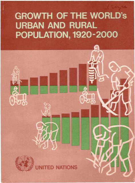
Department <strong>of</strong> Economic <strong>and</strong> Social Affairs<br />
POPULATION STUDIES, No. 44<br />
<strong>Growth</strong> <strong>of</strong> <strong>the</strong> world's urban<br />
<strong>and</strong> rural population,<br />
1920 - 2000<br />
United Nations<br />
New York, 1969
NOTE<br />
Symbols <strong>of</strong> United Nations documents are composed <strong>of</strong>capital letters combined<br />
with figures. Mention <strong>of</strong> such a symbol indicates a reference to a United Nations<br />
document.<br />
1 ST/SOAISeries A/44 I<br />
UNITED NATIONS PUBLICATION<br />
Sales number: E.69. XIII. 3<br />
Price: $U.S. 2.00<br />
(or equivalent in o<strong>the</strong>r currencies)
PREFACE<br />
Pursuant to recommendations <strong>of</strong> <strong>the</strong> <strong>Population</strong><br />
Commission at its ninth, tenth <strong>and</strong> eleventh sessions,<br />
endorsed by <strong>the</strong> Economic <strong>and</strong> Social Council.! <strong>the</strong><br />
United Nations is surveying demographic conditions <strong>and</strong><br />
trends in <strong>the</strong> world in <strong>the</strong>ir principal aspects.s This study<br />
is <strong>the</strong> first comprehensive report to present world-wide<br />
comparisons in rates <strong>and</strong> proportions <strong>of</strong> growth in urban<br />
<strong>and</strong> rural population.s It includes<strong>the</strong> growth in urban <strong>and</strong><br />
rural population as variously defined in national censuses<br />
<strong>and</strong> in <strong>the</strong> population <strong>of</strong> localities grouped by population<br />
size, in an endeavour to arrive at comparable estimates.<br />
There are few countries in <strong>the</strong> world where problems<br />
are not being encountered in <strong>the</strong> context <strong>of</strong> rising proportions<br />
<strong>of</strong> <strong>the</strong> population in urban localities, or in <strong>the</strong><br />
rapid growth <strong>of</strong> big cities, some <strong>of</strong> <strong>the</strong>m attaining sizes<br />
unknown in past history. A quantitative world-wide<br />
survey <strong>of</strong> <strong>the</strong> phenomenon has rarely been undertaken in<br />
view <strong>of</strong> <strong>the</strong> great complexity resulting from statistics <strong>of</strong><br />
widely varying quality <strong>and</strong> definition. The problems<br />
resulting from <strong>the</strong> diversity <strong>of</strong> statistical st<strong>and</strong>ards are<br />
discussedextensively in this report.<br />
Estimates <strong>of</strong> urban <strong>and</strong> rural population, <strong>of</strong> population<br />
in agglomerations smaller or larger than 20,000 inhabitants,<br />
<strong>and</strong> in cities <strong>of</strong> various specified size classes are<br />
1. Official Records <strong>of</strong> <strong>the</strong> Economic <strong>and</strong> Social Council,<br />
Twenty-third Session, Supplement No.4, para. 16; ibid.,<br />
Twenty-seventh Session, Supplement No.3, para. 29; lbid.,<br />
Thirty-first Session, Supplement No.3, para. 131 A(3).<br />
2. Surveys <strong>of</strong> two principal aspects have been published:<br />
"The situation <strong>and</strong> recent trends <strong>of</strong> mortality in <strong>the</strong> world" in<br />
<strong>Population</strong> Bulletin <strong>of</strong> <strong>the</strong> United Nations, No. 6 <strong>and</strong> "Conditions<br />
<strong>and</strong> trends <strong>of</strong> fertility in <strong>the</strong> world" in <strong>Population</strong> Bulletin<br />
<strong>of</strong> <strong>the</strong> United Nations, No.7 (United Nations publications,<br />
Sales Nos.: 62.XIII.2 <strong>and</strong> 64.XIII.2).<br />
3. Previous documents include "World urbanization trends,<br />
1920-1960" published in <strong>the</strong> first issue <strong>of</strong> International Social<br />
<strong>Development</strong> Review (United Nations publication, Sales No.:<br />
E.68.IV.l) <strong>and</strong> "<strong>Urban</strong> <strong>and</strong> rural population growth, 1920-1960,<br />
with projections", an unpublished paper prepared by <strong>the</strong> United<br />
Nations Secretariat for submission to <strong>the</strong> <strong>Population</strong> Commission<br />
(1967).<br />
compared <strong>and</strong> related to each o<strong>the</strong>r for dates from 1920<br />
to 1960<strong>and</strong> projected to 1980, tentatively also to <strong>the</strong> year<br />
2000. The text <strong>of</strong> <strong>the</strong> report compares <strong>the</strong> estimates for<br />
more developed <strong>and</strong> less developed, major areas <strong>of</strong> <strong>the</strong><br />
world, <strong>and</strong> for <strong>the</strong> combination <strong>of</strong> more developed <strong>and</strong><br />
less developed regions. Additional estimates for a greater<br />
number <strong>of</strong> regions <strong>and</strong> for individual countries are<br />
presented in <strong>the</strong> annexes, toge<strong>the</strong>r with statements on<br />
methods by which <strong>the</strong> estimates have been derived.<br />
Full acknowledgementis made <strong>of</strong> <strong>the</strong> deficiencies in <strong>the</strong><br />
data upon which <strong>the</strong> estimates are based <strong>and</strong> <strong>the</strong> possibility<br />
<strong>of</strong> considerable margins <strong>of</strong> error in <strong>the</strong> estimates<br />
<strong>the</strong>mselves. Many arbitrary decisions had to be taken in<br />
<strong>the</strong> endeavour to arrive at comparable estimates. Admittedly,<br />
<strong>the</strong>se are debatable <strong>and</strong> leave much scope for<br />
improvement on <strong>the</strong> basis <strong>of</strong> more detailed research.<br />
A major question in producing this report was whe<strong>the</strong>r<br />
to publish <strong>the</strong>se more or less tentative estimates or to<br />
invest more time <strong>and</strong> effort in <strong>the</strong>ir fur<strong>the</strong>r refinement.<br />
It was concluded that <strong>the</strong> need for documentation <strong>of</strong> <strong>the</strong><br />
magnitudes involved in present world urbanization trends<br />
was so pressing that early publication was preferable<br />
to a more thorough substantiation <strong>of</strong> <strong>the</strong> detailed figures.<br />
However, <strong>the</strong> work is to continue <strong>and</strong> it is hoped that<br />
revised estimates can be published at some future time<br />
in conjunction with new estimates once <strong>the</strong> results <strong>of</strong><br />
censusesexpected to be taken in <strong>and</strong> around 1970become<br />
available. In addition, o<strong>the</strong>r work is in progress bearing<br />
on <strong>the</strong> composition <strong>of</strong> urban <strong>and</strong> rural populations by<br />
demographic, economic <strong>and</strong> social characteristics, <strong>and</strong><br />
changes in <strong>the</strong>se compositions. The present survey merely<br />
reviews <strong>the</strong> numbers <strong>of</strong> inhabitants residing in settlements<br />
<strong>of</strong> diverse types.<br />
It is also recognized that variations in patterns <strong>of</strong> rural<br />
settlement by size <strong>of</strong> locality can have large implications<br />
for economic <strong>and</strong> social change, but this topic is so poorly<br />
documented in <strong>the</strong> census data <strong>of</strong> most countries that<br />
its world-wide survey cannot be undertaken at <strong>the</strong> present<br />
time.<br />
Acknowledgement is given to Pr<strong>of</strong>essor Pierre George<br />
for his review <strong>of</strong> <strong>the</strong> draft <strong>of</strong> this report. His comments<br />
have been taken into account in preparing <strong>the</strong>' present<br />
text.<br />
iii
CONTENTS<br />
INTRODUCTION • . • • . . • . • • • • • • • 1<br />
A. Significance <strong>of</strong> recent urbanization trends 1<br />
B. Aspects <strong>of</strong> urbanization . . . . . . . . 1<br />
C. Historic development <strong>of</strong> <strong>the</strong> "urban" concept 2<br />
D. Modern "urban" conditions. . . . 3<br />
E. Structure <strong>of</strong> <strong>the</strong> "rural" environment . 3<br />
F. The demographic viewpoint 4<br />
G. Purpose <strong>of</strong> <strong>the</strong> report 5<br />
Chapter<br />
I. THE WORLD'S URBAN AND RURAL POPULATION IN 1950AND 1960AS NATIONALLY<br />
DEFINED. . • . • . . . • . . . . • • • • . • . . • • • • • • • .• 7<br />
A. Problems <strong>of</strong> statistical definition . . . . . . . . . . . . . . . .. 7<br />
B. Selection <strong>of</strong> data <strong>and</strong> methods for obtaining estimates <strong>of</strong> mid-year 1950<br />
<strong>and</strong> 1960 . . . . . . . . . . . . . . . . . . . . . . . . . .. 10<br />
C. <strong>Urban</strong> <strong>and</strong> rural population estimates for major world areas, 1950<strong>and</strong><br />
1960 . . . . . . . . . . . . . . . . . . . . . . . . . . . .. 11<br />
D. <strong>Urban</strong> <strong>and</strong> rural population estimatesfor forty <strong>of</strong> <strong>the</strong> world's countries in<br />
1960 . . . . . . . . . . . . . . . . . . . . . . . . . . .. 13<br />
E. Sex composition <strong>of</strong> urban <strong>and</strong> rural populations . . . . . . . . ., 14<br />
II. WORLD URBANIZATION TRENDS AS MEASURED IN AGGWMERATIONS, 1920-1960 19<br />
A. Problems <strong>of</strong> trend study. . . . . . . . . . . . . . . . . . . .. 19<br />
B. Nomenclature adopted for <strong>the</strong> present purpose. . . . . . . . . .. 19<br />
C. Methods adopted to estimate long-run trends . . . . . . . . . .. 20<br />
D. Estimates <strong>of</strong> agglomerated <strong>and</strong> rural <strong>and</strong> small-town population, 1920-<br />
1960 . . . . . . . . . . . . . . . . . . . . . . . . . . . .. 22<br />
E. Increases in agglomerated <strong>and</strong> in rural <strong>and</strong> small-town population,<br />
1920-1960. . . . . . . . . . . . . . . . . . . . . . . . 24<br />
F. Levels<strong>of</strong> urbanization, 1920-1960 (agglomerated population only) 29<br />
G. Size composition <strong>of</strong> <strong>the</strong> agglomerated population. . 31<br />
H. The population <strong>of</strong> big cities <strong>and</strong> multimillion cities . . . . . . 35<br />
I. Seaports <strong>and</strong> inl<strong>and</strong> cities . . . . . . . . . . . . . . . . . 39<br />
III.<br />
ALTERNATIVE ESTIMATES AND TRENDS DERIVED FROM "METROPOLITAN AREA",<br />
"URBAN" AND "AGGLOMERATED" POPULATION CONCEPTS, 1920-1960. . 44<br />
A. Alternative estimates for large urban places . . . . . . . . . . 44<br />
B. The"small-town" population . . . . . . . . . . . . . . . . 45<br />
C. <strong>Urban</strong>ization levels, 1920-1960 (conforming to national definitions) 48<br />
D. Rough estimates <strong>of</strong> strictly rural population, 1920-1960 . . . . . 49<br />
E. <strong>Urban</strong>ization levelsaccording to successively higher sizelimits, 1920-1960 50<br />
IV. A TENTATIVE ASSESSMENT OF POssmLE FUTURE TRENDS . • . • • • • • •• 55<br />
A. Total population projections. . . . . . . . . . . . . . . . . .. 55<br />
B. The projection <strong>of</strong> agglomerated <strong>and</strong> rural <strong>and</strong> small-town population 55<br />
C. Projected increments, 1960-1980 . . . . . . . . . . . . 56<br />
D. Possible long-run trends, 1920-2000. . . . . . . . . . . 57<br />
E. <strong>Population</strong> trends by size class <strong>of</strong> agglomeration, 1920-1980 64<br />
F. Future urban <strong>and</strong> rural population as nationally defined. . 69<br />
G. <strong>Urban</strong>ization levels, 1920-2000. . . . . . . . . . . . . 72<br />
H. Redistribution <strong>of</strong> <strong>the</strong> world's urban <strong>and</strong> rural population, 1920-2000 74<br />
I. The changing human habitat 75<br />
ANNEXES<br />
I. Composition <strong>of</strong> major areas by regions <strong>and</strong> countries . . . . . . . . " 79<br />
II. List <strong>of</strong> definitions used in <strong>the</strong> estimation <strong>of</strong> "urban" population as nationally<br />
defined . . . . . . . . . . . . . . . . . . . . . . . . . . . . .. 81<br />
III. Methods used to estimate agglomerated population (localities with 20,000<br />
<strong>and</strong> more inhabitants), 1920-1960. . . . . . . . . . . . . . . 85<br />
IV. Tables <strong>of</strong> estimates for individual countries . . . . . . . . . . 98<br />
V. <strong>Population</strong> <strong>of</strong> big cities <strong>and</strong> multimillion cities, 1920-1960 . . . . 107<br />
VI. Tables <strong>of</strong> estimates <strong>and</strong> projections for twenty-one world regions . 114<br />
y<br />
Page
List <strong>of</strong> figures<br />
Page<br />
I. Percentage <strong>of</strong>total population in all urban localities as nationally defined <strong>and</strong><br />
in agglomerations with 20,000 or more inhabitants, 1950 <strong>and</strong> 1960. Facing<br />
II. Net urban excess masculinity, 1960 <strong>and</strong> urban population (nationally defined)<br />
as percentage <strong>of</strong> total population. . . . . . . . . . . . . . . . . .. 17<br />
III. Agglomerated <strong>and</strong> rural <strong>and</strong> small-town population in eight major areas <strong>of</strong><br />
<strong>the</strong> world, 1920-1960 . . . . . . . . . . . . . . . . . . . . . . .. 23<br />
IV. Ratio <strong>of</strong> population in 1930, 1940, 1950 <strong>and</strong> 1960 relative to 100 population<br />
in 1920, in eight major areas <strong>of</strong> <strong>the</strong> world (total, agglomerated <strong>and</strong> rural <strong>and</strong><br />
small-town) . . . . . . . . . . . . . . . . . . . . . . . . . . ., 28<br />
V. Agglomerated population by size <strong>of</strong> locality, 1920-1960 . . . . . . . .. 33<br />
VI. <strong>Population</strong> <strong>of</strong> <strong>the</strong> world's twenty-five largest cities, 1920-1960 . . . . .. 36<br />
VII. Size, composition <strong>and</strong> growth <strong>of</strong> world population in agglomerated localities<br />
(20,000 or more inhabitants) <strong>and</strong> in rural areas <strong>and</strong> small towns in more<br />
developed regions <strong>and</strong>less developed regions, 1920-1980. . . . . . . .. 61<br />
VIII. Increases in agglomerated <strong>and</strong> rural <strong>and</strong> small-town population in eight<br />
major areas, 1920-1960 <strong>and</strong> 1960-1980 ... . . . . . . . . . . . .. 62<br />
IX. <strong>Growth</strong> <strong>of</strong>world total population <strong>and</strong> urban population in various categories,<br />
1920-1980 . . . . . . . . . . . . . . . . . . . . . . . . . . . .'. 66<br />
X. Percentages <strong>of</strong>urban <strong>and</strong> rural population, 1920-1980, classified by recency <strong>of</strong><br />
urban development <strong>and</strong> size <strong>of</strong> locality . . . . . . . . . . . . . . .. 68<br />
XI. Number <strong>of</strong> multimillion cities (2,500,000 or more inhabitants) . . . . .. 70<br />
XII. <strong>Population</strong> residing in multimillion cities (2,500,000 or more inhabitants) 70<br />
XIII. Percentages <strong>of</strong> world's urban <strong>and</strong> rural population, conforming to national<br />
definitions, in major areas, estimated for 1920, 1940, 1960 <strong>and</strong> 1980. 76<br />
List <strong>of</strong> maps<br />
1. <strong>Urban</strong>ization levels in major areas <strong>and</strong> regions <strong>of</strong> <strong>the</strong> world (percentage <strong>of</strong> total<br />
population in cities <strong>of</strong> 20,000 or more inhabitants in 1960) . . . . . . . .. 30<br />
2. Big cities (500,000 or more inhabitants) <strong>and</strong> multimillion cities (2,500,000 or<br />
more inhabitants) in 1920 . . . . . . . . . . . . . . . . . . . . . .. 40<br />
3. Big cities (500,000 or more inhabitants) <strong>and</strong> multimillion cities (2,500,000 or more<br />
inhabitants) in 1960 . . . . . . . . . . . . . . . . . . . . . . . . .. 41<br />
vi
EXPLANATORY NOTES<br />
The following symbols have been used in <strong>the</strong> tables throughout <strong>the</strong> report:<br />
Three dots (...) indicate that data are not available or are not separately<br />
reported<br />
A dash (-) indicates that <strong>the</strong> amount is nil or negligible<br />
A blank in a table indicates that <strong>the</strong> item is not applicable<br />
A minus sign (-) indicates a deficit or decrease, except as indicated<br />
A full stop (.) is used to indicate decimals<br />
A comma (,) is used to distinguish thous<strong>and</strong>s <strong>and</strong> millions<br />
A slash (f) indicates a crop year or financial year, e.g., 1960/61<br />
Use <strong>of</strong>a hyphen (-) between dates representing years, e.g., 1961-1963, signifies <strong>the</strong><br />
full period involved including <strong>the</strong> beginning <strong>and</strong> end years.<br />
The word "billion" is used to signify a thous<strong>and</strong> million.<br />
* * *<br />
The designations employed <strong>and</strong> <strong>the</strong> presentation <strong>of</strong> <strong>the</strong> material in this publication<br />
do not imply <strong>the</strong> expression <strong>of</strong>any opinion whatsoever on <strong>the</strong> part <strong>of</strong> <strong>the</strong> Secretariat<br />
<strong>of</strong> <strong>the</strong> United Nations concerning <strong>the</strong> legal status <strong>of</strong> any country or territory or<br />
<strong>of</strong> its authorities, or concerning <strong>the</strong> delimitation <strong>of</strong> its frontiers.<br />
vU
70<br />
Percentage <strong>of</strong> total population<br />
in urban localities as nationally defined<br />
60<br />
Percentage <strong>of</strong> total population<br />
in agglomerations <strong>of</strong> 20,000 or more inhabitants<br />
c:<br />
.2<br />
"0 50<br />
:; a.<br />
0<br />
a.<br />
~<br />
-0<br />
40<br />
Q)<br />
01<br />
.E c:<br />
Q)<br />
u Q;<br />
a.<br />
U><br />
0<br />
c:<br />
0<br />
-"6<br />
:; a.<br />
0<br />
a.<br />
c:<br />
0<br />
..D<br />
:5<br />
30<br />
20<br />
10<br />
1950 1960<br />
World<br />
total<br />
1950 1960<br />
Nor<strong>the</strong>rn<br />
America<br />
1950 1960<br />
Oceania<br />
1950 1960<br />
Europe<br />
1950 1960<br />
Soviet<br />
Union<br />
1950 1960<br />
latin<br />
America<br />
1950 1960<br />
East<br />
Asia<br />
1950 1960<br />
South<br />
Asia<br />
1950 1960<br />
Africa<br />
Figure I. Percentage <strong>of</strong> total population in all urban localities as nationally defined <strong>and</strong> in agglomerations with 20,000 or more inhabita nts, 1950 <strong>and</strong> 1960
INTRODUCTION<br />
A. SIGNIFICANCE OF RECENT URBANIZATION TRENDS<br />
The most conspicuous feature <strong>of</strong> today's accelerated<br />
world population growth is its even greater rapidity <strong>of</strong><br />
urbanization. In many periods in history, populations<br />
<strong>and</strong> cities have grown, but <strong>the</strong> tempo <strong>and</strong> dimensions <strong>of</strong><br />
recent years have never been equalled. The many ramifications<br />
<strong>of</strong> this growth have special significance in <strong>the</strong>ir<br />
relation to economic <strong>and</strong> social change.<br />
The increase in size <strong>of</strong> cities is associated with such<br />
developments as growth in a monetary economy, a shift<br />
towardspreponderance <strong>of</strong> employmentin non-agricultural<br />
activities <strong>and</strong> <strong>the</strong> spread <strong>of</strong> popular education; material<br />
<strong>and</strong> cultural aspirations are undergoing transformation,<br />
<strong>and</strong> social relationships are being modified. These<br />
changes, in part response <strong>and</strong> in part stimulation to<br />
urbanization, act as a mechanism which pushes it to<br />
even higher levels. The character <strong>of</strong> urbanism itself is<br />
currently changing because <strong>of</strong> <strong>the</strong> recent shifts from<br />
manufacturing to service employments. Entire regions<br />
are affected by <strong>the</strong> diffusion <strong>of</strong> urbanism, <strong>and</strong> differences<br />
among regions in <strong>the</strong> weight <strong>of</strong> this influence alter <strong>the</strong>ir<br />
terms <strong>of</strong> trade <strong>and</strong> cultural exchanges.<br />
<strong>Urban</strong>ization <strong>and</strong> its associated changes do not<br />
necessarily proceed at <strong>the</strong> same speed. Rapid commercializat!on<br />
<strong>of</strong> agriculture, for instance, may not at <strong>the</strong><br />
same time contribute to <strong>the</strong> growth <strong>of</strong> cities. But, more<br />
<strong>of</strong>ten, changes create conditions causing migrants in<br />
search <strong>of</strong> cash earnings to pour into cities in numbers<br />
exceeding<strong>the</strong> capacity <strong>of</strong><strong>the</strong> economy to create jobs with<br />
a satisfactory level <strong>of</strong> productivity.<br />
The substratum <strong>of</strong> <strong>the</strong>se interacting factors is <strong>the</strong><br />
prevailing demographic situation. Where <strong>the</strong> urbanization<br />
levelis already high<strong>and</strong> total population growth moderate,<br />
continuing urbanization can nullify <strong>the</strong> amount <strong>of</strong> any<br />
natural increase in <strong>the</strong> rural population. But in large parts<br />
<strong>of</strong> <strong>the</strong> world, not yet so urbanized <strong>and</strong> having higher rates<br />
<strong>of</strong> total growth, even <strong>the</strong> growth in rural population has<br />
accelerated markedly despite <strong>the</strong> rising proportion <strong>of</strong><br />
city dwellers.<br />
Drastic alterations in settlement patterns may result<br />
from <strong>the</strong> unequal rate <strong>of</strong> growth <strong>of</strong> big cities <strong>and</strong> smaller<br />
towns, from modifications in regional urban concentration<br />
or dispersion <strong>and</strong> in <strong>the</strong> form <strong>of</strong> <strong>the</strong> rural habitat,<br />
whe<strong>the</strong>r in villages or hamlets or dispersed. In such<br />
changing conditions, conventional terms become less<br />
adequate as descriptions <strong>of</strong> <strong>the</strong> environment. Settlements<br />
which were "urban" in <strong>the</strong> context <strong>of</strong> earlier times have<br />
lost this quality in comparison with cities which have<br />
attained vastly greater size, while <strong>the</strong> character <strong>of</strong> o<strong>the</strong>r<br />
localities still designated as "rural" has been transformed<br />
by a pervasion <strong>of</strong> urban features. Regions <strong>of</strong> <strong>the</strong><br />
world differgreatly in <strong>the</strong> qualitative content <strong>of</strong> urbanism,<br />
1<br />
<strong>and</strong> typical features <strong>of</strong> settlements <strong>of</strong> a given size can be<br />
diverse. The present fluidity <strong>of</strong> concepts <strong>of</strong> "urban" <strong>and</strong><br />
"rural" is in itself an indication <strong>of</strong> qualitative changes<br />
in <strong>the</strong> environments concurrent with quantitative changes<br />
in population distribution. The resulting complexity<br />
presents many obstacles to measurements <strong>of</strong> <strong>the</strong> phenomenon<br />
<strong>of</strong>urbanization <strong>and</strong> <strong>the</strong>ir comparison; never<strong>the</strong>less,<br />
in a field <strong>of</strong> such vital importance, measurement must be<br />
attempted.<br />
The fact that a considerableinertia inheres in population<br />
trends must be recognized when attempting to establish<br />
targets for a balanced social <strong>and</strong> development policy.<br />
Anticipation <strong>of</strong> <strong>the</strong> balance between goods <strong>and</strong> services<br />
to be produced in ei<strong>the</strong>r urban or rural environments,<br />
choice among economic projects with several possibilities<br />
<strong>of</strong> location, .<strong>and</strong> provision for <strong>the</strong> economic<br />
requirements arisingfrom urbanizationitselfare dependent<br />
on an assessment <strong>of</strong> demographic trends. Overhead,<br />
social costs, <strong>the</strong> availability <strong>of</strong> a diversified labour force<br />
all vary with <strong>the</strong> type <strong>of</strong> locality. Social services (e.g.,<br />
housing, educational <strong>and</strong> health) have to be differentiated<br />
in type <strong>and</strong> quantity according to <strong>the</strong> present <strong>and</strong> future<br />
inhabitants <strong>of</strong> <strong>the</strong> location. The judicious geographic<br />
distribution <strong>of</strong> investments, incentives or deterrents is<br />
one possibility that may be envisaged in modifying <strong>the</strong><br />
population distribution. Alternative costs <strong>and</strong> benefits<br />
would <strong>the</strong>n have to be calculated against a static demographic<br />
background as well as in <strong>the</strong> context <strong>of</strong> flexible<br />
population patterns in attempting to approximate more<br />
closely <strong>the</strong> goal <strong>of</strong> a society's balanced development.<br />
National conditions are diverse <strong>and</strong> defy generalization<br />
at this stage. Mere magnitudes <strong>of</strong> urban <strong>and</strong> rural<br />
populations, such as those roughly estimated <strong>and</strong> surveyed<br />
in <strong>the</strong> present report, may serve certain broad purposes,<br />
but <strong>the</strong>y underscore <strong>the</strong> need for more detailed study <strong>of</strong><br />
<strong>the</strong> two population segments.<br />
B. ASPECTS OF URBANIZATION<br />
The historic consideration <strong>of</strong> this subject, as well as <strong>the</strong><br />
survey <strong>of</strong> its current features, has led to <strong>the</strong> conclusion<br />
that a definition <strong>of</strong> "urban" places cannot be devised<br />
which has unvarying relevance throughout <strong>the</strong> changes<br />
in time <strong>and</strong> diversity in local conditions.' It is recognized<br />
that <strong>the</strong>" urban" phenomenon isassociated with numerous<br />
aspects <strong>and</strong>, fur<strong>the</strong>rmore, that <strong>the</strong>se aspects can coincide<br />
or overlap to a varied extent, <strong>and</strong> that not all are neces-<br />
I According to P. George, no singlefunction can be used as a basis<br />
for <strong>the</strong> definition <strong>of</strong> an urban locality. Cities <strong>and</strong> towns have come<br />
into existence for diverse reasons <strong>and</strong> may consequently exhibit<br />
diverse combinations <strong>of</strong> functions. What <strong>the</strong>y seem to have in<br />
c~lI.llInon is a concentr~tion <strong>of</strong> inhabitants in a limited area presenting<br />
VISible features <strong>of</strong> architecture <strong>and</strong> physical arrangements (P. George<br />
La ville; lefait arbainatravers le monde (paris, 1952), pp. 28·30). '
sarily present at <strong>the</strong> same time. <strong>Urban</strong>ization, consequently,<br />
will not be confined to any single definition for<br />
<strong>the</strong> present purpose. Instead <strong>of</strong> a definition, <strong>the</strong> foregoing<br />
"statement <strong>of</strong> recognition" will have to be accepted as a<br />
more adequate expression to reflect <strong>the</strong> manifestations<br />
<strong>of</strong> a greatly varied <strong>and</strong> complex process.<br />
The concept <strong>of</strong> urbanization implies two sets <strong>of</strong><br />
phenomena, "urban" <strong>and</strong> its opposite, "rural". The<br />
second basic assumption is that <strong>the</strong> urban area is distinguished<br />
by discernible geographical boundaries, a condition<br />
more clearly established in <strong>the</strong> past than it is now.<br />
Whereas no two localities are ever identical, inhabited<br />
areas can be grouped according to certain principles <strong>of</strong><br />
resemblance. Under changing conditions, <strong>the</strong> tw<strong>of</strong>old<br />
urban-rural distinction may gain or lose in relevance;<br />
sometimes. a distinction may have to be drawn in new<br />
terms, as when a locality <strong>of</strong> intermediate characteristics<br />
develops differences from <strong>the</strong> type in which it is classified,<br />
or <strong>the</strong>re may be a continuum <strong>of</strong> types within a group,<br />
according to <strong>the</strong> scale <strong>of</strong> measurement. While big cities<br />
can differ as much from small towns as <strong>the</strong> latter differ<br />
from villages, <strong>the</strong>re may be a gradation in some features<br />
as <strong>the</strong>y are found in several localities ranging in size<br />
from small hamlets to <strong>the</strong> largest city.<br />
"<strong>Urban</strong>ism" includes a wide variety <strong>of</strong> functions, <strong>and</strong><br />
it cannot be said which one <strong>of</strong> <strong>the</strong>m is determining,<br />
ei<strong>the</strong>r by its presence or by degree. Agriculture may<br />
persist as a principal activity among many city residents<br />
in some countries, while elsewhere it may be virtually<br />
absent even in <strong>the</strong> smallest town. Mining towns with no<br />
municipal administration can spring up <strong>and</strong> be no less<br />
urban than some long-established cities. At a certain<br />
phase <strong>of</strong>development, most urban places may be equipped<br />
with, say, electric light, a post <strong>of</strong>fice, a school or a police<br />
station, while most rural places are not; yet any such<br />
feature may already be present in some villages though<br />
still lacking in many city quarters. Countries differ in <strong>the</strong>se<br />
respects, hence certain features can have different weight<br />
in determining how a particular locality is to be rated.<br />
Countries also differ greatly in systems <strong>of</strong>local administration<br />
<strong>and</strong> this is reflected in methods <strong>of</strong> census-taking<br />
<strong>and</strong> in data tabulation. Statistics for areas which can be<br />
classified as ei<strong>the</strong>r urban or rural relate to territorial<br />
units within administrative or o<strong>the</strong>r boundaries traced<br />
according to <strong>the</strong> purposes <strong>and</strong> convenience <strong>of</strong><strong>the</strong> statistical<br />
procedure. Local government boundaries <strong>of</strong> municipal<br />
places may include areas <strong>of</strong> a rural type, or <strong>the</strong>y may<br />
exclude adjacent areas <strong>of</strong> urban settlement. Criteria<br />
which serve both to trace boundaries <strong>of</strong> "urbanized"<br />
territory <strong>and</strong> <strong>the</strong> operation <strong>of</strong> a census are difficult to<br />
establish. In view <strong>of</strong> <strong>the</strong> tendency towards <strong>the</strong> geographic<br />
expansion <strong>of</strong> "urbanized" territory <strong>and</strong> <strong>the</strong> lag <strong>of</strong> corresponding<br />
<strong>of</strong>ficial adjustments, <strong>the</strong> actual data obtained<br />
in successive population censuses are <strong>of</strong> dubious comparability<br />
for <strong>the</strong> most part, both internationally <strong>and</strong> as<br />
a time series.<br />
modern observer, but even in that early period <strong>the</strong> multiple<br />
functions <strong>the</strong>y encompassed made <strong>the</strong>m essentially<br />
distinct from surrounding agricultural settlements. This<br />
characteristic has persisted throughout most <strong>of</strong> history,<br />
albeit with changed features.f<br />
In <strong>the</strong> ensuing epochs, <strong>the</strong> typology <strong>of</strong>inhabitedlocalities<br />
- town <strong>and</strong> countryside - tended to become manifold.<br />
Villas <strong>and</strong> colonias in <strong>the</strong> western parts <strong>of</strong> <strong>the</strong> Roman<br />
Empire were nei<strong>the</strong>r towns nor villages. In China, a<br />
threefold system <strong>of</strong> territorial administration has existed<br />
since early times; during <strong>the</strong> T'ang period it spread to<br />
o<strong>the</strong>r parts <strong>of</strong> East Asia.s Ano<strong>the</strong>r example <strong>of</strong> diversification<br />
<strong>of</strong>urban functions was <strong>the</strong> development <strong>of</strong>medinas,<br />
kasbah <strong>and</strong> bazars in countries <strong>of</strong> Islamic culture. In<br />
later mediaeval times in Europe, <strong>the</strong> tw<strong>of</strong>old distinction<br />
sharpened again as cities acquired royal charters exempting<br />
<strong>the</strong>m from feudal authority <strong>and</strong> specifying local legislative<br />
powers <strong>and</strong> privileges.<br />
For centuries, most urban developments were enclaves<br />
surrounded by moats <strong>and</strong> fortified walls. Their administrative<br />
<strong>and</strong> cultural functions were symbolized in temples,<br />
courts, monuments, places <strong>of</strong>public assembly for political,<br />
military <strong>and</strong> recreational purposes, institutions <strong>of</strong>learning<br />
<strong>and</strong> <strong>the</strong> promotion <strong>of</strong><strong>the</strong> arts. This multiplicity <strong>of</strong>function<br />
fostered <strong>the</strong> development <strong>of</strong> <strong>the</strong> political <strong>and</strong> commercial<br />
organization. The culture <strong>and</strong> personality <strong>of</strong> <strong>the</strong> townspeople<br />
were in strong contrast to those <strong>of</strong> <strong>the</strong>ir rural<br />
cousins, <strong>and</strong> in most respects <strong>the</strong> distinction between<br />
<strong>the</strong> representatives <strong>of</strong> <strong>the</strong> two environments was clearly<br />
apparent. Sometimes o<strong>the</strong>r types, such as <strong>the</strong> extramural<br />
squatters, entered within <strong>the</strong> walls <strong>and</strong> partook<br />
<strong>of</strong> <strong>the</strong> town's economic functions but not its urban duties<br />
<strong>and</strong> privileges. Never<strong>the</strong>less, in most respects a plainly<br />
visible boundary separated <strong>the</strong> residential area <strong>of</strong> a<br />
population group which had distinctive economic,<br />
cultural, social <strong>and</strong> psychological traits.<br />
In <strong>the</strong>se conditions, a single criterion pertaining to<br />
administration, for instance <strong>the</strong> existence <strong>of</strong> a city<br />
charter, was sufficient to differentiate a population<br />
category. The same group <strong>of</strong> urbanites would have been<br />
defined if anyone <strong>of</strong> numerous o<strong>the</strong>r criteria had been<br />
used, but <strong>the</strong> law specific to <strong>the</strong> designation <strong>of</strong> an area<br />
was <strong>the</strong> evident foundation on which <strong>the</strong> o<strong>the</strong>r distinctions<br />
rested.<br />
Post-mediaeval developments blurred previously sharp<br />
contrasts. National, provincial or colonial centres<br />
acquired additional functions, distinguishing <strong>the</strong>m from<br />
numerous o<strong>the</strong>r cities <strong>of</strong> equal antiquity. <strong>Urban</strong> areas<br />
spread beyond <strong>the</strong>ir established confines or developed<br />
without walls; <strong>the</strong>ir territories ceased to be circumscribed<br />
by legislative decreee. Diffusion <strong>of</strong> urban features over<br />
wider areas <strong>and</strong> <strong>the</strong> unprecedented growth <strong>of</strong> <strong>the</strong> urban<br />
places <strong>the</strong>mselves began to affect every environment,<br />
resulting in new settlement types with more varied<br />
combinations <strong>of</strong> features. The spread <strong>of</strong> trade under<br />
C. HISTORIC DEVELOPMENT OF THE "URBAN" CONCEPT<br />
The beginning <strong>of</strong> recorded history is concurrent with<br />
<strong>the</strong> emergence <strong>of</strong> cities. The diminutive centres <strong>of</strong> early<br />
Mesopotamia would present few urban attributes to a<br />
2<br />
2 See, for example, L. Mumford, The City in History (New York,<br />
1961).<br />
S Three types <strong>of</strong> districts are distinguished, according to whe<strong>the</strong>r<br />
<strong>the</strong>y are administered from a city, a market-town, or are entirely<br />
rural. In China, <strong>the</strong>se are known as shi, cheng<strong>and</strong> shiang; in Japan as<br />
shi, machi<strong>and</strong> mura; <strong>and</strong> in Korea as shi, eup <strong>and</strong> myeon.
mercantilism, at times supplemented or spearheaded by<br />
military conquest, eventually planted <strong>the</strong>se transformations<br />
throughout <strong>the</strong> world. A complex rearrangement <strong>of</strong><br />
relationships among peoples <strong>and</strong> societies was set in<br />
motion, <strong>the</strong> outcome <strong>of</strong> which cannot yet be foreseen.<br />
In some countries, notably in South <strong>and</strong> East Asia, new<br />
enclaves serving overseas trade grew into primate cities,<br />
gaining ascendancy over an already developed structure<br />
<strong>of</strong> traditional cities.<br />
D. MODERN "URBAN" CONDITIONS<br />
In what now appears as <strong>the</strong> earlier industrial period<br />
large manufacturing enterprises superseded home <strong>and</strong><br />
shop crafts, accentuating <strong>the</strong> contrasts between cities<br />
with <strong>the</strong>ir smoke stacks <strong>and</strong> railway yards <strong>and</strong> farms <strong>and</strong><br />
villages whose simpler arts <strong>and</strong> crafts languished in <strong>the</strong><br />
competition. The industrial revolution engendered a new<br />
cycle in <strong>the</strong> growth <strong>of</strong> world commerce, transport,<br />
finance <strong>and</strong> o<strong>the</strong>r services. Large-scale manufactures,<br />
in particular, appeared almost as <strong>the</strong> essence <strong>of</strong> <strong>the</strong> new<br />
"urban" distinction. The prevalence <strong>of</strong> non-agricultural<br />
activity has indeed always been correlated with o<strong>the</strong>r<br />
urban features, such as provisions for education, type <strong>of</strong><br />
housing, consumption patterns, political concepts,<br />
administrative structures <strong>and</strong> so forth. And as <strong>the</strong> technological<br />
changes gained dominance in <strong>the</strong> world <strong>the</strong>y seemed<br />
to determine <strong>the</strong> basic" urban" criterion, with associated<br />
features trailing in <strong>the</strong> van.<br />
Efficient bulk transport <strong>and</strong> telegraphic communication<br />
permitted industrial <strong>and</strong> commercial cities to attain<br />
unprecedented size <strong>and</strong> scope. Recent developments<br />
have opened a new growth dimension, whose urban<br />
elements penetrate into more extensive areas. Notable in<br />
<strong>the</strong>se developments is <strong>the</strong> heightened efficiency <strong>of</strong> shortdistance<br />
transport, <strong>the</strong> wide-spread availability <strong>of</strong> means<br />
<strong>of</strong> instant communication <strong>and</strong> <strong>the</strong> geographic extensions<br />
<strong>of</strong> power networks such as electric grids, gas pipelines<br />
<strong>and</strong> computer link-ups. As a consequence, whole regions<br />
are distinguishable as under <strong>the</strong> dominance <strong>of</strong> urban<br />
centres.<br />
The increasing scale <strong>and</strong> complexity <strong>of</strong> <strong>the</strong> interplay<br />
<strong>of</strong> urban functions are enlarging <strong>the</strong> recognizable units<br />
<strong>of</strong> urban dominance. Suburbs adjacent to some <strong>of</strong> <strong>the</strong><br />
major cities were already in evidence a long time ago.<br />
As far back as a century ago, a new trend was identified<br />
in western Europe by <strong>the</strong>"conurbations" resulting from<br />
<strong>the</strong> coalescence <strong>of</strong> separate towns with <strong>the</strong>ir interstitial<br />
rural areas. Less compact but <strong>of</strong> greater compass are <strong>the</strong><br />
newer" metropolitan areas", for instance those so designated<br />
in <strong>the</strong> United States. These consist usually <strong>of</strong> a<br />
central "city" <strong>and</strong> an outer "ring", <strong>and</strong> <strong>the</strong> latter can<br />
comprise numerous satellite centres <strong>and</strong> subsidiary<br />
commercial <strong>and</strong> residential nuclei. Still more recently,<br />
<strong>the</strong> term "megalopolis" has come into use to describe<br />
entire chains <strong>of</strong> metropolitan areas strung along major<br />
arteries carrying enormous volumes <strong>of</strong> intercity traffic.<br />
One such belt is situated along <strong>the</strong> eastern coast <strong>of</strong> <strong>the</strong><br />
United States, <strong>and</strong> ano<strong>the</strong>r along <strong>the</strong> sou<strong>the</strong>rn coast <strong>of</strong><br />
Japan. The conglomerate <strong>of</strong> heavily urbanized regions<br />
in western Europe (most <strong>of</strong> Belgium <strong>and</strong> <strong>the</strong> Ne<strong>the</strong>rl<strong>and</strong>s,<br />
<strong>the</strong> western portion <strong>of</strong> <strong>the</strong> Federal Republic <strong>of</strong> Germany,<br />
3<br />
<strong>the</strong> nor<strong>the</strong>rn rim <strong>of</strong> France <strong>and</strong> <strong>the</strong> south-east <strong>of</strong> Engl<strong>and</strong>),<br />
shaped somewhat differently, may be placed in <strong>the</strong> same<br />
category. Each <strong>of</strong> <strong>the</strong>se three megalopolitan regions now<br />
comprises nearly 50 million inhabitants within an area<br />
<strong>of</strong> about 150,000 square kilometres, <strong>and</strong> <strong>the</strong> emergence<br />
<strong>of</strong> more such regions is foreseen.<br />
Somewhat different developments have followed <strong>the</strong><br />
implementation <strong>of</strong> policies deliberately aimed at regional<br />
decentralization, notably in <strong>the</strong> Soviet Union. Throughout<br />
<strong>the</strong> wide territory <strong>of</strong> that country <strong>the</strong> growth <strong>of</strong> certain<br />
cities has been promoted, with a consequent slower growth<br />
in older <strong>and</strong> bigger cities than might o<strong>the</strong>rwise have<br />
occurred. Never<strong>the</strong>less, in its Central Industrial Region,<br />
a comparatively dense network <strong>of</strong> major centres with<br />
interdependent industrial functions has developed. In<br />
several o<strong>the</strong>r countries, new cities or satellite towns have<br />
been planned on a smaller scale, <strong>and</strong> regional development<br />
projects have also brought about some geographic<br />
redistribution <strong>of</strong> urban growth.<br />
In many parts <strong>of</strong> <strong>the</strong> world, <strong>the</strong> primary distinction <strong>of</strong><br />
settlements as "urban" or "rural" serves most purposes<br />
<strong>of</strong> study. However, this simple scale is not adequate for<br />
entire regions with dominantly urban interdependent<br />
functions. A fourfold classification, separating"urban"<br />
from "rural" areas both within <strong>and</strong> outside <strong>the</strong> larger<br />
regions <strong>of</strong> urban dominance, might provide a more<br />
relevant framework <strong>of</strong> analysis. In practice, such a scheme<br />
would be too easily vitiated by <strong>the</strong> accidental contours<br />
<strong>of</strong> local administrative boundaries, <strong>and</strong> by difficulties in<br />
devising sufficiently refined criteria. O<strong>the</strong>r methods <strong>of</strong><br />
regionalization <strong>and</strong> subregionalization may be <strong>of</strong> interest<br />
in countries having different conditions or policies.<br />
However, in a fluid situation it is doubtful whe<strong>the</strong>r any<br />
detailed scheme can remain valid over an extended period<br />
<strong>of</strong> time.<br />
With <strong>the</strong> increase in number <strong>of</strong> urban attributes <strong>and</strong><br />
<strong>the</strong>ir wider diffusion, it is doubtful that <strong>the</strong> historic<br />
tw<strong>of</strong>old "urban" <strong>and</strong> "rural" distinction will retain<br />
its relevance much longer. Nei<strong>the</strong>r administrative status<br />
nor types <strong>of</strong> economic activity can be relied on as a<br />
permanent basic criterion. The one distinguishing feature<br />
<strong>of</strong> strictly urban areas which is likely to maintain its<br />
significance for many practical purposes is <strong>the</strong> concentration<br />
<strong>of</strong> numerous residents within relatively compact<br />
areas <strong>of</strong>dense settlement. The recognition <strong>of</strong> this persistent<br />
feature has led to <strong>the</strong> new census definitions <strong>of</strong>" urbanized<br />
area" in <strong>the</strong> United States, <strong>and</strong> "densely inhabited<br />
district" in Japan.<br />
E. STRUCTURE OF THE "RURAL" ENVIRONMENT<br />
Little is known about world-wide variations in <strong>the</strong><br />
degrees <strong>of</strong> population concentration or dispersal in <strong>the</strong><br />
rural habitat. In some countries, e.g., France <strong>and</strong> Italy,<br />
<strong>the</strong> censuses furnish detailed data by types <strong>of</strong> rural<br />
settlement, whe<strong>the</strong>r in villages or dispersed households,<br />
<strong>and</strong> <strong>the</strong> censuses <strong>of</strong> a few o<strong>the</strong>r countries also have some<br />
information <strong>of</strong> this nature. In many countries, however,<br />
though <strong>the</strong> rural population may be greater in <strong>the</strong> majority,<br />
it is enumerated <strong>and</strong> tabulated without any fur<strong>the</strong>r<br />
differentiation by type <strong>of</strong> settlement, <strong>and</strong> is a mere residual<br />
after subtraction <strong>of</strong> <strong>the</strong> urban from <strong>the</strong> total population.
Geographers <strong>and</strong> travellers have compiled much<br />
descriptive detail. but it pertains only to quality <strong>and</strong> does<br />
not lend itself to measurement or estimation <strong>of</strong> size.'<br />
The probable importance <strong>of</strong> more detailed description<br />
<strong>of</strong> settlement patterns within <strong>the</strong> broader framework<br />
mav be demonstrated from observations taken on a<br />
much larger scale. In a macroscopic world view one can<br />
now identify six regions <strong>of</strong> greatest population concentration<br />
with about 50 million inhabitants each. Three<br />
<strong>of</strong> <strong>the</strong>se have already been mentioned, namely, <strong>the</strong> megalopolitan<br />
regions in western Europe, <strong>the</strong> eastern United<br />
States <strong>and</strong> Japan. The majority <strong>of</strong> <strong>the</strong>ir populations are<br />
urban. though within <strong>the</strong>se regions agriculture is also<br />
practised with high efficiency <strong>and</strong> considerable yield.<br />
from quantitative knowledge regarding patterns <strong>and</strong><br />
trends in <strong>the</strong> forms <strong>of</strong> rural settlement."<br />
In <strong>the</strong> last analysis, even <strong>the</strong> most urbanized society<br />
subsists on food. An urbanized country may trade its<br />
manufactures for food produced elsewhere. Never<strong>the</strong>less,<br />
an efficient <strong>and</strong> prosperous agriculture will remain a<br />
prerequisite for o<strong>the</strong>r developments. Whe<strong>the</strong>r comprising<br />
a majority or a minority <strong>of</strong> <strong>the</strong> sector measured, in any<br />
one country <strong>the</strong> rural component remains a foundation<br />
supporting a superstructure <strong>of</strong> urban settlements. The<br />
scattered information now existing with respect to <strong>the</strong><br />
world's rural habitat <strong>and</strong> its possible implications for<br />
rural development is woefully insufficient for an assessment<br />
<strong>of</strong> basic problems affecting <strong>the</strong> welfare <strong>of</strong> man.<br />
The three o<strong>the</strong>r concentrations are <strong>the</strong> Yangtse delta<br />
in China, <strong>the</strong> Ganges delta in India <strong>and</strong> Pakistan, <strong>and</strong><br />
<strong>the</strong> Indonesian isl<strong>and</strong> <strong>of</strong> Java. Again, <strong>the</strong>se three regions<br />
are about <strong>the</strong> same size in area <strong>and</strong> population totals.<br />
Their populations, however, are predominantly rural,<br />
though Shanghai, Calcutta <strong>and</strong> Djakarta rate among <strong>the</strong><br />
world's largest cities. Their settlement patterns <strong>and</strong><br />
economic <strong>and</strong> social circumstances obviously differ<br />
substantially from those <strong>of</strong> <strong>the</strong> first three mentioned.<br />
The character <strong>of</strong> <strong>the</strong> leading cities <strong>the</strong>mselves - whe<strong>the</strong>r<br />
London, New York <strong>and</strong> Tokyo, or Shanghai, Calcutta<br />
<strong>and</strong> Djakarta - also depends much on <strong>the</strong> character <strong>of</strong><br />
settlements in <strong>the</strong>ir respective hinterl<strong>and</strong>s, <strong>and</strong> <strong>the</strong> characteristics<br />
<strong>of</strong> inl<strong>and</strong> towns <strong>and</strong> villages are known to exhibit<br />
extreme differences. If differences <strong>of</strong> settlement pattern<br />
on <strong>the</strong> large scale are associated with such a diversity <strong>of</strong><br />
conditions, it will appear highly likely that differences<br />
in <strong>the</strong> form <strong>of</strong> <strong>the</strong> rural habitat, on <strong>the</strong> smaller scale,<br />
can also be ra<strong>the</strong>r decisive in determining <strong>the</strong> forms <strong>of</strong><br />
economic <strong>and</strong> social development which are needful<br />
<strong>and</strong> feasible in each region.<br />
Present conditions are reminiscent <strong>of</strong> <strong>the</strong> past, when <strong>the</strong><br />
development potential was also considerably affected by<br />
forms <strong>of</strong> <strong>the</strong> rural habitat. The internal transport network<br />
is apt to remain sparse where many small units <strong>of</strong> settlement<br />
are separated by appreciable distance; improved<br />
roads can be economically maintained only where <strong>the</strong>y<br />
connect more substantial villages or towns. Schools,<br />
hospitals, repair shops, co-operatives, electricity <strong>and</strong> a host<br />
<strong>of</strong> o<strong>the</strong>r development factors, which might be brought<br />
within <strong>the</strong> comfortable reach <strong>of</strong> village peasants, remain<br />
inaccessible to isolated farmers. In hamlets <strong>and</strong> homesteads,<br />
opportunities for diversified social function <strong>and</strong><br />
organization are minimal, but <strong>the</strong>y can be considerable<br />
in sizable villages. If sufficiently large, villages can also<br />
maintain some industrial establishments. On <strong>the</strong> o<strong>the</strong>r<br />
h<strong>and</strong>, <strong>the</strong> sizes <strong>of</strong> some villages may grow disproportionate<br />
to <strong>the</strong>ir accessible farml<strong>and</strong>, again necessitating some<br />
dispersal <strong>of</strong> settlers or migration to towns <strong>and</strong> cities.<br />
Because <strong>of</strong> <strong>the</strong>se <strong>and</strong> o<strong>the</strong>r factors, projects <strong>of</strong> agrarian<br />
reform or community development might derive guidance<br />
4 Much can be learned, however, from <strong>the</strong> study <strong>of</strong> very detailed<br />
maps <strong>and</strong> from systematic aerial photographs.<br />
4<br />
F. THE DEMOGRAPHIC VIEWPOINT<br />
Many fields <strong>of</strong> technological <strong>and</strong> scientific specialization<br />
are engaged in <strong>the</strong> study <strong>of</strong> urban <strong>and</strong> rural environments.<br />
Demography, an elaboration on <strong>the</strong> numbers, trends <strong>and</strong><br />
characteristics <strong>of</strong> <strong>the</strong> inhabitants, has special pertinence<br />
to issues <strong>of</strong> human welfare. Its basic unit <strong>of</strong> measurement<br />
is <strong>the</strong> individual. Goals <strong>of</strong> improvement <strong>of</strong> quality <strong>of</strong><br />
living have as <strong>the</strong>ir starting point a knowledge <strong>of</strong> <strong>the</strong><br />
implications <strong>of</strong> demographic facts <strong>and</strong> probable trends,<br />
not only in terms <strong>of</strong> conferring benefits but also <strong>of</strong> <strong>the</strong><br />
availability <strong>of</strong> human resources by which <strong>the</strong>y may be<br />
attained.<br />
The adequate study <strong>of</strong> urbanization <strong>and</strong> related phenomena<br />
requires a combination <strong>of</strong> disciplines. Demography<br />
is concerned primarily with numbers <strong>of</strong> people <strong>and</strong> <strong>the</strong>ir<br />
characteristics, but <strong>the</strong> process <strong>of</strong> change is activated in a<br />
wider field <strong>of</strong> economic, social <strong>and</strong> cultural circumstances<br />
<strong>and</strong> transformations. Space does not now permit a<br />
review <strong>of</strong> this wider literature, but it is worth noting that<br />
certain terms have come into use in <strong>the</strong> description <strong>of</strong><br />
forces by which <strong>the</strong> urbanization process appears to be<br />
motivated. Some writers have emphasized <strong>the</strong> "push"<br />
aspect where migrants are induced to move to cities <strong>and</strong><br />
towns because <strong>of</strong> insecure, adverse or deteriorating<br />
conditions experienced in <strong>the</strong> countryside. The "pull"<br />
aspect, namely <strong>the</strong> attraction <strong>of</strong> migrants by more favourab'le<br />
or promising conditions in urban places, is stressed<br />
in some o<strong>the</strong>r writings. More recently, especially in<br />
India, attention has been drawn to "push-back" factors<br />
which force migrants after a temporary residence in <strong>the</strong><br />
city, where <strong>the</strong>y are unable to secure a more permanent<br />
foothold, to return to <strong>the</strong>ir places <strong>of</strong> origin, The dominance<br />
<strong>of</strong> one or ano<strong>the</strong>r aspect, also that <strong>of</strong> "intervening opportunities"<br />
(e.g., rural migrants moving to small towns,<br />
<strong>and</strong> small-town migrants to big cities), may depend on<br />
conditions in each country. Fur<strong>the</strong>r aspects can be mentioned,<br />
for instance, a self-reinforcing tendency which<br />
5 New l<strong>and</strong> settlement can also take diverse forms depending in<br />
part on modes <strong>of</strong> transportation, distances <strong>and</strong> types <strong>of</strong> social organization.<br />
<strong>Rural</strong> settlement in <strong>the</strong> United States proceeded mainly by a<br />
dispersal <strong>of</strong> individual farms. Russian settlements in <strong>the</strong> Asian steppe<br />
regions were mainly in <strong>the</strong> form <strong>of</strong> villages. In <strong>the</strong> Ne<strong>the</strong>rl<strong>and</strong>s, l<strong>and</strong>s<br />
reclaimed from <strong>the</strong> sea (polders) are settled with sizable villages<br />
equipped with many service facilities. As a result <strong>of</strong> l<strong>and</strong> reform, new<br />
settlements in sou<strong>the</strong>rn Italy are <strong>of</strong>ten in <strong>the</strong> form <strong>of</strong> smaller villages<br />
designed to decongest old villages less favourably situated which have<br />
grown to an excessive size.
appears to have gained prominence in many less .develo'p~d<br />
countries: a large influx <strong>of</strong> poor migrants into cities<br />
forces at least minimal social investments to facilitate<br />
<strong>the</strong>ir accommodation (e.g., health <strong>and</strong> police protection,<br />
transport, sewerage, electricity, schools, social services),<br />
as a result <strong>of</strong> which an even larger influx is encouraged.<br />
Yet ano<strong>the</strong>r aspect is noted where localities previously<br />
considered as rural acquire urban characteristics, so<br />
that urbanization can occur in situ <strong>and</strong> not only as a<br />
result <strong>of</strong> migration.<br />
In general, <strong>the</strong> motivations for migration to cities are<br />
found to be primarily economic, <strong>and</strong> economic processes<br />
are also at work where given localities acquire urban<br />
features. There is much evidence, however, to challenge<br />
<strong>the</strong> view that <strong>the</strong> forces which produce urbanization are<br />
exclusively economic. Cultural, educational, political<br />
<strong>and</strong> social factors are also important, <strong>and</strong> <strong>the</strong> presence<br />
<strong>of</strong> a wide range <strong>of</strong> diverse motivations has been detected<br />
in some surveys.The intention to move from a rural to an<br />
urban residence, <strong>and</strong> <strong>the</strong> success with which individual<br />
migrants accommodate <strong>the</strong>mselves to an urban environment,<br />
has psychological prerequisites <strong>and</strong> <strong>the</strong>se can<br />
originate from various sources, not all <strong>of</strong> <strong>the</strong>m strictly<br />
rational or necessarily economic. While aware <strong>of</strong> this<br />
multiplicity <strong>of</strong> aspects, not all <strong>of</strong> which can be dealt with<br />
simultaneously, demographers make <strong>the</strong>ir contribution<br />
by <strong>the</strong> more special study <strong>of</strong> <strong>the</strong> quantity <strong>of</strong> human<br />
individuals involved, <strong>and</strong> <strong>the</strong> dynamics which are internal<br />
to changes within that quantity.<br />
Over <strong>the</strong> five- or ten-year period ordinarily considered<br />
in economic policy programmes, <strong>the</strong> demographic<br />
situation <strong>of</strong> a country is usually affected to a greater<br />
degree by changes in <strong>the</strong> proportionate distribution<br />
<strong>of</strong> its population than in its rate <strong>of</strong> growth. This is<br />
because trends <strong>of</strong> natural increase (or decrease), <strong>the</strong><br />
difference between birth <strong>and</strong> death rates, have a considerable<br />
inertia, while fluctuations from migratory<br />
movements are generally volatile. The reduction <strong>of</strong><br />
population growth in some areas through out-migration<br />
is inevitably bound up with a corresponding acceleration<br />
<strong>of</strong> growth in <strong>the</strong> areas <strong>of</strong> in-migration. When enough<br />
cannot be done to promote acceptable living conditions<br />
in one environment, more will have to be done elsewhere.<br />
And what is being done has fur<strong>the</strong>r repercussions on<br />
spontaneous migratory movements. Measures affecting<br />
<strong>the</strong> geographic distribution <strong>of</strong> investments may have to<br />
be adjusted <strong>and</strong> readjusted accordingly.<br />
More than an overview <strong>of</strong> changes in numbers <strong>and</strong><br />
proportions <strong>of</strong> urban <strong>and</strong> rural populations is needed<br />
when assessing development needs in <strong>the</strong> two environments.<br />
Allocation <strong>of</strong> investments in different types <strong>of</strong><br />
schools, housing, productive equipment, health facilities<br />
<strong>and</strong> so forth requires a more detailed analysis <strong>of</strong> <strong>the</strong><br />
demographic component. The structure <strong>of</strong> urban <strong>and</strong><br />
rural populations must be analysed, i.e., a study made <strong>of</strong><br />
<strong>the</strong>ir composition by sex, age, marital status, household<br />
composition, education, types <strong>of</strong> economic activity <strong>and</strong><br />
possibly also ethnic or o<strong>the</strong>r relevant characteristics.<br />
The alteration produced by shifts in characteristics from<br />
one environment to ano<strong>the</strong>r is quickly apparent in <strong>the</strong><br />
economic sector, but migration <strong>and</strong> resettlement can also<br />
s<br />
be conducive to establishing <strong>the</strong> social prerequisites to<br />
a future more intensive economic development.<br />
<strong>Urban</strong>ization itself may eventually retard total population<br />
growth everywhere. The available evidence suggests<br />
that rates <strong>of</strong> family formation <strong>and</strong> levels <strong>of</strong> fertility are<br />
usually lower in urban than in rural environments, <strong>and</strong><br />
in more urbanized than in less urbanized regions. This<br />
may be ascribed to <strong>the</strong> higher levels <strong>of</strong> education <strong>and</strong><br />
income <strong>and</strong> greater variety <strong>of</strong> types <strong>of</strong> employment <strong>and</strong><br />
activities, particularly for women, found in urban areas.<br />
The essence<strong>of</strong> <strong>the</strong> urban environment, <strong>the</strong> constant interaction<br />
in neighbourhoods <strong>of</strong> a numerous <strong>and</strong> diverse<br />
people, may have a psychological effect on attitudes<br />
towards fertility as it does on o<strong>the</strong>r matters <strong>of</strong>behaviour.s<br />
For <strong>the</strong> present, mankind may still continue its rapid<br />
multiplication <strong>and</strong> <strong>the</strong> urban areas <strong>the</strong>ir even greater<br />
rate <strong>of</strong> expansion, but eventually <strong>the</strong> abatement <strong>of</strong><br />
population growth must follow changes in <strong>the</strong> environment.<br />
More knowledge <strong>of</strong> <strong>the</strong> many influences at work is<br />
needed to alleviate <strong>the</strong> problems resulting from-imbalances<br />
during this transitional period.<br />
G. PuRPOSE OF THE REPORT<br />
This report proposes estimates <strong>of</strong> <strong>the</strong> size, rate <strong>of</strong><br />
growth <strong>and</strong> proportions <strong>of</strong> urban <strong>and</strong> rural populations<br />
in <strong>the</strong> countries <strong>and</strong> major regions <strong>of</strong><strong>the</strong> world at ten-year<br />
intervals from 1920 to 1960. The trends <strong>of</strong> <strong>the</strong>se phenom ena<br />
are fur<strong>the</strong>r extrapolated to <strong>the</strong> year 1980, <strong>and</strong> some to<br />
<strong>the</strong> year 2000. The estimates have been based on census<br />
data, supplemented by material from o<strong>the</strong>r sources where<br />
censuses were lacking. Because <strong>of</strong> variations in <strong>the</strong> definition<br />
<strong>of</strong> urban population <strong>and</strong> in <strong>the</strong> delimitation <strong>of</strong><br />
urban localities, <strong>the</strong> data were adjusted in a number <strong>of</strong><br />
instances to render <strong>the</strong>m more nearly comparable. Figures<br />
were interpolated or extrapolated to <strong>the</strong> appropriate<br />
date. Estimates <strong>of</strong> rural population were obtained by<br />
subtracting estimates <strong>of</strong> urban from total population.<br />
In this study, estimates <strong>of</strong> urban populations are<br />
presented according to two determinations: national<br />
definitions <strong>and</strong> a st<strong>and</strong>ard aimed at international comparability.?<br />
In chapter I, urban population is estimated<br />
by <strong>the</strong> criteria <strong>of</strong> each country <strong>and</strong> in chapter II as that <strong>of</strong><br />
localities with 20,000 or more inhabitants. A comparison<br />
<strong>of</strong>alternative methods <strong>of</strong> measurement is made in chapter<br />
III. The projections in chapter IV are for localities with<br />
more than <strong>and</strong> less than 20,000 inhabitants but include<br />
rough estimates derived <strong>the</strong>refrom for <strong>the</strong> population<br />
which may be defined as urban.<br />
6 These are long-run considerations. In <strong>the</strong> short run, urbanization<br />
can also cause some acceleration <strong>of</strong> population growth, e.g., by<br />
an attendant decrease <strong>of</strong> infant mortality or encouragement <strong>of</strong> early<br />
marriage. Since <strong>the</strong> proportion <strong>of</strong> young adults is usually greater in<br />
urban than in rural areas, o<strong>the</strong>r conditions being equal, urban birth<br />
rates can exceed, <strong>and</strong> urban deathrates can fall below <strong>the</strong> corresponding<br />
rural rates.<br />
7 The adoption <strong>of</strong> 20,000 as <strong>the</strong> minimum number <strong>of</strong> inhabitants<br />
<strong>of</strong> localities here considered as part <strong>of</strong> <strong>the</strong> "agglomerated population"<br />
was dictated by simple expediency in terms <strong>of</strong> available data.<br />
By most national criteria <strong>of</strong> "urban" places, this size limit is somewhat<br />
high, <strong>and</strong> it may represent different degrees or combinations <strong>of</strong><br />
"urban" features in different countries.
It is to be expected that national definitions differ<br />
widely because <strong>of</strong> <strong>the</strong> diversity <strong>of</strong> conditions among<br />
countries <strong>and</strong> <strong>of</strong> criteria for urban classification. Census<br />
data on population characteristics collected on this basis<br />
are <strong>the</strong> only means <strong>of</strong> analysing urban-rural differences,<br />
<strong>and</strong> are <strong>the</strong>refore <strong>of</strong> international interest. But urban<br />
measurements <strong>of</strong> world-wide comparability can only be<br />
assembledin terms <strong>of</strong> localitiesdefined by population size.<br />
The criterion <strong>of</strong> locality size has several uses. It makes<br />
possible <strong>the</strong> construction <strong>of</strong> a more homogeneous time<br />
series for a country, obviating changes in national definitionsfrom<br />
onecensusto ano<strong>the</strong>r. It permits comparison<br />
<strong>of</strong> trends in localities <strong>of</strong> different size classes, for instance,<br />
<strong>of</strong> larger cities <strong>and</strong> smaller towns. When more attention<br />
is given to data for smaller localities, it could also be <strong>the</strong><br />
means <strong>of</strong> advancing <strong>the</strong> presently neglected study <strong>of</strong> rural<br />
settlement patterns.<br />
Compiling population estimates is a hazardous undertaking<br />
when <strong>the</strong> sources <strong>of</strong> information differ in type,<br />
degree <strong>of</strong> accuracy <strong>and</strong> definition. Many figures in this<br />
report are subject to serious reservations. Never<strong>the</strong>less,<br />
it is hoped this assembly <strong>of</strong> estimates may be a useful<br />
adjunct to <strong>the</strong> many disciplinesengaged in <strong>the</strong> formulation<br />
<strong>of</strong> policies for urban <strong>and</strong> rural development, <strong>and</strong> may<br />
contribute to <strong>the</strong> determination <strong>of</strong> priorities for <strong>the</strong>ir<br />
implementation. In particular, an indication may also be<br />
found <strong>of</strong> <strong>the</strong> wide variation in priorities in <strong>the</strong>se fields<br />
among countries <strong>and</strong> regions <strong>of</strong> <strong>the</strong> world.<br />
6
Chapter I<br />
THE WORLD'S URBAN AND RURAL POPULATION IN 1950 AND 1960,<br />
AS NATIONALLY DEFINED<br />
A. PROBLEMS OF STATISTICAL DEFINITION<br />
Statistics on many subjects are compared at <strong>the</strong> international<br />
level. Industrial output, for instance, is compared<br />
among countries in terms <strong>of</strong> weight, volume or price,<br />
although it may differ widely in types <strong>of</strong> products included<br />
<strong>and</strong> in <strong>the</strong>ir production methods. Numbers <strong>of</strong> newpapers<br />
in circulation without regard to content are also compared<br />
on an international basis, as are levels <strong>of</strong> national income<br />
per inhabitant which take no account <strong>of</strong> differences in<br />
internal distribution or <strong>the</strong> available goods <strong>and</strong> services<br />
on which it maybe spent. There are many such examples<br />
for which significant insight is gained as to trends,<br />
although much greater comprehension <strong>of</strong> characteristics<br />
is required for <strong>the</strong>ir more detailed interpretation. This<br />
observation applies especiaJJy to <strong>the</strong> international assembly<br />
<strong>of</strong> statistics on urban <strong>and</strong> rural population trends.<br />
A definition <strong>of</strong> urban places is a part <strong>of</strong> <strong>the</strong> framework<br />
<strong>of</strong> national census procedures <strong>and</strong> varies with <strong>the</strong> country.<br />
Since <strong>the</strong> primary purpose <strong>of</strong> censuses has been to serve<br />
administrative needs, <strong>the</strong> value <strong>of</strong> providing for <strong>the</strong><br />
analysis <strong>of</strong> demographic structure <strong>and</strong> its changes as<br />
revealed in successive censuses has only gradually been<br />
recognized. In many cases, inflexibility <strong>of</strong> <strong>the</strong> administrative<br />
concept has seriously hindered an underst<strong>and</strong>ing<br />
<strong>of</strong> national conditions, among <strong>the</strong>m <strong>the</strong> processes <strong>and</strong><br />
dimensions <strong>of</strong> urbanization. This has added to <strong>the</strong> complexity<br />
<strong>of</strong> a world urban survey embracing a diversity<br />
<strong>of</strong> national definitions.<br />
Most frequent differences in definition are matters <strong>of</strong><br />
nomenclature, <strong>of</strong> geographic delimitation or <strong>of</strong> <strong>the</strong> criteria<br />
established to designate areal units as "urban" or "rural".<br />
Interdependence is found in varying degree among <strong>the</strong>se<br />
determinations in many censuses, <strong>and</strong> <strong>the</strong> use <strong>of</strong> overlapping<br />
categories makes it difficult to establish a clear-cut<br />
classification <strong>of</strong> national definitions <strong>of</strong> urban population.<br />
This is illustrated in data published in a recent United<br />
Nations document with respect to an examination <strong>of</strong><br />
123 national population censuses taken between 1955<br />
<strong>and</strong> 1963. 1 Types <strong>of</strong> classification units within <strong>the</strong>se<br />
1 Ad hoc Committee <strong>of</strong> Experts on Programmes in Demographic<br />
Aspects <strong>of</strong> <strong>Urban</strong>ization, Sydney, 1967, "Statistical concepts <strong>and</strong><br />
definitions <strong>of</strong> urban <strong>and</strong> rural population: national, regional <strong>and</strong><br />
world-wide; note by <strong>the</strong> Secretary-General" (E/CN.9/AC.7/L.9,<br />
11 July 1967).<br />
categories <strong>and</strong> <strong>the</strong>ir frequency <strong>of</strong> use are set forth below.<br />
The figures shown do not add to 123 (<strong>the</strong> number <strong>of</strong><br />
censuses examined) in each column owing to overlaps<br />
resulting from combined uses <strong>of</strong> more than one category.<br />
(I) Nomenclature (units <strong>of</strong>classification)<br />
(II)<br />
Sole use<br />
(A) Localities- . . . . . . . . " 24<br />
(B) Minorcivil divisions. . . . ., 9<br />
(C) Administrative centres <strong>of</strong> minor<br />
civil divisions. . . . . . . .. 10<br />
(D) Small units, specified as "cities",<br />
"towns", "townships", "villages"<br />
etc. b • • • • • • • •• 31<br />
(E) <strong>Urban</strong> units by place name only- 19<br />
No indication • • . . . . . . .. 7<br />
Irrespective<br />
<strong>of</strong><br />
nomenclature<br />
d<br />
(a) Agglomerations<strong>of</strong>population<br />
without regard to<br />
fixed boundaries- . .• 19<br />
(b) Localities with fixed<br />
boundaries, commonly<br />
under <strong>the</strong> jurisdiction <strong>of</strong><br />
local or "urban" forms<br />
<strong>of</strong> government . . .. 33<br />
(c) Relatively small or<br />
smallest civil divisions<br />
having fixed boundaries<br />
<strong>and</strong>, in sum, comprising<br />
<strong>the</strong> entire country . 29<br />
Undetermined. . . . .. 42<br />
"Localities"<br />
also by<br />
nDmenclature<br />
e<br />
(all A)<br />
11<br />
12<br />
5<br />
7<br />
Frequency <strong>of</strong>use<br />
Geographic delimitation (types <strong>of</strong>locality definition)<br />
Frequency <strong>of</strong>use<br />
Used in<br />
conjunction with units<br />
<strong>of</strong>ano<strong>the</strong>r<br />
nomencalture<br />
11<br />
4<br />
8<br />
15<br />
10<br />
o<br />
<strong>Urban</strong> areas solely<br />
defined as "localities"<br />
<strong>of</strong>some minimum<br />
sizef (A. (1) only)<br />
• Recommended for international use.<br />
• These terms may indicate places with particular types <strong>of</strong> local administrative<br />
characteristics or <strong>the</strong>y may merely be general terms for clusters <strong>of</strong> population.<br />
c In certain isl<strong>and</strong>s on o<strong>the</strong>r small national units where <strong>the</strong>re are only one or a few<br />
towns. <strong>the</strong> place names are sufficient to identify"urban" population.<br />
d Including units specified in <strong>the</strong> <strong>of</strong>ficial nomenclature by terms o<strong>the</strong>r tban<br />
"localities" .<br />
• Including instances <strong>of</strong> mixed nomenclature, some units being described as<br />
"localities" <strong>and</strong> o<strong>the</strong>r units in different terms.<br />
f Instances where <strong>the</strong> sole nomenclature is <strong>of</strong> type (A), <strong>and</strong> <strong>the</strong> sole criterion for<br />
<strong>the</strong> selection <strong>of</strong> "urban" units is a minimum population size (type (I». Minimum<br />
population sizes, however, vary widely among national censuses.<br />
7<br />
5<br />
2<br />
1<br />
1
(III) Criteria for selection (as urban)<br />
(1) Size <strong>of</strong> populationr . . . . . .<br />
(2) Density <strong>of</strong> population or <strong>of</strong><br />
housing .<br />
(3) Predominant type <strong>of</strong> economic<br />
activity. . . . .<br />
(4) "<strong>Urban</strong> characteristics" o<strong>the</strong>r<br />
than (1) to (3) above, or unspecified"urban<br />
characteristics"<br />
(5) Administrative function or<br />
structure, e.g., type <strong>of</strong> local<br />
government etc.<br />
None specified ' . . . . . . . . .<br />
Sale use<br />
Frequency <strong>of</strong>use<br />
23 26<br />
• Tabulations <strong>of</strong> population in localities grouped by specified size classes are<br />
internationally recommended.<br />
• Including seven instances in which <strong>the</strong> criterion for selection was not specified.<br />
• Considerins that a criterion <strong>of</strong> administrative function is implicit where <strong>the</strong> area<br />
nomenclature is <strong>of</strong> type (C) (administrative centres <strong>of</strong> minor civil divisions), <strong>and</strong> a<br />
criterion <strong>of</strong> administrative structure can usually be assumed where <strong>the</strong> nomenclature<br />
is <strong>of</strong> type (D) ("cities", ..towns" etc. with particular types <strong>of</strong> local administration).<br />
one can also say that <strong>the</strong> fifth criterion for <strong>the</strong> selection <strong>of</strong> urban units was<br />
implicit in sixty-seven censuses. <strong>and</strong> that no criterion was sUll8estcdin only twentynine<br />
censuses.<br />
3<br />
3<br />
56<br />
Used in conjunction<br />
with o<strong>the</strong>r criteria<br />
For international use, unit (A) has been recommended<br />
in classifying urban <strong>and</strong> rural statistics,s with preference<br />
given to type (a)." With respect to criteria, a recommendation<br />
for <strong>the</strong> use <strong>of</strong> (1) above, size <strong>of</strong> population,<br />
on an international scale has met with some dissent in<br />
most parts <strong>of</strong> <strong>the</strong> world.' This criterion has particular<br />
applicability to Europe, however." Among countries<br />
applying <strong>the</strong> criterion <strong>of</strong> population size, <strong>the</strong>re is wide<br />
variation in <strong>the</strong> lower limit designating an "urban"<br />
area. Speaking very broadly, <strong>the</strong> typical size limit above<br />
which a settlement appears to have "urban" features<br />
<strong>and</strong> functions varies with population density <strong>and</strong> levels<br />
<strong>of</strong> development. In sparsely settled countries <strong>and</strong> in<br />
countries <strong>of</strong> advanced economic development, centres can<br />
usually be described as "urban" thatare smaller than those<br />
in densely settled countries <strong>and</strong> less developed countries.<br />
Such considerations have less pertinence to European<br />
countries, where urban developments have been more<br />
homogeneous.<br />
Whe<strong>the</strong>r or not international recommendations have<br />
been successful in achieving a greater frequency <strong>of</strong> census<br />
data in terms <strong>of</strong> "localities" defined as clusters <strong>and</strong><br />
tabulated according to population size, <strong>the</strong> fact remains<br />
that recent censuses present a bewildering variety <strong>of</strong><br />
"urban" definitions. Of<strong>the</strong> 123 recent censuses examined,<br />
2 Principles <strong>and</strong> Recommendationsfor <strong>the</strong> 1970 <strong>Population</strong> Censuses<br />
(United Nations publication, Sales No.: 67.xVII.3), paras. 298-299.<br />
3 Ibid., para. 232.<br />
4 At recent regional conferences <strong>of</strong> American <strong>and</strong> <strong>of</strong> Asian<br />
statisticians, <strong>the</strong> opinion was expressed that <strong>the</strong> use <strong>of</strong> uniform<br />
criteria <strong>of</strong> "urban" localities, in ei<strong>the</strong>r American or Asian countries,<br />
was not to be recommended at this stage (ibid., para. 313).<br />
5 The Conference <strong>of</strong> European Statisticians has recommended,<br />
where appropriate, to designate as "urban" all localities with at<br />
least 10,000 inhabitants, as "rural" all localities with less than 2,000<br />
inhabitants, <strong>and</strong> as "semi-urban" all localities <strong>of</strong> intermediate<br />
population size. "Report <strong>of</strong> <strong>the</strong> fifth session <strong>of</strong> <strong>the</strong> Working Group<br />
on Censuses <strong>of</strong><strong>Population</strong> <strong>and</strong> Housing" (Conf. Eur, Stats/WG.6/97,<br />
15 January 1964), para. 159.<br />
10<br />
7<br />
o<br />
8<br />
eighty-eight define "urban" population according to a<br />
single definition, based on a single combination <strong>of</strong> a<br />
nomenclature <strong>and</strong> criterion, for example, Mexico (AI)<br />
where localities (A) <strong>of</strong> 2,500 or more inhabitants (I)<br />
are defined as "urban". However, in fifty-seven <strong>of</strong> <strong>the</strong>se<br />
censuses <strong>the</strong> definitional criterion is not explicitly specified.<br />
Hence, <strong>the</strong>re are only thirty-one censuses with a clearly<br />
specified <strong>and</strong> unique definition. A cross-tabulation <strong>of</strong><br />
nomenclature <strong>and</strong> criteria for definitions used in <strong>the</strong>se<br />
thirty-one censuses is shown below.<br />
(IV) Classification <strong>of</strong> definitions in censuses with only one urban<br />
definition"<br />
Type 01nomenclature<br />
Type 01 criterion<br />
(J) (2) (3) (4) (5) All &peclfied<br />
criteria<br />
(A) 9 0 1 3 1 14<br />
(B) 5 1 0 0 1 7<br />
(C) 0 0 0 0 0 0<br />
(D) 9 0 0 0 1 10<br />
(E) 0 0 0 0 0 0<br />
All specified<br />
nomenclatures 23 3 3 31<br />
• Irrespective <strong>of</strong> manner in which "localities" or o<strong>the</strong>r minor units are delimited.<br />
,Excluding those censuses in which <strong>the</strong> definition involves more than one nomenclature<br />
<strong>and</strong> criterion.<br />
On <strong>the</strong> o<strong>the</strong>r h<strong>and</strong>, in many countries urban definitions<br />
are more complex. In such countries, urban places may<br />
be defined by more than one combination <strong>of</strong>nomenclature<br />
<strong>and</strong> criteria used in conjunction. One example <strong>of</strong> such a<br />
system <strong>of</strong> definitions occurs in Yugoslavia(AI, <strong>and</strong>AI,3)<br />
where all localities (A) qualify as "urban" if <strong>the</strong>y contain<br />
15,000 or more inhabitants (I), while smaller localities<br />
(A) may qualify as "urban" provided <strong>the</strong>y meet certain<br />
combinations <strong>of</strong> size (1) <strong>and</strong> economic activity (3)<br />
criteria.s The situation is much more complex in a number<br />
<strong>of</strong>o<strong>the</strong>r countries, for example, in India where <strong>the</strong> following<br />
combinations may be used in conjunction: AI,2,3,4, D.<br />
A total number <strong>of</strong>172 different definitions can be observed<br />
among <strong>the</strong> 123 censuses; however, in eighty-three <strong>of</strong><br />
<strong>the</strong>se 172 definitions <strong>the</strong> criterion is not specified. A<br />
cross-tabulation <strong>of</strong> nomenclature <strong>and</strong> criteria used in <strong>the</strong><br />
remaining eighty-nine definitions is shown below.<br />
(V) Classification <strong>of</strong>definitions"<br />
Type olnomenclature<br />
Type 01criterion<br />
(I) (2) (3) (4) ($) All.peci/ied<br />
criteria<br />
(A) 26 6 6 12 1 51<br />
(B) 7 2 0 1 1 11<br />
(C) 4 1 1 0 0 6<br />
(D) 14 2 1 3 1 21<br />
(E) 0 0 0 0 0 0<br />
All specified<br />
nomenclatures 51 11 8 16 3 89<br />
• Irrespective <strong>of</strong> manner in which "localities" or o<strong>the</strong>r minor units are delimited.<br />
More than one definition occurs in many censuses.<br />
6 The following localities <strong>of</strong> less than 15,000 may qualify as<br />
"urban" in Yugoslavia: localities <strong>of</strong> 5,000-14,999 inhabitants <strong>of</strong><br />
which at least 30 per cent are not engaged in agriculture; localities <strong>of</strong><br />
3,Q00-4,999 inhabitants <strong>of</strong> which at least 70 per cent are not engaged<br />
in agriculture, <strong>and</strong> localities <strong>of</strong> 2,000-2,999 inhabitants <strong>of</strong> which at<br />
least 80 per cent are not engaged in agriculture.
Greater homogeneity <strong>of</strong> definition could be achieved<br />
in <strong>the</strong> unlikely event that forms <strong>of</strong> local government<br />
became more st<strong>and</strong>ardized throughout <strong>the</strong> world. A more<br />
plausible approach to <strong>the</strong> problem could be <strong>the</strong> provision<br />
by national censuses <strong>of</strong> "urban" <strong>and</strong> "rural" data<br />
according to two alternative definitions, one administrative<br />
<strong>and</strong> <strong>the</strong> o<strong>the</strong>r geographic. This cumbersome procedure<br />
would not be warranted in countries where <strong>the</strong><br />
flexibility <strong>of</strong> systems <strong>of</strong> local government permit <strong>the</strong><br />
geographical expansion <strong>of</strong> cities to be followed promptly<br />
by corresponding administrative adjustments. But it is<br />
important, <strong>and</strong> even necessary, where city administrations<br />
are more extensive than <strong>the</strong> urbanized terrain <strong>and</strong> where<br />
rigid administrative boundaries do not permit <strong>the</strong> inclusion<br />
in <strong>the</strong> urban area <strong>of</strong> suburbs which have grown beyond<br />
<strong>the</strong> limits <strong>of</strong> city government,"<br />
To reflect modern trends more relevantly, a number <strong>of</strong><br />
countries have modified <strong>the</strong> traditional definitions <strong>of</strong><br />
"urban" <strong>and</strong>"rural" categories by designating particular<br />
regions under a dominant urban influence as "conurbations"<br />
or "metropolitan areas". The concept is<br />
functional <strong>and</strong> lays stress on <strong>the</strong> high degree <strong>of</strong> mutual<br />
interdependence <strong>of</strong> activities within such areas. Internationally<br />
comparable definitions <strong>of</strong> such regions have<br />
not been reached as yet. For one reason, <strong>the</strong> typical area<br />
sizes <strong>of</strong> constituent administrative units from which such<br />
regions can be composed differ among countries.s For<br />
ano<strong>the</strong>r, criteria <strong>of</strong> population size, density, percentage<br />
<strong>of</strong> labour force in agriculture, frequencies in transport<br />
<strong>and</strong> communication functions, <strong>and</strong> o<strong>the</strong>rs, for suitable<br />
inclusion <strong>of</strong> areal units in regions <strong>of</strong> urban dominance<br />
in one country are not necessarily typical in o<strong>the</strong>rs.<br />
Because <strong>the</strong> urban-dominated regions, composed <strong>of</strong><br />
selected large units, may include much rural population<br />
but may not include adjacent urban settlements, <strong>the</strong>ir<br />
contours are frequently ra<strong>the</strong>r indefinite.v This is a major<br />
defect, since it obscures <strong>the</strong> population dynamics <strong>of</strong> such<br />
regions. Rapid geographic expansion has taken place in<br />
some countries partly through <strong>the</strong> growth <strong>of</strong> more strictly<br />
urbanized terrain, partly because <strong>of</strong> increasing interdependence<br />
among adjacent areas resulting from greater<br />
exchange <strong>of</strong> goods, services <strong>and</strong> utilities, <strong>and</strong> a widening<br />
<strong>of</strong> communication networks.P The speed <strong>of</strong> this geographic<br />
growth cannot be measured with any degree <strong>of</strong><br />
accuracy, however, where <strong>the</strong> outlines <strong>of</strong> <strong>the</strong> composite<br />
areas are rough.<br />
7 Decreases <strong>of</strong> city populations within municipal limits have been<br />
noted in countries such as <strong>the</strong> Federal Republic Germany, United<br />
Kingdom <strong>and</strong> United States as a result <strong>of</strong> residential shifts towards<br />
<strong>the</strong> suburbs; <strong>the</strong> combined agglomerations (suburbs included)<br />
never<strong>the</strong>lesshave continued to grow.<br />
S The problem is studied, for example, in K. G. Grytzell, The<br />
Demarcation <strong>of</strong> Comparable City Areas by Means <strong>of</strong> <strong>Population</strong><br />
Density (Lund, C. W. K. Gleerup, 1963).<br />
9 See, for example, G. J. R. Linge, The Delimitation <strong>of</strong> <strong>Urban</strong><br />
Boundaries, Research School <strong>of</strong> PacificStudies, Australian National<br />
University (Canberra, 1965).<br />
10 The agricultural, industrial, commercial, residential, recreational<br />
or speculative uses <strong>of</strong> l<strong>and</strong> areas surrounding a city can be<br />
diverse,depending on forms <strong>of</strong> l<strong>and</strong> ownership, systems <strong>of</strong> taxation,<br />
local administration, zoning regulations <strong>and</strong> so forth. <strong>Urban</strong>dominated<br />
regions as defined by <strong>the</strong> st<strong>and</strong>ards <strong>of</strong> one country may<br />
have quite different component areas in ano<strong>the</strong>r country.<br />
9<br />
In several European countries, an agglomeration is<br />
determined by <strong>the</strong> geographic contour <strong>of</strong> <strong>the</strong> area comprising<br />
all houses within a prescribed proximity to each<br />
o<strong>the</strong>r.P Under such a maximum-distance rule, settlement<br />
contours <strong>of</strong> any size may be precisely determined, from<br />
isolated houses to <strong>the</strong> largest cities. Some European<br />
countries may have <strong>the</strong> means for <strong>the</strong> requisite detailed<br />
preparatory work but in many parts <strong>of</strong> <strong>the</strong> world <strong>the</strong><br />
obstacles to such a refined procedure can be prohibitive.<br />
Procedures with a degree <strong>of</strong> refinement intermediate<br />
to <strong>the</strong> house-to-house <strong>and</strong> contiguous-administrative-area<br />
bases have been introduced in recent censuses <strong>of</strong> <strong>the</strong><br />
United States <strong>and</strong> Japan. In <strong>the</strong>se procedures, areas <strong>of</strong><br />
residential concentration are determined from a composite<br />
<strong>of</strong> area tracts mapped out for each census<br />
enumerator. If <strong>the</strong> number <strong>of</strong> adjacent census tracts<br />
combined in a composite area is large enough, errors<br />
in <strong>the</strong> detailed delimitation <strong>of</strong> contours due to inclusion<br />
<strong>of</strong> some houses <strong>of</strong> less proximity, or exclusion <strong>of</strong> a few<br />
o<strong>the</strong>rs, are probably <strong>of</strong> little importance.P<br />
The "urbanized areas" determined in <strong>the</strong> United<br />
States censuses <strong>of</strong> 1950 <strong>and</strong> 1960 consist, in <strong>the</strong> main, <strong>of</strong><br />
<strong>the</strong>se parts: a central administrative urban unit (in some<br />
instances two contiguous cities) with at least 50,000<br />
inhabitants; immediately adjacent incorporated localities<br />
having at least 2,500 inhabitants or 100 closely spaced<br />
housing units; <strong>and</strong> o<strong>the</strong>r immediately adjacent census<br />
enumeration districts having at least 1,000 inhabitants<br />
per square mile. A few o<strong>the</strong>r rules take account <strong>of</strong> special<br />
administrative forms in certain states, or bridge small<br />
geographic gaps between densely settled areas <strong>of</strong> close<br />
proximity.<br />
The system for designating "Densely Inhabited<br />
Districts" (briefly identified as DID) was initiated by<br />
Japan in its censuses <strong>of</strong> 1960 <strong>and</strong> 1965. Data are tabulated<br />
according to this system in addition to <strong>the</strong> conventional<br />
administrative-unit classification. Its simplicity <strong>and</strong><br />
practicality, especially its relative independence from <strong>the</strong><br />
forms <strong>of</strong> local administration, eam for it more than a<br />
passing reference in this document.<br />
The DID system is based on <strong>the</strong> Enumeration District,<br />
which in Japan comprises an average <strong>of</strong> fifty households.<br />
The area comprised in each Enumeration District on <strong>the</strong><br />
sketch maps is <strong>the</strong>n measured. Residential population<br />
density <strong>of</strong> <strong>the</strong> Enumeration Districts is <strong>the</strong> decisive<br />
criterion for <strong>the</strong> establishment <strong>of</strong> a densely inhabited<br />
district, <strong>the</strong> lower limit <strong>of</strong> which signifies <strong>the</strong> boundary<br />
between classification as urban or rural. After careful<br />
nation-wide observations <strong>and</strong> surveys, a definition was<br />
reached which may be briefly indicated below. A DID<br />
(0) Is delimited within <strong>the</strong> boundary <strong>of</strong> an administrative<br />
unit area (in Japan, shi, machi or mura);<br />
11 In Sweden, for example, <strong>the</strong> maximum distances between<br />
houses is 200 metres for <strong>the</strong> determination <strong>of</strong> an agglomeration, but<br />
uninhabited space such as cemeteries,parks etc. may also pertain to<br />
<strong>the</strong> agglomeration. Sveriges Officiella Statistik, Folkriikningen den<br />
1 November 1960, vol. II (Stockholm, 1961).<br />
1ll Census tracts are mapped mainly for convenience <strong>of</strong> enumeration.<br />
They have boundaries in terms <strong>of</strong> recognizable l<strong>and</strong>marks for<br />
<strong>the</strong> avoidance <strong>of</strong> omission or duplication among neighbouring<br />
enumerators, <strong>and</strong> are <strong>of</strong> a size calculated for coverage by each<br />
enumerator without undue loss <strong>of</strong> time.
(b) Consists <strong>of</strong> contiguous Enumeration Districts with<br />
an area <strong>of</strong> less than 0.0625square kilometre for <strong>the</strong> group<br />
(about 4,000 inhabitants per square kilometre);<br />
(c) Comprises a population <strong>of</strong> at least 5,000.<br />
It may be mentioned that this degree <strong>of</strong> residential<br />
population density is found to have a high correlation<br />
with some fundamental characteristics <strong>of</strong> urban areas<br />
in <strong>the</strong> special case <strong>of</strong> Japan-s though not necessarily in<br />
o<strong>the</strong>r countries with different conditions affecting transport<br />
or forms <strong>of</strong> residence.<br />
B. SELECTION OF DATA AND METHODS FOR OBTAINING<br />
ESTIMATES OF MID-YEAR 1950 AND 1960<br />
In actual fact, most countries supply data on "urban"<br />
<strong>and</strong> "rural" population, as variously defined in <strong>the</strong><br />
national censuses. (A list <strong>of</strong> urban definitions used by<br />
various countries at recent census dates is provided in<br />
annex II.) Countries vary considerably with respect to<br />
<strong>the</strong> minimumsize<strong>of</strong>locality definedas urban. In Denmark,<br />
Finl<strong>and</strong> <strong>and</strong> Sweden, localities containing as few as 200<br />
residents may qualify as urban. In Australia <strong>and</strong> Canada<br />
<strong>the</strong> minimum size is 1,000inhabitants; in Mexico <strong>and</strong> <strong>the</strong><br />
United Statesit is 2,500inhabitants. Even higher minimum<br />
criteria are observed elsewhere. In Iran, Austria, Belgium<br />
<strong>and</strong> Pakistan, localities must contain at least 5,000<br />
inhabitants to qualify as urban, while in Switzerl<strong>and</strong>,<br />
Turkey <strong>and</strong> Nepal, <strong>the</strong> minimum population is 10,000.<br />
The minimum population <strong>of</strong> Japanese urban municipalities<br />
has long been 20,000.<br />
In most countries, urban population is tabulated only<br />
as defined in terms <strong>of</strong> boundaries. These tabulations may<br />
ei<strong>the</strong>r underestimate or overestimate <strong>the</strong> size <strong>of</strong> densely<br />
populated settlements. Some <strong>of</strong> <strong>the</strong> tabulations for urban<br />
administrative units have been adjusted in this study to<br />
reflectmore accurately <strong>the</strong> number <strong>of</strong> inhabitants actually<br />
residing within <strong>the</strong> area <strong>of</strong> dense settlement. In a few<br />
countries, notably Japan <strong>and</strong> <strong>the</strong> United States, census<br />
data are provided for <strong>the</strong> larger urban areas as defined<br />
by <strong>the</strong> physical contours <strong>of</strong> dense settlement. <strong>Urban</strong><br />
definitions <strong>of</strong> this type are <strong>the</strong> most suitable for purposes<br />
<strong>of</strong> comparable measurement. In several countries, such<br />
as <strong>the</strong> United Kingdom, Federal Republic <strong>of</strong> Germany<br />
<strong>and</strong> France, population data are provided in <strong>the</strong> census<br />
or in publications <strong>of</strong> statistical institutes for regions<br />
under urban dominance. Such definitions are designed<br />
to include <strong>the</strong> trade <strong>and</strong> commuting population within<br />
<strong>the</strong> sphere <strong>of</strong> influence <strong>of</strong> major cities. These tabulations<br />
represent a fair approximation <strong>of</strong> urban population,<br />
though some rural population is classified as urban in<br />
this approach.<br />
In addition to <strong>the</strong> definitional problems already<br />
described, <strong>the</strong>re were still o<strong>the</strong>r statistical problems.<br />
<strong>Population</strong> censuses have been taken at various. dates<br />
<strong>and</strong> with varied frequency, hence an assembly<strong>of</strong> estimates<br />
had to be substituted in whichcensus data are interpolated<br />
13 For a detailed discussion<strong>of</strong> o<strong>the</strong>r important features considered<br />
in this system <strong>and</strong> <strong>of</strong> <strong>the</strong> methodology, see Y. Morita, "A new<br />
method <strong>of</strong> delimitingurbanized areas in population census statistics",<br />
paper submitted to <strong>the</strong> Conference <strong>of</strong> <strong>the</strong> International Statistical<br />
Institute held in Belgrade in 1965.<br />
10<br />
or extrapolated in time to <strong>the</strong> common reference dates <strong>of</strong><br />
1950 <strong>and</strong> 1960. As a rule, <strong>the</strong> trend in <strong>the</strong> percentage <strong>of</strong><br />
"urban" population was carried to those mid-year<br />
dates <strong>and</strong> <strong>the</strong>n applied to <strong>the</strong> population totals as estimated<br />
independently for <strong>the</strong> same dates. In practice,<br />
however, this could not always be done, <strong>and</strong> various<br />
devices had to be substituted ra<strong>the</strong>r arbitrarily. Because<strong>of</strong><br />
differing time intervals between censuses, <strong>the</strong> periods<br />
over which interpolations or extrapolations had to be<br />
carried out also varied greatly.<br />
The major methodological problems encountered in<br />
this study are listed below with brief explanations <strong>of</strong> <strong>the</strong><br />
procedures that have been used in <strong>the</strong> various special<br />
situations. For a description <strong>of</strong> <strong>the</strong> estimating procedures<br />
used in certain countries, refer also to annex III.<br />
(a) Changes in urban definitions. In some countries, <strong>the</strong><br />
definition <strong>of</strong> "urban" population has recently changed<br />
from one census to ano<strong>the</strong>r. Often this has been a change<br />
from more strictly administrative criteria to criteria taking<br />
additional features into account. As a result <strong>the</strong> new<br />
census total <strong>of</strong> " urban" population was sometimes<br />
larger (e.g., in some European countries <strong>and</strong> in Japan)<br />
<strong>and</strong> sometimes smaller (e.g., in India) than it would have<br />
been if <strong>the</strong> old criteria had been maintained. In <strong>the</strong>se<br />
instances, it was preferred to estimate <strong>the</strong> 1960 "urban"<br />
population in conformity with <strong>the</strong> new definition, <strong>and</strong><br />
that <strong>of</strong> 1950 according to <strong>the</strong> older definition, despite<br />
<strong>the</strong> consequent loss in time comparability. It was considered<br />
that any definitional change implied also a<br />
recognition <strong>of</strong> changed circumstances which rendered<br />
<strong>the</strong> old definition less adequate than it used to be. The<br />
concrete circumstances in individual countries, <strong>of</strong> course,<br />
would neverchange so abruptly, but in regional aggregates<br />
<strong>of</strong> many countries, including some where <strong>the</strong> definition<br />
has changed, <strong>the</strong> resulting discontinuity is probably<br />
attenuated;<br />
(b) Single urban definition. In some countries, "urban"<br />
population was explicitlydefined only in one <strong>of</strong> <strong>the</strong> recent<br />
censuses, but not in ano<strong>the</strong>r. To arrive at comparable<br />
estimates for both 1950<strong>and</strong> 1960it <strong>the</strong>n had to be assumed<br />
that <strong>the</strong> percentage <strong>of</strong> "urban" population, however,<br />
defined at least once, had changed by <strong>the</strong> same amount<br />
as <strong>the</strong> percentage <strong>of</strong> some associated population group,<br />
e.g., population in <strong>the</strong> chief cities, or <strong>the</strong> population <strong>of</strong><br />
localities above a certain size limit;<br />
(c) Single census. In some countries, only one population<br />
census could be taken into account. This was <strong>of</strong>ten<br />
<strong>the</strong> case in Africa where census enumeration has only<br />
recently been attempted in many countries. Estimates<br />
for changes in total population in <strong>the</strong>se countries were,<br />
however,available. In those instances it had to be assumed<br />
that <strong>the</strong> percentage <strong>of</strong> "urban" population changed<br />
over <strong>the</strong> years by as much as did that <strong>of</strong> <strong>the</strong> population<br />
in certain cities - if such estimates were also available <br />
or as it did in some o<strong>the</strong>r countries <strong>of</strong> <strong>the</strong> same region<br />
where circumstances affecting <strong>the</strong> urbanization trend<br />
may have been similar;<br />
(d) No census. For some countries census data for<br />
"urban" population, or even total population, have not<br />
yet been obtained. Among <strong>the</strong>se are Afghanistan,<br />
Ethiopia, Saudi Arabia <strong>and</strong> some o<strong>the</strong>r countries, most<br />
<strong>of</strong> <strong>the</strong>m small. In such cases, it was necessary to assume
that <strong>the</strong> level <strong>of</strong> urbanization was <strong>the</strong> same, <strong>and</strong> changed<br />
by <strong>the</strong> same amounts, as in some o<strong>the</strong>r countries <strong>of</strong> <strong>the</strong><br />
same region where circumstances could have been similar;<br />
(e) No explicit urban definition. In many countries<br />
census data have been supplied for "urban" population<br />
but no explanation can be found in <strong>the</strong> census literature<br />
to indicate what specific criteria, if any, were used to<br />
distinguish urban areas from o<strong>the</strong>r areas. The urban<br />
classifications in <strong>the</strong>se countries may have been a matter<br />
<strong>of</strong> local judgement, or administrative criteria may have<br />
been used without specific explanation in <strong>the</strong> census<br />
publications. In mainl<strong>and</strong> China, <strong>the</strong> population figures<br />
for only a limited number <strong>of</strong> municipalities were separately<br />
listed in <strong>the</strong> 1953 census. The municipal boundaries,<br />
however, were <strong>of</strong>ten more extensive than <strong>the</strong> urbanized<br />
territory <strong>of</strong> <strong>the</strong> corresponding cities. It was, <strong>the</strong>refore,<br />
necessary to develop an estimate <strong>of</strong> <strong>the</strong> amount <strong>of</strong> population<br />
that would have been tabulated as urban if an<br />
urban definition had, in fact, been applied to all areas <strong>of</strong><br />
<strong>the</strong> nation. Incidental data in <strong>the</strong> 1953 census data for<br />
certain large municipalities revealed that approximately<br />
81 to 83 per cent <strong>of</strong> <strong>the</strong> total population <strong>of</strong> <strong>the</strong>se municipalities<br />
had been defined as urban.w This ratio was <strong>the</strong>n<br />
applied to 160 o<strong>the</strong>r municipalities <strong>of</strong> 100,000 or more<br />
inhabitants in order to obtain a separate estimation <strong>of</strong><br />
"urban" population in <strong>the</strong>se areas. Estimates <strong>of</strong> urban<br />
population outside municipalities <strong>of</strong> 100,000 or more<br />
inhabitants could not be obtained from census data <strong>and</strong><br />
had to be inferred roughly from data on <strong>the</strong> size composition<br />
<strong>of</strong> urban localities in mainl<strong>and</strong> China at an earlier<br />
time <strong>and</strong> in o<strong>the</strong>r countries, notably India, at various<br />
dates (see annex III for fur<strong>the</strong>r details).<br />
It is acknowledged that <strong>the</strong>se estimating methods <strong>and</strong><br />
<strong>the</strong> arbitrary choices which sometimes had to be made<br />
cannot lead to regional <strong>and</strong> world totals <strong>of</strong> a high degree<br />
<strong>of</strong> statistical accuracy. But even if <strong>the</strong> data alone had more<br />
nearly attained that st<strong>and</strong>ard, <strong>the</strong> diversity in basic<br />
definitions would have injected an element <strong>of</strong> noncomparability.<br />
Never<strong>the</strong>less, in spite <strong>of</strong> <strong>the</strong> many reservations,<br />
it is hoped that <strong>the</strong>y present a fair approximation<br />
to those orders <strong>of</strong> magnitude sufficient to establish a<br />
general sense <strong>of</strong> proportion.<br />
C. URBAN AND RURAL POPULATION ESTIMATES FOR MAJOR<br />
WORLD AREAS, 1950 AND 1960<br />
The division <strong>of</strong> <strong>the</strong> world into eight major areas as<br />
shown in tables 1 to 3 follows <strong>the</strong> scheme adopted in<br />
some recent publications. IS Four <strong>of</strong> <strong>the</strong>se major areas<br />
are broadly grouped as "more developed" <strong>and</strong> four as<br />
14 See Morris B. Ullman, Cities <strong>of</strong> Mainl<strong>and</strong> China: 1953 <strong>and</strong><br />
1958,Bureau <strong>of</strong> <strong>the</strong> Census, International <strong>Population</strong> Reports, Series<br />
P-25, No. 59 (46pages <strong>and</strong> maps), (Washington, D.C., August 1961).<br />
15 World <strong>Population</strong> Prospects as Assessedin 1963 (United Nations<br />
publication, Sales No.: 66'xm.2), <strong>and</strong> recent issues <strong>of</strong> United<br />
Nations, Demographic Yearbook. It is known that, as a geographic<br />
term, Europe includes a large portion <strong>of</strong> <strong>the</strong> Soviet Union. The<br />
Soviet Union, however, is one country which extends also over a<br />
considerable part <strong>of</strong> what, in geographic terms, is regarded as <strong>the</strong><br />
continent <strong>of</strong> Asia. This circumstance has made it necessary for <strong>the</strong><br />
present purpose to deal with <strong>the</strong> Soviet Union. as one <strong>of</strong> <strong>the</strong> world's<br />
"less developed". Portions not properly described by <strong>the</strong><br />
designation (according to level <strong>of</strong> development <strong>of</strong> <strong>the</strong><br />
major area) have been reallocated. Thus, in <strong>the</strong> lower<br />
section <strong>of</strong> <strong>the</strong> tables, data for Japan <strong>and</strong> Temperate<br />
South America are included with those <strong>of</strong>"more developed<br />
regions", <strong>and</strong> data for Oceania o<strong>the</strong>r than Australia <strong>and</strong><br />
New Zeal<strong>and</strong> are included with those <strong>of</strong> "less developed<br />
regions".<br />
As shown in table 1, <strong>the</strong> population <strong>of</strong> <strong>the</strong> more developed<br />
regions apparently increased by an estimated 119<br />
million in <strong>the</strong> decade <strong>of</strong> <strong>the</strong> 1950s. In areas defined as<br />
urban, <strong>the</strong> increase was 145 million, hence a net decrease<br />
<strong>of</strong> population in rural areas is implied. Part <strong>of</strong> this decline<br />
represents a reclassification as urban <strong>of</strong> previously rural<br />
areas because <strong>of</strong> a change in <strong>the</strong>ir character during <strong>the</strong><br />
ten-year period, especially in Japan <strong>and</strong> parts <strong>of</strong> Europe.<br />
To what extent <strong>the</strong> population has diminished in areas<br />
classified as rural at both dates is undetermined.<br />
Total population in <strong>the</strong> less developed region as<br />
estimated here grew by 356 million in this decade, urban<br />
population by 142 million <strong>and</strong> rural population by 214<br />
million. Consideration <strong>of</strong> <strong>the</strong>se figures must take into<br />
account <strong>the</strong> possibility <strong>of</strong> wide margins <strong>of</strong> error. The<br />
usual hazards connected with estimating procedures<br />
are increased by even greater uncertainties where mainl<strong>and</strong><br />
China <strong>and</strong> Africa are concerned. Ano<strong>the</strong>r aspect <strong>of</strong> <strong>the</strong><br />
difficulty is presented by India, where <strong>the</strong> 1961 census<br />
definition <strong>of</strong> "urban" population was more restrictive<br />
than it had been previously with a consequent reclassification<br />
as "rural" <strong>of</strong> part <strong>of</strong> <strong>the</strong> population formerly<br />
counted among <strong>the</strong> "urban". Accordingly, urban population<br />
<strong>of</strong> <strong>the</strong> less developed regions may have grown<br />
somewhat more, <strong>and</strong> rural population somewhat less<br />
than estimated here.<br />
Never<strong>the</strong>less, rural growth greatly exceeded urban<br />
growth in <strong>the</strong> less developed region, in contrast to <strong>the</strong><br />
trend in <strong>the</strong> more developed region. While growth in<br />
urban population numbers seems nearly equal in <strong>the</strong> two<br />
regions, qualifications with respect to redefinition could<br />
raise <strong>the</strong> level <strong>of</strong> <strong>the</strong> less developed above that <strong>of</strong> <strong>the</strong><br />
o<strong>the</strong>r region, also.<br />
<strong>Urban</strong>ization levels as shown in table 1 varied considerably<br />
among <strong>the</strong> major areas. In 1960, <strong>the</strong>y were<br />
highest in three <strong>of</strong> <strong>the</strong> four more developed major areas,<br />
between 58 <strong>and</strong> 70 per cent <strong>of</strong> total population; lowest<br />
in three <strong>of</strong> <strong>the</strong> four less developed major areas, between<br />
18 <strong>and</strong> 23 per cent. Excluding Japan (63 per cent urban<br />
in 1960) from <strong>the</strong> latter area, <strong>the</strong> urbanization level in<br />
East Asia falls to 17 per cent; excluding Temperate<br />
South America (68 per cent urban in 1960), <strong>the</strong> urbani<br />
zation level in <strong>the</strong> remainder <strong>of</strong> Latin America decreases<br />
to 45 per cent. The Soviet Union, lowest <strong>of</strong> <strong>the</strong> more<br />
major areas. Consequently, Europe, regarded as a separate major<br />
area, cannot here include any portion <strong>of</strong> <strong>the</strong> Soviet Union. It would<br />
be cumbersome to point out this fact throughout <strong>the</strong> text <strong>of</strong> <strong>the</strong><br />
report wherever Europe, without <strong>the</strong> Soviet Union, is dealt with as<br />
one <strong>of</strong> <strong>the</strong> major areas. O<strong>the</strong>r encroachments <strong>of</strong> major areas into<br />
traditional geographic concepts concern <strong>the</strong> European portion <strong>of</strong><br />
Turkey <strong>and</strong> <strong>the</strong> state <strong>of</strong> Hawaii, now an integral part <strong>of</strong> <strong>the</strong> United<br />
States. For fur<strong>the</strong>r explanations, see annex I.<br />
11
Table 1. Total, urban <strong>and</strong>rural population <strong>of</strong> tbe world <strong>and</strong> eight majorareas, 1950 <strong>and</strong> 1960 <strong>and</strong> percentage <strong>of</strong> total population inbabiting places<br />
classified as ''urban''<br />
MqJorarea<br />
<strong>Population</strong> in 1950<br />
<strong>Population</strong> in 1960<br />
<strong>Urban</strong> population<br />
Total<br />
<strong>Urban</strong><br />
(MillioM)<br />
<strong>Rural</strong><br />
Total<br />
<strong>Urban</strong><br />
(MillioM)<br />
<strong>Rural</strong><br />
1950 1960<br />
(Percentage)<br />
World total ....... 2,516 705 1,811 2,991 992 1,999 28 33<br />
More developed major areas 751 391 360 854 502 352 52 59<br />
Europe ..... 392 207 185 425 247 178 53 58<br />
Nor<strong>the</strong>rn America 166 106 60 199 139 60 61 70<br />
Soviet Union. . . 180 71 106 214 106 108 39 49<br />
Oceania ..... 13 7 6 16 10 6 56 64<br />
Less developed major areas. 1,765 314 1,451 2,137 490 1,647 18 23<br />
East Asia .. 684 105 579 794 181 613 15 23<br />
South Asia, . 697 111 586 858 156 702 16 18<br />
Latin America 162 66 96 212 103 109 41 49<br />
Africa .... 222 32 190 273 50 223 14 18<br />
More developed regions" . 858 438 420 977 583 394 51 60<br />
Less developed regions" . 1,658 267 1,391 2,014 409 1,605 16 20<br />
• Europe, Nor<strong>the</strong>rn America, Soviet Union, Japan, Temperate South America,<br />
Australia <strong>and</strong> New Zeal<strong>and</strong>.<br />
• East Asia without Japan. South Asia, Latin America without Temperate South<br />
America, Africa <strong>and</strong> Oceania without Australia <strong>and</strong> New Zeal<strong>and</strong>.<br />
developed major areas, <strong>and</strong> Latin America, highest <strong>of</strong><br />
<strong>the</strong> less developed major areas, were each at an urbanization<br />
level <strong>of</strong> 49 per cent.<br />
Europe <strong>and</strong> Africa are very unevenly urbanized.<br />
Thus, in 1960<strong>the</strong> urbanization levels can be estimated as<br />
74 per cent in nor<strong>the</strong>rn Europe, 68 per cent in western<br />
Europe, 48 per cent in eastern Europe, <strong>and</strong> 45 per cent in<br />
sou<strong>the</strong>rn Europe; <strong>the</strong> high levelsin nor<strong>the</strong>rn <strong>and</strong> western<br />
Europe are comparable with those in Nor<strong>the</strong>rn America,<br />
Japan <strong>and</strong> Temperate South America; <strong>the</strong> lower levels in<br />
eastern <strong>and</strong> sou<strong>the</strong>rn Europe are similar to those in <strong>the</strong><br />
SovietUnion <strong>and</strong> Latin America. <strong>Urban</strong>ization levelswere<br />
47 per cent in sou<strong>the</strong>rn Africa, 30 per cent in nor<strong>the</strong>rn<br />
Africa, <strong>and</strong> 12 per cent in <strong>the</strong> tropical regions <strong>of</strong> Africa,<br />
hence <strong>the</strong> all-Africa percentage, 18 per cent in 1960,<br />
is <strong>the</strong> average <strong>of</strong> diverse conditions.<br />
The estimated rises in urbanization levels from 1950<br />
to 1960should be interpreted with much caution because<br />
<strong>of</strong> definition changes <strong>and</strong> o<strong>the</strong>r uncertainties. Again, <strong>the</strong><br />
riseisperhaps somewhat overstatedfor <strong>the</strong> more developed<br />
regions, <strong>and</strong> understated for <strong>the</strong> less developed ones.<br />
Though urbanization in more developed regions rose by a<br />
larger number <strong>of</strong> percentage points, relative rises were<br />
much greater in <strong>the</strong> less developed regions in view <strong>of</strong> <strong>the</strong><br />
initially low levels.<br />
Distribution <strong>of</strong> <strong>the</strong> world population is very uneven<br />
Table 2. L<strong>and</strong> area <strong>and</strong> inbabitants <strong>of</strong> <strong>the</strong> total, urban <strong>and</strong> rural population per square kilometre <strong>of</strong> l<strong>and</strong>, 1950 <strong>and</strong>1960<br />
Major are" Ltmtl area Inhabitants per square kilometre, 1950 Inhabitants per square kilometre, 1960<br />
(Millions <strong>of</strong><br />
square kilometres) Total <strong>Urban</strong> <strong>Rural</strong> Total <strong>Urban</strong> <strong>Rural</strong><br />
World total 135.1 19 6 13 22 7 15<br />
More developed major areas 57.4 13 7 6 15 9 6<br />
Europe 4.9 80 42 38 86 50 36<br />
Nor<strong>the</strong>rn America 21.5 8 5 3 9 6 3<br />
Soviet Union . 22.4 8 3 5 10 5 5<br />
Oceania. 8.6 1.5 0.8 0.7 1.9 1.2 0.7<br />
Less developed major areas. 77.7 23 4 19 27 6 21<br />
East Asia 11.7 58 9 49 67 15 52<br />
South Asia . 15.2 46 7 39 56 10 46<br />
Latin America 20.5 8 3 5 10 5 5<br />
Africa . 30.2 7 1.1 6 9 1.7 7<br />
More developed regions" . 61.3 14 7 7 16 10 6<br />
Less developed regions- . 73.8 23 4 19 27 5 22<br />
• Europe, Nor<strong>the</strong>rn America, Soviet Union, Japan, Temperate South America, • East Asia without Japan, South Asia, Latin America without Temperate South<br />
Australia <strong>and</strong> New Zeal<strong>and</strong>.<br />
America, Africa <strong>and</strong> Oceania without Australia <strong>and</strong> New Zeal<strong>and</strong>.<br />
12
as can be seen in table 2. Interpretation <strong>of</strong> densities in<br />
large areas must take into account variations in climate<br />
<strong>and</strong> terrain <strong>and</strong> <strong>the</strong> vast stretches <strong>of</strong> inhospitable l<strong>and</strong><br />
in some <strong>of</strong> <strong>the</strong> major areas.<br />
In 1960, Europe, East Asia <strong>and</strong> South Asia had average<br />
population densities <strong>of</strong> between 56 <strong>and</strong> 86 persons per<br />
square kilometre <strong>of</strong> l<strong>and</strong>, Nor<strong>the</strong>rn America, <strong>the</strong> Soviet<br />
Union, Latin America <strong>and</strong> Africa each had an average<br />
population density <strong>of</strong> 9 to 10 persons, while in Oceania<br />
<strong>the</strong> average density was very much lower. Europe was<br />
outst<strong>and</strong>ing for its prevalence <strong>of</strong> urban settlement over<br />
<strong>the</strong> face <strong>of</strong> <strong>the</strong> l<strong>and</strong>, with an average <strong>of</strong> 50 urban inhabitants<br />
per square kilometre; in East Asia <strong>and</strong> South<br />
Asia, <strong>the</strong> average densities <strong>of</strong> urban settlement related to<br />
total area stood at 15 <strong>and</strong> 10, respectively, while in <strong>the</strong><br />
combined l<strong>and</strong> areas <strong>of</strong> Nor<strong>the</strong>rn America, <strong>the</strong> Soviet<br />
Union <strong>and</strong> Latin America <strong>the</strong> corresponding figures were<br />
5 or 6. In Africa, in relation to its large l<strong>and</strong> area, urban<br />
settlement is still quite sparse.<br />
The major areas occupy somewhat different rankings<br />
when <strong>the</strong> prevalence <strong>of</strong> rural population in relation to<br />
l<strong>and</strong> area is considered. Despite much inhospitable<br />
terrain, East Asia <strong>and</strong> South Asia had higher densities<br />
measured by rural population only than did Europe. In<br />
Africa, likewise, <strong>the</strong> average density for rural settlers<br />
exceeded those <strong>of</strong> <strong>the</strong> Soviet Union <strong>and</strong> Latin America,<br />
<strong>and</strong> considerably exceeded those <strong>of</strong> Nor<strong>the</strong>rn America<br />
<strong>and</strong> Oceania.<br />
Concentrations <strong>of</strong> urban or rural population in relation<br />
to <strong>the</strong>ir l<strong>and</strong> areas can also be measured as shares in <strong>the</strong><br />
world's totals, on <strong>the</strong> basis <strong>of</strong> figures as given in table 3.<br />
Thus, it can be seen that in less than 4 per cent <strong>of</strong> <strong>the</strong><br />
world's l<strong>and</strong> area Europe contained 25 per cent <strong>of</strong> <strong>the</strong><br />
world's urban <strong>and</strong> 9 per cent <strong>of</strong> <strong>the</strong> world's rural population.<br />
Africa, with 22 per cent <strong>of</strong> <strong>the</strong> world's l<strong>and</strong>, had<br />
only 5 per cent <strong>of</strong> <strong>the</strong> world's urban <strong>and</strong> II per cent <strong>of</strong><br />
<strong>the</strong> world's rural population. Nor<strong>the</strong>rn America, East<br />
Asia <strong>and</strong> South Asia each had between 14<strong>and</strong> 18 per cent<br />
<strong>of</strong> <strong>the</strong> world's urban population, but Nor<strong>the</strong>rn America<br />
only had 3 per cent <strong>of</strong> <strong>the</strong> world's rural population, as<br />
compared with 31 per cent in East Asia <strong>and</strong> 35 per cent<br />
in South Asia. L<strong>and</strong> areas were 22, 12 <strong>and</strong> 15 per cent,<br />
respectively, <strong>of</strong> <strong>the</strong> world total.<br />
Despite high <strong>and</strong> rising levels <strong>of</strong> urbanization <strong>and</strong><br />
recent reclassifications as "urban" <strong>of</strong> previously rural<br />
areas, <strong>the</strong> share <strong>of</strong> <strong>the</strong> more developed regions in <strong>the</strong><br />
world's urban population has decreased from 62 per cent<br />
in 1950 to 59 per cent in 1960. A dwindling minority<br />
<strong>of</strong> <strong>the</strong> world's rural population is situated in <strong>the</strong> more<br />
developed regions, 23 per cent in 1950 <strong>and</strong> 20 per cent<br />
in 1960. The high <strong>and</strong> increasing concentration <strong>of</strong> <strong>the</strong><br />
world's rural population in Asia, particularly South Asia,<br />
is an outst<strong>and</strong>ing feature <strong>of</strong> <strong>the</strong> world situation.<br />
D. URBAN AND RURAL POPULATION ESTIMATES FOR<br />
FORTY OF THE WORLD'S COUNTRIES IN 1960<br />
Estimates <strong>of</strong> 1950 <strong>and</strong> 1960 urban population as<br />
defined by each country <strong>of</strong> <strong>the</strong> world will be found in<br />
table 44 in annex IV. The twenty most populous countries<br />
<strong>of</strong> <strong>the</strong> more developed <strong>and</strong> <strong>of</strong> <strong>the</strong> less developed regions,<br />
ranked by total population size as estimated for 1960,<br />
are shown in table 4, accompanied by estimates <strong>of</strong> urban<br />
<strong>and</strong> rural populations for :purposes <strong>of</strong> comparison.<br />
In each region, two large countries st<strong>and</strong> out by <strong>the</strong>ir<br />
population size, <strong>the</strong> Soviet Union <strong>and</strong> <strong>the</strong> United States<br />
in <strong>the</strong> former, <strong>and</strong> mainl<strong>and</strong> China <strong>and</strong> India in <strong>the</strong> latter;<br />
<strong>the</strong>y also have <strong>the</strong> largest urban populations.<br />
Aside from those four giants, countries with large<br />
urban populations are more numerous in <strong>the</strong> more<br />
developed than in <strong>the</strong> less developed regions. Five <strong>of</strong> <strong>the</strong><br />
more developed countries (Japan <strong>and</strong> <strong>the</strong> four major<br />
countries <strong>of</strong> Europe) had urban populations larger than<br />
20 million each, <strong>and</strong> ano<strong>the</strong>r five had urban populations<br />
between 10 <strong>and</strong> 20 million. Among <strong>the</strong> less developed<br />
countries, only Brazil appears to have more than 20<br />
Table3. Percentages <strong>of</strong> world'sl<strong>and</strong>area <strong>and</strong> <strong>of</strong> world'stotal, urban <strong>and</strong>rural population comprised in each<strong>of</strong> <strong>the</strong> major areas, 1950<strong>and</strong> 1960<br />
MiVor area L<strong>and</strong> area Total population <strong>Urban</strong> population <strong>Rural</strong> population<br />
1950 1960 1950 1960 1950 1960<br />
World total 100.0 100.0 100.0 100.0 100.0 100.0 100.0<br />
More developed major areas 42.4 29.8 28.6 55.4 50.6 19.8 17.6<br />
Europe 3.6 15.6 14.2 29.4 24.9 10.2 8.9<br />
Nor<strong>the</strong>rn America 15.9 6.6 6.6 15.0 14.0 3.3 3.0<br />
Soviet Union . 16.6 1.2 1.2 10.0 10.1 6.0 5.4<br />
Oceania 6.4 0.5 0.5 1.0 1.0 0.3 0.3<br />
Less developed major areas . 51.6 70.2 11.4 44.6 49.5 80.2 82.4<br />
Bast Asia 8.7 27.2 26.4 14.9 18.3 32.0 30.7<br />
South Asia. 11.3 27.1 28.1 15.7 15.1 32.4 35.1<br />
Latin America 15.2 6.4 1.1 9.4 10.4 5.3 5.4<br />
Mrica. 22.1 8.8 9.1 4.6 5.0 10.5 11.2<br />
More developed regions" . 45.8 34.1 32.7 62.1 58.8 23.3 19.9<br />
Less developed regions b • 54.2 65.9 67.3 37.9 41.2 16.7 80.1<br />
• Europe, Nor<strong>the</strong>rn AlDeri". Soviet Union. Japan, Temperate South America, • East Asia without Japan, South Asia, Latin America without Temperate South<br />
Australia <strong>and</strong> New Zeal<strong>and</strong>.<br />
America. Africa <strong>and</strong> Oceania without Australia <strong>and</strong> New Zeal<strong>and</strong>.<br />
13
Table 4. More developed <strong>and</strong> less developed countriesarranged byorder <strong>of</strong> populationsize; total, urban <strong>and</strong> rural populationin 1960<br />
(Millions)<br />
More developed countries<br />
Less developed countries<br />
Rank<br />
order Country Total <strong>Urban</strong> <strong>Rural</strong> Country Total <strong>Urban</strong> <strong>Rural</strong><br />
1 · Soviet Union 214.4 106.0 108.4 China (mainl<strong>and</strong>) 650.0 104.0 546.0<br />
2 · United States 180.7 126.5 54.2 India. 432.8 77.5 345.3<br />
3 • Japan 93.2 58.7 34.5 Indonesia. 94.2 13.7 80.5<br />
4 · Germany (Federal Republic <strong>of</strong>) 53.2 40.7 12.5 Pakistan 92.6 12.4 80.4<br />
5 · United Kingdom. 52.5 41.2 11.3 Brazil 70.3 31.7 38.6<br />
6 • Italy . 49.6 23.5 26.1 Nigeria. 52.0 8.6 43.4<br />
7 • France . 45.7 28.0 17.7 Mexico . 35.0 17.7 17.3<br />
8 · Spain. 30.3 17.1 13.2 Turkey. 27.8 7.2 20.6<br />
9 · Pol<strong>and</strong>. 29.7 14.0 15.7 Philippines 27.4 8.2 19.2<br />
10 · Argentina. 20.7 14.6 6.1 Thail<strong>and</strong> 26.4 4.8 21.6<br />
11 · Yugoslavia 18.4 5.1 13.3 United Arab Republic 26.0 9.8 16.2<br />
12 · Romania. 18.4 5.9 12.5 Republic <strong>of</strong> Korea . 24.7 6.8 17.9<br />
13 · Canada. 17.9 12.4 5.5 Burma 22.3 3.6 18.7<br />
14 · Eastern Germany 17.2 12.4 4.8 Iran 20.2 6.8 13.4<br />
15 · Czechoslovakia 13.7 6.5 7.2 Ethiopia 20.0 1.0 19.0<br />
16 • Ne<strong>the</strong>rl<strong>and</strong>s • 11.5 9.2 2.3 North Viet-Nam . 16.1 1.6 14.5<br />
17 · Australia 10.3 8.4 1.9 South Africa 15.8 7.4 8.4<br />
18 · Hungary 10.0 4.0 6.0 Colombia. 15.4 7.2 8.2<br />
19 • Belgium 9.2 6.0 3.2 Afghanistan . 14.3 1.3 13.0<br />
20 · Portugal 8.8 3.0 5.8 Republic <strong>of</strong> Viet-Nam 14.1 2.5 11.6<br />
million urban inhabitants, <strong>and</strong> only three o<strong>the</strong>rs (Mexico,<br />
Indonesia <strong>and</strong> Pakistan) have at least 10 million. On <strong>the</strong><br />
o<strong>the</strong>r h<strong>and</strong>, <strong>the</strong> list comprises six <strong>of</strong> <strong>the</strong> more developed,<br />
<strong>and</strong> eight <strong>of</strong> <strong>the</strong> less developed countries with urban<br />
populations in <strong>the</strong> range from 5 to 10 million.<br />
By contrast, large rural populations are much more<br />
common in <strong>the</strong> less developed countries. Mainl<strong>and</strong> China<br />
<strong>and</strong> India alone comprised 45 per cent <strong>of</strong> <strong>the</strong> rural<br />
population <strong>of</strong> <strong>the</strong> entire world. Indonesia <strong>and</strong> Pakistan<br />
combined had as many rural inhabitants as did <strong>the</strong> Soviet<br />
Union <strong>and</strong> <strong>the</strong> United States combined. The rural populations<br />
<strong>of</strong> Nigeria <strong>and</strong> Brazil were each larger than those<br />
<strong>of</strong> Japan or Italy. Altoge<strong>the</strong>r, <strong>the</strong>re were only six more<br />
developed countries with rural populations greater than<br />
15 million, as against fourteen less developed countries<br />
in that category.<br />
Because <strong>of</strong> varying levels <strong>of</strong> urbanization, countries<br />
do not follow <strong>the</strong> same rank order in <strong>the</strong>ir respective<br />
urban <strong>and</strong> rural populations. The United States had a<br />
larger urban population than <strong>the</strong> Soviet Union, but only<br />
one half <strong>the</strong> size <strong>of</strong> its rural population. The Federal<br />
Republic <strong>of</strong> Germany <strong>and</strong> <strong>the</strong> United Kingdom had<br />
larger urban but smaller rural populations than six o<strong>the</strong>r<br />
European countries (France, Italy, Pol<strong>and</strong>, Romania,<br />
Spain, <strong>and</strong> Yugoslavia). Brazil's rural population was<br />
less than that <strong>of</strong> Nigeria, but its urban population was<br />
nearly four times that <strong>of</strong> <strong>the</strong> latter. Mexico's urban population<br />
was much larger, but its rural population smaller,<br />
than those <strong>of</strong> five among <strong>the</strong> less developed countries<br />
(Turkey, Philippines, Thail<strong>and</strong>, Republic <strong>of</strong> Korea,<br />
Burma <strong>and</strong> Ethiopia).<br />
In table 5, <strong>the</strong> selected countries are grouped according<br />
to <strong>the</strong>ir respective levels <strong>of</strong> urbanization. Twelve <strong>of</strong> <strong>the</strong><br />
more developed countries, but only one <strong>of</strong> <strong>the</strong> less devel-<br />
14<br />
oped (Mexico) had urbanization levels greater than 50<br />
per cent in 1960. On <strong>the</strong> o<strong>the</strong>r h<strong>and</strong>, twelve <strong>of</strong> <strong>the</strong> less<br />
developed countries, but none among <strong>the</strong> more developed,<br />
were less than 25 per cent urbanized. Intermediate<br />
urbanization levels, between 25 <strong>and</strong> 50 per cent, could<br />
be noted in eight <strong>of</strong> <strong>the</strong> more developed <strong>and</strong> seven <strong>of</strong> <strong>the</strong><br />
less developed countries.<br />
<strong>Urban</strong>ization levels greater than 60 per cent were<br />
characteristic <strong>of</strong> more developed countries outside<br />
Europe, <strong>and</strong> countries in north-western Europe. Levels<br />
between 40 <strong>and</strong> 60 per cent were found in <strong>the</strong> Soviet<br />
Union <strong>and</strong> in sou<strong>the</strong>rn <strong>and</strong> eastern Europe, on <strong>the</strong> one<br />
h<strong>and</strong>, <strong>and</strong> in Latin American countries <strong>and</strong> South<br />
Africa, on <strong>the</strong> o<strong>the</strong>r. Levels between 20 <strong>and</strong> 40 per cent<br />
could be observed in three countries <strong>of</strong> sou<strong>the</strong>rn <strong>and</strong><br />
south-eastern Europe <strong>and</strong> five countries situated in<br />
nor<strong>the</strong>rn Africa, western Asia <strong>and</strong> eastern Asia. Some <strong>of</strong><br />
<strong>the</strong> most populous countries <strong>of</strong> Asia <strong>and</strong> Africa were<br />
urbanized to an extent <strong>of</strong> less than 20 per cent.<br />
E. SEX COMPOSITION OF URBAN AND RURAL POPULATIONS<br />
The urbanization process differs among countries not<br />
only with respect to magnitude <strong>and</strong> tempo <strong>of</strong> change<br />
but also in its economic, social <strong>and</strong> cultural aspects.<br />
Because <strong>of</strong> <strong>the</strong>ir interdependence with economic <strong>and</strong><br />
social processes, detailed characteristics <strong>of</strong> urban <strong>and</strong><br />
rural population change merit more systematic study<br />
than has been carried out so far. Such study depends on<br />
census data <strong>and</strong> <strong>the</strong>refore can only refer to urban <strong>and</strong><br />
rural populations according to each country's definition.<br />
As one illustration <strong>of</strong> variations between urban <strong>and</strong><br />
rural populations-<strong>and</strong> !differences in <strong>the</strong>se variations<br />
among <strong>the</strong> world's areas-a few summary estimates
80-84<br />
75-79<br />
Table S. Countrieslisted In table 4 accordingto percentage<strong>of</strong><br />
populationin places classified as urban<br />
60-64<br />
55-59<br />
50-54<br />
45-49<br />
Percentage<br />
70-74 . . . . . .<br />
65-69<br />
40-44<br />
35-39<br />
30-34<br />
25-29<br />
20-24<br />
15-19<br />
10-14 ...•...<br />
5-9 .<br />
More developedcountries<br />
· Australia<br />
Ne<strong>the</strong>rl<strong>and</strong>s<br />
· United Kingdom<br />
Germany (Federal<br />
Republic <strong>of</strong>)<br />
· Eastern Germany<br />
United States<br />
Argentina<br />
· Canada<br />
Belgium<br />
· Japan<br />
France<br />
· Spain<br />
· Soviet Union<br />
Czechoslovakia<br />
Italy<br />
Pol<strong>and</strong><br />
· Hungary<br />
· Portugal<br />
Romania<br />
· Yugoslavia<br />
Less developed countries<br />
Mexico<br />
South Africa<br />
Colombia<br />
Brazil<br />
Iran<br />
United Arab Republic<br />
Philippines<br />
Republic <strong>of</strong>Korea<br />
Turkey<br />
India<br />
Thail<strong>and</strong><br />
Republic <strong>of</strong> Viet-Nam<br />
Congo (Democratic<br />
Republic <strong>of</strong>)<br />
China (mainl<strong>and</strong>)<br />
Burma<br />
Indonesia<br />
Pakistan<br />
Nigeria<br />
NorthViet-Nam<br />
Afghanistan<br />
Ethiopia<br />
bearing on sex, composition are discussed below. The<br />
estimates have resulted from provisional findings in a<br />
study now in progress <strong>of</strong> <strong>the</strong> structure <strong>and</strong> dynamics <strong>of</strong><br />
urban <strong>and</strong> rural populations at <strong>the</strong> United Nations.<br />
As can be seen in table 6, in 1960 <strong>the</strong> numbers <strong>of</strong> males<br />
<strong>and</strong> females throughout <strong>the</strong> world were probably almost<br />
equal. Never<strong>the</strong>less, <strong>the</strong>re were about 40 million more<br />
females than males in <strong>the</strong> more developed regions, while<br />
in <strong>the</strong> less developed regions <strong>the</strong>re were about 40 million<br />
more males than females. The imbalance may result<br />
from differences in male <strong>and</strong> female mortality rates,<br />
including in some instances male war losses, possibly<br />
in <strong>the</strong> relative frequency <strong>of</strong> births <strong>of</strong> boys <strong>and</strong> girls I 6 <strong>and</strong><br />
16 In mostcountries withgoodvital statistics registers, between<br />
104<strong>and</strong> 106 boys are bornforevery 100 girls born,though <strong>the</strong>reare<br />
indications <strong>of</strong> somewhat lower masculinity ratios among births in<br />
negro populations. Thepossibility exists thatsexratios among births<br />
alsodiffer in parts <strong>of</strong> <strong>the</strong> world where vital statistics registration is<br />
nadequate. Whe<strong>the</strong>r <strong>the</strong>ydohasnot yetbeen investigated systematcally.<br />
15<br />
sometimes in male <strong>and</strong> female migration rates. Except<br />
for Oceania, where recent immigration has been fairly<br />
heavy, <strong>the</strong> effects <strong>of</strong> international migration on t~e. sex<br />
composition <strong>of</strong> major world areas are now negligible.<br />
By contrast, <strong>the</strong> effects <strong>of</strong> different migration rates <strong>of</strong><br />
men <strong>and</strong> women from rural to urban localities is frequently<br />
considerable.<br />
The analysis <strong>of</strong> <strong>the</strong> estimated figures appears in table 7<br />
in terms <strong>of</strong> masculinity rates (males per 100 females in<br />
<strong>the</strong> population).<br />
In <strong>the</strong> total population <strong>of</strong> <strong>the</strong> more developed regions,<br />
<strong>the</strong>re were 92 males per 100 females, whereas in <strong>the</strong> less<br />
developed regions <strong>the</strong>re were 104. Among more developed<br />
major areas, Oceania had an excess <strong>of</strong> males by reason<br />
<strong>of</strong> immigration, as already mentioned. The deficit <strong>of</strong><br />
males in Europe <strong>and</strong> <strong>the</strong> larger deficit in <strong>the</strong> Soviet Union<br />
have resulted mainly from war casualties. Comparatively<br />
heavy female mortality is probably <strong>the</strong> chief reason for<br />
<strong>the</strong> excesses <strong>of</strong> males in East Asia <strong>and</strong> South Asia. In<br />
Latin America <strong>the</strong> two sexes are very nearly balanced.<br />
The causes <strong>of</strong> <strong>the</strong> apparent deficit <strong>of</strong> males in Africa are<br />
not well known.<br />
Both urban <strong>and</strong> rural places show excesses <strong>of</strong> females<br />
in <strong>the</strong> more developed regions <strong>and</strong> excesses <strong>of</strong> males in<br />
<strong>the</strong> less developed regions. But <strong>the</strong> female excess in one<br />
instance <strong>and</strong> <strong>the</strong> male excess in <strong>the</strong> o<strong>the</strong>r are greater in<br />
<strong>the</strong> urban than in <strong>the</strong> rural localities. Speaking very<br />
broadly, cities <strong>and</strong> towns exert relatively greater attraction<br />
on women in <strong>the</strong> more developed regions <strong>and</strong> on men in<br />
<strong>the</strong> less developed regions. This trend is illustrated in<br />
table 7 which shows <strong>the</strong> masculinity rates for both urban<br />
<strong>and</strong> rural populationsin <strong>the</strong> eight major areas <strong>of</strong> <strong>the</strong> world.<br />
The differences between <strong>the</strong> urban <strong>and</strong> rural masculinity<br />
rates (defined as "net urban excess masculinity rate")<br />
appear in <strong>the</strong> last column <strong>of</strong> <strong>the</strong> table. This net rate is<br />
positive mostly in <strong>the</strong> less developed major areas. Conversely,<br />
in <strong>the</strong> more developed areas, <strong>the</strong> masculinity<br />
rate tends to be higher in <strong>the</strong> rural than in <strong>the</strong> urban<br />
areas, giving a negative net rate.<br />
The reasons for this diversity in <strong>the</strong> distribution <strong>of</strong><br />
individuals <strong>of</strong> ei<strong>the</strong>r sex between town <strong>and</strong> countryside<br />
are complex. <strong>Urban</strong> conditions may be responsible.<br />
Thus, in most <strong>of</strong> <strong>the</strong> less developed areas, where <strong>the</strong> cities<br />
may be lacking in suitable residences for families <strong>and</strong><br />
<strong>the</strong>re are <strong>of</strong>ten few employment opportunities for women,<br />
<strong>the</strong> masculinity rate is higher in <strong>the</strong> urban areas than in<br />
<strong>the</strong> rural areas. In <strong>the</strong> cities <strong>of</strong> <strong>the</strong> more developed areas,<br />
two factors are perhaps important. One is <strong>the</strong> more<br />
suitable residential accommodations for wives <strong>and</strong><br />
children <strong>of</strong> male workers in cities <strong>of</strong> <strong>the</strong> more developed<br />
areas. The second is <strong>the</strong> tendency for <strong>of</strong>fice <strong>and</strong> o<strong>the</strong>r<br />
service employments to attract female workers to <strong>the</strong><br />
cities <strong>of</strong> more developed areas. However, rural conditions<br />
may be no less determining, such as <strong>the</strong> needs for cash<br />
income <strong>and</strong> varied opportunities for men or women to<br />
earn <strong>the</strong>m locally, <strong>and</strong> differences in family roles <strong>and</strong><br />
responsibilities on <strong>the</strong> part <strong>of</strong>young rural men or women.<br />
Never<strong>the</strong>less, <strong>the</strong> major areas show considerable<br />
variations in this pattern. In <strong>the</strong> Soviet Union, where<br />
<strong>the</strong>re was still a considerable shortage <strong>of</strong> men in 1960,<br />
<strong>the</strong> shortage appeared somewhat greater in <strong>the</strong> rural<br />
than in <strong>the</strong> urban sector, while in Latin America, <strong>the</strong>
Table 6. Males <strong>and</strong>females in <strong>the</strong> total, urban <strong>and</strong> rural population <strong>of</strong><strong>the</strong> world <strong>and</strong>eight major areas,<br />
1960<br />
(Millions)<br />
Total population <strong>Urban</strong> poplliotlon <strong>Rural</strong> populotion<br />
Mqjorarea Males Females Males Females Males Females<br />
World total .... 1,496 1,495 493 499 1,003 996<br />
More developed major areas 408 446 238 264 170 182<br />
Europe ..... 206 219 118 129 88 90<br />
Nor<strong>the</strong>rn America 98 101 67 72 31 29<br />
Soviet Union. . • 96 118 48 58 48 60<br />
Oceania ••.•• 8 8 5 5 3 3<br />
Less developed major areas 1,088 1,049 255 235 833 814<br />
East Asia .. 408 386 96 85 312 301<br />
South Asia .. 439 419 83 73 356 346<br />
Latin America 106 106 50 53 56 53<br />
Africa .... 135 138 26 24 109 114<br />
More developed regions" 470 511 278 305 192 206<br />
Less developed regions b • 1,026 984 215 194 811 790<br />
• Europe, Nor<strong>the</strong>rn America, Soviet Union, Japan, Temperate South America. Australia <strong>and</strong> New Zeal<strong>and</strong>.<br />
• East Asia without Japan, South Asia, Latin America without Temperate South America, Africa <strong>and</strong> Oceania without<br />
Australia <strong>and</strong> New Zeal<strong>and</strong>.<br />
Table 7. Males per 100 females in <strong>the</strong> total, urban <strong>and</strong> rural population<strong>of</strong><strong>the</strong> world <strong>and</strong> eight majorareas,<br />
1960, <strong>and</strong> excess <strong>of</strong> urban over rural masculinity rate<br />
Males per ]00 females<br />
Total <strong>Urban</strong> <strong>Rural</strong> Excess urbarr"<br />
Mqjorarea population population population masculinity'<br />
World total 100 99 101 -2<br />
More developed major areas 91 90 93 -3<br />
Europe , . 94 91 97 -6<br />
Nor<strong>the</strong>rn America 97 94 105 -11<br />
Soviet Union . 82 83 81 +2<br />
Oceania. . . 105 98 117 -19<br />
Less developed major areas 104 108 102 +6<br />
East Asia 106 114 104 +10<br />
South Asia . 105 114 103 +11<br />
Latin America 100 93 106 -13<br />
Africa .. 98 110 96 +14<br />
More developed regions b 92 91 93 -2<br />
Less developed regions- 104 111 103 +8<br />
• EXCC88 <strong>of</strong> urban over rural masculinity rate.<br />
• Europe, Nor<strong>the</strong>rn America, Soviet Union, Japan, Temperate South America, Australia <strong>and</strong> New Zeal<strong>and</strong>.<br />
• East Asia without Japan, South Asia, Latin America without Temperate South America, Africa <strong>and</strong> Oceania without<br />
Australia <strong>and</strong> New Zeal<strong>and</strong>.<br />
urban environment has attracted more women than men,<br />
causing females to outnumber males in <strong>the</strong> urban places<br />
<strong>and</strong> males to outnumber females in <strong>the</strong> rural places.<br />
The opposite situation is encountered in Africa.<br />
Closely related to <strong>the</strong> level <strong>of</strong> development in major<br />
areas is <strong>the</strong> level <strong>of</strong> urbanization (<strong>the</strong> percentage <strong>of</strong> total<br />
population residing in urban areas). Some relationship<br />
can be seen between net masculinity rates <strong>and</strong> levels <strong>of</strong><br />
urbanization as illustrated in figure II. In areas such as<br />
Africa, South Asia <strong>and</strong> East Asia where less than 25 per<br />
cent <strong>of</strong> <strong>the</strong> population reside in urban areas, <strong>the</strong> net ratio<br />
tends to be positive. (The masculinity ratios are higher<br />
in <strong>the</strong> urban areas than in <strong>the</strong> rural areas.) The highest<br />
ratios are found in Africa <strong>and</strong> South Asia where <strong>the</strong><br />
percentage <strong>of</strong> urban population is only 18. Conversely,<br />
in all <strong>of</strong> <strong>the</strong> areas which are more than half urbanized<br />
(Europe, Nor<strong>the</strong>rn America <strong>and</strong> Oceania) <strong>the</strong> net masculinity<br />
rate is negative. (The masculinity rates in <strong>the</strong> cities<br />
are lower than in <strong>the</strong> rural areas.) In <strong>the</strong> two areas <strong>of</strong><br />
intermediate urbanization, namely, <strong>the</strong> Soviet Union <strong>and</strong><br />
Latin America where 49 per cent <strong>of</strong> <strong>the</strong> population are<br />
urban, <strong>the</strong> net masculinity rates are diverse. The Soviet<br />
16
Figuren. Net urban excessmasculIDlty,· 1960<strong>and</strong>urban popalatioD (nationallyde8necl) as percentage<strong>of</strong> total population<br />
+15 -----------~--------------------------,<br />
+10<br />
Gl<br />
~ +5<br />
~<br />
:§<br />
:; ..<br />
~ ..!!<br />
E III<br />
~;;<br />
2~ 0<br />
e<br />
.,<br />
E<br />
t ...<br />
> III<br />
0 Q.<br />
c ..<br />
.,..!!<br />
., -€<br />
:><br />
... 0<br />
.s<br />
..~ -5<br />
v<br />
)(<br />
W<br />
,<br />
-10<br />
-15<br />
-20 '--_:-:-:-_~_:__:__--:__-----------------------.J<br />
Africa South<br />
Asia<br />
East<br />
Asia<br />
Soviet<br />
Union<br />
Europe<br />
Latin<br />
America<br />
Oceania<br />
18 18 23 49 58 70 49 64<br />
<strong>Urban</strong> population (nationally defined) as percentage <strong>of</strong> total population<br />
Defined aa OJU:elS <strong>of</strong> urban over rural maaculinity rate
Union has a positiverate <strong>and</strong> Latin America has a negative<br />
rate.<br />
More detailed study shows even wider variations in<br />
urban-rural differences <strong>of</strong> sex ratios among individual<br />
countries. In several instances, sex ratios are found to<br />
increase, or decrease, systematically with <strong>the</strong> size <strong>of</strong><br />
localities. The observations also show that <strong>the</strong>se differences<br />
have persisted for some time. In some instances,<br />
where an extended time series could be constructed, it<br />
appeared that <strong>the</strong> process <strong>of</strong> economic development was<br />
associated with a gradual feminization <strong>of</strong> a previously<br />
more masculine urban population.<br />
The examination <strong>of</strong> differences in numbers <strong>of</strong> males<br />
<strong>and</strong> females merely touches on <strong>the</strong> surface <strong>of</strong> a complex<br />
social phenomenon. The sex composition <strong>of</strong> minor<br />
children hardly differs between urban <strong>and</strong> rural places.<br />
Accordingly, differences in numbers <strong>of</strong> men <strong>and</strong> women<br />
are much more marked at certainJges, especially among<br />
adolescents <strong>and</strong> young adults seeking urban employment.<br />
Differences in culture patterns, marital customs, needs<br />
for cash earnings <strong>and</strong> types <strong>of</strong> wage employment existing<br />
in urban <strong>and</strong> rural areas cause ei<strong>the</strong>r more young men<br />
or more young women to move from villagesinto towns.<br />
Opportunities for migrant workers to accommodate<br />
families in <strong>the</strong> towns again differ, hence in some countries<br />
lone migrants may sooner or later be joined by wives<br />
<strong>and</strong> children whereas in o<strong>the</strong>rs <strong>the</strong>y more <strong>of</strong>ten tend to<br />
return periodically or finally to <strong>the</strong>ir rural places <strong>of</strong> origin.<br />
The stability <strong>of</strong> urban residence <strong>and</strong> <strong>the</strong> composition <strong>of</strong><br />
urban <strong>and</strong> rural households will vary accordingly.<br />
With such a diversity <strong>of</strong> conditions - whose documentation<br />
requires a much more detailed study - <strong>the</strong> economic<br />
<strong>and</strong> social significance <strong>of</strong> <strong>the</strong> urbanization process can<br />
differ greatly from one region to ano<strong>the</strong>r. Such diverse<br />
circumstancescan have important <strong>and</strong> varied implications<br />
for policies <strong>of</strong> economic <strong>and</strong> social development.<br />
18
Chapter II<br />
WORLD URBANIZATION TRENDS AS MEASURED IN AGGLOMERATIONS, 1920-1960<br />
A. PROBLEMS OF TREND STUDY<br />
The variability <strong>of</strong> census data on urban <strong>and</strong> rural<br />
populations, not only among countries but between recent<br />
successive censuses for many individual countries has<br />
been discussed at some length in chapter I. For twenty-six<br />
out <strong>of</strong> sixty-one countries, <strong>the</strong> estimates <strong>of</strong> "urban"<br />
population for 1950 <strong>and</strong> 1960 could not be based on<br />
data explicitly <strong>and</strong> comparably defined in two successive<br />
censuses.' Such difficulties are considerably magnified<br />
when estimates <strong>of</strong> world-wide trends over a longer time<br />
span are <strong>the</strong> objective. Even countries with a long tradition<br />
<strong>of</strong> census-taking contribute to <strong>the</strong> problems when<br />
<strong>the</strong> character <strong>of</strong> <strong>the</strong>ir recent urbanization differs greatly<br />
from trends that followed established historic concepts.<br />
In attempting to reach concepts <strong>of</strong> urban population<br />
suitable for comparability, <strong>the</strong> distinction <strong>of</strong> urban<br />
localities greater than some specified minimum size <strong>of</strong>fers<br />
a feasible substitute for census definitions using o<strong>the</strong>r<br />
criteria. As stated in <strong>the</strong> preceding chapter, size is already<br />
<strong>the</strong> st<strong>and</strong>ard for urban places in a number <strong>of</strong> censuses,<br />
<strong>and</strong> its utility is stressedin international recommendations.<br />
In addition, <strong>the</strong> plentiful supply <strong>of</strong> census data <strong>and</strong> estimates<br />
for selected urban centres <strong>and</strong> <strong>the</strong> use <strong>of</strong> auxiliary<br />
methods <strong>of</strong>ten facilitates a rough estimation <strong>of</strong> <strong>the</strong> combined<br />
population <strong>of</strong> those urban places which are at least<br />
<strong>of</strong> some appreciable size. As with urban definitions, <strong>the</strong>se<br />
data also vary in scope <strong>and</strong> quality, <strong>and</strong> <strong>the</strong>ir quantitative<br />
precisionis in doubt; yet, with locality sizeas <strong>the</strong> st<strong>and</strong>ard<br />
<strong>of</strong> measurementit is possibleto discern a clearer indication<br />
<strong>of</strong> population distribution <strong>and</strong> its changes.<br />
B. NOMENCLATURE ADOPTED FOR THE PRESENT PURPOSE<br />
The available data suggest that <strong>the</strong> most extensive<br />
estimates can be made, with at least tolerable approximation,<br />
for <strong>the</strong> population <strong>of</strong> localities with 20,000 or<br />
more inhabitants. To extend estimates to smaller localities<br />
would involve too much conjecture; to confine <strong>the</strong>m to<br />
larger localities would leave large urban populations out<br />
<strong>of</strong> account. But <strong>the</strong> size limit <strong>of</strong> 20,000 is still somewhat<br />
high when related to <strong>the</strong> many lower-order localities<br />
1 Details are given in annex II.<br />
19<br />
included in <strong>the</strong> "urban" population as defined in most<br />
countries.f<br />
To avoid a confusion <strong>of</strong> terms, it is <strong>the</strong>refore necessary<br />
to devise a special nomenclature when dealing with<br />
localities by size class. It can be readily assumed that <strong>the</strong><br />
"urban" population, however defined, includes all<br />
localities above <strong>the</strong> limit <strong>of</strong> 20,000 <strong>and</strong>, in addition,<br />
varying numbers <strong>of</strong> smaller localities. For <strong>the</strong> lack <strong>of</strong> a<br />
better term in <strong>the</strong> demographic vocabulary, <strong>the</strong> population<br />
<strong>of</strong> localities with 20,000 or more inhabitants will here be<br />
referred to as <strong>the</strong>"agglomerated" population.<br />
It is hoped that <strong>the</strong> term "agglomerated" will not be<br />
misinterpreted, since smaller localities, whe<strong>the</strong>r small<br />
towns or villages, also constitute agglomerations. The<br />
term was adopted mainly to avoid repetitive use <strong>of</strong> long<br />
expressions, such as "localities with 20,000 or more<br />
inhabitants" or, more succinctly, "city <strong>and</strong> big-town<br />
population". It was also thought that <strong>the</strong> term would<br />
serve to indicate that <strong>the</strong> estimates are intended to refer,<br />
so far as possible, to localities within <strong>the</strong> physical contours<br />
<strong>of</strong> dense settlement ra<strong>the</strong>r than within administrative<br />
or regional boundaries."<br />
Certain <strong>the</strong>oretical considerations suggested that<br />
successive size limits <strong>of</strong> locality groups should be determined<br />
by a constant multiplier," <strong>and</strong> a multiplier <strong>of</strong> five<br />
2 As already noted, many smaller localities can be considered as<br />
typically "urban" especially in areas which combine a high level <strong>of</strong><br />
economic development with ra<strong>the</strong>r sparsely settled territory.<br />
3 It must be admitted that <strong>the</strong> word "agglomeration" has been<br />
used in different contexts, <strong>and</strong> <strong>the</strong>re is some risk <strong>of</strong> adding to <strong>the</strong><br />
confusion <strong>of</strong> existing terminology. In various writings, especially in<br />
French, <strong>the</strong> term "agglomeration" has <strong>of</strong>ten been used mainly to<br />
describe a major city including its suburbs. In some o<strong>the</strong>r writings,<br />
<strong>the</strong> term "agglomeration" has been used to denote areas <strong>of</strong> compact<br />
settlement irrespective <strong>of</strong> size or detailed composition. For <strong>the</strong> latter<br />
purpose, however, <strong>the</strong> term "population nucleus" has recently come<br />
into more frequent use, hence this source <strong>of</strong> possible confusion may<br />
be dispelled.<br />
4 In certain modal distributions, numbers <strong>of</strong> units contained in<br />
aggregatesgrouped according to sizeby such a principle are <strong>the</strong>oretically<br />
equal. One such modal distribution is that <strong>of</strong> <strong>the</strong> "rank-size<br />
rule" used in <strong>the</strong> study <strong>of</strong> <strong>the</strong> size distribution <strong>of</strong> cities <strong>and</strong> towns;<br />
ano<strong>the</strong>r is <strong>the</strong> "Pareto curve" used in <strong>the</strong> description <strong>of</strong> distributions<br />
<strong>of</strong> income. Whe<strong>the</strong>r or not city sizedistribution in equilibrium should<br />
conform to such a rule has been much debated, especially in <strong>the</strong> discussion<br />
<strong>of</strong> economic conditions in countries witha "primate city",<br />
i.e., a single city much larger in size than those next in <strong>the</strong> order <strong>of</strong><br />
size. Though not necessarily normative, <strong>the</strong> "rank-size rule" does<br />
provide a gauge for <strong>the</strong> measurement <strong>of</strong> varying slopes in city size<br />
distribution in actual situations. True, in <strong>the</strong> present report <strong>the</strong> study<br />
is not carried so far, nor is <strong>the</strong>re any intention to support one or<br />
ano<strong>the</strong>r <strong>the</strong>ory.
was adopted leading to <strong>the</strong> size limits <strong>of</strong> 20,000, 100,000,<br />
500,000, 2,500,000 <strong>and</strong> 12,500,000. Since data could not<br />
be systematically assembled for a study <strong>of</strong> <strong>the</strong> structure<br />
<strong>of</strong> <strong>the</strong> rural <strong>and</strong> small-town habitat, <strong>the</strong> scheme was not<br />
extended downwards to smaller size limits (e.g., 4,000,<br />
800,160), though perhaps rural settlement patterns should<br />
also be studied from this point <strong>of</strong> view.<br />
Areas <strong>of</strong> compact settlement distinguished by <strong>the</strong> nu:nber<br />
<strong>of</strong> inhabitants within <strong>the</strong>ir contours comprise <strong>the</strong> following<br />
categories :5<br />
(I) "Agglomerated" or "city <strong>and</strong> big-town":<br />
(a) Super-conurbations: 12,500,000 or more inhabitants;<br />
(b) Multimillion cities: 2,500,000 or more inhabitants;<br />
(c) Big-city population: 500,000 or more inhabitants;<br />
(d) City population: 100,000 or more inhabitants;<br />
(e) Agglomerated population: 20,000 or more inhabitants;<br />
5 This classificationscheme is not necessarily recommended for all<br />
purposes. For example, a cutting point <strong>of</strong> 300,000may be significant<br />
for certain purposes asit has been observed that 300,000is apparently<br />
a minimum size limit for a wide variety <strong>of</strong> diverse economic <strong>and</strong><br />
social functions. The nomenclature used to describe <strong>the</strong> size categories<br />
is arbitrary. In English, <strong>the</strong> distinction between "city" <strong>and</strong><br />
"town" was convenient for purposes <strong>of</strong> our nomenclature. For<br />
purposes <strong>of</strong> usage in French, Pr<strong>of</strong>essor P. George, who reviewedthis<br />
report, suggests <strong>the</strong> following terms:<br />
Number <strong>of</strong>Inhabitant.<br />
R6gions urbaines de dimension exceptionnelle . 12,SOO,OOO or more<br />
R6gioDSurbaines plurimillionaires . 2,SOO,OOO-12,499,999<br />
Capitales ou metropoles regionales • • . . . . SOO,OOO- 2,499,999<br />
Centres regionaux . . . . . . . . . . . . . 300,000- 499,999<br />
Gr<strong>and</strong>es villes . . . • . . . . • . . . . . . 100,000- 299,999<br />
Villea moyenne. • . • . . . . • . . . . . . . . 20,000- 99,999<br />
Petites villes. . . . . . . . . . . . . • . . . . S,OOO- 19,999<br />
C. Doxiadis, on <strong>the</strong> o<strong>the</strong>r h<strong>and</strong>, has proposed a more inclusive<br />
classification scheme which can be used for past <strong>and</strong> present settlements<br />
as well as future settlements which may become extremely<br />
large by present st<strong>and</strong>ards.<br />
Minimum number<br />
<strong>of</strong>Inhabitant.<br />
Dwelling group . . . • . ••.... . 40<br />
Small neighbourhood. •• . • • • . . . 2S0<br />
Neighbourhood . • • . . I,SOO<br />
Small town . . • . . • . • • . . • . . 9,000<br />
Town. . . • . . . . . . • • • . . . . . . SO,OOO<br />
Large city. • • . . 300,000<br />
Metropolis . .• .••.•... 2 million<br />
Conurbation . . 14 million<br />
Megalopolis. . • • 100 million<br />
<strong>Urban</strong> region . • . • • • . . . • • 700 million<br />
<strong>Urban</strong> continent . . • . . . . • . . S,OOO million<br />
&umenopolis . . . • . • . . • • • . . 30,000 million<br />
See Constantinos A. Doxiadis, Ekl.tlc. (New York, Oxford University Preas<br />
1968). '<br />
The Statistical Office <strong>of</strong> <strong>the</strong> United Nations recommends <strong>the</strong><br />
following classificationfor purposes <strong>of</strong> census tabulation:<br />
Number o/lnhabltant.<br />
SOO,OOO or more<br />
100,000--499,999<br />
SO,OOO- 99,999<br />
20,000- 49,999<br />
10,000- 19,999<br />
S,OOO- 9,999<br />
2,000- 4,999<br />
1,000- 1,999<br />
SOO- 999<br />
200- 499<br />
Lessthan 200<br />
See Principle. <strong>and</strong> Recommel'Uiatlo"./or Natl01lQ1 <strong>Population</strong> Ce....use. (United<br />
Nations publication, Sales No.: S8.XVII.S), p. II.<br />
zo<br />
(2) "<strong>Rural</strong> <strong>and</strong> small-town" population:<br />
(a) Small-town population: towns smaller than<br />
20,000 inhabitants butincluded among"urban"<br />
according to national definitions;<br />
(b) <strong>Rural</strong> population: population not classified as<br />
"urban" in national definitions.<br />
For certain purposes, a distinction will also be made<br />
between "big-city population" (localities with 500,000<br />
<strong>and</strong> more inhabitants) <strong>and</strong> "o<strong>the</strong>r agglomerated population"<br />
(localities with 20,000-499,999inhabitants). There<br />
were two "super-conurbations" in 1960, namely New<br />
York (including north-eastern New Jersey) <strong>and</strong> Tokyo<br />
(including Yokohama), each with over 12,500,000 inhabitants<br />
within <strong>the</strong> contours <strong>of</strong> contiguous dense settlement.<br />
It is possible that agglomerations <strong>of</strong> such size will<br />
become more numerous in <strong>the</strong> future, The term was<br />
selected to distinguish <strong>the</strong> concept <strong>of</strong> a large compact<br />
agglomeration from regional or functional concepts such<br />
as "metropolitan area" or "megalopolis".<br />
Because <strong>of</strong> varied modes <strong>of</strong> delimitation <strong>of</strong>"localities"<br />
it is not always possible to derive <strong>the</strong> "small-town<br />
population" by a simple subtraction <strong>of</strong> "agglomerated<br />
population" from "urban population" as defined in<br />
national census data. The lower size limit <strong>of</strong> "small<br />
towns", fur<strong>the</strong>rmore, would vary widely among census<br />
data differently defined. Accordingly, in <strong>the</strong> present<br />
report only vague approximations to an estimate <strong>of</strong><br />
"small-town population" could be attempted.<br />
C. METHODS ADOPTED TO ESTIMATE LONG-RUN TRENDS<br />
To gain some perspective on recent <strong>and</strong> possible future<br />
trends, it is necessary to review <strong>the</strong> growth <strong>of</strong> urban <strong>and</strong><br />
rural population over several decades. Only against <strong>the</strong><br />
background <strong>of</strong> a longer period can it be judged whe<strong>the</strong>r<br />
<strong>the</strong> recent phase <strong>of</strong> rapid urbanization has been extraordinary<br />
or is merely one phase having a sustained<br />
momentum.<br />
For reasons already stated, data covering more than<br />
<strong>the</strong> recent decade had to be sought, so far as possible,<br />
in terms <strong>of</strong> "agglomerated" population (localities <strong>of</strong><br />
20,000 or more inhabitants) ra<strong>the</strong>r than "urban" population<br />
as variously defined. The relationship between<br />
" agglomerated" <strong>and</strong> "urban" population is fur<strong>the</strong>r<br />
discussed in <strong>the</strong> following chapter.<br />
This chapter presents urbanization trends in terms <strong>of</strong><strong>the</strong><br />
comparative growth <strong>of</strong> " agglomerated" population,<br />
<strong>and</strong> "rural <strong>and</strong> small-town" population. The estimates<br />
are for mid-year 1920, 1930, 1940, 1950 <strong>and</strong> 1960. Again,<br />
<strong>the</strong> estimates had to be synchronized to those dates by<br />
means <strong>of</strong> interpolation or extrapolation. The reservations<br />
pertaining to comparisons <strong>of</strong> data interpolated in a<br />
number <strong>of</strong> ways also apply here." Since war-time destruction<br />
has interfered with urban growth in many countries,<br />
interpolations to <strong>the</strong> dates <strong>of</strong> 1940 or 1950 had to be<br />
avoided in several instances <strong>and</strong> extrapolations from<br />
pre-war or post-war data substituted.<br />
6 See <strong>the</strong> discussion in chapter Y, sections A <strong>and</strong> B.
Aside from this consideration, <strong>and</strong> owingto <strong>the</strong> diverse<br />
types <strong>of</strong> information, several additional procedures had<br />
to be applied to <strong>the</strong> data <strong>of</strong> most countries before <strong>the</strong>se<br />
could be subjected to interpolation or extrapolation. The<br />
methods <strong>of</strong> selection <strong>and</strong> estimation are too involved<br />
to permit <strong>the</strong>ir detailed description in a brief summary.<br />
Methods used with respect to some <strong>of</strong> <strong>the</strong> larger countries<br />
are described in annex III to this report.<br />
For countries with well-established census procedures,<br />
<strong>the</strong> totals corresponding to localities <strong>of</strong> 20,000 or more<br />
inhabitants could <strong>of</strong>ten be taken as given, but for some<br />
countries <strong>the</strong>re wassome uncertainty whe<strong>the</strong>r <strong>the</strong> available<br />
data for selected cities <strong>and</strong> towns included all those with<br />
20,000or more inhabitants, <strong>and</strong> for o<strong>the</strong>rs it was certain<br />
that <strong>the</strong>y did not. Never<strong>the</strong>less, for nearly every country<br />
at least some data for individual, or important, towns <strong>and</strong><br />
cities have been obtained in censuses <strong>and</strong> surveys at a<br />
number <strong>of</strong> dates in <strong>the</strong> past.<br />
Assumptions <strong>the</strong>n had to be made implying that <strong>the</strong><br />
earlier growth <strong>of</strong> towns o<strong>the</strong>r than those for which data<br />
were given were more or less parallel with that <strong>of</strong> cities<br />
<strong>and</strong> towns which had such documentation. In small<br />
countries, or those which could have had only a few such<br />
towns, <strong>the</strong> assumed rate <strong>of</strong> growth could be applied to<br />
each individual town; in large countries, where such<br />
towns were numerous, it had to be estimated that <strong>the</strong><br />
population in <strong>the</strong> combined group <strong>of</strong> towns on which<br />
<strong>the</strong>re was no detailed information for earlier dates stood<br />
in a constant, or a constantly varying, proportion to <strong>the</strong><br />
population <strong>of</strong> those cities for which information existed<br />
for earlier as well as recent dates. For some countries,<br />
lacking even recent information concerning all towns <strong>of</strong><br />
at least 20,000, it had to be assumed that <strong>the</strong> ratio <strong>of</strong> <strong>the</strong><br />
latter's population to that <strong>of</strong> <strong>the</strong> chief city equalled that<br />
found in some o<strong>the</strong>r countries <strong>of</strong> <strong>the</strong> same region.<br />
In this context it is worth noting that in many African<br />
countries<strong>the</strong>re has beenmore extensive censusinformation<br />
in past decadesconcerning <strong>the</strong>ir chiefcities- not many <strong>of</strong><br />
which were large in <strong>the</strong> past - than for <strong>the</strong>ir hinterl<strong>and</strong>s.<br />
Dubious though <strong>the</strong>y may be, <strong>the</strong> estimates <strong>of</strong> .. agglomerated"<br />
population in those instances probably reflect<br />
actual trends more closelythan do <strong>the</strong> <strong>of</strong>ten ra<strong>the</strong>r crude<br />
estimates <strong>of</strong> total population.<br />
A similar observation can be made concerning <strong>the</strong><br />
estimates for mainl<strong>and</strong> China. At certain past dates,<br />
population data on all towns larger than ei<strong>the</strong>r 50,000,<br />
100,000 or 200,000 inhabitants have been published.<br />
From <strong>the</strong> shape <strong>of</strong> <strong>the</strong> size distribution <strong>of</strong> towns with<br />
published data, <strong>and</strong> with reference to corresponding size<br />
distributions elsewhere, notably in India, it was <strong>the</strong>n<br />
possible to estimate what might have been <strong>the</strong> combined<br />
population <strong>of</strong> smaller towns in mainl<strong>and</strong> China for which<br />
specific information was not found. While necessarily<br />
rough, considering also <strong>the</strong> incalculable consequences <strong>of</strong><br />
warlike events upon <strong>the</strong> population <strong>of</strong> individual cities,<br />
<strong>the</strong> estimated trends <strong>of</strong> "agglomerated" population in<br />
China are based on more extensive documentation than<br />
are <strong>the</strong> highly speculative estimates on past trends in<br />
mainl<strong>and</strong> China's total population.<br />
It must be noted, however, that for many <strong>of</strong> <strong>the</strong> smaller<br />
countries <strong>the</strong> only information found for <strong>the</strong> present<br />
purposes consisted <strong>of</strong> mere figures cited here or <strong>the</strong>re in<br />
21<br />
sources such as almanacs, encyclopredias or gazetteers.<br />
The published figuresare not qualifiedby any comment<br />
specifying how <strong>the</strong>y have been arrived at, to what date<br />
<strong>the</strong>y refer or within what administrative limits <strong>the</strong>y may<br />
have been applicable. On <strong>the</strong> whole, it had to be assumed<br />
that each such figure pertained to a date shortly before its<br />
first appearance in a publication. Where <strong>the</strong>re appeared<br />
to be some incongruities among figuresfor <strong>the</strong> same cities<br />
it had to be assumed that smaller figures referred to <strong>the</strong><br />
inhabitants <strong>of</strong> strictly municipal territory whereas larger<br />
figures may have included surrounding areas such as<br />
entire districts or even a province. The comparative size<br />
<strong>of</strong> alternative estimates, <strong>and</strong> <strong>the</strong>ir compatibility with a<br />
plausible time trend, <strong>the</strong>n constituted <strong>the</strong> criteria for <strong>the</strong><br />
selection <strong>of</strong> some estimates <strong>and</strong> <strong>the</strong> rejection <strong>of</strong> some<br />
o<strong>the</strong>rs. It must be admitted that in <strong>the</strong> absence <strong>of</strong> o<strong>the</strong>r<br />
qualifying information <strong>the</strong> method <strong>of</strong> selection could<br />
only be ra<strong>the</strong>r arbitrary. Since, fur<strong>the</strong>rmore, <strong>the</strong> vague<br />
estimates for chief cities sometimes still had to serve as a<br />
basis for <strong>the</strong> estimation <strong>of</strong> population in o<strong>the</strong>r localities<br />
larger than 20,000, it is quite obvious that considerable<br />
misjudgements may have been made in a number <strong>of</strong><br />
instances. Most <strong>of</strong> <strong>the</strong> countries with such a tenuous<br />
basis for estimation could not have contained very large<br />
urban population in those earlier decades. But several<br />
<strong>of</strong> those countries are situated in South-East <strong>and</strong> South<br />
West Asia, hence <strong>the</strong> earlier estimates for those two<br />
regions are uncertain.<br />
The most serious problem - <strong>and</strong> this concerns many<br />
countries with large urban populations <strong>and</strong> extensive<br />
census information - arose in <strong>the</strong> selection <strong>of</strong> estimates<br />
which should reflect, as closelyas possible, <strong>the</strong> population<br />
<strong>of</strong>"agglomerations" ra<strong>the</strong>r than <strong>of</strong> cities as definedei<strong>the</strong>r<br />
by administrative or by regional boundaries. Because <strong>of</strong><br />
variations <strong>of</strong> administrative forms <strong>and</strong> census procedures<br />
it was not possible to adhere to any constant principle<br />
in <strong>the</strong> choice <strong>of</strong> appropriate combinations <strong>of</strong> data. Nor<br />
wasit possible, in most instances, to allow for time variations<br />
in <strong>the</strong> geographic areas to be considered to provide<br />
an equivalent or an approximation for <strong>the</strong> population<br />
within <strong>the</strong> urbanized terrain at each point in time. The,<br />
attempt at comparable estimation may have been more<br />
defective in some regions than in o<strong>the</strong>rs.<br />
Nor was it possible to extend <strong>the</strong>se considerations to<br />
all cities <strong>and</strong> towns, regardless <strong>of</strong> size. In <strong>the</strong> case <strong>of</strong><br />
several countries, e.g., <strong>the</strong> United Kingdom, Federal<br />
Republic <strong>of</strong> Germany <strong>and</strong> Japan, <strong>the</strong> effort to delimit<br />
some <strong>of</strong> <strong>the</strong> more extensive agglomerations was confined<br />
to conurbations totalling at least 500,000 inhabitants.<br />
The result is some loss <strong>of</strong> comparability with estimates <strong>of</strong><br />
population in smaller cities <strong>and</strong> towns for which data<br />
within administrative limits had to be substituted. More<br />
detail on procedures used in estimating agglomerated<br />
populations in some <strong>of</strong> <strong>the</strong> larger countries will be found<br />
in annex III.<br />
Broadly speaking, available data made it possible to<br />
define areas wider than <strong>the</strong> municipal limits for many<br />
countries <strong>of</strong> nor<strong>the</strong>rn <strong>and</strong> western Europe but not for so<br />
many countries <strong>of</strong> sou<strong>the</strong>rn <strong>and</strong> eastern Europe, hence<br />
in <strong>the</strong> latter two regions <strong>the</strong> levels <strong>of</strong> urbanization may<br />
be comparatively underestimated. Because <strong>of</strong> lack <strong>of</strong><br />
geographic variability <strong>of</strong> defined areas in time, on <strong>the</strong>
o<strong>the</strong>r h<strong>and</strong>, <strong>the</strong> rate <strong>of</strong> growth <strong>of</strong> "agglomerated"<br />
population in nor<strong>the</strong>rn <strong>and</strong> western Europe may also be<br />
underestimated." For Nor<strong>the</strong>rn America, where it was<br />
possible to link <strong>the</strong> presumable past trend in <strong>the</strong> population<br />
<strong>of</strong> "urbanized areas" to that <strong>of</strong> <strong>the</strong> data concerning<br />
"metropolitan areas", <strong>the</strong> assesment <strong>of</strong><br />
growth in estimated "agglomerated" population may<br />
come closer to <strong>the</strong> facts. In <strong>the</strong> Soviet Union it is perhaps<br />
fair to assume that <strong>the</strong> frequent extensions in city boundaries<br />
have responded with reasonable approximation to<br />
actual expansions <strong>of</strong> urbanized terrain. For Japan, where<br />
<strong>the</strong>re has been an unusually rapid enlargement <strong>of</strong>municipal<br />
territories in <strong>the</strong> 1950s, it was necessary to estimate<br />
"agglomerated" population for recent years from different<br />
sets <strong>of</strong> data than those used in <strong>the</strong> estimates for<br />
earlier dates, hence <strong>the</strong>re is much doubt whe<strong>the</strong>r a reasonable<br />
degree <strong>of</strong> comparability has been attained.. For<br />
some <strong>of</strong><strong>the</strong> major cities in Latin America, limits <strong>of</strong>territory<br />
had to be defined in <strong>the</strong> same manner as that used in a<br />
study on "metropolitan areas" carried out some ye.ars<br />
ago," again with <strong>the</strong> probable result that <strong>the</strong> population<br />
<strong>of</strong> contiguous urbanized territory has been somewhat<br />
overestimated for earlier dates <strong>and</strong> its rate <strong>of</strong> growth<br />
somewhat underestimated.<br />
These <strong>and</strong> o<strong>the</strong>r shortcomings <strong>of</strong> estimation clearly<br />
detract from <strong>the</strong> scientific st<strong>and</strong>ards desired in <strong>the</strong> present<br />
effort. It is true that estimates in various areas could have<br />
been rendered somewhat more precise with continued<br />
extensive research. But it was felt that at least a rough<br />
overview <strong>of</strong> world urbanization trends is now so much<br />
needed that tolerably usable results had to be preferred<br />
over more refined estimates obtainable only with much<br />
additional labour. Competent research institutes, endowed<br />
with adequate facilities, may very well produce o<strong>the</strong>r<br />
estimates with a greater accuracy than can be claimed<br />
in <strong>the</strong> present report.<br />
In view <strong>of</strong><strong>the</strong> admittedly low order <strong>of</strong>precision <strong>of</strong>many<br />
<strong>of</strong> <strong>the</strong> estimates, it was <strong>of</strong>ten decided to substitute grossly<br />
rounded figures for <strong>the</strong> more detailed figures that might<br />
have resulted from a strictly formal calculation. This<br />
was done wherever, because <strong>of</strong>vagueness in <strong>the</strong> accuracy<br />
or definition <strong>of</strong> basic data, <strong>the</strong> more detailed calculation<br />
was unlikely to increase <strong>the</strong> accuracy <strong>of</strong> <strong>the</strong> result. With<br />
<strong>the</strong> partial compensation <strong>of</strong> errors in unbias~d estimate~,<br />
it can never<strong>the</strong>less be assumed that <strong>the</strong> combined urbaruzation<br />
trends <strong>of</strong> <strong>the</strong> world, or its major areas, have been<br />
estimated with greater relative accuracy than <strong>the</strong> trends<br />
in individual countries.<br />
D. ESTIMATES OF AGGLOMERATED AND RURAL AND<br />
SMALL-TOWN POPULATION, 1920-1960<br />
Estimates are assembled in table 8 showing <strong>the</strong> total<br />
population <strong>and</strong> that <strong>of</strong> localities greater or smaller than<br />
20,000 for major world areas at decennial dates from<br />
1920 to 1960. The estimates <strong>of</strong> total population are taken<br />
from a recent study <strong>of</strong> world population trends, with one<br />
exception."<br />
The total population <strong>of</strong> <strong>the</strong> world attained nearly<br />
1.9 billion human beings in 1920 <strong>and</strong> about 3.0 .billion<br />
in 1960. In those forty years mankind's numbers have<br />
grown by an estimated 61 per cent. The increase was by<br />
45 per cent in <strong>the</strong> more developed regions <strong>and</strong> by 70 per<br />
cent in <strong>the</strong> less developed regions. Among <strong>the</strong> world's<br />
major areas, numbers more than doubled in Latin America<br />
<strong>and</strong> almost doubled in Oceania, South Asia <strong>and</strong> Africa,<br />
In Nor<strong>the</strong>rn America, <strong>the</strong> population grew by 72 per cent,<br />
in East Asia by 44 per cent, in <strong>the</strong> Soviet Union by 38<br />
per cent <strong>and</strong> in Europe by 31 per cent.<br />
The world's agglomerated population (cities <strong>and</strong> big<br />
towns over 20,000) almost trebled in <strong>the</strong> forty years,<br />
from one quarter <strong>of</strong> a billion in 1920 to three quarters<br />
<strong>of</strong>a billion in 1960. This includes a doubling <strong>of</strong> <strong>the</strong> agglomerated<br />
population <strong>of</strong> <strong>the</strong> more developed regions, from<br />
nearly 200 million in 1920 to nearly 450 million in 1960,<br />
<strong>and</strong> a quadrupling in <strong>the</strong> less developed regions ~~ere<br />
<strong>the</strong> agglomerated population totalled less than 70 million<br />
in 1920 but more than 300 million in 1960.<br />
The size <strong>of</strong> agglomerated population <strong>and</strong> rural <strong>and</strong><br />
small-town population at each <strong>of</strong><strong>the</strong> decennial dates from<br />
1920 to 1960 is illustrated in figure III. By 1960, agglomerated<br />
population had attained five times its 1920 size<br />
in Latin America <strong>and</strong> Africa, nearly five times in <strong>the</strong><br />
Soviet Union, more than four times in South Asia <strong>and</strong><br />
nearly four times in East Asia. In Nor<strong>the</strong>rn America <strong>and</strong><br />
Oceania <strong>the</strong> agglomerated population had grown t?<br />
two <strong>and</strong> one-half times its 1920 size <strong>and</strong> in Europe It<br />
had increased by two thirds.<br />
The world's rural <strong>and</strong> small-town population, 1.6<br />
billion in 1920 <strong>and</strong> more than 2.2 billion in 1960, had<br />
grown by 40 per cent in forty years, <strong>and</strong>. most <strong>of</strong> this<br />
growth occurred in <strong>the</strong> less developed regions. ~n more<br />
developed regions, rural <strong>and</strong> small-town population was<br />
11 per cent larger in 1960 than it had been in 1920,<br />
but in less developed regions it was 52 per cent larger.<br />
<strong>Rural</strong> <strong>and</strong> small-town population apparently increased<br />
86 per cent in Latin America, 74 per cent. in Africa,<br />
67 per cent in South Asia <strong>and</strong> 37 per cent In Oceama.<br />
In Europe, Nor<strong>the</strong>rn America <strong>and</strong> East Asia <strong>the</strong> increases<br />
were by one quarter or less, <strong>and</strong> in <strong>the</strong> Soviet Union<br />
rural <strong>and</strong> small-town population was somewhat smaller<br />
in 1960 than it had been in 1940, partly because <strong>of</strong> large<br />
population losses incurred in <strong>the</strong> war between 1941 <strong>and</strong><br />
1945.<br />
It is worth noting that, despite a considerable growth<br />
<strong>of</strong>cities in both areas, <strong>the</strong> forty years' increase in Europe's<br />
agglomerated population, i.e., by 66 per cent, was no<br />
faster than that in South Asia's rural <strong>and</strong> small-town<br />
7 The population <strong>of</strong>contiguous urbanized territory may have been<br />
smaller at earlier dates <strong>and</strong> larger at <strong>the</strong> most recent dates, than that<br />
<strong>of</strong>"conurbations" etc.: as geographically delimited on some more or<br />
less recent occasion.<br />
S K. Davis The <strong>World's</strong> Metropolitan Areas, International <strong>Urban</strong><br />
Research University <strong>of</strong>California (Berkeley, California, 1959). This<br />
study is <strong>the</strong> basis <strong>of</strong> an alternative classification discussed at length in<br />
chapter III.<br />
22<br />
9 World <strong>Population</strong> Prospects as Assessed in 1963 (United Nations<br />
publication, Sales No.: 66.xVII.2). In that publicati0!1' ~ adjusted<br />
estimate was made for Pakistan in 1960. In order to mamtam consistency<br />
with <strong>the</strong> time series for preceding years it was preferred to ret~in<br />
<strong>the</strong> estimate as presented in "Provisional report on world population<br />
prospects, as assessed in 1963" (STjSOAjSER.Rj7, 1964).
Figurem. Agglomerated <strong>and</strong>rural <strong>and</strong>small-town population Ineightmajorareas <strong>of</strong>tbe world, 1920-19(j(l<br />
Millions<br />
200<br />
100<br />
o<br />
100<br />
200<br />
300<br />
e<br />
~<br />
2:<br />
"0 c:<br />
E 0<br />
~ .~<br />
-0 "5<br />
s:: Q.<br />
" 0<br />
e Do<br />
::><br />
ao:<br />
400<br />
500<br />
600<br />
Nor<strong>the</strong>rn America<br />
1920---------1960<br />
Europe<br />
1920---------1960<br />
Soviet Union<br />
1920-----1960<br />
East Asia<br />
1920---1960<br />
700<br />
---_,.... 0<br />
200<br />
100<br />
-0 GI C<br />
... ~ ~ "<br />
E GI :; "<br />
:<br />
-" 0Q.<br />
Ol Q.<br />
I<br />
100<br />
•<br />
•<br />
•<br />
• I •<br />
200<br />
300<br />
400<br />
500<br />
600<br />
Latin America<br />
Africa<br />
South Asia<br />
I<br />
•<br />
Oceania<br />
1920---1960 1920---1960 1920---1960 1920---1960<br />
700<br />
23
Table 8. Total agglomerated <strong>and</strong> rural <strong>and</strong> small-town populatiOll In <strong>the</strong> world <strong>and</strong> major areas,<br />
1920-1960, <strong>and</strong> 1960 population relative to 1920 population<br />
1920 1930 1940 1950 1960 Index. 1960<br />
Major area (MI/l;oll6) (1920 = 100)<br />
Totalpopulation<br />
World total ....... 1,860.0 2,068.6 2,295.1 2,515.5 2,990.8 161<br />
More developed major areas . 604.4 677.1 729.2 75Q.6 853.5 141<br />
Europe · .... 324.9 353.9 378.9 391.8 424.7 131<br />
Nor<strong>the</strong>rn America 115.7 134.2 144.3 166.1 198.7 172<br />
Soviet Union. • . 155.3 179.0 195.0 180.0 214.4 138<br />
Oceania ..... 8.5 10.0 11.0 12.7 15.7 184<br />
Less developed major areas. 1,255.6 1,391.5 1,565.9 1,764.9 2,137.3 170<br />
East Asia · . 553.4 591.2 634.4 684.3 794.1 144<br />
South Asia .. 469.8 529.0 610.1 696.7 857.9 183<br />
Latin America .... 89.5 107.5 129.9 162.4 212.4 237<br />
Africa ...•.... 142.9 163.8 191.5 221.5 272.9 191<br />
More developed regions 672.7 757.9 820.6 857.8 976.5 145<br />
Lessdeveloped regions. . 1.187.3 1,310.7 1,474.5 1,657.7 2,014.1 170<br />
Agglomeratedpopulation<br />
(localities<strong>of</strong>20,()()() or more<br />
inhabitants)<br />
World total · ...... 266.4 338.2 431.5 533.0 760.3 285<br />
More developed major areas 179.9 222.0 267.9 299.6 389.5 217<br />
Europe · .... 112.9 131.8 149.8 159.5 187.9 166<br />
Nor<strong>the</strong>rn America ... 47.9 62.4 66.6 84.3 115.3 241<br />
Soviet Union. . . . . . 16.0 24.0 47.0 50.0 78.0 488<br />
Oceania ........ 3.1 3.8 4.5 5.8 8.3 266<br />
Less developed major areas . 86.5 116.2 163.6 233.4 370.8 429<br />
East Asia · . 39.8 53.9 73.7 94.1 147.1 370<br />
South Asia..... 26.9 34.5 50.6 77.1 117.5 437<br />
Latin America . . . 12.9 18.1 25.5 40.7 69.7 540<br />
Africa ....... 6.9 9.7 13.8 21.5 36.5 535<br />
More developed regions 197.7 247.1 303.9 343.2 449.6 227<br />
Less developed regions. 68.7 91.1 127.6 189.8 310.7 452<br />
<strong>Rural</strong> <strong>and</strong> small-town population<br />
(localities smallerthan 20,()()())<br />
World total · ...... 1,593.6 1,730.4 1,863.6 1,982.5 2,230.5 140<br />
More developed major areas 424.5 455.1 461.3 451.0 464.0 109<br />
Europe · .... 212.0 222.1 229.1 232.3 236.8 112<br />
Nor<strong>the</strong>rn America 67.8 71.8 77.7 81.8 83.4 123<br />
Soviet Union. . . 139.3 155.0 148.0 130.0 136.4 98<br />
Oceania ..... 5.4 6.2 6.5 6.9 7.4 137<br />
Less developed major areas . 1,169.1 1,275.3 1,402.3 1,531.5 1,766.5 151<br />
East Asia · . 513.6 537.3 560.7 590.2 647.0 126<br />
South Asia..... 442.9 494.5 559.5 619.6 740.4 167<br />
Latin America ... 76.6 89.4 104.4 121.7 142.7 186<br />
Africa . . . . . . . 136.0 154.1 177.7 200.0 236.4 174<br />
More developed regions 475.0 510.8 516.7 514.6 526.9 111<br />
Less developed regions . 1,118.6 1,219.6 1,346.9 1,467.9 1,703.4 152<br />
population (67 per cent), although in <strong>the</strong> latter region<br />
agglomerated population meanwhile quadrupled. This<br />
a nd o<strong>the</strong>r comparisons show <strong>the</strong> interdependence between<br />
rates <strong>of</strong> growth in total, urban <strong>and</strong> rural population on<br />
<strong>the</strong> one h<strong>and</strong> <strong>and</strong> urbanization levels already attained<br />
on <strong>the</strong> o<strong>the</strong>r.<br />
As a consequence <strong>of</strong> differing rates <strong>of</strong> growth, <strong>the</strong>re<br />
also occurred in recent decades a considerable redistribution<br />
in <strong>the</strong> world's total, urban <strong>and</strong> rural populations,<br />
<strong>and</strong> this can be inferred from <strong>the</strong> percentages <strong>of</strong> world<br />
totals shown in table 9.<br />
24<br />
E. INCREASES IN AGGLOMERATED AND IN RURAL AND<br />
SMALL-TOWN POPULATION, 1920-1960<br />
The world's total population increased between 1920<br />
<strong>and</strong> 1960by more than 1,100million. As shown in table 10,<br />
nearly 500 million <strong>of</strong> that increase accrued to <strong>the</strong> population<br />
<strong>of</strong> agglomerations larger than 20,000 <strong>and</strong> nearly<br />
640 million to <strong>the</strong> world's rural <strong>and</strong> small-town population.<br />
In both <strong>the</strong> more developed <strong>and</strong> <strong>the</strong> less developed<br />
regions, <strong>the</strong> 1920-1960 additions to agglomerated popu-
Table 9. Percentages<strong>of</strong> world'stotal, agglomerated<strong>and</strong>rural <strong>and</strong> small-town population In each <strong>of</strong> <strong>the</strong><br />
major areas, 1920-19CiO<br />
Major area 1920 1930 1940 1950 1960<br />
Totalpopulation<br />
World total . . · . 100.0 100.0 100.0 100.0 100.0<br />
More developedmajor areas 32.5 32.8 31.8 29.9 28.5<br />
Europe · . · . 17.5 17.1 16.5 15.6 14.2<br />
Nor<strong>the</strong>rn America 6.2 6.5 6.3 6.6 6.6<br />
Soviet Union . 8.3 8.7 8.5 7.2 7.2<br />
Oceania. · . 0.5 0.5 0.5 0.5 0.5<br />
Lessdeveloped major areas. 67.5 67.2 68.2 70.1 71.5<br />
East Asia · . 29.7 28.7 27.6 27.1 26.6<br />
South Asia•.. 25.3 25.6 26.6 27.7 28.7<br />
Latin America · . 4.8 5.2 5.7 6.5 7.1<br />
Africa .. · . 7.7 7.9 8.3 8.8 9.1<br />
More developed regions • 362 36.6 35.8 34.1 32.7<br />
Lessdevelopedregions 63.8 63.4 64.2 65.9 67.3<br />
Agglomerated population<br />
World total · .. 100.0 100.0 100.0 100.0 100.0<br />
More developed major areas . 67.6 65.7 62.0 56.4 51.3<br />
Europe · . 42.4 39.0 34.7 30.1 24.7<br />
Nor<strong>the</strong>rn America · . 18.0 18.5 15.4 15.8 15.2<br />
Soviet Union . · . 6.0 7.1 10.9 9.4 10.3<br />
Oceania · . · . · . 1.2 1.1 1.0 1.1 1.1<br />
Lessdevelopedmajor areas . 32.4 34.3 38.0 43.6 48.7<br />
East Asia · . 15.0 15.8 17.2 17.5 19.2<br />
South Asia .. · . 10.0 10.2 11.7 14.5 15.5<br />
Latin America · . 4.8 5.4 5.9 7.6 9.2<br />
Africa . · . 2.6 2.9 3.2 4.0 4.8<br />
More developed regions 74.2 73.1 70.4 64.4 59.1<br />
Lessdevelopedregions 25.8 26.9 29.6 35.6 40.9<br />
<strong>Rural</strong><strong>and</strong>small-town population<br />
World total · . · . · . 100.0 100.0 100.0 100.0 100.0<br />
More developed major areas 26.6 26.3 24.7 zi: 20.7<br />
Europe · . 13.3 12.8 12.3 11.7 10.6<br />
Nor<strong>the</strong>rn America 4.3 4.1 4.2 4.1 3.7<br />
Soviet Union . · . 8.7 9.0 7.9 6.6 6.1<br />
Oceania. · . · . 0.3 0.4 0.3 0.3 0.3<br />
Lessdeveloped major areas . 73.4 73.7 75.3 77.3 79.3<br />
East Asia · . 32.3 31.0 30.2 29.8 291<br />
South Asia.. · . 27.8 28.6 30.0 31.3 33.2<br />
Latin America · . 4.8 5.2 5.6 6.1 6.4<br />
Africa . · . · . 8.5 8.9 9.5 10.1 10.6<br />
More developedregions . 29.8 29.5 27.7 26.0 23.6<br />
Lessdeveloped regions 70.2 70.5 72.3 74.0 76.4<br />
lation amounted to about 250million. But whereas during<br />
that time only about 50 million were added to <strong>the</strong> rural<br />
<strong>and</strong> small-town population in <strong>the</strong> more developedregions,<br />
<strong>the</strong> increment in this population category in <strong>the</strong> less<br />
developed regions totalled nearly 600 million or more<br />
than half <strong>the</strong> entire increase in <strong>the</strong> world's total population.<br />
Of <strong>the</strong> latter figure, nearly 300 million was added<br />
to <strong>the</strong> rural <strong>and</strong> small-town population in South Asia.<br />
Cities <strong>and</strong> big towns increased from 1920to 1960by an<br />
estimated 107million inhabitants in East Asia, 91 million<br />
in South Asia, 75million in Europe, 67 million in Nor<strong>the</strong>rn<br />
America, 62 million in <strong>the</strong> Soviet Union, 57 million in<br />
Latin America, 30 million in Africa <strong>and</strong> 5 million in<br />
Oceania. Agglomerated population grew more than <strong>the</strong><br />
total population in <strong>the</strong> Soviet Union (where rural <strong>and</strong><br />
small-town population was reduced) <strong>and</strong> it absorbed<br />
25<br />
between 70 <strong>and</strong> 80 per cent <strong>of</strong> <strong>the</strong> populati on growth in<br />
Europe, Nor<strong>the</strong>rn America <strong>and</strong> Oceania. In East Asia<br />
<strong>and</strong> Latin America, <strong>the</strong> 1920-1960 growth <strong>of</strong> agglomerated<br />
population accounted for 45 or 46 per cent <strong>of</strong> <strong>the</strong> total<br />
population growth; in South Asia<strong>and</strong> Africa,<strong>the</strong> additions<br />
to agglomerated population equalled about 23 per cent<br />
<strong>of</strong> <strong>the</strong> additions to <strong>the</strong> total population. East Asia <strong>and</strong><br />
Latin America are <strong>the</strong> two areas where it can be estimated<br />
that urban population increments began to exceed rural<br />
population growth in <strong>the</strong> decade following 1950.<br />
Considering <strong>the</strong> decades separately, we note that <strong>the</strong><br />
world's population increased by about 210 or 220 million<br />
in <strong>the</strong> 1920s, 1930s <strong>and</strong> 194Os, but in <strong>the</strong> I 950san estimated<br />
475 million were added to all <strong>of</strong> mankind's numbers. This<br />
recent acceleration is reflected in a quickened growth <strong>of</strong><br />
<strong>the</strong> agglomerated population in each major area <strong>and</strong> also
Table 10. Amounts <strong>of</strong> increase in total, agglomerated <strong>and</strong> rural <strong>and</strong> small-town population, 1920·1960<br />
<strong>and</strong> each decade, in <strong>the</strong> world <strong>and</strong> major areas<br />
(Millions)<br />
Major area 1920-1960 1920-1930 1930-1940 1940-1950 1950-1960<br />
Totalpopulation<br />
World total 1,130.8 208.6 226.5 220.4 475.3<br />
More developed major areas . 249.1 72.7 52.1 21.4 102.9<br />
Europe 99.8 29.0 25.0 12.9 32.9<br />
Nor<strong>the</strong>rn America 83.0 18.5 10.1 21.8 32.6<br />
Soviet Union . .. 59.1 23.7 16.0 -15.0 34.4<br />
Oceania. 7.2 1.5 1.0 1.7 3.0<br />
Less developed major areas. 881.7 135.9 174.4 199.0 372.4<br />
East Asia 240.7 37.8 43.2 39.9 109.8<br />
South Asia. 388.1 59.2 81.1 86.6 161.2<br />
Latin America 122.9 18.0 22.4 32.5 50.0<br />
Africa . .. 130.0 20.9 27.7 30.0 51.4<br />
More developed regions 303.8 85.2 62.7 37.2 118.7<br />
Less developed regions 826.8 123.4 163.8 183.2 356.4<br />
Agglomeratedpopulation<br />
World total .. 493.9 71.8 93.3 101.5 227.3<br />
More developed major areas 209.6 42.1 45.9 31.7 89.9<br />
Europe 75.0 18.9 18.0 9.7 28.4<br />
Nor<strong>the</strong>rn America 67.4 14.5 4.2 17.7 31.0<br />
Soviet Union . 62.0 8.0 23.0 3.0 28.0<br />
Oceania. 5.2 0.7 0.7 1.3 2.5<br />
Less developed major areas. 284.3 29.7 47.4 69.8 137.4<br />
East Asia 107.3 14.1 19.8 20.4 53.0<br />
South Asia . 90.6 7.6 16.1 26.5 40.4<br />
Latin America 56.8 5.2 7.4 15.2 29.0<br />
Africa . 29.6 2.8 4.1 7.7 15.0<br />
More developed regions 251.9 49.4 56.8 39.3 106.4<br />
Less developed regions. 242.0 22.4 36.5 62.2 120.9<br />
<strong>Rural</strong> <strong>and</strong> small-town population<br />
World total .. 636.9 136.8 133.2 118.9 248.0<br />
More developed major areas . 39.5 30.6 6.2 -9.7 13.0<br />
Europe 24.8 10.1 7.0 3.2 4.5<br />
Nor<strong>the</strong>rn America 15.6 4.0 5.9 4.1 1.6<br />
Soviet Union. . -2.9 15.7 -7.0 -18.0 6.4<br />
Oceania. 2.0 0.8 0.3 0.4 0.5<br />
Less developed major areas. 597.4 106.2 127.0 129.2 235.0<br />
East Asia 133.4 23.7 23.4 29.5 56.8<br />
South Asia. 297.5 51.6 65.0 60.1 120.8<br />
Latin America 66.1 12.8 15.0 17.3 21.0<br />
Africa. 100.4 18.1 23.6 22.3 36.4<br />
More developed regions 51.9 35.8 5.9 -2.1 12.3<br />
Less developed regions. 584.8 101.0 127.3 123.0 235.5<br />
<strong>of</strong> <strong>the</strong> rural <strong>and</strong> small-town population in all areas except<br />
Nor<strong>the</strong>rn America <strong>and</strong> Oceania.<br />
In <strong>the</strong> more developed regions, <strong>the</strong> growth in total<br />
population slackened in <strong>the</strong> three decades between 1920<br />
<strong>and</strong> 1950, amounting to more than 80, more than 60,<br />
<strong>and</strong> less than 40 million, respectively; but in <strong>the</strong> 1950s<br />
it amounted to almost 120 million. In <strong>the</strong> less developed<br />
regions, <strong>the</strong> increments to total population rose gradually<br />
in <strong>the</strong> earlier decades, being estimated as more than 120<br />
million, more than 160 million, <strong>and</strong> more than 180<br />
million, <strong>and</strong> <strong>the</strong>n <strong>the</strong>y shot up to nearly 360 million in<br />
<strong>the</strong> 1950s.<br />
The decennial growth in agglomerated population in<br />
<strong>the</strong> more developed regions fluctuated around 50 million<br />
26<br />
in <strong>the</strong> decades between 1920 <strong>and</strong> 1950 <strong>and</strong> <strong>the</strong>n rose to<br />
over 100 million in <strong>the</strong> 1950s. Economic depression<br />
retarded urban growth in <strong>the</strong> 1930sin Nor<strong>the</strong>rn America,<br />
<strong>and</strong> <strong>the</strong> war set it back in <strong>the</strong> 1940s in Europe <strong>and</strong> <strong>the</strong><br />
Soviet Union, hence <strong>the</strong> resurgence <strong>of</strong> urban growth in<br />
<strong>the</strong> 1950sst<strong>and</strong>s out sharply. In <strong>the</strong> less developed regions,<br />
<strong>the</strong> growth <strong>of</strong> agglomerated population shows a steadily<br />
accelerating tempo, <strong>the</strong> estimated increases amounting<br />
to more than 20 million in <strong>the</strong> 1920s, less than 40<br />
million in <strong>the</strong> 1930s, more than 60 million in <strong>the</strong> 1940s<br />
<strong>and</strong> over 120million in <strong>the</strong> 1950s. Except for a retardation<br />
in East Asia in <strong>the</strong> 1940s, evidently due to war-time<br />
destruction <strong>and</strong> disorganization, urbanization in all <strong>the</strong><br />
less developed areas has accelerated steadily <strong>and</strong> has<br />
attained an unprecedented speed.
Table 11. Estimated average annual rates <strong>of</strong> growth in total, agglomerated <strong>and</strong> rural <strong>and</strong> small·town<br />
population in <strong>the</strong> world <strong>and</strong> major areas, 1920·1960<br />
(percentage)<br />
MqJorarea 1920-1930 1930-1940 1940·1950 1950-1960<br />
Total population<br />
World total . 1.1 1.1 0.9 1.7<br />
More developed major areas . 1.1 0.7 0.3 1.3<br />
Europe 0.9 0.7 0.3 0.8<br />
Nor<strong>the</strong>rn America 1.5 0.7 1.4 1.8<br />
Soviet Union • 1.4 0.9 -0.8 1.8<br />
Oceania • 1.7 1.0 1.4 2.3<br />
Less developed major areas . 1.0 1.2 1.2 1.9<br />
East Asia 0.7 0.7 0.8 1.5<br />
South Asia . 1.2 1.4 1.3 2.1<br />
Latin America 1.8 1.9 2.3 2.8<br />
Africa • 1.4 1.6 1.5 2.1<br />
More developed regions . 1.2 0.8 0.4 1.3<br />
Less developed regions . 1.0 1.2 1.2 2.0<br />
Agglomerated population (20,000 <strong>and</strong><br />
over)<br />
World total 2.4 2.5 2.1 3.6<br />
More developed major areas 2.1 1.9 1.1 2.7<br />
Europe .. 1.6 1.3 0.6 1.7<br />
Nor<strong>the</strong>rn America 2.7 0.7 2.4 3.2<br />
Soviet Union . 4.1 7.0 0.6 4.5<br />
Oceania . 2.0 1.8 2.6 3.5<br />
Less developed major areas . 3.0 3.5 3.6 4.7<br />
East Asia 3.1 3.2 2.5 4.6<br />
South Asia . 2.5 3.9 4.3 4.3<br />
Latin America .. . . 3.4 3.5 4.8 5.5<br />
Africa . .. 3.6 3.6 4.5 5.4<br />
More developed regions . 2.3 2.1 1.2 2.7<br />
Less developed regions . 2.9 3.4 4.1 5.1<br />
<strong>Rural</strong><strong>and</strong>small-town population<br />
(Ioco/tties up to 20,000)<br />
World total 0.8 0.7 0.6 1.2<br />
More developed major areas . 0.7 0.1 -0.2 0.3<br />
Europe 0.5 0.3 0.1 0.2<br />
Nor<strong>the</strong>rn America 0.6 0.8 0.5 0.2<br />
Soviet Union . 1.1 -0.5 -1.3 0.5<br />
Oceania . 1.5 0.4 0.4 0.9<br />
Less developed major areas . 0.9 1.0 0.9 1.4<br />
East Asia 0.5 0.4 0.6 0.9<br />
South Asia. 1.1 1.2 1.0 1.8<br />
Latin America 1.5 1.6 1.5 1.6<br />
Africa . 1.3 1.4 1.2 1.7<br />
More developed regions . 0.7 0.1 0.0 0.2<br />
Less developed regions . 0.9 1.0 0.9 1.5<br />
<strong>Rural</strong> <strong>and</strong> small-townpopulation in <strong>the</strong> more developed<br />
regionsstillhad an estimatedincrease<strong>of</strong>36 million between<br />
1920 <strong>and</strong> 1930, but comparatively small increases since<br />
<strong>the</strong>n; its net decreasein <strong>the</strong> 1940s reflects<strong>the</strong> considerable<br />
losses in rural population which <strong>the</strong>n occurred in <strong>the</strong><br />
Soviet Union. In less developed regions, rural <strong>and</strong> smalltown<br />
population is estimated to have grown by about<br />
100 million in <strong>the</strong> 1920s, around 125 million in both <strong>the</strong><br />
1930s <strong>and</strong> 1940s <strong>and</strong> nearly 240 million in <strong>the</strong> 1950s.<br />
In each decade, about one-half <strong>of</strong> <strong>the</strong> world's increase<br />
in rural <strong>and</strong> small-town population occurred within <strong>the</strong><br />
area <strong>of</strong> South Asia. <strong>Rural</strong> increases were thus much more<br />
unevenly distributed among <strong>the</strong> world's major areas<br />
27<br />
than were <strong>the</strong> increases in urban, or agglomerated,<br />
population. This has continued to be<strong>the</strong> situation although<br />
an increasing share <strong>of</strong> <strong>the</strong> world's urban growth occurred<br />
in less developed areas.<br />
The foregoing comments concern <strong>the</strong> sheer amounts<br />
<strong>of</strong> population growth. Since investments for <strong>the</strong> development<br />
<strong>of</strong> <strong>the</strong> respective urban <strong>and</strong> rural economies must<br />
be generated to a large extent within <strong>the</strong> societies <strong>the</strong>mselves,<br />
it is <strong>of</strong> interest to change <strong>the</strong> perspective <strong>and</strong> to<br />
consider also <strong>the</strong> comparative rates at which urban <strong>and</strong><br />
rural populations have been growing. The annual rates<br />
<strong>of</strong> growth, as calculatedby <strong>the</strong> compound-interest formula,<br />
are presented in table 11. The cumulative effect <strong>of</strong> varied
FigureIV. Ratio<strong>of</strong>population in 1930, 1940, 19S0jmd 1960 relative to 100 population in 1920, in eight majorareas <strong>of</strong> <strong>the</strong> world (t<strong>of</strong>al, agglomerated <strong>and</strong> rural <strong>and</strong>small-town)<br />
500" ,<br />
I<br />
400 .I<br />
I<br />
I<br />
,~<br />
300·<br />
I<br />
I<br />
.I<br />
I<br />
I<br />
I<br />
,<br />
/"<br />
200 I /<br />
J<br />
I I'<br />
I ,<br />
I /<br />
0<br />
C'I<br />
100 0-<br />
.5 Nor<strong>the</strong>rn America Europe Soviet Union East Asia<br />
(:)<br />
0<br />
..<br />
1920 1960 1920 1960 1920 1960 1920 1960<br />
u· 700<br />
t-) Q,<br />
00<br />
.~ 600<br />
Ill:<br />
•<br />
500 I<br />
I<br />
400' I<br />
I I<br />
I<br />
I<br />
300 I I<br />
I<br />
I<br />
I<br />
I<br />
200 I I<br />
I I I<br />
I I I<br />
I<br />
I<br />
I<br />
I<br />
I<br />
I<br />
/<br />
L-<br />
100<br />
Latin America Africa South Asia Oceania<br />
1920 1960 1.920 1960 1920 1960 1920 1960<br />
----- Agglomerated Total ......,.•.....•. <strong>Rural</strong> <strong>and</strong> small-town
growth rates in successive decadesisillustrated in figureIV.<br />
The world's population has been growing at average<br />
annual rates near 1 per cent in <strong>the</strong> decades from 1920<br />
to 1950, whereas in <strong>the</strong> 1950s<strong>the</strong> average rate soared to<br />
1.75 per cent. In more developed regions <strong>the</strong> annual rate<br />
diminished from 1.2 per cent in <strong>the</strong> 1920s to 0.8 in <strong>the</strong><br />
1930s <strong>and</strong> 0.4 in <strong>the</strong> war-torn 194Os, to rise again to<br />
1.3 per cent per year in <strong>the</strong> 1950s. In <strong>the</strong> less developed<br />
regions, <strong>the</strong> annual growth rate was 1.0 per cent in <strong>the</strong><br />
1920s <strong>and</strong> 1.2 per cent both in <strong>the</strong> 1930s <strong>and</strong> 194Os,<br />
attaining 2.0 per cent on <strong>the</strong> average in <strong>the</strong> 1950s.<br />
The agglomerated population (localities <strong>of</strong> 20,000 or<br />
more inhabitants) grew in <strong>the</strong> successive decades at<br />
annual rates <strong>of</strong> 2.4, 2.5, 2.1 <strong>and</strong> 3.6 per cent in <strong>the</strong> world<br />
as a whole. The rates were 2.3, 2.1, 1.2 <strong>and</strong> 2.7 per cent in<br />
<strong>the</strong> more developed regions; here <strong>the</strong> economic depression<br />
<strong>of</strong> <strong>the</strong> 1930s caused some slowdown <strong>and</strong> <strong>the</strong> effects <strong>of</strong><br />
war-time destruction <strong>and</strong> dislocation in <strong>the</strong> 1940s have<br />
been very conspicuous. In <strong>the</strong> less developed regions, by<br />
contrast, <strong>the</strong>re seems to have been a continuous acceleration<br />
<strong>of</strong> urban growth, as <strong>the</strong> agglomerated population<br />
increased at <strong>the</strong> estimated annual rates <strong>of</strong>2.9, 3.4,4.1 <strong>and</strong><br />
5.1 per cent per year in <strong>the</strong> four successive decades. The<br />
latter rate is nearly twice as high as that in <strong>the</strong> more<br />
developed regions.<br />
<strong>Urban</strong> growth rates varied considerably among major<br />
areas <strong>and</strong> in <strong>the</strong> course <strong>of</strong> time. In <strong>the</strong> 1920s <strong>and</strong> 1930s<br />
agglomerated population grew fastest in <strong>the</strong> Soviet<br />
Union, <strong>and</strong> in <strong>the</strong> 1940s <strong>and</strong> 1950sit grew fastest in<br />
Latin America <strong>and</strong> Africa.<br />
The earlier fast growth in <strong>the</strong> Soviet Union can be<br />
explained first by <strong>the</strong> consequences <strong>of</strong> war <strong>and</strong> civil war<br />
~hic~. ha~ temporarily depleted <strong>the</strong> population residing<br />
In CIties In 1920, <strong>and</strong> secondly by <strong>the</strong> intensive programmes<br />
<strong>of</strong> industrialization <strong>and</strong> farm collectivization<br />
especiallyin <strong>the</strong> first five-yearplan, which greatly speeded<br />
up <strong>the</strong> migration <strong>of</strong> people from <strong>the</strong> villages to <strong>the</strong> cities.<br />
The estimated average growth <strong>of</strong> 7 per cent per year in<br />
<strong>the</strong> 1930s exceeds all o<strong>the</strong>r estimates shown in table 11.<br />
In <strong>the</strong> 194Os, war again caused much destruction <strong>of</strong> cities<br />
in a large part <strong>of</strong> <strong>the</strong> country, hence <strong>the</strong> agglomerated<br />
population <strong>of</strong> <strong>the</strong> Soviet Union was not much larger in<br />
1950 than it had been ten years previously. Post-war<br />
reconstruction <strong>and</strong> o<strong>the</strong>r developments again resulted<br />
in a high rate <strong>of</strong> urban growth in <strong>the</strong> 1950s, namely<br />
4.5 per cent.<br />
In Nor<strong>the</strong>rn America, to a less extent also in Europe<br />
<strong>and</strong> Oceania, <strong>the</strong> economic depression <strong>of</strong> <strong>the</strong> 1930s<br />
caused a marked slackening in <strong>the</strong> growth <strong>of</strong> urban<br />
centres. In <strong>the</strong> 194Os, urban populations <strong>of</strong> Nor<strong>the</strong>rn<br />
America <strong>and</strong> Oceania again grew at rates near those <strong>of</strong><br />
<strong>the</strong> 1920s, but this was not <strong>the</strong> case in Europe where <strong>the</strong><br />
war brought about much destruction <strong>and</strong> dislocation.<br />
In <strong>the</strong> 1950s, Europe's cities <strong>and</strong> big towns regained <strong>the</strong><br />
average rate <strong>of</strong> growth noted in <strong>the</strong> 1920s, whereas in<br />
Nor<strong>the</strong>rn America <strong>and</strong> Oceania <strong>the</strong>ir growth was fur<strong>the</strong>r<br />
accelerated.<br />
The 1940s brought about a slowdown in <strong>the</strong> estimated<br />
rates <strong>of</strong> urbanization in East Asia, reflecting in particular<br />
<strong>the</strong> destruction <strong>and</strong> partial ab<strong>and</strong>onment <strong>of</strong> Japanese<br />
cities during 1944-1945. In mainl<strong>and</strong> China, <strong>the</strong> ravages<br />
29<br />
<strong>of</strong> war had extended over a longer period <strong>and</strong> numerous<br />
cities have suffered extensive damage, but <strong>the</strong> scant<br />
statistics provide little insight on <strong>the</strong> effects on urban<br />
population. With reconstruction <strong>and</strong> intensified new<br />
developments in both mainl<strong>and</strong> China <strong>and</strong> Japan,<br />
agglomerated population in East Asia is estimated to<br />
have grown at <strong>the</strong> high rate <strong>of</strong> 4.6 per cent during <strong>the</strong><br />
1950s. In South Asia, by contrast, <strong>the</strong> highest rate <strong>of</strong><br />
growth in agglomerated population, namely, 4.3 per<br />
cent per year, was attained in <strong>the</strong> 194Os, <strong>and</strong> that rate was<br />
not surpassed in <strong>the</strong> 1950s.In that instance, it is considered<br />
likely that a large portion <strong>of</strong> <strong>the</strong> hordes <strong>of</strong> refugees who<br />
moved between India <strong>and</strong> Pakistan after <strong>the</strong> events <strong>of</strong><br />
1948 accumulated in some <strong>of</strong> <strong>the</strong> major cities. Thus, <strong>the</strong><br />
major area with <strong>the</strong> largest urban increment in <strong>the</strong> 1920s<br />
was Europe; in <strong>the</strong> 1930sit was <strong>the</strong> Soviet Union, in <strong>the</strong><br />
1940sSouth Asia <strong>and</strong> in <strong>the</strong> 1950sEast Asia (see table 10).<br />
In Latin America <strong>and</strong> Africa, cities <strong>and</strong> big towns<br />
increased at average annual rates near 3.5 per cent in <strong>the</strong><br />
1920s <strong>and</strong> 1930s, near 4.5 per cent in <strong>the</strong> 1940s <strong>and</strong> near<br />
5.5 per cent in <strong>the</strong> 1950s, <strong>the</strong>se being <strong>the</strong> highest rates<br />
among major areas in <strong>the</strong> recent decade. In 1950-1960,<br />
<strong>the</strong> absolute increments <strong>of</strong> <strong>the</strong> agglomerated population<br />
<strong>of</strong> Latin America nearly equalled those in Europe,<br />
Nor<strong>the</strong>rn America <strong>and</strong> <strong>the</strong> Soviet Union(seealso table 10).<br />
The world's rural <strong>and</strong> small-town population grew at a<br />
slackening rate in <strong>the</strong> three decades up to 1950: 0.8 per<br />
cent per year in <strong>the</strong> 1920s, 0.7 in <strong>the</strong> 1930s<strong>and</strong> 0.6 in <strong>the</strong><br />
1940s. In <strong>the</strong> 1950s, however, <strong>the</strong> overall momentum <strong>of</strong><br />
population growth was such that despite accelerated rates<br />
<strong>and</strong> rising levels <strong>of</strong> urbanization <strong>the</strong> rate <strong>of</strong> growth in<br />
rural <strong>and</strong> small-town population doubled, to 1.2 per cent<br />
per year.<br />
In <strong>the</strong> more developed regions, rural <strong>and</strong> small-town<br />
population still grew at an average rate <strong>of</strong> 0.7 per cent<br />
in <strong>the</strong> 1920s, but has grown negligibly since <strong>the</strong>n. In <strong>the</strong><br />
less developed regions, <strong>the</strong> rate was 1.0 per cent per year,<br />
or almost as much, in <strong>the</strong> decades up to 1950, <strong>and</strong> it<br />
rose to 1.5 per cent in 1950-1960. The highest rate <strong>of</strong><br />
growth in rural <strong>and</strong> small-town population (1.8 per cent<br />
per year) is estimated for South Asia in <strong>the</strong> period <strong>of</strong><br />
1950-1960, <strong>and</strong> this is closely followed by rates nearly<br />
as high in Africa <strong>and</strong> Latin America. In those three areas,<br />
rural <strong>and</strong> small-town population increased as fast in <strong>the</strong><br />
1950s as did <strong>the</strong> population <strong>of</strong> cities <strong>and</strong> big towns in<br />
Europe. Among all major areas, Latin America st<strong>and</strong>s<br />
out with its nearly constant rate <strong>of</strong> rural population growth<br />
throughout <strong>the</strong> four decades. This was possible despite<br />
accelerated growth in total population because urban<br />
population has come to comprise a substantial proportion<br />
<strong>of</strong> <strong>the</strong> total <strong>and</strong>, growing very fast, has continued to<br />
absorb <strong>the</strong> entire acceleration in over-all population<br />
growth.<br />
F. LEVELS OF URBANIZATION, 1920-1960 (AGGLOMERATED<br />
POPULATION ONLY)<br />
Current (1960) levels <strong>of</strong> urbanization in <strong>the</strong> various<br />
major areas <strong>and</strong> component regions <strong>of</strong> <strong>the</strong> world are<br />
illustrated in map 1, <strong>the</strong> regions being those defined in<br />
annex I. For <strong>the</strong> period from 1920 to 1960, for major<br />
world areas, <strong>the</strong> percentages <strong>of</strong> total population in localities
Map 1. <strong>Urban</strong>ization levels in major areas <strong>and</strong> regions <strong>of</strong> <strong>the</strong> world (percentage <strong>of</strong> total population in cities <strong>of</strong> 20,000 or more inhabitants in 1960)<br />
IIAp· I<br />
120°<br />
lS0 0<br />
lS0 0 Australia <strong>and</strong><br />
w<br />
o<br />
III<br />
30<br />
<<br />
'1.»-<br />
URBANIZATION LEVELS ,,;<br />
o' IN MAJOR AREAS AND REGIONS 1-<br />
'(PER CENT OF TOTAL POPULATION IN CITIES -r<br />
OF 20,000 OR MORE INI-lABITANTS IN 1960) 7t
Table 12. Percentages <strong>of</strong> total population in localities with 20,000 or more inhabitants in <strong>the</strong> world <strong>and</strong><br />
major areas, 1920·1960<br />
Major area 1920 1930 1940 1950 1960<br />
World total , ...... 14 16 19 21 25<br />
More developed major areas 30 33 37 40 46<br />
Europe ..... 35 37 40 41 44<br />
Nor<strong>the</strong>rn America 41 46 46 51 58<br />
Soviet Union. . . 10 13 24 28 36<br />
Oceania ..... 37 38 41 46 53<br />
Less developed major areas. 7 8 10 13 17<br />
East Asia .. 7 9 12 14 19<br />
South Asia .. 6 7 8 11 14<br />
Latin America 14 17 20 25 33<br />
Africa .... 5 6 1 10 13<br />
More developed regions" 29 33 37 40 46<br />
Less developed regions b • 6 7 9 11 15<br />
• Europe. Nor<strong>the</strong>rn America, Soviet Union, Japan, Temperate South America <strong>and</strong> Australia <strong>and</strong> New Zeal<strong>and</strong>.<br />
• East Asia without Japan, South Asia, Latin America without Temperate South America, Africa <strong>and</strong> Oceania without<br />
Australia <strong>and</strong> New Zeal<strong>and</strong>.<br />
greater than 20,000 are shown in table 12. In <strong>the</strong>se terms,<br />
14 per cent <strong>of</strong> <strong>the</strong> world's population was urbanized in<br />
1920, 16 per cent in 1930, 19 per cent in 1940,21 per cent<br />
in 1950 <strong>and</strong> 25 per cent in 1960. 10 The accelerated rise in<br />
urbanization level during <strong>the</strong> decade 1950-1960 is <strong>the</strong><br />
net result <strong>of</strong> a greater acceleration in <strong>the</strong> growth <strong>of</strong><br />
cities <strong>and</strong> big towns than in that <strong>of</strong> small towns <strong>and</strong> rural<br />
places.<br />
At all fivedates, Nor<strong>the</strong>rn America was more urbanized<br />
than was Europe, while in Oceania (which includes less<br />
developed countries in addition to Australia <strong>and</strong> New<br />
Zeal<strong>and</strong>) <strong>the</strong> level was intermediate between those two<br />
areas. Likewise, at all five dates East Asia was more<br />
urbanized <strong>and</strong> Africa less urbanized than South Asia;<br />
<strong>the</strong> rapid rise <strong>of</strong> urbanization level in East Asia, however,<br />
is due in part to <strong>the</strong> inclusion <strong>of</strong> Japan.<br />
The Soviet Union <strong>and</strong> Latin America are <strong>the</strong> two<br />
major areas where urbanization advanced most conspicuously,<br />
from levels in 1920 which would now appear<br />
very low to levels in 1960 which, forty years previously,<br />
would have ranked among <strong>the</strong> highest. Especially rapid<br />
was <strong>the</strong> rise in <strong>the</strong> urbanization level <strong>of</strong> <strong>the</strong> Soviet Union<br />
during <strong>the</strong> 1930s, when it gained a lead over <strong>the</strong> previously<br />
higher urbanization level <strong>of</strong> Latin America (small<br />
towns not included). Percentages <strong>of</strong> total population in<br />
localities greater than 20,000 inhabitants in individual<br />
countries are shown in annex IV, table 44.<br />
G. SIZE COMPOSITION OF THE AGGLOMERATED POPULATION<br />
The hazards <strong>of</strong> estimation become severe when comparisons<br />
are made in finer detail. The reader is reminded<br />
that, owing to <strong>the</strong> variety <strong>of</strong> available statistics <strong>and</strong> types<br />
<strong>of</strong> administrative units, <strong>the</strong> sizes <strong>of</strong> agglomerations could<br />
not always be delimited bylcomparable st<strong>and</strong>ards.<br />
Whereas <strong>the</strong> composition <strong>of</strong> <strong>the</strong> urban population by<br />
units <strong>of</strong> varied size is an important topic, its present<br />
world-wide review can only be tentative because <strong>of</strong> <strong>the</strong><br />
limitations inherent in <strong>the</strong> available measurements.<br />
The estimates <strong>of</strong> population in agglomerations above<br />
various successive size limits is discussed fur<strong>the</strong>r in <strong>the</strong><br />
context <strong>of</strong> chapter III. When those are subtracted from<br />
each o<strong>the</strong>r, one obtains <strong>the</strong> estimates <strong>of</strong> population in<br />
agglomerations within each <strong>of</strong> several size groups shown<br />
in table 13.<br />
As estimated for 1960, <strong>the</strong> world's big towns (20,000<br />
99,999 inhabitants) had a population <strong>of</strong> 224 million,<br />
smaller cities (100,000-499,999) had 184 million, bigger<br />
cities had 211 million <strong>and</strong> very big cities had 169 million.<br />
At all dates, <strong>the</strong> population <strong>of</strong> smaller cities was estimated<br />
to be somewhat less than that <strong>of</strong> big towns or that <strong>of</strong><br />
bigger cities, though <strong>the</strong> size limits are marked <strong>of</strong>f at<br />
equal multiples <strong>of</strong> each o<strong>the</strong>r (20,000, 100,000, 500,000<br />
<strong>and</strong> 2,500,000).11 To some extent, this may have resulted<br />
from shortcomings <strong>of</strong> estimation. Numerous big towns,<br />
for instance, if properly surveyed in terms <strong>of</strong> contiguous<br />
areas <strong>of</strong> dense settlement, may actually have been larger<br />
than <strong>the</strong> published census statistics make <strong>the</strong>m appear,<br />
including some whose combined agglomerations might<br />
have exceeded 100,000 inhabitants. Research in this matter<br />
would have been excessively time-consuming, <strong>and</strong> it<br />
could not be undertaken for <strong>the</strong> present purpose. On <strong>the</strong><br />
o<strong>the</strong>r h<strong>and</strong>, it is quite possible that <strong>the</strong> dynamics <strong>of</strong><br />
urban growth tend to produce, in <strong>the</strong> world as a whole,<br />
a relative depletion in <strong>the</strong> population <strong>of</strong> cities <strong>of</strong> 100,000<br />
499,999inhabitants. This would be <strong>the</strong> case, for instance,<br />
if cities in this size group frequently grew with special<br />
rapidity, with <strong>the</strong> result that many <strong>of</strong> <strong>the</strong>m passed ra<strong>the</strong>r<br />
soon to <strong>the</strong> next higher size group. But <strong>the</strong> uncertainties<br />
10 <strong>Urban</strong>ization levels which might have been in conformity with<br />
national definitions, i.e., including<strong>the</strong>"small towns", were <strong>of</strong> course<br />
higher. Those are discussed in chapter III.<br />
31<br />
11 According to a <strong>the</strong>oretical model, where <strong>the</strong> size <strong>of</strong> each city is<br />
in inverse proportion with its order <strong>of</strong> size, nearly equal population<br />
totals are obtained within size groups when <strong>the</strong> successive group<br />
limits are equal multiples <strong>of</strong> one ano<strong>the</strong>r.
Table 13. <strong>Population</strong> <strong>of</strong> agglomerations within selected size groups In <strong>the</strong> world <strong>and</strong> major areas,<br />
1920, 1940 <strong>and</strong> 1960<br />
(Millions)<br />
<strong>Population</strong> <strong>of</strong>agglomerations with<br />
20.000-99,999 ]00.000-499.999 500.000-2.499,999 2,500.000<br />
MqJor area inhabitants inhabitants inhabitants inhabitants <strong>and</strong> over<br />
1920<br />
World total 96.6 63.8 71.1 35.5<br />
More developed major areas 55.9 41.9 50.8 31.3<br />
Europe 38.9 22.3 31.8 19.9<br />
Nor<strong>the</strong>rn America 8.5 12.4 15.6 11.4<br />
Soviet Union . 8.0 5.3 1.7<br />
Oceania. 0.5 0.9 1.7<br />
Less developed major areas . 40.7 21.3 20.3 4.2<br />
East Asia 18.6 7.6 9.4 4.2<br />
South Asia . 13.9 8.4 4.6<br />
Latin America 4.4 3.1 5.4<br />
Africa . 3.8 2.2 0.9<br />
More developed regions 60.1 44.7 57.4 35.5<br />
Less developed regions. 36.5 18.5 13.7<br />
1940<br />
World total 142.7 107.7 106.3 74.8<br />
More developed major areas 78.1 64.6 73.1 52.1<br />
Europe .. . . 49.9 31.5 45.6 22.8<br />
Nor<strong>the</strong>rn America 10.7 16.9 18.3 20.7<br />
Soviet Union. • 17.0 14.6 6.8 8.6<br />
Oceania. .. 0.5 1.6 2.4<br />
Less developed major areas . 64.6 43.1 33.2 22.7<br />
East Asia 27.3 18.6 12.0 15.8<br />
South Asia . 22.9 14.3 10.0 3.4<br />
Latin America 8.2 5.3 8.3 3.5<br />
Africa . .. 6.4 4.7 2.9<br />
More developed regions 86.2 72.0 78.1 67.6<br />
Less developed regions. 56.5 35.7 28.2 7.2<br />
1960<br />
World total 224.0 183.9 210.7 169.2 fJ b<br />
More developed major areas 106.3 96.9 117.7 82.5 fJ<br />
Europe 62.7 43.8 59.3 22.1<br />
Nor<strong>the</strong>rn America 15.4 27.4 35.9 50.8 fJ<br />
Soviet Union . 27.0 24.1 17.3 9.6<br />
Oceania . 1.5 1.6, 5.2<br />
Less developed major areas. 117.7 87.0 93.0 86.7 b<br />
East Asia 40.4 28.9 42.7 48.6 b<br />
South Asia . 43.0 32.1 29.8 12.6<br />
Latin America 21.3 13.2 14.5 20.7<br />
Africa .. 12.9 12.8 10.8 3.3<br />
More developed regions 120.5 107.3 126.3 123.0 fJ b<br />
Less developed regions. 103.5 76.6 84.4 46.2<br />
• Including <strong>the</strong> super-conurbation <strong>of</strong> New York .<br />
• Including <strong>the</strong> super-conurbation <strong>of</strong> Tokyo.<br />
<strong>of</strong> estimation are too great to warrant such a conclusion.<br />
As can be seen from <strong>the</strong> comparison <strong>of</strong> estimates for<br />
1920 <strong>and</strong> 1960, successive size groups <strong>of</strong> agglomerations<br />
accumulated population with successively greater rapidity.<br />
Big towns <strong>of</strong> 1920 had 97 million inhabitants <strong>and</strong> those<br />
<strong>of</strong> 1960 had 224 million, which is 2.3 times as many; <strong>the</strong><br />
group <strong>of</strong> smaller cities grewfrom 64 million to 184million,<br />
that is, to 2.9 times <strong>the</strong> earlier total; bigger cities, with<br />
71 million in 1920 <strong>and</strong> 211 million in 1960, have grown<br />
threefold; <strong>and</strong> multimillion cities, containing 35 million<br />
32<br />
in 1920 <strong>and</strong> 169 million in 1960, have grown nearly<br />
fivefold.12<br />
In more developed regions it can be said that <strong>the</strong> size<br />
composition <strong>of</strong> <strong>the</strong> agglomerated population nearly<br />
satisfied <strong>the</strong> "rank-size rule" in 1960, almost equal<br />
numbers <strong>of</strong> inhabitants being estimated in <strong>the</strong> successive<br />
12 Without <strong>the</strong> super-conurbations <strong>of</strong> New York <strong>and</strong> Tokyo, in<br />
1960 population in this size group had grown from 35 million to 142<br />
million, which is fourfold.
<strong>Population</strong><br />
(millionsl<br />
190<br />
180<br />
170<br />
160<br />
150<br />
140<br />
Size <strong>of</strong> locality(inhabitants)<br />
2,500,000 <strong>and</strong> over<br />
500,000 - 2,500,000<br />
100,000 -499,999<br />
20,000-99,999<br />
130<br />
120<br />
110<br />
100<br />
90<br />
80<br />
70<br />
60<br />
50<br />
40<br />
30<br />
20<br />
10<br />
0<br />
Nor<strong>the</strong>rn America<br />
Europe<br />
Soviet Union<br />
East Asia<br />
1920 1960<br />
1920 - - --- - 1960<br />
1920 - - - - --1960<br />
1920----- - 1960<br />
<strong>Population</strong><br />
(millions)<br />
120<br />
110<br />
100<br />
90<br />
80<br />
70<br />
60<br />
50<br />
40<br />
30<br />
20<br />
10<br />
0<br />
Latin America<br />
Africa<br />
SouthAsia<br />
n'il§'S~<br />
Ocea nia<br />
1920 1960<br />
1920------1960<br />
1920------1960<br />
1920------1960<br />
Figure V. Agglomerated population by size <strong>of</strong> locality, 1920-1960<br />
33
sizeclasses: 120million in big towns, 107million in smaller<br />
cities,13 126 million in bigger cities <strong>and</strong> 123 million in<br />
very big cities. This was not so much <strong>the</strong> case at earlier<br />
dates, e.g., in 1920 when <strong>the</strong> successive totals amounted<br />
to 60 million, 45 million, 57 million <strong>and</strong> 35 million. Nor is<br />
it <strong>the</strong> case <strong>of</strong> agglomerations in less developed regions<br />
where <strong>the</strong> numbers <strong>of</strong> population in successive size<br />
groups are still decreasing, though no longer as steeply<br />
13 As already discussed, insufficient research may have resulted in<br />
a relative under-estirnation <strong>of</strong> <strong>the</strong> population <strong>of</strong> agglomerations with<br />
100,000-499,999 inhabitants.<br />
as <strong>the</strong>y did at earlier dates. Pr<strong>of</strong>iles <strong>of</strong> <strong>the</strong> changing<br />
distributions <strong>of</strong> population among <strong>the</strong> various size <strong>of</strong><br />
locality categories in <strong>the</strong> eight major areas are shown in<br />
figureV.<br />
The comparative size compositions <strong>of</strong> urban populations<br />
in different areas <strong>of</strong> <strong>the</strong> world are fur<strong>the</strong>r reviewed<br />
in percentage terms in table 14. These figures are even<br />
more tentative because <strong>the</strong>y are related to <strong>the</strong> crude<br />
working estimates <strong>of</strong> "urban" population as it might<br />
have been variously defined.l! In particular, <strong>the</strong> percent-<br />
14 See chapter III, section C.<br />
Table 14. Percentage <strong>of</strong> urban population in agglomerations within selected size groups in <strong>the</strong> world <strong>and</strong><br />
major areas, 1920, 1940 <strong>and</strong> lC)(j()<br />
Agglomerations with<br />
20,000. 100,000- 500,000. 2,500,000<br />
99,999 499,999 2,499,999 inhabitants<br />
Mqjor area Small towns a inhabitants inhabitants inhabitants <strong>and</strong> over<br />
1920<br />
World total · ...... (25) 27 18 20 10<br />
More developed major areas (26) 23 17 21 13<br />
Europe · .... (25) 26 15 21 13<br />
Nor<strong>the</strong>rn America (20) 14 21 26 19<br />
Soviet Union. . . (37) 33 23 7<br />
Oceania ..... (28) 12 21 39<br />
Less developed major areas. (28) 34 18 17 3<br />
East Asia · . (21) 37 15 19 8<br />
South Asia .. (32) 35 21 12<br />
Latin America (35) 22 16 27<br />
Africa .... (31) 38 22 9<br />
More developed regions (24) 23 17 22 14<br />
Less developed regions. (36) 36 19 14<br />
1940<br />
World total · .... (24) 25 19 19 13<br />
More developed major areas (24) 22 18 21 15<br />
Europe · .... (25) 25 16 23 11<br />
Nor<strong>the</strong>rn America (21) 13 20 22 24<br />
Soviet Union. . . (23) 28 24 11 14<br />
Oceania ..... (24) 9 26 41<br />
Less developed major areas. (26) 29 20 15 10<br />
East Asia · . (13) 32 22 14 19<br />
South Asia .. (32) 31 19 13 5<br />
Latin America (36) 20 14 21 9<br />
Africa .... (30) 32 23 15<br />
More developed regions (21) 22 19 20 18<br />
Less developed regions. (31) 31 19 15 4<br />
1960<br />
World total · .... (20) 23 19 21 17<br />
More developed major areas (22) 21 19 23 16<br />
Europe · .... (23) 26 18 24 9<br />
Nor<strong>the</strong>rn America (7) 11 20 26 36<br />
Soviet Union. . . (26) 26 23 16 9<br />
Oceania ..... (16) 15 16 53<br />
Lessdeveloped major areas. (21) 24 18 19 18<br />
East Asia · . (11) 22 16 24 27<br />
South Asia .. (24) 28 21 19 8<br />
Latin America (33) 20 13 14 20<br />
Africa .... (19) 26 26 22 7<br />
More developed regions (18) 21 18 22 21<br />
Less developed regions. (24) 25 19 21 11<br />
...<strong>Urban</strong>" localities with fewer than 20,000 inhabitants; estimates highly conjectural.<br />
3.4
ages <strong>of</strong> "urban" population imputed to "small towns"<br />
should be viewed with <strong>the</strong> greatest caution.<br />
The size composition <strong>of</strong> <strong>the</strong> urban population in more<br />
developed regions as estimated for 1960 can be regarded<br />
as roughly conforming to <strong>the</strong> "rank-size rule"; <strong>the</strong><br />
percentages in <strong>the</strong> five successive size classes were 18,<br />
21, 18, 22 <strong>and</strong> 21, fluctuating somewhat but showing<br />
no clear trend. In <strong>the</strong> less developed regions, <strong>the</strong> 1960<br />
size composition <strong>of</strong> <strong>the</strong> urban population was somewhat<br />
"regressive", with successivepercentages <strong>of</strong> 24, 25, 19, 21<br />
<strong>and</strong> 11. However, this was hardly more "regressive" than<br />
had been <strong>the</strong> size composition <strong>of</strong> <strong>the</strong> urban population<br />
<strong>of</strong> <strong>the</strong> more developed regions in 1920, when <strong>the</strong><br />
successive percentages were 24, 23, 17, 22 <strong>and</strong> 14. The<br />
urban population <strong>of</strong> <strong>the</strong> less developed regions, however,<br />
had a markedly "regressive" composition at that time,<br />
with successive percentages <strong>of</strong> 36, 36, 19, 14 <strong>and</strong> zero.<br />
Closer study <strong>of</strong> changes in <strong>the</strong> size composition <strong>of</strong><br />
urban populations would reveal many points <strong>of</strong> interest.<br />
Only rough indications are provided by <strong>the</strong> summary<br />
figures shown in tables 13 <strong>and</strong> 14, as <strong>the</strong>se figures are<br />
<strong>of</strong>ten based on uncertain estimates <strong>and</strong> <strong>the</strong> data are<br />
grouped in very broad size <strong>and</strong> area categories. On <strong>the</strong><br />
whole, it is suggested that with a declining share <strong>of</strong> urban<br />
populations in smaller places <strong>and</strong> a rising share in big<br />
<strong>and</strong> very big cities, <strong>the</strong> size distributions are becoming<br />
less "regressive" or increasingly "progressive", but <strong>the</strong><br />
finding is far from uniform. Considerable growth has<br />
occurred in urban populations <strong>of</strong> some <strong>of</strong> <strong>the</strong> smaller size<br />
classes in Europe, <strong>the</strong> Soviet Union <strong>and</strong> Latin America,<br />
<strong>and</strong> in <strong>the</strong> middle size class in South Asia. The decreasing<br />
share <strong>of</strong> smaller-size urban settlements in Nor<strong>the</strong>rn<br />
America, Oceania <strong>and</strong> East Asia may suggest a tendency<br />
towards "hypertrophy" in relation to a narrowing base<br />
<strong>of</strong> more widely distributed minor urban centres. In<br />
Latin America, where growth in <strong>the</strong> biggest cities is<br />
disproportionately rapid while small <strong>and</strong> middle-sized<br />
towns also grow substantially, a relative gap appears to<br />
develop in <strong>the</strong> category <strong>of</strong> cities <strong>of</strong> <strong>the</strong> second order <strong>of</strong><br />
magnitude.<br />
"Progressive" size compositions, i.e., those where <strong>the</strong><br />
successive percentages tend to increase, can be noted in<br />
<strong>the</strong> urban populations <strong>of</strong> Nor<strong>the</strong>rn America, Oceania<br />
<strong>and</strong>, at <strong>the</strong> most recent date, East Asia, though <strong>the</strong><br />
detailed estimates for <strong>the</strong> latter area are particularly<br />
uncertain. In <strong>the</strong> Soviet Union, South Asia <strong>and</strong> Africa,<br />
<strong>the</strong> size compositions have remained "regressive". It is<br />
difficult to judge <strong>the</strong> estimates for Europe because <strong>of</strong><br />
uncertainties <strong>and</strong> varied st<strong>and</strong>ards in <strong>the</strong> delimitations <strong>of</strong><br />
large agglomerations; <strong>the</strong> relative decline in Europe's<br />
multimillion cities includes an actual decline in <strong>the</strong> city<br />
<strong>of</strong> Berlin <strong>and</strong> an apparent slight decline in <strong>the</strong> "conurbation"<br />
<strong>of</strong> Greater London, as delimited.t" on <strong>the</strong><br />
15 Defined as <strong>the</strong> "Greater London conurbation", i.e., <strong>the</strong> County<br />
<strong>of</strong> London <strong>and</strong> its "conurban ring", <strong>the</strong> agglomeration has grown<br />
from 7,488,000 inhabitants in 1921 to 8,747,000 in 1939 but since<br />
<strong>the</strong>n has declined to 8,348,000 in 1951 <strong>and</strong> 8,183,000 in 1961. More<br />
recently, <strong>the</strong> London region has been defined in terms <strong>of</strong> <strong>the</strong> County<br />
<strong>of</strong> London <strong>and</strong> five successive concentric rings to be included in<br />
wider areas, as variously defined, depending on surveyor planning<br />
purposes. <strong>Population</strong> changes since 1938 in <strong>the</strong>se concentric areas<br />
have been recorded as follows (thous<strong>and</strong>s):<br />
35<br />
o<strong>the</strong>r h<strong>and</strong>, five European agglomerations (Manchester,<br />
Birmingham, Madrid, Hamburg <strong>and</strong> Rome) were<br />
estimated larger than 2 million each in 1960, <strong>and</strong> some <strong>of</strong><br />
<strong>the</strong>m may soon surpass 2,500,000. Sydney (Australia),<br />
likewise, soon after 1960 may have become Oceania's<br />
first multimillion city. Finally, <strong>the</strong> peculiar sizecomposition<br />
<strong>of</strong> Latin America's urban population should be noted,<br />
with a relatively small proportion in medium-sized cities<br />
while <strong>the</strong> proportions in both small towns <strong>and</strong> very big<br />
cities are ra<strong>the</strong>r large.<br />
H. THE POPULATION OF BIG CITIES AND MULTIMILLION<br />
CITIES<br />
Estimates for individual cities, whenever <strong>the</strong>se amounted<br />
to at least 500,000 inhabitants, have been assembled for<br />
dates from 1920 to 1960 (see annex V). Figure VI illusstrates<br />
<strong>the</strong> present size <strong>and</strong> past growth <strong>of</strong> <strong>the</strong> world's<br />
twenty-five largest cities <strong>of</strong> 1960. So far as possible, <strong>the</strong>se<br />
estimates refer to agglomerations, but it must be emphasized<br />
that <strong>the</strong>se have been delimited by varied st<strong>and</strong>ards<br />
<strong>and</strong> cannot be considered as strictly comparable.<br />
Table 15 shows <strong>the</strong> number <strong>of</strong> big cities (500,000 <strong>and</strong><br />
over) <strong>and</strong> multimillion cities (2,500,000 <strong>and</strong> over)<br />
estimated in <strong>the</strong> major areas <strong>of</strong> <strong>the</strong> world for each <strong>of</strong><br />
<strong>the</strong>se dates. The observations indicate veryclearly Europe's<br />
declining share in <strong>the</strong> world's big cities, <strong>the</strong> rapidly<br />
rising share <strong>of</strong> big cities situated in <strong>the</strong> less developed<br />
regions <strong>and</strong> <strong>the</strong> particularly large share <strong>of</strong> more developed<br />
regions o<strong>the</strong>r than Europe in multimillion cities.<br />
Big cities in <strong>the</strong> world numbered eighty-three in 1920<br />
<strong>and</strong> 232 in 1960. Of those in 1920, forty were situated<br />
in Europe, twenty-nine in o<strong>the</strong>r more developed regions,<br />
<strong>and</strong> only fourteen in less developed regions. In 1960,<br />
Europe had fifty-six big cities, o<strong>the</strong>r more developed<br />
regions had eighty-three <strong>and</strong> <strong>the</strong> less developed regions<br />
had ninety-five.<br />
The world's multimillion cities numbered seven in<br />
1920 <strong>and</strong> twenty-six in 1960. Of those in 1920 four were<br />
in Europet" <strong>and</strong> three in o<strong>the</strong>r more developed regions.t?<br />
Those .<strong>of</strong> 1960 comprised <strong>the</strong> same four in Europe,<br />
eleven III o<strong>the</strong>r more developed regions <strong>and</strong> eleven in less<br />
developed regions. It is worth noting that almost throughout<br />
<strong>the</strong> nineteenth century <strong>the</strong> world's two biggest cities<br />
were in Europe, namely, London <strong>and</strong> Paris, whereas <strong>the</strong><br />
County <strong>of</strong> London .<br />
Inner urban ring . . . . . . . . .<br />
TOTAL. Inner London<br />
Suburban ring. . . . . . . . . .<br />
TOTAL. built-up area<br />
Green belt ring .<br />
Outer county ring<br />
TOTAL. Greater London planning<br />
region<br />
Surrounding ring. . . . . . . . .<br />
TOTAL, London metropolitan region<br />
1938<br />
4,063<br />
1,9t1<br />
5,974<br />
2.366<br />
8.340<br />
977<br />
833<br />
lO,150<br />
1,263<br />
11.413<br />
1951<br />
3.358<br />
1,779<br />
5.137<br />
2.684<br />
7,821<br />
1.322<br />
1,008<br />
10,151<br />
1.502<br />
t1.653<br />
1961<br />
3,180<br />
1.620<br />
4,800<br />
2,698<br />
7,498<br />
1.661<br />
1.400<br />
10,559<br />
1,907<br />
12.466<br />
SOURCE: J. B. Cullingworth, Housing Needs <strong>and</strong> Planning Policy (London.<br />
1960); Donald L. Foley, Controlling London's <strong>Growth</strong> (Berkeley California<br />
1963); London County Council. London Traffic Survey, vol. I (London, July<br />
1964).<br />
16 London, Paris, Berlin <strong>and</strong> <strong>the</strong> Ruhrgebiet (conurbation in<br />
western Germany).<br />
17 New York, Tokyo <strong>and</strong> Chicago.
New York<br />
2.5 5.0 7.5 10.5 12.5 15.0<br />
1 I I I I<br />
Tokyo<br />
London<br />
Shanghai<br />
Paris<br />
BuenosAires<br />
~<br />
Los Angeles<br />
l' .. 1920<br />
;$ Moscow Im~\11940<br />
"l:l<br />
Chicago<br />
i<br />
m 1960<br />
Calcutta B Decrease 1940 to 1960<br />
t<br />
S. Osaka<br />
:<br />
Ruhrgebiet<br />
W<br />
0'1<br />
~<br />
MexicoCity<br />
Rio de Janeiro<br />
i<br />
sao Paulo<br />
~<br />
t6<br />
{ Bombay<br />
Philadelphia<br />
13,<br />
~ Detroit<br />
!I'<br />
...<br />
Peking<br />
~. ... Leningrad<br />
S<br />
Cairo<br />
Berlin<br />
Djakarta<br />
TIentsin<br />
Boston<br />
F<br />
·......·r<br />
I I I I<br />
5.0 7.5 10.5 12.5 15.0<br />
<strong>Population</strong> (millionsl
Table 15. Number <strong>of</strong> big cities <strong>and</strong> multimillion cities in <strong>the</strong> world <strong>and</strong> major areas, 1920-1960<br />
MqJorarea 1920 1930 1940 1950 1960<br />
Big cities (500,000 inhabitants <strong>and</strong><br />
over)<br />
World total 83 102 126 158 234<br />
More developed major areas . 62 73 85 97 126<br />
Europe 40 47 50 52 56<br />
Nor<strong>the</strong>rn America 18 20 21 29 41<br />
Soviet Union. 2 4 12 14 25<br />
Oceania. 2 2 2 2 4<br />
Less developed major areas. 21 29 41 61 108<br />
East Asia 11 13 16 22 50<br />
South Asia . 4 7 14 22 29<br />
Latin America 5 7 8 11 19<br />
Africa . 1 2 3 6 10<br />
More developed regions 69 81 94 105 139<br />
Europe 40 47 50 52 56<br />
O<strong>the</strong>r" 29 34 44 53 83<br />
Less developed regions. 14 21 32 53 95<br />
Multimillion cities (2,500,000 inhabitants<br />
<strong>and</strong> over)<br />
World total 7 11 15 20 26<br />
More developed major areas . 6 8 10 12 12<br />
Europe 4 4 4 4 4<br />
Nor<strong>the</strong>rn America 2 3 4 6 6<br />
Soviet Union . 1 2 2 2<br />
Oceania.<br />
Less developed major areas . 3 5 8 14<br />
East Asia 2 3 3 6<br />
South Asia . 1 2 3<br />
Latin America 1 3 4<br />
Africa 1<br />
More developed regions . 7 11 13 15 15<br />
Europe 4 4 4 4 4<br />
O<strong>the</strong>r" 3 7 9 11 11<br />
Less developed regions. 2 5 11<br />
• Nor<strong>the</strong>rn America, Soviet Union, Japan, Temperate South America, Australia <strong>and</strong> New Zeal<strong>and</strong>.<br />
two largest conurbations <strong>of</strong> <strong>the</strong> present time, New York<br />
<strong>and</strong> Tokyo, are not in Europe.<br />
The estimated population <strong>of</strong> big cities <strong>and</strong> multimillion<br />
cities in major areas is shown in table 16. Again it is <strong>of</strong><br />
interest to note <strong>the</strong> changes <strong>of</strong> distribution between<br />
Europe, o<strong>the</strong>r more developed regions <strong>and</strong> <strong>the</strong> less<br />
developed regions. In 1920, Europe had 49 per cent <strong>of</strong> <strong>the</strong><br />
world's big-city population <strong>and</strong> 56 per cent <strong>of</strong> its multimillion<br />
city population; in 1960, Europe had only 23 per<br />
cent <strong>of</strong> <strong>the</strong> big-city <strong>and</strong> only 17 per cent <strong>of</strong> <strong>the</strong> multimillion<br />
city population. O<strong>the</strong>r more developed regions<br />
had 38 per cent <strong>of</strong> <strong>the</strong> world's big-city inhabitants in<br />
1920<strong>and</strong> 40 per cent in 1960; <strong>the</strong>y had 44 per cent <strong>of</strong> <strong>the</strong><br />
world's multimillion city inhabitants in 1920 <strong>and</strong> 52 per<br />
cent in 1960. The less developed regions, with only 13<br />
per cent <strong>of</strong> <strong>the</strong> world's big-city population in 1920,<br />
had 37 per cent in 1960; <strong>and</strong>, whereas <strong>the</strong>y had no multimillion<br />
cities in 1920, <strong>the</strong>y contained 31 per cent <strong>of</strong> <strong>the</strong><br />
world's multimillion city population in 1960.<br />
The foregoing comparisons are for groups <strong>of</strong> cities<br />
which happen to fall above, or within, specified size<br />
limits at <strong>the</strong> particular dates. Those are not groups <strong>of</strong><br />
identical cities since, with growth, additional cities enter<br />
37<br />
<strong>the</strong> specified categories <strong>and</strong> some grow beyond, while<br />
sometimes a declining city again falls below a specified<br />
size. Groups <strong>of</strong> identical cities have grown less rapidly<br />
on <strong>the</strong> whole than have <strong>the</strong> variable groups <strong>of</strong> cities<br />
falling, at any given time, within each set <strong>of</strong> fixed size<br />
limits.<br />
In an attempt to trace <strong>the</strong> comparative growth <strong>of</strong><br />
identical cities, <strong>the</strong> available estimates have been added<br />
up with <strong>the</strong> results shown in table 17. For reasons which<br />
will become obvious in chapter IV, a distinction is made<br />
only for <strong>the</strong> areas <strong>of</strong> Europe, o<strong>the</strong>r more developed regions<br />
<strong>and</strong> less developed regions.<br />
The world's big-city population has grown from 107<br />
million in 1920 to 354 million in 1960, an increase <strong>of</strong><br />
247 million.IS Of this increase, that in cities which already<br />
had more than a million inhabitants in 1920 was 53<br />
million, that in cities which already had between one half<br />
<strong>and</strong> one million in 1920was 60 million, <strong>and</strong> <strong>the</strong> big cities<br />
which had had fewer than half a million inhabitants in<br />
18 i.e., with <strong>the</strong> inclusion <strong>of</strong> Dresden, Sheffield <strong>and</strong> Wroclaw,<br />
three cities which have lately fallen below <strong>the</strong> size limit <strong>of</strong> 500,000.
Table 16. <strong>Population</strong> <strong>of</strong> big cities <strong>and</strong> multimillion cities in <strong>the</strong> world <strong>and</strong> major areas, 1920-1960<br />
(Millions)<br />
Major area 1920 1930 1940 1950 1960<br />
Bigcities(500,000 inhabitants <strong>and</strong><br />
over<br />
World total 106.6 142.3 181.1 227.4 352.2<br />
More developed major areas 82.1 106.4 125.2 140.7 186.0<br />
Europe 51.7 62.4 68.4 70.5 81.4<br />
Nor<strong>the</strong>rn America 27.0 36.1 39.0 51.0 72.5<br />
Soviet Union . 1.7 5.8 15.4 16.2 26.9<br />
Oceania. 1.7 2.1 2.4 3.0 5.2<br />
Less developed major areas. 24.5 35.9 55.9 86.7 166.2<br />
East Asia 13.6 19.5 27.8 35.0 77.8<br />
South Asia. 4.6 6.3 13.4 26.1 42.4<br />
Latin America 5.4 8.4 11.8 19.6 35.2<br />
Africa . 0.9 1.7 2.9 6.0 10.8<br />
More developed regions 92.9 121.7 145.7 162.0 221.6<br />
Europe 51.7 62.4 68.4 70.5 81.4<br />
O<strong>the</strong>rs 41.2 59.3 77.3 91.5 140.2<br />
Lessdeveloped regions . 13.7 20.6 35.4 65.4 130.6<br />
Multimillion cities (2,500,000 inhabitants<br />
<strong>and</strong> over)<br />
World total 35.5 53.8 74.8 95.4 141.5<br />
More developed major areas 31.3 42.3 52.1 59.9 69.8<br />
Europe 19.9 22.4 22.8 22.1 23.6<br />
Nor<strong>the</strong>rn America 11.4 17.3 ZiJ.7 29.5 36.6<br />
Soviet Union . 2.6 8.6 8.3 9.6<br />
Oceania .<br />
Lessdeveloped major areas. 4.2 11.5 22.7 35.5 71.7<br />
East Asia 4.2 8.7 15.8 16.3 35.1<br />
South Asia . 3.4 7.2 12.6<br />
Latin America 2.8 3.5 12.0 20.7<br />
Africa . 3.3<br />
More developed regions 35.5 53.8 67.6 76.4 97.6<br />
Europe 19.9 22.4 22.8 22.1 23.6<br />
O<strong>the</strong>rs 15.6 31.4 44.8 54.3 74.0<br />
Less developed regions. 7.2 19.0 43.9<br />
a Nor<strong>the</strong>rn America, Soviet Union. Japan, Temperate South America, Australia <strong>and</strong> New Zeal<strong>and</strong>.<br />
1920 had grown to a total <strong>of</strong> 134 million. Of that lastmentioned<br />
figure 59 million represents <strong>the</strong> growth <strong>of</strong><br />
those new big cities subsequent to <strong>the</strong>ir attainment <strong>of</strong> a<br />
size <strong>of</strong> 500,000.<br />
In Europe, <strong>the</strong> 31 million increase in big-city population<br />
owed 6 million to <strong>the</strong> growth <strong>of</strong> million cities <strong>of</strong> 1920,<br />
12 million to <strong>the</strong> growth <strong>of</strong> half-million cities <strong>of</strong> 1920<br />
<strong>and</strong> 13 million to <strong>the</strong> addition <strong>and</strong> growth <strong>of</strong> new big<br />
cities.<br />
In o<strong>the</strong>r more developed regions, where <strong>the</strong> increase<br />
in big-city population totalled 99 million, 31 million is to<br />
be attributed to <strong>the</strong> old million cities, 28 million to <strong>the</strong><br />
old half-million cities <strong>and</strong> 40 million to <strong>the</strong> addition <strong>and</strong><br />
growth <strong>of</strong> new big cities.<br />
In less developed regions, old million cities account for<br />
16 million, old half-million cities for 20 million <strong>and</strong> new<br />
big cities for more than 80 million <strong>of</strong> <strong>the</strong> combined 117<br />
million increase in big-city population.<br />
It is noted that, in relative terms, <strong>the</strong> old half-million<br />
cities have grown faster than <strong>the</strong> old million cities. The<br />
forty year's growth added 18 per cent to <strong>the</strong> population<br />
<strong>of</strong> old million cities <strong>and</strong> 67 per cent to <strong>the</strong> population <strong>of</strong><br />
38<br />
old half-million cities in Europe. In o<strong>the</strong>r more developed<br />
regions, <strong>the</strong> population <strong>of</strong> <strong>the</strong> old million cities doubled<br />
while that <strong>of</strong> <strong>the</strong> old half-million cities trebled. In <strong>the</strong><br />
less developed regions, <strong>the</strong> growth has been threefold<br />
in <strong>the</strong> old million cities <strong>and</strong> fourfold in <strong>the</strong> old halfmillion<br />
cities.19<br />
There are many <strong>and</strong> diverse circumstances affecting <strong>the</strong><br />
growth <strong>of</strong> cities in different regions. It cannot be concluded,<br />
<strong>the</strong>refore, that an element <strong>of</strong> "saturation"<br />
eventually tends to slow down <strong>the</strong> growth <strong>of</strong> cities once<br />
<strong>the</strong>y are very big. Where total population growth has<br />
slowed down <strong>and</strong> <strong>the</strong> level <strong>of</strong> urbanization is high, as in<br />
much <strong>of</strong> Europe for instance, <strong>the</strong> reservoir from which<br />
additional migrants to big cities might be recruited is<br />
also correspondingly reduced. The results <strong>of</strong> <strong>the</strong> comparison<br />
may, however, be heavily affected by <strong>the</strong> methods<br />
<strong>of</strong> measurement. Very big agglomerations, such as<br />
19 The possibility that cities in <strong>the</strong> 100,000-499,999 size group may<br />
have grown even faster than those <strong>of</strong> 500,000 inhabitants <strong>and</strong> over<br />
appears somewhat inconclusively in <strong>the</strong> observations <strong>of</strong><strong>the</strong> preceding<br />
section.
Table 17. <strong>Population</strong> <strong>of</strong> big cities (500,000 inhabitants or over) in <strong>the</strong> world <strong>and</strong> three selected regions, 1920-1960, according to <strong>the</strong>ir sizes In 1920<br />
(Millions)<br />
Selected region 1920 1930 1940 1960 1960 Increase,<br />
1920-1960<br />
All big cities (500,000 inhabitants or over<br />
at any given date)<br />
World total 106.6 143.3 181.1 228.2 11 353.6 b 247.0 b<br />
Europe 51.7 62.4 68.4 71.3 11 82.8 b 31.1 b<br />
O<strong>the</strong>r more developed regions 41.2 60.3 77.3 101.5 140.2 99.0<br />
Less developed regions. 13.7 20.6 35.4 55.4 130.6 116.9<br />
Cities <strong>of</strong>one million or more inhabitants in<br />
1920<br />
World total 67.7 80.3 90.2 97.5 121.0 53.3<br />
Europe" . . . 33.9 37.6 38.6 37.9 40.1 6.2<br />
O<strong>the</strong>r more developed regions" . 26.6 34.8 39.8 43.4 57.4 30.8<br />
Less developed regions' . 7.2 7.9 11.8 16.2 23.5 16.3<br />
Cities <strong>of</strong> 500,000-999,999 inhabitants in<br />
1920<br />
World total .. 38.9 50.9 62.0 72.8 11 99.1 b 6O.2 b<br />
Europe! . . . 17.8 20.5 22.9 24.0 11 29.7b 11.9 b<br />
O<strong>the</strong>r more developed regions' 14.6 21.8 28.1 32.2 42.6 28.0<br />
Less developed regions h • 6.5 8.6 11.0 16.2 26.8 20.3<br />
Entry <strong>of</strong>"new big cities" (cumulativeJi<br />
World total<br />
·1·<br />
9.5 21.5 37.5 74.5 74.5<br />
Europel • 3.5 5.0 6.0 8.0 8.0<br />
O<strong>the</strong>r more developed regions k • 2.5 7.5 12.0 26.5 26.5<br />
Less developed regions! 3.5 9.0 19.5 40.0 40.0<br />
<strong>Growth</strong> <strong>of</strong>"new big cities" entered m<br />
World total 2.6 7.4 22.4 59.0 59.0<br />
Europel 0.8 1.9 3.0 5.0 5.0<br />
O<strong>the</strong>r more developed regions k • 1.2 1.9 3.9 13.7 13.7<br />
Less developed regions! 0.6 3.6 13.5 40.3 40.3<br />
• Including Dresden <strong>and</strong> Wroclaw, though <strong>the</strong>ir populations had fallen below<br />
SOO,OOO in 19S0.<br />
• Including Dresden, Wroclaw <strong>and</strong> Sheffield, though <strong>the</strong>ir populations had fallen<br />
below SOO,OOO in 1960.<br />
• London, Paris, Berlin, <strong>the</strong> Ruhrgebiet, Manchester, Vienna, Birmingham,<br />
Glasgow, Hamburg, Leeds, Budapest, Liverpool <strong>and</strong> Brussels.<br />
• New York, Tokyo, Chicago, Philadelphia, Boston, Buenos Aires, Osaka,<br />
Pittsburgh <strong>and</strong> Detroit.<br />
• Calcutta, Shanghai, Rio de Janeiro, Bombay <strong>and</strong> Istanbul.<br />
1 Twenty-seven cities.<br />
• Twenty cities.<br />
• Peking, Cairo, Tientsin, Canton, Wuhan, Mexico City, Sao Paulo, Hong Kong<br />
<strong>and</strong> Madras.<br />
• Arithmetic result <strong>of</strong>attainment <strong>of</strong>500.000 by each <strong>of</strong><strong>the</strong> cities having attained<br />
such size since 1920.<br />
i Seven cities by 1930, 10 by 1940, 12 by 1950 <strong>and</strong> 16 by 1960.<br />
k Five cities by 1930, 15 by 1940, 24 by 1950 <strong>and</strong> 53 by 1960.<br />
I Seven cities by 1930, 18 by 1940, 39 by 1950 <strong>and</strong> 80 by 1960.<br />
m Cumulative result <strong>of</strong> growth beyond 500,000 <strong>of</strong>cities having attained such size<br />
since 1920.<br />
London, may seem to grow at a slackening rate,or even<br />
to decrease somewhat, yet <strong>the</strong> radius <strong>of</strong> <strong>the</strong>ir urban influence<br />
continues to widen, inducing <strong>the</strong>reby an accelerated<br />
urbanization in concentric zones situated at<br />
increasing distances from <strong>the</strong> central agglomeration.<br />
Despite <strong>the</strong> seemingly inexorable momentum <strong>of</strong> city<br />
growth, declines in <strong>the</strong> population <strong>of</strong> some cities have<br />
also been noted. Six big cities, all <strong>of</strong> <strong>the</strong>m in Europe,<br />
namely, Berlin, Vienna, Leipzig, Dresden, Wroclaw <strong>and</strong><br />
Sheffield, had fewer inhabitants in 1960 than <strong>the</strong>y had<br />
had in 1920. O<strong>the</strong>r cities have declined temporarily <strong>the</strong>n<br />
again resumed <strong>the</strong>ir growth, e.g., Istanbul in <strong>the</strong> 1920s 2o<br />
<strong>and</strong> cities suffering war-time destruction in <strong>the</strong> 1940s<br />
in eastern Europe, Soviet Union, Japan <strong>and</strong> probably<br />
also in mainl<strong>and</strong> China. Several big cities <strong>of</strong> <strong>the</strong> United<br />
Kingdom recently showed a slight decreasing trend in<br />
20 Around that time a large number <strong>of</strong> Greeks, many <strong>of</strong> <strong>the</strong>m<br />
urban, were transferred from Turkey to Greece.<br />
39<br />
numbers <strong>of</strong> inhabitants, but in <strong>the</strong>ir instance <strong>the</strong> method<br />
<strong>of</strong> measurement may be partly deceptive. The temporary<br />
depletion in 1920 <strong>of</strong> several cities in <strong>the</strong> Soviet Union<br />
which had previously been larger has been mentioned<br />
elsewhere; subsequently, however, those Soviet cities<br />
grew far beyond <strong>the</strong>ir previous sizes. Over <strong>the</strong> forty-year<br />
period, <strong>the</strong> almost continuous decrease in <strong>the</strong> population<br />
<strong>of</strong> Vienna - which had had more than 2 million inhabitants<br />
in 1910 - appears unique, but even <strong>the</strong>re a<br />
very small increase can again be noted between 1950<br />
<strong>and</strong> 1960.<br />
1. SEAPORTS AND INLAND CITIES<br />
Maritime transport has been a major factor in modern<br />
times in <strong>the</strong> spread <strong>of</strong> commerce, industry <strong>and</strong> associated<br />
urban developments. In <strong>the</strong> mercantilist <strong>and</strong> colonial<br />
periods, a special stimulus was given to <strong>the</strong> growth <strong>of</strong> <strong>the</strong><br />
principal port cities in western Europe <strong>and</strong> in areas<br />
harbouring transoceanic trade throughout <strong>the</strong> world.
120·<br />
90·<br />
~<br />
~o<br />
~<br />
"".<br />
:J<br />
30"<br />
~<br />
o·<br />
• Oti.. <strong>of</strong> 500,000 • 2.499,999 inhabibnh in 1920<br />
• Ot:i.. <strong>of</strong> 2,500,000 or more inhabitanb in 1920<br />
D<br />
0 '000 aooo<br />
-<br />
ooסס:<br />
! , , , ,<br />
M'l.D<br />
0<br />
,<br />
.000 , 8000 , 3000 , AOOO ,<br />
KlLOMETRU<br />
"".<br />
120·<br />
MAP NO. 1120<br />
SEPTEMBER<br />
,Ke<br />
UNITED NATIONS<br />
90·<br />
30"<br />
0"<br />
30·<br />
90· 120· 150"<br />
Map 2. Big cities (500,000 or more Inhabitants) <strong>and</strong> multimillion cities (2,500,000 or more inhabitants) in 1920
...<br />
90·<br />
• • • • •<br />
• • •<br />
•<br />
.. ~ C3<br />
liO<br />
•<br />
30<br />
~..-<br />
o·<br />
'V<br />
• Ci~ie. <strong>of</strong> 500,000 • 2.499,999 inh.bibnh in 1%0<br />
• Cikies <strong>of</strong> 2,500,000 or more inh.bi~.nb in 1960<br />
o<br />
I<br />
'000<br />
!<br />
2000<br />
I<br />
3000<br />
I<br />
4000<br />
I<br />
MILES<br />
60·<br />
30·<br />
o·<br />
...<br />
90·<br />
0<br />
I<br />
'000<br />
I<br />
2000<br />
!<br />
3000<br />
I 4~<br />
KILOMETRES 60<br />
120 0 150 0<br />
MAP NO. 1821<br />
SEPTEMBER 1968<br />
UNITED NATIONS<br />
Map 3. Big cities (500,000 or more inhabitants) <strong>and</strong> multimillion cities (2,500,000 or more inhabitants) in 1960
Table 18. <strong>Population</strong> <strong>of</strong> big cities (500,000 inhabitants <strong>and</strong> over) which are seaports <strong>and</strong> <strong>of</strong> big cities<br />
situated inl<strong>and</strong>, in <strong>the</strong> world <strong>and</strong> major areas, 1920-1960, <strong>and</strong> percentage <strong>of</strong> big-clty population in<br />
seaports<br />
Mqjor area 1920 1930 1940 1950 1960<br />
<strong>Population</strong> 0/seaport cities<br />
(millions)<br />
World total 54.2 73.4 93.7 118.8 167.8<br />
More developed major areas 35.6 46.5 53.7 63.4 79.3<br />
Europe .. 17.6 21.8 24.3 27.4 31.1<br />
Nor<strong>the</strong>rn America 15.6 20.0 21.9 28.7 37.3<br />
Soviet Union. . 0.7/J 2.6 b 5.1 4.3 5.7<br />
Oceania .. 1.7' 2.1' 2.4 c 3.0 c 5.2<br />
Less developed major areas. 18.6 26.9 40.1 55.4 88.5<br />
East Asia .. 10.4 14.9 22.1 24.5 42.6<br />
South Asia. 4.6 5.8 9.6 16.6 22.6<br />
Latin America 3.6" 5.6 7.6 11.5 17.6<br />
Africa . 0.6" 0.8" 2.8 5.7<br />
More developed regions 45.2 60.1 72.1 82.4 109.8<br />
Less developed regions. 9.0 13.3 21.6 36.4 58.0<br />
<strong>Population</strong> 0/ inl<strong>and</strong>cities<br />
(millions)<br />
World total 52.4 69.4 87.4 108.6 184.4<br />
More developed major areas 46.5 60.4 71.5 77.3 106.7<br />
Europe 34.1 40.6 44.1 43.1 50.3<br />
Nor<strong>the</strong>rn America 11.4 16.1 17.1 22.3 35.2<br />
Soviet Union 1.01 3.2 g 10.3 11.9 21.2<br />
Oceania. . .<br />
Less developed major areas. 5.9 9.0 15.8 31.3 77.7<br />
East Asia 3.2 4.6 5.7 10.5 35.2<br />
South Asia. O.5 h 3.8 9.5 17.8<br />
Latin America 1.8 2.8 4.2 8.1 17.6<br />
Africa . 0.9 1 1.1 1 2.1J 3.2J 5.1<br />
More developed regions 47.7 61.1 74.4 79.6 111.8<br />
Less developed regions. 4.7 7.3 13.8 29.0 72.6<br />
Percentage 0/ big-city population<br />
in seaports<br />
World total .. 51 52 52 52 48<br />
More developed major areas 43 43 43 45 43<br />
Europe 34 35 36 39 38<br />
Nor<strong>the</strong>rn America 58 55 56 56 51<br />
Soviet Union . 43 k , I 46 k , I 33 27 21<br />
Oceania. .. l00 k • 1 l00 k • 1 l00 k , 1 l00 k • 1 100 1<br />
Less developed major areas. 76 75 72 64 53<br />
East Asia 76 76 79 70 55<br />
South Asia. 100 1 92 1 72 64 53<br />
Latin America 67 k 68 64 59 50<br />
Africa . .. Ok.1 35 k • 1 26 k , I 46 1 53<br />
More developed regions 49 50 49 51 50<br />
Less developed regions. 66 65 61 56 44<br />
• Leningrad only.<br />
• Moscow <strong>and</strong> Kiev.<br />
• Leningrad <strong>and</strong> Baku.<br />
• Bangkok only.<br />
, Sydney <strong>and</strong> Melbourne. ' Cairo only.<br />
• Buenos Aires <strong>and</strong> Rio de Janeiro. ! Cairo <strong>and</strong> Johannesburg.<br />
• Alex<strong>and</strong>ria only.<br />
k Fewer than three big seaports.<br />
I Moscow only. 1 Fewer than three big inl<strong>and</strong> cities.<br />
42
Associated with this has been a disproportionately rapid<br />
growth <strong>of</strong> "primate" cities which came to outrank<br />
considerably in size many <strong>of</strong> <strong>the</strong> older cities situated<br />
fur<strong>the</strong>r inl<strong>and</strong> in <strong>the</strong> respective continents <strong>and</strong> countries.<br />
Direct transmarine shipping, without intermediate breaks<br />
<strong>of</strong> cargo, still confers certain advantages to cities situated<br />
at <strong>the</strong> seaboard, <strong>and</strong> each <strong>of</strong> <strong>the</strong> three biggest megalopolitan<br />
regions (north-western Europe, <strong>the</strong> east coast <strong>of</strong><br />
<strong>the</strong> United States <strong>and</strong> a large portion <strong>of</strong> Japan) is directly<br />
adjacent to <strong>the</strong> oceans. The four largest cities <strong>of</strong> <strong>the</strong> world,<br />
New York, Tokyo, London <strong>and</strong> Shanghai are seaports,<br />
notwithst<strong>and</strong>ing <strong>the</strong> enormous urban developments which<br />
have occurred also in regions situated fur<strong>the</strong>r inl<strong>and</strong>.<br />
Table 18 assembles <strong>the</strong> population estimates for those<br />
big cities (500,000 inhabitants or over) which are seaports<br />
<strong>and</strong> those which are not. All cities situated directly at <strong>the</strong><br />
shores <strong>of</strong> <strong>the</strong> sea (also Baku, on <strong>the</strong> Caspian Sea) were<br />
included among seaports, as well as those situated a<br />
short distance inl<strong>and</strong> but directly accessible to big<br />
ocean-going vessels(Philadelphia, Calcutta <strong>and</strong> Nanking).<br />
Cities accessible to minor vessels only (Canton, Saigon,<br />
Bangkok, Rangoon) or situated far inl<strong>and</strong> (Detroit,<br />
Montreal) were not included among <strong>the</strong> seaports.<br />
The estimates indicate that more than one half <strong>of</strong> <strong>the</strong><br />
population <strong>of</strong> <strong>the</strong> world's big cities was that <strong>of</strong> seaports<br />
up to 1950, whereas in <strong>the</strong> most recent decade this proportion<br />
fell below one half. In <strong>the</strong> more developed regions, •<br />
<strong>the</strong> seaport population remained very nearly one half<br />
<strong>of</strong> <strong>the</strong> big-city population throughout 1920-1960. In <strong>the</strong><br />
less developed regions, where two thirds <strong>of</strong> <strong>the</strong> big-city<br />
population was in seaports in 1920<strong>and</strong> 1930, inl<strong>and</strong> cities<br />
have grown so much that <strong>the</strong> proportion in seaports fell<br />
to 44 per cent in 1960.<br />
The share <strong>of</strong> seaports in big-city population in individual<br />
major areas had some accidental fluctuations<br />
in those instances where big cities were few. Wherever<br />
big seaports or inl<strong>and</strong> cities numbered no more than two,<br />
<strong>the</strong> fact is indicated in table 18 by a foot-note. Extreme<br />
cases are Oceania, also South Asia in 1920, with no big<br />
city situated inl<strong>and</strong>, <strong>and</strong> Africa, whose only cities <strong>of</strong><br />
500,000 or more inhabitants up to 1940 were Alex<strong>and</strong>ria<br />
(at <strong>the</strong> coast) <strong>and</strong> Cairo <strong>and</strong> Johannesburg (both inl<strong>and</strong>).<br />
The share <strong>of</strong> seaports in big-city population is low in<br />
<strong>the</strong> Soviet Union, for obvious geographic reasons, <strong>and</strong><br />
has fallen fur<strong>the</strong>r as a result <strong>of</strong> widely distributed urban<br />
developments. Europe also has a comparatively low share<br />
<strong>of</strong> big-city population in seaports, <strong>and</strong> it is remarkable<br />
thatin 1920Europe accounted for two-thirds <strong>of</strong> <strong>the</strong> world's<br />
population <strong>of</strong> big cities not directly in contact with <strong>the</strong><br />
sea. Even in 1960, <strong>the</strong> inl<strong>and</strong> city population <strong>of</strong> Europe<br />
was still larger than that <strong>of</strong> any o<strong>the</strong>r major area. Never<strong>the</strong>less,<br />
<strong>the</strong>re has been a rise in <strong>the</strong> proportion <strong>of</strong> European<br />
big-city population in seaports, partly because <strong>the</strong> wartime<br />
set-backs have been particularly severe in cities <strong>of</strong><br />
central <strong>and</strong> eastern Europe.<br />
In Nor<strong>the</strong>rn America, East Asia, South Asia <strong>and</strong> Latin<br />
America <strong>the</strong> proportions <strong>of</strong> big-city population in seaports<br />
have diminished, especially in <strong>the</strong> most recent<br />
decade. This has been partly a result <strong>of</strong> increases in <strong>the</strong><br />
number <strong>of</strong> inl<strong>and</strong> cities which have come to surpass <strong>the</strong><br />
500,000 size, while seaports <strong>of</strong> such size have not grown<br />
much more numerous. Such developments would tend<br />
to reduce <strong>the</strong> previously greater"primacy" <strong>of</strong> <strong>the</strong> principal<br />
bases <strong>of</strong> transmarine trade were it not for <strong>the</strong> exceptional<br />
sizes recently attained by <strong>the</strong> world's largest port cities<br />
<strong>and</strong> <strong>the</strong> new phenomenon <strong>of</strong> megalopolitanism in areas<br />
adjacent to <strong>the</strong> sea coasts.s!<br />
The continuing prevalence <strong>of</strong> seaports among <strong>the</strong> very<br />
big cities is evident when <strong>the</strong> comparison is confined to<br />
multimillion cities (2,500,000 or larger). Of <strong>the</strong> world's<br />
multimillion city population, 55 per cent was that <strong>of</strong><br />
seaports in 1920, 60 per cent in 1930, 68 per cent in 1940,<br />
69 per cent in 1950 <strong>and</strong> 67 per cent in 1960. The geographic<br />
distributions <strong>of</strong> big cities <strong>and</strong> multimillion cities<br />
throughout <strong>the</strong> world in 1920 <strong>and</strong> 1960 are illustrated<br />
in maps 2 <strong>and</strong> 3 on pages 40 <strong>and</strong> 41.<br />
21 The case <strong>of</strong> Africa differs. The two largest cities are inl<strong>and</strong>.<br />
Numerous coastal cities have for a long time been considerably larger<br />
than most inl<strong>and</strong> cities, but only in recent years have some <strong>of</strong> <strong>the</strong>m<br />
begun to approach <strong>and</strong> surpass <strong>the</strong> size <strong>of</strong> 500,000.<br />
43
Chapter III<br />
ALTERNATIVE ESTIMATES AND TRENDS DERIVED FROM "METROPOUTAN<br />
AREA", "URBAN" AND "AGGLOMERATED" POPULATION CONCEPTS, 1920-1960<br />
A. ALTERNATIVE ESTIMATES FOR LARGE URBAN PLACES<br />
The delimitation <strong>of</strong> "localities" becomes a serious<br />
problem in <strong>the</strong> use <strong>of</strong> census data relating to some <strong>of</strong><br />
<strong>the</strong> bigger cities. Wherever suitable statistics could be<br />
found, <strong>the</strong> aim in <strong>the</strong> present report was to estimate<br />
populations within areas <strong>of</strong> compact settlement, seeking<br />
<strong>the</strong>reby to attain international comparability in estimated<br />
urbanization levels. Actually, this could not be achieved<br />
with any precision, as <strong>the</strong> national statistics are only<br />
rarely presented in this exact form. What had to be done<br />
in most instances was to select from among available<br />
data those believed to approximate more nearly <strong>the</strong><br />
concept in view,<strong>and</strong> some <strong>of</strong><strong>the</strong> choiceswhich weremade<br />
are described in annex III. As estimated, <strong>the</strong> compact<br />
settlement areas are <strong>of</strong>ten larger than "urban" areas as<br />
defined by administrative contours, but smaller than<br />
regions <strong>of</strong> close economic <strong>and</strong> social interdependence,<br />
sometimes defined as "metropolitan areas".<br />
In ano<strong>the</strong>r research study, published in 1959, <strong>the</strong> effort<br />
was made to estimate <strong>the</strong> populations <strong>of</strong> cities throughout<br />
<strong>the</strong> world in a fashion comparable with <strong>the</strong> United States<br />
census concept <strong>of</strong> "metropolitan areas", as well as in<br />
terms <strong>of</strong> <strong>the</strong> municipal units representing at least <strong>the</strong><br />
central parts <strong>of</strong> such cities."These estimates were made to<br />
conform to precise rules <strong>and</strong> were very detailed, <strong>and</strong> <strong>the</strong>y<br />
comprised all units <strong>of</strong> 100,000 or more inhabitants<br />
according to information available at <strong>the</strong> time for previous<br />
dates as extrapolated to <strong>the</strong> date <strong>of</strong> 1955.<br />
A strict comparison between findings <strong>of</strong> that earlier<br />
study <strong>and</strong> <strong>the</strong> present report is not possible. First, in<br />
<strong>the</strong> present report more recent data were also available,<br />
on whose basis earlier estimates would have to be revised.<br />
Secondly, in <strong>the</strong> earlier report "metropolitan area"<br />
populations could not be estimated in countries where<br />
census data had not been published in sufficient geographic<br />
detail, notably mainl<strong>and</strong> China, some countries<br />
<strong>of</strong> eastern Europe <strong>and</strong> many cities in <strong>the</strong> Soviet Union;<br />
in those instances, "city proper" population estimates<br />
had been substituted. Finally, no precise rules could be<br />
adopted to establish a uniform procedure in <strong>the</strong> selection<br />
<strong>of</strong> estimates in <strong>the</strong> present report, as witnessed by <strong>the</strong><br />
many methodological notes <strong>of</strong> annex III.<br />
1 K. Davis, The <strong>World's</strong> Metropolitan Areas, International <strong>Urban</strong><br />
Research, University <strong>of</strong> California (Berkeley, California, 1959).<br />
Combined figures for major areas, never<strong>the</strong>less, <strong>of</strong>fer<br />
at least an approximate overview <strong>of</strong> <strong>the</strong> differences in<br />
magnitude <strong>of</strong> population estimates for some <strong>of</strong> <strong>the</strong> bigger<br />
cities when <strong>the</strong>se are variously delimited. The differences<br />
can be roughly inferred from <strong>the</strong> figuresshown in table 19.<br />
World population <strong>of</strong>cities(l00,000inhabitants <strong>and</strong> over)<br />
in 1955 may have totalled 519 million when <strong>the</strong>se are<br />
conceived as urban-dominated regions, 440 million when<br />
<strong>the</strong>y are regarded as agglomerations <strong>and</strong> 353 million when<br />
<strong>the</strong>y are viewed as administrative units. The differences<br />
are greater, in relative terms, in <strong>the</strong> more developed<br />
regions (totals <strong>of</strong> 349million, 284 million <strong>and</strong> 207 million)<br />
than in <strong>the</strong> less developed regions (totals <strong>of</strong> 170 million,<br />
156million <strong>and</strong> 146million), partly because in <strong>the</strong> former<br />
regions urban developments have outgrown <strong>the</strong> administrative<br />
frameworks to a wider extent, <strong>and</strong> partly also<br />
because in many <strong>of</strong> <strong>the</strong> less developed countries <strong>the</strong><br />
differentiated estimates could not be made.<br />
Estimated big-city population (500,000 inhabitants <strong>and</strong><br />
over) varies within comparatively wider limits, according<br />
to alternative concepts. The 1955 world estimates total<br />
341 million in metropolitan areas, 281 million in agglomerations<br />
<strong>and</strong> 198 million in administrative units; totals<br />
for <strong>the</strong> more developedregions are 235million, 190million<br />
<strong>and</strong> 116 million; for <strong>the</strong> less developed regions <strong>the</strong>y are<br />
106million, 91 million <strong>and</strong> 82 million.<br />
For multimillion cities <strong>the</strong> comparative estimates vary<br />
even more widely, totalling 141 million for metropolitan<br />
areas, 115million for agglomerations <strong>and</strong> only 68 million<br />
for areas under a municipality comprising 2,500,000 or<br />
more inhabitants. The variation is more extreme in <strong>the</strong><br />
more developed regions, with totals <strong>of</strong> 103 million,<br />
83 million <strong>and</strong> 39 million, than in <strong>the</strong> less developed<br />
regionswhere<strong>the</strong> alternative estimatesadd up to 38million,<br />
32 million <strong>and</strong> 29 million.<br />
All <strong>the</strong>se figures lack precision <strong>and</strong> indicate only rough<br />
orders <strong>of</strong> magnitude. It can be seen, never<strong>the</strong>less, that in<br />
most areas <strong>the</strong> estimates <strong>of</strong> <strong>the</strong> present report are intermediate<br />
between those based on a regional concept <strong>and</strong><br />
those based on concepts <strong>of</strong> local government. It is not<br />
suggested that estimates <strong>of</strong> one type only should be used.<br />
All <strong>the</strong>se types <strong>of</strong> population measurements for big cities<br />
are needful, depending on <strong>the</strong> purposes to be served.<br />
Administrative units, such as " cities proper", also<br />
serveas <strong>the</strong> statistical units for <strong>the</strong> ga<strong>the</strong>ring <strong>of</strong> continuous
Table 19. <strong>Population</strong> estimates, 1955, for cities with more thaD100,000,500,000 <strong>and</strong> 2,500,000 inhabitants, considered, alternatively, as "metropolitanareas",<br />
"agglomerations" or "cities proper"<br />
(Millions)<br />
Metropolitan areal' with more than Agglomeratlons b with more than Cities proper a with more than<br />
]00,000 500,000 2,500,000 ]00,000 500,000 2,500,000 ]00,000 500,000 2,500,000<br />
Major area Inhabitants inhabitants inhabitants inhabitants Inhabitants inhabitants inhabitants inhabitants inhabitants<br />
World total .. 519 341 141 440 281 115 353 198 68<br />
More developed major areas 302 202 79 245 162 63 175 98 26<br />
Europe 145 98 29 115 76 24 82 46 6<br />
Nor<strong>the</strong>rn America 104 76 39 85 61 33 49 31 21<br />
Soviet Union . .. 47 24 11 39 21 6 43 21 8<br />
Oceania. .. 6 4 6 4 1<br />
Less developed major areas . 217 139 62 195 119 52 178 100 42<br />
East Asia 93 62 32 81 52 24 79 49 21<br />
South Asia . 66 40 10 58 33 10 54 28 6<br />
Latin America 41 28 17 37 26 15 31 18 12<br />
Africa . 17 9 3 19 8 3 14 5 3<br />
More developed regions' . 349 235 103 284 190 83 207 116 39<br />
Less developed regions d 170 106 38 157 91 32 146 82 29<br />
• According to K. Davis, op. cit.<br />
• Interpolated from estimates for 1950 <strong>and</strong> 1960 in this chapter.<br />
• Europe, Nor<strong>the</strong>rn America, Soviet Union, Japan, Temperate South America,<br />
Australia <strong>and</strong> New Zeal<strong>and</strong>.<br />
• East Asia without Japan, South Asia, Latin America without Temperate South<br />
America, Africa <strong>and</strong> Oceania without Australia <strong>and</strong> New Zeal<strong>and</strong>.<br />
demographic data, such as <strong>the</strong> continuously registered<br />
births, deaths <strong>and</strong> marriages, <strong>and</strong> non-demographic<br />
statistics such as housing censuses, income surveys,<br />
employment registers, school records <strong>and</strong> so forth.<br />
Studies in which statistics on various subjects must be<br />
combined are most conveniently carried out within this<br />
framework.<br />
Studies covering <strong>the</strong> wider "metropolitan areas"<br />
are important for regional planning <strong>and</strong> development<br />
policies, especially because <strong>of</strong> <strong>the</strong> interest in examining<br />
integrative functions operating in <strong>the</strong> closely interdependent<br />
habitat. Since such areas are usually composed<br />
<strong>of</strong> groups <strong>of</strong> contiguous administrative units, <strong>the</strong> assembly<br />
<strong>of</strong> pertinent statistics does not necessarily meet too many<br />
obstacles.<br />
Where urbanization is considered as a special form <strong>of</strong><br />
l<strong>and</strong> use <strong>and</strong> habitation, it is necessary to delimit <strong>the</strong><br />
areas <strong>of</strong> compact settlement <strong>of</strong> an urban type so as to<br />
achieve comparable measurements. Unfortunately, <strong>the</strong><br />
contours <strong>of</strong> compact settlement are subject to continuous<br />
change whenever building <strong>and</strong> construction works are<br />
carried out at <strong>the</strong> periphery. Detailed studies <strong>of</strong> <strong>the</strong><br />
dynamics <strong>and</strong> characteristics <strong>of</strong> urbanization cannot<br />
easily be traced in time for a continuously varying geographic<br />
area. Many <strong>of</strong> <strong>the</strong>se studies will have to be done<br />
with reference to cities proper or metropolitan areas<br />
despite <strong>the</strong> lack <strong>of</strong> coincidencebetween <strong>the</strong> administrative<br />
<strong>and</strong> physical boundaries <strong>of</strong> urbanized or urban-dominated<br />
zones. It may be hoped that as urban problems gain<br />
prominence in every part <strong>of</strong> <strong>the</strong> world adaptations will<br />
be made in <strong>the</strong> censuses to permit more comparable<br />
measurements <strong>of</strong> <strong>the</strong> sizes <strong>of</strong> agglomerations than has<br />
been possible so far.<br />
4S<br />
B. THE "SMALL-TOWN" POPULATION<br />
As already pointed out, <strong>the</strong> estimates <strong>of</strong> agglomerated<br />
<strong>and</strong> urban population in this report are not strictly<br />
comparable. The differences between <strong>the</strong> two sets <strong>of</strong><br />
estimates should constitute what one might regard as <strong>the</strong><br />
"small-town" population, but for reasons stated below<br />
<strong>the</strong> attempt to define concretely <strong>the</strong>se calculated residuals<br />
ends in vagueness. This is regrettable, since an evaluation<br />
<strong>of</strong> size <strong>and</strong> trend <strong>of</strong> <strong>the</strong> population <strong>of</strong> small towns might<br />
have much interest for economic <strong>and</strong> social policy<br />
purposes.<br />
Some large agglomerations are composed <strong>of</strong> many<br />
separate local government units, including some <strong>of</strong>ficially<br />
classified as rural <strong>and</strong> o<strong>the</strong>rs that might be administratively<br />
qualified as separate small towns. Wherever<br />
<strong>the</strong> available data permitted, care was taken to avoid<br />
double reckoning by excluding from <strong>the</strong> count <strong>of</strong> smaller<br />
urban units those which were already considered as<br />
merged with major agglomerated units, but this differentiation<br />
could not be carried out accurately in many<br />
instances. The many errors introduced by time interpolations<br />
<strong>and</strong> auxiliary estimating methods are ano<strong>the</strong>r<br />
source <strong>of</strong> weakness.Where each <strong>of</strong> two estimated quantities<br />
can be in error, <strong>the</strong> relative size <strong>of</strong> <strong>the</strong> error in <strong>the</strong>ir<br />
difference can become considerable.<br />
It was also impossible to establish any meaningful<br />
differences between agglomerated <strong>and</strong> urban populations<br />
in those countries where data were scarce, where <strong>the</strong>re<br />
were few urban localities or where <strong>the</strong>re was a large<br />
measure <strong>of</strong> conjecture in <strong>the</strong> estimates. The uncertainty<br />
about <strong>the</strong> meaning <strong>of</strong><strong>the</strong> residual estimates is considerable<br />
also as definitions <strong>of</strong> urban population vary among
Table 20. Total population, urban population as nationally defined, <strong>and</strong> population in localities with 20,000 inhabitants <strong>and</strong> over in major areas <strong>of</strong><br />
<strong>the</strong> world, 1960<br />
(Millions; percentage)<br />
Excess <strong>of</strong><br />
Percent <strong>of</strong> <strong>Urban</strong> population as Localities <strong>of</strong>20,000 urban over<br />
total nationally defined inhabitants <strong>and</strong> over agglomerated<br />
population Total population<br />
Major area covered population MIllions Percent <strong>of</strong>total Millions Percent <strong>of</strong>total (percentage)<br />
World totals . 90 2,705 952 35 730 27 8<br />
More developed major areas 99 845 500 59 388 46 13<br />
Less developed major areas . 87 1,860 452 24 342 18 6<br />
Europe 99 419 245 58 187 45 13<br />
Nor<strong>the</strong>rn America 100 199 139 70 115 58 12<br />
Soviet Union . 100 214 106 49 78 36 13<br />
Oceania>. 81 13 10 78 8 65 13<br />
East Asia" . 98 782 178 23 143 18 5<br />
South Asia cl 90 766 145 19 108 14 5<br />
Latin America 85 181 93 52 64 35 17<br />
Africa" 48 131 36 28 27 21 7<br />
• Excluding countries for which data with defined urbanpopulation could not be<br />
found, <strong>and</strong> countries without less than I million population in localities <strong>of</strong> 20,000 or<br />
more inhabitants.<br />
b Excluding Oceanic countries <strong>and</strong> territories o<strong>the</strong>r than Australia <strong>and</strong> New<br />
Zeal<strong>and</strong>.<br />
, Data for mainl<strong>and</strong> China very uncertain.<br />
• Excluding some large countries, particularly in South-East <strong>and</strong> South-West<br />
Asia.<br />
, Excluding many countries <strong>of</strong> Tropical Africa where urban population is still<br />
small, has not yet been defined or has been measured only in one recent census or<br />
survey.<br />
countries <strong>and</strong> among successive censuses for <strong>the</strong> same<br />
countries, so that <strong>the</strong> margin <strong>of</strong> smaIl towns included<br />
under an urban concept can be <strong>of</strong> greatly varied character.<br />
Because <strong>of</strong> <strong>the</strong>se many areas <strong>of</strong> doubt, <strong>the</strong> differences<br />
between estimated agglomerated <strong>and</strong> urban population<br />
noted in tables 20 to 22 should be considered mainly<br />
from <strong>the</strong> st<strong>and</strong>point <strong>of</strong> methodological evaluation. The<br />
differences indicate <strong>the</strong> approximate extent to which<br />
estimates <strong>of</strong> agglomerated population feIl short <strong>of</strong> <strong>the</strong><br />
urban population as commonly understood under <strong>the</strong><br />
various national concepts.<br />
Owing to severe shortcomings in estimates for numerous<br />
smaIl countries, <strong>the</strong> figures shown in tables 20 to 22<br />
include less than <strong>the</strong> total world population. They are<br />
confined to countries where (1) at least 1 million population<br />
were estimated in localities <strong>of</strong> 20,000 or more<br />
inhabitants in 1960 <strong>and</strong> (2) census or o<strong>the</strong>r data have<br />
been presented distinguishing an urban population <strong>and</strong><br />
permitting its estimation for both 1950 <strong>and</strong> 1960. In<br />
particular, this causes <strong>the</strong> omission <strong>of</strong> a large proportion<br />
<strong>of</strong> <strong>the</strong> population <strong>of</strong> Tropical Africa <strong>and</strong> <strong>of</strong> all <strong>of</strong> Oceania<br />
o<strong>the</strong>r than Australia <strong>and</strong> New Zeal<strong>and</strong>, while considerable<br />
gaps remain in South-East <strong>and</strong> South-West Asia. Much<br />
uncertainty pertains also to <strong>the</strong> estimates <strong>of</strong> urban population<br />
<strong>of</strong> mainl<strong>and</strong> China (though <strong>the</strong>re are published<br />
data for 1949-1956), partly because <strong>the</strong> simple extrapolation<br />
<strong>of</strong> that series is quite debatable <strong>and</strong> partly<br />
because <strong>the</strong> estimates for <strong>the</strong> localities <strong>of</strong> 20,000<strong>and</strong> more<br />
inhabitants are based insecurely on an extension <strong>of</strong> <strong>the</strong><br />
distribution <strong>of</strong> larger localities by size group downward<br />
to smaller localities. For a different reason, namely, <strong>the</strong><br />
great territorial enlargement <strong>of</strong> areas <strong>of</strong> municipal<br />
government, <strong>the</strong> comparison <strong>of</strong> <strong>the</strong> two sets <strong>of</strong> statistics<br />
46<br />
also has an uncertain meaning in <strong>the</strong> case <strong>of</strong> Japan.<br />
These <strong>and</strong> many o<strong>the</strong>r limitations <strong>of</strong> <strong>the</strong> comparison<br />
will have to be borne in mind.<br />
From table 20 it may be inferred that about 8 per cent<br />
<strong>of</strong> <strong>the</strong> world's total population in 1960 were <strong>the</strong> inhabitants<br />
<strong>of</strong> smaIl towns. The excess in <strong>the</strong> percentage<br />
<strong>of</strong> urban population over that in agglomerated population<br />
was generally between 12 <strong>and</strong> 13 in <strong>the</strong> more<br />
developed major areas <strong>and</strong> between 5 <strong>and</strong> 7 in <strong>the</strong> less<br />
developed major areas, whereas in Latin America <strong>the</strong><br />
calculated smaIl-town residual was as large as 17 per cent<br />
<strong>of</strong> <strong>the</strong> total population.s It appears that urban population<br />
is defined very liberally in Latin America since in many<br />
instances Latin American small towns are ra<strong>the</strong>r poor<br />
in urban features <strong>and</strong> amenities when compared with<br />
towns <strong>of</strong> a similar size in Nor<strong>the</strong>rn America or Europe.<br />
The small percentages <strong>of</strong> calculated small-town population<br />
in East Asia, South Asia <strong>and</strong> Africa, on <strong>the</strong> o<strong>the</strong>r<br />
h<strong>and</strong>, partly reflect <strong>the</strong> generally low levels <strong>of</strong> urbanization<br />
in those areas. Some <strong>of</strong> <strong>the</strong>se features were discussed<br />
in <strong>the</strong> preceding chapters.<br />
2 Although <strong>the</strong> quantitative importance <strong>of</strong> small towns is ra<strong>the</strong>r<br />
similar in <strong>the</strong> four more developed areas, <strong>the</strong> qualitative significance<br />
<strong>of</strong> small towns may be somewhat greater in Europe than in much <strong>of</strong><br />
Oceania <strong>and</strong> Nor<strong>the</strong>rn America. In places such as Europe <strong>and</strong><br />
mainl<strong>and</strong> China, where many small towns have very early origins,<br />
<strong>the</strong>re has been an accumulation <strong>of</strong> monuments, parks or architecture<br />
over time. The presence <strong>of</strong> such features in a small town may give it<br />
a more urban appearance than towns <strong>of</strong> equal population size in<br />
more recently settled areas. These features also appear to be associated<br />
with a stronger cultural focus generated by <strong>the</strong> local community<br />
in <strong>the</strong> form <strong>of</strong> clubs, social ga<strong>the</strong>rings, social amenities, "street life"<br />
<strong>and</strong> o<strong>the</strong>r typically urban patterns <strong>of</strong> social interaction in <strong>the</strong> areas<br />
where such settlements have some antiquity.
Table 21. <strong>Urban</strong> population, as nationally defined, <strong>and</strong> population in localities with 20,000 inhabitants<br />
<strong>and</strong> over in major areas <strong>of</strong> <strong>the</strong> world, 1950 <strong>and</strong> 1960<br />
(Millions; percentage)<br />
<strong>Urban</strong> population, Localities <strong>of</strong> Percentageincrease.<br />
as nationally defined 20,000 inhabitants <strong>and</strong>ooer 1950-1960<br />
Agglomer-<br />
<strong>Urban</strong> ated<br />
Mojor area" 1950 1960 1950 1960 population population<br />
World total .. 678 952 516 730 40 42<br />
More developed major areas 389 500 298 388 28 30<br />
Less developed major areas. 289 452 216 342 57 58<br />
Europe .. . . 205 245 158 187 19 181<br />
Nor<strong>the</strong>rn America 106 139 84 115 31 37<br />
Soviet Union . 71 106 50 78 49 56<br />
Oceania. 7 10 6 8 40 40<br />
East Asia 103 178 91 143 74 56<br />
South Asia. 103 145 72 108 40 50<br />
Latin America 60 93 37 64 55 68<br />
Africa . .. 23 36 16 27 57 67<br />
• For areas excluded, sec footnotes to table 20.<br />
Table 22. <strong>Rural</strong> population, as nationally defined, <strong>and</strong> population outside localities with 20,000<br />
inhabitants <strong>and</strong> over in major areas <strong>of</strong> <strong>the</strong> world, 1950 <strong>and</strong> 1960<br />
<strong>Population</strong> o<strong>the</strong>r than <strong>Population</strong> outside Percentageincrease,<br />
urban, as nationally defined localities with 20,000 1950-1960<br />
inhabitants <strong>and</strong> over<br />
<strong>Rural</strong>, as <strong>Rural</strong> <strong>and</strong><br />
Majorarea tJ /950 /960 1950 /960 defined small-town<br />
World total 1,599 1,751 1,762 1,975 10 12<br />
More developed major areas 353 346 444 457 -2 3<br />
Less developed major areas. 1,246 1,405 1,318 1,518 14 15<br />
Europe 181 175 228 233 -4 2<br />
Nor<strong>the</strong>rn America 60 60 82 83 0 2<br />
Soviet Union . 109 108 130 136 0 5<br />
Oceania. 3 3 4 5 -9 5<br />
East Asia 570 603 581 638 6 10<br />
South Asia. 520 621 551 658 20 19<br />
Latin America 71 87 100 119 14 17<br />
Africa . 79 94 86 103 19 20<br />
• For areas excluded, sec footnotes to table 20.<br />
Considering <strong>the</strong> same figures in different terms, one<br />
finds that out <strong>of</strong> <strong>the</strong> nationally defined urban populations<br />
<strong>the</strong> calculated small-town population constituted<br />
31 per cent in Latin America, between 24 <strong>and</strong> 26 per<br />
cent in Europe, <strong>the</strong> Soviet Union, South Asia <strong>and</strong> Africa,<br />
20 per cent in East Asia <strong>and</strong> 17 per cent in Nor<strong>the</strong>rn<br />
America <strong>and</strong> Oceania. Seen in yet ano<strong>the</strong>r way, in <strong>the</strong><br />
combined "rural <strong>and</strong> small-town populations" <strong>the</strong><br />
small towns, as calculated, constituted 38 per cent in<br />
Oceania, between 25 <strong>and</strong> 28 per cent in Europe, Nor<strong>the</strong>rn<br />
America <strong>and</strong> Latin America, 21 per cent in <strong>the</strong> Soviet<br />
Union <strong>and</strong> between 5 <strong>and</strong> 9 per cent in East Asia, South<br />
Asia <strong>and</strong> Africa. It is unfortunate that <strong>the</strong> comparison<br />
is so indefinite, since more reliable estimates <strong>of</strong> this<br />
47<br />
detailed feature in <strong>the</strong> structure <strong>of</strong> <strong>the</strong> human habitat<br />
could be <strong>of</strong> some importance.f<br />
3 For many reasons, <strong>the</strong> special study <strong>of</strong> small-town populations<br />
would be well justified. Many links between <strong>the</strong> urban-industrial <strong>and</strong><br />
<strong>the</strong> rural-agrarian sectors <strong>of</strong> <strong>the</strong> economy depend on a network <strong>of</strong><br />
widely distributed small towns. Stagnation or decay in small towns<br />
increases <strong>the</strong> remoteness <strong>of</strong> <strong>the</strong>se sectors <strong>of</strong> <strong>the</strong> economy <strong>and</strong> society<br />
from <strong>the</strong> mainstream <strong>and</strong> renders <strong>the</strong> economic, educational <strong>and</strong><br />
cultural transitions necessitated in <strong>the</strong> process <strong>of</strong> urbanization more<br />
difficult. A streng<strong>the</strong>ning <strong>of</strong> smaller urban settlement may <strong>of</strong>fer some<br />
relief to rural population pressures <strong>and</strong> at <strong>the</strong> same time reduce<br />
heavy social overhead costs in congested big cities. The study <strong>of</strong> small<br />
towns should include an analysis <strong>of</strong> trends in various urban functions<br />
- administrative, commercial, educational, industrial, transport <strong>and</strong><br />
so forth.
As can be inferred from table 21, urban <strong>and</strong> agglomerated<br />
populations increased, on <strong>the</strong> whole, at similar<br />
speeds between 1950 <strong>and</strong> 1960. Measured ei<strong>the</strong>r way,<br />
<strong>the</strong> world's urbanized population was augmented by<br />
40 or 42 per cent, in more developed major areas by 28<br />
or 30 per cent <strong>and</strong> in less developed major areas by 57<br />
or 58 per cent. There are, however, some deviations<br />
among major areas, <strong>and</strong> even greater deviations among<br />
individual countries (see annex IV, table 44), partly<br />
owing to changes in definition (e.g., in Europe) <strong>and</strong> o<strong>the</strong>r<br />
uncertainties in <strong>the</strong> estimates, especially those for East<br />
Asia. It cannot be definitely concluded that small towns<br />
have grown with less speed than larger urban settlements,<br />
but in at least five major areas <strong>the</strong> indications point in<br />
that direction.<br />
<strong>Rural</strong> <strong>and</strong> small-town populations (i.e., populations<br />
<strong>of</strong> localities with fewer than 20,000 inhabitants) generally<br />
increased faster than <strong>the</strong> more strictly rural population<br />
according to <strong>the</strong> varied national definitions, <strong>and</strong> this can<br />
be gleaned from table 22. According to definitions, rural<br />
population actually declined in <strong>the</strong> more developed major<br />
areas, notably in Europe <strong>and</strong> Oceania, whereas <strong>the</strong> combined<br />
rural <strong>and</strong> small-town population increased somewhat.<br />
Because<strong>of</strong> <strong>the</strong> liberal definitions<strong>of</strong> urban population<br />
in Latin America, <strong>the</strong> rural population, as defined,<br />
increased appreciably less <strong>the</strong>re than in South Asia<br />
<strong>and</strong> Africa where small towns apparently play a lesser<br />
role; <strong>the</strong> estimated rural <strong>and</strong> small-town populations in<br />
<strong>the</strong>se three areas never<strong>the</strong>less grew more nearly with <strong>the</strong><br />
same speeds. For reasons already mentioned, comparisons<br />
<strong>of</strong> <strong>the</strong> present data <strong>and</strong> estimates in East Asia are very<br />
dubious, reflecting administrative changes <strong>and</strong> methods<br />
<strong>of</strong> estimation ra<strong>the</strong>r than differences in rural population<br />
growth with <strong>the</strong> inclusion or exclusion <strong>of</strong> small towns.<br />
Generally speaking, <strong>the</strong> figures suggest that small<br />
towns have been growing considerably faster than <strong>the</strong><br />
more strictly rural population, yet probably slower than<br />
<strong>the</strong> localities <strong>of</strong> at least 20,000 inhabitants. Unfortunately,<br />
a dependable measurement cannot be made with two sets<br />
<strong>of</strong> figures obtained from such diverse estimates. Nor<br />
could it be ascertained whe<strong>the</strong>r <strong>the</strong> apparently growing<br />
small towns are more <strong>of</strong>ten situated near <strong>the</strong> periphery<br />
<strong>of</strong> already existing cities, <strong>the</strong>reby adding to <strong>the</strong> phenomenon<br />
<strong>of</strong> urban concentration, or in <strong>the</strong> midst <strong>of</strong> <strong>the</strong> rural<br />
environment, <strong>the</strong>reby contributing to its more differentiated<br />
structure. More knowledge on this <strong>and</strong> related<br />
subjects would be desirable in view <strong>of</strong> <strong>the</strong> importance <strong>of</strong><br />
development problems in rural <strong>and</strong> agricultural areas.<br />
Returning to <strong>the</strong> methodological problem <strong>of</strong> this report,<br />
we note that <strong>the</strong> estimated urban population exceeded<br />
<strong>the</strong> estimated agglomerated population <strong>of</strong> <strong>the</strong> world by<br />
31.4 per cent in 1950 <strong>and</strong> by 30A per cent in 1960; it was<br />
greater by 30.5 <strong>and</strong> 29.8 per cent in <strong>the</strong> more developed<br />
major areas combined, <strong>and</strong> by 33.8 <strong>and</strong> 32.2 per cent<br />
in <strong>the</strong> less developed major areas. Whereas <strong>the</strong>se ratios<br />
are far from accurate, <strong>the</strong>y provide a rough gauge for <strong>the</strong><br />
re-estimation <strong>of</strong> <strong>the</strong> world's combined urban population<br />
at an earlier <strong>and</strong> a future date on <strong>the</strong> basis <strong>of</strong> more detailed<br />
past <strong>and</strong> future estimates <strong>of</strong> agglomerated population.<br />
C. URBANIZATION LEVELS, 1920-1960 (CONFORMING TO<br />
NATIONAL DEFINITIONS)<br />
Whereas <strong>the</strong> figures in table 12 (chap. II) may be fairly<br />
comparable among <strong>the</strong>mselves, <strong>the</strong>y do not express<br />
urbanization levels as <strong>the</strong>se are understood in terms <strong>of</strong><br />
national concepts <strong>of</strong> urban population. As already<br />
explained, for many parts <strong>of</strong> <strong>the</strong> world trends in urban<br />
population, as nationally defined, cannot be reconstructed<br />
over a long past period with tolerable accuracy. Never<strong>the</strong>less,<br />
<strong>the</strong> observations made in <strong>the</strong> present comparison<br />
<strong>of</strong> estimates for 1950 <strong>and</strong> 1960 permit at least a crude<br />
estimation <strong>of</strong> what might have been <strong>the</strong> small-town population<br />
at earlier dates, in relation to estimates <strong>of</strong> <strong>the</strong><br />
population in localities with 20,000 or more inhabitants.<br />
Rough orders <strong>of</strong> magnitude <strong>of</strong> <strong>the</strong> small-town population,<br />
<strong>the</strong>refore, have been calculated in relation to <strong>the</strong><br />
sizes <strong>of</strong> estimated populations in localities with 20,000<br />
99,999 <strong>and</strong> 100,000-499,999 inhabitants in each <strong>of</strong> <strong>the</strong><br />
Table 23. Crude working figures <strong>of</strong> urban population, as it might bave been defined in each country, for<br />
<strong>the</strong> world <strong>and</strong> major areas, 1920-1960<br />
(Millions; figures rounded to <strong>the</strong> nearest 5 million)<br />
MqJor area 1920 1930 1940 1950 1960<br />
World total . . . . 360 450 570 700 990<br />
More developed major areas 240 290 350 390 500<br />
Europe ..... 150 175 200 210 245<br />
Nor<strong>the</strong>rn America 60 75 85 105 140<br />
Soviet Union. . . 25 35 60 70 105<br />
Oceania ..... 5 5 5 5 10<br />
Less developed major areas . 120 160 220 310 490<br />
East Asia .. 50 65 85 105 180<br />
South Asia .. 40 50 75 110 155<br />
Latin America 20 30 40 65 105<br />
Africa.... 10 15 20 30 50<br />
More developed regions 260 315 385 440 580<br />
Less developed regions. 100 135 185 260 410<br />
48
Table24.Crudeestimates<strong>of</strong>urbani7atlon levels, corresponcllng to nationalconcepts, <strong>of</strong><strong>the</strong> population <strong>of</strong><br />
<strong>the</strong> world <strong>and</strong>major areas, 1910·1060<br />
(percentage <strong>of</strong> urban in total population)<br />
Major area 1920 1930 1940 1950 1960<br />
World total .... 19 22 25 28 33<br />
More developed major areas 40 43 48 52 59<br />
Europe ..... 46 49 53 53 58<br />
Nor<strong>the</strong>rn America 52 56 59 64 70<br />
Soviet Union. . . 15 19 32 39 49<br />
Oceania ..... 47 50 53 56 64<br />
Less developed major areas. 10 12 14 18 23<br />
East Asia .. 9 11 13 15 23<br />
South Asia.. 9 10 12 16 18<br />
Latin America 22 28 31 41 49<br />
Africa .... 7 9 11 14 18<br />
More developed regions 39 42 47 51 60<br />
Less developed regions. . 8 10 12 16 20<br />
major areas.s <strong>and</strong> <strong>the</strong>se added to <strong>the</strong> estimates <strong>of</strong> agglomerated<br />
population to obtain crude working figures.<br />
These might be regarded as <strong>the</strong> urban population, according<br />
to <strong>the</strong> types <strong>of</strong> existing definitions, at each <strong>of</strong> <strong>the</strong><br />
earlier dates. Rounded to <strong>the</strong> nearest 5 million, <strong>the</strong> rough<br />
figures are shown in table 23.<br />
With <strong>the</strong> use <strong>of</strong> <strong>the</strong>se working figures, one arrives at<br />
estimated urbanization levels as presented in table 24.<br />
These levels are higher than <strong>the</strong> ones shown in table 12<br />
because <strong>of</strong> <strong>the</strong> inclusion <strong>of</strong> <strong>the</strong> hypo<strong>the</strong>tical small towns.<br />
However, <strong>the</strong>se would have to be defined <strong>and</strong> it cannot<br />
be ascertained how <strong>the</strong>y might have been defined in <strong>the</strong><br />
censuses <strong>of</strong> various countries on earlier occasions. On <strong>the</strong><br />
whole, <strong>the</strong>se working figures parallel <strong>the</strong> trends already<br />
discussed. They are shown despite <strong>the</strong>ir crudity, as mere<br />
orders <strong>of</strong> magnitude, owing to <strong>the</strong> interest which remains<br />
in <strong>the</strong> measurement <strong>of</strong> urbanization in accordance with<br />
<strong>the</strong> conventionalconcepts.Itwill be recalled that by <strong>the</strong>se<br />
concepts <strong>the</strong> urbanization level is comparatively high in<br />
Latin America because in that region larger numbers <strong>of</strong><br />
ra<strong>the</strong>r smallcentres are still recognizedas having "urban"<br />
character.s<br />
The urbanization level, so measured, rose in <strong>the</strong> forty<br />
years from 39 to 60 per cent in <strong>the</strong> more developed<br />
regions, <strong>and</strong> from 8 to 20 per cent in <strong>the</strong> less developed<br />
regions. In absolute terms, urbanization progressed faster<br />
in <strong>the</strong> more developed regions, since <strong>the</strong> percentage rose<br />
by 21 points <strong>the</strong>re, while in <strong>the</strong> less developed regions it<br />
rose by 12 points. In relative terms, it can be said that<br />
urbanization advanced faster in <strong>the</strong> less developed regions<br />
because <strong>the</strong>re <strong>the</strong> level more than doubled while in more<br />
developed regions it was only augmented by one half.<br />
4 From estimates for 1950 or 1960 an arithmetic relationship<br />
between population totals in <strong>the</strong>se two locality size groups <strong>and</strong> <strong>the</strong><br />
small town population was derived for each major area, <strong>and</strong> it was<br />
assumed that similar relationships are also held at <strong>the</strong> earlier dates.<br />
These are <strong>the</strong> estimates also included in table 14 (chap. II). Admittedly,<br />
this estimating method is very crude.<br />
5 See also section B <strong>of</strong> this chapter.<br />
49<br />
Both absolutely <strong>and</strong> relatively, <strong>the</strong> rise in urbanization<br />
level was greatest in <strong>the</strong> Soviet Union.<br />
D. ROUGH ESTIMATES OF STRICTLY RURAL POPULATION,<br />
192()'196O<br />
Referenceis made once more to <strong>the</strong> crude working figures<br />
<strong>of</strong> urban population, as it might have been variously<br />
defined, which were shown in table 23. By subtraction<br />
from estimates <strong>of</strong> total population, such as those shown<br />
in table 8 <strong>of</strong> <strong>the</strong> preceding chapter, one obtains similarly<br />
crude working figures <strong>of</strong> rural population. For reasons<br />
already explained, <strong>the</strong>se are even less accurate than <strong>the</strong><br />
present estimates <strong>of</strong> rural <strong>and</strong> small-town population<br />
(e.g., those in table 8), but as <strong>the</strong>re is some interest in <strong>the</strong><br />
orders <strong>of</strong> magnitude <strong>of</strong> strictly rural population (i.e.,<br />
in accordance with <strong>the</strong> various national concepts),working<br />
figures <strong>of</strong> rural population are shown in table 25, rounded<br />
to <strong>the</strong> nearest 5 million.<br />
Taken at face value, <strong>the</strong> figures suggest no significant<br />
changes in <strong>the</strong> size since 1930in <strong>the</strong> rural populations <strong>of</strong><br />
Europe, Nor<strong>the</strong>rn America <strong>and</strong> Oceania, nor in <strong>the</strong> Soviet<br />
Union since 1950. 6 The population which might at any<br />
time be defined as rural in <strong>the</strong> more developed major<br />
areas appears to have become stabilized. A large decline<br />
in rural population for developed regions combined<br />
never<strong>the</strong>less appears also during 1950-1960, but this must<br />
be attributed in large measure to <strong>the</strong> extensive reclassification<br />
<strong>of</strong> administrative areas in Japan.?<br />
e In <strong>the</strong> Soviet Union, <strong>the</strong> decrease in <strong>the</strong> 19308is associated with<br />
<strong>the</strong> intensive programme <strong>of</strong> farm collectivization <strong>and</strong> industralization<br />
<strong>of</strong>that period. Large population losses were incurred during <strong>the</strong><br />
war <strong>of</strong> 1941-1945.<br />
7 According to <strong>the</strong> present estimates, <strong>the</strong> population <strong>of</strong> Japan increased<br />
during 1950-1960 from 82.9 million to 93.2 million. The<br />
population <strong>of</strong> agglomerations larger than 20,000 increased from<br />
31.2 million to 42.9 million; hence rural <strong>and</strong> small-town population<br />
decreased only slightly, from 51.7million to 50.3million. The population<br />
classified as urban, however, increased from 30.9 million to<br />
58.7 million; hence <strong>the</strong> population classified as rural decreased very<br />
considerably, from 52.0 million to 34.5 million.
Table 25. Crude working figures <strong>of</strong> rural population, as it might bave been defined in each country, for <strong>the</strong><br />
world <strong>and</strong>major areas, 1920-1960<br />
(Millions; figures rounded to <strong>the</strong> nearest 5 million)<br />
Malor area 1920 1930 1940 1950 1960<br />
World total .... 1,500 1,620 1,725 1,810 2,000<br />
More developed major areas 365 390 380 355 355<br />
Europe ..... 175 180 180 180 180<br />
Nor<strong>the</strong>rn America 55 60 60 60 60<br />
Soviet Union. . . 130 145 135 110 110<br />
Oceania ..... 5 5 5 5 5<br />
Less developed major areas. 1,135 1,230 1,345 1,455 1,645<br />
East Asia .. 500 520 550 580 615<br />
South Asia .. 430 480 535 585 700<br />
Latin America 70 80 90 100 110<br />
Africa .... 135 150 170 190 220<br />
More developed regions 415 445 435 420 395<br />
Lessdeveloped regions. 1,085 1,175 1,290 1,390 1,605<br />
Not only <strong>the</strong> inclusion <strong>of</strong> Japan but also large uncertainties<br />
in determining <strong>the</strong> urban population <strong>of</strong> China,<br />
rob <strong>the</strong> series <strong>of</strong> working estimates <strong>of</strong> rural population<br />
for East Asia <strong>of</strong> most <strong>of</strong> <strong>the</strong>ir value. It is possible that<br />
increases in <strong>the</strong> rural population on <strong>the</strong> Chinese mainl<strong>and</strong><br />
were <strong>of</strong> a magnitude <strong>of</strong> about 20 to 30 million per decade<br />
between 1920 <strong>and</strong> 1950 <strong>and</strong> about 50 million between<br />
1950<strong>and</strong> 1960, but <strong>the</strong> lack <strong>of</strong> definite information makes<br />
this a very debatable matter. The estimates for Africa<br />
depend similarly to a large measure on conjectures. On<br />
<strong>the</strong> o<strong>the</strong>r h<strong>and</strong>, <strong>the</strong> estimates for South Asia <strong>and</strong> Latin<br />
America are fairly substantiated by censuses. Accelerating<br />
urbanization has maintained increases in <strong>the</strong> strictly<br />
rural population <strong>of</strong> Latin America at <strong>the</strong> almost constant<br />
level <strong>of</strong> about 10 million per decade. In South Asia, <strong>the</strong><br />
increments per decade were <strong>of</strong> <strong>the</strong> order <strong>of</strong> 50 million<br />
between 1920 <strong>and</strong> 1950, whereas during 1950-1960 <strong>the</strong><br />
increase was well in excess <strong>of</strong> 100 million."<br />
E. URBANIZATION LEVELS ACCORDING TO SUCCESSIVELY<br />
HIGHER SIZE LIMITS, 1920-1960<br />
In <strong>the</strong> course <strong>of</strong> urbanization, <strong>the</strong> urban centres increase<br />
both in number <strong>and</strong> size. When <strong>the</strong> study considers only<br />
<strong>the</strong> agglomerations above some fixed size limit, it is<br />
evident that <strong>the</strong>se become more numerous whenever <strong>the</strong><br />
size limit is attained <strong>and</strong> surpassed by previously smaller<br />
localities. Some localities, <strong>of</strong> course, may also decline<br />
<strong>and</strong> again fall below <strong>the</strong> given size limit. The growth <strong>of</strong><br />
<strong>the</strong> population in localities above any given size limit,<br />
<strong>the</strong>n, is <strong>the</strong> result <strong>of</strong> natural increase <strong>and</strong> net migration<br />
in given localities, <strong>the</strong> net entry into <strong>the</strong> size group <strong>of</strong><br />
additional localities <strong>and</strong> also <strong>the</strong> natural <strong>and</strong> migratory<br />
increases in those additional localities.<br />
In <strong>the</strong> population figures for localities above various<br />
size limits assembled in table 26, use is also made <strong>of</strong> <strong>the</strong><br />
working figures (see table 23) <strong>of</strong> <strong>the</strong> total size <strong>of</strong> urban<br />
population (small towns included) as it might have been<br />
variously defined. The extreme vagueness <strong>of</strong> <strong>the</strong> implied<br />
estimates for <strong>the</strong> small-towns category, however, will<br />
have to be borne in mind. Estimates <strong>of</strong> population in<br />
localities above selected size limits are provided for<br />
individual countries in annex IV, tables 41 to 44.<br />
The world's urban population may have grown from<br />
360 million in 1920to 990 million in 1960, <strong>the</strong> latter figure<br />
being 2.75 times <strong>the</strong> former. The agglomerated population,<br />
estimated as 266 million in 1920 <strong>and</strong> 760 million<br />
in 1960, appears to have grown to 2.85 times its previous<br />
size. The increase in city population (100,000 <strong>and</strong> over)<br />
from 170 million to 536 million was 3.15-fold; that in<br />
big-city population (500,000 <strong>and</strong> over), from 107 million<br />
to 352 million, was 3.3-fold; <strong>and</strong> that in multimillion city<br />
population, from 36 million to 141 million," was almost<br />
fourfold. That<strong>the</strong> increaseshould have been comparatively<br />
<strong>the</strong> largest in <strong>the</strong> terminal groups is logical since - except<br />
for <strong>the</strong> decline <strong>of</strong> only a few big cities - <strong>the</strong> movement<br />
is only inward. In groups <strong>of</strong> intermediate sizes, on <strong>the</strong><br />
o<strong>the</strong>r h<strong>and</strong>, population is added by <strong>the</strong> entry <strong>of</strong> additional<br />
centres which previously were smaller, but population is<br />
again subtracted when large centres pass into <strong>the</strong> next<br />
higher size group.<br />
The progressively faster growth in successive size<br />
groups characterizes especially <strong>the</strong> less developed regions.<br />
In <strong>the</strong> more developed regions, during <strong>the</strong> forty years,<br />
<strong>the</strong> urban population grew 2.2-fold, <strong>the</strong> agglomerated<br />
population 2.3-fold, <strong>the</strong> city population <strong>and</strong> big-city<br />
population 2.4-fold, <strong>and</strong> <strong>the</strong> multimillion city population<br />
3.6-fold. 1O There were no conurbations as large as<br />
12,500,000 until shortly before 1960. In <strong>the</strong> less developed<br />
regions, meanwhile, urban population is estimated to<br />
8 Reclassification as rural <strong>of</strong> some localities previously defined as<br />
urban in India accounts for an addition <strong>of</strong> about 4.4 million to <strong>the</strong><br />
rural population, but that is only a minor distortion in relation to this<br />
enormously accelerated growth.<br />
50<br />
9 Including <strong>the</strong> super-conurbations <strong>of</strong>New York (including nor<strong>the</strong>astern<br />
New Jersey) <strong>and</strong> Tokyo (including Yokohama).<br />
10 Including <strong>the</strong> super-conurbations <strong>of</strong> New York <strong>and</strong> Tokyo.
Table 26. <strong>Urban</strong> population (rounded to <strong>the</strong> nearest 5 million), <strong>and</strong> population in agglomerations above<br />
selected size limits, in <strong>the</strong> world <strong>and</strong> major areas, 1920, 1940 <strong>and</strong> 1960<br />
(Millions)<br />
Agglomerations with more than:<br />
<strong>Urban</strong> 20,000 100,000 500,000 2,500,000 12,500,000<br />
MqJor area popuknlon Inhabitant. Inhabitants Inhabitants Inhabitants inhabitants<br />
1920<br />
World total · . . . . . 360 266.4 169.8 106.6 35.5<br />
More developed major areas 240 179.9 124.0 82.1 31.3<br />
Europe · . 150 112.9 74.0 51.7 19,9<br />
Nor<strong>the</strong>rn America 60 47.9 39.4 27.0 11.4<br />
Soviet Union. . . 25 16.0 8.0 1.7<br />
Oceania. · . 5 3.1 2.6 1.7<br />
Less developed major areas. 120 86.5 45.8 24.5 4.2 4<br />
East Asia 50 39.8 21.2 13.6 4.2 4<br />
South Asia . 40 26.9 13.0 4.6<br />
Latin America 20 12.9 8.5 5.4<br />
Africa . 10 6.9 3.1 0.9 b<br />
More developed regions 260 197.7 137.6 92.9 35.5<br />
Less developed regions. 100 68.7 32.2 13.7<br />
1940<br />
World total .. 570 431.5 288.8 181.1 74.8<br />
More developed major areas 350 267.9 189.8 125.2 52.1<br />
Europe · . 200 149.8 99.9 68.4 22.8<br />
Nor<strong>the</strong>rn America 85 66.6 55.9 39.0 20.7<br />
Soviet Union. 60 47.0 30.0 15.4 8.6<br />
Oceania. · . 5 4.5 4.0 2.4<br />
Less developed major areas. 220 163.6 99.0 55.9 22.7<br />
East Asia 85 73.7 46.4 27.8 15.8<br />
South Asia. 75 50.6 27.7 13.4 3.4"<br />
Latin America 40 25.5 17.3 11.8 3.5"<br />
Africa .. 20 13.8 7.6 2.9<br />
More developed regions 385 303.9 217.7 145.7 67.6<br />
Lessdevclopedregions. 185 127.6 71.1 35.4 7.2<br />
1960<br />
World total 990 760.1 536.1 352.2 141.5 27.7 4 , .<br />
More developed major areas 500 389.2 282.9 186.0 68.3 14.2"<br />
Europe 245 187.9 125.2 81.4 22.1<br />
Nor<strong>the</strong>rn America 150 115.3 99.9 72.5 36.6 14.2"<br />
Soviet Union . 105 78.0 51.0 26.9 9.6<br />
Oceania. .. 10 8.3 6.8 5.2<br />
Less developed major areas. 490 370.9 253.2 166.2 73.2 13.5 4<br />
East Asia 180 147.1 106.7 77.8 35.1 13.5 4<br />
South Asia .. 155 117.5 74.5 42.4 12.6<br />
Latin America 105 69.7 48.4 35.2 20.7<br />
Africa .. .. 50 36.5 23.6 10.8 3.3 b<br />
More developed regions 580 449.4 328.9 221.6 95.3 27.7 4 . '<br />
Less developed regions. 410 310.7 208.2 130.6 46.2<br />
• Tokyo.<br />
b Cairo.<br />
c Calcutta.<br />
• Buenos Aires.<br />
• New York.<br />
have grown 4.l-fold, agglomerated population, 4.5-fold,<br />
city population, 6.4-fold <strong>and</strong> big-city population, 9.5-fold.<br />
Cities larger than 2,500,000 apparently had not yet come<br />
into being in less developed regions in 1920.<br />
It is <strong>of</strong> some interest to compare <strong>the</strong> 1920-1960 increases<br />
<strong>of</strong> urban population (as estimated very roughly)<br />
<strong>and</strong> <strong>of</strong> big-city population (500,000 <strong>and</strong> over) in each<br />
major area.<br />
51<br />
Increases in urban population were by roughly 95<br />
million in Europe <strong>and</strong> 80million each in Nor<strong>the</strong>rn America<br />
<strong>and</strong> <strong>the</strong> Soviet Union; big-city population meanwhile<br />
increased by 30 million in Europe, 45 million in Nor<strong>the</strong>rn<br />
America <strong>and</strong> 25 million in <strong>the</strong> Soviet Union. Thus<br />
measured, big-city growth accounted for less than<br />
one third <strong>of</strong> urban growth in Europe, about one third in<br />
<strong>the</strong> Soviet Union <strong>and</strong> more than one half in Nor<strong>the</strong>rn
America. In Oceania, <strong>the</strong> lion's share <strong>of</strong> urban growth<br />
also accrued to <strong>the</strong> big cities.<br />
In East Asia, South Asia, Latin America <strong>and</strong> Africa,<br />
<strong>the</strong> estimated urban growth amounted to 130 million,<br />
115 million, 85 million <strong>and</strong> 40 million, respectively.<br />
Big-city growth, in those four areas, amounted to about<br />
65 million, 40 million, 30 million <strong>and</strong> 10 million. Big<br />
cities, <strong>and</strong> o<strong>the</strong>rs attaining that magnitude, <strong>the</strong>n absorbed<br />
about one half <strong>of</strong> <strong>the</strong> urban growth in East Asia, about<br />
one third in South Asia <strong>and</strong> Latin America, <strong>and</strong> about<br />
one quarter in Africa.<br />
Owing to unequal rates <strong>of</strong> growth <strong>of</strong> different size<br />
categories, <strong>the</strong> world's urban population have become<br />
geographically redistributed to a varying extent. In<br />
table 27<strong>the</strong> percentages<strong>of</strong> world totals for <strong>the</strong>se categories<br />
illustrate some <strong>of</strong> <strong>the</strong> changes in <strong>the</strong> world's pattern <strong>of</strong><br />
urban settlements.<br />
In 1920, when only 28 per cent <strong>of</strong> <strong>the</strong> entire world's<br />
urban populations was situated in <strong>the</strong> less developed<br />
regions, <strong>the</strong> latter regions contained 26 per cent <strong>of</strong> <strong>the</strong><br />
world's agglomerated population, 19 per cent <strong>of</strong> its city<br />
population, 13 per cent <strong>of</strong> its big-city population <strong>and</strong>,<br />
as yet, not a singlemultimillion city. In 1960, as estimated,<br />
<strong>the</strong> less developed regions comprised 41 per cent <strong>of</strong> <strong>the</strong><br />
world's urban, 41 per cent <strong>of</strong> its agglomerated, 39 per<br />
cent <strong>of</strong> its city, 37 per cent <strong>of</strong> its big-city, <strong>and</strong> 33 per cent<br />
<strong>of</strong> its multimillion city population.<br />
It does not follow from <strong>the</strong>se observations that <strong>the</strong><br />
Table 27. Percentage <strong>of</strong> world's urban population <strong>and</strong> <strong>of</strong> world's population in agglomerations above<br />
selected size limits in each major area, 1920, 1940 <strong>and</strong> 1%0<br />
Agglomerations with more than:<br />
<strong>Urban</strong> 20,000 100.000 500,000 2,500,000 12,500,000<br />
MqJorarea populatloll Inhabitants IlIhabltallts IlIhabltallts llIhabltants Inhabitants<br />
1920<br />
World total · ....... 100 100 100 100 100<br />
More developed major areas . 67 68 73 77 88<br />
Europe · .... 42 42 44 48 56<br />
Nor<strong>the</strong>rn America '" .. 17 18 23 25 32<br />
Soviet Union. . . . . . 7 6 5 2<br />
Oceania ........ 1 1 1 2<br />
Less developed major areas. 33 32 27 23 12<br />
East Asia · . 14 15 12 13 12<br />
South Asia .. 11 10 7 4<br />
Latin America 6 5 5 5<br />
Africa .... 3 3 2 1<br />
More developed regions 72 74 81 87 100<br />
Less developed regions. 28 26 19 13<br />
1940<br />
World total · ...... 100 100 100 100 100<br />
More developed major areas 61 62 66 69 70<br />
Europe · .... 35 35 35 38 30<br />
Nor<strong>the</strong>rn America 15 15 19 22 28<br />
Soviet Union. . . 11 11 10 9 11<br />
Oceania ..... 1 1 1 1<br />
Less developed major areas 39 38 34 31 30<br />
East Asia · . 15 17 16 15 21<br />
South Asia•.... 13 12 10 7 5<br />
Latin America ... 5 6 6 7 5<br />
Africa ••..... 4 3 2 2<br />
More developed regions 68 70 75 80 90<br />
Less developed regions . 32 30 25 20 10<br />
1960<br />
World total · ....... 100 100 100 100 100 100<br />
More developed major areas 51 51 53 53 48 51<br />
Europe · .... 25 2S 23 23 16<br />
Nor<strong>the</strong>rn America ... 14 15 21 21 26 51<br />
Soviet Union. . . . . . 11 10 10 8 7<br />
Oceania •.....•. 1 1 1 1<br />
Less developed major areas . 49 49 47 47 52 49<br />
East Asia · . 18 19 20 22 25 49<br />
South Asia...... 16 15 14 12 9<br />
Latin America . . . . 11 9 9 10 15<br />
Africa ........ 5 5 4 3 2<br />
More developed regions . 59 59 61 63 67 100<br />
Less developed regions. . 41 41 39 37 33<br />
52
urban network <strong>of</strong> lessdevelopedregions is becoming more<br />
similar to that <strong>of</strong> more developed regions. Differentiating<br />
factors persist which produce much diversity among<br />
regions in each <strong>of</strong> <strong>the</strong> two categories. As has been noted<br />
elsewhere, a wide network <strong>of</strong> minor urban centres has<br />
long existed in Europe <strong>and</strong> Latin America, if not also in<br />
<strong>the</strong> Soviet Union, South Asia <strong>and</strong> East Asia; as witnessed<br />
by <strong>the</strong>ir continuing growth, <strong>the</strong>se minor centres have<br />
maintained somevitality.Big-citydevelopmentin Nor<strong>the</strong>rn<br />
America <strong>and</strong> Oceania, to some extent also in Latin<br />
America, has been especially stimulated by <strong>the</strong> influx <strong>of</strong><br />
overseas migrants. When overseas migration was at its<br />
peak, <strong>the</strong> destinations <strong>of</strong> most migrants were no longer<br />
rural settlements but ra<strong>the</strong>r urban, industrial centres.<br />
Noteworthy changes also occurred in <strong>the</strong> ranks <strong>of</strong><br />
major areas in respect <strong>of</strong> world urban population <strong>of</strong><br />
varied size limits. Europe, for instance, was <strong>of</strong> progressively<br />
higher rank in 1920 when bigger cities are considered.<br />
It <strong>the</strong>n had 42 per cent <strong>of</strong> <strong>the</strong> world's urban<br />
population, 48 per cent <strong>of</strong> <strong>the</strong> world's big-citypopulation<br />
<strong>and</strong> 56per cent <strong>of</strong> <strong>the</strong> world's multimillion city population.<br />
In 1960, however, <strong>the</strong>se rankings were reversed <strong>and</strong><br />
Europe had 25 per cent <strong>of</strong> <strong>the</strong> urban population, 23 per<br />
cent <strong>of</strong> <strong>the</strong> big-city population <strong>and</strong> only 16 per cent <strong>of</strong><br />
<strong>the</strong> multimillion city population <strong>the</strong>n found in <strong>the</strong> world.<br />
The opposite change in rankings occurred in East<br />
Asia. That major area had world shares <strong>of</strong> 14 per cent<br />
in urban, 13 per cent in big-city <strong>and</strong> 12 per cent in multi-<br />
Table28. Percentage<strong>of</strong> <strong>the</strong> total population<strong>of</strong> <strong>the</strong> world<strong>and</strong> <strong>of</strong> each major area In urban localities<strong>and</strong> In<br />
agglomerationsaboveselectedsize limits, 1920, 1940<strong>and</strong> 1960<br />
Agglomerations with more than:<br />
<strong>Urban</strong> 20,(J(}() lOO,(J(}() 500.(J(}() 2.500,(J(}() 12,500.(J(}()<br />
MqJor area population inhabitant. Inhabitants inhabitant. inhabitants inhabitants<br />
1920<br />
World total ... . . 19 14 9 6 2<br />
More developedmajor areas 40 30 21 14 5<br />
Europe ... 46 35 23 16 6<br />
Nor<strong>the</strong>rn America 52 41 34 23 10<br />
Soviet Union . .. 15 10 5 1<br />
Oceania. 47 37 30 20<br />
Lessdevelopedmajor areas. 10 7 4 2 0"<br />
East Asia · . 9 7 4 2 1<br />
South Asia.. .. 9 6 3 1<br />
Latin America · . 22 14 9 6<br />
Africa.. · . 7 5 2 1<br />
More developedregions 39 29 20 14 5<br />
Lessdevelopedregions. 8 6 9 1<br />
1940<br />
World total · . · . 2S 19 13 8 3<br />
More developedmajor areas 48 37 26 17 7<br />
Europe · . · . 52 40 26 18 6<br />
Nor<strong>the</strong>rn America · . 59 46 39 27 14<br />
Soviet Union. . . · .. 32 24 15 8 4<br />
Oceania. · . · . · . 53 41 36 22<br />
Less developedmajor areas . 14 10 6 4 1<br />
East Asia · . 13 12 7 4 2<br />
South Asia••.... 12 8 5 2 1<br />
Latin America ........ 31 20 13 9 3<br />
Africa.... · . · . 10 7 4 2<br />
More developedregions 47 37 26 18 8<br />
Lessdevelopedregions. 12 9 5 2 0"<br />
1960<br />
World total · . · .. 33 25 18 12 5 1<br />
More developedmajor areas . 59 46 33 22 8 2<br />
Europe ... · . 58 44 28 19 5<br />
Nor<strong>the</strong>rn America ........ 70 58 50 36 18 7<br />
Soviet Union . · . · . 49 36 24 13 4<br />
Oceania ... · . · .. 64 53 44 33<br />
Less developedmajor areas . 23 17 12 8 3 1<br />
East Asia · . 23 19 13 10 4 2<br />
South Asia.. · . · . 18 14 9 5 1<br />
Latin America · . · . 49 33 23 17 10<br />
Africa .. · . ........ 18 13 9 4 1<br />
More developedregions 60 46 34 23 10 3<br />
Lessdevelopedregions. 20 15 10 6 2<br />
• Less than 0.5 per cent.<br />
53
million city population in 1920. In 1960, <strong>the</strong>se shares<br />
had risen to 18, 22 <strong>and</strong> 25 per cent, including at that<br />
date also one <strong>of</strong> <strong>the</strong> two largestconurbations in <strong>the</strong> world.<br />
O<strong>the</strong>r pecularities <strong>of</strong> settlement pattern emerge when<br />
<strong>the</strong> levels <strong>of</strong> urbanization are compared in terms <strong>of</strong> successively<br />
higher size limits <strong>of</strong> localities, as is done in<br />
table 28. The percentages are those <strong>of</strong> urban population<br />
<strong>of</strong> each category in <strong>the</strong> total population <strong>of</strong> each area.<br />
The proportion <strong>of</strong> urban in <strong>the</strong> total population, for<br />
instance, was 46 per cent in Europe <strong>and</strong> 52 per cent in<br />
Nor<strong>the</strong>rn America in 1920, but already at that date<br />
Nor<strong>the</strong>rn America considerably outranked Europe in<br />
<strong>the</strong> proportion <strong>of</strong> big-city population, namely, 23 per<br />
cent as compared with Europe's 16 per cent. By 1960,<br />
this disparity <strong>of</strong> pattern had widenedfur<strong>the</strong>r: 58 per cent<br />
<strong>of</strong> <strong>the</strong> population <strong>of</strong> Europe <strong>and</strong> 70 per cent <strong>of</strong> that <strong>of</strong><br />
Nor<strong>the</strong>rn America was urban, but only 19 per cent <strong>of</strong> <strong>the</strong><br />
population <strong>of</strong> Europe was in big cities as compared with<br />
Nor<strong>the</strong>rn America's 36 per cent. Nor<strong>the</strong>rn America <strong>and</strong><br />
Oceania are <strong>the</strong> two major areas where cities larger than<br />
500,000 have come to embrace more than half <strong>of</strong> <strong>the</strong><br />
urban population <strong>and</strong>, in fact, more than one third <strong>of</strong> <strong>the</strong><br />
total population.<br />
In 1960, <strong>the</strong> populations <strong>of</strong> <strong>the</strong> Soviet Union <strong>and</strong><br />
Latin America each were urbanized to <strong>the</strong> extent <strong>of</strong><br />
49 per cent, in accordance with <strong>the</strong> national concepts <strong>of</strong><br />
urban localities. But multimillion cities <strong>the</strong>n contained<br />
10 per cent <strong>of</strong> <strong>the</strong> entire population <strong>of</strong> Latin America,<br />
as compared with 4 per cent in <strong>the</strong> Soviet Union <strong>and</strong><br />
5 per cent in Europe.<br />
54
Chapter IV<br />
A TENTATIVE ASSESSMENT OF POSSIBLE FUTURE TRENDS<br />
The necessity to formulate policies <strong>and</strong> plans compels<br />
<strong>the</strong> exercise <strong>of</strong> what seems a rational foresight in <strong>the</strong><br />
light <strong>of</strong> current knowledge. Since <strong>the</strong>re are countless<br />
factors <strong>of</strong> inconceivable variety affecting <strong>the</strong> direction<br />
<strong>of</strong> events, <strong>the</strong> far<strong>the</strong>r we look into <strong>the</strong> future <strong>of</strong> <strong>the</strong> human<br />
condition <strong>the</strong> greater is <strong>the</strong> possibility <strong>of</strong> error in predicting<br />
its course. Even seemingly stable elements <strong>of</strong> <strong>the</strong><br />
immediate situation can be suddenly interrupted or<br />
transformed. An attitude <strong>of</strong> flexibility, <strong>the</strong>refore, is requisite<br />
for <strong>the</strong> consideration <strong>of</strong> forecasts, permitting<br />
modifications <strong>of</strong> assessment as new facts appear.<br />
The considerable inertia observed in fertility <strong>and</strong><br />
mortality trends makes it reasonable to project populations<br />
for <strong>the</strong> next two or three decades. In <strong>the</strong> present<br />
study, <strong>the</strong> universality <strong>and</strong> <strong>the</strong> momentum <strong>of</strong> urbanization<br />
has been clearly demonstrated. Particular circumstances<br />
that are liable to break this momentum are not known,<br />
hence it seems logical to assume that urbanization will<br />
continue for some time at a pace similar to that observed<br />
in recent decades. Experience in measuring <strong>and</strong> extrapolating<br />
urbanization trends is as yet much more limited<br />
than in projecting total population. The accuracy <strong>of</strong><br />
total population projections, <strong>and</strong> <strong>the</strong>y have <strong>of</strong>ten erred,<br />
is a major factor in <strong>the</strong> projection <strong>of</strong> <strong>the</strong>ir component<br />
urban <strong>and</strong> rural sectors. Obviously, only a very tentative<br />
assessment can be made, open to early revision.<br />
A. TOTAL POPULATION PROJECTIONS<br />
The United Nations projections for total population <strong>of</strong><br />
<strong>the</strong> world, major areas <strong>and</strong> regions have been used here in<br />
estimating future urban <strong>and</strong> rural populations.! To avoid<br />
a bewildering array <strong>of</strong> alternatives, only <strong>the</strong> "medium"<br />
variant <strong>of</strong> <strong>the</strong> total population projections has been<br />
selected. As that report pointed out, however, <strong>the</strong>re is an<br />
equal likelihood that trends could develop according to<br />
ei<strong>the</strong>r <strong>the</strong> "high" or "low" variant.s The omission <strong>of</strong> an<br />
adjusted estimate for <strong>the</strong> population <strong>of</strong> Pakistan in 1960<br />
is <strong>the</strong> only modification that has been introduced here.s<br />
With this modification, <strong>the</strong> estimated future growth in <strong>the</strong><br />
total population <strong>of</strong> <strong>the</strong> world <strong>and</strong> major areas according<br />
to <strong>the</strong> "medium" variant is shown in table 29.<br />
B. THE PROJECTION OF AGGLOMERATED AND RURAL AND<br />
SMALL-TOWN POPULATION<br />
In accordance with <strong>the</strong> plan <strong>of</strong> <strong>the</strong> report, projections<br />
are calculated in terms <strong>of</strong> "agglomerated population"<br />
(localities <strong>of</strong> 20,000 or more inhabitants) <strong>and</strong> <strong>the</strong> balance<br />
<strong>of</strong> "rural <strong>and</strong> small-town population". Subsequently<br />
(section F <strong>of</strong> this chapter), <strong>the</strong> corresponding tentative<br />
estimates <strong>of</strong> "urban" <strong>and</strong> "rural" population, as <strong>the</strong>y<br />
are variously defined, are derived.<br />
An accurate projection <strong>of</strong> urban <strong>and</strong> rural population<br />
growth would have to include a forecast <strong>of</strong> <strong>the</strong> effects<br />
<strong>of</strong> changing economic, social, cultural <strong>and</strong> political<br />
circumstances on <strong>the</strong> population, a condition unattainable<br />
at <strong>the</strong> present time. In simplest ma<strong>the</strong>matical<br />
terms, <strong>the</strong> size <strong>of</strong> total population is limited to <strong>the</strong> sum <strong>of</strong><br />
urban <strong>and</strong> rural populations; when change in total <strong>and</strong><br />
urban populations is ascertained, <strong>the</strong> rural population<br />
is <strong>the</strong>n determined as a residual. And at a given rate <strong>of</strong><br />
growth in total population, <strong>the</strong> growth in one <strong>of</strong> its segments,<br />
urban or rural, could diminish only if <strong>the</strong> growth<br />
in <strong>the</strong> o<strong>the</strong>r segment were accelerated in a fashion to<br />
have compensating effect. Within this ma<strong>the</strong>matical<br />
framework, <strong>the</strong>refore, any two rates <strong>of</strong> growth determine<br />
<strong>the</strong> third in a manner that can be calculated.s<br />
Observations <strong>of</strong> past periods strongly suggest some<br />
mutual influences between rates <strong>of</strong> growth <strong>of</strong> total,<br />
urban <strong>and</strong> rural population, <strong>and</strong> also between those rates<br />
<strong>and</strong> <strong>the</strong> levels <strong>of</strong> urbanization already attained. It has<br />
not been possible to reduce <strong>the</strong> apparent connexions to<br />
any precise formula. The interaction between <strong>the</strong>se<br />
parameters can be interpreted in several ways, none <strong>of</strong><br />
<strong>the</strong>m inconsistent with reasonable considerations. Calcu-<br />
3 In World<strong>Population</strong>Prospectsas Assessedin 1963,an adjustment<br />
was introduced leading to 100million as <strong>the</strong> estimated population <strong>of</strong><br />
1 World <strong>Population</strong> Prospects as Assessed in 1963 (United Nations Pakistan in 1960. For consistency with earlier estimates, <strong>the</strong> previous<br />
publication, Sales No.: 66.xIII.2).<br />
figure <strong>of</strong> 92,578,000is retained here. Projections for South Asia (e.g.,<br />
2 For instance, world total population in 1980 was estimated as in table 29) have been pro-rated in proportion to a correspondingly<br />
4,551million according to <strong>the</strong> "high", 4,330million according to <strong>the</strong> reduced total.<br />
"medium" <strong>and</strong> 4,147 million according to <strong>the</strong> "low" variant. For 4 Actually, <strong>the</strong> matter is less simple since varying rises in levels <strong>of</strong><br />
<strong>the</strong> year 2000 <strong>the</strong> three totals were 6,994 million, 6,130 million <strong>and</strong> urbanization may have secondary effects on <strong>the</strong> rates <strong>of</strong> population<br />
5,449 million. This does not preclude future developments falling growth <strong>the</strong>mselves, producing "feedbacks" in terms <strong>of</strong> cybernetic<br />
even far outside this range <strong>of</strong> estimates.<br />
analysis.<br />
ss
Table 29. <strong>Population</strong> projectionsfor <strong>the</strong> world <strong>and</strong> major areas, 1960·2000<br />
(Millions)<br />
MqJorarea 1960 1970 1980 1990 2000<br />
World total" .... 2,991 3,584 4,318 5,174 6,112<br />
More developedmajor areas 854 946 1,042 1,153 1,266<br />
Europe .... , 425 454 479 504 527<br />
Nor<strong>the</strong>rn America 199 227 262 306 354<br />
Soviet Union. . . 214 246 278 316 353<br />
Oceania ..... 16 19 23 27 32<br />
Less developedmajor areas" 2,137 2,638 3,276 4,021 4,846<br />
East Asia .. 794 911 1,041 1,168 1,287<br />
South Asia" 858 1,098 1,408 1,768 2,153<br />
Latin America . . . 212 283 378 498 638<br />
Africa....... 273 346 449 587 768<br />
More developedregions 976 1,082 1,194 1,318 1,441<br />
Less developedregions" 2,015 2,502 3,124 3,856 4,671<br />
• Estimate for Pakistan not adjusted.<br />
lations made on <strong>the</strong> basis <strong>of</strong> <strong>the</strong> regional 1920-1960<br />
estimates <strong>of</strong> agglomerated <strong>and</strong> rural <strong>and</strong> small-town<br />
populations to determine <strong>the</strong>se parameters have yielded<br />
observations with some degree <strong>of</strong> applicability in every<br />
region. Four having <strong>the</strong> greatest pertinence are:<br />
(a) That constant rates <strong>of</strong> growth <strong>of</strong> urban population<br />
were more likely to prevail where levels <strong>of</strong> urbanization<br />
were low than where <strong>the</strong>y were high;<br />
(b) That constant rates <strong>of</strong> growth <strong>of</strong> rural population<br />
were more likely to prevail where levels <strong>of</strong> urbanization<br />
were high than where <strong>the</strong>y were low;<br />
(c) That <strong>the</strong> rise in urbanization level was more likely<br />
to conform to an average formulas where population<br />
grew rapidly than where it grew slowly;<br />
(d) That <strong>the</strong> rate <strong>of</strong> growth in urban population was<br />
more likely to be about twice that in total population<br />
where population grew slowly than where it grew rapidly.<br />
It was decided, <strong>the</strong>refore, to calculate future urban <strong>and</strong><br />
rural populations according to each <strong>of</strong> <strong>the</strong>se four rules<br />
<strong>and</strong> to average <strong>the</strong> four results, giving different weight<br />
to each <strong>of</strong> <strong>the</strong> four rules in each region, according to<br />
<strong>the</strong>ir different levels <strong>of</strong> urbanization <strong>and</strong> rates <strong>of</strong> population<br />
growth. One fur<strong>the</strong>r limitation was introduced by<br />
assuming that <strong>the</strong> agglomerated population (in localities<br />
6 A good fit to <strong>the</strong> average <strong>of</strong> observations seemed to be obtained<br />
for a simple formula by putting<br />
= a (75 - a) +<br />
b 800 a,<br />
where a is <strong>the</strong> level<strong>of</strong> urbanization (percentage <strong>of</strong> total population in<br />
localities with 20,000 or more inhabitants) at a given point in time,<br />
<strong>and</strong> b <strong>the</strong> level to be estimated for a date five years later. Only a<br />
simple formula was sought, <strong>and</strong> <strong>the</strong> one adopted for <strong>the</strong> present<br />
purpose should not be regarded as having any inherent merit o<strong>the</strong>r<br />
than an approximate fit <strong>of</strong> <strong>the</strong> present observations.<br />
6 i.e., agglomerated (20,000 inhabitants <strong>and</strong> over) <strong>and</strong> rural <strong>and</strong><br />
small-town population. Sinceuse was made <strong>of</strong> <strong>the</strong> projections <strong>of</strong> total<br />
population in World <strong>Population</strong> Prospects as Assessed in 1963 rural<br />
<strong>and</strong> small-town population was obtained as <strong>the</strong> residual where<br />
agglomerated population was projected, <strong>and</strong> vice versa.<br />
S6<br />
with 20,000 or more inhabitants) would never exceed<br />
75 per cent <strong>of</strong> <strong>the</strong> total population, i.e., that at least<br />
25 per cent would remain <strong>the</strong> inhabitants <strong>of</strong> rural areas<br />
or small towns. Where one <strong>of</strong> <strong>the</strong> four calculations led to<br />
a larger urban total, 75 per cent <strong>of</strong> <strong>the</strong> projected total<br />
population was substituted.<br />
To illustrate <strong>the</strong> manner <strong>of</strong> calculation <strong>and</strong> indicate<br />
<strong>the</strong> weight given to each rule in each region, results for<br />
1980are shown in table 30. It will be noted that in some<br />
instances <strong>the</strong> several rules led to ra<strong>the</strong>r disparate results,<br />
whereas in o<strong>the</strong>r instances <strong>the</strong> several results were not<br />
far apart. The selection <strong>of</strong> weights also has some elements<br />
<strong>of</strong> arbitrariness. While perhaps quite plausible, <strong>the</strong> results<br />
<strong>of</strong> <strong>the</strong> calculation are highly tentative <strong>and</strong> should only<br />
be regarded in this light.<br />
C. PROJECTED INCREMENTS, 1960-1980<br />
Table 31 shows projected total, agglomerated <strong>and</strong> rural<br />
<strong>and</strong> small-town populations <strong>of</strong> <strong>the</strong> world <strong>and</strong> major<br />
areas, as calculated by <strong>the</strong> methods described above.<br />
It is expected that <strong>the</strong>re will be many revisions, some<br />
perhaps substantial, when <strong>the</strong> results <strong>of</strong> <strong>the</strong> 1970censuses<br />
become known. Pending <strong>the</strong> availability <strong>of</strong> new information,<br />
however, <strong>the</strong>se figures may serve as working<br />
estimates <strong>and</strong> help in establishing a framework that will<br />
facilitate <strong>the</strong> presentation <strong>of</strong> detailed analyses <strong>of</strong> sueceedingstudies.<br />
In calculating <strong>the</strong>se estimates, it appeared that for<br />
each year around 1970 <strong>the</strong> world's population in agglomerations<br />
<strong>of</strong> 20,000 or larger may be increasing by about<br />
30 million per year, with almost 10 million accruing to<br />
<strong>the</strong> more developed regions <strong>and</strong> about 20 million to <strong>the</strong><br />
lessdeveloped.Annual increasearound 1970in <strong>the</strong> world's<br />
rural <strong>and</strong> small-town population may be roughly 35<br />
million, virtually all <strong>of</strong> it accruing to <strong>the</strong> less developed<br />
regions. Little change in size is indicated for rural places<br />
<strong>and</strong> small towns in <strong>the</strong> more developed areas. Here, <strong>the</strong><br />
calculations are consistent with a stabilization in this
Table30. Calculation <strong>of</strong> aaIomerated population (localities witb20,000 IDbabitaDts <strong>and</strong> over) accordlDg to each <strong>of</strong> foar rules,weights given to<br />
each rule <strong>and</strong> resuItiDg weighted averages for twenty-oae world regioos in 1980<br />
Agglomeratedpopulotio" (millioM) calcu14ted by each rule- Weight glre" 10 each rule- Welghled<br />
Regio" (a) (b) (c) (d) (a) (b) Ic) (d) arerage<br />
Western Europe 82.6 77.8 82.9 83.4 2 3 1 4 81.5<br />
Nor<strong>the</strong>rn Europe 53.4 50.2 51.8 51.9 1 4 1 4 51.4<br />
Sou<strong>the</strong>rn Europe 68.9 55.9 61.0 57.8 3 2 1 4 61.1<br />
Easten Europe 39.9 45.0 45.0 44.6 3 2 1 4 43.3<br />
Nor<strong>the</strong>rn America 178.8 168.8 163.7 196.2 b 1 4 2 3 177.0<br />
Soviet Union • 172.2 142.8 120.5 121.5 3 2 2 3 140.8<br />
Japan . .. 74.7 56.4 58.4 62.2 2 3 1 4 62.6<br />
Temperate South America 32.8 26.9 26.9 34.3 2 3 2 3 30.3<br />
Australia <strong>and</strong> New Zeal<strong>and</strong> 13.3 12.7 12.0 13.3 b 1 4 2 3 12.8<br />
Mainl<strong>and</strong> East Asia . 169.8 219.6 156.4 152.7 4 1 2 3 167.0<br />
O<strong>the</strong>r East Asia. 48.6 38.1 28.2 40.3 3 2 4 1 47.4<br />
Middle South Asia 157.2 166.3 201.9 5 0 3 2 168.9<br />
South-East Asia 66.5 61.3 75.9 5 0 3 2 66.8<br />
South-West Asia 24.6 40.2 29.7 42.2 4 1 4 1 30.0<br />
Tropical South America • 84.6 98.7 78.5 c<br />
3 2 5 0 84.4<br />
Middle American mainl<strong>and</strong> 39.1 46.2 34.0 3 2 5 0 38.0<br />
caribbean . 10,6 Il.5 9.8 12.2 4 1 3 2 10.7<br />
Nor<strong>the</strong>rn Africa 34.4 54.6 37.6 52.5 4 1 4 1 39.5<br />
Tropical Africa . 41.7 30.9 35.6 5 0 3 2 37.2<br />
Sou<strong>the</strong>rn Africa . 12.4 13.5 Il.6 16.0 3 2 3 2 13.1<br />
O<strong>the</strong>r Oceania" . 0.3 0.2 0.3 5 0 3 2 0.3<br />
- Rule (a): 8i8Iomerated population increasing at <strong>the</strong> averlllle 1920-1960 rate; • Seventy-five percent <strong>of</strong> projected total population (8i8lomerated popu1ation<br />
rule (b): rural <strong>and</strong> small-town population increasing at <strong>the</strong> averlllle 1920-1960rate; projected under this rulo would exceed that fiauIe).<br />
rulo (c): percentap<strong>of</strong>auJomerated population rising according to formula stated in • No weisht given to this rule.<br />
toxt; rule (d): auJomerated population increasing at twice tho rate <strong>of</strong>total population,<br />
as projected.<br />
- Aalomerated population ASSumed to grow at <strong>the</strong> same ratos as in Tropical<br />
Africa.<br />
combined population category <strong>and</strong>, as <strong>the</strong>re may be<br />
some growth in small towns, <strong>the</strong> strictly rural population<br />
may actually decline.<br />
Around 1970, it appears that <strong>the</strong> annual world population<br />
increase may total something near 65 million <strong>and</strong><br />
that it may be distributed among major areas in <strong>the</strong> order<br />
<strong>of</strong> <strong>the</strong> following magnitudes (millions):<br />
Total Agglomerated <strong>Rural</strong> <strong>and</strong><br />
small-low"<br />
SouthAsia . 27.5 7.5 20.0<br />
East Asia 12.5 6.0 6.5<br />
Africa . 8.5 2.5 6.0<br />
Latin America. 8.0 4.5 3.5<br />
Nor<strong>the</strong>rn America . 3.0 3.0 0.0<br />
Soviet Union . 3.0 3.0 0.0<br />
Europe 3.0 2.5 0.5<br />
Oceania 0.5 0.5 0.0<br />
World total. 66.0 29.5 36.5<br />
D. POSSIBLE LONG-RUN TRENDS, 1920-2000<br />
From past records,it is reasonable to expectfluctuations<br />
in <strong>the</strong> growth <strong>of</strong> urban <strong>and</strong> rural population <strong>and</strong> it is<br />
unlikely that future trends will be so smooth as <strong>the</strong>y<br />
were calculated for five-year intervals as shown in<br />
table 31. On <strong>the</strong> o<strong>the</strong>r h<strong>and</strong>, past observations suggest<br />
57<br />
that <strong>the</strong> momentum <strong>of</strong> urbanization asserts ertself rathi<br />
firmly over longer periods within which fluctuations tend<br />
to be compensated. The calculations described in <strong>the</strong><br />
foregoing have been carried out for periods up to <strong>the</strong><br />
year 2000, <strong>and</strong> it may be useful to review <strong>the</strong> calculated<br />
future trends, <strong>and</strong> compare <strong>the</strong>m with estimated past<br />
trends, at least in terms <strong>of</strong> twenty-year periods. The<br />
estimates for 1920, 1940, 1960, 1980<strong>and</strong> 2000are brought<br />
toge<strong>the</strong>r in table 32.7 These speculative figures may serve<br />
to convey <strong>the</strong> orders <strong>of</strong> magnitude at issue in <strong>the</strong> redistribution<br />
<strong>of</strong> <strong>the</strong> world's population among urban <strong>and</strong><br />
rural areas.<br />
Growing from 200 million in 1920 to 450 million in<br />
1960, <strong>the</strong> agglomerated population <strong>of</strong> <strong>the</strong> more developed<br />
regions has more than doubled in forty years, <strong>and</strong> it<br />
may double again to reach a total <strong>of</strong> 900 million in 2000.<br />
In <strong>the</strong> less developed regions, agglomerated population<br />
has more than quadrupled in <strong>the</strong> past forty years, <strong>and</strong><br />
it may more than quadruple also in <strong>the</strong> forty years to<br />
come; in <strong>the</strong> year 2000it may be twenty times as large as<br />
it was in <strong>the</strong> year 1920.<br />
<strong>Rural</strong> <strong>and</strong> small-townpopulation in <strong>the</strong> more developed<br />
regions gained only by one tenth in <strong>the</strong> past forty years,<br />
7 Figures for totals are sums <strong>of</strong>figures for subtotals rounded to <strong>the</strong><br />
nearest million.
Table 31. Total, agglomerated <strong>and</strong> rural <strong>and</strong> smalI-town population in <strong>the</strong> world <strong>and</strong> major areas, as<br />
projected for <strong>the</strong> period 1960·1980<br />
(Millions)<br />
1980 as<br />
percentage<br />
<strong>of</strong>population<br />
Mqforarea 1960 1965 1970 1975 1980 1960<br />
Total population<br />
World total" . . . . . . . 2,991 3,272 3,584 3,935 4,318 144<br />
More developed major areas 854 901 946 992 1,042 122<br />
Europe .. . . . 425 440 454 467 479 113<br />
Nor<strong>the</strong>rn America .. 199 213 227 243 262 132<br />
Soviet Union. . . . . 214 231 246 261 278 . 130<br />
Oceania ....... 16 17 19 21 23 144<br />
Less developed major areas" 2,137 2,371 2,638 2,943 3,276 153<br />
East Asia · . 794 852 911 976 1,041 131<br />
South Asia" . . . . 858 968 1,098 1,246 1,408 164<br />
Latin America . . . 212 245 283 328 378 178<br />
Africa....... 273 306 346 393 449 164<br />
More developed regions 976 1,032 1,082 1,136 1,194 122<br />
Less developed regions" 2,015 2,240 2,502 2,799 3,124 155<br />
Agglomerated population (localities<br />
<strong>of</strong> 20,000 inhabitants <strong>and</strong><br />
over)<br />
World total · ...... 760 877 1,010 1,169 1,354 178<br />
More developed major areas 389 429 472 517 568 146<br />
Europe ..... 188 201 214 225 237 126<br />
Nor<strong>the</strong>rn America 115 129 142 159 177 154<br />
Soviet Union. . . 78 90 105 121 141 181<br />
Oceania ..... 8 9 11 12 13 158<br />
Less developed major areas . 371 448 538 652 786 212<br />
East Asia · . 147 171 198 231 267 182<br />
South Asia..... 118 144 176 217 266 226<br />
Latin America . . . 69 87 107 133 163 234<br />
Africa....... 37 46 57 71 90 246<br />
More developed regions 450 496 546 600 661 147<br />
Less developed regions. 310 381 464 569 693 223<br />
<strong>Rural</strong> <strong>and</strong> small-town population<br />
(localities <strong>of</strong>less than 20,000 inhabitants)<br />
World total · ...... 2,231 2,395 2,574 2,766 2,964 133<br />
More developed major areas 465 472 474 475 474 102<br />
Europe ..... 237 239 240 242 242 102<br />
Nor<strong>the</strong>rn America ... 84 84 85 84 85 101<br />
Soviet Union. . • • . . 136 141 141 140 137 100<br />
Oceania ..••.•.. 8 8 8 9 10 128<br />
Less developed major areas. 1,766 1,923 2,100 2,291 2,490 141<br />
East Asia · . 647 681 713 745 774 120<br />
South Asia..... 740 824 922 1,029 1,142 154<br />
Latin America . . . 143 158 176 195 215 151<br />
Africa ....... 236 260 289 322 359 152<br />
More developed regions<br />
Less developed regions.<br />
526<br />
1,705<br />
536<br />
1,859<br />
536<br />
2,039<br />
536<br />
2,230<br />
533<br />
2,431<br />
101<br />
143<br />
• Estimate for Pakistan not adjusted.<br />
<strong>and</strong> it may gain only slightly in <strong>the</strong> four decades <strong>of</strong> <strong>the</strong><br />
future. The rural <strong>and</strong> small-town population <strong>of</strong> <strong>the</strong> less<br />
developed regions, on <strong>the</strong> o<strong>the</strong>r h<strong>and</strong>, has increased by<br />
one half from 1920 to 1960, <strong>and</strong> it may almost double<br />
from 1960 to 2000 it if is <strong>the</strong>n to attain <strong>the</strong> calculated<br />
total <strong>of</strong> 3,235 million.<br />
In <strong>the</strong> more developed regions, agglomerated population<br />
may continue growing by increasing amounts<br />
58:<br />
though with diminishing momentum: 106 million were<br />
added to this total from 1920 to 1940 <strong>and</strong> 146 million<br />
from 1940to 1960; fur<strong>the</strong>r additions may be 211 million<br />
during 1960-1980 <strong>and</strong> 240 million during 1980-2000. As<br />
already stated, rural <strong>and</strong> small-town population may no<br />
longer grow by large amounts in <strong>the</strong>se regions.<br />
In <strong>the</strong> less developed regions, ever larger increments<br />
in <strong>the</strong> agglomerated populations can be foreseen, amount-
Table 32. Total, agglomerated, <strong>and</strong> ruraI <strong>and</strong> small-town population <strong>of</strong> <strong>the</strong> world <strong>and</strong> major areas, as<br />
estimated for 1920, 1940, 1960, 1980 <strong>and</strong> :zooo<br />
(Millions)<br />
MqJorarea 1920 1940 1960 1980 2000<br />
Totalpopulation<br />
World total ........... 1,860 2,295 2,991 4,318 6,112<br />
More developed major areas 604 729 854 1,042 1,266<br />
Europe .......... 325 379 425 479 527<br />
Nor<strong>the</strong>rn America 116 144 199 262 354<br />
Soviet Union. . . 155 195 214 278 353<br />
Oceania .•... 8 11 16 23 32<br />
Less developed major areas . 1,256 1,566 2,137 3,276 4,846<br />
East Asia · . 553 634 794 1,041 1,287<br />
South Asia..•.. 470 610 858 1,408 2,153<br />
Latin America . • . 90 130 212 378 638<br />
Africa ....•.. 143 192 273 449 768<br />
More developed regions 673 821 976 1,194 1,441<br />
Lessdeveloped regions . 1,187 1,474 2,015 3,125 4,671<br />
Agglomerated population (localities<br />
<strong>of</strong> 20,000 inhabitants <strong>and</strong><br />
over)<br />
World total ............. 267 432 760 1,354 2,337<br />
More developed major areas 180 268 389 567 784<br />
Europe .......... 113 150 188 237 290<br />
Nor<strong>the</strong>rn America ... 48 67 115 177 253<br />
Soviet Union. • . . . . 16 47 78 141 222<br />
Oceania ........ 3 4 8 13 19<br />
Lessdeveloped major areas. 87 164 371 786 1,553<br />
East Asia · . 40 74 147 267 425<br />
South Asia..... 27 51 118 266 568<br />
Latin America • . . 13 25 69 163 342<br />
Africa....... 7 14 37 90 218<br />
More developed regions 198 304 450 661 901<br />
Less developed regions. 69 128 310 693 1,436<br />
1&Iral <strong>and</strong> small-town population<br />
(localities <strong>of</strong>lessthan20,000inhabitants)<br />
World total ................ 1,593 1,862 2,231 2,964 3,775<br />
More developed major areas . 424 461 465 474 482<br />
Europe .......... 212 229 237 242 237<br />
Nor<strong>the</strong>rn America ... 68 77 84 85 101<br />
Soviet Union. . . . . • 139 148 136 137 131<br />
Oceania ••.•.... 5 7 8 10 13<br />
Lessdeveloped major areas . 1,169 1,402 1,766 2,490 3,293<br />
East Asia · . 513 560 647 774 862<br />
South Asia ..•.. 443 559 740 1,142 1,585<br />
Latin America . . . 77 105 143 215 296<br />
Africa....... 136 178 236 359 550<br />
More developed regions 475 517 526 533 540<br />
Less developed regions. 1,118 1,346 1,705 2,431 3,235<br />
ing to 59 million, 182 million, 383 million <strong>and</strong> 743<br />
million in each <strong>of</strong> <strong>the</strong> four successive twenty-year periods.<br />
During 1960-1980 alone, <strong>the</strong> increase may be considerably<br />
larger than it has been in <strong>the</strong> entire preceding forty-year<br />
period. Despite <strong>the</strong>se rapidly mounting increments,<br />
causing <strong>the</strong> agglomerated population to double every<br />
twenty years, <strong>the</strong> rural <strong>and</strong> small-town population <strong>of</strong> less<br />
developed regions may continue growing by even larger<br />
amounts to <strong>the</strong> end <strong>of</strong> <strong>the</strong> century, namely, by more than<br />
700 million during 1960-1980, <strong>and</strong> possibly by 800 million<br />
during 1980-2000. Not only <strong>the</strong> increases' in agglomerated<br />
population but also those in rural <strong>and</strong> small-town population<br />
in each <strong>of</strong> <strong>the</strong> less developed major areas during<br />
1960-1980 are apt to exceed <strong>the</strong> corresponding increases<br />
which have been estimated for <strong>the</strong> entire 1920-1960<br />
period, which was twice as long.<br />
There may be good reasons to question <strong>the</strong> plausibility<br />
<strong>of</strong> such a forecast. The magnitudes <strong>of</strong> some <strong>of</strong> <strong>the</strong> projected<br />
increases are so great that <strong>the</strong>y cannot be<br />
related to anything <strong>of</strong> which <strong>the</strong>re is past experience.<br />
If it is doubted that agglomerated population in less<br />
developed regions can increase so much, <strong>the</strong>n one <strong>of</strong> two<br />
59
alternatives will have to be accepted. If <strong>the</strong> increase <strong>of</strong><br />
agglomerated population is smaller, <strong>the</strong>re would have to<br />
be ei<strong>the</strong>r an even greater increase in rural <strong>and</strong> small-town<br />
population or a more marked cut-back in <strong>the</strong> rate <strong>of</strong><br />
growth <strong>of</strong> <strong>the</strong> total population than <strong>the</strong> projections<br />
foresee. It should be observed that <strong>the</strong> latter alternatives<br />
are no less speculative than <strong>the</strong> original hypo<strong>the</strong>sis.<br />
Whereas <strong>the</strong> detail <strong>of</strong> <strong>the</strong> forecast cannot be credited<br />
with great accuracy - such detailed foresight would not<br />
now bepossible- unprecedentedlylargefuture increments<br />
must probably be anticipated in both <strong>the</strong> urban <strong>and</strong> rural<br />
population. What economic <strong>and</strong> social accommodations<br />
can, or actually will, be made cannot be foretold. Nei<strong>the</strong>r<br />
could <strong>the</strong> world's present circumstances have been<br />
foreseen in any forecasts that might have been made<br />
some thirty years ago.<br />
The composition <strong>of</strong> world population <strong>and</strong> its growth<br />
are also illustrated in figure VII. The pie diagrams at <strong>the</strong><br />
left <strong>of</strong> <strong>the</strong> figure show <strong>the</strong> estimated composition <strong>of</strong> world<br />
population at various dates from 1920 through 1980,<br />
while <strong>the</strong> rim diagrams at <strong>the</strong> right illustrate <strong>the</strong> composition<br />
<strong>of</strong> <strong>the</strong> population increments in each <strong>of</strong> <strong>the</strong> intervening<br />
twenty-yearperiods. The areas <strong>of</strong> <strong>the</strong> pie diagrams<br />
are proportional to <strong>the</strong> size <strong>of</strong> total world population<br />
at successive dates. Each diagram contains a dotted area<br />
which indicates <strong>the</strong> estimated proportion <strong>of</strong> world population<br />
residing in agglomerations <strong>of</strong> 20,000 or more<br />
inhabitants. The areas <strong>of</strong> <strong>the</strong> diagrams outside <strong>the</strong> dotted<br />
section indicate <strong>the</strong> proportion <strong>of</strong> world population in<br />
rural <strong>and</strong> small-town regions. Within each <strong>of</strong> <strong>the</strong>se<br />
categories,<strong>the</strong> darker segmentsrepresent<strong>the</strong> lessdeveloped<br />
regions <strong>and</strong> <strong>the</strong> lighter areas represent <strong>the</strong> more developed<br />
regions. The rim diagrams at <strong>the</strong> right <strong>of</strong> this figure<br />
illustrate <strong>the</strong> proportions <strong>of</strong> estimated increases in both<br />
<strong>the</strong> agglomerated <strong>and</strong> <strong>the</strong> rural <strong>and</strong> small-town components<br />
<strong>of</strong> world population during <strong>the</strong> period from<br />
1920to 1980. As can be clearly seen, <strong>the</strong> relative contribution<br />
<strong>of</strong> <strong>the</strong> less developed regions to increases in both<br />
components has risen in <strong>the</strong> successive periods <strong>and</strong> is<br />
likely to rise fur<strong>the</strong>r. The proportion <strong>of</strong> rural <strong>and</strong> smalltown<br />
population increases contributed by <strong>the</strong> less developed<br />
areas in every period is incomparably larger than<br />
<strong>the</strong> proportion contributed by <strong>the</strong> more developedregions.<br />
Since 1940, rural <strong>and</strong> small-town population in <strong>the</strong> more<br />
developed regions has increased by almost negligible<br />
amounts. The proportion <strong>of</strong> <strong>the</strong> agglomerated population<br />
increases contributed by <strong>the</strong> less developed countries was<br />
not as great as <strong>the</strong> contribution <strong>of</strong> <strong>the</strong> more developed<br />
regions during <strong>the</strong> 1920-1940 period. Since 1940, however,<br />
<strong>the</strong> proportion <strong>of</strong> agglomerated population increases<br />
contributed by <strong>the</strong> less developed areas has also exceeded<br />
<strong>the</strong> contributions <strong>of</strong> <strong>the</strong> more developed regions, <strong>and</strong> it<br />
is likely to exceed <strong>the</strong> latter to an increasing extent in<br />
<strong>the</strong> future.<br />
As illustrated in <strong>the</strong> diagrams at <strong>the</strong> left <strong>of</strong> figure VII,<br />
only a quarter <strong>of</strong> <strong>the</strong> world's agglomerated population<br />
was in <strong>the</strong> less developed regions in 1920. By 1980,<br />
fully one half <strong>of</strong> <strong>the</strong> world's agglomerated population<br />
may be found in <strong>the</strong> less developed regions. Never<strong>the</strong>less,<br />
<strong>the</strong> major portion <strong>of</strong> <strong>the</strong> population in less developed<br />
regions (roughly three fourths) will <strong>the</strong>n still reside in<br />
rural <strong>and</strong> small-town areas. This structure <strong>of</strong> population<br />
60<br />
settlement is ra<strong>the</strong>r similar to <strong>the</strong> composition <strong>of</strong> <strong>the</strong> more<br />
developed regions nearly half a century ago in 1920when<br />
<strong>the</strong>ir rural <strong>and</strong> small-town population also represented<br />
about 70 per cent <strong>of</strong> <strong>the</strong>ir total population. Whereas <strong>the</strong><br />
urbanization levels <strong>of</strong> <strong>the</strong> less developed regions in 1980<br />
may be like those <strong>of</strong> <strong>the</strong> more developed regions were in<br />
1920, economic development <strong>of</strong> a comparable level or<br />
type will probably not be attained by this circumstance.<br />
The mere fact that a much larger population is involved<br />
willforce <strong>the</strong> development trends into different directions.<br />
The less developed regions will combine about seven<br />
times as many inhabitants in 1980 as did all <strong>the</strong> more<br />
developed regions in 1920.<br />
During 1960-1980 alone, <strong>the</strong> increases in both agglomerated<br />
population <strong>and</strong> rural <strong>and</strong> small-town population<br />
in each <strong>of</strong><strong>the</strong> less developed major areas are apt to exceed<br />
<strong>the</strong> corresponding increases which have been estimated<br />
for <strong>the</strong> entire 1920-1960 period, which was twice as<br />
long (see table 33). For purposes <strong>of</strong> comparison, <strong>the</strong><br />
increases in <strong>the</strong>se two population categories in <strong>the</strong> eight<br />
major areas during both <strong>of</strong> <strong>the</strong>se time periods are also<br />
shown in figure VIII.<br />
During all periods from 1920 to 1980, <strong>the</strong> estimated<br />
increases in <strong>the</strong> rural <strong>and</strong> small-town population <strong>of</strong> less<br />
developed regions account for more than one half <strong>of</strong> <strong>the</strong><br />
entire growth <strong>of</strong> <strong>the</strong> world's total population, <strong>and</strong> even<br />
during 1980-2000, despite a much advanced urbanization,<br />
still nearly one half <strong>of</strong> <strong>the</strong> world's total population growth<br />
may accrue to that population category. In all four twentyyear<br />
periods from 1920 to 2000, more than one half <strong>of</strong><br />
<strong>the</strong> world's growth in rural <strong>and</strong> small-town population<br />
is estimated to occur in South Asia.<br />
While <strong>the</strong> absolute amounts <strong>of</strong> increase in <strong>the</strong> estimates<br />
or urban <strong>and</strong> rural population for many regions continue<br />
to rise to <strong>the</strong> end <strong>of</strong> <strong>the</strong> century, <strong>the</strong> rates <strong>of</strong> increase,<br />
relative to <strong>the</strong> increasing population sizes, are estimated<br />
to diminish with time in most instances. This implication<br />
is illustrated in <strong>the</strong> average annual rates, covering<br />
twenty-year periods, shown in table 34. Actual developments,<br />
<strong>of</strong> course, will differ in detail <strong>and</strong> will not be so<br />
smooth, but <strong>the</strong> implication <strong>of</strong> a gradual subsidence<br />
in <strong>the</strong> speed <strong>of</strong> change remains significant.<br />
In <strong>the</strong> more developed regions, average annual rates <strong>of</strong><br />
growth in total population, about 1 per cent per year or<br />
slightly less, may be <strong>of</strong> similar magnitude in <strong>the</strong> future<br />
as <strong>the</strong>y have been in <strong>the</strong> past. This would be consistent<br />
with a gradual fur<strong>the</strong>r slowdown <strong>of</strong> population growth<br />
in Europe <strong>and</strong> Japan while <strong>the</strong> growth <strong>of</strong> population in<br />
Nor<strong>the</strong>rn America, <strong>the</strong> Soviet Union <strong>and</strong> Oceania continues<br />
at distinctly higher levels. This prospect would<br />
be consistent also with a slowdown in <strong>the</strong> growth <strong>of</strong><br />
both <strong>the</strong>ir agglomerated <strong>and</strong> <strong>the</strong>ir rural <strong>and</strong> small-town<br />
populations. Agglomerated population has grown at<br />
annual rates <strong>of</strong> 2.2 per cent during 1920-1940, may grow<br />
at 2.0 per cent during 1940-1980, <strong>and</strong> 1.6 per cent in<br />
<strong>the</strong> past fifth <strong>of</strong> <strong>the</strong> century; <strong>the</strong> growth has been especially<br />
rapid in <strong>the</strong> Soviet Union during 1920-1940 <strong>and</strong> may still<br />
proceed at higher levels<strong>the</strong>re than in o<strong>the</strong>r more developed<br />
major areas during <strong>the</strong> remainder <strong>of</strong> <strong>the</strong> century. In<br />
Europe, considerably urbanized already early in <strong>the</strong><br />
century, agglomerated population has grown <strong>the</strong> slowest,<br />
<strong>and</strong> its fur<strong>the</strong>r growth in future decades may average
Size <strong>and</strong> composition<br />
<strong>of</strong> world populat ion<br />
1920<br />
W orld pop ulation increments<br />
<strong>and</strong> <strong>the</strong>ir composition<br />
1920· 1940<br />
1940<br />
1940·1960<br />
1960<br />
1960·1980<br />
1980<br />
Agglo merated pop ulation<br />
in more developed regions<br />
Agg lomera ted popula tion<br />
in lessdeveloped regions<br />
Rura l <strong>and</strong> smell- town population<br />
in more develope d regions<br />
Rura l a nd small-town popu lation<br />
in lessdeveloped regions<br />
Figure VII. Size, composition <strong>and</strong> growth <strong>of</strong> world population in agglomerated localities (20,000 or more inhabitants) <strong>and</strong> in rural areas <strong>and</strong> small<br />
towns in more developed regions <strong>and</strong> less developed regions, 1920-1980<br />
61
(millions)<br />
600<br />
400<br />
200<br />
1960-1980<br />
1920·1960<br />
*<br />
200<br />
400<br />
Europe<br />
Nor<strong>the</strong>rn<br />
America<br />
Soviet<br />
Union<br />
Oceania<br />
East<br />
Asia<br />
South<br />
Asia<br />
Latin<br />
America<br />
Africa<br />
• Increase in agglomerated population<br />
o Increase in rural <strong>and</strong> small-town population<br />
• <strong>Rural</strong> <strong>and</strong> small-town population decreased by 3 million.<br />
Figure vm. Increases in agglomerated <strong>and</strong> rural <strong>and</strong> smaIl-town population in eight major areas, 1920-1960 <strong>and</strong> 1960-1980
Table 33. Estimated increases in total, agglomerated <strong>and</strong> rural <strong>and</strong> small-town population <strong>of</strong> <strong>the</strong> world,<br />
<strong>and</strong> major areas in twenty-year periods from 1920 to 2000<br />
(Millions)<br />
Mqior area /920·/910 /910-/960 /920-/960 /960-/980 /980-2000<br />
Totalpopulation<br />
World total ............ 435 696 1,131 1,327 1,794<br />
More developed major areas 125 125 250 188 224<br />
Europe ......... 54 46 100 54 48<br />
Nor<strong>the</strong>rn America 28 55 83 63 92<br />
Soviet Union. . . 40 19 59 64 65<br />
Oceania ..... 3 5 8 7 9<br />
Less developed major areas. 310 571 881 1,139 1,570<br />
East Asia · . 81 160 241 247 246<br />
South Asia..... 140 248 388 550 745<br />
Latin America . . . 40 82 122 166 260<br />
Africa ....... 49 81 130 176 319<br />
More developed regions 148 155 303 198 247<br />
Less developed regions. 287 541 828 1,109 1,547<br />
Agglomeratedpopulation<br />
World total · ........ 165 328 493 594 983<br />
More developed major areas 88 121 209 178 217<br />
Europe ....... 37 38 75 49 53<br />
Nor<strong>the</strong>rn America ... 19 48 67 62 78<br />
Soviet Union. . . . . . 31 31 62 63 81<br />
Oceania ........ 1 4 5 5 6<br />
Lessd~clopedmajorareas. 77 207 284 415 767<br />
East Asia · . 34 73 107 120 158<br />
South Asia ..... 24 67 91 148 302<br />
Latin America . . . 12 44 56 94 179<br />
Africa .... . . . 7 23 30 53 128<br />
More developed regions 106 146 252 211 240<br />
Lessdeveloped regions. . 59 182 241 383 743<br />
<strong>Rural</strong> <strong>and</strong> small-town population<br />
World total · ............. 269 369 638 733 811<br />
More developed major areas 37 4 41 9 8<br />
Europe .......... 17 8 25 5 -5<br />
Nor<strong>the</strong>rn America ... 9 7 16 1 16<br />
Soviet Union. . . . . • 9 -12 -3 1 -6<br />
Oceania ........ 2 1 3 2 3<br />
Less developed major areas. 233 364 597 714 803<br />
East Asia · . 47 87 134 121 88<br />
South Asia..... 116 181 297 402 443<br />
Latin America . . . 28 38 66 72 81<br />
Africa ...... 42 58 100 123 191<br />
More developed regions 42 9 51 7 7<br />
Lessdeveloped regions. 228 359 587 726 804<br />
little more than 1.0 per cent per year. <strong>Growth</strong> in rural<br />
<strong>and</strong> small-town population, still significant during 1920<br />
1940, has become negligible <strong>and</strong> may remain so in <strong>the</strong><br />
future; <strong>the</strong> detailed projections imply a fur<strong>the</strong>r appreciable<br />
growth in Nor<strong>the</strong>rn America <strong>and</strong> Oceania (whichincludes<br />
o<strong>the</strong>r countries in addition to Australia <strong>and</strong> New Zeal<strong>and</strong>),<br />
<strong>and</strong> decreases in Europe <strong>and</strong> <strong>the</strong> Soviet Union, but this<br />
outcome may be a result <strong>of</strong> <strong>the</strong> arbitrary methods <strong>of</strong><br />
projection <strong>and</strong> not necessarily significant.<br />
In <strong>the</strong> less developed regions, a great acceleration <strong>of</strong><br />
population growth has occurred <strong>and</strong> may not yet have<br />
run its full course, but a slight subsidence is projected<br />
for <strong>the</strong> latter part <strong>of</strong> <strong>the</strong> century. For <strong>the</strong> combination<br />
<strong>of</strong> <strong>the</strong>se regions, <strong>the</strong> average annual growth in total<br />
63<br />
population is estimated as 1.1 per cent during 1920-1940,<br />
1.6 per cent during 1940-1960, 2.2 per cent during 1960<br />
1980 <strong>and</strong> 2.0 per cent during 1980-2000. The calculations<br />
show that it is possible that <strong>the</strong> growth <strong>of</strong> agglomerated<br />
population may already have passed its peak rate,8 <strong>and</strong><br />
that <strong>the</strong> rate <strong>of</strong> growth in rural <strong>and</strong> small-town population<br />
may pass its peak in <strong>the</strong> near future.v This includes<br />
<strong>the</strong> possibility that in East Asia <strong>the</strong> agglomerated popu-<br />
8 Compare <strong>the</strong> rate <strong>of</strong> 5.1 per cent for 1950-1960 (see table 11)<br />
with <strong>the</strong> rate <strong>of</strong> 4.1 per cent for <strong>the</strong> average <strong>of</strong> 1960-1980 shown in<br />
table 34.<br />
9 Compare<strong>the</strong> rate <strong>of</strong>1.5per centfor 1950-1960 (see table 11)with<br />
<strong>the</strong> rate <strong>of</strong> 1.8per cent for <strong>the</strong> average <strong>of</strong>1960-1980 shown in table24.
Table34.Estimated annual rates <strong>of</strong>growth in total,aaJomerated <strong>and</strong> nraI <strong>and</strong> small-town population,<br />
1920-1940,1940-1960,1960-1980 <strong>and</strong> 1980-1000<br />
Majorareas 1920-1940 1940-1960 1960-1980 1980-2000<br />
Totalpopulation<br />
World total 1.1 1.3 1.9 1.7<br />
More developed major areas 0.9 0.8 1.0 1.0<br />
Europe 0.8 0.6 0.6 0.5<br />
Nor<strong>the</strong>rn America 1.1 1.6 1.5 1.5<br />
Soviet Union . 1.1 0.5 1.3 1.2<br />
Oceania. . 1.3 1.8 1.8 1.7<br />
Less developed major areas . 1.1 1.6 2.2 2.0<br />
East Asia 0.7 1.1 1.4 1.1<br />
South Asia • 1.3 1.7 2.5 2.1<br />
Latin America 1.9 2.5 2.9 2.6<br />
Africa . 1.5 1.8 2.5 2.7<br />
More developed regions 1.0 0.9 1.0 0.9<br />
Less developed regions . 1.1 1.6 2.2 2.0<br />
Agglomeratedpopulation<br />
World total 2.4 2.9 2.9 2.8<br />
More developed major areas . 2.0 1.9 1.9 1.6<br />
Europe 1.4 1.1 1.2 1.0<br />
Nor<strong>the</strong>rn America 1.7 2.8 2.2 1.8<br />
Soviet Union . 5.5 2.6 3.0 2.3<br />
Oceania • 1.9 3.1 2.3 1.8<br />
Less developed major areas . 3.2 4.2 3.9 3.5<br />
East Asia 3.1 3.5 3.0 2.4<br />
South Asia . 3.2 4.3 4.1 3.9<br />
Latin America 3.5 5.2 4.4 3.8<br />
Africa . 3.5 5.0 4.6 4.5<br />
More developed regions . 2.2 2.0 1.9 1.6<br />
Less developed regions . 3.1 4.5 4.1 3.7<br />
<strong>Rural</strong><strong>and</strong>small-town population<br />
World total 0.8 0.9 1.4 1.2<br />
More developed major areas 0.4 0.0 0.1 0.1<br />
Europe .. 0.4 0.2 0.1 -0.1<br />
Nor<strong>the</strong>rn America 07 0.4 0.7 0.9<br />
Soviet Union . .. 0.3 -0.4 0.0 -0.2<br />
Oceania 0.9 0.7 1.3 1.6<br />
Less developed major areas . 0.9 1.2 1.7 1.4<br />
East Asia 0.5 0.7 0.9 0.5<br />
South Asia . 1.2 1.4 2.2 1.7<br />
Latin America 1.6 1.6 2.1 1.4<br />
Africa . 1.3 1.4 2.1 2.2<br />
More developed regions 0.4 1.0 0.1 0.1<br />
Less developed regions . 0.9 1.2 1.8 1.4<br />
lation will grow no faster than, say, that in <strong>the</strong> Soviet<br />
Union, while East Asia's rural <strong>and</strong> small-town population<br />
will grow no faster than that <strong>of</strong> Nor<strong>the</strong>rn America,<br />
for example, but it must be emphasized that <strong>the</strong> population<br />
estimates <strong>and</strong> projections for this major area <strong>of</strong> <strong>the</strong><br />
world are founded on a very insecure basis. For Africa<br />
<strong>the</strong> population estimates are also very uncertain, <strong>and</strong><br />
<strong>the</strong>re calculations suggestthat <strong>the</strong> rates <strong>of</strong> growth in both<br />
agglomerated <strong>and</strong> rural <strong>and</strong> small-town population in<br />
<strong>the</strong> decades to come will become <strong>the</strong> world's highest.<br />
In South Asia <strong>and</strong> Latin America it seemsto be indicated<br />
that <strong>the</strong> agglomerated population will grow at more than<br />
4 per cent per year during 1960-1980 but at somewhat<br />
lower rates in 1980-2000; <strong>and</strong> that <strong>the</strong> growth <strong>of</strong> rural<br />
<strong>and</strong> small-town population will still exceed 2 per cent<br />
per year for about twenty years, <strong>and</strong> <strong>the</strong>n fall distinctly<br />
64<br />
below that level. On <strong>the</strong> whole, it appears that even <strong>the</strong><br />
rural <strong>and</strong> small-town population <strong>of</strong> less developed regions<br />
will grow with almost <strong>the</strong> same speed as <strong>the</strong> agglomerated<br />
population <strong>of</strong> <strong>the</strong> more developed regions.<br />
E. POPULATION TRENDS BY SIZE CLASS OF AGGLOMERATION,<br />
1920-1980<br />
Of all estimates compiled in this report, those on agglomerated<br />
population (localities with 20,000 or more<br />
inhabitants) are intended to be taken more seriously<br />
than o<strong>the</strong>rs. Even here it is pointed out that <strong>the</strong>ir comparability<br />
can be greatly affected by <strong>the</strong> varied definitions<br />
<strong>of</strong> agglomeration boundaries -used to measure areas<br />
under compact urban settlement. The estimates from 1920<br />
to 2000 for this category are basic to <strong>the</strong> present report,
while <strong>the</strong> estimates for o<strong>the</strong>r categories have been partly<br />
derivedfrom <strong>the</strong>m.<br />
It was considered reasonable to attempt an extension <strong>of</strong><br />
estimates to <strong>the</strong> year 1980for big-city population (500,000<br />
<strong>and</strong> over), multimillion city population (2,500,000) <strong>and</strong><br />
<strong>the</strong> population <strong>of</strong> super-conurbations (12,500,000 <strong>and</strong><br />
over). It is not clear from observations <strong>of</strong> past trends in<br />
<strong>the</strong> population <strong>of</strong> cities <strong>of</strong> various sizes whe<strong>the</strong>r an<br />
increasing concentration in some <strong>of</strong> <strong>the</strong> biggest cities<br />
should also be expected in <strong>the</strong> future, if not also some<br />
countervailing trends causing <strong>the</strong> cities <strong>of</strong> intermediatesize<br />
groups to grow even faster.I'' Only very simple<br />
assumptions could be made from this highly speculative<br />
approach.<br />
In rough conformity with many observations <strong>of</strong> <strong>the</strong><br />
past, it was assumed that in future periods one half<br />
<strong>of</strong> <strong>the</strong> projected increases <strong>of</strong> agglomerated population<br />
(20,000 <strong>and</strong> over) will accrue to <strong>the</strong> big-city population<br />
(500,000 <strong>and</strong> over), <strong>and</strong> that this rule may conceivably<br />
hold in each region. It is probable that <strong>the</strong> future big-city<br />
population is <strong>the</strong>reby overestimated for some regions <strong>and</strong><br />
underestimated for some o<strong>the</strong>rs, but <strong>the</strong> sums <strong>of</strong> estimates<br />
for severalregions combined may never<strong>the</strong>lessbe plausible.<br />
To arrive at estimates <strong>of</strong> future population <strong>of</strong> cities<br />
containing, at such dates, at least 2,500,000 <strong>and</strong> at least<br />
12,500,000 inhabitants, extrapolations from past trends<br />
were made from <strong>the</strong> 1920-1960 estimates for individual<br />
big cities (500,000 <strong>and</strong> over).ll The future trend <strong>of</strong> any<br />
one <strong>of</strong> <strong>the</strong> big cities, simply extrapolated, may <strong>of</strong>ten be<br />
considerably misjudged, but compensating errors in <strong>the</strong><br />
individual estimates may leave some plausibility in<br />
combined results for a growing number <strong>of</strong> cities with<br />
2,500,000 or more inhabitants. As regards <strong>the</strong> superconurbations<br />
(12,500,000 <strong>and</strong> more), <strong>of</strong> which <strong>the</strong>re were<br />
two in 1960,12 <strong>the</strong> crude calculations led to five cities<br />
surpassing this colossal size by <strong>the</strong> year 1980,13 but this<br />
result should be regarded as strictly accidental. The<br />
calculations disregard <strong>the</strong> peculiar urban development<br />
in <strong>the</strong> region <strong>of</strong> Londont- <strong>and</strong> o<strong>the</strong>r special circumstances<br />
which may affect <strong>the</strong> growth <strong>of</strong> cities in various ways,<br />
10 See <strong>the</strong> discussion in sections G <strong>and</strong> H <strong>of</strong> chapter II.<br />
11 Where possible or reasonable, it was assumed that each city<br />
would grow during 1960-1980 at <strong>the</strong> average annual rate estimated<br />
between 1920 <strong>and</strong> 1960. Where estimates for as early as 1920had not<br />
been made, or where growth during part <strong>of</strong> <strong>the</strong> past period was<br />
irregular, some o<strong>the</strong>r plausible rate <strong>of</strong> growth wassubstituted.<br />
12 New York (including north-eastern New Jersey) <strong>and</strong> Tokyo<br />
(including Yokohama).<br />
18 Tokyo, New York, Los Angeles, Shanghai <strong>and</strong> Mexico City.<br />
Also London, if <strong>the</strong> combined agglomeration is considered to include<br />
urbanized areas situated immediately outside <strong>the</strong> green belt.<br />
(For a comparison <strong>of</strong> recent population data for London as a wider<br />
region, refer to chapter II, footnote 15).<br />
14 In view <strong>of</strong> its planning history, <strong>the</strong> conurbation <strong>of</strong> London is<br />
defined as that contained within <strong>the</strong> green belt, urbanized areas outside<br />
that belt being regarded as "overspill", Considering <strong>the</strong> recent<br />
rapid growth <strong>of</strong> urbanized areas in <strong>the</strong> overspill zone, it is possible<br />
that a wider urbanized area <strong>of</strong> London may also be defined in <strong>the</strong><br />
future. The comparison <strong>of</strong> maps <strong>and</strong> datafor wider areas surrounding<br />
London (chap. Il, footnote 15) makes it possible to estimate <strong>the</strong><br />
combined urbanized-area population <strong>of</strong> 1960 as roughly 11 million.<br />
On this basis, one may extrapolate a total somewhat larger than 13<br />
million for 1980as <strong>the</strong> combined population <strong>of</strong> urbanized areas <strong>of</strong> <strong>the</strong><br />
conurbation <strong>and</strong> its overspill,<br />
possibly accelerating it in some <strong>and</strong> slowing it down in<br />
o<strong>the</strong>rs. That exactly <strong>the</strong>se five cities, <strong>and</strong> not perhaps<br />
some o<strong>the</strong>rs, would be <strong>of</strong> such size in 19S0 is quite<br />
uncertain.P With' intensifying transports <strong>and</strong> o<strong>the</strong>r<br />
connexions it is possible that new super-conurbations<br />
will emerge also in o<strong>the</strong>r areas where no single city<br />
at <strong>the</strong> present time is exceedingly large. 16<br />
Because <strong>of</strong> <strong>the</strong> world's varied economic history since<br />
<strong>the</strong> rise <strong>of</strong> <strong>the</strong> mercantilist empires, it appears pertinent<br />
to combine <strong>the</strong> estimates <strong>of</strong> urban populations by size<br />
class according to three major portions <strong>of</strong> <strong>the</strong> world,<br />
namely, Europe, more developed regions outside Europe<br />
<strong>and</strong> <strong>the</strong> less developed regions. Roughly speaking, <strong>the</strong><br />
three sets <strong>of</strong> regions follow a succession <strong>of</strong> stages in <strong>the</strong><br />
recency <strong>of</strong> modern urban development, that in Europe<br />
being <strong>the</strong> oldest <strong>and</strong> that in less developed regions <strong>the</strong><br />
most recent. Some observations to this effect have already<br />
been made in section H <strong>of</strong> chapter II (see also table 17).<br />
The results <strong>of</strong> <strong>the</strong> aforementioned crude calculations are<br />
now combined in this form in table 35. Estimates for<br />
individual component regions in <strong>the</strong>se three groups are<br />
listed in annex VI.<br />
Observing, first, <strong>the</strong> world totals, we note that <strong>the</strong><br />
world's urban population may become nearly as large<br />
in 1980 (1,780 million) as was <strong>the</strong> world total in 1920<br />
(1,860 million). The fifty-nine multimillion cities calculated<br />
for 1980 may <strong>the</strong>n have nearly as much population<br />
(351 million) as was <strong>the</strong> world's entire urban population<br />
in 1920 (360 million). If allowance is made for an extended<br />
area <strong>of</strong> Greater London, <strong>the</strong>re may perhaps be<br />
six super-conurbations in <strong>the</strong> world in 1980 with a com-.<br />
bined population <strong>of</strong> about 100 million, which is almost<br />
as much as was <strong>the</strong> population <strong>of</strong> all <strong>the</strong> world's eightythree"big<br />
cities" in 1920which <strong>the</strong>n totalled an estimated<br />
107 million. The growth <strong>of</strong> world population in each <strong>of</strong><br />
<strong>the</strong>se size categories between 1920 <strong>and</strong> 1980 is illustrated<br />
in figure IX.<br />
In every population category shown in table 35 one<br />
can note a progressive shrinkage in <strong>the</strong> world's share<br />
held by Europe <strong>and</strong> a rapid rise in <strong>the</strong> share <strong>of</strong> <strong>the</strong> less<br />
developed regions, while <strong>the</strong> proportion held by more<br />
developed regions outside Europe remains more nearly<br />
constant.<br />
For instance, Europe had 42 per cent <strong>of</strong> <strong>the</strong> world's<br />
urban population in 1920, 25 per cent in 1960 <strong>and</strong> in<br />
1980 it may have 17 per cent <strong>of</strong> that total. Meanwhile,<br />
<strong>the</strong> less developed regions' percentage share has risen<br />
15 The reader may form his own judgement <strong>of</strong> <strong>the</strong> accidental results<br />
<strong>of</strong> extrapolations to 1980. As extrapolated, <strong>the</strong> world's twelve largest<br />
agglomerations would <strong>the</strong>n be <strong>the</strong> following: Tokyo (24.4 million);<br />
New York (18.5 million); Los Angeles (17.3 million); Shanghai<br />
(14.0 million); Mexico City (12.9 million); Sao Paulo (11.8 million);<br />
Buenos Aires (11.7 million); Moscow (10.8 million); Calcutta (10.4<br />
million); Paris (9.4 million); Rio de Janeiro (8.8 million) <strong>and</strong> London<br />
(8.7 million). Including <strong>the</strong> overspill, <strong>the</strong> population <strong>of</strong> London in<br />
1980 might also be estimated as more than 13 million. More accurate<br />
estimates would depend on detailed study <strong>of</strong> each <strong>of</strong> <strong>the</strong>se cities, <strong>the</strong>ir<br />
surroundings <strong>and</strong> numerous factors affecting <strong>the</strong>ir growth.<br />
16 This might happen, for instance, through a coalescence along<br />
major transport arteries among numerous big cities <strong>of</strong> north-western<br />
Europe; in that instance, a super-conurbation may eventually spread<br />
across national boundaries.
Popul~tion.<br />
(miHlons)<br />
4:000<br />
3 000<br />
2 000<br />
1000<br />
1920 1930 1940 1960 1970 1'980<br />
Figure IX. <strong>Growth</strong> <strong>of</strong> world total population <strong>and</strong> urban population in various categories, 1920-1980
Table 35. Total, urban, agglomerated, big-clty <strong>and</strong> multimUlion city population <strong>of</strong> <strong>the</strong> world <strong>and</strong> three<br />
major portions, 1920, 1940, 1960 <strong>and</strong>1980<br />
(Rough estimates, in millions)<br />
World porI/oil 1920 1940 1960 1980<br />
Totalpopulation<br />
World total · . · . · . · . 1,860 2,295 2,991 4,318<br />
Europe · . · . .......... 325 369 425 479<br />
O<strong>the</strong>r more developed regions 348 442 551 715<br />
Less developed regions 1,187 1,474 2,015 3,124<br />
<strong>Urban</strong> population<br />
(as natioMilydefined)<br />
World total · . · . · . 360 570 990 1,780<br />
Europe w ...... ....... 150 200 245 310<br />
O<strong>the</strong>r more developed regions 110 185 335 540<br />
Less developed regions. . 100 185 410 930<br />
Agglomeratedpopulation (20,000<br />
inhabitants <strong>and</strong> over)<br />
World total · . · . · . 267 432 761 1,354<br />
Europe · . · . 113 ISO 188 237<br />
O<strong>the</strong>r more developed regions 85 154 262 424<br />
Less developed regions . 69 128 311 693<br />
Big-citypopulation (500,000<br />
inhabitants <strong>and</strong> over)<br />
World total · . · . 107 180 352 665<br />
Europe · . · . · . 52 58 81 106<br />
O<strong>the</strong>r more developed regions 41 77 140 237<br />
Less developed regions . · . 14 35 131 322<br />
Multimillion citypopulation (2,500,000<br />
inhabitants <strong>and</strong> over)<br />
........ 36 75 142 351<br />
World total . . . · .<br />
Europe · . · .. 20 23 24 40<br />
O<strong>the</strong>r more developed regions 16 45 74 146<br />
Less developed regions. · . 7 44 165<br />
<strong>Population</strong> <strong>of</strong>super-conurbations<br />
(12,500,000 inhabitants <strong>and</strong> over)a<br />
World total ... .. ........ 28" 87·<br />
Europe .. .. .. .. · . ... II<br />
O<strong>the</strong>r more developed regions 28" 60"<br />
Less developedregions. · . 27'<br />
• Estimates for 1980 may be merely accidental results <strong>of</strong><strong>the</strong> method <strong>of</strong> calculation.<br />
• New York <strong>and</strong> Tokyo.<br />
• Not Including London. Including its overspill, London may <strong>the</strong>n constitute a super-conurbation with more tban 13<br />
million inhabitants.<br />
• Tokyo, New York <strong>and</strong> Los Angeles.<br />
• Shanghai <strong>and</strong> Mexico City.<br />
from 28 in 1920 to 41 in 1960<strong>and</strong> by 1980 it may amount<br />
to 53.<br />
Again, Europe had 49 per cent <strong>of</strong> <strong>the</strong> world's big-city<br />
population in 1920, 23 per cent in 1960 <strong>and</strong> in 1980 it<br />
may have 16 per cent. Of <strong>the</strong> world's big-city population,<br />
13 per cent were in <strong>the</strong> less developed regions in 1920,<br />
37 per cent in 1960 <strong>and</strong> in 1980 that proportion may be<br />
48 percent.<br />
The position <strong>of</strong>Europe relative to o<strong>the</strong>r more developed<br />
regions is declining most rapidly in <strong>the</strong> larger cities, especiallyin<br />
<strong>the</strong> multimillion cities.In 1960,<strong>the</strong> more developed<br />
regions outside Europe had 30 per cent more total population<br />
than Europe, 39 per cent more agglomerated<br />
population <strong>and</strong> 73 per cent more big city population<br />
(cities with 500,000 or more inhabitants). The multimillion<br />
population (cities with 2,500,000 or more inhabitants)<br />
<strong>of</strong> <strong>the</strong> more developed regions outside Europe<br />
was fully three times <strong>the</strong> multimillion population <strong>of</strong><br />
Europe.t?<br />
These shifts would occur despite <strong>the</strong> fact that in Europe<br />
alone <strong>the</strong> urban, or big-city, population in 1980 may have<br />
grown twice as large as it was in 1920. In those sixty<br />
17 One <strong>of</strong> <strong>the</strong> reasons why few European cities are exceedingly<br />
large, though many are large, is <strong>the</strong> historic division <strong>of</strong> Europe's<br />
economic space by numerous separate national entities. Policies <strong>of</strong><br />
economic decentralization within national entities, whe<strong>the</strong>r in<br />
Europe or elsewhere, might affect city size distributions similarly.
c 0<br />
'(5<br />
"3<br />
Q.<br />
0<br />
I<br />
years, however, <strong>the</strong> urban <strong>and</strong> big-city populations in<br />
more developed regions outside Europe would have grown<br />
by 1980to fivetimes <strong>the</strong>ir 1920size; <strong>and</strong> in less developed<br />
regions <strong>the</strong> growth in urban population may turn out<br />
to be ninefold <strong>and</strong> that in big-city population more than<br />
twentyfold. Similar observations can also be made for<br />
some <strong>of</strong> <strong>the</strong> o<strong>the</strong>r population categories.<br />
The proportions <strong>of</strong> total population in urban localities<br />
<strong>of</strong> various sizes in each <strong>of</strong> <strong>the</strong> three sets <strong>of</strong> regions can<br />
be judged from an inspection <strong>of</strong> figure X. Europe was<br />
most urbanized in 1920, its level <strong>of</strong> urbanization has<br />
been rising <strong>and</strong> it will probably rise fur<strong>the</strong>r. In <strong>the</strong><br />
combination <strong>of</strong> o<strong>the</strong>r more developed regions, <strong>the</strong> level<br />
<strong>of</strong> urbanization was below that <strong>of</strong> Europe in 1920 but<br />
has advanced more rapidly, surpassing <strong>the</strong> European<br />
level in 1960, <strong>and</strong> it is likely to surpass Europe to an<br />
increasing extent. The total population <strong>of</strong> more developed<br />
regions o<strong>the</strong>r than Europe has been, <strong>and</strong> probably also<br />
will be, growing faster than that <strong>of</strong> Europe, hence <strong>the</strong><br />
citiesin those regions growverymuch faster than European<br />
cities.<br />
The spread <strong>of</strong> multimillion cities <strong>of</strong> 2,500,000 or more<br />
inhabitants throughout <strong>the</strong> three regions <strong>of</strong> <strong>the</strong> world<br />
is illustrated in figures XI <strong>and</strong> XII. This is a subject <strong>of</strong><br />
special interest since agglomerations <strong>of</strong> this size have<br />
probably never existed until modern times. 18 Even in 1920<br />
<strong>the</strong>re were only seven such cities in <strong>the</strong> entire world: four<br />
in Europe, three in <strong>the</strong> more developed regions outside<br />
Europe <strong>and</strong> none in <strong>the</strong> less developed regions. The first<br />
such city was Greater London which attained <strong>the</strong> 2,500,000<br />
level during <strong>the</strong> decade <strong>of</strong> <strong>the</strong> 1850s. Greater Paris <strong>and</strong><br />
Greater Berlin reached this dimension by <strong>the</strong> turn <strong>of</strong><br />
<strong>the</strong> century. The only city outside Europe which had<br />
reached <strong>the</strong> multimillion level by <strong>the</strong> turn <strong>of</strong> <strong>the</strong> century<br />
was New York <strong>and</strong>, depending on how <strong>the</strong> agglomeration<br />
might be defined, came to surpass London at sometime<br />
early in <strong>the</strong> present century.<br />
By 1940, <strong>the</strong> number <strong>of</strong> multimillion cities in <strong>the</strong> more<br />
developed regions outside Europe had grown to nine,<br />
while <strong>the</strong> number in Europe remained four. The less<br />
developed countries had acquired only two multimillion<br />
cities by this date. By 1960,<strong>the</strong> less developed regions had<br />
come to rival <strong>the</strong> more developed regions outside Europe<br />
with respect to <strong>the</strong> number <strong>of</strong> multimillion cities. Each <strong>of</strong><br />
<strong>the</strong>se regions had eleven multimillion cities, while Europe<br />
still remained at <strong>the</strong> 1920 level <strong>of</strong> only four multimillion<br />
18 Itis now generally agreed that cities <strong>of</strong> antiquity never grew to<br />
such size. Cities like Rome <strong>and</strong> Byzance (now Istanbul) may have<br />
attained, or even exceeded, 1 million inhabitants during limited<br />
periods <strong>of</strong> time. Itis possible that at certain times some cities in India,<br />
Cambodia <strong>and</strong> Indonesia were ra<strong>the</strong>r large. A city (now Hangchow)<br />
as large as 3 million was reported by Marco Polo in his travels in<br />
China during <strong>the</strong> thirteenth century, but <strong>the</strong> estimate may have erred<br />
on <strong>the</strong> generous side. Tenochtitlan (now Mexico City) is believed to<br />
have been impressively large prior to <strong>the</strong> Spanish conquest. In <strong>the</strong><br />
eighteenth century <strong>the</strong> world's two largest cities, most probably,<br />
were Edo (now Tokyo) <strong>and</strong> Peking. London may have become <strong>the</strong><br />
world's largest city by 1830 when its population surpassed 1.4 million.<br />
On this subject see, for instance, Wolf Schneider, Babylon Is<br />
Everywhere (New York, McGraw-Hill Book Company, Inc., 1963)<br />
<strong>and</strong> Adna F. Weber, The<strong>Growth</strong> <strong>of</strong>Cities in <strong>the</strong> Nineteenth Century<br />
(Ithica, Cornell University Press, 1963). Also France,Institutnational<br />
de la statistique et des ~tudes economiques, Annuaire statistique de<br />
fa France, 1954 (Paris).<br />
cities. The population residing in <strong>the</strong>se cities was still<br />
largest in <strong>the</strong> more developed regions outside Europe<br />
(74million inhabitants), whilein <strong>the</strong> lessdevelopedregions,<br />
where such sizes have been attained only recently, <strong>the</strong>re<br />
were <strong>the</strong>n 44 million inhabitants in multimillion cities.<br />
By 1980, however, <strong>the</strong> population residing in multimillion<br />
cities in <strong>the</strong> less developed regions may reach<br />
165 million, which is in excess <strong>of</strong> <strong>the</strong> multimillion population<strong>of</strong><br />
147million asextrapolated for <strong>the</strong> more developed<br />
regions outside Europe. The number <strong>of</strong> multimillion<br />
cities in <strong>the</strong> less developed regions will <strong>the</strong>n also be <strong>the</strong><br />
largest. According to rough calculations, those regions<br />
may <strong>the</strong>n have thirty-one such cities, <strong>the</strong> more developed<br />
regions outside Europe may have about twenty <strong>and</strong> in<br />
Europe <strong>the</strong> number may <strong>the</strong>n have risen to eight.<br />
It is reiterated that in this study it has not been possible<br />
to distinguish <strong>the</strong> possibly large shifts <strong>and</strong> variations<br />
within <strong>the</strong> rural habitat, whe<strong>the</strong>r in large or small villages,<br />
isolated farms <strong>and</strong> s<strong>of</strong>orth. Because<strong>of</strong><strong>the</strong> interdependence<br />
<strong>of</strong> all human environments, <strong>and</strong> <strong>the</strong> certainty <strong>of</strong> large<br />
growth still bound to occur in <strong>the</strong> rural population <strong>of</strong> less<br />
developed regions, <strong>the</strong> omission <strong>of</strong> this aspect in <strong>the</strong><br />
present report leaves a gaping deficiency in a study <strong>of</strong><br />
<strong>the</strong> entire pattern <strong>of</strong> human settlements. The investigation<br />
<strong>of</strong> rural forms <strong>of</strong> habitation still merits every possible<br />
encouragement.<br />
This broad overview <strong>of</strong> apparent trends among grouped<br />
regions, <strong>of</strong> course, also leaves out <strong>of</strong> account <strong>the</strong> wide<br />
variations occurring among individual regions <strong>and</strong><br />
countries. The reader seeking more detailed comparisons<br />
is referred to <strong>the</strong> estimates presented in annex V.<br />
F. FUTURE URBAN AND RURAL POPULATION AS NATIONALLY<br />
DEFINED<br />
It must also be restated that "urban" <strong>and</strong> "rural"<br />
population, as nationally defined, are somewhat elusive<br />
quantities owing to frequent redefinitions related to<br />
qualitative changes occurring in settlements <strong>of</strong> diverse<br />
type. Never<strong>the</strong>less, <strong>the</strong> prevailing interest in <strong>the</strong>se concepts,<br />
<strong>of</strong> long historic tradition, made it advisable at least to<br />
put forth a sequence <strong>of</strong>crude estimates <strong>of</strong> urban <strong>and</strong> rural<br />
population reaching backwards to 1920 <strong>and</strong> forward to<br />
<strong>the</strong> end <strong>of</strong> <strong>the</strong> century. It is assumed that prevailing<br />
definitions will be substantially mainrained.P<br />
The future estimates <strong>of</strong> <strong>the</strong> world's urban <strong>and</strong> rural<br />
population as nationally defined should be regarded with<br />
even greater caution than <strong>the</strong> foregoing projections <strong>of</strong><br />
agglomerated populations. Not only are <strong>the</strong> magnitudes<br />
<strong>and</strong> tempo <strong>of</strong> future urbanization in doubt but it is also<br />
dubious whe<strong>the</strong>r current definitions will remain appropriate<br />
where large changes occur in <strong>the</strong> characteristics<br />
<strong>and</strong> modes <strong>of</strong> living <strong>of</strong> people in localities <strong>of</strong> every size.<br />
New requirements will be reflected by changes in <strong>the</strong><br />
territorial extent or administrative powers <strong>of</strong> local units.<br />
As in <strong>the</strong> past, urban <strong>and</strong> rural localities will again be<br />
redefined, taking into account <strong>the</strong> changing relevance <strong>of</strong><br />
19 Actually this is to be doubted in countries <strong>and</strong> regions where,<br />
through a multiplication <strong>of</strong> functions, many rural settlements <strong>of</strong><br />
modest size acquire increasingly urban characteristics.
40r---------------~----------.<br />
.30<br />
20<br />
II<br />
~ ...... . .<br />
~<br />
Europe<br />
More developed regions<br />
o<strong>the</strong>r'than Europe<br />
Less developed regions<br />
10<br />
o<br />
1920<br />
1940 1960 1980<br />
• In 1920 <strong>the</strong>re were no multimillion cities in <strong>the</strong> less developed regions.<br />
FigUre XI. Number <strong>of</strong> multimillion cities (2,500,000 or more inhabitants)<br />
175r---------------------_<br />
150<br />
100<br />
•~<br />
~<br />
~<br />
EurQpe<br />
More developed regions<br />
o<strong>the</strong>r than Europe<br />
Less developed regions<br />
50<br />
o<br />
1920<br />
1940 1960 1980<br />
• In 1920 <strong>the</strong>re were no mulfimlllion cities in <strong>the</strong> less developed regions.<br />
Figure XJI. <strong>Population</strong> residing in multimillion cities (2,500,000 or more inhabitants)<br />
(Millions)<br />
7(}'
Table 36. Crude projections<strong>of</strong> <strong>the</strong> urban population,as it might be defined Ineach country, for <strong>the</strong> world<br />
<strong>and</strong> major areas, 1960-2000<br />
(Millions)<br />
MtQorarea 1960 1970 1980 1990 2000<br />
World total · ... 990 1,330 1,780 2,370 3,090<br />
More developedmajor areas 500 610 735 870 1,010<br />
Europe ..... 245 280 310 345 375<br />
Nor<strong>the</strong>rn America 140 175 215 255 310<br />
Soviet Union 105 140 190 250 300<br />
Oceania ..... 10 15 20 20 25<br />
Less developedmajor areas. 490 720 1,045 1,500 2,080<br />
East Asia · . 180 245 325 420 520<br />
South Asia •. · .... 155 235 350 525 750<br />
Latin America · .... 105 160 245 360 510<br />
Africa.... · ...... 50 80 125 195 300<br />
More developedregions 580 700 850 1,010 1,160<br />
Lessdevelopedregions. . . . . 410 630 930 1,360 1,930<br />
Table 37. Crude projections<strong>of</strong> <strong>the</strong> rural population,as it might be de8nedin each country, for <strong>the</strong> world<br />
<strong>and</strong> major areas, 1960-2000<br />
(Millions)<br />
MtQorarea 1960 1970 1980 1990 2000<br />
World total · ... 2,000 2,250 2,545 2,800 3,020<br />
More developedmajor areas 355 335 315 280 255<br />
Europe ..... 180 175 170 160 150<br />
Nor<strong>the</strong>rn America 60 50 50 50 45<br />
Soviet Union. . . . . . 110 105 90 65 55<br />
Oceania ........ 5 5 5 5 5<br />
Less developedmajor areas . 1,645 1,915 2,230 2,520 2,765<br />
East Asia · . 615 665 715 750 765<br />
South Asia.• 700 860 1,055 1,240 1,400<br />
Latin America 110 125 135 140 130<br />
Africa .... 220 265 325 390 470<br />
More developedregions 395 380 345 310 280<br />
Less developedregions. 1,605 1,870 2,200 2,490 2,740<br />
<strong>the</strong> traditional concepts. The effects <strong>of</strong> redefinition, <strong>of</strong><br />
course, cannot be foreseen in advance.<br />
In view <strong>of</strong> <strong>the</strong>se great uncertainties, <strong>the</strong> estimates <strong>of</strong><br />
future urban <strong>and</strong> rural population as nationally defined<br />
are derived from those <strong>of</strong> future agglomerated population<br />
by a simpledevice only.Itis assumed that estimated urban<br />
<strong>and</strong> estimated agglomerated population will remain in a<br />
fixed proportion or, in o<strong>the</strong>r words, that <strong>the</strong> implied<br />
"small-town population" will be a constant proportion<br />
to that <strong>of</strong> localities with 20,000 or more inhabitants.<br />
The strictly rural population will <strong>the</strong>n be <strong>the</strong> residual<br />
obtained after subtraction <strong>of</strong> projected urban population<br />
from <strong>the</strong> projected total population. With <strong>the</strong> limited<br />
knowledge at h<strong>and</strong>, this view may be as plausible as<br />
any o<strong>the</strong>r.<br />
Rounded to <strong>the</strong> nearest 5 million, <strong>the</strong> estimates so<br />
obtained are those shown in tables 36 <strong>and</strong> 37. Those<br />
estimates can be related to <strong>the</strong> ones discussed in chapter I,<br />
71<br />
<strong>and</strong> to <strong>the</strong> crude working figures shown in tables 23<br />
<strong>and</strong> 25 <strong>of</strong> chapter III.<br />
Roughly speaking, <strong>the</strong> figuressuggest that in <strong>the</strong> course<br />
<strong>of</strong> forty years <strong>the</strong> world's urban population may treble,<br />
from 1 billion to an eventual 3 billion. The world's rural<br />
population, meanwhile, may increase by one half, from<br />
2 billion in <strong>the</strong> year 1960 to 3 billion in <strong>the</strong> year 2000.<br />
One third urban in 1960, <strong>the</strong> population <strong>of</strong> <strong>the</strong> world may<br />
be one half urban by <strong>the</strong> end <strong>of</strong> <strong>the</strong> century.<br />
Suchdevelopmentsmight be consistent with a doubling<br />
<strong>of</strong> <strong>the</strong> urban population <strong>of</strong> more developed regions<br />
(from 580 million in 1960 to 1,160 million in 2000), a<br />
nearly fivefold growth <strong>of</strong> <strong>the</strong> urban population <strong>of</strong> less<br />
developed regions (from 410 million in 1960 to 1,930<br />
million in 2000), an increase by two thirds in <strong>the</strong> rural<br />
population <strong>of</strong> less developed regions (from 1,605 million<br />
in 1960to 2,740 million in 2000), <strong>and</strong> a decrease by more<br />
than one quarter in <strong>the</strong> rural population <strong>of</strong> moredeveloped
Table 38. Crude estimates <strong>of</strong> numbers <strong>of</strong> urban <strong>and</strong> rural inbabitants per square kUometre <strong>of</strong> l<strong>and</strong>, 1920,<br />
1%0 <strong>and</strong> 2000, in <strong>the</strong> world <strong>and</strong>major areas<br />
<strong>Urban</strong>inIulbitants per squarekilometre<br />
<strong>Rural</strong> irrhabitants per squarekilometre<br />
Mqjorarea 1920 1960 2000 1920 1960 2000<br />
World total .... 3 7 23 11 15 22<br />
More developed major areas 4 9 18 6 6 4<br />
Europe ..... 30 50 77 36 36 31<br />
Nor<strong>the</strong>rn America 3 6 14 3 3 2<br />
Soviet Union. . • 1.1 5 13 6 5 2<br />
Oceania ....• 0.6 1.2 3 0.5 0.7 1<br />
Less developed major areas . 2 6 27 11 21 36<br />
East Asia .. 4 15 44 43 52 65<br />
South Asia .. 3 10 49 28 46 92<br />
Latin America . . . . 1.0 5 25 3 5 6<br />
Africa ......•. 0.3 1.7 10 4 7 16<br />
More developed regions 4 10 19 7 6 5<br />
Less developed regions. . 1.4 5 26 15 22 37<br />
regions (from 395 million to 280 million). Needless to<br />
say, <strong>the</strong>se orders <strong>of</strong> magnitude are very speculative.w<br />
Because <strong>of</strong> <strong>the</strong> assumptions made, <strong>the</strong>se estimates imply<br />
<strong>the</strong> same rates <strong>of</strong> increase <strong>of</strong> urban population as <strong>the</strong><br />
rates <strong>of</strong> increase <strong>of</strong> agglomerated population discussed<br />
in table 34. On <strong>the</strong> o<strong>the</strong>r h<strong>and</strong>, <strong>the</strong>y imply lower rates <strong>of</strong><br />
increase, or greater rates <strong>of</strong> decrease, in <strong>the</strong> residual<br />
strictly rural population. The assumptions are too debatable<br />
to warrant a detailed comparison <strong>of</strong> <strong>the</strong> implied<br />
rates <strong>of</strong> change.<br />
It remains <strong>of</strong> interest never<strong>the</strong>less to consider in broad<br />
outline <strong>the</strong> changing prevalence <strong>of</strong> urban <strong>and</strong> rural<br />
inhabitants over <strong>the</strong> face <strong>of</strong> <strong>the</strong> l<strong>and</strong>. The number <strong>of</strong><br />
estimated urban, <strong>and</strong> rural, inhabitants per square<br />
kilometre <strong>of</strong> l<strong>and</strong> area in <strong>the</strong> years 1920, 1960 <strong>and</strong> 2000<br />
are brought toge<strong>the</strong>r in table 38. 21<br />
In relation to l<strong>and</strong> area, urban inhabitants were three<br />
timesas prevalent in more developedthan in less developed<br />
regions in 1920, still almost twice as prevalent in 1960,<br />
but are likely to become more prevalent in <strong>the</strong> less developed<br />
regions than in <strong>the</strong> more developed regions by<br />
<strong>the</strong> end <strong>of</strong> <strong>the</strong> century.<br />
In less developed regions, rural inhabitants were twice<br />
as prevalent per unit <strong>of</strong> l<strong>and</strong>, as compared with more<br />
20 Whe<strong>the</strong>r such a large <strong>and</strong> rapid growth in <strong>the</strong> urban population<br />
<strong>of</strong> less developed countries can be sustained is questionable. In addition<br />
to considerations <strong>of</strong> sheer quantity, discussed in section D<br />
above, it must be noted that national concepts <strong>of</strong> urban localities also<br />
pertain to certain qualitative features. The minimal qualities <strong>of</strong><br />
"urbanism" willnot be assured unless <strong>the</strong> growth <strong>of</strong> places <strong>of</strong> settlement<br />
is also accompanied by corresponding minimal investments in<br />
urban infrastructure <strong>and</strong> services. This becomes <strong>the</strong>n a question <strong>of</strong><br />
availability <strong>and</strong> uses <strong>of</strong>economic resources. Peripheral shanty-towns,<br />
for instance, mayor may not be regarded as urban depending on<br />
<strong>the</strong>ir condition <strong>and</strong> <strong>the</strong> viewpoints adopted. Mention has also been<br />
made <strong>of</strong> <strong>the</strong> "re-ruralization" <strong>of</strong> stagnant small towns in <strong>the</strong> process<br />
<strong>of</strong> <strong>the</strong>ir decline in urban functions <strong>and</strong> concomitant loss <strong>of</strong> urban<br />
characteristics.<br />
21 The l<strong>and</strong> areas are those shown in table 2 (chap. 1). It will be<br />
recalled that vast parts <strong>of</strong>some <strong>of</strong><strong>the</strong> major areas consist <strong>of</strong> inhospitable<br />
l<strong>and</strong> not favourable to substantial human settlement.<br />
developed regions, in 1920, <strong>and</strong> nearly four times as<br />
prevalent in 1960. By <strong>the</strong> year 2000, <strong>the</strong> prevalence <strong>of</strong><br />
rural inhabitants in relation to l<strong>and</strong> in <strong>the</strong> less developed<br />
regions may be seven times that in <strong>the</strong> more developed<br />
regions.<br />
These comparisons leave out <strong>of</strong> account <strong>the</strong> greatly<br />
varied nature <strong>of</strong> <strong>the</strong> terrain. The arctic <strong>and</strong> subarctic<br />
wastel<strong>and</strong>s <strong>of</strong> <strong>the</strong> Soviet Union <strong>and</strong> Canada, for instance,<br />
are vast, while in Europe wastel<strong>and</strong>s are much less<br />
extensive. In 1920 Europe had 30 urban inhabitants <strong>and</strong><br />
36 rural inhabitants per unit <strong>of</strong> l<strong>and</strong> area. Europe was<br />
favoured not only by climate <strong>and</strong> soil but also by longestablished<br />
commercial advantages in relation to <strong>the</strong><br />
rest <strong>of</strong> <strong>the</strong> world <strong>and</strong> an already considerable industrialization<br />
with corresponding economic <strong>and</strong> social infrastructures.<br />
Figures for <strong>the</strong> lessdevelopedregionscombined<br />
in <strong>the</strong> year 2000 may seem comparable with those <strong>of</strong><br />
Europe in 1920, namely, 26 urban <strong>and</strong> 37 rural inhabitants<br />
per square kilometre <strong>of</strong> l<strong>and</strong>. The less developed regions,<br />
however, include <strong>the</strong> extensive mountains, deserts <strong>and</strong><br />
tropical jungles <strong>of</strong> inner Asia, Africa <strong>and</strong> South America<br />
Nor are <strong>the</strong>y likely to match very soon <strong>the</strong> relative<br />
commercial, industrial <strong>and</strong> o<strong>the</strong>r advantages which<br />
Europe had accumulated by <strong>the</strong> early part <strong>of</strong> this century.<br />
The more hospitable zones <strong>of</strong> <strong>the</strong> less developed regions,<br />
accordingly, will have to be utilized far more intensively<br />
than Europe - still drawing on <strong>the</strong> resources <strong>of</strong> o<strong>the</strong>r<br />
parts <strong>of</strong> <strong>the</strong> world - was utilized in 1920. It is obvious<br />
that <strong>the</strong> future circumstances <strong>and</strong> modes <strong>of</strong> economic<br />
organization in <strong>the</strong> less developed regions will have to<br />
differ considerably from those which have functioned<br />
successfully in <strong>the</strong> more developedregions in <strong>the</strong> past.<br />
G. URBANIZATION LEVELS, 1920-2000<br />
Since, in <strong>the</strong> national statistics, urbanization levels are<br />
measured according to current definitions, <strong>the</strong> trend in<br />
<strong>the</strong>se levels, according to <strong>the</strong> foregoing calculations, is<br />
<strong>of</strong> some interest. It will be understood that <strong>the</strong>se estimates
Table39. Estimatedpercentages <strong>of</strong> urbanpopulation as nationallyJdefined, in <strong>the</strong> total population <strong>of</strong> <strong>the</strong><br />
world<strong>and</strong> major areas, 1920,1940,1960,1980<strong>and</strong> 2000<br />
Mqjor area 1920 1940 1960 1980 2000<br />
World total .... 19 25 33 46 51<br />
More developed major areas 40 48 59 70 80<br />
Europe ..... 46 53 58 65 71<br />
Nor<strong>the</strong>rn America 52 59 70 81 87<br />
Soviet Union. . . 15 32 49 68 85<br />
Oceania ..... 47 53 64 75 80<br />
Less developed major areas. 10 14 23 32 43<br />
East Asia .. 9 13 23 31 40<br />
South Asia .. 9 12 18 25 35<br />
Latin America 22 31 49 60 80<br />
Africa .... 7 11 18 28 39<br />
More developed regions 39 47 60 71 81<br />
Less developed regions. 8 12 20 30 41<br />
I<br />
are unavoidably very crude, <strong>and</strong> that <strong>the</strong> definitions<br />
<strong>the</strong>mselves are variable in time. Never<strong>the</strong>less, <strong>the</strong> broad<br />
sweep <strong>of</strong> developments, as estimated in table 39, may<br />
serve to indicate <strong>the</strong> rates <strong>of</strong> change in human settlement<br />
patterns.<br />
In <strong>the</strong> traditional terms <strong>of</strong> measurement, <strong>the</strong> world's<br />
population was about one fifth urban in 1920, about<br />
one quarter urban in 1940 <strong>and</strong> about one third in 1960.<br />
By <strong>the</strong> end <strong>of</strong> <strong>the</strong> century, one half <strong>of</strong> <strong>the</strong> world's population<br />
may be urban.<br />
In <strong>the</strong> more developed regions, two fifths <strong>of</strong> <strong>the</strong> population<br />
was urban in 1920, three fifths in 1960<strong>and</strong> by <strong>the</strong><br />
year 2000 <strong>the</strong> proportion may have risen to four fifths.<br />
Perhaps one twelfth <strong>of</strong> <strong>the</strong> population <strong>of</strong> less developed<br />
regions was urban in 1920 <strong>and</strong> about one fifth in 1960.<br />
By <strong>the</strong> year 2000, two fifths <strong>of</strong> <strong>the</strong> population <strong>of</strong> less<br />
developed regions may be urban, a proportion as high<br />
as that in <strong>the</strong> more developed regions eighty years<br />
previously. But owing to <strong>the</strong> vastly increased size <strong>of</strong> <strong>the</strong><br />
total population, if not also <strong>the</strong> intervening technological,<br />
cultural <strong>and</strong> political changes, future circumstances in<br />
<strong>the</strong> less developed regions will be quite unlike <strong>the</strong> earlier<br />
circumstances <strong>of</strong> <strong>the</strong> more developed regions in many<br />
respects.<br />
It should be remembered that <strong>the</strong> broad averages for<br />
major areas in table 39 conceal important internal variations<br />
among component regions <strong>and</strong> countries <strong>and</strong> <strong>the</strong>se<br />
may sometimes be <strong>of</strong> greater significance for national<br />
purposes. More detailed estimates <strong>of</strong> urbanization levels<br />
are presented for twenty-one component regions in<br />
annex VI, table 56<strong>and</strong> for individualcountries in annex IV,<br />
table 45. Because <strong>of</strong> uncertainties <strong>of</strong> estimation, a more<br />
detailed comparison <strong>of</strong> possible changes in urbanization<br />
level may preferably be carried out in terms <strong>of</strong> agglomerated<br />
population, i.e., <strong>the</strong> proportion <strong>of</strong> total population<br />
contained in localities with 20,000 or more inhabitants.<br />
The greater detail <strong>of</strong> those estimates indicates some<br />
regional diversity <strong>of</strong> urbanization levels within each<br />
major area. Since <strong>the</strong> rise <strong>of</strong> urbanization level is apt<br />
to accelerate where it is still low <strong>and</strong> to slow down where<br />
73<br />
it is already high, <strong>the</strong> regional diversity may attenuate<br />
somewhat, but it will still be largely in evidence when<br />
this century draws to a close.<br />
Within Europe, <strong>the</strong> nor<strong>the</strong>rn region has been, <strong>and</strong><br />
probably willcontinue to be, <strong>the</strong> most urbanized, followed<br />
by <strong>the</strong> western region. Partly owing to <strong>the</strong> effects <strong>of</strong> <strong>the</strong><br />
Second World War, <strong>the</strong> urbanization level <strong>of</strong> eastern<br />
Europe has fallen behind that <strong>of</strong> sou<strong>the</strong>rn Europe,<br />
though previously levels in <strong>the</strong> two regions were nearly<br />
alike. The trends suggest that urbanization will continue<br />
to advance rapidly in sou<strong>the</strong>rn Europe, approaching <strong>the</strong><br />
level <strong>of</strong> western Europe in future decades.<br />
Nor<strong>the</strong>rn America's urbanization levelwas comparable<br />
to that <strong>of</strong> western Europe in 1920 <strong>and</strong> that <strong>of</strong> nor<strong>the</strong>rn<br />
Europe in 1960. Advancing rapidly, it may exceed<br />
considerably <strong>the</strong> European levels towards <strong>the</strong> century's<br />
end. Australia <strong>and</strong> New Zeal<strong>and</strong> have been, <strong>and</strong> may<br />
continue to be, even more highly urbanized than Nor<strong>the</strong>rn<br />
America. Starting from a ra<strong>the</strong>r low level, urbanization<br />
has advanced with outst<strong>and</strong>ing rapidity in <strong>the</strong> Soviet<br />
Union <strong>and</strong>, according to <strong>the</strong> projected trend, may come<br />
to exceed <strong>the</strong> level <strong>of</strong> western Europe by <strong>the</strong> year 2000.<br />
Ano<strong>the</strong>r region with exceptionally rapid urbanization<br />
has been Japan, estimated to have been as much urbanized<br />
as eastern Europe in 1920,<strong>and</strong> almost as much as<br />
western Europe in 1960, with a considerable fur<strong>the</strong>r rise<br />
to be expected. Temperate South America is one more<br />
region <strong>of</strong> high <strong>and</strong> rapidly rising urbanization, with levels<br />
comparable to those <strong>of</strong> Nor<strong>the</strong>rn America.<br />
Aside from Japan, urbanization now progresses very<br />
speedily in <strong>the</strong> fast-growing populations <strong>of</strong> Korea <strong>and</strong><br />
China (Taiwan).Starting in 1920from a levelas low as that<br />
<strong>of</strong> <strong>the</strong> East Asian mainl<strong>and</strong>, <strong>the</strong> urban segment <strong>of</strong> <strong>the</strong>se<br />
East Asian populations has risen fast <strong>and</strong> may soon<br />
reach proportions comparable with those observed in<br />
Europe.<br />
In <strong>the</strong> large populations <strong>of</strong> mainl<strong>and</strong> East Asia, middle<br />
South Asia, <strong>and</strong> South-East Asia, <strong>the</strong> considerable<br />
growth <strong>of</strong> cities has not yet resulted in high levels <strong>of</strong><br />
urbanization. As projected, urbanization levels in <strong>the</strong>se<br />
three populous regions may double between 1960 <strong>and</strong>
<strong>the</strong> year 2000, by which time <strong>the</strong>y may be as high as <strong>the</strong>y<br />
were in Japan in 1920.<br />
In South-West Asia, <strong>the</strong> urbanization level underwent<br />
a temporary setback shortly after 1920, partly owing to<br />
<strong>the</strong> emigration <strong>of</strong> urban Greeks from Turkey, but recently<br />
it has shown a rapid rise which is likely to continue.<br />
At a somewhat higher level, this rise is being paralleled<br />
by <strong>the</strong> considerable growth <strong>of</strong> cities in nor<strong>the</strong>rn Africa.<br />
While remarkable, <strong>the</strong> tempo <strong>of</strong> urbanization in <strong>the</strong>se<br />
two regions is being exceeded by a faster growth <strong>of</strong> cities<br />
in sou<strong>the</strong>rn Africa<strong>and</strong> in <strong>the</strong> lessdevelopedregions<strong>of</strong> Latin<br />
America.<br />
Considering how low has been <strong>the</strong> urbanization level<br />
in Tropical Africa until not long ago, <strong>the</strong> more recent<br />
upsurge <strong>of</strong> city growth in this region, when projected,<br />
leads to a rapid multiplication <strong>of</strong> urban inhabitants <strong>and</strong>,<br />
by <strong>the</strong> century's end, possibly to an appreciable level <strong>of</strong><br />
urbanization.<br />
H. REDISTRIBUTION OF THE WORLD'S URBAN AND RURAL<br />
POPULATION, 1920-2000<br />
The differences in regional growth rates will continue<br />
to shift <strong>the</strong> proportions <strong>of</strong> <strong>the</strong> world's urban <strong>and</strong> rural<br />
population contained in each area. What will happen<br />
cannot be definitely predicted, but a continuation <strong>of</strong><br />
recent shifts, as now estimated, can lead to results as<br />
shown in table 40. The figures are in terms <strong>of</strong> <strong>the</strong> rough<br />
Table 40. Percentages <strong>of</strong> world's total, urban <strong>and</strong> rural population (conforming to national definitions) in<br />
<strong>the</strong> world <strong>and</strong> major areas, estimated for 1920, 1940, 1960, 1980 <strong>and</strong> 2000 (rough figures)<br />
Major area 1920 1940 1960 1980 2000<br />
Totalpopulation<br />
World total .. 100.0 100.0 100.0 100.0 100.0<br />
More developed major areas 32.5 31.8 28.5 24.1 20.7<br />
Europe 17.5 16.5 14.2 11.1 8.6<br />
Nor<strong>the</strong>rn America 6.2 6.3 6.6 6.1 5.8<br />
Soviet Union. 8.3 8.5 7.2 6.4 5.8<br />
Oceania. 0.5 0.5 0.5 0.5 0.5<br />
Less developed major areas. 67.5 68.2 71.5 75.9 79.3<br />
East Asia 29.7 27.6 27.1 24.1 21.1<br />
South Asia . 25.3 26.6 27.7 32.6 35.2<br />
Latin America 4.8 5.7 6.5 8.8 10.4<br />
Africa. 7.7 8.3 8.8 10.4 12.6<br />
More developed regions 36.2 35.8 32.7 27.7 23.6<br />
Less developed regions. 63.8 64.2 67.3 72.3 76.4<br />
<strong>Urban</strong> population<br />
World total 100 100 100 100 100<br />
More developed major areas 67 62 51 41 33<br />
Europe 42 35 2S 17 12<br />
Nor<strong>the</strong>rn America 17 15 14 12 10<br />
Soviet Union. 7 11 11 11 10<br />
Oceania. 1 1 1 1 1<br />
Less developed major areas. 33 38 49 59 67<br />
East Asia 14 15 18 18 17<br />
South Asia . 11 13 15 20 24<br />
Latin America .. 5 7 11 14 16<br />
Africa . . . 3 3 5 7 10<br />
More developed regions 72 68 59 48 38<br />
Less developed regions. 28 32 41 52 62<br />
<strong>Rural</strong>population<br />
World total 100 100 100 100 100<br />
More developed major areas 25 22 18 13 9<br />
Europe ... 12 10 9 7 5<br />
Nor<strong>the</strong>rn America 4 4 3 2 2<br />
Soviet Union . · . 9 8 6 4 2<br />
Oceania- .. 0 0 0 0 0<br />
Less developed major areas. 75 78 82 87 91<br />
East Asia 32 32 31 28 25<br />
South Asia . 29 31 35 41 46<br />
Latin America . . · . 5 5 5 5 4<br />
Africa . 9 10 11 13 16<br />
More developed regions 28 25 20 14 9<br />
Less developed regions. 72 75 80 86 91<br />
A<br />
Figures <strong>of</strong> <strong>the</strong> order <strong>of</strong> 0.3 per cent <strong>of</strong> world total.<br />
74
estimates <strong>of</strong> urban <strong>and</strong> rural population in conformity<br />
with national definitions, hence <strong>the</strong> percentages for <strong>the</strong>se<br />
two categories are rounded to <strong>the</strong> nearest unit. 22 For<br />
better visualization <strong>of</strong> <strong>the</strong> changing shares <strong>of</strong> major areas<br />
in <strong>the</strong> urban <strong>and</strong> rural world totals, <strong>the</strong> same data have<br />
also been used in drawing figure XIII.<br />
The percentage shares in <strong>the</strong> world's total population<br />
are based on more carefully constructed estimates <strong>and</strong><br />
projections, <strong>and</strong> <strong>the</strong>se are shown with an additional<br />
decimal. The diminishingshare <strong>of</strong> more developed regions<br />
in <strong>the</strong> world's total population can be noted, 36.2 per<br />
cent in 1920, 32.7 per cent in 1960 <strong>and</strong> perhaps 23.6 per<br />
cent in <strong>the</strong> year 2000.The population <strong>of</strong> <strong>the</strong> less developed<br />
regions, accordingly, is in <strong>the</strong> increasing majority.<br />
In 1920, <strong>the</strong> more developed regions contained 72 per<br />
cent <strong>of</strong><strong>the</strong> world's urban population <strong>and</strong> <strong>the</strong> lessdeveloped<br />
regions, 28 per cent. The balance has already shifted so<br />
much that in 1960 <strong>the</strong> less developed regions contained<br />
41 per cent <strong>of</strong> <strong>the</strong> world's urban inhabitants, <strong>and</strong> it is<br />
possible that at <strong>the</strong> century's end only 38 per cent <strong>of</strong> <strong>the</strong><br />
urban population <strong>of</strong> <strong>the</strong> world will be in more developed<br />
regions, while62 per cent willbe in less developed regions.<br />
The world's share <strong>of</strong> urban population held by Europe<br />
shrinks most conspicuously, from 42 per cent in 1920<br />
to 25 per cent in 1960 <strong>and</strong> - though still estimated to<br />
grow considerably in absolute numbers - to only 12 per<br />
cent in <strong>the</strong> year 2000. In South Asia <strong>the</strong> share may rise<br />
from 11 per cent in 1920to 24 per cent in 2000; in Latin<br />
America from 5 per cent to 16 per cent, <strong>and</strong> in Africa<br />
from 3 per cent to 10 per cent.<br />
In 1920, <strong>the</strong> more developed regions contained 25 per<br />
cent <strong>of</strong> <strong>the</strong> world's rural population <strong>and</strong> <strong>the</strong> less developed<br />
regions comprised 75 per cent. Already by 1960 <strong>the</strong><br />
disparity had widened to a ratio <strong>of</strong> 20 per cent <strong>and</strong> 80<br />
per cent, <strong>and</strong> it is possible that in <strong>the</strong> year 2000 only<br />
9 per cent <strong>of</strong> <strong>the</strong> world's rural settlersare to be found in <strong>the</strong><br />
more developed regions, as compared with 91 per cent<br />
in <strong>the</strong> less developed regions. The increasing proportion<br />
<strong>of</strong> South Asia in <strong>the</strong> world's rural population has already<br />
been commented on <strong>and</strong>, as estimated here, this part <strong>of</strong><br />
<strong>the</strong> world may come to hold 46 per cent <strong>of</strong> <strong>the</strong> world's<br />
people settled in rural areas by <strong>the</strong> century's end. The<br />
world proportion <strong>of</strong> rural inhabitants held by Africa<br />
also has risen <strong>and</strong> may rise more conspicuously in <strong>the</strong><br />
future.<br />
The practical implications <strong>of</strong> this comparison, however,<br />
are far from clear. Because <strong>of</strong> <strong>the</strong>ir more rapid growth,<br />
it appears very unlikely, on <strong>the</strong> whole, that ei<strong>the</strong>r urban<br />
or rural communities <strong>of</strong> <strong>the</strong> less developed regions can<br />
develop in <strong>the</strong> same fashion as did those <strong>of</strong> <strong>the</strong> more<br />
developed regions. <strong>Development</strong>al capital would have<br />
to be invested at far higher rates in precisely those areas<br />
where <strong>the</strong> proportionate investments needed even for<br />
<strong>the</strong> mere maintenance <strong>of</strong> present living st<strong>and</strong>ards, in a<br />
fast-growing population, would also have to be much<br />
greater. Accordingly, it will be much harder to set aside<br />
<strong>the</strong> needed additional investment capital in those eco-<br />
22 Estimates <strong>of</strong> world distribution in terms <strong>of</strong> agglomerated<br />
population <strong>and</strong> rural <strong>and</strong> small-town population may be derived<br />
from data provided in annex VI.<br />
nomies whose present equipment is also meagre. <strong>Development</strong><br />
will have to take different forms from those now<br />
prevalent in <strong>the</strong> more advanced regions. The qualitative<br />
differences in modes <strong>of</strong>'living between more developed<br />
<strong>and</strong> less developed regions, whe<strong>the</strong>r in <strong>the</strong>ir urban or<br />
rural areas, are already very wide <strong>and</strong> <strong>the</strong>y may grow<br />
evenfur<strong>the</strong>r apart. It isdoubtful whe<strong>the</strong>r st<strong>and</strong>ards derived<br />
from <strong>the</strong> past experience <strong>of</strong> presently developed regions<br />
can provide many useful points <strong>of</strong> reference for future<br />
developmentselsewhere.<br />
I. THE CHANGING HUMAN HABITAT<br />
To summarize, this report presents estimates <strong>of</strong> urban<br />
population in various categories, <strong>and</strong> <strong>of</strong> rural population<br />
without a fur<strong>the</strong>r specification, for a time period<br />
from 1920 to <strong>the</strong> year 2000. This length <strong>of</strong> time may be<br />
encompassed by <strong>the</strong> life <strong>of</strong> an individual man. While <strong>the</strong><br />
estimates have varying margins <strong>of</strong> error <strong>and</strong> incongruities<br />
<strong>of</strong> definition, <strong>the</strong>y demonstrate convincingly a vast<br />
transformation <strong>of</strong> <strong>the</strong> human habitat over <strong>the</strong> entire<br />
face <strong>of</strong> <strong>the</strong> earth. Those now in <strong>the</strong>ir active years were<br />
born in an economic, social, physical<strong>and</strong> cultural environment<br />
which differs enormously from <strong>the</strong> one <strong>the</strong>y may<br />
still live to see. They were taught by teachers who had<br />
been raised in a world whose features are now fading<br />
rapidly; <strong>and</strong> <strong>the</strong>y are called upon to instruct a new generation<br />
whose future living conditions are still shrouded in<br />
mystery. Basic human nature remains <strong>the</strong> same, but <strong>the</strong><br />
necessary adaptations between man <strong>and</strong> his increasingly<br />
man-made environment are now changing with a greater<br />
speed than ever before. One may question whe<strong>the</strong>r, with<br />
such rapid rates <strong>of</strong> change, time suffices to draw lessons<br />
from experience <strong>and</strong> still apply <strong>the</strong>m with a practical<br />
outcome that can be acceptable in terms <strong>of</strong> an au<strong>the</strong>ntic<br />
human significance.<br />
The magnitudes <strong>and</strong> momentum revealed by <strong>the</strong> estimates<br />
in this report make it probable that phenomena <strong>of</strong><br />
<strong>the</strong> changing settlement pattern will have to be redefined<br />
whenever new aspects gain dominance. Wider regional<br />
concepts, such as "megalopolis", may have to be measured<br />
<strong>and</strong> studied more clearly than could so far be done.<br />
The structure <strong>of</strong> settlement <strong>and</strong> l<strong>and</strong> use within <strong>the</strong> large<br />
agglomerations will have to be surveyed. At <strong>the</strong> o<strong>the</strong>r<br />
end <strong>of</strong> <strong>the</strong> scale, <strong>and</strong> this can have even greater importance<br />
in <strong>the</strong> less developed regions, we are still mostly ignorant<br />
<strong>of</strong> <strong>the</strong> prevailing forms <strong>and</strong> trends <strong>of</strong> rural settlement.<br />
Finally, <strong>the</strong> interdependence among settlements <strong>of</strong> every<br />
size,function or type, <strong>and</strong> among regions in which different<br />
settlement patterns prevail, will become a subject <strong>of</strong><br />
increasing importance <strong>and</strong> complexity.<br />
A fundamental question raised by <strong>the</strong> upsurge <strong>of</strong><br />
urbanization is <strong>the</strong> supply <strong>of</strong> food. In most <strong>of</strong> history,<br />
rural settlers produced only small food surpluses in<br />
addition to <strong>the</strong>ir bare subsistence. In order to support<br />
a non-agricultural urban minority, agricultural surpluses<br />
were at times exacted by forceful means. Low agricultural<br />
productivity thus set upper limits to <strong>the</strong> attainable levels<br />
<strong>of</strong> urbanization, even though total l<strong>and</strong> resources were<br />
<strong>the</strong>n more abundant. A transition from subsistence<br />
agriculture to commercial agriculture is required to<br />
provide food supplies for urban consumers as well as<br />
75
MORE DEVELOPED MAJOR AREAS'<br />
A<br />
B<br />
C<br />
D<br />
Europe<br />
Nor <strong>the</strong>rn America<br />
Soviet Union<br />
Oceania<br />
URBAN POPULATION<br />
LESS DEVELOPED MAJOR AREAS'<br />
~~IIIIII<br />
F South Asia<br />
G latin America<br />
E East Asia<br />
H Africa<br />
• EUROPE<br />
[§] MORE DEVELOPED MA JOR AREAS OTHER THAN EUROPE<br />
m l ESS DEVELOPED MAJOR AREAS<br />
RURAL POPULATION<br />
1920<br />
1940 1960 1980<br />
• More developed major areas include <strong>the</strong> less develop ed region O<strong>the</strong> r Oceania.<br />
Less developed major areas include <strong>the</strong> more developed regions <strong>of</strong> Japan <strong>and</strong><br />
Temperate South America.<br />
Figure XllI. Percentages <strong>of</strong> world's urban <strong>and</strong> rural population, conforming to national definitions, in major area s, estimated for 1920, 1940, 1960 <strong>and</strong> 1980
aw materials for urban industries. Modern transport<br />
<strong>and</strong> organization permits someinternational redistribution<br />
<strong>of</strong> food, hence attainable levels <strong>of</strong> urbanization do not<br />
depend entirely on levels or agricultural productivity<br />
within each country. A technically improved agriculture<br />
can provide considerable surpluses per agricultural<br />
worker, hence <strong>the</strong> world level <strong>of</strong> urbanization can rise.<br />
Where l<strong>and</strong> resources are limited, however, a considerable<br />
proportion <strong>of</strong> <strong>the</strong> rural population can become<br />
economically redundant as a result <strong>of</strong> <strong>the</strong> increased<br />
productivity <strong>of</strong> agricultural workers. To accommodate,<br />
sustain <strong>and</strong> employ productively an increased population<br />
no longer needed for agriculture requires heavy capital<br />
investments in technical facilities, especially when this<br />
accommodation is to occur in cities. Regional differences<br />
in <strong>the</strong> relative scarcity <strong>of</strong> ei<strong>the</strong>r l<strong>and</strong>, labour or capital,<br />
<strong>the</strong>refore, will continue to dictate different priorities<br />
among technologies which are labour-intensive, capitalintensiveor<br />
l<strong>and</strong>-intensive.<br />
It is also certain that population compositions <strong>and</strong><br />
trends differunder diversesettlementforms, <strong>and</strong> that <strong>the</strong>se<br />
differences can have much importance in economic, social<br />
<strong>and</strong> physical development plans. A superficial indication<br />
<strong>of</strong> <strong>the</strong> diversity <strong>of</strong> <strong>the</strong> effects <strong>of</strong> urbanization in different<br />
parts <strong>of</strong> <strong>the</strong> world is provided in <strong>the</strong> present report where,<br />
in chapter I, some <strong>of</strong> <strong>the</strong> variations in <strong>the</strong> sex composition<br />
<strong>of</strong> <strong>the</strong> urban <strong>and</strong> rural population are briefly examined.<br />
Variations can be greater in terms <strong>of</strong> population composition<br />
by age <strong>and</strong> marital status, households or families,<br />
educational attainment <strong>and</strong> types<strong>and</strong> intensity <strong>of</strong> economic<br />
activity. In <strong>the</strong>se <strong>and</strong> o<strong>the</strong>r detailed respects, <strong>the</strong> changes<br />
in population characteristics <strong>and</strong> trends set into motion<br />
while cities grow <strong>and</strong> multiply can be diverse among<br />
regions differing both in <strong>the</strong>ir socio-cultural backgrounds<br />
<strong>and</strong> <strong>the</strong>ir respective levels <strong>of</strong> economic development.<br />
With its debatable detailed estimates, <strong>the</strong> present report<br />
is only an attempt to survey <strong>the</strong> growth <strong>of</strong> urban <strong>and</strong> rural<br />
population throughout <strong>the</strong> world in its broad magnitudes.<br />
The survey makes it evident that <strong>the</strong> traditional tw<strong>of</strong>old<br />
distinction between urban <strong>and</strong> rural areas has become<br />
insufficient for many purposes, <strong>and</strong> that more detailed<br />
enlightenment is now needed than that resulting from <strong>the</strong><br />
mere study <strong>of</strong> rates <strong>of</strong> growth in those two sectors.<br />
77
Annexes<br />
Annex I<br />
COMPOSITION OF MAJOR AREAS BY REGIONS AND COUNTRIES<br />
It has long been customary to distinguish five or six continents<br />
among <strong>the</strong> habitable areas <strong>of</strong> <strong>the</strong> world. The concepts <strong>of</strong> <strong>the</strong> five or<br />
six continents have lost much <strong>of</strong> <strong>the</strong>ir significance for a number <strong>of</strong><br />
modern purposes, <strong>and</strong> are likely to lose more as time passes. The<br />
basic scheme <strong>of</strong> geographical classification used in this report refers<br />
to eight major areas that do not conform entirely to <strong>the</strong> conventional<br />
definitions <strong>of</strong> <strong>the</strong> continents, <strong>and</strong> are so drawn as to obtain somewhat<br />
greater homogeneity in sizes <strong>of</strong> population, types <strong>of</strong> demographic<br />
circumstances <strong>and</strong> accuracy <strong>of</strong> demographic statistics. Six <strong>of</strong> <strong>the</strong><br />
major areas were fur<strong>the</strong>r subdivided into regions.<br />
Because countries such as <strong>the</strong> Soviet Union, Turkey <strong>and</strong> <strong>the</strong><br />
United States <strong>of</strong> America overlap <strong>the</strong> traditional boundaries <strong>of</strong><br />
continents, <strong>the</strong> major areas could not be defined to coincide with<br />
continents, with <strong>the</strong> exception <strong>of</strong> Africa. In view <strong>of</strong> its size, <strong>the</strong> Soviet<br />
Union is considered as a major area by itself, hence <strong>the</strong> areas<br />
designated here as Europe or Asia include no part <strong>of</strong> <strong>the</strong> Soviet<br />
Union. The distinction <strong>of</strong> East Asia <strong>and</strong> South Asia as separate<br />
major areas was dictated largely by <strong>the</strong> size <strong>of</strong> <strong>the</strong>ir population.<br />
Nor<strong>the</strong>rn America <strong>and</strong> Latin America were distinguished as major<br />
areas, ra<strong>the</strong>r than <strong>the</strong> conventional distinction being made between<br />
<strong>the</strong> continents <strong>of</strong> North America <strong>and</strong> South America, because<br />
population trends in <strong>the</strong> middle American mainl<strong>and</strong> <strong>and</strong> <strong>the</strong> Caribbean<br />
region more closely resemble those <strong>of</strong> South America than<br />
those <strong>of</strong> America north <strong>of</strong> Mexico. Latin America as defined here<br />
has somewhat wider limits than <strong>the</strong> twenty American republics <strong>of</strong><br />
Spanish, Portugese <strong>and</strong> French speech which constitute Latin<br />
America in a stricter sense.<br />
The scheme <strong>of</strong> major areas <strong>and</strong> component regions followed in<br />
this report was first used in a recent United Nations publication<br />
entitled World <strong>Population</strong> Prospects as Assessedin 1963." The following<br />
modifications <strong>of</strong> <strong>the</strong> previous scheme have been observed in<br />
this report:<br />
(a) To permit alIocation <strong>of</strong> population figures for <strong>the</strong> previously<br />
undivided city <strong>of</strong> Berlin, West Berlin has been included with <strong>the</strong><br />
region <strong>of</strong> eastern Europe;<br />
(b) The regions <strong>of</strong> western, eastern <strong>and</strong> middle Africa, <strong>of</strong> <strong>the</strong><br />
previous report, have been combined into one region, namely,<br />
Tropical Africa, <strong>and</strong><br />
(c) The regions <strong>of</strong> Melanesia, Polynesia <strong>and</strong> Micronesia have been<br />
combined into one, namely O<strong>the</strong>r Oceania, i.e., o<strong>the</strong>r than Australia<br />
<strong>and</strong> New Zeal<strong>and</strong>, <strong>and</strong> not including Hawaii which is included with<br />
<strong>the</strong> United States.<br />
The outlines <strong>of</strong> each region are illustrated in map 1 in <strong>the</strong> text<br />
(p, 30). Map 1 also indicates <strong>the</strong> current levels <strong>of</strong> urbanization in<br />
each region (as defined by <strong>the</strong> percentage <strong>of</strong> total population in<br />
cities <strong>of</strong> 20,000 or more inhabitants in 1960).<br />
For present purposes - as also in <strong>the</strong> previous report on World<br />
<strong>Population</strong> Prospects as Assessed in 1963 - <strong>the</strong> major areas have<br />
• United Nations publicatioa, Sales No.: 66.XIII,2.<br />
79<br />
been divided into two categories <strong>of</strong> regions, considering <strong>the</strong> levels<br />
<strong>of</strong> economic, social <strong>and</strong> demographic indicators by which <strong>the</strong>y can<br />
be distinguished. In <strong>the</strong>se respects, however, some heterogeneity<br />
is noted among regions constituting <strong>the</strong> same major areas. Japan <strong>and</strong><br />
Temperate South America are among <strong>the</strong> more developed regions<br />
but <strong>the</strong>y are situated in <strong>the</strong> major areas <strong>of</strong> East Asia <strong>and</strong> Latin<br />
America, respectively, <strong>the</strong> greater part <strong>of</strong> which are less developed.<br />
Oceania, in its majority a more developed major area, comprises<br />
<strong>the</strong> less developed region <strong>of</strong> O<strong>the</strong>r Oceania (o<strong>the</strong>r than Australia<br />
<strong>and</strong> New Zeal<strong>and</strong>, i.e., Melanesia, Polynesia <strong>and</strong> Micronesia).<br />
Consequently, <strong>the</strong> grouping <strong>of</strong> more developed, or less developed,<br />
major areas does not coincide with <strong>the</strong> grouping <strong>of</strong> more developed,<br />
or less developed, regions.<br />
In <strong>the</strong> list which follows, countries are listed under <strong>the</strong> regions<br />
in which <strong>the</strong>y have been grouped, <strong>and</strong> <strong>the</strong> regions according to <strong>the</strong><br />
major areas <strong>of</strong> which <strong>the</strong>y form part. The list follows <strong>the</strong> order <strong>of</strong><br />
size <strong>of</strong> urban population in 1960 <strong>and</strong> includes all countries with a<br />
population larger than 5,000 inhabitants.<br />
Major area<br />
Region<br />
I. More developed major areas<br />
Europe ... Western Europe<br />
Sou<strong>the</strong>rn Europe<br />
Eastern Europe b<br />
Nor<strong>the</strong>rn Europe<br />
Nor<strong>the</strong>rn<br />
America . . . Nor<strong>the</strong>rn America<br />
Soviet Union. . Soviet Union<br />
Countries<br />
Federal Republic <strong>of</strong><br />
Germany, France,<br />
Ne<strong>the</strong>rl<strong>and</strong>s, Belgium,<br />
Austria, Switzerl<strong>and</strong>,<br />
Luxembourg, Monaco,<br />
Liechtenstein<br />
Italy, Spain, Yugoslavia,<br />
Portugal, Greece, Albania,<br />
Malta, Gibraltar,<br />
San Marino, Andorra<br />
Pol<strong>and</strong>, Romania, Eastern<br />
Germany, Czechoslovakia,<br />
Hungary, Berlin, Bulgaria<br />
United Kingdom <strong>of</strong> Great<br />
Britain <strong>and</strong> Nor<strong>the</strong>rn Irel<strong>and</strong>,<br />
Sweden, Denmark,<br />
Finl<strong>and</strong>, Norway, Irel<strong>and</strong>,<br />
Icel<strong>and</strong>, Channel Isl<strong>and</strong>s,<br />
Isle <strong>of</strong> Man, Faeroe Isl<strong>and</strong>s<br />
United States <strong>of</strong> America<br />
(including Alaska <strong>and</strong><br />
Hawaii), Canada,<br />
Bermuda, Greenl<strong>and</strong>, St.<br />
Pierre <strong>and</strong> Miquelon<br />
Union <strong>of</strong> Soviet Socialist<br />
Republics<br />
• The purpose <strong>of</strong> this report is to describe world population on <strong>the</strong> basis <strong>of</strong> urban<br />
<strong>and</strong> rural geographic definitions ra<strong>the</strong>r than political definitions. For this reason, <strong>the</strong><br />
entire city <strong>of</strong> Berlin has been included in eastern Europe.
MqJorarea Regloll Countries MqJor area Regioll Countries<br />
Oceania.<br />
. Australia <strong>and</strong> New Australia, New Zeal<strong>and</strong><br />
Zeal<strong>and</strong><br />
O<strong>the</strong>r Oceania Melanesia (including New<br />
Guinea, Papua, British<br />
Solomon Isl<strong>and</strong>s, New<br />
Caledonia, New Hebrides,<br />
<strong>and</strong> Norfolk Isl<strong>and</strong>),<br />
Polynesia end Micronesia<br />
(including Fiji Isl<strong>and</strong>s,<br />
Western Samoa, Pacific<br />
Isl<strong>and</strong>s under United<br />
States administration,<br />
French Polynesia, Guam,<br />
Tonga, Gilbert <strong>and</strong> Ellice<br />
Isl<strong>and</strong>s, American Samoa,<br />
Cook Isl<strong>and</strong>s <strong>and</strong> smaller<br />
isl<strong>and</strong>s with fewer than<br />
5,000 inhabitants)<br />
II. Less developed majorareas<br />
East Asia . Mainl<strong>and</strong> region<br />
Japan<br />
O<strong>the</strong>r East Asia<br />
South Asia. . Middle South Asia<br />
South-East Asia<br />
South-West Asia<br />
Latin America Tropical South<br />
America<br />
Mainl<strong>and</strong> China, Hong<br />
Kong, Mongolia, Macau<br />
Japan<br />
Korea, China (Taiwan),<br />
Ryukyu Isl<strong>and</strong>s<br />
India, Pakistan, Iran,<br />
Afghanistan, Ceylon,<br />
Nepal, Bhutan, Sikkim,<br />
Maldive Isl<strong>and</strong>s<br />
Indonesia, Viet-Nam,<br />
Philippines, Thail<strong>and</strong>,<br />
Burma, Malaysia,<br />
Cambodia, Laos,<br />
Singapore, Portuguese<br />
Timor, Brunei<br />
Turkey, Iraq, Saudi Arabia,<br />
Syria, Yemen, Israel,<br />
Jordan, Lebanon,<br />
Sou<strong>the</strong>rn Yemen, Cyprus,<br />
Muscat <strong>and</strong> Oman,<br />
Palestine (Gaza Strip),<br />
Kuwait, Bahrain, Trucial<br />
Oman, Qatar<br />
Brazil, Colombia, Peru,<br />
Venezuela, Ecuador,<br />
Africa.<br />
Middle America<br />
(mainl<strong>and</strong>)<br />
Temperate<br />
South America<br />
. Nor<strong>the</strong>rn Africa<br />
Tropical Africa<br />
Sou<strong>the</strong>rn Africa<br />
Bolivia, Guyana, Surinam,<br />
French Guiana<br />
Mexico, Guatemala, El<br />
Salvador, Honduras,<br />
Nicaragua, Costa Rica,<br />
Panama, BritishHonduras,<br />
Canal Zone<br />
Argentina, Chile, Uruguay,<br />
Paraguay, Falkl<strong>and</strong><br />
Isl<strong>and</strong>s<br />
United Arab Republic,<br />
Sudan, Morocco, Algeria,<br />
Tunisia, Libya, Spanish<br />
North Africa, Ifni, Spanish<br />
Sahara<br />
Western Africa (including<br />
Nigeria, Ghana, Upper<br />
Volta, Mali, Ivory Coast,<br />
Senegal, Guinea, Niger,<br />
Sierra Leone, Dahomey,<br />
Togo, Liberia, Mauritania,<br />
Portuguese Guinea,<br />
Gambia, Cape Verde Isl<strong>and</strong>s<br />
<strong>and</strong> St. Helena);<br />
Eastern Africa (including<br />
Ethiopia, Tanzania,<br />
Kenya, Ug<strong>and</strong>a, Mozambique,<br />
Madagascar,<br />
Rhodesia, Malawi,<br />
Zambia, Rw<strong>and</strong>a,<br />
Burundi, Somalia,<br />
Mauritius, Reunion,<br />
Comoro Isl<strong>and</strong>s, French<br />
Somalil<strong>and</strong> <strong>and</strong><br />
Seychelles); Middle Africa<br />
(including Democratic<br />
Republic <strong>of</strong> <strong>the</strong> Congo,<br />
Angola, Cameroon, Chad,<br />
Central African Republic,<br />
Congo (Brazzaville),<br />
Gabon, Equatorial Guinea<br />
<strong>and</strong> Sao Tome <strong>and</strong><br />
Principe)<br />
South Africa, Lesotho,<br />
Namibia, Botswana <strong>and</strong><br />
Swazil<strong>and</strong><br />
80
Annexn<br />
LIST OF DEFINITIONS USED IN THE ESTIMATION OF "URBAN" POPULATION AS NATIONALLY DEFINED<br />
The following list presents <strong>the</strong> national definitions <strong>of</strong> .. urban..<br />
used in arriving at <strong>the</strong> estimates <strong>of</strong> urban population shown in<br />
table 44 in annex IV. The list excludes countries without a city <strong>of</strong> at<br />
least 100,000 inhabitants in 1960. Where <strong>the</strong>re has been no change<br />
in <strong>the</strong> definition <strong>of</strong> urban among recent censuses, only a statement<br />
<strong>of</strong> definition is made. Where <strong>the</strong> definitions varied among recent<br />
successive censuses, <strong>the</strong> censuses are identified by <strong>the</strong> year in which<br />
<strong>the</strong>y were taken. Ifno definition was available or where <strong>the</strong> national<br />
definition was not used, a short statement indicating <strong>the</strong> basis used<br />
in estimating urban population will be found in <strong>the</strong> footnotes.<br />
Scotl<strong>and</strong>. . . .<br />
Federal Republic <strong>of</strong><br />
Germany 1950:<br />
1961:<br />
Italy 1936:<br />
1951:<br />
1961:<br />
France 1954:<br />
Europe<br />
United Kingdom:<br />
Engl<strong>and</strong> <strong>and</strong> Wales . Area classified as urban for local<br />
government purposes, i.e.,county<br />
boroughs, municipal boroughs<br />
<strong>and</strong> urban districts<br />
Nor<strong>the</strong>rn Irel<strong>and</strong> Administrative county boroughs, municipal<br />
boroughs <strong>and</strong> urban districts<br />
1951: Cities <strong>and</strong> all burghs, towns <strong>and</strong><br />
villages <strong>of</strong> 1,000 or more inhabitants<br />
1961: Cities <strong>and</strong> all burghs<br />
1962:<br />
Communes <strong>of</strong> 2,000 or more<br />
inhabitants<br />
<strong>Urban</strong> population not explicitly<br />
defined"<br />
Communes with less than 50 per<br />
cent <strong>of</strong> <strong>the</strong> economically active<br />
population engaged in agriculture<br />
<strong>Urban</strong> population not reported<br />
in <strong>the</strong> census b<br />
<strong>Urban</strong> population reported but<br />
not explicitly defined<br />
Communes <strong>of</strong> more than 2,000<br />
inhabitants<br />
Communes containing an agglomeration<br />
<strong>of</strong> more than 2,000<br />
inhabitants living in contiguous<br />
houses or with not more than<br />
200 metres between houses, <strong>and</strong><br />
communes <strong>of</strong> which <strong>the</strong> major<br />
part <strong>of</strong> <strong>the</strong> population is part <strong>of</strong> a<br />
multicommunal agglomeration<br />
<strong>of</strong> this nature<br />
Spain . . . . . . . . 1940: Municipios <strong>of</strong> 10,000 or more<br />
inhabitants<br />
1950: Definition <strong>of</strong> urban population<br />
not explicitly stated but evidently<br />
quite different from that <strong>of</strong><br />
1940 0<br />
1960: Municipios <strong>of</strong> 10,000 or more<br />
inhabitants<br />
• Assumed defined as in 19~.<br />
• A small difference was noted between <strong>the</strong> 1961census urhan population <strong>and</strong> <strong>the</strong><br />
population in communes <strong>of</strong> 20,000 or more inhabitants. It was assumed that <strong>the</strong><br />
same proportionate ditrerence also applied in 1951 <strong>and</strong> an estimate <strong>of</strong> urban population<br />
was derived from <strong>the</strong> 1951 data on communes <strong>of</strong> 20,000 or more inhabitants.<br />
c For purposes <strong>of</strong> comparahility <strong>the</strong> 1950 census population <strong>of</strong> municipios <strong>of</strong><br />
10,000 or more inhabitants was substituted for urban population as <strong>the</strong>n defined.<br />
81<br />
Europe (continued)<br />
Pol<strong>and</strong><br />
Eastern Germany<br />
Ne<strong>the</strong>rl<strong>and</strong>s . .<br />
Belgium.<br />
Romania<br />
Hungary ....<br />
Czechoslovakia .<br />
1950: Towns, i.e., localities having an<br />
urban administrative organization<br />
with a mayor or president<br />
1960: Towns <strong>and</strong> settlements <strong>of</strong> urban<br />
type, e.g., workers' settlements,<br />
fishermen's settlements, health<br />
resorts<br />
Communes <strong>of</strong> 2,000or more inhabitants<br />
1947: Municipalities <strong>of</strong> 20,000 or more<br />
inhabitants<br />
1960: All municipalities with at least<br />
one population cluster <strong>of</strong> 5,000<br />
or more inhabitants <strong>and</strong> o<strong>the</strong>r<br />
municipalities in which not more<br />
than 20 per cent <strong>of</strong> <strong>the</strong> economically<br />
active male population is<br />
engaged in agriculture
Europe (continued)<br />
Sweden ....<br />
Greece<br />
Austria .<br />
Portugal .<br />
Bulgaria.<br />
Finl<strong>and</strong> .<br />
1950: Cities (stader) i.e., localities<br />
with urban status<br />
1960: Built-up areas with at least 200<br />
inhabitants <strong>and</strong> usuallynot more<br />
than 200 metres between houses<br />
1951: All communes<strong>of</strong> Greater A<strong>the</strong>ns<br />
<strong>and</strong> those having 10,000or more<br />
inhabitants in <strong>the</strong> largest centre<br />
<strong>of</strong> population<br />
1961: <strong>Urban</strong>: municipalities <strong>and</strong> communes<br />
with 10,000 or more inhabitants<br />
in <strong>the</strong> largest population<br />
centre <strong>and</strong> twelve multicommunal<br />
urban agglomerations.<br />
Semi-urban: municipalities<br />
<strong>and</strong> communes with 2,000<br />
9,999 inhabitants in <strong>the</strong> largest<br />
population centre, excluding<br />
urban agglomerations<br />
Communes <strong>of</strong> more than 5,000 inhabitants<br />
1950: Localities <strong>of</strong> 2,000 or more inhabitants<br />
1960: <strong>Urban</strong> population not explicitly<br />
defined"<br />
Denmark . . . . . . 1950: <strong>Urban</strong> agglomerations <strong>of</strong> 250 or<br />
more inhabitants<br />
1960: Agglomerations <strong>of</strong> 200 or more<br />
inhabitants<br />
Towns, i.e., localitieslegallyestablished<br />
as urban<br />
1950: Localities legally established as<br />
towns or market towns (kanpungit,<br />
kanppalat)<br />
1960: Non-administrative agglomerations,<br />
i.e., almost all groups <strong>of</strong><br />
buildings occupied by at least<br />
200 people <strong>and</strong> with usually not<br />
more than 200 metres between<br />
houses<br />
Switzerl<strong>and</strong> . . . . . 1950: Communes <strong>of</strong> 10,000 or more<br />
inhabitants<br />
1960: Communes <strong>of</strong> 10,000 or more<br />
inhabitants including suburbs<br />
Norway . . . . . . .<br />
Nor<strong>the</strong>rn America<br />
United States <strong>of</strong><br />
America ...<br />
Canada ..<br />
1950: Incorporated towns<br />
1960: Localitiesor population clusters<br />
<strong>of</strong> 2,000 or more inhabitants,<br />
irrespective <strong>of</strong> administrative<br />
divisions, with usually not more<br />
than 50 metres between houses,<br />
but including smaller groups <strong>of</strong><br />
houses naturally belonging to a<br />
cluster even if <strong>the</strong>y are more<br />
than 50 metres distant II<br />
Incorporated <strong>and</strong> unincorporated<br />
places <strong>of</strong> 2,500 or more inhabitants,<br />
including <strong>the</strong> urbanized<br />
zones around cities <strong>of</strong> 50,000or<br />
more inhabitants<br />
1951: All cities, towns <strong>and</strong> villages<br />
<strong>of</strong> 1,000 or more inhabitants,<br />
whe<strong>the</strong>r incorporated or not, all<br />
parts <strong>of</strong> census metropolitan<br />
areas<strong>and</strong> o<strong>the</strong>rmajorurbanareas<br />
1961: Cities, towns <strong>and</strong> villages <strong>of</strong><br />
1,000 or more inhabitants,<br />
whe<strong>the</strong>r incorporated or unincorporated,<br />
including urbanized<br />
fringes <strong>of</strong> cities classed as<br />
metropolitan areas <strong>and</strong> o<strong>the</strong>r<br />
major urban areas. In 1961,also<br />
including urbanized fringes <strong>of</strong><br />
certain smaller cities if <strong>the</strong> population<br />
<strong>of</strong> city <strong>and</strong> its urban fringe<br />
was 10,000or more<br />
82<br />
Oceania<br />
Australia<br />
China (Taiwan) .<br />
Hong Kong ..<br />
. . . . . . 1947:<br />
1961 :<br />
New Zeal<strong>and</strong>. . . . . 1951:<br />
East Asia<br />
Mainl<strong>and</strong> China<br />
Japan •....<br />
1961 :<br />
1961:<br />
Indonesia . . • . . . 1930:<br />
Capital cities <strong>of</strong> states <strong>and</strong><br />
territories, o<strong>the</strong>r cities which are<br />
separately incorporated <strong>and</strong><br />
o<strong>the</strong>r agglomerations within<br />
boundaries determinedfor census<br />
purposes <strong>and</strong> classifiedas urban<br />
Cities <strong>and</strong> towns <strong>of</strong> 1,000 or<br />
more inhabitants <strong>and</strong> contiguous<br />
urban developments<br />
Central cities, adjacent boroughs<br />
<strong>and</strong> <strong>the</strong> urbanized parts <strong>of</strong><br />
counties contiguous to <strong>the</strong>m<br />
All cities <strong>and</strong> boroughs<br />
1949-1956 series <strong>of</strong> <strong>of</strong>ficial estimates:<br />
cities, including suburbs <strong>and</strong><br />
townss<br />
<strong>Urban</strong> municipalities (all shi <strong>and</strong> <strong>the</strong> ku<br />
<strong>of</strong> Tokyo-to) usually having<br />
30,000 or more inhabitants <strong>and</strong><br />
which may include some rural<br />
area as well as urban cluster<br />
Republic <strong>of</strong> Korea . . 1949: Incorporated cities <strong>of</strong> 40,000 or<br />
more inhabitants<br />
1960: Seoul city <strong>and</strong> municipalities <strong>of</strong><br />
South Asia<br />
India . . . . . . . . 1951:<br />
Union <strong>of</strong>Soviet Socialist Republics<br />
USSR . . . . . . . . Cities <strong>and</strong> urban-type localities,<strong>of</strong>ficially<br />
designated as such by each <strong>of</strong><br />
<strong>the</strong> constituent Republics, usually<br />
according to <strong>the</strong> criteria <strong>of</strong><br />
number <strong>of</strong> inhabitants <strong>and</strong> predominance<br />
<strong>of</strong> agricultural or<br />
non-agricultural workers <strong>and</strong><br />
<strong>the</strong>ir families<br />
5,000 or more inhabitants (shi)<br />
1947-1955 series <strong>of</strong> <strong>of</strong>ficial estimates:<br />
cities <strong>and</strong> towns<br />
1931: Isl<strong>and</strong> <strong>of</strong> Hong Kong <strong>and</strong> Kowloon<br />
Peninsula!<br />
1961: Districts in which high-density<br />
building is permitted <strong>and</strong> adjoining<br />
districts in which an<br />
intermediate scale <strong>of</strong> density is<br />
permitted!<br />
Localities (municipalities <strong>and</strong><br />
towns) <strong>of</strong> 5,000 or more inhabitants<br />
<strong>and</strong> having definite<br />
urban characteristics. A few<br />
localities <strong>of</strong> less than 5,000 inhabitants<br />
but having urban<br />
characteristics are included while<br />
a few <strong>of</strong> more than 5,000 inhabitants<br />
but having rural characteristics<br />
are excluded<br />
Towns (places with municipal<br />
corporation, municipal area<br />
committee, town committee,<br />
notified area committee or cantonment<br />
board); also, all places<br />
having 5,000 or more inhabitants,<br />
a density <strong>of</strong> not less than<br />
1,000persons per square mile, at<br />
least three-fourths <strong>of</strong> <strong>the</strong> adult<br />
male population employed in<br />
pursuits o<strong>the</strong>r than agriculture,<br />
<strong>and</strong> pronounced urban characteristics<br />
<strong>Urban</strong> population not explicitly<br />
defined<br />
• This definition does not coincide with municipalities for which data have been<br />
published in ano<strong>the</strong>r source. See annex III.<br />
r Owing to lack <strong>of</strong> comparability in census definitions, estimates were substituted<br />
in accordance with a definition in which <strong>the</strong> urban population is considered to consist<br />
<strong>of</strong><strong>the</strong> population <strong>of</strong><strong>the</strong>following: Hong KongIsl<strong>and</strong>, Kowloon, New Kowloon,<br />
Tsuen Wan, New Territories <strong>and</strong> five towns <strong>of</strong> 10,000 or more inhabitants in New<br />
Territories.
South Asia (continued)<br />
Pakistan .<br />
Turkey<br />
Iran .<br />
Philippines. . . . . .<br />
Thail<strong>and</strong> .<br />
Burma .<br />
Iraq .<br />
Western Malaysia .<br />
Syria.<br />
Israel<br />
1961: Municipalities, regency capitals<br />
<strong>and</strong> o<strong>the</strong>r places with urban<br />
characteristics<br />
1951: Localities <strong>of</strong> 5,000 or more inhabitants<br />
<strong>and</strong> all municipalities<br />
1961: Municipalities, civil lines, cantonments<br />
not included within<br />
municipal limits, any o<strong>the</strong>r<br />
continuous collection <strong>of</strong> houses<br />
inhabited by not less than 5,000<br />
persons <strong>and</strong> having urban characteristics<br />
<strong>and</strong> also a few areas<br />
having urban characteristics but<br />
fewer than 5,000 inhabitants<br />
1950: Chief cities <strong>and</strong> towns; <strong>the</strong>se are<br />
localitieswith a municipal organization,<br />
i.e., administrative centres<br />
<strong>of</strong> provinces <strong>and</strong> districts<br />
regardless <strong>of</strong> size, <strong>and</strong> o<strong>the</strong>r<br />
agglomerations <strong>of</strong> 5,000or more<br />
inhabitants<br />
1960: Localities <strong>of</strong> more than 10,000<br />
inhabitants<br />
1950: estimate: Cities, towns <strong>and</strong><br />
villages <strong>of</strong> 5,000 or more inhabitants<br />
<strong>and</strong> <strong>the</strong> administrative<br />
centres <strong>of</strong> districts irrespective<br />
<strong>of</strong> number <strong>of</strong> inhabitants<br />
1960: Cities, towns <strong>and</strong> villages <strong>of</strong><br />
5,000 or more inhabitants<br />
1948: Chartered cities <strong>and</strong> administrative<br />
centres <strong>of</strong> municipalities<br />
1960: Baguio, Cebu <strong>and</strong> Quezon cities;<br />
municipalities with a density <strong>of</strong><br />
not less than 1,000 persons per<br />
square kilometre; administrative<br />
centres <strong>of</strong> cities <strong>and</strong> municipalities<br />
with a density <strong>of</strong> not less<br />
than 500 persons per square<br />
kilometre or with a population<br />
<strong>of</strong> 20,000 persons or more;<br />
administrative centres <strong>and</strong><br />
barrios <strong>of</strong> 2,500 persons or more<br />
1947: <strong>Urban</strong> population not explicitly<br />
defined<br />
1960: Municipal areas<br />
1931: Localities (municipalities <strong>and</strong><br />
towns) <strong>of</strong> 5,000 or more inhabitants<br />
<strong>and</strong> having definite<br />
urban characteristics. A few<br />
localities <strong>of</strong> less than 5,000 inhabitants<br />
but having urban<br />
characteristics are included,<br />
while a few <strong>of</strong> more than 5,000<br />
but having rural characteristics<br />
are excluded<br />
1953-1954 census<strong>of</strong> urban areas: <strong>Urban</strong><br />
population not explicitly defined9<br />
1947: <strong>Urban</strong> population not explicitly<br />
defined<br />
1957: Cities <strong>and</strong> towns<br />
1947-1957: Towns <strong>and</strong> villages<strong>of</strong> 1,000<br />
or more inhabitants<br />
Cities, Mohafaza centres <strong>and</strong> Mantika<br />
centres-<br />
1951 estimate: Towns, settlements<br />
which are adjacent to towns <strong>and</strong><br />
<strong>of</strong> which most <strong>of</strong> <strong>the</strong> inhabitants<br />
are engaged in non-agricultural<br />
• <strong>Urban</strong> population was assumed to be growing during 1950-1960 at a rate comparable<br />
with <strong>the</strong> growth <strong>of</strong>localities <strong>of</strong>20,ooo or more inhabitants during 1931-1954.<br />
• 1950estimated, assuming urban population as enumerated in <strong>the</strong> 1960census to<br />
have grown according to <strong>the</strong> trend reflected in <strong>the</strong> 1955-1960 data on registered<br />
population.<br />
83<br />
South Asia (continued)<br />
Singapore<br />
Ceylon<br />
Latin America<br />
Brazil ...<br />
Mexico .<br />
Argentina<br />
Colombia .<br />
Chile ........<br />
Venezuela .<br />
Cuba .<br />
Peru<br />
Uruguay .<br />
occupations, work camps <strong>and</strong><br />
urban villages<br />
1961: All settlements <strong>of</strong> more than<br />
2,000 inhabitants, except those<br />
where at least one third <strong>of</strong> <strong>the</strong><br />
heads <strong>of</strong> households, participating<br />
in <strong>the</strong> civilian labour force,<br />
earn <strong>the</strong>ir livingfrom agriculture<br />
City <strong>of</strong> Singapore<br />
1953: Municipalities, urban council<br />
areas <strong>and</strong> local board areas<br />
1963: <strong>Urban</strong> population not explicitly<br />
defined<br />
<strong>Urban</strong> <strong>and</strong> suburban zones <strong>of</strong> administrative<br />
centres <strong>of</strong> municipios <strong>and</strong><br />
distritos<br />
Localities <strong>of</strong> 2,500 or more inhabitants<br />
1947: Cities, towns <strong>and</strong> villages <strong>of</strong><br />
2,000 or more inhabitants<br />
1960: <strong>Urban</strong> population not explicitly<br />
defined!<br />
1951: Administrative centres <strong>of</strong> districts<br />
<strong>and</strong> municipios, having<br />
1,500 or more inhabitants<br />
1964: <strong>Urban</strong> population not explicitly<br />
defined!<br />
1952: Localities <strong>of</strong> demographic <strong>and</strong><br />
administrative importance, generally<br />
capitals <strong>of</strong> communes,<br />
having definite urban characteristics<br />
contributed by certain<br />
public <strong>and</strong> municipal services<br />
1960: Populated centres which have<br />
definite urban characteristics<br />
contributed by certain public<br />
<strong>and</strong> municipal services<br />
1950: Localities <strong>of</strong> 1,000 or more inhabitants<br />
1961: Populated centres (centros<br />
poblados) <strong>of</strong> 1,000 or more inhabitants,<br />
<strong>of</strong> which those having<br />
1,000 to 9,999 inhabitants are<br />
classified as intermediate between<br />
urban <strong>and</strong> rural.<br />
1953: Localities <strong>of</strong> 150 or more inhabitants<br />
<strong>and</strong> having urban<br />
characteristics such as electricity<br />
<strong>and</strong> legal <strong>and</strong> medical services<br />
1963 estimate: k Centres <strong>of</strong> 2,000 or<br />
more inhabitants<br />
1940: Capitals <strong>of</strong> departments, provinces<br />
<strong>and</strong> districts <strong>and</strong> o<strong>the</strong>r<br />
localities <strong>of</strong> which <strong>the</strong> number <strong>of</strong><br />
inhabitants exceeds <strong>the</strong> average<br />
for <strong>the</strong> capitals, provided such<br />
centres do not have typically<br />
rural characteristics<br />
1961: Capitals <strong>of</strong> districts <strong>and</strong> those<br />
populated centres with such<br />
urban characteristics as streets,<br />
plazas, water supply systems,<br />
sewerage systems, electric lights<br />
etc.<br />
1963: <strong>Urban</strong> popularon not explicitly<br />
defined'<br />
, <strong>Urban</strong> population estimated. complete information on <strong>the</strong> urban population<br />
from <strong>the</strong> 1960 census not having become available.<br />
1 Estimate compiled from data on municipio centres assuming <strong>the</strong> same definition<br />
as in 1951.<br />
k Source: Juan Perez de la Riva, "La <strong>Population</strong> de Cuba et ses problemes"<br />
<strong>Population</strong> (paris), No. I, jan-fev, 1967, pp. 99·110.<br />
I Assumed to have grown during 1950-1960 in conformity with <strong>the</strong> trend in<br />
localities <strong>of</strong> 20,000 <strong>and</strong> more inhabitants during 1908-1963.
Latin America (continued)<br />
Ecuador, , .. , . . 1950: Capitals <strong>of</strong> provinces <strong>and</strong> cantons<br />
1962: Cities, capitals <strong>of</strong> provinces <strong>and</strong><br />
cantons<br />
Africa<br />
United Arab Republic, 1947:<br />
1960:<br />
South Africa , , , . . 1951 :<br />
1960:<br />
Governorates <strong>and</strong> chief towns<br />
<strong>of</strong> provinces <strong>and</strong> districts<br />
Cities, including <strong>the</strong> five largest<br />
cities which are also governorates,<br />
'<strong>and</strong> <strong>the</strong> capitals <strong>of</strong> provinces<br />
<strong>and</strong> districts<br />
Cities, towns <strong>and</strong> villageshaving<br />
some form <strong>of</strong> local urban<br />
government <strong>and</strong> o<strong>the</strong>rs considered<br />
sufficiently urban in character<br />
All areas <strong>of</strong> 500 or more inhabitants<br />
<strong>and</strong> adjoining suburban<br />
areas, but excluding predominantly<br />
rural agricultural<br />
settlements, temporary villages<br />
for construction work in rural<br />
areas <strong>and</strong> alluvial diamond<br />
diggings; well-establishedtowns<br />
<strong>of</strong>fewerthan 500inhabitants but<br />
at least approximately 100white<br />
inhabitants, <strong>and</strong> with specified<br />
urban . characteristics, <strong>and</strong><br />
"rural" portions <strong>of</strong> certain<br />
districts in which large metropolitan<br />
areas fall <strong>and</strong> where <strong>the</strong><br />
percentage <strong>of</strong> <strong>the</strong>"rural" po~ulation<br />
is small compared With<br />
<strong>the</strong> urban <strong>and</strong> a considerable<br />
proportion <strong>of</strong> <strong>the</strong> workers follow<br />
urban-type occupations<br />
Africa (continued)<br />
Nigeria ... ,<br />
Morocco, . . . . . .<br />
Democratic Republic <strong>of</strong><br />
<strong>the</strong> Congo .....<br />
1931 estimate: The forty largest towns<br />
1952-1953: Towns with a population <strong>of</strong><br />
over 20,000 inhabitants m<br />
1963: <strong>Urban</strong> area is a population<br />
centre which has 5,000 or more<br />
inhabitants <strong>and</strong> ispredominantly<br />
non-agricultural. It is composed<br />
<strong>of</strong> one or more entire administrative<br />
subdivisions <strong>of</strong> higher or<br />
lower levelm<br />
1950-1952 estimate: <strong>Urban</strong> population<br />
not explicitly defined<br />
1960: 117 urban centres<br />
Algeria , . . . . . . 1948: Forty-six important communes<br />
having local self-government<br />
1960: Fifty-five most important communes<br />
having local self-government<br />
Estimate based on 1947survey: <strong>Urban</strong><br />
population not explicitly defined<br />
Estimate based on 1955-1957 surveys:<br />
Agglomerations<strong>of</strong> 2,000or more<br />
inhabitants where <strong>the</strong> predominant<br />
economic activity is <strong>of</strong><br />
non-agricultural type <strong>and</strong> mixed<br />
agglomerations (population<br />
1,391,481) which are urban<br />
because <strong>of</strong> <strong>the</strong>ir type <strong>of</strong> economic<br />
activity but rural in size<br />
m For <strong>the</strong> present purpose nei<strong>the</strong>r <strong>the</strong> definition <strong>of</strong> 1952-1953nor that <strong>of</strong> 1963 was<br />
used The urbanization trend was tentatively re-estimated on <strong>the</strong> basis <strong>of</strong> urban<br />
pop~ationas defined in 1931<strong>and</strong> <strong>the</strong> trend in <strong>the</strong>.estim:tted percentage <strong>of</strong> <strong>the</strong> country'.<br />
population in localities <strong>of</strong> 20,000 <strong>and</strong> more inhabitants,<br />
84
AnnexID<br />
METHODS USED TO ESTIMATE AGGLOMERATED POPULATION (LOCALITIES WITH 20,000 AND MORE INHABITANTS),<br />
1920-1960<br />
<strong>Urban</strong>ization can be viewed as a process <strong>of</strong> population concentration<br />
in which progressively larger proportions <strong>of</strong> population<br />
are agglomerated within <strong>and</strong> around limited l<strong>and</strong> areas. In many<br />
countries <strong>the</strong> boundaries <strong>of</strong> urban administrative jurisdictions<br />
approximate <strong>the</strong> contours <strong>of</strong> dense population settlement, <strong>and</strong> in<br />
some <strong>of</strong> <strong>the</strong>se countries urban boundaries are revised frequently<br />
enough so that <strong>the</strong>y may also reflect<strong>the</strong> approximate changesactually<br />
occurring in <strong>the</strong> outer limits <strong>of</strong> compact settlement.In most countries,<br />
however, <strong>the</strong> settlement contours <strong>of</strong> urban agglomerations do not<br />
coincide with <strong>the</strong> boundaries <strong>of</strong> l<strong>and</strong> areas defined as urban for<br />
legal <strong>and</strong> administrative purposes.<br />
For many rapidly growing cities it would be administratively or<br />
politically inexpedient to revise legal municipal boundaries frequently<br />
enough so as to reflect closely <strong>the</strong> continuing spread <strong>of</strong><br />
suburban settlement. Nor is an urban administration necessarily<br />
instituted whenever a small town acquires certain minimal urban<br />
characteristics. For <strong>the</strong>se reasons, <strong>the</strong> census definitions <strong>of</strong> many<br />
countries have been modifiedso that urban units can be distinguished<br />
also in relation to o<strong>the</strong>r criteria which are not strictly administrative.<br />
In addition, numerous countries have established alternative sets <strong>of</strong><br />
population statistics, such as those for "conurbations", "metropolitan<br />
areas" or "agglomerations", to be used, according to <strong>the</strong><br />
purposes, as substitutes for statistics concerning various cities when<br />
definedmore conventionally.<br />
In many cases, statistical units defined by functional criteria are<br />
delineated by combining adjacent administrative units to form a<br />
larger composite urban area. Statistical units defined by strict<br />
cluster or density criteria cannot follow any administrative boundaries.<br />
Units defined by density or cluster criteria most accurately<br />
measure <strong>the</strong> extent <strong>of</strong> actual urban population settlement; however,<br />
in many countries it is convenient for o<strong>the</strong>r statistical <strong>and</strong> planning<br />
purposes to use composite units which follow some administrative<br />
boundaries since many o<strong>the</strong>r types <strong>of</strong> statistics are collected by<br />
local administrative authorities <strong>and</strong> can, <strong>the</strong>refore, only be tabulated<br />
for units defined by administrative boundaries. Examples are <strong>the</strong><br />
corresponding statistics on births, deaths, school enrolment,<br />
employment, income-tax records, vehicle permits, building permits<br />
<strong>and</strong> many kinds <strong>of</strong> economic data. The case <strong>of</strong> <strong>the</strong> United States<br />
<strong>of</strong> America has special interest in <strong>the</strong> context <strong>of</strong> <strong>the</strong> present study,<br />
in so far as census statistical units have been defined for places <strong>of</strong> an<br />
urban type in conformity with aUthree types <strong>of</strong> alternative delimitations:<br />
"urban places" as administratively defined; "metropolitan<br />
areas" defined by functional criteria, <strong>and</strong> "urbanized areas"<br />
defined by density criteria.<br />
A. ADMINISTRATIVE URBAN BOUNDARIES<br />
Major agglomerations are typically overbounded in somecountries<br />
<strong>and</strong> underbounded in o<strong>the</strong>r countries. Municipalities in mainl<strong>and</strong><br />
China, for instance, <strong>and</strong> shi areas <strong>of</strong> Japan as reorganized since<br />
1953 are wider than <strong>the</strong> corresponding agglomerations. In <strong>the</strong>se<br />
<strong>and</strong> some o<strong>the</strong>r instances larger cities typically serve as administrative<br />
centres with a jurisdiction applicable also to a more or less<br />
extensive surrounding territory. In Latin American countries,<br />
municipios are local government territories administered from a<br />
central agglomeration, but <strong>the</strong>y can also include o<strong>the</strong>r detached<br />
urban settlements <strong>and</strong> generally much dispersed agricultural popu-<br />
8S<br />
lation under <strong>the</strong> jurisdiction <strong>of</strong> <strong>the</strong> same city. In <strong>the</strong>se instances<br />
central cities do not have separate legal boundaries, but city limits<br />
can be identified according to certain visible or calculable features;<br />
<strong>the</strong> delineation <strong>of</strong> big cities in <strong>the</strong>se terms is rendered difficult as<br />
<strong>the</strong>y may extend over entire municipios <strong>and</strong> beyond.<br />
In some countries, by contrast, <strong>the</strong> territories <strong>of</strong> local political<br />
units are very numerous, <strong>and</strong> many <strong>of</strong> <strong>the</strong>m quite small. In many<br />
countries <strong>of</strong> Europe <strong>the</strong> minimum governmental unit is <strong>the</strong> commune.<br />
Wherever <strong>the</strong>re is an appreciable town, it can be assumed<br />
that it is at least coextensive with <strong>the</strong> commune. Communal boundaries<br />
<strong>of</strong> growing towns <strong>and</strong> cities are sometimes extended by annexations,<br />
but in <strong>the</strong> case <strong>of</strong> big cities it is usually evident that<br />
boundary adjustments have not progressed far enough to include<br />
all suburbs, nor are pairs <strong>of</strong> adjacent communes usually merged<br />
into one wherever urbanized areas <strong>of</strong> cities <strong>and</strong> towns situated near<br />
each o<strong>the</strong>r have become contiguous. In many English-speakingcountries,<br />
different local units <strong>of</strong> government are recognized,some <strong>of</strong> <strong>the</strong>m<br />
<strong>of</strong> an urban type, but boundary extensionsor changesinadministrative<br />
status occur much less frequently than would be required if <strong>the</strong><br />
growth <strong>of</strong> city agglomerations were to be reflected. Considering <strong>the</strong><br />
varied systems <strong>of</strong> local administration in numerous o<strong>the</strong>r countries,<br />
it is not easy to arrive at general statements which are appropriate<br />
to each case. In <strong>the</strong> censuses <strong>of</strong> some countries, though <strong>the</strong>re are<br />
data on urban places, it is not clearly specified what type <strong>of</strong> local<br />
administrative units is being referred to.<br />
B. STATImCAL AREAS DEFINED BY FUNCTIONAL URBAN DOMINANCE<br />
Recognizing that urban phenomena, at least in <strong>the</strong> case <strong>of</strong> big<br />
cities, <strong>of</strong>ten extend considerably beyond <strong>the</strong> administrative municipal<br />
boundaries, governmental <strong>and</strong> o<strong>the</strong>r authorities in many countries<br />
have established wider concepts permitting <strong>the</strong> determination <strong>of</strong> a<br />
functional region under urban dominance as <strong>the</strong> composite <strong>of</strong> several,<br />
sometimes numerous, adjacent administrative units. Often <strong>the</strong>se<br />
areas are defined for statistical <strong>and</strong> research purposes only, but<br />
sometimes areas so defined are also vested with selected coUective,<br />
functions, e.g., a "greater city" postal zone, police district, transport<br />
authority, planning board etc. The administrative reorganization<br />
in Japan, to a certain extent, has resulted in shi areas extensive<br />
enough to comprise functionally interdependent areas <strong>of</strong> urban<br />
dominance under unified local governments.<br />
In addition to strictly urbanized terrain, <strong>the</strong> wider areas usually<br />
include more or less extensive tracts <strong>of</strong> rural settlement. Large<br />
rural areas are inevitably included when <strong>the</strong> component administrative<br />
units <strong>the</strong>mselves are ra<strong>the</strong>r large. With <strong>the</strong> intensified use<br />
<strong>of</strong> modern transport <strong>and</strong> communication, <strong>the</strong>re has been a tendency<br />
for such functional regions to be defined within ever-wider geographic<br />
limits. It cannot be said, <strong>the</strong>refore, that <strong>the</strong> concepts<br />
developed in each country are comparable between countries or in<br />
<strong>the</strong> course <strong>of</strong> time, nor necessarily between all cities within a given<br />
country. An important attempt, however, has been made to estimate<br />
<strong>the</strong> population <strong>of</strong> aU <strong>the</strong> world's cities larger than 100,000 by <strong>the</strong><br />
st<strong>and</strong>ards <strong>of</strong> one national concept.s<br />
• K. Davis, The World'. Metropolitan Areas, International <strong>Urban</strong> Research,<br />
University <strong>of</strong> California (Berkeley, California, 1959).
An early recognition <strong>of</strong> urban expansion beyond <strong>the</strong> confines <strong>of</strong><br />
individual administrative localities is reflected in <strong>the</strong> concept <strong>of</strong><br />
"conurbations", notably those combining 500,000 or more inhabitants<br />
in Great Britain, <strong>and</strong> <strong>the</strong> capitals <strong>of</strong> certain European<br />
<strong>and</strong> Latin American countries defined as "greater cities?" Often<br />
<strong>the</strong>se may be nearly coincident with <strong>the</strong> extent <strong>of</strong> corresponding<br />
high-density urbanized terrain, but <strong>the</strong>y may also contain minor<br />
rural enclaves. The concept, it may be noted, is generally used selectively<br />
<strong>and</strong> <strong>of</strong>ten does not apply to agglomerations much smaller<br />
than 500,000. Of more recent origin is <strong>the</strong> ra<strong>the</strong>r extensive concept<br />
<strong>of</strong> "metropolitan areas", especially as applied to all cities with an<br />
administrative centre <strong>of</strong> at least 50,000 inhabitants in <strong>the</strong> United<br />
States. Those are areas where <strong>the</strong> evidence points at a close interdependence<br />
<strong>of</strong> local functions with those <strong>of</strong> a central city. "Metropolitan<br />
areas" have also been defined elsewhere, e.g., in Canada<br />
<strong>and</strong> Australia <strong>and</strong>, more selectively, for some <strong>of</strong> <strong>the</strong> big cities in<br />
Latin America <strong>and</strong> sou<strong>the</strong>rn Europe. In <strong>the</strong>se instances it is not<br />
certain whe<strong>the</strong>r <strong>the</strong> criteria for drawing <strong>the</strong> outer geographic limits<br />
are as comprehensive as in <strong>the</strong> case <strong>of</strong> <strong>the</strong> United States. More<br />
recently, <strong>the</strong> research institutes <strong>of</strong> certain countries, e.g., France<br />
<strong>and</strong> <strong>the</strong> Federal Republic <strong>of</strong> Germany, have drawn up areas under<br />
<strong>the</strong> influence <strong>of</strong> chief cities in two or several concentric zones,<br />
according to <strong>the</strong> intensity <strong>of</strong> that influence. Not all urban settlements<br />
<strong>of</strong> a metropolitan area are necessarily contiguous, <strong>and</strong> <strong>the</strong> area<br />
can include numerous "satellite" commercial, industrial or residential<br />
towns linked with <strong>the</strong> major conurbation by intensive<br />
transport. For this reason, <strong>the</strong> "metropolitan rings", or "zones <strong>of</strong><br />
influence", are apt to include fairly extensive rural tracts. It can be<br />
presumed that urban influence is conspicuous in rural terrain within<br />
short or moderate distance, but <strong>the</strong> prevalent form <strong>of</strong> habitation<br />
in those areas is probably not <strong>of</strong> an urban type.<br />
C. STATISTICAL AREAS DEFINED BY CLUSTERS OF URBAN SETTLEMENT<br />
For many purposes it is generally agreed that localities are best<br />
defined as population "clusters"," irrespective <strong>of</strong> <strong>the</strong> accidents <strong>of</strong><br />
local forms <strong>of</strong> administration or characteristics <strong>of</strong> <strong>the</strong> inhabitants.<br />
The Conference <strong>of</strong> European Statisticians has recommended that<br />
clusters be normally defined as continuous areas with houses no<br />
more than 200 metres apart," Ideally, this method would permit a<br />
classification <strong>of</strong> population in clusters <strong>of</strong> any size, from a single<br />
isolated dwelling to <strong>the</strong> largest conurbation. In actual practice, this<br />
can be done only down to some lower size limit.' <strong>Urban</strong> units <strong>of</strong><br />
20,000 or more defined by <strong>the</strong> cluster criterion, or o<strong>the</strong>r similar<br />
criteria, are very good approximations <strong>of</strong> urban agglomerations as<br />
defined in this report.<br />
In practice, only few countries have so far been able to use <strong>the</strong><br />
cluster criterion <strong>of</strong> delineation systematically with great precision.<br />
More numerous are <strong>the</strong> countries where an effort has been made to<br />
obtain data by which this concept can be approximated. In some<br />
countries <strong>the</strong> cluster criterion has actually been applied in <strong>the</strong> census.<br />
In Sweden, clusters as small as 200 inhabitants are delineated.<br />
The extent <strong>of</strong> population agglomeration can be most accurately<br />
measured by cluster criteria; however, delineation <strong>of</strong> clusters requires<br />
a large amount <strong>of</strong> detailed map work which is beyond <strong>the</strong><br />
resources <strong>of</strong> many countries. Expedient approximations <strong>of</strong> similar<br />
st<strong>and</strong>ards can be designed using density criteria. In Japan, for<br />
b Some cities in India seem to have been similarly defined as "greater" agglomerations.<br />
The concept <strong>of</strong> .. metropolitan districts" used in censuses <strong>of</strong> <strong>the</strong> United<br />
States from 1910 to 1940 in relation to cities with 200,000 or more inhabitants may<br />
also be considered in this category.<br />
, Principles <strong>and</strong> Recommendations for <strong>the</strong> 1970 <strong>Population</strong> Censuses (United<br />
Nations publication, Sales No.: 67.XVII.3), para. 232.<br />
• Conf, Eur. Stats/WG.6/83 (19 May 1959), para. 9.<br />
, The difficulty <strong>of</strong> outlining <strong>the</strong> large number <strong>of</strong> very small clusters is an obvious<br />
impediment to <strong>the</strong> study <strong>of</strong> rural settlement patterns. This is unfortunate since an<br />
improved knowledge <strong>of</strong> forms <strong>of</strong> <strong>the</strong> rural habitat would have great value for<br />
purposes <strong>of</strong> rural development policy. For this subject, see, e.g., Report <strong>of</strong> <strong>the</strong><br />
Interregional Seminar on <strong>Rural</strong> Housing <strong>and</strong> Community Facilities, Maracay, Venezuela,<br />
2-19 April 1967 (ST/TAO/Ser.C/I03).<br />
86<br />
example, new statistical units were defined in <strong>the</strong> censuses <strong>of</strong> 1960<br />
<strong>and</strong> 1965 which are known as "densely inhabited districts" <strong>and</strong><br />
consist <strong>of</strong> contiguous census enumeration districts with population<br />
densities <strong>of</strong> at least 4,000 persons per square kilometre <strong>and</strong> combined<br />
population totals <strong>of</strong> at least 5,000 inhabitants. The "urbanized<br />
areas" defined in <strong>the</strong> 1950 <strong>and</strong> 1960 censuses <strong>of</strong> <strong>the</strong> United States<br />
for administrative centres <strong>of</strong> at least 50,000 inhabitants comprise,<br />
in addition to <strong>the</strong> centres, immediately adjacent areas meeting<br />
certain specifications <strong>and</strong> all o<strong>the</strong>r contiguous census enumeration<br />
districts inhabited at an urban level <strong>of</strong> density.<br />
D. PROCEDURES ADOPTED TO DELIMIT AGGLOMERATIONS<br />
The aim in <strong>the</strong> present report has been to arrive at estimates <strong>of</strong> <strong>the</strong><br />
population in agglomerations as defined by <strong>the</strong> contours <strong>of</strong> compact<br />
settlement. Where it could be presumed that administrative or<br />
o<strong>the</strong>r defined urban statistical units do not deviate greatly. in<br />
numbers <strong>of</strong> population, from <strong>the</strong> extent <strong>of</strong> urban density contours,<br />
<strong>the</strong> available data were simply accepted without any fur<strong>the</strong>r adjustment'!<br />
In countries, or for cities, where such an assumption was not<br />
satisfactory, <strong>and</strong> pertinent data could be readily obtained, special<br />
adjustments were attempted, at least for agglomerations with 500,000<br />
or more inhabitants.s The estimates for most agglomerations smaller<br />
than 500,000in 1960, on <strong>the</strong> o<strong>the</strong>r h<strong>and</strong>, were usually left to depend<br />
on <strong>the</strong> most suitable statistical data in <strong>the</strong>ir available form; in many<br />
instances, <strong>the</strong>se were simply <strong>the</strong> existing data on cities <strong>and</strong> towns<br />
within administrative limits, but where o<strong>the</strong>r data concerning<br />
clusters, conurbations or metropolitan areas were available <strong>and</strong><br />
appeared more suitable, <strong>the</strong>se were used." In a few instances, <strong>the</strong><br />
most nearly pertinent data were from a research institute, ra<strong>the</strong>r<br />
than from an <strong>of</strong>ficial source.<br />
Where special estimates for agglomerations <strong>of</strong> 500,000 or more<br />
were prepared, area data <strong>and</strong> maps were <strong>of</strong>ten examined to identify<br />
<strong>the</strong> rough contours <strong>of</strong> high-density urban settlement. The larger<br />
cities <strong>of</strong> Latin America <strong>and</strong> a few o<strong>the</strong>r countries were delineated<br />
in this fashion.' In <strong>the</strong> case <strong>of</strong> mainl<strong>and</strong> China, where major cities<br />
are administratively overbounded, it was necessary to estimate<br />
what percentage <strong>of</strong> <strong>the</strong> population <strong>of</strong> urban municipalities actually<br />
resided in territory under rural forms <strong>of</strong> settlement, <strong>and</strong> to subtract<br />
this amount from <strong>the</strong> totals for urban municipalities as <strong>of</strong>ficially<br />
defined; owing to a lack <strong>of</strong> detailed data, this could be done only<br />
in an aggregate calculation <strong>and</strong> <strong>the</strong> results could be regarded only<br />
as rough orders <strong>of</strong> magnitude. Though, as already stated, use was<br />
made <strong>of</strong> <strong>the</strong> <strong>of</strong>ficiallydefined"densely inhabited districts" in Japan,<br />
a different set <strong>of</strong> estimates was substituted in <strong>the</strong> case <strong>of</strong> <strong>the</strong> biggest<br />
r It is assumed that <strong>the</strong> contours <strong>of</strong> agglomerations are generally those <strong>of</strong> dense<br />
building or dense residence. In some instances, however, contours are drawn also<br />
with respect to <strong>the</strong> extent <strong>of</strong> infrastructural networks (municipal supplies <strong>of</strong> gas,<br />
water <strong>and</strong> electricity, sewerage, paved streets etc.) or zones <strong>of</strong> communal services<br />
(police, fire protection, distribution <strong>of</strong> mail etc.),<br />
• Limited research facilities did not permit a full investigation to be undertaken.<br />
In some countries only <strong>the</strong> statistics according to administrative units were used<br />
though. if more extensive research were done, additional agglomerations larger than<br />
500,000 might have been detected <strong>and</strong> larger population might have been ascribed to<br />
existing cities with more than 500,000 inhabitants.<br />
• The consequence <strong>of</strong> this procedure, in most countries, has been a discontinuity<br />
<strong>of</strong> concept below a given size level, whe<strong>the</strong>r below <strong>the</strong> limit <strong>of</strong> 500,000 in Europe or<br />
some smaller limit, e.g., "urbanized areas" <strong>of</strong> at least 50,000 in <strong>the</strong> United States.<br />
In all <strong>the</strong>se instances, an additional effort had to be made to avoid a duplicate count<br />
<strong>of</strong> smaller cities or towns contained within <strong>the</strong> larger composite areas but constituting<br />
separate administrative entities.<br />
I The conditions <strong>of</strong> urban <strong>and</strong> peri-urban settlement <strong>and</strong> <strong>the</strong> typical density <strong>of</strong><br />
rural population are extremely varied in different parts <strong>of</strong> <strong>the</strong> world. For example,<br />
<strong>the</strong> densities <strong>of</strong> rural population in some areas <strong>of</strong> Asia equal or surpass <strong>the</strong> average<br />
densities <strong>of</strong> population in <strong>the</strong> highly urbanized "megalopolitan" zones <strong>of</strong> Nor<strong>the</strong>rn<br />
America <strong>and</strong> Europe. Peri-urban settlement in different countries may be predominantly<br />
in <strong>the</strong> form <strong>of</strong> residential suburbs, industrial satellite towns or poor neighborhoods<br />
like those constituted by shanty-town residents, squatters or occupants <strong>of</strong><br />
houseboats. Owing to that diversity, no attempt was made to !lpply a uniform<br />
density st<strong>and</strong>ard. Sharp gradations <strong>of</strong> average density among administrative units<br />
surrounding a city, moreover, can only be expected when <strong>the</strong>se are comparatively<br />
small. While <strong>the</strong> physical configuration <strong>of</strong> densely settled areas, as <strong>the</strong>y appeared on<br />
<strong>the</strong> maps, was an important consideration, <strong>the</strong> st<strong>and</strong>ards for inclusion or exclusion<br />
<strong>of</strong> particular area units had to be decided in conjunction with o<strong>the</strong>r known circumstances,<br />
as mentioned in this note.
cities) In India <strong>and</strong> Pakistan, direct use was made <strong>of</strong> <strong>the</strong> <strong>of</strong>ficial<br />
data provided on bigger cities considered as "agglomerations";<br />
it is not certain, however,whe<strong>the</strong>r <strong>the</strong> delineation <strong>of</strong> those agglomerations<br />
conformed to uniform criteria in view<strong>of</strong> <strong>the</strong> partly decentralized<br />
organization <strong>of</strong> <strong>the</strong> census in those two countries.<br />
Not every country was studied in <strong>the</strong> same degree <strong>of</strong> detail. The<br />
importance <strong>of</strong> special estimates for agglomerations <strong>of</strong> 500,000 or<br />
more inhabitants was much greater in certain countries than elsewhere<br />
because a substantial share <strong>of</strong> <strong>the</strong> world's agglomerations<br />
<strong>of</strong> this size is held by relatively few countries. In 1960, only nine<br />
countries had more than five agglomerations <strong>of</strong> 500,000 or more<br />
inhabitants. These nine countries comprised two thirds <strong>of</strong> <strong>the</strong><br />
world's agglomerations <strong>of</strong> such size.Ie<br />
United States <strong>of</strong> America<br />
Mainl<strong>and</strong> China . . . .<br />
Soviet Union . . . . .<br />
Federal Republic <strong>of</strong> Germany<br />
India .<br />
Japan .<br />
United Kingdom.<br />
Brazil<br />
Italy . . . . ..<br />
Number oJ<br />
big cities<br />
(500,000<br />
or more<br />
inhabitants)<br />
38<br />
36<br />
25<br />
12<br />
11<br />
E. BOUNDARY DEFINITION IN TREND ESTIMATES<br />
Since census dates in <strong>the</strong> various countries <strong>of</strong> <strong>the</strong> world differ<br />
greatly, it was necessary to interpolate all figures so that estimates<br />
for all countries could be provided for mid-year dates within <strong>the</strong><br />
same years. The risk <strong>of</strong> error due to time interpolation varies, <strong>of</strong><br />
course, with <strong>the</strong> length <strong>of</strong> <strong>the</strong> respective time intervals.<br />
At least in <strong>the</strong> case <strong>of</strong> big cities, it is important to consider <strong>the</strong><br />
effects <strong>of</strong> boundary change through time. Two types <strong>of</strong> questions<br />
may be asked in trend studies <strong>and</strong> alternative methodological procedures<br />
may be designed depending on <strong>the</strong> question asked:<br />
(1) Territorial units. On <strong>the</strong> one h<strong>and</strong>, one may wish to note <strong>the</strong><br />
population changes which have occurred within a given territory<br />
over time. For such estimates,boundaries are selected which approximate<br />
<strong>the</strong> limits <strong>of</strong> urban agglomerations at some given date, <strong>and</strong><br />
estimates for all o<strong>the</strong>r dates can <strong>the</strong>n be made in terms <strong>of</strong> this single,<br />
constant boundary definition. Growing agglomerations, however,<br />
may have been less extensive than <strong>the</strong> fixed territory at an<br />
earlier date, <strong>and</strong> may become more extensive at a later date.<br />
(2) Agglomeration units. On <strong>the</strong> o<strong>the</strong>r h<strong>and</strong>, one may wish to<br />
observe <strong>the</strong> growth <strong>of</strong> agglomerated population units through time<br />
though <strong>the</strong> territory occupied by <strong>the</strong>m may have exp<strong>and</strong>ed. For<br />
such purposes, <strong>the</strong> size <strong>of</strong> growingpopulation units would have to be<br />
estimated within varied boundaries <strong>of</strong> dense settlement, account<br />
being taken <strong>of</strong> geographic shifts occurring simultaneously with <strong>the</strong><br />
process <strong>of</strong> growth. The growth <strong>of</strong> population associated with area<br />
expansion <strong>of</strong> an agglomeration is equally significant as an urban<br />
increment whe<strong>the</strong>r it occurs as a result <strong>of</strong> migration to <strong>the</strong> added<br />
area or as a result <strong>of</strong> acquisition <strong>of</strong> urban living conditions by a<br />
local population previously living under rural conditions.<br />
The subject <strong>of</strong> this report clearly requires <strong>the</strong> second approach.<br />
The size <strong>and</strong> configuration <strong>of</strong> urban population agglomerations<br />
continuously change as ever larger numbers <strong>of</strong> inhabitants settle<br />
j This was indicated by <strong>the</strong> fact that ..densely inhabited district" areas were<br />
delineated only within administrative units whereas <strong>the</strong> contiguous agglomerations<br />
<strong>of</strong> Japan's largest cities extend across <strong>the</strong> boundaries <strong>of</strong> some <strong>of</strong> those units.<br />
Ie There is however much unevenness in <strong>the</strong> territorial distribution <strong>of</strong> agglomerations<br />
among countries within major areas. Twenty-three countries account for two<br />
thirds <strong>of</strong> <strong>the</strong> agglomerated popnlation within each major area in 1960. namely six<br />
countries in Europe, five in Africa, four in Latin America, three in South Asia, two<br />
in East Asia, <strong>and</strong> one each in Nor<strong>the</strong>rn America, <strong>the</strong> Soviet Union <strong>and</strong> Oceania.<br />
Eighty-seven agglomerations account for two thirds <strong>of</strong><strong>the</strong> big-city population within<br />
each major area in 1960, namely twenty-two in Europe. sixteen in East Asia, thirteen<br />
in South Asia, twelve in Nor<strong>the</strong>rn America, eleven in <strong>the</strong> Soviet Union, six in Latin<br />
America, five in Africa. <strong>and</strong> two in Oceania.<br />
at <strong>the</strong> perimeters <strong>of</strong> existing agglomerated settlement <strong>and</strong> around<br />
<strong>the</strong>"tentacles" represented by major transport arteries. Time series<br />
<strong>of</strong> data <strong>of</strong> this type, however,willbe rarely found.<br />
In some countries, such as <strong>the</strong> Soviet Union, urban expansion has<br />
generally been accompanied by periodic annexations to <strong>of</strong>ficial<br />
municipal areas, <strong>and</strong> census data may approximately measure <strong>the</strong><br />
actual growth <strong>of</strong> urban agglomerations.' This may also be <strong>the</strong> case in<br />
various o<strong>the</strong>r countries where some degree <strong>of</strong> flexibility in local<br />
territorial limits can be noted. In <strong>the</strong>se instances, administratively<br />
defined urban units may grow in somewhat similar proportions as<br />
<strong>the</strong> agglomeration units.<br />
In countries where composite statistical units were used - <strong>and</strong><br />
those were usually countries in which boundary adjustments <strong>of</strong><br />
minor administrative areas are ra<strong>the</strong>r infrequent - <strong>the</strong> boundary<br />
delimited for a recent date <strong>of</strong>ten had to be used for earlier dates as<br />
well. In <strong>the</strong>se instances, <strong>the</strong> population <strong>of</strong> cities which were substantially<br />
less extensive at earlier dates may be somewhat overestimated<br />
at those dates, <strong>and</strong> <strong>the</strong> rate <strong>of</strong> increase in agglomerated<br />
population may thus be understated. The amount <strong>of</strong> population<br />
miscIassified as ..agglomerated", however, may be comparatively<br />
small since <strong>the</strong> previously rural settlement <strong>of</strong> any urbanized zone<br />
8 probably was comparatively sparse. The error would be most serious<br />
766 where a considerable zone previously under very dense rural settlement<br />
was transformed into urbanized territory. Such instances,<br />
however, may not have been numerous. Ano<strong>the</strong>r problem, which<br />
could not be dealt with, results from <strong>the</strong> coalescence <strong>of</strong> previously<br />
separate urban areas into a combined agglomeration. In <strong>the</strong> United<br />
States <strong>and</strong> Japan, certain statistical adjustments were undertaken<br />
to minimize <strong>the</strong> error <strong>of</strong> estimation at earlier dates. The procedures<br />
used in <strong>the</strong>se <strong>and</strong> o<strong>the</strong>r adjustments are described fur<strong>the</strong>r in section<br />
Gbelow.<br />
87<br />
F. BASIC DATA<br />
Because <strong>of</strong> time <strong>and</strong> data limitations, <strong>and</strong> various problems <strong>of</strong><br />
statistical comparability, some <strong>of</strong> <strong>the</strong> estimates prepared for this<br />
report could not be made with great precision. The estimates for<br />
mainl<strong>and</strong> China are especially insecure. In every instance, census<br />
data have been used to <strong>the</strong> fullest extent possible. Although census<br />
methods are improving, <strong>and</strong> censuses are being designed with<br />
increased attention to <strong>the</strong> analytic uses <strong>of</strong> <strong>the</strong> resulting statistics<br />
in detailed studies <strong>of</strong> population trends, for a large part <strong>of</strong> <strong>the</strong> world<br />
<strong>the</strong> progress made in this direction still lags far behind <strong>the</strong> needs<br />
for more precise information. In addition to census data, <strong>of</strong>ficial<br />
estimates, if available, have also been taken into consideration.<br />
Studies published by o<strong>the</strong>r institutions, where utilized, have been<br />
identified in footnotes in <strong>the</strong> discussion <strong>of</strong> estimates for individual<br />
countries. For countries with scant statistical documentation, it was<br />
sometimes necessary to refer to un<strong>of</strong>ficial sources such as encyclopeedias,<br />
gazetteers or almanacs. A detailed revision <strong>of</strong> <strong>the</strong><br />
estimates prepared for this report is anticipated at a future date<br />
when data from new censuses taken in <strong>and</strong> around 1970 become<br />
available. It is also hoped that special collections <strong>of</strong> data for individual<br />
countries may become availablein <strong>the</strong> future. With improved<br />
data, a greater methodological refinement may become possible<br />
for purposes <strong>of</strong> regional <strong>and</strong> international studies.<br />
G. NOTES CONCERNING MAJOR AREAS, REGIONS AND COUNTRIES<br />
Europe<br />
For virtually all countries <strong>of</strong> Europe, data on urban areas with<br />
20,000 or more inhabitants could be assembled from periodic, or<br />
sufficiently frequent, census enumerations. Interpolations <strong>and</strong><br />
, City growth in <strong>the</strong> Soviet Union is also reflected by ra<strong>the</strong>r systematic changes in<br />
administrative structure, notably within <strong>the</strong> hierarchy <strong>of</strong> city soviets (municipal<br />
administrations) <strong>of</strong> varying composition <strong>and</strong> degree <strong>of</strong> autonomy depending on <strong>the</strong><br />
size <strong>and</strong> importance <strong>of</strong> each city, <strong>and</strong> <strong>the</strong> subdivision <strong>of</strong> big cities into numerous<br />
rayons. each <strong>of</strong> <strong>the</strong>m administered by a local soviet.
extrapolations to arrive at estimates for mid-year dates were hazardous<br />
in several instances for <strong>the</strong> dates <strong>of</strong> 1940 or 1950, ei<strong>the</strong>r<br />
because <strong>the</strong> census interval was ra<strong>the</strong>r long or because major wartime<br />
damages to cities had caused a disruption <strong>of</strong> <strong>the</strong> trend. In<br />
several instances, <strong>the</strong>refore, it was found preferable to extrapolate<br />
forward to 1940 from a preceding trend, or backward to 1950 from<br />
a subsequent trend. The estimates have been calculated for all<br />
countries within <strong>the</strong>ir present national boundaries. Where boundaries<br />
have changed, adjustments were made.<br />
In <strong>the</strong> endeavour to arrive at data <strong>and</strong> estimates for large urban<br />
agglomerations, advantage was taken <strong>of</strong> <strong>the</strong> fact that in many<br />
European countries having large cities, data have been provided<br />
in censuses or elsewherefor urban statistical units defined by various<br />
types <strong>of</strong> criteria. In most instances, <strong>the</strong>se special statistical units<br />
are defined for cities with a minimum size <strong>of</strong> 500,000 inhabitants<br />
(e.g., <strong>the</strong> major cities <strong>of</strong> Great Britain <strong>and</strong> <strong>the</strong> Federal Republic <strong>of</strong><br />
Germany) or for capital cities only in some countries which contain<br />
only few large cities. In some instances, <strong>the</strong>se were defined both<br />
within wider <strong>and</strong> narrower limits, but as <strong>the</strong> wider limits <strong>of</strong>ten<br />
included much rural settlement <strong>the</strong> narrower limits were selected<br />
for <strong>the</strong> present purpose. It was possible to trace <strong>the</strong> growth <strong>of</strong> such<br />
agglomerations in time only within <strong>the</strong> urban boundaries specified<br />
at one date, though it has to be admitted that contiguous urbanized<br />
terrain may have been less extensive at earlier dates, <strong>and</strong> may have<br />
exp<strong>and</strong>ed beyond those boundaries more recently. Nor could <strong>the</strong><br />
same procedure be readily followed in every country, <strong>and</strong> <strong>the</strong> delimitations<br />
<strong>of</strong> big agglomerations in <strong>the</strong> data used for Eastern Germany,<br />
Italy, Pol<strong>and</strong> <strong>and</strong> Spain probably fall somewhat short <strong>of</strong> <strong>the</strong><br />
st<strong>and</strong>ards for cities <strong>of</strong> equal size in o<strong>the</strong>r European countries.<br />
Progressive extension <strong>of</strong> boundaries <strong>of</strong> urban units, however, can be<br />
noted in several countries (e.g., <strong>the</strong> communes in Italy or <strong>the</strong> municipios<br />
in Spain), <strong>and</strong> though annexations may lag behind <strong>the</strong> geographic<br />
spread <strong>of</strong> <strong>the</strong> corresponding agglomerations, <strong>the</strong> data for<br />
cities may never<strong>the</strong>less be indicative <strong>of</strong> <strong>the</strong> urban growth trend.<br />
This may also be true <strong>of</strong> <strong>the</strong> data for smaller cities <strong>and</strong> towns in<br />
<strong>the</strong> same countries.<br />
Several countries (e.g., Sc<strong>and</strong>inavian countries) provided time<br />
series <strong>of</strong> data for all agglomerations <strong>of</strong> at least appreciable size in<br />
terms <strong>of</strong> population clusters. Some o<strong>the</strong>r countries (e.g., France)<br />
provided data for multicommunal units in which <strong>the</strong> cluster concept<br />
was approximated. In <strong>the</strong> latter instances, <strong>the</strong> same units could be<br />
traced also in previous censuses. In countries where cities <strong>and</strong> towns<br />
o<strong>the</strong>r than <strong>the</strong> biggest ones could not be traced in terms <strong>of</strong> agglomerations,<br />
a discontinuity arises because <strong>the</strong> data for smaller cities<br />
were <strong>the</strong>n too narrowly defined to be comparable with those for<br />
bigger cities. On <strong>the</strong> o<strong>the</strong>r h<strong>and</strong>, wherever bigger cities could be<br />
defined within <strong>the</strong> extent <strong>of</strong> agglomerations care was taken to avoid<br />
double counting <strong>of</strong> peripheral smaller towns or cities contained<br />
within agglomerations.<br />
Western Europe<br />
For <strong>the</strong> Federal Republic <strong>of</strong> Germany, conurbations have been<br />
determined in studies <strong>of</strong> <strong>the</strong> Akademie fUr Raumforschung und<br />
L<strong>and</strong>esplanung,m but <strong>the</strong>se were found too numerous to trace<br />
through <strong>the</strong> successive censuses for <strong>the</strong> present study. By analogy<br />
with <strong>the</strong> United Kingdom, <strong>the</strong>refore, only those conurbations were<br />
traced whose combined population could have surpassed half<br />
a million inhabitants by 1960. These were: Ruhrgebiet, Hamburg,<br />
Stuttgart, Frankfurt-Offenbach, Munich, Cologne, Wuppertal<br />
Solingen-Remscheid, DUsseldorf, Hannover, Mannheim-Ludwigshafen,<br />
Ntirnberg-Ftlrth, Bremen <strong>and</strong> Wiesbaden-Mainz. In <strong>the</strong><br />
original study, <strong>the</strong> conurbations, or Stadtregionen as <strong>the</strong>y are called,<br />
were delimited in several successiveconcentric zones, including two<br />
outer zones (R<strong>and</strong>gebiete) which included much rural population;<br />
for <strong>the</strong> present purpose, those outer zones have been omitted. For<br />
m Akademie fiir Rawnfonchuna: und L<strong>and</strong>esplanung, Stadtregionen In der<br />
Bumlesrepubl/k Deutschl<strong>and</strong>, Fonchungs- und SitZUDllSberichte, B<strong>and</strong> XIV (Bremen<br />
1960). '<br />
88<br />
<strong>the</strong> remainder <strong>of</strong> <strong>the</strong> territory, <strong>the</strong> data are for communes larger<br />
than 20,000inhabitants, <strong>and</strong> care has been taken not to include those<br />
communes which form part <strong>of</strong> <strong>the</strong> conurbations. The same areas<br />
were also identified in <strong>the</strong> census data for 1925, 1933, 1939 <strong>and</strong> 1961.<br />
For France, use was made <strong>of</strong> a study <strong>of</strong> <strong>the</strong> Institut national de<br />
la statistique et des etudes economiquess in which agglomerations<br />
were defined for all urbanized areas as <strong>of</strong> <strong>the</strong> census <strong>of</strong> 1954. Paris<br />
~as d~fined as an extended agglomeration (agglomeration etenduev;<br />
including also a peripheral zone (zone d'attraction) much <strong>of</strong> whose<br />
population is rural; <strong>the</strong> latter zone has not been included here.<br />
The territorial units composing each <strong>of</strong> <strong>the</strong> agglomerations have<br />
also been traced in <strong>the</strong> censuses <strong>of</strong> 1936 <strong>and</strong> 1962 <strong>and</strong>, with Jess<br />
detail, in those <strong>of</strong> 1921 <strong>and</strong> 1931.<br />
For <strong>the</strong> Ne<strong>the</strong>rl<strong>and</strong>s, data for communes <strong>of</strong> 20,000 or more<br />
inhabitants were taken. Though data for multicommunal agglomerations<br />
were found corresponding to <strong>the</strong> censuses <strong>of</strong> 1947 <strong>and</strong><br />
1960,corresponding data for earlier censuses could not be identified.<br />
The multicommunal agglomerations are not in many instances<br />
much larger in population than <strong>the</strong> corresponding central communes.<br />
For Belgium, <strong>the</strong> data are for communes larger than 20 000<br />
inhabitants except that for <strong>the</strong> five largest cities, namely Brussels<br />
Antwerp, Liege, Ghent <strong>and</strong> Charleroi, data for <strong>the</strong> corresponding<br />
arrondissements were taken, <strong>and</strong> communes larger than 20,000<br />
contained within those arrondissements were not included among<br />
<strong>the</strong> totals for <strong>the</strong> remainder <strong>of</strong> <strong>the</strong> country.<br />
For Austria <strong>and</strong> Switzerl<strong>and</strong>, <strong>the</strong> data are for communes <strong>of</strong><br />
20,000 or more inhabitants, as data for agglomerations were not<br />
readily found. The city <strong>of</strong> Vienna was calculated for 1920 <strong>and</strong> 1930<br />
within <strong>the</strong> boundaries at that time, <strong>and</strong> for 1940 <strong>and</strong> <strong>the</strong>reafter<br />
within its present boundaries, disregarding <strong>the</strong> fact that around<br />
1940 boundaries had been temporarily greatly enlarged.<br />
Nor<strong>the</strong>rn Europe<br />
In censuses <strong>of</strong> Engl<strong>and</strong> <strong>and</strong> Wales, six conurbations, each corresponding<br />
to at least a city <strong>of</strong> more than 500,000, are recognized,<br />
namely, Greater London," south-east Lancashire (largest city:<br />
Manchester), West Midl<strong>and</strong>s (largest city: Birmingham), West<br />
Yorkshire (Leeds), Merseyside (Liverpool) <strong>and</strong> Tyneside (Newcastle).<br />
In <strong>the</strong> census <strong>of</strong> Scotl<strong>and</strong>, similarly, <strong>the</strong> conurbation <strong>of</strong><br />
Clydeside (around Glasgow) is distinguished. These could be traced<br />
through censuses from 1921 to 1961, within constant areas, <strong>and</strong><br />
all urban localities <strong>of</strong> at least 20,000 inhabitants contained within<br />
<strong>the</strong>m were not included elsewhere. Under varying nomenclature,<br />
"urban" localities in Engl<strong>and</strong> <strong>and</strong> Wales, Scotl<strong>and</strong> <strong>and</strong> Nor<strong>the</strong>rn<br />
Irel<strong>and</strong> are distinguishable by <strong>the</strong> type <strong>of</strong> local government. For<br />
1940, estimates had to be interpolated for <strong>the</strong> long interval between<br />
<strong>the</strong> censuses <strong>of</strong> 1931 <strong>and</strong> 1951.<br />
The Swedish census <strong>of</strong> 1960 presents data on agglomerations for<br />
that date <strong>and</strong> for earlier censuses, <strong>and</strong> <strong>the</strong>se data have been used.<br />
Data on towns, including suburbs, have been found for censuses<br />
<strong>of</strong> Denmarkjr in that instance, <strong>the</strong> city <strong>of</strong> Copenhagen was taken as<br />
"Hovedstaden" toge<strong>the</strong>r with forstadskommuner (suburban communes).<br />
For Finl<strong>and</strong>, data on towns have been combined, in <strong>the</strong><br />
given instances, with data on adjacent communes where <strong>the</strong>se were<br />
inhabited at high densities. For Norway, <strong>the</strong> data are those for<br />
cities including "inner suburbs" <strong>and</strong> "outer suburbs". Data on<br />
towns with suburbs in Irel<strong>and</strong> were found for recent censuses; for<br />
<strong>the</strong> lack <strong>of</strong> earlier data conforming to such a definition, a series<br />
was taken in which suburbs are not included.<br />
" France, Institut national de la statistique et des etudes econorniques, Villes et<br />
agglomtrations urbaines (Paris, 1964).<br />
• i.e., <strong>the</strong> conurbation within <strong>the</strong> green belt, not including overspill. The urbanized<br />
area <strong>of</strong> <strong>the</strong> Greater London region may also be defined more extensively (see<br />
chapter II, footnote IS <strong>and</strong> chapter IV. footnote 14). In that instance, however<br />
additional modifications would have to be made to avoid double count <strong>of</strong> th~<br />
population <strong>of</strong> separate agglomeraticns to be considered as included in that <strong>of</strong><br />
London.<br />
P Denmark, Statistical Department, Folketal, areal og klima (Copenhage», 1964)
Sou<strong>the</strong>rn Europe<br />
For Italy, census data on communes were used, <strong>and</strong> for Spain<br />
census data on municipios. In both countries, those minor administrative<br />
divisions are very numerous <strong>and</strong> <strong>the</strong>re is some evidence <strong>of</strong><br />
<strong>the</strong>ir occasional enlargement by annexation <strong>of</strong> surrounding, presumably<br />
urbanized, areas. Comparable time series <strong>of</strong> data for Italy<br />
were found in terms <strong>of</strong> de jure (i.e. resident) population, whereas<br />
those for Spain are in terms <strong>of</strong> de facto population.<br />
For Yugoslavia, towns <strong>and</strong> cities could be distinguished as<br />
administrative areas with an administration <strong>of</strong> an urban type. For<br />
Greece, <strong>the</strong> data refer to communes, except that Greater A<strong>the</strong>ns<br />
(including Piraeus) <strong>and</strong> Saloniki were taken within <strong>the</strong> boundaries<br />
defined as metropolitan areas in <strong>the</strong> 1961 census, <strong>and</strong> traced backward<br />
in earlier censuses. For Portugal, <strong>the</strong> data refer to parishes<br />
situated within <strong>the</strong> administrative seats <strong>of</strong> conselhos; <strong>the</strong> cities <strong>of</strong><br />
Lisbon <strong>and</strong> Porto were defined as wider agglomerations in <strong>the</strong><br />
1960 census <strong>and</strong> have been traced back within those boundaries<br />
in earlier censuses.<br />
Eastern Europe<br />
For Pol<strong>and</strong>, in view <strong>of</strong> boundary changes, statistics for 1940 <strong>and</strong><br />
earlier years had to be found in part from German census data <strong>and</strong><br />
also from separate data for Danzig. Under <strong>the</strong> Polish territorial<br />
administration, towns are recognized as areas under an administration<br />
<strong>of</strong> an urban type, while data from German sources, for areas<br />
previously under German administration, were for communes, as<br />
are also <strong>the</strong> data used for Eastern Germany. In Romania, Hungary<br />
<strong>and</strong> Bulgaria, likewise, <strong>the</strong> census data on towns are for areas under<br />
an administration <strong>of</strong> an urban type. The census data for Czechoslovakia,<br />
on <strong>the</strong> o<strong>the</strong>r h<strong>and</strong>, are for communes. Berlin, <strong>and</strong> its<br />
separate parts, were estimated within constant city boundaries.<br />
For some <strong>of</strong> <strong>the</strong>se countries extrapolations <strong>and</strong> interpolations had<br />
to be made over fairly extended periods during which no census<br />
was taken.<br />
Nor<strong>the</strong>rn America<br />
The census definition <strong>of</strong> "urbanized areas" in <strong>the</strong> United States<br />
corresponds ra<strong>the</strong>r closelyto <strong>the</strong> concept <strong>of</strong> agglomeration as defined<br />
in this report. The United States "urbanized area" unit has been<br />
defined in 1950 <strong>and</strong> 1960 for agglomerations with an administratively<br />
urban nucleus <strong>of</strong> at least 50,000 inhabitants. Corresponding<br />
estimates for smaller agglomerations <strong>and</strong> for earlier dates were<br />
based on o<strong>the</strong>r data. The same could not be done for Canada. In<br />
that instance, areas defined as "metropolitan areas" in 1961 (i.e.,<br />
mostly <strong>the</strong> cities with 100,000or more inhabitants at that date) were<br />
traced in <strong>the</strong> data <strong>of</strong> earlier censuses as well as <strong>the</strong> statistics for<br />
o<strong>the</strong>r towns outside those areas whenever <strong>the</strong>y had 20,000 or more<br />
inhabitants.<br />
United States <strong>of</strong>America<br />
In <strong>the</strong> 1950 <strong>and</strong> 1960 censuses, areas with urban features were<br />
defined by three types <strong>of</strong> delimitation: "urban places", "metropolitan<br />
areas" <strong>and</strong> "urbanized areas". "<strong>Urban</strong> places" as defined<br />
by <strong>the</strong> census are administrative units with minimum size <strong>of</strong> 2,500<br />
inhabitants. q " Metropolitan areas" consist <strong>of</strong> central cities <strong>of</strong> 50,000<br />
or more inhabitants <strong>and</strong> surrounding county administrative units<br />
which meet certain density <strong>and</strong> functional criteria." The county<br />
units included within metropolitan areas contain some rural territory.<br />
"<strong>Urban</strong>ized areas" are designed to include only agglomerated<br />
q "<strong>Urban</strong>" population as defined prior to 1950 was population within <strong>the</strong> administrative<br />
boundaries <strong>of</strong> cities with at least 2,500 inhabitants, but additional places<br />
meeting certain criteria, including some smaller than 2,500 inhabitants, have also<br />
been defined as "urban" in <strong>the</strong> censuses <strong>of</strong> 1950 <strong>and</strong> 1960. The additional places<br />
defined as urban were primarily suburban fringes <strong>of</strong> large cities. In 1950 <strong>and</strong> 1960,<br />
"urban" population data were provided for both <strong>the</strong> old <strong>and</strong> <strong>the</strong> new definition.<br />
Where "urban place" data have been used for estimating time series in this report,<br />
<strong>the</strong> older definition was used throughout in order to maintain uniformity over time.<br />
r The <strong>of</strong>ficialtitle for "metropolitan areas" in 1950 was "St<strong>and</strong>ard Metropolitan<br />
Area" (SMA). In 1960, <strong>the</strong> <strong>of</strong>ficial title was "St<strong>and</strong>ard Metropolitan Statistical<br />
Area" (SMSA). "Metropolitan districts" were defined in <strong>the</strong> censuses <strong>of</strong> 1910 <strong>and</strong><br />
89<br />
population. The "urbanized area" unit consists <strong>of</strong> a central city<br />
<strong>of</strong> 50,000 or more inhabitants <strong>and</strong> adjacent census enumeration<br />
districts <strong>of</strong> high density." This is <strong>the</strong> most suitable definition for<br />
purposes <strong>of</strong> this report. Estimates for agglomerations <strong>of</strong> 50,000 or<br />
more inhabitants refer to "urbanized areas". Estimates for smaller<br />
agglomerations refer to "urban places".<br />
The 1960 census data for 212 urbanized areas <strong>of</strong> 50,000 or more<br />
inhabitants were used for this report without adjustment. Estimates<br />
for 1950 are based on census data for "urbanized areas" as defined<br />
at that date; however, an adjustment was made to compensate for<br />
differences between <strong>the</strong> 1960 <strong>and</strong> <strong>the</strong> 1950 census procedures.<br />
In 1960, "urbanized areas" were defined for central cities which<br />
contained 50,000 or more inhabitants as <strong>of</strong> 1960. In 1950, however,<br />
"urbanized areas" were defined for central cities which had 50,000<br />
or more inhabitants in 1940 - some ten years earlier. Twenty-seven<br />
additional areas would have qualified in 1950, if <strong>the</strong> criterion had<br />
been a population <strong>of</strong> 50,000 or more in <strong>the</strong> central city at <strong>the</strong> 1950<br />
census. The combined population <strong>of</strong> <strong>the</strong> central cities <strong>of</strong> <strong>the</strong> additional<br />
twenty-seven areas amounted to 1,592,000 inhabitants. On<br />
<strong>the</strong> basis <strong>of</strong> observed data, it is known that <strong>the</strong> urban fringe <strong>of</strong><br />
agglomerations in this size category contains about one fourth<br />
as much population as <strong>the</strong> central city. On this basis, <strong>the</strong> population<br />
<strong>of</strong> <strong>the</strong> twenty-seven areas may have totalled about 2,000,000. On <strong>the</strong><br />
o<strong>the</strong>r h<strong>and</strong>, three areas were included in <strong>the</strong> 1950list <strong>of</strong> "urbanized<br />
areas" even though <strong>the</strong> population <strong>of</strong> <strong>the</strong> central city had fallen<br />
slightly below 50,000 by <strong>the</strong> date <strong>of</strong> <strong>the</strong> census; <strong>the</strong>se areas had a<br />
total population in 1950 <strong>of</strong> 197,000. Subtracting that figure from<br />
2,000,000, one obtains 1,800,000 as a rough estimate <strong>of</strong> <strong>the</strong> additional<br />
population <strong>of</strong> "urbanized areas" in 1950 which would have<br />
been enumerated if all cities <strong>of</strong> 50,000 or more inhabitants in 1950<br />
had been defined as "urbanized areas". This figure was <strong>the</strong>n added<br />
to <strong>the</strong> 1950 census total for "urbanized areas".<br />
Data for "urbanized areas" are available only for 1950 <strong>and</strong> 1960,<br />
<strong>and</strong> <strong>the</strong>refore estimates had to be made for earlier dates on <strong>the</strong> basis<br />
<strong>of</strong> available data for" urban places" <strong>and</strong> "metropolitan areas". t The<br />
estimates for total "urbanized areas" in 1920, 1930 <strong>and</strong> 1940 are<br />
<strong>the</strong> sum <strong>of</strong> two component estimates:<br />
(1) Most "urbanized area" population lies within <strong>the</strong> boundaries<br />
<strong>of</strong> "metropolitan areas". This population was estimated for earlier<br />
dates on <strong>the</strong> assumption that <strong>the</strong> growth <strong>of</strong> "urban place" population<br />
within "metropolitan rings" occurred at approximately <strong>the</strong><br />
same rate as <strong>the</strong> growth <strong>of</strong> <strong>the</strong> "urbanized area" population within<br />
"metropolitan rings". ("Metropolitan rings" consist <strong>of</strong> all areas<br />
within "metropolitan areas" which are outside <strong>the</strong> central city<br />
boundaries as administratively defined.) While not necessarily<br />
exact, this assumption appeared reasonable in view <strong>of</strong> <strong>the</strong> fact that<br />
much <strong>of</strong> <strong>the</strong> "urban place" population <strong>of</strong> "metropolitan rings"<br />
lies within <strong>the</strong> boundaries <strong>of</strong> "urbanized areas".<br />
1920 for cities <strong>of</strong> 200,000 or more inhabitants <strong>and</strong> in 1930 <strong>and</strong> 1940 for additional<br />
cities <strong>of</strong> 100,000 or more inhabitants. In addition to <strong>the</strong> central city, <strong>the</strong>se units included<br />
adjacent <strong>and</strong> contiguous minor civil divisions or incorporated places with<br />
high density. The "metropolitan district" definition resembled somewhat <strong>the</strong> concept<br />
<strong>of</strong> "conurbation" or "greater city" as <strong>the</strong>n in usc in some countries <strong>of</strong> Europe.<br />
For fur<strong>the</strong>r discussion see United States Bureau <strong>of</strong> <strong>the</strong> Census, Metropolitan Area<br />
Definition: A Re-Evaluation <strong>of</strong>Concept <strong>and</strong> Statistical Practice, Working Paper No.<br />
28 (Washington, D.C., 1968). A very thorough summary <strong>of</strong> <strong>the</strong> "metropolitan<br />
district" data for earlier dates is available in Warren S. Thompson, The <strong>Growth</strong> <strong>of</strong><br />
Metropolitan Districts In <strong>the</strong> United States, 1900-1940 (Washington, D.C., 1948).<br />
Estimates <strong>and</strong> projections based on adjusted metropolitan district definitions have<br />
also been provided for <strong>the</strong> period 1910-2000 in a study by Jerome P. Pickard,<br />
Metropolitanization <strong>of</strong> <strong>the</strong> United States, Research Monograph 2, <strong>Urban</strong> L<strong>and</strong><br />
Institute (Washington, D.C., 1959).<br />
8 In some cases <strong>the</strong> centre consists <strong>of</strong> a group <strong>of</strong> two or three cities in which <strong>the</strong><br />
combined population is 50,000 or more inhabitants.<br />
t Data for"metropolitan areas" <strong>and</strong> urban components within U metropolitan<br />
areas" were obtained from a technical study which traces "metropolitan areas" for<br />
all census years back to 1900 in terms <strong>of</strong> 1950 boundary definitions. Donald J.<br />
Bogue, <strong>Population</strong> <strong>Growth</strong> In St<strong>and</strong>ard Metropolitan Areas, 1900-1950 (Washington,<br />
D.C., 1953). The data for urban components in this study refer to <strong>the</strong> 1940 urban<br />
definition.
(2) Where <strong>the</strong>re has been heavy population settlement along<br />
major highwaysextending fromcentral cities, a few small"tentacles"<br />
<strong>of</strong> urban population settlement included in <strong>the</strong> "urbanized area"<br />
tabulations may extend beyond <strong>the</strong> county units included in "metropolitan<br />
areas". This portion <strong>of</strong> <strong>the</strong> "urbanized area" population is<br />
very smaIl. The population <strong>of</strong> such areas was estimated for earlier<br />
dates by assuming that <strong>the</strong> rate <strong>of</strong> population growth was similar<br />
to <strong>the</strong> total urban population growth rate <strong>of</strong> "metropolitan areas"<br />
smaller than 100,000in 1950. (Total urban population here includes<br />
<strong>the</strong> population <strong>of</strong> central cities as well as <strong>the</strong> population <strong>of</strong> smaller<br />
"urban places" in <strong>the</strong> "metropolitan rings".)" The estimated<br />
"urbanized area" population outside "metropolitan areas" was<br />
<strong>the</strong>n added to <strong>the</strong> totals for "urbanized area" population within<br />
"metropolitan areas" to obtain <strong>the</strong> total "urbanized area" population.<br />
The "urbanized area" estimates include places <strong>of</strong> 50,000 or more<br />
inhabitants as well as smaller cities situated within <strong>the</strong> fringes <strong>of</strong><br />
"urbanized areas". Smaller places <strong>of</strong> 20,()()().49,999 inhabitants<br />
outside "urbanized areas" were estimated on <strong>the</strong> basis <strong>of</strong> size <strong>of</strong><br />
place data for "urban places" as administratively defined.v Since<br />
<strong>the</strong> original data were grouped in <strong>the</strong> size category 25,()()().49,999<br />
at all dates, an estimating ratio was needed to inflate this size<br />
category to include places <strong>of</strong> smaller sizesdown to 20,000inhabitants.<br />
Inspection <strong>of</strong> <strong>the</strong> full range <strong>of</strong> size <strong>of</strong> place data for <strong>the</strong> United<br />
States reveals that <strong>the</strong> size <strong>of</strong> place distribution in this country is<br />
nearly that <strong>of</strong> a Pareto curve with unity gradient. Accordingly, it<br />
can be roughly estimated that <strong>the</strong> population <strong>of</strong> towns in <strong>the</strong> category<br />
20,()()().49,999, at all dates, was four-thirds that <strong>of</strong> towns in <strong>the</strong><br />
category 25,()()().49,999.<br />
A comparatively minor adjustment had to be made to include<br />
Alaska <strong>and</strong> Hawaii which were not part <strong>of</strong> <strong>the</strong> United States at<br />
" The portion <strong>of</strong> "urbanized area" population outside"metropolitan areas" was<br />
first estimated for 1950 by subtracting <strong>the</strong> urban component <strong>of</strong> all "metropolitan<br />
area"populationfrom <strong>the</strong> total "urbanized area"population. Because <strong>of</strong> insufficient<br />
data, it was assumed in this procedure that <strong>the</strong> population <strong>of</strong> all urban components<br />
within ""metropolitan areas" was roughly equivalent to <strong>the</strong> "urbanized area"<br />
population within "metropolitan areas". The urban component <strong>of</strong> <strong>the</strong> "metropolitan<br />
area" population totalled 67,558,000, whereas <strong>the</strong> "urbanized area"<br />
population as <strong>the</strong>n defined totalled 69,252,000 inhabitants. The excess <strong>of</strong> 1,694,000<br />
"urbanized area" population was <strong>the</strong>n treated as an estimate <strong>of</strong> <strong>the</strong> "urbanized<br />
area" population outside "metropolitan areas" in 1950. (The estimate <strong>of</strong> 1,694,000<br />
"urbanized area" population is a net figure because it docs not reflect <strong>the</strong> fact that<br />
in some individual areas <strong>the</strong> total "urbanized area" population is less than <strong>the</strong><br />
population <strong>of</strong> urban components as defined prior to 1950 <strong>of</strong> <strong>the</strong> "metropolitan<br />
area".) It was assumed that this excess <strong>of</strong> "urbanized area" population may have<br />
grown at similar rates as <strong>the</strong> urban population <strong>of</strong> some <strong>of</strong><strong>the</strong> smaller "metropolitan<br />
areas". The population <strong>of</strong> urban components <strong>of</strong> "metropolitan areas" smaller than<br />
100,000 totalled 3,551,000 in 1950. The ratio <strong>of</strong> <strong>the</strong> two figures (1,694,000 <strong>and</strong><br />
3,551,000)is 0.477. This ratio could <strong>the</strong>n be applied to <strong>the</strong> available totals for urban<br />
components <strong>of</strong> "metropolitan areas" smaller than 100,000in 1920, 1930<strong>and</strong> 1940in<br />
orderto obtainestimates <strong>of</strong> <strong>the</strong> "urbanizedarea" population outside"metropolitan<br />
areas U at those dates.<br />
v These data were obtained for all census dates from United States Bureau <strong>of</strong> <strong>the</strong><br />
Census, <strong>Population</strong> Trends in <strong>the</strong> United States, 19OQ-1960,Technical Paper No. 10<br />
(Washington, D.C., 1964). The amount <strong>of</strong> population in cities <strong>of</strong> 25,000-49,999 inhabitants<br />
located outside "metropolitan areas" can be computed from data in this<br />
source for all dates. This figure was used as an estimate for inhabitants <strong>of</strong> cities <strong>of</strong><br />
this size outside "urbanized areas" since almost all cities outside "urbanized areas U<br />
are also outside "metropolitan areas", <strong>and</strong> more precise data were not available.<br />
However, since "urbanized areas" arc more narrowly defined than "metropolitan"<br />
areas ", this estimate would be slightly lower than <strong>the</strong> actual figure.<br />
The data in this source refer to "metropolitan areas" within constant boundaries<br />
definedin 1960<strong>and</strong> "urbanplaces" as defined prior to 1950.The published totals for<br />
<strong>the</strong> 25,000-49,999category given in <strong>the</strong> source were adjusted at earlier dates to include<br />
<strong>the</strong> urban population <strong>of</strong> "metropolitan areas" (defined by 1950 criteria) in<br />
which <strong>the</strong> urban component had not yet reached 25,000 inhabitants. There is admittedly<br />
a small discrepancy here because <strong>the</strong> "metropolitan areas" in this source<br />
were defined by 1960 criteria, whereas <strong>the</strong> 1950 definition <strong>of</strong> "metropolitan areas"<br />
was usedin <strong>the</strong> source for o<strong>the</strong>r estimates described previously (Bogue, op. c/t.);<br />
however, this discrepancy could not be reconciled with data located thus far<br />
censuses prior to 1950." One fur<strong>the</strong>r adjustment concerns <strong>the</strong> city<br />
<strong>of</strong> Boston, calculated here to include <strong>the</strong> "urbanized areas" <strong>of</strong><br />
Lawrence-Haverhill <strong>and</strong> Lowell, to agree with data for 1960, though<br />
in 1950 <strong>the</strong> latter two agglomerations had not been defined as part<br />
<strong>of</strong> <strong>the</strong> agglomeration <strong>of</strong> Boston. Since censuses were taken usually<br />
in April, a slight interpolation was also made to refer <strong>the</strong> estimates<br />
to mid-year dates. Final estimates are shown in <strong>the</strong> tables in annexes<br />
lV<strong>and</strong>V.<br />
Canada<br />
In <strong>the</strong> census <strong>of</strong> 1961, seventeen "metropolitan areas" were<br />
defined. With one exception, <strong>the</strong>se were urban units which surpassed<br />
(or in two instances nearly attained) 100,000inhabitants at that date.<br />
<strong>Population</strong> totals for constant "metropolitan areas" could be<br />
traced from <strong>the</strong> census data for earlier dates, namely 1921, 1931,<br />
1941 <strong>and</strong> 1951, as well as for o<strong>the</strong>r cities <strong>and</strong> towns within <strong>the</strong>ir<br />
administrative limits. This was done, <strong>and</strong> <strong>the</strong> results were interpolatedfor<br />
mid-year dates <strong>of</strong> 1920,1930<strong>and</strong> so forth. These estimates<br />
are not strictly comparable with <strong>the</strong> ones made for <strong>the</strong> United States.<br />
Soviet Union<br />
.. <strong>Urban</strong>" population is defined in <strong>the</strong> statistics <strong>of</strong> <strong>the</strong> Soviet Union<br />
in accordance with flexible administrative units as that <strong>of</strong> .. towns<br />
<strong>and</strong> urban-type settlements", including numerous localities smaller<br />
than 20,000 inhabitants. Continuously, additional localities attain<br />
this administrative status <strong>and</strong> frequently <strong>the</strong> administrative boundaries<br />
<strong>of</strong> large towns <strong>and</strong> cities are extended. This makes it permissible<br />
to assume that, by <strong>and</strong> large, <strong>the</strong> administrative areas tend<br />
to approximate also <strong>the</strong> extent <strong>of</strong> <strong>the</strong> corresponding agglomerations<br />
<strong>and</strong> <strong>the</strong>ir rates <strong>of</strong> geographic expansion. In addition, extending<br />
beyond <strong>the</strong> city boundaries, statistics have been furnished for <strong>the</strong><br />
population <strong>of</strong> wider agglomerations in <strong>the</strong> instances <strong>of</strong> Moscow,<br />
Leningrad <strong>and</strong> Baku.<br />
The establishment <strong>of</strong> a time series <strong>of</strong> estimates <strong>of</strong> urban population,<br />
however, is hampered by <strong>the</strong> fact that detailed statistics on<br />
<strong>the</strong> population <strong>of</strong> towns <strong>and</strong> cities have been furnished only in <strong>the</strong><br />
censuses <strong>of</strong> 1926, 1939 <strong>and</strong> 1959; annual estimates <strong>of</strong> urban population<br />
have been published in statistical yearbooksfor years beginning<br />
with 1950 <strong>and</strong> for individual cities from 1959 onward. A census <strong>of</strong><br />
urban population was also taken in 1920, under <strong>the</strong> disrupting<br />
circumstances <strong>of</strong> that time, from which a few data have become<br />
available <strong>and</strong> can be compared with <strong>of</strong>ficial estimates <strong>of</strong> 1917 <strong>and</strong><br />
census results <strong>of</strong> 1926. Estimates for cities <strong>of</strong> 200,000 or more<br />
inhabitants in 1931 have also been published." The tremendous<br />
growth <strong>of</strong> urban population between <strong>the</strong> census years <strong>of</strong> 1926<br />
<strong>and</strong> 1939 makes estimates for localities <strong>of</strong> o<strong>the</strong>r size groups interpolated<br />
for 1930 quite hazardous. More seriously, estimates for<br />
localities by size class for 1950 cannot be obtained by interpolation<br />
from censuses <strong>of</strong> 1939 <strong>and</strong> 1959 considering <strong>the</strong> severe destruction<br />
<strong>of</strong> cities during <strong>the</strong> war in areas invaded <strong>and</strong> attacked by <strong>the</strong> enemy<br />
while, also during <strong>the</strong> war, o<strong>the</strong>r cities grew rapidly with <strong>the</strong> transfer<br />
<strong>of</strong> industries to o<strong>the</strong>r parts <strong>of</strong><strong>the</strong> country. Fur<strong>the</strong>rmore, <strong>the</strong> territory<br />
<strong>of</strong> <strong>the</strong> Soviet Union was less extensive until 1939 than it is now.<br />
The following data <strong>and</strong> estimates <strong>of</strong> urban population (i.e., .. urban "<br />
as <strong>of</strong>ficially defined) in <strong>the</strong> Soviet Union have been publishedrv<br />
w In 1920, only Honolulu (Hawaii) was larger than 50,000 inhabitants. Only one<br />
o<strong>the</strong>r town in Hawaii had more than 20,000 inhabitants in 1950. In 1960, towns<br />
between 20,000 <strong>and</strong> 49,999 inhabitants numbered two in Hawaii <strong>and</strong> one in Alaska<br />
'" V. Ts. Urlanis, Rost Nose/en/yo SSSR (Moscow, 1966), p. 30.<br />
II USSR, Central Statistical Office, Narodnoye Khozyaystvo SSSR v 1962 godu<br />
(Moscow).<br />
90
USSR: territory <strong>and</strong> population<br />
Territory<br />
O/which:<br />
(millions <strong>of</strong><br />
square <strong>Population</strong> <strong>Urban</strong> <strong>Rural</strong><br />
Date Boundaries kilometres) {millions) [millions]<br />
1917 · Present boundaries. . .. 22.4 163.0 29.1 133.9<br />
Boundaries up to 1939 21.7 143.5 25.8 117.7<br />
1920 · Boundaries <strong>of</strong> 1920,i.e., without<br />
Khiva <strong>and</strong> Bukhara 21.4 134.2 20.8 113.4<br />
Boundaries up to 1939 21.7 136.8 20.9 115.9<br />
1926 · Census <strong>of</strong> 17 December, boundaries<br />
up to 1939 21.7 147.0 26.3 120.7<br />
1929 • Boundaries up to 1939 21.7 153.4 28.7 124.7<br />
1937 · Boundaries up to 1939 21.7 163.8 46.6 117.2<br />
1938 · Boundaries up to 1939 21.7 167.0 50.0 117.0<br />
1939 · Census <strong>of</strong> 17January, boundaries up<br />
to 1939 .. 21.7 170.6 56.1 114.5<br />
Estimate for territory including<br />
western Ukraine, western<br />
Byelorussia, Moldavia, Lithuania,<br />
Latvia <strong>and</strong> Estonia . 22.1 190.7 60.4 130.3<br />
1950 · Estimate for I January". 22.4 178.5 69.4 109.1<br />
1951 · Estimate for I January 22.4 181.6 73.0 108.6<br />
1959 · Census <strong>of</strong> 15 January. 22.4 208.8 100.0 108.8<br />
1960 · Estimate for 1 January 22.4 212.3 103.8 108.5<br />
1961 · Estimate for 1 January 22.4 216.1 108.3 107.8<br />
• Beginning with this date, estimates are published for <strong>the</strong> beginning <strong>of</strong> each year.<br />
With adjustments for present territory <strong>and</strong> interpolations for<br />
mid-year dates, <strong>the</strong> "urban" population, as <strong>of</strong>ficially defined, can<br />
be put roughly at 24 million in 1920, 34 million in 1930, 62 million<br />
in 1940,71 million in 1950<strong>and</strong> 106million in 1960.<br />
Census data <strong>of</strong> 1926, 1939 <strong>and</strong> 1959 also indicate <strong>the</strong> distribution<br />
<strong>of</strong> urban population (as administratively defined) by size class <strong>of</strong><br />
locality. Of <strong>the</strong> total "urban" population, 67 per cent was that <strong>of</strong><br />
localities <strong>of</strong> at least 20,000 inhabitants in 1926, 75 per cent in 1939<br />
<strong>and</strong> 74.4 per cent in 1959. To arrive at estimates <strong>of</strong> population in<br />
localities <strong>of</strong> 20,000 <strong>and</strong> more inhabitants, it was considered that<br />
both <strong>the</strong> great wars have caused a temporary reduction <strong>of</strong> <strong>the</strong> proportion<br />
<strong>of</strong> population in larger towns <strong>and</strong> cities. The percentage <strong>of</strong><br />
total "urban" population in localities <strong>of</strong> at least 20,000 inhabitants<br />
was probably markedly lower in 1920than in 1926,<strong>and</strong> considerably<br />
lower also in 1950 than in 1959. With this consideration, <strong>and</strong> interpolations<br />
for o<strong>the</strong>r dates, it was estimated that <strong>the</strong> percentage may<br />
have amounted to 65 in 1920, 70 in 1930, 75 in 1940, 70 in 1950,<br />
<strong>and</strong> 75 in 1960."On this basis, <strong>the</strong> population <strong>of</strong> localities <strong>of</strong> 20,000<br />
<strong>and</strong> more inhabitants was derived from estimates <strong>of</strong> "urban"<br />
population (as <strong>of</strong>ficially defined) with results as shown in annexes<br />
IV <strong>and</strong> VI.<br />
Similarly, changes in corresponding proportions were taken into<br />
account, from census data, to estimate <strong>the</strong> population <strong>of</strong> individual<br />
localities with 100,000<strong>and</strong> more inhabitants for <strong>the</strong> stated mid-year<br />
dates. These estimates were verified by interpolations from census<br />
data for all individual cities <strong>of</strong> 100,000 <strong>and</strong> more inhabitants <strong>and</strong><br />
found to be in approximate agreement for <strong>the</strong> dates <strong>of</strong> 1920 <strong>and</strong><br />
1930. For 1940 <strong>and</strong> 1960 <strong>the</strong> errors <strong>of</strong> estimate are comparatively<br />
small, since census data <strong>of</strong> 1939 <strong>and</strong> 1959 were available. For 1950,<br />
ei<strong>the</strong>r an interpolation <strong>of</strong> data for 1939 <strong>and</strong> 1959, or a backward<br />
extrapolation <strong>of</strong> data for 1959 <strong>and</strong> 1965 was taken, whichever <strong>of</strong><br />
<strong>the</strong> two figures was <strong>the</strong> smaller. Because <strong>of</strong> <strong>the</strong> hazards <strong>of</strong> inter-<br />
• Account has been taken <strong>of</strong> <strong>the</strong> emergence <strong>and</strong> growth <strong>of</strong> numerous industrial<br />
small towns during certain periods in regions where <strong>the</strong>re were new industrial<br />
developments.<br />
91<br />
polation, <strong>the</strong> estimates for certain dates, notably 1950, are ra<strong>the</strong>r<br />
insecure.<br />
Oceania<br />
This area is composed <strong>of</strong> Australia <strong>and</strong> New Zeal<strong>and</strong>, <strong>the</strong> eastern<br />
half <strong>of</strong> <strong>the</strong> isl<strong>and</strong> <strong>of</strong> New Guinea <strong>and</strong> numerous small isl<strong>and</strong>s <strong>of</strong> <strong>the</strong><br />
Pacific Ocean, but not Hawaii, which is now part <strong>of</strong> <strong>the</strong> United<br />
States <strong>of</strong> America. For Australia <strong>and</strong> New Zeal<strong>and</strong>, time interpolations<br />
weremade from availablecensus data. Because<strong>of</strong> variations<br />
over time in <strong>the</strong> delimitation <strong>of</strong> Australian agglomerations, comparability<br />
<strong>of</strong> <strong>the</strong> estimates is somewhat in doubt.<br />
Towns exceeding 20,000 inhabitants originated in <strong>the</strong> smaller<br />
isl<strong>and</strong> territories only quite recently. Interpolations <strong>and</strong> extrapolations<br />
from available data suggest that only Suva, in <strong>the</strong> Fiji<br />
Isl<strong>and</strong>s, had more than 20,000 inhabitants in 1950. O<strong>the</strong>r towns<br />
larger than 20,000 in 1960 may have been Papeete, in French Polynesia,<br />
<strong>and</strong> Noumea, in New Caledonia, <strong>and</strong> <strong>the</strong> combined population<br />
<strong>of</strong> those three towns may <strong>the</strong>n have been near 100,000.<br />
East Asia<br />
For East Asian countries <strong>the</strong> extent <strong>of</strong> coincidence <strong>of</strong> territorial<br />
administrative areas, for which statistics are published, with corresponding<br />
urban agglomerations raises various problems. The administrative<br />
systems <strong>of</strong> mainl<strong>and</strong> China <strong>and</strong> China (Taiwan), Japan <strong>and</strong><br />
<strong>the</strong> Republic <strong>of</strong> Korea <strong>and</strong> North Korea are basically similar in<br />
<strong>the</strong>se respects.<br />
Some chief cities, elevated to a status outside provincial or prefectural<br />
administration, are occasionally defined to occupy a wide<br />
territory. All o<strong>the</strong>r cities <strong>of</strong> some importance, <strong>of</strong> <strong>the</strong> rank <strong>of</strong> municipality<br />
or ski, have an administrative area which, upon occasion,<br />
can beconsiderably widened by decree; <strong>the</strong> area may beless extensive<br />
than <strong>the</strong> urbanized zone - <strong>and</strong> this may have been largely <strong>the</strong> case<br />
in Japan up to <strong>the</strong> 19208 <strong>and</strong> 19308 - but it may also be considerably<br />
more extensive, including surrounding stretches <strong>of</strong> rural territory.<br />
Aside from such cities, <strong>the</strong> countries are divided into semi-rural,<br />
<strong>and</strong> more strictly rural administrative areas. The semi-rural areas,
chen in China, machi in Japan <strong>and</strong> eup in Korea, contain at least<br />
one centre, possibly a market town, which is <strong>of</strong> greater status than<br />
a village though not <strong>of</strong> <strong>the</strong> status <strong>of</strong> a city. The more strictly rural<br />
areas, hsiangin China, mura in Japan, <strong>and</strong> myeon in Korea, contain<br />
villages, but no such centre. Market towns or o<strong>the</strong>r centres which<br />
are not shi are believedto attain sizessometimes in excess<strong>of</strong> 20,000,<br />
but as <strong>the</strong> statistics are published for <strong>the</strong> administrative areas,<br />
i.e., <strong>the</strong> centres <strong>and</strong> <strong>the</strong>ir surrounding villages, data on <strong>the</strong> sizes<br />
<strong>of</strong> such centres are generally not found.<br />
Mainl<strong>and</strong> East Asia<br />
To obtain totals for mainl<strong>and</strong> East Asia as a region, estimates<br />
for Hong Kong, Macao <strong>and</strong> Mongolia are added to those for mainl<strong>and</strong><br />
China. Recent data indicate that 85 per cent <strong>of</strong> <strong>the</strong> population<br />
<strong>of</strong> Hong Kong can be attributed to cities <strong>of</strong> at least 20,000 inhabitants.<br />
The proportion was <strong>the</strong> same in 1931 <strong>and</strong> has <strong>the</strong>refore been<br />
assumed as constant. The population <strong>of</strong> Macao is here considered<br />
as entirely urban. For Mongolia, only Ulan Bator could be estimated<br />
as greater than 20,000, though recently more towns may have<br />
surpassed that size.<br />
Mainl<strong>and</strong>China<br />
The scarcity <strong>of</strong> accurate information on <strong>the</strong> population <strong>of</strong> mainl<strong>and</strong><br />
China must be emphasized. The most substantial data covering<br />
<strong>the</strong> entire territory are those <strong>of</strong> <strong>the</strong> 1953census. Statistics obtained<br />
at o<strong>the</strong>r times in local or regional censuses <strong>and</strong> surveys have been<br />
fragmentary <strong>and</strong> <strong>of</strong> dubious accuracy. The United Nations estimates<br />
<strong>of</strong> <strong>the</strong> trend in <strong>the</strong> mainl<strong>and</strong>'s total population during 1920-1960<br />
are very tentative.aa Itfollowsthat, whatever <strong>the</strong> degree<strong>of</strong> confidence<br />
with which <strong>the</strong> agglomerated population may be estimated, <strong>the</strong><br />
residual estimates <strong>of</strong> rural <strong>and</strong> small-town population also can only<br />
be tentative.<br />
Sources <strong>of</strong> information on population are more numerous for<br />
cities <strong>and</strong> towns than for rural areas, but <strong>the</strong> data are scattered in<br />
time <strong>and</strong> <strong>the</strong>ir degrees <strong>of</strong> accuracy <strong>and</strong> comparability can be variously<br />
interpreted. bb A major difficulty results from variations in <strong>the</strong><br />
administrative status <strong>of</strong> diverse urban entities, <strong>and</strong> <strong>the</strong> consequent<br />
variation in coverage <strong>of</strong> agglomerated population, whe<strong>the</strong>r in<br />
territorial extent or <strong>the</strong> number <strong>of</strong> entities. These problems had<br />
to be weighed in consideration <strong>of</strong> <strong>the</strong> limited data available, in<br />
order to select those estimates which are most suitable for <strong>the</strong><br />
purpose <strong>of</strong> <strong>the</strong> present study.<br />
A detailed history <strong>of</strong> modifications in administrative status <strong>of</strong><br />
cities<strong>and</strong> towns <strong>of</strong> <strong>the</strong> mainl<strong>and</strong> <strong>of</strong> China could not be traced for <strong>the</strong><br />
present purpose. It is evident that certain urban categories which<br />
prevailed under <strong>the</strong> Imperial regime·· were replaced by o<strong>the</strong>rs in<br />
<strong>the</strong> 19205 under <strong>the</strong> Government <strong>of</strong> <strong>the</strong> Republic, <strong>and</strong> that fur<strong>the</strong>r<br />
changes occurred in <strong>the</strong> 19505 under <strong>the</strong> Government <strong>of</strong> <strong>the</strong> People's<br />
Republic.aa Because <strong>of</strong> such changes, <strong>the</strong> sources providing data<br />
on urban placesmay be deficientby omitting towns <strong>of</strong> comparatively<br />
minor administrative status. At <strong>the</strong> same time, <strong>the</strong>y may include an<br />
•• World <strong>Population</strong> Prospects as Assessed in 1963 (United Nations publication,<br />
Sales No.: 66.XIU.2).<br />
b. The reliability <strong>of</strong>population statistics for mainl<strong>and</strong> China <strong>and</strong> various administrative<br />
problems associated with data collection have been thoroughly reviewed in<br />
John S. Aird, The Size, Composition, <strong>and</strong> <strong>Growth</strong> <strong>of</strong><strong>the</strong> <strong>Population</strong> <strong>of</strong>Mainl<strong>and</strong> China,<br />
United States Bureau <strong>of</strong> <strong>the</strong> Census, Series P-90, No. 15 (Washington, D.C., 1961).<br />
ec The major divisions <strong>of</strong> Chinese provinces are hsien (districts), but <strong>the</strong>se used to<br />
be <strong>of</strong> varied rank, <strong>and</strong> so were <strong>the</strong> corresponding district capitals. Prior to 1911, <strong>the</strong><br />
capitals <strong>of</strong> chow (large-sized hslen) <strong>and</strong> fu (large-sized chow) were more prominent<br />
than ordinary hsien capitals. After 1911, when all chow <strong>and</strong> fu were abolished to<br />
make a number <strong>of</strong> "first-class" hsien, <strong>the</strong> capitals <strong>of</strong> "first-class" hsien had more<br />
prominent rank than those <strong>of</strong> "second-class" <strong>and</strong> "third-class" hsien, The amount<br />
<strong>of</strong> surrounding territory allocated to <strong>the</strong> direct administration <strong>of</strong> cities tended to<br />
vary with <strong>the</strong> rank <strong>of</strong> <strong>the</strong>se cities within <strong>the</strong> wider territorial administration. For<br />
nomenclature <strong>of</strong> those territorial divisions, such as <strong>the</strong> respective district capitals<br />
classified as shi (municipality), tsun (walled city) <strong>and</strong> cheng (markettown) <strong>and</strong> various<br />
o<strong>the</strong>r terms, see Tze-Hai (a dictionary <strong>of</strong> Chinese words <strong>and</strong> phrases) (Shanghai,<br />
Chung Hua Book Co., 1948).<br />
aa The criterion for <strong>the</strong> selection <strong>of</strong>listed data on sizes <strong>of</strong> urban places appears to<br />
have remained that <strong>of</strong><strong>the</strong> administrative rank <strong>of</strong> municipalities, cities <strong>and</strong> so forth.<br />
The population contained within such places, however, exceeded <strong>the</strong> population <strong>of</strong><br />
cities <strong>and</strong> market towns classified as"urban" by o<strong>the</strong>r criteria <strong>and</strong> reported to have<br />
totalled 77.3 million at <strong>the</strong> 1953census (see State Statistical Bureau, "Adiscussion <strong>of</strong><br />
problems pertaining to criteria for <strong>the</strong> division <strong>of</strong><strong>the</strong>total population into urban <strong>and</strong><br />
rural components" (1955), reprinted in Hsin Hua Semimonthly, 19S6, No.3, pp.,<br />
7-8).<br />
92<br />
excessive population in <strong>the</strong> case <strong>of</strong> municipalities <strong>of</strong> major administrative<br />
status (known as shi) in view <strong>of</strong> <strong>the</strong> extensive territory sometimes<br />
allocated under <strong>the</strong>ir jurisdiction. ee Among shi, that is cities<br />
<strong>of</strong> municipality status, Shanghai constitutes a notable exception<br />
since in that instance <strong>the</strong> urban administration does not appear to<br />
extend over any large area outside <strong>the</strong> heavily urbanized terrain.<br />
There is apparently a defined ..urban" population which does not<br />
correspond to <strong>the</strong> population <strong>of</strong> municipalities as administratively<br />
defined, <strong>and</strong> <strong>the</strong>re exists a series <strong>of</strong> data for "urban" population<br />
which covers <strong>the</strong> period from 1949-1956/ Although no <strong>of</strong>ficial<br />
definition <strong>of</strong> ..urban" population has thus far been located in statistical<br />
literature, criteria considered in one <strong>of</strong>ficial discussion give<br />
evidence that <strong>the</strong> concept does not differ greatly from <strong>the</strong> definition<br />
<strong>of</strong> agglomeration used for this report.w<br />
In <strong>the</strong> absence <strong>of</strong> a comprehensiveadministrative history, available<br />
data on cities <strong>and</strong> towns had to be selected <strong>and</strong> adjusted on <strong>the</strong> basis<br />
<strong>of</strong> tentative judgements derived from <strong>the</strong> quantitative comparison<br />
<strong>of</strong> <strong>the</strong>ir population figures <strong>and</strong> fragmentary knowledge <strong>of</strong> major<br />
events which might have had some bearing <strong>the</strong>reon. The possible<br />
effects <strong>of</strong> war-time damage to certain cities, or <strong>of</strong> shifts in <strong>the</strong> seat<br />
<strong>of</strong>central government, for instance,could be taken into consideration,<br />
though <strong>the</strong>y could not be actually calculated. In view <strong>of</strong> <strong>the</strong> considerable<br />
uncertainty, <strong>the</strong> figures finally arrived at were greatly<br />
rounded. Such rounded figuresindicate general orders <strong>of</strong> magnitude,<br />
but <strong>the</strong>y are not accurate enough to permit any detailed comparison.<br />
The development <strong>of</strong> <strong>the</strong>se estimates involved several, partially<br />
overlapping, procedures:<br />
(a) Estimates for <strong>the</strong> population <strong>of</strong> cities <strong>of</strong> 100,000 or more<br />
inhabitants for 1940-1960 were based on a recent study <strong>of</strong> <strong>the</strong> subject<br />
by M. B. Ullman.w with fur<strong>the</strong>r adjustments deemed proper for<br />
<strong>the</strong> present purpose;<br />
(b) Estimates for <strong>the</strong> population <strong>of</strong> cities <strong>of</strong> 100,000 or more<br />
inhabitants for 1920-1940 were made on <strong>the</strong> basis <strong>of</strong> data in two<br />
earlier sources,II with modifications <strong>and</strong> substitutions which seemed<br />
necessary for comparability with <strong>the</strong> 1940-1960 estimates;<br />
(c) Estimates for towns in <strong>the</strong> 20,000-99,999 group from <strong>the</strong><br />
severalsources werecompared but werefound mutually inconsistent.<br />
The possible reasons <strong>of</strong> relative excess or deficiency in <strong>the</strong> several<br />
sets <strong>of</strong> data were examined, an intermediate set <strong>of</strong> data was selected,<br />
<strong>and</strong> time trends <strong>of</strong> population in localities <strong>of</strong> this size group were<br />
<strong>the</strong>n assumed in relation to estimated trends in o<strong>the</strong>r size groups<br />
<strong>and</strong> by partial analogy with corresponding observations in India.<br />
The resulting estimates for each size class at each date were <strong>the</strong>n<br />
rounded to <strong>the</strong> nearest 2.5 million. Estimates for individual big cities<br />
were likewise greatly rounded. The three procedures are outlined<br />
in detail in <strong>the</strong> following discussion.<br />
(1) The Ullman study, drawing on results <strong>of</strong> <strong>the</strong> 1953 census,<br />
<strong>of</strong>ficial estimates for <strong>the</strong> end <strong>of</strong> 1957 <strong>and</strong> scholarly estimates <strong>of</strong><br />
earlier dates,iJ presented a summary <strong>of</strong> population estimates for<br />
about 200 municipalities as interpolated <strong>and</strong> extrapolated to <strong>the</strong><br />
dates <strong>of</strong> mid-year 1938,1948, 1953<strong>and</strong> 1958.Noting <strong>the</strong> discrepancy<br />
between population totals for administratively defined urban places<br />
.. Note is to be taken <strong>of</strong><strong>the</strong> very extensive territory directly administered in 1953<br />
under certain principal cities, e.g., 17,000 square kilometres under <strong>the</strong> city <strong>of</strong>Peking<br />
<strong>and</strong> 20,000 under Tientsin.<br />
ff The original sourcefor this series is T'ung-chi kung-tso (Statistical Bulletin), No.<br />
II (peking), 14 June 1957. The series can also be found in United Nations, Demographic<br />
Yearbook for 1960 <strong>and</strong> various o<strong>the</strong>r years.<br />
gg StateStatisticalBureau, " A discussion <strong>of</strong>problems pertaining to criteriafor <strong>the</strong><br />
division <strong>of</strong><strong>the</strong> total population into urban <strong>and</strong> rural components" (19SS), reprinted<br />
in Hsin Hua Semimonthly, 19S6, No.3, pp. 7-8.<br />
•• M. B. Ullman, Cities in Mainl<strong>and</strong> China: 1953 <strong>and</strong> 1958, United States Bureau<br />
<strong>of</strong> <strong>the</strong> Census, International <strong>Population</strong> Reports, Series P.95, No. 59 (Washington,<br />
D.C., August 1961).<br />
.. M. Stauffer, Christian Occupation <strong>of</strong> China, China Continuation Committee<br />
(Shanghai, 1922); <strong>and</strong> Shen Ju-Sheng, "The distribution <strong>of</strong> cities <strong>of</strong> China",<br />
Journal <strong>of</strong><strong>the</strong> Geographical Society <strong>of</strong>China (Nanking), vol. IV, 1937, pp, 91S-93S<br />
jj Sun Ming-Hsien <strong>and</strong> C. C. Fu, Chinese Cities (a government document).<br />
Republic <strong>of</strong> China, Ministry <strong>of</strong> <strong>the</strong> Interior (Nanking, 1948); Glenn T. Trewartha,<br />
"Chinese cities: numbers <strong>and</strong> distribution". Annals <strong>of</strong><strong>the</strong> Association <strong>of</strong>American,<br />
Geographers (Washington, D.C.)vol. XLI, No.4, December 19S1, pp. 331-347; a110<br />
Shen, op. cit.
mate <strong>of</strong> population in <strong>the</strong> 20,000-99,999 group in 1953 to a figure <strong>of</strong><br />
about 18 million.<br />
Stauffer's data for 1918, however, covering all 355 cities <strong>and</strong> towns<br />
<strong>of</strong> at least 25,000 inhabitants <strong>and</strong> a few o<strong>the</strong>rs smaller than 25,000,<br />
led to an estimate for <strong>the</strong> combined 20,000-99,999 group (Le., including<br />
a <strong>the</strong>oretically calculated small allowance for towns <strong>of</strong><br />
20,000-24,999) <strong>of</strong> approximately <strong>the</strong> same magnitude, namely, at<br />
least 18 million. From what is known about <strong>the</strong> growth <strong>of</strong> towns <strong>and</strong><br />
cities in every part <strong>of</strong> <strong>the</strong> world, however, it was considered quite<br />
unlikely that <strong>the</strong> population <strong>of</strong> towns in <strong>the</strong> 20,000-99,999 group<br />
should have remained <strong>the</strong> same on <strong>the</strong> Chinese mainl<strong>and</strong> from 1918<br />
to 1953. A large growth in cities <strong>of</strong> at least 100,000 has been estimated,<br />
<strong>and</strong> <strong>the</strong> tentative estimates also made it appear that rural <strong>and</strong><br />
small-town population must have increased significantly. There are<br />
some countries where towns in this size range have grown only at a<br />
comparatively moderate rate, but <strong>the</strong> consideration that <strong>the</strong>y may<br />
not have grown at all in mainl<strong>and</strong> China had to be ruled out as quite<br />
improbable. The seeming incongruity, it appeared, could be accounted<br />
for in <strong>the</strong> following way:<br />
(a) Stauffer's data had been collected for <strong>the</strong> purposes <strong>of</strong> <strong>the</strong><br />
activities <strong>of</strong> Christian missionaries. From that particular viewpoint,<br />
<strong>the</strong> population <strong>of</strong> a "town", considered as <strong>the</strong> field <strong>of</strong> activities for<br />
a missionary, could have comprised surrounding rural settlements<br />
accessible within a short radius, hence it might have been calculated<br />
larger than that contained only within <strong>the</strong> given agglomeration. The<br />
effect could have been <strong>the</strong> imputation <strong>of</strong> more than 20,000 (or 25,000)<br />
inhabitants to a considerable number <strong>of</strong> towns whose urban population,<br />
more strictly defined, was smaller than that size limit;<br />
(b) Ullman's data may have excluded a considerable number <strong>of</strong><br />
urban localities larger than 20,000 <strong>of</strong> comparatively minor administrative<br />
status, hence disregarded in <strong>the</strong> original source. The <strong>the</strong>oretical<br />
imputation <strong>of</strong>at least ano<strong>the</strong>r 100 urban places <strong>of</strong> around 30,000<br />
inhabitants each, as described in <strong>the</strong> foregoing, <strong>the</strong>refore was still<br />
quite insufficient.<br />
For <strong>the</strong>se reasons - <strong>and</strong> <strong>the</strong>re might have been o<strong>the</strong>rs which<br />
could not be explored - <strong>the</strong> alternative data provided by Shen for<br />
1934 were assumed to represent <strong>the</strong> actual situation more correctly.<br />
The Shen estimates were for towns <strong>and</strong> cities estimated to have at<br />
least 50,000 inhabitants, including a population totalling 7,765,000 in<br />
<strong>the</strong> 50,000-99,999 group. Considering <strong>the</strong> somewhat numerous<br />
towns estimated at <strong>the</strong> exact rounded figure <strong>of</strong> 50,000, <strong>and</strong> that this<br />
exact figure may have resulted as <strong>of</strong>ten by rounding upwards as by<br />
rounding downwards, it seemed appropriate to reduce <strong>the</strong> total to<br />
7.s million. II In accordance with <strong>the</strong>oretical distributions <strong>of</strong> localities<br />
by size, this total also appeared consistent with 18 million as an<br />
estimate for <strong>the</strong> combined group <strong>of</strong> localities with 20,000-99,999<br />
inhabitants. Though this estimate lacks precision, <strong>and</strong> may fall somewhat<br />
short <strong>of</strong> <strong>the</strong> facts, it appeared less biased than those for 1918<strong>and</strong><br />
1953. It was <strong>the</strong>n assumed that 18 million might have been <strong>the</strong><br />
population in localities <strong>of</strong> such size in <strong>the</strong> year 1934. Because <strong>of</strong> <strong>the</strong>ir<br />
probable biases <strong>the</strong> estimates for 1918 according to Stauffer <strong>and</strong> for<br />
1953 according to Ullman were <strong>the</strong>n disregarded. To arrive at estimates<br />
for <strong>the</strong> 20,000-99,999 group for dates before <strong>and</strong> after 1934,<br />
comparisons were made with data for o<strong>the</strong>r large countries, <strong>and</strong> <strong>the</strong><br />
case <strong>of</strong> India appeared pertinent. Census data are available for India<br />
at decennial dates. An inference was made as follows:<br />
(a) In India, towns in <strong>the</strong> 20,000-99,999 group had increased<br />
faster than <strong>the</strong> rural <strong>and</strong> small-town population, yet distinctly slower<br />
than <strong>the</strong> population <strong>of</strong> bigger cities;<br />
(b) In mainl<strong>and</strong> China, bigger cities had grown faster, on <strong>the</strong><br />
whole, than in India; but rural <strong>and</strong> small-town population apparently<br />
had grown much slower in China than in India;<br />
at <strong>the</strong> 1953 census <strong>and</strong> <strong>the</strong> total <strong>of</strong> population defined as "urban"<br />
in o<strong>the</strong>r <strong>of</strong>ficial sources, <strong>the</strong> author concluded that appreciable<br />
proportions <strong>of</strong> <strong>the</strong> population <strong>of</strong> areas under an urban administration<br />
were not part <strong>of</strong> <strong>the</strong> population defined as "urban" by o<strong>the</strong>r criteria,<br />
<strong>and</strong> this conclusion could be borne out with specific information<br />
on that point concerning four <strong>of</strong> <strong>the</strong> large municipalities which had<br />
been published in newspapers. He concluded that 83 per cent <strong>of</strong> <strong>the</strong><br />
population in areas under an urban administration could be properly<br />
classified as "urban", <strong>and</strong> adjusted his estimates for all urban places<br />
in this proportion. For <strong>the</strong> purpose <strong>of</strong> <strong>the</strong> present study, <strong>the</strong> following<br />
additional adjustments were made:<br />
(a) It was assumed that significant proportions <strong>of</strong> rural population<br />
were included only in <strong>the</strong> cities with municipality status,<br />
with <strong>the</strong> exception <strong>of</strong> Shanghai, but not in cities <strong>and</strong> towns <strong>of</strong><br />
lower administrative status. With <strong>the</strong> exclusion <strong>of</strong> Shanghai,<br />
<strong>and</strong> allowance for <strong>the</strong> four municipalities on which <strong>the</strong>re had<br />
been specific information, it was <strong>the</strong>n calculated that only<br />
about 81 per cent <strong>of</strong><strong>the</strong> population <strong>of</strong> <strong>the</strong> remaining municipalities<br />
should be rated as properly "urban" or, for present<br />
purposes, ..agglomerated". The entire populations <strong>of</strong> cities<br />
<strong>and</strong> towns <strong>of</strong> lower order were considered as those <strong>of</strong><br />
corresponding agglomerations;<br />
(b) The distribution <strong>of</strong> population by size group <strong>of</strong> locality was<br />
adjusted taking into account <strong>the</strong>se modifications;<br />
(c) Interpolations <strong>and</strong> extrapolations were made with respect to<br />
<strong>the</strong> mid-year dates <strong>of</strong> 1940, 1950 <strong>and</strong> 1960.<br />
(2) Though <strong>the</strong> dates <strong>of</strong>individual estimates were not fully documented<br />
<strong>and</strong> may have varied, it was assumed for simplicity that <strong>the</strong><br />
estimates provided by Stauffer refer to <strong>the</strong> year 1918, <strong>and</strong> those by<br />
Shen to <strong>the</strong> year 1934. For all cities which attained at least 100,000<br />
inhabitants in 1958<strong>and</strong> for which data could be found in <strong>the</strong> various<br />
sources, graphs were made on logarithmic paper. Wherever <strong>the</strong><br />
graphs showed no serious discontinuity, <strong>the</strong> interpolations for<br />
1920, 1930 <strong>and</strong> 1940 were accepted. In <strong>the</strong> instances <strong>of</strong> discontinuity<br />
or markedly deviant trends, various judgements were made to determine<br />
whe<strong>the</strong>r particularfigures were to be accepted, rejected, adjusted<br />
or arbitrarily substituted by o<strong>the</strong>rs. Changes in administrative status,<br />
whe<strong>the</strong>r known or probable, were considered kk as well as o<strong>the</strong>r<br />
phenomena such as <strong>the</strong> events <strong>of</strong>war <strong>and</strong> regional variations in rates<br />
<strong>of</strong> economic or industrial development. It must be admitted that <strong>the</strong><br />
choices made for many individual cities were <strong>of</strong>ten arbitrary <strong>and</strong> not<br />
founded on definite evidence, but <strong>the</strong> consequent errors <strong>of</strong> estimate<br />
were not necessarily systematic <strong>and</strong> may have been partly compensating<br />
in <strong>the</strong> resulting totals for particular size groups. The interpolated<br />
estimates were <strong>the</strong>n grouped into two size categories: big cities<br />
<strong>of</strong> 500,000 or more inhabitants, <strong>and</strong> cities <strong>of</strong> l00,Q00-499,999 inhabitants.<br />
(3) Special consideration had to be given to <strong>the</strong> estimates for<br />
towns smaller than 100,000. By coincidence, <strong>the</strong> estimates derived<br />
from <strong>the</strong> three sources <strong>of</strong> data cited above yielded nearly <strong>the</strong> same<br />
figure <strong>of</strong> about 18 million inhabitants in cities <strong>of</strong> <strong>the</strong> 20,000-99,999<br />
category at three widely separated dates. As such a finding would<br />
have led to <strong>the</strong> very unlikely conclusion that urban population in this<br />
size category has not increased since 1918, an evaluation had to be<br />
made <strong>of</strong> possible biases in each <strong>of</strong> <strong>the</strong> three sources <strong>of</strong> data.<br />
Ullman's data for 1953 included seventy-seven urban places in <strong>the</strong><br />
100,000-499,999group <strong>and</strong> 318 in <strong>the</strong> 20,000-99,999 group, <strong>the</strong> latter<br />
only four times as numerous as <strong>the</strong> former; considering certain<br />
<strong>the</strong>oretical distributions, <strong>and</strong> actual observations in various large<br />
countries, it appeared probable that <strong>the</strong> latter number should be at<br />
least five times <strong>the</strong> former. Allowing for adjustments to Ullman's<br />
data as described in <strong>the</strong> above, <strong>and</strong> for an additional 100 urban places<br />
<strong>of</strong> an average size <strong>of</strong> around 30,000, it was possible to raise <strong>the</strong> estikk<br />
Stauffer for instance gave a population <strong>of</strong> 1.6 million for Canton about 1918,<br />
at that time s~t <strong>of</strong> <strong>the</strong> G~vernment<strong>of</strong> <strong>the</strong> Republic. Since this estimate was much<br />
larger than o<strong>the</strong>rs for Canton ei<strong>the</strong>r before or after that date, it had to b~ assumed<br />
that a large administrative territory was <strong>the</strong>n included, <strong>and</strong> ano<strong>the</strong>r estimate was<br />
substituted.<br />
93<br />
II For comparison it was found that <strong>the</strong> 50,000-99,999 group co!"prised 7.3 ,,?lIion<br />
according to Stauffer's data referring to 1918, <strong>and</strong> only 5.5 million according to<br />
Ullman's data for 1953. The deficiency in Ullman's data, <strong>the</strong>refore, may have been<br />
greater than <strong>the</strong> excess in Stauffer's earlier data. The estimate for 1934, <strong>the</strong>refore,<br />
may err on <strong>the</strong> low side.
(c) The comparison <strong>of</strong> rates <strong>and</strong> magnitudes made it appear<br />
appropriate to assume that <strong>the</strong> percentage <strong>of</strong> total population contained<br />
in <strong>the</strong> 20,000-99,999group could have risen with similar speed<br />
in both countries, though perhaps somewhat more slowly in China;<br />
(d) In India, according to <strong>the</strong> decennial censuses, localities in that<br />
size group contained about 3.3 per cent <strong>of</strong> <strong>the</strong> total population in<br />
1920,3.9 per cent in 1930,4.4 per cent in 1940,4.9 per cent in 1950<br />
<strong>and</strong> 5.9 per cent in 1960;<br />
(e) If, as estimated, <strong>the</strong> corresponding percentage may have been<br />
near 3.6 in China in 1934, it could have been about 3.25 in 1920, 3.5<br />
in 1930, 3.75 in 1940,4.0 in 1950 <strong>and</strong> 4.25 in 1960. These percentages<br />
were applied to <strong>the</strong> tentative estimates <strong>of</strong> <strong>the</strong> total population <strong>of</strong> <strong>the</strong><br />
Chinese mainl<strong>and</strong>, <strong>and</strong> <strong>the</strong> population in <strong>the</strong> size group 20,000<br />
99,999 was estimated accordingly for <strong>the</strong> several dates. It must be<br />
admitted that <strong>the</strong>se estimates are very insecure, <strong>and</strong> it is possible that<br />
<strong>the</strong>y all err on <strong>the</strong> low side.<br />
When all <strong>the</strong> estimates were brought toge<strong>the</strong>r <strong>and</strong> rounded <strong>the</strong><br />
results were as follows (millions):<br />
Size <strong>of</strong>locality 1920 1930 1940 1950 1960<br />
Total population 475,000 500,000 530,000 560,000 650,000<br />
20,000-99,999. . 15,000 17,500 20,000 22,500 27,500<br />
100,000-499,999 . 5,000 7,500 10,000 12,500 15,000<br />
500,000-2,499,999 . 5,000 7,500 7,500 12,500 30,000<br />
2,500,000<strong>and</strong> over 3,750" 5,000" is.ooo-<br />
• Shanghai only.<br />
• Shanghai, Peking <strong>and</strong> Tientsin.<br />
Japan<br />
In Japan censuses have been taken every five years since 1920, <strong>and</strong><br />
also in <strong>the</strong> years 1946 <strong>and</strong> 1947. In <strong>the</strong> census <strong>of</strong> 1960, <strong>and</strong> again in<br />
1965, a special definition was introduced for agglomerated areas,<br />
referred to in English as "densely inhabited districts" (DID). DIDs<br />
are delineated during preliminary map work for censuses <strong>and</strong> consist<br />
<strong>of</strong> adjacent census enumeration districts <strong>of</strong> high density whose<br />
combined population is greater than 5,000 inhabitants. Such a<br />
definition is close to <strong>the</strong> st<strong>and</strong>ards sought in this report, except that<br />
no single DID includes <strong>the</strong> territory <strong>of</strong> more than one administrative<br />
unit (shi, machi or mural. A single agglomeration which extends over<br />
two administratively independent units is divided into two separate<br />
DIDs if each <strong>of</strong> <strong>the</strong> two separate parts contains at least 5,000 inhabitants,<br />
<strong>and</strong> population at <strong>the</strong> peripheries <strong>of</strong> a DID are excluded<br />
by definition if <strong>the</strong> administrative unit contains less than 5,000<br />
inhabitants. Such circumstances result in overestimation <strong>of</strong> <strong>the</strong><br />
number <strong>of</strong> small agglomerations <strong>and</strong> underestimation <strong>of</strong> <strong>the</strong> total<br />
agglomerated population.<br />
At all censuses, data were tabulated in terms <strong>of</strong> types <strong>of</strong> administrative<br />
areas, namely, shi (municipalities including territory under<br />
<strong>the</strong> jurisdiction <strong>of</strong> a city or town, invariably with at least 20,000 inhabitants),<br />
machi (rural areas containing market towns which serve<br />
as administrative centres) <strong>and</strong> mura (o<strong>the</strong>r rural areas). For dates up<br />
to 1950,<strong>the</strong> shi data were used as estimates <strong>of</strong> agglomerated population.<br />
mm Note was taken, however, <strong>of</strong> <strong>the</strong> continuous enlargement <strong>of</strong><br />
shi areas in <strong>the</strong> successive census intervals between 1920 <strong>and</strong> 1950.<br />
Special legislation <strong>of</strong> 1953provided for a rapid consolidation <strong>of</strong> both<br />
urban <strong>and</strong> rural administrative units in much larger areas than previously.<br />
It was difficult, <strong>the</strong>refore, to estimate to what extent <strong>the</strong><br />
gradual, <strong>and</strong> <strong>the</strong>n very sudden, expansions <strong>of</strong> shi areas reflected<br />
corresponding expansions <strong>of</strong> areas <strong>of</strong> agglomerated settlement. Considerations<br />
such as increases in train <strong>and</strong> bus transportation at<br />
different periods, war-time destruction <strong>and</strong> <strong>the</strong> flight from cities <strong>and</strong><br />
gradual return migration (as reflected in <strong>the</strong> comparison <strong>of</strong> census<br />
data for 1945, 1946, 1947 <strong>and</strong> 1950) <strong>and</strong> <strong>the</strong> known rapid urbanization<br />
<strong>of</strong> recent years were held in view. The quantitative relationship<br />
between <strong>the</strong>se indicators <strong>and</strong> <strong>the</strong> presumable territorial spread <strong>of</strong><br />
agglomerations, however, could not be established. It appeared<br />
reasonable to assume that shi boundaries <strong>of</strong> 1920 were <strong>of</strong>ten too<br />
narrow to contain <strong>the</strong> corresponding agglomerations, but that<br />
successiveboundary adjustments <strong>the</strong>n brought those boundaries into<br />
mm Although some machi had more than 20,000 inhabitants, it was assumed that<br />
in most cases <strong>the</strong> mach; comprise many separate localities with no single centre <strong>of</strong><br />
20,000 or more inhabitants. For this reason, <strong>the</strong> larger machi have not been included<br />
in <strong>the</strong> agglomerated population totals.<br />
94<br />
closer coincidence with <strong>the</strong> limits <strong>of</strong> <strong>the</strong> respective areas <strong>of</strong> compact<br />
settlement. On <strong>the</strong> o<strong>the</strong>r h<strong>and</strong>, it was evident that <strong>the</strong> territorial reorganizations<br />
<strong>of</strong> 1953 have resulted in shi areas which were <strong>of</strong>ten<br />
much larger than <strong>the</strong> agglomerated areas <strong>and</strong> <strong>the</strong>refore also extended<br />
over considerable portions <strong>of</strong> l<strong>and</strong> under rural forms <strong>of</strong> settlement.<br />
By 1960, <strong>the</strong> combined l<strong>and</strong> area <strong>of</strong> all Japanese shi was nearly sixty<br />
times as extensive as it had been in 1920. Whereas urbanization had<br />
also progressed rapidly, <strong>the</strong> population contained in agglomerations<br />
could not have grown so much.<br />
In an attempt to approximate a time series <strong>of</strong> roughly comparable<br />
estimates <strong>of</strong> agglomerated population, <strong>the</strong> available data were used<br />
as follows:<br />
(a) For 1960, with <strong>the</strong> exception <strong>of</strong> areas considered part <strong>of</strong> <strong>the</strong><br />
Tokyo-Yokohama <strong>and</strong> Osaka agglomerations, all DIDs larger than<br />
20,000 inhabitants were treated as agglomerations;<br />
(b) For 1940 <strong>and</strong> 1950, also with <strong>the</strong>se two exceptions, all ski<br />
areas containing at least 20,000 inhabitants within <strong>the</strong> boundaries at<br />
<strong>the</strong> given dates were treated as agglomerations;<br />
(c) As part<strong>of</strong><strong>the</strong> 1935census, data <strong>of</strong>previous censuses had been<br />
retabulated to correspond to administrative areas as effective in 1935.<br />
Again with <strong>the</strong> exception <strong>of</strong> Tokyo-Yokohama <strong>and</strong> Osaka, <strong>the</strong> shi<br />
data for 1920 <strong>and</strong> 1930as tabulated in 1935 were treated as agglomerations;<br />
(d) For all dates, <strong>the</strong> population <strong>of</strong> <strong>the</strong> Tokyo-Yokohama<br />
agglomeration was estimated as <strong>the</strong> equivalent <strong>of</strong> <strong>the</strong> combined shi<br />
populations <strong>of</strong> <strong>the</strong> three prefectures <strong>of</strong> Chiba, Tokyo <strong>and</strong> Kanagawa;<br />
<strong>and</strong> <strong>the</strong> population <strong>of</strong><strong>the</strong> Osaka agglomeration was estimated as <strong>the</strong><br />
equivalent <strong>of</strong> <strong>the</strong> combined shi populations contained within <strong>the</strong><br />
prefecture <strong>of</strong> Osaka. These two exceptions were made in <strong>the</strong> estimating<br />
procedure as it appeared difficult to arrive at a comparable time<br />
series for those two large agglomerations by o<strong>the</strong>r means. Care was<br />
taken to avoid a duplicate count <strong>of</strong> shi, or DIDs, contained within<br />
those two agglomerations as estimated.<br />
O<strong>the</strong>r East Asia (Korea, China (Taiwan) <strong>and</strong> Ryukyu Isl<strong>and</strong>s)<br />
In Korea, China (Taiwan) <strong>and</strong> Ryukyu Isl<strong>and</strong>s censuses have<br />
been taken periodically except that no census data have become<br />
available for North Korea since 1944. As in Japan, urban population<br />
during earlier decades could be distinguished as that <strong>of</strong> shi, though<br />
more recently <strong>the</strong> administrative systems have become modified. It is<br />
possible that <strong>the</strong> time comparison <strong>of</strong> <strong>the</strong> data suffers from similar<br />
deficienciesas <strong>the</strong> shi data for Japan, delimited at each <strong>of</strong> <strong>the</strong> successive<br />
dates. Accordingly, <strong>the</strong> estimated growth <strong>of</strong> urban population in<br />
<strong>the</strong> three countries may be somewhat exaggerated. No attempt was
made for present purposes to substitute modified data, as has been<br />
done with data for Japan.<br />
For North Korea recent estimates <strong>of</strong> total population <strong>and</strong> <strong>of</strong> <strong>the</strong><br />
population <strong>of</strong> <strong>the</strong> capital city (Pyongyang) have been published, but<br />
no data <strong>of</strong>urban population, or for o<strong>the</strong>r cities. To arriveat estimates<br />
<strong>of</strong> urban population in North Korea in 1950, it was assumed that<br />
towns <strong>and</strong> cities continued growing at rates as observed during<br />
1940-1944. To arrive at estimates for 1960, it was assumed that, subsequent<br />
to <strong>the</strong> hostilities, when growth was temporarily halted,<br />
North Korea's urban population may have increased at rates<br />
comparable to those noted in census data for <strong>the</strong> Republic <strong>of</strong>Korea.<br />
Naturally, those estimates are very tentative.<br />
In <strong>the</strong> Ryukyu Isl<strong>and</strong>s an almost sudden increase in shi population<br />
is noted in <strong>the</strong> 19508.It is possible that with <strong>the</strong> cessation <strong>of</strong> migration<br />
to Japan a considerable urbanization occurred in <strong>the</strong>se isl<strong>and</strong>s.<br />
South Asia<br />
A large part <strong>of</strong> <strong>the</strong> agglomerated population <strong>of</strong> South Asia is that<br />
<strong>of</strong> India <strong>and</strong> Pakistan, <strong>and</strong> this is comparably well documented by <strong>the</strong><br />
series <strong>of</strong> decennial censuses. In Indonesia, where agglomerated<br />
population is also large, <strong>the</strong> long census interval from 1930 to 1961<br />
leads to insecure interpolations for 1940 <strong>and</strong> 1950. Repeated censuses<br />
<strong>of</strong>Turkey, Burma, Malaysia, Singapore, Ceylon <strong>and</strong> Israel provide a<br />
good basis for urban population estimates in <strong>the</strong> intervening period,<br />
but in <strong>the</strong> Philippines <strong>and</strong> Thail<strong>and</strong> <strong>the</strong> censuses leave important<br />
problems <strong>of</strong> non-comparability in definition <strong>of</strong> urban areas. In Iran,<br />
Iraq, North Viet-Nam, Syria, Cambodia, Jordan <strong>and</strong> Nepal census<br />
data have been provided only at recent dates. For earlier dates in<br />
<strong>the</strong>se countries, <strong>and</strong> for all dates in a few o<strong>the</strong>r countries, most <strong>of</strong><br />
<strong>the</strong>m with only small urban populations, it was necessary to consult<br />
diverse sources such as almanacs, gazetteers etc. For recent dates<br />
<strong>of</strong>ficial estimates for cities <strong>of</strong> at least 100,000 inhabitants were<br />
generally available.<br />
Middle South Asia<br />
Both for India <strong>and</strong> Pakistan population data by size class <strong>of</strong> community<br />
have been published comparably from censuses taken every<br />
ten years at dates such as 1921, 1931 etc. The data were interpolated<br />
for dates such as 1920, 1930 etc., <strong>and</strong> <strong>the</strong> figures were rounded. For<br />
India, butnot for Pakistan, consistent census datawere also published<br />
referring to <strong>the</strong> agglomeration areas corresponding to some <strong>of</strong> <strong>the</strong><br />
big cities, <strong>and</strong> <strong>the</strong>se are in terms <strong>of</strong>constant areas as defined in 1951;<br />
<strong>the</strong>se data were likewise interpolated for <strong>the</strong> needed dates. For 1951<br />
<strong>and</strong> 1961, Indian census data on big agglomerations are also provided<br />
for areas as exp<strong>and</strong>ed in 1961, <strong>and</strong> <strong>the</strong>se wider areas were referred<br />
to in <strong>the</strong> present estimates for 1960.<br />
For Iran, in addition to census data for 1956, <strong>of</strong>ficial estimates for<br />
cities in 1960 have been supplied, <strong>and</strong> data for numerous towns in<br />
1963 have been publishedfrom a survey in that year. Forearlier dates,<br />
Stateman's Yearbook for 1922, 1930, 1940 <strong>and</strong> 1942 was consulted<br />
providing approximate estimates for numerous towns, though<br />
without a precise indication <strong>of</strong> <strong>the</strong> dates for <strong>the</strong> estimates. For towns<br />
missing in <strong>the</strong>se lists, estimates for corresponding dates could be<br />
made on <strong>the</strong> assumption that <strong>the</strong>se may have grown at similar rates.<br />
In Ceylon, censuses <strong>of</strong> 1911, 1921, 1931, 1946, 1953 <strong>and</strong> 1963<br />
provide <strong>the</strong> basis for suitable interpolations, <strong>and</strong> use was made <strong>of</strong><strong>the</strong><br />
recent census delimitation <strong>of</strong> Colombo as a metropolitan area. The<br />
narrow administrative limits <strong>of</strong> municipalities in which, apparently,<br />
little change has occurred, make it doubtful whe<strong>the</strong>r agglomerated<br />
populations for recent dates are fully measured by <strong>the</strong> censuses.<br />
Censuses <strong>of</strong> Nepal in 1952-1954 <strong>and</strong> 1961 provide <strong>the</strong> requisite<br />
information, but for earlier dates only rough conjectures could be<br />
made. For Afghanistan, estimates for some cities at various dates<br />
were found in issues <strong>of</strong> Stateman's Yearbook, <strong>and</strong> Apercu <strong>of</strong> <strong>the</strong><br />
International Statistical Institute, from which interpolations could<br />
be made, but it seemed probable that various towns larger than<br />
20,000 inhabitants had not been included in <strong>the</strong>se sources, <strong>and</strong> <strong>the</strong>refore<br />
some adjustments were made.<br />
South East Asia<br />
For Indonesia, census data on cities <strong>and</strong> towns as <strong>of</strong> 1930 <strong>and</strong><br />
1961 were used, toge<strong>the</strong>r with census data for principal cities as <strong>of</strong><br />
1920, <strong>and</strong> estimates for some <strong>of</strong> <strong>the</strong> large cities for 1952. Estimates<br />
for 1920 were supplemented by estimates for smaller cities <strong>and</strong> towns<br />
assuming that <strong>the</strong>se also grew at rates similar to cities for which 1920<br />
<strong>and</strong> 1930 data were available. Estimates for 1940 <strong>and</strong> 1950 are very<br />
hazardous, as <strong>the</strong>se depend on interpolations for a long intercensal<br />
period. The comparability <strong>of</strong> census data for 1930 <strong>and</strong> 1961, moreover,<br />
is in doubt, as <strong>the</strong> administrative areas <strong>of</strong>towns <strong>and</strong> cities were<br />
defined as kota at <strong>the</strong> earlier date <strong>and</strong> as pradjakota in 1961. The<br />
population <strong>of</strong> cities (100,000 <strong>and</strong> over), according to <strong>the</strong> data, constituted<br />
61 per cent <strong>of</strong> <strong>the</strong> urban population (20,000 <strong>and</strong> over) in<br />
1930, but 88 per cent in 1961; hence it is possible that <strong>the</strong> listing <strong>of</strong><br />
smaller cities or towns was not so complete in <strong>the</strong> 1961 census data.<br />
In <strong>the</strong> Philippines, a "Metropolitan Manila" was defined in <strong>the</strong><br />
census <strong>of</strong> 1948, <strong>and</strong> <strong>the</strong> population <strong>of</strong>this agglomeration within <strong>the</strong>se<br />
boundaries could be determined from data for component units at<br />
all census dates from 1918 to 1960. O<strong>the</strong>r agglomerated population<br />
in <strong>the</strong> Philippines was identified by application <strong>of</strong> certain density<br />
st<strong>and</strong>ards <strong>and</strong> evaluation <strong>of</strong> census maps"".<br />
In <strong>the</strong> Thail<strong>and</strong> censuses <strong>of</strong> 1947 <strong>and</strong> 1960 data for <strong>the</strong> cities <strong>of</strong><br />
Bangkok, Chiengmai <strong>and</strong> Thonbury, <strong>and</strong> for numerous towns<br />
(municipalities) could be found. Only four <strong>of</strong> <strong>the</strong> latter had slightly<br />
more than 20,000 inhabitants in 1947, so that it could be assumed<br />
that <strong>the</strong>y were smaller than 20,000 in 1940 <strong>and</strong> earlier dates. The<br />
census population <strong>of</strong> Bangkok city in 1929 was also obtained, <strong>and</strong><br />
use could be made <strong>of</strong> <strong>of</strong>ficial estimates for 1952. Estimates for <strong>the</strong><br />
three cities in 1920 are rough extrapolations <strong>and</strong> those for 1930<br />
<strong>and</strong> 1940 rough interpolations. It is possible that some towns are<br />
administratively so narrowly bounded that <strong>the</strong>y do not fully reflect<br />
<strong>the</strong> size <strong>of</strong> corresponding agglomerations.<br />
1960 census data for North Viet-Nam <strong>and</strong> recent <strong>of</strong>ficial estimates<br />
for <strong>the</strong> Republic <strong>of</strong> Viet-Nam provide data for cities. Official estimates<br />
for various earlier dates were obtained from Stateman's Yearbook<br />
<strong>and</strong> <strong>the</strong> Columbia Lippincott Gazetteer including some data for<br />
o<strong>the</strong>r towns in Viet-Nam. The estimates made for present purposes,<br />
based on such few data, are inevitably conjectural <strong>and</strong> probably incomplete.<br />
According to <strong>the</strong> 1962 census <strong>of</strong> Cambodia, aside from <strong>the</strong><br />
capital city <strong>of</strong>Phnom-Penh, <strong>the</strong>re were three towns larger than 20,000<br />
<strong>and</strong> it could be presumed that in 1950 <strong>the</strong>re was only one, <strong>and</strong> in 1940<br />
<strong>the</strong>re were none. Estimates <strong>of</strong> <strong>the</strong> population <strong>of</strong> Phnom-Penh in<br />
1931 <strong>and</strong> 1950 were also obtained, <strong>and</strong> interpolations <strong>and</strong> extrapolations<br />
were made accordingly. For Laos, only recent estimates for<br />
<strong>the</strong> city <strong>of</strong>Vientiane were found, though o<strong>the</strong>r towns may also have<br />
been larger than 20,000, <strong>and</strong> earlier estimates for Vientiane could be<br />
made by assuming a certain rate <strong>of</strong> growth. Because <strong>of</strong> <strong>the</strong> many<br />
uncertainties, estimates for North Viet-Nam <strong>and</strong> <strong>the</strong> Republic<br />
<strong>of</strong>Viet-Nam, Cambodia <strong>and</strong> Laos must be regarded as conjectural.<br />
For Burma, data on cities <strong>and</strong> towns <strong>of</strong> at least 20,000 inhabitants<br />
were found in national censuses <strong>of</strong>1921,1931 <strong>and</strong> 1941 <strong>and</strong> <strong>the</strong> urban<br />
census <strong>of</strong> 1953, <strong>and</strong> <strong>of</strong>ficial estimates for cities (100,000 <strong>and</strong> over)<br />
have also been supplied for recent dates. The data were adequate for<br />
interpolations to <strong>the</strong> required dates, including an extrapolation for<br />
towns to 1960.<br />
For Malaya <strong>and</strong> Singapore, censuses <strong>of</strong> 1921, 1931, 1947 <strong>and</strong> 1957<br />
provided adequate data for interpolations <strong>and</strong> extrapolations to <strong>the</strong><br />
required dates. In Sabah, Sarawak <strong>and</strong> Brunei recent data show four<br />
"" The situation in <strong>the</strong> Philippines is complex. "<strong>Urban</strong>" population is <strong>of</strong>ficially<br />
defined to include <strong>the</strong> population <strong>of</strong> ..chartered cities" <strong>and</strong> entire munictploswhich<br />
serve as provincial capitals, as well as poblaciones which are <strong>the</strong> centres in <strong>the</strong><br />
remaining municipios, Most <strong>of</strong> <strong>the</strong> latter, however, are smaller than 20,000. In 1960,<br />
about two thirds <strong>of</strong> <strong>the</strong> "chartered cities" <strong>and</strong> capital municiplos had average settlement<br />
densities high enough so that <strong>the</strong>y could be considered as entirely agglomerated.<br />
In o<strong>the</strong>r instances, however, <strong>the</strong>se administrative units evidently <strong>of</strong>ten included<br />
extensive rural territories. In <strong>the</strong>se cases, only <strong>the</strong> population <strong>of</strong> component<br />
poblaciones <strong>and</strong> selected nearby villages were treated as agglomerated population.<br />
Since <strong>the</strong> earlier censuses did not include data for pob/aciones, it was assumed that<br />
<strong>the</strong> ratios between agglomerated population <strong>and</strong> that <strong>of</strong> .. chartered cities" <strong>and</strong><br />
capital municipios determined in 1960 also pertained to o<strong>the</strong>r dates.<br />
95
towns larger than 20,000but probably only Kuching, for which <strong>the</strong>re<br />
is also a census figure for 1947, was larger than 20,000 in 1950 or<br />
earlier. The capital <strong>of</strong> Portuguese Guinea was in excess <strong>of</strong> 20,000 in<br />
1960, possibly also in 1950, though perhaps not at earlier dates.<br />
South-West Asia<br />
Turkish censuses taken in 1927 <strong>and</strong> every five years beginning in<br />
1935 provide comparable data on all cities <strong>and</strong> towns. Except for<br />
interpolations to 1930,census data could be used directly. Estimates<br />
for eight chief cities as <strong>of</strong> 1920 were found in Stateman's Yearbook<br />
<strong>and</strong> <strong>the</strong> Apercu<strong>of</strong> <strong>the</strong> International Statistical Institute, indicating a<br />
considerable decline from 1920to 1927; it is known that <strong>the</strong>se cities<br />
had many Greek residents in 1920who <strong>the</strong>reafter left for Greece. The<br />
population <strong>of</strong> o<strong>the</strong>r cities <strong>and</strong> towns in 1920 was <strong>the</strong>n estimated to<br />
have been roughly <strong>the</strong> same as in 1927.<br />
For Israel <strong>and</strong> Jordan, census data for Palestine in 1922<strong>and</strong> 1931,<br />
Israel censuses<strong>of</strong> 1948<strong>and</strong> 1961 <strong>and</strong> Jordanian censuses <strong>of</strong> 1952<strong>and</strong><br />
1961 provided fairly adequate data, except for hazardous interpolation<br />
with respect to 1940.For Cyprus also use could be made <strong>of</strong><br />
recurrent census data.<br />
For Syria <strong>the</strong>re were data <strong>of</strong> censuses in 1921/22, 1935, 1943 <strong>and</strong><br />
1960. The earlier censuses were enumerations by unconventional<br />
methods but may have succeeded fairly well in determining urban<br />
populations. For Iraq, data on principal cities only were found in <strong>the</strong><br />
1957 census, <strong>and</strong> for <strong>the</strong>se cities <strong>the</strong>re are also more recent <strong>of</strong>ficial<br />
estimates; it was <strong>the</strong>n assumed that smaller towns may have been in<br />
similar proportion to cities as in Syria, <strong>and</strong> that towns <strong>and</strong> cities may<br />
have grown at similar rates in <strong>the</strong> past. For both countries, <strong>and</strong> also<br />
for Lebanon, estimates <strong>of</strong> <strong>the</strong> population <strong>of</strong> certain cities or towns<br />
were also found in scattered sources, such as early issues <strong>of</strong> Germany's<br />
Statistisches Jahrbuch (givingestimates for cities 100,000<strong>and</strong><br />
over for dates such as 1920, 1930 <strong>and</strong> 1940), Stateman's Yearbook,<br />
gazetteers etc.<br />
For countries <strong>of</strong> <strong>the</strong> Arabian Peninsula, except Aden, Bahrain <strong>and</strong><br />
Kuwait where censuses have been taken, only <strong>the</strong> roughest conjectures<br />
could be made from widely scattered data in a variety <strong>of</strong><br />
sources. Except at recent dates, most <strong>of</strong> <strong>the</strong> urban localities were<br />
probably small.<br />
Latin America<br />
In most countries <strong>of</strong> Latin America censuses have been taken repeatedly,<br />
<strong>and</strong> with varied frequency or periodicity, hence most<br />
estimates <strong>of</strong> urban population could be interpolated from census<br />
data. In <strong>the</strong> two countries <strong>of</strong> largest agglomerated population, however,<br />
<strong>the</strong>re occurred a long interval between successive censuses,<br />
namely, from 1920to 1940in Brazil <strong>and</strong> from 1914to 1947in Argentina.<br />
Hence, <strong>the</strong> interpolations with respect to 1930, in regard to <strong>the</strong><br />
two South American regions, may contain much error. The error may<br />
be larger in Brazil, where a simple interpolation was made, than in<br />
Argentina, where <strong>the</strong> census <strong>of</strong> 1935for Buenos Aires was also taken<br />
into account. At <strong>the</strong> time that <strong>the</strong> estimates were being prepared, <strong>the</strong><br />
latest census data on urban population were not yet available for<br />
some countries, for example, <strong>the</strong> census <strong>of</strong> Colombia (1964), <strong>the</strong><br />
census <strong>of</strong> Ecuador (1962) <strong>and</strong> several provincial volumes <strong>of</strong> <strong>the</strong><br />
census <strong>of</strong> Argentina (1960).<br />
For <strong>the</strong> largest cities <strong>of</strong> most Latin American countries, recent<br />
censuses have also provided data for more extensive statistical units<br />
sometimes referred to as "metropolitan area", "greater city" etc.<br />
Because <strong>of</strong> uncertainties concerning <strong>the</strong> comparability <strong>of</strong> <strong>the</strong>ir<br />
delimitation, <strong>the</strong> disposition <strong>of</strong> territory comprised in those units <strong>and</strong><br />
<strong>the</strong> population densities in constituent minor administrative units<br />
were examined on maps <strong>and</strong>, as deemed necessary, modifications<br />
were introduced in a few instances. No source was found in which<br />
<strong>the</strong> major cities <strong>of</strong> Brazil were defined as wider.agglomerations, <strong>and</strong><br />
in this instance maps were examined to delimit contours comparably<br />
with major cities elsewhere in Latin America. Given <strong>the</strong> fact that<br />
most <strong>of</strong> <strong>the</strong>se cities have grown with great speed <strong>and</strong> have come to<br />
occupy rapidly widening territories under agglomerated forms <strong>of</strong><br />
settlement, it was considered suitable to adopt ra<strong>the</strong>r wide outer<br />
limits for <strong>the</strong> composite statistical areas to be compared, so as to<br />
reflect <strong>the</strong> rates <strong>of</strong> population growth more accurately. Areas previously<br />
under rural forms <strong>of</strong> settlement were inevitably included, but<br />
<strong>the</strong> proportionateerror <strong>of</strong> estimate may not be very large in view <strong>of</strong><br />
<strong>the</strong> comparatively low or moderate rural settlement densities which<br />
prevailed.se<br />
Tropical South America<br />
A majority <strong>of</strong> <strong>the</strong> urban population <strong>of</strong> this region is that <strong>of</strong> Brazil<br />
where censuses have been taken decennially except in 1930. In<br />
Colombia, Venezuela <strong>and</strong> British Guiana, censuses have been taken<br />
repeatedly, but only two censuses were available this century in Peru<br />
(1940 <strong>and</strong> 1961) <strong>and</strong> Bolivia (1900 <strong>and</strong> 1950), <strong>and</strong> one only in<br />
Ecuador (1950),making some <strong>of</strong> <strong>the</strong> interpolations or extrapolations<br />
hazardous, while some estimates had to depend also on analogy <strong>and</strong><br />
conjecture.<br />
'<br />
For <strong>the</strong> cities <strong>of</strong> Lima, Bogota <strong>and</strong> Caracas, "metropolitan areas"<br />
have been variously defined, <strong>and</strong> <strong>the</strong> estimates correspond to <strong>the</strong><br />
population <strong>of</strong> such areas. In so far as <strong>the</strong> metropolitan areas <strong>of</strong> those<br />
chief cities also comprise o<strong>the</strong>r towns <strong>and</strong> cities, corresponding subtractions<br />
have been made in <strong>the</strong> totals <strong>of</strong> population in localities <strong>of</strong><br />
20,000-99,999 <strong>and</strong> 100,000-499,999 inhabitants which, so to speak,<br />
were absorbed in those larger urban composites. For Caracas, <strong>the</strong><br />
area has been defined in <strong>the</strong> national censuses; for Lima, in addition<br />
to <strong>the</strong> defined "metropolitan area", <strong>the</strong> population <strong>of</strong> Callao has<br />
also been included; for Bogota, <strong>the</strong> population is that <strong>of</strong> <strong>the</strong> Districto<br />
Especial, created in recent years. For Rio de Janeiro <strong>and</strong> Sao Paulo,<br />
use has been made <strong>of</strong> "metropolitan areas" as defined in <strong>the</strong> study <strong>of</strong><br />
Davis, though perhaps this corresponds to a ra<strong>the</strong>r wide delimitation<br />
<strong>of</strong> those areas as compared with areas for o<strong>the</strong>r cities. Since <strong>the</strong> same<br />
area was used as a basis for population estimates from 1920to 1960,<br />
<strong>the</strong> estimates for <strong>the</strong> earlier dates are probably excessivesince it must<br />
be presumed that <strong>the</strong> network <strong>of</strong> transportation <strong>and</strong> effective communication<br />
was <strong>the</strong>n less wide <strong>and</strong> intensive, <strong>and</strong> <strong>the</strong> areas <strong>the</strong>n<br />
included much population which should more properly have been<br />
classifiedas rural.<br />
Temperate South America<br />
Censuses have been taken at mostly decennial intervals in Chile,<br />
but <strong>the</strong>re was no national population census in Argentina between<br />
1914 <strong>and</strong> 1947 nor in Uruguay between 1908 <strong>and</strong> 1963. Because <strong>of</strong><br />
<strong>the</strong> long time intervals, interpolations are very hazardous for <strong>the</strong>se<br />
countries. For Argentina, where growth in total population has<br />
fluctuated, estimates <strong>of</strong> agglomerated population in intervening years<br />
were obtained by a ratio method, account being taken also <strong>of</strong> <strong>the</strong><br />
census <strong>of</strong> Buenos Aires in 1935.In Paraguay, use was made also <strong>of</strong> an<br />
incomplete census <strong>of</strong> 1937. The latest census data are those <strong>of</strong> 1960<br />
for Argentina <strong>and</strong> Chile, 1962 for Paraguay <strong>and</strong> 1963 for Uruguay.<br />
The interpolated estimates for towns <strong>and</strong> cities are according to<br />
<strong>the</strong>ir administrative limits, except that <strong>the</strong> Chilean censuses have<br />
defineda composite area <strong>of</strong> Greater Santiago, <strong>and</strong> those <strong>of</strong> Argentina<br />
(1947 <strong>and</strong> 1960) an exp<strong>and</strong>ed area referred to as Greater Buenos<br />
Aires. For <strong>the</strong> latter city, <strong>the</strong> estimates used here refer to <strong>the</strong> constant<br />
area as defined in 1960, except for two districts where population<br />
density was not very high.<br />
Mainl<strong>and</strong> Middle America<br />
Decennial censuses have been taken in Mexico <strong>and</strong> Panama, <strong>and</strong><br />
repeated censuses at varied intervals also in <strong>the</strong> remaining countries<br />
<strong>of</strong> <strong>the</strong> region, but <strong>the</strong> detailed data <strong>of</strong> some <strong>of</strong> <strong>the</strong> earlier censuses<br />
could not be readily secured <strong>and</strong> some estimates weremade by assuming<br />
rates <strong>of</strong> growth comparable to those found in censuses <strong>of</strong> neighbouring<br />
countries. For <strong>the</strong> cities <strong>of</strong> Panama, <strong>and</strong> San Jose in Costa<br />
Rica, estimates were made for urbanized areas exp<strong>and</strong>ing with time.<br />
00 In a few instances use was made <strong>of</strong> "metropolitan areas" as delimited in <strong>the</strong><br />
study by K. Davis (see footnote a) with respect to census dates near 1950 or earlier.<br />
Whereas those areas may have been more extensive at <strong>the</strong> time than <strong>the</strong> areas under<br />
agglomerated forms <strong>of</strong> settlement, <strong>the</strong> continuing expansion <strong>of</strong> <strong>the</strong> latter made it<br />
appear that <strong>the</strong> comparatively generous limits adopted by K. Davis were nOt necessarily<br />
too wide for <strong>the</strong> present estimates with respect to more recent dates.<br />
96
Mexico City, as an exp<strong>and</strong>ing metropolis, was estimated as <strong>the</strong><br />
equivalent <strong>of</strong> <strong>the</strong> urban component <strong>of</strong> <strong>the</strong> Federal District's population<br />
as defined at each census.<br />
Caribbean Isl<strong>and</strong>s<br />
Censusesat intervals no greater than fifteen years have been taken<br />
in Cuba, <strong>the</strong> Dominican Republic <strong>and</strong> Puerto Rico, <strong>and</strong> repeatedly<br />
also in Jamaica <strong>and</strong> most <strong>of</strong> <strong>the</strong> region's smaller isl<strong>and</strong>s, but for<br />
Haiti <strong>the</strong>re exist only <strong>the</strong> census data for 1950<strong>and</strong> fragmentary data<br />
<strong>of</strong> an incomplete census <strong>of</strong> 1918/19. A few <strong>of</strong>ficial estimates have<br />
been found for Port-au-Prince, Haiti's chief city, at various dates.<br />
For present purposes, <strong>the</strong> population <strong>of</strong> <strong>the</strong> metropolitan area <strong>of</strong><br />
Havana, Cuba, was taken to be that defined in <strong>the</strong> 1953 census.<br />
Africa<br />
For purposes <strong>of</strong> comparison, Africa has been divided into a<br />
Nor<strong>the</strong>rn region, a Tropical region.re <strong>and</strong> a Sou<strong>the</strong>rn region.<br />
Whereas censuses have been taken periodically in South Africa <strong>and</strong><br />
some countries <strong>of</strong> Nor<strong>the</strong>rn Africa, this has not been <strong>the</strong> case in most<br />
<strong>of</strong> <strong>the</strong> Tropical countries for which, in <strong>the</strong> absence <strong>of</strong> dependable or<br />
comparable population statistics, only very tentative estimates <strong>of</strong> <strong>the</strong><br />
past trend in total population can be made. Data on <strong>the</strong> population<br />
<strong>of</strong> towns <strong>and</strong> cities have been obtained with somewhat greater<br />
frequency than statistics on total population, <strong>and</strong> presumably also<br />
with considerably greater accuracy, but even here many interpolations<br />
were necessary.<br />
Nor<strong>the</strong>rn Africa<br />
Censuses were taken at fairly regular intervals throughout <strong>the</strong><br />
period in <strong>the</strong> United Arab Republic, Algeria <strong>and</strong> Tunisia, <strong>and</strong> in<br />
those parts <strong>of</strong> Morocco previously in <strong>the</strong> French Zone. In Libya<br />
censuses have also been taken repeatedly but owing to administrative<br />
changes comparability betweenearlier <strong>and</strong> more recent data is in<br />
doubt. In <strong>the</strong> Sudan a census was taken only in 1956, but some<br />
population estimates for <strong>the</strong> largest towns in earlier years werefound<br />
<strong>and</strong> it was conjectured that <strong>the</strong>se towns grew at rates similar to those<br />
<strong>of</strong> towns in neighbouring areas. Since no census was taken during <strong>the</strong><br />
19408 in several countries <strong>of</strong> <strong>the</strong> region, <strong>the</strong> interpolated data for<br />
1940are especiallysubject to error.<br />
Tropical Africa<br />
In considering <strong>the</strong> adequacy <strong>of</strong> documentation concerning urban<br />
centres in this region, it may benoted that agglomerations <strong>of</strong> appreciable<br />
size have not been very numerous in Tropical Africa until ra<strong>the</strong>r<br />
recently. In 1920, for instance, only two cities (Ibadan <strong>and</strong> Lagos,<br />
both in Nigeria) seem to have surpassed 100,000inhabitants. These<br />
cities were also <strong>the</strong> only two which can be estimated to have surpassed<br />
<strong>the</strong> size<strong>of</strong> 500,000by 1960.But such cities are now becoming<br />
more numerous, since a number <strong>of</strong> apparently fast-growing cities are<br />
PP In World <strong>Population</strong> Prospects as Assessed In 1963, <strong>the</strong> regions <strong>of</strong> Western,<br />
Eastern <strong>and</strong> Middle Africa were distinguished. Because <strong>of</strong> <strong>the</strong> small urban populations<br />
in <strong>the</strong> past. <strong>the</strong> distinction <strong>of</strong> three regions did not appear useful for <strong>the</strong> present<br />
purpose.<br />
estimated to have surpassed 300,000<strong>and</strong> 400,000,or to have attained<br />
almost 500,000by <strong>the</strong> year 1960. Many cities <strong>and</strong> towns which have<br />
recently become relatively large had fewer than 20,000inhabitants in<br />
<strong>the</strong> 1920sor 1930s.<br />
Under <strong>the</strong> colonial administrations, censuses or enumerative<br />
surveys were carried out with some frequency. Whereas <strong>the</strong>se<br />
yielded ra<strong>the</strong>r unreliable estimates <strong>of</strong> <strong>the</strong> population in <strong>the</strong> rural<br />
areas <strong>of</strong> <strong>the</strong> respective countries, it can be generally presumed that<br />
<strong>the</strong>y were at least fairly successful in urban centres. More recently,<br />
censuses<strong>and</strong> surveys <strong>of</strong> a modern type have been undertaken in most<br />
countries <strong>of</strong> <strong>the</strong> region. Almost three fourths <strong>of</strong> <strong>the</strong> agglomerated<br />
population <strong>of</strong> Tropical Africa in 1960 was contained in seven countries,<br />
namely, Nigeria, Democratic Republic <strong>of</strong> <strong>the</strong> Congo, Ghana,<br />
Ethiopia, Senegal, Sou<strong>the</strong>rn Rhodesia <strong>and</strong> Zambia; except for<br />
Ethiopia, <strong>the</strong> population <strong>of</strong> urban centres in <strong>the</strong>se countries has<br />
been documented repeatedly in <strong>the</strong> course <strong>of</strong> <strong>the</strong> past severaldecades.<br />
In most <strong>of</strong> <strong>the</strong> remaining twenty-sevencountries <strong>of</strong> <strong>the</strong> region, centres<br />
larger than 20,000 inhabitants are not yet very numerous <strong>and</strong> <strong>the</strong>ir<br />
combined populations not yet very large.<br />
Aside from recent censuses, earlier data concerning cities <strong>and</strong><br />
towns <strong>of</strong> countries in <strong>the</strong> region could be found in certain collective<br />
sources <strong>of</strong> <strong>the</strong> administering countries; for some countries, however,<br />
statistics had to be taken from less conventional sources. qq In many<br />
instances, earlier data for individual towns could be traced, to be<br />
included in <strong>the</strong> present set <strong>of</strong> estimates whenever <strong>the</strong> interpolation<br />
yielded at least 20,000 inhabitants; in some instances, arbitrary<br />
selections had to be made among seemingly inconsistent figures.<br />
Since <strong>the</strong> urban populations at <strong>the</strong> time could not have been large,<br />
absolute errors <strong>of</strong> estimate cannot be very considerable despite much<br />
uncertainty <strong>of</strong> detail.<br />
Sou<strong>the</strong>rn Africa<br />
This region comprises, in addition to <strong>the</strong> Republic <strong>of</strong> South Africa,<br />
also <strong>the</strong> territories <strong>of</strong> Lesotho, Botswana, Namibia, <strong>and</strong> Swazil<strong>and</strong>,<br />
but except recently in Namibia no town in those territories had<br />
attained 20,000 inhabitants by 1960. The periodic censuses <strong>of</strong><br />
South Africa have yielded consistent information, <strong>and</strong> <strong>the</strong> present<br />
estimates represent simple interpolations for mid-year dates.<br />
qq For <strong>the</strong> countries previously under British administration extensive data were<br />
published in Robert R. Kuczynski, Demographic Survey <strong>of</strong> <strong>the</strong> British Colonial<br />
Empire, three volumes (London, Oxford University Press. 1948). The French<br />
statistical services also provided collective data for territories under French administration,<br />
<strong>of</strong>ten in <strong>the</strong> form <strong>of</strong> yearbooks. See, for example. Annuaire statistique de<br />
/' Union francoise outre-mer. 1939·49, 1949·54 (paris); Haut Commissariat de<br />
I' Afrique occidentale francaise, Afrique occidentale francaise (Paris, 1957); <strong>and</strong><br />
Institut national de la statistique et des etudes economlques, Donnees statistiques<br />
(Paris, various issues). In Portuguese territory (Mozambique, Angola, Portuguese<br />
Guinea) administrative enumerations were held every ten years, though methods<br />
were very summary. Enumerations in <strong>the</strong> Belgian Congo were on a sample basis<br />
(e.g., Congo, Service des statistiques, Tableau general de 10demographie congolaise;<br />
Bnquete demographique par sondage, 1955·1957, Leopoldville, 1961). Some data<br />
for Somalia <strong>and</strong> Ethiopia were provided in Italian sources. Additional data for<br />
various countries were found in <strong>the</strong> Columbia Lippincott Gazeteer <strong>of</strong>tbe World (New<br />
York, Columbia University Press), Stateman's Yearbook (London, various editions),<br />
<strong>and</strong> in encyclopaedias.<br />
97
Annex IV<br />
TABLES OF ESTIMATES FOR INDIVIDUAL COUNTRIES<br />
Estimates<strong>of</strong>urban population <strong>and</strong>agglomerated population presented in this annex were developed<br />
by data <strong>and</strong> methods which have been explained in <strong>the</strong> text <strong>and</strong> in annexes II <strong>and</strong> III. The figures for<br />
total population conform to <strong>the</strong> past estimates <strong>and</strong> <strong>the</strong> "medium" future estimates shown in a recent<br />
study <strong>of</strong>world population trends, with one exception.a In each <strong>of</strong><strong>the</strong> tables that follow it was necessary<br />
to omit countries with small urban populations; however, no countries with agglomerated population<br />
larger than 200,000 are believed to have been omitted, <strong>and</strong> <strong>the</strong> omitted populations may amount to no<br />
more than 4 per cent <strong>of</strong> <strong>the</strong> combined agglomerated population <strong>of</strong> <strong>the</strong> world.<br />
• World <strong>Population</strong> Prospects as Assessed in 1963 (United Nations publication, Sales No.: 66.XlII.2).In that publication,<br />
an adjusted estimate was made for Pakistan in 1960.In order to maintainconsistency with <strong>the</strong>time series for preceding years<br />
it was preferred to retain <strong>the</strong> estimate as presented in "Provisional report on world population prospects as assessed in 1963"<br />
(ST/SOA/SER.R/7, 1964).<br />
Table 41. Estimated agglomerated population, 1920-1960 (all countries estimated to bave bad at least<br />
200,000 inhabitants in localities with 20,000 or more in 1960)<br />
(Millions)<br />
Country 1920 1930 1940 1950 1960<br />
Europe<br />
United Kingdom .. 27.9 31.5 33.3 34.8 36.0<br />
Germany (Federal Republic <strong>of</strong>) 16.3 17.8 20.3 21.9 27.5<br />
Italy 11.9 14.4 16.7 19.2 23.1<br />
France 14.2 16.2 18.4 18.6 21.9<br />
Spain 5.5 7.1 9.2 11.0 13.7<br />
Pol<strong>and</strong>. 4.8 6.2 7.5 6.2 9.2<br />
Eastern Germany- 5.8 6.4 7.4 7.2 7.0<br />
Ne<strong>the</strong>rl<strong>and</strong>s 3.1 3.8 4.6 5.6 6.9<br />
Belgium. 3.7 4.1 4.2 4.4 4.7<br />
Romania 1.4 2.0 2.8 2.9 3.9<br />
Hungary. 2.5 2.9 3.3 3.2 3.8<br />
Czechoslovakia . 2.2 2.8 3.1 2.8 3.4<br />
Yugoslavia. 0.9 1.2 1.6 2.1 3.3<br />
Sweden 1.4 1.6 2.0 2.3 3.0<br />
Greece 0.9 1.7 1.8 2.3 3.0<br />
Austria 2.3 2.4 2.5 2.6 2.7<br />
Portugal. 1.2 1.5 1.8 2.1 2.5<br />
Denmark 1.0 1.2 1.6 1.9 2.2<br />
West Berlin 2.6 2.9 2.9 2.1 2.2<br />
Bulgaria. 0.4 0.7 1.0 1.4 2.1<br />
Finl<strong>and</strong> 0.5 0.7 0.9 1.2 1.7<br />
Switzerl<strong>and</strong> 1.0 1.1 1.2 1.4 1.7<br />
Norway 0.6 0.7 0.8 1.0 1.2<br />
Irel<strong>and</strong> 0.6 0.6 0.7 0.7 0.8<br />
Albania. 0.0 0.1 0.1 0.1 0.3<br />
Nor<strong>the</strong>rn America<br />
United States. 44.9 58.3 61.8 77.8 105.7<br />
Canada 3.0 4.1 4.8 6.4 9.6<br />
Soviet Union 16.0 24.0 47.0 50.0 78.0<br />
Oceania<br />
Australia 2.7 3.2 3.8 4.8 6.8<br />
New Zeal<strong>and</strong>. 0.4 0.6 0.7 1.0 1.4<br />
• Including East Berlin.<br />
98
Table 41 (continued)<br />
Country 1920 1930 1940 1950 1960<br />
East Asia<br />
China (mainl<strong>and</strong>) . 25.0 32.5 40.0 52.5 87.5<br />
Japan . 13.0 18.5 27.5 31.2 42.9<br />
Korea . 0.8 1.4 3.0 6.2 10.2<br />
China (Taiwan) . 0.3 0.6 1.2 1.8 3.1<br />
Hong Kong 0.6 0.7 1.5 1.9 2.6<br />
Ryukyu Isl<strong>and</strong>s. 0.1 0.1 0.1 0.2 0.4<br />
South Asia<br />
India 14.7 18.7 27.2 41.7 59.4<br />
Indonesia 1.5 2.7 4.6 6.9 10.2<br />
Pakistan . 1.9 2.6 4.0 5.9 9.6<br />
Turkey 2.5 1.8 2.4 3.0 5.9<br />
Iran. 0.9 1.4 2.2 3.5 5.4<br />
Philippines. 0.9 1.4 2.0 3.1 4.6<br />
Viet-Nam 0.3 0.5 0.9 2.2 4.2<br />
Thail<strong>and</strong>. 0.5 0.6 0.9 1.2 2.4<br />
Burma. 0.7 0.9 1.1 1.6 2.3<br />
Iraq . 0.5 0.6 0.8 1.2 2.2<br />
West Malaysia 0.3 0.4 0.6 1.0 1.7<br />
Syria 0.4 0.5 0.6 1.0 1.5<br />
Israel 0.0 0.1 0.3 0.7 1.3<br />
Singapore 0.4 0.4 0.6 0.9 1.2<br />
Ceylon 0.5 0.5 0.7 0.9 1.2<br />
Afghanistan 0.2 0.2 0.3 0.4 0.8<br />
Saudi Arabia . 0.3 0.3 0.3 0.4 0.8<br />
Lebanon. 0.2 0.2 0.2 0.3 0.6<br />
Cambodia 0.1 0.1 0.1 0.3 0.5<br />
Jordan 0.1 0.1 0.1 O.~ 0.5<br />
Latin America<br />
Brazil . 3.6 4.6 6.6 10.8 20.3<br />
Mexico 1.6 2.4 3.5 6.1 12.2<br />
Argentina 3.2 4.5 5.8 8.8 11.4<br />
Colombia 0.4 0.7 1.3 2.5 4.8<br />
Chile 1.0 1.4 1.8 2.5 4.0<br />
Venezuela 0.3 0.4 0.7 1.7 3.3<br />
Cuba 0.7 1.0 1.4 1.9 2.7<br />
Peru 0.3 0.6 0.9 1.4 2.6<br />
Uruguay. 0.4 0.6 0.8 1.0 1.4<br />
Ecuador. 0.2 0.3 0.4 0.6 1.1<br />
Bolivia 0.3 0.3 0.4 0.6 0.8<br />
Puerto Rico 0.1 0.2 0.4 0.6 0.7<br />
Guatemala. 0.1 0.2 0.2 0.3 0.6<br />
Dominican Republic 0.0 0.1 0.1 0.2 0.6<br />
EI Salvador 0.1 0.1 0.2 0.2 0.4<br />
Paraguay 0.0 0.1 0.1 0.2 0.4<br />
Jamaica . 0.1 0.1 0.2 0.3 0.4<br />
Panama . 0.1 0.2 0.2 0.2 0.4<br />
Nicaragua. 0.0 0.1 0.1 0.2 0.3<br />
Costa Rica. 0.1 0.1 0.1 0.2 0.3<br />
Haiti 0.1 0.1 0.1 0.2 0.3<br />
Honduras 0.0 0.0 0.1 0.1 0.2<br />
Africa<br />
United Arab Republic . 2.3 3.0 4.1 6.3 9.5<br />
South Africa . 1.2 1.8 2.6 3.9 5.7<br />
Nigeria 0.8 1.1 1.7 2.6 5.5<br />
Morocco. 0.5 0.8 1.2 1.9 2.8<br />
Algeria 0.6 0.8 1.1 1.3 2.7<br />
(99
Table 41 (concluded)<br />
Country 1920 1930 1940 1950 1960<br />
Africa (continued)<br />
Congo (Democratic Republic<br />
<strong>of</strong>) 0.1 0.2 0.2 0.4 1.2<br />
Tunisia 0.2 0.3 0.5 0.7 0.9<br />
Ghana. 0.1 0.2 0.2 0.3 0.8<br />
Senegal 0.1 0.2 0.3 0.4 0.7<br />
Ethiopia. 0.2 0.2 0.3 0.4 0.7<br />
Sudan . 0.2 0.3 0.4 0.4 0.6<br />
Zambia 0.0 0.0 0.1 0.2 0.5<br />
Sou<strong>the</strong>rn Rhodesia 0.1 01 0.2 0.3 0.5<br />
Kenya. 0.0 0.0 0.1 0.2 0.4<br />
Madagascar 0.1 0.1 0.2 0.3 0.4<br />
Angola 0.0 0.0 0.1 0.2 0.4<br />
Libya. 0.1 0.1 0.2 0.2 0.3<br />
Ivory Coast 0.0 0.1 0.1 0.1 0.2<br />
Cameroon. 0.0 0.0 0.0 0.1 0.2<br />
Mauritius 0.0 0.1 0.1 0.1 0.2<br />
United Republic <strong>of</strong> Tanzania 0.1 0.1 0.1 0.1 0.2<br />
Table 42. Estimated population in cities <strong>of</strong> 100,000 or more inhabitants, 1920-1960 (countries with at<br />
least one such city in 1960)<br />
(Millions)<br />
Country 1920 1930 1940 1950 1960<br />
Europe<br />
United Kingdom 21.9 23.9 25.0 26.0 26.1<br />
Germany (Federal Republic <strong>of</strong>) 13.3 14.4 16.5 16.9 20.9<br />
France 9.0 11.2 12.2 12.9 15.7<br />
Italy 5.0 6.7 8.1 9.5 12.0<br />
Spain 2.5 3.5 4.8 6.6 8.4<br />
Pol<strong>and</strong> 2.6 4.0 5.0 4.1 6.0<br />
Ne<strong>the</strong>rl<strong>and</strong>s 1.6 2.1 2.6 3.1 3.8<br />
Belgium. 3.1 3.4 3.4 3.6 3.8<br />
Eastern Germany" 3.7 4.0 4.6 3.8 3.7<br />
Romania 0.4 0.9 1.4 1.5 2.7<br />
Austria 2.0 2.1 2.0 2.1 2.3<br />
Hungary. 1.2 1.6 1.9 1.8 2.2<br />
West Berlin 2.6 2.9 2.9 2.1 2.2<br />
Greece 0.6 1.2 1.3 1.6 2.1<br />
Portugal . 1.1 1.3 1.5 1.8 2.1<br />
Czechoslovakia. 1.3 1.6 1.8 1.7 1.9<br />
Yugoslavia. 0.2 0.5 0.8 1.0 1.6<br />
Sweden 0.8 1.0 1.2 1.5 1.6<br />
Denmark 0.7 0.8 1.1 1.4 1.6<br />
Bulgaria. 0.2 0.3 0.4 0.7 1.1<br />
Switzerl<strong>and</strong> 0.6 0.7 0.7 1.0 1.1<br />
Finl<strong>and</strong>. 0.2 0.2 0.4 0.7 0.9<br />
Norway. 0.5 0.5 0.6 0.6 0.7<br />
Irel<strong>and</strong> 0.4 0.5 0.5 0.6 0.7<br />
Albania. 0.1<br />
Luxembourg . 0.1<br />
• Including East Berlin.<br />
100
Table 42 (continued)<br />
Country 1920 1930 1940 1950 1960<br />
Nor<strong>the</strong>rn America<br />
United States. 37.2 49.9 52.3 67.1 92.1<br />
Canada 2.2 3.0 3.5 5.3 7.8<br />
Soviet Union 8.0 14.0 30.0 30.0 51.0<br />
Oceania<br />
Australia 2.2 2.8 3.4 4.3 6.0<br />
New Zeal<strong>and</strong> . 0.4 0.4 0.6 0.6 0.9<br />
East Asia<br />
China (mainl<strong>and</strong>) . 10.0 15.0 20.0 30.0 60.0<br />
Japan . 10.0 14.4 21.7 23.1 33.2<br />
Korea . 0.4 0.6 2.0 4.5 7.5<br />
China (Taiwan) . 0.2 0.2 0.8 1.4 2.9<br />
Hong Kong 0.6 0.7 1.5 1.9 2.6<br />
Ryukyu Isl<strong>and</strong>s. 0.2<br />
Macao 0.2 0.4 0.2 0.2<br />
Mongolia 0.2<br />
South Asia<br />
India 6.4 7.9 13.4 23.1 34.0<br />
Indonesia 0.8 1.6 3.2 5.6 9.1<br />
Pakistan . 0.9 1.5 2.3 3.7 6.6<br />
Iran . 0.4 0.8 1.4 2.4 3.7<br />
Turkey 1.4 0.9 1.1 1.7 3.3<br />
Viet-Nam 0.2 0.4 0.6 1.6 3.0<br />
Philippines . 0.4 0.7 1.2 1.8 2.7<br />
Thail<strong>and</strong>. 0.5 0.6 0.8 1.0 1.7<br />
Iraq. 0.3 0.4 0.6 0.8 1.6<br />
Burma. 0.5 0.6 0.6 0.8 1.2<br />
Syria 0.4 0.4 0.5 0.8 1.2<br />
Singapore 0.4 0.4 0.6 0.9 1.2<br />
West Malaysia 0.1 0.2 0.3 0.4 0.8<br />
Ceylon 0.3 0.4 0.5 0.6 0.8<br />
Israel 0.2 0.6 0.7<br />
Saudi Arabia . 0.1 0.1 0.2 0.2 0.6<br />
Lebanon. 0.2 0.2 0.2 0.3 0.6<br />
Afghanistan 0.1 0.1 0.2 0.2 0.5<br />
Cambodia. 0.1 0.3 0.4<br />
Jordan 0.2<br />
Laos 0.2<br />
Kuwait 0.1 0.2<br />
Aden 0.1<br />
Nepal . 0.1 0.1<br />
Latin America<br />
Brazil . 2.9 3.5 4.8 7.6 13.6<br />
Argentina 2.5 3.4 4.2 6.5 8.9<br />
Mexico<br />
...<br />
0.8 1.4 2.2 3.8 8.3<br />
Colombia 0.2 0.4 0.8 1.6 3.4<br />
Chile 0.7 0.9 1.2 1.6 2.4<br />
Venezuela 0.1 0.2 0.4 1.0 2.2<br />
Cuba 0.4 0.6 0.9 1.2 1.8<br />
Peru 0.2 0.4 0.5 1.0 1.7<br />
Uruguay. 0.4 0.5 0.6 0.8 1.0<br />
Ecuador. 0.1 0.2 0.3 0.5 0.8<br />
Bolivia 0.1 0.2 0.2 0.3 0.6<br />
Puerto Rico 0.1 0.2 0.4 0.5<br />
Guatemala. 0.1 0.2 0.2 0.3 0.4<br />
Dominican Republic 0.2 0.4<br />
Paraguay 0.1 0.2 0.4<br />
101
Table 41 (concluded)<br />
COlUllry 1920 1930 1940 1950 1960<br />
Latin America (continued)<br />
Jamaica . 0.1 0.2 0.3 0.4<br />
Panama . 0.1 0.2 0.3<br />
Costa Rica. 0.1 0.2 0.2<br />
Nicaragua. 0.1 0.2<br />
Haiti 0.1 0.1 0.2<br />
British Guiana 0.2<br />
Honduras 0.1<br />
Surinam . 0.1<br />
Africa<br />
United Arab Republic . 1.3 1.9 2.6 4.3 7.0<br />
South Africa 0.7 1.1 1.9 2.9 4.2<br />
Nigeria 0.3 0.4 0.6 1.0 3.2<br />
Morocco. 0.2 0.4 0.7 1.3 2.2<br />
Algeria 0.4 0.5 0.6 0.8 1.5<br />
Congo (Democratic Republic<br />
<strong>of</strong>). 0.1 0.2 0.3 0.6<br />
Ethiopia. 0.2 0.2 0.2 0.2 0.6<br />
Tunisia 0.2 0.2 0.3 0.4 0.5<br />
Ghana . 0.1 0.1 0.2 0.5<br />
Sou<strong>the</strong>rn Rhodesia 0.1 0.1 0.3 0.5<br />
Senegal 0.1 0.1 0.2 0.2 0.4<br />
Kenya. 0.1 0.4<br />
Sudan . 0.1 0.1 0.2 0.2 0.3<br />
Libya 0.1 0.1 0.3<br />
Madagascar 0.1 0.1 0.2 0.2<br />
Angola 0.1 0.1 0.2<br />
Ivory Coast 0.2<br />
Cameroon. 0.2<br />
UnitedRepublic <strong>of</strong> Tanzania 0.2<br />
Dahomey 0.1<br />
Guinea 0.1<br />
Mali 0.1<br />
Sierra Leone . 0.1<br />
Upper Volta . 0.1<br />
Congo (Brazzaville) . 0.1<br />
Table 43. Estimated population in big cities <strong>of</strong> 500,000 or more inhabitants, 1920-1960 (countries with at<br />
least one such city in 19(0)<br />
(Millions)<br />
COlUllry 1920 1930 1940 1950 1960<br />
Europe<br />
United Kingdom .. 16.8 18.4 18.9 19.2 18.7<br />
Germany(Federal Republic <strong>of</strong>) 10.0 11.3 12.8 13.3 16.6<br />
France 6.2 7.2 7.4 7.7 8.8<br />
Italy . 2.1 3.8 4.6 5.2 7.0<br />
Spain . 1.4 1.9 2.2 3.4 4.3<br />
Belgium. 2.2 2.5 2.6 2.7 2.9<br />
Ne<strong>the</strong>rl<strong>and</strong>s 1.2 1.3 1.4 2.0 2.2<br />
West Berlin 2.6 2.9 2.9 2.1 2.2<br />
Portugal . 0.6 0.8 1.5 1.8 2.1<br />
Pol<strong>and</strong> 1.5 2.3 2.6 1.4 1.8<br />
102
Table 43 (continued)<br />
Country 1920 1930 1940 1950 1960<br />
Europe (continued)<br />
Hungary. 1.2 1.4 1.7 1.6 1.8<br />
Greece 0.9 1.1 1.3 1.8<br />
Eastern GermanY" 2.6 2.9 2.9 1.8 1.7<br />
Austria 1.8 1.9 1.8 1.6 1.6<br />
Romania 0.6 0.9 1.1 1.3<br />
Denmark 0.7 0.8 1.0 1.2 1.3<br />
Czechoslovakia . 0.7 0.8 1.0 0.9 1.0<br />
Sweden 0.6 0.7 0.9 1.0<br />
Bulgaria. 0.5 0.7<br />
Yugoslavia. 0.6<br />
Finl<strong>and</strong> 0.6<br />
Norway. 0.6<br />
Irel<strong>and</strong> 0.5 0.6 0.6<br />
Switzerl<strong>and</strong> 0.5<br />
Nor<strong>the</strong>rn America<br />
United States. 25.6 34.3 36.9 47.8 67.9<br />
Canada 1.4 1.9 2.1 3.2 4.6<br />
Soviet Union 1.7 5.8 15.4 16.2 26.9<br />
Oceania<br />
Australia 1.7 2.1 2.4 3.0 5.2<br />
East Asia<br />
China (mainl<strong>and</strong>) . 5.0 7.5 10.0 17.5 45.0<br />
Japan . 8.0 11.3 15.4 14.1 24.5<br />
Korea . 0.9 1.5 4.8<br />
Hong Kong 0.6 0.7 1.5 1.9 2.6<br />
China (Taiwan) . 0.9<br />
South Asia<br />
India 3.6 4.0 7.8 13.7 20.4<br />
Indonesia 0.5 1.5 3.0 4.8<br />
Pakistan . 0.6 1.8 3.8<br />
Philippines . 0.6 0.9 1.5 2.2<br />
Turkey 1.0 0.7 0.8 1.0 2.1<br />
Viet-Nam 1.2 2.0<br />
Iran . 0.6 1.0 1.8<br />
Thail<strong>and</strong>. 0.5 0.6 0.8 1.3<br />
Singapore 0.6 0.9 1.2<br />
Burma. 0.7 0.9<br />
Ceylon 0.6 0.8<br />
Iraq. 0.7<br />
Syria<br />
O.S<br />
Latin America<br />
Brazil . 1.9 2.6 3.6 6.0 11.8<br />
Argentina 2.3 2.8 3.5 5.2 8.0<br />
Mexico 0.7 1.2 1.7 3.0 6.2<br />
Chile 0.5 0.7 1.0 1.2 2.0<br />
Colombia 0.7 1.8<br />
Peru 0.6 1.0 1.6<br />
Cuba 0.6 0.8 1.0 1.4<br />
Venezuela 0.7 1.3<br />
Uruguay. 0.5 0.6 0.8 1.0<br />
Africa<br />
United Arab Republic . 0.9 1.7 2.3 3.4 4.8<br />
South Africa . 0.6 1.5 2.6<br />
Nigeria 1.1<br />
Morocco. 0.6 1.0<br />
Algeria 0.5 0.7<br />
• Including East Berlin.<br />
103
Table 44. Estimates <strong>of</strong> urban population according to national definitions <strong>and</strong> agglomerated population (localities with 10,000 or more inhabitants),<br />
1950 <strong>and</strong> 1960 (countries with at least 1 million In localities <strong>of</strong> 20,000 or more in 1960 <strong>and</strong> for whichestimatesaccording to national definitions<br />
could bemade for mid-years 1950 <strong>and</strong>1960)<br />
<strong>Urban</strong> population (Thous<strong>and</strong>s)<br />
<strong>Urban</strong> population a.rpercentage <strong>of</strong>total population<br />
Localities with<br />
As nalional1y defined Localities with 20,000 or more As nationally defined 20,000 or more<br />
Country 1950 1960 1950 1960 1950 1960 1950 1960<br />
Europe<br />
United Kingdom 40,746 41,219 34,824 35,968 80.5 78.5 68.8 68.5<br />
Germany (Federal Republic <strong>of</strong>) 33,924 40,663 a 21,865 27,485 70.9 76.4 45.7 51.6<br />
Italy. 19,560 b 23,520 19,200 23,140 42.0 47.4 41.2 46.6<br />
France. 22,704" 27,959 18,615 21,885 54.4 61.2 44.6 47.9<br />
Spain 14,380" 17,091 11,031 13,654 51.6 56.4 39.6 45.1<br />
Pol<strong>and</strong> 9,966" 14,020 6,250 9,200 39.9 47.2 25.0 31.0<br />
Eastern Germany- 13,019 12,448 7,200 6,950 70.8 72.2 39.2 40.3<br />
Ne<strong>the</strong>rl<strong>and</strong>s 5,6441 9,184 5,645 6,865 55.8 80.0 55.8 59.8<br />
Belgium • 5,477 6,041 4,390 4,730 63.4 66.0 50.8 51.7<br />
Romania. 4,170" 5,889 2,925 3,925 25.9 32.0 18.2 21.3<br />
Hungary. 3,454" 3,974 3,200 3,775 37.0 39.8 34.3 37.8<br />
Czechoslovakia . 6,3431 6,486 2,775 3,425 51.2 47.5 22.4 25.1<br />
Yugoslavia. 2,7951 5,116 2,060 3,315 17.1 27.8 12.6 18.0<br />
Sweden 3,3041 5,416 2,329 3,022 47.1 72.4 33.2 40.4<br />
Greece. 2,746" 3,556 2,290 2,950 36.3 42.7 30.3 35.4<br />
Austria 3,405 3,533 2,620 2,705 49.1 49.9 37.8 38.2<br />
Portugal. 2,622 2,983 2,130 2,480 31.2 33.8 25.3 28.1<br />
Denmark 2,870" 3,390 1,913 2,222 67.2 74.0 44.8 48.5<br />
West Berlin 2,139 2,199 2,139 2,199 100.0 100.0 100.0 100.0<br />
Bulgaria. 2,023 2,895 1,400 2,100 27.9 36.8 19.3 26.7<br />
Finl<strong>and</strong> 1,2751 2,459 1,247 1,714 31.8 55.5 3I.l 38.7<br />
Switzerl<strong>and</strong> 1,7041 2,745 1,370 1,615 36.3 51.2 29.2 30.1<br />
Norway 1,0451 1,737 970 1,243 32.0 48.5 29.7 34.7<br />
Nor<strong>the</strong>rn America<br />
United States . 97,606 126,473 77,810 105,700 64.1 70.0 5I.l 58.5<br />
Canada 8,517" 12,357 6,445 9,562 62.0 69.0 46.9 53.4<br />
Soviet Union 71,2oo P ioe.oo» 50,000 78,000 39.6 49.4 27.8 36.4<br />
Oceania<br />
Australia. 6,008" 8,407 4,825 6,800 73.1 81.5 58.7 65.9<br />
New Zeal<strong>and</strong>. 1,049" 1,471 1,025 1,400 55.0 62.0 53.7 59.0<br />
East Asia<br />
China (mainl<strong>and</strong>) . 61,600 104,000 11 52,500 87,500 11.0 16.0 9.4 13.5<br />
Japan . 30,922 1 58,722 1 31,203 42,916 37.3 63.0 37.6 46.0<br />
Republic <strong>of</strong> Korea 4,033· 6,808 3,711 6,808 20.0 27.6 18.4 27.6<br />
China (Taiwan) . 4,061 6,155 1,835 3,105 53.3 58.0 24.1 29.3<br />
Hong Kong 1,9931 2,7061 1,925 2,614 88.0 88.0 85.0 85.0<br />
South Asia<br />
India 61,791 77,4621: 41,700 59,400 17.2 17.9 11.6 13.7<br />
Indonesia 9,741 1 13,666 6,900 10,200 12.7 14.5 9.0 10.8<br />
Pakistan . 7,654" 12,405 5,910 9,750 10.2 13.4 7.9 9.6<br />
Turkey 4,5451 7,233 3,000 5,925 21.7 26.0 14.3 21.3<br />
Iran . 3,255 m 6,761 3,525 5,450 20.0 33.5 21.6 27.0<br />
• As defined in 1950census; urban population was not explicitly defined in recent J Hong Kong Isl<strong>and</strong>, Kowloon, New Kowloon <strong>and</strong> seven towns <strong>of</strong> 10,000 <strong>and</strong><br />
census.<br />
more inhabitants in New Territories.<br />
• Estimated in conformity with recent census; at 1951 census, urban population I: Definition <strong>of</strong>urban population modified at 1961census. If 1951 definition had<br />
was not e~plicitly defined.<br />
been retained, an additional 4,4 million people would have been enumerated as urban<br />
C Definition at previous census not strictly comparable with that at recent census.<br />
in 1961, raising <strong>the</strong> percentage <strong>of</strong> urban po~ationby one additional point. See C.<br />
Ch<strong>and</strong>rasekaran <strong>and</strong> K. C. Zachariah in " ncepts used in defining urban popula-<br />
4 Municipios <strong>of</strong> 10,000 or more inhabitants, this being <strong>the</strong> definition <strong>of</strong> urban tion <strong>and</strong> data available on its characteristics in countries <strong>of</strong> Sou<strong>the</strong>rn Asia", <strong>Urban</strong>population<br />
in <strong>the</strong> census <strong>of</strong> 1960 <strong>and</strong> in censuses up to 1940; in 1950 census, urban <strong>Rural</strong> Differences in Sou<strong>the</strong>rn Asia, UNESCO Research Centre on Social <strong>and</strong> Econpopulation<br />
was not explicitly defined.<br />
omic <strong>Development</strong> in Sou<strong>the</strong>rn Asia (New Delhi, United India Press, 1964), pp.<br />
• InclUding East Berlin. 55-56.<br />
f Definition at previous census differed considerably from that at recent census' I Interpolated from census data <strong>of</strong> 1930 <strong>and</strong> 1961; it is uncertain whe<strong>the</strong>r definitions<br />
were comparable at both censuses <strong>and</strong> doubtful whe<strong>the</strong>r <strong>the</strong> percentage <strong>of</strong><br />
• According to annual series in Narodnoe Khozyaystvo SSSR.<br />
urban population would have risen at a uniform rate over that long period.<br />
• Extrapolated from 1949-1956series <strong>of</strong> <strong>of</strong>ficial estimates.<br />
m According to <strong>of</strong>ficial estimates not based on a previous census. The first<br />
I <strong>Population</strong> <strong>of</strong> shl, l.e., areas under municipal administration; <strong>the</strong>se were greatly national census was taken in 1956.<br />
enlarged in <strong>the</strong> 19508.<br />
104
Table44 (continued)<br />
<strong>Urban</strong> population (Thous<strong>and</strong>s)<br />
<strong>Urban</strong> population as percentage <strong>of</strong> total population<br />
Localities with<br />
As nationally defined Localities with 20,000 or more As nationally defined 20,000 or more<br />
Country 1950 1960 1950 1960 1950 1960 1950 1960<br />
South Asia (continued)<br />
Philippines. 4,9371 8,222 3,075 4,575 24.3 30.0 15.1 16.7<br />
Thail<strong>and</strong>. 2,106 n 4,812 n 1,175 2,350 10.8 18.2 6.0 8.9<br />
Burma. 2,718 3,617 1,625 2,300 14.7 16.2 8.8 10.3<br />
Iraq. 1,843 2,835 1,150 2,225 35.1 40.5 21.9 31.8<br />
West Malaysia 1,619 3,247 975 1,675 31.2 47.0 18.8 24.2<br />
Syria 1,272° 1,812° 1,000 1,500 37.5 38.7 29.5 32.0<br />
Israel 893 c 1,632 725 1,300 71.0 77.2 57.6 61.5<br />
Singapore 713 1,024 8.75 1,250 69.8 62.61' 85.6 76.5<br />
Ceylon 1,175 1,484 l; '5 1,185 15.3 15.01' 11.4 12.0<br />
Latin America<br />
Brazil . 18,943 31,707 10,775 20,275 36.2 45.0 20.6 28.8<br />
Mexico 11.002 17,739 6,100 12,150 42.6 50.7 23.6 34.7<br />
Argentina 11,018 14,606Q 8,750 11,425 64.1 69.7 50.9 54.5<br />
Colombia 4,356 7,193 2,500 4,850 37.3 46.5 21.4 31.4<br />
Chile 3,559 5,171 2,525 4,025 58.6 67.8 41.6 52.8<br />
Venezuela 2,657 4,939 1,675 3,300 53.1 66.8 33.5 44.6<br />
Cuba 3,107 3,793 r 1,900 2,700 56.4 55.8 34.5 39.7<br />
Peru. 3,279 4,753 1,450 2,650 40.5 46.6 17.9 26.0<br />
Uruguay. 1,427 8 1,940 950 1,400 65.0 77.9 43.3 56.2<br />
Ecuador 924 1,481 575 1,075 28.2 34.0 17.5 24.7<br />
Africa<br />
United Arab Republic . 6,523 9,810 6,250 9,450 31.9 37.8 30.6 36.4<br />
South Africa 5,203 7,389 3,875 5,659 41.8 46.7 31.1 35.8<br />
Nigeria 4,98It 8,580' 2,575 5,525 12.4 16.5 6.4 10.6<br />
Morocco. 2,130" 3,406 1,950 2,750 24.0 29.3 22.0 23.7<br />
Algeria 2,048 3,559 1,325 2,700 23.4 32.3 15.1 24.5<br />
Congo (Democratic Republic <strong>of</strong>) 2,066 3,365 425 1,250 17.6 23.8 3.6 8.8<br />
n According to data supplied to <strong>the</strong> United Nations. Not an <strong>of</strong>ficial definition <strong>of</strong><br />
urban population.<br />
r According to Juan Perez de la Riva in "La <strong>Population</strong> de Cuba et ses pro-<br />
blemes", <strong>Population</strong> (Paris), No. I, ian-fev. 1957, pp. 99-110; definition differs from<br />
o According to annual series <strong>of</strong> registered population; <strong>the</strong> registered population is that at 1953 census.<br />
in excess <strong>of</strong> that enumerated at <strong>the</strong> census. 8 Rough estimate, no census having been taken between 1908 <strong>and</strong> 1963.<br />
l' Apparent relative decline in urban population probably due to its definition t Assuming a rise in percentage <strong>of</strong> urban population since 1931 census similar to<br />
within administrative boundaries.<br />
<strong>the</strong> rise in estimated percentage in localities with 20,000 or more inhabitants.<br />
QPartly estimated, a complete count <strong>of</strong> urban population according to 1960 " Obtained by adding estimates for Nor<strong>the</strong>rn Zone <strong>and</strong> Tangiers to census data<br />
ensus not having become available.<br />
for Sou<strong>the</strong>rn Zone.<br />
Table 45. Percentage <strong>of</strong> total population in agglomerations with 20,000 or more inhabitants, 1290·1960<br />
(same countries as in table 44)<br />
Country 1920 1930 1940 1950 1960<br />
Europe<br />
United Kingdom ...... 64 69 69 69 69<br />
Germany (Federal Republic <strong>of</strong>) 47 48 50 46 52<br />
Italy 32 36 38 41 47<br />
France 37 39 45 45 48<br />
Spain . 26 30 36 40 45<br />
Pol<strong>and</strong> 18 21 24 25 31<br />
Eastern Germany- 40 42 44 39 40<br />
Ne<strong>the</strong>rl<strong>and</strong>s 45 49 52 56 60<br />
Belgium. 49 51 51 51 52<br />
Romania 12 13 18 18 21<br />
• Including East Berlin.<br />
105
Table 45 (continued)<br />
Country 192b 1930 194Q 1950 1960<br />
Europe (continued)<br />
Hungary.... 32 33 36 34 38<br />
Czechoslovakia . 17 20 21 22 25<br />
Yugoslavia . 7 9 10 13 18<br />
Sweden 23 25 31 33
Annex V<br />
POPULATION OF BIG CITIES AND MULTIMILLION CITIES, 1920-1%0<br />
A list <strong>of</strong> big cities (500,000 or more inhabitants) <strong>and</strong> multimillion cities (2,500,000 or more<br />
inhabitants) is provided in this annex. The estimated population <strong>of</strong> each city is listed for 1920, 1930,<br />
1940, 1950 <strong>and</strong> 1960for all dates at which <strong>the</strong> cities contained more than 500,000 inhabitants. City<br />
populations that exceed 2,500,000 are in italics. The estimates in this annex refer to agglomerations<br />
ra<strong>the</strong>r than cities as nationally defined. See chapter II <strong>and</strong> annex III for techniques <strong>of</strong> measurement.<br />
In 1920, only eighty-three cities <strong>of</strong> <strong>the</strong> world qualified as big cities. By 1960,154additional cities<br />
had reached a population size <strong>of</strong> 500,000 or more inhabitants. Three cities (Dresden, Sheffield <strong>and</strong><br />
Wroclaw) which qualified as big cities in 1920did not qualify in 1960because <strong>of</strong> declines in population<br />
size; hence <strong>the</strong>re were 234 big cities in 1960. The number <strong>of</strong> multimillion cities has risen from seven<br />
in 1920to twenty-six in 1960.<br />
In introducing <strong>the</strong>se figures, it is necessary to restate that research has been insufficient to bring<br />
<strong>the</strong>m to strictly comparable levels. Many <strong>of</strong> <strong>the</strong> figures remain very debatable <strong>and</strong> should, upon closer<br />
examination, perhaps be replaced by o<strong>the</strong>rs.<br />
Table 46. <strong>Population</strong> <strong>of</strong> big cities <strong>and</strong> multimillion cities, 1920-1%0<br />
Major area 1920 1930 1940 1950 1960<br />
EUROPE<br />
Western Europe<br />
France:<br />
Paris .. 4,965 5,885 6,050 6,300 7,140<br />
Lyons .. 665 690 710 730 855<br />
Marseilles 600 625 650 680 780<br />
Germany (Federal Republic <strong>of</strong>):<br />
Ruhrgebiet . 3,730 3,885 3,960 4,070 4,960<br />
Hamburg 1,545 1,710 1,810 1,790 2,030<br />
Stuttgart. 615 695 870 985 1,300<br />
Cologne. 855 975 1,065 965 1,285<br />
Munich. 670 760 945 960 1,240<br />
Frankfurt-Offenbach 810 860 905 945 1,215<br />
DUsseldorf 560 620 705 680 940<br />
Wuppertal-Solingen-<br />
Remscheid .... 725 745 750 745 870<br />
Mannheim-Ludwigshafen 500 540 620 580 725<br />
Hannover ... 555 565 720<br />
Nurnberg-Furth 520 570 545 650<br />
Bremen 500 615<br />
Austria:<br />
Vienna ........ 1,845 1,870 1,760 1,615 1,625<br />
Belgium:<br />
Brussels 1,070 1,200 1,260 1,325 1,425<br />
Antwerp. 630 740 765 800 865<br />
Liege .. 520 560 565 570 600<br />
Ne<strong>the</strong>rl<strong>and</strong>s:<br />
Amsterdam 640 750 785 820 865<br />
Rotterdam . 515 585 620 665 730<br />
The Hague. 550 605<br />
Switzerl<strong>and</strong>:<br />
Zurich... . . . . . . 535<br />
107
Table 46 (continued)<br />
MqJorarea 1920 1930 1940 1950 1960<br />
Nor<strong>the</strong>rn Europe<br />
United Kingdom:<br />
London" 7,236 8,127 8,275 8,366 8,190<br />
Manchester 2,306 2,416 2,428 2,429 2,427<br />
Birmingham 1,694 1,911 2,070 2,226 2,333<br />
Glasgow .. 1,630 1,685 1,721 1,765 1,782<br />
Leeds ... 1,445 1,636 1,672 1,692 1,702<br />
Liverpool 1,201 1,333 1,364 1,386 1,386<br />
Newcastle-upon-Tyne 798 824 831 834 851<br />
Sheffield .. 511 518 516 515<br />
Denmark:<br />
Copenhagen 704 793 1,001 1,163 1,260<br />
Sweden:<br />
Stockholm . 601 719 920 956<br />
Irel<strong>and</strong>:<br />
Dublin 527 567 4 586"<br />
Finl<strong>and</strong>:<br />
Helsinki. 584<br />
Norway:<br />
Oslo .. 577<br />
Sou<strong>the</strong>rn Europe<br />
Spain:<br />
Madrid 742 942 1,081 1,586 2,223<br />
Barcelona 698 989 1,077 1,269 1,543<br />
Valencia. 506 505<br />
Italy:<br />
Rome. 629 890 1,270 1,598 2,020<br />
Milan . 666 918 1,156 1,258 1,491<br />
Naples 762 823 902 996 1,160<br />
Turin . 576 651 710 963<br />
Genoa. 575 647 682 764<br />
Palermo. 596<br />
Greece:<br />
A<strong>the</strong>ns 895 1,115 1,340 1,815<br />
Portugal:<br />
Lisbon 640 785 940 1,120 1,320<br />
Porto. 575 650 740<br />
Yugoslavia:<br />
Belgrade. 575<br />
Eastern Europe<br />
Berlin (whole city) 4,025 4,500 4,500 3,339 3,274<br />
West Berlin<br />
West Berlin (2,600) (2,900) (2,900) (2,139) (2,199)<br />
Hungary:<br />
Budapest 1,225 1,430 1,695 1,615 1,835<br />
Romania:<br />
Bucharest 620 910 1,100 1,325<br />
Pol<strong>and</strong>:<br />
Warsaw. 920 1,140 1,300 790 1,120<br />
Lodz .. 585 675 615 700<br />
Wroclaw. 550 600 625<br />
Eastern Germany:<br />
East Berlin . (1,425) (1,600) (1,600) (1,200) (1,075)<br />
Leipzig .... 625 700 690 615 585<br />
4 Not including" overspill" populations <strong>of</strong> perhaps 2 or 3 million in 1960 as discussed chapter II, section G.<br />
108
Table 46 (continued)<br />
Majorarea 1920 1930 1940 1950 1960<br />
Eastern Europe (continued)<br />
Eastern Germany (continued)<br />
Dresden ... 550 630 630<br />
Czechoslovakia:<br />
Prague 665 840 975 935 1,000<br />
Bulgaria:<br />
S<strong>of</strong>ia ... 525 700<br />
NORTHERN AMERICA<br />
Nor<strong>the</strong>rn America<br />
United States:<br />
New York-nor<strong>the</strong>astern<br />
New Jersey 8,047 10,250 10,930 12,340 14,163<br />
Los Angeles 839 1,996 2,480 4,046 6,568<br />
Chicago. 3,315 4,427 4,531 4,945 5,988<br />
Philadelphia 2,302 2.667 2,696 2,938 3,655<br />
Detroit 1,199 2,014 2,135 2,769 3,560<br />
Boston" .. 2,210 2,478 2,503 2,501 2,700<br />
San Francisco-Oakl<strong>and</strong> 905 1,211 1,293 2,031 2,442<br />
Washington 533 792 1,298 1,823<br />
Pittsburgh 1,261 1,498 1,524 1,540 1,812<br />
Clevel<strong>and</strong> 924 1,186 1,212 1,393 1,796<br />
St. Louis 978 1,129 1,169 1,408 1,675<br />
Baltimore 747 819 907 1,168 1,426<br />
Minneapolis-St. Paul 643 792 855 995 1,388<br />
Milwaukee . 503 679 709 836 1,159<br />
Houston. 710 1,154<br />
Buffalo 652 777 792 900 1,061<br />
Cincinnati 562 665 680 817 999<br />
Dallas .. 546 946<br />
Kansas City 551 555 703 927<br />
Seattle. 627 871<br />
Miami .. 866<br />
New Orleans. 513 664 850<br />
San Diego 845<br />
Denver 505 814<br />
Atlanta · . 513 776<br />
Providence-Pawtucket . 517 597 612 585 662<br />
Portl<strong>and</strong>. 516 656<br />
San Antonio 648<br />
Indianapolis 505 643<br />
Columbus 622<br />
San Jose. 622<br />
Louisville 611<br />
Phoenix . 565<br />
Memphis 549<br />
Birmingham 523<br />
Norfolk-Portsmouth 512<br />
Fort Worth 509<br />
Dayton · .... 507<br />
Canada:<br />
Montreal 741 1,020 1,163 1,442 2,042<br />
Toronto. 631 840 933 1,183 1,757<br />
Vancouver. 544 769<br />
SoVIET UNION<br />
Soviet Union<br />
Soviet Union:<br />
Moscow. 950 2,630 4,980 5,350 6,150<br />
Leningrad 720 2,100 3,650 2,950 3,400<br />
Kiev 530 920 850 1,150<br />
• Includes urbanized areas <strong>of</strong> Lawrence-Haverhill <strong>and</strong> Lowell.<br />
109
Table 46 (continued)<br />
Major area 1920 1930 1940 1950 1960<br />
OCEANIA<br />
Soviet Union (continued)<br />
Baku .. 550 820 780 1,000<br />
Gorkiy 720 780 990<br />
Kharkov.. 910 770 960<br />
Tashkent 580 700 960<br />
Novosibirsk 630 950<br />
Kuybyshev . 590 850<br />
Sverdlovsk . 600 820<br />
Donetsk . 550 570 740<br />
Chelyabinsk 720<br />
Tbilisi . .. 560 580 720<br />
Dnepropetrovsk 580 530 700<br />
Odessa 630 570 690<br />
Kazan..... 680<br />
Perm .... 670<br />
Rostov-on-Don . 530 630<br />
Volgograd . 620<br />
Omsk. 620<br />
Saratov 610<br />
Riga 600<br />
Ufa .. 580<br />
Minsk. 550<br />
Yerevan . 550<br />
Australia <strong>and</strong> New Zeal<strong>and</strong><br />
Australia:<br />
Sydney .. 910 1,150 1,350 1,650 2,150<br />
Melbourne. 775 950 1,100 1,350 1,850<br />
Brisbane. 600<br />
Adelaide. 575<br />
EAST AsIA<br />
Mainl<strong>and</strong> East Asia<br />
China (mainl<strong>and</strong>):<br />
Shanghai 1,700 2,200 3,750 5,000 7,500<br />
Peking 900 1,200 1,200 1,500 3,500<br />
Tientsin . 800 900 1,000 1,700 2,750<br />
Wuhan 800 1,000 900 900 2,000<br />
Shenyang 500 650 1,200 2,000<br />
Chungking. 1,000 2,000<br />
Canton 800 1,000 1,000 1,100 1,750<br />
Liitah .. 500 600 1,500<br />
Harbin 700 1,500<br />
Sian. 1,500<br />
Nanking. 700 500 1,000 1,400<br />
Tsingtao. 500 700 1,000<br />
Chengtu . 600 1,000<br />
Taiyuan . 1,000<br />
Fushun 1,000<br />
Changchun 900 900<br />
Kunming 800<br />
Tsinan 900 800<br />
Anshan 800<br />
Tzepo .. 750<br />
Tsitsihar . 750<br />
Lanchow 750<br />
Chengchow 700<br />
Tangshan 700<br />
Hangchow. 500 700<br />
Shihkiachwang . 600<br />
Paotow 600<br />
Changchow 600<br />
Soochow 600<br />
110
Table 46 (continued)<br />
Major area 1920 1930 1940 1950 1960<br />
Mainl<strong>and</strong> East Asia (continued)<br />
China (mainl<strong>and</strong>) (continued)<br />
Kweiyang 550<br />
Foochow 500<br />
Kirin 500<br />
Kalgan 500<br />
Wusih. 500<br />
Loyang 500<br />
Nanchang 500<br />
Hong Kong:<br />
Hong Kong · . . . . 550 700 1,500 1,025 2,614<br />
Japan<br />
Japan:<br />
Tokyo-Yokohama 4,168 6,064 8,558 8,182 13,534<br />
Osaka. 1,889 2,609 3,481 3,055 5,158<br />
Nagoya. 608 907 1,328 1,031 1,592<br />
Kyoto .. 702 952 1,090 1,102 1,285<br />
Kobe .. 644 788 967 765 1,114<br />
Fukuoka 647<br />
Kawasaki 633<br />
Sapporo. 524<br />
O<strong>the</strong>r East Asia<br />
Republic <strong>of</strong> Korea:<br />
Seoul 935 1,525 2,400<br />
Pusan ... 1,100<br />
Taegu ... 650<br />
North Korea:<br />
Pyongyang. · ... 650<br />
China (Taiwan):<br />
Taipei .... · . . . . 900<br />
SOUTH AsIA<br />
Middle South Asia<br />
India:<br />
Calcutta. 1,820 2,055 3,400 4,490 5,810<br />
Bombay. 1,275 1,300 1,660 2,730 4,040<br />
Delhi .. 640 1,310 2,270<br />
Madras 525 640 765 1,355 1,700<br />
Hyderabad , 715 1,055 1,240<br />
Bangalore . 740 1,170<br />
Ahmedabad 570 775 1,170<br />
Kanpur . 685 950<br />
Poona .. 565 725<br />
Nagpur 670<br />
Lucknow 640<br />
Iran:<br />
Tehran 625 1,050 1,840<br />
Pakistan:<br />
Karachi 990 1,830<br />
Lahore 650 1,250<br />
Dacca . 690<br />
Ceylon:<br />
Colombo 610 810<br />
South-East Asia<br />
Indonesia:<br />
Djakarta. 525 1,000 1,750 2,850<br />
Surabaja . 500 700 975<br />
B<strong>and</strong>ung , 575 925<br />
Philippines:<br />
Manila 600 900 1,475 2,150<br />
111
Table 46 (continued)<br />
Major area 1920 1930 1940 1950 1960<br />
South-East Asia (continued)<br />
Republic <strong>of</strong> Viet-Nam:<br />
Saigon-Cholon . 1,200 1,400<br />
North Viet-Nam:<br />
Hanoi. 650<br />
Thail<strong>and</strong>:<br />
Bangkok. 500 625 750 1,325<br />
Singapore:<br />
Singapore 600 800 1,025<br />
Burma:<br />
Rangoon 675 900<br />
South-West Asia<br />
Turkey:<br />
Istanbul 1,000 700 800 975 1,450<br />
Ankara 650<br />
Iraq:<br />
Baghdad. 725<br />
Syria:<br />
Damascus 525<br />
LATIN AMERICA<br />
Tropical South America<br />
Brazil:<br />
Rio de Janeiro 1,325 1,675 2,150 3,050 4,700<br />
Sao Paulo. 600 900 1,425 2,450 4,375<br />
Recife. 525 800<br />
Belo Horizonte . 650<br />
Salvador. 625<br />
Porto Alegre . 625<br />
Peru:<br />
Lima-Callao 600 975 1,575<br />
Colombia:<br />
Bogota 675 1,300<br />
Medellin . 550<br />
Venezuela:<br />
Caracas. 700 1,275<br />
Temperate South America<br />
Argentina:<br />
Buenos Aires . 2,275 2,750 3,500 5,150 6,775<br />
Rosario. 675<br />
C6rdoba. 600<br />
Chile:<br />
Santiago. 500 700 950 1,250 2,000<br />
Uruguay:<br />
Montevideo 525 625 800 1,050<br />
Middle American Mainl<strong>and</strong><br />
Mexico:<br />
Mexico City 675 1,175 1,675 2,950 4,825<br />
Guadalajara 750<br />
Monterrey. 600<br />
Caribbean<br />
Cuba:<br />
La Habana 625 775 1,000 1,400<br />
112
Table 46 (concluded)<br />
MqJor are.. 1920 1930 1940 1950 1960<br />
AFRICA<br />
Nor<strong>the</strong>rn Africa<br />
United Arab Republic:<br />
Cairo .. 865 1,139 1,527 2,342 3,320<br />
Alex<strong>and</strong>ria. 608 754 1,037 1,502<br />
Morocco:<br />
Casablanca .. 613 965<br />
Algeria:<br />
Algiers .. . . 500 722<br />
Tunisia:<br />
Tunis. . . .. 542<br />
Tropical Africa<br />
Nigeria:<br />
Ibadan 575<br />
Lagos. 500<br />
South Africa<br />
Republic <strong>of</strong> South Africa:<br />
Johannesburg 650 895 1,140<br />
CapeTown 605 800<br />
Durban .. . . 675<br />
113
Annex VI<br />
TABLES OF ESTIMATES AND PROJECTIONS FOR TWENTY-ONE WORLD REGIONS<br />
The twenty-one world regions listed in <strong>the</strong> tables <strong>of</strong> this annex are<br />
grouped in three major categories:<br />
1. Older urban concentration (Europe);<br />
2. More recent urban concentration (more developed regions<br />
o<strong>the</strong>r than Europe);<br />
3. Most recent urban concentration (less developed regions).<br />
The average levels <strong>of</strong> urbanization for <strong>the</strong> three major groups <strong>of</strong><br />
regions are shown below:<br />
Percent <strong>of</strong> total population in agglomerations<br />
<strong>of</strong>20,()()() or more inhabitants<br />
1920 1940 1960 1980<br />
Older urban concentration<br />
(Europe) . .. .. 35 40 44 50<br />
More recent urban concentration<br />
(more developed<br />
regions o<strong>the</strong>r than Europe) 24 35 47 64<br />
Most recent urban concentration<br />
(less developed regions)<br />
. 6 9 15 22<br />
<strong>Urban</strong>ization on a modern scale had already appeared in Europe<br />
early in <strong>the</strong> nineteenth century <strong>and</strong>, in terms <strong>of</strong> "agglomerated"<br />
population, Europe was more than one-third urbanized in 1920.<br />
O<strong>the</strong>r more developedregionsreached this levelby 1940,but in <strong>the</strong>se<br />
regions urban concentration proceeded so fast that <strong>the</strong> level <strong>of</strong><br />
Europe was surpassed by 1960. In <strong>the</strong> less developed regions, cities<br />
are now growing with even greater speed but most large-scale urban<br />
development is still relatively new. In 1920, only 6 per cent <strong>of</strong> <strong>the</strong><br />
population in <strong>the</strong>se regions was agglomerated. By 1980, <strong>the</strong> less<br />
developed regions may attain a level <strong>of</strong> 22 per cent, <strong>and</strong> <strong>the</strong>y may<br />
approach <strong>the</strong> 1920urbanization level <strong>of</strong> Europe towards <strong>the</strong> end <strong>of</strong><br />
this century.<br />
The figures below indicate <strong>the</strong> relative concentration <strong>of</strong> agglomerated<br />
population in larger cities.<br />
Older urban<br />
concentration<br />
Percentage <strong>of</strong> agglomerated population in big<br />
cities <strong>of</strong>500,()()() or more inhabitants<br />
1920<br />
1940<br />
1960<br />
1980<br />
(Europe) . ....... 46 46 43 45<br />
More recent urban concentration<br />
(more developed<br />
regions o<strong>the</strong>r than Europe) 49 50 54 52<br />
Most recent urban concentration<br />
(less developed regions)<br />
• 20 28 42 46<br />
The proportion <strong>of</strong> agglomerated population in big cities has fluctuated<br />
between 43 <strong>and</strong> 46 per cent in Europe since 1920. In more<br />
developed regions outside Europe, it has come to surpass 50per cent.<br />
In <strong>the</strong> less developed regions, only 20 per cent <strong>of</strong> <strong>the</strong> agglomerated<br />
population resided in big cities in 1920. By 1960, <strong>the</strong> proportion<br />
(42 per cent) was nearly equal to that <strong>of</strong> Europe.<br />
Estimates <strong>of</strong> urban population <strong>and</strong> agglomerated population<br />
presented in this annex were developed by methods which have been<br />
explained in <strong>the</strong> text <strong>and</strong> in annex III. The figuresfor total population<br />
are taken from <strong>the</strong> "medium" variant estimates shown in a recent<br />
study <strong>of</strong> world population trends, with one exception.a<br />
4 World <strong>Population</strong> Prospects as Assessed In 1963 (United Nations publication.<br />
Sales No.: 66.XIII.2). In that publication, an adjusted estimate was made for Pakistanin<br />
1960.In order to maintain consistency witb <strong>the</strong> time series for preceding years<br />
it was preferred to retain <strong>the</strong> estimate as presented in <strong>the</strong> "Provisional report on<br />
world population prospects, as assessed in 1963" (ST/SOA/SER.R/7. 1964). The<br />
discrepancy in population estimates for <strong>the</strong> regions <strong>of</strong> western Europe <strong>and</strong> eastern<br />
Europe between this report <strong>and</strong> World <strong>Population</strong> Prospects as Assessed In 1963 is<br />
due to <strong>the</strong> re-a1location <strong>of</strong> West Berlin to eastern Europe ra<strong>the</strong>rthan western Europe<br />
so that <strong>the</strong> size <strong>of</strong> <strong>the</strong> combined city <strong>of</strong> Berlin could also be taken into account.<br />
114
Table 47. Total population in world regions grouped by recency <strong>of</strong> urban concentration, 1920-1960<br />
(Millions)<br />
Regioll 1920 1930 1940 1950 1960<br />
1. Olderurban concentration<br />
(Europe)<br />
Total<strong>of</strong>group · . 324.9 353.9 378.9 391.8 424.7<br />
Nor<strong>the</strong>rn Europe . 62.0 65.0 68.3 72.5 75.8<br />
Western Europe 98.8 105.7 110.3 120.3 132.3<br />
Sou<strong>the</strong>rn Europe 82.8 92.6 102.5 108.4 117.5<br />
Eastern Europe . 81.3 90.6 97.8 90.6 99.1<br />
2. More recenturbanconcentration<br />
(more developed regions o<strong>the</strong>r than Europe)<br />
Total <strong>of</strong>group · . 347.8 404.0 441.7 466.0 551.8<br />
Nor<strong>the</strong>rn America 115.7 134.2 144.3 166.1 198.7<br />
Soviet Union. . . 155.2 179.0 195.0 180.0 214.4<br />
Japan ...... 55.4 63.9 71.4 82.9 93.2<br />
Temperate South America . 14.8 18.9 22.3 26.9 32.8<br />
Australia <strong>and</strong> New Zeal<strong>and</strong> 6.6 8.0 8.7 10.1 12.7<br />
3. Most recenturban concentration<br />
(less developed regions)<br />
Total<strong>of</strong>group · .. 1,187.3 1,310.7 1,474.5 1,657.7 2,014.5<br />
Mainl<strong>and</strong> East Asia . 476.4 501.7 532.9 563.2 654.2<br />
O<strong>the</strong>r East Asia 21.6 25.6 30.1 38.2 46.8<br />
South-East Asia 108.0 126.7 150.4 172.5 218.9<br />
Middle South Asia 333.1 370.9 422.2 479.0 579.9<br />
South-West Asia 28.7 31.4 37.5 45.2 59.1<br />
Nor<strong>the</strong>rn Africa 35.1 39.1 44.8 52.6 66.0<br />
Tropical Africa . 100.0 115.0 135.0 155.0 189.4<br />
Sou<strong>the</strong>rn Africa 7.8 9.7 11.7 13.9 17.6<br />
Middle American Mainl<strong>and</strong> 19.4 22.5 26.9 34.7 46.8<br />
Caribbean ....... 9.7 11.6 13.9 16.7 20.3<br />
Tropical South America . 45.6 54.5 66.8 84.1 112.5<br />
O<strong>the</strong>r Oceania. . . .. 1.9 2.0 2.3 2.6 3.0<br />
115
Table 48. <strong>Rural</strong> <strong>and</strong> small-town population in world regions grouped by recency <strong>of</strong> urban concentration,<br />
1920-1960<br />
(Millions)<br />
R~glon 1920 1930 1940 1950 1960<br />
1. Older urban concentration<br />
(Europe)<br />
Total <strong>of</strong>group · . 212.0 222.1 229.1 232.3 236.8<br />
Nor<strong>the</strong>rn Europe . 30.0 28.7 29.0 30.4 30.8<br />
Western Europe 58.1 60.2 59.0 65.7 66.9<br />
Sou<strong>the</strong>rn Europe 62.4 66.6 71.3 71.5 71.6<br />
Eastern Europe . 61.5 66.6 69.8 64.7 67.5<br />
2. More recent urban concentration<br />
(more developed regions o<strong>the</strong>r than Europe)<br />
Total <strong>of</strong>group · . 263.0 288.7 287.6 282.3 290.1<br />
Nor<strong>the</strong>rn America ... 67.8 71.8 77.7 81.8 83.4<br />
Soviet Union. . . . . . 139.3 155.0 148.0 130.0 136.4<br />
Japan ......... 42.4 45.4 43.9 51.7 50.3<br />
Temperate South America 10.0 12.3 13.8 14.5 15.5<br />
Australia <strong>and</strong> New Zeal<strong>and</strong>. 3.5 4.2 4.2 4.3 4.5<br />
3. Most recent urban concentration<br />
(less developed regions)<br />
Total <strong>of</strong>group · .. 1,1l8.6 1,219.6 1,346.9 1,467.9 1,703.8<br />
Mainl<strong>and</strong> East Asia 450.7 468.3 491.0 508.5 563.8<br />
O<strong>the</strong>r East Asia 20.5 23.6 25.8 30.0 33.0<br />
South-East Asia 103.4 119.5 139.4 155.2 191.5<br />
Middle South Asia 314.9 347.3 387.6 426.4 503.3<br />
South-West Asia 24.6 27.7 32.5 38.0 45.6<br />
Nor<strong>the</strong>rn Africa 31.0 33.7 37.3 41.6 49.1<br />
Tropical Africa . 98.4 112.5 131.3 148.4 175.5<br />
Sou<strong>the</strong>rn Africa 6.6 7.9 9.1 10.0 11.9<br />
Middle American Mainl<strong>and</strong> 17.4 19.5 22.6 27.4 32.5<br />
Caribbean ....... 8.7 10.0 11.7 13.4 15.5<br />
Tropical South America . 40.5 47.6 56.3 66.4 79.2<br />
O<strong>the</strong>r Oceania · .... 1.9 2.0 2.3 2.6 2.9<br />
116
Table 49. Agglomerated population (20,000 <strong>and</strong>over) in world regions grouped by recency <strong>of</strong> urban<br />
concentration, 1920-1%0<br />
(Millions)<br />
Region 1920 1930 1940 1950 1960<br />
1. Olderurbanconcentration<br />
(Europe)<br />
Total<strong>of</strong>group 112.9 131.8 149.8 159.5 187.9<br />
Nor<strong>the</strong>rn Europe . 32.0 36.3 39.3 42.1 45.0<br />
Western Europe 40.7 45.5 51.3 54.6 65.4<br />
Sou<strong>the</strong>rn Europe 20.4 26.0 31.2 36.9 45.9<br />
Eastern Europe . 19.8 24.0 28.0 25.9 31.6<br />
2. Morerecenturbanconcentration<br />
(moredeveloped regions o<strong>the</strong>rthanEurope)<br />
Total<strong>of</strong>group 84.8 115.3 154.1 183.7 261.7<br />
Nor<strong>the</strong>rn America 47.9 62.4 66.6 84.3 115.3<br />
Soviet Union . 16.0 24.0 47.0 50.0 78.0<br />
Japan .. .. 13.0 18.5 27.5 31.2 42.9<br />
Temperate South America 4.8 6.6 8.5 12.4 17.3<br />
Australia <strong>and</strong> New Zeal<strong>and</strong> 3.1 3.8 4.5 5.8 8.2<br />
3. Most recenturbanconcentration<br />
(less developed regions)<br />
Total<strong>of</strong>group 68.7 91.1 127.6 189.8 310.7<br />
Mainl<strong>and</strong> East Asia . 25.7 33.4 41.9 54.7 90.4<br />
O<strong>the</strong>r East Asia 1.1 2.0 4.3 8.2 13.8<br />
South-East Asia 4.6 7.2 11.0 17.3 27.4<br />
Middle South Asia 18.2 23.6 34.6 52.6 76.6<br />
South-West Asia 4.1 3.7 5.0 7.2 13.5<br />
Nor<strong>the</strong>rn Africa 4.1 5.4 7.5 11.0 16.9<br />
Tropical Africa . 1.6 2.5 3.7 6.6 13.9<br />
Sou<strong>the</strong>rn Africa 1.2 1.8 2.6 3.9 5.7<br />
Middle American Mainl<strong>and</strong> 2.0 3.0 4.3 7.3 14.3<br />
Caribbean . .. . . 1.0 1.6 2.2 3.3 4.8<br />
Tropical South America . 5.1 6.9 10.5 17.7 33.3<br />
O<strong>the</strong>r Oceania .. 0.1<br />
117
Table SO. City population (100,000 <strong>and</strong> over) in world regions grouped by recency <strong>of</strong> urban concentration,<br />
1920-1960<br />
(Millions)<br />
Region 1920 1930 1940 1950 1960<br />
1. Olderurbanconcentration<br />
(Europe)<br />
Total<strong>of</strong>group 74.0 87.9 99.9 106.3 125.2<br />
Nor<strong>the</strong>rn Europe . 24.5 26.9 28.9 30.8 31.7<br />
Western Europe 28.1 32.7 36.6 39.2 47.4<br />
Sou<strong>the</strong>rn Europe 9.4 13.1 16.4 20.5 26.3<br />
Eastern Europe . 12.0 15.2 18.0 15.8 19.8<br />
2. More recenturban concentration<br />
(more developed regions o<strong>the</strong>r than Europe)<br />
Total<strong>of</strong>group 63.6 89.4 117.8 139.5 203.7<br />
Nor<strong>the</strong>rn America 39.4 52.9 55.9 72.4 99.9<br />
Soviet Union . 8.0 14.0 30.0 30.0 51.0<br />
Japan . 10.0 14.4 21.7 23.1 33.2<br />
Temperate South America . 3.6 4.8 6.2 9.1 12.8<br />
Australia <strong>and</strong> New Zeal<strong>and</strong> 2.6 3.3 4.0 4.9 6.8<br />
3. Most recenturbanconcentration<br />
(less developed regions)<br />
Total<strong>of</strong>group ... 32.2 46.0 71.1 116.9 207.2<br />
Mainl<strong>and</strong> East Asia . 10.6 15.9 21.9 32.1 62.9<br />
O<strong>the</strong>r East Asia 0.6 0.9 2.8 5.9 10.6<br />
South-East Asia 2.8 4.6 7.5 12.4 20.1<br />
Middle South Asia 8.1 10.6 17.7 30.2 45.8<br />
South-West Asia 2.1 1.7 2.5 4.7 8.6<br />
Nor<strong>the</strong>rn Africa 2.2 3.1 4.5 7.1 11.8<br />
Tropical Africa . 0.2 0.8 1.2 2.7 7.6<br />
Sou<strong>the</strong>rn Africa 0.7 1.1 1.9 2.9 4.2<br />
Middle American Mainl<strong>and</strong> 0.9 1.6 2.7 4.7 9.8<br />
Caribbean . .. 0.4 0.9 1.3 2.2 3.3<br />
Tropical South America . 3.6 4.8 7.1 12.0 22.5<br />
O<strong>the</strong>r Oceania<br />
118
Table 51. Big-city population (500,000 <strong>and</strong> over) in world regions grouped by recency <strong>of</strong>urban<br />
concentration, 1920-1960<br />
(Millions)<br />
Region 1920 1930 1940 1950 1960<br />
1. Olderurbanconcentration<br />
(Europe)<br />
Total<strong>of</strong>group 51.7 62.4 68.4 70.5 81.4<br />
Nor<strong>the</strong>rn Europe . 17.5 19.8 21.1 21.9 22.6<br />
Western Europe 21.5 24.2 25.9 27.4 32.6<br />
Sou<strong>the</strong>rn Europe 4.1 7.4 9.4 11.7 15.7<br />
Eastern Europe . 8.6 11.0 12.0 9.5 10.5<br />
2. More recenturbanconcentration<br />
(more developed regions o<strong>the</strong>r than Europe)<br />
Total<strong>of</strong>group .. 41.2 59.3 77.3 91.5 140.2<br />
Nor<strong>the</strong>rn America 27.0 36.1 39.0 51.0 72.5<br />
Soviet Union . 1.7 5.8 15.4 16.2 26.9<br />
Japan .. 8.0 11.3 15.4 14.1 24.5<br />
Temperate South America 2.8 4.0 5.1 7.2 11.1<br />
Australia <strong>and</strong> New Zeal<strong>and</strong>. 1.7 2.1 2.4 3.0 5.2<br />
3. Most recent urban concentration<br />
(less developed regions)<br />
Total <strong>of</strong>group 13.7 20.6 35.4 65.4 130.6<br />
Mainl<strong>and</strong> East Asia . 5.6 8.2 11.5 19.4 47.6<br />
O<strong>the</strong>r East Asia 0.9 1.5 5.7<br />
South-East Asia 1.6 3.6 7.9 12.2<br />
Middle South Asia 3.6 4.0 9.0 17.2 26.8<br />
South-West Asia 1.0 0.7 0.8 1.0 3.4<br />
Nor<strong>the</strong>rn Africa 0.9 1.7 2.3 4.5 7.1<br />
Tropical Africa . 1.1<br />
Sou<strong>the</strong>rn Africa 0.6 1.5 2.6<br />
Middle American Mainl<strong>and</strong> 0.7 1.2 1.7 3.0 6.2<br />
Caribbean .. .. . . 0.6 0.8 1.0 1.4<br />
Tropical South America . 1.9 2.6 4.2 8.4 16.5<br />
O<strong>the</strong>r Oceania . . ....<br />
119
Table 52. Multimillioncity population(2,500,000 <strong>and</strong> over)in worldregionsgroupedbyrecency<strong>of</strong>urban<br />
concentration, 1920-1960<br />
(Millions)<br />
Region 1920 1930 1940 1950 1960<br />
1. Olderurban concentration<br />
(Europe)<br />
Total<strong>of</strong>group . .<br />
Nor<strong>the</strong>rn Europe .<br />
Western Europe<br />
Sou<strong>the</strong>rn Europe<br />
Eastern Europe .<br />
19.9 22.4 22.8 22.1 23.6<br />
7.2 8.1 8.3 8.4 8.2<br />
8.7 9.8 10.0 10.4 12.1<br />
4.0 4.5 4.5 3.3 3.3<br />
2. More recenturban concentration<br />
(more developed regions o<strong>the</strong>r than Europe)<br />
Total<strong>of</strong>group . . 15.6<br />
Nor<strong>the</strong>rn America 11.4<br />
Soviet Union. . .<br />
Japan. . . . . . 4.2<br />
Temperate South America<br />
Australia <strong>and</strong> New Zeal<strong>and</strong><br />
31.4<br />
17.3<br />
2.6<br />
8.7<br />
2.8<br />
44.8<br />
20.7<br />
8.6<br />
12.0<br />
3.5<br />
54.2<br />
29.5<br />
8.3<br />
11.2<br />
5.2<br />
71.7<br />
36.6<br />
9.6<br />
18.7<br />
6.8<br />
3. Most recenturban concentration<br />
(less developed regions)<br />
Total<strong>of</strong>group . . .<br />
7.2<br />
18.2<br />
46.2<br />
Mainl<strong>and</strong> East Asia .<br />
O<strong>the</strong>r East Asia .<br />
South-Bast Asia .<br />
Middle South Asia<br />
South-West Asia<br />
3.8<br />
3.4<br />
5.0<br />
7.2<br />
16.4<br />
2.8<br />
9.8<br />
Nor<strong>the</strong>rn Africa<br />
Tropical Africa .<br />
Sou<strong>the</strong>rn Africa<br />
3.3<br />
Middle American Mainl<strong>and</strong><br />
Caribbean .<br />
Tropical South America .<br />
O<strong>the</strong>r Oceania . . . . .<br />
3.0<br />
3.0<br />
4.8<br />
9.1<br />
120
Table 53. Projections <strong>of</strong> total population in world regions grouped by recency <strong>of</strong> urban concentration,<br />
1960·2000<br />
(Millions)<br />
Region 1960 1970 1980 1990 2000<br />
1. Olderurban concentration<br />
(Europe)<br />
Total<strong>of</strong>group .. 424.7 453.9 479.6 504.1 527.2<br />
Nor<strong>the</strong>rn Europe . 75.8 79.1 81.4 83.3 85.5<br />
Western Europe 132.3 141.4 149.4 157.2 165.0<br />
Sou<strong>the</strong>rn Europe 117.5 125.7 132.6 139.2 145.4<br />
Eastern Europe . 99.1 107.7 116.2 124.4 131.3<br />
2. More recenturban concentration<br />
(more developed regions o<strong>the</strong>r than Europe)<br />
Total<strong>of</strong>group .. 551.8 628.3 714.4 814.6 914.4<br />
Nor<strong>the</strong>rn America .... 198.7 226.8 261.6 305.9 354.0<br />
Soviet Union. . . . . . . 214.4 245.7 277.8 316.1 353.1<br />
Japan .......... 93.2 101.5 111.1 118.3 122.4<br />
Temperate South America . 32.8 39.3 46.2 53.2 60.5<br />
Australia <strong>and</strong> New Zeal<strong>and</strong> 12.7 15.0 17.7 21.1 24.4<br />
3. Most recenturban concentration<br />
(less developed regions)<br />
Total<strong>of</strong>group ... 2,014.5 2,500.2 3,124.1 3,854.8 4,670.7<br />
Mainl<strong>and</strong> East Asia . 654.2 748.0 850.0 950.0 1,045.0<br />
O<strong>the</strong>r East Asia 46.8 61.1 80.0 99.6 119.9<br />
South-East Asia 218.9 283.0 364.3 472.0 603.3<br />
Middle South Asia 579.9 737.5 941.7 1,162.3 1,381.2<br />
South-West Asia 59.1 77.0 102.2 133.4 168.6<br />
Nor<strong>the</strong>rn Africa 66.0 86.7 116.4 152.6 192.1<br />
Tropical Africa . 189.4 236.6 302.9 395.0 524.8<br />
Sou<strong>the</strong>rn Africa 17.6 22.7 29.6 39.2 50.8<br />
Middle American Mainl<strong>and</strong> 46.8 64.6 90.4 124.7 165.9<br />
Caribbean ....... 20.3 25.5 32.3 40.4 49.7<br />
Tropical South America . 112.5 153.8 209.5 279.6 362.0<br />
O<strong>the</strong>r Oceania . . . . . 3.0 3.7 4.8 6.0 7.4<br />
121
Table 54. Projections <strong>of</strong> agglomerated population in world regions grouped by recency <strong>of</strong> urban<br />
concentration, 1960-2000<br />
(Millions)<br />
Region 1960 1970 1980 1990 2000<br />
1. Olderurbanconcentration<br />
(Europe)<br />
Total<strong>of</strong>group · . 187.9 213.5 237.3 262.5 289.3<br />
Nor<strong>the</strong>rn Europe . 45.0 48.7 51.4 53.8 56.9<br />
Western Europe 65.4 73.6 81.5 89.6 98.1<br />
Sou<strong>the</strong>rn Europe 45.9 53.5 61.1 69.7 79.1<br />
Eastern Europe . 31.6 37.7 43.3 49.4 55.2<br />
2. More recenturbanconcentration<br />
(more developed regions o<strong>the</strong>r than Europe)<br />
Total<strong>of</strong>group · . 261.7 332.3 423.5 520.4 610.4<br />
Nor<strong>the</strong>rn America 115.3 142.3 177.0 213.8 253.3<br />
Soviet Union. . . 78.0 104.9 140.8 184.3 221.6<br />
Japan ...... 42.9 51.4 62.6 70.9 74.6<br />
Temperate South America 17.3 23.2 30.3 35.9 42.8<br />
Australia <strong>and</strong> New Zeal<strong>and</strong> 8.2 10.5 12.8 15.5 18.1<br />
3. Most recenturban eoncentration<br />
(less developed regions)<br />
Total<strong>of</strong>group · .. 310.7 464.3 693.4 1,013.0 1,437.1<br />
Mainl<strong>and</strong> East Asia . 90.4 124.2 167.0 218.6 281.1<br />
O<strong>the</strong>r East Asia 13.8 22.6 37.5 54.7 69.5<br />
South-East Asia 27.4 42.9 66.8 106.3 162.4<br />
Middle South Asia 76.6 113.5 168.9 244.8 343.9<br />
South-West Asia 13.5 20.0 30.0 43.9 62.0<br />
Nor<strong>the</strong>rn Africa 16.9 25.8 39.5 58.8 83.9<br />
Tropical Africa . 13.9 22.6 37.2 62.3 105.6<br />
Sou<strong>the</strong>rn Africa 5.7 8.6 13.1 20.3 28.7<br />
Middle American Mainl<strong>and</strong> 14.3 23.4 38.0 59.6 90.0<br />
caribbean ....... 4.8 7.2 10.7 15.8 22.8<br />
Tropical South America . 33.3 53.3 84.4 127.5 186.4<br />
O<strong>the</strong>r Oceania • . . . . 0.1 0.2 0.3 0.4 0.8<br />
122
Table 55. Projections <strong>of</strong> rural <strong>and</strong> small-town population in world regions grouped by recency <strong>of</strong> urban<br />
concentration, 1960-2000<br />
(Millions)<br />
Region 1960 1970 1980 1990 2000<br />
1. Olderurban concentration<br />
(Europe)<br />
Total<strong>of</strong>group .. 236.8 240.8 242.3 241.6 237.9<br />
Nor<strong>the</strong>rn Europe . 30.8 30.4 30.0 29.5 28.6<br />
Western Europe 66.9 67.8 67.9 67.6 66.9<br />
Sou<strong>the</strong>rn Europe 71.6 72.2 71.5 69.5 66.3<br />
Eastern Europe . 67.5 70.0 72.9 75.0 76.1<br />
2. More recenturban concentration<br />
(more developed regions o<strong>the</strong>r than Europe)<br />
Total<strong>of</strong>group .. 290.1 296.0 290.9 294.2 304.0<br />
Nor<strong>the</strong>rn America 83.4 84.5 84.6 92.1 100.7<br />
Soviet Union. . . 136.4 140.8 137.0 131.8 131.5<br />
Japan ...... 50.3 50.1 48.5 47.4 47.8<br />
Temperate South America . 15.5 16.1 15.9 17.3 17.7<br />
Australia <strong>and</strong> New Zeal<strong>and</strong> 4.5 4.5 4.9 5.6 6.3<br />
3. Most recenturban concentration<br />
(less developed regions)<br />
Total <strong>of</strong>group ... 1,703.8 2,035.9 2,430.7 2,841.8 3,233.6<br />
Mainl<strong>and</strong> East Asia . 563.8 623.8 683.0 731.4 763.9<br />
O<strong>the</strong>r East Asia 33.0 38.5 42.5 44.9 50.4<br />
South-East Asia 191.5 240.1 297.5 365.7 440.9<br />
Middle South Asia 503.3 624.0 772.8 917.5 1,037.3<br />
South-West Asia 45.6 57.0 72.2 89.5 106.6<br />
Nor<strong>the</strong>rn Africa 49.1 60.9 76.9 93.8 108.2<br />
Tropical Africa . 175.5 214.0 265.7 332.7 419.0<br />
Sou<strong>the</strong>rn Africa 11.9 14.1 16.5 18.9 22.1<br />
Middle American Mainl<strong>and</strong> 32.5 41.2 52.4 65.1 75.9<br />
Caribbean ....... 15.5 18.3 21.6 24.6 26.9<br />
Tropical South America . 79.2 100.5 125.1 152.1 175.6<br />
O<strong>the</strong>r Oceania . . • . . 2.9 3.5 4.5 5.6 6.6<br />
123
Table 56. Percentage <strong>of</strong> total population In localities with 20,000 <strong>and</strong> more Inbabltants In world regions grouped by recency <strong>of</strong> urban concentration,<br />
1920-1000<br />
Region 1920 1930 1940 19S0 1960 1970 1980 1990 2000<br />
1. Older urban concentration<br />
(Europe)<br />
Total <strong>of</strong>group 35 37 40 41 44 47 49 52 55<br />
Nor<strong>the</strong>rn Europe 52 56 58 58 59 62 63 65 67<br />
Western Europe 41 43 47 45 49 52 55 57 59<br />
Sou<strong>the</strong>rn Europe 25 28 30 34 39 43 46 50 54<br />
Eastern Europe . 24 26 29 29 32 35 37 40 42<br />
2. More recent urban concentration<br />
(more developed regions o<strong>the</strong>r<br />
than Europe)<br />
Total <strong>of</strong>group · . 24 29 35 39 47 53 59 64 67<br />
Nor<strong>the</strong>rn America 41 46 46 51 58 63 68 70 72<br />
Soviet Union. . . 10 13 24 28 36 43 51 58 63<br />
Japan . . . . . . 23 29 39 38 46 51 56 60 61<br />
Temperate South America 32 35 38 46 53 59 66 69 71<br />
Australia <strong>and</strong> New Zeal<strong>and</strong> 47 48 52 57 65 70 72 73 74<br />
3. Most recent urban concentration<br />
(less developed regions)<br />
Total <strong>of</strong>group · .. 6 7 9 11 15 19 22 26 31<br />
Mainl<strong>and</strong> East Asia . 5 7 8 10 14 17 20 23 27<br />
O<strong>the</strong>r East Asia. . 5 8 14 21 29 37 47 55 58<br />
South-East Asia. . 4 6 7 10 13 15 18 23 27<br />
Middle South Asia 5 6 8 11 13 15 18 21 25<br />
South-West Asia 14 12 13 16 23 26 29 33 37<br />
Nor<strong>the</strong>rn Africa 12 14 17 21 26 30 34 39 44<br />
Tropical Africa . 2 2 3 4 7 10 12 16 20<br />
Sou<strong>the</strong>rn Africa . 15 19 22 28 32 38 44 52 56<br />
Middle American Mainl<strong>and</strong> 10 13 16 21 31 36 42 48 54<br />
Caribbean ...... 10 14 16 20 24 28 33 39 46<br />
Tropical South America 11 13 16 21 30 35 40 46 51<br />
O<strong>the</strong>r Oceania · ... 0 0 0 0 3 5 6 8 11<br />
124
HOW TO OBTAIN UNITED NATIONS PUBLICATIONS<br />
United Nations publications may be obtained from bookstores <strong>and</strong><br />
distributors throughout <strong>the</strong> world. Consult your bookstore or<br />
write to: United Nations, Sales Section, New York or Geneva.<br />
COMMENT SE PROCURER lES PUBLICATIONS DES NATIONS UNIES<br />
les publications des Nations Unies sont en vente dans les Iibrairies et les<br />
agences deposltelres du monde entier. fnformez-vous oupres de votre Iibrairie<br />
ou adressez-vous 0: Nations Unies, Section des ventes, New York ou Geneve,<br />
COMO CONSEGUIR PUBlICACIONES DE LAS NACIONES UNIDAS<br />
las publicaciones de las Naciones Unidas estcn en venta en Iibrerias y<br />
casas distribuidoras en todas partes del mundo. Consulte a su Iibrero 0<br />
dirijase a: Naciones Unidas, Seccicn de Ventos, Nueva York 0 Ginebra.<br />
Printed in <strong>the</strong> e<strong>the</strong>rl<strong>and</strong>s<br />
28958 - August 1969 - 7,000<br />
Price: $U.S. 2.00<br />
(or equivalent in o<strong>the</strong>r currencies)<br />
United Nations publication<br />
Sales No.: E.69'xm.3<br />
ST/SOA/Series A/44