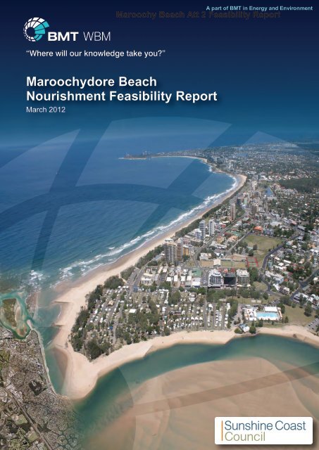
Maroochydore Beach Nourishment Feasibility Report
Maroochydore Beach Nourishment Feasibility Report
Maroochydore Beach Nourishment Feasibility Report

Create successful ePaper yourself
Turn your PDF publications into a flip-book with our unique Google optimized e-Paper software.
A part of BMT in Energy and Environment<br />
Maroochy <strong>Beach</strong> Att 2 <strong>Feasibility</strong> <strong>Report</strong><br />
<strong>Maroochydore</strong> <strong>Beach</strong><br />
<strong>Nourishment</strong> <strong>Feasibility</strong> <strong>Report</strong><br />
March 2012
Maroochy <strong>Beach</strong> Att 2 <strong>Feasibility</strong> <strong>Report</strong><br />
<strong>Maroochydore</strong> <strong>Beach</strong><br />
<strong>Nourishment</strong> <strong>Feasibility</strong><br />
Prepared For:<br />
Prepared By:<br />
Sunshine Coast Regional Council<br />
BMT WBM Pty Ltd (Member of the BMT group of companies)<br />
Offices<br />
Brisbane<br />
Denver<br />
Mackay<br />
Melbourne<br />
Newcastle<br />
Perth<br />
Sydney<br />
Vancouver<br />
G:\ADMIN\B18779.G.MJA_MAROOCHYNOURISHMENT\R.B18779.001.03.DOC
Maroochy <strong>Beach</strong> Att 2 <strong>Feasibility</strong> <strong>Report</strong><br />
DOCUMENT CONTROL SHEET<br />
BMT WBM Pty Ltd<br />
BMT WBM Pty Ltd<br />
Level 8, 200 Creek Street<br />
Brisbane 4000<br />
Queensland Australia<br />
PO Box 203 Spring Hill 4004<br />
Tel: +61 7 3831 6744<br />
Fax: + 61 7 3832 3627<br />
ABN 54 010 830 421<br />
www.bmtwbm.com.au<br />
Document :<br />
Project Manager :<br />
Client :<br />
R.B18779.001.03.doc<br />
Matthew Barnes<br />
Sunshine Coast Regional Council<br />
Client Contact:<br />
Denis Shaw<br />
Client Reference<br />
PZC00047<br />
Title :<br />
Author :<br />
Synopsis :<br />
<strong>Maroochydore</strong> <strong>Beach</strong> <strong>Nourishment</strong> <strong>Feasibility</strong><br />
Matthew Barnes<br />
This report provides details of a proposed beach nourishment program for<br />
<strong>Maroochydore</strong> <strong>Beach</strong> using material extracted from the lower Maroochy River.<br />
REVISION/CHECKING HISTORY<br />
REVISION<br />
DATE OF ISSUE CHECKED BY ISSUED BY<br />
NUMBER<br />
0 03/02/2012 MJA MPB<br />
1 13/02/2012 MJA MPB<br />
2<br />
3<br />
22/02/2012<br />
27/03/2012<br />
MJA<br />
MJA<br />
MPB<br />
MPB<br />
DISTRIBUTION<br />
DESTINATION<br />
SCRC<br />
BMT WBM File<br />
BMT WBM Library<br />
REVISION<br />
0 1 2 3<br />
PDF<br />
PDF<br />
PDF<br />
PDF<br />
PDF<br />
PDF<br />
PDF<br />
PDF<br />
PDF<br />
PDF<br />
PDF<br />
PDF<br />
G:\ADMIN\B18779.G.MJA_MAROOCHYNOURISHMENT\R.B18779.001.03.DOC
Maroochy <strong>Beach</strong> Att 2 <strong>Feasibility</strong> <strong>Report</strong><br />
EXECUTIVE SUMMARY<br />
I<br />
EXECUTIVE SUMMARY<br />
This report concerns a 1.7km stretch of shoreline between Alexandra Headland and <strong>Maroochydore</strong><br />
Surf Club referred to as ‘<strong>Maroochydore</strong> <strong>Beach</strong>’. Presently the shoreline is in a severely eroded state.<br />
Design storm erosion calculations were performed at 16 locations with the predicted storm erosion<br />
width ranging between 24-62m, depending on the height and volume of material within the dune at<br />
each measured profile location. A number of significant assets with high economic and social value<br />
are located within the immediate design storm erosion zone, including:<br />
<br />
<br />
<br />
<br />
<br />
<br />
Aerodrome Road/Alexandra Parade (State controlled road);<br />
Alex Heads Surf Club and foreshore including skate park (currently protected by a low standard<br />
seawall);<br />
Sea Breeze Caravan Park;<br />
<strong>Maroochydore</strong> Surf Club;<br />
Public space including pedestrian and cycle pathways; and<br />
<strong>Beach</strong> access locations.<br />
The feasibility of nourishing the shoreline with sand sourced from areas outside of the Fish Habitat<br />
Area within the lower Maroochy River is explored in this report. The aim of the proposed nourishment<br />
program is to widen the beach thereby increasing the coastal buffer zone and allowing the shoreline<br />
to respond to naturally occurring erosion events. The proposed works will also improve amenity and<br />
help to restore the economic and social values attributed to <strong>Maroochydore</strong> <strong>Beach</strong>.<br />
Due to the limited volume of sand available from within the lower Maroochy River it is recognised that<br />
this shoreline protection option may not be viable in the long term. The initial proposed sand<br />
extraction and nourishment seeks to access 125,000m 3 of sand from the lower Maroochy River. This<br />
volume is estimated to provide enough material to construct a 20m wide beach berm along<br />
<strong>Maroochydore</strong> <strong>Beach</strong> and allow for some minor nourishment works along the Cotton Tree foreshore.<br />
It is emphasised that constructed sand berms typically reduce in width by two or three times as the<br />
nourishment material is redistributed throughout the nearshore area by coastal processes. The<br />
proposed nourishment works will increase the volume of material within the active beach system and<br />
enhance the natural beach recovery typically observed during the winter months.<br />
Ideally a similar volume of nourishment material could be accessed from the lower Maroochy River in<br />
the following year, subject to the outcomes of environmental and shoreline monitoring programs.<br />
Progressively smaller volumes may be accessed over the enduring years if it can be demonstrated<br />
through monitoring that sand can be sustainably relocated from the lower Maroochy River to<br />
<strong>Maroochydore</strong> <strong>Beach</strong> on an annual basis. If viable, it is estimated that approximately 350,000m 3 of<br />
material added to the active system over a four year period would sufficiently widen beach, thereby<br />
removing significant assets from the immediate design storm erosion zone. This preliminary four year<br />
estimate should be reviewed annually since sand transport into or out of the beach system will vary<br />
from year to year, primarily due to the dependency on storm activity.<br />
The works proposed in this document are recognised as an interim solution to shoreline protection for<br />
<strong>Maroochydore</strong> <strong>Beach</strong>. Considering the high value of assets along this shoreline, the lack of material<br />
G:\ADMIN\B18779.G.MJA_MAROOCHYNOURISHMENT\R.B18779.001.03.DOC
Maroochy <strong>Beach</strong> Att 2 <strong>Feasibility</strong> <strong>Report</strong><br />
EXECUTIVE SUMMARY<br />
II<br />
support a major beach nourishment program and sea level rise projections adopted in the<br />
Queensland Coastal Plan (DERM, 2012), alternative shoreline protection solutions may be necessary<br />
within the 50-year planning period.<br />
G:\ADMIN\B18779.G.MJA_MAROOCHYNOURISHMENT\R.B18779.001.03.DOC
Maroochy <strong>Beach</strong> Att 2 <strong>Feasibility</strong> <strong>Report</strong><br />
CONTENTS<br />
III<br />
CONTENTS<br />
Executive Summary<br />
Contents<br />
List of Figures<br />
List of Tables<br />
Glossary<br />
i<br />
iii<br />
v<br />
vi<br />
vii<br />
1 INTRODUCTION 1-1<br />
1.1 The Study Area 1-1<br />
1.2 <strong>Maroochydore</strong> <strong>Beach</strong> to Alexandra Headland <strong>Beach</strong> Values 1-5<br />
1.2.1 Ecological Values 1-5<br />
1.2.2 Social Values 1-5<br />
1.2.3 Economic Values 1-6<br />
2 DESCRIPTION OF PROPOSED NOURISHMENT WORKS 2-1<br />
2.1 <strong>Maroochydore</strong> <strong>Beach</strong> Coastal Processes 2-1<br />
2.2 Shoreline and Asset Vulnerability 2-2<br />
2.2.1 Storm Erosion Sensitivity 2-5<br />
2.3 <strong>Beach</strong> <strong>Nourishment</strong> Requirements 2-6<br />
2.3.1 <strong>Beach</strong> <strong>Nourishment</strong> Volume Estimates 2-7<br />
3 DESCRIPTION OF THE MAROOCHY ESTUARY SAND RESOURCE 3-1<br />
3.1 Maroochy River Mouth Dynamics 3-1<br />
3.2 Sediment Characteristics and Suitability for <strong>Beach</strong> <strong>Nourishment</strong> 3-1<br />
3.2.1 Material Available for <strong>Beach</strong> <strong>Nourishment</strong> 3-5<br />
4 BENEFIT AND LONGEVITY OF PROPOSED WORKS 4-1<br />
4.1 Benefit of Proposed Works 4-1<br />
4.1.1 Longevity of Proposed Works 4-2<br />
4.2 Predicted Renourishment Interval 4-3<br />
4.3 Shoreline and Bathymetry Monitoring 4-5<br />
4.3.1 <strong>Maroochydore</strong> <strong>Beach</strong> Monitoring 4-5<br />
4.3.2 Lower Maroochy River Monitoring 4-6<br />
4.3.3 Northern <strong>Beach</strong>es Monitoring 4-6<br />
G:\ADMIN\B18779.G.MJA_MAROOCHYNOURISHMENT\R.B18779.001.03.DOC
Maroochy <strong>Beach</strong> Att 2 <strong>Feasibility</strong> <strong>Report</strong><br />
CONTENTS<br />
IV<br />
4.3.4 Physical Data Collection Schedule 4-7<br />
5 PROPOSED SAND EXTRACTION AND NOURISHMENT OPERATIONS 5-1<br />
5.1 Extent of Proposed Sand Extraction 5-1<br />
5.2 Sand Extraction Operations and Footprint 5-1<br />
5.3 Sand Delivery Pipeline 5-2<br />
5.4 <strong>Beach</strong> Profiling 5-4<br />
5.5 Proposed Schedule 5-4<br />
6 ENVIRONMENTAL ASSESSMENTS 6-1<br />
6.1 Flooding and Estuarine Hydrodynamics 6-1<br />
6.2 Estuarine Sediment Transport 6-1<br />
6.3 Coastal Sediment Transport 6-2<br />
6.4 Water Quality 6-2<br />
6.4.1 Environmental Values and Water Quality Objectives 6-2<br />
6.4.2 Impact and Mitigation 6-4<br />
6.5 Aquatic and Terrestrial Ecology 6-4<br />
6.5.1 Regional Ecosystems 6-4<br />
6.5.2 Listed Species 6-5<br />
6.5.2.1 Threatened Species 6-5<br />
6.5.2.2 Migratory Species 6-5<br />
6.5.3 Fish Habitat Areas 6-6<br />
6.5.4 Impact and Mitigation 6-7<br />
6.6 Visual and Recreational Amenity 6-7<br />
6.7 Ambient Noise on Site 6-7<br />
6.7.1 Impact and Mitigation 6-8<br />
6.8 Access and Navigation 6-8<br />
6.9 Native Title 6-9<br />
6.10 Environmental Management Plan 6-9<br />
7 REFERENCES 7-1<br />
G:\ADMIN\B18779.G.MJA_MAROOCHYNOURISHMENT\R.B18779.001.03.DOC
Maroochy <strong>Beach</strong> Att 2 <strong>Feasibility</strong> <strong>Report</strong><br />
LIST OF FIGURES<br />
V<br />
APPENDIX A: UPPER BEACH AND NEARSHORE SURVEY A-1<br />
APPENDIX B: STORM EROSION PROFILES B-1<br />
APPENDIX C: BEACH NOURISHMENT VOLUME ESTIMATES C-1<br />
APPENDIX D: MAROOCHY RIVER MOUTH HISTORICAL PHOTOGRAPHS D-1<br />
APPENDIX E: MAROOCHY RIVER SEDIMENT INVESTIGATION REPORT E-1<br />
APPENDIX F: BEACH NOURISHMENT LONGEVITY ESTIMATE F-1<br />
APPENDIX G: OUTCOMES OF COMMUNITY CONSULTATION G-1<br />
LIST OF FIGURES<br />
Figure 1-1 <strong>Maroochydore</strong> <strong>Beach</strong> <strong>Nourishment</strong> Study Area 1-3<br />
Figure 1-2<br />
Figure 1-3<br />
Exposed <strong>Beach</strong> Fill and Coffee Rock Looking South toward<br />
Alex Heads Surf Club (Photo Courtesy of SCRC) 1-4<br />
Exposed Coffee Rock Looking North toward <strong>Maroochydore</strong><br />
Surf Club (Photo Courtesy of SCRC) 1-4<br />
Figure 2-1 <strong>Beach</strong> Profile Cross-Section Locations Measured December 2010 2-3<br />
Figure 2-2 Example of Predicted Storm Erosion Profile 2-4<br />
Figure 2-3<br />
Figure 2-4<br />
Figure 2-5<br />
Schematic Diagram of Swash Zone and <strong>Beach</strong>face Morphology<br />
(from Hughes and Turner, 1999) 2-6<br />
Severe Erosion Observed between Alex Heads and<br />
<strong>Maroochydore</strong> Surf Clubs (Photo Courtesy of SCRC) 2-7<br />
Measured <strong>Beach</strong> Profile and 10m, 20m and<br />
40m Design Berm Profiles 2-8<br />
Figure 3-1 Resource Investigation Area - Maroochy River (Indicated by SCRC) 3-3<br />
Figure 3-2<br />
Maroochy River Sediment Sample Locations<br />
(from Cardno Bowler, 2011) 3-4<br />
Figure 3-3 Proposed Maroochy River Sand Extraction Area 3-6<br />
Figure 4-1<br />
Decision Tree for Determining the Need and <strong>Feasibility</strong> of<br />
Future Re-<strong>Nourishment</strong> Works 4-4<br />
Figure 4-2 Proposed Shoreline and Bathymetry Monitoring Locations 4-8<br />
Figure 5-1<br />
400mm Cutter Suction Dredge (Photo Courtesy of<br />
Hall Contracting Pty Ltd) 5-2<br />
Figure 5-2 Indicative Sand Delivery Pipeline Route 5-3<br />
G:\ADMIN\B18779.G.MJA_MAROOCHYNOURISHMENT\R.B18779.001.03.DOC
Maroochy <strong>Beach</strong> Att 2 <strong>Feasibility</strong> <strong>Report</strong><br />
LIST OF TABLES<br />
VI<br />
LIST OF TABLES<br />
Table 2-1<br />
Summary of Design Storm Erosion Widths between<br />
Alex Heads and <strong>Maroochydore</strong> Surf Clubs 2-4<br />
Table 2-2 Storm Erosion Sensitivity Parameters 2-5<br />
Table 2-3 Storm Erosion Sensitivity Results 2-5<br />
Table 2-4 Summary of Design Berm Volume Requirements 2-8<br />
Table 3-1 Dredge Depth and Estimated Volume of Material Available 3-5<br />
Table 4-1<br />
Estimated Longevity of Initial <strong>Nourishment</strong> Based on the<br />
Annual Average Incident Wave Climate (refer Appendix F) 4-3<br />
Table 4-2 Idealised <strong>Maroochydore</strong> <strong>Beach</strong> Renourishment Program 4-5<br />
Table 4-3<br />
Lower Maroochy River Bathymetry and Sediment Sample Scheme<br />
(modified from: USACE, 2002) 4-6<br />
Table 4-4 Physical Data Collection/Monitoring Plan 4-7<br />
Table 5-1 Indicative Project Schedule 5-5<br />
Table 6-1 Maroochy River Water Quality Objectives 6-3<br />
G:\ADMIN\B18779.G.MJA_MAROOCHYNOURISHMENT\R.B18779.001.03.DOC
Maroochy <strong>Beach</strong> Att 2 <strong>Feasibility</strong> <strong>Report</strong><br />
GLOSSARY<br />
VII<br />
GLOSSARY<br />
Accretion<br />
Accreted Profile<br />
Barometric Setup<br />
Bathymetry<br />
<strong>Beach</strong><br />
<strong>Beach</strong> Berm<br />
<strong>Beach</strong> Erosion<br />
<strong>Beach</strong> <strong>Nourishment</strong><br />
<strong>Beach</strong> System<br />
Breaking Waves<br />
Buffer Zone<br />
Coastal Amenity<br />
Coastal Area<br />
Coastal Hazard Area<br />
Coastal Structures<br />
The build-up (of the beach) by the action of waterborne or airborne sand,<br />
either solely by the action of the forces of nature or induced by the action of<br />
man, such as by the action of groynes, breakwaters or beach nourishment.<br />
The profile (cross-section) of a sandy beach that develops in the “calm”<br />
periods between major storm events. During such periods, swell waves<br />
move sediment from the offshore bar onto the beach to rebuild the beach<br />
berm.<br />
The increase in mean sea level caused by a drop in barometric pressure.<br />
The measurement of depths of water, also information derived from such<br />
measurements.<br />
The zone of unconsolidated sand that extends landward from the low water<br />
line to the place where there is a marked change in material or<br />
physiographic form, or to the line of permanent vegetation.<br />
That area of shoreline lying between the swash zone and the dune system.<br />
The offshore movement of sand from the sub-aerial beach during storms.<br />
The artificial supply of sand to supplement the total net quantity of sand<br />
within an existing beach system and/or to build up an eroded beach or<br />
dune, with sand from another location.<br />
The zone of active sand movement and exchange, including the dunes,<br />
beach and nearshore profile, which covers the total extent of the continuum<br />
of both longshore and cross-shore sand transport by oceanic and wind<br />
forces associated with the existence of the beach.<br />
As waves increase in height through the shoaling process, the crest of the<br />
wave tends to speed up relative to the rest of the wave. Waves break when<br />
the speed of the crest exceeds the speed of advance of wave as a whole.<br />
Waves can break in three modes: spilling, surging and plunging.<br />
An appropriately managed and unalienated zone of unconsolidated land<br />
between beach and development, within which coastline fluctuations and<br />
hazards can be accommodated in order to minimise damage to the<br />
development.<br />
Those characteristics of the coastal zone, both natural and artificial, that are<br />
valued and utilized to varying degrees by the community, including intrinsic<br />
natural character and physical recreational opportunities.<br />
The land and sea area bordering the shoreline.<br />
Coastal land within erosion prone areas, at risk from storm tide inundation<br />
and/or permanent inundation due to sea level rise.<br />
Those structures on the coastline designed to protect and rebuild the<br />
coastline and/or enhance coastal amenity and use.<br />
G:\ADMIN\B18779.G.MJA_MAROOCHYNOURISHMENT\R.B18779.001.03.DOC
Maroochy <strong>Beach</strong> Att 2 <strong>Feasibility</strong> <strong>Report</strong><br />
GLOSSARY<br />
VIII<br />
Coastline Hazards<br />
Detrimental impacts of coastal processes on the use, capability and amenity<br />
of the coastline. This study identifies seven coastline hazards:<br />
<br />
<br />
<br />
<br />
<br />
<br />
<strong>Beach</strong> erosion<br />
Shoreline recession<br />
Entrance Instability<br />
Sand drift<br />
Coastal inundation by storm surge and Greenhouse sea level rise<br />
Slope instability<br />
Council<br />
DERM<br />
Diffraction<br />
Dunes<br />
Dune Maintenance<br />
Dune Management<br />
Ebb Tide<br />
Erosion Prone Area<br />
Flood Tide<br />
Foredune<br />
Groynes<br />
Groyne Field<br />
HAT<br />
<br />
Stormwater erosion<br />
Sunshine Coast Regional Council<br />
Queensland Department of Environment and Resource Management<br />
The “spreading” of waves into the lee of obstacles such as breakwaters by<br />
the transfer of wave energy along wave crests. Diffracted waves are lower<br />
in height than the incident waves.<br />
Ridges or mounds of loose sand at the back of the beach formed from windblown<br />
sand trapped and stabilised by dune vegetation.<br />
The management technique by which dunes, dune vegetation and dune<br />
protective structures are kept in good “working order”; activities may include<br />
weed/pest/fire control, replanting, fertilising, repair of fences and access<br />
ways, and publicity.<br />
The general term describing all activities associated with the restoration<br />
and/or maintenance of the role and values of beach dune systems; dune<br />
management activities and techniques include planning, dune<br />
reconstruction, revegetation, dune protection, dune maintenance, and<br />
community involvement.<br />
The outflow of coastal waters from bays and estuaries caused by the falling<br />
tide.<br />
The width of the coast that is considered to be vulnerable to coastal erosion<br />
and tidal inundation over a 50 year planning period. Erosion prone areas<br />
are shown on the erosion prone area maps prepared by the <strong>Beach</strong><br />
Protection Authority to accommodate physical coastal processes. Where<br />
reference is made to short term storm erosion this is called the storm<br />
erosion zone.<br />
The inflow of coastal waters into bays and estuaries caused by the rising<br />
tide.<br />
The larger and more mature dune lying between the incipient dune and hind<br />
dune area. Fore dune vegetation is characterised by grasses and shrubs.<br />
Fore dunes provide an essential reserve of sand to meet erosion demand<br />
during storm conditions. During storm events, the fore dune can be eroded<br />
back to produce a pronounced dune scarp.<br />
Low walls built attached and perpendicular to a shoreline to trap longshore<br />
sand transport. Typically, sand build-up on the up drift side of a groyne is<br />
offset by erosion on the down drift side.<br />
A system of regularly spaced groynes along a section of shoreline.<br />
Highest Astronomical Tide. The highest tide that can occur from the<br />
influence of celestial bodies – this excludes local effects such as<br />
atmospheric pressure and wind effects.<br />
G:\ADMIN\B18779.G.MJA_MAROOCHYNOURISHMENT\R.B18779.001.03.DOC
Maroochy <strong>Beach</strong> Att 2 <strong>Feasibility</strong> <strong>Report</strong><br />
GLOSSARY<br />
IX<br />
Hind dunes<br />
IDAS<br />
Incipient Dune<br />
Littoral Zone<br />
Sand dunes located to the rear of the Fore dune. Characterised by mature<br />
vegetation including trees and shrubs.<br />
Integrated Development Assessment System under the Queensland<br />
Integrated Planning Act 1997<br />
The most seaward and immature dune of the dune system. Vegetation<br />
characterised by grasses. On an accreting coastline, the incipient dune will<br />
develop into a Fore dune.<br />
Area of the coastline in which sediment movement by wave, current and<br />
wind action is prevalent. The littoral zone extends from the onshore dune<br />
system to the seaward limit of the offshore zone and possibly beyond.<br />
Longshore Currents<br />
Mass Transport<br />
Natural Character<br />
Nearshore Zone<br />
NES<br />
Offshore Bar<br />
Offshore Zone<br />
Onshore/Offshore<br />
Transport<br />
Currents flowing parallel to the shore within the inshore and nearshore<br />
zones. Longshore currents are typically caused by waves approaching the<br />
beach at an angle. The “feeder” currents to rip cells are another example of<br />
longshore currents.<br />
The net shorewards current associated with the movement of waves<br />
through the nearshore and inshore zones. Sediment transport from the<br />
offshore bar by this current is responsible for the rebuilding of storm eroded<br />
beaches during inter-storm periods.<br />
The character of the coastal zone representing the natural pristine qualities<br />
typically of sandy beaches, vegetated dunes and clean ocean waters, of<br />
intrinsic value to the community.<br />
Coastal waters between the offshore bar and the 60m depth contour. Swell<br />
waves in the nearshore zone are unbroken, but their behaviour is influenced<br />
by the presence of the seabed. (This definition is adopted for simplicity in<br />
this document and is based on wave motion considerations rather than<br />
sedimentology).<br />
Matters of National Environmental Significance as defined in the<br />
Commonwealth Environment Protection and Biodiversity Conservation Act<br />
1999<br />
Also known as a longshore bar. Submerged sandbar formed offshore by the<br />
processes of beach erosion and accretion. Typically, swell waves break on<br />
the offshore bar.<br />
Coastal waters to the seaward of the nearshore zone. Swell waves in the<br />
offshore zone are unbroken and their behaviour is not influenced by the<br />
presence of the seabed. (See note to “Nearshore Zone”).<br />
The process whereby sediment is moved onshore and offshore by wave,<br />
current and wind action.<br />
QCP Queensland Coastal Plan (2012)<br />
Radiation Stress<br />
Reflected Wave<br />
Refraction<br />
Excess momentum flux exerted on the mean flow due to the presence of<br />
waves.<br />
That part of an incident wave that is returned seaward when a wave<br />
impinges on a steep beach, barrier, or other reflecting surface.<br />
The tendency of wave crests to become parallel to bottom contours as<br />
waves move into shallower waters. This effect is caused by the shoaling<br />
processes which slow down waves in shallower waters.<br />
G:\ADMIN\B18779.G.MJA_MAROOCHYNOURISHMENT\R.B18779.001.03.DOC
Maroochy <strong>Beach</strong> Att 2 <strong>Feasibility</strong> <strong>Report</strong><br />
GLOSSARY<br />
X<br />
Revetment<br />
Sand Dunes<br />
Scarp<br />
Seawalls<br />
Sea Waves<br />
Sediment Budget<br />
Sediment Sink<br />
Sediment Source<br />
SEMP<br />
Shoaling<br />
Shoreline Recession<br />
Shadow Area<br />
Significant Wave<br />
Height<br />
Storm Profile<br />
Storm Surge<br />
Storm Bar<br />
Surf Zone<br />
Similar to a seawall but in a river (Refer to Seawall for definition).<br />
Mounds or hills of sand lying to landward of the beach berm. Sand dunes<br />
are usually classified as an incipient dune, a fore dune or hind dunes.<br />
During storm conditions, incipient and fore dunes may be severely eroded<br />
by waves. During the intervals between storms, dunes are rebuilt by wave<br />
and wind effects. Dune vegetation is essential to prevent sand drift and<br />
associated problems.<br />
Also known as the Dune scarp and back beach erosion escarpment. The<br />
landward limit of erosion in the dune system caused by storm waves. At the<br />
end of a storm the scarp may be nearly vertical; as it dries out, the scarp<br />
slumps to a typical slope of 1V:1.5H.<br />
Walls build parallel to the shoreline separating land and water areas,<br />
designed primarily to limit shoreline recession and other damage due to<br />
wave action.<br />
Waves in coastal waters resulting from the interaction of different wave<br />
trains and locally generated wind waves. Typically, sea waves are of short<br />
wavelength and of disordered appearance.<br />
An accounting of the rate of sediment supply from all sources (credits) and<br />
the rate of sediment loss to all sinks (debits) from an area of coastline to<br />
obtain the net sediment supply.<br />
A mode of sediment loss from the coastline, including longshore transport<br />
out of area, dredging, deposition in estuaries, windblown sand, etc.<br />
A mode of sediment supply to the coastline, including longshore transport<br />
into the area, beach nourishment, fluvial sediments from rivers, etc.<br />
Shoreline Erosion Management Plan<br />
The influence of the seabed on wave behaviour. Such effects only become<br />
significant in water depths of 60m or less. Manifested as a reduction in<br />
wave speed, a shortening in wave length and an increase in wave height.<br />
A net long-term landward movement of the shoreline caused by a net loss<br />
in the sediment budget.<br />
Areas behind breakwaters and headlands in the lee of incident waves.<br />
Waves move into shadow areas by the process of diffraction.<br />
The average height of the highest one third of waves recorded in a given<br />
monitoring period. Also referred to as H 1/3 or H s .<br />
The profile (cross-section) of a sandy beach that develops in response to<br />
storm wave attack. Considerable volumes of sediment from the beach<br />
berm, the incipient dune and the Fore dune can be eroded and deposited<br />
offshore. The landward limit of the storm profile is typically defined by a<br />
back beach erosion escarpment (dune scarp).<br />
The increase in coastal water level caused by the effects of storms. Storm<br />
surge consists of two components: the increase in water level caused by the<br />
reduction in barometric pressure (barometric set-up) and the increase in<br />
water level caused by the action of wind blowing over the sea surface (wind<br />
set-up).<br />
An offshore bar formed by sediments eroded from the beach during storm<br />
conditions.<br />
Coastal waters between the outer breaker zone and the swash zone<br />
characterised by broken swell waves moving shorewards in the form of<br />
bores.<br />
G:\ADMIN\B18779.G.MJA_MAROOCHYNOURISHMENT\R.B18779.001.03.DOC
Maroochy <strong>Beach</strong> Att 2 <strong>Feasibility</strong> <strong>Report</strong><br />
GLOSSARY<br />
XI<br />
Swash Zone<br />
Swell Waves<br />
Tidal Prism<br />
Tides<br />
Tombolo<br />
Training Walls<br />
Vegetation<br />
Degradation<br />
Wave Height<br />
Wave Hindcasting<br />
Wave Length<br />
Wave Period<br />
Wave Runup<br />
Wave Set-up<br />
Wave Train<br />
Wind Set-up<br />
Wind Waves<br />
Windborne Sediment<br />
Transport<br />
That area of the shoreline characterised by wave uprush and retreat.<br />
Wind waves remote from the area of generation (fetch) having a uniform<br />
and orderly appearance characterised by regularly spaced wave crests.<br />
The volume of water stored in an estuary or tidal lake between the high and<br />
low tide levels; the volume of water that moves into and out of the estuary<br />
over a tidal cycle.<br />
The regular rise and fall of sea level in response to the gravitational<br />
attraction of the sun, moon and planets. Tides along the SEQ coastline are<br />
semi-diurnal in nature, i.e. they have a period of about 12.5 hours.<br />
A seaward progression of the shoreline behind an offshore island due to<br />
reduced longshore transport as a result of wave diffraction around the<br />
island.<br />
Walls constructed at the entrances of estuaries and rivers to improve<br />
navigability.<br />
The process by which coastal vegetation is “degraded” or damaged; this<br />
reduces the effectiveness of vegetation in protecting coastal landforms and<br />
increases the potential for erosion of underlying soil materials by wind<br />
(resulting in sand drift), water or waves.<br />
The vertical distance between a wave trough and a wave crest.<br />
The estimation of wave climate from meteorological data (barometric<br />
pressure, wind) as opposed to wave measurement.<br />
The distance between consecutive wave crests or wave troughs.<br />
The time taken for consecutive wave crests or wave troughs to pass a given<br />
point.<br />
The vertical distance above mean water level reached by the uprush of<br />
water from waves across a beach or up a structure.<br />
The increase in water level within the surf zone above mean still water level<br />
caused by the breaking action of waves.<br />
A series of waves originating from the same fetch with more or less the<br />
same wave characteristics.<br />
The increase in mean sea level caused by the “piling up” of water on the<br />
coastline by the wind.<br />
The waves initially formed by the action of wind blowing over the sea<br />
surface. Wind waves are characterised by a range of heights, periods and<br />
wavelengths. As they leave the area of generation (fetch), wind waves<br />
develop a more ordered and uniform appearance and are referred to as<br />
swell or swell waves.<br />
Sand transport by the wind. Sand can be moved by the processes of<br />
suspension (fine grains incorporated in the atmosphere), saltation (medium<br />
grains “hopping” along the surface) and traction (large grains rolled along<br />
the surface).<br />
G:\ADMIN\B18779.G.MJA_MAROOCHYNOURISHMENT\R.B18779.001.03.DOC
Maroochy <strong>Beach</strong> Att 2 <strong>Feasibility</strong> <strong>Report</strong><br />
INTRODUCTION 1-1<br />
1 INTRODUCTION<br />
This report considers the feasibility of nourishing <strong>Maroochydore</strong> <strong>Beach</strong> using sand extracted from the<br />
lower Maroochy River. The objective of the works is to widen the beach and thereby remove<br />
significant assets from the immediate design storm erosion zone. The proposed works will allow the<br />
shoreline to respond to natural erosion events and ensure the economic and social values of<br />
<strong>Maroochydore</strong> <strong>Beach</strong> are maintained. The report includes the following:<br />
<br />
<br />
<br />
<br />
<br />
<br />
<br />
<br />
Shoreline and asset vulnerability assessment (design storm erosion calculations);<br />
<strong>Beach</strong> nourishment volume estimates;<br />
Maroochy River sand reserve volume estimate;<br />
Longevity of the proposed works assessment;<br />
Predicted re-nourishment intervals;<br />
Shoreline and bathymetric monitoring recommendations;<br />
Summary of the proposed sand extraction and nourishment operations; and<br />
Environmental assessments.<br />
The report focuses on the feasibility of initial nourishment works that seeks to deliver up to 125,000m 3<br />
of material to <strong>Maroochydore</strong> <strong>Beach</strong>. Additional nourishment material may be accessed from the lower<br />
Maroochy River in the following years, subject to the outcomes of environmental and shoreline<br />
monitoring programs.<br />
Outcomes from a community consultation program, undertaken in conjunction with the feasibility<br />
studies described in this report, are summarised in Appendix G.<br />
1.1 The Study Area<br />
This report concerns a 1.7km stretch of shoreline between Alexandra Headland and <strong>Maroochydore</strong><br />
Surf Club, Sunshine Coast, Queensland. Figure 1-1 shows a shoreline characterised by a sandy<br />
beach with a relatively narrow dune and foreshore buffer that includes dune scrub vegetation and<br />
casuarinas. Between the Alexandra Heads Skate Park and Seabreeze Caravan Park the width<br />
between Alexandra Parade and the toe of the frontal dune (defined by DERM using 2009 aerial<br />
photography) ranges between 20-30m. North of the Seabreeze Caravan Park the dune and<br />
vegetation buffer gradually widens and is approximately 50m prior to reaching the <strong>Maroochydore</strong> Surf<br />
Club car park. The foreshore area is predominantly open space including pedestrian and cycle<br />
pathways and multiple beach access locations.<br />
<strong>Beach</strong> profile cross-sections were measured in late 2010 within the study area (locations indicated in<br />
Figure 1-1: refer Appendix A for survey details). The profiles indicate the height of the main dune is<br />
typically less than 6mAHD and the elevation of the foreshore area (between the road and dune) is<br />
approximately 4mAHD. The slope of the upper beach profile is approximately 1 in 20 (between an<br />
elevation of 2mAHD and -2mAHD).<br />
Exposed coffee rock is often visible in the nearshore area which may be indicative of a receding<br />
shoreline on a geological timescale (e.g. Jones, 1992 and Willmott, 2007). Recent storm events<br />
G:\ADMIN\B18779.G.MJA_MAROOCHYNOURISHMENT\R.B18779.001.03.DOC
Maroochy <strong>Beach</strong> Att 2 <strong>Feasibility</strong> <strong>Report</strong><br />
INTRODUCTION 1-2<br />
during the 2009, 2010 and 2011 summer periods have caused the beach to lower and much of the<br />
dune buffer has eroded. The erosion has also damaged beach access structures and exposed<br />
imported dune fill material (shown in Figure 1-2 and Figure 1-3), significantly impacting the ‘values’ or<br />
‘desirable features’ of the area (refer Section 1.2). The fill material is likely to provide some stability to<br />
the shoreline however is not considered a suitable long-term shoreline protection measure.<br />
When the shoreline is in an eroded state significant assets with high economic and social value have<br />
little protection to subsequent storm events. The threat to infrastructure, in particular Alexandra<br />
Parade, is greater within the southern section of the study area. The threat is relatively lower to the<br />
north of Seabreeze Caravan Park due to a wider dune and vegetation buffer.<br />
Considering the high value of assets along this shoreline, and the lack of material to support major<br />
beach nourishment works, the long term recommendation for this shoreline is a rock seawall<br />
(revetment type structure) to protect the adjacent assets (BMT WBM, 2011a). The seawall would be<br />
located as far landward as possible and it is anticipated that the structure would be complemented<br />
with a beach and dune nourishment scheme (if viable and as required) to conceal the structure.<br />
Interim shoreline protection measures have been previously considered for the shoreline between<br />
Alexandra Headland and <strong>Maroochydore</strong> (BMT WBM, 2011a), including minor beach nourishment, the<br />
enhancement of existing or the addition of new groynes and/or geofabric sand containers to improve<br />
beach amenity and protect locally eroded sections of shoreline. This report explores the feasibility of<br />
one such option and considers the installation a sand renourishment pipeline, with sand sourced from<br />
areas outside of the Fish Habitat Area within the Maroochy River mouth. Due to the limited volume<br />
sand available from this source it is recognised that this shoreline protection option may not be viable<br />
in the long term.<br />
G:\ADMIN\B18779.G.MJA_MAROOCHYNOURISHMENT\R.B18779.001.03.DOC
Maroochy <strong>Beach</strong> Att 2 <strong>Feasibility</strong> <strong>Report</strong>
Maroochy <strong>Beach</strong> Att 2 <strong>Feasibility</strong> <strong>Report</strong><br />
INTRODUCTION 1-4<br />
Figure 1-2<br />
Exposed <strong>Beach</strong> Fill and Coffee Rock Looking South toward Alex Heads Surf Club<br />
(Photo Courtesy of SCRC)<br />
Figure 1-3<br />
Exposed Coffee Rock Looking North toward <strong>Maroochydore</strong> Surf Club<br />
(Photo Courtesy of SCRC)<br />
G:\ADMIN\B18779.G.MJA_MAROOCHYNOURISHMENT\R.B18779.001.03.DOC
Maroochy <strong>Beach</strong> Att 2 <strong>Feasibility</strong> <strong>Report</strong><br />
INTRODUCTION 1-5<br />
1.2 <strong>Maroochydore</strong> <strong>Beach</strong> to Alexandra Headland <strong>Beach</strong><br />
Values<br />
The Sunshine Coast Waterways and Coastal Management Strategy 2011-2021 (the Strategy)<br />
outlines the values, or desirable features, of the Sunshine Coast’s coastal foreshores and waterways,<br />
as identified by Council and confirmed through an extensive community consultation program. This<br />
section summarises those ecological, social and economic values relevant to the coastal foreshore<br />
between Alexandra Headland and the Maroochy River mouth (the Study Area).<br />
1.2.1 Ecological Values<br />
Coastal foreshores of the Sunshine Coast contain important coastal ecosystems including coastal<br />
dunes and beaches, wetlands, mangroves and seagrass, rocky headlands and coastal lagoons.<br />
These systems also support unique species and habitat.<br />
Significant habitats within the Study Area include shallow reefs which are known to support a high<br />
diversity of corals, molluscs and fish. Significant species identified in the Strategy include turtles and<br />
migratory birds. The Loggerhead turtle (Caretta caretta) is listed as endangered under both State and<br />
Australian legislation, and a small but significant proportion of the Queensland mainland’s southern<br />
breeding population of this species is supported within the Sunshine Coast with nesting known to<br />
occur sporadically. Protected migratory birds also occur along the length of the Sunshine Coast, and<br />
are most commonly found around the river mouths, beaches and dunes.<br />
1.2.2 Social Values<br />
The major social values of the Study Area are cultural heritage, recreation and open space and<br />
coastal protection.<br />
The Strategy highlights the need to recognise, protect and conserve indigenous and European<br />
culture values associated with coastal foreshores and to factor these into all decisions affecting the<br />
planning and management of the coastline.<br />
A modern attachment to the importance of coastal features has also developed, with strong links<br />
tying the community to certain coastal features and ecosystems. These ties are often portrayed<br />
through peoples’ choices in recreation and the involvement of community groups in environmental<br />
planning and management.<br />
The open space of the coasts, beaches and conservation areas are easily accessed and provide<br />
residents and tourists with recreational opportunities. Key activities that are undertaken within the<br />
Study Area include socialising, relaxation and recreational activities including, kite surfing, surfing,<br />
ocean kayaking, fishing, swimming, snorkelling, walking, picnicking and riding. Combined with the<br />
coastal amenity and climate of the Sunshine Coast, these aspects create the lifestyle and<br />
opportunities that attract residents and visitors to the area.<br />
The Strategy also identifies the protection value that coastal foreshores provide to the adjacent built<br />
environment.<br />
G:\ADMIN\B18779.G.MJA_MAROOCHYNOURISHMENT\R.B18779.001.03.DOC
Maroochy <strong>Beach</strong> Att 2 <strong>Feasibility</strong> <strong>Report</strong><br />
INTRODUCTION 1-6<br />
1.2.3 Economic Values<br />
In terms of profile and employment, tourism is the largest industry on the Sunshine Coast, attracting<br />
millions of visitors each year (for example, 3 million visitors in 2009). A significant proportion of these<br />
are domestic visitors, the majority being visitors from within South East Queensland. With the major<br />
attractions for visitors being related to the coasts and waterways, the effective management of these<br />
areas is imperative to continued growth of the tourism industry.<br />
G:\ADMIN\B18779.G.MJA_MAROOCHYNOURISHMENT\R.B18779.001.03.DOC
Maroochy <strong>Beach</strong> Att 2 <strong>Feasibility</strong> <strong>Report</strong><br />
DESCRIPTION OF PROPOSED NOURISHMENT WORKS 2-1<br />
2 DESCRIPTION OF PROPOSED NOURISHMENT WORKS<br />
2.1 <strong>Maroochydore</strong> <strong>Beach</strong> Coastal Processes<br />
The shoreline between the Alex Heads and <strong>Maroochydore</strong> Surf Clubs (<strong>Maroochydore</strong> <strong>Beach</strong>) is<br />
morphologically dynamic and fluctuations in shoreline position are the result of the prevailing coastal<br />
processes.<br />
The wave climate at <strong>Maroochydore</strong> <strong>Beach</strong> is a combination of ocean swell and locally windgenerated<br />
‘seas’. The swell waves are of long period (typically 7-12 seconds) and propagate to the<br />
shoreline from the deep ocean. Waves experience significant modification by refraction, bed friction<br />
and shoaling. Wind generated sea waves are of relatively very short period (generally less than 4<br />
seconds) and are not substantially affected by the offshore bathymetry prior to breaking nearshore.<br />
The waves have four key effects on sand transport, namely:<br />
<br />
<br />
<br />
<br />
Waves break and generate so-called radiation stresses, particularly within the wave breaker<br />
zone where wave-driven longshore currents may result.<br />
The wave orbital motion impacts on the seabed causing bed shear stresses that mobilise and<br />
put into suspension the seabed sand.<br />
Wave asymmetry in shallower water causes a significant differential in the forcing on the bed<br />
sediments, stronger towards the shoreline in the forward direction of wave travel leading to an<br />
onshore mass transport of sand.<br />
Waves cause a bottom return current in the surf zone, strongest during storms when they<br />
typically dominate over the mass transport and move sand offshore.<br />
Currents provide the primary mechanism for the transport of the sand that has been mobilised and<br />
put into suspension by the wave/current action. The currents also impose a bed shear stress that<br />
may mobilise the seabed sand. The total bed shear stress results from a complex, non-linear<br />
interaction between waves and currents. During prevailing, non-storm conditions the longshore<br />
current generated by waves breaking at an angle to the shoreline is the dominant sediment transport<br />
mechanism at <strong>Maroochydore</strong> <strong>Beach</strong>. The longshore sand transport is distributed across the surf zone<br />
and typically peaks near the wave break point where the wave height, longshore current and bed<br />
shear are greatest.<br />
Where there are differentials in the rates of longshore transport (that is, the difference in the volume<br />
of material transported into and out of the beach unit) the beach will erode or accrete in response.<br />
Coastal processes studies undertaken as part of the Sunshine Coast SEMP (BMT WBM, 2011b)<br />
calculated relatively low net longshore transport rates (annual average less than 10,000m 3 /yr) toward<br />
the north at <strong>Maroochydore</strong> <strong>Beach</strong>. Very low longshore transport differentials indicated that no<br />
significant long term shoreline recession could be attributed to the contemporary longshore<br />
processes. However, because longshore and cross shore transport coexist, progressive net sand<br />
losses due to a longshore transport differential may not manifest as erosion of the upper beach until<br />
storm (cross shore) erosion occurs, and less sand is subsequently returned to the beach/dune than<br />
was previously there.<br />
G:\ADMIN\B18779.G.MJA_MAROOCHYNOURISHMENT\R.B18779.001.03.DOC
Maroochy <strong>Beach</strong> Att 2 <strong>Feasibility</strong> <strong>Report</strong><br />
DESCRIPTION OF PROPOSED NOURISHMENT WORKS 2-2<br />
Historically the sandy beach between the Alex Heads and <strong>Maroochydore</strong> Surf Clubs has been<br />
observed to naturally erode and accrete in response to the prevailing coastal processes. At the time<br />
of writing (March 2012), the beach is in an eroded state with vast areas of exposed indurated sand<br />
(coffee rock) and the dune/foreshore buffer reduced to approximately 20m at some locations<br />
(measured landward from the toe of the frontal dune). At present the <strong>Maroochydore</strong> shoreline values<br />
and the adjacent assets that rely on erosion protection offered by the foreshore are vulnerable to<br />
subsequent erosion events.<br />
2.2 Shoreline and Asset Vulnerability<br />
Coastal processes studies undertaken as part of the Sunshine Coast SEMP (BMT WBM 2011b)<br />
calculated a 50-year planning period design storm erosion width of approximately 50m for the<br />
<strong>Maroochydore</strong> <strong>Beach</strong> unit. Design storm erosion widths were recalculated at 16 locations as part of<br />
the present study, utilising updated beach profile measurements (refer Figure 2-1) and following the<br />
storm profile model of Vellinga (1983). The assessment adopted inputs considered appropriate for a<br />
study area, including:<br />
<br />
<br />
<br />
<br />
16 beach cross-sectional profile measurements obtained in December 2010 (odd numbered<br />
cross-sections indicated in Figure 2-1) and sediment characteristics;<br />
50 year ARI wave conditions (obtained from BMT WBM 2011b);<br />
100 year ARI storm surge conditions (obtained from Connell Wager, 2005); and<br />
Contribution of wave setup to the design water level (assumed to be 12.5% of the design wave<br />
height).<br />
Figure 2-2 provides an example of the predicted storm erosion profile at a given location within the<br />
study area. Table 2-4 summarises the predicted storm erosion volume and width at the 16 measured<br />
profile locations. The calculations assume that the upper beach profile and dune system consist of<br />
sand only and therefore the estimates are likely to be conservative in areas where coffee rock or<br />
other less erosive materials exist. Cross-sectional figures showing the predicted storm erosion profile<br />
for each section are provided in Appendix B.<br />
G:\ADMIN\B18779.G.MJA_MAROOCHYNOURISHMENT\R.B18779.001.03.DOC
Maroochy <strong>Beach</strong> Att 2 <strong>Feasibility</strong> <strong>Report</strong>
Maroochy <strong>Beach</strong> Att 2 <strong>Feasibility</strong> <strong>Report</strong><br />
DESCRIPTION OF PROPOSED NOURISHMENT WORKS 2-4<br />
10<br />
8<br />
6<br />
Vellinga Storm <strong>Beach</strong> Profile<br />
Surveyed <strong>Beach</strong> Profile<br />
100 year ARI Storm Surge Level<br />
4<br />
Elevation (mAHD).<br />
2<br />
0<br />
-2<br />
-4<br />
-6<br />
-8<br />
-10<br />
-100 -50 0 50 100 150 200 250 300 350 400 450 500<br />
Distance (m)<br />
Figure 2-2<br />
Example of Predicted Storm Erosion Profile<br />
Table 2-1<br />
Summary of Design Storm Erosion Widths between Alex Heads and<br />
<strong>Maroochydore</strong> Surf Clubs<br />
Section (refer<br />
Design Storm Erosion Design Storm Erosion<br />
Figure 1-1)<br />
Volume (m 3 /m)<br />
Width (m)<br />
1 135 44<br />
3 196 62<br />
5 180 59<br />
7 176 58<br />
9 196 61<br />
11 183 58<br />
13 194 58<br />
15 213 56<br />
17 145 40<br />
19 139 38<br />
21 135 37<br />
23 119 36<br />
25 93 25<br />
27 93 28<br />
29 94 26<br />
31 97 36<br />
Average 149 m 3 /m 45 m<br />
The predicted design storm erosion volume for <strong>Maroochydore</strong> <strong>Beach</strong> ranged between 93-213m 3 per<br />
metre of shoreline. By summing the design storm erosion volumes and multiplying by a standard unit<br />
length of 100m (the approximate distance between each section) the total design storm erosion<br />
volume for <strong>Maroochydore</strong> <strong>Beach</strong> is estimated to be 240,000m 3 . It is noted that the volume of material<br />
eroded during a storm is not necessarily lost from the beach system but rather relocated from the<br />
upper beach to the offshore areas. During extended periods of low energy conditions most of the<br />
material deposited offshore is expected to slowly migrate back onshore.<br />
G:\ADMIN\B18779.G.MJA_MAROOCHYNOURISHMENT\R.B18779.001.03.DOC
Maroochy <strong>Beach</strong> Att 2 <strong>Feasibility</strong> <strong>Report</strong><br />
DESCRIPTION OF PROPOSED NOURISHMENT WORKS 2-5<br />
The predicted storm erosion widths ranged between 24-62m, depending on the height and volume of<br />
material within the dune at each measured profile location, with an average width of 45m. A number<br />
of significant assets with high economic and social value are located within the immediate design<br />
storm erosion zone, including:<br />
<br />
<br />
<br />
<br />
<br />
<br />
Aerodrome Road/Alexandra Parade (State controlled road);<br />
Alex Heads Surf Club and foreshore including skate park (currently protected by a low standard<br />
seawall);<br />
Sea Breeze Caravan Park;<br />
<strong>Maroochydore</strong> Surf Club;<br />
Public space including pedestrian and cycle pathways; and<br />
<strong>Beach</strong> access locations.<br />
Seawalls exist at some locations within the study area. The design standard of these is not known<br />
and it is assumed the existing structures would fail during a design storm event and therefore the<br />
adjacent assets remain vulnerable to erosion.<br />
2.2.1 Storm Erosion Sensitivity<br />
Sensitivity testing of the predicted short term erosion widths and volumes for an additional eight<br />
storms was undertaken. The storms were characterised by different combinations of wave height and<br />
water level parameters that are summarised in Table 2-2.<br />
Table 2-2<br />
Storm Erosion Sensitivity Parameters<br />
ARI<br />
Significant Wave Height (m)<br />
(BMT WBM, 2011b)<br />
Surge Water Level (m)<br />
(Connell Wagner, 2005)<br />
20 5.60 1.55<br />
50 5.97 1.60<br />
100 6.25 1.63<br />
Storm erosion sensitivity results are summarised in Table 2-3 and shows the predicted erosion<br />
volume ranging between approximately 200,000m 3 and 265,000m 3 for the different storm parameter<br />
combinations (bold indicates the design storm adopted assessment described in Section 2.2). These<br />
erosion estimates are discussed in the context of the nourishment volume being proposed for<br />
<strong>Maroochydore</strong> <strong>Beach</strong> in Section 4.<br />
Table 2-3<br />
Storm Erosion Sensitivity Results<br />
Wave Height ARI Surge Level ARI Mean Erosion Width (m) Erosion Volume (m 3 )<br />
20 20 35 198153<br />
20 50 38 202916<br />
20 100 39 205770<br />
50 20 43 231895<br />
50 50 44 236331<br />
50 100 45 238953<br />
100 20 47 258264<br />
100 50 49 262662<br />
100 100 50 265244<br />
G:\ADMIN\B18779.G.MJA_MAROOCHYNOURISHMENT\R.B18779.001.03.DOC
Maroochy <strong>Beach</strong> Att 2 <strong>Feasibility</strong> <strong>Report</strong><br />
DESCRIPTION OF PROPOSED NOURISHMENT WORKS 2-6<br />
2.3 <strong>Beach</strong> <strong>Nourishment</strong> Requirements<br />
The beach nourishment project proposed for the shoreline between Alex Heads and Maroochy Surf<br />
Clubs involves the direct placement of sand on the beach to create a wider sand buffer for dissipating<br />
wave energy. For this project, the amount of additional width will be determined based on the desired<br />
level of storm protection, the availability of material from the Maroochy River mouth and the target<br />
renourishment interval.<br />
On sandy shorelines berms are formed naturally due to landward sediment transport driven by<br />
nearshore wave and swash action. The berm is typically located between the swash zone and dune<br />
system and develops under normal, prevailing wave and tidal conditions. The berm represents the<br />
recreationally valuable or ‘useable’ part of the beach and is illustrated in Figure 2-3. On wide<br />
beaches, several berms may be noticeable at slightly higher elevations on the beach and are typically<br />
visible as remnant scarps left behind following an erosion event. The elevated berms are associated<br />
with storm events when the beach is exposed to higher wave energy and water levels than normal.<br />
Figure 2-3<br />
Schematic Diagram of Swash Zone and <strong>Beach</strong>face Morphology<br />
(from Hughes and Turner, 1999)<br />
<strong>Beach</strong>es in a severely eroded condition might have little or no berm, a condition recently observed<br />
within the study area (refer Figure 2-4). A beach without a berm has low social value and a reduced<br />
capacity to dissipate wave energy, therefore providing little storm protection to adjacent assets.<br />
Enhancing and widening the beach berm within the study area, in order to improve the level of storm<br />
protection, is the primary objective of the proposed sand extraction and beach nourishment project.<br />
G:\ADMIN\B18779.G.MJA_MAROOCHYNOURISHMENT\R.B18779.001.03.DOC
Maroochy <strong>Beach</strong> Att 2 <strong>Feasibility</strong> <strong>Report</strong><br />
DESCRIPTION OF PROPOSED NOURISHMENT WORKS 2-7<br />
Figure 2-4<br />
Severe Erosion Observed between Alex Heads and <strong>Maroochydore</strong> Surf Clubs<br />
(Photo Courtesy of SCRC)<br />
2.3.1 <strong>Beach</strong> <strong>Nourishment</strong> Volume Estimates<br />
Nearshore berm creation and widening of a beach is intended to mimic a shoreline’s natural defence<br />
to storm-driven erosion. The width and elevation of the constructed berm are important design<br />
considerations and are generally dictated by practical and economic factors.<br />
A design berm is typically constructed at an elevation close to the natural berm elevation using<br />
standard earth-moving equipment that distributes the beach nourishment material from an initial<br />
discharge or placement location. Following this approach the constructed beach berm is typically two<br />
or three times wider than the ‘target design’ (USACE, 2002). Over time the material that forms the<br />
initial, overbuilt berm will be redistributed seaward by coastal processes and subsequently the target<br />
berm adjusts to a more landward position. This process will commence during operations (i.e. the<br />
instant the material is placed on the beach) and will be most evident following a storm event.<br />
The required volume to widen the beach between Alex Heads and <strong>Maroochydore</strong> Surf Clubs has<br />
been estimated for 10m, 20m and 40m constructed berm design profiles. It is noted that the<br />
constructed berm design profiles have been idealised for the purpose estimating nourishment<br />
volumes and are not design specifications. The estimates are based on the following:<br />
<br />
<br />
<br />
16 beach profile cross-section measurements obtained in December 2010 (odd numbered crosssections<br />
in Figure 2-1);<br />
2mAHD constructed berm elevation (the approximate elevation where the natural berm would<br />
form); and<br />
1 in 20 constructed berm profile slope (the approximate slope of the natural upper beach profile).<br />
G:\ADMIN\B18779.G.MJA_MAROOCHYNOURISHMENT\R.B18779.001.03.DOC
Maroochy <strong>Beach</strong> Att 2 <strong>Feasibility</strong> <strong>Report</strong><br />
DESCRIPTION OF PROPOSED NOURISHMENT WORKS 2-8<br />
For the 16 profile locations the cross-sectional area between the measured profile and each design<br />
profile was calculated. The cross-sectional areas were multiplied by a standard unit length of 100m,<br />
the approximate distance between the neighbouring odd numbered profiles (refer Figure 1-1), to<br />
obtain an estimate of the required nourishment volume. Figure 2-5 provides an example of the<br />
measured beach profile and each constructed berm profile at a given location. Table 2-4 summarises<br />
the calculated cross-sectional area and design volume for each constructed berm width at the 16<br />
beach profile locations. Cross-sectional figures for each section are provided in Appendix C.<br />
8<br />
6<br />
Elevation (mAHD)<br />
4<br />
2<br />
0<br />
‐50 0 50 100 150 200<br />
‐2<br />
‐4<br />
Distance (m)<br />
<strong>Beach</strong> Profile 10m 20m 40m<br />
Figure 2-5<br />
Measured <strong>Beach</strong> Profile and 10m, 20m and 40m Design Berm Profiles<br />
Table 2-4<br />
Summary of Design Berm Volume Requirements<br />
Design cross-sectional area (m 2 ) Design volume per unit length (m 3 )<br />
Section 10m berm 20m berm 40m berm 10m berm 20m berm 40m berm<br />
1 38 65 143 3800 6500 14300<br />
3 65 109 185 6500 10900 18500<br />
5 57 84 148 5700 8400 14800<br />
7 55 85 149 5500 8500 14900<br />
9 55 97 190 5500 9700 19000<br />
11 57 87 156 5700 8700 15600<br />
13 47 77 150 4700 7700 15000<br />
15 57 95 187 5700 9500 18700<br />
17 44 74 143 4400 7400 14300<br />
19 45 75 146 4500 7500 14600<br />
21 47 77 147 4700 7700 14700<br />
23 50 85 148 5000 8500 14800<br />
25 39 66 127 3900 6600 12700<br />
27 30 54 109 3000 5400 10900<br />
29 29 56 119 2900 5600 11900<br />
31 33 60 149 3300 6000 14900<br />
Total design volume requirement (m 3 ) 74800 124600 239600<br />
G:\ADMIN\B18779.G.MJA_MAROOCHYNOURISHMENT\R.B18779.001.03.DOC
Maroochy <strong>Beach</strong> Att 2 <strong>Feasibility</strong> <strong>Report</strong><br />
DESCRIPTION OF PROPOSED NOURISHMENT WORKS 2-9<br />
Total design volume estimates provided in Table 2-4 suggest a 10m, 20m and 40m wide constructed<br />
berm at an elevation of 2mAHD and a slope of 1 in 20 would require approximately 75,000m 3 ,<br />
125,000m 3 and 240,000m 3 of nourishment material respectively. As noted above, over time the<br />
constructed berm width may be reduced by two or three times as the nourishment material is<br />
redistributed throughout the nearshore area by coastal processes. Furthermore, it is noted that the<br />
estimates provided in Table 2-4 are based on beach profile measurements obtained in December<br />
2010. Recent erosion events during December 2011 and January 2012 appear to have lowered the<br />
beach beyond the level measured in late 2010 and therefore a greater volume of material may be<br />
required to achieve the desired constructed berm width.<br />
Many beach nourishment projects have been incorrectly judged a failure when the constructed berm<br />
adjusts landward during the following storm season. Generally the nourishment material is not lost<br />
from the beach system but rather redistributed throughout the nearshore zone, most of which will<br />
return to the beach during extended periods of low wave energy conditions (typically experienced<br />
during the winter months at <strong>Maroochydore</strong> <strong>Beach</strong>). The Coastal Engineering Manual (USACE, 2002)<br />
highlights the need for community education programs prior to undertaking beach nourishment works,<br />
particularly concerning the expected reworking of the nourishment material by the prevailing coastal<br />
processes.<br />
G:\ADMIN\B18779.G.MJA_MAROOCHYNOURISHMENT\R.B18779.001.03.DOC
Maroochy <strong>Beach</strong> Att 2 <strong>Feasibility</strong> <strong>Report</strong><br />
DESCRIPTION OF THE MAROOCHY ESTUARY SAND RESOURCE 3-1<br />
3 DESCRIPTION OF THE MAROOCHY ESTUARY SAND RESOURCE<br />
3.1 Maroochy River Mouth Dynamics<br />
Historically, the Maroochy River mouth has been very mobile with the entrance being located both to<br />
the north and the south of Pincushion Island. During the early 1990s, the southern channel became<br />
very dominant and erosive pressure on the river bank near the Cotton Tree Caravan Park resulted in<br />
the construction of two geotextile groynes in 1995.<br />
Continued erosive pressure resulted in a breakthrough of the entrance south of Pincushion Island in<br />
1999, and the subsequent threat to the Cotton Tree Caravan Park from shoreline recession resulted<br />
in the construction of the southern geotextile groyne and some geotextile seawall sections in 2001.<br />
Three additional geotextile groynes and seawalls were subsequently constructed in 2003. The<br />
intention of these groynes and seawalls was to protect the Caravan Park whilst maintaining some<br />
amenity on the beaches between the groynes.<br />
Currently the lower estuary, downstream of Channel and Goat Islands, contains a significant amount<br />
of sand that was eroded from the frontal dunes and beach that were once connected to Pincushion<br />
Island. In a similar cycle in the 1960-1970’s, sand from the same location closed off the southern<br />
entrance of the Maroochy River forcing all flow through the northern channel and eroded the inside of<br />
the northern spit to such an extent that it caused the channel to eventually breakthrough just south of<br />
Twin Waters. Since this time the mouth has predominantly migrated in a southerly direction and is<br />
presently located between Cotton Tree and Pincushion Island. A collection of historical photos<br />
provided by DERM that show the entrance and lower estuary dynamics between 1958 and 2005 are<br />
included in Appendix D.<br />
3.2 Sediment Characteristics and Suitability for <strong>Beach</strong><br />
<strong>Nourishment</strong><br />
A Maroochy River mouth sediment investigation was completed in December 2011 by Cardno Bowler<br />
Pty Ltd on behalf of the SCRC. The investigation targeted potential areas to extract sand for the<br />
purpose beach nourishment shown by the red hashed areas (Area 1, Area 2, Area 3 and Area 4) in<br />
Figure 3-1. Cardno Bowler (2011) note that Area 2 as defined in Figure 3-1 was indicative only and<br />
due to the existing site conditions the sample locations were relocated. In addition, the logistics of<br />
sample collection (and potentially sand extraction operations) restricted the sample locations within<br />
Area 4, with exposure to wave energy and/or shallow areas cited as complicating factors. Figure 3-2<br />
shows the ultimate sediment sample locations. Samples were laboratory analysed for Particle Size<br />
Distribution (PSD) and Acid Sulfate Soils. The sediment investigation report including borehole logs<br />
and laboratory analysis results are provided in Appendix E. Findings relevant to the present project<br />
are summarised below:<br />
<br />
The target depth for sediment boreholes was 3m below the existing sediment surface level<br />
however some boreholes were terminated slightly above this depth due to the presence of stiff<br />
clays. It is therefore assumed that any sand extraction operation for the purpose of beach<br />
nourishment would not exceed a dredge depth of 3m.<br />
G:\ADMIN\B18779.G.MJA_MAROOCHYNOURISHMENT\R.B18779.001.03.DOC
Maroochy <strong>Beach</strong> Att 2 <strong>Feasibility</strong> <strong>Report</strong><br />
DESCRIPTION OF THE MAROOCHY ESTUARY SAND RESOURCE 3-2<br />
<br />
<br />
<br />
<br />
PSD analysis identified a dominance of non-cohesive sand material and a high proportion of<br />
particles with a diameter between 0.150-0.425mm. This range in grain size is consistent with the<br />
beach material found on shoreline between Alex Heads and <strong>Maroochydore</strong> Surf Clubs where the<br />
median sand grain size diameter (D 50 ) is approximately D 50 = 0.2mm.<br />
The presence of Acid Sulfate Soils was detected however the in the majority of samples the<br />
levels of acidity were very low and in all cases the material intrinsic acid neutralising capacity<br />
exceeds the potential of the material to generate acidity. As such no further treatment of the<br />
materials tested would be required (Cardno Bowler, 2011).<br />
While the dominant particle size is consistent with that typically sort for beach nourishment<br />
purposes, the material quality present at the sample Areas 1, 2 and 3 would not be suitable for<br />
nourishment of the shoreline between Alex Heads and <strong>Maroochydore</strong> Surf Clubs (Cardno<br />
Bowler, 2011). This is based on the variable make up of the material including colour and silt<br />
content. This material may be more suitable for the proposed nourishment of shorelines within<br />
the Maroochy River such as Chambers Island (subject to further investigation).<br />
The sampled sediment within the western section of Area 4 was generally more uniform and<br />
paler in colour. Cardno Bowler (2011) recommends this area is targeted as the primary source of<br />
material for beach nourishment purposes.<br />
G:\ADMIN\B18779.G.MJA_MAROOCHYNOURISHMENT\R.B18779.001.03.DOC
Maroochy <strong>Beach</strong> Att 2 <strong>Feasibility</strong> <strong>Report</strong>
Maroochy <strong>Beach</strong> Att 2 <strong>Feasibility</strong> <strong>Report</strong><br />
DESCRIPTION OF THE MAROOCHY ESTUARY SAND RESOURCE 3-4<br />
Figure 3-2 Maroochy River Sediment Sample Locations (from Cardno Bowler, 2011)<br />
G:\ADMIN\B18779.G.MJA_MAROOCHYNOURISHMENT\R.B18779.001.03.DOC
Maroochy <strong>Beach</strong> Att 2 <strong>Feasibility</strong> <strong>Report</strong><br />
DESCRIPTION OF THE MAROOCHY ESTUARY SAND RESOURCE 3-5<br />
3.2.1 Material Available for <strong>Beach</strong> <strong>Nourishment</strong><br />
The material available from within the Maroochy River mouth suitable for nourishment of the<br />
shoreline between Alex Heads and <strong>Maroochydore</strong> Surf Clubs has been estimated based on the<br />
following:<br />
<br />
<br />
<br />
<br />
Findings of the sediment investigation reported in Section 3.2 including the recommendation that<br />
the western portion of Area 4 be the primary source of material for beach nourishment purposes.<br />
Assumed dredging operational difficulties in locations exposed to wave energy and other shallow<br />
areas.<br />
A dredge depth that does not exceed 3m below the existing sediment surface level.<br />
The requirement to not disturb declared Fish Habitat Areas or other sensitive marine habitats.<br />
Based on the above a notional dredge area has been defined and is shown in Figure 3-3. The<br />
proposed dredge area has a total surface area of approximately 64,000m 2 . Table 3-1 provides<br />
estimates of the material available based on the proposed dredge area defined in Figure 3-3 and<br />
various dredge depths.<br />
Table 3-1<br />
Dredge Depth and Estimated Volume of Material Available<br />
Dredge Depth (m) Volume of Material Available (m 3 )<br />
1 64000<br />
1.5 96000<br />
2 128000<br />
2.5 160000<br />
3 192000<br />
Considering the available sand resources within the Maroochy River mouth, and the beach<br />
nourishment volume requirements reported in Section 2.3.1, the shoreline between Alex Heads and<br />
<strong>Maroochydore</strong> Surf Clubs could be feasibly widened by constructing a 20m berm at an elevation of<br />
2mAHD and with a profile slope of 1 in 20. This would require approximately 125,000m 3 of<br />
nourishment material and therefore dredge depth of approximately 2m within the notional dredge<br />
area defined in Figure 3-3. It is noted that the proposed dredge depth is well within the river mouth<br />
deepening known to occur during major flood events within the Maroochy River (refer Section 6.2).<br />
While greater volumes are likely to be available via dredging beyond 2m depth, it is recommended<br />
that the initial sand extraction operation does not over exploit the available sand reserves thereby<br />
minimising the impact to the estuary system.<br />
It is anticipated that extraction of up to 125,000m 3 could be repeated once the proposed dredge area<br />
is refilled with sand via natural sedimentation processes. The need for and frequency of<br />
renourishment would be determined through a detailed monitoring program. This is discussed further<br />
in Section 4.<br />
As part of a separate project, it is also proposed that a small amount of material (
Maroochy <strong>Beach</strong> Att 2 <strong>Feasibility</strong> <strong>Report</strong>
Maroochy <strong>Beach</strong> Att 2 <strong>Feasibility</strong> <strong>Report</strong><br />
BENEFIT AND LONGEVITY OF PROPOSED WORKS 4-1<br />
4 BENEFIT AND LONGEVITY OF PROPOSED WORKS<br />
4.1 Benefit of Proposed Works<br />
<strong>Maroochydore</strong> <strong>Beach</strong> displays periods of beach erosion followed by natural recovery, particularly in<br />
response to storms and high energy wave events. Historical aerial photography and beach profile<br />
measurements suggest the shoreline is dynamically stable however these datasets are too limited to<br />
delineate any long term trends (BMT WBM, 2011a). It is noted that the presence of exposed coffee<br />
rock is understood to be anecdotal evidence of a receding shoreline in a geological timescale (e.g.<br />
Jones, 1992 and Willmott, 2007). Presently, this section of coastline lacks the beach and dune<br />
system required to buffer significant erosion events. Furthermore, the erosion pressure will be<br />
amplified if sea level rise projections adopted as part of the Queensland Coastal Plan (2012) are<br />
realised.<br />
Sand transport along <strong>Maroochydore</strong> <strong>Beach</strong> has a low residual to the north however this would be<br />
very seasonal and may reverse from year to year. The presence of the geotextile groyne (constructed<br />
2001-2003 with localised beach nourishment using material from the lower Maroochy River) at the<br />
northern end of this beach unit provides some stability to the beach. The benefit of the groyne field in<br />
terms of beach widening extends south approximately to the <strong>Maroochydore</strong> Surf Club.<br />
Sand removed from the Maroochy River mouth and placed along the <strong>Maroochydore</strong> <strong>Beach</strong> would be<br />
available for immediate distribution and transport by the natural coastal processes. This would directly<br />
benefit the beach in its present, eroded state and enhance the shoreline’s ability to withstand future<br />
erosion events. Over time and depending on the prevailing conditions, the material placed on the<br />
beach will be dispersed offshore across a wide nearshore area (the intertidal and surf zones). At<br />
times, cross shore transport processes that dominate during high energy conditions will also transport<br />
the material offshore. The beach will slowly recover during long periods of low energy conditions,<br />
typically over the winter months, when the material gradually moves back onshore. While the material<br />
moves on and offshore, possibly many times over many years, it will also slowly migrate towards the<br />
north due to the net northerly longshore transport along <strong>Maroochydore</strong> <strong>Beach</strong>. Eventually the material<br />
will be lost from the <strong>Maroochydore</strong> <strong>Beach</strong> system and will either be transported into the Maroochy<br />
River mouth and deposit within the estuary or bypass the mouth and continue north towards North<br />
Shore <strong>Beach</strong>.<br />
The longevity of the proposed nourishment works is primarily determined by the rate at which the<br />
placed sand is transported out of the system. Considering the relatively low longshore sediment<br />
transport rates and differentials at <strong>Maroochydore</strong> <strong>Beach</strong> the apparent longevity of the works will be<br />
relative to the frequency of storms and associated short term erosion that occurs following placement<br />
of the nourishment material. During storms wave-driven longshore and cross shore transport will<br />
cause a lateral and offshore spreading of the material throughout the nearshore zone. The spreading<br />
is likely to be most dramatic following the initial high-energy wave event. It is important that this is not<br />
perceived as a project failure for the following reasons:<br />
<br />
Most of the material will not be lost from the beach system and will be available to return onshore<br />
during periods of low-energy wave conditions; and<br />
G:\ADMIN\B18779.G.MJA_MAROOCHYNOURISHMENT\R.B18779.001.03.DOC
Maroochy <strong>Beach</strong> Att 2 <strong>Feasibility</strong> <strong>Report</strong><br />
BENEFIT AND LONGEVITY OF PROPOSED WORKS 4-2<br />
<br />
Any material that is lost from the beach system will be transported to adjacent beaches or be<br />
transported back into the lower Maroochy River.<br />
It is anticipated that periodic renourishment of <strong>Maroochydore</strong> <strong>Beach</strong> using material from the<br />
Maroochy River may be viable in the medium-term, thereby creating a system of local sand recycling.<br />
This is discussed further in Section 4.2.<br />
4.1.1 Longevity of Proposed Works<br />
The Coastal Engineering Manual (USACE, 2002) provides an analytical method to estimate the<br />
longevity of a beach nourishment project. The method assumes an idealised beach and combines<br />
the equation for longshore sediment transport with the continuity equation to develop one-line<br />
shoreline change theory. This analytical approach can be used at the preliminary design phase to<br />
investigate the influence of the incident wave climate and the alongshore length of nourishment.<br />
Average annual wave climates for various Sunshine Coast locations were developed as part of the<br />
coastal processes studies undertaken for the Sunshine Coast SEMP (BMT WBM, 2011b). The wave<br />
height and direction frequency recurrence table for <strong>Maroochydore</strong> <strong>Beach</strong> is provided in Appendix F<br />
together with a summary of the method used to estimate the ‘half-life’ of the proposed initial<br />
nourishment project. The ‘half-life’ refers to the time taken for 50% of the nourishment material to<br />
move out of the beach system and is estimated following<br />
2<br />
a <br />
t50%<br />
Equation 1<br />
4<br />
Where a is half the length of the project shoreline (total length is 1.7km) and ε is the ‘shoreline<br />
diffusivity’ or the rate at which material leaves the project area due to lateral spreading. Details<br />
regarding the calculation of the shoreline diffusivity are provided in Appendix F and results of the<br />
assessment are summarised below in Table 4-1. Note that the half-times presented in Table 4-1 have<br />
been factored (multiplied) by the percentage recurrence of each wave height condition. The total ‘halflife’<br />
in Table 4-1 is the sum of the ‘factored half-life’ for each wave conditions and is therefore<br />
representative of the annual average wave climate.<br />
G:\ADMIN\B18779.G.MJA_MAROOCHYNOURISHMENT\R.B18779.001.03.DOC
Maroochy <strong>Beach</strong> Att 2 <strong>Feasibility</strong> <strong>Report</strong><br />
BENEFIT AND LONGEVITY OF PROPOSED WORKS 4-3<br />
Table 4-1<br />
Estimated Longevity of Initial <strong>Nourishment</strong> Based on the Annual Average<br />
Incident Wave Climate (refer Appendix F)<br />
Wave Height (m)<br />
Wave Height % of<br />
year<br />
ε (m 2 /s)<br />
Factored t 50% (sec)<br />
0.1 - 0.3 0.1% 0.0004 1288036<br />
0.3 - 0.5 19.6% 0.0025 44628174<br />
0.5 - 0.7 39.0% 0.0069 32224746<br />
0.7 - 0.9 21.5% 0.0141 8653993<br />
0.9 - 1.1 11.6% 0.0246 2672766<br />
1.1 - 1.3 5.9% 0.0388 861791<br />
1.3 - 1.5 1.6% 0.0571 158966<br />
1.5 - 1.7 0.4% 0.0797 28462<br />
1.7 - 1.9 0.1% 0.1071 5301<br />
1.9 - 2.1 0.1% 0.1393 4073<br />
>2.1 0.1% 0.1768 3210<br />
Total (sec) 90529516<br />
Total (years) 2.9<br />
The longevity assessment for the initial nourishment works estimates a half-life of 2.9 years after<br />
which time only 50% of the placed material will remain in within the <strong>Maroochydore</strong> <strong>Beach</strong> system. It is<br />
noted that this estimate is based on the long term annual average wave climate and that annual<br />
losses are likely to vary from year to year because of the dependency on storm activity.<br />
Groynes are sometimes used in conjunction with large-scale beach nourishment to maximise the<br />
cost-benefit of the nourishment works. The groynes act to block littoral processes and restrict<br />
longshore sand losses. Additional groynes for <strong>Maroochydore</strong> <strong>Beach</strong> have not been considered in this<br />
project given the relatively small-scale nourishment works being proposed. The feasibility of a single<br />
groyne (or groyne field) would need to be determined via a detailed modelling investigation so that<br />
any undesirable effects (such as down drift erosion) could be understood and appropriately managed.<br />
4.2 Predicted Renourishment Interval<br />
<strong>Maroochydore</strong> <strong>Beach</strong> is presently in a severely eroded state and design storm erosion calculations<br />
summarised in Section 2.2 suggest an erosion buffer width of up to 62m is required to protect the<br />
adjacent assets. To achieve the necessary storm erosion buffer along this shoreline hundreds of<br />
thousands cubic metres of nourishment material would be required. This exceeds the amount of<br />
material considered to be feasibly available for an initial sand extraction program (refer Section 3)<br />
however a smaller amount will still provide benefit the shoreline. It is anticipated that the required<br />
volume could be realised through multiple sand extraction and renourishment exercises conducted<br />
over a number of years. The need, feasibility and frequency of additional works would be determined<br />
through a proposed detailed monitoring program. Figure 4-1 represents the simplified decisionmaking<br />
process based on physical factors to be considered prior to re-nourishing the <strong>Maroochydore</strong><br />
<strong>Beach</strong> using material from the Maroochy River. It includes consideration of access to alternative<br />
sources of material should they become available. In the event that there is insufficient material for<br />
G:\ADMIN\B18779.G.MJA_MAROOCHYNOURISHMENT\R.B18779.001.03.DOC
Maroochy <strong>Beach</strong> Att 2 <strong>Feasibility</strong> <strong>Report</strong><br />
BENEFIT AND LONGEVITY OF PROPOSED WORKS 4-4<br />
the required beach nourishment then an alternative shoreline protection solution should be<br />
considered.<br />
Figure 4-1<br />
Decision Tree for Determining the Need and <strong>Feasibility</strong> of Future Re-<strong>Nourishment</strong><br />
Works<br />
The initial proposed sand extraction and nourishment seeks to access 125,000m 3 of sand from the<br />
lower Maroochy River. Ideally a similar volume could be accessed in the following year, subject to the<br />
outcomes of environmental and shoreline monitoring programs. Progressively smaller volumes may<br />
be accessed over the enduring years if it can be demonstrated through monitoring that sand can be<br />
sustainably relocated from the lower Maroochy River to <strong>Maroochydore</strong> <strong>Beach</strong> on an annual basis.<br />
An idealised, hypothetical renourishment program is outlined in Table 4-2 and seeks to relocate<br />
350,000m 3 over a four year period. The four year nourishment volume exceeds the erosion volumes<br />
associated with design storm conditions considered in Section 2.2 and is therefore expected to<br />
provide protection to adjacent assets. This preliminary four year estimate should be reviewed<br />
annually since sand transport into or out of the beach system will vary from year to year, primarily due<br />
to the dependency on storm activity. Success of the proposed project may lead Council to consider a<br />
permanent sand recycling system, such as the Submarine Sandshifter used at Noosa <strong>Beach</strong>. A<br />
recycling system would aim to intercept the sand from the littoral drift before it enters the Maroochy<br />
River mouth, possibly sourcing material from just south of the existing geotextile groyne field.<br />
G:\ADMIN\B18779.G.MJA_MAROOCHYNOURISHMENT\R.B18779.001.03.DOC
Maroochy <strong>Beach</strong> Att 2 <strong>Feasibility</strong> <strong>Report</strong><br />
BENEFIT AND LONGEVITY OF PROPOSED WORKS 4-5<br />
Table 4-2<br />
Idealised <strong>Maroochydore</strong> <strong>Beach</strong> Renourishment Program<br />
Year<br />
Volume of Material (m3)<br />
1 125,000<br />
2 100,000<br />
3 75,000<br />
4 50,000<br />
5 Consider <strong>Feasibility</strong> of Permanent Sand Recycling System<br />
It is emphasised that periodic renourishment requirements can vary significantly from year to year<br />
and will be influenced by the occurrence of major storms. The volumes in Table 4-2 are estimates<br />
only and the actual renourishment interval and frequency will depend on the climatic conditions that<br />
occur. To this end, monitoring data is essential and particularly valuable in understanding the<br />
performance of the project and for optimising future renourishment programs.<br />
4.3 Shoreline and Bathymetry Monitoring<br />
Physical data collection and monitoring of the project area through beach profile surveys,<br />
hydrographic surveys, sediment sampling and aerial photography are required to:<br />
1 Quantify the benefit to <strong>Maroochydore</strong> <strong>Beach</strong> in terms of shoreline protection and assess overall<br />
project performance;<br />
2 Identify any adverse morphological responses within the lower Maroochy River or northern<br />
beaches; and<br />
3 Determine the feasibility of undertaking additional renourishment works using material extracted<br />
from the lower Maroochy River.<br />
The proposed physical data collection program designed to achieve these objectives is described<br />
below and locations for monitoring/survey works indicated in Figure 4-2. It is anticipated that<br />
monitoring would be undertaken throughout the lifetime of the project. An indicative physical data<br />
collection schedule is provided in Table 4-4 and is included in the proposed operations schedule in<br />
Section 5.5. Additional environmental monitoring programs are described in the supporting<br />
<strong>Maroochydore</strong> <strong>Beach</strong> <strong>Nourishment</strong> Approval Application report.<br />
4.3.1 <strong>Maroochydore</strong> <strong>Beach</strong> Monitoring<br />
Periodic survey of beach profile lines over the lifetime of the project will enable calculation of:<br />
<br />
<br />
<br />
<br />
The required nourishment volume;<br />
The volume of nourishment material that remains within the <strong>Maroochydore</strong> <strong>Beach</strong> system;<br />
Determine the amount of material that has remained on the beach; and<br />
Compare present beach condition to the target storm erosion buffer.<br />
G:\ADMIN\B18779.G.MJA_MAROOCHYNOURISHMENT\R.B18779.001.03.DOC
Maroochy <strong>Beach</strong> Att 2 <strong>Feasibility</strong> <strong>Report</strong><br />
BENEFIT AND LONGEVITY OF PROPOSED WORKS 4-6<br />
The <strong>Maroochydore</strong> <strong>Beach</strong> profile cross-sectional surveys obtained in December 2010 (used for<br />
nourishment volume and storm erosion calculations presented in this report) should be repeated prior<br />
to undertaking and following the completion of any nourishment works. In the year following the initial<br />
placement of nourishment material, additional profiles at 2-3 monthly intervals are also<br />
recommended. Analysis of the survey data will allow Council to quantify the benefit and longevity of<br />
the proposed nourishment works. Through continual, repeat surveying over the course of many years<br />
and potential renourishment programs a better understanding of <strong>Maroochydore</strong> <strong>Beach</strong> fluctuations<br />
will be developed. This knowledge will also help Council to respond in a considered way to possible<br />
future severe erosion events.<br />
4.3.2 Lower Maroochy River Monitoring<br />
A hydrographic survey in the vicinity of the dredge footprint should be undertaken before and after<br />
any sand extraction works. This information will provide the basis to determine the recovery<br />
(sedimentation rate) within the dredged area and the feasibility of future sand extraction programs.<br />
Repeat bed level and sediment characteristics surveys would also be needed prior to each sand<br />
extraction program to confirm the volume and quality of material available for future re-nourishment<br />
programs. Table 4-3 summarises the lower Maroochy River survey requirements.<br />
Table 4-3<br />
Timing<br />
Pre-works<br />
Post-works<br />
Lower Maroochy River Bathymetry and Sediment Sample Scheme<br />
(modified from: USACE, 2002)<br />
Survey and Sample Description<br />
Sediment cores to characterise target material and access suitability for beach<br />
nourishment. Hydrographic survey covering expected dredge area and lower<br />
Maroochy River.<br />
Sediment cores to characterise post dredged area sediment distribution.<br />
Hyrdographic survey of dredged area surface to assess volume removed.<br />
Pre-renourishment<br />
works (i.e. prior to an<br />
additional nourishment<br />
program)<br />
Sediment cores to characterise infilling sediment. Hydrographic survey to<br />
determine infilling volume to assess feasibility of renourishment works.<br />
Note: An additional hydrographic survey would be required following a major flood event in the lower Maroochy River.<br />
In addition to surveying below the water level, upper beach profile survey locations along the Cotton<br />
Tree shoreline (southern shore of the lower Maroochy River) should also be established and<br />
repeated to verify that there are no adverse shoreline responses to the sand extraction works. The<br />
Cotton Tree upper beach surveys should be undertaken in conjunction with the lower Maroochy River<br />
hydrographic survey works.<br />
4.3.3 Northern <strong>Beach</strong>es Monitoring<br />
At least one beach profile cross-sectional survey location along North Shore <strong>Beach</strong> (southern shore<br />
of the lower Maroochy River) should be established and repeated to verify that the northern supply of<br />
sand is not reduced by the proposed works. The North Shore <strong>Beach</strong> surveys should include the<br />
upper beach profile, extend approximately 800m offshore and be undertaken in conjunction with the<br />
<strong>Maroochydore</strong> <strong>Beach</strong> surveys.<br />
G:\ADMIN\B18779.G.MJA_MAROOCHYNOURISHMENT\R.B18779.001.03.DOC
Maroochy <strong>Beach</strong> Att 2 <strong>Feasibility</strong> <strong>Report</strong><br />
BENEFIT AND LONGEVITY OF PROPOSED WORKS 4-7<br />
4.3.4 Physical Data Collection Schedule<br />
A proposed physical monitoring plan is provided in Table 4-4. Throughout the initial year of monitoring<br />
the physical response of the placed material would be analysed. Sediment sampling and surveys 10<br />
months after completion of the initial works would characterise the infilling sediment allowing a<br />
decision to be made regarding the feasibility of renourishment works.<br />
Table 4-4<br />
Physical Data Collection/Monitoring Plan<br />
Monitoring<br />
Component<br />
Initial Works<br />
Preworks<br />
Postworks<br />
Month Following Initial Placement<br />
2 4 6 8 10<br />
<strong>Beach</strong> profiles x x x x x x x<br />
Sediment sampling x x x<br />
Dredge area survey x x x<br />
It is understood Council have an agreement with NearMap Pty Ltd who regularly undertake aerial<br />
photo mapping of the local government area. This service is likely to provide suitable images to help<br />
assess and document the performance of the project. Additional, targeted aerial photography of the<br />
shoreline may be considered necessary depending on the timing and frequency of the NearMap<br />
surveys.<br />
<strong>Beach</strong> camera systems, such as CoastalCOMS (Coastal Observation and Monitoring Solutions), may<br />
be considered as an additional monitoring option. Such systems can provide valuable physical<br />
information including the shoreline position, the beach width and wave statistics.<br />
G:\ADMIN\B18779.G.MJA_MAROOCHYNOURISHMENT\R.B18779.001.03.DOC
Maroochy <strong>Beach</strong> Att 2 <strong>Feasibility</strong> <strong>Report</strong>
Maroochy <strong>Beach</strong> Att 2 <strong>Feasibility</strong> <strong>Report</strong><br />
PROPOSED SAND EXTRACTION AND NOURISHMENT OPERATIONS 5-1<br />
5 PROPOSED SAND EXTRACTION AND NOURISHMENT OPERATIONS<br />
5.1 Extent of Proposed Sand Extraction<br />
The proposed dredge area is approximately 62,000m 2 and is located in the south channel of the<br />
lower Maroochy River. This area is indicated in Figure 3-3 and Figure 5-2.<br />
5.2 Sand Extraction Operations and Footprint<br />
The type of dredging operation that would need to be employed to remove material from the lower<br />
Maroochy River will be dependent on the depth at the time of dredging, the physical characteristics of<br />
the sediments to be dredged and the location proposed for placement of dredged material within<br />
each dredge event. It is understood that previous dredging activity nearby at the Mooloolah River has<br />
been undertaken by a variety of dredging methods including by a cutter/suction dredge (CSD), a<br />
trailer suction hopper dredge (TSHD) or a clam bucket with hopper dredge (CBHD). It is anticipated<br />
that a CSD dredge would be most appropriate for the scale of dredging proposed for this project, this<br />
dredge type is discussed below.<br />
A CSD works most effectively in loose unconsolidated material which is pumped directly by pipeline<br />
to a disposal area. Such operations are an efficient means of delivering sand to a beach. The<br />
maximum distance of pumping depends on the dredge capacity. For the type of dredger that would<br />
have sufficient manoeuvrability to operate effectively in the lower Maroochy River a maximum<br />
pumping distance of 1.2km may apply. Delivery of sand beyond this distance would be achieved<br />
using booster pumps along the pipeline route. A CSD uses a combination of anchors and spuds to<br />
pull the dredge along so the footprint of the dredge is higher than for a TSHD. The submerged<br />
pipeline crossing from the dredge to the Cotton Tree shoreline may also hinder other vessel access<br />
during dredging. A pipeline would need to be permanently in place over the dredging period, as it<br />
cannot be easily dismantled and installed each day. A CSD may have a risk of pipeline breaking in<br />
heavy seas (although this is unlikely in the lower Maroochy River during the recommended dredge<br />
window). In general, a small CSD such as that shown in Figure 5-1 can only work in a swell of up to<br />
0.6m.<br />
G:\ADMIN\B18779.G.MJA_MAROOCHYNOURISHMENT\R.B18779.001.03.DOC
Maroochy <strong>Beach</strong> Att 2 <strong>Feasibility</strong> <strong>Report</strong><br />
PROPOSED SAND EXTRACTION AND NOURISHMENT OPERATIONS 5-2<br />
Figure 5-1<br />
400mm Cutter Suction Dredge (Photo Courtesy of Hall Contracting Pty Ltd)<br />
5.3 Sand Delivery Pipeline<br />
The proposed tidal works infrastructure consists of a permanent 400mm OD PN8 poly pipeline<br />
approximately 2,200m long running from Cotton Tree along the <strong>Maroochydore</strong> beach to a location<br />
just north of the Alexandra Headlands skate park. The general alignment of this pipeline is shown in<br />
Figure 5-2. The pipeline will be set back one metre from the edge of the dune line. If subsequent renourishment<br />
programs are considered viable then the pipeline may become semi-permanent<br />
infrastructure and be concealed within the dune system. Outlets (Y-junctions) will be constructed at<br />
500m spacing along the pipeline route. During operations an extension pipeline (approximately 250m<br />
long) will connect to one of the outlets, extending from the main pipeline to below the low water mark<br />
to allow material to be placed across the full width of the exposed beach profile. These outlets will<br />
allow for sand pumped through the pipeline to enter the active beach system and contribute to the<br />
building and protection of the beach front.<br />
Where the pipeline crosses beach access points it will be buried or fed through a purpose design<br />
conduit. Minor excavation will be required under each access location. It may also be necessary to<br />
excavate part of the dune system along the proposed alignment for the pipeline. This work will also<br />
require clearing of dune vegetation in an approximate half-metre wide path along the line of the dune.<br />
Excavation and clearing work will seek to avoid major trees or shrubs but will requiring clearing of<br />
smaller plants, such as dune grasses and juvenile casuarinas. A vegetation expert will be<br />
commissioned to assist in identifying the most appropriate pipeline route, avoiding vegetation loss<br />
wherever possible. Following the laying of the pipeline, excavated areas of dunes will be rehabilitated<br />
and replanted with native vegetation, including dune grasses and casuarinas.<br />
G:\ADMIN\B18779.G.MJA_MAROOCHYNOURISHMENT\R.B18779.001.03.DOC
Maroochy <strong>Beach</strong> Att 2 <strong>Feasibility</strong> <strong>Report</strong>
Maroochy <strong>Beach</strong> Att 2 <strong>Feasibility</strong> <strong>Report</strong><br />
PROPOSED SAND EXTRACTION AND NOURISHMENT OPERATIONS 5-4<br />
5.4 <strong>Beach</strong> Profiling<br />
Conventional earth moving machinery (excavator) will be used to distribute the sand delivered to the<br />
beach and construct the berm profile. During operating hours (7am to 5pm, Monday to Saturday)<br />
beach access will be restricted in the immediate area where sand is being placed and the excavator<br />
is working. Temporary fencing to the beach on three sides, enclosing a 50m x 20m working area, will<br />
be erected. Considering the net northerly sediment transport along <strong>Maroochydore</strong> <strong>Beach</strong> it is<br />
anticipated that sand delivery and beach profiling works will commence at the southern extent of the<br />
study area (close to Alex Heads Surf Club) and progress north during the operating period.<br />
5.5 Proposed Schedule<br />
The selected dredge contractor will develop a conceptual cut plan/program for the dredging of the<br />
sand from the lower Maroochy River. The plan will incorporate input from the study team and where<br />
relevant, Council and stakeholders in terms of preferential dredging of areas to provide navigable<br />
channels for recreational use, minimising environmental and social impacts (including to those<br />
waterway users) and maximising/optimising the delivery of the sand in the first session to<br />
<strong>Maroochydore</strong> <strong>Beach</strong> to minimise further impacts from the shoreline erosion.<br />
An indicative project schedule is provided in Table 5-1 which has been developed through<br />
consideration of various seasonal and operational factors, including:<br />
<br />
<br />
<br />
A preference to undertake works during the winter months outside of the shorebird season (refer<br />
Section 6.5.2) and when low energy wave conditions are typically observed. This period is likely<br />
to provide the most favourable operating conditions, thereby maximising project efficiency and<br />
the longevity of nourishment works.<br />
Extraction and delivery of approximately 10,000m 3 of sand per week. This estimate assumes a<br />
dredge rate of 200m 3 /h and operating six days per week between 7am and 5pm.<br />
Completion of works within 16 weeks (proposed period June to September). This operating<br />
window conservatively allows for standby days due to poor working conditions or other<br />
operational constraints.<br />
Minimum surveying and monitoring requirements are also included Table 5-1. Shoreline profiles,<br />
bathymetric surveys and sediment sampling/analysis both before and after the works are considered<br />
necessary to enable:<br />
<br />
<br />
<br />
<br />
<br />
The volume of material required for beach nourishment;<br />
Accurate estimates of the volume of material available for extraction;<br />
Suitability of the material for beach nourishment purposes;<br />
Benefit and longevity of the works; and<br />
<strong>Feasibility</strong> of future sand extraction and re-nourishment works.<br />
It is noted that potential additional sand extraction and beach nourishment works would follow the<br />
same schedule with the exception of the pipeline installation (task 6) which is proposed to remain in<br />
place following the initial program and re-established for subsequent works. Following the initial sand<br />
placement beach profile surveys at two-monthly intervals are recommended (task 9). It may be<br />
G:\ADMIN\B18779.G.MJA_MAROOCHYNOURISHMENT\R.B18779.001.03.DOC
Maroochy <strong>Beach</strong> Att 2 <strong>Feasibility</strong> <strong>Report</strong><br />
PROPOSED SAND EXTRACTION AND NOURISHMENT OPERATIONS 5-5<br />
appropriate to reduce the frequency of periodic beach profile surveys following future renourishment<br />
works.<br />
Table 5-1 does not include the nourishment works included as part of the Cotton Tree Foreshore<br />
restoration project. To minimise disturbance and project costs, it is anticipated these minor works<br />
would be undertaken within the June to September period of the given year (task 7).<br />
Table 5-1<br />
Indicative Project Schedule<br />
Task Proposed Date/Timing Responsibility<br />
Pre-operations survey period<br />
1. <strong>Maroochydore</strong> <strong>Beach</strong> survey Prior to operations Survey Contractor<br />
2. Maroochy River bathymetric survey Prior to operations Survey Contractor<br />
3. Maroochy River south shore survey Prior to operations Survey Contractor<br />
4. Sediment Sampling and Analysis Prior to operations Geotechnical Consultant<br />
5. Confirm material availability and<br />
nourishment requirements<br />
Operations period<br />
Prior to operations<br />
Dredge Consultant<br />
6. Pipeline installation Commence April/May Dredge Contractor<br />
7. Sand extraction and delivery June to September Dredge Contractor<br />
8. Environmental monitoring<br />
Post-operations survey period<br />
9. <strong>Maroochydore</strong> <strong>Beach</strong> survey<br />
10. Maroochy River bathymetric survey<br />
11. Maroochy River south shore survey<br />
12. Pre/post nourishment beach profile<br />
analysis<br />
Continuously during<br />
operations period<br />
At two monthly intervals<br />
following initial operations<br />
Post operations and again at<br />
10 months<br />
Post operations and again at<br />
10 months<br />
Ongoing throughout project<br />
lifetime<br />
Council and/or<br />
Environmental Consultant<br />
Survey Contractor<br />
Survey Contractor<br />
Survey Contractor<br />
Dredge Consultant<br />
G:\ADMIN\B18779.G.MJA_MAROOCHYNOURISHMENT\R.B18779.001.03.DOC
Maroochy <strong>Beach</strong> Att 2 <strong>Feasibility</strong> <strong>Report</strong><br />
ENVIRONMENTAL ASSESSMENTS 6-1<br />
6 ENVIRONMENTAL ASSESSMENTS<br />
This section identifies the potential impacts of the proposed project and summarises the<br />
recommended mitigation measures. Further detail on the potential impacts and mitigation measures<br />
for the proposed project will be discussed in the supporting material to be submitted with the<br />
applications for relevant approvals.<br />
6.1 Flooding and Estuarine Hydrodynamics<br />
The Maroochy River entrance is a well flushed and dynamic estuarine system. Due to the relatively<br />
minor volume of initial sand extraction being proposed (approximately 125,000m 3 ) no measurable<br />
impacts to flooding or the wider estuarine hydrodynamics are expected. It is noted that detailed<br />
modelling considering significantly greater volumes of sediment removal at a number of hypothetical<br />
river mouth locations undertaken as part of Maroochy River Entrance Relocation Study (WBM<br />
Oceanics, 1997) concluded that estuary flooding was unlikely to be adversely affected. This finding<br />
suggests that the wider estuary flood hydrodynamics are relatively insensitive to minor morphological<br />
changes at the mouth and is therefore considered relevant to this study. It is acknowledged that the<br />
Maroochy River mouth morphology, and most likely the estuary tidal prism, has changed since the<br />
previous modelling exercise.<br />
6.2 Estuarine Sediment Transport<br />
The lower estuary of the Maroochy River is a complex system of channels, intertidal shoals, islands<br />
and coastal bars. The entrance is dominated by a large spit which extends southwards from the north<br />
shore. Within the estuary Goat and Channel Islands (presently connected) divide the river into two<br />
main channels.<br />
The river entrance is an important controlling factor on the tidal regime in the estuary. The shoals and<br />
sand bars at the entrance generally restrict the propagation of the tide from the ocean into the estuary<br />
with corresponding reduction in the tidal range when the entrance area is relatively small. Natural<br />
river entrances on sandy coastlines have been shown to exhibit a dynamic equilibrium wherein there<br />
is a relation between the tidal prism and the cross-sectional area of the entrance. The present river<br />
entrance is considered to be in such dynamic equilibrium.<br />
At the Maroochy River entrance there is a strong relationship between coastal and estuarine<br />
processes. Coastal sediment transport plays a significant role in the development of coastal spits and<br />
the migration of the entrance channels. It is also an important factor in the overall dynamic behaviour<br />
of the lower river by suppling sand which is transported into the estuary under the influence of the<br />
prevailing tide and wave conditions.<br />
As part of the process of the Maroochy River entrance relocating to the south of Pincushion Island in<br />
1999, a large quantity of sand, which was the beach and dune system connecting to Pincushion<br />
Island, moved into the entrance. This caused substantial shoaling in the lower part of the estuary.<br />
This sand has largely remained within the estuary and is reworked by the prevailing coastal and<br />
estuarine processes. Under major riverine flood conditions much of this material would be scoured<br />
and naturally distributed back to the sea with the flood flow discharge. Such river conditions have not<br />
G:\ADMIN\B18779.G.MJA_MAROOCHYNOURISHMENT\R.B18779.001.03.DOC
Maroochy <strong>Beach</strong> Att 2 <strong>Feasibility</strong> <strong>Report</strong><br />
ENVIRONMENTAL ASSESSMENTS 6-2<br />
been experienced in the lower Maroochy River since 1992, an event that caused the river mouth bed<br />
level to scour and deepen by up to 4m (BMT WBM, 2008).<br />
Following a major flood event, areas where sandy material has been removed via natural processes<br />
are expected to gradually infill with sediment from neighbouring and offshore areas as the estuary<br />
morphology finds a new dynamic equilibrium. Similar sedimentation processes will occur following the<br />
removal of sand via anthropogenic methods however the scale of impact is typically smaller and<br />
therefore the system returns to dynamic equilibrium more rapidly.<br />
In the case of the dredging proposed for this project, the removal of sediment may lead to minor<br />
changes of the tidal hydrodynamics. Small changes to the magnitude of flood and ebb tide currents in<br />
the vicinity of the dredge footprint are expected however this will not constitute a significant impact to<br />
the overall existing tidal regime. Minor modification to the tidal currents will lead to corresponding<br />
changes to the sediment transport potential. These changes are expected to drive sedimentation<br />
within the dredged area and may lead to modification to the adjacent intertidal shoals and the Cotton<br />
Tree Caravan Park shoreline. It is noted that this impact is expected to be minor and well within<br />
natural fluctuations, therefore having little influence on long term sedimentation rates or shoreline<br />
position. A monitoring program designed to detect any adverse morphological responses following<br />
the proposed works is described in Section 4.2.<br />
6.3 Coastal Sediment Transport<br />
Sand relocated from the Maroochy River mouth and placed along <strong>Maroochydore</strong> <strong>Beach</strong> will be<br />
available for immediate distribution and transport by the natural coastal processes. This would be an<br />
advantage for the beach in its present eroded state. Over time the placed sand is expected to be<br />
dispersed laterally and offshore and eventually transported toward the north, either moving back into<br />
the lower estuary or bypassing the river mouth and benefiting the beaches to the north. While the<br />
project will modify the coastal sediment transport rates along <strong>Maroochydore</strong> <strong>Beach</strong> by supplying the<br />
system with more material, no adverse impacts to coastal sediment transport are expected.<br />
6.4 Water Quality<br />
6.4.1 Environmental Values and Water Quality Objectives<br />
Environmental values (EVs) for water and water quality objectives (WQOs) for the site area, under<br />
the Environmental Protection (Water) Policy 2009 (EPP (Water)), are set by the EPP (Water)<br />
Maroochy River Environmental Values and Water Quality Objectives.<br />
EVs are identified for both open coastal and enclosed coastal/lower estuary waters, covering both the<br />
<strong>Maroochydore</strong> coastline and the extraction sites within the Maroochy River. These EVs consist of<br />
both aquatic ecosystem EVs (related to the protection of aquatic ecosystems, including seagrass)<br />
and human use EVs (related to recreational, consumption and cultural values). EVs identified for the<br />
entire site area are:<br />
<br />
<br />
<br />
Aquatic ecosystems;<br />
Human consumer;<br />
Primary recreation;<br />
G:\ADMIN\B18779.G.MJA_MAROOCHYNOURISHMENT\R.B18779.001.03.DOC
Maroochy <strong>Beach</strong> Att 2 <strong>Feasibility</strong> <strong>Report</strong><br />
ENVIRONMENTAL ASSESSMENTS 6-3<br />
<br />
<br />
<br />
Secondary recreation;<br />
Visual recreation; and<br />
Cultural and spiritual values.<br />
In addition, seagrass has been identified as an EV for open coastal waters.<br />
WQOs are prescribed for the protection of the EVs. These are listed in Table 6-1 below.<br />
Table 6-1<br />
EV<br />
Protection of aquatic ecosystems<br />
(open coastal waters)<br />
Protection of aquatic ecosystems<br />
(enclosed coastal/lower estuary<br />
waters)<br />
Protection of seagrass<br />
(marine/estuarine waters)<br />
Maroochy River Water Quality Objectives<br />
WQO to protect EV<br />
turbidity:
Maroochy <strong>Beach</strong> Att 2 <strong>Feasibility</strong> <strong>Report</strong><br />
ENVIRONMENTAL ASSESSMENTS 6-4<br />
EV<br />
Protection of aquatic ecosystems<br />
(riparian areas)<br />
Suitability for visual recreation<br />
Protection of cultural and spiritual<br />
values<br />
WQO to protect EV<br />
o extent of seagrass<br />
o species diversity<br />
o seagrass depth limit<br />
Protect or restore riparian areas<br />
Recreational water bodes should be aesthetically acceptable to<br />
recreational users. The water should be free from visible materials that<br />
may settle to form objectionable deposits; floating debris, oil, scum and<br />
other matter; substances producing objectionable colour, odour, taste or<br />
turbidity; and substances and conditions that produce undesirable aquatic<br />
life<br />
Protect or restore indigenous and non-indigenous cultural heritage<br />
consistent with relevant policies and plans<br />
6.4.2 Impact and Mitigation<br />
The proposed works involve dredging in the Maroochy River. This has the potential to cause impacts<br />
to water quality in relation to turbidity and release of waste chemicals and litter. It is noted that the<br />
material proposed to be dredged is dominated by marine sands that do not generate significant<br />
turbidity plumes (both in intensity and extent).<br />
Mitigation measures proposed in the Site Based Management Plan include:<br />
<br />
<br />
<br />
<br />
Operation of the dredge in a manner that minimises turbidity during operations;<br />
Visual monitoring of the plume by the dredging contractor;<br />
Water quality testing by the dredging contractor, assessed against DERM standards; and<br />
Visual monitoring for oil, grease, floating scum and litter.<br />
Where any impact to water quality is observed, operations will be amended to ensure the<br />
management of this impact.<br />
6.5 Aquatic and Terrestrial Ecology<br />
The ecology of the <strong>Maroochydore</strong> <strong>Beach</strong> and Maroochy River consists of both aquatic and terrestrial<br />
fauna and flora species. Within these groupings there are a number of species and communities<br />
which are significant at a State and National level.<br />
6.5.1 Regional Ecosystems<br />
Regional ecosystems of the study area consist of strand and fore dune complex, occurring in a<br />
narrow strip with width increasing towards the north of <strong>Maroochydore</strong> <strong>Beach</strong> and along island within<br />
the Maroochy River. This community is sparsely structured and consists of spinifex grassland and<br />
casuarina woodlands. The ecosystem is presently listed as a least concern regional ecosystem (RE)<br />
(12.12.14) under the Vegetation Management Act 1999 (VM Act).<br />
G:\ADMIN\B18779.G.MJA_MAROOCHYNOURISHMENT\R.B18779.001.03.DOC
Maroochy <strong>Beach</strong> Att 2 <strong>Feasibility</strong> <strong>Report</strong><br />
ENVIRONMENTAL ASSESSMENTS 6-5<br />
Vegetation continues northward along the line of the dune from the north-east corner of the<br />
Alexandra Headlands skate park, developing from sparse dune vegetation to open woodland, almost<br />
unbroken to the mouth of the Maroochy River. Breaks in cover do occur at the Maroochy Surf<br />
Lifesaving Club and along a number of beach access routes. Vegetation immediately adjacent to the<br />
Maroochy River is mostly non-remnant and cleared.<br />
Prominent species include:<br />
<br />
Spinifex sericeus<br />
<br />
Pandanus tectorius<br />
<br />
Casuarina equisetifolia spp<br />
<br />
Corymbia tessellaris<br />
<br />
Acacia leiocalyx<br />
<br />
Cupaniopsis anacardioides<br />
<br />
A. disparrima<br />
<br />
Acronychia imperforata<br />
<br />
Banksia integrifolia<br />
6.5.2 Listed Species<br />
There are a number of threatened and migratory species listed at both State and national levels that<br />
are known or likely to use the existing vegetation at the site as habitat for foraging, nesting and/or<br />
roosting purposes.<br />
6.5.2.1 Threatened Species<br />
Threatened species include five species listed under the Nature Conservation Act 1994 (NC Act) and<br />
50 species listed under the Environment Protection and Biodiversity Conservation Act 1999 (Cth)<br />
(EPBC Act). While not all these species are likely to occur on site, a number are confirmed to occur<br />
on site. These include:<br />
<br />
Sooty oystercatcher<br />
<br />
Grey-headed flying-fox<br />
<br />
Little tern<br />
<br />
Water mouse<br />
<br />
Eastern curlew<br />
<br />
Loggerhead turtle<br />
<br />
Koala<br />
<br />
Green turtle<br />
<br />
Australasian bittern<br />
<br />
Prasophyllum exilis<br />
Other important species are also likely to occur on site.<br />
6.5.2.2 Migratory Species<br />
Migratory species are protected under the EPBC Act as a Matter of National Environmental<br />
Significance. This includes terrestrial migratory species, marine migratory species, and shorebirds.<br />
Shorebirds – <strong>Maroochydore</strong> <strong>Beach</strong> and the lower Maroochy River are common nesting and roosting<br />
site for a number of migratory shorebirds. Under the Maroochy Plan 2000 the dunes of Alexandra<br />
Headland and Cotton Tree Planning Areas (encompassing the entire site) are identified as significant<br />
habitat for these birds. Similarly, mapping of significant coastal biodiversity under the State coastal<br />
plans has identified these coastal dunes as important habitat for shorebirds.<br />
G:\ADMIN\B18779.G.MJA_MAROOCHYNOURISHMENT\R.B18779.001.03.DOC
Maroochy <strong>Beach</strong> Att 2 <strong>Feasibility</strong> <strong>Report</strong><br />
ENVIRONMENTAL ASSESSMENTS 6-6<br />
Five separate shorebird roosting areas have been identified by local surveys:<br />
<br />
<br />
<br />
<br />
<br />
Area A – Maroochy River north shore;<br />
Area B - Maroochy River sand bar;<br />
Area C – Goat Island (eastern);<br />
Area D – Goat Island (western); and<br />
Area E – Maroochy River Nojoor Road Sandbanks.<br />
These surveys have recorded significant populations of migratory terns and other shorebird species.<br />
Area A is the only site providing sanctuary for birds during the highest tides. Area E and the northern<br />
section of Area D represent the single most important site in the estuary for feeding and roosting.<br />
Shorebirds occupy these Areas during the months between September and March/April.<br />
Migratory terrestrial species – terrestrial migratory species are exclusively birds including the<br />
rainbow bee-eater, rufous fantail and regent honeyeater. These species are not common in the<br />
<strong>Maroochydore</strong> area and usually occur in low density.<br />
Migratory marine species – migratory marine species include cetaceans (i.e. humpback whale) and<br />
sea turtles (i.e. green turtle, loggerhead turtle).<br />
These species are not expected to be found within the lower Maroochy River however may be<br />
observed offshore from coastal areas. Migrating cetaceans tend to swim to the east of Moreton<br />
Island, coming closer to shore further north at Hervey Bay and Fraser Island. Sea turtles are known<br />
to forage in benthic vegetation offshore and to nest in the Sunshine Coast area on very limited<br />
occasions (tens of females), usually further south towards Caloundra. These activities, however, are<br />
not known to occur within the direct vicinity of the site and thus it is extremely unlikely that any<br />
migratory marine species will be present on site.<br />
6.5.3 Fish Habitat Areas<br />
Maroochy River is a fish habitat area (FHA), declared by Fisheries Queensland, under the<br />
Department of Employment, Economic Development and Innovation (DEEDI), to protect important<br />
fisheries resources. Important species in this FHA include:<br />
<br />
Australian bass<br />
<br />
Luderick<br />
<br />
School prawns<br />
<br />
Bream<br />
<br />
Mangrove jack<br />
<br />
Greasyback<br />
<br />
Estuary cod<br />
<br />
Sea mullet<br />
prawns<br />
<br />
<br />
<br />
Blue salmon<br />
Flathead<br />
Garfish<br />
<br />
<br />
<br />
Tailor<br />
Whiting<br />
Banana prawns<br />
<br />
<br />
Eastern king<br />
prawns<br />
Bay prawns<br />
<br />
Jewfish<br />
<br />
Mud crabs<br />
Marine vegetation on shores adjoining the FHA include Rhizophora, Bruguiera and Avicennia<br />
mangroves together with saltmarsh along the northern shore, Achrostichum speciosum (mangrove<br />
G:\ADMIN\B18779.G.MJA_MAROOCHYNOURISHMENT\R.B18779.001.03.DOC
Maroochy <strong>Beach</strong> Att 2 <strong>Feasibility</strong> <strong>Report</strong><br />
ENVIRONMENTAL ASSESSMENTS 6-7<br />
fern) along the southern shore, and sparsely-vegetated sandbanks. Vegetation communities on the<br />
in-stream islands are RE 12.12.14, including casuarinas, an important marine plant. Seagrass beds<br />
also occur within the Maroochy River.<br />
There are no mangroves in close proximity to proposed dredging areas.<br />
6.5.4 Impact and Mitigation<br />
Impacts on aquatic and terrestrial ecology include the physical removal of important species as well<br />
as disruption or loss to roosting, nesting, foraging and breeding habitat, and the disruption of species<br />
movement. Dredging activities may also lead to the pollution of receiving waters (see Section 6.4<br />
above). Where excavated areas are left open within proximity to species habitat, there is also risk<br />
that species will fall into holes and become injured or trapped.<br />
These impacts are to be mitigated in the following way:<br />
<br />
<br />
<br />
<br />
<br />
<br />
<br />
<br />
Exclusion of mapped seagrass beds larger than 25m 2 from dredging areas;<br />
Exclusion of dredging in shorebird Areas A, D and E and keeping all machinery and equipment<br />
far from these areas;<br />
Development of emergency, contingency and spill response procedures by dredging contractor;<br />
Disposal of waste at onshore facilities;<br />
Visual monitoring of water (for pollution and waste spills);<br />
Restricted and stage clearing and excavating, followed immediately by revegetation;<br />
Use of spotter-catcher to remove fauna species before clearing; and<br />
Fencing of excavation areas.<br />
6.6 Visual and Recreational Amenity<br />
Dredging and placement of the dredged material will result in the formation of visual plumes during<br />
operations that are noticeable (particularly from the air or at elevated locations near the Maroochy<br />
River mouth, such high rise apartments) and can affect the visual amenity of the lower Maroochy<br />
River and nearshore marine area. These plumes are largely unavoidable in the context of existing<br />
technology but are not likely to have long term adverse ecological effects. Given that the dredging will<br />
not be continuous (only undertaken between 7am and 5pm) and that the material being targeted is<br />
predominantly marine sand likely to quickly settle out of suspension, the effects of turbidity plumes<br />
from operation of the dredger on visual amenity is not seen as a significant issue.<br />
6.7 Ambient Noise on Site<br />
Adjacent to the southern part of the development area is Alexandra Parade, a State controlled road<br />
and one of the major arterials for the Sunshine Coast Region. On the opposite side of Alexandra<br />
Parade are a series of shops and residential accommodation facilities, mainly catering towards<br />
tourism traffic in the area. On the coastward side of the road is vegetated dunes and beach. Noise<br />
associated with the development area, therefore, varies. Overall ambient noise sources include:<br />
<br />
Road traffic;<br />
G:\ADMIN\B18779.G.MJA_MAROOCHYNOURISHMENT\R.B18779.001.03.DOC
Maroochy <strong>Beach</strong> Att 2 <strong>Feasibility</strong> <strong>Report</strong><br />
ENVIRONMENTAL ASSESSMENTS 6-8<br />
<br />
<br />
<br />
<br />
<br />
<br />
<br />
<br />
Resort and hotel (facilities, bar, residents etc.);<br />
Residential homes;<br />
Caravan parks (Cotton Tree and <strong>Maroochydore</strong> Sea Breeze);<br />
<strong>Beach</strong>front apartments;<br />
Pedestrians and beachgoers;<br />
Surf clubs (Alexandra Heads and Maroochy);<br />
Offshore boating; and<br />
Natural sources such as waves and wind.<br />
Local ambient noise is therefore higher during daytime hours than night with most noise lessening at<br />
night due to compulsion (i.e. caravan parks and resorts) or by practicality (pedestrians and road<br />
traffic). The biological environment that currently exists is adapted to this level and pattern of ambient<br />
noise.<br />
No ambient noise measurements have been undertaken as part of this study.<br />
6.7.1 Impact and Mitigation<br />
Dredging, clearing and tidal works will lead to an increase in ambient noise from the machinery and<br />
tools used. This is unlikely to impact the surrounding environment in daylight hours, due to high<br />
ambient noise already existing, but would impact the ambient noise at night. Impacts include:<br />
<br />
<br />
<br />
<br />
Disturbance of local residents and shops;<br />
Loss of tourism revenue from hotels and caravan park;<br />
Disturbance of diurnal species; and<br />
Disruption of nocturnal species.<br />
As dredging may need to be undertaken in conjunction with tides, work may be necessitated outside<br />
normal working hours.<br />
Measures aimed at mitigating impact to noise include:<br />
<br />
<br />
<br />
<br />
Contractor to take all reasonable precautions to minimise noise, such as the use of mufflers;<br />
Contractor to undertake aural inspection daily to identify excessive noise;<br />
Where complaints are received, the contractor or a relevant agent must undertake noise<br />
monitoring to ensure compliance with permit conditions; and<br />
Where monitoring reveals non-compliant noise levels, remedial action is to be taken immediately.<br />
The contractor will also ensure the taking of all reasonable precautions<br />
6.8 Access and Navigation<br />
Navigational safety within the lower Maroochy River will be maintained during throughout the dredge<br />
campaign through the following actions:<br />
G:\ADMIN\B18779.G.MJA_MAROOCHYNOURISHMENT\R.B18779.001.03.DOC
Maroochy <strong>Beach</strong> Att 2 <strong>Feasibility</strong> <strong>Report</strong><br />
ENVIRONMENTAL ASSESSMENTS 6-9<br />
<br />
<br />
Advise the Regional Harbour Master with details to issue a Notice to Mariners prior to the<br />
commencement of dredging operations; and<br />
Meet with and consult with the Regional Harbour Master prior to commencement of dredging<br />
activities and during the dredging campaign as needed.<br />
The outcome will be that no marine accidents associated with the dredge operations occur.<br />
Access to <strong>Maroochydore</strong> <strong>Beach</strong> will be restricted within a small area where earth moving machinery<br />
is used to profile the nourishment material throughout the duration of the project. This location will<br />
vary depending on the stage of the works. Temporary fencing enclosing a 50m x 20m area will be<br />
used to restrict access and ensure no public accidents associated with the profiling works are<br />
caused.<br />
6.9 Native Title<br />
When undertaking dredging and placement of dredged material, all reasonable and practicable<br />
measures must be undertaken to ensure activities do not harm Aboriginal cultural heritage, pursuant<br />
to the Aboriginal Cultural Heritage Act 2003. Measures that may be taken to ensure compliance with<br />
this Act include:<br />
<br />
<br />
Following the statutory ‘duty of care’ guidelines, which may require consultation with the relevant<br />
Aboriginal party; or<br />
Development and approval of a Cultural Heritage Management Plan.<br />
Compliance with the Aboriginal Cultural Heritage Act 2003 will need to be determined prior to the<br />
commencement of any dredging and disposal works.<br />
Native title legislation in Australia provides for the recognition and protection of native title. The<br />
Commonwealth Native Title Act 1993 and Native Title (Queensland) Act 1993 should be considered<br />
prior to the commencement of works.<br />
Cognisant of the requirements under the Native Title Act, native title parties would be given<br />
notification and an opportunity to comment on proposed activities that could affect native title rights<br />
prior to the commencement of future dredging operations.<br />
6.10 Environmental Management Plan<br />
A proposed Site Based Management Plan has been developed for the project and is included in the<br />
supporting <strong>Maroochydore</strong> <strong>Beach</strong> and Cotton Tree Foreshore <strong>Nourishment</strong> Approval Application<br />
report. The management measures proposed address the requirements of State authorities in<br />
relation to the approvals required for the proposed works.<br />
G:\ADMIN\B18779.G.MJA_MAROOCHYNOURISHMENT\R.B18779.001.03.DOC
Maroochy <strong>Beach</strong> Att 2 <strong>Feasibility</strong> <strong>Report</strong><br />
REFERENCES 7-1<br />
7 REFERENCES<br />
BMT WBM (2008). Twin Waters West Development: Integrated Water Management Plan, prepared<br />
for Stockland.<br />
BMT WBM (2011a). Point Cartwright to Mudjimba Shoreline Technical Study, prepared for Sunshine<br />
Coast Regional Council.<br />
BMT WBM (2011b). Coastal Processes Study for the Sunshine Coast, prepared for Sunshine Coast<br />
Regional Council.<br />
Cardno Bowler (2011). Maroochy River Sediment Investigation <strong>Report</strong>, report 3747/P/137, prepared<br />
for Sunshine Coast Regional Council.<br />
Connell Wagner (2005). Maroochy Shire Storm Tide Study, prepared for Maroochy Shire Council.<br />
DERM (2012). The Queensland Coastal Plan, State of Queensland (Department of Environment and<br />
Resource Management).<br />
Hughes, M.G. and Turner, I. (1999). The <strong>Beach</strong>face. In: A.D. Short (editor), Handbook of <strong>Beach</strong> and<br />
Shoreface Morphodynamics, Wiley and Sons, 119-144.<br />
Jones, M.R. (1992). Quaternary Evolution of the Woorim-Point Cartwright Coastline, Volumes 1 & 2,<br />
Department of Minerals and Energy, Marine and Coastal Investigations Project <strong>Report</strong> MA49/2.<br />
U.S. Army Corps of Engineers (USACE) (2002). Coastal Engineering Manual. Engineer Manual<br />
1110-2-1100, U.S. Army Corps of Engineers, Washington, D.C. (in 6 volumes).<br />
Vellinga, P. (1983). Predictive computation model for beach and dune erosion during storm surges.<br />
Delft Hydraulics Laboratory, Publication No. 294.<br />
WBM Oceanics (1997). Maroochy River Entrance Relocation Study, prepared for Maroochy Shire<br />
Council.<br />
Willmott, W. (2007). Rock and Landscapes of the Sunshine Coast, Revised second edition,<br />
Geological Society of Australia, Queensland Division, Brisbane.<br />
G:\ADMIN\B18779.G.MJA_MAROOCHYNOURISHMENT\R.B18779.001.03.DOC
Maroochy <strong>Beach</strong> Att 2 <strong>Feasibility</strong> <strong>Report</strong><br />
UPPER BEACH AND NEARSHORE SURVEY A-1<br />
APPENDIX A: UPPER BEACH AND NEARSHORE SURVEY<br />
G:\ADMIN\B18779.G.MJA_MAROOCHYNOURISHMENT\R.B18779.001.03.DOC
Maroochy <strong>Beach</strong> Att 2 <strong>Feasibility</strong> <strong>Report</strong>
Maroochy <strong>Beach</strong> Att 2 <strong>Feasibility</strong> <strong>Report</strong>
Maroochy <strong>Beach</strong> Att 2 <strong>Feasibility</strong> <strong>Report</strong>
Maroochy <strong>Beach</strong> Att 2 <strong>Feasibility</strong> <strong>Report</strong>
Maroochy <strong>Beach</strong> Att 2 <strong>Feasibility</strong> <strong>Report</strong>
Maroochy <strong>Beach</strong> Att 2 <strong>Feasibility</strong> <strong>Report</strong>
Maroochy <strong>Beach</strong> Att 2 <strong>Feasibility</strong> <strong>Report</strong>
Maroochy <strong>Beach</strong> Att 2 <strong>Feasibility</strong> <strong>Report</strong><br />
STORM EROSION PROFILES B-1<br />
APPENDIX B: STORM EROSION PROFILES<br />
G:\ADMIN\B18779.G.MJA_MAROOCHYNOURISHMENT\R.B18779.001.03.DOC
Maroochy <strong>Beach</strong> Att 2 <strong>Feasibility</strong> <strong>Report</strong><br />
STORM EROSION PROFILES B-2<br />
SHORT TERM STORM EROSION<br />
Storm erosion occurs when increased wave heights and water levels result in the erosion of sand<br />
from the upper beach profile. The eroded sand is taken offshore where it is deposited as a sand bar<br />
located in the vicinity of the wave break area. After the storm event the sediment is slowly transported<br />
onshore, often over many months or several years, rebuilding the beach.<br />
The potential for short term storm erosion due to severe wave and elevated sea water levels (surge<br />
conditions) has been predicted using the simple cross-shore equilibrium profile model of Vellinga<br />
(1983). This storm erosion model requires the following inputs:<br />
<br />
<br />
<br />
An initial beach profile and sediment characteristics;<br />
Design wave conditions (50yr ARI adopted); and<br />
Design storm surge conditions (100yr ARI adopted).<br />
Storm erosion assessment was performed at 16 locations where recent cross-sectional beach profile<br />
measurements were obtained (odd numbered cross-sections indicated in Figure 2-1). For all storm<br />
erosion assessments median sand grain size of 0.2mm was applied. The Queensland Coastal Plan<br />
(DERM, 2012) recommends the 50yr ARI offshore wave height and the 100yr ARI storm tide levels<br />
are used for the short term erosion assessment. The design wave condition was obtained from the<br />
wave assessment undertaken as part of the Sunshine Coast SEMP coastal processes investigation<br />
(BMT WBM, 2011). The design storm tide level, excluding wave setup, was obtained from the<br />
Maroochy Shire Storm Tide Study (Connell Wagner, 2005). The contribution of wave setup to the<br />
design water level was assumed to be 12.5% of the design wave height. The adopted design wave<br />
and water level conditions were:<br />
<br />
<br />
50yr ARI Wave Height = 6.0m; and<br />
100yr ARI Water Level = 2.4m.<br />
Table B- 1 lists the predicted storm erosion for the 16 locations. The storm erosion distance is<br />
measured landward from the position where the design water level intersects the beach profile. The<br />
resulting erosion profile is presented with the initial beach profile for each location.<br />
G:\ADMIN\B18779.G.MJA_MAROOCHYNOURISHMENT\R.B18779.001.03.DOC
Maroochy <strong>Beach</strong> Att 2 <strong>Feasibility</strong> <strong>Report</strong><br />
STORM EROSION PROFILES B-3<br />
Table B- 1 Summary of Design Storm Erosion Widths between Alex Heads and<br />
<strong>Maroochydore</strong> Surf Clubs<br />
Section (refer<br />
Figure 2-1)<br />
Design Storm Erosion Width (m)<br />
1 44<br />
3 62<br />
5 59<br />
7 58<br />
9 61<br />
11 58<br />
13 58<br />
15 56<br />
17 40<br />
19 38<br />
21 37<br />
23 36<br />
25 25<br />
27 28<br />
29 26<br />
31 36<br />
Average Storm Erosion Width 45<br />
G:\ADMIN\B18779.G.MJA_MAROOCHYNOURISHMENT\R.B18779.001.03.DOC
Maroochy <strong>Beach</strong> Att 2 <strong>Feasibility</strong> <strong>Report</strong><br />
STORM EROSION PROFILES B-4<br />
10<br />
8<br />
6<br />
Vellinga Storm <strong>Beach</strong> Profile<br />
Surveyed <strong>Beach</strong> Profile<br />
100 year ARI Storm Surge Level<br />
4<br />
Elevation (mAHD).<br />
2<br />
0<br />
-2<br />
-4<br />
-6<br />
-8<br />
-10<br />
-100 -50 0 50 100 150 200 250 300 350 400 450 500<br />
Distance (m)<br />
Figure B- 1 <strong>Beach</strong> Profile 1 and Predicted Storm Profile<br />
10<br />
8<br />
6<br />
Vellinga Storm <strong>Beach</strong> Profile<br />
Surveyed <strong>Beach</strong> Profile<br />
100 year ARI Storm Surge Level<br />
4<br />
Elevation (mAHD).<br />
2<br />
0<br />
-2<br />
-4<br />
-6<br />
-8<br />
-10<br />
-100 -50 0 50 100 150 200 250 300 350 400 450 500<br />
Distance (m)<br />
Figure B- 2 <strong>Beach</strong> Profile 3 and Predicted Storm Profile<br />
G:\ADMIN\B18779.G.MJA_MAROOCHYNOURISHMENT\R.B18779.001.03.DOC
Maroochy <strong>Beach</strong> Att 2 <strong>Feasibility</strong> <strong>Report</strong><br />
STORM EROSION PROFILES B-5<br />
10<br />
8<br />
6<br />
Vellinga Storm <strong>Beach</strong> Profile<br />
Surveyed <strong>Beach</strong> Profile<br />
100 year ARI Storm Surge Level<br />
4<br />
Elevation (mAHD).<br />
2<br />
0<br />
-2<br />
-4<br />
-6<br />
-8<br />
-10<br />
-100 -50 0 50 100 150 200 250 300 350 400 450 500<br />
Distance (m)<br />
Figure B- 3 <strong>Beach</strong> Profile 5 and Predicted Storm Profile<br />
10<br />
8<br />
6<br />
Vellinga Storm <strong>Beach</strong> Profile<br />
Surveyed <strong>Beach</strong> Profile<br />
100 year ARI Storm Surge Level<br />
4<br />
Elevation (mAHD).<br />
2<br />
0<br />
-2<br />
-4<br />
-6<br />
-8<br />
-10<br />
-100 -50 0 50 100 150 200 250 300 350 400 450 500<br />
Distance (m)<br />
Figure B- 4 <strong>Beach</strong> Profile 7 and Predicted Storm Profile<br />
G:\ADMIN\B18779.G.MJA_MAROOCHYNOURISHMENT\R.B18779.001.03.DOC
Maroochy <strong>Beach</strong> Att 2 <strong>Feasibility</strong> <strong>Report</strong><br />
STORM EROSION PROFILES B-6<br />
10<br />
8<br />
6<br />
Vellinga Storm <strong>Beach</strong> Profile<br />
Surveyed <strong>Beach</strong> Profile<br />
100 year ARI Storm Surge Level<br />
4<br />
Elevation (mAHD).<br />
2<br />
0<br />
-2<br />
-4<br />
-6<br />
-8<br />
-10<br />
-100 -50 0 50 100 150 200 250 300 350 400 450 500<br />
Distance (m)<br />
Figure B- 5 <strong>Beach</strong> Profile 9 and Predicted Storm Profile<br />
10<br />
8<br />
6<br />
Vellinga Storm <strong>Beach</strong> Profile<br />
Surveyed <strong>Beach</strong> Profile<br />
100 year ARI Storm Surge Level<br />
4<br />
Elevation (mAHD).<br />
2<br />
0<br />
-2<br />
-4<br />
-6<br />
-8<br />
-10<br />
-100 -50 0 50 100 150 200 250 300 350 400 450 500<br />
Distance (m)<br />
Figure B- 6 <strong>Beach</strong> Profile 11 and Predicted Storm Profile<br />
G:\ADMIN\B18779.G.MJA_MAROOCHYNOURISHMENT\R.B18779.001.03.DOC
Maroochy <strong>Beach</strong> Att 2 <strong>Feasibility</strong> <strong>Report</strong><br />
STORM EROSION PROFILES B-7<br />
10<br />
8<br />
6<br />
Vellinga Storm <strong>Beach</strong> Profile<br />
Surveyed <strong>Beach</strong> Profile<br />
100 year ARI Storm Surge Level<br />
4<br />
Elevation (mAHD).<br />
2<br />
0<br />
-2<br />
-4<br />
-6<br />
-8<br />
-10<br />
-100 -50 0 50 100 150 200 250 300 350 400 450 500<br />
Distance (m)<br />
Figure B- 7 <strong>Beach</strong> Profile 13 and Predicted Storm Profile<br />
10<br />
8<br />
6<br />
Vellinga Storm <strong>Beach</strong> Profile<br />
Surveyed <strong>Beach</strong> Profile<br />
100 year ARI Storm Surge Level<br />
4<br />
Elevation (mAHD).<br />
2<br />
0<br />
-2<br />
-4<br />
-6<br />
-8<br />
-10<br />
-100 -50 0 50 100 150 200 250 300 350 400 450 500<br />
Distance (m)<br />
Figure B- 8 <strong>Beach</strong> Profile 15 and Predicted Storm Profile<br />
G:\ADMIN\B18779.G.MJA_MAROOCHYNOURISHMENT\R.B18779.001.03.DOC
Maroochy <strong>Beach</strong> Att 2 <strong>Feasibility</strong> <strong>Report</strong><br />
STORM EROSION PROFILES B-8<br />
10<br />
8<br />
6<br />
Vellinga Storm <strong>Beach</strong> Profile<br />
Surveyed <strong>Beach</strong> Profile<br />
100 year ARI Storm Surge Level<br />
4<br />
Elevation (mAHD).<br />
2<br />
0<br />
-2<br />
-4<br />
-6<br />
-8<br />
-10<br />
-100 -50 0 50 100 150 200 250 300 350 400 450 500<br />
Distance (m)<br />
Figure B- 9 <strong>Beach</strong> Profile 17 and Predicted Storm Profile<br />
10<br />
8<br />
6<br />
Vellinga Storm <strong>Beach</strong> Profile<br />
Surveyed <strong>Beach</strong> Profile<br />
100 year ARI Storm Surge Level<br />
4<br />
Elevation (mAHD).<br />
2<br />
0<br />
-2<br />
-4<br />
-6<br />
-8<br />
-10<br />
-100 -50 0 50 100 150 200 250 300 350 400 450 500<br />
Distance (m)<br />
Figure B- 10 <strong>Beach</strong> Profile 19 and Predicted Storm Profile<br />
G:\ADMIN\B18779.G.MJA_MAROOCHYNOURISHMENT\R.B18779.001.03.DOC
Maroochy <strong>Beach</strong> Att 2 <strong>Feasibility</strong> <strong>Report</strong><br />
STORM EROSION PROFILES B-9<br />
10<br />
8<br />
6<br />
Vellinga Storm <strong>Beach</strong> Profile<br />
Surveyed <strong>Beach</strong> Profile<br />
100 year ARI Storm Surge Level<br />
4<br />
Elevation (mAHD).<br />
2<br />
0<br />
-2<br />
-4<br />
-6<br />
-8<br />
-10<br />
-100 -50 0 50 100 150 200 250 300 350 400 450 500<br />
Distance (m)<br />
Figure B- 11 <strong>Beach</strong> Profile 21 and Predicted Storm Profile<br />
10<br />
8<br />
6<br />
Vellinga Storm <strong>Beach</strong> Profile<br />
Surveyed <strong>Beach</strong> Profile<br />
100 year ARI Storm Surge Level<br />
4<br />
Elevation (mAHD).<br />
2<br />
0<br />
-2<br />
-4<br />
-6<br />
-8<br />
-10<br />
-100 -50 0 50 100 150 200 250 300 350 400 450 500<br />
Distance (m)<br />
Figure B- 12 <strong>Beach</strong> Profile 23 and Predicted Storm Profile<br />
G:\ADMIN\B18779.G.MJA_MAROOCHYNOURISHMENT\R.B18779.001.03.DOC
Maroochy <strong>Beach</strong> Att 2 <strong>Feasibility</strong> <strong>Report</strong><br />
STORM EROSION PROFILES B-10<br />
10<br />
8<br />
6<br />
Vellinga Storm <strong>Beach</strong> Profile<br />
Surveyed <strong>Beach</strong> Profile<br />
100 year ARI Storm Surge Level<br />
4<br />
Elevation (mAHD).<br />
2<br />
0<br />
-2<br />
-4<br />
-6<br />
-8<br />
-10<br />
-100 -50 0 50 100 150 200 250 300 350 400 450 500<br />
Distance (m)<br />
Figure B- 13 <strong>Beach</strong> Profile 25 and Predicted Storm Profile<br />
10<br />
8<br />
6<br />
Vellinga Storm <strong>Beach</strong> Profile<br />
Surveyed <strong>Beach</strong> Profile<br />
100 year ARI Storm Surge Level<br />
4<br />
Elevation (mAHD).<br />
2<br />
0<br />
-2<br />
-4<br />
-6<br />
-8<br />
-10<br />
-100 -50 0 50 100 150 200 250 300 350 400 450 500<br />
Distance (m)<br />
Figure B- 14 <strong>Beach</strong> Profile 27 and Predicted Storm Profile<br />
G:\ADMIN\B18779.G.MJA_MAROOCHYNOURISHMENT\R.B18779.001.03.DOC
Maroochy <strong>Beach</strong> Att 2 <strong>Feasibility</strong> <strong>Report</strong><br />
STORM EROSION PROFILES B-11<br />
10<br />
8<br />
6<br />
Vellinga Storm <strong>Beach</strong> Profile<br />
Surveyed <strong>Beach</strong> Profile<br />
100 year ARI Storm Surge Level<br />
4<br />
Elevation (mAHD).<br />
2<br />
0<br />
-2<br />
-4<br />
-6<br />
-8<br />
-10<br />
-100 -50 0 50 100 150 200 250 300 350 400 450 500<br />
Distance (m)<br />
Figure B- 15 <strong>Beach</strong> Profile 29 and Predicted Storm Profile<br />
10<br />
8<br />
6<br />
Vellinga Storm <strong>Beach</strong> Profile<br />
Surveyed <strong>Beach</strong> Profile<br />
100 year ARI Storm Surge Level<br />
4<br />
Elevation (mAHD).<br />
2<br />
0<br />
-2<br />
-4<br />
-6<br />
-8<br />
-10<br />
-100 -50 0 50 100 150 200 250 300 350 400 450 500<br />
Distance (m)<br />
Figure B- 16 <strong>Beach</strong> Profile 31 and Predicted Storm Profile<br />
G:\ADMIN\B18779.G.MJA_MAROOCHYNOURISHMENT\R.B18779.001.03.DOC
Maroochy <strong>Beach</strong> Att 2 <strong>Feasibility</strong> <strong>Report</strong><br />
BEACH NOURISHMENT VOLUME ESTIMATES C-1<br />
APPENDIX C: BEACH NOURISHMENT VOLUME ESTIMATES<br />
G:\ADMIN\B18779.G.MJA_MAROOCHYNOURISHMENT\R.B18779.001.03.DOC
Maroochy <strong>Beach</strong> Att 2 <strong>Feasibility</strong> <strong>Report</strong><br />
BEACH NOURISHMENT VOLUME ESTIMATES C-2<br />
8<br />
6<br />
Elevation (mAHD)<br />
4<br />
2<br />
0<br />
‐50 0 50 100 150 200<br />
‐2<br />
‐4<br />
Distance (m)<br />
<strong>Beach</strong> Profile 10m 20m 40m<br />
Design Area (m 2 ) Design volume per unit length (m 3 )<br />
10m berm 20m berm 40m berm 10m berm 20m berm 40m berm<br />
38 65 143 3800 6500 14300<br />
Figure C- 1 <strong>Beach</strong> Profile 1 and Design Berm Profiles<br />
8<br />
6<br />
Elevation (mAHD)<br />
4<br />
2<br />
0<br />
‐50 0 50 100 150 200<br />
‐2<br />
‐4<br />
Distance (m)<br />
<strong>Beach</strong> Profile 10m 20m 40m<br />
Design Area (m 2 ) Design volume per unit length (m 3 )<br />
10m berm 20m berm 40m berm 10m berm 20m berm 40m berm<br />
65 109 185 6500 10900 18500<br />
Figure C- 2 <strong>Beach</strong> Profile 3 and Design Berm Profiles<br />
G:\ADMIN\B18779.G.MJA_MAROOCHYNOURISHMENT\R.B18779.001.03.DOC
Maroochy <strong>Beach</strong> Att 2 <strong>Feasibility</strong> <strong>Report</strong><br />
BEACH NOURISHMENT VOLUME ESTIMATES C-3<br />
8<br />
6<br />
Elevation (mAHD)<br />
4<br />
2<br />
0<br />
‐50 0 50 100 150 200<br />
‐2<br />
‐4<br />
Distance (m)<br />
<strong>Beach</strong> Profile 10m 20m 40m<br />
Design Area (m 2 ) Design volume per unit length (m 3 )<br />
10m berm 20m berm 40m berm 10m berm 20m berm 40m berm<br />
57 84 148 5700 8400 14800<br />
Figure C- 3 <strong>Beach</strong> Profile 5 and Design Berm Profiles<br />
8<br />
6<br />
Elevation (mAHD)<br />
4<br />
2<br />
0<br />
‐50 0 50 100 150 200<br />
‐2<br />
‐4<br />
Distance (m)<br />
<strong>Beach</strong> Profile 10m 20m 40m<br />
Design Area (m 2 ) Design volume per unit length (m 3 )<br />
10m berm 20m berm 40m berm 10m berm 20m berm 40m berm<br />
55 85 149 5500 8500 14900<br />
Figure C- 4 <strong>Beach</strong> Profile 7 and Design Berm Profiles<br />
G:\ADMIN\B18779.G.MJA_MAROOCHYNOURISHMENT\R.B18779.001.03.DOC
Maroochy <strong>Beach</strong> Att 2 <strong>Feasibility</strong> <strong>Report</strong><br />
BEACH NOURISHMENT VOLUME ESTIMATES C-4<br />
8<br />
6<br />
Elevation (mAHD)<br />
4<br />
2<br />
0<br />
‐50 0 50 100 150 200<br />
‐2<br />
‐4<br />
Distance (m)<br />
<strong>Beach</strong> Profile 10m 20m 40m<br />
Design Area (m 2 ) Design volume per unit length (m 3 )<br />
10m berm 20m berm 40m berm 10m berm 20m berm 40m berm<br />
55 97 190 5500 9700 19000<br />
Figure C- 5 <strong>Beach</strong> Profile 9 and Design Berm Profiles<br />
8<br />
6<br />
Elevation (mAHD)<br />
4<br />
2<br />
0<br />
‐50 0 50 100 150 200<br />
‐2<br />
‐4<br />
Distance (m)<br />
<strong>Beach</strong> Profile 10m 20m 40m<br />
Design Area (m 2 ) Design volume per unit length (m 3 )<br />
10m berm 20m berm 40m berm 10m berm 20m berm 40m berm<br />
57 87 156 5700 8700 15600<br />
Figure C- 6 <strong>Beach</strong> Profile 11 and Design Berm Profiles<br />
G:\ADMIN\B18779.G.MJA_MAROOCHYNOURISHMENT\R.B18779.001.03.DOC
Maroochy <strong>Beach</strong> Att 2 <strong>Feasibility</strong> <strong>Report</strong><br />
BEACH NOURISHMENT VOLUME ESTIMATES C-5<br />
8<br />
6<br />
Elevation (mAHD)<br />
4<br />
2<br />
0<br />
‐50 0 50 100 150 200<br />
‐2<br />
‐4<br />
Distance (m)<br />
<strong>Beach</strong> Profile 10m 20m 40m<br />
Design Area (m 2 ) Design volume per unit length (m 3 )<br />
10m berm 20m berm 40m berm 10m berm 20m berm 40m berm<br />
47 77 150 4700 7700 15000<br />
Figure C- 7 <strong>Beach</strong> Profile 13 and Design Berm Profiles<br />
8<br />
6<br />
Elevation (mAHD)<br />
4<br />
2<br />
0<br />
‐50 0 50 100 150 200<br />
‐2<br />
‐4<br />
Distance (m)<br />
<strong>Beach</strong> Profile 10m 20m 40m<br />
Design Area (m 2 ) Design volume per unit length (m 3 )<br />
10m berm 20m berm 40m berm 10m berm 20m berm 40m berm<br />
57 95 187 5700 9500 18700<br />
Figure C- 8 <strong>Beach</strong> Profile 15 and Design Berm Profiles<br />
G:\ADMIN\B18779.G.MJA_MAROOCHYNOURISHMENT\R.B18779.001.03.DOC
Maroochy <strong>Beach</strong> Att 2 <strong>Feasibility</strong> <strong>Report</strong><br />
BEACH NOURISHMENT VOLUME ESTIMATES C-6<br />
8<br />
6<br />
Elevation (mAHD)<br />
4<br />
2<br />
0<br />
‐50 0 50 100 150 200<br />
‐2<br />
‐4<br />
Distance (m)<br />
<strong>Beach</strong> Profile 10m 20m 40m<br />
Design Area (m 2 ) Design volume per unit length (m 3 )<br />
10m berm 20m berm 40m berm 10m berm 20m berm 40m berm<br />
44 74 143 4400 7400 14300<br />
Figure C- 9 <strong>Beach</strong> Profile 17 and Design Berm Profiles<br />
8<br />
6<br />
Elevation (mAHD)<br />
4<br />
2<br />
0<br />
‐50 0 50 100 150 200<br />
‐2<br />
‐4<br />
Distance (m)<br />
<strong>Beach</strong> Profile 10m 20m 40m<br />
Design Area (m 2 ) Design volume per unit length (m 3 )<br />
10m berm 20m berm 40m berm 10m berm 20m berm 40m berm<br />
45 75 146 4500 7500 14600<br />
Figure C- 10 <strong>Beach</strong> Profile 19 and Design Berm Profiles<br />
G:\ADMIN\B18779.G.MJA_MAROOCHYNOURISHMENT\R.B18779.001.03.DOC
Maroochy <strong>Beach</strong> Att 2 <strong>Feasibility</strong> <strong>Report</strong><br />
BEACH NOURISHMENT VOLUME ESTIMATES C-7<br />
8<br />
6<br />
Elevation (mAHD)<br />
4<br />
2<br />
0<br />
‐50 0 50 100 150 200<br />
‐2<br />
‐4<br />
Distance (m)<br />
<strong>Beach</strong> Profile 10m 20m 40m<br />
Design Area (m 2 ) Design volume per unit length (m 3 )<br />
10m berm 20m berm 40m berm 10m berm 20m berm 40m berm<br />
47 77 147 4700 7700 14700<br />
Figure C- 11 <strong>Beach</strong> Profile 21 and Design Berm Profiles<br />
8<br />
6<br />
Elevation (mAHD)<br />
4<br />
2<br />
0<br />
‐50 0 50 100 150 200<br />
‐2<br />
‐4<br />
Distance (m)<br />
<strong>Beach</strong> Profile 10m 20m 40m<br />
Design Area (m 2 ) Design volume per unit length (m 3 )<br />
10m berm 20m berm 40m berm 10m berm 20m berm 40m berm<br />
50 85 148 5000 8500 14800<br />
Figure C- 12 <strong>Beach</strong> Profile 23 and Design Berm Profiles<br />
G:\ADMIN\B18779.G.MJA_MAROOCHYNOURISHMENT\R.B18779.001.03.DOC
Maroochy <strong>Beach</strong> Att 2 <strong>Feasibility</strong> <strong>Report</strong><br />
BEACH NOURISHMENT VOLUME ESTIMATES C-8<br />
8<br />
6<br />
Elevation (mAHD)<br />
4<br />
2<br />
0<br />
‐50 0 50 100 150 200<br />
‐2<br />
‐4<br />
Distance (m)<br />
<strong>Beach</strong> Profile 10m 20m 40m<br />
Design Area (m 2 ) Design volume per unit length (m 3 )<br />
10m berm 20m berm 40m berm 10m berm 20m berm 40m berm<br />
39 66 127 3900 6600 12700<br />
Figure C- 13 <strong>Beach</strong> Profile 25 and Design Berm Profiles<br />
8<br />
6<br />
Elevation (mAHD)<br />
4<br />
2<br />
0<br />
‐50 0 50 100 150 200<br />
‐2<br />
‐4<br />
Distance (m)<br />
<strong>Beach</strong> Profile 10m 20m 40m<br />
Design Area (m 2 ) Design volume per unit length (m 3 )<br />
10m berm 20m berm 40m berm 10m berm 20m berm 40m berm<br />
30 54 109 3000 5400 10900<br />
Figure C- 14 <strong>Beach</strong> Profile 27 and Design Berm Profiles<br />
G:\ADMIN\B18779.G.MJA_MAROOCHYNOURISHMENT\R.B18779.001.03.DOC
Maroochy <strong>Beach</strong> Att 2 <strong>Feasibility</strong> <strong>Report</strong><br />
BEACH NOURISHMENT VOLUME ESTIMATES C-9<br />
8<br />
6<br />
Elevation (mAHD)<br />
4<br />
2<br />
0<br />
‐50 0 50 100 150 200<br />
‐2<br />
‐4<br />
Distance (m)<br />
<strong>Beach</strong> Profile 10m 20m 40m<br />
Design Area (m 2 ) Design volume per unit length (m 3 )<br />
10m berm 20m berm 40m berm 10m berm 20m berm 40m berm<br />
29 56 119 2900 5600 11900<br />
Figure C- 15 <strong>Beach</strong> Profile 29 and Design Berm Profiles<br />
8<br />
6<br />
Elevation (mAHD)<br />
4<br />
2<br />
0<br />
‐50 0 50 100 150 200<br />
‐2<br />
‐4<br />
Distance (m)<br />
<strong>Beach</strong> Profile 10m 20m 40m<br />
Design Area (m 2 ) Design volume per unit length (m 3 )<br />
10m berm 20m berm 40m berm 10m berm 20m berm 40m berm<br />
33 60 149 3300 6000 14900<br />
Figure C- 16 <strong>Beach</strong> Profile 31 and Design Berm Profiles<br />
G:\ADMIN\B18779.G.MJA_MAROOCHYNOURISHMENT\R.B18779.001.03.DOC
Maroochy <strong>Beach</strong> Att 2 <strong>Feasibility</strong> <strong>Report</strong><br />
MAROOCHY RIVER MOUTH HISTORICAL PHOTOGRAPHS D-1<br />
APPENDIX D: MAROOCHY RIVER MOUTH HISTORICAL<br />
PHOTOGRAPHS<br />
G:\ADMIN\B18779.G.MJA_MAROOCHYNOURISHMENT\R.B18779.001.03.DOC
Maroochy <strong>Beach</strong> Att 2 <strong>Feasibility</strong> <strong>Report</strong><br />
1958 1961 1967<br />
Figure D- 1 Maroochy River Mouth Aerial Photography (1958 – 1967)
Maroochy <strong>Beach</strong> Att 2 <strong>Feasibility</strong> <strong>Report</strong><br />
1974 1977 1979<br />
Figure D- 2 Maroochy River Mouth Aerial Photography (1974 – 1979)
Maroochy <strong>Beach</strong> Att 2 <strong>Feasibility</strong> <strong>Report</strong><br />
1982 1985 1987<br />
Figure D- 3 Maroochy River Mouth Aerial Photography (1982 – 1987)
Maroochy <strong>Beach</strong> Att 2 <strong>Feasibility</strong> <strong>Report</strong><br />
1990 1991 1992<br />
Figure D- 4 Maroochy River Mouth Aerial Photography (1990 – 1992)
Maroochy <strong>Beach</strong> Att 2 <strong>Feasibility</strong> <strong>Report</strong><br />
1994 1996<br />
1999<br />
Figure D- 5 Maroochy River Mouth Aerial Photography (1994 – 1999)
Maroochy <strong>Beach</strong> Att 2 <strong>Feasibility</strong> <strong>Report</strong><br />
2003 2005<br />
Figure D- 6 Maroochy River Mouth Aerial Photography (2003 – 2005)
Maroochy <strong>Beach</strong> Att 2 <strong>Feasibility</strong> <strong>Report</strong><br />
MAROOCHY RIVER SEDIMENT INVESTIGATION REPORT E-1<br />
APPENDIX E: MAROOCHY RIVER SEDIMENT INVESTIGATION<br />
REPORT<br />
G:\ADMIN\B18779.G.MJA_MAROOCHYNOURISHMENT\R.B18779.001.03.DOC
Maroochy <strong>Beach</strong> Att 2 <strong>Feasibility</strong> <strong>Report</strong><br />
Maroochy River Sediment Investigation <strong>Report</strong><br />
Job Number: 3747/P/137<br />
Prepared for Sunshine Coast Council<br />
Date: 19 December 2011
Maroochy River Sediment Investigation <strong>Report</strong><br />
Prepared for Sunshine Coast Council<br />
Maroochy <strong>Beach</strong> Att 2 <strong>Feasibility</strong> <strong>Report</strong><br />
ABN 74 128 806 735<br />
32 Hi-Tech Drive Kunda Park<br />
Queensland 4556 Australia<br />
Telephone: 07 5450 1544<br />
Facsimile: 07 5450 1533<br />
International: +61 7 5450 1544<br />
bowler.ssc@cardno.com.au<br />
www.cardnobowler.com.au<br />
Document Control<br />
Version Date Author Reviewer<br />
1.0 19 December 2011 Paul Mayes Matt Courtney<br />
"© 2011 Cardno Bowler Pty Ltd All Rights Reserved. Copyright in the whole and every part of this document<br />
belongs to Cardno Bowler Pty Ltd and may not be used, sold, transferred, copied or reproduced in whole or in<br />
part in any manner or form or in or on any media to any person without the prior written consent of Cardno<br />
Bowler Pty Ltd.”<br />
19 December 2011 i
Maroochy River Sediment Investigation <strong>Report</strong><br />
Prepared for Sunshine Coast Council<br />
Maroochy <strong>Beach</strong> Att 2 <strong>Feasibility</strong> <strong>Report</strong><br />
Executive Summary<br />
Cardno Bowler Pty Ltd was engaged by Sunshine Coast Regional Council to perform an investigation<br />
of the sediment in sections of the lower reaches of the Maroochy River for the purposes of supporting<br />
an application to dredge these areas for the purposes of beach nourishment both to the south of the<br />
Maroochy River mouth and within the lower reaches Maroochy River itself.<br />
A program of fieldwork and laboratory testing was designed and implemented with the aim of<br />
describing the nature of the sediments present within the proposed dredge areas and to assess the<br />
extent and severity of the Acid Sulfate Soils at these sites. These data could then be used to target<br />
dredging operations to areas likely to produce the best resource for the beach nourishment program.<br />
Supplementary to these sediment characterisations a survey of the seagrass present within the area<br />
was also carried out to determine if existing marine plant distribution would impact potential dredging<br />
sites.<br />
A total of 20 boreholes were advanced during the investigation, with representative samples selected<br />
for particle size distribution and analytical laboratory testing for Acid Sulfate Soils. Subsurface strata<br />
at the site were dominated by fine to medium grained sand with varying, but generally very low, levels<br />
of silt. The results of the analytical Acid Sulfate Solis laboratory testing on the samples collected<br />
support the presence of Acid Sulfate Soils within the material tested. However, as a result of intrinsic<br />
acid neutralising capacity held within the material tested, the potential acidity levels (as assessed by<br />
S Cr ) which ranged from nil to 0.139%S were always exceeded by acid neutralising capacity to give net<br />
acidity values for all samples tested of nil. Hence, no liming rates are defined within this report.<br />
Paul Mayes (PhD.)<br />
Principal Environmental Scientist<br />
19 December 2011 Cardno Bowler Pty Ltd ii
Maroochy River Sediment Investigation <strong>Report</strong><br />
Prepared for Sunshine Coast Council<br />
Maroochy <strong>Beach</strong> Att 2 <strong>Feasibility</strong> <strong>Report</strong><br />
Table of Contents<br />
Executive Summary .............................................................................................................................. ii<br />
Glossary ................................................................................................................................................. 3<br />
Introduction ........................................................................................................................................... 4<br />
Site Description ..................................................................................................................................... 6<br />
Methodology .......................................................................................................................................... 7<br />
Desktop Survey ................................................................................................................................... 7<br />
Fieldwork ............................................................................................................................................. 7<br />
Laboratory Testing .............................................................................................................................. 8<br />
Results and Discussion ........................................................................................................................ 9<br />
Desktop Survey ................................................................................................................................... 9<br />
Subsurface Conditions ........................................................................................................................ 9<br />
Analytical Laboratory Analysis ............................................................................................................ 9<br />
Material Quality ................................................................................................................................. 10<br />
Seagrass Survey ............................................................................................................................... 10<br />
Summary .............................................................................................................................................. 11<br />
19 December 2011 Cardno Bowler Pty Ltd 1
Maroochy River Sediment Investigation <strong>Report</strong><br />
Prepared for Sunshine Coast Council<br />
Maroochy <strong>Beach</strong> Att 2 <strong>Feasibility</strong> <strong>Report</strong><br />
List of Annexes<br />
Annex A - Site Plan<br />
Annex B – Borehole locations<br />
Annex C – Borehole Logs<br />
Annex D – Particle Size Distribution results<br />
Annex E – Acid Sulfate Soil results<br />
19 December 2011 Cardno Bowler Pty Ltd 2
Maroochy River Sediment Investigation <strong>Report</strong><br />
Prepared for Sunshine Coast Council<br />
Maroochy <strong>Beach</strong> Att 2 <strong>Feasibility</strong> <strong>Report</strong><br />
Glossary<br />
Acid Sulfate Soil (ASS): Soil or sediment containing highly acidic soil horizons or layers affected by<br />
the oxidation of iron sulfides (actual ASS) and/or sediment containing iron sulfides or other sulfidic<br />
material that has not been exposed to air and oxidised (potential ASS). The term Acid Sulfate Soils<br />
generally includes both actual and potential Acid Sulfate Soils.<br />
Agricultural Lime: A neutralising agent commonly used to treat acidic soils.<br />
AHD (Australian Height Datum): The datum used for the determination of elevations in Australia.<br />
Borehole: The actual hole created when an auger or push-tube is inserted into the soil body.<br />
BSL (Below Surface Level): The depth as measured from the existing site surface level, generally<br />
recorded in metres.<br />
Clay: Cohesive Soil with a particle size less than 0.02mm.<br />
Groundwater: Subsurface water in the zone of saturation, including water below the water table and<br />
water occupying cavities, pores and openings in underlying soil and rock.<br />
Leachate: The soil constituent that is washed out from a mixture of soil solids.<br />
Oxidised: Process of chemical change involving the addition of oxygen following exposure to air.<br />
Piezometer: A pipe of small diameter installed in a borehole that is used to measure the height<br />
(elevation) of the water table.<br />
Pyrite: Pale bronze or pale yellow, isometric mineral: FeS 2 ; the most widespread and abundant of the<br />
sulfide minerals.<br />
pH F : The pH of the soil in soil/distilled water paste.<br />
pH FOX : The pH of the soil after the addition of a small quantity of Hydrogen Peroxide.<br />
%S: Percentage oxidisable sulfur.<br />
Sand: Non-cohesive soil with a particle size between 2.36mm and 0.075mm.<br />
Silt: Non-cohesive soil with a particle size between 0.075mm and 0.02mm.<br />
SPP 2/02: State Planning Policy 2/02: Planning and Managing Developments involving Acid Sulfate<br />
Soils.<br />
Soil and Sediment: The natural accumulation of unconsolidated mineral particles (derived from<br />
weathered rocks) and organic matter that covers much of the earth’s surface.<br />
Water table: Portion of the ground saturated with water, often used specifically to refer to the upper<br />
limit of the saturated ground.<br />
19 December 2011 Cardno Bowler Pty Ltd 3
Maroochy River Sediment Investigation <strong>Report</strong><br />
Prepared for Sunshine Coast Council<br />
Maroochy <strong>Beach</strong> Att 2 <strong>Feasibility</strong> <strong>Report</strong><br />
Introduction<br />
The following report details the results of the Sediment Investigation performed within the lower<br />
reaches of the Maroochy River in South East Queensland. It is understood that the works proposed<br />
for the site are to include the dredging of suitable sand resources from within the river mouth for the<br />
purposes of beach nourishment in the local area. Four specific areas within the river mouth were<br />
identified by council as potential dredging zones and this investigation concentrates on these areas<br />
and the assessment of the insitu sediments with respect to their potential use in beach nourishment<br />
programs. The scope of work covered in this investigation included the following:<br />
• General description of the sediment profile at selected locations within the four specified<br />
zones;<br />
• Particle size distribution testing of representative samples from each of the zones;<br />
• Acid Sulfate Soils testing of representative samples from each of the zones; and<br />
• A survey of the proposed areas for the presence of any areas of seagrass beds greater than<br />
50m 2 in area.<br />
The nature of the sediments present within the four selected areas will be integral to the ultimate<br />
selection of the material to be dredged for two reasons:<br />
• non-cohesive soils (ie sands) are logistically more suitable for dredging, and<br />
• lightly coloured clean sands will be more suitable for use in beach nourishment programs.<br />
The Acid Sulfate Soils conditions within the areas proposed to be dredged may also be incorporated<br />
into the decision making process regarding which areas are most suitable to be used for the beach<br />
nourishment program. Acid Sulfate Soils are common in low-lying coastal areas of Queensland,<br />
especially in areas below 5.0 metres AHD. Such areas are often characterised by the presence of<br />
estuaries, swamps, floodplains, salt marshes and mangroves. The affected soils are characterised by<br />
iron sulfides, most frequently pyrite, and when these soils are maintained in anaerobic conditions<br />
these iron sulfides are unable to oxidise and therefore the Acid Sulfate Soils are stable. However, if a<br />
disturbance exposes the Acid Sulfate Soils to air, the iron sulfides can oxidise and form sulphuric<br />
acid, resulting in the soil becoming strongly acidic. This acidity has the potential to mobilise metals<br />
such as Iron, Aluminium and Manganese which are naturally present in the soil, thereby producing a<br />
leachate contaminated by both high levels of acidity and metals. Such leachate, if released into the<br />
environment, can have significant adverse effects including; degradation of the water quality in<br />
receiving areas, fish disease/kills, reduced crop productivity, corrosion of structures and health related<br />
issues. In view of these potential effects, it is critical that any development that occurs within an area<br />
likely to contain Acid Sulfate Soils is planned, managed and monitored appropriately so as to<br />
minimise or remove the risk of adverse environmental outcomes.<br />
In response to the potential for such adverse environmental outcomes to occur as a result of the<br />
disturbance of Acid Sulfate Soils, the Queensland Department of Environment and Resource<br />
Management developed the “State Planning Policy 2/02: Planning and Managing Developments<br />
involving Acid Sulfate Soils: and its supporting guidelines”. The SPP 2/02 provides assistance and<br />
recommendations on best practice for developments involving Acid Sulfate Soils.<br />
The State Planning Policy 2/02 applies to all land, soil or sediment at or below 5 metres AHD where<br />
the natural surface level is below 20 metres AHD and applies to development that would result in:<br />
19 December 2011 Cardno Bowler Pty Ltd 4
Maroochy River Sediment Investigation <strong>Report</strong><br />
Prepared for Sunshine Coast Council<br />
Maroochy <strong>Beach</strong> Att 2 <strong>Feasibility</strong> <strong>Report</strong><br />
(a) the excavation of, or otherwise removing, 100m 3 or more of soil or sediment; or<br />
(b) filling of land involving 500m 3 or more of material with an average depth of 0.5 of a metre or<br />
greater.<br />
As the entire site has an existing surface level below AHD 5.0m any disturbance of soil or sediment<br />
within this area must consider the consequences of Acid Sulfate Soils when assessing the overall<br />
project risk. The preferred mechanism to circumvent potential adverse environmental outcomes<br />
concerning Acid Sulfate Soils is avoidance, that is, where possible, areas identified to contain Acid<br />
Sulfate Soils should not be disturbed.<br />
The aim of this sediment investigation was to make an assessment of the quality of the sediments<br />
present within each of the four proposed target areas with respect to the use of these sediments as<br />
part of a beach nourishment program. The parameters considered integral to the potential use of the<br />
sediments were; the nature of the insitu sediments and the Acid Sulfate Soils content of these<br />
sediments.<br />
It should be noted that this report is not intended to be, nor should it be attempted to be used as, a<br />
fully QASSIT compliant Acid Sulfate Soils investigation of the site to support a specific proposed soil<br />
disturbance. Rather, this investigation is intended to provide general information regarding the<br />
sediments present at the site with the goal of informing the decision making process regarding the<br />
overall beach nourishment project. Furthermore, it is recognised that there are numerous other<br />
factors that will be incorporated into the final selection of dredging locations for this project.<br />
This report should be read in conjunction with the attached “General Notes” and the ASFE publication<br />
“Important Information about your Geotechnical <strong>Report</strong>”.<br />
19 December 2011 Cardno Bowler Pty Ltd 5
Maroochy River Sediment Investigation <strong>Report</strong><br />
Prepared for Sunshine Coast Council<br />
Maroochy <strong>Beach</strong> Att 2 <strong>Feasibility</strong> <strong>Report</strong><br />
Site Description<br />
The four target zones were located within the lower reaches of the Maroochy River downstream of the<br />
Sunshine Motorway bridge, the locations are shown in Annex A and will be referred to throughout this<br />
report as Area 1 through 4 as shown on this plan. See Figure 1 below for a locality plan of the subject<br />
site.<br />
Figure 1: Locality Plan<br />
The subject site was contained within the lower reaches of the Maroochy River and is heavily<br />
influenced by tidal flows. Water depths at the four areas were significantly influenced by tidal<br />
movements, with some areas completely exposed at low tide and maximum water depths in excess of<br />
3.0m at high tide in other areas. This area of the river is heavily utilised by recreational users for<br />
swimming, boating and fishing activities.<br />
19 December 2011 Cardno Bowler Pty Ltd 6
Maroochy River Sediment Investigation <strong>Report</strong><br />
Prepared for Sunshine Coast Council<br />
Maroochy <strong>Beach</strong> Att 2 <strong>Feasibility</strong> <strong>Report</strong><br />
Methodology<br />
Desktop Survey<br />
Prior to the commencement of the fieldwork program a review of the existing Acid Sulfate Soils maps<br />
produced by Department of Environment and Resource Management was performed. The results of<br />
this desktop survey are shown in the Results section below. Furthermore, a general assessment of<br />
the site was made by reviewing the available aerial photographs of the site.<br />
Fieldwork<br />
A total of 20 boreholes (BH1 to BH20) were advanced across the site. The boreholes were divided<br />
across the four areas on the basis of the size of the individual areas and expected sand resource<br />
distribution as follows: Area 1: Borehole 1, Areas 2: Borehole 2-4, Area 3: Boreholes 5-9, Area 4:<br />
Borehole 10-20, see Annex B for a plan showing the borehole locations. It is noted that the identified<br />
location of area 2 was indicative only, and open to relocation on the basis existing site conditions, as<br />
such the three locations assigned to area 2 were outside the actual area identified. With respect to<br />
area 4, the logistics of sample collection and actual dredging was also considered when selecting<br />
sampling locations. The high wave action zone at the river bar was considered incompatible with<br />
either the collection of samples for testing during this investigation or actual dredging process and as<br />
such this area was not sampled during this investigation. Furthermore, the extremely shallow nature<br />
of some sections of area 4 (less than 0.5m of water cover at high tide) meant it was not possible to<br />
collect samples from these sections. It should also be noted that the sampling locations were marked<br />
with recreational quality GPS equipment with an average accuracy of approximately 5m.<br />
The boreholes were advanced using a pneumatic vibracore drilling rig mounted on a self propelled<br />
working barge. The vibracore and barge were operated by Abyss Commercial Diving Services who<br />
are experienced in the collection of soft sediments in estuarine environments such are the Maroochy<br />
River. The vibracore rig collects a continuous core of the soft strata which is suitable for<br />
investigations of this nature. The target depth of the lake boreholes was 3.0 metres below the<br />
existing sediment surface level, however some boreholes were terminated prior to this target depth<br />
due to the vibracore refusal in stiffer sediments. Detailed geotechnical boreholes logs of the material<br />
encountered at each location are shown in Annex C. The entire core from each location was retained<br />
and returned to our Kunda Park laboratory for the required laboratory analysis via AS1289 for particle<br />
size distribution testing and the Chromium Test Suite for Acid Sulfate Soils.<br />
Borehole locations were initially selected digitally, using the provided site plans with overlays of the<br />
four investigation areas to produce GPS co-ordinates for each borehole location. In the majority of<br />
cases these locations were accessible to the barge and could be drilled as selected, however, where<br />
necessary due to extremely shallow conditions, borehole locations were moved to allow successful<br />
completion of the fieldwork program.<br />
The seagrass survey of the four areas was undertaken in a systematic manner using GPS<br />
coordinates to divide the areas into a 25m grid to allow the identification of any seagrass patches<br />
present at the site. The ground survey was then undertaken using a small dingy and snorkelling<br />
equipment.<br />
19 December 2011 Cardno Bowler Pty Ltd 7
Maroochy River Sediment Investigation <strong>Report</strong><br />
Prepared for Sunshine Coast Council<br />
Maroochy <strong>Beach</strong> Att 2 <strong>Feasibility</strong> <strong>Report</strong><br />
Laboratory Testing<br />
Particle Size Distribution<br />
Representative samples covering a variety of depths were selected and dried at 105 o C to a constant<br />
mass before testing. A single sample was selected from each borehole and the samples were<br />
isolated to 0.5m intervals from within borehole cores. The samples were tested to determine their<br />
particle size distribution via AS1289. The results of the particle size distribution testing are presented<br />
in Annex D.<br />
Acid Sulfate Soils<br />
Representative samples covering a variety of depths were selected from each borehole and dried at<br />
85 o C to a constant mass before testing. Two samples were selected from each borehole and the<br />
samples were isolated to 0.5m intervals from within borehole cores. The samples were tested<br />
analytically via the Chromium Suite of testing. The results of the Acid Sulfate Soils testing are<br />
presented in Annex E.<br />
19 December 2011 Cardno Bowler Pty Ltd 8
Maroochy River Sediment Investigation <strong>Report</strong><br />
Prepared for Sunshine Coast Council<br />
Maroochy <strong>Beach</strong> Att 2 <strong>Feasibility</strong> <strong>Report</strong><br />
Results and Discussion<br />
Desktop Survey<br />
The Queensland Government Department of Environment and Resources Management “Acid Sulfate<br />
Soils-Maroochy Caloundra Acid Sulfate Sustainable Land Management Project” Map 2, does not<br />
specifically provide information regarding the sediments within the Maroochy River bed itself.<br />
However, this map does indicate that land on the northern bank of the river is likely to contain<br />
potential Acid Sulfate Soils within 0.5m of the surface. Furthermore, this map indicates that disturbed<br />
land on the southern bank of the river is likely to contain Acid Sulfate Soils. Whilst not definitive,<br />
these data tend to support a high probability of the presence of Acid Sulfate Soils within the subject<br />
site.<br />
The Queensland Government Department of Mines and Energy ‘NAMBOUR SPECIAL’ geological<br />
map sheet 9444 and part 9544 scale 1:100,000, classifies the sediments of the site as “estuarine<br />
channel and banks; sandy mud, muddy sand, minor gravels”.<br />
Subsurface Conditions<br />
Detailed logs for the boreholes advanced during this investigation are shown in Annex C. The<br />
subsurface strata encountered at the site were dominated by poorly graded sands with generally low<br />
silt contents.<br />
Analytical Laboratory Analysis<br />
Particle Size Distribution<br />
The samples of material tested for particle size distribution showed a relatively consistent pattern of<br />
composition across all areas. The strata are dominated by fine to medium grained sands with<br />
generally low silt contents. Particles larger than 1.18mm were very rare and when present were often<br />
shell fragments rather than sand particles or gravel. Furthermore, the proportion of material smaller<br />
than 0.075mm in the samples tested was also very small, generally not exceeding 5% by mass of the<br />
total. These extremely low proportions of material passing the 0.075mm sieve negated the need to<br />
undertake additional testing on the silt and clay fractions. The AS1289 method specifically excludes<br />
samples which have less than 10% passing 0.075mm from the hydrometer based portion of the test<br />
method.<br />
Acid Sulfate Soils<br />
The results of the analytical laboratory analysis (see Annex D) showed that none of the 40 samples<br />
tested had a net acidity value in excess of the 0.03% oxidisable sulfur threshold for coarse grained<br />
soils such as those encountered at the subject site. This is due to a combination of the presence of<br />
intrinsic acid neutralising capacity (ANC) and generally low levels of oxidisable sulfur within the<br />
samples tested. The maximum S Cr level detected in the samples tested during this investigation was<br />
0.139% oxidisable sulfur, however the majority of samples returned very low levels of S Cr , at or<br />
around the 0.03% level (often below the detection limit of the test method). These results confirm the<br />
presence of Acid Sulfate Soils within the samples tested during this investigation, however in the vast<br />
majority of samples the levels of acidity are very low and in all cases the materials intrinsic acid<br />
neutralising capacity exceeds the potential of the material to generate acidity. As such no further<br />
treatment of the materials tested would be required.<br />
19 December 2011 Cardno Bowler Pty Ltd 9
Maroochy River Sediment Investigation <strong>Report</strong><br />
Prepared for Sunshine Coast Council<br />
Maroochy <strong>Beach</strong> Att 2 <strong>Feasibility</strong> <strong>Report</strong><br />
Material Quality<br />
The quality of the material present at each borehole location, in terms of its use in a beach<br />
nourishment program, was assessed on the basis of a combination of the information shown on the<br />
geotechnical logs and the particle size distribution. These results suggest that there will be limited<br />
high quality harvestable sand resources at areas 1 through 3. Whilst the particle size distribution of<br />
the sediments tested from these areas would generally be suitable for the logistics of the dredging<br />
process and would also provide the non-cohesive materials generally sort for beach nourishment<br />
programs, this material is of variable make up. Colour and silt content, along with strata depth in<br />
areas 1 through 3 are significantly more variable than at area 4.<br />
The soil profiles at area 4 were generally more uniform and the material was generally paler in colour<br />
than that sampled from areas 1 though 3. The exceptions to this generalisation were boreholes 18<br />
through 20 (located in the north-eastern section of area 4) which were slightly more variable and<br />
darker in colour than the rest of the boreholes within area 4 and were more similar to the boreholes<br />
within areas 1 through 3. These data suggest the sediments present within the western section of<br />
area 4 would be the best quality (of those tested throughout this investigation) for the purposes of<br />
beach nourishment programs and it is recommended that this area be the primary source of the<br />
resource for the intended dredging program.<br />
If the logistics of transporting the dredged material to destinations within the Maroochy River mouth<br />
are problematic there may be opportunity to recover some smaller quantities of suitable material from<br />
areas 1 through 3, however the data presented here suggest that these opportunities would not yield<br />
the same quantity or quality of resource for beach nourishment purposes.<br />
Seagrass Survey<br />
The seagrass survey of the proposed dredging areas revealed no significant (greater than 50m 2 )<br />
patches of seagrass present within the areas recommended for dredging.<br />
There are some very small patches of seagrass adjacent to area 3 which may need to be considered<br />
if dredging is to be undertaken in this area. However, the general higher quality and consistency of<br />
the material identified in area 4 means dredging from area 3 (or areas 1 and 2) should be considered<br />
as a secondary option to dredging within area 4. If the quantity of resource available in area 4 is<br />
insufficient for the requirements of the beach nourishment program/s or the logistics of transporting<br />
the material from area 4 to its destinations are difficult, further consideration of the use of sediments<br />
from area 3 (or areas 1 and 2) will be required.<br />
If dredging is isolated to area 4, there will be no need to consider the location of seagrass beds when<br />
selecting material for the beach nourishment programs.<br />
19 December 2011 Cardno Bowler Pty Ltd 10
Maroochy River Sediment Investigation <strong>Report</strong><br />
Prepared for Sunshine Coast Council<br />
Maroochy <strong>Beach</strong> Att 2 <strong>Feasibility</strong> <strong>Report</strong><br />
Summary<br />
The following points summarise the findings of the Sediment Investigation of the Maroochy River.<br />
• Sediments tested at the selected sampling locations were dominated by sands with<br />
generally low levels of silt.<br />
• Areas 1 through 3 showed more variable soil profiles with darker materials closer to the<br />
surface than those identified at area 4.<br />
• Soil profiles at area 4 were generally more uniform and paler in colour.<br />
• Acid Sulfate Soils were identified at the site within the areas proposed to be disturbed,<br />
however intrinsic acid neutralising capacity exceeded potential acidity in all samples<br />
tested.<br />
• It is recommended that area 4 be used as the primary source of material for the beach<br />
nourishment program/s.<br />
19 December 2011 Cardno Bowler Pty Ltd 11
Annex A - Site Plan<br />
Maroochy <strong>Beach</strong> Att 2 <strong>Feasibility</strong> <strong>Report</strong>
5<br />
6<br />
1<br />
2<br />
2<br />
1<br />
7<br />
8<br />
MAROOCHY RIVER<br />
CONSERVATION<br />
PARK<br />
3<br />
4<br />
MAROOCHY RIVER<br />
CONSERVATION<br />
PARK<br />
9<br />
10<br />
13<br />
11 12<br />
3<br />
MAROOCHY RIVER<br />
CONSERVATION<br />
PARK<br />
MAROOCHY RIVER<br />
CONSERVATION<br />
PARK<br />
Maroochy <strong>Beach</strong> Att 2 <strong>Feasibility</strong> <strong>Report</strong><br />
MAROOCHY RIVER<br />
CONSERVATION<br />
PARK<br />
21<br />
4<br />
22<br />
23<br />
Resource Investigation Area - Maroochy<br />
Coordinates of resource investigation<br />
area points<br />
15<br />
14<br />
Location Longitude Latitude<br />
1 153.078375 -26.640441<br />
2 153.078326 -26.641273<br />
3 153.082078 -26.640504<br />
4 153.082127 -26.641314<br />
5 153.077927 -26.643047<br />
6 153.077750 -26.643313<br />
7 153.080231 -26.643846<br />
8 153.080232 -26.644099<br />
9 153.082872 -26.643832<br />
10 153.082951 -26.644036<br />
11 153.084134 -26.643031<br />
12 153.086848 -26.642976<br />
13 153.086278 -26.643786<br />
14 153.090117 -26.647805<br />
15 153.089755 -26.648346<br />
16 153.093089 -26.650654<br />
17 153.094438 -26.653341<br />
18 153.097585 -26.653500<br />
19 153.098104 -26.650998<br />
20 153.101138 -26.648987<br />
21 153.097723 -26.645427<br />
22 153.099275 -26.643173<br />
23 153.101818 -26.645549<br />
Legend<br />
Protected Areas of Queensland (estate)<br />
Coastal Structures<br />
FishHabitatAreas<br />
Fish Habitat 100m Buffer<br />
Resource Investigation Area<br />
Proposed <strong>Beach</strong> <strong>Nourishment</strong><br />
Please Note: Area 1 is indicative only.<br />
Refer to navigation channel markers<br />
for exact location<br />
²<br />
1:8,444<br />
16<br />
Meters<br />
0 70 140 280 420<br />
17<br />
Disclaimer<br />
18<br />
19<br />
Some datasets represented are obtained from various Queensland State Departments.<br />
While every care is taken to ensure the accuracy of this product, neither the Sunshine Coast Council nor the State of Queensland makes any<br />
representations or warranties about its accuracy, reliability, completeness or suitability for any particular purpose and disclaims<br />
all responsibility and all liability (including without limitation, liability in negligence) for all expenses, losses, damages (including indirect<br />
or consequential damage) and costs that may occur as a result of the product being inaccurate or incomplete in any way or for any reason.<br />
Crown & Council Copyright Reserved.<br />
Prepared by: TJM<br />
20<br />
At Paper Size A3<br />
<strong>Beach</strong> nourishment<br />
to extend south to<br />
the skate park<br />
Locked Bag 72<br />
Sunshine Coast Mail Centre<br />
Qld 4560<br />
[T] 1300 00 7272<br />
[E] mapping@sunshinecoast.qld.gov.au<br />
[W] www.sunshinecoast.qld.gov.au<br />
Last Printed on December 20, 2011<br />
Path: W:\SCC\RP\EP\6WATERWAYS\WATERWAYS NEW\5 COASTAL MGT O.42212\Shoreline Erosion Management Plans\Sand sourcing study
Annex B – Sampling Locations<br />
Maroochy <strong>Beach</strong> Att 2 <strong>Feasibility</strong> <strong>Report</strong>
Maroochy <strong>Beach</strong> Att 2 <strong>Feasibility</strong> <strong>Report</strong><br />
MAROOCHY RIVER - MAINTENANCE DREDGING AREA<br />
2<br />
3<br />
4<br />
1<br />
5<br />
6<br />
7<br />
8<br />
9<br />
17<br />
15 16<br />
19<br />
20<br />
18<br />
12<br />
11<br />
10<br />
131414<br />
CARDNO BOWLER<br />
Revision<br />
A<br />
LAYOUT PLAN<br />
Maroochy River Locations 2.DWG
Annex C – Borehole Logs<br />
Maroochy <strong>Beach</strong> Att 2 <strong>Feasibility</strong> <strong>Report</strong>
BOREHOLE No: 3747-P137-BH01<br />
SHEET: 1 of 1<br />
DATE STARTED 8/11/11<br />
DRILLING CONTRACTOR<br />
EQUIPMENT<br />
HOLE SIZE<br />
Vibracore<br />
50mm<br />
NOTES Water depth 0.7m<br />
Maroochy <strong>Beach</strong> Att 2 <strong>Feasibility</strong> <strong>Report</strong><br />
32 Hi-Tech Drive<br />
BOREHOLE LOG SHEET Kunda Park/QLD/4556<br />
COMPLETED 8/11/11<br />
Abyss Commercial Diving<br />
R.L. SURFACE<br />
HOLE LOCATION 56 J 508024 7053007<br />
Telephone: +61 7 54501544<br />
Fax: +61 7 54051533<br />
DATUM<br />
SLOPE 90° BEARING ---<br />
LOGGED BY PM CHECKED BY DC<br />
Method<br />
Water<br />
RL<br />
(m)<br />
Depth<br />
(m)<br />
Graphic Log<br />
Classification<br />
Symbol<br />
Material Description<br />
Samples<br />
Tests<br />
Remarks<br />
Additional Observations<br />
SP<br />
SAND, fine to medium grained, grey-brown, trace silt, shell fragments present,<br />
ALLUVIAL<br />
0.5<br />
SP<br />
SAND, fine to medium grained, grey to dark grey, trace silt, shell fragments present,<br />
ALLUVIAL<br />
1.0<br />
SP<br />
SAND, fine to medium grained, very dark brown, with silt, ALLUVIAL<br />
1.5<br />
2.0<br />
SP<br />
SAND, fine to medium grained, grey-brown, with silt, ALLUVIAL<br />
2.5<br />
3.0<br />
Borehole 3747-P137-BH01 terminated at 3m<br />
3.5
BOREHOLE No: 3747-P137-BH02<br />
SHEET: 1 of 1<br />
DATE STARTED 8/11/11<br />
DRILLING CONTRACTOR<br />
EQUIPMENT<br />
HOLE SIZE<br />
Vibracore<br />
50mm<br />
NOTES Water Depth 1.5m<br />
Maroochy <strong>Beach</strong> Att 2 <strong>Feasibility</strong> <strong>Report</strong><br />
32 Hi-Tech Drive<br />
BOREHOLE LOG SHEET Kunda Park/QLD/4556<br />
COMPLETED 8/11/11<br />
Abyss Commercial Diving<br />
R.L. SURFACE<br />
HOLE LOCATION 56 J 508000 7053393<br />
Telephone: +61 7 54501544<br />
Fax: +61 7 54051533<br />
DATUM<br />
SLOPE 90° BEARING ---<br />
LOGGED BY PM CHECKED BY DC<br />
Method<br />
Water<br />
RL<br />
(m)<br />
Depth<br />
(m)<br />
Graphic Log<br />
Classification<br />
Symbol<br />
Material Description<br />
Samples<br />
Tests<br />
Remarks<br />
Additional Observations<br />
SP<br />
SAND, fine to medium grained, grey-brown, trace silt, shell fragments present,<br />
ALLUVIAL<br />
0.5<br />
1.0<br />
1.5<br />
SP<br />
SAND, fine to medium grained, dark brown, with silt, ALLUVIAL<br />
2.0<br />
2.5<br />
Borehole 3747-P137-BH02 terminated at 2.4m<br />
Borehole terminated due to vibracore<br />
refusal.<br />
3.0<br />
3.5
BOREHOLE No: 3747-P137-BH03<br />
SHEET: 1 of 1<br />
DATE STARTED 8/11/11<br />
DRILLING CONTRACTOR<br />
EQUIPMENT<br />
HOLE SIZE<br />
Vibracore<br />
50mm<br />
NOTES Water Depth 1.3m<br />
Maroochy <strong>Beach</strong> Att 2 <strong>Feasibility</strong> <strong>Report</strong><br />
32 Hi-Tech Drive<br />
BOREHOLE LOG SHEET Kunda Park/QLD/4556<br />
COMPLETED 8/11/11<br />
Abyss Commercial Diving<br />
R.L. SURFACE<br />
HOLE LOCATION 56 J 508129 7053410<br />
Telephone: +61 7 54501544<br />
Fax: +61 7 54051533<br />
DATUM<br />
SLOPE 90° BEARING ---<br />
LOGGED BY PM CHECKED BY DC<br />
Method<br />
Water<br />
RL<br />
(m)<br />
Depth<br />
(m)<br />
Graphic Log<br />
Classification<br />
Symbol<br />
Material Description<br />
Samples<br />
Tests<br />
Remarks<br />
Additional Observations<br />
SP<br />
SAND, fine to medium grained, grey-brown, with silt, ALLUVIAL<br />
0.5<br />
1.0<br />
SP<br />
SAND, fine to medium grained, grey, with silt, ALLUVIAL<br />
1.5<br />
SP<br />
SNAD, fine grained, dark brown, with silt, ALLUVIAL<br />
2.0<br />
2.5<br />
Borehole 3747-P137-BH03 terminated at 2.8m<br />
Borehole terminated due to vibracore<br />
refusal.<br />
3.0<br />
3.5
BOREHOLE No: 3747-P137-BH04<br />
SHEET: 1 of 1<br />
DATE STARTED 8/11/11<br />
DRILLING CONTRACTOR<br />
EQUIPMENT<br />
HOLE SIZE<br />
Vibracore<br />
50mm<br />
NOTES Water Depth 0.4m<br />
Maroochy <strong>Beach</strong> Att 2 <strong>Feasibility</strong> <strong>Report</strong><br />
32 Hi-Tech Drive<br />
BOREHOLE LOG SHEET Kunda Park/QLD/4556<br />
COMPLETED 8/11/11<br />
Abyss Commercial Diving<br />
R.L. SURFACE<br />
HOLE LOCATION 56 J 508426 7053334<br />
Telephone: +61 7 54501544<br />
Fax: +61 7 54051533<br />
DATUM<br />
SLOPE 90° BEARING ---<br />
LOGGED BY PM CHECKED BY DC<br />
Method<br />
Water<br />
RL<br />
(m)<br />
Depth<br />
(m)<br />
Graphic Log<br />
Classification<br />
Symbol<br />
Material Description<br />
Samples<br />
Tests<br />
Remarks<br />
Additional Observations<br />
SP<br />
SAND, fine grained, pale grey, shell fragments present, ALLUVIAL<br />
0.5<br />
1.0<br />
1.5<br />
SP<br />
SAND, fine to medium grained, grey to dark grey, with silt, shell fragments present,<br />
ALLUVIAL<br />
2.0<br />
2.5<br />
3.0<br />
Borehole 3747-P137-BH04 terminated at 3m<br />
3.5
BOREHOLE No: 3747-P137-BH05<br />
SHEET: 1 of 1<br />
DATE STARTED 8/11/11<br />
DRILLING CONTRACTOR<br />
EQUIPMENT<br />
HOLE SIZE<br />
Vibracore<br />
50mm<br />
NOTES Water Depth 0.8m<br />
Maroochy <strong>Beach</strong> Att 2 <strong>Feasibility</strong> <strong>Report</strong><br />
32 Hi-Tech Drive<br />
BOREHOLE LOG SHEET Kunda Park/QLD/4556<br />
COMPLETED 8/11/11<br />
Abyss Commercial Diving<br />
R.L. SURFACE<br />
HOLE LOCATION 56 J 508648 7053026<br />
Telephone: +61 7 54501544<br />
Fax: +61 7 54051533<br />
DATUM<br />
SLOPE 90° BEARING ---<br />
LOGGED BY PM CHECKED BY DC<br />
Method<br />
Water<br />
RL<br />
(m)<br />
Depth<br />
(m)<br />
Graphic Log<br />
Classification<br />
Symbol<br />
Material Description<br />
Samples<br />
Tests<br />
Remarks<br />
Additional Observations<br />
SP<br />
SAND, fine to medium grained, brown, trace silt, ALLUVIAL<br />
0.5<br />
SP<br />
SAND, fine to medium grained, grey, with silt, ALLUVIAL<br />
1.0<br />
1.5<br />
2.0<br />
2.5<br />
SP<br />
SAND, fine grained grained, very dark brown, with silt, ALLUVIAL<br />
3.0<br />
Borehole 3747-P137-BH05 terminated at 2.9m<br />
Borehole terminated due to vibracore<br />
refusal.<br />
3.5
BOREHOLE No: 3747-P137-BH06<br />
SHEET: 1 of 1<br />
DATE STARTED 9/11/11<br />
DRILLING CONTRACTOR<br />
EQUIPMENT<br />
HOLE SIZE<br />
Vibracore<br />
50mm<br />
NOTES Water Depth 1.0m<br />
Maroochy <strong>Beach</strong> Att 2 <strong>Feasibility</strong> <strong>Report</strong><br />
32 Hi-Tech Drive<br />
BOREHOLE LOG SHEET Kunda Park/QLD/4556<br />
COMPLETED 9/11/11<br />
Abyss Commercial Diving<br />
R.L. SURFACE<br />
HOLE LOCATION 56 J 508798 7052851<br />
Telephone: +61 7 54501544<br />
Fax: +61 7 54051533<br />
DATUM<br />
SLOPE 90° BEARING ---<br />
LOGGED BY PM CHECKED BY DC<br />
Method<br />
Water<br />
RL<br />
(m)<br />
Depth<br />
(m)<br />
Graphic Log<br />
Classification<br />
Symbol<br />
Material Description<br />
Samples<br />
Tests<br />
Remarks<br />
Additional Observations<br />
SP<br />
SAND, fine grained, pale grey to grey, trace silt, shells fragments present, ALLUVIAL<br />
0.5<br />
1.0<br />
SP<br />
SAND, fine to medium grained, brown, trace silt, ALLUVIAL<br />
1.5<br />
2.0<br />
2.5<br />
3.0<br />
Borehole 3747-P137-BH06 terminated at 3m<br />
3.5
BOREHOLE No: 3747-P137-BH07<br />
SHEET: 1 of 1<br />
DATE STARTED 8/11/11<br />
DRILLING CONTRACTOR<br />
EQUIPMENT<br />
HOLE SIZE<br />
Vibracore<br />
50mm<br />
NOTES Water Depth 1.2m<br />
Maroochy <strong>Beach</strong> Att 2 <strong>Feasibility</strong> <strong>Report</strong><br />
32 Hi-Tech Drive<br />
BOREHOLE LOG SHEET Kunda Park/QLD/4556<br />
COMPLETED 8/11/11<br />
Abyss Commercial Diving<br />
R.L. SURFACE<br />
HOLE LOCATION 56 J 508840 7052719<br />
Telephone: +61 7 54501544<br />
Fax: +61 7 54051533<br />
DATUM<br />
SLOPE 90° BEARING ---<br />
LOGGED BY PM CHECKED BY DC<br />
Method<br />
Water<br />
RL<br />
(m)<br />
Depth<br />
(m)<br />
Graphic Log<br />
Classification<br />
Symbol<br />
Material Description<br />
Samples<br />
Tests<br />
Remarks<br />
Additional Observations<br />
SP<br />
SAND, fine to coarse grained, dark grey, trace silt, ALLUVIAL<br />
0.5<br />
SP<br />
SAND, fine to medium grained, grey, trace silt, shell fragments present, ALLUVIAL<br />
1.0<br />
SP<br />
SAND, fine to medium grained, pale grey to grey, trace silt, ALLUVIAL<br />
1.5<br />
2.0<br />
2.5<br />
3.0<br />
Borehole 3747-P137-BH07 terminated at 3m<br />
3.5
BOREHOLE No: 3747-P137-BH08<br />
SHEET: 1 of 1<br />
DATE STARTED 8/11/11<br />
DRILLING CONTRACTOR<br />
EQUIPMENT<br />
HOLE SIZE<br />
Vibracore<br />
50mm<br />
NOTES Water Depth 1.3m<br />
Maroochy <strong>Beach</strong> Att 2 <strong>Feasibility</strong> <strong>Report</strong><br />
32 Hi-Tech Drive<br />
BOREHOLE LOG SHEET Kunda Park/QLD/4556<br />
COMPLETED 8/11/11<br />
Abyss Commercial Diving<br />
R.L. SURFACE<br />
HOLE LOCATION 56 J 508902 7052609<br />
Telephone: +61 7 54501544<br />
Fax: +61 7 54051533<br />
DATUM<br />
SLOPE 90° BEARING ---<br />
LOGGED BY PM CHECKED BY DC<br />
Method<br />
Water<br />
RL<br />
(m)<br />
Depth<br />
(m)<br />
Graphic Log<br />
Classification<br />
Symbol<br />
Material Description<br />
Samples<br />
Tests<br />
Remarks<br />
Additional Observations<br />
SP<br />
SAND, fine to medium grained, grey, trace silt, ALLUVIAL<br />
0.5<br />
1.0<br />
1.5<br />
2.0<br />
SP<br />
SAND, fine to medium grained, grey and dark grey, trace silt, trace low plasticity<br />
clay, ALLUVIAL<br />
SP<br />
SAND, fine to medium grained, dark grey, trace silt, ALLUVIAL<br />
2.5<br />
3.0<br />
Borehole 3747-P137-BH08 terminated at 3m<br />
3.5
BOREHOLE No: 3747-P137-BH09<br />
SHEET: 1 of 1<br />
DATE STARTED 8/11/11<br />
DRILLING CONTRACTOR<br />
EQUIPMENT<br />
HOLE SIZE<br />
Vibracore<br />
50mm<br />
NOTES Water Depth 1.1m<br />
Maroochy <strong>Beach</strong> Att 2 <strong>Feasibility</strong> <strong>Report</strong><br />
32 Hi-Tech Drive<br />
BOREHOLE LOG SHEET Kunda Park/QLD/4556<br />
COMPLETED 8/11/11<br />
Abyss Commercial Diving<br />
R.L. SURFACE<br />
HOLE LOCATION 56 J 509117 7052360<br />
Telephone: +61 7 54501544<br />
Fax: +61 7 54051533<br />
DATUM<br />
SLOPE 90° BEARING ---<br />
LOGGED BY PM CHECKED BY DC<br />
Method<br />
Water<br />
RL<br />
(m)<br />
Depth<br />
(m)<br />
Graphic Log<br />
Classification<br />
Symbol<br />
Material Description<br />
Samples<br />
Tests<br />
Remarks<br />
Additional Observations<br />
SP<br />
SAND, fine grained, grey, with silt, shell fragments present, ALLUVIAL<br />
0.5<br />
1.0<br />
1.5<br />
2.0<br />
2.5<br />
3.0<br />
Borehole 3747-P137-BH09 terminated at 3m<br />
3.5
BOREHOLE No: 3747-P137-BH10<br />
SHEET: 1 of 1<br />
DATE STARTED 8/11/11<br />
DRILLING CONTRACTOR<br />
EQUIPMENT<br />
HOLE SIZE<br />
Vibracore<br />
50mm<br />
NOTES Water Depth 1.1m<br />
Maroochy <strong>Beach</strong> Att 2 <strong>Feasibility</strong> <strong>Report</strong><br />
32 Hi-Tech Drive<br />
BOREHOLE LOG SHEET Kunda Park/QLD/4556<br />
COMPLETED 8/11/11<br />
Abyss Commercial Diving<br />
R.L. SURFACE<br />
HOLE LOCATION 56 J 509666 7051974<br />
Telephone: +61 7 54501544<br />
Fax: +61 7 54051533<br />
DATUM<br />
SLOPE 90° BEARING ---<br />
LOGGED BY PM CHECKED BY DC<br />
Method<br />
Water<br />
RL<br />
(m)<br />
Depth<br />
(m)<br />
Graphic Log<br />
Classification<br />
Symbol<br />
Material Description<br />
Samples<br />
Tests<br />
Remarks<br />
Additional Observations<br />
SP<br />
SAND, fine to medium grained, brown to dark brown, ALLUVIAL<br />
0.5<br />
SP<br />
SAND, fine to medium grained, grey, ALLUVIAL<br />
1.0<br />
1.5<br />
2.0<br />
2.5<br />
3.0<br />
Borehole 3747-P137-BH10 terminated at 3m<br />
3.5
BOREHOLE No: 3747-P137-BH11<br />
SHEET: 1 of 1<br />
DATE STARTED 8/11/11<br />
DRILLING CONTRACTOR<br />
EQUIPMENT<br />
HOLE SIZE<br />
Vibracore<br />
50mm<br />
NOTES Water Depth 1.2m<br />
Maroochy <strong>Beach</strong> Att 2 <strong>Feasibility</strong> <strong>Report</strong><br />
32 Hi-Tech Drive<br />
BOREHOLE LOG SHEET Kunda Park/QLD/4556<br />
COMPLETED 8/11/11<br />
Abyss Commercial Diving<br />
R.L. SURFACE<br />
HOLE LOCATION 56 J 509890 7052260<br />
Telephone: +61 7 54501544<br />
Fax: +61 7 54051533<br />
DATUM<br />
SLOPE 90° BEARING ---<br />
LOGGED BY PM CHECKED BY DC<br />
Method<br />
Water<br />
RL<br />
(m)<br />
Depth<br />
(m)<br />
Graphic Log<br />
Classification<br />
Symbol<br />
Material Description<br />
Samples<br />
Tests<br />
Remarks<br />
Additional Observations<br />
SP<br />
SAND, fine to coarse grained, pale brown to brown, trace silt, ALLUVIAL<br />
0.5<br />
1.0<br />
SP<br />
SAND, fine to coarse grained, grey, trace silt, ALLUVIAL<br />
1.5<br />
2.0<br />
2.5<br />
Borehole 3747-P137-BH11 terminated at 2.8m<br />
Borehole terminated due to vibracore<br />
refusal.<br />
3.0<br />
3.5
BOREHOLE No: 3747-P137-BH12<br />
SHEET: 1 of 1<br />
DATE STARTED 9/11/11<br />
DRILLING CONTRACTOR<br />
EQUIPMENT<br />
HOLE SIZE<br />
NOTES<br />
Vibracore<br />
50mm<br />
Maroochy <strong>Beach</strong> Att 2 <strong>Feasibility</strong> <strong>Report</strong><br />
32 Hi-Tech Drive<br />
BOREHOLE LOG SHEET Kunda Park/QLD/4556<br />
COMPLETED 9/11/11<br />
Abyss Commercial Diving<br />
R.L. SURFACE<br />
HOLE LOCATION 56 J 509610 7052042<br />
Telephone: +61 7 54501544<br />
Fax: +61 7 54051533<br />
DATUM<br />
SLOPE 90° BEARING ---<br />
LOGGED BY PM CHECKED BY DC<br />
Method<br />
Water<br />
RL<br />
(m)<br />
Depth<br />
(m)<br />
Graphic Log<br />
Classification<br />
Symbol<br />
Material Description<br />
Samples<br />
Tests<br />
Remarks<br />
Additional Observations<br />
SP<br />
SAND, fine to medium grained, pale brown, trace silt, shell fragments present,<br />
ALLUVIAL<br />
0.5<br />
1.0<br />
1.5<br />
2.0<br />
2.5<br />
3.0<br />
Borehole 3747-P137-BH12 terminated at 3m<br />
3.5
BOREHOLE No: 3747-P137-BH13<br />
SHEET: 1 of 1<br />
DATE STARTED 9/11/11<br />
DRILLING CONTRACTOR<br />
EQUIPMENT<br />
HOLE SIZE<br />
NOTES<br />
Vibracore<br />
50mm<br />
Maroochy <strong>Beach</strong> Att 2 <strong>Feasibility</strong> <strong>Report</strong><br />
32 Hi-Tech Drive<br />
BOREHOLE LOG SHEET Kunda Park/QLD/4556<br />
COMPLETED 9/11/11<br />
Abyss Commercial Diving<br />
R.L. SURFACE<br />
HOLE LOCATION 56 J 509740 7052019<br />
Telephone: +61 7 54501544<br />
Fax: +61 7 54051533<br />
DATUM<br />
SLOPE 90° BEARING ---<br />
LOGGED BY PM CHECKED BY DC<br />
Method<br />
Water<br />
RL<br />
(m)<br />
Depth<br />
(m)<br />
Graphic Log<br />
Classification<br />
Symbol<br />
Material Description<br />
Samples<br />
Tests<br />
Remarks<br />
Additional Observations<br />
SP<br />
SAND, fine to medium grained, pale brown, trace silt, shell fragments present,<br />
ALLUVIAL<br />
0.5<br />
1.0<br />
1.5<br />
2.0<br />
2.5<br />
3.0<br />
Borehole 3747-P137-BH13 terminated at 3m<br />
3.5
BOREHOLE No: 3747-P137-BH14<br />
SHEET: 1 of 1<br />
DATE STARTED 9/11/11<br />
DRILLING CONTRACTOR<br />
EQUIPMENT<br />
HOLE SIZE<br />
NOTES<br />
Vibracore<br />
50mm<br />
Maroochy <strong>Beach</strong> Att 2 <strong>Feasibility</strong> <strong>Report</strong><br />
32 Hi-Tech Drive<br />
BOREHOLE LOG SHEET Kunda Park/QLD/4556<br />
COMPLETED 9/11/11<br />
Abyss Commercial Diving<br />
R.L. SURFACE<br />
HOLE LOCATION 56 J 509753 7052015<br />
Telephone: +61 7 54501544<br />
Fax: +61 7 54051533<br />
DATUM<br />
SLOPE 90° BEARING ---<br />
LOGGED BY PM CHECKED BY DC<br />
Method<br />
Water<br />
RL<br />
(m)<br />
Depth<br />
(m)<br />
Graphic Log<br />
Classification<br />
Symbol<br />
Material Description<br />
Samples<br />
Tests<br />
Remarks<br />
Additional Observations<br />
SP<br />
SAND, fine grained, pale brown, trace silt, shell fragments present, ALLUVIAL<br />
0.5<br />
1.0<br />
1.5<br />
2.0<br />
2.5<br />
3.0<br />
Borehole 3747-P137-BH14 terminated at 3m<br />
3.5
BOREHOLE No: 3747-P137-BH15<br />
SHEET: 1 of 1<br />
DATE STARTED 9/11/11<br />
DRILLING CONTRACTOR<br />
EQUIPMENT<br />
HOLE SIZE<br />
NOTES<br />
Vibracore<br />
50mm<br />
Maroochy <strong>Beach</strong> Att 2 <strong>Feasibility</strong> <strong>Report</strong><br />
32 Hi-Tech Drive<br />
BOREHOLE LOG SHEET Kunda Park/QLD/4556<br />
COMPLETED 9/11/11<br />
Abyss Commercial Diving<br />
R.L. SURFACE<br />
HOLE LOCATION 56 J 509767 7052110<br />
Telephone: +61 7 54501544<br />
Fax: +61 7 54051533<br />
DATUM<br />
SLOPE 90° BEARING ---<br />
LOGGED BY PM CHECKED BY DC<br />
Method<br />
Water<br />
RL<br />
(m)<br />
Depth<br />
(m)<br />
Graphic Log<br />
Classification<br />
Symbol<br />
Material Description<br />
Samples<br />
Tests<br />
Remarks<br />
Additional Observations<br />
SP<br />
SAND, fine grained, pale brown, trace silt, ALLUVIAL<br />
0.5<br />
1.0<br />
1.5<br />
SP<br />
SAND, fine to medium grained, pale brown, trace silt, ALLUVIAL<br />
2.0<br />
2.5<br />
3.0<br />
Borehole 3747-P137-BH15 terminated at 3m<br />
3.5
BOREHOLE No: 3747-P137-BH16<br />
SHEET: 1 of 1<br />
DATE STARTED 9/11/11<br />
DRILLING CONTRACTOR<br />
EQUIPMENT<br />
HOLE SIZE<br />
NOTES<br />
Vibracore<br />
50mm<br />
Maroochy <strong>Beach</strong> Att 2 <strong>Feasibility</strong> <strong>Report</strong><br />
32 Hi-Tech Drive<br />
BOREHOLE LOG SHEET Kunda Park/QLD/4556<br />
COMPLETED 9/11/11<br />
Abyss Commercial Diving<br />
R.L. SURFACE<br />
HOLE LOCATION 56 J 509798 7052089<br />
Telephone: +61 7 54501544<br />
Fax: +61 7 54051533<br />
DATUM<br />
SLOPE 90° BEARING ---<br />
LOGGED BY PM CHECKED BY DC<br />
Method<br />
Water<br />
RL<br />
(m)<br />
Depth<br />
(m)<br />
Graphic Log<br />
Classification<br />
Symbol<br />
Material Description<br />
Samples<br />
Tests<br />
Remarks<br />
Additional Observations<br />
SP<br />
SAND, fine grained, pale brown, trace silt, shell fragments present, ALLUVIAL<br />
0.5<br />
1.0<br />
1.5<br />
2.0<br />
2.5<br />
3.0<br />
Borehole 3747-P137-BH16 terminated at 3m<br />
3.5
BOREHOLE No: 3747-P137-BH17<br />
SHEET: 1 of 1<br />
DATE STARTED 9/11/11<br />
DRILLING CONTRACTOR<br />
EQUIPMENT<br />
HOLE SIZE<br />
NOTES<br />
Vibracore<br />
50mm<br />
Maroochy <strong>Beach</strong> Att 2 <strong>Feasibility</strong> <strong>Report</strong><br />
32 Hi-Tech Drive<br />
BOREHOLE LOG SHEET Kunda Park/QLD/4556<br />
COMPLETED 9/11/11<br />
Abyss Commercial Diving<br />
R.L. SURFACE<br />
HOLE LOCATION 56 J 509795 7052161<br />
Telephone: +61 7 54501544<br />
Fax: +61 7 54051533<br />
DATUM<br />
SLOPE 90° BEARING ---<br />
LOGGED BY PM CHECKED BY DC<br />
Method<br />
Water<br />
RL<br />
(m)<br />
Depth<br />
(m)<br />
Graphic Log<br />
Classification<br />
Symbol<br />
Material Description<br />
Samples<br />
Tests<br />
Remarks<br />
Additional Observations<br />
SP<br />
SAND, fine to medium grained, brown, trace silt, shell fragments present, ALLUVIAL<br />
0.5<br />
1.0<br />
1.5<br />
2.0<br />
2.5<br />
SM<br />
SILTY SAND, fine grained, very dark brown, trace low plasticity clay, ALLUVIAL<br />
3.0<br />
Borehole 3747-P137-BH17 terminated at 3m<br />
3.5
BOREHOLE No: 3747-P137-BH18<br />
SHEET: 1 of 1<br />
DATE STARTED 8/11/11<br />
DRILLING CONTRACTOR<br />
EQUIPMENT<br />
HOLE SIZE<br />
Vibracore<br />
50mm<br />
NOTES Water Depth 1.1m<br />
Maroochy <strong>Beach</strong> Att 2 <strong>Feasibility</strong> <strong>Report</strong><br />
32 Hi-Tech Drive<br />
BOREHOLE LOG SHEET Kunda Park/QLD/4556<br />
COMPLETED 8/11/11<br />
Abyss Commercial Diving<br />
R.L. SURFACE<br />
HOLE LOCATION 56 J 509888 7052200<br />
Telephone: +61 7 54501544<br />
Fax: +61 7 54051533<br />
DATUM<br />
SLOPE 90° BEARING ---<br />
LOGGED BY PM CHECKED BY DC<br />
Method<br />
Water<br />
RL<br />
(m)<br />
Depth<br />
(m)<br />
Graphic Log<br />
Classification<br />
Symbol<br />
Material Description<br />
Samples<br />
Tests<br />
Remarks<br />
Additional Observations<br />
SP<br />
SAND, fine to medium grained, brown, trace silt, ALLUVIAL<br />
0.5<br />
SP<br />
SAND, fine to medium grained, grey, trace silt, ALLUVIAL<br />
1.0<br />
1.5<br />
2.0<br />
2.5<br />
3.0<br />
Borehole 3747-P137-BH18 terminated at 2.9m<br />
Borehole terminated due to vibracore<br />
refusal.<br />
3.5
BOREHOLE No: 3747-P137-BH19<br />
SHEET: 1 of 1<br />
DATE STARTED 8/11/11<br />
DRILLING CONTRACTOR<br />
EQUIPMENT<br />
HOLE SIZE<br />
Vibracore<br />
50mm<br />
NOTES Water Depth 1.1m<br />
Maroochy <strong>Beach</strong> Att 2 <strong>Feasibility</strong> <strong>Report</strong><br />
32 Hi-Tech Drive<br />
BOREHOLE LOG SHEET Kunda Park/QLD/4556<br />
COMPLETED 8/11/11<br />
Abyss Commercial Diving<br />
R.L. SURFACE<br />
HOLE LOCATION 56 J 509840 7052212<br />
Telephone: +61 7 54501544<br />
Fax: +61 7 54051533<br />
DATUM<br />
SLOPE 90° BEARING ---<br />
LOGGED BY PM CHECKED BY DC<br />
Method<br />
Water<br />
RL<br />
(m)<br />
Depth<br />
(m)<br />
Graphic Log<br />
Classification<br />
Symbol<br />
Material Description<br />
Samples<br />
Tests<br />
Remarks<br />
Additional Observations<br />
SP<br />
SAND, fine to medium grained, brown, trace silt, ALLUVIAL<br />
SP<br />
SAND, fine to medium grained, pale grey to grey, ALLUVIAL<br />
0.5<br />
1.0<br />
1.5<br />
SP<br />
SAND, fine to coarse grained, grey, trace silt, ALLUVIAL<br />
2.0<br />
2.5<br />
SC<br />
CLAYEY SAND, fine grained grained, dark grey, low plasticity clay, ALLUVIAL<br />
3.0<br />
Borehole 3747-P137-BH19 terminated at 3m<br />
3.5
BOREHOLE No: 3747-P137-BH20<br />
SHEET: 1 of 1<br />
DATE STARTED 8/11/11<br />
DRILLING CONTRACTOR<br />
EQUIPMENT<br />
HOLE SIZE<br />
Vibracore<br />
50mm<br />
NOTES Water Depth 0.7m<br />
Maroochy <strong>Beach</strong> Att 2 <strong>Feasibility</strong> <strong>Report</strong><br />
32 Hi-Tech Drive<br />
BOREHOLE LOG SHEET Kunda Park/QLD/4556<br />
COMPLETED 8/11/11<br />
Abyss Commercial Diving<br />
R.L. SURFACE<br />
HOLE LOCATION 56 J 509840 7052136<br />
Telephone: +61 7 54501544<br />
Fax: +61 7 54051533<br />
DATUM<br />
SLOPE 90° BEARING ---<br />
LOGGED BY PM CHECKED BY DC<br />
Method<br />
Water<br />
RL<br />
(m)<br />
Depth<br />
(m)<br />
Graphic Log<br />
Classification<br />
Symbol<br />
Material Description<br />
Samples<br />
Tests<br />
Remarks<br />
Additional Observations<br />
SP<br />
SAND, fine to medium grained, brown, trace silt, ALLUVIAL<br />
SP<br />
SAND, fine to coarse grained, dark brown, trace silt, ALLUVIAL<br />
0.5<br />
1.0<br />
SP<br />
SAND, fine to medium grained, grey, trace silt, ALLUVIAL<br />
1.5<br />
2.0<br />
2.5<br />
CH<br />
SILTY CLAY, high plasticity, dark grey, ALLUVIAL<br />
3.0<br />
Borehole 3747-P137-BH20 terminated at 3m<br />
3.5
Maroochy <strong>Beach</strong> Att 2 <strong>Feasibility</strong> <strong>Report</strong><br />
Annex D - Particle Size Distribution Test Results
Maroochy <strong>Beach</strong> Att 2 <strong>Feasibility</strong> <strong>Report</strong><br />
Client: Sunshine Coast Council<br />
<strong>Report</strong> Number: 3747/S/12753Hyd<br />
Clients Address: Locked Bag 72, SCMC 4560 Job Number: 3747/P/137<br />
Project: Maroochy River Sediment Investigation<br />
<strong>Report</strong> Date: 14/12/2011<br />
Sample Number:<br />
3747/S/12753<br />
Particle Size Distribution<br />
Test Methods:<br />
Sample Identification: BH1: 0.0-0.5 Pre-treatment Loss: n/a<br />
Date Sampled: 8/11/2011 Dispersion Method: n/a<br />
Hydrometer Type:<br />
AS1289.3.6.1<br />
Particle Size (mm) Cummulative Particle Size (mm) Cummulative Particle Size (mm) Cummulative<br />
Percent Passing Percent Passing Percent Passing<br />
100 1.180 100<br />
75 0.600 99<br />
53 0.425 97<br />
37.5 0.300 74<br />
26.5 0.150 4<br />
19.0 0.075 2<br />
13.2<br />
9.5<br />
6.7<br />
4.75 100<br />
2.36 100<br />
PARTICLE SIZE DISTRIBUTION<br />
n/a<br />
100.0<br />
AUSTRALIAN STANDARD SIEVE APERTURES<br />
0.075 0.425 2.36 4.75 9.5 19.0 37.5 75<br />
90.0<br />
80.0<br />
Percent Passing / Finer Than<br />
70.0<br />
60.0<br />
50.0<br />
40.0<br />
30.0<br />
20.0<br />
10.0<br />
0.0<br />
0.002 0.06 2<br />
60<br />
CLAY FRACTION SILT FRACTION SAND FRACTION GRAVEL FRACTION<br />
Particle Size (mm)<br />
This document is issued in accordance with<br />
NATA's accreditation requirements.<br />
NATA Accreditation No: 3747<br />
Form Number<br />
% Finer than 0.02mm: na<br />
% Finer than 0.005mm: na REP HYD-2<br />
SIGNATORY: Paul Mayes
Maroochy <strong>Beach</strong> Att 2 <strong>Feasibility</strong> <strong>Report</strong><br />
Client: Sunshine Coast Council<br />
<strong>Report</strong> Number: 3747/S/12760Hyd<br />
Clients Address: Locked Bag 72, SCMC 4560 Job Number: 3747/P/137<br />
Project: Maroochy River Sediment Investigation<br />
<strong>Report</strong> Date: 14/12/2011<br />
Sample Number:<br />
3747/S/12760<br />
Particle Size Distribution<br />
Test Methods:<br />
Sample Identification: BH2: 0.5-1.0 Pre-treatment Loss: n/a<br />
Date Sampled: 8/11/2011 Dispersion Method: n/a<br />
Hydrometer Type:<br />
AS1289.3.6.1<br />
Particle Size (mm) Cummulative Particle Size (mm) Cummulative Particle Size (mm) Cummulative<br />
Percent Passing Percent Passing Percent Passing<br />
100 1.180 100<br />
75 0.600 100<br />
53 0.425 96<br />
37.5 0.300 71<br />
26.5 0.150 4<br />
19.0 0.075 2<br />
13.2<br />
9.5<br />
6.7<br />
4.75 100<br />
2.36 100<br />
PARTICLE SIZE DISTRIBUTION<br />
n/a<br />
100.0<br />
AUSTRALIAN STANDARD SIEVE APERTURES<br />
0.075 0.425 2.36 4.75 9.5 19.0 37.5 75<br />
90.0<br />
80.0<br />
Percent Passing / Finer Than<br />
70.0<br />
60.0<br />
50.0<br />
40.0<br />
30.0<br />
20.0<br />
10.0<br />
0.0<br />
0.002 0.06 2<br />
60<br />
CLAY FRACTION SILT FRACTION SAND FRACTION GRAVEL FRACTION<br />
Particle Size (mm)<br />
This document is issued in accordance with<br />
NATA's accreditation requirements.<br />
NATA Accreditation No: 3747<br />
Form Number<br />
% Finer than 0.02mm: na<br />
% Finer than 0.005mm: na REP HYD-2<br />
SIGNATORY: Paul Mayes
Maroochy <strong>Beach</strong> Att 2 <strong>Feasibility</strong> <strong>Report</strong><br />
Client: Sunshine Coast Council<br />
<strong>Report</strong> Number: 3747/S/12765HYD<br />
Clients Address: Locked Bag 72, SCMC 4560 Job Number: 3747/P/137<br />
Project: Maroochy River Sediment Investigation<br />
<strong>Report</strong> Date: 14/12/2011<br />
Sample Number:<br />
3747/S/12765<br />
Particle Size Distribution<br />
Test Methods:<br />
Sample Identification: BH 3: 0.0-0.5 Pre-treatment Loss: n/a<br />
Date Sampled: 8/11/2011 Dispersion Method: n/a<br />
Hydrometer Type:<br />
AS1289.3.6.1<br />
Particle Size (mm) Cummulative Particle Size (mm) Cummulative Particle Size (mm) Cummulative<br />
Percent Passing Percent Passing Percent Passing<br />
100 1.180 100<br />
75 0.600 100<br />
53 0.425 97<br />
37.5 0.300 62<br />
26.5 0.150 3<br />
19.0 0.075 1<br />
13.2<br />
9.5<br />
6.7<br />
4.75 100<br />
2.36 100<br />
PARTICLE SIZE DISTRIBUTION<br />
n/a<br />
100.0<br />
AUSTRALIAN STANDARD SIEVE APERTURES<br />
0.075 0.425 2.36 4.75 9.5 19.0 37.5 75<br />
90.0<br />
80.0<br />
Percent Passing / Finer Than<br />
70.0<br />
60.0<br />
50.0<br />
40.0<br />
30.0<br />
20.0<br />
10.0<br />
0.0<br />
0.002 0.06 2<br />
60<br />
CLAY FRACTION SILT FRACTION SAND FRACTION GRAVEL FRACTION<br />
Particle Size (mm)<br />
This document is issued in accordance with<br />
NATA's accreditation requirements.<br />
NATA Accreditation No: 3747<br />
Form Number<br />
% Finer than 0.02mm: na<br />
% Finer than 0.005mm: na REP HYD-2<br />
SIGNATORY: Paul Mayes
Maroochy <strong>Beach</strong> Att 2 <strong>Feasibility</strong> <strong>Report</strong><br />
Client: Sunshine Coast Council<br />
<strong>Report</strong> Number: 3747/S/12776Hyd<br />
Clients Address: Locked Bag 72, SCMC 4560 Job Number: 3747/P/137<br />
Project: Maroochy River Sediment Investigation<br />
<strong>Report</strong> Date: 14/12/2011<br />
Sample Number:<br />
3747/S/12776<br />
Particle Size Distribution<br />
Test Methods:<br />
Sample Identification: BH4: 2.5-3.0 Pre-treatment Loss: n/a<br />
Date Sampled: 8/11/2011 Dispersion Method: n/a<br />
Hydrometer Type:<br />
AS1289.3.6.1<br />
Particle Size (mm) Cummulative Particle Size (mm) Cummulative Particle Size (mm) Cummulative<br />
Percent Passing Percent Passing Percent Passing<br />
100 1.180 98<br />
75 0.600 95<br />
53 0.425 86<br />
37.5 0.300 56<br />
26.5 0.150 6<br />
19.0 0.075 5<br />
13.2<br />
9.5<br />
6.7<br />
4.75 100<br />
2.36 98<br />
PARTICLE SIZE DISTRIBUTION<br />
n/a<br />
100.0<br />
AUSTRALIAN STANDARD SIEVE APERTURES<br />
0.075 0.425 2.36 4.75 9.5 19.0 37.5 75<br />
90.0<br />
80.0<br />
Percent Passing / Finer Than<br />
70.0<br />
60.0<br />
50.0<br />
40.0<br />
30.0<br />
20.0<br />
10.0<br />
0.0<br />
0.002 0.06 2<br />
60<br />
CLAY FRACTION SILT FRACTION SAND FRACTION GRAVEL FRACTION<br />
Particle Size (mm)<br />
This document is issued in accordance with<br />
NATA's accreditation requirements.<br />
NATA Accreditation No: 3747<br />
Form Number<br />
% Finer than 0.02mm: n/a<br />
% Finer than 0.005mm: n/a REP HYD-2<br />
SIGNATORY: Paul Mayes
Maroochy <strong>Beach</strong> Att 2 <strong>Feasibility</strong> <strong>Report</strong><br />
Client: Sunshine Coast Council<br />
<strong>Report</strong> Number: 3747/S/12777Hyd<br />
Clients Address: Locked Bag 72, SCMC 4560 Job Number: 3747/P/137<br />
Project: Maroochy River Sediment Investigation<br />
<strong>Report</strong> Date: 14/12/2011<br />
Sample Number:<br />
3747/S/12777<br />
Particle Size Distribution<br />
Test Methods:<br />
Sample Identification: BH5: 0.0-0.5 Pre-treatment Loss: n/a<br />
Date Sampled: 8/11/2011 Dispersion Method: n/a<br />
Hydrometer Type:<br />
AS1289.3.6.1<br />
Particle Size (mm) Cummulative Particle Size (mm) Cummulative Particle Size (mm) Cummulative<br />
Percent Passing Percent Passing Percent Passing<br />
100 1.180 99<br />
75 0.600 99<br />
53 0.425 96<br />
37.5 0.300 75<br />
26.5 0.150 2<br />
19.0 0.075 1<br />
13.2<br />
9.5<br />
6.7<br />
4.75 100<br />
2.36 99<br />
PARTICLE SIZE DISTRIBUTION<br />
n/a<br />
100.0<br />
AUSTRALIAN STANDARD SIEVE APERTURES<br />
0.075 0.425 2.36 4.75 9.5 19.0 37.5 75<br />
90.0<br />
80.0<br />
Percent Passing / Finer Than<br />
70.0<br />
60.0<br />
50.0<br />
40.0<br />
30.0<br />
20.0<br />
10.0<br />
0.0<br />
0.002 0.06 2<br />
60<br />
CLAY FRACTION SILT FRACTION SAND FRACTION GRAVEL FRACTION<br />
Particle Size (mm)<br />
This document is issued in accordance with<br />
NATA's accreditation requirements.<br />
NATA Accreditation No: 3747<br />
Form Number<br />
% Finer than 0.02mm: n/a<br />
% Finer than 0.005mm: n/a REP HYD-2<br />
SIGNATORY: Paul Mayes
Maroochy <strong>Beach</strong> Att 2 <strong>Feasibility</strong> <strong>Report</strong><br />
Client: Sunshine Coast Council<br />
<strong>Report</strong> Number: 3747/S/12784Hyd<br />
Clients Address: Locked Bag 72, SCMC 4560 Job Number: 3747/P/137<br />
Project: Maroochy River Sediment Investigation<br />
<strong>Report</strong> Date: 14/12/2011<br />
Sample Number:<br />
3747/S/12784<br />
Particle Size Distribution<br />
Test Methods:<br />
Sample Identification: BH6: 0.5-1.0 Pre-treatment Loss: n/a<br />
Date Sampled: 8/11/2011 Dispersion Method: n/a<br />
Hydrometer Type:<br />
AS1289.3.6.1<br />
Particle Size (mm) Cummulative Particle Size (mm) Cummulative Particle Size (mm) Cummulative<br />
Percent Passing Percent Passing Percent Passing<br />
100 1.180 100<br />
75 0.600 100<br />
53 0.425 98<br />
37.5 0.300 83<br />
26.5 0.150 12<br />
19.0 0.075 3<br />
13.2<br />
9.5<br />
6.7<br />
4.75 100<br />
2.36 100<br />
PARTICLE SIZE DISTRIBUTION<br />
n/a<br />
100.0<br />
AUSTRALIAN STANDARD SIEVE APERTURES<br />
0.075 0.425 2.36 4.75 9.5 19.0 37.5 75<br />
90.0<br />
80.0<br />
Percent Passing / Finer Than<br />
70.0<br />
60.0<br />
50.0<br />
40.0<br />
30.0<br />
20.0<br />
10.0<br />
0.0<br />
0.002 0.06 2<br />
60<br />
CLAY FRACTION SILT FRACTION SAND FRACTION GRAVEL FRACTION<br />
Particle Size (mm)<br />
This document is issued in accordance with<br />
NATA's accreditation requirements.<br />
NATA Accreditation No: 3747<br />
Form Number<br />
% Finer than 0.02mm: n/a<br />
% Finer than 0.005mm: n/a REP HYD-2<br />
SIGNATORY: Paul Mayes
Maroochy <strong>Beach</strong> Att 2 <strong>Feasibility</strong> <strong>Report</strong><br />
Client: Sunshine Coast Council<br />
<strong>Report</strong> Number: 3747/S/12870Hyd<br />
Clients Address: Locked Bag 72, SCMC 4560 Job Number: 3747/P/137<br />
Project: Maroochy River Sediment Investigation<br />
<strong>Report</strong> Date: 14/12/2011<br />
Sample Number:<br />
3747/S/12870<br />
Particle Size Distribution<br />
Test Methods:<br />
Sample Identification: BH7: 1.5-2.0 Pre-treatment Loss: n/a<br />
Date Sampled: 9/11/2011 Dispersion Method: n/a<br />
Hydrometer Type:<br />
AS1289.3.6.1<br />
Particle Size (mm) Cummulative Particle Size (mm) Cummulative Particle Size (mm) Cummulative<br />
Percent Passing Percent Passing Percent Passing<br />
100 1.180 99<br />
75 0.600 98<br />
53 0.425 89<br />
37.5 0.300 50<br />
26.5 0.150 3<br />
19.0 0.075 2<br />
13.2<br />
9.5<br />
6.7<br />
4.75 100<br />
2.36 99<br />
PARTICLE SIZE DISTRIBUTION<br />
n/a<br />
100.0<br />
AUSTRALIAN STANDARD SIEVE APERTURES<br />
0.075 0.425 2.36 4.75 9.5 19.0 37.5 75<br />
90.0<br />
80.0<br />
Percent Passing / Finer Than<br />
70.0<br />
60.0<br />
50.0<br />
40.0<br />
30.0<br />
20.0<br />
10.0<br />
0.0<br />
0.002 0.06 2<br />
60<br />
CLAY FRACTION SILT FRACTION SAND FRACTION GRAVEL FRACTION<br />
Particle Size (mm)<br />
This document is issued in accordance with<br />
NATA's accreditation requirements.<br />
NATA Accreditation No: 3747<br />
Form Number<br />
% Finer than 0.02mm: n/a<br />
% Finer than 0.005mm: n/a REP HYD-2<br />
SIGNATORY: Paul Mayes
Maroochy <strong>Beach</strong> Att 2 <strong>Feasibility</strong> <strong>Report</strong><br />
Client: Sunshine Coast Council<br />
<strong>Report</strong> Number: 3747/S/12789Hyd<br />
Clients Address: Locked Bag 72, SCMC 4560 Job Number: 3747/P/137<br />
Project: Maroochy River Sediment Investigation<br />
<strong>Report</strong> Date: 14/12/2011<br />
Sample Number:<br />
3747/S/12789<br />
Particle Size Distribution<br />
Test Methods:<br />
Sample Identification: BH8: 0.0-0.5 Pre-treatment Loss: n/a<br />
Date Sampled: 8/11/2011 Dispersion Method: n/a<br />
Hydrometer Type:<br />
AS1289.3.6.1<br />
Particle Size (mm) Cummulative Particle Size (mm) Cummulative Particle Size (mm) Cummulative<br />
Percent Passing Percent Passing Percent Passing<br />
100 1.180 100<br />
75 0.600 100<br />
53 0.425 99<br />
37.5 0.300 89<br />
26.5 0.150 11<br />
19.0 0.075 4<br />
13.2<br />
9.5<br />
6.7<br />
4.75 100<br />
2.36 100<br />
PARTICLE SIZE DISTRIBUTION<br />
n/a<br />
100.0<br />
AUSTRALIAN STANDARD SIEVE APERTURES<br />
0.075 0.425 2.36 4.75 9.5 19.0 37.5 75<br />
90.0<br />
80.0<br />
Percent Passing / Finer Than<br />
70.0<br />
60.0<br />
50.0<br />
40.0<br />
30.0<br />
20.0<br />
10.0<br />
0.0<br />
0.002 0.06 2<br />
60<br />
CLAY FRACTION SILT FRACTION SAND FRACTION GRAVEL FRACTION<br />
Particle Size (mm)<br />
This document is issued in accordance with<br />
NATA's accreditation requirements.<br />
NATA Accreditation No: 3747<br />
Form Number<br />
% Finer than 0.02mm: n/a<br />
% Finer than 0.005mm: n/a REP HYD-2<br />
SIGNATORY: Paul Mayes
Maroochy <strong>Beach</strong> Att 2 <strong>Feasibility</strong> <strong>Report</strong><br />
Client: Sunshine Coast Council<br />
<strong>Report</strong> Number: 3747/S/12799Hyd<br />
Clients Address: Locked Bag 72, SCMC 4560 Job Number: 3747/P/137<br />
Project: Maroochy River Sediment Investigation<br />
<strong>Report</strong> Date: 14/12/2011<br />
Sample Number:<br />
3747/S/12799<br />
Particle Size Distribution<br />
Test Methods:<br />
Sample Identification: BH9: 2.0-2.5 Pre-treatment Loss: n/a<br />
Date Sampled: 9/11/2011 Dispersion Method: n/a<br />
Hydrometer Type:<br />
AS1289.3.6.1<br />
Particle Size (mm) Cummulative Particle Size (mm) Cummulative Particle Size (mm) Cummulative<br />
Percent Passing Percent Passing Percent Passing<br />
100 1.180 100<br />
75 0.600 100<br />
53 0.425 98<br />
37.5 0.300 81<br />
26.5 0.150 4<br />
19.0 0.075 1<br />
13.2<br />
9.5<br />
6.7<br />
4.75 100<br />
2.36 100<br />
PARTICLE SIZE DISTRIBUTION<br />
n/a<br />
100.0<br />
AUSTRALIAN STANDARD SIEVE APERTURES<br />
0.075 0.425 2.36 4.75 9.5 19.0 37.5 75<br />
90.0<br />
80.0<br />
Percent Passing / Finer Than<br />
70.0<br />
60.0<br />
50.0<br />
40.0<br />
30.0<br />
20.0<br />
10.0<br />
0.0<br />
0.002 0.06 2<br />
60<br />
CLAY FRACTION SILT FRACTION SAND FRACTION GRAVEL FRACTION<br />
Particle Size (mm)<br />
This document is issued in accordance with<br />
NATA's accreditation requirements.<br />
NATA Accreditation No: 3747<br />
Form Number<br />
% Finer than 0.02mm: n/a<br />
% Finer than 0.005mm: n/a REP HYD-2<br />
SIGNATORY: Paul Mayes
Maroochy <strong>Beach</strong> Att 2 <strong>Feasibility</strong> <strong>Report</strong><br />
Client: Sunshine Coast Council<br />
<strong>Report</strong> Number: 3747/S/12802Hyd<br />
Clients Address: Locked Bag 72, SCMC 4560 Job Number: 3747/P/137<br />
Project: Maroochy River Sediment Investigation<br />
<strong>Report</strong> Date: 14/12/2011<br />
Sample Number:<br />
3747/S/12802<br />
Particle Size Distribution<br />
Test Methods:<br />
Sample Identification: BH10: 0.5-1.0 Pre-treatment Loss: n/a<br />
Date Sampled: 9/11/2011 Dispersion Method: n/a<br />
Hydrometer Type:<br />
AS1289.3.6.1<br />
Particle Size (mm) Cummulative Particle Size (mm) Cummulative Particle Size (mm) Cummulative<br />
Percent Passing Percent Passing Percent Passing<br />
100 1.180 100<br />
75 0.600 98<br />
53 0.425 95<br />
37.5 0.300 75<br />
26.5 0.150 5<br />
19.0 0.075 1<br />
13.2<br />
9.5<br />
6.7<br />
4.75 100<br />
2.36 100<br />
PARTICLE SIZE DISTRIBUTION<br />
n/a<br />
100.0<br />
AUSTRALIAN STANDARD SIEVE APERTURES<br />
0.075 0.425 2.36 4.75 9.5 19.0 37.5 75<br />
90.0<br />
80.0<br />
Percent Passing / Finer Than<br />
70.0<br />
60.0<br />
50.0<br />
40.0<br />
30.0<br />
20.0<br />
10.0<br />
0.0<br />
0.002 0.06 2<br />
60<br />
CLAY FRACTION SILT FRACTION SAND FRACTION GRAVEL FRACTION<br />
Particle Size (mm)<br />
This document is issued in accordance with<br />
NATA's accreditation requirements.<br />
NATA Accreditation No: 3747<br />
Form Number<br />
% Finer than 0.02mm: n/a<br />
% Finer than 0.005mm: n/a REP HYD-2<br />
SIGNATORY: Paul Mayes
Maroochy <strong>Beach</strong> Att 2 <strong>Feasibility</strong> <strong>Report</strong><br />
Client: Sunshine Coast Council<br />
<strong>Report</strong> Number: 3747/S/12807Hyd<br />
Clients Address: Locked Bag 72, SCMC 4560 Job Number: 3747/P/137<br />
Project: Maroochy River Sediment Investigation<br />
<strong>Report</strong> Date: 14/12/2011<br />
Sample Number:<br />
3747/S/12807<br />
Particle Size Distribution<br />
Test Methods:<br />
Sample Identification: BH11: 0.0-0.5 Pre-treatment Loss: n/a<br />
Date Sampled: 8/11/2011 Dispersion Method: n/a<br />
Hydrometer Type:<br />
AS1289.3.6.1<br />
Particle Size (mm) Cummulative Particle Size (mm) Cummulative Particle Size (mm) Cummulative<br />
Percent Passing Percent Passing Percent Passing<br />
100 1.180 99<br />
75 0.600 95<br />
53 0.425 89<br />
37.5 0.300 70<br />
26.5 0.150 9<br />
19.0 0.075 2<br />
13.2<br />
9.5<br />
6.7<br />
4.75 100<br />
2.36 100<br />
PARTICLE SIZE DISTRIBUTION<br />
n/a<br />
100.0<br />
AUSTRALIAN STANDARD SIEVE APERTURES<br />
0.075 0.425 2.36 4.75 9.5 19.0 37.5 75<br />
90.0<br />
80.0<br />
Percent Passing / Finer Than<br />
70.0<br />
60.0<br />
50.0<br />
40.0<br />
30.0<br />
20.0<br />
10.0<br />
0.0<br />
0.002 0.06 2<br />
60<br />
CLAY FRACTION SILT FRACTION SAND FRACTION GRAVEL FRACTION<br />
Particle Size (mm)<br />
This document is issued in accordance with<br />
NATA's accreditation requirements.<br />
NATA Accreditation No: 3747<br />
Form Number<br />
% Finer than 0.02mm: n/a<br />
% Finer than 0.005mm: n/a REP HYD-2<br />
SIGNATORY: Paul Mayes
Maroochy <strong>Beach</strong> Att 2 <strong>Feasibility</strong> <strong>Report</strong><br />
Client: Sunshine Coast Council<br />
<strong>Report</strong> Number: 3747/S/12815Hyd<br />
Clients Address: Locked Bag 72, SCMC 4560 Job Number: 3747/P/137<br />
Project: Maroochy River Sediment Investigation<br />
<strong>Report</strong> Date: 14/12/2011<br />
Sample Number:<br />
3747/S/12815<br />
Particle Size Distribution<br />
Test Methods:<br />
Sample Identification: BH12: 1.0-1.5 Pre-treatment Loss: n/a<br />
Date Sampled: 8/11/2011 Dispersion Method: n/a<br />
Hydrometer Type:<br />
AS1289.3.6.1<br />
Particle Size (mm) Cummulative Particle Size (mm) Cummulative Particle Size (mm) Cummulative<br />
Percent Passing Percent Passing Percent Passing<br />
100 1.180 100<br />
75 0.600 99<br />
53 0.425 95<br />
37.5 0.300 67<br />
26.5 0.150 3<br />
19.0 0.075 1<br />
13.2<br />
9.5<br />
6.7<br />
4.75 100<br />
2.36 100<br />
PARTICLE SIZE DISTRIBUTION<br />
n/a<br />
100.0<br />
AUSTRALIAN STANDARD SIEVE APERTURES<br />
0.075 0.425 2.36 4.75 9.5 19.0 37.5 75<br />
90.0<br />
80.0<br />
Percent Passing / Finer Than<br />
70.0<br />
60.0<br />
50.0<br />
40.0<br />
30.0<br />
20.0<br />
10.0<br />
0.0<br />
0.002 0.06 2<br />
60<br />
CLAY FRACTION SILT FRACTION SAND FRACTION GRAVEL FRACTION<br />
Particle Size (mm)<br />
This document is issued in accordance with<br />
NATA's accreditation requirements.<br />
NATA Accreditation No: 3747<br />
Form Number<br />
% Finer than 0.02mm: n/a<br />
% Finer than 0.005mm: n/a REP HYD-2<br />
SIGNATORY: Paul Mayes
Maroochy <strong>Beach</strong> Att 2 <strong>Feasibility</strong> <strong>Report</strong><br />
Client: Sunshine Coast Council<br />
<strong>Report</strong> Number: 3747/S/12819Hyd<br />
Clients Address: Locked Bag 72, SCMC 4560 Job Number: 3747/P/137<br />
Project: Maroochy River Sediment Investigation<br />
<strong>Report</strong> Date: 14/12/2011<br />
Sample Number:<br />
3747/S/12819<br />
Particle Size Distribution<br />
Test Methods:<br />
Sample Identification: BH13: 0.0-0.5 Pre-treatment Loss: n/a<br />
Date Sampled: 8/11/2011 Dispersion Method: n/a<br />
Hydrometer Type:<br />
AS1289.3.6.1<br />
Particle Size (mm) Cummulative Particle Size (mm) Cummulative Particle Size (mm) Cummulative<br />
Percent Passing Percent Passing Percent Passing<br />
100 1.180 96<br />
75 0.600 86<br />
53 0.425 76<br />
37.5 0.300 53<br />
26.5 0.150 6<br />
19.0 0.075 1<br />
13.2<br />
9.5<br />
6.7<br />
4.75 100<br />
2.36 99<br />
PARTICLE SIZE DISTRIBUTION<br />
n/a<br />
100.0<br />
AUSTRALIAN STANDARD SIEVE APERTURES<br />
0.075 0.425 2.36 4.75 9.5 19.0 37.5 75<br />
90.0<br />
80.0<br />
Percent Passing / Finer Than<br />
70.0<br />
60.0<br />
50.0<br />
40.0<br />
30.0<br />
20.0<br />
10.0<br />
0.0<br />
0.002 0.06 2<br />
60<br />
CLAY FRACTION SILT FRACTION SAND FRACTION GRAVEL FRACTION<br />
Particle Size (mm)<br />
This document is issued in accordance with<br />
NATA's accreditation requirements.<br />
NATA Accreditation No: 3747<br />
Form Number<br />
% Finer than 0.02mm: n/a<br />
% Finer than 0.005mm: n/a REP HYD-2<br />
SIGNATORY: Paul Mayes
Maroochy <strong>Beach</strong> Att 2 <strong>Feasibility</strong> <strong>Report</strong><br />
Client: Sunshine Coast Council<br />
<strong>Report</strong> Number: 3747/S/13808Hyd<br />
Clients Address: Locked Bag 72, SCMC 4560 Job Number: 3747/P/137<br />
Project: Maroochy River Sediment Investigation<br />
<strong>Report</strong> Date: 14/12/2011<br />
Sample Number:<br />
3747/S/13808<br />
Particle Size Distribution<br />
Test Methods:<br />
Sample Identification: BH14: 0.0-0.5 Pre-treatment Loss: n/a<br />
Date Sampled: 9/11/2011 Dispersion Method: n/a<br />
Hydrometer Type:<br />
AS1289.3.6.1<br />
Particle Size (mm) Cummulative Particle Size (mm) Cummulative Particle Size (mm) Cummulative<br />
Percent Passing Percent Passing Percent Passing<br />
100 1.180 100<br />
75 0.600 97<br />
53 0.425 94<br />
37.5 0.300 81<br />
26.5 0.150 11<br />
19.0 0.075 2<br />
13.2<br />
9.5<br />
6.7<br />
4.75 100<br />
2.36 100<br />
PARTICLE SIZE DISTRIBUTION<br />
n/a<br />
100.0<br />
AUSTRALIAN STANDARD SIEVE APERTURES<br />
0.075 0.425 2.36 4.75 9.5 19.0 37.5 75<br />
90.0<br />
80.0<br />
Percent Passing / Finer Than<br />
70.0<br />
60.0<br />
50.0<br />
40.0<br />
30.0<br />
20.0<br />
10.0<br />
0.0<br />
0.002 0.06 2<br />
60<br />
CLAY FRACTION SILT FRACTION SAND FRACTION GRAVEL FRACTION<br />
Particle Size (mm)<br />
This document is issued in accordance with<br />
NATA's accreditation requirements.<br />
NATA Accreditation No: 3747<br />
Form Number<br />
% Finer than 0.02mm: n/a<br />
% Finer than 0.005mm: n/a REP HYD-2<br />
SIGNATORY: Paul Mayes
Maroochy <strong>Beach</strong> Att 2 <strong>Feasibility</strong> <strong>Report</strong><br />
Client: Sunshine Coast Council<br />
<strong>Report</strong> Number: 3747/S/12826Hyd<br />
Clients Address: Locked Bag 72, SCMC 4560 Job Number: 3747/P/137<br />
Project: Maroochy River Sediment Investigation<br />
<strong>Report</strong> Date: 14/12/2011<br />
Sample Number:<br />
3747/S/12826<br />
Particle Size Distribution<br />
Test Methods:<br />
Sample Identification: BH15: 0.5-1.0 Pre-treatment Loss: n/a<br />
Date Sampled: 8/11/2011 Dispersion Method: n/a<br />
Hydrometer Type:<br />
AS1289.3.6.1<br />
Particle Size (mm) Cummulative Particle Size (mm) Cummulative Particle Size (mm) Cummulative<br />
Percent Passing Percent Passing Percent Passing<br />
100 1.180 99<br />
75 0.600 98<br />
53 0.425 94<br />
37.5 0.300 79<br />
26.5 0.150 9<br />
19.0 0.075 3<br />
13.2<br />
9.5<br />
6.7<br />
4.75 100<br />
2.36 100<br />
PARTICLE SIZE DISTRIBUTION<br />
n/a<br />
100.0<br />
AUSTRALIAN STANDARD SIEVE APERTURES<br />
0.075 0.425 2.36 4.75 9.5 19.0 37.5 75<br />
90.0<br />
80.0<br />
Percent Passing / Finer Than<br />
70.0<br />
60.0<br />
50.0<br />
40.0<br />
30.0<br />
20.0<br />
10.0<br />
0.0<br />
0.002 0.06 2<br />
60<br />
CLAY FRACTION SILT FRACTION SAND FRACTION GRAVEL FRACTION<br />
Particle Size (mm)<br />
This document is issued in accordance with<br />
NATA's accreditation requirements.<br />
NATA Accreditation No: 3747<br />
Form Number<br />
% Finer than 0.02mm: n/a<br />
% Finer than 0.005mm: n/a REP HYD-2<br />
SIGNATORY: Paul Mayes
Maroochy <strong>Beach</strong> Att 2 <strong>Feasibility</strong> <strong>Report</strong><br />
Client: Sunshine Coast Council<br />
<strong>Report</strong> Number: 3747/S/12831Hyd<br />
Clients Address: Locked Bag 72, SCMC 4560 Job Number: 3747/P/137<br />
Project: Maroochy River Sediment Investigation<br />
<strong>Report</strong> Date: 14/12/2011<br />
Sample Number:<br />
3747/S/12831<br />
Particle Size Distribution<br />
Test Methods:<br />
Sample Identification: BH16: 0.0-0.5 Pre-treatment Loss: n/a<br />
Date Sampled: 8/11/2011 Dispersion Method: n/a<br />
Hydrometer Type:<br />
AS1289.3.6.1<br />
Particle Size (mm) Cummulative Particle Size (mm) Cummulative Particle Size (mm) Cummulative<br />
Percent Passing Percent Passing Percent Passing<br />
100 1.180 95<br />
75 0.600 86<br />
53 0.425 66<br />
37.5 0.300 31<br />
26.5 0.150 2<br />
19.0 0.075 1<br />
13.2<br />
9.5<br />
6.7<br />
4.75 100<br />
2.36 97<br />
PARTICLE SIZE DISTRIBUTION<br />
n/a<br />
100.0<br />
AUSTRALIAN STANDARD SIEVE APERTURES<br />
0.075 0.425 2.36 4.75 9.5 19.0 37.5 75<br />
90.0<br />
80.0<br />
Percent Passing / Finer Than<br />
70.0<br />
60.0<br />
50.0<br />
40.0<br />
30.0<br />
20.0<br />
10.0<br />
0.0<br />
0.002 0.06 2<br />
60<br />
CLAY FRACTION SILT FRACTION SAND FRACTION GRAVEL FRACTION<br />
Particle Size (mm)<br />
This document is issued in accordance with<br />
NATA's accreditation requirements.<br />
NATA Accreditation No: 3747<br />
Form Number<br />
% Finer than 0.02mm: n/a<br />
% Finer than 0.005mm: n/a REP HYD-2<br />
SIGNATORY: Paul Mayes
Maroochy <strong>Beach</strong> Att 2 <strong>Feasibility</strong> <strong>Report</strong><br />
Client: Sunshine Coast Council<br />
<strong>Report</strong> Number: 3747/S/12841Hyd<br />
Clients Address: Locked Bag 72, SCMC 4560 Job Number: 3747/P/137<br />
Project: Maroochy River Sediment Investigation<br />
<strong>Report</strong> Date: 14/12/2011<br />
Sample Number:<br />
3747/S/12841<br />
Particle Size Distribution<br />
Test Methods:<br />
Sample Identification: BH17: 2.0-2.5 Pre-treatment Loss: n/a<br />
Date Sampled: 8/11/2011 Dispersion Method: n/a<br />
Hydrometer Type:<br />
AS1289.3.6.1<br />
Particle Size (mm) Cummulative Particle Size (mm) Cummulative Particle Size (mm) Cummulative<br />
Percent Passing Percent Passing Percent Passing<br />
100 1.180 100<br />
75 0.600 99<br />
53 0.425 96<br />
37.5 0.300 76<br />
26.5 0.150 8<br />
19.0 0.075 4<br />
13.2<br />
9.5<br />
6.7<br />
4.75 100<br />
2.36 100<br />
PARTICLE SIZE DISTRIBUTION<br />
n/a<br />
100.0<br />
AUSTRALIAN STANDARD SIEVE APERTURES<br />
0.075 0.425 2.36 4.75 9.5 19.0 37.5 75<br />
90.0<br />
80.0<br />
Percent Passing / Finer Than<br />
70.0<br />
60.0<br />
50.0<br />
40.0<br />
30.0<br />
20.0<br />
10.0<br />
0.0<br />
0.002 0.06 2<br />
60<br />
CLAY FRACTION SILT FRACTION SAND FRACTION GRAVEL FRACTION<br />
Particle Size (mm)<br />
This document is issued in accordance with<br />
NATA's accreditation requirements.<br />
NATA Accreditation No: 3747<br />
Form Number<br />
% Finer than 0.02mm: na<br />
% Finer than 0.005mm: na REP HYD-2<br />
SIGNATORY: Paul Mayes
Maroochy <strong>Beach</strong> Att 2 <strong>Feasibility</strong> <strong>Report</strong><br />
Client: Sunshine Coast Council<br />
<strong>Report</strong> Number: 3747/S/12843Hyd<br />
Clients Address: Locked Bag 72, SCMC 4560 Job Number: 3747/P/137<br />
Project: Maroochy River Sediment Investigation<br />
<strong>Report</strong> Date: 14/12/2011<br />
Sample Number:<br />
3747/S/12843<br />
Particle Size Distribution<br />
Test Methods:<br />
Sample Identification: BH18: 0.0-0.5 Pre-treatment Loss: n/a<br />
AS1289.3.6.1<br />
Date Sampled: 8/11/2011 Dispersion Method: mechanical<br />
Hydrometer Type:<br />
grams/Litre<br />
Particle Size (mm) Cummulative Particle Size (mm) Cummulative Particle Size (mm) Cummulative<br />
Percent Passing Percent Passing Percent Passing<br />
100 1.180 100<br />
75 0.600 99<br />
53 0.425 96<br />
37.5 0.300 81<br />
26.5 0.150 5<br />
19.0 0.075 1<br />
13.2<br />
9.5<br />
6.7<br />
4.75 100<br />
2.36 100<br />
PARTICLE SIZE DISTRIBUTION<br />
100.0<br />
AUSTRALIAN STANDARD SIEVE APERTURES<br />
0.075 0.425 2.36 4.75 9.5 19.0 37.5 75<br />
90.0<br />
80.0<br />
Percent Passing / Finer Than<br />
70.0<br />
60.0<br />
50.0<br />
40.0<br />
30.0<br />
20.0<br />
10.0<br />
0.0<br />
0.002 0.06 2<br />
60<br />
CLAY FRACTION SILT FRACTION SAND FRACTION GRAVEL FRACTION<br />
Particle Size (mm)<br />
This document is issued in accordance with<br />
NATA's accreditation requirements.<br />
NATA Accreditation No: 3747<br />
Form Number<br />
% Finer than 0.02mm: n/a<br />
% Finer than 0.005mm: n/a REP HYD-2<br />
SIGNATORY: Paul Mayes
Maroochy <strong>Beach</strong> Att 2 <strong>Feasibility</strong> <strong>Report</strong><br />
Client: Sunshine Coast Council<br />
<strong>Report</strong> Number: 3747/S/12857Hyd<br />
Clients Address: Locked Bag 72, SCMC 4560 Job Number: 3747/P/137<br />
Project: Maroochy River Sediment Investigation<br />
<strong>Report</strong> Date: 14/12/2011<br />
Sample Number:<br />
3747/S/12857<br />
Particle Size Distribution<br />
Test Methods:<br />
Sample Identification: BH19: 1.0-1.5 Pre-treatment Loss: n/a<br />
Date Sampled: 8/11/2011 Dispersion Method: n/a<br />
Hydrometer Type:<br />
AS1289.3.6.1<br />
Particle Size (mm) Cummulative Particle Size (mm) Cummulative Particle Size (mm) Cummulative<br />
Percent Passing Percent Passing Percent Passing<br />
100 1.180 100<br />
75 0.600 99<br />
53 0.425 97<br />
37.5 0.300 92<br />
26.5 0.150 14<br />
19.0 0.075 1<br />
13.2<br />
9.5<br />
6.7<br />
4.75 100<br />
2.36 100<br />
PARTICLE SIZE DISTRIBUTION<br />
n/a<br />
100.0<br />
AUSTRALIAN STANDARD SIEVE APERTURES<br />
0.075 0.425 2.36 4.75 9.5 19.0 37.5 75<br />
90.0<br />
80.0<br />
Percent Passing / Finer Than<br />
70.0<br />
60.0<br />
50.0<br />
40.0<br />
30.0<br />
20.0<br />
10.0<br />
0.0<br />
0.002 0.06 2<br />
60<br />
CLAY FRACTION SILT FRACTION SAND FRACTION GRAVEL FRACTION<br />
Particle Size (mm)<br />
This document is issued in accordance with<br />
NATA's accreditation requirements.<br />
NATA Accreditation No: 3747<br />
Form Number<br />
% Finer than 0.02mm: n/a<br />
% Finer than 0.005mm: n/a REP HYD-2<br />
SIGNATORY: Paul Mayes
Maroochy <strong>Beach</strong> Att 2 <strong>Feasibility</strong> <strong>Report</strong><br />
Client: Sunshine Coast Council<br />
<strong>Report</strong> Number: 3747/S/12866Hyd<br />
Clients Address: Locked Bag 72, SCMC 4560 Job Number: 3747/P/137<br />
Project: Maroochy River Sediment Investigation<br />
<strong>Report</strong> Date: 14/12/2011<br />
Sample Number:<br />
3747/S/12866<br />
Particle Size Distribution<br />
Test Methods:<br />
Sample Identification: BH20: 2.5-3.0 Pre-treatment Loss: n/a<br />
Date Sampled: 9/11/2011 Dispersion Method: n/a<br />
Hydrometer Type:<br />
AS1289.3.6.1<br />
Particle Size (mm) Cummulative Particle Size (mm) Cummulative Particle Size (mm) Cummulative<br />
Percent Passing Percent Passing Percent Passing<br />
100 1.180 100<br />
75 0.600 97<br />
53 0.425 92<br />
37.5 0.300 76<br />
26.5 0.150 6<br />
19.0 0.075 1<br />
13.2<br />
9.5<br />
6.7<br />
4.75 100<br />
2.36 100<br />
PARTICLE SIZE DISTRIBUTION<br />
n/a<br />
100.0<br />
AUSTRALIAN STANDARD SIEVE APERTURES<br />
0.075 0.425 2.36 4.75 9.5 19.0 37.5 75<br />
90.0<br />
80.0<br />
Percent Passing / Finer Than<br />
70.0<br />
60.0<br />
50.0<br />
40.0<br />
30.0<br />
20.0<br />
10.0<br />
0.0<br />
0.002 0.06 2<br />
60<br />
CLAY FRACTION SILT FRACTION SAND FRACTION GRAVEL FRACTION<br />
Particle Size (mm)<br />
This document is issued in accordance with<br />
NATA's accreditation requirements.<br />
NATA Accreditation No: 3747<br />
Form Number<br />
% Finer than 0.02mm: n/a<br />
% Finer than 0.005mm: n/a REP HYD-2<br />
SIGNATORY: Paul Mayes
Maroochy <strong>Beach</strong> Att 2 <strong>Feasibility</strong> <strong>Report</strong><br />
Annex E – Acid Sulfate Soils Test Results
Maroochy <strong>Beach</strong> Att 2 <strong>Feasibility</strong> <strong>Report</strong><br />
CHROMIUM SUITE TEST REPORT<br />
<strong>Report</strong> Number: 3747/S/12819CRS<br />
Client:<br />
Client Address:<br />
Sunshine Coast Council<br />
Locked Bag 72, Sunshine Coast Mail Centre Date Sampled: 10/11/2011<br />
Project: Maroochy River Sediment Investigation Date Received: 10/11/2011<br />
Job no. 3747/P/137 Date Tested: 28/11/2011<br />
Sampled by: Cardno Bowler (Sunshine Coast)<br />
Date <strong>Report</strong>ed: 28/11/2011<br />
Methods: AS 4969.0, .1, .2, .4, .7, .8, .11, .13, .14<br />
Laboratory Number Sample Location pH KCl TAA TAA S KCl S Cr S NAS ANC BT Net Acidity Net Acidity Recommended Liming Rate<br />
units: - (H + mol/t) (% S) (% S) a (% S) (% S) (%CaCO 3) # (H + mol/t) (% S) (kg of lime per cubic metre)<br />
LOR: 0.1 1 0.001 0.007 0.02 0.001 0.01 1 0.001 0.1<br />
3747/S/12819 BH13 0.0-0.5 9.8 0 0.000 0.008
Maroochy <strong>Beach</strong> Att 2 <strong>Feasibility</strong> <strong>Report</strong><br />
CHROMIUM SUITE TEST REPORT<br />
<strong>Report</strong> Number: 3747/S/12753CRS<br />
Client:<br />
Client Address:<br />
Sunshine Coast Council<br />
Locked Bag 72, Sunshine Coast Mail Centre Date Sampled: 10/11/2011<br />
Project: Maroochy River Sediment Investigation Date Received: 10/11/2011<br />
Job no. 3747/P/137 Date Tested: 28/11/2011<br />
Sampled by: Cardno Bowler (Sunshine Coast)<br />
Date <strong>Report</strong>ed: 28/11/2011<br />
Methods: AS 4969.0, .1, .2, .4, .7, .8, .11, .13, .14<br />
Laboratory Number Sample Location pH KCl TAA TAA S KCl S Cr S NAS ANC BT Net Acidity Net Acidity Recommended Liming Rate<br />
units: - (H + mol/t) (% S) (% S) a (% S) (% S) (%CaCO 3) # (H + mol/t) (% S) (kg of lime per cubic metre)<br />
LOR: 0.1 1 0.001 0.007 0.02 0.001 0.01 1 0.001 0.1<br />
3747/S/12753 BH1 0.0-0.5 9.1 0 0.000
Maroochy <strong>Beach</strong> Att 2 <strong>Feasibility</strong> <strong>Report</strong><br />
CHROMIUM SUITE TEST REPORT<br />
<strong>Report</strong> Number: 3747/S/12802CRS<br />
Client:<br />
Client Address:<br />
Sunshine Coast Council<br />
Locked Bag 72, Sunshine Coast Mail Centre Date Sampled: 10/11/2011<br />
Project: Maroochy River Sediment Investigation Date Received: 10/11/2011<br />
Job no. 3747/P/137 Date Tested: 28/11/2011<br />
Sampled by: Cardno Bowler (Sunshine Coast)<br />
Date <strong>Report</strong>ed: 28/11/2011<br />
Methods: AS 4969.0, .1, .2, .4, .7, .8, .11, .13, .14<br />
Laboratory Number Sample Location pH KCl TAA TAA S KCl S Cr S NAS ANC BT Net Acidity Net Acidity Recommended Liming Rate<br />
units: - (H + mol/t) (% S) (% S) a (% S) (% S) (%CaCO 3 ) # (H + mol/t) (% S) (kg of lime per cubic metre)<br />
LOR: 0.1 1 0.001 0.007 0.02 0.001 0.01 1 0.001 0.1<br />
3747/S/12802 BH10 0.5-1.0 9.5 0 0.000 0.010
IMPORTANT Maroochy INFORMATION<br />
<strong>Beach</strong> Att 2 <strong>Feasibility</strong> <strong>Report</strong><br />
ABOUT YOUR<br />
GEOTECHNICAL ENGINEERING REPORT<br />
More construction problems are caused by site<br />
subsurface conditions that any other factor. As<br />
troublesome as subsurface problems can be, their<br />
frequency and extent have been lessened considerably<br />
in recent years, due in large measure to programs and<br />
publications of ASFE / The Association of Engineering<br />
Firms Practicing in the Geosciences.<br />
The following suggestions and observations are offered<br />
to help you reduce the geotechnical-related delays costoverruns<br />
and other costly headaches that can occur<br />
during a construction project.<br />
A GEOTECHNICAL ENGINEERING<br />
REPORT IS BASED ON A UNIQUE SET OF<br />
PROJECT-SPECIFIC FACTORS<br />
A geotechnical engineering report is based on subsurface<br />
exploration plan designed to incorporate a unique set of<br />
project-specific factors. These typically include the<br />
general nature of the structure involved, its size and<br />
configuration; the location of the structure on the site and<br />
its orientation; physical concomitants such as access<br />
roads, parking lots and underground utilities, and the<br />
level of additional risk which the client assumed by<br />
virtue of limitations imposed upon the exploratory<br />
program. To help avoid costly problems, consult the<br />
geotechnical engineer to determine how any factors<br />
which change subsequent to the date of the report may<br />
affect its recommendations.<br />
Unless your consulting geotechnical engineer indicates<br />
otherwise, your geotechnical engineering report should<br />
not be used:<br />
• When the nature of the proposed structure is<br />
changed, for example, if an office building<br />
will be erected instead of a parking garage, or<br />
if a refrigerated warehouse will be built<br />
instead of an unrefrigerated one;<br />
• when the size or configuration of the proposed<br />
structure is altered;<br />
• when the location or orientation of the<br />
proposed structure is modified;<br />
• when there is a change of ownership, or<br />
• for application to an adjacent site.<br />
Geotechnical engineers cannot accept responsibility for<br />
problems which may develop if they are not consulted<br />
after factors considered in their report’s development<br />
have changed.<br />
MOST GEOTECHNICAL “FINDINGS” ARE<br />
PROFESSIONAL ESTIMATES<br />
Site exploration identifies actual subsurface conditions<br />
only at those points where samples are taken, when they<br />
are taken. Data derived through sampling and<br />
subsequent testing are extrapolated by geotechnical<br />
engineers who then render an opinion about overall<br />
subsurface conditions, their likely reaction to proposed<br />
construction activity and appropriate foundation design.<br />
Even under optimal circumstances actual conditions may<br />
differ from those inferred to exist, because no<br />
geotechnical engineer, no matter how qualified, and no<br />
subsurface exploration program, no matter how<br />
comprehensive, can reveal what is hidden by earth, rock<br />
and time. The actual interface between materials may be<br />
far more gradual or abrupt than a report indicates. Actual<br />
conditions in areas not sampled may differ from<br />
predications. Nothing can be done to prevent the<br />
unanticipated, but steps can be taken to help minimise<br />
their impact. For this reason, most experienced owners<br />
retain their geotechnical consultants through the<br />
construction stage, to identify variances, conduct<br />
additional tests which may be needed, and to recommend<br />
solutions to problems encountered on site.<br />
SUBSURFACE CONDITIONS<br />
CAN CHANGE<br />
Subsurface conditions may be modified by constantly<br />
changing natural forces. Because a geotechnical<br />
engineering report is based on conditions which existed<br />
at the time of subsurface exploration, construction<br />
decisions should not be based on a geotechnical<br />
engineering report whose adequacy may have been<br />
affected by time. Speak with the geotechnical consultant<br />
to learn if additional tests are advisable before<br />
construction starts.<br />
Construction operations at or adjacent to the site and<br />
natural events such as floods, earthquakes or<br />
groundwater fluctuations may also affect subsurface<br />
conditions and thus, the continuing adequacy of a<br />
geotechnical report. The geotechnical engineer should be<br />
kept apprised of any such events, and should be<br />
consulted to determine if additional test are necessary.<br />
GEOTECHNICAL SERVICES ARE<br />
PERFORMED FOR SPECIFIC PURPOSES<br />
AND PERSONS<br />
Geotechnical engineers’ reports are prepared to meet the<br />
specific needs of specific individuals. A report prepared<br />
for a consulting civil engineer may not be adequate for a<br />
construction contractor, or even some other consulting<br />
civil engineer. Unless indicated otherwise, this report<br />
was prepared expressly for the client involved and<br />
expressly for purposes indicated by the client. Use by<br />
any other persons for any purpose, or by the client for a<br />
different purpose, may result in problems. No individual<br />
other than the client should apply this report for its<br />
intended purpose without first conferring with the<br />
geotechnical engineer. No person should apply this<br />
report for any purpose other than that originally<br />
contemplated without first conferring with the<br />
geotechnical engineer.
Maroochy <strong>Beach</strong> Att 2 <strong>Feasibility</strong> <strong>Report</strong><br />
A GEOTECHNICAL ENGINEERING REPORT<br />
IS SUBJECT TO MISINTERPRETATION<br />
Costly problems can occur when other design professionals<br />
develop their plans based on misinterpretations of a<br />
geotechnical engineering report. To help avoid these<br />
problems, the geotechnical engineer should be retained to<br />
work with other appropriate design professionals to explain<br />
relevant geotechnical findings and to review the adequacy<br />
of their plans and specifications relative to geotechnical<br />
issues.<br />
BORING LOGS SHOULD NOT BE<br />
SEPARATED FROM THE ENGINEERING<br />
REPORT<br />
Final boring logs are developed by geotechnical engineers<br />
based upon their interpretation of field logs (assembled by<br />
site personnel) and laboratory evaluation of field samples.<br />
Only final boring logs customarily are included in<br />
geotechnical engineering reports. These logs should not<br />
under any circumstances be redrawn for inclusion in<br />
architectural or other design drawings, because drafters<br />
may commit errors or omissions in the transfer process.<br />
Although photographic reproduction eliminates this<br />
problem, it does nothing to minimize the possibility of<br />
contractors misinterpreting the logs during bid preparation.<br />
When this occurs, delays, disputes and unanticipated costs<br />
are the all-too-frequent result.<br />
To minimize the likelihood of boring log misinterpretation,<br />
give contractors ready access to the complete geotechnical<br />
engineering report prepared or authorized for their use*.<br />
Those who do not provide such access may proceed under<br />
the mistaken impression that simply disclaiming<br />
responsibility for the accuracy of subsurface information<br />
always insulates them from attendant liability. Providing<br />
the best available information to contractors helps prevent<br />
costly construction problems and the adversarial attitudes<br />
which aggravate them to disproportionate scale.<br />
READ RESPONSIBILITY CLAUSES CLOSELY<br />
Because geotechnical engineering is based extensively on<br />
judgment and opinion, it is far less exact than other design<br />
disciplines. This situation has resulted in wholly<br />
unwarranted claims being lodged against geotechnical<br />
consultants. To help prevent this problem, geotechnical<br />
engineers have developed model clauses for use in written<br />
transmittals. These are not exculpatory clauses designed to<br />
foist geotechnical engineers’ liabilities onto someone else.<br />
Rather, they are definitive clauses which identify where<br />
geotechnical engineers’ responsibilities begin and end.<br />
Their use helps all parties involved recognize their<br />
individual responsibilities and take appropriate action.<br />
Some of these definitive clauses are likely to appear in your<br />
geotechnical engineering report, and you are encouraged to<br />
read them closely. Your geotechnical engineer will be<br />
pleased to give full and frank answers to your questions.<br />
OTHER STEPS YOU CAN TAKE TO REDUCE<br />
RISK<br />
Your consulting geotechnical engineer will be pleased to<br />
discuss other techniques which can be employed to<br />
mitigate risk. In addition, ASFE has developed a variety of<br />
materials which may be beneficial. Contact ASFE for a<br />
complimentary copy of its publications directory.<br />
* For further information on this aspect reference should<br />
be made to “Guidelines for the Provision of<br />
Geotechnical Information in Construction Contracts”<br />
published by The Institution of Engineers Australia,<br />
National Headquarters, Canberra, 1987.<br />
Published by<br />
ASFE<br />
THE<br />
8811 Colesville Road / Suite G106 / Silver Spring Maryland 20910/(301) 565-2733<br />
ASSOCIATION<br />
OF ENGINEERING FIRMS<br />
PRACTICING IN THE GEOSCIENCES
Maroochy <strong>Beach</strong> Att 2 <strong>Feasibility</strong> <strong>Report</strong><br />
GENERAL NOTES<br />
GENERAL<br />
This report comprises the results of an investigation carried out for a specific purpose and client as<br />
defined in the document. The report should not be used by other parties or for other purposes, as<br />
it may not contain adequate or appropriate information.<br />
TEST HOLE LOGGING<br />
The information on the test hole logs has been based on a visual and tactile assessment, except at<br />
the discrete locations where test information is available (field and/or laboratory results).<br />
GROUNDWATER<br />
Unless otherwise indicated, the water levels given on the test hole logs are the levels of free water<br />
or seepage in the test hole recorded at the given time of measuring. The actual groundwater level<br />
may differ from this recorded level, depending on material permeabilities. Further variations of this<br />
level could occur with time due to such effects as seasonal and tidal fluctuations or construction<br />
activities. Final confirmation of levels can only be made by appropriate instrumentation techniques<br />
and programmes.<br />
INTERPRETATION OF RESULTS<br />
The discussion/recommendations contained in this report are normally based on site evaluation<br />
from discrete test hole data. Generalised or idealised subsurface conditions (including any crosssections<br />
contained in this report) have been assumed or prepared by interpolation/extrapolation of<br />
these data. As such, these conditions are an interpretation, and must be considered as a guide<br />
only.<br />
CHANGE IN CONDITIONS<br />
Local variations or anomalies in the generalised ground conditions used for this report can occur,<br />
particularly between discreet test hole locations. Furthermore, certain design or construction<br />
procedures may have been assumed in assessing the soil-structure interaction behaviour of the<br />
site.<br />
Any change in design, in construction methods, or in ground conditions as noted during<br />
construction, from those assumed in this report should be referred to this firm for appropriate<br />
assessment and comment.<br />
FOUNDATION DEPTH<br />
Where referred to in the report, the recommended depth of any foundation (piles, caissons,<br />
footings, etc) is an engineering estimate of the depth to which they should be constructed. The<br />
estimate is influenced and perhaps limited by the fieldwork method and testing carried out in<br />
connection with the site investigation, and other pertinent information as has been made available.<br />
The depth remains, however, an estimate and is therefore liable to variations to the final depth<br />
depending on the ground conditions at each point of support.<br />
REPRODUCTION OF REPORTS<br />
Where it is desired to reproduce the information contained in this report for the inclusion in the<br />
contract documents or engineering specification of the subject development, such reproduction<br />
should include at least all of the relevant trial hole and test data, together with the appropriate<br />
standard description sheets and remarks made in the written report of a factual or descriptive<br />
nature.<br />
This report is the subject of copyright, and shall not be reproduced either totally or in part without<br />
the express permission of this firm.
Maroochy <strong>Beach</strong> Att 2 <strong>Feasibility</strong> <strong>Report</strong><br />
BEACH NOURISHMENT LONGEVITY ESTIMATE F-1<br />
APPENDIX F: BEACH NOURISHMENT LONGEVITY ESTIMATE<br />
G:\ADMIN\B18779.G.MJA_MAROOCHYNOURISHMENT\R.B18779.001.03.DOC
Maroochy <strong>Beach</strong> Att 2 <strong>Feasibility</strong> <strong>Report</strong><br />
BEACH NOURISHMENT LONGEVITY ESTIMATE F-2<br />
PROJECT HALF-LIFE ESTIMATE<br />
Analytical methods to predict shoreline change due to wave driven sediment transport have been<br />
developed following simple relationships that are described in the Coastal Engineering Manual<br />
(USACE, 2002). Assuming that the breaking wave angle is small, the ‘shoreline diffusivity ’or the rate<br />
at which material leaves a defined beach system can be predicted following:<br />
Equation F-1<br />
The parameters in the above equation are defined below together with the values adopted for this<br />
study:<br />
K = is the longshore transport parameter = 0.77<br />
H b = is the breaking wave height = take from wave assessment (refer below)<br />
C g = wave group celerity at the break point =<br />
where g is the acceleration due to gravity<br />
and hb is the wave breaker depth (assumed )<br />
d B = is the berm height above still-water level = 2m<br />
d c = is the depth of appreciable sand transport = 12m<br />
ρ = sea water density = 1025kg/m3<br />
ρ s = sediment density = 2700kg/m3<br />
n = sediment porosity = 0.4<br />
The average annual wave climate for <strong>Maroochydore</strong> <strong>Beach</strong> developed as part of the coastal<br />
processes studies undertaken for the Sunshine Coast SEMP (BMT WBM, 2011b) was used to guide<br />
the breaking wave height value used in Equation F-1. The <strong>Maroochydore</strong> <strong>Beach</strong> wave rose and wave<br />
height and direction frequency recurrence are provided below in Figure F-1 and Table F-1.<br />
The ‘half-life’ of the proposed initial nourishment project refers to the time taken for 50% of the<br />
nourishment material to move out of the beach system and was estimated following:<br />
Equation F-2<br />
Where a is half the length of the project shoreline (total length is 1.7km) and ε is the shoreline<br />
diffusivity estimated from Equation 2.<br />
The ‘half-life’ for each wave height condition in Table F-1 was calculated and factored (multiplied) by<br />
its percentage recurrence. The total ‘half-life’ is then the sum of the ‘factored half-life’ (calculated for<br />
each wave condition) and is therefore representative of the annual average wave climate for<br />
<strong>Maroochydore</strong> <strong>Beach</strong>. Table F-2 provides a summary of project ‘half-life’ assessment results. The<br />
estimated ‘half-life’ of the proposed initial nourishment works is 2.9 years. It is noted that this estimate<br />
is based on the long-term annual average wave climate and that annual losses are likely to vary from<br />
year to year because of the dependency on storm activity.<br />
G:\ADMIN\B18779.G.MJA_MAROOCHYNOURISHMENT\R.B18779.001.03.DOC
Maroochy <strong>Beach</strong> Att 2 <strong>Feasibility</strong> <strong>Report</strong><br />
BEACH NOURISHMENT LONGEVITY ESTIMATE F-3<br />
Figure F- 1<br />
<strong>Maroochydore</strong> Wave Rose Plot<br />
Table F-1<br />
<strong>Maroochydore</strong> Wave Height and Direction Recurrence Frequency (% of time)<br />
Dir [m]<br />
Hs [m] 0 10 20 30 40 50 60 70 80 90 100 110 Total<br />
0.1 - 0.3 0.0% 0.0% 0.0% 0.0% 0.0% 0.0% 0.0% 0.0% 0.0% 0.1% 0.0% 0.1%<br />
0.3 - 0.5 0.0% 0.0% 0.0% 0.0% 0.0% 0.0% 0.0% 0.7% 18.8% 0.1% 19.6%<br />
0.5 - 0.7 0.0% 0.0% 0.0% 0.0% 0.1% 0.3% 8.8% 29.6% 0.2% 0.0% 39.0%<br />
0.7 - 0.9 0.0% 0.1% 0.2% 2.0% 10.6% 8.6% 0.1% 21.5%<br />
0.9 - 1.1 0.0% 0.0% 2.6% 7.4% 1.5% 0.0% 11.6%<br />
1.1 - 1.3 0.0% 0.0% 2.1% 3.6% 0.2% 0.0% 5.9%<br />
1.3 - 1.5 0.0% 0.7% 0.9% 0.0% 1.6%<br />
1.5 - 1.7 0.2% 0.2% 0.0% 0.4%<br />
1.7 - 1.9 0.1% 0.0% 0.1%<br />
1.9 - 2.1 0.0% 0.0% 0.0%<br />
> 2.1 0.0% 0.0% 0.0%<br />
Total 0.0% 0.0% 0.0% 0.0% 0.0% 0.1% 0.3% 8.1% 32.3% 58.8% 0.4% 0.0% 100.0%<br />
G:\ADMIN\B18779.G.MJA_MAROOCHYNOURISHMENT\R.B18779.001.03.DOC
Maroochy <strong>Beach</strong> Att 2 <strong>Feasibility</strong> <strong>Report</strong><br />
BEACH NOURISHMENT LONGEVITY ESTIMATE F-4<br />
Table F-2<br />
Estimated Longevity of Initial <strong>Nourishment</strong> Based on the Annual Average<br />
Incident Wave Climate (refer Appendix F)<br />
Wave Height (m)<br />
Wave Height % of<br />
year<br />
ε (m 2 /s)<br />
Factored t 50% (sec)<br />
0.1 - 0.3 0.1% 0.0004 1288036<br />
0.3 - 0.5 19.6% 0.0025 44628174<br />
0.5 - 0.7 39.0% 0.0069 32224746<br />
0.7 - 0.9 21.5% 0.0141 8653993<br />
0.9 - 1.1 11.6% 0.0246 2672766<br />
1.1 - 1.3 5.9% 0.0388 861791<br />
1.3 - 1.5 1.6% 0.0571 158966<br />
1.5 - 1.7 0.4% 0.0797 28462<br />
1.7 - 1.9 0.1% 0.1071 5301<br />
1.9 - 2.1 0.1% 0.1393 4073<br />
>2.1 0.1% 0.1768 3210<br />
Total (sec) 90529516<br />
Total (years) 2.9<br />
G:\ADMIN\B18779.G.MJA_MAROOCHYNOURISHMENT\R.B18779.001.03.DOC
Maroochy <strong>Beach</strong> Att 2 <strong>Feasibility</strong> <strong>Report</strong><br />
OUTCOMES OF COMMUNITY CONSULTATION G-1<br />
APPENDIX G: OUTCOMES OF COMMUNITY CONSULTATION<br />
G:\ADMIN\B18779.G.MJA_MAROOCHYNOURISHMENT\R.B18779.001.03.DOC
Maroochy <strong>Beach</strong> Att 2 <strong>Feasibility</strong> <strong>Report</strong><br />
OUTCOMES OF COMMUNITY CONSULTATION G-2<br />
COMMUNITY CONSULTATION<br />
Various community groups and stakeholders have been presented with details of the proposed<br />
<strong>Maroochydore</strong> <strong>Beach</strong> nourishment works and a summary of the feasibility studies regarding the<br />
project. All attendees were encouraged to participate in discussion, raise potential concerns and<br />
provide feedback. Attendee details and minutes from the meetings are provided in the following<br />
pages.<br />
A stakeholder survey was distributed to each attendee at the meeting. The survey was completed<br />
and returned to Council at a later date. The survey questionnaire form and responses are also<br />
provided in the following pages. A response percentage breakdown summary is provided below:<br />
<br />
<br />
<br />
<br />
<br />
<br />
<br />
<br />
100% of respondents agree foreshore erosion is an issue on <strong>Maroochydore</strong> <strong>Beach</strong>;<br />
87% of respondents agreed foreshore protection measures are needed for <strong>Maroochydore</strong><br />
<strong>Beach</strong>;<br />
93% of respondents had a better understanding of technical aspects of foreshore protection<br />
following meeting;<br />
67% of respondents had further comments regarding the proposal;<br />
53% of respondents did not have further comments or concerns with the proposal;<br />
73% of respondents were supportive of the proposal;<br />
20% of respondents were neutral in terms of supporting the proposal;<br />
100% of respondents wish to be kept informed.<br />
G:\ADMIN\B18779.G.MJA_MAROOCHYNOURISHMENT\R.B18779.001.03.DOC
ORGANISATION ADDRESS PRESIDENT MOBILE EMAIL SECRETARY MOBILE EMAIL<br />
Sunshine Coast Environment Council<br />
3 Porters Lane<br />
Nambour QLD 4560 Annie Nolan 07 5441 5747 info@scec.org.au<br />
Michelle<br />
McInnes 07 5441 5747 info@scec.org.au<br />
Sunshine Coast Environment Council Executive Officer Weibe ter Bals 0420 370 948 executive@scec.org.au<br />
Coolum District Coast Care Group Inc<br />
157 Warran Rd Yaroomba<br />
QLD 4573 Leigh Warneminde 07 5473 9322 info@coolumcoastcare.org.au Stephanie 0412 904 216 info@coolumcoastcare.org.au<br />
Coolum District Coast Care Group Inc<br />
and Coordinator Marcoola Coast Care<br />
6/903 David low Way Marcoola<br />
4564 Tony Gibson 0419 791 860 tony.gibson@spirit3h.com.au<br />
Mudjimba Residents Association Helen and Foy Leckie helenandfoy@bigpond.com<br />
Maroochy <strong>Beach</strong> Att 2 <strong>Feasibility</strong> <strong>Report</strong><br />
Wildlife Preservation Society<br />
Queensland Jill Chamberlain sunshine@wildlife.org.au<br />
Maroochy Waterwatch<br />
Maroochy Waterwatch<br />
Maroochy Waterwatch<br />
Jan England<br />
janengland8@bigpond.com<br />
PO Box 311<br />
Nambour QLD 4560 Mr John Dillon 07 5476 4777 info@maroochycatchmentcentre.org.au Shalin Day 07 5476 4777<br />
803 Hunchy Road, Hunchy, QLD John and Joan<br />
4555<br />
Dillon 07 5442 9165 johnf.dillon@bigpond.com<br />
PO Box 311<br />
Cerran Fawns,<br />
cerran@maroochycatchmentcentre.org.a<br />
Nambour QLD 4560<br />
CEO 07 5476 4777 u<br />
QLD Wader Study Group Jon Coleman janetandjon@hotmail.com<br />
QLD Wader Study Group Rick Barrett rb_terab@hotmail.com<br />
QLD Wader Study Group Jill Denning jilldening@bigpond.com<br />
President, Birds Queensland Richard Noske rnoske@tpg.com.au<br />
Peter<br />
Rothlisberg<br />
Surfrider Foundation Sunshine Coast Sally Atkinson 0405 567 930 surfridersunshine@live.com n/a n/a n/a<br />
info@maroochycatchmentcentre.org.<br />
au<br />
Peter.rothlisberg@csiro.au<br />
<strong>Maroochydore</strong> Residents Association<br />
<strong>Maroochydore</strong> Surf Life Saving Club<br />
PO Box 652<br />
<strong>Maroochydore</strong> QLD 4558<br />
Mr Allen Reed<br />
07 54433868<br />
0410 151 774 reedy@tadaust.org.au Rob Kavanagh<br />
Geoffrey Makara<br />
PO Box 390 <strong>Maroochydore</strong> Q<br />
4558 Tim Ryan 07 5443 1323 enquiries@maroochysurfclub.com.au n/a n/a n/a<br />
General manager Mr Kerry Taylor 07 5443 1298<br />
Director of Life Saving Mr Todd Sweeney lifesaving@maroochysurfclub.com.au<br />
07 5443 9883<br />
0419 551 180 rojoka@optusnet.com.au<br />
g_makara@optusnet.com.au<br />
Alexandra Headland Community<br />
Association<br />
PO Box 1111<br />
Cotton Tree QLD 4558 Peter Desbrow 0400 750 888 info@alexandraheadland.qld.au peterdesbrow@bigpond.com<br />
<strong>Beach</strong> Beat <strong>Maroochydore</strong><br />
164 Alexandra Parade<br />
Alexandra Headland QLD 4572 Noel or Gary 07 5443 2777<br />
noel@beachbeat.com.au<br />
gary@beachbeat.com.au<br />
Alex Surf Lifesaving Club<br />
167 Alexandra Parade<br />
<strong>Maroochydore</strong> QLD 4558<br />
Ashley Robinson, 07 5443 6677 admin@alexsurfclub.com.au;<br />
General Manager 07 54567877 ashley@alexsurfclub.com.au Andrew Wallace 0412 227 332 n/a<br />
Mr Peter Duffy 07 5456 7804 lifesavers@alexsurfclub.com.au 07 5456 7804<br />
Alex Forest Community Conservation<br />
Group Lindsay Hope sunventure@bigpond.com<br />
Maroochy Sailing Club<br />
PO Box 83<br />
<strong>Maroochydore</strong> QLD 4558<br />
Commodore<br />
Ms Gard Saunders n/a commodore2011@bigpond.com David Thomson n/a n/a<br />
Prepared by Hayley Greaves 28/03/2012 Page 1
Boat Shed Restaurant<br />
Maroochy <strong>Beach</strong> Att 2 <strong>Feasibility</strong> <strong>Report</strong><br />
The Esplanade<br />
Cotton Tree QLD 4558 Maryanne & Adam 07 5443 3808 boatshed@bigpond.net.au boatshed@bigpond.net.au<br />
<strong>Maroochydore</strong> RSL<br />
Memorial Avenue, <strong>Maroochydore</strong><br />
QLD 4558 or PO BOX 5824,<br />
<strong>Maroochydore</strong> BC QLD 4558<br />
Chairman, Board of<br />
Directors<br />
Mr Leslie D'Alton 07 5443 2211 info@maroochyrsl.com.au<br />
Cassandra Cook<br />
Marketing<br />
Manager<br />
cassandrac@maroochyrsl.com.au<br />
<strong>Maroochydore</strong> Chamber of Commerce<br />
PO Box 181<br />
<strong>Maroochydore</strong> QLD 4558 Mr Ross Hepworth 07 5443 5661 enquiries@maroochy.org Susi Priest enquiries@maroochy.org<br />
<strong>Maroochydore</strong> Chamber of Commerce Manager - Signature Events Ms Melinda Shelton 0414 643 566 melinda@maroochy.org<br />
Brian Weir<br />
Inside Edge Surf Shop<br />
14 Memorial Avenue<br />
Cotton Tree QLD 4558 07 5443 4143<br />
Col and Lorraine Pritchard<br />
604/45 The Esplanade Cotton<br />
Tree<br />
0418 887 185 collor@iprimus.com.au<br />
Cotton Tree Bushcare Group John King ( 07) 5479 5529 john.king40@bigpond.com<br />
Cr Debbie Blumel<br />
07 5475 8745<br />
0448 122 948<br />
Cr Chris Thompson 07 5420 8975<br />
Department of Transport & Main Roads<br />
Fiona Simpson, MP www.fionasimpson.com.au maroochydore@parliament.gov.au<br />
Council staff:<br />
Chris Allan<br />
Denis Shaw<br />
Adam Britton<br />
Mick Smith<br />
Ian Layton Civil Designer 0413 125 244 ian.layton@sunshinecoast.qld.gov.au<br />
BMT WBM<br />
GHD<br />
Level 8, 200 Creek St<br />
Brisbane QLD 4000 07 3831 6744 bmtwbm@bmtwbm.com.au<br />
PO Box 1540<br />
Buddina QLD 4575 Mr Bruce Johnson 07 5413 8100<br />
Prepared by Hayley Greaves 28/03/2012 Page 2
Maroochy <strong>Beach</strong> Att 2 <strong>Feasibility</strong> <strong>Report</strong><br />
Maroochy <strong>Beach</strong>es Foreshore Protection Targeted Stakeholder meeting<br />
08-Mar-2012<br />
Location: Quad Park Stadium, Corporate Lounge<br />
Session 1<br />
Attendees<br />
Weibe ter Bals<br />
Presentation;<br />
Chris Allan<br />
Mick Smith<br />
Informal Discussion<br />
Weibe<br />
Mick Smith<br />
Malcom Andrews<br />
Matt Barnes<br />
Presentaion;<br />
Matt Barnes<br />
Questions and Answers<br />
Weibe<br />
Matt Barnes<br />
Chris Allan<br />
Weibe<br />
Sunshine Coast Environment Council<br />
Sunshine Coast Environment Council<br />
Introduction<br />
SEMP presentation<br />
Noted cyclone change and change in ocean temp<br />
Occurance not likely to increase<br />
Intensity may increase<br />
Need to adapt across a lot of areas<br />
Sea level rise is dominant threat<br />
Water level rise considered<br />
SCC adopted more conservative level than QCP<br />
May consider Monte Carlo approach<br />
Coastal Processes Presentation<br />
Why has beach changed?<br />
No changes to process, just assets at risk<br />
Not a natural dune system<br />
<strong>Beach</strong> cant migrate as would like to<br />
Interim solution<br />
Buys time<br />
Noting less than 20mtrs to assets requiring protection<br />
Any glaring red lights for SCEC?<br />
Commend Council<br />
Know this is an issue<br />
Ludicrous to sacrifice Alex parade<br />
great project<br />
Chance to monitor soft option<br />
Need to consider bigger picture - what have we done in past to upset<br />
natural processes? What is 'original' profile? What was the earlier<br />
regime? What have we done to upset that? Can we better understand<br />
beach/natural processes over the longer term? Can we create a natural<br />
flow pattern so as to use 'soft' rather than 'hard' engineering solutions.<br />
Sensible project<br />
Genuine community need<br />
Sensible approach to mimic nature<br />
Chris Allan<br />
Weibe<br />
Matt Barnes<br />
This infers our position?<br />
Observations also important<br />
Monitoring to be set up for weather events<br />
?? Sea level rise and storm events for this location<br />
?? Of modelling difficult
Maroochy <strong>Beach</strong> Att 2 <strong>Feasibility</strong> <strong>Report</strong><br />
Session 2<br />
Attendees<br />
Jill Dening<br />
Sally Atkinson<br />
Cerran Fawes<br />
Stephanie Phillips<br />
Leigh Warneminde<br />
Jan England<br />
Tony Gibson<br />
John Dillon<br />
Jill Chamberlain<br />
Presentations;<br />
Chris Allan<br />
Mick Smith<br />
Matt Barnes<br />
Questions and Answers<br />
John Dillon<br />
Matt Barnes<br />
John Dillon<br />
Matt Barnes<br />
Leigh Warneminde<br />
Matt Barnes<br />
Sally Atkinson<br />
Jill Dening.<br />
Chris Allan<br />
Jill Dening<br />
Environmentally Focussed Groups<br />
Waderbird Group<br />
Surfrider Foundation<br />
Maroochy Water Watch<br />
Cooum Coast Care<br />
Coolum Coast Care<br />
Bird Aus<br />
Marcoola Coast Care & Coolum Coast Care<br />
Maroochy Water Watch - Confirm<br />
Queensland Wildlife Protection<br />
Introduction<br />
SEMP presentation<br />
Presentation<br />
Questioned hydrological processess<br />
What are impacts from increased flow<br />
Not significant<br />
Question sand cycles<br />
Over the last 6000 years the major change has come from development<br />
including training walls.<br />
Overall the coast is in recession over a long term.<br />
When was survery taken<br />
Noted date of survery and that monitoring will be repeated.<br />
Suggested use of University for monitoring<br />
Birds do use this area<br />
If dredging birds may or may not dissappear<br />
Noted this shoal not available at high tide<br />
Sand not enriched so doesn’t support a food supply for shorebirds<br />
Jill showed a number of slides, one showing 1076 terns using the<br />
identified shoal. Also noted terns were not feeding. Jill later emailed to<br />
clarify that only a small number of the counted terns were the protected<br />
species<br />
Area E near Goat Island is the most important for feeding<br />
Birds will relocate provided they can<br />
Some may go to Area A (north of dredge area in FHA)<br />
Birds do already have to deal with a lot of people and disturbance<br />
Note cant count confidently unless from a boat. (previously done from<br />
shore and without a telescope resulting in in accurate data)<br />
Asked Jill of any risks to shore birds<br />
Don’t think the risk is high, birds will go somewhere else if they can.<br />
Ideally recreation use can be limited to allow brids somewhere to go.<br />
Asked Matt what are implications by sand removal
Maroochy <strong>Beach</strong> Att 2 <strong>Feasibility</strong> <strong>Report</strong><br />
Matt Barnes<br />
Jill Dening<br />
Matt Barnes<br />
Sally Atkinson<br />
Matt Barnes<br />
Jill Dening<br />
Chris Allan<br />
Cerran Fawes<br />
Matt Barnes<br />
Jill Dening<br />
Leigh Warneminde<br />
Matt Barnes<br />
Leigh Warneminde<br />
Mick Smith<br />
Volume taken over 10 weeks, infilling as occurs, not a big hole at once<br />
Will sand creep<br />
Yes<br />
What are the proposed dredge times<br />
likely to be 6 days per week<br />
Dredging will not be a problem at right time of year<br />
Ideally start in May and go through winter<br />
Ideally cut off southern tip of north shore to exclude dogs.<br />
Ill follow up. And talk further with Jill Dening<br />
Any red lights over all from the group at this stage?<br />
Will sand come back?<br />
Not denying less sand afte works in the river, but sand will probably<br />
move back into river.<br />
I never saw adverse impacts at Pumicestone passage in terms of<br />
impacts to shorebirds from dredge operations<br />
Did study review sand run to the north<br />
Did this study include old <strong>Beach</strong> Protection Authority study<br />
Note SLSC can help with data collection<br />
This project has sand profiles based on one survey, need more, nice to<br />
use BPA and other data<br />
BMT WBM have used BPA data in SEMPS work to date<br />
Asked about SEMP process<br />
Council will revisit a monitoring programme as part of the SEMP<br />
Ensuring we don’t monitor for monitoring sake<br />
Session 3<br />
Attendees;<br />
Dion?<br />
Melinda Shelton<br />
Cr Chris Thompson<br />
Presentations<br />
Chris Allan<br />
Mick Smith<br />
Matt Barnes<br />
Question and Answers;<br />
Dion<br />
Matt Barnes<br />
Local Businesses and Chamber<br />
Boatshed Restaurant<br />
MaroochyChamber of Commerce<br />
SCRC<br />
Introduction<br />
Not available<br />
Presentation<br />
What works are proposed for around Cotton Tree<br />
Referred to Cotton Tree plan
Melinda<br />
Matt Barnes<br />
Melinda<br />
Dion<br />
Matt Barnes<br />
Dion<br />
Melinda<br />
Chris Allan<br />
Melinda<br />
Chris Allan<br />
Maroochy <strong>Beach</strong> Att 2 <strong>Feasibility</strong> <strong>Report</strong><br />
Explain the operation of placement, how much beach will be closed<br />
Explained the 50mx50m approx area as sand is piped via flexible lines<br />
off the main pipeline .<br />
Queried the protection of Norfolk pines<br />
What will the changes in flow be?<br />
Changes may adjust, flows may change, no real significant changes<br />
Hoped that chocked up sand could flush out<br />
Stormwater drain blocks near caravan park<br />
Described next steps<br />
Noted election dependent, ie DERM possible restructure<br />
So long as consulted with community groups in particular re migratory<br />
birds pipeline limit impact and you will have a lot covered<br />
Advise impacts to locals using beach.<br />
Catch walkers on the beach and talk through issues of project<br />
Dion<br />
Matt Barnes<br />
Dion<br />
Chris Allan<br />
Session 4<br />
Attendees;<br />
Sue Hope<br />
Lindsay Hope<br />
Ian Layton<br />
Peter Desbow<br />
Todd Sweeny<br />
Kerry Taylor<br />
Tim Ryan<br />
Ashley Robinson<br />
Cr Chris Thompson<br />
Presentations<br />
Chris Allan<br />
Mick Smith<br />
Matt Barnes<br />
Questions and Answers<br />
Kerry Taylor<br />
Matt Barnes<br />
Noted sustainability of solution ie sand gone in storms and comes back.<br />
Bit like a sand recycling system<br />
Not adding issues to Mudjimba<br />
Noted system is similar to Noosa<br />
Also similar to Mooloolaba<br />
Allows a degree of resilience to allow community to discuss issues.<br />
Local Clubs and Associations<br />
Alex Heads Community Association<br />
Alex Heads Community Association<br />
MSLSC<br />
Alex Heads Community Association<br />
MSLSC<br />
MSLSC<br />
MSLSC<br />
ASLSC<br />
SCRC<br />
Introduction<br />
Not available<br />
Presentation<br />
Disagrees with comments re groynes, feels groynes would work<br />
Noted that old photos show that even with Puncushion acting as a<br />
groyne in the past there has been excessive erossion in the past.
Maroochy <strong>Beach</strong> Att 2 <strong>Feasibility</strong> <strong>Report</strong><br />
Tim Ryan<br />
All<br />
Noted list of events due to occur on beach and that cant do it with beach<br />
as is today.<br />
General discussion regarding overall enthusiasm for project
Maroochy <strong>Beach</strong> Att 2 <strong>Feasibility</strong> <strong>Report</strong><br />
2012 Maroochy beaches foreshore protection<br />
Stakeholder survey<br />
1. Survey<br />
Council welcomes your input regarding <strong>Maroochydore</strong> beaches foreshore protection and thank you for taking a few<br />
minutes to provide this valuable feedback.<br />
2. Do you agree that foreshore erosion is an issue on <strong>Maroochydore</strong> beaches?<br />
Yes No<br />
Why or why not?<br />
3. Do you agree that foreshore protection measures are needed for <strong>Maroochydore</strong> beaches?<br />
Yes No<br />
Why or why not?<br />
4. Following today’s meeting, do you have a better understanding of the more technical aspects of foreshore<br />
protection associated with foreshore erosion?<br />
Yes No<br />
Comments:<br />
5. Do you have any comments or suggestions that will assist council in finalising its interim foreshore protection<br />
proposal for the <strong>Maroochydore</strong> beaches?<br />
Yes No<br />
Comments:<br />
<strong>Maroochydore</strong> <strong>Beach</strong>es Foreshore Protection_v3
Maroochy <strong>Beach</strong> Att 2 <strong>Feasibility</strong> <strong>Report</strong><br />
6. Do you have any concerns about the feasibility study recommendations for interim foreshore protection for<br />
the <strong>Maroochydore</strong> beaches as presented today?<br />
Yes No<br />
Comments:<br />
7. Overall, how supportive are you of the proposal to dredge sand from the Maroochy River mouth for<br />
renourishment of <strong>Maroochydore</strong> beaches?<br />
Strongly supportive Agree Neutral Disagree Very disagree<br />
1 2 3 4 5<br />
8. Would you like council to keep you informed of progress regarding this project?<br />
Yes No<br />
9. Communication details<br />
How would you like to be contacted<br />
Email SMS text Telephone In person<br />
Name:<br />
Group / Business / Assoc name:<br />
Email:<br />
Phone:<br />
Mobile:<br />
Address:<br />
Thank you, your expertise, experience and valuable input into this project is very much appreciated and will<br />
help council to make more informed decisions as planning for foreshore protection progresses.<br />
Adam Britton<br />
Project Co-ordinator<br />
PLEASE RETURN BY 5PM FRIDAY 23 MARCH 2012<br />
Email: foreshoreprotection@sunshinecoast.qld.gov.au<br />
Fax: 07 5447 1062
FORESHORE PROTECTION - <strong>Maroochydore</strong> <strong>Beach</strong>es stakeholder engagement meetings<br />
Date 8 March 2012<br />
SURVEY<br />
ORGANISATION ATTENDEES ATTENDED RETURNED<br />
Session one - 9am to 10am<br />
Sunshine Coast Environment Council Wiebe ter Bals Y N<br />
Maroochy <strong>Beach</strong> Att 2 <strong>Feasibility</strong> <strong>Report</strong><br />
Responses to questions<br />
Comments (refer<br />
individual surveys<br />
for full responses) Question 6<br />
Comments (refer<br />
individual surveys for<br />
full responses)<br />
Question Question Question Question<br />
Question Question<br />
22 / 26 15 / 26 Responses 2 3 4 5<br />
7 8<br />
85% 58% Yes 100% 87% 93% 67% 47% 73% 100%<br />
No 0% 0% 33% 53% 7%<br />
Undecided/NA 13% 7% 20%<br />
Session two - 10.30am to 11.30am<br />
Coolum District Coast Care Group Inc<br />
Tony Gibson (V<br />
President) Y Y Y Y Y Y<br />
Leigh<br />
Warneminde<br />
(President) Y N<br />
Questioned sand loss<br />
for northern beaches;<br />
comment re QPC<br />
identified dune losses<br />
at Mudjimba; Monitor<br />
turtle nesting; Impacts<br />
of dog off leash area<br />
to north shore and<br />
shorebird impacts<br />
Y<br />
Commented that<br />
'interim solution has<br />
problems with holistic<br />
long term approach in<br />
line with QPC';<br />
longitudinal studies<br />
needed and BPA data<br />
needs refreshing<br />
Unsure -<br />
Neutral to<br />
Strongly<br />
unsupporti<br />
ve<br />
Y<br />
Stephanie Phillips Y N<br />
Wildlife Preservation Society Queensland Jill Chamberlain Y N<br />
Maroochy Waterwatch Cerran Fawns Y Y Y<br />
John & Joan<br />
Dillon Y Y Y<br />
Undecide<br />
d Y Y<br />
Undecide<br />
d Y Y<br />
More information on<br />
economics of cost of<br />
pumping vs loss of<br />
economy from poor<br />
beach quality Y Happy if goes ahead…, Neutral Y<br />
Continue community<br />
consultation; consider<br />
scenarios for weather<br />
patterns<br />
Y<br />
Monitoring to include<br />
weather and<br />
environmental events;<br />
the general approach<br />
is supported Neutral Y<br />
QLD Wader Study Group / Fauna Watch<br />
Richard (Rick)<br />
Barrett Y N<br />
Birds Queensland Jill Denning Y Y Y Y Y N Y<br />
Honour obligations to<br />
migratory birds Agree Y
Maroochy <strong>Beach</strong> Att 2 <strong>Feasibility</strong> <strong>Report</strong><br />
Surfrider Association QLD Sally Atkinson Y Y Y Y Y Y<br />
Questioned need for<br />
more detailed fauna<br />
assessment; holistic<br />
planing - interim and<br />
short term solutions to<br />
be decided at same<br />
time; Y see comments to Q5 Neutral Y<br />
Birds Aus Jan England Y Y Y Y Y N N Supportive Y<br />
Session three - 2pm to 3pm<br />
<strong>Maroochydore</strong> Residents Association<br />
Alexandra Headland Community Association Peter Desbrow Y N<br />
<strong>Maroochydore</strong> Surf Life Saving Club<br />
Kerry Taylor<br />
(General<br />
manager) Y Y Y Y Y N N<br />
Tim Ryan<br />
(President) Y Y Y Y Y Y<br />
Todd Sweeney<br />
(Director of Life<br />
Saving) Y Y Y Y Y Y<br />
Ian Layton Y Y Y Y Y Y<br />
No need to attend<br />
further workshops<br />
Develop ideal due<br />
profle<br />
Be able to adjust plan<br />
in future<br />
N<br />
Y<br />
N<br />
Concerns over<br />
dredging in river due to<br />
deep channel<br />
Strongly<br />
supportive Y<br />
Strongly<br />
supportive Y<br />
Strongly<br />
supportive Y<br />
Strongly<br />
supportive Y<br />
Alex Surf Lifesaving Club Ashley Robinson Y Y Y Y Y N N<br />
Lack of alternatives<br />
make difficult decision<br />
easy<br />
Supportive Y<br />
<strong>Beach</strong> Beat <strong>Maroochydore</strong><br />
not available to<br />
attend - keep in<br />
touch N Y Y Y N/A Y<br />
<strong>Beach</strong> is No1 priority;<br />
sand replenishment<br />
seems to work at<br />
N<br />
Strongly<br />
supportive Y<br />
Alex Forest Community Conservation Group Lindsay Hope Y Y Y Y Y N Y<br />
Make pipeline<br />
nonvisible as possible<br />
Strongly<br />
supportive Y<br />
Session four - 3.30pm to 4.30pm<br />
Maroochy Sailing Club<br />
Sue Hope Y Y Y Y Y Y Build dune N<br />
email x 2, no<br />
response (no<br />
listed phone #) N N<br />
Strongly<br />
supportive Y<br />
Boat Shed Restaurant Dion Y N<br />
<strong>Maroochydore</strong> RSL tbc N N<br />
<strong>Maroochydore</strong> Chamber of Commerce Melinda Shelton Y Y Y Y Y Y<br />
Cheaper to build dune<br />
than replace<br />
Aerodrome Rd<br />
N<br />
Strongly<br />
supportive Y<br />
Brian Weir Inside Edge surf shop Brian Weir N N<br />
Cotton Tree resident Col Pritchard Y N
Maroochy <strong>Beach</strong> Att 2 <strong>Feasibility</strong> <strong>Report</strong><br />
BMT WBM Brisbane Level 8, 200 Creek Street Brisbane 4000<br />
PO Box 203 Spring Hill QLD 4004<br />
Tel +61 7 3831 6744 Fax +61 7 3832 3627<br />
Email bmtwbm@bmtwbm.com.au<br />
Web www.bmtwbm.com.au<br />
BMT WBM Denver 8200 S. Akron Street, Unit 120<br />
Centennial Denver Colorado 80112 USA<br />
Tel +1 303 792 9814 Fax +1 303 792 9742<br />
Email denver@bmtwbm.com<br />
Web www.bmtwbm.com.au<br />
BMT WBM Mackay Suite 1, 138 Wood Street Mackay 4740<br />
PO Box 4447 Mackay QLD 4740<br />
Tel +61 7 4953 5144 Fax +61 7 4953 5132<br />
Email mackay@bmtwbm.com.au<br />
Web www.bmtwbm.com.au<br />
BMT WBM Melbourne Level 5, 99 King Street Melbourne 3000<br />
PO Box 604 Collins Street West VIC 8007<br />
Tel +61 3 8620 6100 Fax +61 3 8620 6105<br />
Email melbourne@bmtwbm.com.au<br />
Web www.bmtwbm.com.au<br />
BMT WBM Newcastle 126 Belford Street Broadmeadow 2292<br />
PO Box 266 Broadmeadow NSW 2292<br />
Tel +61 2 4940 8882 Fax +61 2 4940 8887<br />
Email newcastle@bmtwbm.com.au<br />
Web www.bmtwbm.com.au<br />
BMT WBM Perth Suite 3, 1161 Hay Street West Perth 6005<br />
Tel +61 8 9328 2029 Fax +61 8 9484 7588<br />
Email perth@bmtwbm.com.au<br />
Web www.bmtwbm.com.au<br />
BMT WBM Sydney Level 1, 256-258 Norton Street Leichhardt 2040<br />
PO Box 194 Leichhardt NSW 2040<br />
Tel +61 2 9713 4836 Fax +61 2 9713 4890<br />
Email sydney@bmtwbm.com.au<br />
Web www.bmtwbm.com.au<br />
BMT WBM Vancouver<br />
401 611 Alexander Street Vancouver<br />
British Columbia V6A 1E1 Canada<br />
Tel +1 604 683 5777 Fax +1 604 608 3232<br />
Email vancouver@bmtwbm.com<br />
Web www.bmtwbm.com.au