Benefits of Real-Time 3D Imaging - Subsea UK
Benefits of Real-Time 3D Imaging - Subsea UK
Benefits of Real-Time 3D Imaging - Subsea UK

You also want an ePaper? Increase the reach of your titles
YUMPU automatically turns print PDFs into web optimized ePapers that Google loves.
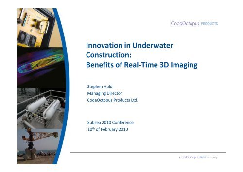
Innovation in Underwater<br />
Construction:<br />
<strong>Benefits</strong> <strong>of</strong> <strong>Real</strong>-<strong>Time</strong> <strong>3D</strong> <strong>Imaging</strong><br />
Stephen Auld<br />
Managing Director<br />
CodaOctopus Products Ltd.<br />
<strong>Subsea</strong> 2010 Conference<br />
10 th <strong>of</strong> February 2010
Programme<br />
• Introduction to the Echoscope <strong>3D</strong> Sonar<br />
• Innovative Techniques for Breakwater Construction<br />
• Wind Farm Installations using a real-time <strong>3D</strong> sonar<br />
• ROV Operations for enhanced spatial awareness
Echoscope <strong>3D</strong> <strong>Imaging</strong> Sonar<br />
• World’s first real-time high resolution<br />
<strong>3D</strong> (or 4D) sonar<br />
• Generates over 16,000 beams per<br />
acoustic transmission (ping)<br />
• Beam spacing along and across track <strong>of</strong><br />
0.39˚ with standard 375 kHz projector<br />
• Ping rate up to 12 Hz, with each ping<br />
being a true <strong>3D</strong> dataset<br />
• Each beam contains unique X,Y,Z and<br />
Intensity value
<strong>Real</strong>-<strong>Time</strong> <strong>3D</strong> Operation
<strong>Real</strong>-<strong>Time</strong> Imagery
Innovation in Breakwater Construction<br />
• The Ras Laffan Port Expansion Project – expanding the<br />
existing LNG port at Ras Laffan to become the largest one<br />
in the world<br />
• The scope <strong>of</strong> the expansion works was 20 million m 3 <strong>of</strong><br />
dredging, 27 million m 3 reclamation, two 10 km<br />
breakwaters, and two 6 km causeways<br />
• The outer end <strong>of</strong> the northern breakwater was to be<br />
armoured with over 37,000 Accropodes, <strong>of</strong> the 3, 4 and 5<br />
m 3 sizes.
Accropode Placement<br />
• Accropodes are single layer concrete armour units<br />
• Produced in a range <strong>of</strong> sizes, the ones in this project were<br />
3 – 5 m 3<br />
• Accropodes must be placed according to a set <strong>of</strong> rules that<br />
govern their density and the orientation <strong>of</strong> each block<br />
with regard to the adjacent blocks<br />
• With active dredging activity in the area, they must be<br />
positioned and oriented accurately in near zero-visibility<br />
conditions
Accropode Placement – the problem
Accropode Placement – the solution<br />
• To avoid having to man-handle these concrete blocks<br />
underwater, RLNBC developed a hydraulic rotator to allow<br />
crane operators to manipulate the Accropode orientation<br />
• This allows the operator to move the block, but he still<br />
cannot see it<br />
• Video cameras were attached in various positions but the<br />
low visibility conditions meant that they were not<br />
effective
Accropode Placement – the solution<br />
• An Echoscope <strong>3D</strong> Sonar was installed in January 2008 for<br />
the first time to view the Accropode<br />
• It immediately gave the crane operator a view <strong>of</strong> the block<br />
that was far in advance <strong>of</strong> what had previously been<br />
possible<br />
• RLNBC started working with the Echoscope on the project,<br />
while CodaOctopus went to work optimising the system<br />
for their application
Echoscope Imagery – raw data
Development <strong>of</strong> Construction Monitoring System<br />
• Accropodes TM are regular shapes (variable size)<br />
• Identify and track blocks based on <strong>3D</strong> spatial sonar<br />
data using a real-time geometrical algorithm<br />
• Thereby allow operator to easily identify the block<br />
when it is only partially imaged<br />
• Chart <strong>of</strong> area can be viewed, with target block<br />
positions and current target position<br />
• Database <strong>of</strong> ‘as-laid’ positions and orientations can<br />
be generated
Echoscope Imagery – fully referenced
Not just placing blocks …
Results<br />
• Peter van Gelderen from Van Oord presented a<br />
paper to the Institute <strong>of</strong> Civil Engineers at the<br />
‘Coasts, Marine Structures and Breakwaters’<br />
conference, presenting this innovative new approach<br />
• The results were quite clear<br />
• The Echoscope allowed them to operate efficiently<br />
without the constant intervention <strong>of</strong> divers<br />
• The incremental improvements in the s<strong>of</strong>tware<br />
enhanced the crane operators ability to use the<br />
s<strong>of</strong>tware, increasing efficiency further
Echoscope Imagery – inspecting<br />
structures post-placement
Offshore Wind Farm Installation
Wind Farm Construction
Enhancement <strong>of</strong> <strong>Subsea</strong> Spatial Awareness<br />
ROV Application using single ping view
Enhancement <strong>of</strong> <strong>Subsea</strong> Spatial Awareness<br />
ROV Application using multi-ping aided data
New High Frequency Sonar<br />
610 kHz with 25 x 25 viewing volume
ROV Monitoring from DP Vessel<br />
viewing the global subsea scene
Thank you<br />
Stephen Auld<br />
Managing Director<br />
CodaOctopus Products Ltd.<br />
<strong>Subsea</strong> 2010 Conference<br />
10 th <strong>of</strong> February 2010