

Anomalous Propagation and Other Doppler Radar Curiosities - NOAA
Anomalous Propagation and Other Doppler Radar Curiosities - NOAA
Anomalous Propagation and Other Doppler Radar Curiosities - NOAA

You also want an ePaper? Increase the reach of your titles
YUMPU automatically turns print PDFs into web optimized ePapers that Google loves.
<strong>Anomalous</strong> <strong>Propagation</strong> <strong>and</strong><br />
<strong>Other</strong> <strong>Doppler</strong> <strong>Radar</strong> <strong>Curiosities</strong><br />
– OR – What is that junk?!<br />
By Joe Nield, Meteorologist<br />
Aside from the general increase in computing power, <strong>Doppler</strong><br />
<strong>Radar</strong>, specifically the Weather Surveillance <strong>Radar</strong> – 1988<br />
<strong>Doppler</strong> (WSR-88D), is arguably the single most vital tool in our<br />
arsenal to keep the public safe, <strong>and</strong> has been the biggest driver<br />
behind the historical improvement in our ability to detect <strong>and</strong><br />
warn for severe <strong>and</strong> tornadic thunderstorms <strong>and</strong> other weather<br />
phenomena. What surprises many people, however, is that<br />
weather radar doesn’t only detect weather. To underst<strong>and</strong> this,<br />
first let us take a brief glance at the history of weather radar<br />
<strong>and</strong> how it works.<br />
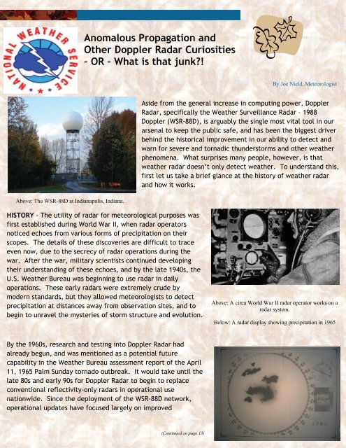
Above: The WSR-88D at Indianapolis, Indiana.<br />
HISTORY - The utility of radar for meteorological purposes was<br />
first established during World War II, when radar operators<br />
noticed echoes from various forms of precipitation on their<br />
scopes. The details of these discoveries are difficult to trace<br />
even now, due to the secrecy of radar operations during the<br />
war. After the war, military scientists continued developing<br />
their underst<strong>and</strong>ing of these echoes, <strong>and</strong> by the late 1940s, the<br />
U.S. Weather Bureau was beginning to use radar in daily<br />
operations. These early radars were extremely crude by<br />
modern st<strong>and</strong>ards, but they allowed meteorologists to detect<br />
precipitation at distances away from observation sites, <strong>and</strong> to<br />
begin to unravel the mysteries of storm structure <strong>and</strong> evolution.<br />
Above: A circa World War II radar operator works on a<br />
radar system.<br />
Below: A radar display showing precipitation in 1965<br />
By the 1960s, research <strong>and</strong> testing into <strong>Doppler</strong> <strong>Radar</strong> had<br />
already begun, <strong>and</strong> was mentioned as a potential future<br />
capability in the Weather Bureau assessment report of the April<br />
11, 1965 Palm Sunday tornado outbreak. It would take until the<br />
late 80s <strong>and</strong> early 90s for <strong>Doppler</strong> <strong>Radar</strong> to begin to replace<br />
conventional reflectivity-only radars in operational use<br />
nationwide. Since the deployment of the WSR-88D network,<br />
operational updates have focused largely on improved<br />
(Continued on page 13)
(Continued from page 12)<br />
<strong>Anomalous</strong> <strong>Propagation</strong> <strong>and</strong><br />
<strong>Other</strong> <strong>Doppler</strong> <strong>Radar</strong><br />
<strong>Curiosities</strong> – OR – What is<br />
that junk?! - Continued<br />
b<strong>and</strong>width for super-resolution products, <strong>and</strong> improvements in data<br />
processing, clutter suppression, <strong>and</strong> precipitation estimation.<br />
FUNCTION - Weather radar works by sending extremely short,<br />
directed bursts of microwave radiation, <strong>and</strong> then “listening” for<br />
returned radiation reflected off of scatterers in the atmosphere or<br />
occasionally on the ground. These pulses last only 0.0000016<br />
seconds, with a listening period about 1,000 times longer. The net<br />
result of this is that the radar is only actually transmitting about 7<br />
seconds out of every hour, <strong>and</strong> listening for returned pulses the rest<br />
of that time. Scatterers of these pulses can include raindrops,<br />
hailstones, snowflakes, birds, bugs, dust, airplanes, <strong>and</strong> even cars<br />
Above: A example of a radar transmitting<br />
mircowave radiation to detect precipitation.<br />
on the highway. The direction <strong>and</strong> distance to the target scatterer is known by tracking the direction of the<br />
antenna <strong>and</strong> the time between pulse emission <strong>and</strong> return of the reflected radiation to the radar. The<br />
amount of energy that is reflected is dependent on the dropsize distribution, that is, the number <strong>and</strong><br />
diameter of raindrops or other scatterers in a given volume. This dependence introduces some difficulty<br />
into the use of radar data for precipitation estimation, because a large number of small drops will return<br />
the same power as a small number of large drops, with obvious implications for the resultant rate <strong>and</strong><br />
amount of rainfall. <strong>Doppler</strong> radars measure not only the returned radiation reflected back to the radar, but<br />
also the phase shift of that radiation, which allows the radar to determine the motion of the scatterers in<br />
question.<br />
BEAM BEHAVIOR - As was mentioned earlier, weather radars don’t just detect weather. They can also<br />
detect birds, bugs, dust, airplanes, cars, <strong>and</strong> even the ground itself. To underst<strong>and</strong> how this happens, we<br />
must underst<strong>and</strong> how the radar beam behaves. The radar beam is best pictured as a spreading cone,<br />
widening as it moves away from the radar site. The highest energy is concentrated at the center of the<br />
beam, with energy levels fading as one moves away from the centerline. Due to this beam spreading, the<br />
radar’s ability to resolve small scale features decreases with increasing distance. In fact, the beam width<br />
increases by nearly 1,000 feet for every 10 miles of travel. As such, small scale features that may be easily<br />
resolved within a county or two may become masked several counties away.
<strong>Anomalous</strong> <strong>Propagation</strong> <strong>and</strong><br />
<strong>Other</strong> <strong>Doppler</strong> <strong>Radar</strong><br />
<strong>Curiosities</strong> – OR – What is<br />
that junk?! - Continued<br />
The beam also does not travel in a straight line as it moves away from the radar. It is refracted in different<br />
ways depending on density differences in the atmosphere. These differences are caused by variations in<br />
temperature, moisture, <strong>and</strong> pressure, <strong>and</strong> affect the speed <strong>and</strong> direction of the beam. This introduces<br />
uncertainty into the process of interpreting radar data, as we cannot be sure of exactly where the beam is,<br />
we can only infer where it will most likely be in a st<strong>and</strong>ard atmosphere, <strong>and</strong> take into account conditions<br />
which may affect beam travel when determining the accuracy of these inferences. If the atmospheric<br />
density is less than normal, the beam will bend very little <strong>and</strong> will easily overshoot features at long<br />
distances. This is called subrefraction. Superrefraction is the opposite – density is greater than normal, <strong>and</strong><br />
the beam is bent excessively, sometimes directed into the ground itself (this would be referred to as<br />
ducting). Ducting<br />
often occurs when<br />
strong low-level<br />
temperature<br />
inversions (increases in<br />
temperature with<br />
height) are present –<br />
many times late at<br />
night/early in the<br />
morning due to<br />
radiative cooling, or<br />
behind cold fronts.<br />
Ducting can also occur<br />
in areas where<br />
thunderstorms have<br />
cooled the low levels<br />
of the atmosphere,<br />
forming a small scale<br />
inversion. This can<br />
often lead to problems<br />
even during a<br />
significant weather<br />
event.<br />
One of the ways ducting can impact radar images is through anomalous propagation (AP). AP occurs<br />
when the radar beam is refracted onto the ground itself, returning a great deal of energy in a fashion<br />
typically easily distinguishable from weather echoes. An example of AP is seen in the picture above.<br />
The noisy <strong>and</strong> blocky areas to the northwest <strong>and</strong> southeast of the radar site (center) are areas of AP. As you<br />
can see, this could mask important features if storms were in those areas, <strong>and</strong> also lead to confusion for<br />
unfamiliar users of the data. The area around the center of the image is ground clutter, an often<br />
unavoidable impact of the beam detecting buildings, trees, <strong>and</strong> other stationary targets near the radar site,
<strong>Anomalous</strong> <strong>Propagation</strong> <strong>and</strong><br />
<strong>Other</strong> <strong>Doppler</strong> <strong>Radar</strong><br />
<strong>Curiosities</strong> – OR – What is<br />
that junk?! - Continued<br />
before the beam has a chance to climb high enough to<br />
overshoot them.<br />
The radar beam can also detect cars on the highway<br />
on occasion for similar reasons. The image on page 6 of this<br />
issue of Skywatch shows a velocity image <strong>and</strong> high speeds<br />
are being detected from cars along interstates 465 <strong>and</strong> 70<br />
near Indianapolis.<br />
Because the sun emits radiation on all wavelengths,<br />
including those emitted <strong>and</strong> detected by the radar, sunrises<br />
<strong>and</strong> sunsets are detectable as well, when the sun is low<br />
enough in the sky for the radiation to be detected by the<br />
dish. This is visualized by a thin line in the direction of the<br />
sun. An example of this follows:<br />
Above: Sunset is detected by <strong>Doppler</strong> radar systems across<br />
the Ohio Valley <strong>and</strong> Midwest.<br />
Weather radar detects these <strong>and</strong> other interesting features,<br />
<strong>and</strong> it is the job of the radar meteorologist to learn the<br />
characteristics of the radar, its peculiarities, <strong>and</strong><br />
interpretation of the various images it provides. It is one of<br />
the most interesting, dynamic, <strong>and</strong> rewarding aspects of the<br />
career of a meteorologist. For more information on weather<br />
radar <strong>and</strong> other meteorological topics, visit the NWS<br />
JetStream Weather School online at http://<br />
www.srh.noaa.gov/jetstream/index.htm


