

Rainfall Totals from the Hermosa Flash Flood of 17 August 2007
Rainfall Totals from the Hermosa Flash Flood of 17 August 2007
Rainfall Totals from the Hermosa Flash Flood of 17 August 2007

Create successful ePaper yourself
Turn your PDF publications into a flip-book with our unique Google optimized e-Paper software.
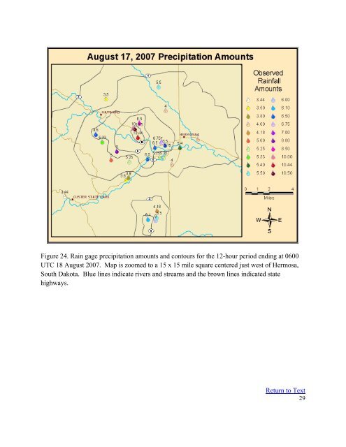
Figure 24. Rain gage precipitation amounts and contours for <strong>the</strong> 12-hour period ending at 0600<br />
UTC 18 <strong>August</strong> <strong>2007</strong>. Map is zoomed to a 15 x 15 mile square centered just west <strong>of</strong> <strong>Hermosa</strong>,<br />
South Dakota. Blue lines indicate rivers and streams and <strong>the</strong> brown lines indicated state<br />
highways.<br />
Return to Text<br />
29


