FINAL VERSION FOR APPROVAL - Sdn Bhd - WWF Malaysia
FINAL VERSION FOR APPROVAL - Sdn Bhd - WWF Malaysia
FINAL VERSION FOR APPROVAL - Sdn Bhd - WWF Malaysia

You also want an ePaper? Increase the reach of your titles
YUMPU automatically turns print PDFs into web optimized ePapers that Google loves.
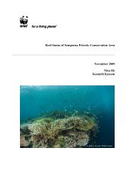
Gunung Stong State Park Preliminary Management Plan<br />
4.2 Trails<br />
There are several destinations guided by BAT, ranging from short, 1-day trips to 7-day treks,<br />
with varying degrees of difficulty. Foreign backpackers opt to stay at Baha Camp, and trek to<br />
the last waterfall, on organised packages offered by guesthouses in Kota Bharu, while locals<br />
and Singaporeans trek to G. Ayam and Stong, while staying at Baha Camp between treks.<br />
The trails were created by BAT.<br />
The list of trails and destinations are as in Table 4.3.<br />
Table 4.3: List of Trails and Tourist Destinations at GSSP<br />
No. Name of Trail Duration<br />
Trail Description<br />
(Days)<br />
1 G. Ayam 2 The trail takes one through a logged-over, dipterocarp<br />
forest, then across two streams, then through an undisturbed<br />
oak-laurel forest, before reaching the summit ridge, and the<br />
summit. The summit is flat, and can easily fit some 50<br />
campers. The summit can be reached within one day from<br />
Baha Camp, and the return journey is another day. From<br />
the summit are excellent views of the neighboring peaks of<br />
Tera (1,545 m asl) and Che Tahir (1,415 m asl). After the<br />
second river crossing, is a ridge with the rare endemic palm,<br />
Licuala stongensis.<br />
2 G. Stong 1 G. Stong (1,400 m asl) is some 4-5 hours from Baha Camp,<br />
and the return trip is some 2-3 hours. Like G. Ayam, the<br />
trail takes the hikers through an abandoned logging trail,<br />
before entering undisturbed oak-laurel forests. On the<br />
summit ridge are found the rare endemic bamboo,<br />
Holtummochloa pubescens. Midway between the basecamp<br />
and the summit is a rock-shelter next to a stream,<br />
known as Bogo Rock Shelter.<br />
3 G. Tera 4 This trail is the extension of the G. Ayam trail, where the<br />
hiker descends G. Ayam, and ascends G. Tera, a day away.<br />
Midway between the two summits is a plateau where there<br />
are many signs of the elephant. The rare endemic bamboo,<br />
H. pubescens, is also found. The journey to G. Tera and<br />
return to Baha Camp takes four days.<br />
4 G. Che Tahir 3 This is also an extension of the G. Ayam trail, where the<br />
hiker descends G. Ayam, and goes up again to the granite<br />
outcrop of G. Che Tahir. The summit is not as spectacular<br />
as Ayam, but the trail is, with pristine rocky streams and<br />
cascades.<br />
5 Semuliang<br />
Trail<br />
5 This trail starts from where the Sg. Kenerong meets the Sg.<br />
Semuliang, (the Mustaq mini-hydro dam) along an<br />
abandoned logging trail, and then upriver, before turning<br />
into the saddle separating G. Ayam and G. Stong. From the<br />
saddle, one could make an ascent to G. Stong, and back<br />
down again to Baha Camp. Highlights of this trail include a<br />
rafflesia site, and a rock-shelter with petrified wood.<br />
6 Seven Summits 7 This trail is a combination of the other trails, where the<br />
seven summits are attempted (Ayam, Tera, Stong, Che Kob,<br />
Che Tahir, Menyelit, Birut). Apart from Ayam, Stong, and<br />
Tera, the other peaks are names introduced by Baha, and<br />
are not named in maps.<br />
7 Last Waterfall 0.5 From the Baha Camp to the last waterfall (30 m high), one<br />
goes upriver of the Sg. Jeri, along rock-pools, and several<br />
44