FINAL VERSION FOR APPROVAL - Sdn Bhd - WWF Malaysia
FINAL VERSION FOR APPROVAL - Sdn Bhd - WWF Malaysia
FINAL VERSION FOR APPROVAL - Sdn Bhd - WWF Malaysia

You also want an ePaper? Increase the reach of your titles
YUMPU automatically turns print PDFs into web optimized ePapers that Google loves.
Gunung Stong State Park Preliminary Management Plan<br />
GTB6<br />
Abandoned<br />
logging track on a<br />
ridge between 2<br />
rivers.<br />
N588991<br />
E438382<br />
725m asl<br />
GTB7 Sg. Semuliang N589393<br />
E437627<br />
680m asl<br />
GTB8 Batu Hampar N590421<br />
E436730<br />
774m asl<br />
GTB9 Cobra Camp N590130<br />
E436707<br />
950m asl<br />
GTB10 Trailhead to<br />
Padang Ragut<br />
GTB11<br />
Ridge to Padang<br />
Ragut<br />
GTB12 Padang Ragut<br />
(Sub-montane<br />
swamp)<br />
N589922<br />
E436707<br />
995m asl<br />
N588948<br />
E436171<br />
995m asl<br />
N590288<br />
E438710<br />
1,320m asl<br />
Trail heavily covered with the fern<br />
Dicranopteris linearis (resam). Off the trail<br />
fast-growing secondary forest vegetation can<br />
be observed, typically mahang (Macaranga<br />
spp.), pulai (Alstonia spp.) and perah<br />
(Elateriospermum tapos).<br />
Cascading falls and rocky beds and banks on<br />
the upper Semuliang.<br />
Flat stretch of rocky banks of the upper<br />
Semuliang. Approach is through an<br />
abandoned logging trail parallel to the river.<br />
Campsite on the upper Semuliang, where<br />
several small streams from G. Tera, G.<br />
Ayam, and G. Saji meet. Being a former log<br />
collection point, the campsite is overgrown<br />
with resam.<br />
Trail overgrown with resam. View of G.<br />
Ayam and G. Menyelit clearly visible from<br />
this point.<br />
Primary oak-laurel forest habitat, no sign of<br />
logging, but signs of agarwood collectors.<br />
The mountain fern, Dipteris conjugata, is<br />
abundant here.<br />
An extensive patch of sub-montane swamp<br />
forest, with heavily inundated knee-deep<br />
peaty soil, forming deep pools whenever it<br />
rains.<br />
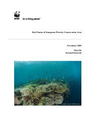
Photo 3.1: Upper Sg. Semuliang<br />
<strong>WWF</strong>-<strong>Malaysia</strong>/N.M. Maseri<br />
3.4 Gunung Stong Scientific Expedition 2003<br />
Prior to the scientific expedition organised by the Forestry Department Peninsular <strong>Malaysia</strong>,<br />
the Kelantan State Forestry Department and Universiti Kebangsaan <strong>Malaysia</strong> in 2003,<br />
information on the biodiversity of GSSP was limited to records of plant collections by<br />
Symington, Foxworthy, Kiew, and others, while some basic data on wildife was available<br />
from DWNP.<br />
35