FINAL VERSION FOR APPROVAL - Sdn Bhd - WWF Malaysia
FINAL VERSION FOR APPROVAL - Sdn Bhd - WWF Malaysia
FINAL VERSION FOR APPROVAL - Sdn Bhd - WWF Malaysia

You also want an ePaper? Increase the reach of your titles
YUMPU automatically turns print PDFs into web optimized ePapers that Google loves.
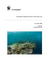
Gunung Stong State Park Preliminary Management Plan<br />
CHAPTER 3: BIODIVERSITY OF GSSP<br />
3.1 General Characteristics of the Forests in GSSP<br />
The vegetation type of the GSSP area is mainly hill dipterocarp forest at elevations between<br />
300m a.s.l. and 750 m a.s.l. At higher elevations and mountain peaks of between 1,200 m and<br />
1500m, the predominant vegetation type is upper dipterocarp forest and oak-laurel forests.<br />
The forests at the lower elevation at GSSP are logged-over but, due to restrictions against<br />
logging above the 1000m-level, most of the highland forest above that altitude is still intact.<br />
Very little, if any, remains of the primary lowland dipterocarp forest at elevations below<br />
300m a.s.l. In the lowland areas, there are extensive areas of scrubland dominated by pioneer<br />
plants such as mahang (Macaranga spp.), perah (Elateriospermum tapos), bamboos and<br />
gingers. Of particular interest is the sub-montane swamp forest located to the south of GSSP<br />
(see 3.3.2). A preliminary vegetation map of the GSSP area, produced based on the altitudinal<br />
zonation scheme as described by Symington (2001) and on land use map from the<br />
Department of Agriculture, is included as Appendix 5.<br />
3.2 Logging History of GSSP and Surrounding Areas<br />
All of the forest reserves in the GSSP area have been logged, mostly in the late 1970s to the<br />
1980s, and some forest compartments are undergoing the second logging cycle. Areas that<br />
have been exempted from new logging activities are the steep border areas with Perak in the<br />
Basor Forest Reserve and GSSP, with two concessions (Compartments 24, 25) revoked by the<br />
Forestry Department since its declaration as a protected area.<br />
The Kompleks Perkayuan Kelantan (KPK) holds substantial concessions in the Berangkat,<br />
Balah, Gunung Stong Selatan, and Gunung Stong Utara Forest Reserves, with almost 100%<br />
of concessions in Berangkat (non-KPK concessions are in Compartments 57 and 59), and<br />
70% of the concessions in Balah Forest Reserve (the other 30% of the concession is held by<br />
the Jabatan Hal Ehwal Orang Asli).<br />
In Gunung Stong Selatan Forest Reserve, compartments 100 (100ha), 104 (50ha), 97 (40ha)<br />
and 74 (100ha) are being logged, while some 600ha (compartments 94, 95, 96, 97, 98) are<br />
under teak plantations. In Gunung Stong Utara Forest Reserve, compartments 13 (80ha), 18<br />
(80ha) and 19 are undergoing logging, with compartments 44 (210ha), 62 (52ha) was<br />
converted into stateland in 2004.<br />
For Gunung Basor Forest Reserve, logging is conducted in compartments 39 (283ha), 136<br />
(150ha), 126 (148ha), 97 (100ha), 129 (50ha), 24 (50ha), 24 (50ha), 93 (41ha).<br />
Compartments with the potential for opening up for logging are: 61 (50 ha), 40 (60ha), 44<br />
(162ha), 45 (60ha), 62 (50ha), 94 (45ha), 60 (50ha), 164 (50ha), 24 (30ha), 124 (292ha), 25<br />
(289 ha) (pers. comm., En. Mohamed bin Nor, ADFO, Tanah Merah, 2005).<br />
3.3 Ground-Truthing<br />
Two ground-truthing exercises were conducted, the first in March 2005, and the second, in<br />
August 2005 (See Figure 3.1). The first ground-truthing was through the eastern approach,<br />
through the main route for hikers: following the cemented rural road to the waterfall, and<br />
from the trailhead, a climb to Baha Camp. From Baha Camp, a trek was made to G. Kob, Li<br />
Rock Shelter, G. Ayam, G. Che Kob, G. Saji, G.Tera, the saddle between G. Ayam and G.<br />
Stong, and G. Menyelit, and the return trek to Baha Camp.<br />
The second ground-truthing was through the southern approach, by way of the Sg. Semuliang<br />
trail, the entry of which being the confluence of Sg. Kenerong and Sg. Semuliang. With the<br />
exception of a few crossings, the ground-truthing follows the Semuliang Trail, which more or<br />
less follows the upriver course of the Sg. Semuliang. Several stops were made at the<br />
designated campsites (at the Sg. Kenerong-Sg. Semuliang confluence, Batu Hampar Camp,<br />
and Cobra Camp), with the addition of a side expedition to a sub-montane swamp forest. The<br />
31