WWFM_Hill Stations Study Vol2_2001.pdf - Sdn Bhd - WWF Malaysia
WWFM_Hill Stations Study Vol2_2001.pdf - Sdn Bhd - WWF Malaysia
WWFM_Hill Stations Study Vol2_2001.pdf - Sdn Bhd - WWF Malaysia

Create successful ePaper yourself
Turn your PDF publications into a flip-book with our unique Google optimized e-Paper software.
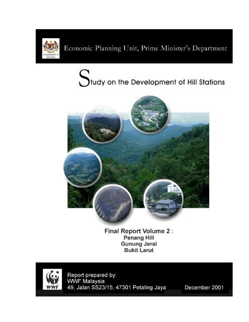
<strong>Study</strong> on the Development of <strong>Hill</strong> <strong>Stations</strong><br />
Final Report II<br />
TABLE OF CONTENTS<br />
TABLE OF CONTENTS..........................................................................................i<br />
LIST OF TABLES..................................................................................................iv<br />
LIST OF FIGURES AND PLATES .......................................................................vi<br />
LIST OF ABBREVIATIONS ................................................................................vii<br />
EXECUTIVE SUMMARY.....................................................................................E-1<br />
LIST OF ACTION PLANS...................................................................................A-1<br />
CHAPTER 1 : INTRODUCTION<br />
1.1 BACKGROUND .......................................................................................... 1-1<br />
1.2 STUDY OBJECTIVES................................................................................. 1-2<br />
1.3 STUDY APPROACH................................................................................... 1-2<br />
1.4 STUDY AREA ............................................................................................. 1-3<br />
1.5 CONCEPT OF CARRYING CAPACITY ..................................................... 1-4<br />
1.6 FORMAT OF REPORT ............................................................................... 1-5<br />
CHAPTER 2 : PENANG HILL<br />
2.1 INTRODUCTION ......................................................................................... 2-1<br />
2.2 EXISTING SITUATION ............................................................................... 2-1<br />
2.2.1 Physical Environment .......................................................................... 2-1<br />
2.2.2 Biological Environment ........................................................................ 2-5<br />
2.2.3 Socio-Economic Environment............................................................ 2-13<br />
2.2.4 Infrastructure & Utilities...................................................................... 2-23<br />
2.3 STRENGTHS, WEAKNESSES, OPPORTUNITIES & THREATS............ 2-25<br />
2.3.1 Strengths ........................................................................................... 2-25<br />
2.3.2 Weaknesses ...................................................................................... 2-27<br />
2.3.3 Opportunities ..................................................................................... 2-29<br />
2.3.4 Threats............................................................................................... 2-30<br />
2.4 CARRYING CAPACITY ............................................................................ 2-32<br />
2.5 ACTION PLANS........................................................................................ 2-34<br />
2.5.1 Development Focus & Guiding Issues............................................... 2-34<br />
2.5.2 Land Use Strategies .......................................................................... 2-35<br />
2.5.3 Socio-Economic Programmes ........................................................... 2-35<br />
2.5.4 Tourism Enhancements..................................................................... 2-38<br />
2.5.5 Biodiversity Conservation .................................................................. 2-41<br />
2.5.6 Infrastructure & Environmental Improvements................................... 2-42<br />
<strong>WWF</strong> <strong>Malaysia</strong><br />
December 2001<br />
i
<strong>Study</strong> on the Development of <strong>Hill</strong> <strong>Stations</strong><br />
Final Report II<br />
TABLE OF CONTENTS<br />
CHAPTER 3 : GUNUNG JERAI<br />
3.1 INTRODUCTION ......................................................................................... 3-1<br />
3.2 EXISTING SITUATION ............................................................................... 3-1<br />
3.2.1 Physical Environment .......................................................................... 3-1<br />
3.2.2 Biological Environment ........................................................................ 3-2<br />
3.2.3 Socio-Economic Environment.............................................................. 3-9<br />
3.2.4 Infrastructure & Utilities...................................................................... 3-14<br />
3.3 STRENGTHS, WEAKNESSES, OPPORTUNITIES & THREATS............ 3-15<br />
3.3.1 Strengths ........................................................................................... 3-15<br />
3.3.2 Weaknesses ...................................................................................... 3-15<br />
3.3.3 Opportunities ..................................................................................... 3-16<br />
3.3.4 Threats............................................................................................... 3-17<br />
3.4 CARRYING CAPACITY ............................................................................ 3-18<br />
3.5 ACTION PLANS........................................................................................ 3-19<br />
3.5.1 Development Focus & Guiding Issues............................................... 3-19<br />
3.5.2 Land Use Strategies .......................................................................... 3-20<br />
3.5.3 Socio-Economic & Tourism Enhancement ........................................ 3-20<br />
3.5.4 Biodiversity Conservation .................................................................. 3-22<br />
3.5.5 Infrastructure & Environmental Improvements................................... 3-23<br />
CHAPTER 4 : BUKIT LARUT<br />
4.1 INTRODUCTION ......................................................................................... 4-1<br />
4.2 EXISTING SITUATION ............................................................................... 4-1<br />
4.2.1 Physical Environment .......................................................................... 4-1<br />
4.2.2 Biological Environment ........................................................................ 4-2<br />
4.2.3 Socio-Economic Environment............................................................ 4-10<br />
4.2.4 Infrastructure & Utilities...................................................................... 4-13<br />
4.3 STRENGTHS, WEAKNESSES, OPPORTUNITIES & THREATS............ 4-14<br />
4.3.1 Strengths ........................................................................................... 4-14<br />
4.3.2 Weaknesses ...................................................................................... 4-15<br />
4.3.3 Opportunities ..................................................................................... 4-16<br />
4.3.4 Threats............................................................................................... 4-17<br />
4.4 CARRYING CAPAPCITY.......................................................................... 4-18<br />
4.5 ACTION PLANS........................................................................................ 4-19<br />
4.5.1 Development Focus & Guiding Issues............................................... 4-19<br />
4.5.2 Land Use Strategies .......................................................................... 4-19<br />
4.5.3 Socio-Economic & Tourism Enhancement ........................................ 4-20<br />
4.5.4 Biodiversity Conservation .................................................................. 4-22<br />
4.5.5 Infrastructure & Environmental Improvements................................... 4-22<br />
<strong>WWF</strong> <strong>Malaysia</strong><br />
December 2001<br />
ii
<strong>Study</strong> on the Development of <strong>Hill</strong> <strong>Stations</strong><br />
Final Report II<br />
TABLE OF CONTENTS<br />
CHAPTER 5 : LEGAL AND INSTITUTIONAL ISSUES<br />
5.1 INTRODUCTION ......................................................................................... 5-1<br />
5.2 LEGAL ISSUES .......................................................................................... 5-1<br />
5.2.1 Enhance Protection of <strong>Hill</strong> <strong>Stations</strong>...................................................... 5-1<br />
5.2.1 Regulation of Transport Services......................................................... 5-2<br />
5.3 INSTITUTIONAL ISSUES ........................................................................... 5-4<br />
5.3.1 Lack of Enforcement and Capacity (Human and Technical)................ 5-4<br />
5.3.2 Lack of Co-ordination........................................................................... 5-5<br />
APPENDIX I :<br />
APPENDIX II :<br />
REFERENCES<br />
LIST OF MEETINGS WITH STAKEHOLDERS<br />
<strong>WWF</strong> <strong>Malaysia</strong><br />
December 2001<br />
iii
<strong>Study</strong> on the Development of <strong>Hill</strong> <strong>Stations</strong><br />
Final Report II<br />
LIST OF TABLES<br />
Table 2.1 : Penang <strong>Hill</strong> Land Use<br />
Table 2.2 : Penang <strong>Hill</strong> Town Area – Land Use<br />
Table 2.3 : Slope Analysis of Penang <strong>Hill</strong><br />
Table 2.4 : Forest Reserves Adjoining Penang <strong>Hill</strong><br />
Table 2.5 : A Comparison Between The Total Highland Plant Species Found in<br />
Peninsular <strong>Malaysia</strong> with that in Penang <strong>Hill</strong><br />
Table 2.6 : Endemism and Rarity among Plant Species Found in Penang <strong>Hill</strong><br />
Table 2.7 : Categorisation of Flora Species in Penang <strong>Hill</strong> According to<br />
Distribution<br />
Table 2.8 : Threatened and CITES – Listed Flora Species in Penang <strong>Hill</strong><br />
Table 2.9 : Conservation Status of Terrestrial Verterbrate Fauna of Penang <strong>Hill</strong><br />
According to the IUCN’s Red List of Threatened Species<br />
Table 2.10 : Terrestrial Vertebrate Fauna of Penang <strong>Hill</strong> Accorded Protection<br />
under the Protection of Wild Life Act, 1972 (applicable to<br />
Peninsular <strong>Malaysia</strong>)<br />
Table 2.11 : Buildings Within Forest Reserve and Water Catchment<br />
Table 2.12 : Population Distribution, 1991 – 2000<br />
Table 2.13 : Projected Population of Penang <strong>Hill</strong>, 2000 – 2020<br />
Table 2.14 : Employment by Industrial Sectors, 1991<br />
Table 2.15 : Visitor arrivals to Penang (1996 – 2000)<br />
Table 2.16 : Visitor Market Mix, July – September, 1999 – 2000<br />
Table 2.17 : Number of Day Visitors to Penang <strong>Hill</strong><br />
Table 2.18 : Supply of Hotels and Rooms in Penang State, 1997 – 1999<br />
Table 2.19 : Distribution of Hotel Guests and Hotel Guests Nights, Penang,<br />
1998 and 1999<br />
Table 2.20 : Average Hotel Occupancy Rates, Penang, 1996 – 2000<br />
Table 3.1 : A Comparison Between a Total Highland Plant Species found in<br />
Peninsular <strong>Malaysia</strong> with that in Gunung Jerai<br />
Table 3.2 : Endemism and Rarity Among Plant Species Found in Gunung Jerai<br />
Table 3.3 : Categorisation of Flora Species in Gunung Jerai According to<br />
Distribution<br />
Table 3.4 : Summary of Threatened and CITES Listed Flora Species in<br />
Gunung Jerai<br />
Table 3.5 : Conservation Status of Terrestrial Vertebrate Fauna of Gunung<br />
Jerai According to IUCN’s Red List of Threatened Species (IUCN,<br />
2000)<br />
Table 3.6 : Terrestrial Vertebrate Fauna of Gunung Jerai Accorded Protection<br />
Under the Protection of Wildlife Act, 1972<br />
Table 3.7 : Historical Monuments and Archeological Sites in Kedah<br />
Table 3.8 : Visitors Arrivals, Gunung Jerai, 1999 – 2000<br />
Table 3.9 : Distribution of Hotel Guests and Hotel Guest Nights, Alor & Sg<br />
Petani, 1998 and 1999<br />
Table 3.10 : Average Occupancy Rate (AOR), January – September, 1999 and<br />
2000<br />
Table 4.1 : Water Quality of Rivers Draining Bukit Larut<br />
<strong>WWF</strong> <strong>Malaysia</strong><br />
December 2001<br />
iv
<strong>Study</strong> on the Development of <strong>Hill</strong> <strong>Stations</strong><br />
Final Report II<br />
LIST OF TABLES<br />
Table 4.2 : A Comparison Between the Total Highland Plant Species Found in<br />
Peninsular <strong>Malaysia</strong> with that in Bukit Larut<br />
Table 4.3 : Endemism and Rarity Among Plant Species Found in Bukit Larut<br />
Table 4.4 : Categorisation of Flora Species in Bukit Larut According to<br />
Distribution<br />
Table 4.5 : Threatened and CITES – listed flora species in Bukit Larut<br />
Table 4.6 : Conservation Status of Terrestrial Vertebrate Fauna of Bukit Larut<br />
According to IUCN’s Red List of Threatened Species (IUCN, 2000)<br />
Table 4.7 : Terrestrial Vertebrate Fauna of Bukit Larut Accorded Protection<br />
Under the Protection of the Wild Life Act, 1972<br />
Table 4.8 : Tourist Arrivals in Bukit Larut, 1999 and 2000<br />
Table 4.9 : Distribution of Hotel Guests and Hotel Guests Nights, Ipoh, 1998<br />
and 1999<br />
Table 4.10 : Average Occupancy Rate (AOR), January – September, 1999 and<br />
2000<br />
<strong>WWF</strong> <strong>Malaysia</strong><br />
December 2001<br />
v
<strong>Study</strong> on the Development of <strong>Hill</strong> <strong>Stations</strong><br />
Final Report II<br />
LIST OF FIGURES AND PLATES<br />
Figure 1-1 : Location Map of the <strong>Hill</strong> <strong>Stations</strong><br />
Figure 2-1 : Land Use at Penang <strong>Hill</strong><br />
Figure 2-2 : Existing Land Use at Core Development Areas in Penang<br />
<strong>Hill</strong><br />
Figure 2-3 : Zoning Plan for Penang <strong>Hill</strong><br />
Figure 2-4 : Water Catchment Areas in Penang <strong>Hill</strong><br />
Figure 2-5 : Major Tourist Attractions in Penang <strong>Hill</strong><br />
Figure 2-6 : Components of Tourist Expenditure, <strong>Malaysia</strong>, 1999<br />
Figure 3-1 : Land Use at Gunung Jerai<br />
Figure 3-2 : Gunung Jerai and Bujang Valley – Major Tourists<br />
Attractions<br />
Figure 4-1 : Land Use at Bukit Larut<br />
Figure 4-2 : Water Catchment Areas in Bukit Larut<br />
Figure 4-3 : Major Tourist Attractions in Taiping and Bukit Larut<br />
Plate 2-1 : Bungalows on Penang <strong>Hill</strong><br />
Plate 2-2 : Hawker Center on Penang <strong>Hill</strong><br />
Plate 4-1 : Food Stalls at the foot of Bukit Larut<br />
Plate 4-2 : Gateway to Bukit Larut<br />
Plate 4-3 : Bungalows and Rest House on Bukit Larut<br />
Plate 4-4 : Another Bungalow on Bukit Larut<br />
<strong>WWF</strong> <strong>Malaysia</strong><br />
December 2001<br />
vi
<strong>Study</strong> on the Development of <strong>Hill</strong> <strong>Stations</strong><br />
Final Report II<br />
LIST OF FIGURES AND PLATES<br />
NGO<br />
AAGR<br />
ALS<br />
AOR<br />
BLFR<br />
CITES<br />
EMS<br />
GJTMP<br />
HDF<br />
ICT<br />
IUCN<br />
JKR<br />
LDF<br />
LMF<br />
MDY<br />
MEG<br />
MPPP<br />
MTPB<br />
PBA<br />
PDC<br />
PFE<br />
PWA<br />
SEDC<br />
SERI<br />
UDF<br />
UMF<br />
UPEN<br />
USM<br />
UUM<br />
VJR<br />
WCMC<br />
: Non Government Organization<br />
: Annual Average Growth Rate<br />
: Average Length of Stay<br />
: Average Occupancy Rate<br />
: Bukit Larut Forest Reserve<br />
: Convention on International Trade in Endangered Species of Wild<br />
Flora and Fauna<br />
: Environmental Management System<br />
: Gunung Jerai Tourism Master Plan<br />
: <strong>Hill</strong> Dipterocarp Forest<br />
: Information and Communication Technology<br />
: International Union for Conservation of Nature<br />
: Jabatan Kerja Raya<br />
: Lower Dipterocarp Forest<br />
: Lower Montane Forest<br />
: Majlis Daerah Yan<br />
: Main Economic Generator<br />
: Majlis Perbandaran Pulau Pinang<br />
: <strong>Malaysia</strong>n Tourism Promotion Board<br />
: Pihak Berkuasa Air<br />
: Penang Development Corporation<br />
: Permanent Forest Estate<br />
: Protection of Wild Life Act<br />
: State Economic Development Corporation<br />
: Socio Economic and Environmental Research Institute<br />
: Upper Dipterocarp Forest<br />
: Upper Montane Forest<br />
: Unit Perancang Ekonomi Negeri<br />
: Universiti Sains <strong>Malaysia</strong><br />
: Universiti Utara <strong>Malaysia</strong><br />
: Virgin Jungle Reserve<br />
: World Conservation Monitoring Center<br />
<strong>WWF</strong> <strong>Malaysia</strong><br />
December 2001<br />
vii
EXECUTIVE SUMMARY
<strong>Study</strong> on the Development of <strong>Hill</strong> <strong>Stations</strong><br />
Final Report II<br />
EXECUTIVE SUMMARY<br />
INTRODUCTION<br />
1. The study on “The Development of the <strong>Hill</strong> <strong>Stations</strong> in Peninsular <strong>Malaysia</strong><br />
was commissioned by the Economic Planning Unit of the Prime Minister’s<br />
Department (EPU) in May 2001.<br />
2. The main objective of the study is to formulate guidelines and<br />
recommendations for the sustainable development of six hill stations in<br />
Peninsular <strong>Malaysia</strong> namely Cameron Highlands (including Lojing), Fraser's<br />
<strong>Hill</strong>, Genting Highlands, Bukit Larut, Gunung Jerai and Penang <strong>Hill</strong>.<br />
3. The reporting has been divided into two parts - Volume I presents the study<br />
on Cameron Highlands, Fraser's <strong>Hill</strong> and Genting Highlands. Volume II will<br />
focus on Bukit Larut, Gunung Jerai and Penang <strong>Hill</strong>.<br />
4. Bukit Larut is located in the Bintang Range, while both Gunung Jerai and<br />
Penang <strong>Hill</strong> are isolated peaks in the Kedah-Singgora Range in the north.<br />
PENANG HILL<br />
Existing Situation<br />
5. Penang <strong>Hill</strong>, covering an area of about 7,252 ha, occupies the central<br />
uplands of the island and includes the Penang <strong>Hill</strong> Town area (373 ha) with<br />
its funicular railway station.<br />
6. The land use composition is forest (64%), agriculture (26%), scrubs and<br />
other vegetation (13%) and the rest being urban areas.<br />
7. The Penang <strong>Hill</strong> Development Plan was prepared in 1993 and the Penang<br />
<strong>Hill</strong> Local Plan was prepared in 1998. Parts of Penang <strong>Hill</strong> are gazetted as<br />
‘hill land’ under the Land Conservation Act, 1960.<br />
8. Penang <strong>Hill</strong> is drained by the tributaries of two rivers, Sg. Pinang West and<br />
Sg Pinang East. Sg Air Terjun, Sg Air Putih and Sg Air Hitam are tributaries<br />
of Sg Pinang East which flows eastward through Georgetown, while the<br />
western slopes of Tiger <strong>Hill</strong> and Western <strong>Hill</strong> are drained by Sg Pinang<br />
West, which flows towards the Balik Pulau Plain.<br />
9. 226.02 ha (48.6%) of Penang <strong>Hill</strong> have been designated as water catchment<br />
areas, namely the Ayer Hitam Water Catchment, Water Fall Water<br />
Catchment, Sg. Tat Water Catchment and Highland Water Catchment.<br />
10. Forests form the main natural ecosystem in Penang <strong>Hill</strong>. The forests,<br />
consisting of a combination of primary and secondary forests as well as<br />
scrubs account for 77% of the total area of Penang <strong>Hill</strong>. These include areas<br />
<strong>WWF</strong> <strong>Malaysia</strong> E- 1<br />
December 2001
<strong>Study</strong> on the Development of <strong>Hill</strong> <strong>Stations</strong><br />
Final Report II<br />
EXECUTIVE SUMMARY<br />
that have been gazetted as forest reserve under the National Forestry Act<br />
1984.<br />
11. A total of 18 mammal, 133 bird, three reptile and five amphibian species<br />
have been recorded at Penang <strong>Hill</strong>. 11.2% of the Peninsula’s total plant<br />
species can be found in Penang <strong>Hill</strong>. Penang <strong>Hill</strong> does not support any<br />
“Endangered” or “Vulnerable” fauna. However, one ‘Lower Risk – near<br />
threatened’ mammal species i.e. the Long-tailed macaque and nine ‘Lower<br />
Risk – near threatened’ bird species are found on this hill.<br />
12. The main economic activity is through accommodation channels at<br />
bungalows and rest houses. The commercial area covering 4.7 ha includes<br />
a hotel (Bellevue Penang <strong>Hill</strong> Hotel), historical convalescent bungalows for<br />
rent, a tea kiosk, souvenir shops and a hawker centre.<br />
13. There are two principal tourism products in the Penang <strong>Hill</strong>, Heritage and<br />
Nature tourism.<br />
14. The number of visitors to Penang <strong>Hill</strong> in 1998 totalled 472,921, and<br />
increased to 524,248 in 2000.<br />
15. Penang <strong>Hill</strong> gets its water supply exclusively from the Tiger <strong>Hill</strong> catchment,<br />
which is located to the eastern slopes. The quality of the water is generally<br />
good and the treatment process only involves chlorination and pH<br />
adjustments.<br />
16. Waste collection services are limited to a 3.5 km radius from the Upper<br />
Station and the vicinity of the Upper Tunnel Station as well as the Lower<br />
Station.<br />
17. There are two present accesses to Penang <strong>Hill</strong>, by funicular railway and by<br />
road. The funicular railway ferries about 1,000 passengers daily with this<br />
number doubling to 2000 passengers on peak periods. The road is only<br />
accessible using 4-wheel drives and only open to residents and government<br />
vehicles, as well as to pedestrians.<br />
Strengths<br />
18. Penang <strong>Hill</strong> has a Development Plan as well as a Local Plan as a guide to<br />
development which provides direction to future growth and identifies some<br />
of the environmental constraints to development.<br />
19. The existing built environment of Penang <strong>Hill</strong> forms a rich architectural<br />
heritage with bungalows built from 1920’s, which is related to the “Historic<br />
City” tourism development theme of Georgetown.<br />
20. The hill’s proximity to Georgetown relieves it of the pressure of having to<br />
develop a large accommodation base, and Georgetown also serves as a<br />
large tourist catchment.<br />
<strong>WWF</strong> <strong>Malaysia</strong> E- 2<br />
December 2001
<strong>Study</strong> on the Development of <strong>Hill</strong> <strong>Stations</strong><br />
Final Report II<br />
EXECUTIVE SUMMARY<br />
21. Penang <strong>Hill</strong> offers cool temperatures at the summit, the majestic view of<br />
Georgetown and the sea, the ecological attractions of the area including its<br />
role as a haven for avian life and a peaceful hill resort ambience.<br />
22. The good tourism infrastructure and supporting services on Penang Island<br />
serve as an added advantage to Penang <strong>Hill</strong> where it also benefits from the<br />
active tourist promotion campaigns for Penang Island.<br />
23. The funicular railway is the only one of its kind in <strong>Malaysia</strong> and therefore<br />
represents a unique tourism product to Penang <strong>Hill</strong>.<br />
24. The existence of nature trails has made trekking a popular activity especially<br />
among the more adventurous of the Penang public as well as visitors and<br />
tourists.<br />
Weaknesses<br />
25. There are three major pockets of unplanned settlement areas located at the<br />
base of the hill. These are mostly private land and the pressure for<br />
development could lead to undesirable projects that could give a negative<br />
visual image to Penang <strong>Hill</strong>.<br />
26. The abandoned farms, degradation of land and the encroachment of<br />
farming to the hill have resulted in environmental degradation and soil<br />
erosion.<br />
27. The heritage resources are not fully developed, promoted or showcased.<br />
Some of the historic bungalows are not adequately utilised or wellmaintained<br />
and public awareness of the heritage of Penang <strong>Hill</strong> is still<br />
limited and needs to be promoted.<br />
28. The lack of tourist attractions and activities is a major reason behind the low<br />
visitor numbers in Penang <strong>Hill</strong>. At present, the only major attraction at<br />
Penang <strong>Hill</strong> is the panoramic view of Georgetown and a large portion of the<br />
island. There is inadequate dining facilities, which meant that visitors may<br />
not want to be on the hill during mealtimes. This greatly shortens the<br />
amount of time spent on the hill.<br />
29. The funicular railway can only accommodate 65 passengers each way, at<br />
any one time. This causes problems during peak periods whereby visitors<br />
sometimes have to wait up to two hours to ride the funicular railway.<br />
Maintenance of the carriages is also poor and there is no back up generator<br />
to operate the railway in the case of a power outage.<br />
<strong>WWF</strong> <strong>Malaysia</strong> E- 3<br />
December 2001
<strong>Study</strong> on the Development of <strong>Hill</strong> <strong>Stations</strong><br />
Final Report II<br />
EXECUTIVE SUMMARY<br />
30. The facilities available at both the upper and the lower stations are<br />
inadequate. There is no proper waiting area for passengers at the upper<br />
stations, inadequate toilet facilities and absence of food stalls. During peak<br />
periods, the frequent arrivals of public buses, tour buses and cars result in<br />
congestion at the lower station due to inadequate parking.<br />
31. There is a lack of detailed information on biodiversity for specific areas as<br />
well as information on the variation in the distribution of biodiversity between<br />
place to place for Penang <strong>Hill</strong>.<br />
32. The solid waste in Penang <strong>Hill</strong> is not well managed. Areas outside the 3.5<br />
km radius from the upper station are not provided with the collection service.<br />
Therefore the residents dispose the waste either by open burning or by<br />
dumping down the valleys. This causes air and water pollution and is an<br />
unpleasant sight to the visitors in Penang <strong>Hill</strong>.<br />
Opportunities<br />
33. The Penang <strong>Hill</strong> Development Plan has identified developable areas<br />
particularly at Telok Bahang, Sungai Pinang West , Sungai Rusa and Sg.<br />
Kelian, while the Local Plan allowed development at Strawberry <strong>Hill</strong> Crag<br />
Hotel, Lomond, Richmond, Ban Hin Lee and Edgecumbe, Government <strong>Hill</strong>s,<br />
South View, Rajawali areas, Bel Retiro, Convalescent and Fern <strong>Hill</strong> areas.<br />
The Local Plan has also identified the types of development permissible and<br />
the development control guidelines to adhere to.<br />
34. There is potential for more commercial activities to be developed. The<br />
present commercial area is not well presented and the products offered are<br />
not sufficient and varied.<br />
35. The existing nature trails in Penang <strong>Hill</strong> offer great potential as an attractive<br />
tourism product and serves well to complement existing tourism activities in<br />
the beach and city on Penang Island.<br />
36. There are good prospects for expanding the usage of the nature trails to<br />
facilitate nature education and interpretation. This could include the usage of<br />
biodiversity information for enhancing visitors’ experience to Penang <strong>Hill</strong><br />
besides increasing their awareness of the importance of this hill station.<br />
Threats<br />
37. <strong>Hill</strong> farming on privately owned land has been a threat to the physical<br />
environment of the resort. Forest land cleared for farming activities has been<br />
the major contributor to soil erosion.<br />
<strong>WWF</strong> <strong>Malaysia</strong> E- 4<br />
December 2001
<strong>Study</strong> on the Development of <strong>Hill</strong> <strong>Stations</strong><br />
Final Report II<br />
EXECUTIVE SUMMARY<br />
38. Development in the form of residential buildings and agriculture has<br />
encroached into the forest reserves and water catchment in Penang <strong>Hill</strong>.<br />
Not only has this resulted in the degradation of the forests, loss of<br />
biodiversity and affected the ecological balance, but also clearly reflects the<br />
violation of laws governing these areas, which prohibit such activities.<br />
39. Ultimately, a tourist destination such as Penang <strong>Hill</strong> is in competition with<br />
other destinations including other hill resorts and other attractions within<br />
Penang itself and in the region, such as Bukit Merah.<br />
40. Numerous species of plants on Penang <strong>Hill</strong> are known to possess high<br />
ornamental values, rendering them vulnerable to illegal collectors. If left<br />
unchecked, continuous collection will be detrimental to the overall plant<br />
diversity of Penang <strong>Hill</strong> in the long term as this may lead to the extinction of<br />
certain species.<br />
41. The cable car service proposed in the Local Plan has to be viewed upon as<br />
a weakness despite the fact that it can improve the efficiency of<br />
transportation. Penang <strong>Hill</strong> does not focus on mass tourism, therefore there<br />
is no real need for a mode of transport to ferry large numbers of people. The<br />
cable car is also not compatible with the recommended tourism theme<br />
(Section 2.5) for Penang <strong>Hill</strong>; i.e. nature and heritage tourism.<br />
42. The Local Plan also proposed the utilisation of a road train at the upper<br />
station as a means to improve the efficiency of visitor movement on the hill.<br />
This proposal is not favoured and also considered a weakness as it involves<br />
road widening. The area on the hilltop is not very large, and with the cool<br />
atmosphere, visitors should be encouraged to walk.<br />
Carrying Capacity<br />
43. The carrying capacity for Penang <strong>Hill</strong> was determined by taking into<br />
consideration the biodiversity conservation as well as the proposed tourist<br />
facilities, and infrastructure improvements that are detailed in the Action<br />
Plans, and is calculated to be about 4000 visitors per day. It would be<br />
noted that this is lower than the carrying capacity indicated in the Local Plan<br />
where a cable car access was provided for. Moreover, the intensive land<br />
use zone used here is smaller than that used in Local Plan which included<br />
areas of steep slopes which could not be used by visitors.<br />
<strong>WWF</strong> <strong>Malaysia</strong> E- 5<br />
December 2001
<strong>Study</strong> on the Development of <strong>Hill</strong> <strong>Stations</strong><br />
Final Report II<br />
EXECUTIVE SUMMARY<br />
Action Plans<br />
44. This study recommends 26 actions plans to enhance tourism, improve the<br />
environmental quality and to promote sustainable development. The main<br />
recommendations relate to:<br />
(a)<br />
(b)<br />
(c)<br />
(d)<br />
development controls through legislations<br />
better packaging of tourism products<br />
improvements in the present infrastructure<br />
biodiversity conservation<br />
The action plans are presented after the Executive Summary.<br />
GUNUNG JERAI<br />
Existing Situation<br />
45. The study area for Gunung Jerai is extended to cover the archeological sites<br />
in the Bujang Valley, the Jerai Gate and the Tangga Kenari area in Yan<br />
which includes the waterfall areas.<br />
46. The main land use is forest, namely the Gunung Jerai Forest Reserve, with<br />
an area of 8560 hectares. The other major land use feature is the<br />
Peranginan Gunung Jerai Resort which has 13 chalets, a restaurant with<br />
facilities for seminars, a multipurpose hall, a mosque, children’s playground,<br />
and picnic and camping sites.<br />
47. The single peak forming Gunung Jerai has a maximum elevation of 1217m<br />
with steep vertical drops on the western, south-western and north-western<br />
sides. The vertical drops here give rise to several spectacular waterfalls that<br />
are visible at some distance.<br />
48. The rivers found here are mostly tributaries of Sg. Merbok or small streams<br />
that flow directly into the sea. The Gunung Jerai Forest Reserve is drained<br />
by Sg. Bujang and serves as a small but important water catchment for the<br />
district of Yan and Sg. Petani areas.<br />
49. 12.9% of the Peninsula’s total highland plant species can be found in<br />
Gunung Jerai. This high percentage reflects a significant contribution and<br />
importance of Gunung Jerai towards highland plant species diversity in<br />
<strong>Malaysia</strong>.<br />
50. To date, Gunung Jerai is known to support some 38 mammal, 141 bird and<br />
5 amphibian species. Amongst the various mammals occurring at Gunung<br />
Jerai, four mammal species are categorized as ‘Vulnerable’ and three as<br />
‘Lower Risk – near threatened’, while 17 species of avian fauna are<br />
categorised as “Lower Risk – near threatened”.<br />
<strong>WWF</strong> <strong>Malaysia</strong> E- 6<br />
December 2001
<strong>Study</strong> on the Development of <strong>Hill</strong> <strong>Stations</strong><br />
Final Report II<br />
EXECUTIVE SUMMARY<br />
51. There are two principal tourism products in Gunung Jerai, Nature and<br />
Cultural-Heritage tourism. The Gunung Jerai Forest Reserve supports high<br />
levels of biological diversity and species endemism, and its unique selection<br />
of montane plants makes it of special interest to nature enthusiasts and<br />
botanists. Gunung Jerai and Bujang Valley are also distinctive with its array<br />
of archaeological resources of a type not found in other hill stations.<br />
52. Visitor arrivals to this hill station are estimated to have totalled 13,200 in<br />
1999 and to have increased to 15,700 in the year 2000. The vast majority of<br />
visitors are domestic tourists.<br />
53. Raw water is collected and stored in a reservoir in the summit for supply to<br />
the consumers in Gunung Jerai. The raw water is clean and pristine,<br />
requiring only minimal treatment of chlorine before being supplied to<br />
consumers.<br />
54. Although Gunung Jerai is under the jurisdiction of Majlis Daerah Yan (MDY),<br />
MDY does not provide any waste collection services here. Instead, the<br />
management of solid waste is handled by the resort itself. Solid waste<br />
generation is very low here and a lorry ferries one tonne of waste every<br />
three days to the dumpsite in the lowlands.<br />
55. The access to the summit is 13 km long, narrow, and fairly steep, but<br />
accessible to normal vehicles. At the summit, the road for public vehicles<br />
terminates at the resort, while a narrower and steeper route continues to the<br />
peak where the telecommunication station is sited. The parking facilities at<br />
the summit are sufficient at present.<br />
Strengths<br />
56. The cool climate, the spectacular views of the coastline and the rich forest<br />
environment are the main attractions of the resort.<br />
57. Gunung Jerai and the Bujang Valley combined have a natural environment<br />
with forests, unique flora and fauna, waterfalls and these are easily<br />
accessible and interpreted with the forestry museum on site, as well as<br />
evidence of Hindu-Buddhist buildings and artefacts dating back to the 5 th<br />
Century.<br />
58. Compared to other highlands and mountains in <strong>Malaysia</strong>, the biodiversity of<br />
Gunung Jerai in terms of the habitat and both the flora and fauna<br />
composition is unique owing to the influences of geology, altitude and<br />
rainfall. These features offer scientific potential and are themselves<br />
important components of Kedah’s as well as the country’s rich natural<br />
heritage.<br />
<strong>WWF</strong> <strong>Malaysia</strong> E- 7<br />
December 2001
<strong>Study</strong> on the Development of <strong>Hill</strong> <strong>Stations</strong><br />
Final Report II<br />
EXECUTIVE SUMMARY<br />
Weaknesses<br />
59. The absence of a statutory land use plan with guidelines and controls is a<br />
major drawback for the future development of the hill station.<br />
60. The tourism infrastructure is lacking in many aspects. There is no tourist<br />
centre or even an information kiosk that disseminates information on the<br />
various attractions that are found along the way up, the summit as well as<br />
the waterfall areas.<br />
61. Existing biodiversity information of Gunung Jerai is mostly from old literature<br />
dating back as early as the 1960s. Information relating to the flora and<br />
fauna species occurring on Gunung Jerai is not comprehensive. Information<br />
beyond 1984 is not available.<br />
Opportunities<br />
62. This hill station has potential to be packaged with Sungai Petani and the<br />
Bujang Valley whereby visitors could visit the Archaeological Museum at<br />
Merbok archaeological sites and combine this with a visit to Gunung Jerai.<br />
Sungai Petani is able to provide a large accommodation base for tourists in<br />
the area.<br />
63. In addition to biodiversity, the natural history of Gunung Jerai and its<br />
physical setting are natural resources that can best be utilised for<br />
recreational and educational purposes. These resources provide great<br />
potential for developing a variety of hiking and nature trails, nature<br />
photography and nature interpretation programmes.<br />
Threats<br />
64. Any development proposals will have significant impacts on the forest<br />
reserves particularly the water catchment areas. Gunung Jerai is a water<br />
catchment area for the Yan / Gurun and therefore any development<br />
proposed for the resort must take into consideration the sensitivity of the<br />
environment.<br />
65. Further expansion of the existing orchard farms, mainly durian orchards, at<br />
the foothills will encroach into the forest reserves. At the moment these<br />
orchards do not pose any threat but any demand for additional land could<br />
have adverse impact on the land use of the environment.<br />
<strong>WWF</strong> <strong>Malaysia</strong> E- 8<br />
December 2001
<strong>Study</strong> on the Development of <strong>Hill</strong> <strong>Stations</strong><br />
Final Report II<br />
EXECUTIVE SUMMARY<br />
66. Gunung Jerai faces competition from established hill resorts such as<br />
Cameron Highlands and Penang <strong>Hill</strong> and from areas with potential such as<br />
the Kinta Highlands and Lojing. Unless distinctive and unique products are<br />
developed and promoted there is a danger of split market shares if Gunung<br />
Jerai offers the same tourism products as other hill stations.<br />
67. The introduction of non-native plant species, such as ornamental exotic<br />
plants being planted around the resort, could have detrimental effects on the<br />
existing biodiversity in the area. Exotic species are capable of invading and<br />
eventually replacing the native species, which could threaten the integrity of<br />
the natural biota in the long term.<br />
68. The carrying capacity for Gunung Jerai was determined by taking into<br />
consideration the biodiversity conservation as well as the proposed tourist<br />
facilities, and infrastructure improvements that are detailed in the Action<br />
Plans, and is calculated to be about 120 visitors per day. As a low impact<br />
nature tourism resort, the current capacity of nature trails should be major<br />
determinant of current capacity. The present accommodation base capacity<br />
supports this although we would anticipate many visitors would in fact be<br />
day visitors rather than tourists staying over night as at present. There is<br />
also a sizeable stock of accommodation in both Sungai Petani and Alor<br />
Setar.<br />
69. This study recommends 15 actions plans to enhance tourism, improve the<br />
environmental quality and to promote sustainable development. The main<br />
recommendations relate to:<br />
(e)<br />
(f)<br />
(g)<br />
(h)<br />
development controls through legislations<br />
better packaging of tourism products<br />
improvements in the present infrastructure<br />
biodiversity conservation<br />
The action plans are presented after the Executive Summary.<br />
BUKIT LARUT<br />
Existing Situation<br />
70. The major land use in Bukit Larut is forest, namely the Bukit Larut Forest<br />
Reserve which totals about 6878 hectares, of which 2247 hectares comprise<br />
of virgin jungle reserve. The Bukit Larut Forest Reserve is divided into 26<br />
compartments of which six are virgin jungles reserve.<br />
<strong>WWF</strong> <strong>Malaysia</strong> E- 9<br />
December 2001
<strong>Study</strong> on the Development of <strong>Hill</strong> <strong>Stations</strong><br />
Final Report II<br />
EXECUTIVE SUMMARY<br />
71. Bukit Larut lies within the Bintang Range in the northwestern section of<br />
Peninsular <strong>Malaysia</strong>. There are three peaks here, Gunung Hijau being the<br />
highest at 1448m, followed by Gunung Biong at 1218m to the north and<br />
Wray’s <strong>Hill</strong> (1020m) to the south.<br />
72. Bukit Larut is an important water catchment area for the Larut, Matang &<br />
Selama District. There are three major water catchment areas here, namely<br />
Sg Jana, Sg Ranting, and Sg Air Terjun .<br />
73. 20.4% of Peninsular <strong>Malaysia</strong>’s total highland plant species can be found in<br />
Bukit Larut. This is a total of 621 highland plant species. The figure provides<br />
an indication of the substantial contribution and importance of a relatively<br />
small area like Bukit Larut towards highland plant species diversity in<br />
<strong>Malaysia</strong>. The number of endemic species for Bukit Larut is 89 or 14.3% of<br />
the total highland plant species recorded in Bukit Larut.<br />
74. The forests of Bukit Larut support some 27 mammal, 227 bird, 9 reptile and<br />
20 amphibian species, including one globally ‘Endangered’ mammal<br />
species, the tiger. In addition, it also supports four ‘Vulnerable’ mammal<br />
species and four ‘Lower Risk – near threatened’ mammal species.<br />
75. The tourism sector is the main economic generator in Bukit Larut with the<br />
main tourism product in this hill station is nature tourism: its undisturbed<br />
natural environment, flora and fauna and its cool climate and serene<br />
surroundings constitute its principal attractions.<br />
76. Visitor arrivals to this hill station have increased marginally from 23,428 in<br />
1999 to 23,549 in 2000.<br />
77. Bukit Larut obtains its water supply form its own source that is stored in a<br />
small reservoir uphill. The water is collected is pristine and requires minimal<br />
treatment before being supplied to the bungalows and other buildings here.<br />
The existing water supply is adequate for the present demand.<br />
78. The solid waste management in Bukit Larut is the responsibility of the Larut,<br />
Matang & Selama District and Land Office. The waste generated up in the<br />
hill (mainly from the rest house and the bungalows) is collected and brought<br />
down using land rovers.<br />
79. The only access to the top is a steep and narrow road, only passable by a<br />
single vehicle going in one direction. This route is only accessible with the<br />
use of 4-wheel drives or on foot. The Larut, Matang & Selama District and<br />
Land Office operates a fleet of Land Rovers that ferries passengers up and<br />
down the hill station.<br />
<strong>WWF</strong> <strong>Malaysia</strong> E- 10<br />
December 2001
<strong>Study</strong> on the Development of <strong>Hill</strong> <strong>Stations</strong><br />
Final Report II<br />
EXECUTIVE SUMMARY<br />
Strengths<br />
80. The main strength of this hill station is its cool climate which is a significant<br />
attraction for residents of nearby Taiping and the state capital of Ipoh, as<br />
well as other domestic visitors and a small number of foreign visitors.<br />
81. Bukit Larut serves as a nature retreat to the residents of settlements such as<br />
Taiping and Ipoh and it also embodies historic, architectural and aesthetic<br />
values. The hill station is also serene and scenic and abounds with groves<br />
of evergreens and colourful flora and fauna.<br />
82. Bukit Larut possesses one of the richest flora for any hill stations within the<br />
country with a significant proportion of it consisting of rare and endemic<br />
species. Bukit Larut contains 20% of the total number of Peninsular<br />
<strong>Malaysia</strong>’s fern species and 17% of <strong>Malaysia</strong>n montane orchids.<br />
Weaknesses<br />
83. The absence of a statutory land use plan for the Bukit Larut may attract<br />
incompatible development proposals that may be detrimental to the hill<br />
station and the surrounding heritage sites, particularly the lake gardens. The<br />
lack of development controls and guidelines may threaten the natural beauty<br />
of the resort through incompatible development proposals.<br />
84. At present the major weakness is that this hill resort is not widely promoted<br />
and is relatively unknown especially in foreign markets. It has not been<br />
widely promoted even within <strong>Malaysia</strong>.<br />
85. The tourism infrastructure is poor. The bungalows are in need of upgrading<br />
with e.g. better interior decoration, more self-catering facilities and improved<br />
heating. Accessibility needs to be improved and there is a clear need for<br />
better interpretative and informative signage as well as possible safety<br />
problems that could arise from the unstable nature of the slopes.<br />
86. There is limited recent information on biodiversity on Bukit Larut. Although<br />
information on the biodiversity of Bukit Larut is available, most of this are<br />
derived from old literature and do not reflect the comprehensive range of<br />
biodiversity found here.<br />
87. The existing Educational Forest located at the foothill of Bukit Larut and is<br />
run by the District Forestry Office, although is a good initiative, lacks<br />
publicity, and hence unknown to many visitors.<br />
88. The only known forest trail in Bukit Larut, which leads to the peak of Gunung<br />
Hijau has been closed to public. The trail is unmarked and overgrown.<br />
These coupled with the fact that the trail is narrow and dangerous in places,<br />
pose a safety hazard to users.<br />
<strong>WWF</strong> <strong>Malaysia</strong> E- 11<br />
December 2001
<strong>Study</strong> on the Development of <strong>Hill</strong> <strong>Stations</strong><br />
Final Report II<br />
EXECUTIVE SUMMARY<br />
Opportunities<br />
89. Whilst the potential for Bukit Larut by itself to become a major tourist<br />
destination is limited, when packaged with Ipoh, Taiping and Kuala Kangsar<br />
as part of a sub-regional tourism circuit, considerable benefits could arise.<br />
Within such a package this hill station could provide a unique recreation<br />
attraction complementing the urban-visitor and cultural-heritage attractions<br />
of Ipoh, Taiping and Kuala Kangsar.<br />
90. The undisturbed natural surroundings, which provide a safe haven for flora<br />
and fauna, characterizes the image of Bukit Larut. Great potential exists for<br />
promoting the biodiversity theme to enhance the image of Bukit Larut as a<br />
special tourist destination.<br />
91. There is potential for nature education and interpretation in Bukit Larut.<br />
Biodiversity information could be used to enhance visitors’ experience to<br />
Bukit Larut as well as their awareness of the importance of this hill station.<br />
Information such as the flora and fauna of special interest that are found in<br />
Bukit Larut are ideal especially as interpretative materials.<br />
Threats<br />
92. The existing Forest Reserves and the water catchment areas may come<br />
under pressure from agriculture use as evident form the small patches found<br />
particularly at Kuala Kangsar side.<br />
93. Bukit Larut is only one of a number of hill stations in <strong>Malaysia</strong> and is<br />
considerably smaller and less well known than such established resorts as<br />
Genting Highlands, Cameron Highlands, Penang <strong>Hill</strong> and Fraser’s <strong>Hill</strong>. New<br />
hill resorts such as Bukit Tinggi <strong>Hill</strong> resort in Pahang, given its proximity to<br />
the densely populated Klang Valley, is becoming another competitive<br />
destination.<br />
94. The possibility of large-scale tourism development could pose a threat to the<br />
forest ecosystem in this hill station. Bukit Larut has previously been targeted<br />
for development to enhance its image as a tourist destination. In the past,<br />
there were several plans for large-scale development but these were<br />
shelved due to public protest.<br />
95. The carrying capacity for Bukit Larut was determined by taking into<br />
consideration the biodiversity conservation as well as the proposed tourist<br />
facilities, and infrastructure improvements that are detailed the Action Plans,<br />
and is calculated to be about 120 visitors per day. As a low impact hill<br />
resort with nature tourism and local day use recreation as a main tourist<br />
theme, the carrying capacity of the nature trails should be a major<br />
determinant of current capacity. It is anticipated that the accommodation<br />
base would not be a major constraint since most visitors would be expected<br />
to be local day visitors rather than tourists staying overnight. There is also a<br />
diverse and sizeable stock of accommodation available in Taiping.<br />
<strong>WWF</strong> <strong>Malaysia</strong> E- 12<br />
December 2001
<strong>Study</strong> on the Development of <strong>Hill</strong> <strong>Stations</strong><br />
Final Report II<br />
EXECUTIVE SUMMARY<br />
96. This study recommends 14 actions plans to enhance tourism, improve the<br />
environmental quality and to promote sustainable development. The main<br />
recommendations relate to:<br />
(a)<br />
(b)<br />
(c)<br />
(d)<br />
development controls through legislations<br />
better packaging of tourism products<br />
improvements in the present infrastructure<br />
biodiversity conservation<br />
LEGAL & INSTITUTIONAL ISSUES<br />
97. Penang <strong>Hill</strong>, Gunung Jerai and Bukit Larut have associated rich heritage in<br />
their surrounding areas. For example, Penang <strong>Hill</strong> and the historical<br />
Georgetown; Gunung Jerai and the historical and cultural Bujang Valley<br />
and; Bukit Larut and the historical town of Taiping. As such, the Heritage<br />
Conservation Bill when tabled should consider these hill stations as part of<br />
the rich historical heritage.<br />
98. Although hill stations such as Gunung Jerai and Bukit Larut are gazetted as<br />
Permanent Forest Reserves under Section 7 of the NFA, this does not fully<br />
guarantee that the hill stations will not be converted or excised under<br />
Section 11. This section gives the State Authority the prerogative to decide<br />
whether the purposes for which these forest reserves were classified are no<br />
longer required and therefore be converted for other uses. The State<br />
Authority is directed to act in favour of the option that would have a higher<br />
‘economic value’. Therefore it is important that as a first step that the forests<br />
are classified into its functional categories under section 10 of the NFA.<br />
99. The Tourism Vehicles Licensing Act (TVLA) 1999 provides for the licensing<br />
and regulation of tourism vehicles and for related matters. Currently<br />
transportation up Gunung Jerai is either by personal vehicles or hiring<br />
individual van operators. It was noted that the prices charged by the<br />
individual van operators are sometimes exorbitant. Therefore, there is a<br />
need to regulate the operations of the van service to prevent touting as well<br />
as to ensure a more efficient service where safety considerations are closely<br />
adhered.<br />
100. On Penang <strong>Hill</strong>, if the area of illegal hill farming falls within the gazetted<br />
Penang <strong>Hill</strong> Local Plan, the Town and Country Planning Act (TCPA) 1976<br />
makes it an offence for any person to use any land or building otherwise<br />
than in conformity with the local plan (Section 18(1)). A maximum penalty of<br />
RM 100,000 could be imposed for offences relating to unauthorized<br />
development (Section 26).<br />
<strong>WWF</strong> <strong>Malaysia</strong> E- 13<br />
December 2001
<strong>Study</strong> on the Development of <strong>Hill</strong> <strong>Stations</strong><br />
Final Report II<br />
EXECUTIVE SUMMARY<br />
101. At Gunung Jerai, the demand on land for agriculture (especially for fruit<br />
orchards) may lead to possible encroachment on the Forest Reserve. To<br />
prevent such encroachment, the boundary of the forest reserve should be<br />
demarcated clearly with information boards on penalties imposed on<br />
encroachment, etc. displayed at strategic places.<br />
102. In order for Penang <strong>Hill</strong> to be sustainably maintained, there is a need to<br />
have a lead agency co-ordinating all other agencies in the area concerned<br />
as well as be the focal point for relevant stakeholders to share their interests<br />
and concerns on the development and management of Penang <strong>Hill</strong>.<br />
<strong>WWF</strong> <strong>Malaysia</strong> E- 14<br />
December 2001
LIST OF ACTION PLANS
<strong>Study</strong> on the Development of <strong>Hill</strong> <strong>Stations</strong><br />
Final Report II<br />
LIST OF ACTION PLANS<br />
ACTION PLANS FOR<br />
PENANG HILL<br />
Action Plan : PH-AP1<br />
Stakeholder Action : State Government<br />
Penang <strong>Hill</strong> must focus on Nature and Heritage tourism. Other types of new<br />
tourism development such as theme parks, golf courses, etc should not be<br />
permitted.<br />
Action Plan : PH-AP2<br />
Stakeholder Action : Majlis Perbandaran Pulau Pinang, Department of<br />
Town Planning & Country<br />
The proposals and guidelines for development as stated in the Penang <strong>Hill</strong><br />
Local Plan need to be revised and strengthened to be more compatible with the<br />
existing physical environment. The main issues amongst others include the<br />
development proposals at the foothills that allow for Flats with heights between 2 - 5<br />
storeys. A uniform height restriction of 2 storeys should be applied for the whole<br />
area to protect the visual image and impact of the resort. There is a need to review<br />
the density requirements for developments in the Intensive Use Zone to ensure<br />
existing buildings with its rich architectural and designs are not displaced by the<br />
newer buildings.<br />
Action Plan : PH-AP3<br />
Stakeholder Action : Pejabat Tanah & Galian Pulau Pinang, Department<br />
of Agriculture<br />
Exercise stringent controls to prevent land degradation and to enforce<br />
systematic agricultural practices. There is an existing committee that monitors<br />
the development of Penang <strong>Hill</strong>, chaired by the Director of the Pejabat Tanah &<br />
Galian Pulau Pinang, in which the DOA is a member. This committee can address<br />
the problem caused by the degradation of land from abandoned farms and<br />
encroachment of hill farming. These authorities provide the necessary manpower to<br />
conduct constant checks and supervision on farming activities on Penang <strong>Hill</strong> to<br />
ensure that all necessary guidelines have adhered to.<br />
This committee should also implement and enforce more systematic agriculture<br />
practices and be responsible for environmental and land usage checks, and usage<br />
of pesticides and fertilisers. Activities that involve earthworks such as cutting up of<br />
the slope and for terracing for planting flowers and vegetables should be prohibited.<br />
<strong>WWF</strong> <strong>Malaysia</strong> A- 1<br />
December 2001
<strong>Study</strong> on the Development of <strong>Hill</strong> <strong>Stations</strong><br />
Final Report II<br />
LIST OF ACTION PLANS<br />
Action Plan : PH-AP4<br />
Stakeholder Action : Majlis Perbandaran Pulau Pinang<br />
MPPP should redevelop the hawker centre. It is recommended that the<br />
redevelopment of the Hawker Centre accommodate food stalls or restaurants,<br />
handicraft and souvenir centres, information kiosk, etc. Products such as nutmegs,<br />
paintings, batik, kite, key chains, stickers, brassware depicting Penang <strong>Hill</strong> historical<br />
heritage, etc. have the potential to be sold-out attractions to the visitors. It is also<br />
proposed that the redevelopment of the Hawker Centre to consider and adopt the<br />
cultural village concept.<br />
Action Plan : PH-AP5<br />
Stakeholder Action : Majlis Perbandaran Pulau Pinang<br />
The Tea Kiosk at the Strawberry <strong>Hill</strong> should be reopened and with its operation<br />
based on the recommended guidelines in the Local Plan. The Local Plan has<br />
proposed that the Tea Kiosk be developed to provide mid range type of restaurants<br />
and tourist facilities. The forecourt area of the Tea Kiosk shall be developed into<br />
restaurant terraces.<br />
Action Plan : PH-AP6<br />
Stakeholder Action : Majlis Perbandaran Pulau Pinang<br />
MPPP should establish souvenir and food stalls at the lower station area,<br />
besides establishing public amenities such as resting/waiting areas, public facilities<br />
and conveniences and the proposed transportation terminal. MPPP shall ensure<br />
that the commercial centre be developed in accordance with the historical value of<br />
Penang <strong>Hill</strong> railway character and present surroundings.<br />
Action Plan : PH-AP7<br />
Stakeholder Action : Department of Agriculture<br />
DOA should encourage the farmers to switch to cultivating perennial crops,<br />
such as durian, mangoesteen, etc. rather than maintaining the present short-term<br />
crops.<br />
Action Plan : PH-AP8<br />
Stakeholder Action : Majlis Perbandaran Pulau Pinang<br />
MPPP shall implement a <strong>Hill</strong> Heritage Park Development Programme. This<br />
could encompass:<br />
• Designation of heritage buildings into two categories, viz., I + II. For category<br />
I, no demolition, alteration or extension of the building, other than development<br />
or works necessary for restoring it to, and maintaining it in, a proper state of<br />
repair be permitted. For Category II, the existing external appearance of<br />
buildings shall be preserved and no alteration to any part of the façade shall be<br />
permitted, other than works necessary for restoring it to, and maintaining it in, in<br />
a proper state of repair. The recommended listing for heritage buildings is<br />
shown in Appendix 2 of the Local Plan.<br />
<strong>WWF</strong> <strong>Malaysia</strong> A- 2<br />
December 2001
<strong>Study</strong> on the Development of <strong>Hill</strong> <strong>Stations</strong><br />
Final Report II<br />
LIST OF ACTION PLANS<br />
• The development of interpretative plaques for the bungalows which would<br />
briefly depict the history and heritage of the buildings and the canon. Whilst<br />
many of the bungalows are currently under private ownership, it is suggested<br />
that the agreement of the owners be sought to this scheme.<br />
• The delineation of a heritage trail and production of brochures, leaflets and<br />
other necessary educational material for visitors.<br />
• As recommended in the Penang <strong>Hill</strong> Local Plan, the open ground between Bel<br />
Retiro and Convalescence Area should be developed into a heritage hill<br />
botanic garden which, inter-alia, could emphasise the long history at Spice<br />
cultivation in Penang, and the splendour of the flora in Penang <strong>Hill</strong>. Such hill<br />
botanic garden does exist in other countries, for example, the Maymo Botanic<br />
Garden, Myanmar and the Nuwara Eliya, Sri Lanka. The proposed hill botanic<br />
garden would not only be a unique attraction but could serve both tourism and<br />
botanical research objectives and be an attractive venue for passive recreation.<br />
• The MPPP shall also consider the refurbishment of the Gate House, a Category<br />
I heritage building, and development of an art gallery, showcasing the works of<br />
local artists and an audio-visual interpretative display focusing on the rich<br />
cultural heritage of Penang <strong>Hill</strong>.<br />
Action Plan : PH-AP9<br />
Stakeholder Action : Majlis Perbandaran Pulau Pinang, NGOs<br />
MPPP, with assistance of NGO’s, carry out a Nature Trails and By-Paths<br />
Upgrading programme. Components could include:<br />
• Regular maintenance, clearance of weeds, provision of rest areas with facilities<br />
such as benches, shelters, plaques, rubbish disposal bins, and marking of<br />
scenic points;<br />
• Organisation of guided, structured and graded walks, guided bird walks, night<br />
walks, and educational tours. These walks should be so planned as to<br />
encompass that significance viewpoints, water features, interesting scenic<br />
areas, unique flora, historic sites and bungalows.<br />
• Provision for rental of mountain bikes, field equipment such as binoculars,<br />
telescopes and waterproofs;<br />
• Provision of leaflets describing the trails and indicating, e.g., which tourism<br />
activities are permitted and those such as hunting and picking flowers and<br />
plants which are not permitted.<br />
• MPPP to secure private-sector sponsorship for the nature trails/by paths<br />
upgrading programme.<br />
<strong>WWF</strong> <strong>Malaysia</strong> A- 3<br />
December 2001
<strong>Study</strong> on the Development of <strong>Hill</strong> <strong>Stations</strong><br />
Final Report II<br />
LIST OF ACTION PLANS<br />
Action Plan : PH-AP10<br />
Stakeholder Action : Penang Heritage Trust<br />
Penang Heritage Trust to implement the Creation of Heritage Trees Trail in<br />
Penang <strong>Hill</strong>, similar to the one approved by the Penang State Tourism Product<br />
Committee for Georgetown.<br />
Action Plan : PH-AP11<br />
Stakeholder Action : Majlis Perbandaran Pulau Pinang, Ministry of<br />
Culture, Art & Tourism, Hotel Industry<br />
Develop small boutique hotels at the Richmond, Lomonds, Government <strong>Hill</strong>,<br />
Rajawali, South View and Ban Hin Lee areas. This will serve to increase the<br />
present accommodation base that is archetypal to Penang <strong>Hill</strong>. The restaurants in<br />
these hotels will provide an added variety to dining/food scene. Boutique Hotels are<br />
preferred as they are “themed” and expected to be distinctive of high standards of<br />
personal service and high tariffs. The Carcosa Seri Negara serves as a fine<br />
example of such a hotel.<br />
Action Plan : PH-AP12<br />
Stakeholder Action : Majlis Perbandaran Pulau Pinang , Hotel Industry<br />
Develop a mid-price range restaurant and restaurant terraces at Strawberry<br />
<strong>Hill</strong>, where there are magnificent panoramic views. The area should be attractively<br />
landscaped and a mix of indigenous and temperate plants to enhance the aesthetic<br />
appeal.<br />
Action Plan : PH-AP13<br />
Stakeholder Action : Penang Development Corporation, <strong>Malaysia</strong>n<br />
Tourism Promotion Board, Penang Tourist<br />
Association<br />
PDC, with assistance of MTPB, the Penang Tourist Association and the<br />
private sector, shall, undertake well-funded joint advertising and promotion<br />
campaigns marketing Penang <strong>Hill</strong> as part of Georgetown – Historic City Concept.<br />
PDC, with assistance from MTPB, shall also produce high quality promotional<br />
material including pamphlets, brochures, dos and don’ts guides, pocket checklists,<br />
information guides etc.<br />
Action Plan : PH-AP14<br />
Stakeholder Action : Department of Agriculture, Department of<br />
Forestry, Pejabat Tanah & Galian Pulau Pinang<br />
DOA, Land Office and Forestry Department under the committee mentioned in<br />
PH-AP3, must stop farming in all areas that has encroached into the forest<br />
reserve and will take measures to rehabilitate these areas back into their natural<br />
state. A total of 277.87 ha of Penang <strong>Hill</strong> were identified in the Penang <strong>Hill</strong> Local<br />
Plan as degraded areas requiring rehabilitation. This includes areas of forest that<br />
have been cleared for agriculture activities that were illegally carried out but later<br />
abandoned because of non-feasibility of the physical conditions (such as slope too<br />
steep to sustain farming).<br />
<strong>WWF</strong> <strong>Malaysia</strong> A- 4<br />
December 2001
<strong>Study</strong> on the Development of <strong>Hill</strong> <strong>Stations</strong><br />
Final Report II<br />
LIST OF ACTION PLANS<br />
There are various benefits that could be derived through the rehabilitation of the<br />
degraded forests. From the biodiversity and nature conservation angle, the benefits<br />
relates to re-establishment of species richness by allowing biodiversity to<br />
regenerate and thrive once again. Additionally, there are other associated benefits,<br />
which include the enhancement of the aesthetic value of the landscape of Penang<br />
<strong>Hill</strong> while ensuring that ecological services of the forests are restored.<br />
Action Plan : PH-AP15<br />
Stakeholder Action : Majlis Perbandaran Pulau Pinang<br />
Establish an Interpretation / Information Centre. The MPPP should consider the<br />
establishment of an Interpretation / Information Centre to be constructed in a<br />
strategic location on Penang <strong>Hill</strong>. The Centre should serve the role of providing<br />
visitors with information including on the biodiversity of Penang <strong>Hill</strong>. It should also<br />
provide interpretative materials such as trail guides for the nature trails, maps,<br />
booklets and brochures ideally in both English and Bahasa <strong>Malaysia</strong> to cater for<br />
both local and foreign visitors. Suitable activities to be managed by the Centre<br />
such as audio-visual presentations, educational programmes, nature skills<br />
development courses and species identification courses could also be considered.<br />
Additionally, the possibility of equipping the Centre with research facilities for<br />
visiting scientists and university groups should also be explored.<br />
Action Plan : PH-AP16<br />
Stakeholder Action : Department Of Forestry, Department of Wildlife<br />
and Nature Parks, Department of Agriculture<br />
Control of illegal collection of wild flora and fauna. Measures to control illegal<br />
collection of wild flora especially species which are rare and have limited population<br />
need to be implemented urgently. The implementation of this effort could be lead<br />
by the Land Office with cooperation from Forestry Department, DWNP and<br />
Agriculture Department. Other agencies such as academic and research<br />
institutions, and conservation-based NGOs should also be encouraged to support<br />
this effort. Possible measures may include the following:<br />
(a) Improving surveillance on activity of illegal collection of flora and fauna from the<br />
wild;<br />
(b) Enforcing a ban on collecting wild flora and fauna;<br />
(c) Incorporating information in multi-languages on the prohibition in promotional<br />
brochures and on signboards;<br />
(d) Introducing a permit system to allow collection for scientific and research<br />
purposes only with conditions such as requiring the listings of all specimens<br />
collected and their quantity, usage of sustainable / proper collection methods<br />
and submission of scientific / research publications produced;<br />
(e) Undertake monitoring of the trade in wild flora and fauna at the local level.<br />
<strong>WWF</strong> <strong>Malaysia</strong> A- 5<br />
December 2001
<strong>Study</strong> on the Development of <strong>Hill</strong> <strong>Stations</strong><br />
Final Report II<br />
LIST OF ACTION PLANS<br />
Action Plan : PH-AP17<br />
Stakeholder Action : Penang <strong>Hill</strong> Railway Unit, State Government<br />
Improve the funicular railway service. Since the funicular railway is part of the<br />
heritage of Penang <strong>Hill</strong>, its services will be maintained although other new transport<br />
modes may be introduced. However, the capacity of the funicular railway has to be<br />
improved through the addition of extra carriages. The addition of a second carriage<br />
will increase the peak capacity to 5850 passengers per day. The quality of the<br />
funicular railway ride must also be improved both through enhanced passenger<br />
comfort and better viewing opportunities.<br />
The Penang <strong>Hill</strong> Railway Unit and the State Government shall undertake the<br />
upgrading programme. Components of such a programme could incorporate:<br />
• Replacement of existing motors and other haulage equipment;<br />
• Upgrading of the station. This could include refurbished waiting areas, toilets,<br />
restaurant, information kiosk and a souvenir shop;<br />
• Introduction of new coaches with improved ventilation and communication<br />
system and a higher carrying capacity;<br />
• The installation of appropriate and suitable lighting – for night rides – should be<br />
considered.<br />
• Replacement of existing goods wagons with new wagons which would have the<br />
capacity to carry small containers;<br />
• Installation of an emergency generator to power the cable car.<br />
The Penang <strong>Hill</strong> Local Plan has also outlined proposals to improve the efficiency of<br />
the funicular railway.<br />
Action Plan : PH-AP18<br />
Stakeholder Action : Penang <strong>Hill</strong> Railway Unit, State Government<br />
Provide additional public access via the road. The cable car proposal is<br />
deemed unnecessary, as the volume of visitors will not justify such a service.<br />
Instead, a fleet of four-wheel drive vehicles can be utilised to transport visitors up<br />
the hill by road on weekends, public and school holidays. The Penang <strong>Hill</strong> Railway<br />
Unit can be expanded to operate these vehicles, and the unit can be renamed<br />
Penang <strong>Hill</strong> Transport Unit (Unit Pengangkutan Bukit Bendera). No widening of the<br />
road is proposed to safeguard the fragile hill slopes.<br />
Action Plan : PH-AP19<br />
Stakeholder Action : Majlis Perbandaran Pulau Pinang<br />
Penang <strong>Hill</strong> should be maintained as a traffic free zone area to conserve the<br />
fragile environment. Proposals to widen the existing road to allow more cars should<br />
not be allowed. Instead the existing pedestrian walkways should be upgraded to<br />
encourage visitors to walk.<br />
<strong>WWF</strong> <strong>Malaysia</strong> A- 6<br />
December 2001
<strong>Study</strong> on the Development of <strong>Hill</strong> <strong>Stations</strong><br />
Final Report II<br />
LIST OF ACTION PLANS<br />
Action Plan : PH-AP20<br />
Stakeholder Action : Majlis Perbandaran Pulau Pinang<br />
Improve solid waste management. MPPP should provide collection, street<br />
cleaning and public hygiene service to the whole of the Penang <strong>Hill</strong> area. The most<br />
critical issue is the waste collection service which should be extended to every<br />
household and buildings on the hill. In areas where door-to-door collection is not<br />
feasible due to difficult in access, communal bins could be placed at a strategic<br />
locations and collection must be carried out every other day.<br />
In view of the additional solid waste from both generation and increased collection<br />
services, the waste will no longer be transported down via the funicular railway.<br />
It will instead be taken down the hill using one–tonne lorries and disposed off at the<br />
proper sites designated by the MPPP. The lorries can be modified to enable them<br />
to ascend the hill. The additional volume of waste from the hill should not pose a<br />
problem at the disposal site as it only represents a very small percentage of the<br />
total waste generation for the entire island.<br />
Action Plan : PH-AP21<br />
Stakeholder Action : Pejabat Tanah & Galian Pulau Pinang, Majlis<br />
Perbandaran Pulau Pinang<br />
Areas within the water catchment areas should not be developed. There<br />
should be no development within water catchment areas as the supply of portable<br />
water is of crucial importance. There are some bungalows which is already located<br />
within the catchment areas and the continual use of this property are allowed but no<br />
further development should take place.<br />
Action Plan : PH-AP22<br />
Stakeholder Action : Majlis Perbandaran Pulau Pinang<br />
MPPP must make water conservation measures mandatory for all new facilities<br />
in Penang <strong>Hill</strong>. Half flush toilets and auto-shut off taps must be installed as a<br />
condition of building plan approval. All existing hotels shall be given a grace period<br />
of three years to implement these measures. Water demand management will help<br />
alleviate the water stress problem.<br />
Action Plan : PH-AP23<br />
Stakeholder Action : Majlis Perbandaran Pulau Pinang<br />
MPPP should ensure that all future hotels implement environmental<br />
management systems (EMS) (ISO14001 or equivalent) as a condition of business<br />
licence. MPPP could give monetary incentives in the form of reduction in the annual<br />
quit rent and/or assessments according to hotels’ level of implementation of these<br />
measures. The present Bellevue Hotel shall be given a grace period of three years<br />
to implement an EMS.<br />
<strong>WWF</strong> <strong>Malaysia</strong> A- 7<br />
December 2001
<strong>Study</strong> on the Development of <strong>Hill</strong> <strong>Stations</strong><br />
Final Report II<br />
LIST OF ACTION PLANS<br />
Action Plan : PH-AP24<br />
Stakeholder Action : Majlis Perbandaran Pulau Pinang, Department of<br />
Sewerage Services<br />
Improve sewerage system. The Penang <strong>Hill</strong> Local Plan has outlined proposals for<br />
the sewage management. Areas with electricity supply can use small extended<br />
aeration treatment system or mechanised sewage treatment. The effluent shall<br />
comply with standard A of the Environmental Quality (Sewage and Industrial<br />
Effluent) Regulations, 1979. For bungalows, septic tanks with upward anaerobic<br />
filters are suggested whereby the sludge be disposed into proper areas.<br />
Action Plan : PH-AP25<br />
Stakeholder Action : Majlis Perbandaran Pulau Pinang<br />
Rehabilitate the access road to the summit. Turfing of all bare slopes along the<br />
access road must be done to reduce its susceptibility to landslides. The road must<br />
be resurfaced and repaired.<br />
Action Plan : PH-AP26<br />
Stakeholder Action : Cabinet Committee, UPEN Pulau Pinang<br />
The Cabinet Committee on Highlands and Islands with the assistance of UPEN<br />
Pulau Pinang should continuously monitor all development activities at Penang<br />
<strong>Hill</strong>.<br />
<strong>WWF</strong> <strong>Malaysia</strong> A- 8<br />
December 2001
<strong>Study</strong> on the Development of <strong>Hill</strong> <strong>Stations</strong><br />
Final Report II<br />
LIST OF ACTION PLANS<br />
ACTION PLANS FOR<br />
GUNUNG JERAI<br />
Action Plan : GJ-AP1<br />
Stakeholder Action : State Government<br />
Gunung Jerai must focus only on Cultural Heritage and Nature tourism, given<br />
the unique nature of this hill station. Other types of new tourism development<br />
such as theme parks should not be permitted. The State Government to issue<br />
directive in this regard.<br />
Action Plan : GJ-AP2<br />
Stakeholder Action : Department of Town and Country Planning<br />
Prepare a Special Area Plan for Gunung Jerai. The Structure Plans for Kuala<br />
Muda and Yan identifies Gunung Jerai Forest Reserve for its research and<br />
education importance as well as a water catchment area. There is an urgent need<br />
to provide detail land use zonings and development components that are congruent<br />
to the existing surrounding development. In this respect it is recommended that a<br />
Special Area Plan to be prepared for Gunung Jerai to guide the comprehensive<br />
planning of the area as per Section 16B of the Town and Country Planning<br />
Act.<br />
Action Plan : GJ-AP3<br />
Stakeholder Action : <strong>Malaysia</strong>n Tourist Promotion Board, UPEN Kedah<br />
MTPB should set up a Tourist Centre at the Jerai Gate, offering to tie up hiking,<br />
waterfalls, Bujang Valley and the hill itself as a package. The gate area is an ideal<br />
location for the centre as being at the foothill, it does not disrupt the fragile hill<br />
environment. The centre shall be complete with a tourist reception centre (not just<br />
an info kiosk), parking places for cars and tour coaches, proper food and souvenir<br />
stalls.<br />
Action Plan : GJ-AP4<br />
Stakeholder Action : Department of Forestry<br />
The Forestry Department should undertake a nature tourism-upgrading<br />
programme. Components of this programme might include the development of<br />
hiking and nature trails. The latter could incorporate orchid trails, i.e., self-guiding<br />
trails in areas rich in orchids, bird-watching trails, habitat trails, pitcher plant trails<br />
and scenic trails. Explanatory signboards would need to be provided for visitors.<br />
Action Plan : GJ-AP5<br />
Stakeholder Action : UPEN Kedah, <strong>Malaysia</strong>n Tourist Promotion Board<br />
UPEN Kedah, with assistance provided by MTPB, should provide high quality<br />
promotional materials including pamphlets, brochures, pocket checklists,<br />
information guides for this hill station and the Bujang Valley and this material should<br />
be widely distributed in Sungai Petani, Alor Setar, Kepala Batas Airport, golf and<br />
country clubs and other institutions in the region.<br />
<strong>WWF</strong> <strong>Malaysia</strong> A- 9<br />
December 2001
<strong>Study</strong> on the Development of <strong>Hill</strong> <strong>Stations</strong><br />
Final Report II<br />
LIST OF ACTION PLANS<br />
Action Plan : GJ-AP6<br />
Stakeholder Action : Kedah State Tourist Association<br />
The private sector, especially the hospitality and tour and travel sub-sectors, with<br />
the support of the Kedah State Tourist Association, should market and promote<br />
Gunung Jerai as part of a tour package with Sungai Petani and the Bujang<br />
Valley.<br />
Action Plan : GJ-AP7<br />
Stakeholder Action : Kedah SEDC<br />
Refurbish the present Jerai Resort. Kedah SEDC should refurbish the Jerai<br />
Resort as it has become slightly dilapidated. The chalets should be given a new<br />
coat of paint and the worn out interiors can be replaced. The resort foyer can also<br />
be given a facelift to portray a warm and cosy atmosphere, while the restaurant can<br />
be improved both in décor and in quality of the dining. The renovations should<br />
reflect the harmony between the Resort and nature.<br />
Action Plan : GJ-AP8<br />
Stakeholder Action : Majlis Daerah Yan, Majlis Daerah Kuala Muda,<br />
Department of Forestry<br />
MDY and MDKM together with the State Forestry Department to determine the<br />
best option for meeting the biodiversity conservation needs and ensuring<br />
effective protection and utilisation of the natural resources of Gunung Jerai.<br />
In the past, there have been proposals for designating parts of the Gunung Jerai as<br />
state park or wildlife reserve but none of these were implemented. These<br />
proposals could be reviewed and reconsidered in terms of their relevance to serve<br />
the needs mentioned above. More detailed information such as those pertaining to<br />
specific areas on Gunung Jerai with biodiversity conservation value would be<br />
needed to support this process.<br />
Action Plan : GJ-AP9<br />
Stakeholder Action : Majlis Daerah Yan, Majlis Daerah Kuala Muda,<br />
Department of Forestry<br />
MDY and MDKM jointly with the State Forestry Department to collaborate in<br />
efforts to improve visitors management to prevent habitat degradation. Such<br />
efforts should include the integration of educational aspects to increase awareness<br />
amongst visitors about the importance of Gunung Jerai and its conservation needs.<br />
This may include both formal and informal educational programmes such as nature<br />
museum / nature education centre, educational forest and nature trails.<br />
<strong>WWF</strong> <strong>Malaysia</strong> A- 10<br />
December 2001
<strong>Study</strong> on the Development of <strong>Hill</strong> <strong>Stations</strong><br />
Final Report II<br />
LIST OF ACTION PLANS<br />
Action Plan : GJ-AP10<br />
Stakeholder Action : Department of Forestry, Department of Wildlife<br />
and Nature Parks<br />
Proactive measures involving periodical monitoring to prevent theft of wild<br />
plants and animal poaching are recommended. Although there seem to be no<br />
record of illegal collection of wild flora and fauna from the forests in Gunung Jerai,<br />
These could be undertaken jointly by the relevant agencies such as the State<br />
Forestry Department and the DWNP. Theft of wild plants can be categorized into<br />
plants that are taken as a souvenir by tourists, and plants and animals being<br />
removed in large quantities to be sold elsewhere.<br />
Warning to tourists prohibiting the removal of plants can be posted on signboards<br />
and in pamphlets, while park rangers can patrol the sensitive areas to deter large<br />
scale theft or poaching. Random vehicle checks can also be conducted by the park<br />
rangers when deemed necessary.<br />
Action Plan : GJ-AP11<br />
Stakeholder Action : UPEN Kedah, Department of Forestry, Department<br />
of Wildlife and Nature Parks<br />
UPEN Kedah, Forestry Department and DWNP to encourage scientific<br />
research especially those geared towards providing baseline information to<br />
guide land use planning and development particularly in the tourism sector. Studies<br />
aimed at establishing a complete inventory of the biodiversity found in Gunung Jerai<br />
as well as re-assessment to update previous records of the flora and fauna should<br />
also be given emphasis.<br />
Action Plan : GJ-AP12<br />
Stakeholder Action : Department of Forestry<br />
The Department of Forestry should conduct further research on biodiversity<br />
especially on the heath/kerangas forest. This is definitely needed because there<br />
is a lack of recent and comprehensive information on the biodiversity in Gunung<br />
Jerai. Also as Gunung Jerai harbours an interesting array of plant species<br />
contained in an environment that is comparatively undisturbed, the potential for<br />
carrying out scientific research here is promising.<br />
Of greatest interest for research from the biodiversity perspective is the presence of<br />
a representative example of heath/kerangas forest. This forest type is fragile as it<br />
develops very slowly and is most important in demonstrating unusual features of its<br />
ecology such as effective nutrient cycling, hydrology and association with<br />
insectivorous plants. The heath/kerangas forest is also not widespread in<br />
Peninsular <strong>Malaysia</strong> hence making it important for research and conservation.<br />
Opportunities for conducting research in Gunung Jerai is further enhanced by the<br />
fact that this hill station is easily accessible.<br />
<strong>WWF</strong> <strong>Malaysia</strong> A- 11<br />
December 2001
<strong>Study</strong> on the Development of <strong>Hill</strong> <strong>Stations</strong><br />
Final Report II<br />
LIST OF ACTION PLANS<br />
Action Plan : GJ-AP13<br />
Stakeholder Action : Maljis Daerah Yan , private sector<br />
Provide a transport service form the lower gate to the Resort area at the<br />
summit. Public vehicles should be prohibited from going to the summit, as although<br />
the tourism numbers are designed to be low, the present road is still too narrow to<br />
allow for the moderate increase in traffic. Any widening of the road is strongly<br />
discouraged to minimise the impact to the environment. The transport service can<br />
be in the form of mini-buses or 8-seater vans, and can be operated by the Majlis<br />
Daerah Yan or a private enterprise. Four-wheel drives are not required as the<br />
gradient of the access is manageable by ordinary vehicles.<br />
Action Plan : GJ-AP14<br />
Stakeholder Action : Maljis Daerah Yan<br />
Upgrade the sewerage system. As the buildings at Jerai Resort are located in a<br />
water catchment area, the sewage system must be upgraded to ensure a better<br />
treatment of the effluent. As a short-term measure, sewage from all buildings must<br />
be discharged into septic tanks with filters. These septic tanks must also be<br />
desludged regularly to ensure that they are performing optimally.<br />
In the long-term, when the resort expands, centralised mechanized treatment plants<br />
such as extended aeration units must be installed to treat the sewage discharge.<br />
Action Plan : GJ-AP15<br />
Stakeholder Action : Cabinet Committee, UPEN Kedah<br />
The Cabinet Committee on Highlands and Islands with the assistance of UPEN<br />
Kedah should continuously monitor all development activities at Gunung Jerai.<br />
<strong>WWF</strong> <strong>Malaysia</strong> A- 12<br />
December 2001
<strong>Study</strong> on the Development of <strong>Hill</strong> <strong>Stations</strong><br />
Final Report II<br />
LIST OF ACTION PLANS<br />
ACTION PLANS FOR<br />
BUKIT LARUT<br />
Action Plan : BL-AP1<br />
Stakeholder Action : State Government<br />
The focus of tourism in Bukit Larut shall be limited to Nature Tourism. New<br />
proposals for other types of tourism shall not be permitted. Perak State Government<br />
to issue directives in this regard.<br />
Action Plan : BL-AP2<br />
Stakeholder Action : State Government, Perak Department of Town and<br />
Country Planning<br />
State Government shall commission for a Special Area Plan to be prepared to<br />
ensure controlled and sustainable development for Bukit Larut and the surrounding<br />
heritage sites, The scope of the Plan shall include amongst others the envisioned<br />
Development Strategies and Proposals; identify suitable developable land; land use<br />
zonings for development, recreational and protective designations; the carrying<br />
capacity; transportation issues, and the management of the land use. The Plan<br />
shall also include the development guidelines and controls including design briefs<br />
for the architectural styles.<br />
Action Plan : BL-AP3<br />
Stakeholder Action : Pejabat Daerah dan Tanah Larut, Matang dan<br />
Selama, Majlis Perbandaran Taiping<br />
Pejabat Daerah Taping and Majlis Perbandaran Taiping should set up more<br />
stalls at the gateway and encourage varied commercial products such as<br />
handicrafts and souvenir items, depicting Bukit Larut and Taiping history and<br />
landmarks, to be displayed and sold.<br />
Action Plan : BL-AP4<br />
Stakeholder Action : Perak Department of Forestry<br />
The Perak Department of Forestry should implement a nature tourism/day use<br />
recreation upgrading programme.<br />
Components could include:<br />
• The development of a small Nature Education Kiosk at the Gateway to provide<br />
visitors with information on Bukit Larut and the surrounding areas. The kiosk<br />
could incorporate information on the biodiversity of Bukit Larut. The<br />
interpretative and information materials (such as maps, booklets, brochures and<br />
postcards) should ideally be bilingual (in Bahasa <strong>Malaysia</strong> and English) to cater<br />
for both local and foreign visitors. Suitable activities such as audio-visual<br />
presentations, educational programmes, nature skills development courses and<br />
<strong>WWF</strong> <strong>Malaysia</strong> A- 13<br />
December 2001
<strong>Study</strong> on the Development of <strong>Hill</strong> <strong>Stations</strong><br />
Final Report II<br />
LIST OF ACTION PLANS<br />
species identification courses to be managed by the Centre could also be<br />
considered.<br />
• Reopening of forest trails.<br />
• Maintenance/upgrading of picnic and viewing sites.<br />
• The organisation of a Bukit Larut Nature Jogathon as part of the event calendar.<br />
This could be designed to appeal to nature enthusiasts not only from the local<br />
areas but other parts of the country as well.<br />
Action Plan : BL-AP5<br />
Stakeholder Action : Perak Tourism Association, private sector<br />
The private sector, with support from the Perak Tourism Association should<br />
vigorously endeavour to market Bukit Larut, Taiping and Kuala Kangsar, as an<br />
integral part of a sub-regional tour circuit. This should be designed to appeal to<br />
both domestic and foreign visitors to major centres such as Ipoh.<br />
Action Plan : BL-AP6<br />
Stakeholder Action : <strong>Malaysia</strong>n Tourist Promotion Board<br />
MTPB should produce high quality promotional materials including brochures,<br />
pamphlets, maps, pocket checklists, information guides for this hill station and<br />
Taiping which should be promoted and marketed together.<br />
Action Plan : BL-AP7<br />
Stakeholder Action : Pejabat Daerah dan Tanah Larut, Matang dan<br />
Selama, Public Works Department<br />
The Pejabat Daerah dan Tanah Larut, Matang dan Selama, with assistance from<br />
JKR, should co-ordinate and synchronise the development of interpretative and<br />
informative signage for this hill resort<br />
Action Plan : BL-AP8<br />
Stakeholder Action : SEDC Perak<br />
SEDC Perak should upgrade the existing tourist bungalows/rest houses with<br />
improvements in interior decoration, more self-catering facilities, upgraded heating,<br />
hot water facilities and better facilities for meals. The structures should as far as<br />
possible made to reflect the identity found only in this District or locality.<br />
Action Plan : BL-AP9<br />
Stakeholder Action : Cabinet Committee, UPEN Perak<br />
The Cabinet Committee on Highlands and Islands with the assistance of UPEN<br />
Perak must continuously monitor all development activities at Bukit Larut.<br />
<strong>WWF</strong> <strong>Malaysia</strong> A- 14<br />
December 2001
<strong>Study</strong> on the Development of <strong>Hill</strong> <strong>Stations</strong><br />
Final Report II<br />
LIST OF ACTION PLANS<br />
Action Plan : BL-AP10<br />
Stakeholder Action : Department of Forestry, Pejabat Daerah dan<br />
Tanah Larut, Matang dan Selama<br />
It is recommended that the forest trail leading to the peak of Gunung Hijau be<br />
upgraded with emphasis on putting in the necessary safety measures and to be<br />
reopened for public use. Possibility of providing trained guide services to take<br />
visitors through the trail should be considered. These could be undertaken through<br />
collaboration between the Larut Matang Forestry District Office and the Taiping<br />
District Office.<br />
Action Plan : BL-AP11<br />
Stakeholder Action : Department of Forestry<br />
The Department of Forestry to promote the Educational Forest more<br />
extensively and introduce additional interpretative information such as labels on<br />
trees and information on the forest types. Notice boards showing a map of the<br />
Educational Forest and activities that are not permitted such as littering and cutting<br />
of vegetation should also be erected at suitable locations for visitors’ information.<br />
Action Plan : BL-AP12<br />
Stakeholder Action : Department of Forestry<br />
The Perak Department of Forestry should encourage more detailed studies to<br />
be conducted to establish and document the range of biodiversity found in Bukit<br />
Larut. More field studies in particular are needed to re-explore and update previous<br />
records of the flora and fauna of Bukit Larut. Collaboration with research<br />
institutions and other relevant organisations in this effort are required.<br />
Action Plan : BL-AP13<br />
Stakeholder Action : Public Works Department<br />
JKR should increase safety of the access road by adding road furniture such as<br />
safety barriers at all bends and signage to remind pedestrians to beware of<br />
oncoming traffic. The vehicle driver must also be told to sound the horn before<br />
going into each bend to warn any pedestrians ahead. The access must also be<br />
inspected and maintained regularly, and any landslips must be repaired<br />
immediately. It is recommended that the road is not widened, for it would actually<br />
cause more damage to the environment.<br />
Action Plan : BL-AP14<br />
Stakeholder Action : Majlis Perbandaran Taiping, Pejabat Daerah dan<br />
Tanah Larut, Matang dan Selama<br />
Reduce the generation of waste at source. At present, solid waste is transported<br />
down with the land rovers for disposal. With new developments, the volume of solid<br />
waste will increase and so will the difficulty in transporting them for disposal.<br />
Therefore, waste reduction must be practiced for example; by ensuring that all<br />
foodstuff sold at the hilltop is not wrapped in plastic, styrofoam or other types of<br />
non-biodegradable material.<br />
<strong>WWF</strong> <strong>Malaysia</strong> A- 15<br />
December 2001
<strong>Study</strong> on the Development of <strong>Hill</strong> <strong>Stations</strong><br />
Final Report II<br />
LIST OF ACTION PLANS<br />
ACTION PLANS FOR<br />
LEGAL & INSTITUTIONAL ISSUES<br />
Action Plan : LI-AP1<br />
Stakeholder Action : Federal & State Government<br />
Pass the Heritage Conservation Bill and subsequently consider these hill stations<br />
to be part of the historical heritage of the country.<br />
Action Plan : LI-AP2<br />
Stakeholder Action : Department Of Forestry<br />
Classify and gazette PFEs (permanent forest estates/ reserves) around the hill<br />
stations into functional categories such as soil protection, water catchment, virgin<br />
jungle reserve, amenity, education and research forests that are compatible to the<br />
functions and sensitivity of the highland ecosystems (Section 10 of the NFA)<br />
Action Plan : LI-AP3<br />
Stakeholder Action : Department Of Forestry<br />
Consider the gazettement of Gunung Jerai and Bukit Larut as State Parks<br />
(using the Perlis State Park as a model)<br />
Action Plan : LI-AP4<br />
Stakeholder Action : Ministry of Culture, Arts and Tourism<br />
Van operators to be licensed under TVLA for better regulation and safety of the<br />
transport services at Gunung Jerai.<br />
Action Plan : LI-AP5<br />
Stakeholder Action : Local Authorities<br />
Apply for more enforcement officers from the Federal/ State Public Service<br />
Commission<br />
Action Plan : LI-AP6<br />
Stakeholder Action Local Authorities<br />
Training of officers in the requisite skills will enhance their competence in<br />
carrying out their job functions more effectively. The training modules could include<br />
- laws relating to the hill stations<br />
- enforcement procedures<br />
- the need for conservation<br />
<strong>WWF</strong> <strong>Malaysia</strong> A- 16<br />
December 2001
1<br />
INTRODUCTION
<strong>Study</strong> on the Development of <strong>Hill</strong> <strong>Stations</strong><br />
Final Report II<br />
CHAPTER 1: INTRODUCTION<br />
1.1 BACKGROUND<br />
The study on “The Development of the <strong>Hill</strong> <strong>Stations</strong> in Peninsula <strong>Malaysia</strong> was<br />
commissioned by the Economic Planning Unit of the Prime Minister’s Department<br />
(EPU) in May 2001. The main objective of the study is to formulate guidelines and<br />
recommendations for the sustainable development of six hill stations in Peninsular<br />
<strong>Malaysia</strong> namely Cameron Highlands (including Lojing), Fraser's <strong>Hill</strong>, Genting<br />
Highlands, Bukit Larut, Gunung Jerai and Penang <strong>Hill</strong>. The study will also<br />
complement a parallel study presently being done on the sustainable development<br />
of the highlands of Peninsular <strong>Malaysia</strong>.<br />
<strong>Hill</strong> stations play an important role in the development of the country, particularly in<br />
the tourism and agriculture sectors. The cool climate, fresh air and breathtaking<br />
landscapes and lush vegetation serve as major attractions for tourists. The<br />
temperate climate provides an ideal setting for a variety of crops, especially<br />
vegetables and flowers. The thrill of driving up hill roads and the sights and sounds<br />
along the route provide an exhilarating experience to holiday-makers, particularly<br />
those from crowded places such as the Klang Valley and Singapore. There are<br />
many who have chosen these hill stations to be their homes.<br />
In addition, the hill stations and their surrounding areas also have an important<br />
place in the overall environment. The hills are the source of many streams and<br />
rivers that supply the majority of the country's population. The hill stations and their<br />
environs are the natural habitats to many species of flora and fauna, and each of<br />
the individual hill station has its own unique and rich diversity of animal and plants<br />
species. The lower temperatures of the hills also mean that the species found here<br />
differs from that found in the lowlands and accounts for the high level of endemism<br />
occurring within the areas. By virtue to their location on hills, hill stations are often<br />
associated with steep slopes. The natural forest in these areas can be easily<br />
destroyed if set upon by uncontrolled development. The steep terrain is also prone<br />
to landslips and mudslides once it has been removed from its vegetative cover. The<br />
occurrence of flash floods at the lower catchment is also a direct result due to the<br />
loss of vegetative cover.<br />
As the hill stations are the focal point for development at the highland areas, the<br />
formulation of proper development proposals and guidelines are vital to ensure the<br />
sustainability of the hill stations. Experience has shown that uncontrolled and illplanned<br />
development can lead to disastrous results - the effects of which are often<br />
irreversible. It is also vital to recognize the important roles that the hill stations play,<br />
both in the context of economic development as well as in protecting the integrity of<br />
the highland environment. The commissioning of this study is therefore appropriate<br />
and timely and will hopefully lead to the sustainable development of the hill stations<br />
of Peninsular <strong>Malaysia</strong>.<br />
<strong>WWF</strong> <strong>Malaysia</strong> 1- 1<br />
December 2001
<strong>Study</strong> on the Development of <strong>Hill</strong> <strong>Stations</strong><br />
Final Report II<br />
CHAPTER 1: INTRODUCTION<br />
1.2 <strong>Study</strong> Objectives<br />
The objective of the study is to formulate guidelines and recommendations for the<br />
sustainable development of <strong>Hill</strong> <strong>Stations</strong>. The specific objectives are:<br />
Objective 1<br />
Conduct a comprehensive analysis of the existing situation.<br />
Objective 2<br />
Fill critical information gaps regarding development of <strong>Hill</strong> <strong>Stations</strong>.<br />
Objective 3<br />
Provide guidelines and recommendations to reduce existing detrimental<br />
environmental effects and prevent/reduce adverse effects of future development,<br />
and other land use activities.<br />
Objective 4<br />
Provide guidelines and recommendations for tourism development consistent with<br />
the ecological integrity of the <strong>Hill</strong> <strong>Stations</strong>.<br />
Objective 5<br />
Provide direction on the development of <strong>Hill</strong> <strong>Stations</strong> that will maintain ecological<br />
values and encourage sustainable tourism and development.<br />
Objective 6<br />
Develop a vision as well as goals for the <strong>Hill</strong> <strong>Stations</strong> that integrate ecological,<br />
social, economic and development values.<br />
1.3 <strong>Study</strong> Approach<br />
The main approach taken in this study is the SWOT wherein the strengths and<br />
weaknesses of the hill stations as well as the opportunities available and potential<br />
threats were charted out. The SWOT analysis enabled the development of<br />
development strategies for each of the hill stations that capitalize on the unique<br />
strengths and to avoid unnecessary competition.<br />
The data required was scattered amongst the various departments in different<br />
states as well as in various documents, and efforts were made to source<br />
information from the relevant departments and to peruse documents that were<br />
pertinent to this study. Due to the limited time frame, only secondary data was<br />
collected. The information gathered was then reviewed, updated and analysed for<br />
gaps.<br />
<strong>WWF</strong> <strong>Malaysia</strong> 1- 2<br />
December 2001
<strong>Study</strong> on the Development of <strong>Hill</strong> <strong>Stations</strong><br />
Final Report II<br />
CHAPTER 1: INTRODUCTION<br />
Consultation with stakeholders, both governmental and non-governmental, was<br />
carried out during meetings and on-site discussions. This interaction was beneficial<br />
to both parties in that the study team was able to gain better insights into the local<br />
conditions and site-specific issues, while the stakeholders were briefed on the study<br />
objectives and were also kept abreast on the progress of the study. The list of<br />
stakeholders is detailed in Appendix II.<br />
Visits to the hill stations were organized and these greatly helped the study team<br />
better understand and appreciate the underlying issues specific to each <strong>Hill</strong> Station.<br />
The interactions with local stakeholders were also essential in filling information<br />
gaps that were not found in published sources.<br />
The information collected was then analysed to identify the strengths and<br />
weaknesses of each hill station. Specific guidelines and recommendations for<br />
development were then formulated to address the issues. The proposals were<br />
prioritized for immediate, medium term or long-term action. The study also<br />
recommended and outlined the parameters for further detailed studies on<br />
unresolved issues.<br />
1.4 <strong>Study</strong> Area<br />
All the three hill stations addressed in the report are located in different mountain<br />
ranges. Bukit Larut is found in the Bintang Range in Perak, while both Gunung Jerai<br />
and Penang <strong>Hill</strong> are isolated peaks in the Kedah-Singgora Range. (Fig.1.1).<br />
Political boundaries are not significant in a study such as this as the influence of<br />
each <strong>Hill</strong> Station may extend a great distance from the actual area itself. For<br />
example, to analyze the sources of fresh water supply, the entire river catchment<br />
areas must be also be looked into. Therefore, it must be made clear that in order to<br />
portray an accurate picture of each hill station, the area of influence for each sector<br />
of the study will vary according to the priorities and issues of concern.<br />
For Penang <strong>Hill</strong>, the study area covers the gazetted town limit, the areas<br />
surrounding the Lower Station, South View and Tiger <strong>Hill</strong>, Bel Retiro, Convalescent<br />
and Fern <strong>Hill</strong> and part of the Tat’s Stream water catchment area.<br />
The study area for Gunung Jerai is extended to cover the archeological sites in the<br />
Bujang Valley, the Jerai Gate, the Tangga Kenari area in Yan which includes the<br />
waterfall areas.<br />
The Bukit Larut study area includes the Permanent Forest Reserve, the water<br />
catchments of Sg. Jana, Sg. Ranting, Sg. Air Terjun, Sg. Batu Tegoh and Sg.<br />
Tupai. It also takes into consideration the attractions in the town of Taiping such as<br />
the mini-zoo and the famous Lake Garden.<br />
<strong>WWF</strong> <strong>Malaysia</strong> 1- 3<br />
December 2001
<strong>Study</strong> on the Development of <strong>Hill</strong> <strong>Stations</strong><br />
Final Report II<br />
CHAPTER 1: INTRODUCTION<br />
1.5 Concept of Carrying Capacity<br />
The concept of carrying capacity is to try and establish in measurable terms the<br />
number of visitors and the degree of development that can take place without<br />
detrimental effects on resources or a decrease in visitor satisfaction. Both positive<br />
and negative effects arise from the impact of tourism. Negative factors become<br />
predominant when the number of visitors reaches a particular threshold after which<br />
benefits progressively decline. Two aspects are important (WTO, 1984):<br />
(a)<br />
The tourism image i.e. the loss of attractive quality.<br />
The capacity or number of visitors that are compatible with the image of the tourist<br />
product and the type of environmental experience that the visitor is seeking.<br />
(b)<br />
The indigenous environment i.e. damage to the physical, cultural and social<br />
environment.<br />
The capacity that can be achieved without physical damage to the environment,<br />
without social or economic damage to the local community and culture, or without<br />
prejudicing the proper balance between development and conservation.<br />
The approach to carrying capacity standards would be based on:<br />
(a)<br />
(b)<br />
(c)<br />
Preserving areas of unique scientific, historic and cultural value in their<br />
entirety if they may be damaged by tourism, even though this may prevent<br />
their usage for tourism.<br />
Ensuring that there is no irreversible loss or damage to the heritage.<br />
Preventing non-essential tourism activities where they are likely to damage<br />
the environment and could be equally well provided elsewhere.<br />
The approach would define indicative ranges adapted to specific cases, as precise<br />
capacities are unlikely to be established for these criteria.<br />
Among factors that can be considered are :<br />
• the need for conservation<br />
• the volume of tourism providing optimum economic benefits<br />
• the volume of tourism that can be absorbed without detriment to the<br />
community<br />
• the availability of public utilities<br />
• the availability of transport facilities<br />
• climatic characteristics and freedom from pollution<br />
• quality of accommodation and attractions<br />
<strong>WWF</strong> <strong>Malaysia</strong> 1- 4<br />
December 2001
<strong>Study</strong> on the Development of <strong>Hill</strong> <strong>Stations</strong><br />
Final Report II<br />
CHAPTER 1: INTRODUCTION<br />
The emphasis is on management as opposed to planning. If the demand for<br />
increased capacity exists, it may be possible to take measures to increase capacity<br />
in existing areas of saturation. Where the absolute capacity level is already<br />
exceeded it may be necessary to reduce visitor volume. Hence, the planning and<br />
management problem is threefold - to decide the critical carrying capacity, to<br />
consider whether this can be increased, and how to divert pressure once saturation<br />
level has been reached and the capacity cannot be increased further.<br />
The overall capacity is the result of the balance between different criteria. In<br />
addition, the values of criteria will vary among tourist types, different resources and<br />
different countries. Hence, the absolute capacity of any individual case must be<br />
related to its own particular circumstances.<br />
In this report, the carrying capacity will be determined from the tourism aspect and<br />
the limitations of water supply and transport. While other aspects of the carrying<br />
capacity issues should rightly be considered, the short duration of this study does<br />
not permit a more in-depth approach. The criteria used in this report is therefore<br />
deemed sufficient to provide at least an indication of the carrying capacity for each<br />
of the hill stations.<br />
1.6 Format Of Report<br />
There are six <strong>Hill</strong> <strong>Stations</strong> identified for the purpose of this study: Cameron<br />
Highlands (including Lojing), Fraser's <strong>Hill</strong>, Genting Highlands, Bukit Larut, Gunung<br />
Jerai and Penang <strong>Hill</strong>. The reporting have been divided into two parts - Volume I<br />
presents the study on Cameron Highlands, Fraser's <strong>Hill</strong> and Genting Highlands<br />
while Volume II will focus on Bukit Larut, Gunung Jerai and Penang <strong>Hill</strong>.<br />
Following the introductory material in this chapter, the report addresses each <strong>Hill</strong><br />
Station in an individual chapter all site-specific issues are examined. For each hill<br />
station, the existing situation, assessments of the SWOT and development<br />
strategies are presented. Chapter 5, in turn, addresses the legal and institutional<br />
issues pertaining to all three hill stations.<br />
The report has been arranged in the following structure:<br />
Chapter 1 : Introduction<br />
Chapter 2 : Penang <strong>Hill</strong><br />
Chapter 3 : Gunung Jerai<br />
Chapter 4 : Bukit Larut<br />
Chapter 5 : Legal and Institutional Framework<br />
A set of Appendices containing supporting information is found at the end of the<br />
report.<br />
<strong>WWF</strong> <strong>Malaysia</strong> 1- 5<br />
December 2001
2<br />
PENANG HILL
<strong>Study</strong> on the Development of <strong>Hill</strong> <strong>Stations</strong><br />
Final Report II<br />
CHAPTER 2: PENANG HILL<br />
2.1 INTRODUCTION<br />
Penang <strong>Hill</strong> was established around the year 1800 and it is the country’s oldest hill resort.<br />
Penang <strong>Hill</strong> is a major landmark and the pride of the people of Penang Island. Its uplands<br />
form one of the last remaining areas of natural vegetation in Penang Island.<br />
Presently, the main attractions in Penang <strong>Hill</strong> for tourists are the cooler temperature and the<br />
breathtaking view of Penang Island from the vantage points. Local Penang folks on the other<br />
hand, tend to enjoy the refreshing stroll up the hill and at the same time, take in the sweet<br />
sounds of birds and other wildlife. Penang <strong>Hill</strong> is also home to about 200-odd people who<br />
either live in some of the quaint bungalows or in the village houses. These are people who<br />
are drawn to the tranquil atmosphere as well as chose to escape the hustle and bustle of city<br />
life.<br />
There has been no shortage of literature concerning the development of Penang <strong>Hill</strong>; with<br />
the Penang <strong>Hill</strong> Local Plan being the most significant report prepared recently. This study<br />
aims to complement the Local Plan by reinforcing the proposals outlined in the Plan as well<br />
as recommending further improvements where necessary.<br />
To date, there have been several development plans for Penang <strong>Hill</strong>, but most could not<br />
meet the conditions set by the relevant government agencies and were not approved. This<br />
serves as an indication that any development earmarked for Penang <strong>Hill</strong> must follow a set of<br />
development guidelines to safeguard the environment surrounding this popular hill station as<br />
well as to satisfy the concerns of the public.<br />
2.2 EXISTING SITUATION<br />
2.2.1 Physical Environment<br />
2.2.1.1 Land Use<br />
(a)<br />
Land Use Characteristics<br />
Penang <strong>Hill</strong> covers an area of about 7,252 ha and is identified in the Penang <strong>Hill</strong><br />
Development Plan as an area of unique characteristics particularly in the flora, topography<br />
and heritage. The <strong>Hill</strong> occupies the central uplands of the island and includes the Penang <strong>Hill</strong><br />
Town area (373 ha) with its funicular railway station.<br />
Parts of Penang <strong>Hill</strong> are gazetted as ‘hill land’ under the Land Conservation Act, 1960. The<br />
land use of the Penang <strong>Hill</strong> as designated by the Penang <strong>Hill</strong> Development Plan 1992-2005<br />
is shown in Table 2.1 and in Figure 2.1. Forest areas constitute about 64% of the land use<br />
and include both primary and secondary forest. Agriculture constitutes about 21% of the land<br />
use with fruit tree cultivation, vegetable and horticulture farms. Scrubs and other types of<br />
vegetation make up about 13% of the land use while the remaining areas are urban and<br />
mostly located at Penang <strong>Hill</strong> Town Centre.<br />
<strong>WWF</strong> <strong>Malaysia</strong> 2- 1<br />
December 2001
<strong>Study</strong> on the Development of <strong>Hill</strong> <strong>Stations</strong><br />
Final Report II<br />
CHAPTER 2: PENANG HILL<br />
Table 2.1<br />
Penang <strong>Hill</strong> Land Use<br />
Type Area(ha) Percentage<br />
Urban Areas 50.4 0.69<br />
Cemetery 0.7 0.01<br />
Recreation 36.5 0.51<br />
Quarry 12.3 0.17<br />
Agriculture 1510.9 20.84<br />
Scrubs 965.4 13.31<br />
Forest 4614.4 63.63<br />
Cleared Land 27.0 0.37<br />
Water Body 34.3 0.47<br />
Total 7,251.9 100.0<br />
(source: Penang <strong>Hill</strong> Development Plan 1993-2005)<br />
The major land uses of Penang <strong>Hill</strong> as reported in the Penang <strong>Hill</strong> Local Plan are Forest<br />
Reserves which constitutes about 315 ha followed by agriculture (111 ha), commercial (1.2<br />
ha) and quarry (4.4 ha) and residential (30 ha). In addition about 30 ha of land are<br />
abandoned or badly degraded and identified for rehabilitation. The residential development<br />
consists of mainly bungalows and the rest are clustered types. All the buildings are confined<br />
to 2-storey height thereby providing an uniform skyline that provides very good visual<br />
environment. Besides residential uses, public facilities and community facilities such as<br />
Police Station, Post Office, Multi Purpose Hall, Clinic, Mosque, Temples (Hindu & Chinese),<br />
Hawker Centre and a Meditation Centre are located on the hill station. Figure 2.2 shows<br />
Penang <strong>Hill</strong> Town area existing land uses and Table 2.2 shows the land use numbers.<br />
Table 2.2<br />
Penang <strong>Hill</strong> Town Area - Land use<br />
Type Area (ha) Percentage<br />
Forest 314.58 67.60<br />
Residential 29.64 6.38<br />
Commercial 1.20 0.25<br />
Agriculture 111.50 24.02<br />
Recreational 3.19 0.68<br />
Religious Use 0.24 0.05<br />
Public Use 0.32 0.06<br />
Quarry 4.47 0.96<br />
Total 464.14 100.0<br />
(source: Penang <strong>Hill</strong> Local Plan,1998)<br />
<strong>WWF</strong> <strong>Malaysia</strong> 2- 2<br />
December 2001
<strong>Study</strong> on the Development of <strong>Hill</strong> <strong>Stations</strong><br />
Final Report II<br />
CHAPTER 2: PENANG HILL<br />
(b)<br />
Land Status and Ownership<br />
The land use status for Penang <strong>Hill</strong> consists of mainly Gazetted <strong>Hill</strong> Land and Gazetted<br />
Forest Reserves. Figure 2.1 shows the Gazetted <strong>Hill</strong> Land and Forest Reserve areas within<br />
Penang <strong>Hill</strong>.<br />
The current land status and ownership for Penang <strong>Hill</strong> Town Boundary are confined to three<br />
groups namely, private owners, City Council and State (including Penang <strong>Hill</strong> Railway<br />
Authority). The private owners constitute about 50% of the landowners followed by the State<br />
(44%) and City Council (6%).<br />
(c)<br />
Development Plans<br />
Penang <strong>Hill</strong> had been under pressure for development particularly from the private sector. A<br />
major and comprehensive development plan proposed by Bukit Pinang Leisure <strong>Sdn</strong>. <strong>Bhd</strong>.<br />
drew the most controversy and was quickly opposed by the public and NGOs. The<br />
development plan was severely criticized by its opponents and was finally shelved after its<br />
Environmental Impact Assessment failed to gain approval even after two submissions.<br />
In view of all the development proposals being rejected, the State Government was<br />
prompted to prepare the Development Plan (1993 -2005). The Development plan formulated<br />
development and conservation strategies and the broad based zoning for Penang <strong>Hill</strong>.<br />
Figure 2.3 shows the zoning plan for Penang <strong>Hill</strong>. The Development Plan in its strategy has<br />
identified zones with the Core Area representing the focus for development in Penang <strong>Hill</strong>.<br />
The core area consists of 3 zones, namely the intensive use zone; nature<br />
recreation/conservation zone and nature recreation/rehabilitation zones. Other zones<br />
identified include Telok Bahang, Sg.Pinang West, Sg. Rusa, Sg. Pokok Kayu Besar, Sg.<br />
Dondang and Sg. Kelian. The Development Plan also recommended the preparation of a<br />
Local Plan for Penang <strong>Hill</strong> Town Area to monitor and control development.<br />
The Penang <strong>Hill</strong> Local Plan was prepared in 1998 went through a series of public<br />
participation on the proposed development strategy and development options. The feedback<br />
from the public, NGO’s and pressure groups were incorporated in the finalisation of the Local<br />
Plan. The Local Plan for Penang <strong>Hill</strong> was gazetted in April 1999 and is the main tool for the<br />
development control and guidelines for development at the hill station.<br />
2.2.1.2 Topography<br />
Like Fraser’s <strong>Hill</strong>, there is no single hill actually designated as Penang <strong>Hill</strong>, but rather a<br />
composite of hills and spurs. Peaks such as Western <strong>Hill</strong>, Government <strong>Hill</strong> Tiger <strong>Hill</strong>, and<br />
Strawberry <strong>Hill</strong> are just some of the many distinct summits in the area. The highest point is at<br />
the Western <strong>Hill</strong>, which reaches 800 m and this is followed by Tiger <strong>Hill</strong> (760 m), Government<br />
<strong>Hill</strong> (720 m) and Mt Elvira (700 m).<br />
<strong>WWF</strong> <strong>Malaysia</strong> 2- 3<br />
December 2001
<strong>Study</strong> on the Development of <strong>Hill</strong> <strong>Stations</strong><br />
Final Report II<br />
CHAPTER 2: PENANG HILL<br />
The terrain of Penang <strong>Hill</strong> is generally rugged and most of the areas are under steep slopes.<br />
The eastern slope of the core development area (on both sides of the funicular railway) was<br />
found to be steeper than 20%.<br />
Table 2.3: Slope Analysis of Penang <strong>Hill</strong><br />
Slope Steepness (%)<br />
Area (Ha)<br />
0-4.9 2.92<br />
5-9.9 4.10<br />
10-14.9 8.92<br />
15-19.9 13.60<br />
20-24.9 22.30<br />
25-29.9 24.70<br />
>=30 387.60<br />
Total<br />
Penang <strong>Hill</strong> Local Plan, 1998<br />
464.14<br />
The soils on the upper slopes of Penang <strong>Hill</strong> are mapped as steepland soils. These soils are<br />
derived from granite, and are in the early stages of soil formation. They are shallow and<br />
medium to coarse textured, with low organic matter content. The soils are held in place only<br />
by the roots of the natural vegetation and susceptible to erosion.<br />
2.2.1.3 River System & Water Catchments<br />
Penang <strong>Hill</strong> is drained by the tributaries of two rivers, Sg. Pinang West and Sg Pinang East.<br />
Sg Air Terjun, Sg Air Putih and Sg Air Hitam are tributaries of Sg Pinang East which flows<br />
eastward through Georgetown, while the western slopes of Tiger <strong>Hill</strong> and Western <strong>Hill</strong> are<br />
drained by Sg Pinang West, which flows towards the Balik Pulau Plain.<br />
Penang <strong>Hill</strong> falls within the following water catchment areas (Figure 2.4)<br />
• Ayer Itam Water Catchment (to the south west)<br />
• Water Fall Water Catchment (to the west)<br />
• Sg. Tat Water Catchment (to the south - east of the funicular railway)<br />
• Highlands Water Catchment (to the east)<br />
<strong>WWF</strong> <strong>Malaysia</strong> 2- 4<br />
December 2001
<strong>Study</strong> on the Development of <strong>Hill</strong> <strong>Stations</strong><br />
Final Report II<br />
CHAPTER 2: PENANG HILL<br />
2.2.2 Biological Environment<br />
2.2.2.1 Natural Ecosystem and Habitats Represented<br />
Forests form the main natural ecosystem in Penang <strong>Hill</strong>. However, not all the forests are in<br />
pristine condition as some have been previously subjected to disturbances and are in a<br />
degraded state. The forests, consisting of a combination of primary and secondary forests<br />
as well as scrubs accounts for 67.7% (314.58 ha) of the total area of Penang <strong>Hill</strong> (Penang<br />
<strong>Hill</strong> Local Plan, 1998). The most common type of forest in Penang <strong>Hill</strong> is the <strong>Hill</strong> Dipterocarp<br />
Forest (HDF). At higher altitudes, plant species, which characterises the sub-montane oaklaurel<br />
vegetation, can be found. Other plants that are normally associated with high<br />
elevation such as coniferous trees and tree ferns also occur in the upper zone of Penang<br />
<strong>Hill</strong>.<br />
2.2.2.2 Legal Status Of Natural Habitats<br />
The 314.58 ha of forested land in Penang <strong>Hill</strong> include areas that have been gazetted as<br />
forest reserve under the National Forestry Act 1984 and are managed by the State Forestry<br />
Department. Some of these forests are under the status of state land. 226.02 ha (48.6%) of<br />
Penang <strong>Hill</strong> have also been designated as water catchment areas, namely the Ayer Hitam<br />
Water Catchment, Water Fall Water Catchment, Sg. Tat Water Catchment and Highland<br />
Water Catchment. There is some overlap between the areas of forest reserve and water<br />
catchments. Despite their legal status as forest reserve and water catchment, development<br />
have taken place in these areas which includes 106 units of buildings comprising mostly<br />
privately owned bungalows and agriculture plots.<br />
Some of the forests within the vicinity of Penang <strong>Hill</strong> are forest reserves. In total, there are<br />
three forest reserves lying adjacent and around the boundary of Penang <strong>Hill</strong> (Table 2.4).<br />
Table 2.4: Forest Reserves adjoining Penang <strong>Hill</strong><br />
Name of forest Area (ha) Forest type Significant features<br />
Reserve (FR)<br />
Bt. Kerajaan FR 2,287 LDF Diverse avifauna; surrounded by industry<br />
and plantations.<br />
Laksamana FR 228 LDF, HDF Diverse avifauna; important catchment<br />
area; important for slope protection.<br />
Highlands FR 93 LDF, HDF Diverse avifauna; important catchment<br />
area; important for slope protection.<br />
Source: EPU (1993)<br />
Note:<br />
LDF Lowland Dipterocarp Forest HDF <strong>Hill</strong> Dipterocarp Forest<br />
<strong>WWF</strong> <strong>Malaysia</strong> 2- 5<br />
December 2001
<strong>Study</strong> on the Development of <strong>Hill</strong> <strong>Stations</strong><br />
Final Report II<br />
CHAPTER 2: PENANG HILL<br />
2.2.2.3 Prime Conservation Areas<br />
Penang <strong>Hill</strong> is of particular scientific importance as the site from where many original<br />
specimens of <strong>Malaysia</strong>n plant species have been collected. This justifies the need for<br />
conserving the population of these species and their habitats. However, in most cases, the<br />
exact localities in Penang <strong>Hill</strong> from where the collections were made have not been<br />
specified.<br />
In terms of prime areas for flora conservation, a possible candidate would be the area along<br />
the bridle paths on the eastern slope of the core Penang <strong>Hill</strong>. This area is floristically<br />
significant and active botanical collections have been carried out here.<br />
Other suitable areas for plant conservation are the rocky streams in Penang <strong>Hill</strong>. Some of<br />
the rare plants at Penang <strong>Hill</strong> have very specialized habitats such as the rocky streams. The<br />
rocky stream systems are known to be particularly important as the habitat for many rare<br />
herbs, orchids (including a beautiful white Orchid that can be found only in Penang <strong>Hill</strong>,<br />
Zeuxine rupestris), mosses and ferns. In addition to the stream system itself, the vegetated<br />
riparian strip and the associated tree canopy should be left intact in their pristine condition to<br />
maintain the shaded and cool conditions with a high humidity that these plants require.<br />
Assessing the flora profile provides some indication of the significance of Penang <strong>Hill</strong> from<br />
the biodiversity context particularly for plant conservation. This is important for determining<br />
the conservation priority for Penang <strong>Hill</strong>. It also justifies the need for integrating biodiversity<br />
conservation into the planning and development framework of this hill station in achieving<br />
sustainable development. Additionally, outputs from this assessment helps to underline the<br />
importance of the flora in Penang <strong>Hill</strong> in contributing to <strong>Malaysia</strong>’s natural heritage.<br />
The preliminary checklist of highland plant species compiled by Perumal & Lo (2000) is used<br />
for Penang <strong>Hill</strong> as the basis for the analysis of its flora profile as it represents the most<br />
comprehensive and recent consolidation of floristic information to-date. It concentrates on<br />
plant species occurring above 750 m elevation and includes highland specialist (or strictly<br />
highland species) as well as species that inhabit both highlands and lowlands.<br />
Four plant groups are included in this checklist, namely (a) Ferns and Fern Allies, (b)<br />
Gymnosperm, (c) Monocotyledon and (d) Dicotyledon. Group (a) constitutes non-seed<br />
plants while (b), (c) and (d) are groups of seed plants. The plant species listing for Penang<br />
<strong>Hill</strong> is derived from this checklist. The species selection is based on direct reference made to<br />
known areas on Penang <strong>Hill</strong> or when Penang <strong>Hill</strong> is specifically cited as being the locality<br />
from where collection or record of the particular species was made.<br />
It is possible that certain species generally known to occur in Peninsular <strong>Malaysia</strong>’s hill and<br />
montane forests, which may actually be found in Penang <strong>Hill</strong> stations, are excluded. The<br />
reason for this exclusion is because the methodology employed in this study does not<br />
include means for verifying the presence of the species in Penang <strong>Hill</strong> (for example,<br />
examination of herbarium specimens and field surveys). A possible implication of this is an<br />
underestimate of the total number of species found here.<br />
<strong>WWF</strong> <strong>Malaysia</strong> 2- 6<br />
December 2001
<strong>Study</strong> on the Development of <strong>Hill</strong> <strong>Stations</strong><br />
Final Report II<br />
CHAPTER 2: PENANG HILL<br />
It should be noted that this checklist is still non-exhaustive because much of the floristic work<br />
involving highland plant species up till now have focused largely on seed plants whereas<br />
non-seed plants have somewhat been neglected. There is also possibility of inaccuracy of<br />
information due to taxonomic nomenclature problems.<br />
Species Richness<br />
‘Species richness’ refers to the size of the flora or number of plant species found in this<br />
particular hill station. A total of 342 highland plant species was recorded in Penang <strong>Hill</strong><br />
(Table 2.5). In comparison to the total highland plant species found in Peninsular <strong>Malaysia</strong>,<br />
Penang <strong>Hill</strong> accounts for 11.2% of the Peninsula’s total highland plant species. This is a<br />
significant contribution in the Peninsular <strong>Malaysia</strong> context considering that this proportion is<br />
entirely from a single hill station which is of a relatively small size.<br />
Table 2.5: A Comparison between the Total Highland Plant Species Found in<br />
Peninsular <strong>Malaysia</strong> with that in Penang <strong>Hill</strong><br />
Plant group<br />
Total in Peninsular<br />
Penang <strong>Hill</strong><br />
<strong>Malaysia</strong><br />
Ferns and Fern Allies 346 4 (1.2%)<br />
Gymnosperms 17 5(29.4%)<br />
Monocotyledons 816 78 (9.6%)<br />
Dicotyledons 1,871 255 (13.7%)<br />
TOTAL 3,050 342 (11.2%)<br />
Source: Perumal & Lo (2000)<br />
Special Features of Species: Endemism, Rarity and Highland Specialist<br />
Endemism and rarity are good indicators for vulnerability of the species concerned as well as<br />
the place where they occur. This is because ‘endemic’ species are confined only to specific<br />
localities, in this case generally only in Peninsular <strong>Malaysia</strong>. However, there are also specific<br />
examples of species that are restricted only to Penang <strong>Hill</strong> (which means these species do<br />
not occur anywhere else). A ‘rare’ species in Penang <strong>Hill</strong> suggests that apart from Penang<br />
<strong>Hill</strong>, this species can be found only in very few locations and are not abundant and not<br />
common.<br />
The number of endemic species is 22 or 6.4% of the total highland plant species recorded in<br />
Penang <strong>Hill</strong> (Table 2.6). 14 species are rare and this represents 4.1% of the total highland<br />
plant species found in Penang <strong>Hill</strong>. There are four species that are both endemic and rare,<br />
with three of them from the group Dicotyledon.<br />
<strong>WWF</strong> <strong>Malaysia</strong> 2- 7<br />
December 2001
<strong>Study</strong> on the Development of <strong>Hill</strong> <strong>Stations</strong><br />
Final Report II<br />
CHAPTER 2: PENANG HILL<br />
Table 2.6: Endemism and Rarity among Plant Species Found in Penang <strong>Hill</strong><br />
Plant group Number of<br />
endemic species<br />
Number of rare<br />
species<br />
Number of endemic and<br />
rare species<br />
Monocotyledon 3 (13.6%) 3 (21.4%) 1 (25.0%)<br />
Dicotyledon 19 (86.4%) 11 (78.6%) 3 (75.0%)<br />
Total 22 (100%) 14 (100%) 4 (100%)<br />
Source: Perumal & Lo (2000)<br />
38.9% of the Penang <strong>Hill</strong> flora comprises strictly highland species with a majority of these<br />
comprising Monocotyledons (Table 2.7).<br />
Table 2.7: Categorisation of Flora Species in Penang <strong>Hill</strong> According to Distribution<br />
Plant group<br />
Number of Species<br />
A B Total<br />
Ferns and Fern Allies 3 1 4<br />
Gymnosperm 2 3 5<br />
Monocotyledon 48 30 78<br />
Dicotyledon 80 175 255<br />
TOTAL 133 (38.9%) 209 (61.1%) 342 (100%)<br />
Source: Perumal & Lo (2000)<br />
Note:<br />
A: highland specialist B: species occurring in both highlands and lowlands<br />
Conservation Status of Species<br />
Information on species conservation status (for example level of threat and protection) is<br />
essential in planning the conservation and sustainable management of individual species as<br />
well as the environment within which the species occur. The 342 species of plants recorded<br />
in Penang <strong>Hill</strong> were cross-checked with the following to assess their conservation status:<br />
(a) 1997 IUCN (World Conservation Union) Red List of Threatened Plants;<br />
(b) 1998 WCMC (World Conservation Monitoring Centre) World List of Threatened Trees;<br />
(c) CITES (Convention on International Trade in Endangered Species of Wild Fauna and<br />
Flora) Appendices.<br />
Two monocotyledon species (one palm and one orchid) that occur in Penang <strong>Hill</strong> are listed in<br />
the IUCN list. The palm (Calamus penicillatus) is listed as vulnerable while the orchid<br />
(Zeuxine rupestris) is classified as rare in the IUCN list. The orchid species is also included<br />
in CITES Appendix II which suggests that the trading of this species is closely controlled and<br />
it requires export permit for international trade. Five tree species are in the WCMC list at<br />
varying degrees of threats. Of the five species, two that are classified as LRcd, are confined<br />
only to Penang <strong>Hill</strong>. One of the tree species that is classified as CRB is also known only<br />
from Penang <strong>Hill</strong> and is suspected to be extinct. None of the species from both groups of<br />
Fern and Fern Allies, and Gymnosperm is included in any of the three listings.<br />
<strong>WWF</strong> <strong>Malaysia</strong> 2- 8<br />
December 2001
<strong>Study</strong> on the Development of <strong>Hill</strong> <strong>Stations</strong><br />
Final Report II<br />
CHAPTER 2: PENANG HILL<br />
Table 2.8: Threatened and CITES-listed Flora Species in Penang <strong>Hill</strong><br />
Plant group<br />
Number of Species<br />
IUCN List WCMC List CITES Appendices<br />
V R ENB END CRB LRcd I II III<br />
Monocotyledon 1 1 - - - - - 1 -<br />
Dicotyledon - - 1 1 1 2 - - -<br />
Note:<br />
V: Vulnerable R: Rare<br />
ENB: endangered: criterion B<br />
END: endangered: criterion D<br />
CRB: critically endangered: criterion B<br />
LRcd: Lower Risk: conservation dependent<br />
In terms of protection, at present there are no local or national laws in Peninsular <strong>Malaysia</strong><br />
that affords protection specifically for wild plants. Some form of protection exist for plant<br />
species and their habitat if they occur within gazetted protected areas such as national /<br />
state park, wildlife sanctuary / reserve and protection forest. With regard to collection of and<br />
illegal trade in wild plant species, there is no monitoring or control of such activities for wild<br />
plants occurring outside the protected area system due to the absence of legal mechanisms.<br />
Although <strong>Malaysia</strong> is a signatory of CITES, Peninsular <strong>Malaysia</strong> does not have any laws<br />
apart from the Quarantine Act (enforced by Agriculture Department) for controlling the export<br />
of wild plants, even if their listed in the CITES Appendices (Kiew, 1990).<br />
In the case of Penang <strong>Hill</strong>, even with the status of forest reserve and water catchment area,<br />
sufficient protection for the area is not guaranteed. This situation is reflected by the<br />
presence of development projects that are not supposed to have been permitted in such<br />
areas. Because of the lack of relevant species protection laws, it can be expected that the<br />
illegal collection of flora and fauna in Penang <strong>Hill</strong> is likely to continue unchecked. This could<br />
be detrimental to the maintenance of the biodiversity in Penang <strong>Hill</strong>. There is evidence to<br />
show the occurrence of considerable collection of wild plants with high ornamental values,<br />
especially the Penang Slipper Orchid. This orchid which was once commonly found on<br />
Penang <strong>Hill</strong> is now scarce due to over-collection.<br />
The terrestrial vertebrate fauna of Penang <strong>Hill</strong> was compiled from published and unpublished<br />
sources. The bird checklist relied on unpublished information by Kanda Kumar and a<br />
dissertation by Rosli (1996). The mammal checklist was extracted from a report by AGERIS<br />
<strong>Sdn</strong>. <strong>Bhd</strong>. on the proposed tourism and recreational development in Penang <strong>Hill</strong> (Anon,<br />
1991). Additional information was extracted from a publication by Friends of Penang <strong>Hill</strong><br />
(Anon, 1991). The reptile checklist was prepared from information provided by a resident<br />
during a visit by the consultant and information from DWNP Penang. The amphibian<br />
checklist was prepared by extracting distribution records from Berry (1975).<br />
<strong>WWF</strong> <strong>Malaysia</strong> 2- 9<br />
December 2001
<strong>Study</strong> on the Development of <strong>Hill</strong> <strong>Stations</strong><br />
Final Report II<br />
CHAPTER 2: PENANG HILL<br />
Species Richness<br />
A total of 18 mammal, 133 bird, three reptile and five amphibian species have been recorded<br />
at Penang <strong>Hill</strong>. This amounts to 8.37%, 20.52%, 1.40% and 5.68% respectively, of the total<br />
Peninsular <strong>Malaysia</strong>n fauna for each taxon. The apparent poor diversity of the reptilian and<br />
amphibian fauna at Penang <strong>Hill</strong> is likely due to the fact that hardly any work has been<br />
conducted on the herpetofauna here. More species are expected on this hill if intensive field<br />
surveys are carried out.<br />
Species Endemism<br />
Penang <strong>Hill</strong> does not support any fauna that is endemic to Peninsular <strong>Malaysia</strong>. However, it<br />
does have several mammal subspecies that can only be found on the island. These<br />
mammals are Ratufa bicolor penangensis (Black giant squirrel), Callosciurus notatus lighti<br />
(Plantain squirrel), Lariscus insignis jalorensis (Three-striped ground squirrel), Iomys<br />
horsfieldii penangensis (Horsfield’s flying squirrel), Petaurista petaurista penangensis (Red<br />
giant flying squirrel) and Paradoxurus hermaphroditus cantori (Common palm civet)<br />
(Medway, 1969). With the exception of the Three-striped ground squirrel, all other species<br />
are commonly found on the mainland. In view of the shortage of forested areas on the island<br />
due to decades of land development, Penang <strong>Hill</strong> is important in providing habitat for these<br />
mammalian subspecies.<br />
Conservation status of species: 2000 IUCN Red List of Threatened Species<br />
The IUCN Red Lists of Threatened Species are widely recognized as the most<br />
comprehensive, apolitical global approach for evaluating the conservation status of plant and<br />
animal species. The goals of the IUCN Red List Programme are to provide a global index of<br />
the state of degeneration of biodiversity and to identify and document those species most in<br />
need of conservation attention if global extinction rates are reduced (IUCN, 2000). The<br />
threatened species list is divided into eight categories. They are Extinct (EX), Extinct in the<br />
Wild (EW), Critically Endangered (CR), Endangered (EN), Vulnerable (VU), Lower Risk (LR),<br />
Data Deficient (DD) and Not Evaluated (NE). The Lower Risk category is divided into three<br />
subcategories, which are Conservation Dependent (cd), Near Threatened (nt) and Least<br />
Concern (lc) (IUCN, 2000).<br />
Definition of ‘Endangered’: A taxon is Endangered when it is not Critically<br />
Endangered but is facing a very high risk of extinction in the wild in the near future,<br />
as defined by any of the criteria listed by IUCN.<br />
Definition of ‘Vulnerable’: A taxon is Vulnerable when it is not Critically<br />
Endangered or Endangered but is facing a high risk of extinction in the wild in the<br />
medium-term future, as defined by any of the criteria listed by IUCN.<br />
Definition of ‘Lower Risk – near threatened’: A taxon is Lower Risk when it has<br />
been evaluated, does not satisfy the criteria for any of the categories of Critically<br />
Endangered, Endangered or Vulnerable. “Near threatened” is the second<br />
subcategory from this category indicating, a taxa which do not qualify for<br />
Conservation Dependent (first subcategory for Lower Risk), but which are close to<br />
qualifying for Vulnerable.<br />
<strong>WWF</strong> <strong>Malaysia</strong> 2- 10<br />
December 2001
<strong>Study</strong> on the Development of <strong>Hill</strong> <strong>Stations</strong><br />
Final Report II<br />
CHAPTER 2: PENANG HILL<br />
Penang <strong>Hill</strong> does not support any “Endangered” or “Vulnerable” fauna from a global point of<br />
view. However, one ‘Lower Risk – near threatened’ mammal species i.e. the Long-tailed<br />
macaque (Macaca fascicularis) and nine ‘Lower Risk – near threatened’ bird species (listed<br />
below) are found on this hill (see summary Table 2.9).<br />
Ptilinopus jambu (Jambu fruit dove)<br />
Calyptomena virdis (Green broadbill)<br />
Aegithina viridissima (Green iora)<br />
Chloropsis cyanopogon (Lesser green leafbird)<br />
Pycnonotus cyaniventris (Grey-bellied bulbul)<br />
Macronous ptilosus (Fluffy-backed tit-babbler)<br />
Alcippe brunneicauda (Brown fulvetta)<br />
Anthreptes rhodolaema (Red-throated sunbird)<br />
Dicaeum everetti (Brown-backed flowerpecker)<br />
Table 2.9: Conservation status of terrestrial vertebrate fauna of Penang <strong>Hill</strong> according<br />
to IUCN’s Red List of Threatened Species (IUCN, 2000)<br />
Category Mammals Birds Total<br />
Endangered None None -<br />
Vulnerable None None -<br />
Lower Risk – near threatened 1 9 10<br />
Conservation status of species: Protection of Wild Life Act, 1972<br />
Among the diverse vertebrate fauna occurring at Penang <strong>Hill</strong>, numerous species are listed as<br />
Protected or Totally Protected according to the Protection of Wild Life Act, 1972 (PWA,<br />
1972). A summary of this is presented in Table 2.10. According to the PWA, 1972, a ‘Totally<br />
Protected” species covers both avian and non-avian fauna.<br />
According to the PWA, 1972: "Totally protected wild animal" or "totally protected wild bird"<br />
means a wild animal or wild bird described in Schedule One or Schedule Three respectively<br />
which shall not be shot, killed or taken or be held in possession by any person except as<br />
provided in Part V of this Act (Protection of Wild Life Act, 1972).<br />
Likewise, the following paragraph describes the coverage for ‘protected species’<br />
"Protected wild animal" or "protected wild bird" means a wild animal or wild bird described in<br />
Schedule Two and Schedule Five or Schedule Four respectively which may be shot, killed or<br />
taken or be held in possession by a licensed hunter, a licensed dealer or other persons as<br />
provided in this Act and the conditions prescribed in the license (Protection of Wild Life Act,<br />
1972).<br />
<strong>WWF</strong> <strong>Malaysia</strong> 2- 11<br />
December 2001
<strong>Study</strong> on the Development of <strong>Hill</strong> <strong>Stations</strong><br />
Final Report II<br />
CHAPTER 2: PENANG HILL<br />
Table 2.10: Terrestrial vertebrate fauna of Penang <strong>Hill</strong> accorded protection under the<br />
Protection of Wild Life Act, 1972 (applicable to Peninsular <strong>Malaysia</strong>)<br />
Status Mammals Birds Reptiles Total<br />
Totally Protected 7 113 None 120<br />
Protected 4 9 1 14<br />
The “Totally Protected” mammals of Penang <strong>Hill</strong> are:<br />
Cynocephalus variegatus (Malayan flying-lemur)<br />
Nycticebus coucang (Slow loris)<br />
Ratufa bicolor penangensis (Black giant squirrel)<br />
Iomys horsfieldii penangensis (Horsfield's flying squirrel)<br />
Petaurista petaurista penangensis (Red giant flying squirrel)<br />
Aeromys tephromelas (Large black flying squirrel)<br />
Prionailurus bengalensis (Leopard cat)<br />
The “Protected” mammals of Penang <strong>Hill</strong> are:<br />
Macaca fascicularis (Long-tailed macaque)<br />
Presbytis obscura (Dusky leaf monkey)<br />
Tragulus javanicus (Lesser mousedeer)<br />
Paradoxurus hermaphroditus cantori (Common palm civet)<br />
The “Protected” birds of Penang <strong>Hill</strong> are:<br />
Amaurornis phoenicurus (White-breasted waterhen)<br />
Chalcophaps indica (Emerald dove)<br />
Treron olax (Little green pigeon)<br />
Treron vernans (Pink-necked pigeon)<br />
Treron curvirostra (Thick-billed pigeon)<br />
Ptilinopus jambu (Jambu fruit dove)<br />
Copsychus malabaricus (White-rumped shama)<br />
Gracula religiosa (<strong>Hill</strong> myna)<br />
Zosterops palpebrosa (Oriental white-eye)<br />
The reptile species that is “Protected” is Python reticulatus (Reticulated python).<br />
<strong>WWF</strong> <strong>Malaysia</strong> 2- 12<br />
December 2001
<strong>Study</strong> on the Development of <strong>Hill</strong> <strong>Stations</strong><br />
Final Report II<br />
CHAPTER 2: PENANG HILL<br />
2.2.3 Socio-Economic Environment<br />
2.2.3.1 Population<br />
Residential Area<br />
The residential areas in Penang <strong>Hill</strong>s are divided into two groups; individual bungalows at<br />
the top of the hill and hill villages at the foothills as well as at the Middle Range. The<br />
bungalow units are fairly dispersed and they are clustered between Summit Road and<br />
Moniot Road. The individual bungalow lots vary in size from as small as 0.2 ha (such as the<br />
Nook and the Spur) to 4.85 ha (such as the Lomonds). Many of the bungalows are under<br />
utilised and not well maintained.<br />
One of the oldest houses on Penang <strong>Hill</strong> is the Convalescent built in 1803. The house was<br />
constructed by the East India Company’s Medical Department for the recuperation of<br />
invalids. Other bungalows such as the Bellevue, Fernhill, Brown House and Southview, built<br />
along the Summit Road are of considerable historical interest and reflect much of the social<br />
development of Penang.<br />
One of the most impressive buildings is Bel Retiro, a hill mansion built for the British<br />
Resident. Today, it is the holiday residence of the Governor of Penang. There is a proposal<br />
to designate Bel Retiro as a Heritage Category 1. Other proposed bungalows to be<br />
designated as Heritage Category 1 include Gate House, Bukit Pinang, Raj Bhawan (Moy<br />
Craig and Brown House. The Heritage Category 1 does not allow any demolition, alteration<br />
or extension of the building except for restoration and maintenance.<br />
A large number of the village houses are located within the vicinity of the Lower Station and<br />
the remaining are scattered near the Middle Station. Some of the residents in the hill villages<br />
are farmers and government servants.<br />
There are also non-residential buildings, mostly public and institutional buildings such as the<br />
post office, clinic, mosque and temple. All of these buildings are atop of the hill except for the<br />
Meditation Centre, which is located at the Viaduct Road.<br />
The Penang <strong>Hill</strong> Local Plan pointed out that 106 units of buildings are within the Forest<br />
Reserve and Water Catchment Areas, or ‘Environmental Sensitive Areas’. Table 2.11 shows<br />
the distribution of the said buildings in those areas.<br />
Table 2.11: Buildings Within Forest Reserve and Water Catchment<br />
Type of House<br />
Water<br />
Catchment<br />
Forest<br />
Reserve<br />
Forest Reserve<br />
in Water<br />
Catchment<br />
Total<br />
Bungalow - 30 24 54<br />
Others 14 16 22 52<br />
Total 14 46 46 106<br />
Source: Penang <strong>Hill</strong> Local Plan, 1993<br />
<strong>WWF</strong> <strong>Malaysia</strong> 2- 13<br />
December 2001
<strong>Study</strong> on the Development of <strong>Hill</strong> <strong>Stations</strong><br />
Final Report II<br />
CHAPTER 2: PENANG HILL<br />
Population Structure<br />
The Penang <strong>Hill</strong> population decreased from 581 in 1991 to 291 in 2000 with annual average<br />
growth rate (AAGR) of –7.4 % during the 1991 – 2000 period. The relatively huge decrease<br />
in the population growth rate could have been due to the close proximity of Penang <strong>Hill</strong> to the<br />
urban areas in Penang where the younger generation are more likely to stay in the<br />
residential areas rather than commute to work from the hill. The Penang <strong>Hill</strong> Development<br />
Plan concurred the same argument that the population in the 15-29 age group category has<br />
decreased substantially in 1980 – 1991 due to the out migration of this group to seek<br />
employment outside the area. It is believed that this trend continued in 1991 – 2000 period<br />
which resulted in the decline in the number of population in 2000.<br />
The number of households was 128 in 1991, it has decreased to 81 in 2000, and the number<br />
of living quarters was 163 in 1991 and 99 in 2000. The Penang <strong>Hill</strong> Local Plan estimated that<br />
the population was 2,866 in 1991 and it was based upon the MPPP survey since the census<br />
data was not available during that time. This estimate was actually for the total coverage of<br />
the Penang <strong>Hill</strong> Development Plan which included population at Mt. Elvira/Sg. Pinang/Titi<br />
Kerawang with 65 housing units and 67 households, some part of Paya Terubong with 83<br />
housing units and 86 households and the population at the Lower Station area with 180<br />
housing units and 188 households. The estimated population for only Penang <strong>Hill</strong> was based<br />
upon 196 units of houses of which 63 were bungalows and the rest are house villages at the<br />
foothills.<br />
Table 2.12: Population Distribution, 1991 – 2000<br />
1991 2000<br />
Gender No. % No. %<br />
Male 300 51.6 156 53.6<br />
Female 281 48.4 135 46.4<br />
Total 581 100.0 291 100.0<br />
AAGR (1991 – 2000) (7.39 %)<br />
Source: Preliminary Count Report for Urban and Rural Areas, Statistics Department, 2000<br />
It is apparent that the population estimate given by the Penang <strong>Hill</strong> Local Plan seems to be<br />
on a high side, given the fact that the estimate was derived from the estimated relatively<br />
small number of houses. Furthermore, the official number of living quarters was only 163 in<br />
1991 and the number of households was only 128.<br />
The relatively small population is attributed by the closeness of Penang <strong>Hill</strong> to town centre,<br />
thus enabling commuting workers to workplace from nearby residential areas, using the<br />
funicular train or the existing Summit Road.<br />
<strong>WWF</strong> <strong>Malaysia</strong> 2- 14<br />
December 2001
<strong>Study</strong> on the Development of <strong>Hill</strong> <strong>Stations</strong><br />
Final Report II<br />
CHAPTER 2: PENANG HILL<br />
Population Projection<br />
The projected population of the Penang <strong>Hill</strong> takes into account the current declining<br />
population pattern. It is assumed that the trend will continue to decline, however at a slower<br />
pace. It is projected that the Penang <strong>Hill</strong> population will decrease to 225 in 2005, 174 in<br />
2010, 150 in 2015 and 128 in 2020. The AAGR in 2000-2010 period will be at –5.00 % and –<br />
4.00 % during the 2010-2020 period. The overall AAGR during the 2000-2020 will be at -<br />
4.01 %. The decline in the number of the resident population is believed to arise from the<br />
decline in the number of ageing residents. It is also expected that the younger generation will<br />
not stay at the houses or bungalows.<br />
Table 2.13: Projected Population of Penang <strong>Hill</strong>, 2000 – 2020<br />
Area<br />
Year AAGR (%)<br />
1991 2000 2005 2010 2015 2020 1991-2000 2000-2020<br />
Penang <strong>Hill</strong> 581 291 225 174 150 128 (7.39) (4.01)<br />
Source: i. Preliminary Count Report, Department of Statistics, 2000<br />
ii. Consultant’s Estimate.<br />
Note: i. It is assumed that the growth rate will continue to drop in 2000 – 2020 based on previous years<br />
growth pattern.<br />
ii. It is assumed that the AAGR for 2000-2010 period will be at –5.00 % and the AAGR for 2010<br />
– 2020 period will drop to –4.00 %<br />
Employment<br />
Table 2.14 depicts the employment sectors in Penang <strong>Hill</strong> in 1991. The three dominant<br />
employment sectors, were wholesale/retail/restaurants with 32 % share, agriculture with 12.3<br />
% share and community and social services with 25 % share. Other important employment<br />
sectors include manufacturing, transport, communication, and construction. Altogether, there<br />
were 244 employed in 1991.<br />
Table 2.14: Employment by Industrial Sectors, 1991<br />
Industry No. %<br />
Agriculture, forestry, hunting and fishing 30 12.3<br />
Manufacturing 28 11.5<br />
Electricity, gas and water 6 2.5<br />
Construction 13 5.3<br />
Wholesale and retail trade, restaurants and hotels 78 32.0<br />
Transport, storage and communication 16 6.6<br />
Financing, insurance, real estate and business services 6 2.5<br />
Community, social and personal services 61 25.0<br />
Others 6 2.5<br />
Total 244 100.0<br />
Source: Pengkalan Data Banci, Department of Statistics, <strong>Malaysia</strong>, (1991)<br />
<strong>WWF</strong> <strong>Malaysia</strong> 2- 15<br />
December 2001
<strong>Study</strong> on the Development of <strong>Hill</strong> <strong>Stations</strong><br />
Final Report II<br />
CHAPTER 2: PENANG HILL<br />
2.2.3.2 Local Economy<br />
The main economic generation seems to be through accommodation channels at bungalows<br />
and rest houses as well as the retail sectors such as restaurants and souvenir shops.<br />
Facilities up the hill include a children’s playground, teahouse, hotel, hill mosque and an<br />
Indian temple. The railway station is located at Air Itam and the services normally operate<br />
until late evening.<br />
Commerce<br />
The commercial area up the hill covers an area of 4.7 ha. The commercial establishments<br />
include a hotel (Bellevue Penang <strong>Hill</strong> Hotel), historical convalescent bungalows for rent, a tea<br />
kiosk and a hawker centre. The tea kiosk was recently closed. There is also a mobile hawker<br />
operating close to the hawker centre.<br />
The hawker centre has 26 stalls of which 20 sell food and beverage and four sell souvenirs.<br />
During a site visit on a weekday, only 11 stalls were open while the rest are believed to be<br />
open only on weekends or public holidays. The hawker centre, which is located in heart of<br />
Penang <strong>Hill</strong>, seems to need rehabilitation or upgrading. It is not properly maintained and<br />
blocks some good scenery of the proposed service centre for commercial activities,<br />
especially the bungalows and hotels.<br />
The Penang <strong>Hill</strong> Local Plan has proposed the following for the upgrading of commercial<br />
areas to accommodate different sector of residents and visitors, in terms of income, origin<br />
and needs.<br />
• Stall - hawker centre, cable car and funicular railway station areas<br />
• General restaurant - Strawberry <strong>Hill</strong>, cable car and funicular railway station areas<br />
Agriculture<br />
Agriculture activities in Penang <strong>Hill</strong> have been in practice a long time ago. The British Indian<br />
officers were believed to have planted herbs and spice during 1800 to 1860’s. However, the<br />
intensity of the spice plantation has declined afterwards.<br />
Agriculture in Penang <strong>Hill</strong>s covers an area of 78.1 ha (vegetable farms and orchards). While<br />
taking a 30-minute Swiss-built funicular train ride up to the summit of the 830 metre high hill<br />
resort, vegetable plots, in privately owned land on the hill slopes could be observed. The<br />
Penang <strong>Hill</strong> Development Plan noted that the agricultural activities are dispersed on the<br />
lower slopes on the west, south and southeastern periphery.<br />
<strong>WWF</strong> <strong>Malaysia</strong> 2- 16<br />
December 2001
<strong>Study</strong> on the Development of <strong>Hill</strong> <strong>Stations</strong><br />
Final Report II<br />
CHAPTER 2: PENANG HILL<br />
The Penang <strong>Hill</strong> Local Plan pointed out that there have been cases where agricultural<br />
activities in Penang <strong>Hill</strong> did not adhere to the right agriculture practices. Among the<br />
justifications cited include contravening the Land Conservation Act (1960) which prohibits<br />
farming on steep slopes and abandoning the farming areas since the terrain was too steep<br />
for sustained use for agriculture. The abandonment of the farming areas was claimed to<br />
have resulted in serious erosion. There were also cases of farming activities encroaching<br />
into state land. Some vegetation flowers have also taken place, for example, near Claremont<br />
and Mon Sejour. Some of these flowers are valuable, such as the Penang Slipper Orchid,<br />
which has already experienced persistent commercial collection.<br />
2.2.3.3 Tourism<br />
Penang <strong>Hill</strong> has certain unique features and special characteristics not found in the other hill<br />
stations. The main access to the summit is by funicular railway, which has been operational<br />
since 1922, and this system is unique to this hill station. There is also a walking track up the<br />
hill which begins at the “moongate” at Waterfall Road, about 300 metres from the entrance to<br />
the Botanic Gardens. Road access is limited to only service and government vehicles and<br />
local residents.<br />
Spatially, Penang <strong>Hill</strong> is adjacent to a large urban concentration whilst the other hill stations<br />
are a considerable distance from the nearest significant urban settlement. Yet another<br />
distinction is that the extent of urbanisation in Penang is such that compared to the other<br />
states in which hill stations are located, viz., Pahang, Perak and Kedah, natural attributes are<br />
much more limited thus emphasising the critical importance of Penang <strong>Hill</strong> as a “green lung”<br />
and its role in contributing to sustainability of the tourism industry.<br />
The Penang Tourism Action Plan, e.g., has indicated that future development in tourism<br />
must give consideration to:<br />
• Ecological sustainability – sensitive areas such as hill slopes and water catchment areas<br />
should be preserved and conserved;<br />
• Carrying capacity – there is a need to ensure that recreational and tourist facilities are<br />
not overloaded;<br />
• Maintenance of environmental quality – enforcement is needed to ensure that the<br />
environment is well protected;<br />
• Financial and economic viability – this has to be determined before permitting and<br />
commencing with development projects; and<br />
• Social equity and community participation – there need to be a balance between<br />
development and local needs.<br />
These guidelines are especially relevant for a destination such as Penang <strong>Hill</strong>.<br />
Penang <strong>Hill</strong> has a number of attributes including a natural environment, a mild climate,<br />
compared to the lowlands a natural heritage and spectacular panoramic views of<br />
Georgetown and the mainland. Even the funicular railway ride, from a tourism perspective, is<br />
rather novel and interesting and represents an element of this hill station’s product. It has a<br />
strong sentimental value for the residents of Penang.<br />
<strong>WWF</strong> <strong>Malaysia</strong> 2- 17<br />
December 2001
<strong>Study</strong> on the Development of <strong>Hill</strong> <strong>Stations</strong><br />
Final Report II<br />
CHAPTER 2: PENANG HILL<br />
These distinctive elements constitute the flagship attractions of this hill and complementary<br />
attractions exists in the form of elements of the natural and cultural heritage such as the<br />
historic colonial style bungalows, other buildings and fixtures such as the cannon.<br />
Other facilities that are support attractions include the Bellevue Hotel, hawker stalls and<br />
vendors catering for food and drinks, seven outlets selling souvenirs, a mini bird park,<br />
attractive flower gardens and historic, picturesque, bungalows which reflect the heritage of<br />
Penang. There are also institutional buildings such as a Post Office, Clinic, Mosque and<br />
Temple. The food and beverage outlets are of relatively poor quality whilst the<br />
accommodation facilities at present are of moderate standard.<br />
In essence there are two principal tourism products in Penang <strong>Hill</strong>, viz.,<br />
• Heritage tourism<br />
• Nature tourism<br />
As noted in the Local Plan, Penang <strong>Hill</strong> has both the natural environmental and heritage<br />
resources, which are suited for tourism. The major tourist attractions in this hill station and<br />
surrounding areas development are illustrated in Figure 2.5.<br />
Nature and heritage tourism as prime themes would, as noted in the Local Plan, complement<br />
existing tourism areas in the city and beach areas. (Municipal Council of Penang Island,<br />
Penang <strong>Hill</strong> Local Plan, April 1998). Indeed Penang <strong>Hill</strong> should be viewed as a very<br />
significant element in Penang’s heritage.<br />
(a)<br />
Visitor Arrivals<br />
Table 2.15 presents time series data from PDC on visitor arrivals to Penang over the period<br />
1996-2000. Arrivals in 1996 totalled 3.44 million in 1996, and although the upward-trend in<br />
arrivals was temporarily reversed in 1997 and 1998 during the regional financial crisis, visitor<br />
arrivals rose again in 1999 and in 2000, when they are estimated to have reached nearly<br />
3.53 million.<br />
Total<br />
Visitors<br />
Foreign<br />
Visitors<br />
1996<br />
(%)<br />
Table 2.15: Visitor Arrivals to Penang (1996-2000)<br />
1997<br />
(%)<br />
1998<br />
(%)<br />
1999<br />
(%)<br />
2000<br />
(%)<br />
AAGR<br />
1996 –<br />
2000<br />
(%)<br />
3,444,148 100.0 3,167,239 100.0 3,251,141 100.0 3,519,660 100.0 3,529,552 100.0 0.61<br />
1,920,457 55.8 1,653,299 52.2 1,979,945 60.9 2,059,705 58.5 2,322,445 65.8 4.87<br />
Domestic<br />
1,523,691 44.2 1,513,940 47.8 1,271,196 39.1 1,459,955 41.5 1,207,107 34.2 -5.66<br />
Visitors<br />
Source: Tourism Development Division, PDC.<br />
As can be seen Penang attracts a high proportion of foreign visitors and over the period<br />
1996-2000 foreign visitors share of the total rose from 55.76% to 65.8%. Although in the year<br />
2000 domestic visitors only accounted for 34.2% of total visitors, in absolute terms there<br />
were still over 1.2 million domestic visitors to Penang.<br />
<strong>WWF</strong> <strong>Malaysia</strong> 2- 18<br />
December 2001
<strong>Study</strong> on the Development of <strong>Hill</strong> <strong>Stations</strong><br />
Final Report II<br />
CHAPTER 2: PENANG HILL<br />
According to the PDC major foreign markets origin for visitors to Penang were UK (10.6%),<br />
Australia (9.4%) and Japan (7.7%) in year 2000. A large proportion of these international<br />
visitors (50.7%) constitute repeat visitors. See Table 2.16 for the Market Mix for the period<br />
July-September 1999 and 2000. Domestic tourists comprised 34.2% of the market mix in<br />
2000.<br />
Table 2.16: Visitor Market Mix, July-September, 1999-2000<br />
Domestic<br />
July-September, 1999 July-September, 2000<br />
% %<br />
<strong>Malaysia</strong> 39.3 34.2<br />
Foreign<br />
United Kingdom 9.8 10.6<br />
Australia 8.7 9.4<br />
Japan 8.6 7.7<br />
Middle East 6.7 6.8<br />
Benelux (Netherlands) 0.2 6.3<br />
Singapore 4.6 4.5<br />
Indonesia 3.8 3.3<br />
USA 2.6 2.9<br />
Hong Kong 2.6 2.0<br />
Taiwan 2.1 1.8<br />
Others 11.0 10.5<br />
Total 100.0 100.0<br />
Source: DCT Consultancy Services <strong>Sdn</strong> <strong>Bhd</strong>.<br />
Table 2.17 shows the number of visitors in 1998 was 472,921 and increased to 524,248 in<br />
2000. The vast majority of visitors are local residents and domestic visitors but relatively few<br />
foreign tourists visit Penang <strong>Hill</strong>.<br />
Table 2.17: No. of Day Visitors to Penang <strong>Hill</strong><br />
Year<br />
No. of Visitors<br />
1998 472,921<br />
1999 517,213<br />
2000 584,248<br />
Source: Penang <strong>Hill</strong> Railway Authority<br />
<strong>WWF</strong> <strong>Malaysia</strong> 2- 19<br />
December 2001
<strong>Study</strong> on the Development of <strong>Hill</strong> <strong>Stations</strong><br />
Final Report II<br />
CHAPTER 2: PENANG HILL<br />
(b)<br />
Purpose of Visit<br />
Nationally, around 66% of tourists could be regarded as leisure tourists (holiday and visiting<br />
friends and relatives), around 10% are business tourists (business and conference), whilst<br />
more than 11% regarded themselves as in transit. We do not have disaggregated data at a<br />
site specific level but anticipate there would not be very significant differences from the<br />
national situation.<br />
(c)<br />
Tourist Expenditure<br />
The components of tourist expenditure nationally in 1999 comprised accommodation 31.6%,<br />
shopping 22.1%, food and beverages 19.1%, local transportation 9.5% while more minor<br />
components were domestic airfares, organised sightseeing and entertainment. We would<br />
anticipate that the pattern of expenditure in Penang <strong>Hill</strong> would not deviate very substantially<br />
from that at the national level.<br />
MTPB data indicates that average per diem expenditure of tourists amounted to RM 313.30<br />
in 1999 while average per capita expenditure in the same year was RM 1,599.60.<br />
Figure 2.6: Components of Tourist Expenditure, <strong>Malaysia</strong>, 1999<br />
Miscellaneous<br />
2.9%<br />
Entertainment<br />
3.3%<br />
Organised Sightseeing<br />
5.5%<br />
Component<br />
Domestic Airfares<br />
Local Transportation<br />
6%<br />
9.5%<br />
Food & Beverage<br />
19.1%<br />
Shopping<br />
22.1%<br />
Accommodation<br />
31.6%<br />
0 5 10 15 20 25 30 35<br />
Percentage Share<br />
Source: MTPB<br />
<strong>WWF</strong> <strong>Malaysia</strong> 2- 20<br />
December 2001
<strong>Study</strong> on the Development of <strong>Hill</strong> <strong>Stations</strong><br />
Final Report II<br />
CHAPTER 2: PENANG HILL<br />
(d)<br />
Average Length of Stay<br />
The average length of stay (ALS) is an important tourism indicator and, inter alia, is a<br />
measure of the ability of a destination to maintain visitor interest. For the country as a whole<br />
the ALS of foreign tourists has increased from 4.8 nights (1995), 5.4 nights (1996), 5.3 nights<br />
(1997), 5.5 nights (1998) and in 1999 was also 5.5 nights.<br />
Many tourists visit multiple destinations during their visit to <strong>Malaysia</strong> and there are also<br />
generally significant variations between long-haul tourists and those from short-haul origin<br />
markets. Typically, the former tends to have a longer ALS than visitors from short-haul<br />
markets.<br />
The ALS of tourists to Penang is estimated at 3.5 nights for foreign tourists and 3.8 nights for<br />
domestic visitors. (SERI, Economic Briefing to the Penang State government, Penang<br />
Economic Report, 2000). It is, it should be added the State government’s policy is to attract<br />
longer-stay visitors.<br />
(e)<br />
Hotels and Infrastructure<br />
Data on the total stock of hotels and the supply of rooms in Penang State for 1997 – 1999 is<br />
presented in Table 2.8. Over the period the number of hotels increased marginally from 102<br />
(1997) to 105 (1999) whilst the supply of rooms rose from 10,066 (1997) to 10,750 (1999). In<br />
1999 the state accounted for about 7.5% of all hotels in <strong>Malaysia</strong> and 9.8 % of the national<br />
supply of hotel rooms.<br />
Table 2.18: Supply of Hotels and Rooms in Penang, State, 1997 – 1999<br />
Location<br />
No. of<br />
Hotels<br />
1997 1998 1999<br />
No. of<br />
Rooms<br />
No. of<br />
Hotels<br />
No. of<br />
Rooms<br />
No. of<br />
Hotels<br />
No. of<br />
Rooms<br />
Penang 102 10,066 103 10,274 105 10,750<br />
<strong>Malaysia</strong> 1,365 98,440 1,419 107,791 1,404 109,413<br />
Source: MTPB<br />
In 1999 in Penang Island there were a total of 79 hotels with some 9,903 rooms which<br />
makes Penang the second largest source of hotel accommodation of these hotels were<br />
Georgetown with a total of 4,872 rooms, the beach resort of Batu Ferringhi with 2,555 hotel<br />
rooms and Tanjung Bungah with 1,461 hotel rooms. Other locations include Teluk Bahang,<br />
Bandar Bayan Baru, Bukit Jambul and Penang <strong>Hill</strong>. 440 hotel rooms were located in<br />
Teluk Bahang, 150 rooms in Bandar Bayan Baru, Bukit Jambul has 413 rooms whilst the<br />
Bellevue Hotel in Penang <strong>Hill</strong> has 12 rooms.<br />
The proximity of Penang <strong>Hill</strong> to the urban and accommodation centres of Penang means that<br />
there is no need for extensive hotel development in the hill; many visitors would prefer to<br />
seek accommodation in the range of city centre or beach hotels that are available.<br />
<strong>WWF</strong> <strong>Malaysia</strong> 2- 21<br />
December 2001
<strong>Study</strong> on the Development of <strong>Hill</strong> <strong>Stations</strong><br />
Final Report II<br />
CHAPTER 2: PENANG HILL<br />
(f)<br />
Hotel Guests and Guest Nights<br />
The total number of hotel guests in Penang in 1998 was 2.596 million and this rose to total<br />
2.667 million in 1999. Total hotel guest nights in Penang over the two years amounted to<br />
4.182 million (1998) and 4.789 million in 1999. In the latter year Penang accounted for<br />
almost 14% of the national total of hotel guests.<br />
In 1999, domestic hotel guests totalled 951,185 whilst foreign hotel guests numbered 1.716<br />
million. (see Table 2.19).<br />
Year<br />
Table 2.19: Distribution of Hotel Guests and Hotel Guests Nights, Penang, 1998 and 1999<br />
Total Domestic Total Foreigners Grand Total<br />
Guests<br />
Guests<br />
Nights<br />
Guests<br />
Guests<br />
Nights<br />
Guests<br />
Guests<br />
Nights<br />
% Share<br />
of<br />
National<br />
Total<br />
Guests<br />
1998 974,842 1,359,700 1,621,215 2,822,925 2,596,057 4,182,625 14.70<br />
1999 951,185 1,430,027 1,716,377 3,359,109 2,667,562 4,789,136 13.95<br />
Source : MTPB<br />
(f)<br />
Average Occupancy Rates<br />
Data on average hotel occupancy rates (AOR) for Penang and for hotels in the beach and<br />
city areas for 1996-2000 are shown in Table 2.20 the AOR for hotels in Penang, fluctuated<br />
over the period under review and was 61.42% in the year 2000. The AOR for the beach<br />
hotels showed a significant improvement arising from 59.6% in 1996 to 74.31% in 2000,<br />
however, that for city hotels registered decline from 64.98% to 52.19% over the<br />
corresponding period. The fell in occupancy rates for the city hotels, according to the PDC,<br />
can largely be attributed to the increase in the total supply of rooms available in several city<br />
hotels.<br />
Table 2.20 : Average Hotel Occupancy Rates, Penang, 1996-2000<br />
1996<br />
(%)<br />
1997<br />
(%)<br />
1998<br />
(%)<br />
1999<br />
(%)<br />
2000<br />
(%)<br />
Average Occupancy Rate (AOR) 61.40 59.40 60.35 59.66 61.42<br />
AOR for Beach Hotels 59.60 56.93 66.07 62.90 74.31<br />
AOR for City Hotels 64.98 63.29 52.35 56.26 52.19<br />
Source: Tourism Development Division, PDC<br />
It might be noted that Penang has relatively high hotel average occupancy rates,<br />
considerably higher than rates for the country as a whole. For the year 2000, the national<br />
hotel AOR was 54.3% and many important tourist destinations such as Langkawi (58%),<br />
Kuantan (53.1%), Port Dickson (44.1%) and Johor Bahru (57.1%), had rates below those of<br />
Penang.<br />
<strong>WWF</strong> <strong>Malaysia</strong> 2- 22<br />
December 2001
<strong>Study</strong> on the Development of <strong>Hill</strong> <strong>Stations</strong><br />
Final Report II<br />
CHAPTER 2: PENANG HILL<br />
As regards choice of accommodation, foreign visitors generally prefer city centre hotels<br />
(40.4%) to beach hotels (31.0%) but a sizeable proportion of domestic visitors seemingly<br />
prefer to stay with friends and relatives (52.4%). (SERI, Economic Briefing to the Penang<br />
State Government, Penang Economic Report, 2000).<br />
2.2.4 Infrastructure & Utilities<br />
2.2.4.1 Water Supply<br />
Penang <strong>Hill</strong> gets its water supply exclusively from the Tiger <strong>Hill</strong> catchment, which is located<br />
to the eastern slopes. The water is pumped at a rate of 0.68 ML per day into the 1.1 ML<br />
capacity Tiger <strong>Hill</strong> reservoir for distribution to consumers. The supply is sufficient to meet the<br />
present demand of 0.32 ML per day, which includes the 20% non-revenue water as<br />
estimated by the Local Plan. The quality of the water is generally good and the treatment<br />
process only involves chlorination and pH adjustments.<br />
2.2.4.2 Solid Waste Management<br />
The management of solid waste in Penang <strong>Hill</strong> is undertaken by the Majlis Perbandaran<br />
Pulau Pinang.<br />
Waste collection is carried out 6 times a week at residential, commercial areas and central<br />
bins. Waste is collected using pushcarts in the vicinity of the upper station area and<br />
motorcycles are used for areas further away. The waste is then transported down using the<br />
funicular railway for disposal at the municipal dumpsite.<br />
However, waste collection services are limited to a 3.5 km radius from the Upper Station and<br />
the vicinity of the Upper Tunnel Station as well as the Lower Station. This meant that the<br />
waste collection service does not extent to a large portion of the residential areas of Penang<br />
<strong>Hill</strong>.<br />
As result, only about 400 kg of waste is collected per day (600 kg during public holidays)<br />
compared to the total waste generated, which is estimated at 1400 to 1800 kg per day.<br />
Where collection services are not provided, waste is disposed off in the valleys and<br />
sometimes even burnt in the open flame, presenting all sorts of pollution problems.<br />
Should the developments outlined in the Local Plan go ahead, the solid waste generation<br />
may increase to 5300kg per day.<br />
<strong>WWF</strong> <strong>Malaysia</strong> 2- 23<br />
December 2001
<strong>Study</strong> on the Development of <strong>Hill</strong> <strong>Stations</strong><br />
Final Report II<br />
CHAPTER 2: PENANG HILL<br />
2.2.4.3 Road Access & Transportation<br />
There are two present accesses to Penang <strong>Hill</strong>, by funicular railway and by road.<br />
Funicular Railway<br />
The funicular railway is the only transport available to the public to get to the hilltop. The<br />
railway is operated by the Railway Unit of Penang <strong>Hill</strong>. This railway, which was built in 1923<br />
has never been upgraded or replaced except for the introduction of new carriages in 1978.<br />
The carriage travel along a 2 km track and the journey take approximately 25 minutes.<br />
On a typical weekday, the funicular railway ferries about 1,000 passengers with this number<br />
doubling to 2000 passengers on weekends and public holidays. Although the permissible<br />
limit for the coaches is 80 passengers, it is observed that only 60 passengers can be<br />
accommodated at any one time. This amounts to a capacity of 120 – 160 passengers per<br />
hour and as a result, some passengers have to wait for more than two hours during peak<br />
periods.<br />
Road Access<br />
The road access is narrow, winding and steep (25% in some stretches), from the Botanical<br />
Garden to Strawberry <strong>Hill</strong> and is approximately 5.25 km in length. The slopes on both sides<br />
are not protected which makes it susceptible to landslips. The road has many blind hairpin<br />
bends, six of which are so close together that they form ‘S’ bends such that it is accessible<br />
by 4-wheel drive vehicles. This road is only open to residents and government vehicles, as<br />
well as to pedestrian.<br />
2.2.4.4 Sewerage<br />
All buildings in Penang <strong>Hill</strong> are equipped with septic tank system. Only toilet wastes are<br />
channeled to the septic tanks while sullage waters are discharged direct into drains. Effluent<br />
from the septic tanks is directed into roadside drains that eventually discharge into streams<br />
or rivers. Maintenance and desludging services are done by individual building owners with<br />
the assistance of private contractors, as this service is not provided by MPPP. The sludge is<br />
disposed off by trenching in suitable areas.<br />
<strong>WWF</strong> <strong>Malaysia</strong> 2- 24<br />
December 2001
<strong>Study</strong> on the Development of <strong>Hill</strong> <strong>Stations</strong><br />
Final Report II<br />
CHAPTER 2: PENANG HILL<br />
2.3 STRENGTHS, WEAKNESSES, OPPORTUNITIES & THREATS<br />
2.3.1 Strengths<br />
(a)<br />
Penang <strong>Hill</strong> Development Plan & Local Plan<br />
The Development Plan has identified the key issues and formulated development strategies<br />
and areas for future development potentials. The zoning and the priority for development are<br />
to be focused at Penang <strong>Hill</strong> Town Area. The gazetted Local Plan is very sensitive to the<br />
environment of the hill station, particularly on the development options and has indicated the<br />
future land use zonings and the density permissible for development. In addition the Plan<br />
also restricts the building heights to protect the visual environment. The Plan also recognizes<br />
the need to redevelop some of the existing facilities that deprive visual impressions such as<br />
the existing hawkers centre. In addition the Local Plan has taken into consideration land<br />
cleared for agriculture for rehabilitation to deter any further deterioration. The Local Plan<br />
provides a useful development control tool to ensure sustainable development and provide<br />
the necessary guidelines for development potentials.<br />
(b)<br />
Existing Architectural Heritage<br />
The existing built environment of Penang <strong>Hill</strong> forms a rich architectural heritage with<br />
bungalows built from 1920’s, which is related to the “Historic City” tourism development<br />
theme of Georgetown. The main emphasis of the built environment has been its sensitivity to<br />
the environment particularly on the urban form and texture, low density development and the<br />
scale of the buildings (not more than 2 storey). The built environment and the landscape<br />
found is congruous to the concept for a nature and heritage resort for the hill area as<br />
envisaged in the Local Plan.<br />
(c)<br />
Proximity to Georgetown<br />
Penang <strong>Hill</strong> is very close to the urban area. This scenario subsequently relieves the pressure<br />
for extensive commercial development on the hill since the facilities are available at the<br />
doorsteps of the hill. The focus will then be channelled towards developing, strengthening<br />
and maintaining tourism facilities, products and features. Another advantage also lies in the<br />
availability of a large tourist catchment.<br />
(d)<br />
Cool Climate and Natural Environment<br />
The special characteristics of this hill station in respect of tourism that constitute strengths<br />
include the cool temperatures at the summit, the majestic view of Georgetown and the sea,<br />
the ecological attractions of the area including its role as a haven for avian life and a<br />
peaceful hill resort ambience.<br />
<strong>WWF</strong> <strong>Malaysia</strong> 2- 25<br />
December 2001
<strong>Study</strong> on the Development of <strong>Hill</strong> <strong>Stations</strong><br />
Final Report II<br />
CHAPTER 2: PENANG HILL<br />
(e)<br />
Good Tourism Infrastructure and Supporting Services on Penang Island<br />
Another strength arises from the fact, that unlike other hill stations, this hill resort is adjacent<br />
to a large urban concentration. Moreover, Pulau Pinang has a very well developed<br />
accommodation base with 105 hotels and some 10,750 rooms and this means that visitors to<br />
Penang <strong>Hill</strong> do not need to source accommodation on the hill itself but have a wide choice in<br />
city centre and beach locations.<br />
Pulau Pinang also has extensive and well-developed tourist support services including some<br />
198 travel agents and about 628 tour guides. The national policy to effect a shift towards the<br />
K-economy and the widespread use of Information and Communication Technology (ICT) in<br />
the tourism and other sectors is also a natural advantage to Penang. This is because it has<br />
traditionally maintained a high level of educational attainment and its position as a “highlywired”<br />
state as the hub of <strong>Malaysia</strong>’s electronic industry (Socio Economic and Environmental<br />
Research Institute (SERI), Penang Economic Report, 2000).<br />
Bayan Lepas international airport is a very important “gateway” and was the entry point for<br />
over 267,000 tourists in 1999.<br />
(f)<br />
The Funicular Railway<br />
The funicular railway is the only one of its kind in <strong>Malaysia</strong> and therefore represents a unique<br />
feature to Penang <strong>Hill</strong>. The rail ride is regarded as an important element of the tourist product<br />
which adds to the magical atmosphere found in Penang <strong>Hill</strong>.<br />
(g)<br />
Active Tourism Promotion<br />
The Penang Development Corporation (PDC) also actively promotes Penang in the<br />
domestic, regional and international markets and co-ordinates joint marketing and<br />
promotional activities with local travel trade organisations, MTPB and other relevant<br />
organisations and institutions. It also provides an extensive range of advisory and supportive<br />
services for potential investors in tourism and tourism related ventures. The PDC also<br />
organises events which include major cultural and arts festival, sports carnivals and<br />
community events. Among annual events, festivals and celebrations on the tour calendar are<br />
the Penang International Triathlon, the Penang International Dragon Boat festival, the<br />
Penang Flora Festival, City on Parade, Penang Beach Carnival, Penang Food Festival and<br />
Pesta Pulau Pinang.<br />
(h)<br />
Existence of Nature Trails<br />
There are a number of trails leading to many parts of Penang <strong>Hill</strong>, such as to bungalows,<br />
farms, meteorological and telecommunication stations. An interesting feature of the trails is<br />
that while they radiate to various parts of the hill station, with many of them being<br />
interconnected. The availability of these trails has made trekking a popular activity especially<br />
among the more adventurous of the Penang public as well as to visitors and tourists. Nature<br />
lovers in particular, enjoy the nature trails because of the plants that still thrive along the<br />
trails. Some more popular trails are heavily used with large crowd of trekkers at weekends<br />
while others are so infrequently used that they have been overgrown.<br />
<strong>WWF</strong> <strong>Malaysia</strong> 2- 26<br />
December 2001
<strong>Study</strong> on the Development of <strong>Hill</strong> <strong>Stations</strong><br />
Final Report II<br />
CHAPTER 2: PENANG HILL<br />
These trails vary in their condition in terms of the degree of natural character they project.<br />
From the biodiversity perspective, the strength of these nature trails lie in their potential to be<br />
used in highlighting interesting biodiversity features of the forest and natural surroundings.<br />
These nature trails could serve also as an attractive tourism product. Additionally, the nature<br />
trails could be utilised for nature education and interpretation to instill appreciation and<br />
responsibility towards the natural resources of Penang <strong>Hill</strong> among the locals, visitors and<br />
tourists.<br />
2.3.2 Weaknesses<br />
(a)<br />
Unplanned Settlement Areas<br />
The Local Plan has identified three major pockets of unplanned settlement areas located at<br />
the base of the hill station. These lands are mostly under private ownership and the pressure<br />
for development could lead to undesirable projects that could give a negative visual image to<br />
Penang <strong>Hill</strong>.<br />
(b)<br />
Planting of Short-term crops<br />
Penang <strong>Hill</strong> is gazetted as ‘hill land’ under the Land Conservation Act, 1960. Despite this,<br />
short term crops are still being planted here.<br />
(c)<br />
Degradation of Land due to Farming<br />
Environmental problems including the abandonment of farming and degradation of land and<br />
encroachment of hill farming on both privately owned and state land which has resulted in<br />
environmental degradation and soil erosion is a blot on the natural environmental<br />
attractiveness of this hill station.<br />
(d)<br />
Heritage Resources Not Fully Developed or Promoted<br />
Another weakness is that the heritage resources are not fully developed, promoted or<br />
showcased. Some of the historic bungalows are not adequately utilised or well-maintained<br />
and public awareness of the heritage of Penang <strong>Hill</strong> is still limited and needs to be promoted<br />
for educational purposes.<br />
(e)<br />
The Lack of Tourist Attractions<br />
The lack of tourist attractions and activities is a major reason behind the low visitor numbers<br />
in Penang <strong>Hill</strong>. At present, the only major attraction offered by Penang <strong>Hill</strong> is the panoramic<br />
view of Georgetown and a large portion of the island.<br />
Penang <strong>Hill</strong> suffers from inadequate accommodation base, and most importantly, dining<br />
facilities, which meant that most visitors do not want to be on the hill during mealtimes. This<br />
greatly shortens the amount of time spent on the hill.<br />
The maintenance of public facilities, nature trails and bridle paths has also been poor.<br />
<strong>WWF</strong> <strong>Malaysia</strong> 2- 27<br />
December 2001
<strong>Study</strong> on the Development of <strong>Hill</strong> <strong>Stations</strong><br />
Final Report II<br />
CHAPTER 2: PENANG HILL<br />
(f)<br />
Difficulty Of Access To The <strong>Hill</strong><br />
The main drawback is the transportation system up to the hill. The funicular railway can only<br />
accommodate 65 passengers at any one time This causes problems during peak periods<br />
whereby visitors sometimes have to wait up to two hours to ride the funicular railway. This<br />
acts as a deterrent to visitors to ascend the summit and makes tour operators reluctant to<br />
bring in tour groups. In the case of emergencies, the visitors may have difficulties getting to<br />
the foothill as they have to wait to alight the train.<br />
Travelling on the funicular railway can also uncomfortable when it is packed. Maintenance of<br />
the carriages is also poor as exemplified by the inability to shut the windows during rain. The<br />
funicular railway operates using the electricity supply, which means that power failures leads<br />
to complete shutdown of the funicular railway service. As a result, day-trippers would either<br />
have to walk down or depend on the government vehicles.<br />
(g)<br />
Inadequate Facilities At The Lower And Upper <strong>Stations</strong><br />
The facilities available at both the upper and the lower stations are inadequate. There is no<br />
proper waiting area for passengers at the upper stations, inadequate toilet facilities and<br />
absence of food stalls. During peak periods, the frequent arrivals of public buses, tour buses<br />
and cars result in congestion at the lower station due to inadequate parking.<br />
(h)<br />
Lack of Site-specific Biodiversity Information<br />
There is insufficient detailed information on biodiversity for specific areas as well as<br />
information on the variation in the distribution of biodiversity between place to place for<br />
Penang <strong>Hill</strong>. Because of this, it is currently difficult to point out specifically areas and<br />
habitats in Penang <strong>Hill</strong> that are sensitive from the biodiversity context to guide land use<br />
planning and development decisions. Consequently, it is also not possible to use<br />
biodiversity as the basis in justifying recommendations for areas to be conserved or<br />
appropriateness in terms of project siting.<br />
(i)<br />
Poor Management Of Waste<br />
The solid waste in Penang <strong>Hill</strong> is not well managed. Areas outside the 3.5 km radius from the<br />
upper station are not provided with the collection service. Therefore the residents dispose<br />
the waste either by open burning or by dumping down the valleys. This causes air and water<br />
pollution and is an unpleasant sight to the visitors in Penang <strong>Hill</strong>.<br />
Penang <strong>Hill</strong> also faces serious littering problems. Indiscriminate littering still occurs although<br />
MPPP has provided bins along popular tourists areas.<br />
<strong>WWF</strong> <strong>Malaysia</strong> 2- 28<br />
December 2001
<strong>Study</strong> on the Development of <strong>Hill</strong> <strong>Stations</strong><br />
Final Report II<br />
CHAPTER 2: PENANG HILL<br />
(j)<br />
Sewerage<br />
At the moment, all the buildings and bungalows in Penang <strong>Hill</strong> uses simple septic tank<br />
system. There is no treatment being carried out. The septic tank effluent is discharged into<br />
surface drains or watercourses and it is unlikely that the effluent is compliant to Standard A<br />
of the Sewage and Industrial Effluent Standard (Regulation 1979).<br />
2.3.3 Opportunities<br />
(a)<br />
Areas Available for Development<br />
The Land Use Zoning for Penang <strong>Hill</strong> Town Area and the potential development<br />
opportunities are indicated in Fig. 2.5. For the other parts of Penang <strong>Hill</strong>, the Development<br />
Plan has identified developable areas particularly at Telok Bahang with about 76 ha available<br />
for development, Sg. Pinang West (29 ha), Sg. Rusa (121ha), and Sg. Kelian (28 ha).<br />
However the main focus of development is within the Penang <strong>Hill</strong> Town area.<br />
Development opportunities are confined to the intensive use zone located on the upper<br />
station level. The Local Plan has identified the types of development permissible and the<br />
development control guidelines to adhere to. The identified areas include the Strawberry <strong>Hill</strong><br />
and the central areas which have been identified for commercial, residential and institutional<br />
uses. Other opportunities includes for the provision of more accommodation facilities<br />
particularly at Crag Hotel, Lomond, Richmond, Ban Hin Lee and Edgecumbe, Government<br />
<strong>Hill</strong>s, South View and the Rajawali areas. Recreational facilities to be located at Bel Retiro,<br />
Convalescent and Fern <strong>Hill</strong> areas. The <strong>Hill</strong> Villages located at the base of the resort are to be<br />
retained without further extensions.<br />
(b)<br />
Development of More Commercial Activities<br />
The Penang <strong>Hill</strong> potential as a tourism site has not been fully exploited from the economic<br />
generation perspective. The present commercial area is not well presented and the products<br />
offered are not sufficient and varied. There also areas where economic generation can be<br />
tapped such as the Lower Range Station, existing bungalows and hotels and potential new<br />
development areas especially at the designated service centre. Thus, there are potentials for<br />
more commercial activities to be developed.<br />
(c)<br />
Use of Nature Trails as a Tourism Product<br />
The existing nature trails in Penang <strong>Hill</strong> offer great potential as an attractive tourism product.<br />
This is in fact consistent with the recommendations stated in the 1993 Penang <strong>Hill</strong> Local Plan<br />
whereby nature tourism products such as nature trails for activities involving forest hiking and<br />
trekking were emphasized, to complement existing tourism activities in the beach and city.<br />
By improving the integration with other attractions of Penang Island, there is a better chance<br />
of success in promoting the nature trails on Penang <strong>Hill</strong> as a tourism attraction.<br />
<strong>WWF</strong> <strong>Malaysia</strong> 2- 29<br />
December 2001
<strong>Study</strong> on the Development of <strong>Hill</strong> <strong>Stations</strong><br />
Final Report II<br />
CHAPTER 2: PENANG HILL<br />
(d)<br />
Potential for Nature Education and Interpretation<br />
The opportunity for nature education and interpretation has been acknowledged in the<br />
Penang <strong>Hill</strong> Local Plan as an integral component of nature tourism that could be further<br />
developed in Penang <strong>Hill</strong>. This could include the usage of biodiversity information for<br />
enhancing visitors’ experience to Penang <strong>Hill</strong> besides increasing their awareness of the<br />
importance of this hill station. Such information is suitable to be used as interpretative<br />
materials for example to be included in brochures, booklets and signboards.<br />
There are also good prospects for expanding the usage of the nature trails to facilitate nature<br />
education and interpretation. These potentials could be expanded with the necessary<br />
development and improvement to the trails.<br />
2.3.4 Threats<br />
(a)<br />
<strong>Hill</strong> Farming<br />
<strong>Hill</strong> farming on privately owned land particularly terrace farming has been a major threat to<br />
the physical environment of the resort. Forest land cleared for farming activities has been the<br />
major contributor to soil erosion. Encroachment of farming activities into State Land has<br />
been noted and in some cases the steep terrain and serious erosion has led to the<br />
abandonment of these areas. This is quite evident as seen on both sides of the funicular<br />
railway corridor.<br />
(b)<br />
Competitive Destinations<br />
Ultimately, a tourist destination such as Penang <strong>Hill</strong> is in competition with other destinations<br />
including other hill resorts and other attractions within Penang itself and in the region such as<br />
Bukit Merah.<br />
(c)<br />
Illegal Collection of Wild Flora<br />
Numerous species of plants on Penang <strong>Hill</strong> are known to possess high ornamental values,<br />
rendering them vulnerable to illegal collectors. There are evidence that considerable<br />
collection of some species of wild plants from Penang <strong>Hill</strong> currently exists. The Slipper<br />
Orchid (Paphiopedilum barbatum) for example, has suffered from persistent collection for<br />
commercial trading. This species, together with several other plants which are previously<br />
common to Penang <strong>Hill</strong> such as the pitcher plant Nepenthes albomarginata and some<br />
species of Gesnereids, are now becoming rare. If left unchecked, continuous collection will<br />
be detrimental to the overall plant diversity of Penang <strong>Hill</strong> in the long term as this may lead to<br />
the extinction of certain species.<br />
<strong>WWF</strong> <strong>Malaysia</strong> 2- 30<br />
December 2001
<strong>Study</strong> on the Development of <strong>Hill</strong> <strong>Stations</strong><br />
Final Report II<br />
CHAPTER 2: PENANG HILL<br />
(d)<br />
Development Encroachment into Forest Reserves and Water Catchments<br />
The Penang <strong>Hill</strong> Local Plan reported that development in the form of residential buildings and<br />
agriculture has encroached into the forest reserves and water catchment in Penang <strong>Hill</strong>. Not<br />
only has this resulted in the degradation of the forests, loss of biodiversity and affected the<br />
ecological balance, but also clearly reflects the violation of laws governing these areas,<br />
which prohibit such activities.<br />
(e)<br />
Proposed Cable Car Service<br />
The cable car service proposed in the Local Plan has to be viewed upon as a weakness<br />
despite the fact that it can improve the efficiency of transportation. Penang <strong>Hill</strong> does not<br />
focus on mass tourism, therefore there is no real need for a mode of transport to ferry large<br />
numbers of people. The cable car is also not compatible with the recommended tourism<br />
theme (Section 2.5) for Penang <strong>Hill</strong>; i.e. nature and heritage tourism.<br />
(g)<br />
Proposed Road Train<br />
The Local Plan also proposed the utilisation of a road train at the upper station as a means<br />
to improve the efficiency of visitor movement on the hill. This proposal is not favoured and<br />
also considered a weakness as it involves road widening. The area on the hilltop is not very<br />
large, and with the cool atmosphere, visitors should be encouraged to walk.<br />
<strong>WWF</strong> <strong>Malaysia</strong> 2- 31<br />
December 2001
<strong>Study</strong> on the Development of <strong>Hill</strong> <strong>Stations</strong><br />
Final Report II<br />
CHAPTER 2: PENANG HILL<br />
2.4 CARRYING CAPACITY<br />
The Local Plan has devoted a section of the report to determine the carrying capacity. The<br />
report selected what was known as the Moderate Development Scenario and the carrying<br />
capacity was limited to 8000 persons per day.<br />
In the this <strong>Hill</strong> Station study, the focus was on the tourism carrying capacity which took into<br />
consideration the biodiversity conservation as well as the proposed tourist facilities, and<br />
infrastructure improvements that are detailed in the Action Plans in Section 2.5.<br />
The following is the derivation of the carrying capacity together with the assumptions:<br />
(a)<br />
Tourism<br />
Assumptions:<br />
• Based on proposed 300 hotel rooms x 2.5 persons per room (overnight) x daily turnover<br />
rate of 1 per day<br />
• 300 rooms x 1 person per room (day visitors) x daily turnover rate of 2 per day .<br />
• Area is 4.70 ha x 80 persons/ha x daily turnover rate of 5.<br />
• Length of Summit Road 1.5km x 50 persons/km with daily turnover rate of 4.5 each.<br />
• Carrying capacity of nature trails determined as 450 persons/day.<br />
Carrying capacity = 3980 visitors per day<br />
(b)<br />
Transportation<br />
Assumptions:<br />
• Based on doubling the number of carriages on the funicular railway and a peak of 45 of<br />
trips a day at 65 passengers per trip.<br />
• The additional services of the 4-wheel drives during peak times with a capacity of 8<br />
passengers per vehicle, 10 vehicles and 8 trips per day<br />
• Ratio of residents to visitor conservatively assumed at 1:9 for funicular railway.<br />
Carrying capacity = 5905 visitors per day<br />
<strong>WWF</strong> <strong>Malaysia</strong> 2- 32<br />
December 2001
<strong>Study</strong> on the Development of <strong>Hill</strong> <strong>Stations</strong><br />
Final Report II<br />
CHAPTER 2: PENANG HILL<br />
(c)<br />
Water Supply<br />
Assumptions:<br />
• Based on the present delivery rate of the pumping station at 0.68ML per day (this can be<br />
further increased if necessary)<br />
• The demand to be 250L per day for residents and 100L per day for visitors; ratio of<br />
residents to visitor conservatively assumed at 1:9.<br />
Carrying capacity = 6120 visitors per day<br />
The carrying capacity for Penang <strong>Hill</strong> is therefore calculated to be 4000 visitors per day. It<br />
would be noted that this is lower than the carrying capacity indicated in the Local Plan where<br />
a cable car access was provided for. Moreover, the intensive land use zone used here is<br />
smaller than that used in Local Plan which included areas of steep slopes which could not be<br />
used by visitors.<br />
<strong>WWF</strong> <strong>Malaysia</strong> 2- 33<br />
December 2001
<strong>Study</strong> on the Development of <strong>Hill</strong> <strong>Stations</strong><br />
Final Report II<br />
CHAPTER 2: PENANG HILL<br />
2.5 ACTION PLANS<br />
2.5.1 Development Focus & Guiding Issues<br />
The development strategy is in line with the Local Plan where the prime objective is to<br />
sustain the existing environment by discouraging major changes to the landscape.<br />
Its proximity to the vast accommodation base located in Georgetown and the beaches<br />
strongly advocate the tourism focus for Penang <strong>Hill</strong> primarily as a day retreat for tourists.<br />
Nature tourism will be the main theme for Penang <strong>Hill</strong> and a moderate increase in tourist<br />
numbers is expected. With that, several vital issues need to be addressed in order to<br />
formulate a set of recommendations best suited to achieve the focal points.<br />
New developments are to be kept to a minimum and any major construction works will be<br />
limited to the restoration of the present facilities based on the various Action Plans.<br />
The present mode of transportation is limiting and requires an overhaul. The funicular railway<br />
is the only means of public transport, yet its capacity has been stretched way past the limit,<br />
especially during peak periods. The increased transport capacity offered by cable car system<br />
proposed in the Local Plan is not necessary as the passenger numbers are not expected to<br />
increase to that level.<br />
There is a strong need for tourist attractions and facilities to lengthen the stay of visitors. It is<br />
therefore essential to provide food and beverage establishments which offer both quality as<br />
well as wide variety. New attractions favouring nature tourism will be introduced while the<br />
present attractions will be upgraded.<br />
<strong>WWF</strong> <strong>Malaysia</strong> 2- 34<br />
December 2001
<strong>Study</strong> on the Development of <strong>Hill</strong> <strong>Stations</strong><br />
Final Report II<br />
CHAPTER 2: PENANG HILL<br />
2.5.2 Land Use Strategies<br />
The Local Plan has emphasized sustainable development to protect the hill from<br />
environmental degradation. The Local Plan addresses the spatial approaches for<br />
development and adopts the mixed development pattern whereby the tourism development<br />
are concentrated in a particular locality with limited dispersed development surrounding the<br />
core development area. The Plan also ensures the conservation of Heritage Buildings and<br />
provides the necessary guidelines to restore and maintaining the buildings. To ensure that<br />
the resort envisioned to be a Nature Heritage resort the following action plans are<br />
recommended.<br />
Action Plan : PH-AP1<br />
Penang <strong>Hill</strong> must focus only on Nature and Heritage tourism. Other types of new tourism<br />
development such as theme parks, golf courses, etc should not be permitted. Penang State<br />
Government to issue directive in this regard.<br />
Action Plan : PH-AP2<br />
The proposals and guidelines for development as stated in the Penang <strong>Hill</strong> Local Plan<br />
need to be revised and strengthened to be more compatible with the existing physical<br />
environment. The main issues amongst others include the development proposals at the<br />
foothills that allow for Flats with heights between 2 - 5 storeys. A uniform height restriction of<br />
2 storeys should be applied for the whole area to protect the visual image and impact of the<br />
resort. There is a need to review the density requirements for developments in the Intensive<br />
Use Zone to ensure existing buildings with its rich architectural and designs are not<br />
displaced by the newer buildings.<br />
Action Plan : PH – AP3<br />
Exercise stringent controls to prevent land degradation and to enforce systematic<br />
agricultural practices. There is an existing committee that monitors the development of<br />
Penang <strong>Hill</strong>, chaired by the Director of the Pejabat Tanah & Galian Pulau Pinang, in which<br />
the DOA is a member. This committee can address the problem caused by the degradation<br />
of land from abandoned farms and encroachment of hill farming. These authorities provide<br />
the necessary manpower to conduct constant checks and supervision on farming activities<br />
on Penang <strong>Hill</strong> to ensure that all necessary guidelines have adhered to.<br />
This committee should also implement and enforce more systematic agriculture practices<br />
and be responsible for environmental and land usage checks, and usage of pesticides and<br />
fertilisers. Activities that involve earthworks such as cutting up of the slope and for terracing<br />
for planting flowers and vegetables should be prohibited.<br />
2.5.3 Socio-Economic Programmes<br />
The Action Plan for the socio economy of Penang <strong>Hill</strong> in large measure is in cognisance with<br />
the Penang <strong>Hill</strong> Local Plan and the Penang <strong>Hill</strong> Development Plan 1993-2005. The major<br />
recommendations included:<br />
<strong>WWF</strong> <strong>Malaysia</strong> 2- 35<br />
December 2001
<strong>Study</strong> on the Development of <strong>Hill</strong> <strong>Stations</strong><br />
Final Report II<br />
CHAPTER 2: PENANG HILL<br />
• The development theme for Penang <strong>Hill</strong> is to promote this area as a hill resort that<br />
emphasises on eco-tourism, nature tourism and preservation of hill heritage.<br />
• Adopted concept for Penang <strong>Hill</strong>’s physical development is ‘Concentration of<br />
development with limited diffusion’.<br />
• Development of Penang <strong>Hill</strong> has to relate to natural environment and the hill heritage<br />
where the core area should remain as the prime centre for tourism and recreational<br />
activities.<br />
• Strawberry <strong>Hill</strong> and it’s surrounding will remain as the main centre for tourism and<br />
recreational activities with the rest of the hill reserved as area of natural environment and<br />
hill heritage.<br />
• The walking trails are to be integrated into the natural and heritage resources of the hill.<br />
• Bridle paths should be upgraded.<br />
• Based on the selected Moderate Development Scenario, a number of tourism and<br />
recreational features has been proposed.<br />
• Mount Elvira and Teluk Bahang are to be developed as secondary centres for tourism<br />
and recreational activities. Activities related to the natural environment should be<br />
promoted at Mount Elvira while Teluk Bahang focuses on water based recreational<br />
activities. Both sites are physically separated from the core area, therefore should be<br />
provided with their own access.<br />
The main strategies are:<br />
Optimisation of Economic Generation<br />
Penang <strong>Hill</strong>'s sensitive habitat and its importance as a water catchment area need to be<br />
maintained and protected. However, Penang <strong>Hill</strong> is also important in the context of cultural<br />
heritage and nature tourism. Thus, there is scope for optimisation of economic generation,<br />
manipulating from potential income to be generated. Establishment of more commercial and<br />
retail outlets, accommodating to different segments of residents and visitors, specifically in<br />
food and beverage, handicrafts and souvenirs could be carried out.<br />
Penang is well known to be a gourmet's paradise. It offers a delectable variety of exotic<br />
dishes comprising Malay, Chinese, Indian, Indian Muslim, Thai and Indonesian. <strong>Malaysia</strong>'s<br />
'shish kebab' (a Penang speciality), laksa penang, murtabak and nasi kandar could be<br />
offered to the visitors.<br />
Systematic Agriculture Practice<br />
While the agriculture sector will continue to be among the economic generators for some the<br />
residents of Penang <strong>Hill</strong>, a more systematic and sustainable approach must be introduced<br />
and implemented to curb the existing problems especially in regard to environmental<br />
degradation and encroachment into state land and forest reserve. The agricultural activities<br />
in Penang <strong>Hill</strong> should be checked and controlled, in order not to repeat the Cameron<br />
Highlands scenario. Unsustainable agriculture practice will lead to landslides, environmental<br />
degradation, unsightly bare slopes and silting of rivers. Thus, it is important for the<br />
agricultural activities to implement systematic agricultural practices.<br />
<strong>WWF</strong> <strong>Malaysia</strong> 2- 36<br />
December 2001
<strong>Study</strong> on the Development of <strong>Hill</strong> <strong>Stations</strong><br />
Final Report II<br />
CHAPTER 2: PENANG HILL<br />
Redevelopment of the Hawker Centre and the Tea Kiosk<br />
The Penang <strong>Hill</strong> Local Plan has proposed that the present hawker centre, occupying some<br />
0.08 ha of land be redeveloped as a tourism centre. The redevelopment of the hawker centre<br />
would offer a potentially better place and image to Penang <strong>Hill</strong>.<br />
Upgrading and Refurbishment of Hotel and Bungalows and development of new commercial<br />
areas.<br />
The Local Plan has proposed hotels and some bungalows be upgraded and redeveloped for<br />
commercial and tourism purposes. The listed hotels and bungalows include:<br />
• Bellevue Hotel - retain and refurbish existing building<br />
- siting of additional accommodation facilities<br />
- enlarge the present restaurant<br />
• Crag Hotel - develop as accommodation facilities<br />
- commercial use for residential accommodation<br />
• Lomonds - develop as accommodation facilities<br />
- commercial use for residential accommodation<br />
• Richmond - develop as accommodation facilities<br />
- commercial use for residential accommodation<br />
• Edgecumb - develop as accommodation facilities<br />
• Ban Hin Lee - develop as accommodation facilities<br />
- commercial use for residential accommodation<br />
• Fern <strong>Hill</strong> - Owners encouraged to provide rentable accommodation<br />
• Sri Layang-Layang - Owners encouraged to provide rentable accommodation<br />
• Moy Crag - Owners encouraged to provide rentable accommodation<br />
• Brown House - Owners encouraged to provide rentable accommodation<br />
• Rajawali - retain and develop as accommodation facilities<br />
- commercial use for residential accommodation<br />
The new commercial areas proposed are:<br />
• Coolie Lines - provide hotel/hostels<br />
- provide tourist shops<br />
• Engineer's Quarters - redevelop for commercial purposes<br />
• Government <strong>Hill</strong> - develop as accommodation facilities<br />
- commercial use for residential accommodation<br />
Establish a New Commercial Area in the Lower Range Station<br />
At present, there are no commercial activities in the Lower Range Station area. Since the<br />
station serves as the main entrance to Penang <strong>Hill</strong> and portrays the image of the Penang<br />
<strong>Hill</strong>, it needs upgrading and beautification from the present state. The Local Plan has<br />
proposed it to be a transportation terminal.<br />
<strong>WWF</strong> <strong>Malaysia</strong> 2- 37<br />
December 2001
<strong>Study</strong> on the Development of <strong>Hill</strong> <strong>Stations</strong><br />
Final Report II<br />
CHAPTER 2: PENANG HILL<br />
Specific Action Plan programmes proposed are:<br />
Action Plan : PH-AP4<br />
MPPP should redevelop the hawker centre. It is recommended that the redevelopment of<br />
the Hawker Centre accommodate food stalls or restaurants, handicraft and souvenir centres,<br />
information kiosk, etc. Products such as nutmegs, paintings, batik, kite, key chains, stickers,<br />
brassware depicting Penang <strong>Hill</strong> historical heritage, etc. have the potential to be sold-out<br />
attractions to the visitors. It is also proposed that the redevelopment of the Hawker Centre to<br />
consider and adopt the cultural village concept.<br />
Action Plan : PH-AP5<br />
The Tea Kiosk at the Strawberry <strong>Hill</strong> should be reopened and with its operation based on<br />
the recommended guidelines in the Local Plan. The Local Plan has proposed that the Tea<br />
Kiosk be developed to provide mid range type of restaurants and tourist facilities. The<br />
forecourt area of the Tea Kiosk shall be developed into restaurant terraces.<br />
Action Plan : PH-AP6<br />
MPPP should establish souvenir and food stalls at the lower station area, besides<br />
establishing public amenities such as resting/waiting areas, public facilities and<br />
conveniences and the proposed transportation terminal. MPPP shall ensure that the<br />
commercial centre be developed in accordance with the historical value of Penang <strong>Hill</strong><br />
railway character and present surroundings.<br />
Action Plan : PH-AP7<br />
The Agriculture Department should encourage the farmers to switch to cultivating<br />
perennial crops, such as durian and mangosteen, rather than maintaining the present shortterm<br />
crops.<br />
2.5.4 Tourism Enhancements<br />
<strong>Hill</strong> Heritage Park Development Programme<br />
A <strong>Hill</strong> Heritage Park Development Programme, which would aim to conserve and enhance<br />
the role of Penang <strong>Hill</strong> as a historic hill resort and integral part of Penang’s heritage, should<br />
be implemented. It is very evident that the historical aspects and heritage of this hill station<br />
can be more vividly expressed and showcased to interest both domestic and foreign visitors.<br />
Nature Trails / By-Paths Upgrading Programme<br />
There is a considerable interest in nature tourism in Penang <strong>Hill</strong> amongst visitors and also<br />
school groups. It is thus very important that the existing nature trails and by-paths are<br />
adequately and regularly maintained and any necessary conservation works to prevent<br />
erosion is undertaken.<br />
<strong>WWF</strong> <strong>Malaysia</strong> 2- 38<br />
December 2001
<strong>Study</strong> on the Development of <strong>Hill</strong> <strong>Stations</strong><br />
Final Report II<br />
CHAPTER 2: PENANG HILL<br />
It should also be noted that the Penang State Tourism Product Committee has approved the<br />
Creation of Heritage Trees Trail in Georgetown to be implemented by NGO’s such as the<br />
<strong>Malaysia</strong>n Nature Society (MNS) and the Penang Heritage Trust. This commendable<br />
initiative should also be undertaken in the Penang <strong>Hill</strong>.<br />
Tourist Accommodation / Hospitality Facilities Programme<br />
As noted in the Penang <strong>Hill</strong> Local plan an upgrading of tourism facilities is needed and it is<br />
recommended that the hospitality industry in lowland Penang be encouraged to develop<br />
suitable facilities which are in line with visitor needs and preferences.<br />
If visitation levels to this hill station increases and more tourists are attracted, an expansion<br />
in the accommodation base would be needed. The Penang <strong>Hill</strong> Local plan identified the<br />
Richmond, Lomonds, Government <strong>Hill</strong>, Rajawali, South View and Ban Hin Lee as possible<br />
sites for tourism/accommodation purposes and the Crag Hotel for redevelopment as a<br />
heritage hotel. At present the average occupancy rate at the Bellevue Hotel is only around<br />
35 % and accommodation expansion is more likely to be viable following the implementation<br />
of upgrading measures and related attractions.<br />
Intensified Customer Focused, Tourism Marketing and Promotion Programme<br />
It will be imperative for intensified, customer-focused, tourism marketing and promotion<br />
programmes to be developed, if this hill station is to realise its tourism potential in a<br />
sustainable manner.<br />
Specific Action Plan programmes proposed are:<br />
Action Plan : PH-AP8<br />
MPPP shall implement a <strong>Hill</strong> Heritage Park Development Programme. This could<br />
encompass:<br />
• Designation of heritage buildings into two categories, viz., I + II. For category I, no<br />
demolition, alteration or extension of the building, other than development or works<br />
necessary for restoring it to, and maintaining it in, a proper state of repair be permitted.<br />
For Category II, the existing external appearance of buildings shall be preserved and no<br />
alteration to any part of the façade shall be permitted, other than works necessary for<br />
restoring it to, and maintaining it in, in a proper state of repair. The recommended listing<br />
for heritage buildings is shown in Appendix 2 of the Local Plan.<br />
• The development of interpretative plaques for the bungalows which would briefly depict<br />
the history and heritage of the buildings and the canon. Whilst many of the bungalows<br />
are currently under private ownership, it is suggested that the agreement of the owners<br />
be sought to this scheme.<br />
• The delineation of a heritage trail and production of brochures, leaflets and other<br />
necessary educational material for visitors.<br />
<strong>WWF</strong> <strong>Malaysia</strong> 2- 39<br />
December 2001
<strong>Study</strong> on the Development of <strong>Hill</strong> <strong>Stations</strong><br />
Final Report II<br />
CHAPTER 2: PENANG HILL<br />
• As recommended in the Penang <strong>Hill</strong> Local Plan, the open ground between Bel Retiro and<br />
Convalescence Area should be developed into a heritage hill botanic garden, which<br />
inter-alia, could emphasise the long history at Spice cultivation in Penang, and the<br />
splendour of the flora in Penang <strong>Hill</strong>. Such hill botanic garden does exist in other<br />
countries, for example, the Maymo Botanic Garden, Myanmar and the Nuwara Eliya, Sri<br />
Lanka. The proposed hill botanic garden would not only be a unique attraction but could<br />
serve both tourism and botanical research objectives and be an attractive venue for<br />
passive recreation.<br />
• The MPPP shall also consider the refurbishment of the Gate House, a Category I<br />
heritage building, and development of an art gallery, showcasing the works of local<br />
artists and an audio-visual interpretative display focusing on the rich cultural heritage<br />
of Penang <strong>Hill</strong>.<br />
Action Plan : PH-AP9<br />
MPPP, with assistance of NGO’s, carry out a Nature Trails and By-Paths Upgrading<br />
programme. Components could include:<br />
• Regular maintenance, clearance of weeds, provision of rest areas with facilities such as<br />
benches, shelters, plaques, rubbish disposal bins, and marking of scenic points;<br />
• Organisation of guided, structured and graded walks, guided bird walks, night walks, and<br />
educational tours. These walks should be so planned as to encompass that significance<br />
viewpoints, water features, interesting scenic areas, unique flora, historic sites and<br />
bungalows.<br />
• Provision for rental of mountain bikes, field equipment such as binoculars, telescopes<br />
and waterproofs;<br />
• Provision of leaflets describing the trails and indicating, e.g., which tourism activities are<br />
permitted and those such as hunting and picking flowers and plants which are not<br />
permitted.<br />
• MPPP to secure private-sector sponsorship for the nature trails/by paths upgrading<br />
programme.<br />
Action Plan : PH-AP10<br />
Penang Heritage Trust to implement the Creation of Heritage Trees Trail in Penang <strong>Hill</strong>,<br />
similar to the one approved by the Penang State Tourism Product Committee for<br />
Georgetown.<br />
<strong>WWF</strong> <strong>Malaysia</strong> 2- 40<br />
December 2001
<strong>Study</strong> on the Development of <strong>Hill</strong> <strong>Stations</strong><br />
Final Report II<br />
CHAPTER 2: PENANG HILL<br />
Action Plan : PH-AP11<br />
Develop small boutique hotels at the Richmond, Lomonds, Government <strong>Hill</strong>, Rajawali,<br />
South View and Ban Hin Lee areas. This will serve to increase the present accommodation<br />
base that is archetypal to Penang <strong>Hill</strong>. The restaurants in these hotels will provide an added<br />
variety to dining/food scene. Boutique Hotels are preferred as they are “themed” and<br />
expected to be distinctive of high standards of personal service and high tariffs. The<br />
Carcosa Seri Negara serves as a fine example of such a hotel.<br />
Action Plan : PH-AP12<br />
MPPP and the Hotel Industry should develop a mid-price range restaurant and<br />
restaurant terraces at Strawberry <strong>Hill</strong>, where there are magnificent panoramic views. The<br />
area should be attractively landscaped and a mix of indigenous and temperate plants to<br />
enhance the aesthetic appeal.<br />
Action Plan : PH-AP13<br />
PDC, with assistance of MTPB, the Penang Tourist Association and the private sector,<br />
shall, undertake well-funded joint advertising and promotion campaigns marketing<br />
Penang <strong>Hill</strong> as part of Georgetown – Historic City Concept. PDC, with assistance from<br />
MTPB, shall also produce high quality promotional material including pamphlets, brochures,<br />
dos and don’ts guides, pocket checklists, information guides etc.<br />
The target markets should include both domestic tourists and foreign tourists from existing<br />
important origin markets such as UK, Australia, Japan and Singapore and markets offering<br />
such great potential such as China and India.<br />
2.5.5 Biodiversity Conservation<br />
Action Plan : PH-AP14<br />
DOA, Land Office and Forestry Department under the committee mentioned in PH-<br />
AP3, must stop farming in all areas that has encroached into the forest reserve and will<br />
take measures to rehabilitate these areas back into their natural state. A total of 277.87 ha of<br />
Penang <strong>Hill</strong> were identified in the Penang <strong>Hill</strong> Local Plan as degraded areas requiring<br />
rehabilitation. This includes areas of forest that have been cleared for agriculture activities<br />
that were illegally carried out but later abandoned because of non-feasibility of the physical<br />
conditions (such as slope too steep to sustain farming).<br />
There are various benefits that could be derived through the rehabilitation of the degraded<br />
forests. From the biodiversity and nature conservation angle, the benefits relates to reestablishment<br />
of species richness by allowing biodiversity to regenerate and thrive once<br />
again. Additionally, there are other associated benefits, which include the enhancement of<br />
the aesthetic value of the landscape of Penang <strong>Hill</strong> while ensuring that ecological services of<br />
the forests are restored.<br />
<strong>WWF</strong> <strong>Malaysia</strong> 2- 41<br />
December 2001
<strong>Study</strong> on the Development of <strong>Hill</strong> <strong>Stations</strong><br />
Final Report II<br />
CHAPTER 2: PENANG HILL<br />
Action Plan : PH-AP15<br />
Establish an Interpretation / Information Centre. The MPPP should consider the<br />
establishment of an Interpretation / Information Centre to be constructed in a strategic<br />
location on Penang <strong>Hill</strong>. The Centre should serve the role of providing visitors with<br />
information including on the biodiversity of Penang <strong>Hill</strong>. It should also provide interpretative<br />
materials such as trail guides for the nature trails, maps, booklets and brochures ideally in<br />
both English and Bahasa <strong>Malaysia</strong> to cater for both local and foreign visitors. Suitable<br />
activities to be managed by the Centre such as audio-visual presentations, educational<br />
programmes, nature skills development courses and species identification courses could<br />
also be considered. Additionally, the possibility of equipping the Centre with research<br />
facilities for visiting scientists and university groups should also be explored.<br />
Action Plan : PH-AP16<br />
Control of illegal collection of wild flora and fauna. Measures to control illegal collection<br />
of wild flora especially species which are rare and have limited population need to be<br />
implemented urgently. The implementation of this effort could be lead by the District and<br />
Land Office with cooperation from Forestry Department, DWNP and Agriculture Department.<br />
Other agencies such as academic and research institutions, and conservation-based NGOs<br />
should also be encouraged to support this effort. Possible measures may include the<br />
following:<br />
(f) Improving surveillance on activity of illegal collection of flora and fauna from the wild;<br />
(g) Enforcing a ban on collecting wild flora and fauna;<br />
(h) Incorporating information in multi-languages on the prohibition in promotional brochures<br />
and on signboards;<br />
(i) Introducing a permit system to allow collection for scientific and research purposes only<br />
with conditions such as requiring the listings of all specimens collected and their quantity,<br />
usage of sustainable / proper collection methods and submission of scientific / research<br />
publications produced;<br />
(j) Undertake monitoring of the trade in wild flora and fauna at the local level.<br />
2.5.6 Infrastructure & Environmental Improvements<br />
The availability of reliable and adequate infrastructure is essential to a successful<br />
development. The critical areas that require action to be taken are:<br />
Transportation & Access to the Summit<br />
Actions will taken to improve the somewhat limited accessibility to the summit and also<br />
recommend improvements to the present system. The sensitivity to the environment and the<br />
interest of the residents there will also be taken into consideration.<br />
Solid Waste Management<br />
The present limitations in the management of solid waste will be addressed to ensure that<br />
there is no indiscriminate dumping or burning of waste on the hill.<br />
<strong>WWF</strong> <strong>Malaysia</strong> 2- 42<br />
December 2001
<strong>Study</strong> on the Development of <strong>Hill</strong> <strong>Stations</strong><br />
Final Report II<br />
CHAPTER 2: PENANG HILL<br />
Environmental Management<br />
The management of the environment can be improved with the implementation of<br />
conservation measures that focus toward sustainability. The target groups will be the<br />
hoteliers and other commercial establishments on the hill.<br />
Sewerage<br />
Proposals for the management of sewerage systems are detailed in the Local Plan, which<br />
recommends the use of treatment mechanized systems as well as modern septic tanks a far<br />
as possible to ensure the degradation to the water quality in this catchment area is kept to an<br />
absolute minimum.<br />
Specific Action Programmes for this hill station are:<br />
Action Plan : PH-AP17<br />
Improve the funicular railway service. Since the funicular railway is part of the heritage of<br />
Penang <strong>Hill</strong>, its services will be maintained although other new transport modes may be<br />
introduced. However, the capacity of the funicular railway has to be improved through the<br />
addition of extra carriages. The addition of a second carriage will increase the peak capacity<br />
to 5850 passengers per day. The quality of the funicular railway ride must also be improved<br />
both through enhanced passenger comfort and better viewing opportunities.<br />
The Penang <strong>Hill</strong> Railway Unit and the State Government shall undertake the upgrading<br />
programme. Components of such a programme could incorporate:<br />
• Replacement of existing motors and other haulage equipment;<br />
• Upgrading of the station. This could include refurbished waiting areas, toilets, restaurant,<br />
information kiosk and a souvenir shop;<br />
• Introduction of new coaches with improved ventilation and communication system and a<br />
higher carrying capacity;<br />
• The installation of appropriate and suitable lighting – for night rides – should be<br />
considered.<br />
• Replacement of existing goods wagons with new wagons which would have the capacity<br />
to carry small containers;<br />
• Installation of an emergency generator to power the cable car.<br />
The Penang <strong>Hill</strong> Local Plan has also outlined proposals to improve the efficiency of the<br />
funicular railway.<br />
Action Plan :PH-AP18<br />
Provide additional public access via the road. The cable car proposal is deemed<br />
unnecessary, as the volume of visitors will not demand such a service. Instead, a fleet of<br />
four-wheel drive vehicles can be utilised to transport visitors up the hill by road on weekends,<br />
public and school holidays. The Penang <strong>Hill</strong> Railway Unit can be expanded to operate these<br />
vehicles, and the unit can be renamed Penang <strong>Hill</strong> Transport Unit (Unit Pengangkutan Bukit<br />
Bendera). No widening of the road is proposed to safeguard the fragile hill slopes.<br />
<strong>WWF</strong> <strong>Malaysia</strong> 2- 43<br />
December 2001
<strong>Study</strong> on the Development of <strong>Hill</strong> <strong>Stations</strong><br />
Final Report II<br />
CHAPTER 2: PENANG HILL<br />
Action Plan : PH-AP19<br />
Penang <strong>Hill</strong> should be maintained as a traffic free zone area to conserve the fragile<br />
environment. Proposals to widen the existing road to allow more cars should not be allowed.<br />
Instead the existing pedestrian walkways should be upgraded to encourage visitors to walk.<br />
Action Plan : PH-AP20<br />
Improve solid waste management. MPPP should provide collection, street cleaning and<br />
public hygiene service to the whole of the Penang <strong>Hill</strong> area. The most critical issue is the<br />
waste collection service which should be extended to every household and buildings on the<br />
hill. In areas where door-to-door collection is not feasible due to difficult in access, communal<br />
bins could be placed at a strategic locations and collection must be carried out every other<br />
day.<br />
In view of the additional solid waste from both generation and increased collection services,<br />
the waste will no longer be transported down via the funicular railway.<br />
It will instead be taken down the hill using one–tonne lorries and disposed off at the proper<br />
sites designated by the MPPP. The lorries can be modified to enable them to ascend the hill.<br />
The additional volume of waste from the hill should not pose a problem at the disposal site<br />
as it only represents a very small percentage of the total waste generation for the entire<br />
island.<br />
Action Plan : PH-AP21<br />
Areas within the water catchment areas should not be developed. There should be no<br />
development within water catchment areas as the supply of portable water is of crucial<br />
importance. There are some bungalows which is already located within the catchment areas<br />
and the continual use of this property are allowed but no further development should take<br />
place.<br />
Action Plan : PH-AP22<br />
MPPP must make water conservation measures mandatory for all new facilities in<br />
Penang <strong>Hill</strong>. Half flush toilets and auto-shut off taps must be installed as a condition of<br />
building plan approval. All existing hotels shall be given a grace period of three years to<br />
implement these measures. Water demand management will help alleviate the water stress<br />
problem.<br />
Action Plan : PH-AP23<br />
MPPP shall ensure that all future hotels implement environmental management<br />
systems (EMS) (ISO14001 or equivalent) as a condition of business licence. MPPP could<br />
give monetary incentives in the form of reduction in the annual quit rent and/or assessments<br />
according to hotels’ level of implementation of these measures. The present Bellevue Hotel<br />
shall be given a grace period of three years to implement an EMS.<br />
Action Plan : PH-AP24<br />
Improve sewerage system. The Penang <strong>Hill</strong> Local Plan has outlined proposals for the<br />
sewage management. Areas with electricity supply can use small extended aeration<br />
treatment system or mechanised sewage treatment. The effluent shall comply with standard<br />
A of the Environmental Quality (Sewage and Industrial Effluent) Regulations, 1979. For<br />
bungalows, septic tanks with upward anaerobic filters are suggested whereby the sludge be<br />
disposed into proper areas.<br />
<strong>WWF</strong> <strong>Malaysia</strong> 2- 44<br />
December 2001
<strong>Study</strong> on the Development of <strong>Hill</strong> <strong>Stations</strong><br />
Final Report II<br />
CHAPTER 2: PENANG HILL<br />
Action Plan : PH-AP25<br />
Rehabilitate the access road to the summit. Turfing of all bare slopes along the access<br />
road must be done to reduce its susceptibility to landslides. The road must be resurfaced<br />
and repaired.<br />
Action Plan : PH-AP26<br />
The Cabinet Committee on Highlands and Islands with the assistance of UPEN Pulau<br />
Pinang should continuously monitor all development activities at Penang <strong>Hill</strong>.<br />
<strong>WWF</strong> <strong>Malaysia</strong> 2- 45<br />
December 2001
<strong>Study</strong> on the Development of <strong>Hill</strong> <strong>Stations</strong><br />
Final Report II<br />
CHAPTER 1: PENANG HILL<br />
Plate. 2-1<br />
A Bungalow on Penang <strong>Hill</strong><br />
Plate 2-2<br />
Hawker Centre on Penang <strong>Hill</strong><br />
<strong>WWF</strong> <strong>Malaysia</strong><br />
December 2001
3<br />
GUNUNG JERAI
<strong>Study</strong> on the Development of <strong>Hill</strong> <strong>Stations</strong><br />
Final Report II<br />
CHAPTER 3: GUNUNG JERAI<br />
3.1 INTRODUCTION<br />
Gunung Jerai is located in the state of Kedah in the border of the district of Yan and<br />
Kuala Muda. Gunung Jerai is an isolated body of rock with a single peak with a<br />
summit of 1217m. It is an unusual peak in that is sits in solitude close to the coast,<br />
suggesting that this was once an island a long time ago.<br />
Indeed its proximity to the coast has made it a landmark for sailors from distant<br />
lands who used it as a beacon for landfall thousands of years ago. The travelers<br />
sailed into the river mouth of Sg. Merbok, which is only a few kilometers from the<br />
Gunung Jerai, and settled in areas near the river. These travelers were largely from<br />
India, who came to the Malay Peninsula primarily because they were sailing to the<br />
rich, cultured civilisation of China. They sold pepper and cotton there and bought<br />
silk, porcelain and precious objects. However, when they discovered that gold, the<br />
most precious object of all, could also be secured in the Malay Peninsula, the<br />
country then became not an obstruction to be sailed around or walked across, but a<br />
land attractive in itself. As a result, there were signs of settlements flourishing at<br />
Bukit Penjara, Bukit Meriam and Batu Lintang, all to the south of Sg. Merbok. The<br />
heritage left behind by these settlers remained until today, where temple ruins<br />
surround the foothills of Gunung Jerai.<br />
Today, Gunung Jerai is a minor tourist destination offering a cool solitude, with a<br />
breathtaking view of the coastline and paddy fields as well as a number of<br />
enchanting waterfalls. Several communication towers occupy its peak. Almost the<br />
entire Gunung Jerai is protected under the Gunung Jerai Forest Reserve.<br />
Gunung Jerai appears to be the least documented compared to the other hill<br />
stations in this study, and also possibly the least known despite its role in the early<br />
civilization of the Bujang Valley<br />
3.2 EXISTING SITUATION<br />
3.2.1 Physical Environment<br />
3.2.1.1 Land Use<br />
The administrative authority for the Gunung Jerai is the Majlis Daerah Yan. The<br />
main land use is forest, namely the Gunung Jerai Forest Reserve, totaling about<br />
8560 hectares. Gunung Jerai has been gazetted as a forest reserve since 1953.<br />
Besides the forest areas, the other main land use is the Peranginan Gunung Jerai<br />
Resort which was opened in 1986. These facilities include 13 chalets, a restaurant<br />
with facilities for seminars, a multipurpose hall, a mosque, children’s playground,<br />
and picnic and camping sites. In addition, there are flower / herbal gardens, and<br />
proposals to set up a mini golf and a mini zoo. Figure 3.1 shows the land use of the<br />
resort. There is a Forest Museum located not far from the summit with access to<br />
adjacent forest recreation park and waterfalls. In addition there are several small<br />
durian orchards found mainly at the foothills of the resort. At the foothills, there are<br />
some facilities for restaurants, retail lots and parking area.<br />
<strong>WWF</strong> <strong>Malaysia</strong> 3- 1<br />
December 2001
<strong>Study</strong> on the Development of <strong>Hill</strong> <strong>Stations</strong><br />
Final Report II<br />
CHAPTER 3: GUNUNG JERAI<br />
The Gunung Jerai Tourism Master Plan prepared in 1994 have assessed the need<br />
to improve the resort and to incorporate other surrounding tourist attractions found<br />
in Southern Kedah, to market as a tourism package to encourage more visitors to<br />
the resort. The GJTMP includes Gunung Jerai together with the Bujang Valley;<br />
Pantai Merdeka/Tanjong Dawai; and the islands of Pulau Bidan; Telor and<br />
Songsong.<br />
Gunung Jerai on its own has problems in attracting visitors due to the lack of<br />
facilities, activity programmes and ineffective marketing.<br />
3.2.1.2 Topography<br />
The single peak forming Gunung Jerai has a maximum elevation of 1217m with<br />
steep vertical drops on the western, south-western and north-western sides. The<br />
vertical drops here give rise to several spectacular waterfalls that are visible at<br />
some distance from the township of Yan. The geology of the Gunung Jerai<br />
suggests that it as been isolated for a lengthy period in geological terms, being<br />
composed of largely granite and sandstone. In many places, the bedrock has been<br />
exposed as large boulders, clearly evident in the streams.<br />
3.2.1.3 River System & Water Catchments<br />
The rivers found here are mostly tributaries of Sg. Merbok or otherwise small<br />
streams that flow directly into the sea. The Gunung Jerai Forest Reserve is drained<br />
by Sg. Bujang and serves as a small but important water catchment for the district<br />
of Yan and Sg. Petani areas.<br />
3.2.2 Biological Environment<br />
3.2.2.1 Natural Ecosystem and Habitats Represented<br />
The natural ecosystem found in Gunung Jerai is largely forests that can be divided<br />
into several types namely:<br />
(a) Lowland Dipterocarp Forest (LDF) extending up to about 400 m altitude;<br />
(b) <strong>Hill</strong> and Upper Dipterocarp Forests (HDF and UDF) which are possibly merged<br />
and occurring between 400 to 900 m altitude;<br />
(c) Heath / kerangas forest at around 900 m altitude upwards and occurring<br />
sporadically in some parts of the mountain. This forest type occur on<br />
nutritionally poor soil (i.e. sandy, acidic, thin layer of organic matter) and is<br />
characterised by gnarled trees with small stature, low canopy and few species<br />
with slow growth;<br />
(d) Upper Montane Forest (UMF) or Montane Ericaceous Forest from about 1,000<br />
m upwards to the summit.<br />
<strong>WWF</strong> <strong>Malaysia</strong> 3- 2<br />
December 2001
<strong>Study</strong> on the Development of <strong>Hill</strong> <strong>Stations</strong><br />
Final Report II<br />
CHAPTER 3: GUNUNG JERAI<br />
A number of streams, which form part of Gunung Jerai’s natural ecosystem are also<br />
present. Owing to the steep and frequent vertical cliffs, several waterfalls occur<br />
here including some with spectacular scenery.<br />
Gunung Jerai demonstrates several important features from the vegetation and<br />
flora perspectives and these are summarised below:<br />
(a) Although in general, the flora of Gunung Jerai is predominantly <strong>Malaysia</strong>n, there<br />
are a number of species with typical Thai-Burmese affinities;<br />
(b) Gunung Jerai contains one of the few notable examples of montane forests in<br />
Kedah since the State lacks mountainous and highland areas due to its<br />
generally flat topography;<br />
(c) Compared to most localities on the Main Range, Gunung Jerai may not be<br />
floristically rich. However, Gunung Jerai is floristically unique because it is an<br />
isolated mountain. The isolation effect causes certain vegetation types to be<br />
depressed to lower altitudes in Gunung Jerai compared to similar types of<br />
vegetation found on the main bulk of mountain massifs such as the Main<br />
Range. Additionally, this effect also results in the presence or dominance of<br />
certain vegetation types that are not normally demonstrated at comparable<br />
altitudes on the Main Range or other mountains inland.<br />
3.2.2.2 Legal Status Of The Natural Habitats<br />
Gunung Jerai is located in two districts, namely Yan and Kuala Muda. The lower<br />
slopes and base of Gunung Jerai are within the Yan district whereas the upper<br />
slopes and peak area come under the Kuala Muda district.<br />
Documented records suggest that almost the entire Gunung Jerai from the base to<br />
the summit fall within the Gunung Jerai FR (established in 1953 covering an area of<br />
8,560 ha) which is under the jurisdiction of the Kedah Forestry Department.<br />
3.2.2.3 Prime Conservation Areas<br />
There is no information in the existing literature to indicate specific areas on<br />
Gunung Jerai with outstanding value for plant conservation. It should be noted<br />
however, that most botanical studies undertaken in Gunung Jerai have tended to<br />
focus upon its upper zone. This is possibly because of the expectation that the<br />
upper region and peak area would be more significant floristically based on the<br />
general principle that such areas are more likely to support rich flora diversity with<br />
high level of species endemism (Kiew, 1990). The lower zones can be expected to<br />
contain species which are by no means restricted to Gunung Jerai and would be<br />
found elsewhere (<strong>WWF</strong>, 1977).<br />
Of interest is the study by Kochummen (1982) which revealed the dominance of the<br />
family Myrtaceae at about 750 m elevation. This is a unique feature for two<br />
reasons. Firstly, this type of vegetation does not usually appear at the<br />
corresponding altitude in inland and continuous mountain massifs. Secondly, the<br />
presence and dominance of species of the Myrtaceae family is a characteristic of<br />
heath / kerangas forest. The significance of the heath / kerangas forest is based on<br />
<strong>WWF</strong> <strong>Malaysia</strong> 3- 3<br />
December 2001
<strong>Study</strong> on the Development of <strong>Hill</strong> <strong>Stations</strong><br />
Final Report II<br />
CHAPTER 3: GUNUNG JERAI<br />
the fact that it is a fragile habitat which is very slow to develop and there is limited<br />
representative examples in Peninsular <strong>Malaysia</strong>. Therefore, this particular forest<br />
zone in Gunung Jerai could be regarded as an area of scientific importance for<br />
plant conservation.<br />
The study by <strong>WWF</strong> (1977) reported the prominence of several plant families such<br />
as Fagaceae (oaks and chestnuts), Ericaceae (Rhododendrons), Lauraceae and<br />
Rosaceae above 1,000 m to the peak. These families are not represented or only<br />
occur scarcely in the lowlands. This finding could be used to justify the importance<br />
of the peak zone of Gunung Jerai as a potential plant conservation area.<br />
Another potential area of significance for plant conservation is located along<br />
Tangga Kenari, a forest path with concrete steps leading to the peak of Gunung<br />
Jerai from the Titi Hayun waterfall at the foothill of Gunung Jerai. The Titi Hayun<br />
waterfall is located in a Recreation Park under the management of the Forestry<br />
Department. Tangga Kenari is frequently used by visitors who prefer hiking up to<br />
the Gunung Jerai peak as an alternative to driving using the ascent road. This path<br />
is interesting as it transverses examples of the different forest types found in<br />
Gunung Jerai. The forests along this path are also highly susceptible to<br />
disturbance and require careful management to safeguard its natural attractions.<br />
3.2.2.4 Flora Profile<br />
The preliminary checklist of highland plant species compiled by Perumal & Lo<br />
(2000) is used as the basis for the analysis of the Gunung Jerai flora profile.<br />
The plant species listing for Gunung Jerai is extracted from the checklist when<br />
direct reference is made to known areas on Gunung Jerai or Gunung Jerai itself is<br />
specifically cited as being the locality from where collection or record of the<br />
particular species was made.<br />
Species Richness<br />
The checklist by Perumal & Lo (2000) gave a record of 393 highland plant species<br />
for Gunung Jerai (Table 3.1). In comparison to the total highland plant species<br />
found in Peninsular <strong>Malaysia</strong>, Gunung Jerai accounts for 12.9% of the Peninsula’s<br />
total highland plant species. This high percentage reflects a significant contribution<br />
and importance of Gunung Jerai towards highland plant species diversity in<br />
<strong>Malaysia</strong>.<br />
<strong>WWF</strong> <strong>Malaysia</strong> 3- 4<br />
December 2001
<strong>Study</strong> on the Development of <strong>Hill</strong> <strong>Stations</strong><br />
Final Report II<br />
CHAPTER 3: GUNUNG JERAI<br />
Table 3.1: A Comparison between the total highland plant species found in<br />
Peninsular <strong>Malaysia</strong> with that in Gunung Jerai<br />
Plant group<br />
Total in Peninsular Gunung Jerai<br />
<strong>Malaysia</strong><br />
Ferns and Fern Allies 346 8 (2.3%)<br />
Gymnosperms 17 2 (11.8%)<br />
Monocotyledons 816 139 (17.0%)<br />
Dicotyledons 1,871 244 (13.0%)<br />
TOTAL 3,050 393 (12.9%)<br />
Source: Perumal & Lo (2000)<br />
Special Features of Species: Endemism, Rarity and Highland Specialist<br />
The number of endemic species totalled 41 species or 10.4% of the total highland<br />
plant species recorded in Gunung Jerai (Table 3.2). 22 of the highland plant<br />
species in Gunung Jerai are rare, a majority of which are Dicotyledons. There are<br />
four species with both status of endemic and rare, all of them from the group<br />
Dicotyledon.<br />
Table 3.2: Endemism and Rarity among Plant Species Found in Gunung Jerai<br />
Plant group Number of<br />
endemic species<br />
Number of rare<br />
species<br />
Number of endemic<br />
and rare species<br />
Fern and Fern Allies 1 (2.4%) None None<br />
Monocotyledon 15 (36.6%) 6 (27.3%) None<br />
Dicotyledon 25 (61.0%) 16 (72.7%) 4 (100%)<br />
Total 41 (100%) 22 (100%) 4 (100%)<br />
Source: Perumal & Lo (2000)<br />
44.3% of the Gunung Jerai flora comprises strictly highland species with a majority<br />
of this belonging to the group Monocotyledon (Table 3.3).<br />
Table 3.3: Categorisation of Flora Species in Gunung Jerai According to Distribution<br />
Plant group<br />
Number of Species<br />
A B Total<br />
Ferns and Fern Allies 6 2 8<br />
Gymnosperm None 2 2<br />
Monocotyledon 98 41 139<br />
Dicotyledon 70 174 244<br />
TOTAL 174 (44.3%) 219 (55.7%) 393 (100%)<br />
Source: Perumal & Lo (2000)<br />
Note:<br />
A: highland specialist B: species occurring in both highlands and lowlands<br />
<strong>WWF</strong> <strong>Malaysia</strong> 3- 5<br />
December 2001
<strong>Study</strong> on the Development of <strong>Hill</strong> <strong>Stations</strong><br />
Final Report II<br />
CHAPTER 3: GUNUNG JERAI<br />
Conservation Status of Species<br />
The plant species record for Gunung Jerai (totalling 393 species) is cross-checked<br />
with the 1997 IUCN Red List of Threatened Plants, the 1998 WCMC World List of<br />
Threatened Trees and the CITES Appendices. Two species of trees that occur in<br />
Gunung Jerai are listed in the World List of Threatened Trees (Table 3.4). Both<br />
species are highland specialists and their survival may be threatened by<br />
uncontrolled development at high elevation in the highland areas. These species<br />
are classified as LRcd because they are at risk of facing greater threats if the<br />
required conservation measures are not currently available. None of the species in<br />
Gunung Jerai is listed in any of the categories in the IUCN list or in the CITES<br />
Appendices.<br />
Table 3.4: Summary of Threatened and CITES-listed Flora Species in Gunung Jerai<br />
Plant group Number of Species<br />
IUCN List<br />
WCMC<br />
List<br />
CITES<br />
Appendices<br />
Ex EX/E E V R I LRcd I II III<br />
Dicotyledon - - - - - - 2 - - -<br />
Note:<br />
Ex: Extinct Ex/E: Extinct/Endangered E: Endangered<br />
V: Vulnerable R: Rare I: Indeterminate<br />
Lrcd: Lower Risk: conservation dependent<br />
It can be concluded that for Gunung Jerai, both the plant species and their habitat<br />
which occur within the Gunung Jerai FR can be expected to receive some level of<br />
protection. Currently, threats from illegal collection of wild flora do not seem to<br />
exist. However, the Forestry Department acknowledged that is monitoring activities<br />
of illegal collection of plant species from the wild within the forest reserve.<br />
3.2.2.5 Fauna Profile<br />
Primary sources of information in compiling the faunal checklists were the Malayan<br />
Nature Journal (published by the <strong>Malaysia</strong>n Nature Society), a report by <strong>WWF</strong><br />
<strong>Malaysia</strong> and various vertebrate field and non-field guidebooks. For the bird<br />
checklist, a report by <strong>WWF</strong> <strong>Malaysia</strong> on Gunung Jerai State Park (<strong><strong>WWF</strong>M</strong>, 1977)<br />
and the bird-list of Gregory-Smith (1994) were the primary sources of information.<br />
The mammal checklist was extracted from the <strong><strong>WWF</strong>M</strong> Gunung Jerai report<br />
(<strong><strong>WWF</strong>M</strong>, 1977) and information on rodents by Yong (1969) was added on.<br />
Information on the reptiles of Gunung Jerai could not be obtained and it is likely that<br />
such information is yet to be gathered and published. The amphibian checklist was<br />
compiled using locality records provided by Berry (1975). Although this publication<br />
is somewhat outdated, there is no recent authoritative publication on the subject.<br />
More recent publications by Cox et al. (1998) and Chan-ard et al. (1999) on the<br />
reptiles and amphibians of Thailand and Peninsular <strong>Malaysia</strong> was referred to for<br />
new data on distribution and natural history information.<br />
<strong>WWF</strong> <strong>Malaysia</strong> 3- 6<br />
December 2001
<strong>Study</strong> on the Development of <strong>Hill</strong> <strong>Stations</strong><br />
Final Report II<br />
CHAPTER 3: GUNUNG JERAI<br />
Species Richness<br />
To date, the forested habitats of Gunung Jerai have been recorded to support some<br />
38 mammal, 141 bird and 5 amphibian species. In relation to the total number of<br />
faunal species, Gunung Jerai has 17.67%, 21.67% and 5.68% of total known<br />
Peninsular <strong>Malaysia</strong>n mammal, bird and amphibian species respectively. Data on<br />
the reptiles was lacking and no published information could be obtained for the<br />
purposes of compiling a checklist. This is an obvious gap in our knowledge on the<br />
terrestrial vertebrate fauna of this mountain and basic research is required in this<br />
regard.<br />
Conservation status of species: 2000 IUCN Red List of Threatened Species<br />
Amongst the various mammals occurring at Gunung Jerai four mammal species are<br />
categorized as ‘Vulnerable’ and three as ‘Lower Risk – near threatened’ (listed<br />
below; Refer to Table 3.5).<br />
The mammal species categorized as “Vulnerable” are:<br />
Macaca nemestrina (Pig-tailed macaque)<br />
Hystrix brachyura (Malayan porcupine)<br />
Tapirus indicus (Malayan tapir)<br />
Capricornis sumatrensis (Serow)<br />
The mammal species categorized as “Lower Risk – near threatened” are:<br />
Macaca fascicularis (Long-tailed macaque)<br />
Hylobates sp. (Gibbon)<br />
Manis javanica (Malayan pangolin)<br />
Amongst the Gunung Jerai avian fauna, 17 species are categorised as “Lower Risk<br />
– near threatened” (Table 3.5).<br />
Table 3.5: Conservation status of terrestrial vertebrate fauna of Gunung Jerai<br />
according to IUCN’s Red List of Threatened Species (IUCN, 2000)<br />
Category Mammals Birds Total<br />
Vulnerable 4 None 4<br />
Lower Risk – near threatened 3 17 20<br />
Conservation status of species: Protection of Wild Life Act, 1972<br />
Of the total vertebrate fauna of Gunung Jerai, 11 mammal and 134 bird species are<br />
listed as Totally Protected under the Protection of Wild Life Act, 1972 (PWA,<br />
1972)(Table 3.6). Likewise, 9 mammal and four bird species that occur at Gunung<br />
Jerai are listed as ‘Protected’ according to the same Act. In total, 158 terrestrial<br />
vertebrate species occurring at Gunung Jerai are afforded protection by the PWA,<br />
1972. This makes Gunung Jerai important for faunal conservation and management<br />
<strong>WWF</strong> <strong>Malaysia</strong> 3- 7<br />
December 2001
<strong>Study</strong> on the Development of <strong>Hill</strong> <strong>Stations</strong><br />
Final Report II<br />
CHAPTER 3: GUNUNG JERAI<br />
as it is large enough an area to contain viable populations for most of the protected<br />
and totally protected species.<br />
Table 3.6: Terrestrial vertebrate fauna of Gunung Jerai accorded protection under the<br />
Protection of Wild Life Act, 1972<br />
Status Mammals Birds Total<br />
Totally Protected 11 134 145<br />
Protected 9 4 13<br />
The “Totally Protected” mammal species according to the PWA, 1972, are:<br />
Cynocephalus variegates (Malayan flying lemur)<br />
Nycticebus coucang (Slow loris)<br />
Hylobates sp. (Gibbon)<br />
Manis javanica (Malayan pangolin)<br />
Ratufa bicolor (Black giant squirrel)<br />
Ratufa affinis (Common giant squirrel)<br />
Petaurista elegans (Spotted giant flying squirrel)<br />
Panthera pardus (Leopard)<br />
Prionailurus bengalensis (Leopard cat)<br />
Tapirus indicus (Malayan tapir)<br />
Capricornis sumatrensis (Serow)<br />
The “Protected” mammal species according to the PWA, 1972, are:<br />
Presbytis obscurus (Dusky leaf monkey)<br />
Presbytis melalophos (Banded leaf monkey)<br />
Macaca fascicularis (Long-tailed macaque)<br />
Macaca nemestrina (Pig-tailed macaque)<br />
Hystrix brachyura (Malayan porcupine)<br />
Paradoxurus hermaphroditus (Common palm civet)<br />
Sus scrofa (Wild boar)<br />
Tragulus javanicus (Lesser mouse deer)<br />
Muntiacus muntjak (Barking deer)<br />
The “Protected” bird species of Gunung Jerai as listed in the PWA, 1972, are:<br />
Treron curvirostra (Thick-billed pigeon)<br />
Chalcophaps indica (Green-winged pigeon)<br />
Copsychus malabaricus (White-rumped sharma)<br />
Gracula religiosa (<strong>Hill</strong> myna)<br />
<strong>WWF</strong> <strong>Malaysia</strong> 3- 8<br />
December 2001
<strong>Study</strong> on the Development of <strong>Hill</strong> <strong>Stations</strong><br />
Final Report II<br />
CHAPTER 3: GUNUNG JERAI<br />
3.2.3 Socio-Economic Environment<br />
3.2.3.1 Population<br />
The resident population in Gunung Jerai is made up of mostly government<br />
servants, serving in the Army and Forestry Department as well as resort workers for<br />
the Gunung Jerai Resort. Altogether, the local population numbers less than 30<br />
people with 15 people in the army camp, two forestry department workers staying in<br />
government quarters and 10 resort workers with 6 males and 4 females, staying in<br />
the resort itself. At the foothills, there are four houses occupied by Malay families,<br />
carrying out agricultural activities especially vegetable farming.<br />
3.2.3.2 Local Economy<br />
Commerce<br />
Parts of Gunung Jerai have been selectively logged. While it is stretching things to<br />
call the settlement on the peak a "hill station", there's no colonial tradition here.<br />
However, there is one hotel, Gunung Jerai Resort, which can provide a pleasant<br />
overnight stop. The hotel has a restaurant, a gift kiosk at the reception area as well<br />
as 30 comfortable chalets. It provides tents for RM 30 for visitors or tourist who<br />
prefer sleeping al fresco. A food stall is also available close by.<br />
The stalls at the foot hill serves as the landmark gateway for Tangga Kenari entry<br />
point. The partially old wooden building situates four food stalls and two tailor<br />
shops.<br />
Agriculture<br />
Agricultural activities are not the main economic generator in Gunung Jerai<br />
although there is a mushroom farm and a planned one-acre tomato cultivation by<br />
the Agriculture Department in areas close to the resort. However, there is a<br />
possibility that the tomato plan will be switched to strawberry because strawberry is<br />
more commercially viable. The department plans to start the strawberry farm<br />
sometime in 2002. The department has also considered planting tulips.<br />
Areas at the foothills, surrounding the Gunung Jerai, both in Kuala Muda and Yan<br />
District have been extensively utilised for agricultural purposes. In the Kuala Muda<br />
District, some 100 ha of mixed vegetable farming is being carried out with the main<br />
crops include long bean, water spinach, chilli, lady's fingers, bitter gourd, brinjal and<br />
leaf vegetables. A 40 ha durian orchard is also situated here and 2000 lemon<br />
seedlings were recently supplied to be planted at Kampung Kepala Bukit, Kampung<br />
Banggul Lalang, Kampung Guar Nanas and Kampung Sungau Badak.<br />
A total of 74 ha of fruit orchard is located in Yan District. Among the fruits grown are<br />
durian, cempedak, rambutan and mangoesteen. A 7 ha of vegetable farming is<br />
also found in this district, specifically in Kampung Titi Teras, Troi. Other agricultural<br />
activities include some rubber and palm oil plantation.<br />
<strong>WWF</strong> <strong>Malaysia</strong> 3- 9<br />
December 2001
<strong>Study</strong> on the Development of <strong>Hill</strong> <strong>Stations</strong><br />
Final Report II<br />
CHAPTER 3: GUNUNG JERAI<br />
3.2.3.3 Tourism<br />
Gunung Jerai, along with Gunung Raya Forest Reserve in Langkawi is the last<br />
significantly large area with montane forest in Kedah. The forest supports high<br />
levels of biological diversity and species endemism and its unique selection of<br />
montane plants makes it of special interest to botanists.<br />
Among traditional medicine plants at Gunung Jerai are Pokok Cina Maki, Kelat<br />
Gelam, Tongkat Ali, Kacip Fatimah and Mata Pelandok whilst other plants include<br />
Dipterokorpa Atas Forest, Oil Resin and Conifers such as Podo Bukit, Podo Cucok<br />
Atap and Podo Ekor Kuda. Thus the first focus for visitor activity is the natural<br />
environment and environmental protection and conservation are necessarily of<br />
critical importance.<br />
The second more unique focus of this hill station and the surrounding Bujang Valley<br />
is culture-heritage. Here Gunung Jerai and the valley are distinctive with its array of<br />
archaeological resources of a type not found in other hill stations. The Bujang<br />
Valley Archaeological Museum in Pengkalan Bujang, Merbok, houses a good<br />
collection of artefacts including numerous artificial stone caskets, gem stones,<br />
beads etc.<br />
In essence there are two principal tourism products in Gunung Jerai, viz.,<br />
Nature Tourism<br />
• Cool temperatures, fresh mountain air and tranquillity.<br />
• Forestry Museum which provides an interpretation to visitors of forest<br />
resources and is a complementary attraction.<br />
• The Sg. Teroi Forest Recreation Park houses a wide variety of herbs, ferns,<br />
flowering plants, climbers and orchids, rhododendrons and pitchers plants are in<br />
abundant profusion.<br />
• Waterfalls in the foothills of Gunung Jerai.<br />
• Spectacular views of rice fields and the seas surrounding Penang in the South<br />
West and Langkawi in the North West.<br />
Cultural-Heritage Tourism<br />
• Gunung Jerai, along with in the Bujang Valley, has considerate potential in<br />
cultural-heritage tourism; this is closely related to the history of both Kedah and<br />
<strong>Malaysia</strong>. Physical heritage resources are found in a large number of<br />
archaeological sites in the Bujang Valley (see Table 3.7)<br />
<strong>WWF</strong> <strong>Malaysia</strong> 3- 10<br />
December 2001
<strong>Study</strong> on the Development of <strong>Hill</strong> <strong>Stations</strong><br />
Final Report II<br />
CHAPTER 3: GUNUNG JERAI<br />
Table 3.7: Historical Monuments and Archaeological Sites in Kedah<br />
Monuments<br />
1. National Historical Park, Lembah<br />
Bujang<br />
Source: Jabatan Muzium dan Antikuiti, 2001<br />
Archaeological Sites<br />
1. Tapak 9 Kemuncak Gunung Jerai,<br />
Lembah Bujang<br />
2. Tapak 8 Sg. Batu Pahat, Lembah Bujang<br />
3. Tapak 4 Sg. Bujang, Lembah Bujang<br />
4. Tapak 11 Ladang Sg. Batu, Lembah<br />
Bujang<br />
5. Tapak 22 Sg. Bujang, Lembah Bujang<br />
6. Tapak 21 Sg. Bujang, Lembah Bujang<br />
7. Tapak 19 Sg. Bujang, Lembah Bujang<br />
8. Tapak 20 Sg. Bujang, Lembah Bujang<br />
9. Tapak 27 Sg. Trus, Lembah Bujang<br />
10. Tapak 24 Sg. Muda, Ladang Tikam Batu,<br />
Lembah Bujang<br />
11. Tapak 28 Srokam, Lembah Bujang<br />
12. Tapak 23 Sg. Bujang, Lembah Bujang<br />
13. Tapak 25 Bukit Penjara, Lembah Bujang<br />
14. Tapak 18 Sg. Bujang, Lembah Bujang<br />
15. Tapak 26 Bukit Meriam, Lembah Bujang<br />
16. Tapak 29 Kota Aur, Lembah Bujang<br />
17. Tapak 21 Tikam Batu, Lembah Bujang<br />
Figure 3.2 depicts the main tourist attractions in this hill station.<br />
(a)<br />
Tourist Arrivals<br />
Visitor arrivals to this hill station are estimated to have totalled 13,200 in 1999 and<br />
to have increased to 15,700 in the year 2000. The vast majority of visitors are<br />
domestic tourists but a few foreign visitors from Taiwan, New Zealand, Australia,<br />
Thailand and others stayed at Gunung Jerai. (see Table 3.8)<br />
A high proportion of domestic visitors to this hill station comprise government<br />
officers attending meetings and seminars and students from institutions such as<br />
USM, UUM and other educational and training institutions in the region. There is a<br />
campsite with accommodation for 53 and many students stay in the campsite.<br />
<strong>WWF</strong> <strong>Malaysia</strong> 3- 11<br />
December 2001
<strong>Study</strong> on the Development of <strong>Hill</strong> <strong>Stations</strong><br />
Final Report II<br />
CHAPTER 3: GUNUNG JERAI<br />
Table 3.8: Visitors Arrivals, Gunung Jerai, 1999-2000<br />
Year Foreign Arrivals Domestic Arrivals Total Arrivals<br />
1999<br />
2000<br />
Source : Kedah Resort <strong>Sdn</strong>. <strong>Bhd</strong>.<br />
20<br />
30<br />
13,180<br />
15,670<br />
13,200<br />
15,700<br />
The Forestry Museum received 2,421 visitors in 1999 and this increased to 4,185 in<br />
2000 with the peak months for visitors being February – 613 visitors – and May –<br />
621 visitors.<br />
(b)<br />
Average Length of Stay (ALS)<br />
The average length of stay (ALS) is a very significant tourism indicator. Nationally<br />
the ALS increased from 4.8 (days) (1995) to 5.5 (days) in 2000. Estimates made by<br />
Kedah Resort are that ALS in this hill station is 2 days.<br />
(c)<br />
Tourism Facilities and Infrastructure<br />
Hotels<br />
As at 1999 there were a total of 28 hotels with 1889 rooms in the main tourist<br />
accommodation centres of Alor Setar, Sungai Petani and in this hill station. Both<br />
Alor Setar and Sungai Petani are near enough to Gunung Jerai to function as an<br />
accommodation base for visitors to make day trips to this hill resort. The<br />
accommodation stock is quite diverse with some 5 hotels of 3/4 star standard,<br />
comfortable 2 star accommodation and budget establishments.<br />
Hotel Guests and Guests Nights<br />
In Alor Setar hotel guests in 1998 amounted to 172,532 and increased to 186,710<br />
in 1999 – this represented about 0.98% of the national total. Hotel guests in Sungai<br />
Petani in 1998 totalled 179,910 and increased significantly to 234,344 in 1999 when<br />
they accounted for same 1.23% of hotel guests in Peninsular <strong>Malaysia</strong>. In both<br />
instances the bulk of hotel guests were domestic visitors. (see Table 3.9)<br />
<strong>WWF</strong> <strong>Malaysia</strong> 3- 12<br />
December 2001
<strong>Study</strong> on the Development of <strong>Hill</strong> <strong>Stations</strong><br />
Final Report II<br />
CHAPTER 3: GUNUNG JERAI<br />
Table 3.9: Distribution of Hotel Guests and Hotel Guest Nights, Alor Setar &<br />
Sg. Petani, 1998 and 1999<br />
Year<br />
Total Domestic Total Foreigners Grand Total<br />
Guest<br />
Guest<br />
Guest<br />
Guests<br />
Guests<br />
Guests<br />
Nights<br />
Nights<br />
Nights<br />
% Share of<br />
National<br />
Total Guest<br />
Alor Setar<br />
1998 166,223 208,062 6,309 10,689 172,532 218,751 0.98<br />
1999 179,071 217,860 7,639 16,791 186,710 234,651 0.98<br />
Sungai Petani<br />
1998 161,148 226,377 18,762 30,402 179,910 256,779 1.02<br />
1999 199,585 295,770 34,759 53,595 234,344 349,365 1.23<br />
Source: MTPB<br />
(e)<br />
Average Occupancy Rate (AOR)<br />
Average occupancy rate (AOR) of hotels in <strong>Malaysia</strong> have declined from 65.9%<br />
(1995) to 50.6% (1999) but there was a 3.6% rise to 53.8% in the year 2000.<br />
Published data on AOR for Gunung Jerai is not available.<br />
For comparison, published data from MTPB on AOR in Alor Setar and Sungai<br />
Petani is available. This indicates that the AOR in Alor Setar increased from 46.8%<br />
to 47.9% over the period 1999-2000 whilst the corresponding figures for Sungai<br />
Petani were 54.5% and 50.7% respectively. (see Table 3.10)<br />
Table 3.10: Average Occupancy Rate (AOR), January – September, 1999 and<br />
2000<br />
Locality 1999 2000 Difference In %<br />
Alor Setar 46.8 47.9 1.1<br />
Sungai Petani 54.5 50.7 -3.8<br />
Peninsular <strong>Malaysia</strong> 50.2 53.8 3.6<br />
<strong>Malaysia</strong> 49.9 54.3 4.4<br />
Source : MTPB<br />
<strong>WWF</strong> <strong>Malaysia</strong> 3- 13<br />
December 2001
<strong>Study</strong> on the Development of <strong>Hill</strong> <strong>Stations</strong><br />
Final Report II<br />
CHAPTER 3: GUNUNG JERAI<br />
3.2.4 Infrastructure & Utilities<br />
3.2.4.1 Water Supply<br />
Raw water is collected and stored in a reservoir in the summit for supply to the<br />
consumers in Gunung Jerai. The raw water is clean and pristine, requiring only<br />
minimal treatment of chlorine before being supplied to consumers.<br />
3.2.4.2 Solid Waste Management<br />
Although Gunung Jerai is under the jurisdiction of Majlis Daerah Yan (MDY), MDY<br />
does not provide any waste collection services here. Instead, the solid waste is<br />
managed by the resort itself. Solid waste generation is very low here and a lorry<br />
ferries one tonne of waste every three days to the dumpsite in the lowlands.<br />
3.2.4.3 Road Access & Transportation<br />
Access to Gunung Jerai is just off the Federal Route 1 trunk road between Gurun<br />
and Guar Chempedak. The road leading to the summit is 13 km in length, narrow,<br />
and fairly steep, but accessible to normal vehicles. At the summit, the road for<br />
public vehicles terminates at the resort, while a narrower and steeper route<br />
continues to the peak where the telecommunication station is sited. The parking<br />
facilities at the summit are sufficient at present.<br />
There are several unlicensed private van operators offering their services in<br />
providing transport tourists who chooses not to drive up. Their rate ranges from RM<br />
5 to RM 60 per vehicle.<br />
3.2.4.4 Sewerage<br />
All buildings in Gunung Jerai are serviced by septic tanks. Effluent from the septic<br />
tanks is discharged into roadside drains that eventually flow into nearby streams or<br />
rivers. Maintenance and desludging service is carried out on a per need basis.<br />
<strong>WWF</strong> <strong>Malaysia</strong> 3- 14<br />
December 2001
<strong>Study</strong> on the Development of <strong>Hill</strong> <strong>Stations</strong><br />
Final Report II<br />
CHAPTER 3: GUNUNG JERAI<br />
3.3 STRENGTHS, WEAKNESSES, OPPORTUNITIES & THREATS<br />
3.3.1 Strengths<br />
(a)<br />
Physical Characteristics<br />
The cool climate, the spectacular views of the coastline and the rich forest<br />
environment are the main attractions of the resort. The serene environment and the<br />
low-key development have given the hill station an impressive image.<br />
(b)<br />
Good Tourism Products<br />
Gunung Jerai and the Bujang Valley combined have two existing tourism products<br />
including the natural environment with forests, unique flora and fauna, waterfalls<br />
and these are easily accessible and interpreted with the forestry museum on site<br />
and cultural-heritage tourism with evidence of Hindu-Buddhist buildings and<br />
artefacts dating back to the 5 th Century.<br />
(c)<br />
Unique Biodiversity Features<br />
Compared to other highlands and mountains in <strong>Malaysia</strong>, the biodiversity of<br />
Gunung Jerai in terms of the habitat and both the flora and fauna composition is<br />
unique owing to the influences of geology, altitude and rainfall. The bedrock and<br />
soil types for example determine and limit the kind of flora that occur in Gunung<br />
Jerai. The successive types of forest found along the altitudinal gradient also<br />
resulted from the effect of altitude itself, of rainfall and of soil type. These features<br />
offer scientific potential and are themselves important components of Kedah’s as<br />
well as the country’s rich natural heritage.<br />
3.3.2 Weaknesses<br />
(a)<br />
Absence Of a Statutory Land Use Plan<br />
The absence of a statutory land use plan with guidelines and controls and the lack<br />
of suitable developable land can be a major drawback for the future development of<br />
the hill station.<br />
Existing provisions for tourist are adequate but with expected increase in visitors,<br />
there is a need to provide more accommodation and recreational facilities.<br />
Incompatible proposals such as the proposal for a mini zoo and golf course must be<br />
re-evaluated in relation to the sensitivity of the environment.<br />
<strong>WWF</strong> <strong>Malaysia</strong> 3- 15<br />
December 2001
<strong>Study</strong> on the Development of <strong>Hill</strong> <strong>Stations</strong><br />
Final Report II<br />
CHAPTER 3: GUNUNG JERAI<br />
(b)<br />
Lack Of Tourism Infrastructure<br />
The tourism infrastructure is lacking in many aspects. There is no tourist centre or<br />
even an information kiosk that disseminates information on the various attractions<br />
that are found along the way up, the summit as well as the waterfall areas.<br />
There is also scant tourism promotional material on Gunung Jerai as a tourist<br />
destination as well as directional and interpretative signage relating to this hill<br />
station.<br />
(c)<br />
Limited Recent Information on Biodiversity<br />
Existing biodiversity information of Gunung Jerai is mostly from old literature dating<br />
back as early as the 1960s. Information relating to the flora and fauna species<br />
occurring on Gunung Jerai is not comprehensive. This is especially true for groups<br />
of plants (such as ferns and fern allies, mosses and liverworts, lichens, fungi and<br />
terrestrial algae), and animals (such as reptiles, amphibians and invertebrates).<br />
Records of more recent information beyond 1984 also do not seem to be available.<br />
3.3.3 Opportunities<br />
(a)<br />
Combined Packaged Tour<br />
This hill station has potential for packaging with Sungai Petani and the Bujang<br />
Valley whereby visitors could visit the Archaeological Museum at Merbok<br />
archaeological sites and combine this with a visit to Gunung Jerai. Sungai Petani is<br />
able to provide a large accommodation base for tourists in the area. The local tour<br />
industry could be encouraged to develop combined package tours with, e.g., a short<br />
visit to the Museum and archaeological sites and a half-day visit to the hill station.<br />
(b)<br />
Recreational and Educational Potentials<br />
In addition to biodiversity, the natural history of Gunung Jerai and its physical<br />
setting (i.e. beautiful scenery on Gunung Jerai and of the surrounding landscape)<br />
are natural resources that can best be utilised for recreational and educational<br />
purposes. These resources provide great potential for developing a variety of<br />
hiking and nature trails, nature photography and nature interpretation programmes.<br />
There are possibilities of introducing a variety of trails, each highlighting a specific<br />
theme to serve the purpose of both recreation and education. Hiking trails to cater<br />
for the more physically fit could be made more challenging by capitalising on the<br />
steep terrain and cliffs. The nature trails could be categorised in relation to specific<br />
habitats or species. Possible examples are orchid, pitcher plant and rhododendron<br />
trails through areas rich in the respective plant species, or bird watching trails which<br />
go through places where particular bird species could be observed, or habitat trails<br />
that provide understanding of vegetation types, soil types and ecological conditions.<br />
Scenic trails could also be introduced where the focus is on scenic attractiveness<br />
along the trail or on a particular scenic attraction located at the end of the trail.<br />
<strong>WWF</strong> <strong>Malaysia</strong> 3- 16<br />
December 2001
<strong>Study</strong> on the Development of <strong>Hill</strong> <strong>Stations</strong><br />
Final Report II<br />
CHAPTER 3: GUNUNG JERAI<br />
3.3.4 Threats<br />
(a)<br />
Development Pressure On Sensitive Areas<br />
Any development proposals will have significant impacts on the forest reserves<br />
particularly the water catchment areas. Gunung Jerai is a water catchment area for<br />
the Yan / Gurun and therefore any development proposed for the resort must be<br />
take into consideration the sensitivity of the environment.<br />
(b)<br />
Land Encroachment For Agriculture<br />
Further expansion of the existing orchard farms, mainly durian orchards, at the<br />
foothills will encroach into the forest reserves. At the moment these orchards do not<br />
pose any threats but any demand for additional land could have adverse impact on<br />
the land use of the environment.<br />
(c)<br />
Competitive Destinations<br />
Tourist destinations are basically in competition with each other and in a<br />
competitive market the switching of “brands” is a distinct possibility. This hill station<br />
faces competition from established hill resorts such as Cameron Highlands and<br />
Penang <strong>Hill</strong> and from areas with potential such as the Kinta Highlands and Lojing.<br />
Unless distinctive and unique products are developed and promoted there is a<br />
danger of split market shares if Gunung Jerai offers the same tourism products as<br />
other hill stations.<br />
(d)<br />
Introduction of Exotic Plant Species<br />
At the summit area especially around the resort, ornamental exotic plants have<br />
been planted. This appears to have been done as part of the beautification and<br />
landscaping effort. The introduction of non-native plant species could have<br />
detrimental effects on the existing biodiversity in the area. Exotic species are<br />
capable of invading and eventually replacing the native species, which could<br />
threaten the integrity of the natural biota in the long term.<br />
<strong>WWF</strong> <strong>Malaysia</strong> 3- 17<br />
December 2001
<strong>Study</strong> on the Development of <strong>Hill</strong> <strong>Stations</strong><br />
Final Report II<br />
CHAPTER 3: GUNUNG JERAI<br />
3.4 CARRYING CAPACITY<br />
The carrying capacity for Gunung Jerai is expected to be far lower than the number<br />
obtained for Penang <strong>Hill</strong> with the obvious fact that it covers a smaller area as well<br />
as the development strategy outlined in Section 3.5 does not focus on mass<br />
tourism. The following is the derivation of the carrying capacity together with the<br />
assumptions:<br />
(a)<br />
Tourism<br />
Assumptions:<br />
• 15 rooms x 2.5 persons per room (overnight) x daily turnover rate 1 per day<br />
• 15 rooms x 1.0 person per room (day visitors) x daily turnover rate 2 per day +<br />
53 birth campsite x 1 per day (overnight).<br />
• Nature trails (from Museum to Resort) is 3 km with WTO density standard of 40<br />
visitors per day per km.<br />
Carrying capacity = 120 visitors per day<br />
(b)<br />
Water Supply<br />
Assumptions:<br />
• The water supply is based on the estimation of low-flows for a 20-year return<br />
period at 29.6 ML per day<br />
• It is assumed that 10% of the water is abstracted for consumption.<br />
• The demand to be 250L per day for residents and 100L per day for visitors; ratio<br />
of residents to visitor conservatively assumed at 2:3.<br />
Carrying capacity = 2250 visitors per day<br />
(c)<br />
Transportation<br />
Assumptions:<br />
• Based on 10 numbers of 8-seater vans at 8 trips per day<br />
Carrying capacity = 640 visitors per day<br />
The carrying capacity is therefore taken to be 120 visitors per day. As a low<br />
impact nature tourism resort, the current capacity of nature trails should be major<br />
determinant of current capacity. The present accommodation base capacity<br />
supports this although we would anticipate many visitors would in fact are day<br />
visitors rather than tourists staying over night as at present. There is also a sizeable<br />
stock of accommodation in both Sungai Petani and Alor Setar.<br />
<strong>WWF</strong> <strong>Malaysia</strong> 3- 18<br />
December 2001
<strong>Study</strong> on the Development of <strong>Hill</strong> <strong>Stations</strong><br />
Final Report II<br />
CHAPTER 3: GUNUNG JERAI<br />
3.5 ACTION PLANS<br />
3.5.1 Development Focus & Guiding Issues<br />
On the basis of the strengths and opportunities identified earlier, the study proposes<br />
that the main development focus for Gunung Jerai to be Cultural-Heritage and<br />
Nature-based tourism.<br />
As a Gunung Jerai is a solitary hill, its success as a tourist spot relies heavily on the<br />
other attractions that surround it. With the rich heritage left behind by the bygone<br />
civilizations that inhabited the Bujang Valley, it is a great opportunity to package it<br />
together with the natural beauty and the rich biodiversity of the hill station and<br />
create a unique tourism focus. This <strong>Hill</strong> station should be promoted to be a major<br />
consideration for tourist destination by holiday-makers in the northern region of<br />
Peninsular <strong>Malaysia</strong>.<br />
The present tourist infrastructure has to be upgraded and the promotion material<br />
has to reflect the tourism focus for the area. Plans also must be formulated to<br />
attract visitors during the weekdays and off-peak seasons.<br />
<strong>WWF</strong> <strong>Malaysia</strong> 3- 19<br />
December 2001
<strong>Study</strong> on the Development of <strong>Hill</strong> <strong>Stations</strong><br />
Final Report II<br />
CHAPTER 3: GUNUNG JERAI<br />
3.5.2 Land Use Strategies<br />
Action Plan : GJ-AP1<br />
Gunung Jerai must focus only on Cultural Heritage and Nature tourism, given<br />
the unique nature of this hill station. Other types of new tourism development<br />
such as theme parks, should not be permitted. Kedah State Government to issue<br />
directives in this regard.<br />
Action Plan : GJ-AP2<br />
There is an urgent need to prepare a Special Area Plan for Gunung Jerai. The<br />
Structure Plans for Kuala Muda and Yan identifies Gunung Jerai Forest Reserve for<br />
its research and education importance as well as a water catchment area. There is<br />
an urgent need to provide detail land use zonings and development components<br />
that are congruent to the existing surrounding development. In this respect it is<br />
recommended that a Special Area Plan to be prepared for Gunung Jerai to guide<br />
the comprehensive planning of the area as per Section 16B of the Town and<br />
Country Planning Act.<br />
3.5.3 Socio-Economic & Tourism Enhancement<br />
In the Action Plan the major issues being addressed are the development<br />
strategies, recommended programmes, proposed implementation agency.<br />
Among the issues are:<br />
Optimisation of Economic Generation<br />
While it is noted that low impact visitation should be maintained due to Gunung<br />
Jerai's extremely sensitive habitat and its importance as a water catchment area,<br />
there are still scope for optimisation of economic generation. A travel agent kiosk<br />
could be set up to operate four-wheel drive transportation for visitors. Establishment<br />
of more commercial and retail outlets, specifically in food and beverage, handicrafts<br />
and souvenirs at the foothills of Jerai Gate, could be carried out.<br />
The utilisation of accommodation mode during weekdays and off-peak periods must<br />
be increased through various measures such as giving promotional package,<br />
intensifying publicity and organising sport and tourism events. The increase in<br />
visitation would provide a better platform for the increase in the usage of the travel<br />
agent transportation mode and serve the retail and commercial outlets at the<br />
gateway.<br />
<strong>WWF</strong> <strong>Malaysia</strong> 3- 20<br />
December 2001
<strong>Study</strong> on the Development of <strong>Hill</strong> <strong>Stations</strong><br />
Final Report II<br />
CHAPTER 3: GUNUNG JERAI<br />
As noticed in Fraser's <strong>Hill</strong>, which have many jungle trails, there are also problems in<br />
Gunung Jerai with the limited number of tourist guides. Tapping from this<br />
weakness, a training place for trail and tourist guides could be set up in Gunung<br />
Jerai. The training place could also accommodate courses for retail and commercial<br />
entrepreneurship skills for local youth.<br />
Themes for Tourism Development<br />
Sustainable tourism development would best be promoted if this hill station is<br />
integrally linked with the Bujang Valley and the twin products of nature tourism and<br />
cultural-heritage tourism constitute the principal themes. In isolation Gunung Jerai<br />
lacks the capacity, infrastructure and facilities for it to be the foci for large-scale<br />
tourism. Indeed, its biodiversity and its ecological sensitivity are such that this hill<br />
station must carefully balance the access and ecological protection.<br />
It can do this more effectively if market extension is achieved by way of dispersing<br />
visitor loads in time and space through, e.g., encouraging more visitation during offpeak<br />
times and packaging the nature tourism attractions of this hill station with the<br />
cultural heritage attractions of the nearby Bujang Valley.<br />
The main target group for marketing purposes could be expected to be domestic<br />
tourists although opportunities for attracting foreign tourists, especially those from<br />
origin markets such as India, should not be overlooked.<br />
Specific Action Programmes for this hill station are:<br />
Action Plan : GJ-AP3<br />
MTPB should set up a Tourist Centre at the Jerai Gate, offering to tie up hiking,<br />
waterfalls, Bujang Valley and the hill itself as a package. The gate area is an ideal<br />
location for the centre as being at the foothill, it does not disrupt the fragile hill<br />
environment. The centre shall be complete with a tourist reception centre (not just<br />
an info kiosk), parking places for cars and tour coaches, proper food and souvenir<br />
stalls.<br />
Action Plan : GJ-AP4<br />
The Forestry Department should undertake a nature tourism upgrading<br />
programme. Components of this programme might include the development of<br />
hiking and nature trails. The latter could incorporate orchid trails, i.e., self-guiding<br />
trails in areas rich in orchids, bird-watching trails, habitat trails, pitcher plant trails<br />
and scenic trails. Explanatory signboards would need to be provided for visitors.<br />
Action Plan : GJ-AP5<br />
UPEN Kedah, with assistance provided by MTPB, should provide high quality<br />
promotional materials including pamphlets, brochures, pocket checklists,<br />
information guides for this hill station and the Bujang Valley and this material should<br />
be widely distributed in Sungai Petani, Alor Setar, Kepala Batas Airport, golf and<br />
country clubs and other institutions in the region.<br />
<strong>WWF</strong> <strong>Malaysia</strong> 3- 21<br />
December 2001
<strong>Study</strong> on the Development of <strong>Hill</strong> <strong>Stations</strong><br />
Final Report II<br />
CHAPTER 3: GUNUNG JERAI<br />
Action Plan : GJ-AP6<br />
The private sector, especially the hospitality and tour and travel sub-sectors, with<br />
the support of the Kedah State Tourist Association, should market and promote<br />
Gunung Jerai as part of a tour package with Sungai Petani and the Bujang<br />
Valley.<br />
Action Plan : GJ-AP7<br />
Refurbish the present Jerai Resort. Kedah SEDC should refurbish the Jerai<br />
Resort as it has become slightly dilapidated. The chalets should be given a new<br />
coat of paint and the worn out interiors can be replaced. The resort foyer can also<br />
be given a facelift to portray a warm and cosy atmosphere, while the restaurant can<br />
be improved both in décor and in quality of the dining. The renovations should<br />
reflect the harmony between the Resort and nature.<br />
3.5.4 Biodiversity Conservation<br />
Action Plan: GJ-AP8<br />
MDY and MDKY together with the State Forestry Department to determine the<br />
best option for meeting the biodiversity conservation needs and ensuring<br />
effective protection and utilisation of the natural resources of Gunung Jerai.<br />
In the past, there have been proposals for designating parts of the Gunung Jerai as<br />
state park or wildlife reserve but none of these were implemented. These<br />
proposals could be reviewed and reconsidered in terms of their relevance to serve<br />
the needs mentioned above. More detailed information such as those pertaining to<br />
specific areas on Gunung Jerai with biodiversity conservation value would be<br />
needed to support this process.<br />
Action Plan: GJ-AP9<br />
MDY and MDKM jointly with the State Forestry Department to collaborate in<br />
efforts to improve visitors management to prevent habitat degradation. Such<br />
efforts should include the integration of educational aspects to increase awareness<br />
amongst visitors about the importance of Gunung Jerai and its conservation needs.<br />
This may include both formal and informal educational programmes such as nature<br />
museum / nature education centre, educational forest and nature trails.<br />
Action Plan: GJ-AP10<br />
Proactive measures involving periodical monitoring to prevent theft of wild<br />
plants and animal poaching are recommended. Although there seem to be no<br />
record of illegal collection of wild flora and fauna from the forests in Gunung Jerai,<br />
These could be undertaken jointly by the relevant agencies such as the State<br />
Forestry Department and the DWNP. Theft of wild plants can be categorized into<br />
plants that are taken as a souvenir by tourists, and plants and animals being<br />
removed in large quantities to be sold elsewhere.<br />
<strong>WWF</strong> <strong>Malaysia</strong> 3- 22<br />
December 2001
<strong>Study</strong> on the Development of <strong>Hill</strong> <strong>Stations</strong><br />
Final Report II<br />
CHAPTER 3: GUNUNG JERAI<br />
Warning to tourists prohibiting the removal of plants can be posted on signboards<br />
and in pamphlets, while park rangers can patrol the sensitive areas to deter large<br />
scale theft or poaching. Random vehicle checks can also be conducted by the park<br />
rangers when deemed necessary.<br />
Action Plan: GJ-AP11<br />
UPEN Kedah, Forestry Department and DWNP to encourage scientific<br />
research especially those geared towards providing baseline information to<br />
guide land use planning and development particularly in the tourism sector. Studies<br />
aimed at establishing a complete inventory of the biodiversity found in Gunung Jerai<br />
as well as re-assessment to update previous records of the flora and fauna should<br />
also be given emphasis.<br />
Action Plan: GJ-AP12<br />
The Department of Forestry should conduct further research on biodiversity<br />
especially on the heath/kerangas forest. This is definitely needed because there<br />
is a lack of recent and comprehensive information on the biodiversity in Gunung<br />
Jerai. Also as Gunung Jerai harbours an interesting array of plant species<br />
contained in an environment that is comparatively undisturbed, the potential for<br />
carrying out scientific research here is promising.<br />
Of greatest interest for research from the biodiversity perspective is the presence of<br />
a representative example of heath/kerangas forest. This forest type is fragile as it<br />
develops very slowly and is most important in demonstrating unusual features of its<br />
ecology such as effective nutrient cycling, hydrology and association with<br />
insectivorous plants. The heath/kerangas forest is also not widespread in<br />
Peninsular <strong>Malaysia</strong> hence making it important for research and conservation.<br />
Opportunities for conducting research in Gunung Jerai are further enhanced by the<br />
fact that this hill station is easily accessible.<br />
3.5.5 Infrastructure & Environmental Improvements<br />
The focus of this sector will be to ensure that the entire development proposal are<br />
well supported with adequate infrastructure as well as ensuring the environment is<br />
sufficiently preserved.<br />
Specific Action Programmes for this hill station are:<br />
Action Plan GJ-AP13<br />
Provide a transport service form the lower gate to the Resort area at the<br />
summit. Public vehicles should be prohibited from going to the summit, as although<br />
the tourism numbers are designed to be low, the present road is still too narrow to<br />
allow for the moderate increase in traffic. Any widening of the road is strongly<br />
discouraged to minimise the impact to the environment. The transport service can<br />
be in the form of mini-buses or 8-seater vans, and can be operated by the Majlis<br />
Daerah Yan or a private enterprise. Four-wheel drives are not required as the<br />
gradient of the access is manageable by ordinary vehicles.<br />
<strong>WWF</strong> <strong>Malaysia</strong> 3- 23<br />
December 2001
<strong>Study</strong> on the Development of <strong>Hill</strong> <strong>Stations</strong><br />
Final Report II<br />
CHAPTER 3: GUNUNG JERAI<br />
Action Plan GJ-AP14<br />
Upgrade the sewerage system. As the buildings at Jerai Resort are located in a<br />
water catchment area, the sewage system must be upgraded to ensure a better<br />
treatment of the effluent. As a short-term measure, sewage from all buildings must<br />
be discharged into septic tanks with filters. These septic tanks must also be<br />
desludged regularly to ensure that they are performing optimally.<br />
In the long-term, when the resort expands, centralised mechanized treatment plants<br />
such as extended aeration units must be installed to treat the sewage discharge.<br />
Action Plan GJ-AP15<br />
The Cabinet Committee on Highlands and Islands with the assistance of UPEN<br />
Kedah should continuously monitor all development activities at Gunung Jerai.<br />
<strong>WWF</strong> <strong>Malaysia</strong> 3- 24<br />
December 2001
4<br />
BUKIT LARUT
<strong>Study</strong> on the Development of <strong>Hill</strong> <strong>Stations</strong><br />
Final Report II<br />
CHAPTER 4: BUKIT LARUT<br />
4.1 INTRODUCTION<br />
Bukit Larut lies on the Bintang Range with the town of Taiping at its foothills. It is<br />
formerly known as Maxwell <strong>Hill</strong>, and was founded more than 100 years ago back in 1884<br />
as a retreat for the British. As with Penang <strong>Hill</strong> being a source of pride to the Penang<br />
residents, Bukit Larut is sentimental to generations of Taiping folks.<br />
Presently, the development in Bukit Larut has been limited to a few colonial bungalows<br />
and rest houses. Like Penang <strong>Hill</strong>, there have been large-scaled plans to develop Bukit<br />
Larut into a massive tourist complex complete with posh hotels and convention centres<br />
but have been shelved due to opposition from the public.<br />
Similar to other hill stations, the Bukit Larut Forest Reserve is rich in biodiversity and has<br />
also been gazetted as a Permanent Forest Reserve.<br />
4.2 EXISTING SITUATION<br />
4.2.1 Physical Environment<br />
4.2.1.1 Land Use<br />
Bukit Larut lies within the Districts of Larut Matang and Kuala Kangsar. The major land<br />
use is forest, namely the Bukit Larut Forest Reserve which totals about 6878 hectares,<br />
of which 2247 hectares comprises of virgin jungle reserve. The hill station is very much<br />
underdeveloped except for the existing bungalows / rest houses, Telecoms Tower and<br />
the Tea Garden (Jeep Station check point). Figure 4.1 shows the existing land use for<br />
Bukit Larut. The foothill has some stalls and the Jeep Station. The surrounding land<br />
uses include other attractions such as the Lake Gardens, the Zoo, Golf course and the<br />
waterfalls.<br />
The Bukit Larut Forest Reserve is divided into 26 compartments of which six are virgin<br />
jungles reserve. The Forest Reserve is managed by the Perak State Forestry<br />
Department with the respective district forest offices in Larut Matang and Kuala Kangsar<br />
responsible for the management of the forest reserves under their District. Other<br />
Authorities include the Pejabat Daerah dan Tanah Larut, Matang dan Selama who are<br />
responsible for the all the bungalows. The maintenance of the roads is under Jabatan<br />
Kerja Raya (JKR). Besides this, the Perak Water Board is responsible for the water<br />
catchment areas and for water supply.<br />
4.2.1.2 Topography<br />
Bukit Larut lies within the Bintang Range in the northwestern section of Peninsular<br />
<strong>Malaysia</strong>. There are three peaks here, Gunung Hijau being the highest at 1448m,<br />
followed by Gunung Biong at 1218m to the north and Wray’s <strong>Hill</strong> (1020m) to the south.<br />
The terrain is very steep and not suited for agriculture. The area around Bukit Larut<br />
consists of granite, alluvium and organic deposits. Bukit Larut is classified as an area<br />
with very high erosion risk, where the soil loss is estimated to be 150 tons/ha/yr.<br />
<strong>WWF</strong> <strong>Malaysia</strong> 4- 1<br />
December 2001
Rivers<br />
<strong>Study</strong> on the Development of <strong>Hill</strong> <strong>Stations</strong><br />
Final Report II<br />
CHAPTER 4: BUKIT LARUT<br />
4.2.1.3 River System & Water Catchments<br />
Bukit Larut is an important water catchment area for the Larut, Matang & Selama<br />
District. There are three major water catchment areas here which includes Sg Jana, Sg<br />
Ranting, and Sg Air Terjun . Sg Batu Tegoh, Sg Jana, Sg Larut and Sg Tupai form part<br />
of the Sg Sepetang river basin. Figure 4.2 shows the water catchment areas in Bukit<br />
Larut.<br />
The water quality data from 1997 to 1999 (Table 4.1) shows that the water quality is<br />
generally good with most parameters within Class II of the National Water Quality<br />
Standard.<br />
BOD<br />
mg/l<br />
COD<br />
mg/l<br />
Table 4.1: Water Quality of Rivers Draining Bukit Larut<br />
1997 1998 1999<br />
TSS<br />
mg/l<br />
NH 4<br />
mg/l<br />
BOD<br />
mg/l<br />
Sg Jana 2.50 4.67 7.33 0.23 1.33 3.00 4.00 0.35 1.75 12.00 2.75 0.16<br />
Sg Larut 5.29 16.00 24.67 1.65 5.39 14.50 54.50 1.16 3.00 13.25 59.25 0.91<br />
Sg Tupai 10.04 30.67 20.00 1.60 5.63 16.50 8.75 1.50 5.50 12.50 15.75 1.14<br />
Sg Batu<br />
Teguh<br />
4.65 14.33 19.33 0.99 4.21 12.25 39.75 0.71 3.00 14.00 37.75 0.36<br />
COD<br />
mg/l<br />
TSS<br />
mg/l<br />
NH 4<br />
mg/l<br />
BOD<br />
mg/l<br />
COD<br />
mg/l<br />
TSS<br />
mg/l<br />
NH 4<br />
mg/l<br />
4.2.2 Biological Environment<br />
4.2.2.1 Natural Ecosystem and Habitats Represented<br />
The majority of the natural ecosystem of Bukit Larut is forest. The forests encompass a<br />
range of vegetation types that can be correlated to specific altitudinal zones. This<br />
includes Lowland Dipterocarp Forest (LDF) which begins at about 60 m asl at the<br />
foothills of Bukit Larut while the Upper Montane Forest (UMF) begins at about 1,400 m<br />
elevation at the peak of Gunung Hijau. <strong>Hill</strong> Dipterocarp Forest (HDF), Upper<br />
Dipterocarp Forest (UDF) and Lower Montane Forest (LMF) constitute the three other<br />
vegetation types that can be identified in between the LDF and UMF.<br />
4.2.2.2 Legal Status Of Natural Habitats<br />
The forests in Bukit Larut fall within the Bukit Larut Forest Reserve (BLFR) covering a<br />
total area of 6,878 ha. The BLFR straddles two forestry districts namely, Larut Matang<br />
and Selama, and Kuala Kangsar and are managed by the respective District Forestry<br />
Offices.<br />
The entire BLFR is divided into 26 forest compartments, of which approximately 18<br />
compartments in the Larut Matang District section constitute the BLFR that is popularly<br />
known as Bukit Larut. The 18 compartments include areas of the BLFR classified as<br />
Virgin Jungle Reserves (VJR) (comprising 6 compartments) and three major water<br />
catchments (Sg. Jana, Sg. Ranting and Sg. Air Terjun) for the Taiping.<br />
<strong>WWF</strong> <strong>Malaysia</strong> 4- 2<br />
December 2001
<strong>Study</strong> on the Development of <strong>Hill</strong> <strong>Stations</strong><br />
Final Report II<br />
CHAPTER 4: BUKIT LARUT<br />
4.2.2.3 Prime Conservation Areas<br />
Based on existing literature, there is no known recommendation of specific areas in<br />
Bukit Larut with outstanding potential to be designated as prime areas for flora<br />
conservation. A possible candidate is the forest in the upper zones of Bukit Larut (i.e.<br />
the UMF) because of its sensitivity to disturbance and its importance in performing<br />
important ecological and hydrological functions.<br />
There are potentially other areas in Bukit Larut with significant value for flora<br />
conservation as Bukit Larut is known for its high diversity of flora and because its<br />
montane forest supports many rare and endemic species. It is therefore critical that<br />
further investigation is carried out to determine other important flora conservation areas<br />
for Bukit Larut. In doing this, it would be sensible to combine the floristic significance<br />
with the ecological criteria (for example, sensitivity to erosion and landslides) to present<br />
a stronger justification for conserving these areas.<br />
4.2.2.4 Flora Profile<br />
For consistency in the analysis, the checklist compiled by Perumal & Lo (2000) is also<br />
used for assessing the Bukit Larut flora profile.<br />
The criteria for deriving the plant species listing for Bukit Larut from the checklist of<br />
Perumal & Lo (2000) are as follows:<br />
(a) direct reference are made to known areas on Bukit Larut or Bukit Larut itself is<br />
specifically cited as being the locality from where collection or record of the particular<br />
species was made;<br />
(b) the distribution of the species includes the Bintang Range.<br />
Species Richness<br />
The checklist by Perumal & Lo (2000) revealed a total of 621 highland plant species<br />
recorded in Bukit Larut (Table 4.2). This corresponds to 20.4% of Peninsular <strong>Malaysia</strong>’s<br />
total highland plant species. The figure provides an indication of the substantial<br />
contribution and importance of a relatively small area like Bukit Larut towards highland<br />
plant species diversity in <strong>Malaysia</strong>.<br />
Table 4.2: A Comparison between the total highland plant species found in Peninsular<br />
<strong>Malaysia</strong> with that in Bukit Larut<br />
Plant group Total in Peninsular<br />
Bukit Larut<br />
<strong>Malaysia</strong><br />
Ferns and Fern Allies 346 14 (4.0%)<br />
Gymnosperms 17 5 (29.4%)<br />
Monocotyledons 816 192 (23.5%)<br />
Dicotyledons 1,871 410 (21.9%)<br />
TOTAL 3,050 621 (20.4%)<br />
Source: Perumal & Lo (2000)<br />
<strong>WWF</strong> <strong>Malaysia</strong> 4- 3<br />
December 2001
<strong>Study</strong> on the Development of <strong>Hill</strong> <strong>Stations</strong><br />
Final Report II<br />
CHAPTER 4: BUKIT LARUT<br />
Special Features of Species: Endemism, Rarity and Highland Specialist<br />
The number of endemic species for Bukit Larut is 89 or 14.3% of the total highland plant<br />
species recorded in Bukit Larut (Table 4.3). 34 species are rare and this comprises<br />
largely Dicotyledons. There are nine species with both endemic and rare status, and<br />
eight of them are from the Dicotyledon group.<br />
Table 4.3: Endemism and Rarity among Plant Species Found in Bukit Larut<br />
Plant group Number of endemic<br />
species<br />
Number of rare<br />
species<br />
Number of endemic<br />
and rare species<br />
Monocotyledon 31 (34.8%) 7 (20.6%) 1 (11.1%)<br />
Dicotyledon 58 (65.2%) 27 (79.4%) 8 (88.9%)<br />
Total 89 (100%) 34 (100%) 9 (100%)<br />
Source: Perumal & Lo (2000)<br />
51.1% of the Bukit Larut flora consists of species that exclusively inhabit the highlands<br />
(Table 4.4). The two plant groups with the highest number of highland specialist are<br />
Monocotyledon and Dicotyledon with 124 and 180 species respectively.<br />
Table 4.4: Categorisation of Flora Species in Bukit Larut According to Distribution<br />
Plant group<br />
Number of Species<br />
A B Total<br />
Ferns and Fern Allies 12 2 14<br />
Gymnosperm 1 4 5<br />
Monocotyledon 124 68 192<br />
Dicotyledon 180 230 410<br />
TOTAL 317 (51.1%) 304 (48.9%) 621 (100%)<br />
Source: Perumal & Lo (2000)<br />
Note:<br />
A: highland specialist B: species occurring in both highlands and lowlands<br />
Conservation Status of Species<br />
The plant species record for Bukit Larut (totalling 621 species) is cross-checked with the<br />
1997 IUCN Red List of Threatened Plants, 1998 WCMC World List of Threatened Trees<br />
and the CITES Appendices.Two species of orchid (Dendrobium aegle and Liparis<br />
furcata) that occur in Bukit Larut are classified as vulnerable in the IUCN List and are<br />
included in CITES Appendix II. These two orchid species have potential as ornamental<br />
plants and may be at risk of facing over-exploitation, which can lead to possible<br />
extinction in future if left unchecked. Being listed under Appendix II suggest that the<br />
international trade of these species is closely monitored through requirement of export<br />
permit.<br />
A total of 12 tree species are included in the WCMC list under varying degrees of<br />
threats. None of the species from the group Ferns and Fern Allies, and Gymnosperm is<br />
included in any of the three lists.<br />
<strong>WWF</strong> <strong>Malaysia</strong> 4- 4<br />
December 2001
<strong>Study</strong> on the Development of <strong>Hill</strong> <strong>Stations</strong><br />
Final Report II<br />
CHAPTER 4: BUKIT LARUT<br />
Table 4.5: Threatened and CITES-listed Flora Species in Bukit Larut<br />
Plant group<br />
Number of Species<br />
IUCN List WCMC List CITES<br />
Appendices<br />
E V R I CRB VUB VUD LRcd I II III<br />
Monocotyledon - 2 - - - - - - - 2 -<br />
Dicotyledon - - - - 1 1 5 5 - - -<br />
Note:<br />
E: Endangered V: Vulnerable R: Rare I: Indeterminate<br />
CRB: critically endangered:criterion B<br />
VUB:vulnerable: criterion B<br />
VUD: vulnerable: criterion D<br />
Lrcd: Lower Risk: conservation dependent<br />
The current scenario pertaining to the protection of plant species and their habitats in<br />
<strong>Malaysia</strong> has been discussed in 2.3.4. Based on this, it can be concluded that because<br />
Bukit Larut is within a Permanent Forest Estate (PFE), a certain degree of protection is<br />
afforded to both the plant species and their habitat. However, the protection is not<br />
permanent as the possibility of degazettement of forest reserve does exist. There is<br />
also the likelihood of parts of the Bukit Larut forests (and therefore the associated<br />
habitats and plant species) to be excised from the PFE for development in future judging<br />
from several attempts in the past by the private sector to introduce large scale<br />
development in this hill station. This will have direct implication on the integrity of Bukit<br />
Larut in terms of biodiversity and the environmental services it provides. Any measures<br />
to strengthen the protection of the forests in Bukit Larut would definitely benefit<br />
biodiversity conservation in the long term.<br />
With regard to exploitation of wild flora in Bukit Larut, currently there seem to be no<br />
evidence of illegal collection of plants from the wild. Although illegal collection of wild<br />
plants may not be a problem in Bukit Larut now, proactive measures involving<br />
monitoring of such activity should be encouraged.<br />
4.2.2.5 Fauna Profile<br />
The bird checklist for Bukit Larut was compiled by referring to an unpublished report by<br />
Kanda Kumar (1997) on the birds of the area and information contained in a <strong><strong>WWF</strong>M</strong><br />
report “Biological management study of Bukit Larut” (Nadarajah, 1997). The mammal<br />
checklist was extracted entirely from Nadarajah (1997) and this was based on museum<br />
records. It is noteworthy that there have been no recent publications on the mammals of<br />
Bukit Larut although this area supports some interesting fauna such as tapir, tiger,<br />
clouded leopard and the dark-handed gibbon. Tweedie’s “Snakes of Malaya” (Tweedie,<br />
1983) provided baseline data for the compilation of the reptile checklist. In addition, an<br />
unpublished information by van Dijk (2001) was also used. The amphibian checklist was<br />
compiled using distribution information provided in Berry (1975) and unpublished<br />
information by van Dijk (2001). Information on reptiles and amphibians contained in the<br />
above sources was supplemented by data where possible from Cox et al. (1998) and<br />
Chan-ard (1999).<br />
<strong>WWF</strong> <strong>Malaysia</strong> 4- 5<br />
December 2001
<strong>Study</strong> on the Development of <strong>Hill</strong> <strong>Stations</strong><br />
Final Report II<br />
CHAPTER 4: BUKIT LARUT<br />
Species Richness<br />
The forests of Bukit Larut support some 27 mammal, 227 bird, 9 reptile and 20<br />
amphibian species. If compared to the total faunal species in Peninsular <strong>Malaysia</strong><br />
according to each taxon, Bukit Larut has 12.56% of mammal, 35.03% of bird, 4.21% of<br />
reptile and 22.73% of amphibian species respectively. The total reported numbers for<br />
each taxon is by no means exhaustive, particularly that of the reptiles and amphibians<br />
where hardly any work has been conducted.<br />
Species Endemism<br />
The <strong>Malaysia</strong>n mountain spiny rat (Maxomys inas), endemic to Peninsular <strong>Malaysia</strong>,<br />
occurs at Bukit Larut (Medway, 1969). Similarly, one endemic bird, the Mountain<br />
peacock-pheasant (Polyplectron inopinatum) occurs at this hill (Jeyarasingam, 1999). In<br />
addition, four endemic reptile and three endemic amphibian species have been recorded<br />
to occur here (Tweedie, 1983; van Dijk, 2001). This makes Bukit Larut important in<br />
conservation terms as it provides habitat for a total of nine endemic terrestrial<br />
vertebrates.<br />
The four endemic reptiles occurring at Bukit Larut are:<br />
Lycodon butleri (Butler’s wolf snake)<br />
Macrocalamus lateralis (Malayan mountain reed snake)<br />
Gehyra butleri (Butler’s four-clawed gecko)<br />
Hemiphyllodactylus larutensis (Larut dwarf gecko)<br />
The three endemic amphibians occurring at Bukit Larut are:<br />
Microhyla annectans (Mountain narrow-mouthed frog)<br />
Leptolalax heteropus (Variable slender frog)<br />
Caudacaecilia larutensis (Larut caecilian)<br />
Endangered Species (2000 IUCN Red List of Threatened Species)<br />
Bukit Larut has one ‘Endangered’ species according to the IUCN Red Data List and this<br />
is the Indochinese tiger (Panthera tigris corbetti). Unlike Penang <strong>Hill</strong> and Gunung Jerai,<br />
Bukit Larut has more bird species that are considered “Vulnerable” according to the<br />
IUCN (2000).<br />
Strictly Montane Species<br />
Amongst the various Peninsular <strong>Malaysia</strong>n bird species that inhabit montane areas<br />
(strictly above 900m), 31 species occur in Bukit Larut. If compared to the total strictly<br />
montane bird species in Peninsular <strong>Malaysia</strong>, 50% can be found here. Strictly montane<br />
bird species do not occur at either Penang <strong>Hill</strong> or Gunung Jerai. As with the case of<br />
species endemism on Bukit Larut, this hill is equally important in providing habitat for<br />
montane birds. Its overall area of undisturbed natural habitat is possibly the most<br />
important factor that has to be maintained if at all the terrestrial vertebrate fauna is to be<br />
maintained.<br />
<strong>WWF</strong> <strong>Malaysia</strong> 4- 6<br />
December 2001
<strong>Study</strong> on the Development of <strong>Hill</strong> <strong>Stations</strong><br />
Final Report II<br />
CHAPTER 4: BUKIT LARUT<br />
Conservation Status of Species: 2000 IUCN Red List of Threatened Species<br />
The forests of Bukit Larut, as mentioned earlier, supports one globally ‘Endangered’<br />
mammal species i.e. the tiger (Panthera tigris corbetti). In addition, it also supports four<br />
‘Vulnerable’ mammal species and four ‘Lower Risk – near threatened’ mammal species<br />
(Table 4.6).<br />
The mammal species occurring at Bukit Larut and listed as ‘Vulnerable’ (IUCN, 2000)<br />
are:<br />
Macaca nemestrina (Pig-tailed macaque)<br />
Neofelis nebulosa (Clouded leopard)<br />
Tapirus indicus (Malayan tapir)<br />
Capricornis sumatrensis (Serow)<br />
The ‘Lower Risk – near threatened’ mammal species occurring at Bukit Larut are:<br />
Aethalops alecto (Grey fruit bat)<br />
Miniopterus schreibersii (Schreibers’ bat)<br />
Macaca fascicularis (Long-tailed macaque)<br />
Hylobates agilis (Dark-handed gibbon)<br />
Table 4.6: Conservation status of terrestrial vertebrate fauna of Bukit Larut according to<br />
IUCN’s Red List of Threatened Species (IUCN, 2000)<br />
Category Mammals Birds Total<br />
Endangered 1 None 1<br />
Vulnerable 4 3 7<br />
Lower Risk – near threatened 4 29 33<br />
Three species of birds occurring at Bukit Larut have been catagorised as ‘Vulnerable’ in<br />
the IUCN’s global assessment of threatened species (IUCN, 2000) and 29 species of<br />
birds for this hill station have been placed under the ‘Lower Risk – near threatened’<br />
category.<br />
The birds of Bukit Larut that are listed as ‘Vulnerable’ are:<br />
Aquila clanga (Greater spotted eagle)<br />
Polyplectron inopinatum (Mountain peacock-pheasant)<br />
Centropus rectunguis (Short-toed coucal)<br />
<strong>WWF</strong> <strong>Malaysia</strong> 4- 7<br />
December 2001
<strong>Study</strong> on the Development of <strong>Hill</strong> <strong>Stations</strong><br />
Final Report II<br />
CHAPTER 4: BUKIT LARUT<br />
The birds of Bukit Larut that are listed under the ‘Lower Risk – near threatened’ species<br />
category are:<br />
Caloperdix oculea (Ferruginous wood-partridge)<br />
Rollulus rouloul (Crested wood-partridge)<br />
Argusianus argus (Great argus)<br />
Ptilinopus jambu (Jambu fruit-dove)<br />
Psittinus cyanurus (Blue-rumped parrot)<br />
Phaenicophaeus sumatranus (Chestnut-bellied malkoha)<br />
Otus rufescens (Reddish scops-owl)<br />
Harpactes diardii (Diard’s trogon)<br />
Berenicornis comatus (White-crowned hornbill)<br />
Buceros rhinoceros (Rhinoceros hornbill)<br />
Buceros bicornis (Great hornbill)<br />
Rhinoplax vigil (Helmeted hornbill)<br />
Rhyticeros corrugatus (Wrinkled hornbill)<br />
Megalaima henricii (Yellow-crowned barbet)<br />
Megalaima mystacophanos (Red-throated barbet)<br />
Meiglyptes tukki (Buff-necked woodpecker)<br />
Eurylaimus ochromalus (Black-and-yellow broadbill)<br />
Calyptomena viridis (Green broadbill)<br />
Pericrocotus igneus (Fiery minivet)<br />
Aegithina viridissima (Green iora)<br />
Chloropsis cyanopogon (Lesser green leafbird)<br />
Pycnonotus squamatus (Scaly-breasted bulbul)<br />
Pycnonotus cyaniventris (Grey-bellied bulbul)<br />
Platylophus galericulatus (Crested jay)<br />
Stachyris leucotis (White-necked babbler)<br />
Macronus ptilosus (Fluffy-backed tit-babbler)<br />
Alcippe brunneicauda (Brown fulvetta)<br />
Enicurus ruficapillus (Chestnut-naped forktail)<br />
Prionochilus thoracicus (Scarlet-breasted flowerpecker)<br />
Conservation Status of Species: Protection of Wild Life Act, 1972<br />
The forests of Bukit Larut support eight mammal species and 262 bird species that are<br />
listed as Totally Protected according to the PWA, 1972 (Table 4.7). This hill station<br />
additionally has six mammal species and eight bird species listed as “Protected”. In<br />
addition, there is also one Protected reptile. In terms of protected species, Bukit Larut<br />
has a total of 285 terrestrial vertebrates that are afforded protection by law. This makes<br />
the hill unique and underlines the need to maintain as much natural forest cover to allow<br />
these protected species to survive.<br />
Table 4.7: Terrestrial vertebrate fauna of Bukit Larut accorded protection under the<br />
Protection of Wild Life Act, 1972<br />
Status Mammals Birds Reptiles Total<br />
Totally Protected 8 262 None 270<br />
Protected 6 8 1 15<br />
<strong>WWF</strong> <strong>Malaysia</strong> 4- 8<br />
December 2001
<strong>Study</strong> on the Development of <strong>Hill</strong> <strong>Stations</strong><br />
Final Report II<br />
CHAPTER 4: BUKIT LARUT<br />
The “Totally Protected” mammals of Bukit Larut are:<br />
Hylobates agilis (Dark-handed gibbon)<br />
Ratufa bicolor (Black giant squirrel)<br />
Neofelis nebulosa (Clouded leopard)<br />
Panthera pardus (Leopard)<br />
Panthera tigris corbetti (Indochinese tiger)<br />
Prionailurus bengalensis (Leopard cat)<br />
Tapirus indicus (Malayan tapir)<br />
Capricornis sumatrensis (Serow)<br />
The “Protected” mammals of Bukit Larut are:<br />
Presbytis obscura (Dusky leaf monkey)<br />
Presbytis melalophos (Banded leaf monkey)<br />
Macaca fascicularis (Long-tailed macaque)<br />
Macaca nemestrina (Pig-tailed macaque)<br />
Sus scrofa (Wild pig)<br />
Muntiacus muntjak (Barking deer)<br />
The “Protected” birds of Bukit Larut are:<br />
Gallus gallus (Red junglefowl)<br />
Treron curvirostra (Thick-billed pigeon)<br />
Treron vernans (Pink-necked pigeon)<br />
Ptilinopus jambu (Jambu fruit-dove)<br />
Macropygia unchall (Barred cuckoo-dove)<br />
Macropygia ruficeps (Little cuckoo-dove)<br />
Chalcophaps indica (Green-winged pigeon)<br />
Copsychus malabaricus (White-rumped shama)<br />
The only Bukit Larut reptile that is listed as “Protected” in the PWA, 1972 is Python<br />
reticulatus (Reticulated python).<br />
<strong>WWF</strong> <strong>Malaysia</strong> 4- 9<br />
December 2001
<strong>Study</strong> on the Development of <strong>Hill</strong> <strong>Stations</strong><br />
Final Report II<br />
CHAPTER 4: BUKIT LARUT<br />
4.2.3 Socio-Economic Environment<br />
4.2.2.3 Population<br />
Population is almost non-existent in Bukit Larut except for two people who operate a rest<br />
house and a mini restaurant in the rest house. Some government servants work as<br />
drivers for Pejabat Daerah dan Tanah Larut, Matang dan Selama and gardeners, but<br />
they commute from the foothills. There are several hawkers at the foothills but they are<br />
not the hill residents.<br />
4.2.2.4 Local Economy<br />
Bukit Larut is a small resort with limited facilities compared to the other hill stations such<br />
as Cameron Highlands, Genting Highlands and Fraser's <strong>Hill</strong>. At the foothills, there are<br />
six food stalls serving the hill’s visitors though none is found to be selling souvenirs or<br />
handicrafts. Though business is relatively good, some disturbances to the stalls from<br />
wild animals, especially monkeys, could be observed. There is also a restaurant at the<br />
rest house.<br />
The main economic generation seems to be through accommodation channels at<br />
bungalows and rest houses. No high-rise hotels or accommodation can be found here<br />
but colonial rest houses and old bungalows with fireplaces are scattered around,<br />
providing comfortable accommodation. The Bukit Larut Resthouse reservations can be<br />
made through the Superintendent of Bukit Larut, Taiping.<br />
Agriculture<br />
In the past, coffee and tea were grown on an experimental basis but ceased to continue,<br />
believed to be due to transport and logistic complexities. This is understandable since<br />
Bukit Larut is accessible only by four-wheel drive vehicles as the way up consists of<br />
twists and turns through the tropical virgin jungle. The Tea Garden House, situated<br />
midway to the summit, is major landmark and was once part of the tea plantation area.<br />
4.2.2.3 Tourism<br />
The tourism sector is the main economic generator in Bukit Larut. From the summit<br />
there are breathtaking views of the Straits of Malacca with Penang in the north and<br />
Pangkor Island to the south. From the rest houses and bungalows, and the Tea Garden<br />
– midway to the summit and once part of an extensive tea estate – are the magnificent<br />
views of Taiping and the surrounding area.<br />
The day temperature at this hill station ranges between 15ºC and 25ºC and on certain<br />
nights, the temperature may fall to as low as 10ºC. It is however, the wettest spot in<br />
Peninsular <strong>Malaysia</strong> and records approximately 198 inches of rain a year.<br />
The recreational facilities, the profusion of flowers, birds, moths, butterflies etc and the<br />
natural and serene atmosphere of Bukit Larut attract visitors and excursionists. Among<br />
the major flowers are roses, dahlias, daisies, pansies, petunias, lupines, marigold and<br />
Bukit Larut reputedly houses the largest variety of golden sunflowers in the country. It<br />
functions as a nature retreat for the residents of Taiping and Ipoh as well as attracting<br />
<strong>WWF</strong> <strong>Malaysia</strong> 4- 10<br />
December 2001
<strong>Study</strong> on the Development of <strong>Hill</strong> <strong>Stations</strong><br />
Final Report II<br />
CHAPTER 4: BUKIT LARUT<br />
other domestic and foreign visitors. Its rich heritage and colonial style infrastructure have<br />
been very carefully maintained and thus provides a historical value to this hill station.<br />
Apart from the hill station itself, other principal tourism attractions are in nearby Taiping –<br />
9 km from Bukit Larut – including the Taping Lake Gardens, the Perak Museum, the<br />
Taiping Zoo, which attracts around 690,000 visitors annually, and the Kota Ngah Ibrahim<br />
Historical Complex.<br />
There is also the Residency, built in 1877, which was the residence of Sir Hugh Low,<br />
Perak’s second Resident and later become the formal residence of other successive<br />
Residents of Perak.<br />
Taiping is thus renowned both for history and natural beauty, including one of the most<br />
beautiful lake-gardens in <strong>Malaysia</strong>. Also near the foothills of Bukit Larut, there is the 18-<br />
hole Bukit Jana Golf and Country Club.<br />
Thus we may deduce that the main tourism product in this hill station is nature tourism:<br />
its undisturbed natural environment, flora and fauna and its cool climate and serene<br />
surroundings constitute its principal attractions. It is imperative that the appropriate<br />
image of Bukit Larut emphasises the sensitivity of this hill station and vulnerability to<br />
overuse by visitors or by way of uncontrolled development. Figure 4.3 shows the major<br />
tourist attractions in Bukit Larut.<br />
(a)<br />
Tourist Arrivals<br />
Visitor arrivals to this hill station are shown in Table 4.8. Arrivals have increased<br />
marginally from 23,428 in 1999 to 23,549 in 2000.<br />
A major market characteristic is the dominance of domestic tourists: in 2000 they<br />
accounted for 97.9% of total arrivals with foreign tourists representing 2.1% of arrivals.<br />
Table 4.8 : Tourist Arrivals in Bukit Larut, 1999 and 2000)<br />
Year<br />
Foreign<br />
Arrivals %<br />
Domestic<br />
Arrivals %<br />
Total<br />
Arrivals<br />
1999<br />
2000<br />
517 2.2<br />
491 2.1<br />
22,911 97.8<br />
23,058 97.9<br />
23,428<br />
23,549<br />
Source : UPEN Perak<br />
(b)<br />
Average Length of Stay (ALS)<br />
The average length of stay (ALS) is a very useful tourism indicator. Nationally the ALS<br />
has risen from 4.8 (days) 1995 to 5.5 (days) in the year 2000. Tourists typically visit<br />
several destinations so the ALS of a single destination is normally lower than the<br />
national figure. In the case of Bukit Larut, UPEN Perak estimates that the ALS is 1 day.<br />
<strong>WWF</strong> <strong>Malaysia</strong> 4- 11<br />
December 2001
<strong>Study</strong> on the Development of <strong>Hill</strong> <strong>Stations</strong><br />
Final Report II<br />
CHAPTER 4: BUKIT LARUT<br />
(c)<br />
Tourism Facilities and Infrastructure<br />
Hotels<br />
As at 1999 there were a total of 20 licensed hotels with 600 rooms in Taiping and five in<br />
Bukit Larut – predominantly bungalows – with some 16 rooms. The accommodation<br />
base is reasonably diverse with several good quality 3-star hotels in Taiping, small<br />
budget hotels and colonial bungalows (in Bukit Larut).<br />
Hotel Guests and Guest Nights<br />
Published data on hotel guests and guests’ nights is not currently available for Taiping or<br />
Bukit Larut but in Table 4.9 details are shown for the resort of Lumut and the state<br />
capital of Ipoh. In 1999 total hotel guests in Lumut totalled 41,083 (or about 0.2% of the<br />
total for Peninsular <strong>Malaysia</strong>) whilst in the same year hotel guests in Ipoh amounted to<br />
690,831 (or nearly 2.7% of hotel guests in the country) up from 626,470 recorded in<br />
1998. These guests, mainly domestic visitors, constitute a potential market for day visits<br />
to Taiping and Bukit Larut.<br />
Table 4.9: Distribution of Hotel Guests and Hotel Guest Nights, Ipoh, 1998 and 1999<br />
Year<br />
Total Domestic Total Foreigners Grand Total<br />
Guests<br />
Guest<br />
Nights<br />
Guests<br />
Guest<br />
Nights<br />
Guests<br />
Guest<br />
Nights<br />
Lumut<br />
1998 n.a n.a n.a n.a n.a n.a n.a<br />
1999 36,975 39,124 4,108 4,496 41,083 43,620 0.21<br />
Ipoh<br />
1998 454,754 535,268 65,653 91,202 520,407 626,470 2.99<br />
1999 433,147 543,381 80,650 147,450 513,797 690,831 2.69<br />
Source : MTPB<br />
Note: n.a = Not available<br />
% Share of<br />
National<br />
Total<br />
Guests<br />
(e)<br />
Average Occupancy Rate (AOR)<br />
Nationally average occupancy rate (AOR) of hotels have fallen from 65.9% (1995) to<br />
50.6% (1999) but there was a 3.6% increase in the year 2000 when the AOR was<br />
53.8%. Unfortunately, AOR data is not available in published form for Taiping or Bukit<br />
Larut but was 43.0% (1999) and 33.4% (2000) for the resort of Lumut and 53% (1999)<br />
and 54% (2000) for hotels in the state capital of Ipoh (see Table 4.10).<br />
Table 4.10: Average Occupancy Rate (AOR), January – September, 1999 and 2000<br />
Locality 1999 2000 Difference In %<br />
Lumut 43.0 33.4 -9.6<br />
Ipoh 53.0 54.0 1.0<br />
Peninsular <strong>Malaysia</strong> 50.2 53.8 3.6<br />
<strong>Malaysia</strong> 49.9 54.3 4.4<br />
Source : MTPB<br />
<strong>WWF</strong> <strong>Malaysia</strong> 4- 12<br />
December 2001
<strong>Study</strong> on the Development of <strong>Hill</strong> <strong>Stations</strong><br />
Final Report II<br />
CHAPTER 4: BUKIT LARUT<br />
4.2.4 Infrastructure & Utilities<br />
4.2.4.1 Water Supply<br />
Bukit Larut obtains its water supply form its own source that is stored in a small reservoir<br />
uphill. It does not rely on water pumped from downhill due to the high costs. The water is<br />
collected is pristine and requires minimal treatment before being supplied to the<br />
bungalows and other buildings here. The existing water supply is adequate for the<br />
present demand.<br />
4.2.4.2 Solid Waste Management<br />
The solid waste management in Bukit Larut is the responsibility of the Pejabat Daerah<br />
dan Tanah Larut, Matang dan Selama. The waste generated up in the hill (from the hotel<br />
and the bungalows) is collected and brought down using Land Rovers. The waste is<br />
then dumped in the communal bins provided by the district office at the foothill. The<br />
garden waste is buried at designated sites up in the hill. There are no recycling<br />
programmes being carried out at the moment.<br />
4.2.4.3 Road Access & Transportation<br />
The only access to the top is via a very steep 13 km length of road. The road is very<br />
narrow and is only passable by a single vehicle going in one direction. This route is only<br />
accessible with the use of 4-wheel drives or on foot. The Larut, Matang & Selama<br />
District & Land Office operates a fleet of Land Rovers that ferries passengers up and<br />
down the hill station. This service is provided on an hourly basis from 9 am to 5 pm. At<br />
times, two or three land rovers may operate simultaneously when the demand is high.<br />
The journey takes about 20 minutes and is precarious due to the high speeds of the<br />
vehicles as well as the lack of guardrails at the sharp bends. The road is maintained by<br />
JKR and is in a fair condition but there have been incidences of landslides at some<br />
locations.<br />
4.2.2.4 Sewerage<br />
The sewage treatment system in Bukit Larut consists of mainly septic tanks. The effluent<br />
from the septic tank is eventually discharged into the streams. Due to the limited and<br />
dated development at present, there is no communal or central sewage system available<br />
within Bukit Larut. As such it is unlikely that the effluents discharged here is compliant to<br />
Standard A of the Sewage and Industrial Effluent Standard (Regulation 1979).<br />
<strong>WWF</strong> <strong>Malaysia</strong> 4- 13<br />
December 2001
<strong>Study</strong> on the Development of <strong>Hill</strong> <strong>Stations</strong><br />
Final Report II<br />
CHAPTER 4: BUKIT LARUT<br />
4.3 STRENGTHS, WEAKNESSES, OPPORTUNITIES & THREATS<br />
4.3.1 Strengths<br />
(a)<br />
Cool Climate<br />
The strengths of this hill station include its cool climate which is a significant attraction<br />
for residents of nearby Taiping and the state capital of Ipoh, as well as other domestic<br />
visitors and a small number of foreign visitors. A surprisingly large number of local<br />
residents regularly hike up the hill, with visitation levels increasing during the school<br />
holiday period, public holidays and weekends<br />
(b)<br />
Cultural Heritage<br />
The hill station is also serene and scenic and abounds with groves of evergreens and<br />
colourful flora and fauna. Bukit Larut serves as a nature retreat to the residents of<br />
settlements such as Taiping and Ipoh and it also embodies historic, architectural and<br />
aesthetic values. Furthermore there are buildings of considerable historical significance,<br />
for instance, The Cottage and Cendana and Tempinis bungalows. The old colonial-style<br />
rest house and the bungalows also provide comfortable and unique accommodation with<br />
appeal to some market segments such as the “silver haired”. The gardens of the<br />
bungalows are exceptionally well maintained.<br />
(c)<br />
Rich Flora Diversity and Well-retained Natural Landscape<br />
Existing documentation of the flora of Bukit Larut suggest that Bukit Larut possesses<br />
one of the richest flora for any hill stations within the country with a significant proportion<br />
of it consisting of rare and endemic species. Using the altitude limit of 250 m, record<br />
shows a total of 1,449 flowering plant species possibly local to Bukit Larut (Burkill &<br />
Henderson, 1925). This contains 20% of the total number of Peninsular <strong>Malaysia</strong>’s fern<br />
species and 17% of <strong>Malaysia</strong>n montane orchids. In fact, many of the orchid species<br />
recorded here are unique only to the montane habitats and endemic to Peninsular<br />
<strong>Malaysia</strong>, with collections known only from Bukit Larut. The vast pristine forested<br />
environment and natural landscape that are still well retained in this hill station attributed<br />
to the rich flora at Bukit Larut.<br />
<strong>WWF</strong> <strong>Malaysia</strong> 4- 14<br />
December 2001
<strong>Study</strong> on the Development of <strong>Hill</strong> <strong>Stations</strong><br />
Final Report II<br />
CHAPTER 4: BUKIT LARUT<br />
4.3.2 Weaknesses<br />
(a)<br />
Absence Of Development Strategies and Plans<br />
The absence of a statutory land use plan may attract incompatible development<br />
proposals that may threaten the hill station and the surrounding heritage sites,<br />
particularly the lake gardens. The lack of development controls and guidelines may be<br />
detrimental to the natural beauty of the resort through incompatible development<br />
proposals.<br />
This is evident by the proposals submitted in 1997, and approved by the State to<br />
enhance the tourism potentials at Bukit Larut. The proposals included three storey<br />
hotels, look out towers, seminar centre and a 400m suspension bridge, which were later<br />
cancelled due to public objections. In view of this, there is an urgency to prepare a<br />
Special Area Plan for the resort and introduce stringent development controls and<br />
guidelines to protect the natural heritage of the resort.<br />
(b)<br />
Inadequate Promotion for Tourism<br />
At present the major weakness is that this hill resort is not widely promoted and is<br />
relatively unknown especially in foreign origin markets. It has not been widely promoted<br />
even within <strong>Malaysia</strong>. This is evidenced in visitor arrival data, which shows that in the<br />
year 2000 only 491 foreign tourists visited Bukit Larut.<br />
(c)<br />
Insufficient and Poorly Maintained Tourism Infrastructure<br />
The tourism infrastructure is a further weakness. The bungalows are in need of<br />
upgrading with e.g. better interior decoration, more self-catering facilities and improved<br />
heating. Accessibility needs to be improved and there is a clear need for better<br />
interpretative and informative signage as well as possible safety problems that could<br />
arise from the unstable nature of the slopes.<br />
(d)<br />
Limited Recent Information on Biodiversity<br />
Although information on the biodiversity of Bukit Larut is available, most of this are<br />
derived from old literature and do not reflect the comprehensive range of biodiversity<br />
found here. The floristic knowledge for example can be traced back to as early as the<br />
1870s but the best and only existing comprehensive documentation to date is by Burkill<br />
& Henderson (1925).<br />
Records of more recent information are very scarce. In fact, existing literature indicates<br />
that very little exploration has been undertaken in Bukit Larut during the past 50 years or<br />
so. There are also many aspects of the flora of Bukit Larut that are still unknown<br />
especially of the non-flowering plant groups as past studies have focused mainly on<br />
flowering plants.<br />
<strong>WWF</strong> <strong>Malaysia</strong> 4- 15<br />
December 2001
<strong>Study</strong> on the Development of <strong>Hill</strong> <strong>Stations</strong><br />
Final Report II<br />
CHAPTER 4: BUKIT LARUT<br />
(e)<br />
Under-Utilised Educational Forest<br />
The existing Educational Forest located at the foothill of Bukit Larut and is run by the<br />
District Forestry Office although is a good initiative, lacks publicity, and hence its<br />
existence is unknown to many visitors of Bukit Larut. The Educational Forest also lacks<br />
interpretative information that relates information about the forest and its flora and fauna.<br />
These have caused the inability to fully realise the enormous potential of this<br />
Educational Forest to serve its intended purpose.<br />
(f)<br />
Unsafe Condition of Existing Forest Trail<br />
The only known forest trail in Bukit Larut, which lead to the peak of Gunung Hijau has<br />
been closed to public. The trail is unmarked and overgrown. These coupled with the<br />
fact that the trail is narrow and dangerous in places, pose a safety hazard to users.<br />
4.3.3 Opportunities<br />
(a)<br />
Packaged Tour Circuit<br />
Whilst the potential for Bukit Larut to become a major tourist destination is limited when<br />
packaged with Ipoh, Taiping and Kuala Kangsar as part of a sub-regional tourism circuit,<br />
considerable benefits could arise. Within such a package this hill station could provide a<br />
unique recreation attraction complementing the urban-visitor and cultural-heritage<br />
attractions of Ipoh, Taiping and Kuala Kangsar. The hill station, however, should be<br />
maintained as a unique, low impact, tourist destination. The increasing discretionary<br />
incomes among a socially advancing <strong>Malaysia</strong>n Community experiencing pressures and<br />
tensions of urban living, would provide opportunities for controlled expansion of day<br />
excursionists and domestic tourists to Taiping and Bukit Larut, especially during off-peak<br />
times.<br />
(b)<br />
Potential for Promoting Biodiversity Theme<br />
The undisturbed natural surroundings, which provide a safe haven for flora and fauna,<br />
characterises the image of Bukit Larut. There is however currently limited focus and<br />
information on the flora and fauna aspects in the promotion of Bukit Larut. Great<br />
potential exists for promoting the biodiversity theme to enhance the image of Bukit Larut<br />
as a special tourist destination. Results of a study by <strong>WWF</strong> <strong>Malaysia</strong> (1997) revealed<br />
that information on bird watching, flora, fauna and the natural surroundings of Bukit Larut<br />
would be useful especially for attracting foreign groups comprising leisure and nature<br />
tourists, special interest tour groups and low-budget tourists. The study also suggested<br />
that the current low number of tourists from these groups to Bukit Larut is associated to<br />
the inadequacy of promotion of the biodiversity theme.<br />
<strong>WWF</strong> <strong>Malaysia</strong> 4- 16<br />
December 2001
<strong>Study</strong> on the Development of <strong>Hill</strong> <strong>Stations</strong><br />
Final Report II<br />
CHAPTER 4: BUKIT LARUT<br />
(c)<br />
Potential for Nature Education and Interpretation<br />
Biodiversity information could be used to enhance visitors’ experience to Bukit Larut as<br />
well as their awareness of the importance of this hill station. Information such as the<br />
flora and fauna of special interest that are found in Bukit Larut are ideal especially as<br />
interpretative materials. Such materials are essential for any tourist site like Bukit Larut.<br />
With the necessary development and improvement, the Educational Forest could also<br />
potentially be used to support nature education and interpretation. Additionally, the<br />
Educational Forest could help divert some pressure off Bukit Larut especially for visitors<br />
who want to view wildlife, visit waterfalls and take a jungle walk, but do not necessarily<br />
have the time to ascend Bukit Larut.<br />
4.3.4 Threats<br />
(a)<br />
Encroachment Of Agriculture On Sensitive Areas<br />
The existing Forest Reserves and the water catchment areas may come under pressure<br />
from agriculture use as evident form the small patches found particularly at Kuala<br />
Kangsar side. The need to strengthen the legal protection of the Forest Reserve has to<br />
be considered. The water catchment areas are the main water source for a Taiping and<br />
surrounding towns and need to protect these areas from any development pressure.<br />
(b)<br />
Competitive Destinations<br />
Bukit Larut is only one of a number of hill stations in <strong>Malaysia</strong> and is considerably<br />
smaller and less well known than such established resorts as Genting Highlands,<br />
Cameron Highlands, Penang <strong>Hill</strong> and Fraser’s <strong>Hill</strong>. New hill resorts such as Bukit Tinggi<br />
<strong>Hill</strong> resort in Pahang, given its proximity to the densely populated Klang Valley, is<br />
becoming another competitive destination.<br />
(c)<br />
Large Scale Tourism Development<br />
The possibility of large-scale tourism development could pose a threat to the forest<br />
ecosystem in this hill station. Bukit Larut has previously been targeted for development<br />
to enhance its image as a tourist destination. In the past, there were several plans for<br />
large-scale development but these were shelved due to public protest. (<strong>WWF</strong>, Perak: An<br />
Ecosystem Profile).<br />
<strong>WWF</strong> <strong>Malaysia</strong> 4- 17<br />
December 2001
<strong>Study</strong> on the Development of <strong>Hill</strong> <strong>Stations</strong><br />
Final Report II<br />
CHAPTER 4: BUKIT LARUT<br />
4.4 CARRYING CAPACITY<br />
As will be discussed in Section 4.5, the development focus for Bukit Larut is similar to<br />
that proposed for Gunung Jerai, i.e. to keep Bukit Larut as a low-impact tourist resort.<br />
The following is the derivation of the carrying capacity together with the assumptions:<br />
(a)<br />
Tourism<br />
Assumptions:<br />
• 16 rooms x 2.5 persons per room (overnight) x daily turnover rate 1 per day<br />
• 16 rooms x 1 person per room (day visitors) x daily turnover rate 2 per day.<br />
• Nature trail assumed to total 3 km with WTO density standard of 40 visitors per day<br />
per km.<br />
Carrying capacity = 120 visitors per day<br />
(b)<br />
Transportation<br />
Assumptions:<br />
• Based on use of 4-wheel drives with a capacity of 8 passengers per vehicle, a<br />
proposed mobilization of 10 vehicles and 8 trips per day during peak times.<br />
Carrying capacity = 640 visitors per day<br />
(c)<br />
Water Supply<br />
• The water supply is based on the estimation of low-flows for a 20-year return period<br />
at 74.5ML per day from the combined catchments of Sg. Batu Tegoh, Sg. Ranting<br />
and Sg. Air Terjun<br />
• It is assumed that only 1% of the water from these three catchments is abstracted for<br />
consumption.<br />
• The demand to be 250L per day for residents and 100L per day for visitors; ratio of<br />
residents to visitor conservatively assumed at 1:9.<br />
Carrying capacity = 6705 visitors per day<br />
The carrying capacity is therefore taken to be 120 visitors per day. As a low impact hill<br />
resort with nature tourism and local day use recreation as a main tourist theme, the<br />
carrying capacity of the nature trails should be a major determinant of current capacity. It<br />
is anticipated that the accommodation base would not be a major constraint since most<br />
visitors would be expected to be local day visitors rather than tourists staying overnight.<br />
There is also a diverse and sizeable stock of accommodation available in Taiping.<br />
<strong>WWF</strong> <strong>Malaysia</strong> 4- 18<br />
December 2001
<strong>Study</strong> on the Development of <strong>Hill</strong> <strong>Stations</strong><br />
Final Report II<br />
CHAPTER 4: BUKIT LARUT<br />
4.5 ACTION PLANS<br />
4.5.1 Development Focus & Guiding Issues<br />
To date, Bukit Larut has not been developed commercially. A recent study on the<br />
biological management of Bukit Larut advised against mass tourism to this hill based on<br />
the fact that its rich biodiversity and its vital role as a water catchment should not be<br />
disturbed (<strong>WWF</strong>, 1997). The study also highlighted the unstable nature of the hill’s steep<br />
slopes and strongly suggests that large scale developments are unsuitable here.<br />
The focus therefore is to maintain the profile of this place as a low-density tourist resort.<br />
With its rich biodiversity, the theme should be Nature-tourism and the main target groups<br />
will be the people of Taiping and from neighbouring towns such as Ipoh and Kuala<br />
Kangsar.<br />
4.5.2 Land Use Strategies<br />
The land use strategy to be envisaged for Bukit Larut is to apply sustainable<br />
development principles in the development of the hill station. This includes the<br />
strengthening the protection status for Bukit Larut and the surrounding heritage sites<br />
such as the Lake gardens, the zoo, and waterfalls. Being the main water catchment area<br />
for Taiping and surrounding towns, necessary legislation needs to be enforced to protect<br />
the forest reserves and water catchment areas. The limited availability of suitable<br />
developable land has constrained the development opportunities for Bukit Larut and it is<br />
envisaged that any future development proposals for Bukit Larut are low key and<br />
compatible with the natural environment.<br />
Specific Action Plan programmes proposed includes:<br />
Action Plan : BL – AP1<br />
The focus of tourism in Bukit Larut shall be limited to Nature Tourism. New<br />
proposals for other types of tourism shall not be permitted. Perak State Government to<br />
issue directives in this regard.<br />
Action Plan : BL - AP2<br />
To ensure controlled and sustainable development for Bukit Larut and the surrounding<br />
heritage sites, State Government shall commission for a Special Area Plan to be<br />
prepared. The scope of the Plan shall include amongst others the envisioned<br />
Development Strategies and Proposals; identify suitable developable land; land use<br />
zonings for development, recreational and protective designations; the carrying capacity;<br />
transportation issues, and the management of the land use. The Plan shall also include<br />
the development guidelines and controls including design briefs for the architectural<br />
styles.<br />
<strong>WWF</strong> <strong>Malaysia</strong> 4- 19<br />
December 2001
<strong>Study</strong> on the Development of <strong>Hill</strong> <strong>Stations</strong><br />
Final Report II<br />
CHAPTER 4: BUKIT LARUT<br />
4.5.3 Socio-Economic & Tourism Enhancement<br />
The Action Plan addresses major issues such as the development strategies,<br />
recommended programmes, proposed implementation agency and implementation<br />
period.<br />
Optimisation of Economic Generation<br />
While it is noted that low impact visitation should be maintained, there is still scope for<br />
optimisation of economic generation through the establishment of more commercial<br />
stalls, selling products such as handicrafts and souvenirs, depicting Bukit Larut history<br />
and landmarks. The utilisation of bungalows during weekdays and off-peak periods must<br />
be increased through various measures such as giving promotional package,<br />
intensifying publicity and organising sport and tourism events. The increase in visitation<br />
would provide a better platform for the increase in the usage of the District Office<br />
transportation mode.<br />
Themes for Tourism Development<br />
The principal theme for sustainable tourism development in this hill station is low impact<br />
nature tourism and local day-use recreation. As a single destination Bukit Larut does not<br />
possess the capacity, infrastructure or facilities to enable it to function as a focal point for<br />
mass tourism. Its biodiversity and its ecological sensitivity means that this hill resort<br />
should be maintained for low-impact visitation although that should not be construed as<br />
implying there is no scope for upgrading of its existing facilities or for linking and<br />
integrating its attractions to those of Taiping.<br />
Indeed good synchronised management could help regulate the carrying capacity of<br />
Bukit Larut through, eg, the dispersal of visitation in both space and time. Whilst the<br />
limited availability of rooms for public use obviously limits the number of overnight stays,<br />
increases in visitation levels in mid-week and other off-peak periods could be<br />
accommodated. Similarly, the potential of Taiping itself as a tourist destination can be<br />
strengthened to benefit Bukit Larut as well.<br />
Specific Action Plans proposed for this <strong>Hill</strong> Station are:<br />
Action Plan : BL-AP3<br />
Pejabat Daerah dan Tanah Larut, Matang dan Selama and Majlis Perbandaran<br />
Taiping should set up more stalls at the gateway and encourage varied commercial<br />
products such as handicrafts and souvenir items, depicting Bukit Larut and Taiping<br />
history and landmarks, to be displayed and sold.<br />
<strong>WWF</strong> <strong>Malaysia</strong> 4- 20<br />
December 2001
<strong>Study</strong> on the Development of <strong>Hill</strong> <strong>Stations</strong><br />
Final Report II<br />
CHAPTER 4: BUKIT LARUT<br />
Action Plan : BL-AP4<br />
The Perak Department of Forestry, should implement a nature tourism/day use<br />
recreation upgrading programme. Components could include:<br />
• The development of a small Nature Education Kiosk at the Gateway to provide<br />
visitors with information on Bukit Larut and the surrounding areas. The kiosk could<br />
incorporate information on the biodiversity of Bukit Larut. The interpretative and<br />
information materials (such as maps, booklets, brochures and postcards) should<br />
ideally be bilingual (in Bahasa <strong>Malaysia</strong> and English) to cater for both local and<br />
foreign visitors. Suitable activities such as audio-visual presentations, educational<br />
programmes, nature skills development courses and species identification courses<br />
to be managed by the Centre could also be considered.<br />
• Reopening of forest trails.<br />
• Maintenance/upgrading of picnic and viewing sites.<br />
• The organisation of a Bukit Larut Nature Jogathon as part of the event calendar. This<br />
could be designed to appeal to nature enthusiasts not only from the local areas but<br />
other parts of the country as well.<br />
Action Plan : BL-AP5<br />
The private sector, especially the local hospitality industry, with support from the Perak<br />
Tourism Association should vigorously endeavour to market Bukit Larut, Taiping and<br />
Kuala Kangsar, as an integral part of a sub-regional tour circuit. This should be<br />
designed to appeal to both domestic and foreign visitors to major centres such as Ipoh.<br />
Action Plan : BL-AP6<br />
MTPB should produce high quality promotional materials including brochures,<br />
pamphlets, maps, pocket checklists, information guides for this hill station and Taiping<br />
which should be promoted and marketed together.<br />
Action Plan : BL-AP7<br />
The Pejabat Daerah dan Tanah Larut, Matang dan Selama, with assistance from JKR,<br />
should co-ordinate and synchronise the development of interpretative and<br />
informative signage for this hill resort.<br />
Action Plan : BL-AP8<br />
SEDC Perak should upgrade the existing tourist bungalows/rest houses with<br />
improvements in interior decoration, more self-catering facilities, upgraded heating, hot<br />
water facilities and better facilities for meals. The structures should as far as possible<br />
made to reflect the identity found only in this District or locality.<br />
Action Plan : BL-AP9<br />
The Cabinet Committee on Highlands and Islands with the assistance of UPEN Perak<br />
should continuously monitor all development activities at Bukit Larut.<br />
<strong>WWF</strong> <strong>Malaysia</strong> 4- 21<br />
December 2001
<strong>Study</strong> on the Development of <strong>Hill</strong> <strong>Stations</strong><br />
Final Report II<br />
CHAPTER 4: BUKIT LARUT<br />
4.5.4 Biodiversity Conservation<br />
Action Plan: BL-AP10<br />
It is recommended that the forest trail leading to the peak of Gunung Hijau be<br />
upgraded with emphasis on putting in the necessary safety measures and to be<br />
reopened for public use. Possibility of providing trained guide services to take visitors<br />
through the trail should be considered. These could be undertaken through<br />
collaboration between the Larut Matang Forestry District Office and the Pejabat Daerah<br />
dan Tanah Larut, Matang dan Selama.<br />
Action Plan: BL-AP11<br />
The Perak Department of Forestry to promote the Educational Forest more<br />
extensively and introduce additional interpretative information such as labels on trees<br />
and information on the forest types. Notice boards showing a map of the Educational<br />
Forest and activities that are not permitted such as littering and cutting of vegetation<br />
should also be erected at suitable locations for visitors’ information.<br />
Action Plan: BL-AP12<br />
The Perak Department of Forestry should encourage more detailed studies to be<br />
conducted to establish and document the range of biodiversity found in Bukit Larut.<br />
More field studies in particular are needed to re-explore and update previous records of<br />
the flora and fauna of Bukit Larut. Collaboration with research institutions and other<br />
relevant organisations in this effort are required.<br />
4.5.5 Infrastructure & Environmental Improvements<br />
Action Plan BL-AP13<br />
JKR should increase safety of the access road by adding road furniture such as<br />
safety barriers at all bends and signage to remind pedestrians to beware of oncoming<br />
traffic. The vehicle driver must also be told to sound the horn before going into each<br />
bend to warn any pedestrians ahead. The access must also be inspected and<br />
maintained regularly, and any landslips must be repaired immediately. It is<br />
recommended that the road is not widened, for it would actually cause more damage to<br />
the environment.<br />
Action Plan BL-AP14<br />
Reduce the generation of waste at source. At present, solid waste is transported<br />
down with the land rovers for disposal. With new developments, the volume of solid<br />
waste will increase and so will the difficulty in transporting them for disposal. Therefore,<br />
waste reduction must be practiced for example; by ensuring that all foodstuff sold at the<br />
hilltop is not wrapped in plastic, styrofoam or other types of non-biodegradable material.<br />
<strong>WWF</strong> <strong>Malaysia</strong> 4- 22<br />
December 2001
<strong>Study</strong> on the Development of <strong>Hill</strong> <strong>Stations</strong><br />
Final Report II<br />
CHAPTER 4: BUKIT LARUT<br />
Plate 4-1<br />
Foodstalls at the foot of Bukit Larut<br />
Plate 4-2<br />
Gateway to Bukit Larut<br />
<strong>WWF</strong> <strong>Malaysia</strong><br />
December 2001
<strong>Study</strong> on the Development of <strong>Hill</strong> <strong>Stations</strong><br />
Final Report II<br />
CHAPTER 4: BUKIT LARUT<br />
Plate 4-3<br />
Bungalows & Rest House on Bukit Larut<br />
Plate 4-4<br />
Another Bungalow on Bukit Larut<br />
<strong>WWF</strong> <strong>Malaysia</strong><br />
December 2001
5<br />
LEGAL AND INSTITUTIONAL ISSUES
<strong>Study</strong> on the Development of <strong>Hill</strong> <strong>Stations</strong><br />
Final Report II<br />
CHAPTER 5: LEGAL & INSTITUTIONAL ISSUES<br />
5.1 INTRODUCTION<br />
This chapter examines the legal and institutional aspects of the issues, in particular the<br />
weaknesses and threats that have been identified in the ‘strengths, weaknesses,<br />
opportunities and threats (SWOT)’ analyses of Penang <strong>Hill</strong>, Gunung Jerai and Bukit Larut.<br />
This chapter also looks at the legal and institutional mechanisms needed to implement some<br />
of the action plans identified.<br />
The hill stations of Gunung Jerai and Bukit Larut are gazetted Permanent Forest Reserves<br />
under the National Forestry Act (NFA) 1984. Gunung Jerai was gazetted on 30 May 1953<br />
(8560 hectares) and Bukit Larut in 1910 (6878.30 hectares) respectively. Penang <strong>Hill</strong> has a<br />
Penang <strong>Hill</strong> Development Plan (1993 – 2000) (Municipal Council of Penang Island and<br />
TCPD, 1993) and a gazetted Penang <strong>Hill</strong> Local Plan (TCPD, 1998). The Local Plan was<br />
gazetted on 15 April 1999.<br />
As these hill stations are under some kind of legal protection and development control, there<br />
are fewer issues that lend themselves to legal and institutional analyses.<br />
5.2 LEGAL ISSUES<br />
5.2.1 Enhance Protection of <strong>Hill</strong> <strong>Stations</strong><br />
Penang <strong>Hill</strong>, Gunung Jerai and Bukit Larut have associated rich heritage in their surrounding<br />
areas. For example, Penang <strong>Hill</strong> and the historical Georgetown; Gunung Jerai and the<br />
historical and cultural Bujang Valley and; Bukit Larut and the historical town of Taiping. As<br />
such, the Heritage Conservation Bill when tabled should consider these hill stations as part<br />
of the rich historical heritage (Daily Express, 9 January 2001).<br />
Recommendations<br />
ITEM ACTIONS BY<br />
LI-AP1 Pass the Heritage Conservation Bill and Federal & State<br />
subsequently consider these hill stations to be Government<br />
part of the historical heritage of the country.<br />
5.2.1.1 National Forestry Act 1984<br />
Although hill stations such as Gunung Jerai and Bukit Larut are gazetted as Permanent<br />
Forest Reserves under Section 7 of the NFA, this does not fully guarantee that the hill<br />
stations will not be converted or excised under Section 11. This section gives the State<br />
Authority the prerogative to decide whether the purposes for which these forest reserves<br />
were classified are no longer required and therefore be converted for other uses. The State<br />
Authority is directed to act in favour of the option that would have a higher ‘economic value’.<br />
Therefore it is important that as a first step that the forests are classified into its functional<br />
categories under section 10 of the NFA.<br />
<strong>WWF</strong> <strong>Malaysia</strong> 5-1<br />
December 2001
<strong>Study</strong> on the Development of <strong>Hill</strong> <strong>Stations</strong><br />
Final Report II<br />
CHAPTER 5: LEGAL & INSTITUTIONAL ISSUES<br />
There has been a move to consider the gazettement of forest areas under the jurisdiction of<br />
the State Forestry Department as State Parks. For example, the proposed Perlis State Park<br />
is one such model. This model allows the State Forestry Department to maintain its<br />
jurisdiction even after the gazettement as a State Park but with enhanced responsibilities<br />
and a more central co-ordinating role with other relevant agencies. Gunung Jerai and Bukit<br />
Larut are excellent candidates to be considered as State Parks under this model.<br />
Recommendations<br />
ITEM ACTIONS BY<br />
LI-AP2 Classify and gazette PFEs (permanent forest State<br />
estates/ reserves) around the hill stations into Department of<br />
functional categories such as soil protection, Forestry<br />
water catchment, virgin jungle reserve, amenity,<br />
education and research forests that are<br />
compatible to the functions and sensitivity of the<br />
highland ecosystems (Section 10 of the NFA)<br />
LI-AP3 Consider the gazettement of Gunung Jerai and<br />
Bukit Larut as State Parks (using the Perlis State<br />
Park as a model)<br />
State<br />
Department of<br />
Forestry<br />
5.2.2 Regulation of Transport Services<br />
Currently transportation up Gunung Jerai is either by personal vehicles or hiring individual<br />
van operators. It was noted that the prices charged by the individual van operators are<br />
sometimes over-priced. Therefore, there is a need to regulate the operations of the van<br />
service to prevent touting as well as to ensure a more efficient service where safety<br />
considerations are closely adhered.<br />
5.2.2.1 Tourism Vehicles Licensing Act 1999<br />
The Tourism Vehicles Licensing Act (TVLA) 1999 provides for the licensing and regulation of<br />
tourism vehicles and for related matters. The law has come into force in June 2000. Section<br />
19 of the TVLA makes it an offence for any person to use a motor vehicle to be used as a<br />
tourism vehicle without a licence granted under this Act. The definition of ‘tourism vehicle’<br />
(section 2 of TVLA) means ‘an excursion bus or a hire and drive car’.<br />
These van operators would be contravening this law if their vans have been used as a<br />
‘tourism vehicle’ without a licence. It is suggested that these van operators at Gunung Jerai<br />
obtain a license under section 5 of the TVLA. However, section 4 of the TVLA requires<br />
anyone carrying on a tourism vehicle business to be registered under the Tourism Industry<br />
Act 1992. Section 10 of the TVLA provides for conditions to be attached to the licence and<br />
this could include the maximum passengers allowable and qualified drivers. Section 11 of the<br />
TVLA provides for statutory conditions of licence, which is essential, as it requires that the<br />
<strong>WWF</strong> <strong>Malaysia</strong> 5-2<br />
December 2001
<strong>Study</strong> on the Development of <strong>Hill</strong> <strong>Stations</strong><br />
Final Report II<br />
CHAPTER 5: LEGAL & INSTITUTIONAL ISSUES<br />
tourism vehicle to be maintained in a fit and serviceable condition; and provides for limits of<br />
speed and weight.<br />
Recommendation<br />
ITEM ACTIONS BY<br />
LI-AP4 Van operators to be licensed under TVLA for Ministry of<br />
better regulation and safety of the transport Culture, Arts<br />
services at Gunung Jerai.<br />
and Tourism<br />
Table 5-1: Summary of Legal Recommendations<br />
ITEM ACTIONS BY<br />
LI-AP1 Pass the Heritage Conservation Bill and Federal & State<br />
subsequently consider these hill stations to be Government<br />
part of the historical heritage of the country.<br />
LI-AP2 Classify and gazette PFEs (permanent forest<br />
estates/ reserves) around the hill stations into<br />
functional categories such as soil protection,<br />
water catchment, virgin jungle reserve, amenity,<br />
education and research forests that are<br />
compatible to the functions and sensitivity of the<br />
highland ecosystems (Section 10 of the NFA)<br />
LI-AP3 Consider the gazettement of Gunung Jerai and<br />
Bukit Larut as State Parks (using the Perlis State<br />
Park as a model)<br />
LI-AP4 Van operators to be licensed under TVLA for<br />
better regulation and safety of the transport<br />
services at Gunung Jerai.<br />
State<br />
Department of<br />
Forestry<br />
State<br />
Department of<br />
Forestry<br />
Ministry of<br />
Culture, Arts<br />
and Tourism<br />
<strong>WWF</strong> <strong>Malaysia</strong> 5-3<br />
December 2001
<strong>Study</strong> on the Development of <strong>Hill</strong> <strong>Stations</strong><br />
Final Report II<br />
CHAPTER 5: LEGAL & INSTITUTIONAL ISSUES<br />
5.3 INSTITUTIONAL ISSUES<br />
5.3.1 Lack of Enforcement and Capacity (Human and Technical)<br />
Illegal or encroachment of hill farming is noted on Penang <strong>Hill</strong>. On Penang <strong>Hill</strong>, if the area of<br />
illegal hill farming falls within the gazetted Penang <strong>Hill</strong> Local Plan, the Town and Country<br />
Planning Act (TCPA) 1976 makes it an offence for any person to use any land or building<br />
otherwise than in conformity with the local plan (Section 18(1)). A maximum penalty of RM<br />
100,000 could be imposed for offences relating to unauthorized development (Section 26).<br />
The local authority therefore could use their powers under this act to prevent or stop illegal<br />
land clearing in their area of jurisdiction. However, the problem seems to be due to a lack of<br />
physical manpower to ensure that illegal land clearing is not taking place.<br />
At Gunung Jerai, the demand on land for agriculture (especially for fruit orchards) may lead<br />
to possible encroachment on the Forest Reserve. To prevent such encroachment, the<br />
boundary of the forest reserve should be demarcated clearly with information boards on<br />
penalties imposed on encroachment, etc. displayed at strategic places. Frequent monitoring<br />
and patrol of the area will deter possible encroachment. However, this means having the<br />
requisite manpower to carry out such enforcement activities.<br />
Recommendations<br />
ITEM ACTIONS BY<br />
LI-AP5 Apply for more enforcement officers from the Local<br />
Federal/ State Public Service Commission Authorities<br />
LI-AP6 Training of officers in the requisite skills will<br />
enhance their competence in carrying out their<br />
job functions more effectively. The training<br />
modules could include –<br />
- laws relating to the hill stations<br />
- enforcement procedures<br />
- the need for conservation<br />
Local<br />
Authorities<br />
<strong>WWF</strong> <strong>Malaysia</strong> 5-4<br />
December 2001
<strong>Study</strong> on the Development of <strong>Hill</strong> <strong>Stations</strong><br />
Final Report II<br />
CHAPTER 5: LEGAL & INSTITUTIONAL ISSUES<br />
5.3.2 Lack of Co-ordination<br />
The Penang <strong>Hill</strong> Local Plan noted that the planning, management and administration of the<br />
area involves a number of agencies (at least 17). Although each agency has their main area<br />
of responsibility, sometimes agencies overlap in the type of services they provide. In order<br />
for Penang <strong>Hill</strong> to be sustainably maintained, there is a need to have a lead agency coordinating<br />
all other agencies in the area concerned as well as be the focal point for relevant<br />
stakeholders to share their interests and concerns on the development and management of<br />
Penang <strong>Hill</strong>.<br />
The Penang <strong>Hill</strong> Local Plan has suggested a ‘consortium agencies approach’ which is coordinated<br />
by the State Secretary’s Office, whereas the Friends of Penang <strong>Hill</strong> (1997)<br />
proposed the establishment of a Penang <strong>Hill</strong> Corporation governed by a Board of Directors<br />
appointed by the government. The advantages of both these approaches are similar, except<br />
that the latter allows for public interest representation.<br />
It is suggested that the former approach should be adopted, however with modifications to<br />
allow for better participation of relevant stakeholders (which includes local communities and<br />
public interest organisations). It is proposed that the Local Agenda 21 approach be adopted<br />
whereby all relevant stakeholders are consulted and have a voice in the planning,<br />
management and development in the area concerned.<br />
Table 5-2: Summary of Institutional Recommendations<br />
ITEM ACTIONS BY<br />
LI-AP5 Apply for more enforcement officers from the Local<br />
Federal/ State Public Service Commission Authorities<br />
LI-AP6 Training of officers in the requisite skills will<br />
enhance their competence in carrying out their<br />
job functions more effectively. The training<br />
modules could include –<br />
- laws relating to the hill stations<br />
- enforcement procedures<br />
- the need for conservation<br />
Local<br />
Authorities<br />
<strong>WWF</strong> <strong>Malaysia</strong> 5-5<br />
December 2001
APPENDIX I<br />
REFERENCES
<strong>Study</strong> on the Development of <strong>Hill</strong> <strong>Stations</strong><br />
Final Report II<br />
APPENDIX I: REFERENCES<br />
Anon. (1998). <strong>Malaysia</strong>'s Green Attractions, a Guide to Discovering <strong>Malaysia</strong>'s Natural<br />
Areas, Parks, Trees, Plants and Animals. <strong>Malaysia</strong>n Timber Council (MTC).<br />
Anon. (1977). Gunung Jerai State Park, Kedah: It’s natural resources and its future role. A<br />
report recommendation prepared for the Kedah State Government and the Kedah State<br />
Tourist Association by a scientific team under the auspices of the <strong>WWF</strong> <strong>Malaysia</strong>. <strong>WWF</strong><br />
<strong>Malaysia</strong>.<br />
Anon. (1991). Proposed Tourism And Recreational Development In Penang <strong>Hill</strong>, Pulau<br />
Pinang. Bukit Pinang Leisure (Developer). Report prepared by AGERIS <strong>Sdn</strong>. <strong>Bhd</strong>. May<br />
1991. EIA.<br />
Anon. (1998). Bukit Bendera Local Plan. Municipal Council of Penang Island. Report<br />
prepared under the provision of the Town and Country Planning Act, 1976 (Act 172) and<br />
development Plan Rules (Structure Plan and Local Plan), 1989.<br />
Berry, P.Y. (1975). The Amphibian Fauna Of Peninsular <strong>Malaysia</strong>. Tropical Press.<br />
Cook, D. (1995). <strong>Malaysia</strong>-Land of Eternal Summer. Published by Wilmette Publications<br />
<strong>Sdn</strong>. <strong>Bhd</strong>.<br />
Daily Express. (9.1.01). Bill on Heritage Conservation to be Tabled: DPM<br />
EPU (1993). “<strong>Malaysia</strong>n National Conservation Strategy, Volume 1,” Kuala Lumpur.<br />
EPU (1993). “<strong>Malaysia</strong>n National Conservation Strategy, Volume 2,” Kuala Lumpur.<br />
EPU (1993). “<strong>Malaysia</strong>n National Conservation Strategy, Volume 3,” Kuala Lumpur.<br />
EPU (1993). “<strong>Malaysia</strong>n National Conservation Strategy, Volume 4,” Kuala Lumpur.<br />
EPU (1999). “<strong>Malaysia</strong>n Quality of Life, 1999”, Kuala Lumpur.<br />
EPU (1999). “Mid-Term Review of the Seventh <strong>Malaysia</strong> Plan, 1996-2000”, Kuala Lumpur.<br />
EPU (2001). “The Eighth <strong>Malaysia</strong> Plan, 2001-2005”, Kuala Lumpur.<br />
EPU (2001). “The Third Outline Perspective Plan, 2001-2010”, Kuala Lumpur.<br />
Friends of Penang <strong>Hill</strong>. 1997. Submissions on The Draft Bukit Bendera Local Plan. Friends<br />
of Penang <strong>Hill</strong>, Penang.<br />
Gibby, M. (1994). Island of <strong>Malaysia</strong>; A guide to the Islands of Peninsular <strong>Malaysia</strong>.<br />
Published by Diamond Sky.<br />
<strong>WWF</strong> <strong>Malaysia</strong><br />
December 2001<br />
i
<strong>Study</strong> on the Development of <strong>Hill</strong> <strong>Stations</strong><br />
Final Report II<br />
APPENDIX I: REFERENCES<br />
Gregory-Smith, R. (1994). An Altitudinal <strong>Study</strong> of Birds on Gunung Jerai, Kedah. MNJ<br />
47:417-423.<br />
Gregory-Smith, R. Birds of Gunung Jerai, Kedah. Checklist. Unpublished.<br />
Jeyarajasingam, A. (1988). A note on birds observed and heard at Bukit Larut (Maxwell’s<br />
<strong>Hill</strong>), Perak, in June, 1988. MNJ 43(3):29-33.<br />
Kanda, K.(1997). Checklist of birds in Maxwell <strong>Hill</strong>. <strong>Malaysia</strong> Nature Society. Unpublished.<br />
Kanda, K. Unpublished. Checklist of birds in Penang <strong>Hill</strong>. <strong>Malaysia</strong> Nature Society. Penang<br />
Branch.<br />
Khor, M.K., Kam, S.P., Ahmad Chik, Meenakshi Raman and Leong, Y.K.<br />
(1991). The Need To Save Our Natural Heritage; Critique Of The Proposed Development<br />
And An Alternative Plan, Penang. Friends of Penang <strong>Hill</strong>.<br />
Kiew, R. (1990). Conservation of plants in <strong>Malaysia</strong>. In: Kalkman, K. & Geesink, R. (eds.)<br />
The Plant Diversity of Malesia. Kluwer, Netherlands.<br />
Kochummen, K.M. (1982). Effects of elevation on vegetation on Gunung Jerai, Kedah. No.<br />
87. Research pamphlet, FRIM Kepong.<br />
KPMG, (1999). “<strong>Malaysia</strong> Tourism Policy <strong>Study</strong> – Tourism Indicators and Economic Impact<br />
Sectoral Report”, Kuala Lumpur.<br />
KPMG, (1999). “<strong>Malaysia</strong> Tourism Policy <strong>Study</strong> – Tourism Product Sectoral Report”, Kuala<br />
Lumpur.<br />
MCPI & TCPD. (1993). Penang <strong>Hill</strong> Development Plan (1993 – 2000). Municipal Council of<br />
Penang Island (MCPI) and Town and Country Planning Department (TCPD), Penang.<br />
Medway, L. (1969). The wild mammals of Malaya and offshore islands including Singapore.<br />
Oxford University Press.<br />
MOCAT (2000). “Mimeograph,” Kuala Lumpur.<br />
MOSTE (1995). “Environmental Assessment Guidelines for Development of Resort and<br />
Hotel Facilities in <strong>Hill</strong> <strong>Stations</strong>”, Kuala Lumpur.<br />
Nadarajah, C. (1997). ERA Consumer <strong>Malaysia</strong>, <strong>WWF</strong> <strong>Malaysia</strong> and FOMCA. A Biological<br />
Management <strong>Study</strong> Of Bukit Larut And Its Surroundings, Perak, <strong>Malaysia</strong>. Education and<br />
Research Association for Consumers, <strong>Malaysia</strong>.<br />
<strong>WWF</strong> <strong>Malaysia</strong><br />
December 2001<br />
ii
<strong>Study</strong> on the Development of <strong>Hill</strong> <strong>Stations</strong><br />
Final Report II<br />
APPENDIX I: REFERENCES<br />
National Forestry Act 1984 (Act 313)<br />
Newmark, G.H. (1955). Birds seen at Maxwell’s <strong>Hill</strong>, April 1955. MNJ 10:9-12<br />
Perak Water Board Enactment 1988 (En.12/1988)<br />
Perumal, B. & Julia, L.S. (2000). Montane Checklist of Peninsular <strong>Malaysia</strong> (Draft). <strong>WWF</strong><br />
<strong>Malaysia</strong>, Petaling Jaya.<br />
Peter, V.D. (2001). Endemic herpetofauna of Peninsular <strong>Malaysia</strong>. Unpublished.<br />
Rosli, K. (1996). Tinjauan komuniti burung di kawasan puncak Bukit Bendera, Pulau Pinang.<br />
Thesis dissertation for Bachelor of Science. Pusat Sains Kaji Hayat, Universiti Sains<br />
<strong>Malaysia</strong>.<br />
Seidenfaden, G & Wood, J. (1992). The Orchids of Peninsular <strong>Malaysia</strong> and Singapore. A<br />
Revision of R.E. Holtum: Orchids of Malaya. Published in association with The Royal Botanic<br />
Gardens, Kew & Botanic Gardens, Singapore. Olsen &Olsen, Fredensborg, 1992.<br />
SEPU Kedah (1994). “Gunung Jerai Tourism Master Plan: Draft Final Report,” Kedah.<br />
Tourism Industry Act 1992 (Act 482)<br />
Tourism <strong>Malaysia</strong> (1996).“Departing Visitors Survey, 1995”, Kuala Lumpur.<br />
Tourism <strong>Malaysia</strong> (1996). “Report of the Excursionist Survey, 1995”, Kuala Lumpur.<br />
Tourism <strong>Malaysia</strong> (1997). “Annual Tourism Statistical Report 1996”, Kuala Lumpur.<br />
Tourism <strong>Malaysia</strong> (1998). “Annual Tourism Statistical Report 1997”, Kuala Lumpur.<br />
Tourism <strong>Malaysia</strong> (1999). “Annual Tourism Statistical Report 1998”, Kuala Lumpur.<br />
Tourism <strong>Malaysia</strong> (1999). “Convention Planner <strong>Malaysia</strong>, 1998/1999”, Kuala Lumpur.<br />
Tourism <strong>Malaysia</strong> (1999). “Departing Visitors Survey, 1999 – Executive Summary”, Kuala<br />
Lumpur.<br />
Tourism Vehicles Licensing Act 1999 (Act 594).<br />
Town and Country Planning Act 1976 (Act 172).<br />
Tweedie, M.W.F. (1983). Snakes of Malaya. Singapore National Printers (Pte) Ltd.<br />
<strong>WWF</strong> <strong>Malaysia</strong><br />
December 2001<br />
iii
<strong>Study</strong> on the Development of <strong>Hill</strong> <strong>Stations</strong><br />
Final Report II<br />
APPENDIX I: REFERENCES<br />
UPEN (2000). “Perak Tourism Master Plan”, Perak.<br />
<strong>WWF</strong> <strong>Malaysia</strong> (1977). “Gunung Jerai State Park, Kedah: It’s Natural Resources and Its<br />
Future Role,” <strong>WWF</strong> <strong>Malaysia</strong>, Selangor.<br />
<strong>WWF</strong> <strong>Malaysia</strong> (1987). “Using the Law to Implement a State Conservation Strategy in<br />
<strong>Malaysia</strong>”, <strong>WWF</strong> <strong>Malaysia</strong>, Selangor.<br />
<strong>WWF</strong> <strong>Malaysia</strong> (1995). “The Concepts and Analysis of Carrying Capacity: A Management<br />
Tool for Effective Planning, Part 1”, <strong>WWF</strong> <strong>Malaysia</strong>, Selangor.<br />
<strong>WWF</strong> <strong>Malaysia</strong> (1995). “Why <strong>Malaysia</strong>n Natural Resources Must Be Sustainably Managed”,<br />
<strong>WWF</strong> <strong>Malaysia</strong>, Selangor.<br />
<strong>WWF</strong> <strong>Malaysia</strong> (1996). “National Ecotourism Plan, <strong>Malaysia</strong> – Executive Summary”, <strong>WWF</strong><br />
<strong>Malaysia</strong>, Selangor.<br />
<strong>WWF</strong> <strong>Malaysia</strong> (1996). “National Ecotourism Plan, <strong>Malaysia</strong> – Part 2”, <strong>WWF</strong> <strong>Malaysia</strong>,<br />
Selangor.<br />
<strong>WWF</strong> <strong>Malaysia</strong> (1996). “National Ecotourism Plan, <strong>Malaysia</strong> – Part 3”, <strong>WWF</strong> <strong>Malaysia</strong>,<br />
Selangor.<br />
<strong>WWF</strong> <strong>Malaysia</strong> (1996). “National Ecotourism Plan, <strong>Malaysia</strong> – Part 4”, <strong>WWF</strong> <strong>Malaysia</strong>,<br />
Selangor.<br />
<strong>WWF</strong> <strong>Malaysia</strong> (1996). “National Ecotourism Plan, <strong>Malaysia</strong> – Part 5”, <strong>WWF</strong> <strong>Malaysia</strong>,<br />
Selangor.<br />
<strong>WWF</strong> <strong>Malaysia</strong> (1997). “A Biological Management <strong>Study</strong> of Bukit Larut and Its Surroundings,<br />
Perak, <strong>Malaysia</strong>”, <strong>WWF</strong> <strong>Malaysia</strong>, Selangor.<br />
<strong>WWF</strong> <strong>Malaysia</strong> (1997). “Perak: An Ecosystem Profile,” <strong>WWF</strong> <strong>Malaysia</strong>, Selangor.<br />
<strong>WWF</strong> <strong>Malaysia</strong> (1997). “Policy and Legislation for the Protection and Conservation of<br />
Highland Areas and <strong>Hill</strong> Lands in <strong>Malaysia</strong>”, <strong>WWF</strong> <strong>Malaysia</strong>, Selangor.<br />
Yeow, M.S. (1992). <strong>Malaysia</strong>; Tavel Bugs Travel Guides. Published by Sun Tree Publishing<br />
Limited.<br />
Yong, H.S. (1969). Rats from Kedah Peak (Gunung Jerai), Kedah. MNJ 22(2):53 –56.<br />
<strong>WWF</strong> <strong>Malaysia</strong><br />
December 2001<br />
iv
APPENDIX II<br />
LIST OF MEETINGS WITH STAKEHOLDERS
<strong>Study</strong> on the Development of <strong>Hill</strong> <strong>Stations</strong><br />
Final Report II<br />
APPENDIX II: LIST OF MEETING WITH STAKEHOLDERS<br />
LIST OF MEETINGS WITH STAKEHOLDERS<br />
Date Agency Persons Met/Contacted Issues Discussed/Data Collected<br />
1/8/01 Unit Perancang Ekonomi<br />
Bahagian Pelancongan<br />
K. Rajasegaran<br />
Tourism Officer<br />
4/9/01 Gunung Jerai Resort, Gurun En Md Zaki<br />
Resort Coordinator<br />
4/9/01 Jabatan Perhutanan Daerah<br />
Gurun, Kedah<br />
5/9/01 Jabatan Perancang Bandar and<br />
Desa, Pulau Pinang<br />
5/9/01 Penang Water Supply Department,<br />
Penang<br />
En. Ramli b. Khamis<br />
Forestry Museum Officer, Gunung<br />
Jerai<br />
En. Noran b. Sharif<br />
Director.<br />
Dato’ Ir. Lee Yow Ching<br />
Director.<br />
5/9/01 Consumer’s Association of Penang Meenakashi Raman<br />
Legal Advisor<br />
5/9/01 En. Ahmad Chik<br />
Resident of Penang <strong>Hill</strong><br />
5/9/01 Resident Association of Penang<br />
<strong>Hill</strong><br />
Arunasalam @ Raja<br />
Chairman<br />
6/9/01 Majlis Perbandaran Taiping Dr. Kevin Lazarus<br />
Director, Taiping Zoo<br />
Discussed issues and problems and visitor<br />
arrivals to Bukit Larut<br />
Visitor arrivals, average length of stay and<br />
other tourism information.<br />
Discussed issues and problems, activities and<br />
facilities at Gunung Jerai.<br />
Discussed issues and problems, activities and<br />
facilities at Penang <strong>Hill</strong>.<br />
Discussion on water issues in Penang.<br />
The Penang <strong>Hill</strong> Controversy, a Seminar<br />
Paper<br />
Views about future development of Penang<br />
<strong>Hill</strong>.<br />
Views about future development of Penang<br />
<strong>Hill</strong>.<br />
Obtained visitor arrivals and facilities provided<br />
in Taiping Zoo.<br />
<strong>WWF</strong> <strong>Malaysia</strong><br />
December 2001<br />
i