SWARKESTONE - South Derbyshire District Council
SWARKESTONE - South Derbyshire District Council
SWARKESTONE - South Derbyshire District Council

You also want an ePaper? Increase the reach of your titles
YUMPU automatically turns print PDFs into web optimized ePapers that Google loves.
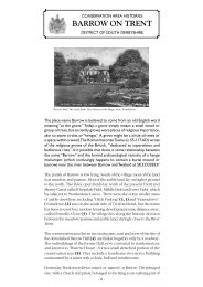
CONSERVATION AREA HISTORIES:<br />
<strong>SWARKESTONE</strong><br />
DISTRICT OF SOUTH DERBYSHIRE<br />
The Crewe and Harpur Arms, Swarkestone, 1946. By courtesy of the Derby Daily<br />
Telegraph Ltd.<br />
Swarkestone is a small village on the north bank of the Trent. It is<br />
dominated by Swarkestone Bridge (1) and its mediaeval causeway that<br />
meanders, for nearly three quarters of a mile, across the flood plain to<br />
the village of Stanton by Bridge.<br />
The bridge once stood on the medieval King’s Highway from Derby to<br />
Coventry and may well have been a major route and river crossing for<br />
centuries before the Norman Conquest. Lowes Lane (2) remained the<br />
main road to Derby well into the 18 th century. Swarkestone Bridge is first<br />
documented in 1204 as the “ponte de Cordy” and was probably made of<br />
wood. Remains of two early wooden bridges over a former course of the<br />
Trent were discovered a few miles downriver in the early 1990s, close to<br />
one another in gravel workings at Hemington. They were thought to date<br />
from the 11 th and early 13 th centuries.<br />
Swarkestone tak<br />
was granted lan<br />
874. Swerkir m<br />
perhaps the land<br />
strategic import<br />
between Round<br />
achieved some<br />
Prince Charlie’s<br />
the Second Wo<br />
traps against the<br />
More properly<br />
extra flourish t<br />
indicates that it<br />
Indeed there is<br />
the village to sh<br />
Swarkestone si<br />
Age (2600-1600<br />
five or six tumu<br />
most were plou<br />
anything like its<br />
the tumuli were<br />
or sixth centuri<br />
round them in t<br />
Slightly to the n<br />
and Romano Br<br />
showing crop m<br />
the farm on bo<br />
which gave its<br />
Swarkestone, m<br />
Weston on Tren<br />
Canal.<br />
A local tale credits the building of the bridge to two maiden ladies called<br />
Bellamont, who saw their lovers drown while trying to cross the flooded<br />
Trent meadows in the 13 th century. It is said that they devoted their lives<br />
and their fortune to the building of the bridge, and died as starving paupers.<br />
Despite an assertion that the ladies were buried at Prestwold, Leicestershire,<br />
there is no hard evidence whatever that the story is true. The Bellamont<br />
family was certainly associated with Swarkestone, but not until a much<br />
later period.<br />
However, the stylistic evidence suggests that Swarkestone Bridge was rebuilt<br />
in stone during the late 13 th and early 14 th centuries, which accords with<br />
three Royal grants of tolls for bridge “repair” between 1324 and 1347. The<br />
river bridge itself was rebuilt in 1795-97 after a disastrous flood had reduced<br />
its predecessor to ruins. The mediaeval causeway, widened and strengthened<br />
in the eighteenth and nineteenth centuries, survives. It remains heavily<br />
used today as a vital link on the A514 from Derby to the southern part of<br />
the County, connecting with the nearby network of motorways.<br />
- 1 -<br />
The river and<br />
13 th century ref<br />
Swarkestone’s p<br />
the present settl<br />
main channel o<br />
valley. High rive<br />
invades the lane
IES:<br />
E<br />
IRE<br />
y Daily<br />
he Trent. It is<br />
causeway that<br />
flood plain to<br />
from Derby to<br />
er crossing for<br />
remained the<br />
e Bridge is first<br />
bably made of<br />
r course of the<br />
1990s, close to<br />
hought to date<br />
n ladies called<br />
ss the flooded<br />
oted their lives<br />
rving paupers.<br />
, Leicestershire,<br />
he Bellamont<br />
t until a much<br />
dge was rebuilt<br />
h accords with<br />
and 1347. The<br />
d had reduced<br />
d strengthened<br />
mains heavily<br />
uthern part of<br />
ways.<br />
Swarkestone takes its name from a Dane called Swerkir who, it is surmised,<br />
was granted land in the aftermath of the Danish occupation of Repton in<br />
874. Swerkir may have been posted here to defend an important route, or<br />
perhaps the land was simply a reward for services rendered. Swarkestone’s<br />
strategic importance has subsequently been marked by a minor battle<br />
between Roundheads and Cavaliers in January 1643, and the Bridge has<br />
achieved some notoriety as the place where the advance guard of Bonnie<br />
Prince Charlie’s Army finally turned back to Scotland in 1745. Even during<br />
the Second World War it was defended by gun emplacements and tank<br />
traps against the threat of a German invasion.<br />
More properly called Swarkeston (a nineteenth century vicar added an<br />
extra flourish to the name of his parish - and it stuck), the suffix “ton”<br />
indicates that it was an Anglo Saxon settlement long before the Danes.<br />
Indeed there is ample archaeological evidence on the river terraces above<br />
the village to show that there has been human activity and settlement in<br />
Swarkestone since the arrival of the “Beaker People” in the early Bronze<br />
Age (2600-1600BC) at least. Collectively known as Swarkestone Lowes,<br />
five or six tumuli (3) dominated the skyline to the east of Lowes Lane until<br />
most were ploughed out in the 20 th century. Only one now remains in<br />
anything like its former glory, lying by the road to Lowes Farm. Some of<br />
the tumuli were reused as burial places by early Anglian settlers in the fifth<br />
or sixth centuries, and an exercise track for horses (4, 4) took a circuit<br />
round them in the eighteenth century.<br />
Slightly to the north west of Lowes Farm is the site of both an Iron Age<br />
and Romano British settlement (800BC – 500AD),while aerial photographs<br />
showing crop marks suggest that there was some sort of settlement below<br />
the farm on both sides of the road to Barrow. The name “Russewijk”,<br />
which gave its name to a furlong in one of the old common fields of<br />
Swarkestone, may signify a Dark Age farmstead. It lay near the road to<br />
Weston on Trent and the neighbouring stretch of the Trent and Mersey<br />
Canal.<br />
The river and cottages at Swarkestone. By courtesy of the Derby Daily Telegraph Ltd.<br />
13 th century references to lands lying on “the Brink” are a reminder of<br />
Swarkestone’s perilous position at the floodplain edge. However, when<br />
the present settlement was first established it perhaps seemed safer, as the<br />
main channel of the Trent may then have run on the Stanton side of the<br />
valley. High river levels still cause anxiety today, and floodwater occasionally<br />
invades the lanes of the village.<br />
- 2 -<br />
By 1086 Swarke<br />
history. The Do<br />
land that had be<br />
berewick of Me<br />
land of four fre<br />
documents of S<br />
bought out the<br />
into a single own<br />
Crewe estate du<br />
The Swarkest<br />
Geoffrey de B<br />
name appears in<br />
a clergyman) of<br />
at Barrow to the<br />
Harpur Crewe<br />
century.<br />
The Church (5)<br />
Hospitallers in<br />
lord. It certain<br />
tympanum carv<br />
this was lost wh<br />
Chapel built be<br />
tower save for<br />
now an exercise<br />
Opposite the c<br />
converted for u<br />
events and in b<br />
house in the late<br />
In the mid four<br />
the Manor and r<br />
at Law, bought<br />
John Rolleston<br />
monuments to<br />
d1577), his son
, it is surmised,<br />
n of Repton in<br />
ortant route, or<br />
Swarkestone’s<br />
a minor battle<br />
the Bridge has<br />
uard of Bonnie<br />
5. Even during<br />
ents and tank<br />
icar added an<br />
e suffix “ton”<br />
re the Danes.<br />
terraces above<br />
d settlement in<br />
e early Bronze<br />
estone Lowes,<br />
wes Lane until<br />
ow remains in<br />
Farm. Some of<br />
tlers in the fifth<br />
took a circuit<br />
By 1086 Swarkestone was already a well-established community with a long<br />
history. The Domesday survey shows that King William held the same<br />
land that had been held by King Edward the Confessor and described as a<br />
berewick of Melbourne, whilst Henry de Ferrers was rewarded with the<br />
land of four freemen. This division of land is reflected in deeds and<br />
documents of Swarkestone until 1632, when the Harpur family finally<br />
bought out the last freeholder. The village and parish were thus united<br />
into a single ownership that survived, largely intact, until sales by the Harpur<br />
Crewe estate during the 1980s.<br />
the last Sir John<br />
the florid monu<br />
Willoughby.<br />
During the 16 th<br />
John amassed, b<br />
Staffordshire. U<br />
was the princip<br />
Elizabethan cou<br />
wine cellar and<br />
The house was<br />
appears to have<br />
the first half of t<br />
of the Harpur es<br />
of Swarkestone<br />
suggest that a<br />
incorporated in<br />
together with th<br />
Hall lay in and a<br />
Alley House (8<br />
main road (9).<br />
th an Iron Age<br />
al photographs<br />
ttlement below<br />
e “Russewijk”,<br />
mon fields of<br />
ar the road to<br />
nt and Mersey<br />
legraph Ltd.<br />
a reminder of<br />
owever, when<br />
ed safer, as the<br />
ton side of the<br />
ter occasionally<br />
The Swarkestone Pavilion. SDDC Collection.<br />
Geoffrey de Bec is the first recorded Lord of the Manor in 1215. His<br />
name appears in a document transferring the advowson (the right to appoint<br />
a clergyman) of the church in Swarkestone from the Knights Hospitallers<br />
at Barrow to the de Bec family. The advowson still nominally lay with the<br />
Harpur Crewe family as Lords of the Manor until the last year of the 20 th<br />
century.<br />
The Church (5) was possibly built as a daughter chapel for the Knights<br />
Hospitallers in the mid 12 th century, or some years earlier by a manorial<br />
lord. It certainly boasted a chevron ornamented chancel arch and a<br />
tympanum carved “with monstrous quadrupeds”, both Norman, but all<br />
this was lost when the church was rebuilt in 1876. However, the Harpur<br />
Chapel built before 1577 remains little altered, as does the 14 th century<br />
tower save for the loss of its corner pinnacles. The rest of the church is<br />
now an exercise in Victorian Gothic, designed by F.J. Robinson.<br />
Opposite the church lies a small house of the early 19 th century, later<br />
converted for use as a parish room (6). Used for vestry meetings, parish<br />
events and in between times as a “reading room”, it became a private<br />
house in the late 1970s.<br />
In the mid fourteenth century the Rolleston family became the Lords of<br />
the Manor and remained so for 200 years until Richard Harpur, a Serjeant<br />
at Law, bought their land in 1557. A fine Chellaston alabaster tomb to<br />
John Rolleston who died in 1482 survives in the church, as do the grand<br />
monuments to Richard Harpur (Judge at the Court of Common Pleas<br />
d1577), his son Sir John Harpur (d1622) and their wives. The memorial to<br />
- 3 -<br />
Old Hall Far<br />
Bowl Alley Hou<br />
Banqueting Ho<br />
Swarkestone’s b<br />
of age and marr<br />
became heir to<br />
Two heirs died<br />
Young Sir John<br />
granddaughter<br />
Cavendish, later<br />
in 1632. It seem<br />
architectural con<br />
twin events.<br />
The building tak<br />
indeed a banqu<br />
a pavilion to reti
nity with a long<br />
held the same<br />
described as a<br />
arded with the<br />
in deeds and<br />
r family finally<br />
re thus united<br />
s by the Harpur<br />
r in 1215. His<br />
right to appoint<br />
ts Hospitallers<br />
lly lay with the<br />
ear of the 20 th<br />
or the Knights<br />
by a manorial<br />
cel arch and a<br />
orman, but all<br />
er, the Harpur<br />
e 14 th century<br />
f the church is<br />
nson.<br />
century, later<br />
eetings, parish<br />
ame a private<br />
e the Lords of<br />
rpur, a Serjeant<br />
aster tomb to<br />
s do the grand<br />
ommon Pleas<br />
e memorial to<br />
the last Sir John Harpur of Swarkestone (d1679) amounts to a postscript on<br />
the florid monument to his second wife, the much-married Lady Frances<br />
Willoughby.<br />
During the 16 th and early 17 th centuries Richard Harpur and his son Sir<br />
John amassed, between them, vast tracts of land in <strong>South</strong> <strong>Derbyshire</strong> and<br />
Staffordshire. Until 1679 and the absence of a direct male heir, Swarkestone<br />
was the principal family seat. In the 1620s Swarkestone Hall was a fine<br />
Elizabethan country house (7) boasting a gatehouse, some 45 rooms, a<br />
wine cellar and a dovecote.<br />
The house was damaged during the Civil War but repaired afterwards. It<br />
appears to have been little used after c1715 and was pulled down during<br />
the first half of the 18 th century. Thereafter Calke Abbey became the hub<br />
of the Harpur estates and Swarkestone’s importance declined. Some ruins<br />
of Swarkestone Hall yet remain in the grounds of Old Hall Farm. They<br />
suggest that an older house (perhaps that of the Rollestons) was<br />
incorporated into Richard Harpur’s splendid new one. Other fragments,<br />
together with the evidence of aerial photography, suggest that the Old<br />
Hall lay in and around the close adjacent to the ruins and towards the Bowl<br />
Alley House (8). An impressive pair of stone gate piers survives by the<br />
main road (9).<br />
Old Hall Farm. By courtesy of Barbara Foster.<br />
Bowl Alley House, also known variously as the Balcony, Pavilion, Stand, or<br />
Banqueting House, was completed in 1632 and rivals the bridge as<br />
Swarkestone’s best known landmark. It was built just in time for the coming<br />
of age and marriage of John Harpur of Breadsall who, as an 11 year boy,<br />
became heir to the estate in 1622 - a singularly tragic year for the Harpurs.<br />
Two heirs died in succession that year, along with “Old Sir John” himself.<br />
Young Sir John survived a fractious wardship to marry Catherine Howard,<br />
granddaughter of the Earl of Suffolk and stepdaughter of William<br />
Cavendish, later the 1 st Duke of Newcastle. Sir John entered his inheritance<br />
in 1632. It seems probable, therefore, that the Bowl Alley House - an<br />
architectural confection if ever there was one – was built to celebrate these<br />
twin events.<br />
The building takes its name from the close in which it was built, but it was<br />
indeed a banqueting house built at the very height of their fashion. It was<br />
a pavilion to retire to after feasts, for conversation, for enjoying a dessert<br />
- 4 -<br />
Ruins of the O<br />
course of swee<br />
rooftop. The acc<br />
from its inceptio<br />
amounts of mon<br />
The Bowl Alley<br />
was partly respo<br />
castle at Bolsov<br />
involved at Swa<br />
known) at Swar<br />
of the Smythson<br />
£111 12s 4d, wi<br />
The Bowl Alley<br />
care was taken<br />
family pride an<br />
visited Swarkes<br />
built a short-liv<br />
recent times th<br />
Alley House fo<br />
restored by the L<br />
Nearby lies the<br />
sixteenth or ear<br />
and original fea<br />
century it was “<br />
Its gardens bac<br />
arrangement of b<br />
The gravelled p<br />
them (7) and th<br />
Close which is r<br />
Old Hall Farm it<br />
with mullioned<br />
century, but its s<br />
was still standin<br />
and a fine “new
a postscript on<br />
d Lady Frances<br />
and his son Sir<br />
erbyshire and<br />
ir, Swarkestone<br />
Hall was a fine<br />
e 45 rooms, a<br />
d afterwards. It<br />
d down during<br />
ecame the hub<br />
ed. Some ruins<br />
all Farm. They<br />
llestons) was<br />
her fragments,<br />
st that the Old<br />
ards the Bowl<br />
urvives by the<br />
Ruins of the Old Hall. By courtesy of Barbara Foster.<br />
course of sweetmeats, fruit and wine, and to admire the view from the<br />
rooftop. The accommodation included a cellar. Puddings apart, it was used<br />
from its inception as a place for card and dice games where considerable<br />
amounts of money changed hands!<br />
The Bowl Alley House is built in the style of John Smythson (d1643), who<br />
was partly responsible for the rebuilding of William Cavendish’s fairytale<br />
castle at Bolsover, but there is no evidence that Smythson was directly<br />
involved at Swarkestone. The “surveyor” (as architects of the day were<br />
known) at Swarkestone is named as a Mr Wooldridge, perhaps an associate<br />
of the Smythsons. The building was constructed by Richard Shepherd for<br />
£111 12s 4d, with extra being paid for the lead for the domes.<br />
The Bowl Alley House was abandoned when the Hall fell out of use, but<br />
care was taken to preserve the masonry shell as a folly, or as a symbol of<br />
family pride and history. Sir Henry Crewe of Calke (1763-1819) clearly<br />
visited Swarkestone from time to time, as he had a boathouse there and<br />
built a short-lived “casina” or fishing lodge near it in 1809 (10). In more<br />
recent times the Rolling Stones have famously posed in front of Bowl<br />
Alley House for a record sleeve, and in the early 1980s it was lovingly<br />
restored by the Landmark Trust for use as an unconventional holiday home.<br />
vilion, Stand, or<br />
the bridge as<br />
for the coming<br />
n 11 year boy,<br />
or the Harpurs.<br />
John” himself.<br />
erine Howard,<br />
er of William<br />
his inheritance<br />
y House - an<br />
celebrate these<br />
built, but it was<br />
fashion. It was<br />
ying a dessert<br />
Nearby lies the “Tithe Barn”, now a house (11), and dating from the<br />
sixteenth or early seventeenth century. It is unlikely, considering its size<br />
and original features, to have ever been a tithe barn. In the nineteenth<br />
century it was “the stables” and was possibly used as such from the start.<br />
Its gardens back onto the presumed site of the Elizabethan Hall and an<br />
arrangement of brick and stone walled enclosures that once housed gardens.<br />
The gravelled paths of a formal garden have been recorded in one of<br />
them (7) and the bricks were almost certainly made in the nearby Brickiln<br />
Close which is recorded c1585.<br />
Old Hall Farm itself is, as yet, a bit of a mystery (12). Its style and detailing,<br />
with mullioned windows, suggest a date in the first half of the seventeenth<br />
century, but its site is curious, given that the Old Hall itself was so near and<br />
was still standing then. The house was extended in the nineteenth century<br />
and a fine “new model farmyard” of c1840 stands nearby.<br />
- 5 -
Agriculture was the main activity of the village until relatively<br />
recently. Half of the land was enclosed by 1632 and the common<br />
fields were finally enclosed in 1777. There is however evidence of<br />
a cottage weaving industry, a stone mason’s yard (?13) and large<br />
scale maltings (?14) in the eighteenth century. Swarkestone briefly<br />
boasted its own school in 1649. Shoemakers flourished from the<br />
seventeenth to the nineteenth century, and there was the usual<br />
complement of butchers and bakers. The blacksmith perhaps turned<br />
his hand to candlestick making! On each side of the bridge, on the<br />
Swarkestone bank of the river, there were wharves associated with the<br />
“raff” or timber trade, which no doubt gave Woodshop Lane its name. It<br />
was floating timber, pinned against the river bridge by the current, that<br />
destroyed the old bridge in 1795. Another wharf at Cuttle Bridge on the<br />
Trent and Mersey Canal (15) served the plaster pits at Chellaston from the<br />
1780s, and resulted in a realignment of what is now the main road to<br />
Chellaston and Derby.<br />
The Trent and Mersey was completed through Swarkestone in 1777 and a<br />
short-lived link from the River Trent to the Derby canal and the Trent and<br />
Mersey canal was dug in 1795 (16, 16). It was built by the Derby Canal<br />
Company to serve the <strong>South</strong> <strong>Derbyshire</strong> coal measures, as part of a<br />
proposed network of canals south of the river. In the event these were<br />
never built. The link closed in the 1820s as a result of lack of trade and<br />
punitive charges by the Trent and Mersey Canal Company (for the use of<br />
both its water and a short length of its course). The best remaining evidence<br />
of it is the entrance from the Trent, just over the wall of the Crewe and<br />
Harpur garden.<br />
The picturesque black and white timbered frontage of the “Crows<br />
Nest” on Woodshop Lane (17) may date from the early seventeenth<br />
century, but its use as a dairy in the 1920s and 30s has meant that<br />
not much else has survived. It is now a private house. Elsewhere in<br />
the village there is some evidence of ancient timber framed buildings<br />
that survived a disastrous fire in 1654. Less spectacular than the<br />
frontage of the Crows Nest, roof trusses at Hollies Farm (18) on<br />
the banks of the Trent probably predate both the fire and the<br />
insertion of a flue before the 1630s. Other timber framed cores<br />
survive elsewhere, but much of the village housing dates from a<br />
“great rebuilding” in the nineteeth century.<br />
Lowes Farm includes a handsome farmhouse (19), originally built as racing<br />
stables by Sir Harry Harpur (1739-1789) in 1777. An exercise course was<br />
laid out nearby (4, 4), which shows clearly on the Swarkestone parish plan<br />
of 1844, and races were held on Sinfin Moor. Soon after Sir Harry’s death,<br />
the stables at the Lowes were converted into a house, which has recently<br />
been divided into apartments.<br />
The River Bri<br />
Bridge House ac<br />
there are indica<br />
and built on eve<br />
the junction of B<br />
for the canal us<br />
Touched by ma<br />
its landscape ca<br />
largely gone, Sw<br />
the twelfth cent<br />
scarcely change<br />
of Derby, the pa<br />
the place where<br />
Barbara Foster<br />
Designed and p<br />
March 2005. Ser<br />
are those of the<br />
views of the Di<br />
If you require<br />
braille or lar<br />
Services Man<br />
An inn, known by “the sign of the Talbot”, could be found at Swarkestone<br />
in the mid sixteenth century. Its site is unknown, but rentals and Quarter<br />
Sessions records suggest that it may have stood by the river bridge on the<br />
Stanton side (20). Certainly an Inn stood there in the 1680s, if not before,<br />
marked as a chapel on OS maps. It was superseded by the Crewe and<br />
Harpur Arms (21) which, together with its fine stable block, was built in the<br />
late eighteenth century in anticipation of the turnpiking of the road to<br />
Ashby. In the event this never happened, but huntsmen and cockfighters<br />
alike gathered in its forecourt for a bit of sport in the nineteenth century.<br />
- 6 -
ntil relatively<br />
the common<br />
r evidence of<br />
3) and large<br />
estone briefly<br />
hed from the<br />
as the usual<br />
erhaps turned<br />
ridge, on the<br />
iated with the<br />
ne its name. It<br />
e current, that<br />
Bridge on the<br />
laston from the<br />
main road to<br />
e in 1777 and a<br />
the Trent and<br />
e Derby Canal<br />
s, as part of a<br />
nt these were<br />
k of trade and<br />
(for the use of<br />
ining evidence<br />
he Crewe and<br />
f the “Crows<br />
y seventeenth<br />
as meant that<br />
Elsewhere in<br />
ed buildings<br />
ular than the<br />
arm (18) on<br />
fire and the<br />
framed cores<br />
dates from a<br />
y built as racing<br />
ise course was<br />
ne parish plan<br />
Harry’s death,<br />
ch has recently<br />
The River Bridge (1795-97). SDDC collection.<br />
Bridge House across the road (22) was built around the same time although<br />
there are indications that the rear section of the house is somewhat earlier<br />
and built on even older foundations. An alehouse known as “The Gate” at<br />
the junction of Barrow Lane (23) served for many years as a watering hole<br />
for the canal users.<br />
Touched by major national events and innovations throughout its history,<br />
its landscape carved through by canals, railways and roads and its farmers<br />
largely gone, Swarkestone nevertheless remains the small village it was in<br />
the twelfth century. Remarkably, in size and configuration the village has<br />
scarcely changed since the sixteenth century and for many of the people<br />
of Derby, the parish boundary on the brow of Chellaston Hill now marks<br />
the place where the countryside begins.<br />
Barbara Foster.<br />
Designed and published by <strong>South</strong> <strong>Derbyshire</strong> <strong>District</strong> <strong>Council</strong>.<br />
March 2005. Series editor: Philip Heath. The views and opinions expressed<br />
are those of the author(s) concerned and do not necessarily reflect the<br />
views of the <strong>District</strong> <strong>Council</strong>.<br />
If you require a copy of this information in another language,<br />
braille or large print format please contact the Customer<br />
Services Manager on 01283 595784.<br />
at Swarkestone<br />
ls and Quarter<br />
r bridge on the<br />
s, if not before,<br />
he Crewe and<br />
was built in the<br />
of the road to<br />
d cockfighters<br />
eenth century.<br />
- 7 -<br />
NB: Swarkesto<br />
Map reproduced wit