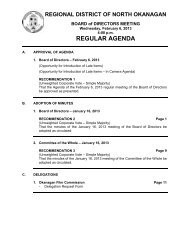
REGULAR AGENDA - Regional District of North Okanagan
REGULAR AGENDA - Regional District of North Okanagan
REGULAR AGENDA - Regional District of North Okanagan

You also want an ePaper? Increase the reach of your titles
YUMPU automatically turns print PDFs into web optimized ePapers that Google loves.
REGIONAL DISTRICT OF NORTH OKANAGAN<br />
ELECTORAL AREA ADVISORY COMMITTEE MEETING<br />
Thursday, December 8, 2011<br />
10:30 am<br />
<strong>REGULAR</strong> <strong>AGENDA</strong><br />
A. APPROVAL OF <strong>AGENDA</strong><br />
1. Regular Agenda – December 8, 2011<br />
(Opportunity for Introduction <strong>of</strong> Late Items)<br />
(Opportunity for Introduction <strong>of</strong> Late Items – In Camera Agenda)<br />
RECOMMENDATION 1<br />
That the Agenda <strong>of</strong> the December 8, 2011 Electoral Area Advisory Committee<br />
meeting be approved as presented.<br />
B. ADOPTION OF MINUTES<br />
1. Electoral Area Advisory Committee – November 3, 2011<br />
RECOMMENDATION 2 Page 1<br />
That the minutes <strong>of</strong> the November 3, 2011 Electoral Area Advisory Committee<br />
Meeting be adopted as circulated.<br />
C. PETITIONS AND DELEGATIONS<br />
1. Waiver <strong>of</strong> Lot Frontage Application<br />
FORSLUND, Linda c/o J.R. Shortt<br />
(See item F.2)<br />
2. Waiver <strong>of</strong> Lot Frontage Application<br />
CULLEN, Glen and Carrie c/o Richard and Irene Montgomery<br />
(See item F.3)<br />
D. REPORTS<br />
1. Advisory Planning Commission Meetings<br />
RECOMMENDATION 3 Page 6<br />
That the minutes <strong>of</strong> the following Advisory Planning Commission meetings be<br />
received for information:<br />
a. Electoral Area "C" – Meeting <strong>of</strong> November 30, 2011 (to be distributed at<br />
meeting)<br />
b. Electoral Area "F" – Meeting <strong>of</strong> November 21, 2011<br />
2. Eagle Pass Heliskiing Referral
Electoral Area Advisory Committee<br />
Agenda – Regular - 2 - December 8, 2011<br />
[File No. 11-0614-E-REF]<br />
- Commercial Tenure Amendment and Management Plan dated October 6, 2011<br />
RECOMMENDATION 4 Page 9<br />
That the referral dated October 6, 2011 from Eagle Pass Heliskiing c/o Front Counter<br />
BC regarding the proposed Commercial Tenure Amendment and Management Plan<br />
be received for information.<br />
E. UNFINISHED BUSINESS<br />
F. NEW BUSINESS<br />
1. Bylaw 2485 - Electoral Areas "D" & "E" Official Community Plan<br />
- Staff report dated November 22, 2011<br />
RECOMMENDATION 5 Page 42<br />
That it be recommended to the Board <strong>of</strong> Directors that Electoral Areas “D” & “E”<br />
Official Community Plan Bylaw No. 2485, 2011 be amended to include the changes<br />
outlined in Attachment 2, “Referral Comments and Public Feedback” <strong>of</strong> the report<br />
dated November 22, 2011 from the Sustainability Coordinator; and further,<br />
That it be recommended that Electoral Areas “D” & “E” Official Community Plan<br />
Bylaw No. 2485, 2011 be given Second Reading, as amended, and referred to<br />
Public Hearing.<br />
2. Waiver <strong>of</strong> Lot Frontage Application<br />
FORSLUND, Linda c/o J.R. Shortt [File No. 11-0205-E-SUB]<br />
- Staff report dated November 16, 2011<br />
RECOMMENDATION 6 Page 168<br />
That the memorandum from the Planning Department dated November 16, 2011<br />
regarding Waiver <strong>of</strong> Lot Frontage Application for the property legally described as Lot<br />
3, Sec 27, Twp 45, ODYD, Plan KAP91514 and located at 1404 Highway 6, Electoral<br />
Area “E” be received for information; and further,<br />
DIRECTION REQUESTED<br />
The Electoral Area Advisory Committee is requested to choose one <strong>of</strong> the following<br />
options:<br />
That it be recommended to the Board <strong>of</strong> Directors that the 10% minimum lot frontage<br />
requirement <strong>of</strong> Section 803.7 <strong>of</strong> the <strong>Regional</strong> <strong>District</strong> <strong>of</strong> <strong>North</strong> <strong>Okanagan</strong> Zoning<br />
Bylaw No. 1888, 2003 BE WAIVED for the property legally described as Lot 3, Sec<br />
27, Twp 45, ODYD, Plan KAP91514 and located at 1404 Highway 6, Electoral Area<br />
“E” by reducing the lot frontage <strong>of</strong> proposed Lot A from 174.47 metres to 132.88<br />
metres as shown on the site plan attached to the Planning Department report dated<br />
November 16, 2011.<br />
Or
Electoral Area Advisory Committee<br />
Agenda – Regular - 3 - December 8, 2011<br />
That it be recommended to the Board <strong>of</strong> Directors that the 10% minimum frontage<br />
requirement <strong>of</strong> Section 803.7 <strong>of</strong> the RDNO Zoning Bylaw No. 1888, 2003 NOT BE<br />
WAIVED for the property legally described as Lot 3, Sec 27, Twp 45, ODYD, Plan<br />
KAP91514 and located at 1404 Highway 6, Electoral Area “E”.<br />
3. Waiver <strong>of</strong> Lot Frontage Application<br />
CULLEN, Glen and Carrie c/o Richard and Irene Montgomery<br />
[File No. 11-0613-F-WVR]<br />
- Staff report dated November 16, 2011<br />
RECOMMENDATION 7 Page 173<br />
That the memorandum from the Planning Department dated November 16, 2011<br />
regarding Waiver <strong>of</strong> Lot Frontage Application for the properties legally described as<br />
Lots 1 and 3, Sec 3, Twp 19, R9, W6M, KDYD, Plan KAP74661 and located at 227<br />
and 229 Glenmary Road, Electoral Area ‘F’ be received for information; and further,<br />
DIRECTION REQUESTED<br />
The Electoral Area Advisory Committee is requested to choose one <strong>of</strong> the following<br />
options:<br />
That it be recommended to the Board <strong>of</strong> Directors that the 10% minimum frontage<br />
requirement <strong>of</strong> Section 802.7 <strong>of</strong> the <strong>Regional</strong> <strong>District</strong> <strong>of</strong> <strong>North</strong> <strong>Okanagan</strong> Zoning<br />
Bylaw No. 1888, 2003 BE WAIVED for the properties legally described as Lots 1 and<br />
3, Sec 3, Twp 19, R9, W6M, KDYD, Plan KAP74661 and located at 227 and 229<br />
Glenmary Road, Electoral Area ‘F’ by reducing the lot frontage <strong>of</strong> proposed Lot 3<br />
from 170.7 metres to 23.3 metres and proposed Lot 1 from 94.07 metres to 84.32<br />
metres as shown on the site plan attached to the Planning Department report dated<br />
November 16, 2011.<br />
Or<br />
That it be recommended to the Board <strong>of</strong> Directors that the 10% minimum frontage<br />
requirement <strong>of</strong> Section 802.7 <strong>of</strong> the RDNO Zoning Bylaw No. 1888, 2003 NOT BE<br />
WAIVED for the properties legally described as Lots 1 and 3, Sec 3, Twp 19, R9,<br />
W6M, KDYD, Plan KAP74661 and located at 227 and 229 Glenmary Road, Electoral<br />
Area ‘F’.<br />
4. Agricultural Land Commission Application<br />
COOKE, Robert and Leslie [File No. 11-0472-F-ALR]<br />
- Staff report dated September 21, 2011<br />
RECOMMENDATION 8 Page 181<br />
That it be recommended to the Board <strong>of</strong> Directors that the application <strong>of</strong> Robert and<br />
Leslie Cooke under Section 21(2) <strong>of</strong> the Agricultural Land Commission Act to<br />
subdivide the property legally described as The NE ¼ <strong>of</strong> Sec 26, Twp 18, R8, W6M,<br />
KDYD, Except Plans 6432, B11041, 31145, H13556 and KAP45812, located at 69<br />
Ashton Cooke Road, Electoral Area ‘F’ not be authorized for submission to the<br />
Agricultural Land Commission pursuant to Section 25(3) <strong>of</strong> the Agricultural Land<br />
Commission Act.
Electoral Area Advisory Committee<br />
Agenda – Regular - 4 - December 8, 2011<br />
5. Agricultural Land Commission Application<br />
WIFFEN, Arlene [File No. 11-0507-C-ALR]<br />
- Staff report dated November 17, 2011<br />
RECOMMENDATION 9 Page 193<br />
That it be recommended to the Board <strong>of</strong> Directors that the application to deposit fill<br />
under Section 20(3) <strong>of</strong> the Agricultural Land Commission Act on the property legally<br />
described as Lot 16, Sec 36, Twp 9, ODYD, Plan 411 and located at 1788 Francis<br />
Street, Electoral Area ‘C’ be authorized for submission to the Agricultural Land<br />
Commission.<br />
6. Shuswap River Watershed Sustainability Plan<br />
- Staff report dated November 21, 2011<br />
RECOMMENDATION 10 Page 200<br />
That the report dated November 21, 2011 from the Sustainability Coordinator<br />
regarding the Shuswap River Watershed Sustainability Plan be received for<br />
information; and further,<br />
That it be recommended to the Board <strong>of</strong> Directors that the Shuswap River<br />
Watershed Sustainability Plan Preliminary Issue Identification Paper be endorsed to<br />
inform Phase II <strong>of</strong> the planning process.<br />
7. Building Department Review Project<br />
- Staff report dated November 28, 2011<br />
OPTIONS FOR CONSIDERATION Page 214<br />
The following are staff recommendations for resolution <strong>of</strong> the Building Department<br />
funding problem:<br />
1. That taxation be used to fund a portion <strong>of</strong> the Building Department budget to a<br />
maximum <strong>of</strong> $200,000 in 2012; and further,<br />
2. That a refundable surcharge be implemented as part <strong>of</strong> the fee schedule within<br />
the Building Bylaw; and further,<br />
3. That the Notice on Title fee be increased to reflect the full cost <strong>of</strong> the Notice on<br />
Title process and further,<br />
4. That the remainder <strong>of</strong> the recommendations from the Building Department<br />
Review Project Report dated April 27, 2011 be considered in 2012 for<br />
effectiveness and cost efficiency <strong>of</strong> the Building Department.
Electoral Area Advisory Committee<br />
Agenda – Regular - 5 - December 8, 2011<br />
8. Natural Resource Road Act<br />
- Letter dated October 26, 2011 from UBCM<br />
FOR DISCUSSION Page 221<br />
9. Illegal Dumping - Sugar Lake Campsite<br />
- Staff e-mail<br />
FOR DISCUSSION Page 224<br />
10. O’Keefe Ranch Watermain Extension<br />
RECOMMENDATION 11<br />
That the <strong>of</strong>fer <strong>of</strong> financial assistance towards the O’Keefe Ranch water connection<br />
fees ($1,500 from Electoral Area “B” discretionary fund and $1,000 from Electoral<br />
Area “C” discretionary fund) be withdrawn if O’Keefe Ranch has not met the<br />
outstanding conditions by January 31, 2012, namely:<br />
• Signing <strong>of</strong> the Greater Vernon Water Terms and Conditions; and<br />
• Securing the Easement in favour <strong>of</strong> Greater Vernon Water through private land.<br />
11. <strong>North</strong> <strong>Okanagan</strong> Jaws <strong>of</strong> Life Coordination Understanding<br />
- Staff report dated November 9, 2011<br />
RECOMMENDATION 12 Page 225<br />
That it be recommended to the Board <strong>of</strong> Directors that the Memorandum <strong>of</strong><br />
Understanding referred to as <strong>North</strong> <strong>Okanagan</strong> Jaws <strong>of</strong> Life Coordination<br />
Understanding be endorsed.<br />
12. Vernon / <strong>North</strong> <strong>Okanagan</strong> Safe Communities Unit<br />
- Report dated November 28, 2011<br />
- November 2011 SpeedWatch report<br />
- BlockWatch Program report dated November 28, 2011<br />
RECOMMENDATION 13 Page 228<br />
That the reports dated November 28, 2011 from the Vernon / <strong>North</strong> <strong>Okanagan</strong><br />
Detachment – Safe Communities Unit be received for information.<br />
G. IN CAMERA<br />
RECOMMENDATION 14<br />
That, pursuant to Section 92 <strong>of</strong> the Community Charter, the regular meeting <strong>of</strong> the<br />
Electoral Area Advisory Committee convene In Camera to deal with matters deemed<br />
closed to the public in accordance with Section 90(1)(e) <strong>of</strong> the Community Charter.
Electoral Area Advisory Committee<br />
Agenda – Regular - 6 - December 8, 2011<br />
H. REPORT FROM IN CAMERA<br />
I. ADJOURNMENT
EAAC - <strong>REGULAR</strong> <strong>AGENDA</strong><br />
December 8, 2011 - Item B.1<br />
REGIONAL DISTRICT OF NORTH OKANAGAN<br />
MINUTES <strong>of</strong> a <strong>REGULAR</strong> meeting <strong>of</strong> the ELECTORAL AREA ADVISORY COMMITTEE held<br />
in the Board Room at the <strong>Regional</strong> <strong>District</strong> Office on Thursday, November 3, 2011<br />
Members: Director R. Fairbairn Electoral Area "D" Chair<br />
Director E. Foisy Electoral Area "E" Vice Chair<br />
Director M. Gavinchuk Electoral Area "B"<br />
Director M. Macnabb Electoral Area “C”<br />
Alt. Director B. Cowan Electoral Area “F”<br />
Staff: L. Mellott General Manager, Electoral Area Administration<br />
G. Routley Deputy Planning Manager<br />
L. Frank Sustainability Coordinator / Planning Technologist<br />
(Temporary)<br />
L. Schrauwen Clerk, Electoral Area Administration / Human<br />
Resources (taking minutes)<br />
Others:<br />
Public<br />
CALL MEETING TO ORDER<br />
The Chair called the meeting to order at 10:30 a.m.<br />
APPROVAL OF <strong>AGENDA</strong><br />
Regular Agenda – November 3, 2011<br />
Moved and seconded by Directors Macnabb and Gavinchuk<br />
That the Agenda <strong>of</strong> the November 3, 2011 Electoral Area Advisory Committee meeting be<br />
approved as presented.<br />
CARRIED<br />
ADOPTION OF MINUTES<br />
Electoral Area Advisory Committee – October 6, 2011<br />
Moved and seconded by Directors Macnabb and Foisy<br />
That the minutes <strong>of</strong> the October 6, 2011 Electoral Area Advisory Committee Meeting be<br />
adopted as circulated.<br />
CARRIED<br />
PETITIONS AND DELEGATIONS<br />
Official Community Plan / Rezoning Application<br />
METCALFE, David and Deanna c/o Tim and Dawn Wierzbicki<br />
David and Deanna Metcalfe as well as Tim and Dawn Wierzbicki were present to answer<br />
possible questions.<br />
Page 1 <strong>of</strong> 232
EAAC - <strong>REGULAR</strong> <strong>AGENDA</strong><br />
December 8, 2011 - Item B.1<br />
Electoral Area Advisory Committee<br />
Minutes – Regular - 2 - November 3, 2011<br />
Development Permit Application<br />
SEMINUTIN, Valery and Tammy<br />
Valery Seminutin spoke in support <strong>of</strong> the application.<br />
Development Permit with Variance Application<br />
PURSER, Stephen and Yvonne<br />
No one was present to speak to this application.<br />
REPORTS<br />
Advisory Planning Commission Meetings<br />
Moved and seconded by Alternate Director Cowan and Director Foisy<br />
That the minutes <strong>of</strong> the following Advisory Planning Commission meetings be received for<br />
information:<br />
- Electoral Area "C" – Meeting <strong>of</strong> October 26, 2011<br />
- Electoral Area "F" – Meeting <strong>of</strong> October 17, 2011<br />
CARRIED<br />
Vernon / <strong>North</strong> <strong>Okanagan</strong> Safe Communities Unit<br />
Moved and seconded by Directors Macnabb and Gavinchuk<br />
That the report dated October 24, 2011 from the Vernon / <strong>North</strong> <strong>Okanagan</strong> Detachment – Safe<br />
Communities Unit be received for information.<br />
CARRIED<br />
The GM, Electoral Area Administration was requested to confirm with the Crime Prevention<br />
Coordinator as to the number <strong>of</strong> people in each electoral area who belong to a Blockwatch<br />
Program.<br />
NEW BUSINESS<br />
Bylaw 2484 – Kingfisher Local Area Plan<br />
Moved and seconded by Alternate Director Cowan and Director Macnabb<br />
That it be recommended to the Board <strong>of</strong> Directors that Bylaw No. 2484, 2011 being the<br />
Kingfisher Local Area Plan, be amended to include the changes outlined in Attachment 2,<br />
“Referral Comments and Public Feedback”; and further,<br />
That it be recommended that the Kingfisher Local Area Plan, Bylaw No. 2484, 2011 be given<br />
Second Reading, as amended and referred to Public Hearing; and further,<br />
That the Public Hearing be delegated to the Electoral Area Advisory Committee; and further,<br />
That staff be directed to set a date for the Public Hearing far enough in advance to ensure wide<br />
spread community notification.<br />
CARRIED<br />
Page 2 <strong>of</strong> 232
EAAC - <strong>REGULAR</strong> <strong>AGENDA</strong><br />
December 8, 2011 - Item B.1<br />
Electoral Area Advisory Committee<br />
Minutes – Regular - 3 - November 3, 2011<br />
Discussion ensued regarding seasonal residents and how their opinions are integrated into the<br />
Kingfisher Local Area Plan. It was noted that the Board <strong>of</strong> Directors receives input through the<br />
Public Hearing process. The Code <strong>of</strong> Conduct item in the Kingfisher Local Area Plan was<br />
discussed with regard to seasonal residents and tourists.<br />
Discussion took place regarding how the Kingfisher Local Area Plan integrates with other<br />
planning documents. It was noted that the Kingfisher Local Area Plan will be an appendix to the<br />
Electoral Area “F” Official Community Plan, and it was developed concurrent with the <strong>Regional</strong><br />
Growth Strategy.<br />
Official Community Plan / Rezoning Application<br />
METCALFE, David and Deanna c/o Tim and Dawn Wierzbicki [File No.10-0773-F-OR]<br />
Moved and seconded by Alternate Director Cowan and Director Macnabb<br />
That it be recommended to the Board <strong>of</strong> Directors that the application to amend the Electoral<br />
Area “F” Official Community Plan land use designation and the zoning <strong>of</strong> the properties legally<br />
described as Lot 1 & 2, Sec 15, Twp 20, R8, W6M, KDYD, Plan 35737, and located at 75 & 57<br />
Parsons Road, Electoral Area ‘F’ from Country Residential to Small Holdings be supported and<br />
staff be directed to prepare an Official Community Plan Amendment Bylaw for First Reading<br />
only; and further,<br />
That the applicant be required to hold a Public Information Meeting in accordance with the<br />
Public Information Meeting Guide, prior to consideration <strong>of</strong> bylaws for further readings.<br />
CARRIED<br />
Development Permit Application<br />
SEMINUTIN, Valery and Tammy [File No. 11-0433-C-DP]<br />
Moved and seconded by Directors Macnabb and Foisy<br />
That it be recommended to the Board <strong>of</strong> Directors that an exemption to Section 1701.3.b.ii <strong>of</strong><br />
the <strong>Regional</strong> <strong>District</strong> <strong>of</strong> <strong>North</strong> <strong>Okanagan</strong> Zoning Bylaw No. 1888, 2003 be approved for the<br />
property legally described as Lot B, Sec 35, Twp 9, ODYD, Plan 33375 and located at 915<br />
Pottery Road, Electoral Area ‘C’ to permit the floodplain setback <strong>of</strong> an accessory residential<br />
building to be reduced from 15 m to 10 m as shown on the site plan attached to the Planning<br />
Department Report dated October 12, 2011 and subject to a Section 219 Covenant being<br />
registered on the title <strong>of</strong> the subject property which saves harmless the <strong>Regional</strong> <strong>District</strong> from<br />
any damages that may be caused by flooding; and further,<br />
That a Development Permit be issued for the property legally described as Lot B, Sec 35, Twp<br />
9, ODYD, Plan 33375 and located at 915 Pottery Road, Electoral Area ‘C’ subject to:<br />
1. The dimensions and siting <strong>of</strong> the accessory residential building to be constructed on the<br />
land be in general accordance with the site plan attached to the Planning Department<br />
Report dated October 12, 2011;<br />
2. Land within 15 m <strong>of</strong> the natural boundary <strong>of</strong> Hog Gulch Creek must remain free <strong>of</strong><br />
development with the exception <strong>of</strong> fencing, works and plantings to control erosion, protect<br />
banks, protect fisheries or waterfowl habitat or otherwise preserve and enhance the creek<br />
and associated habitats and except as permitted under the Riparian Areas Regulation.<br />
CARRIED<br />
Page 3 <strong>of</strong> 232
EAAC - <strong>REGULAR</strong> <strong>AGENDA</strong><br />
December 8, 2011 - Item B.1<br />
Electoral Area Advisory Committee<br />
Minutes – Regular - 4 - November 3, 2011<br />
Development Permit with Variance Application<br />
PURSER, Stephen and Yvonne [File No. 11-0274-F-DP]<br />
Moved and seconded by Alternate Director Cowan and Director Gavinchuk<br />
That it be recommended to the Board <strong>of</strong> Directors that upon consideration <strong>of</strong> input from adjacent<br />
landowners, a Development Permit with Variance be issued for the property legally described as<br />
South 10 Chains <strong>of</strong> the Fractional W ½ <strong>of</strong> the SE ¼ <strong>of</strong> Sec 27, Twp 20, R8, W6M, KDYD,<br />
Except Plans 26399, H809, and KAP76653 and located at 8259 Highway 97A, Electoral Area<br />
“F” to vary Sections 1101.2.e and 1201.6.d <strong>of</strong> the <strong>Regional</strong> <strong>District</strong> <strong>of</strong> <strong>North</strong> <strong>Okanagan</strong> Zoning<br />
Bylaw No. 1888, 2003 by waiving the requirement to pave a commercial parking and loading<br />
area subject to the following conditions:<br />
1. The dimensions and siting <strong>of</strong> buildings on the land be in general accordance with the site<br />
plan and building elevations attached to and forming part <strong>of</strong> Planning Department<br />
Information Report dated September 21, 2011;<br />
2. No natural vegetation shall be removed or degraded within a horizontal distance <strong>of</strong> 15 m<br />
from the natural boundary <strong>of</strong> Rogers Creek nor shall any development occur which will<br />
preclude growth <strong>of</strong> natural vegetation except in accordance with the written permission <strong>of</strong><br />
Fisheries and Oceans Canada and the Ministry <strong>of</strong> Environment;<br />
3. No building or structure or any part there<strong>of</strong>, including any fixed equipment may be<br />
constructed, reconstructed, moved, extended or located, nor should any landfill, land<br />
clearing or other disturbance take place within a horizontal distance <strong>of</strong> 15 metres from the<br />
natural boundary <strong>of</strong> Rogers Creek;<br />
4. Any clearing and/or excavation or fill done on the subject property should be completed in<br />
such a manner as to ensure that sediment, concrete washwater, leachates or any other<br />
substance <strong>of</strong> any type that may be deleterious to aquatic life should not be deposited into<br />
Rogers Creek and/or adjacent flood channels via ditches, storm sewers or overland flow,<br />
and all construction and excavation wastes, overburden, soil or any other substances that<br />
may be deleterious to aquatic life should be disposed <strong>of</strong> or placed in such a manner as to<br />
prevent their entry into Rogers Creek;<br />
5. A means <strong>of</strong> sewage disposal that does not discharge directly into Rogers Creek must be<br />
installed. The applicant must provide evidence that the filings required by the Sewerage<br />
System Regulation under the Health Act have been made, or that a holding tank permit has<br />
been issued, or that treated sewage effluent will be disposed <strong>of</strong> in accordance with the<br />
Environmental Management Act;<br />
6. A storm water management plan must be prepared by a pr<strong>of</strong>essional engineer to provide for<br />
the control <strong>of</strong> run-<strong>of</strong>f from any parking areas, internal roadways, and buildings during and<br />
after the period <strong>of</strong> construction <strong>of</strong> any buildings. Storm water outlet facilities should not be<br />
installed directly into Rogers Creek or into a tributary watercourse, drainage ditch or gully<br />
except where a stormwater renovation system is being implemented. Storm water<br />
management systems should be consistent with the "Land Development Guidelines for the<br />
Protection <strong>of</strong> Aquatic Habitats" (Ministry <strong>of</strong> Water, Land and Air Protection and Department<br />
<strong>of</strong> Fisheries and Oceans, 1992), and may require approval by the Department <strong>of</strong> Fisheries<br />
and Oceans and/or the Ministry <strong>of</strong> Environment. The storm water management plan should<br />
also be consistent with the document titled Stormwater Planning: A Guide for BC;<br />
7. The driveway, parking and loading area shall be graded to provide an even surface, be<br />
drained so that no surface water accumulates thereon or runs <strong>of</strong>f onto any sidewalk, or runs<br />
<strong>of</strong>f onto any highway and that the surface shall be kept free <strong>of</strong> weeds, and shall be<br />
gravelled, treated to suppress dust and have access to and from highways as approved by<br />
the Ministry <strong>of</strong> Transportation and Infrastructure where applicable.<br />
CARRIED<br />
Page 4 <strong>of</strong> 232
EAAC - <strong>REGULAR</strong> <strong>AGENDA</strong><br />
December 8, 2011 - Item B.1<br />
Electoral Area Advisory Committee<br />
Minutes – Regular - 5 - November 3, 2011<br />
IN CAMERA<br />
Moved and seconded by Directors Macnabb and Gavinchuk<br />
That, pursuant to Section 92 <strong>of</strong> the Community Charter, the regular meeting <strong>of</strong> the Electoral<br />
Area Advisory Committee convene In Camera to deal with matters deemed closed to the public<br />
in accordance with Section 90(1)(f) <strong>of</strong> the Community Charter.<br />
The regular meeting <strong>of</strong> the Electoral Area Advisory Committee adjourned to meet In Camera at<br />
11:11 p.m.<br />
The regular meeting <strong>of</strong> the Electoral Area Advisory Committee reconvened at 11:42 a.m.<br />
ADJOURNMENT<br />
There being no further business the meeting was adjourned at 11:51 a.m.<br />
Certified Correct:<br />
Chair<br />
Corporate Officer<br />
Page 5 <strong>of</strong> 232
1<br />
EAAC - <strong>REGULAR</strong> <strong>AGENDA</strong><br />
December 8, 2011 - Item D.1<br />
REGIONAL DISTRICT OF NORTH OKANAGAN<br />
MINUTES <strong>of</strong> the <strong>REGULAR</strong> meeting <strong>of</strong> the Advisory Planning Commission<br />
Electoral Area ‘F’ held in the Board Room at the Enderby Fire Hall on<br />
MONDAY, November 21, 2011.<br />
MEMBERS:<br />
Keith Gray, Chairperson<br />
Dale Fennell, Vice Chairperson<br />
Bob Honeyman<br />
Diane Larsen<br />
Tilman Nahm<br />
Robert Whitley<br />
Herman Halvorson, Director<br />
OTHERS PRESENT: Gail Murphy, Recording Secretary<br />
GUESTS: Jackie Pearase, Incoming Director, Leslie & Robert Cooke<br />
Keith Gray, Chairperson, called the meeting to order at 6:56 PM.<br />
A. ADOPTION OF MINUTES:<br />
Moved by Tilman Nahm<br />
Seconded by Dale Fennell<br />
“That the Minutes <strong>of</strong> the October 17, 2011 regular meeting <strong>of</strong> the Advisory<br />
Planning Commission Electoral Area “F” APC be adopted as circulated.”<br />
CARRIED<br />
Moved by Bob Honeyman<br />
Seconded by Diane Larsen<br />
“That the agenda order be changed from D New Business to C and C Unfinished<br />
Business to D.”<br />
CARRIED<br />
Keith Gray led the Introduction <strong>of</strong> the APC Committee and Guests to each other.<br />
B. PETITION AND DELEGATIONS:<br />
1. Agricultural Land Commission Application<br />
R. & L. Cooke<br />
(File No. 11-0472-F-ALR<br />
PETITION:<br />
a. Robert Cooke is asking to have 5 acres taken <strong>of</strong>f <strong>of</strong> the 62 acres.<br />
b. The land has been in the family name since 1902 but due to illness <strong>of</strong><br />
his wife, the property has become too much for them so they want to<br />
subdivide the 5 acres to build a house and <strong>of</strong>fer their children to buy the<br />
rest <strong>of</strong> the farm.<br />
c. The land that is proposed for subdivision is divided by a swampy area,<br />
gravel pit and hillside with the possibility <strong>of</strong> 1 to 2 ½ acres <strong>of</strong> the 5<br />
acres could be farm land.<br />
Page 6 <strong>of</strong> 232<br />
1
2<br />
EAAC - <strong>REGULAR</strong> <strong>AGENDA</strong><br />
December 8, 2011 - Item D.1<br />
C. NEW BUSINESS:<br />
1. Agricultural Land Commission Application<br />
R. & L. Cooke<br />
(File No. 11-0472-F-ALR<br />
Moved by Dale Fennell<br />
Seconded by Tilman Nahm<br />
“That the APC accept the recommendations <strong>of</strong> Development Services to not be<br />
authorized for submission to the Agricultural Land Commission pursuant to<br />
Section 25(3) <strong>of</strong> the Agricultural Land Commission Act.”<br />
Discussion:<br />
a. Dale stated he has concerns for the water from the Edwin Stream as he<br />
has water rights on it along with three others. Dale stated the Creek has<br />
never dried up but the volume <strong>of</strong> the creek has diminished somewhat in<br />
the last two years. He is concerned with any further development on the<br />
property that might occur in that swampy area as it could impact the flow <strong>of</strong><br />
the stream. Page 9 (5) addresses the stream and the water licenses along<br />
with concerns and guidelines. Page 7, under planning stated that a portion<br />
was subdivided (KAP45812) from the subject property (H13550 – NE1/4)<br />
in 1991. Dale says the water is critical to the adjacent properties with water<br />
licenses from Edwin stream.<br />
b. Tilman Nahm viewed the property and is concerned with the possibility <strong>of</strong><br />
septic pollution entering that water course.<br />
CARRIED<br />
D. Unfinished Business<br />
1. Rezoning/OCP Amendment Application<br />
T. & J. ZUMMAC<br />
(File No. 09-0489-F-OR)<br />
- Bylaw 2425<br />
- Bylaw 2426<br />
After some discussion, while waiting for a telephone conference from Planning it<br />
was:<br />
Moved by Tilman Nahm<br />
Seconded by Dale Fennell<br />
“That the APC table this application to a later date for further information from the<br />
Planning Department by speaker phone or a personal visit.”<br />
E. ADJOURNMENT:<br />
“There being no further business, the meeting adjourned at 7:55 P.M.”<br />
Next Area “F” APC meeting will be held on December 19, 2011 in the Fire Hall.<br />
Page 7 <strong>of</strong> 232<br />
2
3<br />
Certified Correct:<br />
EAAC - <strong>REGULAR</strong> <strong>AGENDA</strong><br />
December 8, 2011 - Item D.1<br />
_______________________________<br />
Chair<br />
__________________________<br />
Secretary<br />
Page 8 <strong>of</strong> 232<br />
3
EAAC - <strong>REGULAR</strong> <strong>AGENDA</strong><br />
December 8, 2011 - Item D.2<br />
Eagle Pass Heliskiing<br />
Commercial Tenure Amendment<br />
And<br />
Management Plan<br />
October 2011<br />
EPH Tenure Amendment Application Management Plan – October 6, 2011<br />
Page | 1<br />
Page 9 <strong>of</strong> 232
EAAC - <strong>REGULAR</strong> <strong>AGENDA</strong><br />
December 8, 2011 - Item D.2<br />
General Overview <strong>of</strong> Business<br />
o Eagle Pass Heliskiing current operating tenure is 102 km long running<br />
north and south along the western side <strong>of</strong> the Monashee Mountains.<br />
Revelstoke is situated in approximately the mid point <strong>of</strong> the tenure. Our<br />
main base <strong>of</strong> operation is 20 km south <strong>of</strong> Revelstoke at Mulvehill Creek<br />
Wilderness Lodge. We also operate out <strong>of</strong> Silver Star Mountain Resort,<br />
and Sparkling Hill Wellness Hotel both just outside <strong>of</strong> Vernon, B.C. This<br />
will be our first winter operating our regular program from Echo Bay<br />
Lodge.<br />
o We <strong>of</strong>fer lodge based, small group Heliskiing to our clients which<br />
specializes in a personalized boutique ski vacations that skiers can enjoy<br />
from around the world.<br />
o Eagle Pass Heliskiing has relocated it’s main lodge in part due to a loss in<br />
overlap tenure with CMH and is looking to secure poor weather skiing<br />
close to Echo Bay Lodge at Mulvehill Creek Lodge<br />
Objective <strong>of</strong> Tenure Amendment Application<br />
The objective <strong>of</strong> this application is to apply for the additional areas outlined in red on the<br />
overview map to augment and improve Eagle Pass’s current operation. This is required<br />
due to relocation <strong>of</strong> the base lodge and expansion <strong>of</strong> the operation. Another part <strong>of</strong> the<br />
<strong>of</strong> the expansion is a result <strong>of</strong> new partnerships with nearby resorts; Silver Star<br />
Mountain Resort and Sparkling Hill Resort nearby Vernon, B.C. The areas include:<br />
o Begbie Polygon: approx 5 km west <strong>of</strong> Revelstoke<br />
o South Cranberry Polygon: approx 30 km SW <strong>of</strong> Revelstoke near the weat<br />
shore <strong>of</strong> Upper Arrow Lake<br />
o Vidler Polygon: Due east <strong>of</strong> Cherryville and Sugar Lake<br />
o Mabel Shoulder Polygon: east <strong>of</strong> Kingfisher on N side <strong>of</strong> Tsuis Creek<br />
o Simard Creek Polygon: east <strong>of</strong> Kingfisher on S side <strong>of</strong> Tsuis Creek<br />
o Nelson Polygon: between Mabel Lake and the Shuswap Lake<br />
o Silver Star Polygon: NE <strong>of</strong> Silver Star Mountain Resort<br />
o Bews Polygon: between Anstey Arm and Lake Revelstoke in Perry River<br />
drainage<br />
o Griffin Polygin: west <strong>of</strong> 3 Valley Gap and adjoins existing EPH poylgons to<br />
the east and west. To the SE it borders Mt Griffin Park.<br />
Key Areas <strong>of</strong> Concern<br />
o Key areas <strong>of</strong> concern include environmental values, public and<br />
commercial interests in the proposed areas. Red and blue listed species<br />
and EPH’s potential impacts on them are <strong>of</strong> particular concern. EPH has<br />
an existing environmental management plan that should address the<br />
majority <strong>of</strong> the environmental issues.<br />
EPH Tenure Amendment Application Management Plan – October 6, 2011<br />
Page | 2<br />
Page 10 <strong>of</strong> 232
EAAC - <strong>REGULAR</strong> <strong>AGENDA</strong><br />
December 8, 2011 - Item D.2<br />
Section 1: Description <strong>of</strong> the Operation & Activities Offered<br />
1.1 General Description <strong>of</strong> Operation<br />
1.1.1 General Area<br />
Our operating tenure is in the <strong>North</strong> Central Monashee Mountains north and south <strong>of</strong><br />
the Trans Canada Highway between Revelstoke and Sicamous. It is on the west side <strong>of</strong><br />
the height <strong>of</strong> land <strong>of</strong> the Monashee Range. It encompasses approximately 101,400<br />
hectares.<br />
Two new proposed polygons (Begbie and South Cranberry) are west and south <strong>of</strong><br />
Revelstoke and drain into the Columbia River watershed. These two polygons are in<br />
close proximity to our new lodge located 18 km south <strong>of</strong> Revelstoke, which will serve as<br />
necessary poor weather skiing.<br />
More polygons are in between Silver Star Mountain Resort and our existing tenure to<br />
provide jump runs enroute from Silver Star Mountain or Sparkling Hill Resort near<br />
Vernon, B.C.<br />
1.1.2 Base Operation<br />
Base Operation<br />
Mulvehill Creek Wilderness Lodge, Revelstoke, B.C.<br />
o Regular ski program with 3 groups using A-star<br />
o Day ski program from Revelstoke, 3 groups in A-Star<br />
o Total skier day potential 1800<br />
Mulvehill Creek Wilderness Lodge is ideally situated for operating in the south and mid<br />
parts <strong>of</strong> EPH current tenure. It is located 18 km south <strong>of</strong> Revelstoke <strong>of</strong>f <strong>of</strong> hwy #23 and<br />
along the shores <strong>of</strong> the Columbia River. From here, we will also be able to shuttle<br />
guests west on Hwy 1 or towards Mica Dam in order to access the northern tenure<br />
area. Mulvehill Creek Lodge is using 100% micro hydro energy.<br />
Other Lodging<br />
Sparkling Hill Wellness Hotel, Vernon B.C.<br />
o Private Ski Lodge<br />
o Exclusive private ski program using Bell 407 (guide and tail guide)<br />
o Total skier day potential 280-540<br />
Sparkling Hill Resort is located 18 km south <strong>of</strong> Vernon, B.C. <strong>of</strong>f hwy #97.<br />
EPH Tenure Amendment Application Management Plan – October 6, 2011<br />
Page | 3<br />
Page 11 <strong>of</strong> 232
EAAC - <strong>REGULAR</strong> <strong>AGENDA</strong><br />
December 8, 2011 - Item D.2<br />
Silver Star Mountain Resort, Vernon B.C.<br />
o Day ski semi private program<br />
o Private and semi private program using B2 A-Star<br />
o Total skier day potential 280-540<br />
Eagle Pass Heliskiing is commencing day ski operations from Silver Star Mountain<br />
Resort this December. Silver Star Mountain Resort is located 36 km to the southwest <strong>of</strong><br />
EPH southern tenure boundary which is along the NE side <strong>of</strong> Mabel Lake.<br />
1.1.3 Improvements<br />
o 2 new Enviro Tanks for remote fuel caches<br />
1.1.4 Access<br />
1.1.5 Staff<br />
o Most guests skiing with Eagle Pass Heliskiing fly to and from Kelowna<br />
International Airport and use ground shuttle or heli transfer to the<br />
respective lodges – all located on private land. Ground transfer is 2.5<br />
hours using highway 97 N and then on the TransCanada to Revelstoke. If<br />
there are highway closures, the ground shuttle will be through highway 6<br />
in Vernon to Nakusp and then north to Revelstoke. EPH does <strong>of</strong>fer heli<br />
transfer direct from Kelowna International Airport.<br />
Staff Category # <strong>of</strong> Employees Experience and/or Certificates<br />
Lead Guide 6 UIAGM/ACMG Full Certificate or<br />
Equivalent<br />
Guide 8 ACMG/CSGA assistant<br />
Office<br />
2 full time/ 1 part<br />
Lodge Staff 10-12 N/A<br />
Total Staff<br />
28 full time<br />
winter<br />
6 year round<br />
EPH Tenure Amendment Application Management Plan – October 6, 2011<br />
Page | 4<br />
Page 12 <strong>of</strong> 232
EAAC - <strong>REGULAR</strong> <strong>AGENDA</strong><br />
December 8, 2011 - Item D.2<br />
1.2 Commercial Recreation Activities Offered On Crown Land<br />
1.2.1 Description <strong>of</strong> Experience Being Offered<br />
o Eagle Pass Heliskiing <strong>of</strong>fers small group Heliskiing utilizing either a<br />
Eurocopter B2 A-Star or a Bell 407, both small powerful machines which<br />
fit 4 and 5 guests plus guide and pilot.<br />
o Dec 15- April 15 Season<br />
o Multi Group lodge based packages from Mulvehill Creek Wilderness<br />
Lodge<br />
o Exclusive Private and Semi Private ski vacations from Sparkling Hill<br />
Wellness Hotel<br />
o Day skiing program from Silver Star Mountain Resort<br />
o Future plans <strong>of</strong> some form <strong>of</strong> ground transfer back up skiing during poor<br />
weather<br />
1.2.2 Detailed Listing <strong>of</strong> Activities & Level <strong>of</strong> Use<br />
o EPH is currently operating as a mechanized heliski operator and we also<br />
<strong>of</strong>fer heli-assisted ski touring. All packages and ski product will be lodge<br />
based from Mulvehill Creek Lodge and Sparkling Hill Resort, or day skiing<br />
complimented from the community <strong>of</strong> Revelstoke and Silver Star Mountain<br />
Resort and surrounding area.<br />
o EPH is in the process <strong>of</strong> researching suitable areas for cat ski back up<br />
within its operating area which may commence in the 2013 or 2014 winter<br />
season. This area will be used only when flying is not and option. We<br />
anticipate that further conversations with agencies, stakeholders, and First<br />
Nations would be required to achieve approval <strong>of</strong> backup winter<br />
recreation.<br />
EPH Tenure Amendment Application Management Plan – October 6, 2011<br />
Page | 5<br />
Page 13 <strong>of</strong> 232
Year Full<br />
Capacity<br />
is<br />
reached<br />
EAAC - <strong>REGULAR</strong> <strong>AGENDA</strong><br />
December 8, 2011 - Item D.2<br />
Extensive<br />
Area Map<br />
Reference<br />
Activity<br />
/Activitie<br />
s<br />
Specific<br />
References<br />
on Map<br />
Table 1.1 Extensive Areas <strong>of</strong> Use<br />
Activity Report Client Days<br />
Frequency<br />
<strong>of</strong> Use<br />
Period <strong>of</strong><br />
use<br />
Existing or<br />
Proposed<br />
Use<br />
Current<br />
Year<br />
Next<br />
Year<br />
Year 3 Full<br />
Capacity<br />
Begbie Heliskiing W <strong>of</strong><br />
Revelstoke<br />
Extensive Dec 15-<br />
Apr 15<br />
20-30 times<br />
per year<br />
0 100 100 150 2014<br />
Cranberry Heliskiing S <strong>of</strong> Mulvehill Extensive Dec 15-<br />
Apr 15<br />
30-40 times<br />
per year<br />
0 150 200 250 2014<br />
Page 14 <strong>of</strong> 232<br />
Vidler Helskiing E <strong>of</strong> Vernon Intensive Dec 15-<br />
Apr 15<br />
Simard<br />
Creek<br />
Silver<br />
Star<br />
Heliskiing E <strong>of</strong> Mabel Occasional Dec 15-<br />
Apr 15<br />
Heliskiing N <strong>of</strong> Silver<br />
Star<br />
Occasional Dec 15-<br />
Apr 15<br />
15 times per<br />
year<br />
5-10 times<br />
per year<br />
5-10 times<br />
per year<br />
0 80 150 250 2015<br />
0 25 25 25 2012<br />
0 25 25 50 2015<br />
Nelson Heliskiing E <strong>of</strong> Mabel Occasional Dec 15-<br />
Apr 15<br />
1-5 times per<br />
year<br />
0 36 36 150 2015<br />
Mabel<br />
Shoulder<br />
Heliskiing E <strong>of</strong> Mabel Occasional Dec 15-<br />
Apr 15<br />
5-10 times<br />
per year<br />
0 25 25 25 2012<br />
Griffin Heliskiing W <strong>of</strong> Griffin<br />
Lake<br />
Occasional Dec 15-<br />
Apr 15<br />
5-10 times<br />
per year<br />
0 25 25 25 2012<br />
Bews Helisking Perry River Occasional Dec 15-<br />
Apr 15<br />
5-10 times<br />
per year<br />
0 25 25 25 2012<br />
EPH Tenure Amendment Application Management Plan – October 6, 2011<br />
6
EAAC - <strong>REGULAR</strong> <strong>AGENDA</strong><br />
December 8, 2011 - Item D.2<br />
1.2.1.4 Notes and Descriptors for Proposed Polygons<br />
Begbie Creek Polygon (extensive use site)<br />
Begbie Creek polygon is located 5 km directly west <strong>of</strong> the town <strong>of</strong> Revelstoke and 11<br />
km north <strong>of</strong> Mulvehill Creek Wilderness Lodge. It encompasses the Begbie Creek<br />
drainage. It is bordered by CMH south near Mt Begbie, and to the north on Mt<br />
Macpherson. To the west, the zone borders on English Lake Park. This zone adjoins<br />
our existing tenure south <strong>of</strong> HWY #1 by 3 Valley Gap.<br />
Bioclimatic zones consist <strong>of</strong> Interior Cedar Hemlock (ICH) in the valley, Engelmann<br />
Spruce/Subalpine Fir (ESSF) and Alpine Tundra (AT) in the upper elevations. Skiing will<br />
occur between the elevations <strong>of</strong> 1100 and 2500 M. This zone is in close proximity to our<br />
main lodge and will provide good jump runs to our existing tenure area and good home<br />
runs. The skiing in this zone can be classified as low to moderate poor weather skiing at<br />
the lower elevations, and mod-high hazard good weather skiing in the higher<br />
elevations. The area will also allow for safe exit to main lodge in poor weather.<br />
21 Ha <strong>of</strong> this zone has been identified as UWR u-8-005 (Mountain Goat). 37 Ha <strong>of</strong> this<br />
zone has been identified as UWR u-8-004 (Caribou) but does not fall under the<br />
Mountain Caribou Section 16 Map Reserve.<br />
South Cranberry Creek Polygon (extensive use site)<br />
South Cranberry Creek polygon lies west <strong>of</strong> the Columbia River on the northern east<br />
facing half <strong>of</strong> Hall Mountain, and to the west <strong>of</strong> Coursier Lake, directly north and west <strong>of</strong><br />
Pingston Lake and adjoins directly into our existing Gates Creek Zone. CMH Kootenay<br />
borders to the south and northwest <strong>of</strong> this zone. Great Canadian Snowmobile tours<br />
operate on and around Hall Mountain.<br />
Bioclimatic zones consist <strong>of</strong> ICH, ESSF and AT. Skiing will occur between 800 M and<br />
2500 M. The northeast aspect <strong>of</strong> Hall Mtn will provide good poor weather skiing as it<br />
has numerous low elevation cut blocks. The area to the south and east <strong>of</strong> Coursier lake<br />
is characterized by open and sparsely treed skiing near the tops <strong>of</strong> the runs, and<br />
excellent tree and cut block skiing below. Runs are in close proximity to each other and<br />
provide numerous aspects to ski, and provide safe exit to main valley and lodge in poor<br />
weather. EPH and CMH are currently working on a flight safety plan to ensure safe<br />
travel through existing and proposed terrain.<br />
26 Ha <strong>of</strong> this zone has been identified as UWR u-4-001 (Moose). Mountain Caribou<br />
Section 16 Map Reserve borders south <strong>of</strong> this zone along the top <strong>of</strong> Hall Peak and to<br />
the northwest <strong>of</strong> Coursier Lake on this proposed zone.<br />
EPH Tenure Amendment Application Management Plan – October 6, 2011<br />
7<br />
Page 15 <strong>of</strong> 232
EAAC - <strong>REGULAR</strong> <strong>AGENDA</strong><br />
December 8, 2011 - Item D.2<br />
Vidler Polygon (intensive use site)<br />
Vidler polygon lies directly east <strong>of</strong> Cherryville and is bordered by Halycon Heliskiing to<br />
the north, CMH Kootenay to the west, and Keefer Lake adventures to the south. Vidler<br />
zone lies south <strong>of</strong> Vidler Creek, east <strong>of</strong> Mosquito Lake, and north <strong>of</strong> Mt Beavon.<br />
Bioclimatic zones consist <strong>of</strong> ICH and ESSF. The area has been heavily logged and<br />
would be the southern boundary <strong>of</strong> EPH. It will provide very good poor weather skiing<br />
for heliskiing from EPH’s bases <strong>of</strong> Silver Star Mountain Resort and Sparkling Hill Resort<br />
which is 30 km away. Skiing will occur between 800 M and 2200 M. Tops <strong>of</strong> runs are<br />
sparsely treed and most runs end up in cut blocks near the valley bottoms. South facing<br />
runs will <strong>of</strong>fer great early to mid season tree skiing.<br />
EPH is currently entering a joint venture agreement with Keefer Lake Adventures to<br />
provide mechanized guiding service and expertise for their cat and heliski program.<br />
This polygon will tie into their existing tenure and EPH will look at drawing up a Joint<br />
Use agreement (JUA) with Keefer Lake in the future which has plans <strong>of</strong> <strong>of</strong>fering both<br />
cat and heliski operations.<br />
Most <strong>of</strong> this proposed zone has been identified as UWR u-4-001, u-8-006 (Moose), and<br />
u-8-001 (Mule Deer).<br />
The following polygons are in between existing EPH operating Tenure and both<br />
Silver Star Mountain and Sparkling Hill Resort. These areas have been selected<br />
as jump in runs for multi group heliski programs and for jump in runs for private<br />
and semi private groups heading deeper into the bigger mountains. Most <strong>of</strong> these<br />
areas top out at 2000 M with skiing down to a minimum <strong>of</strong> 800 M.<br />
Mabel Shoulder Zone<br />
Mabel Shoulder zone lies directly east <strong>of</strong> Mabel Lake and north <strong>of</strong> Tsuis Creek. It ties<br />
into our existing tenure in the Mabel Zone. The border goes down to near lake level in<br />
consideration <strong>of</strong> a future lodge site.<br />
Bioclimatic zones consist <strong>of</strong> ICH near valley bottom and ESSF to the ridge tops. Skiing<br />
elevation will be from 800 M to 2000 M with numerous poor weather cut block skiing on<br />
the south aspect facing Tsuis Creek. This area can be characterized by low hazard<br />
poor weathers skiing<br />
Most <strong>of</strong> this zone has been identified as UWR u-8-006 (Moose), and u-8-001 (Mule<br />
Deer).<br />
EPH Tenure Amendment Application Management Plan – October 6, 2011<br />
8<br />
Page 16 <strong>of</strong> 232
EAAC - <strong>REGULAR</strong> <strong>AGENDA</strong><br />
December 8, 2011 - Item D.2<br />
Simard Creek Polygon<br />
Simard Creek Zone lies directly east <strong>of</strong> Mabel Lake and south <strong>of</strong> Tsuis Creek. It ties<br />
into our existing tenure in the Mabel Zone.<br />
Bioclimatic zones consist <strong>of</strong> ICH near valley bottom and ESSF to the ridgetops. Skiing<br />
elevations will be from 800 M to 1900 M and will consist primarily <strong>of</strong> NW facing poor<br />
weather cut block skiing.<br />
Silver Star Polygon<br />
Silver Star zone lies due northeast from Silver Star Mountain Resort and Silver Star<br />
Provincial Park. To the east is Trinity valley and to the west is a high plateau which is<br />
used by recreational snowmobilers.<br />
Bioclimatic zones consist <strong>of</strong> ESSF and elevation ranges are between 800 M to 1500 M.<br />
This area will be for poor weather skiing from Silver Star Mountain Resort using NE<br />
facing cutblocks.<br />
Nelson Polygon<br />
Nelson polygon lies east <strong>of</strong> Mt Nelson, directly west <strong>of</strong> Monashee Park where it<br />
intersects with the Sushwap River. Recreational Snowmobiling is popular to the west <strong>of</strong><br />
the polygon on Mt Nelson and towards Mount Mandela and Park Mtn to the south. This<br />
area serves as a jump run for skiing into Gates Creek from Silver Star Mountain.<br />
Bioclimatic zones consist <strong>of</strong> ESSF. Skiing elevations will be 1100 M to 2100 M and is<br />
primarly north east and east facing. Open trees at the top into cut blocks for pickups.<br />
This area is characterized as low hazard poor weather skiing.<br />
Bews Polygon<br />
Bews Polygon lies at the headwaters <strong>of</strong> Bews Creek and is a small sliver <strong>of</strong> untenured<br />
terrain that ties into our existing high use alpine area. The terrain is a cirque which our<br />
terrain currently uses half <strong>of</strong>. The height <strong>of</strong> land to the east forms the boundary for CMH<br />
Revelstoke. This extension <strong>of</strong> our Bews zone will allow us to ski the entire alpine bowl<br />
feature to our existing pickup.<br />
Bioclimatic zones are AT with elevation ranges from 1600 M to 2500 M and will consist<br />
<strong>of</strong> low to moderate hazard good weather skiing.<br />
A small section <strong>of</strong> this zone has been identified as UWR u-8-005 (Goat)<br />
EPH Tenure Amendment Application Management Plan – October 6, 2011<br />
9<br />
Page 17 <strong>of</strong> 232
EAAC - <strong>REGULAR</strong> <strong>AGENDA</strong><br />
December 8, 2011 - Item D.2<br />
Griffin Polygon<br />
Griffin Polygon is located 10 km west <strong>of</strong> 3 Valley Gap and adjoins existing EPH<br />
poylgons to the east and west. To the SE it borders Mt Griffin Park.<br />
Bioclimatic zones in this polygon consist <strong>of</strong> AT, ESSF and ICH. Skiing will occur<br />
between 1900 m and 1000 m. This area can be characterized by a series <strong>of</strong> N and NE<br />
facing ridges <strong>of</strong>fering good poor weather tree skiing, and jump runs between the<br />
existing polygons to the east and west.<br />
1.4 Intensive Use Sites<br />
Fuel Cache Site<br />
o #2 located 50 38’56.6” N 118 21’27.6” W 830 M<br />
Note: This fuel cache will play an integral role in supplying fuel to all ski programs<br />
working in the southern tenure area. On the safety side, should groups get caught on<br />
the western divide <strong>of</strong> the Monashees and not be able to get back through either<br />
Lindmark or Gates Creek back into the Columbia. The helicopter may have to follow the<br />
Shuswap valley south to Cherryville and then back towards Wap Creek. For this<br />
reason, a fuel cache will be necessary at this location and will have the following:<br />
o Overnight kit<br />
o Avalanche Rescue Gear<br />
o Rope Rescue Kit<br />
o Toboggan<br />
Fuel cache will be an Enviro tank complete with berm, spill kit and all emergency shut<br />
<strong>of</strong>f valves. This cache will likely stay in place permanently and be available for use by<br />
forestry during fire season if requested.<br />
Radio Repeater Site<br />
o A new Radio Repeater site to be place somewhere in the western side <strong>of</strong><br />
the Monashee Mountains that has the ability to use Mt English Repeater<br />
to access Mulvehill Creek Lodge and Sparkling Hill Resort and Silver Star<br />
Mountain Resort. This location is T.B.D.<br />
o All radio monitoring and tracking will be done from our main dispatch at<br />
Echo Bay Lodge (Mulvehill)<br />
EPH Tenure Amendment Application Management Plan – October 6, 2011<br />
10<br />
Page 18 <strong>of</strong> 232
Distance to<br />
Environ.<br />
Sensitive<br />
Area<br />
200 M<br />
#2 Fuel Cache 30-40 days 1 daily yes N/A/ Logging Landing 400 M<br />
EAAC - <strong>REGULAR</strong> <strong>AGENDA</strong><br />
December 8, 2011 - Item D.2<br />
Table 1.2 Details <strong>of</strong> Intensive Use Sites<br />
Intensiv<br />
e Use<br />
Map<br />
Referen<br />
ce<br />
Intended<br />
Use<br />
Frequency<br />
<strong>of</strong> Use<br />
Period<br />
<strong>of</strong> use<br />
Desired<br />
Exclusivity<br />
Existing or<br />
Proposed<br />
improvements<br />
Environmentall<br />
y Sensitive Area<br />
Page 19 <strong>of</strong> 232<br />
EPH Tenure Amendment Application Management Plan – October 6, 2011<br />
11
EAAC - <strong>REGULAR</strong> <strong>AGENDA</strong><br />
December 8, 2011 - Item D.2<br />
Section 2: Overlap with Environmental & Cultural Values<br />
Eagle Pass Heliskiing contracted Dr. Steven Wilson, RPBio and Dennis Hamilton RPBio to<br />
develop an Environmental Management System. This management system is an ongoing<br />
process and is modified from year to year. EPH is committed to work cooperatively with WLAP<br />
to develop the Environmental Management System that will address environmental concerns<br />
while meeting EPH’s operational requirements.<br />
EPH looks to continue an open dialogue with public and commercial stakeholders within and<br />
bordering our tenure.<br />
Below is a portion <strong>of</strong> our environmental management system. The complete EMS is available<br />
on request.<br />
2.0 Eagle Pass Heli-skiing – Framework for Environmental Management System<br />
Prepared for: Eagle Pass Heli-skiing June 7, 2004<br />
Prepared by: Dr. Steven Wilson, RPBio 1 & Dennis Hamilton, RPBio. 2<br />
The following is a framework for an environmental management system for the Proposed Eagle Pass<br />
Heli-skiing (hereafter EPH) tenure. The intent <strong>of</strong> the framework is to outline and highlight the issues and<br />
approaches that will be considered as part <strong>of</strong> a full environmental management system that will be<br />
developed (in cooperation with WLAP) and implemented to support <strong>of</strong> EPH’s tenure application<br />
approval.<br />
The framework is based on the following principles:<br />
1 All operational practices are intended to be in compliance with WLAP’s current Interim Wildlife<br />
Guidelines for Commercial Backcountry Recreation in British Columbia, and EPH is committed to<br />
meeting the requirements <strong>of</strong> any future guidelines developed by the Province. In addition, EPH<br />
will adhere to BCHSSOA’s Best Practices for Sustainability.<br />
2 EPH will develop, in consultation with WLAP, an appropriate data management system to record<br />
wildlife sightings. It will include training all staff on identification <strong>of</strong> key wildlife species and their<br />
habitats, taking appropriate actions when wildlife are encountered and consistent recording <strong>of</strong><br />
both wildlife sighting information and management actions.<br />
3 All sightings <strong>of</strong> key wildlife species (mountain goats, mountain caribou, grizzly bear, wolverine<br />
and other red- or blue-listed species or regionally-significant wildlife) will be recorded to 100 m<br />
UTM accuracy. This information will be reported annually to WLAP and LWBC.<br />
4 All EPH activities will involve good flight practices (consistent flightpaths, avoid flying over ridges,<br />
etc.) and no wildlife habitats will be altered (e.g., glading) without prior permission from the<br />
Province.<br />
5 EPH will fully cooperate with LWBC and/or WLAP initiatives to ensure compliance and to monitor<br />
1 EcoLogic Research, 406 Hemlock Avenue, Gabriola Island, BC, V0R 1X1 (sfwilson@shaw.ca)<br />
2 Nanuq Consulting Ltd, 512 West Innes Street, Nelson, BC, V1L 3J3 (dlhamilton@netidea.com)<br />
EPH Tenure Amendment Application Management Plan – October 6, 2011<br />
12<br />
Page 20 <strong>of</strong> 232
EAAC - <strong>REGULAR</strong> <strong>AGENDA</strong><br />
December 8, 2011 - Item D.2<br />
the effectiveness <strong>of</strong> EPH’s operational strategies with respect to wildlife.<br />
2.2 Key Issues Identified in the Proposed Eagle Pass Tenure Area<br />
2.2.1 Mountain Goats<br />
Late winter goat ranges within the proposed tenure area have been mapped and confirmed via<br />
aerial reconnaissance.<br />
Operational Strategy<br />
Early winter: Before snow depths are adequate to restrict mountain goats to late winter ranges,<br />
animals are expected to range widely throughout the proposed tenure; therefore, all helicopter<br />
and skiing activity will adopt an avoid-when-seen approach. Flights 2 km)<br />
reconnaissance flights.<br />
Late winter: EPH will contract a qualified biologist (with approval <strong>of</strong> WLAP) to survey each<br />
January mapped late winter ranges for occupancy by mountain goats. All data related to these<br />
surveys will be delivered annually to WLAP and LWBC. Where ranges are occupied, seasonal<br />
closures will be established for the remainder <strong>of</strong> the season. Closure areas will include current<br />
line-<strong>of</strong>-sight approach distances specified by WLAP (currently 2 km), except where topographic<br />
barriers allow closer approaches.<br />
2.2.2 Mountain Caribou<br />
Caribou populations in the Monashees are currently very low; as a result, EPH expects to<br />
encounter caribou very rarely. During the majority <strong>of</strong> the ski season (after approximately 15<br />
January), caribou are expected to be located primarily in subalpine forests on gentle slopes.<br />
Operational Strategy<br />
EPH will employ an avoid-when-seen strategy and will restrict skiing to areas >2 km away or in<br />
other drainages until caribou have moved out <strong>of</strong> the area. High-elevation or distant (>2 km)<br />
reconnaissance flights <strong>of</strong> the area will be used to determine when caribou have moved.<br />
2.2.3 Grizzly Bear<br />
Grizzly bear encounters are an issue primarily in the spring when bears are beginning to<br />
emerge from dens. Sites where grizzly bears are likely to be encountered include the base <strong>of</strong><br />
avalanche chutes which are first to green-up in the spring.<br />
Operational Strategy<br />
EPH will adopt an avoid-when-seen strategy with grizzly bears and will not ski on runs where<br />
grizzly bears have been sighted. Early morning and/or late afternoon reconnaissance flights will<br />
be used to determine when the grizzly bear has left the area, as this is the time the bears are<br />
most likely to be active.<br />
2.2.4 Wolverine<br />
Wolverines are wide-ranging mammals that could be encountered in any area <strong>of</strong> the tenure at<br />
any time.<br />
EPH Tenure Amendment Application Management Plan – October 6, 2011<br />
13<br />
Page 21 <strong>of</strong> 232
EAAC - <strong>REGULAR</strong> <strong>AGENDA</strong><br />
December 8, 2011 - Item D.2<br />
Operational Strategy<br />
EPH will adopt an avoid-when-seen strategy with wolverine and will not ski runs where<br />
wolverines are observed. Because wolverines travel quickly, skiing will be restricted on the day<br />
<strong>of</strong> the sighting only. In addition, active den sights will be mapped and avoided (1 km radius) for<br />
the remainder <strong>of</strong> the season.<br />
2.2.5 Other Red- and Blue-listed Species or <strong>Regional</strong>ly Important Wildlife<br />
Operational strategies will be developed for other species in consultation with WLAP as part <strong>of</strong><br />
the complete environmental management system to be developed before operations commence.<br />
2.1 Fish Values<br />
There are several watersheds within the proposed tenure area, including the Perry River in the<br />
north, the headwaters <strong>of</strong> the Eagle River in the central portion, and the head waters <strong>of</strong> the<br />
Shuswap River in the south.<br />
Eagle Pass Heliskiings' activities are not expected to significantly impact aquatic resources. All<br />
fuel handling will be conducted in accordance with “A Field Guide to Fuel Handling and<br />
Transportation & Storage” published by WLAP (3"' edition, 2002) and the Fuel Management<br />
Best Practices as outlined in HeliCat Canada Best Practices for Sustainability document. Fuel<br />
absorbent pads will be stored at all refueling sites. Double hulled enviro-tanks will be used to<br />
ensure compliance with all relevant regulations.<br />
2.2 First Nations<br />
EPH consulted with First Nations during its original tenure application dated June 2004. During<br />
this process, there was concern over some traditional trapping areas, however it was agreed<br />
that these would not be affected by a winter operation such as EPH. Other comments included<br />
concerns regarding environmental impacts and EPH mitigation strategies. EPH provided First<br />
Nations an outline <strong>of</strong> our management system for our environmental strategies.<br />
Most First Nations groups agreed that Heliskiing would be beneficial to both parties in<br />
encouraging local business and employment opportunities in the area.<br />
In the event that a first nations artifact or site is located, the location will be marked, and will be<br />
left untouched and immediately reported to the Ministry <strong>of</strong> Water, Land, and Air Protection, and<br />
the appropriate First Nations group.<br />
The following are First Nations groups that EPH may approach prior to and during the<br />
application process for the proposed additional polygons:<br />
Begbie Creek Polygon<br />
Adams Lake Indian Band<br />
Little Shuswap Indian Band<br />
Lower Similkameen Indian Band<br />
EPH Tenure Amendment Application Management Plan – October 6, 2011<br />
14<br />
Page 22 <strong>of</strong> 232
EAAC - <strong>REGULAR</strong> <strong>AGENDA</strong><br />
December 8, 2011 - Item D.2<br />
Neskonlith Indian Band<br />
<strong>Okanagan</strong> Indian Band<br />
<strong>Okanagan</strong> Nation Alliance<br />
Penticton Indian Band<br />
Shuswap Indian Band<br />
Splats'in First Nation<br />
Bews Creek Polygon<br />
Adams Lake Indian Band<br />
Little Shuswap Indian Band<br />
Neskonlith Indian Band<br />
<strong>Okanagan</strong> Indian Band<br />
Shuswap Indian Band<br />
Griffin Polygon<br />
Adams Lake Indian Band<br />
Little Shuswap Indian Band<br />
Neskonlith Indian Band<br />
<strong>Okanagan</strong> Indian Band<br />
Splats'in First Nation<br />
Mabel Front Country Polygon<br />
Adams Lake Indian Band<br />
Little Shuswap Indian Band<br />
Lower Similkameen Indian Band<br />
Neskonlith Indian Band<br />
<strong>Okanagan</strong> Indian Band<br />
<strong>Okanagan</strong> Nation Alliance<br />
Penticton Indian Band<br />
Splats'in First Nation<br />
Nelson Polygon<br />
Lower Similkameen Indian Band<br />
<strong>Okanagan</strong> Indian Band<br />
<strong>Okanagan</strong> Nation Alliance<br />
Penticton Indian Band<br />
Splats'in First Nation<br />
Silver Star Polygon<br />
Lower Similkameen Indian Band<br />
<strong>Okanagan</strong> Indian Band<br />
<strong>Okanagan</strong> Nation Alliance<br />
Penticton Indian Band<br />
Splats'in First Nation<br />
South Cranberry Polygon<br />
Lower Similkameen Indian Band<br />
<strong>Okanagan</strong> Indian Band<br />
EPH Tenure Amendment Application Management Plan – October 6, 2011<br />
15<br />
Page 23 <strong>of</strong> 232
EAAC - <strong>REGULAR</strong> <strong>AGENDA</strong><br />
December 8, 2011 - Item D.2<br />
<strong>Okanagan</strong> Nation Alliance<br />
Penticton Indian Band<br />
Shuswap Indian Band<br />
Splats'in First Nation<br />
Vidler<br />
Lower Similkameen Indian Band<br />
<strong>Okanagan</strong> Indian Band<br />
<strong>Okanagan</strong> Nation Alliance<br />
Penticton Indian Band<br />
Shuswap Indian Band<br />
Splats'in First Nation<br />
2.3 Mineral Tenure<br />
I acknowledge that there may be mineral tenures that overlap with my area <strong>of</strong> use and understand that I may have<br />
to coordinate access and activities with the tenure holders. I further acknowledge that additional mineral tenures<br />
may be located in my area <strong>of</strong> use in the future and that I may have to coordinate access and activities with the<br />
tenure holders.Signed: ________________________________________________<br />
(initial review by mapping contractor did not locate mineral tenures)<br />
2.4 Commercial Recreation Tenure & Guide Outfitter Territories<br />
2.4.1. Winter Commercial Recreation Stakeholders<br />
The proposed areas will border on and not overlap the following existing tenure holders:<br />
Canadian Mountain Holidays, Keefer Lake Adventures (possibly Halcyon Hot springs tenure on<br />
Hall Mountain).<br />
Great Canadian Snowmobile Tours has overlap in our current operating tenure. New overlap<br />
areas are in the Hall Mtn area in South Cranberry Creek Zone and a small section in the Mabel<br />
Front Country zone on a logging road. GCST has been consulted with in reference to potential<br />
overlap conflicts. GCST feels that having EPH in the area skiing will add an added level <strong>of</strong><br />
safety in case <strong>of</strong> emergencies due to the remote nature and travel time to the nearest hospitals.<br />
There is a new overlap area presented by Carl Kuster Mountain Park which lies within our<br />
existing operating area but not within new proposed skiing zones or amendments.<br />
2.4.2 Guide/Outfitters<br />
EPH is aware <strong>of</strong> two guide/outfitters in the area; Sugar Valley Outfitters and Monashee<br />
Outfitting. The season <strong>of</strong> operation for EPH is Dec thru to mid April, which falls outside <strong>of</strong> the<br />
fall hunting season and therefore has a negligible effect on guide outfitting<br />
EPH Tenure Amendment Application Management Plan – October 6, 2011<br />
16<br />
Page 24 <strong>of</strong> 232
EAAC - <strong>REGULAR</strong> <strong>AGENDA</strong><br />
December 8, 2011 - Item D.2<br />
I acknowledge that my areas <strong>of</strong> use may overlap with a commercial recreation tenure and/or guide outfitting<br />
territory. I understand that I am required to contact these tenures holders have them complete an Operator Input<br />
Form. I will receive this information from the regional LWBC <strong>of</strong>fice.<br />
Signed: ________________________________________________<br />
3.0 Public Use and Access<br />
3.1 Winter Public Recreation<br />
3.1.1 Ski Touring<br />
At all times <strong>of</strong> the year, EPH will practice active avoidance when ski tourers are noted in the<br />
area. This will mean staying flexible and moving to different drainages to avoid these<br />
individuals. Potential areas within the new proposed polygons are in the Begbie Creek zone and<br />
South Cranberry zone leading into the Gates Creek Zone.<br />
To avoid visual and auditory disturbance and to ensure a pleasant backcountry experience for<br />
local tourers, EPH will ensure all flight paths avoid the intensive non-mechanized RMZ.<br />
3.1.2 Snowmobiling<br />
In EPH original management plan dated June 2004, consultation with both Revelstoke<br />
Snowmobile Club and Eagle Valley Snowmobile Club were conducted. EPH has not had<br />
conflict with any snowmobile user group in it’s 5 years <strong>of</strong> commercial operation and looks to<br />
continue a good relationship with the snowmobile community as a whole. High use areas such<br />
as Boulder Mountain have seen little conflict between the two user groups and EPH foresees no<br />
issues moving forward.<br />
Vidler Polygon and South Cranberry Polygon are potential areas where there is a moderate<br />
amount <strong>of</strong> snowmobile activity. EPH will continue to work with both clubs, and if there are<br />
others, to ensure that if issues develop, they can be mitigated between EPH and the clubs.<br />
3.0 The <strong>Okanagan</strong> Shuswap Land Resource Management Plan (LRMP)<br />
The <strong>Okanagan</strong> Shuswap LRMP was developed by over 30 different participants between 1995<br />
and 2000. The plan was approved by government in Dec 2001. The LRMP provides an<br />
integrated strategic direction for the management <strong>of</strong> Crown Lands in the Okanogan Shuswap.<br />
Many different resource management zones, (RMZ's) were developed that cover 93 % <strong>of</strong> the<br />
plan area excluding protected areas. (Figure 14) The existing management plan follows LRMP<br />
directives. It is intended that the new polygons will be made consistent with LRMP directives as<br />
well.<br />
EPH Tenure Amendment Application Management Plan – October 6, 2011<br />
17<br />
Page 25 <strong>of</strong> 232
EAAC - <strong>REGULAR</strong> <strong>AGENDA</strong><br />
December 8, 2011 - Item D.2<br />
Figure 1 <strong>Okanagan</strong> Shuwap Land Resource Management Plan Area<br />
EPH Tenure Amendment Application Management Plan – October 6, 2011<br />
18<br />
Page 26 <strong>of</strong> 232
EAAC - <strong>REGULAR</strong> <strong>AGENDA</strong><br />
December 8, 2011 - Item D.2<br />
Appendix 1 - Hazards and Safety Plan<br />
I certify that I have prepared Hazards and Safety Plan which meets or exceeds Workers Compensation<br />
Board and approved industry standards and that my operation will meet the requirements <strong>of</strong> this plan.<br />
____________________________________________________ Signed<br />
____________________ Date<br />
EPH Tenure Amendment Application Management Plan – October 6, 2011<br />
19<br />
Page 27 <strong>of</strong> 232
EAAC - <strong>REGULAR</strong> <strong>AGENDA</strong><br />
December 8, 2011 - Item D.2<br />
~lI!, BRITISH<br />
~ COLUMBIA<br />
EPH General Overview<br />
Legend<br />
CI<br />
0 6 12 km.<br />
Scale: 1:435,353<br />
Copyright/Disclaimer<br />
The material contained in this web site is owned by the<br />
Government <strong>of</strong> British Columbia and protected by<br />
copyright law. It may not be reproduced or redistributed<br />
without the prior written permission <strong>of</strong> the Province <strong>of</strong><br />
British Columbia. To request permission to reproduce<br />
all or part <strong>of</strong> the material on this web site please<br />
complete the Copyright Permission Request Form<br />
which can be accessed through the Copyright<br />
Information Page.<br />
CAUTION: Maps obtained using this site are not<br />
designed to assist in navigation. These maps may be<br />
generalized and may not reflect current conditions.<br />
Uncharted hazards may exist. DO NOT USE THESE<br />
MAPS FOR NAVIGATIONAL PURPOSES.<br />
Datum/Projection: NAD83, Albers Equal Area Conic<br />
Key Map <strong>of</strong> British Columbia<br />
Page 28 <strong>of</strong> 232
~\b BRITISH<br />
~ COLUMBIA<br />
Vidler<br />
Legend<br />
C Contours. (1 :250,000)<br />
~<br />
~<br />
Contour · Indel(<br />
Contour-Intermediate<br />
Area <strong>of</strong> Exclusion<br />
Area <strong>of</strong> Indeflnlte Contours<br />
Forest Roads - (TEN )<br />
Forest Ro ads - Current (FTEN)<br />
/ • Forest Service Road<br />
/ • Road Permit<br />
D Indian Re serves - Outlined<br />
Provincial Parks - Tantalis - Colour<br />
Filled<br />
Copyright/Disclaimer<br />
The material contained in this web site is owned by the<br />
Government <strong>of</strong> British Columbia and protected by<br />
copyright law. It may not be reproduced or redistributed<br />
without the prior written permission <strong>of</strong> the Province <strong>of</strong><br />
British Columbia. To request permission to reproduce<br />
all or part <strong>of</strong> the material on this web site please<br />
complete the Copyright Permission Request Form<br />
which can be accessed through the Copyright<br />
Information Page.<br />
CAUTION: Maps obtained using this site are not<br />
designed to assist in navigation. These maps may be<br />
generalized and may not reflect current conditions.<br />
Uncharted hazards may exist. DO NOT USE THESE<br />
MAPS FOR NAVIGATIONAL PURPOSES.<br />
Datum/Projection: NAD83, Albers Equal Area Conic<br />
Key Map <strong>of</strong> British Columbia<br />
EAAC - <strong>REGULAR</strong> <strong>AGENDA</strong><br />
December 8, 2011 - Item D.2<br />
Page 29 <strong>of</strong> 232<br />
0 2.75 5.5 km.<br />
Scale: 1:191,555
D \ \ 0<br />
11\ I<br />
ces · .f<br />
::c::!: ""<br />
· .<br />
0<br />
V)c:o<br />
-:2: § , ~<br />
12--, I-::J<br />
0 ....<br />
~~<br />
~<br />
~<br />
~<br />
~<br />
~ tl<br />
..<br />
·u<br />
., 0 .!:-c<br />
:<br />
~ ·<br />
0<br />
u . u ~ i~<br />
South Cranberry<br />
Legend<br />
Copyright/Disclaimer<br />
The material contained in this web site is owned by the<br />
Government <strong>of</strong> British Columbia and protected by<br />
copyright law. It may not be reproduced or redistributed<br />
without the prior written permission <strong>of</strong> the Province <strong>of</strong><br />
British Columbia. To request permission to reproduce<br />
all or part <strong>of</strong> the material on this web site please<br />
complete the Copyright Permission Request Form<br />
which can be accessed through the Copyright<br />
Information Page.<br />
CAUTION: Maps obtained using this site are not<br />
designed to assist in navigation. These maps may be<br />
generalized and may not reflect current conditions.<br />
Uncharted hazards may exist. DO NOT USE THESE<br />
MAPS FOR NAVIGATIONAL PURPOSES.<br />
Datum/Projection: NAD83, Albers Equal Area Conic<br />
Key Map <strong>of</strong> British Columbia<br />
,<br />
0<br />
"0<br />
u<br />
EAAC - <strong>REGULAR</strong> <strong>AGENDA</strong><br />
December 8, 2011 - Item D.2<br />
Page 30 <strong>of</strong> 232<br />
0 1250 2500 m.<br />
Scale: 1:88,812
;« Glacier<br />
"X< Icefleld<br />
~ canal<br />
~D a m<br />
~<br />
~ DitCh<br />
..... BRITISH<br />
~ COLUMBIA<br />
Simard Creek<br />
Dam - Beaver<br />
Legend<br />
/ ' Flooded Land - Inundated<br />
Lake -Definite<br />
Copyright/Disclaimer<br />
complete the Copyright Permission Request Form<br />
which can be accessed through the Copyright<br />
Information Page.<br />
CAUTION: Maps obtained using this site are not<br />
designed to assist in navigation. These maps may be<br />
Datum/Projection: NAD83, Albers Equal Area Conic<br />
Key Map <strong>of</strong> British Columbia<br />
EAAC - <strong>REGULAR</strong> <strong>AGENDA</strong><br />
December 8, 2011 - Item D.2<br />
M'ih~L..1jfii!<br />
c:I . .<br />
Water· Rivers, Creeks, Shorelines,<br />
etc. (1 :20,000)<br />
sk<br />
ke<br />
o<br />
A R K<br />
/ FaIi S<br />
/Flume<br />
,.RaPIdS<br />
Rlv eror Stream - Definite<br />
RiverorStream-Dry<br />
Rlveror Strea m -Indefinite<br />
RlverorStream - Left Bank<br />
RlverorStream- Right Bank<br />
~ Dam- section Base<br />
Page 31 <strong>of</strong> 232<br />
/ ' l ake- Indefinite<br />
/ " lake-Inte rmittent<br />
~ Reservoir-Definite<br />
/ ' Reservoir -Indefinite<br />
/ ' Reservolr.lntermlttent<br />
Swamp<br />
A/ Breakwall or Breakwater • Large<br />
0 650 1300 m.<br />
Scale: 1:47,018<br />
l.J.J<br />
The material contained in this web site is owned by the<br />
Government <strong>of</strong> British Columbia and protected by<br />
copyright law. It may not be reproduced or redistributed<br />
without the prior written permission <strong>of</strong> the Province <strong>of</strong><br />
British Columbia. To request permission to reproduce<br />
all or part <strong>of</strong> the material on this web site please<br />
~<br />
generalized and may not reflect current conditions.<br />
Uncharted hazards may exist. DO NOT USE THESE<br />
MAPS FOR NAVIGATIONAL PURPOSES.<br />
0::(
~lit, BRITISH<br />
~ COLUMBIA<br />
Silver Star<br />
Legend<br />
a Contours _ (1:250,000)<br />
~<br />
Contour-Index<br />
Contour-Intermediate<br />
~ AreaOfExC lu 5lo n<br />
A rea <strong>of</strong>tndefinite Contours<br />
D Indian Reserves - Outlined<br />
Provincial Parks - Tantalis - Colou r<br />
Filled<br />
Copyright/Disclaimer<br />
The material contained in this web site is owned by the<br />
Government <strong>of</strong> British Columbia and protected by<br />
copyright law. It may not be reproduced or redistributed<br />
without the prior written permission <strong>of</strong> the Province <strong>of</strong><br />
British Columbia. To request permission to reproduce<br />
all or part <strong>of</strong> the material on this web site please<br />
complete the Copyright Permission Request Form<br />
which can be accessed through the Copyright<br />
Information Page.<br />
CAUTION: Maps obtained using this site are not<br />
designed to assist in navigation. These maps may be<br />
generalized and may not reflect current conditions.<br />
Uncharted hazards may exist. DO NOT USE THESE<br />
MAPS FOR NAVIGATIONAL PURPOSES.<br />
Datum/Projection: NAD83, Albers Equal Area Conic<br />
Key Map <strong>of</strong> British Columbia<br />
EAAC - <strong>REGULAR</strong> <strong>AGENDA</strong><br />
December 8, 2011 - Item D.2<br />
Page 32 <strong>of</strong> 232<br />
0 1400 2800 m.<br />
Scale: 1:95,778
•.Jt, BRITISH<br />
~ COLUMBIA<br />
Nelson<br />
Legend<br />
c:a . .<br />
Water· Rivers, Creeks, Shorelines,<br />
etc . (1 :20,000)<br />
;x>
..... BRITISH<br />
~ COLUMBIA<br />
Mabel Frontcountry<br />
Legend<br />
c:I . .<br />
Water· Rivers, Creeks, Shorelines,<br />
etc. (1 :20,000)<br />
;« Glacier<br />
"X< Icefleld<br />
~ canal<br />
~D a m<br />
~<br />
~ DitCh<br />
/ FaIiS<br />
/Flume<br />
Dam - Beaver<br />
,.RaPIdS<br />
~<br />
Rlv eror Stream - Definite<br />
RiverorStream-Dry<br />
Rlveror Strea m -Indefinite<br />
RlverorStream - Left Bank<br />
RlverorStream- Right Bank<br />
Dam- section Base<br />
/ ' Flooded Land - Inundated<br />
Lake -Definite<br />
Copyright/Disclaimer<br />
The material contained in this web site is owned by the<br />
Government <strong>of</strong> British Columbia and protected by<br />
copyright law. It may not be reproduced or redistributed<br />
without the prior written permission <strong>of</strong> the Province <strong>of</strong><br />
British Columbia. To request permission to reproduce<br />
all or part <strong>of</strong> the material on this web site please<br />
complete the Copyright Permission Request Form<br />
which can be accessed through the Copyright<br />
Information Page.<br />
CAUTION: Maps obtained using this site are not<br />
designed to assist in navigation. These maps may be<br />
generalized and may not reflect current conditions.<br />
Uncharted hazards may exist. DO NOT USE THESE<br />
MAPS FOR NAVIGATIONAL PURPOSES.<br />
Datum/Projection: NAD83, Albers Equal Area Conic<br />
Key Map <strong>of</strong> British Columbia<br />
EAAC - <strong>REGULAR</strong> <strong>AGENDA</strong><br />
December 8, 2011 - Item D.2<br />
Page 34 <strong>of</strong> 232<br />
/ ' l ake- Indefinite<br />
/ " lake -Inte rmittent<br />
~ Reservoir-Definite<br />
/ ' Reservoir -Indefinite<br />
/ ' Reservolr.lntermlttent<br />
Swamp<br />
A/ Breakwall or Breakwater • Large<br />
0 800 1600 m.<br />
Scale: 1:57,467<br />
A R K
E E 3 3 3 ~<br />
~ i<br />
. , ~<br />
a a a 1i ~ ~<br />
" " ~ ~ ~ • 0<br />
D \\\\\\\\ \ \ \ ,\\\\ "<br />
<<br />
~~ ] ~<br />
.- ~<br />
0<br />
~ :2 ~<br />
~~g<br />
COS<br />
'7 ~<br />
ii)<br />
~<br />
0 ..<br />
< < <<br />
Griffon<br />
~<br />
Legend<br />
~<br />
::c::!: U)<br />
v)c:o<br />
:£<br />
12--, u<br />
-:2:<br />
I-::J E<br />
~<br />
~<br />
Copyright/Disclaimer<br />
The material contained in this web site is owned by the<br />
Government <strong>of</strong> British Columbia and protected by<br />
copyright law. It may not be reproduced or redistributed<br />
without the prior written permission <strong>of</strong> the Province <strong>of</strong><br />
British Columbia. To request permission to reproduce<br />
all or part <strong>of</strong> the material on this web site please<br />
complete the Copyright Permission Request Form<br />
which can be accessed through the Copyright<br />
Information Page.<br />
CAUTION: Maps obtained using this site are not<br />
designed to assist in navigation. These maps may be<br />
generalized and may not reflect current conditions.<br />
Uncharted hazards may exist. DO NOT USE THESE<br />
MAPS FOR NAVIGATIONAL PURPOSES.<br />
Datum/Projection: NAD83, Albers Equal Area Conic<br />
Key Map <strong>of</strong> British Columbia<br />
.~<br />
E<br />
EAAC - <strong>REGULAR</strong> <strong>AGENDA</strong><br />
December 8, 2011 - Item D.2<br />
•<br />
~<br />
~ !<br />
~<br />
~ .~<br />
~<br />
~ ~ i<br />
~ i .. ..<br />
~<br />
.:!:O~ ~ •<br />
Page 35 <strong>of</strong> 232<br />
0 650 1300 m.<br />
Scale: 1:47,164
..... BRITISH<br />
~ COLUMBIA<br />
Bews<br />
Legend<br />
c:I . .<br />
Water · Rivers, Creeks, Shorelines,<br />
etc. (1 :20,000)<br />
;« Glacier<br />
"X< Icefleld<br />
~ canal<br />
~D a m<br />
~<br />
~ DitCh<br />
/ FaIi S<br />
/Flume<br />
Dam - Beaver<br />
,.RaPIdS<br />
~<br />
Rlv eror Stream - Definite<br />
RiverorStream-Dry<br />
Rlveror Strea m -Indefinite<br />
RlverorStream - Left Bank<br />
RlverorStream- Right Bank<br />
Dam- section Base<br />
/ ' Flooded Land - Inundated<br />
~<br />
Lake -Definite<br />
Swamp<br />
Copyright/Disclaimer<br />
The material contained in this web site is owned by the<br />
Government <strong>of</strong> British Columbia and protected by<br />
copyright law. It may not be reproduced or redistributed<br />
without the prior written permission <strong>of</strong> the Province <strong>of</strong><br />
British Columbia. To request permission to reproduce<br />
all or part <strong>of</strong> the material on this web site please<br />
complete the Copyright Permission Request Form<br />
which can be accessed through the Copyright<br />
Information Page.<br />
CAUTION: Maps obtained using this site are not<br />
designed to assist in navigation. These maps may be<br />
generalized and may not reflect current conditions.<br />
Uncharted hazards may exist. DO NOT USE THESE<br />
MAPS FOR NAVIGATIONAL PURPOSES.<br />
Datum/Projection: NAD83, Albers Equal Area Conic<br />
Key Map <strong>of</strong> British Columbia<br />
EAAC - <strong>REGULAR</strong> <strong>AGENDA</strong><br />
December 8, 2011 - Item D.2<br />
Page 36 <strong>of</strong> 232<br />
/ ' l ake- Indefinite<br />
/ " lake -Inte rmittent<br />
Reservoir-Definite<br />
/ ' Reservoir -Indefinite<br />
/ ' Reservolr.lntermlttent<br />
A/ Breakwall or Breakwater • Large<br />
0 600 1200 m.<br />
Scale: 1:43,682
..... BRITISH<br />
~ COLUMBIA<br />
Begbie<br />
Legend<br />
c:I . .<br />
Water · Rivers, Creeks, Shorelines,<br />
etc. (1 :20,000)<br />
;« Glacier<br />
"X< Icefleld<br />
~ canal<br />
~D a m<br />
~<br />
~ DitCh<br />
/ FaIi S<br />
/Flume<br />
Dam - Beaver<br />
,.RaPIdS<br />
~<br />
Rlv eror Stream - Definite<br />
RiverorStream-Dry<br />
Rlveror Strea m -Indefinite<br />
RlverorStream - Left Bank<br />
RlverorStream- Right Bank<br />
Dam- section Base<br />
/ ' Flooded Land - Inundated<br />
~<br />
Lake -Definite<br />
Swamp<br />
Copyright/Disclaimer<br />
The material contained in this web site is owned by the<br />
Government <strong>of</strong> British Columbia and protected by<br />
copyright law. It may not be reproduced or redistributed<br />
without the prior written permission <strong>of</strong> the Province <strong>of</strong><br />
British Columbia. To request permission to reproduce<br />
all or part <strong>of</strong> the material on this web site please<br />
complete the Copyright Permission Request Form<br />
which can be accessed through the Copyright<br />
Information Page.<br />
CAUTION: Maps obtained using this site are not<br />
designed to assist in navigation. These maps may be<br />
generalized and may not reflect current conditions.<br />
Uncharted hazards may exist. DO NOT USE THESE<br />
MAPS FOR NAVIGATIONAL PURPOSES.<br />
Datum/Projection: NAD83, Albers Equal Area Conic<br />
Key Map <strong>of</strong> British Columbia<br />
EAAC - <strong>REGULAR</strong> <strong>AGENDA</strong><br />
December 8, 2011 - Item D.2<br />
Page 37 <strong>of</strong> 232<br />
/ ' l ake- Indefinite<br />
/ " lake -Inte rmittent<br />
Reservoir-Definite<br />
/ ' Reservoir -Indefinite<br />
/ ' Reservolr.lntermlttent<br />
A/ Breakwall or Breakwater • Large<br />
0 650 1300 m.<br />
Scale: 1:47,164
EAAC - <strong>REGULAR</strong> <strong>AGENDA</strong><br />
December 8, 2011 - Item D.2<br />
118°35'0"W<br />
118°30'0"W<br />
118°25'0"W<br />
118°20'0"W<br />
118°15'0"W<br />
118°10'0"W<br />
118°5'0"W<br />
118°0'0"W<br />
50°55'0"N<br />
Griffin<br />
C<br />
r<br />
e<br />
e<br />
k<br />
Begbie<br />
MT<br />
BEGBIE<br />
M u l v e h i l l<br />
23<br />
76690<br />
C r<br />
L<br />
A<br />
K<br />
E<br />
i<br />
e<br />
m<br />
r i m<br />
D<br />
50°50'0"N<br />
50°50'0"N<br />
50°45'0"N<br />
50°40'0"N<br />
Kingfisher<br />
50°35'0"N<br />
50°30'0"N<br />
B<br />
A<br />
C a<br />
v<br />
a<br />
n<br />
a<br />
u<br />
g h<br />
y<br />
s<br />
i<br />
o<br />
N<br />
r<br />
C<br />
Mabel Front Country s<br />
u<br />
i<br />
s<br />
u<br />
T<br />
Simard<br />
e<br />
n<br />
t<br />
r<br />
r<br />
o<br />
T<br />
s<br />
o<br />
h<br />
w<br />
e<br />
t<br />
a<br />
L<br />
C r<br />
C<br />
r<br />
118°40'0"W<br />
EAGLE PASS HELISKIING<br />
INTENSIVE USE SITE MAP<br />
General Location<br />
1:250,000<br />
0 1 2 4 6 8<br />
Kilometers<br />
a<br />
W<br />
p<br />
MT<br />
MABEL<br />
C<br />
r<br />
r<br />
C<br />
r r y<br />
D e<br />
PARK<br />
MTN<br />
r<br />
C<br />
k<br />
e<br />
e<br />
r<br />
C<br />
W<br />
h i p<br />
[<br />
JOSS<br />
d<br />
n<br />
u<br />
o<br />
H<br />
MTN<br />
Fuel Cache Site #2<br />
50º 38' 56.6" Nr<br />
C<br />
118º 21' 27.6" W<br />
118°35'0"W<br />
C<br />
r<br />
Nelson<br />
118°30'0"W<br />
TSUIUS<br />
MTN<br />
R<br />
Fuel Cache Site #2<br />
Eagle Pass HeliSkiing<br />
Licence <strong>of</strong> Occupation<br />
# 3410026<br />
I<br />
Greenbush<br />
L<br />
R<br />
V<br />
E<br />
Eagle Pass HeliSkiing<br />
Tenure Amendment Zones<br />
[<br />
k<br />
d<br />
a r<br />
L i n m<br />
V i<br />
C r ]<br />
t r u m<br />
Peters L<br />
e c<br />
MT<br />
S p<br />
Vidler<br />
k u m<br />
FOSTHALL<br />
SUGAR<br />
Twin Peaks<br />
Lake<br />
MTN<br />
C<br />
r<br />
118°25'0"W<br />
118°20'0"W<br />
118°15'0"W<br />
Forest Service Road<br />
Road Permit<br />
Road; Paved<br />
Road; Gravel<br />
River/Stream<br />
Lake/River<br />
Page 38 <strong>of</strong> 232<br />
ARMSTRONG<br />
PEAK<br />
g u e<br />
r<br />
C<br />
Monashee<br />
Park<br />
CARIBOO<br />
MTN<br />
k t<br />
a n e<br />
B l<br />
GATES<br />
PEAK<br />
r r y<br />
b<br />
e<br />
n<br />
a<br />
r<br />
C<br />
C<br />
r<br />
MT<br />
GUNNARSEN<br />
r<br />
C<br />
r<br />
C<br />
South Cranberry<br />
Coursier<br />
CRANBERRY<br />
Lake<br />
MTN South Cranberry<br />
Ecological Reserve<br />
Provincial Park<br />
Protected Area<br />
Private Land<br />
Survey Parcel<br />
O d i n<br />
L e d g e<br />
F o s t h a<br />
118°10'0"W<br />
P<br />
i<br />
n<br />
g<br />
s<br />
t<br />
o<br />
n<br />
C r<br />
F o s t h a l l<br />
118°5'0"W<br />
50°45'0"N<br />
50°40'0"N<br />
50°35'0"N<br />
50°30'0"N<br />
50°25'0"N<br />
Projection: BC Albers<br />
Datum: NAD83<br />
Base Data: LRDW<br />
±Date: August 23, 2011
EAAC - <strong>REGULAR</strong> <strong>AGENDA</strong><br />
December 8, 2011 - Item D.2<br />
118°24'0"W<br />
118°23'0"W<br />
118°22'0"W<br />
118°21'0"W<br />
118°20'0"W<br />
118°19'0"W<br />
118°18'0"W<br />
118°17'0"W<br />
50°40'30"N<br />
UPPER SHUSWAP RIVER ECOLOGICAL RESERVE<br />
50°40'0"N<br />
50°39'30"N<br />
50°39'0"N<br />
[[<br />
Fuel Cache Site #2<br />
50º 38' 56.6" N<br />
118º 21' 27.6" W<br />
50°39'0"N<br />
50°38'30"N<br />
MONASHEE PARK<br />
50°36'30"N<br />
50°36'0"N<br />
50°37'30"N<br />
50°38'0"N<br />
50°37'30"N<br />
50°38'30"N<br />
50°38'0"N<br />
50°40'0"N<br />
50°39'30"N<br />
50°41'0"N<br />
50°37'0"N<br />
50°40'30"N<br />
50°41'30"N<br />
50°41'0"N<br />
50°42'0"N<br />
50°37'0"N<br />
50°36'30"N<br />
50°41'30"N<br />
118°26'0"W<br />
118°25'0"W<br />
EAGLE PASS HELISKIING<br />
INTENSIVE USE SITE MAP<br />
1:50,000<br />
0 0.25 0.5 1 1.5 2<br />
Kilometers<br />
118°24'0"W<br />
[<br />
118°23'0"W<br />
Fuel Cache Site #2<br />
Eagle Pass HeliSkiing<br />
Licence <strong>of</strong> Occupation<br />
# 3410026<br />
118°22'0"W<br />
Forest Service Road<br />
Road Permit<br />
Road; Paved<br />
Road; Gravel<br />
Page 39 <strong>of</strong> 232<br />
118°21'0"W<br />
118°20'0"W<br />
Ecological Reserve<br />
Provincial Park<br />
River/Stream<br />
Lake/River<br />
118°19'0"W<br />
118°18'0"W<br />
Projection: BC Albers<br />
Datum: NAD83<br />
Base Data: LRDW<br />
±Date: August 23, 2011
1000<br />
p<br />
a<br />
i<br />
EAAC - <strong>REGULAR</strong> <strong>AGENDA</strong><br />
December 8, 2011 - Item D.2<br />
900<br />
SUGAR-FALLS<br />
Fuel Cache Site #2<br />
50º 38' 56.6" N<br />
118º 21' 27.6" W<br />
VANWYK<br />
[[<br />
SUGAR LAKE<br />
r<br />
v e<br />
R<br />
800<br />
800<br />
s w<br />
u<br />
S h<br />
900<br />
EAGLE PASS HELISKIING<br />
INTENSIVE USE SITE MAP<br />
1:5,000<br />
0 25 50 100 150 200<br />
Meters<br />
[<br />
Fuel Cache Site #2<br />
Forest Service Road<br />
Road Permit<br />
Road; Paved<br />
Road; Gravel<br />
Page 40 <strong>of</strong> 232<br />
River/Stream<br />
Lake/River<br />
20m Contour - Index<br />
20m Contour - Intermediate<br />
±Projection: BC Albers<br />
Datum: NAD83<br />
Base Data: LRDW<br />
Date: August 23, 2011
EAAC - <strong>REGULAR</strong> <strong>AGENDA</strong><br />
December 8, 2011 - Item D.2<br />
,<br />
., ...<br />
"<br />
,<br />
, , ,<br />
"'- ,<br />
,<br />
, ,<br />
Page 41 <strong>of</strong> 232
EAAC - <strong>REGULAR</strong> <strong>AGENDA</strong><br />
December 8, 2011 - Item F.1<br />
REGIONAL DISTRICT<br />
<strong>of</strong><br />
NORTH OKANAGAN<br />
REPORT<br />
File No.: 3046.01.04<br />
TO:<br />
FROM:<br />
Electoral Area Advisory Committee<br />
Laura Frank, Sustainability Coordinator<br />
DATE: November 22, 2011<br />
Electoral Areas “D” & “E” Official Community Plan Bylaw No.<br />
SUBJECT:<br />
2485, 2011 Amendments for Second Reading<br />
RECOMMENDATION:<br />
That it be recommended to the Board <strong>of</strong> Directors that Bylaw No. 2485, 2011 being the Electoral<br />
Area “D” & “E” Official Community Plan, be amended to include the changes outlined in<br />
Attachment 2, “Referral Comments and Public Feedback” <strong>of</strong> the report dated November 22,<br />
2011 from the Sustainability Coordinator; and<br />
That it be recommended that Bylaw No. 2485, 2011 being the Electoral Area “D” & “E” Official<br />
Community Plan be given Second Reading, as amended and referred to Public Hearing.<br />
DISCUSSION:<br />
The purpose <strong>of</strong> this report is to outline the proposed changes to the Electoral Area “D” & “E”<br />
Official Community Plan Amendment, which resulted from the referral and consultation process.<br />
As well it presents the Electoral Area “D” & “E” Official Community Plan, Bylaw No 2485, 2011<br />
for Second Reading and referral to a public hearing.<br />
A track changes version (Attachment 1), “Recommended Revisions for Bylaw No 2485, 2011”<br />
highlights the revisions to the Electoral Areas “D” & “E” Official Community Plan that resulted<br />
from public engagement and referral. The referrals included: First Nations; School <strong>District</strong> #22;<br />
the Agricultural Land Commission; Interior Health; Ministry <strong>of</strong> Transportation and Infrastructure;<br />
Ministry <strong>of</strong> Natural Lands and Resource Operations; Ministry <strong>of</strong> Agriculture; Department <strong>of</strong><br />
Fisheries and Oceans Canada; adjacent <strong>Regional</strong> <strong>District</strong>s and RDNO Staff, the Chief Financial<br />
Officer and the Manager <strong>of</strong> Environmental Services. Attachment 2, “Referral Comments and<br />
Public Feedback” summarizes: the submissions received; the <strong>Regional</strong> <strong>District</strong> <strong>of</strong> <strong>North</strong><br />
<strong>Okanagan</strong> responses to the formal comments received; and the recommended revisions to the<br />
Electoral Areas “D” & “E” Official Community Plan, Bylaw 2485, 2011.<br />
Both the Area “D” and “E” Advisory Planning Commissions have reviewed the draft plan and<br />
have provided their feedback to both the consultant and staff, this feedback has been reviewed<br />
and addressed in Attachment 2 “Referral Comments and Public Feedback” <strong>of</strong> this report.<br />
Land use changes were not a part <strong>of</strong> the Terms <strong>of</strong> Reference for this planning process;<br />
however, a number <strong>of</strong> residents came forward during the consultation process requesting land<br />
Page 42 <strong>of</strong> 232
EAAC - <strong>REGULAR</strong> <strong>AGENDA</strong><br />
December 8, 2011 - Item F.1<br />
Electoral Areas “D” and “E” Official Community Plan, Bylaw 2485, 2011<br />
Report to Electoral Area Advisory Committee – November 22, 201 Page 2<br />
use designation changes. These six requests have been reviewed and staff’s<br />
recommendations are outlined in the table - Land Use Designations (Attachment 3).<br />
At the Electoral Area Advisory Committee meeting held on August 4, 2011, the July 18, 2011<br />
staff report recommending Second Reading as amended was tabled in order to provide the<br />
Advisory Planning Commissions (APC) additional opportunities to review the proposed<br />
amendments. On October 13, 2011 the Director <strong>of</strong> Development Services, Rob Smailes and<br />
Laura Frank met with the Area E APC to review the recommended amendments and discuss<br />
any remaining issues or questions with the policies being brought forward. Based on the<br />
feedback provided at this meeting staff are recommending additional amendments to the<br />
Electoral Areas “D” & “E” Official Community Plan which are outlined in Attachment 2.<br />
Overall there was broad community support for the Electoral Areas “D” & “E” Official Community<br />
Plan. Residents were pleased with the plan and felt that it represented their values and goals<br />
for their communities. The planning process was carried out over three phases: the first phase<br />
involved extensive public consultation to determine the future vision residents had for their<br />
communities; the second phase focused on the creation <strong>of</strong> the plan and the third phase involved<br />
public consultation to review the draft plan policies. The public consultation process was open<br />
to all residents, local stewardship groups and societies; everyone was encouraged to participate<br />
in this planning process.<br />
BACKGROUND:<br />
At the <strong>Regional</strong> Board Priority setting workshops held on January 8 th and 9 th 2009, the review <strong>of</strong><br />
the Electoral Areas “D” and “E” OCP was identified as a key priority for the Planning and<br />
Building Department.<br />
At the Regular Meeting <strong>of</strong> the Board <strong>of</strong> Directors held on November 4, 2009, the Board resolved<br />
to endorse the Terms <strong>of</strong> Reference attached to the report dated October 6, 2009 from the<br />
Sustainability Coordinator for the review <strong>of</strong> Electoral Areas ‘D” and ‘E” Official Community Plan.<br />
The Board authorized staff to issue a call for proposals for the review <strong>of</strong> Electoral Areas “D” and<br />
“E” Official Community Plan and further resolved that funding be included in the 2010 financial<br />
plan and be allocated out <strong>of</strong> the Community Works Fund.<br />
It was also recommended that due to limited capacity within the Planning Department the review<br />
<strong>of</strong> the Electoral Areas “D” and “E” OCP be carried out by a consultant. At the Regular Meeting<br />
<strong>of</strong> February 3, 2010, the Board <strong>of</strong> Directors recommended that True Consulting Group be<br />
commissioned to conduct the review <strong>of</strong> the Electoral Area “D” and “E” OCP at a cost <strong>of</strong><br />
$69,630.00.<br />
On March 18, 2010 the consultant met with both the Area “D” & “E” Advisory Planning<br />
Commissions to introduce herself as well as outline the OCP review process. On April 14, 2010<br />
and April 28, 2010 the first public open houses were held at the Cherryville Community Hall and<br />
the White Valley Community Centre. The goal <strong>of</strong> these open houses was to provide an<br />
opportunity for residents to become familiar with the OCP process and identify community<br />
issues and opportunities. A number <strong>of</strong> display boards were on hand to provide residents with<br />
information on the OCP process, new legislative requirements, the area’s population pr<strong>of</strong>ile,<br />
housing counts and development opportunities. Prior to these meetings area residents were<br />
mailed a newsletter/questionnaire to get them to identify what they want the area to be like in<br />
twenty years.<br />
Page 43 <strong>of</strong> 232
EAAC - <strong>REGULAR</strong> <strong>AGENDA</strong><br />
December 8, 2011 - Item F.1<br />
Electoral Areas “D” and “E” Official Community Plan, Bylaw 2485, 2011<br />
Report to Electoral Area Advisory Committee – November 22, 201 Page 3<br />
After the first phase <strong>of</strong> the public consultation process which involved two public meetings, two<br />
joint Area “D” & “E” Advisory Planning Commission (APC) meetings and the solicitation <strong>of</strong><br />
written and verbal correspondence from area residents, True consulting presented the draft<br />
Electoral Area “D” and “E” OCP to RDNO planning staff on January 19, 2011. The plan has<br />
since been posted on the RDNO website for review.<br />
The draft Electoral Area “D” and “E” OCP contains policies that address: Environmental Issues,<br />
Agricultural & Resource Use, Rural, Rural Residential & Residential Land Use, Commercial,<br />
Industrial and Special Land Use Areas, Quality <strong>of</strong> Life, Transportation & Servicing, Economy,<br />
Development Permit Areas and Implementation.<br />
On April 4 and 14, 2011 public open houses were held in Cherryville and Lumby to provide area<br />
residents with an opportunity to give feedback on the draft OCP and proposed policies. Display<br />
panels outlining the environment, agricultural and resource use, residential, rural and rural<br />
residential uses and quality <strong>of</strong> life policies were presented. These meetings were well attended<br />
and a number <strong>of</strong> discussions occurred around transportation, ground water, economic<br />
development, illegal dumping <strong>of</strong> garbage on crown land, crown land and resource management,<br />
community health and recreation & tourism.<br />
SUMMARY:<br />
Although the Electoral Area “D” and “E” OCP process has been delayed the work carried out to<br />
date has been delivered in accordance with the Terms <strong>of</strong> Reference which called for the<br />
consultant to:<br />
1) Establish a meaningful public participation program with the citizens <strong>of</strong> Rural<br />
Lumby and Cherryville with the intent to establish if community priorities have<br />
changed since the last OCP was adopted.<br />
2) Revisit the appropriateness <strong>of</strong> policies guiding the location and type <strong>of</strong><br />
commercial, agricultural-industrial and rural residential land use.<br />
3) Review existing OCP policies and Development Permit Criteria within the<br />
context <strong>of</strong> Provincial legislative requirements including the Riparian Areas<br />
Regulation, the Local Government (Green Communities) Statutes Amendment<br />
Act, 2008 and Agricultural Land Commission regulations<br />
4) Develop targets for the reduction <strong>of</strong> greenhouse gases, and policies and<br />
actions proposed to achieve the targets<br />
5) Investigate the incorporation <strong>of</strong> greenhouse gas reductions, energy<br />
conservation and water conservation within the context <strong>of</strong> Development<br />
Permits.<br />
6) Develop policies that promote community business development, such as<br />
Home Occupations, that can be implemented through Zoning Bylaw review.<br />
7) Seek input and cooperation <strong>of</strong> the adjacent First Nations, the Village <strong>of</strong><br />
Lumby, <strong>District</strong> <strong>of</strong> Coldstream and the Agricultural Land Commission.<br />
8) To prepare an amendment bylaw that reflects the community values <strong>of</strong> Rural<br />
Lumby and Cherryville.<br />
The Electoral Area “D” & “E” Official Community Plan has been amended based on agency<br />
referral and public feedback and is now ready for Second Reading and referral to a Public<br />
Hearing.<br />
Page 44 <strong>of</strong> 232
EAAC - <strong>REGULAR</strong> <strong>AGENDA</strong><br />
December 8, 2011 - Item F.1<br />
Electoral Areas "0 " and "E" Official Community Plan, Bylaw 2485, 2011<br />
Report to Electoral Area Advisory Committee - November 22, 201<br />
Page 4<br />
Submitted by:<br />
Approved For Inclusion:<br />
Endorsed by:<br />
Rob Smailes, MCIP<br />
General Manager, Planning and Building<br />
Page 45 <strong>of</strong> 232
EAAC - <strong>REGULAR</strong> <strong>AGENDA</strong><br />
December 8, 2011 - Item F.1<br />
REGIONAL DISTRICT OF NORTH OKANAGAN<br />
BYLAW NO. 2485<br />
A Bylaw <strong>of</strong> the <strong>Regional</strong> <strong>District</strong> <strong>of</strong> <strong>North</strong> <strong>Okanagan</strong> to adopt<br />
an Official Community Plan for Electoral Areas “D” and “E”<br />
WHEREAS pursuant to Section 876 [Authority to adopt a bylaw] <strong>of</strong> the Local<br />
Government Act, R.S.B.C., 1996, Chapter 323, as amended, and Regulations passed<br />
pursuant thereto, the Board <strong>of</strong> the <strong>Regional</strong> <strong>District</strong> <strong>of</strong> <strong>North</strong> <strong>Okanagan</strong> may, by Bylaw,<br />
adopt one or more <strong>of</strong>ficial community plans;<br />
AND WHEREAS the said Official Community Plan shall be prepared in accordance with<br />
Section 877 <strong>of</strong> the Local Government Act, R.S.B.C.;<br />
AND WHEREAS the said Official Community Plan may include policy and context<br />
statements in accordance with Section 878 <strong>of</strong> the Local Government Act, R.S.B.C.;<br />
AND WHEREAS the said Official Community Plan may be expressed in maps, plans,<br />
reports, or any combination there<strong>of</strong>;<br />
AND WHEREAS the <strong>Regional</strong> Board has caused to be carried out a report outlining the<br />
general planning objectives and development policies for the <strong>Regional</strong> <strong>District</strong> <strong>of</strong> <strong>North</strong><br />
<strong>Okanagan</strong>.<br />
NOW THEREFORE, the Board <strong>of</strong> the <strong>Regional</strong> <strong>District</strong> <strong>of</strong> <strong>North</strong> <strong>Okanagan</strong>, in open<br />
meeting assembled, hereby ENACTS AS FOLLOWS:<br />
GENERAL<br />
1. This Bylaw may be cited as “ Official Community Plan Amendment Bylaw No.<br />
2485, 2011 “.<br />
2. The Official Community Plan Report marked Schedule "A", together with the<br />
Official Community Plan Maps marked Schedule "B", “C”, “D” attached hereto<br />
and forming part <strong>of</strong> this Bylaw, are hereby designated as the Official Community<br />
Plan for Electoral Areas "D" and “E” <strong>of</strong> the <strong>Regional</strong> <strong>District</strong> <strong>of</strong> <strong>North</strong> <strong>Okanagan</strong>.<br />
3. Bylaw No. 1690 being the "Electoral Areas “D” and “E” Official Community<br />
Plan Designation Bylaw No. 1690, 2001", and all amending bylaws thereto, are<br />
hereby repealed.<br />
Read a FIRST time this 16 th day <strong>of</strong> May, 2011<br />
Bylaw considered in conjunction with the <strong>Regional</strong> <strong>District</strong> Financial Plan and Waste<br />
Management Plan this 16 th day <strong>of</strong> May, 2011<br />
Page 46 <strong>of</strong> 232
EAAC - <strong>REGULAR</strong> <strong>AGENDA</strong><br />
December 8, 2011 - Item F.1<br />
Bylaw No. 2485 Page 2<br />
Read a SECOND time this day <strong>of</strong> , 2011<br />
Advertised on the day <strong>of</strong> , 2011, and<br />
the day <strong>of</strong> , 2011<br />
Public Hearing held pursuant to the provisions <strong>of</strong> Section 890 <strong>of</strong> the Local Government<br />
Act on<br />
the day <strong>of</strong> , 2011<br />
Received the approval <strong>of</strong> the Minister <strong>of</strong> Community, Sport and Cultural<br />
Development pursuant to Section 882 <strong>of</strong> the Local Government Act<br />
Approval No.<br />
this day <strong>of</strong> , 2011<br />
Minister <strong>of</strong> Community, Sport and<br />
Cultural Development<br />
Read a THIRD time this day <strong>of</strong> , 2011<br />
ADOPTED this day <strong>of</strong> , 2011<br />
CHAIR<br />
CORPORATE OFFICER<br />
Page 47 <strong>of</strong> 232
EAAC - <strong>REGULAR</strong> <strong>AGENDA</strong><br />
December 8, 2011 - Item F.1<br />
Attachment 1<br />
Recommended Revisions for<br />
Bylaw No. 2485, 2011<br />
Fringe Area Official<br />
Community Plan<br />
<strong>Regional</strong> <strong>District</strong> <strong>of</strong> the <strong>North</strong> <strong>Okanagan</strong><br />
Electoral Area ‘D’ (Rural Lumby)<br />
and<br />
Electoral Area ‘E’ (Cherryville)<br />
OFFICIAL COMMUNITY PLAN<br />
By-law 2485, 2011 – Schedule ‘A’<br />
November 22, 2011<br />
Track-Changes Version<br />
Page 48 <strong>of</strong> 232
EAAC - <strong>REGULAR</strong> <strong>AGENDA</strong><br />
December 8, 2011 - Item F.1<br />
Attachment 1<br />
Recommended Revisions for<br />
Bylaw No. 2485, 2011<br />
CONTENTS<br />
1 INTRODUCTION 1-1<br />
1.1 Legislative and Regulatory Content<br />
1.2 Community Consultation<br />
1.3 Community Vision<br />
1.4 Planning Principles<br />
1.5 The Sustainability Lens<br />
1.6 Acronyms<br />
1.7 Related Documents & Jurisdictions<br />
2 PLANNING CONTEXT 2-1<br />
2.1 Demographics and Growth Trends<br />
2.2 Housing<br />
2.3 Development Inventory and Opportunities<br />
2.4 Health and Socio-Economic Indicators<br />
2.5 First Nation Communities<br />
2.6 Planning Considerations<br />
3 ENVIRONMENT 3-1<br />
3.1 Context<br />
3.2 Environmentally Sensitive Areas Policies<br />
3.3 Watercourses and Riparian Areas Policies<br />
3.4 Wildlife Polices<br />
3.5 Floodplains and Alluvial Fans Policies<br />
3.6 Wildfire Policies<br />
3.7 Tree Retention and Tree Expansion Policies<br />
3.8 Hazardous Conditions Policies<br />
3.9 Energy and Conservation Policies<br />
3.10 Climate Change Policies<br />
4 AGRICULTURAL & RESOURCE USE 4-1<br />
4.1 Introduction<br />
4.2 Agriculture Policies<br />
4.3 Resource Policies<br />
4.4 Forestry Policies<br />
4.5 Sand, Gravel and Other Mineral Extraction Policies<br />
5 RURAL, RURAL RESDIENTIAL, & RESIDENTIAL 5-1<br />
5.1 Rural Land Use Policies<br />
5.2 Rural, Residential Policies<br />
5.3 Residential Land Use Policies<br />
5.4 Affordable Housing Policies<br />
5.5 Home Based Businesses / Home Occupations Policies<br />
6 COMMERCIAL 6-1<br />
6.1 Context<br />
6.2 Commercial Policies<br />
Page 49 <strong>of</strong> 232
Attachment 1<br />
Recommended Revisions for<br />
Bylaw No. 2485, 2011<br />
7 INDUSTRIAL 7-1<br />
7.1 Context<br />
7.2 Industrial Policies<br />
EAAC - <strong>REGULAR</strong> <strong>AGENDA</strong><br />
December 8, 2011 - Item F.1<br />
8 SPECIAL USE AREAS 8-1<br />
8.1 Context<br />
8.2 Special Public Use Area Policies<br />
8.3 Comprehensive Resort and Ecovillage Development Overview<br />
8.4 Comprehensive Resort and Ecovillage Development Policies<br />
9 QUALITY OF LIFE 9-1<br />
9.1 Context<br />
9.2 Parks and Open Space Policies<br />
9.3 Heritage Conservation Policies<br />
9.4 School Facilities and Other Community Services Policies<br />
9.5 Police and Fire Protection Policies<br />
9.6 Community Accessibility and Inclusion Policies<br />
9.7 Seniors and Special Needs Policies<br />
9.8 Community Engagement<br />
9.9 Arts and Culture Policy<br />
9.10 Community Health Policies<br />
10 TRANSPORTATION & SERVICING 10-1<br />
10.1 Context<br />
10.2 Transportation Policies<br />
10.3 Water Policies<br />
10.4 Sewage Collection and Disposal Policies<br />
10.5 Drainage Collection and Disposal Policies<br />
10.6 Solid Waste Disposal Policies<br />
10.7 Other Utility Service Policies<br />
11 ECONOMY 11-1<br />
11.1 Context<br />
11.2 Economic Policies<br />
12 DEVELOPMENT PERMIT AREAS 12-1<br />
12.1 General<br />
12.2 Riparian Development Permit Area<br />
12.3 Hazardous Lands Development Permit Area<br />
12.4 Commercial and Industrial Development Permit Areas<br />
13 IMPLEMENTATION 12-1<br />
SCHEDULES<br />
Schedule B<br />
Schedule C<br />
Schedule D<br />
Land Use<br />
Environmentally Sensitive Areas<br />
Hazardous Conditions<br />
Page 50 <strong>of</strong> 232
EAAC - <strong>REGULAR</strong> <strong>AGENDA</strong><br />
December 8, 2011 - Item F.1<br />
Attachment 1<br />
Recommended Revisions for<br />
Bylaw No. 2485, 2011<br />
Acknowledgements<br />
The Development <strong>of</strong> the <strong>North</strong> <strong>Okanagan</strong> Electoral Areas ‘D’ and ‘E’<br />
Official Community Plan has been a collaborative process, with the<br />
general public as vital contributors. T heir input throughout the<br />
planning process has helped shape the plan. <strong>Regional</strong> <strong>District</strong> staff,<br />
at all levels, also provided an important role and critical expertise.<br />
The following are especially acknowledged:<br />
Electoral Area Directors<br />
• Rick Fairbairn - Electoral Area ‘D’<br />
• Eugene Foisy - Electoral Area ‘E’<br />
Advisory Planning Committees - Area ‘D’ Area ‘E’<br />
<strong>North</strong> <strong>Okanagan</strong> <strong>Regional</strong> <strong>District</strong> Planning Staff<br />
TRUE Consulting<br />
Preamble<br />
It is recognized that the Plan Area is within the traditional territory <strong>of</strong> the<br />
<strong>Okanagan</strong> First Nation and the Shuswap First Nation. This plan is without<br />
prejudice to and cannot be used to define and/or limit Aboriginal and Treaty<br />
Rights and Aboriginal Title <strong>of</strong> First Nations in British Columbia.<br />
Page 51 <strong>of</strong> 232
EAAC - <strong>REGULAR</strong> <strong>AGENDA</strong><br />
December 8, 2011 - Item F.1<br />
Attachment 1<br />
Recommended Revisions for<br />
Bylaw No. 2485, 2011<br />
INTRODUCTION<br />
1<br />
1.1 LEGISLATIVE AND REGULATORY CONTEXT<br />
The Province <strong>of</strong> British Columbia (BC) was divided into <strong>Regional</strong> <strong>District</strong>s in 1965 in order to provide a<br />
form <strong>of</strong> local government for areas that are not part <strong>of</strong> a municipality (unincorporated areas). This<br />
Official Community Plan applies to a portion <strong>of</strong> the <strong>Regional</strong> <strong>District</strong> <strong>of</strong> <strong>North</strong> <strong>Okanagan</strong> (RDNO)<br />
covering parts <strong>of</strong> Electoral Areas ‘D’ and ‘E’ as shown on Figure 1.1.<br />
The <strong>Regional</strong> <strong>District</strong> operates within the context <strong>of</strong> the legislation <strong>of</strong> the Province <strong>of</strong> British Columbia.<br />
The Local Government Act and the Community Charter provide legislation for Community Plans and<br />
outline the tools available to local governments to plan and regulate land uses.<br />
This plan builds upon the policies and principles <strong>of</strong> the OCP adopted by By-law 1690, 2001. The<br />
planning process started in 2010 and has expanded the OCP policies to ensure consistency with<br />
current legislation and to reflect the current community vision.<br />
This Official Community Plan provides a general statement <strong>of</strong> the policies <strong>of</strong> the <strong>North</strong> <strong>Okanagan</strong><br />
<strong>Regional</strong> <strong>District</strong> about the form and character <strong>of</strong> land uses and servicing requirements in the plan<br />
area. The plan policies will guide decisions to be made by the Board <strong>of</strong> Directors when considering<br />
applications for various types <strong>of</strong> development. The Official Community Plan:<br />
a. expresses a community vision, developed through the planning process;<br />
b. provides an understanding <strong>of</strong> how the <strong>Regional</strong> <strong>District</strong> plans to work co-operatively with<br />
other jurisdictions, particularly the City <strong>of</strong> Vernon; <strong>District</strong> <strong>of</strong> Coldstream; Village <strong>of</strong> Lumby;<br />
First Nations; provincial government agencies; developers and community groups;<br />
c. contains statements regarding the <strong>Regional</strong> <strong>District</strong>’s plans to accommodate future growth<br />
and to integrate various land uses such as: residential, commercial, industrial, agricultural,<br />
institutional and recreational uses;<br />
d. provides statements regarding options for servicing new areas and levels <strong>of</strong> servicing that<br />
are appropriate for different types and levels <strong>of</strong> development;<br />
e. recognizes the different growth pressures experienced within the plan area;<br />
Page 52 <strong>of</strong> 232
EAAC - <strong>REGULAR</strong> <strong>AGENDA</strong><br />
December 8, 2011 - Item F.1<br />
Attachment 1<br />
Recommended Revisions for<br />
Bylaw No. 2485, 2011<br />
f. provides policies relating to the preservation and protection <strong>of</strong> the natural environment, its<br />
ecosystems and biological diversity;<br />
g. provides policies relating to avoiding hazards and promoting safety <strong>of</strong> humans and security<br />
<strong>of</strong> land improvements;<br />
h. contains policies respecting affordable, rental and special needs housing;<br />
i. contains targets for the reduction <strong>of</strong> greenhouse gas emissions and actions to achieve<br />
identified targets; and<br />
j. other discretionary statements referred to in Section 878 <strong>of</strong> the Local Government Act, in<br />
particular a <strong>Regional</strong> Context Statement, and where appropriate Part 27 <strong>of</strong> the Local<br />
Government Act dealing with Heritage Conservation.<br />
Figure 1.1: Plan Area Context<br />
Page 53 <strong>of</strong> 232
EAAC - <strong>REGULAR</strong> <strong>AGENDA</strong><br />
December 8, 2011 - Item F.1<br />
Attachment 1<br />
Recommended Revisions for<br />
Bylaw No. 2485, 2011<br />
The Official Community Plan uses population data from the 2006 Census <strong>of</strong> Canada and provides<br />
both short-term and long-term directions for the <strong>Regional</strong> <strong>District</strong>’s future. Updates <strong>of</strong> the plan are<br />
recommended every 5-10 years to evaluate whether or not the plan is still accurate in reflecting<br />
community trends, needs and desires.<br />
Finally, the Official Community Plan provides a foundation for financial planning. Specifically, land<br />
use and servicing strategies create requirements for the years ahead and this information can be<br />
incorporated into the <strong>Regional</strong> <strong>District</strong>’s financial planning and direct applications for supportive<br />
funding.<br />
1.2 COMMUNITY CONSULTATION<br />
Pursuant to Section 879 <strong>of</strong> the Local Government Act, the Official Community Plan process was a<br />
consultative exercise with opportunities for public input at several stages. The consultation process<br />
included meetings with the relevant Advisory Planning Commissions as well as public information<br />
meetings at key points in the planning process. The <strong>District</strong> has also maintained a web site that<br />
contains information on the OCP review process and draft documents. Stages in the planning<br />
process are outlined as follows.<br />
Official Community Plan Process<br />
Background Research and Review<br />
Draft Vision, Issues and Opportunities<br />
Consultation<br />
Draft OCP<br />
Consultation and Agency Referral<br />
Board Consideration and Approvals<br />
Implementation<br />
Page 54 <strong>of</strong> 232
EAAC - <strong>REGULAR</strong> <strong>AGENDA</strong><br />
December 8, 2011 - Item F.1<br />
Attachment 1<br />
Recommended Revisions for<br />
Bylaw No. 2485, 2011<br />
1.3 COMMUNITY VISION<br />
A community vision has been developed as part <strong>of</strong> the planning process to set direction for the future<br />
<strong>of</strong> the area in a manner that reflects the desires and aspirations <strong>of</strong> a broad cross-section <strong>of</strong> interests<br />
across the region.<br />
Official Community Plan Vision<br />
“Area ‘D’ (Rural Lumby) and Area ‘E’ (Cherryville) are comprised<br />
<strong>of</strong> diverse, distinct and liveable rural areas where people live,<br />
learn, work and play in harmony with each other and the natural<br />
environment.<br />
We are a unique area within the <strong>Regional</strong> <strong>District</strong> and plan to<br />
protect and enhance that uniqueness.<br />
We are leaders in fostering social integrity, economic<br />
development, and environmental sustainability, where the<br />
principles <strong>of</strong> independence and self-sufficiency are valued.<br />
We are known as an area where the natural environment is<br />
carefully managed as both a “natural” area and a “working”<br />
environment that will be sustained in this balance for future<br />
generations.”<br />
1.4 PLANNING PRINCIPLES<br />
Planning principles were developed to articulate key themes and values that emerged from the<br />
research and consultation process. These principles are the basis <strong>of</strong> ‘who we are’, ‘what we believe<br />
in’ and ‘where we would like to go’ as a community. The Official Community Plan is guided by these<br />
principles.<br />
Principle 1 –<br />
Cultivate<br />
Partnerships<br />
Principle 2 –<br />
Citizen<br />
Engagement<br />
Principle 3 –<br />
Environmental<br />
Stewardship<br />
The <strong>Regional</strong> <strong>District</strong> with will seek out and develop and nurture partnerships<br />
with federal, provincial and regional government agencies, First Nations,<br />
businesses, non-governmental organizations, community associations, and<br />
others to assist in achieving the shared community vision.<br />
The <strong>Regional</strong> <strong>District</strong> is committed to providing opportunities for its citizens to<br />
engage in meaningful participation in the community decision-making process.<br />
Ensure the protection, restoration and management <strong>of</strong> the region’s natural and<br />
agricultural environments for present and future generations. There are natural<br />
environments that are highly valued for their unique and vital ecosystems<br />
(including contributing to supply <strong>of</strong> clean water), scenic beauty, outdoor<br />
recreation, and support <strong>of</strong> a resource based economy. Minimize conflicts by<br />
developing and applying clear growth management and land use policies.<br />
Principle 4 –<br />
Natural<br />
Resource<br />
Conservation<br />
Support the wise use <strong>of</strong> energy and material resources by endorsing sustainable<br />
design and land and management practices.<br />
Page 55 <strong>of</strong> 232
Attachment 1<br />
Recommended Revisions for<br />
Bylaw No. 2485, 2011<br />
Principle 5 –<br />
Local<br />
Economic<br />
Resilience<br />
Principle 6 –<br />
Community<br />
Livability<br />
Principle 7 –<br />
Housing<br />
Diversity<br />
Principle 8 –<br />
Transportation<br />
Choice<br />
Principle 9 –<br />
Responsible<br />
Provision <strong>of</strong><br />
Services<br />
Principle 10 –<br />
Community<br />
Leadership<br />
EAAC - <strong>REGULAR</strong> <strong>AGENDA</strong><br />
December 8, 2011 - Item F.1<br />
Encourage economic development as a key to prosperity for the entire<br />
community through: the designation <strong>of</strong> employment lands; supporting<br />
diversification <strong>of</strong> employment through business development; providing<br />
educational opportunities to residents; and maintaining the integrity <strong>of</strong> resource<br />
lands used for agriculture, forestry and mining.<br />
The <strong>Regional</strong> <strong>District</strong> will strive to enable a high quality <strong>of</strong> life for its residents,<br />
where everyone enjoys a safe, vibrant and healthy community and has access to<br />
education, jobs, public services, culture, heritage, recreation and the natural<br />
environment. This is an area with a strong sense <strong>of</strong> community.<br />
Support a wide range <strong>of</strong> housing types and tenures that will help ensure that<br />
people <strong>of</strong> all ages, abilities, household types and incomes have a diversity <strong>of</strong><br />
housing choices and those residents and their families can continue to live in the<br />
area. This can in part be achieved by minimizing the costs <strong>of</strong> developing new<br />
lots and housing.<br />
Recognizing the transportation challenges associated with the dispersed<br />
settlement pattern in the plan area, the <strong>Regional</strong> <strong>District</strong> will work with Provincial<br />
authorities and support strategies to encourage transit, cycling, pedestrian and<br />
other modes <strong>of</strong> travel that minimize greenhouse gas emissions and ensure safe<br />
and efficient movement between communities and settlement areas.<br />
Infrastructure will be efficient, scaled appropriately and include suitable<br />
sustainable alternatives and technologies. The <strong>Regional</strong> <strong>District</strong> will not provide<br />
or allow services that are inconsistent with sustainable land management<br />
practices.<br />
The <strong>Regional</strong> <strong>District</strong> will provide ongoing leadership through adherence to the<br />
Guiding Principles, sustainable land management and the policies contained<br />
within the Official Community Plan when making land use decisions.<br />
1.5 THE SUSTAINABILITY LENS<br />
The community has a desire to see the area developed in a manner that is sustainable –<br />
environmentally, fiscally, economically and socially – so that children and grandchildren can satisfy<br />
their needs in the future and continue to enjoy the opportunities and amenities that the area has to<br />
<strong>of</strong>fer. This commitment requires balancing the protection <strong>of</strong> the environment with the needs <strong>of</strong> a<br />
changing population and economy. The principles, objectives and policies contained within the plan<br />
reinforce a commitment to sustainability. Examples <strong>of</strong> sustainability principles that have been<br />
considered as part <strong>of</strong> the planning process include:<br />
Options to the car are emphasized.<br />
• Enhance connectivity between roads and trails.<br />
• Local services (e.g. Cherryville commercial area, recreation areas) are supported where<br />
feasible.<br />
Work in harmony with the natural systems.<br />
• Protect watercourses and environmentally sensitive areas (Development Permits and Building<br />
Permits used to trigger reviews and approvals).<br />
• Adopt and enforce Encourage anti-sprawl land use policies (Lumby is the nearest centre for<br />
higher order retail services, regional/urban cultural and recreation services and higher density<br />
residential development).<br />
• Understand groundwater and its capacity to support development (set clear conservative<br />
subdivision requirements for pro<strong>of</strong> <strong>of</strong> water).<br />
Page 56 <strong>of</strong> 232
EAAC - <strong>REGULAR</strong> <strong>AGENDA</strong><br />
December 8, 2011 - Item F.1<br />
Attachment 1<br />
Recommended Revisions for<br />
Bylaw No. 2485, 2011<br />
• Encourage and support the use <strong>of</strong> clean, alternative and renewable energy sources.<br />
• Consider opportunities to support re-cycling.<br />
• Support and encourage community forests.<br />
• Encourage water conservation.<br />
• Consideration <strong>of</strong> wildfire interface areas.<br />
• Direct development away from areas <strong>of</strong> high natural hazards to areas <strong>of</strong> no or low natural<br />
hazards.<br />
• Support best practices to manage surface water, drainage and groundwater consistent with<br />
the principles <strong>of</strong> sustainability.<br />
• Consider the development <strong>of</strong> best management practices to protect the supply and quality <strong>of</strong><br />
water resources.<br />
• Establish a <strong>Regional</strong> Sustainability Committee.<br />
• Support Environmental Farm Plans for cattle ranches (livestock) on unprotected creeks.<br />
Buildings and infrastructure are greener, smarter and cheaper<br />
• Education on green alternatives<br />
• Discourage sprawl<br />
• Support local agriculture including ALC initiatives to support agricultural diversity (e.g. tourist<br />
accommodation where applicable).<br />
• Preserve agricultural land by supporting the retention <strong>of</strong> land within the Agricultural Land<br />
Reserve where ALR lands have suitability and capability for agriculture (e.g. large parcel size,<br />
suitable soils and compatible neighbouring land uses).<br />
• Investigate the need for a regional water conservation strategy, aimed at educating residents<br />
on water conservation methods and reducing water consumption.<br />
Jobs are close to home<br />
• Better internet service allows residents to work at home and reduce their carbon footprint.<br />
• Land use designations support home occupations.<br />
The spirit <strong>of</strong> the community is honoured<br />
• Principles <strong>of</strong> independence and self-sufficiency are valued.<br />
• Respect sacred First Nation sites.<br />
• Value heritage resources.<br />
• Support community driven initiatives (e.g. community recreation and culture)<br />
• Recognize, acknowledge and support the ongoing contributions <strong>of</strong> voluntary organizations and<br />
individual volunteers who improve the communities’ well-being.<br />
• Community services will be provided to a rural standard (e.g. community hall, parks, open<br />
space, solid waste, fire suppression). Residents will access urban services through<br />
neighbouring communities (schools, pools, libraries).<br />
• Ensure a safe community with programs for emergency preparedness.<br />
Everyone has a voice.<br />
• Planning processes engage the public.<br />
• Maintain connections between RDNO and local groups (e.g. APC, Stewardship Groups).<br />
Page 57 <strong>of</strong> 232
EAAC - <strong>REGULAR</strong> <strong>AGENDA</strong><br />
December 8, 2011 - Item F.1<br />
Attachment 1<br />
Recommended Revisions for<br />
Bylaw No. 2485, 2011<br />
1.6 ACRONYMS<br />
The following Acronyms are used throughout the report.<br />
ALC<br />
ALR<br />
DFO<br />
HADD<br />
HLDPA<br />
LEED<br />
LGA<br />
LHA<br />
MOE<br />
MOTI<br />
OCP<br />
OSLRMP<br />
QEP<br />
RAR<br />
RCMP<br />
RDNO<br />
RDPA<br />
SEI<br />
SPEA<br />
TRIM<br />
Agricultural Land Commission<br />
Agricultural Land Reserve<br />
Department <strong>of</strong> Fisheries & Oceans<br />
Harmful Alteration, Disruption or Destruction<br />
Hazardous Lands Development Permit Area<br />
Leadership in Energy & Environmental Design<br />
Local Government Act<br />
Local Health Area<br />
Ministry <strong>of</strong> Environment<br />
Ministry <strong>of</strong> Transportation and Infrastructure<br />
Official Community Plan<br />
<strong>Okanagan</strong> Shuswap Land & Resource Management Plan<br />
Qualified Environmental Pr<strong>of</strong>essional<br />
Riparian Areas Regulation<br />
Royal Canadian Mounted Police<br />
<strong>Regional</strong> <strong>District</strong> <strong>of</strong> <strong>North</strong> <strong>Okanagan</strong><br />
Riparian Development Permit Area<br />
Sensitive Ecosystem Inventory<br />
Streamside Protection & Enhancement Area<br />
Terrain Resource Inventory Mapping<br />
1.7 RELATED DOCUMENTS & JURISDICTIONS<br />
Key RDNO Policy Documents and Studies<br />
• RDNO, Transportation Options for Rural Residents Study, 2009, prepared by Stantec<br />
Consultants<br />
• RDNO Zoning Bylaw No. 1880, 2003<br />
• Labour Force Supply and Demand Forecast: 2006 – 2031, <strong>North</strong> <strong>Okanagan</strong> <strong>Regional</strong><br />
<strong>District</strong>, prepared by Peak Solutions Consulting, 2010<br />
• White Valley Parks, Recreation and Culture Master Plan, <strong>North</strong> <strong>Okanagan</strong> <strong>Regional</strong><br />
<strong>District</strong>, prepared by Yates, Thorn, & Associates, 2010<br />
General Provincial and Federal Legislation and Policy Documents<br />
• Local Government Act and Community Charter<br />
• Bill 27, Local Government (Green Communities) Statutes Amendment Act, 2008<br />
Page 58 <strong>of</strong> 232
EAAC - <strong>REGULAR</strong> <strong>AGENDA</strong><br />
December 8, 2011 - Item F.1<br />
Attachment 1<br />
Recommended Revisions for<br />
Bylaw No. 2485, 2011<br />
• The British Columbia Climate Action Charter, which commits local governments to taking<br />
action on climate change, including planning liveable, sustainable communities,<br />
encouraging green developments and transit-oriented developments, pedestrian and<br />
cycling facilities, and implementing innovation infrastructure technologies<br />
• Agriculture Land Commission Act<br />
Other Resources<br />
• A Guide to Green Choices: Ideas and Practical Advice for Land Use Decisions in BC<br />
• Develop with Care: Environmental Guidelines for Urban and Rural Land Development in<br />
BC<br />
• Resources from Waste: A Guide to Integrated Resource Recovery<br />
• Smart Growth<br />
• Green Bylaws Toolkit for Conserving Sensitive Ecosystems and Green Infrastructure<br />
• The Dock Primer, The Shore Primer, Land Development Guidelines for the Protection <strong>of</strong><br />
Aquatic Habitat (DFO) (and other documents on the DFO website)<br />
• Environmental Guidelines for Urban and Rural Land Development in BC, Ministry <strong>of</strong><br />
Environment, 2006<br />
• Planning for the Future; Age-friendly & Disability-friendly Official Community Plans,<br />
Rebekah Mahaffey<br />
• Protect our Forests and Rangeland, BC Government Brochure<br />
Where the RDNO does not have jurisdiction, the OCP may only state broad goals related to the topic.<br />
The following regulatory bodies have jurisdiction on certain matters and have been consulted in the<br />
OCP preparation process:<br />
• Agricultural Land Commission,<br />
• Fisheries and Oceans Canada,<br />
• Interior Health Authority/Ministry <strong>of</strong> Health Services,<br />
• Ministry <strong>of</strong> Agriculture,<br />
• Ministry <strong>of</strong> Community, Sport and Cultural Development<br />
• Ministry <strong>of</strong> Energy and Mines,<br />
• Ministry <strong>of</strong> Environment,<br />
• Ministry <strong>of</strong> Forests, Mines and LandsLands, and Natural Resource Operations,<br />
• Ministry <strong>of</strong> Transportation and Infrastructure,<br />
• Ministry <strong>of</strong> Tourism, Trade and InvestmentJobs, Tourism and Innovation,<br />
• School <strong>District</strong> No. 22, and<br />
• First Nations – <strong>Okanagan</strong> Indian Band and Splatsin (Spallumcheen) Indian Band.<br />
The Growth Strategies Act and the Local Government Act provide mechanisms to link local<br />
community plans with regional plans. At the time this OCP was written, the RNDO had not yet<br />
adopted its <strong>Regional</strong> Growth Strategy.<br />
Page 59 <strong>of</strong> 232
Attachment 1<br />
Recommended Revisions for<br />
Bylaw No. 2485, 2011<br />
EAAC - <strong>REGULAR</strong> <strong>AGENDA</strong><br />
December 8, 2011 - Item F.1<br />
PLAN CONTEXT<br />
2<br />
2.1 DEMOGRAPHICS AND GROWTH TRENDS<br />
The most comprehensive statistical pr<strong>of</strong>ile <strong>of</strong> the plan area is collected by Statistics Canada every<br />
5 years. The most recent census was done in 2006. As shown in Figure 1.1, Electoral Areas ‘D’ and<br />
‘E’ cover a larger geographic area than the plan area; however the census data is representative<br />
because most <strong>of</strong> the population resides within the plan area boundary.<br />
Population growth trends are summarized in Figure 2.1. Statistics Canada reports a combined 2006<br />
population for the two Electoral Areas <strong>of</strong> 3771. This reflects a 5% decline from 1996 when the census<br />
reported 3,969 persons in the 2 Electoral Areas. This population decline contrasts the +5.2% growth<br />
rate for the whole <strong>of</strong> BC in the same period. Reasons attributed to the population decline include: an<br />
aging population; smaller household size; fewer job opportunities in the resource sector resulting in an<br />
exodus from the area <strong>of</strong> young families; and potentially, changes in the Census Canada reporting<br />
system that affect data comparability across years.<br />
Figure 2.1: Growth Trends<br />
Source: Statistics Canada Census 1971 - 2006<br />
Page 60 <strong>of</strong> 232
Attachment 1<br />
Recommended Revisions for<br />
Bylaw No. 2485, 2011<br />
Figure 2.2 provides an overview <strong>of</strong> the current population and shows an area where: “family”<br />
household size is similar to the provincial average; most families are married or common-law families;<br />
and, there is a low mobility rate (persons moving). It is significant that there are a high percentage <strong>of</strong><br />
households with two adults and no children. Likely these are households that have raised their<br />
children and are remaining in the family home.<br />
Figure 2.2: Population Overview, 2006<br />
EAAC - <strong>REGULAR</strong> <strong>AGENDA</strong><br />
December 8, 2011 - Item F.1<br />
Population<br />
Characteristics<br />
ELECTORAL AREA<br />
D E BC<br />
Private occupied dwellings 1110 365<br />
Census families 920 270<br />
Census families with children 790 240<br />
at home<br />
Persons (avg.) in census<br />
2.8 2.8 2.9<br />
families<br />
Children at home under 18<br />
years 665 180<br />
Population 2837 934<br />
Lived at same address 1 year<br />
ago (non movers) 2465 840<br />
Median Age 43.4 44.9 40.8<br />
Figure 2.3: Population Pr<strong>of</strong>ile<br />
Source: Statistics Canada Census, 2006<br />
Page 61 <strong>of</strong> 232
EAAC - <strong>REGULAR</strong> <strong>AGENDA</strong><br />
December 8, 2011 - Item F.1<br />
Attachment 1<br />
Recommended Revisions for<br />
Bylaw No. 2485, 2011<br />
Figure 2.3 reveals the following demographic characteristics:<br />
• higher than average number <strong>of</strong> teens<br />
• fewer people 20 to 44 years<br />
• higher than average numbers <strong>of</strong> older adults 45 – 64<br />
Although many <strong>of</strong> the area’s households still contain children, the aging <strong>of</strong> the population generally<br />
means a trend towards smaller household sizes. Over time (5 – 10 years) this may be followed by<br />
some household downsizing and/or a demand for new services to support the changing household<br />
demographic (e.g. home support services for seniors).<br />
2.2 HOUSING<br />
The 2006 Census data for RDNO, Electoral Areas ‘D’ and ‘E’ indicate the following general trends<br />
related to housing.<br />
• Total number <strong>of</strong> private dwellings—1654<br />
• Total number <strong>of</strong> owned dwellings—1315<br />
• Total number <strong>of</strong> rented dwellings—170<br />
• Number <strong>of</strong> dwellings constructed before 1986—945 (64%) (in BC as a whole – 62%)<br />
• Number <strong>of</strong> dwellings constructed after 1986—540 (36%)<br />
• Dwellings requiring major repair as a % <strong>of</strong> total occupied private dwellings—Area ‘D’ 14.8%;<br />
Area ‘E’ 5.5% (7.4% in BC as a whole)<br />
• Average value <strong>of</strong> owned dwelling – Area ‘D’ $328,952; Area ‘E’ $254,292 ($418,703 for BC<br />
as a whole)<br />
• Average number <strong>of</strong> rooms per dwelling—Area ‘D’ 7.2 rooms; Area ‘E’ 5.9 rooms (6.4 rooms<br />
in BC as a whole)<br />
Electoral Area<br />
Housing D E BC<br />
Single detached housing as a<br />
% <strong>of</strong> total occupied dwellings 89.7% 49.2%<br />
Median Monthly Payments<br />
• Rented dwelling $501 $527 $752<br />
• Owner-occupied dwellings $617 $358 $876<br />
Source: Statistics Canada Census, 2006<br />
It is significant that the area contains a very high percentage <strong>of</strong> single family homes and that in<br />
Cherryville, particularly; this housing is affordable relative to provincial averages. Although this area<br />
does not have a large supply <strong>of</strong> rental housing, this housing is more affordable than in BC as a whole.<br />
It is also evident that the bulk <strong>of</strong> the housing was built before the mid 1980’s.<br />
Page 62 <strong>of</strong> 232
EAAC - <strong>REGULAR</strong> <strong>AGENDA</strong><br />
December 8, 2011 - Item F.1<br />
Attachment 1<br />
Recommended Revisions for<br />
Bylaw No. 2485, 2011<br />
2.3 DEVELOPMENT INVENTORY AND OPPORTUNITIES<br />
Figure 2.5 provides an inventory <strong>of</strong> lots in the plan area based on current OCP land use<br />
designationsidentifies vacant lots with land use designations that support future development based<br />
on the existing OCP land use designations and the 2010 BC Assessment data. For the purpose <strong>of</strong><br />
this inventory, vacant lots are lots with no assessed value. The inventory does not include vacant lots<br />
in the ALR because these lands are used for agriculture (e.g. Richlands) and are generally<br />
unavailable for residential development. As shown in Figure 2.5, the majority <strong>of</strong> vacant land with<br />
development potential is located in areas designated for Country Residential use (>2 ha). This supply<br />
can meet the most optimistic growth trend presented in Figure 2.1. With growth atrate <strong>of</strong> 1.5% over<br />
20 10 years, there would be a demand for an additional 475 units (230 units at 2.8 persons per unit).<br />
Figure 2.5: Existing Development Opportunities<br />
Development Area<br />
Land Use<br />
Designation<br />
Existing Units<br />
(est.)<br />
Potential Units<br />
Subdivision (est.<br />
units)<br />
• McInnes Road/ Rawlings<br />
Country<br />
80 130 210<br />
Lake Road<br />
Residential<br />
• Cherryville: Aumond Road/<br />
Sugar Lake Road<br />
Country<br />
Residential & 100 60 160<br />
Small Holdings<br />
• Lumby: Lady Slipper Road/<br />
Birch Road<br />
Country<br />
Residential & 40 20 60<br />
Small Holdings<br />
• Lumby: Hart Hurt Road/Mabel<br />
Lake Road<br />
Country<br />
Residential & 80 10 90<br />
Small Holdings<br />
Total 300 220 520<br />
Total<br />
Figure 2.6 summarizes building permit activity in the plan area as an estimate <strong>of</strong> current development<br />
activity. The building data incudes all types <strong>of</strong> construction (e.g. renovations, accessory buildings and<br />
non-residential uses) and there are <strong>of</strong>ten multiple permits for a single property. The data, therefore<br />
over represents development activity and yet is similar to our projection for optimistic growth<br />
conditions (23 units/year at 1.5% growth).<br />
Figure 2.6: Recent Building Permits (BP) and Authorizations to Construct (AC) 1<br />
Year Received 2009 2008 2007<br />
Application AC BP AC BP AC BP<br />
Area D 10 14 13 17 13 25<br />
Area E 7 0 8 2 10 5<br />
Total 17 14 21 19 23 30<br />
31 40 53<br />
1<br />
Includes all permits and authorizations including construction, renovations, accessory buildings, etc. over<br />
$25,000.<br />
Page 63 <strong>of</strong> 232
EAAC - <strong>REGULAR</strong> <strong>AGENDA</strong><br />
December 8, 2011 - Item F.1<br />
Attachment 1<br />
Recommended Revisions for<br />
Bylaw No. 2485, 2011<br />
2.4 HEALTH AND SOCIO-ECONOMIC INDICATORS<br />
Figure 2.7 demonstrates that while average household incomes are generally lower in the plan area<br />
than provincially, low income households (e.g. failing to meet housing affordability criteria) are<br />
proportionally less frequent in Area ‘E’ (6.7%) than in British Columbia as a whole (13.1%)(Figure<br />
2.8). It is likely that less expensive housing and lower operating costs are contributing to more<br />
affordable living conditions.<br />
Figure 2.7: Income (2005) (Median after tax income – all private households)<br />
Income ($)<br />
$50,000<br />
$45,000<br />
$40,000<br />
$35,000<br />
$30,000<br />
$25,000<br />
$20,000<br />
$15,000<br />
$10,000<br />
$5,000<br />
$-<br />
$39,055<br />
Source: Statistics Canada, 2006<br />
$30,852<br />
$46,472<br />
Area D Area E British Columbia<br />
Area<br />
Figure 2.8: Housing Affordability (% <strong>of</strong> households in low income positions after tax)<br />
14.0%<br />
13.1% 13.1%<br />
Percent<br />
12.0%<br />
10.0%<br />
8.0%<br />
6.0%<br />
4.0%<br />
2.0%<br />
6.7%<br />
0.0%<br />
Area E Area D British Columbia<br />
Source: Statistics Canada, 2006<br />
Area<br />
Page 64 <strong>of</strong> 232
EAAC - <strong>REGULAR</strong> <strong>AGENDA</strong><br />
December 8, 2011 - Item F.1<br />
Attachment 1<br />
Recommended Revisions for<br />
Bylaw No. 2485, 2011<br />
The two largest employment sectors in Area ‘D’ and ‘E’ are agriculture/resources and services. The<br />
resource sectors have been negatively impacted by global recessions in the past three years and<br />
changes in the structure <strong>of</strong> the forest industry. The community is interested in strategies to raise<br />
employment opportunities in the plan area.<br />
2.5 FIRST NATION COMMUNITIES<br />
There are no reserves within or adjacent to the plan area. The two nearest neighbouring reserves<br />
belong to the <strong>Okanagan</strong> Indian Band and the Splatsin (Spallmucheen) Indian Band.<br />
The <strong>Okanagan</strong> and Splatsin Bands have lived on the lands in their traditional territory for thousands <strong>of</strong><br />
years. Both Bands maintain traditional spiritual and practical interest in the crown lands within the<br />
plan area and have an interest in the planning process and policies.<br />
2.6 PLANNING CONSIDERATIONS<br />
The review <strong>of</strong> the plan area identifies several trends and conditions to be considered in planning for<br />
the future.<br />
• There will be fewer young people and many will continue to leave the area to find work or to<br />
further their education.<br />
• There is a loss <strong>of</strong> job opportunities in traditional resource sectors.<br />
• Older workers will be retiring, and their well-paying senior positions may not remain<br />
• The proportion <strong>of</strong> seniors will continue to rise but older seniors have not traditionally stayed in<br />
this area. New opportunities for specialized housing and services are necessary to keep<br />
seniors.<br />
• Housing is affordable for existing residents but it may not be affordable for new home<br />
purchasers.<br />
• The area will continue to be a good place to raise children, but a ‘family friendly’ community<br />
requires good access to education. There has been a recent increase in young (0-4 years) but<br />
this will not <strong>of</strong>fset the declining number <strong>of</strong> older teenaged students.<br />
• <strong>Regional</strong> projections anticipate that in-migration to the <strong>Okanagan</strong> region will be the largest<br />
driver <strong>of</strong> growth. Most <strong>of</strong> this growth is projected for the urban areas (Vernon, Lumby,<br />
Coldstream and Electoral Areas ‘B’ & ‘C’). There may also be potential for baby boomer<br />
migration to impact the growth <strong>of</strong> rural areas, particularly in the demand for rural hobby farm<br />
style housing.<br />
• An increase <strong>of</strong> home based business may provide local employment and drive a demand for<br />
more local support services.<br />
Over the last 10 years there have been many important local, regional, provincial and global changes<br />
that affect the way we plan our communities:<br />
• Global awareness <strong>of</strong> climate change and potential local impacts.<br />
• Fewer births than deaths throughout the western world with the result that the population is<br />
rapidly aging.<br />
Page 65 <strong>of</strong> 232
Attachment 1<br />
Recommended Revisions for<br />
Bylaw No. 2485, 2011<br />
• Large scale recession and pull-back in the markets.<br />
• Heightened awareness <strong>of</strong> the importance <strong>of</strong> “sustainability”, in all forms—financial, social,<br />
economic, physical where many residents have chosen to live a life <strong>of</strong> “voluntary simplicity”<br />
where “simple living is not about a life <strong>of</strong> poverty, but a life <strong>of</strong> purpose. By embracing an<br />
existence characterized by ecological awareness, frugal consumption and personal growth,<br />
we can change our lives.” 1 .<br />
• Legislative changes in BC that give local governments more tools and more responsibilities<br />
(including planning for energy, water conservation and Green House Gas reduction).<br />
• Changes in the role that resource industries play in the local economy.<br />
EAAC - <strong>REGULAR</strong> <strong>AGENDA</strong><br />
December 8, 2011 - Item F.1<br />
• Changes in the level <strong>of</strong> services available (e.g. water supply) and changes in the level <strong>of</strong><br />
servicing expected.<br />
• Increased challenges for lower income households in the region, manifesting itself particularly<br />
in the cost <strong>of</strong> housing, both rental and ownership.<br />
1 Mother Earth News – October/November 2010; Voluntary Simplicity: Outwardly Simple, Inwardly Rich.<br />
Page 66 <strong>of</strong> 232
EAAC - <strong>REGULAR</strong> <strong>AGENDA</strong><br />
December 8, 2011 - Item F.1<br />
Attachment 1<br />
Recommended Revisions for<br />
Bylaw No. 2485, 2011<br />
ENVIRONMENT<br />
3<br />
3.1 CONTEXT<br />
Electoral Area ‘D’ and ‘E’ encompass the rural areas surrounding Lumby and Cherryville in the middle<br />
Shuswap River Watershed. These two electoral areas take in Sugar Lake, the Shuswap River valley<br />
as it courses south, west and north into Mabel Lake (and includes the south end <strong>of</strong> the lake). These<br />
areas have a strong rural character focusing on agricultural and forestry sectors, as well as tourism<br />
and the recreation opportunities afforded by mountains, lakes, rivers and pastoral settings.<br />
The area is geographically diverse with flat-bottomed river valleys, steep hillsides, forest lands, lands<br />
with high agricultural capability, and lands with low capability. There are also broad expanses <strong>of</strong> land<br />
at higher elevations such as Trinity Valley and Richlands.<br />
There are several physical factors that limit options for community development. Steep hillsides and<br />
floodplain areas severely restrict areas where community growth can safely be accommodated. Also,<br />
it should be noted that regulatory factors such as the Agricultural Land Reserve place further limits on<br />
where the community can provide housing and other developments that are essential for the<br />
community.<br />
The Community Plan area contains a diversity <strong>of</strong> natural features such as lakes, streams, hills,<br />
valleys, forests and open space within a small area. These features exemplify the interesting and<br />
unique landscape <strong>of</strong> this part <strong>of</strong> the <strong>Regional</strong> <strong>District</strong>. The biogeoclimatic zones start with Interior<br />
Douglas Fir forests on the valley bottoms and go through several transitions as elevations increase.<br />
Forest types include Cedar-Hemlock, Montane Spruce, Englemann Spruce / sub-alpine fir and even<br />
alpine tundra on the top <strong>of</strong> several mountains. These diverse natural conditions are strong factors for<br />
attracting people to the area.<br />
Many <strong>of</strong> the natural features are in a delicate balance that may be easily disturbed by pollution, and<br />
unsightly development. Natural features may be retained by ensuring thoughtful development. The<br />
plan area contains several significant natural features that not only are important landmarks; they help<br />
define the community and its landscapes.<br />
Page 67 <strong>of</strong> 232
EAAC - <strong>REGULAR</strong> <strong>AGENDA</strong><br />
December 8, 2011 - Item F.1<br />
Attachment 1<br />
Recommended Revisions for<br />
Bylaw No. 2485, 2011<br />
Rawlings Lake<br />
The lake and surrounding marsh are very prolific for waterfowl production. On the Canada Land<br />
Inventory, this area is rated as Class 1, the highest rating.<br />
The lake and marsh should be protected by retaining the zoning in large parcels.<br />
Camel’s Hump<br />
Camel’s Hump is a prominent mountain east <strong>of</strong> Lumby which resembles a camel’s hump, and which is<br />
<strong>of</strong>ten climbed by hikers and climbers. Access to it is from Creighton Valley Road, and across private<br />
landlogging roads.<br />
Public access to Camel’s Hump should be continued in order that the public can walk There continues<br />
to be interest in public access to the top <strong>of</strong> this mountain. In the future, the RDNO may want to work<br />
with the province to pursue an adaptive management approach that can respond to potential user<br />
conflicts.<br />
Shuswap Falls<br />
The falls are unique in the <strong>Okanagan</strong> as the whole Shuswap River drops 21 metres over a series <strong>of</strong><br />
falls. Although some <strong>of</strong> the flow goes through the penstocks to create electricity, at periods <strong>of</strong> high<br />
water or generator shutdown there is a large flow over the falls.<br />
The falls are a natural feature, but in 1929 a dam was constructed to raise the water level, and<br />
penstocks and a generating station were installed to provide electrical power for Lumby and Vernon.<br />
Prior to that time, fish may have been able to ascend the falls, but now the dam prohibits that<br />
movement.<br />
The falls are accessible from a day use park and observation platform provided for and maintained by<br />
B.C. Hydro. In addition, Hydro provides a canoe landing launching area and portage around the falls.<br />
The penstocks and generating station are not accessible to the public, although they are a rare<br />
example <strong>of</strong> small-scale hydroelectric power development that was common in the early part <strong>of</strong> this<br />
century.<br />
RDNO requires developers to consider flood hazards and provide appropriate building setbacks and<br />
elevations. Developers may be required to assess flood hazard potential as part <strong>of</strong> their development<br />
application process.<br />
In 2007, the British Columbia Climate Action Charter was introduced creating a partnership between<br />
the Province and local governments to reduce greenhouse gas (GHG) emissions and positively affect<br />
climate change. The <strong>Regional</strong> <strong>District</strong> <strong>of</strong> <strong>North</strong> <strong>Okanagan</strong> became a signatory <strong>of</strong> the Climate Action<br />
Charter.<br />
In 2008, Bill 27, The Local Government (Green Communities) Statutes Act, was introduced by the<br />
Province mandating all local governments to include GHG reduction targets, policies and actions in all<br />
Official Community Plans and Rural Land Use Bylaws committing local governments to influence the<br />
reduction <strong>of</strong> community-wide emissions through various planning tools.<br />
The RDNO has reviewed regional target options and has concluded that a conservative regional<br />
target <strong>of</strong> 25% by 2020 is realistic, with potential to achieve a more aggressive target <strong>of</strong> 33%. Locally,<br />
Page 68 <strong>of</strong> 232
Attachment 1<br />
Recommended Revisions for<br />
Bylaw No. 2485, 2011<br />
EAAC - <strong>REGULAR</strong> <strong>AGENDA</strong><br />
December 8, 2011 - Item F.1<br />
based on pre-policy research, it was determined that Area D could achieve a 17% reduction and<br />
Area E a 213% reduction thereby supporting the 25% as conservative and achievable for this area.<br />
3.2 ENVIRONMENTALLY SENSITIVE AREAS POLICIES<br />
3.2.1 Limited mapping is presently available to record<br />
environmentally sensitive areas in the plan area. The<br />
RDNO supports efforts to prepare a Sensitive<br />
Ecosystem Inventory (SEI) for the plan area and<br />
recognizes that the community wishes to be involved<br />
in this process. Sensitive environments may include:<br />
a. lands with ecological significance as habitat for<br />
pants plants and animals that are rare or<br />
endangered species (blue listed species mapped on Schedule C);<br />
b. habitat that supports a cluster <strong>of</strong> rare species or great biodiversity<br />
c. land that is distinctive from surrounding areas that do not have the same<br />
characteristics <strong>of</strong> ‘sensitivity’;<br />
d. land that is easily damaged or erodible (e.g. grasslands);<br />
e. wetlands or areas within a specified distance <strong>of</strong> a wetland (see riparian area<br />
policies); and,<br />
f. lands that have limited resiliency to disturbances or demonstrate slow rates <strong>of</strong><br />
natural recovery after disturbance.<br />
3.2.2 Where appropriate, the <strong>Regional</strong> <strong>District</strong> may use one or more <strong>of</strong> the following tools to<br />
direct development away from Environmentally Sensitive Areas:<br />
a. Development Permit Areas;<br />
b. covenants registered under section 219 <strong>of</strong> the Land Titles Act;<br />
c. bare land strata to allow flexibility in conserving the feature or area;<br />
d. density bonus transfer or density averaging, to the developable portion <strong>of</strong> the site;<br />
e. development variance permits to vary conditions other than use or density; and/or<br />
f. voluntary stewardship such as contracts, leases or trusts to protect the feature or<br />
area.<br />
3.2.3 For Commercial and Industrial Development OCP Amendment Applications and/or<br />
Rezoning Applications, the RDNO may request a detailed Environmental Review <strong>of</strong><br />
environmentally sensitive areas consistent with the regulations <strong>of</strong> the LGA 920.1(1)<br />
and as specified in a Development Approval Information Bylaw if adopted by the<br />
RDNO. The environmental objective <strong>of</strong> the Environmental Review is to aid the RDNO<br />
when making decisions about the impacts <strong>of</strong> development on sensitive ecosystems.<br />
review shall be conducted by a Qualified Environmental Pr<strong>of</strong>essional (QEP) and the<br />
review should include recommendations on the management <strong>of</strong> sensitive conditions<br />
relating to the natural environment <strong>of</strong> the area affected. Environmental management<br />
mechanisms that may be considered are;<br />
3.5.1 The establishment <strong>of</strong> an Environmental Reserve designation where development on<br />
private lands in sensitive areas is protected from adverse development. Passive uses, with<br />
minimal impact on the applicable area would be supported within the Environmental Reserve<br />
designation. Developments acceptable in the reserve area would include trails, interpretive<br />
signs, benches and other similar types <strong>of</strong> passive recreation, conservation or environmental<br />
Page 69 <strong>of</strong> 232
EAAC - <strong>REGULAR</strong> <strong>AGENDA</strong><br />
December 8, 2011 - Item F.1<br />
Attachment 1<br />
Recommended Revisions for<br />
Bylaw No. 2485, 2011<br />
protection and management purpose or represent some other public benefit to the<br />
community that would not compromise the environmental sensitivity <strong>of</strong> the area.<br />
3.5.2 The use <strong>of</strong> Conservation Agreements, with the <strong>Regional</strong> <strong>District</strong> as a party to the<br />
agreement, to protect sensitive areas and implement conditions and recommendations <strong>of</strong><br />
any environmental reviews conducted through the development approval process.<br />
3.5.3 A Conservation Zone or Environmental Reserve designation may be assigned to land<br />
covenanted or deeded against further development or use, including common property in<br />
strata title subdivisions.<br />
3.5.4 Owners entering into Conservation Agreements and placing voluntary conservation<br />
covenants on their land shall not be deprived <strong>of</strong> the privilege to enjoy land as their own but<br />
they may not close, fence or otherwise obstruct any adjoining public route <strong>of</strong> access.<br />
Developments acceptable in the covenanted area could include trails, interpretive signs,<br />
benches and other similar types <strong>of</strong> passive recreation, conservation or environmental<br />
protection and management purpose or represent some other public benefit to the<br />
community and not compromise the environmental sensitivity <strong>of</strong> the area.<br />
3.5.5 The <strong>Regional</strong> <strong>District</strong> has a park function and may take responsibility for the long term<br />
management <strong>of</strong> the lands that are designated as parkland and protected through<br />
Conservation Agreements.<br />
3.2.4 Areas <strong>of</strong> major importance to wildlife as inventoried on Schedule C should be protected<br />
by retaining the parcels as large lots Large Holdings or Non-Urban designations.<br />
3.2.5 Support the efforts <strong>of</strong> community organizations such as <strong>North</strong> <strong>Okanagan</strong> Parks and<br />
Natural Areas Trust (NOPNAT), an organization dedicated to preserving the natural<br />
areas <strong>of</strong> the <strong>North</strong> <strong>Okanagan</strong> for the enjoyment <strong>of</strong> present and future generations.<br />
3.2.6 The <strong>Regional</strong> <strong>District</strong> considers that the Shuswap River Watershed, including Sugar<br />
Lake, Mabel Lake, the Shuswap River, and other watercourses and water bodies<br />
shown on Schedule C are environmentally sensitive to development. Disturbances<br />
caused by development in these areas can have long lasting and negative effects on<br />
the ecosystem if development is not managed properly.<br />
3.3 WATERCOURSES AND RIPARIAN AREAS POLICIES<br />
In 2010 the <strong>Regional</strong> <strong>District</strong> launched the<br />
Shuswap River Watershed Sustainability Plan<br />
(SRWSP) and process. The goal is to work with<br />
rural residents, community citizens, local<br />
organizations, municipal, provincial & federal<br />
governments, first nations and non-governmental<br />
agencies to achieve the sustainable management<br />
<strong>of</strong> the watershed. One <strong>of</strong> the main objectives is to<br />
protect and manage the quality and quantity <strong>of</strong><br />
water within the watershed to ensure long-term<br />
preservation <strong>of</strong> the water resource. To reinforce<br />
this objective, the community has indicated they<br />
are opposed to the sale <strong>of</strong> any water as a commodity, and oppose any inter-basin<br />
transfers <strong>of</strong> water. The SRWSP planning process will complement and integrate with<br />
the goals and objectives <strong>of</strong> the Shuswap Lake Integrated Planning Process (SLIPP). A<br />
number <strong>of</strong> the following policies will be addressed in the planning process.<br />
Page 70 <strong>of</strong> 232
Attachment 1<br />
Recommended Revisions for<br />
Bylaw No. 2485, 2011<br />
3.3.1 Encourage federal and provincial agencies to continue monitoring issues <strong>of</strong><br />
environmental importance, particularly water quality in local watercourses.<br />
3.3.2 Programs that enhance the fish capability <strong>of</strong> watercourses should be encouraged,<br />
including installation <strong>of</strong> fish ladders at BC Hydro’s Shuswap Falls facility.<br />
3.3.3 Co-operate with senior governments to provide a coordinated strategy for the<br />
stewardship <strong>of</strong> watercourses to ensure that no harmful alteration, disruption and/or<br />
destruction <strong>of</strong> fish habitat occurs recognizing the framework <strong>of</strong> the Provincial Riparian<br />
Areas Regulation. The <strong>Regional</strong> <strong>District</strong> designates all watercourses as part <strong>of</strong> the<br />
Riparian Development Permit Area. Schedule C identifies known watercourses in the<br />
plan area using the Provincial TRIM 1:20,000 map but may not include all watercourse<br />
locations. Accordingly, the <strong>Regional</strong> <strong>District</strong> may require additional technical research<br />
as part <strong>of</strong> the approval process. Given the lack <strong>of</strong> comprehensive watercourse data, it<br />
is recommended that in situations where a property owner maintains that development<br />
is outside <strong>of</strong> a watercourse area, the <strong>Regional</strong> <strong>District</strong> may require confirmation from a<br />
Qualified Environmental Pr<strong>of</strong>essional (QEP) that the proposed development is not<br />
within a riparian watercourse area.<br />
3.4 WILDLIFE POLICIES<br />
3.4.1 Work co-operatively with the Federal and Provincial government agencies to protect<br />
wildlife and wildlife habitat.<br />
3.4.2 Consider developing a Bear Aware Strategy to minimize the potential <strong>of</strong> bear/human<br />
interactions.<br />
3.4.3 Require the connectivity and movement <strong>of</strong> threatened and endangered species be<br />
considered as part <strong>of</strong> neighbourhood planning projects and OCP Amendment<br />
applications or rezoning applications. This process will assess opportunities to use<br />
such tools as the transfer <strong>of</strong> density, density bonusing, land trusts, covenants, parkland<br />
dedication or development agreements to conserve corridors <strong>of</strong> “sensitive<br />
ecosystems”.<br />
3.4.33.4.4 Work with relevant agencies, including the Ministry <strong>of</strong> Environment and the<br />
RCMP to develop a “no shooting” strategy in populated areas <strong>of</strong> Cherryville.<br />
3.5 FLOODPLAINS & ALLUVIAL FANS POLICIES<br />
EAAC - <strong>REGULAR</strong> <strong>AGENDA</strong><br />
December 8, 2011 - Item F.1<br />
3.5.63.5.1 When mobile homes or buildings to be used for habitation, business, the<br />
storage <strong>of</strong> goods damageable by floodwaters or materials that can pollute<br />
watercourses, are to be located or constructed in any area subject to flooding, such<br />
buildings or mobile homes shall be flood pro<strong>of</strong>ed in accordance with the flood pro<strong>of</strong>ing<br />
requirements <strong>of</strong> the relevant governing agency. These requirements shall be contained<br />
in the appropriate implementing bylaws.<br />
3.5.73.5.2 Alluvial fans and the floodplains <strong>of</strong> the Shuswap River, Bessette Creek and<br />
Duteau Creek and as shown on Schedule C are considered Hazardous Lands<br />
Development Permit Areas and are subject to the guidelines established in the<br />
Development Permit Section <strong>of</strong> this Plan (Section 12.3).<br />
Page 71 <strong>of</strong> 232
Attachment 1<br />
Recommended Revisions for<br />
Bylaw No. 2485, 2011<br />
EAAC - <strong>REGULAR</strong> <strong>AGENDA</strong><br />
December 8, 2011 - Item F.1<br />
3.6 WILDFIRE POLICIES<br />
3.6.1 The <strong>Regional</strong> <strong>District</strong> will, in co-operation with the appropriate agencies, continue to<br />
work towards developing strategies and procedures to prevent interface fires. The<br />
RDNO will encourage proactive stand treatments to reduce fire hazards on Crown land<br />
adjacent to rural interface areas.<br />
3.6.2 It is recognized that all areas within the OCP plan area are generally susceptible to<br />
wildfire risks and development should be consistent with provincial Best Practices for<br />
reducing risk <strong>of</strong> loss from wildfires.<br />
3.6.3 Work with the Ministry <strong>of</strong> Forests, Mines and LandsLands and Natural Resource<br />
Operations to establish wildfire risk mapping for the plan area and subsequently<br />
evaluating and approving new developments in areas where fire hazard is high.<br />
a. Prior to undertaking any subdivision or land use development that will create four or<br />
more parcels or dwelling units within a high wildfire hazard area, the landowner<br />
shall will provide the <strong>Regional</strong> <strong>District</strong> with a Wildfire Hazard Assessment Report<br />
for the proposed development, prepared by a Registered Pr<strong>of</strong>essional Forester<br />
licensed registered in BC or an equivalent quality pr<strong>of</strong>essional. The Wildfire<br />
Hazard Assessment Report shall: assess the current wildfire hazard, assess<br />
conditions on the site and neighbouring lands, evaluate the proposed development<br />
for wildfire susceptibility, and provide Fire Smart wildfire hazard mitigation<br />
recommendations to reduce the hazard <strong>of</strong> wildfire for the land and buildings to<br />
moderate or lower. The recommendations <strong>of</strong> the Wildfire Hazard Assessment<br />
Report shall be implemented during development and written into a restrictive<br />
covenant to be registered on a property title advising the property owner <strong>of</strong> the<br />
ongoing responsibility to manage their land and buildings in accordance with the<br />
recommendations <strong>of</strong> the Wildfire Hazard Assessment Report.<br />
b. For any subdivision or land use development that will create fewer than four<br />
parcels or dwelling units in a high wildfire hazard area, and for any subdivision or<br />
land use development in a moderate wildfire hazard area, the property owner<br />
should register a standard restrictive covenant on the property title outlining specific<br />
wildfire mitigation practices for building construction and land management that the<br />
landowners should implement over the long term to reduce wildfire hazard in their<br />
development.<br />
3.6.4 Continue to work on education related to Fire Smart and appropriate codes <strong>of</strong> conduct<br />
related to wildfire in rural areas.<br />
3.6.5 Encourage new construction using “fire smartFire Smart” principles, balanced with<br />
interests in maintaining rural character.<br />
3.6.6 Encourage harvesting <strong>of</strong> health-damaged trees and replanting <strong>of</strong> infected or damaged<br />
forest areas.<br />
3.6.7 Work with community and other government groups to ensure evacuation plans are<br />
prepared and implemented and kept up to date.<br />
Page 72 <strong>of</strong> 232
EAAC - <strong>REGULAR</strong> <strong>AGENDA</strong><br />
December 8, 2011 - Item F.1<br />
Attachment 1<br />
Recommended Revisions for<br />
Bylaw No. 2485, 2011<br />
3.7 TREE RETENTION AND TREE EXPANSION POLICIES<br />
3.7.1 Encourage, where possible, developers to retain and expand natural tree cover when<br />
developing their properties while being consistent with policies above. Tree retention<br />
and expansion is particularly encouraged along road frontages, natural watercourses<br />
and areas that are visually significant or where riparian areas can be enhanced.<br />
3.8.1 As a result <strong>of</strong> a QEP assessment, the <strong>Regional</strong> <strong>District</strong> may recommend against the<br />
removal <strong>of</strong> vegetation on lands considered to be environmentally sensitive or where<br />
such removal may increase hazards such as rock fall, landslide, soil instability or<br />
flooding as part <strong>of</strong> the Development Permit process. In some instances, the <strong>Regional</strong><br />
<strong>District</strong> may encourage planting to stabilize and enhance such lands.<br />
3.8 HAZARDOUS CONDITIONS POLICIES<br />
3.8.23.8.1 Hazardous conditions <strong>of</strong> concern to the <strong>Regional</strong> <strong>District</strong> includeand addressed<br />
through the Development Permit Area process are:<br />
a. areas <strong>of</strong> steep slopes (slopes in excess <strong>of</strong> 30%);<br />
b. rockfall/rolling rock hazard areas;<br />
c. landslides, land slip, subsidence or avalanche areas;<br />
d.a. floodplains; and,<br />
e.b. alluvial fans<br />
3.8.33.8.2 All lands subject to hazardous conditions within the plan area are subject to the<br />
A Hazardous Area Lands Development Permit Area. A Development Permit may be<br />
required prior to subdivision or building permit applications.<br />
a. A rezoning application may require an overall assessment <strong>of</strong> the site for<br />
development suitability (from conditions both on and <strong>of</strong>f the site) prepared by a<br />
pr<strong>of</strong>essional engineer and geoscientist licensed in BC specializing in geotechnical<br />
issues. Further detailed information may be required as a result <strong>of</strong> the assessment.<br />
b. A subdivision application may require a detailed Hazard Report (from conditions<br />
both on and <strong>of</strong>f the site) specifying ways to reduce that hazard to a safe level and<br />
prepared by a pr<strong>of</strong>essional engineer or geoscientist licensed in BC specializing in<br />
geotechnical assessment. The pr<strong>of</strong>essional engineer will be required to determine<br />
an adequate level <strong>of</strong> safety given the type <strong>of</strong> hazard and the land use proposed.<br />
Completion <strong>of</strong> works that reduce the hazard may be required prior to subdivision<br />
approval depending upon the content <strong>of</strong> the report.<br />
3.8.43.8.3 Responding to the referral <strong>of</strong> an application for Crown Land tenure, the<br />
<strong>Regional</strong> <strong>District</strong> may request a detailed Hazard Report for the site itself and the effect<br />
upon development in areas neighbouring the site.<br />
3.9 ENERGY AND CONSERVATION POLICIES<br />
3.9.1 Encourage collaboration with other levels <strong>of</strong> government and utilities to address energy<br />
and emissions management and promote best practices in energy efficiency.<br />
3.9.2 Endeavour to participate in senior government programs and initiatives that address<br />
climate change impacts and energy management that help plan for local-scale impacts<br />
<strong>of</strong> climate change.<br />
Page 73 <strong>of</strong> 232
EAAC - <strong>REGULAR</strong> <strong>AGENDA</strong><br />
December 8, 2011 - Item F.1<br />
Attachment 1<br />
Recommended Revisions for<br />
Bylaw No. 2485, 2011<br />
3.9.3 Encourage planning, design and construction strategies to minimize greenhouse gas<br />
emissions.<br />
3.9.4 Encourage developers through education to follow best practices in sustainable<br />
development – seeking out leading edge technologies.<br />
3.9.5 Consider creating incentives for responsible development practices by creating an<br />
incentive for green building policy that exchanges developer investment in green<br />
technology for density bonusing, modified development standards or other appropriate<br />
mechanisms. As a performance benchmark the <strong>Regional</strong> <strong>District</strong> may choose to adopt<br />
the Leadership in Energy & Environmental Design (LEED) standards.<br />
3.9.6 Explore strategies to increase recycling options in areas not serviced by the blue bag.<br />
3.9.7 New developments and redevelopments <strong>of</strong> property should consider the<br />
“Environmental Best Management Practices for Urban and Rural Land Development”<br />
(Ministry <strong>of</strong> Environment) and “Develop with Care: Environmental Guidelines for Urban<br />
and Rural Land Development in British Columbia” where applicable.<br />
3.9.8 Encourage and support initiatives to upgrade wood-burning appliances through the<br />
woodstove exchange program.<br />
3.10 CLIMATE CHANGE POLICIES<br />
3.10.1 Bill 27, the Local Government Act, was amended in 2008 to require local government<br />
to integrate targets, policies and strategies for greenhouse gas emissions into their<br />
Official Community Plans by May 2010.<br />
562.01 An <strong>of</strong>ficial development plan under section 562 must include targets for<br />
the reduction <strong>of</strong> greenhouse gas emissions in the area covered by the<br />
plan, and policies and actions <strong>of</strong> the Council proposed with respect to<br />
achieving those targets.<br />
GHG emission targets will be consistent with the overall target <strong>of</strong> the <strong>Regional</strong> <strong>District</strong>,<br />
more particularly, reducing GHG emissions by 25% by the year 2030. Strategies that<br />
will support GHG reductions include:<br />
a. promoting pedestrian and cycling facilities and routes as alternative transportation<br />
options;<br />
b. encouraging home-based businesses and encouraging changes in travel patterns;<br />
c. support provincial and federal programs to encourage energy retr<strong>of</strong>its;<br />
d. support the agricultural sector in developing ways to manage and recover energy;<br />
e. encourage the reduction <strong>of</strong> landfill waste;<br />
f. supporting local food security through local agricultural uses and food processing<br />
and by encouraging community gardens farmers markets to create more food<br />
independence;<br />
g. creating partnerships with local environmental groups to promote and support<br />
energy conservation and climate change initiatives within the <strong>Regional</strong> <strong>District</strong>;<br />
h. a pilot transit project that would support rural residents(e.g. Cherryville) traveling to<br />
Vernon for work or services;<br />
i. supporting Smart Growth planning principles as applicable to rural areas; and<br />
Page 74 <strong>of</strong> 232
EAAC - <strong>REGULAR</strong> <strong>AGENDA</strong><br />
December 8, 2011 - Item F.1<br />
Attachment 1<br />
Recommended Revisions for<br />
Bylaw No. 2485, 2011<br />
j. protection <strong>of</strong> ecosystems that perform essential ecosystem services such as<br />
cleaning air and purifying water, with no net loss <strong>of</strong> forest land.<br />
3.10.2 As a signatory to the Climate Action Charter, the <strong>Regional</strong> <strong>District</strong> will take steps to<br />
address and support the goals <strong>of</strong> the Charter, including becoming carbon neutral in<br />
respect <strong>of</strong> its corporate operations by 2012.<br />
3.10.3 The <strong>Regional</strong> <strong>District</strong> recognizes the need to take a region-wide approach to energy<br />
and emissions planning and may complete a Climate Action Plan and may include<br />
targets, policies and actions in the <strong>Regional</strong> Growth Strategy.<br />
3.10.4 Adopt a “lead by example” approach to energy and emissions planning and will commit<br />
to setting corporate targets, by:<br />
a. seeking funding support for measuring the <strong>Regional</strong> <strong>District</strong>’s carbon footprint by<br />
mapping operations, collecting emissions data and calculating a corporate<br />
footprint, and,<br />
b. identifying best carbon reduction opportunities and setting specific reduction<br />
targets.<br />
3.10.5 Incorporate strategies to reduce greenhouse gas emissions when engaged in major<br />
infrastructure planning and design projects or new facility construction.<br />
3.10.6 Determine which provincially funded initiatives that target the reduction <strong>of</strong> greenhouse<br />
gas emissions are available to the <strong>Regional</strong> <strong>District</strong>.<br />
3.10.7 The <strong>Regional</strong> <strong>District</strong> will explore new economically feasible policies, strategies and<br />
initiatives – passing bylaws when needed, that aim to reduce greenhouse gas<br />
emissions and build environmentally sustainable communities.<br />
Page 75 <strong>of</strong> 232
EAAC - <strong>REGULAR</strong> <strong>AGENDA</strong><br />
December 8, 2011 - Item F.1<br />
Attachment 1<br />
Recommended Revisions for<br />
Bylaw No. 2485, 2011<br />
AGRICULTURAL & RESOURCE USE<br />
4<br />
4.1 INTRODUCTION<br />
The natural resource sector has traditionally been the basis for jobs and economic development in the<br />
plan area. Forestry, particularly logging and forest production have been a significant source <strong>of</strong><br />
employment and income. The <strong>Regional</strong> <strong>District</strong> does not have direct management responsibility <strong>of</strong><br />
forest resources but can have a role in working with the province and to support initiatives that help to<br />
maintain jobs while protecting resources for future generations.<br />
The plan area contains a significant amount <strong>of</strong> land that is designated for Agricultural Use and is<br />
within the Agricultural Land Reserve. These lands typically support land extensive agricultural uses<br />
such as forage and livestock production and contribute to the rural character <strong>of</strong> the area. These lands<br />
continue to be under pressure for rural residential development however, there is also increasing<br />
recognition <strong>of</strong> their role in contributing to a more sustainable future.<br />
4.2 AGRICULTURE POLICIES<br />
4.2.1 Agricultural lands are designated on Schedules B, B1 & B2 and are within the ALR and<br />
the Agricultural Land Commission Act will take precedence.<br />
4.2.2 Lands designated Agricultural and within the ALR are intended to be used for<br />
agricultural purposes and associated uses as allowed by the Land ReserveAgricultural<br />
Land Commission and the <strong>Regional</strong> <strong>District</strong>. All uses and subdivision <strong>of</strong> Agricultural<br />
Land Reserve land, shall be in accordance with the Agricultural Land Commission Act,<br />
regulations thereto or Orders and Policies <strong>of</strong> the Land Reserve Commission.<br />
4.2.3 The minimum parcel size for Agricultural lands shall be 30.5 ha. Large parcel sizes<br />
and setbacks are encouraged and supported through the Zoning Bylaw regulations to<br />
minimize the potential for land use conflicts and to support long term agricultural use<br />
consistent with ALR Agricultural Land Commission Act objectives.<br />
Page 76 <strong>of</strong> 232
Attachment 1<br />
Recommended Revisions for<br />
Bylaw No. 2485, 2011<br />
EAAC - <strong>REGULAR</strong> <strong>AGENDA</strong><br />
December 8, 2011 - Item F.1<br />
4.2.4 Support the Agricultural Land Commission in its efforts to protect and enhance<br />
farmland. Where land is in the ALR, minimum parcel sizes shall apply only when the<br />
land is:<br />
a. excluded from the ALR; or<br />
b. approved for subdivision within the ALR pursuant to the Agricultural Land<br />
Commission Act, regulations thereto, or orders <strong>of</strong> the Commission; or<br />
c. exempted by the Agricultural Land Commission Act, regulations thereto, or orders<br />
<strong>of</strong> the Commission.<br />
4.2.5 Agricultural Industrial land uses that support local farm production should be<br />
encouraged. This type <strong>of</strong> agricultural use shall process or manufacture agricultural<br />
products, shall not be intrusive nor <strong>of</strong>fensive to the surrounding area, shall be located<br />
sensitively to avoid high capability soils and shall not contaminate ground or surface<br />
water<br />
4.2.6 Agricultural Industrial uses may be permitted on lands designated as Agricultural<br />
providing these uses are in compliance with the Agricultural Land Commission Act and<br />
the <strong>Regional</strong> <strong>District</strong> Zoning Bylaw, decisions <strong>of</strong> the Land ReserveAgricultural Land<br />
Commission and standards <strong>of</strong> the Ministry <strong>of</strong> Agriculture.<br />
4.2.7 The Land Reserve Boundaries underwent a full comprehensive review through the<br />
2001 OCP process and the revised boundaries are reflected on Schedule B, B1 & B2.<br />
Having successfully completed this review, the RDNO is unlikely to advance additional<br />
requests for exclusions. If an exclusion application is advanced, the application will<br />
need to be supported by a soil analysis conducted by a pr<strong>of</strong>essional agrologist or a soil<br />
scientist, concluding that the land is physically incapable <strong>of</strong> supporting agriculture as<br />
evaluated. Additionally it must be demonstrated that there are no negative impacts on<br />
agriculture. This information is to be provided at the expense <strong>of</strong> the landowner.<br />
4.2.8 The rural character <strong>of</strong> Electoral areas ‘D’ and ‘E’ shall be maintained to encourage the<br />
establishment <strong>of</strong> the widest range <strong>of</strong> agricultural activities. Support <strong>of</strong> programs which<br />
have a positive effect on agricultural activities such as noxious weed control, dog<br />
control, and routing <strong>of</strong> major roads and utilities to avoid farm severance’s, shall be<br />
considered.<br />
4.2.9 Where a non-Agricultural property is adjacent to a property which is in the ALR and a<br />
Subdivision or Development Permit application has been received for the non-<br />
Agricultural property, an appropriate buffer strip will be established and protected by<br />
Covenant on the non-Agricultural property following the “Landscape Buffer<br />
Specifications” published by the Land ReserveAgricultural Land Commission. The<br />
covenant is also intended to increase awareness <strong>of</strong> the right to farm in these areas and<br />
to increase awareness <strong>of</strong> the presence <strong>of</strong> neighbouring agricultural uses and thereby<br />
help to reduce the potential for future land use conflict.<br />
4.2.10 The <strong>Regional</strong> <strong>District</strong> will strongly encourage the Ministry <strong>of</strong> Agriculture and the<br />
Ministry <strong>of</strong> Forests, Mines and LandsLands and Natural Resource Operations to work<br />
with area ranchers to improve range land management practices with a goal to improve<br />
water quality.<br />
4.2.11 Notwithstanding the minimum parcel size required under the present bylaw (30.5 ha),<br />
the Zoning Bylaw may indicate a future minimum lot area for these subdivisions based<br />
Page 77 <strong>of</strong> 232
Attachment 1<br />
Recommended Revisions for<br />
Bylaw No. 2485, 2011<br />
EAAC - <strong>REGULAR</strong> <strong>AGENDA</strong><br />
December 8, 2011 - Item F.1<br />
on other land development considerations (e.g. 1.0 ha to support onsite septic disposal<br />
systems). The Zoning Bylaw may make provisions for smaller lots with the approval <strong>of</strong><br />
the ALC for such purposes as roads.<br />
4.2.12 Support ALC policies regarding agri-tourism businesses. An amendment to the Zoning<br />
Bylaw is recommended to ensure consistency between different RDNO areas.<br />
4.2.13 Support the Province’s general policy <strong>of</strong> integrated multiple use land management<br />
such as grazing and timber management recognizing that the subdivision <strong>of</strong> lands is<br />
not supported for these separate uses.<br />
4.2.14 Minimize conflicts between agricultural and other land uses (e.g.<br />
residential/recreational) through the use <strong>of</strong>:<br />
a. agricultural setbacks as specified in Schedule G, Division 16, Zoning Bylaw 1888;<br />
b. supporting public access restrictions where appropriate;<br />
c. minimum distance setbacks for intensive agricultural operations;<br />
d. fencing requirements and landscape buffers;<br />
e. covenants that are registered with new rural subdivisions that recognize existing<br />
neighbouring agricultural use, as applicable:<br />
f. continued liaison with Provincial Ministries and Crown agencies in the planning,<br />
disposition, and management <strong>of</strong> Crown lands; and<br />
g. compliance with the Farm Practices Protection Act (FPPA).<br />
4.2.15 Encourage all farming operations to comply with the followingprovincial regulations and<br />
guidelines as administered by the provinceparticularly as set out in the Environmental<br />
Management Act. Farming operations should include best management practices,<br />
beneficial biosecurity practices, good agricultural practices and compliance with all<br />
regulations and guidelines as administered by the province.<br />
4.2.16 environmental guidelines for farming practices as produced by the provincial ministries;<br />
4.2.17 regulations pertaining to agricultural waste control; and<br />
4.2.18 code <strong>of</strong> Agricultural Practice for Waste Management (Waste Management Act; Health<br />
Act).<br />
4.2.19<br />
4.2.204.2.16 Recognize the importance <strong>of</strong> local food production, processing, distribution and<br />
sale <strong>of</strong> locally grown products. Efforts to improve the local agricultural economy may<br />
include:<br />
a. strategically locating a farmers market;<br />
b. initiatives to increase agricultural awareness;<br />
c. development <strong>of</strong> community gardens;<br />
d. density bonusing for projects providing opportunities for local food production (e.g.,<br />
community gardens or greenhouses); and<br />
e. liaison with the Ministry <strong>of</strong> Agriculture regarding opportunities for hosting local<br />
workshops on ways to enhance opportunities for growing and marketing<br />
economically viable, local agricultural products.<br />
4.2.214.2.17 Encourage strategies that will see large agricultural land holdings retained and<br />
parcels consolidated and operated as single agricultural operations rather than broken<br />
up as individual land tenures with multiple ownership.<br />
Page 78 <strong>of</strong> 232
EAAC - <strong>REGULAR</strong> <strong>AGENDA</strong><br />
December 8, 2011 - Item F.1<br />
Attachment 1<br />
Recommended Revisions for<br />
Bylaw No. 2485, 2011<br />
4.2.224.2.18 Wherever possible, future major roads, utility or communication corridors<br />
should be directed away from and around land within the ALR.<br />
4.2.234.2.19 Support local agriculture through favourable consideration <strong>of</strong> proposals that<br />
enhance local agriculture through the strengthening <strong>of</strong> beneficial agricultural practices,<br />
support <strong>of</strong> local food systems, and the expansion <strong>of</strong> local markets and agri-tourism.<br />
The community supports the production <strong>of</strong> organic agricultural farming practices.<br />
4.3 RESOURCE POLICIES<br />
4.3.1 Lands designated for Resource Use on Schedule B, B1 and B2 are the large areas <strong>of</strong><br />
crown land and undeveloped areas bordering the settled community area.<br />
4.3.2 Subdivision <strong>of</strong> these areas is discouraged to minimize rural sprawl and to avoid land<br />
use conflicts between aggregate or forestry and residential uses.<br />
4.3.3 The <strong>Regional</strong> <strong>District</strong> will work with the relevant provincial agencies to ensure that local<br />
community interests are considered as part <strong>of</strong> the future decision making process<br />
relating to these lands. Interests can include such topics as recreation and watershed<br />
concerns.<br />
4.3.4 The minimum parcel size for Resource lands including lands for Forestry uses shall be<br />
30.5 ha. Large parcel sizes and setbacks are encouraged to support large scale<br />
resource activities (e.g. rangeland, woodlots) and to minimize land use conflicts.<br />
Minimum parcel sizes are regulated through the Zoning By-law.<br />
4.3.5 The <strong>Regional</strong> <strong>District</strong> recognizes that the OCP area falls within the <strong>Okanagan</strong> Shuswap<br />
Land & Resource Management Plan (OSLRMP) and that future crown resource land<br />
use decisions will follow the recommendations <strong>of</strong> the OSLRMP.<br />
4.5.1<br />
4.4 FORESTRY POLICIES<br />
4.4.1 Provincial forests within the Resource designation shall be encouraged to be managed<br />
in accordance with economic, environmental and social objectives identified in this<br />
Plan and the objectives and strategies <strong>of</strong> the <strong>Okanagan</strong> Shuswap Land and Resource<br />
Management Plan (OSLRMP).<br />
4.4.2 Lands within the Community Plan area having potential for forest use and wood lot<br />
licences should be maintained in large parcels.<br />
4.4.3 New and existing Community Forests and other forestry tenures are a permitted use<br />
under the Resource designation. The action items for the Cherryville Community<br />
Forest stewardship group are as followsCommunity Stewardship Groups are supported<br />
and potential actions items for these groups include:<br />
a. working with the province to develop a water quality monitoring programs; for<br />
Cherry Creek, Ferry Creek and the Shuswap River to establish a water quality base<br />
line.<br />
Page 79 <strong>of</strong> 232
Attachment 1<br />
Recommended Revisions for<br />
Bylaw No. 2485, 2011<br />
EAAC - <strong>REGULAR</strong> <strong>AGENDA</strong><br />
December 8, 2011 - Item F.1<br />
b. implementing an education program to raise awareness <strong>of</strong> the impacts <strong>of</strong> actions<br />
onr water quality;<br />
c. identifying riparian areas in need <strong>of</strong> protection; and<br />
d. conducting a hydrological mapping exercise to identify potential impacts <strong>of</strong> logging<br />
on the water supply.<br />
4.4.4 Promote a wood friendly culture. One strategy to signify this culture is to adopt a<br />
“wood first” policy designed to link to the Province <strong>of</strong> British Columbia’s Wood First Act.<br />
A wood first policy could contain a number <strong>of</strong> directives including conditions that<br />
require:<br />
4.4.5<br />
4.4.6 all publicly funded buildings to include a detailed description <strong>of</strong> how wood will be used<br />
as a primary building material.<br />
4.4.7 giving favourable consideration to design proposals for publicly funded buildings that<br />
demonstrate a more substantial and/or innovative use <strong>of</strong> wood content as a primary<br />
building material.<br />
4.4.8 support local value added wood industries.<br />
4.4.9 encourage and support education opportunities such as those sponsored through<br />
Wood Works BC or local academic institutes.<br />
4.4.10<br />
4.4.114.4.4 Recognize the significant role <strong>of</strong> independent operators within the local forestry<br />
industry. In many cases their operations will be home-based industries. The <strong>Regional</strong><br />
<strong>District</strong> will give favourable considerations to new initiatives were operators can<br />
successfully mitigate impacts on neighbouring rural properties.<br />
4.4.124.4.5 Support the establishment <strong>of</strong> Community Forests in cooperation with the<br />
Ministry <strong>of</strong> Forests, Mines and Lands Lands and Natural Resource Operations that are<br />
based on sustainable local forest practices and the enhances the local forest industry<br />
(e.g. new jobs, better use <strong>of</strong> resources) for the long term benefit <strong>of</strong> the community.<br />
4.4.134.4.6 The <strong>Regional</strong> <strong>District</strong> will work with the Ministry <strong>of</strong> Forests, Mines and Lands<br />
Lands and Natural Resource Operations and other stakeholders in the forest industry<br />
to protect the forest land base and promote sustainable forest operations while<br />
balancing recreation and other interests. Activities should reference the <strong>Okanagan</strong><br />
Shuswap Land & Resource Management Plan.<br />
4.4.144.4.7 Support public education efforts concerning the value <strong>of</strong> local agricultural<br />
production, forestry, composting, and water conservation.<br />
4.4.154.4.8 Forestry uses shall implement Best Management Practices including practices<br />
that preserve critical watersheds and view sheds and mitigate erosion.<br />
4.4.16 The minimum parcel size for lands supporting Forestry uses and designated for<br />
Resource Use designation shall be 30.5 ha. Large parcel sizes and setbacks are<br />
encouraged to support large scale resource activities (e.g. rangeland) and to minimize<br />
land use conflicts.<br />
4.4.17<br />
4.4.184.4.9 Recognize the role <strong>of</strong> Woodlot Licences as a technique for managing small<br />
parcels <strong>of</strong> crown land together with private holdings, for forestry purposes. The RDNO<br />
may assist the community in working with relevant provincial agencies through term<br />
tenure management where there are community interests on crown lands (e.g. trails).<br />
Page 80 <strong>of</strong> 232
EAAC - <strong>REGULAR</strong> <strong>AGENDA</strong><br />
December 8, 2011 - Item F.1<br />
Attachment 1<br />
Recommended Revisions for<br />
Bylaw No. 2485, 2011<br />
3 When considering the addition <strong>of</strong> new “industrial” resource uses (e.g. mineral<br />
extraction and large scale wood processing) the <strong>Regional</strong> <strong>District</strong> may require a<br />
vegetated natural buffer area, that is a minimum <strong>of</strong> 6m between neighbouring rural<br />
uses. New and Industrial Forest uses may also be subject to the Commercial and<br />
Industrial Permit Area if located on private land.<br />
4.5 SAND, GRAVEL AND OTHER MINERAL EXTRACTION POLICIES<br />
4.5.24.5.1 Land covering areas <strong>of</strong> high mineral and aggregate potential shall be retained<br />
in large parcels (Resource, Non-Urban and Large Holding Zones) to allow for<br />
extraction with minimum conflicts.<br />
4.5.34.5.2 Extraction <strong>of</strong> mineral resources shall be followed by reclamation.<br />
4.5.44.5.3 The <strong>Regional</strong> <strong>District</strong> recognizes that certain properties within the plan area as<br />
shown on Figure 4.1, including areas on Trinity Valley Road and along the boundary <strong>of</strong><br />
the <strong>District</strong> <strong>of</strong> Coldstream have aggregate potential. The <strong>Regional</strong> <strong>District</strong> will have due<br />
regard for these resource values when considering land development proposals within<br />
the general vicinity <strong>of</strong> these deposits.<br />
4.5.54.5.4 The Ministry <strong>of</strong> Energy and Mines encourages the <strong>Regional</strong> <strong>District</strong> to<br />
undertake an evaluation <strong>of</strong> aggregate resources including supply and demand. Figure<br />
4.1 is based on partial information. More areas than shown probably have a high<br />
aggregate potential.<br />
4.5.64.5.5 All mineral exploration and mining activities will continue to be subject to the<br />
Mines Act, Mineral Tenure Act and associated regulations. The <strong>Regional</strong> <strong>District</strong><br />
recognizes that the Ministry <strong>of</strong> Energy and Mines is the primary agency responsible for<br />
managing mining activities on Crown and private lands.<br />
4.5.74.5.6 Sand and gravel extraction and processing may be permitted on large lots<br />
(Resource, Non-Urban, Large Holdings) subject to consistency with Zoning Bylaw<br />
regulations. New uses will require a site specific amendment application and will need<br />
to demonstrate that proposed activities can be conducted in a manner that limits<br />
impacts on neighbouring properties, including: control <strong>of</strong> hours <strong>of</strong> operation; dust<br />
control; screening; access; traffic circulation and site reclamation.<br />
Page 81 <strong>of</strong> 232
EAAC - <strong>REGULAR</strong> <strong>AGENDA</strong><br />
December 8, 2011 - Item F.1<br />
Attachment 1<br />
Recommended Revisions for<br />
Bylaw No. 2485, 2011<br />
Figure 4.1 Aggregate Deposits and Mineral Claims<br />
Page 82 <strong>of</strong> 232
EAAC - <strong>REGULAR</strong> <strong>AGENDA</strong><br />
December 8, 2011 - Item F.1<br />
Attachment 1<br />
Recommended Revisions for<br />
Bylaw No. 2485, 2011<br />
RURAL, RURAL RESIDENTIAL, & RESIDENTIAL<br />
5<br />
5.1 RURAL LAND USE POLICIES<br />
5.1.1 Low density Rural lands are those used for, or having a potential for resource<br />
extraction and that are not suitable for intensive development because <strong>of</strong> limitations.<br />
These limitations include but are not limited to, elevation, slope, water, accessibility,<br />
distance to community services, disruption <strong>of</strong> existing resource or agricultural uses, or<br />
interference with watershed conservation and are designated in the locations shown on<br />
Schedules B, B1 and B2 as Large Holdings (LH) and Non-Urban (NU).<br />
5.1.2 The minimum parcel size for low density Rural use shall be appropriate to the use, but<br />
in no case shall the minimum parcel size be less than that <strong>of</strong> the Non-Urban zone (7.2<br />
ha) except in those cases where subdivision <strong>of</strong> a smaller lot is permitted by virtue <strong>of</strong> a<br />
road severance under the provisions <strong>of</strong> the <strong>Regional</strong> <strong>District</strong> Zoning Bylaw or Section<br />
946 <strong>of</strong> the Local Government Act.<br />
5.2 RURAL RESIDENTIAL POLICIES<br />
5.2.1 Rural Residential lands are intended to provide an alternate to urban living with lots 1.0<br />
hectare or larger. These lots emphasize an attachment to the lands and utilization for<br />
rural and agricultural uses, but with lesser services and greater distances to community<br />
facilities and shopping. Lands that may be suitable for rezoning to accommodate Rural<br />
Residential land use (subject to policies <strong>of</strong> this section) are shown on Schedules B, B1<br />
and B2 as Country Residential (CR) and Small Holdings (SH). The minimum parcel<br />
size for CR is 2 ha and for SH is 1 ha.<br />
5.2.2 Rural residential lands should conform to the following requirements:<br />
a. outside the Agricultural Land Reserve;<br />
b. not in an area with excessive slopes;<br />
c. not in an area that has high capacity for other uses such as gravel extraction,<br />
mining, or forest development;<br />
d. not subject to flooding or in an area with a high water table; and<br />
e. not subject to excessive expenditures for services such as roads, electric power<br />
and school bussing;<br />
Page 83 <strong>of</strong> 232
EAAC - <strong>REGULAR</strong> <strong>AGENDA</strong><br />
December 8, 2011 - Item F.1<br />
Attachment 1<br />
Recommended Revisions for<br />
Bylaw No. 2485, 2011<br />
f. contains suitable building sites;<br />
g. contains sewage disposal areas;<br />
h. contains adequate water supplies as specified in the Subdivision Servicing Bylaw;<br />
i. does not destroy or alienate important habitat for fish and wildlife; and,<br />
j. does not detrimentally affect neighbouring properties and the community as a<br />
whole.<br />
5.2.3 Future Small Holdings (SH) developments are restricted to areas identified on<br />
Schedules B, B1 and B2. Applications to amend the Zoning Bylaw for the Small<br />
Holdings (SH) Zone should conform to the following requirements:<br />
a. be located in close proximity to local areas with similar residential densities and<br />
services; and<br />
b. the form and character <strong>of</strong> development should not detract from the rural character<br />
<strong>of</strong> the built and natural environment.<br />
5.2.4 Upon receipt <strong>of</strong> a rezoning application for Rural Residential developments, the<br />
<strong>Regional</strong> Board will give consideration to the fire protection issues in the local area.<br />
5.2.5 Subdivision for Rural Residential housing shall be in a manner that will conform to the<br />
physical site characteristics and not produce a continuous expanse <strong>of</strong> housing.<br />
5.2.6 At theWith <strong>Regional</strong> Boards’ discretionapproval, clustering shall be permitted to allow<br />
lots smaller than the minimum <strong>of</strong> the applicable zone provided that the number <strong>of</strong> lots<br />
in the cluster does not defeat the objectives <strong>of</strong> maintaining a rural area and the overall<br />
density is maintained.<br />
5.2.7 Within the plan area there are three (3) areas that currently support existing residential<br />
densities; : Whitevale; <strong>North</strong> <strong>of</strong> Lumby; and, the trailer park in Cherryville. These<br />
developments are not representative <strong>of</strong> the rural development supported in this plan<br />
and new designations are NOT contemplated except as outlined in 5.3.3. Challenges<br />
facing these development formats in rural areas include:<br />
a. transportation- focus on personal automobile;<br />
b. amenity space – local public spaces are limited;<br />
c. servicing – densities require community water and sewer;<br />
d. public opinion – neighbours do not support higher densities; and<br />
e. energy – sustainability policies encourage concentrated, infill development and<br />
discourage sprawl.<br />
5.2.8 Pursuant to Section 904 <strong>of</strong> the Local Government Act, the <strong>Regional</strong> Board may apply a<br />
bonus density to a maximum <strong>of</strong> 20% for Small Holdings (SH) designations without<br />
amendment to this Plan where application for amendment to the Zoning Bylaw<br />
proposes a minimum <strong>of</strong> 10% <strong>of</strong> additional land is dedicated for the following community<br />
or site amenities:<br />
a. dedication <strong>of</strong> parkland, linear parkland and/or Greenways where their location<br />
conforms to Parks dedicated on Schedules B, B1 and B2. ;<br />
b. long-term security and management <strong>of</strong> significant areas <strong>of</strong> mature, natural<br />
vegetation, or any other significant habitat amenity;<br />
Page 84 <strong>of</strong> 232
EAAC - <strong>REGULAR</strong> <strong>AGENDA</strong><br />
December 8, 2011 - Item F.1<br />
Attachment 1<br />
Recommended Revisions for<br />
Bylaw No. 2485, 2011<br />
c. the maintenance <strong>of</strong> substantial buffer zones adjacent to major roads; or where the<br />
owner <strong>of</strong> property provides for the conservation or provision <strong>of</strong> any other amenities;<br />
and.<br />
d. a road and trail fund has been established by the RDNO and is supported by a trail<br />
network plan.<br />
5.2.9 Rural Residential land development that proposes to create more than 2 new lots shall<br />
not be considered for rezoning until a comprehensive plan consistent with the rural<br />
residential policies is provided, and until the roads and services adequate for the<br />
development are either in place or financial guarantees regarding their installation are<br />
provided.<br />
5.2.10 Due to the importance <strong>of</strong> an adequate water supply in Rural Residential areas, and the<br />
uncertainty about water supply in some areas, assurances about the water supply as<br />
specified in the Subdivision Servicing Bylaw shall be provided prior to the zoning <strong>of</strong><br />
land for Rural Residential use.<br />
5.3 RESIDENTIAL LAND USE POLICIES<br />
5.3.1 In accordance with provincial recommendations and standards, no lots will be created<br />
less that 1.0 hectare unless connected to a community sewer system. Lots less than<br />
this size have been determined to be not acceptable for septic effluent disposal. There<br />
are three existing Residential developments in the plan area that were established<br />
prior to this policy.<br />
5.3.2 Residential use is development on lots less than 1 ha in size and is encouraged to be<br />
located within the Village <strong>of</strong> Lumby and not within the plan area.<br />
5.3.3 Notwithstanding the above, the <strong>Regional</strong> Board may consider Residential development<br />
in the “downtown” Cherryville area upon receipt <strong>of</strong> a comprehensive plan showing<br />
servicing details. Such a development would require a community sewer system.<br />
5.4 AFFORDABLE HOUSING POLICIES<br />
5.4.1 The <strong>Regional</strong> Board supports the provision <strong>of</strong> secondary suites as a form <strong>of</strong> affordable<br />
housing that is regulated through the Zoning Bylaw.<br />
5.4.2 Manufactured Homes are recognized as another source <strong>of</strong> affordable housing and will<br />
be treated equivalent to site built homes with respect to where they are permitted and<br />
their siting on a lot, but with restrictions as may be established by the Zoning Bylaw.<br />
5.4.3 The <strong>Regional</strong> <strong>District</strong> recognizes that affordable housing and social housing projects<br />
benefit from close proximity to other services, therefore an urban location (e.g. Lumby)<br />
is considered more suitable than rural locations within the plan area. The <strong>Regional</strong><br />
<strong>District</strong> will collaborate with the Village <strong>of</strong> Lumby on efforts to encourage affordable<br />
housing for the local community.<br />
5.4.4 The Zoning Bylaw conditionally supports a second dwelling in some zones for family<br />
members as a strategy to provide affordable housing and support aging in place.<br />
Page 85 <strong>of</strong> 232
EAAC - <strong>REGULAR</strong> <strong>AGENDA</strong><br />
December 8, 2011 - Item F.1<br />
Attachment 1<br />
Recommended Revisions for<br />
Bylaw No. 2485, 2011<br />
Additional considerations that may be integrated into the Zoning Bylaw provisions<br />
include:<br />
a. Registration <strong>of</strong> a Housing Agreement specifying that the property shall not be<br />
subdivided and the second dwelling is intended for family members;<br />
b. In accordance with the regulations <strong>of</strong> the Agricultural Land Reserve Act; and<br />
c. In accordance with health regulations relating to the provision <strong>of</strong> water supply and<br />
sanitary sewer service permits.<br />
5.5 HOME BASED BUSINESSES / HOME OCCUPATIONS POLICIES<br />
5.5.1 Continue to support home occupations, including bed and breakfasts in association<br />
with a residential dwelling in all land use areas subject to the relevant requirements for<br />
home occupations specified in the Zoning Bylaw. Permitted uses should not cause land<br />
use conflicts or place excessive demands on services. Generally, these businesses<br />
are small scale, incubator businesses and when they reach sufficient size they may<br />
need to relocate to a more appropriate area. The RDNO may review the existing<br />
regulations should the area obtain high speed internet and expand opportunities for<br />
new home based businesses.<br />
5.5.2 It is recognized that within the plan area home occupations typically will be on large<br />
lots (> 1 ha) with a strong association to the agriculture and resource basis <strong>of</strong> the local<br />
economy. As such, the Zoning Bylaw makes special provision for home occupations in<br />
the plan area.<br />
5.5.3 Farm sales that are ancillary to the agricultural use <strong>of</strong> land within the Agricultural Land<br />
Reserve and are consistent with the provisions <strong>of</strong> the Zoning Bylaw, Minister <strong>of</strong><br />
Agriculture standards and the Agricultural Land Commission Act will continue to be<br />
supported by the <strong>Regional</strong> Board.<br />
5.5.4 Requests to increase the size <strong>of</strong> home based business beyond that permitted in the<br />
Zoning Bylaw are not encouraged as these uses will be in direct conflict with the<br />
Commercial and Industrial Policies <strong>of</strong> this Plan.<br />
Page 86 <strong>of</strong> 232
EAAC - <strong>REGULAR</strong> <strong>AGENDA</strong><br />
December 8, 2011 - Item F.1<br />
Attachment 1<br />
Recommended Revisions for<br />
Bylaw No. 2485, 2011<br />
COMMERCIAL<br />
6<br />
6.1 CONTEXT<br />
Vernon has developed as the regional commercial business and service centre for the <strong>North</strong><br />
<strong>Okanagan</strong> <strong>Regional</strong> <strong>District</strong>. The commercial policies in this plan reinforce the centralization <strong>of</strong><br />
services while recognizing that some services, particularly tourist and local convenience services,<br />
should be provided at the local level. The rationale for local services includes building a sense <strong>of</strong><br />
community and helping to reduce GHG emissions.<br />
In the future, ,commercial uses will continue to be encouraged to locate as infill development in larger<br />
communities, however, small scale commercial uses are supported where they are consistent with<br />
rural character (e.g. home based, agricultural, forestry).<br />
6.2 COMMERCIAL POLICIES<br />
6.2.1 Major Retail and Service Commercial uses should be encouraged to locate within the<br />
Village <strong>of</strong> Lumby and other nearby urban centres.<br />
6.2.2 Neighbourhood Commercial uses to supply goods and services to serve local needs<br />
should be permitted at locations to serve existing or future residential areas. Existing<br />
commercial lands are designated on Schedules B, B1 and B2. Applications for new<br />
neighbourhood commercial developments should address the following:<br />
a. Minimizing impacts on adjacent land uses;<br />
b. Strengthening an existing community focal point (e.g. in close proximity to existing<br />
commercial developments or community uses – “Downtown Cherryville”);<br />
c. Contributing to more sustainable land use patterns, minimizing trip generations and<br />
thereby reducing GHG emissions and supporting the sale <strong>of</strong> local products and<br />
foods, including local restaurants and famers markets;<br />
d. Provide safe access for both pedestrians and vehicles; and<br />
e. Consider alternative transportation options, including potential for connections to a<br />
local trail network.<br />
Page 87 <strong>of</strong> 232
EAAC - <strong>REGULAR</strong> <strong>AGENDA</strong><br />
December 8, 2011 - Item F.1<br />
Attachment 1<br />
Recommended Revisions for<br />
Bylaw No. 2485, 2011<br />
6.2.3 Highway and Tourist Commercial, and Recreation Commercial uses may be permitted<br />
at suitable locations subject to a successful OCP Amendment and Rezoning<br />
Application and the following conditions:<br />
a. sewage disposal, water supply, drainage and access shall meet the requirements<br />
<strong>of</strong> the authority having jurisdiction and any additional requirements <strong>of</strong> the <strong>Regional</strong><br />
Board;<br />
b. the proposed use shall not adversely affect the environment or adjacent land uses;<br />
c. the site should be outside <strong>of</strong> the Agricultural Land Reserve unless prior approval<br />
has been obtained from the Land Reserve Commission; and<br />
d. include public consultation in the planning process. All OCP Amendment<br />
applications for Commercial uses shall be subject to a Public Information Meeting<br />
to be hosted in the community by the applicant prior to scheduling <strong>of</strong> a Public<br />
Hearing.<br />
6.2.4 In accordance with Development Permit Sections <strong>of</strong> this Plan, land designated as<br />
Commercial, including resort developments, is also designated as a Commercial and<br />
Industrial Development Permit Area (Section 12.4) in order to establish requirements<br />
respecting the form and character <strong>of</strong> development.<br />
6.2.5 The <strong>Regional</strong> Board supports development <strong>of</strong> Recreation Commercial accommodation<br />
uses, including rental cabins and campgrounds that are oriented towards tourists. To<br />
ensure availability <strong>of</strong> these uses for tourists and the general public, the <strong>Regional</strong> Board<br />
may require covenants to restrict further subdivision as a condition precedent to<br />
approvals when considering rezoning applications.<br />
6.2.6 The <strong>Regional</strong> Board encourages and supports new development proposals in Ecotourism<br />
and adventure tourism that seek to provide wilderness and natural experiences<br />
and education in a sustainable manner with the least amount <strong>of</strong> impact on the<br />
environment.<br />
6.2.7 Temporary Permits pursuant to Section 921 <strong>of</strong> the Local Government Act, including<br />
appropriate designations, may be considered for a commercial use <strong>of</strong> a short-term<br />
duration on a parcel designated Resource, Agricultural, Non-Urban, Rural, Small<br />
Holdings or Country Residential.<br />
6.2.8 The <strong>Regional</strong> Board supports, in principle, the development <strong>of</strong> tourist-related<br />
agricultural businesses such as vacation farms, farm bed and breakfast operations,<br />
farm-gate marketing, winery, etc. on agricultural lands subject to ALR regulations.<br />
6.2.9 The <strong>Regional</strong> district <strong>District</strong> will consider developing a sustainability checklist for new<br />
commercial development applications to encourage sustainability issues to be<br />
considered in the review process.<br />
Page 88 <strong>of</strong> 232
EAAC - <strong>REGULAR</strong> <strong>AGENDA</strong><br />
December 8, 2011 - Item F.1<br />
Attachment 1<br />
Recommended Revisions for<br />
Bylaw No. 2485, 2011<br />
INDUSTRIAL<br />
7<br />
7.1 CONTEXT<br />
The plan area is part <strong>of</strong> a larger regional industrial sector and it is important that going forward, the<br />
RDNO and the neighbouring municipalities work collaboratively in supporting the region’s industrial<br />
base.<br />
The plan area contains many large rural residential properties that may be regarded as viable<br />
locations for land extensive industrial activities. The <strong>Regional</strong> <strong>District</strong> may consider new industrial<br />
activities in a rural context but requires applicants to participate in a detailed review and consultation<br />
process.<br />
7.2 INDUSTRIAL POLICIES<br />
7.2.1 Lands designated for industrial use are recognized in the plan document and mapped<br />
on Schedules B, B1 and B2. The minimum parcel size for industrial uses is regulated<br />
through the Zoning Bylaw and is not less than 1 ha where the lot is serviced with an onsite<br />
septic tank effluent disposal system.<br />
7.2.2 Electoral Areas ‘D’ and ‘E’, in association with the Vernon, Village <strong>of</strong> Lumby and the<br />
<strong>District</strong> <strong>of</strong> Coldstream, should identify appropriate land resources for short and long<br />
term industrial development. Research and priority setting should include both vacant<br />
greenfield sites and brownfield sites (e.g. Lavington glass plant).<br />
7.2.3 Industrial land shall be serviced with potable water supplies, proper approved sanitary<br />
sewage disposal facilities, and suitable storm water drainage collection, treatment and<br />
disposal systems.<br />
7.2.4 Industry should be encouraged, particularly those industries which take advantage <strong>of</strong><br />
local conditions, local resources and employ local people.<br />
Page 89 <strong>of</strong> 232
EAAC - <strong>REGULAR</strong> <strong>AGENDA</strong><br />
December 8, 2011 - Item F.1<br />
Attachment 1<br />
Recommended Revisions for<br />
Bylaw No. 2485, 2011<br />
7.2.5 Electoral Areas ‘D’ and ‘E’ should take advantage <strong>of</strong> possible grants available to aid in<br />
servicing industrial land.<br />
7.2.6 Major industrial land developments shall not be considered for rezoning until a<br />
comprehensive plan in accordance with the industrial policies is provided, and until the<br />
roads and services adequate for the development are either in place, or financial<br />
guarantees regarding their construction and installation are provided. Applications for<br />
new industrial developments will require a comprehensive review process including a<br />
traffic study that is conducted to review the impacts <strong>of</strong> the development on the rural<br />
road network.<br />
7.2.7 Industry emissions shall not adversely affect the land, water or air environment, either<br />
in the short term or cumulatively in the long term. Further, that noise, light and dust<br />
from industrial activities are kept at a level so as not to be a nuisance to surrounding<br />
areas.<br />
7.2.8 Agricultural Industrial uses shall be permitted in accordance with the provisions <strong>of</strong> the<br />
agricultural policies <strong>of</strong> this Plan. Agriculture is recognized as a regional growth<br />
opportunity and the <strong>Regional</strong> <strong>District</strong> supports more intensive use <strong>of</strong> agricultural lands<br />
in the ALR subject to relevant provincial regulations.<br />
7.2.9 In accordance with Section 12.4 land designated as “Industrial” is also designated as<br />
part <strong>of</strong> the Commercial and Industrial Development Permit Area in order to establish<br />
requirements respecting the form and character <strong>of</strong> development.<br />
7.2.10 Future industrial uses will not be supported in areas subject to flooding or other<br />
hazards, or in areas that will cause disruption to the established community.<br />
Page 90 <strong>of</strong> 232
EAAC - <strong>REGULAR</strong> <strong>AGENDA</strong><br />
December 8, 2011 - Item F.1<br />
Attachment 1<br />
Recommended Revisions for<br />
Bylaw No. 2485, 2011<br />
SPECIAL USE AREAS<br />
8<br />
8.1 CONTEXT<br />
From time to time, extraordinary land uses arise which do not conform with the usual residential,<br />
industrial, commercial, or open space land use categories. These include specialized and unique<br />
uses which have widely varying, site specific location requirements. In some instances these are<br />
public uses such as waste disposal sites, airports, health clinics, and minimum-security work camps.<br />
Special uses may also include uses that because <strong>of</strong> their unique development strategy may not be<br />
accommodated under other land use designations (e.g. comprehensive resorts and eco villages).<br />
Because <strong>of</strong> their uniqueness and special requirements, it is not possible to pre-designate specific<br />
areas for these uses. Nevertheless, it is essential that the need for such areas be recognized in the<br />
Plan.<br />
8.2 SPECIAL PUBLIC USE AREA POLICIES<br />
8.2.1 Special Public Uses that are intended to accommodate extraordinary public land uses<br />
shall be recognized and considered for rezoning without specific designation on the<br />
Official Community Plan Land Use Map, Schedules, B, B1 and B2.<br />
8.2.2 In rezoning <strong>of</strong> land to a Special Public Use, consideration shall be given to the<br />
following;<br />
a. the protection <strong>of</strong> the interests <strong>of</strong> adjacent land owners;<br />
b. the implementation <strong>of</strong> sustainability practices wherever possible;<br />
c. regulations, policies and guidelines <strong>of</strong> government agencies; and<br />
d. the incorporation <strong>of</strong> extraordinary development requirements by zoning, covenant,<br />
agreements, or development permit.<br />
Page 91 <strong>of</strong> 232
EAAC - <strong>REGULAR</strong> <strong>AGENDA</strong><br />
December 8, 2011 - Item F.1<br />
Attachment 1<br />
Recommended Revisions for<br />
Bylaw No. 2485, 2011<br />
8.3 COMPREHENSIVE RESORT AND ECOVILLAGE DEVELOPMENTS OVERVIEW<br />
Comprehensive Resort and Ecovillage Developments may be considered as Special Uses. These<br />
uses are recognized as potentially appropriate for the plan area however to ensure that they are<br />
consistent with the OCP’s overall planning principles and objectives they must be considered through<br />
individual OCP and Rezoning application processes.<br />
Comprehensive Resort developments are considered to be land uses that may have a residential<br />
component but the primary rationale for their development in the plan area is to support a recreational<br />
use (e.g. golf, fishing, skiing, eco-tours). These uses will contribute to the economy through job<br />
creation and may also provide specialized accommodation.<br />
Ecovillages are intentional communities formed with the goal <strong>of</strong> becoming more socially, economically<br />
and ecologically sustainable. Rural ecovillages are usually based on organic farming, and other<br />
approaches which promote ecosystem function and biodiversity. Some <strong>of</strong> the components <strong>of</strong> an<br />
ecovillage are:<br />
• educated commitment to principles<br />
• opportunities for local purchasing<br />
• alternatives to purchasing <strong>of</strong> global energy (e.g. oil)<br />
• local food<br />
• moral purchasing and decision making<br />
• respect diversity<br />
• sustainable design practices<br />
Overall an ecovillage is driven by a collective commitment to create an alternative, sustainable<br />
lifestyle. Applicants seeking approvals for these projects will need to clearly demonstrate a<br />
commitment to sustainability principles and to ensure that the project is consistent with the principles<br />
<strong>of</strong> growth management and rural protection. These uses are not an opportunity for satellite, market<br />
driven housing development.<br />
8.4 COMPREHENSIVE RESORT AND ECOVILLAGE DEVELOPMENT POLICIES<br />
8.4.1 Comprehensive Resort or Ecovillage Developments must be recognized through site<br />
specific amendments to the Official Community Plan and shall only be considered in<br />
conjunction with rezoning to a Comprehensive Development Zone which will define the<br />
uses and development regulations specific to the lands in question. As part <strong>of</strong> the<br />
development application review process, or in advance <strong>of</strong> the application, the RDNO<br />
will work with stakeholders to define the terms <strong>of</strong> development approvals for unique<br />
comprehensive resort or ecovillage proposals. Potential stakeholders may include:<br />
• the Agricultural Land Commission<br />
• neighbourhood / community associations<br />
• Ministry <strong>of</strong> Health<br />
• Local Health Authority<br />
• School <strong>District</strong><br />
• Ministry <strong>of</strong> Transportation and Infrastructure<br />
Page 92 <strong>of</strong> 232
Attachment 1<br />
Recommended Revisions for<br />
Bylaw No. 2485, 2011<br />
EAAC - <strong>REGULAR</strong> <strong>AGENDA</strong><br />
December 8, 2011 - Item F.1<br />
The goal <strong>of</strong> this review process will be to ensure that new developments contribute<br />
positively to sustainable rural character in the plan area.<br />
8.4.2 Comprehensively Resort and Ecovillage Developments must establish efficient, cost<br />
effective wastewater management systems. While conventional septic disposal<br />
systems may be appropriate for rural, large lot areas, it is no longer viewed as an<br />
acceptable means <strong>of</strong> wastewater management for new or expanded resort and<br />
ecovillage developments. Ecovillages may elect to pursue alternative development<br />
strategies but will need to clearly demonstrate the long term viability <strong>of</strong> such initiatives,<br />
providing the appropriate supporting pr<strong>of</strong>essional reports.<br />
8.4.3 Comprehensive Resort and Ecovillage Developments need to protect the quality <strong>of</strong><br />
surface and ground water sources, while achieving an economically viable level <strong>of</strong><br />
development without adding to the financial burden <strong>of</strong> taxpayers.<br />
8.4.4 Without diminishing the role <strong>of</strong> the City <strong>of</strong> Vernon or the Village <strong>of</strong> Lumby as the<br />
principal and secondary commercial and service centres in this area, comprehensive<br />
resort and ecovillage developments may include limited commercial and personal<br />
services to provide visitors and residents with a full service resort or sustainable<br />
community experience.<br />
8.4.5 Comprehensive developments in or adjacent to agricultural land should be avoided or<br />
heavily buffered except for “Bed and Breakfast” operations and “Agro-tourism” in<br />
accordance with Agricultural Land Reserve Commission regulations and Ministry <strong>of</strong><br />
Agriculture standards.<br />
8.4.6 Comprehensive developments within this designation shall be largely self-contained<br />
and shall not facilitate nor be deemed to encourage further development on adjacent<br />
lands.<br />
8.4.7 In accordance with the provisions <strong>of</strong> the Development Permit Section <strong>of</strong> this Plan, land<br />
designated as ‘Comprehensive Resort or Ecovillage Development’ is also designated<br />
as a Development Permit Area in matters concerning the protection <strong>of</strong> the natural<br />
environment, protection <strong>of</strong> development from hazardous conditions, and matters<br />
concerning the form and character <strong>of</strong> commercial and industrial development. The<br />
establishment <strong>of</strong> objectives for the form and character <strong>of</strong> intensive residential<br />
development may also be required.<br />
8.4.8 The design <strong>of</strong> new and expanded comprehensive resort and ecovillage developments<br />
shall be responsive to the natural environment such that site grading and visual<br />
impacts from lands beyond are minimized.<br />
8.4.9 The <strong>Regional</strong> Board may require the developer to provide a Traffic Impact Assessment<br />
prepared by a pr<strong>of</strong>essional engineer that addresses the potential for impacts the<br />
development may have on traffic patterns, safety and volumes in the surrounding<br />
community. The Ministry <strong>of</strong> Transportation and Infrastructure must agree to the Terms<br />
<strong>of</strong> Reference for a Traffic Impact Assessment prior to preparation.<br />
8.4.10 The <strong>Regional</strong> Board may require the developer to provide an Environmental Impact<br />
Assessment prepared by a qualified environmental consultant to address potential<br />
impacts the development may have on the quality <strong>of</strong> the natural environment.<br />
Page 93 <strong>of</strong> 232
EAAC - <strong>REGULAR</strong> <strong>AGENDA</strong><br />
December 8, 2011 - Item F.1<br />
Attachment 1<br />
Recommended Revisions for<br />
Bylaw No. 2485, 2011<br />
8.4.11 Where a comprehensive development proposes a non-traditional land tenure system,<br />
such as ecovillage co-housing or cooperative ownership, the <strong>Regional</strong> Board may<br />
address the specialized nature <strong>of</strong> the ownership as part <strong>of</strong> the approval process to<br />
ensure that specialized ownership conditions are recognized over the long term (e.g.<br />
by future owners and neighbours).<br />
8.4.12 The <strong>Regional</strong> Board will require the developer to demonstrate how services can be met<br />
by the developer for such services as schools so that there are no indirect public costs<br />
(e.g. school buses).<br />
8.4.13 Developments which implement water conservation and re-use strategies are<br />
encouraged.<br />
8.4.14 Proposals for a Comprehensive Resort and Ecovillage Development projects shall<br />
demonstrate how storm-water and wastewater shall be managed on the site such that<br />
water quality and surrounding properties are not negatively impacted by the<br />
development.<br />
8.4.15 The level <strong>of</strong> servicing appropriate to each proposal shall be defined for consideration<br />
by the <strong>Regional</strong> Board, however, it is noted that all development must be serviced with<br />
a water system meeting the requirements <strong>of</strong> the Safe Drinking Water Regulation.<br />
Page 94 <strong>of</strong> 232
EAAC - <strong>REGULAR</strong> <strong>AGENDA</strong><br />
December 8, 2011 - Item F.1<br />
Attachment 1<br />
Recommended Revisions for<br />
Bylaw No. 2485, 2011<br />
QUALITY OF LIFE<br />
9<br />
Parks, Open Space Recreation, Heritage, Culture and Institutional<br />
9.1 CONTEXT<br />
The residents <strong>of</strong> the plan area pride themselves on the easy access to outdoor recreation<br />
opportunities. As the population increases and there are additional demands placed on the area’s<br />
resources, the <strong>Regional</strong> <strong>District</strong> may need to become more involved in the protection <strong>of</strong> existing<br />
amenities and meeting the new demands <strong>of</strong> a changing community.<br />
Parks and recreation are governed by the <strong>Regional</strong> <strong>District</strong> through the White Valley Parks,<br />
Recreation and Culture Advisory Committee whose members are one representative from each <strong>of</strong><br />
three jurisdictions (Electoral Areas D and E and the Village <strong>of</strong> Lumby). The administration function is<br />
currently managed by the Village <strong>of</strong> Lumby who provide services under contract to the <strong>North</strong><br />
<strong>Okanagan</strong> <strong>Regional</strong> <strong>District</strong>.<br />
Local community associations are also key participants in the delivery <strong>of</strong> services to the residents <strong>of</strong><br />
the plan area managing such facilities as the Cherryville Community Hall. Local and grassroots<br />
organizations such as the Cherryville Community Club and the Mabel Lake Community Association<br />
are formed into “not for pr<strong>of</strong>it” societies - representing the “doers” <strong>of</strong> the community – creative people<br />
matching community needs to appropriate activities.<br />
Throughout the plan area there are many trails that are used regularly by both residents and tourists.<br />
These trails include traditional use paths, formally designated and signed trails and forestry roads.<br />
The community is interested in protecting and developing this trail network with an emphasis on such<br />
aspects as integrated multiuse management and the development <strong>of</strong> alternate transportation<br />
networks.<br />
Page 95 <strong>of</strong> 232
EAAC - <strong>REGULAR</strong> <strong>AGENDA</strong><br />
December 8, 2011 - Item F.1<br />
Attachment 1<br />
Recommended Revisions for<br />
Bylaw No. 2485, 2011<br />
Many <strong>of</strong> the community services used by residents in the plan area (high schools, hospitals, health<br />
clinics, recreation facilities) are located in nearby communities where higher population densities are<br />
available to support these services. The plan area policies support the continued centralization <strong>of</strong><br />
these services however, residents also recognize that local, rural services can help create a sense <strong>of</strong><br />
place, contribute to employment within the community and support other industries such as tourism.<br />
Residents would like to encourage local services to the greatest extent possible.<br />
The Plan area also contains historical and archaeological features which should be preserved,<br />
protected, and designated so that the public is aware <strong>of</strong> their significance. History helps communities<br />
to achieve maturity by making its citizens aware <strong>of</strong> past conditions and the contributions <strong>of</strong> pioneers to<br />
the community. Settlement by non-natives in this area began over one hundred years ago and was<br />
fostered by the search for gold. As the earliest pioneers searched for valuable minerals, the<br />
agriculture and forestry industries developed. These factors are important in the context <strong>of</strong> this plan as<br />
they are essential to the identity <strong>of</strong> the communities within the plan area (see Cherryville and Area<br />
History inset). Objectives and policies focusing on conservation <strong>of</strong> important heritage resources will<br />
be addressed in this plan. In addition to several historical buildings, other significant heritage features<br />
include:<br />
Indian Rock Paintings (Pictographs)<br />
There are two known locations <strong>of</strong> Indian rock paintings in the Community Plan area, both <strong>of</strong> which are<br />
described in the book "Pictographs in Interior British Columbia" by John Corner. The first is on the<br />
south side <strong>of</strong> Highway No. 6 about three kilometres west <strong>of</strong> the Sugar Lake Road in Section 26,<br />
Township 57, while the second is on the north side <strong>of</strong> Creighton Valley Road about 13 km south and<br />
east <strong>of</strong> Highway No. 6, in Section 13, Township 41.<br />
Cherryville Gold Diggings<br />
The earliest exploration in the Lumby area was associated with the search for gold on Cherry and<br />
Monashee Creeks over a hundred years ago. Some <strong>of</strong> the workings are still visible on Monashee<br />
Creek in Section 1, Township 57.<br />
Archaeological Sites<br />
The Community Plan area contains eight recorded archaeological sites, most <strong>of</strong> which are either<br />
former Indian dwellings or places in which rock tools were shaped. These sites are located along the<br />
Shuswap River, a short distance upstream or downstream from Shuswap Falls, or at Rawlings Lake.<br />
In addition, there may well be other sites uncovered in the future. Archaeological sites are protected<br />
under the Heritage Conservation Act and should not be disturbed without approval from the<br />
appropriate provincial ministry.<br />
Page 96 <strong>of</strong> 232
EAAC - <strong>REGULAR</strong> <strong>AGENDA</strong><br />
December 8, 2011 - Item F.1<br />
Attachment 1<br />
Recommended Revisions for<br />
Bylaw No. 2485, 2011<br />
Cherryville and Area History<br />
In 1863 Mr. W.C. Young, then stationed in Osoyoos, was instructed by Governor Douglas to<br />
visit <strong>Okanagan</strong> Gold strikes. Two miles from the mouth <strong>of</strong> Cherry Creek, he found a budding<br />
and as yet unnamed settlement, consisting <strong>of</strong> two houses and another being built. A mile<br />
further along the creek was a cabin and the discovery claim <strong>of</strong> partners, Pion and Louis.<br />
Between 1863 and 1895 the original town, <strong>of</strong> what we know as Cherryville, was merely a small<br />
mining camp, located deep within the canyon walls <strong>of</strong> Cherry Creek. It boasted a population <strong>of</strong><br />
nearly 100 people, half <strong>of</strong> which were Chinese miners. Every possible method <strong>of</strong> extraction<br />
was tried to get the gold and silver from the area.<br />
With more and more miners heading into the Cherry Creek area, a road was built from Lumby<br />
in 1877. According to the B.C. Department <strong>of</strong> Public Works and under supervision <strong>of</strong> C.A.<br />
Vernon, the route came through Blue Springs Valley. It was about eight feet wide. With a road<br />
to the area, families began to arrive. Like all communities, in the 1800’s they were known by<br />
the Post Office name. The first known post <strong>of</strong>fice in the area was listed as the Cherry Creek<br />
Post Office. The community <strong>of</strong> Cherryville was christened when Olava Handon Hanson<br />
became postmaster. She submitted three names into Ottawa, one being Cherry Creek,<br />
another Cherryville and the third one, no one can recall. Ottawa choose Cherryville. It was<br />
always felt that Cherry Creek and Cherryville were named after the wild Choke Cherries that<br />
grew abundantly, along the banks <strong>of</strong> the creek, as there were no cherry trees in the area.<br />
In the 1900’s, the town site <strong>of</strong> Hilton, at Richlands Estates, was located on what is now the<br />
corner <strong>of</strong> Creighton Valley Road and Holmes Road. It was originally sold to wealthy<br />
Englishmen, as an area with a mild climate, suitable for orchards. The Settlement quickly grew<br />
with money coming from England. It had a post <strong>of</strong>fice, hotel, livery stable, barber shop, grocery<br />
store, hardware store, butcher shop and blacksmith shop. Many orchards were established<br />
and irrigation was put in. While the area was beautiful it was not the same as the South<br />
<strong>Okanagan</strong> and quick fortunes failed to materialize. The community dwindled, when the First<br />
World War began and the money stopped coming from England. Some <strong>of</strong> the people remained<br />
in the area, finding other ways <strong>of</strong> making a living. The original Richlands School House, now<br />
used by the Seventh Day Adventist Church, is the only building left at the Hilton site. There are<br />
still two <strong>of</strong> the old homes remaining; one at the Burnyeat Ranch and the other at the Neil<br />
place. Neither is habitable.<br />
The Hilton School was built in 1907 and kept is name until 1948, when the new school was<br />
built beside it and renamed Cherryville School. The area grew. Ranches and farms sprang up.<br />
A mill was built in 1948 on Sugar Lake Road (Ferguson Mill). Logging remains a major<br />
industry in the community. As <strong>of</strong> 1998, Cherryville remains unincorporated and has a<br />
population <strong>of</strong> 1,000 people. It has two general stores, both carrying gas and propane – with one<br />
<strong>of</strong> them being a liquor vender. It also has a golf course, three restaurants, a library, a quilt<br />
shop, a campground, a gun club, and two churches. It also boasts <strong>of</strong> some <strong>of</strong> the most<br />
beautiful scenery in B.C.<br />
Source: Provided by the Cherryville Historical Society for the 2001, Official Community Plan<br />
Page 97 <strong>of</strong> 232
EAAC - <strong>REGULAR</strong> <strong>AGENDA</strong><br />
December 8, 2011 - Item F.1<br />
Attachment 1<br />
Recommended Revisions for<br />
Bylaw No. 2485, 2011<br />
9.2 PARKS AND OPEN SPACE POLICIES<br />
9.2.1 Areas recognized as having value for public recreation and<br />
protected natural areas are designated as Parks and Open<br />
Space on Schedules B, B1 and B2.<br />
9.2.2 The White Valley Parks, Recreation and Culture Master Plan<br />
provides comprehensive planning and service delivery<br />
strategies for the plan area. This document has not been<br />
formally adopted by the RDNO and does not provide specific<br />
park designations for the plan area but does provide guidance<br />
to direct future decision making.<br />
9.2.3 Support a community planning process to determine the short-term and long-term<br />
goals and objectives to establish Hanson Park as the civic focal point <strong>of</strong> the community<br />
<strong>of</strong> Cherryville.<br />
9.2.4 Encouraged strategies to protect McIntyre Lake including: designation as a BC Park, ;<br />
designation as a conservation area, ; transfer <strong>of</strong> ownership to the <strong>Regional</strong> <strong>District</strong> <strong>of</strong><br />
<strong>North</strong> <strong>Okanagan</strong>; or designation as a recreation site under the Forest & Range<br />
Practices Protection Act. Land use management should consider multi use options<br />
including supporting recreation and protecting wildlife.<br />
9.2.5 Work with the relevant provincial agencies to ensure that those key crown land<br />
holdings which are currently used for recreation or which need to be safeguarded for<br />
ecological reasons be secured. Lands <strong>of</strong> particular interest to the community include<br />
the Meadows and Richlands.<br />
9.2.6 The concept <strong>of</strong> a recreation plan for the Shuswap River will be considered in the<br />
Shuswap River Watershed Sustainability Plan and process which is being developed in<br />
collaboration with BC Hydro, First Nations, members <strong>of</strong> the community and applicable<br />
government agencies.<br />
9.2.7 The <strong>Regional</strong> Board, through White Valley Parks and Recreation, will undertake a<br />
comprehensive inventory <strong>of</strong> undeveloped public access points to the Shuswap River,<br />
Mabel Lake and Sugar Lake.<br />
9.2.8 The <strong>Regional</strong> Board, through White Valley Parks and Recreation, and in co-ordination<br />
with local groups and organizations will support a Trails Master Planning process,<br />
including an inventory <strong>of</strong> existing resources. The community is heavily dependent on<br />
the private automobile for its transportation needs; however, there is an interest in<br />
supporting trail development for alternate transportation use, local recreation use, and<br />
tourism development (e.g. to support a burgeoning local horse industry).<br />
9.2.9 If practical, parks and recreational trails should not be situated in or adjacent to<br />
agricultural lands. If there are no alternative locations, these areas should be buffered<br />
to protect park users from agricultural activities and agriculture from park users and<br />
their pets. Fencing and signage should also be considered to reduce impacts on<br />
farming.<br />
Page 98 <strong>of</strong> 232
EAAC - <strong>REGULAR</strong> <strong>AGENDA</strong><br />
December 8, 2011 - Item F.1<br />
Attachment 1<br />
Recommended Revisions for<br />
Bylaw No. 2485, 2011<br />
9.2.10 The <strong>Regional</strong> Board, through Whitevalley Parks and Recreation, may initiate a<br />
community process to determine the best use <strong>of</strong> the “Meadows” on Sugar Lake Road<br />
and the “gravel pits” on Highway 6.<br />
9.2.11 Joint development and use <strong>of</strong> school and park sites by School <strong>District</strong> No. 22 and the<br />
<strong>Regional</strong> <strong>District</strong> should be continued, and when required, site specific formal<br />
agreements may be concluded to provide for integrated development and use.<br />
9.2.12 The <strong>Regional</strong> <strong>District</strong> will work with School <strong>District</strong> No. 22 to support multi-use options<br />
for schools. In particular, schools with declining enrolment may have vacant floor<br />
space that can support new community activities. Opportunities may include<br />
partnerships with local community groups for activities and services, such as: day<br />
cares, after school programs, recreation and cultural activities and private education<br />
initiatives.<br />
9.2.13 Where applicable, parkland, or money in lieu <strong>of</strong> parkland, shall be provided to the<br />
<strong>Regional</strong> <strong>District</strong> pursuant to Part 26: Division 10 Development Cost Charge Recovery<br />
and 10.1 School Site Acquisitions Charges <strong>of</strong> the Local Government Act. The parkland<br />
or money in lieu shall be provided as a condition precedent to subdivision within the<br />
Plan area.<br />
9.2.14 Review The White Valley Parks and Recreation Development Cost Charge Bylaw<br />
1390, 1996 to ensure that the regulations and fees are relevant to the current<br />
objectives for parks planning.<br />
9.2.15 Development Cost Charges that are payable for parks purposes as a condition<br />
precedent to subdivision approval, shall be waived if the value <strong>of</strong> the parkland, or the<br />
amount <strong>of</strong> the money in lieu <strong>of</strong> parkland, required to be provided pursuant to the<br />
provisions <strong>of</strong> Part 26: Division 10 – Development Cost Charge Recovery <strong>of</strong> the Local<br />
Government Act, is equal to or exceeds the amount <strong>of</strong> the applicable Development<br />
Cost Charge. If the value <strong>of</strong> the parkland, or the amount <strong>of</strong> payment in lieu <strong>of</strong> parkland,<br />
is less than the applicable Development Cost Charge, then the balance <strong>of</strong> the<br />
Development Cost Charge shall be paid as a condition precedent to subdivision<br />
approval.<br />
9.2.16 Waterfront properties that have long range potential as public access should be<br />
protected by acquiring where possible the right <strong>of</strong> first refusal in favour <strong>of</strong> the <strong>Regional</strong><br />
<strong>District</strong>.<br />
9.2.17 In the acquisition and development <strong>of</strong> open spaces, quality <strong>of</strong> the recreation<br />
experience should be considered the number one priority in the planning process as<br />
well as in the management <strong>of</strong> the site in the future. The focus should be on the values<br />
<strong>of</strong> specific additions to the present opportunities.<br />
9.2.18 Address the need for trail connectivity and trail extensions as part <strong>of</strong> the review<br />
process for new subdivisions.<br />
9.2.19 Work with local organizations to support community research, planning and<br />
management <strong>of</strong> parks, stewardship projects and trails. Support community grass roots<br />
organizations in their effort to secure funding for these projects.<br />
Page 99 <strong>of</strong> 232
Attachment 1<br />
Recommended Revisions for<br />
Bylaw No. 2485, 2011<br />
9.2.20 Encourage co-ordination <strong>of</strong> the efforts <strong>of</strong> different levels <strong>of</strong> government who provide<br />
public outdoor space. The emphasis for future outdoor recreation space in the<br />
Community Plan area should be on the provision <strong>of</strong> resource-based facilities (i.e.<br />
hiking, historical, scenic and natural interest, etc.).<br />
9.2.21 Continue to recognize the role <strong>of</strong> local grass root organizations in the local provision <strong>of</strong><br />
sustainable cultural and recreational services. The <strong>Regional</strong> <strong>District</strong> supports efforts to<br />
secure funding for these projects and has also played an important role in supporting<br />
sustainable upgrades to local community facilities.<br />
9.3 HERITAGE CONSERVATION POLICIES<br />
EAAC - <strong>REGULAR</strong> <strong>AGENDA</strong><br />
December 8, 2011 - Item F.1<br />
9.3.1 Recognize the importance <strong>of</strong> heritage resources in the plan area as representative <strong>of</strong><br />
its history and key to its identity, character and sense <strong>of</strong> place, and seek to integrate<br />
heritage conservation, and awareness about heritage into planning and day-to-day<br />
decisions.<br />
9.3.2 Pursuant to section 953 <strong>of</strong> the Local Government Act, The <strong>Regional</strong> Board may, by<br />
bylaw, appoint a Heritage Advisory Commission for all, or part <strong>of</strong> the Electoral Areas.<br />
Furthermore, the terms <strong>of</strong> reference to be established by the Board for the Commission<br />
will include, but not be limited to: a mandate to advise the Board on heritage matters<br />
and other matters referred to it by the Board; and direction to undertake activities<br />
specified in the terms <strong>of</strong> reference.<br />
9.3.3 Pursuant to section 954 <strong>of</strong> the Local Government Act, the Board may, by resolution,<br />
establish a Community Heritage Register for purposes <strong>of</strong> identifying heritage properties<br />
within the Plan area.<br />
9.3.4 The <strong>Regional</strong> Board will cooperate with property owners seeking heritage designation<br />
or other heritage recognition for their properties by employing the following policies and<br />
the associated potential regulatory mechanisms for conserving and protecting the<br />
heritage resources within the Plan area.<br />
a. The Board may consider Conservation Covenants under Section 219 <strong>of</strong> the Land<br />
Title Act for buildings with established heritage value.<br />
b. The Board may, when conditions warrant creative solutions not possible within<br />
existing regulatory frameworks, enter into Heritage Revitalization Agreements with<br />
property owners for the preservation <strong>of</strong> heritage resources. Utilization <strong>of</strong> these<br />
agreements will be pursuant to section 966 <strong>of</strong> the Local Government Act.<br />
c. Pursuant to section 967 <strong>of</strong> the Local Government Act, The Board may, by Bylaw,<br />
designate real property, in whole or in part, considered to have heritage value or<br />
character, or is deemed necessary or desirable for the conservation <strong>of</strong> protected<br />
heritage resources. The Board will emphasize and encourage voluntary<br />
designation over imposed designation recognizing constraints associated with such<br />
designation. Furthermore, the terms and conditions for such designation will<br />
include guidelines and policies regarding the issuance <strong>of</strong> a Heritage Alteration<br />
Permit.<br />
d. The Board recognizes the particular vulnerability <strong>of</strong> heritage resources currently<br />
located within the Provincial Agricultural Land Reserve and will cooperate with the<br />
Provincial Land Reserve Commission to protect these resources through<br />
designation or other mechanisms.<br />
Page 100 <strong>of</strong> 232
EAAC - <strong>REGULAR</strong> <strong>AGENDA</strong><br />
December 8, 2011 - Item F.1<br />
Attachment 1<br />
Recommended Revisions for<br />
Bylaw No. 2485, 2011<br />
9.3.5 The <strong>Regional</strong> Board will work with the community and landowners to ensure the<br />
Heritage Resources (Chinese Diggings and miners’ cabins along Cherry Creek) are<br />
preserved. The general locations <strong>of</strong> these resources are shown on Schedule B2.<br />
9.3.6 The community plan area contains numerous native archaeological sites including rock<br />
paintings, former dwellings and places where rock tools where shaped. The general<br />
locations <strong>of</strong> these sites are shown on Schedules B, B1 and B2. These sites are<br />
protected under the Heritage Conservation Act which provides that designated heritage<br />
sites shall not be disturbed without permission <strong>of</strong> the Archaeological Branch. The<br />
<strong>Regional</strong> <strong>District</strong> would also provide a referral to the Splatsin and <strong>Okanagan</strong> Indian<br />
Bands should an application be received in the vicinity <strong>of</strong> these resources.<br />
9.3.7 The <strong>Regional</strong> Board will work with the community and the agencies having jurisdiction<br />
to ensure that landmarks such as creeks and mountains represent the historical names<br />
given when the area was first settled.<br />
9.4 SCHOOL FACILITIES AND OTHER COMMUNITY SERVICES POLICIES<br />
9.4.1 Public service, assembly and civic uses such as schools, community halls, health<br />
clinics, churches and fire halls are permitted in all areas and land use designations<br />
except in the Residential Single Family designations; except that Assembly uses<br />
pursuant to the Community Care and Assisted Living Act <strong>of</strong> B.C. shall also be<br />
permitted in areas designated for Single Family use consistent with the Zoning Bylaw<br />
where appropriate siting, parking, buffering and setbacks standards can be met.<br />
9.4.2 Pursuant to the Parks and Open Space policies <strong>of</strong> this Plan, the <strong>Regional</strong> <strong>District</strong><br />
encourages the joint use and development <strong>of</strong> school sites in co-operation with School<br />
<strong>District</strong> No. 22.<br />
9.4.3 When determining the location for any new school facilities, the siting in or adjacent to<br />
agricultural land should be avoided.<br />
9.4.39.4.4 The RDNO will continue to work with the School <strong>District</strong> to ensure students<br />
experience safe, healthy environments.<br />
9.5 POLICE AND FIRE PROTECTION POLICIES<br />
9.5.1 Continue to recognize the plan area as a rural area where residents acknowledge and<br />
accept that beyond a very limited area close to the village Village <strong>of</strong> Lumby fire<br />
protection services are not provided by either the <strong>Regional</strong> <strong>District</strong> through local<br />
volunteer fire departments. The only fire department with the plan area is located in<br />
Lumby and it does service a limited part <strong>of</strong> Area D. The <strong>Regional</strong> <strong>District</strong> will continue<br />
to provide emergency services throughout the plan area as part <strong>of</strong> a region-wide<br />
service delivery model.<br />
9.5.2 Support and encourage the application <strong>of</strong> Fire Smart principles for existing and new<br />
development.<br />
9.5.3 Continue to support and work closely with the RCMP. This may include the formation<br />
<strong>of</strong> citizen support groups such as Neighbourhood Watch through the Safe<br />
Page 101 <strong>of</strong> 232
Attachment 1<br />
Recommended Revisions for<br />
Bylaw No. 2485, 2011<br />
Communities Program (where densities warrant this type <strong>of</strong> program), as a proactive<br />
step in the reduction <strong>of</strong> crime.<br />
9.6 COMMUNITY ACCESSIBILITY AND INCLUSION POLICIES<br />
EAAC - <strong>REGULAR</strong> <strong>AGENDA</strong><br />
December 8, 2011 - Item F.1<br />
9.6.1 Support opportunities for balanced, active and diverse lifestyles where housing, public<br />
services and amenities are affordable, accessible and inclusive.<br />
9.6.2 Encourage land use patterns, community activities and events that generate intergenerational<br />
and inter-cultural interest, participation and social integration.<br />
9.6.3 Consider establishing a region-wide committee to provide feedback and direction to<br />
elected <strong>of</strong>ficials and staff on aging and disability issues. This feedback may include<br />
facilitating the preparation <strong>of</strong> an age-friendly assessment <strong>of</strong> the community to discover<br />
what is working around accessibility and inclusion and what needs improvement.<br />
9.7 SENIORS AND SPECIAL NEEDS POLICIES<br />
9.7.1 The essential role <strong>of</strong> pioneers, founding families, elders and other seniors in the<br />
settlement <strong>of</strong> this area is gratefully acknowledged. It is important that their changing<br />
housing needs and requirements for support services be recognized and addressed<br />
within the community.<br />
9.7.2 Support local strategies and partnerships to deliver seniors’ care, assisted living<br />
services and residential based services for persons with special needs.<br />
9.7.3 Access for persons with special needs should be considered in the design <strong>of</strong> public<br />
buildings and transportation facilities (including trails).<br />
9.7.4 Support local initiatives to become more involved in the Age-Friendly Communities<br />
Program. Currently this has been a Lumby led initiative but there is potential for<br />
benefits throughout the plan area. Improved communications (high speed internet and<br />
broader cell phone coverage) are essential for a successful age-friendly community,<br />
supporting all age groups with such services as: remote educational opportunities,<br />
particularly for children and youth; home occupations; and services for seniors<br />
choosing to age in place.<br />
9.7.5 When reviewing new development applications, the <strong>Regional</strong> <strong>District</strong> will apply an agefriendly<br />
lens to the review process to support a local population that hopes to age in<br />
place. While many <strong>of</strong> the health and support services needed by seniors are outside<br />
the jurisdiction <strong>of</strong> the <strong>Regional</strong> <strong>District</strong> the community can benefit from a greater<br />
awareness <strong>of</strong> age-friendly features and barriers. (See age-friendly features and<br />
barriers in information box following).<br />
9.8 COMMUNITY ENGAGEMENT<br />
9.8.1 Support community participation in planning processes and encourage community<br />
engagement in a variety <strong>of</strong> volunteer organizations including the Advisory Planning<br />
Committee.<br />
Page 102 <strong>of</strong> 232
EAAC - <strong>REGULAR</strong> <strong>AGENDA</strong><br />
December 8, 2011 - Item F.1<br />
Attachment 1<br />
Recommended Revisions for<br />
Bylaw No. 2485, 2011<br />
An Age-Friendly Lens:<br />
Considerations for Planners, Developers and Service Providers<br />
Suggestions for improving age-friendliness in rural areas . . .<br />
• Support programs that use retired pr<strong>of</strong>essionals (e.g., pharmacists, nurses,<br />
teachers) to provide volunteer support for seniors’ in their homes —for example,<br />
to explain medication and health care issues.<br />
• Work with the local Health Authority and the Provincial government to identify<br />
programs appropriate to the area.<br />
• Support a Safely Home Program—a program developed for cognitively impaired<br />
people through the Alzheimer Society.<br />
• Provide cooking services to seniors living on their own.<br />
• Support the efforts <strong>of</strong> the Interior Health Authority to attract more rural doctors.<br />
• Support daycare services that <strong>of</strong>fer respite services for caretakers.<br />
• Support a home visit program to provide social visits to seniors.<br />
• Families can learn about available community programs and services.<br />
For Information Only<br />
9.9 ARTS AND CULTURE POLICY<br />
9.9.1 It is recognized that the region’s larger urban<br />
centres (e.g. Vernon) will be the focal point for<br />
regional cultural expression and diversity but the<br />
<strong>Regional</strong> <strong>District</strong> will work with regional<br />
institutions and associations to support cultural<br />
amenities and/or programs at the local level.<br />
Vacant classrooms, for example, may provide an<br />
opportunity for local programs, special events,<br />
celebrations support for local artists.<br />
9.10 COMMUNITY HEALTH POLICIES<br />
9.10.1 Recognize the importance <strong>of</strong> open spaces, parks, cultural and artistic events and<br />
recreational opportunities in enhancing the quality <strong>of</strong> life <strong>of</strong> residents.<br />
9.10.2 Support medical facilities that operate on smaller scales (e.g. palliative care homes) in<br />
rural residential land use designations. It is anticipated that these smaller specialized<br />
facilities may be more “footloose” in terms <strong>of</strong> their locational decision and able to<br />
succeed in a rural area where they can integrate an attractive rural setting into their<br />
overall service delivery model.<br />
Page 103 <strong>of</strong> 232
EAAC - <strong>REGULAR</strong> <strong>AGENDA</strong><br />
December 8, 2011 - Item F.1<br />
Attachment 1<br />
Recommended Revisions for<br />
Bylaw No. 2485, 2011<br />
TRANSPORTATION & SERVICING<br />
10<br />
10.1 CONTEXT<br />
Highway 6 is the main highway corridor in the plan area. Over the years efforts have been made to<br />
plan a transportation network with efficient linkages between and within the rural areas as shown on<br />
the Land Use Plan (Schedules B, B1 and B2). The development <strong>of</strong> these connections has been<br />
limited, restricted by: a lack <strong>of</strong> funding; a slow rate <strong>of</strong> new development and developer driven<br />
investment; and, competing jurisdictions (e.g. ALR).<br />
A network <strong>of</strong> secondary roads provides access to many <strong>of</strong> the settled areas within the plan area.<br />
These roads were typically constructed to a rural standard to accommodate lower traffic volumes and<br />
are characterized by narrower travel lanes, ditches for storm water and they lack designated space for<br />
pedestrian or bicycle travel. Some <strong>of</strong> the local roads are in reasonable condition but many roads are<br />
minimally maintained and surfaced with dirt or gravel.<br />
In 2007, the Province <strong>of</strong> British Columbia passed the Climate Action Charter which commits all<br />
communities in the province to significantly reduce their greenhouse gas emissions by 2012.<br />
Reducing personal vehicle traffic through alternative forms <strong>of</strong> transportation is one <strong>of</strong> the key ways to<br />
meet this goal; however, it is difficult to implement these types <strong>of</strong> “urban” conservation strategies<br />
where there is a dispersed settlement pattern and no public transit.<br />
The plan area contains a mix <strong>of</strong> small “urban” lots, primarily located close to Lumby and serviced with<br />
community water, and large “rural” lots with independent water and sewer systems. For the term <strong>of</strong><br />
this plan, policies support planning strategies that will see this area continue to be a “rural” area with<br />
larger rural lots on independent water and sewer systems.<br />
Page 104 <strong>of</strong> 232
EAAC - <strong>REGULAR</strong> <strong>AGENDA</strong><br />
December 8, 2011 - Item F.1<br />
Attachment 1<br />
Recommended Revisions for<br />
Bylaw No. 2485, 2011<br />
The plan area is within the area that was examined as part <strong>of</strong> the Groundwater Assessment in the<br />
<strong>Okanagan</strong> Basin (GAOB) project that was initiated in 2004 and completed in 2009. 2 The primary<br />
objective <strong>of</strong> the GAOB project was to characterize and provide sound scientific understanding <strong>of</strong><br />
groundwater resources in this region and to assist communities with long-rang planning for the<br />
continued provision <strong>of</strong> safe and sustainable water supplies. The recommendations <strong>of</strong> this study reenforce<br />
the need for continued groundwater research and monitoring and the use <strong>of</strong> this information<br />
in land use planning and decision making.<br />
The community has expressed interest in new development opportunities that utilize alternative green<br />
energy and servicing strategies. Green infrastructure and servicing may be a good companion for<br />
new rural development in this area; however the <strong>Regional</strong> <strong>District</strong> should proceed cautiously to ensure<br />
that these developments are sustainable over the long term, in terms <strong>of</strong> social, environmental and<br />
economic costs.<br />
10.2 TRANSPORTATION POLICIES<br />
10.2.1 The Ministry <strong>of</strong> Transportation and Infrastructure, the Land Reserve Commission and<br />
the <strong>North</strong> <strong>Okanagan</strong> <strong>Regional</strong> <strong>District</strong> should perform a detailed review <strong>of</strong> the “Major<br />
Street Network Plan” to ensure that long term goals can be achieved. This review<br />
should coincide with The <strong>Regional</strong> <strong>District</strong> supports the preparation <strong>of</strong> a Bicycle and<br />
Trail Network Plan. The plan should to consider crossovers between the road and<br />
trail network plans. Planning should also consider the and opportunities for<br />
alternative transportation modes including: bicycle routes, trails, a Handidart,<br />
community van, carpool and car co-operatives.<br />
10.2.2 Until the above mentioned review is undertaken, the The existing and proposed<br />
major roads designated on Schedules B, B1 and B2 are endorsed as the long term<br />
major routes for movement <strong>of</strong> traffic, and shall have a minimum width <strong>of</strong> 25 metres.<br />
The location <strong>of</strong> proposed routes within the Agricultural Land Reserve is not to be<br />
construed as having the endorsement <strong>of</strong> the Agricultural Land Reserve Commission.<br />
The construction, upgrading, or dedication <strong>of</strong> these routes may not proceed without<br />
the approval <strong>of</strong> the Commission. However, it is recognized that Provincial Agricultural<br />
Land Commission Resolution #1625/83 permits some upgrading without additional<br />
approvals being required.<br />
10.2.3 New roads and major improvements to existing roads shall be located so as to<br />
provide minimum disruption to agricultural uses.<br />
10.2.4 Planning for future roads and subdivisions shall take into consideration the needs <strong>of</strong><br />
public transit, school buses, pedestrians, farm equipment and bicycle routes and<br />
other environmentally sensitive transportation methods.<br />
10.2.5 For developments in which road upgrading will be required as a result <strong>of</strong> the<br />
development, the development will not occur until roads adequate for the<br />
development are in place.<br />
2<br />
Carmichael, V., Kenny, S., Allen, D., and Gellein, C. 2009 “Compendium <strong>of</strong> Aquifer Hydraulic Properties from Reevaluated<br />
Pumping Tests in the <strong>North</strong> <strong>Okanagan</strong>, British Columbia” , B.C. Ministry <strong>of</strong> the Environment and Simon<br />
Fraser University.<br />
Page 105 <strong>of</strong> 232
EAAC - <strong>REGULAR</strong> <strong>AGENDA</strong><br />
December 8, 2011 - Item F.1<br />
Attachment 1<br />
Recommended Revisions for<br />
Bylaw No. 2485, 2011<br />
10.2.6 Access to crown lands and water-bodies shall be provided wherever necessary<br />
under the appropriate subdivision regulations or as a condition precedent to<br />
rezoning.<br />
10.2.7 Local roads shall have a minimum right <strong>of</strong> way width <strong>of</strong> 20 meters.<br />
10.2.8 Continuous strip development along highways will be discouraged for safety,<br />
aesthetic and functional reasons.<br />
10.2.9 The <strong>Regional</strong> Board supports the<br />
concept <strong>of</strong> an all-weather road to link<br />
the Village <strong>of</strong> Lumby with Silver Star<br />
Village. The new road is to function<br />
as the “connector” <strong>of</strong> different<br />
geographic areas (e.g. White Valley<br />
to Silver Star to Vernon). It is not<br />
intended to function as a local road<br />
and catalyst for new development.<br />
Should the road be constructed, the<br />
area would continue to support large<br />
lots for rural or resource use.<br />
10.2.10 Proposed transportation routes<br />
should avoid wetlands and streams<br />
and consider the impacts <strong>of</strong> roads on<br />
sensitive natural ecosystems, if<br />
possible. Environmental Impact<br />
Assessments may be necessary, at<br />
the discretion <strong>of</strong> relevant government<br />
agencies. (see “Road Design<br />
considerations to minimize impacts<br />
on Watercourses for information<br />
only). Transportation routes should<br />
follow property boundaries and avoid<br />
bisecting productive agricultural<br />
lands.<br />
10.2.11 Encourage the Ministry <strong>of</strong><br />
Transportation and Infrastructure and<br />
Infrastructure (MoTI) to consider the<br />
Road Design Considerations<br />
to Minimize Impacts on<br />
Watercourses<br />
In low-gradient terrain, for example,<br />
alternative design and maintenance<br />
practices could maintain phosphorus<br />
delivery from roads to receiving waters at<br />
lower rates than is presently the case. Some<br />
approaches to achieve this objective are as<br />
follows:<br />
• implement strict erosion and<br />
sedimentation control practices during<br />
road construction;<br />
• design local road systems to avoid<br />
riparian areas and to minimize surface<br />
run<strong>of</strong>f and erosion susceptibility;<br />
• maintain natural drainage patterns;<br />
• minimize ditch length connected to the<br />
natural surface drainage network;<br />
• employ infiltration systems where<br />
required to control surface run<strong>of</strong>f and<br />
sediment transport; and<br />
• minimize soil exposure caused by ditch<br />
maintenance operations.<br />
For Information Only<br />
needs <strong>of</strong> pedestrians and cyclists when approving new roads or upgrading existing<br />
roads. The community <strong>of</strong> Whitevale, for example, has expressed interest in the<br />
development <strong>of</strong> walkways and bike trails along Whitevale Road and in the Whitevale<br />
area generally. New road designs, for example, can support alternative<br />
transportation options with the addition <strong>of</strong> wider shoulders for pedestrian travel or a<br />
wider paved travel surface that can become a designated bicycle route.<br />
10.2.12 New roads shall be encouraged to connect into the existing road network plan as<br />
shown on Schedules B, B1 & B2.<br />
Page 106 <strong>of</strong> 232
EAAC - <strong>REGULAR</strong> <strong>AGENDA</strong><br />
December 8, 2011 - Item F.1<br />
Attachment 1<br />
Recommended Revisions for<br />
Bylaw No. 2485, 2011<br />
10.2.13 Transportation planning may be required as part <strong>of</strong> the development review process<br />
to ensure that traffic issues and impacts are considered in relation to a new<br />
development proposal.<br />
10.2.14 Recognize the importance <strong>of</strong> accessibility for seniors and the mobility impaired and<br />
support designs that accommodate these user groups.<br />
10.3 WATER POLICIES<br />
10.3.1 Potable water shall be provided through community water systems for comprehensive<br />
residential, recreational, industrial and commercial developments within the<br />
Community Plan area.<br />
10.3.2 Development <strong>of</strong> land (where more than 1 additional lot is created) that is dependent<br />
upon subsurface groundwater supplies in areas that are known to have supply issues<br />
should shall be subject to certification by a pr<strong>of</strong>essional engineer, or a groundwater<br />
geologist, or by a hydrogeologist as to the quality and quantity <strong>of</strong> water available prior<br />
to rezoning or subdivision approval as the case may be. The <strong>Regional</strong> Board may<br />
request information that demonstrates the impact to neighboring wells <strong>of</strong> such a<br />
development. Proven wells with registered well logs may be exempt from the above<br />
certification.<br />
10.3.3 The <strong>Regional</strong> <strong>District</strong> should work with the provincial government to ensure data<br />
collected through the development review process contributes the understanding <strong>of</strong><br />
water resources over the long term (e.g. can be integrated into the numerical flow<br />
models for aquifer characterization). This may require a review <strong>of</strong> the Subdivision<br />
Bylaw to ensure that the data collected and tests conducted can be effectively used in<br />
the decision making process. It is important that this information provide both an<br />
understanding <strong>of</strong> impacts <strong>of</strong> the proposed development on the existing water supply<br />
and provide a reliable predictive assessment <strong>of</strong> the availability <strong>of</strong> the water supply to<br />
accommodate the proposed development.<strong>Regional</strong> <strong>District</strong> policies may be reviewed to<br />
ensure consistency with the province’s updates to the Water Act.<br />
10.3.4 Encourage water conservation for all land uses, including residential, commercial,<br />
industrial and agriculture. The <strong>Regional</strong> <strong>District</strong> will encourage public acceptance <strong>of</strong><br />
water conservation when designing homes, such as low water consumption plumbing<br />
fixtures and consideration <strong>of</strong> water confinement measures such as cisterns or water<br />
storage facilities to capture rainwater and snowmelt so as to provide for irrigation and<br />
perhaps a water source for firefighting.<br />
10.3.5 Encourage and support public education on water supply and a drop-<strong>of</strong>f facility for<br />
water testing.<br />
10.4 SEWAGE COLLECTION AND DISPOSAL POLICIES<br />
10.4.1 A study <strong>of</strong> subsurface soil conditions (the terms <strong>of</strong> reference established with<br />
assistance <strong>of</strong> the <strong>North</strong> <strong>Okanagan</strong> Health Region) shall be undertaken to determine the<br />
best method <strong>of</strong> sewage treatment and disposal for new development (where more than<br />
1 additional lot is created). The study shall be carried out prior to rezoning or<br />
subdivision approval as the case may be.<br />
Page 107 <strong>of</strong> 232
EAAC - <strong>REGULAR</strong> <strong>AGENDA</strong><br />
December 8, 2011 - Item F.1<br />
Attachment 1<br />
Recommended Revisions for<br />
Bylaw No. 2485, 2011<br />
10.4.2 Holding tanks shall not be permitted as a method <strong>of</strong> sewage disposal except for<br />
commercial and industrial uses pursuant to the <strong>Regional</strong> <strong>District</strong> <strong>of</strong> <strong>North</strong> <strong>Okanagan</strong><br />
Holding Tank Sewage Disposal Bylaw No. 671, 1985 and amendments thereto, and in<br />
an emergency to replace malfunctioning septic tanks on a temporary basis.<br />
10.4.3 Sewage treatment facilities proposed to be utilized for commercial developments which<br />
propose direct discharge <strong>of</strong> effluent into watercourses or water bodies shall not be<br />
supported.<br />
10.4.310.4.4 The <strong>Regional</strong> <strong>District</strong> recognizes that new and innovative independent on-site<br />
system strategies continue to be developed and may have application in the RDNO<br />
subject to approval from the relevant agencies.<br />
10.5 DRAINAGE COLLECTION AND DISPOSAL POLICIES<br />
10.5.1 The <strong>Regional</strong> Board may request a study <strong>of</strong> the drainage requirements for developable<br />
lands located within the Community Plan area to be undertaken before development<br />
approvals are considered. This study shall include the works required, and the method<br />
<strong>of</strong> treatment and disposal, and should consider innovative methods <strong>of</strong> handling and<br />
treatment.<br />
10.5.2 Adequate drainage works, that are consistent with the “Land Development Guidelines<br />
for the Protection <strong>of</strong> Aquatic Habitat (1992)”, shall be provided in conjunction with new<br />
development to ensure that erosion and siltation <strong>of</strong> receiving creeks and streams is<br />
prevented. Such works will also serve to prevent damage to property, including<br />
agricultural lands, by peak drainage run-<strong>of</strong>fs.<br />
10.5.3 The <strong>Regional</strong> <strong>District</strong> has limited capacity to manage stormwater but supports<br />
alternative stormwater management solutions that are both cost effective and<br />
environmentally sustainable. This may include strategies to reduce and control run-<strong>of</strong>f<br />
such as storm water detention ponds, limiting impervious surfaces, retaining open<br />
ditches. Provision shall be made to manage all stormwater safety without <strong>of</strong>fsite<br />
impacts to other properties.<br />
10.5.4 Encourage public acceptance <strong>of</strong> water conservation when designing homes, such as<br />
low water consumption plumbing fixtures and consideration <strong>of</strong> water confinement<br />
measures such as cisterns or water storage facilities to capture rainwater and<br />
snowmelt so as to provide for irrigation and perhaps a water source for fire-fighting.<br />
10.5.5 In rural areas, retain low areas, water bodies, and ditches as part <strong>of</strong> the rainwater and<br />
stormwater drainage system.<br />
10.5.6 Strongly encourage measures to limit run<strong>of</strong>f to minimize the release <strong>of</strong> substances<br />
harmful to the environment. This may include the requirement <strong>of</strong> preventative<br />
measures such as implementation <strong>of</strong> an erosion and sediment control plan or<br />
treatment like stormwater interceptors. Commercial and industrial may require oil<br />
interceptors to mitigate contamination <strong>of</strong> water sources. This is standard practices but<br />
may not be required owing to limited development <strong>of</strong> this nature.<br />
10.6 SOLID WASTE DISPOSAL POLICIES<br />
Page 108 <strong>of</strong> 232
Attachment 1<br />
Recommended Revisions for<br />
Bylaw No. 2485, 2011<br />
10.6.1 Diversion <strong>of</strong> a variety <strong>of</strong> materials from the waste stream is encouraged through<br />
recycling facilities and backyard composting with special attention paid to the 3R<br />
hierarchy <strong>of</strong> waste management: Reduce-Reuse-Recycle.<br />
10.6.2 Support implementation <strong>of</strong> the policies in the RDNO’s 2007 Solid Waste Management<br />
Plan.<br />
10.7 OTHER UTILITY SERVICE POLICIES<br />
10.7.1 The co-operation <strong>of</strong> the B. C. Hydro and Power Authority shall be solicited in improving<br />
the appearance <strong>of</strong> the structures and rights-<strong>of</strong>-way <strong>of</strong> their transmission lines.<br />
10.7.2 The Zoning bylaw shall continue to allow the installation <strong>of</strong> servicing equipment in<br />
locations where it is required and where it is not <strong>of</strong>fensive because <strong>of</strong> size,<br />
appearance, noise, or odour.<br />
10.7.3 When considering bonus density policies pursuant to Section 904 <strong>of</strong> the Local<br />
Government Act and set out in Section 2 <strong>of</strong> this plan, where an owner provides land<br />
associated with the provision <strong>of</strong> a local utility the <strong>Regional</strong> <strong>District</strong> may consider this a<br />
kind <strong>of</strong> amenity.<br />
10.7.4 Encourage the provision and expansion <strong>of</strong> telecommunications coverage, and<br />
provision <strong>of</strong> natural gas service.<br />
10.7.5 Encourage new developments to consider generating some <strong>of</strong> their own energy with<br />
methods such as solar, wind or geothermal energy. Support the establishment <strong>of</strong> small<br />
scale green energy development projects that use water, wind, sunlight, biomass or<br />
geothermal energy to generate electricity for sale into the electrical transmission and<br />
distribution infrastructure when those facilities:<br />
a. have been property evaluated and are shown to be technically sound,<br />
environmentally sensitive and socially responsible;<br />
b. are located, designed, constructed and operated in a manner that is consistent with<br />
the overall vision for the region, e.g. does not negatively impact environmental<br />
quality;<br />
c. can be connected into the existing transmission and distribution infrastructure with<br />
minimal impact and does not require the development <strong>of</strong> any new major<br />
transmission corridors; and<br />
d. provides tangible community benefits comparable to projects currently under<br />
development.<br />
10.7.6 Discourage the creation <strong>of</strong> lots straddling utility rights-<strong>of</strong>-ways.<br />
EAAC - <strong>REGULAR</strong> <strong>AGENDA</strong><br />
December 8, 2011 - Item F.1<br />
10.7.7 All land use designations (except Single Family Residential) permit facilities for Public<br />
Utilities and Services.<br />
10.7.8 The <strong>Regional</strong> <strong>District</strong> encourages initiatives exploring new sustainability practices that<br />
would lead to alternative servicing standards, recognizing that approvals for alternative<br />
practices may rest with other jurisdictions.<br />
10.7.810.7.9 Infrastructure that supports local renewable energy (e.g. solar, wind,<br />
geothermal, biomass and hydro) is supported as a permitted use in all land use zones<br />
Page 109 <strong>of</strong> 232
EAAC - <strong>REGULAR</strong> <strong>AGENDA</strong><br />
December 8, 2011 - Item F.1<br />
Attachment 1<br />
Recommended Revisions for<br />
Bylaw No. 2485, 2011<br />
subject to the approval <strong>of</strong> standards in the Zoning By-law for such infrastructure as<br />
solar panels and wind turbines.<br />
Page 110 <strong>of</strong> 232
EAAC - <strong>REGULAR</strong> <strong>AGENDA</strong><br />
December 8, 2011 - Item F.1<br />
Attachment 1<br />
Recommended Revisions for<br />
Bylaw No. 2485, 2011<br />
ECONOMY<br />
11<br />
11.1 CONTEXT<br />
The 2006 Census data for the plan area reflect high employment in the primary industries, especially<br />
forestry – the provincial average is 5%, while the plan area is at 15%. Over the last decade there has<br />
been a shrinking in the area’s total labour force, and the role <strong>of</strong> the forestry industry has also declined.<br />
In 2001, for example, primary industry represented 20% <strong>of</strong> the total occupations. Other sectors<br />
where the economy is focused is on processing and manufacturing, trades and transport, and sales<br />
and service.<br />
Within the plan area the residents are concerned about the future<br />
employment opportunities and have been exploring new ways to<br />
diversify the economy and create a more sustainable future.<br />
Opportunities in agriculture, tourism, home-based businesses,<br />
industrial land development and the service sector are among the<br />
options being considered. Due to the remote location <strong>of</strong> many <strong>of</strong> the<br />
areas’ residents and communities there are challenges in establishing<br />
efficient home based businesses as a result <strong>of</strong> the lack <strong>of</strong> high speed<br />
internet access and cell phone coverage.<br />
A sustainable local economy<br />
can grow around a<br />
consciousness that treasures<br />
our piece <strong>of</strong> the earth.<br />
Visioning Workshop 2010<br />
A healthy environment is essential for a healthy economy that is based on natural resources. While<br />
the plan area has expanded to include some areas <strong>of</strong> crown land, there is a large crown land base<br />
outside <strong>of</strong> the plan area that is tightly linked to the future <strong>of</strong> the area and the local economy. Much <strong>of</strong><br />
this land base is outside the scope <strong>of</strong> the local government but local government and the community<br />
can become engaged on key issues such as recreation and community forests, and forest reserves.<br />
Page 111 <strong>of</strong> 232
EAAC - <strong>REGULAR</strong> <strong>AGENDA</strong><br />
December 8, 2011 - Item F.1<br />
Attachment 1<br />
Recommended Revisions for<br />
Bylaw No. 2485, 2011<br />
11.2 ECONOMIC POLICIES<br />
11.2.1 Recognize the importance <strong>of</strong> communication<br />
connectivity for businesses and families in rural<br />
areas and work with community groups to explore<br />
options for improving the level <strong>of</strong> communication<br />
services specifically cell phone coverage and high<br />
speed internet access.<br />
11.2.2 Support the innovative and sustainable use <strong>of</strong> local<br />
wood and consider adopting a Wood First Policy<br />
and supporting other Wood Products Initiatives to<br />
capitalize on the area’s natural assets.<br />
Without modernization <strong>of</strong><br />
communication services,<br />
Cherryville will stay in the same<br />
stagnation it is currently<br />
experiencing with the decline <strong>of</strong><br />
the forest industry, etc.<br />
Visioning Workshop 2010<br />
11.2.3 Support initiatives that increase local food production and agricultural activities in the<br />
community.<br />
11.2.4 Continue to support activities that promote local food production and provide<br />
opportunities for the sale <strong>of</strong> produce and other local food products such as the<br />
seasonal Farmers Market or similar opportunities.<br />
11.2.5 Participate in the multiparty efforts to address region-wide economic sustainability,<br />
economic diversification and adjustments, and issues associated with changes in the<br />
local forestry based economy.<br />
11.2.6 As part <strong>of</strong> the diversification <strong>of</strong> the local economy, recognize the role <strong>of</strong> new regional<br />
educational facilities, and encourage these institutions to consider research and<br />
educational opportunities to focus on regional issues, including: research on<br />
agricultural opportunities; forest sector diversification, water conservation.<br />
11.2.7 Work with other agencies and organizations to promote tourism development in<br />
Electoral Areas ‘D’ and ‘E’ and build on the potential associated with:<br />
• innovative home-based employment/business opportunities;<br />
• travel corridors; and<br />
• tourism experiences associated with a high quality natural environment such as<br />
sport-tourism and eco-tourism where the environment and natural surroundings are<br />
protected, enjoyed and respected.<br />
11.2.8 Promote the region as a sustainable rural environment, where planning considers the<br />
environment, social and economic aspects <strong>of</strong> the community. This environment is<br />
anticipated to be a strong draw for new business opportunities that require a healthy,<br />
clean natural environment such as: health retreats, and natural or organic farming.<br />
11.2.9 The <strong>Regional</strong> <strong>District</strong> will continue to support and encourage annual sporting and<br />
artistic events and festivals (e.g. Cherryville Days) as important economic benefits to<br />
the community.<br />
11.2.911.2.10 The plan area contains significant cultural, business and recreational assets<br />
that contribute to the quality <strong>of</strong> life for local residents. Potentially these assets may<br />
also support stronger tourism opportunities. The RDNO may have a role in assisting<br />
Page 112 <strong>of</strong> 232
EAAC - <strong>REGULAR</strong> <strong>AGENDA</strong><br />
December 8, 2011 - Item F.1<br />
Attachment 1<br />
Recommended Revisions for<br />
Bylaw No. 2485, 2011<br />
the region to better develop their tourism potential through various tourism market<br />
research and planning initiatives. Others in the region that may be able to support this<br />
initiative include the Thompson <strong>Okanagan</strong> Tourism Association (TOTA), a regional<br />
destination marketing organization (RDMO) and the School <strong>of</strong> Tourism at Thompson<br />
Rivers University.<br />
Page 113 <strong>of</strong> 232
EAAC - <strong>REGULAR</strong> <strong>AGENDA</strong><br />
December 8, 2011 - Item F.1<br />
Attachment 1<br />
Recommended Revisions for<br />
Bylaw No. 2485, 2011<br />
DEVELOPMENT PERMIT AREAS<br />
12<br />
12.1 GENERAL<br />
Section 919 <strong>of</strong> the Local Government Act states that an Official Community Plan may designate<br />
Ddevelopment Ppermit Aareas for one or more <strong>of</strong> the following purposes: for the protection <strong>of</strong> the<br />
natural environment, protection <strong>of</strong> development from hazardous conditions, and/or to regulate the<br />
form and character <strong>of</strong> commercial, industrial, or multi-family residential development.<br />
There are three types <strong>of</strong> Development Permit Areas within the Community Plan area where<br />
development permits are required:<br />
1) Protection <strong>of</strong> the Natural Environment: Riparian Development Permit Area<br />
2) Protection <strong>of</strong> Development Conditions: Hazardous Lands Development Area<br />
3) Form and Character <strong>of</strong> Industrial and Commercial Development: Commercial and Industrial<br />
Development Permit Area<br />
12.1.1 Where land is subject to more than one Development Permit Area designation, a single<br />
development permit is required. The application will be subject to the requirements <strong>of</strong><br />
all applicable Development Permit Areas, and any development permit issued will be in<br />
accordance with the guidelines <strong>of</strong> all such areas.<br />
12.1.2 The Board may consider the adoption <strong>of</strong> a Delegation Bylaw whereby <strong>Regional</strong> <strong>District</strong><br />
staff could issue delegated development permits where: Delegated development<br />
permits will be issued by <strong>Regional</strong> <strong>District</strong> staff where:<br />
i. variances or floodplain exemptions will not be required to any community<br />
Community planPlan, Zoning Bylaw or subdivision Subdivision bylaw Bylaw <strong>of</strong><br />
the <strong>Regional</strong> <strong>District</strong> <strong>of</strong> <strong>North</strong> <strong>Okanagan</strong>; and<br />
ii. in development permit areas designated as Riparian Areas or Hazardous<br />
Lands, the use is low density residential, rural or agricultural only, and<br />
• The proposed building or use <strong>of</strong> land conform with flood plain setbacks<br />
and Flood Construction Levels contained in the <strong>Regional</strong> <strong>District</strong> Zoning<br />
Bylaw; and<br />
Page 114 <strong>of</strong> 232
EAAC - <strong>REGULAR</strong> <strong>AGENDA</strong><br />
December 8, 2011 - Item F.1<br />
Attachment 1<br />
Recommended Revisions for<br />
Bylaw No. 2485, 2011<br />
• The use will not involve the bulk storage <strong>of</strong> fuel oil, gasoline or other<br />
substances that could result in the pollution <strong>of</strong> the environment; and<br />
• Where no existing land clearing, placement <strong>of</strong> fills, or other works or<br />
undertakings have occurred on the lands in question that may have<br />
resulted in the harmful alteration, disruption or destruction (HADD) <strong>of</strong><br />
fisheries habitat and is in accordance with the Riparian Areas<br />
Regulation.<br />
The <strong>Regional</strong> <strong>District</strong> recognizes that variances a variance may could be considered as<br />
part <strong>of</strong> the Development Permit process, but not necessarily approved, for new<br />
developments where site specific conditions warrant reduced setback standards such<br />
as, but not limited to, situations where topographical constraints would necessitate<br />
environmental modification.<br />
12.1.3 The <strong>Regional</strong> <strong>District</strong> may establish Development Permit Area designations and<br />
guidelines pursuant to the Local Government Act section 919.1(gf) to guide the form<br />
and character <strong>of</strong> development in a resort area such as Comprehensive Developments<br />
and Ecovillage Developments if one is proposed to be established through applications<br />
to amend this Official Community Plan. For properties designated Comprehensive<br />
Development or Ecovillage Development a development permit following the<br />
guidelines <strong>of</strong> 12.5 Commercial and Industrial Development Permit Area will apply.<br />
12.1.4 Where new information is received concerning areas that may be hazardous or where<br />
protection <strong>of</strong> the natural environment is justified, the <strong>Regional</strong> <strong>District</strong> will consider<br />
designation <strong>of</strong> these areas within a Development Permit Area.<br />
12.2 RIPARIAN DEVELOPMENT PERMIT AREA<br />
Designation<br />
12.2.1 The Riparian Development Permit Area (RDPA) is designated under<br />
Section 919.1(1)(a) <strong>of</strong> the Local Government Act. The primary objective <strong>of</strong> the<br />
Riparian Development Permit Area designation is to regulate development activities in<br />
watercourses and their riparian areas in order to preserve natural features, functions<br />
and conditions that support natural processes. The RDPA will assist the RDNO in<br />
implementing the Provincial Riparian Areas Regulation, which applies to<br />
“development” involvingincluding:<br />
a) removal, alteration, disruption or destruction <strong>of</strong> vegetation;<br />
b) disturbance <strong>of</strong> soils;<br />
c) construction or erection <strong>of</strong> buildings and structures;<br />
d) creation <strong>of</strong> non-structural impervious or semi-impervious surfaces;<br />
e) flood protection works;<br />
f) construction <strong>of</strong> roads, trails, docks, wharves, and bridges;<br />
g) provision and maintenance <strong>of</strong> sewer and water services;<br />
h) development <strong>of</strong> drainage systems;<br />
i) development <strong>of</strong> utility corridors;<br />
j) subdivision as defined in Section 872 <strong>of</strong> the Local Government Act;<br />
Page 115 <strong>of</strong> 232
EAAC - <strong>REGULAR</strong> <strong>AGENDA</strong><br />
December 8, 2011 - Item F.1<br />
Attachment 1<br />
Recommended Revisions for<br />
Bylaw No. 2485, 2011<br />
within a “riparian assessment area” as defined in 12.2.3.<br />
Area<br />
12.2.2 The <strong>Regional</strong> <strong>District</strong> considers that the Shuswap River Watershed, including Sugar<br />
Lake, Mabel Lake, Rawlings Lake, the Shuswap River and all other watercourses as<br />
subject to the Riparian Areas RegulationsDevelopment Permit Area.<br />
12.2.3 The RDPA is consistent with the Riparian Assessment Area (Figure 12.1), as is defined<br />
under the Provincial Riparian Areas Regulation (RAR) as:<br />
a. For a stream, the 30 metre strip on both sides <strong>of</strong> the stream measured from the<br />
high water mark,<br />
b. For a ravine less than 60 metres wide, a strip on both sides <strong>of</strong> the stream<br />
measured from the high water mark to a point that is 30 metres beyond the top <strong>of</strong><br />
the ravine bank; and<br />
c. For a ravine 60 metres wide or grater, a strip on both sides <strong>of</strong> the stream<br />
measured from the high water mark to a point that is 10 metres beyond the top <strong>of</strong><br />
the ravine bank.<br />
High water mark is defined under the Riparian Areas Regulations (RAR) as the visible<br />
high water mark <strong>of</strong> a stream where the presence and action <strong>of</strong> the water are so<br />
common and usual, and so long continued in all ordinary years, as to mark on the soil<br />
<strong>of</strong> the bed <strong>of</strong> the stream a character distinct from that <strong>of</strong> its banks, in vegetation, as well<br />
as in the nature <strong>of</strong> the soil itself, and includes the active floodplain.<br />
Stream is defined under the Regulations (RAR) as any <strong>of</strong> the following that provides<br />
fish habitat:<br />
a. a watercourse, whether it usually contains water or not;<br />
b. a pond, lake, river, creek or brook;<br />
c. a ditch, spring or wetland that is connected by surface flow to something referred to<br />
in paragraph a) or b).<br />
Ravine is defined under the Regulations (RAR) as a narrow, steep sided valley that is<br />
commonly eroded by running water and has a slope grade greater than 3:1.<br />
Page 116 <strong>of</strong> 232
EAAC - <strong>REGULAR</strong> <strong>AGENDA</strong><br />
December 8, 2011 - Item F.1<br />
Attachment 1<br />
Recommended Revisions for<br />
Bylaw No. 2485, 2011<br />
Figure 12.1: Riparian Assessment Area:<br />
Source: British Columbia Ministry <strong>of</strong> Water, Land & Air Protection, Riparian<br />
Areas Regulation Implementation Guidebook, March 2005<br />
Guidelines<br />
12.2.4 Drawings for Riparian Development Permit Area Applications should include a detailed<br />
site plan that indicates:<br />
a. location <strong>of</strong> existing and proposed buildings and structures in relation to any<br />
sensitive area, watercourse, pond or lake on, or adjacent to the subject property<br />
and;<br />
b. location <strong>of</strong> existing and proposed driveways, parking areas and other impervious<br />
surface areas and how the storm water run-<strong>of</strong>f will be managed, and;<br />
c. location <strong>of</strong> existing and proposed vehicular routes that cross watercourses,<br />
including details on culverts and bridges, (Note that culvert construction in fishery<br />
streams may be violations <strong>of</strong> Section 35(1) <strong>of</strong> the federal Fisheries Act) andor<br />
stream crossings which may require approval from the Department <strong>of</strong> Fisheries and<br />
Oceans Canada (DFO);<br />
d. details on existing and proposed streamside vegetation. ;<br />
e. stormwater management systems and sediment control plans consistent tothat will<br />
protect water quality and quantity <strong>of</strong> any nearby fish bearing watercourses;<br />
f. Details details on the proposed method <strong>of</strong> sewage disposal; and<br />
f.g. an assessment by a Qualified Environmental Pr<strong>of</strong>essional (QEP) must be carried<br />
out in accordance with the Riparian Areas Regulation. The <strong>Regional</strong> <strong>District</strong> <strong>of</strong><br />
<strong>North</strong> <strong>Okanagan</strong> requires notification from the Province that a Riparian Areas<br />
assessment report has been received, demonstrating that the proposed<br />
development meets the requirements <strong>of</strong> Section 4(2) or <strong>of</strong> Section 4(3) <strong>of</strong> the<br />
Riparian Areas Regulation.<br />
Page 117 <strong>of</strong> 232
EAAC - <strong>REGULAR</strong> <strong>AGENDA</strong><br />
December 8, 2011 - Item F.1<br />
Attachment 1<br />
Recommended Revisions for<br />
Bylaw No. 2485, 2011<br />
12.2.5 Upon reviewing a Riparian Development Permit application the <strong>Regional</strong> Board will<br />
consider the following guidelines.<br />
a. land within an identified spea Streamside Protection & Enhancement Area (SPEA)<br />
as determined by a QEP should be kept free <strong>of</strong> development with the exceptions <strong>of</strong><br />
fencing, and works and plantings to control erosion, protect banks, protect fisheries<br />
or otherwise preserve and enhance the natural water course and associated<br />
habitats;<br />
b. the <strong>Regional</strong> Board may, where appropriate, require fencing <strong>of</strong> sensitive habitat to<br />
protect fish bearing watercourses from livestock or the public, as a condition <strong>of</strong><br />
development approval;<br />
c. an assessment by a Qualified Environmental Pr<strong>of</strong>essional (QEP) must be carried<br />
out in accordance with the Riparian Areas Regulation and the report must state in<br />
their pr<strong>of</strong>essional opinion that a lesser setback will not negatively affect the<br />
functioning <strong>of</strong> the watercourse or riparian area and that the criteria listed in the<br />
Riparian Areas Regulation has been fulfilled, including acceptance by DFO and<br />
MOE where required.<br />
d. c. the <strong>Regional</strong> Board may require a Restrictive Covenant to ensure long term<br />
protection <strong>of</strong> vegetation along a natural watercourse, pond or lake so that it will be<br />
maintained to provide shade for the water surface, bank stability, and wildlife or<br />
waterfowl habitat sufficient for species which frequent the area;<br />
e. d. a means <strong>of</strong> sewage disposal that does not discharge directly into a waterbody<br />
or watercourse shall be installed for all developments.<br />
f. e. for Commercial Zones the applicant must provide evidence that the filings<br />
required by the Sewerage System Regulation under the Health Act have been<br />
made, or that a holding tank permit has been issued under the Regulation and the<br />
proposed holding tank complies with <strong>Regional</strong> <strong>District</strong> <strong>of</strong> <strong>North</strong> <strong>Okanagan</strong> Holding<br />
Tank Sewage Disposal Bylaw No. 671, 1985 and amendments thereto, or that<br />
sewage will be disposed <strong>of</strong> in accordance with the Municipal Sewage Regulations<br />
under the Environmental Management Act.<br />
g. f. where an on-site sewage disposal system is proposed as part <strong>of</strong> a commercial<br />
development, a study <strong>of</strong> subsurface soil conditions may be required to be<br />
undertaken by a QEP qualified pr<strong>of</strong>essional to determine the suitability for this<strong>of</strong> the<br />
proposed system and septic tank, drainage and deposit fields or systems utilizing<br />
the irrigation <strong>of</strong> waste water shall be prohibited in areas containing unsuitable soil<br />
or groundwater which is subject to degradation;<br />
h. g. a storm water management system should be installed to control the quantity<br />
and quality <strong>of</strong> run-<strong>of</strong>f from parking areas, internal roadways, and buildings, and<br />
these systems shall should be in accordance with recommendations <strong>of</strong> the QEP.<br />
i. h. commercial and industrial developments which entail the use <strong>of</strong> chemical<br />
products which could contaminate the natural environment shall provide means to<br />
control these products within an appropriate containment facility as approved by<br />
the authority having jurisdiction.<br />
Exemptions<br />
12.2.6 Notwithstanding the Policies <strong>of</strong> this Section and pursuant to Section 919.1 (4) <strong>of</strong> the<br />
Local Government Act, the following development proposals may not require Development<br />
Permits:<br />
Page 118 <strong>of</strong> 232
EAAC - <strong>REGULAR</strong> <strong>AGENDA</strong><br />
December 8, 2011 - Item F.1<br />
Attachment 1<br />
Recommended Revisions for<br />
Bylaw No. 2485, 2011<br />
a. the construction, alteration, addition, repair, demolition and maintenance <strong>of</strong> farm<br />
buildings, farm fences and normal farm practices as they are subject to the Farm<br />
Practices Protection (Right to Farm) Act;<br />
b. reconstruction, renovation or repair <strong>of</strong> a legal permanent structure that maintains<br />
the same footprint in accordance with provisions <strong>of</strong> the relevant section <strong>of</strong> the Local<br />
Government Act. Only if the existing footprint is expanded or moved and or land or<br />
vegetation is disturbed would a RDPA Riparian Development Permit be required;<br />
b.c. a proposed subdivision where a Riparian Area assessment report has been<br />
completed; or where no modifications are proposed within the Riparian<br />
Assessment Area and a Section 219 covenant has been registered on the title <strong>of</strong><br />
the property restricting development within the Riparian Assessment Area;<br />
complies with all conditions <strong>of</strong> subdivision required by the applicable provincial and<br />
federal agencies and the applicant’s solicitor has <strong>of</strong>fered an unconditional letter <strong>of</strong><br />
undertaking to register any and all restrictive covenants required by those agencies<br />
as a condition precedent to final subdivision approval by the <strong>Regional</strong> <strong>District</strong>;<br />
c.d. clearing <strong>of</strong> land for cultivation, growing and harvesting <strong>of</strong> crops. However, the<br />
landowner should contact the Ministry <strong>of</strong> Environment and the Department <strong>of</strong><br />
Fisheries and Oceans appropriate agencies to ensure compliance with provincial<br />
and federal regulations;<br />
d.e. an area where the applicant can demonstrate that the conditions guidelines <strong>of</strong><br />
the RDPA Riparian Development Permit Area have already been satisfied, or a<br />
Development Permit for the same area has already been issued in the past and the<br />
conditions in the Development Permit have all been met, or the conditions<br />
addressed in the previous Development Permit will not be affected; or<br />
e.f. a letter is provided by a QEP confirming that there is no watercourse or riparian<br />
area as defined by the Riparian Areas Regulation.<br />
12.3 HAZARDOUS LANDS DEVELOPMENT PERMIT AREA<br />
Designation<br />
Area<br />
12.3.1 The Hazardous Lands Development Permit Area (HLDPA) is designated under the<br />
Local Government Act, Section 919.1(1)b for the purpose <strong>of</strong> protecting development<br />
from hazardous conditions.<br />
12.3.2 The Hazardous Lands Development Permit Area has been established to identify lands<br />
where development within the identified hazard areas may create a risk to property.<br />
12.3.3 The objectives <strong>of</strong> the Hazardous Lands Development Permit Area are:<br />
a. To promote awareness <strong>of</strong> the potential hazards related to terrain conditions which<br />
may be present;<br />
b. To allow appropriate development <strong>of</strong> lands within specified areas, supported by<br />
geotechnical assessment and incorporation <strong>of</strong> appropriate design provisions to<br />
mitigate hazards and ensure safe development, where identified natural hazards<br />
warrant such provisions.<br />
12.3.4 Lands subject to hazardous conditions and designated as the Hazardous Lands<br />
Development Permit Area include: the alluvial fans <strong>of</strong> four area creeks (Sowsap,<br />
Page 119 <strong>of</strong> 232
EAAC - <strong>REGULAR</strong> <strong>AGENDA</strong><br />
December 8, 2011 - Item F.1<br />
Attachment 1<br />
Recommended Revisions for<br />
Bylaw No. 2485, 2011<br />
Ireland, Bigg and Gallon Creeks and the NE ¼ <strong>of</strong> Section 33 Township 43, near the<br />
south end <strong>of</strong> Mabel Lake) and all Provincially designated floodplains that exist along<br />
the Shuswap River, its lake system, Bessette Creek and Duteau Creek as shown on<br />
Schedule D.<br />
Unless a Development Permit exemption applies, all properties within areas shown as<br />
Hazardous Lands on Schedule D will require a Hazardous Lands Development Permit<br />
prior to one, or both any <strong>of</strong> the following:<br />
a. Subdivision <strong>of</strong> Lland must not be subdivided; or<br />
b.a. Construction <strong>of</strong>, addition to or alteration <strong>of</strong> a building or other structure must not be<br />
started; or<br />
c.b. Alteration <strong>of</strong> Lland or a building or other structure must not be altered.<br />
Guidelines<br />
12.3.5 Upon reviewing a Hazardous Lands Development Permit application the <strong>Regional</strong><br />
Board will consider the following guidelines:<br />
Alluvial Fans and Unstable Slopes<br />
a. restricting the construction <strong>of</strong> septic tank, drainage and deposit fields, or irrigation<br />
or water systems in areas containing unstable soil;<br />
b. vegetation planting and/or preservation to control erosion or to protect banks where<br />
requested by the Ministry <strong>of</strong> Environment and/or Department <strong>of</strong> Fisheries and<br />
Oceans Canada; and<br />
c. construction <strong>of</strong> works necessary to eliminate the hazard in which the<br />
recommendations <strong>of</strong> a qualified geotechnical engineer shall be required to be<br />
provided by the developer.<br />
d. where a qualified geotechnical engineer reports that the proposed development<br />
cannot be safely constructed on the land, the Development Permit Application may<br />
be refused.<br />
e. registration <strong>of</strong> a Restrictive Covenant to save harmless the <strong>Regional</strong> <strong>District</strong> in the<br />
event <strong>of</strong> any damages as a result <strong>of</strong> land slippage, debris flow or flooding. The<br />
Restrictive Covenant may be registered on title identifying the hazard and remedial<br />
requirements as specified in the geotechnical or engineering reports for the benefit<br />
and safe use <strong>of</strong> future owners.<br />
Shuswap River, Bessette Creek and Duteau Creek Floodplain Areas<br />
a. no buildings or foundations for buildings should be built within an area below the<br />
Normal High Water Mark <strong>of</strong> a lake or watercourse as defined by the Ministry <strong>of</strong><br />
Environment; and,<br />
b. the <strong>Regional</strong> Board may require a Restrictive Covenant for a development within a<br />
floodplain, as defined by the Ministry <strong>of</strong> Environment to save harmless the <strong>Regional</strong><br />
<strong>District</strong> in the event <strong>of</strong> any damages as a result <strong>of</strong> land slippage, debris flow or<br />
flooding. The Restrictive covenant may be registered on title identifying the hazard<br />
and remedial requirements as specified in the geotechnical or engineering reports<br />
for the benefit and safe use <strong>of</strong> future owners.<br />
Page 120 <strong>of</strong> 232
Attachment 1<br />
Recommended Revisions for<br />
Bylaw No. 2485, 2011<br />
EAAC - <strong>REGULAR</strong> <strong>AGENDA</strong><br />
December 8, 2011 - Item F.1<br />
b.c. the <strong>Regional</strong> Board may consider requests for exemption to the Floodplain in<br />
accordance with section 910(5), and 910(6) <strong>of</strong> the LGA.<br />
Exemptions<br />
12.3.6 Notwithstanding the Policies <strong>of</strong> this Section and pursuant to Section 919.1 (4) <strong>of</strong> the<br />
Local Government Act, the following development proposals may not require<br />
Development Permits:<br />
a. interior alterations or repairs to a building;<br />
b. exterior decks, walkways, ramps, stairways;<br />
c. accessory buildings not greater than 10m² which conform to the Zoning Bylaw;<br />
d. additions <strong>of</strong> not greater than 25 percent <strong>of</strong> the existing building footprint which<br />
conform to the Zoning Bylaw;<br />
e. repairs to malfunctioning septic systems;<br />
f. the siting <strong>of</strong> the building is located outside <strong>of</strong> the designated Floodplain area as<br />
shown on Schedule D;<br />
12.3.7 A Development Permit may also not be required where:<br />
a. developments is in the floodplain where the conditions <strong>of</strong> the Floodplain<br />
Management Provisions <strong>of</strong> the Zoning Bylaw have been met;<br />
b. the proposed building will not be used for storage <strong>of</strong> hazardous chemicals;<br />
c. the proposed building is not located in an area that may be subject to torrents or<br />
land slippage, and;<br />
d. there is an existing covenant registered on the property that “Saves Harmless” the<br />
<strong>Regional</strong> <strong>District</strong> from damages due to flooding, torrents or land slippage.<br />
12.4 COMMERCIAL AND INDUSTRIAL DEVELOPMENT PERMIT AREA<br />
Designation<br />
12.4.1 The Commercial and Industrial Development Permit Area is designated under<br />
Section 919.1(1)(f) <strong>of</strong> the Local Government Act as an area for the establishment <strong>of</strong><br />
objectives and the provision <strong>of</strong> guidelines for the form and character <strong>of</strong> commercial and<br />
industrial development. including alterations and additions, and shall require a<br />
Development Permit prior to issuance <strong>of</strong> a Building Permit or Authorization to<br />
Construct.<br />
12.4.2 The <strong>Regional</strong> <strong>District</strong> has the objective <strong>of</strong> maintaining the attractive rural setting and<br />
visual quality within Electoral Areas and to ensure that the form and character <strong>of</strong><br />
commercial and industrial developments are appropriately integrated into this rural<br />
setting and co-ordinated with existing developments in these areas.<br />
Area<br />
12.4.3 The Commercial and Industrial Development Permit Area includes all lands as<br />
designated commercial or industrial on Schedules B, B1 and B2.<br />
Page 121 <strong>of</strong> 232
EAAC - <strong>REGULAR</strong> <strong>AGENDA</strong><br />
December 8, 2011 - Item F.1<br />
Attachment 1<br />
Recommended Revisions for<br />
Bylaw No. 2485, 2011<br />
12.4.412.4.3 Unless a Development Permit exemption applies, all properties that are<br />
currently, or become zoned for Commercial and Industrial uses will require a<br />
commercial and Industrial Development Permit prior to one or bothany <strong>of</strong> the following:<br />
a. Subdivision <strong>of</strong> land;; or<br />
b. construction <strong>of</strong>, addition to or alteration <strong>of</strong> a building or other structure.<br />
Guidelines<br />
12.4.512.4.4 General principles <strong>of</strong> building siting and design are provided to help guide<br />
quality building standards appropriate to the plan area as follows:<br />
a. the massing <strong>of</strong> buildings should be variable in form and should be incorporated<br />
where practical, into smaller blocks which relate to the contours <strong>of</strong> the natural<br />
landscape;<br />
b. where more than one building is to be constructed on the site, the buildings should<br />
share common architectural features;<br />
c. exterior design and finish should incorporate products which complement the<br />
natural setting and include materials characteristic <strong>of</strong> the region such as smooth<br />
face brick, stucco, stone, natural stained or painted wood, or some combination <strong>of</strong><br />
the above;<br />
d. the form and character <strong>of</strong> development and landscaping should harmonize with the<br />
natural setting and should reflect a low density <strong>of</strong> development. Landscaping<br />
should:<br />
• include groups <strong>of</strong> large native tree species and will be used to stabilize graded<br />
areas;<br />
• include supplementary screening in the form <strong>of</strong> fencing, hedging, planting, other<br />
screening materials or a combination <strong>of</strong> materials in the following areas:<br />
- around outdoor storage areas<br />
- around waste containers<br />
- around heating and cooling equipment and other service areas<br />
- between parking areas and the street<br />
• retain significant existing vegetation to retain the existing character <strong>of</strong> the area.<br />
This is especially important when development occurs adjacent to established<br />
rural and low density residential areas; and<br />
• where commercial or industrial properties border lands that are in the<br />
Agricultural Land Reserve, properties will be fenced on the developed side to<br />
discourage trespass onto agricultural lands. A minimum 6m setback/buffer<br />
shall should be provided between highway commercial uses and agricultural<br />
lands. The buffer can be landscaped but should not be incorporated into the<br />
overall land use activities.<br />
12.4.612.4.5 New development must provide safe and efficient vehicle entrances, exits and<br />
site circulation. Vehicle parking should be encouraged at the rear or side <strong>of</strong> a building<br />
and should be broken into smaller groups, and the smaller groups should be separated<br />
with landscaping or natural vegetation while still maintaining sight distances for safe<br />
access and egress.<br />
Page 122 <strong>of</strong> 232
EAAC - <strong>REGULAR</strong> <strong>AGENDA</strong><br />
December 8, 2011 - Item F.1<br />
Attachment 1<br />
Recommended Revisions for<br />
Bylaw No. 2485, 2011<br />
12.4.712.4.6 Design drawings for a Development Permit Application respecting the form and<br />
character <strong>of</strong> commercial or industrial development should include the following:<br />
a. a landscape plan indicating how the landscaping will co-ordinate with existing<br />
developments in the area and/or the natural surroundings as well as the size and<br />
density <strong>of</strong> plantings, type and density <strong>of</strong> ground cover, and the dimensions <strong>of</strong> the<br />
landscape area;<br />
b. a development plan indicating the location and size <strong>of</strong> buildings, parking areas,<br />
fencing, outside lighting, as well as the size, design and location <strong>of</strong> any signs;<br />
c. the building design showing the character <strong>of</strong> the building, exterior architectural<br />
details, building materials, and colours; and,<br />
d. demonstrate ability to harmonize with the natural landscape, including minimizing<br />
the impacts <strong>of</strong> servicing.<br />
Exemptions<br />
12.4.812.4.7 Notwithstanding the Policies <strong>of</strong> this Section and pursuant to Section 919.1 (4) <strong>of</strong><br />
the Local Government Act, and with approval, the following development proposals<br />
may not require Development Permits:<br />
a. the erection <strong>of</strong> signs provided they conform to the requirements <strong>of</strong> the Ministry <strong>of</strong><br />
Transportation and Infrastructure Sign Policy and the "<strong>Regional</strong> <strong>District</strong> <strong>of</strong> <strong>North</strong><br />
<strong>Okanagan</strong> Zoning Bylaw";<br />
b. minor additions to, or alterations <strong>of</strong>, a building or structure provided the addition or<br />
alteration conforms to all the requirements <strong>of</strong> the Zoning Bylaw and does not<br />
require additional parking stalls and promotes the attractive natural setting and<br />
visual quality <strong>of</strong> the Electoral Area; or<br />
c. interior renovations that do not affect the exterior <strong>of</strong> the building, the repair or<br />
replacement <strong>of</strong> ro<strong>of</strong>ing, or painting;<br />
c.d. construction, including alterations and additions, to accessory buildings which will<br />
not be visible from an adjacent public road right-<strong>of</strong>-way, adjacent park or adjacent<br />
residential property, provided that the proposal requires no variance(s) from the<br />
Zoning Bylaw, no assessment under the Riparian Areas Regulation and no<br />
approval from the appropriate provincial ministry or agency.<br />
Page 123 <strong>of</strong> 232
EAAC - <strong>REGULAR</strong> <strong>AGENDA</strong><br />
December 8, 2011 - Item F.1<br />
Attachment 1<br />
Recommended Revisions for<br />
Bylaw No. 2485, 2011<br />
IMPLEMENTATION<br />
13<br />
This Official Community Plan (OCP) points the general direction in which future growth and<br />
development should proceed. The adoption <strong>of</strong> the OCP is an initial and necessary step toward the<br />
realization <strong>of</strong> the objectives and goals within the OCP, yet it is only through implementation that the<br />
OCP will be fully effective. This Plan will be implemented through a variety <strong>of</strong> measures, ranging from<br />
the development <strong>of</strong> new bylaws and the direct involvement <strong>of</strong> residents, land owners, and<br />
stakeholders through RDNO committees and commissions, preparation <strong>of</strong> specified plans and<br />
studies, and public participation. Certain measures are to be implemented immediately; others may<br />
require months or years to complete. Some measures, such as increased community involvement,<br />
are ongoing while others will only be implemented when staff and the Board <strong>of</strong> Directors are reviewing<br />
new development applications.<br />
All proposed changes to this Plan must follow the amendment procedures contained in the Local<br />
Government Act. In addition, any proposed changes will be referred to the Advisory Planning<br />
Commissions, and public hearings as required by the Local Government Act to provide residents with<br />
the opportunity to comment on the issues and get involved in the implementation <strong>of</strong> the Plan. While<br />
every effort has been made in the preparation <strong>of</strong> this OCP to anticipate future development and<br />
associated requirements, it is important to stress that occasional amendments to this OCP may occur<br />
in response to new circumstances and situations.<br />
The following table is provide to highlight actions and responsibilities for the implementation <strong>of</strong> the<br />
OCP. Terms used in the implementation table include:<br />
Timing:<br />
Immediate 0-1 year Short 1-2 years<br />
Medium 2-5 years Long >5 years<br />
Ongoing – taking place now and will continue to be implemented<br />
Page 124 <strong>of</strong> 232
EAAC - <strong>REGULAR</strong> <strong>AGENDA</strong><br />
December 8, 2011 - Item F.1<br />
Attachment 1<br />
Recommended Revisions for<br />
Bylaw No. 2485, 2011<br />
Action:<br />
Co-operative<br />
Policy<br />
Regulatory<br />
Advocacy<br />
Education<br />
Management<br />
Implementation requires multiple parties to work cooperatively.<br />
Participants include: RDNO, First Nations, local<br />
community groups and members, agencies, provincial and<br />
federal government.<br />
Directs future RDNO decision making and actions.<br />
Implemented through local regulations.<br />
Activities to promote or support initiatives <strong>of</strong> interest to the<br />
community and its resources.<br />
Goal is to improve awareness and understanding.<br />
Activities that may be undertaken by the RDNO as part <strong>of</strong><br />
ongoing administrative functions.<br />
Policy Action<br />
Type <strong>of</strong> Timing<br />
Sec.<br />
Action<br />
Environment – Environmentally Sensitive Areas<br />
3.2.1 Support preparation <strong>of</strong> SEI and include community Co-operative Medium<br />
in process.<br />
3.2.2 Use tools to protect ESA’s. Policy Long<br />
3.2.3 Request Environmental Review with Development Regulatory Ongoing<br />
Approval process.<br />
3.2.4 Discourage small lot subdivision in areas with Policy Long<br />
wildlife significance.<br />
3.2.5 Support efforts <strong>of</strong> community organizations. Policy Ongoing<br />
3.2.6 Recognition <strong>of</strong> watercourses as environmentally Policy Ongoing<br />
sensitive areas.<br />
Environment – Watercourses and Riparian Areas<br />
3.3.1 Encourage federal and provincial agencies to Co-operative/ Ongoing<br />
monitor environmental issues.<br />
Advocacy<br />
3.3.2 Encourage programs that enhance fish capability <strong>of</strong> Co-operative/ Ongoing<br />
watercourses.<br />
Advocacy<br />
3.3.3 Designation <strong>of</strong> watercourses as Riparian<br />
Regulatory Ongoing<br />
Development Permit Areas, within the framework <strong>of</strong><br />
the Provincial Riparian Areas Regulation.<br />
Environment – Wildlife<br />
3.4.1 Work with federal and provincial agencies to protect Co-operative/ Ongoing<br />
wildlife and wildlife habitat.<br />
Advocacy<br />
3.4.2 Consider developing a Bear Aware Strategy. Education Medium<br />
3.4.3 Require consideration <strong>of</strong> wildlife movement in Policy Ongoing<br />
neighbourhood planning projects.<br />
3.4.4 Work with relevant agencies to develop a “no Co-operative Medium<br />
shooting” strategy in Cherryville.<br />
Environment – Floodplains & Alluvial Fans<br />
3.5.1 Require flood pro<strong>of</strong>ing <strong>of</strong> buildings located in areas Regulatory Ongoing<br />
subject to flooding.<br />
3.5.2 Designation <strong>of</strong> alluvial fans as Hazardous Lands<br />
Development Permit Areas.<br />
Regulatory Ongoing<br />
Page 125 <strong>of</strong> 232
EAAC - <strong>REGULAR</strong> <strong>AGENDA</strong><br />
December 8, 2011 - Item F.1<br />
Attachment 1<br />
Recommended Revisions for<br />
Bylaw No. 2485, 2011<br />
Policy Action<br />
Type <strong>of</strong> Timing<br />
Sec.<br />
Action<br />
Environment - Wildfire<br />
3.6.1 Work with appropriate agencies to develop Co-operative Ongoing<br />
strategies to prevent interface fires.<br />
3.6.2 Encourage development to be consistent with Co-operative/ Ongoing<br />
provincial Best Practices for reducing risk <strong>of</strong> loss<br />
from wildfires.<br />
Advocacy<br />
3.6.3 Work with relevant agencies to develop mapping <strong>of</strong> Co-operative/ Ongoing<br />
wildfire risks and to plan for new development. Advocacy<br />
3.6.4 Continue to work on education related to Fire Smart Education Ongoing<br />
in rural areas.<br />
3.6.5 Encourage new construction using Fire Smart Co-operative/ Medium<br />
principles.<br />
Education<br />
3.6.6 Encourage harvesting <strong>of</strong> health damaged trees. Co-operative Short<br />
3.6.7 Work with relevant agencies on emergency Co-operative/ Ongoing<br />
preparedness.<br />
Management<br />
Environment – Tree Retention and Expansion<br />
3.7.1 Encourage tree retention and expansion to benefit Co-operative/ Ongoing<br />
the environment.<br />
Advocacy<br />
Environment – Hazardous Conditions<br />
3.8.1 Recognition <strong>of</strong> hazardous conditions, floodplains Policy Ongoing<br />
and alluvial fans.<br />
3.8.2 Designation <strong>of</strong> Development Permit Area for Regulation Ongoing<br />
floodplains and alluvial fans.<br />
3.8.3 Possible request for Hazard Report for crown land Policy Ongoing<br />
development applications.<br />
Environment – Energy and Conservation<br />
3.9.1 Encourage management and best practices in<br />
energy efficiency.<br />
Co-operative/<br />
Advocacy<br />
Ongoing<br />
3.9.2 Endeavour to participate in senior government<br />
programs that help plan for local-scale impacts <strong>of</strong><br />
climate change.<br />
Co-operative/<br />
Advocacy<br />
3.9.3 Encourage planning, design, and construction<br />
strategies to minimize GHG emissions.<br />
Co-operative/<br />
education<br />
3.9.4 Encourage developers to follow best practices in Co-operative/<br />
sustainable development.<br />
education<br />
3.9.5 Consider creating incentives for responsible Policy<br />
development practices.<br />
3.9.6 Explore strategies to increase recycling options. Management<br />
Co-operative<br />
3.9.7 Encourage support and application <strong>of</strong><br />
Policy<br />
environmental best practices.<br />
3.9.8 Encourage and support initiatives to upgrade woodburning<br />
Management<br />
appliances.<br />
Co-operative<br />
Ongoing<br />
Ongoing<br />
Ongoing<br />
Medium<br />
Short<br />
Ongoing<br />
Medium<br />
Page 126 <strong>of</strong> 232
EAAC - <strong>REGULAR</strong> <strong>AGENDA</strong><br />
December 8, 2011 - Item F.1<br />
Attachment 1<br />
Recommended Revisions for<br />
Bylaw No. 2485, 2011<br />
Policy Action<br />
Type <strong>of</strong> Timing<br />
Sec.<br />
Action<br />
Environment – Climate Change<br />
3.10.1 Meet GHG emission targets consistent with the Policy/ Immediate<br />
overall target <strong>of</strong> the <strong>Regional</strong> <strong>District</strong> and<br />
implement strategies that support GHG reductions.<br />
Management<br />
3.10.2 Support the goals <strong>of</strong> the Climate Action Charter. Policy/ Ongoing<br />
Management<br />
3.10.3 Consider completion <strong>of</strong> a Climate Action Plan. Policy Medium<br />
3.10.4 Adopt a “lead by example” approach to energy and Policy/ Short<br />
emissions planning.<br />
Management<br />
3.10.5 Incorporate GHG reduction strategies when Policy Ongoing<br />
engaged in RD projects.<br />
3.10.6 Research provincially funded GHG initiatives that Co-operative/ Short<br />
are available to the <strong>Regional</strong> <strong>District</strong>.<br />
Management<br />
3.10.7 Explore new economically feasible policies,<br />
strategies and initiatives to reduce GHG emissions<br />
and build environmentally sustainable communities.<br />
Policy Medium<br />
Agricultural & Resource Use - Agricultural<br />
4.2.1 Designation <strong>of</strong> ALR lands for Agricultural Use. Policy Ongoing<br />
4.2.2 Agricultural use shall be in accordance with the Policy Ongoing<br />
ALC Act.<br />
4.2.3 Minimum parcel size for Agricultural lands 30.5 ha. Policy/ Ongoing<br />
Regulation<br />
4.2.4 Support the ALC efforts to protect and enhance Policy/ Ongoing<br />
farmland.<br />
Co-operative<br />
4.2.5 Support sensitive siting <strong>of</strong> Agricultural Industrial Policy Ongoing<br />
uses.<br />
4.2.6 Permit Agricultural Industrial uses subject to RDNO Policy/ Ongoing<br />
Zoning.<br />
Regulation<br />
4.2.7 Require applicant for ALR exclusions to provide soil Policy Ongoing<br />
analysis and assess impacts on agriculture.<br />
4.2.8 Maintain rural character to support agriculture. Policy Ongoing<br />
4.2.9 Require buffer to protect ALR lands on adjoining Policy/ Ongoing<br />
non-agricultural lands.<br />
Regulation<br />
4.2.10 Encourage agricultural land management practices Co-operative Ongoing<br />
that improve water quality.<br />
4.2.11 Support ALC decisions for smaller lot sizes for Policy Ongoing<br />
unique siting considerations (e.g. roads).<br />
4.2.12 Support ALC policies for agri-tourism businesses. Policy/ Short<br />
Regulation<br />
4.2.13 Support agricultural use as part <strong>of</strong> crown land Co-operative Ongoing<br />
multiple use land management models.<br />
4.2.14 Minimize conflicts between agricultural and other<br />
land uses.<br />
Co-operative/<br />
Policy/<br />
Regulation<br />
Ongoing<br />
Page 127 <strong>of</strong> 232
EAAC - <strong>REGULAR</strong> <strong>AGENDA</strong><br />
December 8, 2011 - Item F.1<br />
Attachment 1<br />
Recommended Revisions for<br />
Bylaw No. 2485, 2011<br />
Policy Action<br />
Type <strong>of</strong> Timing<br />
Sec.<br />
Action<br />
4.2.15 Support farming operations that follow provincial Co-operative/ Ongoing<br />
regulations and best management practices. Policy<br />
4.2.16 Recognize the importance <strong>of</strong> local food production, Co-operative/ Immediate<br />
processing, distribution and sale <strong>of</strong> locally grown<br />
products.<br />
Policy/<br />
Education<br />
4.2.17 Encourage strategies that will see large agricultural Policy/ Ongoing<br />
land holdings retained and consolidated as single<br />
operations.<br />
Regulation<br />
4.2.18 Direct roads and utility corridors away from ALR. Co-operative/ Ongoing<br />
Policy<br />
4.2.19 Support proposals that enhance local agriculture. Policy Ongoing<br />
Agricultural & Resource Use - Resource<br />
4.3.1 Designation <strong>of</strong> large areas <strong>of</strong> undeveloped land and Policy/ Ongoing<br />
crown land for Resource Use.<br />
Regulation<br />
4.3.2 Subdivision <strong>of</strong> these areas is discouraged. Policy Ongoing<br />
4.3.3 Ensure that local interests are considered in future Policy/ Ongoing<br />
planning for Resource lands.<br />
Co-operative<br />
4.3.4 Commercial and Industrial Development Permit Policy/ Ongoing<br />
Area may apply to new Industrial Resource uses. Regulation<br />
4.3.5 Minimum Parcel size for Resource lands is 30.5 ha. Policy/ Ongoing<br />
Regulation<br />
4.3.6 Recognize the <strong>Okanagan</strong> Shuswap Land &<br />
Resource Management Plan directions for<br />
Resource uses.<br />
Policy/<br />
Co-operative<br />
Ongoing<br />
Agricultural & Resource Use - Forestry<br />
4.4.1 Recognize the <strong>Okanagan</strong> Shuswap Land &<br />
Resource Management Plan directions for Forestry<br />
uses.<br />
4.4.2 Lands supporting forestry uses maintained as large<br />
lots.<br />
4.4.3 New and existing Community Forests and other<br />
forestry tenures are permitted as Resource uses<br />
and supported through the actions <strong>of</strong> Community<br />
Stewardship Groups.<br />
Policy/<br />
Co-operative<br />
Policy/<br />
Co-operative<br />
Policy/<br />
Co-operative/<br />
Advocacy<br />
Ongoing<br />
Ongoing<br />
Ongoing<br />
4.4.4 Recognize role <strong>of</strong> independent operators. Policy Ongoing<br />
4.4.5 Support the establishment <strong>of</strong> Community Forests Policy/ Ongoing<br />
for long term community benefit.<br />
Co-operative<br />
4.4.6 Work with stakeholders in the forest industry to<br />
protect the forest land base and promote<br />
sustainable forest operations and other interests.<br />
Policy/<br />
Co-operative/<br />
Education<br />
Ongoing<br />
Page 128 <strong>of</strong> 232
EAAC - <strong>REGULAR</strong> <strong>AGENDA</strong><br />
December 8, 2011 - Item F.1<br />
Attachment 1<br />
Recommended Revisions for<br />
Bylaw No. 2485, 2011<br />
Policy<br />
Sec.<br />
Action<br />
Type <strong>of</strong><br />
Action<br />
4.4.7 Support public education efforts concerning local Education<br />
agriculture, forestry, composting and water<br />
conservation<br />
4.4.8 Support forestry implementation <strong>of</strong> Best<br />
Policy/<br />
Management Practices.<br />
Co-operative<br />
4.4.9 Recognize the role <strong>of</strong> Woodlot Licences as a Policy/<br />
technique for managing small parcels for forestry. Co-operative<br />
Agricultural & Resource Use – Sand, Gravel and Other Mineral Extraction<br />
4.5.1 Retain land covering areas <strong>of</strong> high mineral and Policy/<br />
aggregate potential in large parcels.<br />
Regulation<br />
4.5.2 Support site reclamation following extraction <strong>of</strong> Policy/<br />
mineral resources.<br />
Co-operative<br />
4.5.3 Recognition <strong>of</strong> the resource value <strong>of</strong> lands with Policy/<br />
aggregate potential.<br />
Co-operative<br />
4.5.4 Encourage updated inventory <strong>of</strong> lands with Policy/<br />
aggregate potential.<br />
Co-operative<br />
4.5.5 Recognition <strong>of</strong> provincial agencies and having Policy/<br />
primary responsibility for managing mining<br />
Co-operative<br />
activities.<br />
4.5.6 Sand and gravel extraction and process permitted Regulation<br />
on large lots subject to Zoning Bylaw.<br />
Rural, Rural Residential & Residential – Rural Use<br />
5.1.1 Support low density rural use. Policy/<br />
Regulation<br />
5.1.2. Support minimum parcel size <strong>of</strong> 7.2 ha. Policy/<br />
Rural, Rural Residential & Residential – Rural Residential Use<br />
5.2.1 Support minimum parcel size for Country<br />
Residential at 1 ha and Small Holdings at 2 ha.<br />
5.2.2 Rural residential designations should address rural<br />
conditions related to the ALR, environment and<br />
servicing.<br />
5.2.3 Future Small Holdings (SH) developments are<br />
restricted to areas identified on Schedules B, B1<br />
and B2.<br />
5.2.4 New developments to consider fire protection<br />
issues.<br />
5.2.5 Subdivisions to consider the physical site<br />
characteristics.<br />
5.2.6 Clustering is supported where rural area objectives<br />
are maintained.<br />
Regulation<br />
Policy/<br />
Regulation<br />
Policy/<br />
Regulation<br />
Policy<br />
Policy<br />
Policy<br />
Policy<br />
Timing<br />
Medium<br />
Ongoing<br />
Ongoing<br />
Ongoing<br />
Ongoing<br />
Ongoing<br />
Long<br />
Ongoing<br />
Ongoing<br />
Ongoing<br />
Ongoing<br />
Ongoing<br />
Ongoing<br />
Ongoing<br />
Ongoing<br />
Ongoing<br />
Ongoing<br />
Page 129 <strong>of</strong> 232
EAAC - <strong>REGULAR</strong> <strong>AGENDA</strong><br />
December 8, 2011 - Item F.1<br />
Attachment 1<br />
Recommended Revisions for<br />
Bylaw No. 2485, 2011<br />
Policy Action<br />
Type <strong>of</strong> Timing<br />
Sec.<br />
Action<br />
5.2.7 Existing residential areas in Whitevale, in the Policy Ongoing<br />
trailer park in Cherryville and in an area <strong>North</strong> <strong>of</strong><br />
Lumby, are not representative <strong>of</strong> the rural densities<br />
supported by the plan.<br />
5.2.8 Density bonuses supported for community or site Policy/ Short<br />
amenities including: parkland, trails and<br />
environmental management or protection.<br />
Regulation<br />
5.2.9 Development approvals including rezoning Policy Ongoing<br />
applications require a comprehensive plan.<br />
5.2.10 Assurance <strong>of</strong> water as specified in the Subdivision Policy/ Ongoing<br />
Servicing Bylaw required prior to zoning <strong>of</strong> land. Regulation<br />
Rural, Rural Residential & Residential – Residential Use<br />
5.3.1 No lots will be created less that 1.0 hectare unless Policy/ Ongoing<br />
connected to a community sewer system.<br />
Regulation<br />
5.3.2 Residential use on lots less than 1 ha encouraged Policy/ Ongoing<br />
to locate in urban areas such as Lumby.<br />
Regulation<br />
5.3.3 Consider Residential development in the<br />
Policy/ Ongoing<br />
“downtown” Cherryville area with appropriate<br />
servicing.<br />
Regulation<br />
Rural, Rural Residential & Residential – Affordable Housing<br />
5.4.1 Support secondary suites as a form <strong>of</strong> affordable Policy/ Ongoing<br />
housing.<br />
Regulation<br />
5.4.2 Manufactured Homes recognized as source <strong>of</strong> Policy/ Ongoing<br />
affordable housing and subject to standard siting<br />
requirements.<br />
Regulation<br />
5.4.3 Urban locations (e.g. Lumby) considered most Policy Ongoing<br />
suitable for affordable housing due to proximity to<br />
other services.<br />
5.4.4 Second dwelling for family members supported in Policy/ Ongoing<br />
some zones for affordable housing and to support<br />
aging in place.<br />
Regulation<br />
Rural, Rural Residential & Residential – Home Based Businesses / Home Occupations<br />
5.5.1 Support home occupations, ancillary to residential Policy/ Ongoing<br />
use.<br />
Regulation<br />
5.5.2 Recognize that large rural lots may attract<br />
Policy/ Ongoing<br />
agriculture and resource based home occupations. Regulation<br />
5.5.3 Support ancillary farm sales. Policy/ Short<br />
Regulation<br />
5.5.4 Size <strong>of</strong> home based business regulated through<br />
Zoning Bylaw.<br />
Policy/<br />
Regulation<br />
Ongoing<br />
Page 130 <strong>of</strong> 232
EAAC - <strong>REGULAR</strong> <strong>AGENDA</strong><br />
December 8, 2011 - Item F.1<br />
Attachment 1<br />
Recommended Revisions for<br />
Bylaw No. 2485, 2011<br />
Policy<br />
Sec.<br />
Action<br />
Type <strong>of</strong><br />
Action<br />
Commercial<br />
6.2.1 Urban areas appropriate for major Retail and Policy<br />
Service Commercial uses.<br />
6.2.2 Neighbourhood Commercial uses supported to Policy<br />
serve local needs.<br />
6.2.3 Highway and Tourist Commercial, and Recreation<br />
Commercial uses supported at suitable locations.<br />
6.2.4 Commercial and Industrial Development Permit<br />
Area established for commercial lands.<br />
6.2.5 Support development <strong>of</strong> Recreation Commercial<br />
accommodation uses.<br />
6.2.6 Support new development proposals in Ecotourism<br />
and adventure tourism that address<br />
required conditions.<br />
6.2.7 Temporary Permits may be considered for a<br />
commercial use <strong>of</strong> a short-term duration.<br />
6.2.8 Supports the development <strong>of</strong> tourist-related<br />
agricultural businesses subject to ALR regulations.<br />
6.2.9 Considers developing a sustainability checklist for<br />
new commercial development applications.<br />
Industrial<br />
7.2.1 Minimum parcel size 1 ha without servicing. Policy/<br />
7.2.2 Identifies appropriate land resources for industrial<br />
development.<br />
7.2.3 Set servicing requirements throught to Subdivision<br />
Servicing Bylaw.<br />
7.2.4 Encourages local resources and employ local<br />
people.<br />
7.2.5 Understand grants available to aid in servicing<br />
industrial land.<br />
7.2.6 New major industrial land developments require<br />
comprehensive planning.<br />
7.2.7 Emissions shall not adversely affect the land, water<br />
or air environment.<br />
7.2.8 Intensive agricultural use <strong>of</strong> ALR lands subject to<br />
relevant provincial regulations.<br />
7.2.9 Industrial land designated as part <strong>of</strong> the<br />
Commercial and Industrial Development Permit<br />
Area.<br />
7.2.10 Future industrial uses not be supported in areas<br />
subject to environmental hazards or where<br />
community is disrupted.<br />
Policy/<br />
Regulation<br />
Policy/<br />
Regulation<br />
Policy/<br />
Regulation<br />
Policy/<br />
Regulation<br />
Policy/<br />
Regulation<br />
Policy/<br />
Regulation<br />
Policy<br />
Regulation<br />
Policy<br />
Policy/<br />
Regulation<br />
Policy<br />
Co-operative/<br />
Advocacy<br />
Policy<br />
Policy<br />
Policy<br />
Policy/<br />
Regulation<br />
Policy<br />
Timing<br />
Ongoing<br />
Ongoing<br />
Ongoing<br />
Ongoing<br />
Ongoing<br />
Ongoing<br />
Ongoing<br />
Short<br />
Medium<br />
Ongoing<br />
Ongoing<br />
Ongoing<br />
Ongoing<br />
Medium/<br />
Long<br />
Ongoing<br />
Ongoing<br />
Ongoing<br />
Ongoing<br />
Ongoing<br />
Page 131 <strong>of</strong> 232
EAAC - <strong>REGULAR</strong> <strong>AGENDA</strong><br />
December 8, 2011 - Item F.1<br />
Attachment 1<br />
Recommended Revisions for<br />
Bylaw No. 2485, 2011<br />
Policy Action<br />
Type <strong>of</strong> Timing<br />
Sec.<br />
Action<br />
Special Use Areas<br />
8.2.1 Special Public Uses that are intended to<br />
Policy Ongoing<br />
accommodate extraordinary public land uses are<br />
recognized.<br />
8.2.2 Comprehensive planning and impact analysis is Policy Ongoing<br />
required when considering Special Public Use,<br />
developments.<br />
Special Use Areas – Comprehensive Resort and Ecovillage Development<br />
8.4.1 Recognizes Comprehensive Resort or Ecovillage Policy Ongoing<br />
Developments through site specific OCP<br />
amendments.<br />
8.4.2 Comprehensive Resort or Ecovillage<br />
Policy Ongoing<br />
Developments must establish efficient, cost<br />
effective wastewater management systems.<br />
8.4.3 Comprehensive Resort and Ecovillage<br />
Policy Ongoing<br />
Developments need to protect the quality <strong>of</strong> surface<br />
and ground water sources..<br />
8.4.4 Comprehensive Resort and Ecovillage<br />
Policy Ongoing<br />
developments may include limited commercial and<br />
personal services as part <strong>of</strong> resort experience.<br />
8.4.5 Comprehensive developments in or adjacent to Policy Ongoing<br />
agricultural land should be avoided or heavily<br />
buffered.<br />
8.4.6 Comprehensive developments shall be largely selfcontained.<br />
Policy Ongoing<br />
8.4.7 Comprehensive Resort or Ecovillage Development Policy/ Ongoing<br />
areas are designated as Development Permit<br />
Areas for the protection <strong>of</strong> the natural environment,<br />
protection from hazardous conditions, and matters<br />
concerning the form and character <strong>of</strong> commercial<br />
and industrial development.<br />
Regulation<br />
8.4.8 Respond to the natural environment with minimal Policy Ongoing<br />
visual impacts.<br />
8.4.9 May require a Traffic Impact Assessment. Policy Ongoing<br />
8.4.10 May an Environmental Impact Assessment. Policy Ongoing<br />
8.4.11 Consider and regulate non-traditional land tenure Policy/ Ongoing<br />
system.<br />
Regulation<br />
8.4.12 Requires developer to show how local services can Policy Ongoing<br />
be met (e.g. school buses).<br />
8.4.13 Encourages developments to implement water Policy Ongoing<br />
conservation and re-use strategies.<br />
8.4.14 Requires projects to demonstrate how water quality Policy Ongoing<br />
will be managed..<br />
8.4.15 Requires the level <strong>of</strong> servicing appropriate to each<br />
proposal to be defined.<br />
Policy Ongoing<br />
Page 132 <strong>of</strong> 232
EAAC - <strong>REGULAR</strong> <strong>AGENDA</strong><br />
December 8, 2011 - Item F.1<br />
Attachment 1<br />
Recommended Revisions for<br />
Bylaw No. 2485, 2011<br />
Policy<br />
Sec.<br />
Action<br />
Type <strong>of</strong><br />
Action<br />
Quality <strong>of</strong> Life – Parks and Open Space<br />
9.2.1 Areas recognized as having value for public Policy<br />
recreation and protected natural areas are<br />
designated as Parks and Open Space.<br />
9.2.2 Recognize the policy direction provided by the Policy/<br />
White Valley Parks, Recreation and Culture Master Co-operative<br />
Plan.<br />
9.2.3 Support a community planning process for Hanson Policy/<br />
Park.<br />
Co-operative<br />
9.2.4 Encourage strategies to protect McIntyre Lake. Policy/<br />
Co-operative<br />
9.2.5 Work with the relevant provincial agencies to Policy/<br />
ensure that those key crown land holdings used for Co-operative<br />
recreation or with ecological values are secured.<br />
9.2.6 Concept <strong>of</strong> a recreation plan for the Shuswap River<br />
considered in the Shuswap River Watershed<br />
Sustainability Plan.<br />
9.2.7 Work with White Valley Parks and Recreation to<br />
develop an inventory <strong>of</strong> undeveloped public access<br />
points to the Shuswap River, Mabel Lake and<br />
Sugar Lake.<br />
9.2.8 Support a Trails Master Planning process, including<br />
an inventory <strong>of</strong> existing resources.<br />
9.2.9 Parks and recreational trails should recognize<br />
neighbouring agricultural lands.<br />
9.2.10 Consider a community process to determine the<br />
best use <strong>of</strong> the “Meadows” on Sugar Lake Road<br />
and the “gravel pits” on Highway 6.<br />
9.2.11 Continue to support joint development and use <strong>of</strong><br />
school and park sites.<br />
9.2.12 Work with School <strong>District</strong> No. 22 to support multiuse<br />
options for schools.<br />
9.2.13 Where applicable, parkland, or money in lieu <strong>of</strong><br />
parkland, shall be provided with development.<br />
9.2.14 Review The White Valley Parks and Recreation<br />
Development Cost Charge Bylaw 1390, 1996 to<br />
ensure relevance to the current planning<br />
objectives.<br />
9.2.15 Recognize regulations may support waiving<br />
Development Cost Charges under specified<br />
conditions.<br />
9.2.16 Waterfront properties with long range public access<br />
potential should be protected.<br />
9.2.17 Acquisition and development <strong>of</strong> open spaces,<br />
should consider quality <strong>of</strong> the recreation<br />
experience.<br />
Policy/<br />
Co-operative<br />
Policy/<br />
Co-operative<br />
Policy/<br />
Co-operative<br />
Policy/<br />
Co-operative<br />
Policy/<br />
Co-operative<br />
Policy/<br />
Co-operative<br />
Policy/<br />
Co-operative<br />
Policy/<br />
Regulation<br />
Policy/<br />
Regulation/<br />
Management<br />
Policy/<br />
Co-operative/<br />
Advocacy<br />
Policy<br />
Policy/<br />
Co-operative<br />
Timing<br />
Ongoing<br />
Ongoing<br />
Medium<br />
Medium<br />
Medium<br />
Immediate<br />
Short<br />
Short<br />
Ongoing<br />
Medium<br />
Ongoing<br />
Short<br />
Ongoing<br />
Short<br />
Ongoing<br />
Ongoing<br />
Ongoing<br />
Page 133 <strong>of</strong> 232
EAAC - <strong>REGULAR</strong> <strong>AGENDA</strong><br />
December 8, 2011 - Item F.1<br />
Attachment 1<br />
Recommended Revisions for<br />
Bylaw No. 2485, 2011<br />
Policy<br />
Sec.<br />
Action<br />
Type <strong>of</strong><br />
Action<br />
9.2.18 Address the need for trail connectivity and trail Policy/<br />
extensions as part <strong>of</strong> the review process for new Co-operative<br />
subdivisions.<br />
9.2.19 Work with local organizations to support community Policy/<br />
research, planning and management <strong>of</strong> parks, Co-operative/<br />
stewardship projects and trails.<br />
Advocacy<br />
9.2.20 Encourage co-ordination <strong>of</strong> the efforts <strong>of</strong> different Policy/<br />
levels <strong>of</strong> government who provide public outdoor Co-operative/<br />
space.<br />
Advocacy<br />
9.2.21 Continue to recognize the role <strong>of</strong> local grass root Policy/<br />
organizations in provision <strong>of</strong> sustainable cultural Co-operative/<br />
and recreational services.<br />
Advocacy<br />
Quality <strong>of</strong> Life – Heritage and Conservation<br />
9.3.1 Recognizes the importance <strong>of</strong> heritage resources. Policy/<br />
Co-operative/<br />
Advocacy<br />
9.3.2 Appoint a Heritage Advisory Commission for all, or<br />
part <strong>of</strong> the Electoral Areas.<br />
9.3.3 Establish a Community Heritage Register for<br />
purposes <strong>of</strong> identifying heritage properties.<br />
Policy/<br />
Co-operative/<br />
Advocacy<br />
Policy/<br />
Co-operative<br />
9.3.4 Cooperate with property owners seeking heritage<br />
designation or other heritage recognition.<br />
Policy/<br />
Co-operative<br />
9.3.5 Ensure the Chinese Diggings and miners’ cabins Policy/<br />
along Cherry Creek are preserved.<br />
Co-operative<br />
9.3.6 Recognize and provide referrals on development Policy/<br />
applications in the vicinity <strong>of</strong> heritage and cultural Co-operative<br />
resources.<br />
Quality <strong>of</strong> Life – School Facilities and Other Community Services<br />
9.4.1 Public service, assembly and civic uses such as Policy/<br />
schools, community halls, health clinics, churches Regulation<br />
and fire halls are permitted in all areas and land<br />
use designations except in the Residential Single<br />
Family designations.<br />
9.4.2 Encourages joint use and development <strong>of</strong> school Policy/<br />
sites in co-operation with School <strong>District</strong>.<br />
Co-operative<br />
9.4.3 Avoid siting new school facilities adjacent to Policy<br />
agricultural land.<br />
9.4.4 Work with School <strong>District</strong> to ensure students Policy/<br />
experience safe, healthy environments.<br />
Co-operative<br />
Timing<br />
Ongoing<br />
Ongoing<br />
Ongoing<br />
Ongoing<br />
Ongoing<br />
Short<br />
Long<br />
Long<br />
Medium<br />
Ongoing<br />
Ongoing<br />
Ongoing<br />
Ongoing<br />
Ongoing<br />
Page 134 <strong>of</strong> 232
EAAC - <strong>REGULAR</strong> <strong>AGENDA</strong><br />
December 8, 2011 - Item F.1<br />
Attachment 1<br />
Recommended Revisions for<br />
Bylaw No. 2485, 2011<br />
Policy Action<br />
Sec.<br />
Quality <strong>of</strong> Life – Police and Fire Protection<br />
9.5.1 Recognize plan area as a rural area where<br />
residents acknowledge and accept servicing<br />
limitations.<br />
9.5.2 Supports and encourages the application <strong>of</strong> Fire<br />
Smart principles for existing and new development.<br />
Type <strong>of</strong><br />
Action<br />
Policy<br />
Policy/<br />
Education/<br />
Co-operative<br />
9.5.3 Supports and work closely with the RCMP. Policy/<br />
Co-operative<br />
Quality <strong>of</strong> Life – Community Accessibility and Inclusion<br />
9.6.1 Support opportunities for balanced, active and Policy/<br />
diverse lifestyles where housing, public services Co-operative/<br />
and amenities are affordable, accessible and Advocacy<br />
inclusive.<br />
9.6.2 Encourages land use patterns, community activities<br />
and events that generate inter-generational and<br />
inter-cultural interest, participation and social<br />
integration.<br />
9.6.3 Establish a region-wide committee to provide<br />
feedback and direction to elected <strong>of</strong>ficials and staff<br />
on aging and disability issues.<br />
Quality <strong>of</strong> Life – Seniors and Special Needs<br />
9.7.1 Recognize essential role <strong>of</strong> pioneers, founding<br />
families, elders and other seniors in the settlement<br />
<strong>of</strong> this area.<br />
9.7.2 Support local strategies and partnerships to deliver<br />
seniors’ care, assisted living services and<br />
residential based services for persons with special<br />
needs.<br />
9.7.3 Access for persons with special needs should be<br />
considered in the design <strong>of</strong> public buildings and<br />
transportation facilities (including trails).<br />
9.7.4 Support local initiatives to become more involved in<br />
the Age-Friendly Communities Program.<br />
9.7.5 Apply an age-friendly lens to the review process for<br />
new development applications.<br />
Quality <strong>of</strong> Life – Community Engagement<br />
9.8.1 Support community participation in planning<br />
processes and encourage engagement in<br />
volunteer organizations including APC.<br />
Quality <strong>of</strong> Life – Arts and Culture<br />
9.9.1 Recognize role <strong>of</strong> region’s larger urban centres as<br />
the focal point for regional cultural expression and<br />
diversity while supporting local level initiatives.<br />
Policy/<br />
Co-operative/<br />
Advocacy<br />
Policy/<br />
Co-operative/<br />
Advocacy<br />
Policy<br />
Policy/<br />
Co-operative/<br />
Advocacy<br />
Policy/<br />
Co-operative/<br />
Advocacy<br />
Policy/<br />
Co-operative<br />
Policy<br />
Policy/<br />
Co-operative<br />
Policy/<br />
Co-operative<br />
Timing<br />
Ongoing<br />
Ongoing<br />
Ongoing<br />
Ongoing<br />
Ongoing<br />
Medium<br />
Ongoing<br />
Ongoing<br />
Ongoing<br />
Medium<br />
Ongoing<br />
Ongoing<br />
Ongoing<br />
Page 135 <strong>of</strong> 232
EAAC - <strong>REGULAR</strong> <strong>AGENDA</strong><br />
December 8, 2011 - Item F.1<br />
Attachment 1<br />
Recommended Revisions for<br />
Bylaw No. 2485, 2011<br />
Policy Action<br />
Sec.<br />
Quality <strong>of</strong> Life – Community Health<br />
9.10.1 Recognize the role <strong>of</strong> open spaces, parks, cultural<br />
and artistic events and recreational opportunities in<br />
enhancing the quality <strong>of</strong> life.<br />
9.10.2 Support medical facilities that operate on smaller<br />
scales (e.g. palliative care homes) in rural<br />
residential land use designations.<br />
Transportation and Servicing – Transportation<br />
10.2.1 Support preparation <strong>of</strong> a Bicycle and Trail Network<br />
Plan.<br />
10.2.2 Recognize existing and proposed major roads as<br />
designated on Schedules.<br />
10.2.3 New roads and major improvements to existing<br />
roads shall minimize disruption to agricultural uses.<br />
10.2.4 Planning for future roads and subdivisions shall<br />
consider diverse demands on road networks.<br />
10.2.5 For developments in which road upgrading will be<br />
required, the development will not occur until roads<br />
adequate for the development are in place.<br />
10.2.6 Access to crown lands and water-bodies shall be<br />
provided wherever necessary under the appropriate<br />
subdivision regulations.<br />
10.2.7 Local roads shall have a minimum right <strong>of</strong> way<br />
width <strong>of</strong> 20 meters.<br />
10.2.8 Strip development along highways discouraged for<br />
safety, aesthetic and functional reasons.<br />
10.2.9 Concept <strong>of</strong> an all-weather road to link Lumby with<br />
Silver Star Village is supported.<br />
10.2.10 Proposed transportation routes should avoid<br />
wetlands and streams and consider the impacts <strong>of</strong><br />
roads on sensitive natural ecosystems, if possible.<br />
10.2.11 Encourage the Ministry <strong>of</strong> Transportation and<br />
Infrastructure and Infrastructure (MoTI) to consider<br />
the needs <strong>of</strong> pedestrians and cyclists when<br />
approving new roads or upgrading existing roads.<br />
10.2.12 New roads shall be encouraged to connect into the<br />
existing road network plan.<br />
10.2.13 Transportation planning may be required as part <strong>of</strong><br />
the development review process.<br />
10.2.14 Recognize the importance <strong>of</strong> accessibility for<br />
seniors and the mobility impaired.<br />
Type <strong>of</strong><br />
Action<br />
Policy<br />
Policy/<br />
Co-operative/<br />
Advocacy<br />
Policy/<br />
Co-operative<br />
Policy/<br />
Regulation/<br />
Co-operative<br />
Policy/<br />
Co-operative<br />
Policy<br />
Policy<br />
Policy/<br />
Co-operative/<br />
Regulation<br />
Policy/<br />
Co-operative/<br />
Regulation<br />
Policy<br />
Policy<br />
Policy<br />
Policy/<br />
Co-operative<br />
Policy/<br />
Co-operative<br />
Policy/<br />
Co-operative<br />
Policy/<br />
Co-operative<br />
Timing<br />
Ongoing<br />
Ongoing<br />
Short<br />
Ongoing<br />
Ongoing<br />
Ongoing<br />
Ongoing<br />
Ongoing<br />
Ongoing<br />
Ongoing<br />
Ongoing<br />
Ongoing<br />
Ongoing<br />
Ongoing<br />
Ongoing<br />
Ongoing<br />
Page 136 <strong>of</strong> 232
EAAC - <strong>REGULAR</strong> <strong>AGENDA</strong><br />
December 8, 2011 - Item F.1<br />
Attachment 1<br />
Recommended Revisions for<br />
Bylaw No. 2485, 2011<br />
Policy<br />
Sec.<br />
Action<br />
Type <strong>of</strong><br />
Action<br />
Transportation and Servicing – Water<br />
10.3.1 Potable water shall be provided through community Policy/<br />
water systems for comprehensive residential, Co-operative/<br />
recreational, industrial and commercial<br />
Regulation<br />
developments.<br />
10.3.2 Development <strong>of</strong> land (where more than 1 additional Policy/<br />
lot is created) will require information related to Co-operative/<br />
water as regulated.<br />
Regulation<br />
10.3.3 Work with the provincial government to ensure data Policy/<br />
collected through the development review process Co-operative<br />
contributes the understanding <strong>of</strong> water resources.<br />
10.3.4 Encourage water conservation for all land uses. Policy/<br />
Co-operative/<br />
Education<br />
10.3.5 Encourage and support public education on water<br />
supply and a drop-<strong>of</strong>f facility for water testing.<br />
Transportation and Servicing – Sewage Collection and Disposal<br />
10.4.1 Subsurface soil conditions shall be investigated to<br />
determine the best method <strong>of</strong> sewage treatment<br />
and disposal for new development (where more<br />
than 1 additional lot is created).<br />
10.4.2 Holding tanks shall not be permitted as a method <strong>of</strong><br />
sewage disposal except for commercial and<br />
industrial uses.<br />
10.4.3 Sewage treatment facilities for commercial<br />
developments proposing direct discharge into<br />
watercourses or water bodies not supported.<br />
10.4.4 Recognize that new and innovative independent<br />
on-site system strategies continue to be developed<br />
and may have local application subject to relevant<br />
approvals.<br />
Transportation and Servicing – Drainage Collection and Disposal<br />
10.5.1 May request study <strong>of</strong> the drainage as part <strong>of</strong><br />
development approval process.<br />
10.5.2 Adequate drainage works, shall be provided in<br />
conjunction with new development.<br />
Policy/<br />
Co-operative/<br />
Education<br />
Policy/<br />
Co-operative/<br />
Regulation<br />
Policy/<br />
Co-operative<br />
Policy/<br />
Co-operative<br />
Policy/<br />
Co-operative/<br />
Education<br />
Policy/<br />
Co-operative<br />
Policy/<br />
Co-operative<br />
Timing<br />
Ongoing<br />
Ongoing<br />
Ongoing<br />
Ongoing<br />
Short/<br />
Ongoing<br />
Ongoing<br />
Ongoing<br />
Ongoing<br />
Ongoing<br />
Ongoing<br />
Ongoing<br />
10.5.3 Recognize that alternative stormwater<br />
management solutions may be both cost effective<br />
and environmentally sustainable manage all<br />
stormwater safety without <strong>of</strong>fsite impacts to other<br />
properties.<br />
10.5.4 Encourages public acceptance <strong>of</strong> water<br />
conservation when designing homes.<br />
Policy/<br />
Co-operative/<br />
Education<br />
Policy/<br />
Co-operative/<br />
Education<br />
Ongoing<br />
Ongoing<br />
Page 137 <strong>of</strong> 232
EAAC - <strong>REGULAR</strong> <strong>AGENDA</strong><br />
December 8, 2011 - Item F.1<br />
Attachment 1<br />
Recommended Revisions for<br />
Bylaw No. 2485, 2011<br />
Policy Action<br />
Sec.<br />
10.5.5 In rural areas, retain low areas, water bodies, and<br />
ditches as part <strong>of</strong> the rainwater and stormwater<br />
drainage system.<br />
10.5.6 Encourage measures to limit run<strong>of</strong>f to minimize the<br />
release <strong>of</strong> substances harmful to the environment.<br />
Transportation and Servicing – Solid Waste Disposal<br />
10.6.1 Diversion <strong>of</strong> a variety <strong>of</strong> materials from the waste<br />
stream is encouraged through recycling facilities<br />
and backyard composting with special attention<br />
paid to the 3R hierarchy <strong>of</strong> waste management:<br />
Reduce-Reuse-Recycle.<br />
10.6.2 Support implementation <strong>of</strong> the policies in the<br />
RDNO’s 2007 Solid Waste Management Plan.<br />
Transportation and Servicing – Other Utility Service<br />
10.71 Co-operation <strong>of</strong> the B. C. Hydro and Power<br />
Authority shall be solicited in improving the<br />
appearance <strong>of</strong> the structures and rights-<strong>of</strong>-way <strong>of</strong><br />
their transmission lines.<br />
10.7.2 Zoning bylaw shall continue to allow the installation<br />
<strong>of</strong> servicing equipment in locations where it is<br />
required.<br />
10.7.3 When considering bonus density policies pursuant<br />
to Section 904 <strong>of</strong> the Local Government Act and,<br />
where an owner provides land associated with the<br />
provision <strong>of</strong> a local utility, the <strong>Regional</strong> <strong>District</strong> may<br />
consider this a kind <strong>of</strong> amenity.<br />
10.7.4 Encourage the provision and expansion <strong>of</strong><br />
telecommunications coverage, and provision <strong>of</strong><br />
natural gas service.<br />
10.7.5 Encourage new developments to consider<br />
generating some <strong>of</strong> their own energy with methods<br />
such as solar, wind or geothermal energy.<br />
10.7.6 Discourage the creation <strong>of</strong> lots straddling utility<br />
rights-<strong>of</strong>-ways.<br />
10.7.7 All land use designations (except Single Family<br />
Residential) permit facilities for Public Utilities and<br />
Services.<br />
10.7.8 Encourage initiatives to explore new sustainability<br />
practices that would lead to alternative servicing<br />
standards, recognizing that approvals for<br />
alternative practices may rest with other<br />
jurisdictions.<br />
Type <strong>of</strong><br />
Action<br />
Policy<br />
Policy/<br />
Co-operative<br />
Policy/<br />
Co-operative/<br />
Education<br />
Policy<br />
Policy/<br />
Co-operative<br />
Policy/<br />
Regulation<br />
Policy/<br />
Regulation<br />
Policy/<br />
Co-operative/<br />
Advocacy<br />
Policy/<br />
Co-operative/<br />
Education<br />
Policy<br />
Policy/<br />
Regulation<br />
Policy/<br />
Co-operative/<br />
Education<br />
Timing<br />
Ongoing<br />
Ongoing<br />
Ongoing<br />
Ongoing<br />
Ongoing<br />
Ongoing<br />
Ongoing<br />
Ongoing<br />
Ongoing<br />
Ongoing<br />
Ongoing<br />
Ongoing<br />
Page 138 <strong>of</strong> 232
EAAC - <strong>REGULAR</strong> <strong>AGENDA</strong><br />
December 8, 2011 - Item F.1<br />
Attachment 1<br />
Recommended Revisions for<br />
Bylaw No. 2485, 2011<br />
Policy Action<br />
Sec.<br />
Transportation and Servicing – Other Utility Service<br />
10.7.9 Infrastructure that supports local renewable energy<br />
(e.g. solar, wind, geothermal, biomass and hydro)<br />
is supported as a permitted use in all land use<br />
zones subject to the approval <strong>of</strong> standards in the<br />
Zoning By-law for such infrastructure as solar<br />
panels and wind turbines.<br />
Economy<br />
11.2.1 Recognize the importance <strong>of</strong> communication<br />
connectivity for businesses and families in rural<br />
areas and work with community groups to explore<br />
options for improving the level <strong>of</strong> communication<br />
services specifically cell phone coverage and high<br />
speed internet access.<br />
11.2.2 Support the innovative and sustainable use <strong>of</strong> local<br />
wood and consider adopting a Wood First Policy<br />
and supporting other Wood Products Initiatives to<br />
capitalize on the area’s natural assets.<br />
11.2.3 Supports initiatives that increase local food<br />
production and agricultural activities in the<br />
community.<br />
11.2.4 Support activities that promote local food<br />
production and provide opportunities for the sale <strong>of</strong><br />
produce and other local food products.<br />
11.2.5 Participate in the multiparty efforts to address<br />
region-wide economic sustainability, economic<br />
diversification and adjustments, and issues<br />
associated with changes in the local forestry based<br />
economy.<br />
11.2.6 Recognize the role <strong>of</strong> new regional educational<br />
facilities, and encourage these institutions to<br />
consider research and educational opportunities to<br />
focus on regional issues.<br />
11.2.7 Work with other agencies and organizations to<br />
promote tourism development in Electoral Areas ‘D’<br />
and ‘E’.<br />
11.2.8 Promote the region as a sustainable rural<br />
environment, where planning considers the<br />
environment, social and economic aspects <strong>of</strong> the<br />
community.<br />
11.2.9 Supports and encourage annual sporting and<br />
artistic events and festivals (e.g. Cherryville Days)<br />
as important economic benefits to the community.<br />
Type <strong>of</strong><br />
Action<br />
Policy/<br />
Co-operative/<br />
Education/<br />
Regulation<br />
Policy/<br />
Co-operative/<br />
Advocacy<br />
Policy/<br />
Co-operative<br />
Policy/<br />
Co-operative/<br />
Education<br />
Policy/<br />
Co-operative/<br />
Education<br />
Policy/<br />
Co-operative/<br />
Education/<br />
Advocacy<br />
Policy/<br />
Co-operative/<br />
Education/<br />
Advocacy<br />
Policy/<br />
Co-operative/<br />
Advocacy<br />
Policy/<br />
Co-operative/<br />
Advocacy<br />
Policy/<br />
Co-operative/<br />
Advocacy<br />
Timing<br />
Ongoing<br />
Immediate<br />
Ongoing<br />
Ongoing/<br />
Immediate<br />
Ongoing<br />
Ongoing<br />
Ongoing<br />
Ongoing<br />
Ongoing<br />
Ongoing<br />
Page 139 <strong>of</strong> 232
EAAC - <strong>REGULAR</strong> <strong>AGENDA</strong><br />
December 8, 2011 - Item F.1<br />
Attachment 1<br />
Recommended Revisions for<br />
Bylaw No. 2485, 2011<br />
Policy Action<br />
Sec.<br />
11.2.10 Recognize that the plan area contains significant<br />
cultural, business and recreational assets that<br />
contribute to the quality <strong>of</strong> life for local residents.<br />
The RDNO may have a role in assisting the region<br />
to better develop their tourism potential through<br />
various specifically focused tourism market<br />
research and planning initiatives.<br />
Type <strong>of</strong><br />
Action<br />
Policy/<br />
Co-operative/<br />
Advocacy<br />
Timing<br />
Ongoing<br />
Page 140 <strong>of</strong> 232
EAAC - <strong>REGULAR</strong> <strong>AGENDA</strong><br />
December 8, 2011 - Item F.1<br />
"<br />
Page 141 <strong>of</strong> 232
EAAC - <strong>REGULAR</strong> <strong>AGENDA</strong><br />
December 8, 2011 - Item F.1<br />
, ,<br />
I' , 1<br />
Page 142 <strong>of</strong> 232
EAAC - <strong>REGULAR</strong> <strong>AGENDA</strong><br />
December 8, 2011 - Item F.1<br />
•<br />
~<br />
z ~ I" j.i<br />
I I<br />
z<br />
~ I~<br />
~ , , i if 1 1<br />
0 ,<br />
Hi I "i d !<br />
z<br />
~<br />
~<br />
0<br />
z<br />
~H dliliil<br />
fi'!<br />
Dy ®®s"' I<br />
11<br />
• • I<br />
i j , I j<br />
11Hll'J"I'p<br />
_1l1<br />
II 1111<br />
J I h i<br />
Ul']<br />
,<br />
!<br />
,<br />
I<br />
•<br />
,<br />
-------------------------<br />
. ,<br />
i I<br />
.<br />
.. i<br />
,,- ~<br />
I:· .<br />
..l<br />
l )<br />
r--,<br />
~<br />
-<br />
. ".<br />
, I,<br />
Page 143 <strong>of</strong> 232
EAAC - <strong>REGULAR</strong> <strong>AGENDA</strong><br />
December 8, 2011 - Item F.1<br />
•<br />
<<br />
z -.<br />
«<br />
~~ ~r ; ~<br />
~<br />
:e j;j<br />
i'1lz<br />
I<br />
t i .
EAAC - <strong>REGULAR</strong> <strong>AGENDA</strong><br />
December 8, 2011 - Item F.1<br />
•<br />
. Oz<br />
e<<br />
2"<br />
"<<br />
~~<br />
~o<br />
EAAC - <strong>REGULAR</strong> <strong>AGENDA</strong><br />
December 8, 2011 - Item F.1<br />
Attachment 2<br />
Referral Comments and Public Feedback, Electoral Area “D” & “E” Official Community Plan.<br />
# Policy/<br />
Area <strong>of</strong><br />
Interest<br />
Source <strong>of</strong><br />
Comment<br />
Comment RDNO Response<br />
Agency<br />
Feedback<br />
Within the draft plan there were a number <strong>of</strong><br />
grammatical errors, spelling errors, incorrect<br />
acronyms and sentences that needed re-wording<br />
to provide clarity to the statement.<br />
The consultant has made these corrections<br />
throughout the document and RDNO staff has<br />
reviewed these changes and can confirm that<br />
the edits have not changed the intent and or<br />
direction <strong>of</strong> the plan. All changes made to the<br />
document are highlighted in blue font.<br />
R-1 Sections<br />
4.2.2, 4.2.6,<br />
4.2.9, 8.4.5,<br />
10.2.1,<br />
10.2.2<br />
Agricultural<br />
Land<br />
Commission<br />
The draft OCP incorrectly references the “Land<br />
Reserve Commission”; all references to the Land<br />
Reserve Commission should be changed to the<br />
Agricultural Land Commission, as per its renaming<br />
in 2002<br />
All references to the “Land Reserve Commission<br />
are recommended to be changed to the<br />
Agricultural Land Commission.<br />
R-2 Section<br />
9.2.9<br />
Agricultural<br />
Land<br />
Commission<br />
Section 9.2.9 references buffering to protect<br />
agriculture from non-farm uses. It is suggested<br />
that fencing and signage also be referenced in the<br />
text.<br />
In order to address the ALC feedback staff and<br />
the consultant recommends Section 9.2.9 read<br />
as If practical, parks and recreational trails<br />
should not be situated in or adjacent to<br />
agricultural lands. If there are no alternative<br />
locations, these areas should be buffered to<br />
protect park users from agricultural activities<br />
and agriculture from park users and their<br />
pets. Fencing and signage should also be<br />
considered to reduce impacts on farming.<br />
R-3 Section<br />
10.2.2<br />
Agricultural<br />
Land<br />
Commission<br />
Section 10.2.2 references road improvements<br />
supported by ALC Resolution #1625/83. Given the<br />
lengthy passage <strong>of</strong> time since 1983, the 2002<br />
amendments to the ALC regulation pertaining to<br />
road right <strong>of</strong> way improvements, and the<br />
uncertainty as to what the resolution addresses, it<br />
In order to address the ALC feedback staff and<br />
the consultant recommends Section 10.2.2 read<br />
as The existing and proposed major roads<br />
designated on Schedules B, B1 and B2 are<br />
endorsed as the long term major routes for<br />
movement <strong>of</strong> traffic, and shall have a<br />
minimum width <strong>of</strong> 25 meters. The location <strong>of</strong><br />
Page 146 <strong>of</strong> 232
EAAC - <strong>REGULAR</strong> <strong>AGENDA</strong><br />
December 8, 2011 - Item F.1<br />
Electoral Areas “D” and “E” Official Community Plan, Bylaw 2485, 2011<br />
Report to Electoral Area Advisory Committee – November 22, 201 Page 6<br />
is suggested that the reference be deleted. proposed routes within the Agricultural Land<br />
Reserve is not to be construed as having the<br />
endorsement <strong>of</strong> the Agricultural Land<br />
Commission. The construction, upgrading,<br />
or dedication <strong>of</strong> these routes may not<br />
proceed without the approval <strong>of</strong> the<br />
Commission.<br />
R-4 Section<br />
10.2.10<br />
Agricultural<br />
Land<br />
Commission<br />
Section 10.2.10 indicates that proposed<br />
transportation routes should avoid wetlands and<br />
sensitive natural ecosystems. It is suggested that<br />
in addition, the following text be added:<br />
“Transportation<br />
routes should follow property<br />
boundaries and avoid bisecting productive<br />
agricultural lands”.<br />
In order to address the ALC feedback staff and<br />
the consultant recommends Section 10.2.10<br />
read as Proposed transportation routes<br />
should avoid wetlands and streams and<br />
consider the impacts <strong>of</strong> roads on sensitive<br />
natural ecosystems, if possible.<br />
Environmental Impact Assessments may be<br />
necessary, at the discretion <strong>of</strong> relevant<br />
government agencies. (see “Road Design<br />
considerations to minimize impacts on<br />
Watercourses for information only).<br />
Transportation routes should follow property<br />
boundaries and avoid bisecting productive<br />
agricultural lands.<br />
R-5 General<br />
comment<br />
Agricultural<br />
Land<br />
Commission<br />
Upon completion <strong>of</strong> the amendments noted above,<br />
the Commission would consider the draft OCP to<br />
be consistent with the purposes <strong>of</strong> the ALC Act, as<br />
per Section 46 <strong>of</strong> the Act.<br />
All <strong>of</strong> the recommendations brought forward by<br />
the ALC have been incorporated into the<br />
amended version <strong>of</strong> Bylaw No. 2485, 2011.<br />
R-6 Section 1.4 Area D APC Area D APC requested that both Principles 6 and 9<br />
be removed from the plan.<br />
Staff and the consultant recommend that both<br />
policies remain as they reflect some <strong>of</strong> the key<br />
theme and values that emerged from the<br />
research and consultation process <strong>of</strong> the<br />
development <strong>of</strong> this plan.<br />
R-7 Section 1.4 Area E APC Add to Principle 7 “Minimize the costs and<br />
development <strong>of</strong> housing and lot development”.<br />
Staff recommends the following text be added to<br />
Principle 7: Support a wide range <strong>of</strong> housing<br />
types and tenures that will help ensure that<br />
people <strong>of</strong> all ages, abilities, household types and<br />
incomes have a diversity <strong>of</strong> housing choices and<br />
those residents and their families can continue to<br />
Page 147 <strong>of</strong> 232
EAAC - <strong>REGULAR</strong> <strong>AGENDA</strong><br />
December 8, 2011 - Item F.1<br />
Electoral Areas “D” and “E” Official Community Plan, Bylaw 2485, 2011<br />
Report to Electoral Area Advisory Committee – November 22, 201 Page 7<br />
live in the area. This can in part be achieved<br />
by minimizing the costs <strong>of</strong> developing new<br />
lots and housing.<br />
R-8 Section 1.5 Area E APC Under Section 1.5 the APC has raised concern<br />
with the statement “Adopt and enforce anti-sprawl<br />
land use”. They acknowledge that there is a desire<br />
to maintain “centralization” within the region<br />
however they feel that this does not fit into their<br />
community plan as “we need to have an open mind<br />
regarding business location and opportunity at this<br />
stage <strong>of</strong>f our development”.<br />
Staff and the consultant recommends the<br />
wording be changed to Encourage anti-sprawl<br />
land use policies (Lumby is the nearest<br />
centre for higher order retail services,<br />
regional/urban cultural and recreation<br />
services and higher density residential<br />
development). It is important to acknowledge<br />
that the RDNO will continue to promote and<br />
adhere to sustainable planning practices which<br />
include reducing sprawl (urban scale<br />
development) in rural un-serviced areas.<br />
R-9 Section 1.6 Area E APC Under Section 1.5 “Work in harmony with the<br />
natural systems” the APC has raised issues with<br />
the “Understand groundwater and its capacity to<br />
support development (set clear conservative<br />
subdivision requirements for pro<strong>of</strong> <strong>of</strong> water”<br />
Comment noted however the specifics for pro<strong>of</strong><br />
<strong>of</strong> water will be addressed through the review <strong>of</strong><br />
the subdivision servicing bylaw.<br />
R-10 Section 1.5 Area E APC Under Section 1.5 “Work in harmony with the<br />
natural systems” the APC has raised issues with<br />
the statement <strong>of</strong> “Establish a <strong>Regional</strong><br />
Sustainability Committee”. They wonder what this<br />
will do for Area E and how would it be paid for.<br />
They note that they are looking to reduce taxes to<br />
encourage young families to our area, not burden<br />
them with more debt.<br />
We think there has been a misunderstanding <strong>of</strong><br />
what a Sustainability Committee is. Their<br />
purpose is to provide advice and support on the<br />
protection, enhancement, restoration and<br />
management <strong>of</strong> the local environment and to<br />
ensure that communities are planned to provide<br />
for environmental sustainability. This committee<br />
is made <strong>of</strong> volunteers who provide their expert<br />
advice on specific issues.<br />
R-11 Section 3.1 Area D APC The Area D APC raised concerns with the section<br />
on Camel’s Hump and public access.<br />
To provide clarity on access it is recommended<br />
that this section be revised to read as follows:<br />
Camel’s Hump is a prominent mountain east<br />
<strong>of</strong> Lumby which resembles a camel’s hump,<br />
and which is <strong>of</strong>ten climbed by hikers and<br />
climbers. Access to it is from Creighton<br />
Valley Road, and logging roads. There<br />
continues to be interest in public access to<br />
Page 148 <strong>of</strong> 232
EAAC - <strong>REGULAR</strong> <strong>AGENDA</strong><br />
December 8, 2011 - Item F.1<br />
Electoral Areas “D” and “E” Official Community Plan, Bylaw 2485, 2011<br />
Report to Electoral Area Advisory Committee – November 22, 201 Page 8<br />
the top <strong>of</strong> this mountain. In the future, the<br />
RDNO may want to work with the province to<br />
pursue an adaptive management approach<br />
that can respond to potential user conflicts.<br />
R-12 Section 3.1 Area E APC The APC does not want to sacrifice Area E<br />
lifestyles to meet RDNO Greenhouse Gas<br />
reduction targets.<br />
R-13 Section<br />
3.2.1<br />
R-14 Section<br />
3.2.3<br />
Area E APC The community would like to be involved in the<br />
inventory for sensitive areas.<br />
Area E APC<br />
Area D APC<br />
The APC has taken issue with the requirement for<br />
an Environmental Review <strong>of</strong> environmentally<br />
sensitive areas. Anything that adds a “review” or<br />
“study” means an added cost and we are strongly<br />
looking to reduce costs, not add to them”.<br />
Required clarification if a QEP is needed.<br />
Originating out <strong>of</strong> the Green Communities Act<br />
(Bill 27, 2008), the Local Government Act<br />
(Section 877) now mandates that the scope <strong>of</strong><br />
an Official Community Plan must include targets<br />
for the reduction <strong>of</strong> greenhouse gas (GHG)<br />
emissions together with supporting policies and<br />
actions for the local government to work towards<br />
achieving those targets. Additional clarity has<br />
been provided on how these targets can be<br />
achieved with the recommend following wording:<br />
Locally, based on pre-policy research, it was<br />
determined that Area D could achieve a 19%<br />
reduction and Area E a 23% reduction<br />
thereby supporting the 25% as conservative<br />
and achievable for this area.<br />
Staff and the consultant recommend the<br />
following text be added; The RDNO supports<br />
efforts to prepare a Sensitive Ecosystem<br />
Inventory (SEI) for the plan area and<br />
recognizes that the community wishes to be<br />
involved in this process.<br />
Staff recommends that in order to address Area<br />
E’s concerns with costs that at this stage the<br />
policy apply only to Commercial and Industrial<br />
developments. Additionally, since we currently<br />
do not have the mapping required to support a<br />
Development Permit Area for the protection <strong>of</strong><br />
environmentally sensitive areas that policy 3.2.3<br />
read as follows: For Commercial and Industrial<br />
Development OCP Amendment Applications<br />
and/or Rezoning Applications, the RDNO may<br />
request a detailed Environmental Review <strong>of</strong><br />
environmentally sensitive areas consistent<br />
Page 149 <strong>of</strong> 232
EAAC - <strong>REGULAR</strong> <strong>AGENDA</strong><br />
December 8, 2011 - Item F.1<br />
Electoral Areas “D” and “E” Official Community Plan, Bylaw 2485, 2011<br />
Report to Electoral Area Advisory Committee – November 22, 201 Page 9<br />
R-15 Section 3.3 Area E & D<br />
APCs<br />
R-16 Section<br />
3.4.2<br />
R-17 Section<br />
3.4.4<br />
R-18 Section<br />
3.6.1<br />
The Area E & D APCs opposes any sale <strong>of</strong> water<br />
as a commodity.<br />
Area D APC The Area D APC feels policies 3.4.2 & 3.4.3 are<br />
redundant and that policy 3.4.1 covers <strong>of</strong>f the intent<br />
<strong>of</strong> both policies.<br />
Area E APC The Area E APC has raised concerns with hunters<br />
shooting in populated areas.<br />
Area E APC The Area E APC has requested that some fuel<br />
management language be added to section 3.6.1;<br />
“The <strong>Regional</strong> <strong>District</strong> will encourage proactive<br />
stand treatments to reduce fire hazards on Crown<br />
land adjacent to rural interface areas”.<br />
with the regulations <strong>of</strong> the LGA 920.1(1) and<br />
as specified in a Development Approval<br />
Information Bylaw if adopted by the RDNO.<br />
The objective <strong>of</strong> the Environmental Review is<br />
to aid the RDNO when making decisions<br />
about the impacts <strong>of</strong> development on<br />
sensitive ecosystems. This policy will enable<br />
the RDNO to request a QEP report for<br />
development application on environmentally<br />
sensitive<br />
lands if a Development Approval<br />
Information Bylaw is adopted.<br />
To address this concern staff and the consultant<br />
recommend the following wording: To reinforce<br />
this objective, the community has indicated<br />
they are opposed to the sale <strong>of</strong> any water as<br />
a commodity, and oppose any inter-basin<br />
transfers <strong>of</strong> water.<br />
Staff and the consultant recommends these<br />
policies remain as they provide additional detail<br />
and direction on specific human and wildlife<br />
issues that were reported by the community<br />
during the consultation process.<br />
Staff and the consultant recommend the<br />
following policy be added. 3.4.4 Work with<br />
relevant agencies, including the Ministry <strong>of</strong><br />
Environment and the RCMP to develop a “no<br />
shooting” strategy in population areas <strong>of</strong><br />
Cherryville.<br />
Staff recommends the policy read as: The<br />
<strong>Regional</strong> <strong>District</strong> will, in co-operation with the<br />
appropriate agencies, continue to work towards<br />
developing strategies and procedures to prevent<br />
interface fires. The RDNO will encourage<br />
proactive stand treatments to reduce fire<br />
hazards on Crown land adjacent to rural<br />
interface areas.<br />
Page 150 <strong>of</strong> 232
EAAC - <strong>REGULAR</strong> <strong>AGENDA</strong><br />
December 8, 2011 - Item F.1<br />
Electoral Areas “D” and “E” Official Community Plan, Bylaw 2485, 2011<br />
Report to Electoral Area Advisory Committee – November 22, 201 Page 10<br />
R-19 Section<br />
3.6.3<br />
R-20 Section<br />
4.2.3<br />
R-21 Section<br />
4.2.9<br />
R-22 Section<br />
4.2.11<br />
Area E APC The Area E & D APCs have requested that policy<br />
3.6.3 be scratched and they wonder who would<br />
enforce these policies.<br />
Area E APC The Area E & D APCs have asked for clarification<br />
on the 30.5 minimum parcel size for Agricultural<br />
lands as well as why this is included in the OCP.<br />
Area E APC The Area E APC has raised concerns with the<br />
recommendation that non agricultural lands provide<br />
a buffer strip protected by covenant when adjacent<br />
to agricultural lands to reduce land use conflicts.<br />
Area E APC The Area E APC has asked for clarification on<br />
policy 4.2.11.<br />
Staff recommends the policy remain. This policy<br />
is stating that the RDNO will work with the<br />
Ministry <strong>of</strong> Forests, Lands and Natural Resource<br />
Operations in developing Wildfire Risk mapping<br />
at which time the RDNO could then consider<br />
requiring Wildfire Hazard Assessment Reports.<br />
This process would be enforced through the<br />
Development Approval Process.<br />
The minimum parcel size for Agricultural lands is<br />
recommended to be 30.5 ha. This is supported<br />
in the Zoning Bylaw and is in place to discourage<br />
parcelization <strong>of</strong> farm land. Larger tracks <strong>of</strong> land<br />
minimize the potential for land use conflicts and<br />
contribute to more viable farming lands.<br />
Staff recommends this policy stay but that the<br />
requirements for a covenant be eliminated:<br />
Where a non-Agricultural property is<br />
adjacent to a property which is in the ALR<br />
and a Subdivision or Development Permit<br />
application has been received for the non-<br />
Agricultural property, an appropriate buffer<br />
strip will be established on the non-<br />
Agricultural property following the<br />
“Landscape Buffer Specifications” published<br />
by the Agricultural Land Commission.<br />
This policy is outlining that the zoning bylaw can<br />
permit other lot sizes subject to ALC approval.<br />
R-23 Section<br />
4.2.12<br />
R-24 Section<br />
4.2.14<br />
Area E APC The Area E APC has asked for clarification on<br />
policy 4.2.12.<br />
Area E APC The Area E APC had some general questions<br />
about this policy in regards to what kind <strong>of</strong> fence<br />
would be required and whether a covenant is<br />
necessary.<br />
This<br />
policy is referencing the agri-tourism<br />
opportunities that the ALC currently allows and is<br />
speaking to the potential for amendment to the<br />
Zoning Bylaw that would allow all ALC permitted<br />
uses which would apply to all RDNO Electoral<br />
Areas.<br />
Staff would like to point out that this section is<br />
intended to improve conditions for agriculture<br />
and the emphasis is on conditions that would<br />
apply to new residential lands.<br />
Page 151 <strong>of</strong> 232
EAAC - <strong>REGULAR</strong> <strong>AGENDA</strong><br />
December 8, 2011 - Item F.1<br />
Electoral Areas “D” and “E” Official Community Plan, Bylaw 2485, 2011<br />
Report to Electoral Area Advisory Committee – November 22, 201 Page 11<br />
R-25 Section<br />
4.2.19<br />
Area E APC The Area E APC wanted some language added<br />
that the community as a whole supports the<br />
production <strong>of</strong> organic agriculture farming practices.<br />
Staff recommends the addition <strong>of</strong> the following<br />
text: The community supports the production<br />
<strong>of</strong> organic agricultural farming practices.<br />
R-26 Section<br />
4.3.2<br />
R-27 Section 4.3 Staff &<br />
Consultant<br />
Area E APC The Area E APC is wondering why we would want<br />
to discourage the subdivision <strong>of</strong> Land designated<br />
for Resource Use.<br />
Upon review <strong>of</strong> the initial draft the consultant and<br />
staff felt the Resource Policies were lacking<br />
direction when it came to Development Permit<br />
Area requirements, specification <strong>of</strong> minimum parcel<br />
sizes and reference to the Land & Resource<br />
Management Plan.<br />
Staff recommends the following wording to<br />
provide clarity to the intent <strong>of</strong> the policy:<br />
Subdivision <strong>of</strong> these areas is discouraged to<br />
minimize rural sprawl and to avoid land use<br />
conflicts between aggregate or forestry and<br />
residential uses.<br />
Staff<br />
added:<br />
recommends the following policies be<br />
4.3.4 The minimum parcel size for Resource<br />
lands including lands for Forestry uses shall<br />
be 30.5 ha. Large parcel sizes and setbacks<br />
are encouraged to support large scale<br />
resource activities (e.g. rangeland, woodlots)<br />
and to minimize land use conflicts. Minimum<br />
parcel sizes are regulated through the Zoning<br />
By-law.<br />
R-28 Section<br />
4.4.3<br />
Area E APC Area E APC recommended that this policy be<br />
removed as a number <strong>of</strong> the specific initiatives<br />
were underway (water quality monitoring on Cherry<br />
and Ferry Creek).<br />
4.3.5 The <strong>Regional</strong> <strong>District</strong> recognizes that<br />
the OCP area falls within the <strong>Okanagan</strong><br />
Shuswap Land & Resource Management Plan<br />
and that future crown land use decisions will<br />
follow the recommendations <strong>of</strong> the (LRMP).<br />
Staff recommends the policy remain in the OCP<br />
and that the wording be more general to<br />
encourage additional activities be undertaken by<br />
Stewardship Groups.<br />
Community Stewardship Groups are<br />
supported and potential action items for<br />
these groups include:<br />
a. Working with the province to develop<br />
water quality monitoring programs;<br />
Page 152 <strong>of</strong> 232
EAAC - <strong>REGULAR</strong> <strong>AGENDA</strong><br />
December 8, 2011 - Item F.1<br />
Electoral Areas “D” and “E” Official Community Plan, Bylaw 2485, 2011<br />
Report to Electoral Area Advisory Committee – November 22, 201 Page 12<br />
b. Implementing an education program<br />
to raise awareness <strong>of</strong> the impacts <strong>of</strong><br />
actions on water quality;<br />
c. Identifying riparian areas in need <strong>of</strong><br />
protection; and<br />
d. Conducting a hydrological mapping<br />
exercise to identify potential impacts<br />
<strong>of</strong> logging on the water supply.<br />
R-29 Section<br />
4.4.4<br />
Staff Upon review <strong>of</strong> the draft plan it was determined<br />
that a “Wood First Policy” was created at the time<br />
this OCP review was underway.<br />
Staff recommends policy 4.4.4 “Promote a<br />
wood friendly culture” be removed as this<br />
policy has already been adopted by the board.<br />
R-30 Section<br />
4.4.10<br />
Staff Upon review <strong>of</strong> the draft plan it was determined<br />
that the minimum parcel size for the resource use<br />
designation is best located at the start <strong>of</strong> section<br />
4.3<br />
Staff recommends policy 4.4.10 be removed<br />
as policy 4.3.5 speaks to the minimum parcel<br />
size for resource use lands.<br />
R-31 Section<br />
4.4.12<br />
R-32 Section<br />
5.2.2<br />
R-33 Section<br />
5.2.10<br />
Area E APC The Area E APC has raised concerns with the<br />
resource use lands being a part <strong>of</strong> the Commercial<br />
and Industrial Permit Area.<br />
Area E APC The Area E APC would like H. “contains adequate<br />
water supplies” removed from the policy. The Area<br />
D APC wanted a definition <strong>of</strong> what “adequate<br />
water” is.<br />
Area E APC The Area E APC would like this policy removed.<br />
The Area D APC would again like a definition <strong>of</strong><br />
what “adequate water supply” is.<br />
The intent <strong>of</strong> this policy was to ensure that the<br />
community could use the Commercial and<br />
Industrial Development Permit Area for new<br />
resource uses to manage development<br />
standards. Upon review staff recommends<br />
that this policy be removed as it may be too<br />
restrictive for Areas “D” & “E”.<br />
Staff recommends the wording be changed to<br />
“contains adequate water supplies as<br />
specified in the Subdivision Servicing Bylaw”<br />
as that is where the discussion and<br />
determination <strong>of</strong> pro<strong>of</strong> <strong>of</strong> water is occurring.<br />
Staff recommends the policy be worded to state:<br />
Due to the importance <strong>of</strong> an adequate water<br />
supply in Rural Residential areas, and the<br />
uncertainty about water supply in some areas,<br />
assurances about water supply as specified in<br />
the Subdivision Service Bylaw shall be<br />
provided prior to the zoning <strong>of</strong> land for Rural<br />
Residential use.<br />
Page 153 <strong>of</strong> 232
EAAC - <strong>REGULAR</strong> <strong>AGENDA</strong><br />
December 8, 2011 - Item F.1<br />
Electoral Areas “D” and “E” Official Community Plan, Bylaw 2485, 2011<br />
Report to Electoral Area Advisory Committee – November 22, 201 Page 13<br />
R-34 Section<br />
5.3.1<br />
R-35 Section<br />
6.2.9<br />
R-36 Section<br />
7.2.1<br />
R-37 Section<br />
9.2.14<br />
R-38 Section<br />
9.2.18<br />
Area E APC The Area E APC would like the wording <strong>of</strong><br />
“encourage alternate septic systems” added to the<br />
last sentence <strong>of</strong> this policy.<br />
Area E APC The Area E APC would like this policy removed<br />
from the plan as they feel it is a catchall.<br />
Staff Upon review <strong>of</strong> the draft plan staff and the<br />
consultant determined that the minimum parcel<br />
size for industrial lands was not included in policy<br />
7.2.1<br />
Area E APC The Area E APC had concerns with development<br />
cost reviews and thinks that the rates should stay<br />
where they are at.<br />
Area E APC The Area E APC has acknowledged that the<br />
community is interested in pursuing a trail<br />
extension from the Community Park, to the<br />
Meadows. They would also like to apply to get a<br />
parcel <strong>of</strong> land reserved for Parks and Open Space,<br />
to be utilized as a community trail system for<br />
hiking, bicycles and cross country skiing. They are<br />
wondering if there is any funding available for this<br />
initiative out <strong>of</strong> the road and trails program.<br />
Staff has reviewed this policy and recommends<br />
that any reference to alternate septic systems<br />
remain in section 10.4 Sewage Collection and<br />
Disposal Policies. Policy 10.4.4 does address<br />
the potential for alternate septic systems.<br />
Staff recommends this policy remain as<br />
Sustainability Checklists are a great tool for<br />
informing and educating a homeowner / builder<br />
on alternatives for their building which would<br />
reduce water and electrical consumption making<br />
the building more efficient.<br />
Staff recommends the following additions: The<br />
minimum parcel size for industrial uses is<br />
regulated through the Zoning Bylaw and is<br />
not less than 1 ha where the lot is serviced<br />
with an on-site septic tank effluent disposal<br />
system.<br />
The policy to review the Parks & Recreation Plan<br />
is to see if revisions to the Development Cost<br />
Charge bylaw are necessary is a decision that<br />
would be made at the political level and staff<br />
recommends that this policy remain in the plan.<br />
Staff will look into this matter with the<br />
community. Designating private lands as park<br />
space requires a more detailed planning process<br />
as there are legislative requirements that outline<br />
municipal land acquisitions.<br />
R-39 Section<br />
9.4.4<br />
Area E APC The Area E APC would like a policy created that<br />
“Encourages a safe environment for children by:<br />
creating a pesticide free playground by reducing or<br />
eliminating herbicide applications on school fields<br />
or playgrounds and encourage “non-wi-fi” in<br />
schools because <strong>of</strong> harmful effects. Use lines or<br />
In order to address this feedback staff<br />
recommends the following policy be added to<br />
section 9.4: 9.4.4 The RDNO will continue to<br />
work with the School <strong>District</strong> to ensure<br />
students experience safe, healthy<br />
environments.<br />
Page 154 <strong>of</strong> 232
EAAC - <strong>REGULAR</strong> <strong>AGENDA</strong><br />
December 8, 2011 - Item F.1<br />
Electoral Areas “D” and “E” Official Community Plan, Bylaw 2485, 2011<br />
Report to Electoral Area Advisory Committee – November 22, 201 Page 14<br />
hardwire Internet only, no towers or microwave in<br />
schools.<br />
R-40 Section<br />
9.8.1<br />
R-41 Section<br />
10.2.1<br />
R-42 Section<br />
10.3.2<br />
R-43 Section<br />
10.3.3<br />
Area E APC The Area E APC requested that a policy be added<br />
that encouraged community engagement in<br />
volunteer organizations including the Advisory<br />
Planning Committee.<br />
Area E APC The Area E APC felt that a review <strong>of</strong> the “Major<br />
Street Network Plan” is not necessary for their<br />
community.<br />
Area E APC The Area E APC thinks this policy should be<br />
removed as the subdivision servicing by-law is<br />
under review.<br />
Staff and the consultant recommend the<br />
following policy be added: To Support<br />
community participation in planning<br />
processes and encourage community<br />
engagement in a variety <strong>of</strong> volunteer<br />
organizations including the Advisory<br />
Planning Committee.<br />
Staff and the consultant recommends the<br />
wording <strong>of</strong> this policy be changed to: The<br />
<strong>Regional</strong> <strong>District</strong> supports the preparation <strong>of</strong><br />
a Bicycle and Trail network Plan. The plan<br />
should consider crossovers between the<br />
road and trail network plans and<br />
opportunities for alternative transportation<br />
modes including: bicycle routes, trails, a<br />
Handidart community van, carpool and car<br />
co-operatives.<br />
Staff and the consultant recommends this<br />
policy remain within the plan but the wording<br />
be changed from shall to should which will<br />
allow planners some discretion when reviewing<br />
specific applications.<br />
Area E APC Area E APC would like this policy removed. Staff and the consultant recommends the policy<br />
remain but that the wording be changed to: The<br />
<strong>Regional</strong> <strong>District</strong> should work with the<br />
provincial government to ensure data<br />
collected through the development review<br />
process contributes to the understanding <strong>of</strong><br />
water resources over the long term (e.g. can<br />
be integrated into the numerical flow models<br />
for aquifer characterization). <strong>Regional</strong><br />
<strong>District</strong> policies may be reviewed to ensure<br />
consistency with the province’s updates to<br />
the Water Act.<br />
Page 155 <strong>of</strong> 232
EAAC - <strong>REGULAR</strong> <strong>AGENDA</strong><br />
December 8, 2011 - Item F.1<br />
Electoral Areas “D” and “E” Official Community Plan, Bylaw 2485, 2011<br />
Report to Electoral Area Advisory Committee – November 22, 201 Page 15<br />
R-44 Section<br />
10.4.1<br />
R-45 Section<br />
10.4.4<br />
Area E APC The Area E APC has indicated that they feel the<br />
study <strong>of</strong> subsurface soil conditions should be<br />
carried out at the building stage and not prior to<br />
rezoning or subdivision.<br />
Area E APC The Area E APC has suggested the following<br />
policy be added to the plan: Encourage alternate<br />
and modernized methods <strong>of</strong> disposing <strong>of</strong> human<br />
waste, such as composting toilets or non-septic<br />
toilets and accept these methods as water<br />
conservation techniques.<br />
R-46 Section 12 Staff The Development Permit Area sections were<br />
reviewed by the Planning Department and<br />
amended to ensure clarity in Development Permit<br />
areas, conditions and exemptions.<br />
Staff and the consultant recommend the policy<br />
remain as is. This review is intended as a<br />
requirement for new development and should<br />
not be done at the building permit stage where<br />
there is no discretion.<br />
Staff and the consultant recommend the<br />
following<br />
policy be added: The <strong>Regional</strong><br />
<strong>District</strong> recognizes that new and innovative<br />
independent on-site system strategies<br />
continue to be developed and may have<br />
application in the RDNO subject to approval<br />
from the relevant agencies.<br />
Staff and the consultant recommend the<br />
amendments made to Section 12 be<br />
approved to provide clarity to the<br />
Development Permit requirements/ process.<br />
R-47 Section 13 Staff &<br />
Consultant<br />
The consultant and staff have agreed that an<br />
Implementation table should be included in the<br />
plan to provide direction and clarity on the time<br />
frame and who is involved in implementing the<br />
OCP policies.<br />
Staff and the consultant recommend the<br />
addition <strong>of</strong> Section 13 be included in the<br />
amended Official Community Plan.<br />
R-48<br />
Section 1.4<br />
page 1-5<br />
Section 1.5<br />
Nicole<br />
Kohnert<br />
RDNO<br />
Manager <strong>of</strong><br />
<strong>Regional</strong><br />
Engineering<br />
Services<br />
Principle 9 refers to Sustainable land management<br />
practices; the question was raised “what are<br />
sustainable land management practices and will<br />
they have an impact on landfills?”<br />
In Section 1.5 reference is made that “Community<br />
services will be provided to a rural standard”;<br />
clarification has been requested as to what the<br />
Sustainable Land Management Practices is<br />
<strong>of</strong>ten defined as the use <strong>of</strong> land resources such<br />
as soils, water, animals and plants for the<br />
production <strong>of</strong> goods-to meet changing human<br />
needs- while assuring the long-term productive<br />
potential <strong>of</strong> these resources, and the<br />
maintenance <strong>of</strong> their environmental functions. In<br />
regards to landfills this statement would support<br />
the implementation <strong>of</strong> sustainable practices for<br />
landfill management that lessen their impact on<br />
the environment.<br />
The delivery <strong>of</strong> any community services whether<br />
it be urban or rural standards are based on<br />
population size and available funds / tax base for<br />
specific services.<br />
Page 156 <strong>of</strong> 232
EAAC - <strong>REGULAR</strong> <strong>AGENDA</strong><br />
December 8, 2011 - Item F.1<br />
Electoral Areas “D” and “E” Official Community Plan, Bylaw 2485, 2011<br />
Report to Electoral Area Advisory Committee – November 22, 201 Page 16<br />
definition <strong>of</strong> a “rural standard” is.<br />
Section<br />
3.9.6<br />
Section 3.9.6 states “explore strategies to increase<br />
recycling options in areas not serviced by the blue<br />
bag”. It has been noted that options currently exist<br />
at the Cherryville and Lumby Recycling & Disposal<br />
Facilities.<br />
Comment noted.<br />
R-49 General<br />
Comments<br />
Columbia<br />
Shuswap<br />
<strong>Regional</strong><br />
<strong>District</strong><br />
The CSRD Board has no concerns with the<br />
proposed Official Community Plan Bylaw 2485,<br />
2011. However, upon staff’s review <strong>of</strong> the<br />
document they did note that because the OCP<br />
area does include the Shuswap River Watershed<br />
and because RDNO is a participant in the SLIPP<br />
Process, staff recommends that language related<br />
to SLIPP be in the OCP.<br />
In section 3.3 staff recommends the following<br />
addition <strong>of</strong> text to address the CSRD’s feedback:<br />
This Planning process will complement and<br />
integrate with the goals and objectives <strong>of</strong> the<br />
Shuswap Lake Integrated Planning Process<br />
(SLIPP).<br />
R-50 General<br />
Comments<br />
Interior Health Interior Health has raised no concerns with the<br />
proposed Official Community Plan Bylaw 2485,<br />
2011 and commends the <strong>Regional</strong> <strong>District</strong> for<br />
including sustainability, affordable housing and<br />
good security considerations into the plan.<br />
Comments noted.<br />
R-51 General<br />
Comments<br />
Ministry <strong>of</strong><br />
Forests,<br />
Lands and<br />
Natural<br />
Resource<br />
Operations<br />
Ecosystems Section <strong>of</strong> MoNLRO have provided Comments noted.<br />
information on the potential use <strong>of</strong> the conservation<br />
framework for priority ecosystems (TEM data) for<br />
Environmentally Sensitive Development Permit<br />
Areas.<br />
They also note that the Riparian Area Regulation<br />
The Riparian Area Regulations are met in the<br />
must be met or beat in this jurisdiction.<br />
Development Permit Section.<br />
Water Allocation Section have noted that if there<br />
are any works in and about a stream, a proponent<br />
will be required to submit an application for<br />
approval under Section 9 <strong>of</strong> the Water Act to Front<br />
Counter BC.<br />
They have also noted that development <strong>of</strong><br />
properties should be consistent with provincial<br />
Page 157 <strong>of</strong> 232
EAAC - <strong>REGULAR</strong> <strong>AGENDA</strong><br />
December 8, 2011 - Item F.1<br />
Electoral Areas “D” and “E” Official Community Plan, Bylaw 2485, 2011<br />
Report to Electoral Area Advisory Committee – November 22, 201 Page 17<br />
“Flood Hazard Area Land Use Management<br />
Guidelines”.<br />
Planning Section <strong>of</strong> the Ministry <strong>of</strong><br />
Environment has pointed out that there are<br />
several provincial protected areas that fall within<br />
the existing plan area. We would be appreciative if<br />
the OCP highlighted the importance <strong>of</strong> these<br />
provincial parks and ecological reserves in the text<br />
portions <strong>of</strong> the document. Mapping, as indicated<br />
on Schedule B would be enhanced if provincial<br />
parks and ecological reserves were visible ie,<br />
Denison Bonneau Park, Echo Lake Park, Vance<br />
Creek Ecological Reserve.<br />
Staff recommends that the mapping be<br />
amended to include the provincial parks and<br />
ecological reserves.<br />
They have noted that on page 9-4 there is<br />
reference regarding an initiative to have McIntyre<br />
Lake protected as a “BC Park”. They have no<br />
record <strong>of</strong> the importance <strong>of</strong> this site as a provincial<br />
park, nor is there any strategic land use direction /<br />
recommendations indicating this site is suitable for<br />
such a designation. They have suggested that we<br />
contact their section to discuss the specific <strong>of</strong> this<br />
site.<br />
They have also indicated that since the OCP area<br />
falls within the planning context <strong>of</strong> the <strong>Okanagan</strong><br />
Shuswap Land and Resource Management Plan<br />
they would like to ensure that the OCP, and any<br />
future land use decisions, follows the<br />
recommendations <strong>of</strong> the OSLRMP.<br />
Comments noted.<br />
Page 158 <strong>of</strong> 232
EAAC - <strong>REGULAR</strong> <strong>AGENDA</strong><br />
December 8, 2011 - Item F.1<br />
Electoral Areas “D” and “E” Official Community Plan, Bylaw 2485, 2011<br />
Report to Electoral Area Advisory Committee – November 22, 201 Page 18<br />
Attachment 3 Land Use Designations<br />
Property Owner &<br />
Address<br />
John & Lorna<br />
Guild<br />
#49 Pine Rd.<br />
Cherryville<br />
BC<br />
Current<br />
Zoning<br />
None<br />
Urban<br />
OCP<br />
Designation<br />
Requested OCP<br />
Designation<br />
Non Urban Country<br />
Residential<br />
In<br />
the<br />
ALR<br />
Context Staff Recommendation<br />
No The subject property is currently<br />
designated Non Urban and is requested<br />
to be designated Country Residential.<br />
The property to the south <strong>of</strong> the subject<br />
site is in the ALR, designated<br />
Agriculture and zoned Large Holding.<br />
The surrounding properties to the east<br />
and west are zoned and designated<br />
Country Residential. The properties to<br />
the east and west <strong>of</strong> the subject site<br />
underwent a detailed planning analysis<br />
in 2008 and it was determined that the<br />
proposed OCP and zoning amendment<br />
complied with the OCP policies and the<br />
suitability <strong>of</strong> the land for the intended<br />
use seemed satisfactory.<br />
Based on the detailed planning<br />
analysis and public<br />
consultation that was carried<br />
out on the properties to the<br />
east and west <strong>of</strong> the subject<br />
site, Staff recommends that the<br />
lot legally described as Lot 3<br />
Sec 24 Twp 57 Plan 33142 be<br />
designated in the Official<br />
community Plan as Country<br />
Residential. This redesignation<br />
will provide consistency in land<br />
use along Pine Rd.<br />
See Figure 1: Map <strong>of</strong> Subject<br />
Property at #49 Pine Rd,<br />
Cherryville BC.<br />
Ginette<br />
Bouffard &<br />
Doug Becker<br />
#1022 Sugar<br />
Lake Rd.<br />
Cherryville<br />
BC<br />
Non<br />
Urban<br />
Non Urban Country<br />
Residential<br />
No The subject property is currently zone<br />
Non Urban and is requested to be<br />
designated Country Residential. The<br />
property owners are looking to<br />
subdivide the subject site as they<br />
currently have a written contractual<br />
agreement specifying each party’s area<br />
<strong>of</strong> land.<br />
The subject site and proposed<br />
subdivision has not undergone<br />
analysis in relation to the Country<br />
Residential OCP policies and is<br />
best determined through the<br />
application process. Staff does<br />
not recommend that the subject<br />
site be redesignated through<br />
this OCP process.<br />
See Figure 2: Map <strong>of</strong> Subject<br />
Property at 1022 Sugar Lake<br />
Rd. Cherryville BC.<br />
Page 159 <strong>of</strong> 232
EAAC - <strong>REGULAR</strong> <strong>AGENDA</strong><br />
December 8, 2011 - Item F.1<br />
Electoral Areas “D” and “E” Official Community Plan, Bylaw 2485, 2011<br />
Report to Electoral Area Advisory Committee – November 22, 201 Page 19<br />
Property Owner &<br />
Address<br />
Mark Budgen<br />
(on behalf <strong>of</strong><br />
the property<br />
owner)<br />
#423 Hwy 6<br />
Cherryville<br />
BC<br />
Current<br />
Zoning<br />
Crown<br />
land<br />
OCP<br />
Designation<br />
Requested OCP<br />
Designation<br />
In<br />
the<br />
ALR<br />
Context Staff Recommendation<br />
N/A Commercial No The area in question is the area located<br />
between highway #6 and Block A <strong>of</strong> the<br />
<strong>North</strong>west ¼ <strong>of</strong> Section 1 Township 57<br />
ODYD. This area is currently the<br />
subject <strong>of</strong> a crown land tenure<br />
acquisition with the Province <strong>of</strong> BC by<br />
the owners <strong>of</strong> the Gold Pan Café and<br />
Goldpanner Campground. This<br />
application is to rectify an existing and<br />
historical problem <strong>of</strong> the Gold Pan Café<br />
sitting on Crown Land. It is the<br />
applicants desire to have the<br />
commercial designation <strong>of</strong> the existing<br />
campground extended over the crown<br />
land to Highway #6.<br />
Staff recommends that the land<br />
located between highway #6<br />
and Block A <strong>of</strong> the <strong>North</strong>west ¼<br />
<strong>of</strong> Section 1 Township 57 ODYD<br />
be designated as commercial to<br />
rectify the historical and<br />
existing land use designation<br />
inconsistencies.<br />
See Figure 3: Map <strong>of</strong> Subject<br />
Property at #423 Hwy 6,<br />
Cherryville BC.<br />
Hank<br />
Cameron<br />
#92 Begbie<br />
Road<br />
Cherryville<br />
BC<br />
Three<br />
properties:<br />
#92<br />
Begbie<br />
Rd: Non<br />
Urban<br />
#100<br />
Begbie<br />
Rd: Non<br />
Urban &<br />
#95<br />
Begbie Rd<br />
(owner:<br />
Gail<br />
Thomas:<br />
Non<br />
Urban<br />
Non Urban Country<br />
Residential<br />
No The subject properties are currently<br />
zoned Non Urban and a request has<br />
been made to designate them as<br />
Country Residential to reflect the<br />
property size and protect the interests<br />
<strong>of</strong> local residents.<br />
Staff does not recommend that<br />
the subject sites be<br />
redesignated through this OCP<br />
process as there are a number <strong>of</strong><br />
additional properties in this area,<br />
<strong>of</strong> a similar size, that are zoned<br />
and designated Non Urban who<br />
may also want Country<br />
Residential designations. The<br />
Non Urban zoning and<br />
designation does not restrict any<br />
<strong>of</strong> the permitted uses that are<br />
outlined in the Country<br />
Residential zone other than<br />
eliminates the potential for<br />
subdivision. This request is best<br />
suited for an application process.<br />
See Figure 4: Map <strong>of</strong> Subject<br />
Properties at #92, #95 & #100<br />
Begbie Rd. Cherryville BC.<br />
Page 160 <strong>of</strong> 232
EAAC - <strong>REGULAR</strong> <strong>AGENDA</strong><br />
December 8, 2011 - Item F.1<br />
Electoral Areas “D” and “E” Official Community Plan, Bylaw 2485, 2011<br />
Report to Electoral Area Advisory Committee – November 22, 201 Page 20<br />
Property Owner &<br />
Address<br />
Vincenzo<br />
d”Errico<br />
2545<br />
Highway 6<br />
(Electoral<br />
Area D)<br />
Current<br />
Zoning<br />
Non<br />
Urban<br />
OCP<br />
Designation<br />
Requested OCP<br />
Designation<br />
Non Urban Country<br />
Residential<br />
In<br />
the<br />
ALR<br />
Yes<br />
Context Staff Recommendation<br />
The subject property is located within<br />
the ALR. The applicant has previously<br />
tried to subdivide the property into five,<br />
seventeen acre parcels while remaining<br />
within the ALR. This application was<br />
turned down by the ALC as it was<br />
determined that the proposal would<br />
negatively impact agriculture and is<br />
inconsistent with the objective <strong>of</strong> the<br />
ALC Act to preserve agricultural land.<br />
Staff does not recommend that<br />
the subject site be<br />
redesignated through this OCP<br />
process as this subdivision<br />
proposal has already been<br />
submitted to the Agricultural Land<br />
Commission and was not<br />
supported. Additionally the<br />
<strong>Regional</strong> <strong>District</strong> does not<br />
redesignate lands in the ALR for<br />
uses other than agriculture. The<br />
subject proposal would need to be<br />
brought forward through an<br />
individual application.<br />
See Figure 5: Map <strong>of</strong> Subject<br />
Property at #2545 Highway 6,<br />
(Electoral Area D).<br />
Sherry<br />
Kineshanko<br />
53 Birch Road<br />
& 262 Mable<br />
Lake Road<br />
(Electoral<br />
Area D)<br />
Two<br />
properties:<br />
53 Birch<br />
Rd: Non<br />
Urban<br />
262 Mable<br />
Lake Rd:<br />
Small<br />
Holdings<br />
53 Birch Rd:<br />
Non Urban<br />
262 Mable<br />
Lake Rd:<br />
Residential,<br />
Agricultural<br />
& Small<br />
Holdings<br />
Small<br />
Holdings<br />
Yes The subject properties are currently<br />
zoned NU and SH. The applicant would<br />
like to do a boundary realignment to<br />
add lands to the property at 53 Birch<br />
Road. A portion <strong>of</strong> the property located<br />
at 262 Mable Lake Rd is within the ALR.<br />
This application is beyond the<br />
scope <strong>of</strong> a simple land use<br />
change and requires careful<br />
analysis. This proposal is best<br />
suited for an application process.<br />
Additionally, since a portion <strong>of</strong> the<br />
subject lands are within the ALR<br />
staff would not redesignate these<br />
properties until the proposal has<br />
been submitted and approved by<br />
the ALC.<br />
See Figure 6: Map <strong>of</strong> Subject<br />
Property at 53 Birch Road &<br />
262 Mable Lake Rd, (Electoral<br />
Area D).<br />
Page 161 <strong>of</strong> 232
EAAC - <strong>REGULAR</strong> <strong>AGENDA</strong><br />
December 8, 2011 - Item F.1<br />
Electoral Areas “D” and “E” Official Community Plan, Bylaw 2485, 2011<br />
Report to Electoral Area Advisory Committee – November 22, 201 Page 21<br />
Figure 1: Map <strong>of</strong> Subject Property at #49 Pine Rd, Cherryville BC.<br />
Page 162 <strong>of</strong> 232
EAAC - <strong>REGULAR</strong> <strong>AGENDA</strong><br />
December 8, 2011 - Item F.1<br />
Electoral Areas “D” and “E” Official Community Plan, Bylaw 2485, 2011<br />
Report to Electoral Area Advisory Committee – November 22, 201 Page 22<br />
Figure 2: Map <strong>of</strong> Subject Property at #1022 Sugar Lake Rd, Cherryville BC.<br />
~<br />
~<br />
~<br />
z<br />
CI<br />
"<br />
~<br />
9 -<br />
~ I<br />
.<br />
f; ~<br />
:....I "<br />
.- ~<br />
II<br />
~<br />
\<br />
....<br />
..<br />
Page 163 <strong>of</strong> 232
EAAC - <strong>REGULAR</strong> <strong>AGENDA</strong><br />
December 8, 2011 - Item F.1<br />
Electoral Areas “D” and “E” Official Community Plan, Bylaw 2485, 2011<br />
Report to Electoral Area Advisory Committee – November 22, 201 Page 23<br />
Figure 3: Map <strong>of</strong> Subject Property at #423, Hwy 6, Cherryville BC.<br />
Page 164 <strong>of</strong> 232
EAAC - <strong>REGULAR</strong> <strong>AGENDA</strong><br />
December 8, 2011 - Item F.1<br />
Electoral Areas “D” and “E” Official Community Plan, Bylaw 2485, 2011<br />
Report to Electoral Area Advisory Committee – November 22, 201 Page 24<br />
Figure 4: Map <strong>of</strong> Subject Properties<br />
Page 165 <strong>of</strong> 232
EAAC - <strong>REGULAR</strong> <strong>AGENDA</strong><br />
December 8, 2011 - Item F.1<br />
Electoral Areas “D” and “E” Official Community Plan, Bylaw 2485, 2011<br />
Report to Electoral Area Advisory Committee – November 22, 201 Page 25<br />
Figure 5: Map <strong>of</strong> Subject Property at #2545 Highway 6, (Electoral Area D).<br />
Page 166 <strong>of</strong> 232
EAAC - <strong>REGULAR</strong> <strong>AGENDA</strong><br />
December 8, 2011 - Item F.1<br />
Electoral Areas “D” and “E” Official Community Plan, Bylaw 2485, 2011<br />
Report to Electoral Area Advisory Committee – November 22, 201 Page 26<br />
Figure 6: Map <strong>of</strong> Subject Properties at 53 Birch Rd and 262 Mable Lake Rd, (Electoral Area D).<br />
Page 167 <strong>of</strong> 232
EAAC - <strong>REGULAR</strong> <strong>AGENDA</strong><br />
December 8, 2011 - Item F.2<br />
REGIONAL DISTRICT<br />
<strong>of</strong><br />
NORTH OKANAGAN<br />
MEMORANDUM<br />
File No. : 11-0682-E-WVR<br />
TO:<br />
FROM:<br />
DATE:<br />
SUBJECT:<br />
Electoral Area Advisory Committee<br />
Planning Department<br />
November 16, 2011<br />
Waiver <strong>of</strong> Lot Frontage Application for the property legally<br />
described as Lot 3, Sec 27, Twp 45, ODYD, Plan KAP91514 and<br />
located at 1404 Highway 6, Electoral Area "E"<br />
At the Regular Meeting <strong>of</strong> the Board <strong>of</strong> Directors on September 7, 2011 , the Board resolved that<br />
until Bylaw changes for delegation <strong>of</strong> Lot Frontage Waivers are adopted, Lot Frontage Waiver<br />
requests be forwarded directly to the Electoral Area Advisory Committee for consideration<br />
without the need for a staff report provided the proposed subdivision complies with all other<br />
RDNO bylaws, no variances are needed and reasonable road frontage is provided.<br />
In keeping with this direction, the subject Lot Frontage Waiver Application is forwarded for<br />
consideration to the Electoral Area Advisory Committee. Attached is a Subdivision Information<br />
Report which outlines the conditions <strong>of</strong> the proposed subdivision as it relates to <strong>Regional</strong> <strong>District</strong><br />
bylaws. To date, the applicant has not submitted documentation to demonstrate whether or not<br />
the proposed subdivision complies with all RDNO bylaws.<br />
The subject property contains a single family dwelling and a suitable building site has been<br />
identified on the proposed Lot A. Access to the existing single family dwelling and building site<br />
are proposed to be gained via driveways that would share the same access from Highway 6.<br />
The applicant has submitted the attached site plans which demonstrate that driveways could be<br />
constructed on the subject properties to comply with the private driveway access requirements<br />
<strong>of</strong> Section 310 <strong>of</strong> the Zoning Bylaw.<br />
The subject Lot Frontage Waiver Application requests that the Board <strong>of</strong> Directors waive the ten<br />
percent minimum lot frontage requirement <strong>of</strong> Section 803.7 <strong>of</strong> the <strong>Regional</strong> <strong>District</strong> <strong>of</strong> <strong>North</strong><br />
<strong>Okanagan</strong> Zoning Bylaw No. 1888, 2003 for the property legally described as Lot 3, Sec 27,<br />
Twp 45, ODYD, Plan KAP91514 and located at 1404 Highway 6, Electoral Area "E" by reducing<br />
the lot frontage <strong>of</strong> proposed Lot A from 174.47 metres to 132.88 metres as shown on the site<br />
plan attached to the Planning Department report dated November 16, 2011 .<br />
Submitted by:<br />
4~~<br />
Deputy Plannin::ana:<br />
Approved by:<br />
Rob Smailes, MCIP<br />
General Manager, Planning and Building<br />
Page 168 <strong>of</strong> 232
EAAC - <strong>REGULAR</strong> <strong>AGENDA</strong><br />
December 8, 2011 - Item F.2<br />
File:<br />
Applicant:<br />
Location:<br />
ELECTORAL AREA "E"<br />
SUBDIVISION APPLICATION<br />
SUBJECT PROPERTY MAP<br />
11-0205-E-SUB<br />
Linda Forslund clo J.R. Shortt<br />
1404 Highway 6<br />
4 • ,<br />
z<br />
w<br />
::i:<br />
w<br />
CJ)<br />
US<br />
SHUSWAP<br />
PLAN 43687<br />
A<br />
PLAN 32676<br />
REM , S l/2 eXe,<br />
N. OF SHUSWAP River<br />
REM . NWl/4<br />
N. OFHWY<br />
8597<br />
PLAN 24879<br />
A<br />
KAP89595<br />
3<br />
2<br />
A<br />
KAP70547<br />
~7<br />
2<br />
P.20171 P.23387<br />
1<br />
PLA./IJ 2<br />
Subject Property<br />
EAAC - <strong>REGULAR</strong> <strong>AGENDA</strong><br />
December 8, 2011 - Item F.2<br />
REGIONAL DISTRICT<br />
<strong>of</strong><br />
NORTH OKANAGAN<br />
PLANNING DEPARTMENT<br />
SUBDIVISION REFERRAL<br />
SUBDIVISION INFORMATION REPORT FORM<br />
File No.: 11-0205-E-SUB Date: August 23, 2011<br />
Applicant:<br />
Jason R. Shortt<br />
To:<br />
<strong>District</strong> Development Technician: Dave Solberg Your File: 2011-01919<br />
A.P.C. 'E' Chair:<br />
Clint Whitecotton<br />
Director:<br />
Eugene Foisy<br />
Proposed Subdivision <strong>of</strong>:<br />
Legal Description:<br />
Lot 3, Sec 27, Twp 45, ODYD, Plan KAP91514<br />
P.I.D.#: 028-364-015<br />
Civic Address: 1404 Highway 6<br />
Owner name:<br />
Linda Forslund<br />
Owner address: 1404 Highway 6, Lumby, BC V0E 2G1<br />
Agent:<br />
Jason R. Shortt<br />
Agent Address: 2801 – 32 nd Street, Vernon, BC V1T 5L8<br />
Existing Lots / New Lots Proposed:<br />
Potable Water:<br />
Parent Property Size:<br />
Present Zoning:<br />
Official Community Plan:<br />
1 lot / 1 lot plus remainder<br />
On-site wells<br />
26.4 ha<br />
Non-Urban (N.U)<br />
Controlled Access Highway / Non-Urban<br />
Affected by Agricultural Land Reserve: Yes X No N/A<br />
Approved by B.C. Land Commission: Yes No X N/A<br />
Affected by Controlled Access Highway: X Yes No N/A<br />
Affected by Major Road Network Plan: X Yes No N/A<br />
Page 170 <strong>of</strong> 232<br />
Page 1 <strong>of</strong> 2
Subdivision Information Report Form<br />
File No.: 11-0205-E-SUB<br />
Development Permit Required: Yes X No<br />
EAAC - <strong>REGULAR</strong> <strong>AGENDA</strong><br />
December 8, 2011 - Item F.2<br />
Waiver <strong>of</strong> Lot Frontage Required: X Yes No<br />
Development Cost Charge to be paid: X Yes No Amount: $500.00<br />
Purpose: White Valley Parks and Recreation <strong>District</strong> Development Cost Charge<br />
Bylaw No. 1390, 1996<br />
Parkland or money-in-lieu required: Yes X No<br />
Application Fee: $650.00<br />
Fee Received [Date]: July 26, 2011 Receipt No.: 137759<br />
This <strong>of</strong>fice recommends that the proposed plan <strong>of</strong> subdivision not be approved as proposed Lot A would not<br />
comply with the minimum lot frontage standard <strong>of</strong> the Non-Urban (N.U) Zone <strong>of</strong> the <strong>Regional</strong> <strong>District</strong> <strong>of</strong> <strong>North</strong><br />
<strong>Okanagan</strong> Zoning Bylaw No. 1888, 2003. Section 803.7 <strong>of</strong> the Zoning Bylaw requires that lots that are proposed<br />
to be subdivided within the N.U zone must have a lot frontage <strong>of</strong> not less than one-tenth <strong>of</strong> the perimeter <strong>of</strong> the lot.<br />
The subdivision layout would need to be revised in order to conform with the Zoning Bylaw or the proposed<br />
subdivision would require the approval <strong>of</strong> a lot frontage waiver request. To process such a request, the applicant<br />
would need to submit a letter to the <strong>Regional</strong> <strong>District</strong> along with the required $450.00 processing fee.<br />
Should the above requirement be satisfied, this <strong>of</strong>fice raises no objection to the proposed plan <strong>of</strong> subdivision<br />
subject to the following:<br />
1. The highways adjacent to the subject property must be dedicated pursuant to the requirements <strong>of</strong> Section<br />
401.3 <strong>of</strong> the <strong>Regional</strong> <strong>District</strong> <strong>of</strong> <strong>North</strong> <strong>Okanagan</strong> Subdivision Servicing Bylaw No. 726, 1986 and constructed<br />
to your Ministry’s standards.<br />
2. Pro<strong>of</strong> <strong>of</strong> water quality, surface water supplies and/or groundwater supplies for all proposed lots pursuant to the<br />
requirements <strong>of</strong> Sections 402.1 and 402.3 to 402.6 <strong>of</strong> Subdivision Servicing Bylaw No. 726. In this regard,<br />
surface water and groundwater supplies must be tested by a pr<strong>of</strong>essional hydrologist or a pr<strong>of</strong>essional<br />
engineer specializing in groundwater hydrology or groundwater geology. Surface and subsurface water<br />
supplies must be proven to have water that is potable in accordance with Section 402.5.<br />
3. Approval <strong>of</strong> the Interior Health Environmental Health Officer with respect to the sewage disposal in accordance<br />
with Section 403 <strong>of</strong> Subdivision Servicing Bylaw No. 726.<br />
4. Pro<strong>of</strong> <strong>of</strong> compliance with the minimum lot area and minimum lot frontage requirements <strong>of</strong> the Non-Urban<br />
(N.U.) Zone <strong>of</strong> the <strong>Regional</strong> <strong>District</strong> <strong>of</strong> <strong>North</strong> <strong>Okanagan</strong> Zoning Bylaw No. 1888, 2003 for all proposed lots.<br />
5. Pro<strong>of</strong> <strong>of</strong> compliance with the buildings per lot requirements <strong>of</strong> Section 803.2 <strong>of</strong> Zoning Bylaw No. 1888 for all<br />
proposed lots.<br />
6. Pro<strong>of</strong> <strong>of</strong> compliance with the building setback requirements <strong>of</strong> Zoning Bylaw No. 1888 with respect to new<br />
lot lines and existing buildings.<br />
7. Pro<strong>of</strong> <strong>of</strong> compliance with the building site and driveway access requirements <strong>of</strong> Section 310 <strong>of</strong> Zoning Bylaw<br />
No. 1888 for all proposed lots.<br />
8. Payment <strong>of</strong> a Development Cost Charge in the amount <strong>of</strong> $500.00 pursuant to the White Valley Parks and<br />
Recreation <strong>District</strong> Development Cost Charge Bylaw No. 1390, 1996.<br />
9. Where the subdivision is subject to the Riparian Areas Regulation, receipt <strong>of</strong> notification from the Ministry <strong>of</strong><br />
Environment that an assessment report has been received, demonstrating the proposed development<br />
meets the requirements <strong>of</strong> Section 4(2) or <strong>of</strong> Section 4(3) <strong>of</strong> the Riparian Areas Regulation.<br />
__________________________________<br />
Greg Routley<br />
Deputy Planning Manager<br />
Page 171 <strong>of</strong> 232<br />
Page 2 <strong>of</strong> 2
EAAC - <strong>REGULAR</strong> <strong>AGENDA</strong><br />
December 8, 2011 - Item F.2<br />
Page 172 <strong>of</strong> 232<br />
SUBDIVISION PLAN OF LOT 3, SEC<br />
TP 45, ODYD, PLAN KAP91514.<br />
Pursuant to Section 67 <strong>of</strong> the Land Title Act<br />
BCGS<br />
SCALE<br />
82 L.027<br />
1:2500<br />
27,<br />
Pr<strong>of</strong>iles<br />
scale 1: 1000<br />
Proposed Dri~o.y fOf Lot A<br />
Qn .so", lOCh! 150m 2IX'n<br />
Averooe Grad!! m IN 'MfJTH 1{<br />
4J2JrJm IN HDGHr (c aiZe) trHEH F'LOTTfD AT A SCJI.£ OF ',2~<br />
Proposed Driveway for Lot 8<br />
Awro;e Grade <br />
LEGENO<br />
tI£ARJNCS AR£ ~<br />
NIl) 111£ ~<br />
• DCNOTES srAHOMD IRON POSr FrJfJND<br />
o lJEIi(T(E;$ ST~ IIff»I PrI$T PVJ';£1)<br />
AI¥'I'fI:MD IJHD£R DE LAND Tm£ ACT 1HtS<br />
."<br />
D~ (.MM ~ FlM$U...:o<br />
_n. or 7Ij!' /ST.(7£ or<br />
.......:JIT JI)WI I'CIISWND. ~<br />
~(~ ...-.)<br />
~I-<br />
"""<br />
.......<br />
11IOM Pf.AN ~1514.<br />
'"<br />
. """"''''''"''<br />
APPROI'INC OFFICER FOR 1Ht<br />
I.IIN1!mI'( OF 11W6PORTATION<br />
....<br />
fnlnl<br />
_<br />
_<br />
1144<br />
_ 7.15 :11:<br />
$!.R<br />
!fIg<br />
SEC / 2 7<br />
T P 4 5<br />
anti'll'<br />
373.'"<br />
.... _ 115e'<br />
....,1"9" - 14.3"<br />
"<br />
£HTEIJ BY THIS PlAN, AND 7H4T TH£ SlRIfl' AND PUN ARC<br />
CORR£Cr. THE I'I£LD SlIR\'EY lIltS ~<br />
ON rue __ ." "<br />
ND'fDI8£R. 20'" 1H£ f'tAN WAS CO/JI't£Tf1> AND 0/fCl0;lD, AND T/£<br />
CHCOaJSf fIEIJ UNDER 1 ___ "''''''__ ~''''<br />
~20I'.<br />
"Ji:iCH1tSiiiiir,-7i:i::'Ci--'-'-<br />
RUC;C:;FI f N SHORIT<br />
N 1/ 2 S 1/2 SEC 27<br />
British Columbia Lqnd Survey-or<br />
2tJO, J2t>d ~ .......... ac.<br />
-.. 54$-MII ,-"" 54S-Z14/<br />
".11. '2/1 p.J7 n. ~<br />
.-<br />
LOT 2<br />
PLAN KAP91514<br />
1!9"3&'13·<br />
251,415
EAAC - <strong>REGULAR</strong> <strong>AGENDA</strong><br />
December 8, 2011 - Item F.3<br />
REGIONAL DISTRICT<br />
<strong>of</strong><br />
NORTH OKANAGAN<br />
MEMORANDUM<br />
File No.: 11-0613-F-WVR<br />
TO:<br />
FROM:<br />
DATE:<br />
SUBJECT:<br />
Electoral Area Advisory Committee<br />
Planning Department<br />
November 16, 2011<br />
Waiver <strong>of</strong> Lot Frontage Application for the properties legally<br />
described as Lots 1 and 3, Sec 3, Twp 19, R9, W6M, KDYD, Plan<br />
KAP74661 and located at 227 and 229 Glenmary Road<br />
At the Regular Meeting <strong>of</strong> the Board <strong>of</strong> Directors on September 7, 2011, the Board resolved that<br />
until Bylaw changes for delegation <strong>of</strong> Lot Frontage Waivers are adopted, Lot Frontage Waiver<br />
requests be forwarded directly to the Electoral Area Advisory Committee for consideration<br />
without the need for a staff report provided the proposed subdivision complies with all other<br />
RDNO bylaws, no variances are needed and reasonable road frontage is provided.<br />
In keeping with this direction, the subject Lot Frontage Waiver Application is forwarded for<br />
consideration to the Electoral Area Advisory Committee. Attached is a Subdivision Information<br />
Report which outlines the conditions <strong>of</strong> the proposed subdivision as it relates to <strong>Regional</strong> <strong>District</strong><br />
bylaws. To date, the applicant has not submitted documentation to demonstrate whether or not<br />
the proposed subdivision complies with all RDNO bylaws.<br />
The subject properties each contain a single family dwelling. Access to each dwelling is gained<br />
via a driveway that crosses two properties to the south <strong>of</strong> the subject properties before<br />
connecting to Glenmary Road. Access easements are registered over the driveway in favour <strong>of</strong><br />
the subject properties. The <strong>Regional</strong> <strong>District</strong> is not registered as a Transferee in the easements.<br />
The applicant has submitted the attached site plans which demonstrate that driveways could be<br />
constructed on the subject properties to comply with the private driveway access requirements<br />
<strong>of</strong> Section 310 <strong>of</strong> the Zoning Bylaw.<br />
The subject Lot Frontage Waiver Application requests that the Board <strong>of</strong> Directors waive the ten<br />
percent minimum lot frontage requirement <strong>of</strong> Section 802.7 <strong>of</strong> the <strong>Regional</strong> <strong>District</strong> <strong>of</strong> <strong>North</strong><br />
<strong>Okanagan</strong> Zoning Bylaw No. 1888, 2003 for the properties legally described as Lots 1 and 3,<br />
Sec 3, Twp 19, R9, W6M, KDYD, Plan KAP74661 and located at 227 and 229 Glenmary Road ,<br />
Electoral Area 'F' by reducing the lot frontage <strong>of</strong> proposed Lot 3 from 170.7 metres to 23.3<br />
metres and proposed Lot 1 from 94.07 metres to 84.32 metres as shown on the site plan<br />
attached to the Planning Department report dated November 16, 2011.<br />
Submitted by:<br />
!!.7J.~<br />
Deputy Planning Manager<br />
Approved by:<br />
C~<br />
RobSlT1aiieS,MCiP<br />
General Manager, Planning and Building<br />
Page 173 <strong>of</strong> 232
EAAC - <strong>REGULAR</strong> <strong>AGENDA</strong><br />
December 8, 2011 - Item F.3<br />
File:<br />
Applicant:<br />
Location:<br />
ELECTORAL AREA "F"<br />
SUBDIVISION APPLICATION<br />
SUBJECT PROPERTY MAP<br />
11-0237 -F-SUB<br />
Glen & Carrie Cullen clo Richard & Irene Montgomery<br />
227 & 229 Glenmary Road<br />
loS. 6<br />
C.T.227502-F<br />
KAP1I8962<br />
C.T. P9010-F<br />
4<br />
.#<br />
/<br />
A<br />
PlAN 2'JI83<br />
3<br />
PlAN 38451<br />
loS. 1<br />
C.T. 227502-F<br />
PlAN 5258<br />
,<br />
""IU-,,:<br />
2<br />
PlAN 5256<br />
C.T. P9010·F<br />
Subject p ro~"<br />
~<br />
,<br />
Page 175 <strong>of</strong> 232<br />
EAAC - <strong>REGULAR</strong> <strong>AGENDA</strong><br />
December 8, 2011 - Item F.3<br />
I I~<strong>of</strong>;13-f-.vJJrt II ~U,,; ?;rr'lS- '<br />
J..6T 7 ,., SCI1L!E /: ;)0"0<br />
\ \ f { <strong>of</strong> -r.r& 56 ~<br />
(\ 0))0<br />
,,10:<br />
ID%<br />
2.-3 ' I~'" @ _ Jro%<br />
13 - c. ' ~'" ~ .5.5'%<br />
l -1' "'In @ 101.<br />
¥-s ' "''{S-@.19 %<br />
5{" I,·S" e "i., %<br />
~ -" ~7'" @ ''I''l.<br />
7-'< ~ 'v. @ 1'/"/0<br />
f<br />
~-
EAAC - <strong>REGULAR</strong> <strong>AGENDA</strong><br />
December 8, 2011 - Item F.3<br />
>- -<br />
·,' i<br />
, ,I<br />
~,"'\I I<br />
~':~'"<br />
i<br />
/<br />
/'<br />
o<br />
i<br />
'hS"S ~ -'J'1~ :?·21 !<br />
'/.010 J.tt.'G = 'I; -1 i<br />
j,li 3\,j 3'>\/ "51 ljO ;<br />
~ 'd("''l '' lilj .!') I" L~ I )\3 """<br />
!<br />
c.:, i<br />
, I<br />
)---. 1<br />
I<br />
} __ J<br />
;' I<br />
I":<br />
J<br />
10<br />
.. ,<br />
oJ<br />
2<br />
o<br />
& It 'f1'<br />
Page 177 <strong>of</strong> 232<br />
EAAC - <strong>REGULAR</strong> <strong>AGENDA</strong><br />
December 8, 2011 - Item F.3<br />
-3.<br />
4<br />
ro/ rO\~r ,. r<br />
. . '// crt~ ... I. C ~.\ r\C<br />
I<br />
::<br />
?<br />
110:1 A:.'(..p:/ /.~ v €P/ .. ~)~:. ~ ~%<br />
~ [£Nl""iAR'1<br />
'ReI'\)<br />
/'<br />
---I:<br />
--. -, -------q --r--- -..:.=--=--------., -:Sm l2-<br />
------------ I. = _:::.:..........<br />
22-'1- 6 '.to t-~\I';ey<br />
Pm; 025 - 1:>2.2 - o=t-I<br />
L oT 3 SEc.. 3 T-P l~ 1
EAAC - <strong>REGULAR</strong> <strong>AGENDA</strong><br />
December 8, 2011 - Item F.3<br />
REGIONAL DISTRICT<br />
<strong>of</strong><br />
NORTH OKANAGAN<br />
PLANNING DEPARTMENT<br />
SUBDIVISION REFERRAL<br />
SUBDIVISION INFORMATION REPORT FORM<br />
File No.: 11-0237-F-SUB Date: August 23, 3011<br />
Applicant:<br />
Richard & Irene Montgomery<br />
<strong>District</strong> Development Technician:<br />
A.P.C. 'F' Chair:<br />
Director:<br />
Desiree Lantenhammer<br />
Keith Gray<br />
Herman Halvorson<br />
Your File: 2011-02110<br />
Proposed Subdivision <strong>of</strong>:<br />
Legal Description:<br />
P.I.D.#:<br />
Civic Address:<br />
Owner name(s):<br />
Owner address(es):<br />
Lot 1 and Lot 3, Sec 3, Twp 19, R9, W6M , KDYD, Plan KAP74661<br />
025-822-055 (F) I 025-822-071<br />
227 & 229 Glenmary Road<br />
Glen & Carrie Cullen<br />
227 Glenmary Road<br />
Enderby, BC VOE 1 V3<br />
Richard & Irene Montgomery<br />
229 Glenmary Road<br />
Enderby, BC VOE 1 V3<br />
Proposed Use:<br />
Lots Proposed:<br />
Potable Water:<br />
Property Size:<br />
Present Zoning:<br />
Community Plan:<br />
Rural Residential<br />
Two (2) lot boundary adjustment<br />
On-site wells<br />
2.04 & 10.5 ha<br />
Country Residential (C.R)<br />
Country Residential<br />
Affected by Agricultural Land Reserve: Yes X No<br />
Approved by B.C. Land Commission: Yes No<br />
N/A<br />
X N/A<br />
Page 1 0'2<br />
Page 178 <strong>of</strong> 232
EAAC - <strong>REGULAR</strong> <strong>AGENDA</strong><br />
December 8, 2011 - Item F.3<br />
Subdivision Information Report Form<br />
File No.: 11-0237-F-SUB<br />
Affected by Controlled Access Highway:<br />
Yes<br />
X No<br />
N/A<br />
Affected by Major Road Network Plan:<br />
X Yes<br />
No<br />
N/A<br />
Development Permit Required:<br />
X Yes<br />
No<br />
Waiver <strong>of</strong> Lot Frontage Required:<br />
X Yes<br />
No<br />
Development Cost Charge to be paid: Yes X No<br />
Parkland or money-in-lieu required: Yes X No<br />
Application Fee: $650.00<br />
Fee Received [Date]: May 10, 2011<br />
Amount: $0.00<br />
Receipt No.: n/a<br />
Receipt No.: 134578<br />
This <strong>of</strong>fice recommends that the proposed plan <strong>of</strong> subdivision not be approved as proposed Lot 3 would not<br />
comply with the minimum lot frontage standard <strong>of</strong> the Country Residential (C.R) Zone <strong>of</strong> <strong>Regional</strong> <strong>District</strong> <strong>of</strong> <strong>North</strong><br />
<strong>Okanagan</strong> Zoning Bylaw No. 1888, 2003. Section 802.7 <strong>of</strong> the Zoning Bylaw requires that lots that are proposed<br />
to be subdivided within the Country Residential (C.R) zone must have a lot frontage <strong>of</strong> not less than one-tenth <strong>of</strong><br />
the perimeter <strong>of</strong> the lot. The subdivision layout would need to be revised in order to conform with the Zoning Bylaw<br />
or the proposed subdivision would require the approval <strong>of</strong> a lot frontage waiver request. To process such a<br />
request, the applicant would need to submit a letter to the <strong>Regional</strong> <strong>District</strong> along with the required $450.00<br />
processing fee.<br />
Should the above requirement be satisfied, this <strong>of</strong>fice raises no objection to the proposed plan <strong>of</strong> subdivision<br />
subject to the following :<br />
1. The highways adjacent to the subject property must .be dedicated pursuant to the requirements <strong>of</strong> Section<br />
401.3 <strong>of</strong> the <strong>Regional</strong> <strong>District</strong> <strong>of</strong> <strong>North</strong> <strong>Okanagan</strong> Subdivision Servicing Bylaw No. 726, 1986 and constructed<br />
to your Ministry's standards.<br />
2. Pro<strong>of</strong> <strong>of</strong> water quality, surface water supplies and/or groundwater supplies for all proposed lots pursuant to the<br />
requirements <strong>of</strong> Sections 402.1 and 402.3 to 402.6 <strong>of</strong> Subdivision Servicing Bylaw No. 726. Surface and<br />
subsurface water supplies must be proven to have water that is potable in accordance with Section 402.5.<br />
3. Approval <strong>of</strong> the Interior Health Environmental Health Officer with respect to the sewage disposal in accordance<br />
with Section 403 <strong>of</strong> Subdivision Servicing Bylaw No. 726.<br />
4. Pro<strong>of</strong> <strong>of</strong> provision <strong>of</strong> hydro service for all proposed lots in accordance with Section 409 <strong>of</strong> the Subdivision<br />
Servicing Bylaw No. 726.<br />
5. Pro<strong>of</strong> <strong>of</strong> compliance with the minimum lot area and minimum lot frontage requirements <strong>of</strong> the Country<br />
Residential (C.R.) Zone <strong>of</strong> the <strong>Regional</strong> <strong>District</strong> <strong>of</strong> <strong>North</strong> <strong>Okanagan</strong> Zoning Bylaw No. 1888, 2003 for all<br />
proposed lots.<br />
6. Pro<strong>of</strong> <strong>of</strong> compliance with the building setback requirements <strong>of</strong> Zoning Bylaw No. 1888 with respect to new<br />
lot lines and existing buildings.<br />
7. Pro<strong>of</strong> <strong>of</strong> compliance with the driveway access requirements <strong>of</strong> Section 310 <strong>of</strong> Zoning Bylaw No. 1888 for all<br />
proposed lots.<br />
8. The subject property is identified in the Electoral Area "F" Official Community Plan as being within a<br />
Development Permit Area for Protection <strong>of</strong> Development from Hazardous Conditions (Wildfire Interface Area).<br />
Prior to final subdivision approval, issuance <strong>of</strong> a Development Permit in this regard is required.<br />
9. Where the subdivision is subject to the Riparian Areas Regulation, receipt <strong>of</strong> notification from the Ministry <strong>of</strong><br />
Environment that an assessment report has been received , demonstrating the proposed development<br />
meets the requirements <strong>of</strong> Section 4(2) or <strong>of</strong> Section 4(3) <strong>of</strong> the Riparian Areas Regulation.<br />
Greg Routley<br />
Deputy Planning Manager<br />
Page 2 0(2<br />
Page 179 <strong>of</strong> 232
EAAC - <strong>REGULAR</strong> <strong>AGENDA</strong><br />
December 8, 2011 - Item F.3<br />
:s 6f I'll'+-<br />
-4-- -<br />
CJ)<br />
,<br />
•<br />
~<br />
~<br />
..<br />
... 0/)<br />
~ %:<br />
~<br />
I-<br />
'"<br />
e<br />
0<br />
"-<br />
Q<br />
a::<br />
"" '"<br />
~<br />
--<br />
~<br />
~<br />
~<br />
-,<br />
~<br />
<br />
"-<br />
h<br />
i;j<br />
0<br />
()<br />
'"<br />
'"<br />
It<br />
"" 't<br />
.~<br />
>-<br />
... " It.<br />
0<br />
""<br />
I, t:<br />
~<br />
EAAC - <strong>REGULAR</strong> <strong>AGENDA</strong><br />
December 8, 2011 - Item F.4<br />
REGIONAL DISTRICT<br />
<strong>of</strong><br />
NORTH OKANAGAN<br />
PLANNING DEPARTMENT<br />
INFORMATION REPORT<br />
APPLICATION UNDER SECTION 21(2) OF THE<br />
AGRICULTURAL LAND COMMISSION ACT<br />
Date: September 21, 2011<br />
File No.:<br />
Applicant:<br />
Legal Description:<br />
11-0472-F-ALR<br />
Robert & Leslie Cooke<br />
The NE ¼ <strong>of</strong> Sec 26, Twp 18, R8, W6M, KDYD, Except Plans<br />
6432, B11041, 31145, H13556 and KAP45812<br />
P.I.D.# 013-777-611<br />
Civic Address:<br />
Property Size:<br />
Servicing:<br />
69 Ashton Cooke Road<br />
21.46 ha (62.80 acres)<br />
Well water and on site septic disposal<br />
Soil Classification: Class 4 (Improvable to 70% Class 4 / 30% Class 3)<br />
Zoning:<br />
O.C.P. Designation:<br />
Proposed Use:<br />
Country Residential (C.R)<br />
Country Residential / Development Permit Area<br />
Subdivision within the ALR to create one lot plus remainder<br />
PLANNING DEPARTMENT RECOMMENDATIONS<br />
That it be recommended to the Board <strong>of</strong> Directors that the application <strong>of</strong> Robert and Leslie<br />
Cooke under Section 21(2) <strong>of</strong> the Agricultural Land Commission Act to subdivide the property<br />
legally described as The NE ¼ <strong>of</strong> Sec 26, Twp 18, R8, W6M, KDYD, Except Plans 6432,<br />
B11041, 31145, H13556 and KAP45812, located at 69 Ashton Cooke Road, Electoral Area ‘F’<br />
not be authorized for submission to the Agricultural Land Commission pursuant to Section 25(3)<br />
<strong>of</strong> the Agricultural Land Commission Act.<br />
BACKGROUND:<br />
The subject application proposes to subdivide a portion <strong>of</strong> the 21.46 ha property located at 69<br />
Ashton Cooke Road for the purpose <strong>of</strong> creating a 2.023 ha Country Residential lot or the same<br />
sized parcel as a homesite lot under Section 946 <strong>of</strong> the Local Government Act. As the proposed<br />
F:\3000-3699 LAND ADMIN\3067 AREA F\3067 - APPLICATIONS\ALR\2011\11-0472-F-ALR - COOKE\11-0472-F-ALR - COOKE -<br />
ALR Info Sheet.docx<br />
Page 181 <strong>of</strong> 232
EAAC - <strong>REGULAR</strong> <strong>AGENDA</strong><br />
December 8, 2011 - Item F.4<br />
Agricultural Land Commission Application<br />
11-0472-F-ALR (Robert & Leslie Cooke) Page 2<br />
lot is partially located in the Agricultural Land Reserve (ALR), approval under Section 21(2) <strong>of</strong><br />
the Agricultural Land Commission (ALC) Act is required.<br />
Site Context<br />
The subject property is located on the north side <strong>of</strong> Ashton Cooke Road and with the exception<br />
<strong>of</strong> a 1.26 ha triangular portion at the northwest corner, is entirely within the Agricultural Land<br />
Reserve. Upon review <strong>of</strong> the Land Commission’s mapping, the correct ALR boundary has been<br />
identified as being adjacent to the west property line as shown below:<br />
The property is zoned Country Residential (C.R) and designated in the OCP as Agricultural. The<br />
property was originally a full quarter section totalling160 acres that was subdivided 4 times over<br />
the years, creating 5 lots and dedication <strong>of</strong> Ashton Cooke Road. In 1954 the first lot divided <strong>of</strong>f<br />
was a 1.259 ha parcel to the west. Adjacent to that parcel is a 3.059 ha lot created in 1980 that<br />
shares a west lot line with the subject parcel. To the south is a 3.956 ha parcel that was<br />
subdivided in 1991 under Section 996 <strong>of</strong> the Municipal Act (now Section 946 <strong>of</strong> the Local<br />
Government Act). Each <strong>of</strong> these properties that have been subdivided from the parent parcel lie<br />
outside <strong>of</strong> the Agriculture Land Reserve, are zoned Country Residential (C.R.) and designated<br />
in the OCP as Future Small Holdings.<br />
To the east is Ashton Creek Ranch, a beef cattle feed lot also primarily in the ALR, zoned Non<br />
Urban (N.U.) and designated Agricultural and Non Urban. To the north is a BC Hydro power<br />
substation created by subdivision in 1974. The 32.77 ha parcel is zoned and designated Non<br />
Urban (N.U.) Access to the substation is gained via a private road located near the west<br />
boundary <strong>of</strong> the subject property. A second Statutory Right <strong>of</strong> Way traverses the field in the<br />
center <strong>of</strong> the property for transmission lines.<br />
The attached plan shows a field leased out to a local farmer for alfalfa cultivation in the center <strong>of</strong><br />
the property. To the east <strong>of</strong> the field is a single family dwelling constructed in 1995 by the<br />
current owners and an older barn both accessed by a driveway from Ashton Cooke Road. The<br />
original homestead is unused and located at the northwest edge <strong>of</strong> the field. Dense trees<br />
surround the field and homesite. The rear <strong>of</strong> the property is a steep hillside sloping up to the<br />
north. Edwin Stream enters the property at the southwest corner. Ashton Creek traverses the<br />
BC Hydro property to the north.<br />
Page 182 <strong>of</strong> 232
EAAC - <strong>REGULAR</strong> <strong>AGENDA</strong><br />
December 8, 2011 - Item F.4<br />
Agricultural Land Commission Application<br />
11-0472-F-ALR (Robert & Leslie Cooke) Page 3<br />
The Proposal<br />
The purpose <strong>of</strong> the application to subdivide is to create a smaller homesite for Mr. and Mrs.<br />
Cooke and retain the remainder farm property for the Cooke’s children. The proposal is shown<br />
on the attached plan as a 2.023 ha parcel that includes the 1.26 ha non-ALR portion at the west<br />
end <strong>of</strong> the property. Mr. Cooke states that the proposed homesite has poor farming potential as<br />
approximately 1/3 <strong>of</strong> the area is a swamp around Edwin Stream, 1/3 <strong>of</strong> the area is a former<br />
gravel pit and 1/3 <strong>of</strong> the area is a steep hillside. Mr. Cooke suggests that the parcel size is<br />
similar to those in the area and would not impact the current use <strong>of</strong> the surrounding properties.<br />
As the current property owner Mr. Robert Cooke and his wife Leslie have also occupied the<br />
subject property as their principal place <strong>of</strong> residence since 1995. Mr. Cooke has also<br />
demonstrated that three members <strong>of</strong> the Cooke family have continuously owned the property<br />
since 1961 and states that the property has been in continuous ownership by the Cooke family<br />
since 1902. As the grandson <strong>of</strong> the original owner, Mr. Cooke has requested that the application<br />
be treated as either a homesite severance or as a Country Residential conventional subdivision<br />
proposal. Below is an ortho (air) photo <strong>of</strong> the property:<br />
Agricultural Capability <strong>of</strong> the Subject Property<br />
The Canada Land Inventory agricultural capability classification system groups land into seven<br />
classes according to the land’s potential and limitations for agricultural use depending on soil<br />
and climate characteristics. Class 1 land is capable <strong>of</strong> producing the very widest range <strong>of</strong> crops<br />
whereas Class 7 land has no capability for soil bound agriculture. As the class numbers<br />
increase from Class 1 to 7, the range <strong>of</strong> crops decreases. Associated with each class is a<br />
subclass that identifies limitations or special management practices needed to improve the soil.<br />
The classification usually gives land two ratings: unimproved and improved. Unimproved ratings<br />
describe the land in its native condition. Improved ratings indicate the land’s potential once<br />
management practises have been implemented, such as irrigation, stone removal or drainage.<br />
Page 183 <strong>of</strong> 232
EAAC - <strong>REGULAR</strong> <strong>AGENDA</strong><br />
December 8, 2011 - Item F.4<br />
Agricultural Land Commission Application<br />
11-0472-F-ALR (Robert & Leslie Cooke) Page 4<br />
The Inventory rates the subject property as Class 4 with an improved rating <strong>of</strong> 70% Class 4 and<br />
30% Class 3. Class 4 land is capable <strong>of</strong> a restricted range <strong>of</strong> crops. Soil and climate conditions<br />
require special management considerations. Class 3 land is capable <strong>of</strong> producing a fairly wide<br />
range <strong>of</strong> crops under good management practices. Soil and/or climate limitations are somewhat<br />
restrictive. The subclasses associated with the property are soil moisture deficiency, stoniness<br />
and topography.<br />
Area “F” Agricultural Land Reserve Boundary Review – 2008<br />
The 2005 Official Community Plan directed that a major review <strong>of</strong> the ALR be carried out for the<br />
entire plan area. The ALR boundary review was completed in 2009 with the Board <strong>of</strong> Directors<br />
endorsing no changes to the ALR boundary specific to the Ashton Cooke Road area. The<br />
consultant described reasoning for not recommending a boundary change as: the Ashton-<br />
Cooke Road traverses though a meaningful agricultural community with decent soils and<br />
topography to support agricultural activities. No change to the ALR boundary is recommended.<br />
Agricultural Land Commission Policy No. 11 – Homesite Severance on ALR Lands<br />
The ALC has adopted the following guidelines to provide a consistent approach to the<br />
consideration and approval <strong>of</strong> homesite severance applications:<br />
1. A once only severance may be permitted where the applicant submits documentary<br />
evidence that he or she has continuously owned and occupied the property as his or her<br />
principal place <strong>of</strong> residence since December 21, 1972.<br />
2. Where an application for a homesite severance has had a previous subdivision application<br />
approved by the ALC resulting in the creation <strong>of</strong> a separate parcel, the ALC may consider<br />
the previous approval as having fulfilled the objectives <strong>of</strong> the Homesite Severance Policy<br />
and may deny any further consideration under the Homesite Severance Policy.<br />
3. An application for a homesite severance will be considered only where the applicant submits<br />
documentary evidence showing a legitimate intention to sell the remainder <strong>of</strong> the property.<br />
4. There will be cases where the ALC considers that good land use criteria rule out any<br />
subdivision <strong>of</strong> the land because subdivision would compromise the agricultural integrity <strong>of</strong><br />
the area, and the ALC must therefore exercise its discretion to refuse the homesite<br />
severance. Where the ALC decides to allow a homesite severance, there are two options:<br />
a) the existing homesite may be created as a separate parcel where it is <strong>of</strong> a minimum size<br />
compatible with the character <strong>of</strong> the property (plus a reasonable area, where required,<br />
for legal access purposes); or<br />
b) where the location <strong>of</strong> the existing homesite is such that the creation <strong>of</strong> a parcel<br />
encompassing the homesite would, in the ALC’s opinion, create potential difficulty for the<br />
agricultural operation or management <strong>of</strong> the remainder, the ALC may, as it deems<br />
appropriate, approve the creation <strong>of</strong> a parcel elsewhere on the subject property.<br />
5. The remainder <strong>of</strong> the subject property after severance <strong>of</strong> the homesite must be <strong>of</strong> a size and<br />
configuration that will, in the ALC’s opinion, constitute a suitable agricultural parcel. Where,<br />
in the ALC’s opinion, the remainder is <strong>of</strong> an unacceptable size or configuration from an<br />
agricultural perspective, there are three options:<br />
a) the ALC may deny the homesite severance;<br />
b) the ALC may require that the remainder be consolidated with an adjacent parcel; or<br />
Page 184 <strong>of</strong> 232
EAAC - <strong>REGULAR</strong> <strong>AGENDA</strong><br />
December 8, 2011 - Item F.4<br />
Agricultural Land Commission Application<br />
11-0472-F-ALR (Robert & Leslie Cooke) Page 5<br />
c) the ALC may require the registration <strong>of</strong> a covenant against the title <strong>of</strong> the remainder and<br />
such a covenant may prohibit the construction <strong>of</strong> dwellings.<br />
6. A condition <strong>of</strong> every homesite severance approved by the ALC shall be an order stipulating<br />
that the homesite is not to be resold for five years except in the case <strong>of</strong> estate settlements.<br />
7. Where a homesite severance application has been approved by the ALC, local governments<br />
are encouraged to handle the application in the same manner as an application under Sec.<br />
946 <strong>of</strong> the Local Government Act ins<strong>of</strong>ar as compliance with local bylaws is concerned.<br />
<strong>Regional</strong> <strong>District</strong> <strong>of</strong> <strong>North</strong> <strong>Okanagan</strong> Policy No. LU012 – Homesite Severance Policy<br />
The above noted Policy states that homesite severance subdivision applications to the ALC<br />
should be considered on their own merits and the <strong>Regional</strong> Board may abandon or depart from<br />
the following established guidelines based on these merits:<br />
1. Section 946 subdivisions within an ALR should not be authorized unless the subject<br />
property has been owned by the applicant prior to the enactment <strong>of</strong> the ALC Act on<br />
December 21, 1972. Owners who purchased their land after the Act came into effect should<br />
not have any expectations <strong>of</strong> approval <strong>of</strong> any subdivision <strong>of</strong> their land.<br />
2. Section 946 subdivisions should not be authorized where the property is owned by a limited<br />
company unless the company is owned by a family that resides on the subject property.<br />
3. Section 946 subdivisions within an ALR should be located on land where soils have a lower<br />
capability rating for agricultural uses; near existing small lots within the vicinity <strong>of</strong> the<br />
proposed subdivision; and not near existing intensive agricultural operations in the area.<br />
4. The density provisions <strong>of</strong> the <strong>Regional</strong> <strong>District</strong> Zoning Bylaw should be respected whereby<br />
the remnant lot following a Section 946 subdivision should meet the minimum lot size<br />
standard <strong>of</strong> the zone in which the property is located and further, if the lot is classified as a<br />
farm for assessment and taxation purposes, the remnant lot should be at least 2 ha.<br />
5. The minimum lot size for a parcel being created should be 1 ha to reflect the minimum lot<br />
area requirement <strong>of</strong> the Ministry <strong>of</strong> Community, Aboriginal and Women’s Services applicable<br />
to lots serviced with on-site septic tank effluent disposal systems.<br />
6. Notwithstanding the minimum lot standard cited above, the maximum lot size for the parcel<br />
being created pursuant to Section 946 should be the smallest possible land area necessary<br />
to incorporate an existing residence; accessory residential buildings that are located in close<br />
proximity to the existing residence; and the access driveway, well and septic tank effluent<br />
disposal system servicing the existing residence. Larger, vacant lots may also be approved<br />
where necessary in order to provide a suitable building site meeting the setback, site<br />
coverage and site servicing requirements <strong>of</strong> the <strong>Regional</strong> <strong>District</strong> Zoning and Subdivision<br />
Servicing Bylaws in force from time to time.<br />
7. Road dedication for widening an existing public road should be required across the entire<br />
frontage <strong>of</strong> the subject property, but should be the smallest possible land area necessary to<br />
satisfy the Ministry <strong>of</strong> Transportation requirements.<br />
8. If an application is not authorized, the applicant should be allowed to make representations<br />
to the <strong>Regional</strong> Board or Committee respecting matters contained in the application and the<br />
applicant should be afforded a reasonable opportunity to be heard or to present written<br />
submissions on matters contained in the application.<br />
Page 185 <strong>of</strong> 232
EAAC - <strong>REGULAR</strong> <strong>AGENDA</strong><br />
December 8, 2011 - Item F.4<br />
Agricultural Land Commission Application<br />
11-0472-F-ALR (Robert & Leslie Cooke) Page 6<br />
OFFICIAL COMMUNITY PLAN:<br />
The subject property is designated in the Electoral Area “F” Official Community Plan as Country<br />
Residential. The following Agricultural and Rural Residential Land Policies are to be considered<br />
when reviewing this application:<br />
Agricultural Policies<br />
1. All use and subdivision <strong>of</strong> agricultural land, except those exempted under Part 2 and Part 5<br />
respectively <strong>of</strong> the Agricultural Land Reserve Use, Subdivision and Procedure Regulation,<br />
B.C. Reg. 171/2002 shall be in accordance with the provisions <strong>of</strong> the Agricultural Land<br />
Commission Act, regulations thereto, and the orders <strong>of</strong> the Commission.<br />
2. Parcel sizes are to be consistent with the agricultural capability and productivity bearing in<br />
mind that land with lower capability and productivity requires larger acreage. However, this<br />
condition should not be used to build a case for exclusion <strong>of</strong> existing small parcels which are<br />
in agricultural use and have a capability for agriculture.<br />
3. Lands within the Agricultural Land Reserve shall be protected from conflict with nonagricultural<br />
use by a separation varying with the type and intensity <strong>of</strong> conflicting land use<br />
through adoption <strong>of</strong> appropriate setbacks and buffering within the non-agricultural areas, in<br />
which the recommendations <strong>of</strong> the Ministry <strong>of</strong> Agriculture and Lands shall be considered.<br />
4. Notwithstanding the minimum lot size standards and land use policies cited in this Plan or<br />
the <strong>Regional</strong> <strong>District</strong> Zoning Bylaw in force from time to time or any other policy or bylaw that<br />
has been adopted to guide decision-making, the <strong>Regional</strong> Board may, after due<br />
consideration, not authorize an application to the Commission if the proposed subdivision or<br />
use would have a negative impact on agricultural land or the farming community.<br />
5. Where a rural zone provides for the construction <strong>of</strong> more than one single family dwelling per<br />
lot, or provides for the construction <strong>of</strong> two family dwellings, then new development may be<br />
permitted without the provision <strong>of</strong> a water supply system provided that a covenant is<br />
registered on the title <strong>of</strong> the subject property to:<br />
a) require that each additional dwelling unit be provided with it’s own complete and<br />
separate groundwater well meeting the requirements <strong>of</strong> the <strong>Regional</strong> <strong>District</strong> subdivision<br />
servicing bylaw in force from time to time, and the Drinking Water Protection Act and the<br />
Drinking Water Protection Regulation; or<br />
b) restrict development on any lot to only one single family dwelling unless and until a water<br />
supply system is constructed meeting the standards contained in the Drinking Water<br />
Protection Act and the Drinking Water Protection Regulation.<br />
Development Permit Areas<br />
The subject property is identified as being within a Development Permit Area for the Protection<br />
<strong>of</strong> the Natural Environment and for Protection <strong>of</strong> Development from Hazardous Conditions<br />
(Ashton Creek Alluvial Fan and Wildfire Interface Area). Issuance <strong>of</strong> Development Permit(s) in<br />
this regard will be required prior to subdivision approval and the proposal must be in compliance<br />
with the Area “F” OCP. Issuance <strong>of</strong> such Permits has been delegated to staff, and therefore<br />
does not require approval <strong>of</strong> the <strong>Regional</strong> <strong>District</strong> Board <strong>of</strong> Directors.<br />
Page 186 <strong>of</strong> 232
EAAC - <strong>REGULAR</strong> <strong>AGENDA</strong><br />
December 8, 2011 - Item F.4<br />
Agricultural Land Commission Application<br />
11-0472-F-ALR (Robert & Leslie Cooke) Page 7<br />
ZONING BYLAW:<br />
The subject property is zoned Country Residential (C.R). Uses permitted in the C.R zone include<br />
accessory farm sales, ancillary single family dwellings, bed and breakfast use, boarding house use,<br />
community care facilities (subject to provincial legislation), fruit and produce pickers' cabins and work<br />
force housing units on lots 4 ha or larger, home occupations use, intensive agricultural use, limited<br />
agricultural use, limited resource use, manufactured homes, packing houses, public parks and<br />
playgrounds, veterinary clinics, wineries and cideries, single and two family dwellings, and accessory<br />
buildings and structures. The number <strong>of</strong> dwellings allowed per lot in the C.R. zone (relevant to<br />
this application) may not exceed:<br />
1. one single family dwelling or one two family dwelling or one manufactured home; and<br />
2. one additional single family dwelling on lots 4 ha or larger for lands located outside the ALR;<br />
and<br />
3. one ancillary single family dwelling on lands in and out <strong>of</strong> the ALR on lots 2 ha or larger in<br />
size.<br />
The minimum parcel size in the C.R. zone is 2.0 ha. A proposal for subdivision must meet<br />
minimum lot frontage, servicing, building site and private access driveway requirements.<br />
PLANNING ANALYSIS:<br />
Mr. Cooke states that the property has been in the Cooke family since 1902 when his<br />
grandfather William Cooke first purchased the property. In 1991 the property was passed on to<br />
Robert Cooke’s father, Edwin Cooke. In 1992 the title was transferred to Robert’s brother<br />
Gordon. In 1995 Robert Cooke and his wife Leslie purchased the property and have resided<br />
there ever since.<br />
Planning has concern that the length <strong>of</strong> ownership by Mr. Robert Cooke may not meet ALC<br />
policy since he has not continuously owned and occupied the property as his or her principal<br />
place <strong>of</strong> residence since December 21, 1972. Despite this, Planning suggests that the history <strong>of</strong><br />
the Cooke family ownership be noted and duly considered by the Board <strong>of</strong> Directors.<br />
Further to this, a previous subdivision <strong>of</strong> the property was approved under Section 996 <strong>of</strong> the<br />
Municipal Act (which is now known as Section 946 <strong>of</strong> the Local Government Act). The 1991<br />
subdivision divided the parcel to the south <strong>of</strong> Ashton Cooke Road from the subject property<br />
under plan KAP45812. ALC policy suggests that a once only severance is allowed. Although the<br />
plan indicates a ‘residence for a relative’ subdivision, it does not appear that the ALC made a<br />
resolution on the matter, perhaps as the area is outside <strong>of</strong> the ALR boundary.<br />
Under Section 802.5 <strong>of</strong> the Zoning Bylaw the proposal can be considered as a conventional<br />
subdivision as the proposed lot sizes would meet the 2.0 ha minimum parcel size for the<br />
Country Residential zone. Nonetheless, the proposed subdivision still requires the approval <strong>of</strong><br />
the ALC as all but 1.26 ha <strong>of</strong> the property is located in the ALR.<br />
The applicant has identified that Edwin Stream is a “swamp” area that cannot be drained and<br />
salvaged as it is the originating water source for four adjacent properties which have water<br />
rights to it. Planning suggests that development <strong>of</strong> that section <strong>of</strong> the property may be limited<br />
Page 187 <strong>of</strong> 232
EAAC - <strong>REGULAR</strong> <strong>AGENDA</strong><br />
December 8, 2011 - Item F.4<br />
Agricultural Land Commission Application<br />
11-0472-F-ALR (Robert & Leslie Cooke) Page 8<br />
due to the wetland and the proximity to the stream. The applicant is aware that Riparian Area<br />
Regulations may need to be contemplated by a Pr<strong>of</strong>essional. Planning further suggests that<br />
Edwin Stream acts as a buffering area between the neighbouring non-ALR lot and the subject<br />
properties current agricultural use.<br />
The Planning Department recommends that this application not be supported as it does not<br />
comply with the Agricultural Policies <strong>of</strong> the OCP which state that notwithstanding the minimum<br />
lot size standards cited in the Zoning Bylaw, the <strong>Regional</strong> Board may, after due consideration,<br />
not authorize an application to the ALC if the proposed subdivision would have a negative<br />
impact on agricultural land or the farming community. It is suggested that proposed subdivision<br />
would have such an impact as it may limit the agricultural capabilities <strong>of</strong> the subject property<br />
which in an unimproved state is rated as having the potential to support a restricted range <strong>of</strong><br />
crops and in an improved state, is rated as having the potential to produce a fairly wide range <strong>of</strong><br />
crops under good management practices. Overall, the size and soil characteristics <strong>of</strong> the<br />
property provide the potential for it to be used for limited agricultural purposes.<br />
Approval <strong>of</strong> the application could also set a precedent that would lead property owners to<br />
believe that agricultural parcels within the area can be subdivided, which in turn could lead to<br />
additional requests similar to the proposed application. Furthermore, the creation <strong>of</strong> smaller<br />
farm parcels in agricultural areas can affect the land values in the area by giving the impression<br />
that farm land can be used for speculative non-agricultural development. This results in artificial<br />
inflation <strong>of</strong> the value <strong>of</strong> agricultural land making it more difficult for farmers to purchase land.<br />
If the Board <strong>of</strong> Directors is <strong>of</strong> the opinion that the length <strong>of</strong> family ownership and other factors<br />
outweigh the potential consequences <strong>of</strong> the proposal, they may forward the application to the<br />
ALC for further consideration.<br />
SUMMARY:<br />
The subject application proposes to subdivide a 2.023 ha portion from the 21.46 ha property<br />
located at 69 Ashton Cooke Road for the purpose <strong>of</strong> creating either a homesite lot under<br />
Section 946 <strong>of</strong> the Local Government Act or a conventional Country Residential subdivision<br />
meeting the requirements <strong>of</strong> the Zoning Bylaw. Planning recommends that this application not<br />
be supported as does not comply with the Agricultural Policies <strong>of</strong> the Electoral Area “F” Official<br />
Community Plan, the Agricultural Land Commission Homesite Severance Policy and the<br />
<strong>Regional</strong> <strong>District</strong> Homesite Severance Policy.<br />
REFERRALS:<br />
The application has been referred to the following for their review and comment:<br />
1. Electoral Area ‘F’ Director<br />
2. Electoral Area ‘F’ Advisory Planning Commission<br />
3. Electoral Area Advisory Committee<br />
4. Ministry <strong>of</strong> Transportation and Infrastructure<br />
We have no objections to the subject application and further comments would be provided<br />
when/if this proceeds to a subdivision proposal.<br />
Page 188 <strong>of</strong> 232
EAAC - <strong>REGULAR</strong> <strong>AGENDA</strong><br />
December 8, 2011 - Item F.4<br />
Agricultural Land Commission Application<br />
11-0472-F-ALR (Robert & Leslie Cooke) Page 9<br />
5. Ministry <strong>of</strong> Forests, Lands and Natural Resource Operations (Environment)<br />
Ecosystems Section: This application may be subject to the Riparian Areas Regulation (RAR) if<br />
a stream is present on the property (Edwin Stream). If there is a stream, the proponent should<br />
be advised that a RAR Assessment is required for subdivision as defined in Section 872 <strong>of</strong> the<br />
Local Government Act. The assessment defines the required Streamside protection and<br />
Enhancement Area (SPEA) setback, which must be determined prior to subdivision. RAR<br />
assessments must be completed b a qualified environmental pr<strong>of</strong>essional (QEP) following the<br />
provincial RAR guidelines. For more information on RAR visit<br />
http://www.env.gov.bc.ca/habitat/fish_protection_act/riparian/riparian_areas.html. To ensure<br />
proposed activities are planned and carried out with minimal impacts to the environment and in<br />
compliance with all relevant legislation, the proponent and approving agency are advised to<br />
adhere to guidelines in the provincial best management practices document: Develop with Care:<br />
Environmental Guidelines for Urban & Rural Land Development<br />
(http://www.env.gov.bc.ca/wld/BMP/bmpintro.html).<br />
Water Allocation Section: If there is any work in and about a stream below the high water mark<br />
<strong>of</strong> any creeks in the area, the proponent will be required to submit an application for approval<br />
under Section 9 <strong>of</strong> the Water Act to Front Counter BC, and to obtain approval prior to<br />
undertaking works in about this stream. There are water licences located downstream <strong>of</strong> the<br />
proposed work therefore extra care must be taken to ensure no siltation or disturbances occur.<br />
Rights <strong>of</strong> all licences under the Water Act need to be protected. Please obtain a list <strong>of</strong> affected<br />
licences along with relevant information regarding the Water Allocation Section on<br />
www.eng.gov.bc.ca/wsd<br />
This area may be subject to flooding and erosion. Please contact your local government agency<br />
for their requirements. Development <strong>of</strong> the property should be consistent with provincial “Flood<br />
Hazard Area Land use Management Guidelines”. A copy <strong>of</strong> the guidelines is available on<br />
website: www.env.gov.bc.ca/wsd/public_safety/flood/pdgs_word/guidelines.pdf<br />
It is the proponent’s responsibility to ensure their activities are in compliance with all relevant<br />
legislation.<br />
6. Ministry <strong>of</strong> Agriculture<br />
The Ministry <strong>of</strong> Agriculture does not support this application to subdivide. Home site severance<br />
on ALR lands may only be considered by the Agricultural Land Commission where property<br />
under application has been the principal residence <strong>of</strong> the applicant as owner-occupant since<br />
December 21, 1972 and the applicant wishes to dispose <strong>of</strong> the parcel but retain a homesite on<br />
the land. The information provided in the land use application does not demonstrate fulfillment<br />
<strong>of</strong> the Agricultural Land Commissions policies, and cannot be supported by the Ministry <strong>of</strong><br />
Agriculture. However, it should be noted that in the event the applicant is eligible for<br />
consideration the Agricultural Land Commission Act, Homesite Severence on ALR Lands Policy<br />
#11 (2003) does state:<br />
Persons making use <strong>of</strong> this policy should understand clearly that:<br />
a. No one has an automatic right to a “homesite severance”;<br />
b. the Commission shall be the final arbiter as to whether a particular “homesite severance”<br />
meets good land use criteria;<br />
c. a prime concern <strong>of</strong> the Commission will always be to ensure that the “remainder” will<br />
constitute a suitable agricultural parcel.<br />
Page 189 <strong>of</strong> 232
EAAC - <strong>REGULAR</strong> <strong>AGENDA</strong><br />
December 8, 2011 - Item F.4<br />
Agricultural Land Commission Application<br />
11-0472-F-ALR (Robert & Leslie Cooke)<br />
Page 10<br />
Submitted by:<br />
Approved For Inclusion:<br />
Endorsed by:<br />
Rob Smailes, MCIP<br />
General Manager, Planning and Building<br />
Page 190 <strong>of</strong> 232
EAAC - <strong>REGULAR</strong> <strong>AGENDA</strong><br />
December 8, 2011 - Item F.4<br />
File:<br />
Applicant:<br />
Location:<br />
ELECTORAL AREA "F"<br />
AGRICULTURAL LAND COMMISSION APPLICATION<br />
SUBJECT PROPERTY MAP<br />
11-0472-F-ALR<br />
Robert & Leslie Cooke<br />
69 Ashton Cooke Road<br />
JO<br />
O(lCh<br />
c<br />
ROJ\Q<br />
~ A<br />
U
29712<br />
; ,-::. .<br />
EAAC - <strong>REGULAR</strong> <strong>AGENDA</strong><br />
December 8, 2011 - Item F.4<br />
Page 192 <strong>of</strong> 232<br />
,r, ,C,:~,,, c.~b,l:Ju't.~t*{':-; oh.<br />
:ii::2" :~~Q/~~, :,,).p:i.f,:-_" .~P',~~. ": ,~~~;: ' ~',e':,:,,';':~:--: ':'.:~' ~ ":.-(<br />
f: F .<br />
... .<br />
c' "<br />
-A,L .. ~ . 'J~~.- t , ~ i.' --- v .<br />
'...,..,j.,. ~<br />
. _,;,1--' , 'I,~"" , ~- - ' ...,... . "<br />
. ,...- ,0'.'). "'- -, .. . I'<br />
h .,'..- ,:"l, .' ,<br />
, I P. p" .'" - ' .. ~ , ."\ \~<br />
".. / "'.: .. ,)(t~~ :,:' · ~:;;";," ,, 1::11 '<br />
;;;.J' . 'ffj/"; ' . ", ~ 'j" '." r U I,<br />
",.;:;{;;;B~\"'. •. ',.,"j " ," .11,,,',. " Iili<br />
:X/';', jk ... .. , JK}<br />
" /("'~' 4-<br />
' " .,: ,:iY. '~'J":""·i' i;." "'~ . r~.,.~/1 UIl<br />
, ' .,' , ' . "'i~j;:~;~?,:;;·:1t;;· :;~i<br />
",;. ~ ." " .' '. ,;' '., ", ',', '". '~. ".-" ';,',; ',',' .j<br />
, " ,,' qy" 10.2"" ,.,~~\ 'JIE' 1<br />
' ,<br />
' ,., '<br />
!CI _ '""1. j-~<br />
, co I.. ',I<br />
. jJ ~ "<br />
. >:f ~ ' JlC" ,<br />
EAAC - <strong>REGULAR</strong> <strong>AGENDA</strong><br />
December 8, 2011 - Item F.5<br />
REGIONAL DISTRICT<br />
<strong>of</strong><br />
NORTH OKANAGAN<br />
PLANNING DEPARTMENT<br />
INFORMATION REPORT<br />
APPLICATION UNDER SECTION 20(3) OF THE<br />
AGRICULTURAL LAND COMMISSION ACT<br />
Date: November 17, 2011<br />
File No.:<br />
Applicant:<br />
11-0507-C-ALR<br />
Arlene Wiffen<br />
Legal Description: Lot 16, Sec 36, Twp 9, ODYD, Plan 411<br />
P.I.D.# 002-002-914<br />
Civic Address:<br />
Property Size:<br />
Servicing:<br />
1788 Francis Street<br />
3.88 ha<br />
Greater Vernon Water Utility and on-site septic sewage disposal<br />
Soil Classification: Class 4 and 5<br />
Zoning:<br />
O.C.P. Designation:<br />
Proposal:<br />
Country Residential (C.R)<br />
Agricultural<br />
Placement <strong>of</strong> fill to support farm uses on the property.<br />
PLANNING DEPARTMENT RECOMMENDATION:<br />
That the application to deposit fill under Section 20(3) <strong>of</strong> the Agricultural Land Commission Act<br />
on the property legally described as Lot 16, Sec 36, Twp 9, ODYD, Plan 411 and located at<br />
1788 Francis Street, Electoral Area ‘C’ be authorized for submission to the Agricultural Land<br />
Commission.<br />
BACKGROUND:<br />
This is an application under Section 20(3) <strong>of</strong> the Agricultural Land Commission (ALC) Act for the<br />
placement <strong>of</strong> fill on the property located at 1788 Francis Street. The owners <strong>of</strong> the subject<br />
property have placed fill over a 0.8 ha area <strong>of</strong> land on the subject property. The applicant has<br />
indicated that the fill has been deposited to increase the productivity <strong>of</strong> the land as it pertains to<br />
maintaining cattle. The subject property is located in the Agricultural Land Reserve (ALR) and<br />
as such, approval <strong>of</strong> the ALC is required.<br />
F:\3000-3699 LAND ADMIN\3063 AREA C\3063 - APPLICATIONS\ALR\2011\11-0507-C-ALR - WIFFEN\11-0507-C-ALR - WIFFEN<br />
- ALR Info Sheet.docx<br />
Page 193 <strong>of</strong> 232
EAAC - <strong>REGULAR</strong> <strong>AGENDA</strong><br />
December 8, 2011 - Item F.5<br />
Agricultural Land Commission Application<br />
11-0507-C-ALR (Arlene Wiffen) Page 2<br />
Site Context<br />
The 3.88 ha subject property is located on the west side <strong>of</strong> Francis Street, just south <strong>of</strong> Hillview<br />
Elementary School and the Francis Street and Pottery Road intersection. The property is flat<br />
and has been cleared for agricultural use. The subject site is situated at a lower elevation,<br />
approximately one meter below the properties to the north (Hillview Elementary School) and<br />
west. The southerly portion <strong>of</strong> the subject property has been identified in the Sensitive<br />
Ecosystems Ranking as being part <strong>of</strong> a high value ecosystem corridor. A single family dwelling<br />
is located on the north east corner <strong>of</strong> the subject property. Access to the dwelling is gained<br />
from a driveway on the north east section <strong>of</strong> the property that connects to Francis Street.<br />
The subject and adjacent properties to the east and west are all located within the Agricultural<br />
Land Reserve (ALR), zoned Country Residential (C.R) and are designated in the Rural Vernon<br />
Official community Plan (OCP) as Agricultural. The property to the north <strong>of</strong> the subject site is<br />
currently zoned C.R, designated Public Institutional and is the current location <strong>of</strong> Hilllview<br />
Elementary School. The property to the south is located within the ALR, zoned Non-Urban<br />
(N.U) and designated as Agricultural.<br />
The following orthophoto (aerial photograph) <strong>of</strong> the subject and surrounding properties was<br />
taken in the year 2010. The area to the east <strong>of</strong> the hatched line is where the fill and topsoil<br />
have been spread and piled:<br />
The Proposal<br />
The applicant has deposited approximately 10,000 m 3 <strong>of</strong> sand, gravel, clay and topsoil over a<br />
portion <strong>of</strong> the property measuring 100 m by 80 m. The maximum depth <strong>of</strong> the fill is 2m. On<br />
Page 194 <strong>of</strong> 232
EAAC - <strong>REGULAR</strong> <strong>AGENDA</strong><br />
December 8, 2011 - Item F.5<br />
Agricultural Land Commission Application<br />
11-0507-C-ALR (Arlene Wiffen) Page 3<br />
October 6, 2010 an Agricultural Land Commission Inspector notified the applicant that the<br />
deposition <strong>of</strong> soil/fill materials on lands within the ALR is not permitted, unless authorized by the<br />
ALC. The applicant has subsequently submitted this application to rectify the situation and<br />
obtain permission to deposit and disperse the remaining soil/fill on the subject site.<br />
The applicant has indicated that due to the high water table it became too difficult to hay the<br />
property. The applicant has since purchased cattle and has been utilising the property as<br />
pasture. According to the applicant the forage quality is an issue on the subject site, in addition<br />
the excess surface moisture has created problems with the cow’s hooves. The applicant<br />
brought fill in to raise the ground above the water table to improve the quality <strong>of</strong> the land as it<br />
pertains to pasture and maintaining cattle. Prior to depositing the fill the original top soil was<br />
removed and piled, the fill was spread and levelled, and the top soil was replaced. Currently<br />
there are a number <strong>of</strong> piles <strong>of</strong> fill and topsoil that are still proposed to be spread on the subject<br />
site.<br />
Agricultural Capability <strong>of</strong> the Subject Property<br />
The BC Land Inventory rates the land on the north east half <strong>of</strong> the subject property as Class 4<br />
with an improved rating <strong>of</strong> Class 2. The subclasses associated with these ratings are soil<br />
moisture deficiency and undesirable soil structure. The south west half <strong>of</strong> the subject property<br />
is rated 70% Class 5 and 30% Class 4 with an improved rating <strong>of</strong> Class 3. The subclasses<br />
associated with these ratings are soil moisture deficiency, excess water and low fertility.<br />
The BC Land Inventory agricultural capability classification system groups land into seven<br />
classes according to the land’s potential and limitations for agricultural use depending on soil<br />
and climate characteristics. Class 1 land is capable <strong>of</strong> producing the very widest range <strong>of</strong> crops<br />
whereas Class 7 land has no capability for soil bound agriculture. As the class numbers<br />
increase from Class 1 to 7, the range <strong>of</strong> crops decreases. Associated with each class is a<br />
subclass that identifies limitations or special management practices needed to improve the soil.<br />
The classification usually gives land two ratings: unimproved and improved. Unimproved ratings<br />
describe the land in its native condition. Improved ratings indicate the land’s potential once<br />
management practises have been implemented, such as irrigation, stone removal or drainage.<br />
Class 1 land either has no or only very slight limitations that restrict its use for the production <strong>of</strong><br />
common agricultural crops. Class 2 land is capable <strong>of</strong> producing a wide range <strong>of</strong> crops. Minor<br />
restrictions <strong>of</strong> soil or climate may reduce capability but post no major difficulties in management.<br />
Class 3 land is capable <strong>of</strong> producing a fairly wide range <strong>of</strong> crops under good management<br />
practices. Soil and or climate limitations are somewhat restrictive. Class 4 land is capable <strong>of</strong> a<br />
restricted range <strong>of</strong> crops. Soil and climate conditions require special management<br />
considerations. Class 5 land is capable <strong>of</strong> producing cultivated perennial forage crops and<br />
specially adapted crops. Soil and/or climate conditions severely limit capability. Class 6 land is<br />
considered to be important in its natural state as grazing land and cannot be cultivated due to<br />
soil and/or climate limitations. Class 7 lands have no capability for soil bound agriculture or<br />
sustained natural grazing.<br />
Page 195 <strong>of</strong> 232
EAAC - <strong>REGULAR</strong> <strong>AGENDA</strong><br />
December 8, 2011 - Item F.5<br />
Agricultural Land Commission Application<br />
11-0507-C-ALR (Arlene Wiffen) Page 4<br />
AGRICULTURAL LAND COMMISSSION ACT:<br />
Section 20(1) <strong>of</strong> the ALC Act states that a person must not use agricultural land for a non-farm<br />
use unless permitted by the Act or the regulations. Section 20(2) <strong>of</strong> the Act states that the<br />
removal <strong>of</strong> soil and the placement <strong>of</strong> fill are non-farm uses, except as provided in the<br />
regulations. The regulation permits the placement <strong>of</strong> fill for the purpose <strong>of</strong> constructing<br />
greenhouses, farm buildings, aquaculture facilities, composting facilities and turf farms.<br />
RDNO staff contacted the ALC to determine the necessity for this application and it was<br />
confirmed that a Board resolution is required. In this case, the Board is not required to provide<br />
a recommendation <strong>of</strong> support or non-support, and simply should just resolve to forward the<br />
application to the ALC. ALC staff have indicated the placement <strong>of</strong> fill on ALR lands is the<br />
number one enforcement and compliance issue dealt with in the Fraser Valley, but the RDNO<br />
rarely receives these types <strong>of</strong> applications. As such, the RDNO does not currently have a<br />
service under Sections 723 and 797 <strong>of</strong> the Local Government Act to regulate the deposit and<br />
removal <strong>of</strong> soil. Even though the RDNO does not have authority in this matter, it is our<br />
responsibility to follow ALC protocol and process the application.<br />
OFFICIAL COMMUNITY PLAN:<br />
The Rural Vernon Official Community Plan (OCP) designates the subject property as<br />
Agricultural. The following relevant policies apply to this application:<br />
1. Lands designated as Agricultural are intended to be used for agricultural purposes and<br />
associated uses as allowed by the Agricultural Land Commission and the <strong>Regional</strong> <strong>District</strong>.<br />
2. All uses and subdivision <strong>of</strong> land within the ALR shall be in accordance with the “Agricultural<br />
Land Commission Act” regulations thereto or Orders and Policies <strong>of</strong> the Commission.<br />
3. Notwithstanding the minimum lot size standards and land use policies cited in this Plan or<br />
the Zoning Bylaw or any other policy or bylaw that has been adopted to guide decision<br />
making, the <strong>Regional</strong> Board may, after due consideration, not authorize an application to the<br />
Commission if the proposed subdivision or use would have a negative impact on agricultural<br />
land or the farming community.<br />
ZONING BYLAW:<br />
The subject property is zoned Country Residential (C.R). Uses permitted in the C.R zone<br />
include accessory farm sales, ancillary single family dwellings, bed and breakfast use, boarding<br />
house use, community care facilities, fruit and produce pickers' cabins and work force housing<br />
units on lots 4 ha or larger, home occupations use, intensive agricultural use, limited resource<br />
use, manufactured homes, packing houses, public parks and playgrounds, veterinary clinics,<br />
wineries and cideries, single and two family dwellings, and accessory buildings and structures.<br />
PLANNING ANALYSIS:<br />
The applicant has indicated the fill and topsoil have been deposited to improve the agricultural<br />
capability <strong>of</strong> the subject property. Based on the information submitted by the applicant the<br />
proposal is consistent with the Agricultural Policies <strong>of</strong> the Rural Vernon Official Community Plan<br />
and it appears that it would not have a negative impact on the agricultural use <strong>of</strong> the subject or<br />
surrounding properties. However, in discussions with ALC, staff noted that the <strong>Regional</strong> <strong>District</strong><br />
Page 196 <strong>of</strong> 232
EAAC - <strong>REGULAR</strong> <strong>AGENDA</strong><br />
December 8, 2011 - Item F.5<br />
Agricultural Land Commission Application<br />
11-0507-C-ALR (Arlene Wiffen) Page 5<br />
does not currently have the ability to request hydrology assessments as it pertains to the impact<br />
<strong>of</strong> fill on the subject and surrounding properties and or an agrologist report to determine the fill’s<br />
soil composition. The ALC has indicated that they may require these reports in their review <strong>of</strong><br />
the application. If approved by the ALC, the proposal would also be consistent with the OCP<br />
Policy which states that lands designated as Agricultural are intended to be used for agricultural<br />
purposes and associated uses as allowed by the Agricultural Land Commission. The applicant<br />
has indicated that in areas where fill is still required the topsoil would be removed and stockpiled<br />
prior to placement; this would help to preserve the integrity <strong>of</strong> the soil. The Planning<br />
Department raises no objections to this application and recommends that it be forwarded to the<br />
ALC for their consideration.<br />
SUMMARY:<br />
This application requests permission from the ALC to place fill on the property located at 1788<br />
Francis Street. In an effort to improve the agricultural capability <strong>of</strong> the property the owners have<br />
placed fill and topsoil over a 0.8 ha area <strong>of</strong> land. It is recommended that the application be<br />
authorized for submission to the Agricultural Land Commission as the proposed use <strong>of</strong> the<br />
property is consistent with the Agricultural Policies <strong>of</strong> the Rural Vernon Official Community Plan.<br />
REFERRALS:<br />
The application has been referred to the following for their review and comment:<br />
1. Electoral Area ‘C’ Director<br />
2. Electoral Area ‘C’ Advisory Planning Commission<br />
3. Electoral Area Advisory Committee<br />
4. Ministry <strong>of</strong> Transportation and Infrastructure<br />
No comments received<br />
5. Ministry <strong>of</strong> Agriculture and Lands<br />
No comments received<br />
6. Ministry <strong>of</strong> Environment/ Ministry <strong>of</strong> Natural Resource Operations<br />
To ensure proposed activities are planned and carried out with minimal impacts tot he<br />
environment and in compliance with all relevant legislation, the proponent and approving<br />
agency are advised to adhere to guidelines in the provincial best management practices<br />
(BMP’s) document: Develop with Care: Environmental Guidelines for Urban & Rural<br />
Land Development. It is the proponent’s responsibility to ensure their activities are in<br />
compliance with all relevant legislation.<br />
____________________________________________________________________________<br />
Page 197 <strong>of</strong> 232
EAAC - <strong>REGULAR</strong> <strong>AGENDA</strong><br />
December 8, 2011 - Item F.5<br />
Agricultural Land Commission Application<br />
11-0507-C-ALR (Arlene Wiffen)<br />
Page 6<br />
Submitted by:<br />
~~~<br />
Laura Frank, MA (Plan)<br />
Sustainability Coordinator<br />
Approved For Inclusion:<br />
Endorsed by:<br />
~<br />
Rob Smailes, MCIP<br />
General Manager, Planning and Building<br />
Page 198 <strong>of</strong> 232
ELECTORAL AREA "c"<br />
EAAC - <strong>REGULAR</strong> <strong>AGENDA</strong><br />
December 8, 2011 - Item F.5<br />
AGRICULTURAL LAND COMMISSION APPLICATION<br />
SUBJECT PROPERTY MAP<br />
File: 11-0507 -C-ALR<br />
Applicant: Arlene Wiffen<br />
Location: 14788 Francis Street<br />
25TH AVENUE<br />
,<br />
PlAN 411<br />
36<br />
,<br />
1 87398<br />
~ PLAN 411<br />
10143<br />
• •<br />
W198FT ,,~<br />
PT 19<br />
"ro<br />
F!EM20 ...<br />
PLAN 291<br />
., PLAN<br />
A<br />
PLAN 33375 P20<br />
,<br />
B<br />
16596<br />
,_ .<br />
... 0 PlAN 21 2 50<br />
>-<br />
w<br />
~<br />
"'<br />
"'"<br />
z<br />
'"<br />
'"<br />
~<br />
~<br />
•<br />
...<br />
•<br />
~<br />
,om<br />
2<br />
S160.38'OF2<br />
,<br />
, ,<br />
PlAN 101301<br />
,<br />
,<br />
~<br />
10553<br />
,<br />
,<br />
PlAN 14S~1<br />
" ,<br />
•<br />
POTTERY ROAD<br />
••<br />
7 •<br />
28<br />
11<br />
PLAN 12038<br />
Subject Property r-----,<br />
29<br />
2<br />
KAP58531<br />
PlAN 11619<br />
,<br />
•<br />
OECO;MOS ROAD<br />
2 ~ 10 i"<br />
z 9 :'! B<br />
~ ;;p~c<br />
.•<br />
" ,<br />
MOUNTVIEW ROAD<br />
,<br />
! PLAN 1\427<br />
•<br />
,<br />
,<br />
0 ,<br />
<<br />
0<br />
~<br />
~<br />
•<br />
•<br />
3 21655 002005601"<br />
Z<br />
0 ,<br />
Z<br />
~"<br />
•<br />
,~<br />
W<br />
> e 21655<br />
~<br />
m<br />
~<br />
~ • ,"<br />
,<br />
.VIEW<br />
)LF<br />
)RSE<br />
28<br />
PLAN 677<br />
27<br />
PLAN 677<br />
26<br />
PLAN 677<br />
~~,<br />
Page 199 <strong>of</strong> 232
EAAC - <strong>REGULAR</strong> <strong>AGENDA</strong><br />
December 8, 2011 - Item F.6<br />
REGIONAL DISTRICT<br />
<strong>of</strong><br />
NORTH OKANAGAN<br />
REPORT<br />
File No.: 3046.01.04<br />
TO:<br />
FROM:<br />
Electoral Area Advisory Committee<br />
Anna Page<br />
DATE: November 21 2011<br />
SUBJECT: Shuswap River Watershed Sustainability Plan<br />
RECOMMENDATION:<br />
That the report dated November 21, 2011 from the Sustainability Coordinator regarding the Shuswap<br />
River Watershed Sustainability Plan be received for information; and further<br />
That it be recommended to the Board <strong>of</strong> Directors that the Shuswap River Watershed Sustainability<br />
Plan Preliminary Issue Identification Paper be endorsed to inform Phase II <strong>of</strong> the planning process.<br />
DISCUSSION:<br />
Background<br />
The RDNO is coordinating the development <strong>of</strong> the Shuswap River Watershed Sustainability Plan<br />
(SRWSP). In 2010 the Board <strong>of</strong> Directors endorsed the Terms <strong>of</strong> Reference for the development <strong>of</strong><br />
the SRWSP and for its development to be funded from the Community Works Fund.<br />
The Terms <strong>of</strong> Reference outlines three phases for developing the SRWSP;<br />
<br />
<br />
<br />
Phase I – Visioning and Issue Identification<br />
Phase II – Plan Development<br />
Phase II – Implementation and Monitoring<br />
Phase I <strong>of</strong> the planning process began in late 2010 with a stakeholder workshop held in December<br />
and continued with public workshops held in June 2011. Phase I is now coming to conclusion and<br />
Phase II will begin with the community workshop – Sharing Our Experiences.<br />
Visioning and Issue Identification<br />
As discussed in the Shuswap River Watershed Sustainability Plan report to the EAAC dated<br />
September 13, 2011, staff has reviewed and analyzed the input received from the stakeholder and<br />
community workshops and developed a draft vision statement and an Issues Identification Paper.<br />
The following draft vision statement for the SRWSP will be presented at the Sharing Our Experiences<br />
workshop:<br />
Working together to sustain a healthy, resilient watershed where ecosystems are<br />
protected and restored and environmental and cultural values are respected. Through<br />
Page 200 <strong>of</strong> 232
EAAC - <strong>REGULAR</strong> <strong>AGENDA</strong><br />
December 8, 2011 - Item F.6<br />
Shuswap River Watershed Sustainability Plan<br />
Report to Electoral Area Advisory Committee – November 21 2011 Page 2<br />
the management <strong>of</strong> human activities, impacts on the watershed will be minimized,<br />
ensuring that wildlife, habitat and people thrive.<br />
The attached Preliminary Issue Identification Paper organizes the comments and input received from<br />
workshop participants into three broad themes:<br />
1. Protection <strong>of</strong> the Natural Environment;<br />
2. Recreation; and<br />
3. Process and Governance<br />
These themes will provide topic areas to shape policy and action development within the planning<br />
process.<br />
Sharing Our Experiences – Community Workshop<br />
The Shuswap River Watershed Sustainability Planning process has now moved into Phase II – Plan<br />
Development. To kick-start Phase II a community workshop titled Sharing Our Experiences is being<br />
held in Ashton Creek on November 26 th , 2011. This workshop is being used to;<br />
<br />
<br />
<br />
Share the results <strong>of</strong> Phase I - visioning and issue identification, including presentations on the<br />
Shuswap River Technical Assessment and the Lower Shuswap River and Mabel Lake<br />
Foreshore Mapping and Inventory<br />
Learn about the activities <strong>of</strong> groups already active within the watershed.<br />
Begin plan development through establishing guiding principles and working groups<br />
Working Groups<br />
Volunteers are being sought for working groups that will address the issue themes and comments that<br />
evolved from Phase I and provide recommendations on policy that will form the foundation <strong>of</strong> the<br />
SRWSP.<br />
As requested at the October 19 th , 2011 meeting <strong>of</strong> the Board <strong>of</strong> Directors staff has reviewed the cost<br />
<strong>of</strong> covering mileage and meal costs for working group members. Based on a “highest-cost” scenario<br />
the cost could be up to $20,000.00. The highest costs scenario includes 150km per person per<br />
meeting, 36 working group members and each working group meeting 5 times. These variables are<br />
all at the very high end <strong>of</strong> what is expected. Based on this cost estimate working group members will<br />
be provided with mileage reimbursement and meals for working group meetings.<br />
Table 1 shows expenditure on the SRWSP as <strong>of</strong> November 2011 including estimates <strong>of</strong> expenditure<br />
for the Sharing Our Experiences workshop. Expenditure to date is $122,937.93 which includes staff<br />
time, just under 50% <strong>of</strong> the total budget.<br />
When the Board <strong>of</strong> Directors approved the use <strong>of</strong> Community Works Funds for the development <strong>of</strong> the<br />
SRWSP in November 2010 the resolution was as follows;<br />
That the Shuswap River Watershed Sustainability Plan be funded from the Community Works<br />
Fund at a cost <strong>of</strong> $250,000.00 with the potential for an additional $50,000.00 being sought<br />
after phase one is complete;<br />
Phase I is now complete and given that expenditure to date accounts for almost half <strong>of</strong> the budget it is<br />
likely that the additional $50,000.00 will be required for the completion <strong>of</strong> Phase II, Plan Development<br />
and Phase III Implementation and Monitoring. These phases will include significant staff time, costs<br />
associated with the working groups and potentially external contracts to address information gaps<br />
Page 201 <strong>of</strong> 232
EAAC - <strong>REGULAR</strong> <strong>AGENDA</strong><br />
December 8, 2011 - Item F.6<br />
Shuswap River Watershed Sustainability Plan<br />
Report to Electoral Area Advisory Committee – November 21 2011 Page 3<br />
indentified in the Technical Assessment and through the working groups. Staff will regularly review<br />
expenditure on the SRWSP and reassess whether the additional $50,000.00 is required by end <strong>of</strong><br />
second quarter, 2012.<br />
SRWSP Budget and Expenditure 2011<br />
Mileage $69.44<br />
Meeting/workshop costs $1,249.33<br />
Logo development $722.40<br />
Advertising $1,800.00<br />
Expenses $45.90<br />
Contract Services $61,597.00<br />
Lower Shuswap River WQ Monitoring $17,848.00<br />
TOTAL EXPENSES INCURRED TO DATE $83,332.07<br />
Staff Time $39,605.86<br />
Community Works Fund Tier 2 $250,000.00<br />
TOTAL EXPENDITURE TO DATE $122,937.93<br />
TOTAL GRANT AMOUNT REMAINING FOR SRWSP $127,062.07<br />
Table 1. SRWSP Budget Expenditure<br />
Technical Assessment<br />
The Shuswap River Technical Assessment is currently in draft form and has been referred to<br />
members <strong>of</strong> the Technical Advisory Committee for review. Once comments from this committee<br />
have been received and integrated into the document the Technical Assessment will be presented to<br />
the EAAC. This will likely occur in the early New Year.<br />
SUMMARY<br />
Phase I <strong>of</strong> the development <strong>of</strong> the SRWSP is now complete and Phase II will be kicked-<strong>of</strong>f at the<br />
Sharing Our Experiences Community Workshop on November 26 th , 2011 Phase II, Plan<br />
Development, will be driven by working groups addressing the issues identified in Phase I and<br />
outlined in the Preliminary Issue Identification paper attached for endorsement. Expenditure to date<br />
is approximately 50% <strong>of</strong> the budget. It is likely that the additional $50,000.00 identified in the original<br />
Board <strong>of</strong> Directors resolution to fund the SRWSP will be required to complete the planning process.<br />
Page 202 <strong>of</strong> 232
EAAC - <strong>REGULAR</strong> <strong>AGENDA</strong><br />
December 8, 2011 - Item F.6<br />
Shuswap River Watershed Sustainability Plan<br />
Report to Electoral Area Advisory Committee - November 21 2011 Page 4<br />
Submitted by:<br />
Anna Page:8uslainabilily Coo~<br />
Approved For Inclusion:<br />
Endorsed by:<br />
Rob Smailes. MCIP<br />
General Manager, Planning and Building<br />
Page 203 <strong>of</strong> 232
EAAC - <strong>REGULAR</strong> <strong>AGENDA</strong><br />
December 8, 2011 - Item F.6<br />
Shuswap River Watershed Sustainability Plan<br />
Preliminary Issue Identification Paper<br />
The <strong>Regional</strong> <strong>District</strong> <strong>of</strong> <strong>North</strong> <strong>Okanagan</strong> (RDNO) has committed to facilitate the development <strong>of</strong> a<br />
watershed sustainability plan for the Shuswap River. The decision to undertake such a planning<br />
process was prompted by the recognition that the current convergence <strong>of</strong> uses, values and pressures,<br />
on the Shuswap River could compromise the integrity <strong>of</strong> the watershed. Residents in local communities<br />
are conscious <strong>of</strong> this situation and have expressed concerns to the Board <strong>of</strong> Directors, the City <strong>of</strong><br />
Enderby and regional planning staff with regard to a range <strong>of</strong> issues along the Shuswap River including<br />
impacts <strong>of</strong> recreational use, impacts <strong>of</strong> adjacent land uses, water quality concerns and ecosystem<br />
health.<br />
The purpose <strong>of</strong> the Shuswap River watershed sustainability planning process is to:<br />
1) Create a common long-term vision for the management <strong>of</strong> the Shuswap River Watershed<br />
(which includes its tributaries) that all stakeholders and community members agree to and<br />
strive to achieve.<br />
2) Create a comprehensive plan that will guide agencies and the community in decision<br />
making with regard to land and water planning within the Shuswap River Watershed.<br />
Phase I <strong>of</strong> the process to develop the Shuswap River Watershed Sustainability Plan (SRWSP) has<br />
focused on developing a vision for the Shuswap River Watershed, identification <strong>of</strong> issues to be<br />
addressed during the planning process and determining the current condition <strong>of</strong> the watershed.<br />
Visioning and issue identification has been undertaken through stakeholder and public engagement<br />
during a stakeholder workshop held in December 2010 and two public workshops held in June 2011.<br />
Surveys were also distributed at the public workshops and have been available on-line.<br />
The condition <strong>of</strong> the Shuswap River Watershed has been assessed through two technical exercises,<br />
the Shuswap River Technical Assessment undertaken by Golder Associates with an emphasis on water<br />
quality, water quantity and riparian health, and the Lower Shuswap River and Mabel Lake Inventory,<br />
Mapping and Aquatic Habitat Index undertaken by Ecoscape Environmental Consultants Ltd. Both <strong>of</strong><br />
these exercises have contributed to the issue identification process and will inform how issues are<br />
addressed in Phase II <strong>of</strong> the planning process – Plan Development.<br />
Stakeholder and Public Engagement<br />
27 organizations were represented at the December 2010 Stakeholders workshop including<br />
environmental groups, community associations, federal, provincial and local government and first<br />
nations.<br />
Page 204 <strong>of</strong> 232
EAAC - <strong>REGULAR</strong> <strong>AGENDA</strong><br />
December 8, 2011 - Item F.6<br />
The June 2011 public workshops were held in Ashton Creek in the northern part <strong>of</strong> the watershed and<br />
in Lumby in the south. Over 76 people attended the two workshops and surveys and written<br />
comments have been received from 16 individuals.<br />
Draft Vision Statement<br />
A vision statement for the SRWSP describes the collective desired future state <strong>of</strong> the Shuswap River<br />
Watershed. It provides guidance for all components <strong>of</strong> the planning process and the plan itself. The<br />
development <strong>of</strong> the vision statement is an on-going process and to date has been informed through the<br />
public and stakeholder engagement process. An initial vision statement was developed after the<br />
stakeholders’ workshop in December, 2010 based on the feedback received during a visioning<br />
exercise. This draft statement was presented at the public workshops and in the survey and<br />
participants were asked to indicate if they felt it required changes and/or additions. The feedback<br />
received during this part <strong>of</strong> the process was then used to edit the original version and generate the<br />
following vision statement for the SRWSP.<br />
Working together to sustain a healthy, resilient watershed where ecosystems are<br />
protected and restored and environmental and cultural values are respected. Through<br />
the management <strong>of</strong> human activities, impacts on the watershed will be minimized,<br />
ensuring that wildlife, habitat and people thrive.<br />
Review and endorsement <strong>of</strong> this version will be sought during the initial stage <strong>of</strong> Phase II <strong>of</strong> the<br />
planning process.<br />
Issue Identification<br />
Exercises undertaken at the workshops were designed to inform the issue identification process. In all<br />
three workshops and within the survey, comments were sought in two categories;<br />
1. Identification <strong>of</strong> areas <strong>of</strong> interest and importance<br />
2. Identification <strong>of</strong> areas <strong>of</strong> concern<br />
Over 150 comments were received specifically addressing these categories. The issues identified were<br />
broad in range but they can be grouped into three general themes;<br />
1. The natural environment<br />
2. Recreation<br />
3. Process and governance<br />
Each <strong>of</strong> these themes can then be organized into a number <strong>of</strong> sub-themes as shown in figure 1.<br />
The comments received have been organized into themes to provide topic areas to shape policy and<br />
action development within the planning process. It is recognized that the issues are frequently<br />
interconnected, and therefore will need to be addressed in an integrated manner within the planning<br />
process. There is also a geographic element to the issues with some being specific to certain parts <strong>of</strong><br />
the watershed and others applying watershed wide. Policy development will need to account for<br />
geographic scope to reflect the nature <strong>of</strong> the issues identified.<br />
SRWSP Preliminary Issue Identification Paper 2 | P age<br />
Page 205 <strong>of</strong> 232
EAAC - <strong>REGULAR</strong> <strong>AGENDA</strong><br />
December 8, 2011 - Item F.6<br />
Ecosystem<br />
Natural<br />
Environment<br />
Habitat<br />
Watershed Management<br />
Salmon<br />
Riparian<br />
Water Quality<br />
Recreation<br />
Impacts<br />
Management<br />
Process and<br />
Governance<br />
Plan development and<br />
implementation<br />
Engagement and<br />
participation <strong>of</strong> various<br />
levels <strong>of</strong> government<br />
Figure 1: SRWSP Issue Themes as Emerged from the Stakeholder and Public Workshops<br />
During the workshops participants were asked to identify areas <strong>of</strong> importance and specific geographic<br />
concerns on large maps <strong>of</strong> the Shuswap River watershed. This exercise has provided a geographic<br />
reference for a number <strong>of</strong> the issues raised. All the maps from the workshops have been<br />
amalgamated into two master maps, one for the stakeholder workshop and one for the public<br />
workshops (Appendix 1). The comments generally fall into the natural environment and recreation<br />
themes and provide specific locations where issues are known to be evident.<br />
In the discussion <strong>of</strong> the issue themes that follow relevant results from the Shuswap River Technical<br />
Assessment and the Lower Shuswap and Mabel Lake Inventory and Mapping work will be included<br />
where appropriate.<br />
The Natural Environment<br />
Analysis <strong>of</strong> the comments received during the issue identification phase indicates that protection and<br />
restoration <strong>of</strong> the natural environment within the Shuswap River Watershed is <strong>of</strong> paramount concern.<br />
Concerns were raised regarding degradation <strong>of</strong> habitat, protection <strong>of</strong> overall watershed health and<br />
impacts on water quality. The majority <strong>of</strong> the comments relate to the impacts that land and water uses<br />
are having on the watershed and that management <strong>of</strong> these activities needs to give priority to<br />
protecting the integrity <strong>of</strong> the natural environment.<br />
SRWSP Preliminary Issue Identification Paper 3 | P age<br />
Page 206 <strong>of</strong> 232
EAAC - <strong>REGULAR</strong> <strong>AGENDA</strong><br />
December 8, 2011 - Item F.6<br />
Habitat<br />
Maintenance <strong>of</strong> ecosystem health and prioritizing it above all other considerations in management<br />
decisions was a strong theme within the comments. Participants were concerned about impacts on<br />
wildlife habitat throughout the watershed from upland areas being impacted by logging practices to<br />
aquatic habitats being compromised due to adjoining land use practices and activities on the river itself.<br />
The significance <strong>of</strong> the Shuswap River Watershed as a salmon fishery was illustrated through the<br />
comments <strong>of</strong> many participants. Comments referenced the value <strong>of</strong> salmon to the entire ecosystem as<br />
well as concerns regarding damage to spawning habitat and the impediment to fish passage at Wilsey<br />
Dam. Actions to protect and restore salmon spawning habitat were identified as critical in the on-going<br />
management <strong>of</strong> the watershed.<br />
Protection and restoration <strong>of</strong> riparian areas, the areas bordering streams, rivers, lakes, and wetlands<br />
that link water to land, was another strong theme within the comments received. Concern was<br />
expressed relating to loss <strong>of</strong> vegetation and bank damage in riparian areas due to development on<br />
adjoining lands, cattle access and erosion caused by motorized boat traffic.<br />
Riparian health and identification <strong>of</strong> sites for restoration was a key component <strong>of</strong> the two technical<br />
assessments that have been undertaken within the watershed. Orthophoto interpretation <strong>of</strong> the state<br />
<strong>of</strong> riparian areas was conducted on the Upper and Middle Shuswap River by Golder as a part <strong>of</strong> the<br />
Shuswap River Technical Assessment and a very detailed inventory <strong>of</strong> riparian areas was undertaken<br />
on the Lower Shuswap River and Mabel Lake by Ecoscape. These two assessments have provided a<br />
list <strong>of</strong> priority sites for restoration in the case <strong>of</strong> the Lower Shuswap River, and a list <strong>of</strong> sites to be<br />
ground-truthed in the Middle and Upper Shuswap River. The assessments have found that the<br />
condition <strong>of</strong> riparian areas <strong>of</strong> the Shuswap River varies in level and source <strong>of</strong> impact between the<br />
upper, middle, and lower sections <strong>of</strong> the river.<br />
The health <strong>of</strong> riparian areas is strongly linked to the quality <strong>of</strong> salmon habitat. Vegetated riparian areas<br />
play a significant role in maintaining water temperature, providing large woody debris and ensuring river<br />
banks remain intact, all <strong>of</strong> which are important for salmon spawning habitat. Loss <strong>of</strong> vegetation in<br />
riparian areas increases the vulnerability <strong>of</strong> banks to erosion which in turn can lead to sedimentation,<br />
affecting water quality and the condition <strong>of</strong> spawning areas. Areas <strong>of</strong> high value spawning habitat were<br />
identified on the watershed maps by workshop participants as were areas with compromised riparian<br />
zones and significant bank erosion. The Lower Shuswap was repetitively identified as having significant<br />
bank erosion and riparian damage.<br />
Watershed Management<br />
The comments made in relation to watershed management were general in nature identifying<br />
watershed wide concerns with regard to the environmental impacts <strong>of</strong> land uses, lack <strong>of</strong> appropriate<br />
management and controls and identifying the Shuswap River as the “ecological heart” <strong>of</strong> the region.<br />
The need to manage the watershed in a sustainable manner was imbedded in this theme. It is the<br />
purpose <strong>of</strong> the Shuswap River Watershed Sustainability planning process to do just that, to provide a<br />
policy framework within which to implement sustainable management <strong>of</strong> the watershed.<br />
Water Quality<br />
Water quality in the Shuswap River and its tributaries featured significantly in the comments received.<br />
Comments referred to the need to protect water quality in general as well as identifying particular<br />
activities and point sources <strong>of</strong> concern. These included emergency dumping <strong>of</strong> sewerage, pesticides,<br />
manure management, failure <strong>of</strong> septic systems, pharmaceuticals and toxins, storm water run-<strong>of</strong>f and<br />
sedimentation caused by erosion to river and stream banks. Land use activities within the catchment<br />
including logging, agriculture and industrial businesses were also connected to water quality concerns.<br />
Specific point sources <strong>of</strong> potential water pollution were identified on the watershed maps (Appendix 1).<br />
SRWSP Preliminary Issue Identification Paper 4 | P age<br />
Page 207 <strong>of</strong> 232
EAAC - <strong>REGULAR</strong> <strong>AGENDA</strong><br />
December 8, 2011 - Item F.6<br />
Gaining an understanding <strong>of</strong> the current quality <strong>of</strong> the water throughout the Shuswap River watershed<br />
is a detailed and potentially costly process. However, some information already exists and on-going<br />
monitoring is being undertaken at a number <strong>of</strong> points within the system by community groups and<br />
government agencies. The Shuswap River Technical Assessment included a high level review <strong>of</strong><br />
existing water quality data based on data presented in historical monitoring reports. The review<br />
identified that the overall water quality <strong>of</strong> the Shuswap River Watershed is considered “good,” however<br />
water quality impacts have been observed for nutrients and microbial parameters predominantly<br />
attributed to human activities.<br />
A preliminary risk assessment was also conducted for the Shuswap River Watershed as a part <strong>of</strong> the<br />
Technical Assessment. As a result potential areas <strong>of</strong> concern were identified and mapped, largely<br />
related to intensive agriculture, waste management and wastewater treatment, and industry found<br />
within the Middle and Lower Shuswap River Watersheds.<br />
Water Quantity<br />
Linked to the theme <strong>of</strong> protection <strong>of</strong> the natural environment is water quantity. Although water<br />
quantity was not directly raised within the comments received from the workshops and survey it relates<br />
directly to in-stream habitat and water quality. Water quantity was one <strong>of</strong> the three focus areas <strong>of</strong> the<br />
Shuswap River Technical Assessment.<br />
It was concluded within the Shuswap River Technical Assessment that overall surface water use does<br />
not appear to be an issue relative to flow; however, summer use is up to 2.5 times higher than the<br />
annual use due to agricultural and domestic irrigation, and summer flows are much lower. As such,<br />
water use in late summer and early fall has the ability to significantly reduce in-stream flows especially<br />
in some tributary streams <strong>of</strong> the Shuswap River Watershed. This is further compounded by a trend <strong>of</strong><br />
lower summer flows over the last 30 years attributed to climate change.<br />
Recreation<br />
Recreation was a very strong theme within the comments which included concerns regarding the<br />
impacts recreational activities are having on the natural environment, conflict between different users,<br />
maintenance <strong>of</strong> access and recommendations for management.<br />
Impacts <strong>of</strong> Recreation<br />
Concern was expressed primarily with respect to use <strong>of</strong> motorized vehicles within the watershed,<br />
including boats, personal water crafts, ATVs and snowmobiles and the impacts they can have on<br />
riparian areas, wetlands and in-stream habitats. Damage is connected to driving directly on or in<br />
sensitive areas or through associated impacts such as erosion <strong>of</strong> river banks caused by wave action<br />
from motor boat wakes.<br />
The erosive effect that boat wakes may be having on riparian areas was identified as a concern in both<br />
the Shuswap River Technical Assessment and the Inventory and Mapping report primarily where there<br />
was already a loss <strong>of</strong> vegetation.<br />
Conflict between different recreational uses was identified as a concern specifically between motor<br />
boats and swimmers, tubers, canoeists and kayakers. There is concern that collisions between<br />
motorized and non-motorized users are imminent given the speed at which some boats are being<br />
driven and the number <strong>of</strong> other users <strong>of</strong> the river.<br />
Observations from residents within the watershed would suggest that recreational use <strong>of</strong> the Shuswap<br />
River has increased in recent years especially in terms <strong>of</strong> number <strong>of</strong> motorized boats and people<br />
“tubing” on the lower stretches <strong>of</strong> the river. The increase in numbers <strong>of</strong> recreational users increases<br />
SRWSP Preliminary Issue Identification Paper 5 | P age<br />
Page 208 <strong>of</strong> 232
EAAC - <strong>REGULAR</strong> <strong>AGENDA</strong><br />
December 8, 2011 - Item F.6<br />
any impacts they cause on the natural environment and the potential for conflict between different<br />
users.<br />
The themes identified regarding recreation within the watershed link into the themes discussed earlier<br />
with respect to the natural environment, illustrating the interconnected nature <strong>of</strong> the issues.<br />
Recreational activities are perceived to be having an impact on the natural environment especially with<br />
regard to habitat degradation and water quality. Loss <strong>of</strong> vegetation in riparian areas due to land use<br />
activities renders river banks vulnerable to erosion caused by wave action from motor boat wakes,<br />
undermining banks and potentially leading to more loss <strong>of</strong> vegetation. Erosion caused by motorized<br />
vehicles, be it in riparian or upland areas, leads to an increase in sediment in the system which can<br />
smother fish spawning habitat and aquatic vegetation and decrease water quality. Nutrients and<br />
pollutants can be transported into the waterway attached to the sediment particles, also having a<br />
negative impact on water quality.<br />
Recreation Management<br />
Policy development will need to reflect the relationship between human activities, including recreation,<br />
and the natural environment. This was reflected in the sub-theme <strong>of</strong> recreational management.<br />
Comments included both a desire for restrictions on activities to reduce or eliminate impacts on the<br />
environment and potential conflicts between users, and an interest in maintaining access for<br />
recreational activities within the catchment. These two themes speak to the balance that policy will<br />
need to achieve, protecting the natural environment and the safety <strong>of</strong> users while still providing for<br />
recreational opportunities.<br />
Process and Governance<br />
The third general theme that comments fell into was process and governance. Participants expressed<br />
significant frustration at the perceived lack <strong>of</strong> coordination between government agencies with regard to<br />
management <strong>of</strong> the Shuswap Watershed and lack <strong>of</strong> understanding <strong>of</strong> each other’s roles. This<br />
sentiment is emphasized by the absence <strong>of</strong> a lead agency or single authority with regard to<br />
management <strong>of</strong> the river. Participation by all relevant agencies in the planning process for the SRWSP<br />
was identified as critical to the success <strong>of</strong> the project but participants exhibited a general lack <strong>of</strong><br />
confidence in the ability <strong>of</strong> RDNO to facilitate such participation. It was also suggested that the<br />
planning process appeared to be very bureaucratic and that there needed to be more involvement <strong>of</strong><br />
the community at a grass roots level.<br />
It is intended that the SRWSP will be an integrated plan with involvement from the community, relevant<br />
agencies, community groups and first nations in its development and implementation. The intent and<br />
design <strong>of</strong> the process to develop the SRWSP is to allow for a bottom up, not top down approach to plan<br />
development. The process has been designed in a manner to facilitate this with opportunity for<br />
involvement from the community and stakeholders in the identification <strong>of</strong> issues, the development <strong>of</strong><br />
policy and in implementation. Phase 1 – Issue Identification, has primarily been informed by the<br />
stakeholder and public workshops. The outcomes <strong>of</strong> the technical assessment and the mapping work<br />
currently being undertaken will add to and reinforce the outputs <strong>of</strong> the workshops and inform policy<br />
development.<br />
Stakeholder and community involvement will continue in Phase II <strong>of</strong> the planning process – Plan<br />
Development. The development <strong>of</strong> policy and short and long-term objectives and strategies will be<br />
informed by working groups populated by interested volunteers from the community and stakeholder<br />
representatives. The outputs <strong>of</strong> the working groups will be open for review and input by the community<br />
and stakeholders. Phase III <strong>of</strong> the plan development – Implementation will likely involve multiple<br />
agencies, community groups and individuals.<br />
SRWSP Preliminary Issue Identification Paper 6 | P age<br />
Page 209 <strong>of</strong> 232
EAAC - <strong>REGULAR</strong> <strong>AGENDA</strong><br />
December 8, 2011 - Item F.6<br />
Priority Setting<br />
At the public workshops participants were given stickers to place against issues that they felt were a<br />
priority for the SRWSP to address. This exercise will not exclusively drive which issues will be given<br />
highest priority, but does provide some guidance to the issues <strong>of</strong> greatest concern. The ten comments<br />
that received the most stickers were as follows:<br />
Issue<br />
# Stickers<br />
Impacts from house boats and speed boats 32<br />
Agricultural practices (pesticide use and manure management and impacts <strong>of</strong><br />
run-<strong>of</strong>f)<br />
32<br />
Preserve and protect water quality 18<br />
Maintaining good water quality and clarity 18<br />
Spawning areas/habitat 17<br />
Sustainability <strong>of</strong> watershed 14<br />
Erosion 11<br />
Intensification <strong>of</strong> water based recreation activities (Lower Shuswap) 11<br />
Failure <strong>of</strong> septic systems 10<br />
Critical spawning habitat 10<br />
These ten comments speak primarily to concerns regarding the impacts human activities are having on<br />
the natural environment and a desire to manage the watershed in a sustainable manner.<br />
Next Steps<br />
The results <strong>of</strong> Phase I <strong>of</strong> the planning process Visioning and Issue Identification will be presented to the<br />
community at the Sharing Our Experiences workshop in November 2011 along with the results <strong>of</strong> the<br />
Shuswap River Technical Assessment and the Lower Shuswap River and Mabel Lake Inventory,<br />
Mapping and Aquatic Habitat Index. All three pieces <strong>of</strong> work will inform Phase II – Plan Development<br />
and establish themes for the working groups to address through policy development.<br />
SRWSP Preliminary Issue Identification Paper 7 | P age<br />
Page 210 <strong>of</strong> 232
EAAC - <strong>REGULAR</strong> <strong>AGENDA</strong><br />
December 8, 2011 - Item F.6<br />
Appendix 1<br />
SRWSP Workshop Watershed Maps<br />
SRWSP Preliminary Issue Identification Paper 8 | P age<br />
Page 211 <strong>of</strong> 232
SRWSP Public Workshops<br />
June 21st and 22nd 2011<br />
Mapping Exercise Master<br />
EAAC - <strong>REGULAR</strong> <strong>AGENDA</strong><br />
December 8, 2011 - Item F.6<br />
Mara Lake power boats,<br />
pollution (noise and environmental),<br />
development, houseboats<br />
Trailer Court<br />
Bank erosion<br />
Cattle in river<br />
Dock is a hazard to<br />
navigation at corner.<br />
The lake type design is not<br />
suitable for the river environment<br />
River Hygene!!!<br />
Erosion from<br />
cattle in river<br />
<strong>North</strong> Enderby timber<br />
mill - pipe coming from<br />
mill property comes out <strong>of</strong><br />
bank, run out goes directly<br />
into river.<br />
- Valleywide meats abatoir waste - making its way onto<br />
neighbourhood properties - is it going into river as<br />
well? Whole area is a flood plain - proposed <strong>of</strong>fal<br />
incenerator again on floodplain.<br />
- Livestock getting loose (e.g. fallow deer)<br />
and interacting with native deer and possibility<br />
<strong>of</strong> disease (same as invasive weeds but worse).<br />
- Riverbend slaughter valley wide meats.<br />
Close Enderby<br />
boat launch<br />
- Enderby sewer inflow<br />
- Enderby sewer partially<br />
treated sewer output Old dumpsite @<br />
- Population <strong>of</strong> Enderby 200m past Brash<br />
Allen Road needs<br />
soil testing<br />
- Untreated sewerage<br />
into creek<br />
- Lumby sewer needs huge upgrade<br />
to spray irrigation away from watershed<br />
(east <strong>of</strong> Lumby)<br />
- Lumby sewerage “emergency”<br />
dumps into bassette creek<br />
VSB Lumby<br />
Bank by BC Hydro<br />
lines eroding badly<br />
Concern <strong>of</strong> number <strong>of</strong><br />
and speed <strong>of</strong> speed boats<br />
No boats<br />
Spawning<br />
habitat<br />
Provincial park<br />
(extra protection<br />
required)<br />
Max setbacks 90m? on<br />
sensitive habitat zones<br />
i.e. spawning/holding/rearing<br />
Too many<br />
floaters Septic field on Bank erosion<br />
flood plain<br />
Lack <strong>of</strong> riparian vegetation<br />
Boating through spawning<br />
between farms and animals<br />
ground and tributaries<br />
and river<br />
Fish habitat<br />
Park mountain community<br />
watershed , NORD commision<br />
No jet boats<br />
No fishing through<br />
private land<br />
Agriculture<br />
pollution<br />
USB for<br />
Mabel Lake Hall<br />
Min water<br />
flows Bassette Creek<br />
low flows/aggradation<br />
between Horner and Whitevale<br />
- Wilsey Dam<br />
fish passage<br />
- No fish ladder<br />
- Fish ladder needed<br />
Creighton Creek low flows<br />
Creighton Creek<br />
excessive bedload causes<br />
flood <strong>of</strong> our fields<br />
Overuse <strong>of</strong><br />
fresh water<br />
Houseboat<br />
effluent<br />
Septic systems <strong>of</strong><br />
Kingfisher cabins<br />
South Mabel Lake<br />
Community Watershed<br />
Logging<br />
Biggs Creek Bears and other wildlife<br />
coyotes<br />
Bats<br />
Grizzly<br />
Protect spawning habitat<br />
Wildlife habitat<br />
Rubber boa, eagles,<br />
hawks, frogs, clams<br />
Cattle at river<br />
Pristine river<br />
Screech owl<br />
Creighton Valley community watershed<br />
as a NORD commision <strong>of</strong> local residents<br />
Water samples failed<br />
our private test in 2010<br />
Restrict size<br />
<strong>of</strong> development<br />
Vegetated sand beds<br />
- No woodlot above to remediate shoreline<br />
Biggs Creek<br />
pollution. Affects salmon<br />
- A wood lot above Biggs Creek, Why?<br />
Flood control<br />
- Resort sewerage system<br />
- Treatment plant effluent<br />
Ryder creek serious<br />
washout - clay<br />
land erosion<br />
Creek very unstable -<br />
indescriminate logging<br />
- debris<br />
Flood control<br />
Spallumcheen River<br />
Community watershed<br />
potatoe ridge<br />
Water monitoring<br />
Controls watertable<br />
for domestic wells<br />
Cattle<br />
Needs boat and motor<br />
size restrictiond. ATV<br />
activity in spring very bad.<br />
Province needs more staff on<br />
the ground<br />
Flood<br />
control<br />
Diversion from<br />
McAuley and tribs<br />
during peak irrigation<br />
Source: Working maps from tables at public workshops<br />
Page 212 <strong>of</strong> 232
SRWSP Stakeholders Workshop<br />
December 2nd 2010<br />
Mapping Exercise Master<br />
EAAC - <strong>REGULAR</strong> <strong>AGENDA</strong><br />
December 8, 2011 - Item F.6<br />
ATV damage - Rosemund Lake<br />
Fortune Creek<br />
low flow/high<br />
temp<br />
Rich wildlife area<br />
in the river delta<br />
- Noise and pollution and river bank<br />
FN<br />
erosion due to power boat use<br />
Grad parties<br />
- Boat stream bank erosion lower<br />
Shuswap River<br />
No objective basis for describing river health<br />
- Environment concern<br />
Boats and speed <strong>of</strong><br />
Erosion - ATVs, jet boats/speed boats<br />
Development<br />
mud boggers. Need restrictions on use<br />
Grindrod intake<br />
Private lots<br />
Streams have lost riparian values<br />
Mabel Lake<br />
Archeologically<br />
- cows with access to streams<br />
intake<br />
significant sites<br />
Lack <strong>of</strong> riparian vegetation and agriculture<br />
Agric. run-<strong>of</strong>f, cattle<br />
Recreation<br />
Lease land for ag.<br />
Agricultural practices - pest etc<br />
Fishing/Hunting<br />
Erosion, boating speed, tubing (high use) Kingsfisher Interpretive<br />
Erosion <strong>of</strong> BC Hydro Erosion <strong>of</strong> BC<br />
Centre<br />
High power boat usage<br />
1 m missing<br />
Hydro crossings<br />
DW intake<br />
Erosion problems<br />
Tubing from Trinity<br />
(high use)<br />
Houseboats<br />
Intensification <strong>of</strong> agriculture<br />
along river particularly dairy<br />
farming - pesticides, fertilizers, manure<br />
Car bodies<br />
High value spawning habitat<br />
Septic systems?<br />
Trinity Creek<br />
Extractions -<br />
low flow/high temps<br />
Recreational vehicles in<br />
higher watershed areas<br />
Critical spawning<br />
habitat<br />
Forestry concerns - Environment such as<br />
pine beetle effects, land erosion etc.<br />
Quads<br />
Snowmobiles<br />
Monashee Powder<br />
Prevent further<br />
development on whole lake<br />
Good wq<br />
and clarity<br />
Protection <strong>of</strong> the source<br />
(and all lower sources<br />
tributaties/creeks on river)<br />
Cows<br />
Cows<br />
Pristine<br />
Headwaters lost Salmon (?)<br />
Private lots<br />
Septic systems?<br />
Development<br />
Boating Issues<br />
- riparian damage<br />
with the larger boats<br />
Fishing<br />
Silver Star<br />
*<br />
- Sewerage going down<br />
creeks into Shuswap River<br />
- Silver Star pollution<br />
- Septic System<br />
- Sewerage treatment plant discharge (?)<br />
Bassette Creek<br />
- Effluent adding nutrients<br />
Septics<br />
Cattle<br />
Cattle<br />
Motor boats harming<br />
shore habitat, wildlife<br />
Cattle<br />
Critical spawning<br />
habitat<br />
Wilsey Dam (fish ladder)<br />
Fish barrier<br />
boats and helicopters<br />
damaging salmon<br />
spawning grounds<br />
Hydro (selling?)<br />
Development<br />
Hydro (selling?)<br />
Development Sugar Lake<br />
Development<br />
Dam<br />
Sewerage from sugar<br />
Brenda Falls lake development<br />
Fish ladder<br />
Cattle<br />
Cattle<br />
Septics?<br />
Tubers - tubists?<br />
throwing garbage - cans - palstics<br />
Bassette and Creighton Creeks<br />
extractions exceed supply<br />
McCauley Creek<br />
Duteau Creek<br />
Unnatural hydrograph<br />
Source: Working maps from tables at stakeholders workshop<br />
Page 213 <strong>of</strong> 232
EAAC - <strong>REGULAR</strong> <strong>AGENDA</strong><br />
December 8, 2011 - Item F.7<br />
REGIONAL DISTRICT<br />
<strong>of</strong><br />
NORTH OKANAGAN<br />
REPORT<br />
File No.: 3010.08<br />
TO:<br />
FROM:<br />
Electoral Area Advisory Committee<br />
Rob Smailes, General Manager, Planning and Building<br />
DATE: November 28, 2011<br />
SUBJECT: Building Department Review Project Discussion Paper<br />
A. INTRODUCTION:<br />
This discussion paper outlines some problems, solutions and alternatives regarding the finances <strong>of</strong><br />
the Building Department. A review was undertaken in 2010 which goes into details and lists many<br />
recommendations for improving revenues and operations and controlling costs. The Building<br />
Department Review Project Report is attached and is confidential as it contains legal and personnel<br />
information. The intent <strong>of</strong> this report is to begin a dialogue regarding possible solutions to financial<br />
problems, that being finding ways <strong>of</strong> matching revenues with expenses for building services.<br />
B. BACKGROUND/HISTORY:<br />
The RDNO Building Department provides Building Inspection Services to the five electoral areas and<br />
4 municipalities (City <strong>of</strong> Armstrong, City <strong>of</strong> Enderby, Village <strong>of</strong> Lumby and Township <strong>of</strong><br />
Spallumcheen). These services are provided under Authority from RDNO Bylaw 842. The Service<br />
Establishment Bylaw does include provisions to allow the RDNO to levy taxes to fund the service,<br />
although it has historically been completely funded by Building Permit revenue. The majority <strong>of</strong> the<br />
costs are wage and benefit related and over the last 10 years the Department has generally consisted<br />
<strong>of</strong> 3-4 Building Inspectors, a Chief Building Inspector and one clerical staff.<br />
In 2010, a consultant was retained to review the Building Inspection Service:<br />
“The purpose was to examine the business <strong>of</strong> building permits and inspections to ensure that it<br />
is meeting the mandate and terms and conditions <strong>of</strong> the service establishment bylaw and that<br />
the function is effective and efficient, consistent and fair in its application and transparent to all<br />
parties. It was also intended to ensure that the structure, administration and operation <strong>of</strong> the<br />
department are consistent with the new realities <strong>of</strong> the RDNO and the new organizational<br />
model <strong>of</strong> empowerment and accountability.” 1<br />
The Review Project, which will be circulated on the In-Camera Agenda as it currently includes legal<br />
and personnel matters, contains several significant recommendations relating to the operation,<br />
authority and financing <strong>of</strong> the Building Department. The most important and timely issue at the<br />
forefront is the discussion regarding the use <strong>of</strong> taxation along with building permit fees to fund the<br />
Building Department.<br />
1 Building Department Review Project, April 27, 2011, page 1<br />
Page 214 <strong>of</strong> 232
EAAC - <strong>REGULAR</strong> <strong>AGENDA</strong><br />
December 8, 2011 - Item F.7<br />
Building Department Review Recommendations<br />
Report to Electoral Area Advisory Committee – November 28, 2011 Page 2<br />
C. PROBLEM DEFINITION<br />
There are several factors relating to Building Department revenue and expenses that make long term<br />
financial sustainability challenging. These issues include the dependence on and cyclical nature <strong>of</strong><br />
building permit fee revenues; non cyclical nature <strong>of</strong> Building Department work loads; the skill set <strong>of</strong><br />
staff; the costs and non cyclical nature <strong>of</strong> enforcement and compliance; and the significant amount <strong>of</strong><br />
outstanding and yet to be completed building permit files that have consumed resources years after<br />
the fees have been collected (for example, there are approximately 5,000 outstanding permits as<br />
outlined in Appendix 1 <strong>of</strong> the Building Department Review Project Report). Sustainability can only be<br />
achieved through a combination <strong>of</strong> changes to revenue generation and cost control.<br />
1. Revenue<br />
Revenue exclusively from permit fees is one <strong>of</strong> the fundamental issues addressed in the<br />
Building Department Review. Permit fees collected can amount less than expenses in any<br />
given year depending on building activity levels. The Building Inspection Service annual<br />
budget in 2011 is $812,000 however approximately $400,000 in permit fee revenue was<br />
collected in 2011. There are a number <strong>of</strong> issues related to the nature <strong>of</strong> this source that make<br />
long term sustainability <strong>of</strong> the service a challenge. The shortfall has to be made up by use <strong>of</strong><br />
reserves from previous years.<br />
a. Cyclical nature <strong>of</strong> revenue<br />
During slower economic times, construction activity continues but generally at a lower<br />
value. There are less high value, large projects and new homes, and more renovations<br />
and modest additions/alterations. However, there is still a requirement to undertake<br />
important elements <strong>of</strong> the service. It is estimated that small value permits still require<br />
70-80% <strong>of</strong> the effort but generate only about 20%-30% <strong>of</strong> the revenue <strong>of</strong> large value<br />
permits.<br />
During good economic times permit values are high and it is possible to build a surplus,<br />
as was the case between 2001 and 2008 where combined revenues were over<br />
$500,000 greater than expenses. However, when building activity is high, due to<br />
resource limitations, enforcement and the level <strong>of</strong> attention put towards outstanding<br />
permits (final inspections/occupancy permits) generally tend to be less. Thus revenues<br />
cycle sharply with the business cycle where as work and expenses do not.<br />
b. Funding equity<br />
The Building Department Review project identified several recommendations for<br />
addressing the revenue problem, including introduction <strong>of</strong> taxation to partially fund the<br />
department to reduce the fluctuation in revenues. When considering the use <strong>of</strong> taxation<br />
for Building Service, it is important to note this is a public service provided by the<br />
regional district that provides broad public benefits by ensuring safer buildings and<br />
neighbourhoods and by maintaining the integrity <strong>of</strong> the tax roll for tax purposes. It is<br />
common in many other <strong>Regional</strong> <strong>District</strong>s in British Columbia to use taxation to fund a<br />
portion <strong>of</strong> the Building Department budget to align public benefit with public funding but<br />
the proportion varies region to region (see Page 18 <strong>of</strong> the Building Department Review<br />
Report).<br />
Another equity matter relates to the fact that a significant amount <strong>of</strong> work is required for<br />
achieving compliance with and enforcement <strong>of</strong> the Building and Zoning Bylaws. There<br />
are no financial incentives to comply and the permit holders that follow the rules pay<br />
the same permit fees as those who choose not to.<br />
Page 215 <strong>of</strong> 232
EAAC - <strong>REGULAR</strong> <strong>AGENDA</strong><br />
December 8, 2011 - Item F.7<br />
Building Department Review Recommendations<br />
Report to Electoral Area Advisory Committee – November 28, 2011 Page 3<br />
c. Jurisdiction service fee <strong>of</strong> 20%<br />
Another revenue problem is that the participants (Electoral Areas Services and the four<br />
municipalities) in this service retain 20% <strong>of</strong> Building Permit fees. This is taken right <strong>of</strong>f<br />
the top and is not represented in any way in the Building Department annual budget.<br />
This practice was established many years ago without any rationalization <strong>of</strong> the value<br />
or level <strong>of</strong> effort provided by the participants towards the service. As there are limits on<br />
the amount that can be charged for building permit fees (it is based on a rate <strong>of</strong> $11<br />
per $1000 <strong>of</strong> construction value), this retention <strong>of</strong> 20% <strong>of</strong> the total fees significantly<br />
effects the bottom line. The service provided by the participants has little or no effect<br />
on the demands on the building department however a significant portion <strong>of</strong> revenue is<br />
not available for operation and management <strong>of</strong> the department. 2 The amount <strong>of</strong><br />
building permit fees retained by the participants should be rationalized to the service<br />
each provides.<br />
2. Cost Control<br />
a. Staff reductions<br />
In 2011 several cost cutting measures have occurred in an attempt to <strong>of</strong>fset the<br />
reduced Building Permit Revenue. One Building Inspector position was vacated in<br />
September; which represents a reduction <strong>of</strong> over 20% in inspection staff. In addition a<br />
portion <strong>of</strong> another Inspection position is being utilized for technical assistance in the<br />
Planning Department (mostly subdivision application related). Further reductions <strong>of</strong><br />
staffing levels through a combination <strong>of</strong> re-assignment to other functional areas<br />
(Engineering – Cross-Connection Control) and by a reduction in work hours (to part<br />
time) are possible.<br />
However, if the Department is to provide consistent service and remain sustainable, it<br />
is not possible to increase and decrease staffing levels to exactly match the economic<br />
cycles. One <strong>of</strong> the main reasons is that it is difficult to attract and retain pr<strong>of</strong>essional<br />
qualified building inspection staff unless some stability can be provided during<br />
moderate economic downturns. During times when building activity is high and staff are<br />
needed it is difficult to attract qualified staff due to the many other opportunities.<br />
Significant permit and inspection delays then occur resulting in complaints from<br />
builders and owners.<br />
“The key is to provide a balance by having a core level <strong>of</strong> pr<strong>of</strong>essionally qualified<br />
staff that are retained regardless <strong>of</strong> the economic cycle and supplementing staffing<br />
levels during the active building periods.” 3<br />
b. Overhead reductions<br />
Also during 2011, cost savings were realized as a result <strong>of</strong> reduced training, reduced<br />
legal expenses, unused contingency and delaying the purchases <strong>of</strong> field use<br />
computers and s<strong>of</strong>tware. In addition, some synergies were gained by using Planning<br />
staff to provide counter coverage for Building staff to allow more time for inspectors in<br />
the field and reduce the need to return to the <strong>of</strong>fice to provide counter coverage. Also,<br />
as there is a reduced amount <strong>of</strong> actual expenses from the budget, the overhead<br />
charges for Finance and Corporate and Administration Departments will be reduced for<br />
2 Building Department Review Project, April 27, 2011, page 10<br />
3 Building Department Review Project, April 27, 2011, page 11<br />
Page 216 <strong>of</strong> 232
EAAC - <strong>REGULAR</strong> <strong>AGENDA</strong><br />
December 8, 2011 - Item F.7<br />
Building Department Review Recommendations<br />
Report to Electoral Area Advisory Committee – November 28, 2011 Page 4<br />
further savings. The total costs savings from 2011 should amount to around $75,000<br />
and therefore reduce the 2011 budget from $812,000 to approximately $735,000.<br />
In addition, the RDNO was successful in a legal matter that resulted in a settlement<br />
payment <strong>of</strong> approximately $25,000 being paid to the RDNO which <strong>of</strong>fset a portion <strong>of</strong><br />
legal expenses from previous years and added a small amount <strong>of</strong> revenue in 2011.<br />
D. SOLUTIONS<br />
Staff have investigated alternative solutions to the financial sustainability issues <strong>of</strong> the Building<br />
Department. The following describes proposals for both the revenue and expense side <strong>of</strong> the financial<br />
equation:<br />
1. Revenue Side<br />
a. Taxation<br />
The Building Department is currently funded completely by building permit fee revenue.<br />
During the Building Department Review, other <strong>Regional</strong> <strong>District</strong>s (RDs) were consulted<br />
regarding this practice and it appears that most RDs use some taxation to fund this<br />
public service. The amount varies from a low <strong>of</strong> 7% in the Sunshine Coast RD to a<br />
high <strong>of</strong> 66% in the Bulkley Nechako RD. Additional details are included on page 18 <strong>of</strong><br />
the Building Department Review Project Report. Staff are recommending that the<br />
Board <strong>of</strong> Directors move towards taxation for the 2012 year to fund a portion <strong>of</strong> the<br />
costs. It is recommended that for 2012 this should be about $200,000. This represents<br />
from a high <strong>of</strong> $13.82 and a low <strong>of</strong> $7.52 per average participant household (see the<br />
attached chart). This amount should be revisited in one year after the outcome <strong>of</strong> other<br />
revenue and cost control actions are known.<br />
b. Notice on Title fees<br />
Contained in the Building Department Review Project is a financial argument to<br />
introduce fees that more accurately reflect the actual costs <strong>of</strong> achieving enforcement<br />
and compliance. This focuses on the problems <strong>of</strong> construction without permits;<br />
construction contrary to the Zoning Bylaw or construction that does not meet the<br />
building code or Building Bylaw. The Building Department tries to work with builders<br />
and owners in a cooperative manner to achieve compliance and not move to<br />
enforcement unless absolutely necessary. This approach, while helpful to the<br />
builders/owners and provides somewhat <strong>of</strong> an educational role <strong>of</strong> the service, can<br />
become very time consuming with the costs being covered by all the permit holders<br />
including those that do follow the rules.<br />
In order to introduce some equity and to provide for incentives to be compliant, it is<br />
recommended that the fees to remove Notice on Title be amended to reflect the true<br />
costs incurred by the RDNO to place Notice. Currently, the fee to remove the Notice on<br />
Title after compliance is achieved is $157.50 which only covers a very small portion <strong>of</strong><br />
the cost incurred by staff. Currently, the Department spends approximately 30% <strong>of</strong> staff<br />
time trying to achieve compliance and enforce the Building and Zoning Bylaw<br />
regulations relating to construction. This can amount to over $150,000 per year in<br />
wages alone and when the costs <strong>of</strong> legal involvement and staff time from other RDNO<br />
Departments (Planning, Administration, etc.) is factored in, it is clear this is a significant<br />
budgetary amount. Again, these actions are paid for by all permit holders, the majority<br />
<strong>of</strong> which follow the rules.<br />
Page 217 <strong>of</strong> 232
EAAC - <strong>REGULAR</strong> <strong>AGENDA</strong><br />
December 8, 2011 - Item F.7<br />
Building Department Review Recommendations<br />
Report to Electoral Area Advisory Committee – November 28, 2011 Page 5<br />
Moving in the direction to amend the fees will entail staff keeping accurate records <strong>of</strong><br />
time spent in compliance and enforcement actions in cases where the Notice on Title is<br />
used. Management will develop a cost per hour similar to that in the Planning<br />
Department for dealing with legal document amendments (currently $78 per hour) and<br />
that amount should be invoiced when owners are ready to comply and request to have<br />
the Notice removed from title.<br />
c. Refundable deposit<br />
The Building Department Review Project makes recommendations for implementing a<br />
refundable deposit to cover costs for matters such as re-inspection and minor noncompliance.<br />
This deposit would act as a bond to ensure that the owner/builder<br />
complies with the terms and conditions <strong>of</strong> the building bylaws. It would be completely<br />
refundable upon issuance <strong>of</strong> the occupancy permit if all bylaw terms and conditions are<br />
met and no other charges are assessed against the permit holder. This could improve<br />
efficiency as the owner/builder will have incentive to get the deposit back and therefore<br />
should improve compliance rates thus reducing administrative costs. More details can<br />
be found starting on page 3 <strong>of</strong> the Building Department Review Project.<br />
2. Expenses<br />
a. Lower service levels (reduced staffing) until activity levels increase<br />
It is recommended that the 2012 Budget reflect reduction in building staff levels by 20%<br />
over 2011 to save approximately $110,000 in wages, benefits and overhead charges<br />
over the next year. If activity levels increase dramatically during the building season, it<br />
will be difficult to add qualified Inspection staff and service levels may in fact be lower<br />
than industry standard and result in complaints regarding wait times for permits and<br />
inspections. This matter will require active monitoring and management through the<br />
year to determine if staffing levels are required to increase, even if only on a temporary<br />
basis during the busy part <strong>of</strong> the year.<br />
E. ALTERNATIVES<br />
b. Spend less resources on enforcement/compliance in 2012<br />
The vacated position in the Building Department was 75% committed to enforcement<br />
and compliance. The majority <strong>of</strong> the efforts from this position were used to “cleanup”<br />
older files that were still active. In most cases this effort was utilized to undertake final<br />
inspections files active since 1999. Appendix 1 <strong>of</strong> the Building Department Review<br />
Project outlines the magnitude <strong>of</strong> the open and active files that have required additional<br />
efforts to complete.<br />
About 30% <strong>of</strong> the total time departmental staff spent in any given year is dedicated to<br />
enforcement and compliance. It might be possible to re-focus effort and use incentives<br />
to achieve a level <strong>of</strong> compliance for 2012 and closely monitor time spent in this area<br />
moving forward. When coupled with a cost recovery approach to Notice on Title and<br />
the refundable deposit, the cost <strong>of</strong> enforcement should decrease, but the actual<br />
savings are unknown at this time.<br />
1. Taxation versus user pay (permit fees)<br />
Significant changes are required to the financial aspects <strong>of</strong> the Building Department if it is to:<br />
continue providing an acceptable level <strong>of</strong> pr<strong>of</strong>essional service to the participants; to align those<br />
whole pay for service with those who benefit; and to reconcile the problem <strong>of</strong> highly cyclical<br />
revenues paying for relatively noncyclical costs. The recommendations introduce a component<br />
Page 218 <strong>of</strong> 232
EAAC - <strong>REGULAR</strong> <strong>AGENDA</strong><br />
December 8, 2011 - Item F.7<br />
Building Department Review Recommendations<br />
Report to Electoral Area Advisory Committee – November 28, 2011 Page 6<br />
<strong>of</strong> taxation reflect the timely change in direction for improvements to the financial sustainability<br />
<strong>of</strong> the Building Inspection Service (the extent <strong>of</strong> these changes are outlined in the table below).<br />
Requisition Amount $100,000 $150,000 $200,000<br />
Tax per Average Home<br />
Avg House<br />
City <strong>of</strong> Armstrong $5.16 $7.75 $10.33 $309,868<br />
City <strong>of</strong> Enderby $4.54 $6.82 $9.09 $253,284<br />
Township <strong>of</strong> Spallumcheen $3.89 $5.83 $7.77 $267,818<br />
Village <strong>of</strong> Lumby $4.56 $6.83 $9.11 $250,408<br />
Electoral Area "B" $5.20 $7.80 $10.40 $299,549<br />
Electoral Area "C" $6.91 $10.36 $13.82 $397,951<br />
Electoral Area "D" $4.73 $7.09 $9.46 $272,270<br />
Electoral Area "E" $3.76 $5.64 $7.52 $216,628<br />
Electoral Area "F" $5.52 $8.28 $11.04 $318,038<br />
2. Reduce service levels further<br />
The participants could agree to reduce service levels further and accept the consequences <strong>of</strong><br />
longer wait times to issue permits and perform inspections. This will result in frustration and<br />
complaints from builders/owners and will likely cause some to begin construction without<br />
permits thus increasing the need for enforcement. Also, if the economy improves quickly, it<br />
may be difficult to attract qualified Building Inspections staff in a timely fashion, thus<br />
exacerbating the problem.<br />
3. Discontinue or reduce fee retention by participants<br />
One <strong>of</strong> the recommendations for consideration during the 2012 year is to examine and<br />
rationalize the 20% fee retention by the participants. This fee is not included in the Building<br />
Department budget and is taken <strong>of</strong>f the top by the municipalities and Electoral Area Services.<br />
This can equate to a significant amount <strong>of</strong> money depending on building activity levels, based<br />
on the 2011 budget, $125,000 was removed from the revenue stream that could have been<br />
used to fund operations and management <strong>of</strong> the Building Inspection Service. This monetary<br />
amount is less than last several years because <strong>of</strong> lower activity levels. Coincidentally, this is<br />
close to the amount staff are recommending for taxation in the 2012 budget year. Also <strong>of</strong> note<br />
is that during times <strong>of</strong> high activity there have been additional transfers to the participating<br />
municipalities <strong>of</strong> money from surplus, for example in the 2007 budget year, over $108,000 was<br />
transferred above the 20% value already taken.<br />
4. Reduce service areas<br />
This entails allowing participating jurisdictions to negotiate their way out <strong>of</strong> the Building<br />
Service. As there are potential costs associated with this, participants should expect to be<br />
required to pay their share for exiting the service.<br />
This alternative would require the participants to determine if they wish to continue providing<br />
building inspection in their communities (it is not mandated service) and if they do, who<br />
besides the RDNO is going to provide it. There could be significant community consequences<br />
to this action and staff would recommend the participants consider such a decision carefully.<br />
Page 219 <strong>of</strong> 232
EAAC - <strong>REGULAR</strong> <strong>AGENDA</strong><br />
December 8, 2011 - Item F.7<br />
Building Department Review Recommendations<br />
Report to Electoral Area Advisory Committee - November 28, 201 1 Page 7<br />
F. SUMMARY:<br />
If the participants desire to continue to provide the Building Inspection Service, then they must make<br />
some decisions relating to the operation , financing and authority to ensure it is sustainable in the long<br />
term . Staff have recommended that the participants move forward with a number <strong>of</strong> actions outlined in<br />
the Building Department review Project, with a focus on the financial aspects as a priority for 2012.<br />
There are several other cost control measures that are outlined in the Building Department Review<br />
Project. Some <strong>of</strong> these will be brought forward in the form <strong>of</strong> recommendations to the Board <strong>of</strong><br />
Directors. Others will be dealt with administratively. A future report will focus on opportunities to<br />
increase efficiencies. Staff consider these a priority while the remainder outlined in the Review Project<br />
should be considered during the 2012 year depending on number <strong>of</strong> factors including activity levels,<br />
new fee structures, and possible changes to the participants <strong>of</strong> the Building Inspection Service.<br />
G. RECOMMENDATIONS:<br />
The following are staff recommendations for resolution <strong>of</strong> the Building Department funding problem:<br />
1. That taxation be used to fund a portion <strong>of</strong> the Building Department budget to a maximum <strong>of</strong><br />
$200,000 in 2012; and further,<br />
2. That a refundable surcharge be implemented as part <strong>of</strong> the fee schedule within the Building<br />
Bylaw; and further,<br />
3. That the Notice on Title fee be increased to reflect the full cost <strong>of</strong> the Notice on Title process<br />
and further,<br />
4. That the remainder <strong>of</strong> the recommendations from the Building Department Review Project<br />
Report dated April 27, 2011 be considered in 2012 for effectiveness and cost efficiency <strong>of</strong> the<br />
Building Department.<br />
Approved For Inclusion:<br />
Submitted/Endorsed by:<br />
Rob Smailes, MC/P<br />
General Manager, Planning and Building<br />
Page 220 <strong>of</strong> 232
EAAC - <strong>REGULAR</strong> <strong>AGENDA</strong><br />
December 8, 2011 - Item F.8<br />
MEMBER RELEASE<br />
October 26, 2011<br />
TO:<br />
FROM:<br />
RE:<br />
Mayor & Council | Chair & Board | Senior Staff<br />
UBCM Secretariat<br />
NATURAL RESOURCE ROADS<br />
Purpose<br />
This communication is being forwarded to inform local governments about a<br />
proposal by the provincial government to introduce a Natural Resource Road<br />
Act in the fall <strong>of</strong> 2012.<br />
The Province has developed a discussion paper entitled the “Natural Resource<br />
Road Act Project” which outlines the general intent <strong>of</strong> the new legislation and it<br />
is looking for local government feedback on the proposed policy by December<br />
15, 2011. The Natural Resource Road Project website is located at:<br />
http://www.for.gov.bc.ca/m<strong>of</strong>/nrra/index.htm<br />
Background<br />
The provincial government has looked at the issue <strong>of</strong> how to operate and<br />
manage rural resource roads on a number <strong>of</strong> occasions. In 2008 the provincial<br />
government introduced Bill 30 – Resource Road Act. The Act was intended to<br />
establish a new framework for the operation and maintenance <strong>of</strong> resource roads.<br />
The legislation was met with a mixed response from industry, environmental<br />
groups and other users. The provincial government removed Bill 30 from the<br />
legislative agenda following first reading.<br />
In 2009 the provincial government indicated that it intended to take a further<br />
look at the resource roads issue based on concerns raised by local government.<br />
A number <strong>of</strong> local governments indicated that the use and future access to<br />
resource roads was a growing concern around the province. A<br />
UBCM/Provincial Joint Committee was created to look at the issue and a report<br />
was produced in 2010 entitled “Resource Roads and Communities: Issues and<br />
Recommendations” and was discussed at a clinic at the 2010 UBCM Convention.<br />
The report on resource roads can be located on the UBCM website at:<br />
http://www.ubcm.ca/EN/main/resolutions/policy-papers/convention-policypapers-2000-present.html<br />
Page 221 <strong>of</strong> 232
EAAC - <strong>REGULAR</strong> <strong>AGENDA</strong><br />
December 8, 2011 - Item F.8<br />
Natural Resource Road Act Project<br />
The Province has developed a discussion paper entitled the “Natural Resource<br />
Road Act Project” and is looking for stakeholder input into the process.<br />
The discussion paper outlines a number <strong>of</strong> different issues that the Province is<br />
attempting to address in the legislation. The first set <strong>of</strong> issues is around the<br />
approval and use <strong>of</strong> the roads. The paper outlines the following suggestions:<br />
• consolidate resource road legislation into a single act and provide a onewindow<br />
approach to the approval <strong>of</strong> resource roads;<br />
• ensure that resource roads are built and maintained with due<br />
consideration to environmental impacts;<br />
• ensure that roads are open to everyone except as required to protect the<br />
road, to mitigate unacceptable environmental impacts and to provide for the<br />
safety <strong>of</strong> road users;<br />
• reflect a “use at your own risk” approach when accessing resource roads.<br />
Liability to third parties will be limited to instances <strong>of</strong> misfeasance on the part <strong>of</strong><br />
the designated maintainer. Unless a designated maintainer or government has<br />
intentionally or negligently created a hazard that causes another user injury or<br />
vehicle damage, there will be no recourse to compensation;<br />
A second set <strong>of</strong> issues that the Province is investigating is the operation and<br />
management <strong>of</strong> rural resource roads. The paper makes the following<br />
suggestions:<br />
• require that the provincial government identify one designated maintainer<br />
for each resource road, the provincial government may assign any user <strong>of</strong> the<br />
road as a designated maintainer. However, there will be only one designated<br />
maintainer for each road or section <strong>of</strong> road at a time. The designated maintainer<br />
is responsible for maintaining and repairing the road and will in the majority <strong>of</strong><br />
cases be assigned to the party who is considered the primary user <strong>of</strong> the road<br />
(whether industrial, commercial or other). Where multiple parties use roads for<br />
industrial or some commercial (yet to be defined) purposes, they will be<br />
obligated to contribute fairly to the cost <strong>of</strong> maintenance incurred by the<br />
maintainer;<br />
• require that government decision-makers determine when a resource road<br />
can be closed and require that the provincial government consider the future<br />
value <strong>of</strong> the road to the public good when setting relief conditions. An<br />
underlying objective is to support non-industrial maintainers taking on<br />
responsibility for roads no longer required by industry, thereby retaining more<br />
roads for longer periods <strong>of</strong> time;<br />
• require that any road lacking a designated maintainer may be subject to<br />
deactivation. One <strong>of</strong> the key principles behind the proposed legislation is that<br />
every resource road will need to have a person responsible for carrying out<br />
maintenance. Someone will need to be identified as responsible for mitigating<br />
the environmental risks associated with operating the road - maintaining the<br />
bridges and stream culverts, which will eventually fail if not maintained - or the<br />
road will be closed.<br />
Page 222 <strong>of</strong> 232
EAAC - <strong>REGULAR</strong> <strong>AGENDA</strong><br />
December 8, 2011 - Item F.8<br />
Next Steps<br />
The provincial government is looking for local government feedback on the<br />
future direction and operation <strong>of</strong> resource roads. They would like to know what<br />
role local government feels it should play in this process and how local<br />
governments would like to see resource roads managed and operated in the<br />
future.<br />
The deadline for feedback is December 15, 2011. The Natural Resource Road<br />
Project website is located at:<br />
http://www.for.gov.bc.ca/m<strong>of</strong>/nrra/index.htm<br />
UBCM Contact<br />
UBCM would request that you forward a copy to us <strong>of</strong> your local government’s<br />
response to the Natural Resource Road Project.<br />
If your local government has any questions regarding this communication,<br />
please contact Ken Vance, Senior Policy Advisor Email: kvance@ubcm.ca;<br />
Tel: 604-270-8226 ext. 114.<br />
1110-40: mr-nrr-oct/2011<br />
Page 223 <strong>of</strong> 232
EAAC - <strong>REGULAR</strong> <strong>AGENDA</strong><br />
December 8, 2011 - Item F.9<br />
From: Dale Danallanko<br />
Subject: Illegal Dumping<br />
There are two separate issues here.<br />
The first is the Ministry <strong>of</strong> Forests policy with respect to provision <strong>of</strong> garbage services at the Sugar Lake<br />
Recreation Sites. I have to assume that the caretaker/operator at these facilities is following the direction<br />
give to him by his superior. This “No Trace Camping” policy has downstream effects. Some <strong>of</strong> the<br />
people leaving these facilities illegally dump their garbage. I will assume (hope) that this is a very small<br />
percentage <strong>of</strong> the total number <strong>of</strong> people using these facilities. In order for this situation to change, the<br />
Ministry <strong>of</strong> Forests will have to change this policy and provide garbage services at facilities such as these<br />
throughout the province. In my opinion, the best way to do that is for members <strong>of</strong> the RDNO Board <strong>of</strong><br />
Directors to be m ade aware <strong>of</strong> the issue and f or the RDNO Board to lobby the Ministry <strong>of</strong> Forests to<br />
change this policy. If the Board were to direct staff to do s ome research on t his issue and make<br />
recommendations, I would be happy to do that, but I believe it would be inappropriate for me as a staff<br />
member to lobby a provincial ministry without direction from the Board to do so. Pressure on the Ministry<br />
from the public through the MLA could be effective.<br />
The second issue is the broader question <strong>of</strong> responsibility for illegal dumping. There is a small amount in<br />
the RDNO Solid Waste Management Operating Budget under “Illegal Dumping”. What is not clear is to<br />
what purpose this money is to be directed. To the best <strong>of</strong> my knowledge, the RDNO does not have an<br />
illegal dumping policy or illegal dumping strategy. We recently did an update <strong>of</strong> the RDNO Solid Waste<br />
Management Plan, which included a public consultation component. The issue <strong>of</strong> illegal dumping did not<br />
come up during the review process. Again, I believe this is a policy issue that should be addressed by<br />
the Board <strong>of</strong> Directors. If the Board wants to deal with illegal dumping, the RDNOs role and<br />
responsibilities need to be clear. Under what circumstances would the RDNO get involved in an illegal<br />
dump cleanup? Who would do the clean up? How would it be funded? I believe these are questions that<br />
need to be addressed at a Board level. Once again, if the Board were to direct staff to do some research<br />
on this issue and make recommendations, I would be happy to do that.<br />
This is a complicated issue, with no easy solutions. If the RDNO were to take an active role in cleaning<br />
up illegal dumps, would this have the unintended consequence <strong>of</strong> increasing the magnitude <strong>of</strong> the<br />
problem as people would be less hesitant to illegally dump if they knew it was going to be cleaned up? I<br />
don’t know. People throw their empty popcorn boxes on t he floor at the movie theater knowing that<br />
somebody is going to come and clean it up. If no such service was provided, I believe that most people<br />
would be more likely to take responsibility for their own empty container and place it in the garbage can.<br />
Some people are responsible and do that anyway, some people would still leave it even if there was<br />
nobody to clean it up and would expect somebody else to clean up their mess. A poor analogy perhaps,<br />
but illegal dumping is not an easy issue. In a perfect world, people would take responsibility for their own<br />
waste, but we know that not likely to happen anytime soon.<br />
Thanks.<br />
Dale Danallanko, B.A.Sc. | Recycling and Disposal Facilities Operations Manager | <strong>Regional</strong> <strong>District</strong><br />
<strong>of</strong> <strong>North</strong> <strong>Okanagan</strong> | 9848 Aberdeen Road Coldstream BC V1B 2K9 |<br />
P 250.550.3744 | F 250.550.3701 | E dale.danallanko@rdno.ca | W www.rdno.ca<br />
Page 224 <strong>of</strong> 232
EAAC - <strong>REGULAR</strong> <strong>AGENDA</strong><br />
December 8, 2011 - Item F.11<br />
REGIONAL DISTRICT<br />
<strong>of</strong><br />
NORTH OKANAGAN<br />
REPORT<br />
File No.: 7170.01<br />
TO:<br />
FROM:<br />
Electoral Area Advisory Committee<br />
Community Protective Services<br />
DATE: November 9, 2011<br />
SUBJECT:<br />
<strong>North</strong> <strong>Okanagan</strong> Jaws <strong>of</strong> Life Coordination Understanding<br />
RECOMMENDATION:<br />
That it be recommended to the Board that staff be authorized to sign the Memorandum <strong>of</strong><br />
Understanding referred to as <strong>North</strong> <strong>Okanagan</strong> Jaws <strong>of</strong> Life Coordination Understanding.<br />
BACKGROUND:<br />
Jaws (120) Dissolution <strong>of</strong> Service, Bylaw 2517 was given first three readings at the September<br />
26, 2011 Board Meeting and was subsequently referred to partiCipants.<br />
Fundamental to support <strong>of</strong> Bylaw 2517 is agreement amongst participants that a region wide<br />
Jaws <strong>of</strong> Life service be maintained through individual fire departments after January 1, 2012.<br />
ACTIONS:<br />
Each jurisdiction has been provided with information necessary to register with Emergency<br />
Management BC to ensure eligibility for cost recovery when responding to Jaws incidents<br />
outside fire protection areas.<br />
The subject MOU sets out the terms <strong>of</strong> understanding necessary to define response areas<br />
covered by each individual fire department which in aggregate will provide region wide Jaws<br />
response effective January 1, 2012,<br />
This information will be provided to Fire Dispatchers in order to provide timely and accurate<br />
dispatch <strong>of</strong> Jaws calls.<br />
Submitted by:<br />
Approved for inclusion:<br />
Attachment:<br />
Page 225 <strong>of</strong> 232
EAAC - <strong>REGULAR</strong> <strong>AGENDA</strong><br />
December 8, 2011 - Item F.11<br />
NOILeD 2012<br />
Memorandum <strong>of</strong> Understanding<br />
<strong>North</strong> <strong>Okanagan</strong> Jaws <strong>of</strong> Life Coordination Understanding<br />
This Memorandum <strong>of</strong> Understanding is an arrangement between local governments (the "parties")<br />
identified by their signatories for purposes <strong>of</strong> providing coordinated and region wide response to<br />
vehicle and equipment incidents requiring Jaws <strong>of</strong> Life service in the <strong>North</strong> <strong>Okanagan</strong>.<br />
I. MISSION<br />
The <strong>North</strong> <strong>Okanagan</strong> Jaws <strong>of</strong> Life Coordination Understanding (NOJLCU) is an arrangement<br />
between local governments for the provision <strong>of</strong> Jaws <strong>of</strong> Life response outside fire protection areas<br />
in the <strong>Regional</strong> <strong>District</strong> <strong>of</strong> <strong>North</strong> <strong>Okanagan</strong>.<br />
The patties wish to enter into this NOJLCU to define response areas assigned to each fire<br />
department.<br />
Nothing in this NOJLCU shall prevent another fire department(s) from responding, if so requested<br />
by the fire department assigned to respond pursuant to this arrangement or when requested by the<br />
Provincial Authority responsible for road rescue services.<br />
II.<br />
PURPOSE AND SCOPE<br />
The purpose <strong>of</strong> the NOJLCU is to create a framework <strong>of</strong> cooperation and shared understanding<br />
between the parties as to Jaws <strong>of</strong> Life response to vehicle and equipment incidents throughout the<br />
<strong>North</strong> <strong>Okanagan</strong>. This is not an agreement to provide services to each other but rather an<br />
understanding <strong>of</strong> who will respond where and when tasked to do so by P.E.P., in areas outside <strong>of</strong><br />
fire protection in order to avoid duplication <strong>of</strong> service or confusion for the 911 system.<br />
The parties shall in addition to providing Jaws <strong>of</strong> Life service within its own fire protection area,<br />
provide response to areas outside its fire protection area pursuant to terms <strong>of</strong> this NOJLCU.<br />
III.<br />
RESPONSIBILITIES<br />
Each party will appoint a person to serve as the <strong>of</strong>ficial contact and coordinate the activities <strong>of</strong> each<br />
organization in carrying out this NOJLCU.<br />
The participants agree to the following tasks:<br />
o Respond to motor vehicle or equipment incidents involving known or suspected<br />
entrapment <strong>of</strong> victims within assigned areas (attached as Addendum A) providing a task<br />
number has been issued by the Provincial Authority responsible for road rescue<br />
serVIces.<br />
o Each organization shall be responsible for completing and submitting its own claim<br />
forms as applicable for cost recovery from the Provincial Authority.<br />
Page 226 <strong>of</strong> 232
EAAC - <strong>REGULAR</strong> <strong>AGENDA</strong><br />
December 8, 2011 - Item F.11<br />
NOjLeU 2012<br />
Signature <strong>of</strong> (Local Government) Representative: ____________ Date: ______ _<br />
Printed Name: _________________ Title: ___________ _<br />
Local Government: ---------------------------------------------------------<br />
Fire Department: _______________________________ __<br />
Signature <strong>of</strong> (Local Government) Representative: ____________ Date: ______ _<br />
Printed Name:<br />
Title:<br />
----------------- ------------<br />
Local Government: ---------------------------------------------------------<br />
Fire Department: _______________________________ __<br />
Signature <strong>of</strong> (Local Government) Representative: ____________ Date: ______ _<br />
Printed Name: _________________ Title: ___________ _<br />
Local Government: --------------------------------<br />
Fire Department: _______________________________ _<br />
Signature <strong>of</strong> (Local Government) Representative: ____________ Date: ______ _<br />
Printed Name: _________________ Title: ___________ _<br />
Local Government: ---------------------------------------------------------<br />
Fire Department: _______________________________ _<br />
Signature <strong>of</strong> (Local Government) Representative: ____________ Date: ______ _<br />
Printed Name: _________________ Title: ___________ _<br />
Local Government: ---------------------------------------------------------<br />
Fire Department: _______________________________ _<br />
Page 227 <strong>of</strong> 232
EAAC - <strong>REGULAR</strong> <strong>AGENDA</strong><br />
December 8, 2011 - Item F.12a<br />
Vernon/<strong>North</strong> <strong>Okanagan</strong> RCMP<br />
<strong>Regional</strong> Crime Prevention Programs Coordinator<br />
Report to the <strong>Regional</strong> <strong>District</strong> <strong>North</strong> <strong>Okanagan</strong><br />
Board <strong>of</strong> Directors<br />
Date: November 28th 2011.<br />
.<br />
• Coordinator attended the BC Crime Prevention Association Training Symposium<br />
in Burnaby for 4 days in the month <strong>of</strong> November.<br />
• Coordinator attended the November’s <strong>North</strong> <strong>Okanagan</strong> Seniors Action Network<br />
meeting at the Peoples Place, Vernon regarding senior’s issues.<br />
• Coordinator has attended Excel part 1 / 2, training course this month provided by<br />
the City <strong>of</strong> Vernon over 2 days at the Water Reclamation depot, Vernon.<br />
• Coordinator gets daily crime updates from reading the RCMP occurrence logs<br />
regarding the 5 Electoral Areas.<br />
• Coordinator prepares Drug Awareness talks at Community Policing <strong>of</strong>fice.<br />
• Coordinator prepares Fraud, Cons and Scams presentation.<br />
• Coordinator met with Christine Silver Area representative for ICBC regarding<br />
future program involvement in the area.<br />
• Speed reader board from ICBC Representative Road Safety Coordinator being<br />
used in the RDNO Electoral areas by Coordinator.<br />
• Coordinator continues to visit Electoral Areas on daily visits and talks to residents<br />
and businesses regarding safety / crime concerns in their community.<br />
• Coordinator attended Kal Secondary School for information on school Lock Down<br />
• Bi weekly email sent to Block watch contacts with updates and Crime tips.<br />
• Coordinator has taken 1 Annual days leave holiday in November.<br />
• Coordinator has taken 1 Bank Holiday in November, Remembrance Day.<br />
Page 228 <strong>of</strong> 232
EAAC - <strong>REGULAR</strong> <strong>AGENDA</strong><br />
December 8, 2011 - Item F.12a<br />
RDNO Area B (BX/Swan Lake) – Area C (BX Silver Star)<br />
• Speed Watch program performed on 2 occasions during November on Silver<br />
Star Road by BX Elementary School by Coordinator.<br />
• Speed Watch program performed on 1 occasion during November on Pleasant<br />
Valley Road by Coordinator, driver speed awareness / education operation.<br />
• Citizens on Patrol (two volunteers) spent 10 hours patrolling in the BX area. The<br />
patrols in this area are a regular and on-going part <strong>of</strong> the COP program.<br />
• Citizens on Patrol are regularly checking the Community Gardens in Area B<br />
during Thursday, Friday and Saturday evening patrols due to community<br />
concerns during November.<br />
• Coordinator visited Keddleston Road and spoke with residents regarding issues<br />
and to refresh Block Watch contact list<br />
• Maintaining regular contact with the 4 Block Watch programs in the area, which<br />
gives Coordinator access to over 149 households / family members by the e-mail<br />
system and BlockWatch Captains set up.<br />
RDNO Area D (Lumby Rural) – RDNO Area E (Cherryville)<br />
• Speed Watch program performed on 1 occasion this month in Cherryville, on<br />
<strong>North</strong> Fork road, close to Elementary School, during school zone.<br />
• Speed Watch program performed on 1 occasion in Cherryville on Highway 6E,<br />
located near Frank’s store junction.<br />
• Speed Watch program performed 1 occasion on Mabel Lake Road, outside <strong>of</strong><br />
Lumby, close to JW Inglis Elementary school, this month during school zone.<br />
• Coordinator attended Lumby Seniors Wellness drop in centre and gave<br />
presentation on Fraud Cons and Scams to community members.<br />
• Attended Cherryville Elementary school delivered WITS anti bullying program to<br />
Kindergarten / Grade 1 students.<br />
• Attended Cherryville Elementary school delivered Drug Awareness presentation<br />
to Grade 6/7 students.<br />
• Coordinator visited Whitevale Road and spoke with residents regarding issues<br />
and to refresh Block Watch contact list.<br />
• Maintaining regular contact with the 1 Block Watch program in area which gives<br />
Coordinator access to 25 households / family members by the e-mail system and<br />
Block Watch Captain set up.<br />
Page 229 <strong>of</strong> 232
EAAC - <strong>REGULAR</strong> <strong>AGENDA</strong><br />
December 8, 2011 - Item F.12a<br />
RDNO Area F (Enderby Rural)<br />
• WITS (anti bullying) program at Grindrod Elementary school to K / Grade 1 and<br />
Grade 2 / 3 commenced this term, have attended twice in the month <strong>of</strong> November.<br />
• Drug Awareness talks at Grindrod Elementary school to Grade 4 / 5 and Grade 6 /<br />
7 commenced this term, have attended twice in the month <strong>of</strong> November.<br />
• Coordinator attended, prepared and presented a Block Watch information session<br />
at Grindrod Hall for the community, 8 people in attendance.<br />
• Lockout Auto crime operation performed at Rivermouth Marina, 16 motor vehicles<br />
checked and crime prevention notices displayed on window screen.<br />
• Speed Watch program performed on 2 occasions in Grindrod Highway 97, during<br />
November, monitoring traffic over bridge and through community, 50k zone.<br />
• Speed Watch program performed on 1 occasion in Ashton Creek during<br />
November, monitoring traffic close to the Elementary school during school zone.<br />
• Maintaining regular contact with the 4 Block Watch programs in area which gives<br />
the Coordinator access to over 70 households / family members by the email<br />
system and the Block Watch Captain set up.<br />
I submit my November report, Block Watch report and the attached November Speed<br />
Watch report for your information and consideration,<br />
Kind regards,<br />
Roy Morgan.<br />
<strong>Regional</strong> <strong>District</strong> <strong>of</strong> <strong>North</strong> <strong>Okanagan</strong>.<br />
Crime Prevention Program Coordinator.<br />
.<br />
Office 250 550 7845 or Cell 250 938 2260<br />
Page 230 <strong>of</strong> 232
EAAC - <strong>REGULAR</strong> <strong>AGENDA</strong><br />
December 8, 2011 - Item F.12b<br />
SPEED WATCH MONTHLY REPORT FOR November 2011<br />
RDNO Speed Watch PROGRAM COORDINATOR: Roy Morgan<br />
PHONE: 250-550-7845 FAX: 250-260-5866 E-MAIL: rmorgan@vernon.ca<br />
Locations<br />
(Intersection/ Corridor/<br />
Highway)<br />
# <strong>of</strong> Speed<br />
Watch<br />
Deployments<br />
Total<br />
Vehicles<br />
Checked<br />
Over 10<br />
km/h<br />
Pleasant Valley Road B 1 33 1<br />
Silver Star Rd, BX school C 2 357 1<br />
Upper Hartnell Road C 0 0 0<br />
Mabel Lake Road, near JW<br />
1 44 0<br />
Inglis Elementary. Lumby D<br />
Cherryville <strong>North</strong> Fork Road,<br />
1 12 0<br />
near Elementary school. E<br />
Highway 6E, near Franks<br />
1 35 1<br />
store, Cherryville E<br />
Highway 97N, Mara, near<br />
0 0 0<br />
Putula Recreation park. F<br />
Mabel Lake Road, Ashton<br />
1 32 0<br />
Creek school, Enderby F<br />
Grindrod, Highway 97S F 2 47 0<br />
Mabel Lake Road, Kingfisher F 0 0 0<br />
Other location(s)<br />
# <strong>of</strong><br />
deployments<br />
with police<br />
presence<br />
(2 or 3 strikes)<br />
# <strong>of</strong><br />
tickets<br />
issued<br />
TOTALS<br />
9 560 3<br />
Total visibility hours<br />
9<br />
# <strong>of</strong> Warning Letters issued<br />
0<br />
Total admin hours<br />
1.0<br />
# <strong>of</strong> Active Volunteers<br />
0<br />
TOTAL HOURS<br />
10.5<br />
# <strong>of</strong> Seat Belt Surveys<br />
0<br />
Comments: Locations chosen close to school zones and communities concerns regarding speed.<br />
Please email to: kari.monteiro@icbc.com<br />
Phone: (250) 729-3505/Fax: (250) 729-3547<br />
Page 231 <strong>of</strong> 232
EAAC - <strong>REGULAR</strong> <strong>AGENDA</strong><br />
December 8, 2011 - Item F.12c<br />
Date: November 28 th 2011.<br />
Vernon/<strong>North</strong> <strong>Okanagan</strong> RCMP<br />
<strong>Regional</strong> Crime Prevention Programs Coordinator<br />
Report to the <strong>Regional</strong> <strong>District</strong> <strong>North</strong> <strong>Okanagan</strong><br />
Board <strong>of</strong> Directors<br />
Details <strong>of</strong> the Block Watch programs I oversee in the Electoral Areas.<br />
As requested by Electoral Area C Director Mike Macnabb.<br />
Area B: Spalding Road includes Cunningham Road, Sutton Road, Norquay Road,<br />
Macdonald Road, Alain Road and Rimer Road<br />
36 Households.<br />
Area C: Dixon Dam Road includes Deer Park Road.<br />
10 Households.<br />
Mountview Road includes East Vernon Road, Decosmos and Downie Road.<br />
34 Households.<br />
Hartnell Road includes Upper Hartnell Road, Neil Road, Day Road,<br />
Lynx Road and Kingsview Road<br />
35 Households.<br />
Keddleston Road includes Wilson Jackson Road and Deerwood Road.<br />
70 Households.<br />
Area D: Whitevale Road.<br />
25 Households.<br />
Area F: Grindrod includes 2 nd Avenue, 3 rd Avenue, 4 th Avenue and Davey Street.<br />
17 Households.<br />
Hamley Road includes Edgar Road, Grandview Bench, Violet Road.<br />
29 Households.<br />
Watershed Road includes Rosoman Road and Mabel Lake Road<br />
15 Households.<br />
I submit this Block Watch report, detailing the 271 Households for your information,<br />
Kind regards<br />
Roy<br />
Page 232 <strong>of</strong> 232