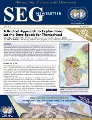
pdf brochure - Northwest Mining Association
pdf brochure - Northwest Mining Association
pdf brochure - Northwest Mining Association

You also want an ePaper? Increase the reach of your titles
YUMPU automatically turns print PDFs into web optimized ePapers that Google loves.
Short Courses & Field Trip<br />
Integrated Exploration Workflows with Esri & Geosoft ArcGIS Software<br />
Monday and Tuesday 8:00 am - 5:00 pm<br />
Cost $450<br />
COURSE Instructors:<br />
Willy Lynch, Energy-<strong>Mining</strong> Industry Team, ESRI, Broomfield, CO<br />
Taronish Pithawala, Technical Analyst, Geosoft, Inc., Toronto, ON, CANADA<br />
COURSE Overview & Description:<br />
On day one of this short course you will develop some fundamental ArcGIS skills and apply them to solving mineral exploration problems<br />
such as displaying and managing geology, geochemical, geophysical and other exploration data and also conducting simple analysis and<br />
modeling of data for exploration prospectivity and targeting.<br />
Day two of this course teaches how to use Geosoft’s Target for ArcGIS extension for ArcMap to efficiently work with and manage drillhole<br />
data in a GIS environment. You will learn how to quickly create powerful, professional maps and how to create 3D geological models from your<br />
drillhole data. This course focuses on using Geosoft’s Target for ArcGIS 4.0 within the ArcGIS Desktop 10.1 platform.<br />
Who Should Attend:<br />
• Geoscientists who wish to see how GIS can be used in mining exploration<br />
• Geoscientists wishing to learn how to create drillhole maps and 3D models within the GIS environment<br />
Course Outline:<br />
Day 1 – Esri ArcGIS Desktop 10.1<br />
• Add and explore exploration data in ArcMap<br />
• Display and symbolize layers<br />
• Create geological maps and graphs<br />
• Generate and view statistics<br />
Day 2 – Geosoft Target for ArcGIS 4.0<br />
• Import and verify drillhole data<br />
• Use database compositing tools to better<br />
understand your downhole data<br />
• Create 2D section and plan maps, and strip logs<br />
• Digitize geological interpretations<br />
• Build a geodatabase to store data<br />
• Work with spatial reference<br />
• Use editing tools<br />
• Perform GIS analyses<br />
• Create wireframe models<br />
• Create 3D models of assay data<br />
• Integrate 2D and 3D data<br />
• Export your results for sharing and collaborating<br />
Hardware & Software:<br />
No hardware will be provided. Participants are encouraged to bring in their own laptops with Esri & Geosoft software loaded, configured and<br />
licensed to follow along with presentation topics.<br />
Evaluation of ArcGIS Desktop 10.1 + OPTIONAL 3D,<br />
Spatial & Geostatistical Analyst Extensions can be<br />
downloaded at:<br />
http://www.esri.com/software/arcgis/arcgis-for-desktop/free-trial<br />
Geosoft Target for ArcGIS 4.0<br />
training licenses will be provided after<br />
registration<br />
Prerequisites:<br />
• Basic knowledge of ArcGIS Desktop (equivalent of ArcGIS Desktop I, II or III from http://training.esri.com)<br />
• No previous experience with Target for ArcGIS 4.0 required<br />
• Intermediate geological, geochemical, or geophysical knowledge pertaining to mineral exploration<br />
1st Registration Brochure & Call for Papers<br />
Page 7