Thomomys bottae - Clark Science Center
Thomomys bottae - Clark Science Center
Thomomys bottae - Clark Science Center

You also want an ePaper? Increase the reach of your titles
YUMPU automatically turns print PDFs into web optimized ePapers that Google loves.
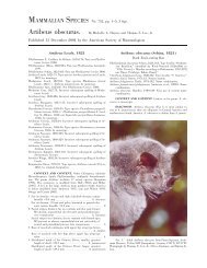
4 MAMMALIAN SPECIES 742—<strong>Thomomys</strong> <strong>bottae</strong><br />
titude on Big Prospector Meadow, White Mountains, Mono<br />
County, California.’’ (113)<br />
T. b. mewa Merriam, 1908:146, see above. (114)<br />
T. b. minimus Durrant, 1939:161. Type locality ‘‘Stansbury Island,<br />
Great Salt Lake, Tooele County, Utah.’’ (115)<br />
T. b. minor Bailey, 1914:116. Type locality ‘‘Ft. Bragg, Mendocino<br />
Co., California.’’ (116)<br />
T. b. modicus Goldman, 1931:418. Type locality ‘‘La Osa (near<br />
Mexican Boundary), southern end of Altar Valley, Pima County,<br />
Arizona.’’ (117)<br />
T. b. mohavensis Grinnell, 1918:427. Type locality ‘‘Mohave River<br />
bottom, 2700 feet altitude, near Victorville, San Bernardino<br />
County, California.’’ (118)<br />
T. b. morulus Hooper, 1940:9. Type locality ‘‘New Mexico, Valencia<br />
County, eight miles southeast of Paxton, Bill Porter’s Ranch.’’<br />
(119)<br />
T. b. muralis Goldman, 1936:112. Type locality ‘‘From lower end<br />
of Prospect Valley, Grand Canyon, Hualpai Indian Reservation,<br />
Arizona (altitude 4,500 feet).’’ (120)<br />
T. b. mutabilis Goldman, 1933a:75. Type locality ‘‘Camp Verde, Yavapai<br />
County, Arizona (altitude 3,200 feet).’’ (121)<br />
T. b. nanus Hall, 1932a:331. Type locality ‘‘south end of Belted<br />
Range, five and one-half miles northwest of Whiterock Spring,<br />
7,200 feet altitude, Nye County, Nevada.’’ (122)<br />
T. b. nasutus Hall, 1932d:96. Type locality ‘‘west fork of Black River,<br />
7550 feet altitude, Apache County, Arizona.’’ (123)<br />
T. b. navus Merriam, 1901:112. Type locality ‘‘Red Bluff, California.’’<br />
(124)<br />
T. b. neglectus Bailey, 1914:117. Type locality ‘‘San Antonio Peak<br />
(Bear Flat Meadows at 6400 feet altitude) in the San Gabriel<br />
Mountains, California.’’ (125)<br />
T. b. nesophilus Durrant, 1936:2. Type locality ‘‘Antelope Island,<br />
Great Salt Lake, Davis County, Utah.’’ (126)<br />
T. b. nicholi Goldman, 1938b:337. Type locality ‘‘from 20 miles<br />
south of Wolf Hole (road to Parashouts), Shivwits Plateau, Mohave<br />
County, Arizona (altitude 5,000 feet.)’’ (127)<br />
T. b. nigricans Rhoads, 1895:36. Type locality ‘‘Witch Creek, San<br />
Diego Co., California.’’ (128)<br />
T. b. operarius Merriam, 1897:215, see above. (129)<br />
T. b. operosus Hatfield, 1942:151. Type locality ‘‘6 mi. N. Yarnell<br />
(Peeples Valley), Yavapai Co., Arizona.’’ (130)<br />
T. b. optabilis Goldman, 1936:116. Type locality ‘‘Coventry, Naturita<br />
Creek Valley, Montrose County, Colorado (altitude 6,500<br />
feet).’’ (131)<br />
T. b. opulentus Goldman, 1935:150. Type locality ‘‘Las Palomas, on<br />
the Rio Grande, Sierra County, New Mexico.’’ (132)<br />
T. b. oreoecus Burt, 1932:154, see above. (133)<br />
T. b. osgoodi Goldman, 1931:424. Type locality ‘‘Hanksville,<br />
Wayne County, Utah.’’ (134)<br />
T. b. paguatae Hooper, 1940:4. Type locality ‘‘New Mexico, Valencia<br />
County, one-half mile north of Cebolleta [Seboyeta Post<br />
Office].’’ (135)<br />
T. b. pallescens Rhoads, 1895:36. Type locality ‘‘Grapelands, San<br />
Bernardino Valley, California.’’ (136)<br />
T. b. parvulus Goldman, 1938b:339. Type locality ‘‘pass between<br />
Santa Catalina and Rincon Mountains, Pima County, Arizona<br />
(altitude 4,500 feet).’’ (137)<br />
T. b. pascalis Merriam, 1901:111. Type locality ‘‘Fresno, San Joaquin<br />
Valley, California.’’ (138)<br />
T. b. patulus Goldman, 1938b:341. Type locality ‘‘bottomland along<br />
Hassayampa River, two miles below Wickenburg, Maricopa<br />
County, Arizona (altitude, 2,000 feet).’’ (139)<br />
T. b. pectoralis Goldman, 1936:120. Type locality ‘‘from vicinity of<br />
Carlsbad Cave, Carlsbad Cave National Monument, Eddy<br />
County, New Mexico.’’ (140)<br />
T. b. peramplus Goldman, 1931:423. Type locality ‘‘Wheatfield<br />
Creek, west slope of Tunicha Mountains, Apache County,<br />
northwestern Arizona (altitude 7,000 feet).’’ (141)<br />
T. b. perpallidus Merriam, 1886:588. Type locality ‘‘the arid Colorado<br />
desert, in southern California.’’ Reported as ‘‘Palm<br />
Springs [formerly Agua Caliente, Riverside County, Calif.]’’ by<br />
Miller and Kellogg (1955:284). (142)<br />
T. b. perpes Merriam, 1901:111. Type locality ‘‘Lone Pine, Owens<br />
Valley, California.’’ (143)<br />
T. b. pervagus Merriam, 1901:110. Type locality ‘‘Espaniola, New<br />
Mexico.’’ (144)<br />
T. b. pervarius Goldman, 1938a:57. Type locality ‘‘Lloyd Ranch, 35<br />
miles south of Marfa, Presidio County, Texas (altitude 4,200<br />
feet).’’ (145)<br />
T. b. phasma Goldman, 1933a:72. Type locality ‘‘two miles south<br />
of Tule Tank, Tule Desert, near Mexican boundary, Yuma<br />
County, Arizona.’’ (146)<br />
T. b. phelleoecus Burt, 1933:56, see above. (147)<br />
T. b. pinalensis Goldman, 1938b:342. Type locality ‘‘Oak Flat, 5<br />
miles east of Superior, Pinal Mountains, Arizona.’’ (148)<br />
T. b. piutensis Grinnell and Hill, 1936b:103. Type locality ‘‘French<br />
Gulch, Piute Mountains, altitude 6700 feet, 2 ½ miles northwest<br />
Claraville, Kern County, California.’’ (149)<br />
T. b. planirostris Burt, 1931:38. Type locality ‘‘Zion National<br />
Park, Washington County, Utah.’’ (150)<br />
T. b. planorum Hooper, 1940:5. Type locality ‘‘New Mexico, Valencia<br />
County, one and one-half miles southwest of San Mateo.’’<br />
(151)<br />
T. b. powelli Durrant, 1955:79. Type locality ‘‘Hall Ranch, Salt<br />
Gulch, 8 miles west of Boulder, 6,000 feet, Garfield County,<br />
Utah.’’ (152)<br />
T. b. providentialis Grinnell, 1931:1. Type locality ‘‘Purdy, 4,500<br />
feet altitude, 6 miles southeast of New York Mountain, Providence<br />
Range, San Bernardino County, California.’’ (153)<br />
T. b. proximarinus Huey, 1945:261. Type locality ‘‘Boca la Playa,<br />
16 miles west of Santo Tomás, Baja California, Mexico (mesa<br />
bordering the sea), lat. 3132N, long. 11638W.’’ (154)<br />
T. b. proximus Burt and Campbell, 1934:151. Type locality ‘‘Old<br />
Parker Ranch (Picketts Ranch on U.S. Geological Survey topographic<br />
map, Patagonia Quadrangle, edition of August,<br />
1905), altitude 4800 feet, west slope of Santa Rita Mountains,<br />
Pima County, Arizona.’’ (155)<br />
T. b. puertae Grinnell, 1914:315. Type locality ‘‘La Puerta (Mason’s<br />
Ranch), eastern San Diego County, California.’’ (156)<br />
T. b. pusillus Goldman, 1931:422. Type locality ‘‘Coyote Mountains,<br />
Pima County, Arizona (altitude 3,000 feet).’’ (157)<br />
T. b. retractus Baker, 1953:507. Type locality ‘‘Fortín, 3,300 ft., 33<br />
mi. N and 1 mi. E San Gerónimo, Coahuila.’’ (158)<br />
T. b. rhizophagus Huey, 1949:54. Type locality ‘‘Las Flores, 7 miles<br />
south of Bahía de Los Angeles, Baja California, Mexico, lat.<br />
2850N., long. 11332W.’’ (159)<br />
T. b. riparius Grinnell and Hill, 1936a:4. Type locality ‘‘Blythe,<br />
Riverside County, California.’’ (160)<br />
T. b. robustus Durrant, 1946:30. Type locality ‘‘Orr’s Ranch, Skull<br />
Valley, 4,300 ft., Tooele County, Utah.’’ (161)<br />
T. b. rubidus Youngman, 1958:376. Type locality ‘‘2 9/10 miles east<br />
of Cañon City, 5344 feet, Fremont County, Colorado.’’ (162)<br />
T. b. rufidulus Hoffmeister, 1955:126. Type locality ‘‘2 miles east<br />
of Joseph City, Navajo County, Ariz.’’ (163)<br />
T. b. ruidosae Hall, 1932d:96. Type locality ‘‘Ruidoso, 6700 feet<br />
altitude, Lincoln County, New Mexico.’’ (164)<br />
T. b. rupestris Chattin, 1941:272. Type locality ‘‘1,131 ft., 2 mi. E<br />
Clemens Well, Riverside County, California.’’ (165)<br />
T. b. ruricola Huey, 1949:53. Type locality ‘‘4 miles north of Santa<br />
Catarina Landing, Baja California, Mexico, lat. 2935N, long.<br />
11517W.’’ (166)<br />
T. b. russeolus Nelson and Goldman, 1909:25. Type locality ‘‘San<br />
Angel, 30 miles west of San Ignacio, Lower California, Mexico,’’<br />
Baja California Sur. (167)<br />
T. b. sanctidiegi Huey, 1945:258. Type locality Balboa Park, San<br />
Diego, California. (168)<br />
T. b. saxatilis Grinnell, 1934:193. Type locality ‘‘open, rocky, uncultivated<br />
ground, one mile north of Susanville, at 4400 feet<br />
altitude, Lassen County, California.’’ (169)<br />
T. b. scapterus Elliot, 1903b:224. Type locality ‘‘Lone Pine, Owens<br />
Valley, Inyo County, California.’’ (170)<br />
T. b. scotophilus Davis, 1940:204. Type locality ‘‘one and one-half<br />
miles west of Bat Cave, Sierra Diablo, Hudspeth County, Texas.’’<br />
(171)<br />
T. b. sevieri Durrant, 1946:45. Type locality ‘‘Swasey Spring, House<br />
Mountains, 6,500 ft., Millard County, Utah.’’ (172)<br />
T. b. siccovallis Huey, 1945:258. Type locality ‘‘El Cajón Canyon,<br />
3,200 feet altitude, east base of Sierra San Pedro Mártir, Baja<br />
California, Mexico, lat. 3054N; long. 11510W.’’ (173)<br />
T. b. silvifugus Grinnell, 1935:406. Type locality ‘‘near Coyote<br />
Peak, at 3000 feet altitude, Humboldt County, California.’’<br />
(174)<br />
T. b. simulus Nelson and Goldman, 1934:120, see above. (175)<br />
T. b. sinaloae Merriam, 1901:108, see above. (176)