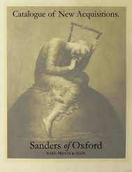
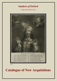
catalogue text.indd - Sanders of Oxford
catalogue text.indd - Sanders of Oxford
catalogue text.indd - Sanders of Oxford

Create successful ePaper yourself
Turn your PDF publications into a flip-book with our unique Google optimized e-Paper software.
the role <strong>of</strong> the <strong>of</strong>ficial cartographer <strong>of</strong> the East India Company. After the death <strong>of</strong> Cornelis in 1644, Johannes continued<br />
the business alone and established his own reputation as a great mapmaker. Johannes completed his father’s grand<br />
project in 1655 with the sixth and final volume <strong>of</strong> the Atlas Novus. He also produced the Tooneel der Steden van der<br />
Vereenighde Nederlanden in 1649-1653, as well as a similar set <strong>of</strong> Italian town plans which were published in 1663.<br />
Emmanuel Bowen (c.1693 - 1767) was one <strong>of</strong> the leading eighteenth-century map and print engravers in London. He<br />
was appointed Engraver <strong>of</strong> maps to George II <strong>of</strong> England, and is believed to have occupied a similar role for Louis XV<br />
<strong>of</strong> France. His apprentices included Thomas Kitchin and Thomas Jeffreys. He is also known to have collaborated with<br />
other map makers <strong>of</strong> his time, including the Bowles family and John Owen.<br />
Captain Greenville Collins (fl.1669 - 1696) began his career as an Officer in the Royal Navy, and was first recognised<br />
for an expedition to the coasts <strong>of</strong> South America with Sir John Narborough. In 1683, Charles II appointed Collins to<br />
the role <strong>of</strong> Hydrographer to the King and placed him in command <strong>of</strong> the Royal yacht, Merlin. The Merlin is cited as<br />
the first British warship dedicated to marine survey work, as opposed to exploration, as Greenville was subsequently<br />
appointed by Samuel Pepys to record the coastline <strong>of</strong> Britain.<br />
Johannes Janssonius (1588 - 1664) was a famed cartographer and print publisher. More commonly known as Jan Jansson,<br />
he was born in Arnhem where his father, Jan Janszoon the Elder, was a bookseller and publisher. In 1612 he married<br />
the daughter <strong>of</strong> the cartographer and publisher Jodocus Hondius, and then set up in business in Amsterdam as a<br />
book publisher. In 1616 he published his first maps <strong>of</strong> France and Italy and from then onwards, produced a very large<br />
number <strong>of</strong> maps which went some way to rival those <strong>of</strong> the Blaeu family who held a virtual monopoly over the industry.<br />
From about 1630 to 1638 he was in partnership with his brother-in-law, Henricus Hondius, issuing further editions<br />
<strong>of</strong> the Mercator/Hondius atlases to which his name was added. On the death <strong>of</strong> Henricus he took over the business,<br />
expanding the atlas still further, until eventually he published an eleven volume Atlas Major on a scale similar to<br />
Johannes Blaeu’s magnum opus. After Jansson’s death, his heirs published a number <strong>of</strong> maps in the Atlas Contractus<br />
<strong>of</strong> 1666, and, later still, many <strong>of</strong> the plates <strong>of</strong> his British maps were acquired by Pieter Schenk and Gerard Valck, who<br />
published them again in 1683 as separate maps.<br />
Francis Lamb (fl.1667 - 1701) was an English engraver and mapmaker who operated from Newgate Street, London, in<br />
the latter half <strong>of</strong> the seventeenth-century. Lamb worked in conjunction with many <strong>of</strong> the most prominent English map<br />
publishers <strong>of</strong> the time. These personages included Richard Blome, John Ogilby, John Seller, Moses Pitt, and Captain<br />
Greenville Collins, amongst others. He was also employed by Robert Morden and William Berry for the Pocket Book<br />
<strong>of</strong> Ireland, and produced plates <strong>of</strong> Northern America which were included in the 1676 Basset and Chiswell edition<br />
<strong>of</strong> John Speed’s ‘A Prospect <strong>of</strong> the Most Famovs Parts <strong>of</strong> the World.’ Though little is known <strong>of</strong> Lamb’s personal life,<br />
he appears to have been a pupil <strong>of</strong> the British scientist Robert Hooke, as evinced by regular references to him in the<br />
polymath’s journals, and the engravings <strong>of</strong> his which appear in the ‘Micrographia’, 1665.<br />
Rumold Mercator (1545 - 1599) was a distinguished cartographer, and the son <strong>of</strong> Gerardus Mercator. He published a<br />
composite edition <strong>of</strong> parts I, II, and III <strong>of</strong> the Mercator Atlas in 1595 and titled the work the Atlas Sive Cosmographicae<br />
Meditationes de Fabrica Mundi et Fabricati Figura. At the beginning <strong>of</strong> the work, he added a title sheet, genealogical<br />
table, and a picture <strong>of</strong> the Grecian Titan Atlas as he carries the entire celestial sphere on his back. Rumold, together<br />
with his father Gerardus, Marinus <strong>of</strong> Tyre and Claudius Ptolemy, can be considered amongst the most influential<br />
cartographers in history.<br />
Arnoldus Montanus (c.1625 – 1683) was a Dutch author, teacher, missionary and theologian. Montanus was born<br />
in Amsterdam and studied theology at Leiden University. He became a minister in Schellingwoude in 1653 and in<br />
Schoonhoven, in 1667, where he also became headmaster <strong>of</strong> the Latin School. He died in Schoonhoven. Despite<br />
contemporary accounts <strong>of</strong> his pedagogic brilliance, Montanus is best remembered for the atlases that he published.<br />
These include early works on Japan and China; as the geographical information was available through the conduit <strong>of</strong><br />
the Dutch East India Company. His most famous work however was De Nieuwe en Onbekende Weereld, which was<br />
published in 1671, and contained maps and exploratory charts <strong>of</strong> America, as well as images and <strong>text</strong>s pertaining to<br />
the topography, fauna, botany, religion and military history.<br />
Abraham Ortelius (1527 -1598) was a Flemish cartographer, cosmographer, geographer and publisher. He was a<br />
contemporary <strong>of</strong> Gerard Mercator, with whom he travelled through Italy and France. Although it is Mercator who first<br />
used the appelation <strong>of</strong> ‘Atlas’ as a name for a collection <strong>of</strong> maps, it is Ortelius who is remembered as the creator <strong>of</strong> the<br />
first modern atlas. The Theatrum Orbis Terrarum was the first systematically collated set <strong>of</strong> maps. Though it consisted<br />
<strong>of</strong> the work <strong>of</strong> several map makers, it was presented in a uniform format. Three Latin editions as well as a Dutch,