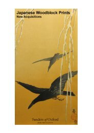
catalogue text.indd - Sanders of Oxford
catalogue text.indd - Sanders of Oxford
catalogue text.indd - Sanders of Oxford

You also want an ePaper? Increase the reach of your titles
YUMPU automatically turns print PDFs into web optimized ePapers that Google loves.
87. Insvlarvm Britannicarvm Acurata Delineatio Ex<br />
Geographicis Conatibus Abrahami Ortelii<br />
Copper engraving with hand colouring<br />
Jansson, Jan<br />
c. 1650<br />
Image 387 x 503, Plate 392 x 509 mm, Sheet 441 x 557<br />
mm<br />
framed<br />
Jan Jansson’s ‘Insvlarvm Britannicarvm Acurata Delineatio<br />
Ex Geographicis Conatibus Abrahami Ortelii’, as<br />
the title alludes, was based upon the 1579 map <strong>of</strong> the<br />
British Isles by the Flemish geographer and cartographer<br />
Abraham Ortelius. Ortelius, in turn, based his work upon<br />
the landmark Mercator map <strong>of</strong> the British Isles issued<br />
in 1564. He also augmented the designs <strong>of</strong> Christopher<br />
Saxton and Humphrey Llhuyd.<br />
Unusually oriented to the west, as was the usual case in<br />
the older Ptolemaic models, Jansson’s map is decorated<br />
with several sailing ships and an elaborate cartouche<br />
which bears the title. Three compass roses feature; and<br />
their lines emanate over the surface <strong>of</strong> the map. Drolleries,<br />
or small monsters, appear in the water between<br />
England and Ireland.<br />
Condition: Contains centre fold as issued.<br />
Excellent condition with wide margins.<br />
[29979]<br />
£950<br />
88. The Kingdome <strong>of</strong> England<br />
Copper engraved with early hand colouring<br />
Speed, John<br />
1611<br />
382 x 510 mm<br />
framed<br />
A wonderful example <strong>of</strong> the first edition Speed map <strong>of</strong><br />
England, with excellent early hand colouring.<br />
John Speed’s map <strong>of</strong> the Kingdom <strong>of</strong> England is flanked<br />
by images <strong>of</strong> a nobleman, a gentleman, a citizen, a<br />
country man and their wives. The map was published in<br />
the first edition <strong>of</strong> John Speed’s atlas in 1612 with a plate<br />
engraved by Jodocus Hondius. By 1630 the original plate<br />
had become worn and a new one was engraved by<br />
Abraham Goos and this was amended and updated in<br />
1646. The 1646 date was added at the lower left, and<br />
appeared in editions thereafter.<br />
Condition: Some overall toning to sheet with light stains<br />
to the top right <strong>of</strong> map and the cartouche.<br />
[29739]<br />
£2,500<br />
89. The River Avon from the Severn to the Citty <strong>of</strong><br />
Bristoll<br />
Copper engraved with later hand colouring<br />
Captain Greenville Collins<br />
c. 1693<br />
Image 395 x 915 mm<br />
mounted<br />
Captain Greenville Collins’s chart contains a fine title<br />
cartouche <strong>of</strong> the Avon Gorge being navigated by a sailing<br />
vessel, and the City <strong>of</strong> Bristol. Various ships are depicted<br />
in the water, whilst fathoms and a compass are also<br />
shown. Hachures illustrate relief amonst the coastal line<br />
and topography <strong>of</strong> the map. Most interestingly, the course<br />
<strong>of</strong> the River Avon is inverted, and flows from East to<br />
West, as opposed from West to East.