CHAPTER 10 – HAZARDS AND HAZARDOUS MATERIALS - sacog
CHAPTER 10 – HAZARDS AND HAZARDOUS MATERIALS - sacog CHAPTER 10 – HAZARDS AND HAZARDOUS MATERIALS - sacog
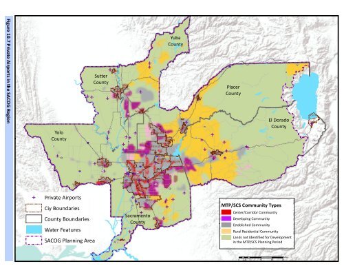
Figure 10.7 Private Airports in the SACOG Region Yolo County ST16 e 16 §¨¦ 505 WINTERS ST128 e e Sutter County ST20 ST45 e e e e e e ST70 e e e e e e e e e e e e e §¨¦ 80 WEST SACRAMENTO §¨¦ CITRUS 80 HEIGHTS §¨¦ 80 §¨¦ 80 ¡¢ 80 ST160 RANCHO CORDOVA SACRAMENTO e e e e ST49 LOOMIS ST99 §¨¦ 5 ROCKLIN ROSEVILLE §¨¦ 5 WOODLAND ST113 DAVIS LIVE OAK ST113 ST99 ST70 MARYSVILLE YUBA CITY ST99 WHEATLAND ST20 ST65 LINCOLN ST16 Yuba County ST49 FOLSOM AUBURN £¤ 50 ST174 COLFAX ST193 e e e PLACERVILLE e ST49 e e e §¨¦ 80 Placer County e ST88 ST89 El Dorado County £¤ 50 ST89 ST267 ST28 SOUTH LAKE TAHOE e ST89 16 e Private Airports Ciy Boundaries County Boundaries Water Features SACOG Planning Area 12 ST12 ST220 ISLETON e ST160 e §¨¦ 5 e e ELK GROVE ST99 Sacramento County GALT e e e e e MTP/SCS Community Types Center/Corridor Community Developing Community Established Community Rural Residential Community Lands not Identified for Development in the MTP/SCS Planning Period Miles 0 2.5 5 10 15 20
Emergency Services This section provides information on emergency preparedness, existing emergency response services, disaster response services, and emergency plans in the MTP/SCS plan area. The region potentially faces a number of emergency situations caused by events such as forest fires, flooding, and earthquakes. The agencies and programs listed below are charged with planning for, and responding to, such emergencies. California Emergency Management Agency The California Emergency Management Agency (Cal EMA) was established as part of the Governor’s Office on January 1, 2009, merging the duties, powers, purposes, and responsibilities of the former Governor’s Office of Emergency Services with those of the Governor’s Office of Homeland Security. Cal EMA is responsible for the coordination of overall state agency response to major disasters in support of local government. The Agency is responsible for assuring the state’s readiness to respond to, and recover from, all hazards – natural, man-made, and war-caused emergencies and disasters – and for assisting local governments with emergency preparedness, response, recovery, and hazard mitigation efforts (California Emergency Management Agency, 2011). County Offices of Emergency Services Each county has a local Office of Emergency Services (OES) which coordinates with the state during emergency situations. When local and mutual aid resources are exhausted, the state coordinates its emergency resources through its State Operations Center in Sacramento and its multiple Emergency Operations Centers (EOC) throughout the region. Emergency Operations Centers In coordination with the local OES, jurisdictions house EOCs, which are command centers where emergency service providers (many from the local OES) meet and coordinate response, recovery, and resources during disasters. The following functions are performed in the EOC, as necessary: Receiving and disseminating warnings; Managing emergency operations; Developing emergency response and recovery policies; Collecting intelligence from, and disseminating information to, the various EOC representatives, and assuring coordination between the Field Operations Center locations, building managers, and departmental safety representatives throughout the regional system; Coordinating information with Cal EMA, the Federal Emergency Management Agency, and other appropriate outside agencies; Preparing intelligence/information summaries, situation reports, operation progress reports and other reports as required; MTP/SCS 2035 Sacramento Area Council of Governments Draft Environmental Impact Report Chapter 10 – Hazards and Hazardous Materials – Page 10-25
- Page 1 and 2: CHAPTER 10 - HAZARDS AND HAZARDOUS
- Page 3 and 4: F n igure 10.2- Naturally Occuring
- Page 5 and 6: Hazardous Waste Generation and Mana
- Page 7 and 8: Packaging and Securement Many hazar
- Page 9 and 10: In addition to regulating the trans
- Page 11 and 12: Until the 1980’s, the disposal of
- Page 13 and 14: Table 10-4 Sites Contaminated by Ha
- Page 15 and 16: Table 10-4 Sites Contaminated by Ha
- Page 17 and 18: Table 10-4 Sites Contaminated by Ha
- Page 19 and 20: Table 10-4 Sites Contaminated by Ha
- Page 21 and 22: Table 10-4 Sites Contaminated by Ha
- Page 23: Figure 10.6 Airport Buffer Zones Yo
- Page 27 and 28: All of these facilities are designe
- Page 29 and 30: Homeland Security The Sacramento Po
- Page 31 and 32: Wildfire prevention and suppression
- Page 33 and 34: Table 10.7 MTP/SCS Plan Area Fire P
- Page 35 and 36: (CERCLIS). This federal database co
- Page 37 and 38: California Education Code The envir
- Page 39 and 40: The Hazardous Materials Release Res
- Page 41 and 42: Emergency Operations Plans Local ju
- Page 43 and 44: 5. For a project located within an
- Page 45 and 46: B. Localized impacts The localized
- Page 47 and 48: C. Transit Priority Area Impacts As
- Page 49 and 50: With respect to transportation chan
- Page 51 and 52: The proposed MTP/SCS transportation
- Page 53 and 54: Widely accepted practice standards
- Page 55 and 56: A. Regional impacts Regional develo
- Page 57 and 58: Impact HAZ-6: For a project located
- Page 59 and 60: jurisdictions have different goals,
- Page 61 and 62: Center and Corridor Communities wil
- Page 63 and 64: that is different from existing con
- Page 65 and 66: discussed below, the dispersed patt
- Page 67 and 68: As mentioned above, Placer County T
- Page 69 and 70: Yolo County TPAs will see a variety
- Page 71 and 72: Therefore, the potential for advers
- Page 73: involve the use of equipment that c
Figure <strong>10</strong>.7 Private Airports in the SACOG Region<br />
Yolo<br />
County<br />
ST16<br />
e<br />
16<br />
§¨¦ 505<br />
WINTERS<br />
ST128<br />
e<br />
e<br />
Sutter<br />
County<br />
ST20<br />
ST45<br />
e<br />
e<br />
e<br />
e<br />
e<br />
e<br />
ST70<br />
e<br />
e<br />
e<br />
e e<br />
e<br />
e<br />
e<br />
e<br />
e e<br />
e<br />
e<br />
§¨¦ 80 WEST SACRAMENTO<br />
§¨¦ CITRUS<br />
80<br />
HEIGHTS<br />
§¨¦ 80<br />
§¨¦ 80<br />
¡¢ 80<br />
ST160<br />
RANCHO<br />
CORDOVA<br />
SACRAMENTO<br />
e<br />
e<br />
e<br />
e<br />
ST49<br />
LOOMIS<br />
ST99<br />
§¨¦ 5 ROCKLIN<br />
ROSEVILLE<br />
§¨¦ 5<br />
WOODL<strong>AND</strong><br />
ST113<br />
DAVIS<br />
LIVE OAK<br />
ST113<br />
ST99<br />
ST70<br />
MARYSVILLE<br />
YUBA<br />
CITY<br />
ST99<br />
WHEATL<strong>AND</strong><br />
ST20<br />
ST65<br />
LINCOLN<br />
ST16<br />
Yuba<br />
County<br />
ST49<br />
FOLSOM<br />
AUBURN<br />
£¤ 50<br />
ST174<br />
COLFAX<br />
ST193<br />
e<br />
e<br />
e<br />
PLACERVILLE<br />
e<br />
ST49<br />
e<br />
e<br />
e<br />
§¨¦ 80<br />
Placer<br />
County<br />
e<br />
ST88<br />
ST89<br />
El Dorado<br />
County<br />
£¤ 50<br />
ST89<br />
ST267<br />
ST28<br />
SOUTH<br />
LAKE<br />
TAHOE<br />
e<br />
ST89<br />
16<br />
e<br />
Private Airports<br />
Ciy Boundaries<br />
County Boundaries<br />
Water Features<br />
SACOG Planning Area<br />
12<br />
ST12<br />
ST220<br />
ISLETON<br />
e<br />
ST160<br />
e<br />
§¨¦ 5<br />
e<br />
e<br />
ELK<br />
GROVE<br />
ST99<br />
Sacramento<br />
County<br />
GALT<br />
e<br />
e e<br />
e<br />
e<br />
MTP/SCS Community Types<br />
Center/Corridor Community<br />
Developing Community<br />
Established Community<br />
Rural Residential Community<br />
Lands not Identified for Development<br />
in the MTP/SCS Planning Period<br />
Miles<br />
0 2.5 5 <strong>10</strong> 15 20


