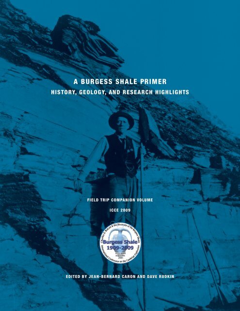
A BURGESS SHALE PRIMER - Royal Ontario Museum
A BURGESS SHALE PRIMER - Royal Ontario Museum
A BURGESS SHALE PRIMER - Royal Ontario Museum

Create successful ePaper yourself
Turn your PDF publications into a flip-book with our unique Google optimized e-Paper software.
A <strong>BURGESS</strong> <strong>SHALE</strong> <strong>PRIMER</strong><br />
HISTORY, GEOLOGY, AND RESEARCH HIGHLIGHTS<br />
FIELD TRIP COMPANION VOLUME<br />
ICCE 2009<br />
EDITED BY JEAN-BERNARD CARON AND DAVE RUDKIN
a burGess sHale PrIMer<br />
HIstorY, GeoloGY, and researcH HIGHlIGHts<br />
fIeld trIp companIon Volume<br />
Icce 2009<br />
edIted By Jean-Bernard caron and daVe rudkIn
© 2009—The Burgess Shale Consortium<br />
All rights reserved. No part of this publication may be reproduced, stored in a retrieval system or data base, or transmitted, in any<br />
form or by any means, electronic, mechanical, photocopying, or otherwise, without the prior written consent of the publisher.<br />
First published in 2009 by the Burgess Shale Consortium, 100 Queen’s Park, Toronto, <strong>Ontario</strong> m5s 2c6, canada<br />
Publication date: July 1st, 2009<br />
ISBN 978-0-9812885-0-5<br />
National Library of Canada Cataloguing in Publication<br />
International conference on the Cambrian explosion (ICCE, August 3-8th, 2009: Banff, Alberta, Canada)<br />
A <strong>BURGESS</strong> <strong>SHALE</strong> <strong>PRIMER</strong>—History, Geology, and Research Highlights—Field Trip Companion Volume—ICCE 2009;<br />
Jean-Bernard Caron and Dave Rudkin, Editors.<br />
Includes bibliographical references.<br />
1. Burgess Shale, Fossil—British Columbia. 2. Paleontology—Middle Cambrian. 3. Stratigraphy, Sedimentology, Taphonomy,<br />
Paleoecology—British Columbia<br />
Printed and bound in Canada by Dollco Printing, Ottawa, <strong>Ontario</strong><br />
Cover and text design: Grace Cheong<br />
Image credits: Cover, pages 4 and 15: Walcott standing in his main quarry on Fossil Ridge, 1911 (image courtesy of Smithsonian<br />
Institution Archives). page 14: Anomalocaris canadensis, Raymond Quarry (image Des Collins). page 32: Fossil Ridge as seen<br />
from the Trans-Canada Highway #1 (image Des Collins). page 54: Thin-section of a mudstone bed from level -20 below the<br />
Phyllopod Bed (Kevin Gostlin’s Phd material). page 62: Leanchoilia superlata, Raymond Quarry (image J.-B Caron). page 70:<br />
Above the Phyllopod Bed, Walcott Quarry (Image J.-B Caron). page 90: Ogygopsis klotzi, Trilobite Beds (Image Dave Rudkin).<br />
Back cover: Marrella splendens (image J.-B. Caron).<br />
Funds for this publication were generously provided by Devon Energy Corporation through the Canadian National Committee<br />
for the International Year of Planet Earth (CNC-IYPE), the Burgess Shale Consortium and the Madeleine A. Fritz Invertebrate<br />
Palaeontology Fund (<strong>Royal</strong> <strong>Ontario</strong> <strong>Museum</strong>).
table of contents<br />
preface.. . . . . . . . . . . . . . . . . . . . . . . . . . . . . . . . . . . . . . . . . . . . . . . . . . . . . . . . . . . . . . . . . . . . . . . . . . . . . . . . . . . . . . . . . . . . . . . . . . . . . . . . . . . . . . . . . . . . . . . . . . . . . . . . . . . . . . . . . . . . . . . . . 5<br />
Introduction.. . . . . . . . . . . . . . . . . . . . . . . . . . . . . . . . . . . . . . . . . . . . . . . . . . . . . . . . . . . . . . . . . . . . . . . . . . . . . . . . . . . . . . . . . . . . . . . . . . . . . . . . . . . . . . . . . . . . . . . . . . . . . . . . . . . . . . 6<br />
c h a p t e r 1 a brief history of field research on the burgess shale<br />
Desmond Collins. . . . . . . . . . . . . . . . . . . . . . . . . . . . . . . . . . . . . . . . . . . . . . . . . . . . . . . . . . . . . . . . . . . . . . . . . . . . . . . . . . . . . . . . . . . . . . . . . . . . . . . . . . . . . 15<br />
C h a p t e r 2 geology and stratigraphy of the burgess shale formation<br />
on mount stephen and fossil ridge<br />
Terence P. FLETCHER and Desmond COLLINS.. . . . . . . . . . . . . . . . . . . . . . . . . . . . . . . . . . . . . . . . . . . . . . . . . . . . . . . . . . . . . . . . . . . . . . . . . 33<br />
C h a pt e r 3 sedimentation of the phyllopod bed within<br />
the cambrian burgess shale formation<br />
Sarah GABBOTT and Jan ZALASIEWICZ. . . . . . . . . . . . . . . . . . . . . . . . . . . . . . . . . . . . . . . . . . . . . . . . . . . . . . . . . . . . . . . . . . . . . . . . . . . . . . . . . 55<br />
C h a p t e r 4 fossil preservation in the burgess Shale<br />
Nicholas J. Butterfield. . . . . . . . . . . . . . . . . . . . . . . . . . . . . . . . . . . . . . . . . . . . . . . . . . . . . . . . . . . . . . . . . . . . . . . . . . . . . . . . . . . . . . . . . . . . . . . . . . . . 63<br />
C h a p t e r 5 the greater phyllopod bed community,<br />
historical variations and quantitative approaches<br />
Jean-Bernard caron.. . . . . . . . . . . . . . . . . . . . . . . . . . . . . . . . . . . . . . . . . . . . . . . . . . . . . . . . . . . . . . . . . . . . . . . . . . . . . . . . . . . . . . . . . . . . . . . . . . . . . . . . . . . . 71<br />
C h a p t e r 6 the mount stephen trilobite beds<br />
Dave RUDKIN.. . . . . . . . . . . . . . . . . . . . . . . . . . . . . . . . . . . . . . . . . . . . . . . . . . . . . . . . . . . . . . . . . . . . . . . . . . . . . . . . . . . . . . . . . . . . . . . . . . . . . . . . . . . . . . . . . . . . 91<br />
references.. . . . . . . . . . . . . . . . . . . . . . . . . . . . . . . . . . . . . . . . . . . . . . . . . . . . . . . . . . . . . . . . . . . . . . . . . . . . . . . . . . . . . . . . . . . . . . . . . . . . . . . . . . . . . . . . . . . . . . . . . . . . . . . . . . . . . . . 103
4 A <strong>BURGESS</strong> <strong>SHALE</strong> <strong>PRIMER</strong>—History, Geology, and Research Highlights
5<br />
Preface<br />
August, 2009 marks the 100th anniversary of the discovery<br />
of the Burgess Shale by Charles Walcott. Located<br />
between Wapta Mountain and Mount Field, the original<br />
site on Fossil Ridge, known today as the Walcott Quarry,<br />
represents one of the most important paleontological finds<br />
of the 20th century. To celebrate the occasion, this companion<br />
volume to the International Conference on the Cambrian<br />
Explosion (ICCE—Banff, August 3-8 th , 2009) presents in short<br />
format some of the latest advances in Burgess Shale research.<br />
Much of this new knowledge is based upon two decades of<br />
field work activities by the <strong>Royal</strong> <strong>Ontario</strong> <strong>Museum</strong>.<br />
A Burgess Shale Primer is recommended as an expanded<br />
field guide to the Burgess Shale’s Walcott Quarry on Fossil<br />
Ridge and the Trilobite Beds on Mount Stephen. It starts<br />
with a brief history of research and is followed by chapters<br />
summarizing recent research accomplishments in geology,<br />
taphonomy and community studies. This volume will be of<br />
interest to professional geologists, palaeontologists, guides<br />
and visitors to the Burgess Shale, as well as to a more general<br />
audience seeking new insights on the famous locality and on<br />
early animal evolution. Many of the illustrated fossils might be<br />
encountered by visitors on organized visits to the sites; others<br />
would seldom be seen because they are either rare or difficult<br />
to recognize. For a systematic illustrated guide to the fossils of<br />
the Burgess Shale, visitors should consult “The Fossils of the<br />
Burgess Shale” by Briggs, Erwin and Collier (1994).<br />
—Jean-Bernard Caron and Dave rudkin, Editors
6<br />
Introduction<br />
The “Middle” Cambrian Burgess Shale (about 505 million<br />
years old) is best known for its extraordinary preservation<br />
of diverse marine animals and represents a classic<br />
fossil Lagerstätte* (Seilacher et al., 1985). In this deposit, softbodied<br />
organisms represent about 98% of individuals and 85%<br />
of genera; most of these would stand no chance for preservation<br />
under typical conditions of fossilization. Thus, this site<br />
provides a far greater understanding of the biology, ecology,<br />
diversity and evolution of Cambrian animals than in most<br />
“normal” marine deposits with impoverished shelly fossil<br />
assemblages* alone (Conway Morris, 1986). The Burgess<br />
Shale biota follows the emergence of the first animals in the<br />
fossil record during the Cambrian Explosion*, and therefore<br />
provides important clues to the early evolution of animal lineages<br />
and communities. The fact that dozens of genera from<br />
the Burgess Shale are now also found in other Lower and<br />
Middle Cambrian deposits, most notably in China, suggests<br />
the presence of a geographically widespread and evolutionarily<br />
conservative biota that evolved in similar environmental<br />
settings during the Cambrian Explosion (e.g., Conway Morris,<br />
1989; Steiner et al., 2005).<br />
Despite the wealth of fossils available, understanding the<br />
affinities of Burgess Shale animals has been, and remains,<br />
perhaps the most difficult challenge for palaeontologists.<br />
Many forms, like Opabinia with its five eyes and flexible<br />
anterior “trunk”, have seemingly odd morphologies or combinations<br />
of characters that are not known in post-Cambrian<br />
animals. In “Wonderful Life” (Gould, 1989), Gould named<br />
some of these bizarre (as seen from a modern standpoint)<br />
animals “weird wonders”, and suggested that they represented<br />
members of extinct phyla. However, with new fossil<br />
discoveries, and the use of cladistic analysis* and application<br />
of the crown+stem group* concepts (Budd and Jensen,<br />
2000), our views of Cambrian life are changing rapidly. The<br />
debate has moved from focusing on particular characters<br />
unique to some of these species (like the “trunk” of Opabinia)<br />
to the recognition of potential shared derived characters<br />
(features inherited from a common ancestor—for example,<br />
the articulated claws at the end of Opabinia’s “trunk”)<br />
(Briggs and Fortey, 2005). Thus many “odd” Cambrian animals<br />
have proven to be far more useful in understanding the<br />
evolution of existing animal lineages than was previously<br />
appreciated. Continuous field work and discoveries of new<br />
specimens and species (especially from the Walcott Quarry<br />
on Fossil Ridge) are rapidly increasing our understanding<br />
of Cambrian communities. A thorough review of these new<br />
studies would merit an entire book, and only a brief account<br />
of some selected examples are provided herein (pages 10-12).<br />
A summary of each chapter in this volume is provided below,<br />
followed by some general information for visitors:<br />
History of research<br />
Collins discusses field discoveries from the late 19th century,<br />
through a year-by-year account of Walcott’s research activities,<br />
to the most recent <strong>Royal</strong> <strong>Ontario</strong> <strong>Museum</strong> revelations.<br />
Geology<br />
Fletcher and Collins summarize the stratigraphic investigations<br />
that have been carried out to date at the type localities<br />
on Fossil Ridge, Mount Field and Mount Stephen, and at a<br />
more regional scale. Gabbott and Zalasiewicz show that the<br />
sediments of the Walcott Quarry can provide important<br />
clues regarding the nature of the mud-flows that buried some<br />
Burgess Shale animals.<br />
Taphonomy and community ecology<br />
Butterfield provides an assessment of the conditions behind the<br />
preservation of soft-bodied animals, in particular by looking<br />
at mechanisms affecting their remains after burial (i.e., diagenesis).<br />
Caron summarizes results from quantitative research<br />
on historical taphonomic and community variations in the<br />
Walcott Quarry, based on the study of substantial collections<br />
at the <strong>Royal</strong> <strong>Ontario</strong> <strong>Museum</strong>. Rudkin provides an illustrated<br />
faunal account of the Mount Stephen Trilobite Beds.<br />
* Editors’ note: Asterisked terms which are bolded are defined in the Glossary at the end of<br />
this section.
7<br />
Visitors to the Walcott Quarry and Trilobite Beds—General information<br />
Hiking<br />
Two Burgess Shale localities can be visited: the Walcott<br />
Quarry, and the Trilobite (Ogygopsis) Beds on Mount<br />
Stephen. Inscribed on the UNESCO World Heritage List<br />
in 1980, both sites are now part of the Canadian Rocky<br />
Mountain Parks World Heritage site within the boundaries<br />
of Yoho National Park. Access to these sites is permitted<br />
only through organized hikes led by Parks Canada Heritage<br />
Interpreters and by accredited guides of the Burgess Shale<br />
Geoscience Foundation.<br />
Walcott Quarry Starting Elevation: 1500 m; Elevation gain:<br />
780 m. Distance: 20 km in total. Duration about 9-10 hours.<br />
Hike of moderate difficulty—long, but not steep for the<br />
most part. Visitors usually start and end the hike in the<br />
scenic Yoho Valley near Takakkaw Falls, a few km north of<br />
the town of Field. An alternative is to end the hike at the<br />
Yoho National Park Visitor Centre in Field. Stops of interest<br />
include: Takakkaw Falls, Yoho Lake, the ROM field camp,<br />
Walcott’s Quarry, and Burgess Pass.<br />
Visitors to the Walcott Quarry will observe numerous fossils<br />
on loose slabs left by previous research groups or which<br />
have fallen from levels higher up on the slope. Many fossils<br />
are probably not from the Walcott Quarry itself (e.g., Ottoia,<br />
Vauxia), but come from other horizons above (see Fletcher<br />
and Collins, this volume). Visitors will be able to recognize<br />
different areas within the Walcott Quarry resulting from systematic<br />
excavations by different research groups, mainly the<br />
Smithsonian Institution, the Geological Survey of Canada,<br />
and the <strong>Royal</strong> <strong>Ontario</strong> <strong>Museum</strong> (see Collins, this volume).<br />
Trilobite Beds Starting Elevation: 1300 m; Elevation gain:<br />
around 600 m. Distance: 6 km round trip. Duration about<br />
8 hours. Hike of moderate difficulty, short but steep. Stops of<br />
interest include: Lower and Upper Trilobite Beds. The hike<br />
begins and ends at the Yoho National Park Visitor Centre<br />
in Field.<br />
Stand away from the walls of the Walcott Quarry, the edges<br />
of excavation pits or from the talus piles (both sites). On both<br />
sites slabs can slide without warning, especially when they are<br />
wet. Talus piles are not stable and slabs frequently crash into<br />
the Walcott Quarry from the scree above. Walking on talus<br />
piles may result in slabs sliding down the slope, potentially<br />
harming yourself or other visitors below you and damaging<br />
fossils. Handle shale fragments with caution—edges are usually<br />
extremely sharp and can result in deep cuts. Please respect<br />
signage and fences and obey instructions from guides.
8 A <strong>BURGESS</strong> <strong>SHALE</strong> <strong>PRIMER</strong>—History, Geology, and Research Highlights<br />
top left, Takakkaw Falls. bottom left, Emerald Lake as seen from the trail near Fossil Ridge. top right, aerial view of Mount Stephen Trilobite Beds (top centre of image).<br />
Photo courtesy John Niddrie—Parks Canada. bottom right, a typical specimen of Ogygopsis klotzi from the Trilobite Beds.
introduction<br />
9<br />
Please remember that the Walcott Quarry and the Trilobite Beds are<br />
accessible ONLY to accredited tours. NO collecting, hammering or<br />
quarrying activities are allowed at these sites. Collecting, possessing,<br />
and the sale of fossils are strictly prohibited and subject to prosecution<br />
under the Parks Canada Protection Act. Defacing rock surfaces<br />
or fossils is also subject to heavy fines.
10 A <strong>BURGESS</strong> <strong>SHALE</strong> <strong>PRIMER</strong>—History, Geology, and Research Highlights<br />
Welcome additions to the Burgess Shale menagerie<br />
Collections made by the <strong>Royal</strong> <strong>Ontario</strong> <strong>Museum</strong> from the Burgess Shale are used intensively for research today, and these<br />
have been enormously helpful in illuminating the affinities of new or previously poorly known fossils.<br />
Odontogriphus omalus<br />
This species was known from a single poorly preserved specimen<br />
when it was originally described as an enigmatic animal<br />
possibly related to lophophorates (Conway Morris, 1976). The<br />
ROM collected close to 200 specimens of this species—all but<br />
one are from the Walcott Quarry. Odontogriphus was a primitive<br />
(stem group) shell-less mollusc which grazed on bacteria<br />
and algae at the bottom of the sea. Some of the largest specimens<br />
reached more than 12 cm in length. The recognition of<br />
typical molluscan features such as a radula (rows of “teeth”<br />
attached to a tongue-like element), a foot and gills, provides<br />
strong evidence for this relationship (but see Butterfield, this<br />
volume). Unlike most modern molluscs Odontogriphus does<br />
not have a shell, suggesting that these mineralized structures<br />
might have evolved secondarily.<br />
Reference: caron, j.-b., a. h. scheltema, c. schander,<br />
and d. rudkin. 2006. A soft-bodied mollusc with radula from<br />
the Middle Cambrian Burgess Shale. Nature, 442:159-163.<br />
right. Odontogriphus omalus, ROM 57720 (specimen length = 10.5 cm).<br />
below. Reconstruction by Marianne Collins © Nature -2006.
introduction<br />
11<br />
Orthrozanclus reburrus<br />
We know that Charles Walcott collected a couple of specimens<br />
of this animal, but they remained undescribed and<br />
untouched in USNM (Smithsonian Institution) collections<br />
for decades. The ROM collected nine additional specimens<br />
from the Walcott Quarry and these, along with Walcott’s<br />
originals, formed the basis of the description of a new<br />
genus and species in 2007. Orthrozanclus’s body is covered<br />
with various types of sclerites (small plate- and spine-like<br />
structures) and it has one larger shell on the front end.<br />
The entire length of the animal is usually less than a centimetre,<br />
including the spiny sclerites. Orthrozanclus, along<br />
with Wiwaxia, is thought to belong to a group of animals<br />
sharing a similar body plan, with an outer armour made of<br />
sclerites and facultative shells. Called the halwaxiids, these<br />
animals were interpreted as either primitive stem group<br />
molluscs that evolved after Odontogriphus, or as a group<br />
that evolved following the split between the molluscs and<br />
animals like annelids and brachiopods.<br />
Reference: conway morris, s., and j.-b. caron. 2007.<br />
Halwaxiids and the Early Evolution of the Lophotrochozoans.<br />
Science, 315:1255-1258.<br />
right. Orthrozanclus reburrus, ROM 57197 (specimen length = 9.5 mm).<br />
below. Reconstruction by Marianne Collins © AAAS/Science -2007.
12 A <strong>BURGESS</strong> <strong>SHALE</strong> <strong>PRIMER</strong>—History, Geology, and Research Highlights<br />
Hurdia victoria<br />
This organism is the latest to be redescribed from the Burgess Shale. Interestingly, parts of this animal are found not only in<br />
various Burgess Shale localities in Canada, but also in the USA and possibly in China. This species was named by Charles<br />
Walcott based on an isolated carapace element which has a distinct pointed end and an oblong shape. With the discovery<br />
of this carapace attached to other misidentified parts (representing several different species!) by the ROM in the 1980’s and<br />
1990’s, the identity of this much larger and more complex animal finally began to emerge. Detailed studies of existing collections<br />
have shown that Hurdia is a predator related to Anomalocaris and Laggania, two other large animals known from<br />
the same deposits. Like its cousins, Hurdia has a large circular mouth with pointed teeth, a pair of claws, and large eyes<br />
on stalks. In the case of Hurdia, the carapace assemblage at the front of its body is unique and its function remains rather<br />
mysterious, but was perhaps associated<br />
with a specialized foraging strategy. All<br />
these animals are related to the base of<br />
the arthropod lineage at a stem group<br />
level and demonstrate that the diversity<br />
of predators in the Cambrian was much<br />
more extensive than previously thought.<br />
Reference: daley, a. c., g. e. budd,<br />
j.-b. caron, g. d. edgecombe, and<br />
d. collins. 2009. The Burgess Shale<br />
anomalocaridid Hurdia and its significance<br />
for early euarthropod evolution. Science,<br />
323:1597-1600.<br />
right. Hurdia victoria, ROM 59252 (specimen length =<br />
6.5 cm).<br />
below. Reconstruction by Marianne Collins © AAAS/<br />
Science -2009.
introduction<br />
13<br />
Glossary<br />
Cambrian Explosion: With the exception of sponges (Phylum<br />
Porifera) and possibly primitive cnidarians (represented today<br />
by jellyfish and corals), two groups that probably evolved in the<br />
late Precambrian, the Cambrian Explosion represents the relatively<br />
rapid appearance in the fossil record of “true” complex<br />
animals (or metazoans) starting about 542 million years ago, at<br />
the Precambrian-Cambrian transition. Metazoans represent the<br />
vast majority of animals with bilateral symmetry today and are<br />
characterized by having differentiated tissues such as muscles and<br />
nerve tissues, a digestive chamber, and locomotion ability at least<br />
at some point during development. It is during the Cambrian<br />
Explosion that the origin of modern animal lineages, known as<br />
phyla (e.g., arthropods, annelids) can be traced. The Cambrian<br />
Explosion is primarily based on direct fossil evidence, in particular<br />
the finding of mineralized and non-mineralized skeletal remains in<br />
conventional and exceptional fossil deposits, and indirect fossil evidence,<br />
for example records of the activity or behaviour of animals<br />
themselves (e.g., trace fossils, coproliths). See also crown group<br />
and stem group.<br />
Cladistic analysis: A hierarchical method for reconstructing possible<br />
evolutionary trees.<br />
Crown group and stem group: A crown group represents the last<br />
common ancestor (i.e., the most immediate ancestor shared by<br />
at least two species) of a particular group of organisms, and all<br />
its descendants. By definition, all living members of phyla (representing<br />
all the major animal groups today) are members of their<br />
respective crown groups. An extinct animal can belong to a crown<br />
group. For example, the Tasmanian wolf is extinct today but still<br />
belongs to the crown group of the phylum Chordata within the<br />
class Mammalia. A stem group, however, consists entirely of extinct<br />
organisms that typically do not display all the morphological characters<br />
of the crown group. Many Burgess Shale fossils have been<br />
reinterpreted within the stem group level of modern phyla (Budd<br />
and Jensen, 2000). For example, Opabinia, despite some arthropodan<br />
characters (e.g., jointed feeding claws) does not belong to the<br />
Arthropoda crown group.<br />
Lagerstätte, Lagerstätten (plural): Fossil deposits rich in paleontological<br />
information by virtue of their exceptional preservation of<br />
soft-tissues (Conservation Lagerstätten) or sheer quantity of accumulated<br />
remains (Concentration Lagerstätten) (Seilacher et al.,<br />
1985). The Burgess Shale belongs to both categories.<br />
Shelly fossil assemblages: In typical fossil deposits, remains<br />
of organisms producing a robust mineralized skeleton that can<br />
preserve more readily than soft-tissues. In “normal” Cambrian<br />
deposits these remains include: shells of brachiopods, isolated<br />
sponge spicules, plates or ossicles of primitive echinoderms,<br />
exoskeletons of trilobites and shells of hyolithids and molluscs<br />
(e.g., monoplacophorans). With the exception of sponges and<br />
echinoderms most of the groups represented by these “shelly”<br />
organisms are either extinct (hyolithids and trilobites) or are rare<br />
today (brachiopods, monoplacophorans).<br />
—Jean-Bernard Caron, Associate Curator of Invertebrate Palaeontology, <strong>Royal</strong> <strong>Ontario</strong> <strong>Museum</strong>, Chair, ICCE 2009
chapter 1<br />
A BRIEF HISTORY OF<br />
FIELD RESEARCH ON THE <strong>BURGESS</strong> <strong>SHALE</strong><br />
Desmond Collins<br />
501-437 Roncesvalles Ave., Toronto, ON M6R 3B9, Canada
16 A <strong>BURGESS</strong> <strong>SHALE</strong> <strong>PRIMER</strong>—History, Geology, and Research Highlights<br />
Two decisions led inevitably to the discovery of the<br />
Burgess Shale. The first was that of the Canadian Pacific<br />
Railway to run its transcontinental line across the<br />
Canadian Rockies through the valley of the Kicking Horse<br />
River in 1885. The second was that of the Geological Survey of<br />
Canada to send one of its experienced field geologists, Richard<br />
McConnell, to map the geology of the Rockies on both sides<br />
of the railway line. Thus, on Monday, September 13, 1886,<br />
McConnell was the first geologist to find and collect from the<br />
first Burgess Shale fossil site discovered, the Trilobite Beds<br />
on Mount Stephen, overlooking the village of Field, British<br />
Columbia, and the Kicking Horse River. McConnell’s report of<br />
1887 attracted the attention of Charles Walcott, then a paleontologist<br />
with the United States Geological Survey. This interest<br />
led eventually to his discovery of the Phyllopod Bed (the main<br />
Burgess Shale site) on Fossil Ridge between Wapta Mountain<br />
and Mount Field in late August, 1909.<br />
Four institutions have been given permission to do field<br />
research and to collect Burgess Shale-type fossils from or in<br />
the vicinity of the original site by Parks Canada. They are:<br />
1. The Smithsonian Institution—Charles Walcott, between<br />
1907 and 1925; 2. Harvard University—Percy Raymond, 1930;<br />
3. The Geological Survey of Canada—James Aitken, William<br />
Fritz and Harry Whittington, 1966 and 1967; 4. The <strong>Royal</strong><br />
<strong>Ontario</strong> <strong>Museum</strong>—Desmond Collins, between 1975 and 2000.<br />
The following account outlines what they did, and what they<br />
discovered.<br />
Charles Walcott, 1907 to 1925<br />
1907<br />
In a 1908 paper, Walcott explained what brought him to the<br />
vicinity of Field, a small railway town in southeastern British<br />
Columbia (Walcott, 1908a).<br />
Since reading, in 1886, Mr. R.G. McConnell’s report of 1885<br />
[This was actually published in 1887 (McConnell, 1887)*]<br />
on his section across the Rocky Mountains in the vicinity<br />
of the 51st parallel, I have had a strong desire to study<br />
the stratigraphy of the Cambrian portion of the section.<br />
It was not until the summer of 1907 that the opportunity<br />
came. Accompanied by Mr. Lancaster D. Burling<br />
* Editors’ note: According to McConnell’s own account (McConnell, R. G. 1889. Notes on the<br />
geology of Mt. Stephen, British Columbia. The American Geologist, 3:22-25.), he first collected<br />
from the Trilobite Beds in 1886, during his initial mapping season. It is the annual report for that<br />
year (1886) that was published by the GSC in 1887. The 1885 date mentioned by Walcott is an error.<br />
1 Smithsonian Institution Archives. Record Unit 7004, Box 15.<br />
as field assistant, a study was made of the typical Castle<br />
Mountain section of Mr. McConnell, the lower portion of<br />
the Mt. Stephen and Mt. Whyte sections, and the full section<br />
of Mt. Bosworth, on the Continental Divide, which<br />
proved to be the most complete. Except where otherwise<br />
stated, the sections were carefully measured with rod and<br />
clinometer. The strata were so well exposed that it was<br />
rarely necessary to go any distance to avoid talus slopes<br />
and covered portions of the section. Collections of fossils<br />
were made at many horizons, but, owing to the limited<br />
time available, this part of the work was neither systematic<br />
nor exhaustive.<br />
However, this was only part of the reason Walcott came. He<br />
had already published two papers on fossils from the Trilobite<br />
Beds on Mount Stephen (Walcott, 1888; 1889), and had even<br />
tentatively dated them to be upper Middle Cambrian in age.<br />
So, Walcott’s first task on arriving in Field was to examine the<br />
Trilobite Beds. He spent a couple of weeks scouring the slopes<br />
of Mount Stephen and collecting the fossils. He described<br />
and named the rock formations whose sections he measured,<br />
including the type section of the Stephen Formation on the<br />
north and east sides of Mount Stephen (Walcott, 1908a), and<br />
he published a popular account of his discoveries, “Mount<br />
Stephen Rocks and Fossils”, in the Canadian Alpine Journal<br />
(Walcott, 1908c).<br />
1909<br />
Walcott did not return to Field until two years later, on August<br />
21, 1909. On arrival, he traveled 23 km to the Yoho valley,<br />
opposite Takakkaw Falls to set up his camp. On August 28, he<br />
climbed up to Burgess Pass and took photographs. Walcott<br />
states in his diary 1 that he “Found the Stephen formation trilobite<br />
bed”, and then returned to camp. Next day, “With Charlie<br />
& Jack went up and camped on the Burgess Pass—North<br />
slope”. Monday, August 30, Walcott spent “Out collecting on<br />
the Stephen formation all day. Found many interesting fossils<br />
on the west slope of the ridge between Mounts Field &<br />
Wapta. Helena, Helen, Arthur, Stuart & Jack came up with<br />
remainder of outfit at 4 p.m”. On August 31, Walcott says he<br />
“found a remarkable group of Phyllopod Crustaceans”. He<br />
sketched what we now recognize as specimens of Marrella,<br />
Waptia and Naraoia. On Sept. 1, he “Found a fine group<br />
of sponges on slope (in situ)”. He figured fossils he later<br />
described as Vauxia and Hazelia. On Sept. 2, Walcott figured<br />
a “Phyllopod” [Canadaspis]. On Sept. 3, he continued collecting<br />
while everyone else moved to Field. Walcott left for Field<br />
on Sept. 4, and then immediately climbed up Mount Stephen<br />
below the Trilobite Beds, spending four days collecting fossils.<br />
The Walcott family left Field on the “Seattle Special” on
Chapter 1: a brief history of field research on the burgess shale<br />
17<br />
Sept. 9. From Walcott’s diary, it is evident that Monday, August<br />
30, was the first full day that Walcott collected fossils from<br />
Burgess Shale talus on Fossil Ridge. Wednesday, Sept. 1, is his<br />
only reference to collecting fossils, sponges, in situ. There is no<br />
reference to the apocryphal event that has Mrs. Walcott’s horse<br />
stumbling over the discovery slab on the trail. Indeed, Helena<br />
Walcott did not come up from the Takakkaw Falls camp until<br />
almost two days after Walcott starting collecting on the slope.<br />
It is also evident that Walcott had yet to realize the full significance<br />
of his discovery, because he left the site after only five<br />
days collecting, in order to return to the Trilobite Beds for four<br />
days of collecting fossils there.<br />
1910<br />
In the introduction to his first Burgess Shale fossil description<br />
paper (Walcott, 1911a), Walcott described the 1910 Burgess<br />
Shale season:<br />
The finding, during the season of 1909, of a block of fossiliferous<br />
siliceous shale that had been brought down by a<br />
snow slide on the slope between Mount Field and Mount<br />
Wapta, led us to make a thorough examination of the section<br />
above in 1910. Accompanied by my two sons, Sidney<br />
and Stuart, every layer of limestone and shale above was<br />
examined until we finally located the fossil-bearing band.<br />
After that, for thirty days we quarried the shale, slid it down<br />
the mountain side in blocks to a trail, and transported it<br />
to camp on pack horses, where, assisted by Mrs. Walcott,<br />
the shale was split, trimmed and packed, and then taken<br />
down to the railway station at Field, 3000 feet [approx.<br />
914 m] below. Among the finds there were a number of<br />
specimens of a beautifully preserved Merostome which<br />
will be the subject of this paper, and the first species to be<br />
described in a preliminary manner from the new locality.<br />
The new “Merostome” was Sidneyia inexpectans, first discovered<br />
by Sidney Walcott. This paper is a bit of a hodge-podge,<br />
because Walcott included in this species what were later to be<br />
identified as a ventral head, with appendages, of Emeraldella<br />
(Bruton and Whittington, 1983), and four Hurdia claws (Daley<br />
et al., 2009). The latter he illustrated again in a June, 1911<br />
National Geographic article (Walcott, 1911b), “A Geologist’s<br />
Paradise”, as the spiny claws of Sidneyia inexpectans, with the<br />
caption, “The King of the Cambrian World , 15 Million years<br />
ago”. Also in June of the same year, Walcott published “Middle<br />
Cambrian Holothurians and Medusae” (Walcott, 1911c). This<br />
paper revealed for the first time the exquisite preservation of<br />
Burgess Shale fossils, showing that the tissues of exclusively<br />
soft-bodied animals are preserved. They are illustrated well<br />
in the paper (although many photographs were extensively<br />
retouched). Unfortunately, Walcott’s zoological assignments<br />
have not fared well. Of the four holothurian genera described,<br />
only one, Eldonia, is still considered to be a holothurian by<br />
some authors (Durham, 1974). Of the others, Laggania is an<br />
anomalocarid (Collins, 1996), Louisella is a priapulid worm<br />
(Conway Morris, 1977), and Mackenzia is probably a sea<br />
anemone (but see Conway Morris, 1993). The lone “medusoid”,<br />
Peytoia, comprises the circular mouthparts of anomalocarids<br />
(Whittington and Briggs, 1985; Collins, 1996; Daley et al.,<br />
2009). It is in this paper (Walcott 1911c) that the now familiar<br />
‘Burgess Shale’ was first introduced as “a geographic name for<br />
a shale to which the term of Ogygopsis shale [=Mount Stephen<br />
Trilobite Beds] was given in 1908 (Walcott, 1908c). It is proposed<br />
to call it the Burgess shale of the Stephen formation”.<br />
Walcott published “Middle Cambrian Annelids” in<br />
September, 1911 (Walcott, 1911d). One described form, Canadia,<br />
is correctly classified as a primitive polychaete (Conway<br />
Morris, 1979). Of the remainder, Ottoia and Selkirkia are priapulids<br />
(Conway Morris, 1977), as is Miskoia [=Louisella],<br />
Wiwaxia is thought to be an early mollusc (Conway Morris,<br />
1985; Caron et al., 2006), whereas Banffia is a vetulicolid<br />
(Caron, 2005a). Soon after this paper was published, Walcott<br />
received a letter from Charles Schuchert 2 , suggesting that<br />
Aysheaia looked like an onychophoran, and Pikaia looked like<br />
a primitive chordate. At the end of 1910, Walcott summarized<br />
the year in his diary 3 , noting, among other items:<br />
Great find of Cambrian fossils at Burgess Pass, B.C. in<br />
association with Helena, Sidney & Stuart. In all, I have<br />
been assisted by the hearty cooperation of my wife Helena<br />
& our children. May 1911 be as kindly to us all as in 1910.<br />
1911<br />
Alas! Walcott’s wish was not to be. On July, 11, 1911, Helena<br />
Walcott was killed in a train wreck at Bridgeport, Connecticut.<br />
Work in the mountains was thought best to help Walcott and<br />
his children adjust to the tragedy. They arrived in Field on<br />
August 6 4 , and immediately went up to the Burgess Pass camp<br />
where Mr. and Mrs. Burling, and the cook, Arthur Brown,<br />
were waiting. Walcott, and the three children, Sidney, Helen<br />
and Stuart, spent five weeks excavating in the quarry, occasionally<br />
using explosives. A packhorse trail was laid out up to<br />
the quarry from the trail below.<br />
On his way back to Washington DC, Walcott wrote<br />
the introduction to “Middle Cambrian Branchiopoda,<br />
Malacostrata, Trilobita and Merostomata” which was<br />
2 Schuchert, C. 1911. Letter to Walcott, Oct.25, 1911. Smithsonian Institution.<br />
3-4 Smithsonian Institution Archives. Record Unit 7004, Box 15.
18 A <strong>BURGESS</strong> <strong>SHALE</strong> <strong>PRIMER</strong>—History, Geology, and Research Highlights<br />
Fig. 1. Walcott, with hand on hip, and Stuart Walcott (seated) at south end of Burgess Shale Quarry in 1913. The other two men are probably R. Mesler (USNM) and William Stevenson,<br />
Courtesy Smithsonian Institution Archives.<br />
published the following year (Walcott, 1912b). This is Walcott’s<br />
major Burgess Shale arthropod contribution, and here he<br />
was on more familiar ground for his zoological assignments.<br />
The paper introduces 18 new genera. Two, Opabinia and<br />
Hurdia, although still considered arthropods, are dinocarids<br />
(Whittington, 1975a; Collins, 1996; Daley et al., 2009).<br />
Walcott (1912b) also includes a description of the Phyllopod<br />
Bed section, a two metre-thick rock unit containing most of<br />
the soft-bodied fossils, indicating the layers from which some<br />
of the fossils were collected.<br />
5 Smithsonian Institution Archives. Record Unit 7004, Box 15.<br />
1912<br />
Walcott spent only about three weeks working in the Burgess<br />
Shale Quarry in 1912, much of the time in poor weather 5 .<br />
Although he says in his diary that he found a “few good things”,<br />
1912 was probably his least productive season of excavation.<br />
1913<br />
Walcott’s oldest son, Charlie, died of tuberculosis on April 7,<br />
1913. As in 1911, when Helena Walcott was killed, the family<br />
came together, and the three surviving children joined Walcott<br />
up on Burgess Pass for the 1913 season. Initially, collecting was<br />
sparse, because they were working relatively unfossiliferous<br />
layers. However, by blasting overburden, they were able to
Chapter 1: a brief history of field research on the burgess shale 19<br />
until 1925, and the result of these efforts was his monumental<br />
“Pre-Devonian Paleozoic Formations of the Cordilleran<br />
Provinces of Canada”. This is what Walcott had spent most<br />
of his 18 field seasons working to produce, but it wasn’t published<br />
until the year following his death in 1927, at the age of<br />
seventy-seven (Walcott, 1928). The final posthumous chapter<br />
in Walcott’s story, based on his unfinished manuscripts,<br />
was published by his assistant Charles Resser as, “Addenda to<br />
Descriptions of Burgess Shale Fossils” (Walcott, 1931).<br />
Percy Raymond, 1930<br />
Fig. 2. Percy Raymond (in middle) in Walcott Quarry, 1924. The man on the right is<br />
Tom Clarke.<br />
excavate further back into the quarry, down to the best fossilbearing<br />
layers (fig. 1). The six week collecting season was<br />
quite productive. This was the last season that the dwindling<br />
family was all together in the quarry.<br />
1917<br />
Walcott did not return to the Burgess Shale Quarry until 1917.<br />
In the interim, he had married Mary Vaux on June 30, 1914.<br />
For the 1917 season (Walcott, 1918b), Walcott reported that<br />
Fifty days were spent at the Burgess Pass camp, 3000 feet<br />
[approx. 914 m] above Field, British Columbia, where with<br />
the assistance of a miner and assistant, and packer Mitton,<br />
a section in the quarry of about 180 square feet [17 m 2 ]<br />
was taken out. This practically exhausts a quarry which<br />
has given the finest and largest series of Middle Cambrian<br />
fossils yet discovered, and the finest invertebrate fossils yet<br />
found in any formation. More than one and a half tons<br />
[approx. 1300 kg] of specimens were trimmed out at the<br />
quarry with the assistance of Mrs. Walcott and packer<br />
Mitton, wrapped in bundles, carried by packhorses to<br />
camp and thence to the railroad station in Field, and are<br />
now in Washington [DC].<br />
Post-1917<br />
Walcott returned to the quarry site for short periods of collecting<br />
fossils from the excavation talus in 1919, 1921 and 1924,<br />
and published papers on “Middle Cambrian Algae” in 1919,<br />
and on “Middle Cambrian Spongiae” in 1920 (Walcott, 1919;<br />
1920). He continued the stratigraphic work in the southern<br />
Canadian Rockies, which he had begun in 1907, every year<br />
Percy Raymond first came to Field in 1924, when he led the<br />
Harvard University Summer School course in field geology<br />
to the Canadian Rockies. During the field course, the party<br />
visited Walcott’s Quarry (fig. 2) and also Walcott’s camp near<br />
Lake Louise.<br />
Raymond’s chief assistant was Tom Clarke, a recent doctoral<br />
graduate from Harvard, who then went on to a long and<br />
stellar career at McGill University in Montreal. Raymond<br />
led further Harvard summer field courses to the area in 1925<br />
and 1927. Finally, in 1930, Raymond received permission<br />
from Parks Canada to reopen the quarry site excavated by<br />
Walcott, now called the Walcott Quarry. He and three others<br />
spent 15 days in this work. In his 1931 report (Raymond, 1931),<br />
Raymond stated that:<br />
The productive layer was reached after blasting off about<br />
fifteen feet [4.5 m] of overburden, and a good collection,<br />
representing a large proportion of the species described<br />
by Dr. Walcott, was secured. A second layer, higher up the<br />
mountain, proved to be very fossiliferous, yielding many<br />
excellently preserved worms, sponges and crustaceans.<br />
A preliminary survey of the collection indicates the presence<br />
of some elements new to the fauna of the locality<br />
and many specimens showing structural features which<br />
will supply additional information about previously<br />
described forms.<br />
The principal results of Raymond’s excavation were to demonstrate<br />
that the Phyllopod Bed was still yielding fossils, and that<br />
a second layer “higher up the mountain” is also very fossiliferous.<br />
This level is now known as Raymond’s Quarry. Walcott<br />
had also collected a few specimens at this level.*<br />
* Editors’ note: Walcott labeled Phyllopod Bed material with stickers marked 35k, and material<br />
from the Raymond Quarry level as 35k/1 or 35k/10. These labels are still visible on Walcott’s<br />
specimens from the USNM collections, now National <strong>Museum</strong> of Natural History collections,<br />
in Washington DC.
20 A <strong>BURGESS</strong> <strong>SHALE</strong> <strong>PRIMER</strong>—History, Geology, and Research Highlights<br />
The Geological Survey of<br />
Canada, 1966 and 1967<br />
In 1963, Armin Öpik, a well-known trilobite<br />
authority working in Australia,<br />
visited Harry Whittington at Harvard<br />
University. While there, Whittington<br />
showed him Raymond’s Burgess Shale<br />
collection. According to Whittington<br />
(1985, page xiv), Öpik<br />
urged on me the importance of a restudy,<br />
so when next I visited my friends<br />
on the staff of the Geological Survey<br />
of Canada, I broached the idea of such<br />
a project. Thus it came about, under<br />
the aegis of the Geological Survey of<br />
Canada, I had the privilege of joining<br />
in quarrying the Burgess Shale.<br />
Fig. 3. GSC crew in Walcott Quarry during visit by Digby McLaren in 1967. From left: David Bruton, Harry Whittington,<br />
Peter Fritz, Dorothy Whittington, Judie Fritz, Phyllis McLaren, Digby McLaren, and Jim Aitken. Bill Fritz took the photo.<br />
1966<br />
The 1966 Geological Survey of Canada (GSC) party was led<br />
by Jim Aitken, with Bill Fritz looking after the trilobites and<br />
the geological setting, and Harry Whittington (then in transition<br />
from Harvard University to the University of Cambridge)<br />
attending to the rest of the fossils. In a 1967 report (Aitken et<br />
al., 1967), they said that<br />
The main objectives of the investigation in 1966 were to<br />
determine whether anything remains of the beds that have<br />
yielded the unique and famous fossils of soft-bodied animals,<br />
and if so, to develop efficient methods for obtaining<br />
a large, complete collection.<br />
A great deal of debris had fallen into Walcott’s Quarry, particularly<br />
at the south end, so it was decided to clear off the<br />
north end, to allow excavation there. In retrospect, this was<br />
probably not the best decision, because the most prolific fossil<br />
horizon—the great Marrella splendens layer- disappears to<br />
the north just where the GSC began its excavation. The 1967<br />
report continues:<br />
At the site of Walcott’s quarry, about 400 cubic feet<br />
[11.3 m 3 ] of beds representing a stratigraphic thickness of<br />
12 feet [3.6 m] was removed bed-by-bed and examined<br />
exhaustively. In the lower half, which corresponds to the<br />
phyllopod bed, it was possible to recognize each of the<br />
* Editors’ note: Animals are mainly preserved as compressed carbonaceous films (see<br />
Butterfield this volume) representing actual body remnants. With few exceptions (e.g., in the<br />
case of biomineralized structures), the fossils are not preserved as moulds or casts of internal or<br />
external morphological characters.<br />
fossiliferous layers described by Walcott. Large numbers<br />
of well-preserved impressions* of soft-bodied forms were<br />
recovered from the fossiliferous layers. These include<br />
nearly all of the genera recorded by Walcott, and possibly<br />
one or more new forms. The fossiliferous layers persist<br />
laterally into ground that can be quarried by the methods<br />
used this year, and it should be possible next year to<br />
obtain much larger collections. Preliminary quarrying at<br />
Raymond’s locality, about 70 feet [21 m] above Walcott’s<br />
quarry, yielded some excellent specimens, including forms<br />
not found at the lower quarry. Work will be continued next<br />
year at this higher site.<br />
1967<br />
The report of the 1967 Burgess Shale expedition (Aitken and<br />
Fritz, 1968) states:<br />
The Burgess Shale quarry was worked by a crew of four<br />
geologists (Dr. H.B.Whittington, Dr. D.L.Bruton, and the<br />
authors), two assistants, a blaster, and two labourers for<br />
a period of six weeks [fig. 3]. The area quarried in 1967<br />
exceeded 200 square feet [18.5 m 2 ]. From this area, six feet<br />
[1.8 m.] of shale barren of fossils of particular interest was<br />
stripped away to expose the underlying seven feet [2.1 m]<br />
of productive beds, including the ‘phyllopod bed.’ With<br />
the exception of certain large, highly fossiliferous slabs<br />
preserved intact for display purposes, and several layers,<br />
each a few inches thick [at least 2.5 cm thick], of nonfissile,<br />
barren silty shale, all rock from the productive zone<br />
was split thin in the search for fossils. Despite a distinct
Chapter 1: a brief history of field research on the burgess shale 21<br />
diminution in the numbers of fossils at the north end of<br />
the quarry, a large collection was obtained.<br />
The stratigraphic interval where each specimen occurred<br />
was marked on the specimen, providing a stratigraphic interval<br />
graph for each species described later, but not an overall<br />
species stratigraphic distribution chart. The most important<br />
new form found at the Walcott Quarry level was subsequently<br />
described as the earliest known crinoid, Echmatocrinus<br />
(Sprinkle, 1976; see also Sprinkle and Collins, 1998). A particularly<br />
fine Opabinia was also found here. A new priapulid,<br />
Scolecofurca (Conway Morris, 1977), and the first articulated<br />
Anomalocaris (Whittington and Briggs, 1985) were collected<br />
at the Raymond Quarry level. Indeed, the Raymond Quarry<br />
excavation produced a larger collection from this level than<br />
any made previously.<br />
Aitken and Fritz also rediscovered the Cathedral<br />
Escarpment on both sides of Fossil Ridge. Charles Ney had<br />
discovered it earlier (Ney, 1954). Far more important for our<br />
knowledge of the Burgess Shale was the restudy of the fossils<br />
suggested by Öpik. Harry Whittington, David Bruton and<br />
Chris Hughes, along with his new graduate students, Derek<br />
Briggs and Simon Conway Morris, studied Walcott’s collections,<br />
particularly from the years after 1910 which had yet to be<br />
examined in any detail. Their work has radically changed our<br />
perception of Cambrian life (See for example, Hughes, 1975;<br />
Whittington, 1980b; Bruton, 1981; Briggs and Whittington,<br />
1985; Whittington, 1985; Conway Morris, 1986; Whittington,<br />
2003). We now know that much of Cambrian life was different<br />
from that of today, and probably included classes of<br />
animals now extinct. Stephen Jay Gould’s best selling book<br />
(1989), “Wonderful Life—The Burgess Shale and the Nature<br />
of History” was based on this premise of extinction and promoted<br />
his view of the great importance of contingency in the<br />
evolution of Life. However, many of Gould’s “weird wonders”,*<br />
then thought to belong to extinct phyla, have now been classified<br />
in living groups, usually as stem members of extant phyla<br />
(Briggs and Fortey, 2005).<br />
specimens in a planned ROM Invertebrate Palaeontology gallery.<br />
Fortunately, the 1972 International Geological Congress<br />
in Montreal included a field excursion to the Burgess Shale<br />
site, led by Jim Aitken, Bill Fritz, Harry Whittington and Brian<br />
Norford. The day of the visit was cloudy and showery, but I<br />
could still see that there were Burgess Shale specimens in the<br />
talus below the Walcott/GSC Quarry that were better than<br />
the few then held in the ROM’s collections. My initial request<br />
in 1972 to Parks Canada for permission to collect talus specimens<br />
for a ROM gallery display was turned down. A second<br />
request, this time with the support of Digby McLaren and<br />
Bill Dean from the GSC, was successful. However, we were<br />
restricted to one season, and could collect talus specimens<br />
only (no excavation). In addition, Parks Canada contacted all<br />
of the University Geology departments and museums across<br />
Canada, instructing them to contact me for duplicate specimens<br />
to be used in teaching and display.<br />
1975—Talus picking<br />
In 1975, the ROM party spent July and August collecting loose<br />
talus specimens below the Walcott/GSC and Raymond quarries<br />
(fig. 4).<br />
Desmond Collins, <strong>Royal</strong> <strong>Ontario</strong> <strong>Museum</strong><br />
(ROM), 1975 to 2000<br />
My involvement in Burgess Shale fieldwork and research was<br />
pure serendipity. It began in 1970 as the need for Burgess Shale<br />
* Editors’ note: Some of these “weird wonders” or enigmatic taxa (organisms of<br />
unknown affinity) have now been redescribed, for example, Hallucigenia as an onychophoran<br />
(Ramsköld, L., and X. G. Hou. 1991. New early Cambrian animal and onychophoran<br />
affinities of enigmatic metazoans. Nature, 351:225-228, Ramsköld, L. 1992. The second<br />
leg row of Hallucigenia discovered. Lethaia, 25:221-224.) and Odontogriphus as a primitive<br />
mollusc (Caron, J.-B., A. H. Scheltema, C. Schander, and D. Rudkin. 2006. A soft-bodied<br />
mollusc with radula from the Middle Cambrian Burgess Shale. Nature, 442:159-163.)<br />
Fig. 4. 1975 ROM party picking talus below Walcott Quarry, Fossil Ridge (Emerald Lake in the<br />
background).
22 A <strong>BURGESS</strong> <strong>SHALE</strong> <strong>PRIMER</strong>—History, Geology, and Research Highlights<br />
In order to meet the<br />
requests for duplicate fossils,<br />
we scoured the slopes<br />
for every specimen. We<br />
were remarkably successful,<br />
collecting a total of 7750<br />
specimens*, about the same<br />
number as the GSC party<br />
collected by excavation.<br />
Most specimens were of<br />
indifferent quality, although<br />
possibly suitable for the<br />
duplicate sets. However, a<br />
few fine specimens were<br />
found, including the counterpart<br />
of a beautiful faunal<br />
slab that Walcott had given<br />
to the GSC for display,<br />
and a slab with 62 specimens<br />
of a new form that<br />
Dave Rudkin and I subsequently<br />
described as the<br />
goose-barnacle (fig. 5),<br />
Priscansermarinus (Collins<br />
and Rudkin, 1981). Most<br />
significant, however, was the<br />
large number of specimens<br />
of the bivalved arthropod,<br />
Tuzoia—thirty-three. This<br />
is four times the number<br />
that the GSC obtained, in a similar-sized collection. It indicated<br />
that there was a Tuzoia-rich layer on Fossil Ridge that<br />
was still to be discovered. So, the ban on excavation, and the<br />
requirement to collect many duplicate specimens, had the<br />
unexpected result that the collection so obtained provided<br />
evidence that further exploration should lead to the discovery<br />
of new fossil-bearing localities on Fossil Ridge, and new<br />
Burgess Shale species.<br />
Fig. 5. The goose-barnacle, Priscansermarinus<br />
barnetti (Holotype ROM36064a; specimen length =<br />
2.5 cm).<br />
with support from the GSC and Harry Whittington (Derek<br />
Briggs and Simon Conway Morris wished to participate—<br />
fig. 6), I received permission to begin in 1981.<br />
The plan for the reconnaissance was based upon the<br />
fieldwork of Ian McIlreath. Ian had traced the Cathedral<br />
Escarpment from Fossil Ridge 20 km to the southeast, past<br />
Mount Stephen, Mount Odaray, Park Mountain and Curtis<br />
Peak (McIlreath, 1977). The two Burgess Shale quarries on<br />
Fossil Ridge and the Trilobite Beds on Mount Stephen were<br />
adjacent to the Escarpment, so it seemed reasonable to deduce<br />
that the Escarpment had been the localizing structure for the<br />
fossil occurrences. In five weeks of reconnaissance in 1981, we<br />
found five new localities of talus specimens on Mount Field,<br />
Mount Stephen and Odaray Mountain. Most significantly, on<br />
July 19, we found an in situ locality containing the rare arthropods,<br />
Alalcomenaeus and Branchiocaris on Mount Stephen, a<br />
couple of gullies north of the Trilobite Beds (referred to now<br />
as the Collins Quarry in the Kicking Horse Shale Member<br />
on Mount Stephen—(see Fletcher and Collins, 2003). In 1982,<br />
we continued the reconnaissance. The party included Derek<br />
1981, 1982—Reconnaissance<br />
In November, 1980, following the distribution of duplicate<br />
Burgess Shale fossil sets to Parks Canada, and to 25 Canadian<br />
universities and museums, I sent an application to Parks<br />
Canada proposing a possible five year program of reconnaissance<br />
and excavation of new Burgess Shale fossil localities on<br />
Fossil Ridge and elsewhere in Yoho National Park. Initially,<br />
the response from Parks Canada was not encouraging, but<br />
* Editors’ note: This, and any following counts of specimens for specific localities or layers in<br />
this chapter are based on field identification and represent minimal counts of fossil specimens<br />
collected. A single slab of rock usually contains many different fossils but only the presence of one<br />
individual species was usually recorded in the field.<br />
Fig. 6. Simon Conway Morris and Derek Briggs below Walcott Quarry, Fossil Ridge,<br />
July 12, 1981.
Chapter 1: a brief history of field research on the burgess shale 23<br />
Briggs again, and Dave Rudkin and Peter Fenton from the<br />
ROM. Terry Fletcher, of the U.K. Geological Survey and a<br />
ROM Research Associate, agreed to join the party to attempt<br />
to determine the relationship between the Burgess Shale on<br />
Fossil Ridge and the Trilobite Beds on Mount Stephen. More<br />
Burgess Shale soft-bodied fossil localities were discovered in<br />
talus in 1982, of which the most significant occurred about<br />
65 m above the Walcott Quarry on Fossil Ridge. A paper by<br />
Collins, Briggs and Conway Morris, announcing over a dozen<br />
new Burgess Shale localities, was published in Science the following<br />
year (Collins et al., 1983).<br />
1983—Excavation of the Collins Quarry,<br />
Mount Stephen<br />
There are no flat areas near to the excavation site, so we flew<br />
in four wooden platforms to set up our base camp. Excavation<br />
began on July 12 and ceased on August 26. It was done in<br />
three or four day periods, separated by a day back in Field.<br />
The crew was quite diverse, including Chen Jun-Yuan from<br />
Nanjing (fig. 7), Dave Rudkin and Peter Fenton from the<br />
ROM, two geology students, my two older teenage children,<br />
and Rolf Ludvigsen and Steve Westrop for a week.<br />
The surprise of the excavation was the discovery of the zone<br />
trilobite, Glossopleura, in the displaced block being excavated.<br />
This indicated that the fauna is the lowest stratigraphically in<br />
the Burgess Shale, near its base. Approximately 700 specimens<br />
were collected. Alalcomenaeus (fig. 8) (Briggs and Collins,<br />
1999) and Branchiocaris made up half of that number. Other<br />
important genera were Sanctacaris (fig. 9)—(Briggs and<br />
Collins, 1988) described as the oldest chelicerate, Xanioascus<br />
(fig. 10)—described as a ctenophore with 24 comb rows<br />
(Conway Morris and Collins, 1996), a new onychophoran with<br />
six pairs of spiny legs, a chaetognath, the arthropods Naraoia,<br />
Plenocaris, Canadaspis and Isoxys, and a few trilobites, including<br />
the rare Oryctocara. Altogether, it is a fauna quite distinct<br />
from those stratigraphically higher on Fossil Ridge. Before<br />
he left the party to return to China, Chen Jun-Yuan observed<br />
that there are lots of Cambrian strata in western China, so that<br />
there should be soft-bodied fossil localities there, like those<br />
of the Burgess Shale. The Chengjiang locality was discovered<br />
in Yunnan Province in the following summer, on July 1, 1984.<br />
Fig. 7. Excavating Collins Quarry, Mount Stephen, campsite in background. Note Chen Jun-Yuan<br />
at rear (left), July 30, 1983.<br />
Fig. 8. Alalcomenaeus cambricus, Collins Quarry, Mount Stephen, 1983 (ROM 45591; length of<br />
longest specimen = 3.75 cm)<br />
1984—Reconnaissance on Fossil Ridge,<br />
Mount Field and Mount Stephen.<br />
The four man party, including Dave Rudkin and two students,<br />
began work on June 26. Our first task was to find the putative<br />
Tuzoia layer on Fossil Ridge. On July 12, Dave Rudkin<br />
* Editors’ note: The posterior portion of the counterpart of this specimen was discovered<br />
in debris below the quarry by J.-B. Caron during a Parks Canada site assessment<br />
in 2007.<br />
Fig. 9. Discovery of Sanctacaris uncata (and close-up of Holotype ROM 43502; specimen length<br />
= 7.25 cm), Collins Quarry, Mount Stephen, August 15, 1983.*
24 A <strong>BURGESS</strong> <strong>SHALE</strong> <strong>PRIMER</strong>—History, Geology, and Research Highlights<br />
found soft-bodied fossils in place about 30 m above the floor<br />
of Raymond’s Quarry, now called the EZ level (or Ehmaniella<br />
Zone). Five days of splitting this surface exposure yielded<br />
specimens of the trilobite, Ehmaniella burgessensis, Sidneyia,<br />
Banffia, Yohoia, Hurdia carapaces and a new, small arthropod<br />
with pincers. Tuzoia was present, but is not common.<br />
A few more of these species were found in place about five<br />
metres higher up, at what is now called the UE level (or Upper<br />
Ehmaniella Zone). Other activities included five days collecting<br />
in the Trilobite Beds on Mount Stephen, particularly the<br />
sponges, and the discovery of the Glossopleura fauna in situ<br />
on the shoulder of Mount Field. Lastly, a flash flood washed<br />
out the gully south of the quarries on Fossil Ridge, exposing a<br />
trilobite-bearing paper shale unit about 45 m stratigraphically<br />
below the Raymond Quarry.<br />
1988 to 1990—Excavation of the Collins Quarry on<br />
Fossil Ridge, and further reconnaissance<br />
The 1988 ROM party spent 8 weeks camped in Walcott’s<br />
Quarry, while it excavated the Ehmaniella burgessensis<br />
fauna discovered in 1984 (fig. 11). The fossils were sparse,<br />
only 302 specimens being collected at the 30 m EZ level.<br />
Additional genera collected included Canadaspis, Selkirkia,<br />
Ottoia, Vauxia, ctenocystoids, and a few new arthropods. The<br />
highlight was a Hurdia animal with Peytoia circular mouthparts<br />
(fig. 12), showing it to be an anomalocarid (Collins,<br />
1992b; Daley et al., 2009). 210 specimens were collected at the<br />
UE level 5 m higher in the section, adding Chancelloria and<br />
Nectocaris to the fauna. The other important activity was that<br />
of Terry Fletcher measuring the geologic section in the gully<br />
about 20 m to the south of the three Fossil Ridge quarries.<br />
1989 1989 was a short season devoted to reconnaissance.<br />
The first site examined was next to Fossil Gully on Mount<br />
Stephen. We had found a few fossils in talus there in 1983.<br />
Almost immediately, we found Anomalocaris claws and fossils<br />
of stalked organisms given the field name, “tulips”. We<br />
spent five days at this locality designated S7—(see Fletcher<br />
and Collins, 2003), scouring a vast talus slope for fossils. We<br />
collected 242 specimens. This was evidently another new<br />
fauna, characterized by “tulip” clusters. We also spent six days<br />
camped on the east shoulder of Mount Stephen, looking at<br />
the small in situ Raymond Quarry equivalent locality we discovered<br />
in 1981, and scouring the slopes to the south of the<br />
shoulder. Lastly, we spent a couple of days reconnoitering near<br />
Stanley Glacier in Kootenay National Park, 45 km southeast<br />
of Fossil Ridge. A German student had told us in 1988 that he<br />
had seen fossils there. We found specimens in talus of Tuzoia,<br />
Fig. 10. Ctenophore, Xanioascus canadensis (Holotype, ROM 43186; specimen length =<br />
11 cm), Collins Quarry, Mount Stephen, 1982.<br />
Fig. 11. Excavation in Collins Quarry EZ level (black arrow), above Raymond Quarry<br />
on Fossil Ridge, campsite in Walcott Quarry, July 20, 1988.<br />
Fig. 12. Hurdia specimen with radiating jaws (bottom of image), discovered July 15,<br />
1988, in Collins Quarry EZ level on Fossil Ridge (ROM 59254; image width = 9 cm).
Chapter 1: a brief history of field research on the burgess shale 25<br />
Hurdia, Isoxys and Sidneyia. This site is located stratigraphically<br />
on the Cathedral platform, in the Stephen Formation.<br />
1990 The 1990 season marked a major escalation in ROM<br />
field activities. Following the 1975 talus picking season, the<br />
next six seasons had been primarily of reconnaissance (4 seasons),<br />
or excavation with a small crew (2 seasons). Beginning<br />
in 1990, every season for the next 11 summers, with the exception<br />
of 1996, was of excavation with larger crews, and for<br />
longer periods, usually two months. This greater activity was<br />
enabled by a grant from National Geographic, beginning in<br />
1990 and renewed in every excavation season. Parks Canada<br />
continued its modest financial support through these seasons,<br />
too. 1990 was also the season when we began receiving many<br />
hiking tours at the quarry.<br />
Most effort in 1990 was devoted to excavating the UE<br />
level, 5 m above the EZ level collected in 1988. A total of<br />
687 specimens was collected through a 2 m thickness across<br />
a 20 m width. Species collected were mostly the same as<br />
those obtained in 1988, with the addition of rare forms such<br />
as Emeraldella and a couple of new species. The EZ and UE<br />
levels together comprise the Collins Quarry on Fossil Ridge.<br />
The fossils collected make up the third distinct fauna known<br />
from Fossil Ridge.<br />
A major discovery in 1990 was the Tuzoia layer (see also<br />
“TZ” in Vannier et al., 2007), first suspected from the 1975<br />
talus collection. Seeking this layer, and its possible new species,<br />
was a major impetus for our reconnaissance in 1981 and<br />
1982. The top of the Tuzoia layer occurs 1.2 m below the oncolite<br />
layer at the base of the EZ layer. The fossil-bearing layer<br />
is about 3 m thick. The fossil content of the Tuzoia layer was<br />
disappointing. Over seventy percent of the 206 specimens collected<br />
are Tuzoia valves. The trilobite, Ehmaniella burgessensis,<br />
is also common, along with hyoliths.<br />
1991, 1992, 1993 and 1997—Excavation of<br />
the Raymond Quarry<br />
Towards the end of the 1990 season, we devoted a few days to<br />
splitting rock layers at the Raymond Quarry level. Compared<br />
to the Collins Quarry, Raymond’s Quarry was remarkably productive,<br />
yielding 178 specimens in those few days. The most<br />
common forms were the arthropods Leanchoilia, Sidneyia and<br />
Anomalocaris (claws), and the priapulid Ottoia. At least one<br />
new species was found, indicating that this should be our next<br />
excavation site.<br />
The Raymond Quarry level was excavated over four full<br />
seasons, 1991 (fig. 13), 1992, 1993 and 1997 (fig. 16). Because<br />
mountain goats were knocking rocks down on our campsite<br />
set up in the Walcott Quarry, we got permission from Parks<br />
Canada to move our camp down to the old GSC campsite on<br />
Fig, 13. Excavating Raymond Quarry on Fossil Ridge, 1991.<br />
the meadow below the trail. We camped there every season<br />
from then on. Excavation was with crack- and sledge-hammer,<br />
crow- and pry-bars, and occasional use of a gas-driven<br />
“Cobra” chisel/drill. At the end of the 1993 season, we were<br />
stymied by a large, unsplittable block in a very fossiliferous<br />
part of the quarry, at the north end. In 1997, we got permission<br />
to bring in an air-compressor and jackhammer which we used<br />
to split the block.<br />
Over 4700 specimens were collected in situ from the<br />
Raymond Quarry during the four seasons. About half were<br />
Leanchoilia, Ottoia and Sidneyia. Other common species were<br />
Hurdia, Anomalocaris, Chancelloria, Vauxia, Choia, Tuzoia,<br />
Waptia and Isoxys. Notable were Olenoides, Naraoia, Odaraia,<br />
Helmetia, Branchiocaris and Priscansermarinus. The Raymond<br />
Quarry level was evidently the source of the type slab of<br />
Priscansermarinus, found in 1975 talus. New forms included<br />
the ctenophore Ctenorhabdotus capulus (fig. 14) (Conway<br />
Morris and Collins, 1996),<br />
a jellyfish and several new<br />
arthropods. Also present<br />
were the first complete<br />
Anomalocaris animals<br />
(e.g., fig. 15), which led to<br />
a new reconstruction and<br />
classification of Laggania<br />
and Anomalocaris (Collins,<br />
1996). The Raymond Quarry<br />
fauna was described in a<br />
MSc thesis at the University<br />
of Western <strong>Ontario</strong> by Matt<br />
Devereux (Devereux, 2001),<br />
who assisted on 10 ROM<br />
Burgess Shale crews.<br />
F i g . 1 4 . Ctenophore, Ctenorhabdotus capulus<br />
(Holotype, ROM 50822; specimen length = 4 cm),<br />
from Raymond Quarry, Fossil Ridge.
26 A <strong>BURGESS</strong> <strong>SHALE</strong> <strong>PRIMER</strong>—History, Geology, and Research Highlights<br />
1994 In 1994, we began the season by digging out the north<br />
end of the Walcott/GSC Quarry. Debris had been accumulating<br />
in the GSC Quarry since 1967, and in the Walcott Quarry<br />
since 1917, so there was lots of it. Moreover, the debris had<br />
been well packed and consolidated over the years, so that it<br />
took considerable effort with mattocks, picks and shovels to<br />
remove it. We dug every morning, followed by rock splitting<br />
and talus picking in the afternoon. This took half of the season.<br />
Once the north end was exhumed, we began splitting the rock<br />
layers below. Two levels, 1.2 m. and 1.3 m. below the base of<br />
the Walcott/GSC Quarry, were particularly prolific. In 1994,<br />
we collected over 5000 specimens. Marrella and Burgessia<br />
made up over 40 percent of the collection, along with many<br />
Waptia, Yohoia, Ottoia, Burgessochaeta, Canadaspis, Sidneyia,<br />
Selkirkia, Hazelia, Wiwaxia, Odaraia, Chancelloria, Plenocaris,<br />
Pikaia, Hallucigenia, and a number of new species. The clean,<br />
fine-grained shale in which the fossils occurred is the same<br />
as that of the “great Marrella splendens” layer (Walcott, 1912b)<br />
which had provided large numbers of this particular species at<br />
the base of the Phyllopod Bed, so it is evident that Phyllopod<br />
Bed lithology extends below the base of Walcott’s Quarry.<br />
Fig. 15. First complete Anomalocaris canadensis (ROM 51211; specimen length = 19 cm), discovered<br />
August, 27, 1991, in Raymond Quarry, Fossil Ridge.<br />
1995 In 1995, we dug out the middle and the south end<br />
of Walcott’s Quarry. The debris was even more voluminous<br />
and densely packed, and took even more effort to dig out the<br />
quarry than in 1994. A highlight of the exhumation was the<br />
discovery of Washington, DC newspapers frozen in a block of<br />
ice (fig. 17). They are dated from 1913 and 1917 and evidently<br />
were brought to the quarry to wrap the fossils, but were not<br />
used and were left there at the end of Walcott’s last season of<br />
excavation, in 1917.<br />
The 1995 season produced over 4,000 specimens, nearly all<br />
from the 1.2 m and 1.3 m levels below the base of the Walcott/<br />
GSC Quarry. The species collected were the same as in 1994.<br />
A trial pit was opened up in front of the 1994 and 1995 excavation,<br />
exposing underlaying fossil-bearing layers at the 1.5 m,<br />
1.7 m, 2.0 m, and 2.1 m levels.<br />
1994, 1995—Exhumation of the Walcott/GSC Quarry<br />
and excavation below down to the 1.3 m level<br />
Walcott observed that below the base of his quarry (layer #12<br />
Walcott, 1912b), “the layers of shale are arenaceous, irregular,<br />
and not favorable for preserving fine fossils”. To test this observation,<br />
near the end of the 1992 season we opened a trial pit<br />
below the north end of the Walcott/GSC Quarry to determine<br />
if there were any fossil-bearing layers. There were, so near the<br />
end of the 1993 season, we opened up a bigger trial pit below<br />
the middle of the Walcott/GSC Quarry, and found even more<br />
fossils typical of the Phyllopod Bed above. So, that was our<br />
next excavation site.<br />
1996—Reconnaissance on Mount Stephen and<br />
Fossil Ridge in Yoho National Park and in Monarch<br />
Cirque and near Stanley Glacier in Kootenay<br />
National Park<br />
After six consecutive seasons of excavation, we were ready<br />
for a return to reconnaissance. The first was a revisit to the S7<br />
locality next to Fossil Gully on Mount Stephen (fig. 18). We<br />
spent two weeks scouring the vast talus slope for specimens.<br />
Then a volunteer, Rosemary Langshaw, noticed lots of “tulips”<br />
on slabs in the cliff above our campsite. These fossils, and many<br />
others at the site, show up only in bright sunlight. We had<br />
walked over them without seeing them, when they were in the
Chapter 1: a brief history of field research on the burgess shale 27<br />
shade. The “tulips” on the slabs appear<br />
to be in “meadows”, like Ordovician crinoids.<br />
Otherwise, the fossils on the slabs<br />
are the same as those on the talus slope.<br />
Together, they make up yet another new<br />
Burgess Shale fauna, stratigraphically<br />
low in the Campsite Cliff Shale Member<br />
(Fletcher and Collins, 2003).<br />
We then moved to the shoulder of<br />
Mount Stephen, scouring the slopes<br />
between the shoulder and Fossil Gully.<br />
A third campsite was made in Stephen<br />
Cirque, from whence we climbed<br />
down to the Trilobite Beds in order to<br />
confirm its stratigraphic position low<br />
in the Campsite Cliff Shale member,<br />
directly above the Yoho River Limestone<br />
member. On August 2, we flew into<br />
Monarch Cirque in Kootenay National<br />
Park, and camped there for three nights.<br />
Doug Stewart had told us that there<br />
were Burgess Shale-type fossils there,<br />
near to an outcrop of the Cathedral<br />
Escarpment, so we wished to examine<br />
the fossils and their occurrence. A total of 179 talus specimens<br />
was collected. Most are “worms”, including a few Ottoia,<br />
trilobites (Olenoides) and sponges (Vauxia). The main significance<br />
of the locality is that it extends the geographic range of<br />
Burgess Shale fossils to 60 km southeast of Fossil Ridge.<br />
We again visited the soft-bodied fossil locality near Stanley<br />
Glacier in Kootenay National Park, this time with a collecting<br />
permit. Specimens of Sidneyia, Tuzoia, Hurdia, trilobites<br />
and hyoliths were found on talus slopes, demonstrating their<br />
presence in the shallow water that had covered the Cathedral<br />
Platform in the Middle Cambrian.<br />
1997—Excavation at and below the south end of<br />
Walcott’s Quarry.<br />
The 1997 field season began poorly. With the Walcott Quarry<br />
exhumed, Paul Johnston of the <strong>Royal</strong> Tyrrell <strong>Museum</strong> had<br />
proposed that we jointly apply to Parks Canada for permission<br />
to reopen Walcott’s Quarry, using explosives. After public<br />
review, which was negative, the joint request was denied. The<br />
ROM continued work in the south end of Walcott’s Quarry<br />
where it terminated in a prominent joint, dipping steeply to<br />
the south. South of the joint are two north dipping faults, so<br />
the backwall is divided into a triangular piece of the Phyllopod<br />
Bed next to the joint, and a narrow wedge of fossil-bearing<br />
rock between the faults. Half of the ROM crew split both<br />
blocks which yielded 618 and 753 specimens, respectively. The<br />
Fig. 16. End of excavation of Raymond Quarry, Fossil<br />
Ridge, late August, 1997.<br />
Fig. 17. Excavating south end of Walcott Quarry; debris contained<br />
Washington, DC newspapers dated 1913 and 1917 frozen in a block<br />
of ice, leather glove and tools. Fossil Ridge, 1995.<br />
fossils are typical of the Phyllopod Bed. The other half of the<br />
crew split the large block in the Raymond Quarry.<br />
1998, 1999 and 2000. Excavation below the Walcott/<br />
GSC Quarry, and talus picking at S7<br />
Fossil Ridge The last three years of ROM excavation in the<br />
Burgess Shale were subject to the recommendations of the<br />
Burgess Shale Research Advisory Committee, composed of<br />
academics, museum curators, GSC and Parks officials, set up<br />
to advise Parks Canada on Burgess Shale research requests. Its<br />
most notable effect on ROM excavation in 1998 was to cause<br />
it to be restricted to half of the surface area exposed below<br />
the 1.3 m level. This same restriction was continued in 1999<br />
and again in 2000. Over the three seasons, more than 6300<br />
specimens were collected from dozens of levels from 1.5 m<br />
(fig. 19) down to 5.02 m below the base of the Walcott/GSC<br />
Quarry. Seventeen levels yielded a hundred or more specimens,<br />
each from a relatively small surface area. Three layers, at<br />
2.1 m, 3.2 m and 4.0 m, produced 768, 820 and 915 specimens,<br />
respectively. All three of these layers contained faunas similar<br />
to that of the “great Marrella splendens layer” in the Phyllopod<br />
Bed, i.e. many specimens of Marrella and Burgessia (fig. 20).<br />
However, other layers had different fossil assemblages, such as<br />
the 2.6 m and 3.6 m levels which had many specimens of the<br />
early mollusc, Odontogriphus (Caron et al., 2006) (fig. 21),
28 A <strong>BURGESS</strong> <strong>SHALE</strong> <strong>PRIMER</strong>—History, Geology, and Research Highlights<br />
Fig. 18. S7 locality (black arrow) and camp, Fossil Gully, Mount Stephen, June 23, 1999.<br />
Fig. 19. Beginning excavation 1.5 m below the original floor of the Walcott Quarry,<br />
Fossil Ridge, July 13, 1998.<br />
and the 3.5 m level which had bedding surfaces covered with<br />
hundreds of Canadaspis (fig. 22) and Wiwaxia. The most<br />
varied faunas were typified by many sponges, especially at the<br />
2.35 m and 2.45 m levels. The sponges provided micro-habitats<br />
for other animals. The lowest fossil-bearing layer was at the<br />
5.02 m level below the Walcott/GSC Quarry. It marked the<br />
base of the Walcott Quarry Shale Member, immediately on<br />
top of the Wash Limestone Member. One of the north dipping<br />
faults from the south end of the Walcott Quarry (see fig. 27,<br />
Fletcher and Collins, this volume) merged with the top of the<br />
Wash Limestone Member in our pit, making the contact fractured<br />
and irregular.<br />
The fauna at the 5.02 m level contains all of the species of<br />
the Phyllopod Bed layers, although not in typical numbers,<br />
showing that the typical Phyllopod Bed fauna extends from<br />
the base of the Walcott/GSC Quarry right down to the 5.02<br />
m base. So, combined with the 2.2 m thick Phyllopod Bed,<br />
this forms the 7.2 m thick Greater Phyllopod Bed. More than<br />
50,000 individual fossils<br />
counted on collected rock<br />
surfaces were at the basis<br />
of quantitative analyses<br />
of the taphonomy and<br />
distribution of Burgess<br />
Shale fossils through the<br />
Fig. 20. Two Marrella splendens and a Waptia fieldensis<br />
from 1.3 m level below Walcott Quarry, Fossil Ridge, 1994<br />
(ROM 59547; width of image = 7 cm).<br />
Greater Phyllopod Bed<br />
(Caron and Jackson,<br />
2006; 2008; see Caron,<br />
this volume).<br />
S7 locality, Mount Stephen. The ROM crew camped on the<br />
S7 platform next to Fossil Gully for 8 days in 1999 and 10 days<br />
in 2000, at the beginning of each season, collecting a total<br />
of 881 specimens of S7 fossils from talus. These specimens,<br />
along with the ones collected in 1989 and 1996, should allow<br />
description of the S7 fauna. August 28, 2000, was the last<br />
day of the <strong>Royal</strong> <strong>Ontario</strong> <strong>Museum</strong>’s Burgess Shale excavation<br />
(figs. 23, 24).<br />
Description of the Burgess Shale Formation<br />
A major development in 1998 was the publication in the<br />
Canadian Journal of Earth Sciences of “The Middle Cambrian<br />
Burgess Shale and its relationship to the Stephen Formation<br />
in the southern Canadian Rocky Mountains” (Fletcher and<br />
Collins, 1998). For the first time, we demonstrated that the<br />
type section of the Stephen Formation is up on the Cathedral<br />
platform, whereas the Burgess Shale and the Trilobite Bed<br />
localities are located in the basin, below the Cathedral Rim.<br />
This, in turn, demonstrated that the Stephen Formation and<br />
the Burgess Shale occur in two different rock sequences, one<br />
on the platform and the other in the basin. We then formally<br />
described the Burgess Shale Formation, with ten members,<br />
each based on its own type locality, on Fossil Ridge. So, at last<br />
we had a properly described geologic framework and sedimentary<br />
rock formations within which we can locate the many<br />
fossil localities we had collected within the Burgess Shale and<br />
Stephen formations.<br />
A second stratigraphic paper on the Burgess Shale on<br />
Mount Stephen west of Fossil Gully was published in 2003<br />
(Fletcher and Collins, 2003). The results of both papers<br />
are incorporated in the Geology and Stratigraphy chapter<br />
in this volume.<br />
Lastly, in 2004, the ROM published “The Sponges of the<br />
Burgess Shale and Stephen Formations”, the most comprehensive<br />
monograph yet to come out on Burgess Shale fossils, and<br />
one listing the sponges found in all of the localities discovered
Chapter 1: a brief history of field research on the burgess shale 29<br />
Fig. 21. Two Odontogriphus omalus specimens from 2.6 m below Walcott Quarry, Fossil<br />
Ridge, 1998 (ROM 59548).<br />
Fig. 22. Canadaspis perfecta bedding surface, 3.5 m below Walcott Quarry, Fossil Ridge,<br />
1999 (ROM 56954).<br />
and collected in the Burgess Shale and Stephen Formations by<br />
the ROM parties (Rigby and Collins, 2004).<br />
A changed understanding of<br />
the Burgess Shale<br />
The eighteen seasons of ROM field reconnaissance and excavation<br />
have wrought a major change in our knowledge and<br />
understanding of the Burgess Shale. When we began in 1975,<br />
the excavation and collection of Burgess Shale fossils were<br />
widely regarded as complete, with little or no prospect of further<br />
return. The GSC had reopened Walcott’s and Raymond’s<br />
quarries in two seasons of excavation and had found few new<br />
species to add to those collected by Walcott. We received<br />
permission to collect specimens for display, not for research.<br />
I have described how our first faint suspicion that there might<br />
be additional fossil-bearing horizons on Fossil Ridge led,<br />
step by step, to the discovery of a dozen new localities with<br />
Burgess Shale-type fossils on both sides of the Kicking Horse<br />
Valley on Fossil Ridge, Mount Field, Mount Stephen, Odaray<br />
Mountain, and extending 60 km southeast to Stanley Glacier<br />
and Monarch Cirque.<br />
Now, we know of three distinct Burgess Shale faunas<br />
on Fossil Ridge: from the Walcott/GSC/ROM (fig. 25), the<br />
Raymond/GSC/ROM, and the Collins quarries, and of three<br />
more on Mount Stephen: from the Collins Quarry, S7 locality<br />
and Trilobite Beds. Of the previously known faunas, we have<br />
described the sponges of the Trilobite Beds, added greatly to<br />
our knowledge of the Raymond Quarry fauna, including sorting<br />
out some of the anomalocarids, and discovered, excavated<br />
and collected through five metres of strata bearing Burgess<br />
Shale fossils beneath Walcott’s Phyllopod Bed. The three new<br />
faunas are yielding species rare in the Phyllopod Bed, finally<br />
Fig. 23. ROM excavation crew, below Walcott Quarry, Fossil Ridge, August 17, 2000.<br />
From left: Mindy Myers (Canada), Tyler Beatty (Canada), Sarah Gabbott (U.K.), Di-Ying<br />
Huang (China), Kevin Gostlin (Canada), Des Collins (Canada), Diego Garcia-Bellido<br />
(Spain), Steve Lichlyter (Canada); in front: Erik Katvala (USA), Jean-Bernard Caron<br />
(France), and Terry Fletcher (U.K.).<br />
Fig. 24. Last day of ROM excavation below Walcott Quarry, Fossil Ridge, August 28, 2000.
30 A <strong>BURGESS</strong> <strong>SHALE</strong> <strong>PRIMER</strong>—History, Geology, and Research Highlights<br />
Fig. 25. Walcott (Smithsonian Institution) / GSC (Geological Survey of Canada) / ROM (<strong>Royal</strong> <strong>Ontario</strong> <strong>Museum</strong>) Quarry in the Greater Phyllopod Bed, Fossil Ridge, near the<br />
end of excavation, 2000.<br />
allowing for their full descriptions, or new species. Some<br />
of the new species come from additional phyla, such as the<br />
ctenophores and molluscs, or classes, such as dinocarids. We<br />
are now in another period of description of new Burgess<br />
Shale forms, similar to that beginning in the 1970’s when<br />
first Simonetta and Delle Cave, and then Whittington and his<br />
team, described the Walcott collection in Washington, DC.<br />
Stratigraphically, besides formally describing the Burgess<br />
Shale Formation, and mapping its occurrence on Fossil<br />
Ridge, Mount Field and Mount Stephen, we have determined<br />
the stratigraphic positions of the Trilobite Beds, the<br />
Collins Quarry and the S7 locality on Mount Stephen, and<br />
the Walcott, Raymond and Collins quarries on Fossil Ridge.<br />
An Assessment of Walcott’s Burgess<br />
Shale work, in retrospect<br />
1. Stratigraphy<br />
Walcott’s main purpose in coming to Field in 1907 was to<br />
study the Cambrian stratigraphy of the area. When he arrived,<br />
he “found so much of interest and promise”, that he continued<br />
and expanded the stratigraphic fieldwork every year (except<br />
1908) until 1925. His field research culminated in the major<br />
work “Pre-Devonian Paleozoic Formations of the Cordilleran<br />
Provinces of Canada” published posthumously (Walcott,<br />
1928). Walcott, himself, provided the best description of what<br />
he did in 18 seasons of fieldwork and fossil collection in his<br />
introduction to the publication:<br />
Geologists may, perhaps, wonder why I did not acquire<br />
many more geological data and larger collections in the<br />
Canadian Rockies during the period 1907 to 1925. The<br />
answer will be found in the many physical obstacles<br />
encountered in the field, such as unfavorable weather<br />
(often from one-third to one-half of the short field season<br />
would be lost because of rain, snow, or cold); long distances<br />
to be traveled with pack-train; and last, but not<br />
least, the inability of a man of three score years and more<br />
to utilize fully the trails of mountain goat and sheep above<br />
timber line, where the finest exposures of the strata usually<br />
occur. More than three full seasons were devoted to<br />
collecting a large and unique fauna from the Burgess shale<br />
quarry. In Washington, administrative and public duties<br />
demanded so much time and energy that field notes and<br />
collections were often inadequately studied and prepared<br />
for publication”.… “One of the fascinating features of the<br />
geology of the Canadian Cordillera is the delightful uncertainty<br />
of the results of structural and stratigraphic work.<br />
The sections are complicated by irregularities of sedimentation,<br />
both longitudinal and transverse, in the secondary<br />
troughs of the original Cordilleran Geosyncline, and by<br />
both normal and thrust faulting. Great shale deposits<br />
thousands of feet [hundreds of m] in thickness like those<br />
of the Chancellor formation may be absent in a section a<br />
few miles [a few km] distant or a great calcareous series of<br />
shales and limestones like the Goodsir may be apparently<br />
represented in the section by limestones of varying character<br />
and thickness or be altogether absent. Were it not for<br />
a few formations like the Lyell of the Cambrian, the Mons<br />
of the Ozarkian, and the Messines of the Devonian, even<br />
an approximate idea of the geologic history of this wonderland<br />
could only be given by a detailed areal geologic<br />
map with structural sections, based on thorough study of
Chapter 1: a brief history of field research on the burgess shale 31<br />
the formations, their sedimentation, and contained fossil<br />
remains. My study of it has been of the nature of a reconnaissance,<br />
made with the view of furnishing to the future<br />
areal and structural geologist some additional data on the<br />
succession of the pre-Devonian fossil faunas and faunules<br />
in the various sedimentary formations that collectively<br />
form one of the great pre-Devonian sections of the world.<br />
This was some reconnaissance. The publication of almost 200<br />
pages includes over two dozen sections, descriptions of rock<br />
formations, and 82 photographic plates, 17 of them fold-out<br />
panoramas, showing mountain sections. In so doing, Walcott<br />
established the pre-Devonian stratigraphic framework of the<br />
southern Canadian Rockies. This is a monumental work, and<br />
his principal scientific contribution in the area. However,<br />
Walcott is much more famous for his Burgess Shale discovery<br />
and research, even though they took only “three full seasons”<br />
compared to 15 seasons for the stratigraphy.<br />
2. The Burgess Shale<br />
In retrospect, now that we know how widespread Burgess<br />
Shale fossil localities are, Walcott is probably being given<br />
more credit than he deserves for his discovery in 1909. When<br />
he made the discovery on Fossil Ridge, Walcott thought that<br />
he had found a geographic extension of the Ogygopsis shale<br />
[Trilobite Beds] on Mount Stephen, even though there is not<br />
one Ogygopsis specimen present, compared to the thousands<br />
that occur in the Trilobite Beds. He called it the Burgess shale<br />
of the Stephen formation. Walcott was right in believing that<br />
the Burgess Shale and the Trilobite Beds belong in the same<br />
formation but it is in the Burgess Shale Formation in the basin<br />
where they belong, rather than in the Stephen Formation up on<br />
the Cathedral Platform. The first Burgess Shale fossil site discovered<br />
was the Trilobite Beds, by McConnell, in September,<br />
1886. He also collected the first typical Burgess Shale fossil,<br />
Anomalocaris, in 1886, described in 1892 (Whiteaves, 1892).<br />
What Walcott discovered in 1909 on Fossil Ridge is the best,<br />
and still most important, Burgess Shale fossil site, rather than<br />
the first Burgess Shale fossil site. Walcott did his first Burgess<br />
Shale fossil collecting in the Mount Stephen Trilobite Beds in<br />
1907. He then published what is still the most comprehensive<br />
description of the Mount Stephen Trilobite Beds and their<br />
fossils, in 1908 (Walcott, 1908b). However, this description<br />
lacks the second most important group after the trilobites,<br />
the sponges. He described four Trilobite Bed sponges in 1920.<br />
Walcott’s excavation of the Phyllopod Bed on Fossil Ridge<br />
yielded the fossil specimens for which he became famous. Once<br />
he realized the significance of what he had found, Walcott was<br />
quick to publish their descriptions, nearly all of them based<br />
upon the collection that he made in 1910. However, except for a<br />
few species published posthumously by Resser (Walcott, 1931),<br />
the description of the bulk of his collections, those made in<br />
1911, 1912, 1913 and 1917, would have to wait until the 70s and<br />
80s, when their real significance was revealed by Whittington<br />
and his team.<br />
Walcott’s most important contribution was the descriptions<br />
and photographs of species from his 1910 collection, published<br />
in four papers in 1911 and 1912 (Walcott, 1911a; 1911c; 1911d;<br />
1912b), demonstrating that most animal phyla were already<br />
living in the world’s oceans in the Middle Cambrian. Walcott’s<br />
classifications of his genera have not stood up well. Gould<br />
criticized his “shoehorning” of some of the stranger forms into<br />
phyla living today as a reflection of Walcott’s old-fashioned,<br />
conservative, Presbyterian upbringing. This is nonsense.<br />
Walcott consulted group experts (indeed, some worked for<br />
him) and the latest zoological books of the day, to arrive at<br />
his classifications. None of his peers suggested that his species<br />
belonged in extinct phyla, and if anyone questioned his classifications<br />
at all, it was to suggest another living phylum, such<br />
as Charles Schuchert did for Aysheaia (as an onychophoran)<br />
and Pikaia (as a primitive chordate). It would be interesting to<br />
see how many of our present classifications of Burgess Shale<br />
animals are still accepted in 100 years. If Walcott can be justifiably<br />
criticized for anything, perhaps it is that he missed the<br />
fossil-bearing layers below the Phyllopod Bed. When he and<br />
his two sons scoured the Fossil Ridge slope in 1909 and 1910,<br />
before the slope was covered with excavated debris, one would<br />
expect that naturally eroded debris from these lower layers<br />
would have been present on the slope. Walcott could also have<br />
collected more from the Raymond Quarry level.<br />
Whatever one thinks of the above, Walcott’s fame rests<br />
securely on his discovery and collection of the best Burgess<br />
Shale site on Fossil Ridge, his documentation of what<br />
Cambrian life actually looked like, showing that most animal<br />
groups were already present in Middle Cambrian seas. This<br />
has led to the concept that most animal life appeared in a short<br />
period of time in the world’s oceans, in the early Cambrian.<br />
These contributions, plus his stratigraphic work, are a remarkable<br />
legacy, well worthy of a centennial celebration. ■<br />
ACKNOWLEDGEMENTS: Thanks to John Laurie, Geoscience Australia, for providing the<br />
year of Opik’s visit to Harvard.<br />
Photo credits: Thanks to the Smithsonian Institution Archives for the use of the photo<br />
of Walcott in his 1913 quarry, to Prof. T.H. Clarke, for the copy of his 1924 visit to the<br />
Walcott Quarry, to Bill Fritz, for the use of his photo of the 1967 GSC group in the Walcott<br />
Quarry, and to Nick Nikolayevich for the copy of the Sanctacaris discovery photo.
chapter 2<br />
GEOLOGY AND STRATIGRAPHY OF THE <strong>BURGESS</strong> <strong>SHALE</strong> FORMATION<br />
ON MOUNT STEPHEN AND FOSSIL RIDGE<br />
Terence P. FLETCHER 1 and Desmond COLLINS 2<br />
1<br />
Bowmont Cottage, East Links Road, Dunbar, East Lothian, Scotland, eh42 1lt, uk<br />
2<br />
501-437 Roncesvalles Ave., Toronto, on M6R 3B9, Canada
34 A <strong>BURGESS</strong> <strong>SHALE</strong> <strong>PRIMER</strong>—History, Geology, and Research Highlights<br />
Fig. 1. General location map showing the edge of the Cathedral Escarpment and Burgess Shale fossil sites in the Yoho and Kootenay National Parks. W and T position of the Walcott Quarry<br />
and the Trilobite Beds respectively.<br />
It is unfortunate that Charles Walcott began his monumental<br />
stratigraphical study Pre-Devonian Paleozoic Formations<br />
of the Cordilleran Provinces of Canada (1928) on Mount<br />
Stephen in the vicinity of Field (fig. 1; see also Collins this<br />
volume). Upon arrival there on July 6, 1907, he set up camp,<br />
about 412 m above the town and, two days later, began to collect<br />
the fossils and examine the stratigraphical setting of the<br />
Trilobite Beds. Walcott placed this interval at the “summit of<br />
the Stephen Formation”, the name he proposed (1908a) for<br />
a unit measured with Lancaster Burling in a section near<br />
* Editors’ note: Asterisked terms which are bolded are defined in the Glossary at the end of<br />
this section.<br />
the glacier on the northwestern shoulder of Mount Stephen.<br />
Franco Rasetti (1951) observed that “No other mountain in<br />
the area presents stratigraphic and paleontologic problems<br />
comparable to those encountered on Mount Stephen”. To<br />
illustrate, he continues: “The portion of Mount Stephen west<br />
of the Fossil Gully fault is upfaulted and the strata dip steeply<br />
west, approximately paralleling the slope of the mountain. For<br />
this reason, besides the presence of other faults, folding, and<br />
cover of drift and vegetation”, he regarded the area “unfit for<br />
stratigraphic work. The celebrated outcrop of the Ogygopsis<br />
shale” [the Trilobite Beds] “occurs in this disturbed area and<br />
cannot be placed in the section”.<br />
Critical to the understanding of the local stratigraphy<br />
is the recognition of the prominent limestone escarpment
Chapter 2: GEOLOGY AND STRATIGRAPHY OF THE <strong>BURGESS</strong> <strong>SHALE</strong> FORMATION ON MOUNT STEPHEN AND FOSSIL RIDGE<br />
35<br />
(Ney, 1954; Aitken and Fritz, 1968; Fritz, 1971; Aitken and<br />
McIlreath, 1984) formed by the Cathedral Formation at the<br />
outer edge of a wide shelf platform prior to the deposition of<br />
mudstone rocks bearing the soft-bodied faunas on its basinal<br />
side and on the platform (fig. 1). Regrettably, Walcott did<br />
not recognize the Cathedral Escarpment on the northwestern<br />
shoulder of Mount Stephen, citing the one place where he<br />
remarked on it, i.e., at the northern end of his Burgess Shale<br />
quarry on the west-facing slope of Fossil Ridge, as “a fault<br />
on the north, that has brought the Eldon limestone down<br />
against them” (1912a). In fact, that “limestone” is the Cathedral<br />
Formation (fig. 2). Although Walcott was correct in considering<br />
the Trilobite Beds and the Burgess Shale to be parts<br />
of the same formation, he was completely unaware of their<br />
original structural setting and that they represent basinal<br />
sediments in front of the Escarpment, in contrast to those<br />
of the Stephen Formation deposited on the shelf platform.<br />
The field excursions to the Trilobite Beds on Mount<br />
Stephen and to the Burgess Shale quarries on Fossil Ridge<br />
will reveal a stratigraphical succession and geological setting<br />
very different to those visualized by Charles Walcott.<br />
The geology and stratigraphy presented in this volume are<br />
based primarily upon ten seasons of <strong>Royal</strong> <strong>Ontario</strong> <strong>Museum</strong><br />
[ROM] fieldwork carried out between 1982 and 2000, following<br />
on observations made by Walcott (1912a), Deiss (1940),<br />
Rasetti (1951), Ney (1954), Aitken (1971, 1981, 1997), Fritz (1971,<br />
1990), McIlreath (1974, 1977) and Stewart (1989, 1991).<br />
LITHOFACIES BELTS AND<br />
STRUCTURAL SETTING DURING SEDIMENTATION<br />
Cambrian sedimentary rocks of the Canadian Rocky<br />
Mountains are similar to other essentially marine Lower<br />
Paleozoic deposits along the Western Cordillera of North<br />
America in that their components were laid down in three<br />
main, laterally-shifting, variable environments (Aitken, 1997,<br />
fig. 3; fig. 3 herein). These correspond to 1) the region of a<br />
continental shelf/platform largely receiving craton*-derived<br />
clastic sediments* (Inner Detrital Belt of littoral sandstone<br />
and inshore silty mudstone); during high sea levels, the finer<br />
grained sediments extended to the outer edge of the shelf to<br />
form the mudstone formations; 2) the area of a tidally influenced<br />
outer shelf shoal complex and its inshore subtidal flank<br />
largely bereft of clastic sediment, where chemical and biological<br />
processes of deposition prevailed when sea level was at its<br />
Fig. 2. Aerial view of the west-facing side of Fossil Ridge showing Wapta Mountain and the disposition of the quarried sites (1-6) of the Burgess Shale Formation (BS); note their relationship<br />
to the Cathedral Limestone (CL) Escarpment, Stephen (S) and Eldon (EL) formations and their contact with a faulted-down, inclined, tectonized Burgess Shale (BSt)-Eldon Limestone<br />
section. p- Paradox Gully, wg- Wash Gully.
36 A <strong>BURGESS</strong> <strong>SHALE</strong> <strong>PRIMER</strong>—History, Geology, and Research Highlights<br />
Fig. 3. Diagrammatic cross section of the rhythmic succession of Lower Paleozoic formations in the Southern Canadian Rocky Mountains (modified after Aitken, 1971, fig. 3;<br />
Stewart et al., 1993, fig. 2).<br />
lowest (Middle Carbonate Platform); and 3) the off-shelf slope<br />
and deep open basinal areas of relatively dark, fine-grained<br />
siliciclastic and carbonate sediments (Outer Detrital Belt). In<br />
both detrital belts, the topography of a depositional setting<br />
influenced current activity and led to some isolated, backwater,<br />
quiescent poorly oxygenated areas of darkish pyritic<br />
sediment and more-turbulent, well-oxygenated areas of palercoloured<br />
sediment containing carbonate. Such changes were<br />
intermittent and gave rise to stacks of alternating dark and<br />
pale layers characteristic of mudstone formations of both the<br />
shelf and basin.<br />
The “Burgess Shale” lies within the Park-Main Ranges of<br />
the southern Canadian Rocky Mountains (fig. 1). In Lower<br />
Paleozoic time, this was a low-latitude region and part of the<br />
extensive Cordilleran Miogeocline* with a north-facing,<br />
outer-shelf margin characterized by periodic differential rates<br />
of thermal subsidence (Bond and Kominz, 1984). So relatively<br />
numerous were these subsidence events that they have<br />
masked influences due to the global eustatic* rises in sea level.<br />
Periodically, the rate of sinking was relatively rapid and provided<br />
ample space to accommodate large volumes of clastic<br />
material. This coincided with a relatively high sea level without<br />
significant carbonate deposition and a coalescing of the inner<br />
and outer detrital belts at the shelf edge. As the rate gradually<br />
slowed and the depression filled, shallower-water shelf areas<br />
were re-established and the clastic depositional fronts retreated<br />
leaving clearer-water environments along the outer margin of<br />
the shelf, where carbonate organosedimentary-reef deposition<br />
predominated. Rocks of the subtidal shoals, now considered<br />
to represent a core facies (cf in figs. 5, 6), characterize the<br />
Cathedral Limestone. In the TransCanada Highway cutting<br />
above the Spiral Tunnel on the western side of Kicking Horse<br />
Pass, a variety of very shallow-water features of the core facies<br />
is exposed, e.g., stromatolites*, “chicken-mesh” anhydrite*<br />
and “bird’s eye structures*”. Intermittent changes in climate<br />
and/or sea-level rise resulted in minor readvances of both the<br />
inner and outer clastic depositional fronts, events now marked<br />
by the mudstone-interfingered aspect of both the inshore and<br />
outer margins of the Carbonate Platform belts. Within the<br />
general area of Kicking Horse Pass, inner detrital sediments<br />
of the Trinity Lakes, Ross Lake (Aitken, 1997, fig. 2, p. 69-70)<br />
and Narao members, (Aitken, 1997, fig. 40b, p. 87) extend<br />
into the inshore margin of the Cathedral Formation (fig. 4),<br />
whereas the outer margin of the Eldon Formation (Aitken,
Chapter 2: GEOLOGY AND STRATIGRAPHY OF THE <strong>BURGESS</strong> <strong>SHALE</strong> FORMATION ON MOUNT STEPHEN AND FOSSIL RIDGE<br />
37<br />
Fig. 4. Diagram showing the stratigraphical relationship of the basinal Burgess Shale Formation and the platformal<br />
Stephen Formation (modified after Fritz, 1971, fig. 2 and Aitken and McIlreath, 1984).<br />
1997, p. 103) is prominently marked by the blackish basinal<br />
sediments of the Field Member (Aitken, 1997, p. 112; f in figs.<br />
6, 8). The final stage of the main shallowing process typically<br />
led to breaks in sequence on the shelf due to emergence and<br />
erosion. Such a process was repetitive and developed the pronounced<br />
rhythmic Cambrian-Ordovician succession of the<br />
southern Canadian Rocky Mountains (fig. 3). On the shelf,<br />
two components of a rhythm have been distinguished, a lower<br />
mudstone formation and an upper conformable carbonate<br />
formation. Aitken (1966) recognized a stack of just over six<br />
named Cambrian rhythms in these Canadian mountains, each<br />
separated unconformably, and interpreted the formations as<br />
representing “half-cycles” of a “grand cycle”. Relevant to our<br />
concern with the “Burgess Shale” geology and stratigraphy,<br />
two shelf “grand cycles” are involved. These developed during<br />
the Plagiura-Kochaspis to early Bolaspidella trilobite zonal<br />
interval, in the faunal recovery period<br />
immediately following the extinction of<br />
olenellid trilobites, i.e., within the as-yet<br />
undefined Cambrian Series 3 (Babcock<br />
and Peng, 2007). The lowest one comprises<br />
the shaly mudstone Mount Whyte<br />
Formation “half-cycle” (Aitken, 1997,<br />
p. 33) and its overlying limestones of<br />
the Cathedral Formation “half-cycle”<br />
(Aitken, 1997, p. 51); the upper “grand<br />
cycle” being represented by the shaly<br />
mudstone Stephen Formation “halfcycle”<br />
and its overlying limestones of<br />
the Eldon Formation “half-cycle”.<br />
Throughout the southern Canadian<br />
Rocky Mountains, the outermost parts<br />
of the successive carbonate platforms<br />
were marked by variously inclined<br />
scarps prone to large-scale gravity<br />
collapse (Stewart et al., 1993) and intermittent<br />
debris flows into the open-ocean<br />
basinal areas. The general alignment of<br />
each platform edge remained relatively<br />
constant from the Early Cambrian into<br />
the Ordovician (Aitken and Norford,<br />
1967) and the edges more or less coincide<br />
with the present-day NNW tectonic*<br />
strike and with the position of the earliest<br />
Cathedral Limestone Escarpment<br />
(fig. 4) notably exposed on each side<br />
of the TransCanada Highway in the<br />
Kicking Horse Valley. There, the steep<br />
cliff-like front is beautifully exposed on<br />
the shoulder of Mount Stephen (fig. 5)<br />
and Mount Field (fig. 6) and is the example responsible for the<br />
name, “Kicking Horse Rim” proposed by Aitken (1971) for this<br />
persistent hinge-like structural feature separating the relatively<br />
stable tectonic platform and the more-mobile basinal miogeocline.<br />
At the time of Burgess Shale sedimentation, the platform<br />
may have been as much as 400 km wide (Aitken, 1997).<br />
Since the rocks yielding the principal “Burgess Shale” fossils<br />
on Mount Stephen and Fossil Ridge completely abut the<br />
shelf edge on its steep, western side, they clearly form part<br />
of the basinal sedimentary Chancellor Group (Allan, 1911;<br />
Balkwill et al., 1980; Stewart, 1989, 1991; fig. 3 herein) and<br />
are not part of a shelf “grand cycle”. Because the rock succession<br />
was deposited during the same time interval as the<br />
much thinner “platformal” Stephen Formation (Walcott,<br />
1912a; Aitken, 1981, p. 12), it was originally regarded as the<br />
“Thick Stephen”, but its distinctive lithological make-up
38 A <strong>BURGESS</strong> <strong>SHALE</strong> <strong>PRIMER</strong>—History, Geology, and Research Highlights<br />
readily distinguishes it as a unique entity, i.e., the Burgess<br />
Shale Formation (Fletcher and Collins, 1998). Compared to<br />
the time-equivalent “Thin” Stephen Formation, the basinal<br />
succession was rapidly deposited and, although essentially of<br />
similar silty mudstone lithofacies, no major sequence break<br />
corresponding to the pronounced unconformity on the outer<br />
part of the shelf between the largely Inner Detrital Narao (late<br />
Glossopleura Zone) and overlapping Inner-Outer Detrital<br />
Waputik (Pagetia walcotti Subzone) members of the Stephen<br />
Formation (Aitken, 1997, p. 87-90) is detectable.<br />
At the edge of the open-ocean basin, the base of the<br />
Burgess Shale Formation is unconformable and laps on to<br />
the gently sloping surface of slumped, thin-bedded, dark<br />
limestones of the Takakkaw Tongue (Aitken, 1997, p. 70;<br />
fig. 4 herein) that protrude basinwards from the lower part<br />
of the Cathedral Limestone; its top is conformably overlain<br />
by limestones of the Eldon Formation that extend several<br />
hundreds of metres farther west than the platform edge of<br />
the Cathedral Limestone Escarpment, e.g., on Fossil Ridge<br />
(fig. 2) and Mount Stephen (fig. 5).<br />
TECTONIC SETTING OF THE <strong>BURGESS</strong> <strong>SHALE</strong><br />
FORMATION<br />
The Burgess Shale Formation is an integral part of the<br />
Paleozoic succession in the Park, Main and Front ranges of the<br />
southern Canadian Rocky Mountains and of the uplifted stack<br />
of imbricate thrust-sheets* amassed during the Laramide<br />
Orogeny* of mountain building between the Late Cretaceous<br />
(70-80 million years ago) and the early Tertiary (30-55 million<br />
years ago). Although components of the sedimentary<br />
Chancellor Group that was tectonized and completely metamorphosed*<br />
during the orogeny, the rare fossiliferous sites of<br />
the basinal lithofacies in a very narrow belt directly abutting<br />
the Escarpment have been spared relative destruction caused<br />
by the regional orogenic pressures.<br />
Downslope of Walcott’s original quarry on Fossil Ridge,<br />
the basal members of the formation are not exposed and may<br />
have been faulted out (Aitken and McIlreath, 1981, fig. 13), or<br />
onlapped by younger members as on the face of Mount Field<br />
(fig. 6). However, the formational contact with the limestone<br />
Escarpment of the Cathedral Formation<br />
and the conformable contact with the<br />
overlying Eldon Limestone Formation<br />
are well exposed there.<br />
LITHOSTRATIGRAPHY<br />
Fig. 5. Northern face of Mount Stephen viewed from Mount Field showing the disposition of the Burgess Shale Formation (BS)<br />
in front of the Cathedral Limestone (CL) Escarpment above the slope limestones of the Takakkaw Tongue (TT) and below the<br />
Eldon Formation (EL). Fossil Gully Fault (FGF); Gog Group (G); McIlreath’s campsite (M) on the Walcott Quarry Member;<br />
Middle Gully (MG); Mount Whyte Formation (MW); North Gully (NG); Stephen Formation (S); Kicking Horse Member (k);<br />
Yoho River Member (y); Wash Member (w); Raymond Quarry Member (r); base of Emerald Lake Member (o); core facies (cf).<br />
The Burgess Shale Formation is a<br />
well-bedded sequence of calcareous,<br />
argillaceous rocks interbedded with a<br />
variety of pisolitic*, oncolitic*, oolitic*<br />
and fine-grained limestones that, adjacent<br />
to the Cathedral Escarpment,<br />
rests unconformably upon dark, finegrained,<br />
muddy limestones of the<br />
Takakkaw Tongue Formation. Generally<br />
exposed in sheer cliffs or patchily covered<br />
by scree deposits, it is not readily<br />
measureable. However, a composite<br />
section incorporating measurements<br />
of the lower beds on the face of Mount<br />
Field and the higher beds on the western<br />
slope of Fossil Ridge show it to be<br />
about 270 m thick (Fletcher and Collins,<br />
1998, fig. 5). It is part of the largely tectonized<br />
Chancellor Group of basinal<br />
sedimentary sequences and, in the areas<br />
where fossils are preserved, is overlain<br />
conformably by an extension of the
Chapter 2: GEOLOGY AND STRATIGRAPHY OF THE <strong>BURGESS</strong> <strong>SHALE</strong> FORMATION ON MOUNT STEPHEN AND FOSSIL RIDGE<br />
39<br />
Fig. 6. Southern face of<br />
Mount Field viewed from<br />
Mount Stephen showing<br />
the disposition of the<br />
Burgess Shale Formation<br />
in front of the Cathedral<br />
Limestone Escarpment<br />
above the slope limestones<br />
of the Takakkaw Tongue<br />
and below the Eldon<br />
Formation. Campsite Cliff<br />
Member (c); Field Member<br />
(f); for explanation of<br />
other symbols, see fig. 5<br />
caption.
40 A <strong>BURGESS</strong> <strong>SHALE</strong> <strong>PRIMER</strong>—History, Geology, and Research Highlights<br />
Kicking Horse Member [Member 1; Amiskwi “Unit 1”]<br />
An onlapping, lensoid, highly fissile, calcareous, slaty<br />
mudstone-thin limestone (fig. 7), 0- 45 m thick, in places<br />
containing megaclasts of the platform limestones (Fletcher<br />
and Collins, 2003, fig. 3). Type Locality—southwestern shoulder<br />
of Mount Field. Glossopleura Zone-Polypleuraspis Subzone<br />
with the Alalcomenaeus-Sanctacaris soft-bodied fossil community<br />
(Fletcher and Collins, 2003). Fossil collections also<br />
made on Mount Stephen from the western side of Fossil Gully<br />
(ROM Site S7), Collins KHM Quarry and Gully 1 (fig. 8;<br />
Fletcher and Collins, 1998, p. 422; 2003, p. 1843-1835).<br />
Fig. 7. Typical highly calcareous, shaly limestone lithology of the Kicking Horse Member yielding<br />
the Alalcomenaeus-Sanctacaris soft-bodied community on the southwestern shoulder of<br />
Mount Field.<br />
platformal Eldon Limestone Formation; farther out into the<br />
basin, it is separated disconformably by the “intra-Tokumm<br />
megatruncation surface” (Stewart et al., 1993, p. 688, fig. 2)<br />
beneath limestones subsequently assigned by Stewart (pers.<br />
comm.) to the basal Tokumm Member of the Lake McArthur<br />
Formation. The history of its nomenclatural changes and<br />
establishment as a formation of ten formal members (fig. 4)<br />
has been given by Fletcher and Collins (1998, table 1). In stratigraphical<br />
order, these are summarised below and replace the<br />
six informal “Members 1-6” of Fritz (1990, fig. 1), and the twofold<br />
subdivision of Aitken and McIlreath (1990, p. 112). The<br />
latter proposal distinguishes informal “Units 1-4” in a lower<br />
Amiskwi Member of “deep-water” shale and weakly calcareous<br />
massive mudstone, and an upper “shallow-water” Wapta<br />
Member marked by shale alternating with carbonate beds up<br />
to 15 m thick (Aitken, 1997, p. 90-91).<br />
Yoho River Member [Member 2; Amiskwi “Unit 2”]<br />
A lensoid, complex, dark limestone succession. Thins out<br />
basinward from a 47 m-thick Proximal Bench Facies adjacent<br />
to the Cathedral Limestone Escarpment through to a Distal<br />
Wedge Facies (McIlreath, 1977, p. 119). The thick proximal body<br />
is up to 100 m thick and comprises three contrasting units, a<br />
lower planar limestone sequence unconformably overlain by<br />
a chaotic, brecciate* mass of collapsed limestone blocks and<br />
debris from the Escarpment disconformably overlain by thin<br />
planar limestones; the distal lithofacies largely comprises thinbedded<br />
limestone. Type Locality—southwestern shoulder of<br />
Mount Field. Glossopleura and Bathyuriscus-Ptychoparella<br />
zones. The faunas of this member are best known from<br />
Geological Survey of Canada [GSC] collections made when<br />
informally named “the boundary limestone” (Fritz, 1971), but<br />
no soft-bodied fossils are known from this member.<br />
Campsite Cliff Member [Member 3 pars; Amiskwi<br />
“Unit 3” pars]<br />
A succession of well-bedded, generally blocky, very dark grey<br />
and greenish silty mudstones with rare thin, silty limestones,<br />
Fig. 8. Mount Stephen from Field showing the disposition of gullies 1-5 and the lithostratigraphical units between Fossil Gully and the Trilobite Beds (TB).The main fossil localities are<br />
in Gully 1 (1); Collins Kicking Horse Member Quarry (CQ) and at the head of Fossil Gully [Site S7]; vertical ruling above CQ marks a small landslip; for explanation of other symbols, see<br />
captions for figs. 5 and 6.
Chapter 2: GEOLOGY AND STRATIGRAPHY OF THE <strong>BURGESS</strong> <strong>SHALE</strong> FORMATION ON MOUNT STEPHEN AND FOSSIL RIDGE<br />
41<br />
Fig. 9. Shelly breccio-conglomeratic limestone at the top of the Wash Member at the<br />
Walcott Quarry.<br />
scattered carbonate concretions, rippled siltstone seams and<br />
pyritic paper-shaly beds. Thickens basinward from about<br />
5 m on the shoulder of Mount Stephen (fig. 5), and 30 m on<br />
Mount Field (fig. 6), to about 75 m. Type Locality—southern<br />
face of Mount Field (c in fig. 6). Bathyuriscus-Ptychoparella<br />
Zone, Pagetia bootes Subzone. The fauna of this member is<br />
mainly known from the Trilobite Beds on Mount Stephen<br />
(figs. 8, 15) and exposures beneath the peak of Mount Field;<br />
relatively minor collections derive from the limited exposures<br />
below Walcott Quarry and just west of Fossil Gully S7 site on<br />
Mount Stephen.<br />
Fig. 10. The 2.2 m-thick vertical face of Walcott’s Phyllopod Bed showing the main dark mudstone<br />
layers/bands (a-g) above the basal Marrella layer horizon (The Great Marrella layer of Walcott)<br />
near the middle part of the Walcott Quarry. (the two black arrows point to impacts created by<br />
dynamite explosions at the time of Walcott’s quarrying operations).<br />
Wash Member [Member 3 pars; Amiskwi “Unit 3” pars]<br />
Varies from a thin seam of calcareous nodules, e.g., on the<br />
shoulder of Mount Stephen (w in fig. 5), to over 8 m of shelly,<br />
dark nodular and planar-bedded limestones with partially<br />
silicified debris-flow limestone brecciae interleaved with thin<br />
calcareous silty mudstones (fig. 9). Type Locality—southern<br />
face of Mount Field (w in fig. 6). Bathyuriscus-Ptychoparella<br />
Zone, Pagetia bootes Subzone. Although soft-bodied fossils<br />
have not been recognized in this member, fossils are plentiful,<br />
many of which are silicified, but no major collections have<br />
been made.<br />
Walcott Quarry Member [Member 4;<br />
Amiskwi “Unit 3” pars]<br />
Fossiliferous, finely laminated, calcareous, siltstones and silty,<br />
graphitic mudstones, typically with a weathered horizontallybanded<br />
appearance. In the Wash Gully type section, it is 23 m<br />
thick (Fletcher and Collins, 1998, p. 427), but only the lowest<br />
12 m are presently exposed below the scree covered upper beds<br />
in Walcott’s quarried area. The member is characterised by<br />
Walcott’s Phyllopod Bed (fig. 10) that, at the quarried site,<br />
separates three beds below from three beds above. For the<br />
Fig. 11. Typical weakly banded and stripy mudstone of the Raymond Quarry Member in the Wash<br />
Gully Section between Sites 2 and 3 (wg in fig. 2); footage in fig. 5 of Fletcher and Collins, 1998.<br />
purpose of description, three basal beds (A-C) are here informally<br />
grouped as the “Trench Unit” [Lower Phyllopod Bed of<br />
(Caron, 2002)] and the three exposed overlying beds (E-G)<br />
as the “Cliff Unit”. Bathyuriscus-Ptychoparella Zone, Pagetia
42 A <strong>BURGESS</strong> <strong>SHALE</strong> <strong>PRIMER</strong>—History, Geology, and Research Highlights<br />
Raymond Quarry Member [Member 5 pars;<br />
Amiskwi “Unit 3” pars]<br />
A grey, greenish and brown layered blocky-slaty mudstone<br />
(fig. 11). Up to 40 m thick. Type Section—Wash Gully section.<br />
Bathyuriscus-Ptychoparella Zone, Pagetia bootes-Pagetia<br />
walcotti subzones. The fauna of this member is largely known<br />
from around Raymond’s site (Fletcher and Collins, 1998,<br />
p. 428; Sites 2-4 in fig. 2) and from exposures on Mount<br />
Stephen, just below the glacier (r in fig. 5).<br />
Fig. 12. The greenish-grey mudstone and yellowish, ripple-laminated, calcisiltite layers marked<br />
by small loading and scour-fill structures in the Emerald Lake Member, i.e., the lithology at Fossil<br />
Ridge Site 6 [UE].<br />
Emerald Lake Member [Member 5 pars;<br />
Amiskwi “Unit 4”]<br />
Pale greenish-grey, massive mudstones with weathered pale<br />
yellowish banding (fig. 12) and prominent pisolitic-oncolitic<br />
limestone beds at the base, middle and top (fig. 13). Some<br />
intervals with slump structures and conspicuous diagenetic*<br />
concretions. Up to 25 m thick. Type Section —crag and Wash<br />
Gully immediately above Raymond Quarry. Bathyuriscus-<br />
Ptychoparella Zone, Pagetia walcotti Subzone. The only fossils<br />
collected are from the crags (Sites 5 [EZ] and 6 [UE] in<br />
figs. 2, 16) immediately above Raymond Quarry (Fletcher<br />
and Collins, 1998, p. 429).<br />
Odaray Member [Member 5 pars; Wapta pars]<br />
Calcareous mudstones with thin, steely-blue, cross-, rippleand<br />
lenticular-bedded limestones (Fletcher and Collins, 1998,<br />
figs. 13-15). Up to 36 m thick. Type Section—Wash Gully crag<br />
(upslope from Site 4 in figs. 2, 16). Bathyuriscus-Ptychoparella<br />
Zone, Pagetia walcotti Subzone.<br />
Paradox Member [Member 5 pars; Wapta pars]<br />
Wavy and tabular-laminated slaty mudstone with five prominent<br />
ledge-forming limestones with oncolite caps (Fletcher<br />
and Collins, 1998, fig. 16). Up to 7 m thick. Type Locality—<br />
crag above Wash Gully. Bathyuriscus-Ptychoparella Zone,<br />
Pagetia walcotti Subzone.<br />
On Fossil Ridge, this member abuts the top of the<br />
Escarpment and there is no confluence with contemporary,<br />
rhythmic, platformal mudstones in the lower part of<br />
the Waputik Member (Aitken, 1997, p. 90) of the Stephen<br />
Formation (fig. 4).<br />
Fig. 13. The prominent pisolitic oncolite marking the base of the Emerald Lake Member in the<br />
Wash Gully Section on Fossil Ridge.<br />
bootes Subzone. The fauna of this member is largely known<br />
from the excavations at Walcott’s original site from dozens of<br />
mudstone layers (Fletcher and Collins, 1998, p. 428; Caron and<br />
Jackson, 2008, p. 226-227).<br />
Marpole Member [Member 6; Wapta pars]<br />
This member is confluent across the top of the Escarpment<br />
with the upper beds of the platformal Waputik Member. It is<br />
a distinctive sequence of four and a half clearing-upward subcycles<br />
each comprising a mudstone half-cycle grading upward<br />
into a prominent carbonate half-cycle (N.B. the carbonate<br />
half-cycle of the fifth subcycle forms the basal limestone<br />
bed of the Eldon Formation). The lower half-cycle is marked
Chapter 2: GEOLOGY AND STRATIGRAPHY OF THE <strong>BURGESS</strong> <strong>SHALE</strong> FORMATION ON MOUNT STEPHEN AND FOSSIL RIDGE<br />
43<br />
by three lithologies; a blackish-grey to<br />
olive green mudstone containing pale<br />
silt laminae, a greenish slaty mudstone<br />
streaked throughout with paler, wavy to<br />
ripple-laminated calcisiltites and a more<br />
calcareous calcisiltite associated with<br />
bedding-oriented lenticular nodules<br />
and rare thin lenticular beds of whitish<br />
leucointrasparite* (Aitken, 1966,<br />
p. 414). Higher in the subcycle, semicontinuous<br />
tabular and nodular, dense<br />
muddy limestones are interbedded<br />
with green slaty mudstone. Gradually,<br />
as the mudstone components diminish<br />
to irregular wavy wisps, there is<br />
an upward gradation into the carbonate<br />
half-cycle from limestones of the<br />
parted-type (Aitken, 1966, p. 411) to the<br />
top part of the subcycle, where tabular<br />
and nodular limestones are developed<br />
and commonly dolomitized to pinkish hues. Up to<br />
26 m thick. Type Locality—the head of Paradox Gully<br />
(p in fig. 2). Bathyuriscus-Ptychoparella Zone, Pagetia<br />
walcotti Subzone.<br />
COLLECTING LOCALITIES<br />
Soft-bodied fossils have been collected from both the Stephen<br />
and Burgess Shale formations. Those from the former mainly<br />
derive from talus debris and beds of the Waputik Member at the<br />
Stanley Glacier site (Rigby and Collins, 2004, text-fig. 9; fig.1;<br />
Caron pers. comm.), where the geology is not yet fully known.<br />
Such organisms may be considered as basinal migrants associated<br />
with the merging of inner and outer detrital sediments<br />
during the initial flooding phase of the Stephen-Eldon “grand<br />
cycle”. Small collections from the Burgess Shale Formation<br />
have been made from sites between Odaray Mountain (Rigby<br />
and Collins, 2004, text-fig. 7) and Park Mountain, Curtis Peak<br />
(Collins et al., 1983, fig. 1), Natalko Lake and The Monarch<br />
Cirque (Rigby and Collins, 2004, text-fig. 8; fig. 1), in contrast<br />
to those from major excavations on Mount Stephen and<br />
Fossil Ridge.<br />
MOUNT STEPHEN<br />
Five main soft-bodied fossil sites have been collected from<br />
the northwesterly-facing side of Mount Stephen (fig. 14).<br />
Except for the Trilobite Beds (fig. 14), the others are virtually<br />
inaccessible to the public. They occur, 1) close against the<br />
Escarpment on the northwestern shoulder of the mountain<br />
Fig. 14. Northerly view across the west-facing slope of Mount Stephen showing the “upper beds” and “lower beds” of the Trilobite<br />
Beds and, in the middle distance, the wooded scarps of Gully 1 and Gully 2. Photo courtesy Parks Canada.<br />
from the Raymond Quarry Member (r in fig. 5; Collins<br />
et al., 1983, p. 165), 2) at Site S7 between the western side of<br />
Fossil Gully and Gully 5 (fig. 8) from the Kicking Horse and<br />
Campsite Cliff members, 3) at Collins KHM Quarry from the<br />
Kicking Horse Member (CQ in fig. 8), 4) in Gully 1 from<br />
the Kicking Horse Member (1 in fig. 8, Fletcher and Collins,<br />
2003, fig. 3).<br />
A major influence on the disposition of the Burgess Shale<br />
Formation on both sides of the Kicking Horse Valley is the<br />
Fossil Gully Fault Zone (FGF in figs. 5, 6, 8). Oriented a<br />
little west-of-north, it generally throws down to the east with<br />
as much as 300 m displacement. However, it has a complex<br />
history with both significant lateral and rebound movements<br />
indicated by the juxtapositioning of the thick proximal and<br />
thin distal lithofacies of the Yoho River Member at Site S7<br />
(Fletcher and Collins, 2003, fig. 6) and the anomalous southwesterly<br />
dipping strata on the upthrown western side of the<br />
zone (Fletcher and Collins, 2003, figs. 2b, 3), i.e., they dip away<br />
from the fault zone and not into it as they would if only the<br />
main easterly downthrown movement was involved.<br />
The Trilobite Beds Prominent among all the Burgess Shale<br />
soft-bodied fossil sites is the historical locality known as the<br />
Trilobite Beds on the northern side of the Mount Stephen<br />
Trail (2130 m above sea level) above the town of Field (TB in<br />
fig. 8). These are part of the Campsite Cliff Member bearing<br />
an “Ogygopsis fauna” and two sites are generally distinguished,<br />
“lower beds” and “upper beds” (fig. 14, c in fig. 15). These<br />
names, however, refer to their relative positions on the mountain<br />
slope, since their true stratigraphical levels are the reverse,
44 A <strong>BURGESS</strong> <strong>SHALE</strong> <strong>PRIMER</strong>—History, Geology, and Research Highlights<br />
Fig. 15. Ridge on the northern side of the Trilobite Beds slope overlooking the Kicking Horse<br />
Member (k) in Gully 1. Here, the feather-edge of the highly fossiliferous “upper beds” of the<br />
Trilobite Beds of the Campsite Cliff Member (c) rest on the Yoho River Member (y); note the<br />
Cathedral Limestone megaclast (M) embedded in the top of the Yoho River Member at the<br />
bottom left.<br />
Fig. 16. Aerial view of the quarried sites (1-6) on the west-facing slope of Fossil Ridge above<br />
the Burgess Pass Trail. Site 5 also referred to the EZ Quarry and Site 6 to the UE Quarry. Picture<br />
Courtesy Parks Canada<br />
i.e., the “upper beds” rest on the top limestone of the Yoho<br />
River Member (y in fig. 16) and are overlain by the “lower<br />
beds” farther down slope. Both sites here are heavily laden<br />
with highly weathered and extremely fossiliferous fragments<br />
covering an outcrop of essentially greenish grey calcareous<br />
silty mudstones. Due to the scree cover, the thickness of the<br />
Campsite Cliff Member here cannot be assessed, but the<br />
more fossiliferous “upper beds” appear to be no more than<br />
6 m thick.<br />
FOSSIL RIDGE<br />
Fossil Ridge is oriented approximately SSE [relative to Grid<br />
North] from Wapta Mountain to Mount Field (fig. 1) and<br />
three important localities have been collected on its western<br />
and southern slopes. The main one lies at the northern end<br />
in the vicinity of Walcott Quarry, where about 80 m of strata<br />
in the middle part of the succession abutting the Cathedral<br />
Escarpment (Sites 1-6 in figs. 2 and 16) have been excavated,<br />
i.e., from the Wash, Walcott Quarry, Raymond Quarry<br />
and Emerald Lake members. On Mount Field, the extensive<br />
bedding planes of the basal Kicking Horse Member on the<br />
southwestern shoulder have yielded the oldest specimens<br />
and, on the steepest cliff sections below the peak, some specimens<br />
were obtained from both the scree and cliff faces of the<br />
Campsite Cliff and Walcott Quarry members (fig. 6).<br />
Site 1 (1 in Figs. 2 and 16)—Wash to Walcott Quarry<br />
Members At this famous quarried site (fig. 17), only the<br />
basal half of the Walcott Quarry Member is exposed. There,<br />
the section is marked by six master separation/bedding planes<br />
and the distinctive blackish “Marrella splendens layer” (ml in<br />
figs. 10, 23-26) delineating seven prominent beds above the<br />
limestones of the Wash Member. The one defined by the base<br />
of the latter layer was named “Phyllopod bed” by Walcott<br />
(1912a, p. 189) in his original excavation of the small cliff, where<br />
three main beds in the overlying cliff are marked by bedding<br />
planes at the bases of prominent overhangs, e.g., the “GSC 17<br />
feet level” (Whittington, 1971a, fig. 3). Below the base of the<br />
Phyllopod Bed, three beds are also defined by two prominent<br />
bedding planes that have acted as benches during the most<br />
recent ROM excavations, e.g., the “Tent Floor 2” (figs. 18, 20,<br />
22); beds below the Phyllopod Bed are grouped here informally<br />
as the “Trench Unit” and, those above, as the “Cliff Unit”.<br />
The complete Walcott Quarry Member and its lithostratigraphical<br />
relationship to the Wash and Raymond Quarry<br />
members were formerly exposed in the Wash Gully alongside<br />
the quarried areas and described by Fletcher and Collins<br />
(1998, fig. 5). Further lithostratigraphical details given below<br />
refer to the quarried area of Site 1 as an aid to future collecting<br />
and interpretation of previous published work there.<br />
As yet, no other section of this stratigraphical interval has<br />
been examined so thoroughly, because of the inaccessibility<br />
of the known localities, e.g., the near-vertical cliffs of Mount<br />
Stephen and Mount Field and the talus-covered sections farther<br />
south (fig. 1).<br />
The principal character of this member is the barcodelike<br />
fine layering. The alternating pale and dark layers largely<br />
reflect differences in grain size and are very well manifest as<br />
bands on the weathered joint surfaces. Generally, the finer<br />
grained, blackish layers tend to contain the more prolific fossil
Chapter 2: GEOLOGY AND STRATIGRAPHY OF THE <strong>BURGESS</strong> <strong>SHALE</strong> FORMATION ON MOUNT STEPHEN AND FOSSIL RIDGE<br />
45<br />
Fig. 17. Aerial view of quarried Site 1 at the close of the ROM excavations in 2000.<br />
assemblages and are the principal measurable features on the<br />
quarried faces. The carbonate content is highly variable within<br />
the rock matrices, as clearly displayed on the weathered outcrop<br />
of the lower unit, where hard ‘limestone-like’ ledges characterise<br />
rock surfaces recently cleared of scree and talus, e.g.,<br />
in the measured trench section and in the Wash Gully to the<br />
south (Fletcher and Collins, 1998, fig. 5; wg in fig. 2 herein).<br />
A redistribution of such carbonate is especially notable as<br />
large, irregular, thin white coatings on joint (figs. 10, 21-23)<br />
and fault surfaces that, like freshly broken rock surfaces,<br />
render it difficult to trace some layers across the sections;<br />
without the aid of thin sections, freshly broken rock appears<br />
dark grey with a texture either relatively smooth or slightly<br />
abrasive.<br />
Another important feature of this member is the lateral<br />
changes in bed thickness; the Phyllopod Bed and Beds B and<br />
C thin toward the Cathedral Escarpment (figs. 20, 26) in<br />
contrast to the oldest Bed A that slightly thickens in that direction<br />
(fig. 19). In the case of layer-by-layer collecting schemes<br />
based upon measurements from a fixed datum position, as<br />
employed by the GSC (Whittington, 1971a, p. 1175, fig. 3), any<br />
particular sedimentary layer bearing a distinct fossil assemblage,<br />
when traced laterally, does not maintain the same<br />
metric level relative to its value at the datum position, thus<br />
potentially leading to a mixing of the faunas collected from<br />
different places along the site.<br />
Jointing and Faulting Three main joint sets affect the<br />
excavated beds and are well marked by relatively clean, nearvertical<br />
quarry faces. The most notable one, generally striking<br />
6-20°, is represented by joint-planes forming the preserved<br />
main faces of the Walcott and GSC quarries; the others trend<br />
54-63° and 98-104° respectively. Although the 54° trend is eminently<br />
marked by the very prominent hading joint-plane on<br />
the eastern side of Walcott Quarry (figs. 18, 27), the 98-104°<br />
trends are more conspicuous, because they are associated<br />
with significant fault movements. The most severe fractures<br />
cut across the weathered outcrop at the base of the final operations<br />
to continue, as a complex of closely spaced faults with<br />
westerly downthrows, to the faulted south-eastern limit of<br />
Walcott Quarry (fig. 27). These faults have seriously disrupted<br />
the strata and reduced the area from which collected<br />
fossils may be stratigraphically located. The other significant<br />
fault of similar trend and downthrow is well disposed<br />
along the bluff between the GSC Quarry and the Cathedral<br />
Escarpment (fig. 18).<br />
trench unit The section below the Phyllopod Bed was first<br />
exposed in a trench dug midway between the GSC Quarry and<br />
the Escarpment to determine the thickness of the lower part<br />
of the member. Although the section just below the “Marrella<br />
layer” was regarded as “not favorable for preserving fine fossils”<br />
by Walcott (1912b, p. 152), numerous fossiliferous layers
46 A <strong>BURGESS</strong> <strong>SHALE</strong> <strong>PRIMER</strong>—History, Geology, and Research Highlights<br />
Fig. 18. Plan of the excavated Trench Unit of the Walcott Quarry Member below the Phyllopod Bed at Site 1. Bold letters mark the main measured/collected sections.<br />
Fig. 19. Measured sections of Bed A showing the slight northerly increase in thickness at Site 1. (See fig. 18 for position of logs,<br />
B, C, D, E, and F; tonal differences denote relative fineness of sediment, darkest being the finest grain size. The “B” section is the<br />
vertical wall beneath the Tent Floor; “B interfault” is the area between that wall and the top of the Wash Limestone Member,<br />
i.e., across the faulted ground).<br />
occur farther down and these were subsequently<br />
collected in ROM excavations<br />
between 1994 and 2000.<br />
This layered silty mudstone unit<br />
rests conformably on the highly fossiliferous<br />
(without soft-bodied forms),<br />
dark bluish grey, pyritic, breccio-conglomeratic<br />
limestone at the top of the<br />
Wash Member (fig. 9), conformably<br />
below the base of Walcott’s Phyllopod<br />
Bed. There is a gradation upwards from<br />
a sequence that is arenaceous-dominant<br />
to one above the level of Floor 3 (fig. 21),<br />
where some semblance of ‘barcode’<br />
layering is gradually developed. Crossbedded<br />
sandstone layers below the<br />
Floor 3 level and a prominent slumped<br />
sandstone layer a little below the Tent<br />
Floor 2 indicate an environment in<br />
which the overall current strengths were<br />
greater than in the younger parts of the<br />
member.<br />
Note that in recent publications, the<br />
three beds of this unit were not recognized<br />
and the interval has been regarded<br />
as one bed informally named “Lower<br />
Phyllopod Bed” (Caron, 2002) or part<br />
of a “Greater Phyllopod Bed” (Caron,<br />
2005b; Caron and Jackson, 2006;<br />
Garcia-Bellido and Collins, 2006; Caron<br />
and Jackson, 2008; Gabbott et al., 2008,<br />
fig. 1). Since the Stratigraphic Code<br />
(North American Commission on
Chapter 2: GEOLOGY AND STRATIGRAPHY OF THE <strong>BURGESS</strong> <strong>SHALE</strong> FORMATION ON MOUNT STEPHEN AND FOSSIL RIDGE<br />
47<br />
Stratigraphic Nomenclature, 1983, p. 858, Article 26) does not<br />
allow a bed to occur within a bed, the name Greater Phyllopod<br />
Bed is no longer recognized and the Lower Phyllopod Bed is<br />
subdivided into three separate beds, here informally named<br />
Bed A, Bed B and Bed C.<br />
Bed A (fig. 19) forms the basal bed of the member having<br />
a maximum thickness at this site of 3.9 m. The top of the bed<br />
is well defined by the bedding plane at the base of the black<br />
band containing “fossil level -2.1 m” (the distance below the<br />
base of the Phyllopod Bed datum at Section W2 in fig. 18). It<br />
contains the characteristic fossiliferous blackish layers of the<br />
member, but they are less numerous than in the younger beds,<br />
because of the greater siltstone content, and many are discontinuous.<br />
The siltier layers typically thicken and thin laterally<br />
and some exhibit slump structures. As a consequence, individual<br />
layers, as noted above, are difficult to trace across the<br />
quarry. Some layers are particularly calcareous and resemble<br />
silty limestone, though, generally, they are considerably decalcified<br />
and contain some discontinuous seams of cone-in-cone<br />
crystalline selenite due to weathering reactions between the<br />
carbonate and interspersed pyrites; they are also associated<br />
with scattered small soft goethitic/limonitic nodules.<br />
fig. 21. Vertical face of Bed B showing differential layering at Site 1. Top of tape measure at Tent<br />
Floor 2 level, and base on Floor 3 level.<br />
Fig. 20. Measured sections of Beds B and C showing the slight northerly decreases<br />
in thickness at Site 1. (See fig. 18 for position of logs, A, B, C and H; tonal differences<br />
denote relative fineness of sediment, darkest being the finest grain size).<br />
Fig. 22. Vertical face of top part of Bed B showing parallel and lensoid laminations (level -1.5 m)<br />
at Site 1.
48 A <strong>BURGESS</strong> <strong>SHALE</strong> <strong>PRIMER</strong>—History, Geology, and Research Highlights<br />
Fig. 23. Vertical face of Bed C (marked by the tape measure) beneath the Phyllopod Bed at the<br />
northern end of the Tent Floor 2.<br />
Fig. 24. Vertical face of the Phyllopod Bed at Section F showing its overall, weathered,<br />
gingery aspect.<br />
Fig. 25. Close up view of the intervening siltstone wedge splitting the Marrella layer (ml) at the<br />
southern end of the GSC Quarry.<br />
Bed B (figs. 18, 20-22) is a prominent bed having a maximum<br />
thickness of 95 cm and is similar in aspect to Bed A, but with siltstone<br />
layers less dominant than the fine-grained fossiliferous blackish<br />
layers. Slightly domed small siltstone lenses that may represent<br />
megaripples occur in the upper half to disrupt the mudstone layering<br />
(fig. 22). The base is characterized by a prominent relatively thick<br />
black band containing the fossil level -2.1 m, immediately above the<br />
bench-forming master bedding plane of Floor 3.<br />
Bed C (fig. 23) In the area of the original quarry, Bed C lies<br />
immediately below the prominent blackish “Marrella layer” at the<br />
base of the Phyllopod Bed and its base is defined by the very<br />
prominent bedding plane excavated to form the extensive<br />
Floor 2 for the ROM tent and stores (figs. 17, 18). It is 1.13 m<br />
thick at the northern end of the Walcott Quarry.<br />
A particular feature of Bed C is the ochreous weathering<br />
of pyritic sediment. At the base of the original quarry,<br />
the “Marrella layer” rests on a thin interval provisionally<br />
referred to “Unit A ginger bed” by Fletcher and Collins (1998,<br />
fig. 4; Lower Ginger Bed layer, Gabbott and Zalasiewicz this<br />
volume), but subsequent widening of quarrying northwestward<br />
has revealed much more extensive weathering so that, to<br />
northwest of the GSC Quarry, not only the underlying layers<br />
of this bed have a gingery aspect, but also layers in parts of the<br />
overlying Phyllopod Bed (fig. 24).<br />
the phyllopod bed (fig. 10) is Walcott’s formal name<br />
given to the bed that would represent a “Bed D” in this account.<br />
It is prominently marked as the sequence between the base of<br />
the “Marrella layer” and the first very prominent overhang<br />
above it, yielding the main source of fossils to Walcott and<br />
to the GSC on the northwestern side of his quarry. Walcott<br />
(1912a, p. 189) measured his type section of the bed as “7 ft<br />
7 in” (2.31 m) thick and recognized 12 generalized layers (h1
Chapter 2: GEOLOGY AND STRATIGRAPHY OF THE <strong>BURGESS</strong> <strong>SHALE</strong> FORMATION ON MOUNT STEPHEN AND FOSSIL RIDGE<br />
49<br />
Fig. 26. Measured sections of the Phyllopod Bed showing the northerly decreasing thickness at Site 1. Section W2 shows the original numbered samples of Gabbott et al. (2008) and the<br />
calibrated depths of their published fig. 2 graphic log; Walcott’s layers marked in red and GSC collecting levels marked in blue. (See fig. 18 for position of logs, G, F, E, D, W2 and W1)
50 A <strong>BURGESS</strong> <strong>SHALE</strong> <strong>PRIMER</strong>—History, Geology, and Research Highlights<br />
Fig. 27. The main fault zone cutting across the excavations at Site 1.<br />
Fig. 28. Prominent siltstone cutting down into top of dark layer/band a in the lower part of the<br />
Phyllopod Bed at Section F, Site 1. N.B. the lack of soft-sediment disruption of the underlying<br />
mudstone.<br />
to h12; fig. 26). According to his measured thickness of the<br />
bed, the position of this section is on the southern side of the<br />
prominent hading joint in his quarry (W1 in fig. 18) and, on<br />
Whittington’s (1971a, fig. 3) photograph, the upper boundary<br />
is marked by the prominent separation plane immediately<br />
below the GSC “ 12 ft level” (fig. 10).<br />
The bed is presently exposed in the main vertical face<br />
(fig. 17) and bluff stretching from the disturbed faulted<br />
crag, just south of the first quarry, northwestward to the<br />
Cathedral Escarpment. In the Wash Gully Section about 50 m<br />
farther south, it is 2.4 m thick, 2.26 m thick at the northern<br />
end of Walcott’s Quarry and continues to thin to 1.5 m at the<br />
Escarpment. Reference to fig. 26 shows that the thinning<br />
northward of the whole bed is gradual, but the thickness of<br />
the interval between the top of “band a” and the base of “band<br />
g” in the GSC Quarry (Section D in fig. 18) is unusually<br />
thinner than in the adjacent sections. The quarried and bluff<br />
faces largely coincide with weathered joint surfaces exhibiting<br />
bands/layers of numerous pyritic blackish laminae alternating<br />
with bands of paler silty laminae that pinch and swell. Note<br />
that these swells are wider than the thin sections described<br />
by Gabbott et al. (2008) and, therefore, were not considered<br />
in their sedimentological account. As noted above, not all<br />
bands can be traced across the exposed and quarried surfaces,<br />
because the siltier freshly cut rock layers, e.g., in the GSC<br />
Quarry, are similarly dark and barely distinguishable. Some of<br />
the thicker mudstone layers to the northwest are split by siltstone<br />
tongues directed from the northwest, e.g., in the middle<br />
of the old quarries (Section D in fig. 26, beneath and just left<br />
of the prominent carbonate swell immediately above the Bed).<br />
Along the face of the GSC Quarry as far as the Escarpment,<br />
the “Marrella layer” bifurcates and a siltstone tongue separates<br />
the layer into two thin black seams (fig. 25), the lower one<br />
of which is traceable northward, initially as a thinning-out<br />
seam, then as a separation plane (figs. 23, 24); the upper seam<br />
thins out within the GSC Quarry (fig. 26). Such occurrences<br />
appear to indicate instantaneous short-ranged flows of coarser<br />
sediment into a general area of mudstone sedimentation.<br />
All mudstone and silty intervals are very finely laminated<br />
and superficially display both fining- and coarsening-upward<br />
gradational packages. Overall, the horizontality of these thin,<br />
relatively fine-grained, layers abutting the Escarpment (fig. 4)<br />
does not indicate a significant slope environment subject to<br />
highly disruptive debris-flows over the immediate edge of the<br />
Escarpment. The fineness of the laminae indicates a steady,<br />
largely low-energy, sedimentary process involving pulsatory<br />
influxes of essentially medium-grained sediment into depositional<br />
areas of very fine mud, only occasionally encroached<br />
by slightly more-rapidly transported slurries. Generally, it<br />
would appear that the finest-grained layers were due to flocculation<br />
in relatively still waters by gravity settling. Although<br />
some very minor scour and slump structures occur, there are<br />
only three notable examples of particularly turbulent episodes.<br />
The earliest ones are of significant scouring and the extremely<br />
sharp contact, without any soft-sediment deformation of the<br />
underlying dark mudstone (fig. 28), may indicate that the<br />
cementation of the mudstone was well advanced before the<br />
event. The third example is exposed in the bluff between the<br />
GSC Quarry and the Escarpment (Section E in fig. 26; fig. 29)<br />
and manifests as a southerly-directed nose of a fine sandstone<br />
slump. The fact that each detrital layer is distinguished by its
Chapter 2: GEOLOGY AND STRATIGRAPHY OF THE <strong>BURGESS</strong> <strong>SHALE</strong> FORMATION ON MOUNT STEPHEN AND FOSSIL RIDGE<br />
51<br />
own discrete faunal assemblage representing the burial site<br />
of both the extant life community and transported carcasses<br />
(Caron and Jackson, 2006) suggests that some time may have<br />
elapsed between pulsatory episodes sourced from a variety of<br />
finely differentiated environments inhabited by different life<br />
assemblages, as well as reflecting particular periodic changes<br />
in the chemistry, temperature and current velocities along the<br />
seabed.<br />
In Walcott’s Quarry face, eight distinct blackish laminated<br />
bands are particularly well marked. Here, they are informally<br />
labelled as the Marrella layer (ml) and bands a-g stratigraphically<br />
above; Walcott’s “Great Eldonia ludwigi layer”<br />
corresponds to “band e” (figs. 10, 26). Beyond the northern<br />
end of the excavations, only the northwestern continuity<br />
of “interval band g” (marked by a triplet of prominent shiny<br />
black mudstone bands labelled x, y, z in fig. 26, Section W1)<br />
is clearly disposed.<br />
cliff unit Three beds, here informally named Bed E, Bed<br />
F and Bed G (fig. 30), have overhanging bases defined by<br />
prominent bedding planes above the Phyllopod Bed. As below,<br />
they are characterized by the barcode-like gradational laminations<br />
(figs. 31, 32), but the sequence has more in common<br />
with the Trench Unit than with the Phyllopod Bed in that siltstone<br />
layers predominate. Additionally, carbonate commonly<br />
cements such layers and scoured bases notably occur in the<br />
upper parts of cliff section. Due to the steepness of the cliff<br />
face and time allotted to older parts of the member, little or no<br />
investigative fossil searches of this unit have been attempted,<br />
but there appears to be no obvious reason why this lithofacies<br />
does not contain a fauna linking those of the Phyllopod Bed<br />
and Raymond Quarry Member above.<br />
Fig. 29. Siltstone slump in the Phyllopod Bed just north of the GSC Quarry in Section E<br />
(fig. 18).<br />
Fig. 30. Measured section of Beds E, F and G of the Walcott Quarry Member in the vertical face<br />
above Walcott’s Quarry.
52 A <strong>BURGESS</strong> <strong>SHALE</strong> <strong>PRIMER</strong>—History, Geology, and Research Highlights<br />
Bed E (fig. 31) conformably rests upon the Phyllopod Bed<br />
and, above Walcott’s Quarry, is 1.23 m thick. On the southeastern<br />
edge of the GSC Quarry, the base is directly overlain by a<br />
large gingery diagenetic carbonate lens that disrupts the horizontality<br />
of the overlying blackish laminations (fig. 31). Less<br />
well-developed limy beds occur 63 cm and 1.22 m above the base.<br />
Bed F (fig. 32) forms the conformable middle section of<br />
this unit and is delineated by prominent bedding planes. It is<br />
2.33 m thick and contains a slightly more concentrated assemblage<br />
of blackish mudstone bands/layers than Bed E. These are<br />
interspersed with prominently calcareous silty laminations, in<br />
places with scoured bases.<br />
Bed G is a thin bed defined by bedding planes. It is only<br />
35 cm thick and distinguished as the base of the talus-covered<br />
uppermost interval linking the lithofacies of the Walcott and<br />
Raymond quarries. The distinctive blackish mudstone layering<br />
is marked by very thin mudstone bands and the whole<br />
section has a much more silty aspect than below; prominent<br />
scouring structures are particularly common near its top<br />
along with some carbonate cementation.<br />
Site 2 (2 in Figs. 2 and 16)—Raymond Quarry Member Site 2<br />
is that of Raymond’s 1930 quarrying, originally located “75 ft”<br />
(23 m) “farther up the mountainside” (Raymond, 1935, p. 205)<br />
from Walcott’s Quarry. Following work by the GSC and the<br />
ROM, the Raymond Quarry has been greatly extended both<br />
laterally and stratigraphically. On abandonment, a quarry face<br />
approximately 7.6 m high and 9 m wide was left, reflecting a<br />
sampling of the former quarried sequence and beds below,<br />
down to a floor in the topmost part of the Walcott Quarry<br />
Member, i.e., into the beds immediately underlying the<br />
Raymond Quarry Member formerly exposed in the nearby<br />
Wash Gully Section (Fletcher and Collins, 1998, fig. 5).<br />
In great contrast to the underlying member, the Raymond<br />
Quarry sequence is more massive, having no major separation/<br />
bedding planes and no “barcode” black banding. Freshly<br />
broken rock has a dark bluish-grey hue similar to fresh rock<br />
surfaces in the underlying member, but it lacks (fig. 11) the<br />
characteristic alternating smooth and coarse surfaces of that<br />
member. The slightly degraded clean joint surfaces at the<br />
quarried face are largely purplish chocolaty brown or bluish<br />
green interspersed with the slightly darker brown thin stripy<br />
layers that bear the main fossil concentrations.<br />
Site 3 (3 in Figs. 2 and 16)—Raymond Quarry Member Site 3<br />
[“Matt’s Quarry”] was excavated on the southeastern side of<br />
Wash Gully, about 10 m along strike from Raymond’s original<br />
quarry, i.e., in the same part of the Raymond Quarry Shale<br />
Member sequence.<br />
Site 4 (4 in Figs. 2 and 16)—Raymond Quarry Member Site 4<br />
[Tuzoia Quarry] was excavated upslope from Raymond’s<br />
quarry in the topmost 3.5 m of the Raymond Quarry Shale<br />
Member, i.e., in beds immediately below the first oncolite that<br />
marks the conspicuous base of the Emerald Lake Oncolite<br />
Member (fig. 13).<br />
The most prominent soft-bodied element at this site is<br />
Tuzoia and is represented by relatively large specimens.<br />
Fig. 31. Vertical face of Bed E showing the basal prominent diagenetic carbonate mass affecting the horizontality of the overlying<br />
blackish mudstone layers.<br />
Fig. 32. Vertical face of Bed F at Site 1.
Chapter 2: GEOLOGY AND STRATIGRAPHY OF THE <strong>BURGESS</strong> <strong>SHALE</strong> FORMATION ON MOUNT STEPHEN AND FOSSIL RIDGE<br />
53<br />
GLOSSARY<br />
Anhydrite: An anhydrous (containing no water) calcium sulphate<br />
mineral (CaSO4) associated with the evaporation of warm saline<br />
waters; gypsum is the equivalent water-containing mineral.<br />
Bird’s Eye (Birdseye) Structures: Small vugs filled with clear<br />
(sparry) calcite in marine carbonate rocks of very shallow water<br />
origin; probably originated as gas bubbles in decomposing microbial<br />
mats.<br />
Breccia: A rock comprising cemented angular pieces of other rocks;<br />
brecciate—with the texture of a breccia.<br />
Clastic sediments: Weathered and eroded fragments (clasts) of older<br />
rocks, e.g., sand from sandstone.<br />
Craton: A region of very old and deeply seated crystalline granitic<br />
crustal rocks forming the stable interior part of a continent.<br />
Diagenesis: Alteration of sediments after final deposition; early diagenesis<br />
refers to low-temperature/pressure processes occurring<br />
shortly after burial; late-stage diagenesis typically involves elevated<br />
temperature and/or pressure and grades into metamorphic alteration;<br />
diagenetic—refers to such processes or to features arising from<br />
them.<br />
Eustatic: Global changes in sea level resulting from changing oceanwater<br />
volume (largely through formation or melting of icecaps)<br />
or changing ocean-basin volume (varying mid-ocean ridge<br />
topography).<br />
Imbricate thrust sheets: Multiple overlapping faulted slices of the<br />
Earth’s crust caused by compressive movements.<br />
Leucointrasparite: A limestone composed of grains (intraclasts) with<br />
interspersed translucent and white patches of crystalline (sparry)<br />
calcite.<br />
Metamorphism: The mineralogical, chemical, and crystallographic<br />
alteration of rocks caused by the action of high heat, pressure, and<br />
chemically active migrating fluids, typically associated with burial<br />
at great depth; METAMORPHOSED—changed by metamorphism.<br />
Miogeocline: A nonvolcanic (nonmagmatic) continental margin<br />
characterized by the accumulation of thick deposits of carbonate<br />
and clastic sediments.<br />
Oolite: Sedimentary rock comprising a cemented mass of packed spherical<br />
to ellipsoidal grains (ooliths/ooids), less than 2 mm in diameter,<br />
usually formed by the deposition of calcium carbonate in concentric<br />
layers around a nucleus; OOLITIC—with the texture of an oolite.<br />
Oncolite: Sedimentary rock comprising a cemented mass of subspherical<br />
bodies (oncoliths/oncoids) of a range of sizes, formed by the<br />
microbial or algal precipitation of concentric and overlapping layers<br />
of calcium carbonate; ONCOLITIC—with the texture of an oncolite.<br />
Orogeny: The process of mountain building caused by compressive<br />
changes in the Earth’s crust related to folding, faulting, and thrusting,<br />
associated with crustal plate movements.<br />
Pisolite: Sedimentary rock comprising a cemented mass of concentrically<br />
layered grains (pisoliths) similar to ooliths/ooids, but less<br />
regular in form and 2 mm or more in diameter; PISOLITIC—with the<br />
texture of an pisolite.<br />
Stromatolites: Layered rock structures representing the trapping<br />
and binding of shallow water sediment on and between microbial<br />
biofilms, typically characterized by domal, parallel laminae.<br />
Tectonism: The physical deformation of rocks of the Earth’s outer<br />
layers, caused by enormous pressure and heat associated with the<br />
growth, movement, and destruction of crustal plates; TECTONIC—<br />
pertaining to tectonism.<br />
Site 5 (5 in fig. 2, 5 [EZ] in fig. 16)—Emerald Lake Member Site<br />
5 [Collins Quarry EZ Level] was excavated at the foot of the<br />
crag exposures upslope and a little to the west of Site 4 in<br />
the lowest 2.54 m of the Emerald Lake Oncolite Member. The<br />
bed immediately above the basal oncolite is rich in orthid<br />
brachiopods and lithologically similar to the purplish brown<br />
beds in the older member. However, the weathered surfaces of<br />
younger beds are pale greenish grey with their thinnest layers<br />
manifest as pale yellow stripes (fig. 12). Upwards, there is<br />
a gradation to weathered higher beds less stripy, chocolaty<br />
brown and more banded in appearance. A feature of one of the<br />
pale bands at the top of the quarry is the occurrence of rare,<br />
small phosphatic pebbles.<br />
Site 6 (6 in fig. 2, 6 [UE] in fig. 16)—Emerald Lake Member Site 6<br />
[Collins Quarry UE Level] The youngest beds excavated<br />
by the ROM lie between levels 15 ft 4 in (4.67 m) and 20 ft<br />
(6.10 m) above the base of the Emerald Lake Oncolite Member<br />
just above Site 5. They are marked as prominently rippled,<br />
planar-laminated, pale calcisiltite and dark mudstones with<br />
intermittent current-scour sediment infillings (Fletcher and<br />
Collins, 1998, fig. 11). At this locality, two conspicuous fossiliferous<br />
horizons occur. The lower horizon is distinguished as<br />
the “Vauxia Level” and lies 16 ft 6 in (5.03 m) above the base<br />
of the member; the upper as the “New arthropod Level” 1 ft<br />
3 in (0.38 m) higher. ■<br />
ACKNOWLEDGEMENTS: Our fieldwork could not have been done without the agreement<br />
and support of Parks Canada, both in the Western Region in Calgary and by officers of<br />
Yoho National Park, especially the contact wardens, Chief Warden and Superintendent.<br />
Financial support came from Energy, Mines and Resources Agreement 179/4/82 in<br />
1982, seven National Geographic grants between 1991 and 2000, a grant from the Helen<br />
McCrimmon Fund of the <strong>Royal</strong> <strong>Ontario</strong> <strong>Museum</strong> Foundation in 1996, and small to<br />
medium contracts from Parks Canada in each of our seasons. We also acknowledge the<br />
help of colleagues and enthusiastic crew members in the field.
chapter 3<br />
Sedimentation of the Phyllopod Bed<br />
within the Cambrian Burgess Shale Formation<br />
Sarah GABBOTT and Jan ZALASIEWICZ<br />
Department of Geology, University of Leicester, Leicester, le1 7rh, uk
56 A <strong>BURGESS</strong> <strong>SHALE</strong> <strong>PRIMER</strong>—History, Geology, and Research Highlights<br />
The Burgess Shale includes the celebrated Phyllopod Bed,<br />
a mixed mudrock-siltstone interval long interpreted as<br />
of essentially turbiditic origin. Mud-dominated turbidites*<br />
are an exceedingly common facies* through time and<br />
around the world, often building large parts of entire orogenic<br />
belts*. Soft-bodied faunas such as those of the Burgess<br />
Shale, by contrast, are exceedingly rare, and hence the few<br />
examples that have been unearthed have become celebrated<br />
in both academic literature and the popular science media.<br />
Thus, specific factors of the Burgess Shale’s depositional or<br />
earliest diagenetic history must have acted to capture the soft<br />
tissues prior to decay. We here discuss the particular nature<br />
of the Phyllopod Bed sedimentary facies, especially via the<br />
light shed on sedimentation processes by detailed (millimetrescale)<br />
examination of the sedimentary fabric of this interval.<br />
The Burgess Shale was first depicted by Walcott as being<br />
deposited in a tranquil lagoon only partially connected to the<br />
open sea (Walcott, 1919). However, since this early description<br />
a turbiditic origin for the Burgess Shale deposits has been<br />
prevalent in the literature and was thought to account for the<br />
rapid burial (obrution) of carcasses, this being considered<br />
an important preservational mechanism (e.g., Whittington,<br />
1975a; Conway Morris, 1986; Allison and Brett, 1995). Without<br />
doubt, rapid burial is a pre-requisite to many instances of<br />
exceptional preservation as it stops the disaggregation of rotting<br />
carcasses and protects remains from many, though not<br />
all, scavengers. However, rapid burial alone cannot explain the<br />
retention of the kerogenized* organic films which characterize<br />
Burgess Shale fossils, and the precise mechanisms which<br />
allowed fossils to bypass normal destructive decay processes<br />
are much debated (e.g., see Gaines et al., 2005; Butterfield et<br />
al., 2007; Page et al., 2008). Here, we show that rapid burial was<br />
indeed important but that the strata, at least of the Phyllopod<br />
Bed (see below) do not conform to a typical turbiditic origin.<br />
The palaeoenvironmental information held within<br />
mudrocks has long been overlooked, given their extremely<br />
fine-grained nature (and hence difficulty of petrographic<br />
study by optical microscopy) and their lack of structures, for<br />
instance, of the striking and various kinds of cross-stratification<br />
seen in sandstones. In the field they often appear structureless<br />
and monotonous, and hence have often been lumped together<br />
as “background sediments” or turbidites. Yet, closer scrutiny<br />
reveals them to be at least as informative as coarser-grained<br />
deposits, and one can glean considerable information on processes<br />
of sediment transport and deposition (and from these<br />
interpret palaeoenvironment) via analysis of subtle differences<br />
* Editors’ note: Asterisked terms which are bolded are defined in the Glossary at the end of<br />
this section.<br />
in stratification style. Thin sections, analysed for their textural<br />
information rather than in terms of petrographic composition,<br />
can be especially revealing.<br />
To shed more light on the processes involved in the deposition<br />
of one part of the Burgess Shale we have sampled a large<br />
proportion of the Phyllopod Bed (about 60%) from one vertical<br />
section at the northern side of Walcott’s Quarry (fig. 1). We<br />
then logged the sedimentary facies from thin sections at a millimetre<br />
scale. Our analysis so far is restricted to this part of the<br />
Phyllopod Bed—the best-known and most fossiliferous unit<br />
of the Walcott Quarry Member (Burgess Shale Formation).<br />
Extending this kind of analysis through the complete formation<br />
to include units above and below the Phyllopod Bed,<br />
and also assessing lateral variations in mudrock microfacies,<br />
would undoubtedly provide a wider picture of the evolving<br />
Burgess Shale palaeoenvironment. Gostlin identified three<br />
lithofacies in units below the Phyllopod Bed (Gostlin, 2006):<br />
fossiliferous micritic limestone, calcisiltite layers and aluminosilicate<br />
layers; only the latter contain high quality exceptionally<br />
preserved fossils for which the Burgess Shale is so famous.<br />
Further textural analysis of thin sections would help determine<br />
whether these aluminosilicates were deposited through<br />
similar processes to those we describe for the Phyllopod Bed.<br />
Previous sedimentological studies<br />
Piper’s interpretation of the Phyllopod Bed as a series of turbidite<br />
units is the most commonly cited depositional model<br />
for sedimentation within the Burgess Shale (Piper, 1972).<br />
He described the Phyllopod Bed as comprising sharp-based<br />
units of calcareous siltstone grading up via interlamination<br />
into mudstone. The calcareous siltstone was thought to have<br />
been derived from the nearby Cathedral Formation reef, the<br />
muddy deposits and fossils being interpreted as eroded by<br />
turbidity currents from intermediate depths. Piper described a<br />
typical turbidite unit as comprising a basal laminated (though<br />
mud-free) calcareous siltstone overlain by interlaminated<br />
mudstone and calcareous siltstone that becomes increasingly<br />
muddy upwards, and that grades into carbonate-poor mudstone<br />
with no visible laminae. He suggested that many of the<br />
unlaminated mudstone units towards the upper portion of the<br />
Phyllopod Bed are hemipelagic (see hemipelagite*).<br />
Subsequently Allison and Brett described sediments from<br />
part of Walcott’s Quarry and Raymond’s Quarry, which is<br />
approximately 35 m higher up (Allison and Brett, 1995). They<br />
reported intercalations of relatively thick, massive beds and<br />
finely-laminated thinner beds that commonly fine upwards;<br />
erosive lamina bases were noted to be associated with small<br />
microscours 2-3 mm across and locally with detrital quartz
Chapter 3: Sedimentation of the Phyllopod Bed within the Cambrian Burgess Shale Formation<br />
57<br />
Fig. 1. The Phyllopod Bed (foreground right) towards the northern end of Walcott’s Quarry in 2000. The samples collected for this investigation were from a section approximately between<br />
the white arrows. The base of the Phyllopod Bed is indicated by the “Great Marrella layer” (GML) of Walcott, and the top by the “Upper Ginger Bed”, scale bar between white arrows is 40 cm.<br />
(picture J.-B. Caron)<br />
and carbonate fragments and occasional rip-up clasts. They<br />
also identified small ripples, some formed of pyrite framboids*.<br />
Allison and Brett (1995) proposed that organisms<br />
preserved in the Phyllopod Bed were engulfed in high-density<br />
mud-silt flows (or fluidized mudflows), an interpretation<br />
consistent with our conclusions: Gabbott et al., 2008, and see<br />
below. Gostlin and Miall (2005) described calcisiltite layers<br />
intercalated with massive, sharp-based clay-rich mudstones<br />
from the Greater Phyllopod Bed and suggested that the presence<br />
of massive beds and high clay contents were inconsistent<br />
with deposition via turbidity currents and fluidized mudflows.<br />
Instead they invoked storm-generated back-currents sweeping<br />
sediment and fauna from the platform into the basin, with<br />
subsequent settling of both.<br />
Stratigraphy of sampled section<br />
and methods<br />
In our investigation we targeted the whole of Walcott’s original<br />
Phyllopod Bed (Walcott, 1912a) and we were able to gain<br />
samples covering approximately 60% of this interval. The<br />
Phyllopod Bed is just over 2 metres thick and begins immediately<br />
above the informally designated “Lower Ginger Bed”<br />
(an ochreous, pyritic sandy layer) and extends to the top separation<br />
plane of Walcott’s Quarry (Fletcher and Collins, 1998).<br />
Similarly, it may be defined from the base of the Great Marrella<br />
layer to the Upper Ginger Bed (fig. 1). The Phyllopod Bed<br />
is part of the Walcott Quarry Member of the Burgess Shale<br />
Formation (see Fletcher and Collins, 1998). The Phyllopod<br />
Bed was excavated by the Geological Survey of Canada (1966-<br />
1967) and subsequent excavations (from 1993-2000) led by<br />
Desmond Collins extended five metres down from the original<br />
quarry floor (and coincident base of Walcott’s Phyllopod Bed)<br />
to the top of the Wash Limestone (see Collins, this volume).<br />
The informal “Greater Phyllopod Bed” (e.g., see Caron and<br />
Jackson, 2006; Garcia-Bellido and Collins, 2006; Caron and<br />
Jackson, 2008) that includes this interval thus extends from<br />
the top of the Wash Limestone to the top of the Phyllopod Bed<br />
and is about 7 metres thick. In this volume Fletcher and Collins<br />
have described the lithostratigraphy of the Walcott’s Quarry<br />
Member, proposing designation of individual beds within the<br />
member (those below the Phyllopod Bed as the “Trench unit”,<br />
and those above the Trench Unit as the “Cliff Unit”).<br />
We logged about 60% of the Phyllopod Bed (sensu Walcott,<br />
1912a) from a suite of thin sections in the most detailed lamina-scale<br />
sedimentological analysis of the Burgess Shale yet<br />
undertaken. As recorded by Piper (1972) and Fletcher and<br />
Collins (1998; this volume), the Phyllopod Bed is characterized<br />
by a barcode-like appearance with alternating bands<br />
representing finer (darker) and coarser (lighter) grained<br />
layers; our thin section suite includes examples of both, and
58 A <strong>BURGESS</strong> <strong>SHALE</strong> <strong>PRIMER</strong>—History, Geology, and Research Highlights<br />
in many instances shows the transition between them. During<br />
sampling some rock splintered into small pieces unsuitable<br />
for thin sectioning. Thus there are four significant gaps in the<br />
sequence between 12 cm and 42 cm (30 cm missing), 59 cm<br />
and 68 cm (9 cm missing), 70 cm and 78 cm (8 cm missing)<br />
and 168 cm and 186 cm (18 cm missing) above the “Great<br />
Marrella layer”. Our complete log of this interval is shown on<br />
pp. 308-309 in Gabbott et al., 2008; an idealized log showing<br />
the principal features is shown in fig. 2 herein.<br />
Description of the sedimentary facies<br />
The Phyllopod Bed essentially comprises a continuum<br />
between two facies end-members, the following description<br />
of which is condensed from Gabbott et al. (2008):<br />
the homogeneous mudstone facies is fine-grained,<br />
and includes a few silt-sized quartz grains that, in general,<br />
become more numerous as the mudstone facies grades into<br />
the coarser end member described below (e.g., fig. 3a).<br />
A key feature of this facies is the presence of larger (sandsized)<br />
matrix-supported (“floating”) quartz grains (e.g.,<br />
Fig. 2. Cartoon logs comparing the distribution of clastic particles (including fossils) between a<br />
typical early Palaeozoic turbidite facies, e.g., early Silurian strata of central Wales (left-hand log)<br />
and the Phyllopod Bed (right-hand log). Note that the mudstone layers in the Phyllopod Bed contain<br />
outsized clasts (including fossils), while these are absent from the turbidite mudstone layers<br />
in the Welsh example depicted. Hemipelagite facies are an integral and distinctive component of<br />
the Welsh turbidites and occur as either laminated organic-rich layers laid down in anoxic sea<br />
floor conditions (AHP) or oxidized and burrowed layers if laid down on an oxygenated sea floor<br />
(OHP). We did not observe hemipelagite intervals in the Phyllopod Bed; typically the Phyllopod<br />
Bed facies have gradational contacts; more rarely sharp contacts do occur but are not associated<br />
with burrowing.<br />
fig. 3a, b) and shell fragments. Intervals over 5 cm thick<br />
of essentially massive, ungraded mud occur, typified by the<br />
>7 cm-thick “Great Marrella layer” present just above the<br />
Lower Ginger Bed and the “Great Eldonia layer”, 1.2 m higher<br />
in the sequence, which is 5 cm thick.<br />
A distinctive feature of the homogeneous mudstone units<br />
is the presence of small bedding-parallel lenses of some dozens<br />
to hundreds of pyrite framboids (see fig. 3e, 4c inset) or, less<br />
commonly, of euhedral to subhedral pyrite crystals, which are<br />
typically 200 mm to 800 mm long. These pyrite concentrations<br />
are not associated spatially with fossils or with organic<br />
material and fragments. They appear as lenses in beddingperpendicular<br />
sections (e.g., figs. 3b, e and 4b, c) and have a<br />
roughly circular form when viewed on bedding surfaces. They<br />
are thus essentially disc- or pancake-shaped, not consistent<br />
with their previous interpretation as ripple-forms (Allison<br />
and Brett, 1995). We have suggested that these pyrite lenses<br />
may be a diagenetic feature, whose shape has been strongly<br />
modified by dewatering compaction. Thus, the framboids<br />
originally formed in spherical clusters in essentially homogeneous<br />
muddy sediment; later compaction transformed the<br />
spherical aggregates into highly flattened ellipses.<br />
the coarser poorly sorted facies comprises subordinate<br />
quartz silt and sand grains (up to 1.5 mm, but more<br />
typically 150-500 mm in diameter) with shelly fossil fragments<br />
up to 4 mm across within a mud matrix (see Gabbott et al.,<br />
2008, figs. 3b-d, 4e, 5a, d and fig. 3c herein). Larger<br />
particles of both quartz and detrital carbonate conspicuously<br />
“float” within a finer mud matrix (fig. 3c). Locally a diagenetic<br />
carbonate component overprints most of the primary<br />
lamination (figs. 3d and 4a). Typically, this facies shows<br />
a mottled texture with pale carbonate lensoids surrounded<br />
by darker mudstone, though the carbonate lensoids locally<br />
coalesce to form more massive carbonate-cemented layers<br />
between which there are bedding-subparallel, wispy, muddy<br />
intercalations. Powell (2003) noted stylolitic (see stylolite*)<br />
development, which we suggested accentuated the mottled<br />
texture in places (Gabbott et al., 2008). Unlike in the homogeneous<br />
mudstone facies, pyrite rarely occurs as discrete lenses,<br />
rather being irregularly disseminated or forming beddingparallel<br />
wisps.<br />
These end members intergrade in vertical succession in<br />
both fining-upwards and coarsening-upwards units (e.g.,<br />
fig. 4a); broadly centimetre-scale trends are common.<br />
Coarsening-upwards trends are more common (35 being<br />
identified versus 24 fining-upwards trends) suggesting the frequent<br />
incidence (see below) of waxing flow events (Gabbott<br />
et al., 2008).<br />
The Phyllopod Bed revealed few clear interfaces that<br />
may represent breaks in sedimentation. Only 8 such were
Chapter 3: Sedimentation of the Phyllopod Bed within the Cambrian Burgess Shale Formation<br />
59<br />
identified, most of which were fine-based. These might represent<br />
time gaps involving cessation of deposition. However,<br />
any such pauses were likely brief, as neither identifiable<br />
hemipelagic laminae nor bioturbated intervals are associated<br />
with these interfaces (see discussion below). A few intervals<br />
of inclined millimetre-scale laminae up to 2 mm thick (see<br />
Gabbott et al., 2008, fig. 5c) were found from 109 cm above<br />
the Lower Ginger Bed; these may represent ripple cross-lamination.<br />
In the sections we studied we did not find any clear<br />
evidence of bioturbation.<br />
Interpretation of sedimentation<br />
from textural analysis<br />
A<br />
C<br />
The Phyllopod Bed is most often described as comprising a<br />
succession of rhythmic couplets where individual couplets<br />
represent sedimentation from discrete turbidity currents<br />
(Piper, 1972). Our observations at thin section scale for the<br />
Phyllopod Bed interval do not correspond with this; we<br />
identify a considerably less ordered pattern that shows a succession<br />
of gradations between relatively coarser and relatively<br />
finer sediment with reverse graded intervals being slightly<br />
more common than normally graded intervals (Gabbott et<br />
al., 2008). The model proposed by Gostlin and Miall (2005)<br />
of settling of material after storms seems inconsistent with<br />
frequent inversely graded units and with “floating” outsized<br />
clasts and bioclasts in an otherwise ungraded mud.<br />
Likewise, known early Palaeozoic hemipelagites are quite<br />
different. For example, typical hemipelagites of the central<br />
Welsh basin (Davies et al., 1997) accumulated on an essentially<br />
anoxic seafloor and characteristically show a laminated<br />
structure with organic-rich (pelagic) laminae alternating with<br />
clastic laminae deposited from nepheloid plumes*. Intervals<br />
when the seafloor was oxygenated led to laminae becoming<br />
visibly disrupted by bioturbation (see fig. 2). None of the<br />
Burgess Shale deposits described here resemble this widespread<br />
early Palaeozoic facies. Similarly, while there are some<br />
superficial similarities between our idealized log (fig. 2) and<br />
the idealized contourite* (Stow et al., 2002, p. 18, fig. 10) the<br />
gradational boundaries of contourites result from pervasive<br />
bioturbation, a phenomenon that we have not observed in our<br />
material from the Phyllopod Bed.<br />
Any sedimentary model for the Phyllopod Bed must<br />
account for the presence of reverse and normal grading<br />
and floating grains and the scarcity of boundaries showing<br />
a significant break in sedimentation. We have suggested<br />
(Gabbott et al., 2008) that pulsatory deposition from waxing<br />
and waning semi-continuous density currents* produced<br />
successive packets of rapidly accumulated sediment (cf. Best<br />
et al., 2005). Some units deposited in this way would have<br />
B<br />
Fig. 3. Photographs to demonstrate the nature of facies seen in the Phyllopod Bed. Heights<br />
provided indicate the approximate height above the Lower Ginger Bed for the base of each photograph.<br />
A, the homogeneous mudstone facies (lighter, centre) with more silty mudstone above and<br />
below. Note the gradational contacts and outsized, floating quartz clasts (white arrows). Height =<br />
47.2 cm. Scale bar = 2 mm. B, the homogeneous mudstone facies from the “Great Marrella layer”.<br />
Top white arrow indicates pyrite lens and bottom white arrow a “floating” quartz grain. Height<br />
= 1.8 cm. Scale bar = 2 mm. C, typical example of the coarser poorly sorted facies. Note the units<br />
of different grain size and sorting and variable expression of the superimposed micronodular,<br />
carbonate cement fabric in the coarser layers from discrete bedding-parallel “laminae” to irregular<br />
mottling. “Floating” quartz clasts and shell fragments occur towards the top. Height = 156.5 cm.<br />
Scale bar = 2 mm. D, demonstrates the different textural fabrics within the coarser poorly-sorted<br />
facies which here largely represent different degrees of carbonate cementation; bed defined by<br />
black arrows demonstrates extensive carbonate cementation, whereas bed at base of image does<br />
not. Note pyritic lens (white arrow). Height = 85.2 cm Scale bar = 2 mm. E, back-scattered electron<br />
image of cross-section through a pyrite lens in the “Great Marrella layer” composed of framboids<br />
of varying sizes. Scale bar = 100 microns.<br />
been at least decimetres thick (e.g., the “Great Marrella<br />
Layer” here over 7 cm thick post-compaction) prior to<br />
compaction.<br />
An important characteristic of the Phyllopod Bed is the<br />
presence of outsized quartz grains and shell fragments supported<br />
within the finer-grained sediment. These suggest that<br />
the density current that deposited the Bed had sufficient<br />
competence to transport these larger clasts, at least for the<br />
distance from where they were entrained to the site of the<br />
D<br />
E
60 A <strong>BURGESS</strong> <strong>SHALE</strong> <strong>PRIMER</strong>—History, Geology, and Research Highlights<br />
ripple-laminated horizons (Gabbott et al., 2008, fig. 4c) are<br />
similar to Bouma C turbidite divisions, and suggest that deposition<br />
was intermittently by traction at the base of fully dilute<br />
turbidity currents. However, these horizons are subordinate,<br />
and we envisage that the majority of the mud deposition was<br />
not directly from dilute suspension, but from dense, mudrich<br />
flowing suspensions, possibly akin to “slurry-flows”<br />
(Lowe and Guy, 2000; Mulder and Alexander, 2001; Lowe et<br />
al., 2003; Amy et al., 2006): these may have formed the lower,<br />
more laminar levels of muddy, density-stratified high-density<br />
turbidity currents. Waxing and waning of the currents would<br />
produce the observed pattern of reverse and normal grading<br />
in the Phyllopod Bed. Our interpretation is consistent with<br />
the observed bed thickness changes within Walcott’s Quarry<br />
(Fletcher and Collins, 1998; this volume).<br />
A<br />
C<br />
Fig. 4. Photographs to demonstrate the nature of boundaries seen in the Phyllopod Bed. Heights<br />
provided indicate the approximate height above the base of the “Great Marrella layer” for the base<br />
of each photograph. A, coarser-grained facies towards base with micronodular carbonate cementation.<br />
Above the relatively sharp boundary a fine sandy and silty coarsening upwards interval<br />
occurs. Height = 87.2 cm. Scale bar = 2 mm. B, rapidly gradational boundaries between coarser (with<br />
abundant silt and fine sand) and finer mudstone layers. Note pyrite lenses (white arrows) in finer<br />
mudstone layer and large detrital quartz clast (white) in the coarser layer. Height = 68.5 cm. Scale<br />
bar = 2 mm. C, the sharpest, most distinct boundary within the sampled Phyllopod Bed with homogeneous<br />
mudstone facies below and above less well-sorted, coarser facies. Note three conspicuous<br />
pyrite lenses (white arrows) and a shell fragment (black arrow) in the homogeneous mudstone facies.<br />
Height = 57.7 cm. Scale bar = 2 mm. Inset top left shows a back-scattered electron image of framboids<br />
(from the lens arrowed at the top). Note that the framboids are moderately disordered but show no<br />
evidence of overgrowth or alteration; microcrystals are euhedral to subhedral. Scale bar = 15µm.<br />
B<br />
aggrading deposit surface (see Branney and Kokelaar, 2002).<br />
This would suggest that the muddy nature of the deposit may<br />
reflect the grainsize of sediment available at source, rather<br />
than being a measure of current competence. The occasional<br />
Some implications<br />
Soft-bodied animal preservation is best within the finergrained,<br />
more homogeneous units, such as the “Great Marrella<br />
layer” and the “Great Eldonia layer”. Our interpretation of the<br />
depositional process accords with the concept of rapid burial<br />
(e.g., Whittington, 1975; 1980; Conway Morris, 1986)—at<br />
least in the Phyllopod Bed interval which we have examined.<br />
Furthermore, transport and burial of animal carcasses (as with<br />
outsize sand grains and shell fragments) is more consistent<br />
with dense slurry-flows than with dilute turbidity currents.<br />
Deposition of the units of the Phyllopod Bed from pulsed,<br />
dense, mud-rich slurries would have been, in effect, geologically<br />
instantaneous. Moreover, the lack of evidence of<br />
hemipelagic sedimentation between units also suggests that the<br />
whole interval was deposited relatively rapidly. Whittington<br />
(1975a) deduced from entombed fossils a compaction factor<br />
for the Burgess Shale of >85%; if so, the sedimentary units<br />
deposited were originally tens of centimetres to metres thick.<br />
The buried animals would be protected from seafloor scavengers<br />
and prevented from floating away as they accumulated<br />
decay-generated gases; many would also be “instantly” taken<br />
below the highly bacterially active surface layers of sediment<br />
(Gabbott et al., 2008).<br />
By contrast, in a typical turbidite sequence, as for example<br />
in the Welsh Basin, turbidite units were separated by decadal/<br />
centennial intervals during which slow hemipelagic sedimentation<br />
and sea floor chemical/biological activity took place<br />
(fig. 2; Cave, 1979; Davies et al., 1997). The Phyllopod Bed<br />
material we examined yielded no evidence of such processes,<br />
all of the laminated units having a texture generally consistent<br />
with tractional lamination*. Nor did we see evidence<br />
of microbial mats or of bioturbation in thin-sections, though<br />
these phenomena have been reported by other authors from
Chapter 3: Sedimentation of the Phyllopod Bed within the Cambrian Burgess Shale Formation<br />
61<br />
glossary<br />
Contourite: Sediments transported by and deposited from thermohaline<br />
deep-water currents (currents created by differences in<br />
density caused by variations in salinity and temperature), typically<br />
pervasively bioturbated at the present day.<br />
Density currentS: These currents are produced where gravity acts<br />
upon a density difference between one fluid and another. There<br />
are several types of density currents including turbidity currents<br />
(see turbidite below).<br />
Facies: A distinctive rock unit that forms under certain conditions<br />
of sedimentation, reflecting a particular process or environment.<br />
FramboidS: Microscopic aggregates of mineral grains, often occurring<br />
in spheres and commonly composed of pyrite (FeS2). The term is<br />
derived from the French for ‘raspberry,’ (la framboise) reflecting<br />
the appearance of the structure under magnification.<br />
Hemipelagite: Deep-sea mud deposits made up partly of biogenic<br />
pelagic material and partly of terrigenous material.<br />
Kerogen (kerogenized): Insoluble organic material in sedimentary<br />
rocks.<br />
Nepheloid plumes: Slowly-moving layers of deep-sea water carrying<br />
fine suspended particles.<br />
Orogenic belts: Linear features resulting from tectonic compression<br />
and uplift to produce mountain ranges e.g., the Appalachians,<br />
Andes and Alps.<br />
Stylolite: An irregular surface between strata which commonly<br />
results from compaction and pressure solution during diagenesis.<br />
Tractional lamination: Lamination produced at a sediment surface<br />
by movement of overlying fluid.<br />
Turbidites: Sedimentary deposits formed by turbidity currents.<br />
Turbidity currents are part of a continuum of sediment gravity flows<br />
and consist of rapidly moving, sediment-laden water moving down<br />
a slope; the current moves because it has a higher density than the<br />
fluid through which it flows.<br />
within the Burgess Shale sequence, mostly from below the<br />
Phyllopod Bed: these include filamentous microbial mats<br />
resembling Girvanella (Powell et al., 2003) and continuous<br />
sheets of the putative cyanobacterium Morania (Caron and<br />
Jackson, 2006), while burrowing has been noted (Fletcher<br />
and Collins, 1998) and is also known in Raymond’s Quarry<br />
(Allison and Brett, 1995). In the Phyllopod Bed we cannot<br />
preclude the possibility of brief pauses to allow the growth<br />
of microbial mats, or to allow brief intervals of colonization.<br />
But, crucially, if any kind of colonization took place in the few<br />
pauses in sedimentation, none may sensibly be associated with<br />
the interiors of the fine-grained homogeneous units, notable<br />
for the best preservation (Gabbott et al., 2008). Morania sheets<br />
are known to occur at the bottom and top surfaces of the mudstone<br />
units (Caron, J. B. personal communication) a feature<br />
consistent with our interpretation.<br />
The nature of sedimentation has significance as to whether<br />
fossils represent life, death or time-averaged assemblages. We<br />
suggested that animals in the homogeneous mudstone facies<br />
typified by the “Great Marrella layer” and the “Great Eldonia<br />
layer” were deposited through gravity-driven units akin to<br />
slurry flows. Hence, they must have been subject to some transport,<br />
and could not have been buried in situ (Gabbott et al.,<br />
2008). However, the distance of transport is unknown and may<br />
have been minimal, and likewise we cannot comment on the<br />
relative coherence of the assemblages as communities. Some<br />
degree of transport is indicated by the occurrence of numerous<br />
individuals preserved at various angles with respect to bedding,<br />
many with sediment between appendages, and the currentaligned<br />
orientations of Selkirkia tubes (Conway Morris, 1986).<br />
Some of the fossils in the Phyllopod Bed (though not those in<br />
the “Great Marrella layer” and the “Great Eldonia layer”) may<br />
have been buried in situ, as suggested by the presence of trilobite<br />
and other arthropod moults in the “Greater Phyllopod<br />
Bed” (Caron and Jackson, 2006). Interestingly, detailed qualitative<br />
and quantitative analyses demonstrated that individual<br />
beds in the “Greater Phyllopod Bed” (including the “Great<br />
Marrella layer” and the “Great Eldonia layer”) contain a mixture<br />
of assemblages including articulated organisms, interpreted as<br />
census assemblages and in situ dissociated and completely dissociated<br />
organisms, interpreted as time-averaged assemblages<br />
(Caron and Jackson, 2006). This is consistent with our model<br />
for the sedimentation of the Phyllopod Bed.<br />
Conclusions<br />
The superficially homogeneous fine-grained deposits of the<br />
Burgess Shale Phyllopod Bed include considerable fine textural<br />
detail that enables interpretation in terms of rapidly emplaced<br />
and substantial dense muddy slurry-like flows, rather than as<br />
typical mud turbidites. This interpretation is consistent with<br />
transport and ‘instant’ entombment of Burgess Shale animals,<br />
thus helping to explain their exceptional preservation. ■<br />
Acknowledgments: The support of Parks Canada is acknowledged. SG in particular<br />
thanks Des Collins for organising her field collecting trip and her fellow crew members<br />
Jean-Bernard Caron, Diego García-Bellido, Kevin Gostlin and Mindy Myers. Financial<br />
help was provided by a University of Leicester Research Support Grant to SG and a <strong>Royal</strong><br />
Society Research Equipment Grant to SG and JZ. Terry Fletcher is thanked for useful discussions<br />
and help in the field. SG acknowledges study leave from the University of Leicester.
chapter 4<br />
Fossil preservation in the Burgess Shale<br />
Nicholas J. Butterfield<br />
Department of Earth Sciences, University of Cambridge, Cambridge, cb2 3eq, uk
64 A <strong>BURGESS</strong> <strong>SHALE</strong> <strong>PRIMER</strong>—History, Geology, and Research Highlights<br />
Differential preservation presents one of paleontology’s<br />
cruelest ironies: although most fossils are represented by<br />
shells and bones, the vast majority of organisms produce<br />
neither. There are instances, however, where non-biomineralizing<br />
forms have managed to evade post-mortem elimination,<br />
exposing the tyranny of the conventional fossil record. And<br />
foremost among such fossil Lagerstätten is the Burgess Shale.<br />
In terms of shelly fossils, the Burgess Shale biota looks very<br />
much like any other Middle Cambrian marine assemblage,<br />
dominated by trilobites, brachiopods, sponges, echinoderms<br />
and various small skeletal fossils (Conway Morris, 1986). But<br />
these pale beside the sheer abundance and diversity of associated<br />
“soft-bodied” fossils, much as shelly organisms do next<br />
to their non-biomineralizing counterparts today. This paleontological<br />
window offers an unparalleled view of the marine<br />
biosphere in the aftermath of the Cambrian explosion.<br />
How exactly the Burgess Shale biota came to be preserved<br />
is a matter of ongoing debate, with important implications for<br />
both the reconstruction of individual taxa and their largerscale<br />
ecological and evolutionary significance (Butterfield,<br />
2003). The first step in recovering the original biological signal<br />
is to determine the current expression of the fossils, and then<br />
to peel back the overprint of geological and taphonomic history.<br />
No fossil biota, however well preserved, provides an<br />
unbiased view of ancient life, but detailed appreciation of how<br />
paleontological data relate to original biology is essential for<br />
minimizing the error.<br />
Two-dimensional films<br />
Most non-biomineralizing Burgess Shale fossils occur as more<br />
or less reflective two-dimensional films, usually limited to<br />
single bedding planes but sometimes extending though multiple<br />
levels as a consequence of turbulent burial (Whittington,<br />
1971a). The fact that the outline shapes of these fossils exhibit<br />
no significant distortion indicates that they acquired their<br />
two-dimensionality through early degradational collapse of<br />
internal tissues rather than sedimentary compaction (Briggs<br />
and Williams, 1981).<br />
Much of the taphonomic discussion has focused on the<br />
nature of the fossil-defining films (fig. 1). Walcott (1919)<br />
described the material as “a shiny black carbonaceous-appearing<br />
siliceous film containing pyrite in varying proportions”, and<br />
interpreted it as a secondary, two-dimensional replacement<br />
of “the original organic and inorganic matter”. Whittington<br />
* Editors’ note: Asterisked terms which are bolded are defined in the Glossary at the end of<br />
this section.<br />
(1971a) also observed “thin, dark, apparently carbonaceous<br />
film[s]”, but further emphasized the presence of highly reflective<br />
films and particles which he tentatively identified as a<br />
micaceous mineral. Close association between Burgess Shale<br />
fossils and aluminosilicate* minerals was subsequently demonstrated<br />
by Auger analysis of an Ottoia specimen (Conway<br />
Morris, 1977) and elemental mapping of Marrella (fig. 2b, c)<br />
and Alalcomenaeus (Orr et al., 1998). Even so, recovery of<br />
diverse metazoan fragments from hydrofluoric acid (HF)<br />
processing (fig. 1g)—in concert with EDX, XPS and Auger<br />
chemical analyses* (Butterfield, 1996), backscatter SEM*<br />
(fig. 1b, c) and charge-contrast SEM (fig. 2d; Kearns and<br />
Orr, in press)—identifies a significant presence of organic-carbon<br />
(Butterfield, 1990; Gostlin, 2006). Indeed, it is now clear<br />
that most, probably all, two-dimensionally preserved fossils in<br />
the Burgess Shale are represented by both carbonaceous and<br />
aluminosilicate films (Butterfield et al., 2007).<br />
The preservation of internal microstructure in at least<br />
some of the organic-carbon films (e.g., Wiwaxia sclerites<br />
and polychaete chaetae) identifies them unambiguously as<br />
primary biological constituents. By contrast, the associated<br />
aluminosilicate films are demonstrably secondary, though<br />
this alone doesn’t rule out the possibility of an earlier carcass-coating<br />
layer of clay minerals (e.g., Orr et al., 1998; 2009;<br />
Petrovich, 2001). There is, however, a more parsimonious<br />
explanation for the aluminosilicate films that also accords<br />
with the geological history of the Burgess Shale—in particular,<br />
the greenschist-facies metamorphism* accompanying<br />
its ca. 10 km burial in the cordilleran miogeocline (Aitken,<br />
1997; Powell, 2003). Under such conditions, pre-existing<br />
carbonaceous fossils would have been exposed to high-temperature<br />
(ca. 300°C) volatilization and volume loss, at the<br />
same time as sedimentary clays were being reconstituted as<br />
space-filling authigenic* aluminosilicates (Butterfield et al.,<br />
2007; Page et al., 2008). This type of aluminosilicate replacement<br />
is common in graptolites and plant compression fossils<br />
exposed to low/medium-grade metamorphism, and offers a<br />
compelling explanation for the association of carbonaceous<br />
and aluminosilicate films in the Burgess Shale. It may also<br />
account for the conspicuously anatomical partitioning of K,<br />
Al and Si documented in Marrella and Alalcomenaeus (Orr et<br />
al., 1998), with differing ‘grades’ of pre-existing fossil constituents<br />
(e.g., internal vs. external features; see fig. 2a–d) being<br />
sequentially replaced by secondary aluminosilicates that differ<br />
in their elemental content over the course of greenschist facies<br />
metamorphism (Butterfield et al., 2007; Page et al., 2008).<br />
Late-stage aluminosilicification pervades the Burgess<br />
Shale, replacing even calcitic substrates such as trilobite<br />
cuticle (Conway Morris, 1990; Butterfield et al., 2007).<br />
Remarkably, the secondary phyllosilicates—predominately
Chapter 4: Fossil preservation in the Burgess Shale<br />
65<br />
B<br />
F<br />
G<br />
C D E<br />
A<br />
Fig. 1. Wiwaxia. A, an articulated bedding-plane specimen illustrating the presence of both carbonaceous (silvery) and aluminosilicate (bluish) films (ROM 57707). B, backscatter SEM of<br />
the jaw apparatus (detail of A); in BSEM images carbonaceous films appear dark against the lighter aluminosilicate matrix (ROM 57726). C, D, detail of a spine and two sclerites under BSEM<br />
(C) and reflected light (D)—from the counterpart of the area outlined in A. E, detail of the same spine and sclerites—from the area outlined in A. F, disarticulated bedding-plane specimen of<br />
a lateral sclerite, defined by a highly reflective (partially graphitized) carbonaceous film. G, a lateral sclerite isolated from the shale matrix by HF dissolution. Scale bar in G represents 3 mm<br />
for A, 0.5 mm for B, 1.25 mm for C–F and 40 mm for G.<br />
Si<br />
B<br />
A Al C D<br />
Fig. 2. Marrella. A, a partially pyritized specimen showing 3-D mouldic infill of appendages; the axial patches of orange-weathering material may represent 2-D pyritic films comparable to<br />
those seen in the Chengjiang biota (ROM 56766, image courtesy of J.-B. Caron). Si & B (detail), elemental map of Si distribution showing preferential concentrations in the external cuticle<br />
and “dark stain” (courtesy of P. J. Orr). Al & C (detail), elemental map of Al distribution showing the preferential concentrations in association with internal features (courtesy of P. J. Orr).<br />
D, charge-contrast SEM in which the dark coloration represents electrically conductive material such as carbonaceous films (from Kearns & Orr, in press; courtesy of P. J. Orr). Scale bar in<br />
D equals 2 mm for A and D, 4 mm for Si and Al, and 0.75 mm for B and C.
66 A <strong>BURGESS</strong> <strong>SHALE</strong> <strong>PRIMER</strong>—History, Geology, and Research Highlights<br />
A<br />
D<br />
B<br />
C<br />
E<br />
F<br />
Fig. 3. Leanchoilia (A-C) and Burgessia (D-F). A, bedding plane specimen of Leanchoilia preserved both as a 2-D carbonaceous compression (representing the relatively recalcitrant external<br />
cuticle) and a 3-D phosphatic permineralization (of highly labile midgut glands) (ROM 54215). B, bedding-parallel thin-section of the permineralized midgut gland showing the laminar<br />
meso-scale structure and absence of ingested sediment (ROM 53993). C, high magnification light micrograph of the phosphatized midgut gland of the previous specimen showing the<br />
abundant subcellular spheroids. D, bedding plane specimen of Burgessia preserved both as a 2-D aluminosilicate film/imprint and in 3-D aluminosilicate (representing the major ducts of<br />
the gut-caecal system) (ROM 57608). E, F, cross-section of 3-D Burgessia gut structure, viewed in BSEM (E) and as an ion microprobe map showing potassium distribution (F); the ‘infill’<br />
material is predominately muscovite and conspicuously more homogenous than the surrounding sediment (same specimens as in D). Scale bar in A equals 5 mm for A, 3 mm for B, 30 mm<br />
for C, 3 mm for D, and 50 mm for E and F.<br />
chlorite and muscovite—did not disrupt pre-existing morphologies,<br />
or substantially enhance surface reflectivity. The<br />
silvery films and particles that make Burgess Shale fossils so<br />
conspicuous (Whittington, 1971a) are not aluminosilicates,<br />
but rather the partially graphitized remains of carbonaceous<br />
compression fossils subjected to greenschist-facies<br />
metamorphism (Butterfield, 1996; Butterfield et al., 2007)<br />
(fig. 1).<br />
Three dimensional fossils<br />
Not all Burgess Shale fossils are two-dimensional compressions.<br />
Those that were originally biomineralized in calcite<br />
or phosphate, for example, retain most of their original<br />
three-dimensionality despite the ca. 10:1 compaction of the<br />
surrounding fine-grained sediment. More curiously, there<br />
is a range of three-dimensionally preserved fossils that represent<br />
non-biomineralizing tissues, predominately guts<br />
and gut-related structures (Butterfield, 2002; Wilson, 2006;<br />
Butterfield et al., 2007). These are particularly well expressed<br />
in arthropod taxa (e.g., Leanchoilia, Canadaspis, Sidneyia,<br />
Odaraia, Burgessia) (fig. 3), but are also common in Ottoia<br />
and Burgessochaeta.<br />
Three-dimensionally preserved guts are generally attributed<br />
to ingested incompressible contents, especially sediment<br />
(e.g., Bergström et al., 2007)—and indeed, compacted sediment<br />
and/or shelly debris has been identified in the gut tracts<br />
of Ottoia, Sidneyia and Canadaspis (Wilson, 2006). Even so,<br />
anatomical and petrographic analysis has demonstrated that<br />
most of these structures do not represent alimentary canals<br />
per se, but associated midgut and cephalic digestive glands. In<br />
these cases, the three dimensional aspect derives from the very<br />
early diagenetic mineralization of cellular tissues (Butterfield,<br />
2002; Butterfield et al., 2007).<br />
Most of the three-dimensional gut structures in the Burgess<br />
Shale have been replaced by calcium phosphate, a material<br />
renowned for its ability to preserve cellular and sub-cellular<br />
detail (e.g., Hagadorn et al., 2006). In Leanchoilia it is responsible<br />
not only for the macroscopic expression of segmentally<br />
disposed midgut glands, but also the microscopic preservation<br />
of densely-packed spheroids observed in petrographic<br />
thin-section (fig. 3c). Zhu et al. (2004) have argued that these<br />
micrometre-sized structures are the remains of auto-lithifying<br />
bacteria; however, their close comparison with the inclusions<br />
of modern arthropodan midgut glands suggest that this is<br />
a case of exceptional sub-cellular preservation (Butterfield,<br />
2002)—particularly as the classic examples of “auto-lithifying
Chapter 4: Fossil preservation in the Burgess Shale<br />
67<br />
bacteria” are now being recognized as intra-cellular organelles<br />
(Vinther et al., 2008).<br />
The branching cephalic gut-caecal system of Burgessia<br />
has a distinctive taphonomic expression, often defined by a<br />
slightly three-dimensional “infill” of almost pure muscovite<br />
(Wilson, 2006; Butterfield et al., 2007) (fig. 3d–f). In the<br />
absence of any residual inclusions, it is difficult to specify the<br />
original mineralogy of this 3-d material, though it is safe to<br />
assume that it was neither phosphate (which demonstrably<br />
survives greenschist-facies alteration in the Burgess Shale)<br />
nor muscovite. Soft-part mineralization by authigenic clays<br />
is an as yet untested possibility (e.g., Orr et al., 1998; 2009),<br />
but there is a much stronger case to be made for early diagenetic<br />
carbonate. Not only is carbonate known to precipitate<br />
abundantly on and within the hepatopancreas of marine<br />
crustaceans (Briggs and Kear, 1993; Hof and Briggs, 1997), it<br />
also experiences pervasive aluminosilicate replacement in the<br />
Burgess Shale (Conway Morris, 1990; Butterfield et al., 2007)<br />
A small range of Burgess Shale fossils are also preserved<br />
three dimensionally in pyrite. Most of these are relatively<br />
coarse-crystalline replacements of mineralized shells (e.g.,<br />
trilobites, sponge spicules, Scenella) and appear to derive from<br />
relatively late-stage diagenesis* (see Conway Morris, 1990,<br />
fig. 2c). Occasionally, however, very finely crystalline pyrite<br />
is associated with non-biomineralizing structures, where it<br />
was emplaced early enough to prevent complete flattening<br />
(fig. 2a). Unlike other 3-d features, however, this pyrite is<br />
limited largely to the lumina of cuticular appendages and<br />
seems not to be associated with the viscera or central body<br />
region—a taphonomic habit also seen expressed in the Middle<br />
Cambrian Mount Cap biota and Late Ordovician Beecher’s<br />
Trilobite Bed (Butterfield, 2003).<br />
Primary preservational pathways<br />
Having identified the overprint of greenschist metamorphism,<br />
it is possible to recognize at least four primary taphonomic<br />
pathways* leading to the preservation of non-biomineralizing<br />
features in the Burgess Shale: 1) preservation of original<br />
organic-carbon, yielding carbonaceous compression fossils;<br />
2) early diagenetic mineralization in phosphate; 3) early<br />
diagenetic mineralization in pyrite; and 4) early diagenetic<br />
mineralization in a mineral other than phosphate or pyrite,<br />
most likely carbonate. Of these the first is by far the most<br />
important, with carbonaceous compression representing<br />
the vast majority of all Burgess Shale fossils. These carcasses<br />
presented no resistance to degradational collapse or sedimentary<br />
compaction, and there is no experimental evidence in<br />
support of widespread coating by clay minerals (cf. Martin<br />
et al., 2004). Moreover, most of the residual films are readily<br />
recognized as cuticles, chaetae and other chemically unreactive<br />
acellular/extracellular secretions. For this type of material,<br />
the key to fossilization lies in reducing already limited rates of<br />
decay and chemical reactivity.<br />
The degradation of many organic compounds is drastically<br />
reduced in the absence of oxygen, which may explain<br />
the widespread preservation of lignin, sporopollenin and<br />
graptolite periderm in the fossil record. Such materials, however,<br />
represent an extreme in taphonomic recalcitrance that<br />
doesn’t begin to cover the diversity of features preserved in the<br />
Burgess Shale—or account for their absence in other comparable<br />
dysaerobic*-anoxic strata. Early diagenetic anoxia* is<br />
necessary, but certainly not sufficient, for the preservation of<br />
Burgess Shale-type fossils.<br />
Various hypotheses have been forwarded to explain how<br />
the taphonomic balance was tipped in the Burgess Shale.<br />
Some, such as the clay-templating models of Orr et al. (1998)<br />
and Petrovitch (2001), appear to be obviated in view of the<br />
late-stage derivation of aluminosilicates. Others seem more<br />
geologically applicable, but are not supported by actualistic<br />
taphonomy*. Gaines et al. (2005) for example, have argued<br />
that the principal control on Burgess Shale-type preservation<br />
is restricted sediment permeability and concomitant reductions<br />
in microbial activity. Simple isolation, however, has<br />
been shown if anything to increase rates of degradation (e.g.,<br />
flies sealed in paraffin; Henwood, 1992), while elimination of<br />
microbes is not accompanied by any significant reduction in<br />
degradation (e.g., in radiation-sterilized polychaetes; Briggs<br />
and Kear, 1993). Carcasses, it appears, are inherently selfdestructive—if<br />
not by metazoan and microbial heterotrophs,<br />
then through the rapid, post-mortem release of autolytic<br />
enzymes* (Butterfield, 1990: 1995; Raff et al., 2008).<br />
The key to preserving carbonaceous fossils is to terminate<br />
enzymatic activity, whatever its source. This can occur<br />
either by increasing the chemical recalcitrance of cuticular/<br />
extracellular substrates, or by decreasing the efficacy of their<br />
degrading enzymes. Both are likely to be involved in Burgess<br />
Shale-type preservation, but the current models are decidedly<br />
polarized. Petrovitch (2001), for example, has proposed that<br />
the adsorption of Fe 2+ ions onto structural biopolymers may<br />
have inhibited their degradation, whereas I have argued that<br />
the adsorption and immobilization of degradative enzymes on<br />
sedimentary clays plays the more important role (Butterfield,<br />
1990, 1995). Degradation experiments by Wilson (2004; 2006)<br />
have shown that the clay mineralogy of entombing sediments<br />
does indeed have a profound effect on cuticular preservation,<br />
though the underlying mechanisms have yet to be resolved.
68 A <strong>BURGESS</strong> <strong>SHALE</strong> <strong>PRIMER</strong>—History, Geology, and Research Highlights<br />
Whatever the process, it is clear that this sort of preservation<br />
is not unique to the Burgess Shale. Comparable<br />
“Burgess Shale-type preservation” is regularly encountered<br />
in Early-Middle Cambrian marine shales, but then disappears<br />
as a significant taphonomic mode (Allison and Briggs,<br />
1991; Butterfield, 1995; Orr et al., 2003; Gaines et al., 2008).<br />
Such stratigraphic distribution strongly implies a larger-scale<br />
“evolutionary” control on taphonomic pathways. Possible<br />
explanations include secular changes in the availability of<br />
Fe 2+ , perhaps related to exceptionally ferruginous Cambrian<br />
oceans (Hammarlund, 2007; Canfield et al., 2008); changes<br />
in default clay mineralogy associated with tectonism and/or<br />
terrestrial weathering (Butterfield, 1990; 1995; Kennedy et al.,<br />
2006); changes in oceanic pH, exchange cations, etc affecting<br />
the nature of clay-organic interactions; and/or changes in the<br />
nature of sedimentary disturbance.<br />
The preservation of carbonaceous films requires at least a<br />
local absence of significant bioturbation, and there is a longstanding<br />
suggestion that the post-Cambrian increase in the<br />
depth and diversity of bioturbation may have led directly to<br />
the demise of Burgess Shale-type preservation (Allison and<br />
Briggs, 1991). It is worth appreciating, however, that the onset<br />
of Burgess Shale-type preservation in the Early Cambrian<br />
(Tommotian) was marked by an overall increase in the diversity<br />
and extent of bioturbation (Droser and Bottjer, 1989),<br />
and that the largely unburrowed sediments of the earliest<br />
Cambrian and preceding Ediacaran Period are—with rare<br />
exceptions (e.g., Xiao et al., 2002)—conspicuously lacking in<br />
comparably preserved fossils. Global infaunal activity clearly<br />
doesn’t relate in any simple way to Burgess Shale-type preservation;<br />
however, its broader-scale effects on sediment-water<br />
chemistry (e.g., Aller, 1982) may well have impinged indirectly<br />
on the stabilization of organic-carbon substrates, and/or the<br />
activity of their degrading enzymes (Butterfield, 2003).<br />
In contrast to the relatively recalcitrant “cuticular” compression<br />
fossils, features preserved via early diagenetic<br />
mineralization typically represent true soft-tissues. As such,<br />
they provide unique complementary views of non-biomineralizing<br />
biology in the Burgess Shale, despite their fundamentally<br />
more limited expression. Early diagenetic phosphate, for<br />
example, is limited almost exclusively to the midgut glands<br />
and alimentary canals of arthropods and does not occur in<br />
adjacent muscle tissue, or in the guts of non-arthropods such<br />
as Ottoia or Eldonia. Interestingly, many modern arthropods<br />
concentrate unordered calcium- and phosphorus-rich spherites<br />
within their midgut glands, sometimes to the extent<br />
that they constitute a significant fraction of excreted feces<br />
(see Butterfield, 2002). As such, most of the phosphate mineralization<br />
in the Burgess Shale can probably be viewed as<br />
auto-lithification—mediated not by “auto-lithifying bacteria”,<br />
but directly via mineral-concentrating animal tissues. The<br />
early diagenetic carbonate(?) associated with the Burgessia<br />
gut-caecal system is more likely to have been sourced externally<br />
(cf. Briggs and Kear, 1993; Hof and Briggs, 1997), but<br />
reflects a similar affiliation between labile, chemically reactive<br />
tissues and enhanced mineral precipitation.<br />
Pyrite mineralization in the Burgess Shale has yet to be<br />
studied in detail, but the common occurrence of early diagenetic<br />
lenses within the sediment (Gabbott et al., 2008) and,<br />
more rarely, within arthropod appendages, represents a conspicuously<br />
different taphonomic pathway. In this case, the<br />
mineral appears to have been emplaced after the degradation<br />
of true soft-tissues—including both muscles and viscera—but<br />
before the collapse/compaction of more structurally competent<br />
cuticle, such as that defining small-diameter appendages.<br />
Thus, the diagenetic pyrite is not replacing or permineralizing<br />
soft-tissue, but merely precipitating within localized microenvironments<br />
as mouldic infills (see Butterfield, 2003). Some<br />
Burgess Shale fossils also exhibit a localized 2-d patina of<br />
pyrite (Gabbott et al., 2008), though this rarely defines discrete<br />
biological structures.<br />
Why does it matter?<br />
Understanding the preservation and subsequent alteration<br />
of fossils in the Burgess Shale has important paleobiological<br />
implications. At one level, it simply helps in the search<br />
for additional fossil biotas, not only with respect to their<br />
geological context, but also the means by which fossils are<br />
discovered and analyzed. The fact that most Burgess Shaletype<br />
fossils originate as carbonaceous films, for example,<br />
means that they can pursued by HF acid dissolution of the<br />
shale matrix—an approach that has led to the discovery of<br />
numerous new (mostly microscopic) Burgess Shale-type<br />
biotas. Organic-walled fossils also open the door to novel analytical<br />
techniques, including high-resolution microscopy (e.g.,<br />
Kearns and Orr, in press) and elemental/isotopic/biomarker<br />
geochemistry.<br />
Increased sampling promises to resolve the stratigraphic<br />
and paleogeographic distribution of Burgess Shale-type<br />
organisms, including the first appearance of key innovations<br />
and taxa (e.g., Harvey and Butterfield, 2008). What it’s not<br />
likely to do, however, is illuminate their particular evolutionary<br />
fates: Late Cambrian closure of this taphonomic window<br />
precludes any useful interpretation of their paleontological<br />
disappearance. By the same token, the first appearance<br />
of Burgess Shale-type taxa in the early (but not earliest)<br />
Cambrian must be approached with caution, though in<br />
this instance multiple independent proxies clearly link it to
Chapter 4: Fossil preservation in the Burgess Shale<br />
69<br />
Glossary<br />
Actualistic taphonomy: Experimental investigation of taphonomic<br />
pathways.<br />
Aluminosilicate: A mineral composed primarily of aluminium, silicon<br />
and oxygen. Aluminosilicates with a layered structure are known as<br />
phyllosilicates and include clay minerals, micas and chlorites.<br />
Anoxia: Absence of oxygen. Most marine sediments are anoxic despite<br />
the presence of dissolved oxygen in the overlying water-column.<br />
Benthic animal activity is only excluded when anoxic conditions<br />
extend above the sediment-water interface.<br />
Authigenic: Refers to secondary minerals formed in situ, after final<br />
deposition of a sediment.<br />
Autolytic enzymes: Enzymes produced by an organism to break<br />
down its own tissues and associated structures; e.g., during developmental<br />
remodeling or moulting.<br />
Diagenesis: Alteration of sediments after final deposition. Early<br />
diagenesis refers to low-temperature/pressure processes occurring<br />
shortly after burial, including the conversion of carcasses to<br />
fossils (= preservation); late-stage diagenesis typically involves<br />
elevated temperature and/or pressure and grades into metamorphic<br />
alteration.<br />
EDX [Energy Dispersive X-ray Spectroscopy], XPS [X-ray<br />
Photoelectron Spectroscopy] and Auger chemical analysis:<br />
Three techniques used to determine the distribution of chemical<br />
elements in a sample. A sample is bombarded with radiation or<br />
electrons; each element responds in a unique and measurable fashion,<br />
allowing a map of elemental distribution to be produced.<br />
Greenschist facies metamorphism: Relatively low-grade metamorphic<br />
alteration associated with 8–50 km burial, resulting in<br />
strain-related layering and the formation of secondary aluminosilicate<br />
minerals such as chlorite.<br />
Histologies: The nature and anatomical study of tissues and cells.<br />
Strictly speaking, the structure of acellular/extracellular cuticle is<br />
not histological.<br />
SEM [Scanning Electron Microscopy]: A method of imaging samples<br />
by bombarding them with electrons. Backscatter SEM reveals<br />
the elemental composition of a sample, with lighter elements (such<br />
as carbon) appearing darker. Charge-contrast SEM illustrates the<br />
molecular-level structure of the imaged material.<br />
Taphonomic pathways: The particular routes and circumstances leading<br />
to fossil preservation.<br />
Dysaerobic: Water condition characterized by low levels of dissolved<br />
oxygen; usually associated with a low-diversity assemblage of tolerant<br />
organisms.<br />
major macroevolutionary and macroecological developments<br />
(Butterfield, 2003).<br />
Perhaps most importantly, taphonomic deconstruction<br />
can be used to reconstruct the anatomy of once-living<br />
organisms. Fossils are more than just shapes in rocks, and<br />
an appreciation of the processes responsible for preservation<br />
can readily distinguish different histologies*. Under Burgess<br />
Shale-type conditions, two-dimensional carbonaceous compressions<br />
are readily recognized as the remains of “cuticular”<br />
features, whereas three-dimensional structures represent<br />
either primary biomineralization or the early diagenetic<br />
mineralization of fundamentally more labile cellular tissues.<br />
And in the context of Cambrian problematica, even this crude<br />
distinction can yield key phylogenetic insights: Pikaia, for<br />
example, appears to have had an exceptionally robust cuticle,<br />
casting doubt on its interpretation as a Branchiostoma-like<br />
chordate (Butterfield, 1990; 2003), while the two-dimensional<br />
preservation of gill-like structures in Odontogriphus<br />
argues against any close affiliation with molluscs (Butterfield,<br />
2006; but see Caron et al., 2007). Conversely, the particular<br />
patterns of cuticular expression in Amiskwia and hyolithids<br />
support their assignments to the chaetognaths and molluscs,<br />
respectively (Butterfield, 1990, 2003).<br />
This is not to suggest that the Burgess Shale biota can<br />
be comprehensively reconstructed—if only because not all<br />
organisms are delineated by a recalcitrant cuticle or readily<br />
mineralized cellular epithelia (e.g., placozoans, flatworms).<br />
It does, however, see through the most egregious biases of<br />
differential preservation, setting the scene for a fundamentally<br />
more biological understanding of early metazoan life. By<br />
combining multiple routes of exceptional preservation with<br />
an exceptional post-preservational history, the Burgess Shale<br />
stands in a class all its own. ■<br />
Acknowledgements: I thank Jean-Bernard Caron (ROM) for the invitation to contribute<br />
to this volume and for providing the figure of pyritized Marrella (fig. 2a); Patrick<br />
Orr (UCD) generously contributed the remaining Marrella images. Bob Gaines (Pomona<br />
College) and Patrick Orr incisively reviewed the text.
chapter 5<br />
The Greater Phyllopod Bed community,<br />
historical variations and quantitative approaches<br />
Jean-Bernard caron<br />
<strong>Royal</strong> <strong>Ontario</strong> <strong>Museum</strong>, 100 Queen’s Park, m5s 2c6, Toronto, on, Canada
72 A <strong>BURGESS</strong> <strong>SHALE</strong> <strong>PRIMER</strong>—History, Geology, and Research Highlights<br />
What is a community*? A community represents an<br />
association of organisms (Fauth et al., 1996), and<br />
can be described by such ecological characteristics<br />
as biological diversity*, habitat, and trophic structure. These<br />
characteristics are variable through space and time (Ricklefs<br />
and Schluter, 1993; Rosenzweig, 1995), and are determined by<br />
the interaction of environmental and population processes<br />
(Brown, 1984). Temporal community variations are certainly<br />
less well-known than spatial community variations. Most temporal<br />
ecological studies place a greater emphasis on detecting<br />
short-term temporal variations (for example, daily, seasonal,<br />
or over a few years). Long-term studies of modern communities<br />
designed to reveal ecological changes are limited in their<br />
duration, due to technical and financial constraints. The longest<br />
animal community studies using a relatively standardized<br />
sampling method extended over a few decades at most (e.g.,<br />
Tanner et al., 1996). Ecological patterns of animal communities<br />
at temporal scales beyond the human life-span are in<br />
general poorly known. The fossil record clearly has the potential<br />
to provide important data concerning long-term patterns<br />
of communities, in particular in exceptional fossil deposits<br />
like the Burgess Shale. Outside such deposits, studying past<br />
communities is often a frustrating exercise; the fossil record is<br />
usually drastically distorted by post-mortem and diagenetic<br />
mechanisms*, and many groups of organisms, especially the<br />
ones without mineralized skeletons, are rarely preserved.<br />
Despite great numbers of soft-bodied fossils collected<br />
from the famous 2.2 metre-thick Phyllopod Bed, perhaps as<br />
many as 65.000 specimens obtained by Charles Walcott himself<br />
(Conway Morris, 1986), the exact stratigraphic origin of<br />
the specimens was surprisingly never recorded in older collections.<br />
As a consequence, it has not been possible to study<br />
temporal community changes at this locality despite the great<br />
potential for these types of investigations. Walcott recognized<br />
empirically that 12 horizons differed in their lithology<br />
(Walcott, 1912a), and named some beds after the dominant<br />
species (e.g., the “Great Marrella splendens layer” Walcott,<br />
1912b). Unfortunately, his field techniques, including the use<br />
of explosives to extract large blocks of shale, erased valuable<br />
information concerning the stratigraphic origin of the fossils<br />
(see dynamite impact in fig. 10 of Fletcher and Collins, this<br />
volume). Subsequent expeditions by the Geological Survey<br />
of Canada sampled sections of the Phyllopod Bed based on<br />
rock thickness, in feet (Whittington, 1971a). However, a onefoot<br />
thick [30 cm] interval likely encompassed many different<br />
fossiliferous layers.<br />
* Editors’ note: Asterisked terms which are bolded are defined in the Glossary at the end of<br />
this section.<br />
The <strong>Royal</strong> <strong>Ontario</strong> <strong>Museum</strong> (ROM) spent eight field seasons<br />
(1993 to 2000) collecting an estimated 100,000 fossils<br />
within a seven-metre thick section informally referred as the<br />
“Greater Phyllopod Bed (GPB)” (Caron, 2005b; Caron and<br />
Jackson, 2006; 2008). In contrast to previous collecting methods,<br />
the ROM systematically recovered fossils bed by bed,<br />
i.e., within single burial events interpreted to represent rapid<br />
deposits (or obrution beds, see also Gabbott and Zalasiewicz,<br />
this volume). These new collections offered a chance to study<br />
the fine-scale historical record of the community within an<br />
interval estimated to be between 10,000 and 100,000 years in<br />
duration, i.e., probably extending over an ecological or subevolutionary<br />
time scale (Caron, 2005b; Caron and Jackson,<br />
2006; 2008). Because of the volume and complexity of the<br />
information recovered, various quantitative techniques,<br />
including multivariate statistical methods* designed to<br />
handle large datasets, were used in these studies. This new<br />
research complements the only previous quantitative community<br />
analysis of the Burgess Shale which was based on the<br />
“whole” (i.e., time-averaged) Phyllopod Bed section (Conway<br />
Morris, 1986). Here, I provide a brief overview of these recent<br />
quantitative investigations, in particular regarding taphonomic<br />
biases and community changes within the GPB.<br />
MATERIAL STUDIED—Modified from Caron and<br />
Jackson-2006 (see also Caron, 2005b)<br />
In total, 15,875 slabs collected by the ROM were systematically<br />
surveyed and censused, yielding 68,850 fossils from 36<br />
bed assemblages* (BAs) through the seven-metre thick GPB.<br />
To allow significant confidence for comparative studies, only<br />
the 26 BAs with more than 300 specimens were included in<br />
the analyses (N=50,900 specimens, fig. 1). Each slab comes<br />
from a single fine-grained siliciclastic mudstone bed with softbodied<br />
preservation, i.e., animals with non-biomineralized<br />
parts (see Butterfield, this volume). Fossiliferous beds were<br />
ordered by approximate vertical distance from the original<br />
floor of the Walcott Quarry (top of the “Lower Ginger Bed,”<br />
see fig. 1) to the top of the bed in question. Two BAs come<br />
from the Phyllopod Bed itself, the “Great Eldonia layer” (BA<br />
+120) and the “Great Marrella layer” (BA 0) (Walcott, 1912b).<br />
The slabs were collected independently, within known surface<br />
areas (fig. 1) and the stratigraphic origin of each slab<br />
was recorded in the field. The distance between the datum<br />
and the top of the bed varies along the quarry due to lateral<br />
variations in thickness of beds and interbeds (See also Fletcher<br />
and Collins, this volume), and is therefore a relative measure.<br />
Most beds could easily be traced by field collectors within the<br />
surface area excavated because they had clear bottom and top
Chapter 5: The Greater Phyllopod Bed community, historical variations and quantitative approaches<br />
73<br />
fig. 1. Left, simplified stratigraphic section of the Greater Phyllopod Bed showing levels of 26 BAs with at least 300 specimens<br />
analysed in this study (GEL = Great Eldonia layer; GML = Great Marrella layer). Top right, extracting large fossiliferous slabs,<br />
bed by bed, below the Phyllopod Bed using sledge hammer and metal wedges (1998). Bottom right, approximate areas of successive<br />
historical excavations in the Walcott Quarry.<br />
boundaries (usually separated by calcisiltite layers, especially<br />
in beds below the Phyllopod Bed). In conducting the census,<br />
taxa (including animals, algae and putative bacterial material)<br />
were identified to species level where possible, and the<br />
number of individuals for each taxon was computed per bed<br />
assemblage. Identification at the genus level was necessary in<br />
some cases because of the difficulty in discriminating species<br />
characters when only partial specimens were available.<br />
Some of these genera contain several species (e.g., the sponge<br />
Hazelia or the putative cyanobacterium Morania), but were<br />
considered monospecific in this study; thus the number of<br />
species recognized represents the minimum actually present<br />
in collections. Most specimens (81%) are preserved with both<br />
parts and counterparts and were counted only once. Slabs<br />
were examined under a binocular microscope and all specimens<br />
> 0.5 mm in minimum dimension were censused.<br />
TAPHONOMY—Modified from Caron and Jackson<br />
(2006); (see also Caron, 2005b)<br />
Taphonomic biases and previous taphonomic model<br />
The dazzling image of the Burgess Shale is often associated with<br />
some of the best-preserved specimens available from museum
74 A <strong>BURGESS</strong> <strong>SHALE</strong> <strong>PRIMER</strong>—History, Geology, and Research Highlights<br />
A<br />
B<br />
Fig. 2. Wiwaxia corrugata. Complete and dissociated specimens from BA -210. A, ROM 56950<br />
(width of specimen = 5 cm), B, ROM 56965 (image width = 9 cm).<br />
collections (e.g., fig. 2a). However, the vast majority of fossils<br />
are certainly less photogenic. Numerous disarticulated, dissociated<br />
and poorly preserved specimens are common across<br />
many taxa (e.g., fig. 2b). These fossils certainly suggest the<br />
presence of taphonomic biases and provide perhaps as much<br />
information about the conditions in which they lived and were<br />
preserved as do more complete specimens. Thus, the study<br />
of the Burgess Shale, like any other fossil deposit, requires a<br />
careful evaluation of the timing and amplitude of taphonomic<br />
biases that might have affected the preservation of the original<br />
community before, during, or after burial. Most taphonomic<br />
research on the Burgess Shale has concentrated on the<br />
diagenetic* mechanisms leading to soft-tissue preservation<br />
(see Butterfield, this volume). In part due to the lack of stratigraphic<br />
control in the earlier collections, research regarding<br />
the biostratinomy* (e.g., transport, decay) of the remains has<br />
been limited.<br />
The presence of disarticulated taxa, including soft-bodied<br />
(non-biomineralized) forms, has been interpreted as resulting<br />
from decay processes combined with transportation from a<br />
“pre-slide” (where the community lived) to a “post-slide” environment<br />
(where the community was buried) (Conway Morris,<br />
1986). Mud flows would have carried live and dead organisms<br />
through an estimated lateral travel distance of 2 km. In this<br />
model, the post-slide environment was thought to lie in a relatively<br />
deep-water setting, below the photic zone, and at the foot<br />
of a steep carbonate platform edge (Cathedral Escarpment).<br />
This environment would have been inimical to life, including<br />
metazoan scavengers and grazers, and heterotrophic bacteria<br />
(Conway Morris, 1986). Transportation would imply that different<br />
organisms from different communities might have been<br />
mixed and buried together. With regard to decay biases, it has<br />
been suggested (e.g., Butterfield, 2003; see also Butterfield, this<br />
volume) that the community composition of the Burgess Shale<br />
is strongly biased towards preservation of organisms with<br />
recalcitrant tissues (e.g., cuticles, chaetae), thereby eliminating<br />
those with lower preservational potential, such as acuticular<br />
forms (e.g., flatworms).<br />
Does the new fossil evidence support the presence of such<br />
biases (i.e., significant transport and decay)? In this study, the<br />
role of transport and decay was primarily evaluated by comparing<br />
the degree of preservation of various species within<br />
single BAs, using qualitative and quantitative data.<br />
Method<br />
A dataset (N=50,900) was analysed using a variety of semiquantitative<br />
and quantitative approaches—only a few are<br />
presented herein (see the complete set of analyses, including<br />
multivariate statistical methods in Caron and Jackson, 2006).<br />
First, the degree of preservation of 14 species (Canadaspis<br />
perfecta, Canadia spinosa, Chancelloria eros, Eiffelia globosa,<br />
Ptychoparella (Elrathina) cordillerae, Haplophrentis carinatus,<br />
Liangshanella burgessensis, Marrella splendens, Micromitra<br />
burgessensis, Olenoides serratus, Selkirkia columbia, Sidneyia<br />
inexpectans, Waptia fieldensis, Wiwaxia corrugata) + the polychaete<br />
Burgessochaeta setigera (Conway Morris, 1979) was<br />
compared (fig. 3). These species were chosen for three main<br />
reasons: 1) they belong to different groups of organisms with a<br />
wide range of body plans; 2) they are composed of many parts<br />
and all or individual portions of their external anatomy can<br />
be easily identified; and 3) they display a range of preservation<br />
that can easily be separated across bed assemblages into<br />
2 broad categories. Category 1 represents individuals that are<br />
complete, often with preservation of soft-tissues, and hence<br />
do not show evidence of physical damage or dissociation. By<br />
contrast, Category 2 represents disarticulated or dissociated<br />
individuals, often with parts in close anatomical proximity.<br />
The two preservational categories for Burgessochaeta were
Chapter 5: The Greater Phyllopod Bed community, historical variations and quantitative approaches<br />
75<br />
obtained by comparison with stages of morphological change<br />
observed during the experimental decay of the modern polychaete<br />
Nereis (Briggs and Kear, 1993), under the assumptions<br />
that decay processes and the sequence of morphological stages<br />
are broadly similar in both Cambrian and Recent polychaetes.<br />
These categories were: (1) animals, whole, shrivelled or flaccid;<br />
and (2) animals with unsupported gut and dissociated setae.<br />
According to Briggs and Kear (1993), if a given fossil assemblage<br />
contains very well-preserved polychaetes (Category 1<br />
in this study) then the species richness (number of species)<br />
of soft-bodied animals should be higher than that within an<br />
assemblage containing poorly preserved (Category 2) polychaetes.<br />
We used rarefaction methods* (Sanders, 1968) to<br />
estimate species richness expected in each BA with or without<br />
the preservation of Burgessochaeta (fig. 4).<br />
Results<br />
Specimens of many taxa show slight disarticulation of parts<br />
that remain in close anatomical proximity and are preserved<br />
in the same BAs with articulated remains of the same species<br />
(e.g., fig. 2). This general trend is summarized in fig. 3.<br />
Articulated specimens occur in all BAs, often in association<br />
with disarticulated remains of the same species. The ratio of<br />
species known from both articulated and disarticulated specimens<br />
increases in younger BAs. This pattern suggests that a<br />
BA is normally represented by organisms that died during the<br />
burial as well as organisms that were previously dead and had<br />
started to decay.<br />
When BAs with Burgessochaeta in Categories 1 and 2 are<br />
compared, it seems that most BAs with better preserved polychaetes<br />
do not have significantly more species than BAs with<br />
less well preserved specimens (e.g., compare BA -480 with BA<br />
0). Different species of polychaetes are present in five of the<br />
26 BAs in which Burgessochaeta is absent. However, there is<br />
no particular trend associated with these BAs in terms of total<br />
number of species preserved (fig. 4). More importantly, BAs<br />
such as -210 or -150 without any polychaetes, and with a large<br />
number of specimens, have more species than most BAs containing<br />
polychaetes with comparable numbers of specimens<br />
collected (fig. 4: e.g., BA -130 or BA -260). Rarefaction curves<br />
demonstrate that the number of species is not significantly<br />
different in BAs with or without Burgessochaeta, suggesting<br />
that decay was probably not an important factor in reducing<br />
the diversity of the community.<br />
Discussion<br />
Transport BAs are typically composed of a mixture of articulated,<br />
in-situ dissociated (i.e., parts dissociated but remaining<br />
in close anatomical proximity, e.g., fig. 2) and disarticulated<br />
organisms preserved together at the same time. Articulated<br />
specimens are interpreted<br />
as representing animals<br />
buried alive, whereas dissociated<br />
animals probably<br />
died shortly before burial.<br />
The relative ratio of species<br />
in different states of preservation<br />
varies through time<br />
and in some instances the<br />
proportion of the “death<br />
assemblage” is much higher<br />
than the proportion of<br />
the “life” assemblage. This<br />
demonstrates that the burial<br />
event is not always the main<br />
cause of death for many<br />
organisms. The finding of<br />
mixed assemblages suggests<br />
that most organisms<br />
from the GPB community,<br />
especially members of the<br />
benthos*, are probably<br />
preserved within habitat<br />
and died near where they<br />
lived. This conclusion is in<br />
agreement with published<br />
paleontological evidence,<br />
as well as with studies of<br />
modern marine environments<br />
which indicate that<br />
skeletal concentrations are<br />
not distributed randomly (Kidwell et al., 1986). A death+life<br />
assemblage found together is rarely transported out of the<br />
original community habitat and is often preserved in situ<br />
or near in situ (Kidwell and Flessa, 1995). It has been shown<br />
from modern taphonomic experiments that disarticulation<br />
and fragmentation of non-biomineralized carcasses is not<br />
related to the nature and distance of transport, but rather<br />
to the amount of decay before burial: decay-induced disarticulation<br />
may occur even with minimal transport at the<br />
sediment-water interface (Allison, 1986). If some organisms<br />
were dead and had already decayed in the pre-slide environment<br />
(sensu Conway Morris, 1986), then it is likely that any<br />
significant transport of the biota within a turbulent cloud of<br />
sediment would have completely disarticulated these carcasses<br />
and only bits and pieces would have been found in the postslide<br />
environment. There are numerous fossil occurrences<br />
through the GPB that corroborate limited or no transport<br />
(e.g., fig. 5, see also Caron, 2005b), presence of articulated<br />
moults of Marrella (Garcia-Bellido and Collins, 2004), and<br />
Olenoides, presence of numerous trilobites in vacant tubes<br />
Fig. 3. Ratios of species representing articulated<br />
specimens, disarticulated specimens, and both articulated<br />
and disarticulated specimens per BA. The<br />
terms articulated and disarticulated encompass the<br />
Categories 1 and 2 of preservation respectively.
76 A <strong>BURGESS</strong> <strong>SHALE</strong> <strong>PRIMER</strong>—History, Geology, and Research Highlights<br />
Fig. 4. Rarefaction curves of 26 BAs from the GPB. Above, expected number of species, with a decreasing number of specimens based on all taxa in relation to the preservation of<br />
Burgessochaeta and the presence of other polychaetes. Below, expected number of species with their confidence intervals (95%) rarefied to the least sampled BA, i.e., the number of species is<br />
calculated when the samples are reduced to 381 specimens (from the smallest sample, BA -480) in each BA. This technique was used to estimate number of species because of variations in<br />
number of specimens collected between BAs. Rarefaction curves differ in length along the horizontal axis, shape, and in relative position to each other. Length along the horizontal axis is<br />
determined by the number of specimens collected in the field. The shape of the rarefaction curves is determined by the type of abundance distribution of the species.
Chapter 5: The Greater Phyllopod Bed community, historical variations and quantitative approaches<br />
77<br />
A<br />
C<br />
D<br />
B<br />
Fig. 5. Within habitat assemblages inferred from qualitative fossil evidence in the GPB.<br />
A, Marrella splendens in the act of moulting (ROM 56781; specimen length = 1.8 cm).<br />
B, in-situ disarticulated exoskeleton and soft-parts (limbs and gills to the left) of the<br />
trilobite Olenoides serratus representing a potential moult configuration (ROM 56633;<br />
image length = 13 cm). C, tube of the priapulid worm Selkirkia columbia with three trilobites<br />
(Pagetia bootes) oriented parallel inside (ROM 54344; specimen length = 3 cm).<br />
D, cluster of the trilobite Ptychoparella (Elrathina) cordillerae (ROM 59549; image width<br />
= 12 cm).<br />
of the priapulid worm Selkirkia (see Chatterton et al., 2003),<br />
clusters of species with no sediment between overlapping<br />
specimens, e.g., Canadaspis reaching hundreds of specimens<br />
per m 2 (see Collins, this volume, fig. 22), clusters of the trilobite<br />
Ptychoparella (Elrathina), and large sheets of the putative<br />
benthic cyanobacterium Morania (fig. 6).<br />
Decay and preservation potential In addition to the evidence<br />
presented above that decay was probably not an important<br />
factor in reducing the diversity of the community, species<br />
representing body plans with very low preservation potential,<br />
including putative “soft-bodied” echinoderms (e.g., Eldonia,<br />
fig. 7a) and chordates (e.g., Pikaia, fig. 7b), are present in<br />
all BAs. The primitive mollusc Odontogriphus very certainly<br />
lacked a recalcitrant integument (see introduction and fig. 6,<br />
Caron et al., 2006). The recurrence of these animals through<br />
the Greater Phyllopod Bed (see also below), suggests that<br />
taphonomic conditions were relatively stable within the section.<br />
Stabilization and/or early mineralization commenced<br />
soon after burial, which is evidenced by the occurrence of<br />
complete and dissociated non-biomineralized organisms of<br />
different species in each BA; specimens present at the time<br />
of burial were likely preserved independent of their original<br />
tissue composition and state of decay.<br />
Discussion<br />
In past studies, the apparent absence of infaunal burrowers was<br />
taken as the main evidence that the biota was not buried where<br />
it was living (Piper, 1972; Conway Morris, 1986). Ichnofossils<br />
are rare but not absent in the Greater Phyllopod bed (fig. 8),<br />
and provide evidence that at least some animals were alive in<br />
the sediment soon after burial. Conway Morris (1986) suggested<br />
that the presence of numerous individuals preserved<br />
at various angles to the bedding planes, the presence of sediment<br />
between appendages of arthropods, and preferential<br />
orientations of vacant tubes of the priapulid worm Selkirkia all<br />
provided evidence for transportation to the site of burial. The<br />
variable orientation of many<br />
arthropods with respect to<br />
bedding planes and the presence<br />
of sediment between<br />
appendages does not necessarily<br />
require large scale<br />
transport. Based on a study<br />
of Marrella, Whittington<br />
originally envisaged only<br />
moderate or no transport<br />
of the biota (Whittington,<br />
1971a,b). Most specimens<br />
of Marrella in the GPB are<br />
preserved parallel to bedding<br />
(Caron, unpublished<br />
data), suggesting little or no<br />
transport. Preferential orientation<br />
of empty Selkirkia<br />
tubes (Conway Morris,<br />
1986) has been interpreted<br />
as a consequence of minor<br />
currents at the time of<br />
burial.<br />
Fig. 6. Large specimen of Odontogriphus directly<br />
superposed on a layer of the cyanobacterium<br />
Morania covering the entire surface of the slab (ROM<br />
57712; image length = 17 cm). Morania is at the base<br />
of the mudstone bed suggesting it was buried in-situ.<br />
Morania shows cohesive behaviour and wavy-crinkly<br />
character of laminae as seen in other bacterial mats.
78 A <strong>BURGESS</strong> <strong>SHALE</strong> <strong>PRIMER</strong>—History, Geology, and Research Highlights<br />
A<br />
Fig. 8 Macro-burrows in a BA with soft-bodied organisms from the GPB (ROM 57710,<br />
BA -50).<br />
B<br />
Fig. 7 A, Eldonia ludwigi (ROM 59550; specimen length = 10 cm). B, Pikaia gracilens (ROM 54344;<br />
specimen length = 3 cm).<br />
As explained above, the recovery of fossil census and timeaveraged<br />
components together (life+death assemblages) is the<br />
best criterion on which to argue that most benthic organisms<br />
in the GPB were only slightly disturbed by the event of burial<br />
itself and were preserved within habitat. However, this last<br />
conclusion depends necessarily on the specific niche of each<br />
organism, and its relative position at the time of burial. For<br />
example, the rarity of specimens of Tuzoia preserved with eyes<br />
is interpreted to be due to a free-swimming life-style rather<br />
than to a unique chemical composition of the non-biomineralized<br />
parts (Vannier et al., 2007). Empty carapaces of Tuzoia,<br />
presumably representing moults or decayed carcasses, may<br />
have been transported by currents prior to burial. Transport of<br />
remains of other inferred pelagic or nektobenthic organisms<br />
with shelly or heavily sclerotized components (e.g., see table 1<br />
in Conway Morris, 1986) is very likely. Some of these species<br />
(i.e., bradoriids, and Isoxys) have now been found with parts<br />
of their non-biomineralized tissues, but such occurrences<br />
remain very rare (Caron, 2005b). If the presence of dissociated<br />
and oriented sclerites of the putative mollusc Wiwaxia<br />
(fig. 2b) provides an average benchmark of transport among<br />
mobile epifaunal species, then it becomes clear that transport<br />
must have been very limited. Transported elements of pelagic<br />
organisms would most likely have been carried short distances<br />
within the basin or derived from the platform. Although some<br />
range in degree of disturbance cannot be denied, the data<br />
presented herein support the conclusion that transport was<br />
trivial (affecting mostly pelagic organisms) and the distinction<br />
between a pre- and post-slide environment is unnecessary.<br />
Most organisms from the Greater Phyllopod Bed probably<br />
lived, died, decayed and were buried in the same local environment<br />
by distal mud flow events probably originating in<br />
the basin (fig. 9).<br />
Conclusions<br />
The GPB community is now interpreted to be buried more or<br />
less within the habitat range of most of its component species,<br />
and decay is not thought to have played an important role<br />
in reducing the diversity of the original community (Caron<br />
and Jackson, 2006). These reinterpretations suggest that<br />
taphonomic biases have had a limited effect on the original<br />
community structure and its temporal variation.
Chapter 5: The Greater Phyllopod Bed community, historical variations and quantitative approaches<br />
79<br />
PALEOECOLOGY—Modified from<br />
Caron and Jackson (2008); (see also<br />
Caron, 2005b)<br />
General composition<br />
Animal species were grouped per<br />
phylum (including crown group and<br />
stem group members, see glossary in<br />
introduction) and per ecological category<br />
(table 1, fig. 10). Life and<br />
trophic (feeding) groups of all species<br />
were divided into broad categories similar<br />
to the ones used in Conway Morris<br />
(1986) (see also Briggs et al., 1994). Four<br />
main categories of life habits were recognized:<br />
infaunal (I) and epifaunal (E),<br />
i.e., animals living in or on the sediment<br />
respectively; nektobenthic (NK, i.e., animals<br />
swimming near the bottom); and<br />
pelagic (P, i.e., animals living within the<br />
water column). Infaunal and epifaunal<br />
organisms were further divided as sessile<br />
[S, i.e., attached to a substrate], or vagile<br />
[V, i.e., capable of locomotion]. Four<br />
trophic categories were also employed:<br />
suspension (SU, i.e., feeding on particulate<br />
matter in suspension); deposit<br />
(DE, i.e., feeding on particulate matter<br />
in the sediment); hunter and/or scavenger<br />
(HS); and grazer (GR). Epibenthic<br />
primary producers (EPP) and species<br />
with unknown life habit and/or feeding<br />
type were also included (UN, table 1). Overall, the Greater<br />
Phyllopod Bed biota is represented by up to sixteen major<br />
animal groups and ecological categories. Dozens of new species<br />
(see table 1) still await formal description (Caron, 2005b).<br />
The charts obtained (figs. 10 and 11) suggest that the<br />
relative proportion of species per phylum is constant and<br />
indicates the stability of ecologic structure throughout the<br />
GPB. Percentage composition of individuals highlights the<br />
taxonomic dominance in the community. As already recognized<br />
by Conway Morris (1986) from the Phyllopod Bed,<br />
arthropods and sponges represent the dominant taxonomic<br />
groups in all BAs studied in both species and individual richness<br />
(fig. 10a, b). The community is dominated by epifaunal<br />
organisms comprising, about 64% of the species and 70% of<br />
the individuals, followed by infaunal organisms (13% of the<br />
species and 7.5% of the individuals), and nektobenthic organisms<br />
(12% of the species and 16% of the individuals) across<br />
Fig. 9 Paleoenvironmental synthesis. See Caron and Jackson (2006) for details. The origin of the distal gradient currents and<br />
sediment which buried the GPB community is unknown. The presence of a fan and channel has yet to be supported with geological<br />
evidence.<br />
BAs (fig. 11a, b). Putative pelagic animals represent a trivial<br />
fraction of the community.<br />
Community attributes<br />
Abundance patterns In order to study the variability in species<br />
abundance (species evenness) we used rank-abundance<br />
plots (Whittaker, 1965). If evenness is low (e.g., with a small<br />
number of very dominant species and relatively few species<br />
overall), rank-abundance plots have steep slopes. On the<br />
contrary, if evenness is high (e.g., with numerous species<br />
of relatively equal abundance), then the plots have shallow<br />
slopes. The slope of linear regression lines from these plots<br />
was used as a descriptive statistical measure to track changes<br />
in community structure (fig. 12).<br />
The results show that overall evenness fluctuates drastically<br />
in older BAs and becomes relatively more stable in<br />
younger levels. Interestingly, the older BA (BA -480) is similar
80 A <strong>BURGESS</strong> <strong>SHALE</strong> <strong>PRIMER</strong>—History, Geology, and Research Highlights<br />
Table 1 Taxonomic composition of the Greater Phyllopod Bed per main taxonomic and ecological groupings (Abbreviated names of taxa in<br />
brackets). Updated from Caron and Jackson, 2008<br />
Algae A to G (Alga A to G), Bosworthia spp. (Bosw), Dalyia spp. (Daly), Dictyophycus gracilis (Dict), Marpolia<br />
algae+<br />
cyanobacteria epp<br />
spissa (Marp), Morania spp. (Mora), Wahpia spp. (Wahp), Waputikia ramosa (Wapu), Yuknessia simplex<br />
(Yukn)<br />
evde Stephenoscolex argutus (Step)<br />
ivde Burgessochaeta setigera (Bur se.), Polychaeta B to D (Poly B to D)<br />
ivhs Peronochaeta dubia (Pero)<br />
nkhs Canadia spinosa (Can s.)<br />
annelida<br />
pesu Insolicorypha psygma (Insol)<br />
essu Priscansermarinus barnetti (Pris)<br />
evde<br />
Arthropoda C (Arthr C), Burgessia bella (Burg b.), Canadaspis perfecta (Can p.), Chancia palliseri (Chan p.),<br />
Ehmaniella burgessensis (Ehm b.), Ehmaniella waptaensis (Ehm w.), Elrathia permulta (Elra p.), Ptychoparella<br />
(Elrathina) cordillerae (Elr c.), Hanburia gloriosa (Han g.), Marrella splendens (Marr), Mollisonia spp. (Molli),<br />
Waptia fieldensis (Wapt)<br />
evhs<br />
Arthropoda A, F (Arthr A, F), Emeraldella brocki (Emer), Habelia brevicauda (Hab b.), Habelia optata (Hab<br />
o.), Kootenia burgessensis (Koot), Molaria spinifera (Mola), Naraoia compacta (Nara c.), Naraoia spinifer<br />
(Nara s.), Olenoides serratus (Olen), Oryctocephalus burgessensis (Oryc b.), Oryctocephalus matthewi (Oryc<br />
m.), Sidneyia inexpectans (Sidn)<br />
nkde<br />
Arthropoda E (Arthr E), Pagetia bootes (Page), Perspicaris dictynna (Per d.), Plenocaris plena (Plen),<br />
Ptychagnostus praecurrens (Ptyc)<br />
nkhs<br />
Alalcomenaeus cambricus (Alal), Alalcomenaeus cambricus putative juveniles (Alal (Juv.)), Branchiocaris<br />
pretiosa (Bran p.), Leanchoilia persephone (Lean p.), Leanchoilia superlata (Lean s.), Yohoia tenuis (Yoho)<br />
nksu<br />
Helmetia expansa (Helm e.), Liangshanella burgessensis (Lian), Liangshanella sp. A (Lian A), Trilobita Larvae<br />
(Tril (L))<br />
pehs<br />
Dinocarida A, B, (Dino A, B), Hurdia sp. (Hur sp.), Isoxys acutangulus (Isox a.), Isoxys longissimus (Isox l.),<br />
Laggania cambrica (Lagg), Opabinia regalis (Opab)<br />
pesu<br />
Odaraia alata (Odar), Perspicaris recondita (Per r.), Sarotrocercus oblita (Saro), Tuzoia sp. A, Tuzoia sp. B<br />
(Tuz A, B) [Morph A is T. retifera and Morph B=T. canadensis see Vannier et al, 2007]<br />
arthropoda unun Arthropoda B, G, H, I, J, K, (Arthr B, G, H, I, J, K), Skania fragilis (Skan)<br />
issu<br />
Acrothyra gregaria (Acro), Lingulella sp. A (Ling A) [now described as Acanthotretella spinosa in Holmer<br />
and Caron, 2006], Lingulella waptaensis (Ling w.), Paterina zenobia (Pate)<br />
brachiopoda essu<br />
Brachiopoda A (Brach A), Diraphora bellicostata (Dira), Micromitra burgessensis (Micr), Nisusia burgessensis<br />
(Nisu)<br />
chaetognatha nkhs Chaetognatha (Chae)<br />
chancellorid essu Chancelloria eros (Chan e.)<br />
chordata pesu Pikaia gracilens (Pika)<br />
essu Cambrorhytium fragilis (Cam f.), Cambrorhytium major (Camb m.), Tubullela sp. (Tubu)<br />
cnidaria<br />
eshs Mackenzia costalis (Mack)<br />
ctenophora pehs Ctenorhabdotus sp (Cteno)<br />
essu Echinodermata A (Echin A), Echmatocrinus brachiatus (Echm b.), Gogia sp. (Gog), Walcottidiscus spp. (Walc)<br />
evde Holothuroidea A (Holo A)<br />
echinodermata nkhs Eldonia ludwigi (Eldo)<br />
essu Chaunograptus scandens (Chaun)<br />
issu Hemichordata A (Hemi A)<br />
hemichordata ivde Oesia disjuncta (=Ottoia tenuis, Oesi)<br />
hyolitha esde Haplophrentis carinatus (Hapl)<br />
mollusca<br />
evgr<br />
Odontogriphus omalus (Odon) [see Caron et al., 2006], Scenella amii (Scen), Wiwaxia corrugata (Wiwa) [see<br />
Caron et al., 2006], Orthrozanclus reburrus [Scl C, see Conway Morris and Caron, 2007]
Chapter 5: The Greater Phyllopod Bed community, historical variations and quantitative approaches<br />
81<br />
Table 1 Continued<br />
onychophora<br />
evhs<br />
plathyhelminthes? pehs Plathyhelmintha? A (Plath A)<br />
porifera<br />
priapulida<br />
unknown<br />
essu<br />
ivde<br />
ivhs<br />
essu<br />
Aysheaia pedunculata (Aysh), Hallucigenia sp. A (Hal A), Hallucigenia sparsa (Hal s.), Onychophora A<br />
(Ony A)<br />
Capsospongia undulata (Caps), Choia spp. (Choi), Crumillospongia spp. (Crum), Diagoniella hindei (Diag),<br />
Eiffelia globosa (Eiff), Falospongia falata (Falos), Fieldospongia bellilineata (Field b.), Halicondrites elissa<br />
(Hali e), Hamptonia bowerbanki (Hamp), Hazelia spp. (Haz sp.), Leptomitus lineatus (Lept), Petaloptyon<br />
danei (Petal), Pirania muricata (Pira), Porifera A to D (Por A to D) [porifera B is described as Hazelia lobata<br />
and porifera D to Leptomitus undulates in Rigby and Collins, 2004], Protospongia hicksi (Prot), Takakkawia<br />
lineata (Taka), Vauxia spp. (Vaux), Wapkia sp. (Wapk)<br />
Fieldia lanceolata (Field l.)<br />
Ancalagon minor (Anc), Louisella pedunculata (Loui p.), Ottoia prolifica (Otto), Priapulida A and B (Priap<br />
A and B), Selkirkia columbia (Selk), Selkirkia sp. A (Selk A)<br />
Dinomischus sagittiformis (Dino s.), Petaloptyon sp. (Petal sp.)<br />
evde “Creeposaurus”(Creep), Portalia mira (Port), Scleritomorph A (Scl A)<br />
evgr Scleritomorph B (Scl B)<br />
evsu Indet C (Ind C)<br />
evun Worm-like A, B, D, E (Worm A, B, D, E)<br />
nksu<br />
pesu<br />
unun<br />
“Woolly bear” (Wool)<br />
“Siamese-lantern-like” (Siam), Amiskwia sagittiformis (Amis)<br />
Indet A, B, D to L (Ind A, B, D, L), Pollingeria grandis (Poll)<br />
Fig. 10 Relative abundance within larger taxonomic groupings of A) species; and B)<br />
individuals. Calculations are provided for all the 26 BAs from the GPB with more than<br />
300 specimens studied herein. The topmost BA (+120, the Great Eldonia layer) represents<br />
the youngest BA. See table 1.<br />
Fig. 11 Relative abundance within ecological groupings of: A) species; and B) individuals<br />
(see fig. 10 for comparison).
82 A <strong>BURGESS</strong> <strong>SHALE</strong> <strong>PRIMER</strong>—History, Geology, and Research Highlights<br />
Fig. 12. Slopes of linear regression lines within the GPB, higher slopes represent less even assemblages, lower slopes represent more even assemblages. Selected pie chart diagrams showing<br />
the identity of the five most abundant species per BA are indicated for BAs that have high evenness levels (e.g., BAs -400, -480), intermediate evenness levels (e.g., BAs +120, 0) and low<br />
evenness levels (e.g., BAs -245, -350, -465).<br />
to younger BAs (e.g., BAs 0 and +120) in evenness, albeit<br />
with variations in some of the main component species. In<br />
the GPB the most abundant species are usually represented<br />
by several times as many individuals as the next in rank. For<br />
example, in BA -350 (fig. 12), the arthropod Canadaspis perfecta<br />
comprises almost 90% of all individuals (out of 4258<br />
specimens collected in total in this level). In this BA, the five<br />
most abundant species (or core species) represent about 96%<br />
of all individuals. If the cumulative number of times in which<br />
a species ranks in the five most abundant species is calculated<br />
across all BAs, the small arthropod Liangshanella burgessensis<br />
is the most abundant species in the GPB (fig. 13a), with 20<br />
occurrences (the number of BAs in which the species represented<br />
one of the top-five ranked taxa in abundance out of<br />
a maximum of 26 BAs considered), followed by the sponge<br />
Hazelia spp. (16) (fig. 13b), the arthropod Marrella splendens<br />
(15) (fig. 13c), the trilobite Ptychagnostus praecurrens (13)<br />
(fig. 13d) and the cyanobacteria Morania spp. (9) (fig. 6).<br />
Species can be abundant in some layers and rare in others.<br />
For example, in BA 0 (The “Great Marrella layer” of Walcott),<br />
Marrella splendens represents around 40% of all specimens<br />
collected (fig. 12). However, Marrella represents only 0.04%<br />
of individuals in BA -360 (0.04%) and is absent in BA -465.<br />
Is there a link between abundance patterns and recurrence of<br />
species in the GPB?<br />
Relationships between recurrence and abundance patterns We<br />
can study species recurrence and abundance patterns by plotting<br />
the number of times species are encountered in the 26 BAs<br />
studied against the maximum number of specimens known of
Chapter 5: The Greater Phyllopod Bed community, historical variations and quantitative approaches<br />
83<br />
A<br />
C<br />
D<br />
B<br />
Fig. 13. Abundant animal species in the GPB. A, Liangshanella burgessensis (ROM<br />
56961; specimen width = 4 mm); C, Marrella splendens (ROM 56757; specimen length =<br />
18 mm); B, two specimens of the sponge Hazelia conferta (top right, a specimen of the<br />
priapulid worm Selkirkia columbia partially preserved in its tube, Selkirkia is also and<br />
abundant species in the GPB). Note the base of the sponge at the bottom is complete<br />
(ROM 59551; length of bottom specimen = 10 cm), D, Ptychagnostus praecurrens (ROM<br />
57839; image width = 2.1 cm).<br />
Wiwaxia, Ehmaniella and Diraphora). These patterns demonstrate<br />
that most species lack temporal persistence or are<br />
rare enough to have been missed in some BAs. Recurrent<br />
species with a longer stratigraphical range could possibly<br />
represent more generalist (or eurytopic) forms capable of<br />
surviving under a greater range of environmental conditions,<br />
or they could also represent species with wider geographical<br />
distribution. Species recurrent within a short stratigraphical<br />
range could be interpreted as tolerant of a narrower range of<br />
environmental conditions (stenotopic species). The 6 species<br />
present in all BAs, and most core species, can confidently be<br />
interpreted as generalists.<br />
Species richness We have already presented in the taphonomy<br />
section above the results of a rarefaction method (fig. 4)<br />
which is designed to estimate the number of species present<br />
in samples of varying sizes. As for species evenness, with the<br />
exception of BA -480 (representing the BA with the highest<br />
richness and evenness levels found in the GPB), the community<br />
suddenly shifts to five impoverished assemblages (BAs<br />
-465 to -420) which are typically characterized by having one<br />
or a few very abundant species (e.g., Ptychoparella (Elrathina)<br />
cordillerae in BA -465; fig. 12). These patterns support the<br />
view of a major ecological and/or environmental change after<br />
BA -480; in particular between BAs -465 and -420.<br />
Importantly, most rarefaction curves have not yet reached<br />
an asymptote (Figs. 4, 16), supporting the idea that with additional<br />
collecting more species (probably stenotopic ones)<br />
could still be found in most BAs despite the large number of<br />
specimens already collected.<br />
these species in any of the beds in which they occur (fig. 14).<br />
Results show that when a species is abundant in one BA then<br />
this species tends to recur in many other BAs. Recurrent (or<br />
common) species were defined as those present in 14 to 26<br />
BAs; less recurrent (or rare) species<br />
were defined as those present in fewer<br />
than 13 BAs. Comparisons between<br />
recurrence and the maximum number<br />
of individuals in any given BA per species<br />
show that numerically abundant<br />
species are usually recurrent (r =0.43,<br />
p
84 A <strong>BURGESS</strong> <strong>SHALE</strong> <strong>PRIMER</strong>—History, Geology, and Research Highlights<br />
Fig. 15. Variations in number of species with cumulative number of BAs (based on all the 26 BAs from the GPB with more than<br />
300 specimens). See also fig. 14. Recurrent species like Marrella represent only 27% of all species. Most species are represented<br />
by less recurrent species, like Aysheaia.<br />
Fig. 16. Rarefaction curve of all BAs in the GPB.<br />
Fig. 17. Pairwise comparisons of successive BAs from<br />
the GPB with more than 300 specimens (names of BAs<br />
are in brackets along the left vertical axis).<br />
and varies from 50% to about 80% (fig. 17). Relatively high<br />
percentages of shared species occur in many successive BAs.<br />
This in turn indicates that many species are recurrent through<br />
the GPB within very short-term intervals (successive BAs),<br />
but not necessarily through longer time intervals, as shown<br />
in fig. 15. In general, BAs that differ more in their sequence<br />
(i.e., far apart) also show greater differences in their species<br />
compositions, demonstrating longer term turnover patterns<br />
(see details in Caron 2005b; Caron and Jackson, 2008).<br />
Community patterns<br />
The previous results suggest temporal changes in the composition<br />
and structure of the GPB community based on either<br />
species number or abundance data. In order to summarize<br />
community patterns and to discover potential environmental<br />
and/or ecological gradients, we applied multivariate methods,<br />
e.g., Correspondence Analysis*, a category of Ordination<br />
method* (CA) (Gauch, 1982), and classification methods*<br />
(Minimum Spanning Tree), which take into account both<br />
species identity and abundance data (See Caron and Jackson,<br />
2008 for details). Results are presented in figs. 18 and 19.<br />
The first and the second CA axes (fig. 18) account for<br />
more than 30% of the variation (15.6% and 15% respectively).<br />
Species and BAs that are close together in the first two<br />
axes are not necessarily close in other dimensions. We use<br />
Minimum Spanning Tree, superimposed on the results of<br />
the ordination method, to evaluate changes in the composition<br />
of the main clusters. The relationships between BAs<br />
are indicated by four main clusters (fig. 19). Beds that are<br />
near the base of the cluster (i.e., connected by thicker lines)
Chapter 5: The Greater Phyllopod Bed community, historical variations and quantitative approaches<br />
85<br />
Fig. 18. CA ordination diagram of the species and BAs from the Greater Phyllopod Bed. The middle part of the ordination diagram is enlarged for clarity. See table 1 for complete names<br />
of taxa. The first axis may represent a gradient of benthic oxygen level from low to high, starting from the left of the diagram (See Caron and Jackson, 2008). The second axis may represent<br />
a turnover gradient (see text). Aysheaia (Aysh) tends to be restricted to a few BAs, is not numerically abundant and is relatively isolated; Marrella (Marr) on the contrary is an abundant and<br />
recurrent species and is therefore closer to the centre of the ordination diagram.<br />
and close to the centre of the ordination diagram tend to<br />
be associated with many other beds, with species that are<br />
usually relatively abundant in most other BAs. Conversely,<br />
beds at the end of the thin dashed lines tend to be relatively<br />
isolated and have restricted associations in terms of species<br />
composition. We used the Indicator Species Analysis<br />
method to check whether some species are present in<br />
particular clusters of BAs and are less typically found in<br />
others (fig. 19).<br />
Group 1 is composed of BAs and species present mostly on<br />
the extreme left side (BAs: -150, 170, -210, -245, -250, -310, and<br />
-370). Common taxa in these BAs include almost all sponges<br />
known from the GPB. Species of Leptomitus, Choia, Wapkia,<br />
and Protospongia are all significant indicator species (IVs)
86 A <strong>BURGESS</strong> <strong>SHALE</strong> <strong>PRIMER</strong>—History, Geology, and Research Highlights<br />
Fig. 19. Similar to fig. 18, with results of a Minimum Spanning Tree (MST) superposed on the Correspondence Analysis (CA) diagram. Connectors (lines of the MST connecting BAs) were<br />
represented with different thicknesses according to their clustering position. The thinnest lines connect “the tip of the branches” of the clusters, whereas the thicker lines represent increasingly<br />
larger clusters towards the base of the clustering diagram. The MST tree of the BAs suggests the existence of four main groups. Positions of indicator species in the CA ordination diagram<br />
with p < 0.05 and for each of the four groups of BAs are also identified.<br />
of Group 1. Other species in Group 1 include brachiopods<br />
(e.g., Micromitra burgessensis), trilobites (e.g., Ptychoparella<br />
(Elrathina) cordillerae), and putative tubiculous invertebrates<br />
(e.g., Cambrorhytium spp.). Overall, most BAs from Group 1<br />
are characterized by having a greater number of suspension<br />
filter feeding organisms.<br />
BAs from Group 2 (BAs: -235, -260, -265, -320 and -480)<br />
are at the centre of the ordination diagram, which indicates<br />
that they contain a set of species typically common in most<br />
other BAs from the other three groups. BA -360 is more isolated<br />
and closer to Group 4. Because species present in Group<br />
2 are common to most BAs, they probably represent eurytopic<br />
species with a broader ability to adapt to variations of<br />
the environment. Significant indicator species (IVs) from<br />
Group 2 are represented by only three taxa: Odontogriphus<br />
omalus, Amiskwia sagittiformis, and Habelia brevicauda. A low<br />
number of indicator species is expected because species at the<br />
centre of the ordination diagram are common to most BAs<br />
and are not particularly indicative of any one group.<br />
Group 3 is relatively distinct in the ordination diagram<br />
along the second axis; it is composed of three BAs (0, -120,<br />
and -130) and differs in terms of species composition and has<br />
more indicator species than all other groups of BAs, including<br />
Pikaia, Marrella, and Aysheaia. Despite their differences<br />
in recurrence patterns and abundance, Marrella and Aysheaia<br />
belong to this group, demonstrating that abundance patterns<br />
alone can be misleading. Most taxa typical of Group 3<br />
are farther away from the centre of the ordination diagram,<br />
and are often rare in most BAs outside those of Group 3 (e.g.,<br />
Peronochaeta dubia has the highest IV (97.7%) of all species<br />
studied). Interestingly, BAs from Group 3 are among the<br />
youngest in the GPB.
Chapter 5: The Greater Phyllopod Bed community, historical variations and quantitative approaches<br />
87<br />
Group 4 mostly occupies the lower right hand side of the<br />
ordination diagram (BAs -350, -380, -420, -430, -445, -455 and<br />
-465). The isolation of BA -455 is due to the high abundance<br />
of the rare worm Stephenoscolex argutus, which is the only<br />
species having a statistically significant IV in this group. The<br />
positions of BAs -350 and -380 are, to a lesser extent, probably<br />
influenced by the dominance of Canadaspis perfecta. Group<br />
4 differs from most other groups in that it contains only<br />
BAs with low species richness and evenness (see Caron and<br />
Jackson, 2008). The extreme right hand of the ordination diagram<br />
is dominated by polychaete worms, suggesting that such<br />
species could be more stenotopic and confirming that the first<br />
axis of the ordination diagram is influenced by environmental<br />
and/or ecological gradient(s). Patterns of BAs from Group 4<br />
support the view that the second axis represents a gradient of<br />
species turnover. This is based on their positions (opposite to<br />
Group 3 with younger BAs) along the second axis and on the<br />
fact that these are among the oldest BAs in the GPB. Between<br />
group differences probably represent long-term turnover<br />
trends, whereas short-term trends would be represented by<br />
minor differences of position of each BA among each group.<br />
Discussion<br />
Deciphering the different processes behind community patterns<br />
is a complex matter because of a multitude of biotic and<br />
abiotic factors acting on multiple temporal and spatial scales<br />
(Ricklefs and Schluter, 1993). The study of any fossil community<br />
is further complicated by various degrees of taphonomic<br />
bias and by the possibility that patterns extend in evolutionary<br />
time. The data presented in this study, however, provide some<br />
insights on a number of environmental and ecological factors<br />
which may have played an important role in controlling the<br />
community composition.<br />
Environmental factors As in other obrution deposits with<br />
soft-bodied animals (Brett and Seilacher, 1991), it is likely<br />
that many organisms were killed or affected by environmental<br />
changes (considered herein as disturbances) just prior to<br />
and/or during burial events. These could include variations<br />
in paleo-redox conditions, substrate consistency, increased<br />
salinity, or possibly even H 2<br />
S or CH 4<br />
poisoning. Disturbances<br />
are thought to initiate temporal and spatial heterogeneity in<br />
the structure and dynamics of natural communities (Sousa,<br />
1984), and have often been associated with the processes<br />
of succession (i.e., changes in a particular order of the species<br />
composition after disturbances; see review in Platt and<br />
Connell, 2003). In modern marine environments, large-scale<br />
physical disturbances such as deep sea currents or stormgenerated<br />
currents in shallower waters are not favourable<br />
for the development of species-rich communities (Grassle<br />
and Maciolek, 1992). In the GPB, a single species is very<br />
abundant in a few BAs (e.g., Canadaspis perfecta in BA -350<br />
represents 90% of all individuals in that bed). However, with<br />
the exception of these particular BAs in which major physical<br />
disturbances could explain patterns of species abundance,<br />
the most abundant species in most BAs comprise 15 to 30% of<br />
the total number of individuals. This range is closer to typical<br />
deep sea communities, in which a few dominant species<br />
account for fewer than 10% of individuals, in the absence of<br />
large-scale disturbance events (Grassle and Maciolek, 1992).<br />
This may support the view that only a small area of the seabed<br />
was affected by the burial events and that the community<br />
quickly recovered with recruitment from adjacent patches of<br />
species. Quick recovery is evidenced by the nearly identical<br />
species composition of successive pairs of BAs. In the longerterm,<br />
“turnover” of rare species and recurrence of abundant<br />
species may be controlled in part by the ability of individuals<br />
to disperse and recolonise after each burial event. High<br />
frequency burial events would have limited the settlement of<br />
more specialized species. Species with widespread geographical<br />
ranges, e.g., Ptychagnostus praecurrens, are more likely to<br />
have a greater ability to recolonise at a local scale than more<br />
spatially and temporally restricted species, as noted by Hanski<br />
(1982). As mentioned above, it is possible that recurrent species<br />
represent more opportunistic organisms, capable of<br />
quickly recolonising the environment after each disturbance<br />
event. These disturbance-adapted species may have shortlived<br />
populations but enhanced species longevity (Sheldon,<br />
1993).<br />
Ecological factors Many authors have argued that predation<br />
has played a crucial role in structuring communities,<br />
especially during the Cambrian Explosion (Conway Morris,<br />
1986; Bengtson, 2002; Babcock, 2003). In the Burgess Shale<br />
and other Cambrian Lagerstätten, predator-prey relationships<br />
have been identified from direct evidence such as<br />
shelly remains in gut contents (Conway Morris, 1977; Bruton,<br />
1981; Zhu et al., 2004) and in coprolitic aggregates (Vannier<br />
and Chen, 2005), as well as from indirect evidence including<br />
presumed adaptations for predation e.g., Anomalocaris;<br />
(Whittington and Briggs, 1985), putative antipredator morphologies<br />
(e.g., rows of spines on Hallucigenia), and healed<br />
injuries potentially representing bite marks on trilobites by<br />
large predators (Rudkin, 1979; Conway Morris and Jenkins,<br />
1985; Pratt, 1998; Nedin, 1999). In most modern environments,<br />
predators regulate prey populations and potentially<br />
alter the species composition of communities (Jackson et al.,<br />
2001). Predation is also believed to have a major impact on<br />
competitive interactions (see review in Chase et al., 2002).<br />
For example, some predators feed exclusively on a single prey
88 A <strong>BURGESS</strong> <strong>SHALE</strong> <strong>PRIMER</strong>—History, Geology, and Research Highlights<br />
organism, which leads to reduced interspecific competition<br />
among remaining species. In modern settings, experimental<br />
studies could determine whether a given predator influences<br />
community patterns, but even so, predation may not be the<br />
only reason for the demise of a given prey species (which<br />
might simply be a weak competitor for resources). In light of<br />
these challenges in interpreting the modern environment, it<br />
is not obvious that predators had a major impact in regulating<br />
Cambrian communities, where even direct fossil evidence of<br />
predation does not preclude the operation of other biological<br />
processes. Competition, as noted above for instance, has long<br />
been recognized as an important agent of natural selection<br />
(Cody and Diamond, 1975), but it is difficult to formally quantify<br />
even in neontological settings. Whether competition was a<br />
significant factor during Middle Cambrian times is impossible<br />
to determine unambiguously, because competitive relationships<br />
do not leave tangible evidence and can only be inferred.<br />
The impact of commensalism and other inter-species interactions<br />
on structuring the community is also very difficult to<br />
evaluate. Only circumstantial evidence of such interactions<br />
is preserved. For example, specimens of the small brachiopod<br />
Micromitra burgessensis, with setae protruding around<br />
the shell margins, are often found attached to spicules of the<br />
sponge Pirania muricata (Whittington, 1985). In this kind<br />
of interaction, the “guest” species would be raised above the<br />
soft muddy bottom, avoiding fouling and increasing filtering<br />
efficiency. Micromitra burgessensis and Pirania muricata are<br />
close together in the CA ordination diagram demonstrating<br />
that these species were closely associated across the GPB<br />
(fig. 18—Central area, bottom left, see “Micr” and “Pira”).<br />
Such an association supports the view that the observed patterns<br />
can yield ecologically meaningful interpretations.<br />
Comparisons with modern analogues Interestingly, community<br />
trends from the GPB are similar in many respects to those<br />
of modern marine benthic communities. In particular, most<br />
species in modern benthic faunas have small spatial ranges<br />
(Ellingsen and Gray, 2002), which could be comparable to<br />
small temporal ranges of species in the GPB (for discussion<br />
see McKinney and Frederick, 1999). Moreover, the fact<br />
that the rarefaction curve of the GPB does not approach<br />
an asymptote demonstrates that the count of species in the<br />
GPB is not exhaustive. This is also typical of modern benthic<br />
communities in which all species are rarely recovered in a<br />
series of samples obtained with grabs or corers (Gray, 2002).<br />
In modern marine benthic faunas, local species richness is<br />
thought to be controlled primarily by regional richness, which<br />
may explain why more species, especially rare ones, are still<br />
added with more surface area sampled (Gray, 2002). For Gray<br />
(2002) and others (Grassle and Maciolek, 1992), these faunas<br />
are probably “unsaturated” in the sense that species interactions<br />
do not constrain local richness.<br />
Future research directions<br />
The quantitative approaches that were used to generate the<br />
above results are those applied in studies of living ecological<br />
communities. The application of these methods provides<br />
a novel means of examining species associations and testing<br />
hypotheses regarding the structuring of the Burgess Shale<br />
community and changes in this structure over time. Future<br />
research should aim at integrating geochemical, sedimentological<br />
and palynological data in order to better understand<br />
the ecological and environmental processes controlling<br />
Burgess-Shale-type communities at different spatio-temporal<br />
scales. Descriptions of new species, taxonomic revisions, and<br />
comparative autecological studies would also help to make<br />
ecological inferences more precise.<br />
Quantitative comparisons of the structure and functioning<br />
of different Burgess-Shale-type communities from Lower<br />
to Middle Cambrian Lagerstätten should also provide insight<br />
into the variability of ecological patterns at different temporal<br />
and spatial scales. The wealth of information present in<br />
such well-preserved communities permits more detailed and<br />
quantitative studies to be conducted. For example, a comparison<br />
of the Chengjiang and Burgess Shale biotas should<br />
allow a deeper understanding of whether the structure and<br />
functioning of Cambrian communities remained stable until<br />
the Middle Cambrian, or if changes occurred more gradually<br />
through time. The approach that I have developed is applicable<br />
more broadly in fossil biotas, and should aid in our<br />
better understanding of the structure of communities, their<br />
relationship to the associated environments, and how these<br />
changed over time. ■<br />
Acknowledgements: The research presented in this volume was undertaken as part of<br />
my PhD thesis (completed in 2005) supported by doctoral fellowships from the University<br />
of Toronto (Department of Zoology) and a Natural Sciences and Engineering Research<br />
Council of Canada Discovery Grant to my former supervisor, D.A Jackson. Permission<br />
to collect Burgess Shale fossils was given to the ROM (Des Collins) by Parks Canada.<br />
I am indebted to Derek Briggs and Dave Rudkin in particular, for critically reading my<br />
thesis and for providing numerous suggestions for improvement. I thank Des Collins for<br />
giving me access to the ROM Burgess Shale collections while I was a graduate student. It<br />
is a real privilege for me to be curating this fabulous collection today. Thanks to Siobhan<br />
Roberts for providing the picture on page 71.
Chapter 5: The Greater Phyllopod Bed community, historical variations and quantitative approaches<br />
89<br />
Glossary<br />
Bed assemblage(s) (BA(s)): In this study, all fossils found in individual<br />
mudstone beds with preservation of non-biomineralized<br />
organisms in the Greater Phyllopod Bed.<br />
Benthos: All organisms (e.g., animals, algae) living at the interface<br />
between the sediment and the lowest layers of a body of water.<br />
Benthic organisms adapted to the benthos.<br />
Biostratinomy (Biostratinomic): Early history of the remains of<br />
an organism, from the time of death to the time of burial in the<br />
sediment.<br />
Community: An association of organisms occurring at a specified place<br />
and time (Fauth et al., 1996). In this definition, a community is not<br />
related to either phylogeny or resource use. In the Phyllopod Bed or<br />
Greater Phyllopod Bed, the community represents an association<br />
of organisms occurring within clear lower and upper stratigraphic<br />
boundaries.<br />
Classification methods: A category of statistical multivariate analysis.<br />
Classification methods have goals similar to those of ordination<br />
methods, but seek to divide data into subsets.<br />
Correspondence Analysis (CA): A category of statistical multivariate<br />
analysis belonging to the subcategory of ordination methods.<br />
Because the first axis of a CA has the property of maximizing the<br />
correlation of the samples and species (for example), the position<br />
of the scores of samples and species along the first axis can often be<br />
interpreted indirectly in relation to environmental gradients. CA<br />
is less affected by variations in sample size and more attractive to<br />
use with heterogeneous ecological data matrices.<br />
Diagenetic mechanisms: See Diagenesis in glossary in Fletcher and<br />
Collins this volume.<br />
Diversity: The total number of species (species richness) and patterns<br />
of species abundance (evenness).<br />
Mutltivariate statistical methods: Large numbers of individuals,<br />
taxa, and BAs represent a challenge for studying community<br />
patterns. Ecological data sets are complex and multidimensional<br />
in nature and computerized multivariate statistical methods, in<br />
particular ordination and classification, have been developed<br />
to analyze them objectively (Gauch, 1982). These methods are<br />
designed to summarize community data, to relate community<br />
variation to environmental gradients, and to better understand<br />
community structures.<br />
Ordination methods: Ordination techniques provide a summary of<br />
relationships between different entities (in ecology, entities can<br />
often be samples or species). Results are typically displayed in a<br />
two-dimensional scatter plot, given that the first few axes represent<br />
the most significant contributions to variation in the data and are<br />
thought to convey particularly meaningful ecological information.<br />
In the scatter plot, similar entities are usually close together and<br />
dissimilar entities are usually far apart. Ordination assumes continuity<br />
within the data. The first few axes are particularly useful<br />
in describing community variation in relation to environmental<br />
gradients.<br />
Rarefaction methods: Rarefaction is a method that estimates the<br />
number of species expected from smaller size samples with fewer<br />
individuals. As more individuals are sampled, the number of new<br />
species discovered decreases and the sampling curve reaches an<br />
asymptote. Comparisons of different species richness values are<br />
especially meaningful at the asymptote level (i.e. fully enumerated).<br />
However, a community is rarely fully sampled and some communities<br />
may never reach an asymptote despite sampling large numbers<br />
of individuals (Magurran, 2004). For this reason, comparisons are<br />
often made at a sample size where the species richness does not<br />
reach an asymptote.
chapter 6<br />
THE MOUNT STEPHEN TRILOBITE BEDS<br />
Dave RUDKIN<br />
Department of Natural History (Palaeontology), <strong>Royal</strong> <strong>Ontario</strong> <strong>Museum</strong>, Toronto, on m5s 2c6, Canada
92 A <strong>BURGESS</strong> <strong>SHALE</strong> <strong>PRIMER</strong>—History, Geology, and Research Highlights<br />
The Walcott Connection<br />
Charles Walcott’s USNM 1 locality 14s, variously referred<br />
to as the Ogygopsis Shale, the Mount Stephen Trilobite<br />
Beds, the Trilobite Beds, or simply, the Fossil Bed(s),<br />
figures prominently in the history of his most celebrated discovery<br />
in 1909, a few kilometres to the north across the pass<br />
between Mount Burgess and Mount Field. By all reckoning,<br />
it was the promise of abundant and well-preserved Cambrian<br />
trilobites on Mount Stephen that first lured Walcott to the<br />
Kicking Horse Valley in the same year he assumed the mantle<br />
of Secretary of the Smithsonian Institution. This seminal 1907<br />
visit was prompted by a lingering interest dating back some<br />
20 years earlier (Walcott, 1888, 1889) when he redescribed and<br />
assigned a Middle Cambrian age to fossils discovered and collected<br />
by others working along the then new Canadian Pacific<br />
Railway in southeastern British Columbia (McConnell, 1887;<br />
Rominger, 1887; McConnell, 1889). Over a very busy two<br />
months in the general area, from early July to early September<br />
1907, Walcott spent less than two weeks collecting fossils and<br />
measuring sections in the immediate vicinity of the Mount<br />
Stephen Trilobite Beds (Fletcher and Collins, this volume,<br />
figs. 1, 8). It was, however, a formative introduction to the<br />
geological challenges, paleontological bounty, and spectacular<br />
scenery of the region. One year later, Walcott published<br />
a semi-popular account of his memorable experience in the<br />
Canadian Alpine Journal, replete with photographs of surrounding<br />
mountains, section descriptions, and four composite<br />
plates depicting the “Fauna of the Great Fossil Bed (Ogygopsis<br />
Shale)” (Walcott, 1908c). Although many of the taxa he illustrated<br />
therein had been described and figured in earlier<br />
works (e.g., Rominger, 1887; Walcott, 1889; Whiteaves, 1892;<br />
Matthew, 1899; Reed, 1899; Woodward, 1902; Walcott, 1908b),<br />
this was the first pictorial compendium of the notable biota,<br />
and it remained the only one for decades to come. Earlier in<br />
that same year, Walcott (1908a) had also released an abbreviated<br />
summary of his initial stratigraphic work in the Canadian<br />
Rockies in which he formally named the Stephen Formation<br />
as the Middle Cambrian unit bearing, at the top of his section,<br />
the locally developed Ogygopsis shale “lentile” (the term<br />
employed in Walcott, 1908d). Unfortunately, because of vagaries<br />
in his section location, measurements, and descriptions,<br />
Walcott unwittingly ignited a stratigraphic controversy that<br />
was to smolder for the next 90 years (see Fletcher and Collins,<br />
1998; 2003, this volume). He briefly returned to locality 14s<br />
late in the 1909 field season, but thereafter Charles Walcott<br />
was fully occupied with his expanding geological explorations<br />
in the Canadian Rockies, and with more auspicious developments<br />
on Fossil Ridge, north across the Kicking Horse Valley.<br />
The broader historical background to Walcott’s work on<br />
Mount Stephen and the vital link to the most famous of his<br />
Burgess Shale discoveries has been admirably documented by<br />
Collins (1992a, this volume) and Yochelson (1996, 1998).<br />
The balance of this account provides a highly selective<br />
and greatly condensed overview of the rocks and fossils of<br />
the “Ogygopsis shale” on Mount Stephen.<br />
Stratigraphic setting and age<br />
Fletcher and Collins (1998; 2003, this volume, fig. 4) established<br />
a revised geologic and stratigraphic framework for the<br />
Trilobite Beds within their Burgess Shale Formation (replacing<br />
the “thick” Stephen Formation of previous usage), and<br />
reviewed the convoluted history of both nomenclatural and<br />
positional changes for Walcott’s “Ogygopsis shale”. They placed<br />
the abundantly fossiliferous beds exposed at about 2130 m<br />
above sea level on the northwestern slopes of Mount Stephen<br />
at the base of the Campsite Cliff Shale Member (CCS) of the<br />
Burgess Shale Formation; in their section “D” (Fletcher and<br />
Collins, 2003, p. 1835), the highly-localized trilobite-bearing<br />
mudstone-siltstone succession of the CCS lies conformably<br />
atop the thickest proximal bench facies of the dolomitized<br />
Yoho River Limestone Member (YRL), close to the base of the<br />
near vertical scarp face of the adjacent Cathedral Formation<br />
(see Fletcher and Collins, this volume, fig. 15).<br />
The informally designated “Upper” Trilobite Beds (UTB)<br />
and “Lower” Trilobite Beds (LTB) refer to their relative position<br />
on the mountainside and not to their stratigraphic order<br />
(Fletcher and Collins, 2003, this volume, fig. 14). At this location,<br />
the CCS dips at a steeper angle than the mountain slope<br />
partly as a result of faulting and the LTB thus was interpreted<br />
by Fletcher and Collins (2003) to lie stratigraphically higher<br />
than the UTB. Weathering and erosion on this steep angle<br />
have resulted in a talus slope beneath the YRL largely covered<br />
in gravity-displaced slabs of CCS bearing an abundance of<br />
conspicuous trilobite fossils. The exact stratigraphic origin of<br />
this fossiliferous talus is not easy to evaluate, especially since<br />
* Editors’ note: Asterisked terms which are bolded are defined in the Glossary at the end of<br />
this section.<br />
1 USNM, US National <strong>Museum</strong>, now the Smithsonian National <strong>Museum</strong> of Natural History in<br />
Washington, DC.
Chapter 6: THE MOUNT STEPHEN TRILOBITE BEDS<br />
93<br />
the main occurrence (UTB) is itself represented by mixed and<br />
overturned slabs and it is difficult to recognize any in situ outcrop<br />
in the area. Because of these uncertainties, determining<br />
an accurate measurement for the Trilobite Beds is problematical.<br />
Walcott (1908a, 1908c) originally gave the thickness for<br />
the “Ogygopsis shale” as 150 feet (about 45 m). Rasetti (1951),<br />
however, remarked that the interval was too poorly known<br />
in thickness and position to warrant definition as a formal<br />
stratigraphic unit; Fritz (1971) measured less than 100 feet<br />
(about 30 m) of strata bearing the Ogygopsis faunule in the<br />
same vicinity. Fletcher and Collins (1998, 2003, this volume)<br />
did not state a thickness for the composite Trilobite Beds, but<br />
estimated the UTB portion of the CCS to be no more than<br />
6 m. Powell et al. (2003) ascribed approximately 20 m of variably<br />
coloured fossiliferous beds (black through red through<br />
grey-green shales) to the basal succession of the CCS here,<br />
presumably representing their interpretation of the composite<br />
UTB/LTB. Collom et al. (2009, p. 78) subsequently stated,<br />
“The basal ~5.0 m of these laminated siliciclastic mudstones,<br />
among the most fossiliferous in the Cambrian of Laurentia,<br />
contain the ‘Mount Stephen Trilobite Beds’ …”<br />
Regardless of these stratigraphic complexities, the relative<br />
age and position of Burgess Shale-type deposits like the Trilobite<br />
Beds can be estimated through biostratigraphy*. Trilobites,<br />
fortunately, have proven to be particularly useful fossils in<br />
this regard, and the widespread and common co-occurrence<br />
of species of Bathyuriscus with those of Ptychoparella<br />
(Elrathina) in late “Middle” Cambrian sequences of western<br />
North America provided the basis for the Bathyuriscus-<br />
Elrathina Zone proposed by Deiss (1939) and employed with<br />
minor variations to this day (Fletcher and Collins, 2003, this<br />
volume). Fletcher and Collins (2003) placed the Trilobite<br />
Beds very low in the Pagetia bootes Faunule (or subzone) of<br />
the Bathyrusicus—Ptychoparella (Elrathina) Zone. Sundberg<br />
(1994) correlated this interval with the upper Elrathiella and<br />
lowermost Ehmaniella subzones of his Ehmaniella Biozone in<br />
Utah and Nevada, largely within the Ptychagnostus praecurrens<br />
Biozone of Robison (1984). In the most recent revisions to<br />
a global Cambrian chronostratigraphic framework, this falls<br />
in the as yet undefined Stage 5 (pre-Drumian) of Cambrian<br />
Series 3 of Babcock and Peng (2007) and Babcock et al. (2007),<br />
below the FAD (= first appearance datum) of Ptychagnostus<br />
atavus. Published age dates derived from trilobite zone scalings<br />
bracket Stage 5 between 510 and 506.5 million years (Annual<br />
Report of the International Union of Geological Sciences for<br />
2007, p. 47). By comparison, the Walcott Quarry section on<br />
Fossil Ridge comprises units that are slightly younger than<br />
the Trilobite Beds, but still within the Pagetia bootes subzone<br />
(Fletcher and Collins, 1998).<br />
Depositional Environment, Paleoecology,<br />
and Taphonomy<br />
Despite their unique and highly localized nature, a long history<br />
of stratigraphic and sedimentological controversy, and a<br />
celebrated status among Cambrian fossil localities (Rudkin,<br />
1996), relatively little direct research has been undertaken on<br />
the environment of deposition, ecological parameters, and<br />
taphonomy of the Mount Stephen Trilobite Beds.<br />
In Walcott’s initial description of the “fossil bed” he states<br />
simply, “The shales were originally a sandy mud that was slowly<br />
deposited as thin layers in quiet water. For some unknown<br />
reason, the trilobites died by thousands and were buried<br />
by the successive layers of mud” (1908c, p. 2). Subsequent<br />
accounts (e.g., Rasetti, 1951; Briggs and Mount, 1982; Collins,<br />
1992a) alluded to the abundance and completeness of trilobite<br />
remains (presumed moults), and to prolific numbers of<br />
the nonmineralized frontal appendages of Anomalocaris, as<br />
evidence for deposition under quiet, undisturbed conditions,<br />
more or less in situ. Rasetti suggested (1951, p. 119), “Such conditions<br />
of preservation seem to indicate an exceptionally high<br />
rate of sedimentation …” and invoked an absence of scavengers,<br />
while Rigby and Collins (2004, p. 5) argued that the<br />
diversity and abundance of sponge fossils in the Trilobite Beds<br />
was evidence that the “… community lived undisturbed on the<br />
sea floor for many generations”. Lack of significant transport<br />
is implicit in most of these qualitative assessments. Briggs and<br />
Mount (1982, p. 1116) discussed the relatively low preservation<br />
potential of the frontal appendages of Anomalocaris canadensis<br />
and suggested that large numbers would not likely survive<br />
extensive transport, scavenging, or bioturbation*, and would<br />
occur most readily in depositional settings “… at the foot of<br />
the carbonate bank because this position combines pockets<br />
deficient in oxygen, and a source for accumulated sediment<br />
which can be deposited rapidly at intervals by slumping”…<br />
Recent work by Powell et al. (2003, 2006), Powell (2009),<br />
and Collom et al. (2009) focused on the origin of the basal<br />
units of the CCS, and in particular on their geochemistry and<br />
relationship to the underlying carbonates of the YRL. They<br />
proposed a model in which sediments of the Trilobite Beds<br />
initially accumulated in a restricted trough-like depression<br />
right at the base of the Cathedral Escarpment (Powell et al.,<br />
2003), localized above and behind one or more in situ carbonate<br />
mud mounds forming a portion of the upper YRL<br />
(Collom et al., 2009, fig. 5d). Trace metal signatures within<br />
an approximately 20 metre-thick section of black, red and<br />
green shale indicated deposition from dysoxic* to oxygenated<br />
bottom waters conditions (Powell et al., 2003; Powell, 2009).<br />
The effects of these water chemistry changes (if confirmed)
94 A <strong>BURGESS</strong> <strong>SHALE</strong> <strong>PRIMER</strong>—History, Geology, and Research Highlights<br />
A B c<br />
Fig. 1. Ogygopsis klotzi. A, complete intact dorsal exoskeleton (“carcass”) with cephalic antennae, ROM 49493; B, presumed moult<br />
(missing free cheeks) showing healed V-shaped injury to right mid-thoracic region, ROM 37210; C, presumed moult with inverted<br />
free cheeks and rostral-hypostomal unit* displaced to the left anterior, ROM 59552; Scale bars = 10 mm.<br />
on the structure and diversity of the Trilobite Beds biota is far<br />
from obvious. These results need to be systematically linked<br />
with the fossil assemblages present in these beds.<br />
Trilobites … and more<br />
“Nearly every fragment of shale found on the slopes from 2000<br />
to 2600 feet [609-792 metres] above Field has fossils upon it;<br />
not only fragments, but usually entire specimens of trilobites”.<br />
Charles Walcott was not exaggerating when he wrote these<br />
lines for his Canadian Alpine Journal article (Walcott, 1908c).<br />
Anyone who has ever visited this classic locality can attest to<br />
the appropriateness of the ‘Trilobite Beds’ moniker, for the<br />
shale scree is indeed composed almost entirely of weathered<br />
slabs bearing an abundance of conspicuous trilobite fossils in<br />
densities often exceeding 10 individuals per m 2 (e.g., Collom<br />
et al., 2009). More than 15 species of trilobites have been<br />
recorded from the rocks covering these slopes (Rasetti, 1951),<br />
but only 5 taxa—Ogygopsis klotzi (Rominger), Bathyuriscus<br />
rotundatus (Rominger), Olenoides serratus (Rominger),<br />
Zacanthoides romingeri Resser, and Ptychoparella (Elrathina)<br />
cordillerae (Rominger)—comprise the vast majority of specimens<br />
in collections; Rasetti (1951, p. 101-102) listed these with<br />
the accompanying notation “cc” (very common). Among<br />
the numerically prolific forms, O. klotzi (fig. 1) is widely<br />
acclaimed as by far the most common (hence ‘Ogygopsis shale’<br />
as the alternative name), however no supporting quantitative<br />
assessments of relative trilobite abundance have been published<br />
to date.<br />
Specimens of O. klotzi are consistently<br />
the biggest fossils seen in the<br />
Trilobite Beds assemblage, and their<br />
larger size coupled with intact preservation<br />
of the dorsal exoskeleton (complete<br />
or near complete individuals are typically<br />
8-10 cm long, but can measure up<br />
to 13 cm) may simply make them more<br />
obvious on the talus slope than other<br />
trilobites and associated organisms.<br />
“Entire” specimens with all dorsal elements<br />
in close articulation (see fig. 1a)<br />
are not typical, and these presumably<br />
represent undisturbed carcasses of dead<br />
animals; some very rare examples show<br />
a limited degree of nonbiomineralized<br />
preservation (NBP), such as appendages<br />
(Hofmann and Parsley, 1966) and traces<br />
of internal anatomy. Far more abundant<br />
are articulated O. klotzi specimens lacking only free cheeks<br />
(see fig. 1b)—these are usually referred to as in situ moult<br />
remains (Fletcher and Collins, 1998; Powell et al., 2003) and<br />
this in turn has been taken as evidence for the autochthonous*<br />
and undisturbed nature of the assemblage (e.g., Collins,<br />
1992a; Rigby and Collins, 2004), or at least for lack of significant<br />
transport of some components (Briggs and Mount, 1982).<br />
Suggested O. klotzi moult configurations involving various<br />
rotations or inversions of free cheeks and/or cranidia have<br />
also been documented and related to possible behavioural<br />
patterns (Lehmann, 1960; McNamara and Rudkin, 1984, figs.<br />
9, 11). The example illustrated herein (fig. 1c) shows the free<br />
cheeks laterally separated and inverted, and the rotated rostral-hypostomal<br />
unit* displaced antero-obliquely.<br />
Although usually overlooked, associated preservation in<br />
the Trilobite Beds comprises an abundance of more thoroughly<br />
disarticulated and randomly oriented exoskeletal parts,<br />
including cranidia, free cheeks, rostral-hypostomal units,<br />
thoracic segments, and pygidia. Thus, there is a considerable<br />
range in preservational mode, from undoubted complete carcasses,<br />
to individuals lacking only one or both free cheeks, to<br />
isolated sclerites. Assemblages such as these can occur in close<br />
proximity on a single slab, separated by a few mm of sediment,<br />
and may comprise representatives of several taxa and a<br />
variety of size classes (fig. 2). This resembles in part the situation<br />
documented for the Greater Phyllopod Bed by Caron<br />
and Jackson (2006; see Caron, this volume), who concluded<br />
that a mixture of fossil census and time-averaged assemblages<br />
indicated trivial transport and preservation essentially within<br />
habitat. Until such time as an equally thorough taphonomic
Chapter 6: THE MOUNT STEPHEN TRILOBITE BEDS<br />
95<br />
Fig. 2. Differential preservation in the Trilobite Beds. A single slab bearing near complete internal moulds of dorsal exoskeletons of Olenoides serratus (centre), Bathyuriscus rotundatus<br />
(right), and isolated cranidia, pygidia, thoracic segments, and free cheeks of Olenoides, Bathyuriscus, and Zacanthoides romingeri, ROM 59553; Scale bar = 10 mm.
96 A <strong>BURGESS</strong> <strong>SHALE</strong> <strong>PRIMER</strong>—History, Geology, and Research Highlights<br />
A NOTE ON THE DISTRIBUTION<br />
OF Ogygopsis<br />
Ogygopsis was long considered to be<br />
uniquely restricted to the “Middle”<br />
Cambrian succession in the Mount<br />
Stephen area of the southern Canadian<br />
Rockies (Rasetti, 1951). Subsequent<br />
reports (e.g., Nelson, 1963; Palmer and<br />
Halley, 1979; Young and Ludvigsen,<br />
1989; Powell et al., 2006) have expanded<br />
both the temporal and geographic range<br />
of the genus. It is now known to extend<br />
into the Lower Cambrian and to occur<br />
in sequences deposited on the southern<br />
margin of Laurentia; the type species,<br />
Ogygopsis klotzi, has been documented<br />
in the “Middle” Cambrian Kinzers<br />
Formation of Pennsylvania (Campbell,<br />
1971; Powell, 2009). Where it occurs in<br />
abundance, Ogygopsis seems to be associated<br />
with low-oxygen environments in<br />
deeper basin and slope settings (Powell,<br />
2009).<br />
assessment can be carried out on the<br />
Trilobite Beds, these issues will remain<br />
unresolved.<br />
A number of large specimens of<br />
O. klotzi from the Trilobite Beds show<br />
evidence of what have been interpreted as<br />
healed predation injuries (Rudkin, 1979;<br />
Whittington, 1992, pl. 32a; Pratt, 1998,<br />
fig. 1a) (fig. 1b herein). Given that the<br />
most conspicuously abundant non-trilobite<br />
fossils in the assemblage are frontal<br />
appendages of Anomalocaris canadensis<br />
Whiteaves (Briggs, 1979; Collins,<br />
1996; fig. 9 herein), it isn’t surprising<br />
that this large raptorial* arthropod has<br />
been proposed as the potential attacker<br />
(Rudkin, 1979; Briggs and Mount, 1982; Babcock, 1993; Nedin,<br />
1999). Valid challenges to this concept (Whittington and<br />
Briggs, 1985; Pratt, 1998; Schottenfeld and Hagadorn, 2009)<br />
stem from considerations of the functional morphology and<br />
mechanical properties of the unique anomalocaridid circular<br />
toothed mouth structure. It does seem highly unlikely that an<br />
unmineralized but clearly sclerotized* oral apparatus could<br />
Fig. 3. Bathyuriscus rotundatus. Internal mould of dorsal exoskeleton (“carcass”) showing axial compaction, with<br />
collapse of glabella onto underlying hypostome, ROM 59554; Scale bar = 10 mm.<br />
have been successfully deployed to bite through or fracture the<br />
pervasively calcified exoskeleton of a large trilobite, but the<br />
nature of the healed injuries in O. klotzi (and other Trilobite<br />
Bed taxa) does not preclude their being inflicted during the<br />
post-ecdysial* “soft-shell” stage. Those trilobites that escaped<br />
with non-lethal (marginal) injuries and survived through at<br />
least one subsequent moult would leave remains exhibiting
Chapter 6: THE MOUNT STEPHEN TRILOBITE BEDS<br />
97<br />
distortion, cicatrization* and partial regeneration (fig. 1b).<br />
If Anomalocaris did preferentially predate large, freshly<br />
moulted trilobites prior to remineralization of the cuticle, it<br />
might also explain the parallel objection of lack of evidence<br />
for durophagy* in the form of obvious shelly gut contents or<br />
fecal debris.<br />
In the Trilobite Beds, Bathyuriscus rotundatus is arguably<br />
just as abundant as Ogygopsis klotzi. Its smaller size (less<br />
than half the maximum length of O. klotzi) makes it much<br />
less conspicuous on slab surfaces, but B. rotundatus shows<br />
a similar range of preservational modes, from disarticulated<br />
and scattered sclerites, to presumed intact moult configurations,<br />
to fully articulated carcasses (fig. 3). No specimens<br />
of Bathyuriscus preserving appendages or other unmineralized<br />
anatomical structures have yet been discovered here,<br />
but individuals with healed injuries are known. The largest<br />
complete specimens of Ptychoparella (Elrathina) cordillerae<br />
in the Trilobites Beds typically measure less than 30 mm<br />
in length (fig. 4), and although very<br />
common, their relatively small size renders<br />
them much less obvious. Several<br />
other related and closely similar taxa,<br />
including Chancia palliseri (Walcott) are<br />
also known from the Trilobite Beds, but<br />
these are much rarer.<br />
The two remaining common to very<br />
common trilobites at this locality are<br />
both spinose forms of moderately large<br />
size. Olenoides serratus is best known<br />
from extraordinary appendage-bearing<br />
specimens excavated at the Walcott<br />
Quarry locality on Fossil Ridge (Walcott,<br />
1918a; Whittington, 1975b, 1980). In the<br />
Trilobite Beds, O. serratus occurs as discrete<br />
sclerites, presumed moults, and<br />
fully articulated exoskeletons (fig. 5a),<br />
the latter very rarely showing preserved<br />
appendages (fig. 5b). Individuals with<br />
A<br />
Fig. 4. Ptychoparella (Elrathina) cordillerae. A, Internal mould of presumed moult (centre) with<br />
partially dissociated individuals, ROM 53278; B, Internal mould of dorsal exoskeleton (“carcass”),<br />
ROM 53273; Scale bars = 10 mm.<br />
B<br />
Fig. 5. Olenoides serratus. A, Internal mould of dorsal exoskeleton (“carcass”), ROM 59555; B, Negative counterpart of dorsal<br />
exoskeleton with associated left biramous appendages and one antenna-like pygidial “cercus”, ROM 52727; Scale bars = 10 mm.<br />
A<br />
B<br />
A NOTE ON TRILOBITE PRESERVATION<br />
Complete trilobites in the Ogygopsis Shale are typically preserved as dorso-ventrally flattened internal and external moulds;<br />
there is very little evidence for burial in other than bedding-parallel orientations. Some specimens retain remnants of<br />
diagenetically re-mineralized exoskeleton adhering to the part or counterpart impression and these areas usually appear<br />
dull black in contrast to the rock matrix (see fig. 1a,b; fig. 2). Most trilobite specimens are outstretched and undistorted<br />
except for dorso-ventral compaction, but minor strain deformation has been noted in some individuals—the specimen of<br />
Ogygopsis klotzi in fig. 1c shows modest axial elongation. The degree of flattening in most larger trilobites is considerable,<br />
as determined by comparison with the same taxa preserved elsewhere in more competent carbonate rocks (Rasetti, 1951).<br />
Degraded pyrite occasionally occurs as uncompressed infillings of marginal spines (fig. 5a; fig. 6).
98 A <strong>BURGESS</strong> <strong>SHALE</strong> <strong>PRIMER</strong>—History, Geology, and Research Highlights<br />
A<br />
Fig. 6. Zacanthoides romingeri. A, internal mould of presumed moult, lacking free cheeks, ROM<br />
56653; B, negative counterpart of disarticulated thorax and pygidium showing needle-like axial<br />
spine on 8th thoracic segment, ROM 59556; Scale bars = 10 mm.<br />
B<br />
healed injuries occur here as well, including examples with<br />
the asymmetric W shape (Pratt, 1998, fig. 1a) predicted by<br />
Whittington and Briggs (1985, p. 601) from their functional<br />
analysis of the anomalocaridid circular mouth structure. The<br />
presence of well-developed genal, thoracic and pygidial spines<br />
on O. serratus apparently did not deter attempts at predation.<br />
The smaller, distinctive and elaborately spinose Zacanthoides<br />
romingeri (fig. 6) is not as robust-appearing as Olenoides and<br />
occurs much less frequently as intact presumed moults, rarely<br />
with free cheeks in place (Rudkin, 1996). Isolated cranidia of<br />
Z. romingeri are easily identified by the elongate, outwardly<br />
bowed eye lobes.<br />
Among the less common trilobites found here,<br />
Oryctocephalus reynoldsi Reed (fig. 7) deserves mention<br />
because it is the best known species of a genus with nearglobal<br />
distribution (Whittington, 1995). Its diminutive size<br />
and slender marginal spines make even intact exoskeletons<br />
of Oryctocephalus difficult to distinguish from fragments of<br />
other trilobites and from co-occurring spicules of sponges<br />
such as Chancelloria, Choia, and Pirania (fig. 8).<br />
Other fossils<br />
Fig. 7. Oryctocephalus reynoldsi. Internal mould of intact dorsal exoskeleton, ROM 56657, Scale<br />
bar = 5 mm.<br />
The overwhelming abundance of trilobites at this locality<br />
masks the presence of many additional fossil elements. Some<br />
of these have been documented to varying levels (Walcott,<br />
1908c; Collins et al., 1983, table 1; Collins, 1992a), but a complete<br />
and detailed census of existing collections has not yet<br />
been published. A few selected components are illustrated<br />
herein.<br />
Although not yet quantified, it is clear that the Trilobite<br />
Beds community was moderately diverse, and contained<br />
representatives of a number of “shelly” fossil groups (fig. 8)<br />
which are also found in conventional “Middle” Cambrian<br />
marine deposits elsewhere. These include lingulate (fig. 8d)<br />
and rhynchonellate (fig. 8e) brachiopods, hyoliths, eocrinoids<br />
(fig. 8c) (Sprinkle and Collins, 2006), sponge spicules<br />
and articulated sponges (Rigby, 1986; Rigby and Collins,<br />
2004) (fig. 8g-i), Chancelloria (fig. 8b), Scenella (fig. 8f),<br />
Byronia (fig. 8a) and Sphenothallus (Van Iten et al., 2002).<br />
The most obvious and numerous non-biomineralized fossils<br />
in the Trilobite Beds are large, heavily sclerotized frontal<br />
appendages (Briggs, 1979; Collins, 1996) of Anomalocaris<br />
canadensis, (fig. 9), first described and named by Whiteaves<br />
(1892) from specimens collected at this locality. The Trilobite<br />
Beds have subsequently yielded much rarer specimens of<br />
anomalocaridid mouth structures (“Peytoia”), components<br />
of Hurdia victoria (Daley et al., 2009, see Introduction to this<br />
volume), and entire bodies of poorly preserved specimens.
Chapter 6: THE MOUNT STEPHEN TRILOBITE BEDS<br />
99<br />
A<br />
B<br />
C<br />
D<br />
e<br />
f<br />
G h i<br />
Fig. 8. A, Byronia annulata, ROM 59557; B, Chancelloria eros, ROM 49578; C, Gogia stephenensis, Holotype, ROM 57249; D, Lingulella sp., ROM 59558; E, Nisusia sp., ROM 59559;<br />
F, Scenella amii, Holotype, ROM 8048; G, Pirania muricata, ROM 53310; H, Hamptoniella hirsuta, Holotype, ROM 44285; I, Choia carteri, ROM 43124; All scale bars = 5 mm.
100 A <strong>BURGESS</strong> <strong>SHALE</strong> <strong>PRIMER</strong>—History, Geology, and Research Highlights<br />
Fig. 9. Anomalocaris canadensis. Small slab with 10 complete and partial frontal appendages, ROM 53290; Scale bar = 50 mm.<br />
Additional very rare non-biomineralized forms in<br />
the Trilobite Beds (fig. 10) include genera such as Isoxys<br />
(fig. 10a), Habelia (fig. 10b), Naraoia (fig. 10c), Wiwaxia<br />
(fig. 10d), Marrella (fig. 10e), and Mollisonia (fig. 10f),<br />
some of which are known from the Walcott Quarry and<br />
from several other Burgess Shale-type deposits in North<br />
America and China. Interestingly, the holotype specimen of<br />
Wiwaxia corrugata is an isolated sclerite originally described<br />
by Matthew (1899) from this locality (Conway Morris, 1985).<br />
Algal components of the biota include scattered fragments of<br />
Marpolia, Dalyia (fig. 10g) and Waputikia, confirming that<br />
at least some of the organisms preserved in the Trilobite Beds<br />
lived within the photic zone.<br />
Among the examples illustrated here are representatives<br />
of a wide range of trophic guilds and ecological strategies,<br />
including primary producers (algae), sessile suspension<br />
feeders (brachiopods, sponges, and eocrinoids), grazers<br />
(monoplacophorans and wiwaxiids), epibenthic scavengers<br />
and predators (trilobites), and nekto-benthic (anomalocaridids)<br />
and nekto-pelagic (isoxids) predators. Direct association<br />
of some of these on single localized slab surfaces, presence<br />
of articulated and disarticulated remains of the same species<br />
together, along with strong evidence for species interaction,<br />
suggest that these elements could be members of a<br />
single community buried essentially in situ. The presence of<br />
numerically dominant forms with exceptionally limited distributions<br />
elsewhere (e.g., Ogygopsis), coupled with the absence<br />
or near absence of infaunal deposit feeders and predators<br />
(e.g., archaeopriapulids) and their conspicuous trace fossils,<br />
argues for a highly localized set of limiting factors, perhaps
Chapter 6: THE MOUNT STEPHEN TRILOBITE BEDS<br />
101<br />
a<br />
b<br />
c<br />
d<br />
e f g<br />
Fig. 10. A, Isoxys acutangula, ROM 59560; B, cf. Habelia sp., ROM 59561; C, Naraoia compacta, ROM 59562; D, Wiwaxia corrugata, ROM 53289; E, Marrella splendens, ROM 56664;<br />
F, Mollisonia symmetrica, ROM 59563; G, Dalyia racemata, ROM 59564; All scale bars = 5 mm.
102 A <strong>BURGESS</strong> <strong>SHALE</strong> <strong>PRIMER</strong>—History, Geology, and Research Highlights<br />
Glossary<br />
AUTOCHTHONOUS: In its place of origin; in paleontology, refers to<br />
organisms that were preserved in their native habitat; as opposed<br />
to ALLOCHTHONOUS, which implies transportation, burial, and preservation<br />
outside the normal habitat range.<br />
BIOSTRATIGRAPHY: The use of time-restricted fossils to establish the<br />
relative age and stratigraphic position of sedimentary rock strata,<br />
and the correlation of strata between different regions on the basis<br />
of their same fossil content.<br />
BIOTURBATION: In the marine realm, the mixing of sea-bed sediment<br />
by organisms during a variety of activities, including locomotion,<br />
deposit feeding (ingestion of sediment), excavation of dwelling<br />
structures, etc.<br />
CICATRIZATION: The formation of “scar” material to heal a wound; may<br />
refer to unmineralized or mineralized tissues or structures.<br />
DUROPHAGY: The eating of hard-shelled, or otherwise durable, prey;<br />
usually requires special adaptations of feeding structures (appendages,<br />
mouth parts, gut system, etc …) to break or digest mineralized<br />
skeletal elements.<br />
POST-ECDYSIAL: After moulting; in trilobites and other calcifying<br />
arthropods, this is the stage following the shedding of the old<br />
exoskeleton and before the new, larger one is fully re-mineralized—effectively<br />
a “soft-shell” phase when the animal is extremely<br />
vulnerable.<br />
RAPTORIAL: Predatory; in arthropods, refers to both behaviour and to<br />
frontal appendages that are specialized for capturing and manipulating<br />
prey.<br />
ROSTRAL-HYPOSTOMAL UNIT: In some trilobites, the hypostome (ventral<br />
calcified plate covering the mouth region) was fused with a<br />
rostral plate (narrow strip of exoskeleton beneath the front margin<br />
of the central head shield) to form this rigid unit, which was<br />
bounded by sutures (lines of weakness) and shed as a single piece<br />
when the animal moulted.<br />
SCLEROTIZED: Hardened; in arthropods, refers to an exoskeleton in<br />
which the cuticle has been strengthened or hardened by crosslinking<br />
of protein chains (tanning).<br />
DYSOXIC: In marine environments, refers to conditions of low to very<br />
low oxygen availability, typically at or very near the sediment-water<br />
interface; such conditions impose severe limits on the numbers and<br />
kinds of organisms present.<br />
related to substrate, fluctuating oxygen availability, and<br />
bottom-water chemistry. Ultimately, a comprehensive and<br />
quantitative reassessment of the biota, in conjunction with<br />
new targeted geochemical studies and detailed sedimentological<br />
analyses will be necessary to better understand the<br />
paleoenvironmental setting of this unique locality. ■<br />
Acknowledgements: My sincere gratitude to Des Collins for numerous opportunities,<br />
beginning in 1975, to participate in the ROM Burgess Shale project, and to Jean-Bernard<br />
Caron who, in 2009, continues to keep those magical doors open. For almost three<br />
decades I have had the immense good fortune to interact, in the field and in the lab, with<br />
far too many extraordinary colleagues to list—I thank you all.
103<br />
references<br />
Aitken, J. D. 1966. Middle Cambrian to Middle Ordovician cyclic sedimentation,<br />
southern Rocky Mountains of Alberta. Bulletin of Canadian<br />
Petroleum Geology, 14:405-441.<br />
Aitken, J. D. 1971. Control of Lower Paleozoic sedimentary facies by the<br />
Kicking Horse Rim, southern Rocky Mountains, Canada. Bulletin of<br />
Canadian Petroleum Geology, 19:557-569.<br />
Aitken, J. D. 1997. Stratigraphy of the Middle Cambrian platformal succession,<br />
Southern Rocky Mountains. Geological Survey of Canada Bulletin,<br />
398:322p.<br />
Aitken, J. D., and W. H. Fritz. 1968. Burgess Shale Project, British Columbia<br />
(82 H/8 (West Half)). Geological Survey of Canada Paper, 68-1A:190-192.<br />
Aitken, J. D., W. H. Fritz, and H. B. Whittington. 1967. Stratigraphy, palaeontology,<br />
and palaecology of the Burgess Shale. Geological Survey of<br />
Canada Paper, 67-1A:52.<br />
Aitken, J. D. and I. A. McIlreath. 1981. Cambrian stratigraphy and depositional<br />
fabrics, p. 1-27. In M. E. Taylor (ed.), The Cambrian System in<br />
the southern Canadian Rocky Mountains, Alberta and British Columbia.<br />
Second International Symposium on the Cambrian System, Guidebook<br />
for Field Trip 2, Denver, Colorado.<br />
Aitken, J. D., and I. A. McIlreath. 1984. The Cathedral Reef Escarpment;<br />
A Cambrian great wall with humble origins. Geos, 13:17-19.<br />
Aitken, J. D., and I. A. McIlreath. 1990. Comment on “The Burgess shale:<br />
not in the shadow of the Cathedral Escarpment.” Geoscience Canada,<br />
17:111-116.<br />
Aitken, J. D., and B. S. Norford. 1967. Lower Ordovician Survey Peak and<br />
Outram formations, southern Rocky Mountains of Alberta. Bulletin of<br />
Canadian Petroleum Geology, 15:150-207.<br />
Allan, J. A. 1911. Geology of the Ice River District, British Columbia.<br />
Geological Survey of Canada, Summary Report, 1910:135-144.<br />
Aller, R. C. 1982. The effects of macrobenthos on chemical properties of<br />
marine sediment and overlying water, p. 53-102. In P. L. McCall and<br />
M. S. S. Tevesz (eds.), Animal-sediment relations. The biogenic alteration<br />
of sediments. Topics in Geobiology 2.<br />
Allison, P. A. 1986. Soft-bodied animals in the fossil record: The role of decay<br />
in fragmentation during transport. Geology, 14:979-981.<br />
Allison, P. A., and C. E. Brett. 1995. In situ benthos and paleo-oxygenation<br />
in the Middle Cambrian Burgess Shale, British Columbia, Canada.<br />
Geology, 23:1079-1082.<br />
Allison, P. A., and D. E. G. Briggs. 1991. Taphonomy of nonmineralized<br />
tissues, p. 25-70. In P. A. Allison and D. E. G. Briggs (eds.), Taphonomy:<br />
releasing the data locked in the fossil record. Plenum Press, New York.<br />
Amy, L. A., P. J. Talling, V. O. Edmonds, E. J. Sumner, and A. Lesueur.<br />
2006. An experimental investigation of sand-mud suspension settling<br />
behaviour: implications for bimodal mud contents of submarine flow<br />
deposits. Sedimentology, 53:1411-1434.<br />
Babcock, L. E. 1993. Trilobite malformations and the fossil record of behavioral<br />
asymmetry. Journal of Paleontology, 67:217-229.<br />
Babcock, L. E. 2003. Trilobites in Paleozoic predator-prey systems, and<br />
their role in reorganization of early Paleozoic ecosystems, p. 56-92.<br />
In P. H. Kelley, M. Kowalewski, and T. A. Hansen (eds.), Predator-prey<br />
interactions in the fossil record. Kluwer Academic/Plenum, New York.<br />
Babcock, L. E., and S. C. Peng. 2007. Cambrian chronostratigraphy:<br />
Current state and future plans. Palaeogeography, Palaeoclimatology,<br />
Palaeoecology, 254:62-66.<br />
Babcock, L. E., R. A. Robison, M. N. Rees, S. C. Peng, and M. R. Saltzman.<br />
2007. The Global boundary Stratotype Section and Point (GSSP) of<br />
the Drumian Stage (Cambrian) in the Drum Mountains, Utah, USA.<br />
Episodes, 30:84-94.<br />
Balkwill, H. R., R. A. Price, D. G. Cook, and E. W. Mountjoy. 1980.<br />
Geology of Golden (east half), British Columbia. Geological Survey of<br />
Canada, 1:50 000 Map 1496A.<br />
Bengtson, S. 2002. Origins and early evolution of predation, p. 289–317.<br />
In M. Kowalewski and P. H. Kelley (eds.), The fossil record of predation.<br />
Volume 8. The Paleontological Society Papers, New Haven, CT.<br />
Bergström, J., X.-G. Hou, and U. Hålenius. 2007. Gut contents and feeding<br />
in the Cambrian arthropod Naraoia. GFF, 129:71-76.<br />
Best, J. L., R. A. Kostaschuk, J. Peakall, P. V. Villard, and M. Franklin.<br />
2005. Whole flow field dynamics and velocity pulsing within natural<br />
sediment-laden underflows. Geology, 33:765-768.<br />
Bond, G. C., and M. A. Kominz. 1984. Construction of tectonic subsidence<br />
curves for the early Paleozoic miogeocline, southern Canadian Rocky<br />
Mountains; implications for subsidence mechanisms, age of breakup,<br />
and crustal thinning. Geological Society of America Bulletin, 95:155-173.<br />
Branney, M. J., and P. Kokelaar. 2002. Pyroclastic density currents and<br />
the sedimentation of ignimbrites. Geological Society, London, Memoirs<br />
27:143.<br />
Brett, C. E., and A. Seilacher. 1991. Fossil lagerstätten; a taphonomic consequence<br />
of event sedimentation, p. 283-297. In G. Einsele, W. Ricken, and<br />
A. Seilacher (eds.), Cycles and events in stratigraphy. Springer Verlag,<br />
Berlin.<br />
Briggs, D. E. G. 1979. Anomalocaris, the largest known Cambrian arthropod<br />
Palaeontology, 22:631-664.<br />
Briggs, D. E. G., and D. Collins. 1988. A Middle Cambrian chelicerate from<br />
Mount Stephen, British Columbia. Palaeontology, 31:779-798.<br />
Briggs, D. E. G., and D. Collins. 1999. The arthropod Alalcomenaeus cambricus<br />
Simonetta, from the Middle Cambrian Burgess Shale of British<br />
Columbia. Palaeontology, 42:953-977.<br />
Briggs, D. E. G., D. H. Erwin, and F. J. Collier. 1994. The fossils of the<br />
Burgess Shale. Smithsonian Institution Press, Washington, 238 p.<br />
Briggs, D. E. G., and R. A. Fortey. 2005. Wonderful strife: Systematics,<br />
stem groups, and the phylogenetic signal of the Cambrian radiation.<br />
Paleobiology, 31:94-112.<br />
Briggs, D. E. G., and A. J. Kear. 1993. Decay and preservation of polychaetes:<br />
taphonomic thresholds in soft-bodied organisms. Paleobiology,<br />
19:107-135.<br />
Briggs, D. E. G., and J. D. Mount. 1982. The occurrence of the giant arthropod<br />
Anomalocaris in the Lower Cambrian of southern California, and<br />
the overall distribution of the genus. Journal of Paleontology, 56:1112-1118.<br />
Briggs, D. E. G., and H. B. Whittington. 1985. Modes of life of arthropods<br />
from the Burgess Shale, British Columbia. Transactions of the <strong>Royal</strong><br />
Society of Edinburgh, 76:149-160.<br />
Briggs, D. E. G., and S. H. Williams. 1981. The restoration of flattened fossils.<br />
Lethaia, 14:157-164.<br />
Brown, J. H. 1984. On the relationship between abundance and distribution<br />
of species. American Naturalist, 124:255-279.<br />
Bruton, D. L. 1981. The arthropod Sidneyia inexpectans, Middle Cambrian,<br />
Burgess Shale, British Columbia. Philosophical Transactions of the <strong>Royal</strong><br />
Society of London, Series B, 295:619-653.
104 A <strong>BURGESS</strong> <strong>SHALE</strong> <strong>PRIMER</strong>—History, Geology, and Research Highlights<br />
Bruton, D. L., and H. B. Whittington. 1983. Emeraldella and Leanchoilia,<br />
Two arthropods from the Burgess Shale, Middle Cambrian, British<br />
Columbia. Philosophical Transactions of the <strong>Royal</strong> Society of London,<br />
Series B, 300:553-582.<br />
Budd, G. E., and S. Jensen. 2000. A critical reappraisal of the fossil record of<br />
the bilaterian phyla. Biological Reviews, 75:253-295.<br />
Butterfield, N. J. 1990. Organic preservation of non-mineralizing organisms<br />
and the taphonomy of the Burgess Shale. Paleobiology, 16:272-286.<br />
Butterfield, N. J. 1995. Secular distribution of Burgess-Shale-type preservation.<br />
Lethaia, 28:1-13.<br />
Butterfield, N. J. 1996. Fossil preservation in the Burgess Shale: Reply.<br />
Lethaia, 29:109-112.<br />
Butterfield, N. J. 2002. Leanchoilia guts and the interpretation of threedimensional<br />
structures in Burgess Shale-type fossils. Paleobiology,<br />
28:155-171.<br />
Butterfield, N. J. 2003. Exceptional fossil preservation and the Cambrian<br />
Explosion. Integrative and Comparative Biology, 43:166-177.<br />
Butterfield, N. J. 2006. Hooking some stem-group “worms”: fossil<br />
lophotrochozoans in the Burgess Shale. BioEssays, 28:1161-1166.<br />
Butterfield, N. J., U. Balthasar, and L. Wilson. 2007. Fossil diagenesis in<br />
the Burgess Shale. Palaeontology, 50:537-543.<br />
Campbell, L. D. 1971. Occurrence of “Ogygopsis Shale” fauna in southeastern<br />
Pennsylvania. Journal of Paleontology, 45:437-440.<br />
Canfield, D. E., S. W. Poulton, A. H. Knoll, G. M. Narbonne, G. Ross,<br />
T. Goldberg, and H. Strauss. 2008. Ferruginous conditions dominated<br />
later Neoproterozoic deep-water chemistry. Science, 321:949-952.<br />
Caron, J.-B. 2002. Census fossil assemblages from the Middle Cambrian<br />
Burgess Shale. Paleontological Association, 46th Annual Meeting,<br />
University of Cambridge, Abstracts. The Palaeontology Newsletter,<br />
No. 51:87.<br />
Caron, J.-B. 2005a. Banffia constricta, a putative vetulicolid from the Middle<br />
Cambrian Burgess Shale. Transactions of the <strong>Royal</strong> Society of Edinburgh,<br />
96:95-111.<br />
Caron, J.-B. 2005b. Taphonomy and community analysis of the Middle<br />
Cambrian Greater Phyllopod Bed, Burgess Shale. Unpublished PhD<br />
thesis, University of Toronto, Toronto, 316 p.<br />
Caron, J.-B., and D. A. Jackson. 2006. Taphonomy of the Greater Phyllopod<br />
Bed Community, Burgess Shale. Palaios, 21:451-465.<br />
Caron, J.-B., and D. A. Jackson. 2008. Paleoecology of the Greater Phyllopod<br />
Bed community, Burgess Shale. Palaeogeography, Palaeoclimatology,<br />
Palaeoecology, 258:222-256.<br />
Caron, J.-B., A. H. Scheltema, C. Schander, and D. Rudkin. 2006. A softbodied<br />
mollusc with radula from the Middle Cambrian Burgess Shale.<br />
Nature, 442:159-163.<br />
Caron, J.-B., A. H. Scheltema, C. Schander, and D. Rudkin. 2007. Reply<br />
to Butterfield on stem-group “worms:” fossil lophotrochozoans in the<br />
Burgess Shale. BioEssays, 29:200-202.<br />
Cave, R. 1979. Sedimentary environments of the basinal Llandovery of mid-<br />
Wales, p. 517-526. In A. L. Harris, C. H. Holland, and B. E. Leake (eds.),<br />
The Caledonides of the British Isles Reviewed. Special Publications of the<br />
Geological Society, London, Volume 8.<br />
Chase, J. M., P. A. Abrams, J. P. Grover, S. Diehl, P. Chesson, R. D. Holt,<br />
S. A. Richards, R. M. Nisbet, and T. J. Case. 2002. The interaction<br />
between predation and competition: a review and synthesis. Ecology<br />
Letters, 5:302-315.<br />
Chatterton, B. D. E., D. H. Collins, and R. Ludvigsen. 2003. Cryptic<br />
behaviour in trilobites: Cambrian and Silurian examples from Canada,<br />
and other related occurrences. Palaeontology, 70:157-173.<br />
Cody, M. L., and J. M. Diamond. 1975. Ecology and evolution of communities.<br />
Harvard University Press, Cambridge, Mass., 545 p.<br />
Collins, D. 1992a. Geology and paleontology of the Mt. Stephen Trilobite<br />
Beds and the Burgess Shale in the Stephen Formation, Yoho National<br />
Park, British Columbia. American Association of Petroleum Geologists,<br />
Annual Convention, Calgary, 1982, Field Trip Guidebook, Trip #22.<br />
SEPM, 24p.<br />
Collins, D. 1992b. Whither Anomalocaris? The search in the Burgess Shale<br />
continues. Abstracts and Program, Fifth North American Paleontological<br />
Convention, Chicago:66.<br />
Collins, D. 1996. The “evolution” of Anomalocaris and its classification in the<br />
arthropod Class Dinocarida (Nov.) and Order Radiodonta (Nov.). Journal<br />
of Paleontology, 70:280-293.<br />
Collins, D., D. E. G. Briggs, and S. Conway Morris. 1983. New Burgess<br />
Shale fossil sites reveal Middle Cambrian faunal complex. Science,<br />
222:163-167.<br />
Collins, D., and D. M. Rudkin. 1981. Priscansermarinus barnetti, a probable<br />
lepadomorph barnacle from the Middle Cambrian Burgess Shale of<br />
British Columbia. Journal of Paleontology, 55:1006-1015.<br />
Collom, C. J., P. A. Johnston, and W. G. Powell. 2009. Reinterpretation of<br />
‘Middle’ Cambrian stratigraphy of the rifted western Laurentian margin:<br />
Burgess Shale Formation and contiguous units (Sauk II megasequence),<br />
Rocky Mountains, Canada. Palaeogeography, Palaeoclimatology,<br />
Palaeoecology, 277:63-85.<br />
Conway Morris, S. 1976. A new Cambrian lophophorate from the Burgess<br />
Shale of British Columbia. Palaeontology, 19:199-222.<br />
Conway Morris, S. 1977. Fossil priapulid worms. Special Papers in<br />
Palaeontology, 20:1-95.<br />
Conway Morris, S. 1979. Middle Cambrian polychaetes from the Burgess<br />
Shale of British Columbia. Philosophical Transactions of the <strong>Royal</strong><br />
Society of London, Series B, 285:227-274.<br />
Conway Morris, S. 1985. The Middle Cambrian metazoan Wiwaxia corrugata<br />
(Matthew) from the Burgess Shale and Ogygopsis Shale, British<br />
Columbia, Canada. Philosophical Transactions of the <strong>Royal</strong> Society of<br />
London, Series B, 307:507-582.<br />
Conway Morris, S. 1986. The community structure of the Middle Cambrian<br />
phyllopod bed (Burgess Shale). Palaeontology, 29:423-467.<br />
Conway Morris, S. 1989. The persistence of Burgess Shale-type faunas:<br />
implications for the evolution of deeper-water. Transactions of the <strong>Royal</strong><br />
Society of Edinburgh: Earth Sciences, 80:271-283.<br />
Conway Morris, S. 1990. Burgess Shale, p. 270-274. In D. E. G. Briggs and<br />
P. R. Crowther (eds.), Palaeobiology: A synthesis. Blackwell Science,<br />
Oxford.<br />
Conway Morris, S. 1993. Ediacaran-like fossils in Cambrian Burgess Shaletype<br />
faunas of North America. Palaeontology, 36:593-635.<br />
Conway Morris, S., and J.-B. Caron. 2007. Halwaxiids and the early evolution<br />
of the lophotrochozoans. Science, 315:1255-1258.<br />
Conway Morris, S., and D. Collins. 1996. Middle Cambrian ctenophores<br />
from the Stephen Formation, British Columbia, Canada. Philosophical<br />
Transactions of the <strong>Royal</strong> Society of London, Series B, 351:279-308.<br />
Conway Morris, S., and R. J. F. Jenkins. 1985. Healed injuries in Early<br />
Cambrian trilobites from South Australia. Alcheringa, 9:167-177.<br />
Daley, A. C., G. E. Budd, J.-B. Caron, G. D. Edgecombe, and D. Collins.<br />
2009. The Burgess Shale anomalocaridid Hurdia and its significance for<br />
early euarthropod evolution. Science, 323:1597-1600.<br />
Davies, J. R., C. J. N. Fletcher, R. A. Waters, D. Wilson, D. G. Woodhall,<br />
and J. A. Zalasiewicz. 1997. Geology of the country around Llanilar and<br />
Rhayader. Memoir of the British Geological Survey, Sheets 178 and 170,<br />
England and Wales.<br />
Deiss, C. 1939. Cambrian stratigraphy and trilobites of northwestern<br />
Montana. Geological Society of America Special Papers, 18:1-135.<br />
Deiss, C. 1940. Lower and Middle Cambrian stratigraphy of southwestern<br />
Alberta and southeastern British Columbia. Bulletin of the Geological<br />
Society of America, 51:731-794.<br />
Devereux, M. G. 2001. Palaeoecology of the Middle Cambrian Raymond<br />
Quarry Fauna, Burgess Shale, British Columbia. Unpublished MSc thesis,<br />
University of Western <strong>Ontario</strong>, London, 196 p.<br />
Droser, M. L., and D. J. Bottjer. 1989. Ordovician increase in extent and<br />
depth of bioturbation: implications for understanding early Paleozoic<br />
ecospace utilization. Geology, 17:850-852.<br />
Durham, J. W. 1974. Systematic position of Eldonia ludwigi Walcott. Journal<br />
of Paleontology, 48:750-755.
eferences<br />
105<br />
Ellingsen, K. E., and J. S. Gray. 2002. Spatial patterns of benthic diversity<br />
- is there a latitudinal gradient along the Norwegian continental shelf?<br />
Journal of Animal Ecology, 71:373-389.<br />
Fauth, J. E., J. Bernardo, M. Camara, W. J. Resetarits, J. Van Buskirk,<br />
and S. A. McCollim. 1996. Simplifying the jargon of community ecology:<br />
a conceptual approach. American Naturalist, 147:282-286.<br />
Fletcher, T. P., and D. Collins. 1998. The Middle Cambrian Burgess Shale<br />
and its relationship to the Stephen Formation in the southern Canadian<br />
Rocky Mountains. Canadian Journal of Earth Sciences, 35:413-436.<br />
Fletcher, T. P., and D. Collins. 2003. The Burgess Shale and associated<br />
Cambrian formations west of the Fossil Gully Fault Zone on Mount<br />
Stephen, British Columbia. Canadian Journal of Earth Sciences,<br />
40:1823-1838.<br />
Fritz, W. H. 1971. Geological setting of the Burgess Shale. Proceedings of the<br />
North American Paleontological Convention, Field <strong>Museum</strong> of Natural<br />
History, Chicago, 1969. Part 1, Extraordinary Fossils:1155-1170.<br />
Fritz, W. H. 1990. Comments and reply on “The Burgess Shale: not in the<br />
shadow of the Cathedral Escarpment”. Comment: In defense of the<br />
Escarpment near the Burgess Shale fossil locality. Geoscience Canada,<br />
17:106-110.<br />
Gabbott, S. E., J. Zalasiewicz, and D. Collins. 2008. Sedimentation of the<br />
Phyllopod Bed within the Cambrian Burgess Shale Formation of British<br />
Columbia. Journal of the Geological Society, 165:307-318.<br />
Gaines, R. R., D. E. G. Briggs, and Y. Zhao. 2008. Cambrian Burgess Shaletype<br />
deposits share a common mode of fossilization. Geology:755-758.<br />
Gaines, R. R., M. J. Kennedy, and M. L. Droser. 2005. A new hypothesis<br />
for organic preservation of Burgess Shale taxa in the middle<br />
Cambrian Wheeler Formation, House Range, Utah. Palaeogeography,<br />
Palaeoclimatology, Palaeoecology, 220:193-205.<br />
Garcia-Bellido, D., and D. H. Collins. 2004. Moulting arthropod caught<br />
in the act. Nature, 429:1038.<br />
Garcia-Bellido, D. C., and D. H. Collins. 2006. A new study of Marrella<br />
splendens (Arthropoda, Marrellomorpha) from the Middle Cambrian<br />
Burgess Shale, British Columbia, Canada. Canadian Journal of Earth<br />
Sciences, 43:721-742.<br />
Gauch, H. G. 1982. Multivariate analysis in community ecology. Cambridge<br />
University Press, Cambridge, 298 p.<br />
Gostlin, K. E. 2006. Sedimentology and Palynology of the Middle Cambrian<br />
Burgess Shale. Unpublished PhD thesis, University of Toronto, Toronto,<br />
245 p.<br />
Gostlin, K. E., and A. D. Miall. 2005. Sedimentology and depositional<br />
setting of the Burgess Shale’s Greater Phyllopod Bed. Geological Society<br />
of America, Abstracts with Programs, 37:547.<br />
Gould, S. J. 1989. Wonderful Life. The Burgess Shale and the Nature of<br />
History. Norton, New York, 347 p.<br />
Grassle, J. F., and N. J. Maciolek. 1992. Deep-sea species richness:<br />
regional and local diversity estimates from quantitative bottom samples.<br />
The American Naturalist, 139:313-341.<br />
Gray, J. S. 2002. Species richness of marine sediments. Marine Ecology<br />
Progress Series, 244:285-297.<br />
Hagadorn, J. W., S. H. Xiao, P. C. J. Donoghue, S. Bengtson, N. J.<br />
Gostling, M. Pawlowska, E. C. Raff, R. A. Raff, F. R. Turner, Y.<br />
Chongyu, C. Zhou, X. Yuan, M. B. McFeely, M. Stampanoni, and K.<br />
H. Nealson. 2006. Cellular and subcellular structure of Neoproterozoic<br />
animal embryos. Science, 314:291-294.<br />
Hammarlund, E. 2007. The ocean chemistry at Cambrian deposits with<br />
exceptional preservation and the influence of sulfate on soft-tissue decay.<br />
Unpublished MSc thesis, University of Southern Denmark, Odense, 64 p.<br />
Hanski, I. 1982. Dynamics of regional distribution: The core and satellite<br />
species hypothesis. Oikos, 38:210-221.<br />
Harvey, T. H. P., and N. J. Butterfield. 2008. Sophisticated particle-feeding<br />
in a large Early Cambrian crustacean. Nature, 452:868-871.<br />
Henwood, A. 1992. Exceptional preservation of dipteran flight muscle and<br />
the taphonomy of insects in amber. Palaios, 7:203-212.<br />
Hof, C. H. J., and D. E. G. Briggs. 1997. Decay and mineralization of mantis<br />
shrimps (Stomatopoda: Crustacea) - a key to their fossil record. Palaios,<br />
12:420-438.<br />
Hofmann, H. J., and R. L. Parsley. 1966. Antennae of Ogygopsis. Journal of<br />
Paleontology, 40:209-211.<br />
Holmer, L. E., and J.-B. Caron. 2006. A spinose stem group brachiopod<br />
with pedicle from the Middle Cambrian Burgess Shale. Acta Zoologica,<br />
87:273-290.<br />
Hughes, C. P. 1975. Redescription of Burgessia bella from the Middle<br />
Cambrian Burgess Shale, British Columbia. Fossils and Strata, 4:415-435.<br />
Jackson, D. A., P. R. Peres-Neto, and J. D. Olden. 2001. What controls<br />
who is where in freshwater fish communities: the roles of biotic, abiotic,<br />
and spatial factors. Canadian Journal of Fisheries and Aquatic Sciences,<br />
58:157-170.<br />
Kearns, S., and P. Orr. in press. Charge contrast imaging of exceptionallypreserved<br />
fossils. Palaeontology.<br />
Kennedy, M., M. Droser, L. M. Mayer, D. Pevear, and D. Mrofka. 2006.<br />
Late Precambrian oxygenation; inception of the clay mineral factory.<br />
Science, 311:1446-1449.<br />
Kidwell, S. M., and K. L. Flessa. 1995. The quality of the fossil record:<br />
Populations, species, and communities. Annual Review of Ecology and<br />
Systematics, 26:269-299.<br />
Kidwell, S. M., F. T. Fürsich, and T. Aigner. 1986. Conceptual framework<br />
for the analysis and classification of fossil concentrations. Palaios,<br />
1:228-238.<br />
Lehmann, U. 1960. Salter’sche Einbettung bei Ogygopsis Walc. (Tril.) in<br />
Mittel-Kambrium von Britisch-Kolumbien? Mitteilungen aus dem<br />
Geologischen Staatsinstitut in Hamburg, 29:104-108.<br />
Lowe, D. R., and M. Guy. 2000. Slurry-flow deposits in the Britannia<br />
Formation (Lower Cretaceous), North Sea: a new perspective on the<br />
turbidity current and debris flow problem. Sedimentology, 47:31-70.<br />
Lowe, D. R., M. Guy, and A. Palfrey. 2003. Facies of slurry-flow deposits,<br />
Britannia Formation (Lower Cretaceous), North Sea: implications for<br />
flow evolution and deposit geometry. Sedimentology, 50:45-80.<br />
Magurran, A. E. 2004. Measuring biological diversity. Blackwell Publishing,<br />
Oxford, 256 p.<br />
Martin, D., R. J. Parkes, and D. E. G. Briggs. 2004. Experimental attachment<br />
of sediment particles to invertebrate eggs and the preservation of<br />
soft-bodied fossils. Journal of the Geological Society, 161:735-738.<br />
Matthew, G. F. 1899. Studies on Cambrian faunas, No. 3. Upper Cambrian<br />
fauna of Mount Stephen, British Columbia. The trilobites and worms.<br />
Transactions of the <strong>Royal</strong> Society of Canada, Series 2, 4:39-66.<br />
McConnell, R. G. 1887. Report on the geological structure of a portion of<br />
the Rocky Mountains accompanied by a section measured near the 51st<br />
Parallel. Geological and Natural History Survey of Canada, Report for<br />
1886, Part D:5-41.<br />
McConnell, R. G. 1889. Notes on the geology of Mt. Stephen, British<br />
Columbia. The American Geologist, 3:22-25.<br />
McIlreath, I. A. 1974. Stratigraphic relationships at the western edge of<br />
the Middle Cambrian carbonate facies belt, Field, British Columbia.<br />
Geological Survey of Canada Paper, 74-1A:333-334.<br />
McIlreath, I. A. 1977. Accumulation of a Middle Cambrian, deepwater<br />
limestone debris apron adjacent to a vertical, submarine<br />
carbonate escarpment, Southern Rocky Mountains, Canada, p. 113-124.<br />
In H. E. Cook and P. Enos (eds.), Deep-water carbonate environments.<br />
Society of Economic Paleontologists and Mineralogists, Special<br />
Publication 25.<br />
McKinney, M. L., and D. L. Frederick. 1999. Species-time curves and population<br />
extremes: Ecological patterns in the fossil record. Evolutionary<br />
Ecology Research, 1:641-650.<br />
McNamara, K. J., and D. Rudkin. 1984. Techniques of trilobite exuviation.<br />
Lethaia, 17:153-173.<br />
Mulder, T., and J. Alexander. 2001. The physical character of subaqueous<br />
sedimentary density flows and their deposits. Sedimentology, 48:269-299.<br />
Nedin, C. 1999. Anomalocaris predation on nonmineralized and mineralized<br />
trilobites. Geology, 27:987-990.<br />
Nelson, C. A. 1963. Stratigraphic range of Ogygopsis. Journal of Paleontology,<br />
37:244-248.
106 A <strong>BURGESS</strong> <strong>SHALE</strong> <strong>PRIMER</strong>—History, Geology, and Research Highlights<br />
Ney, C. S. 1954. Monarch and Kicking Horse Mines, Field, British Columbia,<br />
p. 119-136, 4th Annual Field Conference Guidebook, Banff-Golden-<br />
Radium. Alberta Society of Petroleum Geologists.<br />
Orr, P. J., M. J. Benton, and D. E. G. Briggs. 2003. Post-Cambrian closure<br />
of the deep-water slope-basin taphonomic window. Geology, 31:769-772.<br />
Orr, P. J., D. E. G. Briggs, and S. L. Kearns. 1998. Cambrian Burgess Shale<br />
animals replicated in clay minerals. Science, 281:1173-1175.<br />
Orr, P. J., S. L. Kearns, and D. E. G. Briggs. 2009. Elemental mapping<br />
of exceptionally preserved ‘carbonaceous compression’ fossils.<br />
Palaeogeography, Palaeoclimatology, Palaeoecology, 277:1-8.<br />
Page, A., S. E. Gabbott, P. R. Wilby, and J. A. Zalasiewicz. 2008.<br />
Ubiquitous Burgess Shale-style “clay templates” in low-grade metamorphic<br />
mudrocks. Geology, 36:855-858.<br />
Palmer, A. R., and R. B. Halley. 1979. Physical stratigraphy and trilobite<br />
biostratigraphy of the Cararra Formation (Lower and Middle Cambrian)<br />
in the southern Great Basin, 1047, 131 p.<br />
Petrovich, R. 2001. Mechanisms of fossilization of the soft-bodied and<br />
lightly armored faunas of the Burgess shale and of some other classical<br />
localities. American Journal of Science, 301:683-726.<br />
Piper, D. J. W. 1972. Sediments of the Middle Cambrian Burgess Shale,<br />
Canada. Lethaia, 5:169-175.<br />
Platt, W. J., and J. H. Connell. 2003. Natural disturbances and directional<br />
replacement of species. Ecological Monographs, 73:507-522.<br />
Powell, W. G. 2003. Greenschist-facies metamophism of the Burgess Shale<br />
and its implications for models of fossil formation and preservation.<br />
Canadian Journal of Earth Sciences, 40:13-25.<br />
Powell, W. G. 2009. Comparison of geochemical and distinctive<br />
mineralogical features associated with the Kinzers and Burgess Shale formations<br />
and their associated units. Palaeogeography, Palaeoclimatology,<br />
Palaeoecology, 277:127-140.<br />
Powell, W. G., P. A. Johnston, and C. J. Collom. 2003. Geochemical<br />
evidence for oxygenated bottom waters during deposition of fossiliferous<br />
strata of the Burgess Shale Formation. Palaeogeography,<br />
Palaeoclimatology, Palaeoecology, 201:249-268.<br />
Powell, W. G., P. A. Johnston, C. J. Collom, and K. J. Johnston. 2006.<br />
Middle Cambrian brine seeps on the Kicking Horse Rim and their<br />
relationship to talc and magnesite mineralization, and associated dolomitization,<br />
British Columbia, Canada. Economic Geology, 101:431-451.<br />
Pratt, B. 1998. Probable predation on Upper Cambrian trilobites and its<br />
relevance for the extinction of soft-bodied Burgess Shale-type animals.<br />
Lethaia, 31:73-88.<br />
Raff, E. C., K. L. Schollaert, D. E. Nelson, P. C. J. Donoghue,<br />
C. W. Thomas, F. R. Turner, B. D. Stein, X. Dong, S. Bengtson,<br />
T. Huldtgren, M. Stampanoni, C. Y. Yin, and R. A. Raff. 2008. Embryo<br />
fossilization is a biological process mediated by microbial biofilms.<br />
Proceedings of the National Academy of Sciences of the United States of<br />
America, 105:19360-19365.<br />
Ramsköld, L. 1992. The second leg row of Hallucigenia discovered. Lethaia,<br />
25:221-224.<br />
Ramsköld, L., and X. G. Hou. 1991. New early Cambrian animal and onychophoran<br />
affinities of enigmatic metazoans. Nature, 351:225-228.<br />
Rasetti, F. 1951. Middle Cambrian stratigraphy and faunas of the Canadian<br />
Rocky Mountains. Smithsonian Miscellaneous Collections, 116(5):1-109.<br />
Raymond, P. 1931. Report on Invertebrate Paleontology. Annual Report of<br />
the Director of the <strong>Museum</strong> of Comparative Zoology at Harvard College,<br />
1930: 31-33.<br />
Raymond, P. E. 1935. Leanchoilia and other Mid-Cambrian Arthropoda.<br />
Bulletin of the <strong>Museum</strong> of Comparative Zoology, 76:205-230.<br />
Reed, F. R. C. 1899. A new trilobite from Mount Stephen, Field, B.C.<br />
Geological Magazine (New Series), 6:358-361.<br />
Ricklefs, R. E., and D. Schluter. 1993. Species diversity in ecological communities.<br />
Historical and geographical perspectives. The University of<br />
Chicago Press, Chicago, 414 p.<br />
Rigby, J. K. 1986. Sponges of the Burgess shale (Middle Cambrian), British<br />
Columbia. Palaeontographica Canadiana, 2:105.<br />
Rigby, J. K., and D. Collins. 2004. Sponges of the Middle Cambrian Burgess<br />
Shale and Stephen Formations, British Columbia. <strong>Royal</strong> <strong>Ontario</strong> <strong>Museum</strong><br />
Contributions in Science, 1:155.<br />
Robison, R. A. 1984. Cambrian Agnostida of North America and Greenland,<br />
Part 1, Paper 109, 59 p.<br />
Rominger, C. 1887. Description of primordial fossils from Mount Stephens,<br />
N. W. Territory of Canada. Proceedings of the Academy of Natural<br />
Sciences of Philadelphia:12-19.<br />
Rosenzweig, M. L. 1995. Species diversity in space and time. Cambridge<br />
University Press, Cambridge, 436 p.<br />
Rudkin, D. M. 1979. Healed injuries in Ogygosis klotzi (Trilobita) from the<br />
Middle Cambrian of British Columbia. <strong>Royal</strong> <strong>Ontario</strong> <strong>Museum</strong>, Life<br />
Sciences Occasional Paper, 32:1-8.<br />
Rudkin, D. M. 1996. The Trilobite Beds of Mount Stephen, Yoho National<br />
Park, p. 59-68. In R. Ludvigsen (ed.), Life in Stone – A Natural History of<br />
British Columbia’s Fossils. UBC Press, Vancouver.<br />
Sanders, H. 1968. Marine benthic diversity: A comparative study. American<br />
Naturalist, 102:243-282.<br />
Schottenfeld, M. T., and J. W. Hagadorn. 2009. Biomechanics of<br />
the mouth apparatus of Anomalocaris: could it have eaten trilobites?<br />
Geological Society of America, Abstracts with Programs, 41:16.<br />
Seilacher, A., W. E. Reif, and F. Westphal. 1985. Sedimentological,<br />
ecological and temporal patterns of fossil Lagerstätten. Philosophical<br />
Transactions of the <strong>Royal</strong> Society of London, Series B: Biological<br />
Sciences, 311:5-23.<br />
Sheldon, P. R. 1993. Making sense of microevolutionary patterns, p. 19-31.<br />
In D. R. Lees and D. Edwards (eds.), Evolutionary Patterns and Processes.<br />
Linnean Society Symposium 14. Academic Press, London.<br />
Sousa, W. P. 1984. The role of disturbance in natural communities. Annual<br />
Review of Ecology and Systematics, 15:353-391.<br />
Sprinkle, J. 1976. Biostratigraphy and paleoecology of Cambrian echinoderms<br />
from the Rocky Mountains, p. 61-73. In R. A. Robison and<br />
A. J. Rowell (eds.), Paleontology and depositional environments:<br />
Cambrian of Western North America. Brigham Young University<br />
Geology Studies, Volume 23.<br />
Sprinkle, J., and D. Collins. 1998. Revision of Echmatocrinus from the<br />
Middle Cambrian Burgess Shale of British Columbia. Lethaia, 31:269-282.<br />
Sprinkle, J., and D. Collins. 2006. New eocrinoids from the Burgess Shale,<br />
southern British Columbia, Canada, and the Spence Shale, northern<br />
Utah, USA. Canadian Journal of Earth Sciences, 43:303-322.<br />
Steiner, M., M. Y. Zhu, Y. L. Zhao, and B. D. Erdtmann. 2005. Lower<br />
Cambrian Burgess Shale-type fossil associations of South China.<br />
Palaeogeography, Palaeoclimatology, Palaeoecology, 220:129-152.<br />
Stewart, W. D. 1989. A preliminary report on stratigraphy and sedimentology<br />
of the lower and middle Chancellor Formation (Middle and Upper<br />
Cambrian) in the zone of facies transition, Rocky Mountain Main Ranges,<br />
southeastern British Columbia. Geological Survey of Canada Paper,<br />
89-1D:61-68.<br />
Stewart, W. D. 1991. Stratigraphy and sedimentology of the Chancellor succession<br />
(Middle and Upper Cambrian), southeastern Canadian Rocky<br />
Mountains. Unpublished PhD thesis, University of Ottawa, Ottawa, 534 p.<br />
Stewart, W. D., O. A. Dixon, and B. R. Rust. 1993. Middle Cambrian carbonate-platform<br />
collapse, southeastern Canadian Rocky Mountains.<br />
Geology, 21:687-690.<br />
Stow, D. A. V., J.-C. Faugères, J. A. Howe, C. J. Pudsey, and A. R. Viana.<br />
2002. Bottom currents, contourites and deep-sea sediment drifts: current<br />
state-of-the-art, p. 7-20. In D. A. V. Stow, C. J. Pudsey, J. A. Howe,<br />
J.-C. Faugères, and A. R. Viana (eds.), Deep-water contourite systems;<br />
modern drifts and ancient series, seismic and sedimentary characteristics.<br />
Memoir - Geological Society of London. Geological Society Publishing<br />
House, Bath.<br />
Sundberg, F. A. 1994. Corynexochida and Ptychopariida (Trilobita,<br />
Arthropoda) of the Ehmaniella Biozone (Middle Cambrian), Utah and<br />
Nevada. Natural History <strong>Museum</strong> of Los Angeles County, Contributions<br />
in Science, Number 446, 137 p.<br />
Tanner, J. E., T. P. Hughes, and J. H. Connell. 1996. The role of history in<br />
community dynamics: A modelling approach. Ecology, 77:108-117.
eferences<br />
107<br />
Van Iten, H., M. Y. Zhu, and D. Collins. 2002. First report of Sphenothallus<br />
Hall, 1847 in the Middle Cambrian. Journal of Paleontology, 76:902-905.<br />
Vannier, J., J.-B. Caron, J. L. Yuan, D. Briggs, D. Collins, Y. L. Zhao, and<br />
M. Y. Zhu. 2007. Tuzoia: morphology and lifestyle of a giant bivalved<br />
arthropod of the Cambrian seas. Journal of Paleontology, 81:445-471.<br />
Vannier, J., and J. Chen. 2005. Early Cambrian food chain: New evidence<br />
from fossil aggregates in the Maotianshan Shale biota, SW China. Palaios,<br />
20:3-26.<br />
Vinther, J., D. E. G. Briggs, R. O. Prum, and V. Saranathan. 2008.<br />
The colour of fossil feathers. Biological letters, 4:522-525.<br />
Walcott, C. 1888. Cambrian fossils from Mount Stephens, Northwest<br />
Territory of Canada. American Journal of Science, series 3:163-166.<br />
Walcott, C. 1889. Description of new genera and species of fossils from<br />
the Middle Cambrian. United States National <strong>Museum</strong>, Proceedings for<br />
1888:441-446.<br />
Walcott, C. 1908a. Cambrian Geology and Paleontology I. Nomenclature<br />
of some Cambrian cordilleran formations. Smithsonian Miscellaneous<br />
Collections, 53(1):1-12.<br />
Walcott, C. 1908b. Cambrian Geology and Paleontology I. Cambrian trilobites.<br />
Smithsonian Miscellaneous Collections, 53(2):13-52.<br />
Walcott, C. 1908c. Mount Stephen rocks and fossils. Canadian Alpine<br />
Journal, 1:232-248.<br />
Walcott, C. 1908d. Cambrian Geology and Paleontology I. Cambrian sections<br />
of the Cordilleran area. Smithsonian Miscellaneous Collections,<br />
53(5):167-220.<br />
Walcott, C. 1911a. Cambrian Geology and Paleontology II. Middle Cambrian<br />
Merostomata. Smithsonian Miscellaneous Collections, 57(2):17-40.<br />
Walcott, C. 1911b. A geologist’s paradise. National Geographic, 22:509-521.<br />
Walcott, C. 1911c. Cambrian Geology and Paleontology II. Middle Cambrian<br />
holothurians and medusae. Smithsonian Miscellaneous Collections,<br />
57(3):41-68.<br />
Walcott, C. 1911d. Cambrian Geology and Paleontology II. Middle Cambrian<br />
annelids. Smithsonian Miscellaneous Collections, 57(5):109-145.<br />
Walcott, C. 1912a. Cambrian of the Kicking Horse Valley, B.C, Geological<br />
Survey of Canada, Summary Report,1911:188-191.<br />
Walcott, C. 1912b. Cambrian Geology and Paleontology II. Middle<br />
Cambrian Branchiopoda, Malacostraca, Trilobita and Merostomata.<br />
Smithsonian Miscellaneous Collections, 57(6):145-228.<br />
Walcott, C. 1918a. Cambrian Geology and Paleontology IV. Appendages of<br />
trilobites. Smithsonian Miscellaneous Collections, 67(4):115-216.<br />
Walcott, C. 1918b. Geological explorations in the Canadian Rockies. From<br />
“Explorations and Field-Work of the Smithsonian Institution in 1917”.<br />
Smithsonian Miscellaneous Collections, 68:4-20.<br />
Walcott, C. 1919. Cambrian Geology and Paleontology IV. Middle Cambrian<br />
Algae. Smithsonian Miscellaneous Collections, 67(5):217-260.<br />
Walcott, C. 1920. Cambrian Geology and Paleontology IV. Middle Cambrian<br />
Spongiae. Smithsonian Miscellaneous Collections, 67(6):261-365.<br />
Walcott, C. 1928. Cambrian Geology and Paleontology V. Pre-Devonian<br />
Paleozoic formations of the cordilleran provinces of Canada. Smithsonian<br />
Miscellaneous Collections, 75(5):175-368.<br />
Walcott, C. 1931. Addenda to descriptions of Burgess Shale fossils.<br />
Smithsonian Miscellaneous Collections, 85(3):1-46.<br />
Whiteaves, J. F. 1892. Description of a new genus and species of phyllocarid<br />
crustacea from the Middle Cambrian of Mount Stephen, B.C. Canadian<br />
Record of Science, 5:205-208.<br />
Whittaker, R. H. 1965. Dominance and diversity in land plant communities.<br />
Science, 147:250-260.<br />
Whittington, H. B. 1971a. The Burgess Shale: history of research and preservation<br />
of fossils. Proceedings of the North American Paleontological<br />
Convention, Field <strong>Museum</strong> of Natural History, Chicago, 1969. Part 1,<br />
Extraordinary Fossils:1170-1201.<br />
Whittington, H. B. 1971b. Redescription of Marrella splendens (Trilobitoidea)<br />
from the Burgess Shale, Middle Cambrian, British Columbia. Geological<br />
Survey of Canada Bulletin, 209:1-23.<br />
Whittington, H. B. 1975a. The enigmatic animal Opabinia regalis, Middle<br />
Cambrian, Burgess Shale, British Columbia. Philosophical Transactions<br />
of the <strong>Royal</strong> Society of London, Series B, 271:1-43.<br />
Whittington, H. B. 1975b. Trilobites with appendages from the Middle<br />
Cambrian Burgess Shale, British Columbia. Fossils and Strata, 4:97-136.<br />
Whittington, H. B. 1980a. Exoskeleton, moult stage, appendage morphology,<br />
and habits of the Middle Cambrian trilobite Olenoides serratus.<br />
Palaeontology, 23:171-204.<br />
Whittington, H. B. 1980b. The significance of the fauna of the Burgess Shale,<br />
Middle Cambrian, British Columbia. Proceedings of the Geologists’<br />
Association, 91:127-148.<br />
Whittington, H. B. 1985. The Burgess Shale. Yale University Press, New<br />
Haven, 151 p.<br />
Whittington, H. B. 1992. Fossils illustrated - Trilobites. Boydell Press,<br />
Woodbridge, , 145 p.<br />
Whittington, H. B. 1995. Oryctocephalid trilobites from the Cambrian of<br />
North America. Palaeontology, 38:543-562.<br />
Whittington, H. B. 2003. The Burgess Shale, retrospect and prospect.<br />
Paleontological Research, 7:3-7.<br />
Whittington, H. B., and D. E. G. Briggs. 1985. The largest Cambrian<br />
animal, Anomalocaris, Burgess Shale, British Columbia. Philosophical<br />
Transactions of the <strong>Royal</strong> Society of London, Series B, 309:569-609.<br />
Wilson, L. A. 2004. How to make a Burgess Shale fossil: an experimental<br />
approach. Paleontological Association, 48th Annual Meeting, University<br />
of Lille, Abstracts. The Palaeontology Newsletter, No. 57, Part 2:135.<br />
Wilson, L. A. 2006. Food for thought: a morphological and taphonomic<br />
study of fossilized digestive systems from Early to Middle Cambrian taxa.<br />
Unpublished PhD thesis, University of Cambridge, Cambridge, 275 p.<br />
Woodward, H. 1902. The Canadian Rockies. Part 1: On a collection of<br />
Middle Cambrian fossils obtained by Edward Whymper, Esq., F.R.G.S.,<br />
from Mount Stephen, British Columbia. Geological Magazine, 4:502-205,<br />
529-544.<br />
Xiao, S., X. Yuan, M. Steiner, and A. H. Knoll. 2002. Macroscopic carbonaceous<br />
compressions in a terminal Proterozoic shale: a systematic<br />
reassessment of the Miaohe biota, South China. Journal of Paleontology,<br />
76:347-376.<br />
Yochelson, E. L. 1996. Discovery, collection, and description of the Middle<br />
Cambrian Burgess Shale biota by Charles Doolittle Walcott. Proceedings<br />
of the American Philosophical Society, 140:469-545.<br />
Yochelson, E. L. 1998. Charles Doolittle Walcott, Paleontologist. Kent State<br />
University Press, Ohio, 520 p.<br />
Young, G. A., and R. Ludvigsen. 1989. Mid-Cambrian trilobites from the<br />
lowest part of the Cow Head Group, western Newfoundland, Geological<br />
Survey of Canada Bulletin 392, 49 p.<br />
Zhu, M. Y., J. Vannier, H. Van Iten, and Y. L. Zhao. 2004. Direct evidence<br />
for predation on trilobites in the Cambrian. Proceedings of the <strong>Royal</strong><br />
Society of London, Series B, 271:277-280.
108 A <strong>BURGESS</strong> <strong>SHALE</strong> <strong>PRIMER</strong>—History, Geology, and Research Highlights<br />
notes: