The Past and the Future of Flood Management in the Eastern ... - INBO
The Past and the Future of Flood Management in the Eastern ... - INBO
The Past and the Future of Flood Management in the Eastern ... - INBO

Create successful ePaper yourself
Turn your PDF publications into a flip-book with our unique Google optimized e-Paper software.
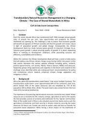
Figure (5) Nile River Bas<strong>in</strong> <strong>in</strong> Ethiopia<br />
<strong>The</strong> Akobo River def<strong>in</strong>es <strong>the</strong> border with Sudan, access is very difficult from <strong>the</strong><br />
Ethiopian side, <strong>and</strong> <strong>the</strong>re are no river gauges on <strong>the</strong> Akobo River <strong>in</strong> Ethiopia. <strong>The</strong> Akobo<br />
from <strong>the</strong> south- east jo<strong>in</strong>s <strong>the</strong> Pibor flow<strong>in</strong>g from <strong>the</strong> south out <strong>of</strong> Sudan, <strong>and</strong> <strong>the</strong> Pibor<br />
<strong>the</strong>n def<strong>in</strong>es <strong>the</strong> Ethiopian- Sudan border until where it is jo<strong>in</strong>ed by <strong>the</strong> Baro flow<strong>in</strong>g <strong>the</strong><br />
east out <strong>of</strong> Ethiopia. <strong>The</strong> river <strong>the</strong>n becomes <strong>the</strong> Sobat, <strong>and</strong> flows west through sou<strong>the</strong>rn<br />
Sudan to its confluence with <strong>the</strong> White Nile about 800 km south <strong>of</strong> Khartoum. <strong>The</strong> only<br />
dam <strong>in</strong> <strong>the</strong> Baro- Akobo sub-bas<strong>in</strong> is <strong>the</strong> Abobo Dam on <strong>the</strong> Alwero River tributary,<br />
commissioned <strong>in</strong> 1996. <strong>The</strong> catchment area to <strong>the</strong> dam is 1 043 km 2 , <strong>and</strong> <strong>the</strong> maximum<br />
storage capacity is only 74 MCM. Regular widespread flood<strong>in</strong>g occurs seasonally <strong>in</strong> <strong>the</strong><br />
flat pla<strong>in</strong> areas up-stream <strong>of</strong> <strong>the</strong> Sudan border.<br />
<strong>The</strong> Abbay River flows out <strong>of</strong> Lake Tana at Bahir Dar, <strong>and</strong> spirals first south, <strong>the</strong>n west,<br />
<strong>and</strong> f<strong>in</strong>ally north-west <strong>in</strong>to <strong>the</strong> Sudan. On <strong>the</strong> way it is jo<strong>in</strong>ed by many large tributaries,<br />
<strong>in</strong>clud<strong>in</strong>g <strong>the</strong> rivers Beshilo, Jimma, Muger, Guder, F<strong>in</strong>chaa, Didessa <strong>and</strong> Dabus on <strong>the</strong><br />
left bank, <strong>and</strong> <strong>the</strong> Beles River on <strong>the</strong> right bank. <strong>The</strong> Abbay passes through deep valleys<br />
<strong>and</strong> gorges as a rag<strong>in</strong>g torrent dur<strong>in</strong>g <strong>and</strong> after <strong>the</strong> wet season (July to October<br />
approximately), convey<strong>in</strong>g large sediment loads. In <strong>the</strong> Sudan <strong>the</strong> Abbay is known as <strong>the</strong><br />
Blue Nile.<br />
Apart from a weir (Chara Weir) at <strong>the</strong> outlet <strong>of</strong> Lake Tana used to regulate lake outflows<br />
for a hydroelectric station at <strong>the</strong> Blue Nile Falls, <strong>the</strong>re are no dams on <strong>the</strong> Abbay River;<br />
however <strong>the</strong> potential for hydropower dams downstream is currently be<strong>in</strong>g <strong>in</strong>vestigated.<br />
<strong>The</strong>re is one dam on <strong>the</strong> F<strong>in</strong>chaa River tributary competed <strong>in</strong> 1973, where <strong>the</strong> catchment<br />
6