South Coast Sensitive Urban Lands Review - Department of ...
South Coast Sensitive Urban Lands Review - Department of ...
South Coast Sensitive Urban Lands Review - Department of ...

Create successful ePaper yourself
Turn your PDF publications into a flip-book with our unique Google optimized e-Paper software.
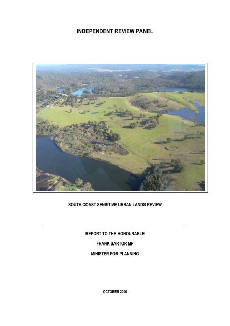
INDEPENDENT REVIEW PANEL<br />
SOUTH COAST SENSITIVE URBAN LANDS REVIEW<br />
_________________________________________________________________________<br />
REPORT TO THE HONOURABLE<br />
FRANK SARTOR MP<br />
MINISTER FOR PLANNING<br />
OCTOBER 2006
SOUTH COAST INDEPENDENT REVIEW PANEL<br />
The Hon Frank Sartor MP<br />
Minister for Planning<br />
Level 34, Governor Macquarie Tower<br />
1 Farrer Place<br />
SYDNEY NSW 2000<br />
Dear Minister,<br />
RE: SOUTH COAST INDEPENDENT REVIEW PANEL<br />
Following the release <strong>of</strong> the Draft <strong>South</strong> <strong>Coast</strong> Regional Strategy, you appointed me to chair a Panel to investigate the<br />
suitability for development <strong>of</strong> some sixteen sites in the region.<br />
We received some 188 submissions and held public hearings over six days in the towns <strong>of</strong> Nowra, Batemans Bay and<br />
Bega as well as in Sydney. Fifty one people appeared at the public hearings.<br />
Having given due regard to all the submissions, we present our report, with recommendations, on each <strong>of</strong> the sites. It<br />
is important to read the recommendations along with the body <strong>of</strong> the report, especially the planning assessment and<br />
the environmental assessment sections <strong>of</strong> each site’s evaluation.<br />
We have also suggested some planning issues for further discussion that arose during our investigations and<br />
deliberations.<br />
My colleagues on the Panel, Mr Vince Berkhout and Dr David Robertson have brought considerable experience and<br />
expertise to the task, and we are unanimous in our recommendations.<br />
Of the total area already zoned for potential development (about 2200ha) we recommended less than 30% to be<br />
developed. Of all the land investigated (about 5900ha) we recommended that almost 30% be for environmental<br />
conservation.<br />
We were very ably assisted in all the preparations for our meetings and public hearings and preparation <strong>of</strong> the report<br />
by Mr Paul Freeman.<br />
The Councils <strong>of</strong> Shoalhaven City, Eurobodalla and Bega Valley went out <strong>of</strong> their way to assist the Panel. They made<br />
the task <strong>of</strong> fact gathering significantly easier, and we are grateful to them.<br />
I trust that this report assists you in finalising the <strong>South</strong> <strong>Coast</strong> Regional Strategy.<br />
Yours truly,<br />
Andrew Refshauge<br />
Panel Chair<br />
LEVEL 13, 301 GEORGE STREET<br />
SYDNEY, NSW 2000<br />
GPO BOX 3415, SYDNEY, NSW 2001<br />
TELEPHONE (02) 9299 2904 FAX (02) 9262 1242<br />
secretariat@coi.nsw.gov.au
CONTENTS<br />
Letter to Minister<br />
EXECUTIVE SUMMARY 1<br />
1. INTRODUCTION 1<br />
1.1 Background 1<br />
1.2 Terms <strong>of</strong> Reference 4<br />
1.3 Site <strong>Review</strong> Method 5<br />
1.4 Consultation 6<br />
1.5 Other related emerging Issues 7<br />
1.6 Structure <strong>of</strong> Panel Report 7<br />
1.7 Panel Members 8<br />
1.8 Acknowledgements 8<br />
2. DRAFT SOUTH COAST STRATEGY 9<br />
2.1 Summary <strong>of</strong> Findings 9<br />
2.2 Strategy Objectives and Principles 12<br />
2.3 <strong>South</strong> <strong>Coast</strong> Region Sustainability Criteria 13<br />
3. KEY ENVIRONMENTAL INFORMATION SOURCES 14<br />
4. SHOALHAVEN LGA 15<br />
4.1 Background 15<br />
4.2 Shoalhaven Council comments on sensitive sites 15<br />
4.3 Overview <strong>of</strong> Environmental Characteristics, Shoalhaven LGA 17<br />
4.4 Strategic Planning Context 18<br />
5. CULBURRA 24<br />
5.1 Background 24<br />
5.2 Environmental Characteristics 27<br />
5.3 Environmental Issues and Assessment 29<br />
5.4 Planning Issues and Assessment 30<br />
5.5 Recommendations 32<br />
6. COMBERTON GRANGE 34<br />
6.1 Background 34<br />
6.2 Environmental Characteristics 37<br />
6.3 Environmental Issues and Assessment 38<br />
6.4 Planning Issues and Assessment 39<br />
6.5 Recommendations 41<br />
7. BADGEE LAGOON 43<br />
7.1 Background 43<br />
SOUTH COAST SENSITIVE URBAN LANDS REVIEW<br />
i
CONTENTS<br />
7.2 Environmental Characteristics 46<br />
7.3 Environmental Issues and Assessment 47<br />
7.4 Planning Issues and Assessment 48<br />
7.5 Recommendations 48<br />
8. BERRARA/ CUDMIRRAH 50<br />
8.1 Background 50<br />
8.2 Environmental Characteristics 52<br />
8.3 Environmental Issues and Assessment 53<br />
8.4 Planning Issues and Assessment 54<br />
8.5 Recommendations 55<br />
9. NORTH BENDALONG / BENDALONG 57<br />
9.1 Background 57<br />
9.2 Environmental Characteristics 59<br />
9.3 Environmental Issues and Assessment 60<br />
9.4 Planning Issues and Assessment 60<br />
9.5 Recommendations 62<br />
10. BERINGER LAKE / MANYANA 64<br />
10.1 Background 64<br />
10.2 Environmental Characteristics 66<br />
10.3 Environmental Issues and Assessment 67<br />
10.4 Planning Issues and Assessment 67<br />
10.5 Recommendations 69<br />
11. EUROBODALLA SITES 70<br />
11.1 Background 70<br />
11.2 Overview <strong>of</strong> Environmental Characteristics, Eurobodalla LGA 71<br />
11.3 Strategic Planning Context 72<br />
12. LONGBEACH 76<br />
12.1 Background 76<br />
12.2 Environmental Characteristics 78<br />
12.3 Environmental Issues and Assessment 79<br />
12.4 Planning Issues and Assessment 80<br />
12.5 Recommendations 81<br />
13. MALUA BAY 82<br />
13.1 Background 82<br />
13.2 Environmental Characteristics 84<br />
SOUTH COAST SENSITIVE URBAN LANDS REVIEW<br />
ii
CONTENTS<br />
13.3 Environmental Issues and Assessment 85<br />
13.4 Planning Issues and Assessment 86<br />
13.5 Recommendations 86<br />
14. ROSEDALE 87<br />
14.1 Background 87<br />
14.2 Environmental Characteristics 90<br />
14.3 Environmental Issues and Assessment 91<br />
14.4 Planning Issues and Assessment 91<br />
14.5 Recommendations 92<br />
15. MORUYA HEADS 94<br />
15.1 Background 94<br />
15.2 Environmental Characteristics 96<br />
15.3 Environmental Issues and Assessment 97<br />
15.4 Planning Issues and Assessment 98<br />
15.5 Recommendations 99<br />
16. NAROOMA SOUTH 100<br />
16.1 Background 100<br />
16.2 Environmental Characteristics 102<br />
16.3 Environmental Issues and Assessment 104<br />
16.4 Planning Issues and assessment 104<br />
16.5 Recommendations 105<br />
17. BEGA VALLEY SITES 106<br />
17.1 Background 106<br />
17.2 Strategic Planning Context 108<br />
17.3 Overview <strong>of</strong> Environmental Characteristics, Bega Valley LGA 110<br />
18. WALLAGA LAKE 112<br />
18.1 Background 112<br />
18.2 Environmental Characteristics 115<br />
18.3 Environmental Issues and Assessment 116<br />
18.4 Planning Issues and Assessment 117<br />
18.5 Recommendations 117<br />
19. BEGA SOUTH AND WEST 119<br />
19.1 Background 119<br />
19.2 Environmental Characteristics 121<br />
19.3 Environmental Issues and Assessment 122<br />
SOUTH COAST SENSITIVE URBAN LANDS REVIEW<br />
iii
CONTENTS<br />
19.4 Planning Issues and Assessment 122<br />
19.5 Recommendations 122<br />
20. WOLUMLA 124<br />
20.1 Background 124<br />
20.2 Environmental Characteristics 126<br />
20.3 Environmental Issues and Assessment 127<br />
20.4 Planning Issues and Assessment 127<br />
20.5 Recommendations 128<br />
21. TATHRA RIVER 130<br />
21.1 Background 130<br />
21.2 Environmental Characteristics 135<br />
21.3 Environmental Issues and Assessment 136<br />
21.4 Planning Issues and Assessment 138<br />
21.5 Recommendations 139<br />
22. LAKE MERIMBULA 140<br />
22.1 Background 140<br />
22.2 Environmental Characteristics 142<br />
22.3 Environmental Issues and Assessment 143<br />
22.4 Planning Issues and Assessment 143<br />
22.5 Recommendations 144<br />
23. OTHER RELEVANT PLANNING & ENVIRONMENTAL ISSUES 145<br />
23.1 Accurately measuring population growth 145<br />
23.2 Planning for a complex land market 145<br />
23.3 Development program 146<br />
23.4 Land and housing monitor 147<br />
23.5 Sewerage services and urban expansion 147<br />
23.6 Method <strong>of</strong> charging for sewerage contributions for land development 147<br />
23.7 Planning provisions to encourage medium density housing in and around major<br />
regional centres and major towns 147<br />
23.8 Suitability <strong>of</strong> existing land zonings 148<br />
23.9 <strong>Urban</strong> design 148<br />
23.10 Transfer <strong>of</strong> development rights/ development potential 149<br />
SOUTH COAST SENSITIVE URBAN LANDS REVIEW<br />
iv
CONTENTS<br />
FIGURES<br />
Figure 1 Shoalhaven Sites 2<br />
Figure 2 Eurobodalla Sites 3<br />
Figure 3 Bega Valley Sites 4<br />
Figure 4 Jervis Bay Settlement Strategy area 19<br />
Figure 5 Location <strong>of</strong> Culburra relative to Nowra 24<br />
Figure 6 Aerial close-up <strong>of</strong> Culburra 25<br />
Figure 7 Zoning plan for Culburra 26<br />
Figure 8 Panel recommendations for development in Culburra 33<br />
Figure 9 Location <strong>of</strong> Comberton Grange relative to Nowra 34<br />
Figure 10 Aerial photo <strong>of</strong> Comberton Grange 35<br />
Figure 11 Zoning plan for Comberton Grange 36<br />
Figure 12 Panel’s recommendations for development in Comberton Grange 42<br />
Figure 13 Location <strong>of</strong> Badgee Lagoon 43<br />
Figure 14 Aerial <strong>of</strong> Badgee Lagoon site 44<br />
Figure 15 Zoning plan for Badgee Lagoon 45<br />
Figure 16 Panel’s recommendations for development at Badgee Lagoon 49<br />
Figure 17 Locational context <strong>of</strong> Berrara/ Cudmirrah 50<br />
Figure 18 Aerial close-up <strong>of</strong> the Berrara/ Cudmirrah site 51<br />
Figure 19 Zoning plan for Berrara/ Cudmirrah 52<br />
Figure 20 Panel’s recommendations for development in Berrara/ Cudmirrah 56<br />
Figure 21 North Bendalong & Bendalong sites relative to Ulladulla 57<br />
Figure 22 Aerial close-up <strong>of</strong> North Bendalong and Bendalong sites 58<br />
Figure 23 Zoning plan for North Bendalong and Bendalong 59<br />
Figure 24 Panel’s recommendations for the North Bendalong and Bendalong sites 63<br />
Figure 25 Beringer Lake and Manyana location relative to Ulladulla 64<br />
Figure 26 Aerial close-up <strong>of</strong> Beringer Lake and Manyana sites 65<br />
SOUTH COAST SENSITIVE URBAN LANDS REVIEW<br />
v
CONTENTS<br />
Figure 27 Zoning plan for Beringer Lake and Manyana 66<br />
Figure 28 Panel’s recommendations Beringer Lake/ Manyana 69<br />
Figure 29 Location <strong>of</strong> Longbeach showing proximity to Batemans Bay 76<br />
Figure 30 Aerial close-up <strong>of</strong> Longbeach site 77<br />
Figure 31 Zoning plan for Longbeach 77<br />
Figure 32 Malua Bay relationship to Batemans Bay 82<br />
Figure 33 Aerial close-up <strong>of</strong> Malua Bay 83<br />
Figure 34 Zoning plan for Malua Bay 84<br />
Figure 35 Rosedale site showing proximity to Batemans Bay and Malua Bay 87<br />
Figure 36 Aerial close-up <strong>of</strong> Rosedale 88<br />
Figure 37 Zoning plan for the Rosedale site 88<br />
Figure 38 Panel’s recommendations for Rosedale 93<br />
Figure 39 Location <strong>of</strong> Moruya Heads land relative to Moruya 94<br />
Figure 40 Aerial close-up <strong>of</strong> Moruya Heads sites 95<br />
Figure 41 Zoning plan for Moruya Heads 96<br />
Figure 42 Location <strong>of</strong> Narooma <strong>South</strong> land shown on the edge <strong>of</strong> Narooma township 100<br />
Figure 43 Aerial close-up <strong>of</strong> Narooma <strong>South</strong> site 101<br />
Figure 44 Zoning plan for Narooma <strong>South</strong> 102<br />
Figure 45 Location <strong>of</strong> Wallaga Lake site relative to Bermagui 112<br />
Figure 46 Aerial close-up <strong>of</strong> Wallaga Lake site 113<br />
Figure 47 Zoning plan for the Wallaga Lake site 114<br />
Figure 48 Panel’s recommendations for the Wallaga Lake site 118<br />
Figure 49 Location <strong>of</strong> sites relative to Bega township 119<br />
Figure 50 Aerial close-up <strong>of</strong> Bega sites 120<br />
Figure 51 Zoning plan for Bega sites 120<br />
Figure 52 Council plan for zone amendments for <strong>South</strong> Bega land, with panel recommendations 123<br />
Figure 53 Location <strong>of</strong> Wolumla relative to Merimbula 124<br />
SOUTH COAST SENSITIVE URBAN LANDS REVIEW<br />
vi
CONTENTS<br />
Figure 54 Aerial close-up <strong>of</strong> Wolumla 125<br />
Figure 55 Zoning plan for Wolumla 125<br />
Figure 56 Council plan for zone amendments for Wolumla, with Panel recommendations 129<br />
Figure 57 Location <strong>of</strong> Tathra River land relative to Bega 130<br />
Figure 58 Aerial close-up <strong>of</strong> Tathra River site 131<br />
Figure 59 Zoning plan for Tathra River 132<br />
Figure 60 Location <strong>of</strong> Lake Merimbula sites relative to Merimbula 140<br />
Figure 61 Aerial close-up <strong>of</strong> Lake Merimbula sites 141<br />
Figure 62 Zoning plan for Lake Merimbula sites 141<br />
SOUTH COAST SENSITIVE URBAN LANDS REVIEW<br />
vii
CONTENTS<br />
TABLES<br />
Table 1 Synopsis on Land Supply and Demand, <strong>South</strong> <strong>Coast</strong> Region 11<br />
Table 2 Sustainability Criteria, draft <strong>South</strong> <strong>Coast</strong> Regional Strategy 13<br />
Table 3 Additional/ alternative urban development areas, Shoalhaven LGA 22<br />
Table 4 Alternative/ additional urban areas, Eurobodalla 75<br />
Table 5 Alternative/ additional urban areas, Bega Valley 110<br />
APPENDICES<br />
APPENDIX A. SUBMISSIONS & PRESENTERS A.1<br />
GLOSSARY<br />
ABS<br />
Acid Sulphate Soil<br />
Aquifer<br />
BVSC<br />
CAMBA<br />
CBD<br />
CEEC<br />
DEC<br />
DEH<br />
DNR<br />
DSP<br />
EEC<br />
Australian Bureau <strong>of</strong> Statistics<br />
Soils that produce sulphuric acid when exposed to air (oxidised) and<br />
subsequently wet<br />
Water body located below the ground<br />
Bega Valley Shire Council<br />
China-Australia Migratory Bird Agreement - Agreement between the Government<br />
<strong>of</strong> Australia and the Government <strong>of</strong> the People's Republic <strong>of</strong> China for the<br />
Protection <strong>of</strong> Migratory Birds and their Environment<br />
Central Business District<br />
Critically Endangered Ecological Communities<br />
<strong>Department</strong> <strong>of</strong> Environment and Conservation (NSW)<br />
<strong>Department</strong> <strong>of</strong> the Environment and Heritage (Commonwealth)<br />
<strong>Department</strong> <strong>of</strong> Natural Resources (NSW)<br />
Development Servicing Plan prepared by Councils under the Water Management<br />
Act (NSW)<br />
Endangered Ecological Community listed under the TSC Act or EPBC Act<br />
EP& A Act Environmental Planning & Assessment Act 1979<br />
EPBC Act<br />
Environment Protection and Biodiversity Conservation Act 1999 (Commonwealth)<br />
SOUTH COAST SENSITIVE URBAN LANDS REVIEW<br />
viii
CONTENTS<br />
ESC<br />
Eutrophic<br />
ICOLL<br />
JAMBA<br />
LEP<br />
LGA<br />
NPWS<br />
RAMSAR<br />
REP<br />
Riparian<br />
Riparian Corridor Category 1<br />
Riparian Corridor Category 2<br />
Riparian Corridor Category 3<br />
SCC<br />
SEPP 14<br />
SEPP 50<br />
SEPP 71<br />
Threatened Species<br />
Eurobodalla Shire Council<br />
Waters with high content <strong>of</strong> organic nutrients and minerals that promotes algae<br />
growth and subsequent reduction in dissolved oxygen content causing death <strong>of</strong><br />
other organisms<br />
Intermittently Closing & Opening Lake or Lagoon<br />
Japan-Australia Migratory Bird Agreement - Agreement between the Government<br />
<strong>of</strong> Australia and the Government <strong>of</strong> Japan for the Protection <strong>of</strong> Migratory Birds<br />
and Birds in Danger <strong>of</strong> Extinction and their Environment<br />
Local Environmental Plan<br />
Local Government Area<br />
National Parks and Wildlife Service (NSW)<br />
The Convention on Wetlands, signed in Ramsar, Iran, in 1971. This is an<br />
intergovernmental treaty which provides the framework for national action and<br />
international cooperation for the conservation and wise use <strong>of</strong> wetlands and their<br />
resources.<br />
Regional Environmental Plan<br />
Relating to rivers, streams and watercourses, the transition between terrestrial<br />
and aquatic environments<br />
Defined by DNR as “environmental corridor” along waterways including a 40m<br />
vegetated core riparian zone and a 10m vegetated buffer zone<br />
Defined by DNR as “terrestrial and aquatic habitat” along waterways including a<br />
20m vegetated core riparian zone and a 10m vegetated buffer zone<br />
Defined by DNR as “bank stability and water quality” along waterways including a<br />
10m vegetated buffer zone<br />
Shoalhaven City Council<br />
State Environmental Planning Policy No. 14 – <strong>Coast</strong>al Wetlands<br />
State Environmental Planning Policy No. 50 – Canal Estate Development<br />
State Environmental Planning Policy No. 71 – <strong>Coast</strong>al Protection<br />
Flora and fauna species listed as Vulnerable, Endangered or Critically<br />
Endangered under the TSC Act or EPBC Act<br />
TSC Act Threatened Species Conservation Act 1995<br />
WSUD<br />
Water <strong>Sensitive</strong> <strong>Urban</strong> Design<br />
SOUTH COAST SENSITIVE URBAN LANDS REVIEW<br />
ix
EXECUTIVE SUMMARY<br />
BACKGROUND<br />
The NSW Government released the draft <strong>South</strong> <strong>Coast</strong> Regional Strategy for public comment in May 2006. In<br />
preparing the draft Strategy with the 3 Local Councils that comprise the <strong>South</strong> <strong>Coast</strong> Region (Shoalhaven,<br />
Eurobodalla and Bega Valley), 16 areas zoned to allow for urban expansion 1 were found to be environmentally<br />
sensitive and in relatively isolated locations and warranted a “priority review by an expert Panel to determine<br />
suitability and scale <strong>of</strong> any release” for urban development.<br />
Following the release <strong>of</strong> the draft Strategy the Minister for Planning appointed an independent Panel comprising<br />
Dr Andrew Refshauge (Chair), Dr David Robertson and Mr Vince Berkhout to investigate and report on the<br />
sensitive sites outlined in the strategy, with an additional site located at Comberton Grange (City <strong>of</strong> Shoalhaven),<br />
which is not presently zoned for urban purposes but is the subject <strong>of</strong> proposals for urban development.<br />
Of the sites reviewed 6 are also the subject <strong>of</strong> applications to the Minister for Planning for consideration under<br />
Part 3A – Major Infrastructure and Other Projects - <strong>of</strong> the Environmental Planning and Assessment Act (EP&A<br />
Act):<br />
• One portion <strong>of</strong> the land at Moruya Heads - Lot 2 DP534555, <strong>South</strong> Head Road, Moruya Heads -<br />
112 lot residential subdivision<br />
• The western part <strong>of</strong> the Rosedale site - George Bass Drive, Rosedale, Lots 11, 29, 32, 72, 102<br />
119 & 213 (DP755902), Lot 2 (DP627034), Lot 2 (DP623340) - 900-1100 lot residential subdivision<br />
• The eastern portion <strong>of</strong> the site at Rosedale - George Bass Drive and Roseby Drive, Rosedale, Lot<br />
12 & Part Lot 122 (DP755902), Part Lot 1 (DP511266), Part Lot 1 (DP403372) & Lot 1 (DP243483)<br />
- 178 lot residential subdivision<br />
• The land at Longbeach - Lots1 & 2 DP 535536 and Lot 2 DP 872711, North Cove Road, Long<br />
Beach - 174 lot residential subdivision<br />
• The land at Tathra - Tathra River Estate - Mixed residential, commercial, tourist and recreational<br />
facilities<br />
• The land at Comberton Grange - (Lot 1 DP725955, Lot 1 DP550098, Lot 4 DP63405, and Lots 59,<br />
60 and 61 <strong>of</strong> DP 755928) Comberton Grange, <strong>South</strong> Nowra - Shaolin Shoalhaven Development -<br />
comprising Buddhist Temple Sanctuary Complex, Kung-Fu Academy, Hotel, Golf course and<br />
Permanent Residential Development. This site also has a Part 3A application for a Jewish Village,<br />
submitted by the Jezreel Consortium.<br />
1 The 16 sites listed in the Draft <strong>South</strong> <strong>Coast</strong> Strategy were described as follows: Shoalhaven – Culburra urban expansion<br />
area; Badgee Lagoon; <strong>Urban</strong> Land between Berrara and Cudmirrah; Crown Land at North Bendalong; Crown Land at<br />
Bendalong; Crown Land between Beringer Lake and Manyana; Eurobodalla – Longbeach urban expansion area; Malua Bay<br />
urban expansion area; Rosedale urban expansion area; Moruya Heads urban expansion area; Expansion area south <strong>of</strong><br />
Narooma; Bega – Tathra River Estate; Land adjoining Lake Merimbula; Future urban and rural residential land south and<br />
west <strong>of</strong> Bega; Land adjoining Wolumla to the west; and land adjoining Wallaga Lake.<br />
SOUTH COAST SENSITIVE URBAN LANDS REVIEW<br />
ES1
Executive Summary<br />
TERMS OF REFERENCE<br />
The terms <strong>of</strong> reference for the Panel were as follows:<br />
1 <strong>Review</strong> the suitability <strong>of</strong> each site for urban development and the scale and type <strong>of</strong> any<br />
recommended land release, having regard to the site’s biophysical constraints, servicing and<br />
infrastructure issues and compatibility with the strategic directions <strong>of</strong> the draft <strong>South</strong> <strong>Coast</strong><br />
Regional Strategy.<br />
2 Advise on the priority and timing <strong>of</strong> any recommended releases for urban development, including<br />
an assessment against forecast population growth trends contained in the draft <strong>South</strong> <strong>Coast</strong><br />
Regional Strategy.<br />
3 Advise on what (if any) alternate land uses might be suitable for each site in the event that urban<br />
development is not considered suitable.<br />
CONSULTATION<br />
The Panel invited written submissions, and conducted open public hearings in each <strong>of</strong> the Council areas and in<br />
Sydney. 188 written submissions were received, and 51 people/ organisations made verbal presentations to the<br />
hearings.<br />
Discussions were also held with relevant Government agencies and each Council.<br />
KEY ISSUES THAT EMERGED<br />
The key issues that emerged from the written submissions and public hearings on each <strong>of</strong> the sites under review<br />
include the following. Given the range <strong>of</strong> sites reviewed the issues varied from site to site:<br />
• The need to plan for additional urban expansion on the <strong>South</strong> <strong>Coast</strong> to meet the pressures from<br />
accelerated population growth, economic development and tourism<br />
• The need to increase the size <strong>of</strong> settlements to improve the sustainability <strong>of</strong> <strong>South</strong> <strong>Coast</strong> towns and<br />
villages through added facilities and services<br />
• The subject sites are included in the servicing strategies prepared by each <strong>of</strong> the Councils, and the<br />
importance <strong>of</strong> these areas for meeting Council financial commitments<br />
• The environmental impacts <strong>of</strong> development, including impacts on the water quality <strong>of</strong> adjacent<br />
rivers, creeks, wetlands, coastal lagoons, and aquifers<br />
• The potential loss <strong>of</strong> vegetation communities, and plant and animal species <strong>of</strong> conservation value<br />
that would result from development<br />
• The potential risks to some <strong>of</strong> the sites from bushfire hazard, sea level change, flooding, and other<br />
site-specific constraints such as steep terrain, and adverse soil conditions.<br />
PRINCIPLES APPLIED BY THE PANEL<br />
The Panel developed a range <strong>of</strong> principles that were applied to the review <strong>of</strong> each <strong>of</strong> site to ensure consistency <strong>of</strong><br />
approach and fairness, particularly in view <strong>of</strong> the long period <strong>of</strong> time that most <strong>of</strong> the subject sites have been<br />
zoned to allow for urban purposes. These principles were:<br />
SOUTH COAST SENSITIVE URBAN LANDS REVIEW<br />
ES2
Executive Summary<br />
• Adhere to the principles <strong>of</strong> the draft <strong>South</strong> <strong>Coast</strong> Region Strategy that there should be no new<br />
towns or villages, and that additional urban development should augment existing settlements<br />
• Exclude development in the catchments <strong>of</strong> sensitive Intermittently Closing and Opening Lakes and<br />
lagoons (ICOLLS)<br />
• Exclude development from areas that contain endangered ecological communities<br />
• Encourage more site-specific approaches to the definition <strong>of</strong> the width <strong>of</strong> riparian corridors in sites<br />
identified as suitable for urban development<br />
• Require early replanting <strong>of</strong> predominantly cleared riparian corridors in sites identified as suitable for<br />
development<br />
• Implement best practice water quality management/ water sensitive urban design (WSDU) for sites<br />
identified as suitable for urban development<br />
• Identify opportunities to improve bushfire protection for existing settlements<br />
• Require development to achieve higher dwelling yields so that more efficient use is made <strong>of</strong> limited<br />
land resources (except where site constraints preclude higher densities)<br />
• Take into account alternative urban development areas (whether zoned, or un-zoned but under<br />
consideration by Councils)<br />
• Restrict development in areas where there appears little prospect <strong>of</strong> creating a sustainable<br />
community, due to factors such as small communities, high dwelling vacancy rates, relative<br />
isolation from services and facilities, and limited expansion potential.<br />
RECOMMENDATIONS<br />
Following the deliberations <strong>of</strong> the Panel and the input <strong>of</strong> information through submissions and the hearings<br />
process, the recommendations below are made for each <strong>of</strong> the sensitive urban sites, against each <strong>of</strong> the Terms<br />
<strong>of</strong> Reference.<br />
The recommendations should be read in conjunction with the environmental issues and assessment sections and<br />
the planning issues and assessments sections for each site and the associated plans, located in the body <strong>of</strong> the<br />
report.<br />
For a number <strong>of</strong> sites the Panel recommends development combined with environmental outcomes (such as land<br />
dedication and environmental works). Where this is the case the development and environmental outcomes are<br />
considered inextricably linked. This is to say that without the environmental outcomes, development should not<br />
proceed.<br />
SOUTH COAST SENSITIVE URBAN LANDS REVIEW<br />
ES3
Executive Summary<br />
SHOALHAVEN SITES<br />
Culburra<br />
TERMS OF REFERENCE ASSESSMENT & RECOMMENDATION<br />
1a. Suitability <strong>of</strong> site Land within the catchment <strong>of</strong> Lake Wollumboola is considered unsuitable for urban<br />
development, principally on the grounds <strong>of</strong> the potential negative impacts on the Lake which<br />
is a sensitive ICOLL.<br />
The remaining land within the catchment <strong>of</strong> the Crookhaven River is considered suitable for<br />
limited urban development.<br />
1b. Scale and type <strong>of</strong><br />
land release<br />
It would be appropriate for sufficient land within the Crookhaven River catchment, north <strong>of</strong><br />
Culburra Road and immediately west <strong>of</strong> the Culburra Village centre to progress for urban<br />
development. The amount <strong>of</strong> land should meet estimated needs for the next 10-15 years.<br />
The release area should achieve densities which are higher than traditionally achieved to<br />
reduce the land-take and economise on the use <strong>of</strong> land resources. Site planning should<br />
allow for suitable bushfire setbacks; protection <strong>of</strong> EECs and riparian setbacks exceeding<br />
current DNR requirements.<br />
The Council should monitor closely the rate <strong>of</strong> development, dwelling construction and the<br />
nature <strong>of</strong> dwelling tenure (to determine whether dwellings are permanently occupied or not)<br />
to determine land demand trends.<br />
Further rural land adjoining to the west (outside the Lake Wollumboola catchment) is suitable<br />
for investigation for additional urban development/ release in due course, subject to<br />
environmental assessments and demand for land.<br />
The planning for Culburra should be revisited in 10 years to determine the need for further<br />
urban land.<br />
Council should instigate planning reform within the established areas <strong>of</strong> Culburra and Orient<br />
Point to increase the potential for higher density dwellings to meet changing demographic<br />
needs, and manage the demand for urban expansion land.<br />
2. Priority and timing No particular priority. In line with market demand.<br />
3. Alternate land<br />
uses<br />
The land in the Lake Wollumboola catchment should be zoned for conservation purposes<br />
(the most appropriate zone under the LEP template is Zone E1 National Parks and Nature<br />
Reserves).<br />
Negotiations should be commenced with the land owner to determine their interest in<br />
dedicating the land in the Lake Wollumboola catchment for conservation purposes, and<br />
including the site as a potential bio-banking site.<br />
SOUTH COAST SENSITIVE URBAN LANDS REVIEW<br />
ES4
Executive Summary<br />
Comberton Grange<br />
TERMS OF REFERENCE ASSESSMENT & RECOMMENDATION<br />
1a. Suitability <strong>of</strong> site This site is unsuitable for development in areas characterised as floodplain (1:100 year<br />
flood), the eastern vegetated portion <strong>of</strong> the site (east <strong>of</strong> the existing quarry and including the<br />
SEPP 14 wetland in the southern corner <strong>of</strong> the site), and where EECs occur.<br />
Portions <strong>of</strong> the site that are suitable for limited development include the cleared land outside<br />
the floodplain, the area occupied by the former pine plantation, the plateau land and portions<br />
<strong>of</strong> the western forest areas that are not on the floodplain <strong>of</strong> Currambene Creek.<br />
1b. Scale and type <strong>of</strong><br />
land release<br />
The Panel does not support the development <strong>of</strong> a stand-alone residential settlement at<br />
Comberton Grange on the grounds that it conflicts with one <strong>of</strong> the key principles <strong>of</strong> the Draft<br />
<strong>South</strong> <strong>Coast</strong> Strategy 2 , and its potential impacts on the delivery <strong>of</strong> essential services.<br />
Development <strong>of</strong> the land is supported only if it comprises a fully integrated tourist facility with<br />
associated residential development, on the grounds <strong>of</strong> the potential employment benefits to<br />
the Shoalhaven.<br />
The amount <strong>of</strong> residential development should be limited to in the order <strong>of</strong> 200-300<br />
dwellings. This could be reviewed upon reaching this level.<br />
The amount <strong>of</strong> residential development in the first stage (and subsequent stages) should be<br />
limited, with the tourism component being the predominant use.<br />
Site planning must include best practice water sensitive urban design (WSUD) to minimise<br />
impacts on Currambene Creek. Riparian and wildlife corridors are to be provided (greater<br />
than Category 1 – 50m buffer on either side <strong>of</strong> stream bank) along Currambene Creek.<br />
The floodplain <strong>of</strong> Currambene Creek should be the subject <strong>of</strong> early revegetation with locally<br />
indigenous plant species to restore the riparian ecology.<br />
The density <strong>of</strong> the residential component should be planned to achieve a higher dwelling<br />
yield per hectare than traditionally achieved to use the land resource more efficiently.<br />
The land developed for tourism and residential purposes should be retained in one<br />
ownership.<br />
The Panel does not have any issue with permanent occupancy <strong>of</strong> dwellings under the<br />
arrangements above.<br />
2. Priority and timing Development could occur according to market demand, following adequate environmental,<br />
social and economic assessment.<br />
3. Alternate land<br />
uses<br />
The Eastern portion <strong>of</strong> the site (east <strong>of</strong> the existing quarry and including the SEPP 14<br />
wetland in the southern corner <strong>of</strong> the site) should be added to the Jervis Bay National Park<br />
on the grounds <strong>of</strong> its conservation value. The most appropriate zone for this area under the<br />
LEP template would be Zone E1 National Parks and Nature Reserves.<br />
2 The Draft <strong>South</strong> <strong>Coast</strong> Regional Strategy states as one <strong>of</strong> its principles (page 9) that “No new towns or villages will be<br />
supported”.<br />
SOUTH COAST SENSITIVE URBAN LANDS REVIEW<br />
ES5
Executive Summary<br />
Badgee Lagoon<br />
TERMS OF REFERENCE ASSESSMENT & RECOMMENDATION<br />
1a. Suitability <strong>of</strong> site The majority <strong>of</strong> the Badgee Lagoon site is unsuitable for urban development on the grounds<br />
<strong>of</strong> its potential negative impacts on water quality in Badgee Lagoon.<br />
Two areas <strong>of</strong> the site in the north-western and south-western corners are suitable for<br />
residential development in accordance with the proposals put forward by the owner, subject<br />
to best practice WSUD and water quality management.<br />
It should be noted that the site considered by the Panel includes a subdivided and developed<br />
strip <strong>of</strong> land along Suncrest Avenue on the northern side <strong>of</strong> the lagoon. The Panel has<br />
excluded this area from its recommendations so that development can proceed in line with<br />
existing approvals.<br />
1b. Scale and type <strong>of</strong><br />
land release<br />
Development should provide for a mix <strong>of</strong> housing, at yields that exceed traditional residential<br />
yields in the locality.<br />
2. Priority and timing According to market demand.<br />
3. Alternate land<br />
uses<br />
The land that is unsuitable for development should be zoned for conservation purposes. The<br />
most appropriate zone under the new LEP template is either Zone E2 Environmental<br />
Conservation or Zone E1 National Parks and Nature Reserves.<br />
Negotiations should be commenced with the owner to secure dedication <strong>of</strong> the land for<br />
conservation purposes in return for development <strong>of</strong> the 2 areas identified above.<br />
Berrara<br />
TERMS OF REFERENCE ASSESSMENT & RECOMMENDATION<br />
1a. Suitability <strong>of</strong> site This site is suitable for limited development.<br />
The northern parts that drain into Swan Lake are unsuitable for development on the grounds<br />
<strong>of</strong> the potential adverse impacts on the ecology <strong>of</strong> the lake from urban run-<strong>of</strong>f, and the<br />
existence <strong>of</strong> EECs.<br />
Land in the south-east corner is unsuitable due to the presence <strong>of</strong> EECs. A small part <strong>of</strong> the<br />
site adjacent to Swan Avenue and Waratah Avenue is suitable for limited development<br />
mainly planned to allow for better bushfire management for the Berrara/ Cudmirrah villages.<br />
Site planning should provide for a perimeter road and sufficient separation between<br />
bushland and adjoining dwellings for a suitable Asset Protection Zone (APZ).<br />
The remainder <strong>of</strong> the site is not suitable for development in view <strong>of</strong> the lack <strong>of</strong> potential for<br />
the village to reach a sustainable size, and a lack <strong>of</strong> pressing need for additional residential<br />
land.<br />
1b. Scale and type <strong>of</strong><br />
land release<br />
Development should provide for a mix <strong>of</strong> housing, at yields that exceed traditional residential<br />
yields in the locality.<br />
2. Priority and timing Low priority.<br />
3. Alternate land<br />
uses<br />
The land in the northern portion <strong>of</strong> the site should be zoned for environmental conservation<br />
using the new Zone E2 Environmental Conservation under the LEP template.<br />
SOUTH COAST SENSITIVE URBAN LANDS REVIEW<br />
ES6
Executive Summary<br />
North Bendalong<br />
TERMS OF REFERENCE ASSESSMENT & RECOMMENDATION<br />
1a. Suitability <strong>of</strong> site The North Bendalong site is suitable for a limited amount <strong>of</strong> additional development, aimed<br />
principally at creating a better bushfire management outcome for the village.<br />
A small part <strong>of</strong> the site adjacent to Pine Street is suitable for a modest amount <strong>of</strong><br />
development.<br />
Site planning should provide for a perimeter road and sufficient separation between<br />
bushland and adjoining dwellings for a suitable APZ.<br />
The remainder <strong>of</strong> the site is not suitable for development in view <strong>of</strong> the isolated nature <strong>of</strong> the<br />
village, the lack <strong>of</strong> potential for it to reach a sustainable size, and a lack <strong>of</strong> pressing need for<br />
additional residential land.<br />
1b. Scale and type <strong>of</strong><br />
land release<br />
Development should provide for a mix <strong>of</strong> housing, at yields that exceed traditional residential<br />
yields in the locality.<br />
2. Priority and timing Low priority. Development applications on the land along Cypress Street presently before<br />
the Council should proceed to determination.<br />
3. Alternate land<br />
uses<br />
The remaining parts <strong>of</strong> the land should be rezoned for environmental conservation using the<br />
new Zone E2 Environmental Conservation under the LEP template.<br />
Bendalong<br />
TERMS OF REFERENCE ASSESSMENT & RECOMMENDATION<br />
1a. Suitability <strong>of</strong> site The Bendalong site is suitable for a small amount <strong>of</strong> additional development, along Maple<br />
Street aimed principally at creating better bushfire protection for the village.<br />
Site planning should provide for a perimeter road and sufficient separation between<br />
bushland and adjoining dwellings for a suitable APZ.<br />
The remainder <strong>of</strong> the site is not suitable for development in view <strong>of</strong> the isolated nature <strong>of</strong> the<br />
village, the lack <strong>of</strong> potential for it to reach a sustainable size, and the lack <strong>of</strong> pressing need<br />
for additional residential land in this locality.<br />
1b. Scale and type <strong>of</strong><br />
land release<br />
Development should provide for a mix <strong>of</strong> housing, at yields that exceed traditional residential<br />
yields in the locality.<br />
2. Priority and timing Low priority.<br />
3. Alternate land<br />
uses<br />
The remaining parts <strong>of</strong> the land should be rezoned for environmental conservation using the<br />
new Zone E2 Environmental Conservation under the LEP template.<br />
SOUTH COAST SENSITIVE URBAN LANDS REVIEW<br />
ES7
Executive Summary<br />
Beringer Lake / Manyana<br />
TERMS OF REFERENCE ASSESSMENT & RECOMMENDATION<br />
1a. Suitability <strong>of</strong> site Land within the Lake Beringer catchment is generally considered unsuitable for development<br />
due to its potentially adverse impacts on the ecology <strong>of</strong> the Lake (which also feeds Lake<br />
Conjola). In addition, there is sufficient zoned land in the locality that will meet the demands<br />
<strong>of</strong> growth within this area for the foreseeable future.<br />
Limited development, however, could be accommodated in corridor between the villages <strong>of</strong><br />
Cunjurong and Manyana in the vicinity <strong>of</strong> Goodsell Street and Canada Street, principally with<br />
the objective <strong>of</strong> improving bushfire protection for these areas. This area is considered to be<br />
a sufficient distance from the lakes to make minor development acceptable.<br />
Site planning should provide for a perimeter road and sufficient separation between<br />
bushland and adjoining dwellings for a suitable APZ, and suitable water quality management<br />
for stormwater.<br />
1b. Scale and type <strong>of</strong><br />
land release<br />
Development should provide for a mix <strong>of</strong> housing, at yields that exceed traditional residential<br />
yields in the locality.<br />
2. Priority and timing Low priority in view <strong>of</strong> the amount <strong>of</strong> zoned undeveloped land in the locality.<br />
3. Alternate land<br />
uses<br />
The areas <strong>of</strong> the site unsuitable for urban development should be rezoned for environmental<br />
conservation using the new Zone E2 Environmental Conservation under the LEP template.<br />
EUROBODALLA SITES<br />
Longbeach<br />
TERMS OF REFERENCE ASSESSMENT & RECOMMENDATION<br />
1a. Suitability <strong>of</strong> site The Longbeach site is partially suitable for development. Development should avoid areas<br />
characterised by EECs, and high core value fauna habitat. In addition detailed site planning<br />
should provide for adequate protection <strong>of</strong> wetlands, ICOLLs and riparian areas through bestpractice<br />
storm water management. Potential impacts <strong>of</strong> urban development in forested areas<br />
comprising core habitat need to be assessed in a broad local context to ensure that some<br />
core habitat remains on site, in addition to riparian corridor habitat. Forest connectivity<br />
should be maintained across the site to link to adjacent forest areas.<br />
The riparian areas should be zoned for environmental conservation purposes – Zone E2<br />
Environmental Conservation under the new LEP template appears to be a suitable zone.<br />
The timing <strong>of</strong> development <strong>of</strong> Longbeach is under question by the Panel – see further<br />
discussion below.<br />
1b. Scale and type <strong>of</strong><br />
land release<br />
Residential development should aim to achieve a higher yield than traditionally achieved, in<br />
order to make more efficient use <strong>of</strong> the land.<br />
2. Priority and timing Given that Council is investigating land at North Batemans Bay for possible urban<br />
development, the timing <strong>of</strong> development at Longbeach should be put in abeyance until the<br />
investigations on the North Batemans Bay land is completed. The rationale for this is the<br />
availability <strong>of</strong> potential significant urban land at North Batemans Bay, and its closer proximity<br />
to Batemans Bay (and existing employment, and essential facilities and services).<br />
3. Alternate land<br />
uses<br />
Environmental conservation zoning using the new Zone E2 Environmental Conservation<br />
under the LEP template should be considered for riparian corridors and forested areas with<br />
conservation values.<br />
SOUTH COAST SENSITIVE URBAN LANDS REVIEW<br />
ES8
Executive Summary<br />
Malua Bay<br />
TERMS OF REFERENCE ASSESSMENT & RECOMMENDATION<br />
1a. Suitability <strong>of</strong> site The Malua Bay land is considered partially suitable for development, provided that detailed<br />
site planning incorporates adequate protection <strong>of</strong> riparian zones and best practice storm<br />
water management to protect the Reedy Creek ICOLL.<br />
Forest connectivity should be maintained east-west, and if possible, north-south across the<br />
site to link to adjacent forest areas.<br />
1b. Scale and type <strong>of</strong><br />
land release<br />
Residential development should aim to achieve higher yields per hectare than traditionally<br />
achieved, with the objective <strong>of</strong> making better use <strong>of</strong> existing infrastructure and land<br />
resources.<br />
2. Priority and timing Parts <strong>of</strong> the area are presently being developed under existing consents. Timing should be<br />
in line with Council’s existing settlement strategy.<br />
3. Alternate land<br />
uses<br />
Environmental conservation zoning using the new Zone E2 Environmental Conservation<br />
under the LEP template should be considered for riparian corridors.<br />
Rosedale<br />
TERMS OF REFERENCE ASSESSMENT & RECOMMENDATION<br />
1a. Suitability <strong>of</strong> site Western portion - The western portion <strong>of</strong> the Rosedale site is considered mostly suitable for<br />
urban development in view <strong>of</strong> the past land clearing and farming activities. Detailed site<br />
planning should place a high priority on protection <strong>of</strong> riparian zones and SEPP 14 wetlands<br />
through best practice storm water management, and early revegetation <strong>of</strong> riparian areas for<br />
ecological and visual benefits.<br />
North-eastern portion – limited development could occur in the north-eastern portion <strong>of</strong> the<br />
site, outside the identified habitat corridor, provided there is early revegetation <strong>of</strong> generous<br />
corridors adjacent to previously cleared areas along creeks and other riparian areas. Limited<br />
clearing <strong>of</strong> forest could be permitted provided early riparian revegetation and restoration<br />
occurs.<br />
Detailed site planning should place a high priority on protection <strong>of</strong> riparian zones and SEPP<br />
14 wetlands, through best practice storm water management, and early revegetation <strong>of</strong><br />
riparian areas for ecological and visual benefits.<br />
1b. Scale and type <strong>of</strong><br />
land release<br />
Residential development should aim to achieve a range <strong>of</strong> housing types to meet<br />
demographic change, with a higher overall yield than traditionally achieved in adjoining<br />
areas, to make better use <strong>of</strong> land resources and utility services.<br />
Site planning should ensure visual separation between Barlings Beach and Rosedale, and<br />
along George Bass Drive between Tomakin and Rosedale North, in line with Council’s<br />
objectives under the Eurobodalla <strong>Urban</strong> Settlement Strategy.<br />
2. Priority and timing Development should be staged according to market conditions.<br />
Discussions should be held with the land owners about a planning agreement that<br />
guarantees the revegetation <strong>of</strong> the riparian corridors as a high priority.<br />
3. Alternate land<br />
uses<br />
Environmental conservation zoning using the new Zone E2 Environmental Conservation<br />
under the LEP template should be considered for riparian corridors, wetlands, and areas<br />
containing EECs.<br />
SOUTH COAST SENSITIVE URBAN LANDS REVIEW<br />
ES9
Executive Summary<br />
Moruya Heads<br />
TERMS OF REFERENCE ASSESSMENT & RECOMMENDATION<br />
1a. Suitability <strong>of</strong> site The Moruya Heads sites are suitable for limited development, subject to adequate protection<br />
<strong>of</strong> riparian zones, downstream SEPP 14 wetlands, and areas containing EECs, in line with<br />
the Council’s environmental assessment <strong>of</strong> the land.<br />
Best practice water quality management is essential.<br />
1b. Scale and type <strong>of</strong><br />
land release<br />
The scale and type <strong>of</strong> development should be consistent with the existing residential areas<br />
comprising a mix <strong>of</strong> large lots and low density lots, according to site constraints.<br />
2. Priority and timing In line with Council’s settlement strategy.<br />
3. Alternate land<br />
uses<br />
Environmental conservation zoning using the new Zone E2 Environmental Conservation<br />
under the LEP template should be considered for riparian corridors, areas containing EECs,<br />
and SEPP 14 Wetlands.<br />
Narooma <strong>South</strong><br />
TERMS OF REFERENCE ASSESSMENT & RECOMMENDATION<br />
1a. Suitability <strong>of</strong> site The Narooma <strong>South</strong> land is suitable for limited urban development in areas unconstrained by<br />
adverse soil conditions and riparian landscapes.<br />
The land has the potential to work as a visual transition area from the rural land to the south<br />
and the Narooma township.<br />
The focus should be on retention <strong>of</strong> vegetation for visual purposes, water quality practices to<br />
protect the three water bodies into which the sites drain, and replanting <strong>of</strong> cleared riparian<br />
corridors on the portion west <strong>of</strong> the Princes Highway.<br />
1b. Scale and type <strong>of</strong><br />
land release<br />
A low density residential zone to minimise loss <strong>of</strong> vegetation and retention <strong>of</strong> the visual<br />
character would be appropriate.<br />
Best practice water quality management is essential.<br />
2. Priority and timing In line with Council’s settlement strategy.<br />
3. Alternate land<br />
uses<br />
Environmental conservation zoning using the new Zone E2 Environmental Conservation<br />
under the LEP template should be considered for areas containing EECs, and riparian<br />
corridors.<br />
SOUTH COAST SENSITIVE URBAN LANDS REVIEW<br />
ES10
Executive Summary<br />
BEGA VALLEY SITES<br />
Wallaga Lake<br />
TERMS OF REFERENCE ASSESSMENT & RECOMMENDATION<br />
1a. Suitability <strong>of</strong> site <strong>Urban</strong> development on the Wallaga Lake land that drains into Meads Bay and Wallaga Lake<br />
is considered unsuitable due to the high level <strong>of</strong> environmental sensitivity <strong>of</strong> the receiving<br />
waters.<br />
Development <strong>of</strong> a small area <strong>of</strong> land in the north-eastern corner <strong>of</strong> the site (adjacent to<br />
Wallaga Lake Road) that lies outside the Wallaga Lake catchment could be considered for<br />
low density development (similar to the adjoining Fairhaven area), provided the remainder <strong>of</strong><br />
that land holding is dedicated for conservation purposes.<br />
1b. Scale and type <strong>of</strong><br />
land release<br />
Low density residential development, outside the Wallaga Lake catchment only.<br />
2. Priority and timing According to market demand and following completion <strong>of</strong> necessary environmental<br />
assessments.<br />
3. Alternate land<br />
uses<br />
The area <strong>of</strong> the site that drains into Meads Bay and Wallaga Lake should be zoned for<br />
conservation purposes. The most appropriate zone under the LEP template is Zone E1<br />
National Parks and Nature Reserves.<br />
Consideration should be given to acquisition under the State Government’s <strong>Coast</strong>al <strong>Lands</strong><br />
Protection Scheme <strong>of</strong> that part <strong>of</strong> the site not secured through dedication.<br />
Bega <strong>South</strong> and West<br />
TERMS OF REFERENCE ASSESSMENT & RECOMMENDATION<br />
1a. Suitability <strong>of</strong> site Council’s recommendations are endorsed, with the exception <strong>of</strong> the proposed approach to<br />
“surplus” areas <strong>of</strong> 2(f) Future <strong>Urban</strong> land which the Council intends to retain in the future<br />
urban zone.<br />
1b. Scale and type <strong>of</strong><br />
land release<br />
Residential development should seek to achieve improved yield (dwellings per hectare) over<br />
yields traditionally achieved in previous residential development areas.<br />
2. Priority and timing Development should occur in line with Council’s settlement strategy.<br />
3. Alternate land<br />
uses<br />
In respect <strong>of</strong> Council’s proposed approach to “surplus” future urban land it should be noted<br />
that the LEP template does not appear to provide specifically for a future urban zone.<br />
However, with appropriate lot size provisions (restricting subdivision to avoid fragmentation)<br />
the RU6 Transition zone may be appropriate. This approach will send a clear message to<br />
the market that subdivision for urban purposes is not warranted in these areas at this stage.<br />
Development trends should be monitored, and the need for additional urban land reviewed in<br />
10 years or so.<br />
There should be no change to the existing Rural 1(c) zoned areas.<br />
SOUTH COAST SENSITIVE URBAN LANDS REVIEW<br />
ES11
Executive Summary<br />
Wolumla<br />
TERMS OF REFERENCE ASSESSMENT<br />
1a. Suitability <strong>of</strong> site Council’s recommendations for rezoning are supported, with the exception <strong>of</strong> the proposed<br />
approach to “surplus” areas <strong>of</strong> 2(f) Future <strong>Urban</strong> zoned land which the Council intends to<br />
retain in the future urban zone.<br />
1b. Scale and type <strong>of</strong><br />
land release<br />
Residential development should seek to achieve improved yield (dwellings per hectare) over<br />
yields traditionally achieved in previous residential development areas to meet demographic<br />
trends and use scarce land resources more economically.<br />
2. Priority and timing In accordance with Council’s settlement strategy.<br />
3. Alternate land<br />
uses<br />
In respect <strong>of</strong> Council’s proposed approach to “surplus” future urban land it should be noted<br />
that the LEP template does not appear to provide specifically for a future urban zone.<br />
However, with appropriate lot size provisions (restricting subdivision to avoid fragmentation)<br />
the RU6 Transition zone may be appropriate. This approach will send a clear message to<br />
the market that subdivision for urban purposes is not warranted in these areas at this stage.<br />
The take-up <strong>of</strong> land should be monitored by Council and the need for additional urban land<br />
should be reviewed in 10 years or so.<br />
There should be no change to the existing Rural 1(c) zoned areas.<br />
SOUTH COAST SENSITIVE URBAN LANDS REVIEW<br />
ES12
Executive Summary<br />
Tathra River<br />
TERMS OF REFERENCE ASSESSMENT & RECOMMENDATION<br />
1a. Suitability <strong>of</strong> site The Tathra River Estate site is considered suitable for limited urban development with the<br />
following provisos:<br />
- early revegetation <strong>of</strong> the foreshores to the Bega River to recreate/rehabilitate the<br />
original riparian environment<br />
provision <strong>of</strong> riparian corridors greater than Category 1 (50m from top <strong>of</strong> stream bank)<br />
- protection <strong>of</strong> foreshore lands by way <strong>of</strong> an environmental conservation zoning<br />
- significant early planting in creeklines/ watercourses, and along proposed roads and<br />
ridge tops for visual purposes<br />
- establishment <strong>of</strong> an appropriate funding mechanism for the revegetation and ongoing<br />
management <strong>of</strong> foreshore land<br />
- provision <strong>of</strong> sewerage services utilising the latest servicing technology, and including<br />
the capacity to provide sewerage services to the existing lots in Tathra River Estate<br />
Stage 1 (TR1), to protect the waters <strong>of</strong> the Bega River and Black Ada Swamp (SEPP<br />
14 wetland)<br />
- provision <strong>of</strong> best practice water management and waste water management<br />
(recycling and on-site re-use) to address water quality in the Bega River and Black<br />
Ada Swamp<br />
- foreshore setbacks similar to those outlined in Option 3B presented to the Panel by<br />
the proponent<br />
- provision <strong>of</strong> permanent public access to the Bega River.<br />
1b. Scale and type <strong>of</strong><br />
land release<br />
The scale <strong>of</strong> development should be limited to 300 dwellings, to enable sewering <strong>of</strong> the<br />
development and TR1.<br />
Density and form should minimise the visual impacts <strong>of</strong> development.<br />
The Panel prefers a development arrangement that maximises the amount <strong>of</strong> green space,<br />
similar to the Concept for Option 3B as presented to the Panel by the proponent.<br />
There appears to be no impediment to immediate release <strong>of</strong> the land subject to completion<br />
<strong>of</strong> the necessary precursor studies for amendment to the Bega Valley LEP.<br />
2. Priority and timing The development should be staged in line with market demand.<br />
Negotiations should be commenced on a planning agreement aimed at measures that<br />
guarantee foreshore/ wetland protection, and early restoration <strong>of</strong> foreshore ecology and<br />
riparian corridors as a high priority.<br />
3. Alternate land<br />
uses<br />
Riparian corridors and foreshore areas should be zoned environmental conservation under<br />
the new LEP template (Zone E2 Environmental Conservation appears a suitable zone).<br />
SOUTH COAST SENSITIVE URBAN LANDS REVIEW<br />
ES13
Executive Summary<br />
Lake Merimbula<br />
TERMS OF REFERENCE ASSESSMENT & RECOMMENDATION<br />
1a. Suitability <strong>of</strong> site The Lake Merimbula sites are considered unsuitable for urban development on the grounds<br />
<strong>of</strong> topography and soil conditions.<br />
1b. Scale and type <strong>of</strong><br />
land release<br />
No release recommended.<br />
2. Priority and timing Not applicable.<br />
3. Alternate land<br />
uses<br />
Maintain as rural small holdings land, with revised zone in accordance with the new LEP<br />
Template.<br />
The Panel’s recommendations on the subject sites should be given consideration in the completion <strong>of</strong> the <strong>South</strong><br />
<strong>Coast</strong> Regional Strategy.<br />
SYNOPSIS OF DEVELOPMENT AND CONSERVATION/ ENVIRONMENT PROTECTION<br />
OUTCOMES FOR THE SOUTH COAST SENSITIVE URBAN SITES<br />
The Panel has made estimates based on Council and independent analysis <strong>of</strong> the development and conservation<br />
outcomes for the 17 sensitive sites assessed. These are presented in the Table below.<br />
SITE<br />
APPROXIMATE<br />
SITE AREA (HA)<br />
APPROXIMATE<br />
DEVELOPMENT<br />
AREA (HA)<br />
APPROX.<br />
CONSERVATION/<br />
ENVIRONMENT<br />
PROTECTION<br />
AREA (HA)<br />
COMMENT<br />
Culburra 350 95 255 Seek dedication <strong>of</strong> conservation land<br />
Comberton Grange 1250 450 800 Seek dedication <strong>of</strong> conservation land<br />
Badgee Lagoon 35 3.5 31.5 Seek dedication <strong>of</strong> conservation land<br />
Berrara/ Cudmirrah 25 6 19<br />
Nth Bendalong/<br />
Bendalong 70 5 65<br />
Beringer Lake/<br />
Manyana 77 3 74<br />
Environment protection land to be<br />
protected by zoning<br />
Environment protection land to be<br />
protected by zoning<br />
Environment protection land to be<br />
protected by zoning<br />
Longbeach 39 Defer development<br />
Malua Bay 139 36 103 As per Council assessment<br />
Rosedale 244 179 65 As per Council assessment<br />
Moruya Heads 70 28 42 As per Council assessment<br />
Narooma <strong>South</strong> 80 63 17 As per Council assessment<br />
Wallaga Lake 70 8 62<br />
Seek partial dedication and acquisition <strong>of</strong><br />
conservation areas<br />
Bega <strong>South</strong> & West 2400 200 110<br />
Limited expansion for residential and<br />
employment uses; remainder stays rural<br />
small holdings<br />
Wolumla 250 42 Approx 200 hectares remain rural<br />
Tathra River 155 50 105<br />
Lake Merimbula 600+<br />
Panel estimate 25-30% non-development<br />
land<br />
No change - 600 hectares remain rural<br />
small holdings<br />
SOUTH COAST SENSITIVE URBAN LANDS REVIEW<br />
ES14
Executive Summary<br />
RECOMMENDATIONS ON OTHER RELEVANT PLANNING & ENVIRONMENTAL ISSUES<br />
In the course <strong>of</strong> the Panel’s consideration <strong>of</strong> the <strong>South</strong> <strong>Coast</strong> sensitive sites, a number <strong>of</strong> related issues emerged<br />
that have a bearing on strategic planning for <strong>South</strong> <strong>Coast</strong> settlements. Several <strong>of</strong> these issues were also raised<br />
in the Draft <strong>South</strong> <strong>Coast</strong> Regional Strategy.<br />
The issues highlight the need for co-ordinated action by Councils and the NSW Government, and in some cases<br />
with assistance from the Federal Government.<br />
The following recommendations identify areas where additional work should be supported to further underpin the<br />
objectives <strong>of</strong> the <strong>South</strong> <strong>Coast</strong> Regional Strategy.<br />
Accurately measuring population growth<br />
In the absence <strong>of</strong> intervening population data due to the time between censuses, the strategic planning task<br />
facing the <strong>South</strong> <strong>Coast</strong> Councils is made more difficult.<br />
It is the Panel’s view that better data on population growth, linking dwelling construction and surrogate measures<br />
such as water connections and water consumption should be adopted by the <strong>South</strong> <strong>Coast</strong> Councils to more<br />
accurately plot the growth in dwellings and population.<br />
Data such as this could assist in supporting the data provided by the Australian Bureau <strong>of</strong> Statistics (ABS)<br />
through measures such as the “Estimated Resident Population (ERP)”, which are prepared between census<br />
years.<br />
State funding should be made available and Federal funding should be sought for this task for the <strong>South</strong> <strong>Coast</strong><br />
Councils.<br />
Planning for a complex land market<br />
The nature <strong>of</strong> the land market in coastal areas outside the main cities is acknowledged by each <strong>of</strong> the Councils as<br />
highly complex and fragmented.<br />
The complexity in the nature <strong>of</strong> and motivation behind purchases <strong>of</strong> dwellings and land in these coastal areas<br />
makes the task <strong>of</strong> strategic planning for land supply difficult, since there is no guarantee that the land produced<br />
will lead to a permanent population. This exacerbates the task <strong>of</strong> planning essential human and physical services<br />
and facilities.<br />
The impact <strong>of</strong> high proportions <strong>of</strong> unoccupied dwellings in settlements on the cost to Councils <strong>of</strong> delivering local<br />
services, and the sustainability <strong>of</strong> those settlements deserves more detailed consideration by Councils and the<br />
State Government.<br />
Given the scarcity <strong>of</strong> financial resources among Councils in regional locations along the coast, there appears to<br />
be justification for establishing clearer guidelines on adequate stocks <strong>of</strong> vacant land and the timing <strong>of</strong> supply <strong>of</strong><br />
new land to the market.<br />
Development program<br />
The draft <strong>South</strong> <strong>Coast</strong> Regional Strategy recommended the establishment <strong>of</strong> a development program for the<br />
<strong>South</strong> <strong>Coast</strong> addressing urban release and development priority and staging.<br />
SOUTH COAST SENSITIVE URBAN LANDS REVIEW<br />
ES15
Executive Summary<br />
Given the potential population pressures likely for the <strong>South</strong> <strong>Coast</strong> Councils in coming years, given the<br />
complexity <strong>of</strong> the land market in these coastal regions, given the scarcity <strong>of</strong> land resources, and given the<br />
pressures that urban sprawl and isolated settlements have on Council resources and finances, the Panel<br />
supports the urgent establishment <strong>of</strong> an urban development program to guide development, and the<br />
establishment <strong>of</strong> “rules <strong>of</strong> thumb” about the amount <strong>of</strong> land that should be planned for the urban development<br />
pipeline.<br />
Land and housing monitor<br />
In concert with the urban development program discussed above, the Panel supports the suggestion in the draft<br />
Strategy that a land and housing monitoring system be developed for each Council and for the Region. The<br />
monitor should be capable <strong>of</strong> assessing individual settlement areas, given that the drivers for growth vary<br />
significantly amongst locations.<br />
The need for a monitor that allows for an accurate measure <strong>of</strong> the take up <strong>of</strong> residential land, and estimates <strong>of</strong><br />
population, especially given the significant change that can occur between Censuses, is strongly endorsed.<br />
Councils should also investigate the possible use <strong>of</strong> water consumption as a surrogate measure for permanent<br />
occupation <strong>of</strong> dwellings to determine the number <strong>of</strong> occupied and unoccupied dwellings (as discussed above in<br />
relation to more accurate means for measuring population growth).<br />
Sewerage services and urban expansion<br />
The sensitive environmental setting <strong>of</strong> a number <strong>of</strong> <strong>South</strong> <strong>Coast</strong> settlements close to waterways and lakes and<br />
lagoons has prompted significant investment in sewerage services to halt the contamination <strong>of</strong> these waterways.<br />
However, in a significant number <strong>of</strong> areas it appears that the strategic planning process underpinning the<br />
development servicing plans (DSPs) that Councils are required to prepare, has overestimated the development<br />
yield from sites identified for growth. When combined with a contributions regime which charges on a per lot or<br />
per dwelling basis, the Panel has found that Councils may not have been recouping the full cost <strong>of</strong> sewerage<br />
services.<br />
It is the Panel’s view that this could lead to further pressure on the Councils to find more land capable <strong>of</strong> being<br />
brought into the development “pipeline”.<br />
Method <strong>of</strong> charging for sewerage contributions for land development<br />
The Panel received submissions from each <strong>of</strong> the Councils on their servicing plans for urban growth. In each<br />
case the Councils have suggested that development <strong>of</strong> the sites that are included in their DSPs is essential to<br />
Council finances.<br />
It is evident to the Panel that there may be a mismatch between the development potential <strong>of</strong> development sites,<br />
and the resultant calculations <strong>of</strong> servicing charges. This may be putting Councils at risk <strong>of</strong> undercharging for<br />
sewerage (and water) services. The Panel believes that better approaches to charging for sewerage services<br />
that more accurately match Council costs, and that encourage more efficient use <strong>of</strong> land are available.<br />
Councils should be encouraged to investigate more appropriate and financially sound means <strong>of</strong> estimating the<br />
development potential <strong>of</strong> urban land, and establishing charging for sewerage services (such as charging on a per<br />
hectare basis). This work should also explore the most suitable way <strong>of</strong> phasing in any alternative approach to<br />
charging contributions.<br />
SOUTH COAST SENSITIVE URBAN LANDS REVIEW<br />
ES16
Executive Summary<br />
Planning provisions to encourage medium density housing in and around major regional centres and<br />
major towns<br />
The density <strong>of</strong> residential development in most settlements on the <strong>South</strong> <strong>Coast</strong> is relatively low. Each <strong>of</strong> the<br />
Councils has submitted that this is the form <strong>of</strong> development that the market demands. The Panel is concerned<br />
that low density forms <strong>of</strong> residential development are consuming scarce land resources at a rate that could be<br />
reduced with smaller lot sizes, without compromising on privacy, amenity or the opportunity for good design.<br />
Furthermore, the aging <strong>of</strong> the population on the <strong>South</strong> <strong>Coast</strong> means that a greater range <strong>of</strong> housing styles and<br />
types (including medium density housing) is warranted.<br />
Many established areas <strong>of</strong> the <strong>South</strong> <strong>Coast</strong> are capable <strong>of</strong> being retr<strong>of</strong>itted with higher density housing without<br />
prejudicing their character, provided suitable design guidelines are implemented.<br />
The Panel strongly supports a review <strong>of</strong> existing densities in established areas as a means to providing more<br />
appropriate housing for an aging population, broadening the range <strong>of</strong> accommodation, making better use <strong>of</strong><br />
existing utility services and other infrastructure, and reducing the outward expansion <strong>of</strong> the urban areas, <strong>of</strong>ten into<br />
areas <strong>of</strong> native vegetation and other locations <strong>of</strong> environmental value. Allowing the subdivision <strong>of</strong> dual<br />
occupancy developments under Torrens Title, for example, represents a potential means to increase density<br />
within low density areas.<br />
Councils should also consider community education programs and measures such as design awards to<br />
encourage greater community acceptance <strong>of</strong> higher density development.<br />
Suitability <strong>of</strong> existing land zonings<br />
The existing zonings and permissible uses regime applying to the “Residential - area under investigation” lands<br />
under the Shoalhaven LEP, the “urban expansion” zone under Eurobodalla LEP, and “Residential (future urban)”<br />
zone under the Bega Valley LEP have been reviewed by the Panel.<br />
It is evident that there may have been insufficient environmental assessment at the time <strong>of</strong> rezoning. As a<br />
consequence the use <strong>of</strong> such zonings may lead to a number <strong>of</strong> potentially problematic outcomes:<br />
1 an overestimate <strong>of</strong> the development potential <strong>of</strong> the land<br />
2 consequential skewing <strong>of</strong> the contributions for sewerage and other works, as well as skewing<br />
funding available for those works, and<br />
3 unrealistic expectations on the development yield from the land.<br />
It is the Panel’s view that adequate environmental assessment should underpin any future land zonings, so that a<br />
closer match can be developed between site constraints and development potential, and the associated demand<br />
for services and facilities (including section 94 and water and sewerage services).<br />
It is acknowledged that a review <strong>of</strong> existing zonings will be undertaken in the context <strong>of</strong> applying the new LEP<br />
template to the <strong>South</strong> <strong>Coast</strong> planning instruments.<br />
<strong>Urban</strong> Design<br />
The draft <strong>South</strong> <strong>Coast</strong> strategy states that further guidance is to be given to Council on urban design for new<br />
settlements.<br />
The Panel supports such an initiative and believes that Councils should apply vigorously the coastal design<br />
guidelines for residential development to ensure that the vernacular architectural character <strong>of</strong> the <strong>South</strong> <strong>Coast</strong><br />
SOUTH COAST SENSITIVE URBAN LANDS REVIEW<br />
ES17
Executive Summary<br />
can be maintained. Style guides such as that included in the Narooma Plan prepared by Eurobodalla Council are<br />
strongly supported.<br />
Each Council should consider establishing consultation and education processes for builders and the general<br />
public (supported by urban design awards, and similar promotions) to reinforce the benefits <strong>of</strong> retaining the<br />
“<strong>South</strong> <strong>Coast</strong> style”.<br />
Transfer <strong>of</strong> development rights/ development potential<br />
The Panel has heard submissions from Eurobodalla and Bega Councils on the issue <strong>of</strong> transferable development<br />
rights or development potential from valuable rural land to areas identified as suitable for small holdings or urban<br />
development. The measure has been identified as a possible way to preserve valuable agricultural land, in the<br />
face <strong>of</strong> pressure for urban and rural-residential development.<br />
The Panel believes that there is merit in investigating such a mechanism, and recommends that the <strong>Department</strong><br />
<strong>of</strong> Planning sponsor investigations into the potential for transferable development rights.<br />
SOUTH COAST SENSITIVE URBAN LANDS REVIEW<br />
ES18
1. INTRODUCTION<br />
1.1 BACKGROUND<br />
The NSW Government released the draft <strong>South</strong> <strong>Coast</strong> Regional Strategy for public comment in May 2006. In<br />
preparing the draft Strategy with the 3 Local Councils that comprise the <strong>South</strong> <strong>Coast</strong> Region (Shoalhaven,<br />
Eurobodalla and Bega Valley), 16 areas zoned to allow for urban expansion were found to be environmentally<br />
sensitive and in relatively isolated locations and warranted a “priority review by an expert Panel to determine<br />
suitability and scale <strong>of</strong> any release” for urban development.<br />
Following the release <strong>of</strong> the draft Strategy the Minister for Planning appointed an independent Panel comprising<br />
Dr Andrew Refshauge (Chair), Dr David Robertson and Mr Vince Berkhout to investigate and report on the<br />
sensitive sites outlined in the strategy, with an additional site located at Comberton Grange (City <strong>of</strong> Shoalhaven),<br />
which is not presently zoned for urban purposes but is the subject <strong>of</strong> proposals for urban development.<br />
The sites reviewed are listed below and are illustrated on Figure 1, Figure 2, and Figure 3.<br />
Of the sites reviewed 6 are also the subject <strong>of</strong> applications to the Minister for Planning for consideration under<br />
Part 3A – Major Infrastructure and Other Projects - <strong>of</strong> the Environmental Planning and Assessment Act:<br />
• One portion <strong>of</strong> the land at Moruya Heads - Lot 2 DP534555, <strong>South</strong> Head Road, Moruya Heads -<br />
112 lot residential subdivision<br />
• The western part <strong>of</strong> the Rosedale site - George Bass Drive, Rosedale, Lots 11, 29, 32, 72, 102<br />
119 & 213 (DP755902), Lot 2 (DP627034), Lot 2 (DP623340) - 900-1100 lot residential subdivision<br />
• The eastern portion <strong>of</strong> the site at Rosedale - George Bass Drive and Roseby Drive, Rosedale, Lot<br />
12 & Part Lot 122 (DP755902), Part Lot 1 (DP511266), Part Lot 1 (DP403372) & Lot 1 (DP243483)<br />
- 178 lot residential subdivision<br />
• The land at Longbeach - Lots1 & 2 DP 535536 and Lot 2 DP 872711, North Cove Road, Long<br />
Beach - 174 lot residential subdivision<br />
• The land at Tathra - Tathra River Estate - Mixed residential, commercial, tourist and recreational<br />
facilities<br />
• The land at Comberton Grange - (Lot 1 DP725955, Lot 1 DP550098, Lot 4 DP63405, and Lots 59,<br />
60 and 61 <strong>of</strong> DP 755928) Comberton Grange, <strong>South</strong> Nowra - Shaolin Shoalhaven Development -<br />
comprising Buddhist Temple Sanctuary Complex, Kung-Fu Academy, Hotel, Golf course and<br />
Permanent Residential Development. This site also has a Part 3A application for a Jewish Village,<br />
submitted by the Jezreel Consortium.<br />
To assist the Panel in its deliberations submissions were called from the wider community. The Panel held Public<br />
Hearings in each local government area as well as in Sydney to hear presentations from interested persons who<br />
had made written submissions (see further detail in Section 1.4).<br />
SOUTH COAST SENSITIVE URBAN LANDS REVIEW 1
Introduction<br />
Shoalhaven LGA<br />
• Culburra urban expansion area<br />
• Comberton Grange<br />
• Badgee Lagoon<br />
• Crown land between Berrara and Cudmirrah<br />
• Crown land at North Bendalong<br />
• Crown land at Bendalong<br />
• Crown Land between Beringer Lake and Manyana<br />
Culburra<br />
Comberton Grange<br />
Badgee Lagoon<br />
Berrara<br />
Nth Bendalong & Bendalong<br />
Beringer Lake & Manyana<br />
Figure 1<br />
Shoalhaven Sites<br />
SOUTH COAST SENSITIVE URBAN LANDS REVIEW 2
Introduction<br />
Eurobodalla LGA<br />
• Long Beach urban expansion area<br />
• Malua Bay urban expansion area<br />
• Rosedale urban expansion area<br />
• Moruya Heads urban expansion area<br />
• <strong>Urban</strong> expansion area south <strong>of</strong> Narooma<br />
Longbeach<br />
Malua Bay<br />
Rosedale<br />
Moruya Heads<br />
Narooma <strong>South</strong><br />
Figure 2<br />
Eurobodalla Sites<br />
SOUTH COAST SENSITIVE URBAN LANDS REVIEW 3
Introduction<br />
Bega Valley LGA<br />
• Tathra River<br />
• Land south and west <strong>of</strong> Lake Merimbula<br />
• Land around Bega (north-east, north-west, and south)<br />
• Land at Wolumla<br />
• Land adjoining Wallaga Lake<br />
Wallaga Lake<br />
Bega <strong>South</strong> & West<br />
Tathra River<br />
Wolumla<br />
Lake Merimbula<br />
Figure 3<br />
Bega Valley Sites<br />
1.2 TERMS OF REFERENCE<br />
The terms <strong>of</strong> reference for the <strong>Sensitive</strong> <strong>Urban</strong> <strong>Lands</strong> <strong>Review</strong> were to:<br />
1 <strong>Review</strong> the suitability <strong>of</strong> each site for urban development and the scale and type <strong>of</strong> any<br />
recommended land release, having regard to the site’s biophysical constraints, servicing and<br />
infrastructure issues and compatibility with the strategic directions <strong>of</strong> the draft <strong>South</strong> <strong>Coast</strong><br />
Regional Strategy.<br />
2 Advise on the priority and timing <strong>of</strong> any recommended releases for urban development, including<br />
an assessment against forecast population growth trends contained in the draft <strong>South</strong> <strong>Coast</strong><br />
Regional Strategy.<br />
3 Advise on what (if any) alternate land uses might be suitable for each site in the event that urban<br />
development is not considered suitable.<br />
SOUTH COAST SENSITIVE URBAN LANDS REVIEW 4
Introduction<br />
1.3 SITE REVIEW METHOD<br />
1.3.1 Principles applied by the Panel<br />
In reviewing the sites the Panel developed a range <strong>of</strong> principles that were applied to each site to ensure<br />
consistency <strong>of</strong> approach and fairness, particularly in view <strong>of</strong> the long period <strong>of</strong> time that most <strong>of</strong> the subject sites<br />
have been zoned to allow for urban purposes. These principles were:<br />
• Adhere to the principles <strong>of</strong> the draft <strong>South</strong> <strong>Coast</strong> Region Strategy that there should be no new<br />
towns or villages, and that additional urban development should augment existing settlements<br />
• Exclude development in the catchments <strong>of</strong> sensitive ICOLLS<br />
• Exclude development from areas that contain endangered ecological communities<br />
• Encourage more site-specific approaches to the definition <strong>of</strong> the width <strong>of</strong> riparian corridors in sites<br />
identified as suitable for urban development<br />
• Require early replanting <strong>of</strong> predominantly cleared riparian corridors in sites identified as suitable for<br />
development<br />
• Implement best practice water quality management for sites identified as suitable for urban<br />
development<br />
• Identify opportunities to improve bushfire protection for existing settlements<br />
• Require development to achieve higher dwelling yields so that more efficient use is made <strong>of</strong> limited<br />
land resources (except where site constraints preclude higher densities)<br />
• Take into account alternative urban development areas (whether zoned, or un-zoned but under<br />
consideration by Councils)<br />
• Restrict development in areas where there appears little prospect <strong>of</strong> creating a sustainable<br />
community, due to factors such as small communities, high dwelling vacancy rates, relative<br />
isolation fro services and facilities, and limited expansion potential.<br />
1.3.2 Site evaluation<br />
The evaluation and assessment <strong>of</strong> each <strong>of</strong> the sites has been carried out against the Terms <strong>of</strong> Reference that the<br />
Panel has been given. In addition, they have been evaluated against a number <strong>of</strong> planning and environmental<br />
issues, which have included the following:<br />
Planning Issues<br />
• Location and context<br />
• Nature <strong>of</strong> adjoining settlement/s<br />
• Availability <strong>of</strong> physical infrastructure services<br />
• Need for the land to contribute to essential land supply<br />
• Employment implications<br />
• Existing zoning<br />
• Contribution to social sustainability<br />
SOUTH COAST SENSITIVE URBAN LANDS REVIEW 5
Introduction<br />
Environmental Issues<br />
• Presence <strong>of</strong> Endangered Ecological Communities and threatened species and populations<br />
• Presence <strong>of</strong> local and regionally significant flora and fauna<br />
• Site location relative to sensitive receiving waters including SEPP 14 wetlands, lakes lagoons, and<br />
ICOLLs<br />
• Size and viability <strong>of</strong> vegetation areas on site and connectivity to adjacent sites<br />
• Representation <strong>of</strong> flora and fauna on site in conservation reserves<br />
• Feasibility and desirability <strong>of</strong> ecological rehabilitation or restoration<br />
• Proximity to commercial and recreational fisheries;<br />
• Presence <strong>of</strong> aquifers<br />
• Soil and geological characteristics<br />
• Aboriginal/ Cultural Heritage<br />
1.4 CONSULTATION<br />
1.4.1 Notification<br />
The Independent <strong>Review</strong> Panel and its review <strong>of</strong> the 16 sensitive sites was advertised in the Sydney Morning<br />
Herald, Canberra Times, Eden Imlay Magnet, Eurobodalla Independent, Nowra Shoalhaven News Chronicle and<br />
the Illawarra Mercury on 8 June 2006. The <strong>Review</strong> was also advertised in the Batemans Bay Post, Bega District<br />
News, <strong>South</strong> <strong>Coast</strong> Register and Queanbeyan Age on 9 June 2006, the Milton Ulladulla Sussex Inlet Times,<br />
Merimbula News Weekly and Narooma Area News on 14 June 2006 and the Koori Mail on 21 June 2006. In<br />
addition to the advertisements, the Panel wrote to all landowners within each <strong>of</strong> the sites as well as placing a<br />
background paper on the <strong>Department</strong> <strong>of</strong> Planning website.<br />
1.4.2 Public Hearings<br />
The Panel held four Public Hearings to allow interested parties who had made written submissions the<br />
opportunity to make presentations. The Hearings were held on 17 & 18 July, 2006 in Nowra, 24 July, 2006 in<br />
Batemans Bay and 27 July, 2006 in Bega. The Panel held a Hearing in Sydney on 20 July to allow absentee<br />
landowners and Sydney based presenters the opportunity to make presentations.<br />
A further Public Hearing was held in Sydney on 18 August 2006 for the purpose <strong>of</strong> hearing a presentation relating<br />
to the Comberton Grange site.<br />
A total <strong>of</strong> 51 parties made presentations before the Panel at the Public Hearings.<br />
1.4.3 Written submissions<br />
A total <strong>of</strong> 188 written submissions were made to the Panel. Numbers <strong>of</strong> submissions relative to each LGA were<br />
as follows:<br />
• Shoalhaven sites – 91 submissions<br />
• Eurobodalla sites – 34 submissions<br />
SOUTH COAST SENSITIVE URBAN LANDS REVIEW 6
Introduction<br />
• Bega Valley sites – 34 submissions<br />
In addition, 29 submissions were received relating to either the draft <strong>South</strong> <strong>Coast</strong> strategy in general or to all <strong>of</strong><br />
the review sites in total.<br />
1.5 OTHER RELATED EMERGING ISSUES<br />
During the review <strong>of</strong> documents, hearings and submissions, a number <strong>of</strong> additional issues arose which were<br />
considered relevant to the Panel’s deliberations. These were:<br />
• Accurately measuring population growth<br />
• Planning for a complex land market<br />
• Development program<br />
• Land and housing monitor<br />
• Sewerage services and urban expansion<br />
• The method <strong>of</strong> charging for sewerage contributions for land development<br />
• Planning provisions encouraging medium density housing<br />
• Suitability <strong>of</strong> existing land zonings<br />
• <strong>Urban</strong> design, and<br />
• Transfer <strong>of</strong> development rights/ development potential<br />
The Panel has also made a series <strong>of</strong> recommendations on these issues (see Section 23) given their strong<br />
relationship to the achievement <strong>of</strong> the objectives <strong>of</strong> the draft <strong>South</strong> <strong>Coast</strong> Regional Strategy.<br />
1.6 STRUCTURE OF PANEL REPORT<br />
This report contains the following sections:<br />
• Section 1 includes an introduction and background to the Panel, outlines the sensitive sites under<br />
review and the terms <strong>of</strong> reference for the Panel’s deliberations. It also summarises the review<br />
process undertaken, the principles adopted by the Panel, and the consultation process.<br />
• Section 2 contains a summary <strong>of</strong> the key findings and directions established in the Draft <strong>South</strong><br />
<strong>Coast</strong> Regional Strategy, which was completed by the <strong>Department</strong> <strong>of</strong> Planning in May 2006, and<br />
released for public comment. The draft Strategy is the main strategic planning document for the<br />
south coast region<br />
• Section 3 provides an overview <strong>of</strong> key documents that apply to the environment <strong>of</strong> the <strong>South</strong><br />
<strong>Coast</strong>, including the Healthy Rivers Commission report published in 2002.<br />
• Section 4, Section 11 and Section 17 are overviews <strong>of</strong> the sites in Shoalhaven, Eurobodalla and<br />
Bega Valley, respectively. These sections include a summary <strong>of</strong> relevant strategic planning<br />
documents and a broad environmental description <strong>of</strong> each local government area.<br />
• Sections 5-10 address the details <strong>of</strong> each <strong>of</strong> the Shoalhaven sites; Sections 12-16 address the<br />
Eurobodalla sites; and Sections 19-22 cover the Bega Valley sites. Each section provides a<br />
description <strong>of</strong> the sites, discusses the environmental and planning issues identified by the Panel<br />
SOUTH COAST SENSITIVE URBAN LANDS REVIEW 7
Introduction<br />
and raised through the consultation process. A number <strong>of</strong> sites are the subject <strong>of</strong> current<br />
proposals/ development applications that may be under consideration by the Council or the NSW<br />
Government. Where relevant, these sections also outline the nature <strong>of</strong> those proposals. At the<br />
conclusion <strong>of</strong> each section, the Panel’s recommendations are given, having specific regard for the<br />
terms <strong>of</strong> reference for the review.<br />
For a number <strong>of</strong> sites the Panel recommends development combined with environmental outcomes<br />
(such as land dedication and environmental works). Where this is the case the development and<br />
environmental outcomes are considered inextricably linked. This is to say that without the<br />
environmental outcomes, development should not proceed.<br />
• Section 23 contains the Panel’s recommendations on associated issues that emerged during the<br />
review that have a bearing on strategic planning on the <strong>South</strong> <strong>Coast</strong>.<br />
1.7 PANEL MEMBERS<br />
The Panel comprised the following members:<br />
• Dr Andrew Refshauge, Chair<br />
• Dr David Robertson, Ecologist, Cumberland Ecology<br />
• Mr Vince Berkhout, Town Planner, Cité <strong>Urban</strong> Strategies<br />
1.8 ACKNOWLEDGEMENTS<br />
The Panel gratefully acknowledges the many submissions prepared for the hearings and the individuals,<br />
companies, voluntary organisations, and Government agencies that contributed written or verbal information for<br />
consideration. A list <strong>of</strong> submitters and presenters is provided at Appendix A.<br />
The Panel is also grateful to the <strong>Department</strong> <strong>of</strong> Natural Resources for the preparation <strong>of</strong> the aerial photographs<br />
and zoning plans used throughout this report.<br />
SOUTH COAST SENSITIVE URBAN LANDS REVIEW 8
2. DRAFT SOUTH COAST STRATEGY<br />
2.1 SUMMARY OF FINDINGS<br />
The Panel reviewed the Draft <strong>South</strong> <strong>Coast</strong> Strategy released by the Minister for Planning in May 2006. The<br />
strategy outlines measures and initiatives to be undertaken over the next 25 years to ensure the growth <strong>of</strong> the<br />
region is managed. The Strategy deals with the <strong>South</strong> <strong>Coast</strong> environment, identifying demographic trends and<br />
challenges for the region in respect <strong>of</strong> ensuring adequate provision is made for urban development (residential,<br />
employment, and tourism), while ensuring that the unique and significant environmental values and <strong>South</strong> <strong>Coast</strong><br />
character are maintained - protecting those aspects <strong>of</strong> the <strong>South</strong> <strong>Coast</strong> that residents, visitors and tourists find<br />
attractive. An infrastructure strategy for the region is still in preparation and will complement the work completed<br />
to date.<br />
The <strong>South</strong> <strong>Coast</strong> region currently has a permanent population <strong>of</strong> 166,000. It is expected to grow by a further<br />
60,300, representing a 36% rise over the next 25 years. The number <strong>of</strong> additional dwellings needed to house the<br />
extra population is projected to be 45,600.<br />
2.1.1 The <strong>South</strong> <strong>Coast</strong> Region<br />
A brief overview <strong>of</strong> the <strong>South</strong> <strong>Coast</strong> environment, population and economy from the draft Strategy include the<br />
following:<br />
• The region contains half <strong>of</strong> the State’s 91 coastal lakes and lagoons, has over 400 significant<br />
coastal wetlands, and over 60 sensitive estuaries.<br />
• It features 3 large bays: Jervis Bay in the north, Batemans Bay in the centre and Tw<strong>of</strong>old Bay at the<br />
southern end <strong>of</strong> the region.<br />
• The region contains two Marine Parks: Jervis Bay Marine Park - 21,450 hectares, and Batemans<br />
Marine Park - 85,000 hectares.<br />
• 44% <strong>of</strong> the land area is conserved as National Parks and Reserves, Forestry Reserves and in<br />
private ownership under Voluntary Conservation Agreements (VCAs). A further 23% <strong>of</strong> the land<br />
area is represented in State Forests (325,000ha).<br />
• Primary industries are an important traditional base, comprising mainly dairy farming, forestry, and<br />
fisheries.<br />
• The value <strong>of</strong> tourism on the <strong>South</strong> <strong>Coast</strong> is estimated to be worth $1.2B annually. Tourism is<br />
assuming greater importance: The <strong>South</strong> <strong>Coast</strong> is the 4 th most important tourism region in NSW.<br />
• Future population growth will be dominated by singles and childless couples (77% <strong>of</strong> households),<br />
primarily within the 65+ years age group. The over 65 years age group will comprise 35% <strong>of</strong><br />
population in 2031.<br />
• Development <strong>of</strong> land within and adjoining major centres will be a higher priority than development<br />
in more isolated locations/sensitive locations, to take advantage <strong>of</strong> existing services, employment<br />
and infrastructure, and to minimise the financial burden on Local Councils and the State.<br />
• There is the capacity to cater for higher rates <strong>of</strong> population growth if that occurs.<br />
SOUTH COAST SENSITIVE URBAN LANDS REVIEW 9
Draft <strong>South</strong> <strong>Coast</strong> Strategy<br />
• More appropriate housing for an aging population is required. Currently the <strong>South</strong> <strong>Coast</strong> is<br />
dominated by single detached dwellings on relatively large lots. Greater housing mix with more<br />
medium density dwellings close to centres, amenities and services is warranted.<br />
• Future urban growth in the region should maximise expansion around existing well-serviced<br />
centres. This is important for the sustainability <strong>of</strong> future communities.<br />
• Housing demand is influenced partly by the holiday home/ “weekender” market, with an average <strong>of</strong><br />
25% <strong>of</strong> dwellings unoccupied across the region compared with the NSW average <strong>of</strong> 9%. While the<br />
proportion <strong>of</strong> unoccupied dwellings has been decreasing over the last 10 years due to gradual<br />
uptake <strong>of</strong> dwellings for permanent residents, in some settlements on the <strong>South</strong> <strong>Coast</strong> the rate <strong>of</strong><br />
holiday homes remains as high as 70%. The proportion <strong>of</strong> unoccupied dwellings and seasonal<br />
fluctuations in population carry with them significant servicing and planning implications.<br />
2.1.2 <strong>South</strong> <strong>Coast</strong> Planning Challenges<br />
The following challenges have been identified for the <strong>South</strong> <strong>Coast</strong> Region:<br />
• Providing the “Right house/ right place/ right time”<br />
• Prioritising the release <strong>of</strong> vacant land to maximise development in and around well serviced centres<br />
and minimise development in sensitive locations.<br />
• Enabling new urban lands to be identified to deliver sustainable development where local housing<br />
demand is identified.<br />
• Providing housing choice and affordability in appropriate locations to reflect changing<br />
demographics and the associated decrease in household size.<br />
• Ensuring design quality within our urban environments.<br />
• Identifying a framework for planning <strong>of</strong> new and upgraded regional infrastructure and facilities.<br />
2.1.3 Economy and employment<br />
The strategy makes the following comments in respect <strong>of</strong> the current and future regional economy and<br />
employment:<br />
• There is a shifting job pr<strong>of</strong>ile and economic pr<strong>of</strong>ile from reliance on primary industry to serviceoriented<br />
industries - finance, administration, business services, retail, health and aged care<br />
services in response to the aging population, and tourism.<br />
• The existing economic base in tourism, defence, and manufacturing needs to be maintained. While<br />
jobs in manufacturing, agriculture, forestry and fishing will continue to be important, the number <strong>of</strong><br />
jobs in these sectors is expected to decline.<br />
• At least 19,000 jobs will be needed to support population growth, with the number in each LGA as<br />
follows:<br />
- Shoalhaven – 10,700 additional jobs needed<br />
- Eurobodalla – 4,600 extra jobs required<br />
- Bega Valley – 3,800 additional jobs<br />
SOUTH COAST SENSITIVE URBAN LANDS REVIEW 10
Draft <strong>South</strong> <strong>Coast</strong> Strategy<br />
2.1.4 Population growth and land for housing<br />
Table 1<br />
COUNCIL<br />
• Shoalhaven is projected to grow by 34,000 – the majority <strong>of</strong> which is to be accommodated in<br />
Nowra-Bomaderry. This equates to an additional 26,300 dwellings, <strong>of</strong> which 23,900 can potentially<br />
be accommodated on existing vacant urban land and existing urban investigation areas. The<br />
majority <strong>of</strong> this land is around Nowra-Bomaderry, Ulladulla and Vincentia.<br />
• Eurobodalla is projected to grow by 15,500, concentrated in Batemans Bay, Narooma and<br />
Moruya. 10,700 dwellings are needed to meet the population growth projection over the next 25<br />
years. Existing zoned land is expected to accommodate over 75% <strong>of</strong> the land needs. The<br />
remaining 2100 dwellings will be accommodated in existing centres and adjoining land as well as<br />
urban investigation areas to be identified in the Eurobodalla Settlement Strategy.<br />
• Bega Valley Shire is expected to grow by 10,900 people, requiring 8,600 new dwellings. Existing<br />
land supply in Merimbula, Eden and Bermagui is expected to be able to meet these growth needs.<br />
The town <strong>of</strong> Bega has the capacity to grow into a stronger administrative and service centre in the<br />
longer term.<br />
A synopsis <strong>of</strong> land supply and demand is given in Table 1.<br />
• The existing mix <strong>of</strong> dwellings is dominated by detached dwellings (85% <strong>of</strong> all dwellings). This form<br />
<strong>of</strong> housing will not meet the needs <strong>of</strong> an aging population.<br />
• It is estimated that there is vacant land either zoned for urban development or under investigation<br />
for urban development in the 3 local government areas equating to 51,700 residential lots.<br />
Synopsis on Land Supply and Demand, <strong>South</strong> <strong>Coast</strong> Region<br />
FUTURE<br />
DEMAND<br />
EXISTING<br />
VACANT<br />
LAND<br />
SUPPLY (GAP)/<br />
OVERSUPPLY<br />
COMMENT FROM DRAFT STRATEGY<br />
Shoalhaven 26,300 23,900 (2,400) Supply gap to be met through medium density infill<br />
development within town centres<br />
Eurobodalla 10,700 7,600 (2,100) Supply gap will be met by medium density<br />
development and additional investigation areas<br />
under the Eurobodalla Settlement Strategy<br />
Bega 8,600 20,200 11,600 Shire is over supplied with vacant urban land<br />
Source: Draft <strong>South</strong> <strong>Coast</strong> Regional Strategy<br />
Note: It should be noted that Bega Valley Shire Council has provided further information that suggests that the supply <strong>of</strong> vacant land is<br />
less that outlined in the Draft Strategy.<br />
• Accurate prediction <strong>of</strong> housing needs is complicated by holiday homes and the take up <strong>of</strong> vacant<br />
dwellings for retirement.<br />
• An urban release staging program is to be prepared for the region.<br />
• Appropriate housing mix targets are to be prepared by the Government and Councils.<br />
• Planning provisions are to be developed to encourage medium density development in and around<br />
major regional centres and major towns.<br />
• The <strong>Department</strong> <strong>of</strong> Planning is to prepare Settlement Planning Guidelines to accompany the final<br />
<strong>South</strong> <strong>Coast</strong> Regional Strategy.<br />
SOUTH COAST SENSITIVE URBAN LANDS REVIEW 11
Draft <strong>South</strong> <strong>Coast</strong> Strategy<br />
2.2 STRATEGY OBJECTIVES AND PRINCIPLES<br />
The objectives and principles enunciated in the draft Strategy include the following:<br />
• Protect high value environments including pristine coastal lakes, estuaries, aquifers, threatened<br />
species, vegetation communities and habitat corridors by ensuring new urban development avoids<br />
these important areas and their catchments<br />
• Cater for housing and population demand<br />
• Ensure new housing meets the needs <strong>of</strong> future households in particular the needs <strong>of</strong> smaller<br />
households and an aging population<br />
• Ensure that future urban development is prioritised to support new housing in and around existing<br />
well-serviced centres and towns<br />
• Independently review existing zoned land in isolated and sensitive locations to determine the<br />
suitability and scale <strong>of</strong> any release<br />
• Only consider additional development sites if demand for additional housing supply can be<br />
demonstrated, they adjoin a major regional centre or major town and are consistent with the<br />
Sustainability Criteria<br />
• No new towns or villages will be supported<br />
• No new rural residential zones will be supported unless as part <strong>of</strong> an agreed structure plan or<br />
settlement strategy<br />
• Ensure an adequate supply <strong>of</strong> land to support economic growth and an additional 19,000 new jobs<br />
• Prevent development in places constrained by coastal processes, flooding, wetlands, important<br />
primary industry resources and significant scenic and cultural landscapes<br />
• Protect the cultural and Aboriginal heritage values and visual character <strong>of</strong> rural and coastal towns<br />
and villages and surrounding landscapes<br />
• All major development proposals will be required to fully or substantially contribute to additional<br />
regional infrastructure costs<br />
SOUTH COAST SENSITIVE URBAN LANDS REVIEW 12
Draft <strong>South</strong> <strong>Coast</strong> Strategy<br />
2.3 SOUTH COAST REGION SUSTAINABILITY CRITERIA<br />
The draft <strong>South</strong> <strong>Coast</strong> Regional Strategy identifies the following sustainability criteria for any proposed<br />
development site outside the designated areas in the strategy (see Table 2).<br />
Table 2 Sustainability Criteria, draft <strong>South</strong> <strong>Coast</strong> Regional Strategy<br />
CRITERIA<br />
MEASURABLE EXPLANATION<br />
1. Infrastructure Provision • Development is consistent with Regional Strategy, any sub-regional strategy, regional<br />
infrastructure plan, and relevant s117 Direction<br />
• Provision <strong>of</strong> infrastructure is costed and economically feasible based on Government<br />
method for determining infrastructure development contributions<br />
• Preparedness to enter into a planning agreement<br />
2. Access • Accessibility to public transport and/ or appropriate road access:<br />
- location/ land use – to existing networks and related activity centres<br />
- network – potential to be serviced by economically efficient transport services<br />
• Catchment – ability to contain or form part <strong>of</strong> larger urban area that contains adequate<br />
transport services. Capacity for land use/ transport patterns to make positive<br />
contribution to achievement <strong>of</strong> travel and vehicle use goals<br />
• No net negative impact on performance <strong>of</strong> existing subregional road, rail, bus, ferry and<br />
freight network<br />
3. Housing Diversity • Contributes to geographic market spread <strong>of</strong> housing supply, including any government<br />
targets for aged, disabled or affordable housing<br />
4. Employment <strong>Lands</strong> • Maintain or improve existing level <strong>of</strong> subregional employment self-containment<br />
• Meets subregional employment projections<br />
• Employment-related land is provided in appropriately zoned areas<br />
5. Avoidance <strong>of</strong> Risk • No residential development in 1:100 year floodplain<br />
• Avoids areas <strong>of</strong> physical constraint – slope, erodible soils<br />
• Avoids land use conflicts with adjacent uses<br />
• Safe evacuation routes (flood and bushfire) available<br />
SOUTH COAST SENSITIVE URBAN LANDS REVIEW 13
3. KEY ENVIRONMENTAL INFORMATION SOURCES<br />
The <strong>Department</strong> <strong>of</strong> Environment and Conservation (DEC) and the <strong>Department</strong> <strong>of</strong> Natural Resources (DNR)<br />
provided detailed information to the Panel to support the <strong>South</strong> <strong>Coast</strong> <strong>Sensitive</strong> <strong>Urban</strong> <strong>Lands</strong> <strong>Review</strong>. The<br />
information provided covered vegetation, threatened flora and fauna, fisheries resources, wildlife corridors, soils,<br />
groundwater and other environmental information. This information was relied upon extensively for the<br />
environmental assessments made in this report. Local Councils also provided some valuable information about<br />
the environmental context <strong>of</strong> sites and such information has also been extensively relied upon where available for<br />
individual sites.<br />
The majority <strong>of</strong> the sites investigated are coastal and many are located beside ICOLLs, rivers and estuaries.<br />
Moreover, many <strong>of</strong> these water bodies are in healthy condition and many support fisheries, flora and fauna <strong>of</strong><br />
high conservation value. For this reason the Healthy Rivers Commission <strong>of</strong> NSW Independent Inquiry into<br />
<strong>Coast</strong>al Lakes (2002) report was relied upon to a large extent.<br />
Other key strategic and environmental documents that were referred to when preparing this report include, but<br />
are not limited to, the following types <strong>of</strong> sources:<br />
• Database searches – DEC (Bionet and Atlas <strong>of</strong> NSW Wildlife) and DEH (EPBC Protected Matters<br />
Search Tool) databases<br />
• Commission <strong>of</strong> Inquiry into the Proposed 837 Lot Subdivision at Long Bow Point, Culburra,<br />
Shoalhaven City Council (2000)<br />
• Register <strong>of</strong> the National Estate (compiled and kept by the Australian Heritage Commission and the<br />
Australian Heritage Council respectively)<br />
• Commonwealth Directory <strong>of</strong> Important Wetlands in Australia (DEH)<br />
• Estuary Management Plans relevant to the sensitive sites under review<br />
• Catchment Management Authority documents for the Shoalhaven, Eurobodalla and Bega Valley<br />
LGAs<br />
• Natural Resources Management Strategies specific to areas that include the sensitive sites under<br />
review<br />
• Environmental reports commissioned by Shoalhaven, Eurobodalla and Bega Valley Councils<br />
• Reports and submissions from Conservation Groups<br />
• Environmental reports commissioned for specific development projects<br />
• Relevant site specific information from private residents’ submissions<br />
SOUTH COAST SENSITIVE URBAN LANDS REVIEW 14
4. SHOALHAVEN LGA<br />
4.1 BACKGROUND<br />
Data provided by the Council (in a written submission to the Panel) indicates that in the 10 years from 1991, the<br />
population <strong>of</strong> the Shire increased from about 76,700 to around 83,500 (an increase <strong>of</strong> around 6,800 people). The<br />
2006 population is estimated to be around 95,400, representing growth <strong>of</strong> an additional 2,400 per year since the<br />
last Census.<br />
At peak holiday periods it is estimated that the city’s population increases to over 320,000.<br />
While the annual growth rate between 1986 and 2001 has been declining, the population <strong>of</strong> the Shire is expected<br />
to increase to 110,000 by 2021 (an increase <strong>of</strong> 31%).<br />
In addressing housing and land supply and demand, the Council acknowledges that “because <strong>of</strong> the nature <strong>of</strong> the<br />
City dwelling demand is not only population driven but is strongly influenced by the high percentage <strong>of</strong><br />
unoccupied dwellings and holiday/ second homes. It is not possible to change the nature <strong>of</strong> home ownership in<br />
this area through planning measures alone. As such the normal population growth pressures, plus those created<br />
by the high number <strong>of</strong> unoccupied dwellings needs to be considered and planned for.”<br />
Council refers to its “Five Centre Growth Strategy” and states that “In this regard additional residential<br />
development at Culburra Beach and in the Sussex Inlet area (Cudmirrah/ Berrara in this case) is seen as<br />
essential to help realise the established settlement hierarchy and also reinforce the infrastructure and community<br />
facilities that have been provided or are planned for these areas. People moving to these areas have high<br />
expectations on realisation <strong>of</strong> planned facilities.”<br />
The Council also states in relation to infrastructure planning that “the potential impact on the realisation <strong>of</strong> these<br />
plans and their calculations, provisions and nominated projects needs to be considered in any review <strong>of</strong> this<br />
nature.”<br />
With the exception <strong>of</strong> Comberton Grange, all <strong>of</strong> the sites under review by the Panel have been identified in<br />
Council’s Development servicing Plans (DSPs) for water and sewerage services.<br />
Council has submitted (Council letter to Panel, 1 August, 2006) that it is “essential that a level <strong>of</strong> development is<br />
able to be achieved in all areas under consideration by the Panel … given the demographic increases that are<br />
predicated (sic) and the restrictions placed on the amount <strong>of</strong> developable land generally as a result <strong>of</strong> the<br />
significant conservation tenure that is a feature <strong>of</strong> our City”.<br />
Further, the Council views Culburra and Comberton Grange as “large strategic sites that are important elements<br />
in the City’s continued economic and social development”. The sites art Culburra Beach and Comberton Grange<br />
are seen as providing development “opportunities close to the Nowra-Bomaderry regional centre”.<br />
4.2 SHOALHAVEN COUNCIL COMMENTS ON SENSITIVE SITES<br />
In addition to the general comments from the Council outlined above, the Council also made a verbal<br />
presentation and written submission to the Panel. The Council’s submission specifically addressing each <strong>of</strong> the<br />
sites in Shoalhaven is summarised below.<br />
SOUTH COAST SENSITIVE URBAN LANDS REVIEW 15
Shoalhaven LGA<br />
4.2.1 Culburra<br />
The Council has submitted that “the ability to re-evaluate the Culburra Expansion Area based on a much reduced<br />
area <strong>of</strong> development within the catchment <strong>of</strong> Lake Wollumboola and a reduced development footprint generally,<br />
with increased densities outside the catchment <strong>of</strong> the Lake is consistent with the CoI and should be retained.”<br />
It also submits that a setback <strong>of</strong> 500m from the shores <strong>of</strong> Lake Wollumboola would be appropriate, with the<br />
residue <strong>of</strong> the land south <strong>of</strong> Culburra Road given an appropriate environment protection zoning. Council also<br />
proposes the “possible rezoning <strong>of</strong> an area to the west <strong>of</strong> the existing zoned land, north <strong>of</strong> Culburra Rd which is<br />
also in the same ownership should also be considered. This area is generally outside the catchment <strong>of</strong> the Lake<br />
and some <strong>of</strong> the land is currently cleared and would appear to have urban capability subject to the provision <strong>of</strong><br />
adequate buffers to Curleys Bay/ Crookhaven River and water quality controls.”<br />
In respect <strong>of</strong> the provision <strong>of</strong> water and sewerage services to Culburra, the Council states that “in the current<br />
water and sewerage DSPs the population projections over the next 30 years have identified that currently zoned<br />
land <strong>of</strong> the Culburra Expansion Area accommodating 550 detached dwellings and 50 attached dwellings and<br />
infrastructure is planned to be provided to service this area.”<br />
4.2.2 Comberton Grange<br />
Council’s submission in respect <strong>of</strong> the future planning for the Comberton Grange site hinges significantly on the<br />
potential employment outcomes from the proposal to develop the site for a mixed development comprising a<br />
Shaolin Temple and associated residential village. Council has estimated that the proposal will yield 700 jobs onsite,<br />
and a further 1000 jobs within Shoalhaven, and a similar number throughout the State, and states that “It will<br />
become a significant cultural tourism facility, with residential support that will help to protect Shoalhaven from<br />
existing tourism, seasonal and market fluctuations and downturns by providing a stand alone year round<br />
attraction.”<br />
The Council submits that the proposal will result in “significant environmental benefits … including the proposal to<br />
rehabilitation and revegetation (sic) the wetlands and floodplain/ riparian area and the dedication <strong>of</strong> large parts <strong>of</strong><br />
the site to the State Government or the establishment <strong>of</strong> a Voluntary Conservation Agreement over relevant parts<br />
<strong>of</strong> the site.”<br />
In terms <strong>of</strong> issues related to potential impacts on the quality <strong>of</strong> water in Currambene Creek, the Council<br />
envisages that “state <strong>of</strong> the art storm water retention and natural filtration processes will be utilised in the<br />
development <strong>of</strong> the site.”<br />
In explanation <strong>of</strong> the Council’s view on the residential component <strong>of</strong> the Shaolin Temple proposal, the Council<br />
submitted that “the overall development is a wholly integrated community and it will not proceed without the<br />
proposed Shaolin Village that is proposed to be sited on the former pine plantation.”<br />
The Council has also submitted that “… in terms <strong>of</strong> social services the site is not isolated and is in close proximity<br />
to Nowra/ Bomaderry, which is a nominated regional centre in the draft Regional Strategy.” In terms <strong>of</strong> the<br />
Temple proposal, the Council states that “there will be a relatively high level <strong>of</strong> appropriate infrastructure and<br />
services on site including medical facilities, neighbourhood shopping facilities, school, hotel and other social<br />
infrastructure.”<br />
4.2.3 Badgee Lagoon<br />
Council acknowledges that this site has “significant constraints”. It also states that “parts <strong>of</strong> the identified site<br />
above the 1% AEP flood level still need to be given appropriate consideration for development as part <strong>of</strong> the<br />
proposed Badgee residential extension which is currently being considered through the finalisation <strong>of</strong> the draft<br />
Sussex Inlet Settlement Strategy.”<br />
SOUTH COAST SENSITIVE URBAN LANDS REVIEW 16
Shoalhaven LGA<br />
In responding to a suggestion by other submitters that the wetland area be set aside from development and<br />
managed by Council as community land, the Council has submitted that “this area should be considered for<br />
dedication as part <strong>of</strong> any future development by the landowner to an appropriate State Government Agency (and<br />
not Council) to manage.”<br />
4.2.4 Berrara<br />
The Council refers to the draft Sussex Inlet Settlement Strategy in submitting that “there is the potential for some<br />
infill/ edge development at Cudmirrah with an open space buffer to maintain the separation between the villages<br />
and the incorporation <strong>of</strong> appropriate bushfire protection on the western edge adjoining the National Park.”<br />
It also submits that this area has not been included in the DSPs for water and sewerage servicing, advising that<br />
there is limited available capacity in the existing wastewater transfer system from Berrara to the existing Sussex<br />
Inlet Sewage Treatment Plant (STP). The STP is to be upgraded to meet demand from proposed development in<br />
Sussex Inlet.<br />
4.2.5 North Bendalong/ Bendalong<br />
Council has pointed out to the Panel that there are a number <strong>of</strong> privately-owned parcels at North Bendalong that<br />
front Cypress Street, and that Council will continue to deal with any development applications it receives from<br />
those small residential lots.<br />
Council subsequently confirmed that a Kevin Mills/ Planning Initiatives report (2004) on land in the Lake Conjola<br />
locality (discussed further in Section 4.4.4) which covered the Bendalong sites has not been formally adopted by<br />
Council, and further consideration has been deferred to enable its inclusion in the City Wide Growth Management<br />
Strategy, which Council is presently preparing.<br />
Council contends that “the subject lands can accommodate limited urban expansion to provide future growth<br />
opportunities in these relatively constrained settlements.”<br />
4.2.6 Manyana/ Beringer Lake<br />
In respect <strong>of</strong> the Beringer Lake/ Manyana lands the Council concludes along similar lines to Bendalong/ North<br />
Bendalong that “the subject lands can accommodate limited urban expansion to provide future growth<br />
opportunities in these relatively constrained settlements.”<br />
The Conjola Regional Sewerage Scheme is presently under construction by Shoalhaven Council, and will cover<br />
the 2 Bendalong sites as well as the Beringer Lake/ Manyana lands. The DSPs for these areas have assumed<br />
that development <strong>of</strong> the subject sites will take place.<br />
Council also subsequently confirmed that the Kevin Mills/ Planning Initiatives report (2004) on land in the lake<br />
Conjola locality (see Section 4.4.4) covering the Bendalong and Beringer/ Manyana areas has not been formally<br />
adopted by Council, and further consideration has been deferred to enable its inclusion in the City Wide Growth<br />
Management Strategy, presently in preparation.<br />
4.3 OVERVIEW OF ENVIRONMENTAL CHARACTERISTICS, SHOALHAVEN LGA<br />
Shoalhaven LGA is a species rich region with varying topography, numerous significant wetlands included in<br />
SEPP 14 – <strong>Coast</strong>al Wetlands, and complex and diverse native vegetation communities, providing a range <strong>of</strong><br />
habitats for plants and animals. Native vegetation, comprising over 100 vegetation communities, covers<br />
approximately 80% <strong>of</strong> the LGA. These vegetation communities are not evenly distributed and not all vegetation<br />
types have adequate protection within the public reserve system. Although approximately 70% <strong>of</strong> the City is in<br />
SOUTH COAST SENSITIVE URBAN LANDS REVIEW 17
Shoalhaven LGA<br />
conservation tenure within National Parks or occurs within Crown Land or State Forest, many vegetation types<br />
occur predominantly on private land.<br />
The Shoalhaven LGA contains a diverse array <strong>of</strong> marine, estuarine and freshwater environments. Many <strong>of</strong> the<br />
wetlands, lakes and creeks <strong>of</strong> the LGA are listed under the Commonwealth Directory <strong>of</strong> Important Wetlands in<br />
Australia and on the Register <strong>of</strong> the National Estate. SEPP 14 <strong>Coast</strong>al Wetlands are distributed along the coast<br />
but are concentrated on the floodplains <strong>of</strong> the Shoalhaven River. The aquatic environments <strong>of</strong> the Shoalhaven<br />
LGA support commercially important fish and marine invertebrate species, some are important oyster growing<br />
areas, and many sustain mangroves, saltmarshes or other EECs.<br />
An estimated 60% <strong>of</strong> original wetland areas in the Shoalhaven (as well as Eurobodalla and Bega Valley LGAs)<br />
have been modified through clearing for agriculture and development purposes. Remaining wetlands have high<br />
conservation values and this has been recognized in the NSW Healthy Rivers Commission <strong>of</strong> Inquiry into <strong>Coast</strong>al<br />
Lakes, which classified certain lakes within the Shoalhaven LGA for Protection, including some lakes that require<br />
“Comprehensive” Protection and others that require “Significant” Protection (the terms “Comprehensive” and<br />
“Significant” Protection are recommended management categories in the Healthy Rivers Commission <strong>of</strong> Inquiry<br />
report that both involve limiting any new urban and rural residential development within lake catchments to within<br />
the existing boundaries <strong>of</strong> developed areas in order to protect water quality and lake ecology).<br />
<strong>Lands</strong>cape quality is recognised as an important environmental resource and is a valuable component <strong>of</strong> the<br />
Shoalhaven LGA. The Jervis Bay <strong>Lands</strong>cape Conservation Area is listed on the Register <strong>of</strong> the National Estate<br />
and has been included by Shoalhaven Council in its Draft Heritage Local Environmental Plan/Development<br />
Control Plan. Vegetated linkages between private land, National Parks and other protected land within the LGA<br />
contribute to landscape functionality and provide avenues for terrestrial flora and fauna species to disperse,<br />
reproduce, migrate and colonise, thereby ensuring long-term viability <strong>of</strong> species. Tall open forests and rainforests<br />
on the Shoalhaven River escarpment have been identified as wildlife corridors and core habitat areas for<br />
threatened species such as Spotted-tailed Quoll, Stuttering Frog and Sooty Owl. The southern end <strong>of</strong> the<br />
Illawarra escarpment abuts the Shoalhaven River escarpment in the north <strong>of</strong> the Shoalhaven LGA, forming<br />
important habitat links for plants and populations <strong>of</strong> animals in a north-south (Illawarra) and east-west<br />
(Shoalhaven River) direction.<br />
Many animal species reach the limit <strong>of</strong> their coastal distribution close to the northern part <strong>of</strong> the Shoalhaven area,<br />
including the threatened Black Bittern, Osprey, and Striated Fieldwren. Additionally, many rainforest flora species<br />
occur in the northern Shoalhaven area (within 25km <strong>of</strong> Nowra) at the southern limit <strong>of</strong> their distribution. Over 70<br />
threatened fauna species and approximately 30 threatened flora species occur in the Shoalhaven LGA. Many <strong>of</strong><br />
the migratory waders and waterbirds recorded in this LGA are protected under the Commonwealth EPBC Act and<br />
various international agreements, including CAMBA and JAMBA.<br />
Although a large proportion <strong>of</strong> land remains vegetated in the Shoalhaven LGA, population growth and the need<br />
for infrastructure are putting increasing pressure on some native vegetation communities and threatened species<br />
habitat. Measures need to be taken to avoid ecologically unsustainable impacts on biodiversity.<br />
Potential for acid sulphate soils occurs in low lying parts <strong>of</strong> the coastal floodplains, rivers and creeks <strong>of</strong> the LGA.<br />
The Shoalhaven LGA is a productive area that is rich in Aboriginal and European cultural heritage. There are<br />
many Aboriginal sites recorded in the area including symbolic/sacred sites, art sites, habitation sites and axe<br />
grinding grooves.<br />
4.4 STRATEGIC PLANNING CONTEXT<br />
According to projections, the population <strong>of</strong> Shoalhaven LGA is expected to grow by around 34,000 people over<br />
the next 25 years, the majority <strong>of</strong> which will be accommodated in the Nowra-Bomaderry area, which will remain<br />
the predominant centre for the LGA. Additional major towns for Shoalhaven will be Vincentia and Ulladulla (draft<br />
<strong>South</strong> <strong>Coast</strong> Regional Strategy, NSW DoP, 2006).<br />
SOUTH COAST SENSITIVE URBAN LANDS REVIEW 18
Shoalhaven LGA<br />
Shoalhaven City Council has prepared a number <strong>of</strong> planning strategies to guide the future growth and<br />
development <strong>of</strong> the LGA, including the Jervis Bay Settlement Strategy, Draft Nowra Bomaderry Structure Plan,<br />
Draft Sussex Inlet Settlement Strategy, and a Background Planning report on the Villages/ <strong>Urban</strong> Areas in the<br />
Lake Conjola Locality (draft, subject to further consideration).<br />
These strategies and their implications for the sites under consideration by the Panel are outlined in brief below.<br />
4.4.1 Jervis Bay Settlement Strategy<br />
The Jervis Bay Settlement Strategy (prepared jointly by the NSW Government and Council) covers 17 towns and<br />
villages that are within the drainage catchment <strong>of</strong> Jervis Bay (see Figure 4). The strategy addresses growth and<br />
development issues for the next 15-20 years. Background investigations carried out for the Strategy found that in<br />
recent decades the growth rate <strong>of</strong> the Region has declined, as a result <strong>of</strong> a combination <strong>of</strong> factors including<br />
diminishing land supply and employment opportunities (p18). Projections for population and dwellings suggest<br />
that the Jervis Bay Region will grow by around 11,000-12,000 people from the 2001 level (22,850) to around<br />
33,000-35,000.<br />
Figure 4<br />
Jervis Bay Settlement Strategy area<br />
The principles <strong>of</strong> the Strategy include the following:<br />
• Development should generally augment existing settlements and avoid creation <strong>of</strong> new settlements<br />
• Development should provide a choice <strong>of</strong> living opportunities and types <strong>of</strong> settlements<br />
SOUTH COAST SENSITIVE URBAN LANDS REVIEW 19
Shoalhaven LGA<br />
• Given the environmental and social limits (i.e. infrastructure and services) to growth in the Region,<br />
there is a need to identify and investigate opportunities for infill development and urban renewal<br />
and consolidation within existing areas within the longer term<br />
• Protection <strong>of</strong> water quality in Jervis Bay, St Georges basin and Lake Wollumboola is <strong>of</strong><br />
fundamental importance.<br />
The Strategy encompasses the Culburra and Comberton Grange sites being assessed by the Panel. Culburra is<br />
identified as a “town” under the strategy hierarchy <strong>of</strong> settlements, having equivalent status to Callala Bay,<br />
Huskisson, Vincentia and St Georges Basin. Vincentia has also been designated as a “district centre” under the<br />
strategy.<br />
The Strategy identifies the following areas for potential urban expansion/ or urban infill/ densification/ higher<br />
density:<br />
• Culburra – review planning controls on the land the subject <strong>of</strong> a Commission <strong>of</strong> Inquiry (CoI), to<br />
provide more appropriate zones in light <strong>of</strong> the CoI findings and recommendations<br />
• Callala Bay – potential expansion area to north-west <strong>of</strong> existing village area<br />
• Falls Creek - potential increased density in areas <strong>of</strong> deferred rural-residential development to the<br />
east <strong>of</strong> the existing settlement, along the Pacific Highway south <strong>of</strong> Nowra<br />
• Huskisson – potential for higher density infill development<br />
• Tomerong – potential increased density in areas <strong>of</strong> deferred rural-residential development to the<br />
east <strong>of</strong> the existing settlement, along Parnell Road<br />
• Vincentia – zoned urban expansion area between Vincentia and Old Erowal Bay<br />
• Old Erowal Bay – potential expansion areas north-east <strong>of</strong> the existing settlement<br />
• St Georges basin – possible urban expansion/ infill area in the central northern part <strong>of</strong> the<br />
settlement, along The Wool Road<br />
• Basin View – potential higher density development in an existing rural-residential deferred area.<br />
Overall the Strategy identifies the potential for an additional 4,500 dwellings in existing zoned areas. This<br />
includes around 290 additional dwellings capacity in the existing zoned areas <strong>of</strong> Culburra (excluding the area the<br />
subject <strong>of</strong> the Commission <strong>of</strong> Inquiry, and excluding any estimate <strong>of</strong> additional infill from dual occupancy<br />
development) (p. 20). “ …there appears to be sufficient existing zoned land in the Region to accommodate<br />
population growth for the next 5 years, up to 2008” (p92).<br />
The Strategy states the following in respect <strong>of</strong> Culburra – “In the northern part <strong>of</strong> the region … there will be a<br />
need for additional zoned land, given that the future <strong>of</strong> the Culburra Beach urban expansion area is unknown”<br />
(p92). Later the strategy makes a further reference to Culburra - “Given the uncertainty <strong>of</strong> the Culburra Beach<br />
urban expansion area there will be a need to investigate the proposed urban expansion area at Callala Bay<br />
(including resolving the nearby small lot rural subdivision) in the short term” (p92).<br />
With respect to the Comberton Grange site, the Strategy (p. 89) acknowledges a proposal to establish a specialpurpose<br />
tourist/ residential village. The Strategy states that “if the proposal does not proceed, and the area is<br />
found to be physically capable <strong>of</strong> some development, it should be reassessed having regard to the principles and<br />
actions identified in this Strategy” (p. 90).<br />
4.4.2 Draft Nowra-Bomaderry Structure Plan<br />
This plan covers growth issues for Nowra-Bomaderry for the next 20 years.<br />
SOUTH COAST SENSITIVE URBAN LANDS REVIEW 20
Shoalhaven LGA<br />
It presents findings <strong>of</strong> assessments into the capacity <strong>of</strong> existing urban areas, indicating that in the order <strong>of</strong> an<br />
additional 1,860 dwellings could be developed in existing zoned areas, with full development occurring by 2011.<br />
A further 6,670 dwellings could be accommodated in existing urban areas through urban consolidation and<br />
revitalisation (p. 9).<br />
New living areas are identified with a capacity for over 7,000 dwellings. 2 areas are identified to the north <strong>of</strong> the<br />
Shoalhaven River, with a further 4 areas around Nowra, south <strong>of</strong> the Shoalhaven.<br />
4.4.3 Draft Sussex Inlet Settlement Strategy<br />
The Draft Sussex Inlet Settlement Strategy (2006) plans for an increase <strong>of</strong> 1,300-1,400 additional dwellings over<br />
the next 20 or so years (averaging around 65-70 dwellings per year). It assumes that the high proportion <strong>of</strong> older<br />
residents that was a feature <strong>of</strong> the 2001 Census will increase further over time. It highlights the potential<br />
unsuitability <strong>of</strong> the predominantly detached dwelling forms, as the population ages, and acknowledges the need<br />
for greater housing diversity than is the case presently.<br />
Key conclusions and recommendations <strong>of</strong> the Strategy include the following:<br />
• Residential development <strong>of</strong> 2 large land holdings adjacent to the Badgee area and golf course –<br />
this is expected to yield in the order <strong>of</strong> 1,000 additional dwellings.<br />
• Increasing the range <strong>of</strong> housing choice within the established areas <strong>of</strong> Sussex Inlet, focussed on<br />
flood-free areas – this has been estimated by the Council to yield in the order <strong>of</strong> 300 additional<br />
dwellings.<br />
• Potential development in a range <strong>of</strong> Crown Land sites.<br />
• Limited infill development adjacent to established areas <strong>of</strong> Sussex Inlet, particularly in the southern<br />
areas <strong>of</strong> the town.<br />
• Limited additional development at Swanhaven, Cudmirrah and Berrara, incorporating bushfire<br />
perimeter roads.<br />
Future upgrading <strong>of</strong> the existing sewage treatment plant serving the Sussex Inlet area is contemplated in around<br />
2006-2009, with additional capacity likely to be created for an extra 1,300-1,400 dwellings identified by the draft<br />
Strategy.<br />
4.4.4 Background Planning Report: Village/<strong>Urban</strong> Areas in the Lake Conjola Locality<br />
This report prepared by consultants Planning Initiatives on behalf <strong>of</strong> Shoalhaven City Council (June 2004)<br />
covered the Bendalong/ North Bendalong areas, and the Manyana/ Cunjurong/ Beringer Lake (sic) areas.<br />
The conclusions for these areas were as follows:<br />
• North Bendalong – the report recommended possible redevelopment <strong>of</strong> a portion <strong>of</strong> the land south<br />
<strong>of</strong> Cypress Street, incorporating asset protection zones to manage bushfire risks. It recommended<br />
the remainder be zoned environment protection.<br />
• Bendalong – the land to the west <strong>of</strong> Bendalong to be rezoned environment protection, with an asset<br />
protection zone to existing development.<br />
• Beringer Lake – the report concluded that urban development was possible on 2 portions <strong>of</strong> land on<br />
the western side <strong>of</strong> Cunjurong Point Road (the main lead-in road to Manyana, with the remainder to<br />
be zoned environment protection with an asset protection zone to existing development.<br />
SOUTH COAST SENSITIVE URBAN LANDS REVIEW 21
Shoalhaven LGA<br />
• Manyana – the report recommended that the land be zoned for environment protection with an<br />
asset protection zone to existing development.<br />
As a general recommendation in respect <strong>of</strong> creating asset protection zones on the western perimeter <strong>of</strong><br />
Manyana/ Cunjurong, Bendalong and North Bendalong, the report recommended that the 6(a) zone Open Space<br />
– Recreation (Existing) zone be used.<br />
4.4.5 Alternative/ additional areas <strong>of</strong> Shoalhaven available/ under consideration for urban<br />
development<br />
In addition to the sites under review by the Panel, Shoalhaven Council has identified a number <strong>of</strong> other areas that<br />
have the potential for urban development.<br />
Council submitted the following information to the Panel, with a summary <strong>of</strong> growth areas given in Table 3.<br />
“The maps identify land that undeveloped and is either currently zoned residential under Shoalhaven LEP or is<br />
identified in a Settlement Strategy or Structure Plan for proposed residential development. The areas identified in<br />
Strategies are subject to more detailed investigation and the rezoning process, thus their development potential is<br />
difficult to quantify and is likely to be reduced due environmental and other constraints.”<br />
Table 3 Additional/ alternative urban development areas, Shoalhaven LGA<br />
Berry – Identified area is currently zoned residential 2(c) under Shoalhaven LEP 1985. Subdivision consent issued in 2005<br />
for 280 proposed lots.<br />
Shoalhaven Heads – Identified area is currently zoned Residential 2(c) under Shoalhaven LEP 1985. Potential for<br />
approximately 300 lots (based on 10 lots per ha). Is Crown Land – Environmental Protection Reserve (Gazetted 2002).<br />
Aboriginal Land Claim was refused over the area in 2005. Development <strong>of</strong> this area is uncertain/unlikely because <strong>of</strong><br />
environmental constraints which resulted in the gazettal as reserve.<br />
Culburra Beach/ Orient Point – The Culburra Beach Expansion Area is under consideration as part <strong>of</strong> the review. The<br />
identified area is currently zoned Residential 2(c) under Shoalhaven LEP 1985. Was the subject <strong>of</strong> an Aboriginal Land Claim<br />
that was partially granted in 1984/ 85. Is now owned by Jerrinja Local Aboriginal <strong>Lands</strong> Council.<br />
Callala Bay – The undeveloped existing zoned area is zoned Residential 2(c) under Shoalhaven LEP 1985. Part 3A request<br />
for 40 lots is currently with the <strong>Department</strong> <strong>of</strong> Planning. The unzoned area is identified in the Jervis Bay Settlement Strategy<br />
and has the potential for approximately 350 lots (based on 10 lots per ha). However the ultimate yield is likely to be much<br />
lower due to known environmental constraints – flora/fauna, bushfire etc.<br />
Nowra-Bomaderry – Detail on residential development potential is provided in the draft Nowra-Bomaderry Structure Plan.<br />
The large undeveloped existing residential zoned areas are identified and their development potential noted. The future<br />
“proposed residential” areas nominated in the draft Structure Plan are also identified – further detail on their timing etc. is<br />
provided in the plan. The ultimate development potential <strong>of</strong> these areas will not be known until the subsequent rezoning<br />
process is completed.<br />
Vincentia – The undeveloped existing zoned area is zoned Residential 2(c) under Shoalhaven LEP 1985. Is also identified<br />
in the Jervis Bay Settlement Strategy. Part 3A request for approximately 600 lots is currently with the <strong>Department</strong> <strong>of</strong><br />
Planning.<br />
Old Erowal Bay (Heritage Estates) – This is a small lot rural subdivision that was the subject <strong>of</strong> a Commission <strong>of</strong> Inquiry in<br />
1999. The CoI recommended maximum development <strong>of</strong> 730 lots. Is identified in the Jervis Bay Settlement Strategy and is<br />
currently the subject <strong>of</strong> detailed rezoning investigations. However following more recent studies the ultimate yield is likely to<br />
be lower due to identified environmental constraints (flora/ fauna, bushfire etc.).<br />
SOUTH COAST SENSITIVE URBAN LANDS REVIEW 22
Shoalhaven LGA<br />
St. Georges Basin - The undeveloped existing zoned areas are zoned Residential 2(c) under Shoalhaven LEP 1985 and<br />
have the potential for approximately 360 lots. However the ultimate yield is likely to be lower due to known environmental<br />
constraints – flora/fauna, bushfire etc. The future “proposed residential” areas nominated in the Jervis Bay Settlement<br />
Strategy is also identified. The ultimate development potential <strong>of</strong> this area will not be known until the subsequent rezoning<br />
process is completed, but is likely to be lower than the estimated yield due to known constraints – flora/fauna, bushfire etc.<br />
Tomerong – The undeveloped existing zoned areas are zoned Residential 2(e)(village) under Shoalhaven LEP 1985.<br />
Reticulated sewerage is not available in this area. Development consents have been approved to enable 79 lots (with on<br />
site effluent disposal) and there is the further potential for an additional 20 lots (approximately).<br />
Manyana - The undeveloped existing zoned areas that are the subject <strong>of</strong> Part 3A applications/requests (approx 271 lots) are<br />
zoned Residential 2(a1) under Shoalhaven LEP 1985.<br />
The other identified existing zoned area is currently zoned Residential 2(a2) and Residential 2(c) under Shoalhaven LEP<br />
1985 – approximate potential 160 lots. Council is however considering a rezoning proposal to change the zoning to<br />
Residential 2(a1) and Residential 2(c) – approximate development potential up to 500 lots. However this is unresolved at<br />
present and there is considerable local opposition to any development <strong>of</strong> this area, even under the current planning<br />
provisions.<br />
Milton-Ulladulla – The undeveloped residential zones under Shoalhaven LEP 1985 and their indicative development<br />
potentials have been identified. Some <strong>of</strong> the sites are the subject <strong>of</strong> Part 3A applications that are currently with the<br />
<strong>Department</strong> <strong>of</strong> Planning for consideration.<br />
The urban development pattern within the Shoalhaven indicates that a variety <strong>of</strong> locational choices are available,<br />
ranging from major centres (such as Nowra) to isolated coastal villages (such as between Sussex Inlet and<br />
Ulladulla).<br />
This approach to planning creates significant competition for Council resources especially in the provision human<br />
services, where community expectations may exceed demand.<br />
SOUTH COAST SENSITIVE URBAN LANDS REVIEW 23
5. CULBURRA<br />
5.1 BACKGROUND<br />
Three parcels <strong>of</strong> land form the site under review at the Culburra <strong>Urban</strong> Expansion area. The parcels are located<br />
at the western edge <strong>of</strong> Culburra Beach and on either side <strong>of</strong> Culburra Road between Lake Wollumboola and<br />
Curleys Bay/Crookhaven River. The subject land is privately owned and covers an area <strong>of</strong> approximately 350<br />
hectares, <strong>of</strong> which around 190 hectares are located in the parcels north <strong>of</strong> Culburra Road. The existing Culburra<br />
Sewage Treatment Plant adjoins the site to the north-east.<br />
A number <strong>of</strong> SEPP 14 wetlands adjoin the site to the north-east at Curleys Bay and to the south-east at Lake<br />
Wollumboola. The catchment boundary between Lake Wollumboola and Curleys Bay/ Crookhaven River lies<br />
marginally to the north <strong>of</strong> Culburra Road.<br />
The parcels <strong>of</strong> land under review are all zoned Residential 2(c) under Shoalhaven Local Environmental Plan<br />
1985.<br />
5.1.1 Location, population and dwellings<br />
The Culburra site is located on the coast approximately 12kms south-east <strong>of</strong> Nowra, and is immediately west <strong>of</strong><br />
the existing Culburra Beach township (see Figure 5). This is approximately a 20 minute drive from Nowra to<br />
Culburra.<br />
Figure 5<br />
Location <strong>of</strong> Culburra relative to Nowra<br />
At the last census the adjoining Culburra/ Orient Point areas had a population <strong>of</strong> just over 3,600 residents (up<br />
from 3,100 in 1991), increasing at a modest rate <strong>of</strong> 500 people between 1991 and 2001 (equating to 50 people<br />
SOUTH COAST SENSITIVE URBAN LANDS REVIEW 24
Culburra<br />
per year). The total number <strong>of</strong> dwellings in 2001 was almost 2,400, having increased from 2,100 in 1991 – an<br />
increase <strong>of</strong> 300 dwellings over 20 years equating to 15 dwellings per year.<br />
The proportion <strong>of</strong> unoccupied dwellings has been falling since the 1980s, with the rate at the 2001 Census at<br />
38% <strong>of</strong> all private dwellings. This indicates that Culburra is becoming more popular as a place for households to<br />
settle in permanently.<br />
The occupancy rate for occupied dwellings was 2.4 persons per dwelling in 2001, down slightly from the average<br />
<strong>of</strong> 2.5 persons per dwelling in 1991.<br />
The age pr<strong>of</strong>ile in 2001 showed that 37% <strong>of</strong> the population were aged over 55 years, with 1 in 4 <strong>of</strong> school age<br />
(aged under 18 years).<br />
The Culburra area supports a commercial centre containing a variety <strong>of</strong> shops and services including a small<br />
supermarket, real estate agents, hardware shop, doctor’s surgery, cafes, and the like. Near to the centre is a<br />
local club. Anecdotal evidence presented during the hearings suggested that in recent years that the number <strong>of</strong><br />
businesses in the Culburra centre had declined.<br />
As shown on Figure 6, the site is in 3 key parcels located north and south <strong>of</strong> Culburra Road, extending from<br />
Curleys Bay/ Crookhaven River in the north to Lake Wollumboola in the south.<br />
Figure 6<br />
Aerial close-up <strong>of</strong> Culburra<br />
SOUTH COAST SENSITIVE URBAN LANDS REVIEW 25
Culburra<br />
5.1.2 Zoning<br />
The current zoning <strong>of</strong> the Culburra land is Residential 2(c) (Residential Living Area) under Shoalhaven LEP 1985,<br />
as illustrated in Figure 7. This zone allows for a range <strong>of</strong> residential styles (including dual occupancy, cluster<br />
housing, and residential flat buildings) and support facilities and services. The Council’s subdivision Code (DCP<br />
100) contains the minimum lot size <strong>of</strong> 500m 2 .<br />
The adjoining land includes land zoned for a high school, an extension to the existing commercial area, an<br />
industrial area (in which development has commenced), open space and additional residential purposes.<br />
Figure 7<br />
Zoning plan for Culburra<br />
5.1.3 Planning and development history<br />
An area at Culburra including part <strong>of</strong> the subject land south <strong>of</strong> Culburra Road (known as Long Bow Point) was the<br />
subject <strong>of</strong> a Development Application in 1993 for predominantly residential development with open space,<br />
community facilities and conservation land.<br />
During the DA process a Commission <strong>of</strong> Inquiry was held into the proposal, commencing in 1996. The<br />
Commission <strong>of</strong> Inquiry report, which was presented to the Minister in 2000, recommended as follows:<br />
“I recommend refusal <strong>of</strong> the proposal due to its likely unacceptable environmental impacts, including<br />
loss <strong>of</strong> water quality <strong>of</strong> the important Lake Wollumboola and loss <strong>of</strong> fauna and habitat <strong>of</strong> conservation<br />
value.<br />
Areas <strong>of</strong> the site identified as having conservation value should be protected and not cleared or<br />
modified based on likely adverse impacts to threatened fauna or threatened fauna habitat. Similarly,<br />
the highest levels <strong>of</strong> protection from pollution or impacts are required for the important Lake<br />
Wollumboola to protect habitat and fauna including threatened species.<br />
SOUTH COAST SENSITIVE URBAN LANDS REVIEW 26
Culburra<br />
<strong>Review</strong> <strong>of</strong> overall planning controls is warranted to assist both the Applicant and agencies with<br />
integrating the Commission’s precautionary and staged development approach* in this sensitive and<br />
important environment.” (Commission <strong>of</strong> Inquiry, Recommendations, page 69)<br />
In respect <strong>of</strong> the “precautionary and staged approach” referred to above, the Commission <strong>of</strong> Inquiry<br />
stated the following:<br />
“The Commission recommends a precautionary approach for intended overall development which<br />
would involve development <strong>of</strong> least sensitive and potentially least impacting stages <strong>of</strong> development<br />
first. Staging <strong>of</strong> adjacent areas <strong>of</strong> the Applicant’s intended Culburra Release Area (not part <strong>of</strong> the<br />
subject proposal) outside this sensitive and important catchment are recommended by the<br />
Commission. If no adverse impacts are caused, then progressively more sensitive stages <strong>of</strong><br />
development could follow…” (Commission <strong>of</strong> Inquiry, page x)<br />
The Minister subsequently refused the development application in June 2000. In line with one <strong>of</strong> the<br />
recommendations <strong>of</strong> the CoI, the former <strong>Department</strong> <strong>of</strong> Infrastructure, Planning and Natural Resources<br />
commenced a catchment planning review for Culburra Beach and Lake Wollumboola. That review has not yet<br />
been finalised.<br />
There are no current proposals for development <strong>of</strong> the subject land.<br />
5.1.4 Existing uses<br />
The Culburra land is largely unused land, with extensive native vegetation cover. In the past it has been<br />
extensively logged and partially cleared. Much <strong>of</strong> the existing forest is regrowth and small areas show the<br />
impacts <strong>of</strong> past clearing. However, much <strong>of</strong> the vegetation has regenerated.<br />
5.1.5 Culburra established area zoning and development character<br />
The existing developed parts <strong>of</strong> the Culburra area are zoned predominantly Residential 2(a1) under Shoalhaven<br />
LEP 1985. The objectives <strong>of</strong> that zone are to “… provide an environment primarily for detached housing and to<br />
ensure that the range <strong>of</strong> other development permitted in a residential area is compatible with the residential<br />
environment.” Under this zoning dwelling houses and dual occupancy development are allowed, subject to<br />
Council consent. Controls on dual occupancy developments allow for detached dual occupancy dwellings on<br />
allotments <strong>of</strong> 700m 2 or more (i.e. resulting in 1 dwelling per 350m 2 ), and attached dual occupancy dwellings on<br />
allotments <strong>of</strong> 500m 2 or larger (resulting in 1 dwelling per 250m 2 ). At the time <strong>of</strong> writing, subdivision <strong>of</strong> dual<br />
occupancy dwellings was not permitted, however, Council had exhibited a plan to allow for subdivision. Should<br />
subdivision be allowed, the opportunities for better use <strong>of</strong> existing land resources would result.<br />
There are limited sites zoned to allow for medium density housing.<br />
As a result <strong>of</strong> the current zoning regime, Culburra has a predominantly low density residential character, with<br />
minimal medium density development.<br />
5.2 ENVIRONMENTAL CHARACTERISTICS<br />
5.2.1 Native Flora and Fauna<br />
The area is high in biodiversity and the site under review is largely covered by native vegetation, some <strong>of</strong> which<br />
comprises EECs (including Swamp Sclerophyll Forest on <strong>Coast</strong>al Floodplains and Bangalay Sand Forest) and<br />
vegetation communities identified by the <strong>South</strong>ern Rivers Catchment Action Plan as high priority for conservation<br />
(for example, Currambene-Batemans Lowland Forest, which dominates the site). Much <strong>of</strong> the vegetation<br />
SOUTH COAST SENSITIVE URBAN LANDS REVIEW 27
Culburra<br />
comprises mature trees and provides feeding, roosting and nesting habitat for threatened species such as the<br />
Powerful Owl, the Glossy Black Cockatoo and a range <strong>of</strong> bats.<br />
Large numbers <strong>of</strong> migratory birds including species protected by international treaties (i.e. JAMBA and CAMBA)<br />
and other fauna <strong>of</strong> National, State and regional significance (e.g. Little Tern, Green and Golden Bell Frog) are<br />
known to inhabit and breed on the foreshores <strong>of</strong> Lake Wollumboola. The lake itself provides important habitat for<br />
prawns and fish. Approximately 40 species <strong>of</strong> fish, more than half <strong>of</strong> which are <strong>of</strong> commercial importance, have<br />
been recorded in the estuary.<br />
Curley’s Bay in the Crookhaven River, situated to the north <strong>of</strong> the site also supports high biodiversity and<br />
threatened fauna habitat and is recognized as a prime oyster growing area.<br />
The site forms a habitat corridor link between the Crookhaven River estuary, Lake Wollumboola, Comerong<br />
Island Nature Reserve and Seven Mile Beach National Park.<br />
5.2.2 Estuaries, <strong>Coast</strong>al Lakes and Wetlands<br />
Lake Wollumboola and Crookhaven River Estuary are listed on the Commonwealth Directory <strong>of</strong> Important<br />
Wetlands in Australia. In 2002 the bed <strong>of</strong> Lake Wollumboola was included in Jervis Bay National Park and is<br />
currently being considered for listing as a Wetland <strong>of</strong> International Importance under the RAMSAR Convention.<br />
Lake Wollumboola is also listed in the Register <strong>of</strong> the National Estate, compiled by the Australian Heritage<br />
Commission.<br />
Lake Wollumboola is a brackish coastal lake which supports seagrasses and intermittently opens to the ocean<br />
(on average once every five years). Two SEPP 14 Wetlands adjacent to this lake are included in the Culburra<br />
<strong>Urban</strong> Expansion Area.<br />
The Crookhaven River forms part <strong>of</strong> the Shoalhaven/Crookhaven Estuary which supports mangroves,<br />
saltmarshes and seagrasses, and is considered to be a representative example <strong>of</strong> estuarine wetland on the south<br />
coast. As such, it has considerable value as habitat for shorebirds and nursery habitat for commercial fish<br />
species.<br />
5.2.3 Soil and <strong>Lands</strong>cape Capability<br />
Soil and landscape constraints are low on most <strong>of</strong> the site, except in the south-eastern portion, where they are<br />
reported by DNR to be very high. DNR also report high acid sulphate soil risks in low lying areas in foreshore<br />
locations and around wetlands.<br />
5.2.4 Riparian <strong>Lands</strong><br />
A tributary to Lake Wollumboola flows through the central section <strong>of</strong> the site. To ensure bank stability and water<br />
quality, protection <strong>of</strong> the riparian areas adjacent to this waterway is <strong>of</strong> prime importance. The foreshores <strong>of</strong> the<br />
Culburra <strong>Urban</strong> Expansion Area are listed by DNR as Riparian Corridor Category 1, requiring a riparian protection<br />
width <strong>of</strong> 50m either side <strong>of</strong> waterways. The Panel considers riparian setbacks exceeding the current DNR<br />
requirements to be appropriate for the foreshores <strong>of</strong> Lake Wollumboola and Crookhaven River/Curley’s Bay.<br />
5.2.5 Groundwater<br />
In their submission to the Panel, DNR have identified the presence <strong>of</strong> ‘significant aquifers’ (<strong>Coast</strong>al Sands<br />
Aquifers and Alluvial Aquifers with high yield and water quality) on the site, around the foreshore areas <strong>of</strong><br />
Crookhaven River.<br />
SOUTH COAST SENSITIVE URBAN LANDS REVIEW 28
Culburra<br />
5.2.6 Flood Risk<br />
Preliminary assessments by DNR estimate a substantial flooding potential and a potential risk from sea level<br />
rise/coastal inundation over the long term. It is understood that no flood risk management studies or plans have<br />
been prepared for the site.<br />
5.2.7 Cultural Heritage<br />
The Australian Heritage Commission reports around 200 Aboriginal sites recorded in the locality including<br />
symbolic/sacred sites, art sites, habitation sites and axe grinding grooves.<br />
5.3 ENVIRONMENTAL ISSUES AND ASSESSMENT<br />
The following key issues arise in respect <strong>of</strong> the Culburra <strong>Urban</strong> Expansion Area:<br />
• Native Flora and Fauna;<br />
• Estuaries, <strong>Coast</strong>al Lakes and Wetlands;<br />
• Soil and <strong>Lands</strong>cape Capability;<br />
• Groundwater;<br />
• Flood Risk; and<br />
• Cultural Heritage.<br />
Government agencies and a number <strong>of</strong> conservation groups consider Lake Wollumboola to be <strong>of</strong> high<br />
conservation value. It supports threatened species and ecological communities and plants and animals at critical<br />
stages in their life cycle. There is concern that development in the Culburra <strong>Urban</strong> Expansion Area may have<br />
irreversible negative impacts on the habitat values <strong>of</strong> Lake Wollumboola through pollution and nutrient enrichment<br />
<strong>of</strong> the water. Stormwater and drainage issues associated with development in the area may also significantly<br />
impact on aquaculture at Crookhaven River, particularly on oysters grown in Curley’s Bay, immediately<br />
downstream from the site.<br />
Sediments and nutrients contained in rainfall run<strong>of</strong>f are retained within Lake Wollumboola for extended periods<br />
due to the lake’s long entrance closure. This puts Lake Wollumboola at risk <strong>of</strong> becoming permanently eutrophic<br />
and hyper-saline. Curley’s Bay is also susceptible to nutrient enrichment as it is shallow and protected from the<br />
main river course. <strong>Urban</strong> development in the area is likely to result in deterioration <strong>of</strong> water quality in both Lake<br />
Wollumboola and Curley’s Bay.<br />
Acid sulphate soil risks exist on parts <strong>of</strong> the northern foreshore <strong>of</strong> the site and may severely affect adjacent water<br />
bodies if disturbed. Groundwater resources along the northern edge <strong>of</strong> the site, around the Crookhaven River,<br />
may be degraded through contamination by land use activities. There are very high soil and landscape<br />
constraints in the south eastern portion <strong>of</strong> the site and areas with cultural heritage values form additional<br />
constraints on the site. Flooding is a potential risk on low lying parts <strong>of</strong> the site and the long term effects <strong>of</strong><br />
climate change on sea level may impact on coastal communities and wetland, estuarine and lake environments.<br />
In gazetting Lake Wollumboola as part <strong>of</strong> the Jervis Bay National Park, the NSW Environment Minister referred to<br />
it as one <strong>of</strong> the most significant water habitats in the State. The catchment <strong>of</strong> Lake Wollumboola is identified in<br />
the Draft <strong>South</strong> <strong>Coast</strong> Regional Strategy (2006) as “Biodiversity Assets Outside Conservation Reserves”. Lake<br />
Wollumboola is the largest shallow saline lake in NSW and provides valuable habitat for swans, other water birds<br />
and rare or threatened species. The NSW Healthy Rivers Commission <strong>of</strong> Inquiry into <strong>Coast</strong>al Lakes classifies<br />
Lake Wollumboola for Comprehensive Protection.<br />
SOUTH COAST SENSITIVE URBAN LANDS REVIEW 29
Culburra<br />
The ecological values <strong>of</strong> the land within and surrounding the Culburra <strong>Urban</strong> Expansion Area form significant<br />
constraints to urban development. The part <strong>of</strong> the site that is within the Lake Wollumboola catchment is entirely<br />
unsuitable for urban expansion.<br />
Small parts <strong>of</strong> the northern section <strong>of</strong> the Culburra <strong>Urban</strong> Expansion Area may be suitable for limited urban<br />
development, however, considerable setbacks from Crookhaven River and treatment <strong>of</strong> sewage and run-<strong>of</strong>f<br />
would be necessary. The Crookhaven River is a large river system with a sizeable estuary flanked by broad areas<br />
<strong>of</strong> mangroves, saltmarsh and Swamp Oak forest. It supports an important oyster industry and is noted for its high<br />
water quality. Stormwater and drainage issues associated with development in the area should be minimised so<br />
as not to impact on aquaculture at Crookhaven River, particularly on oysters grown in Curley’s Bay, immediately<br />
downstream from the site.<br />
5.4 PLANNING ISSUES AND ASSESSMENT<br />
The planning issues raised in respect <strong>of</strong> the Culburra <strong>Urban</strong> Expansion Area include the following:<br />
• Culburra is an essential component <strong>of</strong> Council’s “Five Centre Growth Strategy”<br />
• The expansion is needed to meet future population growth pressures<br />
• Little developable land remains in Culburra<br />
• The Council has factored growth <strong>of</strong> around 600 dwellings in its sewerage plan and DSP for the<br />
area for the next 30 years<br />
• The Council has included the area in its Section 94 Plan for the area, and the Council has made a<br />
commitment to a number <strong>of</strong> associated community facilities<br />
• There is an opportunity to set aside part <strong>of</strong> the site as biodiversity banking site, and to develop<br />
alternative adjacent land<br />
• The additional development is needed to support further community facilities and a high school,<br />
and to reverse the closure <strong>of</strong> local businesses.<br />
The following is a discussion <strong>of</strong> the planning issues outlined above.<br />
5.4.1 Council’s growth strategy<br />
The Culburra area is dominated by low density development with predominantly detached dwellings on large lots.<br />
Considerable opportunity exists for a greater level <strong>of</strong> infill development at modest densities that will retain the<br />
character <strong>of</strong> Culburra. Action by Council to allow for greater diversity <strong>of</strong> housing within the existing areas <strong>of</strong><br />
Culburra will reduce the demand for significant areas <strong>of</strong> urban expansion land.<br />
5.4.2 Expansion is needed to meet future growth pressures<br />
Data from the last 2 census periods indicates that there has been minimal growth in the permanent population <strong>of</strong><br />
Culburra, while there has been a modest reduction in the proportion <strong>of</strong> permanently occupied dwellings.<br />
These data do not bear out claims that the growth pressures in Culburra warrant significant additional land to be<br />
released. A more modest land release would appear to be sufficient to meet growth demands for the foreseeable<br />
future, particularly if redevelopment <strong>of</strong> underutilised land in the established areas is encouraged.<br />
SOUTH COAST SENSITIVE URBAN LANDS REVIEW 30
Culburra<br />
5.4.3 Growth <strong>of</strong> 600 dwellings is included in sewerage plans for next 25 years<br />
The potential growth <strong>of</strong> Culburra should be reviewed, with an emphasis on redevelopment opportunities within the<br />
established areas. Once that review has been completed, only then should further expansion potential be<br />
considered.<br />
5.4.4 The area is included in Section 94 Plan<br />
As discussed in related issues above, there is considerable growth potential for Culburra through infill<br />
redevelopment within the established areas <strong>of</strong> Culburra and Orient Point, which also has the potential to create<br />
the support population for the provision <strong>of</strong> additional community facilities.<br />
In the Panel’s view the original proposals for the expansion <strong>of</strong> Culburra, proposing over 3000 potential dwellings,<br />
and the resulting amount <strong>of</strong> land zoned was a significant over-estimate, which has raised community expectations<br />
about the timing <strong>of</strong> those community facilities. In view <strong>of</strong> recent population trends for Culburra those expectations<br />
are considered by the Panel to be unrealistic, and more modest expansion proposals should be developed.<br />
5.4.5 Land is needed to support facilities and reverse business closures<br />
Submissions made to the Panel hearings in Nowra pointed out that there had been a significant loss <strong>of</strong><br />
businesses in Culburra in recent years due to business closures.<br />
A combination <strong>of</strong> infill development and modest expansion <strong>of</strong> the Culburra area should assist with returning<br />
business vitality to Culburra over time.<br />
This issue also can be addressed through redevelopment <strong>of</strong> the established areas on Culburra, and modest<br />
expansion which has the potential to generate additional population to support local businesses.<br />
5.4.6 Opportunity for bio-banking in return for development<br />
The land owner has proposed a bio-banking <strong>of</strong>f-set scheme for the Lake Wollumboola catchment component.<br />
The southern part <strong>of</strong> the Culburra land within the Lake catchment has been identified as having significant<br />
environmental value in view <strong>of</strong> the acknowledged environmental sensitivity <strong>of</strong> Lake Wollumboola.<br />
The Panel supports the concept <strong>of</strong> setting aside the land within the Lake catchment for environmental protection<br />
or addition to the Jervis Bay National Park, in return for identifying additional land on the northern side <strong>of</strong> Culburra<br />
Road for urban development.<br />
The amount <strong>of</strong> land that could be investigated for possible future urban development should be limited to land<br />
that may be needed once the current land stocks are depleted – in say 10-15 years.<br />
5.4.7 Community sustainability<br />
The argument that the expansion <strong>of</strong> Culburra is needed to enable the high school to proceed is difficult for the<br />
Panel to accept. The population <strong>of</strong> Culburra has increased only marginally over the past 10 years, and there<br />
appears to be insufficient population to sustain a high school in this area, given the proximity <strong>of</strong> existing schools<br />
in Nowra. Travel time by road from Culburra to Nowra for students attending high school is relatively modest<br />
(around 20 to 30 minutes). This is not considered onerous.<br />
Information from the <strong>Department</strong> <strong>of</strong> Education and Training on the capacity <strong>of</strong> existing high schools in Nowra<br />
indicate that while enrolments overall are projected to increase over the next few years, the additional student<br />
SOUTH COAST SENSITIVE URBAN LANDS REVIEW 31
Culburra<br />
numbers are likely to be accommodated in additional demountable classrooms, rather than in the construction <strong>of</strong><br />
new schools.<br />
Therefore, in the Panel’s view the demand for a new high school in Culburra cannot be used as a pretext for<br />
justifying the expansion <strong>of</strong> Culburra.<br />
5.5 RECOMMENDATIONS<br />
The recommendations <strong>of</strong> the Panel for Culburra are as follows, and illustrated generally on Figure 8:<br />
TERMS OF REFERENCE ASSESSMENT & RECOMMENDATION<br />
1a. Suitability <strong>of</strong> site Land within the catchment <strong>of</strong> Lake Wollumboola is considered unsuitable for urban<br />
development, principally on the grounds <strong>of</strong> the potential negative impacts on the Lake which<br />
is a sensitive ICOLL.<br />
The remaining land within the catchment <strong>of</strong> the Crookhaven River is considered suitable for<br />
limited urban development.<br />
1b. Scale and type <strong>of</strong><br />
land release<br />
It would be appropriate for sufficient land within the Crookhaven River catchment, north <strong>of</strong><br />
Culburra Road and immediately west <strong>of</strong> the Culburra Village centre to progress for urban<br />
development. The amount <strong>of</strong> land should meet estimated needs for the next 10 years.<br />
The release area should achieve densities which are higher than traditionally achieved to<br />
reduce the land-take and economise on the use <strong>of</strong> land resources. Site planning should<br />
allow for suitable bushfire setbacks, protection <strong>of</strong> EECs, and riparian setbacks exceeding<br />
current DNR requirements.<br />
The Council should monitor closely the rate <strong>of</strong> development, dwelling construction and the<br />
nature <strong>of</strong> dwelling tenure (to determine whether dwellings are permanently occupied or not)<br />
to determine land demand trends.<br />
Further rural land adjoining to the west (outside the Lake Wollumboola catchment) is suitable<br />
for investigation for additional urban development/ release in due course, subject to<br />
environmental investigations and demand for land.<br />
The planning for Culburra should be revisited in 10 years to determine the need for further<br />
urban land.<br />
Council should instigate planning reform within the established areas <strong>of</strong> Culburra and Orient<br />
Point to increase the potential for higher density dwellings to meet changing demographic<br />
needs, and manage the demand for urban expansion land.<br />
2. Priority and timing No particular priority. In line with market demand.<br />
3. Alternate land<br />
uses<br />
The land in the Lake Wollumboola catchment should be zoned for conservation purposes<br />
(the most appropriate zone under the LEP template is Zone E1 National Parks and Nature<br />
Reserves).<br />
Negotiations should be commenced with the land owner to determine their interest in<br />
dedicating the land in the Lake Wollumboola catchment for conservation purposes, and<br />
including the site as a potential bio-banking site.<br />
SOUTH COAST SENSITIVE URBAN LANDS REVIEW 32
Culburra<br />
Land suitable for modest, staged expansion <strong>of</strong><br />
Culburra, subject to Panel recommendations<br />
Land within Lake Wollumboola catchment<br />
is unsuitable for development<br />
Figure 8<br />
Panel recommendations for development in Culburra<br />
SOUTH COAST SENSITIVE URBAN LANDS REVIEW 33
6. COMBERTON GRANGE<br />
6.1 BACKGROUND<br />
6.1.1 Location, surrounds<br />
The Comberton Grange site comprises in the order <strong>of</strong> 1,290 hectares, and is located 12kms south <strong>of</strong> Nowra CBD,<br />
and 6kms south <strong>of</strong> <strong>South</strong> Nowra (see Figure 9 and Figure 10). Access from the site to Nowra is via 2 rural<br />
standard roads - Forest Road (which is presently being sealed to all-weather standard by the Council) and<br />
Comberton Grange Road (presently a largely gravel track directly <strong>of</strong>f the Princes Highway).<br />
Figure 9<br />
Location <strong>of</strong> Comberton Grange relative to Nowra<br />
It is former farming land, surrounded by rural zoned land that is a mix <strong>of</strong> farm land and uncleared land.<br />
The site has frontage along its southern boundary to Currambene Creek which drains to the east to Jervis Bay.<br />
SOUTH COAST SENSITIVE URBAN LANDS REVIEW 34
Comberton Grange<br />
Figure 10<br />
Aerial photo <strong>of</strong> Comberton Grange<br />
6.1.2 Zoning<br />
The site is currently zoned as follows under Shoalhaven LEP 1985 (see Figure 11):<br />
• Rural 1(d) General Rural over the majority <strong>of</strong> the site. This zone allows agriculture and forestry<br />
without Council consent, and specifically prohibits the following uses - Boarding houses; bulk<br />
stores; bulky goods retailing; car repair stations; cluster housing; dual occupancies (other than<br />
attached dwellings); generating works involving wind-powered generators; industries (other than<br />
rural industries, extractive industries, <strong>of</strong>fensive or hazardous industries); junk yards; motor<br />
showrooms; residential flat buildings; service stations; sexual services premises; shops;<br />
warehouses. Any other purpose is allowed with Council consent. The minimum lot size for land<br />
zoned rural 1(d) is 40 hectares. By virtue <strong>of</strong> the limited range <strong>of</strong> prohibited uses this zoning allows<br />
for uses such as tourist facilities, educational establishments, institutions, and dwellings (subject to<br />
subdivision controls).<br />
• Rural 1(e) – extractive and mineral resources over a minor portion in the centre <strong>of</strong> the site. This<br />
area has been used for a working quarry providing hard rock resources. Permissible uses in this<br />
zone are limited to the following: Agriculture can be undertaken without Council consent. Other<br />
uses allowed with Council consent include- dwellings and buildings incidental to or subsidiary to<br />
agriculture; extractive industries; forestry; generating works (other than wind-powered generators);<br />
home activities; intensive animal husbandry; mines; roads; turf farming; utility installations (other<br />
than gas holders).<br />
• Environment Protection 7(a) – Ecology, over land located along a minor tributary <strong>of</strong> Currambene<br />
Creek. Permissible uses in this zone include the following: Agriculture; aquaculture (other than<br />
development above high water mark); bed and breakfast accommodation; dwelling-houses; roads;<br />
structures for educational and recreational purposes which assist in promoting and interpreting the<br />
area’s ecological values; utility installations (other than gas holders or generating works).<br />
SOUTH COAST SENSITIVE URBAN LANDS REVIEW 35
Comberton Grange<br />
• Substantial parts <strong>of</strong> the site are also designated as land <strong>of</strong> ecological sensitivity, corresponding<br />
generally with a habitat corridor identified on the Jervis Bay Regional Environmental Plan.<br />
Figure 11<br />
Zoning plan for Comberton Grange<br />
6.1.3 Overview <strong>of</strong> site history and current proposals<br />
The Council acquired the bulk <strong>of</strong> the site in 1985 largely for the purposes <strong>of</strong> carrying out extraction <strong>of</strong> the rock<br />
resource to meet local demand. In 1995 it acquired the remaining portion <strong>of</strong> the land – that occupied by the<br />
former pine plantation to establish an area for disposal <strong>of</strong> recycled water from its sewage reclamation scheme.<br />
In 2001 an environmental study was carried out (by David Kettle Consulting Services) for Council, assessing the<br />
development potential and environmental values <strong>of</strong> the cleared components <strong>of</strong> the site (excluding the former pine<br />
forest area), which totalled around 200 hectares. Reports to the Council on the study (2002 and 2003) and<br />
consultation with Government agencies on a draft rezoning proposal indicate that the study concluded that<br />
around 79 hectares was suitable for some form <strong>of</strong> tourist/ residential development, and that the cleared land was<br />
capable <strong>of</strong> accommodating around 200-300 dwellings.<br />
Since that time the Council has been presented with 2 potential proposals for the land:<br />
• a Jewish settlement, proposed by the Jezreel Consortium, representing the Jewish community<br />
comprising a Jewish Village including tourism and commercial development and a permanent<br />
residential subdivision <strong>of</strong> 900-1400 lots, and<br />
• a Shaolin Temple complex comprising a range <strong>of</strong> religious, cultural and Kung Fu facilities, in<br />
addition to a 500 dwelling residential community, 500 bed hotel, 350 self-contained villa units, and<br />
27 hole golf course.<br />
Council is understood to have signed a contract for the sale <strong>of</strong> the land to the Shaolin Temple in August 2006.<br />
Both the Jezreel Consortium and the Shaolin Temple Foundation have lodged requests to the Minister seeking an<br />
opinion that the proposals are covered by the terms <strong>of</strong> Part 3A <strong>of</strong> the EP&A Act.<br />
SOUTH COAST SENSITIVE URBAN LANDS REVIEW 36
Comberton Grange<br />
6.2 ENVIRONMENTAL CHARACTERISTICS<br />
6.2.1 Native Flora and Fauna<br />
Native vegetation covers a large proportion <strong>of</strong> the site and comprises a number <strong>of</strong> vegetation communities <strong>of</strong> high<br />
conservation significance, including EECs and forest types identified in the <strong>South</strong>ern Rivers Catchment Action<br />
Plan as high priority for conservation. Areas <strong>of</strong> EECs (including Swamp Oak Floodplain Forest and <strong>Coast</strong>al Sand<br />
Swamp Forest) are located in parts <strong>of</strong> the floodplain or associated with the wetlands in the south eastern corner<br />
<strong>of</strong> the site, extending up the lower reaches <strong>of</strong> Georges Creek. Saltmarsh and mangroves occur along the banks<br />
<strong>of</strong> Currambene Creek.<br />
The area on the north west <strong>of</strong> the site, formerly a pine plantation, contains remnants <strong>of</strong> the plantation, native<br />
forest regrowth elements and some mature eucalypts.<br />
A diverse range <strong>of</strong> habitats occurs on the site (including forest, woodland, wetland and grassland) providing fauna<br />
with roosting, nesting and feeding opportunities. Suitable habitat is available for various threatened fauna<br />
species, including Regent Honeyeater, Giant Burrowing Frog, Green and Golden Bell Frog, Spotted-tailed Quoll,<br />
Grey-headed Flying-fox, Broad-headed Snake, Yellow-bellied Glider, Glossy Black-cockatoo, Gang Gang<br />
Cockatoo, Powerful Owl, Masked owl, Great Pipistrelle, and White-footed Dunnart. DEC has records <strong>of</strong> a number<br />
<strong>of</strong> these species on the site.<br />
The land on this site is recognized in the Jervis Bay Regional Environmental Plan 1996 as being part <strong>of</strong> a habitat<br />
corridor.<br />
6.2.2 Estuaries, <strong>Coast</strong>al Lakes and Wetlands<br />
Currambene Creek, which adjoins the site, has been declared a Sanctuary Zone within the Jervis Bay Marine<br />
Park and is listed on the Commonwealth Directory <strong>of</strong> Important Wetlands in Australia. Currambene Creek is tidal<br />
with an open entrance and much <strong>of</strong> the lower part <strong>of</strong> the estuary is relatively undisturbed, forming an oyster<br />
growing area. SEPP 14 <strong>Coast</strong>al Wetland No. 333 occurs in the south eastern corner <strong>of</strong> property, bordering<br />
Currambene Creek and Georges Creek. Wetlands associated with Currambene Creek include both fresh and<br />
saline water bodies, with freshwater wetlands occurring on floodplains and saltwater wetlands occurring along the<br />
creek. Wetlands on the site that are not listed under SEPP 14 occur in the area <strong>of</strong> the lower Georges Creek-<br />
Currambene Creek and the paddocks <strong>of</strong> Comberton Grange.<br />
6.2.3 Soil and <strong>Lands</strong>cape Capability<br />
Generally, there is a low level <strong>of</strong> soil and landscape constraint on the site, however, low-lying floodplain areas<br />
adjacent to Currambene Creek have moderate to very high soil and landscape constraints and are susceptible to<br />
acid sulphate soils (as indicated by DNR in their submission to the Panel).<br />
6.2.4 Riparian <strong>Lands</strong><br />
As Currambene Creek is one <strong>of</strong> the major waterways flowing into Jervis Bay, maintenance <strong>of</strong> water quality is <strong>of</strong><br />
primary concern. DNR have mapped Currambene Creek as a Category 1 watercourse, requiring a riparian<br />
protection width <strong>of</strong> 50m either side <strong>of</strong> the waterway. Other watercourses on the site have been mapped as<br />
Category 2 watercourses, requiring 30m <strong>of</strong> riparian protection either side <strong>of</strong> the waterway.<br />
6.2.5 Groundwater<br />
DNR have identified the presence <strong>of</strong> ‘significant aquifers’ (<strong>Coast</strong>al Sands Aquifers and Alluvial Aquifers with high<br />
yield and water quality) on the site, around the foreshore areas <strong>of</strong> Currambene Creek, in their submission to the<br />
Panel.<br />
SOUTH COAST SENSITIVE URBAN LANDS REVIEW 37
Comberton Grange<br />
6.2.6 Flood Risk<br />
Preliminary assessments by DNR estimate a localised to substantial flooding potential near Currambene Creek. A<br />
section, approximately 100 ha in area, on the western side <strong>of</strong> the property along Currambene Creek river flats is<br />
affected by a 1 in 100 year flood frequency. Part <strong>of</strong> the site is covered by the draft Currambene Creek Flood<br />
Study. The site is unlikely to be affected by coastal inundation or sea level rise.<br />
6.2.7 Cultural Heritage<br />
A number <strong>of</strong> sites reflecting high occupation and utilization are reported to occur on the property by DEC. A<br />
possible burial ground adjacent to Currambene Creek may have local and potential regional significance. Areas<br />
with potential Aboriginal archaeological value are generally located adjacent to Currambene Creek on the<br />
floodplain areas.<br />
6.3 ENVIRONMENTAL ISSUES AND ASSESSMENT<br />
The Panel identified the following key environmental issues at Comberton Grange:<br />
• Native Flora and Fauna;<br />
• Estuaries, <strong>Coast</strong>al Lakes and Wetlands;<br />
• Soil and <strong>Lands</strong>cape Capability;<br />
• Groundwater;<br />
• Flood Risk; and<br />
• Cultural Heritage.<br />
The site is a disused farm reflected in the cleared land along Currambene Creek. In the northern part <strong>of</strong> the site is<br />
an abandoned pine plantation that was commenced by Council as part <strong>of</strong> its waste water recycling scheme. In<br />
addition there is a recently-closed hard rock quarry in the central part <strong>of</strong> the site.<br />
This site lies immediately adjacent to part <strong>of</strong> Currambene Creek, declared a Sanctuary Zone within the Jervis Bay<br />
Marine Park and listed on the Commonwealth Directory <strong>of</strong> Important Wetlands in Australia. The wetlands<br />
associated with Currambene Creek have conservation value and provide valuable habitat for waterfowl,<br />
indigenous freshwater fauna, and threatened and biogeographically important species.<br />
Maintenance <strong>of</strong> water quality in Currambene Creek is important as this creek flows into Jervis Bay where some <strong>of</strong><br />
the most extensive seagrass communities in NSW occur. The Jervis Bay Area represents a transitional zone<br />
between warm temperate and cool temperate biogeographic provinces and thus supports many marine species<br />
at their southern or northern distribution limit.<br />
Acid sulphate soil risks exist on parts <strong>of</strong> the southern foreshore <strong>of</strong> the site and may severely affect the adjacent<br />
water body if disturbed. Groundwater resources along the southern edge <strong>of</strong> the site, around Currambene Creek,<br />
and towards the central region <strong>of</strong> the site may be degraded through contamination by land use activities. Erosion<br />
hazard, acid suphate soil risks, and flood risk are highest near the banks <strong>of</strong> the Currambene Creek on the lowlying<br />
floodplain areas. These areas also have the greatest cultural heritage constraints and require riparian<br />
protection in order to maintain water quality.<br />
Parts <strong>of</strong> the site are suitable for development, however, protection <strong>of</strong> Currambene Creek and associated wetlands<br />
is essential. The low-lying floodplain areas adjacent to Currambene Creek have the greatest constraints,<br />
including ecological values, soil and landscape constraints, potential for flooding, and cultural heritage<br />
constraints.<br />
SOUTH COAST SENSITIVE URBAN LANDS REVIEW 38
Comberton Grange<br />
Development <strong>of</strong> certain parts <strong>of</strong> the site is considered acceptable if adequate measures are taken to ensure that:<br />
• Riparian vegetation is rehabilitated and protected;<br />
• There is no significant disturbance to saltmarshes and mangroves along the banks <strong>of</strong> Currambene<br />
Creek;<br />
• There is no significant disturbance to other EECs on the site;<br />
• Water quality <strong>of</strong> Currambene Creek is maintained;<br />
• There is no significant disturbance to areas with high cultural heritage values; and<br />
• Sufficient natural vegetation is retained within habitat corridors on the site to maintain the integrity<br />
<strong>of</strong> these corridors.<br />
Areas suitable for development include the cleared and elevated grazing land immediately south <strong>of</strong> Comberton<br />
Grange Road and the former pine plantation block.<br />
The eastern portion <strong>of</strong> the site (east <strong>of</strong> the existing quarry and including the SEPP 14 Wetland in the southern<br />
corner <strong>of</strong> the site) is not suitable for development. This area provides habitat for numerous threatened species,<br />
has important habitat corridor functions and supports EECs.<br />
6.4 PLANNING ISSUES AND ASSESSMENT<br />
The key planning issues associated with the potential development <strong>of</strong> the Comberton Grange site relate to:<br />
• Its consistency with the draft <strong>South</strong> <strong>Coast</strong> Strategy which seeks to discourage new communities,<br />
with a preference for encouraging growth by extension <strong>of</strong> existing settlements<br />
• Its distance from established urban areas and the issues associated with the provision <strong>of</strong> essential<br />
physical and human services to meet the needs <strong>of</strong> any potential community<br />
• The ability to address the environmental values <strong>of</strong> the site – including water quality in Currambene<br />
Creek, vegetation communities and watercourses/ riparian areas within the site.<br />
6.4.1 Consistency with draft <strong>South</strong> <strong>Coast</strong> Strategy<br />
A previous environmental assessment <strong>of</strong> the Comberton Grange site carried out by David Kettle Planning (2001)<br />
found that part <strong>of</strong> the site was suitable for urban development.<br />
The Jervis Bay Settlement Strategy acknowledges the proposal for an integrated tourism/ residential<br />
development and states that the site is worthy <strong>of</strong> investigation as to its suitability for development.<br />
The Panel is aware <strong>of</strong> the proposals by both the Jezreel Consortium, and the Shaolin Temple Foundation (which<br />
are seeking consideration <strong>of</strong> the proposals by the Minister for Planning under Part 3A <strong>of</strong> the EP& A Act). It is<br />
noted that the Jezreel Consortium has provided a broad outline <strong>of</strong> the proposed uses, but no concept or<br />
illustrative design has been prepared. The Shaolin Foundation has prepared a preliminary environmental<br />
assessment and a concept for its development proposal.<br />
While it not the role <strong>of</strong> the Panel to assess the merits <strong>of</strong> the 2 development proposals, the Panel has taken into<br />
account the nature <strong>of</strong> the proposals in its deliberations.<br />
In planning terms part <strong>of</strong> the site is suitable for urban development, and an integrated tourism/ residential<br />
development could be supported on the grounds that it has the potential to generate significant tourism and<br />
related jobs for the Shoalhaven.<br />
SOUTH COAST SENSITIVE URBAN LANDS REVIEW 39
Comberton Grange<br />
This support for development is predicated on the achievement <strong>of</strong> the tourism outcomes. Without the tourism<br />
element, development <strong>of</strong> the site (for a residential settlement) could not be supported. Any proposal for<br />
development, therefore, must ensure the following:<br />
• that it is integrated in terms <strong>of</strong> the timing <strong>of</strong> development – the initial residential component <strong>of</strong> the<br />
development should be limited, with the tourism component being the predominant element <strong>of</strong> any<br />
development stage<br />
• the design <strong>of</strong> the project must be physically integrated, so that it is not possible to sever the<br />
residential component from the tourism component. The current proposal by the Shaolin Temple<br />
Foundation that has separate access points for the temple complex and for the residential area<br />
(such that the two components could be segregated) does not adequately meet this criterion<br />
• that the development site comprising any residential development and the tourism component<br />
remain in single ownership. This is designed to ensure that there is a clear continuing linkage<br />
between the residential and tourism functions.<br />
In terms <strong>of</strong> social services, the development <strong>of</strong> the site should include adequate human services to meet the<br />
needs <strong>of</strong> the future community, whether permanent residents or tourists/ visitors.<br />
Provided the ownership and integration arrangements outlined above are met, the panel would have no issue<br />
with permanent occupation <strong>of</strong> the residential component <strong>of</strong> the development.<br />
6.4.2 Distance from Nowra and the availability <strong>of</strong> services<br />
Due to the location <strong>of</strong> the site six kilometres south <strong>of</strong> Nowra, and 2 kilometres <strong>of</strong>f the Princes Highway, it would<br />
appropriate that any development consent include a requirement that the project fund an adequate bus service<br />
between the site and Nowra. This could be by way <strong>of</strong> an extension to an existing bus service or a new service.<br />
The frequency <strong>of</strong> services should be designed to meet the needs <strong>of</strong> employees and students especially.<br />
From advice given by the Council, the site can be readily serviced with water and sewerage services, although<br />
development <strong>of</strong> the site has not been included in its DSP for the City.<br />
While the site cannot be considered to be an extension <strong>of</strong> Nowra, is has ready access to Nowra by way <strong>of</strong> the<br />
Princes Highway, and is significantly closer than say Culburra (which is 18 kilometres by road from Nowra).<br />
The Panel has not concerned itself with the scale <strong>of</strong> any tourist component, however, it endorses the findings <strong>of</strong><br />
the David Kettle study (2001) that suggested a residential development <strong>of</strong> 200-300 dwellings, provided it is fully<br />
integrated with the tourist facility, and the development area remains in single ownership. Upon reaching this<br />
size, further extensions could be considered, but only if fully integrated.<br />
6.4.3 Potential Aircraft Noise Impacts from HMAS Albatross, Nowra<br />
The <strong>Department</strong> <strong>of</strong> Defence made a late submission to the Panel, raising the issue <strong>of</strong> potential adverse noise<br />
impacts from Military aircraft overflying the Comberton Grange site, which lies on an established flight path 2<br />
miles wide between Jervis Bay and the HMAS Albatross airfield, known as Husky Lane.<br />
The site is close to the approach path <strong>of</strong> Runway 26, and the take-<strong>of</strong>f path <strong>of</strong> departing aircraft. Transit height in<br />
the control zone and Husky Lane is normally 1000 feet above mean sea level (AMSL). During bad weather this<br />
may be 200 feet AMSL.<br />
Defence advises that the fight path is in constant use during the normal working week, and on weekends during<br />
major fleet or Army exercises. Aircraft movements during exercises may vary from 10 to 50 per day. Outside<br />
exercises, the route may be used between 25 and 100 times or more per week.<br />
SOUTH COAST SENSITIVE URBAN LANDS REVIEW 40
Comberton Grange<br />
Husky Lane is used by a variety <strong>of</strong> aircraft including large transport aircraft, single engine planes and helicopters,<br />
some <strong>of</strong> which make low altitude flights during adverse weather conditions.<br />
At the time <strong>of</strong> writing Defence were preparing further advice on noise contours reflecting flight operations at the<br />
airfield.<br />
Any decision on Comberton Grange should have regard to the possible impacts <strong>of</strong> noise from HMAS Albatross, in<br />
line with the Minister's Direction No. 12 - Development near Licensed Aerodromes under Section 117 <strong>of</strong> the<br />
EP&A Act.<br />
6.5 RECOMMENDATIONS<br />
The Panel’s recommendations for the Comberton Grange site are as follows (see Figure 12):<br />
TERMS OF REFERENCE ASSESSMENT & RECOMMENDATION<br />
1a. Suitability <strong>of</strong> site This site is unsuitable for development in areas characterised as floodplain (1:100 year<br />
flood), the eastern vegetated portion <strong>of</strong> the site (east <strong>of</strong> the existing quarry and including the<br />
SEPP 14 wetland in the southern corner <strong>of</strong> the site), and where EECs occur.<br />
Portions <strong>of</strong> the site that are suitable for limited development include the cleared land outside<br />
the floodplain, the area occupied by the former pine plantation, the plateau land and portions<br />
<strong>of</strong> the western forest areas that are not on the floodplain <strong>of</strong> Currambene Creek.<br />
1b. Scale and type <strong>of</strong><br />
land release<br />
The Panel does not support the development <strong>of</strong> a stand-alone residential settlement at<br />
Comberton Grange on the grounds that it conflicts with one <strong>of</strong> the key principles <strong>of</strong> the Draft<br />
<strong>South</strong> <strong>Coast</strong> Strategy 3 , and its potential impacts on the delivery <strong>of</strong> essential services.<br />
Development <strong>of</strong> the land is supported only if it comprises a fully integrated tourist facility with<br />
associated residential development, on the grounds <strong>of</strong> the potential employment benefits to<br />
the Shoalhaven.<br />
The amount <strong>of</strong> residential development should be limited to in the order <strong>of</strong> 200-300<br />
dwellings. This could be reviewed upon reaching this level.<br />
The amount <strong>of</strong> residential development in the first stage (and subsequent stages) should be<br />
limited, with the tourism component being the predominant use.<br />
Site planning must include best practice water sensitive urban design to minimise impacts on<br />
Currambene Creek. Riparian and wildlife corridors are to be provided (greater than Category<br />
1 – 50m buffer on either side <strong>of</strong> stream bank) along Currambene Creek.<br />
The floodplain <strong>of</strong> Currambene Creek should be the subject <strong>of</strong> early revegetation with locally<br />
indigenous plant species to restore the riparian ecology.<br />
The density <strong>of</strong> the residential component should be planned to achieve a higher dwelling<br />
yield per hectare than traditionally achieved to use the land resource more efficiently.<br />
The land developed for tourism and residential purposes should be retained in one<br />
ownership.<br />
The Panel does not have any issue with permanent occupancy <strong>of</strong> dwellings under the<br />
arrangements above.<br />
2. Priority and timing Development could occur according to market demand, following adequate environmental,<br />
social and economic assessment.<br />
3. Alternate land<br />
uses<br />
The Eastern portion <strong>of</strong> the site (east <strong>of</strong> the existing quarry and including the SEPP 14<br />
wetland in the southern corner <strong>of</strong> the site) should be added to the Jervis Bay National Park<br />
3 The Draft <strong>South</strong> <strong>Coast</strong> Regional Strategy states as one <strong>of</strong> its principles (page 9) that “No new towns or villages will be<br />
supported”.<br />
SOUTH COAST SENSITIVE URBAN LANDS REVIEW 41
Comberton Grange<br />
on the grounds <strong>of</strong> its conservation value.<br />
Land generally suitable for<br />
development, subject to<br />
Panel’s recommendations<br />
Land to be<br />
dedicated for<br />
National Park,<br />
subject to Panel’s<br />
recommendations<br />
Figure 12<br />
Panel’s recommendations for development in Comberton Grange<br />
SOUTH COAST SENSITIVE URBAN LANDS REVIEW 42
7. BADGEE LAGOON<br />
7.1 BACKGROUND<br />
7.1.1 Location, population and dwellings<br />
The Badgee Lagoon land is around 35 hectares, and is part <strong>of</strong> the larger Sussex Inlet urban area. The Sussex<br />
Inlet town centre is 1-2 kilometres south-east <strong>of</strong> the site (see Figure 13 and Figure 14).<br />
Sussex Inlet is about 25kms south <strong>of</strong> Vincentia, and 30 kms south <strong>of</strong> Nowra.<br />
Figure 13<br />
Location <strong>of</strong> Badgee Lagoon<br />
In 2001 Sussex Inlet (combined with Swanhaven) had a resident population <strong>of</strong> about 3,000, having increased<br />
from around 2,300 in 1991 (an increase <strong>of</strong> 30% over 10 years). The proportion <strong>of</strong> occupied dwellings has<br />
increased since the 1990s, from 58% to 66%, illustrating the importance <strong>of</strong> Sussex Inlet as a permanent<br />
residential area, with a predominantly retirement-related population.<br />
The land is in private ownership, and is part <strong>of</strong> a broader land holding <strong>of</strong> around 195 hectares to the west and<br />
north.<br />
SOUTH COAST SENSITIVE URBAN LANDS REVIEW 43
Badgee Lagoon<br />
Figure 14<br />
Aerial <strong>of</strong> Badgee Lagoon site<br />
7.1.2 Zoning and Planning History<br />
The land is zoned Residential (Village or Township) under Shoalhaven Interim Development Order No. 1<br />
gazetted in 1964 (see Figure 15). This zoning occurred by default, as a consequence <strong>of</strong> the land having been<br />
deferred from consideration under the Shoalhaven LEP 1985 at the time <strong>of</strong> the preparation <strong>of</strong> that LEP.<br />
The “Village or Township” zone is very flexible, allowing any uses except for institutions, junk yards within 90m <strong>of</strong><br />
a main road, mines, <strong>of</strong>fensive or hazardous industries and sexual services premises (which are the only<br />
specifically prohibited uses).<br />
Shoalhaven Council has prepared and exhibited the draft Sussex Inlet Settlement Strategy (April 2006) – outlined<br />
in further detail in Section 3.1.3 - which encompasses Badgee Lagoon, Sussex Inlet, and the area down to the<br />
settlements <strong>of</strong> Swanhaven and Berrara/ Cudmirrah.<br />
SOUTH COAST SENSITIVE URBAN LANDS REVIEW 44
Badgee Lagoon<br />
Figure 15<br />
Zoning plan for Badgee Lagoon<br />
7.1.3 Development History<br />
The site in question was to have been developed as a further stage <strong>of</strong> the residential canal development that<br />
characterises the land to the south. With the gazettal <strong>of</strong> SEPP 50 – Canal Estate Development, the extension <strong>of</strong><br />
the canal development into the Badgee Lagoon could no longer proceed without the approval <strong>of</strong> the Minister for<br />
Planning.<br />
A 9 lot subdivision on the northern side <strong>of</strong> the lagoon was approved recently by the Land & Environment Court.<br />
This subdivision has been completed, and the land is on the market for sale.<br />
7.1.4 Current proposals<br />
The owners <strong>of</strong> the Badgee Lagoon site under consideration (Lucas Land) have prepared a master plan for the<br />
195 hectare site that encompasses the Badgee Lagoon site.<br />
The masterplan proposes the dedication <strong>of</strong> the majority <strong>of</strong> the Lagoon site under consideration by the Panel for<br />
open space, with the exception <strong>of</strong> 2 areas in the north-west and in the south-west <strong>of</strong> the subject site that could<br />
yield around 20 residential house blocks in the north-west and a medium density development on the portion in<br />
the south-west.<br />
The owner has requested that consideration be given to residential development <strong>of</strong> those lots as they are part <strong>of</strong><br />
the broader long term concept plan for the land holding.<br />
SOUTH COAST SENSITIVE URBAN LANDS REVIEW 45
Badgee Lagoon<br />
7.2 ENVIRONMENTAL CHARACTERISTICS<br />
7.2.1 Native Flora and Fauna<br />
Badgee Lagoon presents a continuous transition from seagrass to wet heath to open forest. Over half <strong>of</strong> the site<br />
is covered by native vegetation and includes communities related to EECs (such as <strong>Coast</strong>al Sand Forest –<br />
related to Bangalay Sand Forest EEC – and Estuarine Creekflat Scrub - related to Swamp Oak Floodplain Forest<br />
EEC). Small areas <strong>of</strong> Currambene-Batemans Lowland Forest and Estuarine Mangrove Forest also occur on site<br />
and these have been identified by the <strong>South</strong>ern Rivers Catchment Action Plan as high priority for conservation.<br />
Threatened species known to occur in the area <strong>of</strong> the site, or on the site itself, include Green and Golden Bell<br />
Frog, Glossy Black-cockatoo, Long-nosed Potoroo, Yellow-bellied Glider, a range <strong>of</strong> microchiropteran bats, Pied<br />
Oyster catcher, Powerful Owl, Masked Owl, Square-tailed Kite, and waterbirds. A threatened saltmarsh plant,<br />
Wilsonia backhousei, has been recorded within the SEPP 14 <strong>Coast</strong>al Wetland that occurs on the site.<br />
The Sussex Inlet Settlement Strategy (2006) identifies part <strong>of</strong> the site as a habitat corridor. This corridor links<br />
protected lands in Conjola National Park to the foreshore and wetland areas along the southern edge <strong>of</strong> St<br />
Georges Basin.<br />
Badgee Lagoon is connected to St Georges Basin, which provides important nursery habitat for commercial fish<br />
species.<br />
7.2.2 Estuaries, <strong>Coast</strong>al Lakes and Wetlands<br />
Badgee Lagoon is a small, shallow, tidal backwater adjoining the upper section <strong>of</strong> the Sussex Inlet and connected<br />
to St Georges Basin. The site under review contains wetlands that are part <strong>of</strong> the eastern portion <strong>of</strong> the broader<br />
Badgee Lagoon wetland system, the majority <strong>of</strong> which is in SEPP 14 <strong>Coast</strong>al Wetland 304.<br />
St Georges Basin is an estuarine inlet that supports large areas <strong>of</strong> seagrasses, mangroves and saltmarsh and is<br />
listed on the Commonwealth Directory <strong>of</strong> Important Wetlands in Australia. It is considered to be a representative<br />
example <strong>of</strong> estuarine wetland on the <strong>South</strong> <strong>Coast</strong> due to the relatively large area <strong>of</strong> seagrasses. The DNR<br />
Estuary Vulnerability Assessment has determined a medium vulnerability ranking for St Georges Basin to long<br />
term degradation caused by the effects <strong>of</strong> catchment development.<br />
7.2.3 Soil and <strong>Lands</strong>cape Capability<br />
DNR have found soil landscape constraints to be extreme in approximately 90% <strong>of</strong> the site. There is a low<br />
probability <strong>of</strong> acid sulphate soils in the area.<br />
7.2.4 Riparian <strong>Lands</strong><br />
The lagoon is surrounded by low-lying terrain, much <strong>of</strong> it comprising wetlands. The low elevation <strong>of</strong> the Badgee<br />
Lagoon wetland area results in a hydrological sump for all catchment run-<strong>of</strong>f and ground water discharge.<br />
7.2.5 Groundwater<br />
DNR have identified a ‘significant aquifer’ (<strong>Coast</strong>al Sands Aquifer or Alluvial Aquifer with high yield and water<br />
quality) underlying most <strong>of</strong> the site in their submission to the Panel.<br />
SOUTH COAST SENSITIVE URBAN LANDS REVIEW 46
Badgee Lagoon<br />
7.2.6 Flood Risk<br />
The Draft St Georges Basin Flood Management Study and Plan identifies the area as having a significant risk <strong>of</strong><br />
flooding and potential risk exists for the site to be affected by sea level rise. Tidal inundation affects the eastern<br />
part <strong>of</strong> the wetlands around Badgee Lagoon.<br />
7.2.7 Cultural Heritage<br />
Artefact scatters and isolated finds have been recorded for the site. In their submission to the Panel DEC report<br />
that there appears to be no archaeological issue.<br />
7.3 ENVIRONMENTAL ISSUES AND ASSESSMENT<br />
The following key issues arise at Badgee Lagoon:<br />
• Native Flora and Fauna;<br />
• Estuaries, <strong>Coast</strong>al Lakes and Wetlands;<br />
• Soil and <strong>Lands</strong>cape Capability;<br />
• Groundwater; and<br />
• Flood Risk.<br />
Badgee Lagoon represents a significant proportion <strong>of</strong> the estuarine saltwater wetlands around the edge <strong>of</strong><br />
Sussex Inlet. It has high aquatic habitat value for wetland species. Development <strong>of</strong> the site would involve<br />
clearance <strong>of</strong> native vegetation and changes in drainage and hydrological regimes and sediment budget within the<br />
wetland and Sussex Inlet. This would result in deterioration in water quality from accumulation <strong>of</strong> nutrients and<br />
waste and may impact on the threatened Green and Golden Bell Frog and Wilsonia backhousei, which have been<br />
recorded in the wetland system, and on waterbirds.<br />
Vegetation clearance and the associated loss <strong>of</strong> connectivity with vegetation communities in the area, impedance<br />
to wildlife movement, and improved access for introduced predators would have significant impacts on the<br />
integrity <strong>of</strong> the SEPP 14 <strong>Coast</strong>al Wetland on the site. The currently exhibited Sussex Inlet Settlement Strategy<br />
recognizes the sensitive land at Badgee Lagoon as forming part <strong>of</strong> a habitat corridor and does not identify the site<br />
for residential development.<br />
Badgee Lagoon connects to St Georges Basin which has been identified in the Healthy Rivers Commission’s<br />
<strong>Coast</strong>al Lakes report as being <strong>of</strong> high conservation significance. Additionally, the St Georges Basin<br />
Environmental Management Plan states that urban expansion into wetland areas and forested foreshores is the<br />
major nature conservation issue associated with the estuary. Development at Badgee Lagoon would result in<br />
potential loss <strong>of</strong> seagrass beds due to poor quality run-<strong>of</strong>f and decreased water quality in the St Georges estuary.<br />
The ecological constraints, extreme soil landscape constraints on the majority <strong>of</strong> the site, significant flood risk and<br />
the effects <strong>of</strong> tidal inundation on the sensitive land at Badgee Lagoon would severely restrict development on the<br />
site. Additionally, groundwater resources underlying the majority <strong>of</strong> the site may be degraded through<br />
contamination by land use activities. This site is generally not considered suitable for urban expansion.<br />
SOUTH COAST SENSITIVE URBAN LANDS REVIEW 47
Badgee Lagoon<br />
7.4 PLANNING ISSUES AND ASSESSMENT<br />
Issues raised in submissions relating to Badgee Lagoon included:<br />
• The zoning future <strong>of</strong> Badgee Lagoon will be determined upon completion <strong>of</strong> the Sussex Inlet<br />
Settlement Strategy.<br />
• Environmental constraints would hinder consideration <strong>of</strong> most <strong>of</strong> the subject site for rezoning for<br />
residential development.<br />
• Development <strong>of</strong> the site is inappropriate due to its status as a SEPP14 wetland.<br />
The key issues associated with this site relate to its environmental values, especially given its classification as a<br />
wetland under SEPP 14.<br />
7.5 RECOMMENDATIONS<br />
The Panel’s recommendations in respect <strong>of</strong> the Badgee Lagoon site are as follows (see Figure 16:<br />
TERMS OF REFERENCE ASSESSMENT & RECOMMENDATION<br />
1a. Suitability <strong>of</strong> site The majority <strong>of</strong> the Badgee Lagoon site is unsuitable for urban development on the grounds<br />
<strong>of</strong> its potential negative impacts on water quality in Badgee Lagoon.<br />
Two areas <strong>of</strong> the site in the north-western and south-western corners are suitable for<br />
residential development in accordance with the proposals put forward by the owner, subject<br />
to best practice WSUD and water quality management.<br />
It should be noted that the site considered by the Panel includes a subdivided and developed<br />
strip <strong>of</strong> land along Suncrest Avenue on the northern side <strong>of</strong> the lagoon. The Panel has<br />
excluded this area from its recommendations so that development can proceed in line with<br />
existing approvals.<br />
1b. Scale and type <strong>of</strong><br />
land release<br />
Development should provide for a mix <strong>of</strong> housing, at yields that exceed traditional residential<br />
yields in the locality.<br />
2. Priority and timing According to market demand.<br />
3. Alternate land<br />
uses<br />
The land that is unsuitable for development should be zoned for conservation purposes. The<br />
most appropriate zone under the new LEP template is either Zone E2 Environmental<br />
Conservation or Zone E1 National Parks and Nature Reserves.<br />
Negotiations should be commenced with the owner to secure dedication <strong>of</strong> the land for<br />
conservation purposes in return for development <strong>of</strong> the 2 areas identified above.<br />
SOUTH COAST SENSITIVE URBAN LANDS REVIEW 48
Badgee Lagoon<br />
Areas considered acceptable<br />
for development, subject to<br />
Panel’s recommendations<br />
Figure 16<br />
Panel’s recommendations for development at Badgee Lagoon<br />
SOUTH COAST SENSITIVE URBAN LANDS REVIEW 49
8. BERRARA/ CUDMIRRAH<br />
8.1 BACKGROUND<br />
8.1.1 Location<br />
The Berrara site is located on the coast approximately 45 kms south-east <strong>of</strong> Nowra, 30kms south-east <strong>of</strong><br />
Vincentia, and about 6 kms south <strong>of</strong> Sussex Inlet (see Figure 17 . It is adjacent to Swan Lake to the north and<br />
National Park to the west, and is located between the settlements <strong>of</strong> Berrara and Cudmirrah.<br />
Figure 17<br />
Locational context <strong>of</strong> Berrara/ Cudmirrah<br />
The site has an area <strong>of</strong> around 25 hectares.<br />
The 2001 population <strong>of</strong> the combined Berrara/ Cudmirrah settlements was around 580, having increased by<br />
around 80 people since 1991. The majority <strong>of</strong> dwellings are unoccupied (54%), which has declined from 58% in<br />
1991, showing its popularity as a holiday home/ weekender location. It has few services for the permanent<br />
population, who need to travel to Sussex Inlet and Vincentia for higher order services.<br />
The Berrara site is Crown Land, under the management <strong>of</strong> the <strong>Department</strong> <strong>of</strong> <strong>Lands</strong>.<br />
Figure 18 is a close up aerial photo <strong>of</strong> the Berrara/ Cudmirrah site.<br />
SOUTH COAST SENSITIVE URBAN LANDS REVIEW 50
Berrara/ Cudmirrah<br />
Figure 18<br />
Aerial close-up <strong>of</strong> the Berrara/ Cudmirrah site<br />
8.1.2 Zoning, planning and development history<br />
Current zoning is Residential 2(c) under Shoalhaven LEP 1985 (see Figure 19). This zone allows for a range <strong>of</strong><br />
dwelling types, including single dwellings, cluster housing and apartments (residential flat buildings).<br />
The Berrara site is encompassed by Shoalhaven Council’s draft Sussex Inlet Settlement Strategy (April 2006).<br />
The summary recommendation for the Berrara site under the Strategy is for “Limited urban consolidation and full<br />
perimeter development with bushfire perimeter road” (Figure 7 <strong>of</strong> draft Sussex Inlet Settlement Strategy).<br />
Discussion <strong>of</strong> the Berrara area (page 38-39 <strong>of</strong> the draft Strategy) states that:<br />
“…This land is already zoned residential and subject to detailed planning, provision <strong>of</strong><br />
some open space links between Swan Lake and the ocean, and adequate bushfire safety<br />
measures being incorporated, this area is generally suitable for residential development.<br />
Care should be taken to minimise the impact on identified threatened species and to ensure<br />
that water quality impacts on Swan Lake are avoided.”<br />
Development has not taken up all <strong>of</strong> the currently residential-zoned land in Cudmirrah. The Panel is not aware <strong>of</strong><br />
any proposal for development having been prepared by the owner.<br />
It is the subject <strong>of</strong> a current Native Land Title claim, which is yet to be determined.<br />
SOUTH COAST SENSITIVE URBAN LANDS REVIEW 51
Berrara/ Cudmirrah<br />
Figure 19<br />
Zoning plan for Berrara/ Cudmirrah<br />
8.2 ENVIRONMENTAL CHARACTERISTICS<br />
8.2.1 Native Flora and Fauna<br />
Native vegetation covers more than 90% <strong>of</strong> the site and is dominated by <strong>Coast</strong>al Sandstone Plateau Heath, a<br />
vegetation type that is adequately represented in conservation reserves and which is not an EEC. However,<br />
some EECs occur, or have potential to occur, particularly along the northern portion <strong>of</strong> the site close to Swan<br />
Lake and adjacent to drainage lines. These include Bangalay Sand Forest. There is also a small area <strong>of</strong><br />
Currambene-Batemans Lowland Forest, a forest type that is poorly conserved and identified by the <strong>South</strong>ern<br />
Rivers Catchment Action Plan as a priority for conservation, along the northern and eastern edges <strong>of</strong> the site.<br />
Mature trees with well-developed hollows occur on the forested parts <strong>of</strong> the site, providing habitat for threatened<br />
fauna known to occur in the area (e.g. Glossy Black-cockatoo, Yellow-bellied Glider, Gang Gang Cockatoo,<br />
Powerful Owl, and various microchiropteran bat species). Suitable habitat is also available for the threatened<br />
Black Bittern, Grey-headed Flying-fox, Long-nosed Potoroo, White-footed Dunnart, Regent Honeyeater, Sooty<br />
Owl, Masked Owl, Hooded Plover, Pied Oystercatcher, Sooty Oystercatcher, Osprey and Green and Golden Bell<br />
Frog.<br />
There are records in the area <strong>of</strong> migratory waders and waterbirds that are protected under the EPBC Act and<br />
various international agreements. NPWS, in their submission on the draft Swan Lake and Berrara Creek Natural<br />
Resource Management Strategy 2002, reported that the entrances to both Swan Lake and Berrara Creek form<br />
one <strong>of</strong> the most important localities for the Endangered Hooded Plover in Australia (listed under the TSC Act).<br />
Approximately 40 species <strong>of</strong> fish have been identified in surveys <strong>of</strong> Swan Lake, with over half <strong>of</strong> these species<br />
being <strong>of</strong> commercial value.<br />
SOUTH COAST SENSITIVE URBAN LANDS REVIEW 52
Berrara/ Cudmirrah<br />
8.2.2 Estuaries, <strong>Coast</strong>al Lakes and Wetlands<br />
The site slopes down to the edge <strong>of</strong> Swan Lake (a large brackish coastal lake) on the northern side <strong>of</strong> a central<br />
ridge and towards Berrara Creek on the southern side.<br />
Swan Lake is closed to the sea by a sand bar and intermittently opens to flush. The condition <strong>of</strong> the lake’s<br />
entrance plays an important part in the state <strong>of</strong> the estuarine ecosystem. It was identified in the Healthy Rivers<br />
Commission Inquiry (2001) into <strong>Coast</strong>al Lakes as having high sensitivity and high conservation value and was<br />
proposed for ‘Significant Protection’.<br />
Water quality information collected by Shoalhaven City Council for their Natural Resource Management Strategy<br />
(2002) indicates excellent water quality in Swan Lake. This lake provides important breeding habitat for prawns<br />
and fish and is an important feeding and roosting area for waterfowl.<br />
Berrara Creek is a tidal estuary (in its lower parts) that intermittently opens to the sea. Berrara Creek has three<br />
SEPP 14 <strong>Coast</strong>al Wetlands (to the south <strong>of</strong> the creek and south west <strong>of</strong> the site under review) that warrant<br />
protection.<br />
8.2.3 Soil and <strong>Lands</strong>cape Capability<br />
The site is relatively flat with a mix <strong>of</strong> sand, silt and clay soils which are highly erodible. Soil landscape constraints<br />
are low on the entire site and there is no known occurrence <strong>of</strong> acid sulphate soils.<br />
8.2.4 Riparian <strong>Lands</strong><br />
DNR have specified a Category 1 riparian corridor requirement for the foreshores <strong>of</strong> Swan Lake and Category 2<br />
for Berrara Creek.<br />
8.2.5 Groundwater<br />
DNR have not indicated the presence <strong>of</strong> significant aquifers at the site in their submission to the Panel.<br />
8.2.6 Flood Risk<br />
DNR have identified potential for flood risk on the site and a potential for the site to be affected by coastal<br />
inundation/sea level rise. No floodplain risk management study/plan currently exists for the site.<br />
8.2.7 Cultural Heritage<br />
Aboriginal sites have been recorded in Cudmirrah and Conjola National Parks, near the site under review, and<br />
there is a high likelihood <strong>of</strong> artefact scatters on the site.<br />
8.3 ENVIRONMENTAL ISSUES AND ASSESSMENT<br />
The following key issues arise at the urban land between Berrara and Cudmirrah:<br />
• Native Flora and Fauna;<br />
• Estuaries, <strong>Coast</strong>al Lakes and Wetlands; and<br />
• Flood Risk.<br />
SOUTH COAST SENSITIVE URBAN LANDS REVIEW 53
Berrara/ Cudmirrah<br />
Suitable habitat for numerous threatened species occurs on the site and in the waterways surrounding the site.<br />
Healthy seagrass, algae and foreshore vegetation also provide important habitat for commercially valuable fish,<br />
shellfish and crustaceans.<br />
Extensive urban expansion would result in an increase in nutrient and sediment loads into the waterways and<br />
thus would have negative impacts on the water quality <strong>of</strong> Swan Lake and Berrara Creek.<br />
The potential flood risk and the effects <strong>of</strong> tidal inundation would restrict development in some low-lying parts <strong>of</strong><br />
the site.<br />
The ecological values <strong>of</strong> the land within and surrounding <strong>Urban</strong> Land between Berrara and Cudmirrah contain<br />
some significant environmental constraints to urban development.<br />
Small parts <strong>of</strong> this area, within heathland and disturbed forest, are suitable for limited urban development.<br />
However, considerable setbacks are required to Swan Lake and Berrara Creek. Development within the <strong>Urban</strong><br />
Land between Berrara and Cudmirrah should be restricted to heathland and forest adjacent to existing urban<br />
development, located away from lake frontages and in areas not vegetated by EECs.<br />
8.4 PLANNING ISSUES AND ASSESSMENT<br />
The main planning issues raised in respect <strong>of</strong> the Berrara/ Cudmirrah site are:<br />
• The area has been included in a local Section 94 Plan, which has assumed an additional 364 lots/<br />
dwellings<br />
• The risk associated with bushfires from the surrounding bushland<br />
• The land has not been included in sewerage planning, although minor capacity exists in the current<br />
transfer system<br />
• The need to maintain separation between Berrara and Cudmirrah<br />
8.4.1 Inclusion <strong>of</strong> land in Section 94 Plan<br />
While the subject land has been included in Council’s Section 94 Plan, it is evident that the expectations about<br />
development yields are unrealistic, based on the environmental values <strong>of</strong> the land and reduced development<br />
potential.<br />
8.4.2 Bushfire risk<br />
Berrara has significant bushfire risk whether or not the urban land in the area is expanded. With modest<br />
expansion, the opportunity exists to provide an asset protection zone for the settlement, which would be unlikely<br />
to occur without additional development potential.<br />
In return for modest development, an asset protection zone should be created along the western edge <strong>of</strong> the<br />
settlement.<br />
8.4.3 Land not included in sewerage plans<br />
In view <strong>of</strong> the advice from Council that the Berrara/ Cudmirrah areas are excluded from the Council’s sewerage<br />
servicing strategy, and that there is limited capacity in the sewerage transfer system from Berrara to Sussex Inlet,<br />
the potential exists to exacerbate environmental impacts on Swan Lake and local watercourses from effluent<br />
seepage. The Panel could not support such an outcome.<br />
SOUTH COAST SENSITIVE URBAN LANDS REVIEW 54
Berrara/ Cudmirrah<br />
The Panel believes that without a comprehensive sewerage scheme including Berrara and Cudmirrah, any further<br />
urban expansion <strong>of</strong> the area should not proceed.<br />
If a sewerage scheme is implemented, then a modest amount <strong>of</strong> land could be added to the south-western part <strong>of</strong><br />
Cudmirrah, provided that the subdivision addresses the provision <strong>of</strong> an asset protection zone on the western<br />
edge <strong>of</strong> the additional land. The APZ should include a road as the edge <strong>of</strong> the development, rather than the rear<br />
<strong>of</strong> new allotments. The Panel estimates that around 6 hectares could be developed. Best practice water quality<br />
management is essential in any development <strong>of</strong> this land.<br />
The Panel believes that it is not appropriate for there to be any expansion <strong>of</strong> Berrara due to the endangered<br />
ecological community along the northern boundary.<br />
8.4.4 Separation between Berrara and Cudmirrah<br />
The Panel considers that the separation <strong>of</strong> Berrara and Cudmirrah has already been compromised by the<br />
subdivision <strong>of</strong> land on the eastern side <strong>of</strong> Collier Drive which connects these two settlements. However, the land<br />
on the western side <strong>of</strong> Collier Drive contains an endangered ecological community that would preclude its<br />
development. As a consequence separation between the settlements can be achieved on the western side <strong>of</strong><br />
Collier Drive.<br />
8.5 RECOMMENDATIONS<br />
The Panel has concluded that further widespread development around these settlements would not be<br />
appropriate since it is unlikely that they would ever reach a sustainable size, and that their development would<br />
constitute an unacceptable drain on Council resources. Furthermore, the land is subject to severe bushfire risk,<br />
and additional development is likely to exacerbate this risk.<br />
The recommendations for Berrara are set out below, and illustrated on Figure 20.<br />
TERMS OF REFERENCE ASSESSMENT & RECOMMENDATION<br />
1a. Suitability <strong>of</strong> site This site is suitable for limited development.<br />
The northern parts that drain into Swan Lake are unsuitable for development on the grounds<br />
<strong>of</strong> the potential adverse impacts on the ecology <strong>of</strong> the lake from urban run-<strong>of</strong>f, and the<br />
existence <strong>of</strong> EECs.<br />
Land in the south-east corner is unsuitable due to the presence <strong>of</strong> EECs. A small part <strong>of</strong> the<br />
site adjacent to Swan Avenue and Waratah Avenue is suitable for limited development<br />
mainly planned to allow for better bushfire management for the Berrara/ Cudmirrah villages.<br />
Site planning should provide for a perimeter road and sufficient separation between<br />
bushland and adjoining dwellings for a suitable Asset Protection Zone (APZ).<br />
There appears to be no pressing need for additional residential land in this locality.<br />
1b. Scale and type <strong>of</strong><br />
land release<br />
The form <strong>of</strong> residential should be in keeping with the existing village.<br />
2. Priority and timing Low priority.<br />
3. Alternate land<br />
uses<br />
The remaining undevelopable land should be zoned for environmental conservation using<br />
the new Zone E2 Environmental Conservation under the LEP template.<br />
SOUTH COAST SENSITIVE URBAN LANDS REVIEW 55
Berrara/ Cudmirrah<br />
Potential additional<br />
development area, subject to<br />
Panel recommendations<br />
Figure 20<br />
Panel’s recommendations for development in Berrara/ Cudmirrah<br />
SOUTH COAST SENSITIVE URBAN LANDS REVIEW 56
9. NORTH BENDALONG / BENDALONG<br />
9.1 BACKGROUND<br />
9.1.1 Location, population and dwellings<br />
The North Bendalong/ Bendalong villages are located approximately 45 kms south <strong>of</strong> Nowra and 30kms north <strong>of</strong><br />
Ulladulla (see Figure 21). They are part <strong>of</strong> a series <strong>of</strong> small settlements located on the coast, and are about<br />
15kms <strong>of</strong>f the Princes Highway, the main access to Ulladulla and Nowra.<br />
Figure 21<br />
North Bendalong & Bendalong sites relative to Ulladulla<br />
The North Bendalong site is immediately west <strong>of</strong> the existing village, and has an area <strong>of</strong> around 46 hectares. The<br />
Bendalong site is immediately to the west <strong>of</strong> Bendalong village, and stretches along the main road into the village.<br />
It has an area <strong>of</strong> about 23 hectares (Figure 22 refers).<br />
SOUTH COAST SENSITIVE URBAN LANDS REVIEW 57
North Bendalong / Bendalong<br />
Figure 22<br />
Aerial close-up <strong>of</strong> North Bendalong and Bendalong sites<br />
Census data for the period 1991-2001 shows that the permanent population <strong>of</strong> Bendalong (includes both villages)<br />
declined by around 13 (down from 87 to 74), with the proportion <strong>of</strong> unoccupied private dwellings (out <strong>of</strong> a total <strong>of</strong><br />
around 140 dwellings) remaining stable at around 70%. The rate <strong>of</strong> unoccupied dwellings illustrates that the<br />
villages are most popular for holiday homes/ weekenders, rather than for permanent residents.<br />
9.1.2 Ownership<br />
The majority <strong>of</strong> the North Bendalong site is Crown Land, under the management <strong>of</strong> the <strong>Department</strong> <strong>of</strong> <strong>Lands</strong>, with<br />
the exception <strong>of</strong> a number <strong>of</strong> privately owned allotments located on the southern side <strong>of</strong> Cypress Street.<br />
The Bendalong site is wholly Crown Land. Both sites are the subject <strong>of</strong> Native Title Claims which remain<br />
unresolved.<br />
9.1.3 Zoning and permissible uses<br />
Current zoning <strong>of</strong> the 2 areas is <strong>Urban</strong> 2(e) Village under Shoalhaven LEP 1985, with an additional notation on<br />
the LEP map <strong>of</strong> “Area under investigation” (see Figure 23.<br />
The objectives <strong>of</strong> the 2(e) zone are to “provide a village lifestyle with a range <strong>of</strong> residential accommodation and<br />
support urban facilities”.<br />
The LEP specifies a limited list <strong>of</strong> prohibited uses 4 . Any other use is permissible.<br />
4<br />
Uses that are specifically prohibited include: abattoirs; advertising structures; aerodromes; agriculture; airline terminals; animal boarding<br />
establishments; bulky goods retailing; extractive industries; institutions; intensive animal husbandry; junk yards; mines; <strong>of</strong>fensive or<br />
hazardous industries; sawmills; sexual services premises; turf farming.<br />
SOUTH COAST SENSITIVE URBAN LANDS REVIEW 58
North Bendalong / Bendalong<br />
Figure 23<br />
Zoning plan for North Bendalong and Bendalong<br />
9.2 ENVIRONMENTAL CHARACTERISTICS<br />
9.2.1 Native Flora and Fauna<br />
Native vegetation covers the majority <strong>of</strong> the land under review. This vegetation includes <strong>Coast</strong>al Sand Forest,<br />
related to Bangalay Sand Forest EEC and <strong>of</strong> high priority for conservation under the <strong>South</strong>ern Rivers Catchment<br />
Action Plan. Regionally significant plant species are known to exist on this land.<br />
The North Bendalong site is land that contains important conservation values including: Tall Blackbutt Eucalyptus<br />
pilularis forest in the vicinity <strong>of</strong> the watercourse northwest <strong>of</strong> North Bendalong with high value as fauna habitat;<br />
and stands <strong>of</strong> Black She-oaks (Allocasuarina littoralis), forming an important food resource for the threatened<br />
Glossy Black-cockatoo.<br />
The Bendalong site and surrounds supports Black She-oaks and there are records <strong>of</strong> Glossy Black-cockatoos on<br />
the site. Well-developed tall forest occurs on the site providing suitable habitat for threatened species including<br />
Powerful Owl and Yellow-bellied Glider. Local habitat corridors (those linking small urban or rural patches <strong>of</strong><br />
bushland) occur along watercourses on this land.<br />
9.2.2 Estuaries, <strong>Coast</strong>al Lakes and Wetlands<br />
The northern portion <strong>of</strong> the land is within the catchments <strong>of</strong> Nerrindillah Creek and Washerwomans Creek. Both<br />
creeks intermittently open to the sea and Nerrindillah Creek is rated as highly vulnerable to long term degradation<br />
caused by the effects <strong>of</strong> catchment development in assessments <strong>of</strong> coastal lakes carried out by DLWC in 2000<br />
and currently being carried out by DNR for the <strong>South</strong> <strong>Coast</strong>.<br />
SOUTH COAST SENSITIVE URBAN LANDS REVIEW 59
North Bendalong / Bendalong<br />
9.2.3 Soil and <strong>Lands</strong>cape Capability<br />
Soil landscape constraints are low on most <strong>of</strong> the land under review, with moderate soil erosion hazard and no<br />
known risk <strong>of</strong> acid sulphate soils.<br />
9.2.4 Riparian <strong>Lands</strong><br />
DNR have specified a Category 1 riparian corridor requirement for foreshore areas on this land.<br />
9.2.5 Groundwater<br />
DNR have identified a ‘significant aquifer’ (<strong>Coast</strong>al Sands Aquifer or Alluvial Aquifer with high yield and water<br />
quality) underlying the entire land under review in their submission to the Panel.<br />
9.2.6 Flood Risk<br />
Preliminary assessments by DNR indicate a localised flood risk but this land is unlikely to be affected by coastal<br />
inundation/sea level rise. No floodplain risk management studies or plans are known for these sites.<br />
9.2.7 Cultural Heritage<br />
DEC note that the area is rich in archaeological heritage values with records <strong>of</strong> artefact scatters in and adjacent<br />
to the village <strong>of</strong> North Bendalong, quarries and scarred trees.<br />
9.3 ENVIRONMENTAL ISSUES AND ASSESSMENT<br />
The following key issues arise at North Bendalong and Bendalong:<br />
• Native Flora and Fauna;<br />
• Estuaries, <strong>Coast</strong>al Lakes and Wetlands;<br />
• Groundwater; and<br />
• Flood Risk.<br />
The ecological values <strong>of</strong> the land within North Bendalong and Bendalong form some significant environmental<br />
constraints to urban development and the potential for flooding would restrict development in some low-lying<br />
parts <strong>of</strong> the land. Additionally, groundwater resources underlying the majority <strong>of</strong> the site may be degraded<br />
through contamination by land use activities. The proximity <strong>of</strong> Conjola National Park to the northern portion <strong>of</strong> the<br />
land is <strong>of</strong> concern because development in the catchment <strong>of</strong> a reserve may impact on the quality <strong>of</strong> water in<br />
watercourses and water bodies within the reserve. Nerrindillah Creek flows into Conjola National Park. The<br />
management <strong>of</strong> the edge <strong>of</strong> the National Park in this area would be an issue if development is to occur.<br />
Small parts <strong>of</strong> the 2 areas, adjacent to the existing villages, are suitable for limited urban development.<br />
9.4 PLANNING ISSUES AND ASSESSMENT<br />
The Bendalong/ North Bendalong settlements are small and isolated. The villages have few community or other<br />
support services, and are isolated from major towns – the nearest town being Ulladulla – 45 minutes travel by<br />
road. The villages have among the highest rates <strong>of</strong> vacant dwellings on the <strong>South</strong> <strong>Coast</strong>.<br />
SOUTH COAST SENSITIVE URBAN LANDS REVIEW 60
North Bendalong / Bendalong<br />
As a result, the main planning issues relate to isolation, the sustainability <strong>of</strong> the settlements, and the impact <strong>of</strong> the<br />
settlements on the cost <strong>of</strong> providing physical and human services.<br />
The Panel has concluded that further widespread development around these settlements would not be<br />
appropriate since it is unlikely that they would ever reach a size that could deliver a reasonable range <strong>of</strong> retail and<br />
other supporting community facilities. In the Panel’s view, further widespread development would constitute an<br />
unacceptable drain on Council resources. Furthermore, the land is subject to severe bushfire risk, and additional<br />
development will exacerbate this risk.<br />
9.4.1 North Bendalong<br />
It is proposed therefore that:<br />
1 the current development applications on existing registered residential lots in Cypress Street, North<br />
Bendalong be allowed to proceed<br />
2 that limited further development west <strong>of</strong> Pine Street be allowed that enables a road to be<br />
constructed as a perimeter (acting as an APZ), and<br />
3 in the event that the existing cabin development south <strong>of</strong> Cypress Street moves one row <strong>of</strong><br />
allotments south <strong>of</strong> Cypress Street, be allowed that enables roads to be constructed as a perimeter<br />
(acting as an APZ) for North Bendalong.<br />
Figure 24 illustrates the Panel’s recommendation. The remaining land should contain any additional APZ for<br />
North Bendalong.<br />
While the Council has included the North Bendalong area within its DSP calculations, we are advised that it has<br />
allowed only for very minor growth (10 additional lots). In this respect the Panel’s recommendation will have little<br />
impact on Council’s sewerage plans for North Bendalong.<br />
No further expansion <strong>of</strong> North Bendalong above that outlined here should be allowed.<br />
9.4.2 Bendalong<br />
In the case <strong>of</strong> Bendalong, the Panel believes that the site is suitable for a small amount <strong>of</strong> additional<br />
development, along Maple Street aimed principally at creating better bushfire protection for the village.<br />
Site planning should provide for a perimeter road and sufficient separation between bushland and adjoining<br />
dwellings for a suitable APZ.<br />
The remainder <strong>of</strong> the site is not suitable for development in view <strong>of</strong> the isolated nature <strong>of</strong> the village and the lack<br />
<strong>of</strong> potential for it to reach a sustainable size.<br />
The remaining area should be rezoned for environment protection, which would augment and be consistent with<br />
the existing zoning <strong>of</strong> land between Bendalong and North Bendalong.<br />
While the Council has included the Bendalong area within its DSP calculations, we are advised that it has allowed<br />
only for very minor growth (10 additional lots). In this respect the Panel’s recommendation will have little impact<br />
on Council’s sewerage plans for Bendalong.<br />
SOUTH COAST SENSITIVE URBAN LANDS REVIEW 61
North Bendalong / Bendalong<br />
9.5 RECOMMENDATIONS<br />
The Panel’s recommendations for North Bendalong and Bendalong are shown on Figure 24.<br />
9.5.1 North Bendalong<br />
TERMS OF REFERENCE ASSESSMENT & RECOMMENDATION<br />
1a. Suitability <strong>of</strong> site The North Bendalong site is suitable for a limited amount <strong>of</strong> additional development, aimed<br />
principally at creating a better bushfire management outcome for the village.<br />
A small part <strong>of</strong> the site adjacent to Pine Street is suitable for a modest amount <strong>of</strong><br />
development mainly planned to allow for better bushfire management for the village.<br />
Site planning should provide for a perimeter road and sufficient separation between<br />
bushland and adjoining dwellings for a suitable APZ.<br />
The remainder <strong>of</strong> the site is not suitable for development in view <strong>of</strong> the isolated nature <strong>of</strong> the<br />
village, the lack <strong>of</strong> potential for it to reach a sustainable size, and a lack <strong>of</strong> pressing need for<br />
additional residential land in this locality.<br />
1b. Scale and type <strong>of</strong><br />
land release<br />
The form <strong>of</strong> residential should achieve yields better than the conventional approach to use<br />
land more efficiently.<br />
2. Priority and timing Low priority. Development applications on the land along Cypress Street presently before<br />
the Council should proceed to determination.<br />
3. Alternate land<br />
uses<br />
The remaining parts <strong>of</strong> the land should be rezoned for environmental conservation using the<br />
new Zone E2 Environmental Conservation under the LEP template.<br />
9.5.2 Bendalong<br />
TERMS OF REFERENCE ASSESSMENT & RECOMMENDATION<br />
1a. Suitability <strong>of</strong> site The Bendalong site is suitable for a small amount <strong>of</strong> additional development, along Maple<br />
Street aimed principally at creating better bushfire protection for the village.<br />
Site planning should provide for a perimeter road and sufficient separation between<br />
bushland and adjoining dwellings for a suitable APZ.<br />
The remainder <strong>of</strong> the site is not suitable for development in view <strong>of</strong> the isolated nature <strong>of</strong> the<br />
village, the lack <strong>of</strong> potential for it to reach a sustainable size, and the lack <strong>of</strong> pressing need<br />
for additional residential land in this locality.<br />
1b. Scale and type <strong>of</strong><br />
land release<br />
The form <strong>of</strong> residential should achieve yields better than the conventional approach to use<br />
land more efficiently.<br />
2. Priority and timing Low priority.<br />
3. Alternate land<br />
uses<br />
The remaining parts <strong>of</strong> the land should be rezoned for environmental conservation using the<br />
new Zone E2 Environmental Conservation under the LEP template.<br />
SOUTH COAST SENSITIVE URBAN LANDS REVIEW 62
North Bendalong / Bendalong<br />
Potential additional<br />
development areas,<br />
subject to Panel<br />
recommendations<br />
Figure 24<br />
Panel’s recommendations for the North Bendalong and Bendalong sites<br />
SOUTH COAST SENSITIVE URBAN LANDS REVIEW 63
10. BERINGER LAKE / MANYANA<br />
10.1 BACKGROUND<br />
10.1.1 Location, population and dwellings<br />
The sites at Beringer Lake/ Manyana are located 30kms north <strong>of</strong> Ulladulla, and similarly to Bendalong and North<br />
Bendalong are located on the coast about 15kms <strong>of</strong>f the Pacific Highway (refer Figure 25).<br />
Figure 25<br />
Beringer Lake and Manyana location relative to Ulladulla<br />
The Manyana property is an elongated parcel <strong>of</strong> land located between the villages <strong>of</strong> Cunjurong Point and<br />
Manyana, as shown on Figure 26. It has an area <strong>of</strong> about 10 hectares.<br />
SOUTH COAST SENSITIVE URBAN LANDS REVIEW 64
Beringer Lake / Manyana<br />
Figure 26<br />
Aerial close-up <strong>of</strong> Beringer Lake and Manyana sites<br />
The Beringer Lake site stretches westwards from Cunjurong Point to a smaller village on Beringer Lake. It has an<br />
area <strong>of</strong> around 67ha.<br />
At the last Census (2001) the permanent population <strong>of</strong> Manyana/ Cunjurong (which includes the Beringer Lake<br />
area) was around 490, up by 50 from 430, 10 years earlier. The age pr<strong>of</strong>ile <strong>of</strong> the residents reflected a slightly<br />
higher proportion <strong>of</strong> retired people (1 in 3 aged over 55 years), with 1 in 5 aged under 18 years.<br />
This area features one <strong>of</strong> the highest rates <strong>of</strong> unoccupied dwellings, with around 70% <strong>of</strong> houses not occupied at<br />
the time <strong>of</strong> each Census over the past 10 years. This underlines the popularity <strong>of</strong> this area for holiday homes and<br />
weekenders.<br />
10.1.2 Ownership, zoning, current proposals<br />
As with the Berrara and Bendalong sites, the Beringer Lake/ Manyana sites are Crown Land under the<br />
management <strong>of</strong> the <strong>Department</strong> <strong>of</strong> <strong>Lands</strong>. Each parcel is subject to unresolved Aboriginal Land Claims.<br />
The existing zoning <strong>of</strong> the 2 sites is “Residential Village or Township” under Shoalhaven IDO No. 1, which was<br />
gazetted in February 1964 (see Figure 27).<br />
The Village or Township zone is very flexible, allowing any uses except for institutions, junk yards within 90m <strong>of</strong> a<br />
main road, mines, <strong>of</strong>fensive or hazardous industries and sexual services premises (which are the only specifically<br />
prohibited uses).<br />
Land to the south and west <strong>of</strong> the Beringer Lake parcel is zoned Open Space<br />
There are no specific current proposals for the Beringer Lake or Manyana lands.<br />
SOUTH COAST SENSITIVE URBAN LANDS REVIEW 65
Beringer Lake / Manyana<br />
Figure 27<br />
Zoning plan for Beringer Lake and Manyana<br />
10.2 ENVIRONMENTAL CHARACTERISTICS<br />
10.2.1 Native Flora and Fauna<br />
Most <strong>of</strong> the site is covered by native vegetation, including <strong>South</strong>ern Turpentine Forest and <strong>Coast</strong>al Sand Forest,<br />
with the latter being related to Bangalay Sand Forest EEC and a high priority for conservation under the <strong>South</strong>ern<br />
Rivers Catchment Action Plan. Vegetation has been moderately disturbed through uses such as public<br />
infrastructure requirements, access roads, and the clearance <strong>of</strong> a 20m strip along the route <strong>of</strong> the Conjola<br />
Sewerage Scheme line. Land adjoining the site to the west comprises a range <strong>of</strong> EECs associated with the<br />
foreshores <strong>of</strong> Beringer Lake.<br />
There is high habitat complexity, particularly in the southern portion <strong>of</strong> the site, with numerous trees and stags<br />
with hollows, rock outcrops, gullies, ephemeral drainage lines and areas with extensive leaf litter.<br />
Previous surveys by Bushfire and Environmental Services (BES) have resulted in the recording <strong>of</strong> the Vulnerable<br />
(under the TSC Act) Gang Gang Cockatoo and Yellow-bellied Glider on the site and other threatened fauna<br />
species (including East <strong>Coast</strong> Freetail Bat, Glossy Black-cockatoo, Greater Broad-nosed Bat, Masked Owl,<br />
Powerful Owl, Square-tailed Kite and Squirrel Glider) in the vicinity <strong>of</strong> the site. Stands <strong>of</strong> Black She-oaks<br />
(Allocasuarina littoralis) – feed trees for the Glossy Black-cockatoo – have been recorded in the strip <strong>of</strong> land<br />
between Manyana and Cunjurong Point.<br />
The site forms local north-south and east-west habitat corridors.<br />
10.2.2 Estuaries, <strong>Coast</strong>al Lakes and Wetlands<br />
Beringer Lake is situated to the west <strong>of</strong> the site. It is an embayment <strong>of</strong> Lake Conjola which was proposed for<br />
‘Significant Protection’ in the Healthy Rivers Commission <strong>of</strong> NSW Independent Inquiry into <strong>Coast</strong>al Lakes (2002)<br />
report. Beringer Lake has a large area <strong>of</strong> existing oyster leases.<br />
SOUTH COAST SENSITIVE URBAN LANDS REVIEW 66
Beringer Lake / Manyana<br />
10.2.3 Soil and <strong>Lands</strong>cape Capability<br />
The majority <strong>of</strong> the site is <strong>of</strong> moderate incline with low soil landscape constraints. The remainder <strong>of</strong> the site has a<br />
high-extreme erosion hazard with poor quality shallow soils. There is no known acid sulphate risk.<br />
10.2.4 Riparian <strong>Lands</strong><br />
Waterways on site have not been classified into categories for riparian protection by DNR.<br />
10.2.5 Groundwater<br />
DNR have identified a ‘significant aquifer’ (<strong>Coast</strong>al Sands Aquifer or Alluvial Aquifer with high yield and water<br />
quality) underlying approximately 30% <strong>of</strong> the eastern side <strong>of</strong> the site in their submission to the Panel.<br />
10.2.6 Flood Risk<br />
The site is unlikely to be affected by coastal inundation/sea level rise but preliminary assessments by DNR<br />
indicate a localised flood risk. No floodplain risk management studies or plans are known for the site.<br />
10.2.7 Cultural Heritage<br />
Large artefact scatters occur on the sites, however, DEC notes that the area has not been comprehensively<br />
surveyed for archaeological sites or relics.<br />
10.3 ENVIRONMENTAL ISSUES AND ASSESSMENT<br />
The following key issues arise at the Crown Land between Beringer Lake and Manyana:<br />
• Native Flora and Fauna;<br />
• Estuaries, <strong>Coast</strong>al Lakes and Wetlands;<br />
• Flood Risk; and<br />
• Cultural Heritage.<br />
The ecological values <strong>of</strong> the land around Beringer Lake and Manyana form some significant environmental<br />
constraints to urban development. Important habitat values occur on site and the vegetation provides ecological<br />
integrity to the foreshores <strong>of</strong> Lake Conjola and Beringer Lake, where a range <strong>of</strong> EECs occur. The linkage <strong>of</strong> this<br />
site to Conjola National Park to the north, through vegetated areas on adjacent privately owned land, is important<br />
for local biodiversity.<br />
Groundwater resources underlying the eastern part <strong>of</strong> the site may be degraded through contamination by land<br />
use activities and development may affect water recharge <strong>of</strong> the aquifer. Potential flood risk and large artefact<br />
scatters on the site form possible constraints to urban expansion on some parts <strong>of</strong> the site.<br />
10.4 PLANNING ISSUES AND ASSESSMENT<br />
The key planning issues associated with the land at Beringer Lake/ Manyana are similar to the other sites along<br />
this part <strong>of</strong> the coast (including Berrara/ Cudmirrah, and Bendalong/ North Bendalong) relate to the location <strong>of</strong> the<br />
settlements, their distance from major towns, the availability <strong>of</strong> urban zoned land and the demand for additional<br />
land for urban growth, and the sustainability <strong>of</strong> the resulting communities.<br />
SOUTH COAST SENSITIVE URBAN LANDS REVIEW 67
Beringer Lake / Manyana<br />
The sites have been included in Council’s DSP for the supply <strong>of</strong> sewerage, however, we are advised that only a<br />
modest number <strong>of</strong> additional lots has been allowed for within the DSP for this area.<br />
The environmental issues dealt with above dominate the issues associated with the Beringer Lake/ Manyana<br />
land.<br />
For a variety <strong>of</strong> reasons, the existing settlements have the highest rates <strong>of</strong> unoccupied dwellings <strong>of</strong> the sites<br />
assessed by the Panel. This appears to have much to do with the location <strong>of</strong> the settlements, their relative<br />
isolation, and the lack <strong>of</strong> support facilities for a permanent population.<br />
The existing land zonings for Manyana indicate that there is a sufficient supply <strong>of</strong> zoned and undeveloped urban<br />
land to supply the market for the foreseeable future, especially in respect <strong>of</strong> land on Inyadda Drive (for which<br />
there is a proposal to rezone it from rural small holdings to conventional residential), and land between Beringer<br />
Road/ Curvers Road and Sunset Strip.<br />
Additional growth could be accommodated within the existing zoned land through infill and redevelopment at<br />
higher densities that allow for duplex/ semi-detached dwellings on smaller allotments.<br />
As a result, notwithstanding the fact that the area is to be provided with a reticulated sewerage system, the Panel<br />
believes that it would be inappropriate to consider for urban development any significant amount <strong>of</strong> land that<br />
drains into Lake Conjola or Beringer Lake, on the grounds <strong>of</strong> the environmental sensitivity <strong>of</strong> those lakes.<br />
Land within the Lake Beringer catchment, therefore, is generally considered unsuitable for development due to its<br />
potentially adverse impacts on the ecology <strong>of</strong> the Lake (which also feeds Lake Conjola). In addition, there is<br />
sufficient zoned land in the locality that will meet the demands <strong>of</strong> growth within this area for the foreseeable<br />
future.<br />
Limited development, however, could be accommodated in corridor between the villages <strong>of</strong> Cunjurong and<br />
Manyana in the vicinity <strong>of</strong> Goodsell Street and Canada Street, principally with the objective <strong>of</strong> improving bushfire<br />
protection for these areas. This area is considered to be a sufficient distance from the lakes to make minor<br />
development acceptable.<br />
The remaining land should be zoned for “environment protection” or “open space – existing”. The owner could<br />
consider dedication <strong>of</strong> the open space to Council.<br />
The additional land should incorporate perimeter roads to enable adequate APZs for bushfire management.<br />
SOUTH COAST SENSITIVE URBAN LANDS REVIEW 68
Beringer Lake / Manyana<br />
10.5 RECOMMENDATIONS<br />
The recommendations that the Panel has reached on the Beringer Lake/ Manyana land are as follows (see<br />
Figure 28):<br />
TERMS OF REFERENCE ASSESSMENT & RECOMMENDATION<br />
1a. Suitability <strong>of</strong> site Land within the Lake Beringer catchment is generally considered unsuitable for development<br />
due to its potentially adverse impacts on the ecology <strong>of</strong> the Lake (which also feeds Lake<br />
Conjola). In addition, there is sufficient zoned land in the locality that will meet the demands<br />
<strong>of</strong> growth within this area for the foreseeable future.<br />
Limited development, however, could be accommodated in corridor between the villages <strong>of</strong><br />
Cunjurong and Manyana in the vicinity <strong>of</strong> Goodsell Street and Canada Street, principally with<br />
the objective <strong>of</strong> improving bushfire protection for these areas. This area is considered to be<br />
a sufficient distance from the lakes to make minor development acceptable.<br />
Site planning should provide for a perimeter road and sufficient separation between<br />
bushland and adjoining dwellings for a suitable APZ, and suitable water quality management<br />
for stormwater.<br />
1b. Scale and type <strong>of</strong><br />
land release<br />
The form <strong>of</strong> residential should be in keeping with the existing village.<br />
2. Priority and timing Low priority in view <strong>of</strong> the amount <strong>of</strong> zoned undeveloped land in the locality.<br />
3. Alternate land<br />
uses<br />
The areas <strong>of</strong> the site unsuitable for urban development should be rezoned for environmental<br />
conservation using the new Zone E2 Environmental Conservation under the LEP template.<br />
Potential additional<br />
development area, subject<br />
to Panel recommendations<br />
Figure 28<br />
Panel’s recommendations Beringer Lake/ Manyana<br />
SOUTH COAST SENSITIVE URBAN LANDS REVIEW 69
11. EUROBODALLA SITES<br />
11.1 BACKGROUND<br />
Council made a written submission to the draft <strong>South</strong> <strong>Coast</strong> Strategy and to the Panel in its consideration <strong>of</strong> the<br />
sensitive sites. Their comments are summarised below.<br />
11.1.1 Council submission to draft <strong>South</strong> <strong>Coast</strong> Strategy<br />
Eurobodalla Council’s submission to the draft <strong>South</strong> <strong>Coast</strong> Regional Strategy (June 2006) raised concern with the<br />
inclusion <strong>of</strong> urban expansion zoned land in the review <strong>of</strong> sites by the Independent Panel “…where they can be<br />
readily serviced by a major regional centre or major town. Council has invested heavily in infrastructure to<br />
service these areas in accordance with approved Development Servicing Plans which take into account<br />
environmental constraints.”<br />
Council has also made submissions to the Panel outlining the environmental assessments undertaken for each <strong>of</strong><br />
the sensitive sites underpinning their zoning as “<strong>Urban</strong> Expansion” land. The assessments address a<br />
comprehensive range <strong>of</strong> issues (including soil capability, bushfire risk, riparian corridors, flora and fauna habitat,<br />
flooding and visual environment, etc).<br />
The Council’s submission suggests that its approach to development in these areas takes into account the<br />
environmental constraints, and directs development to those parts <strong>of</strong> the sites that are suitable for subdivision<br />
and development.<br />
11.1.2 Eurobodalla Council comments on sensitive sites<br />
The Council prepared a package <strong>of</strong> environmental assessment data for the Panel, which reflects the<br />
environmental assessment under taken on the sites under the Panel’s review. While based predominantly on<br />
desktop analysis, the environmental assessment is comprehensive, addressing soils, bushfire, flooding, drainage<br />
and riparian conditions, topography, and flora and fauna, in a series <strong>of</strong> overlays to identify constrained land and<br />
developable land.<br />
Longbeach<br />
The Council assessment identifies approximately 27 hectares as suitable for development, with a potential yield<br />
<strong>of</strong> around 290 residential lots.<br />
Malua Bay<br />
Council’s analysis acknowledges that there has been some development approved and constructed within the<br />
Malua Bay site. Taking into account environmental constraints, the site is estimated to yield in the order <strong>of</strong> 36<br />
hectares <strong>of</strong> land suitable for subdivision, yielding around 390 lots.<br />
SOUTH COAST SENSITIVE URBAN LANDS REVIEW 70
Eurobodalla Sites<br />
Rosedale<br />
The Rosedale site assessment by Council concludes that around 180 hectares <strong>of</strong> land is suitable for<br />
development, with a possible yield <strong>of</strong> over 1100 lots, based on development at a similar density to its surrounds<br />
(averaging around 1200m 2 per lot).<br />
Moruya Heads<br />
The Council assessment <strong>of</strong> the land at Moruya Heads identifies around 28 hectares <strong>of</strong> land suitable for<br />
subdivision, yielding around 140 lots at an average <strong>of</strong> 1500m 2 - a lot size that is consistent with the locality and<br />
site capability.<br />
Narooma <strong>South</strong><br />
Council’s assessment <strong>of</strong> the Narooma <strong>South</strong> land concludes that the only absolute constraints on the land<br />
comprise drainage areas/ areas <strong>of</strong> soil wetness. The net developable land is estimated to be 63 hectares, with a<br />
lot yield <strong>of</strong> around 400 lots.<br />
11.2 OVERVIEW OF ENVIRONMENTAL CHARACTERISTICS, EUROBODALLA<br />
LGA<br />
Eurobodalla LGA is species rich with varying topography, numerous significant wetlands included in SEPP 14 –<br />
<strong>Coast</strong>al Wetlands, and complex and diverse native vegetation communities, providing a range <strong>of</strong> habitats for<br />
plants and animals. Eurobodalla LGA covers an area <strong>of</strong> approximately 340,000 hectares <strong>of</strong> which about 20% is<br />
private freehold land. Approximately half <strong>of</strong> this private land has been cleared <strong>of</strong> native vegetation (making up<br />
over 10% <strong>of</strong> the total shire). National Parks, Crown or Public Reserves and rivers and estuaries comprise<br />
approximately 50% <strong>of</strong> the LGA. The remaining 30% <strong>of</strong> the Shire consists <strong>of</strong> State Forest. Most public land<br />
(National Parks and State Forests) is located in the western parts <strong>of</strong> the shire and private land is located largely<br />
along the coastal strip. Consequently, the highest pressure on the environment from rural and residential<br />
development occurs in the private coastal lowlands.<br />
Within the Eurobodalla LGA remnant native vegetation (including vulnerable forest ecosystems and EECs) on<br />
private land has great value for the maintenance <strong>of</strong> landscape biodiversity, fauna populations, water quality and<br />
catchment health. The rural lands, coastal waterways and wetlands <strong>of</strong> the Shire form large, continuous areas <strong>of</strong><br />
core habitat that are particularly important for native species. Over 20 000 hectares <strong>of</strong> high quality core habitat<br />
has been identified on private land in the Shire. Connective habitats <strong>of</strong> bioregional significance are apparent in a<br />
number <strong>of</strong> areas with the strongest linkages occurring on north-south alignments to the west <strong>of</strong> Bodalla, Moruya<br />
and Batemans Bay. East-west habitat linkages are discontinuous along the coast.<br />
A diverse array <strong>of</strong> marine, estuarine and freshwater environments occur in the Eurobodalla LGA, some listed<br />
under the Commonwealth Directory <strong>of</strong> Important Wetlands in Australia and the Register <strong>of</strong> the National Estate.<br />
SEPP 14 <strong>Coast</strong>al Wetlands are distributed along the coast with concentrations on major floodplains <strong>of</strong> the<br />
Moruya River. 19 coastal lakes, bays, rivers and estuaries have been identified as having significant<br />
environmental values. These aquatic environments support commercially important fish and marine invertebrate<br />
species and many sustain mangroves, saltmarshes or other EECs. Historically approximately 64% <strong>of</strong> the wetland<br />
fringe ecosystems comprising ecotonal <strong>Coast</strong>al Swamp Oak-Bangalay Swamp Forest in the Shire have been<br />
cleared. Remaining wetlands have high conservation values and this has been recognized in the NSW Healthy<br />
Rivers Commission <strong>of</strong> Inquiry into <strong>Coast</strong>al Lakes, which classified certain lakes within the Eurobodalla LGA for<br />
Protection, including some lakes that require “Comprehensive” Protection and others that require “Significant”<br />
Protection, limiting any new urban and rural residential development within lake catchments to within the existing<br />
boundaries <strong>of</strong> developed areas in order to protect water quality and lake ecology.<br />
SOUTH COAST SENSITIVE URBAN LANDS REVIEW 71
Eurobodalla Sites<br />
Estuary management plans for the major estuaries within the LGA have been prepared by Eurobodalla Shire<br />
Council, including the Clyde River/ Batemans Bay, Tomaga River, Tuross River Estuary and Coila Lake.<br />
Although a large proportion <strong>of</strong> land remains vegetated in the Shire, population growth and the need for<br />
infrastructure are putting increasing pressure on some native vegetation communities and threatened species<br />
habitat. Measures need to be taken to avoid ecologically unsustainable impacts on biodiversity.<br />
Potential for acid sulphate soils occurs in low lying parts <strong>of</strong> the coastal floodplains, rivers and creeks.<br />
The Eurobodalla LGA is a productive area that is rich in Aboriginal and European cultural heritage. There are<br />
many Aboriginal sites recorded including symbolic/ sacred sites, art sites, habitation sites and axe grinding<br />
grooves.<br />
11.3 STRATEGIC PLANNING CONTEXT<br />
Eurobodalla Shire Council has carried out extensive and detailed constraints mapping <strong>of</strong> the local government<br />
area as a basis for its decision-making on areas <strong>of</strong> future urban growth. In addition, it has prepared strategies for<br />
the urban areas and rural areas in general. It has prepared a specific structure plan for Narooma, and proposes<br />
strategies for Batemans Bay and Moruya. Strategies reviewed by the Panel include:<br />
• Rural <strong>Lands</strong> Strategy (2005)<br />
• Draft <strong>Urban</strong> Settlement Strategy (2005)<br />
• Narooma Plan (2005)<br />
11.3.1 Rural <strong>Lands</strong> Strategy<br />
This strategy was prepared in November, 2005, and covers the rural areas <strong>of</strong> the Eurobodalla LGA. It is a<br />
companion document for the Draft Eurobodalla <strong>Urban</strong> Settlement Strategy (December 2005).<br />
Key points from the rural lands strategy relevant to the Panel’s deliberations <strong>of</strong> the sensitive sites in Eurobodalla<br />
Shire include the following:<br />
• Where land adjoins a built-up urban area, is currently zoned for rural residential development and<br />
can make use <strong>of</strong> existing infrastructure or planned infrastructure augmentation such as arterial road<br />
development and sewer upgrades, then it may be appropriate to rezone that land for urban use<br />
(p46)<br />
• Land identified for future urban development should be along major transport corridors, adjacent to<br />
and adjoining existing zoned urban land and be unconstrained (p46)<br />
• A series <strong>of</strong> maps contained within the strategy indicate the following areas recommended for<br />
investigation for further potential “urban residential development”:<br />
- north Batemans Bay on the northern side <strong>of</strong> the Clyde River<br />
- west <strong>of</strong> Batehaven<br />
- south and south-east <strong>of</strong> Moruya<br />
- north <strong>of</strong> Bodalla, and<br />
- south <strong>of</strong> Dalmeny<br />
SOUTH COAST SENSITIVE URBAN LANDS REVIEW 72
Eurobodalla Sites<br />
The strategy also outlines opportunities to apply tradeable development rights (TDRs) – exchanging development<br />
rights on unsuitable land for development rights on more suitable land - to achieve better conservation or other<br />
development outcomes. An example cited comprises transferring the permissible uses attached to zoned rural<br />
residential land with low development suitability to rural land with high development potential.<br />
11.3.2 Draft <strong>Urban</strong> Settlement Strategy<br />
The draft Eurobodalla <strong>Urban</strong> Strategy was completed by Council in December 2005 and released for public<br />
comment.<br />
The stated objectives <strong>of</strong> the Strategy are to provide a framework for achieving a sustainable urban settlement<br />
pattern for Eurobodalla, by guiding the location and form <strong>of</strong> future growth (p6).<br />
A central element <strong>of</strong> the strategy is the belief that containing growth within compact well-planned settlements will<br />
provide social, economic and environmental benefits.<br />
The Strategy has been prepared in response to the “sea change” phenomenon – the rapid growth in population<br />
from people settling in coastal locations, including towns and villages in Eurobodalla – and an increase in the<br />
proportion <strong>of</strong> older people living in Eurobodalla.<br />
Key objectives <strong>of</strong> the Strategy relevant to the Panel’s work include:<br />
• Protect and enhance cultural, social, ecological and environmental characteristics<br />
• Enable separation between settlements<br />
• Limit coastal sprawl<br />
• Protect local character<br />
• Efficient use <strong>of</strong> land<br />
• Greater range <strong>of</strong> housing to meet demographic change<br />
• Create a hierarchy <strong>of</strong> settlements<br />
The Settlement Strategy will assist with structure plans for Batemans Bay and Moruya. A structure plan has<br />
already been completed for Narooma, with the publication <strong>of</strong> the Narooma Plan (see Section 11.3.3).<br />
The principle <strong>of</strong> establishing separation boundaries between settlements has been identified for each <strong>of</strong> the<br />
sensitive sites assessed by the Panel. In the case <strong>of</strong> the Moruya Heads site, the Strategy also establishes a<br />
foreshore setback objective.<br />
The Strategy estimates that the future population growth to 2026 will be in the order <strong>of</strong> 15,600 an increase <strong>of</strong><br />
about 600 people per year. Around half <strong>of</strong> this growth is expected to occur in the northern part <strong>of</strong> the Shire.<br />
It assesses the supply <strong>of</strong> vacant land in the Shire and quantifies the potential future demand for land to meet the<br />
expected growth based on a variety <strong>of</strong> dwelling occupancy scenarios. The estimates <strong>of</strong> land demand also include<br />
an allowance <strong>of</strong> 20% to meet the needs <strong>of</strong> holiday homes.<br />
Specific strategies for each settlement in the Shire are also provided, addressing aspects such as a description <strong>of</strong><br />
the centre, its role, current issues, opportunities, desired future character culminating in an individual place<br />
statement.<br />
SOUTH COAST SENSITIVE URBAN LANDS REVIEW 73
Eurobodalla Sites<br />
11.3.3 Narooma Plan<br />
The Narooma Plan (December, 2005) is the first place-based plan prepared for an urban area in Eurobodalla. It<br />
is effectively a development control plan for Narooma. Issues addressed by the Plan include:<br />
• <strong>Urban</strong> structure – addressing issues such as settlement boundaries, environmental and scenic<br />
protection, heritage, circulation and access commercial, industrial and accommodation uses, as<br />
well as building height and setback provisions.<br />
• Town centres future character and controls<br />
• Special character areas<br />
• Built form controls for coastal houses, big houses, apartments, and shop-top buildings<br />
• Narooma style guide<br />
Of relevance to the deliberations <strong>of</strong> the Panel, DCP Map 1 contains an annotation on land immediately to the<br />
south <strong>of</strong> Narooma, on the eastern side <strong>of</strong> the Princes Highway to the effect that “existing urban expansion zone<br />
proposed to be zoned non-urban”.<br />
11.3.4 Eurobodalla Shire Council Residential Land Monitor 2006<br />
The Council monitors the supply <strong>of</strong> residential land by locality, by recording vacant subdivided residential lots,<br />
vacant unsubdivided residential lots, and potential lot yields from the urban expansion zones.<br />
Overall conclusions that can be drawn from the Land Monitor include the following:<br />
• There are in the order <strong>of</strong> 2000 vacant subdivided residential lots, and an additional 1600 vacant<br />
unsubdivided residential lots (almost 3,700 vacant lots in all) throughout the Shire. Large numbers<br />
<strong>of</strong> these lots (over 200 vacant lots in any locality) are at Long Beach, Sunshine Bay, Malua Bay,<br />
Broulee, Moruya, Tuross Head, and Narooma.<br />
• Significant potential lots are available within the urban expansion zones (Council has also included<br />
in this assessment lots that are yet to be rezoned to urban expansion): current estimates put the<br />
total number <strong>of</strong> potential residential lots for the Shire at almost 4,300, with the following breakdown:<br />
- almost 300 at Long Beach<br />
- 385 at Malua Bay<br />
- 1,100 at Rosedale<br />
- 162 at Tomakin<br />
- 870 at Moruya<br />
- 140 at Moruya Heads<br />
- 830 at Dalmeny<br />
- 67 at Kianga<br />
- almost 400 at Narooma<br />
• Combining vacant lots and potential lots in the urban expansion zone and possible urban<br />
expansion zone, the total number <strong>of</strong> lots available is almost 8,000 lots.<br />
SOUTH COAST SENSITIVE URBAN LANDS REVIEW 74
Eurobodalla Sites<br />
11.3.5 Alternative/ additional areas available/ under consideration for urban development<br />
Additional potential urban development sites identified by Eurobodalla Council as suitable for urban residential<br />
development are outlined in Table 4.<br />
Table 4 Alternative/ additional urban areas, Eurobodalla<br />
NORTH BATEMANS BAY<br />
PANEL COMMENT<br />
Existing Rural Small Holdings Zone, with around 150 lots<br />
approved for subdivision, but as yet undeveloped. Total Area =<br />
78 hectares. Potential residential lot yield = 482. Council has<br />
not identified any potential environmental issues associated with<br />
urban development.<br />
This area is located on the northern side <strong>of</strong> the Clyde River from<br />
Batemans Bay in very close proximity to Batemans Bay.<br />
This site could potentially take up the demand for land that<br />
might otherwise be located at Long Beach, which is in relatively<br />
close proximity and is also located in the northern side <strong>of</strong><br />
Batemans Bay.<br />
Batehaven<br />
Currently zoned for rural small holdings. Total area 40<br />
hectares. Potential residential yield is around 300 lots.<br />
Tomakin/ Barlings Beach<br />
This site is immediately to the east <strong>of</strong> the existing Tomakin<br />
settlement, and is immediately south <strong>of</strong> the Rosedale site under<br />
review by the Panel. The total site area is 52 hectares, which is<br />
zoned for <strong>Urban</strong> Expansion. It has a potential yield <strong>of</strong><br />
approximately 140 lots which have been approved by Council.<br />
<strong>South</strong> Moruya<br />
Two significant areas have been identified to the west and south<br />
<strong>of</strong> Moruya, predominantly zoned urban expansion under the<br />
LEP, and a small additional adjoining area zoned for rural small<br />
holdings. The urban expansion land is around 220 hectares,<br />
and has a potential yield <strong>of</strong> 870 lots. The rural small holdings<br />
zone is about 10 hectares, and has been assessed by Council<br />
to yield around 33 lots.<br />
Dalmeny<br />
Two areas have been identified by Council both located<br />
immediately adjacent to the existing Dalmeny village. 1 area is<br />
zoned <strong>Urban</strong> Expansion (90 hectares with an estimated yield <strong>of</strong><br />
around 367 lots) and the other is zoned Environmental<br />
constraints and agriculture (37 hectares, with a potential lot<br />
yield <strong>of</strong> around 463). The 1(a) zoned land has been identified in<br />
the Narooma Plan as warranting rezoning to urban.<br />
Kianga<br />
Council has identified an area <strong>of</strong> <strong>Urban</strong> Expansion zoned land<br />
as an extension <strong>of</strong> Kianga, located immediately to the west <strong>of</strong><br />
the existing settlement. Part <strong>of</strong> the land has already been<br />
developed with 19 lots. The land is around 16 hectares, and<br />
has a potential yield <strong>of</strong> about 67 lots. (Council proposes to<br />
down-zone an adjoining area <strong>of</strong> urban expansion land to rural).<br />
Panel Comment<br />
This site is located immediately to the south <strong>of</strong> the existing area<br />
<strong>of</strong> Batehaven, around 5 kms south-east <strong>of</strong> Batemans Bay.<br />
Council has commented that “rezoning <strong>of</strong> this land may proceed<br />
should the Panel determine that Malua Bay and/ or Rosedale<br />
urban expansion zones are unsuited to urban development.<br />
Otherwise rezoning will be deferred.”<br />
Panel Comment<br />
It can be expected that this site will proceed towards<br />
development in light <strong>of</strong> its approval. Physically, it will form an<br />
easterly extension to Tomakin.<br />
Panel Comment<br />
These areas adjacent to Moruya are likely to fill the demand for<br />
town growth for Moruya.<br />
Panel Comment<br />
Dalmeny is situated on the coast approximately 5 kilometres<br />
north <strong>of</strong> Narooma. It is a discrete settlement separated from<br />
Kianga to the south by extensive areas <strong>of</strong> bushland.<br />
Panel Comment<br />
Kianga is located immediately to the north <strong>of</strong> Narooma, and<br />
given its proximity can be viewed as physically part <strong>of</strong> greater<br />
Narooma. The supply <strong>of</strong> land from these additional sites will<br />
allow for modest expansion <strong>of</strong> Kianga.<br />
SOUTH COAST SENSITIVE URBAN LANDS REVIEW 75
12. LONGBEACH<br />
12.1 BACKGROUND<br />
12.1.1 Location, planning and development history, and current proposals<br />
Longbeach is located approximately 10kms north-east <strong>of</strong> Batemans Bay. The area can be considered part <strong>of</strong> the<br />
greater Bateman’s Bay area given its proximity to that town as shown in Figure 29.<br />
Figure 29<br />
Location <strong>of</strong> Longbeach showing proximity to Batemans Bay<br />
The site under review is a roughly triangular parcel <strong>of</strong> land between 2 existing small urban areas. It is surrounded<br />
to the north by rural/ rural residential land (refer Figure 30).<br />
The land is predominantly vegetated, with the exception <strong>of</strong> a former quarry site in the centre <strong>of</strong> the land, and<br />
contains creek lines draining to local lagoons and Batemans Bay.<br />
SOUTH COAST SENSITIVE URBAN LANDS REVIEW 76
Longbeach<br />
Figure 30<br />
Aerial close-up <strong>of</strong> Longbeach site<br />
Its current zoning is “10 <strong>Urban</strong> Expansion” under Eurobodalla Rural LEP 1989. It adjoins a general residential<br />
2(g) zone, and is surrounded to the north by rural 1(a) environmental constraints and agriculture to the north-east,<br />
protected wetland to the east, and rural small holdings to the north (see Figure 31).<br />
Figure 31<br />
Zoning plan for Longbeach<br />
SOUTH COAST SENSITIVE URBAN LANDS REVIEW 77
Longbeach<br />
At the time <strong>of</strong> the 2001 Census Longbeach had a population <strong>of</strong> around 860, with 1 in 3 people aged over 55<br />
years, and 1 in 4 aged under 18 years. Almost half <strong>of</strong> the dwellings (48%) were unoccupied on census night in<br />
2001.<br />
At the time that the Panel was deliberating on this site, it was the subject <strong>of</strong> a Part 3A application for 172-174<br />
allotments, within a concept plan that comprises mixed density residential development along two ridgelines , with<br />
parts <strong>of</strong> the site proposed to be set aside for riparian and environmental corridors containing stormwater detention<br />
ponds and water quality ponds.<br />
12.2 ENVIRONMENTAL CHARACTERISTICS<br />
12.2.1 Native Flora and Fauna<br />
Native vegetation, dominated by <strong>South</strong>ern Lowland Wet Forest, covers the majority <strong>of</strong> the site. Areas adjacent to<br />
the site and directly associated with surrounding wetlands include vegetation related to Swamp Oak Floodplain<br />
Forest EEC and <strong>Coast</strong>al Sand Forest, related to Bangalay Sand Forest EEC and high priority for conservation<br />
under the <strong>South</strong>ern Rivers Catchment Action Plan.<br />
Core fauna habitat, likely to support a very high diversity <strong>of</strong> native animal species, and <strong>of</strong> importance as a link<br />
between surrounding areas <strong>of</strong> high value habitat, occurs over a large portion <strong>of</strong> the site. A variety <strong>of</strong> threatened<br />
fauna species are likely to utilise this habitat. Previous surveys (carried out for the Council) <strong>of</strong> adjacent land to<br />
the west <strong>of</strong> the site under review, recorded a very large diversity <strong>of</strong> bird and mammal species including the<br />
threatened Sooty Oystercatcher, Gang Gang Cockatoo, Yellow-bellied Glider, Grey-headed Flying-fox, Eastern<br />
False Pipistrelle and Greater Broad-nosed Bat. Habitat for these threatened species and others, such as Glossy<br />
Black-cockatoo and Powerful Owl is available on the site under review. The White-bellied Sea Eagle, listed under<br />
CAMBA, occurs in the Cullendulla Creek Embayment to the west <strong>of</strong> the site.<br />
12.2.2 Estuaries, <strong>Coast</strong>al Lakes and Wetlands<br />
The site is located within the Cullendulla Creek and Long Beach Lagoon catchments, adjoining a SEPP 14<br />
<strong>Coast</strong>al Wetland to the east and approximately 200 m from Reed Swamp Lagoon, a SEPP 14 <strong>Coast</strong>al Wetland to<br />
the west <strong>of</strong> the site.<br />
Cullendulla Creek is located to the west <strong>of</strong> the site and occurs within a Nature Reserve. It is known to contain<br />
seagrasses and mangroves and is listed on the Directory <strong>of</strong> Important Wetlands in Australia by the Australian<br />
Nature Conservation Agency (1996) and on the Register <strong>of</strong> the National Estate.<br />
The site drains close to an ICOLL which drains to Batemans Marine Park. This marine park includes a variety <strong>of</strong><br />
marine and estuarine ecosystems and provides habitat for a vast range <strong>of</strong> species.<br />
12.2.3 Soil and <strong>Lands</strong>cape Capability<br />
There are no known risks <strong>of</strong> acid sulphate soils on the site. Steep slopes on the eastern part <strong>of</strong> the site form very<br />
high soil landscape constraints.<br />
12.2.4 Riparian <strong>Lands</strong><br />
The site is adjacent to a SEPP 14 <strong>Coast</strong>al Wetland and intermittent watercourses traverse the area. DNR have<br />
specified Category 1 and 2 riparian corridor requirements for foreshore areas <strong>of</strong> the site.<br />
SOUTH COAST SENSITIVE URBAN LANDS REVIEW 78
Longbeach<br />
12.2.5 Groundwater<br />
No significant aquifers are known to underlie the site.<br />
12.2.6 Flood Risk<br />
Preliminary assessments by DNR indicate that localised to substantial flooding is likely adjacent to the coastal<br />
lagoon and there is potential for the site to be affected by coastal inundation/sea level rise. No floodplain risk<br />
management studies or plans are known for the site.<br />
12.2.7 Cultural Heritage<br />
DEC note that Aboriginal artefact scatters, middens, scarred trees, burials and stone quarries are likely to occur<br />
in the area but have not yet been recorded.<br />
12.3 ENVIRONMENTAL ISSUES AND ASSESSMENT<br />
The following key issues arise at Longbeach <strong>Urban</strong> Expansion Area:<br />
• Native Flora and Fauna;<br />
• Estuaries, <strong>Coast</strong>al Lakes and Wetlands;<br />
• Soil and <strong>Lands</strong>cape Capability; and<br />
• Flood risk.<br />
The area has high ecological values, supporting a diverse range <strong>of</strong> habitats and species. Extensive urban<br />
development on the site is likely to impact on wildlife habitat corridor values, lead to increased edge effects on<br />
forest remnants in the region causing weed invasion, disturb foraging and sheltering habitat <strong>of</strong> many threatened<br />
species in the area and result in an increase in feral and domestic predators.<br />
The site is predominantly forested thus development and clearing may result in increased nutrient and sediment<br />
loads and reduction in water quality <strong>of</strong> the wetland/ICOLL. The ICOLL forms a potential trap for pollutants.<br />
Flooding is a potential risk on low-lying parts <strong>of</strong> the site and the long term effects <strong>of</strong> climate change on sea level<br />
may impact on coastal communities and wetland, estuarine and lake environments. There are very high soil and<br />
landscape constraints on the slopes in the eastern portion <strong>of</strong> the site. Further constraints occur in gullies on the<br />
site where soil would have a limited capacity to absorb septic waste due to wetness, thus increasing the risk <strong>of</strong><br />
sewage run-<strong>of</strong>f.<br />
The Longbeach site is extensively forested but contains areas that are potentially suitable for urban development.<br />
Areas adjacent to the ICOLL to the east, riparian areas and EECs associated with them form significant<br />
environmental constraints to future development and areas with cultural heritage values may form additional<br />
constraints on the site.<br />
Areas along the southern and western edges, adjacent to existing development, are suitable for limited urban<br />
expansion. Areas in the north and north east corner that form core habitat and are adjacent to SEPP 14 <strong>Coast</strong>al<br />
Wetland are unsuitable for development.<br />
SOUTH COAST SENSITIVE URBAN LANDS REVIEW 79
Longbeach<br />
12.4 PLANNING ISSUES AND ASSESSMENT<br />
The Longbeach site is located on the northern shores <strong>of</strong> Batemans Bay and can be considered as part <strong>of</strong> the<br />
Batemans Bay urban area, being 10kms by road from Batemans Bay township. It is immediately adjacent to two<br />
residential areas <strong>of</strong> Long Beach and Maloneys Beach, which have an estimated combined population <strong>of</strong> around<br />
1,200 with about 900 dwellings. Around 50% <strong>of</strong> the dwellings are not permanently occupied. Maloneys Beach to<br />
the east <strong>of</strong> the subject land appears to have been developed relatively recently. The Council has included the<br />
Longbeach site in its DSP, and considers the contributions from its development to be critical to Council finances.<br />
The subject land has a number <strong>of</strong> environmental issues associated with its development as outlined in Section<br />
12.3.<br />
The site was the subject <strong>of</strong> a submission on behalf <strong>of</strong> its owner (and is also subject <strong>of</strong> an application to be<br />
considered under Part 3A <strong>of</strong> the Act (the Minister for Planning has approved its consideration under Part 3A).<br />
The Council has advised the Panel that the owner’s concept for the land yields a lower number <strong>of</strong> potential lots<br />
than the Council estimate. The development concept would increase the existing development <strong>of</strong> Longbeach/<br />
Maloneys Beach by around 20%.<br />
While the scale <strong>of</strong> this development is not considered significant, it involves some potential environmental<br />
impacts through the loss <strong>of</strong> vegetation and urban run-<strong>of</strong>f into the adjoining wetland.<br />
Alternative nearby land located along the Princes Highway at North Batemans Bay has been identified in the draft<br />
Rural <strong>Lands</strong> Strategy for investigation for urban use, which could yield a significantly larger number <strong>of</strong> dwellings<br />
(around 480 in Council’s estimate), closer to the established services at Batemans Bay. However, this land will<br />
also result in the loss <strong>of</strong> vegetation cover, and also appears to drain into nearby creeks.<br />
It is the Panel’s view that any further consideration <strong>of</strong> the development <strong>of</strong> the Longbeach site should be deferred<br />
until the North Bateman’s Bay site has been fully investigated. If the North Bateman’s Bay site is considered<br />
suitable for development, and that any environmental impacts can be adequately mitigated, then this area should<br />
be given greater development priority ahead <strong>of</strong> the release and development <strong>of</strong> Longbeach, on the grounds <strong>of</strong> the<br />
closer location to Batemans Bay, and the ability <strong>of</strong> the North Batemans Bay to better contribute to the<br />
sustainability <strong>of</strong> Batemans Bay.<br />
SOUTH COAST SENSITIVE URBAN LANDS REVIEW 80
Longbeach<br />
12.5 RECOMMENDATIONS<br />
The Panel’s recommendations in respect <strong>of</strong> Longbeach are as follows:<br />
TERMS OF REFERENCE ASSESSMENT & RECOMMENDATION<br />
1a. Suitability <strong>of</strong> site The Longbeach site is partially suitable for development. Development should avoid areas<br />
characterised by EECs, and high core value fauna habitat. In addition detailed site planning<br />
should provide for adequate protection <strong>of</strong> wetlands, ICOLLs and riparian areas through bestpractice<br />
storm water management. Potential impacts <strong>of</strong> urban development in forested areas<br />
comprising core habitat need to be assessed in a broad local context to ensure that some<br />
core habitat remains on site, in addition to riparian corridor habitat. Forest connectivity<br />
should be maintained across the site to link to adjacent forest areas.<br />
1b. Scale and type <strong>of</strong><br />
land release<br />
Residential development should aim to achieve a higher yield than traditionally achieved, in<br />
order to make more efficient use <strong>of</strong> the land.<br />
2. Priority and timing The timing <strong>of</strong> development <strong>of</strong> Longbeach is under question by the Panel – see further<br />
discussion below.<br />
Given that Council is investigating land at North Batemans Bay for possible urban<br />
development, the timing <strong>of</strong> development at Longbeach should be put in abeyance until the<br />
investigations on the North Batemans Bay land is completed. The rationale for this is the<br />
availability <strong>of</strong> potential significant urban land at North Batemans Bay, and its closer proximity<br />
to Batemans Bay (and existing employment, and essential facilities and services).<br />
3. Alternate land<br />
uses<br />
Environmental conservation zoning using the new Zone E2 Environmental Conservation<br />
under the LEP template should be considered for riparian corridors and forested areas with<br />
conservation values.<br />
SOUTH COAST SENSITIVE URBAN LANDS REVIEW 81
13. MALUA BAY<br />
13.1 BACKGROUND<br />
13.1.1 Location<br />
Malua Bay can be considered part <strong>of</strong> the greater Bateman’s Bay area, located on the coast approximately 10kms<br />
south-east <strong>of</strong> Batemans Bay (see Figure 32).<br />
Figure 32<br />
Malua Bay relationship to Batemans Bay<br />
SOUTH COAST SENSITIVE URBAN LANDS REVIEW 82
Malua Bay<br />
Figure 33<br />
Aerial close-up <strong>of</strong> Malua Bay<br />
At the 2001 Census the locality <strong>of</strong> Malua Bay had a population <strong>of</strong> almost 1,680, with 1 in 3 aged over 55 years<br />
and just over 1 in 5 aged under 18 years. There were almost 1,300 dwellings in 2001, with 45% <strong>of</strong> those<br />
unoccupied on Census night.<br />
The land under consideration by the Panel is located immediately to west <strong>of</strong> the established part <strong>of</strong> Malua Bay<br />
that fronts the Pacific Ocean (see Figure 33)<br />
The land is zoned 10 <strong>Urban</strong> Expansion under Eurobodalla Rural LEP 1987 (see Figure 34).<br />
Land immediately to west is zoned rural, and contains a mix <strong>of</strong> cleared rural pursuits and vegetated land.<br />
Adjoining land enables extension <strong>of</strong> existing streets into the site. Some subdivision has taken place within the<br />
subject land.<br />
The land is predominantly vegetated, and dissected by creek lines draining to lagoons and to the Pacific Ocean.<br />
It is in private ownership, with a variety <strong>of</strong> parcel sizes. Upon subdivision, Council has advised that the lots range<br />
upwards from about 800m 2 .<br />
SOUTH COAST SENSITIVE URBAN LANDS REVIEW 83
Malua Bay<br />
Figure 34<br />
Zoning plan for Malua Bay<br />
13.2 ENVIRONMENTAL CHARACTERISTICS<br />
13.2.1 Native Flora and Fauna<br />
Most <strong>of</strong> the site is covered by native vegetation dominated by Batemans Bay Cycad Forest (poorly conserved) in<br />
the north and by <strong>South</strong> <strong>Coast</strong> Hinterland Wet Forest (adequately conserved) in the south. Swamp Oak Floodplain<br />
Forest EEC occurs around coastal creeks and low lying areas on the site. Small patches <strong>of</strong> Murramarang<br />
Lowlands Forest (poorly conserved and identified as a priority for conservation in the <strong>South</strong>ern Rivers Catchment<br />
Action Plan) and <strong>South</strong> <strong>Coast</strong> River Flat Forest (poorly conserved) are also present in riparian corridors on the<br />
site. <strong>Coast</strong>al Sand Forest (related to Bangalay Sand Forest EEC and identified as a priority for conservation in<br />
the <strong>South</strong>ern Rivers Catchment Action Plan) occurs on the eastern portion <strong>of</strong> the site near George Bass Drive.<br />
Buckenbowra State Forest abuts the north western portion <strong>of</strong> the site. A wide variety <strong>of</strong> mammals and birds have<br />
been recorded in the area and it is expected that extensive breeding habitat occurs on the site. Threatened fauna<br />
species sighted in the area include Yellow-bellied Glider and Glossy Black-cockatoo and there is suitable habitat<br />
on site for other threatened fauna such as Powerful Owls. Eurobodalla Shire Council, in their submission to the<br />
Panel, report that the majority <strong>of</strong> the area on site forms high value core habitat and a locally important wildlife<br />
corridor has been identified in the north.<br />
13.2.2 Estuaries, <strong>Coast</strong>al Lakes and Wetlands<br />
The site is within the Reedy Creek catchment and drains to small coastal creeks, the majority <strong>of</strong> which flow into<br />
Reedy Creek. The lower end <strong>of</strong> Reedy Creek forms an ICOLL which discharges into Bateman’s Marine Park. The<br />
Park includes a variety <strong>of</strong> marine and estuarine ecosystems and provides habitat for a vast range <strong>of</strong> species.<br />
SOUTH COAST SENSITIVE URBAN LANDS REVIEW 84
Malua Bay<br />
13.2.3 Soil and <strong>Lands</strong>cape Capability<br />
The site generally has moderate soil landscape constraints and, except for a small area in the gully on the central<br />
eastern part <strong>of</strong> the site, no known acid sulphate soil risk. The main constraints on site are due to soil wetness or<br />
soil moisture retention which may result in run-<strong>of</strong>f in the event <strong>of</strong> a 1 in 5 year flood. Steep slopes (over 20<br />
degrees) occur mainly on the central and northern parts <strong>of</strong> the site.<br />
13.2.4 Riparian <strong>Lands</strong><br />
The creeks that traverse the site have been identified as requiring Category 2 riparian corridors by DNR.<br />
13.2.5 Groundwater<br />
Significant aquifers have not been found to underlie the site.<br />
13.2.6 Flood Risk<br />
Generally flood risk is minimal on the site due to elevation and undulating slopes <strong>of</strong> the land but certain parts<br />
adjacent to Reedy Creek have a significant flood extent (as identified in the Reedy Creek, Malua Bay Floodplain<br />
Risk Management Study and Plan prepared in 2005 for Eurobodalla Shire Council). The site is unlikely to be<br />
affected by coastal inundation or sea level rise.<br />
13.2.7 Cultural Heritage<br />
Areas with potential Aboriginal archaeological value are likely to occur on the site and detailed Aboriginal cultural<br />
heritage and archaeological assessments <strong>of</strong> the site need to be undertaken.<br />
13.3 ENVIRONMENTAL ISSUES AND ASSESSMENT<br />
The following key issues arise at Malua Bay <strong>Urban</strong> Expansion Area:<br />
• Native Flora and Fauna;<br />
• Estuaries, <strong>Coast</strong>al Lakes and Wetlands;<br />
• Soil and <strong>Lands</strong>cape Capability; and<br />
• Flood risk.<br />
The area has high ecological values, supporting a diverse range <strong>of</strong> habitats and species. Extensive urban<br />
development on the site is likely to impact on wildlife habitat corridor values, lead to increased edge effects on<br />
forest remnants in the region causing weed invasion, disturb foraging and sheltering habitat <strong>of</strong> many threatened<br />
species in the area and result in an increase in feral and domestic predators.<br />
The site is predominantly forested thus development and clearing may result in increased nutrient and sediment<br />
loads and reduction in water quality <strong>of</strong> Reedy Creek. The ICOLL forms a potential trap for pollutants.<br />
Soil wetness may be an issue where urban development results in erosion and pollution which would contaminate<br />
the catchment. There are also development constraints where the slope <strong>of</strong> the land exceeds 15 degrees (this<br />
occurs on approximately 25% <strong>of</strong> the site according to Eurobodalla Shire Council).<br />
Flood hazards in areas adjacent to Reedy Creek need to be considered for any new developments.<br />
SOUTH COAST SENSITIVE URBAN LANDS REVIEW 85
Malua Bay<br />
The Malua Bay site is extensively forested but contains areas that are potentially suitable for urban development.<br />
Corridors <strong>of</strong> forest vegetation ridges between the easterly flowing streams are suitable for development. Riparian<br />
areas and possibly EECs associated with them form significant environmental constraints to future development.<br />
The Panel considers areas within forest corridors between the easterly flowing streams partly suitable for<br />
development, providing there is adequate protection <strong>of</strong> riparian corridors between development areas and<br />
riparian corridors are zoned Environment Protection.<br />
13.4 PLANNING ISSUES AND ASSESSMENT<br />
The Malua Bay area has been developing along the ridgelines that run in an east-west direction away from the<br />
coast since its zoning allowed for residential development. The area is included in Council’s DSP. Malua Bay is<br />
part <strong>of</strong> the greater Batemans Bay, and Council is working on improved road access to Malua Bay, as well as<br />
improved sewerage services.<br />
The area does not appear to have any special environmental values that would preclude its development totally.<br />
However, the land has sensitivity that requires attention to site planning.<br />
The concerns <strong>of</strong> the Panel in respect <strong>of</strong> Malua Bay relate to the form <strong>of</strong> development that is occurring, and the<br />
design <strong>of</strong> dwellings – specifically the visual effect <strong>of</strong> clearing vegetation on the ridge lines and the imposition <strong>of</strong><br />
conventional subdivisions with little remaining vegetation, and construction <strong>of</strong> project homes which do not<br />
adequately reflect the “south coast design” character. Some <strong>of</strong> the vegetation clearance is likely to be in<br />
response to the need for bushfire management measures (asset protection zones).<br />
It is the Panel’s view that the development <strong>of</strong> Malua Bay should continue, but that Council should prepare an<br />
amended development control plan that seeks to create a more visually appealing urban environment, both in<br />
terms <strong>of</strong> retention <strong>of</strong> some stands <strong>of</strong> ridge line vegetation and house designs that better reflect the south coast<br />
design character.<br />
13.5 RECOMMENDATIONS<br />
The Panel recommends the following for the Malua Bay area.<br />
TERMS OF REFERENCE ASSESSMENT & RECOMMENDATION<br />
1a. Suitability <strong>of</strong> site The Malua Bay land is considered partially suitable for development, provided that detailed<br />
site planning incorporates adequate protection <strong>of</strong> riparian zones and best practice storm<br />
water management to protect the Reedy Creek ICOLL, as well as measures to encourage<br />
retention <strong>of</strong> more ridge line vegetation (within bushfire management constraints).<br />
Forest connectivity should be maintained east west, and if possible, north south across the<br />
site to link to adjacent forest areas.<br />
1b. Scale and type <strong>of</strong><br />
land release<br />
Residential development should aim to achieve higher yields per hectare than traditionally<br />
achieved, with the objective <strong>of</strong> making better use <strong>of</strong> existing infrastructure and land<br />
resources. There should be attention to the development form to provide more housing<br />
variety and design the reflects the <strong>South</strong> <strong>Coast</strong> style.<br />
2. Priority and timing The area is presently being developed under a number <strong>of</strong> existing consents. Timing should<br />
be in line with Council’s existing settlement strategy.<br />
3. Alternate land<br />
uses<br />
Environmental conservation zoning using the new Zone E2 Environmental Conservation<br />
under the LEP template should be considered for riparian corridors.<br />
SOUTH COAST SENSITIVE URBAN LANDS REVIEW 86
14. ROSEDALE<br />
14.1 BACKGROUND<br />
14.1.1 Location, zoning, etc<br />
The Rosedale site is located approximately 12kms south-east <strong>of</strong> Batemans Bay. The adjacent established village<br />
<strong>of</strong> Rosedale, along with the settlements <strong>of</strong> Guerilla Bay and Tomakin/ Barlings Beach, are part <strong>of</strong> the greater<br />
Bateman’s Bay area (see Figure 35).<br />
The site is located about 2 kms south <strong>of</strong> Malua Bay and about 3 kms north <strong>of</strong> Broulee.<br />
Figure 35<br />
Rosedale site showing proximity to Batemans Bay and Malua Bay<br />
The site comprises 2 properties, the majority <strong>of</strong> which is a former diary farm (the largest western portion). The<br />
remaining part <strong>of</strong> the site is an area <strong>of</strong> predominantly vegetated land in the north-eastern corner, as illustrated in<br />
Figure 36.<br />
The surrounding land comprises a mix <strong>of</strong> zonings and uses including uncleared rural zoned land (to the north and<br />
north-west), rural-residential subdivision (south-east and south-west), residential (environmental constraints) to<br />
the east over George Bass Drive, and a caravan park to the south that has been approved for residential<br />
development. A wetland zoned environment protection abuts the south-western boundary.<br />
The land is zoned 10 <strong>Urban</strong> Expansion under Eurobodalla Rural LEP 1987 (see Figure 37).<br />
SOUTH COAST SENSITIVE URBAN LANDS REVIEW 87
Rosedale<br />
Figure 36<br />
Aerial close-up <strong>of</strong> Rosedale<br />
Figure 37<br />
Zoning plan for the Rosedale site<br />
SOUTH COAST SENSITIVE URBAN LANDS REVIEW 88
Rosedale<br />
14.1.2 Current proposals<br />
Rosedale (West)<br />
A masterplan and development application for a 900-1100 lot subdivision on the western part <strong>of</strong> the site were<br />
previously considered by the <strong>Department</strong> <strong>of</strong> Planning, and rejected on a number <strong>of</strong> planning and environmental<br />
grounds. A revised masterplan has been prepared reducing the development to 600 lots (and addressed the<br />
grounds raised by the <strong>Department</strong> as reasons for refusal. The features <strong>of</strong> the revised proposal area as follows:<br />
• The proposal includes a range <strong>of</strong> housing styles and types. Smaller lots are concentrated in a<br />
hamlet on the southern half <strong>of</strong> the site with larger lots to the north<br />
• Road access through the site provides greater connectivity to adjacent settlements<br />
• The proposal includes maintenance and enhancement <strong>of</strong> the water quality <strong>of</strong> the Bevian wetland,<br />
and protection flora and fauna through a Stormwater Management Plan and Vegetation<br />
Management Plan<br />
• Access from George Bass Drive is located to minimise impacts on wetlands<br />
• Bio-retention swales and rain gardens are located throughout the site to manage stormwater<br />
• The proposal excludes development in riparian areas, land with slope greater than 33%, as well as<br />
within 400m <strong>of</strong> the sewage treatment plant.<br />
• To reduce the visual impact <strong>of</strong> development, lower densities are proposed in the northern areas <strong>of</strong><br />
the site and vegetated areas in the north-eastern and north-western portions <strong>of</strong> the site are<br />
retained.<br />
The applicant’s revised masterplan and concept was accepted by the <strong>Department</strong> in January 2006 as a major<br />
project to which Part 3A <strong>of</strong> the EP&A Act applies.<br />
Rosedale (North East)<br />
This part <strong>of</strong> the site contains a heavily vegetated area to the north in the area <strong>of</strong> Bevian Road and to the southwest<br />
in the area <strong>of</strong> Salt Water Creek. The middle area <strong>of</strong> the site is dominated by a low lying floodplain around<br />
Salt Water Creek. The topography <strong>of</strong> the site is elevated, but predominantly flat with steep ridges flanking the<br />
northern and southern sides <strong>of</strong> the property. A masterplan for the site has been prepared, yielding in the order <strong>of</strong><br />
170 and 180 lots (including dual occupancy lots), and it has been accepted by the Minister as a Project under<br />
Part 3A <strong>of</strong> the Act.<br />
A submission by the owner identified the following key landscape elements <strong>of</strong> the site needing consideration:<br />
• Retention <strong>of</strong> bushland setting<br />
• Minimisation <strong>of</strong> disturbance to drainage lines<br />
• Flood risk and impacts<br />
• Minimising impacts on topography.<br />
The proposed form <strong>of</strong> development for this part <strong>of</strong> the site comprises a cluster form <strong>of</strong> development with a range<br />
<strong>of</strong> allotment sizes, predominantly on the ridge lines, separated by pockets <strong>of</strong> open space within the lower lying<br />
parts <strong>of</strong> the site. A vegetated strip is provided along George Bass Drive.<br />
SOUTH COAST SENSITIVE URBAN LANDS REVIEW 89
Rosedale<br />
14.2 ENVIRONMENTAL CHARACTERISTICS<br />
14.2.1 Native Flora and Fauna<br />
<strong>Lands</strong> adjoining the site are heavily vegetated but the site has been used for grazing purposes and is largely<br />
cleared. Scattered trees occur over the site with gully and creek lines being more heavily vegetated. Remnant<br />
vegetation communities, comprising mostly Batemans Bay Cycad Forest (poorly conserved) and including<br />
patches <strong>of</strong> vegetation identified in the <strong>South</strong>ern Rivers Catchment Action Plan as a high priority for conservation,<br />
occur in the north east portion and on the eastern fringes <strong>of</strong> the site. A vegetation community related to Swamp<br />
Oak Floodplain Forest EEC occurs in the southern regions <strong>of</strong> the site.<br />
The vegetation in the north east corner <strong>of</strong> the site has been identified as habitat for the threatened Yellow-bellied<br />
Glider, Common Bentwing Bat and Green and Golden Bell Frog. High value core habitat occurs in this north<br />
eastern portion <strong>of</strong> the site, as well as a primary fauna habitat corridor running north/south in this area (identified in<br />
the Fauna Key Habitats and Habitat Linkages <strong>of</strong> Eurobodalla Local Government Area, 2001).<br />
14.2.2 Estuaries, <strong>Coast</strong>al Lakes and Wetlands<br />
The site adjoins Bevian Swamp, SEPP 14 <strong>Coast</strong>al Wetland No. 197, on the southern edge. Three watercourses<br />
in the southern half <strong>of</strong> the site flow into this wetland. Water courses flowing through the northern half <strong>of</strong> the site<br />
do not drain to Bevian Swamp. Saltwater Creek, situated on the north-east side <strong>of</strong> the site, forms an ICOLL.<br />
14.2.3 Soil and <strong>Lands</strong>cape Capability<br />
Soil landscape constraints are generally moderate, with the main constraints occurring around the natural<br />
drainage lines. There is a low potential for acid sulphate soils on parts <strong>of</strong> the site, mainly over wet areas and<br />
gullies in the north eastern section. The area immediately surrounding Bevian Wetland has sandy soils in the<br />
dune region <strong>of</strong> the landscape which are prone to sheet wash, sediment transport and wind erosion. Slopes on the<br />
site are generally low.<br />
14.2.4 Riparian <strong>Lands</strong><br />
DNR have specified Category 2 and 3 riparian corridor requirements for drainage lines on the site. Waterways in<br />
the central part <strong>of</strong> the site which flow into the protected wetland to the south west <strong>of</strong> the site should be adequately<br />
protected to avoid any disturbance to the Bevian Swamp. Suitable buffers to this wetland are also necessary.<br />
14.2.5 Groundwater<br />
DNR have identified a ‘significant aquifer’ (<strong>Coast</strong>al Sands Aquifer or Alluvial Aquifer with high yield and water<br />
quality) underlying a small part <strong>of</strong> the south western portion <strong>of</strong> the site around Bevian Swamp in their submission<br />
to the Panel.<br />
14.2.6 Flood Risk<br />
Preliminary assessments by DNR estimate a substantial flood risk and potential for low-lying parts <strong>of</strong> the site to<br />
be affected by coastal inundation and sea level rise. No floodplain risk management studies or plans are known<br />
for the site.<br />
SOUTH COAST SENSITIVE URBAN LANDS REVIEW 90
Rosedale<br />
14.2.7 Cultural Heritage<br />
An Aboriginal burial site is known from the adjacent Barlings Beach Aboriginal Area and Aboriginal archaeological<br />
material is known to be present on the Rosedale site. High densities <strong>of</strong> stone artefacts and possibly middens are<br />
also likely to occur in the Bevian Swamp area.<br />
14.3 ENVIRONMENTAL ISSUES AND ASSESSMENT<br />
The following key issues arise in respect <strong>of</strong> the Rosedale site:<br />
• Native Flora and Fauna;<br />
• Estuaries, <strong>Coast</strong>al Lakes and Wetlands;<br />
• Soil and <strong>Lands</strong>cape Capability;<br />
• Flood risk; and<br />
• Cultural Heritage.<br />
High value core habitat and a locally important wildlife corridor occur along the western edge <strong>of</strong> the north eastern<br />
portion <strong>of</strong> the Rosedale site. Development in this part <strong>of</strong> the site would have negative impacts on threatened<br />
species that potentially inhabit this area and on the habitat linkages in the locality. Limited development is<br />
considered suitable in the north-eastern portion <strong>of</strong> the site, excluding habitat corridor areas and restricted to areas<br />
not forested by poorly conserved vegetation communities. If this occurs, such development should be balanced<br />
by early restoration <strong>of</strong> riparian vegetation and lower valley floor vegetation in the north eastern area.<br />
The cleared areas <strong>of</strong> the western section <strong>of</strong> the site are mostly considered suitable for development, however,<br />
suitable setbacks from Bevian Swamp and streams traversing the site would be required. Run-<strong>of</strong>f from urban<br />
development should be controlled as it may affect the ecological functions <strong>of</strong> Bevian Swamp. Concerns include<br />
change in water quality and likely adverse impacts on species such as frogs. Regular drying out is part <strong>of</strong> the<br />
ecological process for this wetland but the impact <strong>of</strong> increased run-<strong>of</strong>f on this process has not been thoroughly<br />
assessed.<br />
Potential flood risk would restrict development in low-lying parts <strong>of</strong> the site and areas with cultural heritage values<br />
on the site may form potential constraints to urban expansion.<br />
14.4 PLANNING ISSUES AND ASSESSMENT<br />
The main planning issues associated with the Rosedale site are a mix <strong>of</strong> global issues (such as the demand for<br />
additional residential land, the suitability <strong>of</strong> the land for development in a locational sense, and its relationship to<br />
nearby settlements), as well as site-specific issues such as those raised by the <strong>Department</strong> <strong>of</strong> Planning in its<br />
deliberations on the Part 3A application, and the potential impacts <strong>of</strong> development and potential ameliorative<br />
measures.<br />
It is evident from the assessment carried out by Council that there are limited opportunities for additional urban<br />
expansion outside Batemans, with Rosedale having been one <strong>of</strong> a number <strong>of</strong> areas identified as suitable. In this<br />
respect, the site has the capacity to play a meaningful role in meeting the growth pressures on Batemans Bay.<br />
The supply <strong>of</strong> land in any <strong>of</strong> the localities around Batemans Bay is expected to respond to market demand. The<br />
site has the topography to deliver a variety <strong>of</strong> dwelling types in response to market and demographic changes.<br />
Growth in this site has the potential to reduce the demand in other potentially less suitable areas.<br />
The suitability <strong>of</strong> the site for urban development has been affected by past faring practices and the clearing <strong>of</strong><br />
vegetation, which has reduced some <strong>of</strong> the environmental values <strong>of</strong> the site.<br />
SOUTH COAST SENSITIVE URBAN LANDS REVIEW 91
Rosedale<br />
In terms <strong>of</strong> the location <strong>of</strong> the site it is well-located in terms <strong>of</strong> proximity and adjacency to existing settlements.<br />
With the planned expansion <strong>of</strong> Barlings Beach and Tomakin, reflects an extension <strong>of</strong> those areas, as well as an<br />
extension <strong>of</strong> the established parts <strong>of</strong> Rosedale. The opportunity exists for site planning to ensure that there is<br />
some visual separation between these areas, in line with community expectations (espoused in the <strong>Urban</strong><br />
Settlement Strategy).<br />
Road access is good (with further improvements planned to the north <strong>of</strong> the land), and it is in close proximity to<br />
the Tomakin sewage treatment plant.<br />
Site-specific issues include the potential effects on watercourses, down stream wetlands and ICOLLS, as well as<br />
the possible further loss <strong>of</strong> existing vegetation and fauna habitat, and the visual impacts <strong>of</strong> development given<br />
that the majority <strong>of</strong> the land is cleared, and it slopes upwards away from George Bass Drive.<br />
These issues are addressed in the Panel’s recommendations below.<br />
14.5 RECOMMENDATIONS<br />
The Panel recommends the following for the Rosedale site, as shown on Figure 38.<br />
TERMS OF REFERENCE ASSESSMENT & RECOMMENDATION<br />
1a. Suitability <strong>of</strong> site Western portion - The Rosedale site is considered mostly suitable for urban development in<br />
view <strong>of</strong> the past land clearing and farming activities. Detailed site planning should place a<br />
high priority on protection <strong>of</strong> riparian zones and SEPP 14 wetlands through best practice<br />
storm water management, and early revegetation <strong>of</strong> riparian areas for ecological and visual<br />
benefits.<br />
North-eastern portion – limited development could occur in the north-eastern portion <strong>of</strong> the<br />
site, outside the habitat corridor identified there, provided there is early revegetation <strong>of</strong><br />
generous corridors adjacent to previously cleared areas along creeks and other riparian<br />
areas. Limited clearing <strong>of</strong> forest could be permitted provided early riparian revegetation and<br />
restoration occurs.<br />
Detailed site planning should place a high priority on protection <strong>of</strong> riparian zones and SEPP<br />
14 wetlands, through best practice storm water management, and early revegetation <strong>of</strong><br />
riparian areas for ecological and visual benefits.<br />
1b. Scale and type <strong>of</strong><br />
land release<br />
Residential development should aim to achieve a range <strong>of</strong> housing types to meet<br />
demographic change, with a higher overall yield than traditionally achieved in adjoining<br />
areas, to make better use <strong>of</strong> land resources and utility services.<br />
Site planning should ensure visual separation between Barlings Beach and Rosedale, and<br />
along George Bass Drive between Tomakin and Rosedale North, in line with Council’s<br />
objectives under the Eurobodalla <strong>Urban</strong> Settlement Strategy.<br />
2. Priority and timing Development should be staged according to market conditions.<br />
Discussions should be held with the land owners about a planning agreement that<br />
guarantees the revegetation <strong>of</strong> the riparian corridors as a high priority.<br />
3. Alternate land<br />
uses<br />
Environmental conservation zoning using the new Zone E2 Environmental Conservation<br />
under the LEP template should be considered for riparian corridors, wetlands, and areas<br />
containing EECs.<br />
SOUTH COAST SENSITIVE URBAN LANDS REVIEW 92
Rosedale<br />
Potential development areas, subject to<br />
Panel recommendations<br />
Figure 38<br />
Panel’s recommendations for Rosedale<br />
SOUTH COAST SENSITIVE URBAN LANDS REVIEW 93
15. MORUYA HEADS<br />
15.1 BACKGROUND<br />
The Moruya Heads lands are located close to the Moruya River around 4kms east <strong>of</strong> Moruya (see Figure 39).<br />
Figure 39<br />
Location <strong>of</strong> Moruya Heads land relative to Moruya<br />
The subject properties are dissected by local creeklines and water courses that drain to the Moruya River or to<br />
local lagoons/ wetlands, and the topography ranges from relatively flat ridgetop land to steep land (see Figure<br />
40).<br />
The form <strong>of</strong> development has been consistent with the topographic constraints, with conventional lots on flat ridge<br />
lines and larger lots on steeper land.<br />
SOUTH COAST SENSITIVE URBAN LANDS REVIEW 94
Moruya Heads<br />
Figure 40<br />
Aerial close-up <strong>of</strong> Moruya Heads sites<br />
The land comprises 3 separate land parcels zoned urban expansion (see Figure 41). The adjoining land is<br />
zoned predominantly environmental constraints and to lesser degree, residential general. Significant ecological<br />
areas are zoned open space or environment protection. The land to the west is zoned environment protection<br />
(associated with wetlands). Land further to the west and to the south is zoned rural, and consists <strong>of</strong> a mix <strong>of</strong><br />
cleared and uncleared land.<br />
SOUTH COAST SENSITIVE URBAN LANDS REVIEW 95
Moruya Heads<br />
Figure 41<br />
Zoning plan for Moruya Heads<br />
15.2 ENVIRONMENTAL CHARACTERISTICS<br />
15.2.1 Native Flora and Fauna<br />
Native vegetation covers the majority <strong>of</strong> the land under review. This vegetation includes communities identified<br />
as high priority for conservation in the <strong>South</strong>ern Rivers Catchment Action Plan (e.g. Murramarang Lowlands<br />
Forest) and several communities related to EECs (e.g. <strong>South</strong> East Lowland Grassy Woodland, matching a recent<br />
Preliminary Determination to list ‘Lowland Grassy Woodland in the <strong>South</strong> East Corner Bioregion’ as an EEC;<br />
Illawarra Lowland Swamp Woodland, related to the Illawarra Lowlands Grassy Woodland EEC; and Estuarine<br />
Creekflat Scrub, related to Swamp Oak Floodplain Forest EEC). Areas <strong>of</strong> <strong>Coast</strong>al Saltmarsh EEC and mangroves<br />
also occur.<br />
The southern portion <strong>of</strong> the land under review almost entirely forms moderate to high value core habitat and the<br />
western portion has a high proportion <strong>of</strong> medium value core habitat. A locally significant habitat corridor has been<br />
identified in the southern portion <strong>of</strong> the land in the Fauna Key Habitats and Habitat Linkages <strong>of</strong> Eurobodalla Local<br />
Government Area (2001). Some habitat connections exist in the north western portion <strong>of</strong> the land through<br />
neighbouring private land to stretches <strong>of</strong> vegetation in Eurobodalla National Park along the coast to the east and<br />
south east <strong>of</strong> the land under review.<br />
Suitable habitat (e.g. rocky outcrops, fallen timber, a variety <strong>of</strong> vegetation types) for numerous threatened fauna<br />
species known to occur in the general area exists on the site. These threatened species include Yellow-bellied<br />
Glider, Glossy Black-cockatoo, Eastern Bent-wing Bat, Eastern Freetail Bat, Large-footed Myotis, Masked Owl,<br />
Powerful Owl, Square-tailed Kite, Regent Honeyeater, Black Bittern, Black-tailed Godwit, Great Knot, Hooded<br />
Plover, Little Tern, and Osprey.<br />
SOUTH COAST SENSITIVE URBAN LANDS REVIEW 96
Moruya Heads<br />
15.2.2 Estuaries, <strong>Coast</strong>al Lakes and Wetlands<br />
The Moruya River, listed on the Directory <strong>of</strong> Important Wetlands in Australia and on the Register <strong>of</strong> the National<br />
Estate, flows to the north <strong>of</strong> the land under review. It is a wave dominated barrier estuary with significant areas <strong>of</strong><br />
saltmarsh. The endangered Wandering Albatross and Hooded Plover and the vulnerable Shy Albatross, Blackbrowed<br />
Albatross, Square-tailed Kite, Sanderling, Great Knot, Black-tailed Godwit and Pied Oystercatcher, as<br />
well as species listed under CAMBA and JAMBA, have been recorded from the estuary.<br />
Natural drainage lines flowing across the land under review drain to SEPP 14 <strong>Coast</strong>al Wetlands to the west and<br />
north east. The entire western edge <strong>of</strong> the north western portion <strong>of</strong> land is adjacent to SEPP 14 <strong>Coast</strong>al Wetland<br />
No. 177. Watercourses flowing over the southern portion <strong>of</strong> land drain to Gilmore Creek which drains to a SEPP<br />
14 Wetland.<br />
15.2.3 Groundwater<br />
DNR have identified a ‘significant aquifer’ (<strong>Coast</strong>al Sands Aquifer or Alluvial Aquifer with high yield and water<br />
quality) underlying the western part <strong>of</strong> the north western portion <strong>of</strong> the site in their submission to the Panel.<br />
15.2.4 Flood Risk<br />
There is a localised flood risk and potential for the site to be affected by coastal inundation and sea level rise in<br />
low-lying parts <strong>of</strong> the site. Both the 1% flood line and the extreme flood line encroach onto the land. Low-lying<br />
areas along Moruya River are tidal and sandy alluvial soils are present along the edge <strong>of</strong> the river in wetland<br />
vegetation. The Moruya Valley Floodplain Development Control Plan has been prepared for Eurobodalla Council.<br />
15.2.5 Cultural Heritage<br />
An Aboriginal burial site has been reported on the land under review and the area is considered to be <strong>of</strong> great<br />
cultural significance to local Aboriginal people. Aboriginal artefacts have been recorded from the north western<br />
part <strong>of</strong> the land.<br />
15.2.6 Soil and <strong>Lands</strong>cape Capability<br />
Soil landscape constraints vary from low to moderate to very high, with fine silts and clay susceptible to<br />
sedimentation and erosion occurring on the eastern side <strong>of</strong> the land under review. Steep slopes occur on this site<br />
and DNR have reported a high potential for acid sulphate soils within 0-1m <strong>of</strong> the surface on parts <strong>of</strong> the northeastern<br />
and southern portions <strong>of</strong> the site.<br />
15.2.7 Riparian <strong>Lands</strong><br />
DNR have specified Category 2 riparian corridor requirements for creeks and gullies across the land and<br />
Category 1 riparian corridor requirements for areas adjacent to Moruya River.<br />
15.3 ENVIRONMENTAL ISSUES AND ASSESSMENT<br />
The following key issues arise at Moruya Heads:<br />
• Native Flora and Fauna;<br />
• Estuaries, <strong>Coast</strong>al Lakes and Wetlands;<br />
• Soil and <strong>Lands</strong>cape Capability;<br />
SOUTH COAST SENSITIVE URBAN LANDS REVIEW 97
Moruya Heads<br />
• Groundwater;<br />
• Flood risk; and<br />
• Cultural Heritage.<br />
The extensive presence <strong>of</strong> threatened communities, threatened species habitat and a locally important wildlife<br />
corridor render a significant portion <strong>of</strong> the land inappropriate for urban development.<br />
As the site is currently mostly forested, urban development may result in increased run-<strong>of</strong>f, sediment and nutrient<br />
load and subsequently, to negative impacts on the threatened species and habitats that occur within the estuary<br />
<strong>of</strong> Moruya River.<br />
The eastern part <strong>of</strong> the land under review is susceptible to sedimentation and erosion and is therefore highly<br />
constrained. Additionally, the occurrence <strong>of</strong> acid sulphate soils on the north eastern and southern parts <strong>of</strong> the<br />
land forms significant constraints. Disturbance <strong>of</strong> acid sulphate soils can have detrimental effects on the wetlands<br />
and river. Groundwater resources underlying the western side <strong>of</strong> the north western portion <strong>of</strong> the land under<br />
review may form further constraints to development. Flood risk and the effects <strong>of</strong> tidal inundation would restrict<br />
development near the boundary <strong>of</strong> the land to Moruya River and the long term effects <strong>of</strong> climate change on sea<br />
level may impact on communities and wetland and estuarine environments. Additionally, areas with cultural<br />
heritage values on the site may form potential constraints to urban expansion.<br />
The north eastern portion <strong>of</strong> the land under review is suitable for limited development on the northern side <strong>of</strong><br />
<strong>South</strong> Head Road, adjacent to existing development and below the flood risk zone, and acid sulphate soil (in<br />
southern part <strong>of</strong> the portion).<br />
The north western section <strong>of</strong> the southern portion <strong>of</strong> the land under review is suitable for development below and<br />
adjacent to <strong>South</strong> Head Road. Development should be restricted to areas where habitat value is low or moderate<br />
and to the east <strong>of</strong> the small patch <strong>of</strong> the vulnerable Mangrove Estuarine Low Forest which occurs in the very top<br />
north-west corner <strong>of</strong> that portion <strong>of</strong> the land. Areas not suitable for development in this southern portion <strong>of</strong> land<br />
include the eastern section with <strong>South</strong> <strong>Coast</strong> Swamp Oak Forest EEC, the north eastern section with acid<br />
sulphate soils and high flood risk and areas <strong>of</strong> high value core habitat.<br />
The north western portion <strong>of</strong> the land under review is suitable for development towards the south eastern corner<br />
(adjacent to The Anchorage Road) with adequate setbacks from the wetland to the west and Moruya River. The<br />
flood prone section in the north-west and areas where <strong>South</strong> <strong>Coast</strong> Swamp Oak Forest Complex occurs should<br />
be zoned for Environment Protection.<br />
15.4 PLANNING ISSUES AND ASSESSMENT<br />
The land at Moruya Heads comprises a number <strong>of</strong> disparate parcels that are located along <strong>South</strong> Head Road, the<br />
main road to Moruya Heads.<br />
The main planning issues associated with the subject land relate principally to its suitability for development, its<br />
location relative to Moruya, potential visual impacts, and potential bushfire impacts.<br />
An assessment <strong>of</strong> the existing lot layout in Moruya Heads indicates that the pattern <strong>of</strong> development has taken into<br />
account the relatively challenging topography, with conventional lot subdivision occurring along the ridge line, and<br />
large lots located on the steeper land. The topography <strong>of</strong> the subject sites is similar to the areas already<br />
developed. It is likely therefore that any future development would continue this trend <strong>of</strong> variable lot sizes<br />
according to slope.<br />
The Council’s estimate <strong>of</strong> lot potential in this area is in the order <strong>of</strong> 140 lots, assuming that development is<br />
consistent with the minimum lot yield in the adjacent 2(ec) zone (i.e. a minimum lot size <strong>of</strong> 1,500m2). Using the<br />
dwelling occupancy prevailing at the 2001 Census (2.3 persons per dwelling), development <strong>of</strong> the area could<br />
SOUTH COAST SENSITIVE URBAN LANDS REVIEW 98
Moruya Heads<br />
yield a population <strong>of</strong> around 300. This would represent a 50% increase in the population <strong>of</strong> the area. The land is<br />
a short distance from Moruya (around 4 kms) which represents a few minutes’ drive.<br />
This style <strong>of</strong> development will enable a reasonable retention <strong>of</strong> vegetation that will screen development when<br />
viewed from outside the area. Images provided by the Council indicate that the area is capable <strong>of</strong> development<br />
without unacceptable visual impacts.<br />
The Panel is <strong>of</strong> the view that the Council’s Environmental Site Analysis for Moruya Heads establishes a<br />
reasonable environmental and planning framework for future development within this area. The land is<br />
considered capable <strong>of</strong> development provided:<br />
• the lot sizes are sensitive to topography,<br />
• adequate bushfire management measures are implemented<br />
• sensitive vegetation areas are appropriately zoned<br />
• suitable riparian corridors are provided and appropriately zoned, and<br />
• best practice storm water controls are in place to minimise impacts on surrounding watercourses<br />
and SEPP 14 wetlands.<br />
While the Council has identified land immediately to the west and south <strong>of</strong> Moruya within its Rural <strong>Lands</strong> Strategy<br />
as potential alternative urban land that could yield around 870 lots, the Moruya Heads land provides an<br />
opportunity for predominantly bushland style lots, which are in a market between standard residential lots (for<br />
which the land is mostly unsuitable) and rural small holdings/ rural-residential-style lots.<br />
In this respect the scale <strong>of</strong> conventional residential development at Moruya Heads is unlikely to reduce the<br />
demand for urban residential land at Moruya (which is likely to be more affordable due to lesser topographic<br />
constraints).<br />
15.5 RECOMMENDATIONS<br />
The Panel’s recommendations for the Moruya Heads land are as follows:<br />
TERMS OF REFERENCE ASSESSMENT & RECOMMENDATION<br />
1a. Suitability <strong>of</strong> site The Moruya Heads sites are suitable for limited development, subject to adequate protection<br />
<strong>of</strong> riparian zones, downstream SEPP 14 wetlands, and areas containing EECs, in line with<br />
the Council’s environmental assessment <strong>of</strong> the land.<br />
Best practice water quality management is essential.<br />
1b. Scale and type <strong>of</strong><br />
land release<br />
The scale and type <strong>of</strong> development should be consistent with the existing residential areas<br />
comprising a mix <strong>of</strong> lot sizes, according to site constraints.<br />
2. Priority and timing In line with Council’s settlement strategy.<br />
3. Alternate land<br />
uses<br />
Environmental conservation zoning using the new Zone E2 Environmental Conservation<br />
under the LEP template should be considered for riparian corridors, areas containing EECs,<br />
wildlife corridors and SEPP 14 Wetlands.<br />
SOUTH COAST SENSITIVE URBAN LANDS REVIEW 99
16. NAROOMA SOUTH<br />
16.1 BACKGROUND<br />
16.1.1 Location, zoning, current uses<br />
The sites south <strong>of</strong> Narooma are located around 3kms away from the main town, on the southern edge <strong>of</strong> the<br />
established areas <strong>of</strong> Narooma, along the Princes Highway (see Figure 42).<br />
Figure 42<br />
Location <strong>of</strong> Narooma <strong>South</strong> land shown on the edge <strong>of</strong> Narooma township<br />
It comprises two separate parcels <strong>of</strong> land, on the western side and eastern side <strong>of</strong> the Pacific Hwy, see Figure<br />
43.<br />
The western parcel contains a mix <strong>of</strong> cleared land and tree coverage, with the vegetated areas at its western and<br />
eastern ends. It is elongated and drains to Nangudga Lake, and Wagonga Inlet.<br />
The eastern portion drains to Little Lake, and is predominantly vegetated with the exception <strong>of</strong> the Narooma High<br />
School site which is located along the Highway in the southern part <strong>of</strong> the parcel.<br />
The western parcel has residential land to the north. The eastern portion is bounded by industrial zoned land<br />
immediately to the north, and environment protection “coastal land protection” to the east, although substantial<br />
areas are cleared.<br />
Some subdivision has occurred in part <strong>of</strong> the western parcel.<br />
SOUTH COAST SENSITIVE URBAN LANDS REVIEW 100
Narooma <strong>South</strong><br />
There are areas <strong>of</strong> undeveloped general residential zoned land to the north <strong>of</strong> the eastern parcel, most likely due<br />
to the presence <strong>of</strong> significant vegetation cover.<br />
Figure 43<br />
Aerial close-up <strong>of</strong> Narooma <strong>South</strong> site<br />
The site is zoned 10 <strong>Urban</strong> Expansion under Eurobodalla Rural LEP 1987 (Figure 44). Surrounding zonings<br />
include residential general/ residential constrained and industrial to the north, environment protection to the east<br />
and rural to the south.<br />
SOUTH COAST SENSITIVE URBAN LANDS REVIEW 101
Narooma <strong>South</strong><br />
Figure 44<br />
Zoning plan for Narooma <strong>South</strong><br />
16.1.2 Current proposals<br />
Council has advised that a subdivision proposal has been submitted on part <strong>of</strong> the eastern parcel <strong>of</strong> land.<br />
Information form Council indicates as follows:<br />
“… the Narooma Golf Club (owner <strong>of</strong> most <strong>of</strong> the land east <strong>of</strong> the highway) lodged a<br />
DA with the <strong>Department</strong> <strong>of</strong> Planning for a residential subdivision. This was assessed<br />
and draft reasons for refusal were provided to the applicant. There were also some<br />
objections to the proposed rezoning by landowners west <strong>of</strong> the highway.<br />
Discussions have continued with the golf club about design <strong>of</strong> a residential<br />
subdivision which have centred around an 'average' 1200 sq m lot size and<br />
satisfaction <strong>of</strong> 2ec zone objectives.”<br />
16.2 ENVIRONMENTAL CHARACTERISTICS<br />
16.2.1 Native Flora and Fauna<br />
The western portion <strong>of</strong> the site (west <strong>of</strong> Princes Highway) is largely cleared. The eastern portion is predominantly<br />
covered in native vegetation, dominated by Batemans Bay Cycad Forest (poorly conserved) with small areas <strong>of</strong><br />
<strong>South</strong> <strong>Coast</strong> River Flat Forest and Murramarang Lowlands Forest (both poorly conserved and the latter identified<br />
by the <strong>South</strong>ern Rivers Catchment Action Plan as a priority for conservation) occurring in the north eastern corner<br />
<strong>of</strong> the site near Little Lake.<br />
NPWS have records <strong>of</strong> threatened fauna species, including large forest owls, Grey-headed Flying-fox, various<br />
bird species and a variety <strong>of</strong> microchiropteran species from the area <strong>of</strong> the site. Suitable habitat for many <strong>of</strong> these<br />
SOUTH COAST SENSITIVE URBAN LANDS REVIEW 102
Narooma <strong>South</strong><br />
animals occurs on the site, particularly east <strong>of</strong> the Princes Highway. Core habitat values occur on the eastern<br />
portion <strong>of</strong> the site, north towards Little Lake.<br />
16.2.2 Estuaries, <strong>Coast</strong>al Lakes and Wetlands<br />
The western portion <strong>of</strong> the site occurs within the catchment <strong>of</strong> Nangudga Lake, with a small section in the northwest<br />
being in the catchment <strong>of</strong> Wagonga Inlet. The eastern portion <strong>of</strong> the site is within the catchment <strong>of</strong> Little<br />
Lake. All three lakes are within the Batemans Marine Park.<br />
Little Lake, which forms an ICOLL, is primarily closed and has been subjected to extensive infilling from marine<br />
sands. Clearing and urban development in the catchment have resulted in poor water quality in Little Lake. This<br />
lake is rated as highly vulnerable to long term degradation caused by the effects <strong>of</strong> catchment development in<br />
assessments <strong>of</strong> coastal lakes carried out by DLWC in 2000 and currently being carried out by DNR for the <strong>South</strong><br />
<strong>Coast</strong>.<br />
Nangudga Lake is intermittently open and has been subjected to extensive infilling from marine sands. It provides<br />
important feeding habitat for waterfowl and wading birds. This lake is rated as having moderately high to medium<br />
vulnerability to long term degradation caused by the effects <strong>of</strong> catchment development in assessments <strong>of</strong> coastal<br />
lakes carried out by DLWC in 2000 and currently being carried out by DNR for the <strong>South</strong> <strong>Coast</strong>, indicating a<br />
limited capacity to sustain catchment land use change.<br />
Wagonga Inlet is permanently open to the ocean and has good tidal exchange and high salinity. It is an important<br />
fish nursery and supports a large diversity <strong>of</strong> fish species. Aquatic habitat values include mangroves, extensive<br />
seagrass beds (containing the sensitive seagrass Posidonia australis), mudflats and sandflats.<br />
16.2.3 Soil and <strong>Lands</strong>cape Capability<br />
Although the land is undulating, slopes do not form a major constraint on the site. DNR have found soil<br />
landscape constraints to be extreme in approximately 80% <strong>of</strong> the site. There is no known risk <strong>of</strong> acid sulphate<br />
soils in the area, except for a small area <strong>of</strong> low probability in the north eastern portion, flowing into Little Lake.<br />
The middle section <strong>of</strong> the western portion <strong>of</strong> the site has soil wetness constraints.<br />
16.2.4 Riparian <strong>Lands</strong><br />
The watercourse flowing through the eastern portion <strong>of</strong> the site, draining into Little Lake has been classified by<br />
DNR as a Category 1 waterway. A smaller stream, classified as a Category 2 waterway, joins this watercourse<br />
from the south. A Category 3 waterway flows through the western portion <strong>of</strong> the site, feeding into a stream that<br />
drains to Nangudga Lake to the south.<br />
16.2.5 Groundwater<br />
No significant aquifers are known to underlie the site.<br />
16.2.6 Flood Risk<br />
Preliminary assessments by DNR estimate localised flood risk on the site but this land is unlikely to be affected by<br />
coastal inundation or sea level rise. No floodplain risk management studies or plans are known for the site.<br />
16.2.7 Cultural Heritage<br />
The significance <strong>of</strong> Aboriginal cultural heritage values on the site has not been determined.<br />
SOUTH COAST SENSITIVE URBAN LANDS REVIEW 103
Narooma <strong>South</strong><br />
16.3 ENVIRONMENTAL ISSUES AND ASSESSMENT<br />
The following key issues arise at the Expansion Area <strong>South</strong> <strong>of</strong> Narooma:<br />
• Native Flora and Fauna;<br />
• Estuaries, <strong>Coast</strong>al Lakes and Wetlands; and<br />
• Soil and <strong>Lands</strong>cape Capability.<br />
The natural drainage lines on site form the main constraints to development due to potential impacts on the water<br />
quality <strong>of</strong> Nangudga and Little Lakes and, to a lesser extent, Wagonga Inlet. Changes in nutrient and sediment<br />
export from the site would have adverse effects on these water bodies. Water quality <strong>of</strong> the lakes may also be<br />
affected by clearing <strong>of</strong> land with high soil landscape constraints.<br />
Potential biodiversity constraints occur in the eastern portion <strong>of</strong> the site with suitable habitat for threatened fauna<br />
occurring over the majority <strong>of</strong> that portion.<br />
<strong>Urban</strong> development is considered appropriate in the cleared parts <strong>of</strong> the site, west <strong>of</strong> the Princes Highway in<br />
areas unconstrained by soil type or soil wetness and with adequate riparian buffer zones. The eastern portion is<br />
less suitable for development, particularly near waterways and in the north eastern section.<br />
16.4 PLANNING ISSUES AND ASSESSMENT<br />
The land at Narooma <strong>South</strong> is located immediately south <strong>of</strong> the existing urban area, along the Princes Highway.<br />
The Environmental Site Analysis indicates that the western site and the eastern site are <strong>of</strong> a different nature – the<br />
western site is predominantly cleared, while the eastern site is largely vegetated.<br />
Narooma is forecast by Council to grow by around 45% over the next 25 years from its 2001 Census level <strong>of</strong><br />
almost 3,500 people.<br />
In planning for the growth <strong>of</strong> Narooma, Council has acknowledged that further urban expansion is difficult due to<br />
environmental constraints (particularly the presence <strong>of</strong> lakes), and hilly terrain. The Council is also committed to<br />
limiting the outward expansion <strong>of</strong> Narooma, and to maintain the visual character <strong>of</strong> the southern entry to the town.<br />
In this respect the Narooma Plan states that the appropriate direction is to “rezone the urban expansion area to<br />
the south <strong>of</strong> Narooma … to a non-urban zone” (page 18). Elsewhere the Plan states that “The forested block <strong>of</strong><br />
urban expansion land on the southern edge <strong>of</strong> Narooma contains natural drainage lines, riparian and remnant<br />
vegetation, as well as fauna habitat linkages that reduce its suitability for development. This area <strong>of</strong> bushland<br />
provides a natural connection east to the ocean, coastal lake and coastal protection zones at the southern end <strong>of</strong><br />
the golf course and west through to the foreshore <strong>of</strong> Wagonga Inlet. This is a terrestrial and riparian corridor <strong>of</strong><br />
significance that warrants longer term protection. It also creates an important visual and environmental buffer to<br />
the southern edge <strong>of</strong> the urban precinct” (Narooma Plan page 30).<br />
Zonings in the adjoining urban areas are a mix <strong>of</strong> conventional lots along ridge lines, and larger lots on areas<br />
reflecting environmentally constrained conditions.<br />
The eastern site abuts an environment protection area on its eastern boundary, which comprises a mix <strong>of</strong><br />
vegetated and cleared land. The eastern site also accommodates the recently completed Narooma High School<br />
(built 1991), located on the Princes Highway. In addition, an industrial area is located to the north on Glasshouse<br />
Rocks Road.<br />
SOUTH COAST SENSITIVE URBAN LANDS REVIEW 104
Narooma <strong>South</strong><br />
Zoning and storm water management measures should be utilised for meeting appropriate water quality<br />
standards. Development should avoid area <strong>of</strong> adverse soil. Areas <strong>of</strong> environmental value should be protected by<br />
appropriate zoning controls.<br />
In conclusion the Panel is <strong>of</strong> the view that the <strong>South</strong> Narooma land is suitable for limited development, in line with<br />
Council’s strategies.<br />
Development should be focussed on areas unconstrained by adverse soil type, valuable vegetation areas, or<br />
riparian landscapes. There should be a generous setback from Little Lake to enable best practice storm water<br />
management measures to protect the lake. Clearing <strong>of</strong> vegetation should be minimised, with large areas <strong>of</strong><br />
vegetation retained.<br />
A strong visual separation along the highway as the entry road to Narooma should be maintained/ created, and<br />
for this reason development should focus principally on cleared land.<br />
Areas containing EECs, valuable vegetation corridors and riparian corridors should have an environmental<br />
conservation zone.<br />
Any development should provide for the highest standard <strong>of</strong> stormwater management to ensure that the<br />
ecological values <strong>of</strong> the watercourses are not adversely affected.<br />
The Panel supports Council efforts in providing additional opportunities for multi-unit infill development in the<br />
established parts <strong>of</strong> Narooma that will reduce the urban sprawl from growth, and provide suitable housing for an<br />
aging population.<br />
16.5 RECOMMENDATIONS<br />
The Panel’s recommendations for the land south <strong>of</strong> Narooma <strong>South</strong> are provided below.<br />
TERMS OF REFERENCE ASSESSMENT & RECOMMENDATION<br />
1a. Suitability <strong>of</strong> site The Narooma <strong>South</strong> land is suitable for limited urban development in areas unconstrained by<br />
EECs, adverse soil conditions and riparian landscapes.<br />
The land has the potential to work as a visual transition area from the rural land to the south<br />
and the Narooma township.<br />
The focus should be on retention <strong>of</strong> vegetation for visual purposes, water quality practices to<br />
protect the three water bodies into which the sites drain, and replanting <strong>of</strong> cleared riparian<br />
corridors on the portion west <strong>of</strong> the Princes Highway.<br />
1b. Scale and type <strong>of</strong><br />
land release<br />
A low density residential zone to minimise loss <strong>of</strong> vegetation and retention <strong>of</strong> the visual<br />
character would be appropriate.<br />
Best practice water quality management is essential.<br />
2. Priority and timing In line with Council’s settlement strategy.<br />
3. Alternate land<br />
uses<br />
Environmental conservation zoning using the new Zone E2 Environmental Conservation<br />
under the LEP template should be considered for areas containing EECs, and riparian<br />
corridors.<br />
SOUTH COAST SENSITIVE URBAN LANDS REVIEW 105
17. BEGA VALLEY SITES<br />
17.1 BACKGROUND<br />
17.1.1 Council submission on draft <strong>South</strong> <strong>Coast</strong> Regional Strategy<br />
In Council’s submission to the <strong>Department</strong> <strong>of</strong> Planning on the draft <strong>South</strong> <strong>Coast</strong> Regional Strategy, it questioned<br />
the estimates in the draft Strategy that there are around 20,200 urban residential and rural-residential. It also<br />
raised issues in relation to the need for better integrated infrastructure delivery, and measures to more accurately<br />
address population growth and the take-up <strong>of</strong> residential land.<br />
17.1.2 Bega Valley Council comments on sensitive sites<br />
Council has submitted that all <strong>of</strong> the sensitive sites under review by the Panel are the subject <strong>of</strong> strategic<br />
structure planning actions by the Council, and requested that no final decision be made on any <strong>of</strong> the sites until<br />
the Council’s review is completed.<br />
However, in its written and verbal submissions on each <strong>of</strong> the sites, the Council stated its preferred approach as<br />
outlined below.<br />
Wallaga Lake<br />
This site has been the subject <strong>of</strong> a draft structure report to Council which has been the subject <strong>of</strong> public<br />
submissions and a planning charrette.<br />
The draft structure report recommended that Council seek funding from the land owners for an environmental<br />
study to review 3 options for the site, each <strong>of</strong> which is assumed to incorporate a significant foreshore area in<br />
environmental protection and/or public reservation. The options are:<br />
• retention <strong>of</strong> current rural small holding zone without sewerage, and allowance for only low density<br />
rural residential subdivision<br />
• higher density rural residential subdivision with reticulated sewerage, and<br />
• investigate parts <strong>of</strong> the site for possible urban zoning.<br />
Council’s submission acknowledges preparation <strong>of</strong> detailed environmental and planning investigations on the<br />
eastern-most part <strong>of</strong> the Wallaga Lake site by the land owner.<br />
The Council has indicated that it is in the process <strong>of</strong> providing a sewerage system for the urban zoned land at<br />
Wallaga Lake and that the system could provide some capacity to the rural small holdings identified for the<br />
Panel’s review.<br />
Council’s submission on Wallaga Lake is that Council should be able to “conclude its structure planning process<br />
… but that the Panel investigate and conclude with Government whether there is any potential … for an<br />
acquisition <strong>of</strong> the “lakeside” property for inclusion in a public reserve…”.<br />
SOUTH COAST SENSITIVE URBAN LANDS REVIEW 106
Bega Valley Sites<br />
Bega <strong>South</strong> & West<br />
Council has submitted that there should be no change to the Rural Small Holdings zoning <strong>of</strong> the sensitive site<br />
parcels located to the north-east and north-west <strong>of</strong> Bega.<br />
In respect <strong>of</strong> the Residential 2(f) Future <strong>Urban</strong> land to the south <strong>of</strong> Bega, the Council is <strong>of</strong> the opinion that the<br />
land on the western side <strong>of</strong> the Princes Highway should be rezoned to a mix <strong>of</strong> rural small holdings and<br />
environmental protection for an area along the Bega River due to its proximity to the River and flooding issues.<br />
For land on the eastern side <strong>of</strong> the Princes Highway, the Council prefers that there is provision for an industrial<br />
site on part <strong>of</strong> the land to meet current and future market demand for employment land, and seeks the Panel’s<br />
support for planning for an employment lands LEP to be given priority.<br />
In addition, Council has identified an area <strong>of</strong> this 2(f) land that is suitable for residential development.<br />
Wolumla<br />
Council’s submission on Wolumla has advised that it is advanced in servicing the Wolumla Village to allow for a<br />
settlement <strong>of</strong> 800 people, which is estimated to meet demand for the next 25 years.<br />
Key recommendations include the extension <strong>of</strong> the village zone in 2 locations to the north-west and south <strong>of</strong> the<br />
existing village by around 43 hectares. An area <strong>of</strong> 75 hectares to the south is to be retained in its existing 2(f)<br />
Future <strong>Urban</strong> zoning. The remainder <strong>of</strong> the land is to remain as rural small holdings with subdivision restricted in<br />
areas <strong>of</strong> environmental constraint due to riparian conditions and vegetation).<br />
Tathra River<br />
Council completed a structure report for the Tathra River sensitive site which examines 5 land use options, all <strong>of</strong><br />
which are predicated on an “extensive system <strong>of</strong> environmental protection zoning around all the foreshores <strong>of</strong><br />
Tathra River Estate”, and public access to the Bega River. The options are:<br />
• retain in a “land bank” and review in 10 years<br />
• low density urban expansion similar to TRE Stage 1, with a capacity <strong>of</strong> 100-120 lots<br />
• higher density urban development <strong>of</strong> up to 300 dwellings based on the concepts prepared by<br />
Canberra Investment Corporation (CIC)<br />
• sewered rural-residential development<br />
• part sewered rural- residential/ part urban<br />
Council <strong>of</strong>ficers recommended that Option 2 - low density urban expansion similar to TRE Stage 1, with a<br />
capacity <strong>of</strong> 100-120 lots – be the focus <strong>of</strong> the environmental study, with the other options being further<br />
investigated and funded by the proponent with regard to all necessary planning investigations.<br />
Lake Merimbula<br />
The Council submission has advised that the areas identified are mostly developed for rural small holdings in<br />
accordance with their zoning and site constraints.<br />
Council has commenced a Structure Report for the Merimbula district, and requests that the process be allowed<br />
to proceed, with Panel suggestions or guidelines welcome.<br />
SOUTH COAST SENSITIVE URBAN LANDS REVIEW 107
Bega Valley Sites<br />
17.2 STRATEGIC PLANNING CONTEXT<br />
17.2.1 Rural <strong>Lands</strong> <strong>Review</strong> Discussion Paper (2005)<br />
This discussion paper addresses potential strategy options for agriculture, rural settlement, water resources,<br />
ecologically sustainable development, hazard management, heritage, extractive resources and infrastructure and<br />
services. Of relevance to the panel and the sites under review in Bega Valley, the discussion paper identifies a<br />
scheme <strong>of</strong> transferable development potential from prime agricultural land to proposed small rural holdings areas.<br />
17.2.2 Structure Plans<br />
The Council has prepared a number <strong>of</strong> structure plans for towns and villages, including for Tathra and Bermagui<br />
and Wallaga Lake, which are briefly summarised below.<br />
Tathra Structure Report (August, 2005)<br />
This plan addresses all <strong>of</strong> the and in the Tathra Village, Mogareeka, and Tathra River Estate.<br />
In respect <strong>of</strong> the Tathra River Estate, it identified 5 potential development options:<br />
1 leave the area in its current zoning<br />
2 back zone the existing vacant urban zoned land to minimise development<br />
3 allow development <strong>of</strong> the vacant areas for low density rural residential in line with best practice<br />
coastal development, with a particular emphasis on highest quality on-site sewage management<br />
4 allow clustered urban development<br />
5 review all the vacant areas for potential urban zoning to 2(a) and/ or 2(b).<br />
The report recommended that Options 1, 2 and 5 should not be considered further.<br />
It recommended that options 3 and 4 should be further investigated, with a variety <strong>of</strong> servicing arrangements, and<br />
development potential ranging from 100 to 300 lots.<br />
In addition, the Tathra Structure Report contained the following:<br />
“All existing Tathra River Estate zonings will be reviewed as part <strong>of</strong> the subsequent Local<br />
Environmental Study to ensure that the zonings:<br />
• Protect and if possible enhance the environmental values <strong>of</strong> the estate and<br />
lower estuarine environment<br />
• Reflect the area’s unique topography in appropriate development location,<br />
scale and densities<br />
• Protect the area’s aesthetic values<br />
• Consider the amenity <strong>of</strong> the many recreational users <strong>of</strong> the Bega River and<br />
existing residents <strong>of</strong> Tathra River Estate<br />
• Protect the area’s cultural heritage.<br />
Tathra River Estate has the potential to become a model for best practice coastal development<br />
and it is vital that all development options considered are based on the above principals (sic)<br />
SOUTH COAST SENSITIVE URBAN LANDS REVIEW 108
Bega Valley Sites<br />
and can demonstrate sustainable outcomes with regard to environment, economic and social<br />
impacts.” (p. 6)<br />
Bermagui and Wallaga Lake Land use Structure Report Discussion Paper (2005)<br />
This report addressed planning for land from Bermagui in the south to Wallaga in the north, generally between<br />
the Pacific Ocean and Jaggers Bay and Wallaga Lake.<br />
The Wallaga Lake site is referred to as Area 4. The recommendations for Area 4 were as follows, which<br />
identified 3 potential options for the land:<br />
1 retain current zoning but review the effectiveness <strong>of</strong> the foreshore protection zone. Limit lot yields<br />
without sewer to 4 hectare minimum average to ensure lake protection<br />
2 retain current 1(c) zone but allow sewer connection and subdivision to 5,000m 2 ; require dedication<br />
<strong>of</strong> 100m foreshore strip as public reserve; and require retention <strong>of</strong> natural vegetation in all gully<br />
lines; and<br />
3 Rezone part <strong>of</strong> the site as 2(a) low density urban with an extensive foreshore and gully reserve<br />
system.<br />
The report recommended that the owners fund a local environmental study to review the options.<br />
It should be noted that the Panel was presented with an environmental assessment and development proposal<br />
for the eastern portion <strong>of</strong> the Wallaga Lake site, prepared on behalf <strong>of</strong> the owners, discussed in Section 18.<br />
17.2.3 Alternative/ additional areas <strong>of</strong> Bega Valley available/ under consideration for urban<br />
development<br />
The Council has prepared a summary <strong>of</strong> additional areas that have the capacity to deliver residential land for the<br />
Bega Shire (see Table 5). The Panel has taken these into consideration in its assessment <strong>of</strong> the Bega sites.<br />
SOUTH COAST SENSITIVE URBAN LANDS REVIEW 109
Bega Valley Sites<br />
Table 5<br />
Mirador<br />
Alternative/ additional urban areas, Bega Valley<br />
Panel Comment<br />
The Mirador land comprises around 120 hectares, with a mix <strong>of</strong><br />
low density residential and tourist zonings. It has an estimated<br />
potential yield <strong>of</strong> 570 dwellings. About 120 house lots have<br />
already been released and constructed, leaving a net <strong>of</strong> about<br />
450 additional lots.<br />
Bellbird Ridge<br />
This site is located on the northern shores <strong>of</strong> Lake Merimbula<br />
immediately to the west <strong>of</strong> Merimbula township. It is currently<br />
zoned 2(c) residential tourist, therefore, rezoning is not required.<br />
The site area is 34 hectares, with an estimated yield <strong>of</strong> 70 lots<br />
(<strong>of</strong> which 29 lots have been created), leaving a net yield <strong>of</strong> 40<br />
additional lots<br />
Bermagui Country Club<br />
This site is under rezoning consideration by Council to enable<br />
development <strong>of</strong> around 30 hectares with a yield <strong>of</strong> between 360<br />
and 440 dwellings, contingent on development option pursued.<br />
A rezoning I presently being considered by the Council as part<br />
<strong>of</strong> the Bermagui Structure Planning process.<br />
Kalaru Village<br />
The land under consideration by Council is presently zoned for<br />
rural small holdings. The land area is around 14 hectares, with<br />
an estimated yield <strong>of</strong> 140 dwellings.<br />
Mirador is located immediately to the north <strong>of</strong> the Merimbula<br />
Back Lake, on elevated land behind the Merimbula town ship. It<br />
is presently under development with relatively large lot<br />
residential development for predominantly detached dwellings.<br />
The yield is reasonably significant, however, due to its elevated<br />
location and available views, it appears to be relatively<br />
expensive land.<br />
Panel Comment<br />
The Bellbird land is relatively steep, and yields are affected by<br />
topography and potential bushfire risk. While the remaining lot<br />
yield is minimal, it will make a good contribution towards land<br />
supply in close proximity to Merimbula, albeit likely to be in the<br />
upper price range due to topography,<br />
Panel Comment<br />
The Bermagui Country Club is extremely well-located being<br />
immediately south <strong>of</strong> the existing Bermagui township. It is<br />
located on a road that leads directly into Bermagui, and is a<br />
short distance from the town centre. It would represent a logical<br />
extension to the urban area for Bermagui.<br />
Panel Comment<br />
Kalaru is located inland between Bega and Tathra. The land<br />
identified for urban extension is on relatively flat land, and will<br />
contribute to the supply <strong>of</strong> more affordable land for purchasers<br />
unable to afford land on the coast<br />
17.3 OVERVIEW OF ENVIRONMENTAL CHARACTERISTICS, BEGA VALLEY LGA<br />
Bega Valley LGA is species rich with varying topography, numerous significant wetlands included in SEPP 14 –<br />
<strong>Coast</strong>al Wetlands, and complex and diverse native vegetation communities, providing a range <strong>of</strong> habitats for<br />
plants and animals. Native vegetation comprises over 90 vegetation communities and includes 11 ecological<br />
communities listed as endangered in NSW. These vegetation communities are not evenly distributed within the<br />
LGA <strong>of</strong> Bega Valley and not all vegetation types have adequate protection within the public reserve system.<br />
Although approximately 40% <strong>of</strong> the Shire area is in conservation tenure within National Parks, nature reserves<br />
and state conservation areas, many vegetation types occur predominantly on private land. Rural areas, used<br />
largely for grazing <strong>of</strong> dairy cattle, comprise approximately 40% <strong>of</strong> the Bega Catchment. Vegetation types that<br />
have been depleted to the greatest extent occur in association with agricultural areas. Estuarine vegetation has<br />
also been cleared to a large extent for residential development. Reservation targets for many naturally rare or<br />
fragmented vegetation types (which cannot be contained within reserves due to scattered distribution) will be met<br />
under the Eden Forest Agreement by creation <strong>of</strong> an informal reserve network from which logging will be excluded<br />
within State Forests, or by management by prescription.<br />
Bega Valley Shire contains plant species formally recognized as rare or threatened, plant species listed as being<br />
uncommon within the Eden Management Area, and a few which are uncommon throughout their distribution.<br />
Approximately 800 vertebrate and invertebrate animal species have been recorded in the Shire, with over 70<br />
listed as endangered or vulnerable. Many <strong>of</strong> the migratory waders and waterbirds recorded in this LGA are<br />
protected under the Commonwealth’s EPBC Act and various international agreements, including CAMBA and<br />
JAMBA.<br />
SOUTH COAST SENSITIVE URBAN LANDS REVIEW 110
Bega Valley Sites<br />
Vegetated linkages between private land, National Parks and other protected land within the LGA contribute to<br />
landscape functionality and provide avenues for terrestrial flora and fauna species to disperse, reproduce,<br />
migrate and colonise, thereby ensuring long-term viability <strong>of</strong> species.<br />
The Bega Valley LGA contains a diverse array <strong>of</strong> marine, estuarine and freshwater environments. Over 100<br />
SEPP 14 <strong>Coast</strong>al Wetlands, the majority <strong>of</strong> which are estuarine, occur within the LGA. They are distributed along<br />
the coast with concentrations on major floodplains <strong>of</strong> the Bega River. Nine wetlands <strong>of</strong> national importance<br />
(listed in the Commonwealth Directory <strong>of</strong> Important Wetlands in Australia) are located within the Shire. The<br />
wetlands and ecosystems <strong>of</strong> the Shire's estuaries have significant ecological value in maintaining river health and<br />
supporting migrant bird and fish communities. An estimated 60% <strong>of</strong> original wetland areas in the Shoalhaven,<br />
Eurobodalla and Bega Valley LGAs have been modified through clearing for agriculture and development<br />
purposes. Remaining wetlands have high conservation values and this has been recognized in the NSW Healthy<br />
Rivers Commission <strong>of</strong> Inquiry into <strong>Coast</strong>al Lakes, which classified certain lakes within the Bega Valley LGA for<br />
Protection, including some lakes that require “Comprehensive” Protection and others that require “Significant”<br />
Protection (the terms “Comprehensive” and “Significant” Protection are recommended management categories in<br />
the Healthy Rivers Commission <strong>of</strong> Inquiry report that involve limiting any new urban and rural residential<br />
development within lake catchments to within the existing boundaries <strong>of</strong> developed areas in order to protect water<br />
quality and lake ecology).<br />
Although a large proportion <strong>of</strong> land remains vegetated in the Bega Valley LGA, population growth and the need<br />
for infrastructure are putting increasing pressure on some native vegetation communities and threatened species<br />
habitat. Measures need to be taken to avoid ecologically unsustainable impacts on biodiversity.<br />
Potential for acid sulphate soils occurs in low lying parts <strong>of</strong> the coastal floodplains, rivers and creeks <strong>of</strong> the LGA.<br />
The Bega Valley LGA is a productive area that is rich in Aboriginal and European cultural heritage. There are<br />
many Aboriginal sites recorded in the area including symbolic/sacred sites, art sites, habitation sites and axe<br />
grinding grooves.<br />
SOUTH COAST SENSITIVE URBAN LANDS REVIEW 111
18. WALLAGA LAKE<br />
18.1 BACKGROUND<br />
18.1.1 Location, zoning, existing use, and context<br />
The Wallaga Lake site reviewed by the Panel is located on the western side <strong>of</strong> the Wallaga Lake Road, about 5<br />
kilometres north <strong>of</strong> Bermagui (see Figure 45). It adjoins the Beauty Point village.<br />
Figure 45<br />
Location <strong>of</strong> Wallaga Lake site relative to Bermagui<br />
The site comprises land in two private ownerships. The western parcel is a working farm, while the eastern<br />
portion is predominantly covered in vegetation, with small patches <strong>of</strong> cleared land associated with previous farm<br />
activities (see Figure 46).<br />
SOUTH COAST SENSITIVE URBAN LANDS REVIEW 112
Wallaga Lake<br />
Figure 46<br />
Aerial close-up <strong>of</strong> Wallaga Lake site<br />
A strip <strong>of</strong> adjoining foreshore land along the edge <strong>of</strong> Meads Bay is owned by Bega Valley Council.<br />
The majority <strong>of</strong> the land drains to Meads Bay and Wallaga Lake via a series <strong>of</strong> minor creek lines. The land is<br />
gently undulating.<br />
Its current zoning is a mainly rural small holdings (1(c) under Bega Valley LEP 2002 (see Figure 47).<br />
Land to the north is zoned Residential 2(a) – Low density and is subdivided for a mix <strong>of</strong> conventional residential<br />
lots and large residential lots, with scattered dwellings. Land to east (on other side <strong>of</strong> the main road) is zoned<br />
Environment Protection 7(f1) - <strong>Coast</strong>al Land Protection. To the south the land is zoned Rural 1(f) – Forestry.<br />
SOUTH COAST SENSITIVE URBAN LANDS REVIEW 113
Wallaga Lake<br />
Figure 47<br />
Zoning plan for the Wallaga Lake site<br />
The Wallaga Lake and Beauty Point area had a population <strong>of</strong> 460 in 2001 up from 390 in 1991, representing a<br />
modest increase <strong>of</strong> 70 people in 10 years. The age pr<strong>of</strong>ile for this area is dominated by those over 55 years, at<br />
42% <strong>of</strong> the population. Only 22% <strong>of</strong> the population were under 18. 30% <strong>of</strong> dwellings were unoccupied on census<br />
night in 2001.<br />
18.1.2 Current proposals – eastern portion<br />
The eastern portion <strong>of</strong> the site is the subject <strong>of</strong> investigations as preparatory work for a masterplan under SEPP<br />
71 which has been discussed with the Council and the <strong>Department</strong> <strong>of</strong> Planning. This eastern part <strong>of</strong> the land<br />
under review by the Panel has an area <strong>of</strong> 39 hectares.<br />
The site comprises an erodible landscape <strong>of</strong> rolling hills with moderately inclined slopes, and contains six<br />
catchment areas drained by intermittent watercourses and five major drainage lines draining directly into Meads<br />
Bay.<br />
The concepts comprise a clustered form <strong>of</strong> low density residential development as an extension to the existing<br />
low density development to the north known as “Fairhaven”, and includes retention <strong>of</strong> existing significant trees<br />
and open spaces along creek lines.<br />
The potential exists for Council to augment existing sewerage infrastructure to service the site and neighbouring<br />
areas.<br />
SOUTH COAST SENSITIVE URBAN LANDS REVIEW 114
Wallaga Lake<br />
18.2 ENVIRONMENTAL CHARACTERISTICS<br />
18.2.1 Native Flora and Fauna<br />
Native vegetation covers over half <strong>of</strong> the site and includes large areas <strong>of</strong> Batemans Bay Cycad Forest and<br />
moderate areas <strong>of</strong> Murramarang Lowlands Forest and <strong>South</strong>-East <strong>Coast</strong>al Gully Shrub Forest (all poorly<br />
conserved). The occurrence <strong>of</strong> two State-listed EECs has been noted in previous ecological assessments <strong>of</strong> the<br />
site. Both EECs are estuarine: <strong>Coast</strong>al Saltmarsh and Swamp Oak Floodplain Forest. Much <strong>of</strong> the vegetation on<br />
the site comprises mature regrowth. It is likely that other EECs occur on the land adjoining Wallaga Lake.<br />
Additionally, two regionally uncommon plant species have been recorded there.<br />
Suitable habitat for threatened fauna species, including Eastern Pygmy-possum, Swift Parrot, Regent<br />
Honeyeater, threatened forest owls, and threatened bats (micro- and mega- chiroptera), occurs on the site.<br />
Yellow-bellied Gliders have been recorded on the site and Glossy Black-cockatoos and Koalas are known from<br />
the area. Marginal habitat for Koalas is available on the land under review.<br />
Meads Bay in Wallaga Lake, situated to the north <strong>of</strong> the site, supports high biodiversity and threatened fauna<br />
habitat (it is a feeding area for the Endangered Little Tern). It is recognized as a commercially important fish<br />
nursery, contains prawn and fish stock, and has been identified in the NSW Oyster Industry Sustainable<br />
Aquaculture Strategy (April 2006) as being a ‘priority oyster aquaculture area’.<br />
Bermagui State Forest adjoins the site on its southern edge and Gulaga National Park is situated to the west <strong>of</strong><br />
the site, on the western shores <strong>of</strong> Wallaga Lake. The eastern part <strong>of</strong> the site forms a habitat corridor link between<br />
Bermagui State Forest and vegetated private property to the north east, likely to be used for the dispersal <strong>of</strong> a<br />
variety <strong>of</strong> species, including Yellow-bellied Glider, to areas south and north <strong>of</strong> the site.<br />
18.2.2 Estuaries, <strong>Coast</strong>al Lakes and Wetlands<br />
The land under review is within the Wallaga Catchment and adjacent to Meads Bay. Wallaga Lake and the<br />
majority <strong>of</strong> its catchment fall within the Bega Valley LGA, with the northern section <strong>of</strong> the catchment falling within<br />
Eurobodalla LGA. Wallaga Lake, a wave dominated barrier lagoon, is listed in the Commonwealth Directory <strong>of</strong><br />
Important Wetlands in Australia and recently became part <strong>of</strong> Batemans Marine Park. Numerous SEPP 14 <strong>Coast</strong>al<br />
Wetlands occur around this lake, with SEPP 14 Wetland No. 113 situated directly west <strong>of</strong> Meads Bay.<br />
The largest seagrass beds in Wallaga Lake occur in Meads Bay, constituting important nursery habitat for<br />
commercial fish species and providing valuable habitat for shorebirds. It is noted in the Wallaga Lake Estuary<br />
Management Plan that Meads Bay should be afforded special protection.<br />
18.2.3 Soil and <strong>Lands</strong>cape Capability<br />
The western part <strong>of</strong> the site has areas <strong>of</strong> extreme soil landscape constraint associated with a high probability <strong>of</strong><br />
acid sulphate soils within 0-1m <strong>of</strong> the surface in foreshore locations reported by DNR in their submission to the<br />
Panel. The site landscape is generally steep with high erosion hazard in some areas.<br />
18.2.4 Riparian <strong>Lands</strong><br />
A number <strong>of</strong> drainage channels occur on the site. To ensure bank stability and maintain water quality, DNR have<br />
listed these streams for Category 2 riparian corridor protection. The foreshore <strong>of</strong> Meads Bay has been classified<br />
for Category 1 riparian protection. Riparian vegetation buffers around Wallaga Lake are important for managing<br />
run-<strong>of</strong>f from the catchment and thus maintaining water quality in the estuary.<br />
SOUTH COAST SENSITIVE URBAN LANDS REVIEW 115
Wallaga Lake<br />
18.2.5 Groundwater<br />
DNR have identified a ‘significant aquifer’ (<strong>Coast</strong>al Sands Aquifer or Alluvial Aquifer with high yield and water<br />
quality) underlying a very small part <strong>of</strong> the western side <strong>of</strong> the site in their submission to the Panel.<br />
18.2.6 Flood Risk<br />
Flood extent is localized and the foreshore areas have potential to be affected by sea level rise.<br />
18.2.7 Cultural Heritage<br />
Aboriginal sites, including artefact scatters and shell middens, are known from the land and are likely to be<br />
extensive. There is a high potential for additional artefacts and shell material.<br />
18.3 ENVIRONMENTAL ISSUES AND ASSESSMENT<br />
The following key issues arise at the land adjoining Wallaga Lake:<br />
• Native Flora and Fauna;<br />
• Estuaries, <strong>Coast</strong>al Lakes and Wetlands;<br />
• Soil and <strong>Lands</strong>cape Capability;<br />
• Flood risk; and<br />
• Cultural Heritage.<br />
The ecological values contained within and surrounding the land under review form significant constraints to<br />
urban development. Wallaga Lake and its catchment provide habitat for vulnerable and endangered species <strong>of</strong><br />
flora and fauna. The lake is considered one <strong>of</strong> the most significant estuaries for birdlife in NSW and is a breeding<br />
area for the Little Tern. Other valued components <strong>of</strong> the Wallaga Lake estuary include fish stocks, prawn and fish<br />
nurseries in Meads Bay, seagrass beds, swamps, saltmarshes, delta wetlands and riparian vegetation.<br />
Potential exists for deterioration in the water quality <strong>of</strong> Wallaga Lake (and poorly flushed, indented bays within)<br />
from urban development. Development on the land adjoining Wallaga Lake may have irreversible negative<br />
impacts on the habitat values <strong>of</strong> the lake and Meads Bay through pollution, infilling by sediments and nutrient<br />
enrichment <strong>of</strong> the water. Stormwater and drainage issues associated with development in the area may also<br />
significantly impact on aquaculture in Wallaga Lake, particularly on oyster leases in Meads Bay. Due to its long<br />
entrance closure (for periods <strong>of</strong> up to 8 years), Wallaga Lake is at risk <strong>of</strong> eutrophication from sediment and<br />
nutrient retention and accumulation. Increased stormwater run-<strong>of</strong>f rates and volumes resulting from development<br />
may impact on water balance, leading to greater flood risk, erosion, and decreased groundwater recharge from<br />
reduced rainfall infiltration to the soil.<br />
The importance <strong>of</strong> Meads Bay in the functioning <strong>of</strong> the overall Wallaga Lake ecosystem has been recognized in<br />
the Wallaga Lake <strong>Coast</strong>al Zone (Estuary) Management Plan (2006) under the goal <strong>of</strong> identifying and progressing<br />
Meads Bay as a sensitive area <strong>of</strong> high conservation significance. The land under review is in a sensitive lakeside<br />
location and the presence <strong>of</strong> conservation values on site and in the adjoining Meads Bay makes much <strong>of</strong> the<br />
site unsuitable for urban development.<br />
A small section <strong>of</strong> the site, on the north-eastern corner above the existing road reserve may be suitable for limited<br />
development in areas that do not drain to Meads Bay. Two drainage lines, draining to the north across adjoining<br />
properties, occur on the eastern side <strong>of</strong> this section <strong>of</strong> the land.<br />
SOUTH COAST SENSITIVE URBAN LANDS REVIEW 116
Wallaga Lake<br />
Acid sulphate soil risks and extreme soil and landscape constraints exist on the foreshore <strong>of</strong> the western part <strong>of</strong><br />
the site and localised flood risk occurs in all foreshore areas <strong>of</strong> the site. Areas with cultural heritage values may<br />
form additional constraints on the site.<br />
18.4 PLANNING ISSUES AND ASSESSMENT<br />
The main planning issues for the Wallaga Lake site relate to the environmental conditions <strong>of</strong> the lake,<br />
into which the majority <strong>of</strong> the land drains. While the proposal for the eastern part <strong>of</strong> the site includes<br />
approximately 13 hectares <strong>of</strong> land (30% <strong>of</strong> the area) for environmental purposes, and suggests a<br />
relatively low yield <strong>of</strong> around 110-130 residential lots, there are significant concerns to the Panel about<br />
the impact <strong>of</strong> any further development within the catchment.<br />
18.5 RECOMMENDATIONS<br />
The Panel’s recommendations for Wallaga Lake are set out below, and illustrated on Figure 48.<br />
TERMS OF REFERENCE ASSESSMENT & RECOMMENDATION<br />
1a. Suitability <strong>of</strong> site <strong>Urban</strong> development on the Wallaga Lake land that drains into Meads Bay and Wallaga Lake<br />
is considered unsuitable due to the high level <strong>of</strong> environmental sensitivity <strong>of</strong> the receiving<br />
waters.<br />
Development <strong>of</strong> a small area <strong>of</strong> land in the north-eastern corner <strong>of</strong> the site (adjacent to<br />
Wallaga Lake Road) that lies outside the Wallaga Lake catchment could be considered for<br />
low density development (similar to the adjoining Fairhaven area), provided the remainder <strong>of</strong><br />
that land holding is dedicated for conservation purposes.<br />
1b. Scale and type <strong>of</strong><br />
land release<br />
Low density residential development, outside the Wallaga Lake catchment only.<br />
2. Priority and timing According to market demand and following completion <strong>of</strong> necessary environmental<br />
assessments.<br />
3. Alternate land<br />
uses<br />
The area <strong>of</strong> the site that drains into Meads Bay and Wallaga Lake should be zoned for<br />
conservation purposes. The most appropriate zone under the LEP template is Zone E1<br />
National Parks and Nature Reserves.<br />
Consideration should be given to acquisition under the State Government’s <strong>Coast</strong>al <strong>Lands</strong><br />
Protection Scheme <strong>of</strong> that part <strong>of</strong> the site not secured through dedication.<br />
SOUTH COAST SENSITIVE URBAN LANDS REVIEW 117
Wallaga Lake<br />
Area outside Meads Bay catchment -<br />
potential for modest low density lots,<br />
subject to dedication <strong>of</strong> remainder for<br />
National Park<br />
Remainder <strong>of</strong> eastern portion to be<br />
dedicated for National Park<br />
Land in Meads Bay/ Wallaga Lake catchment to be<br />
acquired by NSW Government for National Park<br />
Figure 48<br />
Panel’s recommendations for the Wallaga Lake site<br />
SOUTH COAST SENSITIVE URBAN LANDS REVIEW 118
19. BEGA SOUTH AND WEST<br />
19.1 BACKGROUND<br />
19.1.1 Location, zoning, uses<br />
The Bega sites as illustrated on Figure 49 are located south, north-east and west <strong>of</strong> Bega. Distances <strong>of</strong> the sites<br />
from the Bega township vary from 1 to 5 kilometres.<br />
Figure 49<br />
Location <strong>of</strong> sites relative to Bega township<br />
The land to south is immediately adjoining Bega, and extends from the Bega River in the west (with which it has a<br />
significant frontage) to the Tathra Road in the east. It straddles the Princes Highway.<br />
The land to west has a minor frontage to the Highway, and also to the Bega River. It extends from Numbugga<br />
Road in the north to Peak Hill Road in the south. Its western boundary is approximately 3 kilometres west <strong>of</strong> the<br />
Princes Highway.<br />
The site in the north-east is to the north <strong>of</strong> the Bega River and <strong>of</strong>f Tarraganda Lane which is a connecting road<br />
between Bega and its rural hinterland to the north-east. It is bounded to the west and north by a tributary <strong>of</strong> the<br />
Bega River (see Figure 50).<br />
SOUTH COAST SENSITIVE URBAN LANDS REVIEW 119
Bega <strong>South</strong> and West<br />
Figure 50<br />
Aerial close-up <strong>of</strong> Bega sites<br />
The current zonings are shown on Figure 51, comprising a mix <strong>of</strong> 2(f) Future urban and (1(c) rural small holdings<br />
under Bega LEP 2002. The land is privately owned.<br />
Figure 51<br />
Zoning plan for Bega sites<br />
SOUTH COAST SENSITIVE URBAN LANDS REVIEW 120
Bega <strong>South</strong> and West<br />
19.2 ENVIRONMENTAL CHARACTERISTICS<br />
19.2.1 Native Flora and Fauna<br />
Native vegetation covers a small proportion <strong>of</strong> the site and includes scattered remnants <strong>of</strong> <strong>South</strong> East Lowland<br />
Grassy Woodland (matching a recent Preliminary Determination EEC), Bega Wet Shrub Forest (poorly conserved<br />
and identified by the <strong>South</strong>ern Rivers Catchment Action Plan as a priority for conservation), <strong>South</strong>-East <strong>Coast</strong>al<br />
Gully Shrub Forest (poorly conserved) and <strong>South</strong>-East Hinterland Wet Fern Forest (adequately conserved). Also<br />
likely to occur are <strong>South</strong>-East Escarpment Dry Grass Forest and Far <strong>South</strong> <strong>Coast</strong>al Foothills Dry Shrub Forest<br />
(both poorly conserved) and vegetation matching both Freshwater Wetland on <strong>Coast</strong>al Floodplains EEC and<br />
River-flat Eucalypt Forest on <strong>Coast</strong>al Floodplains EEC.<br />
The western block <strong>of</strong> the site includes a regionally significant north-south wildlife corridor (running through the<br />
central region <strong>of</strong> the block) largely consisting <strong>of</strong> endangered woodland.<br />
19.2.2 Estuaries, <strong>Coast</strong>al Lakes and Wetlands<br />
The Bega River flows between the three blocks comprising the site. Downstream estuaries <strong>of</strong> the Bega River<br />
support seagrass and saltmarsh communities and some have oyster leases. The Bega River supports a great<br />
diversity <strong>of</strong> fish species. It intermittently opens to the sea and contains 23 SEPP 14 listed coastal wetlands which<br />
are chiefly estuarine, relying on tidal flows to maintain their ecological integrity.<br />
19.2.3 Soil and <strong>Lands</strong>cape Capability<br />
<strong>Lands</strong>cape constraints vary on the site from low through to extreme, with the western block being constrained to<br />
the greatest degree. There is no known risk <strong>of</strong> acid sulphate soils.<br />
19.2.4 Riparian <strong>Lands</strong><br />
Numerous streams traverse each <strong>of</strong> the three blocks that make up the site. Generally, these streams are<br />
classified for Category 2 or 3 riparian corridor protection (requiring 30m and 10m setbacks respectively). The<br />
Bega River is classified for Category 1 riparian corridor protection (requiring a 50m setback).<br />
19.2.5 Groundwater<br />
DNR have identified a ‘significant aquifer’ (<strong>Coast</strong>al Sands Aquifer or Alluvial Aquifer with high yield and water<br />
quality) underlying a thin strip along the western edge <strong>of</strong> the southern block <strong>of</strong> the site in their submission to the<br />
Panel.<br />
19.2.6 Flood Risk<br />
Preliminary assessments by DNR indicate a significant flood extent near the Bega River and localized elsewhere.<br />
No floodplain risk management studies or plans have been prepared for the site. The site has potential to be<br />
affected by coastal inundation/sea level rise.<br />
19.2.7 Cultural Heritage<br />
DEC have reported several Aboriginal sites within the southern block, including highly significant bora rings and<br />
scarred trees.<br />
SOUTH COAST SENSITIVE URBAN LANDS REVIEW 121
Bega <strong>South</strong> and West<br />
19.3 ENVIRONMENTAL ISSUES AND ASSESSMENT<br />
The southern block has some cultural heritage constraints but few soil landscape and biodiversity constraints and<br />
is mostly suitable for urban expansion. The western block is suitable for urban expansion in all areas except<br />
those with high soil landscape constraints, habitat corridors and EECs.<br />
19.4 PLANNING ISSUES AND ASSESSMENT<br />
The main issues associated with the sensitive sites located around Bega relate to the amount <strong>of</strong> land identified for<br />
future urban development in the context <strong>of</strong> forecast demand for the growth <strong>of</strong> Bega.<br />
While the land immediately to the south <strong>of</strong> Bega is zoned future urban, the remaining 3 areas are zoned for rural<br />
small holdings.<br />
Council reports that it is well advanced in its planning for these areas, and recommends retention <strong>of</strong> the rural<br />
small holdings areas, and a rationalisation <strong>of</strong> the future urban land to the south.<br />
The Council’s recommendations appear generally sound and supportable, with the exception <strong>of</strong> the remaining<br />
areas <strong>of</strong> future urban which the Council intends to retain in this zone.<br />
In terms <strong>of</strong> Council’s proposed approach to “surplus” future urban land, it should be noted that the LEP template<br />
does not appear to provide specifically for a future urban zone. However, with appropriate lot size provisions<br />
(restricting subdivision to avoid fragmentation) the RU6 Transition zone may be appropriate. This approach will<br />
send a clear message to the market that subdivision for urban purposes is not warranted in these areas at this<br />
stage. Development trends should be monitored, and the need for additional urban land reviewed in the future.<br />
19.5 RECOMMENDATIONS<br />
The Panel’s recommendations for Bega <strong>South</strong> and West are set out below, and shown on Figure 52.<br />
TERMS OF REFERENCE ASSESSMENT & RECOMMENDATION<br />
1a. Suitability <strong>of</strong> site Council’s recommendations are endorsed, with the exception <strong>of</strong> the proposed approach to<br />
“surplus” areas <strong>of</strong> 2(f) Future <strong>Urban</strong> land which the Council intends to retain in the future<br />
urban zone.<br />
1b. Scale and type <strong>of</strong><br />
land release<br />
Residential development should seek to achieve improved yield (dwellings per hectare) over<br />
yields traditionally achieved in previous residential development areas.<br />
2. Priority and timing Development should occur in line with Council’s settlement strategy.<br />
3. Alternate land<br />
uses<br />
In respect <strong>of</strong> Council’s proposed approach to “surplus” future urban land it should be noted<br />
that the LEP template does not appear to provide specifically for a future urban zone.<br />
However, with appropriate lot size provisions (restricting subdivision to avoid fragmentation)<br />
the RU6 Transition zone may be appropriate. This approach will send a clear message to<br />
the market that subdivision for urban purposes is not warranted in these areas at this stage.<br />
Development trends should be monitored, and the need for additional urban land reviewed in<br />
10 years or so.<br />
There should be no change to the existing Rural 1(c) zoned areas.<br />
SOUTH COAST SENSITIVE URBAN LANDS REVIEW 122
Bega <strong>South</strong> and West<br />
Rezone this area to<br />
“transition zone” under LEP<br />
Template to preserve long<br />
term urban potential, in line<br />
with Panel<br />
recommendations<br />
Figure 52<br />
Council plan for zone amendments for <strong>South</strong> Bega land, with panel recommendations<br />
SOUTH COAST SENSITIVE URBAN LANDS REVIEW 123
20. WOLUMLA<br />
20.1 BACKGROUND<br />
The village <strong>of</strong> Wolumla is located almost 20kms south <strong>of</strong> Bega, and around 12 kms from Merimbula on the coast<br />
(see Figure 53).<br />
Figure 53<br />
Location <strong>of</strong> Wolumla relative to Merimbula<br />
It straddles the Candelo Road that runs in a north-westerly direction out <strong>of</strong> Wolumla.<br />
It comprises undulating to steep land, with a series <strong>of</strong> creeks that run in a predominantly north-westerly direction<br />
that has influenced the land form. The land is largely cleared <strong>of</strong> vegetation with the exception <strong>of</strong> land in the<br />
northern part <strong>of</strong> the site under review (see Figure 54).<br />
The land under review by the Panel is zoned for a mix <strong>of</strong> 2(f) future urban and 1(c) rural small holdings generally<br />
to the west, north and south <strong>of</strong> the village (see Figure 55).<br />
In 2001 Wolumla had a population <strong>of</strong> 363, up from 270 ten years earlier. The age pr<strong>of</strong>ile was different from the<br />
coastal settlements with around 35% under 18 years, and only 14% over 55 years.<br />
SOUTH COAST SENSITIVE URBAN LANDS REVIEW 124
Wolumla<br />
Figure 54<br />
Aerial close-up <strong>of</strong> Wolumla<br />
Figure 55<br />
Zoning plan for Wolumla<br />
SOUTH COAST SENSITIVE URBAN LANDS REVIEW 125
Wolumla<br />
20.2 ENVIRONMENTAL CHARACTERISTICS<br />
20.2.1 Native Flora and Fauna<br />
Approximately 25% <strong>of</strong> the site (mostly in the north) is covered by native vegetation consisting <strong>of</strong> large areas <strong>of</strong><br />
<strong>South</strong>-East Lowland Grassy Woodland (matching a recent Preliminary Determination EEC) and moderate areas<br />
<strong>of</strong> <strong>South</strong>-East Floodplain Wetlands (related to Freshwater Wetland on <strong>Coast</strong>al Floodplains EEC and River-flat<br />
Eucalypt Forest on <strong>Coast</strong>al Floodplains EEC) and Bega Wet Shrub Forest (poorly conserved and identified by the<br />
<strong>South</strong>ern Rivers Catchment Action Plan as a priority for conservation). DEC, in their submission to the Panel,<br />
reported the occurrence <strong>of</strong> 3 hectares <strong>of</strong> Bega Dry Grass Forest EEC.<br />
The southern-most edge <strong>of</strong> the site adjoins State Forest and Bournda National Park is situated to the east <strong>of</strong> the<br />
site, across Princes Highway.<br />
Habitat suitable for koalas (Forest Red Gum) occurs on the site.<br />
20.2.2 Estuaries, <strong>Coast</strong>al Lakes and Wetlands<br />
No issues associated with estuaries, lakes and wetlands arise at this site.<br />
20.2.3 Soil and <strong>Lands</strong>cape Capability<br />
Vegetated areas adjacent to creeks, particularly in the southern part <strong>of</strong> the site, have extreme soil landscape<br />
constraints. Soil landscape constraints are low to moderate in the remaining areas. There is no known risk <strong>of</strong> acid<br />
sulphate soils on the site.<br />
20.2.4 Riparian <strong>Lands</strong><br />
DNR have classified streams flowing through the central regions <strong>of</strong> the site for Category 2 riparian corridor<br />
protection and other streams traversing the site for Category 3 riparian corridor protection.<br />
20.2.5 Groundwater<br />
No significant aquifers are known to underlie the site.<br />
20.2.6 Flood Risk<br />
A substantial flood extent has been estimated in DNR’s preliminary assessment for the site but coastal<br />
inundation/sea level rise are unlikely to present problems. No floodplain risk management studies or plans are<br />
known for the site.<br />
20.2.7 Cultural Heritage<br />
Artefact scatters have been found near the site and it is likely that they occur on the site. Further cultural heritage<br />
surveys will be required.<br />
SOUTH COAST SENSITIVE URBAN LANDS REVIEW 126
Wolumla<br />
20.3 ENVIRONMENTAL ISSUES AND ASSESSMENT<br />
The following key issues arise at Wolumla <strong>Urban</strong> Expansion Area:<br />
• Native Flora and Fauna; and<br />
• Flood Risk.<br />
The site is considered mostly suitable for development. The majority <strong>of</strong> the native vegetation on site comprises<br />
communities related to EECs or poorly conserved communities. This vegetation should be retained on the site.<br />
Vegetated areas adjacent to creeks should remain vegetated due to extreme soil landscape constraints. Flood<br />
risk may constrain development in low-lying areas <strong>of</strong> the site.<br />
20.4 PLANNING ISSUES AND ASSESSMENT<br />
The planning issues associated with Wolumla relate principally to the suitability <strong>of</strong> the quantity <strong>of</strong> zoned urban<br />
expansion land around the village, which is disproportionate to the needs <strong>of</strong> the village for the foreseeable future.<br />
This is acknowledged by the Council.<br />
The Council has begun servicing the village with a pressurised sewerage system, designed for a community <strong>of</strong><br />
800 residents.<br />
It has identified suitable areas approximating 42 hectares <strong>of</strong> expansion for the village, located to the north-west<br />
and south-west <strong>of</strong> the existing village. Council estimates that this land will yield in the order <strong>of</strong> 100-120 lots,<br />
sufficient for the next 25 years or so.<br />
The Council proposes that the majority <strong>of</strong> the remaining areas currently zoned future urban be retained to<br />
preserve long term village expansion opportunities. A small area <strong>of</strong> future urban located on the eastern side <strong>of</strong><br />
the Princes Highway is proposed to be rezoned rural 1(a).<br />
The Council’s recommendations appear generally sound and supportable, with the exception <strong>of</strong> the remaining<br />
areas <strong>of</strong> future urban which the Council intends to retain in this zone.<br />
With respect to Council’s proposed approach to “surplus” future urban land, it should be noted that the LEP<br />
template does not appear to provide specifically for a future urban zone. However, with appropriate lot size<br />
provisions (restricting subdivision to avoid fragmentation) the RU6 Transition zone may be appropriate. This<br />
approach will send a clear message to the market that subdivision for urban purposes is not warranted in these<br />
areas at this stage. Development trends should be monitored, and the need for additional urban land reviewed in<br />
the future.<br />
The Council recommends that the existing area zoned for rural small holdings be retained.<br />
SOUTH COAST SENSITIVE URBAN LANDS REVIEW 127
Wolumla<br />
20.5 RECOMMENDATIONS<br />
The Panel’s recommendations for Wolumla are set out below, and illustrated on Figure 56.<br />
TERMS OF REFERENCE ASSESSMENT<br />
1a. Suitability <strong>of</strong> site Council’s recommendations for rezoning are supported, with the exception <strong>of</strong> the proposed<br />
approach to “surplus” areas <strong>of</strong> 2(f) Future <strong>Urban</strong> zoned land which the Council intends to<br />
retain in the future urban zone.<br />
Retain vegetated areas in the north <strong>of</strong> the site including all EECs and mature Forest Red<br />
Gum should be encouraged for Koala conservation.<br />
1b. Scale and type <strong>of</strong><br />
land release<br />
Residential development should seek to achieve improved yield (dwellings per hectare) over<br />
yields traditionally achieved in previous residential development areas to meet demographic<br />
trends and use scarce land resources more economically.<br />
2. Priority and timing In accordance with Council’s settlement strategy.<br />
3. Alternate land<br />
uses<br />
In respect <strong>of</strong> Council’s proposed approach to “surplus” future urban land it should be noted<br />
that the LEP template does not appear to provide specifically for a future urban zone.<br />
However, with appropriate lot size provisions (restricting subdivision to avoid fragmentation)<br />
the RU6 Transition zone may be appropriate. This approach will send a clear message to<br />
the market that subdivision for urban purposes is not warranted in these areas at this stage.<br />
The take-up <strong>of</strong> land should be monitored by Council and the need for additional urban land<br />
should be reviewed in 10 years or so.<br />
There should be no change to the existing Rural 1(c) zoned areas.<br />
SOUTH COAST SENSITIVE URBAN LANDS REVIEW 128
Wolumla<br />
Rezone to appropriate “transition<br />
zone” under LEP Template to<br />
preserve long term urban<br />
development potential, in line<br />
with Panel recommendations<br />
Figure 56<br />
Council plan for zone amendments for Wolumla, with Panel recommendations<br />
SOUTH COAST SENSITIVE URBAN LANDS REVIEW 129
21. TATHRA RIVER<br />
21.1 BACKGROUND<br />
21.1.1 Location, ownership, planning and development history<br />
The Tathra River site is located on the Tathra River and close to the coast, 15kms east <strong>of</strong> Bega (see Figure 57).<br />
Figure 57<br />
Location <strong>of</strong> Tathra River land relative to Bega<br />
It is around one kilometre by rural road from the existing village <strong>of</strong> Tathra (see Figure 58).<br />
At the 2001 Census Tathra had a permanent residential population <strong>of</strong> around 1,690 people (with a small decline<br />
between 1996 and 2001). In the 10 years from 1991 to 2001, the population has increased very slowly with a<br />
growth <strong>of</strong> less than 100 people. There were about 870 dwellings in the town, <strong>of</strong> which 20% were unoccupied on<br />
Census night, which is a relatively low proportion for a coastal town. One in 3 people was <strong>of</strong> retirement age,<br />
while 1 in 4 was below 18.<br />
SOUTH COAST SENSITIVE URBAN LANDS REVIEW 130
Tathra River<br />
Figure 58<br />
Aerial close-up <strong>of</strong> Tathra River site<br />
The area around the site is a mix <strong>of</strong> rural residential development on small holdings and vegetated environment<br />
protection land.<br />
The land is in private ownership.<br />
Current land zonings comprise the following, under Bega Valley LEP 2002 (see Figure 59):<br />
• Residential 2(a) – low density.<br />
• Residential 2(c) – tourist., and<br />
• Rural 1(a) – general.<br />
SOUTH COAST SENSITIVE URBAN LANDS REVIEW 131
Tathra River<br />
Figure 59<br />
Zoning plan for Tathra River<br />
21.1.2 Planning history and current proposals<br />
The Tathra River site has a history <strong>of</strong> planning that is understood to date back to the 1980s. It is surrounded by a<br />
mix <strong>of</strong> rural residential development (Tathra River Estate Stage 1) and the site itself comprises predominantly<br />
cleared rural land.<br />
The proponent for development <strong>of</strong> the site has submitted an assessment <strong>of</strong> the site with a range <strong>of</strong> development<br />
options with varying approaches to density, environmental outcomes, and provision <strong>of</strong> sewerage services under a<br />
project that has become known as TRE 2. The proponent has also submitted an application to the Minister for<br />
Planning seeking consideration under Part 3A <strong>of</strong> the EP& A Act. The proponent has estimated that a substantial<br />
proportion <strong>of</strong> the dwellings would be unoccupied most <strong>of</strong> the time.<br />
Scale <strong>of</strong> development<br />
The submission on the Tathra River Estate comprises a number <strong>of</strong> options for the site, outlined below.<br />
OPTION SUMMARY OF DEVELOPMENT<br />
1 Develop the land under its current zoning <strong>of</strong> part rural, part residential, part tourism – potential<br />
reasonable yield estimated by the proponent to be around 237 dwellings. Servicing would be by<br />
way <strong>of</strong> membrane technology and onsite re-use <strong>of</strong> treated effluent.<br />
2 Low density development similar to TRE Stage 1 – potential estimated yield <strong>of</strong> 121 lots, with<br />
connection to Tathra STP, using part <strong>of</strong> the spare capacity in the STP. The proponent has<br />
submitted that this level <strong>of</strong> development would not be financially feasible.<br />
3A<br />
Cluster housing – around 300 dwellings in a mix <strong>of</strong> detached, semi-detached and attached dwellings<br />
located in clusters throughout the site. Local community and retail facilities, and possible tourist<br />
accommodation are included. Community Title was proposed. The proponent has submitted that<br />
under community title arrangements, the proposed development would be questionable in terms <strong>of</strong><br />
SOUTH COAST SENSITIVE URBAN LANDS REVIEW 132
Tathra River<br />
OPTION<br />
3B<br />
SUMMARY OF DEVELOPMENT<br />
its feasibility.<br />
Mix <strong>of</strong> Cluster Housing under community title and conventional subdivision under Torrens title, and<br />
tourist accommodation (boutique hotel or family-oriented cabin accommodation) – total potential<br />
yield is estimated to be 400 dwellings, plus the tourism accommodation. Servicing will be by way <strong>of</strong><br />
an upgrade to the STP, with re-use <strong>of</strong> treated effluent on-site. Community facilities would be<br />
provided<br />
4 Sewered rural residential lots – estimated yield is 155 lots. Minimal community facilities would be<br />
provided. Servicing would be through treatment at Tathra STP, and recycled for use on-site for toilet<br />
flushing and in laundries. With a yield <strong>of</strong> 155 lots, the project would not be viable.<br />
5 Part-sewered rural-residential development and urban development – comprising rural residential<br />
lots, conventional lots and medium density, as well as tourist accommodation. Potential yield is<br />
estimated to be in the order <strong>of</strong> 530 dwellings (200 lots plus 300 medium density dwellings)<br />
6 Unsewered rural-residential development – this would yield in the order <strong>of</strong> 74 lots. Effluent from the<br />
dwellings would be treated on-site. This proposal would not yield any community facilities. It has<br />
been assessed by the proponent to be financially viable due to the lower investment in<br />
infrastructure.<br />
In a verbal submission to the Panel, the proponents indicated that the “carrying capacity” <strong>of</strong> the Tathra River<br />
Estate land is round 300 dwellings.<br />
Design Parameters<br />
The proposals for the site incorporate the following design parameters:<br />
• Additional public foreshore access areas over those shown on the current LEP<br />
• Protection <strong>of</strong> the SEPP 14 wetlands<br />
• “Buffer” zone <strong>of</strong> minimum 30 metres around sensitive areas (foreshore, and wetlands), with no<br />
development below RL 8 metres<br />
• Riparian corridors to be protected<br />
• Key vegetation areas identified in future conservation zones<br />
• Identification <strong>of</strong> a site on the western end <strong>of</strong> the peninsula for recycled effluent disposal<br />
• Asset protection zones identified for bushfire management<br />
Servicing<br />
The site is located in relatively close proximity to the Tathra sewage treatment plant (STP), which is located on<br />
Andy Poole Drive to the east <strong>of</strong> the site. The draft Tathra Structure Plan (2005) estimated that the plant has<br />
spare capacity for around 400 equivalent dwellings. The Council recommended that the spare capacity be taken<br />
up by development in the Tathra area on a “first come first served” basis. It also recommended that should<br />
development <strong>of</strong> the Tathra River Estate proceed, that 200 <strong>of</strong> the spare 400 dwelling capacity in the STP should<br />
be reserved for infill development in Tathra, and that the Tathra River Estate will need to meet its own servicing<br />
requirements.<br />
In response to the Council’s position on sewerage services, the proponent proposes to fund the upgrading <strong>of</strong> the<br />
plant to meet the needs <strong>of</strong> TRE 2, and to provide sewer to the existing (unsewered) lots in TR Stage 1.<br />
SOUTH COAST SENSITIVE URBAN LANDS REVIEW 133
Tathra River<br />
The proposed servicing process involves a pressure sewerage system similar to those implemented by Council at<br />
Wolumla and Cobargo, etc. Sewage is to be treated at the Tathra STP by a standalone membrane treatment<br />
system that will enable treated effluent to be recycled back to the site for use in toilet flushing and laundries.<br />
The proponent has carried out feasibility assessments and has estimated that the proposed sewerage system is<br />
viable with a development yield <strong>of</strong> around 270 dwellings.<br />
Road access<br />
The site presently has road access from the Bega-Tathra road via Thompsons Drive. The proponent is seeking<br />
to secure alternative access from the eastern side <strong>of</strong> the site across Crown Land to the south <strong>of</strong> Black Ada<br />
Swamp to Tathra via Andy Poole Drive, in the vicinity <strong>of</strong> the sewage treatment plant.<br />
The proponent has submitted that the <strong>Lands</strong> <strong>Department</strong> objects to this access, however, it has also submitted<br />
that the Rural Fire Service supports the access road.<br />
Water cycle/ water quality management<br />
The CIC proposal includes an integrated water cycle management scheme comprising community-based storm<br />
water retention basins, bio-filtration trenches, swales, and other on-site management measures to intercept and<br />
treat storm water prior to its discharge to surrounding waters. These measures are in line with water sensitive<br />
urban design principles.<br />
In addition, water efficient appliances are proposed to reduce potable water demand.<br />
Visual character<br />
The site is presently largely cleared farm land, with intermittent/ scattered stands <strong>of</strong> trees. It is generally gently<br />
undulating, but has a steep escarpment to the Bega River along its southern and western side (an extension <strong>of</strong><br />
the ridge line along which Thompsons Drive runs), and a steep embankment from Thompsons Drive eastwards<br />
down to Black Ada Swamp.<br />
The ridgetop along Thompsons Drive is relatively well vegetated, creating a treed backdrop to the site.<br />
The introduction <strong>of</strong> development onto the site would need to be accompanied by a program <strong>of</strong> planting<br />
strategically located in gullies/ watercourses, drainage areas and along roads and ridgetops to provide screening<br />
<strong>of</strong> houses and other buildings.<br />
Planting with native vegetation reminiscent <strong>of</strong> historic vegetation communities should also occur along the<br />
foreshore areas, to reinstate the former vegetation character <strong>of</strong> the site.<br />
With such measures, the Panel believes that the visual effects <strong>of</strong> development <strong>of</strong> the site would be acceptable.<br />
Relationship to Tathra<br />
At the last census Tathra Village had a resident population <strong>of</strong> around 1,650, and 875 dwellings. The proponent’s<br />
preferred development options (Option 3B and Option 5) will yield around 300 dwellings.<br />
Based on 2001 census data, the preferred options have the potential to increase the size <strong>of</strong> Tathra by around<br />
50%, potentially creating a total community <strong>of</strong> around 2,500 permanent residents.<br />
The proponents have submitted that development would be expected to take around 10 years.<br />
SOUTH COAST SENSITIVE URBAN LANDS REVIEW 134
Tathra River<br />
The additional permanent population will assist with the viability <strong>of</strong> retail and related services within Tathra, and<br />
also Bega, which is around 15 minutes drive away.<br />
The site is separated from the existing urban area <strong>of</strong> Tathra by Black Ada Swamp, and an area <strong>of</strong> bushland. In<br />
this respect, while it will be part <strong>of</strong> Tathra, it will be visually and physically separate, allowing the existing<br />
character <strong>of</strong> Tathra village to be maintained.<br />
Public access to the Tathra River<br />
The proponent has indicated provision <strong>of</strong> a public jetty located at the western end <strong>of</strong> the peninsula to allow for<br />
public access to the Bega River. The jetty is located within an open space area that extends along the riverfront<br />
for the full site.<br />
Bushfire<br />
Public submissions have also raised the issue <strong>of</strong> bushfire risk for the site. The proponents have taken into<br />
account bushfire risk and have indicated areas where asset protection zones could be achieved. The provision <strong>of</strong><br />
a formal road to Andy Poole Drive would assist with fire evacuation, should such a need arise. Bushfire does not<br />
appear to be an insurmountable problem.<br />
21.2 ENVIRONMENTAL CHARACTERISTICS<br />
21.2.1 Native Flora and Fauna<br />
Native vegetation covers approximately 25% <strong>of</strong> the site. This vegetation includes Far <strong>South</strong> <strong>Coast</strong>al Foothills Dry<br />
Shrub Forest and <strong>South</strong>-East <strong>Coast</strong>al Gully Shrub Forest (both poorly conserved) on the southern and eastern<br />
edges. The northern and eastern fringing patches <strong>of</strong> estuarine vegetation are related to Swamp Oak Floodplain<br />
Forest EEC and <strong>Coast</strong>al Saltmarsh EEC.<br />
The tidal inlet <strong>of</strong> the SEPP 14 Black Ada Swamp, situated to the east <strong>of</strong> Tathra River Estate, contains seagrass<br />
beds and provides important feeding ground for waterbirds when areas <strong>of</strong> mud are exposed during low tide.<br />
Appropriate habitat occurs on the site for threatened fauna species, including Yellow-bellied Glider, Australasian<br />
Bittern, Osprey, Pied Oyster Catcher, Glossy Black Cockatoo, Swift Parrot, Masked Owl, Regent Honeyeater,<br />
Little Tern, and Hooded Plover. Threatened shorebirds, including the Endangered Little Tern, nest at the<br />
entrance to the Bega River Estuary within which Tathra River Estate is situated. White-bellied Sea Eagles (listed<br />
under CAMBA) have been noted by NPWS to hunt and breed in the upper estuary.<br />
21.2.2 Estuaries, <strong>Coast</strong>al Lakes and Wetlands<br />
Tathra River Estate is situated on the peninsula west <strong>of</strong> Black Ada Swamp, along part <strong>of</strong> the Bega River. The site<br />
is surrounded on its western, northern and eastern sides by the Bega River Estuary. SEPP 14 Wetlands occur<br />
on and adjacent to Tathra River Estate and several watercourses on the site drain into the SEPP 14 Black Ada<br />
Swamp, which contains shallow ponds with high salinity.<br />
The Bega River Estuary supports seagrass and saltmarsh communities and currently has oyster leases directly<br />
adjacent to and opposite Tathra River Estate. Fish from the Bega River spend a part <strong>of</strong> their lifecycle in the Bega<br />
River Estuary, which was declared a Recreational Fishing Haven (protected from commercial fishing) in 2002.<br />
The Bega River intermittently opens to the sea and contains 23 SEPP 14 listed coastal wetlands which are chiefly<br />
estuarine, relying on tidal flows to maintain their ecological integrity.<br />
SOUTH COAST SENSITIVE URBAN LANDS REVIEW 135
Tathra River<br />
The Tathra STP is located east <strong>of</strong> Tathra River Estate on the edge <strong>of</strong> the SEPP 14 <strong>Coast</strong>al Wetland, fringing<br />
Racecourse Creek, which forms part <strong>of</strong> the Bega Estuary.<br />
21.2.3 Soil and <strong>Lands</strong>cape Capability<br />
There are generally low to moderate soil and landscape constraints on the site with a high risk <strong>of</strong> erosion on<br />
steep slopes. Acid sulphate soil formations may occur near Black Ada Swamp.<br />
21.2.4 Riparian <strong>Lands</strong><br />
A number <strong>of</strong> creeks flow through the site and into the SEPP 14 Black Ada Swamp to the east. Appropriate<br />
riparian setbacks are required from Bega River and creeks flowing through the site. DNR has proposed a<br />
Category 1 classification for Bega River, requiring a riparian corridor protection width <strong>of</strong> 50m from the waterway,<br />
and Category 2 classification for other waterways on the site, requiring a riparian corridor protection width <strong>of</strong> 30m<br />
either side <strong>of</strong> the waterways.<br />
21.2.5 Groundwater<br />
DNR have identified a ‘significant aquifer’ (<strong>Coast</strong>al Sands Aquifer or Alluvial Aquifer with high yield and water<br />
quality) underlying the north western portion <strong>of</strong> the site and a small section on the east in their submission to the<br />
Panel.<br />
21.2.6 Flood Risk<br />
A large part <strong>of</strong> the annual rainfall in the Bega Valley is received within a relatively short period during the year,<br />
resulting in regular flooding. There is significant flood extent on the site and potential for the site to be affected by<br />
coastal inundation and sea level rise.<br />
21.2.7 Cultural heritage<br />
Over 20 Aboriginal sites have been identified within the Tathra River estate and it is likely that more exist on the<br />
site.<br />
21.3 ENVIRONMENTAL ISSUES AND ASSESSMENT<br />
The following key issues arise in respect <strong>of</strong> the Tathra River site:<br />
• Native Flora and Fauna;<br />
• Estuaries, <strong>Coast</strong>al Lakes and Wetlands;<br />
• Soil and <strong>Lands</strong>cape Capability;<br />
• Groundwater;<br />
• Flood risk; and<br />
• Cultural Heritage.<br />
Tathra River Estate lies immediately adjacent to Black Ada Swamp, declared a SEPP 14 <strong>Coast</strong>al Wetland within<br />
the Bega River Estuary. Habitat for threatened terrestrial species occurs on the site and the surrounding<br />
wetlands provide significant aquatic habitat values. Wetlands in the catchment <strong>of</strong> the Bega River are important in<br />
maintaining water quality <strong>of</strong> the river through filtering sediments and nutrients. Water quality and the availability<br />
SOUTH COAST SENSITIVE URBAN LANDS REVIEW 136
Tathra River<br />
<strong>of</strong> adequate wetland and seagrass habitat in the Bega River Estuary are essential for maintaining healthy fish<br />
populations in the Bega catchment.<br />
Increased sewage discharge and run-<strong>of</strong>f, erosion, and sedimentation in waterways associated with development<br />
have been identified by Government agencies and local community members as major issues within the Bega<br />
River Estuary, leading to degradation <strong>of</strong> the estuary and SEPP 14 Wetlands within. Increased siltation and<br />
turbidity from development around the estuary may pose a threat to wetlands and seagrass beds and concerns<br />
have been raised about water quality in the vicinity <strong>of</strong> Tathra Sewage Treatment Plant. Potential major impacts on<br />
wetland vegetation from the current effluent disposal method (via an ex-filtration pond) may result from: changes<br />
in hydrological regime; accumulation <strong>of</strong> pollutants (due to sewage overflow from septics and discharge from the<br />
Tathra Sewage Treatment Plant); and surface breakout <strong>of</strong> groundwater (releasing low salinity, high nutrient water<br />
that can impact on the vegetation communities adapted to high salinity).<br />
Further development at Tathra River Estate may lead to impacts on the significant area <strong>of</strong> <strong>Coast</strong>al Saltmarsh<br />
EEC to the east and on SEPP 14 Wetlands through increased stormwater and sedimentation and increased risk<br />
<strong>of</strong> weed invasion and access by domestic predators. Concern over sedimentation within the Bega River Estuary<br />
was a major issue identified by the Healthy Rivers Commission <strong>of</strong> NSW Independent Inquiry into Bega River<br />
System (2000). Sedimentation can harm ecosystems by smothering seagrass beds and preventing fish<br />
movement.<br />
The potential for soil erosion on steep slopes is high and there is potential for problems if excavation or drainage<br />
works are undertaken in some lower floodplain areas where acid sulphate soils have a high probability <strong>of</strong><br />
occurrence, such as areas near Black Ada Swamp.<br />
Potential flood risk and the effects <strong>of</strong> tidal inundation would restrict development in some low-lying parts <strong>of</strong> the<br />
site. Additionally, areas with cultural heritage values on the site may form potential constraints to urban<br />
expansion.<br />
Parts <strong>of</strong> the site are suitable for development, however, protection <strong>of</strong> Black Ada Swamp and associated creeks is<br />
essential. The low-lying floodplain areas adjacent to Black Ada Swamp and the Bega River have the greatest<br />
constraints, including ecological values, soil and landscape constraints, high probability <strong>of</strong> acid sulphate soils,<br />
potential for flooding, and cultural heritage constraints.<br />
Development <strong>of</strong> certain parts <strong>of</strong> the site is considered acceptable if adequate measures are taken to ensure that:<br />
• Water quality <strong>of</strong> Black Ada Swamp and Bega River is improved and maintained;<br />
• Riparian vegetation is rehabilitated and protected;<br />
• There is no disturbance to EECs on the site;<br />
• There is no significant disturbance to areas with cultural heritage values; and<br />
• Tathra Sewage Treatment Plant is upgraded to effectively treat sewage from the existing Stage 1<br />
development <strong>of</strong> the Tathra River Estate and groundwater contamination and subsequent estuary<br />
contamination from sewage is prevented.<br />
Parts <strong>of</strong> the cleared areas on the site are considered suitable for development on the condition that significant<br />
riparian buffers to the Bega River and associated wetlands (exceeding Category 1 riparian corridor protection) are<br />
provided, riparian vegetation is restored, and revegetation <strong>of</strong> riparian areas commences at the first stage <strong>of</strong><br />
development <strong>of</strong> the site. Riparian areas and EECs should be zoned for Environment Protection.<br />
SOUTH COAST SENSITIVE URBAN LANDS REVIEW 137
Tathra River<br />
21.4 PLANNING ISSUES AND ASSESSMENT<br />
The key planning issues associated with the Tathra River site identified by the Panel relate to the following:<br />
• the suitability <strong>of</strong> the existing zonings<br />
• the scale <strong>of</strong> any potential development<br />
• its ability to be serviced with physical infrastructure<br />
• the availability <strong>of</strong> adequate road access<br />
• its potential visual impacts, and<br />
• its potential relationship with and impacts on Tathra village.<br />
21.4.1 Suitability <strong>of</strong> existing zonings<br />
It is generally acknowledged that the current zonings are considered unlikely to deliver the environmental<br />
outcomes for the site, especially in terms <strong>of</strong> the cost effective provision <strong>of</strong> sewerage services for the existing<br />
areas <strong>of</strong> TR1 and the expanded Tathra River Estate.<br />
Continued (and potentially intensified) agricultural use <strong>of</strong> the land has the potential to increase uncontrolled<br />
pollutant run-<strong>of</strong>f into Black Ada swamp and the Bega River.<br />
Furthermore development <strong>of</strong> the site under the existing zonings is unlikely to result in the substantial<br />
environmental benefits that could accrue from rezoning, especially the benefits <strong>of</strong> increased public access to the<br />
Bega River, expanded river and swamp foreshore lands, and revegetation <strong>of</strong> riparian areas and ridge lines. In<br />
the Panel’s view better environmental outcomes can be achieved through an integrated approach to<br />
development.<br />
21.4.2 Scale <strong>of</strong> potential development<br />
It is appropriate that the scale <strong>of</strong> development match the ability to deliver the environmental outcomes sought for<br />
the land, including the cost-effectiveness <strong>of</strong> providing reticulated sewerage and water recycling, while at the same<br />
time ensuring that the visual impacts <strong>of</strong> the development are managed.<br />
21.4.3 Ability to be serviced with physical infrastructure<br />
A range <strong>of</strong> options is available for the servicing <strong>of</strong> the site. The environmental conditions dictate that best<br />
practice servicing should occur, utilising appropriate technology. The proposals put forward in the proponent’s<br />
preferred development scenario are considered capable <strong>of</strong> delivering those outcomes.<br />
21.4.4 Availability and adequacy <strong>of</strong> road access<br />
The site is well-connected to the road system allowing access into Tathra and also the Bega. Localised traffic<br />
management works will need to be identified and implemented.<br />
The Panel believes that alternative access to the site via Andy Poole Drive would be beneficial for emergency<br />
access, and should be further investigated. The adequate management <strong>of</strong> run-<strong>of</strong>f into Black Ada Swamp from<br />
construction and operation <strong>of</strong> the link should be a priority.<br />
SOUTH COAST SENSITIVE URBAN LANDS REVIEW 138
Tathra River<br />
21.4.5 Potential visual effects<br />
While the site is visually prominent from the Bega River, its distance separation from the main road and the<br />
intervening bushland between the site and Tathra Village limits its exposure from settlement areas. Opportunities<br />
exist to augment the existing vegetation with further planting on the river front, ridge lines and riparian corridors<br />
that will assist in recreating the natural character <strong>of</strong> the site.<br />
21.4.6 Relationship with Tathra Village<br />
While the development <strong>of</strong> the Tathra River Estate will increase the size <strong>of</strong> Tathra village, it is expected that<br />
development will occur gradually, in stages linked to market demand. While it is anticipated that the permanent<br />
population will be modest, it is likely to have a beneficial impact on existing services within Tathra.<br />
21.5 RECOMMENDATIONS<br />
The Panel’s recommendations in respect <strong>of</strong> the Tathra River Estate site are as follows:<br />
TERMS OF REFERENCE ASSESSMENT & RECOMMENDATION<br />
1a. Suitability <strong>of</strong> site The Tathra River Estate site is considered partially suitable for urban development with the<br />
following provisos:<br />
1b. Scale and type <strong>of</strong><br />
land release<br />
- early revegetation <strong>of</strong> the foreshores to the Bega River to recreate/ rehabilitate the<br />
original riparian environment<br />
riparian corridors greater than Category 1 (50m from top <strong>of</strong> stream bank)<br />
- protection <strong>of</strong> foreshore lands by way on an environmental conservation zoning;.<br />
- significant early planting in creek lines/ watercourses, and along proposed roads and<br />
ridge tops for visual purposes<br />
- appropriate funding mechanism for the revegetation and on-going management <strong>of</strong><br />
foreshore land<br />
- sewerage services utilising the latest servicing technology, and including the capacity<br />
to provide sewerage services to the existing lots in Tathra River Estate Stage 1<br />
(TR1), to protect the waters <strong>of</strong> the Bega River and Black Ada Swamp (SEPP 14<br />
wetland)<br />
- best practice water management and waste water management (recycling and onsite<br />
re-use) to address water quality in the Bega River and Black Ada Swamp-<br />
- foreshore setbacks similar to those outlined in Option 3B presented to the Panel<br />
- provision <strong>of</strong> permanent public access to the Bega River.<br />
The scale <strong>of</strong> development should be limited to 300 dwellings, to enable sewering <strong>of</strong> the<br />
development and TR1.<br />
Density and form should minimise the visual impacts <strong>of</strong> development.<br />
The Panel prefers a development arrangement that maximises the amount <strong>of</strong> green space,<br />
similar to that reflected in Concept Option 3B as presented to the Panel.<br />
There appears to be no impediment to immediate release <strong>of</strong> the land subject to completion<br />
<strong>of</strong> the necessary precursor studies for amendment to the Bega Valley LEP.<br />
2. Priority and timing The development should be staged in line with market demand.<br />
Negotiations should be commenced on a planning agreement aimed at measures that<br />
guarantee foreshore/ wetland protection, and early restoration <strong>of</strong> foreshore ecology and<br />
riparian corridors as a high priority.<br />
3. Alternate land<br />
uses<br />
Riparian corridors and foreshore areas should be zoned environmental conservation under<br />
the new LEP template (Zone E2 Environmental Conservation appears a suitable zone).<br />
SOUTH COAST SENSITIVE URBAN LANDS REVIEW 139
22. LAKE MERIMBULA<br />
22.1 BACKGROUND<br />
22.1.1 Location, etc<br />
The Lake Merimbula sites are located around 3-6kms by road west to south-west <strong>of</strong> Merimbula, the nearest main<br />
centre (see Figure 60 and Figure 61). The southern most site is immediately west <strong>of</strong> the township <strong>of</strong> Pambula.<br />
Figure 60<br />
Location <strong>of</strong> Lake Merimbula sites relative to Merimbula<br />
Each site is located along the Princes Highway. All <strong>of</strong> the land is in private ownership.<br />
SOUTH COAST SENSITIVE URBAN LANDS REVIEW 140
Lake Merimbula<br />
Figure 61<br />
Aerial close-up <strong>of</strong> Lake Merimbula sites<br />
The current zoning for each <strong>of</strong> the sites is Rural 1(c) – small holdings under Bega Valley LEP 2002 (Figure 62),<br />
which allows for subdivision to a minimum allotment size <strong>of</strong> 5,000m 2 . However, Council has advised the Panel<br />
that as a consequence <strong>of</strong> the topography <strong>of</strong> the land, few allotments have been created at the minimum size.<br />
Figure 62<br />
Zoning plan for Lake Merimbula sites<br />
SOUTH COAST SENSITIVE URBAN LANDS REVIEW 141
Lake Merimbula<br />
A considerable amount <strong>of</strong> subdivision has occurred within each <strong>of</strong> the areas under consideration, with minimal<br />
subdivision potential remaining.<br />
None <strong>of</strong> these sites has been identified by Bega Valley Council for future urban development.<br />
22.2 ENVIRONMENTAL CHARACTERISTICS<br />
22.2.1 Native Flora and Fauna<br />
The Lake Merimbula sites are largely covered by native vegetation dominated by Far <strong>South</strong> <strong>Coast</strong>al Foothills Dry<br />
Shrub Forest (poorly conserved) and <strong>South</strong>-East Lowland Dry Shrub Forest (adequately conserved). Other<br />
poorly conserved vegetation types are also present on the site. The lower parts <strong>of</strong> the landscape in each <strong>of</strong> the<br />
four separate blocks <strong>of</strong> this site include areas <strong>of</strong> <strong>South</strong>-East Floodplain Wetlands (related to Freshwater Wetland<br />
on <strong>Coast</strong>al Floodplains EEC and River-flat Eucalypt Forest on <strong>Coast</strong>al Floodplains EEC).<br />
The northern-most block <strong>of</strong> the site adjoins <strong>South</strong> East Forests National park and forms part <strong>of</strong> an important eastwest<br />
regional corridor containing known habitat for a population <strong>of</strong> Yellow-bellied Gliders and for three threatened<br />
bat species. The southern-most block <strong>of</strong> the site includes north-south local wildlife corridors and habitat for<br />
Yellow-bellied glider, Gang Gang Cockatoo, Powerful Owl, and Grey-headed Flying-fox. A colony camp site for<br />
the Grey-headed Flying-fox occurs in close proximity to the south <strong>of</strong> this block.<br />
22.2.2 Estuaries, <strong>Coast</strong>al Lakes and Wetlands<br />
The three northern blocks <strong>of</strong> the site drain into Merimbula Lake and the southern-most block drains to Pambula<br />
Lake. Both <strong>of</strong> these lakes are listed on the Commonwealth Directory <strong>of</strong> Important Wetlands in Australia.<br />
Merimbula Lake is protected under SEPP 14 – <strong>Coast</strong>al Wetlands. It is a tidal lake, important for oyster growing,<br />
and it provides commercially important fish species with nursery habitat. The lake supports relatively large areas<br />
<strong>of</strong> seagrass, mangrove, and saltmarsh. As a result it is considered to be a representative example <strong>of</strong> estuarine<br />
wetland on the south coast. The River Mangrove (Aegiceras corniculatum) occurs at the southern limit <strong>of</strong> its<br />
distribution at Merimbula Lake.<br />
Lake Pambula is tidally well flushed and in excellent condition. Direct harvest <strong>of</strong> oysters is permitted in this lake.<br />
22.2.3 Soil and <strong>Lands</strong>cape Capability<br />
<strong>Lands</strong>cape constraints vary on the site from low through to extreme. There is no known risk <strong>of</strong> acid sulphate<br />
soils.<br />
22.2.4 Riparian <strong>Lands</strong><br />
Numerous streams traverse each <strong>of</strong> the four parcels that make up the site. Generally, these streams are<br />
classified for Category 2 riparian corridor protection by DNR.<br />
22.2.5 Groundwater<br />
DNR have identified a ‘significant aquifer’ (<strong>Coast</strong>al Sands Aquifer or Alluvial Aquifer with high yield and water<br />
quality) underlying a small percentage <strong>of</strong> the site, in the northern-most and southern-most blocks, in their<br />
submission to the Panel.<br />
SOUTH COAST SENSITIVE URBAN LANDS REVIEW 142
Lake Merimbula<br />
22.2.6 Flood Risk<br />
Preliminary assessments by DNR indicate a significant flood extent on the low-lying parts <strong>of</strong> the sites and the<br />
potential for coastal inundation/sea level rise exists on these areas. No floodplain risk management studies or<br />
plans are known for the site.<br />
22.2.7 Cultural Heritage<br />
Aboriginal sites are likely to occur across all areas on the Lake Merimbula <strong>Urban</strong> Expansion Area.<br />
22.3 ENVIRONMENTAL ISSUES AND ASSESSMENT<br />
The following key issues arise in respect <strong>of</strong> the Lake Merimbula sites:<br />
• Native Flora and Fauna;<br />
• Estuaries, <strong>Coast</strong>al Lakes and Wetlands;<br />
• Flood Risk; and<br />
• Cultural Heritage.<br />
Areas <strong>of</strong> high conservation value include riparian zones <strong>of</strong> streams flowing into Merimbula and Pambula Lakes<br />
and habitat corridors <strong>of</strong> local and regional importance.<br />
Previous urban development along the shoreline <strong>of</strong> Merimbula Lake has resulted in highly erodible “Yellow Pinch”<br />
soil washing into the lake when sediment controls failed, and also in ‘smothering’ <strong>of</strong> oyster leases in the lake.<br />
Stormwater and drainage issues associated with development in the area may significantly impact on aquaculture<br />
at Merimbula and Pambula Lakes, particularly on oysters in Pambula Lake, thus compromising the rating <strong>of</strong> Lake<br />
Pambula for direct harvesting <strong>of</strong> oysters.<br />
Extensive urban development in the area is likely to result in deterioration <strong>of</strong> water quality in both Merimbula and<br />
Pambula Lakes from sediments and nutrients contained in rainfall run-<strong>of</strong>f.<br />
Low-lying areas likely to be affected by flooding and areas with cultural heritage values may form additional<br />
constraints on the site.<br />
Residential development is not appropriate in the northern- and southern-most areas as it would lead to<br />
degradation <strong>of</strong> important regional and local wildlife corridors and known threatened species habitat. Any future<br />
development on the site should be restricted to the north-western part <strong>of</strong> the southern block and development<br />
should re-establish native vegetation in the riparian setback zones.<br />
Lake Pambula is tidally well flushed so limited development may be possible without negative impacts but would<br />
require a sewerage system.<br />
22.4 PLANNING ISSUES AND ASSESSMENT<br />
The key issues associated with these sites relate to their location relative to Merimbula and Pambula, and<br />
topographic and potential soil limitations on urban development.<br />
The existing zoning for rural small holdings to a minimum lot size <strong>of</strong> 5,000m 2 , has encouraged subdivision <strong>of</strong> the<br />
land, and construction <strong>of</strong> dwellings and other rural-residential style improvements.<br />
SOUTH COAST SENSITIVE URBAN LANDS REVIEW 143
Lake Merimbula<br />
Council has submitted that the areas have virtually reached their development capacity in light <strong>of</strong> site constraints<br />
(principally slope restrictions).<br />
None <strong>of</strong> the sites is identified for future urban development, and Council has advised that the structure planning<br />
process that is to be commenced for Merimbula will not include these areas for urban development.<br />
In view <strong>of</strong> the current zoning, development constraints, and the existing level <strong>of</strong> subdivision and development in<br />
the Merimbula sites, the Panel believes that the Lake Merimbula sites are not suitable for urban development.<br />
To this end the existing rural small holdings zoning should be maintained.<br />
The land is assessed as unsuitable for urban development due to its location, topography, and subdivision/<br />
investment that has occurred under its current rural small holdings zoning. Its inclusion as urban land, therefore,<br />
is not warranted.<br />
22.5 RECOMMENDATIONS<br />
The Panel’s recommendations for the Lake Merimbula sites are set out below.<br />
TERMS OF REFERENCE ASSESSMENT & RECOMMENDATION<br />
1a. Suitability <strong>of</strong> site The Lake Merimbula sites are considered unsuitable for urban development on the grounds<br />
<strong>of</strong> topography and soil conditions.<br />
1b. Scale and type <strong>of</strong><br />
land release<br />
No release recommended.<br />
2. Priority and timing Not applicable.<br />
3. Alternate land<br />
uses<br />
Maintain as rural small holdings land, with revised zone in accordance with the new LEP<br />
Template.<br />
SOUTH COAST SENSITIVE URBAN LANDS REVIEW 144
23. OTHER RELEVANT PLANNING & ENVIRONMENTAL<br />
ISSUES<br />
In the course <strong>of</strong> the Panel’s consideration <strong>of</strong> the <strong>South</strong> <strong>Coast</strong> sensitive sites, a number <strong>of</strong> related issues emerged<br />
that have a bearing on strategic planning for <strong>South</strong> <strong>Coast</strong> settlements. Several <strong>of</strong> these issues were also raised<br />
in the Draft <strong>South</strong> <strong>Coast</strong> Regional Strategy.<br />
The issues highlight the need for co-ordinated action by Councils and the NSW Government, and in some cases<br />
with assistance from the Federal Government.<br />
The following discussion identifies areas where additional work should be supported to further underpin the<br />
objectives <strong>of</strong> the <strong>South</strong> <strong>Coast</strong> Regional Strategy, and highlights the need for co-ordinated action by Councils and<br />
the NSW Government (and in some cases the Federal Government) to address these issues.<br />
23.1 ACCURATELY MEASURING POPULATION GROWTH<br />
There has been a considerable amount written in the Australian Press and in planning, environmental and<br />
development journals about the “Sea Change” phenomenon and its effect on Australia’s coastal settlements. The<br />
main focus <strong>of</strong> the material has been to suggest that there has been a population explosion in coastal areas<br />
outside all Australian cities to the detriment <strong>of</strong> those locations, and that the growth in population will continue in<br />
line with the retirement <strong>of</strong> the “baby boomer” generation.<br />
The evidence <strong>of</strong> whether such growth has occurred is yet to emerge, since the most recent formal census on<br />
population and housing was held only in early August, 2006.<br />
In the absence <strong>of</strong> intervening population data due to the time between censuses, the strategic planning task<br />
facing the <strong>South</strong> <strong>Coast</strong> Councils is made more difficult.<br />
It is the Panel’s view that better data on population growth, linking dwelling construction and surrogate measures<br />
such as water connections and water consumption should be adopted by the <strong>South</strong> <strong>Coast</strong> Councils to more<br />
accurately plot the growth in dwellings and population.<br />
Data such as this could assist in supporting the data provided by the Australian Bureau <strong>of</strong> Statistics through<br />
measures such as the “Estimated Resident Population (ERP)”, which are prepared between census years.<br />
State funding should be made available and Federal funding should be sought for this task for the <strong>South</strong> <strong>Coast</strong><br />
Councils.<br />
23.2 PLANNING FOR A COMPLEX LAND MARKET<br />
The nature <strong>of</strong> the land market in coastal areas outside the main cities is highly complex and fragmented,<br />
comprising the following sorts <strong>of</strong> purchases:<br />
• Land bought speculatively as a form <strong>of</strong> investment<br />
• Land bought with a view to later construction <strong>of</strong> a dwelling for holiday purposes<br />
• Land bought with a view to later construction <strong>of</strong> a dwelling for permanent retirement purposes<br />
SOUTH COAST SENSITIVE URBAN LANDS REVIEW 145
Other relevant planning & environmental Issues<br />
• Land bought for immediate construction <strong>of</strong> a dwelling for holiday purposes<br />
• Land bought for immediate construction <strong>of</strong> a holiday home<br />
• Dwellings bought principally for use as a holiday home/ weekender<br />
• Dwellings bought for use as a holiday home/ weekender, with a view to later occupancy during<br />
retirement<br />
• Dwellings bought for use as a holiday home/ weekender, with a view to later permanent occupancy<br />
prior to retirement<br />
• Dwellings bought for immediate occupation as a permanent resident as a retiree<br />
• Dwellings bought for immediate occupation as a permanent resident in the workforce<br />
The complexity in the nature <strong>of</strong> and motivation behind purchases <strong>of</strong> dwellings and land in these coastal areas<br />
makes the task <strong>of</strong> strategic planning for land supply all the more difficult, since there is no guarantee that the land<br />
produced will lead to a permanent population. This then makes the task <strong>of</strong> planning essential human and<br />
physical services and facilities difficult also.<br />
A review <strong>of</strong> the proportion <strong>of</strong> occupied dwellings (which reflect the level <strong>of</strong> holiday homes/ weekenders as a<br />
proportion <strong>of</strong> the total number <strong>of</strong> dwellings) for the 3 Councils in which the sensitive sites are located, indicate that<br />
there is an inverse relationship between the distance <strong>of</strong> the settlements from the main markets for purchasers<br />
(Sydney, Canberra and Melbourne) and the proportion <strong>of</strong> unoccupied dwellings, and an inverse relationship<br />
between settlement size and the proportion <strong>of</strong> unoccupied dwellings.<br />
For example, between 50% and 70% <strong>of</strong> dwellings in the small settlements <strong>of</strong> Berrara, Bendalong and Manyana/<br />
Cunjurong (all about 3 ½ hours’ drive from Sydney) were unoccupied on Census night 2001, compared with<br />
around 22% for Merimbula and Narooma (about 5 hours drive from Sydney). Longbeach (population 840 in<br />
2001) located on the northern shores <strong>of</strong> Batemans Bay had 48% <strong>of</strong> its dwellings unoccupied in 2001, compared<br />
with 27% for Batemans Bay (population <strong>of</strong> 10,220 in 2001).<br />
While speculation in land in such locations has been the norm for several decades, the impact <strong>of</strong> high proportions<br />
<strong>of</strong> unoccupied dwellings in settlements on the cost to Council <strong>of</strong> delivering local services, and the sustainability <strong>of</strong><br />
those settlements deserves consideration by Councils and the State Government.<br />
Given the scarcity <strong>of</strong> financial resources among Councils in regional locations along the coast, there appears to<br />
be justification for establishing clearer guidelines on adequate stocks <strong>of</strong> vacant land and the timing <strong>of</strong> supply <strong>of</strong><br />
new land to the market.<br />
23.3 DEVELOPMENT PROGRAM<br />
The draft <strong>South</strong> <strong>Coast</strong> Regional Strategy recommended the establishment <strong>of</strong> a development program for the<br />
<strong>South</strong> <strong>Coast</strong> addressing urban release and development priority and staging.<br />
Given the potential population pressures likely for the <strong>South</strong> <strong>Coast</strong> Councils in coming years, given the<br />
complexity <strong>of</strong> the land market in these coastal regions, given the scarcity <strong>of</strong> land resources, and given the<br />
pressures that urban sprawl and isolated settlements have on Council resources and finances, the Panel<br />
supports the urgent establishment <strong>of</strong> such an urban development program to guide development, and the<br />
establishment <strong>of</strong> “rules <strong>of</strong> thumb” about the amount <strong>of</strong> land that should be planned for the urban development<br />
pipeline.<br />
SOUTH COAST SENSITIVE URBAN LANDS REVIEW 146
Other relevant planning & environmental Issues<br />
23.4 LAND AND HOUSING MONITOR<br />
In concert with the urban development program discussed above, the Panel supports the suggestion in the draft<br />
Strategy that a land and housing monitoring system be developed for each Council and for the region. The<br />
monitor should be capable <strong>of</strong> assessing each settlement area given that the drivers for growth vary amongst<br />
locations.<br />
The need for a monitor that allows for an accurate measure <strong>of</strong> the take up <strong>of</strong> residential land, and estimates <strong>of</strong><br />
population, especially given the significant change that can occur between Censuses, is strongly endorsed.<br />
Councils should also investigate the possible use <strong>of</strong> water consumption as a surrogate measure for permanent<br />
occupation <strong>of</strong> dwellings to determine the number <strong>of</strong> occupied and unoccupied dwellings (as discussed above in<br />
relation to more accurate means for measuring population growth).<br />
23.5 SEWERAGE SERVICES AND URBAN EXPANSION<br />
The sensitive environmental setting <strong>of</strong> a number <strong>of</strong> <strong>South</strong> <strong>Coast</strong> settlements close to waterways and lakes and<br />
lagoons has prompted significant investment in sewerage services to halt the contamination <strong>of</strong> these waterways.<br />
However, in a significant number <strong>of</strong> areas it appears that the strategic planning process underpinning the DSPs<br />
that Councils are required to prepare, has overestimated the development yield from a sites identified for growth.<br />
When combined with a contributions regime which charges on a per dwelling basis, the Panel has found that<br />
Councils may not have been recouping the full cost <strong>of</strong> the sewerage services.<br />
It is the Panel’s view that this could lead to further pressure on the Councils to find more land capable <strong>of</strong> being<br />
brought into the development “pipeline”.<br />
23.6 METHOD OF CHARGING FOR SEWERAGE CONTRIBUTIONS FOR LAND<br />
DEVELOPMENT<br />
The Panel received submissions from each <strong>of</strong> the Councils on their servicing plans for urban growth.<br />
It is evident to the Panel that there may be a mismatch between the development potential <strong>of</strong> development sites,<br />
and the resultant calculations <strong>of</strong> servicing charges. This may be putting Councils at risk <strong>of</strong> undercharging for<br />
sewerage (and water) services. The Panel believes that better approaches to charging for sewerage services<br />
that more accurately match Council costs, and that encourage more efficient use <strong>of</strong> land are available.<br />
Councils should be encouraged to investigate more appropriate and financially sound means <strong>of</strong> estimating the<br />
development potential <strong>of</strong> urban land, and establishing charging for sewerage services (such as charging on a per<br />
hectare basis). This work should also explore the most suitable way <strong>of</strong> phasing in any alternative approach to<br />
charging contributions.<br />
23.7 PLANNING PROVISIONS TO ENCOURAGE MEDIUM DENSITY HOUSING IN<br />
AND AROUND MAJOR REGIONAL CENTRES AND MAJOR TOWNS<br />
The density <strong>of</strong> residential development in most settlements on the <strong>South</strong> <strong>Coast</strong> is relatively low. Each <strong>of</strong> the<br />
Councils has submitted that this is the form <strong>of</strong> development that the market demands. The Panel is concerned<br />
that low density forms <strong>of</strong> residential development are consuming scarce land resources at a rate that could be<br />
reduced with smaller lot sizes, without compromising on privacy, amenity or the opportunity for good design.<br />
Furthermore, as acknowledged in the draft <strong>South</strong> <strong>Coast</strong> Regional Strategy, the aging <strong>of</strong> the population on the<br />
SOUTH COAST SENSITIVE URBAN LANDS REVIEW 147
Other relevant planning & environmental Issues<br />
<strong>South</strong> <strong>Coast</strong> means that a greater range <strong>of</strong> housing styles and types (including medium density housing) is<br />
warranted.<br />
Many established areas <strong>of</strong> the <strong>South</strong> <strong>Coast</strong> are capable <strong>of</strong> being retr<strong>of</strong>itted with higher density housing without<br />
compromising their character, provided suitable design guidelines are implemented.<br />
The Panel strongly supports a review <strong>of</strong> existing densities in established areas as a means to providing more<br />
appropriate housing for an aging population, broadening the range <strong>of</strong> accommodation, making better use <strong>of</strong><br />
existing utility services and other infrastructure, and reducing the outward expansion <strong>of</strong> the urban areas, <strong>of</strong>ten into<br />
areas <strong>of</strong> native vegetation and other locations <strong>of</strong> environmental value. Allowing the subdivision <strong>of</strong> dual<br />
occupancy developments under Torrens Title, for example, represents a potential means to increase density<br />
within low density areas.<br />
Councils should also consider community education programs and measures such as design awards to<br />
encourage greater community acceptance <strong>of</strong> higher density development.<br />
23.8 SUITABILITY OF EXISTING LAND ZONINGS<br />
The existing zonings and permissible uses regime applying to the “Residential future urban” lands under the<br />
Shoalhaven LEP, the “urban expansion” zone under Eurobodalla LEP, and “Residential (future urban)” zone<br />
under the Bega Valley LEP have been reviewed by the Panel.<br />
It is evident from those zones that there may have been insufficient environmental assessment at the time <strong>of</strong><br />
rezoning. As a consequence the use <strong>of</strong> such zoning may lead to a number <strong>of</strong> potentially problematic outcomes:<br />
• an overestimate <strong>of</strong> the development potential <strong>of</strong> the land<br />
• consequential skewing <strong>of</strong> the contributions for sewerage and other works, as well as funding<br />
available to those works<br />
• unrealistic expectations on the development yield from the land<br />
It is the Panel’s view that adequate environmental assessment should underpin any future land zonings, so that a<br />
closer match can be developed between site constraints and development potential, and the associated demand<br />
for services and facilities (including section 94 and water and sewerage services).<br />
It is acknowledged that a review <strong>of</strong> existing zonings will be undertaken in the context <strong>of</strong> applying the new LEP<br />
template to the <strong>South</strong> <strong>Coast</strong> planning instruments.<br />
23.9 URBAN DESIGN<br />
The draft <strong>South</strong> <strong>Coast</strong> strategy states that further guidance is to be given to Council on urban design for new<br />
settlements.<br />
The Panel supports such an initiative and believes that Councils should apply vigorously the coastal design<br />
guidelines for residential development to ensure that the vernacular architectural character <strong>of</strong> the <strong>South</strong> <strong>Coast</strong><br />
can be maintained. Style guides such as that included in the Narooma Plan prepared by Eurobodalla Council are<br />
strongly supported.<br />
Each Council should consider establishing consultation and education processes for builders and the general<br />
public (supported by urban design awards, and similar promotions) to reinforce the benefits <strong>of</strong> retaining the<br />
“<strong>South</strong> <strong>Coast</strong> style”.<br />
SOUTH COAST SENSITIVE URBAN LANDS REVIEW 148
Other relevant planning & environmental Issues<br />
23.10 TRANSFER OF DEVELOPMENT RIGHTS/ DEVELOPMENT POTENTIAL<br />
The Panel has heard submissions from Eurobodalla and Bega Councils on the issue <strong>of</strong> transferable development<br />
rights/ tradeable development potential as a means for preserving valuable rural land.<br />
Eurobodalla<br />
Eurobodalla Council has also considered the issue <strong>of</strong> “Tradeable Development Rights” in its Rural <strong>Lands</strong><br />
Strategy, which contains the following:<br />
The concept is to<br />
“…allow land owners to transfer the right to develop one parcel <strong>of</strong> land to a different parcel <strong>of</strong><br />
land. They can be used to shift development potential, such as subdivision or dwelling<br />
entitlement from unsuitable land to a more appropriate site on a different parcel <strong>of</strong> land under<br />
the same or different ownership.” “A system based on trading <strong>of</strong> hectares <strong>of</strong> zoning could<br />
be established to enable the permissible uses attached to zoning for rural residential land<br />
with low development suitability to be transferred to rural land assessed to be <strong>of</strong> high<br />
development suitability. Council has identified those rural areas that are most suited to rural<br />
residential development based on assessment <strong>of</strong> environmental constraints, low agricultural<br />
land capability, and proximity to infrastructure and associated developments. The use <strong>of</strong><br />
TDRs will rely upon the accurate identification <strong>of</strong> suitable rural properties that can act as<br />
recipients <strong>of</strong> the development rights. ” (Eurobodalla Rural <strong>Lands</strong> Strategy, page 18)<br />
Bega<br />
As part <strong>of</strong> the Council’s review <strong>of</strong> Rural <strong>Lands</strong>, it has been investigating “the concept <strong>of</strong> Transfer <strong>of</strong> Development<br />
Potential as an equitable concept which allows for the relocation <strong>of</strong> subdivision away from prime agricultural lands<br />
or lands <strong>of</strong> environmental sensitivity to receival sites more suited to development.”<br />
In the Council’s submissions to the Panel, it is seeking support for a submission to the Minister, or the<br />
establishment <strong>of</strong> an expert review Panel to explore the options for transferable development potential.<br />
The Panel believes that there is merit in investigating alternative ways to better use land resources on the <strong>South</strong><br />
<strong>Coast</strong>, and recommends that the <strong>Department</strong> <strong>of</strong> Planning sponsor investigations that clearly identify the problem,<br />
and to explore the potential for transferable development rights.<br />
SOUTH COAST SENSITIVE URBAN LANDS REVIEW 149
APPENDIX A.<br />
SUBMISSIONS & PRESENTERS<br />
GENERAL SUBMISSIONS<br />
GOVERNMENT AGENCIES<br />
• G1. <strong>Department</strong> <strong>of</strong> Environment and Conservation<br />
• G2. <strong>Department</strong> <strong>of</strong> Housing<br />
• G3. <strong>Department</strong> <strong>of</strong> <strong>Lands</strong><br />
• G4. <strong>Department</strong> <strong>of</strong> Natural Resources<br />
• G5. <strong>Department</strong> <strong>of</strong> Planning<br />
• G6. <strong>Department</strong> <strong>of</strong> Primary Industries<br />
• G7. Roads and Traffic Authority<br />
• G8. <strong>South</strong>ern Rivers Catchment Management Authority<br />
LOCAL GOVERNMENT AUTHORITIES/AGENCIES<br />
• G9. Bega Valley Shire Council<br />
• G10. Eurobodalla Shire Council<br />
• G11. Shoalhaven City Council<br />
• G12. <strong>South</strong>ern Councils Group<br />
NON GOVERNMENT ORGANISATIONS<br />
• G13. Allen Price & Associates<br />
• G14. Bendalong & Districts Environmental Association<br />
• G15. <strong>Coast</strong> & Wetlands Society Inc.<br />
• G16. <strong>Coast</strong>watchers Association Inc.<br />
• G17. Jervis Bay Regional Alliance Inc.<br />
• G18. Marsim<br />
• G19. Nature Conservation Council<br />
• G20. Oceanwatch Australia<br />
• G21. Planning Institute Australia<br />
• G22. Swan Lake Environment Protection Association Inc.<br />
• G23. Total Environment Centre<br />
- 23.2 Supplementary submission<br />
• G24. Ulladulla & Districts Community Forum<br />
SOUTH COAST SENSITIVE URBAN LANDS REVIEW A.1
Submissions<br />
Individuals<br />
• G25. Jeff Aschmann<br />
• G26. John Carter<br />
• G27. Kerry Darcovich<br />
• G28. Karen Joynes<br />
• G29. Heather Leckie<br />
SOUTH COAST SENSITIVE URBAN LANDS REVIEW A.2
Submissions<br />
LIST OF SUBMISSIONS<br />
SHOALHAVEN<br />
SUBMISSIONS REGARDING MULTIPLE REVIEW SITES<br />
• S1. Shoalhaven City Council<br />
- 1.2 Presentation to Public Hearing 17 July 2006<br />
- 1.3 Supplementary submission<br />
• S2. Australian Conservation Foundation<br />
• S3. Australian Orchid Council<br />
• S4. Councillor Richard Bates and Councillor Rebecca Rudd<br />
• S5. <strong>Coast</strong> and Wetlands Society Inc.<br />
• S6. Native Animal Network Association Inc.<br />
• S7. John E Hatton AO<br />
CULBURRA<br />
Organisations<br />
• SC1. Australian Wetland Alliance<br />
• SC2. Beecr<strong>of</strong>t Peninsula LandCare Group<br />
• SC3. Culburra Beach Progress Association<br />
• SC4. Economic Planning Advocacy<br />
• SC4A. Jerrinja Consultants Pty Limited<br />
• SC5. Lake Wollumboola Protection Association Inc.<br />
- 5.1 Supplementary submission<br />
• SC6. Lake Wollumboola Support Group<br />
• SC7. National Trust<br />
• SC8. Realty Realizations Pty Limited<br />
- SC8.2 Supplementary submission<br />
• SC9. Business Operators <strong>of</strong> Culburra Beach District<br />
Individuals<br />
• SC10. Michael Abramowitz<br />
• SC11. CK Andersen<br />
• SC12. Angela & Michael Boadle<br />
• SC13. Keith Campbell<br />
• SC13A Dr Judith Chapman<br />
• SC14. Heather Cobban<br />
• SC15. Mrs P Cormick<br />
• SC16. Kerry Darcovich<br />
SOUTH COAST SENSITIVE URBAN LANDS REVIEW A.3
Submissions<br />
• SC17. Denise and Jacques Dujardin<br />
• SC18. A & S Griffiths<br />
• SC19. Ruth and Evan Griffiths<br />
• SC20. Kate Hayes<br />
• SC21. Michael Hayes<br />
• SC22. Phillippa Hayes and James Gaha<br />
• SC23. Tom Hayes<br />
• SC24. Merrilyn Ann Halliwell<br />
• SC25. Anna Hutchison<br />
• SC26. Susan Kay<br />
• SC27. K Kennard<br />
• SC28. Ron Kirk<br />
• SC29. Karen Knowles<br />
• SC30. Elly Kopytko<br />
• SC31. Rick Kopytko<br />
• SC32. Jacky Laws<br />
• SC33. Debra Little<br />
• SC34. Nancy & Tom Little<br />
• SC35. Delia Lowe<br />
• SC36. Pr<strong>of</strong>essor W Maher<br />
• SC37. AS & JA Martin<br />
• SC38. Bob & Jan Martin<br />
• SC38A. Patricia Mason<br />
• SC38B. Sue McCarthy and Yasmin Bowers<br />
• SC39. Mrs DK Morgan<br />
• SC40. Mr JG Morgan<br />
• SC41. Will Mrongovius and Diane Davies<br />
• SC42. Susan E Nadas and Chris Fink<br />
• SC43. Joy M Pegler<br />
- SC43.2 Presentation to Public Hearing 20 July 2006<br />
• SC44. Dr Cassi Plate and John Gillies<br />
• SC45. Mrs Hannah Plowman<br />
• SC46. Vic Walker<br />
• SC47. Eva Watson<br />
• SC48. C Wright<br />
• SC49. Narelle Wright<br />
SOUTH COAST SENSITIVE URBAN LANDS REVIEW A.4
Submissions<br />
• SC50. Fleur M<strong>of</strong>fat<br />
• SC51. Rhonda Harvey<br />
• SC52. Ge<strong>of</strong>f Sainty<br />
• SC53. John Wilson<br />
COMBERTON GRANGE<br />
Organisations<br />
• SCG1. GHD (on behalf <strong>of</strong> Shaolin Temple Foundation (Australia) Limited)<br />
- SCG1.2 Supplementary submission<br />
• SCG2. Callala Beach Progress Association Inc.<br />
- 2.2 Supplementary submission<br />
• SCG2A. Marine Parks Authority<br />
• SCG2B. Jezreel Consortium<br />
- 2B.2 Supplementary submission<br />
Individuals<br />
• SCG3. Mr L Boucher<br />
• SCG4. Greg and Sue Cavill<br />
• SCG5. Joanna Gash MP<br />
• SCG6. Gregory J Halpin (on behalf <strong>of</strong> Mr Jack and Mrs Judy Gibson)<br />
• SCG7. Patricia Mason<br />
BADGEE LAGOON AND BERRARA/CUDMIRRAH<br />
Organisations<br />
• SBL/BC1. PTW (on behalf <strong>of</strong> Lucas Properties)<br />
• SBL/BC2. Swan Lake Environment Protection Association Inc.<br />
- 2.2 Presentation to Panel Hearing 20 July 2006<br />
Individuals<br />
• SBL/BC3. Veronica Kroon<br />
• SBL/BC4. Gifford J O’Hare<br />
• SBL/BC5. Deb Stevenson<br />
• SBL/BC6. Sue Tolley<br />
• SBL/BC7. Dr Lorraine Campbell<br />
• SBL/BC8. Maureen & David Carter<br />
• SBL/BC9. Pr<strong>of</strong>essor Carolyn Geczy<br />
• SBL/BC10. Mr Ge<strong>of</strong>f Kleem<br />
SOUTH COAST SENSITIVE URBAN LANDS REVIEW A.5
Submissions<br />
• SBL/BC11. Harry Kroon and Fran Clifton<br />
• SBL/BC12. Marco McCue<br />
• SBL/BC1. Tony Morison<br />
NORTH BENDALONG<br />
Organisations<br />
• SNB1. Bendalong and Districts Environmental Association<br />
• SNB2. Swanhaven Progress Association Inc.<br />
Individuals<br />
• SNB3. Tom Burton<br />
• SNB4. Steven Kowaleczko<br />
• SNB5. Mr Shane Landon and Ms Jolie Hutchinson<br />
BERINGER LAKE<br />
Organisations<br />
Individuals<br />
• SBE1. Ms Kate Lenertz and Mr Glen Capararo<br />
MANYANA<br />
Organisations<br />
• SM1. Cox-Richardson (on behalf <strong>of</strong> Malbec Properties Pty Limited)<br />
- SM1.2 Presentation to Public Hearing 20 July 2006<br />
• SM2. Manyana District Citizens Association<br />
• SM3. Save Manyana Alliance Inc.<br />
- SM3.2 Presentation to Public Hearing 17 July 2006<br />
Individuals<br />
• SM4. David Tomlin<br />
SOUTH COAST SENSITIVE URBAN LANDS REVIEW A.6
Submissions<br />
LIST OF SUBMISSIONS<br />
EUROBODALLA<br />
SUBMISSIONS REGARDING MULTIPLE REVIEW SITES<br />
• E1. Eurobodalla Shire Council<br />
- E1.2 Presentation to Public Hearing 24 July 2006<br />
- E1.3 Supplementary submission<br />
• E2. <strong>Coast</strong>watchers Association Inc.<br />
• E3. Mackenzie et al<br />
- E3.2 Presentation to Public Hearing 24 July 2006<br />
• E4. Wagonga Local Aboriginal Land Council Inc.<br />
LONG BEACH<br />
Organisations<br />
• ELB1. Planning Initiatives<br />
• ELB2. Long Beach Area Improvement Group<br />
Individuals<br />
• ELB3. Marlene Kremmer<br />
- ELB3.2 Presentation to Public Hearing 24 July 2006<br />
MALUA BAY<br />
Organisations<br />
• EMB1. Planning Initiatives<br />
Individuals<br />
• EMB2. Ge<strong>of</strong>f & Gillian Murray-Prior<br />
• EMB3. David & Sharon Selby<br />
- 3.2 Supplementary submission<br />
• EMB4. PJ & AD Simms<br />
- EMB4.2 Presentation to Public Hearing 24 July 2006<br />
ROSEDALE<br />
Organisations<br />
• ER1. Kass-Hermes (on behalf <strong>of</strong> Marsim)<br />
- ER1.2 Presentation to Public Hearing 20 July 2006<br />
• ER2. Planning Initiatives<br />
• ER3. Rosedale Association Inc.<br />
Individuals<br />
SOUTH COAST SENSITIVE URBAN LANDS REVIEW A.7
Submissions<br />
• ER4. David Mauger<br />
MORUYA HEADS<br />
Organisations<br />
• EMH1. Keeplan (on behalf <strong>of</strong> Portbout Pty Limited)<br />
• EMH2. Keeplan (on behalf <strong>of</strong> Mr Michael Ryan)<br />
• EMH3. Siteplus (on behalf <strong>of</strong> Risumik International)<br />
- EMH3.2 Supplementary submission<br />
Individuals<br />
• EMH4. David Biles<br />
• EMH5. Paul Cook & Susan Dale Donaldson<br />
• EMH6. LT & RE Le Sueur<br />
- 6.2 Supplementary submission<br />
• EMH7. Peter Pritchett<br />
• EMH8. Nick Kandybko<br />
• EMH9. Cherie Collins<br />
SOUTH NAROOMA<br />
Organisations<br />
• ESN1. Keeplan (on behalf <strong>of</strong> Narooma Golf Club)<br />
• ESN2. Keeplan (on behalf <strong>of</strong> P Ziviani)<br />
• ESN3. Narooma Plaza<br />
• ESN4. Ray White Narooma<br />
Individuals<br />
• ESN5. GJ & MJ Christensen<br />
• ESN6. Errol & Laura Coles<br />
• ESN7. Garry & Janet Holder<br />
• ESN8. Tri Nguyen<br />
• ESN9. Richard M Stachurski<br />
• ESN10. HW & NB Troutbeck<br />
SOUTH COAST SENSITIVE URBAN LANDS REVIEW A.8
Submissions<br />
LIST OF SUBMISSIONS<br />
BEGA VALLEY<br />
SUBMISSIONS REGARDING MULTIPLE REVIEW SITES<br />
• BV1. Bega Valley Shire Council<br />
- BV1.2 Presentation to Public Hearing 27 July 2006<br />
• BV2. Doug Reckord<br />
- BV2.2 Presentation to Public Hearing 27 July 2006<br />
TATHRA RIVER ESTATE<br />
Organisations<br />
• BVT1. <strong>Department</strong> <strong>of</strong> <strong>Lands</strong><br />
• BVT2. CIC Pty Limited<br />
- 2.2 Presentation to Public Hearing 27 July 2006<br />
Individuals<br />
• BVT3. Lynette Austwick<br />
• BVT4. Pat Campbell<br />
- BVT4.2 Supplementary submission<br />
• BVT5. Max & Joy Cook<br />
• BVT6. Joan & Graeme Ennis<br />
- BVT6.2 Supplementary submission<br />
- BVT6.3 Presentation to Public Hearing 27 July 2006<br />
• BVT7. David Gallan<br />
• BVT8. PE Green<br />
• BVT9. Craig Hamilton & Myra de la Rue<br />
• BVT10. Denis & Rosalie Lea<br />
• BVT11. George Malolakis<br />
• BVT12. Karen O’Clery<br />
• BVT13. Marea Tankard<br />
• BVT14. David Thomson & Bill McKenzie<br />
• BVT15. Jill Whitley<br />
- 15.2 Supplementary submission<br />
• BVT16. N & K Wood<br />
• BVT17. Anthony Taylor<br />
• BVT18. Prue Acton<br />
LAKE MERIMBULA<br />
Organisations<br />
SOUTH COAST SENSITIVE URBAN LANDS REVIEW A.9
Submissions<br />
• BVL1. Caddey Searl & Jarman (on behalf <strong>of</strong> Mr & Mrs Rowlands)<br />
• BVL2. RW Surveying & Valuations (on behalf <strong>of</strong> Mr Alan & Mrs Faye Shand & Lake Joy Farm Pty<br />
Limited)<br />
• BVL3. Merimbula Quality Assurance Program Committee<br />
- 3.2 Presentation to Public Hearing 27 July 2006<br />
- 3.3 Supplementary submission<br />
Individuals<br />
• BVL3. David Frayne & Celia James<br />
- BVL3.2 Presentation to Public Hearing 27 July 2006<br />
• BVL4. Dean W Grant & Elaine Hunt<br />
• BVL5. Paul & Nat Gregoire<br />
• BVL6. Lissa Selga<br />
SOUTH & WEST BEGA<br />
Organisations<br />
• BVS1. LK Blacker & Sons<br />
• BVS2. Old Bega Hospital Trust Reserve<br />
• BVS3. Planning Initiatives (on behalf <strong>of</strong> Mr Ray Miller)<br />
Individuals<br />
• BVS4. Kevin & Irene Davis<br />
• BVS5. Denzil Grant<br />
• BVS6. Brendon Horswell<br />
• BVS7. Dr Gabriel John Khouri<br />
• BVS8. Robert L Blacker<br />
• BVS9. Warren Page<br />
WOLUMLA<br />
Organisations<br />
• BVW1. Planning Initiatives (on behalf <strong>of</strong> Mr Alan Woodstock)<br />
Individuals<br />
• BVW2. Mr Leslie Zbrog & Mr Tony Sharoo<br />
- BVW2.2 Presentation to Public Hearing 20 July 2006<br />
WALLAGA LAKE<br />
Organisations<br />
• BVWL1. Ennis Smith & Bradbury (on behalf <strong>of</strong> Janette Neilson)<br />
• BVWL2. Environment Network Inc.<br />
SOUTH COAST SENSITIVE URBAN LANDS REVIEW A.10
Submissions<br />
- 2.2 Supplementary submission<br />
• BVWL3. LFA (Pacific Pty Limited)<br />
• BVWL4. Save Our Bermagui<br />
• BVWL5. Wallaga Lake Estuary Management Committee<br />
- BVWL5.2 Presentation to Public Hearing 27 July 2006<br />
Individuals<br />
• BVWL6. Maralyn Callaghan<br />
• BVWL7. Malcolm Dibden<br />
- BVWL7.2 Supplementary submission<br />
• BVWL8. Kerri Holman<br />
• BVWL9. Ms Karen Joynes<br />
• BVWL10. Marlene Wall & Robert Davie<br />
- BVWL 10.2 Supplementary submission<br />
• BVWL11. Henry Black<br />
• BVWL12. Greg Watts<br />
SOUTH COAST SENSITIVE URBAN LANDS REVIEW A.11
Submissions<br />
LIST OF PRESENTERS: SYDNEY<br />
• <strong>Coast</strong> and Wetlands Society Incorporated<br />
• Nick Kandybko<br />
• Total Environment Centre<br />
• PTW (on behalf <strong>of</strong> Lucas Properties)<br />
• Cox Richardson (on behalf <strong>of</strong> Malbec Properties)<br />
• Will Mrongovius<br />
• Joy Pegler<br />
• Shane Landon<br />
• Swan Lake Environment Protection Association Inc.<br />
• Kass-Hermes (on behalf <strong>of</strong> the Marsim Group)<br />
• David Biles<br />
• Planning Initiatives<br />
• Planning Initiatives<br />
• Leslie Zbrog<br />
• LFA (Pacific) Pty Limited<br />
LIST OF PRESENTERS: SHOALHAVEN CITY<br />
• Shoalhaven City Council<br />
• <strong>Department</strong> <strong>of</strong> Natural Resources<br />
• <strong>Department</strong> <strong>of</strong> Environment and Conservation<br />
• Australian Conservation Foundation<br />
• Jervis Bay Regional Alliance Inc.<br />
• <strong>South</strong>ern Councils Group<br />
• Economic Planning Advocacy (on behalf <strong>of</strong> W Halloran)<br />
• Jerrinja Consultants Pty Limited<br />
• Lake Woollumboola Protection Association Inc.<br />
• Lake Woollumboola Support Group<br />
• Lyn O’Brien (on behalf <strong>of</strong> Culburra Beach district business operators)<br />
• Culburra Beach Progress Association<br />
• GHD (on behalf <strong>of</strong> the Shaolin Temple Foundation (Australia) Limited)<br />
• Mr Jack and Mrs Judy Gibson<br />
• Swanhaven Progress Association Inc.<br />
• Bendalong & Districts Environmental Association (combined presentation with Save<br />
Manyana Alliance Inc. and Manyana District Citizens Association)<br />
SOUTH COAST SENSITIVE URBAN LANDS REVIEW A.12
Submissions<br />
LIST OF PRESENTERS: EUROBODALLA SHIRE<br />
• Eurobodalla Shire Council<br />
• <strong>Department</strong> <strong>of</strong> Natural Resources<br />
• <strong>Coast</strong>watchers Association<br />
• Long Beach Area Improvement Group<br />
• Ge<strong>of</strong>f & Gillian Murray-Prior<br />
• PJ & AD Simms<br />
• Rosedale Association<br />
• Keeplan (on behalf <strong>of</strong> Portbout Pty Limited)<br />
• Keeplan (on behalf Michael Ryan)<br />
• Site Plus Pty Limited (on behalf <strong>of</strong> Risumik International)<br />
• Keeplan (on behalf <strong>of</strong> the Narooma Golf Club)<br />
• Paul Ziviani<br />
LIST OF PRESENTERS: BEGA VALLEY SHIRE<br />
• Bega Valley Shire Council<br />
• <strong>Department</strong> <strong>of</strong> Natural Resources<br />
• Doug Reckord<br />
• CIC Pty Limited<br />
• Joan & Graham Ennis<br />
• David Frayne<br />
• Merimbula Lake Oyster Quality Assurance Program<br />
• LK Blacker & Sons Pty Limited<br />
• Paul Blacker (on behalf <strong>of</strong> Denzil Grant)<br />
• Wallaga Lake Estuary Management Committee<br />
• Janette Neilson<br />
SOUTH COAST SENSITIVE URBAN LANDS REVIEW A.13