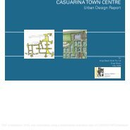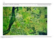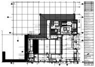
Casuarina Town Centre
Casuarina Town Centre
Casuarina Town Centre

You also want an ePaper? Increase the reach of your titles
YUMPU automatically turns print PDFs into web optimized ePapers that Google loves.
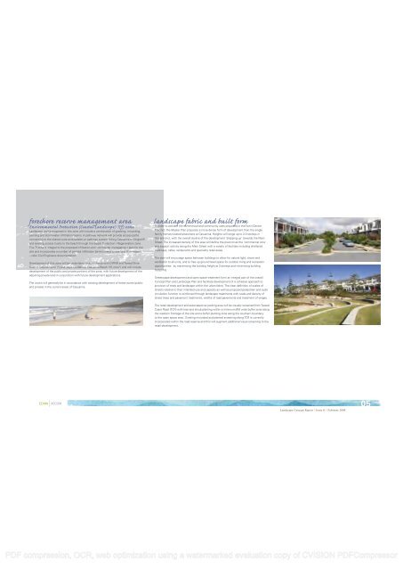
foreshore reserve management area<br />
Environmental Protection (Coastal Landscape) 7(f) zone<br />
Landscape works proposed in this zone will include a combination of grassing, mounding,<br />
planting and stormwater infiltration basins. A pathway network will provide access paths<br />
connecting to the shared cycle and pedestrian pathway system linking <strong>Casuarina</strong> to Kingscliff<br />
and existing access tracks to the beach through the Beach Protection / Regeneration zone.<br />
The 7f zone is integral to the proposed infiltration and stormwater management plan for the<br />
site and incorporates a number of planted infiltration basins linked to overland flow swales<br />
– refer Civil Engineers documentation.<br />
Development of this zone will be undertaken in accordance with DIPNR and Tweed Shire<br />
Council requirements (“Landscape Guidelines <strong>Casuarina</strong> Beach 7(f) zone”) and will include<br />
development of the public and private portions of the zone, with future development of the<br />
adjoining private land in conjunction with future development applications.<br />
The works will generally be in accordance with existing development of these zones (public<br />
and private) in the current areas of <strong>Casuarina</strong>.<br />
landscape fabric and built form<br />
In order to activate the commercial and community uses proposed in the <strong>Town</strong> <strong>Centre</strong><br />
Precinct, the Master Plan proposes a more dense form of development than the single<br />
family homes located elsewhere at <strong>Casuarina</strong>. Heights will range up to 2-3 storeys in<br />
this precinct, with the overall skyline of the development ‘stepping up’ towards the Main<br />
Street. The increased density of this area will define the precinct as the ‘commercial core’<br />
and support activity along the Main Street with a variety of facilities including sheltered<br />
walkways, cafes, restaurants and speciality retail areas.<br />
The plan will encourage space between buildings to allow for natural light, views and<br />
ventilation to all units, and to free up ground level space for outdoor living and recreation<br />
opportunities: by maximising the building height at 3 storeys and minimising building<br />
footprints.<br />
Streetscape development and open space treatment form an integral part of the overall<br />
Concept Plan and Landscape Plan and facilitate development of a cohesive approach to<br />
provision of trees and landscape within the urban fabric. The clear definition of scales of<br />
streets relative to their intended use and capacity as well as proposed pedestrian and cycle<br />
circulation function is reinforced through landscape treatments with scale and density of<br />
street trees and pavement treatments, widths of road pavements and treatment of verges.<br />
The retail development and associated car parking area will be visually screened from Tweed<br />
Coast Road (TCR) with tree and shrub planting within a minimum 6M wide buffer zone along<br />
the western frontage of the site and a buffer planting zone along the southern boundary<br />
to the open space area. Existing mounded and planted screening along TCR is currently<br />
incorporated within the road reserve and this will augment additional visual screening to the<br />
retail development.<br />
Landscape Concept Report / Issue G / February 2008<br />
0<br />
PDF compression, OCR, web optimization using a watermarked evaluation copy of CVISION PDFCompressor