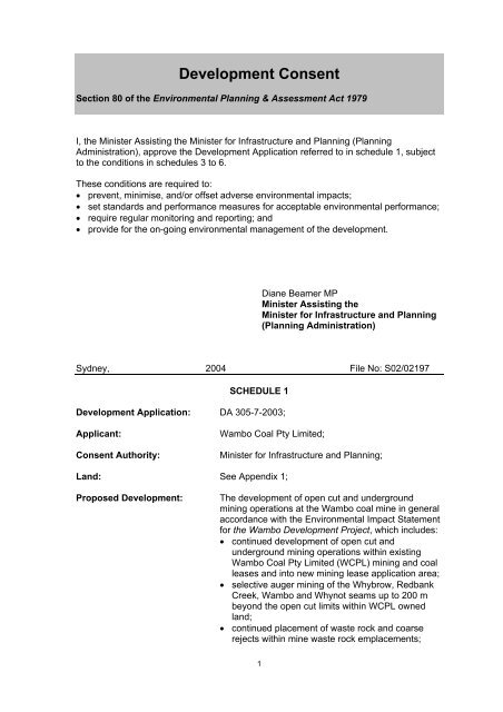
Development Consent - Department of Planning
Development Consent - Department of Planning
Development Consent - Department of Planning

You also want an ePaper? Increase the reach of your titles
YUMPU automatically turns print PDFs into web optimized ePapers that Google loves.
<strong>Development</strong> <strong>Consent</strong><br />
Section 80 <strong>of</strong> the Environmental <strong>Planning</strong> & Assessment Act 1979<br />
I, the Minister Assisting the Minister for Infrastructure and <strong>Planning</strong> (<strong>Planning</strong><br />
Administration), approve the <strong>Development</strong> Application referred to in schedule 1, subject<br />
to the conditions in schedules 3 to 6.<br />
These conditions are required to:<br />
• prevent, minimise, and/or <strong>of</strong>fset adverse environmental impacts;<br />
• set standards and performance measures for acceptable environmental performance;<br />
• require regular monitoring and reporting; and<br />
• provide for the on-going environmental management <strong>of</strong> the development.<br />
Diane Beamer MP<br />
Minister Assisting the<br />
Minister for Infrastructure and <strong>Planning</strong><br />
(<strong>Planning</strong> Administration)<br />
Sydney, 2004 File No: S02/02197<br />
SCHEDULE 1<br />
<strong>Development</strong> Application: DA 305-7-2003;<br />
Applicant:<br />
<strong>Consent</strong> Authority:<br />
Wambo Coal Pty Limited;<br />
Minister for Infrastructure and <strong>Planning</strong>;<br />
Land: See Appendix 1;<br />
Proposed <strong>Development</strong>:<br />
The development <strong>of</strong> open cut and underground<br />
mining operations at the Wambo coal mine in general<br />
accordance with the Environmental Impact Statement<br />
for the Wambo <strong>Development</strong> Project, which includes:<br />
• continued development <strong>of</strong> open cut and<br />
underground mining operations within existing<br />
Wambo Coal Pty Limited (WCPL) mining and coal<br />
leases and into new mining lease application area;<br />
• selective auger mining <strong>of</strong> the Whybrow, Redbank<br />
Creek, Wambo and Whynot seams up to 200 m<br />
beyond the open cut limits within WCPL owned<br />
land;<br />
• continued placement <strong>of</strong> waste rock and coarse<br />
rejects within mine waste rock emplacements;<br />
1
• continued placement <strong>of</strong> tailings within open cut<br />
voids and capping with waste rock and coarse<br />
rejects;<br />
• an extension to the existing Wollemi Underground<br />
Mine Box Cut (within the limits <strong>of</strong> the development<br />
open cut mining area) to provide direct access for<br />
three underground longwall panels in the<br />
Whybrow Seam;<br />
• an extension to the drifts from the Wollemi<br />
Underground Mine to facilitate longwall mining <strong>of</strong><br />
the Wambo Seam;<br />
• construction <strong>of</strong> a portal and drift access to facilitate<br />
longwall mining <strong>of</strong> the Arrowfield and Bowfield<br />
Seams;<br />
• an upgrade <strong>of</strong> the existing Coal Handling and<br />
Preparation Plant (CHPP) to facilitate increased<br />
coal production;<br />
• development <strong>of</strong> a water control structure across<br />
North Wambo Creek at the north-western limit <strong>of</strong><br />
the open cut operation, and a channel to allow the<br />
passage <strong>of</strong> flows to the lower reaches <strong>of</strong> North<br />
Wambo Creek around the open cut development;<br />
• degazettal and physical closure <strong>of</strong> Pinegrove<br />
Road;<br />
• development <strong>of</strong> new access roads and internal<br />
haul roads;<br />
• relocation <strong>of</strong> the existing explosives magazine and<br />
construction <strong>of</strong> additional hydrocarbon storage<br />
facilities;<br />
• relocation <strong>of</strong> the administration area and site<br />
<strong>of</strong>fices;<br />
• extraction <strong>of</strong> up to 14.7 million tonnes <strong>of</strong> run-<strong>of</strong>mine<br />
(ROM) coal a year;<br />
• operation <strong>of</strong> the mine 24 hours a day, 7 days a<br />
week;<br />
• continued haulage <strong>of</strong> coal by road from Wambo<br />
Coal Mine to Mt Thorley Coal Loader prior to the<br />
commissioning <strong>of</strong> the Wambo “Rail and Train<br />
Loading Infrastructure” (which is the subject <strong>of</strong> a<br />
separate development application: DA 306-7-<br />
2003); and<br />
• haulage <strong>of</strong> coal by the Wambo “Rail and Train<br />
Loading Infrastructure”.<br />
State Significant<br />
<strong>Development</strong>:<br />
Integrated <strong>Development</strong>:<br />
The proposal is classified as State significant<br />
development,<br />
under section 76A(7) <strong>of</strong> the Environmental <strong>Planning</strong> &<br />
Assessment Act 1979, because it involves coalmining<br />
related development that requires a new<br />
mining lease under section 63 <strong>of</strong> the Mining Act 1992.<br />
The proposal is classified as integrated development,<br />
under section 91 <strong>of</strong> the Environmental <strong>Planning</strong> &<br />
Assessment Act 1979, because it requires additional<br />
approvals under the:<br />
2
• Protection <strong>of</strong> the Environment Operations Act<br />
1997;<br />
• National Parks & Wildlife Act 1974;<br />
• Water Act 1912;<br />
• Fisheries Management Act 1994;<br />
• Heritage Act 1977;<br />
• Roads Act 1993; and<br />
• Mine Subsidence Compensation Act 1961.<br />
Designated <strong>Development</strong>:<br />
The proposal is classified as designated<br />
development, under section 77A <strong>of</strong> the Environmental<br />
<strong>Planning</strong> & Assessment Act 1979, because it is for a<br />
coal mine that would “produce or process more than<br />
500 tonnes <strong>of</strong> coal a day”, and consequently meets<br />
the criteria for designated development in schedule 3<br />
<strong>of</strong> the Environmental <strong>Planning</strong> & Assessment<br />
Regulation 2000.<br />
BCA Classification: Class 5: Office upgrade<br />
Class 9b: Bathhouse<br />
Class 10a: Car park<br />
Heavy vehicle wash station<br />
Gas drainage bores<br />
De-watering bores<br />
Class 10b: Coal conveyor<br />
Note:<br />
1) To find out when this consent becomes effective, see section 83 <strong>of</strong> the<br />
Environmental <strong>Planning</strong> & Assessment Act 1979 (EP&A Act);<br />
2) To find out when this consent is liable to lapse, see section 95 <strong>of</strong> the EP&A Act; and<br />
3) To find out about appeal rights, see section 97 <strong>of</strong> the EP&A Act.<br />
3
SCHEDULE 2<br />
DEFINITIONS<br />
AEMR<br />
Annual Environmental Management Report<br />
Applicant<br />
Wambo Coal Pty Limited<br />
BCA<br />
Building Code <strong>of</strong> Australia<br />
Bore<br />
Any bore or well or excavation or other work connected or<br />
proposed to be connected with sources <strong>of</strong> sub-surface<br />
water, and used or proposed to be used or capable <strong>of</strong> being<br />
used to obtain supplies <strong>of</strong> such water whether the water<br />
flows naturally at all times or has to be raised whether<br />
wholly or at times by pumping or other artificial means<br />
CCC<br />
Community Consultative Committee<br />
Council<br />
Singleton Shire Council<br />
DA<br />
<strong>Development</strong> Application<br />
Day<br />
Day is defined as the period from 7am to 6pm on Monday<br />
to Saturday, and 8am to 6pm on Sundays and Public<br />
Holidays<br />
DEC<br />
<strong>Department</strong> <strong>of</strong> Environment and Conservation<br />
<strong>Department</strong> <strong>Department</strong> <strong>of</strong> Infrastructure, <strong>Planning</strong> and Natural<br />
Resources<br />
Director-General<br />
Director-General <strong>of</strong> <strong>Department</strong> <strong>of</strong> Infrastructure, <strong>Planning</strong><br />
and Natural Resources, or delegate<br />
DMR<br />
<strong>Department</strong> <strong>of</strong> Mineral Resources<br />
EIS<br />
Environmental Impact Statement<br />
EP&A Act Environmental <strong>Planning</strong> and Assessment Act 1979<br />
EP&A Regulation Environmental <strong>Planning</strong> and Assessment Regulation 2000<br />
Evening<br />
Evening is defined as the period from 6pm to 10pm<br />
First Workings<br />
Underground workings which establish access to the coal<br />
resource area<br />
GTA<br />
General Term <strong>of</strong> Approval<br />
Land<br />
Land means the whole <strong>of</strong> a lot in a current plan registered<br />
at the Land Titles Office at the date <strong>of</strong> this consent<br />
Minister<br />
Minister for Infrastructure and <strong>Planning</strong>, or delegate<br />
MOP<br />
Mining Operations Plan<br />
MSB<br />
Mine Subsidence Board<br />
Night<br />
Night is defined as the period from 10pm to 7am on<br />
Monday to Saturday, and 10pm to 8am on Sundays and<br />
Public Holidays<br />
Offset Strategy<br />
The revegetation and enhancement program described in<br />
the EIS for the Wambo <strong>Development</strong> Project, dated July<br />
2003<br />
PCA<br />
Principal Certifying Authority appointed under Section 109E<br />
<strong>of</strong> the Act<br />
Privately-owned land Land excluding land owned by a mining company, where:<br />
• A private agreement does not exist between the<br />
Applicant and the land owner; and<br />
• There are no land acquisition provisions requiring the<br />
Applicant to purchase the land upon request from the<br />
land owner.<br />
ROM Coal<br />
Run-<strong>of</strong>-mine coal<br />
RTA<br />
Roads and Traffic Authority<br />
Southern Area<br />
See Figure HA-5 in Appendix HA <strong>of</strong> Volume 4 <strong>of</strong> the EIS for<br />
the Wambo <strong>Development</strong> Project<br />
Site<br />
Land to which the DA applies<br />
4
Vacant land<br />
Vacant land is defined as the whole <strong>of</strong> the lot in a current<br />
plan registered at the Land Titles Office that does not have<br />
a dwelling situated on the lot and is permitted to have a<br />
dwelling on that lot at the date <strong>of</strong> this consent.<br />
_______________________________________________________<br />
5
TABLE OF CONTENTS<br />
1. ADMINISTRATIVE CONDITIONS 7<br />
2. SPECIFIC ENVIRONMENTAL CONDITIONS<br />
Acquisition Upon Request 9<br />
Air Quality 9<br />
Noise 11<br />
Meteorological Monitoring 13<br />
Blasting & Vibration 14<br />
Subsidence 16<br />
Surface & Ground Water 17<br />
Flora & Fauna 21<br />
Aboriginal Cultural Heritage 24<br />
Wambo Homestead Complex 25<br />
Traffic & Transport 27<br />
Visual Impact 28<br />
Greenhouse Gas 29<br />
Waste Minimisation 29<br />
Hazards Management 29<br />
Bushfire Management 30<br />
Mine Exit Strategy 30<br />
3. ADDITIONAL PROCEDURES FOR AIR QUALITY & NOISE MANAGEMENT 31<br />
4. ENVIRONMENTAL MANAGEMENT, MONITORING, AUDITING &<br />
REPORTING<br />
Environmental Management Strategy 35<br />
Environmental Monitoring Program 35<br />
Annual Reporting 35<br />
Independent Environmental Audit 35<br />
Community Consultative Committee 36<br />
5. APPENDIX 1: SCHEDULE OF LAND 38<br />
6. APPENDIX 2: INDEPENDENT DISPUTE RESOLUTION PROCESS 39<br />
7. APPENDIX 3: MAPS FOR ABORIGINAL CULTURAL HERITAGE<br />
INVESTIGATIONS 40<br />
6
SCHEDULE 3<br />
ADMINISTRATIVE CONDITIONS<br />
Obligation to Minimise Harm to the Environment<br />
1. The Applicant shall implement all practicable measures to prevent and/or minimise<br />
any harm to the environment that may result from the construction, operation, or<br />
rehabilitation <strong>of</strong> the development.<br />
Terms <strong>of</strong> Approval<br />
2. The Applicant shall carry out the development generally in accordance with the:<br />
(a) DA 305-7-2003;<br />
(b) EIS titled Wambo <strong>Development</strong> Project, volumes 1-5, dated July 2003, and<br />
prepared by Resource Strategies Pty. Ltd.;<br />
(c) letter from Holmes Air Sciences to the <strong>Department</strong>, dated 3 September 2003,<br />
and titled Wambo <strong>Development</strong> Project - Response Air Quality Assessment;<br />
(d) letter from Wambo Coal Pty. Ltd. to the <strong>Department</strong>, dated 24 October 2003,<br />
and titled Wambo <strong>Development</strong> Project – <strong>Development</strong> Application<br />
Amendment (DA 305-7-2003-i); and<br />
(e) conditions <strong>of</strong> this consent.<br />
3. If there is any inconsistency between the above, the conditions <strong>of</strong> this consent shall<br />
prevail to the extent <strong>of</strong> the inconsistency.<br />
4. The Applicant shall comply with any reasonable requirement/s <strong>of</strong> the Director-<br />
General arising from the <strong>Department</strong>’s assessment <strong>of</strong>:<br />
(a) any reports, plans or correspondence that are submitted in accordance with<br />
this consent; and<br />
(b) the implementation <strong>of</strong> any actions or measures contained in these reports,<br />
plans or correspondence.<br />
Deferred Commencement<br />
5. This consent shall only commence when the Applicant has surrendered all<br />
previous development consents for the Wambo coal mine to the satisfaction <strong>of</strong> the<br />
Director-General.<br />
Limits on Approval<br />
6. This consent lapses 21 years after the date it commences.<br />
7. The Applicant shall not extract more than 14.7 million tonnes <strong>of</strong> ROM coal a year<br />
from the development.<br />
Structural Adequacy<br />
8. The Applicant shall ensure that all new buildings and structures, and any<br />
alterations or additions to existing buildings and structures, are constructed in<br />
accordance with the relevant requirements <strong>of</strong> the BCA.<br />
Notes:<br />
• Under Part 4A <strong>of</strong> the EP&A Act, the Applicant is required to obtain construction<br />
and occupation certificates for the proposed building works.<br />
• Part 8 <strong>of</strong> the EP&A Regulation sets out the requirements for the certification <strong>of</strong><br />
development.<br />
7
• The development is located in the Patrick Plains Mine Subsidence District.<br />
Under section 15 <strong>of</strong> the Mine Subsidence Compensation Act 1961, the<br />
Applicant is required to obtain the Mine Subsidence Board’s approval before<br />
constructing or relocating any improvements on the site.<br />
Demolition<br />
9. The Applicant shall ensure that all demolition work is carried out in accordance with<br />
AS 2601-2001: The Demolition <strong>of</strong> Structures, or its latest version.<br />
Operation <strong>of</strong> Plant and Equipment<br />
10. The Applicant shall ensure that all plant and equipment used at the site, or to<br />
transport coal <strong>of</strong>f-site, are:<br />
(a) maintained in a proper and efficient condition; and<br />
(b) operated in a proper and efficient manner.<br />
Section 94 Contribution<br />
11. Before carrying out any development, or as agreed otherwise by Council, the<br />
Applicant shall pay Council $60,000 in accordance with Council’s Section 94<br />
Contribution Plan.<br />
Community Enhancement Contribution<br />
12. Before carrying out any development, or as agreed otherwise by Council, the<br />
Applicant shall pay Council $15,000 for the enhancement <strong>of</strong> community<br />
infrastructure or services in the Warkworth/Jerrys Plains area.<br />
8
ACQUISITION UPON REQUEST<br />
SCHEDULE 4<br />
SPECIFIC ENVIRONMENTAL CONDITIONS<br />
1. Upon receiving a written request for acquisition from the landowner <strong>of</strong> the land<br />
listed in Table 1, the Applicant shall acquire the land in accordance with the<br />
procedures in conditions 9-11 <strong>of</strong> schedule 5:<br />
2 – Lambkin 23A & B - Kannar<br />
13C - Skinner<br />
31A,B,C & D - Fisher<br />
19A & B – Kelly<br />
22 – Henderson<br />
51 – Hawkes<br />
56 - Haynes<br />
Table 1: Land subject to acquisition upon request<br />
Note: For more information on the numbering and identification <strong>of</strong> properties used<br />
in this consent, see Attachment 1 <strong>of</strong> the EIS for the Wambo <strong>Development</strong> Project.<br />
AIR QUALITY<br />
Impact Assessment Criteria<br />
2. The Applicant shall ensure that the air pollution generated by the development<br />
does not exceed the criteria listed in Tables 2, 3, and 4 at any privately-owned<br />
land.<br />
Pollutant<br />
Averaging<br />
period<br />
Criterion<br />
Total suspended particulate (TSP)<br />
matter<br />
Annual 90 µg/m 3<br />
Particulate matter < 10 µm (PM 10 ) Annual 30 µg/m 3<br />
Table 2: Long term impact assessment criteria for particulate matter<br />
Pollutant<br />
Averaging<br />
period<br />
Criterion<br />
Particulate matter < 10 µm (PM 10 ) 24 hour 50 µg/m 3<br />
Table 3: Short term impact assessment criterion for particulate matter<br />
Pollutant<br />
Averaging<br />
period<br />
Maximum increase in<br />
deposited dust level<br />
Maximum total<br />
deposited dust<br />
level<br />
9
Deposited dust Annual 2 g/m 2 /month 4 g/m 2 /month<br />
Table 4: Long term impact assessment criteria for deposited dust<br />
Note: Deposited dust is assessed as insoluble solids as defined by Standards<br />
Australia, 1991, AS 3580.10.1-1991: Methods for Sampling and Analysis <strong>of</strong><br />
Ambient Air - Determination <strong>of</strong> Particulates - Deposited Matter - Gravimetric<br />
Method.<br />
Land Acquisition Criteria<br />
3. If the air pollution generated by the development exceeds the criteria in Tables 5,<br />
6, and 7 at any privately-owned land, the Applicant shall, upon receiving a written<br />
request for acquisition from the landowner, acquire the land in accordance with the<br />
procedures in conditions 9-11 <strong>of</strong> schedule 5.<br />
Pollutant<br />
Averaging<br />
period<br />
Criterion<br />
Total suspended particulate (TSP)<br />
matter<br />
Annual 90 µg/m 3<br />
Particulate matter < 10 µm (PM 10 ) Annual 30 µg/m 3<br />
Table 5: Long term land acquisition criteria for particulate matter<br />
Pollutant<br />
Particulate matter < 10 µm<br />
(PM 10 )<br />
Particulate matter < 10 µm<br />
(PM 10 )<br />
Averagi<br />
ng<br />
period<br />
Criterion<br />
24 hour 150 µg/m 3<br />
24 hour 50 µg/m 3<br />
Percentile 1<br />
Basis<br />
99 2 Total 3<br />
98.6 Increment 4<br />
Table 6: Short term land acquisition criteria for particulate matter<br />
1 Based on the number <strong>of</strong> block 24 hour averages in an annual period.<br />
2 Excludes extraordinary events such as bushfires, prescribed burning, dust storms,<br />
sea fog, fire incidents, illegal activities or any other activity agreed by the Director-<br />
General in consultation with the DEC.<br />
3 Background PM 10 concentrations due to all other sources plus the incremental<br />
increase in PM 10 concentrations due to the mine alone.<br />
4 Incremental increase in PM 10 concentrations due to the mine alone.<br />
Pollutant<br />
Averaging<br />
period<br />
Maximum increase in<br />
deposited dust level<br />
Maximum total<br />
deposited dust level<br />
Deposited dust Annual 2 g/m 2 /month 4 g/m 2 /month<br />
Table 7: Long term land acquisition criteria for deposited dust<br />
10
Note: Deposited dust is assessed as insoluble solids as defined by Standards<br />
Australia, 1991, AS 3580.10.1-1991: Methods for Sampling and Analysis <strong>of</strong><br />
Ambient Air - Determination <strong>of</strong> Particulates - Deposited Matter - Gravimetric<br />
Method.<br />
1 Monitoring<br />
4. The Applicant shall establish air quality monitoring stations at a minimum <strong>of</strong> 4<br />
locations around the site, including the residences on properties 40 (Muller) and<br />
125 (Barry) whilst privately-owned, to monitor (by sampling and obtaining results<br />
by analysis) the concentration <strong>of</strong> each pollutant in Table 8 to the satisfaction <strong>of</strong><br />
DEC and the Director-General, using the specified averaging period, frequency,<br />
and sampling method:<br />
Pollutant Units <strong>of</strong> Averaging Frequency Sampling method 1<br />
Measure Period<br />
PM 10 µg/m³ 24 hour, Continuous AS3580.9.8 – 2001 2<br />
annual<br />
TSP µg/m 3 24 hour, 1 day in 6 AM-15<br />
annual<br />
Dust Deposition g/m²/month Month, annual Continuous AM-19<br />
Siting - - - AM-1<br />
Table 8: Air quality monitoring<br />
1<br />
NSW EPA, 2001, Approved Methods for the Sampling and Analysis <strong>of</strong> Air<br />
Pollutants in NSW.<br />
2 Standards Australia, 2001, AS3580.9.8-2002, Method for Sampling and Analysis<br />
<strong>of</strong> Ambient Air - Determination <strong>of</strong> Suspended Particulate Matter - PM 10 Continuous<br />
Direct Mass Method using a Tapered Element Oscillating Microbalance Analyser,<br />
or any other method that is approved by the DEC and the Director-General.<br />
5. Before carrying out any development, the Applicant shall prepare an Air Quality<br />
Monitoring Program, in consultation with DEC, and to the satisfaction <strong>of</strong> the<br />
Director-General.<br />
2 NOISE<br />
Noise Impact Assessment Criteria<br />
6. The Applicant shall ensure that the noise generated by the development does not<br />
exceed the noise impact assessment criteria presented in Table 9.<br />
Day<br />
L Aeq(15 minute)<br />
Evening/Ni<br />
ght<br />
L Aeq(15 minute)<br />
Night<br />
L A1(1 minute)<br />
Land Number<br />
35 41 50 94 – Curlewis<br />
3 – Birrell<br />
4B – Circosta<br />
15B - McGowen/Caslick<br />
16 – Cooper<br />
23C – Kannar<br />
1<br />
Incorporates DEC GTA<br />
2<br />
Incorporates DEC GTAs<br />
11
35 40 50<br />
25 – Fenwick<br />
28A & B – Garland<br />
33 -Thelander/O'Neill<br />
39 – Northcote<br />
40 – Muller<br />
35 39 50<br />
254A – Algie<br />
5 – Strachan<br />
6 - Merrick<br />
7 - Maizey<br />
37 - Lawry<br />
35 38 50<br />
48 - Ponder<br />
1 - Brosi<br />
17 - Carter<br />
18 - Denney<br />
38 - Williams<br />
49 - Oliver<br />
63 - Abrocuff<br />
75 - Barnes<br />
35 37 50<br />
91 - Bailey<br />
27 - Birralee<br />
43 - Carmody<br />
137 - Woodruff<br />
163 - Rodger/Williams<br />
35 36 50<br />
246 - Bailey<br />
13B - Skinner<br />
178 - Smith<br />
188 - Fuller<br />
262A, B & C - Moses<br />
35 35 50 All other residential or sensitive<br />
receptors, excluding the receptors<br />
listed in condition 1 above<br />
Table 9: Noise impact assessment criteria dB(A))<br />
Notes:<br />
a) Noise from the development is to be measured at the most affected point or<br />
within the residential boundary, or at the most affected point within 30 metres<br />
<strong>of</strong> a dwelling (rural situations) where the dwelling is more than 30 metres<br />
from the boundary, to determine compliance with the L Aeq(15 minute) noise limits<br />
in the above table. Where it can be demonstrated that direct measurement<br />
<strong>of</strong> noise from the development is impractical, the DEC may accept alternative<br />
means <strong>of</strong> determining compliance (see Chapter 11 <strong>of</strong> the NSW Industrial<br />
Noise Policy). The modification factors in Section 4 <strong>of</strong> the NSW Industrial<br />
Noise Policy shall also be applied to the measured noise levels where<br />
applicable.<br />
b) Noise from the development is to be measured at 1 metre from the dwelling<br />
façade to determine compliance with the L A1(1 minute) noise limits in the above<br />
table.<br />
c) The noise emission limits identified in the above table apply under<br />
meteorological conditions <strong>of</strong>:<br />
• Wind speeds <strong>of</strong> up to 3 m/s at 10 metres above ground level; or<br />
• Temperature inversion conditions <strong>of</strong> up to 3ºC/100m, and wind speeds <strong>of</strong><br />
up to 2 m/s at 10 metres above ground level.<br />
12
Land Acquisition Criteria<br />
7. If the noise generated by the development exceeds the criteria in Table 10, the<br />
Applicant shall, upon receiving a written request for acquisition from the landowner,<br />
acquire the land in accordance with the procedures in conditions 9-11 <strong>of</strong> schedule<br />
5.<br />
Day/Evening/Night<br />
L Aeq(15 minute)<br />
Property<br />
43<br />
94 - Curlewis<br />
23C – Kannar<br />
254A - Algie<br />
40 All other residential or sensitive receptor,<br />
excluding the receptors listed in condition<br />
1 above<br />
Table 10: Land acquisition criteria dB(A)<br />
Note: Noise generated by the development is to be measured in accordance with<br />
the notes presented below Table 9 above.<br />
Monitoring<br />
8. The Applicant shall conduct real-time monitoring <strong>of</strong> the noise generated by the<br />
development at a minimum <strong>of</strong> four properties to the south and north-west <strong>of</strong> the<br />
site, in general accordance with the NSW Industrial Noise Policy and AS1055-<br />
1997: Acoustics – Description and Measurement <strong>of</strong> Environmental.<br />
9. Before carrying out any development, the Applicant shall prepare a Noise<br />
Monitoring Program to the satisfaction <strong>of</strong> the Director-General, which includes a<br />
noise monitoring protocol for evaluating compliance with the criteria in tables 9 &<br />
10.<br />
3 METEOROLOGICAL MONITORING<br />
10. The Applicant shall establish a permanent meteorological station at a location<br />
approved by the DEC, and to the satisfaction <strong>of</strong> the Director-General, to monitor<br />
the parameters specified in Table 11, using the specified units <strong>of</strong> measure,<br />
averaging period, frequency, and sampling method in the table.<br />
Parameter Units <strong>of</strong><br />
measure<br />
Averaging<br />
period<br />
Frequenc<br />
y<br />
Sampling<br />
method 1<br />
Lapse rate ºC/100m 1 hour Continuou Note 2<br />
s<br />
Rainfall mm/hr 1 hour Continuou AM-4<br />
s<br />
Sigma Theta @ 10 m ° 1 hour Continuou AM-2<br />
s<br />
Siting - - - AM-1<br />
Temperature @ 10 m K 1 hour Continuou<br />
s<br />
AM-4<br />
3<br />
Incorporates DEC GTA<br />
13
Parameter Units <strong>of</strong><br />
measure<br />
Averaging<br />
period<br />
Frequenc<br />
y<br />
Temperature @ 2 m K 1 hour Continuou<br />
s<br />
Total Solar Radiation @ W/m 2 1 hour Continuou<br />
10m<br />
s<br />
Wind Direction @ 10 m ° 1 hour Continuou<br />
s<br />
Wind Speed @ 10 m m/s 1 hour Continuou<br />
s<br />
Sampling<br />
method 1<br />
AM-4<br />
AM-4<br />
AM-2<br />
AM-2<br />
Table 11: Meteorological monitoring<br />
1<br />
NSW EPA, 2001, Approved Methods for the Sampling and Analysis <strong>of</strong> Air<br />
Pollutants in NSW.<br />
2 The Applicant shall calculate lapse rate from measurements made at 2m and<br />
10m.<br />
4 BLASTING & VIBRATION<br />
Airblast Overpressure Limits<br />
11. The Applicant shall ensure that the airblast overpressure level from blasting at the<br />
development does not exceed the criteria in Table 12 at any residence on<br />
privately-owned land with the exception <strong>of</strong> property 13c (Skinner) (see condition 20<br />
below).<br />
Airblast overpressure<br />
level (dB(Lin Peak))<br />
115<br />
Allowable exceedance<br />
5% <strong>of</strong> the total number <strong>of</strong> blasts over a period <strong>of</strong> 12<br />
months<br />
120 0%<br />
Table 12: Airblast overpressure impact assessment criteria<br />
Ground Vibration Impact Assessment Criteria<br />
12. The Applicant shall ensure that the ground vibration level from blasting at the<br />
development does not exceed the criteria in Table 13 at any residence on<br />
privately-owned land with the exception <strong>of</strong> property 13c (Skinner) (see condition 20<br />
below).<br />
Peak particle velocity<br />
(mm/s)<br />
5<br />
Allowable exceedance<br />
5% <strong>of</strong> the total number <strong>of</strong> blasts over a period <strong>of</strong> 12<br />
months<br />
10 0%<br />
Table 13: Ground vibration impact assessment criteria<br />
4<br />
Incoporates DEC GTA<br />
14
Blasting Hours<br />
13. The Applicant shall only carry out blasting at the development between 9 am and 5<br />
pm Monday to Saturday inclusive. No blasting is allowed on Sundays, public<br />
holidays or any other time without the written approval <strong>of</strong> DEC.<br />
Public Notice<br />
14. During the life <strong>of</strong> the development, the Applicant shall:<br />
(a) operate a Blasting Hotline, or alternate system agreed to by the Director-<br />
General, to enable the public to get up-to-date information on blasting<br />
operations at the development; and<br />
(b) notify the occupants <strong>of</strong> any land within 2 km <strong>of</strong> the site about this hotline or<br />
system on an annual basis.<br />
Property Inspection<br />
15. Before carrying out any blasting, the Applicant shall advise all landowners within 2<br />
km <strong>of</strong> the site that they are entitled to a property inspection.<br />
16. If the Applicant receives a written request for a property inspection from any<br />
landowner within 2 km <strong>of</strong> the site, the Applicant shall:<br />
(a) within 14 days <strong>of</strong> receiving the request, commission a suitably qualified<br />
person, whose appointment has been approved by the Director-General, to<br />
inspect the condition <strong>of</strong> any building or structure on the land, and recommend<br />
measures to mitigate any potential blasting impacts; and<br />
(b) give the landowner a copy <strong>of</strong> this property inspection report within 14 days <strong>of</strong><br />
receiving the report.<br />
Cumulative Impacts<br />
17. The Applicant shall undertake all reasonable steps to co-ordinate blasting at the<br />
development with the blasting at surrounding mines – such as Bulga, Mount<br />
Thorley, Warkworth, and Hunter Valley Operations – to minimise the cumulative<br />
impacts <strong>of</strong> blasting in the region.<br />
Monitoring<br />
18. The Applicant shall monitor the airblast overpressure and ground vibration impacts<br />
<strong>of</strong> the development at a minimum <strong>of</strong> four locations around the site, using the<br />
specified units <strong>of</strong> measure, frequency, sampling method, and location in Table 14.<br />
Parameter<br />
Airblast<br />
overpressure<br />
Peak particle<br />
velocity<br />
Units <strong>of</strong><br />
Measure<br />
dB(Lin Peak)<br />
mm/s<br />
Frequency<br />
During<br />
every blast<br />
During<br />
every blast<br />
Sampling Measurement<br />
Method Location<br />
AS2187.2- Not less than<br />
1993 1 3.5 m from a<br />
building or<br />
structure<br />
AS2187.2-<br />
1993<br />
Not more than<br />
30 m from a<br />
building or<br />
structure<br />
Table 14: Airblast overpressure and ground vibration monitoring<br />
1 Standards Australia, 1993, AS2187.2-1993: Explosives - Storage, Transport and<br />
Use - Use <strong>of</strong> Explosives.<br />
15
19. Before carrying out any development, the Applicant shall prepare a detailed Blast<br />
Monitoring Program for the development, in consultation with DEC, and to the<br />
satisfaction <strong>of</strong> the Director-General.<br />
Blast Management<br />
20. Before carrying out any development, the Applicant shall prepare a Blast<br />
Management Plan for property 13C (Skinner) in consultation with the landowner,<br />
and to the satisfaction <strong>of</strong> the Director-General. This plan must include measures to<br />
minimise, mitigate, and if necessary remediate the blasting impacts on the<br />
property. The Applicant shall implement this plan whilst the property is privatelyowned.<br />
Property Investigations<br />
21. If any landowner within a 2 km radius <strong>of</strong> the site claims that his/her property has<br />
been damaged as a result <strong>of</strong> blasting at the development, the Applicant shall:<br />
(a) within 14 days <strong>of</strong> receiving this claim in writing, commission a suitably<br />
qualified person whose appointment has been approved by the Director-<br />
General to investigate the claim; and<br />
(b) give the landowner a copy <strong>of</strong> the property investigation report within 14 days<br />
<strong>of</strong> receiving the report.<br />
If this independent investigation confirms the landowner’s claim, and both parties<br />
agree with these findings, then the Applicant shall repair the damages to the<br />
satisfaction <strong>of</strong> the Director-General.<br />
If the Applicant or landowner disagrees with the findings <strong>of</strong> the independent<br />
property investigation, then either party may refer the matter to the Director-<br />
General for resolution.<br />
If the matter cannot be resolved within 21 days, the Director-General shall refer the<br />
matter to an Independent Dispute Resolution Process (See Appendix 2).<br />
SUBSIDENCE<br />
Note: This development will be regulated under the new approval process for managing<br />
the impacts <strong>of</strong> coal mining subsidence under the Mining Act 1992.<br />
Subsidence Management Plan<br />
22. Before carrying out any underground mining operations that will potentially lead to<br />
subsidence <strong>of</strong> the land surface, the Applicant shall prepare a Subsidence<br />
Management Plan for those operations in accordance with the DMR documents:<br />
• New Approval Process for Management <strong>of</strong> Coal Mining Subsidence - Policy;<br />
and<br />
• Guideline for Applications for Subsidence Management Approvals<br />
to the satisfaction <strong>of</strong> the Director-General <strong>of</strong> DMR.<br />
16
5 SURFACE & GROUND WATER<br />
Note: The Applicant is required to obtain licences for the development under the Water<br />
Act 1912 and the Protection <strong>of</strong> the Environment Operations Act 1997.<br />
Pollution <strong>of</strong> Waters<br />
23. Except as may be expressly provided by a DEC licence, the Applicant shall comply<br />
with section 120 <strong>of</strong> the Protection <strong>of</strong> the Environment Operations Act 1997 during<br />
the carrying out <strong>of</strong> the development.<br />
Discharge Limits<br />
24. Except as may be expressly provided by a DEC licence or the Protection <strong>of</strong> the<br />
Environment Operations (Hunter River Salinity Trading Scheme) Regulation 2002,<br />
the Applicant shall:<br />
(a) not discharge more than 250 ML/day from the licenced discharge point/s at<br />
the development;<br />
(b) ensure that the discharges from any licenced discharge point comply with the<br />
limits in Table 15:<br />
Pollutant<br />
Units <strong>of</strong><br />
measure<br />
100 percentile concentration<br />
limit<br />
pH pH 6.5 ≤ pH ≤ 9<br />
Non-filterable residue mg/litre NFR ≤ 120<br />
Table 15: Discharge Limits<br />
Note: This condition does not authorise the pollution <strong>of</strong> waters by any other<br />
pollutants.<br />
Site Water Balance<br />
25.<br />
6 Each year, the Applicant shall:<br />
(a) review the site water balance for the development against the predictions in<br />
the EIS;<br />
(b) re-calculate the site water balance for the development; and<br />
(c) report the results <strong>of</strong> this review in the AEMR.<br />
North Wambo Creek Diversion<br />
26. The Applicant shall design, construct, maintain, and rehabilitate the North Wambo<br />
Creek Diversion in consultation with NSW Fisheries, and to the satisfaction <strong>of</strong> the<br />
Director-General.<br />
27. Within one month <strong>of</strong> completing the construction <strong>of</strong> the North Wambo Creek<br />
Diversion, the Applicant shall submit an as-executed report, certified by a<br />
practising registered engineer, to the Director-General.<br />
5<br />
Incorporates DEC GTA<br />
6<br />
These calculations must exclude the clean water system, including any sediment control structures, and any dams in the<br />
mine lease area which fall under the Maximum Harvestable Right Dam Capacity; include any dams that are licensable<br />
under Section 205 <strong>of</strong> the Water Act 1912, and water harvested from any non-harvestable rights dam on the mine lease<br />
area; address balances <strong>of</strong> inflows, licenced water extractions, and transfers <strong>of</strong> water from the site to other sites; include an<br />
accounting system for water budgets; and include a salt budget.<br />
17
28.<br />
7 Prior to destroying the original creek line, the Applicant shall demonstrate that the<br />
North Wambo Creek Diversion is operating successfully from a hydrological and<br />
biological point <strong>of</strong> view to the satisfaction <strong>of</strong> NSW Fisheries and the Director-<br />
General.<br />
Monitoring<br />
29. The Applicant shall:<br />
(a) measure:<br />
• the volume <strong>of</strong> water discharged from the site;<br />
• water use on the site;<br />
• dam and water structure storage levels,<br />
• water transfers across the site; and<br />
• water transfers between the site and surrounding mines;<br />
(b) monitor the quality <strong>of</strong> the surface water:<br />
• discharged from the licenced discharge point/s at the development; and<br />
• upstream and downstream <strong>of</strong> the development;<br />
(c) monitor flows in the Wollombi Brook; and North Wambo, South Wambo, and<br />
Stony Creeks;<br />
(d) monitor the volume and quality <strong>of</strong> water inflows from each separate source to<br />
the underground and open cut workings; and<br />
(e) monitor regional ground water levels and quality in the alluvial, coal seam,<br />
and interburden aquifers during the development and at least 10 years after<br />
mining, and<br />
(f) periodically assess groundwater pressure response in the coal measures;<br />
to the satisfaction <strong>of</strong> DEC and the Director-General.<br />
Site Water Management Plan<br />
30. Before carrying out any development, the Applicant shall prepare a Site Water<br />
Management Plan for the development in consultation with DEC and NSW<br />
Fisheries, and to the satisfaction <strong>of</strong> the Director-General. This plan must include:<br />
(a) the predicted site water balance;<br />
(b) the North Wambo Creek Diversion Plan;<br />
(c) an Erosion and Sediment Control Plan;<br />
(d) a Surface Water Monitoring Program;<br />
(e) a Ground Water Monitoring Program;<br />
(f) a Surface and Ground Water Response Plan; and<br />
(g) a strategy for the decommissioning water management structures on the site.<br />
31. The North Wambo Creek Diversion Plan shall include:<br />
(a) the detailed design and specifications <strong>of</strong> the creek diversion, including the<br />
flow control bund, cut <strong>of</strong>f wall, and channel;<br />
(b) a revegetation program for the channel using a range <strong>of</strong> suitable native<br />
riparian and floodplain species;<br />
(c) the detailed design <strong>of</strong> the system that would return intercepted ground water<br />
to the alluvial aquifer downstream <strong>of</strong> the open cut;<br />
(d) a construction program for the creek diversion, describing how the work<br />
would be staged, and progressively integrated with the mining operations and<br />
the mine waste emplacement drainage system;<br />
(e) water quality, ecological and geomorphic performance criteria for the creek<br />
diversion;<br />
(f) a program to monitor water quality, ecological, and geomorphic integrity <strong>of</strong><br />
the creek diversion; and<br />
7<br />
Incorporates NSW Fisheries conditions.<br />
18
(g)<br />
a program to inspect and maintain the creek diversion and revegetation<br />
works during the development.<br />
32. The Erosion and Sediment Control Plan shall:<br />
(a) be consistent with the requirements <strong>of</strong> the <strong>Department</strong> <strong>of</strong> Housing’s<br />
Managing Urban Stormwater: Soils and Construction manual;<br />
(b) identify activities that could cause soil erosion and generate sediment;<br />
(c) describe the location, function, and capacity <strong>of</strong> erosion and sediment control<br />
structures; and<br />
(d) describe measures to minimise soil erosion and the potential for the<br />
migration <strong>of</strong> sediments to downstream waters.<br />
33. 8 The Surface Water Monitoring Program shall include:<br />
(a) detailed baseline data on surface water flows and quality in the Wollombi<br />
Brook, and North Wambo, South Wambo, and Stony Creeks;<br />
(b) surface water impact assessment criteria;<br />
(c) a program to monitor surface water flows and quality in the Wollombi Brook;<br />
and North Wambo, South Wambo, and StonyCreeks;<br />
(d) a program to monitor bank and bed stability in North Wambo, South Wambo,<br />
and Stony Creeks;<br />
(e) a program to monitor the quantity and quality <strong>of</strong> the vegetation in the riparian<br />
zones adjacent to North Wambo, South Wambo, and Stony Creeks; and<br />
(f) a program to monitor the effectiveness <strong>of</strong> the Erosion and Sediment Control<br />
Plan.<br />
34. The Ground Water Monitoring Program shall include:<br />
(a) detailed baseline data on ground water levels and quality, based on statistical<br />
analysis, to benchmark the pre-mining natural variation in groundwater levels<br />
and quality;<br />
(b) ground water impact assessment criteria;<br />
(c) a program to monitor the volume and quality <strong>of</strong> ground water seeping into the<br />
open cut and underground mining workings; and<br />
(d) a program to monitor regional ground water levels and quality in the alluvial,<br />
coal seam, and interburden aquifers.<br />
8<br />
Incorporates DEC GTA<br />
19
35. The Surface and Ground Water Response Plan shall include:<br />
(a) measures to mitigate any adverse impacts on existing water supply bores or<br />
wells;<br />
(b) measures to mitigate the loss <strong>of</strong> surface water flows in the surface water<br />
streams or channel on the site;<br />
(c) measures to remediate any connective cracking between the underground<br />
mine workings and the surface water streams, channel or alluvials;<br />
(d) measures to mitigate the long term direct hydraulic connection between the<br />
backfilled open cut and the North Wambo Creek alluvium if the potential for<br />
an downstream adverse impact is detected;<br />
(e) measures to address the decrease in throughflow rates caused by the<br />
development within the Wollombi Brook alluvium downstream <strong>of</strong> the open<br />
(f)<br />
cut;<br />
measures to address any reduction in the stability or ecological quality <strong>of</strong> the<br />
North Wambo Creek Diversion below the established performance criteria;<br />
and<br />
(g) the procedures that would be followed if any unforeseen impacts are<br />
detected during the development.<br />
Surface & Sub-surface Investigation Program<br />
36. Prior to the commencement <strong>of</strong> underground mining, the Applicant shall develop<br />
and implement a surface and subsurface investigation program to assess the likely<br />
fracturing <strong>of</strong> geological strata and hydraulic property changes above each longwall<br />
panel, to the satisfaction <strong>of</strong> the Director-General. This program shall:<br />
(a) provide an interpreted comparison <strong>of</strong> the results from all longwall panels<br />
against pre-mining baseline geological conditions, in order to assess the level<br />
<strong>of</strong> variability <strong>of</strong> fracture and changes in hydraulic properties between panels.;<br />
(b) assess the impact on groundwater resources and surface expression<br />
resulting from underground mining at varying depths; and<br />
(c) be repeated for each coal seam as it is mined.<br />
Independent Audit<br />
37. Prior to seeking approval from the DMR for each set <strong>of</strong> longwall panels (excluding<br />
the first set <strong>of</strong> longwall panels), unless the Director-General directs otherwise, the<br />
Applicant shall commission a suitably qualified person, whose appointment has<br />
been approved by the Director-General, to conduct an independent audit <strong>of</strong> the<br />
subsidence, surface water, and ground water impacts <strong>of</strong> the development. This<br />
audit shall:<br />
(a) review the monitoring data for the development;<br />
(b) identify any trends in the monitoring data;<br />
(c) examine the subsidence, surface water, and ground water impacts <strong>of</strong> the<br />
development;<br />
(d) compare these impacts against the relevant impact assessment criteria and<br />
predictions in the EIS; and, if necessary;<br />
(e) recommend measures to reduce, mitigate, or remediate these impacts.<br />
38. If the independent audit determines that the subsidence, surface water, and/or<br />
ground water impacts resulting from the underground mining operations are<br />
greater than those predicted in the EIS, the Applicant shall:<br />
(a) assess the significance <strong>of</strong> these impacts;<br />
(b) investigate measures to minimise these impacts, including modifying<br />
subsequent mine plans; and<br />
(c) describe what measures would be implemented to reduce, minimise, mitigate<br />
or remedite these impacts in the future;<br />
20
to the satisfaction <strong>of</strong> the Director-General.<br />
Final Void Strategy<br />
39. At the end <strong>of</strong> Year 7 <strong>of</strong> the development, or as directed otherwise by the Director-<br />
General, the Applicant shall prepare a Final Void Management Plan for the<br />
development, in consultation with the DMR, the Director-General and Council, and<br />
to the satisfaction <strong>of</strong> the Director-General. This Plan must:<br />
(a) investigate options for the future use <strong>of</strong> the final void;<br />
(b)<br />
(c)<br />
FAUNA & FLORA<br />
Offset Strategy<br />
re-assess the potential groundwater impacts <strong>of</strong> the development; and<br />
describe what actions and measures would be implemented to:<br />
• minimise any potential adverse impacts associated with the final void; and<br />
• manage, and monitor the potential impacts <strong>of</strong>, the final void over time.<br />
40. Within the limits <strong>of</strong> current technology and best practice flora and fauna<br />
management, as determined by the Director-General in consultation with the<br />
Hunter Coalfield Flora & Fauna Advisory Committee, the Applicant shall<br />
implement:<br />
(a) the <strong>of</strong>fset strategy summarised in Table 16; and<br />
(b) any subsequent revisions to the <strong>of</strong>fset strategy, prepared in consultation with<br />
the Hunter Coalfield Flora & Fauna Advisory Committee, and approved in<br />
writing by the Director-General;<br />
to the satisfaction <strong>of</strong> the Director-General.<br />
Note:<br />
The Director-General shall form the Hunter Coalfield Flora & Fauna Advisory<br />
Committee to:<br />
• provide on-going advice on the Flora and Fauna Management Plan and Flora &<br />
Fauna Monitoring Programme; and<br />
• monitor and review the performance <strong>of</strong> the implementation <strong>of</strong> the Remnant<br />
Woodland Enhancement Programme.<br />
Area<br />
Remnant Woodland Enhancement Area A<br />
Remnant Woodland Enhancement Area B<br />
Remnant Woodland Enhancement Area C<br />
Open Cut Woodland Revegetation<br />
Other Areas (e.g. Community 15 and the<br />
Southern Area)<br />
Size<br />
424 ha<br />
454 ha<br />
202 ha<br />
1,570ha<br />
Where practicable<br />
Table 16: Broad Targets for Offset Strategy<br />
Deed <strong>of</strong> Agreement<br />
41. Before carrying out any development, the Applicant shall enter into a Deed <strong>of</strong><br />
Agreement with the Minister. In this agreement, the Applicant shall agree to:<br />
(a) conserve and manage the land in the <strong>of</strong>fset strategy in accordance with the<br />
Remnant Woodland Enhancement Program (see Condition 47) in the Flora<br />
& Fauna Management Plan (see Condition 44),<br />
21
(b)<br />
(c)<br />
(d)<br />
(e)<br />
apply to rezone the land in Remnant Woodland Enhancement Area A for the<br />
purpose <strong>of</strong>:<br />
• protecting the land for conservation; and<br />
• excluding open cut mining;<br />
conserve and manage the land in Remnant Woodland Enhancement Area A<br />
in accordance with any Aboriginal cultural heritage conservation agreement<br />
(see Condition 51);<br />
exclude open cut mining in Remnant Woodland Enhancement Areas B and<br />
C, unless, in the opinion <strong>of</strong> the Minister, the Applicant has demonstrated that<br />
there is a clear justification for this on social, economic, and/or environmental<br />
grounds. To assist the Minister in his decision-making, the Applicant shall:<br />
• establish the coal reserve in Remnant Woodland Enhancement Area<br />
Areas B and C;<br />
• investigate the options for mining this reserve;<br />
• assess the implications <strong>of</strong> any open cut coal mining proposal on the <strong>of</strong>fset<br />
strategy and broad conservation outcomes; and<br />
• assess the environmental, economic and social aspects <strong>of</strong> any open cut<br />
mining proposal in the area; and<br />
apply to rezone Remnant Woodland Enhancement Areas B and C, in whole<br />
or in part, excluding any lands approved for open-cut mining by the Minister.<br />
Hunter Coalfield Flora & Fauna Advisory Committee Contribution<br />
42. The Applicant shall contribute a reasonable amount, up to $20,000, each year<br />
towards the operation <strong>of</strong> the Hunter Coalfield Flora & Fauna Advisory Committee.<br />
Strategic Study Contribution<br />
43. If, during the development, the <strong>Department</strong> commissions a strategic study into the<br />
regional vegetation corridor stretching from the Wollemi National park to the<br />
Barrington Tops National Park, then the Applicant shall contribute a reasonable<br />
amount, up to $20,000, towards the completion <strong>of</strong> this study.<br />
Flora & Fauna Management Plan<br />
44. Before carrying out any development, the Applicant shall prepare a Flora and<br />
Fauna Management Plan for the development, in consultation with the Hunter<br />
Coalfield Flora and Fauna Advisory Committee, and to the satisfaction <strong>of</strong> the<br />
Director-General. This plan must include:<br />
(a) a Vegetation Clearance Protocol;<br />
(b) a Threatened Species Management Protocol;<br />
(c) a Remnant Woodland Enhancement Program;<br />
(d) a Flora and Fauna Monitoring Program;<br />
(e) strategies to manage any subsidence impacts in the Remnant Woodland<br />
Enhancement Areas; and<br />
(f) a description <strong>of</strong> who would be responsible for monitoring, reviewing, and<br />
implementing the plan.<br />
45. The Vegetation Clearance Protocol shall include:<br />
(a) the delineation <strong>of</strong> areas <strong>of</strong> remnant vegetation to be cleared;<br />
(b) progressive clearing;<br />
(c) pre-clearance surveys;<br />
(d) identification <strong>of</strong> fauna management strategies;<br />
(e) collection <strong>of</strong> seed from the local area;<br />
(f) salvage and reuse <strong>of</strong> material from the site; and<br />
(g) control <strong>of</strong> weeds during clearing activities.<br />
22
46. The key components <strong>of</strong> the Threatened Species Management Protocol shall<br />
include:<br />
(a) observations/surveys for threatened species (facilitated by the vegetation<br />
clearance surveys and Flora and Fauna Monitoring Program);<br />
(b) consultation with regulatory authorities; and<br />
(c) threatened species management strategies and reporting.<br />
47. The Remnant Woodland Enhancement Program shall include:<br />
(a) a habitat assessment <strong>of</strong> Remnant Woodland Enhancement Areas A, B and C<br />
to obtain additional information on existing habitat resources and<br />
characteristics <strong>of</strong> each area;<br />
(b) investigation <strong>of</strong> other areas to be included in the Program, including the<br />
Acacia anuera Community (Community 15) and the Southern Area;<br />
(c) appropriate enhancement strategies to be implemented based on the habitat<br />
assessment including:<br />
• the fencing <strong>of</strong> remnants to exclude livestock;<br />
• control measures to minimise the occurrence <strong>of</strong> weeds;<br />
• control measures to minimise the occurrence <strong>of</strong> feral pests;<br />
• limiting vehicular traffic;<br />
• selective planting <strong>of</strong> native vegetation; and<br />
• the provision <strong>of</strong> roosting/nesting resources for fauna.<br />
48. The Flora and Fauna Monitoring Program shall include:<br />
(a) a program to monitor revegetation <strong>of</strong> disturbance areas including:<br />
• visual monitoring to determine the need for maintenance and/or<br />
contingency measures; and<br />
• monitoring <strong>of</strong> the quality <strong>of</strong> rehabilitation using Ecosystem Function<br />
Analysis (or a similar systems based approach) through the assessment<br />
<strong>of</strong> landscape function, vegetation dynamics and habitat complexity; and<br />
(b) a program to monitor the effectiveness <strong>of</strong> <strong>of</strong>fset strategy in accordance with<br />
the description in Table 17.<br />
Monitoring<br />
Component<br />
Flora<br />
Habitat Complexity<br />
Monitoring Description<br />
A number <strong>of</strong> permanent flora survey quadrats (<strong>of</strong> varying<br />
sizes to survey tree, shrubs and ground cover) should be<br />
established in woodland enhancement areas to obtain<br />
quantitative data on plant species diversity and<br />
abundance.<br />
Habitat complexity should be monitored using a number<br />
<strong>of</strong> permanent transects established within woodland<br />
enhancement areas. Habitat complexity parameters<br />
such as canopy cover, shrub cover, ground vegetation<br />
cover, the amount <strong>of</strong> litter, fallen logs and rocks should<br />
be surveyed.<br />
23
Terrestrial Fauna<br />
Aquatic Fauna<br />
Specific Enhancement<br />
Initiatives<br />
Terrestrial fauna surveys should be conducted to<br />
monitor the usage <strong>of</strong> enhancement areas by vertebrate<br />
fauna. Monitoring may include fauna species diversity<br />
and abundance or, alternatively, the use <strong>of</strong> indicator<br />
species to measure the effectiveness <strong>of</strong> enhancement<br />
measures.<br />
Freshwater macro-invertebrate monitoring, including an<br />
assessment <strong>of</strong> SIGNAL A values and water quality (e.g.<br />
temperature, pH, and salinity).<br />
Monitoring <strong>of</strong> specific enhancement initiatives (e.g. the<br />
provision <strong>of</strong> nesting/roosting boxes, weed control or feral<br />
animal control).<br />
Table 17: Flora & Fauna Monitoring Program<br />
Annual Review<br />
49. The Applicant shall:<br />
(a) review the performance <strong>of</strong> the Flora and Fauna Management Plan annually,<br />
in consultation with the Hunter Coalfield Flora & Fauna Advisory Committee;<br />
and<br />
(b) revise the document as necessary to take into account any recommendations<br />
from the annual review.<br />
Independent Audit<br />
50. Within 5 years <strong>of</strong> the date <strong>of</strong> this consent, and every 5 years thereafter, unless the<br />
Director-General directs otherwise, the Applicant shall commission, and pay the full<br />
cost <strong>of</strong>, an Independent Audit <strong>of</strong> the <strong>of</strong>fset strategy. This audit must:<br />
(a) be conducted by a suitably qualified, experienced, and independent person<br />
whose appointment has been endorsed by the Director-General;<br />
(b) assess the performance <strong>of</strong> the <strong>of</strong>fset strategy;<br />
(c) review the adequacy <strong>of</strong> the Flora & Fauna Management Plan; and, if<br />
necessary,<br />
(d) recommend actions or measures to improve the performance <strong>of</strong> the <strong>of</strong>fset<br />
strategy, and the adequacy <strong>of</strong> the Flora & Fauna Management Plan.<br />
9 ABORIGINAL CULTURAL HERITAGE<br />
Note: The Applicant is required to obtain consent from DEC under the National Parks<br />
Wildlife Act 1974 to destroy Aboriginal sites and objects on the site.<br />
Conservation Agreement<br />
51. Within 12 months <strong>of</strong> the commencement <strong>of</strong> this consent, the Applicant shall<br />
develop a conservation agreement (as part <strong>of</strong> the Deed <strong>of</strong> Agreement with the<br />
Minister referred to in condition 41 above) for the management <strong>of</strong> Aboriginal<br />
cultural heritage in Remnant Woodland Enhancement Area A in consultation with<br />
the Aboriginal Communities and DEC.<br />
9<br />
Incorporates DEC GTAs<br />
24
Salvage<br />
52. Before making application for section 90 consents under the National Parks &<br />
Wildlife Act 1974, the Applicant shall develop a targeted, strategic salvage program<br />
for the development in consultation with DEC and the Aboriginal communities.<br />
53. Before the commencement <strong>of</strong> salvage operations, the Applicant shall ensure that a<br />
keeping place is established to house objects recovered from the salvage program.<br />
54. The Applicant shall house the objects recovered during the salvage program in the<br />
keeping place established for the purpose.<br />
Further Investigations<br />
55. The Applicant shall:<br />
(a) investigate the cultural significance <strong>of</strong> the corridors A – Southern and B –<br />
Middle (see map in appendix 3) in consultation with the Aboriginal<br />
Communities;<br />
(b) examine the possible pathways between Remnant Woodland Enhancement<br />
Area A (which includes the camp ground associated with the bora) and<br />
Wollemi National Park to the east; and<br />
(c) investigate the feasibility <strong>of</strong> reserving from future mining operations, those<br />
areas identified as being <strong>of</strong> cultural significance to the Aboriginal<br />
Communities in consultation with DEC.<br />
Trust Fund Contribution<br />
56. Before carrying out the development, or as agreed otherwise by the Director-<br />
General, the Applicant shall contribute $50,000 to the Hunter Aboriginal Cultural<br />
Heritage Trust Fund for further investigations into Aboriginal cultural heritage, as<br />
defined by the Trust Deed.<br />
10 WAMBO HOMESTEAD COMPLEX<br />
Section 60 Approval<br />
57. An application under section 60 <strong>of</strong> the Heritage Act must be submitted to and<br />
approved by the Heritage Council prior to the commencement <strong>of</strong> any development<br />
on land within the State Heritage Register listing boundary for the Wambo<br />
Homestead Complex. In this regard a mine management plan shall be required to<br />
accompany the application which demonstrates that the proposed underground<br />
mining shall not have adverse heritage impacts on the WHC due to land<br />
subsidence.<br />
Conservation Measures<br />
58. Within 12 months <strong>of</strong> the commencement <strong>of</strong> this consent, the Applicant shall<br />
prepare a conservation management plan for the Wambo Homestead Complex in<br />
accordance with Heritage Office guidelines for the consideration <strong>of</strong> the Heritage<br />
Council <strong>of</strong> NSW.<br />
59. The conservation policies and an interpretation strategy contained in the a<br />
conservation management plan are to be implemented in accordance with a<br />
timetable to be contained in the a conservation management plan.<br />
10<br />
Incorporates NSW Heritage Council GTA<br />
25
60. A suitably qualified and experienced consultant is to be engaged by the applicant<br />
to record an oral history <strong>of</strong> the Wambo Homestead Complex having regard to the<br />
strong associations <strong>of</strong> members <strong>of</strong> the local community with the site.<br />
61. In circumstances where safe access to the Wambo Homestead Complex is able to<br />
be provided, opportunities are to be <strong>of</strong>fered to the local community to visit the site<br />
during and after its conservation.<br />
62. Prior to the commencement <strong>of</strong> mining operations, and then at yearly intervals prior<br />
to the approved structural engineer’s inspections, a photographic record is to be<br />
prepared <strong>of</strong> all elevations <strong>of</strong> all structures within the Wambo Homestead Complex.<br />
The photographs are to be <strong>of</strong> archival quality in accordance with the Heritage<br />
Office guidelines, How to Prepare Archival Records <strong>of</strong> Heritage Items 1994, and<br />
Guidelines for Photographic Recording <strong>of</strong> Heritage Items, 1994. The photographic<br />
record is to be lodged with the NSW Heritage Office, the <strong>Department</strong> and the<br />
Council.<br />
Blasting<br />
63. Ground vibration and air blast levels are to be monitored and recorded at a blast<br />
monitoring station to be established within the Wambo Homestead Complex for<br />
each blast within 2 km <strong>of</strong> the Wambo Homestead Complex.<br />
64. A suitably qualified and experienced structural engineer, with expertise in vibration<br />
and blast monitoring is to be appointed to examine all monitoring records from the<br />
Wambo Homestead Complex blast monitoring station. The appointment <strong>of</strong> the<br />
structural engineer is to be approved in writing by the Director <strong>of</strong> the NSW Heritage<br />
Office.<br />
65. Ground vibration and air blast levels experienced at the Wambo Homestead<br />
Complex blast monitoring station are not to exceed the structural damage<br />
assessment criteria prescribed by Australian Standard AS 2187.2-1993<br />
“Explosives – Storage Transport and Use” for Sensitive and Heritage Structures to<br />
prevent damage to the heritage items.<br />
66. The approved structural engineer is to report to the Applicant on the monitoring<br />
results each month for blasting within 2 km <strong>of</strong> the Wambo Homestead Complex<br />
and 6 monthly for the remainder <strong>of</strong> the open cut mining operation and make<br />
recommendations to ensure the conservation and prevention <strong>of</strong> damage to the<br />
significant heritage structures. Copies <strong>of</strong> these reports are to be forwarded to the<br />
NSW Heritage Office.<br />
67. The approved structural engineer is to inspect the Wambo Homestead Complex<br />
structures annually and as soon as practical, but no later than 3 days after blasting<br />
monitoring which exceeds the structural damage assessment criteria prescribed by<br />
AS 2187.2-1993. During the period between blasting monitoring being recorded<br />
which exceeds the criteria in AS 2187.2-1993 and the engineer’s inspection,<br />
ground vibration from blasting is to be limited to a level which will prevent further<br />
blasting damage. The structural engineer is to advise the applicant and the NSW<br />
Heritage Office <strong>of</strong> any action required to repair the damage.<br />
68. The approved structural engineer is to make an assessment <strong>of</strong> whether blasting<br />
within 2km <strong>of</strong> the Wambo Homestead Complex is to cease or be managed in order<br />
to stabilise or repair the damage, and so advise the applicant and the Director <strong>of</strong><br />
the NSW Heritage Office. If blasting has been required to cease, it is not to<br />
26
esume until the damage has been stabilised or repaired, and the written approval<br />
for resumption has been issued by the Director <strong>of</strong> the NSW Heritage Office.<br />
Rehabilitation<br />
69. Following the cessation <strong>of</strong> the use <strong>of</strong> the coal haulage road which traverses the<br />
Wambo Homestead Complex property, the land is to be returned to its former<br />
condition (pre1999) and the half palisade fence on the southern alignment <strong>of</strong> the<br />
mounting yard, which was removed, is to be reinstated as required by the approval<br />
<strong>of</strong> the Heritage Council for the construction <strong>of</strong> the road on 12 February 1999.<br />
Movable Heritage Items<br />
70. The Applicant shall liaise with the Power House Museum and Museums and<br />
Galleries Foundation regarding the significance <strong>of</strong> movable heritage which shall be<br />
displaced by the proposed open cut mining and suitable repositories for the<br />
conservation and storage <strong>of</strong> any significant items.<br />
TRAFFIC & TRANSPORT<br />
New Access Intersection<br />
Note: The Applicant requires RTA approval under the Roads Act 1993 for the new<br />
intersection.<br />
71.<br />
11 The Applicant shall design and construct the proposed new access intersection<br />
with the Golden Highway to the satisfaction <strong>of</strong> the RTA.<br />
12 Road Closure<br />
Note: The Applicant requires Council approval under the Roads Act 1993 prior to closing<br />
Pinegrove Road.<br />
72. Prior to closing Pinegrove Road, the Applicant shall prepare and implement a Road<br />
Closure Management Plan in consultation with the affected landowners, and to the<br />
satisfaction <strong>of</strong> Council. This plan must describe the alternate access arrangements<br />
for any affected landowners.<br />
Parking<br />
73. The Applicant shall provide sufficient parking on-site for all mine-related traffic to the<br />
satisfaction <strong>of</strong> the Director-General.<br />
Coal Haulage<br />
74. The Applicant shall not transport more than 3 million tonnes <strong>of</strong> product coal a year<br />
from the site until a rail coal loader is commissioned in the vicinity <strong>of</strong> the site.<br />
Note: The Applicant has submitted a separate development application to the<br />
Minister for the Wambo “Rail and Train Loading Infrastructure” (DA 306-7-2003).<br />
75. The Applicant shall cease all coal haulage on public roads as soon as a rail coal<br />
loader is commissioned in the vicinity <strong>of</strong> the site, except in an emergency, and as<br />
agreed by the Director-General in consultation with Council.<br />
11<br />
Incorporates RTA GTA<br />
12<br />
Incorporates Council GTA<br />
27
76. If no rail loader is commissioned in the vicinity <strong>of</strong> the site within 2 years <strong>of</strong> the<br />
commencement <strong>of</strong> this consent, the Applicant shall submit a report to the Director-<br />
General outlining the alternatives to road haulage, and describing the proposed<br />
arrangements for transporting coal from the site.<br />
77. The Applicant shall ensure that all loaded coal haulage vehicles entering or leaving<br />
the site are covered.<br />
78. The Applicant shall pay Council 0.5 cents for each tonne <strong>of</strong> product coal hauled<br />
along Council roads to the Mount Thorley Coal Loader, in accordance with<br />
Council's Section 94 Contribution Plan.<br />
Note: This contribution is subject to indexation by the Implicit Price Deflator, as<br />
published by the Australian Bureau <strong>of</strong> Statistics.<br />
Monitoring<br />
79. The Applicant shall:<br />
(a) keep records <strong>of</strong> the<br />
• amount <strong>of</strong> coal transported from the site each year; and<br />
• number <strong>of</strong> coal haulage truck movements generated each day by the<br />
development; and<br />
(b) include these records in the AEMR.<br />
Traffic Management Plan<br />
80. The Applicant shall prepare and implement a Traffic Management Plan in<br />
consultation with Council, and to the satisfaction <strong>of</strong> the RTA for the proposed<br />
blasting activities that require the temporary periodic closure <strong>of</strong> the Golden<br />
Highway. This plan shall ensure that adequate warning is given to road users prior<br />
to blasting, and that follow up inspections are made to ensure that public roads are<br />
safe and clear <strong>of</strong> debris.<br />
VISUAL IMPACT<br />
Visual Amenity<br />
81. The Applicant shall implement measures to mitigate visual impacts including:<br />
(a) design and construction <strong>of</strong> development infrastructure in a manner that<br />
minimises visual contrasts; and<br />
(b) progressive rehabilitation <strong>of</strong> mine waste rock emplacements (particularly<br />
outer batters), including partial rehabilitation <strong>of</strong> temporarily inactive areas.<br />
82. The Applicant shall investigate and where feasible implement the following measures<br />
at locations assessed in the EIS as having a high potential visual impact:<br />
(a) implement landscaping works in consultation with affected rural residents<br />
(see Condition 83); and/or<br />
(b) place and maintain visual screens between development infrastructure and<br />
the viewing location.<br />
83. If a landowner <strong>of</strong> any dwelling assessed in the EIS as having a high potential visual<br />
impact requests the Applicant in writing to investigate ways to minimise the visual<br />
impact <strong>of</strong> the development on his/her dwelling, the Applicant shall:<br />
(a) within 14 days <strong>of</strong> receiving this request, commission a suitably qualified person<br />
whose appointment has been approved by the Director-General, to investigate<br />
28
ways to minimise the visual impacts <strong>of</strong> the development on the landowner’s<br />
dwelling; and<br />
(b) give the landowner a copy <strong>of</strong> the visual impact mitigation report within 14 days<br />
<strong>of</strong> receiving this report.<br />
If both parties agree on the measures that should be implemented to minimise the<br />
visual impact <strong>of</strong> the development, then the Applicant shall implement these<br />
measures to the satisfaction <strong>of</strong> the Director-General.<br />
If the Applicant and the landowner disagree on the measures that should be<br />
implemented to minimise the visual impact <strong>of</strong> the development, then either party<br />
may refer the matter to the Director-General for resolution.<br />
If the matter cannot be resolved within 21 days, the Director-General shall refer the<br />
matter to an Independent Dispute Resolution Process (see Appendix 2).<br />
Overburden Dumps<br />
84. The Applicant shall construct the overburden emplacements generally in accordance<br />
with the EIS, and to the satisfaction <strong>of</strong> DMR.<br />
Lighting Emissions<br />
85. The Applicant shall take all practicable measures to mitigate <strong>of</strong>f-site lighting impacts<br />
from the development.<br />
86. All external lighting associated with the development shall comply with Australian<br />
Standard AS4282 (INT) 1995 – Control <strong>of</strong> Obtrusive Effects <strong>of</strong> Outdoor Lighting.<br />
GREENHOUSE GAS<br />
87. Before carrying out any underground mining operations, the Applicant shall identify<br />
and assess options for reducing the greenhouse gas emissions <strong>of</strong> the development<br />
to the satisfaction <strong>of</strong> the Director-General.<br />
WASTE MINIMISATION<br />
88. The Applicant shall minimise the amount <strong>of</strong> waste generated by the development<br />
to the satisfaction <strong>of</strong> the Director-General.<br />
HAZARDS MANAGEMENT<br />
Spontaneous Combustion<br />
89. The Applicant shall:<br />
(a) take the necessary measures to prevent, as far as is practical, spontaneous<br />
combustion on the site; and<br />
(b) manage any spontaneous combustion on-site to the satisfaction <strong>of</strong> DMR.<br />
Dangerous Goods<br />
90. The Applicant shall ensure that the storage, handling, and transport <strong>of</strong>:<br />
(a) dangerous goods is done in accordance with the relevant Australian<br />
Standards, particularly AS1940 and AS1596, and the Dangerous Goods<br />
Code; and<br />
(b) explosives are managed in accordance with the requirements <strong>of</strong> DMR.<br />
29
91. Before carrying out any development, the Applicant shall update the Safety<br />
Management System covering all operations on the site, including the safe storage<br />
<strong>of</strong> ammonium nitrate, to the satisfaction <strong>of</strong> the Director-General.<br />
BUSHFIRE MANAGEMENT<br />
92. The Applicant shall:<br />
(a) ensure that the development is suitably equipped to respond to any fires onsite;<br />
and<br />
(b) assist the Rural Fire Service and emergency services as much as possible if<br />
there is a fire on-site during the development.<br />
93. Before carrying out any development, the Applicant shall prepare a Bushfire<br />
Management Plan for the site, to the satisfaction <strong>of</strong> Council and the Rural Fire<br />
Service.<br />
REHABILITATION<br />
94. The Applicant shall:<br />
(a) rehabilitate all mining areas in accordance with the requirements <strong>of</strong> any<br />
mining lease granted by the Minister for Mineral Resources, having regard to<br />
the Synoptic Plan – Integrated Landscapes for Mine Site Rehabilitation; and<br />
(b) ensure that the progressive rehabilitation is carried out to the satisfaction <strong>of</strong><br />
the DMR.<br />
MINE EXIT STRATEGY<br />
95. The Applicant shall work with the Council to investigate the minimisation <strong>of</strong> adverse<br />
socio-economic effects <strong>of</strong> a significant reduction in local employment levels and<br />
closure <strong>of</strong> the development at the end <strong>of</strong> its life.<br />
30
SCHEDULE 5<br />
ADDITIONAL PROCEDURES FOR AIR QUALITY & NOISE MANAGEMENT<br />
Notify Landowners<br />
1. If the air dispersion and/or noise model predictions in the documents listed in<br />
condition 2 <strong>of</strong> schedule 3 identify that the air pollution and/or noise generated by<br />
the development are likely to be greater than the air quality and/or noise impact<br />
assessment criteria in conditions 1 and 6 <strong>of</strong> schedule 4, then the Applicant shall<br />
notify the relevant landowners and/or existing or future tenants (including tenants<br />
<strong>of</strong> mine-owned properties) accordingly before it carries out any development.<br />
2. If the results <strong>of</strong> the air quality and/or noise monitoring required in schedule 4<br />
identify that the air pollution and/or noise generated by the development are<br />
greater than the air quality and/or noise impact assessment criteria in schedule 4,<br />
then the Applicant shall notify the relevant landowners and/or existing or future<br />
tenants (including tenants <strong>of</strong> mine-owned properties) at the end <strong>of</strong> each quarter.<br />
3. Before carrying out any development, the Applicant shall develop a procedure in<br />
consultation with DEC and NSW Health and approved by the Director-General, for<br />
notifying landowners and tenants referred to in condition 1. This procedure must<br />
ensure that:<br />
(a) all existing and future tenants are advised in writing about:<br />
• air quality impacts likely to occur at the residence during the operational<br />
life <strong>of</strong> the mine; and<br />
• likely health and amenity impacts associated with exposure to particulate<br />
matter;<br />
(b) the written advice in (a) is based on current air quality monitoring data,<br />
dispersion modelling results, research and literature; and<br />
(c) there is an ongoing process for providing current air quality monitoring data,<br />
dispersion modelling results, research and literature to the tenants.<br />
Independent Review<br />
4. If a landowner considers the development to be exceeding the air quality and/or<br />
noise impact assessment criteria listed in schedule 4 at his/her dwelling, or at any<br />
proposed dwelling on his/her vacant land, then he/she may ask the Applicant for an<br />
independent review <strong>of</strong> the air pollution and/or noise impacts <strong>of</strong> the development on<br />
his/her dwelling, or proposed dwelling.<br />
If the Director-General is satisfied that an independent review is warranted, the<br />
Applicant shall:<br />
(a) consult with the landowner to determine his/her concerns; and<br />
(b) commission a suitably qualified person – whose appointment has been<br />
approved by the Director-General – to conduct air quality and/or noise<br />
monitoring at the relevant dwelling to determine whether the development is<br />
complying with the relevant impact assessment criteria, and identify the<br />
source(s) and scale <strong>of</strong> any air quality and/or noise impact at the dwelling, and<br />
the development’s contribution to this impact.<br />
Within 14 days <strong>of</strong> receiving the results <strong>of</strong> this independent review, the Applicant<br />
shall give a copy <strong>of</strong> these results to the Director-General and landowner.<br />
5. If the independent review (referred to in condition 4) determines that the<br />
development is complying with the relevant impact assessment criteria listed in<br />
31
schedule 4 at the dwelling, then the Applicant may discontinue the independent<br />
review with the approval <strong>of</strong> the Director-General.<br />
6. If the independent review (referred to in condition 4) determines that the<br />
development is not complying with the relevant impact assessment criteria listed in<br />
schedule 4 at the dwelling, and that the development is primarily responsible for<br />
this non-compliance, then the Applicant shall:<br />
(a) take all practicable measures, in consultation with the landowner, to ensure<br />
that the development complies with the relevant impact assessment criteria;<br />
and conduct further air quality and/or noise monitoring at the dwelling to<br />
determine whether these measures ensure compliance; or<br />
(b) secure a written agreement with the landowner to allow exceedances <strong>of</strong> the<br />
air quality and/or noise impact assessment criteria listed in schedule 4.<br />
If the additional monitoring referred to above subsequently determines that the<br />
development is complying with the relevant impact assessment criteria listed in<br />
schedule 4 at the dwelling, then the Applicant may discontinue the independent<br />
review with the approval <strong>of</strong> the Director-General.<br />
If the measures referred to in (a) do not ensure compliance with the air quality<br />
and/or noise land acquisition criteria listed in schedule 4 at the dwelling, and the<br />
Applicant cannot secure a written agreement with the landowner to allow<br />
exceedances <strong>of</strong> the air quality and/or noise impact assessment criteria listed in<br />
schedule 4, then the Applicant shall, upon receiving a written request from the<br />
landowner, acquire all or part <strong>of</strong> the landowner’s land in accordance with the<br />
procedures in conditions 9-11 below.<br />
7. If the independent review determines that the development is not complying with<br />
the air quality and/or noise impact assessment criteria listed in schedule 4 at the<br />
dwelling, but that several mines are responsible for this non-compliance, then the<br />
Applicant shall , with the agreement <strong>of</strong> the landowner and other mine(s) prepare<br />
and implement a Cumulative Air Quality and/or Noise Impact Management Plan for<br />
the land to the satisfaction <strong>of</strong> the Director-General. This plan must provide the joint<br />
approach to be adopted by the Applicant and other mine(s) to manage cumulative<br />
air quality and/or noise impacts at the landowner’s dwelling, and the acquisition <strong>of</strong><br />
any land.<br />
If the Applicant is unable to finalise an agreement with the landowner and/or other<br />
mine(s), and/or prepare a Cumulative Air Quality and Noise Impact Management<br />
Plan, then the Applicant or landowner may refer the matter to the Director-General<br />
for resolution.<br />
If the matter cannot be resolved within 21 days, the Director-General shall refer the<br />
matter to an Independent Dispute Resolution Process.<br />
If, following the Independent Dispute Resolution Process, the Director-General<br />
decides that the Applicant shall acquire all or part <strong>of</strong> the landowner’s land, then the<br />
Applicant shall acquire this land in accordance with the procedures in conditions 9-<br />
11 below.<br />
8. If the landowner disputes the results <strong>of</strong> the independent review (referred to in<br />
condition 4), either the Applicant or the landowner may refer the matter to the<br />
Director-General for resolution.<br />
If the matter cannot be resolved within 21 days, the Director-General shall refer the<br />
matter to an Independent Dispute Resolution Process.<br />
32
Land Acquisition<br />
9. Within 6 months <strong>of</strong> receiving a written request from the landowner, the Applicant<br />
shall pay the landowner:<br />
(a) the current market value <strong>of</strong> the landowner’s interest in the land at the date <strong>of</strong><br />
this written request, as if the land was unaffected by the development the<br />
subject <strong>of</strong> the DA, having regard to the:<br />
• existing and permissible use <strong>of</strong> the land, in accordance with the<br />
applicable planning instruments at the date <strong>of</strong> the written request; and<br />
• presence <strong>of</strong> improvements on the land and/or any approved building or<br />
structure which has been physically commenced at the date <strong>of</strong> the<br />
landowner’s written request, and is due to be completed subsequent to<br />
that date;<br />
(b) the reasonable costs associated with:<br />
• relocating within the Singleton local government area, or to any other<br />
local government area determined by the Director-General;<br />
• obtaining legal advice and expert advice for determining the acquisition<br />
price <strong>of</strong> the land, and the terms upon which it is required; and<br />
(c) reasonable compensation for any disturbance caused by the land acquisition<br />
process.<br />
However, if within 6 months <strong>of</strong> receiving this written request, the Applicant and<br />
landowner cannot agree on the acquisition price <strong>of</strong> the land, and/or the terms upon<br />
which the land is to be acquired, then either party may refer the matter to the<br />
Director-General for resolution.<br />
Upon receiving such a request, the Director-General shall request the President <strong>of</strong><br />
the Australian Institute <strong>of</strong> Valuers and Land Economists to appoint a qualified<br />
independent valuer or Fellow <strong>of</strong> the Institute, to consider submissions from both<br />
parties, and determine a fair and reasonable acquisition price for the land, and/or<br />
terms upon which the land is to be acquired.<br />
If either party disputes the independent valuer’s determination, then the<br />
independent valuer must refer the matter back to the Director-General.<br />
Upon receiving such a referral, the Director-General shall appoint a panel to<br />
determine a fair and reasonable acquisition price for the land, and/or the terms<br />
upon which the land is to be acquired, comprising the:<br />
(i) appointed independent valuer,<br />
(ii) Director-General or nominee, and<br />
(iii) President <strong>of</strong> the Law Society <strong>of</strong> NSW or nominee.<br />
Within 14 days <strong>of</strong> receiving the panel’s determination, the Applicant shall make a<br />
written <strong>of</strong>fer to purchase the land at a price not less than the panel’s determination.<br />
If the landowner refuses to accept this <strong>of</strong>fer within 6 months <strong>of</strong> the date <strong>of</strong> the<br />
Applicant’s <strong>of</strong>fer, the Applicant's obligations to acquire the land shall cease, unless<br />
otherwise agreed by the Director-General.<br />
10. The Applicant shall bear the costs <strong>of</strong> any valuation or survey assessment<br />
requested by the independent valuer, panel, or the Director-General and the costs<br />
<strong>of</strong> determination referred to in Condition 9.<br />
11. If the Applicant and landowner agree that only part <strong>of</strong> the land should be acquired,<br />
then the Applicant shall pay all reasonable costs associated with obtaining Council<br />
33
approval for any plan <strong>of</strong> subdivision, and registration <strong>of</strong> the plan at the Office <strong>of</strong> the<br />
Registrar-General.<br />
34
SCHEDULE 6<br />
ENVIRONMENTAL MANAGEMENT, MONITORING, AUDITING & REPORTING<br />
ENVIRONMENTAL MANAGEMENT STRATEGY<br />
1. Before carrying out any development, the Applicant shall prepare and implement<br />
an Environmental Management Strategy for the development to the satisfaction <strong>of</strong><br />
the Director-General. This strategy must:<br />
(a) provide the strategic context for environmental management <strong>of</strong> the<br />
development;<br />
(b) identify the statutory requirements that apply to the development;<br />
(c) describe in general how the environmental performance <strong>of</strong> the development<br />
would be monitored and managed during the development;<br />
(d) describe the procedures that would be implemented to:<br />
• keep the local community and relevant agencies informed about the<br />
operation and environmental performance <strong>of</strong> the development;<br />
• receive, handle, respond to, and record complaints;<br />
• resolve any disputes that may arise during the course <strong>of</strong> the development;<br />
• respond to any non-compliance;<br />
• manage cumulative impacts; and<br />
• respond to emergencies; and<br />
(e) describe the role, responsibility, authority, and accountability <strong>of</strong> all the key<br />
personnel involved in environmental management <strong>of</strong> the development.<br />
2. Within 14 days <strong>of</strong> the Director-General’s approval, the Applicant shall:<br />
(a) send copies <strong>of</strong> the approved strategy to the relevant agencies, Council, and<br />
the CCC; and<br />
(b) ensure the approved strategy is publicly available during the development.<br />
ENVIRONMENTAL MONITORING PROGRAM<br />
3. Before carrying out any development, the Applicant shall prepare an Environmental<br />
Monitoring Program for the development in consultation with the relevant agencies,<br />
and to the satisfaction <strong>of</strong> the Director-General. This program must consolidate the<br />
various monitoring requirements in schedule 4 <strong>of</strong> this consent into a single<br />
document.<br />
4. The Applicant shall regularly review, and if necessary update, this program in<br />
consultation with the Director-General.<br />
ANNUAL REPORTING<br />
5. The Applicant shall submit an AEMR to the Director-General and the relevant<br />
agencies. This report must:<br />
(a) identify the standards and performance measures that apply to the<br />
development;<br />
(b) include a summary <strong>of</strong> the complaints received during the past year, and<br />
compare this to the complaints received in the previous 5 years;<br />
(c) include a summary <strong>of</strong> the monitoring results on the development during the<br />
past year,<br />
(d) include an analysis <strong>of</strong> these monitoring results against the relevant:<br />
• impact assessment criteria;<br />
• monitoring results from previous years; and<br />
• predictions in the EIS;<br />
(e) identify any trends in the monitoring over the life <strong>of</strong> the development;<br />
(f) identify any non-compliance during the previous year; and<br />
35
(g)<br />
describe what actions were, or are being, taken to ensure compliance.<br />
INDEPENDENT ENVIRONMENTAL AUDIT<br />
6. At the end <strong>of</strong> Year 1 <strong>of</strong> the development, and every 5 years thereafter, unless the<br />
Director-General directs otherwise, the Applicant shall commission and pay the full<br />
cost <strong>of</strong> an Independent Environmental Audit <strong>of</strong> the development. This audit must:<br />
(a) be conducted by a suitably qualified, experienced, and independent person<br />
whose appointment has been endorsed by the Director-General;<br />
(b) be consistent with ISO 19011:2002 – Guidelines for Quality and/or<br />
Environmental Systems Auditing, or updated versions <strong>of</strong> these guideline;<br />
(c) assess the environmental performance <strong>of</strong> the development, and its effects on<br />
the surrounding environment;<br />
(d) assess whether the development is complying with the relevant standards,<br />
performance measures, and statutory requirements;<br />
(e) review the adequacy <strong>of</strong> the Applicant’s Environmental Management Strategy<br />
and Environmental Monitoring Program; and, if necessary,<br />
(f) recommend measures or actions to improve the environmental performance<br />
<strong>of</strong> the development, and/or the environmental management and monitoring<br />
systems.<br />
7. Within 3 months <strong>of</strong> commissioning this audit, the Applicant shall submit a copy <strong>of</strong><br />
the audit report to the Director-General, with a response to any <strong>of</strong> the<br />
recommendations contained in the audit report.<br />
COMMUNITY CONSULTATIVE COMMITTEE<br />
8. Before carrying out any development, the Applicant shall establish a new<br />
Community Consultative Committee to oversee the environmental performance <strong>of</strong><br />
the development. This committee shall:<br />
(a) be comprised <strong>of</strong>:<br />
• 2 representatives from the Applicant, including the person responsible for<br />
environmental management at the mine;<br />
• 1 representative from Council; and<br />
• at least 3 representatives from the local community,<br />
whose appointment has been approved by the Director-General in<br />
consultation with the Council;<br />
(b) be chaired by the representative from Council or by a third party as approved<br />
by the Director-General;<br />
(c)<br />
(d)<br />
meet at least twice a year; and<br />
review and provide advice on the environmental performance <strong>of</strong> the<br />
development, including any construction or environmental management<br />
plans, monitoring results, audit reports, or complaints.<br />
9. The Applicant shall, at its own expense:<br />
(a) ensure that 2 <strong>of</strong> its representatives attend the Committee’s meetings;<br />
(b) provide the Committee with regular information on the environmental<br />
performance and management <strong>of</strong> the development;<br />
(c) provide meeting facilities for the Committee;<br />
(d) arrange site inspections for the Committee, if necessary;<br />
(e) take minutes <strong>of</strong> the Committee’s meetings;<br />
(f) make these minutes available to the public for inspection within 14 days <strong>of</strong><br />
the Committee meeting, or as agreed to by the Committee;<br />
(g) respond to any advice or recommendations the Committee may have in<br />
relation to the environmental management or performance <strong>of</strong> the<br />
development;<br />
36
(h)<br />
forward a copy <strong>of</strong> the minutes <strong>of</strong> each Committee meeting, and any<br />
responses to the Committee’s recommendations to the Director-General<br />
within a month <strong>of</strong> the Committee meeting.<br />
37
APPENDIX 1<br />
SCHEDULE OF LAND<br />
Freehold Land<br />
Lot 79 DP753792<br />
Lot 57 DP753817<br />
Lot 160 DP753817<br />
Lot 18 DP753817<br />
Lot 71 DP753817<br />
Lot 161 DP753817<br />
Lot 49 DP753792<br />
Lot 50 DP753792<br />
Lot 51 DP753792<br />
Lot 52 DP753792<br />
Lot 58 DP753792<br />
Lot 66 DP753792<br />
Lot 67 DP753792<br />
Lot 62 DP753792<br />
Lot 63 DP753792<br />
Lot 64 DP753792<br />
Lot C DP33149<br />
Lot 22 DP753817<br />
Lot A DP33149<br />
Lot 79 DP753821<br />
Lot 19 DP3030<br />
Lot 129 DP755267<br />
Lot 22 DP755267<br />
Lot 1 DP616303<br />
Lot 100 DP753792<br />
Lot 101 DP753792<br />
Lot 38 DP753792<br />
Lot 39 DP753792<br />
Lot 60 DP753792<br />
Lot 61 DP753792<br />
Lot 1 DP709722<br />
Lot 55 DP753792<br />
DESCRIPTION<br />
Lot 181 DP823775<br />
Lot 177 DP823775<br />
Lot 118 DP753792<br />
Lot 95 DP753792<br />
Lot 2 DP709722<br />
Por 131 DP753792<br />
Lot 2 DP616303<br />
Lot 1 DP720705<br />
Lot 2 DP720705<br />
Lot 3 DP720705<br />
Lot 4 DP720705<br />
Lot 45 DP753792<br />
Lot 46 DP753792<br />
Lot 4 DP542226<br />
Lot 5 DP542226<br />
Lot 1 DP241316<br />
Lot 7 DP3030<br />
Lot 23 DP3030<br />
Lot 92 DP755267<br />
Lot 109 DP753792<br />
Lot 110 DP753792<br />
Lot 111 DP753792<br />
Lot 112 DP753792<br />
Lot 103 DP753792<br />
Lot 104 DP753792<br />
Lot 82 DP548749<br />
Lot 83 DP548749<br />
Lot 1 DP110084<br />
Lot 2 DP110084<br />
Lot B DP33149<br />
Lot 113 DP753817<br />
Lot 2 DP617852<br />
Crown Land Descriptions<br />
Crown lands have been identified and numbered on the attached plan (PD003). Council<br />
controlled roads have been identified using geographical names where possible. Council<br />
and Crown roads and sections <strong>of</strong> Wollombi Brook with no real property identifier have<br />
their location described relative to adjoining lots.<br />
Crown Land<br />
1. Lot 170 DP 823775<br />
2. Lot 208 DP 753817<br />
Travelling Stock and Camping Reserve No. 5294<br />
38
3. Lot 175 DP 823775<br />
Council Roads<br />
4. Wambo Mine Road<br />
5. Road within Lot 1 DP 616303<br />
6. Pine Grove Road<br />
7. Road bounded by Lots 7,19 & 23 DP 3030, Lots 22 & 129 DP755267, Lot 83<br />
DP548749 and Lot 1 DP 110084<br />
Crown Roads<br />
8. Bounded by Lots 92 & 129 DP 755267<br />
9. Bounded by Lots 4 & 5 DP 542226, Lots 2 &3 DP720705 and Lot 2 DP 616303<br />
10. Bounded by Lots 38, 55, 61, 100, 101, 149 DP 753792, Lot 2 DP617852 and Lot<br />
1 DP 616303<br />
11. Within Lot 2 DP617852<br />
12. Bounded by Lots 175, 177, 181 DP 823775<br />
13. Bounded by Lot 177 DP 823775, 60, 62-64, 95, 118 DP 753792, Lot 2 DP617852<br />
14. Bounded by Lots 170, 177 DP 823775, 49-51, 58, 118 DP 753792<br />
15. Bounded by Lots 170 DP 823775, 49, 50, 52, 79 DP 753792, 18, 160, 161<br />
DP753817<br />
16. Bounded by Lots A & B DP 33149, 22, 66, 67, 71 DP 753817<br />
17. Adjoining to the East and North Lot 79 DP753821<br />
Wollombi Brook<br />
18. Bounded by Lots 22 DP 755267, Lot 83 DP 548749, Lot 1 DP 110084, Lot 1 DP<br />
241316, Lot 7 DP 3030<br />
39