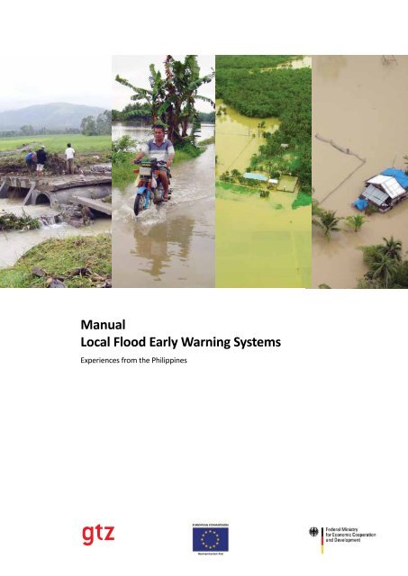
Manual Local Flood Early Warning Systems - Planet Action
Manual Local Flood Early Warning Systems - Planet Action
Manual Local Flood Early Warning Systems - Planet Action

Create successful ePaper yourself
Turn your PDF publications into a flip-book with our unique Google optimized e-Paper software.
<strong>Manual</strong><br />
<strong>Local</strong> <strong>Flood</strong> <strong>Early</strong> <strong>Warning</strong> <strong>Systems</strong><br />
Experiences from the Philippines
<strong>Manual</strong><br />
<strong>Local</strong> <strong>Flood</strong> <strong>Early</strong> <strong>Warning</strong> <strong>Systems</strong><br />
Experiences from the Philippines
This document has been produced with the financial assistance of the European Commission. It does not reflect the official<br />
opinion oft he European Commission.<br />
Published by:<br />
Deutsche Gesellschaft für<br />
Technische Zusammenarbeit (GTZ) GmbH<br />
German Technical Cooperation<br />
Environment and Rural Development Program<br />
Disaster Risk Management Component<br />
3rd Floor PhilAm Life Building<br />
Justice Romualdez Street<br />
Tacloban City<br />
Leyte, Philippines<br />
T 0063 53 323 8623<br />
F 0063 53 323 8624<br />
Internet:<br />
www.gtz.de<br />
Responsible:<br />
Dr. Walter Salzer<br />
Author:<br />
Olaf Neussner (drmon@web.de)<br />
Photographs:<br />
Olaf Neussner (unless indicated otherwise)<br />
Layout and printing by:<br />
VG Printing Services<br />
Tacloban City, October 2009
Table<br />
of Content<br />
Introduction............................................................................................................................. 5<br />
Acknowledgements.................................................................................................................. 6<br />
1. What is a flood?................................................................................................................. 7<br />
<strong>Flood</strong>s and watersheds...................................................................................................... 8<br />
2. Overview: Key elements of FEWS....................................................................................11<br />
2.1. Risk knowledge....................................................................................................... 12<br />
2.2. Monitoring and warning services...........................................................................13<br />
2.3. Dissemination and communication........................................................................13<br />
2.4. Response capability................................................................................................14<br />
3. Where to establish a LFEWS?..........................................................................................15<br />
3.1. Scope and limitations of FEWS...............................................................................16<br />
3.2. What information is needed for the decision to establish an LFEWS?...................16<br />
3.2.1. The nature of the flood hazard...................................................................17<br />
3.2.1.1..Frequency......................................................................................17<br />
3.2.1.2..Location of the flooded area.........................................................17<br />
3.2.1.3..Depth of the floods.......................................................................17<br />
3.2.1.4..Duration of the floods...................................................................17<br />
3.2.2. Elements at risk..........................................................................................18<br />
3.2.2.1..People...........................................................................................18<br />
3.2.2.2..Material values..............................................................................18<br />
3.2.3. Vulnerability...............................................................................................18<br />
3.2.3.1..People...........................................................................................19<br />
3.2.3.2..Material values..............................................................................19<br />
3.3. Technical feasibility of a LFEWS..............................................................................20<br />
3.4. Economic feasibility of a LFEWS (Cost Benefit Analysis).........................................22<br />
3.4.1. Damage reports (frequency, severity)........................................................22<br />
3.4.2. Damage projections....................................................................................22<br />
3.4.3. Installation costs.........................................................................................23<br />
3.4.4. Running and maintenance costs.................................................................23<br />
4. Risk knowledge................................................................................................................ 25<br />
4.1. Hazards................................................................................................................... 26<br />
4.2. Elements at risk...................................................................................................... 27<br />
4.3. Vulnerability .......................................................................................................... 28
4.4. Risk knowledge management.................................................................................29<br />
4.4.1. Institutional mechanisms (who collects and analysis the data?)................29<br />
4.4.2. Regular documentation of risk developments............................................29<br />
4.4.3. Make documentation available to key actors.............................................30<br />
5. Monitoring hazards and warning decision......................................................................31<br />
5.1. Organizational and decision making processes......................................................32<br />
5.2. Weather forecasting...............................................................................................33<br />
5.3. Monitoring devices.................................................................................................34<br />
5.3.1. Water level devices.....................................................................................34<br />
5.3.2. Rainfall devices...........................................................................................36<br />
5.4. Collecting data........................................................................................................ 38<br />
5.4.1. Satellite-based rainfall estimations.............................................................38<br />
5.4.2. Gauge-based rainfall estimations...............................................................39<br />
5.4.3. Water level of rivers....................................................................................39<br />
5.5. Forecasting and warning........................................................................................39<br />
5.5.1. Identification of the flood-prone area........................................................40<br />
5.5.1.1..The regular flood-prone area........................................................40<br />
5.5.1.2..The area prone to extreme high floods.........................................43<br />
5.5.2. Initial threshold estimations.......................................................................43<br />
5.5.3. Adjustment of the thresholds.....................................................................43<br />
5.5.4. Three different warning levels....................................................................45<br />
6. Dissemination and communication.................................................................................47<br />
6.1. Organizational structure.........................................................................................48<br />
6.2. Installation of effective communication systems and equipment..........................49<br />
6.3. Recognizing and understanding warning messages...............................................50<br />
7. Response capability......................................................................................................... 51<br />
7.1. Respect and follow warnings..................................................................................52<br />
7.2. Establishment of disaster preparedness or response plans...................................52<br />
7.3. Drills and dry runs..................................................................................................53<br />
7.4. Evacuation centers.................................................................................................54<br />
7.5. Assess and strengthen response capacity..............................................................55<br />
7.6. Enhance public awareness and education..............................................................55<br />
8. Cross-cutting issues......................................................................................................... 57<br />
8.1. Effective institutional arrangements.......................................................................58<br />
8.1.1. Secure LEWS as long-term priority/commitment.......................................58<br />
8.1.2. Assess institutional capacities and provide Capacity Development...........58<br />
8.1.3. Secure financial resources..........................................................................59<br />
8.2. Conflict management.............................................................................................59<br />
8.3. Multi-risk approach................................................................................................59<br />
2
9. Key actors ....................................................................................................................... 61<br />
9.1. Residents (communities)........................................................................................62<br />
9.2. <strong>Local</strong> governments.................................................................................................62<br />
9.3. National government institutions ..........................................................................62<br />
9.4. Non-governmental organizations...........................................................................63<br />
9.5. The private sector...................................................................................................63<br />
9.6. The science and academic community...................................................................63<br />
10. Literature ........................................................................................................................65<br />
11. Abbreviations and acronyms...........................................................................................67<br />
12. Annexes .......................................................................................................................... 69<br />
Annex 1.: Hazard calculations..........................................................................................70<br />
Annex 2.: Classification of vulnerability factors...............................................................71<br />
Annex 3.: Cost Benefit Analysis.......................................................................................72<br />
Annex 4.: Form recording rainfall/river level data...........................................................73<br />
Annex 5.: <strong>Flood</strong> warning levels overview........................................................................74<br />
Annex 6.: Checklists/reports for flood warning levels.....................................................75<br />
Annex 6.1.: For households....................................................................................75<br />
Annex 6.2.: For barangays......................................................................................77<br />
Annex 6.2.1.: <strong>Flood</strong> warning level 1............................................................78<br />
Annex 6.2.2.: <strong>Flood</strong> warning level 2............................................................79<br />
Annex 6.2.3.: <strong>Flood</strong> warning level 3............................................................80<br />
Annex 6.3.: For municipalities................................................................................81<br />
Annex 6.3.1.: <strong>Flood</strong> warning level 1............................................................82<br />
Annex 6.3.2.: <strong>Flood</strong> warning level 2............................................................83<br />
Annex 6.3.3.: <strong>Flood</strong> warning level 3............................................................84<br />
Annex 7: Evacuation drill checklist..................................................................................85<br />
Annex 8: Table of content for an annual report of an operation center..........................86<br />
Annex 9: Sample Memorandum of Agreement between LGUs.......................................87<br />
Annex 10: Checklist <strong>Local</strong> <strong>Flood</strong> <strong>Early</strong> <strong>Warning</strong> System...................................................94<br />
Annex 11: Information on EU DIPECHO...........................................................................95<br />
3
Introduction<br />
This manual is based on the experience of German Technical Cooperation<br />
(GTZ) in a project supporting the establishment of <strong>Local</strong> <strong>Flood</strong> <strong>Early</strong> <strong>Warning</strong><br />
<strong>Systems</strong>. The European Commission 1 and the German Government 2<br />
funded the project. The manual describes how to set up and run a <strong>Local</strong><br />
<strong>Flood</strong> <strong>Early</strong> <strong>Warning</strong> System for inland river floods. It does not include<br />
special cases like flash floods, storm surges and tsunamis.<br />
Major river basins with flood prone areas 3 have long been taken cared of by an institution<br />
of the Department of Science and Technology (DOST) handling mainly weather and<br />
flood forecasts, the Philippine Atmospheric Geophysical and Astronomical Service<br />
Administration (PAGASA). These early warning systems are technically demanding,<br />
highly automated and require heavy investments. The operations center, where<br />
information is gathered and decisions are made, is located in the central office of PAGASA<br />
in Manila. For smaller rivers and smaller flood-prone areas another approach has<br />
been successfully tested for some years now. The technical set-up is less sophisticated<br />
and thus much cheaper. The operations center is based in or near the flood-prone<br />
area and staffed with local personnel. Rainfall and river level data are observed and<br />
reported to the operations center. Automated gauges play a key role in the system and<br />
are augmented by local observers (mostly volunteers). In the experience of the local<br />
partners of GTZ (provincial government, municipalities) the system can forecast flood<br />
events and warn people in the hazard zone reliably.<br />
Sometimes <strong>Early</strong> <strong>Warning</strong> <strong>Systems</strong> are called <strong>Warning</strong> <strong>Systems</strong> only, because it is the<br />
very nature of a warning to come earlier than the actual event. Therefore an early<br />
warning is a little redundant, but as this term is established and widely accepted now<br />
we also use it here.<br />
<strong>Local</strong> <strong>Flood</strong> <strong>Early</strong> <strong>Warning</strong> <strong>Systems</strong> (LFEWS) have also been promoted by PAGASA 4<br />
and other institutions 5 for a few years now. They are called Community-Based<br />
or Community Managed 6 or simply <strong>Local</strong> FEWS to distinguish them from the big<br />
centralized FEWS run by the PAGASA central office.<br />
There is a growing interest in the establishment of local and low-cost FEWS. Up to now<br />
no comprehensive guideline on how to establish and run such a system exists in the<br />
Philippine context. Some publications are dealing with the topic 7 and many publications<br />
from countries with a history of big floods like Bangladesh provide guidance 8 . It is<br />
hoped that GTZ can contribute with this manual to the development of more local<br />
flood early warning systems.<br />
1<br />
Disaster Preparedness European Commission Humanitarian Aid Department (DIPECHO)<br />
2<br />
Federal Ministry for Economic Cooperation and Development (BMZ)<br />
3<br />
River basins: Pampangna, Agno, Bicol, Cagayan River; sub basins: Angat, Binga-Ambuklao, Pantabangan, Magat, Metro Manila<br />
4<br />
Hernando, 2008<br />
5<br />
Accion Contra el Hambre, Corporate Network for Disaster Response, Christian Aid, OXFAM<br />
6<br />
The systems are (at least partly) working with volunteer monitors within a barangay, hence the word “community”.<br />
7<br />
PAGASA, without date. Damo, 2007. Nilo, 2006. Perez, 2007<br />
8<br />
Sharma, 2004<br />
5
Acknowledgements<br />
GTZ wants to thank Governor J. L. Petilla, Mr. Vince<br />
Emnas, Provincial Administrator, for initiating the work<br />
on the manual, Mr. Paul P. Mooney from the Operation<br />
Center of the Binahaan LFEWS (all Province of Leyte),<br />
Mr. Allen Molen (GTZ), Dr. Susan Espinueva, Supervising<br />
Weather Specialist and Officer-in-Charge of <strong>Flood</strong><br />
Forecasting and <strong>Warning</strong> Section, Mr. Heraclio M. Borja,<br />
Assistant Weather Services Chief, Hydrometeorological<br />
Division, (PAGASA), Mr. Hilton Hernando (PAGASA), Mr.<br />
Suresh Murugesu (ACF - <strong>Action</strong> Against Hunger), Mrs.<br />
Harleen Daber (University of Delhi, India), Mayet Alcit<br />
(CNDR - Corporate Network for Disaster Response) for<br />
contributing to this manual, and Ms. Marion Holz for the<br />
Cost Benefit Analysis.<br />
6
1. What is a <strong>Flood</strong>?<br />
A flood is an overflow of an excess of water that submerges land usually not covered by water.<br />
<strong>Flood</strong>ing may result from the volume of water within a body of water such as a river or lake,<br />
exceeding the total capacity of its bounds, with the result that some of the water flows or sits<br />
outside of the normal perimeters of the body 9 .<br />
A simpler definition: A flood is when the water from a river spills out of the river bed.<br />
This manual is limited to floods described above. It does not include flash floods, storm surges<br />
or tsunamis.<br />
9<br />
Definitions modified from Wikipedia<br />
7
Flash floods are defined as flooding of short duration with a relatively high peak discharge. It<br />
is normally caused by heavy rainfall associated with a thunderstorm or a tropical storm. They<br />
can also occur after the collapse of a dam or a breakdown of piled up debris in a river. Flash<br />
floods are distinguished from regular floods by a timescale of less than six hours from rising to<br />
going back to normal.<br />
Storm surges are floods caused by rapidly rising seawater and inundation of low-lying coastal<br />
areas. Storm surges are normally caused by a combination with very low air pressure, strong<br />
wind towards the coast and high tide. The hurricane Katrina in 2005 had a surge height of<br />
7.60m.<br />
In case a storm surge hits at the same time with an inland flood occurs inland close to the coast<br />
the combination of the effects will aggravate the inland flood.<br />
A tsunami is, most often, a wave caused by an earthquake in the sea 10 . It hits the coast and can<br />
cause serious destruction in flat near-shore areas.<br />
1.1. <strong>Flood</strong>s and Watersheds<br />
Rain water falling from the sky will drain to the rivers and the rivers ultimately flow into the<br />
sea 11 . The surface run-off is flows into the rivers and if their channel capacity is exceeded<br />
the water spills over to flat areas. This is called a flood.<br />
In order to understand where all the water causing the flood comes from we look at the<br />
whole watershed or river basin 12 as a system. The rain coming from upstream can cause<br />
flooding of the downstream area. In case the drainage of a flat area is poor then the rain<br />
directly falling onto an area may cause floods too (ponding of rainwater).<br />
<strong>Flood</strong>s in a Watershed<br />
Watershed<br />
<strong>Flood</strong>s may also overrun its river basin and spill over to a neighboring river system particularly<br />
at the lower section of parallel watersheds. In such case, a flood in one river system might spill<br />
10<br />
Other causes are: landslides hitting the sea, underwater landslides, volcano eruptions, meteors hitting the sea<br />
11<br />
Of course water also evaporates, is absorbed by the soil and plants and feeds into ground water, but during periods of heavy rains (the usual cause<br />
for floods in the Philippines), most rain remains surface water.<br />
12<br />
For details on the delineation of a river basin see 1.2.2.<br />
8
What is a <strong>Flood</strong>?<br />
over to a neighboring river basin. For the purpose of setting up a LFEWS, it is best to ask local<br />
people about this phenomenon in order to understand the nature of flooding in that particular<br />
area. In cases of spill over from neighboring river basins these have to be included also in the<br />
LFEWS.<br />
Overflow of a Watershed<br />
Watershed A<br />
Ocean<br />
Watershed B<br />
9
Location Map<br />
This phenomenon was observed in Abuyog, Leyte, where the Bito river caused flooding of the<br />
town center (poblacion) of Abuyog although the poblacion is not part of the Bito watershed.<br />
10
2. Overview:<br />
Key elements of FEWS<br />
The United Nations’ International Strategy for Disaster Reduction (ISDR) is concerned with<br />
the reduction of disasters 13 . ISDR issued a guideline on developing early warning systems 14 .<br />
This chapter is largely based on the recommendations of ISDR. According to ISDR an early<br />
13<br />
ISDR aims at building disaster resilient communities by promoting increased awareness of the importance of disaster reduction as an integral<br />
component of sustainable development, with the goal of reducing human, social, economic and environmental losses due to natural hazards and<br />
related technological and environmental disasters.<br />
14<br />
ISDR, 2006<br />
11
warning system consist of four elements: risk knowledge, monitoring and warning services,<br />
dissemination and communication as well as response capability.<br />
GTZ also considered the experience of other countries when the LFEWS was established in the<br />
Eastern Visayas 15 .<br />
2.1. Risk Knowledge<br />
The risk is defined as: The combination of the probability of an event and its negative<br />
consequences 16 .<br />
Risks arise when hazards and vulnerabilities appear together at a particular location.<br />
Assessments of risk require systematic collection and analysis of data and should consider<br />
the dynamic nature of hazards and vulnerabilities that arise from processes such as<br />
urbanization, rural land-use change, environmental degradation and climate change 17 .<br />
Risk assessments and maps help to motivate people, prioritize early warning system needs<br />
and guide preparations for disaster prevention and responses.<br />
15<br />
E.g. Basha, 2007<br />
16<br />
ISDR, 2009<br />
17<br />
GTZ, 2002, page 25<br />
12
Overview: Key elements of FEWS<br />
2.2. Monitoring and <strong>Warning</strong> Services<br />
<strong>Warning</strong> services lie at the core of the system. There must be a sound scientific basis<br />
for predicting and forecasting hazards and a reliable forecasting and warning system that<br />
operates 24 hours a day. Continuous monitoring of hazard parameters and contributing<br />
factors is essential to generate accurate warnings in a timely fashion. <strong>Warning</strong> services for<br />
different hazards should be coordinated with stakeholders and relevant agencies to gain<br />
the benefit of shared institutional, procedural and communication networks.<br />
2.3. Dissemination and Communication<br />
<strong>Warning</strong>s must reach those at risk. Clear messages containing simple, useful information<br />
are critical to enable proper understanding of warnings and responses in order to safeguard<br />
lives and livelihoods. Regional, national and community level communication systems<br />
must be pre-identified and appropriate authoritative mandates established. The use of<br />
multiple communication channels is necessary to ensure that as many people as possible<br />
are warned, to avoid failure of any one channel, and to reinforce the warning message.<br />
13
2.4. Response Capability<br />
It is essential that communities understand their risks; respect and follow the warning and<br />
know how to react. Education and preparedness programs play a key role in reducing risks.<br />
It is also essential that disaster management plans are in place, resources allocated and<br />
standard procedures well practiced and tested. The community should be well informed<br />
on options for safe behavior, available escape routes, and how best to avoid damage and<br />
loss to property.<br />
14
3. Where to Establish<br />
a LFEWS?<br />
There are many areas, which potentially might be affected by floods. Primarily these are flat<br />
areas or plains. <strong>Flood</strong>s may be seasonal and/or frequent (once per year or more) or they<br />
might be rare (e.g. once in a hundred years) and they might be harmless or very destructive.<br />
Some floods are even regarded to be beneficial because the silt/sediments contain fertilizing<br />
minerals and soil and deposit them to the fields.<br />
15
A <strong>Local</strong> <strong>Flood</strong> <strong>Early</strong> <strong>Warning</strong> <strong>Systems</strong> provides a warning of an approaching flood to the<br />
residents of a flood-prone area giving them enough time to take necessary preparations before<br />
the arrival of the flood.<br />
This chapter gives some orientation on what important aspects to consider for the decision on<br />
when, where and how to establish a LFEWS.<br />
3.1. Scope and Limitations of FEWS<br />
<strong>Flood</strong> <strong>Early</strong> <strong>Warning</strong> <strong>Systems</strong> can help to reduce casualties and damages caused by inland<br />
floods. If vulnerable people in a flood-prone area are warned ahead of time they can<br />
leave the danger zone and go to a safer place to avoid drowning. They can also transfer<br />
moveable items susceptible to loss or water damage to higher grounds. This could be an<br />
elevated place within a building or a location outside the flood-prone area. A functioning<br />
FEWS can reduce casualties and damages to moveable property substantially.<br />
However, these benefits only work under certain circumstances:<br />
- The time between the warning and the actual arrival of the flood must be sufficient to<br />
make the necessary arrangements.<br />
- Safe places must be within reach of people.<br />
- Evacuation routes must be accessible.<br />
- The FEWS must be fully operational and reliable. If it is failing to sound alarm when it is<br />
needed or gives false alarms, it is useless.<br />
- The local population has to be aware of the FEWS and the meaning of warnings and<br />
must be willing to follow the advice given to them.<br />
3.2. What Information is Needed for the Decision to Establish a LFEWS?<br />
The establishment, operation and maintenance of a LFEWS is a considerable effort and<br />
one should carefully examine whether the investment in and continuous support of the<br />
systems are justified. The decision should be made on an informed basis and all available<br />
information should be gathered. However, the research should be limited to gathering<br />
secondary data.<br />
The following information must be considered:<br />
3.2.1. The nature of the <strong>Flood</strong> Hazard<br />
In general it is sufficient to describe the hazard in qualitative terms before establishing an<br />
LFEWS; however, the more quantitative data are available the better 18 . Keep in mind that<br />
the characterization of the flood hazard alone does not determine the need for an LFEWS.<br />
This still depends also on the elements at risk and their vulnerability.<br />
Find out how frequently floods occur, where the flooded area exactly is, how deep the<br />
water is and what current it has.<br />
18<br />
Examples for quantitative hazard calculations are in Chapter 4.<br />
16
Where to Establish a LFEWS?<br />
3.2.1.1. Frequency<br />
Ask PAGASA, NIA, LGUs and PPDOs/MPDOs about records of previous records of flood<br />
events.<br />
Interview people in barangays, especially older people who may have experienced<br />
floods over decades.<br />
Calculate an average per year. If floods occur once per year or more often, a LFEWS<br />
might be very helpful. If they happen less than one in 50 years it might not be useful<br />
to have a LFEWS.<br />
3.2.1.2. Location of <strong>Flood</strong>ed Area<br />
The best way of describing the location of flooded area is using a map. <strong>Flood</strong>s of one<br />
river and its tributaries occur within a watershed, also called river basin. In the first<br />
step you should get a map of the watershed of the area of interest. In the second step<br />
you should locate the flood-prone areas within a watershed/river basin.<br />
Different offices might already have maps of the watershed (DENR, PPDO, MPDOs<br />
etc.). If you do not find this map, create it yourself with a topographic map showing<br />
the altitudes. The definition of a watershed is: The entire region draining into a river,<br />
river system or body of water 19 . You have to delineate this area by going along ridges<br />
separating one river basin from another river basin.<br />
Try to find already existing maps of flood-prone areas. MGB and PAGASA or local LGUs<br />
might have them.<br />
In case no official flood map exists you have to rely on reports and try to estimate the<br />
flooded area.<br />
3.2.1.3. Depth of the <strong>Flood</strong>s<br />
The number of casualties and amount of damage caused by a flood depends (among<br />
others) on the depth of the water.<br />
It is unlikely but possible that you find maps showing different inundation levels or<br />
the maximum recorded flood depth. Interview local people about their experience<br />
and take note of the depth. In cases where floods are frequent, the flood levels can<br />
be estimated from stains on buildings and infrastructure or from rubbish (e.g. plastic<br />
bags) in tree branches.<br />
Inhabited areas with more than 1m of flood are dangerous and a LFEWS might be<br />
useful to warn the inhabitants.<br />
3.2.1.4. Duration of the <strong>Flood</strong><br />
The number of casualties and amount of damage caused by a flood depends also<br />
on the time the water stayed in the area. The danger of spreading of water-borne<br />
diseases is higher if the water stays in an area for a week or more.<br />
19<br />
www.waterquest.ca/about/glossary.asp<br />
17
Interview residents about their experience. Take note of the time and use it for the<br />
preparation of evacuation centers. For longer stays in the centers they need more<br />
provisions.<br />
3.2.1.5. Current of the <strong>Flood</strong><br />
Strong currents can carry things away or floating debris may damage buildings and<br />
infrastructure. Ask people about their experience of currents during floods. Some<br />
offices might even have measured discharge and currents of the river (PAGASA, NIA).<br />
Keep in mind that water current in rivers might be faster if there is more water in it.<br />
If strong currents are common (7km/hour or more in the flooded area) the floods are<br />
very dangerous and people should not endure floods in their houses because they<br />
might collapse.<br />
3.2.2. Elements at Risk<br />
After the flood-prone area and the nature of the flood are identified you have to find out<br />
what elements are exposed to the hazard in the flood-prone area. There are two different<br />
“elements at risk”, people and all other material values.<br />
3.2.2.1. People<br />
Estimate (or count) how many people live and work in the flood-prone area. Ask LGUs<br />
for statistics or make estimations based on housing density in the flood-prone area.<br />
Statistics of barangay population might be helpful, however, in many barangays only<br />
part of the houses experience flooding. In this case the population number has to be<br />
adjusted.<br />
3.2.2.2. Valuable Materials<br />
It is important to estimate what valuable materials are located in a flood-prone area.<br />
In a worst case scenario they might all be lost. Here, only values that can be moved<br />
easily shall be included, because only this type of materials can be removed after a<br />
warning from a LFEWS.<br />
Try to estimate what moveable materials the households or businesses in the floodprone<br />
area have. Work with assumptions about the typical belongings of a rural or<br />
urban household.<br />
3.2.3. Vulnerability.<br />
Loss of life and damage to property by floods only happen if these people or valuable<br />
materials are vulnerable to floods. The definition of vulnerability includes factors or<br />
constraints of an economic, social, physical or geographic nature, which reduce the ability<br />
of a community to prepare for and cope with the impact of hazards. This results in damage<br />
or loss of an exposed element at risk.<br />
18
Where to Establish a LFEWS?<br />
3.2.3.1. People<br />
If persons are exposed to floods a number of factors determine their vulnerability.<br />
Shorter persons (e.g. children) are more vulnerable than taller persons. The physically<br />
handicapped have more problems and persons who know how to swim are less<br />
vulnerable to floods.<br />
Considerable empirical evidence from all over the world shows that while disaster<br />
losses lead to measurable decreases in income, consumption and human development<br />
indicators, these effects are far more accentuated in lower income (“poor”) households<br />
and communities. The evidence points to increases in the depth and breadth of poverty,<br />
long-term difficulties in recovery and very negative human development impacts in<br />
areas such as education and health, which also have long-term consequences 20 .<br />
The vulnerability also depends on the availability of gadgets like boats or life vests and<br />
ropes.<br />
Furthermore, persons in houses that can withstand a flood and are high enough to<br />
provide shelter in the upper parts of the building are less vulnerable to floods.<br />
Under normal circumstances approximately half of the population (children under 15,<br />
elderly, handicapped) are very vulnerable, while the other half is physically able to<br />
cope with a flood of 1m (3feet). For higher floods the overwhelming majority is very<br />
vulnerable because even able bodied adults have serious problems if the water is<br />
getting so high that they cannot walk in it anymore.<br />
3.2.3.2. Valuable Material<br />
Most material values in flood-prone areas cannot be moved easily and thus are not<br />
subjected to action under a LFEWS.<br />
Many household items (especially electrical, paper), vehicles (motorbikes, cars), stored<br />
harvest, and livestock can be damaged by water. Depending on the circumstances<br />
this may result in total loss of the items, but an LFEWS can help the households to<br />
secure their movable material and prevent damages provided the LFEWS is reliable<br />
and warnings reach the communities and actions are taken on time.<br />
If there is a significant flood hazard in an area (at least 1 flood per year, flood more<br />
than 1 meter high in inhabited area, more than 10km2 area affected or strong currents<br />
during floods), and if there are many elements at risk and these are vulnerable it makes<br />
sense to consider the establishment of a LFEWS. There are no hard rules defining a<br />
certain minimum number of persons or values at risk.<br />
The affected area might also be very big and a river stretching over many provinces<br />
or regions may be involved. In this case it might be worthwhile to explore whether<br />
PAGASA should run the FEWS.<br />
If the risk is considered significant and a LFEWS may be useful the next step is the<br />
technical feasibility of a FEWS. The LFEWS can only have significant impact if it can<br />
technically function.<br />
20<br />
page 8, ISDR, 2009b<br />
19
3.3. Technical Feasibility of a LFEWS<br />
A LFEWS may be needed in an area, but it might be technically difficult to establish it.<br />
Therefore, the technical feasibility of the LFEWS should get some attention.<br />
Basically a LFEWS detects a flooding condition upstream and warns inhabitants<br />
downstream of the approaching flood. The longer the time between the warning and the<br />
actual arrival of the flood the better the residents can prepare by bringing their belongings<br />
and themselves to safe places.<br />
Any FEWS needs a certain time for the detection of a flood condition upstream and the<br />
arrival of the warning at the inhabitants of the flood-prone area. This time depends on the<br />
frequency of data gathering, the communication of the data to an operation center, the<br />
decision to issue a warning and the communication of the warning to the house¬holds<br />
(possibly via a chain). A very fast system may need only 10 minutes for this, but under<br />
normal circum¬stances many households may be informed only after 30 to 60 minutes,<br />
some even later.<br />
In order to estimate the time between the detection of a flood condition and the arrival<br />
of a flood at a certain point it is best to use a sketch map of the river basin of the area<br />
of interest. The map should contain the shape of the watershed, the main river and big<br />
tributaries and the flood-prone area.<br />
The best data for predicting a flood is measuring the water level of the river. The second<br />
best way is predicting a flood from rainfall data.<br />
For the sake of simplicity we take only one point for measuring the river level. This point<br />
should be the drainage point of a relatively big sub watershed of the total watershed.<br />
A point further downstream means a bigger sub watershed being covered. The bigger<br />
the sub watershed, the higher the representation of the data and thus the forecasting<br />
of a flood. On the other hand, this river level gauge should be as far as possible from the<br />
downstream flood-prone area to gain a long warning time. The location of the gauge is a<br />
compromise between the two requirements.<br />
Position of River Level Gauge<br />
20
Where to Establish a LFEWS?<br />
In this sketch map the yellow spot is the location of the river level gauge. The dark blue<br />
area represents the sub watershed that drains to the measuring point. The Minimum<br />
Distance to the flood prone area has to be taken from the actual length of the curving<br />
river and the same applies to the Maximum Distance. We assume that the river flows with<br />
10km per hour. If the distance between the river level gauge and the nearest point of the<br />
flood-prone area is 5km, the flood will arrive 30 minutes after it passed the gauge. The<br />
farthest point of the flood-prone area may be 15km from the gauge. The flood will hit this<br />
point 1hour and 30 minutes after it was detected at the gauge.<br />
Taking into consideration that it often takes 30 minutes from the data collection to the<br />
warning reaching the threatened population the LFEWS may not be very useful for those<br />
people living upstream in the flood-prone area. But for the residents further down stream<br />
the warning might still be on time to make some arrangements and evacuate.<br />
Normally it takes some time to bring certain items to safety. This depends much on the<br />
circumstances of the location (e.g. proximity of a safe place). As guideline some examples<br />
are listed here 21 .<br />
Items Protected with <strong>Warning</strong><br />
3.4. Economic Feasibility of a LFEWS (Cost Benefit Analysis)<br />
The economic Cost Benefit Analysis (CBA) compares the price to be paid for a LFEWS to<br />
the benefit gained from timely warnings 22 . The benefit is expressed as values saved from<br />
damage or loss. If the cost of the LFEWS is lower than the expected savings it is worthwhile<br />
to consider the establishment of the system. We use a very simple CBA here. There are<br />
very sophisticated calculation methods available too 23 .<br />
The CBA does not include the loss of human life. If lives were lost in the past and casualties<br />
are expected in future floods the establishment of a LFEWS may be a very suitable way<br />
of reducing deaths and you may not want to go into the details of a CBA and install the<br />
LFEWS anyway. Ask about casualties in previous floods. Consult damage reports, if they<br />
are available. If there is a pattern of flood-related casualties you may skip the CBA and<br />
install the LFEWS if it is technicaly feasible.<br />
3.4.1. Damage Reports (frequency, severity)<br />
The best way of estimating average annual damage costs are the data from damage<br />
reports. If you can get them from the municipality or provincial offices (OCD might<br />
also have them) take the data from these reports. We are interested only in data<br />
concerning moveable items.<br />
In case no damage reports can be found or if they reflect only a part of the damages,<br />
you should ask staff of LGU for their estimates of damages and losses.<br />
Based on this information you can estimate an average annual loss of moveable<br />
items.<br />
3.4.2. Damage Projections<br />
Basically, you can assume that the recorded damages and losses of the past will continue<br />
in the future, but there may be factors that will increase the expected damages. If the<br />
number of households in the flood-prone area increases over the years the expected<br />
damages will also increase. It is also possible that the households will buy more<br />
vulnerable items like TVs etc.. In some cases, depending on the availability, you may<br />
use data available from the local assessor’s office and use this data in combination<br />
with other information you gather. Global Warming seems to increase the number of<br />
stronger typhoons in the Philippines and they may bring more rain resulting in more<br />
floods. On the other hand it is also possible that more and more people build their<br />
homes on stilts and reduce their vulnerability to floods.<br />
If you can estimate a trend from damage data in the past take this for projections.<br />
Otherwise you may consider a 5% increase in average damage costs per year.<br />
22<br />
GTZ, 2005<br />
23<br />
Verkade, 2008<br />
22
Where to Establish a LFEWS?<br />
No FEWS will be able to reduce losses and damages of moveable items to zero, but<br />
it is expected that some reduction will take place. In the GTZ supported LFEWS it is<br />
estimated that losses and damages of moveable items are reduced by 50%.<br />
3.4.3. Installation Costs<br />
The establishment of a LFEWS consists of a number of costs. Some of them may<br />
be covered by external sources and some of them may have to be covered by local<br />
revenue.<br />
• Identification of locations for measuring equipment<br />
• Purchase and installation of equipment (river level gauge (manual), river level<br />
gauge (tele-metered, rain gauge (manual), rain gauge (tele-metered)<br />
• Training on use of equipment, recording, communication, evacuation<br />
• Training for all stakeholders on the LFEWS<br />
• Establishment of an operation center (building costs [if applicable], office<br />
equipment, specialized equipment [communication, weather station])<br />
• Electronic office equipment (e.g. computers)<br />
• Electronic communication equipment (mobile phones, two way radio)<br />
• Office equipment (cabinets, shelves, desks, chairs)<br />
• Building<br />
• Air condition<br />
• Vehicle (Motorcycle, car)<br />
All equipment has an expected useful lifetime. There are tables which serve as an<br />
orientation. They are available at www.coa.gov.ph/COA_Issuances/Attachments/2003/<br />
C2003-007_AnnexA.pdf. Take the purchase price and divide it by the number of years<br />
of expected useful lifetime and you get the annual depreciation. This shall be used in<br />
the running and maintenance costs described in the next chapter.<br />
3.4.4. Running and Maintenance Costs<br />
The continuous operation of a LFEWS includes monthly costs:<br />
• Depreciation of equipment<br />
• Maintenance of equipment<br />
• Salaries, honoraria, travel allowance<br />
• refresher training courses<br />
• Office maintenance (water, electricity, communication, cleaning, etc.)<br />
• Fuel, lubrication, maintenance for vehicle<br />
• Office supplies<br />
23
Calculate the annual running costs of the FEWS (incl. depreciation) and compare it<br />
to the expected annual savings by reduced damages and losses of moveable items.<br />
If the costs are lower than the savings it is advisable to establish the FEWS from the<br />
economical point of view.<br />
An example of a CBA can be found in Annex 3. It shows that the relatively high costs<br />
of establishing the LFEWS are slowly recovered with the reduced damages due to the<br />
warnings of the system. After eight years the systems runs with less costs than it saves<br />
in terms of reduced damages. It has to be noted that some assumptions for the CBA<br />
have to be verified.<br />
24
4. Risk Knowledge<br />
This chapter basically deals with the same information that was described in Chapters 3.2.1.,<br />
3.2.2., 3.2.3., but in those chapters gathering information was limited to already available<br />
data and it was not handled in a quantitative manner. If a LFEWS is really established it is<br />
advisable to close information gaps by research. Furthermore, risks are changing over time<br />
and it is important that these changes are noticed, documented and integrated with adequate<br />
adjustments into the LFEWS.<br />
25
It is desirable to quantify risks. This is a substantial effort and to do it will require manpower<br />
and resources. In case the stakeholders of the LFEWS decide not to focus on these calculations<br />
the respective parts in Chapter 4 can be ignored.<br />
The total risk is defined by the product of the hazard, the elements at risk and their vulnerability.<br />
This means we have to look at these three determining factors one by one first and then at<br />
their product.<br />
Risk = Hazard * Elements at risk * Vulnerability<br />
It is possible to calculate risks in a quantitative manner. This manual is not describing these<br />
methods in detail but the principles and general examples are explained here 24 .<br />
4.1. Hazards<br />
The flood hazard has one main contributor, rain. Therefore the observation of rainfall is of<br />
primary importance. In case you observe rainfall already with gauges in the river basin you<br />
might like to add another technique, the estimation of rainfall with data freely available<br />
in the internet (see Chapter 5.4.1). If the rainfall data of the LFEWS are not collected<br />
completely or reliably the satellite data may help you considerably.<br />
Under rare conditions an extraordinary amount of rain may fall on the watershed and<br />
cause a flood that is much more severe than the usual/annual floods “One in a hundred<br />
years flood”. If a LFEWS did not consider this yet it is advisable to ask expert advice on how<br />
to estimate such floods.<br />
The severity of floods is not only influenced by rains. Many factors may increase or decrease<br />
the flood hazard. Collect the respective data and analyze them to reveal trends.<br />
• Over the years the river may change its path and with this the flood-prone area will<br />
most likely change. This might also be artificial as man is diverting rivers too.<br />
• Siltation of the river may reduce the channel capacity and increase the chances of<br />
flooding while dredging increases the capacity and reduce the danger of floods.<br />
• Water from rivers is sometimes used for<br />
irrigation. This might be small scale by a minor<br />
channels or pumps, but NIA might also run a<br />
big scheme and this might affect the flooding<br />
behavior of the river.<br />
• Drainage problems can aggravate flooding.<br />
Elevated roads without sufficient (or clogged)<br />
culverts or bridges with too narrow widths can<br />
limit drainage and cause flooding.<br />
24<br />
For details of these methods it is recommended to ask the National and Economic Development Authority for advice.<br />
26
Risk Knowledge<br />
• In case dams are part of the river basin they have also influence on the floods. They<br />
can absorb and store additional water if they are not full yet and they can accidentally<br />
or intentionally release vast amounts of excess water.<br />
• Changes in the vegetation in the watershed influence the water retention capacity of<br />
the soil (e.g. deforestation or reforestation) and this results in more or less water in<br />
the rivers. In case of deforestation more severe floods are to be expected.<br />
It is possible to describe hazards in a quantitative manner. Usually the hazard is quantified in<br />
terms of frequency and intensity for a certain location.<br />
<strong>Flood</strong> Hazard in a Specific Location<br />
<strong>Flood</strong> Intensity<br />
<strong>Flood</strong> Frequency<br />
(water height)<br />
(events/year)<br />
1m 1<br />
2m 0.3<br />
3m 0.1<br />
More detailed methods on how to calculate hazards in a quantitative way are described in<br />
Annex 1.<br />
4.2. Elements at Risk<br />
Get existing data on population in the flood-prone area. If maps showing households are<br />
available the map with the flood prone areas should be superimposed and the households<br />
counted. Otherwise it might be good to have local officials make an educated guess of how<br />
many people in how many barangays are in harms way.<br />
In many river basins the number of inhabitants or the area of vulnerable crops or other<br />
land uses is not well known and it is time and resource consuming to get exact data.<br />
GTZ used satellite images to identify land cover. Useful images are partly freely available<br />
in the internet (Landsat, Google Earth). It is also possible to get images commercially,<br />
but they are expensive in many cases. GTZ received images from the SPOT satellite via<br />
<strong>Planet</strong> <strong>Action</strong> 25 and derived land cover maps from the satellite images. The Regional<br />
Environmental Information System of the University of the Philippines, Tacloban campus,<br />
did this work.<br />
27
Land Use in <strong>Flood</strong> Prone Area of<br />
Binahaan Watershed (SPOT5, ASTER)<br />
(Total: 6,446ha)<br />
This is a land cover map of the flood-prone area (MGB) of the Binahaan river basin. It is<br />
easy to locate the main settlements and with the help of a GIS program one can calculate<br />
the share of the different land use forms in the flood-prone area.<br />
Any other source providing quantitative data about the number of inhabitants or items<br />
susceptible to flood damage are important and should be considered. In Leyte one of the<br />
best sources is the Community Based Management System (CBMS) updated by LGUs.<br />
4.3. Vulnerability<br />
The term vulnerability describes the susceptibility of an element at risk to sustain damage<br />
under the impact of a natural phenomenon like a flood. Different people and different<br />
assets are vulnerable to floods to different degrees.<br />
Many moveable items in households are very vulnerable to floods (electronics, stored<br />
harvest, food, paper). Wooden buildings (1-story) may collapse in 9km/hour flow velocity<br />
of a flood with a depth of 1.7m 26 . This velocity can occur in fast flowing rivers, but the<br />
velocity of the water in flooded residential areas is normally considerably lower than 9km/<br />
25<br />
<strong>Planet</strong> <strong>Action</strong> (2008)<br />
26<br />
Department of Homeland Security, p. 5-23<br />
28
Risk Knowledge<br />
hour. The high velocity may happen in or near riverbeds. In case erosion is taking away<br />
riverbanks some buildings might be exposed to high water velocity and the full force of<br />
the current.<br />
The vulnerabilities of individual persons, communities, assets and the environment are<br />
subject to a lot of research in recent years and there are also attempts to quantify social<br />
vulnerability 27 A classification of vulnerabilities can be found in Annex 2.<br />
Protection devices against floods like dykes may themselves be vulnerable to floods or<br />
other environmental influences. Therefore it is important to check the status and condition<br />
of such devices regularly.<br />
4.4. Risk Knowledge Management<br />
Of course it is important to know the risks caused by floods (and other hazards) in a<br />
particular area. This is not a one-time exercise. Hazards may change (e.g. deforestation<br />
in a watershed resulting in faster run-off, climate change resulting in stronger rain);<br />
the elements at risk may change (e.g. more people live in a flood-prone area and they<br />
purchase more assets) and vulnerabilities may change (e.g. more informal settlements at<br />
river banks). Thus the aim of Risk Knowledge Management is to establish a continuous,<br />
systematic, standardized process to collect, assess and share data, maps and trends on<br />
hazards and vulnerabilities. This should include indigenous knowledge about hazards and<br />
how to cope with them traditionally.<br />
4.4.1. Institutional Mechanisms (who collects and analyses the data?)<br />
The OC appears to be an obvious choice for the centralized function of collecting and<br />
analyzing data. Nevertheless, also other arrangements are possible. For example, a<br />
special provincial office dealing with disasters/disaster preparedness might be a good<br />
central knowledge point.<br />
It may be advisable to formalize the central information gathering and dissemination<br />
role of the OC (if selected) already in the MoA establishing the LFEWS.<br />
4.4.2. Regular Documentation of Risk Developments.<br />
It is recommended that the OC (or another designated office) prepares an annual<br />
report about developments with influence on risks from natural hazards in the<br />
target area. This shall include all regularily collected weather and river data, changes<br />
in natural hazards (e.g. deforestation), elements at risk (e.g. increase in buildings,<br />
inhabitants) and vulnerabilities (e.g. share of houses on stilts increased). A suggested<br />
table of content can be found in Annex 8.<br />
27<br />
Dwyer, 2004<br />
29
4.4.3. Make Documentation Available to Key Actors.<br />
Presentation of results should be appropriate for the intended audience. Simple maps<br />
and descriptions are useful for all audiences, but especially for those lacking a technical<br />
background. Equations, engineering studies, probability maps are more appropriate<br />
for technical audiences. Results may be presented at stakeholder workshops, scientific<br />
and engineering conferences; in newspaper articles, pamphlets, and documents; and,<br />
on Web sites and radio and television programs.<br />
Results should be easy to understand and easily accessible to all.<br />
30
5. Monitoring Hazards and<br />
<strong>Warning</strong> Decision<br />
An essential part of the LFEWS is the continuous observation of the flood hazard. In principle,<br />
the observation must be 24 hours per day, 7 days per week and all year round, however, if the<br />
weather forecast predicts no rain within the next days it may be sufficient for the Operation<br />
Center to be on standby until a chance of rain is expected. For example in Binahaan the OC is<br />
attended to by two persons. They take shifts and during the shifts they leave the OC for breaks<br />
of 2 hours unless a critical situation is expected.<br />
31
5.1. Organizational and Decision-making Processes<br />
A LFEWS involves many institutions and people. The decision on when to warn whom with<br />
what advice should be done by one designated office only and all concerned stakeholders<br />
should know this office and that it is authorized to take these decisions and issue warnings.<br />
This office is called Operations Center (OC) 28 and it is the central place where information<br />
is gathered, decisions are made and warnings issued. In the establishment phase of a<br />
LFEWS it is important to decide where the OC shall be located and what government office<br />
administers it. In the experience of GTZ it will only run successfully if all involved LGUs are<br />
agree and are happy with the administrative set-up of the OC.<br />
In case a river basin, and especially the flood-prone area, is located in one municipality<br />
only, this municipality is the obvious choice to set up the OC. St. Bernard in Southern Leyte<br />
is an example for this.<br />
Very often the watershed and also the flood-prone area stretch across a number of<br />
municipalities. In this case it might be a good idea to have the provincial government host<br />
the OC. The Binahaan river LFEWS in Leyte and the Catarman LFEWS in Northern Samar<br />
work like this. However, it is also possible to run the LFEWS by one municipality/city for<br />
a flood-prone area involving a number of municipalities like it is done in Ormoc City in<br />
Leyte.<br />
In some cases many municipalities are part of a river basin but they have relatively small<br />
parts of the watershed. It is a good practice to invite them to the LFEWS but if they are not<br />
very interested in participating it is not a big problem.<br />
28<br />
in some places they are called Disaster Operation Center or <strong>Flood</strong> Operation Center<br />
32
Monitoring Hazards and <strong>Warning</strong> Decision<br />
Municipalities in Pagsangaan watershed<br />
The Pagsangaan river basin covers parts of nine municipalities, but some have only marginal<br />
area in the watershed (e.g. Jaro, Carigara) and probably do not have to be included in the<br />
LFEWS. All LGUs with substantial areas in the watershed should participate in the LFEWS<br />
(e.g. Ormoc, Kananga, Matag-ob, Villaba).<br />
5.2. Weather Forecasting<br />
Heavy, continous rains leading to floods are normally an effect of typhoons, tropical storms<br />
and tropical depressions. These weather events develop far south east of the Philippines<br />
over the Pacific Ocean and move towards the archipelago with relatively slow speed.<br />
Satellites can detect such weather disturbances days before they hit Philippine land area.<br />
The prediction of their path and strength is the task of PAGASA (www.pagasa.dost.gov.ph)<br />
as far as the Philippines is concerned.<br />
Other weather agencies make forecasts concerning the anticipated track of the approaching<br />
storm. It is a good practice to check also the following agencies:<br />
- Joint Typhoon <strong>Warning</strong> Center (https://metocph.nmci.navy.mil/jtwc.php)<br />
- Japan Metrological Agency (www.jma.go.jp/en/typh/)<br />
It is always a good idea to monitor all forecasts. They might differ considerably and you<br />
never know which one is closest to the actual path.<br />
33
The closer a particular watershed is to an approaching weather disturbance the more rain<br />
can be expected. Near the center high wind speeds bring the additional danger of direct<br />
storm damage to plants and buildings.<br />
In case the forecasted path of the weather disturbance is within 500km of the watershed it<br />
is wise to check the LFEWS and make sure that the river level and rain gauges are properly<br />
working and the local observers are available and ready to do their meter readings. The<br />
same applies to the communication chain. Make sure that it is in good order and ready to<br />
be used.<br />
5.3. Monitoring Devices<br />
In order to know the amount of rainfall and the level of water in a river instruments for the<br />
measurement of these two natural phenomena are needed. The devices should be reliable.<br />
This means they should be sturdy and not require a lot of maintenance and reading and<br />
getting data should be easy. For both, river level and rainfall, there are different devices to<br />
choose from with advantages and disadvantage and, of course, different price tags. The<br />
most expensive is not necessarily the best for a certain task.<br />
For many reasons a monitoring device may not deliver the expected data. This might<br />
be technical or human error. Therefore it is highly advisable to have at least one backup<br />
device for each important device in the LFEWS. The backup device should be completely<br />
independent from the first device.<br />
5.3.1. Water Level Devices<br />
The most reliable way of predicting a flood is observing the river level upstream from<br />
the flood-prone area. A minimum setup is to have two river level gauges: one upstream<br />
to be able to warn before the flood comes and one in the river where the flood occurs.<br />
With the second gauge you can measure how long the water travels from the upper<br />
to the lower gauge and how the heights correlate. Both helps you to adjust the LFEWS<br />
in terms of the expected arrival time and the expected height of the flood. If you have<br />
more than two gauges you can gain more precision and reliability in the forecasting.<br />
Most gauges are scaled on bridges or piers in a river.<br />
In case there is no bridge or strong pillar or some<br />
other type of strong wall near a spot that is suitable<br />
for observations, you have to construct a strong<br />
foundation in the riverbed for the installation of the<br />
gauge. Especially during flooding events when the<br />
current gets stronger and the river may carry debris<br />
like floating logs, the river level gauge should be<br />
able to withstand such impact.<br />
The scales are painted on the bridge/pier with<br />
water resistant color during very low river level.<br />
Intervals of 5cm are practical. They have to be<br />
big enough to be read from the edge of the river<br />
even if the river level is high and the visibility is<br />
low. In the night the observer uses a flashlight<br />
and still has to be able to see the markings clearly.<br />
34
Monitoring Hazards and <strong>Warning</strong> Decision<br />
A second type of instrument measures the water pressure with an electronic sensor.<br />
The sensor is sensitive and has to be protected from being washed away and from the<br />
impact of floating debris. The display of the data is connected to the sensor via a cable.<br />
The display may be located in a nearby building. It is possible to connect the sensor to<br />
a radio transmitter and send the signal to a faraway place like the Operation Center of<br />
the LFEWS. GTZ used a converted mobile phone for transmitting data via SMS initially,<br />
but this proved to be unreliable and the project switched to UHF/VHF radio.<br />
Automatic gauge (protected with old tires) and<br />
transmitter in St. Bernhard, Southern Leyte<br />
Gauge in Tingib, Pastrana,<br />
Leyte (Binahaan)<br />
Photo by Reggie Mercado<br />
Photo by Reggie Mercado<br />
The advantage of the painted water level scale at bridges is certainly the low cost and<br />
the simplicity. If the color fades, it is repainted with very little effort and cost. However,<br />
reading these devices at short intervals during bad weather and from the edge of a<br />
rising river at short intervals, particularly during the night, is a serious challenge for<br />
many observers. In the experience of GTZ the records of manual river level gauges<br />
are not consistent and have considerable gaps. The automatic gauges delivered much<br />
more complete and faster data, but the complexity of gauges is also prone to more<br />
technical failures. Even having these failures the reliability was much higher than that<br />
of the manual gauges.<br />
35
5.3.2. Rainfall Devices<br />
Similar to river level devices there are also very simple and more sophisticated<br />
instruments for measuring rainfall. Both types have advantages and disadvantages.<br />
The gauges mostly used by the partners of GTZ are simple digital devices. They cost<br />
around 7,500 Pesos (2009). They function on the principle of tipping buckets. Rain<br />
collected by the funnel falls into one of the small buckets. These buckets are carefully<br />
calibrated by the manufacturer. They hold an exact amount of rain, usually the<br />
equivalent of 0.25mm of rainfall. The buckets are balanced on a fulcrum so when one<br />
bucket fills with rain, the lever tips. The second bucket moves under the funnel while<br />
rain collected in the first bucket empties out the drain hole. Each time the lever tips, a<br />
small magnet on the lever moves past a magnet switch sending a signal to the display.<br />
By counting the number of signals from the reed switch, the display can count how<br />
many times the buckets have been filled to calculate the total rainfall.<br />
It is important to note that the digital reading on the display does not equal millimeters.<br />
The read number has to be converted to mm (for example a display reading of 18 is<br />
equivalent to 4.5mm rain). The manual of the gauge probably gives a conversion factor<br />
or a calibration should be carried out with a container of exact known volume.<br />
Tipping Bucket Rain Gauge<br />
36
Monitoring Hazards and <strong>Warning</strong> Decision<br />
In contrast to many manual gauges the tipping bucket device does not need emptying.<br />
It can run continuously. Another advantage is that the can be many meters away<br />
from the gauge, e.g. in a house. This makes reading much more comfortable than<br />
with a manual cylinder device. A disadvantage is the battery which is needed. In the<br />
experience of GTZ one battery can last many years. The electronics parts are simple<br />
and not prone to frequent failures.<br />
Digital gauge on a roof checked by Paul Mooney (OC Palo, Leyte)<br />
Photovoltaic Power Supply for the<br />
Gauge and Radio Transmitter<br />
Photo by Reggie Mercado<br />
In the same way river level gauges<br />
can be connected to an automatically<br />
working radio transmitter this is<br />
possible for digital rain gauges.<br />
GTZ supported a number of these<br />
devices in LFEWS in Leyte and Samar.<br />
GTZ used a converted mobile phone<br />
for transmitting data via SMS initially,<br />
but this proved to be unreliable<br />
and the project switched to UHF/<br />
VHF radio. Oxfam had a similar<br />
experience and recommends VHF for<br />
data transmission 29 .<br />
29<br />
Oxfam, without date<br />
37
5.4. Collecting Data<br />
All observers have to read and record the data from a measuring device. As a routine the<br />
following sequence should be observed:<br />
1. Read data<br />
2. Record data<br />
3. Transmit data to OC<br />
A template for a record is displayed in Annex 4. It might be helpful to keep a logbook for<br />
recording purposes instead of single sheets of paper.<br />
In dry times it is sufficient to collect data twice a day (7am and 5pm), but in case of rains<br />
the OC can decide to record data more often (hourly) and if it rains very hard, the intervals<br />
can go down to 15 minutes or even less. If local volunteers are involved in reading data<br />
they have to be informed about the changes in intervals.<br />
Antenna for data transmission<br />
Photo by Reggie Mercado<br />
Satellite-based Rainfall Data Displayed in Google Earth<br />
In this example the border of the Binahaan river basin in Leyte is shown<br />
on top of the TRMM data on 26 Feb. 2008, 15:00UTC for the past day (24<br />
hours). It shows that in the east the rain was 125-175mm and in the west<br />
more it was towards 75mm.<br />
5.4.1. Satellite-based Rainfall<br />
Estimations<br />
Some satellites have sensors that can<br />
detect rain on earth. The data of some<br />
of them are easily accessible through<br />
the internet 30 . The data of the Tropical<br />
Rainfall Monitoring Mission (TRMM)<br />
provide a view of the rainfall on a<br />
specific area for the past day, 3 days and<br />
1 week. The data are updated every 3<br />
hours.<br />
It is convenient to view the data in<br />
Google Earth 31 . If you want to see the<br />
outline of a watershed in Google Earth<br />
you have to have a GIS file 32 of your<br />
watershed. You can convert your GIS file<br />
to the Google Earth file format 33 with a<br />
simple freeware program 34 and display<br />
it on top of the TRMM data.<br />
These data are not very precise but<br />
they can be helpful in predicting floods<br />
and estimating the amount of rain in an<br />
area.<br />
30<br />
http://trmm.gsfc.nasa.gov/trmm_rain/Events/earth_one_day_floods<br />
31<br />
In case you do not have Google Earth installed<br />
32<br />
A shape file is very practical (it comes in a set of 3 files: *.shp, *.shx, *.dbf)<br />
33<br />
*.kml<br />
34<br />
shp2kml (download from: http://shape2earth.com/default.aspx)<br />
38
Monitoring Hazards and <strong>Warning</strong> Decision<br />
5.4.2. Gauge Based Rainfall Estimations<br />
Naturally the rain comes before the rising of a river which eventually causes a flood.<br />
Therefore the observation and analysis of rainfall data is helpful in flood prediction.<br />
However, the same amount of rain will not necessarily result to the same river level<br />
rise. For example, if the soil is very dry a lot of rain may be absorbed while if it is<br />
already saturated with water, almost all of the rain will run off.<br />
Since all of the rain in a river basin area can contribute to floods, it is important to have<br />
a number of rain gauges in strategic points of the basin. A gauge may also fail and a<br />
nearby gauge can serve as a backup to another gauge.<br />
Most floods are caused by continuous rain lasting for many hours or days. Most of<br />
these rains are caused by typhoons, tropical storms and tropical depressions. The<br />
geographic distribution of the rain is often fairly equal over a smaller Philippine<br />
watershed. Therefore, a few rain gauges may produce sufficient data to estimate the<br />
amount of rain falling on a watershed.<br />
In rare cases localized thunderstorms can cause small or flash flood events. To observe<br />
them with some level of confidence more rain gauges are needed.<br />
However precise the instruments are, the instrument only measure the amount of<br />
rain on the spot where they are located. The total amount of rain in the watershed is<br />
an estimation working on the assumption of fairly equal distribution.<br />
5.4.3. Water Level of Rivers<br />
Shortly after rain falls in big quantities on a river basin a rise in the river level can be<br />
observed. If the rain quantity exceeds the drainage capacity of the river it will most<br />
likely cause a flood 35 further downstream. Therefore the observation of the river level<br />
is very important for flood forecasting.<br />
A good FEWS is able to answer two questions: when will the flood arrive at a certain<br />
point and how high will it rise? By measuring the water level at different points along<br />
a river these questions can be answered.<br />
5.5. Forecasting and <strong>Warning</strong><br />
The main feature of a LFEWS is the issuance of reliable early warning of an approaching<br />
flood to those who need to know the warning. Reliability means the system is always<br />
warning correctly of an expected flood. If it fails to sound a warning when the flood<br />
is coming or it announces a warning when there is no need, the system is useless and<br />
nobody will listen to it anymore.<br />
In order to understand the behavior of water and floods in a river basin it is important<br />
to record rainfall and river level data as well as data about the actual flooding events<br />
carefully. The analysis of the data enables staff in the OC to fine-tune the system and<br />
issue reliable warnings.<br />
39
5.5.1. Identification of the <strong>Flood</strong>-prone Area<br />
A LFEWS should only warn those people in the danger zone and not unnecessarily<br />
others. Therefore this hazard zone, the flood-prone area, has to be identified.<br />
Many areas are regularly affected by floods and records concerning these floods most<br />
likely exist in one way or the other. But there are also floods which do not happen<br />
regularly. Very high floods may only occur once in a hundred years and nobody might<br />
remember the last one and no records may be found.<br />
GTZ works mainly in the areas with frequent floods and the localization of these<br />
frequent floods is essential. This is already a difficult task. The “once in a hundred<br />
years flood” is an even bigger challenge.<br />
5.5.1.1. The regular flood prone area<br />
There are different sources to identify the flood-prone area. Two official<br />
government institutions, MGB and PAGASA, publish maps of areas susceptible to<br />
floods. In some areas the maps are only released by MGB, in others by both.<br />
For some parts of Ormoc City maps by both institutions exist. The PAGASA map<br />
contains three different flood-prone zones (high, moderate, low), while the MGB<br />
map has only one category for flood-prone areas. Recently published maps by<br />
MGB contain also three different flood susceptibility areas.<br />
Preliminary <strong>Flood</strong>/Flash <strong>Flood</strong> Hazard Map by PAGASA <strong>Flood</strong> Susceptibility Map by MGB 36<br />
36<br />
Merger of parts of MGB: <strong>Flood</strong> Susceptibility Map of Ormoc Quadrangle, Leyte, Philippines and <strong>Flood</strong> Susceptibility Map of Palompon Quadrangle,<br />
Leyte, Philippines, both 2006<br />
40
Monitoring Hazards and <strong>Warning</strong> Decision<br />
A closer look shows that PAGASA<br />
and MGB identified mostly the<br />
same areas as flood-prone but<br />
in some spots they differ.<br />
There are also other sources of<br />
identifying flood-prone areas.<br />
GTZ conducted field surveys<br />
with local residents and ask<br />
them to show the researchers<br />
the usually flooded area. The<br />
researchers took the points with<br />
GPS and transferred them to GIS<br />
and produced maps with this<br />
local knowledge as a basis.<br />
Mapping by Community Members with GPS<br />
Photo by Mark Lama<br />
This map from a barangay in the Binahaan river basin shows 3 categories of floodprone<br />
area (< 3 feet [≈1m], 3-6 feet [1≈2m], > 6 feet [>≈ 2m]) and observed flow<br />
directions.<br />
Map produced by UP-REIS<br />
Sometimes it may be possible to take aerial photos of actually flooded areas.<br />
41
Photo from helicopter on 17.02.08 in Binahaan watershed<br />
Photo by Thomas Fischer<br />
Map by Thomas Fischer<br />
The flooded area was plotted and entered into the GIS. In the map “Binahaan<br />
Watershed, <strong>Flood</strong>ed areas seen from helicopter on February 17th 2008” the actual<br />
flooded area is marked in orange and the area identified by MGB as flood-prone in<br />
light green. Although the obser¬ved flood was much smaller than the MGB area<br />
some actual flooded area is not marked as flood-prone by MGB.<br />
With this at least four different sources for the identification of flood-prone areas<br />
it is no surprise that they differ to some extent from each other. To be on the safe<br />
side it might be a good practice to include all flood-prone areas from all sources in<br />
the target group for warnings and evacuation.<br />
42
Monitoring Hazards and <strong>Warning</strong> Decision<br />
5.5.1.2. The Area Prone to Extreme High <strong>Flood</strong>s<br />
As there is little or no experience with the “one in one hundred years flood” the<br />
identification of the areas prone to extreme floods is mostly a theoretical exercise.<br />
If sufficient data characterizing the river basin exist, computer models could be<br />
used for this calculation. However, from the experience of GTZ only very few areas<br />
were sufficiently surveyed to attempt to do this computer modelling. An educated<br />
guess of a flood expert might be the best solution under these circumstances.<br />
5.5.2. Initial Threshold Estimations (arrival time of flood, flood height)<br />
When a LFEWS will start its operations, someone needs to estimate the arrival time of<br />
the flood as the single most important information to be disseminated to the residents<br />
in the danger zone. Upstream data are collected (see 7.4.), but at what river level or<br />
what rainfall level the residents should receive the warning?<br />
In some parts of the world very detailed geographical data exist concerning river<br />
basins. The most important information is a detailed map of the area with a contour<br />
interval of less than 1m. In the Philippines this rarely exists and it is normally too<br />
expensive to do the required survey. In case these data are available it might be very<br />
helpful to have a flood model developed with a computer simulation program 37 . This<br />
is the field of specialists and one should seek assistance from them (e.g. PAGASA, UP<br />
Diliman - National Hyrdraulic Research Center).<br />
In the (likely) absence of a computer model for the flood an educated guess by a<br />
specialist is required. This is based on experience but it might not be very accurate. In<br />
the Binahaan watershed the threshold for a warning was initially pegged by PAGASA at<br />
1.5m above normal for the Tingib river level gauge (Alert Level 1). In Binahaan it was<br />
estimated by PAGASA that the flood would need 12 hours from Tingib to San Joaquim<br />
(the furthest point of the flooded area).<br />
The initial threshold levels reflect different warning levels (see Chapter 5.5.4.).<br />
5.5.3. Adjustment of Thresholds<br />
The river level or rainfall level thresholds used at the start of a new FEWS certainly<br />
need adjustment. The initial value might be too high or too low.<br />
In the Binahaan LFEWS the initial thresholds had to be adjusted. The upstream river<br />
level was lowered from 1.5m above normal to 0.8m since experience have shown that<br />
the downstream flooding occurs already at the latter level. The initial assumption for<br />
the flood travel time was 12hours.<br />
37<br />
This was done for the city of Naga. Muhammad (2006)<br />
43
Threshold Adjustments in Binahaan LFEWS<br />
Initial value (PAGASA) Adjusted value<br />
River level, Alert Level 1 >=1.50m above normal >=0.80m above normal<br />
Rainfall, Alert Level 1 >=80mm/hour >= 20mm/3hours<br />
River level, Alert Level 2 >=2.00m above normal >=1.00m above normal<br />
River level, Alert Level 3 >=2.50m above normal >=1.30m above normal<br />
<strong>Flood</strong> travel time from 12 hours 7-9 hours<br />
Tingib to San Joaquin<br />
An example of how to do the adjustment is described here. Since the LFEWS was<br />
established in the Binahaan River in the middle of 2007, a number of flooding events<br />
happened. One took place on 21 and 22 January 2008.<br />
Rainfall and River Level in the Binahaan River on 21 and 22 January 2008<br />
Graph by Thomas Fischer<br />
Within two days the river water rose two times significantly. The rainfall peaks (RFUS1,<br />
RFUS2) preceded the upstream river level peaks (WLUS1, WLUS2) by two and one<br />
hour. The downstream river level gauge is located at the farthest end of the floodaffected<br />
area. The time difference between the peaks in river level in the upstream<br />
(WLUS1, WLUS2) and the downstream gauges (WLDS1, WLDS2) was 7 and 9 hours<br />
respectively. Some of the flooded areas are about half way between the upstream and<br />
the downstream gauges. The warning time for the upstream area is about 3-5 hours<br />
(Dagami), for the downstream areas it is about 8-10 hours (Palo).<br />
44
Monitoring Hazards and <strong>Warning</strong> Decision<br />
Taking the rainfall as a trigger for the flood warning we get about one hour more<br />
in warning time (4-6 hours) for Dagami and 9-11 hours for Palo. The initial value of<br />
12hours was adjusted.<br />
5.5.4. Three Different <strong>Warning</strong> Levels<br />
In the Philippines mostly three different warning levels are used. The preconditions for<br />
the different alert levels are not always exactly the same and also the recommended<br />
action at each warning level is not always exactly the same. However, most features of<br />
warning levels are very similar.<br />
The first stage is a general alert level, the second means a flood is expected soon and<br />
the third reflects immediate danger. The warning levels used in Binahaan are defined<br />
like this:<br />
Preconditions for <strong>Warning</strong> Levels<br />
<strong>Warning</strong><br />
Level<br />
Precondition<br />
Level 1<br />
Alert, Standby “Ready”<br />
PAGASA, Typhoon<br />
warning level 1, or 0.8m<br />
river level at Tingib, or<br />
20mm/3hours rainfall in<br />
Tingib<br />
Level 2<br />
Preparation “Get set”<br />
Water level in Tingib<br />
1.0m<br />
Level 3<br />
Evacuation “Go”<br />
Water level in Tingib<br />
1.3m<br />
With these established preconditions the LFEWS in Binahaan worked out very reliably.<br />
This means, in the two years of operation, no flooding event was missed out and<br />
actual floods were correctly predicted.<br />
Depending on the number of administrative levels involved in a communication chain,<br />
different “To do lists” should be compiled. For example, there are three levels of<br />
offices involved in the Binahaan LFEWS: the provincial OC, the municipal DCC and<br />
the barangay DCC. All three of them need to do different things in case of a warning.<br />
45
Therefore the table with to dos comes in three different versions. As an example, the<br />
one for the operation center looks like this:<br />
A complete set for three different administrative levels is attached in Annex 5. For a<br />
simple municipal LFEWS only two sets are needed (OC [MDCC] and BDCC).<br />
46
Monitoring Hazards and <strong>Warning</strong> Decision<br />
6. Dissemination and<br />
Communication<br />
After the Operation Center has decided to issue a warning, there is a need to have a fast and<br />
efficient dissemination system in place. Apart from the warning of residents in the flood prone<br />
areas, all stakeholders concerned with emergency management have to be informed. Therefore,<br />
it is essential that a clear flow of information is agreed upon and that it will technically work<br />
even in times of power cuts, blocked roads or other disruptions. The system should contain<br />
alternatives to compensate for possible failures of one communication channel.<br />
The purpose of a LFEWS is the issuance of timely information about an approaching flood to all<br />
concerned. All stakeholders, including the threatened residents, need to get the information<br />
quickly. This may be a challenge in case the flood prone area is relatively close to the river level<br />
gauge being used to indicate an approaching flood.<br />
47
It is useful to estimate the time the LFEWS needs from detecting a flood condition upstream<br />
to the time all residents are informed about that. Once the system is running this time should<br />
be determined.<br />
6.1. Organizational Structure<br />
The warning dissemination system has to secure an efficient communication of warnings<br />
and other relevant information, including remote households with limited access to<br />
information. The structural set up has to be clear to all stakeholders. They have to know<br />
who is supposed to inform them and they have to know whom they have to inform in turn.<br />
As messages are passed on, the structure is a communication chain. The easiest way of<br />
defining a communication chain is through a flow chart. The process should be clear, e.g.<br />
starting from the left and going to the right or starting from the top and going down. It is<br />
practical to distinguish between stakeholders and messages in the flow chart.<br />
Communication Chain Involving a Municipal Operation Center for one Municipality<br />
Household<br />
In danger<br />
at home<br />
ERT<br />
(City/Brgy)<br />
Rescue<br />
Household<br />
Evacuates<br />
BDCC<br />
<strong>Warning</strong><br />
Household<br />
Evacuates<br />
<strong>Local</strong><br />
monitors<br />
<strong>Local</strong><br />
monitors<br />
BDCC<br />
BDCC<br />
Household<br />
Endure<br />
Stay home<br />
Mobilization of Services<br />
First Aid<br />
Tanods<br />
ERT<br />
<strong>Local</strong><br />
monitors<br />
Rain + River level<br />
gauges Info<br />
FOC(CDCC)<br />
(PAGASA)<br />
Analysis and<br />
warning<br />
BDCC<br />
Mobilization of Services<br />
<strong>Local</strong><br />
monitors<br />
CHO CEO CSWD PNP ERT CASO<br />
Automatic<br />
Monitor<br />
OCD<br />
Info to<br />
NDCC<br />
Activities<br />
Responsible Institution<br />
In this example from Ormoc City, Leyte, the communication chain consists of three<br />
steps (messages from monitors to FOC, from FOC to barangays, from barangays to<br />
households).<br />
This communication chain consists of four steps. It has to be noted that some offices in the<br />
chain have to disseminate the warning to many others (e.g. a MDCC to many barangays<br />
and municipal staff [health, etc.]). As this will usually be carried out one after the other,<br />
the time the message takes from the origin until it reaches the last household may be<br />
much longer than it takes to reach the first household.<br />
48
Dissemination and Communication<br />
Communication Chain Involving a Provincial Operation Center and Four Municipalities<br />
Household<br />
In danger<br />
at home<br />
ERT<br />
(B/MDCC)<br />
Rescue<br />
Household<br />
Evacuates<br />
BDCC<br />
<strong>Warning</strong><br />
Household<br />
Evacuates<br />
BDCC<br />
Household<br />
Endure<br />
Stay home<br />
<strong>Local</strong><br />
monitors<br />
Pastrana<br />
MDCC<br />
<strong>Warning</strong><br />
BDCC<br />
Mobilization of Services<br />
BHO<br />
Tanods<br />
ERT<br />
BNS<br />
BSPO<br />
<strong>Local</strong><br />
monitors<br />
Dagami<br />
MDCC<br />
BDCC<br />
<strong>Local</strong><br />
monitors<br />
Rain + River level<br />
gauges Info<br />
FOC(PDCC)<br />
(PAGASA)<br />
Analysis and<br />
warning<br />
Tanauan<br />
MDCC<br />
Mobilization of Services<br />
MHO MOE MSWD PNP MAO MGSO<br />
<strong>Local</strong><br />
monitors<br />
Palo<br />
MDCC<br />
Automatic<br />
Monitor<br />
OCD<br />
Info to<br />
NDCC<br />
Media<br />
Activities<br />
Responsible Institution<br />
DepEd<br />
Info to<br />
schools<br />
GTZ developed checklists for municipalities and barangays. With these lists the DCCs can<br />
easily ensure that they did not forget to inform anybody. This list also provides space to<br />
take notes and with the checklist also serves as a report (Annex 6).<br />
6.2. Installation of Effective Communication <strong>Systems</strong> and Equip¬ment<br />
Modern communication technology enables us to pass messages quickly; however,<br />
technology is also vulnerable and may not work when needed. Failure might be due<br />
to simple reasons like someone’s mobile phone runs out of battery or he/she has no<br />
prepaid load to make a call or send an SMS. But in an emergency situations this may<br />
be aggravated by disruptions caused by weather conditions (e.g. power failures, break<br />
down of telephone or mobile phone systems, blocked roads from fallen trees). Therefore<br />
it is important to have more than one communication channel. Furthermore, equipment<br />
requiring electrical power (or charging) should be supplied with additional batteries, UPS<br />
and/or standby generators.<br />
In Binahaan, different systems are used. Usually the first choice is mobile phones, followed<br />
by landline phones and radio communication. The radio system consists of a base station<br />
in the OC and 5 handheld radios (OC, Tingib, MPDO Pastrana, brgy chairman Tingib, brgy<br />
volunteer, brgy Yapad, Palo mun.). Up to now it was always possible to disseminate all<br />
warnings even though all communication channels did not work properly.<br />
One particular concern is the “last mile”. This is the dissemination of a warning to<br />
households. The households are normally too many to inform them individually. Therefore<br />
acoustical signals like bells are used. However, most bells are made from old gas cylinders<br />
and they hang at ground level, and this does not provide a very loud sound signal for<br />
all households. Other methods have to supplement the bells. Barangay officials can walk<br />
through the barrio and announce the warning with handheld loudspeakers. For some sitios<br />
a messenger from the barangay may have to take a motorbike to inform the residents in<br />
flood prone areas.<br />
49
6.3. Recognizing and Understanding <strong>Warning</strong> Messages<br />
In emergency situations there is no time for lengthy conversations. The message has to be<br />
short and easily understood. This means the sender and the receiver of the message use<br />
agreed standard messages. The main agreed standards are the three warning levels (see<br />
5.5.4). This requires that the sender of the message and the receiver need to have the<br />
same understanding of what the three warning levels mean.<br />
The warning levels have certain preconditions and distinct expected actions. In order to<br />
avoid confusion, the content of the messages should to be clear to all concerned. GTZ<br />
distributed the posters (A3 size) with the content of the three warning levels to the OC,<br />
MDCCs, BDCCs (the latter in the local language). Thus the main stakeholders are well<br />
informed what the warning levels mean. In addition to this, other concerned stakeholders<br />
(OCD, PNP, etc.) were also informed about the warning levels.<br />
With regards to the information for the residents in the households it is important that<br />
they are aware of the basic meaning of the three levels. In most cases simple bell signals<br />
are used to communicate the warning levels.<br />
Acoustic Signals to Warn Residents<br />
<strong>Warning</strong><br />
Level<br />
Precondition<br />
Level 1<br />
Alert, Standby “Ready”<br />
One sound of the bell,<br />
long pause (repeated)<br />
Level 2<br />
Preparation “Get set”<br />
Two consecutive<br />
sounds of the bell,<br />
long pause (repeated)<br />
Level 3<br />
Evacuation “Go”<br />
Continuous sounds<br />
of the bell<br />
Apart from the main message (warning levels) there might be a lot of other information<br />
that needs to be exchanged. In the LFEWS supported by GTZ there is no further code or<br />
standard introduced, but general rules on good communication shall be followed. Basic<br />
information should be ready and transmitted:<br />
• who provides the information?<br />
• where (did something happen or is a need for action)?<br />
• who (persons involved, number of persons)?<br />
• what happened (facts, figures, data)?<br />
• when did it happen?<br />
• what specific action is needed?<br />
o by whom?<br />
o when? (immediately, within one hour, etc.)<br />
o how?<br />
The receiver of the message should write the information down to make sure that he/she<br />
does not forget anything.<br />
It is a good practice to ask the receiver to repeat the message or ask probing questions<br />
to verify that it was properly understood (e.g. what route will you take to reach the<br />
barangay?).<br />
50
7. Response Capability<br />
A LFEWS makes sense only if all involved stakeholders know, are able and willing to do what is<br />
required in case of an approaching flood. The physical capacity to respond adequately should<br />
be established and how to react to certain emergency situations should be planned and people<br />
should be advised or trained to handle the emergency situation.<br />
51
7.1. Respect and Follow <strong>Warning</strong>s<br />
In case of a flood warning, a number of services (emergency, search and rescue, health,<br />
transportation, social, etc.) have to go on standby. These services should be prepared<br />
for the upcoming flood. The OC needs the communication equipment to receive and<br />
disseminate information. The search and rescue teams need lights, ropes, rubber boats,<br />
life wests, etc.. The health services need medicines, bandages, etc., transportation (DPWH)<br />
needs jeepneys, trucks, buses, while the social services need relief goods to be distributed<br />
to evacuees.<br />
Of course it is important that all involved individuals respect and follow warnings. For the<br />
professional services this might be no problem, but from the experience of GTZ not all<br />
households follow recommendations or advice (orders?) to evacuate when they are told to<br />
do so. There are several reasons why people decide to endure a flood at home. Evacuation<br />
centers may not be near or not inviting (e.g. lack of sanitary facilities), no transport is<br />
available to transfer to far away evacuation centers, the hardship of having water flowing<br />
in the house is regarded to be acceptable for a short time, and the fear of looters makes<br />
people stay and protect their belongings. Nevertheless, it is dangerous to stay at home.<br />
The flood might grow higher than previously experienced or it may have stronger currents<br />
than expected making it life threatening.<br />
Municipal and barangay officials should try to persuade inhabitants of flood prone areas<br />
to adhere to the warnings even if evacuation is viewed as very inconvenient.<br />
7.2. Establishment of Disaster Preparedness or Response Plans<br />
All barangays and municipalities are required to produce Disaster Preparedness Plans<br />
(DPP). They are sometimes also called response or contigency plans. These plans are aimed<br />
at characterizing hazards and vulnerabilities as well as capacities and develop strategies<br />
and concrete steps on how to reduce the risks from hazards. This includes emergency<br />
response but it is not limited to it. Prevention and mitigation should be part of the plan<br />
to.<br />
The municipality of Tanauan in Leyte produced a manual on how to prepare a Barangay<br />
DPPs 38 . As a basic outline it recommends the following structure:<br />
Chapter 1: General profile of the barangay<br />
Chapter 2: Profile of vulnerable sectors<br />
Chapter 3: Description of flooding hazard<br />
Chapter 4: Identification of programs and projects<br />
38<br />
Tanauan, without date<br />
52
Response Capability<br />
Tanauan’s main natural hazard is flooding and it is appropriate to concentrate on this, but<br />
other hazards should also be included. The integration of and the support of the LFEWS<br />
should be part of the identified programs and projects. It is necessary to conduct the<br />
planning process in a participatory manner to make sure it really reflects the will of the<br />
residents and they support it.<br />
Basically the same procedure applies to the municipal level.<br />
7.3. Drills and Dry Runs<br />
Especially after a new LFEWS is established it is a good practice to familiarize all stakeholders<br />
with the system and test how it performs. In case of an emergency these exercise will pay<br />
off.<br />
The term “drill” is normally used for mock exercises involving large numbers of residents<br />
while “dry run” is more used to describe tests of the communication chain.<br />
Drills and dry runs shall be executed in “near real” situations. The participants should<br />
not be already on standby for the drill and wait for the go signal. They should pursue<br />
their normal occupation. However, they should be told in advance that “sometime” on a<br />
specific date a mock exercise will happen.<br />
It is essential to observe and document the event. This will provide useful information<br />
on short-comings or simply how long a certain step takes. A useful guide on how to<br />
carry out an evacuation drill was compiled by CNDR 39 . A sample of a monitoring sheet is<br />
displayed in Annex 7.<br />
39<br />
CNDR, 2008<br />
53
7.4. Evacuation Centers<br />
Some residents of flood-prone areas evacuate to the houses of relatives and friends outside<br />
the danger zone, but most people cannot rely on this and need to settle in evacuation<br />
centers when told to leave their homes.<br />
Evacuation centers should fulfill a number of requirements.<br />
• First of all, they should be safe places. Outside of the flood-prone is usually safe<br />
(however, the centers should not be subject to other hazards like landslides). An<br />
alternative is elevated or higher buildings which provide safety in their upper floors.<br />
• Evacuation centers should be within reach of the evacuees. The best option is walking<br />
distance from home as many people do not have transport facilities. If no suitable<br />
building is near further places can be considered (transportation probably has to be<br />
provided by DSWD).<br />
• Evacuation centers do not have to be constructed; public buildings normally serve as<br />
temporary centers. Private owners might not always be willing to allow access to their<br />
property. The church is a private institution but it usually allows their premises to be<br />
used as evacuation centers.<br />
In some cases elevated bridges are used as evacuation centers. If the flood is expected<br />
to last only for a few hours this may be a viable option, but for longer stays this is not<br />
recommended.<br />
54
Response Capability<br />
• The building should be big enough to accommodate the expected number of evacuees.<br />
As a rule 3.5m2/person is recommended 40 .<br />
• The evacuation center should have water supply, sanitary and cooking facilities<br />
sufficient for the expected evacuees. In case public water supply fails, stored water<br />
in containers should be available. A minimum is 7.5liters/person/day. As a rule 1<br />
toilet/20person is recommended 41 .<br />
7.5. Assess and Strengthen Response Capacity<br />
Many residents of flood prone areas are probably not very aware of the threats they are<br />
facing and how to prepare appropriately for the event of rising waters. This might cover<br />
their individual behavior in their household but also what to do together. The official local<br />
institutions concerned with disaster (DCCs) response might also not be well prepared to<br />
handle emergency situations.<br />
To find out to what extend the inhabitants of danger zones and the response institutions<br />
are prepared to cope with approaching floods an assessment can be conducted. This could<br />
be in the form of a focused group discussion with residents and other stakeholders but<br />
also more extensive surveys are possible. In the end it is important to arrive at a certain<br />
confidence to know what the response capacity of the threatened residents and the<br />
responsible organizations is and in what area they need strengthening.<br />
Increasing the strength to respond to the danger might include material projects (e.g. for<br />
the improvement of an evacuation center) but to a large extend it is awareness raising,<br />
education and training.<br />
7.6. Enhance Public Awareness and Education<br />
One of the reasons for absence or lack of adequate reaction to the danger of approaching<br />
floods is the lack of awareness among the general public of the underlying risk and the<br />
knowledge that something can be done to reduce it.<br />
While adults have a big role in effecting behavioral change, in the long term perspective<br />
starting in school is the most promising strategy to facilitate this process. Children of school<br />
age are one of the most vulnerable parts of the population when disasters occur and form<br />
a large group of persons who drown when they are left unattended by adults.<br />
Cognizant that the majority of these children are in school away from their parents and<br />
directly under the care of teachers during many hours per day, it is advisable to integrate<br />
schools in efforts to raise the awareness of children. The Department of Education makes<br />
efforts to promote DRM in schools. These efforts can be supported with awareness<br />
activities and training for teachers.<br />
40<br />
Modified from UNHCR et al., 2002<br />
41<br />
UNHCR et al., 2002; Sphere Project, 2004<br />
55
It has been observed many times that local opinion leaders, politicians and the general<br />
public are lacking awareness of natural dangers or regard it as second priority or have<br />
fatalistic attitudes and are not motivated to act. Changing this is the aim of awareness<br />
raising activities.<br />
The production and distribution of printed material and videos is one of the strategies<br />
employed by GTZ. This included (re-)printing of brochures on hazards (e.g. from PAGASA,<br />
PNRC, DOH/DA, PIA, Siliman University), a map on geo-hazards, a handbook on safe<br />
building practices and a number of educational videos.<br />
GTZ also conducted numerous workshops, training events and other meetings and<br />
informed the participants about natural hazards, risks and options to prevent or mitigate<br />
the effects of severe natural events.<br />
For broader information dissemination and awareness, mass media, such as local, regional<br />
and national radio and TV stations can be targeted and trainings can be provided to the<br />
broadcasters on the warning levels and standards so the information provided are coherent<br />
at all level.<br />
56
8. Cross-cutting Issues<br />
Apart from the technical implementation of the LFEWS there are a number of aspects<br />
surrounding the system that are important.<br />
57
8.1. Effective Institutional Arrangements<br />
In all LFEWS a number of institutions are involved. They have to agree on goals, general<br />
and operational guidelines, roles of different stakeholders, and last not least, who pays for<br />
what. This requires clear and effective institutional arrangements.<br />
There should be one or, if necessary, many meetings between the involved stakeholders.<br />
In the end all involved institutions should agree formally on the arrangements. It is<br />
recommended to conclude this by signing a Memorandum of Agreement. Often the MoA<br />
was concluded between the province and municipalities 42 . PAGASA recommends including<br />
OCD and PAGASA into the MoAs 43 . A sample of a MoA can be found in Annex 9. PAGASA<br />
published a template 44 .<br />
In the end the LGUs commitment to sustain the system will matter most.<br />
8.1.1. Secure LFEWS as a <strong>Local</strong> Long-term Priority/Commitment<br />
Apart from convincing incumbent political office holders to support the establishment<br />
of an LFEWS it is important securing Disaster Risk Management in general and the<br />
LFEWS in particular as political priority areas.<br />
Strategically it is a good idea to integrate DRM and specifically the LFEWS into the<br />
development planning process of municipalities and provinces. On the provincial<br />
level the Provincial Physical Framework Plan is a document covering a period of 30<br />
years and thus it is advisable to integrate DRM/LFEWS when it is updated. The City/<br />
Municipal Development Plan is a medium-term plan where DRM/LFEWS were not<br />
integrated very often in the past. Encoding them here will put DRM/LFEWS on the<br />
political agenda well beyond the current term of office of elected officials.<br />
The C/MDP is (or should be) the basis for investment plans and the Programs/Projects/<br />
Activities leading to concrete actions.<br />
8.1.2. Assess Institutional Capacities and Provide Capacity Development<br />
Many persons and institutions involved in LFEWS might not be very well prepared to<br />
handle the new task. Apart from providing hardware, funds and technical advice it<br />
might be necessary to support these institutions in a more comprehensive sense.<br />
In a first step the qualifications of staff or volunteers taking part in the system should<br />
be assessed. Basically this means the tasks of individuals and institutions has to be<br />
compared to their capability to do achieve the expected results. There are different<br />
methods of achieving this (group discussions, using questioners). In the end there<br />
should be an agreement what type of interventions are needed by whom or what<br />
institution.<br />
42<br />
For Abuyog watersheds<br />
43<br />
PAGASA, without date<br />
44<br />
PAGASA, without date<br />
58
Cross-cutting Issues<br />
8.1.3. Secure Financial Resources<br />
It might be possible to get outside financial support for setting up a LFEWS but it is very<br />
unlikely that such sources are willing to cover running costs. The regularly occurring<br />
costs for maintaining the system (incl. depreciation) should be calculated (see chapter<br />
3.4.4) and political decision makers need to be convinced of the importance to cover<br />
the costs.<br />
The costs shall be part of the Annual Investment Plan and staff positions responsible<br />
for the LFEWS should be permanent positions and not temporarily hired personnel.<br />
8.2. Conflict Management<br />
There are potentials for tensions inherent in a LFEWS. These tensions might develop into<br />
conflicts and pose a problem to the smooth functioning of the system.<br />
As there are costs involved there is the question who is shouldering what share of the<br />
costs. Municipalities further upstream may not experience flooding but they are essential<br />
for monitoring rain and water levels. Therefore upstream municipalities might not be<br />
highly motivated to contribute to the system.<br />
While the system is working some monitors may not deliver meter readings reliably and<br />
those who experience floods may complain about the poor service of the monitors.<br />
There is also the chance that the potentially many municipalities are headed by mayors<br />
from different political alliances or that they compete for the lead in the LFEWS.<br />
Although smaller conflicts do not jeopardize the functioning of the LFEWS in principle they<br />
might reduce the effectivity of the system. Therefore the conflicts should be addressed<br />
and solved to accomplish the full potential of the LFEWS.<br />
There are many different methods of reducing conflicts. In many cases it might not be<br />
advisable to openly call the situation a conflict but ask the stakeholders to improve the<br />
performance of the system. Very often a third party not involved in the LFEWS might be a<br />
good mediator and can talk to the parties one by one or jointly and search for a solution.<br />
8.3. Multi-risk Approach<br />
It is unlikely that the flood risk is the only risk from natural or technological hazards in an<br />
area. Most likely there is a multitude of hazards including the respective elements at risk/<br />
vulnerabilities.<br />
Therefore a survey of known hazards should be done. Likely candidates for other natural<br />
hazards are:<br />
- Storms (typhoons)<br />
- Storm surges<br />
- Flash floods<br />
- Earthquakes<br />
- Volcanoes<br />
- Landslides<br />
- Tsunamis<br />
Potentially there are many more natural and technological hazards, but these are the most<br />
common ones and they are those causing most damages in the Philippines.<br />
59
The LFEWS should not expose people or material values to other hazards, e.g. flood<br />
evacuation centers should not be located in a tsunami hazard area. In case some people<br />
in flood-prone areas are also exposed to other hazards (e.g. flash floods) these people<br />
should be evacuated first.<br />
If possible the LFEWS can include early warning of other hazards (e.g. rain induced<br />
landslides).<br />
A good overview of the river basin with data and on the map makes it easier to understand<br />
what elements might be at risk and how vulnerable they may be to certain hazards. In case<br />
these baseline data are available they should be at hand and included into the design of<br />
the LFEWS (e.g. to identify densely populated areas).<br />
From the experience of GTZ a land cover map derived from satellite data proved to be<br />
suitable to get an overview of the watershed as well as of the flood-prone areas.<br />
Land Use Map of Binahaan Watershed<br />
60
9. Key Actors<br />
Many people and institutions are involved in a LFEWS. First of all, of course, those people living<br />
in harm’s way who may suffer from the flood. Apart from them there are many institutions<br />
professionally involved in coping with flooding events.<br />
61
9.1. Residents (Communities)<br />
The residents of flood-prone areas are often referred to as “communities”. These<br />
communities may consist of different social, religious of ethnical groups who have in<br />
common of being threatened by floods. They may have different attitudes towards the<br />
natural hazard and have different coping mechanisms and some of them may be more<br />
vulnerable to floods than others.<br />
They are not just victims but may take actively part in mitigating the effects of a flood or<br />
in the LFEWS.<br />
The residents of hazard areas are often not very well informed about the danger they<br />
are facing. Proper preparation and reaction to a hazard is improved if the danger is well<br />
known and understood. Therefore considerable effort should be invested in disseminating<br />
scientific information about looming natural dangers. Detailed multi hazard maps can<br />
visualize these hazards very well.<br />
It is also important to understand how local inhabitants perceive the threatening hazard,<br />
how they coped with previous disastrous events and what ideas or plans they have on<br />
how to improve the situation.<br />
9.2. <strong>Local</strong> Governments<br />
Unless a disaster is very large the prime institution concerned with the management of<br />
the disaster is the <strong>Local</strong> Government Unit (LGU). Cities and municipalities are key players in<br />
many LFEWS. Whether the OC is administered by a city/municipality or by a province, they<br />
are the ones overseeing the collection of rainfall and river level data, the dissemination of<br />
warnings and evacuation activities.<br />
Not all cities/municipalities regard the participation in a LFEWS as a high priority even if<br />
some parts of their residents suffer from flooding events. In many cases the municipalities<br />
further upstream do not experience much flooding and therefore are less enthusiastic<br />
about the LFEWS, but their cooperation in data gathering is essential to run the LFEWS<br />
efficiently.<br />
It is advisable to try to convince all LGUs to participate in the LFEWS. It is difficult to pursue<br />
the watershed-based approach in the management of the LFEWS without all LGUs with<br />
substantial area in the river basin cooperating.<br />
9.3. National Government Institutions<br />
Two national governmental institutions are important for setting up and maintaining a<br />
LFEWS. In the preparatory phase Philippine Atmospheric, Geophysical and Astronomical<br />
Service Administrations (PAGASA) shall be involved and while the system is running there<br />
should be close cooperation with the OCD, regional office.<br />
PAGASA<br />
<strong>Flood</strong> Forecasting Branch<br />
Weather and <strong>Flood</strong> Forecasting Center<br />
Agham Rd., Diliman, Quezon City<br />
www.pagasa.dost.gov.ph<br />
ffws_ffb@yahoo.com<br />
Fax: 02-9294865/9279308<br />
PAGASA is mandated to support FEWS in terms of technical<br />
advice, guidance and monitoring. It is a good practice to make<br />
use of this. Usually the central office of PAGASA and not nearby<br />
field offices will handle requests for support. It is possible that<br />
the local implementer of the LFEWS has to shoulder the travel<br />
costs of PAGASA.<br />
62
Key Actors<br />
The OC of a LFEWS should supply PAGASA regularly with collected rainfall and river level<br />
data and ask PAGASA for advice on adjusting and improving the system.<br />
The National Disaster Coordinating Council (NDCC) implements operations via the Office<br />
of Civil Defense (OCD). The OCD has decades of experience in handling disaster situations.<br />
In case an emergency situation cannot be handled by barangay or municipal response<br />
personnel any more the OCD is most likely in a position to provide assistance. It is important<br />
to inform OCD not only when a disaster has happened but already earlier when the floods<br />
are predicted and rising.<br />
9.4. Non-Governmental Organizations<br />
NGOs are private non-profit organizations with the goal of helping others or a cause which<br />
are regarded to be for the public good. They mainly receive their income from donations,<br />
development assistance or endowment funds. There are many national and international<br />
NGOs working in the Philippines.<br />
Traditionally many NGOs are active in emergency situations when many people are<br />
affected by natural disasters. They provide various types of assistance to the victims and<br />
help with the distribution of relief aid, establishing shelters and care for rehabilitation and<br />
reconstruction in post-disaster situations.<br />
Some NGOs pursue a more development oriented approach and are actively involved in<br />
prevention and mitigation. In some cases the establishment of FEWSs was supported by<br />
NGOs in the Philippines. Usually NGOs apply a wide range of participatory methods in<br />
these projects and in many cases they act as advocates for DRM for their target group.<br />
A small number of NGOs provide training to governmental and non-governmental<br />
institutions with regards to DRM (e.g. PNRC, IIRR, CARE, OXFAM, ACH).<br />
9.5. The Private Sector<br />
The private profit making sector is normally not very active in disaster risk reduction<br />
beyond the core interests of the company. Nevertheless, this might be the entry point to<br />
access support of the business community in a flood prone area. Owners of companies<br />
with flood-sensitive goods on their premises might be very interested in getting timely<br />
warnings. Therefore it may be reasonable to ask them for support of the system. A<br />
donation in cash or in kind could be publicly acknowledged and increase the reputation<br />
of the business.<br />
In disaster situations some businesses donated relief goods or allow their vehicles to be<br />
used for evacuations or transport of relief goods.<br />
9.6. The Science and Academic Community<br />
There are several scientific and academic institutions doing research on floods and<br />
develop methods on how to reduce their destructive impact. Very often scientists are<br />
interested in doing research and generating ideas for solutions. Therefore it is certainly<br />
worthwhile to explore this option in order to improve the LFEWS. One of the domains<br />
of the science community is the development of flood prediction models. Such models<br />
are developed with the aid of computer programs and they make predictions about the<br />
expected frequency, geographic coverage, duration and current of floods. This is especially<br />
63
interesting for extreme high floods (“once in a hundred years”). GTZ has good experiences<br />
in cooperating with the science community in other areas:<br />
• The Humbold University in Berlin did a comprehensive study on two watersheds<br />
including surveys of the perception hazards, vulnerabilities, risk 45<br />
• The University of the Philippines, Regional Environmental Information System,<br />
Tacloban for the production of participatory flood mapping and satellite based land<br />
cover mapping<br />
• The Joint Research Center of the Commission of the European Union in Italy for<br />
the production of land cover and risk maps based on Very High Resolution satellite<br />
images<br />
Some of these institutions are located in the Philippines and many in other countries. In<br />
the Philippines we suggest to get in touch with these institutions:<br />
• Manila Observatory (www.observatory.ph)<br />
• University of the Philippines, National Hydraulics Research Center (www.engg.upd.<br />
edu.ph/nhrc/index.jsp)<br />
• Water Resources Center of the University of San Carlos (http://wrc.usc.edu.ph/)<br />
Abroad these institutions might be interested in cooperation:<br />
• Technical University Delft (www.water.tudelft.nl)<br />
• Institute for Water Education of the United Nations Education and Scientific<br />
Organization (UNESCO-IHE, www.ihe.nl)<br />
• World Institute for Disaster Risk Management (www.drmonline.net)<br />
45<br />
Engel, et al., 2007<br />
64
10. Literature<br />
Basha, E., Rus, D., 2007: Design of early warnng flood detection systems for developing countries,<br />
http://groups.csail.mit.edu/drl/wiki/images/e/e0/BashaICTD07SAT.pdf, downloaded on<br />
10.11.2008<br />
Carsell, K., Pingel, N., Ford, D.: Quantifying the benefit of flood warning system, in: Natural<br />
Hazards Review, August 2004, p.131-140<br />
Corporate Network for Disaster Response (CNDR): Gabay sa Pagsasagawa ng Isang Community<br />
Drill, 23 pages, 2008<br />
Damo, G. C.: Community based flood warning and flood mapping in Camiguin Island,<br />
Philippines, February 2007, http://www.icharm.pwri.go.jp/html/training/ fhm/ 2007_pdf/<br />
damo_philippines.pdf, downloaded 24.10.2008<br />
Department of Homeland Security, Federal Emergency Management Agency, Mitigation<br />
Division: HAZUS MR3, Technical <strong>Manual</strong>, Washington D.C.<br />
Dwyer, A., Zoppou, C., Nielsen, O., Day, S. & Roberts, S.: Quantifying Social Vulnerability: A<br />
methodology for identifying those at risk to natural hazards, Geoscience Australia Record<br />
2004/14<br />
Engel, E., Piepenbrink, N., Scheele, J., Dorer, C., Ferguson, J., Leujak, W., 2007: Being prepared,<br />
disaster risk management in the eastern Visayas, Philippines, 1st edition, (Berlin: Centre for<br />
Advanced Training in Rural Development)<br />
German Technical Cooperation (GTZ): Cost - Benefit Analysis of Natural Disaster Risk<br />
Management in Developing Countries, 2005<br />
German Technical Cooperation (GTZ): Disaster Risk Management, Working Concept, http://<br />
www.gtz.de/de/dokumente/en-working-concept.pdf, April 2002<br />
German Technical Cooperation (GTZ): Risk Analysis – a Basis for Disaster Risk Management,<br />
Eschborn, 76 pages, June 2004<br />
Guarin, van Westen, Monotya: Community-Based <strong>Flood</strong> Risk Assessment Using GIS for the<br />
Town of San Sebastian, Guatemala, 2004?<br />
Hernando, H.T. (PAGASA): General Guidelines For Setting-Up A Community-Based <strong>Flood</strong><br />
Forecasting And <strong>Warning</strong> System (Cbffws), 36 pages, December 2008<br />
ISDR, International Strategy for Disaster Reduction: Third International Conference on <strong>Early</strong><br />
<strong>Warning</strong>, Developing early warning systems, Bonn, 2006<br />
ISDR, International Strategy for Disaster Reduction: UNISDR Terminology on Disaster Risk<br />
Reduction, 13 pages, 2009a<br />
65
ISDR, International Strategy for Disaster Reduction: 2009 Global Assessment Report on Disaster<br />
Risk Reduction, 2007 pages, 2009b<br />
Muhammad, Z., Digital Surface Model (DSM) Construction and <strong>Flood</strong> Hazard Simulation for<br />
Development Plans in Naga City, Philippines, in: GIS Development Malaysia, Vol.1, Issue 3, p.<br />
15-20, 2006<br />
Nilo, P., Espinueva, S., Subbiah, A.R., Bildan, L., Rafisura, K.: Taking up flooding through a<br />
community-based early warning system, July 2006, http://www.adpc.net/v2007/eLIB/Libraryfiles/CRM/CFA-OFDA-2007-119/CBFEWS_adpc-eLIB=119.pdf,<br />
downloaded 24.10.2008<br />
Oxfam (Philippines): Rain gauges, 24 pages, without date<br />
PAGASA: A primer on floods, “Baha”, revised version, 2006<br />
PAGASA: Draft <strong>Manual</strong> for Disaster Operation Centers on Community Based <strong>Flood</strong> <strong>Early</strong><br />
<strong>Warning</strong> <strong>Systems</strong>, without date<br />
Perez, R., Espinueva, S., and Hernando, H.: Community based flood early warning systems, April<br />
2007, http://www.sea-user.org/download_pubdoc.php?doc= 3439, downloaded 24.10.2008<br />
<strong>Planet</strong> <strong>Action</strong>, 2008. http://www.planet-action.org/web/6-projects.php?projectID=975,<br />
downloaded on 11.11.08<br />
Sharma, S.K., Jaishi, D.P., Dangal, R.C., Pandit, R., Subedi, R., 2004, <strong>Manual</strong> for communitybased<br />
flood management in Nepal, Asia Pacific Journal of Environmental Development,<br />
11(1&2), 227-304<br />
Sphere Project: Humanitarian Charter and Minimum Standards in Disaster Response, Geneva,<br />
344 pages, 2004<br />
Tanauan, Municipal Implementing Team, DRM Focal Team: Participatory disaster risk<br />
assessment, 39 pages, without date<br />
Thierry, P., Stieltjes, L., Kouokam, E., Ngue´ya, P., Salley, P.: Multi-hazard risk mapping and<br />
assessment on an active volcano: the GRINP project at Mount Cameroon, in: Nat. Hazards<br />
(2008) 45:429–456<br />
UNHCR (United Nations High Commissioner for Refugees), NDCC (National Disaster Coordinating<br />
Council): Contingency planning for emergencies, 1st edition, Dec. 2002<br />
Verkade, J.: The value of flood warning systems, Delft, 211 pages, 2008<br />
66
11. Abbreviations and<br />
Acronyms<br />
BDCC<br />
Brgy<br />
CASO<br />
CBA<br />
CDP<br />
CEO<br />
CHO<br />
CSWDO<br />
DA<br />
DCC<br />
DENR<br />
DIPECHO<br />
DOH<br />
DPP<br />
DPWH<br />
DRM<br />
DSWD<br />
ECHO<br />
ERT<br />
EU<br />
FEWS<br />
FOC<br />
GIS<br />
GPS<br />
GSO<br />
GTZ<br />
IIRR<br />
ISDR<br />
LFEWS<br />
LGU<br />
MAO<br />
MDCC<br />
MDP<br />
MGB<br />
MGSO<br />
MHO<br />
MoA<br />
MOE<br />
MPDO<br />
Barangay Disaster Coordinating Council<br />
Barangay<br />
City Agricultural Services Office<br />
Cost Benefit Analysis<br />
City Development Plan<br />
City Engineering Office<br />
City Health Office<br />
City Social Welfare and Development Office<br />
Department of Agriculture<br />
Disaster Coordinating Council<br />
Department of Environment and Natural Resources<br />
Disaster Preparedness Humanitarian Aid department<br />
Department of Health<br />
Disaster Preparedness Plan<br />
Department of Public Works and Highways<br />
Disaster Risk Management<br />
Department of Social Welfare and Development<br />
Humanitarian Aid department<br />
Emergency Response Team<br />
European Union<br />
<strong>Flood</strong> <strong>Early</strong> <strong>Warning</strong> System<br />
<strong>Flood</strong> Operations Center<br />
Geographical Information System<br />
Geographic Positioning System<br />
General Services Office<br />
German Technical Cooperation<br />
International Institute for Rural Reconstruction<br />
International Strategy for Disaster Reduction<br />
<strong>Local</strong> <strong>Flood</strong> <strong>Early</strong> <strong>Warning</strong> System<br />
<strong>Local</strong> Government Unit<br />
Municipal Agricultural Office<br />
Municipal Disaster Coordinating Council<br />
Municipal Development Plan<br />
Mines and Geosciences Bureau<br />
Municipal General Services Office<br />
Municipal Health Office<br />
Memorandum of Agreement<br />
Municipal Office of the Engineer<br />
Municipal Planning and Development Office<br />
67
MSWDO<br />
NGO<br />
NIA<br />
OC<br />
OCD<br />
PAGASA<br />
PDCC<br />
PNP<br />
PNRC<br />
PPDO<br />
SMS<br />
TRMM<br />
UPS<br />
UTC<br />
WL<br />
Municipal Social Welfare and Development Office<br />
Non-Governmental Organization<br />
National Irrigation Agency<br />
Operations Center<br />
Office of Civil Defence<br />
Philippine Atmospheric Geophysical and Astronomical<br />
Service Administration<br />
Provincial Disaster Coordinating Council<br />
Philippine National Police<br />
Philippine National Red Cross<br />
Provincial Planning and Development Office<br />
Short Messaging System<br />
Tropical Rainfall Monitoring Mission<br />
Uninterrupted Power Supply<br />
Universal Time Coordinated<br />
Water Level<br />
68
12. Annexes<br />
Annex 1: Hazard calculations<br />
Hazards are determined by two factors, their intensity and their probability of occurrence 46 .<br />
The intensity of a flood hazard is described mostly by the water level, velocity and duration.<br />
From the perspective of disaster risk management it is mainly interesting how threatening or<br />
potentially damaging the force of the flood is. This is expressed in intensity classes describing<br />
different degrees of damage.<br />
Intensity Classification of Natural Hazards (<strong>Flood</strong> 47 )<br />
Intensity<br />
classification<br />
Damage level<br />
(exposed<br />
reference<br />
element: overall<br />
development)<br />
Numerical<br />
Intensity<br />
Value (IF)<br />
<strong>Flood</strong><br />
characteristics<br />
(according to<br />
Paul Mooney)<br />
Types of flood damage<br />
(examples)<br />
Content of<br />
buildings<br />
Wooden<br />
buildings<br />
0 Very low<br />
1 Low<br />
2 Moderate<br />
3 High<br />
4 Very high<br />
≤5% damage<br />
5–10% damage<br />
10–50% damage<br />
50–80% damage<br />
>80% damage<br />
5<br />
10<br />
50<br />
80<br />
100<br />
0.3m, 4hours,<br />
very little<br />
current<br />
1m, 2-4days,<br />
slow current<br />
2m, 5days,<br />
medium<br />
current<br />
3m, 7 days,<br />
strong current<br />
Not<br />
experienced<br />
People had to<br />
move objects<br />
to a higher<br />
elevation, mop<br />
and clean<br />
Minor losses<br />
-particularly<br />
kitchen<br />
cupboards,<br />
clothes, shoes,<br />
and mattresses<br />
(rotten due<br />
to soaking),<br />
residents had to<br />
mop and clean.<br />
Almost total loss<br />
of the content,<br />
especially<br />
furniture,<br />
equipment,<br />
kitchen<br />
cupboard, etc.;<br />
People had to<br />
remove dirt<br />
and mud from<br />
inside.<br />
Total loss of<br />
content.<br />
Total loss of<br />
content.<br />
No damage,<br />
wall paint<br />
deteriorated<br />
No structural<br />
damage, wall<br />
plaster may<br />
need repair<br />
and painting.<br />
Wooden frames<br />
need to be<br />
treated.<br />
Considerable<br />
structural<br />
damage to<br />
wooden doors<br />
and frames,<br />
plaster and<br />
painted walls.<br />
Partial<br />
destruction of<br />
foundation, wall<br />
and doors.<br />
Total destruction<br />
of the dwelling.<br />
46<br />
The examples of classifications are mostly derived from Thierry, et al., 2007<br />
47<br />
Guarin et. al., 2004<br />
69
The next step is the classification of the frequency of the flood. In this example six different<br />
frequency classes are used:<br />
Hazard Frequency Classes 48<br />
Frequency Qualification Return period for the Quantification Frequency Index<br />
class of the event type of activity or of the used for the threat<br />
frequency phenomenon (order phenomenon matrices(Q F<br />
=100 x Q f<br />
)<br />
of magnitude) (years) frequency (Q f<br />
)<br />
A Almost certain 1 ≥10 -1 10<br />
B Likely 10
Annexes<br />
Recommendations for Hazard Threats<br />
Hazard Threat Type of threat Recommendation<br />
Index (HTm)<br />
100 Very high hazard permanent human settlement should be avoided<br />
Vital installations like power plants, hospitals, emergency services, administrative command<br />
centers should be located in the least hazard prone areas.<br />
Example Calculation from Binahaan Watershed<br />
• In most places the floods cause less than 5% damage to the content of affected<br />
buildings (=> Numerical Intensity Value (I F<br />
) = 5).<br />
• A flood of this intensity occurs in average 1.5 times per year (=> Hazard Frequency<br />
Class A => Frequency Index (Q F<br />
) used for the threat matrices = 10).<br />
• The flood threat has an index value of 50 (HT m<br />
= I F<br />
* Q F<br />
)<br />
• This is a Moderate Hazard according to the table Recommendations for Hazard<br />
Threats and permanent human settlements are possible but specific precautions are<br />
recommended (e.g. dikes to protect the area, building houses on stilts).<br />
Annex 2: Classification of Vulnerability Factors 49<br />
Physical factors<br />
Technical construction, quality<br />
a) Settlements<br />
b) Quality of buildings<br />
Basic infrastructure<br />
population growth and density<br />
Environmental factors<br />
Usable soil Usable water<br />
Vegetation biodiversity<br />
forests,<br />
Stability<br />
of the<br />
ecosystems<br />
Social facotrs<br />
Risk perception, Education,<br />
Health status, Old and young<br />
people, Gender<br />
aspects,<br />
Minorities,<br />
Human rights,<br />
property<br />
relationship Civil participation<br />
social organisations, Politics,<br />
corruption, Power structures,<br />
access to information<br />
Economic factors<br />
Socio-economic status, Poverty<br />
and nutrition, Farming / cultivation<br />
System / technology,<br />
Access to resources<br />
And services (water,<br />
Energy, health, transport)<br />
Reserves and financing<br />
opportunities,Research and<br />
development<br />
49<br />
German Technical Cooperation (GTZ), 2004<br />
71
Annex 3: Cost Benefit Analysis of LFEWS<br />
72
Annexes<br />
Annex 4: Form for Recording Rainfall or River Level Data<br />
Monthly Water/River Level Data Sheet<br />
Day<br />
1<br />
2<br />
3<br />
4<br />
5<br />
6<br />
7<br />
8<br />
9<br />
10<br />
11<br />
12<br />
13<br />
14<br />
15<br />
16<br />
17<br />
18<br />
19<br />
20<br />
21<br />
22<br />
23<br />
24<br />
25<br />
26<br />
27<br />
28<br />
29<br />
30<br />
31<br />
Station:<br />
Year:<br />
LAT.<br />
LONG<br />
Month:<br />
01:00 02:00 03:00 04:00 05:00 06:00 07:00 08:00 09:00 10:00 11:00 12:00 13:00 14:00 15:00 16:00 17:00 18:00 19:00 20:00 21:00 22:00 23:00 00:00<br />
Remarks:<br />
73
Annex 5: <strong>Flood</strong> <strong>Warning</strong> Levels for Operational Center (Binahaan River LFEWS)<br />
<strong>Flood</strong> <strong>Warning</strong> Levels for Municipalities (Binahaan River LFEWS)<br />
74
Annexes<br />
<strong>Flood</strong> <strong>Warning</strong> Levels for Barangays (Binahaan River LFEWS)<br />
Annex 6: Checklists and Reports for Barangays and Municipalities for <strong>Warning</strong> Levels<br />
Annex 6.1: For Households 50<br />
Before flooding occurs<br />
• Be aware how often your location is likely to be flooded and to what extent.<br />
• Know the flood warning system in your community and be sure your family knows it.<br />
• Keep informed of daily weather condition.<br />
• Designate an evacuation area for the family and livestock and assign family members<br />
specific instructions and responsibilities according to an evacuation plan.<br />
• keep a stock of food which requires little cooking and refridgeration as electric power<br />
might be interrupted.<br />
• Keep a transistorized radio and flashlight with spare batteries, emergency cooking<br />
equipment, candles, matches and first aid kit handy in case of emergency.<br />
• Securely anchor weak dwellings and items.<br />
50<br />
Adopted from PAGASA, 2006<br />
75
When warned of <strong>Flood</strong><br />
• Be ALERT to the possibility of flood, if it has been raining for several days. <strong>Flood</strong><br />
happens as the ground becomes saturated.<br />
• Listen to your radio emergency instructions.<br />
• If advised to evacuate, DO SO. Don’t panic, move to a safe area before access is cut off<br />
by flood waters.<br />
• Store drinking water in containers, water service may be interrupted.<br />
• Move household belongings to upper levels.<br />
• Get livestock to higher ground.<br />
• Turn off electricity at the main switch in the building before evacuating and also lock<br />
your house.<br />
During the <strong>Flood</strong><br />
• Avoid areas subject to sudden flooding<br />
• Do not attempt to cross rivers or flowing streams where water is above the knee.<br />
• Beware of water-covered roads and bridges.<br />
• Avoid unnecessary exposure to the elements.<br />
• Do not go swimming or boating in swollen rivers.<br />
• Eat only well-cooked food, protect leftovers against contamination.<br />
• Drink clean or preferably boiled water ONLY.<br />
After the <strong>Flood</strong><br />
• Re-enter the dwellings with caution using flashlights, lanterns or torches.<br />
Flammables may be inside.<br />
• Be alert for fire hazards like broken electrical wires.<br />
• Do not eat food and drink water until they have been checked for flood water<br />
contamination.<br />
• Report broken utility lines (electric, water, gas, and telephone) to appropriate<br />
agencies/authorities.<br />
• Do not turn the main switch or use the appliances and other equipment until they<br />
have been checked by a competent electrician.<br />
• Consult health authorities for immunization requirements.<br />
• Do not go “sight-seeing” in disaster areas. Your presence might hamper rescue and<br />
other emergency operations.<br />
76
Annexes<br />
Annex 6.2.: For Barangays<br />
<strong>Flood</strong> Checklist/Report<br />
Barangay:<br />
Municipality:<br />
Officer in charge/Punong Barangay:<br />
Date:<br />
Members of Barangay Disaster Coordinating Council<br />
77
Annex 6.2.1.: Checklist/Report <strong>Flood</strong> Level 1 for Barangays<br />
Checklist/Report<br />
Barangay:<br />
Item Date Time Done Remarks<br />
Received message with <strong>Warning</strong> Level 1<br />
from MDCC or DYMP:<br />
Informed BDCC members about <strong>Warning</strong> Level 1<br />
Informed residents of ____________ about WL 1<br />
Informed residents of ____________ about WL 1<br />
Informed residents of ____________ about WL 1<br />
Informed residents of ____________ about WL 1<br />
Informed residents of ____________ about WL 1<br />
Informed residents of ____________ about WL 1<br />
Informed residents of ____________ about WL 1<br />
Regular reports to MDCC<br />
Check lists of households in flood-prone area<br />
Check map of barangay with flood-prone area<br />
and evacuation routes/centers<br />
Prepare evacuation centers<br />
- Drinking water for 5 days<br />
- Cooking facilities<br />
- Food for 5 days<br />
- mats<br />
- First Aid Kit<br />
- Lamps<br />
- Flash lights with battery/candles<br />
Responsible person:<br />
Check Search and Rescue<br />
• Handheld radio<br />
• Life vest<br />
• Ropes<br />
• Boat<br />
• Lamps<br />
Search and Rescue Team assembles<br />
and gets ready<br />
Team members:<br />
Listen to DYMP radio<br />
78
Annexes<br />
Annex 6.2.2.: Checklist/Report <strong>Flood</strong> Level 2 for Barangays<br />
Checklist/Report<br />
Barangay:<br />
Item Date Time Done Remarks<br />
Received message with <strong>Warning</strong> Level 2<br />
from MDCC or DYMP:<br />
Informed BDCC members about <strong>Warning</strong> Level 2<br />
Informed residents of ____________ about WL 2<br />
Informed residents of ____________ about WL 2<br />
Informed residents of ____________ about WL 2<br />
Informed residents of ____________ about WL 2<br />
Informed residents of ____________ about WL 2<br />
Informed residents of ____________ about WL 2<br />
Informed residents of ____________ about WL 2<br />
Regular reports to MDCC<br />
Open evacuation centers and check facilities<br />
Responsible person:<br />
Search and Rescue Team ready with equipment<br />
Responsible person:<br />
Listen to DYMP radio<br />
79
Annex 6.2.3.: Checklist/Report <strong>Flood</strong> Level 3 for Barangays.<br />
Checklist/Report<br />
Barangay:<br />
Item Date Time Done Remarks<br />
Received message with <strong>Warning</strong> Level 3<br />
from MDCC or DYMP:<br />
Informed BDCC members about <strong>Warning</strong> Level 3<br />
Informed residents of _______________ about<br />
WL 3 and ordered evacuation<br />
Informed residents of _______________ about<br />
WL 3 and ordered evacuation<br />
Informed residents of _______________ about<br />
WL 3 and ordered evacuation<br />
Informed residents of _______________ about<br />
WL 3 and ordered evacuation<br />
Informed residents of _______________ about<br />
WL 3 and ordered evacuation<br />
Informed residents of _______________ about<br />
WL 3 and ordered evacuation<br />
Informed residents of _______________ about<br />
WL 3 and ordered evacuation<br />
Regular reports to Operation Center of MDCC<br />
Check that evacuation facilities are open<br />
and receives evacuees<br />
Responsible person:<br />
Search and Rescue Team ready and<br />
on standby with equipment<br />
Responsible person:<br />
Listen to DYMP radio<br />
80
Annexes<br />
Annex 6.3.: For Municipalities<br />
<strong>Flood</strong> Checklist/Report<br />
Municipality:<br />
Officer in charge:<br />
Date:<br />
Members of Municipal Disaster Coordinating Council (or attach list)<br />
81
Annex 6.3.1.: Checklist/Report <strong>Flood</strong> Level 1 for Municipalities<br />
Checklist/Report<br />
Municipality:<br />
Item Date Time Done Remarks<br />
Received message with <strong>Warning</strong> Level 1<br />
from <strong>Flood</strong> Operation Center:<br />
Informed BDCC of _______________ about WL 1<br />
Informed BDCC of _______________ about WL 1<br />
Informed BDCC of _______________ about WL 1<br />
Informed BDCC of _______________ about WL 1<br />
Informed BDCC of _______________ about WL 1<br />
Informed BDCC of _______________ about WL 1<br />
Informed BDCC of _______________ about WL 1<br />
Informed BDCC of _______________ about WL 1<br />
Informed BDCC of _______________ about WL 1<br />
Informed BDCC of _______________ about WL 1<br />
Informed BDCC of _______________ about WL 1<br />
Informed BDCC of _______________ about WL 1<br />
Informed BDCC of _______________ about WL 1<br />
Informed MDCC members about <strong>Warning</strong> Level 1<br />
Regular reports to <strong>Flood</strong> Operation Center in Palo<br />
Prepare evacuation facilities<br />
- Drinking water for 5 days<br />
- Cooking facilities<br />
- Food for 5 days<br />
- mats<br />
- First Aid Kit<br />
- Lamps<br />
- Flash lights/candles<br />
Check Search and Rescue equipment<br />
• Handheld radio<br />
• Life vest<br />
• Ropes<br />
• Boat<br />
• Lamps<br />
Responsible person:<br />
Search and Rescue Team assembles<br />
and gets ready<br />
Team members:<br />
82
Annexes<br />
Annex 6.3.2: Checklist/Report <strong>Flood</strong> Level 3 for Municipalities<br />
Checklist/Report<br />
Municipality:<br />
Item Date Time Done Remarks<br />
Received message with <strong>Warning</strong> Level 2<br />
from <strong>Flood</strong> Operation Center:<br />
Informed BDCC of _______________ about WL 2<br />
Informed BDCC of _______________ about WL 2<br />
Informed BDCC of _______________ about WL 2<br />
Informed BDCC of _______________ about WL 2<br />
Informed BDCC of _______________ about WL 2<br />
Informed BDCC of _______________ about WL 2<br />
Informed BDCC of _______________ about WL 2<br />
Informed BDCC of _______________ about WL 2<br />
Informed BDCC of _______________ about WL 2<br />
Informed BDCC of _______________ about WL 2<br />
Informed BDCC of _______________ about WL 2<br />
Informed BDCC of _______________ about WL 2<br />
Informed MDCC members about <strong>Warning</strong> Level 2<br />
Regular reports to <strong>Flood</strong> Operation Center in Palo<br />
Open evacuation facilities<br />
Responsible person:<br />
Search and Rescue Team ready with equipment<br />
Responsible person:<br />
Advice DepEd to close schools<br />
Advice PNP? To close roads<br />
83
Annex 6.3.3: Checklist/Report <strong>Flood</strong> Level 3 for Municipalities<br />
Checklist/Report<br />
Municipality:<br />
Item Date Time Done Remarks<br />
Received message with <strong>Warning</strong> Level 3<br />
from <strong>Flood</strong> Operation Center:<br />
Informed BDCC of _______________ about WL 3<br />
Informed BDCC of _______________ about WL 3<br />
Informed BDCC of _______________ about WL 3<br />
Informed BDCC of _______________ about WL 3<br />
Informed BDCC of _______________ about WL 3<br />
Informed BDCC of _______________ about WL 3<br />
Informed BDCC of _______________ about WL 3<br />
Informed BDCC of _______________ about WL 3<br />
Informed BDCC of _______________ about WL 3<br />
Informed BDCC of _______________ about WL 3<br />
Informed BDCC of _______________ about WL 3<br />
Informed BDCC of _______________ about WL 3<br />
Informed BDCC of _______________ about WL 3<br />
Informed MDCC members about <strong>Warning</strong> Level 3<br />
Regular reports to <strong>Flood</strong> Operation Center in Palo<br />
Check that evacuation facilities are open<br />
Responsible person:<br />
Search and Rescue Team ready and<br />
on standby with equipment<br />
Responsible person:<br />
84
Annexes<br />
Annex 7: Evacuation Drill Checklist<br />
Evacuation Drill Checklist<br />
Location of monitor (sketch map, address):<br />
Target evacuation location/center:<br />
Name of monitor:<br />
Date of drill:<br />
Method of sounding alarm:<br />
Exact time of sounding alarm:<br />
Exact time all residents vacated location:<br />
Exact time last resident reached safe place:<br />
Title/position:<br />
not observed: <br />
not observed: <br />
not observed: <br />
Signs, maps<br />
Are sufficient and clear signs visible: yes no not observed: <br />
Are maps with evacuation routes available: yes no not observed: <br />
Evacuation Personnel<br />
Evacuation director present: yes no not observed: <br />
Assistant evacuation director present: yes no not observed: <br />
Evacuation assistant present: yes no not observed: <br />
Evac. personnel checked vacated buildings: yes no not observed: <br />
Evac. pers. facilitated head count at evac centr: yes no not observed: <br />
Over all response of the evacuation team: satisfactory unsatisfactory <br />
Residents<br />
Was situation realistic (e.g. residents pursued their<br />
normal business)<br />
yes no not observed: <br />
Residents initial response on sounding of alarm: satisfactory unsatisfactory <br />
Residents aware of escape routes: yes no not observed: <br />
Did evacuation proceed in smooth and orderly manner: yes no not observed: <br />
Did visitors participate in drill: yes no not observed: <br />
Did residents take emergency bags/kits with them: yes no not observed: <br />
Over all response of residents: satisfactory unsatisfactory <br />
Other comments<br />
Drill Monitor Signature:<br />
85
Annex 8: Table of Content for an Annual Report of an Operation Center<br />
ANNUAL REPORT<br />
For a <strong>Local</strong> <strong>Flood</strong> <strong>Early</strong> <strong>Warning</strong> System<br />
1. Summary<br />
2. Vulnerability<br />
a. Location and number of vulnerable persons/HH/commercial/industrial establishments/<br />
livestock in the hazard prone area.<br />
b. Trends (more or less than before?, measures to reduce vulnerability?)<br />
3. Natural events and disasters<br />
a. List events, characterize them<br />
b. Casualties, damages caused<br />
c. Trends (more or less than before?)<br />
4. LFEWS<br />
a. Administrative structure<br />
b. Technical structure<br />
i. Number, type and location of gauges<br />
ii. Communication equipment<br />
iii. OC<br />
c. Drills, dry runs<br />
d. Adjustments of the LFEWS<br />
e. <strong>Warning</strong>s<br />
i. Events without warning<br />
ii. Events with warning<br />
iii. <strong>Warning</strong> without events<br />
f. Trends, comments<br />
5. Other activities<br />
a. Visitors received<br />
b. Visits conducted<br />
c. Training attended/conducted<br />
d. Publication, documentation<br />
6. Overall usefulness and sustainability<br />
7. Recommendations<br />
8. Appendices<br />
a. Tables with rainfall/water level data<br />
b. Maps<br />
c. Damage reports<br />
d. List and maps of evacuation centers with capacity<br />
e. others<br />
86
Annexes<br />
Annex 9: Sample Memorandum of Agreement between LGUs<br />
MEMORANDUM OF AGREEMENT<br />
KNOW ALL MEN BY THESE PRESENTS:<br />
This Memorandum of Agreement (MOA) made and entered into this ___________<br />
day of ________________by and among:<br />
The Province of Leyte, a duly organized <strong>Local</strong> Government Unit existing under by<br />
virtue of the laws of the Republic of the Philippines, through the Provincial Governor’s Office<br />
with office address at the Provincial Capitol Building, Tacloban City represented in this act by<br />
the Governor HON. CARLOS JERICHO L. PETILLA;<br />
The Municipality of Abuyog, a duly organized <strong>Local</strong> Government Unit existing under<br />
and by virtue of the laws of the Republic of the Philippines, through the Office of the Mayor<br />
and represented in this act by the Municipal Mayor HON. OCTAVIO J. TRAYA, JR.;<br />
The Municipality of Javier, a duly organized <strong>Local</strong> Government Unit existing under and<br />
by virtue of the laws of the Republic of the Philippines, through the Office of the Mayor and<br />
represented in this act by the Municipal Mayor HON. LENI T. CUA;<br />
The Municipality of Mahaplag, a duly organized <strong>Local</strong> Government Unit existing under<br />
and by virtue of the laws of the Republic of the Philippines, through the Office of the Mayor<br />
and represented in this act by the Municipal Mayor HON. RONALDO T. LLEVE;<br />
The Department of Agriculture Region VIII – Regional Integrated Agricultural<br />
Research Center (DA-RIARC) of Abuyog, with postal address at Bgy. Balinsasayaw, Abuyog,<br />
Leyte, represented in this act by the DA Regional Director LEO CAÑEDA;<br />
The Department of Environment and Natural Resources (DENR) Region VIII, with<br />
postal address at Sto. Niño Extension, Tacloban City, represented in this act by the DENR<br />
Regional Technical Director for Forest Management Service RTD FELIPE CALUB;<br />
The Office of Civil Defense-Region VIII, with postal address at Camp Ruperto Kangleon,<br />
Pawing, Palo, Leyte, represented in this act by the Regional Director, ANGEL D. GAVIOLA;<br />
87
WITNESSETH:<br />
TERMS AND CONDITIONS<br />
Section I: Title and Nature<br />
WHEREAS, this agreement is entitled “Community-Based <strong>Flood</strong> Management Program<br />
(CBFMP) through the Timely Exchange of Information” to all concerned stakeholders;<br />
WHEREAS, this involves a joint undertaking among the parties to mutually agree on<br />
coordinating their efforts to share and exchange information to help manage and mitigate<br />
disasters within the Province of Leyte;<br />
NOW THEREFORE, for and in consideration of the above premises, the parties hereby<br />
bind themselves to the following terms and conditions:<br />
Section II: Roles and Responsibilities<br />
1.0 The Municipality of Abuyog shall, under this agreement, perform the following specific<br />
obligations:<br />
1.1 Assist the authorized technical teams in the survey, determination and installation<br />
of the following equipment within Abuyog in the Province of Leyte:<br />
At the DRMO Operations Center, Abuyog Municipal Hall:<br />
1.1.1 One complete kit Davies Automatic Weather Station<br />
1.1.2 In barangays:<br />
1.1.3 Digital rainfall gauge at the New Taligue Elementary School, Bgy. New<br />
Taligue, at coordinates _______________:<br />
1.1.4 <strong>Flood</strong> marker at the Higasaan River in Bgy. Salvacion.<br />
1.2 Ensure the maintenance, safekeeping and sustainability of the installed equipment,<br />
which shall be the prime responsibility of the DRMO/MPDO at the municipal<br />
level and the BDCC at the barangay level in coordination with the MDCC. It shall<br />
guarantee continued funding for the maintenance of the installed equipment and<br />
for the volunteers involved. The municipality shall be responsible for repair and/or<br />
replacements in case of loss or damage to the installed equipment, to maintain the<br />
timely exchange of flood data and other information among the parties.<br />
1.3 Organize the trainings for the volunteer provincial / municipal / barangay personnel<br />
for staff gage reading, flood marker and rainfall observation; assign and designate<br />
the observers, through the municipal / barangay entity concerned, that will man<br />
flood marker and rain gage observations, and staff gage readings.<br />
88
Annexes<br />
1.3.1 Ensure that the trained and designated observers shall report observations<br />
and readings and other related information to the designated office /<br />
center at the prescribed time as soon as possible during inclement weather<br />
conditions or when required to do so.<br />
1.4 Assist in the conduct of post-flood surveys and investigation after every flood event<br />
and other related researches and projects in coordination with the Province of<br />
Leyte.<br />
2.0 The Municipality of Javier shall, under this agreement, perform the following specific<br />
obligations:<br />
2.1 Assist the authorized technical teams in the survey, determination and installation<br />
of the following equipment within Javier in the Province of Leyte:<br />
2.1.1 At the Disaster Operations Center, Javier Municipal Hall:<br />
2.1.2 In barangays:<br />
2.1.3 Telemetered water level gage at Bgy. Manlilisid (N10˚45.275’,<br />
E124˚56.021’,40m):<br />
2.1.4 Telemetered rain gage at Bgy. Caraye (N10° 43.228¢, E 124°55.545’, 88m)<br />
2.2 Ensure the maintenance, safekeeping and sustainability of the installed equipment,<br />
which shall be the prime responsibility of the MPDO at the municipal level and<br />
the BDCC at the barangay level in coordination with the MDCC. It shall guarantee<br />
continued funding for the maintenance of the installed equipment and for the<br />
volunteers involved. The municipality shall be responsible for repair and/or<br />
replacements in case of loss or damage to the installed equipment, to maintain the<br />
timely exchange of flood data and other information among the parties.<br />
2.3 Organize the trainings for the volunteer provincial / municipal / barangay personnel<br />
for staff gage reading, flood marker and rainfall observation; assign and designate<br />
the observers, through the municipal / barangay entity concerned, that will man<br />
flood marker and rain gage observations, and staff gage readings.<br />
2.3.1 Ensure that the trained and designated observers shall report observations<br />
and readings and other related information to the designated office<br />
/ center at the prescribed time as soon as possible during inclement<br />
weather conditions or when required to do so.<br />
2.4 Assist in the conduct of post-flood surveys and investigation after every flood event<br />
and other related researches and projects in coordination with the Province of<br />
Leyte.<br />
89
3.0 The Municipality of Mahaplag shall, under this agreement, perform the following specific<br />
obligations:<br />
3.1 Assist the authorized technical teams in the survey, determination and installation<br />
of the following equipment within Mahaplag in the Province of Leyte:<br />
3.1.1 At the Disaster Operations Center, Mahaplag Municipal Hall:<br />
3.1.2<br />
In barangays:<br />
3.1.3 Telemetered rain gage at Bgy. Pinamonoan (N10° 30.857¢, E 124°58.299’,<br />
135m)<br />
3.1.4 <strong>Flood</strong> Marker at Tagbinunga Bridge<br />
3.1.5 <strong>Flood</strong> Marker at Layug Bridge<br />
3.2 Ensure the maintenance, safekeeping and sustainability of the installed equipment,<br />
which shall be the prime responsibility of the MPDO at the municipal level and<br />
the BDCC at the barangay level in coordination with the MDCC. It shall guarantee<br />
continued funding for the maintenance of the installed equipment and for the<br />
volunteers involved. The municipality shall be responsible for repair and/or<br />
replacements in case of loss or damage to the installed equipment, to maintain the<br />
timely exchange of flood data and other information among the parties.<br />
3.3 Organize the trainings for the volunteer provincial / municipal / barangay personnel<br />
for staff gage reading, flood marker and rainfall observation; assign and designate<br />
the observers, through the municipal / barangay entity concerned, that will man<br />
flood marker and rain gage observations, and staff gage readings.<br />
3.3.1 Ensure that the trained and designated observers shall report observations and<br />
readings and other related information to the designated office / center at the<br />
prescribed time as soon as possible during inclement weather conditions or when<br />
required to do so.<br />
3.4 Assist in the conduct of post-flood surveys and investigation after every flood event<br />
and other related researches and projects in coordination with the Province of<br />
Leyte.<br />
4.0 The Province of Leyte shall under this agreement perform the following specific<br />
obligations:<br />
4.1 Provide security to the authorized technical team personnel in the conduct of their<br />
undertakings, as described herein, within the Province of Leyte;<br />
4.2 Support every undertaking of the authorized technical personnel through proper<br />
coordination with any related government and non-government agency within the<br />
Province of Leyte;<br />
90
Annexes<br />
4.3 Ensure that a provincial resolution is passed for this joint cooperation in order to be<br />
a permanent and a continuing undertaking between the parties concerned;<br />
4.4 Provide the rain gages and materials for staff gages and flood markers needed in<br />
the establishment of the network system. The number of rain gauges and staff<br />
gages shall be determined by a previous survey of the authorized technical team,<br />
whereas, the number of flood markers shall be determined through the guidance<br />
and assistance of the municipality covered;<br />
4.5 Disseminate River <strong>Flood</strong> Bulletins and other related information prepared and<br />
issued by the appropriate entities covered by this agreement or within the Province<br />
of Leyte;<br />
4.6 Undertake post-flood surveys, investigation and documentation for flood events,<br />
and other related researches and projects in coordination with the parties covered<br />
by this agreement;<br />
4.7 Coordinate with the municipality involved in providing for the necessary funds for<br />
the communication system required in the Community Based <strong>Flood</strong> Management<br />
Program, other required materials (maps, photocopying services, papers, etc.)<br />
through the municipality involved, for the establishment of the CBFMP within the<br />
said municipality’s jurisdiction.<br />
5.0 The DA-RIARC (Abuyog Station) shall, under this agreement, perform the following<br />
specific obligations under this agreement:<br />
5.1 Provide data on rainfall monitored by gages maintained by the DA in Bgy.<br />
Balinsasayaw, to complement the data being monitored by equipment installed<br />
under this agreement;<br />
5.2 Assist in the conduct of post-flood surveys, investigation and documentation for<br />
flood events, especially for flood damage assessments for the agricultural sector,<br />
and other related researches and projects in coordination with the Province of<br />
Leyte.<br />
6.0 The DENR Region VIII shall, under this agreement, perform the following specific<br />
obligations under this agreement:<br />
6.1 Make available to the parties any present and future data, including maps, referring<br />
to watershed and ecosystem management within the Cadac-an watershed and/or<br />
other watersheds comprising the municipalities of Abuyog, Javier and Mahaplag,<br />
such as watershed characterization studies and vulnerability assessments of<br />
watershed resources, including quantity and quality of stream flows, rates of<br />
sedimentation, level of biodiversity and other factors with relevance to the<br />
disaster management plans of the local government units (LGUs) covered by this<br />
agreement.<br />
91
7.0 The OCD Region 8 shall under this agreement perform the following specific obligations:<br />
7.1 To assist in the information dissemination of the project to all concerned<br />
stakeholders;<br />
7.2 To assist in the dissemination of all weather and flood warning information to the<br />
concerned municipalities and barangays;<br />
7.3 To assist in the monitoring and evaluation of the impacts on the project by providing<br />
data on damages, i.e. damages to infrastructures, agriculture, etc. in a timely<br />
manner;<br />
7.4 To ensure the attendance of focal person or assigned staff to activities relative to<br />
the implementation of the Community-Based <strong>Early</strong> <strong>Warning</strong> System (CBEWS).<br />
Section III: General Provisions<br />
Under this agreement, the parties shall perform the following:<br />
That the parties shall continuously coordinate related projects / plans to successfully implement<br />
the program;<br />
That each party shall regularly report on the implementation of the related projects / plans<br />
for this program;<br />
That each party shall continuously exchange necessary information to improve flood disaster<br />
preparedness and other related activities;<br />
That a meeting / dialogue be conducted between the parties, organizations and agencies<br />
concerned, and representatives of the end users to assess the implementation of<br />
activities on a regular basis or whenever necessary.<br />
That the parties shall exert all their efforts to replicate the program to other identified areas of<br />
concern within the province.<br />
Section IV: EFFECTIVITY<br />
This Agreement shall take effect immediately on the date of its signing and approval<br />
by the parties concerned and shall remain in force unless sooner terminated as stipulated<br />
herein.<br />
Section IV: TERMINATION OF AGREEMENT<br />
That the parties concerned reserve the right to terminate this agreement when<br />
technical reasons or public policy so demands in which case the party desiring to cause such<br />
termination shall notify the other parties in writing at least three (3) months before actual<br />
termination of the agreement.<br />
92
Annexes<br />
IN WITNESS WHEREOF, the parties have hereunto set their hands on the date and place first<br />
above written.<br />
Municipality of Abuyog<br />
OFFICE OF THE MAYOR<br />
OCTAVIO J. TRAYA, JR.<br />
Municipal Mayor<br />
Res. Cert. _____________<br />
Issued at _____________<br />
Issued on _____________<br />
Municipality of Javier<br />
OFFICE OF THE MAYOR<br />
LENI T. CUA<br />
Municipal Mayor<br />
Res. Cert. _____________<br />
Issued at _____________<br />
Issued on _____________<br />
Municipality of Mahaplag<br />
OFFICE OF THE MAYOR<br />
RONALDO T. LLEVE<br />
Municipal Mayor<br />
Res. Cert. _____________<br />
Issued at _____________<br />
Issued on _____________<br />
Department of Agriculture<br />
Regional Office VIII<br />
LEO CAÑEDA<br />
Regional Director<br />
Res. Cert. _____________<br />
Issued at _____________<br />
Issued on _____________<br />
Department of the Environment and<br />
Natural Resources Regional Office VIII<br />
Forest Management Service<br />
FELIPE CALUB<br />
Regional Technical Director<br />
Res. Cert. _____________<br />
Issued at _____________<br />
Issued on _____________<br />
Office of the Civil Defense<br />
Regional Office VIII<br />
ANGEL GAVIOLA<br />
Regional Director<br />
Res. Cert. _____________<br />
Issued at _____________<br />
Issued on _____________<br />
OFFICE OF THE GOVERNOR<br />
Province of Leyte<br />
CARLOS JERICHO L. PETILLA<br />
Governor<br />
Res. Cert. _____________<br />
Issued at _____________<br />
Issued on _____________<br />
93
Annex 10: Checklist <strong>Local</strong> <strong>Flood</strong> <strong>Early</strong> <strong>Warning</strong> System<br />
Risk Knowledge Monitoring<br />
and <strong>Warning</strong><br />
Dissemination and<br />
Communication<br />
Hazard<br />
Rainfall<br />
Radio<br />
Get or produce<br />
flood hazard maps<br />
Get data about<br />
location, frequency,<br />
depth, duration,<br />
current of floods<br />
Establish rainfall<br />
monitoring stations<br />
(gauges and personnel)<br />
Train personnel in<br />
maintenance, gauge<br />
reading, record keeping<br />
and data transmission<br />
Establish radio<br />
communication facilities<br />
(voice and data if needed)<br />
Train personnel in<br />
maintenance and data<br />
transmission protocols<br />
Elements<br />
at Risk<br />
River Level<br />
Telephone<br />
Get population data for<br />
hazard prone area<br />
Get land use map/data for<br />
hazard prone area<br />
Calculate hectares,<br />
number of buildings<br />
Establish river level<br />
monitoring stations<br />
(gauges and personnel)<br />
Train personnel in<br />
maintenance, gauge<br />
reading, record keeping<br />
and data transmission<br />
Establish mobile and<br />
land-line telephone<br />
network (list numbers)<br />
Train personnel data<br />
transmission protocols<br />
Vulnerability<br />
<strong>Warning</strong><br />
Decision<br />
household<br />
warning<br />
Get data on poverty<br />
incidence<br />
Get data on vulnerable<br />
groups (children, elderly,<br />
handicapped)<br />
Get data on vulnerability<br />
of buildings (material,<br />
strength, etc..)<br />
Identify critical areas<br />
Establish an Operation<br />
Center (room, equipment,<br />
staff)<br />
Define three warning<br />
levels<br />
Train staff in flood risk<br />
management, data<br />
interpretation, warning<br />
decision, communication<br />
Disseminate information<br />
about the LFEWS<br />
(warning levels)<br />
Establish warning<br />
signal dissemination for<br />
households (e.g.. bells)<br />
Train personnel in<br />
maintenance, and<br />
warning dissemination<br />
Response<br />
Capability<br />
Evacuation<br />
centre<br />
Establish or identify suitable<br />
evacuation centers<br />
Disseminate evacuation<br />
routes and location of<br />
centers<br />
Train staff in maintenance<br />
Search &<br />
Rescue<br />
Establish S&R services<br />
(staff, S&R and<br />
communication equipment)<br />
Train personnel in S&R<br />
techniques<br />
relief<br />
goods<br />
Establish stocks of relief<br />
goods<br />
Train personnel in transport,<br />
distribution and record<br />
keeping of goods<br />
94
Annexes<br />
Annex 11: Information on EU DIPECHO<br />
Disaster preparedness/risk reduction<br />
The European Union is one of the world’s largest provider of financing for humanitarian aid<br />
operations. Since 1992, the Commission has provided billions of Euros for humanitarian<br />
projects in more than 140 countries, funding relief to millions of victims of disasters outside<br />
the European Union.<br />
Within the Commission, operations are masterminded by the Humanitarian Aid department<br />
(ECHO). Operations include assessment of humanitarian needs in disaster areas, appropriate<br />
allocation of funds for goods and services such as food, shelter, medical provisions, water<br />
supplies or sanitation and evaluation of the impact of the aid provided. Disaster preparedness<br />
projects in regions prone to natural catastrophes are also among the life-saving activities<br />
financed through ECHO’s specialised programme DIPECHO. By preparing the communities at<br />
risk to respond by themselves, DIPECHO aims at reducing the impact of natural disasters on<br />
the most vulnerable populations through simple and inexpensive yet effective preparatory<br />
measures developed and implemented at community level. Examples include the development<br />
of simple local early-warning systems, awareness-raising and training sessions, or small-scale<br />
mitigation works. The Commission is also committed to integrating disaster risk reduction<br />
components into its humanitarian relief operations.<br />
Assistance is channelled impartially to the populations concerned, regardless of their race,<br />
ethnic group, religion, gender, age, nationality or political affiliation, through our operational<br />
partners. The Commission works with about 200 partners, including European nongovernmental<br />
organisations, the Red Cross movement and United Nations agenci<br />
95
Deutsche Gesellschaft für<br />
Technische Zusammenarbeit (GTZ) GmbH<br />
Dag-Hammarskjöld-Weg 1-5<br />
65760 Eschborn/Germany<br />
T +49 61 96 79-0<br />
F +49 61 96 79-11 15<br />
E info@gtz.de<br />
I www.gtz.de