Xingu project, Brazil - by Adriana Ramos - Planet Action
Xingu project, Brazil - by Adriana Ramos - Planet Action
Xingu project, Brazil - by Adriana Ramos - Planet Action

Create successful ePaper yourself
Turn your PDF publications into a flip-book with our unique Google optimized e-Paper software.
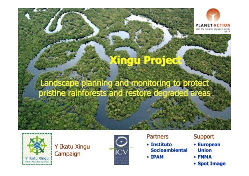
<strong>Xingu</strong> Project<br />
Landscape planning and monitoring to protect<br />
pristine rainforests and restore degraded areas<br />
Y Ikatu <strong>Xingu</strong><br />
Campaign<br />
Partners<br />
• Instituto<br />
Socioambiental<br />
• IPAM<br />
Support<br />
• European<br />
Union<br />
• FNMA<br />
• Spot Image
Bacia do<br />
Rio <strong>Xingu</strong><br />
PARÁ<br />
MATO GROSSO<br />
<strong>Xingu</strong> river basin<br />
51,1 million<br />
hectares
Deforestation rates in the <strong>Xingu</strong> watersheds region<br />
1994<br />
2,38 M ha<br />
2003<br />
4,48 M ha<br />
2005<br />
5,43 M ha
<strong>Xingu</strong> River Headwaters region, Mato Grosso State,<br />
<strong>Brazil</strong>ian Amazonia<br />
<strong>Xingu</strong> River<br />
Headwaters<br />
region:<br />
Area of expansion of<br />
the agricultural<br />
frontier...<br />
250<br />
0 250 km<br />
...threatening climate,<br />
biodiversity and<br />
indigenous livelihoods<br />
<strong>Xingu</strong><br />
Indigenous<br />
Park
Y Ikatu <strong>Xingu</strong> Campaign<br />
“Save the Good Waters of the <strong>Xingu</strong>”<br />
An effort <strong>by</strong> indians, small and large producers, NGOs,<br />
researchers and local leaders to protect and restore the<br />
<strong>Xingu</strong> river’s headwaters and riparian forests<br />
Main lines of action:<br />
• Restoration of degraded riparian forests<br />
– Small and large rural properties<br />
• Participatory landscape planning<br />
– Municipalities and sub-basins<br />
• Support to indigenous people initiatives<br />
– Sustainable economic activities<br />
– Social organization<br />
– Protection and monitoring of boundaries
Participatory landscape planning<br />
Example: Manissauá-Missu River sub-basin<br />
Land use plan to:<br />
• Protect existing<br />
forest remnants<br />
8<br />
9<br />
5<br />
7<br />
6<br />
2<br />
4<br />
3<br />
1<br />
• Consolidate the<br />
use of already<br />
deforested areas<br />
• Restore degraded<br />
riparian forests
Restoration of degraded areas<br />
Example: Marcelândia county<br />
1. Project location<br />
2. Identification of degraded riparian<br />
forest areas for restoration<br />
3. Field diagnosis &<br />
planning<br />
4. Intervention and monitoring<br />
of forest recovery, biomass and<br />
carbon sequestration<br />
Nome da área<br />
Número<br />
Data:<br />
Caracterização:<br />
Hiístórico:<br />
Nível de degradação:<br />
- Vegetação<br />
- Solos<br />
-Banco de sementes<br />
-=> recomendações
Y Ikatu <strong>Xingu</strong> - <strong>Planet</strong> <strong>Action</strong><br />
partnership<br />
SPOT5 10m imagery<br />
to support landscape<br />
diagnosis and<br />
participatory<br />
planning in two<br />
priority sub-basins<br />
SPOT5 2,5m imagery<br />
to support planning<br />
and monitoring of<br />
riparian forest<br />
restoration <strong>project</strong>s<br />
for carbon credits
AMAZON GEO-REFERENCED SOCIO-ENVIRONMENTAL INFORMATION NETWORK<br />
(RAISG)
Different issues and Scales<br />
• Protected Areas<br />
• Rivers and basins<br />
• Deforestation<br />
• Political and administratives limits<br />
• Hydrocarbons<br />
• Infrastructure<br />
• Mining
RAISG<br />
COORDINADOR<br />
Con apoyo de:
Red Amazónica de Información Socioambiental Georreferenciada<br />
WWW.RAISG.SOCIOAMBIENTAL.ORG