monitoring of glacial lake outburst floods (glofs) in chile - Planet Action
monitoring of glacial lake outburst floods (glofs) in chile - Planet Action
monitoring of glacial lake outburst floods (glofs) in chile - Planet Action

Create successful ePaper yourself
Turn your PDF publications into a flip-book with our unique Google optimized e-Paper software.
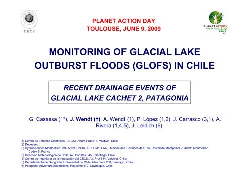
PLANET ACTION DAY<br />
TOULOUSE, JUNE 9, 2009<br />
MONITORING OF GLACIAL LAKE<br />
OUTBURST FLOODS (GLOFS) IN CHILE<br />
RECENT DRAINAGE EVENTS OF<br />
GLACIAL LAKE CACHET 2, PATAGONIA<br />
G. Casassa (1*), J. Wendt (†), A. Wendt (1), P. López (1,2), J. Carrasco (3,1), A.<br />
Rivera (1,4,5), J. Leidich (6)<br />
(1) Centro de Estudios Científicos (CECS), Arturo Prat 514, Valdivia, Chile<br />
(†) Deceased<br />
(2) Hydrosciences Montpellier UMR 5569 (CNRS, IRD, UM1, UM2), Maison des Sciences de l’Eau, Université Montpellier 2, 34095 Montpellier<br />
Cedex 5, France<br />
(3) Dirección Meteorológica de Chile, Av. Portales 3450, Santiago, Chile<br />
(4) Centro de Ingeniería de la Innovación del CECS, Av. Prat 514, Valdivia, Chile<br />
(5) Departamento de Geografía, Universidad de Chile, Marcoleta 250, Santiago, Chile<br />
(6) Patagonia Adventure Expeditions, Riquelme 372, Coyhaique, Chile
PATAGONIA REGION<br />
Rignot et al. (2003)<br />
Holl<strong>in</strong> & Schill<strong>in</strong>g (1981)
GLACIAL LAKE OUTBURST FLOODS (GLOFs) IN<br />
CHILE 2007 - 2009<br />
Lake Cachet 2 (NPI)<br />
April 2008<br />
October 2008<br />
December 2008<br />
March 2009<br />
Lake Témpanos (SPI)<br />
April-May 2007
CECS’<br />
Airborne<br />
Mapp<strong>in</strong>g<br />
System<br />
(CAMS)<br />
• Riegl LMS-Q240<br />
Laser scanner<br />
• INS iMAR iNAV-FMS-<br />
Airsurf<br />
• GPS Javad Lexon<br />
GGD<br />
• Digital SLR Canon<br />
EOS 5D<br />
• CPU Fujitsu-<br />
Siemens Lifebook
DRAINAGE PATH OF LAKE CACHET 2
DIGITAL ELEVATION MODELS
BATHYMETRY OF LAKE CACHET 2<br />
Interpolated bathymetry pr<strong>of</strong>iles<br />
from May & October laser data<br />
Calculated <strong>lake</strong> volume = 0.2 km 3
VERTICAL PHOTO OF COLONIA GLACIER<br />
ACQUIRED WITH CAMS<br />
NOT<br />
ORTHORECTIFIED<br />
ORTHORECTIFIED
LAKE CACHET 2 SHOWING HIGH WATER LEVEL
LAKE CACHET 2 NEARLY EMPTY
LAKE CACHET 2 COMPLETELY EMPTY
NORTHERN SECTION OF LAKE CACHET 2
FRACTURES OF COLONIA GLACIER…
LAKE WATER DRAINAGE UNDER<br />
COLONIA GLACIER
LAKE COLONIA INMEDIATELY AFTER THE FLOOD<br />
OF APRIL 2008
WATER LEVEL AND T° OF BAKER RIVER DURING<br />
GLOF OF 7 APRIL 2008 OF LAKE CACHET 2<br />
Water level (m)<br />
7<br />
6<br />
5<br />
4<br />
3<br />
2<br />
3570 m 3 /s<br />
1200 m 3 /s<br />
1<br />
0<br />
01/04 02/04 03/04 04/04 05/04 06/04 07/04 08/04 09/04 10/04v<br />
14<br />
Water temperature (°C)<br />
12<br />
10<br />
8<br />
6<br />
4<br />
2<br />
4 °C<br />
0<br />
01/04 02/04 03/04 04/04 05/04 06/04 07/04 08/04 09/04 10/04
CONCLUSIONS<br />
• The Lake Cachet 2 <strong>outburst</strong> <strong>floods</strong> are typical <strong>glacial</strong><br />
<strong>lake</strong> <strong>outburst</strong> <strong>floods</strong> (GLOFs), or jökulhlaups produced by<br />
sudden dra<strong>in</strong>age via a sub<strong>glacial</strong> tunnel below Colonia<br />
Glacier.<br />
• The onset <strong>of</strong> dra<strong>in</strong>age is postulated to occur when the<br />
<strong>lake</strong> water level exceeds the ice overburden pressure <strong>of</strong><br />
Glaciar Colonia.<br />
• These are the first reported GLOF events from Lake<br />
Cachet 2, triggered <strong>in</strong>itially by climate warm<strong>in</strong>g. GLOFs at<br />
Lake Cachet 2 should cont<strong>in</strong>ue to occur periodically <strong>in</strong> the<br />
future until the ice th<strong>in</strong>s to such extent that a stable<br />
dra<strong>in</strong>age channel is created, for example at the eastern<br />
glacier marg<strong>in</strong>.
FUTURE WORK<br />
• More precise determ<strong>in</strong>ation <strong>of</strong> Lake Cachet II volume by<br />
means <strong>of</strong> airborne laser data <strong>of</strong> CECS-NASA-Armada<br />
mission <strong>of</strong> 8 October 2008, the same day <strong>of</strong> the GLOF<br />
event, when the <strong>lake</strong> was completely empty.<br />
• Airborne radar for ice thickness determ<strong>in</strong>ation.<br />
• Further water flow modell<strong>in</strong>g <strong>of</strong> the <strong>outburst</strong> flood us<strong>in</strong>g<br />
more precise <strong>lake</strong> and glacier geometry data from<br />
airborne laser and ice radar.<br />
• Deployment <strong>of</strong> <strong>lake</strong> level and river flow sensors, together<br />
with meteorological <strong>in</strong>struments and remote cameras for<br />
<strong>monitor<strong>in</strong>g</strong> and early prediction <strong>of</strong> GLOFs, <strong>in</strong><br />
collaboration with DGA.
Thank you!