NOAA Ship Oscar Elton Sette - Pacific Islands Fisheries Science ...
NOAA Ship Oscar Elton Sette - Pacific Islands Fisheries Science ...
NOAA Ship Oscar Elton Sette - Pacific Islands Fisheries Science ...

You also want an ePaper? Increase the reach of your titles
YUMPU automatically turns print PDFs into web optimized ePapers that Google loves.
U.S. DEPARTMENT OF COMMERCE<br />
National Oceanic and Atmospheric Administration<br />
NATIONAL MARINE FISHERIES SERVICE/<strong>NOAA</strong> FISHERIES<br />
<strong>Pacific</strong> <strong>Islands</strong> <strong>Fisheries</strong> <strong>Science</strong> Center<br />
2570 Dole St. Honolulu, Hawaii 96822-2396<br />
(808) 983-5300 Fax: (808) 983-2902<br />
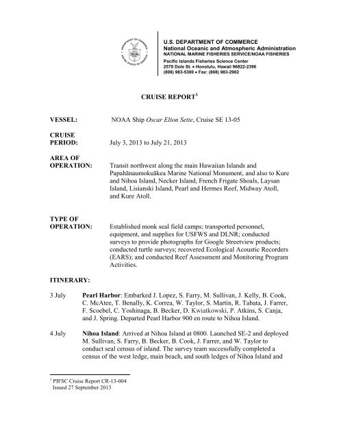
CRUISE REPORT 1<br />
VESSEL: <strong>NOAA</strong> <strong>Ship</strong> <strong>Oscar</strong> <strong>Elton</strong> <strong>Sette</strong>, Cruise SE 13-05<br />
CRUISE<br />
PERIOD: July 3, 2013 to July 21, 2013<br />
AREA OF<br />
OPERATION:<br />
Transit northwest along the main Hawaiian <strong>Islands</strong> and<br />
Papahānaumokuākea Marine National Monument, and also to Kure<br />
and Nihoa Island, Necker Island, French Frigate Shoals, Laysan<br />
Island, Lisianski Island, Pearl and Hermes Reef, Midway Atoll,<br />
and Kure Atoll.<br />
TYPE OF<br />
OPERATION:<br />
Established monk seal field camps; transported personnel,<br />
equipment, and supplies for USFWS and DLNR; conducted<br />
surveys to provide photographs for Google Streetview products;<br />
conducted turtle surveys; recovered Ecological Acoustic Recorders<br />
(EARS); and conducted Reef Assessment and Monitoring Program<br />
Activities.<br />
ITINERARY:<br />
3 July Pearl Harbor: Embarked J. Lopez, S. Farry, M. Sullivan, J. Kelly, B. Cook,<br />
C. McAtee, T. Benally, K. Correa, W. Taylor, S. Martin, R. Tabata, J. Farrer,<br />
F. Scoebel, C. Yoshinaga, B. Becker, D. Kwiatkowski, P. Atkins, S. Canja,<br />
and J. Spring. Departed Pearl Harbor 900 en route to Nihoa Island.<br />
4 July Nihoa Island: Arrived at Nihoa Island at 0800. Launched SE-2 and deployed<br />
M. Sullivan, S. Farry, B. Becker, B. Cook, J. Farrer, and W. Taylor to<br />
conduct seal census of island. The survey team successfully completed a<br />
census of the west ledge, main beach, and south ledges of Nihoa Island and<br />
1 PIFSC Cruise Report CR-13-004<br />
Issued 27 September 2013
tagged two juvenile seals. SE-2 was launched at 1230 to recover the shore<br />
team. The ship departed at 1300 en route to Necker Island.<br />
5 July Necker Island: Arrived at Necker Island at 0800. Launched SE-2 and<br />
deployed B. Becker, J. Farrer, W. Taylor, and C. McAtee to conduct a seal<br />
census of the island. SE-2 circumnavigated Necker and deployed the survey<br />
team on the north ledge and main saddle to conduct a seal survey. The survey<br />
team tagged one weaned pup and completed a successful survey of accessible<br />
sites. The shore team was recovered at 1230 and the ship departed at 1300 en<br />
route to French Frigate Shoals.<br />
6 July French Frigate Shoals: Arrived French Frigate Shoals 0800. Launched SE-6<br />
with Yoshinaga, Tabata, Correa, Benally, and Spring to conduct turtle and<br />
Google imaging survey of East Island. Disembarked Farry, Sullivan, Kelly,<br />
Cook, McAtee, Kwiatkowski, and Atkins. additional ship and scientific<br />
personnel were deployed for the day to help in camp setup. Equipment and<br />
supplies were offloaded using SE-2 and SE-4. The offload included two 17-ft<br />
Boston Whaler boats. Personnel and ship boats were recovered at 1500 and<br />
the ship departed French Frigate Shoals 1600 en route to Laysan Island.<br />
8 July Laysan Island: Arrived Laysan Island 0800. Disembarked Taylor, Becker,<br />
Martin, Tabata and deployed additional ship and scientific personnel to help<br />
with camp setup. Equipment and supplies were offloaded using SE-2 and SE-<br />
4. Correa and Benally conducted a Google imaging survey and Spring<br />
conducted a turtle survey. Boats and personnel were recovered and the ship<br />
departed Laysan Island 1600 en route to Lisianski Island.<br />
9 July Lisianski Island: Arrived Lisianski Island 0800. Canja, Farrer, and Schoebel<br />
conducted a seal survey, Correa and Benally conducted a Google imaging<br />
survey, and Spring conducted a turtle survey. Morioka was embarked and<br />
boats and other personnel were recovered and departed Lisianski Island 1400<br />
and transited to Ecological Acoustic Recorder (EAR) site. After 2 hours of<br />
attempting instrument recovery, it was determined that the EAR was not<br />
releasing and could not be recovered. The ship departed the EAR site at 1600<br />
en route to Pearl and Hermes Reef.<br />
10 July Pearl and Hermes Reef: Arrived Pearl and Hermes Reef 0800.<br />
Disembarked Farrer, Morioka, Schoebel, and Yoshinaga. Additional ship and<br />
scientific personnel were deployed to help with camp setup. Equipment and<br />
supplies were offloaded including one 5-meter inflatable boat, and 5.5 meter<br />
rigid hull inflatable boat, and 8 55-gallon drums of gasoline. Correa and<br />
Benally conducted a Google imaging survey, and Spring conducted a turtle<br />
survey of Southeast Island. Boats and personnel were recovered and the ship<br />
departed at 1700 en route to Midway Atoll.<br />
11 July Midway Atoll: Arrived Midway 0800. CRED gear and 450 gallons of<br />
gasoline were loaded. SE-6 was deployed and Canja and Lopez conducted a<br />
monk seal survey of Eastern Island. SE-6 was recovered and the ship<br />
departed the fuel pier at 1500. At 2200 SE-6 was launched to retrieve<br />
personnel on incoming flight. At 2300 SE-6 was recovered and Gove,<br />
Young, Reardon, Pomeroy, and Siddiqi were embarked.
12 July Kure Atoll: Arrived at Kure Atoll 1200. DLNR supplies were offloaded and<br />
Siddiqi was disembarked. Additional DLNR gear was loaded including<br />
approximately 2500 lbs of marine debris collected by DLNR personnel on<br />
Kure. CRED conducted dive operations using SE-6. All boats were recovered<br />
at 1700. 1800-2200 CRED conducted transect CTD casts.<br />
13 July Kure Atoll: At 0800 SE-4 and SE-6 were launched to conduct CRED dive<br />
operations. At 0930 SE-2 was launched to disembark Lopez and Spring to<br />
Kure to conduct monk seal and turtle surveys. An additional 1500 lbs. of<br />
marine debris was loaded from Kure. At 1200 the ship transited to the EAR<br />
site. It was again determined the EAR was not releasing and could not be<br />
recovered. At 1630 SE-4 and SE-6 and dive teams were recovered.<br />
14 July Kure Atoll: At 0800 SE-4 and SE-6 were launched to conduct dive<br />
operations. At 1000 SE-2 was launched to recover Lopez and Spring. At<br />
1630 SE-4 and SE-6 were recovered. The ship departed at 1700 en route to<br />
Pearl and Hermes Reef.<br />
15 July Pearl and Hermes Reef: Arrived at 0800 and launched SE-6 to conduct<br />
CRED dive operations and SE-4 was launched to embark Yoshinaga. Spring<br />
conducted turtle survey of Southeast Island. At 1400 the ship transited to<br />
EAR site. The PHR EAR was successfully recovered. At 1630 SE-6 was<br />
recovered and the ship departed en route to Lisianski Island.<br />
16 July Lisianski Island: Arrived at 0800 and loaded camp supplies using SE-2 and<br />
SE-4. Wurth and Matsuoka were embarked. Spring conducted turtle survey<br />
of island. At 1400 the ship transited to the EAR site. Again, the EAR could<br />
not be recovered. 1500 departed en route to Laysan Island.<br />
17 July Laysan Island: Arrived 0800 and Launched SE-4 to transport Lopez, Wurth,<br />
Morioka, and Spring to the island. SE-6 was launched to conduct CRED<br />
snorkel instrument recovery operations. Spring conducted turtle survey of<br />
island. At 1200 Becker was embarked and additional scientific personnel<br />
were recovered. At 1230 the ship departed en route to French Frigate Shoals.<br />
18 July Transit day<br />
19 July French Frigate Shoals: Arrived 0630 and launched SE-2 and SE-4 to load<br />
supplies and gear. The ship offloaded six 55-gallon drums of gasoline.<br />
Sullivan, Kwiatkowski, and Atkins embarked. At 1000 the ship transited to<br />
the EAR site. Again EAR recovery was unsuccessful. At 1100 the ship<br />
departed en route to Pearl Harbor.<br />
20 July Transit day<br />
21 July Pearl Harbor. Disembarked Lopez, Sullivan, Yoshinaga, Spring, Becker,<br />
Wurth, Matsuoka, Gove, Young, Reardon, Pomeroy, Kwiatkowski, and<br />
Atkins. End of project.
MISSIONS AND RESULTS:<br />
The main objectives for SE 13-05 were:<br />
1. Deploying monk seal camps and/or day surveys<br />
The ship successfully transported personnel, equipment, and supplies to field<br />
camps at French Frigate Shoals, Laysan Island, and Pearl and Hermes Reef. Day<br />
surveys were conducted to census the monk seal population on Midway Atoll,<br />
Kure Atoll, Necker Island and Nihoa Island. A temporary field camp previously<br />
established at Lisianski Island was picked up during this project.<br />
2. ONMS and USFWS staff successfully completed Google surveys of East Island<br />
and Tern Island at French Frigate Shoals, Laysan Island, Lisianski Island, and<br />
Southeast Island at Pearl and Hermes Reef.<br />
3. The ship supported dive operations for the Northwestern Hawaiian Island Reef<br />
Assessment and Monitoring Program (NWHI RAMP) led by Coral Reef<br />
Ecosystem Division (CRED) of <strong>Pacific</strong> Island <strong>Fisheries</strong> Center. For this portion<br />
of the project, small boats were deployed from <strong>Oscar</strong> <strong>Elton</strong> <strong>Sette</strong> to reach dive<br />
survey sites around Kure Atoll and opportunistically at Pearl and Hermes Reef<br />
and Laysan Island. A team of scuba divers conducted retrieval and deployment of<br />
oceanographic instruments. The 2013 mission supplemented data collected in<br />
previous missions in 2005, 2006, 2007, and 2010.<br />
4.<br />
a. Kure Atoll<br />
At Kure Atoll, five new National Coral Reef Monitoring Program (NCRMP)<br />
long-term monitoring stations (KUR-050 - 054) were established. Stations<br />
were created at the north, south, east, and west sides of the atoll with an<br />
additional 5 th station added to increase CRED’s survey sample number and<br />
improve monitoring resolution. All station locations were selected using a<br />
stratified random method.<br />
Instrumentation:<br />
Subsurface Temperature Recorders (STRs) were installed at depths of 5 m,<br />
15 m, and 25 m at each of the north, south, east, and west NCRMP monitoring<br />
stations for the purpose of monitoring vertical thermal structure of the water<br />
column. Existing STR deployments were maintained to continue long-term<br />
time series data collection wherever possible. One Ecological Acoustic<br />
Recorder (EAR), two Wave and Tide Recorders (WTR) and one Sea Surface<br />
Temperature (SST) buoy were also retrieved. See Table 1 for a detailed list of<br />
instrument activities at Kure Atoll. See Figure 1 for a map of instrument<br />
activity locations at Kure Atoll.
Water Sampling:<br />
Nearshore CTD casts were performed concurrently with surface and near-reef<br />
water samples at each NCRMP monitoring station. Water samples were<br />
collected for Dissolved Inorganic Carbon (DIC), Total Alkalinity (TA), and<br />
salinity analyses. In some cases, chlorophyll-a samples were collected at the<br />
reef level. Water sample efforts were performed as part of CRED’s Ocean<br />
Acidification program with the purpose of investigating long-term variability<br />
in seawater carbonate chemistry associated with climate change. In total, 13<br />
DIC and TA samples, 13 salinity samples and 3 chlorophyll samples were<br />
collected. See Figure 1 for a map of CTD and water sampling locations at<br />
Kure Atoll.<br />
Benthic Surveys, Recoveries, and Installations:<br />
At each NCRMP monitoring station, five Calcification Accretion Units<br />
(CAUs) were installed. These units quantify net calcification rates on reefs<br />
and are part of CRED’s Ocean Acidification monitoring program. In addition,<br />
surveys for topographic benthic complexity and photo quadrat documentation<br />
were conducted at each NCRMP monitoring station. Five existing CRED<br />
Rapid Ecological Assessment (REA) sites (KUR-02, KUR-04, KUR-06,<br />
KUR-12, and KUR-R33) were visited to retrieve existing instrumentation.<br />
Twenty CAUs, 3 Autonomous Reef Monitoring Structures (ARMS;<br />
instrumentation employed to evaluate cryptic benthic biodiversity), and 25<br />
Bio-erosion Blocks (a collaborative project with the Hawaii Institute of<br />
Marine Biology studying reef bio-erosion rates) were recovered from these<br />
existing REA sites. See Table 2 for a summary of benthic survey activities at<br />
Kure Atoll. See Figure 1 for a map of benthic survey locations at Kure Atoll.<br />
b. Pearl and Hermes Reef<br />
Instrumentation:<br />
One Acoustic Doppler Current Profiler (ADCP), 1 SBE37 temperature and<br />
salinity sensor, 1 SST Buoy and 8 STRs were retrieved from Pearl and<br />
Hermes Reef. Select STRs were redeployed to maintain long-term time series<br />
various sites. An STR temperature transect was established on the south side<br />
of Pearl and Hermes Reef with STRs installed at 5 m, 15 m, and 25 m depths.<br />
See Table 1 for a detailed list of instrument related activities at Pearl and<br />
Hermes Reef. See Figure 2 for a map of instrument related activities at Pearl<br />
and Hermes Reef.<br />
c. Laysan Island<br />
Instrumentation<br />
Two STRs were retrieved from Laysan Island. No new instruments were<br />
deployed. Recent fiscal constraints have resulted in Laysan no longer being a<br />
part of CRED’s long-term monitoring efforts in the Northwestern Hawaiian<br />
<strong>Islands</strong>. See Figure 3 for a map of instrument retrievals at Laysan Island.<br />
5. Recovery of 4 Ecological Acoustic Recorders (EARs)<br />
Attempts of retrieval of EARS were conducted at French Frigate Shoals, Lisianski<br />
Island, Pearl and Hermes Reef, and Kure Atoll. At French Frigate Shoals,
Lisianski, and Kure the instrument never released after release codes were sent.<br />
The EAR was successfully recovered from Pearl and Hermes Reef.<br />
6. Marine Turtle Research Program (MTRP) surveys<br />
This survey provided valuable information for assessing where and to what<br />
degree Hawaiian green turtles exhibit nesting activity throughout the<br />
Northwestern Hawaiian <strong>Islands</strong>. Data was collected during 18 site surveys on 12<br />
islands in 8 locations, resulting in the identification of nesting activity on at least<br />
6 islands in 5 locations.<br />
In the absence of the systematic nesting season data collected on East Island,<br />
French Frigate Shoals, this survey provided an abbreviated but valuable look at<br />
nesting activity on the main rookery for green turtles in the Hawaiian<br />
Archipelago. The results of this survey show that most green turtle nesting<br />
activity in the Northwestern Hawaiian <strong>Islands</strong> still occurs at French Frigate<br />
Shoals. Only two islands in French Frigate Shoals were surveyed, but they are the<br />
biggest historical sites on the atoll for nesting Hawaiian green turtles. Based on<br />
the survey techniques used, East and Tern Island are home to 85% or more of all<br />
nesting activity in the Northwestern Hawaiian <strong>Islands</strong>.<br />
The standards and benchmarks set will represent a point of reference for future<br />
surveys, and can be used if repeat conditions do not allow for the normal<br />
systematic nighttime collection of nesting data on East Island. While there are<br />
shortcomings in this method and improvements can definitely be made, this<br />
survey will serve as a valuable baseline for future studies and considerations.<br />
7. All shipboard 500-m CTD and water samples were successfully conducted at<br />
permanent stations along the Hawaiian Archipelago.
Attachments<br />
Figure 1. Project operational area for the <strong>NOAA</strong> <strong>Ship</strong> <strong>Oscar</strong> <strong>Elton</strong> <strong>Sette</strong> cruise SE-13-05.
Figure 2. SE1305 Kure Atoll RAMP Activities.<br />
Figure 3. SE1305 Pearl and Hermes Reef RAMP Activities.
Figure 4. SE1305 Laysan Island RAMP Activities.
Table 1. SE1305 Instrument Deployments and Retrievals.<br />
ADP EAR SBE37 SST-STR STR WTR Total<br />
Kure 1 1 24 2 28<br />
Deployment 15 15<br />
Retrieval 1 1 9 2 13<br />
Laysan 3 2<br />
Retrieval 2 3<br />
Pearl and<br />
Hermes 1 1 1 13 16<br />
Deployment 5 5<br />
Retrieval 1 1 1 8 11<br />
Total 1 1 1 2 39 2 46<br />
Table 2. SE1305 Benthic Bio-Instrumentation and Survey Activities at Kure Atoll.<br />
NCRMP Monitoring Station Existing REA Site<br />
Sites Visited 5 5<br />
Topographic Complexity Surveys<br />
Completed 5 2<br />
Photo Quadrat Surveys Completed 5 2<br />
CAU Retrieved 0 20<br />
CAU Deployed 25 0<br />
ARMS Retrieved 0 3<br />
Bio-erosion Blocks Retrieved 0 25