Wheal Jane Wind Turbine - Partnerships for Renewables
Wheal Jane Wind Turbine - Partnerships for Renewables
Wheal Jane Wind Turbine - Partnerships for Renewables

You also want an ePaper? Increase the reach of your titles
YUMPU automatically turns print PDFs into web optimized ePapers that Google loves.
PFR (<strong>Wheal</strong> <strong>Jane</strong>) Limited<br />
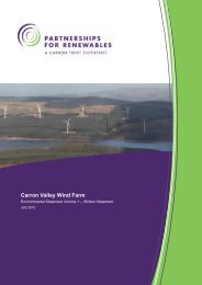
<strong>Wheal</strong> <strong>Jane</strong> <strong>Wind</strong> <strong>Turbine</strong><br />
Environmental Statement<br />
Volume 1 – Written Statement<br />
Station House | 12 Melcombe Place | London | NW1 6JJ<br />
t: +44 (0)207 170 7000 | f: +44 (0)207 170 7020 | e: info@pfr.co.uk<br />
http://www.pfr.co.uk/whealjane<br />
Partnership <strong>for</strong> <strong>Renewables</strong> is a private limited company | Registered in England and Water, number 06526742<br />
Registered at 6th Floor, 5 New Street Square, London EC4A 3BF
<strong>Wheal</strong> <strong>Jane</strong> <strong>Wind</strong> <strong>Turbine</strong><br />
Contents<br />
Volume 1: Written Statement<br />
1 Introduction 2<br />
2 The Environmental Impact Assessment process 7<br />
3 Scheme development and scoping the Environmental Impact<br />
Assessment 19<br />
4 Description of the proposed development 28<br />
5 Planning policy overview 44<br />
6 Climate change mitigation and other atmospheric emissions 52<br />
7 Cultural Heritage 56<br />
8 Ecology 86<br />
9 Ground Conditions 131<br />
10 Landscape and Visual 157<br />
11 Noise 214<br />
12 Ornithology 232<br />
13 Traffic and Transport 267<br />
14 Water Environment 293<br />
15 Shadow Flicker 318<br />
16 Socio-economic and Other Community Effects 333<br />
17 Waste 343<br />
18 Environmental Management Plan 346<br />
19 Annex 355<br />
September 2011<br />
Copyright <strong>Partnerships</strong> <strong>for</strong> <strong>Renewables</strong> Development Co. Ltd 2011 ©<br />
Contents<br />
Volume 1 Written Statement
<strong>Wheal</strong> <strong>Jane</strong> <strong>Wind</strong> <strong>Turbine</strong><br />
Preface<br />
This Environmental Statement (ES) reports the outcome of a <strong>for</strong>mal Environmental Impact Assessment<br />
(EIA) of the proposed <strong>Wheal</strong> <strong>Jane</strong> wind energy development. It has been prepared to accompany a<br />
planning application to Cornwall Council by PFR (<strong>Wheal</strong> <strong>Jane</strong>) Limited PfR to construct and operate a<br />
wind energy development at the <strong>for</strong>mer mine site at <strong>Wheal</strong> <strong>Jane</strong>, near Baldhu in western Cornwall (grid<br />
reference SW772424) (<strong>Wheal</strong> <strong>Jane</strong>, Baldhu, Truro, Cornwall, TR3 6EE) (see Figure1.1). The EIA has<br />
been undertaken by Atkins. Further specialist input came from Sgurr Energy (noise), and a specialist<br />
shadow-flicker consultant, Scott Simpson.<br />
The ES comprises four separately bound parts:<br />
Non-technical summary – summarising the findings of the EIA in non-technical language;<br />
Volume 1: Written Statement – reporting the findings of the EIA;<br />
Volume 2: Figures – the figures to accompany the text; and<br />
Volume 3: Appendices – technical material to support the main text presented in Volume 1.<br />
Volume 1 has annexes to accompany the text including a Glossary of Terms and References.<br />
Printed copies of the non-technical summary and ES (including figures and appendices) may be<br />
obtained from <strong>Partnerships</strong> <strong>for</strong> <strong>Renewables</strong>, 12 Melcombe Place, Station House, London, NW1 6JJ.<br />
The non-technical summary is available free of charge, and a limited number of hard copies of the<br />
environmental statement are available <strong>for</strong> £350 per copy. A limited number of CDs containing PDF files<br />
of the Environmental Statement are available <strong>for</strong> £15 per CD. Alternatively, these electronic files can<br />
be downloaded from our website at http://www.pfr.co.uk/whealjane<br />
Copies of the ES may be consulted at the following locations during normal opening hours:<br />
Council offices, Cornwall Council, Circuit House, Pydar Street, Truro, Cornwall TR1 1DT<br />
September 2011 1 ES Preface<br />
Copyright <strong>Partnerships</strong> <strong>for</strong> <strong>Renewables</strong> Development Co. Ltd 2011 ©
<strong>Wheal</strong> <strong>Jane</strong> <strong>Wind</strong> <strong>Turbine</strong><br />
1 Introduction<br />
1.1 Purpose of this Environmental Statement (ES)<br />
1.1.1 This Environmental Statement (ES) reports the outcome of a <strong>for</strong>mal environmental impact<br />
assessment (EIA) of the proposed <strong>Wheal</strong> <strong>Jane</strong> wind turbine. It has been prepared to<br />
accompany a planning application by PFR (<strong>Wheal</strong> <strong>Jane</strong>) Limited (PfR) to Cornwall Council to<br />
construct and operate a wind energy development at the <strong>Wheal</strong> <strong>Jane</strong> mine site in the Bissoe<br />
Valley, approximately 2 kilometres north-west of Devoran and Carnon Downs in western<br />
Cornwall (<strong>Wheal</strong> <strong>Jane</strong>, Baldhu, Truro, Cornwall, TR3 6EE: grid reference SW772424,<br />
E 1772 N 04243) (see Figure 1.1). A Screening Opinion provided by Cornwall County Council<br />
confirmed that an EIA is required to accompany the planning application under European 1<br />
and UK EIA Regulations 2 . The proposed development falls within Schedule 2 (3) (i) of UK<br />
Regulations and was deemed likely to have significant effects on the environment. A full<br />
description of the EIA process is provided in Chapter 2.<br />
1.1.2 The Environmental Statement provides some of the in<strong>for</strong>mation that will be used by Cornwall<br />
Council and others to in<strong>for</strong>m the process of determining the planning application <strong>for</strong><br />
permission to build and operate the proposed development.<br />
1.1.3 The Environmental Statement comprises four parts:<br />
• Non-Technical Summary: of the findings of the EIA;<br />
• Volume 1: detailing how the EIA process has been applied to this scheme; describing<br />
the proposed development and how it has evolved and reporting the EIA’s findings on<br />
each of the environmental topics identified through the Scoping process;<br />
• Volume 2: figures – the figures to accompany the text in Volume 1; and<br />
• Volume 3: appendices – technical material to support the text presented in Volume 1.<br />
1.1.4 A glossary of terms is included at Annex A.<br />
1.2 Overview of the proposed development<br />
1.2.1 <strong>Partnerships</strong> <strong>for</strong> <strong>Renewables</strong> Development Company Ltd (PfR) was established to facilitate<br />
renewable energy projects on land controlled by public sector bodies. In partnership with<br />
Brownfields Investments Ltd and <strong>Wheal</strong> <strong>Jane</strong> Limited and <strong>Wheal</strong> <strong>Jane</strong> Services Limited, it<br />
has established the viability of a site at <strong>Wheal</strong> <strong>Jane</strong> <strong>for</strong> a wind turbine.<br />
1.2.2 Following a range of technical and environmental investigations and after extensive<br />
consultation, a scheme has been developed <strong>for</strong> planning approval comprising of:<br />
1 The European Directive 85/337/EEC (as amended) on the assessment of the effects of certain public and private projects on<br />
the environment<br />
2 The Town and Country Planning (Environmental Impact Assessment) Regulations 2011.<br />
September 2011 2 ES Chapter 1<br />
Introduction<br />
Copyright <strong>Partnerships</strong> <strong>for</strong> <strong>Renewables</strong> Development Co. Ltd 2011 ©
<strong>Wheal</strong> <strong>Jane</strong> <strong>Wind</strong> <strong>Turbine</strong><br />
1.2.3 The erection, 25 year operation and subsequent decommissioning of a wind energy<br />
development comprised of the following elements: one wind turbine with a maximum overall<br />
height (to vertical blade tip) of up to 122 metres, together with new access track, modification<br />
to road junction, temporary construction compound, hard standing area, control kiosk and<br />
cabling, and other works and development ancillary to the main development.<br />
1.2.4 The proposal briefly comprises the following elements, which are explained in more detail in<br />
Chapter 4. The site layout is shown in Figure 1.2, and the elements are shown in Figures 4.1<br />
to 4.7.<br />
• A wind turbine with a generating capacity of 1.5–2.5 megawatt (MW) and a maximum<br />
height to vertical blade tip of up to 122 m above the ground;<br />
• Crane pads at the turbine position to be used during construction as a crane plat<strong>for</strong>m<br />
and <strong>for</strong> occasional maintenance requirements;<br />
• A control kiosk enabling the generated electricity to be exported to the local distribution<br />
network;<br />
• A new access track that would be reduced in width upon decommissioning;<br />
• Underground cables linking the turbine to the control kiosk; and<br />
• Temporary areas of hard standing to be used <strong>for</strong> construction site and laydown areas.<br />
1.2.5 It is important to note that the works comprising the electrical connection to the grid are not<br />
part of this application, and will the subject of a subsequent submission by the District<br />
Network Operator (DNO), Western Power Distribution.<br />
September 2011 3 ES Chapter 1<br />
Introduction<br />
Copyright <strong>Partnerships</strong> <strong>for</strong> <strong>Renewables</strong> Development Co. Ltd 2011 ©
<strong>Wheal</strong> <strong>Jane</strong> <strong>Wind</strong> <strong>Turbine</strong><br />
1.2.6 The final choice of turbine will depend on which models are available in the UK market. A<br />
number of turbines with an ‘installed capacity’ of between 1.5 and 2.5MW are potentially<br />
suitable – ‘installed capacity’ is the maximum amount of electricity which can be produced at<br />
any one time. The following figures reflect this range in generation potential with the lower<br />
figures being based on a 1.5MW turbine and the higher figures being based on a 2.5MW<br />
turbine. Hence, a wind turbine with a maximum blade tip height of 122m and an installed<br />
capacity of between 1.5 – 2.5MW could generate between 3.28 to 5.47 GWh of renewable<br />
electricity per year. This is equivalent to the amount of electricity used annually by<br />
approximately between 713 to 1189 average households and avoids between 1412 to 2354<br />
tonnes of CO 2 equivalent emissions per year [1] . The methodology underlying these figures is<br />
explained in full in Section 6.3.<br />
1.3 The Applicant – <strong>Partnerships</strong> <strong>for</strong> <strong>Renewables</strong><br />
1.3.1 <strong>Partnerships</strong> <strong>for</strong> <strong>Renewables</strong> (PfR) was set up by the Carbon Trust in 2006 to develop,<br />
construct and operate renewable energy projects primarily on public sector land. The public<br />
sector can play a significant part in the ef<strong>for</strong>t to increase renewables capacity, as public<br />
sector bodies own approximately 10% of the land in the UK (over one million hectares) and<br />
thousands of buildings.<br />
1.3.2 Carbon Trust Enterprises remains PfR’s single largest shareholder with backing from two<br />
major private sector shareholders (the InfraRed Environmental Infrastructure Fund (<strong>for</strong>merly<br />
the HSBC Environmental Infrastructure Fund) and OP Trust, a Canadian public sector<br />
pension fund) enabling PfR to offer these benefits to the public sector without public sector<br />
bodies having to divert resources away from frontline services.<br />
1.3.3 <strong>Partnerships</strong> <strong>for</strong> <strong>Renewables</strong> works primarily in partnership with public sector bodies<br />
throughout the entire development process and covers all development costs. Focused on a<br />
development process tailored to the specific needs of the public sector, <strong>Partnerships</strong> <strong>for</strong><br />
<strong>Renewables</strong> provides a way <strong>for</strong> public sector bodies to access the economic and<br />
environmental benefits associated with renewable energy and contribute towards the fight<br />
against climate change without diverting public sector resources away from frontline services.<br />
[1] [1] The Digest of UK Energy Statistics (2010) gives 2009 domestic electricity consumption as 122,543 gigawatt-hours (GWh)<br />
(http://www.decc.gov.uk/assets/decc/statistics/source/electricity/dukes5_1_2.xls) which, when divided by the number of<br />
households in the UK - 26,625,800 (http://www.decc.gov.uk/assets/decc/statistics/publications/ecuk/269-ecuk-domestic-2010.xls<br />
(table 3.3) - gives an average electricity usage of 4,602 kWh per year per household (122,543,000/26,625,800 = 4,602). Taking<br />
into account the candidate turbine <strong>for</strong> the site, it is expected that a single turbine with an installed capacity of between 1.5 –<br />
2.5MW could generate between 3.285 to 5.475 GWh of renewable electricity per year (based on a capacity factor of 25%).<br />
These figures are derived as follows in the following example (using the 25% capacity factor): 1,500 kW (1 x 1.5 MW turbine) x<br />
8,760 hours/year x 0.25 (capacity factor) = 3,285,000kWh. Based on the 4,602kWh household figure, and the predicted<br />
electricity generation of between 3.285 to 5.475 GWh, it is estimated that the yearly output from the wind turbine will be<br />
equivalent to the approximate domestic electricity needs of between 713 to 1189 average households in Britain<br />
(3,285,000/4602=713). In September 2008, the Advertising Standards Authority endorsed a figure of 430 gCO 2/kWh, based on<br />
the assumption that the energy generated by the wind turbines displaces Combined Cycle Gas <strong>Turbine</strong>s and an average mix<br />
generation (430 gCO 2/kWh). On this basis, and on the assumption that the wind turbines annual output is between 3.285 to<br />
5.475 GWh, a wind energy development of this scale is expected to displace between 1412 to 2354 tonnes of CO 2 equivalent<br />
emissions per year. These figures are derived as follows (using an output of 3.285GWh as an example): 3,285,000 kW (output) x<br />
430gCO 2/kWh/ 1,000,000 = 1,412 tonnes CO 2.<br />
September 2011 4 ES Chapter 1<br />
Introduction<br />
Copyright <strong>Partnerships</strong> <strong>for</strong> <strong>Renewables</strong> Development Co. Ltd 2011 ©
<strong>Wheal</strong> <strong>Jane</strong> <strong>Wind</strong> <strong>Turbine</strong><br />
1.3.4 <strong>Partnerships</strong> <strong>for</strong> <strong>Renewables</strong> is currently working with a variety of public sector bodies across<br />
the UK, including British Waterways, the Forestry Commission Scotland, the Environment<br />
Agency, the Coal Authority, Caerphilly County Borough Council and Clackmannanshire<br />
Council.<br />
1.3.5 Further in<strong>for</strong>mation about <strong>Partnerships</strong> <strong>for</strong> <strong>Renewables</strong> and its public sector partners can be<br />
found at www.pfr.co.uk.<br />
1.3.6 The Environment Agency and Coal Authority brought the site to the attention of PfR due to<br />
their role in the treatment of mine water on the site. However, the land is owned by<br />
Brownfields Investments Ltd and the <strong>Wheal</strong> <strong>Jane</strong> Ltd. The owners have developed the mining<br />
and property related businesses on the site whilst working with the local authorities to secure<br />
an appropriate long term redevelopment and restoration plan <strong>for</strong> the 69 hectare (170 acre)<br />
site.<br />
1.3.7 A Development Framework (Masterplan) <strong>for</strong> the site combines the expansion of the existing<br />
cluster of earth science businesses with a number of renewable energy projects and<br />
extensive land restoration and rehabilitation. This unique post mining project has been<br />
adopted by Cornwall Council and the first elements of the plan have been delivered including<br />
the removal of redundant mining structures and the development of the first commercial solar<br />
PV farm in the South West.<br />
1.4 The Environmental Impact Assessment project team<br />
PFR (<strong>Wheal</strong> <strong>Jane</strong>) Limited<br />
1.4.1 PFR (<strong>Wheal</strong> <strong>Jane</strong>) Limited has managed the project development including:<br />
• Site selection;<br />
• Feasibility;<br />
• Layout design;<br />
• Landowner liaison; and<br />
• Community consultation.<br />
1.4.2 The original feasibility study <strong>for</strong> the site was carried out by Entec <strong>for</strong> PfR.<br />
Atkins Ltd<br />
1.4.3 The EIA has been managed by Atkins Ltd, who also coordinated this ES. Atkins is the UK’s<br />
largest engineering and design consultancy, with the depth and breadth of expertise to<br />
respond to the most technically challenging and time-critical infrastructure projects and the<br />
urgent transition to a low carbon economy. The EIA and ES have been undertaken by<br />
Environmental Impact Assessor Practitioners registered under an accreditation scheme run<br />
by the Institute of Environmental Management and Assessment (IEMA), the principal<br />
professional body <strong>for</strong> EIA in the UK.<br />
September 2011 5 ES Chapter 1<br />
Introduction<br />
Copyright <strong>Partnerships</strong> <strong>for</strong> <strong>Renewables</strong> Development Co. Ltd 2011 ©
<strong>Wheal</strong> <strong>Jane</strong> <strong>Wind</strong> <strong>Turbine</strong><br />
1.4.4 Specialist input was provided by sub-consultants as follows:<br />
Chapter number Chapter title Author<br />
11 Noise Sgurr Energy<br />
15 Shadow flicker Scott Simpson<br />
September 2011 6 ES Chapter 1<br />
Introduction<br />
Copyright <strong>Partnerships</strong> <strong>for</strong> <strong>Renewables</strong> Development Co. Ltd 2011 ©
<strong>Wheal</strong> <strong>Jane</strong> <strong>Wind</strong> <strong>Turbine</strong><br />
2 The Environmental Impact Assessment process<br />
2.1 Environmental Impact Assessment<br />
Overview<br />
2.1.1 Environmental Impact Assessment (EIA) is a systematic procedure that must be followed <strong>for</strong><br />
certain categories of project (see section 2.1.4) be<strong>for</strong>e they can be given development<br />
consent. It aims to assess a project’s likely significant environmental effects. This helps to<br />
ensure that the importance of the predicted effects and the scope <strong>for</strong> reducing them are<br />
properly understood by the public and relevant determining authority be<strong>for</strong>e it makes its<br />
decision.<br />
2.1.2 The in<strong>for</strong>mation on the development and its environmental effects are presented in an ES.<br />
The EIA process that culminates in the submission of the ES has a number of key<br />
characteristics:<br />
• It should be systematic, comprising a sequence of tasks defined both by regulation and<br />
by practice;<br />
• It should be analytical, requiring the application of specialist skills from the<br />
environmental sciences;<br />
• It should be impartial, its objective being to in<strong>for</strong>m decision-making rather than to<br />
promote the project;<br />
• It should be consultative, with provision being made <strong>for</strong> obtaining in<strong>for</strong>mation and<br />
feedback from interested parties including local authorities, members of the public and<br />
statutory and non statutory agencies; and<br />
• It should be iterative, allowing opportunities <strong>for</strong> environmental concerns to be<br />
addressed during the planning and design of a project.<br />
2.1.3 Typically, a number of design iterations take place in response to environmental constraints<br />
identified during the EIA process (in effect, incorporating mitigation measures to avoid,<br />
reduce or compensate <strong>for</strong> identified adverse effects). Some mitigation measures are<br />
embedded into the scheme design, and these are explained in Section 4. Further mitigation<br />
measures are presented in the corresponding environmental topic chapters, and a summary<br />
of these measures is included in the draft Environmental Management Plan (Section 18).<br />
EIA Regulations<br />
2.1.4 Schedule 1 of the EIA Regulations 3 lists those developments <strong>for</strong> which an EIA is mandatory.<br />
Schedule 2 of the EIA Regulations lists developments <strong>for</strong> which the need <strong>for</strong> an EIA is<br />
determined on a case-by-case basis (i.e. if significant environmental effects are likely), whilst<br />
3 The Town and Country Planning (Environmental Impact Assessment) Regulations 2011<br />
September 2011 7 ES Chapter 2<br />
Environmental Impact Assessment Process<br />
Copyright <strong>Partnerships</strong> <strong>for</strong> <strong>Renewables</strong> Development Co. Ltd 2011 ©
<strong>Wheal</strong> <strong>Jane</strong> <strong>Wind</strong> <strong>Turbine</strong><br />
Schedule 3 describes indicative thresholds to be used to determine if a Schedule 2<br />
development is an “EIA development”. Where an EIA is required, environmental in<strong>for</strong>mation<br />
must be provided by the applicant in an ES. Schedule 4 specifies the in<strong>for</strong>mation that must or<br />
may be provided in the ES.<br />
2.1.5 Most wind energy developments fall within Schedule 2 and where the need <strong>for</strong> EIA is not<br />
certain the developer can apply to the determining authority <strong>for</strong> a screening opinion. A<br />
screening exercise was carried out which identified the need <strong>for</strong> an EIA. PfR also recognised<br />
that the EIA process can play an important role in developing the design of the proposals to<br />
minimise adverse environmental effects and to maximise environmental benefits.<br />
2.1.6 While it has been determined that the proposal has the potential <strong>for</strong> significant environmental<br />
effects, this does not mean that a significant effect is the ultimate conclusion of the EIA. The<br />
EIA process identifies the potential <strong>for</strong> adverse effects and then encourages environmental<br />
measures to be incorporated into the design of the development, or the method of<br />
construction and operation that may reduce or eliminate any negative effects or further<br />
enhance positive effects.<br />
Topics to be addressed<br />
2.1.7 Schedule 4 of the Regulations specifies that the ES should describe those “aspects of the<br />
environment likely to be significantly affected by the development, including, in particular<br />
population, fauna, flora, soil, water, air, climatic factors, material assets, including the<br />
architectural and archaeological heritage, landscape and the inter relationship between the<br />
above factors.”<br />
2.1.8 Establishing which aspects of the environment and associated issues are relevant <strong>for</strong> a<br />
particular project is captured in an EIA scoping process. For <strong>Wheal</strong> <strong>Jane</strong>, this is described in<br />
more detail in Chapter 3 of this ES.<br />
The Environmental Impact Assessment scoping process<br />
2.1.9 Scoping is the process of identifying those aspects of the environment and associated issues<br />
that need to be considered when assessing the potential effects of a particular development<br />
proposal. This recognises that there may be some environmental elements where there will<br />
be no significant issues or likely effects resulting from the development and hence where<br />
there is no need <strong>for</strong> further investigation to be undertaken.<br />
2.1.10 Scoping is undertaken through consulting organisations and individuals with an interest in<br />
and knowledge of the site, combined with the professional judgement and experience of the<br />
EIA team. It takes account of published guidance, the effects of the kind of development<br />
under consideration and the nature and importance of the environmental resources that could<br />
be affected.<br />
Spatial scope<br />
2.1.11 In its broadest sense, the spatial scope is the area over which changes to the environment<br />
would occur as a consequence of the development. In practice, an EIA should focus on those<br />
areas where these effects are likely to be significant.<br />
September 2011 8 ES Chapter 2<br />
Environmental Impact Assessment Process<br />
Copyright <strong>Partnerships</strong> <strong>for</strong> <strong>Renewables</strong> Development Co. Ltd 2011 ©
<strong>Wheal</strong> <strong>Jane</strong> <strong>Wind</strong> <strong>Turbine</strong><br />
2.1.12 The spatial scope varies between environmental topic areas. For example, the effect of a<br />
proposed wind energy development on the landscape resource and visual amenity is<br />
generally assessed within a zone of up to 30 km from the site boundary), whilst noise effects<br />
are assessed within a much smaller area encompassing the worst affected properties close<br />
to the site.<br />
Definition of the Baseline<br />
2.1.13 The environmental assessment process does not merely consider the effects of the proposed<br />
scheme against the conditions as they are now, but instead makes the assessment against<br />
what is described as the “Do-minimum” scenario; that is, what could be reasonably expected<br />
to have occurred over the same timescale if the scheme did not go ahead.<br />
2.1.14 The <strong>Wheal</strong> <strong>Jane</strong> Ltd is progressing proposals to develop the <strong>Wheal</strong> <strong>Jane</strong> Masterplan across<br />
the broader site. These proposals seek to deliver a zero carbon sustainable business park at<br />
<strong>Wheal</strong> <strong>Jane</strong>. The Masterplan aims to develop a sustainable earth science business cluster,<br />
incorporating a number of renewable energy schemes including in addition to the wind<br />
turbine, two small-scale hydro-power schemes, ground source geothermal heating, a<br />
biomass power plant and a photovoltaic solar farm. The site is proposed to be self-sufficient<br />
in its energy demands, and will be able to export any surplus power to the National Grid. The<br />
site will also include a number of zero carbon workshops and office buildings. Cornwall<br />
Council has resolved to adopt the Masterplan, which has been subject to local consultation,<br />
as non-statutory planning policy, although planning approval <strong>for</strong> many aspects of the<br />
development has not yet been obtained.<br />
2.1.15 As the key elements of the Masterplan are not likely to be implemented prior to turbine<br />
construction and currently lack planning consent, the implementation of the Masterplan has<br />
not been included within the definition of the baseline <strong>for</strong> the EIA. However, as it is<br />
considered likely that the Masterplan will be developed in future years, the effects of turbine<br />
development on potential future receptors has been considered within the topic chapters of<br />
this ES. The effects have been assessed in a qualitative way. Any future applications <strong>for</strong><br />
development of the Masterplan will need to take into account the turbine proposals.<br />
2.2 Assessment Methodology<br />
2.2.1 Following the identification of the scope of the EIA, individual environmental topics are<br />
subject to survey, investigation and assessment, and individual topic chapters are prepared<br />
<strong>for</strong> the ES. The assessment methodologies are based on recognised good practice and<br />
guidelines specific to each topic area, and details are provided in the appropriate chapter.<br />
2.2.2 In general terms, the technical studies undertaken <strong>for</strong> each topic area and chapter includes:<br />
• Collection and collation of existing baseline in<strong>for</strong>mation about the receiving<br />
environment and original surveys to fill any gaps in knowledge or to update any historic<br />
in<strong>for</strong>mation, along with identification of any relevant trends in, or evolution of, the<br />
baseline;<br />
• Ongoing consultation with experts and relevant consultees in response to emerging<br />
study findings;<br />
September 2011 9 ES Chapter 2<br />
Environmental Impact Assessment Process<br />
Copyright <strong>Partnerships</strong> <strong>for</strong> <strong>Renewables</strong> Development Co. Ltd 2011 ©
<strong>Wheal</strong> <strong>Jane</strong> <strong>Wind</strong> <strong>Turbine</strong><br />
• Consideration of the potential effects of the development on the baseline, followed by<br />
identification of design changes to seek to avoid or reduce any predicted adverse<br />
effects;<br />
• Engagement with other technical topic specialists and engineers/designers in a design<br />
iteration process seeking to optimise the scheme <strong>for</strong> the differing environmental<br />
effects;<br />
• Assessment of the final scheme design and evaluation of the significance of any<br />
residual effects; and<br />
• Compilation of the ES chapter.<br />
2.2.3 In reality, many of the effects are relevant to more than one environmental topic area, and<br />
careful attention has been paid to interrelationships to avoid overlap or duplication between<br />
topic chapters. For example, visual effects including those affecting cultural heritage features<br />
are addressed in the landscape and visual chapter, with cross-references in the cultural<br />
heritage chapter as appropriate. Similarly, secondary effects on ecological resources arising<br />
from hydrological change would be considered in the ecology chapter with a cross-reference<br />
to the relevant direct effect in the water chapter.<br />
2.2.4 The following <strong>for</strong>mat has been adopted <strong>for</strong> the presentation of in<strong>for</strong>mation within the ES. In<br />
some cases, technical data and analysis has been moved to a Technical Appendix that is<br />
bound separately from the main ES.<br />
• Introduction and overview – setting the scene <strong>for</strong> the topic, the nature of the<br />
receptors to be considered, and how the proposals might cause change;<br />
• Methodology – describing how receptors were identified through a scoping process,<br />
along with the specific methods used <strong>for</strong> data gathering, predicting effects and<br />
evaluating significance of effects;<br />
• Baseline in<strong>for</strong>mation – describing the current state and circumstances of the<br />
receptors and changes that might be expected in advance of the development being<br />
implemented and during its 25 year operational lifetime;<br />
• Topic specific design evolution – describing how the scheme has been designed<br />
considering a particular receptor or effect, <strong>for</strong> example incorporating planting to provide<br />
a particular habitat on site or screening <strong>for</strong> a particular view which <strong>for</strong>ms part of the<br />
scheme design;<br />
• Potential significant effects of the scheme prior to mitigation - an assessment of<br />
the significance of the effects likely to arise as a result of implementing the<br />
development as set out in Chapter 4 of the ES;<br />
• Mitigation and enhancement measures – identifying topic specific measures which<br />
would be implemented in order to avoid, reduce, control, manage or compensate<br />
potential significant effects. It is expected these measures would be secured via a<br />
planning condition. These would not include measures required to comply with legal<br />
September 2011 10 ES Chapter 2<br />
Environmental Impact Assessment Process<br />
Copyright <strong>Partnerships</strong> <strong>for</strong> <strong>Renewables</strong> Development Co. Ltd 2011 ©
<strong>Wheal</strong> <strong>Jane</strong> <strong>Wind</strong> <strong>Turbine</strong><br />
requirements, as these are part of the scheme as set out in Chapter 4. Enhancement<br />
measures would also be identified;<br />
• Assessment of residual effects – an assessment of the significance of the effects<br />
likely to arise as a result of implementing the final design of the project after the<br />
mitigation measures have been employed, considering the 25 year operational lifetime<br />
of the project. A table summarising the likely significant environmental effects after<br />
mitigation is presented in this section ;<br />
• Assessment of effects on potential future receptors - identifying any change in the<br />
effects on potential receptors should the site be developed according to the <strong>Wheal</strong><br />
<strong>Jane</strong> Masterplan. As it is possible the development of employment use at the site<br />
doesn’t materialise this is set out separately from in the assessment of effects on the<br />
current baseline;<br />
• Cumulative Effects – identifying potentially significant effects arising from the<br />
proposed project alongside other major developments in the planning process but not<br />
yet built, such as other wind developments; and<br />
• References.<br />
2.3 Defining Significance of Effects<br />
2.3.1 Development proposals affect different environmental elements to differing degrees and not<br />
all of these are of sufficient concern to warrant detailed investigation or assessment within the<br />
EIA process. The EIA Regulations identify those that warrant investigation as those that are<br />
“likely to be significantly affected by the development”.<br />
2.3.2 Conclusions about significance are derived with reference to available in<strong>for</strong>mation about the<br />
project description and the environmental receptors (or ‘receiving environment’), and to<br />
predictions about the potential changes that the proposed development would cause to the<br />
affected receptors.<br />
2.3.3 In each of the environmental topic chapters, professional judgement is used in combination<br />
with relevant guidance to assess the interaction of the receptor’s value (importance or<br />
sensitivity) against the predicted magnitude of change to identify if an effect is significant.<br />
Best practice EIA typically goes beyond this to identify a level of significance when the<br />
predicted effect is determined to be significant. In some cases, the judgement can be guided<br />
by quantitative values, whilst in other cases qualitative descriptions are used.<br />
2.3.4 In general terms, and in order to assist interpretation of the final results of the EIA, receptor<br />
value, magnitude of change and significance of effect <strong>for</strong> each environmental topic are<br />
described consistently throughout the ES, as shown in Table 2.1. A definition of how the<br />
terms are derived <strong>for</strong> each topic is set out in the corresponding chapters. Where this<br />
approach is inappropriate, the relevant explanation and amended descriptions of receptor<br />
importance, magnitude of change and significance of effect are provided.<br />
2.3.5 The approach to assigning significance of effect is derived from a variety of sources including<br />
industry and professional guidance, codes of practice, advice from statutory consultees and<br />
September 2011 11 ES Chapter 2<br />
Environmental Impact Assessment Process<br />
Copyright <strong>Partnerships</strong> <strong>for</strong> <strong>Renewables</strong> Development Co. Ltd 2011 ©
<strong>Wheal</strong> <strong>Jane</strong> <strong>Wind</strong> <strong>Turbine</strong><br />
other stakeholders, as well as expert judgement of the EIA practitioners employed on the<br />
Scheme.<br />
2.3.6 One of three methods to determining the significance of effect is employed depending on the<br />
assessment topic – matrix (as shown in Table 2.1), criteria (as shown in Table 2.2), and<br />
descriptor (as explained at paragraph 2.3.10).<br />
2.3.7 Where sufficient in<strong>for</strong>mation exists to value a receptor and to understand the magnitude of<br />
the impact or change, the assessment methodology often uses a matrix to determine<br />
significance of the effect. In this approach significance of effect in broad terms is determined<br />
by a combination of the value of the receptor being affected and the magnitude of the impact.<br />
This is the case <strong>for</strong> example with ecological and cultural heritage designations which have<br />
clear relative values (e.g. a site designated at a national level is valued more highly than one<br />
that is undesignated or designated at a local level).<br />
2.3.8 Each topic assessment has been carried out using the significance levels and associated<br />
criteria derived from relevant guidance <strong>for</strong> that topic. Where possible topic chapters have<br />
aligned their significance levels to the criteria set out in Tables 2.1 and 2.2 and this is set out<br />
in the methodology section of each assessment topic chapter.<br />
2.3.9 In the absence of a recognised assessment methodology general levels of significance using<br />
criteria defined in DMRB Volume 11 – Environmental Assessment (2009) are frequently<br />
employed (Table 2.2 is based on significance criteria set out in the DMRB). This is the case<br />
<strong>for</strong> example in assessing the significance of effect on the water environment. These levels of<br />
significance apply to both adverse and beneficial effects. In some instances a further<br />
category of ‘no effect’ may be used.<br />
2.3.10 For some topics where it is very difficult to value an asset and/or quantify the magnitude of<br />
the effect (e.g. socio economics) a simple descriptor - beneficial, neutral or adverse is used to<br />
describe the significance of the effect.<br />
2.3.11 In terms of the EIA regulations 4 effects with a significance level of moderate or greater are<br />
generally of the most importance to the decision maker.<br />
2.3.12 In practice, comparison between such very different environmental topic areas and the<br />
associated description of significance of effects should be interpreted cautiously. Any<br />
categorisation such as this should be used as a guide only, and may be moderated by the<br />
professional that undertakes the assessment in accordance with judgement and experience.<br />
In particular, the divisions between categories of receptor importance, magnitude of change<br />
and significance of effect should not be interpreted as definitive, and the lines that represent<br />
the boundaries between categories should be considered as ‘blurred’.<br />
4 Town and Country Planning (Environmental Impact Assessment) Regulations 2011<br />
September 2011 12 ES Chapter 2<br />
Environmental Impact Assessment Process<br />
Copyright <strong>Partnerships</strong> <strong>for</strong> <strong>Renewables</strong> Development Co. Ltd 2011 ©
<strong>Wheal</strong> <strong>Jane</strong> <strong>Wind</strong> <strong>Turbine</strong><br />
Table 2.1<br />
Establishing the significance of effect<br />
Importance of receptor<br />
HIGH MEDIUM LOW NEGLIGIBLE<br />
Magnitude of change/impact<br />
LARGE<br />
MEDIUM<br />
SMALL<br />
NEGLIGIBLE<br />
VERY<br />
SUBSTANTIAL/<br />
SUBSTANTIAL<br />
SUBSTANTIAL/<br />
MODERATE<br />
MODERATE/<br />
SLIGHT<br />
NOT<br />
SIGNIFICANT<br />
SUBSTANTIAL/<br />
MODERATE<br />
MODERATE<br />
SLIGHT<br />
NOT<br />
SIGNIFICANT<br />
MODERATE/<br />
SLIGHT<br />
SLIGHT<br />
SLIGHT/ NOT<br />
SIGNIFICANT<br />
NOT<br />
SIGNIFICANT<br />
NOT<br />
SIGNIFICANT<br />
NOT<br />
SIGNIFICANT<br />
NOT<br />
SIGNIFICANT<br />
NOT<br />
SIGNIFICANT<br />
Table 2.2<br />
Generic Significance Criteria<br />
Significance level<br />
Very substantial<br />
Substantial<br />
Moderate<br />
Slight<br />
Not significant<br />
Criteria<br />
Only adverse effects are assigned this level of importance as they represent key<br />
factors in the decision-making process. These effects are generally, but not<br />
exclusively associated with sites and features of international, national or<br />
regional importance that are likely to suffer a most damaging effect and loss of<br />
resource integrity. A major change at a regional or district scale site or feature<br />
may also enter this category.<br />
These beneficial or adverse effects are likely to be very important considerations<br />
at a local or district scale and, if adverse, are potential concerns to the scheme<br />
and may become material in the decision making process.<br />
These beneficial or adverse effects while important at a local scale are not likely<br />
to be key decision making issues. Nevertheless, the cumulative effect of such<br />
issues may influence decision making if they lead to an increase in the overall<br />
adverse effects on a particular area or on a particular resource.<br />
These beneficial or adverse effects may be raised as local factors but are<br />
unlikely to be of critical importance in the decision making process. Nevertheless<br />
they are of relevance in enhancing the subsequent design of the Scheme and<br />
consideration of mitigation or compensation measures.<br />
No effect or an effect which is beneath the level of perception, within normal<br />
bounds of variation or within the margin of <strong>for</strong>ecasting error. Such effects are not<br />
normally considered by the decision maker.<br />
Type of effect<br />
2.3.13 The EIA Regulations require consideration of a variety of types of effect, namely<br />
direct/indirect, secondary, cumulative, positive/negative, short/medium/long-term, and<br />
permanent/temporary. In this ES, effects are considered in terms of how they arise, their<br />
valency (i.e. whether they are positive or negative) and duration. Each will have a source<br />
originating from the development, a pathway and a receptor.<br />
September 2011 13 ES Chapter 2<br />
Environmental Impact Assessment Process<br />
Copyright <strong>Partnerships</strong> <strong>for</strong> <strong>Renewables</strong> Development Co. Ltd 2011 ©
<strong>Wheal</strong> <strong>Jane</strong> <strong>Wind</strong> <strong>Turbine</strong><br />
2.3.14 Most predicted effects will be obviously positive or negative, and will be described as such.<br />
However, in some cases it is appropriate to identify that the interpretation of a change is a<br />
matter of personal opinion, and such effects will be described as ‘subjective’.<br />
2.3.15 The temporal scope of environmental effects is stated where known. Effects are typically<br />
described as:<br />
• Temporary – these are likely to be related to a particular activity and will cease when<br />
the activity finishes. The terms ‘short-term’ and ‘long-term’ may also be used to provide<br />
a further indication of how long the effect will be experienced; and<br />
• Permanent – this typically means an unrecoverable change.<br />
2.3.16 Effects are generally considered in relation to the following key stages of the development:<br />
• Construction – effects may arise from the construction activities themselves, or from<br />
the temporary occupation of land. Effects are often of limited duration although there is<br />
potential <strong>for</strong> permanent effects. Where construction activities create permanent<br />
change, the effects will obviously continue into the operational period;<br />
• Operation – effects may be permanent, or (as is typical with wind power<br />
developments) they may be temporary, intermittent, or limited to the life of the<br />
development until decommissioning; and<br />
• Decommissioning – effects may arise from the decommissioning activities<br />
themselves, or from the temporary occupation of land. The effects would generally be<br />
temporary and of limited duration and additional permanent change (unless associated<br />
with restoration) would normally be unlikely.<br />
2.4 Consideration of alternatives<br />
2.4.1 The EIA Regulations require the ES to include “an outline of the main alternatives studied by<br />
the applicant or appellant and an indication of the main reasons <strong>for</strong> his choice” 5 .<br />
2.4.2 National planning and energy policy makes it clear that there is no requirement <strong>for</strong> renewable<br />
energy developments to demonstrate an overall need <strong>for</strong> new renewable generation or a<br />
need to be located in a specific location. The Energy Review of 2006 and the White Paper of<br />
2007 both contained a <strong>Renewables</strong> Statement of Need which states: “Renewable energy as<br />
a source of low-carbon, indigenous electricity production is central to reducing emissions and<br />
maintaining the reliability of our energy supplies at a time when indigenous fossil fuels are<br />
declining more rapidly than expected”.<br />
2.4.3 The 2007 Energy White Paper provides further clarification stating at section 5.3.67:<br />
“Recognising the particular difficulties faced by renewables in securing planning<br />
consent, the Government is also:<br />
5 Circular 02/1999 DETR. Annex C, Part 1 (2)<br />
September 2011 14 ES Chapter 2<br />
Environmental Impact Assessment Process<br />
Copyright <strong>Partnerships</strong> <strong>for</strong> <strong>Renewables</strong> Development Co. Ltd 2011 ©
<strong>Wheal</strong> <strong>Jane</strong> <strong>Wind</strong> <strong>Turbine</strong><br />
• Underlining that applicants will no longer have to demonstrate either the<br />
overall need <strong>for</strong> renewable energy or <strong>for</strong> their particular proposal to be<br />
sited in a particular location”<br />
2.4.4 The 2007 planning policy statement PPS1 Supplement on Planning and Climate Change also<br />
emphasises that point, stating in Paragraph 20 that:<br />
“In particular, planning authorities should:<br />
Not require applicants <strong>for</strong> energy developments to demonstrate either the<br />
overall need <strong>for</strong> renewable energy and its distribution, nor question the energy<br />
justification <strong>for</strong> why a proposal <strong>for</strong> such development must be sited in a<br />
particular location…”<br />
2.4.5 The planning policy statement PPS22 supports the approach that wind turbine should be<br />
developed wherever commercially and environmentally acceptable, i.e. the requirement is<br />
only to demonstrate that this is a suitable site rather than that it is the highest ranked in any<br />
<strong>for</strong>m of sequential testing.<br />
2.4.6 This policy has been reiterated in the 2011 National Policy Statements on Energy<br />
infrastructure EN-1 and EN-3. EN–1 at para. 4.4.1–4.4.3 states:<br />
“From a policy perspective this NPS does not contain any general requirement<br />
to consider alternatives or to establish whether the proposed project represents<br />
the best option….should not reject an application <strong>for</strong> development on one site<br />
simply because fewer adverse impacts would result from developing similar<br />
infrastructure on another suitable site, and it should have regard as appropriate<br />
to the possibility that all suitable sites <strong>for</strong> energy infrastructure of the type<br />
proposed may be needed <strong>for</strong> future proposals…”<br />
2.4.7 EN–3 at para. 2.5.36 states:<br />
As most renewable energy resources can only be developed where the<br />
resource exists and where economically feasible, the IPC should not use a<br />
sequential approach in the consideration of renewable energy projects (<strong>for</strong><br />
example, by giving priority to the re-use of previously developed land <strong>for</strong><br />
renewable technology developments).<br />
2.4.8 This is also reflected in the a 2010 Consultation draft PPS1 supplement: Planning <strong>for</strong> a Low<br />
Carbon Future in a Changing Climate (reviewing and consolidating PPS1 Supplement:<br />
Planning and Climate Change and PPS22: Renewable Energy). At Part 1 para. 17 it states<br />
that:<br />
The draft PPS ...underlines that, depending on their scale and impact,<br />
renewable and low carbon energy developments should be capable of being<br />
accommodated in most locations.<br />
2.4.9 At para. LCF14.2 iv it states that LPAs should:<br />
expect developers of decentralised energy to support the local planning<br />
September 2011 15 ES Chapter 2<br />
Environmental Impact Assessment Process<br />
Copyright <strong>Partnerships</strong> <strong>for</strong> <strong>Renewables</strong> Development Co. Ltd 2011 ©
<strong>Wheal</strong> <strong>Jane</strong> <strong>Wind</strong> <strong>Turbine</strong><br />
approach <strong>for</strong> renewable and low-carbon energy set out in the local development<br />
framework and, if not, provide compelling reasons consistent with this PPS to<br />
justify the departure; but, otherwise, not question the energy justification <strong>for</strong> why<br />
a proposal <strong>for</strong> renewable and low carbon energy must be sited in a particular<br />
location;<br />
2.4.10 The clear policy context is there<strong>for</strong>e that there is neither a requirement to justify the viability of<br />
a wind energy proposal nor the need <strong>for</strong> it to be located in a particular location. Nevertheless,<br />
the Scheme Development chapter of this ES (Chapter 3) does describe the site identification<br />
process and design criteria. In EIA terms, the requirement is only to report on alternatives<br />
that have been considered. The examination of alternatives in this ES is there<strong>for</strong>e restricted<br />
as appropriate to alternative design solutions that were considered <strong>for</strong> the site in question in<br />
terms of factors such as site layout/design/turbine height and turbine numbers, and the<br />
environmental effects of the options considered.<br />
2.5 Micro-siting<br />
2.5.1 Following submission of the application, elements of the proposed development may be<br />
subject to further, minor refinement, known as ‘micro-siting’, within the site boundary. Micrositing<br />
reflects the need to:<br />
• take into account statutory and non-statutory consultee responses received during the<br />
planning application determination process;<br />
• Reflect the findings of post-application and post-consent ground investigations; and<br />
• Reflect any minor relocation required <strong>for</strong> ecological or archaeological reasons.<br />
2.5.2 In permitting a micro-siting allowance it is important to note that no development will be<br />
undertaken that would increase the potential level of effect on sensitive receptors and other<br />
constraints identified in this Environmental Statement. For example, the stand-off distances<br />
identified on the Figures within Chapter 3 would be maintained.<br />
2.5.3 Should Cornwall Council be minded to grant consent <strong>for</strong> the development, the applicant<br />
respectfully requests a planning condition that, subject to the prior written approval of the<br />
authority, allows the micro-siting of elements of the scheme within a 20 m radius due east of<br />
the current turbine location: the turbine will not be moved any further due west due to the<br />
tailing dam wall. The other ancillary components of the scheme will be subject to a<br />
micrositing distance of 20 m in common with other, similar planning applications, without<br />
infringing the buffers used in the constraints mapping process shown on Figure 3.1.<br />
2.6 Cumulative effects<br />
2.6.1 According to the Guidelines <strong>for</strong> Cumulative Effects Assessment prepared <strong>for</strong> the EC by Hyder<br />
in 1999, cumulative effects are defined as “impacts that result from incremental changes<br />
caused by other past, present, or reasonably <strong>for</strong>eseeable actions together with the project”.<br />
September 2011 16 ES Chapter 2<br />
Environmental Impact Assessment Process<br />
Copyright <strong>Partnerships</strong> <strong>for</strong> <strong>Renewables</strong> Development Co. Ltd 2011 ©
<strong>Wheal</strong> <strong>Jane</strong> <strong>Wind</strong> <strong>Turbine</strong><br />
2.6.2 The Scoping Opinion advises that major developments that should be considered <strong>for</strong> the<br />
cumulative effects assessment should be identified within the following categories:<br />
• Built and operational development;<br />
• Development under construction;<br />
• Application(s) permitted but which are not yet implemented;<br />
• Submitted applications not yet determined, and which, if permitted, would affect the<br />
proposed development in the scoping request; and<br />
• Development identified in the adopted and emerging development plan (with<br />
appropriate weight being given as they move closer to adoption) recognising that much<br />
in<strong>for</strong>mation on any relevant proposals will be limited.<br />
2.6.3 It should be noted that not all of the cumulative developments would necessarily have a<br />
cumulative effect in respect on any particular assessment topic. Where cumulative effects are<br />
potentially relevant, each assessment topic chapter has determined which of the<br />
developments listed should be considered.<br />
2.7 De-commissioning<br />
2.7.1 The turbine would have an operational life of approximately 25 years. Decommissioning<br />
would be carried out in accordance with legislative requirements at that time. However, if<br />
market conditions at that time indicate that it would be appropriate to extend the life of the<br />
wind turbine, then decommissioning would be deferred to a later date. The extension of the<br />
life of the wind turbine beyond 25 years will require a fresh planning application.<br />
2.7.2 Decommissioning in 2037 or later is not an event that can be accurately assessed at this time<br />
due to changes in policy, legislation and technology. The assessment of the<br />
decommissioning phase there<strong>for</strong>e is limited to how the design of the Scheme and use of<br />
materials would enable a minimum of disruption to be achieved and the restoration of the site<br />
to its <strong>for</strong>mer use. The predicted effects from the decommissioning phase are likely to be<br />
similar to those likely during construction and this is the approach taken by the topic chapters.<br />
2.8 EIA Assumptions<br />
2.8.1 The following assumptions have been made in undertaking the EIA:<br />
i. All legislative requirements would be met.<br />
ii.<br />
The design, construction, operation and decommissioning of the wind turbine will be in<br />
accordance with the description given in Chapter 4.<br />
iii.<br />
The potential environmental effects of the construction phase will be controlled through<br />
a Code of Construction Practice (CoCP) as referred to in Chapter 4, the draft details of<br />
which are included in Chapter 16 Environmental Management Plan. A Construction<br />
September 2011 17 ES Chapter 2<br />
Environmental Impact Assessment Process<br />
Copyright <strong>Partnerships</strong> <strong>for</strong> <strong>Renewables</strong> Development Co. Ltd 2011 ©
<strong>Wheal</strong> <strong>Jane</strong> <strong>Wind</strong> <strong>Turbine</strong><br />
Environmental Management Plan (CEMP) and Site Waste Management Plan (SWMP)<br />
would be prepared prior to commencement of construction. The details of these three<br />
documents would be agreed with Cornwall Council prior to construction commencing.<br />
2.8.2 Where further assumptions have been made <strong>for</strong> individual topic assessments these will be<br />
identified within the relevant topic chapters.<br />
2.9 References<br />
DCLG, 2006. Amended Circular on Environmental Impact Assessment: A Consultation Paper.<br />
DCLG, 2006. Environmental Impact Assessment: A guide to good practice and procedures: A<br />
Consultation Paper.<br />
DoE, 1995. Preparation of Environmental Statements <strong>for</strong> Planning Projects that require Environmental<br />
Assessment.<br />
Environment Agency, 2002. Handbook <strong>for</strong> Scoping Projects.<br />
European Directive 85/337/EEC on the assessment of the effects of certain public and private projects<br />
on the environment, as amended by Directive 97/11/EC and Directive 2003/35/EC.<br />
IEMA, 2004, Guidelines <strong>for</strong> Environmental Impact Assessment.<br />
ODPM, 1999. Circular 02/99: Environmental impact assessment<br />
ODPM, 1999. The Town and Country Planning (Environmental Impact Assessment) (England and<br />
Wales) Regulations 1999 (S.I. 1999 No. 293) as amended<br />
ODPM, 2011. The Town and Country Planning (Environmental Impact Assessment) Regulations 2011<br />
(the EIA Regulations).<br />
ODPM, 2000. Environmental Impact Assessment: A guide to procedures.<br />
September 2011 18 ES Chapter 2<br />
Environmental Impact Assessment Process<br />
Copyright <strong>Partnerships</strong> <strong>for</strong> <strong>Renewables</strong> Development Co. Ltd 2011 ©
<strong>Wheal</strong> <strong>Jane</strong> <strong>Wind</strong> <strong>Turbine</strong><br />
3 Scheme development and scoping the Environmental<br />
Impact Assessment<br />
3.1 Site identification<br />
3.1.1 The EIA process started in May 2009 when PfR began investigating the feasibility of locating<br />
a wind energy development on the <strong>Wheal</strong> <strong>Jane</strong> site. The initial site screening identified the<br />
site as having good potential to support a wind energy development and was progressed to a<br />
more detailed feasibility study that included a site visit, technical consultations, assessment of<br />
grid connection and access options, energy yield analysis, preliminary noise modelling and a<br />
planning policy review. This feasibility study indicated that the site was potentially technically,<br />
environmentally and financially viable <strong>for</strong> a wind energy development, but that further<br />
assessment and clarification was needed.<br />
3.2 Design Criteria<br />
3.2.1 The design solution <strong>for</strong> a site crosses all development phases and is based on the<br />
considered application of the following technical, economic and environmental criteria across<br />
all development phases as more in<strong>for</strong>mation becomes available:<br />
• Suitable ground <strong>for</strong> turbine foundations, access tracks and control kiosk;<br />
• Siting of turbine to take into consideration landscape character and visual effects;<br />
• Minimise effects on the existing land uses (economic or recreational);<br />
• Avoid designated sites, known bat flight paths and activity areas and minimise effects<br />
on areas of ecological value such as hedgerows;<br />
• Avoid designated sites of archaeological importance and minimise effects on areas of<br />
undesignated archaeological interest and areas with archaeological potential;<br />
• Avoid surface and groundwater resources and minimise indirect effects on these<br />
features;<br />
• Utilise existing access and minimise lengths of new access tracks to reduce effects<br />
and material requirements;<br />
• Protect the amenity of residential properties i.e. in terms of noise and visual intrusion<br />
• Avoid impinging on aviation safety; and<br />
• Avoid interference with telecommunication links.<br />
September 2011 19 ES Chapter 3<br />
Scheme Development & Scoping the EIA<br />
Copyright <strong>Partnerships</strong> <strong>for</strong> <strong>Renewables</strong> Development Co. Ltd 2011 ©
<strong>Wheal</strong> <strong>Jane</strong> <strong>Wind</strong> <strong>Turbine</strong><br />
3.3 Screening under the EIA Regulations<br />
3.3.1 The proposed wind turbine at the <strong>Wheal</strong> <strong>Jane</strong> site was tested against the Schedules in the<br />
EIA Regulations. The proposed wind energy development does not fall into any of the<br />
categories set out in Schedule 1. However, Schedule 2, section 3 (energy industry projects),<br />
includes ‘installations <strong>for</strong> the harnessing of wind power <strong>for</strong> energy production (wind farms)’.<br />
3.3.2 Investigations showed that the site does not lie within any internationally or nationally<br />
designated areas (SSSIs, National Parks, AONBs, SAMs etc), though it is adjacent to the<br />
Cornwall and West Devon Mining Landscape World Heritage Site.<br />
3.3.3 The proposals were tested against the applicable threshold set out in Schedule 2. The<br />
threshold is set at either ‘the development involves the installation of more than 2 turbine or<br />
the hub height of any turbine is or the height of any other structure exceeds 15 metres’. In<br />
this case, one turbine is proposed with a hub height of approximately 80 metres, so the<br />
project falls within Schedule 2. Schedule 2 projects require EIA if they are likely to have<br />
significant effects on the environment.<br />
3.3.4 The <strong>for</strong>mal screening opinion adopted by Cornwall Council in May 2010 is that the<br />
development proposed is considered to be an EIA Development within the meaning of the<br />
EIA Regulations. The decision is based on the in<strong>for</strong>mation known at the time and selection<br />
criteria <strong>for</strong> screening schedule 2 development (Schedule 3) and paragraph A11 of circular<br />
02/99 (Environmental Impact Assessment).<br />
3.4 Scope of the EIA<br />
3.4.1 The proposed EIA scope was <strong>for</strong>mulated by <strong>Partnerships</strong> <strong>for</strong> <strong>Renewables</strong>, Atkins consultants<br />
and specialists inputs, based on desk-based and field-based knowledge of the site and prior<br />
experience of other wind energy development EIAs. A Scoping Report, setting out the<br />
proposed scope, was prepared by PfR and submitted to Cornwall Council in March 2010 (see<br />
Appendix 3.1) together with a request <strong>for</strong> a Scoping Opinion.<br />
3.4.2 Following consultation with Cornwall Council, it was agreed that the following should be<br />
considered further in the assessment. Each of these topics is covered in the following chapter<br />
of the Environmental Statement:<br />
• Air and climate – Climate change mitigation and other atmospheric emissions<br />
Chapter 6;<br />
• Cultural heritage – Chapter 7;<br />
• Ecology – Chapter 8;<br />
• Ground conditions and water environment – Chapter 9;<br />
• Landscape and visual changes – Chapter 10;<br />
• Noise – Chapter 11;<br />
September 2011 20 ES Chapter 3<br />
Scheme Development & Scoping the EIA<br />
Copyright <strong>Partnerships</strong> <strong>for</strong> <strong>Renewables</strong> Development Co. Ltd 2011 ©
<strong>Wheal</strong> <strong>Jane</strong> <strong>Wind</strong> <strong>Turbine</strong><br />
• Ornithology – Chapter 12;<br />
• Traffic and transport – Chapter 13;<br />
• Water Environment – Chapter 14;<br />
• Shadow Flicker – Chapter 15;<br />
• Community economics and social effects – Chapter 16; and<br />
• Waste – Chapter 17.<br />
The scoping opinion<br />
3.4.3 Cornwall Council issued its Scoping Opinion in July 2010. The responses from the following<br />
consultees were included:<br />
• Cornwall Council Highway Authority;<br />
• Cornwall Council Principal Landscape officer;<br />
• Cornwall Council Historic Environment Services;<br />
• Cornwall Council Acoustics Advisor;<br />
• Cornwall Council Mineral Local Plan Team;<br />
• Cornwall AONB Unit;<br />
• Environment Agency; and<br />
• Natural England.<br />
3.4.4 A copy of scoping responses received from consultees, and the Cornwall Council scoping<br />
opinion letter can be found at Appendix 3.1 (tabulated at the end of the document) Appendix<br />
and 3.2 respectively.<br />
The agreed scope of the EIA<br />
3.4.5 The way in which the Scoping Opinion and responses from the above consultees have been<br />
addressed in the Environmental Statement is set out in Table 3.1 below, along other<br />
consultees contacted. The relationship of these issues to the requirements of the EIA<br />
Regulations is also shown. Note that PfR has concluded that aviation, telecommunications<br />
and electromagnetism matters are technical rather than environmental issues and are<br />
addressed within the Planning Statement which <strong>for</strong>ms part of the planning application <strong>for</strong> the<br />
scheme.<br />
September 2011 21 ES Chapter 3<br />
Scheme Development & Scoping the EIA<br />
Copyright <strong>Partnerships</strong> <strong>for</strong> <strong>Renewables</strong> Development Co. Ltd 2011 ©
<strong>Wheal</strong> <strong>Jane</strong> <strong>Wind</strong> <strong>Turbine</strong><br />
Table 3.1<br />
Consultation<br />
Consultees Consulted During Scoping<br />
Consultee<br />
Key Issue<br />
Topics in the EIA<br />
Regulations<br />
How Addressed in<br />
Environmental Statement<br />
Cornwall<br />
Council<br />
Potential impacts on users of Public Rights of Way<br />
and other recreational activities in the area<br />
including nearby areas of open access land should<br />
be assessed<br />
Population<br />
These issues have been<br />
covered where necessary in<br />
specific chapters: Chapter 10<br />
Landscape and Visual, Chapter<br />
11 Noise, and Chapter 16<br />
Socio-economic factors.<br />
Detailed evaluation of the potential impacts on<br />
protected species and other species of<br />
conservation importance will be required.<br />
Natural<br />
England<br />
In respect to bats, the current Natural England<br />
guidance (Technical Note 051 Bats and onshore<br />
wind turbines and Technical Note 059 Bats and<br />
single large wind turbines) should be considered.<br />
Fauna<br />
These issues have been<br />
covered where necessary in<br />
Chapters 12 Ornithology and<br />
Chapter 8 Ecology<br />
In respect to birds, the current NE guidance<br />
(Technical Note 069 Assessing the effects of<br />
onshore wind farms on birds) should be<br />
considered.<br />
Natural<br />
England<br />
In respect to landscape impacts, the importance of<br />
thoroughly evaluating impacts on the AONB needs<br />
to be demonstrated.<br />
Landscape<br />
These issues have been<br />
covered where necessary in<br />
Chapter 10 Landscape and<br />
Visual<br />
Natural<br />
England<br />
Importance of identifying opportunities <strong>for</strong><br />
enhancement and adding to biodiversity interests,<br />
in accordance with PPS9 ‘Biodiversity & Geological<br />
conservation’ and <strong>for</strong> opportunities to contribute<br />
towards targets <strong>for</strong> UK BAP Habitats and/or<br />
Species.<br />
Fauna and Flora<br />
Opportunities <strong>for</strong><br />
enhancements where<br />
necessary have been covered<br />
in Chapter 12 Ornithology<br />
Cornwall<br />
Council<br />
Mineral Local<br />
Plan Team<br />
The proposed development lies to the south of the<br />
safeguarding areas <strong>for</strong> Clemows shaft and Shaft<br />
No. 2.<br />
Soil<br />
This has been noted in the ES<br />
Cornwall<br />
Council<br />
The ES should include a geophysical survey to<br />
in<strong>for</strong>m the scheme of mitigation<br />
Architectural and<br />
archaeological<br />
heritage, soil,<br />
water<br />
Further consultation negated<br />
the need <strong>for</strong> a geophysical<br />
survey<br />
Environment<br />
Agency<br />
Potential impacts on groundwater (both quality and<br />
resource/flow implications), and its relationship<br />
with surface water, should be included in the ES.<br />
Water<br />
Potential effects on<br />
groundwater (both quality and<br />
resource/flow implications), and<br />
its relationship with surface<br />
water have been added to the<br />
scope and included in the ES,<br />
in Chapter 9 Ground<br />
Conditions and 14 Water<br />
Environment.<br />
September 2011 22 ES Chapter 3<br />
Scheme Development & Scoping the EIA<br />
Copyright <strong>Partnerships</strong> <strong>for</strong> <strong>Renewables</strong> Development Co. Ltd 2011 ©
<strong>Wheal</strong> <strong>Jane</strong> <strong>Wind</strong> <strong>Turbine</strong><br />
Consultees Consulted During Scoping<br />
Consultee<br />
Key Issue<br />
Topics in the EIA<br />
Regulations<br />
How Addressed in<br />
Environmental Statement<br />
Cornwall<br />
AONB Unit<br />
Not in a position to comment as the project is<br />
assessed as being neither a major nor significant<br />
application. However, the project will need to take<br />
into account the national, regional and local<br />
planning guidance in respect to AONBs.<br />
Landscape<br />
This has been noted in the<br />
statements<br />
The prediction of wind turbine noise will need to<br />
use an appropriate noise prediction framework,<br />
e.g. what is provided in ISO 9613.<br />
Cornwall<br />
Council<br />
Acoustics<br />
Advisor<br />
If the project can fully demonstrate that the noise<br />
levels from the turbine will be less than 35 dB LA90<br />
at all noise sensitive receptors, then a full noise<br />
survey and assessment can be argued to not be<br />
required.<br />
Meteorological in<strong>for</strong>mation should be captured<br />
whilst undertaking noise surveys as well as<br />
undertaking the surveys under a range of wind<br />
speeds.<br />
Population<br />
These issues have been<br />
covered where necessary in<br />
Chapter 11 Noise<br />
The effect of the wind turbine at <strong>Wheal</strong> <strong>Jane</strong><br />
should considered the cumulative impacs with<br />
other existing or consented wind farm within the<br />
area.<br />
The archaeological desk based assessment of<br />
monuments and their settings need to be in<br />
accordance with the appropriate standards.<br />
Cornwall<br />
Council<br />
Historic<br />
Environmenta<br />
l Services<br />
Assessment in respect to heritage assets should<br />
clearly identify the direct and indirect impacts, as<br />
well as highlighting the significance of the heritage<br />
asset.<br />
Consideration of undesignated sites listed on the<br />
Historic Environment Register (as well as schedule<br />
monuments and listed buildings) should be<br />
considered. The assessment should also consider<br />
the development of the Outstanding Universal<br />
Value’ of the Devon and Cornwall World heritage<br />
site.<br />
Architectural and<br />
archaeological<br />
heritage<br />
These issues have been<br />
covered where necessary in<br />
Chapter 9 Cultural Heritage<br />
Cornwall<br />
Council<br />
Principal<br />
Landscape<br />
Officer<br />
Critical assessment, <strong>for</strong> both day and night time<br />
periods, in respect to the site layout, impact of the<br />
turbine, construction plant and activities (including<br />
lighting) will be required.<br />
Photomontage illustrations from public advantage<br />
points and an assessment of visual influence on<br />
the wider settings will be required.<br />
The landscape institute and IEMA guidance should<br />
be followed <strong>for</strong> the assessment.<br />
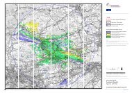
Landscape<br />
The assessment has<br />
considered significantly<br />
affected receptors using the<br />
ZTV and a combination of<br />
value of receptor and predicted<br />
magnitude of change in<br />
Chapter 7 Cultural Heritage<br />
and Chapter 10 Landscape and<br />
Visual.<br />
The assessment on the scale of the turbine need<br />
to include the impact on the Landscape Character.<br />
September 2011 23 ES Chapter 3<br />
Scheme Development & Scoping the EIA<br />
Copyright <strong>Partnerships</strong> <strong>for</strong> <strong>Renewables</strong> Development Co. Ltd 2011 ©
<strong>Wheal</strong> <strong>Jane</strong> <strong>Wind</strong> <strong>Turbine</strong><br />
Consultees Consulted During Scoping<br />
Consultee<br />
Key Issue<br />
Topics in the EIA<br />
Regulations<br />
How Addressed in<br />
Environmental Statement<br />
Cornwall<br />
Council<br />
Policies that <strong>for</strong>m the overall context <strong>for</strong> a decision<br />
on the proposal should be described<br />
All<br />
An overview of planning policy<br />
has been provided in the ES,<br />
the detailed analysis referred to<br />
here has been provided in the<br />
Planning Statement<br />
Cornwall<br />
Council<br />
Applicants should demonstrate in the ES that<br />
alternative options have been considered prior to<br />
proceeding with the current proposals, which<br />
should include a consideration of the ‘do nothing’<br />
option.<br />
Consideration of<br />
alternatives<br />
The ES describes the site<br />
selection process and<br />
alternatives that have been<br />
considered <strong>for</strong> the proposals<br />
(see Section 3)<br />
Cornwall<br />
Council<br />
The ES should evaluate the cumulative impact of<br />
the proposed development with existing and known<br />
proposed wind turbine schemes on this LCA and<br />
neighbouring LCAs, and other major developments<br />
in the surrounding area.<br />
Landscape<br />
PfR has agreed cumulative<br />
schemes with Cornwall<br />
Council.<br />
Other Stakeholders Consulted During the Development Process<br />
BT, Civil Aviation Authority, Licensed/unlicensed aerodromes, Ministry of Defence, NATS/NERL, Office of Communications<br />
(Ofcom), Western Power Distribution, JRC, Orange, Network Rail, Arqiva, T-Mobile and Devon and Cornwall police.<br />
Details of consultation with these bodes is included in the Statement of Community Involvement and Planning Statement.<br />
3.5 Scheme development<br />
Site design evolution and consideration of alternatives<br />
3.5.1 Following the feasibility study described above, PfR undertook a broadly sequential, threestage<br />
design process to investigate and resolve/avoid the key risks to the development of the<br />
site, investigate alternative designs solutions, and address any potentially significant<br />
environmental effects in a structured manner. The purpose of this process was to identify any<br />
irresolvable issues which would make the site inappropriate <strong>for</strong> development and ensure that<br />
the final design was economically and technically viable. The exact scope and order of task<br />
investigation in the different stages was determined using professional judgement and<br />
experience taking account of the site’s unique combination of technical and environmental<br />
factors.<br />
3.5.2 The main design changes resulting from the consultation and design process are<br />
summarised below with reasons <strong>for</strong> the change. The size and location of the turbine, access<br />
tracks and other site infrastructure is considered to be the ‘best environmental fit’ in relation<br />
to the identified environmental constraints and available land (see proposed layout at Figure<br />
1.2).<br />
Initial design<br />
3.5.3 A preliminary layout was prepared during feasibility studies in April 2009. The initial layout of<br />
a wind energy development based on one 2–3 MW turbine of up to 125 m tip height was<br />
published <strong>for</strong> consultation as part of the EIA scoping report in March 2010. This preliminary<br />
layout is shown on Figure 3.1. It was based primarily on technical requirements such as<br />
September 2011 24 ES Chapter 3<br />
Scheme Development & Scoping the EIA<br />
Copyright <strong>Partnerships</strong> <strong>for</strong> <strong>Renewables</strong> Development Co. Ltd 2011 ©
<strong>Wheal</strong> <strong>Jane</strong> <strong>Wind</strong> <strong>Turbine</strong><br />
topography and wind resource, but also to an extent on preliminary environmental constraints<br />
known at the time, mainly identified from desk-based published sources. Access routes were<br />
considered and evaluated.<br />
3.5.4 Contact was made with the National Air Traffic Service (NATS), Civil Aviation Authority<br />
(CAA), Airports and the Ministry of Defence (MoD) and OFCOM. At this stage, PfR concluded<br />
that aviation; telecommunications and electromagnetism matters were technical rather than<br />
environmental issues and would be addressed in the Planning Statement that <strong>for</strong>ms part of<br />
the planning application.<br />
3.5.5 Two overhead power lines also cross near the turbine. The initial design located the<br />
proposed turbine 65 m from these overhead lines. It was realised that the lines will need to be<br />
replaced with underground cable, and the applicant is in discussion with the District Network<br />
Operator regarding this.<br />
3.5.6 The constraints discussed above are shown on Figure 3.1.<br />
Final design<br />
3.5.7 Design refinements were made by PfR and Atkins as a consequence of in<strong>for</strong>mation arising<br />
from the EIA and consultation exercises. The objective was to refine the preliminary layout<br />
based in the light of the in<strong>for</strong>mation received through consultation, as well as environmental<br />
in<strong>for</strong>mation obtained by the environmental consultants’ desk- and field-based research.<br />
3.5.8 The principal requirements was to position the proposed turbine with regard to available<br />
in<strong>for</strong>mation relating to the tailings dam and historical activities at the site.<br />
3.5.9 If the project is consented the final turbine choice will depend on turbine availability,<br />
conditions of consent and the measured on site wind speed. However, the turbine is<br />
expected to have a capacity within the region of 1.5–2.5 MW, and <strong>for</strong> the purposes of the<br />
application, the default turbine choice has been presented as having maximum overall tip<br />
height of 122 m.<br />
3.5.10 The finalised layout, which is assessed in this ES, is illustrated in Figure 1.2.<br />
3.5.11 The layout seeks to show the optimal scheme <strong>for</strong> the site, resolving the differing technical<br />
and environmental priorities on site. The assessments presented in specialist chapters take<br />
into account the mitigation incorporated as part of the scheme.<br />
‘No-project Alternative’<br />
3.5.12 The ‘no-project’ alternative would leave the landholding of <strong>Wheal</strong> <strong>Jane</strong> in its current <strong>for</strong>m, as<br />
restored mineral land with ruderal vegetation.<br />
3.5.13 Without the <strong>Wheal</strong> <strong>Jane</strong> wind development, and other wind turbine projects, the SW region<br />
and the UK as a whole will be less likely meet their targets of producing 20% of their<br />
electricity from renewable sources by 2020 and more beyond.<br />
September 2011 25 ES Chapter 3<br />
Scheme Development & Scoping the EIA<br />
Copyright <strong>Partnerships</strong> <strong>for</strong> <strong>Renewables</strong> Development Co. Ltd 2011 ©
<strong>Wheal</strong> <strong>Jane</strong> <strong>Wind</strong> <strong>Turbine</strong><br />
Micro-Siting<br />
3.5.14 Should Cornwall Council be minded to grant consent <strong>for</strong> the development, the applicant<br />
respectfully requests a planning condition that, subject to the prior written approval of the<br />
authority, allows the micro-siting of elements of the scheme within a 20 m radius due east of<br />
the current turbine location: the turbine will not be moved any further towards the tailing dam<br />
wall. The other ancillary components of the scheme will be subject to a micrositing distance<br />
of 20 m in common with other, similar planning applications, without infringing the buffers<br />
used in the constraints mapping process shown on Figure 3.1.<br />
3.5.15 As set out above, following submission of the application, elements of the proposed<br />
development may be subject to further, minor refinement, known as ‘micro-siting’, <strong>for</strong> a<br />
number of reasons such as to:<br />
• Take into account statutory and non-statutory consultee responses received during the<br />
planning application determination process;<br />
• Reflect the findings of post-application and post-permission ground investigations and<br />
detailed design; and<br />
• Reflect any minor relocation required.<br />
3.5.16 For the reasons above, the planning application accompanying this ES seeks approval to<br />
enable micro-siting of the wind turbine and other design elements within a 20 m radius of the<br />
design submitted, in common with other, similar planning applications and in accordance with<br />
paragraph 2.6.4 NPS EN-3.<br />
3.6 Other projects with possible cumulative effects<br />
3.6.1 In line with standard practice, projects which have been the subject of full and validated<br />
planning applications have been included in the consideration of potential cumulative effects<br />
with the assumption that they are successful.<br />
3.6.2 Other projects substantially in the public domain either by virtue of a scoping report or a<br />
detailed consultation into a specific national infrastructure project may be included if there is<br />
sufficient in<strong>for</strong>mation available to the development team. In the case of other wind turbine<br />
developments, key in<strong>for</strong>mation is required about the number, location and size of the<br />
turbine(s) if a full assessment of cumulative effects is to be carried out.<br />
3.6.3 Individual technical topic chapters describe the methods by which cumulative effects are<br />
assessed as appropriate. Cumulative landscape and visual effects have been included as<br />
part of the assessment in Chapter 10.<br />
September 2011 26 ES Chapter 3<br />
Scheme Development & Scoping the EIA<br />
Copyright <strong>Partnerships</strong> <strong>for</strong> <strong>Renewables</strong> Development Co. Ltd 2011 ©
<strong>Wheal</strong> <strong>Jane</strong> <strong>Wind</strong> <strong>Turbine</strong><br />
3.7 Approach to public consultation<br />
Consultation and community engagement<br />
3.7.1 PfR and its consultants have undertaken extensive discussions with statutory and nonstatutory<br />
consultees, the local community and the landowners with the accumulated findings<br />
all having an influence over the evolution of the design and the scope of the EIA. The inputs<br />
of consultees into the scoping process was discussed above, and further detail of<br />
consultation with consultees is set out in the topic chapters of this Environmental Statement.<br />
This section describes consultation with the local community.<br />
3.7.2 Consultation begins at the earliest stage of development to establish feasibility and<br />
progresses right through to application.<br />
3.7.3 Public consultation has been completed through a series of different mechanisms as follows:<br />
• Two site specific consultation websites. One <strong>for</strong> the <strong>Wheal</strong> <strong>Jane</strong> Masterplan as a<br />
whole at www.whealjanemasterplan.co.uk and a dedicated website <strong>for</strong> the turbine<br />
proposal at www.pfr.co.uk/whealjane<br />
• Workshops were held with key stakeholders to discuss the <strong>Wheal</strong> <strong>Jane</strong> Masterplan<br />
and share details of the proposed technologies in December 2009<br />
• In January 2010 a public exhibition was held at Chacewater Village Hall, in conjunction<br />
with Brownfields Investments Ltd and the <strong>Wheal</strong> <strong>Jane</strong> Ltd Ltd, to share plans <strong>for</strong> the<br />
<strong>Wheal</strong> <strong>Jane</strong> Masterplan (including the wind turbine) with the local community and other<br />
stakeholders.<br />
• Community drop-in surgeries were held at Chacewater Village Hall in April, July and<br />
November 2010, and March 2011.<br />
• Presentations on the project were given to Kea Parish Council and Chacewater Parish<br />
Council in March 2011. This was an opportunity to present the details of the project<br />
and answer questions and gather feedback.<br />
• A further exhibition to share photo montages and illustrate the results from technical<br />
and environmental studies was held at Chacewater Village Hall in July 2011.<br />
3.7.4 Upon submission of the planning application, further public exhibitions will be publicised and<br />
are likely to be held at Chacewater Village Hall.<br />
3.7.5 Consultation activities are described in detail in the Statement of Community Involvement,<br />
submitted as part of the planning application.<br />
September 2011 27 ES Chapter 3<br />
Scheme Development & Scoping the EIA<br />
Copyright <strong>Partnerships</strong> <strong>for</strong> <strong>Renewables</strong> Development Co. Ltd 2011 ©
<strong>Wheal</strong> <strong>Jane</strong> <strong>Wind</strong> <strong>Turbine</strong><br />
4 Description of the proposed development<br />
4.1 Introduction<br />
4.1.1 The planning application is <strong>for</strong><br />
“The erection, 25 year operation and subsequent decommissioning of a wind<br />
energy development comprised of the following elements: one wind turbine with<br />
a maximum overall height (to vertical blade tip) of up to 122 metres, together<br />
with new access track, modification to road junction, temporary construction<br />
compound, hard standing area, control kiosk and cabling, and other works and<br />
development ancillary to the main development.”<br />
4.1.2 The turbine is likely to feed electricity into the grid at one of the 33 kV overhead cables that<br />
cross the site approximately, see section 4.5, and Figure 1.2. The works comprising the grid<br />
connection are not included in this application; the enabling works will be undertaken by the<br />
DNO, Western Power Distribution, as a statutory undertaker.<br />
4.2 Site Context and Description<br />
4.2.1 Detailed descriptions of the application site and its surrounds are included in the relevant<br />
environmental topic chapters. The application site is an area of 2.7 ha adjacent to the existing<br />
tailings dam which <strong>for</strong>ms part of the wider <strong>Wheal</strong> <strong>Jane</strong> mine site, as shown in Figure 1.2. The<br />
<strong>Wheal</strong> <strong>Jane</strong> mine site is near Baldhu in the Bissoe Valley, approximately 2.5 km north-west of<br />
Devoran and Carnon Downs in west Cornwall. It lies near the centre of a triangle joining the<br />
three principal population centres of west Cornwall at Truro, Redruth and Falmouth.<br />
4.2.2 The wider <strong>Wheal</strong> <strong>Jane</strong> site is a <strong>for</strong>mer tin mine, of 68 ha in area. The Planning Statement that<br />
<strong>for</strong>ms part of the planning application <strong>for</strong> the scheme details the planning history of the site,<br />
including the Review of Old Mineral Permissions strategy <strong>for</strong> the landscaping, restoration and<br />
beneficial future use of the site.<br />
4.2.3 Much of the <strong>Wheal</strong> <strong>Jane</strong> site is currently in use as an inert landfill site. Plant and heavy good<br />
vehicles traffic across much of the site during normal working hours. The industrial area at<br />
the north of the site also has large vehicle movement associated to it, as well as<br />
manufacturing processes.<br />
4.2.4 The site is in the process of being remediated and landscaped, and includes extensive areas<br />
of Environment Agency-monitored lagoons and associated infrastructure <strong>for</strong> the treatment of<br />
mine water, which remove contamination be<strong>for</strong>e the drainage is released to the local surface<br />
water courses.<br />
4.2.5 Patches of mixed broadleaf woodland are present at a number of areas at the site with<br />
approximately 2–3 ha of mature coniferous plantation. Scrub is present across much of the<br />
site, largely comprising gorse and bramble, and some small patches of heathland. At the<br />
centre of the site is a shallow waterbody surrounded by extensive mudflats, fed by surface<br />
September 2011 28 ES Chapter 4<br />
Description of the Proposed Development<br />
Copyright <strong>Partnerships</strong> <strong>for</strong> <strong>Renewables</strong> Development Co. Ltd 2011 ©
<strong>Wheal</strong> <strong>Jane</strong> <strong>Wind</strong> <strong>Turbine</strong><br />
water, contained by a tailings dam. Much of the ruderal and scrub vegetation across the site<br />
is regularly cleared with excavators (a process required so any potential geological issues<br />
such as subsidence can be identified).<br />
4.2.6 The result of all these activities is a site with high background levels of physical, visual, and<br />
acoustic disturbance.<br />
4.2.7 The <strong>Wheal</strong> <strong>Jane</strong> Ltd controls the site, and in recent years has reviewed the activities on site<br />
with a view to realising its development potential. The masterplan provides a development<br />
framework that sets out the shape of future development (<strong>Wheal</strong> <strong>Jane</strong>: a Strategy Towards<br />
its Future, 2009). The site already accommodates various companies associated with mining<br />
and earth sciences, and the masterplan aims to strengthen and expand this cluster of<br />
expertise in the context of the site’s heritage of mining tradition. The essential treatment of<br />
mine water will continue. The masterplan includes the generation of sustainable energy on<br />
the site to power the vital water treatment process and other business uses. The aim is to<br />
create a development that is self sufficient in energy terms, through the implemented of a<br />
suite of renewable energy schemes including geothermal sources, biomass, wind, solar<br />
photovoltaics and small-scale hydro power. The wind turbine which is the subject of this<br />
Environmental Statement is a key part of this broader strategy.<br />
4.2.8 The proposed application site <strong>for</strong> the turbine is on an area of open scrub land believed to<br />
consist of Made Ground placed there as part of the ongoing restoration strategy <strong>for</strong> the<br />
<strong>Wheal</strong> <strong>Jane</strong> site. The land is not currently in productive use. Anecdotal evidence suggests<br />
that the application site was previously known as ‘Lobbs Yard’ and was used as a scrap yard<br />
<strong>for</strong> storing disused mining equipment. It is understood that the machinery was reportedly<br />
cleared from the area as part of the ongoing restoration works.<br />
Scheme layout<br />
4.2.9 The proposal is to construct and operate a wind energy development at the <strong>for</strong>mer mine site<br />
at <strong>Wheal</strong> <strong>Jane</strong>, Baldhu, Cornwall, comprising:<br />
• One large scale wind turbine; and<br />
• Associated infrastructure including access tracks, control kiosk and temporary<br />
contractors compound and laydown areas.<br />
4.2.10 The scheme will require a grid connection comprising underground cabling which will be<br />
provided by the DNO and is not included in this application.<br />
4.2.11 The layout of the scheme elements and immediate geographical context of the site is shown<br />
in Figure 1.2. As set out above, in accordance with common practice, this location may be<br />
subject to minor change (micro-siting within a 20 m radius due east of the current turbine<br />
location) pending the results of detailed micro-siting investigations into aspects such as<br />
ground conditions. In completing the technical assessments reported in subsequent chapters<br />
of this ES, account has been taken of the potential <strong>for</strong> this micro-siting in deriving the<br />
reported assessment, and the application site boundary includes the micro-siting area<br />
4.2.12 The total operational land take (development footprint) as a result of the development (i.e. the<br />
area occupied by turbine base, new access track/permanent hardstanding and control kiosk)<br />
September 2011 29 ES Chapter 4<br />
Description of the Proposed Development<br />
Copyright <strong>Partnerships</strong> <strong>for</strong> <strong>Renewables</strong> Development Co. Ltd 2011 ©
<strong>Wheal</strong> <strong>Jane</strong> <strong>Wind</strong> <strong>Turbine</strong><br />
is summarised in Table 4.1 as approximately 0.3 hectares. The oversail area would cover an<br />
additional 0.4 ha of land not already utilised <strong>for</strong> the development. During the construction<br />
phase (some 6 months), additional temporary areas of hardstanding will increase the<br />
development footprint to 1 ha approximately. The built development takes up a very small<br />
proportion of the <strong>Wheal</strong> <strong>Jane</strong> site.<br />
Table 4.1<br />
Development Footprint<br />
Component<br />
Area (ha)<br />
Access roads including minor works at junction 0.192<br />
<strong>Turbine</strong> Base 0.025<br />
Crane pad 0.088<br />
Control Kiosk 0.003<br />
Total Operational Land Take<br />
0.308ha<br />
Temporary Construction Compound 0.250<br />
Laydown area 0.088<br />
<strong>Turbine</strong> blade oversail area not covered by the<br />
development components<br />
Total Footprint<br />
0.399<br />
1.045 ha<br />
4.3 Energy Generation<br />
4.3.1 As identified in Chapter 1, the purpose of the scheme is the generation of electricity.<br />
4.3.2 The final choice of turbine will depend on which models are available in the UK market but,<br />
as set out in paragraph 1.2.5, if the proposed development was constructed it could generate<br />
approximately 3.28 - 5.47 GWh of renewable energy per year. This is equivalent to the<br />
amount of energy used annually by approximately 713 to 1189 average households and<br />
avoids up to 1412 to 2354 tonnes of CO 2 equivalent emissions per year. The methodology<br />
underlying these figures is explained in full in Section 6.3.<br />
4.3.3 The applicant intends that the electricity generated from the wind turbine be used to satisfy<br />
the local load or demand.<br />
4.4 Candidate wind turbine<br />
<strong>Wind</strong> turbine<br />
4.4.1 The final choice of turbine will depend on which models are available in the UK market (a<br />
diagram illustrating the structure of a typical wind turbine is shown as Figure 4.1), but the site<br />
has been designed to accommodate a turbine of approximately 1.5–2.5 MW.<br />
September 2011 30 ES Chapter 4<br />
Description of the Proposed Development<br />
Copyright <strong>Partnerships</strong> <strong>for</strong> <strong>Renewables</strong> Development Co. Ltd 2011 ©
<strong>Wheal</strong> <strong>Jane</strong> <strong>Wind</strong> <strong>Turbine</strong><br />
4.4.2 The EIA has been undertaken on the basis of a candidate turbine of the horizontal axis type<br />
with a rotor consisting of three blades, each approximately 41.25 m in length – Figure 4.1.<br />
The blades are mounted to the wind turbine nacelle, at a height of approximately 80m, thus<br />
giving a maximum height to vertical blade tip of 122 m. (Accordingly, the landscape and<br />
visual assessment was based on these parameters.) For the purposes of the noise<br />
modelling, the “GE Energy 1.5xle 1.5 MW” turbine has been used (with an 82.5 m diameter<br />
rotor and 80 m hub height). The turbine selected following the competitive tender period will<br />
be required to be within the scale parameters noted above and comply with or per<strong>for</strong>m better<br />
than the noise per<strong>for</strong>mance characteristics of the turbine on which modelling has been<br />
based.<br />
4.4.3 For the candidate turbine model, blades will rotate at approximately 12 to 22 revolutions per<br />
minute, generating power <strong>for</strong> all wind speeds between about 4 m/s and 25 m/s (9–56 mph).<br />
At wind speeds greater than 25 m/s (56 mph) the turbine will shut down <strong>for</strong> self-protection.<br />
These very high wind conditions usually only prevail <strong>for</strong> about one per cent of the year.<br />
4.4.4 The expected grid reference of the proposed turbine is E177200 N042430 (obtained by GPS<br />
readings, accuracy within 10 metres). In accordance with common practice, this location may<br />
be subject to minor change (micro-siting within a 20 m radius due east of the current turbine<br />
location) pending the results of detailed micro-siting investigations into aspects such as<br />
ground conditions. In completing the technical assessments reported in subsequent chapters<br />
of this ES, account has been taken of the potential <strong>for</strong> this micro-siting in deriving the<br />
reported assessment.<br />
<strong>Turbine</strong> monitoring and control<br />
4.4.5 The turbine will be controlled by a ‘supervisory control and data acquisition’ (SCADA) system,<br />
which will gather data from the turbine and provide the facility to control it from a central<br />
remote location. A communication cable connecting to the turbine will be routed in the<br />
electrical cable trench connecting the turbine to the control kiosk.<br />
4.4.6 During commissioning of the turbine, wind conditions will be monitored by the existing freestanding<br />
anemometry mast on the site, which has a temporary consent. The mast will be<br />
taken down shortly after the turbine has been commissioned.<br />
4.5 Electrical connection<br />
Off-site grid connection<br />
4.5.1 The wind energy development will be connected into the local distribution system. Analysis<br />
and discussions with the local DNO, Western Power Distribution, indicate that the turbine is<br />
likely to feed electricity into the grid at one of the 33 kV overhead cables that cross the site,<br />
as shown in Figure 1.2. As set out above, the works comprising the grid connection are not<br />
included in this application and will be the subject of a subsequent submission by the DNO.<br />
Control Kiosk<br />
4.5.2 The wind energy development will be connected through suitable switchgear to be installed in<br />
a control kiosk on site. The kiosk housing will be approximately 5 m W × 5 m L × 4.5 m H<br />
September 2011 31 ES Chapter 4<br />
Description of the Proposed Development<br />
Copyright <strong>Partnerships</strong> <strong>for</strong> <strong>Renewables</strong> Development Co. Ltd 2011 ©
<strong>Wheal</strong> <strong>Jane</strong> <strong>Wind</strong> <strong>Turbine</strong><br />
which will house switchgear and metering, protection and control equipment. Figure 4.2<br />
provides an illustration of typical kiosk and its proposed location is shown in Figure 1.2.<br />
Electrical connections on-site<br />
4.5.3 <strong>Wind</strong> turbine produce electricity at 690 V which is typically trans<strong>for</strong>med to 33 kV via the<br />
turbine trans<strong>for</strong>mers located inside the tower or nacelle, or adjacent to turbine base in the<br />
kiosk, as explained above.<br />
4.5.4 Underground cabling will link the turbine to the on-site kiosk. Detailed construction and<br />
trenching specifications will depend on the ground conditions encountered at the time, but<br />
typically cables are laid in a trench 1000 mm deep and 400–1200 mm wide. To minimise<br />
ground disturbance, cables will be routed alongside the access tracks wherever practicable<br />
and if not, the total footprint of construction activity will be stated. Figure 4.3 shows a typical<br />
cable trench detail.<br />
4.6 Site access<br />
Off-site highway access works and HGV delivery route<br />
4.6.1 Due to the abnormal size and loading of wind turbine delivery vehicles, it is necessary to<br />
review the public highways that will provide access to the site to ensure they are suitable <strong>for</strong><br />
abnormally large loads, and to identify any modifications required to facilitate access <strong>for</strong><br />
delivery vehicles. A preliminary access study was there<strong>for</strong>e undertaken to review potential<br />
access routes. A more detailed study will be carried out by the turbine supplier should the<br />
proposed development be granted consent. The turbine delivery vehicles are abnormal<br />
indivisible loads, so a Special Order is required under the Road Vehicles (Authorisation of<br />
Special Types) (General) Order 2003.<br />
4.6.2 The findings of the access study and the results from subsequent swept path analysis6 led to<br />
the identification of the preferred route <strong>for</strong> construction traffic from the strategic road network<br />
to the site via A30 and A390, as shown by Figure 4.4. This route, which minimises<br />
environmental effects, was deemed to be suitable due to the lack of any over-riding structural<br />
constraints. Further details relating to the movement of traffic to and from the site are<br />
reported in the traffic and transport chapter. Details on on-site access are provided below.<br />
4.6.3 Details on on-site access are provided below.<br />
6 Swept Path Analysis uses computer modelling to simulate the trafficking of abnormal loads at sections of roads where there<br />
may be issues with the existing road geometry. The results give an indication of any remedial works required to accommodate<br />
the delivery vehicles.<br />
September 2011 32 ES Chapter 4<br />
Description of the Proposed Development<br />
Copyright <strong>Partnerships</strong> <strong>for</strong> <strong>Renewables</strong> Development Co. Ltd 2011 ©
<strong>Wheal</strong> <strong>Jane</strong> <strong>Wind</strong> <strong>Turbine</strong><br />
4.7 Civils works<br />
<strong>Wind</strong> turbine foundations<br />
4.7.1 <strong>Wind</strong> turbine are typically installed on rein<strong>for</strong>ced concrete foundations, established on<br />
suitable load bearing strata (following excavation) or on pilings depending on ground<br />
conditions.<br />
4.7.2 The <strong>Wheal</strong> <strong>Jane</strong> wind turbine is likely to be installed on piled foundations, established on<br />
suitable load-bearing strata taking into account any <strong>for</strong>mer below-ground mine workings, or<br />
on rein<strong>for</strong>ced concrete, depending on ground conditions.<br />
4.7.3 A typical piled foundation is shown in Figure 4.5. The specific turbine foundation design will<br />
depend on the choice of turbine, the manufacturer’s specifications and the ground conditions.<br />
Assuming piled rein<strong>for</strong>ced concrete slabs, with 8 piles each of 650 mm in diameter and 30 m<br />
long, the total volume of material to be excavated <strong>for</strong> the foundations would be approximately<br />
1000 m 3 , depending on the final foundation design.<br />
4.7.4 There may be the need to undertake soil movements on site in order to create a level ground<br />
surface <strong>for</strong> the turbine construction, be<strong>for</strong>e excavation <strong>for</strong> the foundation takes place. The<br />
total volume of material to be levelled <strong>for</strong> the foundations would be determined following the<br />
final turbine location (within micro-siting distance), and the results of the ground investigation<br />
(see Section 9).<br />
4.7.5 During construction excavated material would be stored on site, thereby reducing vehicle<br />
movements to and from site. Excavated soil will be handled and stored in accordance with<br />
DEFRA’s Good Practice Guide <strong>for</strong> Handling Soils (MAFF, 2000); topsoil will be stockpiled<br />
separately to any subsoil. A working area around the foundations will be put into place to<br />
allow <strong>for</strong> the use of shuttering during concrete pouring and <strong>for</strong> other construction activities.<br />
On completion, the excavated soil will be used to backfill and cover the concrete base to the<br />
original ground level. Surplus excavated material will be used as landscaping on site to<br />
minimise traffic movements.<br />
Construction of crane pads<br />
4.7.6 The wind turbine will require an area of hard standing to be built adjacent to the turbine<br />
foundation. This provides a stable base on which to lay down turbine components ready <strong>for</strong><br />
assembly and erection, and to site the two cranes necessary to lift the tower sections, nacelle<br />
and rotor into place. The crane hard standing will be left in place following construction in<br />
order to allow <strong>for</strong> the use of similar plant should major components need replacing during the<br />
operation of the wind energy development. The area of hard standing could also be utilised<br />
during decommissioning at the end of the wind energy development’s life. The area of hard<br />
standing at the turbine location, including the turbine foundations and the crane pad will be<br />
approximately 0.11 ha. Approximately a third of this area will be dressed back with topsoil<br />
and landscaped into the surrounding area upon completion of turbine erection. A typical<br />
crane hard standing is illustrated in Figure 4.6.<br />
September 2011 33 ES Chapter 4<br />
Description of the Proposed Development<br />
Copyright <strong>Partnerships</strong> <strong>for</strong> <strong>Renewables</strong> Development Co. Ltd 2011 ©
<strong>Wheal</strong> <strong>Jane</strong> <strong>Wind</strong> <strong>Turbine</strong><br />
Site access and on-site tracks<br />
4.7.7 There will be one principal point of access to the site, off the Bissoe Road as shown in<br />
Figure 4.4. The existing junction will be used <strong>for</strong> general construction traffic (site staff etc) and<br />
turbine deliveries.<br />
4.7.8 There are various factors and constraints that have influenced the on-site track layout:<br />
• Track length is kept to a minimum to reduce environmental impact, construction time<br />
and material quantities;<br />
• Gradients are kept to less than 14% to accommodate the requirements of delivery<br />
vehicles and also to allow construction plant to move safely round the site;<br />
• Avoidance of sensitive ecological, archaeological and hydrological features;<br />
• Existing cable, pipe or electricity infrastructure is avoided; and<br />
• Use of suitable existing crossing /access points where possible.<br />
4.7.9 Approximately 220 m of new access track will be constructed. The completed tracks will<br />
generally be 5 m wide. Typical track cross sections are shown in Figure 4.7.<br />
4.7.10 At bends, the tracks will widen as appropriate depending on bend radius and to a maximum<br />
of approximately 13 m. Additionally, temporary passing places may be required, measuring<br />
15 m by 5 m to facilitate traffic movement. The edges of the tracks will be encouraged to revegetate<br />
after construction, while maintaining a suitable width of approximately 5 m <strong>for</strong><br />
maintenance vehicles throughout the operational period. All new tracks will be unpaved and<br />
constructed from material sourced from off-site quarries.<br />
4.7.11 The design and construction of the new lengths of on-site tracks is based on the following<br />
criteria:<br />
• Capable of withstanding 100 t plus loads;<br />
• Temporary construction (albeit in-situ <strong>for</strong> up to 25 years);<br />
• Laid to existing ground levels as much as possible;<br />
• A minimum of 5 m wide;<br />
• Appropriate <strong>for</strong> the stability of the ground on which it rests; and<br />
• Permeable to minimise need <strong>for</strong> surface water drainage system.<br />
4.7.12 Designs <strong>for</strong> similar wind development access roads (especially if transversing poor loadbearing<br />
ground conditions) have often utilised significant depths of crushed rock fill (often a<br />
total construction thickness of 950 mm incorporating 800 mm of capping material and<br />
150 mm of sub-base). The proposal here is to utilise geo-grid rein<strong>for</strong>cement technology (eg<br />
Tensar TriaxTX 160 or equivalent) in conjunction with granular fill. This reduces the loading<br />
September 2011 34 ES Chapter 4<br />
Description of the Proposed Development<br />
Copyright <strong>Partnerships</strong> <strong>for</strong> <strong>Renewables</strong> Development Co. Ltd 2011 ©
<strong>Wheal</strong> <strong>Jane</strong> <strong>Wind</strong> <strong>Turbine</strong><br />
on the underlying sub-<strong>for</strong>mation and is also a more sustainable approach as it reduces the<br />
quantities of granular material required.<br />
4.7.13 The design will be based on a “sandwich” of a grid placed on the sub-<strong>for</strong>mation followed by a<br />
lower layer of compacted granular material, then a second grid and a top layer of compacted<br />
granular material to be “blinded off” to <strong>for</strong>m a running surface. The total thickness will be<br />
reduced to approximately 600 mm.<br />
4.7.14 Water crossings have been avoided in the access road layout.<br />
4.7.15 The need <strong>for</strong> drainage will be established on site during construction by observation. Where<br />
ground conditions are of a permeable nature, swales will be utilised <strong>for</strong> drainage to allow<br />
natural filtering of surface water into the ground. Where areas are less free draining, land<br />
drains or drainage ditches will be installed where the topography and ground conditions<br />
dictate. Drainage filters will be installed at suitable locations to filter silts out and reduce flow<br />
rates on steeper section of track. If required, cut off drains will be installed at points to redirect<br />
surface water to minimise washout of roads and/or construction areas.<br />
Site accommodation and temporary works<br />
4.7.16 One temporary construction compound approximately 80 m × 30 m is proposed. The location<br />
is shown on Figure 1.2. The construction compound will accommodate all the required<br />
welfare facilities. Another temporary fenced compound area may be established on the<br />
turbine craneage area though will not require any additional hard standing to that proposed<br />
<strong>for</strong> the craneage area.<br />
Stone and concrete requirements and sourcing<br />
4.7.17 Aggregate <strong>for</strong> site tracks, laydown areas, the crane hard standing and foundation are<br />
expected to be sourced from local quarries. Approximately 3432 m 3 of aggregate sand will be<br />
required.<br />
4.7.18 Approximately 414 m 3 of concrete will be imported to site from ready mix plants <strong>for</strong><br />
construction of the turbine foundation and control kiosk. In the unlikely event that on-site<br />
batching is required, particular attention will be paid to the environmental effects such as<br />
dust, noise, run-off, and storage areas etc, though this would be dealt with separately with<br />
further consultation with the local planning authority and statutory consultees as necessary.<br />
4.7.19 As noted above, existing on-site tracks will be upgraded and utilised where possible in order<br />
to minimise the amount of aggregate that is required to be imported to site.<br />
4.8 Construction of the wind energy development<br />
Timetable of events and indicative programme<br />
4.8.1 The construction period <strong>for</strong> the wind energy development will last approximately 4 - 6 months<br />
and will comprise the following activities:<br />
• Construction of off-site highways works to enable access;<br />
September 2011 35 ES Chapter 4<br />
Description of the Proposed Development<br />
Copyright <strong>Partnerships</strong> <strong>for</strong> <strong>Renewables</strong> Development Co. Ltd 2011 ©
<strong>Wheal</strong> <strong>Jane</strong> <strong>Wind</strong> <strong>Turbine</strong><br />
• Formation of site compound including hard standing and temporary site office facilities;<br />
• Upgrading of existing tracks and construction of new access tracks and passing<br />
places;<br />
• Construction of crane hard standing area;<br />
• Construction of turbine foundation;<br />
• Construction of control kiosk;<br />
• Excavation of trenches and cable laying adjacent to site roads;<br />
• Delivery and erection of the wind turbine;<br />
• Commissioning of site equipment; and<br />
• Site restoration.<br />
4.8.2 Where possible, operations will be carried out concurrently (thus minimising the overall length<br />
of the construction programme) although they will occur predominantly in the order listed. Site<br />
restoration will be programmed and carried out to allow restoration of disturbed areas as<br />
early as possible and in a progressive manner.<br />
Programme<br />
4.8.3 An indicative programme <strong>for</strong> construction activities is shown in Table 4.2. The starting date<br />
<strong>for</strong> construction activities is largely a function of the date that consent might be granted and<br />
subsequently the programme will be influenced by constraints on the timing and duration of<br />
any mitigation measures confirmed in the individual technical chapters or by the planning<br />
decision.<br />
September 2011 36 ES Chapter 4<br />
Description of the Proposed Development<br />
Copyright <strong>Partnerships</strong> <strong>for</strong> <strong>Renewables</strong> Development Co. Ltd 2011 ©
<strong>Wheal</strong> <strong>Jane</strong> <strong>Wind</strong> <strong>Turbine</strong><br />
Table 4.2<br />
Likely construction programme<br />
Off-site access works<br />
Site compound and site office set up<br />
Site tracks and new access<br />
<strong>Turbine</strong> crane hard standings<br />
<strong>Turbine</strong> foundations<br />
Control kiosk<br />
Site cabling installation<br />
Grid connection installation<br />
Installation of switchgear/metering<br />
<strong>Turbine</strong> erection<br />
Grid connection commissioning<br />
<strong>Turbine</strong> & SCADA cabling commissioning<br />
Per<strong>for</strong>mance testing<br />
Site reinstatement works<br />
Construction works and delivery times<br />
Month 1 2 3 4 5 6<br />
MAIN CONSTRUCTION PERIOD<br />
COMMISSIONING PERIOD<br />
SITE REINSTATEMENT PERIOD<br />
4.8.4 For the purposes of this ES, construction activities have been assumed to take place 07:00–<br />
19:00 hours on week days and 07:00–13:00 on Saturdays. Work outside these hours is not<br />
usual, though if it was required to meet specific demands (e.g. during foundation pours, and<br />
some activities are highly weather dependent e.g. low wind speeds <strong>for</strong> turbine tower<br />
erection), permission <strong>for</strong> short term extensions to these hours would be sought from the<br />
planning authority as required.<br />
4.8.5 Quiet on-site working activities such as electrical commissioning have been assumed to<br />
extend outside these times where required.<br />
Predicted traffic movements during construction<br />
4.8.6 The majority of vehicles will be heavy goods vehicles of standard road size.<br />
4.8.7 Aggregate and materials <strong>for</strong> the access tracks, hard standings and the foundations will be<br />
brought to site by HGV-sized vehicles. Aggregate deliveries will typically be in HGVs carrying<br />
approximately 20 tonnes of materials, equivalent to 35 m 3 of aggregate. A typical concrete<br />
mixer carries 7 m 3 of concrete, and it will arrive on site as needed and must be used instantly.<br />
The foundation is typically poured in two stages, with roughly half of the vehicles associated<br />
with each pour. Table 4.3 includes a summary of HGV movements associated with aggregate<br />
and concrete deliveries associated with this development.<br />
4.8.8 There will be a small number of additional HGV movements associated with the delivery of<br />
plant and components to the construction site, and daily movements of vehicles bringing<br />
workers to and from the site.<br />
September 2011 37 ES Chapter 4<br />
Description of the Proposed Development<br />
Copyright <strong>Partnerships</strong> <strong>for</strong> <strong>Renewables</strong> Development Co. Ltd 2011 ©
<strong>Wheal</strong> <strong>Jane</strong> <strong>Wind</strong> <strong>Turbine</strong><br />
4.8.9 The cranes and wind turbine component deliveries will <strong>for</strong>m abnormal loads, being wider,<br />
longer and heavier than standard road vehicles. Table 4.3 includes a summary of abnormal<br />
loads bringing turbine components and cranes to the site. Chapter 13 provides more detail on<br />
vehicle movements and abnormal loads.<br />
Table 4.3<br />
Vehicle movements associated with turbine construction<br />
Item Dimensions m3 of material Deliveries<br />
one-way<br />
movements<br />
Access track and<br />
area of minor works<br />
1546 m 2 928 m 3 aggregate<br />
Crane pad and kiosk 920 m 2 528 m 3 aggregate<br />
102 204<br />
Construction<br />
compound<br />
2,500 m 2 1500 m 3 aggregate<br />
Foundation 1034 m 3 620 m 3 of aggregate, 18 36<br />
414 m 3 of concrete 59 118<br />
<strong>Turbine</strong> Base (steel<br />
<strong>for</strong> cage and<br />
rein<strong>for</strong>cing, plus<br />
piles)<br />
Approx. 104<br />
tonnes steel<br />
- 6 12<br />
<strong>Turbine</strong> Components - -<br />
Large Crane - -<br />
Support crane - -<br />
10 abnormal<br />
loads<br />
1 abnormal<br />
load, 5 HGVs<br />
1 abnormal<br />
load, 1 HGV<br />
-<br />
10<br />
2<br />
Staff<br />
25 staff on site<br />
per day<br />
-<br />
25 per day –<br />
not HGV<br />
50 per day –<br />
not HGV<br />
Total HGV vehicles 191 382<br />
Working practices<br />
4.8.10 The project will be constructed in accordance with industry standard techniques and best<br />
practice, and suitably experienced contractors will be appointed to design, construct and<br />
commission the wind energy development. The construction works will be monitored by an<br />
independent Owner's Engineer, who will also liaise with the various environmental and other<br />
advisers who will have input into the project.<br />
4.8.11 A contractors’ working area will be made available, and the location will be clearly delineated<br />
on site to ensure that no unnecessary disturbance is caused to any sensitive areas.<br />
4.8.12 Particular attention will be given to the storage and use of fuels <strong>for</strong> the plant on site. Drainage<br />
within the temporary site compound, where construction vehicles will park and where any<br />
diesel fuel will be stored, will be directed to an oil interceptor to prevent pollution if any<br />
spillage occurred. Storage of diesel fuel will be within a bunded area or self-bunded tank<br />
September 2011 38 ES Chapter 4<br />
Description of the Proposed Development<br />
Copyright <strong>Partnerships</strong> <strong>for</strong> <strong>Renewables</strong> Development Co. Ltd 2011 ©
<strong>Wheal</strong> <strong>Jane</strong> <strong>Wind</strong> <strong>Turbine</strong><br />
within the site compound in accordance with the Environmental Agency pollution prevention<br />
guidelines.<br />
4.8.13 The foundation concrete will be a high strength structural grade, which is not prone to the<br />
leaching of alkalis.<br />
4.8.14 A wheel washing station will be provided at a suitable location should this be necessary <strong>for</strong><br />
vehicles going off-site. Dust suppression will also be utilised if necessary.<br />
4.8.15 All work will be undertaken to relevant Health and Safety legislation. The project will be<br />
supervised in accordance with the revised Construction Design and Management<br />
Regulations 2007 (CDM). Risk Assessments will be undertaken <strong>for</strong> each work package prior<br />
to activities taking place.<br />
Dust and air quality<br />
4.8.16 Given the small numbers of vehicles involved and the short time scale, air quality effects<br />
arising from exhaust emissions from delivery and construction plant will not be significant.<br />
4.8.17 In the absence of appropriate mitigation, there would be potential <strong>for</strong> an increase in dust<br />
locally during construction. Dust control is a well-established and effective practice during the<br />
construction of wind energy developments, and with the adoption of the measures outlined<br />
below, it is not expected that the change in air quality in relation to dust will be significant at<br />
any sensitive receptor. The main mitigation measures that will be utilised as necessary are:<br />
i. Adequate dust suppression facilities. These will include water bowsers with sufficient<br />
capacity and range to dampen down all areas that may lead to dust escape from the<br />
site<br />
ii.<br />
iii.<br />
iv.<br />
Any on-site storage of aggregate or fine materials will be properly enclosed and<br />
screened so that dust escape from the site is avoided. Adequate sheeting will also be<br />
provided <strong>for</strong> the finer materials that are prone to ‘wind whipping’<br />
HGVs entering and exiting the site will be fitted with adequate sheeting to cover totally<br />
any load that has the potential to be ‘wind whipped’ from the vehicle<br />
Wheel wash facilities <strong>for</strong> vehicles entering and exiting the site. Such facilities will<br />
automatically clean the lower parts of HGVs by removing mud, clay, etc from the<br />
wheels and chassis in one drive-through operation<br />
v. Good housekeeping or ‘clean up’ arrangements so that the site is kept as clean as<br />
possible, including daily inspections of the working areas and immediate surrounds to<br />
ensure that any dust accumulation or spillages are cleaned up as soon as possible<br />
vi.<br />
A site liaison person to investigate and take appropriate action where complaints or<br />
queries about construction issues arise<br />
September 2011 39 ES Chapter 4<br />
Description of the Proposed Development<br />
Copyright <strong>Partnerships</strong> <strong>for</strong> <strong>Renewables</strong> Development Co. Ltd 2011 ©
<strong>Wheal</strong> <strong>Jane</strong> <strong>Wind</strong> <strong>Turbine</strong><br />
Measures Related to Ecology/Ornithology<br />
4.8.18 A range of measures are required to minimise the construction effects of the development on<br />
bats, birds, reptiles and mammals. These include minimise noise generation, avoiding the<br />
use of artificial light, controls to piling and the staged clearance of vegetation prior to<br />
construction. The measures are set out in detail in Sections 8.5 and 12.4.<br />
Construction and operational wastes<br />
4.8.19 Given the nature of the site, there is likely to be very little surplus topsoil material generated<br />
by excavation or from scraping back the surface under access track routes. If any is<br />
generated, it will be re-used on site to encourage re-vegetation around the working areas.<br />
Subsoil material will be re-used on site where possible (large quantities are already being<br />
used around the site <strong>for</strong> landscaping and restoration), and any that is not suitable <strong>for</strong> disposal<br />
in this way would be disposed off-site in line with relevant waste disposal regulations and in<br />
accordance with the Site Waste Management Plan.<br />
4.8.20 Construction waste is expected to be restricted to normal materials such as off cuts of timber,<br />
wire, fibreglass, cleaning cloths, paper and similar materials. These will be sorted and<br />
recycled if possible, or disposed of to an appropriately licensed landfill by the relevant<br />
contractor.<br />
4.8.21 Operational waste will generally be restricted to very small volumes of materials associated<br />
with machinery repair and maintenance. It will be disposed of by the maintenance contractors<br />
in line with normal waste disposal practices and the Site Waste Management Plan.<br />
4.8.22 Further detail on waste is provided in Chapter 17.<br />
4.9 Site restoration after construction<br />
4.9.1 The main site restoration activity will occur at the edges of any working areas, principally<br />
alongside access tracks, crane pads and turbine foundations. Most excavated material will be<br />
disposed of around these locations, being used to dress back working areas to facilitate revegetation.<br />
Existing vegetation will be scraped off and stored separately with the topsoil prior<br />
to re-use as the top layer of any restored areas. This approach will maximise the potential <strong>for</strong><br />
natural re-vegetation from the seed bank. Vegetation and soils will be stored in accordance<br />
with best practice. In the majority of cases (alongside tracks), restoration will occur within a<br />
few days of the removal of vegetation, so desiccation will be unlikely.<br />
4.10 Operation of the wind energy development<br />
Meteorological effects<br />
4.10.1 Although wind turbine are designed to stop generating at wind speeds over 25 m/s, they are<br />
built to withstand very high wind speeds, and are normally certified against structural failure<br />
<strong>for</strong> wind speeds up to 60 m/s (in excess of 120 mph).<br />
September 2011 40 ES Chapter 4<br />
Description of the Proposed Development<br />
Copyright <strong>Partnerships</strong> <strong>for</strong> <strong>Renewables</strong> Development Co. Ltd 2011 ©
<strong>Wheal</strong> <strong>Jane</strong> <strong>Wind</strong> <strong>Turbine</strong><br />
4.10.2 Lightning generally has no effect on turbine, though as with all structures there is a risk of<br />
damage if hit directly by lightning. <strong>Turbine</strong>s are fitted with a lightning protection system as<br />
part of their design.<br />
4.10.3 Snow does not generally pose problems other than with access to the site. Occasionally very<br />
heavy snow and ice may affect the anemometer or aerodynamics of the turbine blades<br />
resulting in temporary automatic shutdown. The wind turbine will restart automatically after<br />
accumulations have naturally thawed. Modern turbines have sensitive blade balance controls<br />
which detect accretion on the blades (e.g. ice) and do not begin operation until it is safe to do<br />
so.<br />
General servicing<br />
4.10.4 Routine maintenance or servicing of turbine is carried out twice a year, with a main service at<br />
12-monthly intervals and a minor service at 6 months. In year 1, there may also be an initial<br />
3-month service after commissioning. The turbine is switched off <strong>for</strong> the duration of its<br />
service.<br />
4.10.5 A team of two people with a 4×4 vehicle would carry out the servicing. It is likely to take two<br />
people (on average) 1 day to service the turbine.<br />
Extended services<br />
4.10.6 At regular periods through the project life, oils and components will require general<br />
maintenance, which will increase the service time on site. Gearbox oil changes are required<br />
approximately every 18 months. Changing the oil and worn components will extend the<br />
turbine service by one day. Blade inspections will occur as required (somewhere between<br />
every 2 and 5 years) utilising a ‘Cherry Picker’ or similar, but may also be per<strong>for</strong>med with a<br />
50T crane and a man-basket.<br />
4.10.7 Repairs to blades would utilise the same equipment. Blade inspection and repair work is<br />
especially weather-dependent. Light winds and warm, dry conditions are required <strong>for</strong> blade<br />
repairs. Hence mid-summer (June, July and August) is the most appropriate period <strong>for</strong> this<br />
work.<br />
Unscheduled operations<br />
4.10.8 The following factors could have significant effects on the duration of unscheduled<br />
operations:<br />
• Weather-dependent crane operations;<br />
• Availability of spares;<br />
• Stage in component life cycle; and<br />
• Track maintenance.<br />
4.10.9 Frequency of track maintenance depends largely on the volume and nature of the traffic<br />
using the track. Weathering of the track surface may also have a significant effect. Ongoing<br />
September 2011 41 ES Chapter 4<br />
Description of the Proposed Development<br />
Copyright <strong>Partnerships</strong> <strong>for</strong> <strong>Renewables</strong> Development Co. Ltd 2011 ©
<strong>Wheal</strong> <strong>Jane</strong> <strong>Wind</strong> <strong>Turbine</strong><br />
maintenance will generally be undertaken in the summer months when the tracks are dry.<br />
However, maintenance can be carried out as required.<br />
Land management<br />
4.10.10 It is anticipated that existing site uses, land management and mineral restoration practices<br />
will continue unaffected by the proposed development. The proposals are fully integrated into<br />
the wider masterplan proposals <strong>for</strong> the <strong>Wheal</strong> <strong>Jane</strong> site. The access tracks have been sited<br />
to minimise any effects on continued site management and restoration.<br />
4.11 Decommissioning of the wind energy development<br />
4.11.1 The wind energy development is designed to have an operational life of 25 years. At this<br />
time, the site will be decommissioned and the turbine dismantled and removed. Any<br />
alternative to this action will require a new EIA and planning approval.<br />
4.11.2 The bases will be broken out to below ground level and all cables cut at depth below ground<br />
level and left in the ground. The turbine tower, nacelle, blades and kiosk will be removed.<br />
Roads will be left <strong>for</strong> use by the landowner. No aggregate will be removed from the site. The<br />
decommissioning works are estimated to take six months. This approach is considered to be<br />
less environmentally damaging than completely removing foundations and cables.<br />
4.12 Securing environmental management – the environmental management<br />
plan<br />
4.12.1 The applicant has identified the environmental management scheme described above as<br />
being an integral part of the proposals. It is expected that this scheme will be captured within<br />
the consent description and any associated conditions should the application be approved.<br />
The following are expected to apply to ensure that the scheme is correctly implemented<br />
throughout construction and operation.<br />
Construction<br />
4.12.2 The contract between the applicant and the company contracted to construct the wind energy<br />
development will specify the measures to be taken to reduce or mitigate the environmental<br />
effect of the construction process. These measures will consist of three main types:<br />
• Conditions to be adhered to under the planning permission;<br />
• Any requirements of Brownfields Investments Ltd and the <strong>Wheal</strong> <strong>Jane</strong> Ltd; and<br />
• All relevant mitigation measures identified in this ES, including the Site Waste<br />
Management Plan and Environmental Management Plan (which may be implemented<br />
via planning conditions).<br />
4.12.3 A copy of any conditions associated with the planning permission will be incorporated into the<br />
contract with the company constructing the wind energy development, and the company will<br />
be required to adhere to these. Selection of the construction contractor will be based partly<br />
September 2011 42 ES Chapter 4<br />
Description of the Proposed Development<br />
Copyright <strong>Partnerships</strong> <strong>for</strong> <strong>Renewables</strong> Development Co. Ltd 2011 ©
<strong>Wheal</strong> <strong>Jane</strong> <strong>Wind</strong> <strong>Turbine</strong><br />
upon the contractor’s record in dealing with environmental issues, and on its provision of<br />
evidence that it has incorporated all environmental requirements into its method statements,<br />
and its staffing and budgetary provisions. The developer will retain the services of specialist<br />
advisers, <strong>for</strong> example on archaeology and ecology, to be called on as required to advise on<br />
specific issues, including micro-siting. More detailed in<strong>for</strong>mation on the role of such specialist<br />
advisors during construction is provided in the relevant specialist chapters, where<br />
appropriate.<br />
Operation<br />
4.12.4 The site will be managed by a team of wind energy engineers whose duties will include<br />
compliance with statutory environmental requirements.<br />
4.12.5 PfR’s wind energy developments will operate in accordance with documented environmental<br />
procedures, which ensure compliance with applicable environmental legislation and best<br />
practice.<br />
4.12.6 Where potential environmental hazards are identified, a site specific risk assessment is<br />
completed, and control measures implemented to ensure that the risks are minimised as far<br />
as possible. For example, refuelling of contractors’ plant is an area of potential risk to the<br />
environment. PfR will there<strong>for</strong>e ensure that in addition to oil being stored in accordance with<br />
the Prevention of Pollution (Oil Storage) Regulations 2001, contractors will have working<br />
procedures in place that consider the location of refuelling areas in relation to environmental<br />
receptors, that physical protection is provided <strong>for</strong> areas at risk, and that fuel deliveries and<br />
refuelling activities are monitored to minimise the risk of human error or equipment failure.<br />
4.12.7 Effective communication underpins the whole system of environmental management,<br />
ensuring appropriate in<strong>for</strong>mation passes between PfR staff and the consultants and<br />
contractors whom they engage. This ensures that environmental considerations are fully<br />
integrated into the management of the wind energy development throughout construction, the<br />
operation and maintenance of the completed project and ultimately to decommissioning.<br />
4.12.8 An Environmental Management Plan will be drawn together from the in<strong>for</strong>mation within the<br />
topic chapters, and from other sources as the application and design progresses. The initial<br />
outline <strong>for</strong> this is included in this Environmental Statement at Chapter 18.<br />
4.13 References<br />
DEFRA, 2009. Construction Code of Practice <strong>for</strong> the Sustainable Use of Soils on Construction Sites.<br />
DEFRA, 2009. Safeguarding our Soils, A Strategy <strong>for</strong> England.<br />
September 2011 43 ES Chapter 4<br />
Description of the Proposed Development<br />
Copyright <strong>Partnerships</strong> <strong>for</strong> <strong>Renewables</strong> Development Co. Ltd 2011 ©
<strong>Wheal</strong> <strong>Jane</strong> <strong>Wind</strong> <strong>Turbine</strong><br />
5 Planning policy overview<br />
5.1 Introduction to planning guidance and context<br />
5.1.1 This Environmental Statement <strong>for</strong>ms part of a suite of documents that supports the planning<br />
application <strong>for</strong> the <strong>Wheal</strong> <strong>Jane</strong> wind energy development. The authority dealing with the<br />
planning application, Cornwall Council will use all of this in<strong>for</strong>mation to make a decision in<br />
accordance with relevant policies in the adopted development plan unless other material<br />
considerations indicate that a different decision should be made.<br />
5.1.2 This section summarises planning policy as relevant to the Environmental Statement. It is not<br />
the intention of this chapter to provide a detailed assessment of the proposals against<br />
relevant national and local plans and policies, as this is covered in the Planning Statement<br />
which <strong>for</strong>ms part of the planning application <strong>for</strong> the scheme.<br />
5.1.3 The main policy drivers <strong>for</strong> the proposals are addressed in Chapter 6 of this Environmental<br />
Statement, and in detail in Section 2 of the Planning Statement. At the national level,<br />
minimum targets are defined in the Climate Change Act 2008 and other Government policy.<br />
The targets are subject to regular review. There is a duty on the Secretary of State to ensure<br />
that legally binding targets are met, and this includes greenhouse gas emission reductions of<br />
at least 80% by 2050, and reductions in carbon dioxide emissions of at least 26% by 2020,<br />
against a 1990 baseline. In April 2009, the Government promised to cut greenhouse gases<br />
by 34% over the next decade with the use of the ‘carbon budget’.<br />
5.1.4 There is a requirement <strong>for</strong> local authorities to develop low carbon and renewable energy<br />
policies in their development plan documents. This comes from PPS 22 Renewable Energy<br />
(2004) and the PPS 1 supplement Planning & Climate Change (2007). Local planning<br />
authorities should provide a framework to encourage low carbon and renewable energy in<br />
development plan documents and can explicitly adopt higher policy standards if that is<br />
justified with reference to a ‘sound’ evidence base.<br />
5.2 The national policy framework<br />
5.2.1 The Government has published a series of advice notes entitled Planning Policy Guidance<br />
Notes (PPGs) and, more recently, Planning Policy Statements (PPSs) which set out the<br />
approach that the Government expects to be taken on a wide range of planning issues. The<br />
following are relevant to the <strong>Wheal</strong> <strong>Jane</strong> wind energy development proposal and are<br />
addressed in the planning statement:<br />
• PPS1 : Delivering Sustainable Development (2005) and its supplement Planning and<br />
Climate Change (2007);<br />
• PPS5 : Planning <strong>for</strong> the Historic Environment (2010);<br />
• PPS7 : Sustainable Development in Rural Areas (2004);<br />
September 2011 44 ES Chapter 5<br />
Planning Policy Review<br />
Copyright <strong>Partnerships</strong> <strong>for</strong> <strong>Renewables</strong> Development Co. Ltd 2011 ©
<strong>Wheal</strong> <strong>Jane</strong> <strong>Wind</strong> <strong>Turbine</strong><br />
• PPS9: Biodiversity and Geological Conservation (2005);<br />
• PPG13 Transport (2001);<br />
• PPG14 : Planning on Unstable Land (1990)<br />
• PPS22 : Renewable Energy (2004);<br />
• PPS23 : Planning and Pollution Control (2004);<br />
• PPG24 Planning and Noise (1994); and<br />
• PPS25 : Development and Flood Risk (2010).<br />
5.2.2 Key elements of national policy guidance are briefly reviewed below.<br />
PPS1 – Delivering Sustainable Development (2005)<br />
5.2.3 PPS1 provides a strategic level of guidance to shape the <strong>for</strong>mulation of regional and local<br />
planning policy. The guidance states that planning should facilitate and promote sustainable<br />
development that supports economic, social and environmental objectives to improve<br />
people’s quality of life. The document identifies six key principles aimed at ensuring that<br />
“…development plans and decisions taken on planning applications contribute to the delivery<br />
of sustainable development” (paragraph 13, page 6), with specific reference made to<br />
promoting the development of renewable energy resources. The document also stresses the<br />
importance of community involvement in the planning and achievement of sustainable<br />
development.<br />
PPS1 Supplement – Planning and Climate Change (2007)<br />
5.2.4 This supplement to PPS1 recognises that planning has a key role to play in helping to tackle<br />
climate change and outlines ways in which this may be done. Of particular relevance to the<br />
proposed development is the potential <strong>for</strong> planning to help “create an attractive environment<br />
<strong>for</strong> innovation and <strong>for</strong> the private sector to bring <strong>for</strong>ward investment, including in renewable<br />
and low-carbon technologies and supporting infrastructure” (paragraph 7, page 9). With<br />
regard to the development of Local Development Documents, paragraph 19 states that<br />
renewable and low-carbon energy generation should be promoted and encouraged, with<br />
policies designed to be promotional rather than restrictive.<br />
PPS22: Renewable Energy (2004)<br />
5.2.5 PPS22 recognises that “Increased development of renewable energy resources is vital to<br />
facilitating the delivery of the Government’s commitments on both climate change and<br />
renewable energy” (page 6). The document outlines eight key principles that regional<br />
planning bodies and local planning authorities should adhere to when planning <strong>for</strong> renewable<br />
energy, including:<br />
• “…(iv) The wider environmental and economic benefits of all proposals <strong>for</strong> renewable<br />
energy projects, whatever their scale, are material considerations that should be given<br />
September 2011 45 ES Chapter 5<br />
Planning Policy Review<br />
Copyright <strong>Partnerships</strong> <strong>for</strong> <strong>Renewables</strong> Development Co. Ltd 2011 ©
<strong>Wheal</strong> <strong>Jane</strong> <strong>Wind</strong> <strong>Turbine</strong><br />
significant weight in determining whether proposals should be granted planning<br />
permission…<br />
• …(viii) Development proposals should demonstrate any environmental, economic and<br />
social benefits as well as how any environmental and social impacts have been<br />
minimised through careful consideration of location, scale, design and other measures”<br />
(paragraph 1, pages 7 and 8).<br />
5.2.6 Paragraphs 18 to 25 relate to environmental considerations including the landscape and<br />
visual and noise effects of renewable energy developments. The document states that “Of all<br />
renewable technologies, wind turbines are likely to have the greatest visual and landscape<br />
effects” (paragraph 20, page 13), although local authorities are advised to acknowledge that<br />
impacts will vary according to turbine size/number and landscape type. Local authorities are<br />
also advised to note that impacts may be temporary if a planning permission includes<br />
conditions <strong>for</strong> the future decommissioning of turbines. In addition, the cumulative impact of<br />
wind generation projects needs to be considered at the planning application stage.<br />
The Draft National Planning Policy Framework<br />
5.2.7 The draft National Planning Policy Framework was published <strong>for</strong> consultation in July 2011.<br />
This Framework, when adopted, is intended to replace all the existing PPSs and PPGs, as<br />
well as a number of Circulars. The National Planning Policy Framework will thus be a key<br />
policy document.<br />
5.2.8 The draft Framework sets out a presumption in favour of sustainable development, and<br />
states that the Government is committed to ensuring that the planning system does<br />
everything it can to support sustainable growth (paragraph 13). Paragraph 14 states that “At<br />
the heart of the planning system is a presumption in favour of sustainable development,<br />
which should be seen as golden thread running through ....decision making” (paragraph 14,<br />
page 4).<br />
5.2.9 Paragraph 152 supports the delivery of renewable energy. It states that “To help increase the<br />
use and supply of renewable and low-carbon energy, local planning authorities should<br />
recognise the responsibility on all communities to contribute to energy generation from<br />
renewable or low-carbon sources. They should (inter alia): have a positive strategy to<br />
promote energy from renewable and low-carbon sources...; and design their policies to<br />
maximise renewable and low-carbon energy development while ensuring that adverse<br />
impacts are addressed satisfactorily” (paragraph 152, page 43).<br />
5.2.10 The draft Framework goes on to say that “When determining planning applications, local<br />
planning authorities should apply the presumption in favour of sustainable development and:<br />
not require applicants <strong>for</strong> energy development to demonstrate the overall need <strong>for</strong> renewable<br />
or low-carbon energy and also recognise that even small-scale projects provide a valuable<br />
contribution to cutting greenhouse gas emissions; and approve the application if its impacts<br />
are (or can be made) acceptable” (paragraph 153, page 43).<br />
Other National Policy Guidance<br />
5.2.11 The other national policy guidance documents provide advice on environmental protection in<br />
particular topic areas including: protection of the historic environment; biodiversity and<br />
September 2011 46 ES Chapter 5<br />
Planning Policy Review<br />
Copyright <strong>Partnerships</strong> <strong>for</strong> <strong>Renewables</strong> Development Co. Ltd 2011 ©
<strong>Wheal</strong> <strong>Jane</strong> <strong>Wind</strong> <strong>Turbine</strong><br />
geology; noise and vibration; and flood risk. Guidance is also given on issues related to<br />
transport and development on unstable land. Further detail is set out in Section 3 of the<br />
Planning Statement and in the topic chapters of this Environmental Statement.<br />
5.3 Development plan<br />
5.3.1 Section 38 (6) of the Planning and Compulsory Purchase Act 2004 requires that planning<br />
applications should be determined in accordance with the statutory development plan unless<br />
material considerations indicate otherwise. This section describes the statutory development<br />
plan <strong>for</strong> the proposed development, as well as other regional and local policy which is a<br />
material consideration.<br />
5.3.2 At present, the development plan <strong>for</strong> the application site consists of the saved policies of:<br />
• Regional Planning Guidance <strong>for</strong> the South West (RPG 10);<br />
• The Cornwall Structure Plan (2004);<br />
• The Carrick Local Plan (1998); and<br />
• The Cornwall Minerals Local Plan (1998).<br />
Regional Planning Guidance <strong>for</strong> the South West (RPG10) (2001)<br />
5.3.3 Although produced almost nine years ago, the Regional Planning Guidance <strong>for</strong> the South<br />
West (RPG10 (2001), provides the statutory regional spatial framework <strong>for</strong> the South West<br />
<strong>for</strong> a 15 to 20 year period. The RPG <strong>for</strong>ms part of the development plan. A range of policies<br />
are particularly relevant to the proposed development and the EIA process:<br />
• Policy RE6 relates to energy generation and use. It states that local authorities should<br />
“support and encourage the region to meet the national targets <strong>for</strong> …a minimum of 11-<br />
15% of electricity production to be from renewable energy sources by 2010” (Policy RE<br />
6, page108). The policy goes on to state that local authorities should balance the<br />
benefits of developing more sustainable <strong>for</strong>ms of energy generation against the<br />
environmental impacts, in particular on national and international designated sites;<br />
• Policy VIS 2 sets out the principles <strong>for</strong> future development. These wide ranging<br />
principles include the development of suitable previously developed urban land and<br />
conservation and enhancement of environmental assets;<br />
• Policy SS 18 <strong>for</strong> Cornwall and the Isles of Scilly includes the requirements <strong>for</strong> local<br />
Authorities, developers, infrastructure and transport providers and other agencies to<br />
work together to achieve the conservation and enhancement of the distinctiveness of<br />
the natural and historic environment;<br />
• Policy TRAN 6 relates to the movement of freight. It includes the aim of reducing the<br />
impact of large vehicles on the environment through traffic management measures and<br />
freight quality partnerships, whilst maintaining adequate access <strong>for</strong> delivery of goods;<br />
September 2011 47 ES Chapter 5<br />
Planning Policy Review<br />
Copyright <strong>Partnerships</strong> <strong>for</strong> <strong>Renewables</strong> Development Co. Ltd 2011 ©
<strong>Wheal</strong> <strong>Jane</strong> <strong>Wind</strong> <strong>Turbine</strong><br />
• Policy EN 1 relates to landscape and biodiversity, and seeks to protect and enhance<br />
the region’s internationally and nationally important landscape areas and nature<br />
conservation sites, maintain and enhance the biodiversity resources of the Region;<br />
• Policy EN 3 relates to the historic environment. It states that local authorities and other<br />
agencies in their plans, policies and proposals should, inter alia af<strong>for</strong>d the highest level<br />
of protection to historic and archaeological areas, sites and monuments of<br />
international, national and regional importance;<br />
• Policy RE 1 relates to water resources and quality. It states that local authorities, the<br />
Environment Agency, water companies and other agencies should seek to, inter alia,<br />
protect groundwater resources, and protect and enhance river and coastal water<br />
quality; and<br />
• Policy RE 2 deals with flood risk and states that local authorities should, inter alia,<br />
promote the use of sustainable drainage systems <strong>for</strong> surface water drainage.<br />
Cornwall Structure Plan (2004)<br />
5.3.4 The Cornwall Structure Plan was adopted in 2004 and sets out policies to guide development<br />
<strong>for</strong> the next 10-15 years. The Structure Plan contains 28 ‘saved’ policies, of which the<br />
following are particularly relevant to the proposed development and the EIA process:<br />
• Policy 7 relates to renewable energy resources and states that “Provision should be<br />
made <strong>for</strong> renewable energy generation to maximise environmental and economic<br />
benefits whilst minimising any adverse local impacts. A range of technologies <strong>for</strong><br />
renewable energy production (<strong>for</strong> heat and electricity) will be encouraged. Schemes <strong>for</strong><br />
electricity generation will contribute to a Cornwall target of about 93 MW of installed<br />
capacity from renewable resources by 2010. This should be through development that<br />
increases local benefits, particularly diversification of the rural economy, and minimises<br />
any adverse effects on the natural or built environment. In respect of land-based wind<br />
energy, the scale and location of development should respect landscape character and<br />
distinctiveness and reflect, in particular, county-wide priorities to avoid adverse effects<br />
on the Area of Outstanding Natural Beauty, significant intrusion into coastal<br />
landscapes, and the unreasonable proliferation of turbines in the landscape“ (Policy 7,<br />
page 21);<br />
• Policy 1 outlines the Structure Plan’s seven key principles <strong>for</strong> sustainable development<br />
against which development proposals will be assessed. It includes conserving and<br />
enhancing the character and distinctiveness of the County as well as its natural and<br />
historic assets, and ensuring the prudent use of resources;<br />
• Policy 2 is concerned with the protection and enhancement of the County’s natural and<br />
built environment, in terms of its quality, character, diversity and local distinctiveness.<br />
The policy states that development should ensure that important elements of the local<br />
landscape are retained, and should contribute to the regeneration, restoration,<br />
enhancement or conservation of the area;<br />
• Policy 3 advocates the prudent use of resources, outlining a number of ways in which<br />
development can help to contribute. It includes ensuring that development: avoids land<br />
September 2011 48 ES Chapter 5<br />
Planning Policy Review<br />
Copyright <strong>Partnerships</strong> <strong>for</strong> <strong>Renewables</strong> Development Co. Ltd 2011 ©
<strong>Wheal</strong> <strong>Jane</strong> <strong>Wind</strong> <strong>Turbine</strong><br />
at risk from flooding; uses sustainable drainage techniques; facilitates energy<br />
conservation and the use of renewable energy sources; and adopts sustainable<br />
construction principles. It also refers to the need <strong>for</strong> development to avoid significant<br />
air, land, soil or water pollution/contamination, including noise and light pollution;<br />
• Policy 5 addresses the conservation and management of mineral resources. The need<br />
to secure high standards of restoration and aftercare is stressed; and<br />
• Policy 27 states that development and transport should contribute to a more effective,<br />
more environmentally friendly and safer transport system.<br />
Carrick District Local Plan (1998)<br />
5.3.5 The Carrick District Local Plan was adopted in 1998 and includes a range of ‘saved’ policies<br />
that are particularly relevant to the proposed development and the EIA process:<br />
• Policy 13B states renewable energy schemes will be permitted provided a range of<br />
criteria are met, including the avoidance of a range of significant adverse impacts and<br />
effects related to a range of environmental topics including landscape, ecology, historic<br />
assets, noise and designated areas. The interpretation of this policy in the light of more<br />
recent national policy guidance is explained in Section 4 of the Planning Statement;<br />
• Policy 13C provides further criteria <strong>for</strong> wind proposals including impacts on residential<br />
amenity arising from shadow flicker or electromagnetic disturbances;<br />
• Policy 3A relates to the enhancement/protection of the countryside, refusing<br />
permission <strong>for</strong> developments that would have a significant adverse impact with regard<br />
to biodiversity, beauty, diversity of landscape, character/setting of settlements, wealth<br />
of natural resources, and nature conservation, agricultural, historic and/or recreational<br />
value;<br />
• Policy 3D seeks to protect the character and setting of settlements;<br />
• Policies 3F, 3H, 3HH and 3J relate to the protection of trees and hedgerows, regionally<br />
and locally important nature conservation sites, wildlife corridors and local habitats<br />
respectively; and<br />
• Policies 4D, 4S and 4T address the setting of listed buildings and protection of<br />
nationally important archaeology and locally important archaeology.<br />
Minerals Local Plan (1998)<br />
5.3.6 The Cornwall Minerals Local Plan was adopted in 1998 and provides the policy context <strong>for</strong><br />
minerals development until 2011. Policy S1 relates to Minerals Consultation Areas and states<br />
that “Planning permission will not be granted <strong>for</strong> development which would sterilise important<br />
mineral deposits, or be incompatible with extraction, associated mineral waste disposal or<br />
ancillary operations within Minerals Consultation Areas” (Policy S1, page 41).<br />
5.3.7 <strong>Wheal</strong> <strong>Jane</strong>, Baldhu is included within the list of Mineral Consultation Areas identified in<br />
Policy S1. However, the Inset Map MM10 of Minerals Development Framework Report on<br />
September 2011 49 ES Chapter 5<br />
Planning Policy Review<br />
Copyright <strong>Partnerships</strong> <strong>for</strong> <strong>Renewables</strong> Development Co. Ltd 2011 ©
<strong>Wheal</strong> <strong>Jane</strong> <strong>Wind</strong> <strong>Turbine</strong><br />
Preferred Options (2006) identifies two Metalliferous Surface Safeguarding Zones within the<br />
<strong>Wheal</strong> <strong>Jane</strong> site. The proposed location <strong>for</strong> the wind turbine is outside of these two<br />
Metalliferous Surface Safeguarding Zones.<br />
5.4 Other Relevant Planning Policy<br />
5.4.1 A range of emerging planning policy is also relevant to the proposed development and EIA<br />
process, and it is a material consideration in the decision-making process. Key documents<br />
are:<br />
• Draft Regional Spatial Strategy <strong>for</strong> the South West (Secretary of State’s Proposed<br />
Changes version, July 2008) - In June 2006, the South West Regional Assembly<br />
produced a Draft Regional Spatial Strategy (RSS) <strong>for</strong> the South West, which was due<br />
to supersede RPG10 when adopted. However, policies in the draft RSS should now be<br />
read in the light of the Government’s current intention to abolish regional strategies.<br />
Policy RE1 provides renewable electricity targets <strong>for</strong> the South West region. Policy<br />
RE4 relates to the development of new resources to meet the renewable electricity<br />
targets. It states that: “When considering individual applications <strong>for</strong> development of<br />
renewable energy facilities, local planning authorities will take into account the wider<br />
environmental, community and economic benefits of proposals, whatever their scale,<br />
and should be mindful that schemes should not have a cumulative negative impact.<br />
Proposals in protected areas should be of an appropriate scale and not compromise<br />
the objectives of designation” (Policy RE 4). The draft RSS also includes a range of<br />
policies related to topics such as sustainable development, flood risk and protection of<br />
the environment which are relevant to the proposed development;<br />
• Cornwall’s Core Strategy – the consultation on options <strong>for</strong> this was supported by an<br />
Energy Issues Paper which set out targets <strong>for</strong> renewable energy generation and<br />
emphasises the scope <strong>for</strong> a large increase in onshore wind turbines;<br />
• Renewable and Low Carbon Energy Supplementary Planning Document –<br />
Consultation Draft (2010) – which seeks to help facilitate the deployment of low carbon<br />
and renewable energy infrastructure throughout the county. It sets targets <strong>for</strong><br />
renewable energy generation, and sets out key planning issues relating to wind<br />
turbines. These include landscape and visual amenity, nature conservation,<br />
archaeology and heritage, noise, shadow flicker, safety, communication and<br />
electromagnetic interference, access and decommissioning. and<br />
• <strong>Wheal</strong> <strong>Jane</strong> Masterplan - the planning application <strong>for</strong> the wind turbine <strong>for</strong>ms part of the<br />
evolving wider proposals <strong>for</strong> the development of a zero carbon sustainable business<br />
park at the <strong>Wheal</strong> <strong>Jane</strong> site. The Masterplan includes a suite of renewable energy<br />
developments with the aim of developing a scheme which is self sufficient in terms of<br />
energy. Cornwall Council has resolved to adopt the <strong>Wheal</strong> <strong>Jane</strong> Masterplan as<br />
planning policy to guide development of the site, and the turbine is a key part of the<br />
Masterplan.<br />
September 2011 50 ES Chapter 5<br />
Planning Policy Review<br />
Copyright <strong>Partnerships</strong> <strong>for</strong> <strong>Renewables</strong> Development Co. Ltd 2011 ©
<strong>Wheal</strong> <strong>Jane</strong> <strong>Wind</strong> <strong>Turbine</strong><br />
5.5 Summary<br />
5.5.1 The promotion of renewable energy is a clear priority which runs through European and<br />
national legislation, plans, programmes and policy. European and national legislation has set<br />
legally binding targets <strong>for</strong> renewable energy and reductions in CO 2 emissions. Energy and<br />
planning policy seeks to promote renewable energy development, and recognises the<br />
important role of on-shore wind projects. National policy states that the development of<br />
renewable energy is vital to facilitating the delivery of the Government’s commitments on both<br />
climate change and renewable energy. This legislation and guidance is a significant material<br />
consideration in the determination of wind energy planning applications. The theme of<br />
promotion of renewable energy also flows through regional and local policy, as set out in<br />
relevant development plan documents.<br />
5.5.2 National and development plan policy also seeks to protect, maintain and enhance the<br />
natural and historic environment and its assets, as detailed in a wide range of topic-specific<br />
policies. Key policies are discussed in the topic chapters in this Environmental Statement,<br />
and the development is assessed against planning policy in detail in the Planning Statement.<br />
September 2011 51 ES Chapter 5<br />
Planning Policy Review<br />
Copyright <strong>Partnerships</strong> <strong>for</strong> <strong>Renewables</strong> Development Co. Ltd 2011 ©
<strong>Wheal</strong> <strong>Jane</strong> <strong>Wind</strong> <strong>Turbine</strong><br />
6 Climate change mitigation and other atmospheric<br />
emissions<br />
6.1 Introduction and overview<br />
6.1.1 An important justification <strong>for</strong> the development of wind turbines is their production of energy<br />
with minimal associated emissions of carbon dioxide and other greenhouse gases. This<br />
chapter considers the effect of the proposed <strong>Wheal</strong> <strong>Jane</strong> wind turbine on maximising<br />
renewable energy potential and the mitigation of climate change.<br />
6.1.2 A quantitative assessment has been carried out of the expected energy yield and associated<br />
avoidance of carbon dioxide emissions and is presented in this chapter. However, it is not<br />
considered appropriate to assign any level of significance in EIA terms and there<strong>for</strong>e no<br />
conclusions have been drawn on significant effects or cumulative effects.<br />
Policy Background<br />
6.1.3 The EU and UK governments have recently published significant amounts of new policy and<br />
legislation to support the urgent and pressing need to reduce carbon emissions. In brief these<br />
are as follows.<br />
6.1.4 EU Directive 2009/28/EC promotes the use of energy from renewable sources, and includes<br />
the UK commitment to source 15% of its energy from renewable sources by 2020 – an<br />
increase in the share of renewables from approximately 2.25% in 2008;<br />
6.1.5 The Climate Change Act 2008 introduced a statutory target of reducing carbon emissions by<br />
80 per cent below 1990 levels by 2050, with an interim target of 34% by 2020. Government<br />
departments will prepare carbon budgets to indicate how greenhouse gas emissions will be<br />
reduced across the Government estate and in sectors where departments take a policy lead;<br />
6.1.6 The Low Carbon Transition Plan was published in July 2009 to set out how the UK will<br />
achieve dramatic reductions in emissions and meet targets on renewables. This plan<br />
identifies key responsibilities <strong>for</strong> government departments and agencies in achieving the plan<br />
objectives; and<br />
6.1.7 The UK Renewable Energy Strategy, also published in July 2009, states that 5.5% of<br />
electricity currently generated within the UK is currently from renewable sources, but that it<br />
could be closer to 30% with two-thirds of that total coming from on- and off-shore wind<br />
developments 7 .<br />
6.1.8 The UK Renewable Energy Strategy also contains a diagram (Chart 2 below) that illustrates<br />
the mix of technologies required in order to meet the 2020 target stated above. This shows<br />
that onshore wind is a large and critical component of meeting this scenario, which is based<br />
on meeting the UK’s international obligations.<br />
7 The Renewable Energy Strategy, HM Government, July 2009.<br />
September 2011 52 ES Chapter 6<br />
Climate Change Mitigation and Other Atmospheric Emissions<br />
Copyright <strong>Partnerships</strong> <strong>for</strong> <strong>Renewables</strong> Development Co. Ltd 2011 ©
<strong>Wheal</strong> <strong>Jane</strong> <strong>Wind</strong> <strong>Turbine</strong><br />
6.1.9 A report by <strong>Renewables</strong> UK (International Comparisons: <strong>Turbine</strong> Densities and Capacity<br />
Factors, June 2011) identified that currently the UK has some 2,744 operational turbines, with<br />
a further 2,235 either with planning permission or under construction. The report further<br />
shows that an additional 5,021 turbines are required to meet the UK target of 15% of energy<br />
generation from renewable sources by 2020.) The Committee on Climate Change<br />
advised the Secretary of State <strong>for</strong> Energy and Climate Change in September 2010 to "press<br />
on with ef<strong>for</strong>ts to ensure that the share of renewable energy is increased from current low<br />
levels, and that the 15% target <strong>for</strong> 2020 should be neither reduced nor increased".<br />
Chart 2<br />
Illustrative Mix of Technologies in lead scenario, 2020 (TWh)<br />
6.2 Methodology<br />
6.2.1 There is no specific guidance or policy <strong>for</strong> evaluating the effects of renewable energy<br />
schemes on climate change and energy generation. The approach that has been adopted is<br />
a quantitative assessment of the expected energy yield and associated avoidance of carbon<br />
dioxide emissions, in terms of the reduction in level of emissions of CO 2 from wind energy<br />
compared with that from the typical generation mix.<br />
6.2.2 The expected energy yield is calculated based on the rated capacity of the proposed wind<br />
energy development in kW x 0.25 (the predicted capacity factor, which takes into account the<br />
intermittent nature of the wind, availability of wind turbine and array losses) x 8760hrs<br />
(number of hours in a year).<br />
6.2.3 The conversion of this to a level of CO 2 emissions avoided is made by combining the<br />
expected average annual generation of electricity from the site with a level of emissions<br />
avoidance per kWh. The CO 2 avoidance level used is that endorsed by the Advertising<br />
Standards Authority in September 2008 based on the assumption that the energy generated<br />
by the wind turbine displaces Combined Cycle Gas <strong>Turbine</strong>s and an average mix generation<br />
of 430 gCO 2 /kWh. It is acknowledged that this may change during the life of the wind turbines<br />
depending on changes in the UK energy mix.<br />
September 2011 53 ES Chapter 6<br />
Climate Change Mitigation and Other Atmospheric Emissions<br />
Copyright <strong>Partnerships</strong> <strong>for</strong> <strong>Renewables</strong> Development Co. Ltd 2011 ©
<strong>Wheal</strong> <strong>Jane</strong> <strong>Wind</strong> <strong>Turbine</strong><br />
6.2.4 The conversion to annual UK homes equivalent is based on average domestic household<br />
electricity consumption of 4602 kWh. This is based on the Digest of UK Energy Statistics<br />
(2010) 2009 domestic electricity consumption, (122,543 GWh) 8 , which, when divided by the<br />
number of households in the UK (26,625,800) 9 , gives an average electricity usage of<br />
4,602 kWh per year per household.<br />
6.2.5 In addition to the above, carbon payback calculations are sometimes completed <strong>for</strong> wind<br />
energy developments that are being proposed on af<strong>for</strong>ested land or on areas of peat. It is not<br />
considered necessary to complete a specific carbon payback calculation <strong>for</strong> the development<br />
of the <strong>Wheal</strong> <strong>Jane</strong> site as there will be no wholesale change in land use, limited reduction in<br />
woodland cover, nor any substantive change in drainage or other vegetation cover as a result<br />
of the development proposal.<br />
6.3 Expected Energy Yield and Associated Avoidance of Carbon Dioxide<br />
Emissions<br />
Renewable Electricity Generation<br />
6.3.1 The final choice of turbine will follow a competitive tendering exercise, but if the proposed<br />
development was constructed it could generate approximately could generate between 3.28<br />
and 5.47 GWh of renewable electricity per year (based on a capacity factor of 25%). These<br />
figures are derived as follows:<br />
1,500 kW [1 × 1.5 MW turbine] × 8,760 hours/year × 0.25 (capacity factor) = 3,285,000 kWh<br />
2,500 kW [1 × 2.5 MW turbine] × 8,760 hours/year × 0.25 (capacity factor) = 5,475,000 kWh<br />
6.3.2 Based on the average domestic household electricity consumption of 4,602 kWh and the<br />
predicted electricity generation, it is estimated that the yearly output from the wind energy<br />
development will be equivalent to the approximate domestic electricity needs of between 713<br />
and 1189 average households in Britain.<br />
Reductions in atmospheric emissions of CO 2<br />
6.3.3 It is widely accepted that electricity produced from wind energy has a positive benefit with<br />
regard to reducing CO 2 emissions. In estimating the likely saving, it is important to consider<br />
the mix of alternative sources of electricity generation, <strong>for</strong> example coal powered and gas<br />
powered, and there has been much debate about the amount of CO 2 emissions that could<br />
potentially be saved as a result of switching to wind generation. In September 2008, the<br />
Advertising Standards Authority endorsed a figure of 430 gCO 2 /kWh, based on the<br />
assumption that the energy generated by the wind turbine displaces Combined Cycle Gas<br />
<strong>Turbine</strong>s and an average mix generation (430 gCO 2 /kWh). On this basis, and on the<br />
assumption that the proposed wind energy development annual output is 5.5 GWh, a wind<br />
energy development of this scale is expected to displace 1,412 tonnes of CO 2 emissions per<br />
year being emitted to atmosphere. These figures are derived as follows:<br />
8 http://www.decc.gov.uk/assets/decc/Statistics/publications/dukes/311-dukes-2010-ch5.pdf<br />
9 http://www.decc.gov.uk/assets/decc/statistics/publications/ecuk/269-ecuk-domestic-2010.xls (table 3.3)<br />
September 2011 54 ES Chapter 6<br />
Climate Change Mitigation and Other Atmospheric Emissions<br />
Copyright <strong>Partnerships</strong> <strong>for</strong> <strong>Renewables</strong> Development Co. Ltd 2011 ©
<strong>Wheal</strong> <strong>Jane</strong> <strong>Wind</strong> <strong>Turbine</strong><br />
3,285,000 kW (output) × 430 gCO 2 /kWh ÷ 1,000,000 = 1,412 tonnes CO 2<br />
5,475,000 kW (output) × 430 gCO 2 /kWh ÷ 1,000,000 = 2,354 tonnes CO 2<br />
6.4 References<br />
BERR, 2008. UK Renewable Energy Strategy, Consultation.<br />
DCLG, 2010. Consultation on a Planning Policy Statement: Planning <strong>for</strong> a Low Carbon Future in a<br />
Changing Climate.<br />
DECC, 2009. Consultation on draft National Policy Statements <strong>for</strong> Energy Infrastructure (EN–1).<br />
DECC, 2009. Draft National Policy Statement <strong>for</strong> Renewable Energy Infrastructure (EN–3).<br />
DECC, 2009. The UK Low Carbon Transition Plan. National strategy <strong>for</strong> climate and energy White<br />
Paper.<br />
DECC, 2009. The UK Renewable Energy Strategy. Cm 7686.<br />
Department <strong>for</strong> Business, Enterprise and Regulatory Re<strong>for</strong>m, 2007. Meeting the Energy Challenge:<br />
Energy White Paper 2007. Cm 7124.<br />
Department of Trade and Industry, 2003. Energy White Paper: Our Energy Future – Creating a Low<br />
Carbon Economy.<br />
Department of Trade and Industry, 2006. The Energy Challenge: Energy Review Report.<br />
Department of Trade and Industry, 2007. Energy White Paper – Meeting the Energy Challenge.<br />
ODPM, 2004. Planning Policy Statement 22: Renewable Energy.<br />
ODPM, 2004. Planning <strong>for</strong> Renewable Energy: A Companion Guide to PPS22.<br />
Parliamentary Select Committee on Science and Technology Fourth Report, 2004. Energy Payback<br />
Times (www.publications.parliament.uk/pa/ld200304/ldselect/ldsctech/126/12620.htm)<br />
RenewableUK, emissions reductions calculations. (www.bwea.com/edu/calcs.htm)<br />
September 2011 55 ES Chapter 6<br />
Climate Change Mitigation and Other Atmospheric Emissions<br />
Copyright <strong>Partnerships</strong> <strong>for</strong> <strong>Renewables</strong> Development Co. Ltd 2011 ©
<strong>Wheal</strong> <strong>Jane</strong> <strong>Wind</strong> <strong>Turbine</strong><br />
7 Cultural Heritage<br />
7.1 Introduction and overview<br />
7.1.1 This Chapter assesses the potential effect of the proposed 122 m tall wind turbine at the<br />
<strong>Wheal</strong> <strong>Jane</strong> site, Baldhu, Cornwall, on cultural heritage. It includes the relevant legislation<br />
and policy, assessment methodology and significance criteria, baseline description,<br />
identification of potential effects assessment of the construction, operation and<br />
decommissioning phases of the scheme, mitigation measures, residual effect assessment<br />
and recommendations.<br />
7.1.2 Consideration is given to the likely significant effects on heritage assets during the<br />
construction, operation and decommissioning periods; however the focus of assessment is<br />
concerned with the long term effects that the presence of the turbine would generate during<br />
the operational period of the scheme, in particular on the setting of the Cornwall and West<br />
Devon Mining Landscape World Heritage Site, which lies near to the application site, and<br />
other significant heritage assets including Scheduled Monuments, Listed Buildings,<br />
Conservation Areas and Registered Parks and Gardens.<br />
Legislation and planning policy<br />
7.1.3 The proposed site lies within the administrative area of Cornwall Council (<strong>for</strong>merly Carrick<br />
District Council).<br />
7.1.4 Reference has been made to the following legislation, planning guidance and related<br />
documents:<br />
• Ancient Monuments and Archaeological Areas Act (1979);<br />
• Planning (Listed Buildings and Conservation Areas) Act (1990);<br />
• Planning Policy Statement 5: Planning <strong>for</strong> the Historic Environment (Department of<br />
Communities and Local Government 2010) & the associated non-statutory Practice<br />
Guide (English Heritage 2010);<br />
• World Heritage Planning Circular 07/09 (Department of Communities and Local<br />
Government 2009);<br />
• Cornwall and West Devon Mining Landscape World Heritage Site (WHS) Management<br />
Plan and Nomination Dossier (2005–2010); and<br />
• Cornwall Local Development Framework Core Strategy Draft Topic Based Issues<br />
Paper – Historic Environment (June 2010).<br />
September 2011 56 ES Chapter 7<br />
Cultural Heritage<br />
Copyright <strong>Partnerships</strong> <strong>for</strong> <strong>Renewables</strong> Development Co. Ltd 2011 ©
<strong>Wheal</strong> <strong>Jane</strong> <strong>Wind</strong> <strong>Turbine</strong><br />
7.2 Methodology<br />
Overview<br />
7.2.1 The following section outlines the approach and methodology to the assessment of cultural<br />
heritage. The methodology sets out the scope of the assessment and the criteria and<br />
definitions used <strong>for</strong> the assessment of sensitivity, magnitude of effect and overall significance<br />
of effects and are intended to provide a standardised approach to the terminology used in the<br />
assessment process.<br />
Scope<br />
7.2.2 The aim of this assessment is to consider:<br />
• The physical effect on all heritage assets, including buried archaeological remains and<br />
other historic structures, within the footprint of the scheme, including associated<br />
services and on/off site access routes; and<br />
• The effect on the setting of designated heritage assets (including the Cornwall & West<br />
Devon Mining Landscape World Heritage Site, Listed Buildings, Conservation Areas,<br />
Scheduled Monuments and Registered Parks and Gardens) within the Zone of<br />
Theoretical Visibility (ZTV) to a distance of 10 km from the site.<br />
Data sources<br />
7.2.3 Data on designated heritage assets – Scheduled Monuments, Listed Buildings, Registered<br />
Parks and Gardens and the World Heritage Site – was obtained from the National<br />
Monuments Record <strong>for</strong> a radius of 10 km from the site of the proposed turbine, in keeping<br />
with English Heritage guidance on <strong>Wind</strong> Energy and the Historic Environment (2005).<br />
7.2.4 Data on non-designated heritage assets – including archaeological deposits, structures and<br />
other historic features – was obtained from the Cornwall Council Historic Environment Record<br />
<strong>for</strong> a radius of 1 km from the site of the proposed turbine.<br />
7.2.5 Data on Conservation Areas was obtained from the Cornwall Council on-line interactive map<br />
<strong>for</strong> the 10 km study area.<br />
7.2.6 Additional sources of in<strong>for</strong>mation included historic Ordnance Survey maps and other<br />
available reports and publications.<br />
Consultation<br />
7.2.7 Consultation was undertaken with Daniel Ratcliffe (Archaeological Adviser) and Penny Gale<br />
(Conservation Officer) of the Cornwall Council Historic Environment Service in June 2010.<br />
This meeting took place prior to the completion of the site survey work which was undertaken<br />
during the same week. The meeting was used to discuss the potential effect of the proposals<br />
on World Heritage Site, Conservation Areas, Listed Buildings, archaeological deposits within<br />
the footprint of the turbine development area and historic landscape features that may be<br />
affected by alterations to road verges and junctions to accommodate large vehicles carrying<br />
abnormal loads during the construction phase.<br />
September 2011 57 ES Chapter 7<br />
Cultural Heritage<br />
Copyright <strong>Partnerships</strong> <strong>for</strong> <strong>Renewables</strong> Development Co. Ltd 2011 ©
<strong>Wheal</strong> <strong>Jane</strong> <strong>Wind</strong> <strong>Turbine</strong><br />
7.2.8 During consultation, it was agreed that recent environmental remediation at the <strong>Wheal</strong> <strong>Jane</strong><br />
site would have severely truncated or removed any archaeological deposits. No further<br />
evaluation was required beyond the scoping of the ES.<br />
7.2.9 It was agreed during consultation that the ES should consider the affect on the setting of the<br />
World Heritage Site. As there is no prescribed Buffer Zone <strong>for</strong> the World Heritage Site, the<br />
assessment should consider the effect on the principal sites noted within the WHS<br />
Management Plan (2006). It was reported that the general approach adopted by Cornwall<br />
Council <strong>for</strong> assessing the effect of development on the setting of the World Heritage Site was<br />
based on the effect on the legibility and understanding of the industrial landscape. This<br />
reflects the policy set out in PPS5 paragraph 9.5.<br />
7.2.10 The potential <strong>for</strong> the effect on heritage assets (including historic ‘hedges’ and hedgerows)<br />
during alterations to off-site access <strong>for</strong> the transportation of materials to the site was also<br />
raised. This discussion has been used to guide the content, scope and approach of this<br />
heritage assessment.<br />
7.2.11 English Heritage was also consulted about the proposed development but no comments were<br />
given.<br />
Baseline Study<br />
7.2.12 The assessment aims to examine existing baseline conditions and the potential effects on<br />
heritage assets during the life of the scheme. In order to establish the degree of effect the<br />
baseline conditions have initially been considered by detailed desk study and site survey<br />
work.<br />
7.2.13 The desk study comprised the identification of known designated and non-designated assets<br />
within the development area to assess the potential <strong>for</strong> the effect on buried archaeological<br />
deposits and other historic features associated with the industrial use of the site. This drew<br />
from the Cornwall Council Historic Environment Record, National Monument Record, historic<br />
Ordnance Survey maps and other available published resources in order to describe the<br />
history and development of the site. This is set out in para 7.3.2 below.<br />
7.2.14 The desk study also included the identification of designated heritage assets that fall within<br />
the Zone of Theoretical Visibility (ZTV) to a distance of 10 km from the turbine location. The<br />
methodology of the ZTV is described in Chapter 10 (Landscape and Visual Assessment).<br />
This provided an indication of the potential visibility of the hub height (80 m) and blade tip<br />
height (122 m total), but as noted in the detailed methodology the ZTV does not take into<br />
account landscape features or elements such as buildings or vegetation.<br />
7.2.15 Data from the Historic Environment Record and National Monuments Record was overlaid<br />
onto an Ordnance Survey map showing the extent of the ZTV. This provided an indication of<br />
the potential <strong>for</strong> designated heritage assets to be affected by the development. However, as<br />
the ZTV does not take into account existing ground cover, vegetation and development, this<br />
was verified by a site survey, undertaken in June 2010.<br />
7.2.16 The site survey comprised a visit to the development site to identify any known or previously<br />
unrecorded heritage assets that may be affected by the scheme. None were identified. This<br />
September 2011 58 ES Chapter 7<br />
Cultural Heritage<br />
Copyright <strong>Partnerships</strong> <strong>for</strong> <strong>Renewables</strong> Development Co. Ltd 2011 ©
<strong>Wheal</strong> <strong>Jane</strong> <strong>Wind</strong> <strong>Turbine</strong><br />
was followed by a systematic programme of site visits to each of the designated heritage<br />
assets identified in the desk study as lying within the ZTV. The site visit considered:<br />
• Views to the heritage assets from the proposed turbine site;<br />
• Views from the heritage assets towards the turbine site, taking into account the<br />
potential height of the structure, local land<strong>for</strong>m conditions, the presence of local and<br />
distant vegetation and presence of existing buildings; and<br />
• Views from other locations within the study area towards the heritage asset to assess<br />
the effect of the presence of the turbine on their character and setting.<br />
7.2.17 Designated heritage assets that lie within the ZTV or may be otherwise affected by the<br />
development are shown on Figures 7.1, 7.2, 7.3 and 7.4.<br />
Effect assessment and significance<br />
7.2.18 In order to make an assessment of the significance of the identified potential effects, the<br />
value of heritage assets has been determined and the magnitude of the impact evaluated.<br />
These two factors were then combined to derive the significance of effect. This methodology<br />
is described below.<br />
Potential effects<br />
7.2.19 Potential effects on heritage assets associated with this development can include:<br />
• The direct effect of construction, which may lead to the disturbance or loss of buried<br />
archaeological remains and other historic features; or<br />
• The visual effect on the character and setting of heritage assets.<br />
7.2.20 In term of PPS5, ‘setting’ is defined as:<br />
The surroundings in which a heritage asset is experienced; its extent is not<br />
fixed and may change as the asset and its surroundings evolve. Elements of a<br />
setting may make a positive or negative contribution to the significance of an<br />
asset, may affect the ability to appreciate that significance or may be neutral<br />
(pg 14).<br />
7.2.21 Setting is an issue raised within the Cornwall and West Devon Mining Landscape World<br />
Heritage Site Management Plan 2005–10 (Issue 6 – Protecting the visual setting and<br />
historical context of the Site):<br />
The setting of the Site includes a physical space in which events could<br />
adversely affect the visual appreciation or understanding of the Site. However<br />
this space cannot be defined by the simple fact of visibility into or from the Site.<br />
The extent of impact on the visual setting has to be determined on a case by<br />
case basis taking into account wider considerations and applying weight and<br />
judgement (pg 131).<br />
September 2011 59 ES Chapter 7<br />
Cultural Heritage<br />
Copyright <strong>Partnerships</strong> <strong>for</strong> <strong>Renewables</strong> Development Co. Ltd 2011 ©
<strong>Wheal</strong> <strong>Jane</strong> <strong>Wind</strong> <strong>Turbine</strong><br />
7.2.22 Furthermore, Policy 6 of the Management Plan states:<br />
Developments outside the Site that will adversely affect its ‘outstanding<br />
universal value’ will be resisted.<br />
7.2.23 The assessment of effect on the setting of historic assets is there<strong>for</strong>e based on a diverse<br />
range of factors including:<br />
• The nature and sensitivity of the asset being affected;<br />
• The significance of the asset whose setting is being affected;<br />
• The contribution of its setting to that significance;<br />
• The character and <strong>for</strong>m of the current setting of the asset;<br />
• The historic <strong>for</strong>m of the asset’s setting;<br />
• Proximity to the development/change;<br />
• The scale of change to the asset’s setting; and<br />
• Duration of change.<br />
Ascribing Heritage Value<br />
7.2.24 An assessment of the value of heritage assets within the study area has been determined<br />
using the criteria is set out in Table 7.1.<br />
Table 7.1<br />
Heritage<br />
Value<br />
High<br />
Medium<br />
Ascribing Heritage Value<br />
Description<br />
Nationally or internationally important<br />
heritage assets generally recognised<br />
through designation as being of<br />
exceptional interest and value.<br />
Heritage assets recognised as being of<br />
special interest. Generally designated.<br />
Example<br />
World Heritage Sites, Grade I and II*<br />
Listed Buildings, Grade I and II*<br />
Registered Parks and Gardens,<br />
Scheduled Monuments, and some<br />
Conservation Areas with particularly<br />
notable concentrations of heritage<br />
assets.<br />
‘Principal Sites’ and other features<br />
identified within the Gwennap Area of<br />
the WHS (regardless of other<br />
designation – features that may<br />
otherwise be considered medium or low<br />
value should be considered high).<br />
These may also be described as<br />
‘Attributes of Outstanding Universal<br />
Value’, in other words the physical<br />
expression of the value of the World<br />
Heritage Site<br />
Grade II listed buildings, Grade II<br />
registered parks and gardens and<br />
conservation areas.<br />
September 2011 60 ES Chapter 7<br />
Cultural Heritage<br />
Copyright <strong>Partnerships</strong> <strong>for</strong> <strong>Renewables</strong> Development Co. Ltd 2011 ©
<strong>Wheal</strong> <strong>Jane</strong> <strong>Wind</strong> <strong>Turbine</strong><br />
Heritage<br />
Value<br />
Low<br />
Minimal<br />
Description<br />
Assets that are of interest at a local<br />
level primarily <strong>for</strong> the contribution to the<br />
local historic environment.<br />
Elements of the historic environment<br />
that are not of sufficient significance to<br />
be classed as Heritage Assets.<br />
Example<br />
Undesignated heritage assets such as<br />
locally listed buildings, undesignated<br />
archaeological sites, undesignated<br />
historic parks and gardens etc.<br />
Undesignated assets with very limited<br />
or no historic interest.<br />
Magnitude of Change<br />
7.2.25 Effects on the baseline can be either adverse or beneficial. The magnitude of change has<br />
been assessed using the following criteria:<br />
• Large (adverse) – total loss of, or a major alteration to key elements of the baseline or<br />
setting of an asset i.e. pre-development landscape or view and/or introduction of<br />
elements considered to be totally uncharacteristic when set within the attributes of the<br />
receiving landscape/character of current setting. Development would <strong>for</strong>m a<br />
dominant/major and immediately apparent part of the scene. The overall character of<br />
the scene would be changed. Development would substantially harm the character and<br />
<strong>for</strong>m of an asset’s setting and would substantially harm its significance and degrade its<br />
special interest;<br />
• Medium (adverse) – partial loss of, or alteration to one or more key elements of the<br />
baseline or setting of an asset i.e. pre-development landscape or view and/or<br />
introduction of elements that may be prominent but may not necessarily be considered<br />
to be substantially uncharacteristic when set within the attributes of the receiving<br />
landscape or setting of the asset. Development would <strong>for</strong>m a visible and recognisable<br />
new element within the scene and would be readily noticed by the observer.<br />
Development would alter the character of an asset’s setting but not substantially harm<br />
its significance;<br />
• Small (adverse) – minor loss of or alteration to one key element of the baseline or<br />
setting of an asset i.e. pre-development landscape or view and/or introduction of<br />
elements that may not be considered uncharacteristic when set within the attributes of<br />
the receiving landscape. Development would be a minor component of the wider view<br />
and scarcely appreciated or missed by the observer. Awareness of the proposals<br />
would not have a marked effect on the scene or the character of an asset’s setting.<br />
The development would not affect the setting to a degree sufficient to harm the asset’s<br />
significance;<br />
• Negligible (adverse) – very minor loss or alteration to one or more key elements of<br />
the baseline or setting of an asset i.e. pre-development landscape or view and/or<br />
introduction of elements that are not uncharacteristic with the surrounding landscape.<br />
Change would be barely perceivable. Development would be scarcely appreciated<br />
and, on balance, would have little effect on the scene or setting of an asset;<br />
• Large (beneficial) – large scale or major improvement/restoration of key elements<br />
quality;<br />
September 2011 61 ES Chapter 7<br />
Cultural Heritage<br />
Copyright <strong>Partnerships</strong> <strong>for</strong> <strong>Renewables</strong> Development Co. Ltd 2011 ©
<strong>Wheal</strong> <strong>Jane</strong> <strong>Wind</strong> <strong>Turbine</strong><br />
• Medium (beneficial) – partial improvement in quality/addition of one or more key<br />
elements;<br />
• Small (beneficial) – minor improvement in quality/addition of one key element; and<br />
• Negligible (beneficial) – very minor improvement in quality of one or more elements.<br />
Change would be barely perceivable.<br />
Significance of Effect<br />
7.2.26 The significance of potential effects is assessed by combining the value of the asset and the<br />
anticipated magnitude of the change or impact. The table below shows the outcomes of these<br />
combinations and will be referred to as the significance of the predicted effects <strong>for</strong> the<br />
purposes of this assessment.<br />
Table 7.2<br />
Establishing the significance of effect<br />
Value of asset<br />
HIGH MEDIUM LOW NEGLIGIBLE<br />
Magnitude of change/impact<br />
LARGE<br />
MEDIUM<br />
SMALL<br />
NEGLIGIBLE<br />
VERY<br />
SUBSTANTIAL/<br />
SUBSTANTIAL<br />
SUBSTANTIAL/<br />
MODERATE<br />
MODERATE/<br />
SLIGHT<br />
NOT<br />
SIGNIFICANT<br />
SUBSTANTIAL/<br />
MODERATE<br />
MODERATE<br />
SLIGHT<br />
NOT<br />
SIGNIFICANT<br />
MODERATE/<br />
SLIGHT<br />
SLIGHT<br />
SLIGHT/NOT<br />
SIGNIFICANT<br />
NOT<br />
SIGNIFICANT<br />
NOT<br />
SIGNIFICANT<br />
NOT<br />
SIGNIFICANT<br />
NOT<br />
SIGNIFICANT<br />
NOT<br />
SIGNIFICANT<br />
Assessing effects in relation to Planning Policy Statement 5: Planning <strong>for</strong> the Historic<br />
Environment (PPS5)<br />
7.2.27 Under PPS5, development proposals should be assessed in terms of their impact on the<br />
significance of the asset. Significance can be degraded or enhanced through alteration or<br />
demolition of assets or development within their setting, but change to a heritage asset must<br />
be evaluated based on the change to significance, not change to the asset in general. This<br />
allows <strong>for</strong> managed change, which is sensitively applied in respect of the individual<br />
significances of heritage assets.<br />
7.2.28 Whilst designated and undesignated assets have significance, Policy HE 9 of PPS5 makes it<br />
clear that there should be a presumption in favour of conserving designated heritage assets,<br />
and that the more significant the designated heritage asset, the greater the presumption in<br />
favour of its conservation. This suggests a differentiation between designated and<br />
undesignated assets and indicates that designated assets are of greater importance than<br />
their undesignated counterparts. Further, it states that the assets of the highest value are<br />
Scheduled Monuments, Protected Wreck Sites, Registered Battlefields, Grade I and II* Listed<br />
Buildings and Grade I and II* Registered Parks and Gardens and World Heritage Sites.<br />
September 2011 62 ES Chapter 7<br />
Cultural Heritage<br />
Copyright <strong>Partnerships</strong> <strong>for</strong> <strong>Renewables</strong> Development Co. Ltd 2011 ©
<strong>Wheal</strong> <strong>Jane</strong> <strong>Wind</strong> <strong>Turbine</strong><br />
7.2.29 In terms of measuring harm to the significance of assets and acceptability of development,<br />
PPS 5 states the following in Policies HE 9 (paragraph 9.1, 9.2):<br />
HE9.1 There should be a presumption in favour of the conservation of<br />
designated heritage assets and the more significant the designated heritage<br />
asset, the greater the presumption in favour of its conservation should be. Once<br />
lost, heritage assets cannot be replaced and their loss has a cultural,<br />
environmental, economic and social impact. Significance can be harmed or lost<br />
through alteration or destruction of the heritage asset or development within its<br />
setting. Loss affecting any designated heritage asset should require clear and<br />
convincing justification. Substantial harm to or loss of a grade II listed building,<br />
park or garden should be exceptional. Substantial harm to or loss of designated<br />
heritage assets of the highest significance, including scheduled monuments,14<br />
protected wreck sites, battlefields, grade I and II* listed buildings and grade I<br />
and II* registered parks and gardens, World Heritage Sites, should be wholly<br />
exceptional.<br />
7.2.30 Consideration of the effect on the setting of a heritage asset is considered in Policy HE10<br />
(paragraph 10.1)<br />
HE10.1 When considering applications <strong>for</strong> development that affect the<br />
setting of a heritage asset, local planning authorities should treat favourably<br />
applications that preserve those elements of the setting that make a positive<br />
contribution to or better reveal the significance of the asset. When considering<br />
applications that do not do this, local planning authorities should weigh any<br />
such harm against the wider benefits of the application. The greater the<br />
negative impact on the significance of the heritage asset, the greater the<br />
benefits that will be needed to justify approval.<br />
7.2.31 It should be noted that the terminology used in this ES to assess the significance of effect<br />
(see para 7.2.34; 7.2.35) does not equate with that used in PPS5. The points below are<br />
intended to avoid confusion between the use of the term ‘substantial’ as applied in the table<br />
below (para 7.2.36 ‘significance of effects’) and the term ‘substantial harm’ as used in PPS5.<br />
It should be further noted that PPS5 is concerned with impact (i.e. magnitude of change) not<br />
significance of effect.<br />
7.2.32 For the purposes of this Environmental statement, a ‘large adverse’ effect (or magnitude of<br />
change) on a high value asset would in the terms of PPS5 be considered ‘substantial harm’,<br />
and be ‘wholly exceptional’. Reference should be made to paragraph 9.2, which states:<br />
HE9.2 Where the application will lead to substantial harm to or total<br />
loss of significance local planning authorities should refuse consent unless it<br />
can be demonstrated that: (i) the substantial harm to or loss of significance is<br />
necessary in order to deliver substantial public benefits that outweigh that harm<br />
or loss; or (ii) (a) the nature of the heritage asset prevents all reasonable uses<br />
of the site; and (b) no viable use of the heritage asset itself can be found in the<br />
medium term that will enable its conservation; and (c ) conservation through<br />
grant-funding or some <strong>for</strong>m of charitable or public ownership is not possible;<br />
and (d) the harm to or loss of the heritage asset is outweighed by the benefits<br />
September 2011 63 ES Chapter 7<br />
Cultural Heritage<br />
Copyright <strong>Partnerships</strong> <strong>for</strong> <strong>Renewables</strong> Development Co. Ltd 2011 ©
<strong>Wheal</strong> <strong>Jane</strong> <strong>Wind</strong> <strong>Turbine</strong><br />
of bringing the site back into use.<br />
7.2.33 A ‘large adverse’ impact on a medium value heritage asset, i.e. a Grade II Listed Building,<br />
Grade II Registered Park & Garden or Conservation Area, could also be considered<br />
‘substantial harm’.<br />
7.2.34 A ‘medium adverse’ impact on a high or medium value asset would then be considered ‘less<br />
than substantial harm’. Reference should then be made to paragraph HE 9.4, which states:<br />
HE9.4 Where a proposal has a harmful impact on the significance of a<br />
designated heritage asset which is less than substantial harm, in all cases local<br />
planning authorities should:(i) weigh the public benefit of the proposal (<strong>for</strong><br />
example, that it helps to secure the optimum viable use of the heritage asset in<br />
the interests of its long-term conservation) against the harm; and (ii) recognise<br />
that the greater the harm to the significance of the heritage asset the greater<br />
the justification will be needed <strong>for</strong> any loss.<br />
7.2.35 In consideration of a wind turbine development, reference to ‘public benefit’ should be made<br />
to paragraphs HE1.2 and HE1.3:<br />
HE1.2 Where proposals that are promoted <strong>for</strong> their contribution to<br />
mitigating climate change have a potentially negative effect on heritage assets,<br />
local planning authorities should, prior to determination, and ideally during preapplication<br />
discussions, help the applicant to identify feasible solutions that<br />
deliver similar climate change mitigation but with less or no harm to the<br />
significance of the heritage asset and its setting.<br />
HE1.3 Where conflict between climate change objectives and the<br />
conservation of heritage assets is unavoidable, the public benefit of mitigating<br />
the effects of climate change should be weighed against any harm to the<br />
significance of heritage assets in accordance with the development<br />
management principles in this PPS and national planning policy on climate<br />
change.<br />
7.2.36 Reference should also be made to PPS1: Delivering Sustainable Development (DCLG 2005)<br />
and PPS22: Renewable Energy (DCLG 2004).<br />
7.2.37 Table 7.3 summarises the difference in terminology between the methodology <strong>for</strong> assessing<br />
the magnitude of change with that used in PPS5.<br />
September 2011 64 ES Chapter 7<br />
Cultural Heritage<br />
Copyright <strong>Partnerships</strong> <strong>for</strong> <strong>Renewables</strong> Development Co. Ltd 2011 ©
<strong>Wheal</strong> <strong>Jane</strong> <strong>Wind</strong> <strong>Turbine</strong><br />
Table 7.3<br />
Difference in terminology between ES and PPS5<br />
Environmental Statement – Magnitude of change<br />
‘Large Adverse’<br />
‘Medium Adverse’<br />
‘Small Adverse’<br />
PPS5<br />
‘Substantial harm or loss’<br />
‘Less than substantial harm’<br />
‘Less than substantial harm’<br />
7.3 Baseline in<strong>for</strong>mation<br />
7.3.1 A gazetteer of heritage assets within the development area and designated heritage assets<br />
whose settings may be affected by the scheme is set out in Appendix 7.1. All sites are<br />
referred to in the text by an arbitrary number sequence (A1, A2, etc.), whereby individual<br />
assets or associated Historic Environment Record/National Monument Record (HER/NMR)<br />
entries are grouped together. The location of these heritage assets is shown in Figures 7.1,<br />
7.2, 7.3 and 7.4.<br />
Heritage assets within the development site<br />
7.3.2 Records on the Cornwall County Council HER indicate some limited evidence of land use<br />
pre-dating the development of the <strong>Wheal</strong> <strong>Jane</strong> mine from the mid 1700s onwards (A1). Three<br />
parallel linear ditches are visible as low earthworks on vertical aerial photographs to the west<br />
of West <strong>Wheal</strong> <strong>Jane</strong>. They are of uncertain date or function, but are most likely to be field<br />
boundaries of medieval or later date.<br />
7.3.3 The pattern of extant fields in the vicinity of <strong>Wheal</strong> <strong>Jane</strong> Farm are considered to be of post<br />
medieval origin according to the Cornwall Landscape Assessment (CAU,1994). Ditched field<br />
boundaries which fit into this field system and are there<strong>for</strong>e considered likely to be of<br />
contemporary date are visible as cropmarks on vertical aerial photographs taken in 1964.<br />
7.3.4 <strong>Wheal</strong> <strong>Jane</strong> mine is known to have been in operation in 1740. It was reopened <strong>for</strong> the second<br />
or third time in 1851, selling 3830 tons of black tin and 740 tons of copper ore between 1847<br />
and 1895, as well as zinc, iron pyrites, arsenic, gossan, ochre and umber. In 1870 it was 180<br />
fathoms deep and employed 300 people. Given the complexity of ore <strong>for</strong>mation near granitic<br />
emplacements, amounts of arsenic, copper, silver and zinc were also worked at some time.<br />
The National Mapping Programme recorded evidence of mine workings and pits, as indicated<br />
on the 1887 Ordnance Survey map. No evidence of these features was observed on site and<br />
it is very likely that they would have been removed by subsequent workings and the remedial<br />
works undertaken in the 1990s (see below).<br />
7.3.5 Around 1885, most of the nearby mines became uneconomic. <strong>Wheal</strong> <strong>Jane</strong> was able to<br />
remain economically active <strong>for</strong> a few years, principally due to its arsenic revenue, but it too<br />
succumbed around 1895. <strong>Wheal</strong> <strong>Jane</strong> and its adjoining mines were re-opened in 1905 and<br />
operated as Falmouth Consolidated Mines, in an attempt to reduce costs by using electricity<br />
<strong>for</strong> pumping. As with other Cornish mines that tried to modernise, the fundamental economic<br />
drawbacks still existed and, again, caused closure in about 1915. Work recommenced at low<br />
intensity in the run up to World War II but interest was turning to more modern processing<br />
September 2011 65 ES Chapter 7<br />
Cultural Heritage<br />
Copyright <strong>Partnerships</strong> <strong>for</strong> <strong>Renewables</strong> Development Co. Ltd 2011 ©
<strong>Wheal</strong> <strong>Jane</strong> <strong>Wind</strong> <strong>Turbine</strong><br />
techniques to recover more tin from what was already available and the old mine spoil was<br />
re-worked until 1946. It was re-opened again in 1969 and much development work was done<br />
underground and in improving the surface processing facilities and ownership eventually<br />
passed to Rio Tinto Zinc (Cornwall Council Historic Environment Record No 30037, A1).<br />
7.3.6 Like the remainder of Cornwall's tin mines (Geevor, Pendarves and South Crofty), <strong>Wheal</strong><br />
<strong>Jane</strong> was affected by the end of the International Tin Agreement in 1985 and the subsequent<br />
collapse of the world tin price. It never recovered and the pumps were finally switched off in<br />
1992. However, with the pumps no longer de-watering the mine, groundwater levels rose and<br />
flooded the <strong>for</strong>mer working areas, picking up waste, washing over the exposed rock faces<br />
and contaminating the groundwater. These eventually overtopped the drainage systems in<br />
1992/1993 and acid mine drainage rose through the abandoned mine and escaped into the<br />
surface water systems flowed into the Carnon Valley and eventually into Falmouth Bay, killing<br />
fish and contaminating wild fowl. In 1994 remedial measures including the construction of<br />
large settling ponds were in place (Cornwall Council Historic Environment Record No 30037,<br />
A1).<br />
7.3.7 The <strong>Wheal</strong> <strong>Jane</strong> site has been extensively developed and remains in use <strong>for</strong> light industrial<br />
works and office use. There is no evidence of any surviving historic industrial features within<br />
the site. The remedial work undertaken in the early 1990s is likely to have removed any<br />
surviving archaeological deposits or historic industrial structures.<br />
Heritage assets potentially affected by the off-site access route<br />
7.3.8 Consideration of transportation issues relating to off-site access is set out in Chapter 13. The<br />
scale of the infrastructure required to construct the turbine will require some adjustment to<br />
road junctions to accommodate long vehicles. No recorded heritage assets have been<br />
recorded within the areas that may require alteration. Field observation shows that these field<br />
boundaries are most likely to be post-medieval in date, relating to the enclosure of the<br />
landscape in the late 18 th /19 th century to accommodate to growth in mining settlement, rather<br />
than traditional Cornish ‘hedges’ (i.e. often substantial stone faced earthwork banks topped<br />
with vegetation, rather than planted hedgerows).<br />
Heritage assets within the wider 10 km study area<br />
World Heritage Site<br />
7.3.9 The application site lies c.300 m east of the boundary of the Cornwall and West Devon<br />
Mining Landscape World Heritage Site – Area A6: Gwennap Mining District with Devoran,<br />
Perran and Kennall Vale. This extensive area is centred on the important Consolidated,<br />
United and Poldice mines near St. Day. The Scorrier mines (including North Downs) and<br />
<strong>Wheal</strong> Busy <strong>for</strong>m its northern and eastern boundary, whilst the district extends via the Carnon<br />
Valley and the mines which flank it to the port of Devoran on the Fal Estuary to the southeast.<br />
The district was also linked to the north coast at Portreath, from which much of its<br />
copper ores were shipped. Historically, this was the richest mining district in Cornwall during<br />
the late 18th and early 19th centuries, and was referred to by contemporary writers as the<br />
‘richest square mile to be found anywhere on the earth’. Here, more than anywhere else in<br />
Cornwall, the landscape clearly displays the effects of extensive copper mining. The<br />
boundary of the WHS area was drawn specifically to exclude the <strong>for</strong>mer <strong>Wheal</strong> <strong>Jane</strong> site.<br />
September 2011 66 ES Chapter 7<br />
Cultural Heritage<br />
Copyright <strong>Partnerships</strong> <strong>for</strong> <strong>Renewables</strong> Development Co. Ltd 2011 ©
<strong>Wheal</strong> <strong>Jane</strong> <strong>Wind</strong> <strong>Turbine</strong><br />
7.3.10 The Gwennap area is largely characterised by undulating farmland, mature woodland, small<br />
settlements and individual houses, as well as areas containing the remains of <strong>for</strong>mer mining<br />
works, such as the remains of engine houses, chimneys and related structures. A large<br />
proportion of the current agricultural land in the parish is of post-medieval creation and much<br />
of it is made of <strong>for</strong>mer miners’ smallholdings. The population was dispersed across the parish<br />
during the earlier 19 th century, and miners were also by and large small-scale farmers as<br />
well. The area still retains much of this character – small settlements, isolated cottages,<br />
groups of terraced cottages set in a landscape of small fields, and areas of intensive mine<br />
workings. The railway from Chacewater to Truro passes through a landscape where almost<br />
every hedge is planted with oaks of the same variety and age – a strong indication of the<br />
planned parcellation of open downland by a single landowner. At Poldice and the<br />
Consolidated Mines, in contrast, hectares of bare mine dumps are returning back to<br />
heathland.<br />
7.3.11 The following ‘Principal Sites’ (or ‘Attributes of Outstanding Universal Value’) identified within<br />
the World Heritage Site Management Plan lie within or close to margins of the Zone of<br />
Theoretical Visibility (see section 7.3.1 <strong>for</strong> referencing approach, and also Appendix 7.1):<br />
• A2 – Bissoe Arsenic Works (not designated), located c.1 km south of the site;<br />
• A3 – <strong>Wheal</strong> Clif<strong>for</strong>d (Grade II Listed Building), located c.2 km southeast of the site;<br />
• A4 – Consolidated Mines (Grade II Listed Building), located c.4 km west-southwest of<br />
the site;<br />
• A5 – Policy Valley Mine (includes several Grade II Listed Building), located c.2.5 km<br />
west of the site;<br />
• A6 – Killifreth Mine (Grade II Listed Building), located c.5 km northwest of the site;<br />
• A7 – <strong>Wheal</strong> Unity (Grade II Listed Building), located c.3.5 km northwest of the site;<br />
• A8 – <strong>Wheal</strong> Busy (Scheduled Monument, Grade II Listed Building), located c.3.5 km<br />
northwest of the site;<br />
• A9 – Gwennap Pit (Grade II* Listed Building), located c.5.5 km west of the site;<br />
• A10 – Baldhu Methodist Chapel (Grade II Listed Building), located c.500 m east of the<br />
site;<br />
• A11 – Cuvsey Mine (Grade II Listed Building), located c.1.5 km west of the site;<br />
• A12 – Scorrier House (Grade II Listed Building), located c.5 km northwest of the site;<br />
• A13 – Pengreep House (Grade I Listed Building), located c.4.5 km southwest of the<br />
site;<br />
• A14 – St Day historic settlement (Conservation Area & associated Listed Buildings),<br />
located c.4 km east-northeast of the site<br />
September 2011 67 ES Chapter 7<br />
Cultural Heritage<br />
Copyright <strong>Partnerships</strong> <strong>for</strong> <strong>Renewables</strong> Development Co. Ltd 2011 ©
<strong>Wheal</strong> <strong>Jane</strong> <strong>Wind</strong> <strong>Turbine</strong><br />
• A15 – Gwennap historic settlement (Conservation Area & associated Listed Buildings),<br />
located c.4 km southwest of the site;<br />
• A16 – Devoran historic settlement (Conservation Area & associated Listed Buildings),<br />
located c. 4 km southeast of the site; and<br />
• A21 – Carclew House and Estate (Grade II* Listed Building and GII Registered Park &<br />
Garden), located c.7 km south-southeast of the site.<br />
7.3.12 Old <strong>Wheal</strong> <strong>Jane</strong>, Carnon Stream Mine, Penran Foundary and the Kennal Vale Gun Powder<br />
Works, the historic estates and houses at Tregullow and Burcoose, and the historic<br />
settlements of Chacewater and Lanner lie outside of the Zone of Theoretical Visibility. This is<br />
due largely to the undulating nature of the land<strong>for</strong>m and location of many of the settlements<br />
and features within steep sided valleys.<br />
7.3.13 Significant features in other areas of the WHS within the Zone of Theoretical Visibility include<br />
Carn Brea (Camborne and Redruth Mining District – A3), c.7.5 km W of the site, St Agnes<br />
Beacon (St Agnes Mining District – A7), c. 11 km NE of the site, and the miners’<br />
smallholdings at Carnmenellis, c.10 km SW of the site (Wendron Mining District – A4).<br />
Other Listed Buildings<br />
7.3.14 Six (6) Grade II* Listed Buildings have been identified within the Zone of Theoretical Visibility<br />
to a distance of 10 km from the site:<br />
• A18 – St Michael’s Church, Baldhu (GII* Listed Building), located c.500 m north of the<br />
site. Also in the WHS;<br />
• A20 – <strong>Wheal</strong> Busy Chapel (GII* Listed Building), located c.4 km northwest of the site.<br />
Also in the WHS;<br />
• A24 – Saveock Manor Farmhouse (GII* Listed Building), located c.2 km north of the<br />
site;<br />
• A26 – Carnon Downs Methodist Church (GII* Listed Building), located c.3.5 km<br />
southeast of the site;<br />
• A28 – Carharrack Methodist Church (GII* Listed Building) & other GII buildings,<br />
located 4 km south-southwest of the site – also in the WHS; and<br />
• A29 – Killiow House (GII* Listed Building) & other GII Listed Building, located c.3 km<br />
east of the site.<br />
7.3.15 Four (4) individual or clusters of Grade II Listed Buildings have been identified within the<br />
Zone of Theoretical Visibility to a distance of 10 km from the site. This comprises individual or<br />
small groups of domestic buildings or industrial structures. Most of the historic settlements<br />
that contain Listed Buildings lie within steep sided valleys that fall without the Zone of<br />
Theoretical Visibility. Of note are:<br />
September 2011 68 ES Chapter 7<br />
Cultural Heritage<br />
Copyright <strong>Partnerships</strong> <strong>for</strong> <strong>Renewables</strong> Development Co. Ltd 2011 ©
<strong>Wheal</strong> <strong>Jane</strong> <strong>Wind</strong> <strong>Turbine</strong><br />
• A19 – Chacewater Church (GII Listed Building), located c.2 km north of the site –<br />
within the WHS, but not identified as a ‘principal site’;<br />
• A25 – Post Office Farmhouse (GII Listed Building), located 1.5 km north of the site<br />
• A27 – Cluster of Listed Buildings at Crom<strong>for</strong>d, nr Gwennap (GII Listed Building),<br />
located 4.5 km southwest of the site – within the WHS, but not identified as a ‘principal<br />
site’;<br />
• A28 – Cluster of Listed Buildings at Carharrack (GII Listed Building), located 4 km<br />
south-southwest of the site – within the WHS, but not identified as a ‘principal site’;<br />
Conservation Areas<br />
7.3.16 Three (3) Conservation Areas have been identified within the Zone of Theoretical Visibility to<br />
a distance of 10 km from the site (also within the WHS):<br />
• A14 – St Day – located c. 4 km east-northeast of the site;<br />
• A15 – Gwennap – located c.4 km southwest of the site;<br />
• A16 – Devoran – located c.4 km southeast of the site; and<br />
• The Chacewater Conservation Area (A17) lies outside of the Zone of Theoretical<br />
Visibility due to its location within a narrow and steep sided valley – c.2.5 km northwest<br />
of the site.<br />
Registered Parks and Gardens<br />
7.3.17 Two Registered Parks and Gardens lie within the Zone of Theoretical Visibility:<br />
• A21 – Calcrew (GII RPG) – c.7 km south of the site (also WHS); and<br />
• A22 – Tregothnan (GII* RPG) – c.9 km east of the site.<br />
Scheduled Monuments<br />
7.3.18 Ten (10) Scheduled Monuments – all prehistoric earthworks – have been identified within the<br />
Zone of Theoretical Visibility to a distance of 10 km from the site:<br />
• A30 – Round barrow 230 m SE of Chapel Farm (SM 32921), c.1 km east of the site);<br />
• A31 – Round barrow known as Goodern Barrow, 550 m E of St Michael's Church (SM<br />
32927), c.1 km north of the site;<br />
• A32 – Round barrow and round, 200 m SW of Carrine (SM 32928), c.1.5 km northwest<br />
of the site;<br />
• A33 – Group of barrows c.2 km east of the site (SM 32908; SM 23910; SM CO1050);<br />
• A34 Round 200 m North West of Penventinnie (SM 29614), c.4 km north of the site;<br />
September 2011 69 ES Chapter 7<br />
Cultural Heritage<br />
Copyright <strong>Partnerships</strong> <strong>for</strong> <strong>Renewables</strong> Development Co. Ltd 2011 ©
<strong>Wheal</strong> <strong>Jane</strong> <strong>Wind</strong> <strong>Turbine</strong><br />
• A35 – Hill<strong>for</strong>t 225 m NE of Bosvisack (SM 29616), c.4.5 km north of the site;<br />
• A36 – Round 280 m southwest of Trebowland (SM 32945), c.6 km southwest of the<br />
site;<br />
• A37 – Three Burrows (SM 29604), c.5 km north-northeast of the site;<br />
• A38 – Four Burrows (SM 29602), c.6 km north of the site; and<br />
• A39 – Carn Brea (SM CO79), c.7.5 km west of the site.<br />
7.4 Topic specific design evolution<br />
7.4.1 Chapter 10 (Landscape and Visual Change) has set out the design themes and measures<br />
employed to minimise visual effects, however due to the inherent size and nature of the wind<br />
turbine, the scope <strong>for</strong> mitigation <strong>for</strong> visual effects is limited.<br />
7.5 Potential significant effects prior to mitigation<br />
7.5.1 The section below summarises the predicted effects of the scheme on cultural heritage.<br />
Appendix 7.1 contains a table detailing the likely effect on the setting of designated heritage<br />
assets in the study area that may be affected by the scheme (see Figures 7.1, 7.2, 7.3 and<br />
7.4).<br />
Effects during construction<br />
Heritage assets within the scheme area<br />
7.5.2 The potential <strong>for</strong> the presence of surviving heritage assets within the application site is nil.<br />
The extent of development and remedial works undertaken over the last two decades is very<br />
likely to have removed or substantially truncated any upstanding historic features or belowground<br />
archaeological deposits.<br />
Heritage assets affected by alterations to off-site access<br />
7.5.3 No designated or recorded non-designated heritage assets will be affected by alterations to<br />
off-site access (see Chapter 13 <strong>for</strong> an assessment of access and transportation effects).<br />
However, there remains the possibility that alterations at 3 locations – the staggered junction<br />
at Chacewater; the crossroads at Baldhu and the access point to the <strong>Wheal</strong> <strong>Jane</strong> site – may<br />
impact on existing field boundaries. Field observation shows that these field boundaries are<br />
most likely to be post-medieval in date, relating to the enclosure of the landscape in the late<br />
18 th /19 th century to accommodate to growth in mining settlement, rather than traditional<br />
Cornish ‘hedges’ (see para. 7.3.8 above).<br />
Heritage assets within 10 km study area<br />
7.5.4 At some stage during the construction of the development it is anticipated that the activities<br />
and under construction buildings would be visible from some of the identified heritage assets.<br />
September 2011 70 ES Chapter 7<br />
Cultural Heritage<br />
Copyright <strong>Partnerships</strong> <strong>for</strong> <strong>Renewables</strong> Development Co. Ltd 2011 ©
<strong>Wheal</strong> <strong>Jane</strong> <strong>Wind</strong> <strong>Turbine</strong><br />
These changes mark the start of the operational effects discussed below, as such they are<br />
assessed as part of the operational effects.<br />
Effects during operation<br />
Heritage assets within the scheme area<br />
7.5.5 There would be no further effect on heritage assets within the scheme area during the<br />
operation phase.<br />
Heritage assets affected by alterations to off-site access<br />
7.5.6 There would be no further effect on heritage assets along the access route during the<br />
operation phase.<br />
Heritage assets within 10 km study area<br />
7.5.7 The key issue to consider is the potential effect on the setting of designated heritage assets<br />
within the surrounding landscape during the operational phase (see methodology set out in<br />
paragraphs 7.2.17–7.2.35 above). The desk study (see para 7.2.13) indicated that the<br />
majority of designated heritage assets that lie within the ZTV fall within approximately 5 km of<br />
the site. This includes almost all of the Gwennap area of the Cornwall and West Devon<br />
Mining Landscape WHS (with notable exclusions where the nature of the landfall dictates the<br />
extent of the ZTV) and it’s associated industrial structures, settlements, houses and designed<br />
landscapes, and agricultural landscape. A detailed analysis of the effect on the setting of<br />
designated heritage assets noted above is set out in Appendix 7.1 and summarised below.<br />
7.5.8 The extent to which the scheme will affect the setting of the WHS and other heritage assets is<br />
dependent on the nature of the undulating landscape, presence of mature woodland and<br />
local vegetation and the presence of other non-designated features within the area. The<br />
character of this part of the WHS is another important factor: there are few if any prominent<br />
heritage features within the landscape – the iconic engine houses and chimneys that so<br />
strongly define the character and skyline of other parts of the Cornish landscape and WHS<br />
are less apparent here. Where they exist they are within relatively low lying areas or<br />
surrounded by local vegetation or mature woodland. Views to and between the industrial sites<br />
are few, and it is often only when standing next to or within them is it possible to appreciate<br />
their scale and function. There are few established points within the area from which to obtain<br />
a clear view and understanding of the history and development of the landscape.<br />
7.5.9 Of the principal industrial sites within the WHS, Bissoe Arsenic Works (A2), <strong>Wheal</strong> Clif<strong>for</strong>d<br />
(A3), Consolidated Mine (A4), Poldice Valley Mine (A5) and Cuvsey Mine (A11) lie closest to<br />
the proposed development (between 1–4 km from the site). These assets are of high value.<br />
Given their location on lower ground below <strong>Wheal</strong> <strong>Jane</strong>, they are not prominent in the<br />
landscape when observed from the development site. The turbine will however be visible<br />
from <strong>Wheal</strong> Clif<strong>for</strong>d, Consolidated Mine and Cusvey Mine (see Viewpoint 17 - From disused<br />
tin mine near Croft Handy (Figures 10.42, 10,43, 10.44). Views from the Bissoe Arsenic<br />
Works (A2) would be screened by local vegetation (See Viewpoint 16: From road near<br />
Bissoe (Figures 10.39, 10.40, 10.41). The change may be most strongly felt at Cusvey Mine<br />
(A11) due to its proximity and position on the hill side opposite the turbine. Due to local<br />
land<strong>for</strong>m conditions, the turbine would not be visible from within the Poldice Valley (A5). The<br />
September 2011 71 ES Chapter 7<br />
Cultural Heritage<br />
Copyright <strong>Partnerships</strong> <strong>for</strong> <strong>Renewables</strong> Development Co. Ltd 2011 ©
<strong>Wheal</strong> <strong>Jane</strong> <strong>Wind</strong> <strong>Turbine</strong><br />
most prominent view of this part of the industrial landscape, including the sites named above,<br />
is eastwards from the road at Croft Handy (see Viewpoint 2 – From the B3298 at Croft Hand<br />
(Figures 10.21, 10.22, 10.23).The turbine would <strong>for</strong>m a visible and recognisable new element<br />
within landscape and would be readily noticed by the observer. However, it would not detract<br />
to such an extent that it would affect the ability to understand and appreciate the historical<br />
development and function of the mining landscape. In summary, the effect would be ‘‘not<br />
significant’ in terms of Bissoe Arsenic Works (A2) and the Polidice Valley (A5), ‘moderate<br />
adverse’ in relation to <strong>Wheal</strong> Clif<strong>for</strong>d (A3) and Consolidated Mine (A4) and ‘moderate<br />
adverse’ in the case of Cusvey Mine (A11).<br />
7.5.10 Killifreth Mine (A6) and <strong>Wheal</strong> Unity (A7) are extensively screened by existing local<br />
vegetation ensuring views towards the turbine would be restricted. The Scheduled Monument<br />
and Listed Buildings at <strong>Wheal</strong> Busy (A8) lie are likely not to be affected due to the presence<br />
of an area of higher ground to the southeast – the turbine would not be visible and the<br />
character of the asset not affected. Gwennap Pit (A9) – perhaps the most significant social<br />
historical feature within this part of the WHS – lies just within the ZTV. However, given the<br />
sunken and inward-looking nature of the feature and the presence of adjacent buildings, it is<br />
likely that the turbine would not be visible from within the monument. There are no distant<br />
views across these sites towards the turbine site. The value of these assets is high, but the<br />
magnitude of change is negligible, and so the effect is not significant. See Viewpoint 8:<br />
From footpath close to Buller Downs (Figures 10.30, 10.31, 10.33).<br />
7.5.11 The character of the St Day Conservation Area (A14), defined by narrow streets, small,<br />
densely packed housing and limited open/public space, means that the proposed<br />
development would not be visible from within the historic settlement. There are no views<br />
across the settlement towards the turbine. The value of the assets is high, but the magnitude<br />
of change is negligible, and so the effect is not significant. The presence of the turbine<br />
would not affect views towards the tower of the GII Church at St Day (included within A14), a<br />
distinct landscape feature intended to be seen from the lower ground below St Day.<br />
7.5.12 The Gwennap Conservation Area (A17) lies only marginally within the ZTV; theoretically, only<br />
the blade tip would be visible from within the designated area. However, the extent of mature<br />
woodland and other vegetation around the settlement means that it is likely to be screened<br />
from the turbine. The value of the asset is high, but providing the existing vegetation remains<br />
extant, the magnitude of change is negligible, and so the effect is not significant.<br />
7.5.13 The Devoran Conservation Area (A16) lies some 4.5 km southeast of the site. As most of the<br />
designated buildings within this historic planned settlement are orientated towards the<br />
southwest, the turbine would only be visible from the northern boundary of the Conservation<br />
Area. Views back towards the Conservation Area are principally towards the north, away from<br />
the turbine site. The sensitivity of the receptor is high, but providing the existing vegetation<br />
remains extant, the magnitude of change is negligible, and so the effect is not significant.<br />
7.5.14 The Chacewater Conservation Area (A17) lies within a narrow sided valley and there are no<br />
views to or from the development site. The value of the asset is high, but the magnitude of<br />
change is negligible, and so the effect is not significant. Views towards the distinctive tower<br />
of the Church of St Paul (A19), which was built to be a prominent landmark to be seen from<br />
roads leading towards the settlement from the southeast and northwest, would not be<br />
affected.<br />
September 2011 72 ES Chapter 7<br />
Cultural Heritage<br />
Copyright <strong>Partnerships</strong> <strong>for</strong> <strong>Renewables</strong> Development Co. Ltd 2011 ©
<strong>Wheal</strong> <strong>Jane</strong> <strong>Wind</strong> <strong>Turbine</strong><br />
7.5.15 The historic settlements of Crom<strong>for</strong>d (A27), near Gwennap and Carharrack (A28) contain a<br />
number of Listed Buildings (notably the GII* Methodist Chapel at Carharrack). The settlement<br />
at Crom<strong>for</strong>d (A27) lies within a pocket of lower ground west of Gwennap: whilst theoretically<br />
the blade tip may be visible from within the settlement, its effect will be reduced by the<br />
presence of mature woodland and local vegetation to the north and east of the buildings. The<br />
value of A27 is Medium, but the magnitude of change is negligible, and so the effect is not<br />
significant. The turbine will be visible from buildings at Carharrack (A28); however, this<br />
would not affect their immediate setting of the buildings or adversely affect on the character<br />
of the settlement. The value of A28 is Medium, and the magnitude of change is small, and so<br />
the effect is slight adverse.<br />
7.5.16 The proposed development would not have a significant effect on the designated historic<br />
houses and designed landscapes (Registered Parks & Gardens) identified in the desk study.<br />
This is due to in part to the extent of existing vegetation surrounding the properties (i.e.<br />
mature woodland and screen planting) that are characteristic of estate landscapes in<br />
Cornwall – notably Scorrier House (A12), Pengreep House (A13) and Saveock Manor (A24 –<br />
not within the WHS). Furthermore, the properties identified are predominately orientated<br />
towards the south and southeast; principal views from the house and grounds are there<strong>for</strong>e<br />
aligned in the opposite direction to the turbine development (i.e. Carclew (A21), Tregothnan<br />
(A22), Killiow (A29 – not within the WHS)). Only Scorrier House (A12) is orientated<br />
approximately towards the direction of the turbine but, as mentioned above, the effect will be<br />
minimised by the extent of existing vegetation, which is unlikely to be removed during the<br />
lifetime of the turbine. The value of these assets is high, but the magnitude of change is<br />
considered to be negligible, and so the effect is not significant.<br />
7.5.17 The most significant impact on designated heritage assets within the 10 km study area would<br />
be on the two Listed Buildings close to the site; Baldhu Methodist Chapel (A10 – GII Listed<br />
Building) and St Michael’s Church, Baldhu (A18 – GII* Listed Building). Baldhu Chapel – an<br />
18 th century Methodist chapel with 19 th century addition – lies c.500 m east of the site. Its<br />
setting would be dominated by the height and scale of the proposed turbine when viewed<br />
from the north and east. However, it would not detract to such an extent that it would affect<br />
the ability to understand and appreciate the historical development and social/religious<br />
context of the chapel within the context of the historic mining landscape. The impact would<br />
there<strong>for</strong>e be medium adverse. The value of A10 is high, with a medium magnitude of change,<br />
the effect is considered to be substantial adverse. Although the main body of the (recently<br />
converted) GII* Church of St Michael, Baldhu (A18) would be screened from the ZTV by<br />
dense vegetation, views towards its spire – a distinct and intentionally designed landscape<br />
feature visible rising above an area of woodland containing specimen planting – would be<br />
curtailed by the turbine. The value of A18 is high, with a medium magnitude of change, when<br />
viewed from the south, and the effect is considered to be moderate adverse. See Viewpoint<br />
13: Footpath south east of Sparnock Downs (Figures 10.18, 10.19, 10.20)<br />
7.5.18 A large part of the Gwennap area of the WHS – principally to the north of the site – is<br />
characterised by post-medieval field enclosure associated with the mining settlements (WHS<br />
Character Area C5). This is defined by small, regular field patterns with predominately<br />
planted hedgerow boundaries, and is most evident in the area to the north and east of<br />
Chacewater and around Penstraze. Whilst this area lies within the ZTV, views across this<br />
part of the WHS are curtailed by mature trees and high hedgerows. Views towards the<br />
turbine would only be glimpsed. This means that whilst the turbine would <strong>for</strong>m a visible and<br />
September 2011 73 ES Chapter 7<br />
Cultural Heritage<br />
Copyright <strong>Partnerships</strong> <strong>for</strong> <strong>Renewables</strong> Development Co. Ltd 2011 ©
<strong>Wheal</strong> <strong>Jane</strong> <strong>Wind</strong> <strong>Turbine</strong><br />
recognisable new element within the landscape, it would not detract to such an extent that it<br />
would affect the ability to understand and appreciate the historical development and function<br />
of the mining landscape. See Viewpoint 13 – From Billy Bray Chapel near Keely Downs<br />
(Figures 10.33, 10.34, 10.35).<br />
7.5.19 The four Bronze Age barrows (A30, A31, A32, A33 - together with a number of undesignated<br />
assets – not within the WHS) identified to the north and east of the site are considered to<br />
<strong>for</strong>m part of a barrow cemetery along a prominent ridge above the Carnon Valley. Prior to the<br />
enclosure of the surrounding landscape, these may have been prominent features visible<br />
from some distance. However, their <strong>for</strong>mer context and setting has been curtailed by postmedieval<br />
field enclosure, and they are mostly screened from the site by hedges and blocks of<br />
mature woodland planting. Given their proximity to the site, the turbine may remain visible<br />
when viewing the monuments from the N or E (however, note that access to the monuments<br />
is limited). The value of the assets is high, and the scale of change would be at worst small,<br />
resulting in a slight adverse effect. See Viewpoint 1: From footpath near A39 at Carnon<br />
Downs (Figures 10.12, 10.13, 10.14). The exception is the later Iron Age/Romano-British<br />
round 200 m SW of Carrine (A32) is entirely surrounded by trees, and so the scale of change<br />
would be negligible, and thus the effect not significant. See Viewpoint 13: Footpath south<br />
east of Sparnock Downs (Figures 10.18, 10.19, 10.20).<br />
7.5.20 The other prehistoric Scheduled Monuments identified within the ZTV (A34, A35, A36, A37,<br />
A38, A39) lie within 4–7 km of the site. The later prehistoric hill <strong>for</strong>t and round to the N of the<br />
site (A34, A35) lie only marginally within the ZTV, and are screened by existing local<br />
vegetation. Where views towards the turbine site may be possible, the overall effect would be<br />
reduced by the presence of modern settlement and development at Threemilestone. Whilst<br />
the turbine would be visible from the round on the higher ground above Lanner c.4.5 km to<br />
the SW of the site (A36), this would not affect its character or setting. The setting of the<br />
barrow groups at Three Burrows (A37) and Four Burrows (A38) has arguably already been<br />
compromised by development at the Three Burrows roundabout and the early wind<br />
development at Four Burrows. Whilst potentially the blade tip may be visible from the<br />
Scheduled Monument on Carn Brea (A39), the distance from the site and the expanse of<br />
views from the hill top means that effect will be negligible. In summary, the value of these<br />
assets is high, but with a negligible magnitude of change, and so the effect is not significant.<br />
Summary of effects<br />
7.5.21 Table 7.4 identifies the assets whose setting which may be moderately or substantially<br />
adversely affected by the scheme. A more detailed analysis of the scale of change and<br />
significance of effect on all identified assets is set out in Appendix 7.1.<br />
Table 7.4<br />
Substantial<br />
Summary of sites where Significance of Effect is likely to be Moderate or<br />
Ref<br />
Name<br />
Value of heritage<br />
asset<br />
Magnitude of<br />
Change<br />
Significance of<br />
Effect<br />
A3 <strong>Wheal</strong> Clif<strong>for</strong>d High Small Moderate adverse<br />
A4 Consolidated Mine High Small Moderate adverse<br />
September 2011 74 ES Chapter 7<br />
Cultural Heritage<br />
Copyright <strong>Partnerships</strong> <strong>for</strong> <strong>Renewables</strong> Development Co. Ltd 2011 ©
<strong>Wheal</strong> <strong>Jane</strong> <strong>Wind</strong> <strong>Turbine</strong><br />
Ref<br />
Name<br />
Value of heritage<br />
asset<br />
Magnitude of<br />
Change<br />
Significance of<br />
Effect<br />
A10<br />
Baldhu Methodist Church<br />
And Sunday School<br />
High<br />
Medium<br />
Substantial<br />
adverse<br />
A11 Cuvsey Mine High Medium Moderate adverse<br />
A18<br />
St Michael’s Church,<br />
Baldhu<br />
High Medium Moderate adverse<br />
Effects during decommissioning<br />
7.5.22 The decommissioning of the development will remove the turbine from views from and to the<br />
heritage assets discussed above and reported in Appendix 7.1. This could have a positive<br />
effect on their setting but the scale of any such effect would need to be assessed in relation<br />
to the quality and nature of views at the time of decommissioning.<br />
Summary<br />
7.5.23 The effect of the scheme on the setting of designated heritage assets in the 10 km study area<br />
would be limited during the construction and decommissioning stages. However, the turbine<br />
is likely to have an effect of varying degrees during the operational stage. In general, the<br />
scheme would have a negligible or small adverse impact on the setting and character of the<br />
‘principal sites’ identified within the Gwennap area of the Cornwall and West Devon Mining<br />
Landscape World Heritage Site (Area 6). This is largely due to the undulating nature of the<br />
landscape, the extent of local vegetation and screening, and the character of the individual<br />
heritage assets (<strong>for</strong> example, enclosed settlements with no views out, or houses and<br />
parkland with views predominately away from the turbine).<br />
7.5.24 There are, however, a number of exceptions where the proximity to individual heritage assets<br />
would increase the adversity of the effect, notably on Baldhu Chapel (A10), Cusvey Mine<br />
(A11),and St Michael’s Church (A18). Notwithstanding, the effect would not be greater than<br />
‘medium adverse’ which, given their high value, would result in a ‘substantial or moderate<br />
adverse’ effect. However, this would still be considered ‘less than substantial harm’ under<br />
PPS5 (see para 7.2.30 above). In reference to Policy 6 of the Cornwall and West Devon<br />
Mining Landscape WHS Management Plan, the scheme would there<strong>for</strong>e not ‘adversely affect<br />
the outstanding universal value’ of the World Heritage Site.<br />
7.6 Mitigation and enhancement measures<br />
Construction<br />
7.6.1 Given the extent of previous disturbance within the development site and very limited<br />
potential <strong>for</strong> the presence of previously unrecorded heritage assets and archaeological<br />
deposits, no mitigation measures are proposed <strong>for</strong> the construction phase.<br />
September 2011 75 ES Chapter 7<br />
Cultural Heritage<br />
Copyright <strong>Partnerships</strong> <strong>for</strong> <strong>Renewables</strong> Development Co. Ltd 2011 ©
<strong>Wheal</strong> <strong>Jane</strong> <strong>Wind</strong> <strong>Turbine</strong><br />
Operation<br />
7.6.2 No mitigation measures are proposed <strong>for</strong> the operational phase. Due to the required<br />
dimensions of turbine it is not possible to minimise the small number of moderate and<br />
substantial effects identified.<br />
Decommissioning<br />
7.6.3 The effects of the decommissioning phase cannot be usefully predicted at this stage,<br />
there<strong>for</strong>e no mitigation measures are proposed <strong>for</strong> the decommissioning phase at this time<br />
7.7 Assessment of residual effects<br />
7.7.1 The proposed turbine development at <strong>Wheal</strong> <strong>Jane</strong> lies within an area of particular cultural<br />
heritage significance. This study has considered the potential effect on both heritage assets<br />
within the footprint of the scheme and on the setting of designated heritage assets up to<br />
10 km from the site, including the Cornwall and West Devon Mining Landscape World<br />
Heritage Site, the boundary of which lies c.300 m from the site. A more detailed analysis on<br />
the effect on individual heritage assets is set out in Appendix 7.1. Table 7.6 summarises the<br />
significant effects remaining after non-embedded mitigation measures have been employed.<br />
7.7.2 The development will take place within an area known to have been actively (albeit<br />
periodically) mined since the 17 th century. However, given the extent of environmental<br />
remediation (notably the construction of the existing tailing dam) and development within the<br />
existing <strong>Wheal</strong> <strong>Jane</strong> site over the last 20 years, the potential <strong>for</strong> the presence of buried<br />
archaeological deposits surviving within the footprint of the scheme is nil. No further<br />
evaluation or mitigation is required.<br />
7.7.3 Alterations to the access route to accommodate long vehicles during the construction phase<br />
would not effect any heritage assets. No further evaluation or mitigation is required.<br />
7.7.4 The effect of the scheme on the setting of designated heritage assets in the 10 km study area<br />
would be limited during the construction and decommissioning stages. However, the turbine<br />
is likely to have an effect of varying degrees during the operational stage. In general, the<br />
scheme would have a negligible or small adverse effect on the setting and character of the<br />
‘principal sites’ identified within the Gwennap area of the Cornwall and West Devon Mining<br />
Landscape World Heritage Site (Area 6). This is largely due to the undulating nature of the<br />
landscape, the extent of local vegetation and screening, and the character of the individual<br />
heritage assets (<strong>for</strong> example, enclosed settlements with no views out, or houses and<br />
parkland with views predominately away from the turbine).<br />
7.7.5 There are, however, a number of exceptions where the proximity to individual heritage assets<br />
would increase the adversity of the effect, notably on Baldhu Chapel (A10), Cusvey Mine<br />
(A11) and St Michael’s Church (A18). Notwithstanding, the effect would not be greater than<br />
‘medium which, given their high value, would result in a ‘substantial or moderate adverse’<br />
effect. However, this would still be considered ‘less than substantial harm’ under PPS5 (see<br />
para 7.2.30 above). Moderate and slight adverse effects are also identified due to small<br />
changes in the setting of assets of high or medium sensitivity consisting of <strong>Wheal</strong> Clif<strong>for</strong>d<br />
(A3), Consolidated Mine (A4), cluster of Listed Buildings at Carharrack (A28), round barrow<br />
September 2011 76 ES Chapter 7<br />
Cultural Heritage<br />
Copyright <strong>Partnerships</strong> <strong>for</strong> <strong>Renewables</strong> Development Co. Ltd 2011 ©
<strong>Wheal</strong> <strong>Jane</strong> <strong>Wind</strong> <strong>Turbine</strong><br />
south east of Chapel Farm (A30), Goodern Barrow (A31) and a group of barrows 2 km east<br />
of the application site (A33).<br />
7.7.6 Whilst the turbine would <strong>for</strong>m a visible and recognisable new element within the landscape, it<br />
would not detract to such an extent that it would affect the ability to understand and<br />
appreciate the historical development, character and function of the mining landscape and its<br />
associated settlements and farmsteads. In the wording of PPS5, the effect would result in<br />
‘less than substantial harm’ (see para 7.2.30 above). In reference to Policy 6 of the Cornwall<br />
and West Devon Mining Landscape WHS Management Plan, the scheme would there<strong>for</strong>e not<br />
‘adversely affect the outstanding universal value’ of the World Heritage Site.<br />
7.7.7 No mitigation measures are proposed <strong>for</strong> the operational phase. Due to the required<br />
dimensions of turbine it is not possible to minimise the small number of moderate and<br />
substantial effects identified.<br />
7.8 Assessment of effects on potential future receptors<br />
7.8.1 The future users of the <strong>Wheal</strong> <strong>Jane</strong> site would not change the assessment presented in this<br />
chapter.<br />
7.9 Cumulative Effects<br />
7.9.1 Cumulative effects of wind developments are considered where the presence of other wind<br />
turbines in a given area in combination with the proposed <strong>Wheal</strong> <strong>Jane</strong> turbine may have an<br />
effect on the setting of heritage assets. As with the assessment of landscape effects,<br />
cumulative effects can either be directly on the physical fabric of heritage assets, or indirectly<br />
on their setting and/or character of the landscape. A full assessment of the cumulative effect<br />
on the landscape is set out in Chapter 10.<br />
7.9.2 In agreement with the Local Planning Authority, consideration has been given to the<br />
cumulative effect on heritage assets of other wind turbines within 10 km of the <strong>Wheal</strong> <strong>Jane</strong><br />
site.<br />
7.9.3 Cumulative ZTVs have been prepared <strong>for</strong> each site as well as an overview of all sites. These<br />
are illustrated on Figures 10.45 to 10.48.<br />
Table 7.5<br />
Other wind developments within 10 km<br />
Site<br />
Number of<br />
<strong>Turbine</strong>s<br />
Height<br />
to Tip<br />
(m)<br />
Status<br />
Approximate distance<br />
to proposed <strong>Wheal</strong><br />
<strong>Jane</strong> <strong>Turbine</strong> ( km)<br />
Four Burrows 15 45.5 Operational 5<br />
Trevissome Park 1 25 Operational 5<br />
WWF Roskrow<br />
Barton<br />
2 75 Operational 8<br />
September 2011 77 ES Chapter 7<br />
Cultural Heritage<br />
Copyright <strong>Partnerships</strong> <strong>for</strong> <strong>Renewables</strong> Development Co. Ltd 2011 ©
<strong>Wheal</strong> <strong>Jane</strong> <strong>Wind</strong> <strong>Turbine</strong><br />
Four Burrows<br />
7.9.4 Four Burrows is an operational wind development comprising 15 turbines at a height of<br />
45.5 m. Comparatively these are moderate sized turbines but there are a large number of<br />
them and they are situated in a prominent location on the higher ground that runs centrally<br />
within the peninsular through the upland areas of the Newland Downs and Redruth,<br />
Camborne and Gwennap character areas (see Chapter 10).<br />
7.9.5 Figure 10.46 shows there is considerable overlap between the ZTV <strong>for</strong> the scheme and the<br />
operational Four Burrow site suggesting a substantial cumulative effect in terms of ZTV<br />
coverage. 13 designated heritage assets lie within both the ZTV of the scheme and the Four<br />
Burrows site (A3, A4, A10, A18, A24, A25, A26, A29, A31, A32, A34, A35, A36). However,<br />
the effect is largely mitigated by the presence of vegetation not accounted <strong>for</strong> within the ZTV<br />
modelling (particularly with the smaller turbine size of 45 m). The cumulative effect on these<br />
sites is there<strong>for</strong>e not significant.<br />
Trevissome Park<br />
7.9.6 Trevissome is an operational wind development comprising a single 25 m high turbine. Figure<br />
10.47 shows there is limited overlap between the Trevissome ZTV and the ZTV <strong>for</strong> the<br />
scheme; the overlap is largely limited to area close to the Trevissome Park site and to the<br />
north east of the <strong>Wheal</strong> <strong>Jane</strong> site. See Figure 10.49.<br />
7.9.7 None of the heritage assets identified in this study lie within the ZTV of the Trevissome Park<br />
wind turbine. The cumulative effect is there<strong>for</strong>e not significant.<br />
WWF Roskrow Barton<br />
7.9.8 WWF Roskrow Barton is an operational wind development comprising two 75 m turbines.<br />
These relatively large scale turbines are located on a prominent ridgeline to the north west of<br />
Falmouth. Given their prominent location in the landscape and use of two of the taller<br />
turbines these <strong>for</strong>m a landscape feature that is recognisable from many coastal and inland<br />
locations. However, vegetation cover in the area does contribute to screening these from<br />
certain areas and locations.<br />
7.9.9 Figure 10.48 shows there is a substantial amount of overlap with the ZTV of the scheme and<br />
the ZTV <strong>for</strong> WWF Roskrow Barton. 25 designated heritage assets lie within the ZTV of both<br />
(A1, A3, A4, A7, A10, A11, A13, A14, A15, A16, A18, A20, A21, A22, A25, A26, A28, A29,<br />
A31, A32, A33, A35, A36, A37, A38). In the majority of cases the cumulative effect would not<br />
be significant due to the presence of vegetation, their orientation (in the case of houses and<br />
designed landscapes) and the distance between the receptors and the turbines. However,<br />
there would be a cumulative effect on those heritage assets located on higher, more<br />
prominent ground, and which already may be subject to a moderate or substantial adverse<br />
effect (A3 – <strong>Wheal</strong> Clif<strong>for</strong>d, A4 – Consolidated Mine, A10 – Baldhu Methodist Church, A11 –<br />
Cuvsey Mine).<br />
Conclusion<br />
7.9.10 The cumulative wind development sites are dispersed relatively evenly through the<br />
landscape. This has the effect of maintaining a degree of separation and between sites and<br />
September 2011 78 ES Chapter 7<br />
Cultural Heritage<br />
Copyright <strong>Partnerships</strong> <strong>for</strong> <strong>Renewables</strong> Development Co. Ltd 2011 ©
<strong>Wheal</strong> <strong>Jane</strong> <strong>Wind</strong> <strong>Turbine</strong><br />
reducing the potential <strong>for</strong> combined cumulative effects. Where combined effects do occur, the<br />
scale of one site compared to the other (i.e. size of turbines seen in one view) is likely to vary<br />
so that the combined cumulative effects would not be significant.<br />
7.9.11 Although most of the heritage assets identified within this study fall within either or both the<br />
ZTV of Four Burrows and WWF Roskrow Barton, the overall cumulative effect of the <strong>Wheal</strong><br />
Barton wind turbine would not further affect the setting, legibility and understanding of the<br />
individual heritage assets or the wider World Heritage Site. The exception will be at those<br />
heritage assets where the effect is already considered to be moderate or substantial adverse<br />
due to their more prominent positions within the landscapes (A3 – <strong>Wheal</strong> Clif<strong>for</strong>d, A4 –<br />
Consolidated Mine, A10 – Baldhu Methodist Church, A11 – Cuvsey Mine).<br />
September 2011 79 ES Chapter 7<br />
Cultural Heritage<br />
Copyright <strong>Partnerships</strong> <strong>for</strong> <strong>Renewables</strong> Development Co. Ltd 2011 ©
<strong>Wheal</strong> <strong>Jane</strong> <strong>Wind</strong> <strong>Turbine</strong><br />
Table 7.6<br />
Summary of effects<br />
Receptor<br />
Effect<br />
Development Phase<br />
(construction/operation/<br />
Decommissioning)<br />
Sensitivity/<br />
importance<br />
of receptor<br />
Magnitude<br />
change<br />
Significance<br />
prior to<br />
mitigation<br />
Mitigation<br />
Enhancement<br />
Significance<br />
after mitigation<br />
Nature of effect<br />
Buried heritage<br />
assets within the<br />
scheme area<br />
Damage Construction Low Negligible Not Significant<br />
Watching<br />
Brief<br />
None<br />
Negligible<br />
Indirect visual<br />
effect on setting<br />
Cornish ‘hedges’<br />
affected by road<br />
widening<br />
Damage Construction Medium Small<br />
Moderate/slight<br />
adverse<br />
Watching<br />
Brief<br />
None<br />
Negligible<br />
Indirect visual<br />
effect on setting<br />
A1<strong>Wheal</strong> <strong>Jane</strong><br />
(<strong>for</strong>mer site)<br />
A2 Bissoe Arsenic<br />
Works<br />
Visual effect Operational Low Negligible Not Significant None None Not Significant<br />
Visual effect Operational High Negligible Not significant None None Not significant<br />
Indirect visual<br />
effect on setting<br />
Indirect visual<br />
effect on setting<br />
A3 <strong>Wheal</strong> Clif<strong>for</strong>d Visual effect Operational High Small<br />
Moderate<br />
adverse<br />
None None Moderate adverse<br />
Indirect visual<br />
effect on setting<br />
A4 Consolidated<br />
Mine<br />
Visual effect Operational High Small<br />
Moderate<br />
adverse<br />
None None Moderate adverse<br />
Indirect visual<br />
effect on setting<br />
A5 Poldice Valley<br />
Mine<br />
Visual effect Operational High Negligible Not significant None None Not significant<br />
Indirect visual<br />
effect on setting<br />
A6 Killifreth Mine Visual effect Operational High Negligible Not Significant None None Not Significant<br />
A7 <strong>Wheal</strong> Unity Visual effect Operational High Negligible Not Significant None None Not Significant<br />
A8 <strong>Wheal</strong> Busy Visual effect Operational High Negligible Not Significant None None Not Significant<br />
Indirect visual<br />
effect on setting<br />
Indirect visual<br />
effect on setting<br />
Indirect visual<br />
effect on setting<br />
September 2011 80 ES Chapter 7<br />
Cultural Heritage<br />
Copyright <strong>Partnerships</strong> <strong>for</strong> <strong>Renewables</strong> Development Co. Ltd 2011 ©
<strong>Wheal</strong> <strong>Jane</strong> <strong>Wind</strong> <strong>Turbine</strong><br />
Receptor<br />
Effect<br />
Development Phase<br />
(construction/operation/<br />
Decommissioning)<br />
Sensitivity/<br />
importance<br />
of receptor<br />
Magnitude<br />
change<br />
Significance<br />
prior to<br />
mitigation<br />
Mitigation<br />
Enhancement<br />
Significance<br />
after mitigation<br />
Nature of effect<br />
A9 Gwennap Pit Visual effect Operational High Negligible Not Significant None None Not Significant<br />
Indirect visual<br />
effect on setting<br />
A10 Baldhu<br />
Methodist Church<br />
And Sunday School<br />
Visual effect Operational High Medium<br />
Substantial<br />
adverse<br />
None<br />
None<br />
Substantial<br />
adverse<br />
Indirect visual<br />
effect on setting<br />
A11 Cuvsey Mine Visual effect Operational High Medium<br />
Moderate<br />
adverse<br />
None None Moderate adverse<br />
Indirect visual<br />
effect on setting<br />
A12 Scorrier House Visual effect Operational High Negligible Not Significant None None Not Significant<br />
Indirect visual<br />
effect on setting<br />
A13 Pengreep<br />
House<br />
A14 St Day historic<br />
settlement<br />
A15 Gwennap<br />
historic settlement<br />
A16 Devoran<br />
historic settlement<br />
A 17 Chacewater<br />
Conservation Area<br />
Visual effect Operational High Negligible Not Significant None None Not Significant<br />
Visual effect Operational High Negligible Not Significant None None Not Significant<br />
Visual effect Operational High Negligible Not Significant None None Not Significant<br />
Visual effect Operational High Negligible Not Significant None None Not Significant<br />
Visual effect Operational High Negligible Not Significant None None Not Significant<br />
Indirect visual<br />
effect on setting<br />
Indirect visual<br />
effect on setting<br />
Indirect visual<br />
effect on setting<br />
Indirect visual<br />
effect on setting<br />
Indirect visual<br />
effect on setting<br />
A18 St Michael’s<br />
Church, Baldhu<br />
Visual effect Operational High Medium<br />
Moderate<br />
adverse<br />
None None Moderate adverse<br />
Indirect visual<br />
effect on setting<br />
A19 Chacewater<br />
Church<br />
Visual effect Operational High Negligible Not Significant None None Not Significant<br />
Indirect visual<br />
effect on setting<br />
September 2011 81 ES Chapter 7<br />
Cultural Heritage<br />
Copyright <strong>Partnerships</strong> <strong>for</strong> <strong>Renewables</strong> Development Co. Ltd 2011 ©
<strong>Wheal</strong> <strong>Jane</strong> <strong>Wind</strong> <strong>Turbine</strong><br />
Receptor<br />
Effect<br />
Development Phase<br />
(construction/operation/<br />
Decommissioning)<br />
Sensitivity/<br />
importance<br />
of receptor<br />
Magnitude<br />
change<br />
Significance<br />
prior to<br />
mitigation<br />
Mitigation<br />
Enhancement<br />
Significance<br />
after mitigation<br />
Nature of effect<br />
A20 <strong>Wheal</strong> Busy<br />
Chapel<br />
Visual effect Operational High Negligible Not Significant None None Not Significant<br />
Indirect visual<br />
effect on setting<br />
A21 Calcrew Visual effect Operational High Negligible Not Significant None None Not Significant<br />
A22 Tregothnan Visual effect Operational High Negligible Not Significant None None Not Significant<br />
Indirect visual<br />
effect on setting<br />
Indirect visual<br />
effect on setting<br />
A23 Gunpowder<br />
works at Kennal<br />
Vale<br />
A24 Saveock Manor<br />
Farmhouse<br />
A25 Post Office<br />
Farmhouse<br />
A26 Carnon Downs<br />
Methodist Church<br />
A27 Historic<br />
settlements of<br />
Crom<strong>for</strong>d<br />
A28 Cluster of<br />
Listed Buildings at<br />
Carharrack<br />
Visual effect Operational High Negligible Not Significant None None Not Significant<br />
Visual effect Operational High Negligible Not Significant None None Not Significant<br />
Visual effect Operational Medium Negligible Not Significant None None Not Significant<br />
Visual effect Operational Medium Negligible Not Significant None None Not Significant<br />
Visual effect Operational Medium Negligible Not Significant None None Not Significant<br />
Visual effect Operational Medium Small Slight adverse None None Slight adverse<br />
Indirect visual<br />
effect on setting<br />
Indirect visual<br />
effect on setting<br />
Indirect visual<br />
effect on setting<br />
Indirect visual<br />
effect on setting<br />
Indirect visual<br />
effect on setting<br />
Indirect visual<br />
effect on setting<br />
A29 Killiow House Visual effect Operational High Negligible Not Significant None None Not Significant<br />
Indirect visual<br />
effect on setting<br />
September 2011 82 ES Chapter 7<br />
Cultural Heritage<br />
Copyright <strong>Partnerships</strong> <strong>for</strong> <strong>Renewables</strong> Development Co. Ltd 2011 ©
<strong>Wheal</strong> <strong>Jane</strong> <strong>Wind</strong> <strong>Turbine</strong><br />
Receptor<br />
Effect<br />
Development Phase<br />
(construction/operation/<br />
Decommissioning)<br />
Sensitivity/<br />
importance<br />
of receptor<br />
Magnitude<br />
change<br />
Significance<br />
prior to<br />
mitigation<br />
Mitigation<br />
Enhancement<br />
Significance<br />
after mitigation<br />
Nature of effect<br />
A30 Round barrow<br />
230 m SE of Chapel<br />
Farm<br />
A31 Round barrow<br />
known as Goodern<br />
Barrow, 550 m E of<br />
St Michael's Church<br />
A32 Round barrow<br />
and round, 200 m<br />
SW of Carrine<br />
A33 Group of<br />
barrows c.2 km east<br />
of the site<br />
A34 Round 200 m<br />
North West of<br />
Penventinnie c.4 km<br />
north of the site<br />
A35 Hill<strong>for</strong>t 225 m<br />
NE of Bosvisack<br />
c.4.5 km north of the<br />
site<br />
A36 Round 280 m<br />
southwest of<br />
Trebowland c.6 km<br />
southwest of the site<br />
A37 Three Burrows<br />
c.5 km<br />
northnortheast of<br />
the site<br />
Visual effect Operational High Small Slight adverse None None Slight adverse<br />
Visual effect Operational High Small Slight adverse None None Slight adverse<br />
Visual effect Operational High Negligible Not Significant None None Not Significant<br />
Visual effect Operational High Small Slight adverse None None Slight adverse<br />
Visual effect Operational High Negligible Not Significant None None Not Significant<br />
Visual effect Operational High Negligible Not Significant None None Not Significant<br />
Visual effect Operational High Negligible Not Significant None None Not Significant<br />
Visual effect Operational High Negligible Not Significant None None Not Significant<br />
Indirect visual<br />
effect on setting<br />
Indirect visual<br />
effect on setting<br />
Indirect visual<br />
effect on setting<br />
Indirect visual<br />
effect on setting<br />
Indirect visual<br />
effect on setting<br />
Indirect visual<br />
effect on setting<br />
Indirect visual<br />
effect on setting<br />
Indirect visual<br />
effect on setting<br />
September 2011 83 ES Chapter 7<br />
Cultural Heritage<br />
Copyright <strong>Partnerships</strong> <strong>for</strong> <strong>Renewables</strong> Development Co. Ltd 2011 ©
<strong>Wheal</strong> <strong>Jane</strong> <strong>Wind</strong> <strong>Turbine</strong><br />
Receptor<br />
Effect<br />
Development Phase<br />
(construction/operation/<br />
Decommissioning)<br />
Sensitivity/<br />
importance<br />
of receptor<br />
Magnitude<br />
change<br />
Significance<br />
prior to<br />
mitigation<br />
Mitigation<br />
Enhancement<br />
Significance<br />
after mitigation<br />
Nature of effect<br />
A38 Four Burrows c.<br />
6 km north of the<br />
site<br />
A39 Carn Brea<br />
c.7.5 km west of the<br />
site<br />
A33 Group of<br />
barrows c.2 km east<br />
of the site<br />
A34 Round 200 m<br />
North West of<br />
Penventinnie c.4 km<br />
north of the site<br />
A35 Hill<strong>for</strong>t 225 m<br />
NE of Bosvisack<br />
c.4.5 km north of the<br />
site<br />
Visual effect Operational High Negligible Not Significant None None Not Significant<br />
Visual effect Operational High Negligible Not Significant None None Not Significant<br />
Visual effect Operational High Negligible Not Significant None None Not Significant<br />
Visual effect Operational High Negligible Not Significant None None Not Significant<br />
Visual effect Operational High Negligible Not Significant None None Not Significant<br />
Indirect visual<br />
effect on setting<br />
Indirect visual<br />
effect on setting<br />
Indirect visual<br />
effect on setting<br />
Indirect visual<br />
effect on setting<br />
Indirect visual<br />
effect on setting<br />
September 2011 84 ES Chapter 7<br />
Cultural Heritage<br />
Copyright <strong>Partnerships</strong> <strong>for</strong> <strong>Renewables</strong> Development Co. Ltd 2011 ©
<strong>Wheal</strong> <strong>Jane</strong> <strong>Wind</strong> <strong>Turbine</strong><br />
7.10 References<br />
Cornwall County Council (2006), Cornwall and West Devon Mining Landscape WHS Management Plan<br />
(2005-2010) and Nomination Dossier.<br />
Cornwall Council (2010), Cornwall Local Development Framework Core Strategy Draft Topic Based<br />
Issues Paper - Historic Environment.<br />
Department of Communities and Local Government (2009), World Heritage Planning Circular 07/09<br />
Department of Communities and Local Government (2010), Planning Policy Statement 5: Planning <strong>for</strong><br />
the Historic Environment.<br />
English Heritage (2010), ‘PPS 5: Planning <strong>for</strong> the Historic Environment – Practice Guide’. London.<br />
September 2011 85 ES Chapter 7<br />
Cultural Heritage<br />
Copyright <strong>Partnerships</strong> <strong>for</strong> <strong>Renewables</strong> Development Co. Ltd 2011 ©
<strong>Wheal</strong> <strong>Jane</strong> <strong>Wind</strong> <strong>Turbine</strong><br />
8 Ecology<br />
8.1 Introduction and overview<br />
8.1.1 This section describes and evaluates the current nature conservation interest of the<br />
application site, presents the mitigation measures incorporated into the scheme design and<br />
assesses the predicted residual effects of the proposed development on nature conservation.<br />
Ornithology is treated separately (in Section 12) and is not considered in this section of the<br />
assessment.<br />
8.1.2 In<strong>for</strong>mation within this chapter is based on an initial ecological appraisal undertaken in<br />
August 2009, a desk study and detailed ecological surveys undertaken during 2010; the<br />
general ecological survey methodology and results are provided within this chapter. More<br />
detailed descriptions of bat survey work are included in Appendix 8.1.<br />
8.1.3 Owing to internationally designated sites being present within 20 km of the proposed turbine<br />
a Habitat Regulations Assessment screening note has been produced and is included in<br />
Appendix 8.2.<br />
8.1.4 At an early stage in the assessment, bats were identified as the key potential ecological<br />
receptor on which effects could occur given the nature of the proposals. There are reports of<br />
bats being killed by wind turbines through collision and barotrauma (internal haemorrhaging<br />
caused by changes in air pressure) in Europe and North America (Baerwald et al. 2008). All<br />
bats native to the UK are legally protected species (see Appendix 8.3 Summary of<br />
Legislation). There<strong>for</strong>e detailed survey and assessment focussed strongly on bat species.<br />
8.1.5 In<strong>for</strong>mation collected <strong>for</strong> the ecological assessment on bat flight paths and behaviour has<br />
been used to in<strong>for</strong>m the siting of the turbine to minimise the risk of killing or injuring bats as<br />
far as possible.<br />
8.1.6 The potential <strong>for</strong> negative effects on bats are:<br />
• Bat roosts – the potential loss of suspected roosts in mine shafts through collapse of<br />
the shafts or through disturbance of bats within these roosts due to construction<br />
activities;<br />
• Bat <strong>for</strong>aging and commuting habitat – potential fragmentation of commuting routes or<br />
damage to key <strong>for</strong>aging habitat as a result of construction and operation; and<br />
• Bat collision risk – the potential of the operational turbine to cause bat deaths or injury<br />
through collisions and barotrauma.<br />
8.2 Methodology<br />
8.2.1 The ecological assessment included the following elements, the methods <strong>for</strong> which are<br />
described in more detail below:<br />
September 2011 86 ES Chapter 8<br />
Ecology<br />
Copyright <strong>Partnerships</strong> <strong>for</strong> <strong>Renewables</strong> Development Co. Ltd 2011 ©
<strong>Wheal</strong> <strong>Jane</strong> <strong>Wind</strong> <strong>Turbine</strong><br />
• Review of relevant legislation and policy;<br />
• Data gathering of existing ecological in<strong>for</strong>mation from appropriate sources;<br />
• Determination of the likely Zone of Influence <strong>for</strong> particular habitats and species to<br />
define the study area;<br />
• Extended Phase 1 Habitat Survey combined with an assessment of the potential <strong>for</strong><br />
legally protected species (<strong>for</strong> example bats, badger, great crested newt, water vole,<br />
otter, reptiles);<br />
• Detailed surveys <strong>for</strong> bats;<br />
• Evaluation of the importance of habitats and species within the survey area;<br />
• Assessment of the significance of potential ecological effects including habitat loss and<br />
fragmentation, disturbance and the potential <strong>for</strong> off-site effects;<br />
• Proposed mitigation measures; and<br />
• Assessment of the significance of residual effects taking account of proposed<br />
mitigation measures.<br />
National Policy, Guidance and Legislation<br />
8.2.2 Conservation authorities including Natural England (NE) and the Royal Society of the<br />
Protection of Birds (RSPB) both promote the concept of renewable energy including wind<br />
power generation providing it is in an appropriate location.<br />
8.2.3 The draft NE policy statement on wind power generation (2008) states that:<br />
Climate change represents the most serious long term threat to the natural<br />
environment and that there is an urgent need to reduce global greenhouse gas<br />
pollution if we are to avoid potentially catastrophic impacts on the natural<br />
environment.<br />
There is a need to support clean energy developments in appropriate locations<br />
to reduce greenhouse gas emissions and there<strong>for</strong>e the long term risk to the<br />
natural environment<br />
8.2.4 The RSPB state that to meet current government targets regarding renewable energy<br />
generation they:<br />
‘...favour a broad mix of renewables, including solar, wind, and marine power,<br />
wherever they are used in ways that minimise unnecessary damage to wildlife<br />
and the natural environment.’ 10<br />
8.2.5 The site design and the EIA takes account of the following legislation:<br />
10 Royal Society <strong>for</strong> the Protection of Birds website www.rspb.org.uk<br />
September 2011 87 ES Chapter 8<br />
Ecology<br />
Copyright <strong>Partnerships</strong> <strong>for</strong> <strong>Renewables</strong> Development Co. Ltd 2011 ©
<strong>Wheal</strong> <strong>Jane</strong> <strong>Wind</strong> <strong>Turbine</strong><br />
• The Conservation of Habitats and Species Regulations 2010;<br />
• Wildlife and Countryside Act 1981 (as amended);<br />
• The Countryside and Rights of Way 2000; and<br />
• Natural Environment & Rural Communities Act 2006 S.40 (which superseded S.74 of<br />
the Countryside & Rights of Way Act 2000).<br />
8.2.6 Planning Policy Statement 9 (PPS9) – Biodiversity and Geological Conservation – sets out<br />
planning policies on the protection of biodiversity and geological conservation through the<br />
planning system. These policies complement but do not replace or override other national<br />
planning policies and should be read in conjunction with other relevant statements of national<br />
planning policy.<br />
8.2.7 The extended Phase 1 surveys follow the nationally recognised Guidelines <strong>for</strong> Baseline<br />
Ecological Assessment (Institute of Environmental Assessment, 1995). The assessment of<br />
nature conservation and effects on ecological features generally follows Guidelines <strong>for</strong><br />
Ecological Impact Assessment in the UK (Institute of Ecology and Environmental<br />
Management, 2006) although terminology has been amended in order to correspond to the<br />
terminology used in the other technical chapters of the ES.<br />
Regional Policy and Guidance<br />
Regional Planning Guidance <strong>for</strong> the South West (RPG10) (2001)<br />
8.2.8 RPG 10 includes Policy EN 1 states that local policies, plans and proposals should, inter alia,<br />
indicate that protection and where possible enhancement of biodiversity should be planned<br />
into new development, and encourage the maintenance and enhancement of the biodiversity<br />
resources of the region.<br />
Draft Regional Spatial Strategy <strong>for</strong> the South West (Secretary of State’s Proposed Changes<br />
version, July 2008)<br />
8.2.9 Policy SD3 states:<br />
‘The region’s environment and natural resources will be protected and<br />
enhanced by:<br />
• Ensuring that development respects landscape and ecological thresholds<br />
of settlements<br />
• Positively planning to enhance natural environments through development,<br />
taking a holistic approach based on landscape or ecosystem scale<br />
planning<br />
• Contributing to regional biodiversity targets through the restoration,<br />
creation, improvement and management of habitats.’<br />
8.2.10 Policy ENV1, Protecting and Enhancing the Region’s Natural and Historic Environment,<br />
states:<br />
September 2011 88 ES Chapter 8<br />
Ecology<br />
Copyright <strong>Partnerships</strong> <strong>for</strong> <strong>Renewables</strong> Development Co. Ltd 2011 ©
<strong>Wheal</strong> <strong>Jane</strong> <strong>Wind</strong> <strong>Turbine</strong><br />
‘The quality, character, diversity and local distinctiveness of the natural and<br />
historic environment in the South West will be protected and enhanced, and<br />
developments which support their positive management will be encouraged.<br />
Where development and changes in land use are planned which would affect<br />
these assets, local authorities will first seek to avoid loss of or damage to the<br />
assets, then mitigate any unavoidable damage, and compensate <strong>for</strong> loss or<br />
damage through offsetting actions. Priority will be given to preserving and<br />
enhancing sites of international or national landscape, nature conservation,<br />
geological, archaeological or historic importance. Tools such as<br />
characterisation and surveys will be used to enhance local sites, features and<br />
distinctiveness through development, including the setting of settlements and<br />
buildings within the landscape and contributing to the regeneration and<br />
restoration of the area.’<br />
8.2.11 Policy ENV4 Nature Conservation states:<br />
‘The distinctive habitats and species of the South West will be maintained and<br />
enhanced in line with national targets and the South West Regional Biodiversity<br />
Action Plan. Local authorities should use the Nature Map to help map local<br />
opportunities <strong>for</strong> biodiversity enhancement in LDDs, taking into account the<br />
local distribution of habitats and species, and protecting these sites and<br />
features from harmful development. Priority will be given to meeting targets <strong>for</strong><br />
maintenance, restoration and recreation of priority habitats and species.’<br />
Local Policy and Guidance<br />
8.2.12 Cornwall Structure Plan (2004) Policy 2 states developments must:<br />
‘Retain important elements of the local landscape, including natural and seminatural<br />
habitats, hedges, trees, and other natural and historic features that add<br />
to its distinctiveness; contribute to the regeneration, restoration, enhancement<br />
or conservation of the area.’<br />
8.2.13 Policy 3H of the Carrick District Local Plan protects locally designated nature conservation<br />
sites, and Policy 3HH relates to the protection of wildlife corridors. Policy 3J relates to the<br />
protection of locally important habitats and Policy 3K relates to protected species.<br />
Cornwall Biodiversity Action Plan<br />
8.2.14 The Cornwall Biodiversity Action Plan (BAP) (Cornwall Biodiversity Initiative, 1998) was<br />
checked to see if there were local priority habitats and species which could be present, to<br />
assess the effects of the proposed development on these and to identify potential <strong>for</strong><br />
ecological enhancements which could help to meet local BAP targets.<br />
8.2.15 The Cornwall Biodiversity Initiative (CBI) has produced a recent Cornish BAP habitat and<br />
species list, which contains 43 priority habitats and 360 priority species; action plans have<br />
been produced <strong>for</strong> 25 priority species and five broad habitat types.<br />
September 2011 89 ES Chapter 8<br />
Ecology<br />
Copyright <strong>Partnerships</strong> <strong>for</strong> <strong>Renewables</strong> Development Co. Ltd 2011 ©
<strong>Wheal</strong> <strong>Jane</strong> <strong>Wind</strong> <strong>Turbine</strong><br />
Desk Based Assessment Methodology<br />
8.2.16 The MAGIC (Multi-Agency Geographical In<strong>for</strong>mation <strong>for</strong> the Countryside) website<br />
(www.magic.gov.uk) was accessed in August 2009 and again in February 2011 to identify all<br />
statutory designated sites of importance <strong>for</strong> nature conservation within 2 km of the proposed<br />
turbine location.<br />
8.2.17 An additional search <strong>for</strong> statutory sites designated <strong>for</strong> their bat interest within 30 km of the<br />
proposed turbine location was carried out (see Appendix 8.1).<br />
8.2.18 The Environmental Records Centre <strong>for</strong> Cornwall and the Isles of Scilly (ERCCIS) was<br />
contacted in May 2010 <strong>for</strong> in<strong>for</strong>mation regarding the presence of any non-statutory sites of<br />
nature conservation value and all protected species records within 2 km of the propose<br />
turbine location. Additionally bat records within 5 km of the proposed turbine location were<br />
requested from ERCCIS and the Cornwall Bat Group (see Appendix 8.1).<br />
8.2.19 Ordnance Survey plans and aerial photographs of the area surrounding the proposed turbine<br />
location were interrogated to identify key habitat features up to a distance of 500 m including<br />
those that could offer potential bat commuting routes into the site, potential bat roost<br />
locations and water bodies with potential <strong>for</strong> great crested newts.<br />
8.2.20 Relevant planning application documents <strong>for</strong> similar developments (wind farm or turbine)<br />
within 30 km were reviewed to assist with the assessment of cumulative effects. Cumulative<br />
effects are discussed in section 8.10.<br />
Determination of Zone of Influence<br />
8.2.21 The survey area is within a rural area containing disused mine shafts and water bodies which<br />
are part of an old tailings dam. Several minerals have been mined within the survey area in<br />
the past including tin and copper.<br />
8.2.22 The permanent works area <strong>for</strong> the proposed development comprises 0.5 ha as shown in<br />
Table 4.1 including a turbine base, access track, crane pad and control kiosk.<br />
8.2.23 The proposed development activities were reviewed in order to identify the scale at which<br />
ecological features could be affected. Due to the potential effects of the scheme on bat<br />
populations, the effects of the scheme could extend beyond the proposed limit of<br />
development and its immediate surroundings.<br />
8.2.24 For the desk top study a radius of 5 km from the proposed turbine location was considered<br />
appropriate <strong>for</strong> the gathering exercise of bat data to aid the assessment. In addition to this a<br />
search radius of 30 km from the proposed turbine location was used to check <strong>for</strong> international<br />
statutory sites of nature conservation value that may have been designated <strong>for</strong> their bat<br />
interest; a search radius of 20 km was used <strong>for</strong> nationally important statutory sites of nature<br />
conservation value that may have been designated <strong>for</strong> their bat interest. For all other<br />
ecological in<strong>for</strong>mation it was considered appropriate to use a search radius of 2 km.<br />
8.2.25 The zone of influence was reviewed on an on-going basis throughout the assessment as well<br />
as during design development phases.<br />
September 2011 90 ES Chapter 8<br />
Ecology<br />
Copyright <strong>Partnerships</strong> <strong>for</strong> <strong>Renewables</strong> Development Co. Ltd 2011 ©
<strong>Wheal</strong> <strong>Jane</strong> <strong>Wind</strong> <strong>Turbine</strong><br />
Extended Phase 1 Survey Methodology<br />
8.2.26 On the 13 th /14 th August 2009, a walkover survey was undertaken following the ‘Extended<br />
Phase 1 habitat survey’ methodology as set out in Guidelines <strong>for</strong> Baseline Ecological<br />
Assessment (Institute of Environmental Assessment 1995). The Extended Phase 1 habitat<br />
survey provides in<strong>for</strong>mation on the habitats in the survey area and assesses the potential <strong>for</strong><br />
protected/notable fauna to occur.<br />
8.2.27 The survey area is generally consistent with the site boundary <strong>for</strong> the <strong>Wheal</strong> <strong>Jane</strong><br />
Masterplan. This includes the proposed application site <strong>for</strong> the wind turbine (turbine, access<br />
tracks, control kiosk and temporary contractors’ compound and lay down areas). The survey<br />
area is shown on Figure 8.1 and includes all land within 50 m of the proposed turbine<br />
location. Plant names follow New Flora of the British Isles (2nd edition, Stace 1997).<br />
8.2.28 A preliminary assessment was made of the suitability of the habitats present within the survey<br />
area <strong>for</strong> a range of legally protected and notable species from direct observation, field signs<br />
or the potential of the habitat to support these species, in particular:<br />
• Potential roosting sites <strong>for</strong> bats in particular mature trees and buildings;<br />
• Habitats with potential <strong>for</strong> <strong>for</strong>aging and commuting bats;<br />
• Suitable aquatic and terrestrial habitat <strong>for</strong> great crested newts and other amphibians,<br />
including an assessment of water bodies identified from viewing Ordnance Survey<br />
maps <strong>for</strong> their potential to support breeding populations;<br />
• Signs of badger activity including badger setts, paths, prints, latrines and evidence of<br />
<strong>for</strong>aging such as snuffle holes; and<br />
• Habitat <strong>for</strong> other protected/notable species such as reptiles, otters and water vole.<br />
8.2.29 The Extended Phase 1 Habitat Survey was updated on 18 th August 2010 and throughout<br />
detailed bat surveys in 2010 to check <strong>for</strong> any change in ecological conditions within the<br />
survey area.<br />
8.2.30 Notes were made on the presence of any invasive plant species listed under Schedule 9 Part<br />
II of the Wildlife and Countryside Act 1981 (as amended), such as giant hogweed and<br />
Japanese knotweed. As of April 2010 a number of other species were added to this list, these<br />
additional species were searched <strong>for</strong> during ongoing survey work post April 2010 including<br />
the update Extended Phase 1 Habitat Survey undertaken in August 2010.<br />
8.2.31 The preferred access route to the site is outside of the application site boundary and beyond<br />
the survey area described above. Along this preferred route are several pinch points have<br />
been identified during a swept path analysis (see Chapter 13) that will need minor works in<br />
order to facilitate vehicle movement; these pinch points are shown on Figure 13.1. These<br />
minor works may include removal and reinstatement of hedgerows or the construction of a<br />
new permanent surface over existing road verge. Most of these pinch points (except those<br />
described below) were not considered to require ecological survey on the basis of a review of<br />
aerial photographs (i.e. where these would only affect existing pavements or small areas of<br />
September 2011 91 ES Chapter 8<br />
Ecology<br />
Copyright <strong>Partnerships</strong> <strong>for</strong> <strong>Renewables</strong> Development Co. Ltd 2011 ©
<strong>Wheal</strong> <strong>Jane</strong> <strong>Wind</strong> <strong>Turbine</strong><br />
mown amenity grassland in towns and have little or no potential to support habitats or<br />
species of value).<br />
8.2.32 On the 22nd September 2010 a walkover survey of pinch points (see Section 13.5) number 2<br />
(Chacewater Hill), 5 (crossroads at Baldhu) and 6 (entrance to the <strong>Wheal</strong> <strong>Jane</strong> Mine site)<br />
was carried out following the ‘Extended Phase 1’ methodology as described above. This<br />
survey was particularly targeted due to the localised nature of the predicted disturbance and<br />
the specific hedgerow and verge habitats which may potentially be affected. Due to the very<br />
localised and small scale of these areas a Phase 1 Habitat Map has not been produced.<br />
Detailed Protected Species Survey Methodology<br />
8.2.33 Appendix 8.1 details the survey methodology, and results of bat work carried out within the<br />
survey area in 2009 and 2010. The approach taken was precautionary, exceeding beyond<br />
the Natural England guidance on single turbines (TIN059. The methodology included.<br />
• Identification of summer roosts within mine shafts;<br />
• Identification of swarming activity at mine shafts;<br />
• Manual activity surveys along a walked transect to assess general bat activity within<br />
the survey area along with digital recordings throughout the surveys;<br />
• Static recording at ground level in the vicinity of the proposed turbine location; and<br />
• Analysis of recordings using appropriate software in conjunction with maps annotated<br />
during the survey visits to confirm species recorded.<br />
8.2.34 The primary objectives of this work was to determine the use of the survey area throughout<br />
the year by different bat species, and to determine roost locations and important commuting<br />
routes (flight paths) and <strong>for</strong>aging areas <strong>for</strong> bats.<br />
8.2.35 Following a review of in<strong>for</strong>mation collected during the desk study and Extended Phase 1<br />
Habitat survey no other detailed ecological surveys were considered necessary to in<strong>for</strong>m the<br />
EIA.<br />
8.2.36 Ecological surveys are limited by factors, which affect the presence of plants and animals<br />
such as the time of year, migration patterns and behaviour. The ecological surveys have not<br />
there<strong>for</strong>e produced a complete list of plants and animals and the absence of evidence of any<br />
particular species should not be taken as conclusive proof that the species is not present or<br />
that it will not be present in the future. Nevertheless, the results of the ecological survey along<br />
with the desk top study have allowed an evaluation of the likely use of the survey area by<br />
legally protected species and the requirement <strong>for</strong> mitigation <strong>for</strong> these species. This report is<br />
considered sufficient <strong>for</strong> its purpose to in<strong>for</strong>m the planning application <strong>for</strong> erection of a wind<br />
turbine at <strong>Wheal</strong> <strong>Jane</strong> mine at Baldhu.<br />
8.2.37 The specific limitations relating to the bat surveys and assessment are detailed in Appendix<br />
8.1.<br />
September 2011 92 ES Chapter 8<br />
Ecology<br />
Copyright <strong>Partnerships</strong> <strong>for</strong> <strong>Renewables</strong> Development Co. Ltd 2011 ©
<strong>Wheal</strong> <strong>Jane</strong> <strong>Wind</strong> <strong>Turbine</strong><br />
Nature Conservation Evaluation Methodology<br />
8.2.38 A number of criteria have become accepted as a means of assessing the nature<br />
conservation/ecological value of a defined area of land which are set out in A Nature<br />
Conservation Review (Ratcliffe, 1977) and include diversity, rarity and naturalness.<br />
8.2.39 The Guidelines <strong>for</strong> Ecological Impact Assessment in the United Kingdom (Institute of Ecology<br />
and Environmental Management (IEEM), 2006) provides guidance on the evaluation of the<br />
nature conservation value of the ecological resource or feature within a geographical frame of<br />
reference that ranges from international value to negligible value.<br />
8.2.40 These IEEM definitions <strong>for</strong> the importance of the receptor have been translated into a highmedium-low<br />
scale to be consistent with other technical Chapters of this ES; as shown in<br />
Table 8.1.<br />
8.2.41 The specific methodologies <strong>for</strong> assessing the importance of bat roosts and bat <strong>for</strong>aging and<br />
commuting habitat are given in Appendix 8.1.<br />
Effect Assessment Methodology<br />
8.2.42 The assessment of the potential effects and consequential effects of the proposed<br />
development have taken into account both on-site effects and those that may occur to<br />
adjacent and more distant ecological features. Effects can be permanent or temporary, direct<br />
or indirect and can include:<br />
• Direct loss of wildlife habitats;<br />
• Fragmentation and isolation of habitats;<br />
• Disturbance to species from noise, light or other visual stimuli;<br />
• Changes to key habitat features; and<br />
• Changes to the local hydrology, water quality and/or air quality.<br />
8.2.43 The significance of an adverse effect (or a beneficial effect) is the product of the magnitude of<br />
the effect and the value or sensitivity of the nature conservation receptors. In order to<br />
characterise the effects on each receptor, the following parameters are taken into account:<br />
• The magnitude of the effect;<br />
• The extent of the area over which the effect would occur;<br />
• The duration of the effect;<br />
• Whether the effect is reversible and over what timeframe; and<br />
• The timing and frequency of the effect.<br />
8.2.44 There is no agreed absolute method <strong>for</strong> assessing the significance of adverse or beneficial<br />
effects on nature conservation features. To maintain consistency with the methodology <strong>for</strong><br />
September 2011 93 ES Chapter 8<br />
Ecology<br />
Copyright <strong>Partnerships</strong> <strong>for</strong> <strong>Renewables</strong> Development Co. Ltd 2011 ©
<strong>Wheal</strong> <strong>Jane</strong> <strong>Wind</strong> <strong>Turbine</strong><br />
impact assessment used in other technical Chapters of the ES, the ecological impact<br />
assessment follows the terminology <strong>for</strong> significance as set out in Table 8.1. The magnitude of<br />
change is described <strong>for</strong> ecological features within Table 8.2.<br />
Table 8.1<br />
Establishing the significance of effect<br />
Importance of receptor<br />
HIGH MEDIUM LOW NEGLIGIBLE<br />
Magnitude of change<br />
LARGE<br />
MEDIUM<br />
SMALL<br />
VERY<br />
SUBSTANTIAL/<br />
SUBSTANTIAL<br />
SUBSTANTIAL/<br />
MODERATE<br />
MODERATE/<br />
SLIGHT<br />
SUBSTANTIAL/<br />
MODERATE<br />
MODERATE<br />
SLIGHT<br />
MODERATE/<br />
SLIGHT<br />
SLIGHT<br />
SLIGHT/ NOT<br />
SIGNIFICANT<br />
NOT<br />
SIGNIFICANT<br />
NOT<br />
SIGNIFICANT<br />
NOT<br />
SIGNIFICANT<br />
NEGLIGIBLE<br />
NOT<br />
SIGNIFICANT<br />
NOT<br />
SIGNIFICANT<br />
NOT<br />
SIGNIFICANT<br />
NOT<br />
SIGNIFICANT<br />
Table 8.2<br />
Magnitude of<br />
change<br />
Large<br />
Medium<br />
Small<br />
Negligible<br />
Establishing the magnitude of change of ecological features<br />
Effect on conservation status or integrity<br />
Results in fundamental negative changes to the conservation status or integrity of the<br />
feature (long term or permanent) which would include loss of the feature<br />
Results in a material change to the conservation status or integrity of the feature<br />
which is of medium scale and/or duration<br />
Results in a negative change to the conservation status or integrity of the feature<br />
which is of limited scale and/or of short duration/temporary<br />
No measureable change to the feature. No effect on conservation status or integrity<br />
8.2.45 Mitigation measures to reduce negative ecological effects have been incorporated into the<br />
design and construction programme and taken into account in the assessment of effects, so<br />
that the residual effect assessment reflects the completed scheme. These measures include<br />
those required to achieve the minimum standard of established practice plus additional<br />
measures to further reduce the effects of the scheme. The assessment takes into account the<br />
likely success of the mitigation.<br />
8.2.46 The assessment also takes into account how the existing conditions might change between<br />
the surveys that were undertaken in 2010 and the start of construction. For this scheme, the<br />
proposed start of construction would be within 5 years of planning permission being granted.<br />
8.2.47 In addition to determining the significance of an effect on any ecological features, this<br />
assessment also identifies any legal requirements <strong>for</strong> mitigation measures.<br />
September 2011 94 ES Chapter 8<br />
Ecology<br />
Copyright <strong>Partnerships</strong> <strong>for</strong> <strong>Renewables</strong> Development Co. Ltd 2011 ©
<strong>Wheal</strong> <strong>Jane</strong> <strong>Wind</strong> <strong>Turbine</strong><br />
Consultation<br />
8.2.48 The scope of the surveys and assessment was determined following an initial Extended<br />
Phase 1 habitat survey and a reconnaissance bat survey undertaken within the survey area<br />
in August 2009, together with a consultation exercise.<br />
8.2.49 The scope of the assessment and survey ef<strong>for</strong>t has been discussed with Natural England<br />
during telephone conversations and email communication. Relevant, paraphrased responses<br />
to consultations undertaken in 2009 and 2010 are given below.<br />
Natural England, September 2009 – Beth Tonkin (Natural England) by email to Scott Cafferty<br />
(Atkins) in response to request <strong>for</strong> input into scope of works<br />
‘Natural England would not provide advice with regard to the scope and detail<br />
of ecological surveys <strong>for</strong> a proposal of this type where it is not likely to impact<br />
upon statutory nature conservation designations eg: SAC, SSSI. I would<br />
suggest that you contact the Cornwall Council ecologist Cathy Turtle to discuss<br />
the details of your ecological surveys.’<br />
Cornwall County, March 2010 – Catherine Turtle (LPA Ecologist) by email to Scott Cafferty in<br />
Response to request <strong>for</strong> input into the scope of works<br />
‘I am unable to provide specific advice re level of survey etc <strong>for</strong> every planning<br />
application. I expect you have consulted the appropriate Natural England officer<br />
and seen the guidance they have produced on their Technical Advice Notes<br />
TIN 69, TIN059 and TIN051.<br />
I would expect the current (available advice) to be followed with the appropriate<br />
level of bat and bird survey subject to the species and national guidelines, such<br />
as BCT and RSPB.<br />
Due to the limited knowledge of the effects of wind turbines on some species I<br />
would advise a precautionary approach and to have looked at key activity<br />
periods to include spring, summer, autumn and winter. Survey ef<strong>for</strong>t will depend<br />
on species and importance of the area and the size of the project. Mitigation<br />
could include operation of timing, habitat management, location etc. If the<br />
scheme seriously impacts on EU protected species we would need to see other<br />
alternatives considered so that we can ensure we are following our Habitats<br />
Regs duty (3) (4) as an LPA.’<br />
Natural England, August 2010 – Clare Fitzgibbon (Natural England) by email to Scott Cafferty<br />
in response to a request <strong>for</strong> in<strong>for</strong>mation on cSACs and pSPAs<br />
‘There are no cSAC or pSACs/SPAs proposed within 30k of the site except <strong>for</strong><br />
marine SAC sites that I don’t consider at risk from the proposed turbine.<br />
The bat surveys appear to be in line with the guidance laid out in TIN051/059,<br />
although I am not familiar with the site and the extent of the surveys required is<br />
very dependent on the nature of the site…. [I]f I remember rightly it is close to<br />
the tailings dam so it will be important to evaluate whether this attracts<br />
September 2011 95 ES Chapter 8<br />
Ecology<br />
Copyright <strong>Partnerships</strong> <strong>for</strong> <strong>Renewables</strong> Development Co. Ltd 2011 ©
<strong>Wheal</strong> <strong>Jane</strong> <strong>Wind</strong> <strong>Turbine</strong><br />
significant numbers of bats.<br />
It will also be important to determine whether there are any roosts in the local<br />
area and to identify any important flight paths close to the proposed turbine<br />
location. You will also need to determine whether any of the mine shafts are<br />
used as hibernation sites. Are there any existing bat roost records <strong>for</strong> the site?<br />
8.2.50 A response was sent to Natural England regarding the points addressed in the above email<br />
on 24 th August 2010.<br />
8.2.51 Relevant responses to the initial scoping request in 2010 were as follows:<br />
Natural England, June 2010<br />
I can confirm that, in general, the Scoping Report adequately sets out the<br />
assessments required in order to evaluate the potential impacts of the<br />
development on biodiversity.<br />
As identified in the scoping report, a detailed evaluation of the potential impacts<br />
on protected species and other species of conservation importance will be<br />
required. In relation to bats, we would like to draw your attention to current<br />
guidance provided by Natural England, namely Technical In<strong>for</strong>mation Note 051<br />
Bats and onshore wind turbines, and Technical In<strong>for</strong>mation Note TIN 059, Bats<br />
and single large wind turbines, both of which can be downloaded from the<br />
Natural England website, www.naturalengland.org.uk, <strong>for</strong> further in<strong>for</strong>mation.<br />
Guidance on survey ef<strong>for</strong>t, timing and methodology is available in the<br />
publications ‘Bat Surveys – Good Practice Guidelines’ and ‘Bat mitigation<br />
guidelines’ (pub. Bat Conservation Trust). In all cases Natural England<br />
recommends that the guidelines are used as appropriate to the situation.<br />
We would also like to highlight the importance of identifying opportunities <strong>for</strong><br />
enhancement and adding to biodiversity interests, in accordance with PPS9<br />
‘Biodiversity & Geological conservation’ and <strong>for</strong> opportunities to contribute<br />
towards targets <strong>for</strong> UK BAP Habitats and/or Species.<br />
Cornwall Council, June 2010<br />
The ES should identify the nature, magnitude, and significance of any impacts<br />
on the ecology and nature conservation value of the site and surrounding area.<br />
Consideration should be given to any other statutory nature conservation sites<br />
or species known to be particularly sensitive to development of this type. In<br />
particular attention is drawn to the technical advice from Natural England<br />
regarding potential impacts to bats from turbines (Technical Note 051and<br />
Technical Note TIN 059).<br />
The assessment should be supported by an appropriate desk based study and<br />
ecological surveys of the site and its surroundings. A ‘Phase 1’ habitat survey of<br />
the site and surrounding areas should be conducted, the need <strong>for</strong> further<br />
surveys should be placed into the context of the outcomes of the desk study,<br />
the availability of existing data and the Phase 1 survey. The scope <strong>for</strong><br />
September 2011 96 ES Chapter 8<br />
Ecology<br />
Copyright <strong>Partnerships</strong> <strong>for</strong> <strong>Renewables</strong> Development Co. Ltd 2011 ©
<strong>Wheal</strong> <strong>Jane</strong> <strong>Wind</strong> <strong>Turbine</strong><br />
enhancement of biodiversity from the proposals should be identified within the<br />
mitigation proposals.<br />
The ES should set out the surveys undertaken and the particular species that<br />
have been surveyed, as well as justify the approach taken and demonstrate<br />
that sufficient data has been provided from other sources to be able to<br />
adequately assess the impacts. All surveys should be carried out by<br />
appropriate specialists at appropriate times of the year at a sufficient frequency<br />
and over a sufficient time period as identified by recognised survey<br />
methodologies. Particular attention should be given to habitats that support any<br />
protected species identified on the site and in the Cornwall Biodiversity Action<br />
Plan.<br />
Cornwall Wildlife Trust, June 2011<br />
Cornwall Wildlife Trust did not comment on the scoping report. A follow up<br />
email was sent on 15 th June 2011, to ask whether the trust had any comments<br />
on the surveys carried out, to which they responded by email on the 20 th June<br />
2011 that the surveys seemed very thorough.<br />
8.3 Baseline in<strong>for</strong>mation<br />
8.3.1 This section describes the current state of the ecological receptors within the survey area.<br />
Table 8.5 at the end of the section summarises the nature conservation importance of these<br />
receptors.<br />
Statutory Nature Conservation Designations<br />
8.3.2 There are no statutory designations within or immediately adjacent to the application site.<br />
8.3.3 Only one Special Areas of Conservation (SACs) was identified within 2 km of the site; Carrine<br />
Common SAC approximately 1.6 km east, this SAC was designated <strong>for</strong> temperate Atlantic<br />
wet heath habitats with Erica ciliaris and Erica tetralix and is of high (international)<br />
importance. No SACs designated <strong>for</strong> their bat interest were identified within 30 km of the site.<br />
8.3.4 Two Sites of Special Scientific Interest SSSIs designated <strong>for</strong> nature conservation interest<br />
were identified within 2 km of the site; these are of high (national) importance:<br />
• Carrine Common SSSI, approximately 1.6 km to the north-east (with the same<br />
boundary as Carrine Common SAC) – This SSSI is designated <strong>for</strong> its habitat mosaic<br />
ranging from western lowland heath, scrub and herb-rich hay meadows on drier<br />
slopes, to low-lying areas which support wet heath, willow carr, streamside and mire<br />
vegetation; and<br />
• West Cornwall Bryophytes SSSI, approximately 1.8 km to the west – The West<br />
Cornwall Bryophytes SSSI is an area of <strong>for</strong>merly mined land with high levels of copper<br />
within the soil which supports a population of rare and scarce mosses and liverworts.<br />
September 2011 97 ES Chapter 8<br />
Ecology<br />
Copyright <strong>Partnerships</strong> <strong>for</strong> <strong>Renewables</strong> Development Co. Ltd 2011 ©
<strong>Wheal</strong> <strong>Jane</strong> <strong>Wind</strong> <strong>Turbine</strong><br />
8.3.5 Because these designations are based on habitats and flora, and due to the distances<br />
between these sites and the proposed turbine and the lack of connective habitat between<br />
them, they are unlikely to be a pathway <strong>for</strong> any negative effects from the development. These<br />
designated sites are there<strong>for</strong>e not considered to be ecological receptors <strong>for</strong> this development<br />
and are not considered further.<br />
8.3.6 The only SSSI designated <strong>for</strong> its bat interest within the 20 km search radius was Trehane<br />
Barton SSSI, approximately 11 km to the north-east of site, which supports the largest known<br />
breeding colony of greater horseshoe bats in Cornwall; shown on Figure 8.2a.<br />
Non-statutory Nature Conservation Designations<br />
8.3.7 Sites designated at the County level in Cornwall are County Wildlife Sites (CWS), Cornwall<br />
Wildlife Trust reserves and Road Verge Inventory Biological Sites. These are considered to<br />
be of medium (county) importance as they represent habitat types which are of particular<br />
nature conservation importance within Cornwall.<br />
8.3.8 Three local non-statutory designated wildlife sites were identified within 2 km; details are<br />
given in Table 8.3. These are shown on Figure 8.2 b.<br />
8.3.9 Because these designations are based on habitats and flora, and due to the distances<br />
between these sites and the proposed turbine and the lack of connective habitat between<br />
them, they are unlikely to be a pathway <strong>for</strong> any negative effects from the development. These<br />
designated sites are there<strong>for</strong>e not considered to be ecological receptors <strong>for</strong> this development<br />
and are not considered further.<br />
Table 8.3 Non-statutory Nature Conservation Designations within 2 km of the<br />
application site<br />
Designated Site<br />
Name<br />
Designated<br />
Site Status<br />
Reason <strong>for</strong> designation<br />
Distance and<br />
direction from<br />
site<br />
Helstone Water<br />
Wood<br />
CWS Lowland deciduous woodland 820 m east<br />
Bissoe Valley Nature<br />
Reserve<br />
CWT reserve<br />
Former mine site with newly planted<br />
woodland, ponds and regenerating<br />
heathland<br />
390 m south<br />
Road Verge Inventory<br />
Biological Site BS311<br />
Biological site<br />
Designated <strong>for</strong> a population of Lathyrus<br />
nissolia (grass vetchling) a plant which<br />
is rare so far south-west.<br />
1,150 m west<br />
Undesignated Habitats<br />
Habitats within the survey area<br />
8.3.10 Habitats within the survey area are shown on the Phase 1 Habitat Map – Figure 8.1 and<br />
comprise predominantly:<br />
• Sludge paddocks used <strong>for</strong> polluted mine water treatment. These are shown on the<br />
Phase 1 Habitat Map as standing water although this is because there is no other<br />
September 2011 98 ES Chapter 8<br />
Ecology<br />
Copyright <strong>Partnerships</strong> <strong>for</strong> <strong>Renewables</strong> Development Co. Ltd 2011 ©
<strong>Wheal</strong> <strong>Jane</strong> <strong>Wind</strong> <strong>Turbine</strong><br />
suitable habitat symbol within the Phase 1 classification system; however the<br />
paddocks contain largely dry or drying sludge cake together with inert landfill);<br />
• Mosaic of bare ground and sparse ephemeral vegetation – present all around the<br />
sludge paddocks created by continuous reworking of the ground around the tailings<br />
dam;<br />
• Heath – in small patches at the periphery of the survey area;<br />
• Woodland – small patches of broad-leaved woodland and coniferous plantation are<br />
present at the edges of the surveys area;<br />
• Improved grassland – grazed pasture in the northeast of the survey area;<br />
• Running water – Clemows Stream <strong>for</strong>med from the mine outfall along the western<br />
edge of the survey area;<br />
• Hard standing and buildings – on old industrial parts of the survey area, particularly<br />
to the north; and<br />
• Mine shafts which are remnant of the past mining activities within the survey area.<br />
There are 12 shafts, three of which have been capped or filled.<br />
8.3.11 <strong>Wheal</strong> <strong>Jane</strong> is a disused copper and tin mine with large areas now used as sludge paddocks<br />
within a dammed area located in the centre of the survey area. This dammed area covers<br />
approximately 50% of the survey area and contains a number of tracks and bunds supporting<br />
tall ruderal non-native species and scrub between the paddocks. The sides of the dam and<br />
much of the rest of the survey area are also vegetated with ruderals. The sides of the dam<br />
are regularly managed by scraping with an excavator to avoid dense scrub cover and<br />
maintain the dam. The sludge paddocks are used to dry out the sludge from mine water<br />
treatment which is then covered with soil be<strong>for</strong>e more sludge is added. The tailings dam<br />
surrounding the sludge paddocks are active with excavators constantly moving material<br />
around the site resulting is a mix of bare ground and early successional ephemeral<br />
vegetation.<br />
8.3.12 There is very little standing water around the edges of the sludge paddocks, which appear<br />
heavily polluted and dry out regularly in summer.<br />
8.3.13 Twelve disused mine shafts occur within the survey area but are fenced off from access.<br />
These shafts lead to subterranean mine workings, which were allowed to flood after the<br />
closure of the mine in the early 1990’s. Three of the shafts are capped of filled. Some of the<br />
remaining shafts are covered by wide gauge metal grilles which are suitable to allow access<br />
<strong>for</strong> bats. Mine shafts are commonly used by roosting bats during the hibernation season and<br />
are occasionally used during other seasons. These shafts were considered suitable to<br />
support roosting bats (see Appendix 8.1).<br />
8.3.14 A depression known as ‘The Coffin’ contains a cave (labelled as mine shaft 4 on Figure 8.1)<br />
within the western cliff face which appeared to lead into the mine and was considered<br />
suitable to provide access <strong>for</strong> bats to the mine. The Coffin appears to have <strong>for</strong>med by a<br />
collapse of the underground mine workings.<br />
September 2011 99 ES Chapter 8<br />
Ecology<br />
Copyright <strong>Partnerships</strong> <strong>for</strong> <strong>Renewables</strong> Development Co. Ltd 2011 ©
<strong>Wheal</strong> <strong>Jane</strong> <strong>Wind</strong> <strong>Turbine</strong><br />
8.3.15 An outfall from the mine feeds into Clemows Stream along the western side of the survey<br />
area. This stream varies from 1–3 m wide and has steep cut sides (artificially modified); the<br />
water depth varies from 30–60 cm deep along its course. The rocky substrate to the stream is<br />
coloured deep red suggesting a high level of iron (ferrous) deposition and the stream largely<br />
contains treated mine water effluent. There is also a small unnamed ditch on the eastern<br />
edge of the survey area which is heavily engineered or artificially modified, has poor water<br />
quality and periodically dried out (see Chapter 14 Water Environment). Habitat features along<br />
Clemows Stream, including the woodland edges, make the stream a likely commuting<br />
corridor and <strong>for</strong>aging habitat <strong>for</strong> bats along with other animals into and out of the survey area<br />
from the surrounding landscape.<br />
8.3.16 Scattered heath is located to the east and the west of the tailings dam with some heather<br />
also identified within The Coffin; all of these areas are dominated by common heather, with<br />
occasional bell heather. The area of scattered heath to the west of Clemows Stream, on the<br />
western survey area boundary also contains abundant bracken. No nationally rare heathland<br />
habitats or flora, particularly Dorset Heath (containing Erica ciliraris) or Cornish Heath<br />
(containing Erica vagrans) were identified within the survey area.<br />
8.3.17 A semi-mature mixed woodland belt to the south-west of the survey area approximately<br />
430 m from the proposed turbine location follows the line of Clemows Stream to the south<br />
past the tailings dam. Broad-leaved semi-mature woodland is located to the north-west of the<br />
survey area, approximately 400 m from the proposed turbine location. A further block of<br />
coniferous plantation in the south-east of the survey area is located over 700 m from the<br />
proposed turbine. No obvious roosting opportunities <strong>for</strong> bats were noted within these<br />
woodland blocks.<br />
8.3.18 The areas of woodland within the survey area are considered to be of low (local) importance<br />
as they <strong>for</strong>m important parts of the habitat mosaic within the local area but are fairly common<br />
within the County. The pockets of woodland contain semi-mature and mature trees with<br />
potential to support nesting birds, small mammals and a range of invertebrates. The<br />
woodland blocks are well connected to other habitat features in the area including hedgerows<br />
and pasture land in the surrounding countryside.<br />
8.3.19 Large areas of the survey area comprised bare ground or hard standing owing to past and<br />
current industrial uses. In the area immediately surrounding the proposed turbine location<br />
there is a short/sparse sward best described as ephemeral short perennial with plant species<br />
such as St. John’s wort, henbane, American willowherb and soft rush.<br />
8.3.20 Improved grassland areas are located to the north and north east of the survey area and<br />
appear to be used as pasture or silage fields.<br />
8.3.21 Scrub and tall ruderal vegetation is emergent in places throughout the survey area, this<br />
largely includes the non-native and invasive species buddleia and Japanese knotweed. Goat<br />
willow, gorse, evening primrose, and greater willowherb were also noted. Due to the<br />
predominance of invasive and non-native plant species within this habitat it is considered to<br />
be of negligible importance <strong>for</strong> nature conservation.<br />
September 2011 100 ES Chapter 8<br />
Ecology<br />
Copyright <strong>Partnerships</strong> <strong>for</strong> <strong>Renewables</strong> Development Co. Ltd 2011 ©
<strong>Wheal</strong> <strong>Jane</strong> <strong>Wind</strong> <strong>Turbine</strong><br />
8.3.22 Buildings within the survey area include office blocks, a compound and a water pumping<br />
station. These were all assessed <strong>for</strong> their potential to support roosting bats which is<br />
discussed in Appendix 8.1 and have negligible importance <strong>for</strong> nature conservation.<br />
Habitats within the application site<br />
8.3.23 Within the application site the habitats comprise hard standing (existing access road), short<br />
ephemeral vegetation and tall ruderal vegetation dominated by Japanese knotweed.<br />
Habitats within the surrounding countryside<br />
8.3.24 From observations during surveys and the review of aerial photographs of the site the<br />
landscape surrounding the <strong>Wheal</strong> <strong>Jane</strong> Masterplan area appears to be largely comprised of<br />
small, irregularly shaped pasture of improved/semi-improved grassland fields with hedgerow<br />
boundaries. The hedgerows <strong>for</strong> the most part appear intact and linked to several small blocks<br />
of woodland to the north, south and east of the survey area providing commuting routes onto<br />
the survey area <strong>for</strong> bats. The blocks of woodland together with a number of small holdings<br />
including farmhouse and barn buildings provide adequate roosting potential <strong>for</strong> most species<br />
of bat found in the UK.<br />
Habitats at pinch points<br />
8.3.25 At pinch point 2 (see section 13.5) the roadside verges which would be affected were<br />
unimproved neutral grassland with species including creeping bent, lesser bird’s foot trefoil,<br />
white clover, red clover, scaly male fern, autumn hawkbit, common vetch, pineapple weed,<br />
cock’s foot creeping cinquefoil and perennial rye grass. Hedgerows with hedge banks were<br />
noted around the junction. These will not be affected by the access route. These shrubs were<br />
considered to have some potential to support native passerine nesting birds. No evidence of<br />
badgers or other notable species was noted.<br />
8.3.26 At pinch point 5 (see section 13.5) the road verges were unimproved neutral grassland with<br />
species including red fescue, creeping bent, soft rush, lesser bird’s foot trefoil, white clover,<br />
scaly male fern, Yorkshire fog, cock’s foot, common heather, tufted vetch, heath bedstraw<br />
and woody nightshade. A dense area of scrub to the north of the road comprised western<br />
gorse, common gorse, bramble, sessile oak blackthorn and willow sp. These shrubs were<br />
considered to have some potential to support native passerine nesting birds. No evidence of<br />
other notable species was observed.<br />
8.3.27 At pinch point 6 (see section 13.5) the road verge is species poor amenity grassland. Species<br />
present included red fescue, Yorkshire fog, dandelion, white clover, ribwort plantain, common<br />
sorrel, bramble. No evidence of notable species was recorded. A planted line of shrubs<br />
includes white beam, holly, blackthorn and western gorse.<br />
Protected Species<br />
Bats<br />
8.3.28 Detailed analysis of the bat survey results can be found in Appendix 8.1. This section<br />
provides a brief summary.<br />
September 2011 101 ES Chapter 8<br />
Ecology<br />
Copyright <strong>Partnerships</strong> <strong>for</strong> <strong>Renewables</strong> Development Co. Ltd 2011 ©
<strong>Wheal</strong> <strong>Jane</strong> <strong>Wind</strong> <strong>Turbine</strong><br />
Species present within the survey area<br />
8.3.29 The surveys recorded the following species within the survey area in order of most abundant<br />
to least abundant: common pipistrelle, greater horseshoe, lesser horseshoe, brown longeared,<br />
soprano pipistrelle, noctule, and Natterer’s bat. Common pipistrelle was by far the<br />
most abundant species, with only individuals or small numbers of the other bat species<br />
recorded. A number of Myotis bats were recorded which could not be identified to species<br />
level but which, given the geographical location and other observations on site could be<br />
Natterer’s bats or whiskered bats.<br />
8.3.30 All bat populations in the UK have undergone significant declines over the last century due to<br />
habitat loss, fragmentation and roost destruction. However, of the bats recorded, the greater<br />
and lesser horseshoe bats are the rarest and have a restricted distribution within south west<br />
England, both species having national populations below 10,000 individuals. These species<br />
are also classified as Vulnerable (VU A2c) on the 1996 IUCN Red List of Threatened<br />
Animals. Natterer’s bat and noctule are rarer bat species (with national populations between<br />
10,000 and 100,000 individuals but are widespread throughout England. Common pipistrelle,<br />
soprano pipistrelle and brown long-eared bats are all common (national populations over<br />
100,000 individuals) and widespread throughout the UK.<br />
8.3.31 There following bats are listed as priority species within the Cornwall BAP: noctule, soprano<br />
pipistrelle, brown long-eared, greater horseshoe and lesser horseshoe bat.<br />
8.3.32 The nature conservation importance of habitat features within the survey area in relation to<br />
the use of these features by bats is given in Table 8.5. However, in order to consider the<br />
significance of effect on each individual bat species, according to the methodology given in<br />
Table 8.1, a nature conservation importance must be ascribed to each species of bat. In<br />
practice there are limitations on ascribing nature conservation importance to individual<br />
species outside of the context of the habitats that support them; this is also limited by the<br />
amount of in<strong>for</strong>mation available on population sizes at the local level, <strong>for</strong> instance there are<br />
estimations on species abundance on a national scale (see Appendix 8.1) but no in<strong>for</strong>mation<br />
available on population sizes of individual species within Cornwall. However, nature<br />
conservation importance of each bat species present within the survey area is given in Table<br />
8.4 based on in<strong>for</strong>mation regarding the national populations and the distribution of species.<br />
See also Appendix 8.1 (Table 4.1) <strong>for</strong> a summary of the conservation status and estimated<br />
UK population of each species.<br />
Table 8.4<br />
Importance of individual bat species present within the survey area<br />
Species Importance Reasons <strong>for</strong> importance<br />
Common<br />
pipistrelle<br />
Greater<br />
horseshoe<br />
Low (local)<br />
Medium<br />
(regional)<br />
This species is common and wwidely distributed across the UK<br />
and Cornwall, and is the most common species in the County.<br />
One of the rarest bat species in the UK confined to southwest<br />
England and south Wales. Population in the county is unknown<br />
but is one of the national strongholds <strong>for</strong> the species. In Cornwall<br />
there are four known maternity sites out of a national total of 16<br />
such sites. Included in the Red Data Book <strong>for</strong> Cornwall and the<br />
Isles of Scilly. However, the population using the survey area, in<br />
terms of numbers, does not meet criteria <strong>for</strong> designation of site<br />
of national importance.<br />
September 2011 102 ES Chapter 8<br />
Ecology<br />
Copyright <strong>Partnerships</strong> <strong>for</strong> <strong>Renewables</strong> Development Co. Ltd 2011 ©
<strong>Wheal</strong> <strong>Jane</strong> <strong>Wind</strong> <strong>Turbine</strong><br />
Species Importance Reasons <strong>for</strong> importance<br />
Lesser<br />
horseshoe<br />
Brown longeared<br />
Soprano<br />
pipistrelle<br />
Noctule<br />
Natterer’s<br />
Medium<br />
(regional)<br />
Low (local)<br />
Low (local)<br />
Medium<br />
(county) 11<br />
Medium<br />
(county) 12<br />
One of the rarest bat species in the UK, although has a slighter<br />
wider distribution than greater horseshoe being confined to<br />
Wales, western England and western Ireland with scattered but<br />
regular records as far east as Ox<strong>for</strong>dshire and Warwickshire.<br />
Population in the county unknown but is one of the national<br />
strongholds <strong>for</strong> the species. The population using the survey<br />
area, in terms of numbers, does not meet criteria <strong>for</strong> designation<br />
of site of national importance.<br />
This species is common and widely distributed across the UK<br />
and Cornwall, and one of the most common species in the<br />
County.<br />
This species is common and widely distributed across the UK<br />
and Cornwall, and one of the most common species in the<br />
County.<br />
This is a rarer bat species although it is relatively widespread in<br />
much of England, Wales and south-west Scotland. Absent from<br />
Ireland. Present but population in the county unknown. Few<br />
roost records known <strong>for</strong> the county.<br />
This is a rarer bat species but is found throughout most of the<br />
British Isles. Population in the county unknown. Found<br />
throughout Cornwall, although it is generally a poorly known<br />
species.<br />
Roosting Habitat<br />
8.3.33 All buildings and trees within the survey area were found to have negligible potential to<br />
support roosting bats.<br />
8.3.34 Roosting activity was recorded in five of the nine shafts available to bats. It is likely that all of<br />
the nine mine shafts available could be used at some point by bats as night roosts or<br />
transient summer roosts although bats were only recorded in any number in within The Coffin<br />
(shafts 3 & 4) which may support a small maternity colony or satellite roost of greater<br />
horseshoe bats and is used as a swarming site by common pipistrelle, lesser horseshoe,<br />
greater horseshoe, brown long-eared bats and Myotis sp.<br />
8.3.35 Shafts 6 and 10 support individual greater horseshoe bats, whilst only a common pipistrelle<br />
was confirmed roosting in shaft 5.<br />
8.3.36 The surveys were unable to confirm the presence of hibernating bats. However, the mine<br />
shafts which are not filled or capped are considered suitable <strong>for</strong> hibernating greater and<br />
lesser horseshoe, brown-long eared and Myotis bats. In the absence of survey evidence, it is<br />
assumed that the nine available mine shafts may be used by these species as a winter<br />
hibernation roost.<br />
11 Medium level of importance has been ascribed to noctule and Natterer’s bat on a precautionary basis due to the lack of local<br />
data supporting evidence that the species are locally abundant.<br />
September 2011 103 ES Chapter 8<br />
Ecology<br />
Copyright <strong>Partnerships</strong> <strong>for</strong> <strong>Renewables</strong> Development Co. Ltd 2011 ©
<strong>Wheal</strong> <strong>Jane</strong> <strong>Wind</strong> <strong>Turbine</strong><br />
Foraging and Commuting Habitat<br />
8.3.37 During the initial Extended Phase 1 walk-over survey it was noted that overall the scrub and<br />
tall ruderal vegetation, along with the sludge paddocks, stream, woodland edges and the<br />
grassland and heathland areas in the north of the survey area provide potential <strong>for</strong>aging<br />
habitat <strong>for</strong> bats. The woodland edges, stream and hedgerows in and around the survey area<br />
also provide potential commuting routes into and across the survey area with buildings and<br />
woodlands providing potential roosting sites.<br />
8.3.38 Many bats prefer to commute along linear structures such as hedgerows or edge features,<br />
such as woodland edge, rather than across open spaces; there are few linear features within<br />
the survey area apart from Clemows Stream along the western side of the survey area (mine<br />
outfall) and woodland edges to the south, west and north west. However, the scrub and tall<br />
ruderal vegetation that covers large areas of the survey area along with the sludge paddocks<br />
(tailings dam), stream, woodland edges and the grassland and heathland areas in the north<br />
of the survey area provide potential <strong>for</strong>aging habitat <strong>for</strong> many species of bat and the varied<br />
topography within the survey area, some of which has been created by reworking earth<br />
around the tailings dam, has created more sheltered areas in the otherwise open habitat.<br />
8.3.39 From observations on site and the review of aerial photographs of the survey area the<br />
surrounding landscape largely comprises small, irregularly shaped pastures of<br />
improved/semi-improved grassland fields with managed hedgerow boundaries. The<br />
hedgerows <strong>for</strong> the most part appear intact and linked to several small blocks of woodland to<br />
the north and south of the survey area providing commuting routes onto the survey area <strong>for</strong><br />
bats.<br />
8.3.40 Whilst the transect surveys recorded commuting and <strong>for</strong>aging activity no clearly defined<br />
commuting routes were identified and no <strong>for</strong>aging areas were noted as being used regularly<br />
or by a large number of bats within the survey area. Foraging activity was recorded at points<br />
around the tailings dam in 2009 and 2010 with <strong>for</strong>aging particularly noted around the edges<br />
of woodland blocks. Commuting activity was noted sporadically in different locations on<br />
different survey occasions although most commuting activity was, as anticipated, close to<br />
linear features and edge habitats (hedgerows, woodland edge, and streams).<br />
8.3.41 No flight paths were identified from any of the identified roosts in the direction of the proposed<br />
turbine location. Most of the bats recorded leaving roosts within the mine shafts headed in a<br />
north, north-east or north-west direction over bare ground towards hedgerows and pasture<br />
fields beyond the boundary of the survey area.<br />
8.3.42 The closest commuting habitat to the proposed turbine location is Clemows Stream<br />
approximately 150 m west of the proposed turbine location.<br />
8.3.43 Given the number of individuals, species and recorded activity within the survey area, as well<br />
as there being no clearly defined commuting routes or regularly used <strong>for</strong>aging areas, it is<br />
unlikely that <strong>for</strong>aging or commuting habitats within the survey area have more than county<br />
importance. This evaluation is only due to the presence of the horseshoe bats; an evaluation<br />
of the habitat within the survey area in the absence of horseshoe bats would result in <strong>for</strong>aging<br />
and commuting habitats of local importance.<br />
September 2011 104 ES Chapter 8<br />
Ecology<br />
Copyright <strong>Partnerships</strong> <strong>for</strong> <strong>Renewables</strong> Development Co. Ltd 2011 ©
<strong>Wheal</strong> <strong>Jane</strong> <strong>Wind</strong> <strong>Turbine</strong><br />
Reptiles<br />
8.3.44 Large areas of the survey area are suitable <strong>for</strong> common reptile species (adder, common<br />
lizard and slow worm) including an area of scattered heath and small areas of heath to the<br />
east and west of the tailings dam and within The Coffin; these areas are suitable <strong>for</strong> reptile<br />
basking and <strong>for</strong>aging. Due to the lack of open water and wetland habitats the survey area has<br />
limited suitability <strong>for</strong> grass snakes. Due to their restricted distribution sand lizard and smooth<br />
snake are not likely to be present (e.g. sand lizard only occurs at one site in Cornwall where<br />
the species was introduced in 1995).<br />
8.3.45 Anecdotal and photographic evidence (obtained by Atkins ecologists from workers on the<br />
<strong>Wheal</strong> <strong>Jane</strong> site during surveys in 2010) shows adders using the heathland habitats within<br />
the survey area. Adder is found throughout Cornwall particular on heath and at coastal sites<br />
and the County is a national stronghold <strong>for</strong> this species 12 .<br />
8.3.46 These reptiles’ species occur throughout Cornwall; although they are in decline throughout<br />
the UK. Slow worm, grass snake, adder and common lizard are priority species included in<br />
the Cornwall BAP.<br />
8.3.47 However, the habitat within the application site has poor suitability <strong>for</strong> reptiles, predominantly<br />
comprising hard standing, sparse ephemeral vegetation (on recently reworked ground) and<br />
tall ruderals. At most this area could be used <strong>for</strong> <strong>for</strong>aging and basking but reptiles would be<br />
disturbed by the current level of continual industrial activity within the <strong>Wheal</strong> <strong>Jane</strong> Mine site.<br />
Badgers<br />
8.3.48 Four badger latrines were noted to the north west of the Wardell Armstrong building at the<br />
<strong>Wheal</strong> <strong>Jane</strong> mine entrance. No evidence of badgers was recorded within the application site<br />
and no other evidence of badgers was observed within the survey area; no badgers were<br />
encountered during the course of the nocturnal bat survey work.<br />
Invasive Species<br />
8.3.49 Japanese knotweed was identified in several locations throughout the survey area shown on<br />
Figure 8.1; including within the application site. Japanese knotweed is a non-native invasive<br />
plant species which is legally controlled to prevent its spread (see Appendix 8.2).<br />
Great crested newts and other amphibians<br />
8.3.50 There are no water bodies within the survey area considered suitable to support breeding<br />
populations of amphibians. The ephemeral and polluted areas of standing water at the edges<br />
of the sludge paddocks and Clemows Stream in the western part of the survey area are not<br />
suitable <strong>for</strong> amphibians. No other water bodies were identified within the survey boundary or<br />
within 500 m of the application site.<br />
8.3.51 The terrestrial habitat within the application site is largely unsuitable <strong>for</strong> amphibians, and<br />
much of the terrestrial habitat within the survey area is frequently reworked and bare or<br />
12 Cornwall’s Biodiversity Initiative (1998), Cornwall’s Biodiversity Volume 2: Action Plans, Cornwall Wildlife Trust, Truro, UK.<br />
September 2011 105 ES Chapter 8<br />
Ecology<br />
Copyright <strong>Partnerships</strong> <strong>for</strong> <strong>Renewables</strong> Development Co. Ltd 2011 ©
<strong>Wheal</strong> <strong>Jane</strong> <strong>Wind</strong> <strong>Turbine</strong><br />
supporting sparse ephemeral vegetation with few areas of potential refuge <strong>for</strong> amphibians.<br />
There<strong>for</strong>e amphibians are not considered further in this chapter.<br />
Other notable species<br />
8.3.52 No suitable habitat <strong>for</strong> other protected or notable species was identified within the survey<br />
area. Clemows Stream and the unnamed ditch within the survey area were not considered<br />
suitable <strong>for</strong> otters or water voles and no evidence of these species was identified.<br />
8.3.53 Some of the habitats within the survey area may support assemblages of invertebrates,<br />
particularly on the patches of heath and the bare ground and short ephemeral vegetation,<br />
which would usually be good habitat <strong>for</strong> invertebrates such as solitary burrowing<br />
hymenoptera. However, there is no heath habitat within the application site and the majority<br />
of the bare/ephemeral habitats within the survey area are constantly reworked and disturbed,<br />
reducing the potential <strong>for</strong> important invertebrate assemblages to be present. The desk top<br />
study in<strong>for</strong>mation received did not indicate the presence of any important invertebrate fauna<br />
and, given the habitat that will be directly affected by the proposed development and the<br />
small scale of the development footprint, no further investigations were considered<br />
necessary.<br />
September 2011 106 ES Chapter 8<br />
Ecology<br />
Copyright <strong>Partnerships</strong> <strong>for</strong> <strong>Renewables</strong> Development Co. Ltd 2011 ©
<strong>Wheal</strong> <strong>Jane</strong> <strong>Wind</strong> <strong>Turbine</strong><br />
Table 8.5<br />
Summary of nature conservation features within the survey area and their importance<br />
Feature<br />
Trehane Barton<br />
SSSI<br />
Mine shafts<br />
Heath<br />
Sludge paddocks<br />
Mosaic of bare<br />
ground and sparse<br />
ephemeral<br />
vegetation<br />
Nature conservation<br />
importance<br />
High (national)<br />
Medium (county and<br />
regional)<br />
Low (local)<br />
importance)<br />
Low (local)<br />
importance<br />
Low (local)<br />
importance<br />
Reasons <strong>for</strong> importance<br />
This site is designated <strong>for</strong> the presence of a maternity colony of greater horseshoe bats.<br />
There are 12 shafts, three of which have been capped or filled. These shafts are considered to have importance <strong>for</strong> nature<br />
conservation due to their use as bat roosting habitat by lesser and greater horseshoe bats and other bat species (see Appendix<br />
8.1).<br />
The Coffin (shafts 3 & 4) is of medium (regional) importance <strong>for</strong> bats and of high conservation significance due to the presence of<br />
a maternity colony or satellite roost of greater horseshoe bats. Shafts 6 and 10 support individual greater horseshoe bats and are<br />
considered to be of medium (county) importance. In terms of summer roosting, shaft 5 is considered to be of only low (local)<br />
importance as only a common pipistrelle bat was confirmed roosting. However, all available shafts (apart from shafts 2, 11 and<br />
12 which are capped) have the potential to support hibernating bats, including greater and lesser horseshoe bats; although the<br />
presence of hibernating bats was unable to be confirmed through survey. The presence of hibernating bat species would make<br />
all of the available shafts at least of medium (county) importance <strong>for</strong> nature conservation.<br />
Lowland heath is both a UK BAP and a Cornwall BAP priority habitat. This habitat type has suffered large declines over the past<br />
century although Cornwall is a national stronghold <strong>for</strong> this habitat type, containing the second largest area of heathland within the<br />
UK after Hampshire. The area of lowland heathland in Cornwall is around 6,750 ha, around 11% of the UK resource.<br />
Internationally the UK as a whole has 20% of the world’s heathland resource, with Cornwall’s contribution to this being over 2%<br />
(Cornwall Wildlife Trust, 1998).<br />
Areas of heath within the survey area are generally scattered and isolated, containing more common heathland plant species.<br />
The heath within the survey area covers around 2.7 ha, which is approximately 0.04% of the county resource. There<strong>for</strong>e,<br />
although this habitat type is important due to its decline, the heath within the survey area is not considered to be of county<br />
importance. This habitat is likely to support reptiles along with a diverse invertebrate assemblage.<br />
Although the sludge paddocks are constantly reworked and contain polluted sediment, they add to the mosaic of habitats present<br />
within the survey area and the wetter edges supports invertebrate biomass which in turn provides <strong>for</strong>aging opportunities <strong>for</strong> bats<br />
and other species such as reptiles.<br />
This habitat covers a large proportion of the survey area and although there are no notable species which rely on or are directly<br />
associated with this habitat; the habitat supports some invertebrates which in turn will provide food <strong>for</strong> bats. These habitats are<br />
also part of the mosaic of habitat within the survey area which increases biodiversity, and ‘open mosaic habitats on previously<br />
developed land’ is a habitat listed within the Cornwall BAP.<br />
September 2011 107 ES Chapter 8<br />
Ecology<br />
Copyright <strong>Partnerships</strong> <strong>for</strong> <strong>Renewables</strong> Development Co. Ltd 2011 ©
<strong>Wheal</strong> <strong>Jane</strong> <strong>Wind</strong> <strong>Turbine</strong><br />
Feature<br />
Woodland – small<br />
patches of broadleaved<br />
woodland<br />
and coniferous<br />
plantation<br />
Nature conservation<br />
importance<br />
Low (local)<br />
importance<br />
Reasons <strong>for</strong> importance<br />
Native broad-leaved woodland is a UK BAP habitat. However, the woodlands which occur within the survey area are small<br />
isolated stands of either coniferous plantation or immature broad-leaved woodland with few links to any larger woodland blocks<br />
and no evidence of management <strong>for</strong> the benefit of nature conservation. However, woodland is an important habitat used by a<br />
range of species and its presence within the survey area adds to the mosaic of habitats present. Woodland is also one of the key<br />
habitat features within the survey area which may be of value to <strong>for</strong>aging bats, particularly horseshoe bats, pipistrelle bats and<br />
long-eared bats.<br />
Horseshoe bats usually hunt within 5 m of woodland edge or hedgerows (Ramsome & Hutson, 2000) and there<strong>for</strong>e the more<br />
linear and woodland habitat available the greater the area of <strong>for</strong>aging habitat available <strong>for</strong> potential usage by bats. Research has<br />
highlighted the importance of canopy and vegetation cover area around horseshoe maternity roosts particularly large areas of<br />
woodland (Billington & Rawlinson, 2006).<br />
Improved grassland<br />
and arable<br />
Running water<br />
(Clemows Stream)<br />
Hard standing and<br />
buildings<br />
Low (local)<br />
importance<br />
Low (local)<br />
importance<br />
Negligible importance<br />
Improved grassland and arable land are included within the Cornwall BAP under the Farmland action plan. Much of the<br />
biodiversity interest of these habitats is associated with boundary features such as hedgerows and the biodiversity value of these<br />
habitats generally declines with increasing use of fertiliser, pesticides and management. However, these habitats often support<br />
fauna such as farmland birds and invertebrates, particularly grazing pastures where cattle manure attracts invertebrates which in<br />
turn provide food <strong>for</strong> bats and birds.<br />
Whilst the water within the stream along the western edge of the survey area appears polluted, it also provides additional<br />
diversity to the habitats present, offering a drinking and <strong>for</strong>aging resource <strong>for</strong> invertebrates (albeit probably a low species<br />
diversity of invertebrates due to the pollution), bats and other mammals.<br />
These habitats do not currently support notable species and have no intrinsic value <strong>for</strong> nature conservation.<br />
September 2011 108 ES Chapter 8<br />
Ecology<br />
Copyright <strong>Partnerships</strong> <strong>for</strong> <strong>Renewables</strong> Development Co. Ltd 2011 ©
<strong>Wheal</strong> <strong>Jane</strong> <strong>Wind</strong> <strong>Turbine</strong><br />
8.4 Trends and projected future baseline<br />
8.4.1 The survey area has been heavily developed over a long period of time associated with past<br />
mining operations. It is likely that areas currently being reworked in the short-term around the<br />
sludge paddocks within the survey area will continue to be worked creating a mosaic of bare<br />
ground and ephemeral recolonising vegetation and ruderals.<br />
8.4.2 In the long-term the future baseline of the survey area is likely to change due to the wider<br />
<strong>Wheal</strong> <strong>Jane</strong> Masterplan promoted by the <strong>Wheal</strong> <strong>Jane</strong> Ltd and partners. Given the type of<br />
habitats within the application site (hard standing, sparse ephemeral vegetation and ruderal)<br />
it is unlikely that this habitat will change significantly between the current baseline and the<br />
beginning of turbine construction; the only likely change being the eventual spread in area of<br />
Japanese knotweed within the ruderal habitat if this is not treated/eradicated.<br />
8.5 Topic specific design evolution<br />
8.5.1 The main ecological receptors that would be affected by the proposed development are<br />
considered to be the bat species using the survey area <strong>for</strong> roosting, commuting and <strong>for</strong>aging<br />
activities, particularly the roosts located within the mine shafts confirmed to be used by<br />
greater horseshoe, lesser horseshoe and common pipistrelle bats and potentially also used<br />
by brown long-eared and Myotis bats. This section describes the measures that have been<br />
incorporated into the site design to avoid and minimise effects on these species.<br />
Working Measures to Minimise Construction Effects<br />
8.5.2 This section also describes measures that would be incorporated into the methods of working<br />
to prevent harm to reptiles and other species. These measures are included within the<br />
Environmental Management Plan in Chapter 18, and are considered to be part of the scheme<br />
in terms of the subsequent assessment of effects.<br />
<strong>Turbine</strong> siting<br />
8.5.3 The proposed turbine location is a minimum distance of 50 m between the rotor swept area<br />
and any linear habitats (such as woodland edge or watercourses) used by <strong>for</strong>aging or<br />
commuting bats following Natural England Guidance (Natural England Technical In<strong>for</strong>mation<br />
Note TIN059). The proposed turbine location is also more than 200 m from the closest<br />
woodland (see Figure 8.1).<br />
8.5.4 No works are scheduled near any confirmed bat roosts. The nearest recorded roost to the<br />
turbine location are mine shafts 6 and 10 which are both approximately 200 m away (see<br />
Figure 8.1). The closest mine shaft with potential <strong>for</strong> roosting bats, but which has not been<br />
confirmed as support roosting bats, is shaft 7 approximately 45 m west.<br />
Construction Noise and Vibration Limits<br />
8.5.5 Noise created during construction activities may cause disturbance to bats using mine shafts<br />
as roosts. Horseshoe bats, and particularly great horseshoe bats, are sensitive to disturbance<br />
at their nursery and winter roosts. The method of assessing noise effects from development<br />
September 2011 109 ES Chapter 8<br />
Ecology<br />
Copyright <strong>Partnerships</strong> <strong>for</strong> <strong>Renewables</strong> Development Co. Ltd 2011 ©
<strong>Wheal</strong> <strong>Jane</strong> <strong>Wind</strong> <strong>Turbine</strong><br />
on human receptors is well established and there are best practice standards <strong>for</strong> such<br />
assessments. There are no assessment standards <strong>for</strong> the effects of noise on wildlife.<br />
Although there is literature concerning the effects of noise on wildlife in general, and<br />
particularly on birds, the literature on noise disturbance of bats has concentrated on<br />
interference with echolocation and how this affects hunting and orientation rather than<br />
disturbance of bats in roosts during the day. A full noise assessment has been carried out<br />
and is reported in Chapter 11 of this ES, although this assessment deals with noise in relation<br />
to human receptors.<br />
8.5.6 The construction works will aim to reduce unnecessary noise to minimise noise effects on<br />
roosting bats. It is unlikely that any plant will be run unattended outside of working hours;<br />
however, in the event that, <strong>for</strong> example, drainage pumps were required, these would be<br />
located at least 100 m away from the known roost locations and it is likely that a limit on the<br />
permissible noise levels would be implemented (the latter largely in relation to human<br />
receptors). All equipment and vehicles would also be switched off when not in use.<br />
8.5.7 During construction piling is likely to be required in order to install the footing <strong>for</strong> the turbine;<br />
the type of piling to be used will be bored piles rather than driven piles to minimise the<br />
vibration and noise produced (thus minimising potential structural effects on the mine shafts<br />
and disturbance of bats using the mine shafts). Bored piling produces far lower noise and<br />
vibration levels than percussive methods such as hydraulic hammer piling.<br />
8.5.8 Vibration effects reduce significantly with distance. The exact distance at which vibration<br />
effects are negligible can only be determined when the energy input of the vibration source<br />
and the ground type between source and receiver are known. However, based on the<br />
previous experience of Atkins’ acoustic and vibration specialists, perceptible vibration would<br />
not be expected at distances beyond 100 m from most construction sites; even from the<br />
highest vibration inducing construction activities (i.e. percussive piling). The most important<br />
mine shafts <strong>for</strong> bats within The Coffin are beyond 100 m from the proposed turbine location.<br />
8.5.9 It is understood that the specific piling method will be in<strong>for</strong>med by ground investigation works<br />
that would be carried out following planning approval. The selection of piling techniques, and<br />
the methodology <strong>for</strong> the ground investigations (such as location of bore holes or trial pits) will<br />
be established with consideration to the bat interests identified within the survey area such<br />
that there would be no significant effects on either the structural integrity of the mine shafts or<br />
disturbance of bats roosting within the shafts.<br />
8.5.10 HGV movements can generate ground borne and airborne vibration at sensitive receptors<br />
when passing them. However, given the number and type of construction traffic required <strong>for</strong><br />
the proposed development, the current conditions of the road network and the current vehicle<br />
use within the <strong>Wheal</strong> <strong>Jane</strong> site (heavy plant reworking the sludge paddocks and tailings<br />
dam); it is unlikely that this would result in any observable effect on bats.<br />
8.5.11 A site management regime will be developed to control the movement of vehicles to and from<br />
the proposed wind energy development; and construction plant capable of generating<br />
significant noise and vibration levels will be operated in a manner to restrict the duration of<br />
the higher magnitude levels, particularly within 100 m of confirmed roosts.<br />
September 2011 110 ES Chapter 8<br />
Ecology<br />
Copyright <strong>Partnerships</strong> <strong>for</strong> <strong>Renewables</strong> Development Co. Ltd 2011 ©
<strong>Wheal</strong> <strong>Jane</strong> <strong>Wind</strong> <strong>Turbine</strong><br />
Timing of Construction Works<br />
8.5.12 An indicative programme <strong>for</strong> construction activities is shown in Chapter 4 (Table 4.2). The<br />
starting date <strong>for</strong> construction activities is largely a function of the date that consent might be<br />
granted and subsequently the programme will be influenced by constraints on the timing and<br />
duration of any mitigation measures confirmed in the individual technical chapters or by the<br />
planning decision. However, where possible piling activities, which could be the most<br />
disturbing construction activity to bats roosting in the mine shafts, will be programmed when<br />
roosting bats are likely to be least sensitive to disturbance. Bats are likely to be most<br />
sensitive disturbance whilst in winter hibernation and summer maternity roosts. There<strong>for</strong>e the<br />
piling would be programmed as far as possible in either March/April or September/October.<br />
Traffic and Lighting<br />
8.5.13 Visual disturbance from presence of people, machinery and lighting is unlikely as there will be<br />
no construction works after sunset or be<strong>for</strong>e sunrise, when bats would be active and outside<br />
of roosts.<br />
8.5.14 Greater horseshoe bats are sensitive to changes in light and fly at low heights close to the<br />
ground; there<strong>for</strong>e any light spillage or additional nocturnal traffic particularly in the vicinity of<br />
The Coffin could have an adverse effect on these bats. To minimise such effects construction<br />
traffic will be restricted overnight (between sunset and sunrise) and no artificial lighting will be<br />
installed as part of the construction or operation of the development.<br />
Precautionary Methods of Working <strong>for</strong> Reptiles and Mammals<br />
8.5.15 Construction activity will be limited to within the application site including the storage of<br />
surplus materials.<br />
8.5.16 No works are scheduled on or near any valuable habitats; where possible existing roads will<br />
be used to access the site with only a small area of new access track required. The area in<br />
which the turbine is located is tall ruderal and ephemeral vegetation which is of some<br />
suitability <strong>for</strong> common reptile species. A Construction Environmental Management Plan<br />
(CEMP) will include a precautionary method of working in relation to reptile species. The<br />
precautionary method of working would include the staged clearance of vegetation from the<br />
works footprint under supervision of an ecologist along with hand-searching of reptiles. This<br />
would take place <strong>for</strong> all locations where suitable reptile habitat (such as tall ruderal) would be<br />
lost plus a buffer zone of 10 m around the works footprint to minimise the risk of reptiles<br />
straying into the construction area. This method of working, and the presence of people and<br />
machinery, is likely to encourage reptiles from the working area although any found during<br />
hand searching would be moved to suitable habitats at the edges of the survey area.<br />
8.5.17 All excavations will be fenced or covered overnight to prevent harm to, and entrapment of,<br />
animals that may be moving overnight such as badger. Site staff will check such excavations<br />
each morning <strong>for</strong> any trapped animals prior to commencement of work.<br />
Japanese knotweed<br />
8.5.18 Areas of Japanese knotweed have been identified within the application site. Japanese<br />
knotweed is listed on schedule 9 of The Wildlife and Countryside Act 1981 (as amended).<br />
September 2011 111 ES Chapter 8<br />
Ecology<br />
Copyright <strong>Partnerships</strong> <strong>for</strong> <strong>Renewables</strong> Development Co. Ltd 2011 ©
<strong>Wheal</strong> <strong>Jane</strong> <strong>Wind</strong> <strong>Turbine</strong><br />
Stands of Japanese knotweed within the construction area and up to 7 m from the<br />
construction area would be treated in accordance with the Environment Agency’s knotweed<br />
code of practice 13 .<br />
Prevention of Pollution<br />
8.5.19 Methods <strong>for</strong> preventing pollution to water courses are discussed in Chapter 14 – Water<br />
Environment. These will include following best practice the works would adhere to the<br />
Environment Agency’s Pollution Prevention Guidelines with particular reference to PPG1<br />
(general guide to the prevention of water pollution), PPG6 (working at construction and<br />
demolition sites) and PPG21 (pollution incident response planning) 14 .<br />
Operational Noise and Vibration Limits<br />
8.5.20 Operational noise limits would be set relative to the background noise levels. Noise from the<br />
wind development would be limited to 5 dB(A) above background <strong>for</strong> both day- and night<br />
time, remembering that the background level of each period may be different (see Chapter<br />
11). Although these noise levels are set in relation to human receptors, in the absence of<br />
suitable noise limits in relation to bats, it has been assumed that these noise limits will also<br />
reduce the risks of operational noise effects on bats.<br />
8.6 Potential significant effects of the scheme prior to mitigation<br />
8.6.1 This section takes into account the design of the project as described in the previous section<br />
and <strong>for</strong>ms an assessment of the significance of effects from the following actions:<br />
• Creation of access tracks;<br />
• Crane pad creation;<br />
• <strong>Turbine</strong> erection;<br />
• Construction of the site compound;<br />
• Increased vehicular movement within the site;<br />
• Operation of the turbine and associated maintenance; and<br />
• De-commissioning.<br />
Effects during construction<br />
Designated Sites<br />
8.6.2 Trehane Barton SSSI approximately 11 km to the north-east of the survey area supports the<br />
largest known breeding colony of greater horseshoe bats in Cornwall. Greater horseshoe<br />
13<br />
Environment Agency, Managing Japanese knotweed on development sites – the knotweed code of practice<br />
(http://www.environment-agency.gov.uk/static/documents/Leisure/japnkot_1_a_1463028.pdf)<br />
14 PPG documents are available on the Netregs website: http://www.netregs.gov.uk/netregs/links/107968.aspx<br />
September 2011 112 ES Chapter 8<br />
Ecology<br />
Copyright <strong>Partnerships</strong> <strong>for</strong> <strong>Renewables</strong> Development Co. Ltd 2011 ©
<strong>Wheal</strong> <strong>Jane</strong> <strong>Wind</strong> <strong>Turbine</strong><br />
bats feed within 3 km to 4 km of a roost (Harris & Yalden, 2008) and there<strong>for</strong>e crucial<br />
<strong>for</strong>aging areas <strong>for</strong> pregnant and lactating females and their offspring, when capable of flying,<br />
will be within 4 km of the maternity roosts (JNCC, 2010). Greater horseshoe juvenile bats<br />
initially hunt within a 1 km radius of the maternity roost as they develop their <strong>for</strong>aging and<br />
flight skills (Jones & Ramsome, 1995).<br />
8.6.3 Given the distance between the survey area and the SSSI it is extremely unlikely that adult or<br />
juvenile greater horseshoe bats from the maternity colony at Trehane Barton SSSI are using<br />
the habitats within the survey area <strong>for</strong> <strong>for</strong>aging. Thus any impacts on the local greater<br />
horseshoe population in the summer period would have a negligible magnitude of change on<br />
the SSSI maternity colony and the effect will be not significant.<br />
8.6.4 Although hibernation sites are generally close to maternity roosts, greater horseshoe bats<br />
may use hibernation roosts up to 40 km (rarely greater than this) from the maternity colony<br />
and have been recorded travelling up to 50 km between roosts (Altrincham, 2003).<br />
8.6.5 There is currently insufficient in<strong>for</strong>mation to establish whether the greater horseshoe bats<br />
from Trehane Barton SSSI (or from the two closer non-designated roost sites) use the survey<br />
area <strong>for</strong> hibernation.<br />
Undesignated Habitats<br />
8.6.6 Construction within the application site will be predominantly on habitats with negligible<br />
importance <strong>for</strong> nature conservation (hard standing and stands of non-native Japanese<br />
knotweed); the loss of these habitats will there<strong>for</strong>e not result in a significant effect. Some of<br />
the construction footprint will result in the permanent loss of a mosaic of bare ground and<br />
ephemeral vegetation (created by constant reworking of soils) which are of low (local)<br />
importance. Due to the small scale of the proposed works and the abundance of this habitat<br />
within the survey area, loss of this habitat would result in a negligible magnitude of change<br />
and the effect would be not significant.<br />
8.6.7 Minimal, temporary loss of dense scrub and temporary loss of small sections of roadside<br />
verge around pinch points 2, 5 and 6 will result in a negligible magnitude of change on a<br />
receptor of low (local) importance and the effect would be not significant.<br />
Protected species<br />
8.6.8 The only likely species groups to be affected by construction are bats and reptiles.<br />
Bats<br />
8.6.9 The potential effects on bats as a result of construction are:<br />
• Loss of habitats <strong>for</strong> <strong>for</strong>aging and commuting within the footprint of construction; and<br />
• Disturbance of roosting bats during the day-time from noise as a result of construction<br />
activities.<br />
8.6.10 The habitats within the application site (hard-standing, bare ground and short perennial and<br />
ruderal) are not optimal habitats <strong>for</strong> bat commuting or <strong>for</strong>aging. No linear habitat features,<br />
September 2011 113 ES Chapter 8<br />
Ecology<br />
Copyright <strong>Partnerships</strong> <strong>for</strong> <strong>Renewables</strong> Development Co. Ltd 2011 ©
<strong>Wheal</strong> <strong>Jane</strong> <strong>Wind</strong> <strong>Turbine</strong><br />
such as woodland edges or watercourses, would be affected by the proposed development<br />
and there would be no loss or fragmentation of habitat used as commuting routes or <strong>for</strong>aging<br />
areas. Whilst the transect surveys in 2010 recorded both commuting and <strong>for</strong>aging activity of<br />
bats within the survey area, no clearly defined commuting routes were identified and no<br />
<strong>for</strong>aging areas were noted as being used regularly or by a large number of bats. There<strong>for</strong>e<br />
the permanent loss of habitats within the construction footprint would result in a negligible<br />
change on <strong>for</strong>aging and commuting bats and would result in effect that is not significant.<br />
8.6.11 Although there would be consideration to minimising construction noise levels due to the<br />
presence of roosting bats close to the working area (see Section 8.5 Topic Specific Design<br />
Evolution) there may still be some noise disturbance on bats roosting within the mine shafts.<br />
8.6.12 Some bats can be incredibly tolerant of certain disturbance events during the day. During one<br />
survey, long-eared bats continued using a barn <strong>for</strong> roosting up to the last minute prior to<br />
demolition despite abundant building works (including the use of a 360 digger) occurring in<br />
the surroundings (Helen Ball, Staf<strong>for</strong>dshire Bat Group Chair, email communication to Atkins<br />
ecologist, 13/03/06).<br />
8.6.13 During another survey, a large Daubenton’s bat maternity roost was found within the<br />
expansion joint of a bridge carrying the M60 motorway. A noctule was also found hibernating<br />
within the same motorway bridge (in an abutment) during a period of three weeks while grit<br />
blasting of concrete was taking place on the abutment and scaffolding poles were being cut<br />
with angle-grinders close by with no apparent affects (observations of Atkins’ ecologists).<br />
8.6.14 Lesser and greater horseshoe bats are thought to be particularly sensitive to disturbance,<br />
although a large colony of lesser horseshoe bats and long-eared bats which have been<br />
monitored by Atkins on behalf of the Highways Agency have been roosting within a concrete<br />
box viaduct (Wynhol viaduct) carrying the M5 which is subject to continuous low levels of<br />
noise and vibration from overhead traffic.<br />
8.6.15 The nearest confirmed roost to the proposed turbine location (shaft 10) is 200 m west – a<br />
night roost used by greater horseshoe bats. The next nearest roost identified (shaft 6) is<br />
200 m north east, identified as a night roost <strong>for</strong> both lesser horseshoe and greater horseshoe<br />
bats. Shaft 5, 240 m north east of the proposed turbine location was identified as a night<br />
roost <strong>for</strong> common pipistrelle bat. The mine shafts within The Coffin (shafts 3 & 4),<br />
approximately 260 m and 245 m north east of the proposed turbine location, are the most<br />
important bat roost within the survey area, supporting a maternity or satellite greater<br />
horseshoe roost and being used as a swarming site.<br />
8.6.16 At these distances the noise levels experienced by bats as a result of construction traffic<br />
would be unlikely to cause significantly disturbance and the general noise levels experienced<br />
above ground are likely to be further reduced by noise attenuation within the actual shafts<br />
themselves.<br />
8.6.17 Disturbance can occur along a scale from trivial disturbance which would have no effect on<br />
individual bats or on a species’ population to large scale disturbances which may cause<br />
effects on the favourable conservation status of a population. The physiological effects of<br />
disturbance are almost impossible to quantify, although large scale disturbances may have<br />
population effects by:<br />
September 2011 114 ES Chapter 8<br />
Ecology<br />
Copyright <strong>Partnerships</strong> <strong>for</strong> <strong>Renewables</strong> Development Co. Ltd 2011 ©
<strong>Wheal</strong> <strong>Jane</strong> <strong>Wind</strong> <strong>Turbine</strong><br />
• Increasing ‘stress’ levels of individual bats and possibly causing flight during the day<br />
making bats vulnerable to predation. Disturbances may also cause bats to move within<br />
the roost causing increased energy expenditure and a reduction in fitness, and<br />
survivability. This can make can bats more vulnerable to disease and infection.<br />
Decreased fitness of adults through disturbance could make adult bats less able to<br />
<strong>for</strong>age and feed young;<br />
• Causing adult bats to abandon the roost and their young, although this would be<br />
unusual given the amount of nurturing invested by adult bats to their young. However,<br />
dependent young need daily feeding and if adult bats were prevented from returning to<br />
the roost through disturbance this could lead to the death of dependent young after 48<br />
hours; and<br />
• Disturbance of a mating roost (thought to be associated with swarming sites) may<br />
reduce mating success and thus reduce recruitment to the population in the following<br />
year (i.e. less fertilised females, there<strong>for</strong>e less young born). Bats only give birth to one<br />
young per year (very rarely twins) and any reduction in annual recruitment to the<br />
population may reduce long-term viability of a population.<br />
8.6.18 For disturbance of bats using the shafts to be considered to constitute significant disturbance,<br />
noise levels would have to be high, irregular and prolonged. The precautionary measures that<br />
will be adopted during construction, including the careful programming and methods of piling,<br />
will ensure that effects are minimised. The noisiest construction activity, piling, would also be<br />
carried out at a period when bats are least sensitive to disturbance (i.e. not during the main<br />
maternity or hibernation period) and would be only a small proportion of the construction<br />
period (thus any effects would be temporary) and would be undertaken as a single block<br />
period rather than several separate piling events.<br />
8.6.19 Given that bats use the <strong>Wheal</strong> <strong>Jane</strong> site <strong>for</strong> roosting despite the high levels of current<br />
commercial/industrial activity that occurs on a regular basis, it is considered likely that the<br />
additional disturbance caused by construction of the proposed development, taking into<br />
account the precautionary measures described above, would result in a small magnitude of<br />
change at most, which <strong>for</strong> the most importance bat receptor (greater horseshoe bat) would<br />
result in a slight significance of effect but would not affect the conservation status of the local<br />
population.<br />
Reptiles<br />
8.6.20 Due to the small scale and temporary construction works, and the loss of habitat which is<br />
sub-optimal <strong>for</strong> reptiles, would result in a negligible magnitude of change on local reptile<br />
populations and thus the effect would be not significant. However, there would still be a<br />
small risk of accidental killing or injury of reptiles during construction, which would result in a<br />
legal offence (see Appendix 8.2). This risk would be minimised by adopting the precautionary<br />
working practices detailed in Section 8.5.<br />
Effects during Operation<br />
8.6.21 The only anticipated ecological effect of turbine operation (other than potential effect on birds<br />
which are dealt with in Chapter 12) are the effects on bats through:<br />
September 2011 115 ES Chapter 8<br />
Ecology<br />
Copyright <strong>Partnerships</strong> <strong>for</strong> <strong>Renewables</strong> Development Co. Ltd 2011 ©
<strong>Wheal</strong> <strong>Jane</strong> <strong>Wind</strong> <strong>Turbine</strong><br />
• Disorientation of bats in flight through ultrasound emission by wind turbines (Bach and<br />
Rahmel, 2004) and potential <strong>for</strong> interference with social interactions (Rodriguez et al.,<br />
2008);<br />
• Disturbance to, or severance of, local commuting routes i.e. barrier effects, and<br />
• Collision with moving turbine blades or barotrauma caused by changes in air pressure<br />
close to the blades.<br />
8.6.22 There is no evidence of vibration due to the operation of wind turbine being perceptible to<br />
ecological species beyond the immediate vicinity of the turbine and there<strong>for</strong>e vibration effects<br />
on bats is not considered further.<br />
8.6.23 No other effects on bats are predicted. Day-time maintenance activities, as described in<br />
Chapter 4, will make use of established access tracks only and will not require any additional<br />
land-take. Maintenance would be unlikely to cause any observable effects on the local bat<br />
population and are not considered further.<br />
8.6.24 There would be no visible lighting of the turbine and there<strong>for</strong>e effects from lighting in the<br />
visible wavelengths are not considered further.<br />
8.6.25 The candidate turbine has a blade tip of 122 m – <strong>for</strong> more in<strong>for</strong>mation on the proposed<br />
development refer to Chapter 4.<br />
Ultra-sound Emission<br />
8.6.26 Any noise emission that affects echo-location could interfere with <strong>for</strong>aging and noise<br />
emissions associated with social calls, which could affect social interactions such as mating.<br />
Territorial male bats expend considerable energy holding mating territories and social calling<br />
at swarming sites. Any disturbance and interference with social calls may invalidate this<br />
energy cost and reduce the chances <strong>for</strong> mating; leading to effects on breeding success of the<br />
population.<br />
8.6.27 Studies are ongoing to gather evidence on the effect of ultrasound from turbines on bats;<br />
however, there is currently no scientific consensus or published guidance on the potential<br />
effect of ultrasound from turbines. Carlin & Mitchell-Jones (2007) have stated that there is<br />
currently limited evidence <strong>for</strong> disorientation of bats through ultrasound emission from turbine<br />
operation or on interference of social call from audible or infra-sound (noise occurring at<br />
frequencies below that at which sound is normally audible, i.e. at less than 20 Hz).<br />
8.6.28 Operating wind developments may emit two types of noise. Aerodynamic noise is a ‘broad<br />
band’ noise which is produced by the movement of the rotating blades through the air.<br />
Secondly, mechanical noise may emanate from components within the nacelle of a wind<br />
turbine. Traditional sources of mechanical noise include gearboxes and generators. Due to<br />
the acknowledged lower acceptability of tonal noise in otherwise ‘natural’ noise settings such<br />
as rural areas, modern turbine designs have evolved to ensure that mechanical noise<br />
radiation from wind turbines is negligible. Aerodynamic noise is usually only perceived when<br />
the wind speeds are low, although at very low wind speeds the blades do not rotate or rotate<br />
very slowly and so, at these wind speeds, negligible aerodynamic noise is generated. In<br />
higher winds, aerodynamic noise is generally masked by the normal sound of wind blowing<br />
September 2011 116 ES Chapter 8<br />
Ecology<br />
Copyright <strong>Partnerships</strong> <strong>for</strong> <strong>Renewables</strong> Development Co. Ltd 2011 ©
<strong>Wheal</strong> <strong>Jane</strong> <strong>Wind</strong> <strong>Turbine</strong><br />
through trees and around buildings. The level of this natural masking noise relative to the<br />
level of wind turbine noise determines the subjective audibility of the wind development.<br />
8.6.29 <strong>Wind</strong> turbines have been cited as significant producers of infra-sound. This has, however,<br />
been due to the high levels of such noise, as well as audible low frequency thumping noise,<br />
occurring on older ‘downwind’ turbines of which many were installed in the USA prior to the<br />
large scale take up of wind power production in the UK. Downwind turbines are configured<br />
with the blades downwind of the tower such that the blades pass through the wake left in the<br />
wind stream by the tower resulting in a regular audible thump, with infra-sonic components,<br />
each time a blade passes the tower. All modern turbines, are of the upwind design; that is<br />
with the blades up wind of the tower, such that this effect is eliminated.<br />
8.6.30 In the absence of appropriate research this effect cannot be assessed further. However,<br />
given the modern design of the proposed wind turbine and the reduction or elimination in<br />
emissions of ultrasound, audible sound and infra-sound, it is likely that there would be no<br />
significant effects on the local bat population.<br />
Foraging Habitat, Commuting Routes and Collision Risks<br />
8.6.31 Studies from the US have indicated that the majority of bat turbine collision fatalities are<br />
experienced by migratory bats (possibly as migratory bats do not echolocate) in late summer<br />
and autumn and do not involve resident or <strong>for</strong>aging populations (Johnson, 2004). On this site,<br />
none of the species present are considered to be migratory, although no evidence has been<br />
gathered to show migration of this species through the survey area. There has been little<br />
research done on migrating bats in the UK, although the main species in the UK thought to<br />
use long-distance migration routes, Nathusius’ pipistrelle, was not identified either from desk<br />
stop study within 5 km of the proposed turbine location or from surveys.<br />
8.6.32 In addition to direct turbine collision, research in Canada (Baerwald et al., 2008) has<br />
indicated that bats may also be at risk from internal haemorrhaging due to significant<br />
changes in air pressure around wind turbines (sudden loss of air pressure). It was noted that<br />
whilst bats may use echo-location to avoid hitting turbine blades that they will not be able to<br />
detect the sharp pressure changes around the turbine in this way.<br />
8.6.33 Species are largely at risk of collision due to flight characteristics and favoured habitats.<br />
Natural England staff (Carlin & Mitchell Jones, 2007) have commented that bats tend to<br />
prefer woodland and riparian habitats and linear features and avoid arable land, moorland<br />
and improved grassland. Bat flight heights (where given in the literature) indicate that most<br />
small bats fly in cluttered habitats (i.e. in woodland or built up areas) and fly within 0–10 m<br />
height above ground level. Anecdotal records <strong>for</strong> the flight height of larger bats (e.g. noctule)<br />
range from 10–70 m+ thus larger bats would be more susceptible to moving rotors passing to<br />
within 35 m of ground level.<br />
8.6.34 Research generally concludes that most deaths at wind developments are in highly<br />
structured landscapes (Brinkmann, 2004). A study by Brinkman et al. (2006) also concluded<br />
that of 50 bat carcasses found under existing wind turbines during fatality searches in July–<br />
October 2004 in the county of Freiburg in Germany, most of the dead bats were found<br />
beneath wind turbines located in or near <strong>for</strong>ests. There were no findings beneath wind<br />
September 2011 117 ES Chapter 8<br />
Ecology<br />
Copyright <strong>Partnerships</strong> <strong>for</strong> <strong>Renewables</strong> Development Co. Ltd 2011 ©
<strong>Wheal</strong> <strong>Jane</strong> <strong>Wind</strong> <strong>Turbine</strong><br />
turbines in open grassland. In this study common pipistrelle was found to be the most<br />
affected species.<br />
8.6.35 The habitat within the application site is poor quality <strong>for</strong> <strong>for</strong>aging bats (comprising hard<br />
standing, ephemeral and patches of ruderal vegetation) and no linear habitat features of<br />
value to commuting bats, such as hedgerows, are present within the application site.<br />
8.6.36 No obvious linear habitat features such as hedgerows or woodlands lines lie within 50 m of<br />
the proposed turbine location, the nearest being Clemows Stream approximately 70 m west.<br />
8.6.37 The majority of bats observed during the surveys were associated with the mine shafts,<br />
particularly within The Coffin and activity surveys around the site and covering the proposed<br />
turbine location showed markedly less activity in the open exposed areas of the site where<br />
the turbine is proposed.<br />
8.6.38 The proposed turbine location is approximately 45 m south-east of the nearest potential<br />
roosting location, mine shaft number 7. No bats emerged from or re-entered mine shaft<br />
number 7 during the summer and autumn surveys and no swarming activity was seen at this<br />
shaft. It has not been possible to confirm hibernation within the shafts and so it is possible<br />
that shaft 7 is used by hibernating bats (but these would be less vulnerable to collisions<br />
during hibernation due to reduced activity). No flight paths were identified between any of the<br />
identified roosts and the proposed turbine location.<br />
8.6.39 The large majority of bat activity was centred on two locations within the survey area; The<br />
Coffin and associated group of mine shafts just over 200 m north west of the proposed<br />
turbine location, and the area of heathland in the south east of the survey area associated<br />
with mine shafts 7 to 10 between 45 m and 200 m from the proposed turbine location. The<br />
latter area also intersects Clemows Stream. Both of these areas are associated with cover<br />
provided by scrub/heath providing conditions suitable <strong>for</strong> increased invertebrate biomass (<strong>for</strong><br />
bat <strong>for</strong>aging) and with the mine shafts providing roosting opportunities. The Coffin is also in a<br />
topographic low which would provide sheltered conditions and possibly slightly higher<br />
temperature and humidity than the surrounding land, also of benefit to invertebrates and<br />
consequentially <strong>for</strong>aging and roosting bats. The proposed turbine location is directly between<br />
the two areas of highest bat activity.<br />
8.6.40 Due to the short distance between these two areas of higher bat activity it is unlikely that bats<br />
would commute at high level between them and no high level commuting between these<br />
areas was observed during the surveys. It is also likely that bats using the available mine<br />
shafts <strong>for</strong> hibernation would be approaching the mine shafts and leaving the mine shafts at<br />
low heights and there<strong>for</strong>e would not be at risk of collision with the turbine blades. Collision<br />
risk is there<strong>for</strong>e likely to affect bats commuting over the survey area or commuting into/from<br />
the survey area <strong>for</strong> <strong>for</strong>aging.<br />
8.6.41 Foraging activity, particularly by common pipistrelle, was noted along Clemows Stream and<br />
there is evidence that pipistrelles may use the tailings dam around the sludge paddocks as a<br />
navigational line with scattered <strong>for</strong>aging activity identified particularly along the south eastern<br />
edge of the survey area where the southern end of Clemows Stream meets a thin belt of<br />
woodland along the south, south eastern and south western edge of the survey area.<br />
September 2011 118 ES Chapter 8<br />
Ecology<br />
Copyright <strong>Partnerships</strong> <strong>for</strong> <strong>Renewables</strong> Development Co. Ltd 2011 ©
<strong>Wheal</strong> <strong>Jane</strong> <strong>Wind</strong> <strong>Turbine</strong><br />
8.6.42 Appendix 8.1 (Table 3.2) shows a summary of the bat passes recorded by the static<br />
recording device placed near to the proposed turbine location between sunset and sunrise on<br />
various dates during 2010. Actual numbers of bats using the area where the proposed turbine<br />
is located are not known as the static detector only records bat passes and one bat could be<br />
recorded on numerous occasions in one night. The activity transects undertaken showed very<br />
little regular bat activity with the proposed turbine area; with higher levels of activity in the<br />
vicinity of the turbine only noted during April and May.<br />
8.6.43 Common pipistrelle was the most regularly recorded bat; peaks of activity by common<br />
pipistrelle occurred in August 2009 and through April to June 2010. Surveys from July,<br />
August and October 2010 had a comparative lack of bat activity with a maximum of three<br />
passes by common pipistrelle on the static recorder which is consistent with the lack of<br />
activity recorded during transect surveys in September and October 2010.<br />
8.6.44 Table 8.6 gives an assessment of the effects on individual bat species from operation of the<br />
turbine. The magnitude of effect on each species takes into account both the numbers noted<br />
during surveys and the risk to each species from wind turbines, as given in Natural England<br />
Technical In<strong>for</strong>mation Note TIN059, which rates individuals and populations of each species<br />
as being at low, medium or high risk.<br />
8.6.45 A report published by Eurobats following the 11th Meeting of the Advisory Committee “Report<br />
of the Intersessional Working Group on <strong>Wind</strong> <strong>Turbine</strong>s and Bat Populations” (Rodriguez et<br />
al., 2008) have found that of the species recorded at within the survey area: common<br />
pipistrelle, soprano pipistrelle, noctule, and brown long-eared bats have a record of collisions<br />
with turbines in Europe. Several of the Myotis species are also known to have records of<br />
turbine collision.<br />
8.6.46 Due to the proposed siting of the turbine, high levels of mortality are not anticipated because<br />
of the low number of bats using the area in which the turbine is proposed, and turbine related<br />
mortality is only likely to affect noctule and pipistrelle bats. However, the effects that even low<br />
levels of mortality may have on the local bat populations of noctule and pipistrelle bats are<br />
difficult to quantify. The magnitude of change to a bat population depends upon the size of<br />
that population and hence how vulnerable the population would be to loss of individuals over<br />
time. Low numbers of bat deaths of a small population, particularly of pregnant females or<br />
females in breeding condition, may result in a large magnitude of change. This could be<br />
compounded by other factors such as poor weather decreasing <strong>for</strong>aging success and loss of<br />
roosts.<br />
8.6.47 Greater and lesser horseshoe bats are not thought to be at risk of collisions with the turbine<br />
blades as these species usually fly at very low height (1–5 m) and tend to fly very close to<br />
dense vegetation such as scrub, hedgerows and woodland along flight paths.<br />
8.6.48 Due to the uncertainties involved in assessing the effect on local bat populations which have<br />
high risk of turbine collisions (i.e. common pipistrelle and noctule), even where the actual<br />
collisions may affect low numbers of individual bats, this ES has used a precautionary<br />
assessment <strong>for</strong> pipistrelle and noctules bat such that the turbine may, in the absence of<br />
mitigation, result in a slight and substantial/moderate effect on these species respectively.<br />
September 2011 119 ES Chapter 8<br />
Ecology<br />
Copyright <strong>Partnerships</strong> <strong>for</strong> <strong>Renewables</strong> Development Co. Ltd 2011 ©
<strong>Wheal</strong> <strong>Jane</strong> <strong>Wind</strong> <strong>Turbine</strong><br />
Table 8.6<br />
Summary of potential and significance of effects on individual bat species from operation of the turbine the turbine prior to mitigation and enhancement<br />
Species<br />
Nature<br />
conservation<br />
value<br />
Foraging<br />
behaviour<br />
Flight<br />
height 15<br />
Risk of<br />
Collision 16<br />
Population<br />
Threat 16<br />
NB Also the<br />
sensitivity of<br />
the species <strong>for</strong><br />
the EIA<br />
Predicted effects<br />
Magnitude of<br />
effect<br />
Significance<br />
of Effect<br />
The population considered to be most at risk from effects from the proposed turbine on this site is common pipistrelle, due to the frequency of this<br />
species which was recorded throughout the ecology survey area, the high number of records of this species using habitat close to the proposed turbine<br />
location and their collision risk. However, research indicates that pipistrelles generally fly at lower altitudes than the turbine swept area (35 m + zone).<br />
Although common pipistrelle is classified as a medium risk species, it is considered to be low risk in terms of populations likely to be threatened due to<br />
effects from wind turbines because the species is common and widespread in the UK compared to other bats.<br />
Common<br />
pipistrelle<br />
Low (local)<br />
Hawker –<br />
tend to hunt<br />
close to<br />
habitat<br />
features<br />
High &<br />
Low<br />
(5–10 m<br />
above<br />
ground)<br />
Medium<br />
Low<br />
It is impossible to quantify the number of individual pipistrelle bats that may come into contact with the operational turbine. Natural England guidance<br />
(TIN059) states that ‘...populations of soprano or common pipistrelle bats in the UK could be at risk from wind farms, though the risk from an individual<br />
turbine would be expected to be low unless sited very close to a roost.’ Only one common pipistrelle night roost was identified in shaft 5, which is over<br />
200 m from the proposed turbine location.<br />
From the desk study fifty-three records of common pipistrelle either in flight or as casualties were received within 5 km from the proposed turbine, the<br />
closest record to the proposed turbine locations occurred within the same 1 km grid square as the turbine in 1994 when 30–40 common pipistrelles were<br />
observed at Gwenna Lane in Perranwell. Six common pipistrelle roosts were identified among the records within the search area; the closest roost record<br />
is a location in Chacewater approximately 2.1 km to the north-west where droppings were found in 2000. A large pipistrelle roost at which 75 to 100 bats<br />
were recorded in July 2003 is located at Lambourne farm approximately 4 km from the proposed turbine location.<br />
Small<br />
Slight<br />
Given the nature of the proposals, the records of common pipistrelle bat within the survey area and the siting of the turbine away from confirmed roosts<br />
and linear habitat features it is unlikely that turbine collisions would result in an observable affect on the conservation status of pipistrelles in the local<br />
area or the loss of any part of the population although there would be some effect from loss of individuals which is likely to peak in the early summer<br />
period.<br />
Soprano<br />
pipistrelle<br />
Low (local)<br />
Hawker<br />
High &<br />
Low<br />
(5–10 m)<br />
Medium<br />
Low<br />
Soprano pipistrelle is listed as being at medium risk of collision from turbines with turbines being a low threat to populations as <strong>for</strong> the common pipistrelle<br />
above.<br />
No roosts of this species were identified within the survey area or within 5 km of the proposed turbine location and there were extremely low numbers of<br />
this bat recorded. There<strong>for</strong>e the likelihood of this species coming into contact with the proposed turbine is low. Given the nature of the proposals, the<br />
records of common pipistrelle bat within the survey area and the siting of the turbine away from confirmed roosts and linear habitat features it is unlikely<br />
that turbine collisions would result in an observable affect on the conservation status of pipistrelles in the local area or the loss of any part of the<br />
population although there would be some effect from loss of individuals.<br />
Negligible<br />
Not significant<br />
Noctule is listed as being at high risk of collision with onshore wind turbines, with turbines being a high threat to populations of noctule. This is due to the<br />
species’ habitat preferences and flight behaviour. For this scheme, noctule is the species considered to be the most vulnerable from turbine installations.<br />
Noctule passes were recorded a maximum of five times on any one night on the static detector, in June. On other nights a maximum of two passes were<br />
recorded in August. No confirmed or potential roosting sites are present within the survey area and no roosts <strong>for</strong> this species has been identified within<br />
5 km of the proposed turbine location.<br />
Noctule<br />
Medium<br />
(county)<br />
Hawker<br />
High<br />
(>10 m)<br />
High<br />
High<br />
Noctule is known to fly over 10 m above ground level in open habitats and above woodland, <strong>for</strong>aging high and circling over woodland and pasture in<br />
particular and is there<strong>for</strong>e the most likely bat recorded within the survey area to come into the rotor swept area (35 m +). Of those noctules observed by<br />
surveyors, the flight height was recorded between 10 m and 15 m above ground height, considerably below the rotor swept area. However, it is<br />
recognised that the flight of some noctule some bats recorded either could not be seen by the surveyors or could not be ascertained by the static<br />
recorders.<br />
Medium<br />
Substantial/<br />
moderate<br />
Because this species has been recorded within the survey area and so little is known about its population size or roosts within the county or the<br />
surrounding landscape beyond the <strong>Wheal</strong> <strong>Jane</strong> Masterplan area, the effect assessment has implemented a precautionary approach. There<strong>for</strong>e, although<br />
collision mortality of noctules is unlikely to have such a large effect that the local population would be lost, the conservation status of the local population<br />
may be affected (resulting in a medium magnitude of change).<br />
15 Indications of High/Low flight heights taken from taken from Rodriguez et al., (2008), specific height ranges <strong>for</strong> bats taken from Russ (1999)<br />
16 Natural England (2009) Bats and onshore wind turbines Interim guidance. Technical In<strong>for</strong>mation Note TIN051 First edition 11 February 2009<br />
September 2011 120 ES Chapter 8<br />
Ecology<br />
Copyright <strong>Partnerships</strong> <strong>for</strong> <strong>Renewables</strong> Development Co. Ltd 2011 ©
<strong>Wheal</strong> <strong>Jane</strong> <strong>Wind</strong> <strong>Turbine</strong><br />
Species<br />
Nature<br />
conservation<br />
value<br />
Foraging<br />
behaviour<br />
Flight<br />
height 15<br />
Risk of<br />
Collision 16<br />
Population<br />
Threat 16<br />
NB Also the<br />
sensitivity of<br />
the species <strong>for</strong><br />
the EIA<br />
Predicted effects<br />
Magnitude of<br />
effect<br />
Significance<br />
of Effect<br />
Natterer’s<br />
Medium<br />
(county)<br />
Various<br />
Low<br />
(1–6 m)<br />
Low<br />
Low<br />
All Myotis spp. are assessed as having low risk of collision and low threat to populations. This is due to their flight behaviour and habitat preferences,<br />
including hugging linear features and these species are considered highly unlikely to be involved in accidental collisions or barotrauma caused by coming<br />
in close vicinity of the turbine blades.<br />
Negligible<br />
Not significant<br />
Brown longeared<br />
Low (local)<br />
Gleaner –<br />
tend to hunt<br />
close to<br />
habitat<br />
features<br />
Low Low Low<br />
This species is a gleaner and tends to fly close to vegetation such as woodland and dense scrub, avoiding open areas.<br />
It is recognised that there are limitations in detection of this species in the field given their quite echolocation calls and tendency to emerge after dark.<br />
However given the flight paths of the long-eared bats recorded on site, and the reluctance of the species to fly in open areas mean that they are likely to<br />
avoid collision with the turbines.<br />
Negligible<br />
Not significant<br />
Greater<br />
horseshoe<br />
Medium<br />
(regional)<br />
Gleaner –<br />
tend to hunt<br />
close to<br />
habitat<br />
features<br />
Low<br />
(1–5 m)<br />
Low<br />
Low<br />
This species is one of Britain’s rarest bats but it is not considered a high collision risk species due to the low altitude at which they fly. Some findings of<br />
studies of horseshoe bat have shown they travel quickly from the roost to a <strong>for</strong>aging area at approximately 1–2 m above grassland, alongside linear<br />
features such as tall hedgerows and woodland edge (Bontadina, Schofield, Naef-Daenzer 2002). Research by Billington has shown this to only be the<br />
case in completely open areas, in several studies bats have been recorded and observed flying 2–5 m above ground level (beside vegetation) and in<br />
some cases several metres up at canopy level (Billington, 2000 & 2001). Within the survey area horseshoe bats were recorded (where visible) flying<br />
close to the ground and no higher than surveyor head height.<br />
Greater horseshoes are also listed as being at low risk from turbines due to their habit of hugging habitat features such as hedgerows (none of which are<br />
present within the survey area). Horseshoe bats usually hunt within 5 m of woodland edge or hedgerows (Ransome & Hutson, 2000) and are associated<br />
with linear habitat features. Horseshoe bats never fly directly into the open unless there is no alternate route <strong>for</strong> them to take. (Jones et al. 1995).<br />
Negligible<br />
Not significant<br />
Lesser<br />
horseshoe<br />
Medium<br />
(regional)<br />
Gleaner –<br />
tend to hunt<br />
close to<br />
habitat<br />
features<br />
Low<br />
(1–5 m)<br />
Low<br />
Low<br />
Lesser horseshoes are listed as being at low risk from turbines due to their low level flight routes and habit of hugging habitat features such as<br />
hedgerows as <strong>for</strong> greater horseshoe bats. Their observed flight patterns within the survey area similar to those of greater horseshoe bats (see above).<br />
Negligible<br />
Not significant<br />
September 2011 121 ES Chapter 8<br />
Ecology<br />
Copyright <strong>Partnerships</strong> <strong>for</strong> <strong>Renewables</strong> Development Co. Ltd 2011 ©
<strong>Wheal</strong> <strong>Jane</strong> <strong>Wind</strong> <strong>Turbine</strong><br />
Effects during decommissioning<br />
8.6.49 The predicted lifespan of the turbine is 25 years. The primary effect from decommissioning<br />
will be through temporary disturbance to the site from heavy plant and vehicle movement.<br />
Works during the decommissioning phase would involve activities similar to those used<br />
during the construction phase; there<strong>for</strong>e these effects would be similar and no greater than<br />
those that may occur during the construction of the turbine.<br />
8.6.50 Prior to decommissioning of the site, the works area would need to be re-surveyed to<br />
establish ecological baseline and determine whether specific methods of working are<br />
required with relation to habitats and species.<br />
8.6.51 Site working practices during decommissioning should be determined prior to<br />
decommissioning according to the ecological issues on site at the time. These are likely to be<br />
very similar to the site working practices <strong>for</strong> construction as detailed above.<br />
8.6.52 With careful programming and precautionary working practices, decommissioning should be<br />
possible with no significant effects on habitats or protected species. Any specific mitigation<br />
measures would be determined according to site conditions at the time, and would be<br />
designed to minimise the magnitude of change on ecological receptors.<br />
8.7 Mitigation and enhancement measures<br />
Habitat Creation and Management<br />
8.7.1 To reduce the risks of collisions with the proposed turbine on pipistrelle and noctule bats the<br />
following habitat manipulation and management around the proposed turbine site and within<br />
the wider <strong>Wheal</strong> <strong>Jane</strong> Masterplan area is proposed:<br />
• Habitats within at least 75 m of the turbine base (which includes the area directly<br />
underneath the rotor swept area plus a margin of around 25 m), and habitats between<br />
The Coffin and the larger western area of heath will be kept free of scrub and ruderal<br />
vegetation to discourage <strong>for</strong>aging and commuting bats from the area directly around<br />
the turbine;<br />
• Creation of a linked network of thick hedgerows, scrub and woodland belt around the<br />
edges of the <strong>Wheal</strong> <strong>Jane</strong> Masterplan area linking the heathland habitat in the western<br />
part of the survey area through habitats to the south of the sludge paddocks and<br />
around the eastern edge of the survey area linking into The Coffin and then north away<br />
from the Masterplan area along the route observed to be taken by greater horseshoe<br />
and other bats into the surrounding countryside. This would hopefully encourage bats<br />
to fly and <strong>for</strong>aging along habitats away from the turbine area; and<br />
• Long-term management of habitats around the south eastern, south western and north<br />
eastern edges of the <strong>Wheal</strong> <strong>Jane</strong> Masterplan site <strong>for</strong> the benefit of bats.<br />
8.7.2 Creation and enhancement of habitat within the <strong>Wheal</strong> <strong>Jane</strong> Masterplan area may attract<br />
more <strong>for</strong>aging bats to the site, which may increase the risk of turbine collisions. However, if<br />
September 2011 122ES Chapter 8<br />
Copyright <strong>Partnerships</strong> <strong>for</strong> <strong>Renewables</strong> Development Co. Ltd 2011 ©<br />
Ecology
<strong>Wheal</strong> <strong>Jane</strong> <strong>Wind</strong> <strong>Turbine</strong><br />
the habitat creation and management is carefully planned, in conjunction with the <strong>Wheal</strong> <strong>Jane</strong><br />
Ltd and partners, the biodiversity benefits <strong>for</strong> bats, particularly horseshoe bats, and other<br />
animals would outweigh this risk and could encourage bats to areas of the Masterplan area<br />
away from the turbine thus reducing the likelihood of pipistrelle collisions.<br />
8.7.3 Whilst this mitigation is likely to reduce the likelihood of collisions of pipistrelle bats, it is less<br />
certain that this mitigation would significantly reduce the risk of noctule bats given their<br />
commuting and <strong>for</strong>aging preferences in open areas.<br />
Enhancement measures<br />
8.7.4 Further habitat enhancement measures are not included as part of the wind turbine<br />
development. However, the <strong>Wheal</strong> <strong>Jane</strong> Ltd is developing the masterplan <strong>for</strong> the site which<br />
will include a wide range of enhancement measures which will be of benefit to bats, reptiles<br />
and invertebrates.<br />
Post Construction Monitoring<br />
8.7.5 As there is little in<strong>for</strong>mation regarding the quantitative risk that wind developments pose to<br />
UK bats, a post construction monitoring programme will be implemented in order to confirm<br />
the findings of the impact assessment in relation to bats.<br />
8.7.6 This detailed monitoring programme will be agreed with Natural England and may include<br />
use of static detectors, mortality studies, and activity surveys in appropriate conditions and<br />
timed at an appropriate time of year. An example of a monitoring programme would be:<br />
• Bat mortality studies during Years 1, 2 and 3 of the operational phase; and,<br />
• Bat activity survey work in Years 1, 2 and 3 of the operational phase.<br />
8.7.7 The bat mortality studies would involve a search <strong>for</strong> bat carcasses within at least a 122 m<br />
radius (i.e. equal to the maximum potential height of the turbine wing tip) of each turbine<br />
tower from sunrise (as soon as light conditions are adequate to distinguish dead bats). The<br />
surveyor would record the position of any carcasses found (GPS coordinates and<br />
direction/distance to the turbine), its state (i.e. fresh/decayed) recording any wounds and the<br />
vegetation height where it was found.<br />
8.7.8 Eurobat (2006) recommends mortality surveys ‘every 2–5 days combined with a detector<br />
survey the preceding night’. However, bearing in mind that there is only one turbine proposed<br />
and that this is located in habitat of low <strong>for</strong>aging value and around 70 m from the nearest<br />
linear commuting feature <strong>for</strong> bats, a reduced frequency of monitoring would be proposed<br />
such as:<br />
• One visit between 15th February and 31st March (within a lower period of bat activity<br />
during/following hibernation);<br />
• Three visits between 1st April and 31st July (within the peak period of bat activity); and<br />
• Three visits between 1st August and 15 October (within the peak periods of swarming<br />
activity).<br />
September 2011 123ES Chapter 8<br />
Copyright <strong>Partnerships</strong> <strong>for</strong> <strong>Renewables</strong> Development Co. Ltd 2011 ©<br />
Ecology
<strong>Wheal</strong> <strong>Jane</strong> <strong>Wind</strong> <strong>Turbine</strong><br />
8.7.9 A gap of at least five days would be left between visits. Each visit would only take place after<br />
suitable weather conditions the prior evening <strong>for</strong> bats to be active (<strong>for</strong> example not after<br />
nights with low temperatures or heavy rain).<br />
8.7.10 Bat activity survey work would be undertaken immediately preceding the mortality checks in<br />
year 1, 2 and 3 of operational phase focussing on the area immediately around the turbine<br />
and around The Coffin and other confirmed roosts. Work would be undertaken at dusk on<br />
each occasion.<br />
8.7.11 Any monitoring programme would be agreed with Natural England and the Local Planning<br />
Authority be<strong>for</strong>e being implemented. The results of any monitoring work will be made<br />
available to Natural England.<br />
8.8 Assessment of residual effects<br />
8.8.1 Table 8.7 summarises the significant effects remaining after the proposed mitigation<br />
measures and enhancement measures have been employed.<br />
8.8.2 With the mitigation in place as described above, it is considered that the residual risk to<br />
common pipistrelle could have a negligible magnitude of change resulting in not significant<br />
effect.<br />
8.8.3 The mitigation measures proposed may also help to reduce the risk of noctule collisions<br />
although, given the nature of this species flight tendencies the mitigation proposed would not<br />
be as effective <strong>for</strong> noctule bats and there would remain an effect, albeit this could be reduced<br />
to a small magnitude of change resulting in a slight significance of effect.<br />
8.8.4 However, if the mitigation measures and the enhancement measures are implemented then<br />
the <strong>Wheal</strong> <strong>Jane</strong> Masterplan area has the potential to deliver some real biodiversity benefits<br />
which, if this leads to an increase in the local horseshoe bat population could have significant<br />
positive effects at least at a local level.<br />
September 2011 124ES Chapter 8<br />
Copyright <strong>Partnerships</strong> <strong>for</strong> <strong>Renewables</strong> Development Co. Ltd 2011 ©<br />
Ecology
<strong>Wheal</strong> <strong>Jane</strong> <strong>Wind</strong> <strong>Turbine</strong><br />
Table 8.7<br />
Summary of effects<br />
Receptor<br />
Effect<br />
Development Phase<br />
(construction/operation<br />
/Decommissioning)<br />
Sensitivity/<br />
importance<br />
of receptor<br />
Magnitude<br />
change<br />
Significance<br />
prior to<br />
mitigation<br />
Mitigation<br />
Enhancement<br />
Significance<br />
after<br />
mitigation<br />
Nature<br />
of effect<br />
Trehane Barton SSSI<br />
Effect on <strong>for</strong>aging habitat<br />
Construction and<br />
decommissioning<br />
High Negligible Not significant<br />
Precautionary working<br />
practices<br />
N/a Not significant n/a<br />
Development area<br />
Effect on potential<br />
habitat <strong>for</strong> nature<br />
conservation<br />
Construction and<br />
decommissioning<br />
Low Negligible Not significant<br />
Precautionary working<br />
practices<br />
N/a Not significant n/a<br />
Potential habitat at<br />
traffic pinch points<br />
Minimal, temporary loss<br />
of dense scrub<br />
Construction and<br />
decommissioning<br />
Low Negligible Not significant<br />
Precautionary working<br />
practices<br />
N/a Not significant n/a<br />
Bats<br />
Loss of habitat within<br />
construction footprint<br />
Construction and<br />
decommissioning<br />
Low Negligible Not significant<br />
Precautionary working<br />
practices<br />
N/a Not significant n/a<br />
All bats<br />
Noise disturbance<br />
additional to background<br />
levels<br />
Construction and<br />
decommissioning<br />
Low Small Slight<br />
Precautionary working<br />
practices<br />
N/a<br />
Slight<br />
Shortterm,<br />
negative<br />
Reptiles Loss of habitat Construction Low Negligible Not significant<br />
Precautionary working<br />
practices<br />
N/a Not significant n/a<br />
Common pipistrelles<br />
bat<br />
Collision or barotrauma Operation Low Small Slight<br />
Habitat manipulation<br />
and management<br />
Enhancement of<br />
heathland<br />
habitat, within the<br />
wider area<br />
Not significant<br />
n/a<br />
Soprano pipistrelle bat Collision or barotrauma Operation Low Negligible Not significant N/a N/a Not significant n/a<br />
Noctule bat Collision or barotrauma Operation High Medium<br />
Substantial/mo<br />
derate<br />
Habitat manipulation<br />
and management<br />
Enhancement of<br />
heathland<br />
habitat, within the<br />
wider area<br />
Slight<br />
Long-term<br />
negative<br />
Natterer’s bat Collision or barotrauma Operation Low Negligible Not significant N/a N/a Not significant n/a<br />
Brown long-eared bat Collision or barotrauma Operation Low Negligible Not significant N/a N/a Not significant n/a<br />
Greater horseshoe bat Collision or barotrauma Operation Low Negligible Not significant N/a N/a Not significant n/a<br />
Lesser horseshoe bat Collision or barotrauma Operation Low Negligible Not significant N/a N/a Not significant n/a<br />
September 2011 125 ES Chapter 8<br />
Ecology<br />
Copyright <strong>Partnerships</strong> <strong>for</strong> <strong>Renewables</strong> Development Co. Ltd 2011 ©
<strong>Wheal</strong> <strong>Jane</strong> <strong>Wind</strong> <strong>Turbine</strong><br />
September 2011 126 ES Chapter 8<br />
Ecology<br />
Copyright <strong>Partnerships</strong> <strong>for</strong> <strong>Renewables</strong> Development Co. Ltd 2011 ©
<strong>Wheal</strong> <strong>Jane</strong> <strong>Wind</strong> <strong>Turbine</strong><br />
8.9 Assessment of effects on potential future receptors<br />
8.9.1 There are no anticipated effects on potential future receptors.<br />
8.10 Cumulative Effects<br />
8.10.1 The proposed development would have a negligible effect on all ecological receptors, apart<br />
from bats and the key potential effect on bats is mortality from turbine collision. There<strong>for</strong>e<br />
potential cumulative effects are only relevant to mortality of bat populations.<br />
8.10.2 A number of operational, consented, and proposed wind developments have been identified<br />
within 30 km of the proposed <strong>Wheal</strong> <strong>Jane</strong> turbine. The location of these is shown on Figure<br />
10.8, and details can be found in Table 8.8.<br />
8.10.3 Although the potential cumulative effect resulting from the presence of schemes within 30 km<br />
of the turbine has been considered, schemes within 10 km of the <strong>Wheal</strong> <strong>Jane</strong> turbine are<br />
determined most likely to have in combination effects to the bat species identified on site.<br />
Potential effects from the proposed <strong>Wheal</strong> <strong>Jane</strong> turbine would only result in significant effects<br />
on common pipistrelle and noctule bat. Noctule home ranges generally extend up to 10 km<br />
(Bat Conservation Trust, 2003), with hunting flights generally within approximately 2.5 km<br />
(Kronwitter, 1988); however, on occasion they are known to travel further than 10 km (Bat<br />
Conservation Trust, 2010) and hunting flights can extend up to 26 km from the roost<br />
(Gebhard & Bogdanowicz, 2004) depending on habitat quality and insect availability.<br />
Pipistrelle bats tend to stay within a smaller zone, generally within 3 km (Altringham, 2003).<br />
8.10.4 In<strong>for</strong>mation regarding wind development sites within 10 km of the <strong>Wheal</strong> <strong>Jane</strong> turbine is<br />
provided in Table 8.1 together with in<strong>for</strong>mation (where available) regarding predicted effects<br />
on bats that were identified during the planning stage at these sites.<br />
8.10.5 There are currently 18 operational turbines within 10 km of the proposed <strong>Wheal</strong> <strong>Jane</strong> turbine<br />
as listed in Table 8.8 and no turbines which are under consideration or consented but not<br />
built within 10 km. The proposed <strong>Wheal</strong> <strong>Jane</strong> turbine would constitute less than 6% of the<br />
turbines within 10 km.<br />
8.10.6 It is considered unlikely that the pipistrelle population at the <strong>Wheal</strong> <strong>Jane</strong> turbine site would<br />
come into contact with these other turbines due to the distances involved, all being over 5 km<br />
(and there<strong>for</strong>e further than the usual 3 km home range of this species) and there<strong>for</strong>e no<br />
cumulative effects are predicted <strong>for</strong> this species. Noctule bats however are likely to move<br />
around within a 10 km radius of the <strong>Wheal</strong> <strong>Jane</strong> turbine site and there<strong>for</strong>e noctule bats at this<br />
location are also at risk of coming into contact with turbines at the three sites listed above. It<br />
is there<strong>for</strong>e possible that there could be an increased risk of noctule bat mortality as a result<br />
of the in combination affects of these schemes, although as above the <strong>Wheal</strong> <strong>Jane</strong> turbine<br />
would only constitute less than 6% of the turbines within this zone. The Trevissome Park<br />
scheme is considered to constitute a small risk of causing any bat related issues or deaths<br />
due to the siting of the turbine and no in<strong>for</strong>mation is available regarding the risk associated<br />
with the other sites, there<strong>for</strong>e a full assessment of cumulative effect from these schemes on<br />
noctules is not possible.<br />
September 2011 127 ES Chapter 8<br />
Ecology<br />
Copyright <strong>Partnerships</strong> <strong>for</strong> <strong>Renewables</strong> Development Co. Ltd 2011 ©
<strong>Wheal</strong> <strong>Jane</strong> <strong>Wind</strong> <strong>Turbine</strong><br />
Table 8.8<br />
turbine<br />
Sites considered <strong>for</strong> Cumulative Effects within 10 km of <strong>Wheal</strong> <strong>Jane</strong><br />
Site<br />
Number of<br />
<strong>Turbine</strong>s<br />
Height to<br />
Tip of<br />
<strong>Turbine</strong>s<br />
(m)<br />
Status<br />
Approximate<br />
distance to<br />
proposed <strong>Wheal</strong><br />
<strong>Jane</strong> <strong>Turbine</strong><br />
(km)<br />
Notes regarding predicted<br />
effects to bat species as a result<br />
of wind turbine installation<br />
(where in<strong>for</strong>mation available on<br />
Cornwall Council Planning<br />
Portal)<br />
Four<br />
Burrows<br />
Trevissome<br />
Park<br />
Roskrow<br />
Barton<br />
15 45.5 Operational 5<br />
1 35 Operational 5<br />
2 75 Operational 8<br />
No in<strong>for</strong>mation available on<br />
Cornwall Planning Portal<br />
No bat survey was undertaken as<br />
it was concluded (In consultation<br />
with Cornwall Wildlife Trust) that a<br />
bat survey was not necessary as<br />
the turbine is located 50 metres<br />
from the nearest hedgerow. It was<br />
concluded (based on a habitat<br />
appraisal) that the proposal had a<br />
small risk of causing any bat<br />
related issues or deaths or that<br />
this would be a migratory route <strong>for</strong><br />
bats.<br />
No in<strong>for</strong>mation available on<br />
Cornwall Planning Portal<br />
8.10.7 The risk of cumulative effects on bats arising from the <strong>Wheal</strong> <strong>Jane</strong> turbine in combination with<br />
other turbine sites over 10 km is considered to be low. No in-combination affects are<br />
predicted on pipistrelle bats due to the distances involved and although noctules can on<br />
occasion travel over 10 km <strong>for</strong> hunting, where suitable habitat is available closer they are<br />
unlikely to travel these distances; it is also likely that the number of individual noctules that<br />
would be moving this distance would be significantly lower than those staying within the<br />
10 km zone. Of the wind developments within 30 km of the <strong>Wheal</strong> <strong>Jane</strong> turbine site,<br />
in<strong>for</strong>mation obtained from the Cornwall Council Planning Portal indicates that only two of the<br />
schemes have identified a risk to bats – Goodygrane Activity centre (13 km from <strong>Wheal</strong> <strong>Jane</strong><br />
turbine) where the risk was considered low and Higher Denzell Farm (23 km from <strong>Wheal</strong><br />
<strong>Jane</strong>) where a substantial/moderate adverse effect was predicted to noctule bats prior to<br />
mitigation, reducing to a not significant adverse effect once mitigation had been implemented.<br />
8.10.8 Fifty seven wind turbines within eight individual schemes are currently in operation within<br />
30 km of the proposed <strong>Wheal</strong> <strong>Jane</strong> wind turbine. Assuming those under consideration are<br />
granted planning permission and those consented are built, seventy two turbines will be in<br />
operation within 30 km of the proposed <strong>Wheal</strong> <strong>Jane</strong> wind turbine. The proposed turbine at<br />
<strong>Wheal</strong> <strong>Jane</strong> would constitute 1.4% of the turbines within 30 km if all turbines (proposed,<br />
consented and operational) were operational.<br />
8.11 References<br />
Altringham J.D. (2003) British Bats, The New Naturalist Library<br />
Bach, L. & U. Rahmel, 2004: Überblick zu Auswirkungen von <strong>Wind</strong>kraftanlagen auf Fledermäuse –<br />
eine Konfliktabschätzung. Bremer Beiträge für Naturkunde und Naturschutz, Band 7: 245–252.<br />
September 2011 128 ES Chapter 8<br />
Ecology<br />
Copyright <strong>Partnerships</strong> <strong>for</strong> <strong>Renewables</strong> Development Co. Ltd 2011 ©
<strong>Wheal</strong> <strong>Jane</strong> <strong>Wind</strong> <strong>Turbine</strong><br />
Baerwald, E.F., D’Amours G. H., Klug, B. J., and Barclay, R. M. R. 2008 Barotrauma is a significant<br />
cause of bat fatalities at wind turbines Current Biology Vol 18 No. 16 (Department of Biological<br />
Sciences, University of Calgary, Calgary, AB Canada T2N 1N4)<br />
Bat Conservation Trust (2003) Noctule bats, Species In<strong>for</strong>mation Leaflet. Bat Conservation Trust.<br />
Bat Conservation Trust (2007) Bat Surveys – Good Practise Guidelines. Bat Conservation Trust,<br />
London<br />
Bat Conservation Trust (2010). Species In<strong>for</strong>mation leaflet – Noctule.<br />
Billington, G., (2000). Radio tracking study of greater horseshoe bats at Mells, near Frome, Somerset.<br />
English Nature Research Report 403: 1–24.<br />
Billington, G., (2001). Radio tracking study of greater horseshoe bats at Brockley Hall Stables Site of<br />
Special Scientific Interest, May–August 2001. English Nature Research Report 442: 1–36.<br />
Billington, G., Rawlinson, M.D. 2006. A Review of horseshoe bat flight lines and <strong>for</strong>aging areas. CCW<br />
Science Report No: 755, 23pp, CCW, Bangor.<br />
Bontadina, F., Schofield, H., Naef-Daenzer B. (2002) Radio-tracking reveals that lesser horseshoe bats<br />
(Rhinolophus hipposideros) <strong>for</strong>age in woodland, Journal of Zoology., London, 258, pp 281–290<br />
Brinkmann, R (2004) How do wind turbines affect hunting and migrating bats in Baden-Wurttemburg?<br />
Conference Paper of the Baden-Wurrtemburg Academy <strong>for</strong> Nature and Environmental Conservation,<br />
Vol 15. ‘Are wind turbines a threat to birds and bats?<br />
Brinkmann, R, Weisshahn-Schauer, H & Bontadina, F 2006 Survey of possible operational effects of<br />
wind turbines on bats in the County of Freiburg (South-west Germany). Bremer Beitrage fur<br />
Naturkunde und Naturschutz 7: 253–263<br />
Carlin, C. & Mitchell-Jones, T. (2007) Bats and <strong>Wind</strong>farms in England – Workshop Notes<br />
(http://www.bats.org.uk/publications_download.php/459/Carlin_and_Mitchell_Jones.pdf)<br />
Cornwall’s Biodiversity Initiative (1998) Cornwall’s Biodiversity Volume 2: Action Plans, Cornwall<br />
Wildlife Trust, Truro UK<br />
Environment Agency, Knotweed Code of Practice http://www.environmentagency.gov.uk/static/documents/Leisure/japnkot_1_a_1463028.pdf<br />
Gebhard, J & Bogdanowickz, W (2004): Nyctalus noctula – Grosser Abendsegler. In.F. Krapp (ed):<br />
Handbuch der Saugetiere Europas 4–11: 607–694; Aula Verlag.<br />
Harris S and Yalden D (2008) Mammals of the British Isles Handbook, 4th Edition. The Mammal<br />
Society.<br />
Institute of Ecology and Environmental Management (2006) Guidelines <strong>for</strong> Ecological Impact<br />
Assessment in the UK<br />
Institute of Environmental Assessment (1995) Guidelines <strong>for</strong> Baseline Ecological Assessment<br />
September 2011 129 ES Chapter 8<br />
Ecology<br />
Copyright <strong>Partnerships</strong> <strong>for</strong> <strong>Renewables</strong> Development Co. Ltd 2011 ©
<strong>Wheal</strong> <strong>Jane</strong> <strong>Wind</strong> <strong>Turbine</strong><br />
JNCC (2010) UK Priority Species data collation Rhinolophus ferrumequinum version 2 updated on<br />
15/12/2010 (http://jncc.defra.gov.uk/_speciespages/550.pdf)<br />
Johnson G (2004) A Review of Bat Impacts at <strong>Wind</strong> Farms in the US in Proceedings of the <strong>Wind</strong><br />
Energy and Birds/Bats Workshop: Understanding and Resolving Bird and Bat Impacts, Washington,<br />
DC, May 18–19, 2004. The American <strong>Wind</strong> Energy Association and and The American Bird<br />
Conservancy<br />
Jones, G., Duvergé, P.L., and Ransome, R.D., (1995). Conservation of an endangered species: field<br />
studies of greater horseshoe bats. Symp. Zool. Soc. London. 67 309 –324 and Ransome, R.D., (1996).<br />
The management of feeding areas <strong>for</strong> greater horseshoe bats. English Nature Research Report No.<br />
174: 1–74.<br />
Kronwitter, F. (1988) Population Structure, habitat use and activity patters of the noctule bat, Nyctalus<br />
noctula, revealed by radio-tracking. Myotis 26: 23–85<br />
Mitchell-Jones A.J (2004) Bat mitigation guidelines, English Nature<br />
Natural England (2009) Bats and onshore wind turbines Interim guidance. Technical In<strong>for</strong>mation Note<br />
TIN051 First edition 11 February 2009.<br />
Natural England (2009) Bats and single large wind turbines: Joint Agencies interim guidance. Technical<br />
In<strong>for</strong>mation Note TIN059<br />
Ransome, R.D., Hutson, A.M., (2000). Action plan <strong>for</strong> the conservation of the greater horseshoe bat in<br />
Europe (Rhinolophus ferrumequinum). Nature and Environment, No 109: 1–54.<br />
Ratcliffe (1977) A Nature Conservation Review<br />
Rodrigues, L., L. Bach, M.-J. Dubourg-Savage, J. Goodwin & C. Harbusch (2008): Guidelines <strong>for</strong><br />
consideration of bats in wind farm projects. EUROBATS Publication Series No. 3 (English version).<br />
UNEP/EUROBATS Secretariat, Bonn, Germany, 51 pp. (Table 2, pp 48–49)<br />
Russ, J. (1999) The Bats of Britain and Ireland, Echolocation Calls, Sound Analysis, and Species<br />
Identification, Alana Ecology Ltd<br />
Stace (1997) New Flora of the British Isles, 2nd edition<br />
September 2011 130 ES Chapter 8<br />
Ecology<br />
Copyright <strong>Partnerships</strong> <strong>for</strong> <strong>Renewables</strong> Development Co. Ltd 2011 ©
<strong>Wheal</strong> <strong>Jane</strong> <strong>Wind</strong> <strong>Turbine</strong><br />
9 Ground Conditions<br />
9.1 Introduction and overview<br />
9.1.1 This section of the Environmental Statement considers the potential significant effects<br />
associated with soils and geology. The Government’s good practice guide <strong>for</strong> environmental<br />
impact assessment (Department <strong>for</strong> Communities and Local Government, 2006) states that<br />
the following potential environmental effects should be considered:<br />
• Physical effects of the development – <strong>for</strong> example changes in topography, soil<br />
compaction, soil erosion, ground stability etc. The development does not have<br />
implications <strong>for</strong> topography or soil erosion. There<strong>for</strong>e only the physical effects of<br />
ground stability will be considered further<br />
• Effects on geology as a valuable resource – <strong>for</strong> example mineral resource sterilisation,<br />
loss or damage to regionally important geological sites, geological SSSIs etc. The<br />
proposed development does not affect sites of geological importance and there<strong>for</strong>e<br />
these will not be considered further<br />
• Effects on soils as a valuable resource – e.g. loss or damage to soils with good<br />
agricultural quality. The development will not result in the loss or damage of<br />
agricultural soils and there<strong>for</strong>e this is not considered further in this statement<br />
• Effects associated with ground contamination that may already exist on site – <strong>for</strong><br />
example introducing/changing pathways and receptors<br />
• Effects associated with the potential <strong>for</strong> polluting substances used (during<br />
construction/operation) to cause new ground contamination issues on site – <strong>for</strong><br />
example introducing/changing the source of contamination<br />
• Effects associated with re-use of soils and waste soils – re-use of site-sourced<br />
materials on or off site, disposal of site-sourced materials off-site, importation of<br />
materials to the site etc.<br />
9.1.2 The Environmental Statement <strong>for</strong> the wind energy development there<strong>for</strong>e considers the<br />
potential significant environmental effects associated with point i, regarding ground stability<br />
only, and points iv to vi above; the implications of the presence and treatment of<br />
contaminated soils. Contaminated land can present an unacceptable risk to human health, <strong>for</strong><br />
example construction workers, members of the public within the environs of the site and<br />
future site occupiers. It can give rise to pollution of groundwater and surface water courses,<br />
and can damage ecosystems by causing harm to flora and fauna. Contaminated land can<br />
also have detrimental effects on property such as effects on the integrity of foundations and<br />
services.<br />
9.1.3 The effects of the proposed development on contamination of groundwater and surface water<br />
courses are discussed in detail in Section 14 Water Environment.<br />
September 2011 131 ES Chapter 9<br />
Ground Conditions<br />
Copyright <strong>Partnerships</strong> <strong>for</strong> <strong>Renewables</strong> Development Co. Ltd 2011 ©
<strong>Wheal</strong> <strong>Jane</strong> <strong>Wind</strong> <strong>Turbine</strong><br />
9.1.4 The scoping response, received in July 2010, obtained from Cornwall Council did not contain<br />
any comments specific to the Ground Conditions at the site. A requirement <strong>for</strong> the ES to<br />
contain detailed assessment of contaminated land was made with respect to hydrogeology<br />
issues: this is addressed in Section 14 Water Environment.<br />
9.2 Methodology<br />
Regulatory Background<br />
9.2.1 The Government’s objectives with respect to contaminated land are set out in DEFRA<br />
Circular 01/2006 and are as follows:<br />
• to identify and remove unacceptable risks to human health and the environment;<br />
• to seek to bring damaged land back into beneficial use; and<br />
• to seek to ensure that the cost burdens faced by individuals, companies and society as<br />
a whole are proportionate, manageable and economically sustainable.<br />
9.2.2 These three objectives underlie the “suitable <strong>for</strong> use” approach to the assessment and<br />
remediation of contaminated land. This approach recognises that the risks presented by any<br />
given level of contamination will vary greatly according to the use of the land and a wide<br />
range of other factors, such as the sensitivity of the underlying geology and the ecosystems<br />
that may be in connection with the site. Risks are there<strong>for</strong>e assessed on a site-by-site basis.<br />
9.2.3 Appendix 9.1 provides further technical background in<strong>for</strong>mation regarding the UK approach<br />
to the assessment of risks from contaminated land.<br />
Ground Conditions Impact Assessment and Significance Criteria<br />
9.2.4 The process of ground condition/contaminated land impact assessment is defined in CLR11<br />
(Defra 2004) as follows:<br />
• Hazard identification – establishing sources of contamination/ ground instability<br />
• Hazard assessment – establishing pathways and receptors/targets, establishing<br />
pollutant linkages<br />
• Risk estimation – predicting the likelihood of harm/pollution occurring (probability<br />
assessment) and the degree of harm/pollution (consequence)<br />
• Risk evaluation – deciding whether the effect is significant and/or unacceptable.<br />
9.2.5 The hazard identification and assessment stage concludes in the development of the<br />
Conceptual Site Model (CSM). This is the description of the pollutant linkages <strong>for</strong>med (or<br />
potentially <strong>for</strong>med) when a source of contamination is linked to a receptor via a pathway of<br />
exposure/migration.<br />
September 2011 132 ES Chapter 9<br />
Ground Conditions<br />
Copyright <strong>Partnerships</strong> <strong>for</strong> <strong>Renewables</strong> Development Co. Ltd 2011 ©
<strong>Wheal</strong> <strong>Jane</strong> <strong>Wind</strong> <strong>Turbine</strong><br />
Risk Assessment<br />
9.2.6 Atkins has developed definitions of probability and consequence based on the following<br />
guidance:<br />
• NHBC and Environment Agency R&D66 (2008) – providing general guidance on the<br />
development and application of the consequence and probability “matrix approach” to<br />
contaminated land risk assessment, and broad definitions of consequence.<br />
• CLR11 – recognising the tiered approach to risk assessment and the use of generic<br />
and site specific assessment criteria through the application of preliminary and<br />
quantitative risk assessment.<br />
• Circular 01/2006 – providing the statutory definitions of significant harm and significant<br />
possibility of significant harm <strong>for</strong> human health, ecosystem and property receptors.<br />
• Environment Agency technical advice on pollution of controlled waters (Environment<br />
Agency 2002) – providing the Agency’s policy and definitions on significant pollution of<br />
controlled waters (addressed in Section 14 in this Environmental Statement).<br />
• The RIDDOR regulations (1995) and the HSE’s workplace exposure limits (2007) –<br />
defining legal standards and requirements in relation to significant risks <strong>for</strong><br />
construction workers.<br />
• Highways Agency Standard HD22/08 managing Geotechnical Risk<br />
9.2.7 The Atkins’ definitions of probability are provided in Appendix 9.2.<br />
9.2.8 The ground conditions risk, a function of the probability and the consequence, is then defined<br />
using the risk matrix given in Table 9.1 which is taken from the NHBC and Environment<br />
Agency’s guide R&D66.<br />
9.2.9 The descriptions of the classified risks as given in R&D66, are as follows – those descriptions<br />
in italics are Atkins description of stability risks:<br />
Table 9.1<br />
Probability<br />
Estimation of the Level of Risk by Comparison of Consequence and<br />
Consequence<br />
Severe Medium Mild Minor<br />
High<br />
likelihood<br />
Very high risk High risk Moderate risk<br />
Moderate/Low<br />
risk<br />
Probability<br />
Likely High risk Moderate risk<br />
Moderate/<br />
Low Risk<br />
Low risk<br />
Low likelihood Moderate risk Moderate/Low risk Low risk Very low risk<br />
Unlikely<br />
Moderate/<br />
Low risk<br />
Low risk Very low risk Very low risk<br />
September 2011 133 ES Chapter 9<br />
Ground Conditions<br />
Copyright <strong>Partnerships</strong> <strong>for</strong> <strong>Renewables</strong> Development Co. Ltd 2011 ©
<strong>Wheal</strong> <strong>Jane</strong> <strong>Wind</strong> <strong>Turbine</strong><br />
Table 9.2<br />
Risk Descriptions<br />
Risk<br />
Very high risk<br />
Description<br />
There is a very high probability that severe harm could arise to a designated<br />
receptor from an identified hazard at the site without remediation action OR<br />
there is evidence that severe harm to a designated receptor is already<br />
occurring. Realisation of that risk is likely to present a substantial liability to<br />
the site owner/or occupier. Investigation is required as a matter of urgency<br />
and remediation works likely to follow in the short-term.<br />
Very high probability of significant impact to the structure or critical<br />
infrastructure which is likely to cause ultimate-limit failure.<br />
High risk<br />
Moderate risk<br />
Harm is likely to arise to a designated receptor from an identified hazard at<br />
the site without remediation action. Realisation of the risk is likely to present a<br />
substantial liability to the site owner/occupier. Investigation is required as a<br />
matter of urgency and remediation works likely to follow in the short-term.<br />
Likely that the serviceability limit of the structure or critical infrastructure will<br />
be exceeded a number of times or that ultimate-limit failure of the non critical<br />
infrastructure will occur.<br />
It is possible that harm could arise to a designated receptor from an identified<br />
hazard. However, it is either relatively unlikely that any such harm would be<br />
severe, and if any harm were to occur it is more likely, that the harm would be<br />
relatively mild. Further investigative work is normally required to clarify the risk<br />
and to determine the potential liability to site owner/occupier. Some<br />
remediation works may be required in the longer term.<br />
Possible that the serviceability limits of the structure or critical infrastructure<br />
could be exceeded.<br />
Low risk<br />
It is possible that harm could arise to a designated receptor from the identified<br />
hazard, but it is likely at worst, that this harm if realised would normally be<br />
mild. It is unlikely that the site owner/occupier would face substantial liabilities<br />
from such a risk. Further investigative work (which is likely to be limited) to<br />
clarify the risk may be required. Any subsequent remediation works are likely<br />
to be relatively limited.<br />
Possible that there may be some limited interruption to normal operation of<br />
the facility, or increased maintenance liability.<br />
Very low risk<br />
No potential risk<br />
It is a low possibility that harm could arise to a designated receptor, but it is<br />
likely at worst, that this harm if realised would normally be mild or minor.<br />
A low probability that minor additional maintenance may be required.<br />
No potential risk.<br />
In relation to contamination, there is no potential risk if no pollution linkage<br />
has been established.<br />
9.2.10 The approach to the impact assessment in relation to contamination developed by Atkins<br />
entails undertaking contaminated land risk assessments <strong>for</strong> each of the following:<br />
• Baseline Contaminated Land Risk Assessment – the development of the CSM <strong>for</strong> the<br />
site based on its current sources, pathways and receptors and an assessment of the<br />
current contaminated land and ground stability risks.<br />
September 2011 134 ES Chapter 9<br />
Ground Conditions<br />
Copyright <strong>Partnerships</strong> <strong>for</strong> <strong>Renewables</strong> Development Co. Ltd 2011 ©
<strong>Wheal</strong> <strong>Jane</strong> <strong>Wind</strong> <strong>Turbine</strong><br />
• Construction Phase Contaminated Land Risk Assessment – the development of the<br />
CSM and risk assessment <strong>for</strong> the construction phase, addressing the potential <strong>for</strong> new<br />
sources of contamination to be introduced to the site and the change in pathways and<br />
receptors.<br />
• Operational Phase Contaminated Land Risk Assessment – the CSM <strong>for</strong> the developed<br />
site, reflecting the operational site conditions including the status of contamination<br />
sources and the changes in receptors.<br />
• Decommissioning Phase Contaminated Land Risk Assessment – the CSM <strong>for</strong> the<br />
decommissioning of the development site, reflecting the final site conditions including<br />
the status of contamination sources and receptors and addressing the potential <strong>for</strong><br />
new source of contamination to be introduced during the decommissioning stage.<br />
9.2.11 The impact assessment is then undertaken by comparing the Baseline with the Construction<br />
Phase Risk Assessment, the Baseline with the Operational Phase Risk Assessment, and the<br />
Baseline with the Decommissioning Phase Risk Assessment. The impact assessment<br />
includes the mitigation measures that will be required to address the potential environmental<br />
effects. This CSM comparison approach allows the changes in contaminated land status,<br />
during construction, operation and decommissioning of the site to be identified as either<br />
positive, neutral or negative effects and consideration of whether they are major, moderate or<br />
minor. Table 9.3 shows the magnitude of change criteria with respect to ground conditions<br />
and explanation of these criteria. The way in which the magnitude of change criteria inputs to<br />
the methodology <strong>for</strong> defining the impact of effects is set out in Chapter 2 Table 2.1 (repeated<br />
below <strong>for</strong> ease of reference).<br />
Table 2.1 Establishing the significance of effect (repeated from Chapter 2)<br />
Importance of receptor<br />
HIGH MEDIUM LOW NEGLIGIBLE<br />
Magnitude of change/impact<br />
LARGE<br />
MEDIUM<br />
SMALL<br />
NEGLIGIBLE<br />
VERY<br />
SUBSTANTIAL/<br />
SUBSTANTIAL<br />
SUBSTANTIAL/<br />
MODERATE<br />
MODERATE/<br />
SLIGHT<br />
NOT<br />
SIGNIFICANT<br />
SUBSTANTIAL/<br />
MODERATE<br />
MODERATE<br />
SLIGHT<br />
NOT<br />
SIGNIFICANT<br />
MODERATE/<br />
SLIGHT<br />
SLIGHT<br />
SLIGHT/ NOT<br />
SIGNIFICANT<br />
NOT<br />
SIGNIFICANT<br />
NOT<br />
SIGNIFICANT<br />
NOT<br />
SIGNIFICANT<br />
NOT<br />
SIGNIFICANT<br />
NOT<br />
SIGNIFICANT<br />
September 2011 135 ES Chapter 9<br />
Ground Conditions<br />
Copyright <strong>Partnerships</strong> <strong>for</strong> <strong>Renewables</strong> Development Co. Ltd 2011 ©
<strong>Wheal</strong> <strong>Jane</strong> <strong>Wind</strong> <strong>Turbine</strong><br />
Table 9.3<br />
Magnitude of<br />
change<br />
Magnitude of Change Criteria – Ground Conditions<br />
Definition<br />
An increase in contamination or stability risk from the existing baseline conditions of 4<br />
or 5 risk levels in the risk matrix, e.g. land that has a very low contamination risk in the<br />
baseline becomes a high or very high risk.<br />
Large adverse<br />
Land that does not meet the statutory definition of Contaminated Land in the existing<br />
baseline becomes capable of being determined under Part 2A.<br />
Ground that is currently considered stable becomes at serious risk of collapse or<br />
significant instability, and there<strong>for</strong>e is unsafe. Would not be able to support a<br />
structure, or collapse would result in structural failure.<br />
An increase in contamination or stability risk from the existing baseline conditions of 2<br />
or 3 risk levels in the risk matrix, e.g. land that has a low contamination risk in the<br />
baseline becomes a moderate or high risk.<br />
Medium<br />
adverse<br />
Land that does not meet the statutory definition of Contaminated Land in the existing<br />
baseline becomes capable of being determined under Part 2A.<br />
Ground that is currently considered stable becomes at risk of collapse or, and<br />
there<strong>for</strong>e is unsafe or would lead to disruption of operation and the need <strong>for</strong> remedial<br />
works..<br />
Small adverse<br />
An increase in contamination or stability risk from the existing baseline conditions of 1<br />
to 2 risk level in the risk matrix, e.g. land that has a low contamination risk in the<br />
baseline becomes a moderate/low risk.<br />
Negligible<br />
No change in contaminated land or ground stability risks.<br />
Small<br />
beneficial<br />
A reduction in contamination or stability risk from the baseline conditions of 1 to 2 risk<br />
levels in the risk matrix, e.g. land that has a low/medium contamination risk in the<br />
baseline becomes a low risk.<br />
A reduction in contamination or stability risk from the existing baseline conditions of 2<br />
or 3 risk levels in the risk matrix, e.g. land that has a high contamination risk in the<br />
baseline becomes a moderate/low or low risk.<br />
Moderate<br />
beneficial<br />
Land that meets the statutory definition of Contaminated Land in the existing baseline<br />
is no longer capable of being determined under Part 2A.<br />
Ground which was previously at significant risk of serious instability or collapse is now<br />
considered to be stable.<br />
A reduction in contamination or stability risk from the existing baseline conditions of 4<br />
or 5 risk levels in the risk matrix, e.g. land that has a very high contamination risk in<br />
the baseline becomes a low or very low risk.<br />
Large<br />
beneficial<br />
Land that meets the statutory definition of Contaminated Land in the existing baseline<br />
is no longer capable of being determined under Part 2A.<br />
Ground which was previously at some risk of instability or collapse is now considered<br />
to be stable.<br />
September 2011 136 ES Chapter 9<br />
Ground Conditions<br />
Copyright <strong>Partnerships</strong> <strong>for</strong> <strong>Renewables</strong> Development Co. Ltd 2011 ©
<strong>Wheal</strong> <strong>Jane</strong> <strong>Wind</strong> <strong>Turbine</strong><br />
9.3 Baseline in<strong>for</strong>mation<br />
Sources of data<br />
9.3.1 The baseline in<strong>for</strong>mation used to compile this assessment has been obtained primarily from a<br />
Geotechnical Feasibility Study (Atkins 2009). This report includes details of a site walkover<br />
inspection and baseline desk study in<strong>for</strong>mation sources pertaining to the site, including<br />
geological maps and memoirs, BGS borehole records, Envirocheck Report and a Mining<br />
Report obtained from Crofty Consultancy. In<strong>for</strong>mation gathered from consultation with; <strong>Wheal</strong><br />
<strong>Jane</strong> Ltd and Panel Engineer <strong>for</strong> the dam (Mike Cambridge), was also included within the<br />
Geotechnical Feasibility Report presented in Appendix 9.3.<br />
Current conditions<br />
9.3.2 The site is located within the boundary of the <strong>for</strong>mer <strong>Wheal</strong> <strong>Jane</strong> Tin Mine. The whole of the<br />
<strong>Wheal</strong> <strong>Jane</strong> site is currently subject to an ongoing restoration and aesthetic improvement<br />
scheme led by the Environment Agency. The proposed turbine location is adjacent to an<br />
engineered tailings dam, constructed to <strong>for</strong>m part of the ongoing mine water treatment<br />
infrastructure at the site. The surrounding land consists of mine water treatment lagoons to<br />
the south-east and several industrial units to the north occupied by the <strong>Wheal</strong> <strong>Jane</strong> Ltd.<br />
Beyond the <strong>Wheal</strong> <strong>Jane</strong> site boundary the surrounding land use is predominantly agricultural.<br />
The closest residential property is located approximately 400 m west of the proposed turbine<br />
location.<br />
9.3.3 The whole of the <strong>Wheal</strong> <strong>Jane</strong> site occupies an area of 69 ha. The proposed turbine base and<br />
associated control building, crane pads and access tracks will only occupy an approximate<br />
area of 0.5 ha, within the <strong>Wheal</strong> <strong>Jane</strong> site. In assessing the effects of the proposed turbine,<br />
the evaluation of ground condition issues that affect the entire complex have not been<br />
included. For example, contamination from mining wastes is likely to be widespread at the<br />
site, however this is only considered where the turbine development might directly affect this.<br />
9.3.4 The proposed turbine location is adjacent to the northern embankment of the 8–10 m high<br />
tailings dam, which slopes at approximately 1v:3h (15–20°) to the north-west, <strong>for</strong>ming the<br />
northern boundary of the tailings lagoon. According to published in<strong>for</strong>mation, construction of<br />
the tailings dam commenced in the early 1970s. During the Atkins walkover inspection the<br />
observed position of the toe of the original dam, did not match that recorded on available<br />
mapping. Anecdotal evidence suggests that additional fill materials have been placed against<br />
the downstream face of the dam as part of the ongoing restoration scheme at the <strong>Wheal</strong> <strong>Jane</strong><br />
site, within the last two to three years. The proposed turbine will be sited on this area of Made<br />
Ground, referred to in this Environmental Statement as ‘the mound’.<br />
9.3.5 The BGS 1:50,000 scale solid and drift edition map indicates the proposed site location to be<br />
underlain by Mylor Slate Formation, which is described in geological memoirs as, interbedded<br />
slate and siltstone with breccias facies. The map indicates that the unit is dipping between<br />
18° and 30° in a south south east direction. Howeve r, the lode and associated workings dip at<br />
approximately 40° to the north north west The BGS m ap indicates that a Permo-<br />
Carboniferous Igneous intrusion and a mineral vein are present at the surface in the northern<br />
vicinity of the proposed location. The mineral deposits are shown to comprise Tin, Zinc,<br />
September 2011 137 ES Chapter 9<br />
Ground Conditions<br />
Copyright <strong>Partnerships</strong> <strong>for</strong> <strong>Renewables</strong> Development Co. Ltd 2011 ©
<strong>Wheal</strong> <strong>Jane</strong> <strong>Wind</strong> <strong>Turbine</strong><br />
Copper, Arsenic, Silver and Lead. The <strong>Wheal</strong> <strong>Jane</strong> mine mainly exploited the Tin deposits at<br />
this location.<br />
9.3.6 The area <strong>for</strong>ming the tailings dam is recognised as a major area of Made Ground according<br />
to the available geological mapping, reflecting this significant man-made feature. The<br />
geological maps do not suggest the presence of Made Ground at the proposed turbine<br />
location. However, given the observed ground conditions and available BGS borehole<br />
records in the immediate vicinity, it is considered likely that the location will be underlain by<br />
Made Ground. Adjacent boreholes suggest the presence of up to 6 m thickness of Made<br />
Ground predominantly comprising mine waste.<br />
9.3.7 The First Edition OS map dated 1888 shows the proposed turbine location to lie within the<br />
extents of the <strong>Wheal</strong> <strong>Jane</strong> mine, which is already in existence. Several shafts are also shown<br />
to exist in the vicinity of the proposed turbine location. Published in<strong>for</strong>mation suggests that<br />
Tin mining at <strong>Wheal</strong> <strong>Jane</strong> has taken place since at least 1847, with potential <strong>for</strong> workings in<br />
the area dating back to be<strong>for</strong>e 1740. Mining initially ceased in the area in 1885 as the mines<br />
were deemed unprofitable. Since this time the mine has re-opened and closed several times,<br />
with the most recent mining at the site beginning in 1980 and closing in 1991. It is understood<br />
that both surface and deep mining has been undertaken at the site. No definitive in<strong>for</strong>mation<br />
has been available to enable the location and extent of surface or sub-surface extraction to<br />
be mapped. Geotechnical constraints on the turbine location are presented in Figure 9.1.<br />
Historical plans also indicate the presence of <strong>for</strong>mer quarries to the east of the proposed<br />
turbine location.<br />
9.3.8 The BGS 1:10,000 scale map and the results of the Mining Report show that there are<br />
several disused shafts within the immediate vicinity of the proposed turbine location. Three<br />
shafts are identified within approximately 100 m, with a total of ten known shafts within<br />
approximately 250 m of the proposed turbine location. Due to the long history of the workings<br />
of the site, there is a possibility that other, unrecorded shafts also exist.<br />
9.3.9 The site is underlain by a Secondary (Minor) Aquifer. The site is not located within a Source<br />
Protection Zone (SPZ). With respect to the proposed development the shallow hydrogeology<br />
in the Made Ground will be of most importance with respect to stability. No in<strong>for</strong>mation is<br />
currently available with respect to the presence of such perched shallow groundwater. It is<br />
anticipated that groundwater will be present in the Made Ground, albeit in potentially limited<br />
quantities.<br />
9.3.10 In<strong>for</strong>mation reviewed to date suggests that deep groundwater is primarily controlled by the<br />
underlying mine workings and associated ongoing mine water abstraction and treatment<br />
system.<br />
9.3.11 The Envirocheck report identifies the <strong>Wheal</strong> <strong>Jane</strong> tailings dam as a historical landfill<br />
accepting wastes including liquid sludge.<br />
9.3.12 Anecdotal evidence suggests that the proposed turbine location was previously known as<br />
‘Lobbs Yard’ and was used as a scrap yard <strong>for</strong> storing disused mining equipment. It is<br />
understood that the machinery was reportedly cleared from the area as part of the ongoing<br />
restoration works.<br />
9.3.13 No <strong>for</strong>mer ground investigations are known to have been undertaken at the subject site itself.<br />
September 2011 138 ES Chapter 9<br />
Ground Conditions<br />
Copyright <strong>Partnerships</strong> <strong>for</strong> <strong>Renewables</strong> Development Co. Ltd 2011 ©
<strong>Wheal</strong> <strong>Jane</strong> <strong>Wind</strong> <strong>Turbine</strong><br />
9.3.14 The nature of construction of the tailings lagoons and associated dam is currently unknown,<br />
along with the level of containment provided. The faces of the dam are subject to regular<br />
inspections to identify any signs of seepage and instability.<br />
9.3.15 Existing in<strong>for</strong>mation relating to the chemical composition of the ground materials at the site<br />
has not been available. However, due to the extensive mineral mining undertaken at the site,<br />
it is considered that the presence of ground-borne contamination is highly likely. Due to the<br />
history of the site it is anticipated that mine wastes will be encountered. It is considered that<br />
materials will have a high acidity and it is likely that elevated concentrations of metals<br />
(arsenic, cadmium, iron, lead, copper and zinc) and sulphides will be present. Hydrocarbons<br />
may also be present from <strong>for</strong>mer use of this area as a scrapyard.<br />
Trends and projected future baseline<br />
9.3.16 The <strong>Wheal</strong> <strong>Jane</strong> site is subject to an on-going scheme of restoration and aesthetic<br />
improvements works, led by the Environment Agency. It is known that earthworks to <strong>for</strong>m the<br />
mound at the toe of the tailings dam, were undertaken as part of these aesthetic<br />
improvements. It is understood that no earthworks are currently planned in the vicinity of the<br />
application site and any future earthworks will need to take account of the turbine proposal.<br />
In<strong>for</strong>mation gaps<br />
9.3.17 The current proposal is to locate the turbine on the landscaped slope to the north of the<br />
tailings dam, probably using piled foundations. However this is not yet finalised pending the<br />
outcome of a detailed ground investigation and further environmental assessment. The<br />
impact assessment on Ground Conditions undertaken <strong>for</strong> this ES is based on available<br />
qualitative in<strong>for</strong>mation.<br />
9.3.18 The proposed turbine location is co-incident with the landscaped, downstream face of the<br />
tailings dam. The wind turbine is proposed to have a hub height of 80 m with a rotor diameter<br />
of 82.5 m. Construction of such a structure, could potentially affect the dam’s integrity if the<br />
proposed location was to conflict with the structural fill comprising the dam. Such a scenario<br />
would require detailed consultation regarding the original construction, existing condition and<br />
future function of the tailings dam, together with potential mitigation requirements. The<br />
current proposal is to locate the turbine out with the structural fill footprint there<strong>for</strong>e <strong>for</strong> the<br />
purposes of this assessment; it is assumed that the turbine location would avoid adverse<br />
interaction with the tailings dam.<br />
9.3.19 The depths to historic workings and exact location of shafts and adits have not been<br />
confirmed in the proximity of the proposed turbine location. Further detailed in<strong>for</strong>mation will<br />
be obtained and assessed as part of the detailed ground investigation in order to determine<br />
the effect these may have on the proposed development. For the purposes of this<br />
assessment it has there<strong>for</strong>e been assumed that the turbine location would be modified<br />
locally, and/or suitable mitigation works carried out during construction, if it is demonstrated<br />
by future GI works that the stability of the turbine could be adversely influenced by the<br />
presence of voids associated with <strong>for</strong>mer workings.<br />
9.3.20 The absence of ground investigation data means that at this stage it is not possible to confirm<br />
the most appropriate foundation design solutions to ensure stability of the proposed turbine<br />
structure, e.g. piling design and type, materials resistant to aggressive ground conditions,<br />
September 2011 139 ES Chapter 9<br />
Ground Conditions<br />
Copyright <strong>Partnerships</strong> <strong>for</strong> <strong>Renewables</strong> Development Co. Ltd 2011 ©
<strong>Wheal</strong> <strong>Jane</strong> <strong>Wind</strong> <strong>Turbine</strong><br />
treatment of shafts/mine workings in the vicinity of the proposed turbine. As outlined in<br />
Section 4, a number of design assumptions have there<strong>for</strong>e been made in order to carry out<br />
the Impact Assessment.<br />
Valuation of the receptors in the baseline condition<br />
9.3.21 The baseline receptors considered with regard to Ground Conditions are the proposed<br />
turbine structure itself, the existing tailings dam structure and human health. The valuation of<br />
each of these receptors has been made subjectively, taking into account the environmental<br />
setting of the site and the proposed development.<br />
9.3.22 The proposed turbine location is currently open ground consisting of Made Ground placed at<br />
the downstream face of the dam as part of the ongoing restoration/aesthetic improvement<br />
works. In its current condition, this receptor is considered to be a receptor of Low value.<br />
9.3.23 The proposed turbine structure will be considered as a receptor of High value as it is integral<br />
to the proposed scheme. The existing ground conditions have the potential to directly affect<br />
this structure, potentially leading to its failure. Other infrastructure associated with the wind<br />
energy development i.e. control building, crane pads, access tracks etc, are considered to be<br />
receptors of Medium value as they are less integral to the proposed development.<br />
9.3.24 The existing tailings dam structure is considered to be of high value. Failure of this structure<br />
would potentially result in uncontrolled release of untreated mine water in to the receiving<br />
water course of Clemows Stream and subsequently the Fal Estuary.<br />
9.3.25 The proposed turbine location is currently open ground referred to as the mound, however<br />
the much larger <strong>Wheal</strong> <strong>Jane</strong> site is currently accessed by site operatives and visitors. Such<br />
receptors are considered to be at greater risk from any contamination present on the larger<br />
<strong>Wheal</strong> <strong>Jane</strong> site, than the proposed turbine development alone. These receptors are<br />
considered to be of High value.<br />
9.3.26 Construction workers associated with the turbine development are more likely to come into<br />
direct contact with contaminated soils. Human health receptors are considered to be of High<br />
value, however construction workers will only be present at the site <strong>for</strong> limited periods,<br />
there<strong>for</strong>e this receptor is considered to be of Medium value.<br />
9.3.27 Existing buildings on site have not been considered as potential receptors, as it has been<br />
assumed that appropriate risk assessments were undertaken <strong>for</strong> these prior to their<br />
construction. The existing buildings at the site are not located within close proximity of the<br />
proposed turbine location and are unlikely to be affected by the proposed wind energy<br />
development with respect to ground conditions.<br />
9.4 Topic specific design evolution<br />
9.4.1 Technical studies and consultation with the Panel Engineer has lead to the identification of<br />
the currently proposed location <strong>for</strong> the turbine in order to ensure no potential <strong>for</strong> any effect<br />
upon the engineered tailings dam. A ground investigation shall be commissioned to<br />
investigate the nature of the Made Ground at the location of the turbine and provide an<br />
September 2011 140 ES Chapter 9<br />
Ground Conditions<br />
Copyright <strong>Partnerships</strong> <strong>for</strong> <strong>Renewables</strong> Development Co. Ltd 2011 ©
<strong>Wheal</strong> <strong>Jane</strong> <strong>Wind</strong> <strong>Turbine</strong><br />
indication on the location, and presence of shallow historical workings at the proposed turbine<br />
location.<br />
9.4.2 The aim of these works will be to provide in<strong>for</strong>mation on the depth, nature and presence of<br />
contamination within the Made Ground. The investigation shall also provide in<strong>for</strong>mation on<br />
the groundwater regime, geotechnical properties <strong>for</strong> foundation design and determine if the<br />
proposed location will be influenced by the presence of shallow workings, subsequently<br />
confirming whether any mitigation measures, additional to the piled foundation solution will be<br />
required. It will not consider any input to the design and construction of any supporting<br />
infrastructure to the turbine.<br />
9.5 Potentially significant effects of the scheme prior to mitigation<br />
9.5.1 In identifying the predicted effects of the proposed wind energy scheme, the key<br />
environmental effects to consider are the changes that the construction, operation and<br />
decommissioning of the facility will bring about to the baseline ground conditions status of the<br />
application site. This section summarises the predicted effects <strong>for</strong> each stage of the<br />
development (baseline, construction, operation and decommissioning) through the<br />
development of Conceptual Site Models (CSMs) based on the current available in<strong>for</strong>mation.<br />
The risk of each predicted effect is then evaluated using the methodology outlined in Chapter<br />
2 (repeated <strong>for</strong> reference at the end of section 9.2). This evaluation is undertaken to<br />
demonstrate the effect of the scheme without allowing <strong>for</strong> the effects of mitigation. The final<br />
assessment of the proposed scheme is then evaluated by including the effects of proposed<br />
mitigation.<br />
Baseline Conceptual Site Model<br />
9.5.2 The application site is located within the <strong>for</strong>mer <strong>Wheal</strong> <strong>Jane</strong> Tin Mine site, which has a<br />
significant legacy of mining activities possibly pre-dating 1740. The proposed turbine location<br />
is adjacent to a tailings dam, constructed during the early 1970’s and <strong>for</strong>ming part of an<br />
ongoing mine water treatment system at the site. In recent years some aesthetic landscaping<br />
works have been undertaken at the proposed turbine location. Anecdotal evidence suggests<br />
that prior to these landscaping works, the proposed turbine location was previously used as a<br />
scrapyard <strong>for</strong> storage of redundant mining machinery. Due to the legacy of mining activity at<br />
the site, soils are considered to potentially contain contaminants including heavy metals and<br />
hydrocarbons. In addition, the site is underlain by, or immediately adjacent to, mine workings<br />
which are likely to exist as open or partially collapsed voids in the ground. Historical mine<br />
entries (shafts and adits) are also known to exist in the area and may also present a stability<br />
hazard if not previously treated. In the existing condition, it is possible that collapse of mine<br />
workings or shafts could result in instability at the ground surface. It is also possible that such<br />
instability could influence the tailings dam.<br />
9.5.3 The baseline CSM is summarised in Table 9.4 – Baseline Conceptual Site Model and Risk<br />
Assessment.<br />
Construction Conceptual Site Model<br />
9.5.4 During the construction stage, it is possible that an increased pollution risk will occur due to<br />
the storage of fuel <strong>for</strong> plant and machinery on site if not managed properly. These works will<br />
September 2011 141 ES Chapter 9<br />
Ground Conditions<br />
Copyright <strong>Partnerships</strong> <strong>for</strong> <strong>Renewables</strong> Development Co. Ltd 2011 ©
<strong>Wheal</strong> <strong>Jane</strong> <strong>Wind</strong> <strong>Turbine</strong><br />
introduce construction workers as human health receptors, potentially at greater risk of<br />
coming into contact with any contamination. The construction stage CSM is summarised in<br />
Table 9.5 – Construction Stage Conceptual Site Model and Risk Assessment. In relation to<br />
stability risks, the site specific ground investigation, which would be undertaken prior to<br />
construction, would have identified mitigation necessary in relation to the location of mine<br />
workings adjacent to, or beneath, the proposed turbine location. It is envisaged that mitigation<br />
could take the <strong>for</strong>m of localised relocation of the turbine to reduce or remove the influence on<br />
the foundations, modification to the foundation design, or possible consolidation of the<br />
workings to remove the risk of collapse. It is not possible to confirm which <strong>for</strong>m(s) of<br />
mitigation may be required, or would be preferred, until the proposed ground investigation<br />
has been undertaken. It is also envisaged that known shafts that may influence the proposed<br />
development would be located and treated as part of the construction process. Works to<br />
mitigate the risk of shaft collapse are likely to include construction of a rein<strong>for</strong>ced concrete<br />
cap, and possibly consolidation of the material in the shaft. It is possible that unrecorded<br />
shafts may exist, and it is assumed that, where such features are encountered during<br />
construction, they would be treated accordingly. With regard to the stability of the tailings<br />
dam, it is assumed that the location of the turbine and associated construction works would<br />
not be detrimental to the stability of the dam. Depending on the nature and location of<br />
mitigation works required with respect to mining, it is possible that some of the mitigation will<br />
be beneficial to the stability risks affecting the tailings dam.<br />
Operational Stage Conceptual Site Model<br />
9.5.5 On completion of the construction works, the site will be re-developed <strong>for</strong> industrial use as a<br />
<strong>Wind</strong> Energy Facility. The operational stage CSM is based on the site being operated <strong>for</strong> this<br />
purpose only. The construction workers will no longer be present, however the site will be<br />
used occasionally by the employees undertaking maintenance works at the facility, the area<br />
may be accessed by visitors or site personnel involved with the operation of the larger <strong>Wheal</strong><br />
<strong>Jane</strong> Mine site. The turbine and a small control kiosk will be constructed on site comprising<br />
the wind energy facility, there<strong>for</strong>e building receptors will be considered in the operational<br />
CSM. Temporary storage of oil during maintenance works, may represent a new potential<br />
source of contamination. The operational stage CSM is summarised in Table 9.6 –<br />
Operational Phase Conceptual Site Model and Risk Assessment. With regard to stability, the<br />
model assumes that the risks to the development will be mitigated through the ground<br />
investigation and construction process. There is a small residual risk that unrecorded shafts<br />
could be present and collapse, damaging infrastructure such as access roads. However, this<br />
is not perceived to be a risk <strong>for</strong> the turbine itself, as the GI and construction works are likely<br />
to identify the presence of unrecorded shafts that could influence the turbine location.<br />
Decommissioning Stage Conceptual Site Model<br />
9.5.6 The wind turbine will be operational at the site <strong>for</strong> 25 years, following which the site will be<br />
decommissioned. The turbine will be dismantled and removed from the site. The majority of<br />
hard standing and underground cabling will be cut but will remain in-situ. The<br />
decommissioning will re-introduce the receptor of construction workers to the site and the<br />
potential contamination sources of oils and fuel <strong>for</strong> plant, although this will be <strong>for</strong> a temporary<br />
time. The operational stage CSM is summarised in Table 9.7 – Decommissioning Phase<br />
Conceptual Site Model and Risk Assessment. In relation to stability, decommissioning of the<br />
facility is not anticipated to result in any change to the level of risk.<br />
September 2011 142 ES Chapter 9<br />
Ground Conditions<br />
Copyright <strong>Partnerships</strong> <strong>for</strong> <strong>Renewables</strong> Development Co. Ltd 2011 ©
<strong>Wheal</strong> <strong>Jane</strong> <strong>Wind</strong> <strong>Turbine</strong><br />
Construction Stage<br />
9.5.7 The ground conditions impact assessment <strong>for</strong> the construction stage is based on the change<br />
in the risk between the baseline and the construction stage prior to mitigation. This is<br />
summarised in Table 9.8.<br />
9.5.8 Due to the historic mining activities undertaken at the <strong>Wheal</strong> <strong>Jane</strong> Site, it is likely that<br />
contaminants are present in the soils on site, which may cause harm to human health and<br />
controlled water receptors. The exposure of construction workers to contamination are at<br />
highest risk. However any such contamination is likely to be widespread across the whole of<br />
the 68 ha <strong>Wheal</strong> <strong>Jane</strong> site. The proposed wind energy development will occupy only 0.5 ha of<br />
the overall site, hence it is considered that significantly greater risks will be present from soils<br />
on the wider site area.<br />
9.5.9 Currently the site is open ground. Construction activities on site will introduce plant and<br />
machinery to the area, which could lead to disturbance of underground voids resulting in<br />
potential collapse at the site surface.<br />
9.5.10 Overall, following mitigation, there are no significant effects associated with the ground<br />
conditions during the construction phase.<br />
September 2011 143 ES Chapter 9<br />
Ground Conditions<br />
Copyright <strong>Partnerships</strong> <strong>for</strong> <strong>Renewables</strong> Development Co. Ltd 2011 ©
<strong>Wheal</strong> <strong>Jane</strong> <strong>Wind</strong> <strong>Turbine</strong><br />
Table 9.4<br />
Baseline Conceptual Site Model and Risk Assessment<br />
Feature/Source Target/Receptor Mechanism/Pathway Probability Consequence Risk Level<br />
Existing contaminants in<br />
the soils and<br />
groundwater at the site.<br />
Metals, Hydrocarbons<br />
Human health<br />
- current site users<br />
- occupants of adjacent<br />
commercial buildings<br />
Inhalation/ingestion of contaminated soils/dust.<br />
Inhalation of vapours<br />
Dermal contact with contaminated soils/dust.<br />
Low likelihood<br />
Medium<br />
Moderate/lo<br />
w risk<br />
Biodegradable fill<br />
materials.<br />
- passers by/visitors on adjacent<br />
land (on and off site)<br />
Fire/explosion risk associated with gas.<br />
Untreated Mine<br />
Workings and Mine<br />
Entries<br />
Open ground ‘the mound’<br />
Tailings dam<br />
Subsurface instability leading to collapse at the<br />
ground surface.<br />
Subsurface instability resulting in weakening of<br />
tailings dam.<br />
Likely Minor Low risk<br />
Low likelihood<br />
Severe<br />
Moderate<br />
risk<br />
Possible infilled <strong>for</strong>mer<br />
quarries.<br />
Open ground ‘the mound’ Differential settlement of fill materials. Likely Minor Low risk<br />
Un-consolidated Made<br />
Ground (mining wastes<br />
and fill materials) across<br />
site surface.<br />
Open ground ‘the mound’ Differential settlement of materials. Likely Minor Low risk<br />
September 2011 144 ES Chapter 9<br />
Ground Conditions<br />
Copyright <strong>Partnerships</strong> <strong>for</strong> <strong>Renewables</strong> Development Co. Ltd 2011 ©
<strong>Wheal</strong> <strong>Jane</strong> <strong>Wind</strong> <strong>Turbine</strong><br />
Table 9.5<br />
Construction Phase Conceptual Site Model and Risk Assessment<br />
Feature/Source Receptor Pathway Probability Consequence Risk Level<br />
Existing contaminants in<br />
the soils and<br />
groundwater at the site.<br />
Metals, PAHs, TPH.<br />
Contaminants that may<br />
be introduced to the<br />
site, such as fuels and<br />
oils <strong>for</strong> construction<br />
plant and equipment.<br />
Human health<br />
- current site users<br />
- occupants of adjacent commercial<br />
buildings<br />
- passers by/visitors on adjacent<br />
footpaths (on and off site)<br />
Human health<br />
- construction workers<br />
Inhalation/ingestion of contaminated soils/dust.<br />
Inhalation of vapours<br />
Dermal contact with contaminated soils/dust.<br />
Fire/explosion risk associated with gas.<br />
Dermal contact with contaminated soils/dust.<br />
Inhalation/ingestion of contaminated soils/dust.<br />
Inhalation of vapours<br />
Low likelihood<br />
Likely<br />
Medium<br />
Medium<br />
Moderate/L<br />
ow risk<br />
Moderate<br />
risk<br />
Fire/explosion risk associated with gas.<br />
Untreated Mine<br />
Workings and Mine<br />
Entries<br />
Construction compound/crane pads<br />
Tailings dam<br />
Subsurface instability leading to collapse at the<br />
ground surface.<br />
Subsurface instability resulting in weakening of<br />
tailings dam.<br />
High Likelihood<br />
Low likelihood<br />
Severe<br />
Severe<br />
Very High<br />
risk<br />
Moderate<br />
risk<br />
Possible infilled <strong>for</strong>mer<br />
quarries.<br />
Construction compound/crane pads Differential settlement of fill materials. Low likelihood Mild Low risk<br />
Un-consolidated Made<br />
Ground (mining wastes<br />
and fill materials) across<br />
site surface.<br />
Construction compound/crane pads Differential settlement of materials. High Likelihood Medium High risk<br />
September 2011 145 ES Chapter 9<br />
Ground Conditions<br />
Copyright <strong>Partnerships</strong> <strong>for</strong> <strong>Renewables</strong> Development Co. Ltd 2011 ©
<strong>Wheal</strong> <strong>Jane</strong> <strong>Wind</strong> <strong>Turbine</strong><br />
Table 9.6<br />
Operational Phase Conceptual Site Model and Risk Assessment<br />
Target/Source Receptor Pathway Probability Consequence Risk Level<br />
Human health<br />
Inhalation/ingestion of contaminated soils/dust.<br />
- current site users<br />
- occupants of adjacent commercial<br />
buildings<br />
Inhalation of vapours<br />
Dermal contact with contaminated soils/dust.<br />
Low likelihood<br />
Medium<br />
Moderate/Lo<br />
w risk<br />
Existing contaminants in<br />
the soils and<br />
groundwater at the site.<br />
- passers-by/visitors on adjacent<br />
footpaths (on and off site)<br />
Fire/explosion risk associated with gas.<br />
Inhalation/ingestion of contaminated soils/dust.<br />
Metals, PAHs, TPH<br />
Human health.<br />
Temporary maintenance operatives<br />
Inhalation of vapours<br />
Dermal contact with contaminated soils/dust.<br />
Unlikely Medium Low risk<br />
Fire/explosion risk associated with gas.<br />
<strong>Turbine</strong> structure, crane pads and<br />
control kiosk, their foundations and<br />
cables/services on site.<br />
Direct contact of foundations and services with<br />
contaminants in soil<br />
Likely<br />
Medium<br />
Moderate<br />
risk.<br />
Untreated Mine<br />
Workings and Mine<br />
Entries<br />
<strong>Turbine</strong> structure & crane pads<br />
Tailings dam<br />
Subsurface instability leading to collapse at the<br />
ground surface.<br />
Subsurface instability resulting in weakening of<br />
tailings dam.<br />
High likelihood<br />
Severe<br />
Very High<br />
risk<br />
Low likelihood Severe Moderate risk<br />
Possible infilled <strong>for</strong>mer<br />
quarries.<br />
<strong>Turbine</strong> structure & crane pads<br />
Differential settlement of fill materials. resulting in<br />
collapse of the structure.<br />
Likely Severe High risk<br />
Un-consolidated Made<br />
Ground (mining wastes<br />
and fill materials) across<br />
site surface.<br />
<strong>Turbine</strong> structure & crane pads<br />
Differential settlement of materials resulting in<br />
collapse of the structure.<br />
High Likelihood<br />
Severe<br />
Very High<br />
risk<br />
September 2011 146 ES Chapter 9<br />
Ground Conditions<br />
Copyright <strong>Partnerships</strong> <strong>for</strong> <strong>Renewables</strong> Development Co. Ltd 2011 ©
<strong>Wheal</strong> <strong>Jane</strong> <strong>Wind</strong> <strong>Turbine</strong><br />
Table 9.7<br />
Decommissioning Conceptual Site Model and Risk Assessment<br />
Source Receptor Pathway Probability Consequence Risk Level<br />
Existing contaminants in<br />
the soils and<br />
groundwater at the site.<br />
Metals, PAHs, TPH<br />
Contaminants that may<br />
be introduced to the<br />
site, such as fuels and<br />
oils <strong>for</strong><br />
decommissioning plant<br />
and equipment.<br />
Untreated Mine<br />
Workings and Mine<br />
Entries<br />
Possible infilled <strong>for</strong>mer<br />
quarries.<br />
Un-consolidated Made<br />
Ground (mining wastes<br />
and fill materials) across<br />
site surface.<br />
Human health<br />
- current site users<br />
- occupants of adjacent commercial<br />
buildings<br />
- passers by on adjacent footpaths<br />
(on and off site)<br />
- decommissioning operatives<br />
Human health<br />
decommissioning operatives<br />
Remaining turbine foundations and<br />
crane pads.<br />
Remaining redundant<br />
foundations/crane pads<br />
Tailings dam<br />
Remaining redundant<br />
foundations/crane pads<br />
Remaining redundant<br />
foundations/crane pads<br />
Inhalation/ingestion of contaminated soils/dust.<br />
Inhalation of vapours<br />
Dermal contact with contaminated soils/dust.<br />
Fire/explosion risk associated with gas.<br />
Inhalation/ingestion of contaminated soils/dust.<br />
Inhalation of vapours<br />
Dermal contact with contaminated soils/dust.<br />
Fire/explosion risk associated with gas.<br />
Direct contact of foundations and services with<br />
contaminants in soil and contaminated groundwater.<br />
Subsurface instability leading to collapse at the<br />
ground surface.<br />
Subsurface instability resulting in weakening of<br />
tailings dam.<br />
Low likelihood<br />
Medium<br />
Moderate/low<br />
risk<br />
Unlikely Medium Low risk<br />
Likely likelihood Minor Low risk.<br />
Likely Medium Moderate risk<br />
Low likelihood Severe Moderate risk<br />
Differential settlement of fill materials. Low likelihood Mild Low risk<br />
Differential settlement of materials. Low likelihood Mild Low risk<br />
September 2011 147 ES Chapter 9<br />
Ground Conditions<br />
Copyright <strong>Partnerships</strong> <strong>for</strong> <strong>Renewables</strong> Development Co. Ltd 2011 ©
<strong>Wheal</strong> <strong>Jane</strong> <strong>Wind</strong> <strong>Turbine</strong><br />
Table 9.8<br />
Mitigation<br />
Ground Conditions Impact Assessment – Construction Stage Prior to<br />
Pollutant Linkage<br />
Baseline (current)<br />
Risk Assessment<br />
Construction<br />
Stage Risk<br />
Assessment<br />
Magnitude of<br />
change<br />
Significance of<br />
effect<br />
Exposure of existing site<br />
employees /visitors to<br />
contaminated soils<br />
Exposure of construction<br />
workers to contaminated soils.<br />
Effect of untreated historic mine<br />
workings on proposed turbine<br />
location.<br />
Effect of untreated historic mine<br />
workings on tailings dam.<br />
Effect of possible infilled <strong>for</strong>mer<br />
quarries on proposed turbine<br />
location.<br />
Moderate/Low risk Moderate/Low risk Negligible Not significant<br />
- Moderate risk Medium Moderate<br />
Moderate/Low risk Very High risk Medium Substantial<br />
Moderate risk Moderate risk Negligible Not significant<br />
Low risk Low risk Negligible Not significant<br />
Effect of unconsolidated Made<br />
Ground across the site surface.<br />
Operational Stage<br />
Low risk High risk Medium<br />
Substantial/<br />
moderate<br />
9.5.11 The ground conditions impact assessment <strong>for</strong> the operational stage is based on the change<br />
in the risk between the baseline and the operational stage prior to mitigation. This is<br />
summarised in Table 9.9.<br />
9.5.12 The wind energy development will be largely unmanned, with the exception of maintenance<br />
staff that will make occasional visits to the facility. As such, risks to human health from<br />
contamination would be temporary in nature and as such are considered to remain not<br />
significant. The wind energy development and crane pads/construction area will be surfaced<br />
with hardstanding, which may act to reduce infiltration of rainwater, however a greater risk<br />
from contamination is considered to remain from the surrounding soils of the larger <strong>Wheal</strong><br />
<strong>Jane</strong> site area.<br />
9.5.13 The turbine structure will be 80 m in height with a blade diameter of 82.5 m. This is a<br />
substantial structure which will require considerable foundations, and would be sensitive to<br />
ground movements from any sub-surface instability if mitigation is not implemented.<br />
9.5.14 It is considered likely that contaminants potentially present within the soil could give rise to<br />
aggressive ground conditions which may present a significant risk to concrete foundations<br />
over the proposed lifetime of the structure.<br />
9.5.15 Very substantial adverse effects from existing ground conditions have been identified which<br />
could affect the operation of the facility. Mitigation measures will be required to be<br />
incorporated into the design of the turbine structure. Mitigation measures are outlined in<br />
paragraph 9.6 of this chapter.<br />
September 2011 148 ES Chapter 9<br />
Ground Conditions<br />
Copyright <strong>Partnerships</strong> <strong>for</strong> <strong>Renewables</strong> Development Co. Ltd 2011 ©
<strong>Wheal</strong> <strong>Jane</strong> <strong>Wind</strong> <strong>Turbine</strong><br />
Table 9.9<br />
Mitigation<br />
Ground Conditions Impact Assessment – Operational Stage Prior to<br />
Pollutant Linkage<br />
Baseline<br />
(current) Risk<br />
Assessment<br />
Operational<br />
Stage Risk<br />
Assessment<br />
Magnitude of<br />
change<br />
Significance of<br />
Effect<br />
Exposure of existing site<br />
employees /visitors to<br />
contaminated soils and waters<br />
Moderate/Low<br />
risk.<br />
Moderate/<br />
Low risk.<br />
Negligible<br />
Not significant<br />
Exposure of turbine maintenance<br />
workers.<br />
Effect of contaminated land on<br />
turbine structure and foundations.<br />
Effect of untreated historic mine<br />
workings on proposed turbine<br />
structure/location.<br />
Moderate/<br />
low risk<br />
Low risk. Negligible Not significant<br />
Moderate risk Medium Moderate<br />
Very High risk Medium Substantial<br />
Effect of untreated historic mine<br />
workings on tailings dam.<br />
Effect of possible infilled <strong>for</strong>mer<br />
quarries on proposed turbine<br />
structure/ location.<br />
Effect of unconsolidated Made<br />
Ground across the site surface on<br />
turbine structure.<br />
Moderate risk Moderate risk Negligible Not significant<br />
Low risk High risk Medium Moderate<br />
Low risk Very High risk Medium Substantial<br />
Decommissioning<br />
9.5.16 The ground conditions impact assessment <strong>for</strong> the decommissioning stage is based on the<br />
change in the ground conditions risks between the baseline and the decommissioning stage<br />
prior to mitigation. This is summarised in Table 9.10.<br />
Table 9.10 Ground Conditions Impact Assessment – Decommissioning Stage Prior<br />
to Mitigation.<br />
Pollutant Linkage<br />
Baseline<br />
(current) Risk<br />
Assessment<br />
Decommissioning<br />
Stage Risk<br />
Assessment<br />
Magnitude of<br />
change<br />
Significance of<br />
Effect<br />
Exposure of existing site<br />
employees /visitors to<br />
contaminated soils.<br />
Moderate/<br />
Low risk<br />
Moderate/Low risk Negligible Not significant<br />
Exposure of decommissioning<br />
workers to contaminated soils.<br />
Effect of contaminated land on<br />
remaining turbine foundations.<br />
Effect of untreated historic mine<br />
workings on remaining turbine<br />
foundations.<br />
Effect of untreated historic mine<br />
workings on tailings dam.<br />
- Low risk Small Slight<br />
- Low risk Small Not significant<br />
Low risk Moderate risk Small Not significant<br />
Moderate risk Moderate risk Negligible Not significant<br />
September 2011 149 ES Chapter 9<br />
Ground Conditions<br />
Copyright <strong>Partnerships</strong> <strong>for</strong> <strong>Renewables</strong> Development Co. Ltd 2011 ©
<strong>Wheal</strong> <strong>Jane</strong> <strong>Wind</strong> <strong>Turbine</strong><br />
Pollutant Linkage<br />
Baseline<br />
(current) Risk<br />
Assessment<br />
Decommissioning<br />
Stage Risk<br />
Assessment<br />
Magnitude of<br />
change<br />
Significance of<br />
Effect<br />
Effect of possible infilled <strong>for</strong>mer<br />
quarries on remaining turbine<br />
foundations<br />
Effect of unconsolidated Made<br />
Ground across the site surface on<br />
remaining turbine foundations.<br />
Low risk Low risk Negligible Not significant<br />
Low risk Low risk Negligible Not significant<br />
9.5.17 Decommissioning works will re-introduce construction operatives to the site who are more<br />
likely to come into contact with contaminated soils. However no major earthworks are<br />
proposed during this stage, as such any potential effect would be considered to be<br />
insignificant.<br />
9.5.18 The main turbine structure will be removed from site, however it is likely concrete foundations<br />
and crane pads will remain in-situ. As such these structures may be subject to some ongoing<br />
adverse effect on ground conditions, but this is likely to be of minor significance.<br />
9.5.19 There is considered to be a slight adverse effect during the decommissioning phase.<br />
9.6 Mitigation and enhancement measures<br />
9.6.1 Potential significant effects regarding ground conditions are most likely to result from issues<br />
of ground stability and the presence of contaminants in the ground.<br />
9.6.2 To mitigate against the substantial stability risks and the risks posed by potential<br />
contamination, a detailed targeted ground investigation will be undertaken to quantify the<br />
ground conditions at the proposed location of the turbine. This investigation will include both<br />
geotechnical and geo-environmental investigation in order to assess the ground conditions,<br />
nature and extents of historic mine workings and material properties, with respect to ground<br />
stability issues and contamination.<br />
9.6.3 The final choice of foundation design and any ground treatment that may be required will be<br />
based on the ground conditions encountered during this investigation, the selected turbine<br />
and the most efficient use of materials.<br />
9.6.4 The findings of the ground investigation will enable a detailed design of the turbine and<br />
associated infrastructure to be made. This will identify the necessary foundation design and<br />
requirements <strong>for</strong> any additional ground treatments to ensure the likely significant risks<br />
identified above are addressed.<br />
9.6.5 Construction workers will be instructed in the requirements <strong>for</strong> use of appropriate PPE and<br />
good site practices, to prevent them coming into contact with potentially contaminated soils.<br />
During construction the following good site practices will be adhered to:<br />
• Construction workers will wear appropriate PPE following risk assessments.<br />
September 2011 150 ES Chapter 9<br />
Ground Conditions<br />
Copyright <strong>Partnerships</strong> <strong>for</strong> <strong>Renewables</strong> Development Co. Ltd 2011 ©
<strong>Wheal</strong> <strong>Jane</strong> <strong>Wind</strong> <strong>Turbine</strong><br />
• Dust control measures will be put in place.<br />
• Any on site fuel storage will be stored securely in accordance with the EA guidance<br />
notes PPG2 and PPG6.<br />
9.7 Assessment of residual effects<br />
9.7.1 Professional judgement has been used to assess the significance of these effects after<br />
mitigation based on the required outputs that the proposed ground investigation will provide.<br />
Further assessment will be required once the results of the ground investigations are<br />
available this will in<strong>for</strong>m foundation design and further mitigate the stability risks.<br />
9.7.2 Table 9.11 summarises the residual significant effects after mitigation. As shown in Table<br />
9.11, no significant residual effects are predicted.<br />
Opportunities <strong>for</strong> further mitigation<br />
9.7.3 The results of the ground investigation will be used to in<strong>for</strong>m detailed foundation design once<br />
available and this will further reduce the significance of ground stability effects identified<br />
above.<br />
9.8 Assessment of effects to potential future receptors<br />
9.8.1 Current plans <strong>for</strong> the future of the <strong>Wheal</strong> <strong>Jane</strong> site would not change the assessment<br />
presented in this chapter..<br />
9.9 Cumulative effects<br />
9.9.1 With regard to contaminated land and ground stability there are no short or long term<br />
cumulative effects associated with the construction and operation of the facility. Any<br />
proposals <strong>for</strong> future earthworks in the vicinity of the application site will need to take account<br />
of the turbine proposals.<br />
9.10 Conclusions<br />
9.10.1 The application site is part of the <strong>Wheal</strong> <strong>Jane</strong> <strong>for</strong>mer tin mine complex which has an<br />
extensive history of mining activities. The proposed turbine location is directly adjacent to an<br />
existing tailings dam which <strong>for</strong>ms part of an ongoing mine water treatment system. The<br />
<strong>Wheal</strong> <strong>Jane</strong> complex is subject to an ongoing restoration and aesthetic improvement<br />
programme.<br />
9.10.2 A site walkover survey was undertaken by an Atkins engineer in October 2009 as part of a<br />
desk based geotechnical feasibility study <strong>for</strong> the proposed turbine scheme. The feasibility<br />
study has shown that ground conditions in the area have been subject to historic mining<br />
activities, as such the presence of sub-surface voids and historic mine workings have the<br />
potential to significantly affect the proposed turbine development. Soils on the site are likely<br />
September 2011 151 ES Chapter 9<br />
Ground Conditions<br />
Copyright <strong>Partnerships</strong> <strong>for</strong> <strong>Renewables</strong> Development Co. Ltd 2011 ©
<strong>Wheal</strong> <strong>Jane</strong> <strong>Wind</strong> <strong>Turbine</strong><br />
to contain a significant quantity of mining wastes which may contain contaminants which<br />
present a potential risk to construction workers and the turbine structure itself.<br />
9.10.3 In order to mitigate against the majority of ground stability issues identified in this impact<br />
assessment a detailed targeted ground investigation will be required. The results of this will<br />
be taken into account in the next stage of assessment. Best practice will be employed to<br />
mitigate risks related to construction workers and contaminated soils.<br />
9.11 References<br />
Department <strong>for</strong> Communities and Local Government, 2006. Environmental Impact Assessment. A<br />
Guide to Good Practice and Procedures. A consultation paper. London: DCLG.<br />
Department of Food and Rural Affairs, 2006. Circular 01/2006. Environmental Protection Act 1990: Part<br />
2A Contaminated Land. London: HMSO.<br />
Environmental Protection Act 1990. (c. 43). London: HMSO<br />
Office of the Deputy Prime Minister, 2004. Planning Policy Statement 23 – Planning and Pollution<br />
Control: Annex 2. Development on Land Affected by Contamination. London: HMSO.<br />
Water Act 2003 (c. 37). London: HMSO.<br />
Building Control Regulations 1991 (as amended). SI 1991/2768, London: HMSO.<br />
Office of the Deputy Prime Minister, 2004. Approved Document C – Site Preparation and Resistance to<br />
Contaminates and Moisture. London: HMSO.<br />
Control of Substances Hazardous to Health Regulations 2002 (as amended). SI 2002/2677, London:<br />
HMSO<br />
Department of Food and Rural Affairs and Environment Agency, 2004. Model Procedures <strong>for</strong> the<br />
Management of Contaminated Land, Contaminated Land Report 11. Bristol: Environment Agency.<br />
National House Building Council & Environment Agency, 2008. Guidance on the Safe Development of<br />
Housing on Land Affected by Contamination. London: NHBC and Environment Agency (R&D66).<br />
Environment Agency, 2002. Technical Advice to Third Parties on Pollution of Controlled Waters <strong>for</strong> Part<br />
IIA of the EPA1990. Version 2. Bristol: Environment Agency.<br />
The Reporting of Injuries, Diseases and Dangerous Occurrences Regulations 1995. SI 1995/3163,<br />
London: HMSO.<br />
Health & Safety Executive, 2007. Table 1: List of Approved Workplace Exposure Limits (as<br />
consolidated with amendments October 2007) [online]. Health & Safety Executive. Available from:<br />
http://www.hse.gov.uk/coshh/table1.pdf [Accessed 05 September 2011].<br />
Atkins, Partnership <strong>for</strong> <strong>Renewables</strong>, <strong>Wheal</strong> <strong>Jane</strong> <strong>Turbine</strong>, Geotechnical Feasibility Study. October<br />
2009.<br />
September 2011 152 ES Chapter 9<br />
Ground Conditions<br />
Copyright <strong>Partnerships</strong> <strong>for</strong> <strong>Renewables</strong> Development Co. Ltd 2011 ©
<strong>Wheal</strong> <strong>Jane</strong> <strong>Wind</strong> <strong>Turbine</strong><br />
CL:AIRE. The Definition of Waste: Development Industry Code of Practice, 2008.<br />
September 2011 153 ES Chapter 9<br />
Ground Conditions<br />
Copyright <strong>Partnerships</strong> <strong>for</strong> <strong>Renewables</strong> Development Co. Ltd 2011 ©
<strong>Wheal</strong> <strong>Jane</strong> <strong>Wind</strong> <strong>Turbine</strong><br />
Table 9.11<br />
Summary of effects<br />
*Key – Nature of Effects<br />
+ve – Positive, –ve – Negative, D – Direct, I – Indirect, S – Secondary, C – Cumulative, P – Permanent, T – Temporary, ST – Short Term, MT –<br />
Medium Term, LT – Long Term<br />
Receptor<br />
Effect<br />
Development<br />
Phase<br />
Sensitivity/<br />
importance<br />
of receptor<br />
Magnitude<br />
of change<br />
Significance<br />
prior to<br />
mitigation<br />
Mitigation<br />
Enhancement<br />
Significance<br />
after<br />
mitigation<br />
Nature<br />
of<br />
effect*<br />
Human<br />
health<br />
Human<br />
health<br />
<strong>Turbine</strong><br />
location<br />
Tailings dam<br />
<strong>Turbine</strong><br />
location<br />
Site<br />
Exposure of existing site<br />
employees /visitors to<br />
contaminated soils<br />
Exposure of construction<br />
workers to contaminated<br />
soils.<br />
Effect of untreated<br />
historic mine workings<br />
on proposed turbine<br />
structure/location.<br />
Effect of untreated<br />
historic mine workings<br />
on tailings dam.<br />
Effect of possible infilled<br />
<strong>for</strong>mer quarries on<br />
proposed turbine<br />
location.<br />
Effect of unconsolidated<br />
Made Ground across the<br />
site surface.<br />
Construction Moderate Negligible Not significant.<br />
Construction Moderate Medium Moderate<br />
Construction Very High risk Medium Substantial<br />
Construction Moderate risk Negligible Not significant<br />
Construction Low risk Negligible Not significant<br />
Construction High risk. Medium<br />
Substantial/mo<br />
derate<br />
Good site working practices and<br />
appropriate PPE<br />
Good site working practices and<br />
appropriate PPE<br />
Targeted Ground Investigation<br />
to determine nature of historic<br />
mine workings. Appropriate<br />
foundation design and ground<br />
treatment carried out prior to<br />
construction of turbine.<br />
<strong>Turbine</strong> to be located out with<br />
extents of tailings dam. No<br />
mitigation to historic mine<br />
workings beneath tailings dam<br />
proposed.<br />
Targeted Ground Investigation<br />
to determine nature of historic<br />
mining activity. Appropriate<br />
ground treatment carried out as<br />
required.<br />
Targeted Ground Investigation<br />
to determine nature of Made<br />
Ground to determine<br />
requirement <strong>for</strong> permanent and<br />
temporary works.<br />
n/a<br />
n/a<br />
n/a<br />
n/a<br />
n/a<br />
n/a<br />
Not<br />
significant<br />
Not<br />
significant<br />
Not<br />
significant<br />
Not<br />
significant<br />
Not<br />
significant<br />
Not<br />
significant<br />
Neutral<br />
D, T,<br />
ST<br />
–ve D,<br />
P, LT<br />
–ve D,<br />
P, LT<br />
–ve D,<br />
P, LT<br />
–ve, D,<br />
P, LT<br />
–ve, D,<br />
P, LT<br />
September 2011 154 ES Chapter 9<br />
Ground Conditions<br />
Copyright <strong>Partnerships</strong> <strong>for</strong> <strong>Renewables</strong> Development Co. Ltd 2011 ©
<strong>Wheal</strong> <strong>Jane</strong> <strong>Wind</strong> <strong>Turbine</strong><br />
Receptor<br />
Effect<br />
Development<br />
Phase<br />
Sensitivity/<br />
importance<br />
of receptor<br />
Magnitude<br />
of change<br />
Significance<br />
prior to<br />
mitigation<br />
Mitigation<br />
Enhancement<br />
Significance<br />
after<br />
mitigation<br />
Nature<br />
of<br />
effect*<br />
Human<br />
Health<br />
Human<br />
Health<br />
<strong>Turbine</strong><br />
<strong>Turbine</strong><br />
location<br />
Tailings dam<br />
<strong>Turbine</strong><br />
location<br />
Site<br />
Human<br />
health<br />
Exposure of existing site<br />
employees /visitors to<br />
contaminated soils and<br />
waters<br />
Exposure of turbine<br />
maintenance workers.<br />
Effect of contaminated<br />
land on turbine structure<br />
and foundations.<br />
Effect of untreated<br />
historic mine workings<br />
on proposed turbine<br />
structure/location.<br />
Effect of untreated<br />
historic mine workings<br />
on tailings dam.<br />
Effect of possible infilled<br />
<strong>for</strong>mer quarries on<br />
proposed turbine<br />
structure/ location.<br />
Effect of unconsolidated<br />
Made Ground across the<br />
site surface on turbine<br />
structure.<br />
Exposure of existing site<br />
employees /visitors to<br />
contaminated soils.<br />
Operation<br />
Moderate/Low<br />
risk.<br />
Negligible<br />
Not significant<br />
Operation Low risk. Negligible Not significant<br />
Operation Moderate risk Medium Moderate<br />
Operation Very High risk Medium Substantial<br />
Operation Moderate risk Negligible Not significant<br />
Operation High risk Medium Moderate<br />
Operation Very High risk Medium Substantial<br />
Decommissioning<br />
Moderate/Low<br />
risk<br />
Negligible<br />
Not significant<br />
Good site working practices and<br />
appropriate PPE<br />
Good site working practices and<br />
appropriate PPE<br />
Evaluation of ground<br />
investigation data to feed into<br />
design.<br />
Targeted Ground Investigation<br />
to determine nature of historic<br />
mine workings. Appropriate<br />
foundation design and ground<br />
treatment carried out as<br />
required.<br />
<strong>Turbine</strong> to be located out with<br />
extents of tailings dam. No<br />
mitigation to historic mine<br />
workings beneath tailings dam<br />
proposed.<br />
Targeted Ground Investigation<br />
to determine nature of historic<br />
mine workings. Appropriate<br />
ground treatment carried out as<br />
required.<br />
Targeted Ground Investigation<br />
to determine nature of Made<br />
Ground to determine<br />
requirement <strong>for</strong> ground<br />
improvement.<br />
Good site working practices and<br />
appropriate PPE<br />
n/a<br />
n/a<br />
n/a<br />
n/a<br />
n/a<br />
n/a<br />
n/a<br />
n/a<br />
Not<br />
significant<br />
Not<br />
significant<br />
Not<br />
significant<br />
Not<br />
significant<br />
Not<br />
significant<br />
Not<br />
significant<br />
Not<br />
significant<br />
Not<br />
significant<br />
Neutral<br />
D, T,<br />
ST<br />
Neutral<br />
D, T,<br />
ST<br />
–ve D,<br />
P, LT<br />
–ve D,<br />
P, LT<br />
–ve D,<br />
P, LT<br />
–ve, D,<br />
P, LT<br />
–ve, D,<br />
P, LT<br />
Neutral<br />
D, T,<br />
ST<br />
September 2011 155 ES Chapter 9<br />
Ground Conditions<br />
Copyright <strong>Partnerships</strong> <strong>for</strong> <strong>Renewables</strong> Development Co. Ltd 2011 ©
<strong>Wheal</strong> <strong>Jane</strong> <strong>Wind</strong> <strong>Turbine</strong><br />
Receptor<br />
Effect<br />
Development<br />
Phase<br />
Sensitivity/<br />
importance<br />
of receptor<br />
Magnitude<br />
of change<br />
Significance<br />
prior to<br />
mitigation<br />
Mitigation<br />
Enhancement<br />
Significance<br />
after<br />
mitigation<br />
Nature<br />
of<br />
effect*<br />
Human<br />
health<br />
<strong>Turbine</strong><br />
foundations<br />
<strong>Turbine</strong><br />
foundations<br />
<strong>Turbine</strong><br />
foundations<br />
<strong>Turbine</strong><br />
foundations<br />
Exposure of<br />
decommissioning<br />
workers to contaminated<br />
soils.<br />
Effect of contaminated<br />
land on remaining<br />
turbine foundations.<br />
Effect of untreated<br />
historic mine workings<br />
on remaining turbine<br />
foundations.<br />
Effect of possible infilled<br />
<strong>for</strong>mer quarries on<br />
remaining turbine<br />
foundations<br />
Effect of unconsolidated<br />
Made Ground across the<br />
site surface on<br />
remaining turbine<br />
foundations.<br />
Decommissioning Low risk Small Slight<br />
Decommissioning Low risk Small Not significant<br />
Decommissioning Low risk Small Not significant<br />
Decommissioning Low risk Negligible Not significant<br />
Decommissioning Low risk Negligible Not significant<br />
Good site working practices and<br />
appropriate PPE<br />
Targeted Ground Investigation<br />
to establish ground<br />
contamination, design of<br />
foundations as appropriate<br />
Targeted Ground Investigation<br />
to determine nature of historic<br />
mine workings. Appropriate<br />
ground treatment carried out as<br />
required.<br />
Targeted Ground Investigation<br />
to determine nature of historic<br />
mining activities. Appropriate<br />
ground treatment carried out as<br />
required<br />
Targeted Ground Investigation<br />
to determine nature of Made<br />
Ground to determine<br />
requirement <strong>for</strong> ground<br />
improvement<br />
n/a<br />
n/a<br />
n/a<br />
n/a<br />
n/a<br />
Not<br />
significant<br />
Not<br />
significant<br />
Not<br />
significant<br />
Not<br />
significant<br />
Not<br />
significant<br />
–ve D,<br />
T, ST<br />
–ve, D,<br />
P LT<br />
–ve, D,<br />
P LT<br />
–ve D,<br />
P, LT<br />
–ve D,<br />
P, LT<br />
*Key – Nature of Effects<br />
+ve – Positive –ve – Negative D – Direct I – Indirect, S – Secondary, C – Cumulative, P – Permanent, T – Temporary, ST –<br />
Short Term, MT – Medium Term, LT – Long Term<br />
September 2011 156 ES Chapter 9<br />
Ground Conditions<br />
Copyright <strong>Partnerships</strong> <strong>for</strong> <strong>Renewables</strong> Development Co. Ltd 2011 ©
<strong>Wheal</strong> <strong>Jane</strong> <strong>Wind</strong> Farm<br />
10 Landscape and Visual<br />
10.1 Introduction and overview<br />
10.1.1 The purpose of this landscape and visual impact assessment (LVIA) is to ascertain the likely<br />
landscape and visual effects of a proposed wind turbine at the <strong>Wheal</strong> <strong>Jane</strong> disused tin mine<br />
to a maximum height of 122 m.<br />
10.1.2 The assessment aims to determine the likely significant effects of the scheme on the existing<br />
landscape resource and visual amenity to ensure compliance with the relevant regulations 17 ,<br />
and to allow consideration of a proposed development against the relevant local planning<br />
policies. The following landscape and visual receptors have been assessed to establish the<br />
significance of effect of the <strong>Wheal</strong> <strong>Jane</strong> turbine:<br />
• Landscape character, key features and elements;<br />
• Designated landscapes; and<br />
• Views and visual amenity experienced by residents, recreational users (including<br />
visitors and tourists) and road users.<br />
10.1.3 Consideration has been given to the likely significant effects on landscape and visual<br />
receptors during the construction and decommissioning phases, though the focus of<br />
assessment is concerned with the long term effects that the presence of the turbine would<br />
generate during the operational phase over 25 years.<br />
10.2 Methodology<br />
10.2.1 The following section details the methodology and approach to the assessment of landscape<br />
and visual effects.<br />
10.2.2 The methodology sets out the criteria and definitions used <strong>for</strong> the assessment of sensitivity,<br />
magnitude of impact and overall significance of effects, which have been adopted to provide<br />
a standardised approach to the terminology used in the assessment process across the EIA.<br />
Study area<br />
10.2.3 This spatial scope was refined following the preliminary stages of the desk study that helped<br />
to identify which areas and receptors would potentially be subject to significant effects.<br />
10.2.4 The study area was defined at a distance of 35 km radius from the turbine location (as shown<br />
on Figure 10.1).<br />
17 The European Directive 85/337/EEC (as amended) on the assessment of the effects of certain public and private projects on<br />
the environment, The Town and Country Planning (Environmental Impact Assessment) (England and Wales) Regulations 1999<br />
(as amended).<br />
September 2011 157 ES Chapter 10<br />
Landscape and Visual<br />
Copyright <strong>Partnerships</strong> <strong>for</strong> <strong>Renewables</strong> Development Co. Ltd 2011 ©
<strong>Wheal</strong> <strong>Jane</strong> <strong>Wind</strong> Farm<br />
10.2.5 Scoping and consultation with representatives of the local planning authority confirmed that<br />
the assessment should be targeted to receptors of the highest sensitivity. This enabled<br />
additional refinement of the spatial scope <strong>for</strong> detailed assessment of the effects.<br />
10.2.6 This spatial scope was refined following the preliminary stages of the desk study that helped<br />
to identify which areas and receptors would potentially be subject to significant effects.<br />
10.2.7 Temporal and seasonal variations are particularly relevant in the context of landscape and<br />
visual assessment, as they have the potential to substantially influence the overall visibility<br />
and appearance of a development, as well as affecting the duration of exposure and extent of<br />
available views. These aspects are not highlighted separately but are considered as an<br />
integral part of the assessment process and the conclusions on significance.<br />
Consultation<br />
10.2.8 Consultation has been undertaken with the planning case officer and with the landscape<br />
architect at Cornwall County Council. A meeting was held during the period of the site survey<br />
work to ascertain comments from the LPA and to progress the initial desktop surveys during<br />
the remaining site work. At the meeting (held 16/06/2010) the LPA landscape officer<br />
highlighted the importance of understanding impacts on designated landscapes such as the<br />
AONB and AGLV; also noted were the Poldice valley trail (near Bissoe) and also some<br />
specific settlements (<strong>for</strong> example Grampound Road).<br />
10.2.9 This process was used to agree the approach to the assessment (including defining the study<br />
area and spatial scope) and <strong>for</strong> guidance on the location and selection of proposed<br />
viewpoints.<br />
10.2.10 Additional discussion with the LPA refined the approach to cumulative assessment and also<br />
provided input on the selection of locations <strong>for</strong> photomontages.<br />
10.2.11 Scoping and consultation with representatives of the local planning authority confirmed that<br />
the assessment should be targeted to receptors of the highest sensitivity. This has enabled<br />
additional refinement of the spatial scope <strong>for</strong> detailed assessment of effects. The areas are<br />
specifically defined as follows:<br />
• A 10 km radius to provide an illustration of district level landscape character and<br />
effects on visual receptors most affected by the scheme<br />
• Up to 2 km from the scheme to illustrate local planning designations and national trails;<br />
• Up to a 35 km radius from the scheme <strong>for</strong> receptors that are of high sensitivity, in<br />
particular parts of the area of outstanding natural beauty (AONB), common land and<br />
other key vantage points and;<br />
• Up to 30 km radius from the scheme <strong>for</strong> cumulative effects (<strong>for</strong> 12 schemes at 10<br />
sites).<br />
10.2.12 This LVIA addresses the environmental effects on the landscape and visual amenity raised<br />
by the LPA, as determining authority, and statutory consultees during the pre-application<br />
consultations.<br />
September 2011 158 ES Chapter 10<br />
Landscape and Visual<br />
Copyright <strong>Partnerships</strong> <strong>for</strong> <strong>Renewables</strong> Development Co. Ltd 2011 ©
<strong>Wheal</strong> <strong>Jane</strong> <strong>Wind</strong> Farm<br />
Assessment approach<br />
10.2.13 Landscape character is the distinct and recognisable pattern of elements that occurs<br />
consistently in a landscape and reflects particular combinations of geology, land<strong>for</strong>m, soils,<br />
vegetation, land use and human settlement. These elements create a particular and often<br />
unique sense of place. Landscape effects derive from changes in the physical landscape and<br />
the subsequent changes in its character, how this is experienced and the degree of mitigation<br />
required where necessary.<br />
10.2.14 Visual amenity relates to the composition of available views in terms of what is seen and how<br />
people respond to them. Visual effects relate to changes in such composition and responses<br />
as a result of changes to the landscape.<br />
10.2.15 As a matter of best practice, this assessment has been undertaken based on published<br />
guidance on landscape and visual assessment. This includes:<br />
• Countryside Agency and Scottish Natural Heritage (2002) Landscape Character<br />
Assessment – Guidance <strong>for</strong> England and Scotland; and<br />
• Landscape Institute and Institute of Environmental Management and Assessment<br />
(2002) Guidelines <strong>for</strong> Landscape and Visual Impact Assessment 2 nd Edition.<br />
10.2.16 There is also a range of best practice guidance specifically <strong>for</strong> the assessment of wind<br />
energy developments. The methodology <strong>for</strong> the assessment has been developed with<br />
reference to the following best practice guidance documents, amongst others:<br />
• Institute of Environmental Management & the Landscape Institute, 2002 The<br />
Guidelines <strong>for</strong> Landscape and Visual Impact Assessment; 2nd Edition. Spon;<br />
• Natural England, Making space <strong>for</strong> renewable energy: assessing on-shore wind energy<br />
development (2010);<br />
• Planning Policy Statement 22: Renewable Energy;<br />
• Scottish Natural Heritage, 2002. Guidelines on the environmental impacts of windfarms<br />
and small-scale hydroelectric schemes;<br />
• Scottish Natural Heritage 2002. Landscape Character Assessment: Guidance <strong>for</strong><br />
England & Scotland. Prepared by LUC on behalf of the Countryside Agency and SNH;<br />
• Scottish Natural Heritage, 2003.Cumulative Effects of <strong>Wind</strong> Farms, Scottish Natural<br />
Heritage guidance note;<br />
• Scottish Natural Heritage 2005. A Handbook on Environmental Impact Assessment<br />
(Technical Appendix 1 - Landscape and Visual Impact Assessment, 2nd Edition).<br />
Prepared by David Tyldesley and Associates on behalf of SNH;<br />
• Scottish Natural Heritage 2005. Cumulative Effect of <strong>Wind</strong>farms, Guidance. April 2005<br />
September 2011 159 ES Chapter 10<br />
Landscape and Visual<br />
Copyright <strong>Partnerships</strong> <strong>for</strong> <strong>Renewables</strong> Development Co. Ltd 2011 ©
<strong>Wheal</strong> <strong>Jane</strong> <strong>Wind</strong> Farm<br />
• Scottish Natural Heritage, 2007. Visual Representation of <strong>Wind</strong> Farms: Good Practice<br />
Guidance (dated 2006, published 2007);<br />
• Scottish Natural Heritage 2009. Siting and Designing <strong>Wind</strong>farms in the Landscape,<br />
(December 2009);<br />
• The Highland Council, 2010. Visualisation Standards <strong>for</strong> <strong>Wind</strong> Energy Developments<br />
(January 2010); and<br />
• University of Newcastle, 2002. Visual Assessment of <strong>Wind</strong> Farms – Best Practice,<br />
Scottish Natural Heritage commissioned report F01AA303A.<br />
10.2.17 Reference has also been made to a number of additional sources of data and in<strong>for</strong>mation;<br />
these are referred to in the relevant sections of the baseline in<strong>for</strong>mation.<br />
10.2.18 To provide an appropriate context, the assessment includes a comprehensive description of<br />
the baseline position <strong>for</strong> the landscape resource and visual amenity, including reference to<br />
landscape character studies and a range of visual receptors.<br />
10.2.19 The assessment has encompassed collection of baseline data through a process of desk<br />
studies and field surveys on the context and character of the study area, an evaluation of the<br />
landscape, and an assessment of properties and local views potentially affected by the<br />
scheme. Consideration has been given to the construction and decommissioning stages of<br />
the scheme however the assessment focuses on the operational period of the turbine.<br />
10.2.20 The assessment has also recommended the design of mitigation measures to reduce<br />
potential adverse effects. Opportunities <strong>for</strong> mitigation measures <strong>for</strong> this type of scheme are<br />
relatively limited and those that are appropriate have been included as an integral part of the<br />
scheme. There<strong>for</strong>e, the separate assessment of residual effects is limited.<br />
10.2.21 The wider area includes several other existing wind energy developments and there are a<br />
number of proposals <strong>for</strong> new wind energy schemes. There<strong>for</strong>e an assessment of potential<br />
cumulative landscape and visual effects is also included.<br />
10.2.22 The work <strong>for</strong> the LVIA has encompassed:<br />
• data collection through familiarisation, desk studies and field survey, including a review<br />
of existing in<strong>for</strong>mation included within previous studies and reports;<br />
• Examination of ordnance survey maps and aerial photographs;<br />
• Reference to Cornwall Council planning policy documents;<br />
• Review of local landscape character assessment;<br />
• Determination of the zone of theoretical visibility using arcgis software based on 50 m<br />
digital terrain model (DTM) in<strong>for</strong>mation;<br />
• Preparation of photomontage visualisations;<br />
• Landscape impact assessment;<br />
September 2011 160 ES Chapter 10<br />
Landscape and Visual<br />
Copyright <strong>Partnerships</strong> <strong>for</strong> <strong>Renewables</strong> Development Co. Ltd 2011 ©
<strong>Wheal</strong> <strong>Jane</strong> <strong>Wind</strong> Farm<br />
• Visual impact assessment, providing a detailed assessment of potentially affected<br />
visual receptors, including properties, settlements and the public rights of way network;<br />
and<br />
• Consultation with third parties, including local authorities.<br />
10.2.23 The assessment of landscape and visual effects has followed a recognised process set out<br />
below:<br />
• Identify the baseline landscape resource (e.g. individual landscape elements and<br />
landscape character) and its value, and also identify visual receptors (people who may<br />
have views of the development);<br />
• Describe the nature of the baseline landscape and visual resources, including<br />
pressures and <strong>for</strong>ces <strong>for</strong> change;<br />
• Evaluate the sensitivity of the landscape resource and visual receptors to the type of<br />
development proposed;<br />
• Identify potential landscape and visual effects of the project through review of initial<br />
plans;<br />
• Develop measures to avoid, reduce and ameliorate adverse effects;<br />
• Identify scale or magnitude of change proposed;<br />
• Assess the significance of effects of the project on landscape resources and visual<br />
receptors, taking into account the measures proposed; and<br />
• Report the findings of the assessment.<br />
10.2.24 The appearance of the landscape without the scheme has been compared with that which<br />
would result if the scheme was constructed, allowing <strong>for</strong> any changes in the surroundings due<br />
to other committed developments.<br />
10.2.25 Heritage assets such as the World Heritage site, Scheduled Monuments, Listed Buildings<br />
and Registered Parks and Gardens all contribute to the overall landscape character, context<br />
and setting of the area. These aspects are not included in the scope of the landscape and<br />
visual assessment but have been considered in Chapter 7 (Cultural Heritage). Although<br />
separate assessments have been undertaken <strong>for</strong> these topics there has been an open<br />
dialogue with the Cultural Heritage expert to ensure a consistent approach between the<br />
chapters.<br />
Data sources<br />
10.2.26 In addition to the general guidance on approach and methodology the following in<strong>for</strong>mation<br />
sources have been used <strong>for</strong> this assessment:<br />
• Multi-Agency Geographic In<strong>for</strong>mation <strong>for</strong> the Countryside website (magic.gov.uk);<br />
September 2011 161 ES Chapter 10<br />
Landscape and Visual<br />
Copyright <strong>Partnerships</strong> <strong>for</strong> <strong>Renewables</strong> Development Co. Ltd 2011 ©
<strong>Wheal</strong> <strong>Jane</strong> <strong>Wind</strong> Farm<br />
• the Character of England Landscape, Wildlife and Cultural Features Map (2005)<br />
produced by Natural England with the support of English Heritage (update to the<br />
Countryside Agency 1996 landscape character map);<br />
• Cornwall and Isle of Scilly Landscape Character Assessment (2007);<br />
• An Assessment of the Landscape Sensitivity to On-Shore <strong>Wind</strong> Energy & Large-Scale<br />
Photovoltaic Development in Cornwall (Final Report) (Prepared <strong>for</strong> Cornwall County<br />
Council by Land Use Consultants) (April 2011), referred to as ‘the Landscape<br />
Sensitivity Assessment (2011)’; and<br />
• the Cornwall Council website.<br />
10.2.27 The Countryside Agency (now part of Natural England) and Scottish Natural Heritage<br />
produced detailed guidance on the systematic identification and evaluation of landscape<br />
character in ‘Landscape Character Assessment; Guidance <strong>for</strong> England and Scotland‘, April<br />
2002. England has been divided into areas with similar landscape character, which are called<br />
National Character Areas (NCAs). The Character of England’s Landscape, Wildlife and<br />
Cultural Features Map produced in 2005 by Natural England with support from English<br />
Heritage provides a picture of the differences in landscape character at the national scale.<br />
10.2.28 The assessment also takes into account the Cornwall and Isle of Scilly Landscape Character<br />
Assessment (2007). This considers landscape character types at a more local level and<br />
provides an assessment of the character and distinctiveness of Cornwall's landscape,<br />
describes the county's component landscape character types and landscape character areas,<br />
and summarises the key characteristics associated with each landscape type.<br />
Baseline surveys<br />
10.2.29 The assessment examines existing baseline conditions and the potential landscape and<br />
visual effects during the life of the scheme. In order to establish the degree of effect the<br />
baseline conditions have initially been considered by detailed desk study and also field<br />
survey work.<br />
Desk study<br />
10.2.30 The desk study identified potentially sensitive landscape resources (e.g. land-use, landscape<br />
character and value) by reference to OS maps, aerial photos and existing landscape<br />
character studies. This stage also enabled the identification of potentially important and<br />
sensitive visual receptors such as residents in properties, users of rights of way and other<br />
sensitive viewpoints.<br />
Field surveys<br />
10.2.31 Field survey work was carried out in June 2010, and identified specific public rights of way,<br />
settlements, residential properties, public highways and other public amenity areas that<br />
contribute to the landscape character of the area or would potentially have views of the<br />
scheme.<br />
September 2011 162 ES Chapter 10<br />
Landscape and Visual<br />
Copyright <strong>Partnerships</strong> <strong>for</strong> <strong>Renewables</strong> Development Co. Ltd 2011 ©
<strong>Wheal</strong> <strong>Jane</strong> <strong>Wind</strong> Farm<br />
10.2.32 Photographs were taken during these site visits and these are presented as a series of<br />
representative viewpoints. These have in<strong>for</strong>med both the landscape and visual assessment.<br />
10.2.33 Viewpoints were identified to represent views from different receptors based on the<br />
professional judgement of an experienced landscape architect. The selection of these<br />
viewpoints took into consideration:<br />
• The results of the ZTV;<br />
• Importance attributed to the view and local perceptions relating to views;<br />
• Type of activity at the viewpoint;<br />
• Number of receptors experiencing the view;<br />
• Degree of exposure to the view;<br />
• Period of exposure to the view;<br />
• Availability and value of alternative views; and<br />
• Feedback from consultation with the LPA.<br />
Views, Visual Receptors and Viewpoints<br />
Zone of theoretical visibility (ZTV)<br />
10.2.34 Determination of the Zone of Theoretical Visibility (ZTV) is the first stage of identifying<br />
receptors.<br />
10.2.35 Based on the study area, a computer generated ZTV was calculated <strong>for</strong> the scheme through<br />
computer analysis of land<strong>for</strong>m.<br />
10.2.36 The ZTV shows an indication of the potential visibility of the hub height (80 m) and blade tip<br />
height (122m total) and enabled the spatial scope of the assessment to be refined. The ZTV<br />
is illustrated on Figures 10.2, 10.3 and 10.4. The ZTV shows the area or areas over which<br />
sight of the proposals could potentially influence people’s perception of their surroundings.<br />
The essential characteristic of a ZTV is that it shows, by coloured shading overlain on an<br />
Ordnance Survey background, the areas in the surrounding landscape from which the<br />
development is potentially visible.<br />
10.2.37 The study area has been refined to a specific spatial scope based on a combination of the<br />
outputs of the ZTV, further field surveys and feedback from the consultation process.<br />
10.2.38 The ZTV only considers land<strong>for</strong>m: it does not take into account landscape features or<br />
elements such as buildings or vegetation, and so the screening value of these will<br />
substantially reduce the extent of available views to the scheme. This was taken into account<br />
when carrying out the field survey investigation.<br />
10.2.39 The ZTVs are produced using a Digital Terrain Model (DTM) at 50 m resolution which does<br />
not account <strong>for</strong> the screening influence of buildings, hedgerows, trees, woodland and other<br />
September 2011 163 ES Chapter 10<br />
Landscape and Visual<br />
Copyright <strong>Partnerships</strong> <strong>for</strong> <strong>Renewables</strong> Development Co. Ltd 2011 ©
<strong>Wheal</strong> <strong>Jane</strong> <strong>Wind</strong> Farm<br />
landscape elements or features, nor are they intended to convey the nature or significance of<br />
effects. As the ZTVs do not take into account landscape features or elements such as<br />
buildings or vegetation, the screening value of these would substantially reduce the extent of<br />
available views to the scheme. There<strong>for</strong>e, the ZTVs illustrate the theoretical zone of visual<br />
influence (as a worst case scenario) and this was taken into account to in<strong>for</strong>m and guide<br />
further desk based analysis and field survey.<br />
10.2.40 Three ZTV diagrams have been prepared <strong>for</strong> this assessment:<br />
• using the hub height of the tower to a radius of 35 km (Figure 10.2);<br />
• Using the tip of the blade at the highest point on the rotation to a radius of 35 km<br />
(Figure 10.3); and<br />
• Using a combination of these to a radius of 10 km (Figure 10.4).<br />
10.2.41 A ZTV created using the height <strong>for</strong> the tip of a blade is likely to include a wider area than that<br />
of the hub height ZTV as the taller objects are less likely to be screened from view by<br />
intervening land<strong>for</strong>m. It can be important to distinguish areas where blades but not the tower<br />
would be visible, as at greater distances the turbine blades are less substantial structures<br />
than the towers themselves. In this sense, the interpretation of the ZTV begins to give an<br />
indication of the potential magnitude of visual effect.<br />
Viewpoint selection<br />
10.2.42 The principal criterion <strong>for</strong> viewpoint selection was that they must be representative of a range<br />
of views and receptor types likely to experience significant effects. Specific points or locations<br />
were chosen because they are important existing viewpoints in the landscape, and from<br />
these the visual effects may be significant.<br />
10.2.43 A range of viewpoints at different elevations were selected from the defined area of the ZTV,<br />
ensuring coverage from all compass directions (i.e. 360 degree coverage). Following this,<br />
each chosen point was explored on the ground to ensure where possible that it actually<br />
illustrated the most open view of the site area. Equally, allowance was made <strong>for</strong> any<br />
<strong>for</strong>eground detail that distracted from the middle or background of the view, or screening that<br />
may be characteristic of the viewpoint.<br />
10.2.44 View types included:<br />
• Areas of high value;<br />
• Viewpoints that may have wide panoramic views;<br />
• Viewpoints at different distances;<br />
• Viewpoints at different elevations;<br />
• Viewpoints from different aspects; and<br />
• Sequential views <strong>for</strong> instance along roads.<br />
September 2011 164 ES Chapter 10<br />
Landscape and Visual<br />
Copyright <strong>Partnerships</strong> <strong>for</strong> <strong>Renewables</strong> Development Co. Ltd 2011 ©
<strong>Wheal</strong> <strong>Jane</strong> <strong>Wind</strong> Farm<br />
10.2.45 In addition to consideration of visual impacts, selection of viewpoints also considered if a view<br />
in the landscape would provide a good illustration of different landscape character types<br />
rather than specific receptors;<br />
10.2.46 Certain viewpoints were considered to be a good representation of sensitive receptors and<br />
others had potentially clear views of the proposed turbine; some of these views were also<br />
selected as locations <strong>for</strong> photomontages. These include specific locations requested by the<br />
LPA as part of the consultation process such as the AONB, AGLV, Probus and Grampound<br />
Road.<br />
10.2.47 This approach also reflects the guidance provided in the Landscape Sensitivity Assessment<br />
(2011) which recognises that ‘the most scenic landscapes in Cornwall are protected by<br />
AONB status’ (p14, para 3.9) and that the areas of AGLV represent ‘some of the most valued<br />
landscapes in Cornwall outside of the AONB’ (p 27, para 3.27).<br />
10.2.48 A series of representative viewpoints have been captured during the site survey work, see<br />
Figures 10.10 and 10.11. These viewpoints have been utilised during the assessment to<br />
address visual effects from specific locations but also to provide a record and illustration of a<br />
location’s landscape character. The locations <strong>for</strong> representative viewpoints were selected in<br />
accordance with the following considerations.<br />
10.2.49 The viewpoints are listed in Table 10.1, and presented in Figures 10.12 to 10.44. Certain<br />
viewpoints have been taken <strong>for</strong>ward and developed into photomontages in support of the<br />
assessment. The photomontages of the proposed view together with the existing view are<br />
presented as panoramic images with a 75 degree field of view in accordance with Scottish<br />
Natural Heritage guidance. At the request of the LPA the photomontages have also been<br />
presented as single frame images with a 40 degree field of view in accordance with elements<br />
of the Visualisation Standards <strong>for</strong> <strong>Wind</strong> Energy Developments by the Highland Council<br />
(2010).<br />
10.2.50 The assessment of representative viewpoints has been supplemented by Supplementary<br />
Views in order to capture additional visual receptors and locations. These are presented in<br />
Appendix 10.2 as a series of images.<br />
September 2011 165 ES Chapter 10<br />
Landscape and Visual<br />
Copyright <strong>Partnerships</strong> <strong>for</strong> <strong>Renewables</strong> Development Co. Ltd 2011 ©
<strong>Wheal</strong> <strong>Jane</strong> <strong>Wind</strong> Farm<br />
Table 10.1<br />
Summary of selected viewpoints<br />
Viewpoint and<br />
Photomontage<br />
Approximate<br />
Distance from<br />
turbine<br />
Location<br />
Justification <strong>for</strong> selection<br />
1 3.5 km<br />
2 4.3 km<br />
3 2.2 km<br />
4 3.8 km<br />
6 2.1 km<br />
7 9.9 km<br />
8 7.6 km<br />
13 1.4 km<br />
15 1.0 km<br />
16 1.2 km<br />
17 2.7 km<br />
From footpath<br />
near A39 at<br />
Carnon Downs<br />
Entrance to<br />
Carclew Barton<br />
Footpath south<br />
east of Sparnock<br />
Downs<br />
From B3298 at<br />
Croft Handy<br />
South of<br />
Threemilestone<br />
From St Agnes<br />
beacon<br />
From footpath<br />
close to Buller<br />
Downs<br />
From Billy Bray<br />
chapel near<br />
Keeley Downs<br />
From road north<br />
of site near<br />
Baldhu<br />
From road near<br />
Bissoe<br />
From disused tin<br />
mine near Croft<br />
Handy<br />
To show the view of the scheme from the A39<br />
To represent Perranarworthal and contribute to<br />
360 degree coverage<br />
To show the view of the scheme from the east<br />
and contribute to 360 degree coverage<br />
To illustrate the effect of the scheme on<br />
residential properties to the west.<br />
To show views from the edge of the<br />
conurbation to the north<br />
To show distant views from the National Trust<br />
land to the north west<br />
To give an indication of intermediate views<br />
from the south west<br />
To illustrate the effect on the Listed Building<br />
To show views from local roads to the north of<br />
the site<br />
To give an indication of views from the Bissoe<br />
Cycle Trail<br />
To show effect of scheme on the World<br />
Heritage Site to the south west<br />
September 2011 166 ES Chapter 10<br />
Landscape and Visual<br />
Copyright <strong>Partnerships</strong> <strong>for</strong> <strong>Renewables</strong> Development Co. Ltd 2011 ©
<strong>Wheal</strong> <strong>Jane</strong> <strong>Wind</strong> Farm<br />
Table 10.2<br />
Summary of supplementary views<br />
Identification<br />
A<br />
B<br />
C<br />
D<br />
E<br />
F<br />
G<br />
H<br />
I<br />
J<br />
K<br />
L<br />
M<br />
N<br />
Approximate<br />
Distance from<br />
turbine<br />
10.7 km to the NW<br />
10 km to the NW<br />
9 km to the W<br />
7.5 km to the WSW<br />
7.5 km to the WSW<br />
8.4 km to the S<br />
3 km to the SW<br />
1.7 km to the WSW<br />
2 km to the NW<br />
2.2 km to the NE<br />
0.63 km to the E<br />
3 km to the ESE<br />
5 km to the ENE<br />
11 km to the SE<br />
Justification <strong>for</strong> selection<br />
South West Coast Path between Cross Coombe and Cligga<br />
Head, representative of AONB and from a relative high point on<br />
a National Trail.<br />
Area of open access land also included in AONB designation;<br />
high ground with unique setting and long distance views inland<br />
and across the coast and seascape.<br />
Public bridleway crossing high ground to south west of Redruth.<br />
Medium distance receptor from publically accessible location<br />
close to settlement.<br />
Publically accessible viewpoint from a medium distance on area<br />
of high ground. Viewpoint contributes to 360 degree coverage<br />
of the scheme.<br />
Public bridleway to summit of Carn Marth, south west of<br />
Carharrack. Long distance views available to surrounding area,<br />
panorama partially narrowed by land<strong>for</strong>m and scrub vegetation<br />
in immediate vicinity.<br />
Open views from minor road, close to major settlement.<br />
Viewpoint contributes to 360 degree coverage and would also<br />
show potential cumulative effects.<br />
Public right of way in close proximity to the scheme; viewpoint<br />
is fairly typical and represents nature of views in this area with<br />
scattered dwellings and small settlement.<br />
Viewpoint representative of nearby public footpaths and byway<br />
and includes access land and also shows the intricate changes<br />
to land<strong>for</strong>m that can occur through the geographical area.<br />
Viewpoint contributes to 360 degree coverage of the site and is<br />
taken from a nearby area of high ground included in the ZTV.<br />
Viewpoint is representative of the small settlement fringes of<br />
Twelvetrees and Truro and also contributes to 360 degree<br />
coverage.<br />
View representing receptors in close proximity to the site; to<br />
represent nearby rights of way.<br />
Viewpoint contributes to 360 degree coverage of the site and is<br />
taken from a nearby area of high ground included in the ZTV.<br />
View from high ground representing the urban fringe of Truro,<br />
particularly nearby residential properties that may have views<br />
from upper storeys of property.<br />
Medium distance view from sensitive receptors included in the<br />
AONB designation.<br />
September 2011 167 ES Chapter 10<br />
Landscape and Visual<br />
Copyright <strong>Partnerships</strong> <strong>for</strong> <strong>Renewables</strong> Development Co. Ltd 2011 ©
<strong>Wheal</strong> <strong>Jane</strong> <strong>Wind</strong> Farm<br />
Identification<br />
O<br />
P<br />
Q<br />
R<br />
Approximate<br />
Distance from<br />
turbine<br />
10.5 km to the E<br />
14 km to the NE<br />
16.5 km to the - NE<br />
23 km to the ESE<br />
Justification <strong>for</strong> selection<br />
Medium distance view from sensitive receptors included within<br />
the AONB designation. In this geographical area the<br />
combination of land<strong>for</strong>m and vegetation are complex and the<br />
viewpoint is useful to investigate accuracy of the ZTV compared<br />
with actual level of screening.<br />
Open, panoramic views across a rolling land<strong>for</strong>m with complex<br />
interactions between shallow valleys; viewpoint included to<br />
contribute to 360 degree coverage. Viewpoint would also<br />
demonstrate potential cumulative effects with Four Burrows<br />
windfarm.<br />
Medium to long distance viewpoint included to contribute to 360<br />
degree coverage.<br />
Open panoramic view from elevated vantage point in an area<br />
included in the AONB designation; representative of long<br />
distance views.<br />
Photomontages<br />
10.2.51 The photography used in the wind turbine photomontages has been produced in accordance<br />
with the Guidelines <strong>for</strong> Landscape and Visual Assessment (second edition) by the Landscape<br />
Institute and Visual Representations of <strong>Wind</strong>farms, Good Practice Guidance, Scottish Natural<br />
Heritage (2006). At the request of the LPA the photomontages have also been presented as<br />
single frame images with a 40 degree field of view in accordance with elements of the<br />
Visualisation Standards <strong>for</strong> <strong>Wind</strong> Energy Developments by Highland Council (2010).<br />
10.2.52 The photomontage locations have been chosen from prominent local viewpoints highlighted<br />
through desk-based analysis as well as site survey work and in collaboration with Cornwall<br />
Council. From each tripod location, a GPS reading was taken using a Garmin eTrex Camo<br />
handheld GPS unit, giving the eastings and northings location of the viewpoint with reference<br />
to British OS Grid co-ordinates. A compass bearing is then taken as close to the centre of<br />
each panorama as possible.<br />
10.2.53 A Canon EOS 5D SLR camera (full frame sensor) was used with a fixed focal length 50 mm<br />
lens (35 mm film equivalent). Photographs were taken on a levelled tripod, 1.6m above<br />
ground level. Each single photograph has a horizontal field of view of 40 degrees.<br />
10.2.54 Panoramas <strong>for</strong> baseline views were produced digitally by Panorama Factory software -<br />
individual frames were corrected <strong>for</strong> barrel distortion and cylindrical projection. These photos<br />
were then spliced together digitally with a 50% overlap and cropped to give a field of view of<br />
75 degrees.<br />
10.2.55 Digital terrain data, the turbine’s location and its geometry were then loaded into Resoft<br />
windfarm software and a virtual wireframe representation of the turbine was generated. To<br />
ensure that the location of the turbine is accurately represented, the photographs were<br />
loaded into the software and the wireframe of the terrain and the turbine were correctly<br />
matched. Reference locator points were used <strong>for</strong> each viewpoint to represent features such<br />
September 2011 168 ES Chapter 10<br />
Landscape and Visual<br />
Copyright <strong>Partnerships</strong> <strong>for</strong> <strong>Renewables</strong> Development Co. Ltd 2011 ©
<strong>Wheal</strong> <strong>Jane</strong> <strong>Wind</strong> Farm<br />
as buildings or other fixed structures that are visible in the photograph. The locator coordinates<br />
were entered in the software and were used in the matching process.<br />
10.2.56 Once the photograph, digital terrain wireframe and the turbine were correctly matched, the<br />
final stage was to render the turbine. This took the 3D wind turbine geometry and created a<br />
real world representation on the photograph. At this stage, the angle of the rotor and the<br />
lighting was set to ensure realistic representation. The turbine was then ‘masked out’ where<br />
features such as vegetation would appear in front and would hide parts of the turbine<br />
structure.<br />
10.2.57 A number of photomontages have also been prepared in support of the assessment. The<br />
details of these are included in the following table. The locations of the photomontages are<br />
shown on Figure 10.10 and Figure 10.11. The photomontages of the proposed view together<br />
with the existing view are presented as panoramic images with a 75 degree field of view in<br />
accordance with Scottish Natural Heritage guidance and also as single frame images with a<br />
40 degree field of view in accordance with elements of the Visualisation Standards <strong>for</strong> <strong>Wind</strong><br />
Energy Developments by the Highland Council (2010).<br />
Impact assessment and significance of effect<br />
10.2.58 The Guidelines <strong>for</strong> Landscape and Visual Impact Assessment define landscape and visual<br />
effects as follows:<br />
“Landscape and visual assessments are separate, although linked, procedures.<br />
…..Landscape effects derive from changes in the physical landscape, which may<br />
give rise to changes in its character and how this is experienced. This may in turn<br />
affect the perceived value ascribed to the landscape…..<br />
Visual effects relate to the changes that arise in the composition of available views<br />
as a result of changes to the landscape, to people’s responses to the changes, and<br />
to the overall effects with respect to visual amenity” 18<br />
10.2.59 The guidelines go on to explain that both landscape and visual effects are dependent upon<br />
the sensitivity of the landscape resource or visual receptors and the magnitude of effect.<br />
Having determined the sensitivity of the receptor and magnitude of impact resulting from the<br />
proposals, these two parameters are then combined to determine the significance of effect.<br />
10.2.60 The following sections set out the criteria used to assess sensitivity, magnitude of impact and<br />
significance of effect.<br />
Landscape effects<br />
10.2.61 Effects on landscape can be broadly divided into two key categories including direct impacts<br />
(i.e. the physical changes to the individual components of the landscape) and, secondly,<br />
indirect impacts on landscape character (i.e. how direct impacts are viewed and perceived).<br />
10.2.62 In order to focus on significant effects, the landscape assessment has has extended beyond<br />
this distance where it was necessary to account <strong>for</strong> other important areas beyond this radius.<br />
18 Paragraph 2.13 to 2.15, page 12, GLVIA<br />
September 2011 169 ES Chapter 10<br />
Landscape and Visual<br />
Copyright <strong>Partnerships</strong> <strong>for</strong> <strong>Renewables</strong> Development Co. Ltd 2011 ©
<strong>Wheal</strong> <strong>Jane</strong> <strong>Wind</strong> Farm<br />
10.2.63 The scale or magnitude of change to the landscape resource is based on consideration of the<br />
following elements:<br />
• Nature of effect;<br />
• Spatial extent of the area subject to introduction or removal or alteration of landscape<br />
elements;<br />
• Degree to which the change is compatible with (that is, consistent with, detracts from<br />
or enhances) the existing landscape character; and<br />
• Duration of the effect.<br />
10.2.64 These elements can largely be quantified; more weight is given to effects that are greater in<br />
scale, longer term and irreversible.<br />
Visual effects<br />
10.2.65 The scale or magnitude of change experienced by visual receptors is described by reference<br />
to the following:<br />
• Scale of change in relation to loss or addition of features in the view;<br />
• Changes to the composition, including proportion of view occupied by the<br />
development;<br />
• Degree of contrast or integration of features (compatibility) (e.g. Form, scale, mass,<br />
line, height, colour and texture);<br />
• Duration and nature of effect (temporary or permanent, intermittent or continuous);<br />
• Angle of view in relation to main activity/location of receptor; and<br />
• Distance of viewpoint from proposed development.<br />
Perception of wind turbines<br />
10.2.66 A number of factors can influence the way a wind farm is perceived. Weather conditions and<br />
daylight are very important. The photographs in the report have been taken in times of clear<br />
visibility to show the worst case scenario where turbines are most visible; this promotes an<br />
objective approach to the assessment conclusions. For some viewpoints, the angle of view<br />
towards the turbines could be seen backlit or silhouetted against the sky, potentially causing<br />
them to appear darker in colour and thus more prominent. Shadow flicker, caused where the<br />
light from the sun passes through the blades of a moving turbine, can have an effect at<br />
viewpoints in buildings close to the turbines, because it could draw the viewer’s attention (see<br />
Chapter 14).<br />
10.2.67 The Visual Assessment of <strong>Wind</strong> Farms – Best Practice (University of Newcastle 2002)<br />
provides guidance about how turbines may be perceived from different distances. Whilst it is<br />
acknowledged that since 2002 there has been a trend <strong>for</strong> turbines to increase in height and<br />
thus be potentially visible over longer distances, it remains true that with increasing distance<br />
September 2011 170 ES Chapter 10<br />
Landscape and Visual<br />
Copyright <strong>Partnerships</strong> <strong>for</strong> <strong>Renewables</strong> Development Co. Ltd 2011 ©
<strong>Wheal</strong> <strong>Jane</strong> <strong>Wind</strong> Farm<br />
they are generally less prominent, unless sky lining and movement draws the viewer’s<br />
attention.<br />
10.2.68 It is obvious that distance would be an important (though not exclusive) control on the<br />
magnitude of impacts. Table 3 of the University of Newcastle document provides guidance on<br />
the perceptibility of wind farms at various distances from the viewer. It states that when they<br />
are up to 2 km away they are likely to be a prominent feature. When between 2 and 5 km<br />
they are relatively prominent. Between 5 and 15 km away they are only prominent in clear<br />
visibility and are seen as part of the wider landscape. At 15 to 30 km away they are only seen<br />
in very clear visibility and are a minor element in the landscape. These distance categories<br />
have been used on the ZTV drawings and are shown as concentric rings. Magnitude of both<br />
landscape and visual impacts is influenced by distance.<br />
Table 10.3 Perception distances derived from Visual Assessment of <strong>Wind</strong> Farms –<br />
Best Practice (University of Newcastle, 2002) 19<br />
Distance from<br />
viewer to turbine<br />
Up to 2 km<br />
Perception<br />
Likely to be a prominent feature<br />
2–5 km Relatively prominent<br />
5–15 km Only prominent in clear visibility – seen as part of the wider landscape<br />
15–30 km Only seen in very clear visibility – a minor element in the landscape<br />
10.2.69 Public perception of wind turbines varies, and different individuals may have firmly held and<br />
contrary views about a particular development. However, it should be recognised that local<br />
opinions would differ both in favour of the wind farm and also against it.<br />
10.2.70 As well as the effect of vegetation or buildings, the visibility of the proposal would be<br />
influenced by atmospheric conditions particularly <strong>for</strong> long distance views over 15 km. Rain,<br />
snow, fog, mist and pollution all affect the visibility of the turbines.<br />
Landscape sensitivity<br />
10.2.71 Landscape sensitivity has been established based on the following guidance document: An<br />
Assessment of the Landscape Sensitivity to On-Shore <strong>Wind</strong> Energy & Large-Scale<br />
Photovoltaic Development in Cornwall (Final Report) (Prepared <strong>for</strong> Cornwall County Council<br />
by Land Use Consultants) (April 2011) (referred to as the Landscape Sensitivity Assessment<br />
2011).<br />
10.2.72 The Landscape Sensitivity Assessment (2011) aims to assess and make recommendations<br />
on the appropriate siting and scale of future development (wind energy and solar<br />
photovoltaic) within each of the county’s 40 landscape character areas. The Cornwall and<br />
Isles of Scilly Landscape Character Assessment (2007) <strong>for</strong>ms the spatial framework <strong>for</strong> the<br />
Landscape Sensitivity Assessment and uses the defined character descriptions as the<br />
primary evidence base <strong>for</strong> the sensitivity assessment.<br />
19 Source: adapted from Figure 8, PAN 45: Renewable Energy Technologies (revised 2002), Scottish Executive<br />
September 2011 171 ES Chapter 10<br />
Landscape and Visual<br />
Copyright <strong>Partnerships</strong> <strong>for</strong> <strong>Renewables</strong> Development Co. Ltd 2011 ©
<strong>Wheal</strong> <strong>Jane</strong> <strong>Wind</strong> Farm<br />
10.2.73 Landscape sensitivity is not absolute and varies according to the capacity of the landscape in<br />
relation to the specific type of development that is proposed. For example a landscape that is<br />
sensitive to wind energy development may be able to accommodate low level built<br />
development such as housing or mineral extraction.<br />
10.2.74 This guidance has been used as the baseline sensitivity of the landscape character areas<br />
and is summarised in Table 10.16.<br />
10.2.75 Assessment of magnitude of the landscape impacts has been based on the indicative criteria<br />
shown in Table 10.5.<br />
10.2.76 The significance of landscape effect of the proposed scheme has been derived by assessing<br />
the sensitivity of the landscape against the magnitude of impact (including consideration of<br />
the effectiveness of the mitigation measures), as shown in Table 10.6.<br />
10.2.77 Significance of landscape effect is a qualitative measure of the severity of predicted<br />
landscape effects. Typical descriptive definitions relating to significance of landscape effect<br />
are defined in Table 10.7 so that a consistent and transparent approach to the assessment<br />
can be applied.<br />
10.2.78 As noted in Table 10.3 (above), the character of the landscape will be unaltered by the<br />
presence of a wind farm after a certain distance generally beyond 2–5km depending on<br />
topography.<br />
Table 10.4 Landscape sensitivity levels and definitions 20<br />
Sensitivity<br />
Typical criteria<br />
High<br />
Medium to High<br />
Medium<br />
Low-Medium<br />
Low<br />
The key characteristics and qualities of the landscape are highly sensitive to<br />
change from the type of renewable energy being assessed.<br />
The key characteristics and qualities of the landscape are sensitive to<br />
change from the type of renewable energy being assessed.<br />
Some of the key characteristics and qualities of the landscape are sensitive<br />
to change from the type of renewable energy being assessed.<br />
Few of the key characteristics and qualities of the landscape are sensitive<br />
to change from the type of renewable energy being assessed.<br />
Key characteristics and qualities of the landscape are robust and are less<br />
likely to be adversely affected by the type of renewable energy development<br />
being assessed.<br />
Note: The Landscape Sensitivity Assessment 2011 refers to “moderate” sensitivity. For consistency within this ES, this has<br />
been amended to “medium”.<br />
20 Source: from table 4.5 on page 44 of the Landscape Sensitivity Assessment 2011<br />
September 2011 172 ES Chapter 10<br />
Landscape and Visual<br />
Copyright <strong>Partnerships</strong> <strong>for</strong> <strong>Renewables</strong> Development Co. Ltd 2011 ©
<strong>Wheal</strong> <strong>Jane</strong> <strong>Wind</strong> Farm<br />
Table 10.5<br />
Magnitude and Nature of Impact and Typical Descriptors<br />
Magnitude of impact<br />
Major adverse<br />
Moderate adverse<br />
Minor adverse<br />
Negligible adverse<br />
No change<br />
Negligible beneficial<br />
Minor beneficial<br />
Moderate beneficial<br />
Major beneficial<br />
Typical Criteria Descriptors<br />
Total loss or large scale damage to existing character or distinctive features<br />
and elements, and/or the addition of new but uncharacteristic conspicuous<br />
features and elements.<br />
Partial loss or noticeable damage to existing character or distinctive features<br />
and elements, and/or the addition of new but uncharacteristic noticeable<br />
features and elements.<br />
Slight loss or damage to existing character or features and elements, and/or<br />
the addition of new but uncharacteristic features and elements.<br />
Barely noticeable loss or damage to existing character or features and<br />
elements, and/or the addition of new but uncharacteristic features and<br />
elements.<br />
No noticeable loss, damage or alteration to character or features or elements.<br />
Barely noticeable improvement of character by the restoration of existing<br />
features and elements, and/or the removal of uncharacteristic features and<br />
elements, or by the addition of new characteristic elements.<br />
Slight improvement of character by the restoration of existing features and<br />
elements, and/or the removal of uncharacteristic features and elements, or by<br />
the addition of new characteristic elements.<br />
Partial or noticeable improvement of character by the restoration of existing<br />
features and elements, and/or the removal of uncharacteristic and noticeable<br />
features and elements, or by the addition of new characteristic features.<br />
Large scale improvement of character by the restoration of features and<br />
elements, and/or the removal of uncharacteristic and conspicuous features<br />
and elements, or by the addition of new distinctive features.<br />
Table 10.6<br />
Significance of Landscape Effects<br />
Magnitude of Impact<br />
No change Negligible Minor Moderate Major<br />
High Neutral Slight<br />
Slight/<br />
moderate<br />
Moderate/<br />
substantial<br />
Substantial/<br />
very<br />
substantial<br />
Sensitivity<br />
Medium-<br />
High<br />
Medium<br />
Neutral<br />
Neutral<br />
Slight<br />
Neutral/<br />
slight<br />
Slight/<br />
moderate<br />
Slight<br />
Moderate/<br />
substantial<br />
Moderate<br />
Substantial<br />
Moderate/<br />
substantial<br />
Lowmedium<br />
Neutral<br />
Neutral/<br />
slight<br />
Neutral/<br />
slight<br />
Slight/<br />
moderate<br />
Moderate<br />
Low<br />
Neutral<br />
Neutral/<br />
slight<br />
Neutral/<br />
slight<br />
Slight<br />
Slight/<br />
moderate<br />
September 2011 173 ES Chapter 10<br />
Landscape and Visual<br />
Copyright <strong>Partnerships</strong> <strong>for</strong> <strong>Renewables</strong> Development Co. Ltd 2011 ©
<strong>Wheal</strong> <strong>Jane</strong> <strong>Wind</strong> Farm<br />
Table 10.7<br />
Descriptors <strong>for</strong> Significance of Landscape Effect<br />
Significance Category<br />
Very Substantial<br />
Adverse<br />
Substantial Adverse<br />
Moderate Adverse<br />
Slight Adverse<br />
Neutral<br />
Slight Beneficial<br />
Moderate Beneficial<br />
Substantial Beneficial<br />
Very Substantial<br />
Beneficial<br />
Typical Descriptors of Effect<br />
The project would:<br />
• Be at complete variance with the character (including quality and value) of<br />
the landscape.<br />
• Cause the integrity of characteristic features and elements to be lost.<br />
• Cause a sense of place to be lost.<br />
The project would:<br />
• Be at considerable variance with the character (including quality and value)<br />
of the landscape.<br />
• Degrade or diminish the integrity of a range of characteristic features and<br />
elements.<br />
• Damage a sense of place.<br />
The project would:<br />
• Conflict with the character (including quality and value) of the landscape.<br />
• Have an adverse impact on characteristic features or elements.<br />
• Diminish a sense of place<br />
The project would:<br />
• Not quite fit the character (including quality and value) of the landscape.<br />
• Be at variance with characteristic features and elements.<br />
• Detract from a sense of place.<br />
The project would:<br />
• Maintain the character (including quality and value) of the landscape.<br />
• Blend in with characteristic features and elements.<br />
• Enable a sense of place to be retained.<br />
The project would:<br />
• Complement the character (including quality and value) of the landscape.<br />
• Maintain or enhance characteristic features and elements.<br />
• Enable some sense of place to be restored.<br />
The project would:<br />
• Improve the character (including quality and value) of the landscape.<br />
• Enable the restoration of characteristic features and elements partially lost<br />
or diminished as a result of changes from inappropriate management or<br />
development.<br />
• Enable a sense of place to be restored.<br />
The project would:<br />
• Enhance the character (including quality and value) of the landscape.<br />
• Enable the restoration of characteristic features and elements lost as a<br />
result of changes from inappropriate management or development.<br />
• Enable a sense of place to be enhanced.<br />
The project would:<br />
• Greatly enhance the character (including quality and value) of the<br />
landscape<br />
• Create an iconic high quality feature and/or series of elements.<br />
• Enable a sense of place to be created or greatly enhanced.<br />
Visual effect assessment<br />
10.2.79 Visual effects are concerned with evaluating the visual effects of a proposal upon the human<br />
environment. In dealing with the identification and assessment of visual effects, the GLVIA<br />
states that:<br />
September 2011 174 ES Chapter 10<br />
Landscape and Visual<br />
Copyright <strong>Partnerships</strong> <strong>for</strong> <strong>Renewables</strong> Development Co. Ltd 2011 ©
<strong>Wheal</strong> <strong>Jane</strong> <strong>Wind</strong> Farm<br />
“More weight is usually given to effects that are greater in scale and permanent or<br />
long term. There<strong>for</strong>e, a temporary change that is confined to a small area and<br />
visible only from a few private residential properties may be considered to be of low<br />
scale or magnitude. In assessing the duration of the effect, consideration should be<br />
given to the effectiveness of mitigation, particularly where planting is proposed <strong>for</strong><br />
screening purposes. Where the planting may be out of character with its<br />
surroundings, this may increase the scale of negative (adverse) changes to the<br />
landscape.” 21<br />
10.2.80 Changes in visual effect would arise as a result of the loss of existing components, such as<br />
existing vegetation, long distance and consistent views, or the introduction of new features.<br />
10.2.81 The assessment of visual effect:<br />
• evaluates the views in relation to the nature and type of the viewer (<strong>for</strong> example, public<br />
views from rights of way and open spaces, or private views from residences);<br />
• determines the magnitude of change, which includes the appearance or loss of<br />
elements in views of the scheme; and,<br />
• considers whether changes in views are judged as beneficial or adverse in relation to<br />
the baseline.<br />
Visual sensitivity<br />
10.2.82 Consideration is also given to the sensitivity of the potential visual receptors. The<br />
identification of various categories of visual receptor (viewer) and the assumed visual<br />
sensitivity of each <strong>for</strong>ms part of the visual baseline against which the change in the view<br />
brought about by the scheme is assessed.<br />
10.2.83 The sensitivity of each visual receptor is assessed, as defined in Table 10.8.<br />
21 Paragraph 7.23, page 88, GLVIA<br />
September 2011 175 ES Chapter 10<br />
Landscape and Visual<br />
Copyright <strong>Partnerships</strong> <strong>for</strong> <strong>Renewables</strong> Development Co. Ltd 2011 ©
<strong>Wheal</strong> <strong>Jane</strong> <strong>Wind</strong> Farm<br />
Table 10.8<br />
Visual Receptor Sensitivity<br />
Sensitivity<br />
Criteria<br />
Residential properties.<br />
High<br />
Users of Public Rights of Way or other recreational trails (e.g. National Trails,<br />
footpaths, bridleways etc.).<br />
Users of recreational facilities where the purpose of that recreation is enjoyment of<br />
the countryside (e.g. Country Parks, National Trust or other access land etc.).<br />
Outdoor workers<br />
Moderate<br />
Users of scenic roads, railways or waterways or users of designated tourist<br />
routes.<br />
Schools and other institutional buildings, and their outdoor areas.<br />
Indoor workers<br />
Low<br />
Users of main roads (e.g. trunk roads) or passengers in public transport on main<br />
arterial routes.<br />
Users of recreational facilities where the purpose of that recreation is not related<br />
to the view (e.g. sports facilities).<br />
10.2.84 The scale of change or magnitude of visual impact would relate to the extent of change upon<br />
visual amenity as a result of the proposed scheme. Visual impacts have been determined by:<br />
a) The change in view with respect to loss or addition of features in the view and changes<br />
in its composition including the proportion of view occupied by the proposed<br />
scheme.<br />
b) The degree of contrast and/or change in the landscape with the existing landscape<br />
elements and characteristics.<br />
c) The duration and nature of effect.<br />
d) The angle of view in relation to the main activity of the receptor.<br />
e) The distance of viewpoint from the proposed development.<br />
f) The dominance of the feature in the view.<br />
10.2.85 Definitions of magnitude of visual impact are defined in Table 10.9.<br />
10.2.86 The significance of visual effect is a measure of the severity of predicted effects from<br />
identified visual receptors. The significance of visual effect is determined through correlation<br />
of the sensitivity of the visual receptor (refer to Table 10.8) and the magnitude of impact (refer<br />
to Table 10.9) and This correlation and resulting significance of visual effect is illustrated in<br />
Table 10.10.<br />
10.2.87 Typical descriptors <strong>for</strong> the assessment of the significance of visual effects are described in<br />
the criteria shown in Table 10.11<br />
September 2011 176 ES Chapter 10<br />
Landscape and Visual<br />
Copyright <strong>Partnerships</strong> <strong>for</strong> <strong>Renewables</strong> Development Co. Ltd 2011 ©
<strong>Wheal</strong> <strong>Jane</strong> <strong>Wind</strong> Farm<br />
Table 10.9<br />
Magnitude<br />
Major<br />
Moderate<br />
Magnitude of Visual Impact and Typical Descriptors<br />
Criteria<br />
The project, or a part of it, would become the dominant feature or focal point of the view.<br />
The project, or a part of it, would <strong>for</strong>m a noticeable feature or element of the view which is<br />
readily apparent to the receptor.<br />
Minor<br />
Negligible<br />
No change<br />
The project, or a part of it, would be perceptible but not alter the overall balance of features<br />
and elements that comprise the existing view.<br />
Only a very small part of the project would be discernable, or it is at such a distance that it<br />
would <strong>for</strong>m a barely noticeable feature or element of the view.<br />
No part of the project, or work or activity associated with it is discernible.<br />
Table 10.10<br />
Significance of Visual Effects<br />
Magnitude of Impact<br />
No change Negligible Minor Moderate Major<br />
High Neutral Slight<br />
Slight/<br />
moderate<br />
Moderate/<br />
substantial<br />
Substantial/<br />
very<br />
substantial<br />
Sensitivity<br />
Medium<br />
Neutral<br />
Neutral/<br />
slight<br />
Slight<br />
Moderate<br />
Moderate/<br />
substantial<br />
Low<br />
Neutral<br />
Neutral/<br />
slight<br />
Neutral/<br />
slight<br />
Slight<br />
Slight/<br />
moderate<br />
September 2011 177 ES Chapter 10<br />
Landscape and Visual<br />
Copyright <strong>Partnerships</strong> <strong>for</strong> <strong>Renewables</strong> Development Co. Ltd 2011 ©
<strong>Wheal</strong> <strong>Jane</strong> <strong>Wind</strong> Farm<br />
Table 10.11<br />
Descriptors <strong>for</strong> Significance of Visual Effects<br />
Significance Category<br />
Very Substantial Adverse<br />
Substantial Adverse<br />
Moderate Adverse<br />
Slight Adverse<br />
Neutral<br />
Slight Beneficial<br />
Moderate Beneficial<br />
Substantial Beneficial<br />
Very Substantial Beneficial<br />
Typical Descriptors of Effect<br />
The project would cause the loss of views from a highly sensitive receptor,<br />
and would constitute a dominant discordant feature in the view.<br />
The project would cause major deterioration to a view from a highly<br />
sensitive receptor, and would constitute a major discordant element in the<br />
view.<br />
The project would cause obvious deterioration to a view from a moderately<br />
sensitive receptor, or perceptible damage to a view from a more sensitive<br />
receptor.<br />
The project would cause limited deterioration to a view from a receptor of<br />
medium sensitivity, or cause greater deterioration to a view from a receptor<br />
of low sensitivity.<br />
No perceptible change in the view.<br />
The project would cause limited improvement to a view from a receptor of<br />
medium sensitivity, or would cause greater improvement to a view from a<br />
receptor of low sensitivity.<br />
The project would cause obvious improvement to a view from a moderately<br />
sensitive receptor, or perceptible improvement to a view from a more<br />
sensitive receptor.<br />
The project would lead to a major improvement in a view from a highly<br />
sensitive receptor.<br />
The project would create an iconic new feature that would greatly enhance<br />
the view.<br />
Significance of effects on landscape and visual receptors<br />
10.2.88 Significance of effect is an indicator of how well a particular area can accommodate the<br />
change arising from the proposals. In general, the greater the sensitivity of a receptor or<br />
resource, and the greater the magnitude of impact, the higher the significant of the effect and<br />
the less the area can accommodate change.<br />
10.2.89 Significance categories have been determined from a combination of resource sensitivity and<br />
magnitude of impact, in accordance with Table 2.1 in Chapter 2. This shows the outcomes of<br />
these combinations and will be referred to as the significance of the predicted effects <strong>for</strong> the<br />
purposes of this assessment.<br />
10.2.90 The effect can either be beneficial or adverse.<br />
10.3 Baseline in<strong>for</strong>mation<br />
10.3.1 In order to set out a clear description and context of the landscape character and also the<br />
type of visual receptors, this section provides a detailed description of the existing features<br />
and elements of the study area that contribute to the landscape and visual baseline.<br />
September 2011 178 ES Chapter 10<br />
Landscape and Visual<br />
Copyright <strong>Partnerships</strong> <strong>for</strong> <strong>Renewables</strong> Development Co. Ltd 2011 ©
<strong>Wheal</strong> <strong>Jane</strong> <strong>Wind</strong> Farm<br />
Landscape designations<br />
10.3.2 There are a number of national and local policies and designations that are relevant to<br />
landscape and visual matters; these are shown on Figures 10.6 to 10.8. A summary of<br />
statutory and non-statutory designations relevant to landscape and visual matters is given in<br />
Table 10.12.<br />
Table 10.12<br />
Summary of designations relevant to landscape<br />
Designation<br />
Location / Details<br />
Cornwall AONB (See Figure 10.6):<br />
Area of Outstanding Natural beauty (AONB)<br />
An Area of Outstanding Natural Beauty (AONB) is a<br />
national designation <strong>for</strong> an area of countryside<br />
where protection is af<strong>for</strong>ded to protect and manage<br />
the areas <strong>for</strong> visitors and local residents.<br />
Area of Great Landscape Value (AGLV)<br />
Defined by local authorities in development plans<br />
with a view to safeguarding areas of regional or<br />
local landscape importance from inappropriate<br />
development<br />
Relevant under the following saved policies:<br />
• 2 of the Cornwall Structure Plan (2004)<br />
• CL9 of Caradon Local Plan 1st Alteration<br />
(2007)<br />
• CC3 of Penwith Local Plan (2004)<br />
• 14 of Restormal Borough Council Local Plan<br />
(2001)<br />
The Cornwall AONB consists of 12 separate<br />
geographical areas. Having initially considered a<br />
35 km radius, those areas of the AONB that remain<br />
relevant in the assessment are limited to:<br />
• St Agnes (c. 10 km NW from the scheme)<br />
• South Coast Central (Mylor & the Roseland to<br />
Porthpean) (c. 6 km from the scheme)<br />
Key areas within 10 km of the scheme (See<br />
Figure 10.7 which illustrates areas to 5km):<br />
• St Clement AGLV - NE of Truro, c. 7 km from<br />
the scheme<br />
• St Gluvias N of Penryn, c. 4 km from the<br />
scheme<br />
• Carnmenellis AGLV (specifically at Carn<br />
marth) - S of Redruth and Camborne, c.8 km<br />
from the scheme<br />
• Portreath AGLV - NE of Portreath, c.10 km<br />
from the scheme<br />
Registered Common Land/ Access Land<br />
Land designated as Open Country and Registered<br />
Common Land under the Countryside and Rights of<br />
Way Act 2000<br />
Various (See Figures 10.7 and 10.8)<br />
National Trails<br />
Long distance routes <strong>for</strong> walking, cycling and horse<br />
riding through the finest landscapes in England and<br />
Wales.<br />
South West Coast Path<br />
September 2011 179 ES Chapter 10<br />
Landscape and Visual<br />
Copyright <strong>Partnerships</strong> <strong>for</strong> <strong>Renewables</strong> Development Co. Ltd 2011 ©
<strong>Wheal</strong> <strong>Jane</strong> <strong>Wind</strong> Farm<br />
Designation<br />
Location / Details<br />
There are a number of footpaths, bridleways and<br />
byways within the study area (See Figure 10.8)<br />
Public rights of way<br />
The assessment focuses on those within 2 km of<br />
the scheme but with some additional consideration<br />
of key locations up to 10 km<br />
Mineral Tramways (locally designated trail route<br />
based on existing rights of way), coast to coast<br />
section passes directly to the south west of the<br />
scheme<br />
Notes:<br />
The location and extent of designations relevant to landscape are illustrated on Figure 10.6 to 10.8<br />
Landscape character<br />
10.3.3 The following sections set out a summary description of published landscape character<br />
assessments. These have been reviewed to identify recognised guidance upon the physical,<br />
historical and cultural, land use and settlement within the area, and identify how the physical<br />
components of the landscape are perceived. This sets the context <strong>for</strong> how the introduction of<br />
a new feature would potentially affect the defined landscape character. This process also<br />
enables the identification of regional and local character variations and provides a context<br />
and interpretation of the perception of physical landscape components.<br />
National Context<br />
10.3.4 Landscape character at a national/regional level has been considered using Natural<br />
England’s National Characters Map (2005). The guidance provides an independent view of<br />
the defining characteristics of each separate landscape character area and contributes to the<br />
baseline position on landscape and visual amenity.<br />
10.3.5 The site at <strong>Wheal</strong> <strong>Jane</strong> falls within NCA 152 - Cornish Killas, and is adjacent to NCA 154<br />
Hensbarrow, to the north east, and NCA 155 Carnemellis, to the south west. The character<br />
descriptions of the NCAs highlight the influences that determine the character of the<br />
landscape, <strong>for</strong> example land cover, buildings and settlement. These character descriptions<br />
<strong>for</strong>m the baseline <strong>for</strong> the assessment of landscape value.<br />
10.3.6 The site is located in the central south west section of NCA 152, Cornish Killas. The key<br />
characteristics of this area are summarised in Table 10.13<br />
September 2011 180 ES Chapter 10<br />
Landscape and Visual<br />
Copyright <strong>Partnerships</strong> <strong>for</strong> <strong>Renewables</strong> Development Co. Ltd 2011 ©
<strong>Wheal</strong> <strong>Jane</strong> <strong>Wind</strong> Farm<br />
Table 10.13<br />
Summary of regional character assessment; NCA 152 Cornish Killas<br />
Key Characteristics of NCA 152 - Cornish Killas<br />
Undulating slate plateau with little woodland and few hedgerow trees.<br />
Numerous broadleaved wooded valleys, varying greatly in size.<br />
Rugged coastal scenery. Exposed and windswept cliffs in the north with limited access to the sea, more<br />
sheltered and wooded in the south.<br />
Generally a dispersed settlement pattern of hamlets, farmsteads and small fishing villages.<br />
Variable field pattern dominated by stone-built Cornish hedges.<br />
10.3.7 Having defined the landscape features and overall landscape character of the area, the NCA<br />
then makes a number of recommendations that identify the pressures <strong>for</strong> change in the<br />
countryside and also opportunities <strong>for</strong> the future of the landscape character in this area.<br />
Those of relevance to the scheme and surrounding area are as follows:<br />
• Older rural buildings and fishing villages are on sheltered sites and built of local<br />
materials. Coastal development, fuelled by tourism, has produced sprawling<br />
settlements augmented by chalet and caravan sites, conspicuous in a largely treeless<br />
landscape;<br />
• Modern development tending to mask the traditional pattern and densities of the<br />
different types of settlement;<br />
• There are other tourism-related pressures including road improvements;<br />
• New industrial and commercial development on the town edges, such as at Camborne<br />
and Redruth can be intrusive;<br />
• Environmental pressure <strong>for</strong> wind farms remains high, particularly in the vicinity of the<br />
AONB;<br />
• Resources <strong>for</strong> non-essential agricultural management are often limited. As a result, <strong>for</strong><br />
example, many Cornish hedges are in need of maintenance; and<br />
• Many of the more remote woodlands are unmanaged and orchards are being lost.<br />
10.3.8 Two other NCAs would potentially be influenced by the scheme, including Hensbarrow (NCA<br />
154) to the northeast and Carnemellis (NCA 155) to the south west. These <strong>for</strong>m two small<br />
pockets of more exposed and open landscape.<br />
Summary<br />
10.3.9 Whilst the NCA descriptions provide a useful overview of the broad landscape character and<br />
an indication of existing pressures on the landscape at a regional scale, landscape character<br />
has been addressed in more detail by local level assessments.<br />
10.3.10 Overall the regional character guidance provides a useful and in<strong>for</strong>mative context to the<br />
landscape and visual baseline. It is not anticipated that the nature of the scheme would result<br />
September 2011 181 ES Chapter 10<br />
Landscape and Visual<br />
Copyright <strong>Partnerships</strong> <strong>for</strong> <strong>Renewables</strong> Development Co. Ltd 2011 ©
<strong>Wheal</strong> <strong>Jane</strong> <strong>Wind</strong> Farm<br />
in effects that would materially alter the character of the landscape character at the national<br />
scale or context. Furthermore it is considered that character assessment undertaken at a<br />
local level provides a more accurate, up to date and useful baseline <strong>for</strong> use in the<br />
assessment of impacts. There<strong>for</strong>e the in<strong>for</strong>mation on the NCAs is presented as background<br />
and is not carried through to the main assessment.<br />
Local landscape character<br />
Cornwall and Isle of Scilly Landscape Character Assessment (2007)<br />
10.3.11 In order to address character and potential landscape effects at a more detailed, local level<br />
the following section makes reference to published landscape character guidance <strong>for</strong><br />
Cornwall, namely the Cornwall and Isle of Scilly Landscape Character Assessment (2007).<br />
10.3.12 The study identifies 40 Landscape Character Areas within Cornwall and 5 <strong>for</strong> the Isles of<br />
Scilly. The boundaries of the landscape character areas within the study area are illustrated<br />
on Figure 10.5.<br />
10.3.13 The study includes a detailed description of the character of each defined area and then<br />
identifies a number of issues and conclusions related to pressures on the landscape, the<br />
aesthetic and sensory attributes, distinctive features, a vision <strong>for</strong> the area and overall<br />
summary of planning and land management guidelines.<br />
10.3.14 The scheme is located in an area defined by the study as Redruth, Camborne and Gwennap<br />
(LCA CA11). The area includes Redruth and Camborne and extends east towards Truro (at<br />
Threemilestone) and towards Feock.<br />
Table 10.14<br />
Summary of LCA CA11 - Redruth, Camborne and Gwennap<br />
LCA CA11 - Redruth, Camborne and Gwennap<br />
Key characteristics<br />
- Rolling slate and siltstone landscape with small scale inland but more open on the north<br />
coast.<br />
- Post industrial mining landscape with many visible mining relics, including old engine<br />
houses and revegetating spoil heaps with remnant surviving or developing woodland, heath<br />
or wetland.<br />
- Extensive Lowland Heathland with bracken and scrub along coastal strip<br />
- Pastoral landscape of improved and rough grazing with extensive areas of rough land.<br />
- Strong field pattern enclosing small-medium scale fields and narrow lanes.<br />
- Trees, occurring in hedges, valleys, corner of fields and around farm buildings.<br />
- Valleys which are shallow and narrow, containing small streams.<br />
- A well populated landscape containing Cornwall's largest built-up area.<br />
- Many built structures giving the landscape a cluttered appearance.<br />
Pressure<br />
September 2011 182 ES Chapter 10<br />
Landscape and Visual<br />
Copyright <strong>Partnerships</strong> <strong>for</strong> <strong>Renewables</strong> Development Co. Ltd 2011 ©
<strong>Wheal</strong> <strong>Jane</strong> <strong>Wind</strong> Farm<br />
LCA CA11 - Redruth, Camborne and Gwennap<br />
- Development pressure within and on the edges of settlement both small scale, cumulative<br />
and large scale.<br />
- Reversion due to lack of management in marginal farming areas.<br />
- Conflicting land use on despoiled mining land.<br />
Aesthetic and sensory<br />
- This is a very special, atmospheric landscape containing pockets which have been left to<br />
nature after mining activity and which consequently retain a peacefulness and remoteness<br />
that is lost in other parts of the Landscape Character Area which are more built up. Only a<br />
glimpse of the landscape character of this area can be gained from the fast roads such as<br />
the A30, which pass occasional gaunt and dramatic engine houses. Though a confused<br />
landscape at first impressions, after exploration it reveals a wealth of local detail and much of<br />
interest. The wide extent of the <strong>for</strong>mer mining landscape is a reminder of the area's past<br />
importance internationally in the development of mining and engineering technology.<br />
Distinctive features<br />
- The most distinctive features are the remains of the mining industry including derelict<br />
engine houses, tips, mining tracks and Methodist chapels. These create a complex, small<br />
scale landscape. Carn Marth; Gwennap Pit and the railway viaducts are other impressive<br />
features.<br />
Visions and objectives<br />
- This is a very busy landscape with the extensive urban development in the west of the<br />
Landscape Character Area and the main communications corridor of the county. The eastern<br />
portion is more pastoral but everywhere there is the legacy of the mining industry making it<br />
the core of the World Heritage site.<br />
- The objective must be to conserve and enhance the historic mining heritage of the area<br />
whilst ensuring that development continues and is well integrated into the landscape.<br />
Planning and Land Management Guidelines<br />
- Create a comprehensive development plan <strong>for</strong> the whole of the urban area as well as the<br />
villages to accommodate expansion and ensure integration with the landscape.<br />
- Provide strong design guidelines <strong>for</strong> development differentiating between those adjacent to<br />
large urban areas and those adjacent to small settlements.<br />
- Conserve and manage the historic industrial landscape- particularly in the World Heritage<br />
sites.<br />
- Develop a strategy to encourage planting especially within the estates encouraging new<br />
woodlands as well as small copses and planting on hedgerows and field corners.<br />
- Integrate new development and existing farm buildings into the landscape with carefully<br />
designed planting including pine and sycamore.<br />
10.3.15 The ZTV has been used to identify other landscape character areas that would be potentially<br />
influenced by the scheme. The ZTV is illustrated on Figures 10.2 to 10.4b. There are a<br />
number of landscape character areas that are located adjacent to LCA CA11 Redruth,<br />
Camborne and Gwennap. These include:<br />
September 2011 183 ES Chapter 10<br />
Landscape and Visual<br />
Copyright <strong>Partnerships</strong> <strong>for</strong> <strong>Renewables</strong> Development Co. Ltd 2011 ©
<strong>Wheal</strong> <strong>Jane</strong> <strong>Wind</strong> Farm<br />
• LCA CA06 - Mounts Bay East;<br />
• LCA CA10 - Carmenellis;<br />
• LCA CA12 - St Agnes;<br />
• LCA CA13 - Fal Ria, Truro and Falmouth;<br />
• LCA CA14 - Newlyn Downs;<br />
• LCA CA15 - Newquay and Perranporth Coast;<br />
• LCA CA16 - Mid-Fal Plateau;<br />
• LCA CA17 - St Austell or Hensbarrow China Clay Area;<br />
• LCA CA28 - North Coast & Reskeage Downs; and<br />
• LCA CA40 - Gerrans, Veryan and Mevagissey Bays.<br />
10.3.16 Guidance on the perception of wind farms suggests that turbines are unlikely to be perceived<br />
as prominent features in the landscape from distances between 5 km and 15 km, except<br />
during clear visibility (refer to Table 10.3). This is due to a number of factors that includes the<br />
setting of the broader landscape and also the prominence and scale of other landscape<br />
features.<br />
10.3.17 In relation to landscape character, it is considered that the scheme would not introduce a<br />
feature that would influence a material change to landscape character beyond 10 km (this<br />
excludes the separate assessment of visual effects which does extend beyond this distance).<br />
There<strong>for</strong>e, through consultation with the planning case officer and with the landscape<br />
architect at Cornwall County Council the scope of this section of this assessment has, in<br />
general, been limited to those character areas that are within 10 km of the scheme.<br />
10.3.18 It is important to consider that the boundaries of a defined character type or area are not<br />
absolute and there will be some degree of transition between adjacent areas. In order to<br />
account <strong>for</strong> this, the assessment makes reference to areas outside 10 km of the site that<br />
have been identified as potentially sensitive character areas or, conversely, where the<br />
character area is not extensively covered by the ZTV or has only a small proportion of its<br />
area within 10 km of the scheme.<br />
10.3.19 Table 10.15 provides a summary justification <strong>for</strong> inclusion and exclusion of local character<br />
areas from the scope of this assessment. The following justification should be read in<br />
conjunction with the ZTV figures..<br />
Table 10.15<br />
Assessment<br />
Relevant scope of Cornwall & Isle of Scilly Landscape Character<br />
Landscape Character<br />
Area<br />
LCA CA06 - Mounts<br />
Bay East<br />
Scope of LVIA<br />
Excluded<br />
Justification<br />
Between 10 km and 20 km distance from turbine. Includes AONB but<br />
limited or no coverage of area by ZTV.<br />
September 2011 184 ES Chapter 10<br />
Landscape and Visual<br />
Copyright <strong>Partnerships</strong> <strong>for</strong> <strong>Renewables</strong> Development Co. Ltd 2011 ©
<strong>Wheal</strong> <strong>Jane</strong> <strong>Wind</strong> Farm<br />
Landscape Character<br />
Area<br />
LCA CA10 -<br />
Carmenellis<br />
LCA CA11 - Redruth,<br />
Camborne and<br />
Gwennap<br />
LCA CA12 - St Agnes<br />
LCA CA13 - Fal Ria,<br />
Truro and Falmouth<br />
LCA CA14 - Newlyn<br />
Downs<br />
LCA CA15 - Newquay<br />
and Perranporth Coast<br />
LCA CA16 - Mid-Fal<br />
Plateau<br />
LCA CA17 - St Austell<br />
or Hensbarrow China<br />
Clay Area<br />
LCA CA28 - North<br />
Coast & Reskeage<br />
Downs<br />
LCA CA40 - Gerrans,<br />
Veryan and<br />
Mevagissey Bays<br />
Scope of LVIA<br />
Included<br />
Included<br />
Included<br />
Included<br />
Included<br />
Excluded<br />
Included<br />
Excluded<br />
Excluded<br />
Included<br />
Justification<br />
Approximately half of this character area is within 10 km of turbine.<br />
Coverage of area by ZTV correlates to the area within 10 km.<br />
Includes high ground and vantage points.<br />
<strong>Turbine</strong> site located within this character area. Extensive coverage of<br />
area by ZTV.<br />
<strong>Turbine</strong> site located within this character area. Extensive coverage of<br />
area by ZTV.<br />
Majority of character area located outside of 10 km from turbine and<br />
unlikely to be strongly influenced to affect a material change in<br />
character.<br />
Majority of character area lies outside of 10 km from the turbine. The<br />
area within 10 km from the turbine has some coverage from the ZTV.<br />
Majority of character area located outside of 10 km from the turbine.<br />
Also, limited coverage of ZTV both within and outside of 10 km.<br />
Majority of character area within 10 km of turbine. Coverage of area<br />
by ZTV is variable and linked strongly to topography. Includes<br />
extensive areas of AONB.<br />
Majority of character area located in excess of 20 km from turbine.<br />
Some coverage of area by ZTV.<br />
Between 10 km and 20 km distance from turbine. Includes AONB but<br />
limited or no coverage of area by ZTV.<br />
Majority of character area lies outside of 10 km from the turbine. The<br />
area within 10 km from the turbine has some coverage from the ZTV<br />
but has sharply contrasting topography and strong vegetation<br />
structure which, when combined, are likely to screen views. Includes<br />
important coastline areas.<br />
10.3.20 Landscape character is a dynamic and transitional concept; the published local character<br />
assessment was competed in 2007 following desk study and field survey work undertaken<br />
between 2005 and 2007. Some conditions may have changed, although these are unlikely to<br />
be significant.<br />
Landscape sensitivity<br />
10.3.21 The sensitivity of landscapes is not an absolute criterion and must be established in relation<br />
to the specific development and context of the landscape. As part of the desk study and<br />
presentation of baseline in<strong>for</strong>mation, the landscape character guidance has been analysed<br />
against the defined landscape sensitivity criteria (as discussed in section 10.2).<br />
10.3.22 Landscape sensitivity to wind energy development has been established by reference to the<br />
Landscape Sensitivity Assessment (2011) prepared by LUC on behalf of Cornwall County<br />
Council. This assessment provides additional detail on teh descriptions of areas of AONB<br />
September 2011 185 ES Chapter 10<br />
Landscape and Visual<br />
Copyright <strong>Partnerships</strong> <strong>for</strong> <strong>Renewables</strong> Development Co. Ltd 2011 ©
<strong>Wheal</strong> <strong>Jane</strong> <strong>Wind</strong> Farm<br />
and AGLV. Extracts from the landscape assessment on these designated areas are included<br />
as Appendix 10.1.<br />
10.3.23 The Landscape sensitivity notes that the landscape character areas in Cornwall are relatively<br />
large and encompass a number of types of landscape within them. It goes on to state that:<br />
“They are also crossed by AONB boundaries which often do not relate to<br />
landscape character boundaries. As a result there are often areas of higher and<br />
lower sensitivity within them. The study has identified where there are<br />
significant variations on the level of sensitivity across a LCA and it is important<br />
to take note of the content of the individual LCA evaluations which include<br />
these details. Consideration of natural beauty in AONBs will be prime<br />
importance in AONBs.” (p 48, para 6.5)<br />
10.3.24 Table 10.16 summarises the findings of the Landscape Sensitivity Analysis (2011) <strong>for</strong> each of<br />
the relevant character areas.<br />
Table 10.16<br />
Summary of character sensitivity analysis<br />
Landscape Character Area Sensitivity Analysis Landscape Strategy<br />
LCA CA10 – Carmenellis<br />
(less than 2% in the Cornwall<br />
AONB)<br />
LCA CA11 - Redruth, Camborne<br />
and Gwennap<br />
(less than 2% in the Cornwall<br />
AONB)<br />
LCA CA12 - St Agnes<br />
(42% in the Cornwall AONB)<br />
Medium<br />
(Medium to high in the AONB)<br />
(the distinctive hill summit of<br />
Carn Brea would be particularly<br />
sensitive)<br />
Medium<br />
(Medium to high in the AONB)<br />
(the undeveloped coastal edge<br />
and its immediate hinterland<br />
would be particularly sensitive<br />
while the larger scale plateau to<br />
the north around the airfield<br />
would be less sensitive)<br />
Medium to high<br />
(the remote and open coastline,<br />
steep sided naturalistic valleys<br />
and prominent and distinctive<br />
beacon would be particularly<br />
sensitive)<br />
The landscape strategy is <strong>for</strong> a<br />
landscape with occasional single<br />
turbines or small clusters of turbines,<br />
comprising turbines up to the smaller<br />
end of the large size.<br />
Within the AONB development limited<br />
to occasional very small scale single<br />
turbines linked to existing buildings (eg<br />
farm buildings).<br />
The landscape strategy is <strong>for</strong> a<br />
landscape with occasional single or<br />
small clusters of turbines, comprising<br />
turbines up the medium scale (less in<br />
areas close to small scale historic<br />
features) and no development on the<br />
undeveloped coastal edge and its<br />
immediate hinterland.<br />
The landscape strategy is <strong>for</strong> a<br />
landscape without wind energy<br />
development (except <strong>for</strong> occasional<br />
very small scale single turbines linked<br />
to existing buildings eg farm buildings,<br />
or perhaps some small turbines<br />
associated with larger scale<br />
development on the edges of St<br />
Agnes; with no turbines along the<br />
landscape’s remote and open coastline<br />
or on the prominent and distinctive<br />
beacon.<br />
September 2011 186 ES Chapter 10<br />
Landscape and Visual<br />
Copyright <strong>Partnerships</strong> <strong>for</strong> <strong>Renewables</strong> Development Co. Ltd 2011 ©
<strong>Wheal</strong> <strong>Jane</strong> <strong>Wind</strong> Farm<br />
Landscape Character Area Sensitivity Analysis Landscape Strategy<br />
LCA CA13 - Fal Ria, Truro and<br />
Falmouth<br />
(41% in the Cornwall AONB)<br />
LCA CA14 - Newlyn Downs<br />
(under 1% in the Cornwall<br />
AONB)<br />
LCA CA16 - Mid-Fal Plateau<br />
(19% in the Cornwall AONB)<br />
LCA CA40 - Gerrans, Veryan<br />
and Mevagissey Bays<br />
(52% in the Cornwall AONB)<br />
Medium<br />
Medium-high within AONB<br />
(the landscape’s intimate<br />
wooded creeks, undeveloped<br />
estuary edges and undeveloped<br />
coastal edge and its immediate<br />
hinterland would be particularly<br />
sensitive)<br />
Low-medium<br />
(Medium-high within the<br />
AONB)<br />
(areas of lowland heathland and<br />
the coastal edge and its<br />
immediate hinterland would be<br />
particularly sensitive)<br />
Medium<br />
(Medium-high within the<br />
AONB)<br />
Medium<br />
Medium-high within the AONB<br />
(the coast and its immediate<br />
hinterland is particularly<br />
sensitive)<br />
The landscape strategy is <strong>for</strong> a<br />
landscape with occasional single<br />
turbines or small to medium sized<br />
clusters of turbines, comprising<br />
turbines that may be up to and<br />
including medium scale outside the<br />
AONB with no turbines in the intimate<br />
wooded creeks, along undeveloped<br />
estuary edges or on the undeveloped<br />
coastal edge and its immediate<br />
hinterland.<br />
Within the AONB a landscape without<br />
wind energy development (except <strong>for</strong><br />
occasional very small scale single<br />
turbines linked to existing buildings eg<br />
farm buildings).<br />
The landscape strategy is <strong>for</strong> a<br />
landscape with wind energy<br />
development with small or medium<br />
clusters of turbines, comprising<br />
turbines up to the smaller end of the<br />
‘large’ category, as well as smaller<br />
single turbines associated with farm<br />
buildings and businesses.<br />
Within the AONB a landscape without<br />
wind energy development (except <strong>for</strong><br />
occasional very small scale single<br />
turbines linked to existing buildings eg<br />
farm buildings).<br />
The landscape strategy is <strong>for</strong> a<br />
landscape with occasional small<br />
clusters of turbines, or single turbines,<br />
comprising turbines up to the lower<br />
end of the ‘large’ scale (turbine size<br />
and cluster size should relate to<br />
landscape scale which varies within<br />
the LCA).<br />
Within the AONB a landscape without<br />
wind energy development (except <strong>for</strong><br />
occasional very small scale single<br />
turbines linked to existing buildings eg<br />
farm buildings).<br />
The landscape strategy is <strong>for</strong> a<br />
landscape with occasional small<br />
clusters of turbines, or single turbines,<br />
comprising turbines up to the lower<br />
end of the ‘large’ scale, and with no<br />
turbines along the coastal edge or its<br />
immediate hinterland. Elsewhere within<br />
the AONB development limited to<br />
occasional very small scale single<br />
turbines linked to existing buildings (eg<br />
farm buildings).<br />
September 2011 187 ES Chapter 10<br />
Landscape and Visual<br />
Copyright <strong>Partnerships</strong> <strong>for</strong> <strong>Renewables</strong> Development Co. Ltd 2011 ©
<strong>Wheal</strong> <strong>Jane</strong> <strong>Wind</strong> Farm<br />
Visual Baseline<br />
10.3.25 The ZTV is set out on Figures 10.2 to 10.4b. The ZTV illustrates the potential visibility of the<br />
proposed turbine over a 35 km radius. Analysis of the ZTV highlights the complex nature of<br />
topography in this area of Cornwall.. This reflects the complex, interlocking hills, valleys and<br />
steep sided cloughs and river estuaries. The ZTV is based on a bare earth model; add to this,<br />
the complexity of wooded cloughs, hedgerows, stands of trees, other vegetation along with<br />
built development and the visual envelope of the proposed turbine reduces further still.<br />
10.3.26 The ZTV demonstrates that there would be potential views of the proposed turbine from<br />
sensitive landscapes (AONB and AGLV) however these are often long distance. The ZTV<br />
also demonstrates how the high ground to the west of the site (and to the south of Redruth<br />
and Camborne) restricts the spread of the visual envelope to the west and south.<br />
10.3.27 Key views selected <strong>for</strong> inclusion in the assessment are set out in Table 10.1, earlier in this<br />
assessment; further detail on supplementary views is presented in a series of tables in<br />
Appendix 10.2.<br />
10.3.28 Establishing the specific nature of these potential views helps to define and understand the<br />
context of the site in the surrounding area. It also identifies the context and setting of key<br />
representative viewpoints and helps to define the distance, angle of view, and potential<br />
seasonal constraints associated with specific visual receptors. The identification of key<br />
sensitive receptors and links to representative viewpoints is then carried <strong>for</strong>ward to the<br />
assessment process.<br />
10.3.29 Every ef<strong>for</strong>t has been made to visit representative sensitive receptors and viewpoints within<br />
the detailed study area. In addition, photomontages from sensitive representative and specific<br />
locations have been included.<br />
10.4 Topic specific design evolution<br />
10.4.1 Due to the inherent size and nature of wind turbines, the type and degree of mitigation that<br />
might normally be applied to a scheme is limited.<br />
10.4.2 Many of the relevant factors that would lead to developing the least disruptive wind energy<br />
scheme and also to a scheme that has minimal residual environmental effects have been<br />
considered at the outset of the project, <strong>for</strong> example the siting of the turbine to ensure it is in a<br />
location with sufficient wind to make a viable contribution to energy production.<br />
10.4.3 In terms of the <strong>Wheal</strong> <strong>Jane</strong> turbine and potential landscape and visual effects, a number of<br />
design themes have been developed from the outset of the project and incorporated as<br />
integral factors in the proposals. Measures employed as part of the scheme include:<br />
• use of best practice in terms of colour and finish selection, minimising visual intrusion;<br />
• Considerate selection of construction materials and methods <strong>for</strong> ancillary features;<br />
• For access improvements, retention of existing vegetation (including hedgerows /<br />
hedgebanks (including reinstatement of any vegetation lost to temporary works); and<br />
September 2011 188 ES Chapter 10<br />
Landscape and Visual<br />
Copyright <strong>Partnerships</strong> <strong>for</strong> <strong>Renewables</strong> Development Co. Ltd 2011 ©
<strong>Wheal</strong> <strong>Jane</strong> <strong>Wind</strong> Farm<br />
• Siting of turbines in positions that do not conflict with the natural topography of the<br />
wider area.<br />
10.5 Predicted significant effects of the scheme<br />
10.5.1 Table 10.17 sets out the potential effects of a typical wind energy development, during its<br />
predicted life cycle, that were considered to potentially give rise to significant effects.<br />
Effects during construction<br />
10.5.2 For the purpose of this assessment construction effects are not considered in detail as these<br />
would be completed within a short time span and, as a result, any effects will be temporary<br />
and transient.<br />
10.5.3 The nature of the construction works at the footprint of the turbine or in relation to ancillary<br />
works would be set within the context of the existing <strong>for</strong>mer mining site and the wider setting<br />
of an agricultural landscape. Here disturbance of land is common place within the dynamics<br />
of the seasonal work. Furthermore the <strong>Wheal</strong> <strong>Jane</strong> site area is located in a relatively discreet<br />
pocket of land that is well screened from the surrounding landscape by the changes in<br />
topography. There are very few views into the low level area where short term construction<br />
works would be present. Taller elements would include equipment required to erect the<br />
turbine however this would be short term and transient; effects would not be significant.<br />
Effects during operation<br />
10.5.4 This section addresses the nature and significance of effects during the operational period of<br />
the scheme. Effects on landscape character and visual effects are discussed separately.<br />
Effects on landscape character<br />
10.5.5 This section considers the potential effects on landscape character at a local level.<br />
10.5.6 The review of baseline conditions and subsequent analysis of sensitivity of local landscape<br />
character areas to wind energy development has shown that the scheme would potentially<br />
influence the character of seven defined character areas (Table 10.16).<br />
10.5.7 The methodology (see section 10.2) sets out the criteria <strong>for</strong> determining magnitude of impact<br />
to the landscape character, these are summarised as follows:<br />
• The spatial extent of the area subject to introduction or removal or alteration of<br />
landscape elements;<br />
• The nature of the change and degree of compatibility with the existing landscape; and<br />
• The duration of the effect.<br />
10.5.8 Based on these criteria Table 10.18 sets out the assessment of landscape character effects.<br />
September 2011 189 ES Chapter 10<br />
Landscape and Visual<br />
Copyright <strong>Partnerships</strong> <strong>for</strong> <strong>Renewables</strong> Development Co. Ltd 2011 ©
<strong>Wheal</strong> <strong>Jane</strong> <strong>Wind</strong> Farm<br />
Table 10.17<br />
Aspect of the<br />
development<br />
Summary of potential <strong>for</strong> likely significant effects<br />
Potential change<br />
Operational phase<br />
<strong>Turbine</strong>s operational<br />
Land use change to<br />
turbine site<br />
Operational use of access<br />
roads<br />
Control kiosk<br />
Physical attributes: introduction of new large scale structures<br />
Perceptual aspects: long term adverse effect upon visual amenity and<br />
naturalness<br />
Physical attributes/elements: very small loss of elements and no change to<br />
existing pattern, scale not affected, immediate surrounding land use remains<br />
Perceptual aspects: effects on naturalness and local views<br />
Physical attributes/elements: no loss of elements and existing pattern, scale<br />
not affected.<br />
Perceptual aspects: potentially very small effect on naturalness<br />
Physical attributes/elements: very small loss of elements and no change to<br />
existing pattern, scale not affected, introduction of new incongruous feature<br />
only locally noticeable and in keeping with existing agricultural buildings<br />
Perceptual aspects: small effect on naturalness and visual amenity.<br />
Table 10.18<br />
Assessment of landscape character effects<br />
Landscape<br />
Character<br />
Area<br />
Sensitivity<br />
Analysis<br />
Analysis<br />
Magnitude of<br />
Impact<br />
Significance<br />
of effect<br />
LCA CA10 -<br />
Carmenellis<br />
Medium<br />
(Medium to<br />
high in the<br />
AONB)<br />
Some detracting features located within the area but<br />
otherwise a highly prominent area with limited<br />
enclosure and high degree of inter-visibility with the<br />
wider area.<br />
A proportion of character area is covered by the ZTV<br />
however there is substantial variation in land<strong>for</strong>m that<br />
cuts out many of the complex interlocking valleys.<br />
Minor<br />
(Negligible in<br />
AONB)<br />
Slight<br />
Adverse<br />
(Not<br />
significant in<br />
AONB)<br />
The proposed turbine is located in this character<br />
area.<br />
LCA CA11 -<br />
Redruth,<br />
Camborne<br />
and<br />
Gwennap<br />
Medium<br />
(Medium to<br />
high in the<br />
AONB)<br />
Semi-enclosed landscape through land<strong>for</strong>m and<br />
vegetation cover, heavily influenced by historic and<br />
recent development; limited inter-visibility within the<br />
character area and very little to adjacent character<br />
areas.<br />
Moderate<br />
(Negligible in<br />
AONB)<br />
Moderate<br />
Adverse<br />
(Slight in<br />
AONB)<br />
Substantial coverage of the area by the ZTV.<br />
September 2011 190 ES Chapter 10<br />
Landscape and Visual<br />
Copyright <strong>Partnerships</strong> <strong>for</strong> <strong>Renewables</strong> Development Co. Ltd 2011 ©
<strong>Wheal</strong> <strong>Jane</strong> <strong>Wind</strong> Farm<br />
Landscape<br />
Character<br />
Area<br />
Sensitivity<br />
Analysis<br />
Analysis<br />
Magnitude of<br />
Impact<br />
Significance<br />
of effect<br />
LCA CA12 -<br />
St Agnes<br />
Medium to<br />
high<br />
Discreet area with long distance views available to<br />
adjacent character areas. Landscape contains few<br />
notable vertical features and the cliffs and plateau<br />
rein<strong>for</strong>ce a ‘horizontal’ undulating character. There is<br />
existing pressure on the landscape (including<br />
tranquillity) from other types of development.<br />
Negligible<br />
Slight<br />
Adverse<br />
Negligible coverage of the area by the ZTV.<br />
Complex, interlocking land<strong>for</strong>m truncates some views<br />
within and out of the area; woodland character also<br />
affects views.<br />
Slight<br />
LCA CA13 -<br />
Fal Ria,<br />
Truro and<br />
Falmouth<br />
Medium<br />
Medium-high<br />
within AONB<br />
Many detracting feature including major settlements.<br />
Vertical elements such as wind farms and pylons are<br />
noted in the area; these provide a context <strong>for</strong> vertical<br />
elements but also exist as detracting features.<br />
Coverage of the area by the ZTV correlates to the<br />
contrast between elevated hillsides and ridges<br />
against the complex of interlocking valleys.<br />
Minor<br />
Adverse<br />
Slight/<br />
Moderate<br />
Adverse in<br />
AONB<br />
LCA CA14 -<br />
Newlyn<br />
Downs<br />
Low-medium<br />
(Mediumhigh<br />
within<br />
the AONB)<br />
Inland area, <strong>for</strong>ming a raised and often prominent<br />
spine along the county. Often open with high degree<br />
of inter-visibility to surrounding areas, although this is<br />
changeable due to localised variation in topography.<br />
Existing wind energy development provides a context<br />
and contributes to the capacity <strong>for</strong> new development;<br />
balanced against this is the identified lack of ‘clutter’<br />
which should be maintained.<br />
Negligible coverage of this character area by the<br />
ZTV. The duration of effects would be reversible but<br />
long term<br />
Negligible<br />
Neutral/<br />
Slight<br />
Adverse<br />
Slight<br />
Adverse in<br />
AONB<br />
LCA CA16 -<br />
Mid-Fal<br />
Plateau<br />
Medium<br />
(Mediumhigh<br />
within<br />
the AONB)<br />
Undulating landscape with variable topography and<br />
inter-visibility with surrounding areas. Relatively<br />
elevated position is offset by combined effect of tree<br />
cover and overall south facing aspect. Limited<br />
capacity <strong>for</strong> wind energy development as context of<br />
vertical features is weak however variable topography<br />
provides diversity in land<strong>for</strong>m.<br />
ZTV corresponds to the high ground of the character<br />
area there<strong>for</strong>e a larger proportion of the character a<br />
as a whole.<br />
Minor<br />
Slight<br />
Adverse<br />
Slight/<br />
Moderate<br />
Adverse in<br />
AONB<br />
LCA CA40 -<br />
Gerrans,<br />
Veryan and<br />
Mevagissey<br />
Bays<br />
Medium<br />
Medium-high<br />
within the<br />
AONB<br />
Large character area with extensive area of coastline<br />
as focus. Elevated position and relatively unspoilt<br />
area. Some potential <strong>for</strong> inter-visibility across<br />
adjacent plateau areas to the higher downs,<br />
otherwise a proportion of the character area<br />
comprises incised valleys, limiting views from the<br />
area.<br />
Limited spatial coverage by the ZTV of this character<br />
area.<br />
Negligible<br />
Neutral/<br />
Slight<br />
Adverse<br />
Slight<br />
Adverse in<br />
AONB<br />
September 2011 191 ES Chapter 10<br />
Landscape and Visual<br />
Copyright <strong>Partnerships</strong> <strong>for</strong> <strong>Renewables</strong> Development Co. Ltd 2011 ©
<strong>Wheal</strong> <strong>Jane</strong> <strong>Wind</strong> Farm<br />
10.5.9 The duration of landscape effects would be reversible but long term. Using the criteria set out<br />
in the Landscape Sensitivity Assessment (2011) the <strong>Wheal</strong> <strong>Jane</strong> turbine is defined as a ‘large<br />
turbine’ with a cluster size defined as ‘single turbine’.<br />
10.5.10 In general (and particularly closer to the turbine in LCA 11 Redruth, Camborne and<br />
Gwennap) the turbine would be a new and prominent landscape feature. However it would<br />
exist alongside other prominent vertical landscape features such as nearby communications<br />
masts, electricity transmission towers and even historic chimney stacks, all of which are seen<br />
at different scales and contexts depending on location and proximity and can exist as isolated<br />
or grouped features. The landscape strategy is <strong>for</strong> a landscape with occasional single<br />
turbines (LCA 11). The effect on landscape character in LCA 11 overall would be moderate<br />
adverse. The AONB designation in this landscape character area applies to two very small<br />
areas, but the distance and topography mean that the magnitude of impact would be<br />
negligible, giving a slight significance of effect on these AONB areas.<br />
10.5.11 Overall the effect on landscape character in the defined character areas of LCA 13 Fal Ria,<br />
Truro and Falmouth and CA 16 Mid-Fal Plateau is considered to be slight adverse<br />
significance. Where AONB designation applies in the character area the significance of<br />
effect is slightly higher due to the higher level of sensitivity. The strategy <strong>for</strong> these areas is <strong>for</strong><br />
a landscape with occasional single turbines (LCA 13) and occasional small clusters of<br />
turbines, or single turbines, comprising turbines up to the lower end of the ‘large’ scale (LCA<br />
16).<br />
10.5.12 Although these character areas are not the closest to the scheme, they have a combination<br />
of higher, elevated ground and less detracting features which is part of their inherent<br />
characteristics. As the character areas are defined by topography and include areas of<br />
plateau and higher ground, there is an inevitable increase in the proportion of the character<br />
area affected by the ZTV, overall increasing the magnitude of effect.<br />
10.5.13 As the scheme is limited to a single turbine it would be seen as a single landmark feature<br />
within the landscape. Furthermore, the landscape itself sets a scale and context <strong>for</strong> the<br />
turbine with wide panoramas and a semi open landscape that comprises a complex,<br />
interlocking mosaic of high ground and valleys; woodland blocks and more open fields and<br />
heaths. In this context, despite its scale, the turbine would not dominate the surrounding<br />
landscape character.<br />
Visual effects<br />
10.5.14 The following section identifies the visual effects that will potentially be generated by the<br />
scheme. A series of viewpoints and photomontages have been used to provide an overall<br />
illustration of the assessment process, and these are presented in Figures 10.12 to 10.44,<br />
with Supplementary Views in Appendix 10.2.<br />
10.5.15 Tables 10.19 to 10.21 set out the key visual receptors in the area. The assessment of visual<br />
effects focuses on receptors within a 10 km radius of the scheme and extends beyond this<br />
distance <strong>for</strong> more sensitive receptors and <strong>for</strong> cumulative effects (covered in later sections) as<br />
agreed in principle with Cornwall Council.<br />
September 2011 192 ES Chapter 10<br />
Landscape and Visual<br />
Copyright <strong>Partnerships</strong> <strong>for</strong> <strong>Renewables</strong> Development Co. Ltd 2011 ©
<strong>Wheal</strong> <strong>Jane</strong> <strong>Wind</strong> Farm<br />
10.5.16 Identification (and exclusion) of visual receptors using the ZTV has been supplemented by<br />
additional desk study in<strong>for</strong>mation and field survey work. In order to undertake a<br />
comprehensive yet concise assessment, some visual receptors have been grouped by area<br />
and by type. These include:<br />
• Rights of way within 2 km (extending beyond 2 km <strong>for</strong> specific receptors) (Figure 10.8);<br />
• Settlement and dwellings within 2 km (Figure 10.9);<br />
• General settlements up to 10 km (extending beyond 10 km <strong>for</strong> specific receptors); and<br />
• Designated areas up to 30 km.<br />
10.5.17 Tables 10.19 to 10.21 are based on the above grouping and set out the assessment of<br />
significance of potential visual effects, based on the criteria set out in the methodology and<br />
summarised as follows:<br />
• Scale of change in relation to the addition of features;<br />
• Change to the composition, including proportion of the view occupied;<br />
• Degree of compatibility (e.g. Form, scale, mass, line, height, colour and texture);<br />
• Duration (temporary or permanent, intermittent or continuous);<br />
• Angle of view in relation to the main activity/location of receptor;<br />
• Number of people; and<br />
• Distance of the viewpoint from the scheme.<br />
Rights of way within 2 km<br />
10.5.18 Rights of way have been addressed in small receptor groups, defined broadly by their<br />
similarity in terms of geographic location and also relationship to the ZTV. The findings are<br />
set out in Table 10.20.<br />
10.5.19 It should be noted that there are no National Trails within 2 km of the scheme however the<br />
Mineral Tramway runs to the west of the <strong>Wheal</strong> <strong>Jane</strong> site.<br />
September 2011 193 ES Chapter 10<br />
Landscape and Visual<br />
Copyright <strong>Partnerships</strong> <strong>for</strong> <strong>Renewables</strong> Development Co. Ltd 2011 ©
<strong>Wheal</strong> <strong>Jane</strong> <strong>Wind</strong> Farm<br />
Table 10.19<br />
Rights of way within 2 km (extending beyond 2 km <strong>for</strong> specific receptors)<br />
Assessment<br />
Receptor<br />
Sensitivity<br />
Analysis<br />
Magnitude of<br />
impact<br />
Significance<br />
of effect<br />
Twelveheads/<br />
Chacewater/<br />
Goon Compass<br />
valleys<br />
Ranging from 1.2–<br />
2 km from<br />
receptor<br />
High<br />
Small network of rights of way located in<br />
base of valley (includes section of Mineral<br />
Tramway); areas show no visibility on<br />
ZTV; possible changes in view crossing<br />
slopes to high ground; area well<br />
vegetated which would further screen<br />
potential views (particularly of ‘blade tip<br />
only’ views); generally views directed<br />
along valleys which are not oriented<br />
towards the scheme.<br />
No change<br />
Neutral<br />
Twelveheads/<br />
Bissoe/ Carnon<br />
Downs valley<br />
(Ref.<br />
Photomontage 16)<br />
Ranging from 1.1–<br />
2.8 km from<br />
receptor<br />
High<br />
Potential views of hub, seen beyond<br />
ridgeline of eastern valley side; vegetation<br />
would provide additional screening<br />
reducing potential views to the blade tip;<br />
users attention likely to be focused along<br />
the valley there<strong>for</strong>e available views would<br />
be at acute angles.<br />
Minor<br />
Slight adverse<br />
Kerley Downs and<br />
Cusveorth<br />
Coombe plateau<br />
(Ref.<br />
Photomontage 13<br />
and<br />
supplementary<br />
View I)<br />
Ranging from 0.8–<br />
1.9 km from<br />
receptor<br />
High<br />
Network of rights of way linking villages<br />
and properties in this area; orientation of<br />
routes varies greatly; field boundaries and<br />
other vegetation would reduce available<br />
views; where open and uninterrupted<br />
views are available these would be of the<br />
turbine blades, hub and potentially the<br />
upper sections of the tower (lower<br />
sections screened by land<strong>for</strong>m and<br />
vegetation).<br />
Moderate<br />
Moderate/sub<br />
stantial<br />
adverse<br />
Tomperrow to<br />
Newbridge Valley<br />
1.9 km from<br />
receptor<br />
High<br />
Simple network of rights of way located in<br />
base of valley; areas show no visibility on<br />
ZTV; area well vegetated which would<br />
further screen potential views (particularly<br />
of ‘blade tip only’ views).<br />
No change<br />
Neutral<br />
Baldhu and <strong>Wheal</strong><br />
Baddon high<br />
ground (Ref.<br />
Photomontage 15<br />
and<br />
Supplementary<br />
View K)<br />
Ranging from 0.5–<br />
1 km from<br />
receptor<br />
High<br />
Network of rights of way linking villages<br />
and properties in this area; orientation of<br />
routes varies greatly; field boundaries and<br />
other vegetation would reduce available<br />
views; where open and uninterrupted<br />
views are available these would be of the<br />
turbine blades, hub and potentially the<br />
upper sections of the tower (lower<br />
sections screened by land<strong>for</strong>m and<br />
vegetation).<br />
Major<br />
Substantial<br />
adverse<br />
September 2011 194 ES Chapter 10<br />
Landscape and Visual<br />
Copyright <strong>Partnerships</strong> <strong>for</strong> <strong>Renewables</strong> Development Co. Ltd 2011 ©
<strong>Wheal</strong> <strong>Jane</strong> <strong>Wind</strong> Farm<br />
Bissoe to Sunny<br />
Corner Valley<br />
Ranging from 0.9–<br />
2.5 km from<br />
receptor<br />
High<br />
Simple network of rights of way located in<br />
base of valley; areas show no visibility on<br />
ZTV; area well vegetated which would<br />
further screen potential views (particularly<br />
of ‘blade tip only’ views).<br />
No change<br />
Neutral<br />
<strong>Wheal</strong> Clif<strong>for</strong>d/<br />
United Downs<br />
heritage hillsides<br />
(Ref.<br />
Photomontage 17<br />
and<br />
Supplementary<br />
View H)<br />
Ranging from 1.8–<br />
2.6 km from<br />
receptor<br />
High<br />
Network of rights of way crossing high<br />
ground and hillsides; vegetation more<br />
open in this location with often clear views<br />
to the east (and towards the turbine);<br />
likely views of turbine tower, hub and<br />
blades<br />
Major<br />
Substantial<br />
adverse<br />
Coldwind Cross<br />
and Hicks Mill<br />
hillsides<br />
1.6 km from<br />
receptor<br />
High<br />
Network of rights of way crossing high<br />
ground and hillsides; vegetation more<br />
open in this location with often clear views<br />
to the east (and towards the turbine);<br />
likely views of turbine tower, hub and<br />
blades<br />
Major<br />
Substantial<br />
adverse<br />
Settlements and properties within 2 km<br />
10.5.20 There are numerous minor settlements and dwellings within 2 km of the site and these are<br />
present in a 360 degree area around <strong>Wheal</strong> <strong>Jane</strong> with no one bearing being less populated.<br />
This is partially due to the predominantly agricultural land use and associated farmsteads and<br />
properties that are scattered throughout the area.<br />
10.5.21 Given the land use and distribution of properties there is an extensive network of minor roads<br />
and these cross a highly variable topography; individual hills with wide ranging views,<br />
intermediate plateaus with broad rolling tops and a complex of shallow and steep valleys.<br />
Combined with this is a highly variable vegetation structure, with tall characteristic hedgerows<br />
bordering roads; field boundaries also comprise hedgerows, varying in condition, but<br />
generally tall and dense. Properties are often surrounded by small copses of trees and high<br />
hedgerows that add to the sense of a discreet, intimate and relatively small scale landscape.<br />
10.5.22 Given the complexity of this type of receptor and the proximity of each to the scheme (i.e.<br />
within 2 km) the significance of effect has been addressed generically and is summarised as<br />
follows:<br />
• Properties not covered by the ZTV - the ZTV is likely to be accurate <strong>for</strong> these receptors<br />
with no views available; magnitude of effects would be no change and significance of<br />
effect would be neutral;<br />
• Properties within the ZTV blade tip only - the ZTV is likely to have overestimated the<br />
extent of visibility; when vegetation cover and built <strong>for</strong>m is included the blade tip is<br />
likely to easily be screened, reducing overall visibility; movement of the turbine is likely<br />
September 2011 195 ES Chapter 10<br />
Landscape and Visual<br />
Copyright <strong>Partnerships</strong> <strong>for</strong> <strong>Renewables</strong> Development Co. Ltd 2011 ©
<strong>Wheal</strong> <strong>Jane</strong> <strong>Wind</strong> Farm<br />
to attract attention however and from such close distances the turbine would be more<br />
evident; magnitude of effect would range from negligible to moderate and significance<br />
of effect would there<strong>for</strong>e range from slight adverse to moderate adverse; and<br />
• Properties within the ZTV hub height - the ZTV <strong>for</strong> hub height will pick up the borderline<br />
receptors <strong>for</strong> blade tip; where views are available the turbine would <strong>for</strong>m a significant<br />
feature from this distance; vegetation and aspect of property would create some<br />
variation in availability of view; overall, where the turbine is visible the magnitude of<br />
effects would range from Moderate to Major and the significance of effect would range<br />
from moderate/substantial adverse to substantial adverse.<br />
Table 10.20<br />
Settlements up to 10 km (extending beyond 10 km <strong>for</strong> specific receptors)<br />
Receptor Sensitivity Analysis<br />
Magnitude<br />
of impact<br />
Significance<br />
of effect<br />
Truro and<br />
Threemilestone<br />
(Ref.<br />
Photomontage 6<br />
and<br />
Supplementary<br />
Viewpoints J<br />
and M)<br />
Ranging from<br />
2.2–5 km from<br />
receptor<br />
High<br />
Limited to western edges of settlements only<br />
as built <strong>for</strong>m and topography will screen<br />
further. Vegetation structure tends to screen<br />
views from road corridors and some<br />
settlement edges; settlement edge is<br />
relatively well defined by a vegetated<br />
boundary (particularly along the A390). Views<br />
most likely from upper storeys.<br />
<strong>Turbine</strong> viewed as single element above<br />
interim ridgeline; trees and woodland blocks<br />
provide some vertical context. Potentially a<br />
feature but from this distance scale would be<br />
comparable to other elements in view.<br />
Minor<br />
Slight/<br />
Moderate<br />
Adverse<br />
St Just in<br />
Roseland (Ref.<br />
Supplementary<br />
Viewpoint N)<br />
2.3 km from<br />
receptor<br />
High<br />
Distant receptor; views highly transient from<br />
roads with roadside vegetation <strong>for</strong>ming a<br />
strong screen. Views most likely from western<br />
edge of settlement where other built <strong>for</strong>m<br />
does not <strong>for</strong>m a screen, however there is<br />
some screening vegetation along this edge. In<br />
general settlement located on west facing<br />
slope with views directed north west to the<br />
scheme.<br />
Vegetation in the intermediate landscape<br />
(notably the complex network of tree belts<br />
north west of Feock and Penpol will hold<br />
some screening value.<br />
Negligible<br />
Slight<br />
Adverse<br />
Falmouth and<br />
Penryn (Ref.<br />
Supplementary<br />
Viewpoint F)<br />
Ranging from<br />
7.9–9.4 km from<br />
receptor<br />
High<br />
Although some areas are included in the ZTV,<br />
in reality the built <strong>for</strong>m of the urban area <strong>for</strong>m<br />
an effective screen. Beyond the north west<br />
edges of the urban areas the high ground and<br />
woodland blocks/tree belts in the vicinity of<br />
Ponsanooth and Perranarworthal will <strong>for</strong>m a<br />
partial screen to remaining views and only<br />
limited views of the blade tip are likely to be<br />
available.<br />
No change<br />
Neutral<br />
Ponsanooth<br />
4.8 km from<br />
receptor<br />
High<br />
Located on higher ground and included by<br />
coverage of the ZTV, potential views of hub<br />
and blade tip seen above wooded skyline.<br />
Moderate<br />
Moderate/<br />
Substantial<br />
Adverse<br />
September 2011 196 ES Chapter 10<br />
Landscape and Visual<br />
Copyright <strong>Partnerships</strong> <strong>for</strong> <strong>Renewables</strong> Development Co. Ltd 2011 ©
<strong>Wheal</strong> <strong>Jane</strong> <strong>Wind</strong> Farm<br />
Receptor Sensitivity Analysis<br />
Magnitude<br />
of impact<br />
Significance<br />
of effect<br />
Lanner<br />
6 km from<br />
receptor<br />
High<br />
The settlement itself is not likely to be subject<br />
to significant effects due to the land<strong>for</strong>m and<br />
vegetation cover between the settlement and<br />
the scheme, however the hillside to the west<br />
of Lanner, leading up to Buller Downs would<br />
have greater effects. Where turbine is visible<br />
it would be seen above the wooded horizon<br />
created by the block of vegetation to the south<br />
west of Carrharrack.<br />
Minor<br />
Slight<br />
Adverse<br />
Redruth and<br />
Camborne (Ref.<br />
Supplementary<br />
Viewpoint D)<br />
Ranging from<br />
6.5–12 km from<br />
receptor<br />
High<br />
Redruth and Camborne are excluded from the<br />
coverage of the ZTV<br />
No change<br />
Neutral<br />
Poldice/<br />
Crofthandy<br />
Ref.<br />
Photomontage<br />
4)<br />
3.5 km from<br />
receptor<br />
High<br />
The majority of Crofthandy is situated on a<br />
localised high point. Views of the scheme are<br />
likely to only be available from the eastern<br />
extents of the settlement (due to screening by<br />
other urban built <strong>for</strong>m) however as the<br />
settlement extends west, u slope, there may<br />
be views above other properties. Vegetation<br />
cover is strong around the southern edge of<br />
the settlement (close to the church) but in<br />
others there is less tree cover. Views of the<br />
scheme are likely to see the upper most<br />
sections of the turbine with the main tower<br />
screened by land<strong>for</strong>m and vegetation.<br />
Negligible<br />
Slight<br />
Adverse<br />
Chacewater<br />
2.6 km from<br />
receptor<br />
High<br />
Chacewater is located in a valley and is<br />
excluded from the coverage of the ZTV.<br />
No change<br />
Neutral<br />
Carharrack<br />
3.5 km from<br />
receptor<br />
High<br />
Carharrack is located on the lower slopes that<br />
rise in a westerly direction to <strong>for</strong>m Carn Marth.<br />
As a result the ZTV shows a change in turbine<br />
visibility from nil at the eastern edge of the<br />
settlement, through the blade tip and then<br />
potentially the hub also. Overall it is likely that<br />
only the western edge of the settlement would<br />
experience views (due to screening from<br />
buildings) however on the higher ground, at<br />
settlement edge on the east the built <strong>for</strong>m<br />
thins and may allow additional views.<br />
Moderate<br />
Moderate/<br />
Substantial<br />
Adverse<br />
Mount Hawke<br />
7.4 km from<br />
receptor<br />
High<br />
This is a small nucleated settlement<br />
approximately mid way between the A30 and<br />
the northern coast. The ZTV shows some<br />
visibility from the countryside south of the<br />
settlement but the settlement itself is excluded<br />
from the coverage of the ZTV.<br />
No change<br />
Neutral<br />
September 2011 197 ES Chapter 10<br />
Landscape and Visual<br />
Copyright <strong>Partnerships</strong> <strong>for</strong> <strong>Renewables</strong> Development Co. Ltd 2011 ©
<strong>Wheal</strong> <strong>Jane</strong> <strong>Wind</strong> Farm<br />
Receptor Sensitivity Analysis<br />
Magnitude<br />
of impact<br />
Significance<br />
of effect<br />
St Agnes (Ref.<br />
Photomontage 7<br />
and<br />
Supplementary<br />
Viewpoint B)<br />
9.7 km from<br />
receptor<br />
High<br />
The settlement of St Agnes is excluded from<br />
the coverage of the ZTV. Visual effects<br />
related to the AONB are covered elsewhere in<br />
this report and these address the small area<br />
of the ZTV that includes the high ground at St<br />
Agnes Beacon<br />
No change<br />
Neutral<br />
Blackwater/<br />
Three Burrows<br />
5.1 km from<br />
receptor<br />
High<br />
Both are covered by the ZTV showing visibility<br />
of hub height. These settlements are well<br />
screened by surrounding vegetation,<br />
particularly Blackwater due to the roadside<br />
screening vegetation of the A30. Immediately<br />
south (south east) of the A30 the field pattern<br />
and vegetation structure comprises thicker<br />
linear belts of trees and small blocks of<br />
woodland which also contribute to the<br />
screening value from this area.<br />
Negligible<br />
Slight<br />
Adverse<br />
Carnon Downs<br />
3.1 km from<br />
receptor<br />
High<br />
Settlement located on interim high ground<br />
with some more open views to the north west.<br />
Vegetation structure and larger belts of<br />
woodland tend to be located through the<br />
incised valley structures and offer less<br />
screening on the hills and ridges. Views of the<br />
scheme would be limited to the north western<br />
edge of the settlement. Views are likely to be<br />
hub and blade tip however there may be<br />
some views available to the tower due to the<br />
aspect and land<strong>for</strong>m between the receptor<br />
and scheme.<br />
Moderate<br />
Moderate/<br />
Substantial<br />
Adverse<br />
Perranwell and<br />
Perranworthal<br />
(Ref.<br />
Photomontage<br />
2)<br />
3.2 km from<br />
receptor<br />
High<br />
The settlements are located to the south of an<br />
interim high point that would screen direct<br />
views of the site. The majority of the<br />
settlement is excluded from the coverage of<br />
the ZTV. Where views are available this is<br />
would be a relatively channelled vista and<br />
available due to the alignment of inter-locking<br />
hillsides. In this case vegetation cover is likely<br />
to easily disrupt these views. Where views are<br />
available they are likely to be limited to the<br />
turbine hub and blade tip.<br />
Minor<br />
Slight<br />
Adverse<br />
Myler Bridge<br />
7 km from<br />
receptor<br />
High<br />
This settlement is located to the west of the<br />
Carrick Roads (Fal Estuary). The settlement<br />
is situated on the steep side slope of the<br />
valley, south facing towards the tributary<br />
watercourse that enters the estuary. The<br />
settlement is excluded from the coverage of<br />
the ZTV.<br />
No change<br />
Neutral<br />
September 2011 198 ES Chapter 10<br />
Landscape and Visual<br />
Copyright <strong>Partnerships</strong> <strong>for</strong> <strong>Renewables</strong> Development Co. Ltd 2011 ©
<strong>Wheal</strong> <strong>Jane</strong> <strong>Wind</strong> Farm<br />
Table 10.21<br />
Designated areas up to 30 km<br />
Receptor Sensitivity Analysis<br />
AONB (coastal)<br />
at Portreath<br />
AGLV at<br />
Porthtowan<br />
AONB (coastal)<br />
at St Agnes<br />
(Ref.<br />
Photomontage 7<br />
and<br />
Supplementary<br />
Viewpoint B)<br />
AGLV NE of<br />
Truro<br />
AONB (inland)<br />
around St<br />
Michael<br />
(Ref.<br />
Supplementary<br />
Viewpoint P)<br />
AONB (coastal)<br />
at Gorran Haven<br />
AONB (coastal)<br />
at St Mawes<br />
(Ref.<br />
Supplementary<br />
Viewpoint N)<br />
AONB (coastal<br />
and inland)<br />
covering the<br />
Lizard peninsula<br />
AGLV S of<br />
Redruth<br />
(Ref.<br />
Supplementary<br />
Viewpoint D and<br />
E)<br />
High<br />
High<br />
High<br />
High<br />
High<br />
High<br />
High<br />
High<br />
High<br />
Small area of designation affected by blade<br />
tip ZTV; with vegetation cover and distance<br />
the turbine is not likely to be visible to the<br />
casual observer or be seen as a major<br />
feature.<br />
Small area of designation affected by blade<br />
tip ZTV; with vegetation cover and distance<br />
the turbine is not likely to be visible to the<br />
casual observer or be seen as a major<br />
feature.<br />
More elevated positions available to the south<br />
east of St Agnes with open and panoramic<br />
view across the landscape; small area of<br />
designation affected by blade tip ZTV the<br />
turbine is not likely to be visible to the casual<br />
observer or be seen as a major feature.<br />
Medium distance views from high ground;<br />
views often open across a more complicated<br />
landscape; exiting features are in frequent<br />
and turbine would create a new prominent<br />
feature; strong structure of vegetation cover<br />
in <strong>for</strong>m of woodland blocks and tall<br />
hedgerows.<br />
Medium distance views from high ground;<br />
views often open across a more complicated<br />
landscape; complex topography (and valley<br />
<strong>for</strong>mations) eliminates visibility from many<br />
locations; exiting features are in frequent and<br />
turbine would create a new prominent<br />
feature; strong structure of vegetation cover<br />
in <strong>for</strong>m of woodland blocks and tall<br />
hedgerows.<br />
Small area of designation affected by blade<br />
tip ZTV; with vegetation cover and distance<br />
the turbine is not likely to be visible to the<br />
casual observer or be seen as a major<br />
feature.<br />
Small area of designation affected by blade<br />
tip ZTV; with vegetation cover and distance<br />
the turbine is not likely to be visible to the<br />
casual observer or be seen as a major<br />
feature.<br />
Far distance views; views often open across<br />
a more complicated landscape; complex<br />
topography (valley <strong>for</strong>mations) and strong<br />
vegetation structure, along with high ground<br />
and urban areas located between the scheme<br />
and the designation reduces visibility from<br />
many locations.<br />
Far distance views from high ground; views<br />
often open across a more complicated<br />
landscape; complex topography (valley<br />
<strong>for</strong>mations) and strong vegetation structure in<br />
valleys with open views from hills, along with<br />
high ground and urban areas located<br />
between the scheme and the designation<br />
reduces visibility from many locations;<br />
existing detracting features but also heritage<br />
assets present.<br />
Magnitude<br />
of impact<br />
Negligible<br />
Negligible<br />
Negligible<br />
Moderate<br />
Moderate<br />
No change<br />
Negligible<br />
Negligible<br />
Minor<br />
Significance<br />
of effect<br />
Slight<br />
adverse<br />
Slight<br />
adverse<br />
Slight<br />
adverse<br />
Moderate<br />
adverse<br />
Moderate<br />
adverse<br />
Neutral<br />
Slight<br />
adverse<br />
Slight<br />
adverse<br />
Slight<br />
adverse<br />
September 2011 199 ES Chapter 10<br />
Landscape and Visual<br />
Copyright <strong>Partnerships</strong> <strong>for</strong> <strong>Renewables</strong> Development Co. Ltd 2011 ©
<strong>Wheal</strong> <strong>Jane</strong> <strong>Wind</strong> Farm<br />
Effects during decommissioning<br />
10.5.23 Long term effects upon the character of the area would be generated by the installed wind<br />
turbine. It should be noted that the proposal <strong>for</strong> the erection of the turbines includes a finite<br />
life span (of 25 years). Following this period it is proposed to decommission and remove the<br />
wind turbine. There<strong>for</strong>e the effects upon the landscape character are judged to be reversible.<br />
10.5.24 Following the decommissioning of the turbine residual effects would be generated by the<br />
effect of changes in the land management of the site. This would include minor and very<br />
short term effects generated by reinstatement proposals undertaken as part of the scheme.<br />
10.5.25 Upon completion of the decommissioning and restoration process residual effects on the<br />
setting and character would be minimal (with some beneficial effects from ornithology and<br />
ecological mitigation) and are not considered significant.<br />
10.6 Mitigation and enhancement measures<br />
10.6.1 Due to the inherent size and nature of wind turbines, the type and degree of mitigation that<br />
could be applied to such developments is limited.<br />
10.6.2 As stated above, many of the relevant factors that would lead to developing the least<br />
disruptive wind farm scheme and also to a scheme that has minimal residual environmental<br />
effects have been considered at the outset of the project, <strong>for</strong> example the siting of the turbine<br />
to ensure it is in a location with sufficient wind to make a viable contribution to energy<br />
production.<br />
10.6.3 In terms of the <strong>Wheal</strong> <strong>Jane</strong> turbine and potential landscape and visual effects, a number of<br />
design themes have been developed from the outset of the project and incorporated as<br />
integral factors in the proposals. Measures employed as part of the scheme include:<br />
• Siting of turbines away from the higher ground within the site area;<br />
• Siting of turbines in positions that do not conflict with the natural topography of the<br />
wider area, including minimising visual intrusion into the skyline;<br />
• Use of best practice in terms of colour and finish selection, minimising visual intrusion;<br />
and<br />
• Considerate selection of construction materials and methods <strong>for</strong> ancillary features.<br />
10.6.4 Additional mitigation measures will include:<br />
• Limiting the removal of vegetation and any landscape features (such as stone walls or<br />
hedgebanks) (predominantly relating to access <strong>for</strong> turbine construction);<br />
• A programme of reinstatement and enhancements <strong>for</strong> any such areas that cannot be<br />
retained, including hard landscape features such as walls, hedgerow and/or tree<br />
planting and re-seeding of verges with suitable wildflower mixes;<br />
September 2011 200 ES Chapter 10<br />
Landscape and Visual<br />
Copyright <strong>Partnerships</strong> <strong>for</strong> <strong>Renewables</strong> Development Co. Ltd 2011 ©
<strong>Wheal</strong> <strong>Jane</strong> <strong>Wind</strong> Farm<br />
• Construction operations will be restricted to minimise damage to the quality of the soils<br />
of the site;<br />
• Topsoil and subsoil removed during the construction of the scheme will be stored<br />
separately and used to reinstate the site after completion of construction in accordance<br />
with best practice to enable agricultural use of the site; and<br />
• A range of measures related to ecological and ornithological effects including the<br />
provision of a wader scrape to provide alternative roosting habitat <strong>for</strong> overwintering<br />
birds and the creation of a linked network of thick hedgerows, scrub and woodland belt<br />
around the edges of the wider <strong>Wheal</strong> <strong>Jane</strong> site to encourage bats to <strong>for</strong>age in<br />
alternative locations.<br />
10.7 Assessment of residual effects<br />
10.7.1 The following table provides a summary of the impact assessment and shows the overall<br />
significance of residual effect.<br />
10.7.2 Table 10.22 provides a summary of the landscape and visual effects considered significant in<br />
the context of the EIA.<br />
10.7.3 In relation to the key significant landscape and visual effects mitigation measures <strong>for</strong> this type<br />
of development are relatively limited. Those that are appropriate have been included as an<br />
integral part of the scheme during the early feasibility stages as well as the ongoing design.<br />
10.7.4 Following the decommissioning of the turbine, residual effects would be generated by the<br />
effects of changes in the land management of the site. These would include minor and very<br />
short term effects generated by reinstatement proposals undertaken as part of the scheme.<br />
10.7.5 Upon completion of the decommissioning and restoration process, residual effects on the<br />
setting and character of the area would be minimal and are not considered significant.<br />
10.7.6 Overall, the mitigation and enhancement measures noted above in Section 10.6 will have<br />
benefits <strong>for</strong> landscape elements within the site but they will not alter the predicted<br />
significance of the effects of the scheme which would remain as noted in Section 10.5.<br />
September 2011 201 ES Chapter 10<br />
Landscape and Visual<br />
Copyright <strong>Partnerships</strong> <strong>for</strong> <strong>Renewables</strong> Development Co. Ltd 2011 ©
<strong>Wheal</strong> <strong>Jane</strong> <strong>Wind</strong> <strong>Turbine</strong><br />
10.7.7 The following table provides a summary of the impact assessment and shows the overall significance of residual effect.<br />
Table 10.22<br />
Summary of effects<br />
Receptor<br />
Landscape<br />
(physical)<br />
Visual receptors<br />
Landscape<br />
Character Areas<br />
LCA CA10 -<br />
Carmenellis<br />
LCA CA11 -<br />
Redruth, Camborne<br />
and Gwennap<br />
LCA CA12 - St<br />
Agnes<br />
LCA CA13 - Fal<br />
Ria, Truro and<br />
Falmouth<br />
LCA CA14 - Newlyn<br />
Downs<br />
LCA CA16 - Mid-Fal<br />
Plateau<br />
Effect<br />
Physical changes<br />
on site and<br />
access route<br />
Changes in the<br />
available views<br />
and perception of<br />
the landscape<br />
Landscape<br />
character<br />
Landscape<br />
character<br />
Landscape<br />
character<br />
Landscape<br />
character<br />
Landscape<br />
character<br />
Landscape<br />
character<br />
Development<br />
Phase<br />
Construction,<br />
decommission<br />
Construction,<br />
decommission<br />
Operation<br />
Operation<br />
Operation<br />
Operation<br />
Operation<br />
Operation<br />
Sensitivity/<br />
importanc<br />
e of<br />
receptor<br />
Ranging from<br />
low to high<br />
Ranging from<br />
low to high<br />
Medium,<br />
medium to<br />
high in<br />
AONB<br />
Medium,<br />
medium to<br />
high in<br />
AONB<br />
Medium to<br />
High<br />
Medium,<br />
medium to<br />
high in<br />
AONB<br />
Low to<br />
medium,<br />
medium to<br />
high in<br />
AONB<br />
Medium,<br />
medium to<br />
high in<br />
AONB<br />
Magnitude<br />
change<br />
Generally minor<br />
Ranging from<br />
No change to<br />
Major<br />
Minor, negligible<br />
in AONB<br />
Moderate,<br />
negligible in<br />
AONB<br />
Significance<br />
prior to<br />
mitigation<br />
Slight adverse<br />
Ranging from<br />
Neutral to<br />
Substantial<br />
Adverse<br />
Slight, slight in<br />
AONB<br />
Moderate, slight in<br />
AONB<br />
Mitigation<br />
Environmental<br />
management<br />
and<br />
reinstatement<br />
Generic and<br />
integrated into<br />
scheme<br />
design<br />
_<br />
_<br />
Enhanceme<br />
nt<br />
N/a<br />
N/a<br />
_<br />
_<br />
Significance<br />
after mitigation<br />
Neutral to slight<br />
adverse<br />
Ranging from<br />
Neutral to<br />
Substantial<br />
Adverse<br />
Slight, slight in<br />
AONB<br />
Moderate, slight in<br />
AONB<br />
Negligible Slight _ _ Slight<br />
Minor<br />
Negligible<br />
Minor<br />
Slight,<br />
slight/moderate in<br />
AONB<br />
Neutral/slight,<br />
slight in AONB<br />
Slight,<br />
slight/moderate in<br />
AONB<br />
_<br />
_<br />
_<br />
_<br />
_<br />
_<br />
Slight,<br />
slight/moderate in<br />
AONB<br />
Neutral/slight,<br />
slight in AONB<br />
Slight,<br />
slight/moderate in<br />
AONB<br />
Nature of effect<br />
Direct, short and long<br />
term, temporary,<br />
negative<br />
Direct/in-direct, long<br />
term, temporary,<br />
negative<br />
Direct/Indirect//Long<br />
term/Negative<br />
Direct/Indirect//Long<br />
term/Negative<br />
Direct/Indirect//Long<br />
term/Negative<br />
Direct/Indirect//Long<br />
term/Negative<br />
Direct/Indirect//Long<br />
term/Negative<br />
Direct/Indirect//Long<br />
term/Negative<br />
September 2011 202 ES Chapter 10<br />
Landscape and Visual<br />
Copyright <strong>Partnerships</strong> <strong>for</strong> <strong>Renewables</strong> Development Co. Ltd 2011 ©
<strong>Wheal</strong> <strong>Jane</strong> <strong>Wind</strong> <strong>Turbine</strong><br />
Receptor<br />
LCA CA40 -<br />
Gerrans, Veryan<br />
and Mevagissey<br />
Bays<br />
Visual effects -<br />
Rights of way<br />
within 2 km<br />
(extending beyond<br />
2 km <strong>for</strong> specific<br />
receptors)<br />
Twelveheads/<br />
Chacewater/ Goon<br />
Compass valleys<br />
Twelveheads/<br />
Bissoe/ Carnon<br />
Downs valley<br />
Kerley Downs and<br />
Cusveorth Coombe<br />
plateau<br />
Tomperrow to<br />
Newbridge Valley<br />
Baldhu and <strong>Wheal</strong><br />
Baddon high<br />
ground<br />
Bissoe to Sunny<br />
Corner Valley<br />
<strong>Wheal</strong> Clif<strong>for</strong>d/<br />
United Downs<br />
heritage hillsides<br />
Coldwind Cross and<br />
Hicks Mill hillsides<br />
Settlements up to<br />
10 km (extending<br />
beyond 10 km <strong>for</strong><br />
specific receptors)<br />
Truro and<br />
Threemilestone<br />
Effect<br />
Landscape<br />
character<br />
Development<br />
Phase<br />
Operation<br />
Sensitivity/<br />
importanc<br />
e of<br />
receptor<br />
Medium,<br />
medium to<br />
high in<br />
AONB<br />
Magnitude<br />
change<br />
Negligible<br />
Significance<br />
prior to<br />
mitigation<br />
Neutral/slight,<br />
slight in AONB<br />
Mitigation<br />
_<br />
Enhanceme<br />
nt<br />
_<br />
Significance<br />
after mitigation<br />
Neutral/slight,<br />
slight in AONB<br />
Visual Operation High No change Neutral _ _ Neutral<br />
Visual Operation High Minor Slight _ _ Slight<br />
Visual Operation High Moderate<br />
Moderate/substanti<br />
al<br />
_<br />
_<br />
Moderate/substant<br />
ial<br />
Visual Operation High No change Neutral _ _ Neutral<br />
Visual Operation High Major Substantial _ _ Substantial/<br />
Visual Operation High No change Neutral _ _ Neutral<br />
Visual Operation High Major Substantial _ _ Substantial<br />
Visual Operation High Major Substantial _ _ Substantial<br />
Visual Operation High Minor Slight/ Moderate _ _ Slight/ Moderate<br />
St Just in Roseland Visual Operation High Negligible Slight _ _ Slight<br />
Falmouth and<br />
Penryn<br />
Visual Operation High No change Neutral _ _ Neutral<br />
Nature of effect<br />
Direct/Indirect//Long<br />
term/Negative<br />
Direct/Indirect/Long<br />
term/Negative<br />
Direct/Indirect/Long<br />
term/Negative<br />
Direct/Indirect/Long<br />
term/Negative<br />
Direct/Indirect/Long<br />
term/Negative<br />
Direct/Indirect/Long<br />
term/Negative<br />
Direct/Indirect/Long<br />
term/Negative<br />
Direct/Indirect/Long<br />
term/Negative<br />
Direct/Indirect/Long<br />
term/Negative<br />
Direct/Indirect/Long<br />
term/Negative<br />
Direct/Indirect/Long<br />
term/Negative<br />
Direct/Indirect/Long<br />
term/Negative<br />
September 2011 203 ES Chapter 10<br />
Landscape and Visual<br />
Copyright <strong>Partnerships</strong> <strong>for</strong> <strong>Renewables</strong> Development Co. Ltd 2011 ©
<strong>Wheal</strong> <strong>Jane</strong> <strong>Wind</strong> <strong>Turbine</strong><br />
Receptor<br />
Effect<br />
Development<br />
Phase<br />
Sensitivity/<br />
importanc<br />
e of<br />
receptor<br />
Magnitude<br />
change<br />
Ponsanooth Visual Operation High Moderate<br />
Significance<br />
prior to<br />
mitigation<br />
Moderate/<br />
Substantial<br />
Mitigation<br />
_<br />
Enhanceme<br />
nt<br />
_<br />
Significance<br />
after mitigation<br />
Moderate/<br />
Substantial<br />
Lanner Visual Operation High Minor Slight _ _ Slight<br />
Redruth and<br />
Camborne<br />
Visual Operation High No change Neutral _ _ Neutral<br />
Poldice/ Crofthandy Visual Operation High Negligible Slight _ _ Slight<br />
Chacewater Visual Operation High No change Neutral _ _ Neutral<br />
Carharrack Visual Operation High Moderate<br />
Moderate/<br />
Substantial<br />
_<br />
_<br />
Moderate/<br />
Substantial<br />
Mount Hawke Visual Operation High No change Neutral _ _ Neutral<br />
St Agnes Visual Operation High No change Neutral _ _ Neutral<br />
Blackwater/ Three<br />
Burrows<br />
Visual Operation High Negligible Slight _ _ Slight<br />
Carnon Downs Visual Operation High Moderate<br />
Perranwell and<br />
Perranworthal<br />
Moderate/<br />
Substantial<br />
_<br />
_<br />
Moderate/<br />
Substantial<br />
Visual Operation High Minor Slight _ _ Slight<br />
Myler Bridge Visual Operation High No change Neutral _ _ Neutral<br />
Designated areas<br />
up to 30 km<br />
AONB (coastal) at<br />
Portreath<br />
AGLV at<br />
Porthtowan<br />
AONB (coastal) at<br />
St Agnes<br />
Visual Operation High Negligible Slight _ _ Slight<br />
Visual Operation High Negligible Slight _ _ Slight<br />
Visual Operation High Negligible Slight _ _ Slight<br />
AGLV NE of Truro Visual Operation High Moderate Moderate _ _ Moderate<br />
AONB (inland)<br />
around St Michael<br />
AONB (coastal) at<br />
Gorran Haven<br />
AONB (coastal) at<br />
St Mawes<br />
Visual Operation High Moderate Moderate _ _ Moderate<br />
Visual Operation High No change Neutral _ _ Neutral<br />
Visual Operation High Negligible Slight _ _ Slight<br />
Nature of effect<br />
Direct/Indirect/Long<br />
term/Negative<br />
Direct/Indirect/Long<br />
term/Negative<br />
Direct/Indirect/Long<br />
term/Negative<br />
Direct/Indirect/Long<br />
term/Negative<br />
Direct/Indirect/Long<br />
term/Negative<br />
Direct/Indirect/Long<br />
term/Negative<br />
Direct/Indirect/Long<br />
term/Negative<br />
Direct/Indirect/Long<br />
term/Negative<br />
Direct/Indirect/Long<br />
term/Negative<br />
Direct/Indirect/Long<br />
term/Negative<br />
Direct/Indirect/Long<br />
term/Negative<br />
Direct/Indirect/Long<br />
term/Negative<br />
Direct/Indirect/Long<br />
term/Negative<br />
Direct/Indirect/Long<br />
term/Negative<br />
Direct/Indirect/Long<br />
term/Negative<br />
Direct/Indirect/Long<br />
term/Negative<br />
Direct/Indirect/Long<br />
term/Negative<br />
Direct/Indirect/Long<br />
term/Negative<br />
Direct/Indirect/Long<br />
term/Negative<br />
September 2011 204 ES Chapter 10<br />
Landscape and Visual<br />
Copyright <strong>Partnerships</strong> <strong>for</strong> <strong>Renewables</strong> Development Co. Ltd 2011 ©
<strong>Wheal</strong> <strong>Jane</strong> <strong>Wind</strong> <strong>Turbine</strong><br />
Receptor<br />
AONB (coastal and<br />
inland) covering the<br />
Lizard peninsula<br />
Effect<br />
Development<br />
Phase<br />
Sensitivity/<br />
importanc<br />
e of<br />
receptor<br />
Magnitude<br />
change<br />
Significance<br />
prior to<br />
mitigation<br />
Mitigation<br />
Enhanceme<br />
nt<br />
Significance<br />
after mitigation<br />
Visual Operation High Negligible Slight _ _ Slight<br />
AGLV S of Redruth Visual Operation High Minor Slight _ _ Slight<br />
Nature of effect<br />
Direct/Indirect/Long<br />
term/Negative<br />
Direct/Indirect/Long<br />
term/Negative<br />
September 2011 205 ES Chapter 10<br />
Landscape and Visual<br />
Copyright <strong>Partnerships</strong> <strong>for</strong> <strong>Renewables</strong> Development Co. Ltd 2011 ©
<strong>Wheal</strong> <strong>Jane</strong> <strong>Wind</strong> <strong>Turbine</strong><br />
10.8 Assessment of effects on potential future receptors<br />
10.8.1 The <strong>Wheal</strong> <strong>Jane</strong> site as a whole is intended to be developed as a sustainable business park<br />
that includes several aspects of sustainable technology. This would convert the <strong>for</strong>mer tin<br />
mine into a restored and developed site, set within a landscaped park. The various aspects of<br />
the Masterplan are set out in the following sections.<br />
10.8.2 The Masterplan currently includes two potential schemes <strong>for</strong> generation of hydroelectric<br />
power. A small scheme would be located in amongst the existing treatment plant at the mine<br />
head and would be of similar size to one of the pumps and industrial electric motors currently<br />
in use there. A larger scheme would be located near the bottom of the dam at the ‘polishing<br />
pond’. The plant will be installed within an existing, small and largely disused pump building<br />
next to the pond.<br />
10.8.3 The Masterplan includes proposals <strong>for</strong> a ground-source heat pump (GSHP). The system<br />
would comprise three basic elements including a buried ground loop (using existing mine<br />
shafts), a heat pump and a distribution system (within buildings such as under-floor heating<br />
or radiant panels).<br />
10.8.4 The Masterplan includes a proposal <strong>for</strong> a biomass energy plant. Typical dimensions <strong>for</strong> the<br />
proposed facility are similar to that of standard, small scale, industrial style buildings (approx.<br />
20×35 m with a building height of 8 m and a chimney stack at 12 m).<br />
10.8.5 The Masterplan includes proposals to create a flagship sustainable business park. The<br />
buildings would be developed in an energy efficient and sustainable manner. The likely scale<br />
of development <strong>for</strong> the business park is proposed to be in the region of 6000 square metres<br />
of new business space landscaped in a campus manner with dedicated car parking adjacent.<br />
The proposals include a new frontage <strong>for</strong> the existing site entrance building (the Wardell<br />
Armstrong International building).<br />
Assessment<br />
10.8.6 Should the above proposals be implemented at the <strong>Wheal</strong> <strong>Jane</strong> site, this would effectively<br />
facilitate the restoration of the <strong>for</strong>mer tin mine and convert it to an active and populated site.<br />
There would be a significant number of new receptors introduced to the site as a new place<br />
of work or with a vested interest in visiting the sustainable technology on the site.<br />
10.8.7 These visual receptors are likely to be of low sensitivity to the effects of the turbine. Views of<br />
the turbine would be clear and the full scale of the turbine in its immediate setting would be<br />
appreciable. However, given the context of the proposed turbine as a key component of the<br />
sustainable business park their perception of the turbine is likely to be positive rather than<br />
negative. Furthermore, in the process of development of the site, it is likely that the turbine<br />
would be implemented be<strong>for</strong>e other aspects of the Masterplan and there<strong>for</strong>e the turbine<br />
would be present to future receptors as an existing feature in the landscape.<br />
September 2011 206 ES Chapter 10<br />
Landscape and Visual<br />
Copyright <strong>Partnerships</strong> <strong>for</strong> <strong>Renewables</strong> Development Co. Ltd 2011 ©
<strong>Wheal</strong> <strong>Jane</strong> <strong>Wind</strong> <strong>Turbine</strong><br />
10.9 Cumulative effects<br />
Cumulative wind energy development<br />
10.9.1 Cumulative effects of wind farms are considered where the presence of other wind farms in a<br />
given area in combination with the proposed <strong>Wheal</strong> <strong>Jane</strong> turbine may have an effect on the<br />
perception of the landscapes character or on views gained by sensitive receptors.<br />
10.9.2 As with the assessment of landscape effects, cumulative landscape effects can either be<br />
directly on the physical fabric of the landscape, or indirectly on the character of the<br />
landscape.<br />
10.9.3 Cumulative effects on visual amenity can be experienced either from static viewpoints, where<br />
two or more developments can be seen from a single location. This can either be combined<br />
visibility where the developments are visible in a single 75º arc of view or successively where<br />
the observer needs to turn to experience a wider arc of view; or sequentially, where in the<br />
process of moving along a route, two or more proposals are visible.<br />
10.9.4 A comprehensive search was undertaken to identify other wind farms, operational, under<br />
construction, consented or proposed through various means of consultation. In order to<br />
maintain a concise assessment that could focus on addressing significant effects it has been<br />
agreed with the LPA that only wind energy proposals within 30 km of the <strong>Wheal</strong> <strong>Jane</strong> scheme<br />
will be considered as part of this cumulative assessment.<br />
10.9.5 The relevant operational or consented <strong>Wind</strong>farms are listed in Table 10.23. In summary there<br />
are 12 schemes at 10 sites of other existing or proposed wind farms within a 30 km radius of<br />
the <strong>Wheal</strong> <strong>Jane</strong> proposal at the time of this assessment.<br />
10.9.6 Cumulative ZTVs have been prepared <strong>for</strong> each site as well as an over view of all sites. These<br />
are illustrated on Figures 10.45 to 10.55.<br />
Table 10.23<br />
Sites considered <strong>for</strong> cumulative effects<br />
Site<br />
Number of<br />
<strong>Turbine</strong>s<br />
Height to<br />
Tip of<br />
<strong>Turbine</strong>s<br />
(m)<br />
Status<br />
Approximate<br />
distance to proposed<br />
<strong>Wheal</strong> <strong>Jane</strong> <strong>Turbine</strong><br />
( km)<br />
Four Burrows 15 45.5 Operational 5<br />
Trevissome Park 1 25 Operational 5<br />
WWF Roskrow Barton 2 75 Operational 8<br />
Carland Cross 15 47 Operational 14<br />
Carland Cross<br />
(Repowering)<br />
10 100 Consented 14<br />
Carnebone Farm 1 25 Operational 14<br />
Treculliacks Farm 1 25 Operational 13<br />
September 2011 207 ES Chapter 10<br />
Landscape and Visual<br />
Copyright <strong>Partnerships</strong> <strong>for</strong> <strong>Renewables</strong> Development Co. Ltd 2011 ©
<strong>Wheal</strong> <strong>Jane</strong> <strong>Wind</strong> <strong>Turbine</strong><br />
Site<br />
Number of<br />
<strong>Turbine</strong>s<br />
Height to<br />
Tip of<br />
<strong>Turbine</strong>s<br />
(m)<br />
Status<br />
Approximate<br />
distance to proposed<br />
<strong>Wheal</strong> <strong>Jane</strong> <strong>Turbine</strong><br />
( km)<br />
Goonhilly Downs 14 47 Operational 22<br />
Goonhilly Downs<br />
(Repowering)<br />
6 107 Consented 22<br />
Tregeague Farm 1 19.28 Consented 22<br />
An-hay 1 15 Consented 22<br />
Bears Down 16 57 Operational 28<br />
10.9.7 In relation to cumulative effects The Landscape Sensitivity Assessment (2011) states that:<br />
Overview<br />
“Although most landscapes will be able to accommodate some renewable<br />
energy development of some scale, most landscapes would become<br />
progressively more sensitive to development of a large number of turbines or<br />
solar PV developments. It is not possible to provide a generic limit on numbers<br />
or distances between turbines or solar developments and each proposal would<br />
need to consider cumulative impacts on a case by case basis. However, in<br />
relation to wind energy development, in some larger scale landscapes a smaller<br />
number of medium or large scale turbines may be more appropriate than<br />
developing a larger number of small turbines.”<br />
10.9.8 The overview ZTV (Figure 10.45) provides a broad level indication of the likely cumulative<br />
effect of the <strong>Wheal</strong> <strong>Jane</strong> scheme against other operational and consented wind farms in the<br />
study area. The figure shows the broad trends of cumulative effects and that they tend to be<br />
restricted to between 1 and 5 wind farms (shown by the green shading) rather than the higher<br />
numbers of wind farm from 6 to 10 (as shown by the limited colour range of amber to red).<br />
10.9.9 The overview ZTV is also useful as it shows how the character of the landscape influences<br />
the potential impacts of all the majority of wind farms in the area and not just the <strong>Wheal</strong> <strong>Jane</strong><br />
scheme. There are significant areas, particularly between St Mawes and Malpas (i.e.<br />
character area Fal Ria, Truro and Falmouth) where the ZTV shows no visibility of any wind<br />
farms and this highlights the influence of topography on restricting visibility of wind farms from<br />
certain locations in the study area. As with the individual ZTVs <strong>for</strong> <strong>Wheal</strong> <strong>Jane</strong> it is important<br />
to note that these cumulative ZTVs do not take in to account the screening value of<br />
hedgerows, trees and woodlands which would substantially reduce the overall visibility of<br />
turbines, potentially expanding the areas with no ZTV coverage and strengthening the<br />
correlation between the highly complex land<strong>for</strong>m and potential <strong>for</strong> landscape and visual<br />
effects.<br />
10.9.10 In landscape terms the character of the area is not likely to be perceived as a wind farm<br />
landscape. This is due to the comparatively low numbers of wind farms that would be visible<br />
together from a ‘combined’ perspective. However there may be an increased perception of<br />
wind energy and its influence over the character from a sequential perspective as receptors<br />
September 2011 208 ES Chapter 10<br />
Landscape and Visual<br />
Copyright <strong>Partnerships</strong> <strong>for</strong> <strong>Renewables</strong> Development Co. Ltd 2011 ©
<strong>Wheal</strong> <strong>Jane</strong> <strong>Wind</strong> <strong>Turbine</strong><br />
travelling through the landscape are exposed more consistently to wind farm development<br />
but to a low number of turbines/sites.<br />
10.9.11 Many of the operational wind farms are not constructed with the largest available technology<br />
<strong>for</strong> turbines. <strong>Wheal</strong> <strong>Jane</strong> will essentially be one of the first turbines to be present as a major<br />
landscape feature in the area; the fact that many of the operational wind farms are below 50<br />
m (with only Bears Down at 57 m and WWF Roskrow Barton at 75 m) is a significant factor<br />
that explains why only low numbers of wind farms are cumulatively visible (i.e. increasing<br />
visibility closer to the identified cumulative sites). This suggests that the relatively smaller<br />
turbines of other wind farms are present and visible over numerous, smaller but adjacent<br />
areas and the ZTV of the larger proposed turbine at <strong>Wheal</strong> <strong>Jane</strong> then overlaps with these.<br />
Should more proposals come <strong>for</strong>ward <strong>for</strong> larger turbine heights be put <strong>for</strong>ward then wind<br />
energy could become a dominant influence in the landscape.<br />
10.9.12 Finally on the overview plan, the area worst affected by high numbers of visible wind farms<br />
cumulatively) is a parcel of land to the east of <strong>Wheal</strong> <strong>Jane</strong> (and Truro); this high ground<br />
around St Michal Penkeville and St Mawes is part of the AONB. The proposals that are<br />
contributing to the cumulative impacts in this area appear to be generally equidistant and<br />
include <strong>Wheal</strong> <strong>Jane</strong>, WWF Roskrow Barton, Trevissome Park, Four Burrows and Carland<br />
Cross. The distance between these sites and the area worst affected by the cumulative ZTV<br />
is generally between 5 km and 10 km. At a broad level the magnitude of cumulative impact<br />
on this sensitive landscape (and associated visual receptors) are likely to range between<br />
negligible and moderate but overall this would largely be restricted to combined cumulative<br />
impacts and not sequential. The variety offered by the varied valleys and hills (rias and<br />
plateaus created by the complex network of coastal estuaries and inlets) would break up the<br />
effect and reduce the magnitude of impact.<br />
Four Burrows<br />
10.9.13 Four Burrows is an operational wind farm comprising 15 turbines at a height of 45.5 m.<br />
Comparatively these are moderate sized turbines but there are a large number of them and<br />
they are situated in a prominent location on the higher ground that runs centrally within the<br />
peninsular through the upland areas of the Newland Downs and Redruth, Camborne and<br />
Gwennap character areas (refer to supplementary viewpoints A, B, D, P and R).<br />
10.9.14 Figure 10.46 shows there is considerable overlap between the ZTV <strong>for</strong> the scheme and the<br />
operational Four Burrow site suggesting a substantial cumulative effect in terms of ZTV<br />
coverage however it is likely that these views would be screened by vegetation cover not<br />
accounted <strong>for</strong> (particularly with the smaller turbine size of 45 m).<br />
10.9.15 Notable areas not affected by the cumulative ZTV includes the area between the scheme,<br />
Four Burrows and the coast (including the coastal area of AONB). There is also the area<br />
close to the scheme where Four Burrows does not contribute to cumulative effects<br />
(particularly west, south and east) and it is this location where the effects of <strong>Wheal</strong> <strong>Jane</strong> are<br />
likely to be of highest significance; cumulative effects of Four Burrows would not compound<br />
these.<br />
September 2011 209 ES Chapter 10<br />
Landscape and Visual<br />
Copyright <strong>Partnerships</strong> <strong>for</strong> <strong>Renewables</strong> Development Co. Ltd 2011 ©
<strong>Wheal</strong> <strong>Jane</strong> <strong>Wind</strong> <strong>Turbine</strong><br />
Trevissome Park<br />
10.9.16 Trevissome is an operational wind farm comprising a single 25 m high turbine<br />
10.9.17 Figure 10.47 shows there is limited overlap between the Trevissome ZTV and the ZTV <strong>for</strong> the<br />
scheme; the overlap is largely limited to area close to the Trevissome Park site and to the<br />
north east of the <strong>Wheal</strong> <strong>Jane</strong> site.<br />
10.9.18 Although there is some overlap of the ZTV (and there<strong>for</strong>e potential cumulative effects in the<br />
high ground of the AONB), in reality the turbine is only 25 m in height and mature trees and<br />
vegetation would largely screen this site, reducing the overall ZTV to a much smaller area<br />
and significant cumulative effects would not occur<br />
WWF Roskrow Barton<br />
10.9.19 WWF Roskrow Barton is an operational wind farm comprising two 75 m turbines. These<br />
relatively large scale turbines are located on a prominent ridgeline to the north west of<br />
Falmouth. Given their prominent location in the landscape and use of two of the taller<br />
turbines these <strong>for</strong>m a landscape feature that is recognisable from many coastal and inland<br />
locations (refer to supplementary viewpoints F, J, K, M and N) however vegetation cover in<br />
the area does contribute to screening these from certain areas and locations.<br />
10.9.20 Figure 10.48 shows there is a substantial amount of overlap with the ZTV of the scheme and<br />
the ZTV <strong>for</strong> WWF Roskrow Barton. There would largely be combined cumulative effects from<br />
specific locations on high ground. Sequential cumulative effects would not be significant as<br />
the turbines would not be visible as receptors pass through the ria valleys.<br />
Carland Cross<br />
10.9.21 Carland Cross is an operational wind farm comprising fifteen 47m tall turbines, repowered<br />
with ten, 100 m turbines.<br />
10.9.22 Figure 10.49 shows that, as with the WWF Roskrow Barton scheme, there are substantial<br />
areas of overlap between the Carland Cross ZTV and the ZTV <strong>for</strong> the scheme. Generally<br />
these cumulative overlap is between 5 km and 10 km radius from the <strong>Wheal</strong> <strong>Jane</strong> site<br />
(meaning significance of cumulative effects would be reduced due to distance) however there<br />
are also areas to the north of the <strong>Wheal</strong> <strong>Jane</strong> site within 2 km and 5km (refer to<br />
supplementary viewpoints A, B, P and R). In the locations the Carland Cross scheme would<br />
compound the identified significant effects of the scheme. However cumulative effects are<br />
likely to be limited to combined effects and due to the distances between the sites the<br />
Carland Cross scheme, although visible, would not contribute substantially to a material<br />
cumulative effect.,<br />
10.9.23 These cumulative effects would include areas of the AONB to the south west and east of the<br />
scheme. The area of AGLV to the north east of Truro would also be affected.<br />
10.9.24 There is some considerable distance between the two sites and this suggests that where<br />
both can be seen one of the wind farms is not likely to be a significant feature, reducing<br />
significance of combined effects. However sequentially they would contribute to a perception<br />
of wind farm development in the area. This reduces the impacts on valued areas as receptors<br />
September 2011 210 ES Chapter 10<br />
Landscape and Visual<br />
Copyright <strong>Partnerships</strong> <strong>for</strong> <strong>Renewables</strong> Development Co. Ltd 2011 ©
<strong>Wheal</strong> <strong>Jane</strong> <strong>Wind</strong> <strong>Turbine</strong><br />
are more likely to be using recreational routes and footpaths, sequential effects would be<br />
most significant when travelling along arterial routes and covering the distance between the<br />
two sites more quickly, these receptors would be less sensitive.<br />
Carnebone Farm and Treculliacks Farm<br />
10.9.25 Carnebone Farm and Treculliacks Farm are two separate operational wind farms, each<br />
comprising a single 25 m turbine.<br />
10.9.26 As each of the schemes is limited to a single 25 m tall turbine, mature trees and vegetation<br />
would largely screen this site, reducing the overall ZTV to a much smaller area; the turbines<br />
would not <strong>for</strong>ma a significant or notable feature in the wider landscape.<br />
10.9.27 Figures 10.50 and 10.51 show that there is some overlap of the Carnebone Farm ZTV with<br />
the ZTV <strong>for</strong> the scheme and this includes some limited areas of the AONB. However there<br />
would be limited significant impacts and these would only occur in very close proximity to the<br />
Carnebone Farm scheme. Overall cumulative effects would not be significant.<br />
10.9.28 There is a greater overlap between the ZTV <strong>for</strong> the scheme and the ZTV <strong>for</strong> Treculliacks<br />
Farm and this highlights how a slight change in location can alter the position in relation to<br />
surrounding land<strong>for</strong>m, allowing more distant views around or over other areas of intermediate<br />
or high ground. Although there is a high percentage of overlap in such a complex landscape<br />
a single turbine at this height is not likely to result in significant cumulative effects;<br />
Goonhilly Downs<br />
10.9.29 Goonhilly Downs is an operational wind farm comprising fourteen 47 m tall turbines,<br />
repowered with six 107 m turbines.<br />
10.9.30 Figure 10.52 shows that there is some limited overlap shown on the cumulative ZTVs <strong>for</strong><br />
these sites, particularly around a 5km radius from the <strong>Wheal</strong> <strong>Jane</strong> scheme. The cumulative<br />
effects are more likely to be sequential rather than combined. The most significant area of<br />
overlap is located between 8 km and 12 km and includes an area of AONB to the east<br />
10.9.31 There is a substantial distance between the two sites and Goonhilly Downs wind farm is not<br />
likely <strong>for</strong>m a significant landscape feature when seen in combination with <strong>Wheal</strong> <strong>Jane</strong>. There<br />
would however be sequential effects <strong>for</strong> receptors/travellers along arterial roads, however the<br />
significance of this would be reduced due to the journey through the complex landscape<br />
(land<strong>for</strong>m and vegetation, coastal and inland views) and the perception of the wind farm sites<br />
is lost when travelling down the Lizard peninsula;<br />
Tregeague Farm and An-hay<br />
10.9.32 Tregeague Farm is a consented wind farm comprising a single 19.28 m tall turbine. Nearby is<br />
the An-Hay site which is a consented wind farm comprising a single 15 m turbine.<br />
10.9.33 Figures 10.53 and 10.54 shows that the cumulative ZTVs <strong>for</strong> each of these sites show some<br />
degree of overlap with the <strong>Wheal</strong> <strong>Jane</strong> ZTV however, given the small scale of these turbines<br />
existing vegetation is likely to <strong>for</strong>m an effective screen to the majority of views and this would<br />
considerably reduce the significance of cumulative effects with these sites.<br />
September 2011 211 ES Chapter 10<br />
Landscape and Visual<br />
Copyright <strong>Partnerships</strong> <strong>for</strong> <strong>Renewables</strong> Development Co. Ltd 2011 ©
<strong>Wheal</strong> <strong>Jane</strong> <strong>Wind</strong> <strong>Turbine</strong><br />
Bears Down<br />
10.9.34 Bears Down is an operational wind farm comprising sixteen 57 m tall turbines.<br />
10.9.35 Figure 10.55 shows that the cumulative ZTV <strong>for</strong> the Bears Down scheme shows only a<br />
limited area of overlap with the <strong>Wheal</strong> <strong>Jane</strong> ZTV however the overlaps tend to occur in<br />
specific areas where either sensitivity is high (areas of AGLV to the north east and areas of<br />
AONB to the east of <strong>Wheal</strong> <strong>Jane</strong>) or magnitude of impacts from the <strong>Wheal</strong> <strong>Jane</strong> is highest<br />
(<strong>for</strong> example to the north of the <strong>Wheal</strong> <strong>Jane</strong> site, within 5km).<br />
10.9.36 Overall even with the limited coverage of the cumulative ZTV, this would result in cumulative<br />
effects. Despite the overlap and recognised sensitivity/impacts these cumulative effects are<br />
not likely to be significant as Bears Down is located some 30 km to the north east, on the<br />
very edge of the radius. At this distance combined effects would not be significant as the<br />
Bears Down turbines would not be a prominent feature in any views where the <strong>Wheal</strong> <strong>Jane</strong><br />
turbine is; the most significant effects would be sequentially <strong>for</strong> receptors passing through the<br />
area on main arterial routes.<br />
Summary<br />
10.9.37 Ten additional wind farms have been assessed <strong>for</strong> cumulative landscape and visual effects<br />
with the <strong>Wheal</strong> <strong>Jane</strong> scheme. Of these two are consented and 8 operational. The height of<br />
turbines <strong>for</strong> these other sites varies greatly and includes four sites with turbines of 25 m or<br />
less.<br />
10.9.38 Overall the operational and consented schemes are highly variable in their size (number of<br />
turbines) and scale (height of turbines) with only the <strong>Wheal</strong> <strong>Jane</strong> scheme proposing the<br />
largest turbine of each. The cumulative ZTV’ are useful tools in understanding the broad<br />
relationships between the sites (and the relationship between wind farms and land<strong>for</strong>m)<br />
however they do not consider the effect of vegetation cover. The vegetation cover in the area<br />
would significantly reduce the scale and overlap of the ZTVs.<br />
10.9.39 In relation to the <strong>Wheal</strong> <strong>Jane</strong> site, the cumulative wind farm sites are dispersed relatively<br />
evenly through the landscape. This has the effect of maintaining a degree of separation and<br />
between sites and reducing the potential <strong>for</strong> combined cumulative effects. W Where<br />
combined effects do occur, the scale of one site compared to the other (i.e. size of turbines<br />
seen in one view) is likely to vary so that the combined cumulative effects would not be<br />
significant.<br />
10.9.40 The most significant cumulative effects would be sequential. Bears Down, Carland Cross,<br />
Four Burrows and WWF Roskrow Barton likely to have largest cumulative effects as they<br />
effectively <strong>for</strong>m a spine of wind energy development down the wider peninsular. In landscape<br />
terms this is not an issue as they would largely only be perceived from arterial transport<br />
routes and often in connection with the urban areas and associated detracting features (<strong>for</strong><br />
example Four Burrows located on the approach to Redruth). <strong>Wheal</strong> <strong>Jane</strong> would contribute to<br />
these sequential effects as it is relatively remotely located and sense of sequence <strong>for</strong><br />
travellers through the varied landscape would be lost in the complex land<strong>for</strong>m and vegetation.<br />
September 2011 212 ES Chapter 10<br />
Landscape and Visual<br />
Copyright <strong>Partnerships</strong> <strong>for</strong> <strong>Renewables</strong> Development Co. Ltd 2011 ©
<strong>Wheal</strong> <strong>Jane</strong> <strong>Wind</strong> <strong>Turbine</strong><br />
10.10 References<br />
A Handbook on Environmental Impact Assessment (Technical Appendix 1 - Landscape and Visual<br />
Impact Assessment); 2005 (2nd Edition); Prepared by David Tyldesley and Associates on behalf of<br />
SNH.<br />
Cumulative Effect of <strong>Wind</strong>farms, Guidance, Scottish Natural Heritage (April 2005).<br />
DEFRA 2009. Construction Code of Practice <strong>for</strong> the Sustainable Use of Soils on Construction Sites.<br />
DEFRA 2009. Safeguarding our Soils. A Strategy <strong>for</strong> England.<br />
Guidelines on the Environmental Effects of <strong>Wind</strong>farms and Small Scale Hydroelectric schemes,<br />
Scottish Natural Heritage (2000).<br />
Institute of Environmental Management & the Landscape Institute 2002. The Guidelines <strong>for</strong> Landscape<br />
and Visual Impact Assessment; 2nd Edition; Spon.<br />
Landscape Character Assessment: Guidance <strong>for</strong> England & Scotland; 2002; prepared by LUC on<br />
behalf of the Countryside Agency and SNH.<br />
PAN 45: Renewable Energy Technologies, Scottish Executive (revised 2002).<br />
PPS 22: Renewable Energy. DCLG 2004.<br />
Siting and Designing <strong>Wind</strong>farms in the landscape, Scottish Natural Heritage (December 2009).<br />
Visual analysis of wind farms: good practice guidance. Consultation draft. Scottish Natural Heritage.<br />
(July 2005).<br />
Visual Representation of <strong>Wind</strong>farms Good Practice Guide (February 2007) Scottish Natural Heritage.<br />
Visualisation Standards <strong>for</strong> <strong>Wind</strong> Energy Developments, the Highland Council (January 2010).<br />
September 2011 213 ES Chapter 10<br />
Landscape and Visual<br />
Copyright <strong>Partnerships</strong> <strong>for</strong> <strong>Renewables</strong> Development Co. Ltd 2011 ©
<strong>Wheal</strong> <strong>Jane</strong> <strong>Wind</strong> <strong>Turbine</strong><br />
11 Noise<br />
11.1 Introduction and overview<br />
11.1.1 This Chapter presents an assessment of the noise and vibration effect of the development on<br />
nearby noise sensitive receptors (NSRs). The assessment considers noise and vibration<br />
effects during construction, operation and decommissioning.<br />
11.1.2 As with all construction sites the construction activities will be a source of noise and vibration.<br />
Notwithstanding that construction activities are temporary in nature, in some circumstances<br />
such noise and vibration can cause disturbance or inconvenience to persons living in the<br />
locality. There are a number of noise sensitive receptors around the application site that need<br />
to be protected from noise and vibration associated with the construction activities. It is<br />
there<strong>for</strong>e necessary at the outset to show that the noise and vibration attributable to the<br />
construction activities <strong>for</strong> the proposed wind turbine, and received at these receptors, will be<br />
managed such that it will not exceed acceptable limits, and that persons living or working in<br />
the vicinity of the construction, and those working on the site are adequately protected from<br />
noise and vibration.<br />
11.1.3 We have assumed typical traffic movements based on experience of previous wind<br />
development construction activities. The actual programme will be dependent on factors such<br />
as weather and ground conditions. Contractors, once appointed, will also require some<br />
flexibility to optimise their own programmes. For the purposes of this assessment the<br />
programme has been divided into two stages. The first of these stages covers the<br />
construction of the access track. The second stage, which employs different machinery with<br />
different noise characteristics, covers the installation of the turbine itself and ancillary<br />
equipment.<br />
11.1.4 Several measures are adopted in the methodology to provide a margin of confidence<br />
between predicted received levels and actual lower levels that will arise in practice. This<br />
margin will accommodate refinements in the construction programme. Among these<br />
measures various construction activities that take place consecutively are assumed to be<br />
concurrent and some significant sources of excess attenuation are ignored.<br />
11.1.5 Operating wind developments may emit two types of noise. Aerodynamic noise is a ‘broad<br />
band’ noise which is produced by the movement of the rotating blades through the air.<br />
Secondly, mechanical noise may emanate from components within the nacelle of a wind<br />
turbine. Traditional sources of mechanical noise include gearboxes and generators. Due to<br />
the acknowledged lower acceptability of tonal noise in otherwise ‘natural’ noise settings such<br />
as rural areas, modern turbine designs have evolved to ensure that mechanical noise<br />
radiation from wind turbines is negligible. Aerodynamic noise is usually only perceived when<br />
the wind speeds are low, although at very low wind speeds the blades do not rotate or rotate<br />
very slowly and so, at these wind speeds, negligible aerodynamic noise is generated. In<br />
higher winds, aerodynamic noise is generally masked by the normal sound of wind blowing<br />
through trees and around buildings. The level of this natural masking noise relative to the<br />
level of wind turbine noise determines the subjective audibility of the wind development. The<br />
September 2011 214 ES Chapter 11<br />
Noise<br />
Copyright <strong>Partnerships</strong> <strong>for</strong> <strong>Renewables</strong> Development Co. Ltd 2011 ©
<strong>Wheal</strong> <strong>Jane</strong> <strong>Wind</strong> <strong>Turbine</strong><br />
primary objective of this noise assessment is there<strong>for</strong>e to establish the relationship between<br />
wind turbine noise and the naturally occurring masking noise at residential dwellings lying<br />
around the Proposed Development and to assess these levels of noise against accepted<br />
standards.<br />
11.1.6 <strong>Wind</strong> turbine operational noise is assessed, as a function of wind speed, against existing<br />
background noise levels at the same wind speed, with fixed lower limits that only affect the<br />
lowest wind speeds. The operational noise assessment has been carried out in accordance<br />
with the recommendations of ETSU–R–97 The Assessment and Rating of Noise from <strong>Wind</strong><br />
Farms, (the methodology recommended in Planning Policy Statement (PPS) 22, Renewable<br />
Energy and Planning <strong>for</strong> Renewable Energy: A Companion Guide to PPS22 to assess noise<br />
from wind turbines).<br />
11.1.7 Background noise monitoring was undertaken at three locations between 2 nd September and<br />
30 th September 2010. Noise levels have been predicted <strong>for</strong> the operational development,<br />
based on the proposed turbine location and sound power levels <strong>for</strong> a candidate turbine taken<br />
from a representative manufacturer’s report.<br />
11.1.8 There is no evidence of vibration due to the operation of wind turbines being perceptible<br />
beyond their immediate vicinity.<br />
11.2 Methodology<br />
Legislation, policy and guidance<br />
11.2.1 The impact of construction noise has been assessed in accordance with BS 5228 Part 1:<br />
2009 Code of Practice <strong>for</strong> Basic In<strong>for</strong>mation and Procedures <strong>for</strong> Noise and Vibration Control.<br />
11.2.2 An overview of key guidance with respect to noise are outlined below, with more details of<br />
legislation, policy and guidance specifically <strong>for</strong> operational noise (ETSU–R–97) set out in<br />
Paragraphs 11.2.14.<br />
11.2.3 Noise propagation has been modelled in accordance with International Standard ISO 9613–<br />
2: 1996 Acoustics – Attenuation of Sound Propagation Outdoors – Part 2: General Method of<br />
Calculation . this should follow on with some wording similar to below<br />
11.2.4 ETSU–R–97 makes it clear that any noise restrictions placed on a wind development must<br />
balance the environmental impact of the wind development against the national and global<br />
benefits which would arise through the development of renewable energy sources, stating:<br />
‘The planning system must there<strong>for</strong>e seek to control the environmental impacts<br />
from a wind farm whilst at the same time recognising the national and global<br />
benefits that would arise through the development of renewable energy sources<br />
and not be so severe that wind farm development is unduly stifled.’<br />
11.2.5 The recommendations contained in ETSU–R–97 provide a robust basis <strong>for</strong> assessing the<br />
noise implications of a wind tubine. ETSU–R–97 has become the accepted standard <strong>for</strong> such<br />
developments within the UK. This was reiterated most recently in Parliament by the Secretary<br />
September 2011 215 ES Chapter 11<br />
Noise<br />
Copyright <strong>Partnerships</strong> <strong>for</strong> <strong>Renewables</strong> Development Co. Ltd 2011 ©
<strong>Wheal</strong> <strong>Jane</strong> <strong>Wind</strong> <strong>Turbine</strong><br />
of State <strong>for</strong> Energy and Climate Change, in written response to a query on the subject who<br />
stated that:<br />
‘There is no reason to believe that the protection from noise provided <strong>for</strong> by the<br />
ETSU–R–97 guidance does not remain acceptable, and we have no plans to<br />
change this.’<br />
11.2.6 Planning Policy Guidance 24: Planning and Noise (1994) provides advice on how the<br />
planning system can be used to reduce the adverse impact of noise without placing<br />
unreasonable restrictions on development or adding unduly to the costs and administrative<br />
burdens of business. PPG 24 does not provide any specific advice as to how to deal with<br />
noise from wind developments.<br />
11.2.7 PPS 22, and its companion guide Planning <strong>for</strong> Renewable Energy: A Companion Guide to<br />
PPS 22 recommends the framework set out in the report The Assessment and Rating of<br />
Noise from <strong>Wind</strong> Farms (ETSU–R–97) <strong>for</strong> the measurement of wind turbine noise. It gives<br />
indicative noise levels calculated to offer a reasonable degree of protection to those living<br />
near to wind turbines, without placing unreasonable restrictions on wind energy development.<br />
It also states that well-specified and well-designed wind developments should be located so<br />
that increases in ambient noise levels around noise sensitive receptors are kept to<br />
acceptable levels in relation to existing background noise. This will normally be achieved<br />
through good design of the turbines and through allowing sufficient distance between the<br />
turbines and any existing noise-sensitive development so that noise from the turbines will not<br />
normally be significant. Noise levels from turbines are generally low, and under most<br />
operating conditions it is likely that turbine noise would be completely masked by windgenerated<br />
background noise.<br />
11.2.8 The effect of operational noise has been assessed in accordance with ETSU–R–97, taking<br />
cognisance of the most recent best-practice guidelines of Bowdler et al (2009).<br />
Consultation<br />
11.2.9 Consultations were carried out as outlined in Table 11.1.<br />
Table 11.1<br />
Summary of consultations<br />
Consultee<br />
Cornwall Council<br />
Environmental<br />
Health Officer<br />
Response<br />
Email from Eric Donnelly, SgurrEnergy to M. Hitchens, CDC, 03 June 2010 09:00,<br />
confirming earlier telephone conversation. It was agreed that the following should<br />
be used:<br />
• ETSU criteria;<br />
• ISO 9613–2 noise propagation model;<br />
• wind shear to be treated in accordance with Acoustics Bulletin (Bowdler et al<br />
(2009)<br />
The number and location of receptors was also agreed.<br />
September 2011 216 ES Chapter 11<br />
Noise<br />
Copyright <strong>Partnerships</strong> <strong>for</strong> <strong>Renewables</strong> Development Co. Ltd 2011 ©
<strong>Wheal</strong> <strong>Jane</strong> <strong>Wind</strong> <strong>Turbine</strong><br />
Construction noise<br />
11.2.10 Sound power levels of noise sources associated with the construction activities are taken<br />
from BS 5228. Noise is dominated first by the construction of the access track and<br />
subsequently by the turbine foundation excavation and piling. The aggregate level of quasistatic<br />
noise from the machinery involved in the access track construction, taking account of<br />
duty time, is 115 dB(A). The aggregate level of static noise from the machinery involved in<br />
the foundation construction, taking account of duty time, is 115 dB(A).<br />
11.2.11 Noise attributable to temporary construction activities can be greater than operational noise.<br />
Because of this, more distant possible sensitive receptors, additional to those agreed <strong>for</strong><br />
assessment of operational noise, are sometimes included in construction noise impact<br />
assessments. In this case, the operational noise impact assessment considered four<br />
receptors, including the ones closest to both the turbine and the access road. They are<br />
shown in Table 11.2.<br />
11.2.12 There are no legal limits on the noise received at nearby noise sensitive receptors, only a<br />
variety of sources of guidance. Thus it is necessary to agree criteria with local authorities.<br />
The limiting criteria <strong>for</strong> construction noise, shown in Table 11.2 , have been taken from<br />
BS 5228 (2009). Any predicted excesses over these limits will be considered to have<br />
significant effect.<br />
11.2.13 The criteria against which the construction noise is to be assessed are absolute rather than<br />
being based on existing background noise conditions. This is in accordance with the<br />
recognised guidelines <strong>for</strong> construction noise and reflects the temporary nature of the<br />
construction activity.<br />
Table 11.2<br />
Construction Noise Level Limits at Noise Sensitive Receptors<br />
Period Hours L Aeq (Work Period)<br />
0700–1900 65<br />
Monday to Friday<br />
1900–2300 55<br />
2300–0700 45<br />
0700–1300 65<br />
Saturday<br />
1300–2300 55<br />
2300–0700 45<br />
Sunday<br />
0700–2300 55<br />
2300–0700 45<br />
Unattended Plant* 45<br />
Note: It is unlikely that any plant will be run unattended outside of working hours; however, in the<br />
event that, <strong>for</strong> example, drainage pumps, or a generator to supply security lighting were required, it<br />
would be prudent to impose a limit on the permissible noise.<br />
September 2011 217 ES Chapter 11<br />
Noise<br />
Copyright <strong>Partnerships</strong> <strong>for</strong> <strong>Renewables</strong> Development Co. Ltd 2011 ©
<strong>Wheal</strong> <strong>Jane</strong> <strong>Wind</strong> <strong>Turbine</strong><br />
Operational noise<br />
11.2.14 The assessment of operational noise impacts was undertaken following the ETSU Guidance.<br />
This recommends a methodology <strong>for</strong> measuring prevailing background noise at a wind<br />
development site and <strong>for</strong> defining operational noise thresholds which can be used to identify<br />
significant adverse effects. Details of the ETSU Guidance are set out below.<br />
11.2.15 The current practice on controlling wind turbine noise imposes noise limits at the nearest<br />
noise-sensitive properties. Noise limits should be applied to external locations and should<br />
apply only to those areas frequently used <strong>for</strong> relaxation or activities <strong>for</strong> which a quiet<br />
environment is highly desirable.<br />
11.2.16 Noise limits set relative to the background noise are more appropriate than fixed limits in the<br />
majority of cases. Generally, the noise limits should be set relative to the existing background<br />
noise at the nearest noise-sensitive properties and the limits should reflect the variation in<br />
both turbine source noise and background noise with wind speed.<br />
11.2.17 Separate noise limits should apply <strong>for</strong> day-time and <strong>for</strong> night-time as during the night the<br />
protection of external amenity becomes less important and the emphasis should be on<br />
preventing sleep disturbance. Absolute noise limits and margins above background should<br />
relate to the cumulative effect of all wind turbines in the area contributing to the noise<br />
received at the properties in question.<br />
11.2.18 Noise from the wind development should be limited to 5 dB(A) above background <strong>for</strong> both<br />
day- and night time, remembering that the background level of each period may be different.<br />
11.2.19 The L A90,10min descriptor should be used <strong>for</strong> both the background noise and the wind<br />
development noise, and when setting limits it should be borne in mind that the L A90,10min of the<br />
wind development is likely to be about 1.5–2.5 dB(A) less than the L Aeq measured over the<br />
same period. The use of the L A90,10min descriptor <strong>for</strong> wind development noise allows reliable<br />
measurements to be made without corruption from relatively loud, transitory noise events<br />
from other sources.<br />
11.2.20 A fixed limit of 43 dB(A) is recommended <strong>for</strong> night-time. This is based on a sleep disturbance<br />
criterion of 35 dB(A) with an allowance of 10 dB(A) <strong>for</strong> attenuation through an open window<br />
(free field to internal) and 2 dB(A) subtracted to account <strong>for</strong> the use of L A90,10min rather than<br />
L Aeq,10min .<br />
11.2.21 Both day- and night-time lower fixed limits can be increased to 45 dB(A) to increase the<br />
permissible margin above background where the occupier of the property has some financial<br />
interest in the wind development.<br />
11.2.22 In low noise environments the day-time level of the L A90,10min of the wind development noise<br />
should be limited to an absolute level within the range of 35–40 dB(A). The actual value<br />
chosen within this range should depend upon: the number of dwellings in the neighbourhood<br />
of the wind development, the effect of noise limits on the number of kWh generated, and the<br />
duration of the level of exposure.<br />
11.2.23 For single turbines or wind developments with very large separation distances between the<br />
turbines and the nearest properties, a simplified noise condition may be suitable. If the noise<br />
September 2011 218 ES Chapter 11<br />
Noise<br />
Copyright <strong>Partnerships</strong> <strong>for</strong> <strong>Renewables</strong> Development Co. Ltd 2011 ©
<strong>Wheal</strong> <strong>Jane</strong> <strong>Wind</strong> <strong>Turbine</strong><br />
is limited to a L A90,10min of 35 dB(A) up to wind speeds of 10 m/s at 10 m height, then this<br />
condition alone would offer sufficient protection of amenity, and background noise surveys<br />
would be unnecessary.<br />
11.2.24 In this case, the operational noise impact assessment considered four receptors, covering a<br />
range of directions from the indicative wind turbine location. The receptors <strong>for</strong> which the<br />
operational noise impact has been assessed are listed in Table 11.3.<br />
Table 11.3<br />
Noise sensitive receptors<br />
Receptor Easting Northing Distance from <strong>Turbine</strong> Location (m)<br />
A: Riverside Cottage 177025 42786 393<br />
B: Woodville Farm 177357 42792 390<br />
C: Lilac Cottage 176735 42145 548<br />
D: Hill View 176868 42304 357<br />
Operational noise assessment criteria<br />
11.2.25 The operational noise criteria, above which noise levels would be considered a significant<br />
effect, are derived as set out in ETSU–R–97. They have been consistently applied by<br />
planning authorities to wind energy developments since 1997 and have a high level of<br />
general acceptance. In assessing impact the day is divided into quiet daytime hours and night<br />
time hours.<br />
• Night time: (2300–0700) limit 43 dB(A) L90 (10 minutes) when measured in free field<br />
conditions outside dwellings or up to 5 dB above background, whichever is the greater;<br />
and<br />
• Quiet daytime: (All evenings 1800–2300, Saturdays 1300–1800, Sundays 0700–1800)<br />
but in rating terms covering all daytime. When background levels do not exceed<br />
30 dB(A), L90 (10 minutes) absolute level limit of between 35 dB(A) and 40 dB(A) L90<br />
(10 minutes) the precise level depending on location factors or up to 5 dB above<br />
background level, whichever is the greater.<br />
11.2.26 These criteria include an allowance <strong>for</strong> that character of <strong>Wind</strong> <strong>Turbine</strong> Generator (WTG)<br />
noise generally described as ‘blade swish’.<br />
<strong>Wind</strong> turbine emission data<br />
11.2.27 A-weighted octave band noise levels <strong>for</strong> a candidate turbine have been used to predict the<br />
noise levels at sensitive receptors. The sound power level of the candidate machine is<br />
representative <strong>for</strong> a 1.5 MW machine. The noise emission curve of the turbine is understood<br />
to be based on theoretical modelling, rather than a warranted level that the manufacturer is<br />
prepared to contract not to exceed. These values are tabulated in Table 11.4 and Table 11.5.<br />
September 2011 219 ES Chapter 11<br />
Noise<br />
Copyright <strong>Partnerships</strong> <strong>for</strong> <strong>Renewables</strong> Development Co. Ltd 2011 ©
<strong>Wheal</strong> <strong>Jane</strong> <strong>Wind</strong> <strong>Turbine</strong><br />
Table 11.4<br />
Candidate turbine sound power level against wind speed, dB(A)<br />
<strong>Wind</strong> speed (m/s) 3 4 5 6 7 ≥8<br />
SWL (dB(A)) 96.0 96.0 99.1 103.0 104.0 104.0<br />
Table 11.5<br />
Candidate turbine sound power level in octave bands, dB(A)<br />
Octave band (Hz) 63 125 250 500 1000 2000 4000 8000<br />
SWL (dB(A)) 85.1 94.0 97.2 98.6 97.9 94.5 87.3 78.1<br />
<strong>Wind</strong> <strong>Turbine</strong> operational noise propagation model<br />
11.2.28 The sound propagation over distance, including the effect of atmospheric absorption, was<br />
calculated using the <strong>Wind</strong>PRO model based on ISO 9613–2. The assumptions used were as<br />
follows:<br />
• ground absorption (the attenuation of sound due absorption of sound energy by the<br />
ground), Ground absorption, A gr assumes hard ground at all points, as recommended<br />
by Bowdler et al. For source levels that are not guaranteed; and<br />
• For the purposes of the present assessment, all noise level predictions have been<br />
undertaken using a receiver height of four metres above local ground level and an air<br />
absorption based on a temperature of 10°C and 70% r elative humidity. A receiver<br />
height of four metres will be typical of first floor windows and result in slightly higher<br />
predicted noise levels than if a 1.2 m to 1.5 m receiver height were chosen in the<br />
ISO 9613 algorithm. There are no significant screening effects found at the site and<br />
there<strong>for</strong>e this element was excluded from the model. This method is consistent with<br />
the recommendations of an article in a UK Institute of Acoustics Bulletin i which<br />
provides agreement on the appropriate approach when predicting wind turbine noise<br />
levels.<br />
Cumulative effects assessment<br />
11.2.29 ETSU–R–9 states that noise limits should be set relative to the pre-development background<br />
noise levels at the nearest noise sensitive receptor and that other existing wind developments<br />
should be taken into consideration. However, no other wind developments, planned or<br />
existing, have been identified in the vicinity of the proposed development, and no cumulative<br />
effects have been identified.<br />
11.3 Baseline in<strong>for</strong>mation<br />
Background noise survey<br />
11.3.1 The operational noise effect of wind developments is assessed by comparison with existing<br />
background noise. Background noise is usually measured in the external amenity of nearby<br />
September 2011 220 ES Chapter 11<br />
Noise<br />
Copyright <strong>Partnerships</strong> <strong>for</strong> <strong>Renewables</strong> Development Co. Ltd 2011 ©
<strong>Wheal</strong> <strong>Jane</strong> <strong>Wind</strong> <strong>Turbine</strong><br />
noise sensitive receptors. Measurements are made in ten-minute intervals over an extended<br />
period. Background noise measurements were obtained between 2 September and<br />
30 September 2010.<br />
11.3.2 Background noise monitoring was undertaken at three locations, representing sensitive<br />
receptors in all directions from the development. The monitoring locations were discussed<br />
with the Cornwall Council Environmental Health Officer (Table 11.1 ) and the final<br />
locations reflect those discussions. Monitoring equipment was set up at Riverside Cottage to<br />
the northwest of the Development, Woodville Farm to the northeast, and Lilac Cottage<br />
representing itself and Hill View to the southwest of the proposed turbine.<br />
11.3.3 Measurements were made in accordance with best practice set out in ETSU–R–97, i.e. at a<br />
height of 1.2 m to 1.5 m above ground level and not less than 3.5 m from any reflective<br />
façade where possible. At Woodville Farm, where this was not possible, the chosen location<br />
was nevertheless representative of the external amenity of the house. Care was also taken to<br />
position the microphones as far as reasonably practicable from potentially noisy trees and<br />
bushes. Rainfall was monitored by a rain gauge and periods of heavy rainfall were excluded<br />
from the analysis.<br />
11.3.4 There are no other known wind farms, operational or planned, in close vicinity of the site.<br />
11.3.5 Ten-minute consecutive noise measurements of L A90 were undertaken throughout the<br />
measurement period. Noise levels were measured in conjunction with wind speed data in<br />
order to correlate background noise levels with changes in wind speed.<br />
11.3.6 Figures 11.1 to 11.3 show the microphone positions in the environment of the background<br />
noise monitoring receptors.<br />
<strong>Wind</strong> speed data<br />
11.3.7 At the same time as the noise measurements, wind speed measurements were also carried<br />
out, at heights of 70 m, 50 m and 30 m. For each 10-minute interval, these were extrapolated<br />
upwards to the 80 m hub height, then referenced back to 10 m using a hypothetical surface<br />
roughness length of 0.05 m, as recommended by Bowdler et al (2009). As sound power<br />
levels of WTGs are always referenced to 10 m with a 0.05 m surface roughness, this ensures<br />
a consistent treatment of wind speeds and noise levels.<br />
Current conditions<br />
11.3.8 The criteria against which the construction noise is to be assessed are absolute rather than<br />
being based on existing background noise conditions. This is in accordance with the<br />
recognised guidelines <strong>for</strong> construction noise and reflects the temporary nature of the<br />
construction activity.<br />
11.3.9 The survey results have been analysed in accordance with the procedures outlined in ETSU–<br />
R–97 (Ref 9–1).<br />
11.3.10 The measured L A90 noise levels at 10-minute intervals have been correlated with the wind<br />
speed measurements at 10 minute intervals (standardised to a height of 10 m) <strong>for</strong> the period<br />
of the noise measurement survey.<br />
September 2011 221 ES Chapter 11<br />
Noise<br />
Copyright <strong>Partnerships</strong> <strong>for</strong> <strong>Renewables</strong> Development Co. Ltd 2011 ©
<strong>Wheal</strong> <strong>Jane</strong> <strong>Wind</strong> <strong>Turbine</strong><br />
11.3.11 Any 10-minute interval in which rainfall was logged has then been discarded, as have any<br />
periods of unusually high noise levels <strong>for</strong> a given wind speed. The resulting time histories are<br />
shown in Figure 11.13 to Figure 11.15.<br />
11.3.12 The measurement results have then been separated into the different time periods <strong>for</strong> day<br />
and night-time limits.<br />
11.3.13 The LA90,10-minute noise levels have been plotted against the corresponding wind speeds<br />
at the reference height of 10 m. For each period a second order polynomial “best-fit”<br />
regression curve is fitted to the data. The resultant background noise levels against wind<br />
speed, at the three measurement locations are shown in Table 11.6 and Table 11.7.<br />
Table 11.6<br />
Receptor<br />
Quiet daytime background noise levels, L90, dB(A)<br />
<strong>Wind</strong> speed (m/s)<br />
4 5 6 7 8 9 10<br />
A: Riverside Cottage 33.6 34.3 35.4 36.8 38.6 40.8 43.0<br />
B: Woodville Farm 33.7 34.7 36.3 38.5 41.3 44.6 48.0<br />
C: Lilac Cottage 31.1 33.6 36.6 40.2 44.3 49.0 53.7<br />
Table 11.7<br />
Receptor<br />
Night-time background noise levels, L90, dB(A)<br />
<strong>Wind</strong> speed (m/s)<br />
4 5 6 7 8 9 10<br />
A: Riverside Cottage 32.0 32.0 33.0 35.4 39.6 43.8 48.0<br />
B: Woodville Farm 32.7 33.8 35.5 37.8 40.9 44.6 48.3<br />
C: Lilac Cottage 26.7 30.2 34.9 40.9 48.0 56.3 64.6<br />
11.4 Topic specific design evolution<br />
11.4.1 The position of the turbine has been chosen to minimise the noise at the nearest noisesensitive<br />
receptors.<br />
11.5 Potentially significant effects of the scheme prior to mitigation<br />
Effects during construction<br />
11.5.1 The results of the calculation of received levels of noise at sensitive receptors during Stage 1,<br />
the construction of the access track, assuming limited attenuation and that some work that<br />
will be pursued consecutively will be done concurrently, are summarised in Table 11.8 .<br />
September 2011 222 ES Chapter 11<br />
Noise<br />
Copyright <strong>Partnerships</strong> <strong>for</strong> <strong>Renewables</strong> Development Co. Ltd 2011 ©
<strong>Wheal</strong> <strong>Jane</strong> <strong>Wind</strong> <strong>Turbine</strong><br />
Table 11.8 Predicted noise levels received at receptors <strong>for</strong> Stage 1 activities,<br />
construction of access track<br />
Receptor<br />
SPL dB(A) LEq<br />
A: Riverside Cottage 64.1<br />
B: Woodville Farm 54.0<br />
C: Lilac Cottage 50.3<br />
D: Hill View 54.1<br />
11.5.2 Comparing the contents of Table 11.8 with those of Table 11.2 it will be seen that<br />
the levels of noise, attributable to the activities associated with the construction of the access<br />
track, and predicted to be received at the nearest sensitive receptors are, during normal<br />
working hours, below the threshold <strong>for</strong> significant effect. Indeed, with the exception of<br />
Riverside Cottage, the levels are 10 dB or more below the threshold.<br />
11.5.3 For Riverside Cottage, the levels approach the threshold only when the access road is being<br />
built at the closest point of approach to the receptor. This will be a very short-term<br />
inconvenience and should be scheduled to minimise the disturbance.<br />
11.5.4 The results of the calculation of received levels of noise at sensitive receptors during Stage 2,<br />
the installation of the turbine and ancillary equipment, assuming limited attenuation and that<br />
some work that will be accomplished in a consecutive fashion will be pursued concurrently,<br />
are summarised in Table 11.9.<br />
Table 11.9 Predicted noise levels received at receptors <strong>for</strong> Stage 2 activities,<br />
installation of turbine and ancillary equipment<br />
Receptor<br />
SPL dB(A) L Eq<br />
A: Riverside Cottage 53.1<br />
B: Woodville Farm 53.2<br />
C: Lilac Cottage 49.3<br />
D: Hill View 54.1<br />
11.5.5 Comparison of the contents of Table 11.9 with those of Table 11.2 indicates that the<br />
level of the noise predicted to be received at the nearest sensitive receptors during Stage 2 of<br />
the construction is below the proposed criteria levels of Table 11.2 at any time during<br />
daytime.<br />
11.5.6 Working hours will be restricted to daytime hours only (07.00–19.00 on weekdays and 07.00–<br />
16.00 on Saturdays), as set out in Section 4. Work outside these hours is not usual, and short<br />
term extensions to these hours would be sought if any extensions were required. Quiet onsite<br />
working activities such as electrical commissioning have been assumed to extend<br />
outside these hours, where required.<br />
11.5.7 Considering the ‘worst case’ assumptions adopted in this assessment, the magnitude of the<br />
predicted margins between received noise level and criteria levels lends a great measure of<br />
September 2011 223 ES Chapter 11<br />
Noise<br />
Copyright <strong>Partnerships</strong> <strong>for</strong> <strong>Renewables</strong> Development Co. Ltd 2011 ©
<strong>Wheal</strong> <strong>Jane</strong> <strong>Wind</strong> <strong>Turbine</strong><br />
com<strong>for</strong>t that the proposed noise limits will not be exceeded, or even equalled. Furthermore, it<br />
should be noted that only attenuation due to geometric divergence and air absorption has<br />
been included. Attenuation in excess of these due to absorption in the various ground covers<br />
and topographical screening, which will reduce received levels further, has been excluded.<br />
11.5.8 Currently there is no standard source of guidance providing a methodology by which to<br />
predict vibration levels attributable to construction activities other than that <strong>for</strong> percussive<br />
piling contained in BS 5228 Part 4. When construction activities are within a few tens of<br />
metres from a sensitive receptor, vibration may just be perceptible. Due to the hundreds of<br />
metres between the construction activities and the sensitive receptors, perceptible vibrations<br />
from these activities will not be transmitted to these receptors. In summary, the relative<br />
significance of the effect of vibration is assessed as being not significant.<br />
Effects during operation<br />
Derivation of Noise Limits <strong>for</strong> <strong>Wind</strong> <strong>Turbine</strong> Noise<br />
11.5.9 The criteria <strong>for</strong> operational noise are based on existing background noise, subject to fixed<br />
lower limits. The results of the background noise survey are set out in Table 11.6 and Table<br />
11.7. The measurements at Lilac Cottage are taken to represent itself and Hill View to the<br />
south west of the development. Riverside Cottage and Woodville farm are taken to represent<br />
themselves and the area to the northwest and northeast of the development. Other receptors<br />
are significantly further away.<br />
11.5.10 Based on the ETSU Guidanceeffect criteria are 5 dB above local background noise gradient,<br />
subject to various lower limits. At levels above impact criteria the noise emissions from the<br />
Development would be considered a significant effect.<br />
11.5.11 The noise assessment assumes the sound energy spreads out in all directions from the<br />
turbine, with some energy being absorbed in the air and some enhancement due to ground<br />
reflections in the vicinity of both the turbine and receptor. On that basis, the predicted levels<br />
received at the sensitive receptors, as a function of wind speed, referenced to 10 m above<br />
ground level, are as shown in Table 11.10 , as well as in Figure 11.7 to Figure 11.14.<br />
Figure 11.7 to Figure 11.10 compare the prediction (in blue) with the quiet day-time<br />
background noise (in green) and a criterion (in red) derived from that background.<br />
Figure 11.11 to Figure 11.14 make a similar comparison, but using the night-time background<br />
noise.<br />
11.5.12 The predicted levels are all below the criterion levels.<br />
11.5.13 One receptor, Lilac Cottage, lies significantly further away from the WTG than the other three<br />
receptors, and hence is predicted to receive significantly less noise. Accordingly, the<br />
prediction shows a 4.9 dB margin below the quiet daytime criterion at 6 m/s, rising to 7.4 dB<br />
at 7 m/s and to 11.6 dB or more at higher wind speeds. At night, with the 43 dB minimum<br />
criterion, these margins are dramatically increased. The effect of this level of noise, in<br />
addition to the existing background, is negligible.<br />
11.5.14 The level of noise at the other three receptors are higher than the level experienced at Lilac<br />
Cottage, but stay within the night-time and quiet daytime criteria. The smallest margin below<br />
the quiet daytime criterion is experienced at Riverside Cottage with 0.5 dB at 6 m/s. At night,<br />
September 2011 224 ES Chapter 11<br />
Noise<br />
Copyright <strong>Partnerships</strong> <strong>for</strong> <strong>Renewables</strong> Development Co. Ltd 2011 ©
<strong>Wheal</strong> <strong>Jane</strong> <strong>Wind</strong> <strong>Turbine</strong><br />
this margin increases. At Woodville farm and Hill View the margins below quiet daytime<br />
criterion are slightly larger than at Riverside Cottage. Given that this level of effect will only<br />
occur when the wind is in a very narrow range of speeds, the aggregate effect is small.<br />
11.5.15 The criteria used in the assessment are conservative, assuming that all noise sensitive<br />
receptors are directly downwind of every turbine, introducing a significant margin into the<br />
calculations. In terms of the ‘EIA Regulations’, the effect of noise from the turbine is assessed<br />
as not significant.<br />
Table 11.10 Predicted wind farm noise immission levels (dB) at 4 m height at each of<br />
the noise assessment locations as a function of 10 m height wind speed, L 90 , dB(A)<br />
Receptor<br />
<strong>Wind</strong> speed (m/s)<br />
4 5 6 7 8 9 10<br />
A: Riverside Cottage 32.9 36.0 39.9 40.8 40.8 40.8 40.8<br />
B: Woodville Farm 33.0 36.0 39.9 40.9 40.9 40.9 40.9<br />
C: Lilac Cottage 29.7 32.8 36.7 37.7 37.7 37.7 37.7<br />
Infrasound<br />
D: Hill View 33.8 36.9 40.8 41.8 41.8 41.8 41.8<br />
11.5.16 Infra-sound is defined as noise occurring at frequencies below that at which sound is<br />
normally audible, i.e. at less than 20 Hz, due to the significantly reduced sensitivity of the ear<br />
at such frequencies. In this frequency range, <strong>for</strong> sound to be perceptible, it has to be at a very<br />
high amplitude and it is generally considered that when such sounds are perceptible then<br />
they can cause considerable annoyance.<br />
11.5.17 <strong>Wind</strong> turbines have been cited as significant producers of infra-sound. This has, however,<br />
been due to the high levels of such noise, as well as audible low frequency thumping noise,<br />
occurring on older ‘downwind’ turbines of which many were installed in the USA prior to the<br />
large scale take up of wind power production in the UK. Downwind turbines are configured<br />
with the blades downwind of the tower such that the blades pass through the wake left in the<br />
wind stream by the tower resulting in a regular audible thump, with infra-sonic components,<br />
each time a blade passes the tower. All modern turbines, are of the upwind design; that is<br />
with the blades up wind of the tower, such that this effect is eliminated.<br />
11.5.18 Bowdler et al. (2009) concluded “…there is no robust evidence that low frequency noise<br />
(including ‘infrasound’) or ground-borne vibration from wind farms, generally has adverse<br />
effects on wind farm neighbours”.<br />
Low Frequency Noise<br />
11.5.19 Noise from modern wind turbines is essentially broad band in nature in that it contains similar<br />
amounts of noise energy in all frequency bands from low to high frequency. As distance from<br />
a wind development site increases the noise level decreases as a result of the spreading out<br />
of the sound energy but also due to air absorption which increases with increasing frequency.<br />
This means that although the energy across the whole frequency range is reduced, higher<br />
September 2011 225 ES Chapter 11<br />
Noise<br />
Copyright <strong>Partnerships</strong> <strong>for</strong> <strong>Renewables</strong> Development Co. Ltd 2011 ©
<strong>Wheal</strong> <strong>Jane</strong> <strong>Wind</strong> <strong>Turbine</strong><br />
frequencies are reduced more than lower frequencies with the effect that as distance from the<br />
site increases the ratio of low to high frequencies also increases. This effect may be<br />
observed with road traffic noise or natural sources such as the sea where higher frequency<br />
components are diminished relative to lower frequency components at long distances. At<br />
such distances, however, overall noise levels from wind turbines are so low that this effect is<br />
not significant.<br />
Vibration Due to Operation<br />
11.5.20 There is no evidence of vibration due to the operation of wind turbines being perceptible<br />
beyond the immediate vicinity of the turbines. This, together with the considerable distances<br />
between the indicative turbine locations and the nearest sensitive receptor, will ensure that<br />
the effect will be not significant.<br />
11.5.21 Similarly, any effect as a result of operational traffic will be not significant, due to the small<br />
numbers of operational vehicles visiting the Development.<br />
Effects during decommissioning<br />
11.5.22 Decommissioning noise will be similar to, or less than, construction noise.<br />
11.6 Mitigation and enhancement measures<br />
Effects during construction<br />
11.6.1 The predictions are based upon unmitigated conditions <strong>for</strong> a ‘worst case’ scenario i.e. limited<br />
attenuation and that some work that will be accomplished in a consecutive fashion will be<br />
pursued concurrently. It is there<strong>for</strong>e expected that the levels of noise attributable to the actual<br />
construction activities, and received at sensitive receptors, will be substantially lower than<br />
those predicted.<br />
11.6.2 Those activities that may give rise to audible noise at the surrounding properties including<br />
heavy goods vehicle deliveries to the site would be limited to the hours 07:00 to<br />
19:00 monday to Friday and 09:00 to 16:00 on Saturdays. <strong>Turbine</strong> deliveries would only take<br />
place outside these times with the prior consent of the Cornwall Council and the police.<br />
Those activities that are unlikely to give rise to noise audible at the site boundary will continue<br />
outside of the stated hours<br />
11.6.3 All construction activities shall adhere to good practice as set out in BS 5228; All equipment<br />
will be maintained in good working order and any associated noise attenuation such as<br />
engine casing and exhaust silencers shall remain fitted at all times.<br />
11.6.4 Where flexibility exists, activities will be separated from residential neighbours by the<br />
maximum possible distances.<br />
11.6.5 A site management regime will be developed to control the movement of vehicles to and from<br />
the proposed wind energy development; and construction plant capable of generating<br />
significant noise and vibration levels will be operated in a manner to restrict the duration of<br />
the higher magnitude levels.<br />
September 2011 226 ES Chapter 11<br />
Noise<br />
Copyright <strong>Partnerships</strong> <strong>for</strong> <strong>Renewables</strong> Development Co. Ltd 2011 ©
<strong>Wheal</strong> <strong>Jane</strong> <strong>Wind</strong> <strong>Turbine</strong><br />
Effects during operation<br />
11.6.6 No mitigation of operational noise is required.<br />
Effects during decommissioning<br />
11.6.7 Decommissioning activities will be subject to the same constraints and management<br />
practices as construction activities, and will produce lower levels of noise.<br />
11.7 Assessment of residual significant effects<br />
11.7.1 The residual effects of the noise associated with construction, operation and<br />
decommissioning are summarised below.<br />
Effects during construction<br />
Table 11.11 Maximum excesses over the BS 5228 derived day-time noise limit of the<br />
predicted L AEq construction noise immission levels (dB) at each noise assessment<br />
location. Exceedences with negative values indicate the immission level is below the<br />
limit.<br />
Receptor<br />
Excess over limit<br />
A: Riverside Cottage −0.9*<br />
B: Woodville Farm −11.0<br />
C: Lilac Cottage −14.3<br />
D: Hill View −10.9<br />
*Peak level over a very short term<br />
September 2011 227 ES Chapter 11<br />
Noise<br />
Copyright <strong>Partnerships</strong> <strong>for</strong> <strong>Renewables</strong> Development Co. Ltd 2011 ©
<strong>Wheal</strong> <strong>Jane</strong> <strong>Wind</strong> <strong>Turbine</strong><br />
Effects during operation<br />
Table 11.12 Excesses over the ETSU–R–97 derived day-time criterion curves of the<br />
predicted L A90 wind farm noise immission levels (dB) at each noise assessment<br />
location. Excesses with negative values indicate the immission level is below the limit.<br />
Receptor<br />
<strong>Wind</strong> speed (m/s)<br />
4 5 6 7 8 9 10<br />
A: Riverside Cottage −5.7 −3.2 −0.5 −1.0 −2.8 −5.0 −7.2<br />
B: Woodville Farm −5.7 -3.7 −1.4 −2.6 −5.3 −8.7 −12.1<br />
C: Lilac Cottage −6.4 −5.8 −4.9 −7.4 −11.6 −16.3 −21.0<br />
D: Hill View −2.3 −1.7 −0.8 −3.3 −7.5 −12.2 −16.9<br />
Table 11.13 Excesses over the ETSU–R–97 derived night-time criterion curves of the<br />
predicted L A90 wind farm noise immission levels (dB) at each noise assessment<br />
location. Excesses with negative values indicate the immission level is below the limit.<br />
Receptor<br />
<strong>Wind</strong> speed (m/s)<br />
4 5 6 7 8 9 10<br />
A: Riverside Cottage −10.1 −7.0 −3.1 −2.2 −3.8 −8.0 −12.2<br />
B: Woodville Farm −10.0 −7.0 −3.1 −2.1 −5.0 −8.7 −12.4<br />
C: Lilac Cottage −13.3 −10.2 −6.3 −8.2 −15.3 −23.6 −31.9<br />
D: Hill View −9.2 −6.1 −2.2 −4.1 −11.2 −19.5 −27.8<br />
11.7.2 Figures 11.7–11.14 show the calculated wind development noise immission levels at the four<br />
noise impact assessment locations and correspond to those already presented in Table<br />
11.10, plotted as a function of ten metre height wind speed. The calculated noise immission<br />
levels are shown overlaid on the day-time and night-time noise limit criterion curves. These<br />
criterion curves have been derived by calculating best-fit regression lines through the<br />
measured background noise data to give the prevailing background noise curve required by<br />
ETSU–R–97. The noise limits have then been set either at the prevailing measured<br />
background level plus 5 dB or at the relevant fixed lower limit whichever is the greater, and<br />
correspond to the limits shown in Tables 11.12 and 11.13<br />
11.7.3 The ETSU–R–97 noise limits assume that the wind turbine noise contains no audible tones.<br />
Where tones are present a correction is added to the measured or predicted noise level<br />
be<strong>for</strong>e comparison with the recommended limits. The audibility of any tones can be assessed<br />
by comparing the narrow band level of such tones with the masking level contained in a band<br />
of frequencies around the tone called the critical band. The ETSU–R–97 recommendations<br />
suggest a tone correction which depends on the amount by which the tone exceeds the<br />
audibility threshold. The turbines to be used <strong>for</strong> this site will emit noise which contains no<br />
tones that would incur a penalty when assessed by the method specified in ETSU–R–97; this<br />
September 2011 228 ES Chapter 11<br />
Noise<br />
Copyright <strong>Partnerships</strong> <strong>for</strong> <strong>Renewables</strong> Development Co. Ltd 2011 ©
<strong>Wheal</strong> <strong>Jane</strong> <strong>Wind</strong> <strong>Turbine</strong><br />
will be included in the tender and warranty agreements <strong>for</strong> the site and should be included in<br />
any noise conditions. There<strong>for</strong>e no corrections <strong>for</strong> tones have been included in this<br />
assessment.<br />
11.7.4 The assessment (shown in tabular <strong>for</strong>m in Table 11.12 & 11.13) shows that the predicted<br />
wind turbine noise immission levels meet the ETSU–R–97 derived noise limits under all wind<br />
speeds and at all locations.<br />
Summary<br />
11.7.5 All construction and decommissioning work will be carried out in accordance with BS<br />
5228:2009 Code of practice <strong>for</strong> noise and vibration control on construction and open sites.<br />
The assessment shows construction noise levels below acceptable criteria.<br />
11.7.6 The assessment <strong>for</strong> the operational Development, has been carried out by comparing<br />
predicted noise levels with noise limits set out in ETSU–R–97, Assessment and Rating of<br />
Noise from <strong>Wind</strong> Farms. The assessment shows that the predicted wind turbine noise levels<br />
at the residential locations assessed meet the day-time and night-time noise limits.<br />
11.7.7 Ground-borne vibration is very rapidly attenuated over distance. Given the distances between<br />
sources and sensitive receptors, the effect is predicted as not significant <strong>for</strong> both construction<br />
and operation.<br />
September 2011 229 ES Chapter 11<br />
Noise<br />
Copyright <strong>Partnerships</strong> <strong>for</strong> <strong>Renewables</strong> Development Co. Ltd 2011 ©
<strong>Wheal</strong> <strong>Jane</strong> <strong>Turbine</strong><br />
Table 11.14<br />
Summary of significance of effects<br />
Receptor Effect Development Phase<br />
Sensitivity/<br />
importance of<br />
receptor<br />
Magnitude<br />
change<br />
Significance<br />
prior to<br />
mitigation<br />
Mitigation<br />
Significance after mitigation<br />
Nature of effect (direct,<br />
indirect, secondary,<br />
cumulative, short,<br />
medium, long-term,<br />
permanent, temporary,<br />
positive, negative)<br />
Dwellings<br />
Noise effect on<br />
amenity<br />
Operation<br />
Noise<br />
sensitive<br />
Within<br />
ETSU–R–<br />
97 derrived<br />
limits<br />
Not<br />
significant<br />
Not<br />
applicable<br />
Noise criteria have been<br />
established in accordance with<br />
ETSU–R–97. It has also been<br />
shown that these criteria are<br />
achievable with a commercially<br />
available turbine suitable <strong>for</strong> the<br />
site. The basis of the ETSU–R–<br />
97 method is to define acceptable<br />
noise limits thought to offer<br />
reasonable protection to residents<br />
in areas around wind<br />
developments. Operational noise<br />
immission levels are acceptable in<br />
terms of the guidance commended<br />
by planning policy <strong>for</strong> the<br />
assessment of wind turbine noise,<br />
and there<strong>for</strong>e considered not<br />
significant in EIA terms.<br />
Not applicable<br />
Construction and<br />
decommissioning<br />
Best<br />
practice<br />
measures,<br />
see 8.6<br />
Noise levels during the limited<br />
construction/decommissioning<br />
period are not expected to<br />
represent a significant effect.<br />
Direct, temporary, negative<br />
September 2011 230 ES Chapter 11<br />
Noise<br />
Copyright <strong>Partnerships</strong> <strong>for</strong> <strong>Renewables</strong> Development Co. Ltd 2011 ©
<strong>Wheal</strong> <strong>Jane</strong> <strong>Wind</strong> <strong>Turbine</strong><br />
11.8 Assessment of effects on potential future receptors<br />
11.8.1 The turbine location has been chosen to minimise noise at existing noise sensitive receptors.<br />
No residential developments in the immediate vicinity of the turbine are known to be planned,<br />
and any houses built nearer to the turbine than existing houses would be expected to incur<br />
high levels of noise. Other land uses, such as office buildings, would be subject to less<br />
stringent noise criteria, and should be built to mitigate the noise to acceptable levels.<br />
11.9 Cumulative effects<br />
11.9.1 No other wind developments, existing or planned, have been identified in the vicinity of the<br />
planned development, and hence no cumulative effects have been identified.<br />
11.10 References<br />
ETSU–R–97 (2007) The Assessment and Rating of Noise from <strong>Wind</strong> Farms, ETSU <strong>for</strong> the Department<br />
of Trade and Industry<br />
Planning Policy Statement 22, Renewable Energy (August 2004)<br />
Planning <strong>for</strong> Renewable Energy, A Companion Guide to PPS22 (2004) Office of the Deputy Prime<br />
Minister<br />
Technical Documentation, <strong>Wind</strong> <strong>Turbine</strong> Generator Systems 1.5–77 / 50 Hz and 60 Hz, Noise<br />
Emission Characteristics, GE <strong>Wind</strong>, 2010<br />
House of Commons Hansard Written Answers to Questions, Tuesday 27 July 2010,<br />
http://www.publications.parliament.uk/pa/cm201011/cmhansrd/cm100727/text/100727w0001.htm,<br />
accessed 26 th July 2011<br />
Planning Policy Guidance 24, Planning and Noise, September 1994<br />
D Bowdler, AJ Bullmore, RA Davis, MD Hayes, M Jiggins, G Leventhall, AR McKenzie. (2009)<br />
Prediction and assessment of wind turbine noise – agreement about relevant factors <strong>for</strong> noise<br />
assessment from wind energy projects. Institute of Acoustics, Acoustics Bulletin, Vol 34, No<br />
2 march/April 2009<br />
International Standard ISO 9613, Acoustics – Attenuation of Sound during Propagation Outdoors.<br />
British Standard 5228: Parts 1 and 2 (2009) Code of practice <strong>for</strong> noise and vibration control on<br />
construction and open sites, BSI.<br />
Town and Country Planning (Environmental Impact Assessment) (England and Wales) Regulations<br />
1999 (SI 1999 No 293), as amended<br />
September 2011 231 ES Chapter 11<br />
Noise<br />
Copyright <strong>Partnerships</strong> <strong>for</strong> <strong>Renewables</strong> Development Co. Ltd 2011 ©
<strong>Wheal</strong> <strong>Jane</strong> <strong>Wind</strong> <strong>Turbine</strong><br />
12 Ornithology<br />
12.1 Introduction and overview<br />
12.1.1 This chapter describes and evaluates the current ornithological interest of the <strong>Wheal</strong> <strong>Jane</strong><br />
site, describes the potential effect of the proposed wind turbine on birds, presents the<br />
mitigation measures incorporated into the scheme design, and assesses the predicted<br />
residual effects of the proposed development in respect of birds.<br />
12.1.2 The proposed wind turbine development at <strong>Wheal</strong> <strong>Jane</strong> has the potential to impact on birds<br />
through a range of factors including: collision mortality, displacement due to disturbance,<br />
habitat loss or habitat degradation. <strong>Wind</strong> developments can also impact birds due to their<br />
barrier effect <strong>for</strong>cing birds to fly over the turbines, increasing energy demands on the birds.<br />
12.1.3 Impacts during the operational life of a turbine are the primary concern; however impacts can<br />
also come through both construction and decommissioning phases.<br />
12.1.4 The proposed wind turbine is to be installed within the broader <strong>Wheal</strong> <strong>Jane</strong> mine site,<br />
approximately 4 km southwest of Truro, Cornwall. <strong>Wheal</strong> <strong>Jane</strong> mine is an active industrial<br />
and commercial site, with much of the land area being used <strong>for</strong> mine water treatment, and <strong>for</strong><br />
inert landfill.<br />
Nomenclature and terminology<br />
12.1.5 All bird names used within this report follow those listed by the British Ornithologists Union<br />
which follows Taxonomic recommendations <strong>for</strong> British birds (Knox et. al. 2002).<br />
12.2 Methodology<br />
Consultation on survey methodology<br />
12.2.1 Natural England ecologist Beth Tonkin was contacted on 8 th September 2009, and was asked<br />
<strong>for</strong> any comment on the bird survey methodology proposed <strong>for</strong> the application site and<br />
surrounding area. As impacts to statutory designated sites were unlikely, Natural England<br />
declined to comment on specifics of the scope and detail of the survey methodology.<br />
12.2.2 The Cornwall County Council Ecologist (Cathy Turtle) was contacted on the 19th March 2010<br />
and asked <strong>for</strong> comment on the proposed development and survey methodology. No specific<br />
comments were made, but it was recommended that survey methodology was in line with<br />
Natural England Technical In<strong>for</strong>mation Note TIN069: Assessing the effects of onshore wind<br />
farms on birds (Natural England, 2010). Survey methodology had already been reviewed and<br />
updated in relation to this document, issued in January 2010 (see sections 12.2.7, and<br />
12.2.30).<br />
12.2.3 The Cornwall County Council planning and regeneration team were contacted, and asked to<br />
provide comment on the EIA scoping document issued on the 8 th March 2008. They<br />
September 2011 232 ES Chapter 12<br />
Ornithology<br />
Copyright <strong>Partnerships</strong> <strong>for</strong> <strong>Renewables</strong> Development Co. Ltd 2011 ©
<strong>Wheal</strong> <strong>Jane</strong> <strong>Wind</strong> <strong>Turbine</strong><br />
responded on the 15 th June 2010. In relation to potential impacts upon birds, they suggested<br />
the applicant consult Natural England Technical In<strong>for</strong>mation Note TIN069: Assessing the<br />
effects of onshore wind farms on birds (Natural England, 2010), and Mapped and Written<br />
Guidance in Relation to Birds and Onshore <strong>Wind</strong> Energy Development in England (Bright, et.<br />
al., 2009).<br />
12.2.4 Since completion of the survey work in August 2010, consultation in relation to proposed<br />
mitigation of effects and ecological enhancement has been underway with Natural England<br />
(Claire Fitzgibbon). Initial contact via email was made on the 02/09/2010. Natural England<br />
gave an initial response to the consultation, but indicated that due to lack of resources, the<br />
RSPB may be of more assistance as a consulted <strong>for</strong> the scheme. The RSPB (Paul St. Pierre)<br />
was initially contacted by phone in September 2010. Consultation with the RSPB was<br />
subsequently followed up by email in 19/07/2011, and response received on 03/08/2011 from<br />
Mabel Cheung.<br />
Guidance<br />
12.2.5 A number of documents were reviewed when initially designing the ornithological survey and<br />
assessment methodology <strong>for</strong> the project, as follows:<br />
• Survey Methods <strong>for</strong> use in Assessing the Impacts of Onshore <strong>Wind</strong>farms on Bird<br />
Communities (Scottish Natural Heritage, 2005);<br />
• Assessing Significance of Impacts from Onshore <strong>Wind</strong>farms on Birds Outwith<br />
Designated Areas (Scottish Natural Heritage, 2006);<br />
• <strong>Wind</strong>farms and Birds: Calculating a Theoretical Collision Risk Assuming no Avoiding<br />
Action (Scottish Natural Heritage, 2000); and<br />
• Bird Monitoring Methods (Gilbert et. al. 1998).<br />
12.2.6 Guidance in relation to birds and wind turbines was issued by Natural England in January<br />
2010, after bird surveys at the site had commenced. This guidance was reviewed and the<br />
survey methodology adjusted where possible (see section 12.2.30):<br />
• Technical In<strong>for</strong>mation Note TIN069: Assessing the effects of onshore windfarms on<br />
birds (Natural England, 2010).<br />
Desk Study<br />
12.2.7 In<strong>for</strong>mation on statutory designated nature conservation sites within 5 km of the proposed<br />
turbine location were obtained from the Multi-Agency Geographical In<strong>for</strong>mation <strong>for</strong> the<br />
Countryside (MAGIC) website. Knowledge of the proximity to designated sites can help build<br />
a picture of likely bird use of the area. In the absence of published guidance in relation to<br />
desk study search distances <strong>for</strong> wind turbine developments a search area of 5 km was used<br />
as this is the maximum search area required of landfill operations which may have the<br />
September 2011 233 ES Chapter 12<br />
Ornithology<br />
Copyright <strong>Partnerships</strong> <strong>for</strong> <strong>Renewables</strong> Development Co. Ltd 2011 ©
<strong>Wheal</strong> <strong>Jane</strong> <strong>Wind</strong> <strong>Turbine</strong><br />
potential to affect SPAs 22 . Citations of any sites identified were reviewed to establish if birds<br />
were a qualifying species or a reason <strong>for</strong> designation <strong>for</strong> these sites.<br />
12.2.8 All records of notable bird species within 5 km of the turbine location were requested from the<br />
Environmental Records Centre <strong>for</strong> Cornwall and the Isles of Scilly (ERCCIS). Notable species<br />
are those which are legally protected, identified in a Red Data book, nationally or locally rare<br />
or endangered, or are identified as a priority species in the UK Biodiversity Action Plan (BAP)<br />
or the Cornwall BAP. In<strong>for</strong>mation on non-statutory designated sites (such as county wildlife<br />
sites) within 2 km of the turbine location was also requested from ERCCIS.<br />
12.2.9 An assessment of Ordnance Survey mapping and aerial photography was undertaken to<br />
identify nearby topographical features such as estuaries, headlands or waterbodies within<br />
20 km of the site which may be of value to migrating birds. The location of the proposed<br />
turbine in relation to the wider area can be viewed on Figure 12.1.<br />
12.2.10 The Cornwall Bird Watching and Preservation Society (CBWPS) produce an annual bird<br />
report – Birds in Cornwall. The latest available report at the time of writing was 2006. This<br />
was reviewed <strong>for</strong> any in<strong>for</strong>mation of use in the ornithology assessment such as the status of<br />
bird populations within the county.<br />
12.2.11 Various scientific papers of relevance to wind developments and the species encountered on<br />
site have been reviewed and the findings incorporated where appropriate. This involved webbased<br />
searches as well as a review of relevant books and journal articles.<br />
Ornithological Scoping Visit<br />
12.2.12 A scoping survey of the application site and surrounding area was undertaken on the 13 th and<br />
14 th August 2009. The aim was determine the level of bird activity around the proposed<br />
turbine location and the surrounding area, and to identify any key bird habitat present on<br />
which future survey ef<strong>for</strong>ts should be focused.<br />
12.2.13 The first part of the scoping visit involved walk over survey of the application site and<br />
surrounding area undertaken on the 13 August 2009. All bird species seen or heard were<br />
mapped along with details regarding their age, sex and behaviour where possible, and an<br />
appraisal of habitats was undertaken to establish what bird species and communities may be<br />
present at the site. Potential locations <strong>for</strong> future Vantage Point (VP) surveys were also<br />
established.<br />
12.2.14 On the 14 August 2009, a 2 hr VP survey was undertaken, again with the purpose of<br />
establishing what bird species may be using the application site and surrounding area and <strong>for</strong><br />
what purpose. The survey area comprised most of a 500 m envelope around the proposed<br />
turbine location (200–500 m is the recommended vantage point survey envelope <strong>for</strong> birds<br />
around proposed wind farms, SNH 2005). All birds seen or heard were recorded as well as<br />
details regarding their age, sex and behaviour where possible. This survey was undertaken<br />
from VP 2 (see Figure 12.2).<br />
22<br />
Environment Agency Landfill Directive Regulatory Guidance Note 5: Habitats Regulations & the Landfill<br />
Regulations<br />
September 2011 234 ES Chapter 12<br />
Ornithology<br />
Copyright <strong>Partnerships</strong> <strong>for</strong> <strong>Renewables</strong> Development Co. Ltd 2011 ©
<strong>Wheal</strong> <strong>Jane</strong> <strong>Wind</strong> <strong>Turbine</strong><br />
12.2.15 Survey ef<strong>for</strong>t in assessing effects should be focused on species <strong>for</strong> which there is a<br />
perceived risk of negative effects from turbine development. Following the scoping site visit<br />
and a review of desk study data available at the time, a list of ‘Target Species’ was compiled.<br />
Target species are those that are legally protected or notable that, as a result of their flight<br />
patterns and/or behaviour, are thought likely to be subject to impact from a wind turbine<br />
development.<br />
12.2.16 Scottish Natural Heritage have listed the species that they consider to be at particular risk<br />
from wind developments 23 , either due to their special conservation concern and utilisation of<br />
habitats or because they have flight behaviours that increase their likelihood of collision with<br />
wind turbines (SNH, 2006). When selecting the target species <strong>for</strong> bird surveys at <strong>Wheal</strong> <strong>Jane</strong>,<br />
particular attention was made to this SNH list. In addition, when choosing target species,<br />
birds on the following lists were taken into consideration:<br />
• Annex 1 of the EC Directive on the conservation of wild birds (79/409/EEC) 24;<br />
• Schedule 1 of the Wildlife and Countryside Act 1981(as amended);<br />
• Red-List and Amber-list of birds of conservation Concern 25 ;<br />
• Section 41 List. Species of Principal Importance In England (also known as the English<br />
Biodiversity List). Natural Environment and Rural Communities Act, 2006 26 ;<br />
• Priority birds listed on the UK Biodiversity Action Plan 27 ; and<br />
• Priority birds listed on the Cornwall Biodiversity Action Plan 28 .<br />
12.2.17 A list of target species can be found in Appendix 12.1.<br />
12.2.18<br />
23 Scottish Natural Heritage. (2006). Assessing Significance of Impacts from Onshore <strong>Wind</strong>farms on Birds Outwith Designated<br />
Areas<br />
24 Council Directive 79/409/EEC on the conservation of wild birds (the 'Birds Directive'). The Directive provides a framework <strong>for</strong><br />
the conservation and management of, and human interactions with, wild birds in Europe. Annex 1 of the Directive lists<br />
vulnerable species <strong>for</strong> which Special Protection Areas (SPA) can be designated. In the UK the Directive has been transposed<br />
into national laws by means of the Conservation (Natural Habitats, & c.) Regulations 1994 (as amended) as consolidated by The<br />
Conservation of Habitats and Species Regulations 2010 (the Habitats Regulations).<br />
25 Eaton, M.A., Brown A.F., Noble D.G., Musgrove, A.J., Hearn R.D., Aebischer N.J., Gibbons D.W., Evans A., and Gregory R.D.<br />
(2009) Birds of Conservation Concern 3: The population status of birds in the United Kingdom, Channel Islands and the Isle of<br />
Man. British Birds 102: 296-341. The UK’s leading bird conservation organisations have worked together on the third quantitative<br />
review of the status of the birds that occur regularly in the UK. Bird species have been assessed against a set of objective criteria<br />
to place each on one of three lists – green, amber and red – indicating an increasing level of conservation concern. The criteria<br />
used in assessments are intended to ensure that Birds of Conservation Concern (BoCC) listings reflect each species’ global and<br />
European status as well as that within the UK, and additionally measure the importance of the UK population in international<br />
terms.<br />
26 The Section 41 List is a list of fauna considered by the Secretary of State to be of principal importance <strong>for</strong> conserving<br />
biodiversity. The publication of the "England Biodiversity List" satisfies the requirements of Section 41 of the Natural Environment<br />
and Rural Communities (NERC) Act 2006 <strong>for</strong> the conservation of biodiversity. The S41 list will be used to guide decision-makers<br />
such as public bodies, including local and regional authorities, in implementing their duty under section 40 of the Natural<br />
Environment and Rural Communities Act 2006 "to have regard" to the conservation of biodiversity in England, when carrying out<br />
their normal functions.<br />
27 The Biodiversity Action Plan (BAP) is the UK's initiative to maintain and enhance biodiversity in response to the Convention on<br />
Biological Diversity signed in 1992. The original BAP list of species and habitats, prepared over 10 years ago, was used to <strong>for</strong>m<br />
the new list of species and habitats of principal importance. However some of the species have been taken off the new list and<br />
additional species and habitats have been included.<br />
28 The Cornwall Biodiversity Action Plan (BAP) highlights the UK BAP priority habitats and species that occur in Cornwall.<br />
September 2011 235 ES Chapter 12<br />
Ornithology<br />
Copyright <strong>Partnerships</strong> <strong>for</strong> <strong>Renewables</strong> Development Co. Ltd 2011 ©
<strong>Wheal</strong> <strong>Jane</strong> <strong>Wind</strong> <strong>Turbine</strong><br />
Field Survey<br />
12.2.19 To help create a comprehensive picture of bird activity at the application site and surrounding<br />
area and to in<strong>for</strong>m the impact assessment process, a variety of survey methods were<br />
undertaken. A full account of survey dates, times and weather conditions <strong>for</strong> all survey types<br />
can be found in Appendix 12.2.<br />
12.2.20 Surveys were designed primarily using the guidance documents from Scottish Natural<br />
Heritage referred to in section 12.2.6. In January 2010 (part way through the survey period),<br />
additional guidance in relation to birds and wind turbines was issued by Natural England,<br />
referred to in section 12.2.7. This guidance was incorporated into the survey design where<br />
appropriate (see section 12.2.30.<br />
12.2.21 The aim of field surveys <strong>for</strong> wind turbines is to provide the in<strong>for</strong>mation necessary to in<strong>for</strong>m a<br />
thorough impact assessment, and should be tailored <strong>for</strong> each particular site rather than<br />
following a preordained approach. Surveys <strong>for</strong> the proposed turbine at <strong>Wheal</strong> <strong>Jane</strong> were<br />
designed to provide in<strong>for</strong>mation sufficient to enable an assessment of the potential effects<br />
upon birds through collision, displacement, or habitat loss/degradation.<br />
Vantage Point Surveys<br />
12.2.22 VP surveys were undertaken in order to assess flight heights of target bird species and to<br />
identify common flight lines used through the application site and surrounding area, to in<strong>for</strong>m<br />
collision risk modelling. The survey envelope included the area within 500 m of the proposed<br />
turbine location. Two VPs were identified during the ornithological scoping survey on the 13–<br />
14 August 2009 (see Figure 12.2 <strong>for</strong> locations of VPs). VP 1 covered the north of the survey<br />
envelope, and VP 2 covered the south of the survey envelope.<br />
12.2.23 All the airspace within the 500 m survey envelope was visible from these VPs, apart from a<br />
small area over 400 m from the proposed turbine location to the north of VP 1 (see Figure<br />
12.9). Both VPs had a field of view of approximately 180 degrees. A collapsed mine shaft<br />
known as ‘The Coffin’ contained a small cliff face, but this was below the surrounding ground<br />
level and did not interfere with sight lines.<br />
12.2.24 Surveys were undertaken at least monthly between September 2009 and August 2010, giving<br />
a full 12 months survey data following Scottish Natural Heritage (SNH) survey guidance<br />
(2005). Thirty-six hours of survey were conducted at each VP during the winter months<br />
(September–March), and thirty-six hours of survey were conducted at each VP during the<br />
breeding season (April–August). Seventy-two hours of survey were undertaken at each VP<br />
over the twelve months and one hundred and <strong>for</strong>ty-four hours surveying in total at the site.<br />
12.2.25 Each VP survey generally lasted between 2 and 3 hours, although some surveys in October<br />
and November 2009, and in January 2010 lasted 4 hours. Guidance from SNH (2005) and<br />
Natural England (2010) recommends that surveys are undertaken in a range of weather<br />
conditions as birds will alter their behaviour and flight patterns. Surveys were undertaken in a<br />
range of weather conditions, including periods of low cloud, mist, and rain.<br />
12.2.26 Some surveys were conducted around dawn and dusk in order to record movements of birds<br />
between roosting sites and <strong>for</strong>aging areas. Details of which surveys were undertaken at dawn<br />
and dusk can be found in Appendix 12.2. Atkins ecologists were also on site around dawn<br />
September 2011 236 ES Chapter 12<br />
Ornithology<br />
Copyright <strong>Partnerships</strong> <strong>for</strong> <strong>Renewables</strong> Development Co. Ltd 2011 ©
<strong>Wheal</strong> <strong>Jane</strong> <strong>Wind</strong> <strong>Turbine</strong><br />
and dusk undertaking bat surveys monthly between April and October 2010, and any notable<br />
bird sightings were recorded.<br />
12.2.27 During the surveys, details of all target species seen or heard were recorded. In<strong>for</strong>mation<br />
recorded included: species, sex (where possible), number, flight direction, location, and flight<br />
height (below/ within/ above turbine height relative to ground height). During the survey, if no<br />
target species were present within the survey envelope in<strong>for</strong>mation on secondary species<br />
was collected, and summarised at ten-minute intervals. Secondary species are those not<br />
included on the ‘target species’ list, but due to their flight patterns and behaviour were still<br />
thought to be of some risk from a wind turbine development. Observation of target species<br />
always took priority over secondary species.<br />
12.2.28 For all target species the number of individuals, flight path and flight height were recorded<br />
during the VP work. This allowed estimates to be made of the following:<br />
• The time each species spent flying over the VP area (total visual envelope <strong>for</strong> each<br />
VP);<br />
• The relative use each species made of different parts of the survey area; and<br />
• The proportion of time each species spent at different elevations above the ground. In<br />
September 2009 be<strong>for</strong>e proposed turbine heights were disclosed, the height<br />
categories used were 0–10 m, 10–20 m, 20–100 m, and 100+ m, allowing risk of<br />
collision with turbines to be established. For surveys from October 2009 onwards, the<br />
height categories were updated to reflect the dimensions of the turbine provided by the<br />
client. The height bands changed to 0–35 m (below turbine height), 35–125 m (at<br />
turbine height), and 125+ m (above turbine height). This allowed a greater level of<br />
accuracy when identifying flights through the majority of the survey period.<br />
Wintering Bird Surveys<br />
12.2.29 Three winter bird surveys were conducted in to assess the bird species and abundance<br />
Three winter bird surveys were conducted in to assess the bird species and abundance<br />
within the application site and surrounding area. The winter bird survey method followed the<br />
Common Bird Census (CBC) methodology (Gilbert et. al.1998), as recommended by SNH<br />
(2005). Surveys were undertaken on the following dates: 30 September 2009, 16 December<br />
2009, and 10 February 2010.<br />
12.2.30 A transect route was established within the broader <strong>Wheal</strong> <strong>Jane</strong> site, covering all areas to<br />
within approximately 50 m where access allowed. The route can be viewed on Figure 12.2.<br />
The direction in which the transect was walked was varied between visits to optimise<br />
detection and minimise recording bias. All birds observed were recorded on a map with<br />
details of their age, sex and behaviour where possible. In<strong>for</strong>mation obtained from the surveys<br />
has been used to build a picture of the general use of the broader <strong>Wheal</strong> <strong>Jane</strong> site and its<br />
surroundings by all bird species.<br />
12.2.31 Surveys commenced within one hour of sunrise, lasted between two and three hours and<br />
were undertaken in fair weather conditions (i.e. not in heavy rain, poor visibility or wind<br />
September 2011 237 ES Chapter 12<br />
Ornithology<br />
Copyright <strong>Partnerships</strong> <strong>for</strong> <strong>Renewables</strong> Development Co. Ltd 2011 ©
<strong>Wheal</strong> <strong>Jane</strong> <strong>Wind</strong> <strong>Turbine</strong><br />
greater that Beau<strong>for</strong>t 4 29 ). Surveys followed the guidelines given by SNH (2005) which<br />
recommends at least three survey visits during the winter season <strong>for</strong> lowland/farmland<br />
species. The 2010 Natural England guidance (TIN069) recommends one or two visits per<br />
month <strong>for</strong> non-breeding birds. As this guidance was issued after the winter bird surveys had<br />
commenced, the methodology was not updated to reflect the additional survey ef<strong>for</strong>t (see<br />
section 12.2.7). It is considered that the surveys undertaken, in conjunction with the VP<br />
surveys have provided an accurate representation of the bird species regularly present at the<br />
application site and surround area during the winter months.<br />
12.2.32 Access was not possible to farmland to the west of the application site. However the common<br />
farmland habitats of arable, improved pasture and hedgerows in this area do not appear of<br />
particular value to birds, and are unlikely to contain species not present within areas covered<br />
by the surveys. There<strong>for</strong>e, it is considered that the surveys have provided a realistic<br />
indication of the overwintering bird assemblage in the vicinity of the proposed turbine.<br />
Breeding Bird Surveys<br />
12.2.33 Nine breeding bird surveys were undertaken between March and July 2010 within the<br />
application boundary, following the Common Bird Census (CBC) technique (Gilbert et.<br />
al.1998).<br />
12.2.34 Guidance issued by SNH (2005) recommends three visits during the breeding months to<br />
build up a picture of the breeding bird assemblage at a site. However guidance issued by<br />
Natural England (2010) be<strong>for</strong>e breeding bird surveys commenced, recommends two visits<br />
per month during the breeding season. As such, the number of planned survey visits was<br />
increased to con<strong>for</strong>m with both the SHN methodology, and the more rigorous NE<br />
methodology.<br />
12.2.35 Surveys generally commenced within one hour of sunrise and lasted <strong>for</strong> approximately three<br />
hours. In line with Gilbert et. al. (1998), two of the breeding surveys were undertaken in the<br />
evening, and concluded around dusk.<br />
12.2.36 The direction in which the transect was walked was varied between visits to optimise<br />
detection and minimise recording bias. All birds observed were recorded on a map with<br />
details of their age, sex and behaviour where possible. In<strong>for</strong>mation obtained from the surveys<br />
has been used to build a picture of the use of the site and its surroundings by breeding bird<br />
species. Registrations of birds were judged to be ‘definitely breeding’, ‘probably breeding’,<br />
‘possible breeding’ or ‘non-breeding’ according to the criteria in Table 12.1.<br />
12.2.37 Once all data had been collected, survey maps were reviewed and breeding territories of any<br />
notable species within the application site and surrounding area were identified.<br />
12.2.38 Access was not possible to farmland to the west of the application site. However the common<br />
farmland habitats of arable, improved pasture and hedgerows in this area do not appear of<br />
particular value to birds, and are unlikely to contain species not present within areas covered<br />
by the surveys. There<strong>for</strong>e, it is considered that the surveys have provided a realistic<br />
indication of the breeding bird assemblage in the vicinity of the proposed turbine.<br />
29 Beau<strong>for</strong>t 4 = moderate breeze (11–16 knots)<br />
September 2011 238 ES Chapter 12<br />
Ornithology<br />
Copyright <strong>Partnerships</strong> <strong>for</strong> <strong>Renewables</strong> Development Co. Ltd 2011 ©
<strong>Wheal</strong> <strong>Jane</strong> <strong>Wind</strong> <strong>Turbine</strong><br />
Table 12.1<br />
Definition of breeding criteria<br />
Category<br />
Breeding<br />
Probable Breeding<br />
Possible Breeding<br />
Non-Breeding<br />
Criteria<br />
Adults observed at nest<br />
Nest with eggs<br />
Unfledged young<br />
Carrying nest material, food or faecal sac<br />
Present in one location (within normal territory range) on at least two<br />
occasions and displaying behaviour indicative of breeding on at least one<br />
occasion (Behaviour indicative of breeding includes displaying, singing,<br />
territorial activity, agitated or defensive behaviour, and a pair of adults<br />
together).<br />
Present in suitable habitat in the same location (within normal territory range)<br />
on two or more occasions; or<br />
Displaying breeding behaviour on one occasion only.<br />
Present in suitable habitat on one occasion only.<br />
Present in non-suitable habitat <strong>for</strong> breeding<br />
Immature birds<br />
Overwintering and Breeding Waterfowl<br />
12.2.39 The wetland habitats in vicinity of the application site did offer potential <strong>for</strong> roosting<br />
overwintering waterfowl. Guidance from SNH (2005) states that “where wintering wildfowl are<br />
found or known to frequent the area, several visits throughout a winter may be necessary to<br />
determine usage.” Records from the desk study <strong>for</strong> the 5 km area around the proposed<br />
turbine included 44 records of mallard, and 30 records of mute swan. These are both<br />
common species of wildfowl present across much of lowland Britain. Only low numbers of<br />
other wildfowl species were received (see Appendix 12.4).<br />
12.2.40 During field surveys (VP, wintering bird surveys and breeding bird surveys) undertaken at the<br />
site, low numbers (maximum of 5 in May 2010) of mallard were recorded during most<br />
months. Two shoveler were recorded in April 2010 and two Canada goose in May 2010 were<br />
the only other waterfowl recorded.<br />
12.2.41 Due to the low numbers of waterfowl recorded, additional surveys <strong>for</strong> wintering and migratory<br />
waterfowls were not considered necessary. Other than low numbers of common species (e.g.<br />
Mallard), habitats on the application site and surrounding area did not appear suitable <strong>for</strong><br />
breeding waterfowl, and so additional surveys <strong>for</strong> these species were not considered<br />
necessary.<br />
Nest finding <strong>for</strong> birds of prey<br />
12.2.42 Guidance from SNH (2005) recommends locating nest sites of raptor species breeding in the<br />
vicinity of the turbine. The only target bird of prey species recorded at the <strong>Wheal</strong> <strong>Jane</strong> site<br />
was peregrine (see Appendix 12.5). Peregrine was an occasional winter visitor to the <strong>Wheal</strong><br />
<strong>Jane</strong> site, and it is likely that these birds were ranging from traditional coastal breeding areas<br />
during winter months, or were winter migrants from elsewhere in the UK or the continent. A<br />
collapsed mine shaft within the <strong>Wheal</strong> <strong>Jane</strong> site known as ‘The Coffin’ contained a small cliff<br />
face. This was considered suitable <strong>for</strong> breeding peregrine and was surveyed during the CBC<br />
surveys detailed above.<br />
September 2011 239 ES Chapter 12<br />
Ornithology<br />
Copyright <strong>Partnerships</strong> <strong>for</strong> <strong>Renewables</strong> Development Co. Ltd 2011 ©
<strong>Wheal</strong> <strong>Jane</strong> <strong>Wind</strong> <strong>Turbine</strong><br />
12.2.43 A check of Ordnance Survey maps did not reveal any suitable nesting habitat <strong>for</strong> peregrine<br />
elsewhere within 1 km of the site.<br />
12.2.44 The <strong>Wheal</strong> <strong>Jane</strong> site is located within the natural range of both barn owl and tawny owl, and<br />
farmland and woodland habitats surrounding the site appear suitable <strong>for</strong> these species. Barn<br />
owls like to <strong>for</strong>age over meadow and rough pasture, and tawny owls prefer woodland habitat<br />
to <strong>for</strong>age. The bare ground and scrub habitats which are present across much of the site<br />
were considered sub optimal <strong>for</strong> <strong>for</strong>aging owls.<br />
12.2.45 Some of the VP surveys were undertaken around dawn and dusk (see section 12.2.25) in<br />
order to record owl species which may be using the application site and surrounding area.<br />
12.2.46 In addition, dusk and dawn bat surveys were undertaken by Atkins ecologists monthly<br />
between April and October 2010. Four surveyors were on site during these surveys, and any<br />
notable nocturnal bird activity observed during the bat surveys was recorded.<br />
Limitations to Survey<br />
12.2.47 Some of the CBC surveys were undertaken in the hours be<strong>for</strong>e VP surveys commenced. This<br />
would have created disturbance which may have affected birds within the survey area, and<br />
hence the results of the VP surveys. However the survey area largely consists of a working<br />
industrial and commercial site with vehicular traffic around the site. The centre of the <strong>Wheal</strong><br />
<strong>Jane</strong> site is used as an inert landfill tip, and waste lorries pass through here throughout the<br />
working day. An excavator is used to move the inert waste around the centre of the <strong>Wheal</strong><br />
<strong>Jane</strong> site, and is regularly active throughout the day. Vehicle traffic along the access road<br />
through the <strong>Wheal</strong> <strong>Jane</strong> site comes from workers arriving and leaving commercial businesses<br />
located within the north of the site. It is not thought that the walked CBC surveys offered a<br />
significant increase in disturbance in relation to existing background levels.<br />
12.2.48 Access was not possible to farmland to the west of the application site during the wintering<br />
bird or breeding bird surveys. However the common farmland habitats of arable, improved<br />
pasture and hedgerows in this area do not appear of particular value to birds, and are unlikely<br />
to contain species not present within area within the area covered by the surveys. There<strong>for</strong>e,<br />
it is considered that the surveys have provided a realistic indication of the overwintering bird<br />
assemblage in the vicinity of the proposed turbine.<br />
12.2.49 Nest finding <strong>for</strong> owls was not undertaken in farmland surrounding the proposed turbine.<br />
However, habitats within the <strong>Wheal</strong> <strong>Jane</strong> site were considered to be sub-optimal <strong>for</strong> <strong>for</strong>aging<br />
owls, VP surveys were undertaken at dawn and dusk to record owls potentially using the site.<br />
In addition, dusk and dawn bat surveys were undertaken by Atkins ecologists monthly<br />
between April and October 2010. Four surveyors were on site during these surveys, and any<br />
notable nocturnal bird activity observed during the bat surveys was recorded. It is considered<br />
that the level of survey was sufficient to establish the level of use of the site by owls.<br />
12.2.50 Ornithological surveys are affected by a variety of factors which affect the presence of birds<br />
such as season, weather, climate, migration patterns, food availability, species behaviour and<br />
the presence of predators. There<strong>for</strong>e bird surveys <strong>for</strong> this site may not have produced a<br />
complete bird list and the absence of evidence of any particular species should not be taken<br />
as conclusive proof that the species is not present or that it will not be present in the future.<br />
September 2011 240 ES Chapter 12<br />
Ornithology<br />
Copyright <strong>Partnerships</strong> <strong>for</strong> <strong>Renewables</strong> Development Co. Ltd 2011 ©
<strong>Wheal</strong> <strong>Jane</strong> <strong>Wind</strong> <strong>Turbine</strong><br />
Nevertheless, the results of the bird surveys undertaken between August 2009 and August<br />
2010, have given an indication of the use of the application site and surrounding area by bird<br />
species, which has given confidence in the ecological assessment and predictions of<br />
potential effects from the proposed turbine.<br />
Assessment<br />
Nature Conservation Evaluation<br />
12.2.51 The Guidelines <strong>for</strong> Ecological Impact Assessment in the United Kingdom (Institute of Ecology<br />
and Environmental Management (IEEM), 2006) evaluates the nature conservation value of<br />
the ecological resource or feature within a framework that ranges from international value to<br />
negligible value. However, to maintain internal consistency within this EIA, these IEEM<br />
definitions have been translated into the high-medium-low scale <strong>for</strong> the importance of the<br />
receptor used by other disciplines in their chapters of this EIA.<br />
12.2.52 The features considered within this chapter are exclusively populations of birds and the<br />
categories of nature conservation value reflect this. In assigning nature conservation value to<br />
populations of bird species, it is necessary to consider the species distribution and status<br />
including a consideration of trends based on available historical records and to make use of<br />
any relevant published evaluation criteria.<br />
12.2.53 The categories <strong>for</strong> nature conservation value used are described in Table 12.2.<br />
Table 12.2<br />
Definitions of nature conservation value/importance of receptor<br />
Nature conservation<br />
value in IEEM (2006)<br />
International<br />
National<br />
County<br />
Site<br />
Negligible<br />
Importance of<br />
Receptor (this<br />
chapter)<br />
High<br />
High<br />
Medium<br />
Low<br />
Negligible<br />
Definition<br />
1% of the international population of a species<br />
present at the site 30 , or the regular occurrence of a<br />
globally rare species 31<br />
1% of the national population of a species present at<br />
the site, or the regular occurrence of a nationally rare<br />
species (Rare Breeding Birds Panel 32 )<br />
1% of the Cornwall population of a species present<br />
at the site, or regular presence of species that have<br />
very rare, rare or very scarce status in Cornwall<br />
(Birds in Cornwall, 2006, CBWPS).<br />
Less than 1% of the Cornwall population of a<br />
species, but regular use of the site by a notable<br />
species or a species with a status as scarce in<br />
Cornwall.<br />
The species concerned is widespread in the UK and<br />
has a status of abundant, very common or common<br />
within Cornwall<br />
30 Criteria used in the designation of Special Protection Areas (SPA) by the Joint Nature Conservation Council (JNCC)<br />
31 IUCN - International Union of Conservation or Nature<br />
32 www.rbbp.org.uk<br />
September 2011 241 ES Chapter 12<br />
Ornithology<br />
Copyright <strong>Partnerships</strong> <strong>for</strong> <strong>Renewables</strong> Development Co. Ltd 2011 ©
<strong>Wheal</strong> <strong>Jane</strong> <strong>Wind</strong> <strong>Turbine</strong><br />
12.2.54 The status of birds in Cornwall used in Table 12.2 above is taken from Birds in Cornwall 2006<br />
(CBWPS), and can be viewed in Table 12.3.<br />
Table 12.3<br />
Abundance and status of bird species in Cornwall<br />
Collision Modelling<br />
Status Non-Breeding Individuals Breeding pairs<br />
Abundant 50,000<br />
Very Common 10,001–100,000 5,001–50,000<br />
Common 1,001–10,000 501–5,000<br />
Scarce 101–1000 51–500<br />
Very Scarce 11–100 6–50<br />
Rare 1–10
<strong>Wheal</strong> <strong>Jane</strong> <strong>Wind</strong> <strong>Turbine</strong><br />
avoidance research has been carried out, the SNH (2010) guidance provides more accurate<br />
avoidance values.<br />
12.2.59 The final stage of the calculation involves applying an estimate of downtime <strong>for</strong> the turbines,<br />
and reducing the predicted collisions accordingly.<br />
12.2.60 Further details of the Collision Risk Modelling methodology and the results can be found in<br />
Appendix 12.3.<br />
Effect Assessment<br />
12.2.61 <strong>Wind</strong> energy developments have the potential to impact upon birds and their habitats (Drewitt<br />
& Langston, 2006) through:<br />
• Collision mortality;<br />
• Displacement due to disturbance;<br />
• Habitat loss or degradation; and,<br />
• Barrier effect (increasing energy demands of birds).<br />
12.2.62 The proposed wind turbine development at <strong>Wheal</strong> <strong>Jane</strong> has the potential to effect birds<br />
through all of the above factors, although the barrier effect in the final bullet point above<br />
refers mainly to large arrays of turbines and so is not entirely relevant to this project.<br />
12.2.63 Effects can be positive or negative, permanent or temporary, direct or indirect. The greater<br />
the level of change, the greater the effect. In order to characterise the effects on each<br />
feature, the following parameters are taken account of:<br />
• The magnitude of the impact;<br />
• The spatial extent over which the impact would occur;<br />
• The temporal duration of the impact;<br />
• Whether the impact is reversible and over what time frame; and,<br />
• The timing and frequency of the impact.<br />
12.2.64 Mitigation of potential effects from the proposed turbine has been incorporated within the<br />
impact assessment stage. As such the impact assessment deals with the residual effects<br />
post-mitigation. All mitigation included has been agreed with the client, and has been<br />
discussed with statutory and non-statutory consultees.<br />
12.2.65 The Guidelines <strong>for</strong> Ecological Impact Assessment in the United Kingdom (Institute of Ecology<br />
and Environmental Management, 2006) suggest that impacts should be determined as<br />
significant or not in terms of the effects on the integrity of designated sites and ecosystems<br />
and the conservation status of habitats and species. However, in order to maintain<br />
consistency with the methodology <strong>for</strong> impact assessment used throughout this EIA, the<br />
ecological impact assessment in this chapter follows the categories <strong>for</strong> the significance of the<br />
September 2011 243 ES Chapter 12<br />
Ornithology<br />
Copyright <strong>Partnerships</strong> <strong>for</strong> <strong>Renewables</strong> Development Co. Ltd 2011 ©
<strong>Wheal</strong> <strong>Jane</strong> <strong>Wind</strong> <strong>Turbine</strong><br />
effects set out in the matrix in Table 12.4 where the significance of an effect is related to the<br />
magnitude of the change or impact and the importance of the receptor.<br />
12.2.66 The magnitude of change <strong>for</strong> each effect has been derived using the following categories that<br />
have been established <strong>for</strong> this project using professional judgement.<br />
• Large – effects >10% of the site population of a species;<br />
• Medium – effects 5–10% of the site population of a species;<br />
• Small – effects 1–5% of the site population of a species;<br />
• Negligible – effects
<strong>Wheal</strong> <strong>Jane</strong> <strong>Wind</strong> <strong>Turbine</strong><br />
• Carrick Heaths SSSI – designated <strong>for</strong> its heathland habitats and is approximately 3 km<br />
north of the site at its closest point; and<br />
• West Cornwall Bryophytes SSSI – designated <strong>for</strong> its rare bryophyte assemblage and is<br />
located approximately 2 km west of the site.<br />
12.3.2 No nature conservation sites important at an international or national level and which are<br />
designated <strong>for</strong> their bird assemblage were identified within 5 km of the application site.<br />
12.3.3 Two non-statutory nature conservation sites were identified within 2 km of the application site:<br />
• Bissoe Valley County Wildlife Site (CWS) – notable <strong>for</strong> its regenerating heathland,<br />
ponds, and invertebrates, and is approximately 1 km south of the application site.<br />
• Helstone Water Wood CWS – this site is approximately 1 km east of the site.<br />
Notable Species Records<br />
12.3.4 Approximately 4,500 records of notable birds were provided by ERCCIS within 5 km of the<br />
application site. This included records of 119 species. Only records <strong>for</strong> the period 2000–2010<br />
have been used in this assessment. However, in<strong>for</strong>mation on one species (Dart<strong>for</strong>d Warbler)<br />
outside this time period was included because of the rarity of this species. A summary of the<br />
species records received from ERCCIS can be viewed in Appendix 12.4. As these records<br />
are from a 5 km area around the site, many of these species may never have been present<br />
within the application site boundary, although the evaluation of this data does allow an<br />
assessment of the bird assemblage in the wider area.<br />
12.3.5 Guidance from both SNH (2006, Table 1a) and Natural England (2010, Appendix 1) gives<br />
lists of birds thought to be particularly at risk from impacts from wind turbines. Thirteen<br />
species in the records received are included in these lists): curlew, dunlin, osprey, merlin,<br />
little egret, hobby, hen harrier, grey heron, peregrine, red kite, sandwich tern, and whimbrel.<br />
Due to habitats present, it is considered that only curlew, peregrine, little egret and heron will<br />
breed or overwinter in proximity to <strong>Wheal</strong> <strong>Jane</strong> mine <strong>for</strong> significant periods of time. Curlew<br />
will overwinter in lowland farmland. Peregrine and little egret are likely to be resident at a low<br />
density year-round in the wider area. Grey heron are also a resident species, but are likely to<br />
be present at low densities due to lack of suitable habitat in the application site and<br />
surrounding area.<br />
12.3.6 The other species are passage migrants passing through during a short period in spring or<br />
autumn (osprey, sandwich tern, whimbrel, red kite) or are scarce summer/winter visitors<br />
present at very low densities (merlin, hobby, hen harrier)<br />
Site Description<br />
12.3.7 The ornithological scoping survey undertaken on 13 August 2009 identified a variety of<br />
habitats at the site with the potential to support birds (see Figure 12.2). Mixed broadleaf<br />
woodland was present at a number of areas within the perimeter of the site, although this was<br />
patchy and broken and did not constitute large continuous stands. Approximately 2–3 ha of<br />
mature coniferous plantation was present within the south of the site.<br />
September 2011 245 ES Chapter 12<br />
Ornithology<br />
Copyright <strong>Partnerships</strong> <strong>for</strong> <strong>Renewables</strong> Development Co. Ltd 2011 ©
<strong>Wheal</strong> <strong>Jane</strong> <strong>Wind</strong> <strong>Turbine</strong><br />
12.3.8 Scrub is present across much of the site, largely comprising gorse and bramble. Some small<br />
patches of heathland were also present, the largest along the eastern boundary.<br />
12.3.9 A collapsed mine shaft at the east of the <strong>Wheal</strong> <strong>Jane</strong> site known as ‘The Coffin’ contains a<br />
precipitous rock cliff. Numerous ledges are present offering bird nesting opportunities, and<br />
in<strong>for</strong>mation from a local farmer indicates kestrel have successfully nested at this location in<br />
previous years (Percy Richards pers. comm. 2010).<br />
12.3.10 A shallow waterbody fed by surface water was present in the centre of the site (see Figure<br />
12.2). No aquatic, emergent or marginal vegetation appeared to be present within the<br />
waterbody. This was possibly a result of the high levels of contaminants present in the<br />
substrate. Although unconfirmed, the previous use of this area as a tailings dam would<br />
suggest high levels of heavy metal contamination in the substrate 34 . The water body was<br />
surrounded by extensive mudflats. The presence of shallow water and an adjacent large<br />
open area indicated it could be of value to roosting gulls and water birds. Indeed, during the<br />
scoping survey a mixed flock of over 100 gulls (great black-backed, lesser black-backed,<br />
herring, and black-headed) was present along with 42 curlew roosting at this waterbody.<br />
Subsequent visits to the site over the 12 month survey period showed that this waterbody is<br />
ephemeral, and became desiccated in times of little rain reducing its value to roosting birds.<br />
12.3.11 Much of the <strong>Wheal</strong> <strong>Jane</strong> site is currently in use as an inert landfill site. Plant and heavy good<br />
vehicles traffic across much of the site during normal working hours. The industrial area at<br />
the north of the site also has large vehicle movement associated to it, as well as<br />
manufacturing processes. Much of the ruderal and scrub vegetation across the <strong>Wheal</strong> <strong>Jane</strong><br />
site is regularly cleared with excavators (a process required so any potential geological<br />
issues such as subsidence can be identified). The result of all these activities is a site with<br />
high background levels of physical, visual, and acoustic disturbance.<br />
Survey Results<br />
12.3.12 A total of 70 bird species were recorded during all surveys carried out between August 2009<br />
and August 2010. Of these, 10 species were ‘target species’. Thirty-nine birds showed<br />
evidence of breeding within the <strong>Wheal</strong> <strong>Jane</strong> site.<br />
12.3.13 Appendix 12.5 contains in<strong>for</strong>mation regarding all species recorded on site (during both CBC<br />
and VP work). This table also includes in<strong>for</strong>mation on the legal protection and conservation<br />
status of each species.<br />
Target Species<br />
12.3.14 Over the twelve months of survey, 196 flights of target species (see 12.2.15) were observed<br />
through the survey area 35 . Target species recorded making flights through the application site<br />
and surrounding area and the number of flights recorded can be viewed in Table 12.5.<br />
12.3.15 This table also summarises the total time that each target species spent within the collision<br />
risk zone (at turbine height). This data is taken from the detailed collision risk analysis in<br />
Appendix 12.3. This figure is a product of the amount of time the birds were recorded within<br />
34<br />
David Wright, Atkins geotechnical engineer, pers. comm.<br />
35<br />
Visual envelopes of VP1 and VP2 (see Figure 12.9)<br />
September 2011 246 ES Chapter 12<br />
Ornithology<br />
Copyright <strong>Partnerships</strong> <strong>for</strong> <strong>Renewables</strong> Development Co. Ltd 2011 ©
<strong>Wheal</strong> <strong>Jane</strong> <strong>Wind</strong> <strong>Turbine</strong><br />
the collision risk zone multiplied with the number of birds observed during each flight. The<br />
collision risk zone is the height band between the lower and upper blade height.<br />
Table 12.5<br />
Summary of target species flights recorded during VP surveys.<br />
Species<br />
Number of recorded flights<br />
Bird seconds within collision risk<br />
zone (time within collision risk zone)<br />
Lapwing 124 1,066,680<br />
Curlew 47 9,705<br />
Snipe 3 480<br />
Peregrine 13 420<br />
Whimbrel 2 210<br />
Golden plover 1 0<br />
Black-tailed godwit 1 0<br />
Mallard 2 0<br />
Shoveler 2 0<br />
Redshank 1 0<br />
12.3.16 Lapwing was the most numerous target species recorded within the survey area. An<br />
overwintering population of lapwing were present at the <strong>Wheal</strong> <strong>Jane</strong> site or within<br />
neighbouring fields from October 2009 to March 2010. The flock increased from around 100<br />
in October 2009, to a peak of approximately 500 in mid February 2010. Lapwing are present<br />
in Britain in large numbers during the winter months. The UK breeding population is swollen<br />
with birds which have bred on the continent and migrate to the UK to take advantage of our<br />
relatively mild winters. Flight lines of lapwing recorded within the survey envelope during the<br />
VP surveys can be viewed on Figure 12.3. As numerous flights of lapwing were recorded at<br />
the site, and they often followed the same flight paths, these have been summarised on<br />
Figure 12.3 using colour codes.<br />
12.3.17 During cold winters, numbers of many bird species in the UK will increase as birds which<br />
would normally overwinter on the continent head west to take advantage of the relatively mild<br />
temperatures. In the UK, the winter of 2009/2010 was 2°C lower than the average<br />
(www.metoffice.gov.uk). Fewer lapwing than were observed in 2009/10 this may be present<br />
during a more normal winter, although no data is available to confirm this proposition.<br />
12.3.18 Along with other water birds present such as curlew and redshank, lapwing appeared to be<br />
attracted to the site by the shallow waterbody and surrounding mudflats which they used <strong>for</strong><br />
roosting. Many of the lapwing flights recorded were of birds flying around the waterbody while<br />
settling to roost, or of the flock (or flocks) commuting between the roost, and adjacent fields<br />
to the east which they used <strong>for</strong> <strong>for</strong>aging. As can be viewed on Figure 12.3, the majority of<br />
recorded flights were at the east of the survey area.<br />
12.3.19 Curlew was recorded on most visits during the winter months. Like lapwing, numbers of this<br />
species increase in lowland farmland during winter as birds from northern Britain and the<br />
September 2011 247 ES Chapter 12<br />
Ornithology<br />
Copyright <strong>Partnerships</strong> <strong>for</strong> <strong>Renewables</strong> Development Co. Ltd 2011 ©
<strong>Wheal</strong> <strong>Jane</strong> <strong>Wind</strong> <strong>Turbine</strong><br />
continent move south. Curlew numbers peaked during the scoping survey undertaken in<br />
August 2009 with a count of 42 birds. Flights of this species were recorded over much of the<br />
<strong>Wheal</strong> <strong>Jane</strong> site, although the majority were noted flying between the waterbody and fields to<br />
the east of the site where they would <strong>for</strong>age. Flight lines of curlew can be viewed on Figure<br />
12.4.<br />
12.3.20 Snipe were only observed on three occasions during the winter 2009/10. The highest count<br />
was a flock of 15 seen flying through the <strong>Wheal</strong> <strong>Jane</strong> site on 26 th January 2010. Flight lines of<br />
snipe can be viewed on Figure 12.5.<br />
12.3.21 A flock of seven whimbrel were recorded once on 6 th May 2010. This species is a passage<br />
migrant, passing through the UK in spring and autumn. Flight lines of whimbrel can be viewed<br />
on Figure 12.6.<br />
12.3.22 Peregrine were recorded making 13 flights through the <strong>Wheal</strong> <strong>Jane</strong> site between October<br />
2009 and March 2010. A maximum of two birds were observed on 16 th February 2010. None<br />
were observed at the site between April 2010 and August 2010. This would suggest that<br />
peregrines are attracted to the site by the flocks of overwintering wading birds roosting at the<br />
shallow waterbody. Peregrines are predatory birds of prey, and will readily predate species<br />
such as lapwing. Peregrine were also observed bathing within, and resting adjacent to the<br />
shallow waterbody. Flight lines of peregrine can be viewed on Figure 12.7. Suitable habitat<br />
<strong>for</strong> nesting is present within The Coffin, although there is no historical evidence that they<br />
have bred there.<br />
12.3.23 Five golden plover, three redshank and six black-tailed godwit were recorded during single<br />
visits to the site on 12 January, 29 April and 31 march 2010 respectively. All species were<br />
recorded briefly flying below collision risk height (0–35 m). Due to the infrequency of<br />
observation of these species, and the fact that all were recorded below collision risk height,<br />
no collision analysis or mapping of flight paths has been undertaken.<br />
12.3.24 Three mallard and two shoveler were recorded at the <strong>Wheal</strong> <strong>Jane</strong> site on 15 and 29 April<br />
2010 respectively. Both species were recorded flying below collision risk height. Due to the<br />
infrequency of observation of these species, and the fact that they were recorded below<br />
collision risk height, no collision analysis or mapping of flight paths has been undertaken.<br />
Secondary Species<br />
12.3.25 Secondary species are non-target species that may still be local or regional value and that<br />
may be affected by a wind turbine development. No mapping of flight paths <strong>for</strong> secondary<br />
species has been undertaken.<br />
12.3.26 Gulls were recorded at the <strong>Wheal</strong> <strong>Jane</strong> site during every survey. The most numerous species<br />
recorded were herring gull and black-headed gull, although greater black-back gull and lesser<br />
black-backed gull were also recorded. Gulls used the shallow waterbody and surrounding<br />
mud flats to roost, and large flocks were noted throughout the year. Black-headed gulls<br />
peaked in December 2010 when over 300 birds were observed. Flocks of over 150 herring<br />
gulls were recorded in October 2009, and in April and May 2010.<br />
12.3.27 Buzzard, kestrel and sparrowhawk were all recorded at the <strong>Wheal</strong> <strong>Jane</strong> site during the<br />
12 months of survey. Buzzards were noted during almost all surveys at the site with a<br />
September 2011 248 ES Chapter 12<br />
Ornithology<br />
Copyright <strong>Partnerships</strong> <strong>for</strong> <strong>Renewables</strong> Development Co. Ltd 2011 ©
<strong>Wheal</strong> <strong>Jane</strong> <strong>Wind</strong> <strong>Turbine</strong><br />
maximum count of eight in October 2009. Kestrel and sparrowhawk were recorded less<br />
frequently with only single birds being recorded. All species have been observed hunting at<br />
the site, and roosting on features such as trees and telegraphs poles. The majority of flights<br />
were below collision height, although all species have been observed soaring at collision<br />
height.<br />
12.3.28 Grey heron was observed flying through the <strong>Wheal</strong> <strong>Jane</strong> site in August 2009 and July 2010.<br />
Carrion crow, rook, jackdaw and raven have all been recorded at the site throughout the year.<br />
Woodpigeon, feral pigeon, and collared dove have all been recorded.<br />
Wintering Bird Survey (CBC)<br />
12.3.29 A flock of four mallard were observed at the <strong>Wheal</strong> <strong>Jane</strong> site on the 16 th December 2009.<br />
These birds were present on one of the settlement lagoons within the tailings dam area of the<br />
site, adjacent to the shallow waterbody.<br />
12.3.30 Buzzard were observed hunting rabbits and rats over the site. Kestrel and sparrowhawk were<br />
both seen on one occasion during the surveys.<br />
12.3.31 The flock of waders at the shallow waterbody seen during surveys from VP2 were also<br />
observed during the wintering bird surveys. Lapwing was the most numerous species<br />
encountered, with 368 present on 10 th February 2010 (although approximately 500 were<br />
recorded during VP surveys on 16 th February 2010). Curlew was present at the same location<br />
with the highest count being 28 birds on 16 th December 2009. On 16th December 2009, a<br />
snipe was disturbed from a wet flush approximately 50 m north east of the proposed turbine<br />
location and a further flock of eight were seen at the shallow waterbody.<br />
12.3.32 Redwing and fieldfare were observed in small numbers throughout the winter, the most<br />
notable sighting of 20 redwings from VP2 on 10 th February 2010.<br />
12.3.33 Most of the species encountered during the surveys were common passerines (songbird)<br />
which <strong>for</strong>aged widely over the <strong>Wheal</strong> <strong>Jane</strong> site. Of note was the presence of a flock of over<br />
100 linnets on 30 September 2009. This species is loosely colonial even during the breeding<br />
season, and in late summer and autumn often can be found in large flocks be<strong>for</strong>e migrating<br />
south. Skylarks and meadow pipits were also observed during the September survey, often<br />
heading south overhead indicting these were passage birds heading south.<br />
12.3.34 A large flock of jackdaw was present at the <strong>Wheal</strong> <strong>Jane</strong> site, with numbers peaking at 80 on<br />
10 th February 2010. These birds often roosted on buildings and structures within the industrial<br />
estate.<br />
Breeding Bird Survey (CBC)<br />
12.3.35 Thirty-nine species showed evidence of breeding at the <strong>Wheal</strong> <strong>Jane</strong> site during surveys<br />
undertaken in 2010. Full details of breeding species can be viewed in Appendix 12.5. The<br />
approximate locations of breeding territories of notable bird species (see 12.2.8) can be<br />
viewed on Figure 12.8.<br />
September 2011 249 ES Chapter 12<br />
Ornithology<br />
Copyright <strong>Partnerships</strong> <strong>for</strong> <strong>Renewables</strong> Development Co. Ltd 2011 ©
<strong>Wheal</strong> <strong>Jane</strong> <strong>Wind</strong> <strong>Turbine</strong><br />
12.3.36 Notable breeding species at the <strong>Wheal</strong> <strong>Jane</strong> site included: house sparrow, linnet, song thrush<br />
and skylark. All of which are included on the Red-List of Birds of Conservation Concern 36 .<br />
House sparrow was observed nesting in a building within the industrial estate approximately<br />
200 m north of the turbine location. Linnet and song thrush were recorded breeding in scrub<br />
and trees around the site. Skylark are likely to have bred in grazed pasture at the east of the<br />
site.<br />
12.3.37 A pair of raven successfully reared two chicks at a nest within ‘The Coffin’ (collapsed mine<br />
shaft with cliff face towards the east of <strong>Wheal</strong> <strong>Jane</strong> site). The pair began building the nest in<br />
February 2010 and two chicks were observed on the 15 th April 2010.<br />
12.3.38 A tawny owl was observed roosting in a cave within ‘The Coffin’ on 20 th May 2010. This is the<br />
only sighting of this species, although birds have been heard calling from woodland adjacent<br />
to the <strong>Wheal</strong> <strong>Jane</strong> site during bat surveys. It is thought likely that tawny owls breed in the<br />
local area, but the lack of suitable habitat would suggest they are unlikely to breed at the site.<br />
Tawny owls are not a notable species, and are not mentioned in guidance from SNH (2006)<br />
or Natural England (2010) as being of particular risk of impacts from wind turbine. No<br />
additional surveys were considered necessary <strong>for</strong> this species.<br />
12.3.39 House martins and swallows were both confirmed to have bred at the site, mostly around the<br />
industrial estate at the north of the <strong>Wheal</strong> <strong>Jane</strong> site.<br />
12.3.40 Common species of warbler – blackcap, chiffchaff, whitethroat and willow warbler are all<br />
thought to have bred within suitable habitat at the <strong>Wheal</strong> <strong>Jane</strong> site.<br />
12.3.41 During a bat survey undertaken on 24 th June 2010, a nightjar was heard ‘reeling’ off-site (the<br />
distinctive drawn out song of nightjar is often referred to as ‘reeling’). The exact location could<br />
not be determined, but it appeared to be approximately 1 km west of the site. No other<br />
observations of nightjar were obtained from the site. Some areas of heathland are present<br />
within the site, and heathland is the nightjar’s preferred habitat, but these areas are small and<br />
fragmented and considered sub-optimal <strong>for</strong> this species.<br />
Trends<br />
12.3.42 Being an industrial site, habitats present and the birdlife they support are likely to change<br />
overtime. Vegetation clearance is regularly undertaken at the site to prevent the<br />
establishment of dense scrub and woodland which may conceal geological problems such as<br />
subsidence.<br />
Collision modelling<br />
12.3.43 For the purpose of this assessment all target species recorded flying within the VP envelopes<br />
at collision height have undergone a collision risk assessment. Full details of the process and<br />
calculations can be found in Appendix 12.3. A summary of the results can be found below in<br />
Table 12.6.<br />
36 Birds of Conservation Concern (2009): The population status of birds in the United Kingdom, Channel Islands and the Isle of<br />
Man<br />
September 2011 250 ES Chapter 12<br />
Ornithology<br />
Copyright <strong>Partnerships</strong> <strong>for</strong> <strong>Renewables</strong> Development Co. Ltd 2011 ©
<strong>Wheal</strong> <strong>Jane</strong> <strong>Wind</strong> <strong>Turbine</strong><br />
12.3.44 Avoidance rates are still unknown <strong>for</strong> many species. Traditionally a generic avoidance rate of<br />
95% is applied (Band et al., 2006). However, SNH (2010) have recently produced guidance<br />
Use of Avoidance Rates in the SNH <strong>Wind</strong> Farm Collision Risk Model which proposes that a<br />
default avoidance rate of 98% is more accurate. This means that one bird in 50 will take no<br />
action to avoid an obstacle (in this case a wind turbine). For some species, where detailed<br />
collision avoidance research has been carried out, the SNH (2010) guidance lists more<br />
accurate avoidance values. Collision risk values can be viewed below in Table 12.6.<br />
12.3.45 A turbine downtime of 10% is included within the calculations (see Appendix 12.3). This<br />
estimate has been provided by Partnership <strong>for</strong> <strong>Renewables</strong>. This is probably a cautious<br />
figure, <strong>for</strong> example Band et al. (2006) use an example with a 25% downtime due to<br />
maintenance and shutdowns at very low and very high wind speeds.<br />
12.3.46 The most abundant target species recorded within the collision risk zone is lapwing, and it<br />
follows that lapwing is predicted to be the species with the highest number of collisions per<br />
year. The collision risk has been calculated <strong>for</strong> all species using flight data from a 500 m<br />
radius surrounding the proposed wind turbine.<br />
12.3.47 Numerous flights of lapwing were recorded at the <strong>Wheal</strong> <strong>Jane</strong> site, many of which were within<br />
the 500 m survey area, but away to the south and east of the proposed turbine location.<br />
Many flights recorded were 200–500 m from the proposed turbine between a roosting area<br />
and fields to the east in which the birds <strong>for</strong>aged, and did not pass near to the proposed<br />
turbine location (see Figure 12.3). Because of this clumped distribution of flights, it was<br />
considered that using all lapwing flight data would give a misleading assessment of the<br />
collision risk. To give a more representative assessment of the collision risk at the proposed<br />
turbine location, the calculation was rerun using only lapwing flight data from within 200 m of<br />
the proposed turbine (200–500 m is the recommended VP survey envelope <strong>for</strong> birds around<br />
proposed wind farms, SNH 2005).<br />
12.3.48 All parameters of the wind development within the calculations were updated accordingly.<br />
Collision analysis <strong>for</strong> lapwing using all flight data, and only that from within 200 m of the<br />
turbine have been included below <strong>for</strong> clarity.<br />
Table 12.6<br />
Summary of collision risk <strong>for</strong> target species<br />
Species<br />
Lapwing<br />
(using all<br />
flight data)<br />
Lapwing<br />
(excluding<br />
flight data over<br />
200 m from<br />
turbine)<br />
Curlew Snipe Peregrine Whimbrel<br />
Predicted annual<br />
collisions using<br />
98% avoidance<br />
rate<br />
135.11 33.93 0.71 0.02 0.03 0.01<br />
Nature Conservation Evaluation<br />
12.3.49 The <strong>Wheal</strong> <strong>Jane</strong> site is of highest ecological value <strong>for</strong> birds during the winter months. The<br />
relative safety of the shallow water body in the centre of the site and the surrounding mud<br />
flats attracts large flocks of waders and gulls. A range of habitats around the site are suitable<br />
<strong>for</strong> breeding and <strong>for</strong>aging. For the purpose of this evaluation, each target bird species has<br />
September 2011 251 ES Chapter 12<br />
Ornithology<br />
Copyright <strong>Partnerships</strong> <strong>for</strong> <strong>Renewables</strong> Development Co. Ltd 2011 ©
<strong>Wheal</strong> <strong>Jane</strong> <strong>Wind</strong> <strong>Turbine</strong><br />
been treated as an ecological receptor. The importance of each receptor has been evaluated<br />
using the EIA criteria (see Table 12.2).<br />
12.3.50 Population estimates of the species below within the UK are taken from Population Estimates<br />
of the Birds in Great Britain and the United Kingdom (Baker et.al. 2006). This presents the<br />
work of the Avian Population Estimates Panel.<br />
12.3.51 Estimates of the size of bird species populations within Cornwall have been taken from Birds<br />
in Cornwall 2006 (Cornwall Bird-watching and Preservation Society, no date).<br />
Lapwing<br />
12.3.52 The flock of lapwing regularly present at the <strong>Wheal</strong> <strong>Jane</strong> site during the winter months<br />
peaked at 500 birds in February 2010. The maximum count in January 2010 was 320<br />
lapwing, and 368 lapwing were noted in March 2010. Lapwing is included on the Red-List of<br />
Birds of Conservation Concern (see Appendix 12.5) due to a decline in their breeding<br />
population. However, inclusion of a species in lists of declining species is not itself a sufficient<br />
criterion <strong>for</strong> assigning a level of value to the species concerned (IEEM 2006).<br />
12.3.53 Baker et.al. (2006) estimates the population of overwintering lapwing in Britain to be between<br />
1.5 and 2 million birds. The population of lapwing at the <strong>Wheal</strong> <strong>Jane</strong> site constitutes between<br />
0.025% and 0.033% of the overwintering UK population.<br />
12.3.54 Birds of Cornwall 2006 categorises lapwing as a common winter visitor – with between 1,001<br />
and 10,000 non-breeding individuals. Within this publication is a summary of monthly lapwing<br />
counts from various sites around the county recorded <strong>for</strong> the Wetland Bird Survey (WeBS)<br />
organised by the British Trust <strong>for</strong> Ornithology. The largest count of lapwing within the county<br />
was 6,681 birds during January 2006. Only the primary wetlands within the county will have<br />
been counted <strong>for</strong> the WeBS survey. Lapwings will spend much of their time on farmland well<br />
away from wetlands surveyed as part of the WeBS surveys, and so the figure in Birds of<br />
Cornwall 2006 is likely to be an underestimate of the entire Cornwall population. The flock of<br />
500 lapwing recorded at the <strong>Wheal</strong> <strong>Jane</strong> site during February 2010 constitutes 7.5% of the<br />
estimated Cornwall population.<br />
12.3.55 The population of lapwing overwintering at the <strong>Wheal</strong> <strong>Jane</strong> site is there<strong>for</strong>e considered to be<br />
of medium importance being more than 1% of the county population and less than 1% of the<br />
British population.<br />
Curlew<br />
12.3.56 The population of curlew at the <strong>Wheal</strong> <strong>Jane</strong> site peaked at 42 birds during the scoping survey<br />
in August 2009. Curlew is included on the Amber-list of Birds of Conservation Concern due to<br />
its recent breeding population decline (see Appendix 12.5). The British overwintering<br />
population has been estimated at 147,100 birds (Baker et. al. 2006). Birds of Cornwall 2006<br />
(Cornwall Bird-watching and Preservation Society, undated) has estimated the maximum<br />
number of Curlew within Cornwall to be 1,186 in January 2006.<br />
12.3.57 The maximum count of curlew recorded at the <strong>Wheal</strong> <strong>Jane</strong> site is approximately 0.03% of the<br />
British population and 3.7% of the Cornwall population. The population of curlew at the <strong>Wheal</strong><br />
September 2011 252 ES Chapter 12<br />
Ornithology<br />
Copyright <strong>Partnerships</strong> <strong>for</strong> <strong>Renewables</strong> Development Co. Ltd 2011 ©
<strong>Wheal</strong> <strong>Jane</strong> <strong>Wind</strong> <strong>Turbine</strong><br />
<strong>Jane</strong> site is there<strong>for</strong>e considered to be to be of medium importance, being more than 1 % of<br />
the population, and less than 1% of the British population.<br />
Snipe<br />
12.3.58 The maximum number of snipe recorded at the <strong>Wheal</strong> <strong>Jane</strong> site was 15 in January 2010.<br />
Snipe is included on the Amber-list of Birds of Conservation Concern due to its recent<br />
breeding population decline (see Appendix 12.5). The British overwintering population has<br />
been estimated at >100,000 birds (Baker et. al. 2006). Cornwall Birds 2006 (Cornwall Birdwatching<br />
and Preservation Society, no date) categorises snipe as a common winter visitor,<br />
and gives a maximum count of 860 birds in January 2006. Due to their habitat and behaviour<br />
snipe are often under recorded, and so this is likely to be an underestimate. However this is<br />
the most accurate figure available <strong>for</strong> the population in Cornwall and so has been used <strong>for</strong><br />
this assessment.<br />
12.3.59 The maximum number of snipe recorded at the <strong>Wheal</strong> <strong>Jane</strong> site is 0.02% of the British<br />
population, and 1.7% of the county population. The population of snipe at the <strong>Wheal</strong> <strong>Jane</strong><br />
site is there<strong>for</strong>e considered to be to be of medium importance, being more than 1 % of the<br />
population, and less than 1% of the British population.<br />
Whimbrel<br />
12.3.60 The maximum number of whimbrel recorded at the <strong>Wheal</strong> <strong>Jane</strong> site was seven in May 2010.<br />
Whimbrel is included on the Red-List of Birds of Conservation Concern (see Appendix 12.5)<br />
due to a decline in their breeding population. The maximum estimate of numbers in Britain <strong>for</strong><br />
this species is 3,530 during spring migration (Baker et. al. 2006). The approximate maximum<br />
monthly total in Cornwall (Cornwall Bird-watching and Preservation Society, no date) is 913 in<br />
April 2006.<br />
12.3.61 The maximum number of whimbrel recorded at the <strong>Wheal</strong> <strong>Jane</strong> site is 0.2% of the British<br />
population and 0.7% of the Cornish population. The population of whimbrel at the <strong>Wheal</strong><br />
<strong>Jane</strong> site is there<strong>for</strong>e considered to be to be of low importance, being less than 1 % of the<br />
Cornwall population.<br />
Peregrine<br />
12.3.62 A maximum of two birds were observed at the <strong>Wheal</strong> <strong>Jane</strong> site during February 2010. The<br />
maximum number of birds in Britain has been estimated at 1,167 (Baker et. al. 2006). No<br />
specific figure <strong>for</strong> the number of overwintering peregrine is available from the Birds of<br />
Cornwall 2006 (Cornwall Bird-watching and Preservation Society, no date), however this<br />
species is categorised as very scarce indicating 11–100 non-breeding individuals. The two<br />
birds recorded at the site constitute approximately 0.2% of the British population, and<br />
between 18% and 2% of the Cornish population. The population of overwintering peregrine<br />
can there<strong>for</strong>e be considered to be of medium importance being more than 1% of the Cornish<br />
population.<br />
Gulls<br />
12.3.63 Although not target species <strong>for</strong> this scheme, all four species of gull recorded at the <strong>Wheal</strong><br />
<strong>Jane</strong> site are listed on the Birds of Conservation Concern (see Appendix 12.5). Herring gull is<br />
September 2011 253 ES Chapter 12<br />
Ornithology<br />
Copyright <strong>Partnerships</strong> <strong>for</strong> <strong>Renewables</strong> Development Co. Ltd 2011 ©
<strong>Wheal</strong> <strong>Jane</strong> <strong>Wind</strong> <strong>Turbine</strong><br />
on the red list due to the species’ recent breeding population decline. Greater black-back gull,<br />
lesser black-backed gull and black-headed gull are all amber listed.<br />
12.3.64 The gull flock recorded was generally <strong>for</strong>med from more than one species. The gull species<br />
within this mixed flock roosted together, and often arrived and departed from the <strong>Wheal</strong> <strong>Jane</strong><br />
site together.<br />
12.3.65 Birds in Cornwall 2006 (Cornwall Bird-watching and Preservation Society, undated) estimates<br />
the maximum number of herring gull within the county as 4,656 in January 2006. The<br />
maximum estimate of numbers in Britain <strong>for</strong> this species is 376,775 (Baker et. al. 2006). The<br />
maximum count at the <strong>Wheal</strong> <strong>Jane</strong> site was 171 which is approximately 0.05% of the British<br />
population and 3.7% of the Cornish population. The population of herring gull can there<strong>for</strong>e<br />
be considered to be of medium importance being more than 1% of the Cornish population.<br />
12.3.66 The maximum number of lesser black-backed gulls in Cornwall (Jan 2006) has been<br />
estimated at 2098. The maximum estimate of numbers in Britain <strong>for</strong> this species is 110,101<br />
(Baker et. al. 2006). The maximum count at the <strong>Wheal</strong> <strong>Jane</strong> site was 25 birds in August 2009<br />
(during the scoping survey). This constitutes approximately 0.02% of the British population<br />
and 1.2% of the Cornish population and is there<strong>for</strong>e of medium importance.<br />
12.3.67 The maximum number of greater black-backed gulls in Cornwall (January 2006) has been<br />
estimated at 920. The maximum estimate of numbers in Britain <strong>for</strong> this species is 43,108<br />
(Baker et. al. 2006). The maximum count at the <strong>Wheal</strong> <strong>Jane</strong> site was five birds in June 2010.<br />
This constitutes approximately 0.01% of the British population, and 0.5% of the Cornish<br />
population. The population of lesser black-backed gull can there<strong>for</strong>e be considered to be of<br />
low importance being less than 1% of the Cornish population.<br />
12.3.68 The maximum number of black-headed gulls in Cornwall (November 2006) has been<br />
estimated at 8,281. The maximum estimate of numbers in Britain <strong>for</strong> this species is 1,682,385<br />
(Baker et. al. 2006). The maximum count at the site was 300 birds in December 2009. This<br />
constitutes approximately 0.02% of the British population and 3.6% of the Cornish population.<br />
The population of black-headed gull can there<strong>for</strong>e be considered to be of medium importance<br />
being more than 1% of the Cornish population.<br />
Raptors<br />
12.3.69 Buzzard, kestrel and sparrowhawk have all been recorded at the site throughout the survey<br />
period. The maximum count of buzzard was eight in October 2009. Only a single kestrel and<br />
sparrowhawk have been recorded at the site. No specific estimates have been given by the<br />
Cornwall Bird-watching and Preservation Society <strong>for</strong> the numbers of these species within<br />
Cornwall.<br />
12.3.70 Kestrel is classified as a scarce breeding resident, and is also listed on the Amber-list of Birds<br />
of Conservation Concern (see Appendix 12.5). Being a notable species regularly recorded at<br />
the site, this species is considered to be of low importance.<br />
12.3.71 Buzzard and sparrowhawk are classified as common breeding resident species within<br />
Cornwall (Cornwall Bird-watching and Preservation Society, no date), and the low numbers<br />
recorded would indicate the site is of negligible importance <strong>for</strong> this species.<br />
September 2011 254 ES Chapter 12<br />
Ornithology<br />
Copyright <strong>Partnerships</strong> <strong>for</strong> <strong>Renewables</strong> Development Co. Ltd 2011 ©
<strong>Wheal</strong> <strong>Jane</strong> <strong>Wind</strong> <strong>Turbine</strong><br />
Others<br />
12.3.72 Raven is classified as a scarce breeding resident (Cornwall Bird-watching and Preservation<br />
Society, no date), although no estimate of population has been given. Suitable breeding<br />
habitat <strong>for</strong> raven is present around much of Cornwall’s coastline, and it is considered unlikely<br />
the pair observed at the site constitute more that 1% of the county population of this species.<br />
The presence of a breeding pair at the <strong>Wheal</strong> <strong>Jane</strong> site in 2010 would suggest this species is<br />
of low importance.<br />
12.3.73 The mosaic of bare ground, scrub, trees and buildings around the <strong>Wheal</strong> <strong>Jane</strong> site offer<br />
suitable nesting and <strong>for</strong>aging habitat <strong>for</strong> the assemblage of common breeding birds such as<br />
finches, warblers and tits. This assemblage is typical of this habitat. A number of species<br />
found at the site such as linnet, song thrush and skylark, are listed on Birds of Conservation<br />
Concern. However, all are common and widespread species in Britain and their presence<br />
alone does not indicate ecological value. The assemblage of common breeding birds is<br />
considered to be of negligible importance.<br />
12.4 Topic specific design evolution<br />
Scheme layout<br />
12.4.1 The key objective at the site is to locate the turbine away from flight paths of target species<br />
recorded at the <strong>Wheal</strong> <strong>Jane</strong> site – in particular lapwing. The main area of lapwing flight paths<br />
is to the south and east of the current proposed turbine location, and the main wader roosting<br />
site is approximately 300 m to the southeast. Within the confines of the <strong>Wheal</strong> <strong>Jane</strong> site and<br />
other physical and environmental constraints upon its location, the turbine is considered to be<br />
positioned in a location with the least potential impacts to birds.<br />
12.4.2 The general area of the turbine position (to within 50 m) has been known since the start of<br />
the assessment period.<br />
12.4.3 All construction will be on industrial/brownfield land, with access routes making use of current<br />
tracks. There will be no significant loss of trees or scrub that could be mitigated by<br />
repositioning the turbine.<br />
Construction controls<br />
12.4.4 This section considers the controls that are proposed to be implemented to minimise the<br />
effects of the construction to the scheme. The controls are included in the Environmental<br />
Management Plan in Chapter 18. The measures set out below are considered to be part of<br />
the scheme in terms of the subsequent assessment of effects.<br />
12.4.5 Some localised pruning and scrub clearance may be necessary around the turbine base and<br />
associated infrastructure. Nesting birds are likely to be present in the vegetation during the<br />
bird nesting season. The breeding seasons <strong>for</strong> different birds vary, depending on the species,<br />
location and on weather conditions. The core breeding season <strong>for</strong> most birds can be taken to<br />
run from the beginning of March to the end of August, but breeding often occurs in February<br />
or September <strong>for</strong> some species. Work outside this period runs less risk of destroying active<br />
nests although care is needed at all times to avoid committing an offence since some bird<br />
September 2011 255 ES Chapter 12<br />
Ornithology<br />
Copyright <strong>Partnerships</strong> <strong>for</strong> <strong>Renewables</strong> Development Co. Ltd 2011 ©
<strong>Wheal</strong> <strong>Jane</strong> <strong>Wind</strong> <strong>Turbine</strong><br />
species have been recorded nesting in every month of the year. All birds, their nests and<br />
eggs are protected under the Wildlife and Countryside Act 1981 (as amended) against<br />
damage or destruction.<br />
12.4.6 All vegetation clearance will be carried out between October and February inclusive (outside<br />
of the key nesting bird season). If this is not possible, an ecologist will check the vegetation to<br />
be removed <strong>for</strong> bird nests a maximum of 24 hours prior to clearance. If occupied nests are<br />
found then a buffer zone around the nest would be implemented where no clearance would<br />
be undertaken until the young have fledged.<br />
Operational controls<br />
12.4.7 Details of operational controls to mitigate <strong>for</strong> potentially significant effects upon birds can be<br />
viewed in section 12.6.<br />
12.5 Potential significant effects prior to mitigation<br />
12.5.1 This section details the significance of effect as set out in Table 12.4 and based on the<br />
magnitude of change and the importance of each ornithological feature identified in section<br />
12.4, assuming implementation of the control measures outlined in section 12.5.<br />
Effects During Construction<br />
12.5.2 Habitats present at the location <strong>for</strong> the proposed turbine, site compound and crane pad<br />
currently include; bare ground, scrub, and ruderal 37 vegetation. Approximately 50 m 2 of scrub<br />
will be permanently lost in this area, which may provide nesting, <strong>for</strong>aging, and roosting<br />
opportunity to notable bird species such as linnet and song thrush. Due to its industrial<br />
nature, scrub habitats present at the <strong>Wheal</strong> <strong>Jane</strong> site are in constant flux, with some areas<br />
becoming overgrown, and others undergoing vegetation clearance. This small impact on the<br />
local bird assemblage of negligible importance through the loss of scrub, assuming<br />
vegetation clearance is undertaken at an appropriate time of year, will be not significant.<br />
12.5.3 Construction activities related to the turbine, site compound, crane pad and associated<br />
infrastructure will create temporary sound, vibration and visual disturbance. As yet is it<br />
unknown at what time of year the turbine may be constructed. If during the winter months,<br />
disturbance could be caused to overwintering flocks of waders and gulls roosting at the<br />
shallow waterbody approximately 300 m to the south east of the proposed turbine location.<br />
However plant and heavy vehicle movement across the site is common, including in the<br />
vicinity of the proposed turbine location and the shallow water body of value to roosting birds.<br />
In addition, due to the topography, a direct line of sight is not present between the shallow<br />
waterbody and the area where most construction activities will occur. This negligible impact<br />
on overwintering waders and gulls of medium to low importance through disturbance will be<br />
not significant.<br />
37 Ruderal vegetation is tall plants or weeds that are often the first to colonise bare ground.<br />
September 2011 256 ES Chapter 12<br />
Ornithology<br />
Copyright <strong>Partnerships</strong> <strong>for</strong> <strong>Renewables</strong> Development Co. Ltd 2011 ©
<strong>Wheal</strong> <strong>Jane</strong> <strong>Wind</strong> <strong>Turbine</strong><br />
Effects during Operation<br />
Collision Risk<br />
12.5.4 Full details of the Collision Risk Modelling methodology and the results can be found in<br />
Appendix 12.3.<br />
12.5.5 The primary effect is likely to come through the potential collision of overwintering lapwing<br />
with the turbine blades. Using the 98% avoidance factor (SNH, 2010), there is estimated to<br />
be approximately 135 lapwing collisions per annum (using a 98% avoidance factor), or the<br />
more realistic 34 collisions per annum (using a 98% avoidance factor, and only data from<br />
within 200 m of the turbine) (see section 12.3.44 <strong>for</strong> rational). This impact is permanent as<br />
each collision assumed to be fatal. Depending on the two scenarios assessed, this would<br />
constitute either 27% or 6.8% of the flock of 500 present at the <strong>Wheal</strong> <strong>Jane</strong> site (peak<br />
recorded in February 2010).<br />
12.5.6 Using the worst case scenario of 135 collisions per annum, the large magnitude of change on<br />
the overwintering lapwing population of medium importance would result in a substantial<br />
significance of effect. Due to factors described in paragraph 12.5.6 the probability of this<br />
impact occurring is considered to be unlikely. Using the alternative prediction of 34 collisions<br />
per annum, the medium magnitude of change on the overwintering lapwing population of<br />
medium importance would result in a moderate significance of effect.<br />
12.5.7 The scenarios of 135 lapwing collisions per annum (using a 98% avoidance factor), or 34<br />
lapwing collisions per annum (using a 98% avoidance factor and excluding flight path data<br />
over 200 m from the turbine) is considered to be highly precautionary, and is likely to be an<br />
overestimate. Some studies have shown that lapwing is not considered at particular risk from<br />
collision with wind turbines, and are extremely good at avoiding wind turbines day and night<br />
(Langston & Pullan, 2004). In addition numbers of overwintering lapwing in the UK normally<br />
peak in late December or January with numbers rapidly declining in late February and March<br />
(Kirby & Lack, 1993). The peak of 500 lapwing at the <strong>Wheal</strong> <strong>Jane</strong> site during mid-February<br />
2010 is likely to be an anomaly. This may have been caused by the severe cold weather<br />
during January 2010 causing birds which would normally winter on the continent or eastern<br />
England to move further west. This would cause the lapwing flock recorded at the site during<br />
2010 to be larger than average, and hence provide an overestimated collision risk.<br />
12.5.8 The collision risk analysis has indicated that 0.71 overwintering curlew may collide with the<br />
turbine per annum (or one bird every 1.4 years). This impact is permanent as each collision<br />
assumed to be fatal. This is equivalent to 1.7% of the <strong>Wheal</strong> <strong>Jane</strong> site population, and 0.06%<br />
of the Cornwall population. Langston & Pullan (2004) indicate that curlew is not considered at<br />
particular risk from collision with wind turbines. This negligible magnitude of change of on the<br />
curlew population of medium importance will be not significant.<br />
12.5.9 Collision risk values <strong>for</strong> overwintering peregrine, snipe and whimbrel are extremely low at<br />
0.03, 0.02, and 0.01 bird strikes per annum, respectively (or one bird every 37, 52 or 71 years<br />
respectively). These impacts are permanent as each collision assumed to be fatal. This<br />
negligible magnitude of change on species of medium to low importance will be not<br />
significant.<br />
September 2011 257 ES Chapter 12<br />
Ornithology<br />
Copyright <strong>Partnerships</strong> <strong>for</strong> <strong>Renewables</strong> Development Co. Ltd 2011 ©
<strong>Wheal</strong> <strong>Jane</strong> <strong>Wind</strong> <strong>Turbine</strong><br />
12.5.10 Five further target species; mallard, shoveler, golden plover, redshank and black-tailed<br />
godwit were recorded at the <strong>Wheal</strong> <strong>Jane</strong> site but not within the collision risk height zone.<br />
These species were there<strong>for</strong>e excluded from the collision risk calculations and no effects are<br />
predicted.<br />
12.5.11 As they were not target species <strong>for</strong> this scheme, no flight height data was recorded <strong>for</strong> gulls<br />
at the site. Gulls are not included on the lists of species considered at risk from wind turbine<br />
developments (SNH, 2006 and Natural England, 2010). Some studies have shown that gulls<br />
have a collision avoidance rate of 99.6% (Painter et. al., 1999). This negligible magnitude of<br />
change on the gull population of medium to low importance will be not significant.<br />
12.5.12 Kestrel and raven were both assessed as being important at a site level. These were not<br />
target species <strong>for</strong> this scheme. Both species were recorded in low numbers and infrequently<br />
throughout the surveys. This negligible magnitude of change on the kestrel and raven<br />
population of low importance will be not significant.<br />
Disturbance/Displacement<br />
12.5.13 Some level of noise and visual disturbance to wading birds (lapwing, curlew, snipe,<br />
whimbrel) roosting at the shallow waterbody is likely to be incurred during the operation of the<br />
turbine. This potential impact is considered to be permanent as it is associated with the<br />
operation of the turbine. Waders have been shown to be displaced by wind turbines<br />
(Percieval, 2003) although these tend to be in coastal or upland locations. The <strong>Wheal</strong> <strong>Jane</strong><br />
site is an operational industrial site and plant and heavy vehicle movement is regular<br />
throughout normal working hours. As such the relative disturbance as a result of the wind<br />
turbine will be lower than in a more natural location such as coastline or upland habitat.<br />
Hötker et al. (2006) indicates that lapwing can be displaced approximately 135 m by wind<br />
turbines, with curlew displaced up to 190 m, and snipe 300 m.<br />
12.5.14 The waterbody at which birds have been observed roosting at the <strong>Wheal</strong> <strong>Jane</strong> site is<br />
approximately 300 m from the proposed turbine location – further than the distances which<br />
Hocker et.al. (2006) identified disturbance to lapwing and curlew, and at the outer limit of the<br />
distance at which disturbance has been observed to snipe. This small magnitude of change<br />
on the wader population of medium to low importance will be slight.<br />
12.5.15 Raptors such as peregrine, buzzard, sparrowhawk and kestrel could experience permanent<br />
disturbance from the turbine. Peregrine and sparrowhawk were recorded very infrequently at<br />
the <strong>Wheal</strong> <strong>Jane</strong> site, and there<strong>for</strong>e significant disturbance or displacement effects are<br />
considered very unlikely. Buzzard and kestrel both <strong>for</strong>age over the site, although Hötker et al.<br />
(2006) indicates these species may only suffer displacement effects from a wind turbine of<br />
25 m and 0 m respectively. Suitable <strong>for</strong>aging habitat is present across much of the site (and<br />
wider area), and so it is considered that displacement from the vicinity of turbine will not pose<br />
a problem to either of these species. This small magnitude of change on the raptor population<br />
of medium to negligible importance will be slight. However, the <strong>for</strong>aging area affected by the<br />
development will be very limited, and there is extensive alternative <strong>for</strong>aging habitat in the<br />
wider area.<br />
September 2011 258 ES Chapter 12<br />
Ornithology<br />
Copyright <strong>Partnerships</strong> <strong>for</strong> <strong>Renewables</strong> Development Co. Ltd 2011 ©
<strong>Wheal</strong> <strong>Jane</strong> <strong>Wind</strong> <strong>Turbine</strong><br />
12.5.16 Recent studies by Devereux et. al. (2008) have shown that wind turbines do not have<br />
significant disturbance effects upon common farmland birds, such as finches, skylarks, and<br />
warblers recorded at the site during the wintering bird surveys and breeding bird surveys.<br />
Effects during decommissioning<br />
12.5.17 The predicted lifespan of the turbine is 25 years. The primary impact from decommissioning<br />
will be through temporary disturbance from heavy plant and vehicle movement. These<br />
impacts would be similar and no greater than those that may occur during the construction of<br />
the wind development, see 12.7.4 above.<br />
12.6 Mitigation and enhancement measures<br />
Mitigation<br />
12.6.1 The primary potential significant effect of the proposed turbine during operation will be the<br />
risk of approximately 135 lapwing collisions per annum (using a 98% avoidance factor), or the<br />
more realistic 34 collisions per annum (using a 98% avoidance factor, and only data from<br />
within 200 m of the turbine). This is likely to be an overestimate (<strong>for</strong> reasons outlined in<br />
section 12.5.6), but caution still needs to be applied.<br />
Habitat Creation<br />
12.6.2 To reduce the potential effects to the lapwing flock at the site, mitigation habitat in the <strong>for</strong>m of<br />
a wader scrape will be created on farmland within the east of the site (see Figure 12.10).<br />
Although a similar distance to the proposed turbine as the existing water body, this new<br />
scrape will be closer to the primary <strong>for</strong>aging areas of the lapwing flock in the fields to the east<br />
of the <strong>Wheal</strong> <strong>Jane</strong> site, and so will reduce the requirement <strong>for</strong> lapwing to fly through the site.<br />
In parallel with the existing water body used by roosting lapwing on site, the scrape will be<br />
seasonal and is only likely to hold water during winter and time of high rainfall. These<br />
proposals have been discussed and agreed with Paul St. Pierre from the RSPB during a<br />
meeting on the 13 th May 2011, and subsequently with Mabel Cheung from the RSPB.<br />
12.6.3 The scrape will be created on a field slightly sloping to the northwest which is currently<br />
grazed by sheep and cattle. The scrape will be created by creating a small bund across the<br />
gradient of the field, this will impound surface water running down the field during wet<br />
periods. Pooling will be further enhanced by blocking the subterranean field drains to prevent<br />
water draining away. The field is currently owned by <strong>Wheal</strong> <strong>Jane</strong> Ltd., and is farmed by a<br />
nearby tenant farmer. Both landowner and tenant farmer have been involved in the<br />
discussions about the potential scrape location.<br />
12.6.4 Once the scrape is complete, the surrounding grassland will be grazed to maintain a short<br />
grass sward favoured by lapwing.<br />
September 2011 259 ES Chapter 12<br />
Ornithology<br />
Copyright <strong>Partnerships</strong> <strong>for</strong> <strong>Renewables</strong> Development Co. Ltd 2011 ©
<strong>Wheal</strong> <strong>Jane</strong> <strong>Wind</strong> <strong>Turbine</strong><br />
Enhancement<br />
Monitoring<br />
12.6.5 In line with guidance from SNH (2005) and Natural England (2010), a programme of post<br />
construction monitoring will be undertaken at the site, and at the new wader scrape to the<br />
east. The minimum recommended monitoring period recommended by Natural England<br />
(2010) is 3 years. Due to the potential substantial to moderate effects of the scheme on the<br />
overwintering lapwing population, a monitoring period of 5 years will be undertaken. An<br />
outline of the monitoring plan is given in Table 12.7. This will allow an assessment of the<br />
predicted effects of the development, in comparison with the actual observed effects.<br />
Monitoring will be detailed within the site Environmental Management Plan.<br />
12.6.6 The monitoring would be programmed <strong>for</strong> the winter months when lapwing numbers peak,<br />
both at the site and in Britain.<br />
12.6.7 The mitigation of potential effects from the proposed turbine through the provision of<br />
alternative habitat has been agreed with the client, and has been discussed with statutory<br />
and non-statutory consultees.<br />
Table 12.7<br />
<strong>Wheal</strong> <strong>Jane</strong> turbine bird monitoring plan<br />
Survey Description Frequency Duration<br />
Ground Search<br />
An area of approximately 100 m<br />
around the turbine location will be<br />
searched <strong>for</strong> bird corpses. Any dead<br />
birds found will be recorded and<br />
examined to determine probable<br />
cause of death.<br />
Weekly during<br />
December to<br />
February inclusive.<br />
5 years (assumed<br />
to be 2012–2017)<br />
Waterbird<br />
Survey<br />
All overwintering waterbirds (including<br />
lapwing) roosting at the shallow<br />
waterbody and the newly created<br />
scrape will be counted using WeBS<br />
methodology.<br />
Weekly during<br />
December to<br />
February inclusive.<br />
5 years (assumed<br />
to be 2012–2017)<br />
Analysis and<br />
Reporting<br />
A report will be produced and issued<br />
to Cornwall Council and Natural<br />
England<br />
Annually<br />
5 years (assumed<br />
to be 2012–2017)<br />
12.7 Assessment of residual effects<br />
12.7.1 The provision of mitigation or alternative roosting habitat closer to the main <strong>for</strong>aging area of<br />
the overwintering lapwing flock (to the east of the site) will reduce the necessity <strong>for</strong> lapwing to<br />
fly onto the <strong>Wheal</strong> <strong>Jane</strong> site, and close to the turbine location. Although the ephemeral water<br />
body on the site currently used by overwintering lapwing will remain, the provision of<br />
alternative roosting habitat will reduce the number of lapwing roosting at the existing water<br />
body. An assessment based on knowledge of the site and experience of lapwing movements<br />
during winter indicates that the provision of alternative roosting habitat closer to the <strong>for</strong>aging<br />
areas could reduce the number of flights in proximity to the turbine, and hence the collision<br />
risk, by around 50%.<br />
September 2011 260 ES Chapter 12<br />
Ornithology<br />
Copyright <strong>Partnerships</strong> <strong>for</strong> <strong>Renewables</strong> Development Co. Ltd 2011 ©
<strong>Wheal</strong> <strong>Jane</strong> <strong>Wind</strong> <strong>Turbine</strong><br />
12.7.2 The worst case scenario estimate would there<strong>for</strong>e be reduced from 135 collisions per annum<br />
to 67.5 collisions per annum. The residual large magnitude of change on the overwintering<br />
lapwing population of medium importance would result in a moderate significance of effect.<br />
The alternative estimate of 34 collisions per annum would be reduced to 17 collisions per<br />
annum. The residual small magnitude of change on the overwintering lapwing population of<br />
medium importance would result in a slight significance of effect. However it should be noted<br />
that the actual number of collisions are likely to be lower than predicted by the model which<br />
takes a precautionary approach.<br />
12.8 Assessment of effects on potential future receptors<br />
12.8.1 Current plans <strong>for</strong> the future of the <strong>Wheal</strong> <strong>Jane</strong> site would not change the assessment<br />
presented in this chapter. The exception to this would be the potential use of the field in<br />
which the mitigation habitat is to be created, in the long-term future.<br />
12.9 Cumulative effects<br />
12.9.1 A number of operational, consented, and proposed wind developments have been identified<br />
within 30 km of the proposed <strong>Wheal</strong> <strong>Jane</strong> turbine. The location of these is shown on Figure<br />
10.8, and details can be found in Table 12.8. (This list excludes wind developments currently<br />
with the local authority <strong>for</strong> scoping or screening).<br />
Table 12.8<br />
Sites considered <strong>for</strong> cumulative effects<br />
Site<br />
Number<br />
of<br />
<strong>Turbine</strong>s<br />
Height to Tip<br />
of <strong>Turbine</strong>s<br />
(m)<br />
Status<br />
Approximate<br />
distance to<br />
proposed <strong>Wheal</strong><br />
<strong>Jane</strong> <strong>Turbine</strong> (km)<br />
Four Burrows 15 45.5 Operational 5<br />
Trevissome Park 1 Operational 5<br />
WWF Roskrow 2 75 Operational 8<br />
Polkanuggo Farm 1 54.7 Under consideration 11<br />
Truthan Barton 6 125 Under consideration 12<br />
Goodygrane Activity<br />
Centre<br />
1 34.6 Under Consideration 13<br />
Carland Cross 15 47 Operational 14<br />
Carland Cross<br />
(Repowering)<br />
10 100 Consented 14<br />
Carnebone Farm 1 Operational 14<br />
Treculliacks Farm 1 Operational 13<br />
Treworgans 1 53.7 Under consideration 15<br />
September 2011 261 ES Chapter 12<br />
Ornithology<br />
Copyright <strong>Partnerships</strong> <strong>for</strong> <strong>Renewables</strong> Development Co. Ltd 2011 ©
<strong>Wheal</strong> <strong>Jane</strong> <strong>Wind</strong> <strong>Turbine</strong><br />
Site<br />
Number<br />
of<br />
<strong>Turbine</strong>s<br />
Height to Tip<br />
of <strong>Turbine</strong>s<br />
(m)<br />
Status<br />
Approximate<br />
distance to<br />
proposed <strong>Wheal</strong><br />
<strong>Jane</strong> <strong>Turbine</strong> (km)<br />
Garlenick Manor 2 100 Under consideration 15<br />
Ennis Barton Farm 1 102 Under consideration 17.5<br />
Goonhilly Downs 14 47 Operational 22<br />
Goonhilly Downs<br />
(Repowering)<br />
6 107 Consented 22<br />
Tregeague Farm 1 19.28 Consented 22<br />
An-hay 1 15 Consented 22<br />
Goonhilly Earth<br />
Station<br />
2 96 Withdrawn 23<br />
Bears Down 16 57 Operational 28<br />
12.9.2 From Table 12.8 it can be seen that sixty five wind turbines are currently in operation within<br />
30 km of the proposed <strong>Wheal</strong> <strong>Jane</strong> wind turbine. Assuming those under consideration are<br />
granted planning permission, and those consented are built, sixty six turbines will be in<br />
operation within 30 km of the proposed <strong>Wheal</strong> <strong>Jane</strong> wind turbine (Carland Cross and<br />
Goonhilly Downs repowering involve removing existing turbines and replacing with a smaller<br />
number of large turbines). The proposed turbine at <strong>Wheal</strong> <strong>Jane</strong> would constitute 1.5% of the<br />
turbines within 30 km.<br />
12.9.3 Up to 230 lapwing were recorded during surveys undertaken <strong>for</strong> Carland Cross repowering,<br />
although the results of collision risk analysis are not known. No lapwing were recorded during<br />
surveys undertaken in 2001 <strong>for</strong> the WWW Roskrow project. The Planning Portal website<br />
(www.planningportal.gov.uk), and the Cornwall County Council (www.cornwall.gov.uk)<br />
website have been searched <strong>for</strong> details of ornithological surveys <strong>for</strong> other wind developments<br />
(both operational and in planning). No details were available.<br />
12.9.4 The limited data available in relation to the potential impacts to lapwing from other operational<br />
and consented wind developments, means that a detailed cumulative impact assessment<br />
upon lapwings is not possible.<br />
12.9.5 The bird survey work undertaken at <strong>Wheal</strong> <strong>Jane</strong> during 2009 and 2010 would indicate that<br />
the overwintering lapwing flock at the site is reasonably sedentary, with the flock either<br />
roosting at the waterbody on site, or feeding in nearby fields during every survey visit<br />
between December 2009 and February 2010. Although it is possible that the flock could<br />
travel over large distances if feeding resources were low or if weather conditions were not<br />
favourable, the results indicate that the flock remained in reasonably close proximity to the<br />
proposed turbine location throughout the winter months. The closest operational wind<br />
turbines to <strong>Wheal</strong> <strong>Jane</strong> are approximately 5 km away. It is considered that cumulative effects<br />
September 2011 262 ES Chapter 12<br />
Ornithology<br />
Copyright <strong>Partnerships</strong> <strong>for</strong> <strong>Renewables</strong> Development Co. Ltd 2011 ©
<strong>Wheal</strong> <strong>Jane</strong> <strong>Wind</strong> <strong>Turbine</strong><br />
from additional wind turbines collision and disturbance to the overwintering lapwing flock at<br />
the site are unlikely.<br />
12.10 Summary<br />
12.10.1 This chapter has identified those ecological receptors that have potential to be affected<br />
through the proposed wind turbine, focussing on populations of bird species which are legally<br />
protected, or which are the focus of national and local biodiversity action plans.<br />
12.10.2 The methodology comprised a desk study, consultation exercise and 12 months of field<br />
surveys including a scoping survey, VP surveys, wintering bird surveys, and breeding bird<br />
surveys. Surveys were designed in line with guidance from Scottish Natural Heritage (2005).<br />
Guidance in relation to birds and wind turbines was issued by Natural England in January<br />
2010, after bird surveys at the site had commenced. This guidance was reviewed and the<br />
survey methodology adjusted where possible.<br />
12.10.3 The potential effects of the development on bird populations have been assessed in relation<br />
to the construction, operational and decommission phases of the development. Table 12.9<br />
presents a summary of the effects. A potential negative effect to overwintering lapwings at<br />
the <strong>Wheal</strong> <strong>Jane</strong> site has been identified. Potential effects on this feature of medium<br />
importance will be mitigated by the construction of a wader scrape close to favoured <strong>for</strong>aging<br />
areas of this species. Residual significance of effects after mitigation have been assessed as<br />
substantial to moderate, although this is considered to be precautionary as it is based on a<br />
conservative assessment. The actual effects are likely to be lower than the predicted effects.<br />
12.10.4 The effects to all other bird species have been assessed as not significant.<br />
12.10.5 A programme of post construction bird monitoring at the site has been outlined with respect<br />
to the identified potential effect of the development on lapwing. This has been designed in<br />
line with recent guidance issued by Natural England (2010). All mitigation listed in this<br />
chapter has been agreed with Cornwall County Council and the RSPB and will be undertaken<br />
as outlined.<br />
September 2011 263 ES Chapter 12<br />
Ornithology<br />
Copyright <strong>Partnerships</strong> <strong>for</strong> <strong>Renewables</strong> Development Co. Ltd 2011 ©
<strong>Wheal</strong> <strong>Jane</strong> <strong>Wind</strong> <strong>Turbine</strong><br />
Table 12.9<br />
Summary of effects<br />
Receptor Effect Development<br />
Phase<br />
Sensitivity/<br />
importance<br />
of receptor<br />
Magnitude<br />
change<br />
Significance<br />
prior to<br />
mitigation<br />
Mitigation Enhancement Significance<br />
after<br />
mitigation<br />
Nature of<br />
effect<br />
Nesting birds<br />
Possible<br />
damage/dest<br />
ruction of<br />
nests during<br />
construction<br />
Construction Negligible Small Slight/Not<br />
significant<br />
Vegetation<br />
clearance<br />
undertaken outside<br />
of bird nesting<br />
season (Feb–<br />
September inclusive)<br />
n/a Not Significant Direct,<br />
short-term,<br />
permanent,<br />
negative.<br />
Overwintering<br />
lapwing<br />
population<br />
Collision risk Operation Medium Medium Moderate Provision of<br />
alternative roosting<br />
habitat<br />
Post-construction<br />
monitoring<br />
n/a Slight Direct;<br />
cumulative;<br />
long-term;<br />
permanent;<br />
negative.<br />
Other target<br />
species<br />
Collision risk Operation Medium/low Negligible Not<br />
significant<br />
n/a n/a Not significant n/a<br />
Wading birds<br />
Disturbance/<br />
displacement<br />
Operation Medium/low Small Slight Provision of<br />
alternative roosting<br />
habitat<br />
n/a Not significant n/a<br />
Post-construction<br />
monitoring<br />
Raptors<br />
Disturbance/<br />
displacement<br />
Operation<br />
Medium–<br />
negligible<br />
Small Slight n/a n/a Slight Direct,<br />
permanent,<br />
negative<br />
September 2011 264 ES Chapter 12<br />
Ornithology<br />
Copyright <strong>Partnerships</strong> <strong>for</strong> <strong>Renewables</strong> Development Co. Ltd 2011 ©
<strong>Wheal</strong> <strong>Jane</strong> <strong>Wind</strong> <strong>Turbine</strong><br />
12.11 References<br />
Baker, H., Stroud, D.A., Aebischer, N.J., Cranswick, P.A., Gregory, R.D., McSorley, C.A., Noble, D.G.,<br />
Rehfisch, M.M. (2006). Population Estimates of the Birds in Great Britain and the United Kingdom.<br />
British Birds 99, January 2006, 25–44.<br />
Band, W., Madders, M. and Whitfield, D.P. (2006) Developing field and analytical methods to assess<br />
avian collision risk at wind farms; cited in De Lucas, M., Janss, G. and Ferrer, M. ‘Birds and <strong>Wind</strong><br />
Power’ Barcelona, Spain: Lynx Edicions<br />
Bright, J. A., Langston, R. H. W., Anthony, S. (2006) RSPB Research Report 35: Mapped and written<br />
guidance in relation to birds and onshore wind energy development in England.<br />
Chamberlain, D.E., Rehfisch, M.R., Fox, A.D., Desholm, M. and Anthony, S.J. (2006) The effect of<br />
avoidance rates on bird mortality predictions made by wind turbine collision risk models’ IBIS 148, 198–<br />
202<br />
Cornwall Bird-watching and Preservation Society (2006). Birds in Cornwall 2006.<br />
Devereux, C.L., Denny, M.J.H., Whittingham, M.J. (2008). Minimal effects of wind turbines on the<br />
distribution of wintering farmland birds. Journal of Applied Ecology.<br />
Drewitt, A.L. & Langston, R.H.W. (2006). Assessing the impacts of wind farms on birds.<br />
Eaton, M.A., Brown A.F., Noble D.G., Musgrove, A.J., Hearn R.D., Aebischer N.J., Gibbons D.W.,<br />
Evans A., and Gregory R.D. (2009) Birds of Conservation Concern 3: The population status of birds in<br />
the United Kingdom, Channel Islands and the Isle of Man. British Birds 102: 296–341.<br />
Gilbert, G., Gibbons, D.W. and Evans, J. (1998). Bird Monitoring Methods. The Royal Society <strong>for</strong> The<br />
Protection of Birds, Bed<strong>for</strong>dshire.<br />
Hötker H., Thomsen K.M., & Jeromin H. (2006). Impacts on biodiversity of exploitation of renewable<br />
energy sources: the example of birds and bats – facts, gaps in knowledge, demands <strong>for</strong> further<br />
research, and ornithological guidelines <strong>for</strong> the development of renewable energy exploitation. Michael-<br />
Otto-Institutim NABU, Bergenhusen<br />
Institute of Ecology and Environmental Management (IEEM). (2006). Guidelines <strong>for</strong> Ecological Impact<br />
Assessment in the United Kingdom.<br />
Kirby, J.S. & Lack, P.C. (1993). Spatial dynamics of wintering Lapwings and Golden Plovers in Britain<br />
and Ireland, 1981/82 to 1983/84. BTO. Bird Study 40: 38–50.<br />
Knox, A.G., Collinson, M., Helbig, A.J., Parkin, D.P. and Sangster, G. (2002). Taxonomic<br />
recommendations <strong>for</strong> British birds. Ibis 144 : 707–710<br />
Lack, P. (1986). Atlas of Wintering Birds in Britain and Ireland. British Trust <strong>for</strong> Ornithology.<br />
Langston, R.H.W. & Pullan, J.D. (2004), Effects of <strong>Wind</strong>-farms on Birds, RSPB/ Birdlife, Bern<br />
Convention Reports No. 139<br />
September 2011 265 ES Chapter 12<br />
Ornithology<br />
Copyright <strong>Partnerships</strong> <strong>for</strong> <strong>Renewables</strong> Development Co. Ltd 2011 ©
<strong>Wheal</strong> <strong>Jane</strong> <strong>Wind</strong> <strong>Turbine</strong><br />
Madders, M. (2004) Proposed <strong>Wind</strong> Farms at Ben Aketil Edinbane, a Quantitative Collision Risk Model<br />
<strong>for</strong> Golden Eagle; cited in Chamberlain, D.E., Rehfisch, M.R., Fox, A.D., Desholm, M. and Anthony,<br />
S.J. (2006) ‘The effect of avoidance rates on bird mortality predictions made by wind turbine collision<br />
risk models’ IBIS (148), 198–202.<br />
Natural England. (2010). Making space <strong>for</strong> wind energy: assessing on-shore wind energy development.<br />
Natural England. (2010). Technical In<strong>for</strong>mation Note TIN069: Assessing the effects of onshore<br />
windfarms on birds.<br />
Painter, S., Little, B. and Lawrence, S. (1999) Continuation of Bird Studies at Blyth Harbour <strong>Wind</strong> Farm<br />
and the Implications <strong>for</strong> Offshore <strong>Wind</strong> Farms; cited in Chamberlain, D.E., Rehfisch, M.R., Fox, A.D.,<br />
Desholm, M. and Anthony, S.J. (2006) ‘The effect of avoidance rates on bird mortality predictions made<br />
by wind turbine collision risk models’ IBIS (148), 198–202.<br />
Rehfisch, M.M. & Austin, G. (in prep) The effect of change in climate, water quality and area on<br />
overwintering waterfowl populations. BTO website (www.bto.org)<br />
Scottish Natural Heritage. (2000). <strong>Wind</strong>farms and Birds: Calculating a Theoretical Collision Risk<br />
Assuming no Avoiding Action<br />
Scottish Natural Heritage. (2005). Survey Methods <strong>for</strong> use in Assessing the Impacts of Onshore<br />
<strong>Wind</strong>farms on Bird Communities<br />
Scottish Natural Heritage. (2006). Assessing Significance of Impacts from Onshore <strong>Wind</strong>farms on Birds<br />
Outwith Designated Areas<br />
Scottish Natural Heritage. (2010). Use of Avoidance rates in the SNH <strong>Wind</strong> Form Collision Risk Model.<br />
Whitfield, D.P. and Madders, M. (2006) Deriving collision avoidance rates <strong>for</strong> red kites Milvus milvus.<br />
Natural Research In<strong>for</strong>mation Note 3. Natural Research Ltd, Banchory, UK.<br />
September 2011 266 ES Chapter 12<br />
Ornithology<br />
Copyright <strong>Partnerships</strong> <strong>for</strong> <strong>Renewables</strong> Development Co. Ltd 2011 ©
<strong>Wheal</strong> <strong>Jane</strong> <strong>Wind</strong> <strong>Turbine</strong><br />
13 Traffic and Transport<br />
13.1 Introduction and overview<br />
13.1.1 This chapter addresses the effects of vehicle movements associated with the proposed<br />
development of the <strong>Wheal</strong> <strong>Jane</strong> wind turbine on the surrounding highway network and<br />
community. During operation, vehicle generation will be minimal, with management of the<br />
turbine undertaken remotely and only routine maintenance visits expected. The greatest<br />
vehicle generation is expected to occur during the construction phase, with some vehicles<br />
accessing the site being abnormal in size. Decommissioning has been considered, though it<br />
is difficult to assess effects at this stage, given that it will be 25 years in the future.<br />
13.1.2 This assessment focuses primarily on the off-site highway works required to gain access to<br />
the site <strong>for</strong> abnormal loads, and the effect these works and deliveries would have on<br />
vulnerable receptors. Due to the abnormal size and weight of vehicles delivering turbine<br />
components to the site, it has been necessary to review the access route to <strong>Wheal</strong> <strong>Jane</strong> to<br />
ensure it is suitable, and to identify any temporary or permanent modifications needed to<br />
facilitate access.<br />
13.1.3 The assessment also considers other traffic related to the construction and operation of the<br />
wind turbine and considers receptors such as road users (drivers, pedestrians, cyclists) and<br />
properties and residents. Features of ecological and cultural interest could also be affected,<br />
and these are identified and assessed in the relevant chapters of this environmental<br />
statement.<br />
13.2 Methodology<br />
13.2.1 The method <strong>for</strong> assessment is based on the Institute of Environmental Assessment guidance<br />
document Guidelines <strong>for</strong> Environmental Assessment of Road Traffic. The purpose of the<br />
guidance is to provide a systematic framework <strong>for</strong> the appraisal of road traffic effects arising<br />
from a wide range of developments.<br />
13.2.2 The effect of road traffic is dependent on a wide range of factors, the most common being:<br />
• Volume of traffic, in particular the change in volume;<br />
• Traffic speeds and driving characteristics, i.e. Acceleration; and<br />
• Traffic composition.<br />
13.2.3 The perception of effect will also vary depending on factors such as location, existing traffic<br />
volumes, time of day and land use adjacent to the road network. For example, an increase in<br />
daytime heavy vehicle movements, when general traffic volumes are lower, will be more<br />
noticeable than an increase which occurs during the morning and evening peak hours when<br />
existing volumes are high. Similarly an increase in HGV movements would be less noticeable<br />
September 2011 267 ES Chapter 13<br />
Traffic and Transport<br />
Copyright <strong>Partnerships</strong> <strong>for</strong> <strong>Renewables</strong> Development Co. Ltd 2011 ©
<strong>Wheal</strong> <strong>Jane</strong> <strong>Wind</strong> <strong>Turbine</strong><br />
to people at work in a noisy factory adjacent to the road, compared with a residential dwelling<br />
or park.<br />
Spatial scope<br />
13.2.4 The guidelines suggest two broad rules to be applied to determine the spatial scope of the<br />
assessment, which is based on the change in traffic volumes on the road network:<br />
• highway links where traffic flows (or HGV movements) increase/decrease by more<br />
than 30 percent<br />
• if adjacent to a sensitive area, highway links where traffic flows (or HGV movements)<br />
increase/decrease by more than 10 percent.<br />
13.2.5 Day to day variation in traffic levels is typically around 10 percent, meaning that an increase<br />
in traffic levels of less than 10 percent is unlikely to have a discernable environmental effect<br />
and would not require assessment.<br />
13.2.6 The <strong>Wheal</strong> <strong>Jane</strong> site is currently occupied by a number of businesses and there are ongoing<br />
remediation and restoration works on the site. Approximately 120 people are employed at the<br />
site and, given the rural nature of the area, it is likely that the majority of staff will drive to the<br />
work. Assuming a vehicle occupancy rate of 1.5 employees per vehicle, the site will generate<br />
around 80 arrivals and 80 departures per day, not including any trips made during the<br />
working day, <strong>for</strong> example at lunchtime. With the ongoing restoration works on site there are<br />
already heavy vehicle movements to and from the site.<br />
13.2.7 The access route to the <strong>Wheal</strong> <strong>Jane</strong> site, and the site itself, is not considered to be within a<br />
sensitive area, nor are there any sensitive land uses adjacent to the route. The turbine<br />
development is unusual when compared to other types of development as the main traffic<br />
generation occurs during the construction phase, and is there<strong>for</strong>e temporary. Once<br />
operational, the traffic generated by the turbine is minimal and will fall far below the 30<br />
percent threshold <strong>for</strong> assessment.<br />
13.2.8 The site will generate abnormal load movements during the construction phase, and highway<br />
works will be required at some locations along the route to facilitate access. This assessment<br />
does consider the vehicle generation associated with the site, however the primary focus is<br />
on the effect of any works required to gain access <strong>for</strong> abnormal loads. As a result, the spatial<br />
scope of the assessment is the recommended access route to the site.<br />
Temporal scope<br />
13.2.9 The different stages of activity on the site will <strong>for</strong>m the temporal assessment of the scheme.<br />
Effects will be considered in relation to the following key stages:<br />
• construction – site preparation and erection of the turbine<br />
• operation – whilst the turbine is active and generating electricity<br />
• decommissioning – removal of the turbine and restoration of the site.<br />
September 2011 268 ES Chapter 13<br />
Traffic and Transport<br />
Copyright <strong>Partnerships</strong> <strong>for</strong> <strong>Renewables</strong> Development Co. Ltd 2011 ©
<strong>Wheal</strong> <strong>Jane</strong> <strong>Wind</strong> <strong>Turbine</strong><br />
13.2.10 Effects will typically be described as:<br />
• temporary – if likely to be related to the construction phase only and will cease once<br />
construction is complete<br />
• permanent – if occurring during the operational phase, or if effects from construction<br />
are not reversible.<br />
Technical scope<br />
13.2.11 An estimation of the volume of vehicle traffic has been made based on previous studies and<br />
in<strong>for</strong>mation from PfR. The volume of vehicles generated by the site is discussed in Chapter 4<br />
and reproduced in this chapter.<br />
13.2.12 To appraise the access route, a site visit has been undertaken to review the route and<br />
identify where highway works may be required to facilitate the movement of abnormal loads.<br />
In addition, observations were made during the site visit of current road users, cyclists,<br />
footways and public rights of way, which may be affected by vehicle movements. Where<br />
highway works may be required, observations have been made as to the land uses adjacent<br />
to the highway and whether there are any ecological or environmental features. Swept path<br />
analyses have been utilised to identify the extent of highway works required.<br />
Consultations<br />
13.2.13 As a unitary authority, Cornwall Council is both the planning authority and the highway<br />
authority. Discussions have been held with Cornwall Council regarding the scope of the<br />
assessment. The Council has requested a thorough assessment of the access route<br />
including swept path analysis to identify that the route is acceptable to facilitate access to the<br />
site, <strong>for</strong> abnormal loads in particular.<br />
13.2.14 Cornwall Police’s abnormal loads officer (Robert Barkwill) was consulted by telephone on 4<br />
August 2010 regarding arrangements <strong>for</strong> moving abnormal loads. From Police experience the<br />
movement of the blade sections tends to be the most difficult as these vehicles are more<br />
difficult to manoeuvre. At this stage, the Police did not <strong>for</strong>esee any issues with access to the<br />
site and made some general recommendations <strong>for</strong> transport. It was stated and agreed that<br />
once the turbine specifications were agreed and a haulage contractor appointed, detailed<br />
discussions would be undertaken. All of the requirements and recommendations from the<br />
Police will be adhered to in the moving of abnormal loads.<br />
Assessment criteria<br />
13.2.15 Typically, a transport and access chapter <strong>for</strong> an EIA would use criteria based on the<br />
percentage change in traffic to determine the magnitude of change, which combined with the<br />
sensitivity/importance of receptors would determine the significance of the effect. Following<br />
consultation with Cornwall council and the Police, where such an assessment was stated not<br />
to be required, this approach is not directly applicable.<br />
13.2.16 As an alternative approach the potential effects have been identified and assessed using the<br />
following qualitative criteria:<br />
September 2011 269 ES Chapter 13<br />
Traffic and Transport<br />
Copyright <strong>Partnerships</strong> <strong>for</strong> <strong>Renewables</strong> Development Co. Ltd 2011 ©
<strong>Wheal</strong> <strong>Jane</strong> <strong>Wind</strong> <strong>Turbine</strong><br />
• Very substantial: the scheme will affect conditions <strong>for</strong> all receptors and will<br />
significantly affect the highway network over a wide area<br />
• Substantial: the scheme will affect conditions <strong>for</strong> all receptors and will significantly<br />
affect the highway network in the local area<br />
• Moderate: the scheme will affect conditions <strong>for</strong> some receptors and will effect upon<br />
the highway network in the local area<br />
• Slight: the scheme will affect conditions <strong>for</strong> some receptors but will only affect a very<br />
small area, and only slightly effect upon the highway network in the local area<br />
• Not significant: no change in conditions <strong>for</strong> receptors, nor effects on the highway<br />
network in the area.<br />
13.2.17 A site visit and swept path assessments have been undertaken <strong>for</strong> locations where works are<br />
required to facilitate access. The effects of these works have been assessed based on these<br />
criteria.<br />
Identification of receptors<br />
13.2.18 Receptors which potentially could be affected by the <strong>Wheal</strong> <strong>Jane</strong> proposals were identified<br />
during site visits and are as follows:<br />
• road users (vehicles, pedestrians and cyclists) and public rights of way<br />
• properties adjacent to the access route<br />
• watercourses adjacent to, or flowing underneath the road network<br />
• ecological and cultural features adjacent to the access route, including hedgerows and<br />
verges.<br />
13.2.19 The vehicle generation associated with the proposed wind turbine is expected to be limited,<br />
with the main effect on receptors resulting from construction traffic, including abnormal loads.<br />
Planning policy review<br />
13.2.20 This section considers briefly the national, regional and local planning policy relating to<br />
transport and wind development sites. Transport policy generally relates to more urban type<br />
development with the emphasis placed on fostering linkages between land use planning and<br />
transport to reduce the need to travel, improve sustainable travel and there<strong>for</strong>e reduce the<br />
effect of transport on the natural and built environment. The <strong>Wheal</strong> <strong>Jane</strong> turbine is an unusual<br />
development and there<strong>for</strong>e falls outside of the more generic spatial planning policy, tending<br />
to be covered by policies at the local level.<br />
National planning policy<br />
13.2.21 Planning Policy Guidance 13: Transport (PPG13) sets out the Government’s national<br />
transport planning policy. PPG13 is the guiding document <strong>for</strong> regional and local authorities<br />
when planning their own strategies. The document is more generalised dealing mainly with<br />
September 2011 270 ES Chapter 13<br />
Traffic and Transport<br />
Copyright <strong>Partnerships</strong> <strong>for</strong> <strong>Renewables</strong> Development Co. Ltd 2011 ©
<strong>Wheal</strong> <strong>Jane</strong> <strong>Wind</strong> <strong>Turbine</strong><br />
urban development (offices, retail and residential) than more unusual developments such as<br />
wind turbines. There are however some principles set out in PPG13 which can be applied to<br />
the <strong>Wheal</strong> <strong>Jane</strong> proposal, namely:<br />
• prospective developers should hold discussions with the local authority to clarify the<br />
scope of the assessment required<br />
• the emphasis is placed on people being able to travel safely whichever mode they<br />
chose<br />
• development generating substantial freight movements should be located away from<br />
congested and residential areas, and adequate access to the trunk road network<br />
should be provided.<br />
13.2.22 In seeking a scoping opinion from Cornwall Council and following discussions, the views of<br />
the planning authority have been sought and the scope of assessment agreed. The location<br />
of the site is dictated by land availability and conditions required <strong>for</strong> wind power generation,<br />
however the <strong>Wheal</strong> <strong>Jane</strong> site is away from congested and residential areas, though<br />
anticipated vehicle generation is not substantial. The access review which has been<br />
undertaken should conclude that the recommended access route is adequate and that the<br />
movements associated with the site will not cause significant disruption in the area, nor affect<br />
road safety.<br />
13.2.23 Planning Policy Statement 22 and its Companion Guide: Renewable Energy provide<br />
in<strong>for</strong>mation to local authorities on how to set policy and criteria <strong>for</strong> the development of<br />
renewable energy in their area. The documents state that consideration of transport in regard<br />
to renewable schemes should be made at a local level due to the specific considerations <strong>for</strong><br />
each individual site. The document states that within Local Development Frameworks policies<br />
<strong>for</strong> renewable energy schemes must:<br />
‘Have specific reference to the impacts on amenity of the area (or particular sub<br />
areas within it) in relation to the visual intrusion, noise, dust, odour and traffic<br />
generation’. (Companion Guide to PPS22, Page 45)<br />
13.2.24 Chapter eight of the Technical Annex to the Companion Guide considers wind power and the<br />
requirements <strong>for</strong> wind generation. The document states that road access must be suitable to<br />
accommodate long, wide and heavy vehicles, and, that any amendments to the existing<br />
highway layout should be specified in a planning application. The purpose of this chapter is to<br />
assess the recommended access route and identify where highway works are required, and<br />
what the effect is likely to be. In accordance with the Technical Annex on-site tracks will be<br />
constructed to appropriate dimensional requirements and will be retained once construction is<br />
finished.<br />
13.2.25 From the port of origin to the junction with the A390, the abnormal load vehicles will travel via<br />
the strategic road network and the A30. These abnormal loads will be moved in accordance<br />
with the requirements of the Police and Cornwall Council, and will would likely be escorted by<br />
Police vehicles. This should ensure minimal disruption to the strategic road network and road<br />
safety. Vehicles will be moved outside of peak periods.<br />
September 2011 271 ES Chapter 13<br />
Traffic and Transport<br />
Copyright <strong>Partnerships</strong> <strong>for</strong> <strong>Renewables</strong> Development Co. Ltd 2011 ©
<strong>Wheal</strong> <strong>Jane</strong> <strong>Wind</strong> <strong>Turbine</strong><br />
13.2.26 To ensure heavy goods vehicles are using the most appropriate route, a Regional Freight<br />
Map has been devised <strong>for</strong> the south west. The map shows the A30 as being a national route<br />
and the A390 as a county route, indicating these are appropriate <strong>for</strong> movements associated<br />
with the turbine.<br />
Local planning policy<br />
13.2.27 The unitary authority (Cornwall Council) was <strong>for</strong>med from an amalgamation of the <strong>for</strong>mer<br />
district councils and Cornwall County Council. Cornwall Council is currently preparing a local<br />
development framework, but until this is complete the adopted local plans from each <strong>for</strong>mer<br />
district council remain current planning policy. The <strong>Wheal</strong> <strong>Jane</strong> site falls within the <strong>for</strong>mer<br />
Carrick District.<br />
13.2.28 Chapter five of the Carrick District Local Plan considers transport policy, which again is not<br />
directly applicable to the proposed turbine site because it is an unusual development. Policy<br />
13B of the Local Plan refers specifically to renewable energy, providing a list of criteria which<br />
must be met <strong>for</strong> an application to be approved. The fourth criterion refers to access, stating<br />
that safe and convenient access must be provided during construction and operation of the<br />
scheme.<br />
13.3 Baseline in<strong>for</strong>mation<br />
Sources of data<br />
13.3.1 The principal source of data <strong>for</strong> the assessment was a site visit to review the recommended<br />
access route to the site. In<strong>for</strong>mation on construction and likely vehicle movements has been<br />
provided by PfR, and the <strong>Wheal</strong> <strong>Jane</strong> Ltd has provided in<strong>for</strong>mation on the baseline activities<br />
at the wider site.<br />
Current conditions<br />
13.3.2 The <strong>Wheal</strong> <strong>Jane</strong> site is currently occupied by a number of companies offering services in<br />
mining and minerals, environmental consultancy and mining related manufacturing. Over 120<br />
people work on the site <strong>for</strong> seven companies, and the <strong>Wheal</strong> <strong>Jane</strong> Ltd has aspirations <strong>for</strong><br />
growth in employment levels on the site, both in these earth industries and in renewable<br />
energy technologies.<br />
13.3.3 Given the rural location of the site, it is assumed that all of the staff employed on site will<br />
drive to work. Assuming an average vehicle occupancy rate of 1.5 employees per vehicle this<br />
means the 120 staff would generate 80 arrivals and 80 departures, not including movements<br />
during the working day, such as people leaving the site <strong>for</strong> lunch or servicing vehicles. There<br />
is ongoing restoration works on site which will generate further vehicle movements, including<br />
heavy vehicle movements. As a result of this activity the daily vehicle movements to and from<br />
the site are already substantial.<br />
13.3.4 Access to the site is from a priority controlled T-junction. The area surrounding the site is<br />
predominantly rural, and roads are typically single carriageway, narrowing in places. The A30<br />
becomes a single carriageway at Carland Cross, staying as a single carriageway, with<br />
climbing lanes in places, as far as the A390 junction. The A390 is a single carriageway road<br />
September 2011 272 ES Chapter 13<br />
Traffic and Transport<br />
Copyright <strong>Partnerships</strong> <strong>for</strong> <strong>Renewables</strong> Development Co. Ltd 2011 ©
<strong>Wheal</strong> <strong>Jane</strong> <strong>Wind</strong> <strong>Turbine</strong><br />
providing a key connection between the A30 and the city of Truro. Both the A30 and A390<br />
are subject to a 60 mph speed limit. On the approach to Threemilestone the A390 reduces to<br />
a 50 mph speed limit. Between the A390 and Chyvelah Road the speed limit reduces to<br />
30 mph. Immediately after the Chyvelah mini-roundabout, the speed limit increases to<br />
40 mph, and stays at 40 mph to the <strong>Wheal</strong> <strong>Jane</strong> site.<br />
13.3.5 With the exception of the A390 and Chyvelah Road roundabouts, the remaining junctions<br />
along the route are priority controlled T-junctions or crossroads. Pedestrian footways along<br />
the route are minimal and there are no dedicated cycle facilities.<br />
13.3.6 Being rural in nature, the road network is expected to be quiet, with any congestion limited to<br />
the area around the A30 and A390. As discussed previously, there is already substantial<br />
activity at the <strong>Wheal</strong> <strong>Jane</strong> site which will generate vehicles on the local road network during<br />
typical morning and evening peak hours.<br />
13.3.7 The local access route crosses one watercourse, an unnamed tributary of the Truro River.<br />
The crossing occurs at the same location as the railway line passing underneath Chacewater<br />
Hill. Works are not required to the bridge to accommodate abnormal loads there<strong>for</strong>e there is<br />
not considered to be an effect on the watercourse, and it is not considered further in this<br />
environmental statement.<br />
13.3.8 The predominant land use along the access route between the A30 and <strong>Wheal</strong> <strong>Jane</strong> is<br />
agricultural. There are some scattered residential properties along the route, as well as some<br />
retail and light industrial uses to the western fringe of Threemilestone. Truro Caravan and<br />
Camping Park is also located to the west of Threemilestone and is adjacent to the proposed<br />
access route.<br />
13.3.9 There are thirteen locations along the access route where public rights of way (footpaths or<br />
bridleways) either meet or cross the route. The road network is rural in nature and along the<br />
majority of the access route there are no pedestrian footways. There are no dedicated cycle<br />
facilities and the route is not an on-road cycle route. Given the rural nature of the area it is<br />
expected that pedestrian and cycle flows will be minimal.<br />
In<strong>for</strong>mation gaps<br />
13.3.10 At present, the exact turbine model to be erected on site is unknown. This will go to<br />
competitive tender once the planning application is approved. This assessment has been<br />
based on a generic turbine height and specification, but with only minimal variation expected<br />
with the final choice of turbine. Once the turbine specification is agreed, further in<strong>for</strong>mation on<br />
the exact component sizes and weights will be available.<br />
13.3.11 This assessment is based on anticipated component sizes and vehicle types. Swept path<br />
assessments have been undertaken <strong>for</strong> what is considered to be a worst case scenario<br />
based either on the tower transporter or the blade transporter, depending on local conditions<br />
along the route.<br />
September 2011 273 ES Chapter 13<br />
Traffic and Transport<br />
Copyright <strong>Partnerships</strong> <strong>for</strong> <strong>Renewables</strong> Development Co. Ltd 2011 ©
<strong>Wheal</strong> <strong>Jane</strong> <strong>Wind</strong> <strong>Turbine</strong><br />
13.4 Topic specific design evolution<br />
13.4.1 At the Feasibility Stage a review of potential access routes was undertaken. Of the eight<br />
routes considered, Route 1 was preferred and has been taken <strong>for</strong>ward as the recommended<br />
access route, because it minimises the impact of vehicle movements and does not pass<br />
through residential areas.<br />
13.4.2 During consultation with Cornwall Council a further potential access route was identified. This<br />
is via the A39 using Forth Loth (southwestbound), Quenchwater Road (northbound) and<br />
Pound Lane (westbound) to Baldhu Crossroads. At this point vehicles travel south until<br />
reaching the site access. This alternative route is considered to be feasible but has not been<br />
considered further at this stage. This route would pass a greater number of residential<br />
properties than Route 1.<br />
13.5 Potentially significant effects of the scheme<br />
Transport route to the site<br />
13.5.1 While a specific turbine has not yet been chosen, it is anticipated that it will be manufactured<br />
in Europe and shipped to the UK. The turbine is likely to be shipped to the nearest port to<br />
minimise road travel, though ultimately this may be affected by choice of turbine and haulage<br />
contractor. For the <strong>Wheal</strong> <strong>Jane</strong> proposal, a simple desk-based assessment has been<br />
undertaken to suggest a shortlist of ports where road transport could originate from. This may<br />
need to be revisited at a later stage when the turbine manufacturer and haulage contractor<br />
has been agreed. Table 13.1 summarises the potential ports of origin.<br />
Table 13.1<br />
Summary of Potential Ports <strong>for</strong> Shipping of <strong>Turbine</strong> Components<br />
Port<br />
Distance by road<br />
from the site<br />
Comments<br />
Plymouth 61 miles Port located in an urban area meaning abnormal loads<br />
would have to travel through residential areas.<br />
Route to A30 from port via the A38 which has sections of<br />
single carriageway less suitable <strong>for</strong> movement of<br />
abnormal loads.<br />
Avonmouth<br />
(Bristol)<br />
169 miles Direct, dual carriageway access onto M5 motorway<br />
through industrial rather than residential areas.<br />
Southampton 208 miles Route via the A30 and A303 including travelling through<br />
some towns and villages, including Salisbury.<br />
13.5.2 Based on this simple desk study, it has been identified that of the major ports closest to the<br />
site, Avonmouth Docks presents the likely best option <strong>for</strong> shipping of the turbine to the UK.<br />
From the port there is direct, quick access to the motorway network. The port authority has<br />
experience in handling and moving turbine components.<br />
13.5.3 Whichever port the turbine is shipped to, vehicles will travel along the A30. Movement of<br />
abnormal loads is highly regulated, with notifications required to the Police, Highways Agency<br />
and highway authority, in this case Cornwall Council. Abnormal loads travel slowly, occupy a<br />
September 2011 274 ES Chapter 13<br />
Traffic and Transport<br />
Copyright <strong>Partnerships</strong> <strong>for</strong> <strong>Renewables</strong> Development Co. Ltd 2011 ©
<strong>Wheal</strong> <strong>Jane</strong> <strong>Wind</strong> <strong>Turbine</strong><br />
number of lanes and can be difficult to pass leading to congestion <strong>for</strong>ming behind. Typically,<br />
abnormal loads must travel outside peak periods and once they have left the strategic road<br />
network they must travel in daylight. All necessary licences and permits will be gained prior to<br />
transport and all movements will take place in accordance with the recommendations of the<br />
Police and other parties. Cornwall Police has been consulted with regard to the movement of<br />
abnormal loads and their recommendations are discussed in section 13.6.1.<br />
13.5.4 <strong>Turbine</strong> manufacturers recommend the following road specifications <strong>for</strong> the movement of<br />
turbine components:<br />
• clearance height: 4.40 m to 5.90 m<br />
• minimum width in a straight line: 5 m<br />
• maximum longitudinal slope: 8 degrees, 1:7 or 14 percent<br />
• maximum lateral slope: 1:50 or 2 percent<br />
• minimum specification (axle load): 15 tonnes<br />
• inside radius of bend: 35 m<br />
• inside radius of obstacle free area: 50 m.<br />
13.5.5 At the feasibility stage, an access study was undertaken to look at the potential access routes<br />
between the site and the A30. Eight routes were reviewed based on a site visit to identify<br />
pinch points which would require additional study, swept path analysis, determination of<br />
suitable mitigation measures, outline civils work to rectify pinch points and a land registry<br />
search to identify whether third party land would be required. The feasibility study was<br />
conducted <strong>for</strong> a vehicle able to transport a turbine with a tip height of 125 m and blade<br />
diameter of 90 m, there<strong>for</strong>e was larger than the turbine considered <strong>for</strong> this assessment.<br />
13.5.6 Of the eight options reviewed, Route 1 was considered to be the most favourable, partly due<br />
to the route not passing through the village of Chacewater where there is an 18 tonne weight<br />
limit imposed and roads are narrow with properties immediately adjacent to the carriageway.<br />
13.5.7 Route 1, referred to as the recommended route, departs the A30 at the junction with the A390<br />
travelling along the A390 towards Truro. At the western fringe of Threemilestone the<br />
A390 meets a roundabout, close to the Park and Ride site, where the route turns south <strong>for</strong> a<br />
short distance be<strong>for</strong>e meeting a mini-roundabout. After the mini-roundabout the route turns<br />
west onto Chyvelah Road, passing Threemilestone Retail Park and travelling towards<br />
Chacewater. The route continues to follow Chyvelah Road until the staggered priority<br />
crossroads at Chacewater Hill, where the route turns south. At Kerley Hill staggered<br />
crossroads the route turns east, passes Baldhu and at Baldhu crossroads turns south again<br />
until reaching the site access.<br />
13.5.8 The access route is shown on Figure 13.1, which also indicates the locations where works<br />
are required to facilitate access. These locations are discussed in more detail in section 13.7.<br />
Once at the <strong>Wheal</strong> <strong>Jane</strong> site access will be via the existing junction into the site.<br />
September 2011 275 ES Chapter 13<br />
Traffic and Transport<br />
Copyright <strong>Partnerships</strong> <strong>for</strong> <strong>Renewables</strong> Development Co. Ltd 2011 ©
<strong>Wheal</strong> <strong>Jane</strong> <strong>Wind</strong> <strong>Turbine</strong><br />
Bridges<br />
13.5.9 The preferred access route includes a road bridge crossing over a railway line on<br />
Chacewater Hill between the villages of Chacewater and Green Bottom, close to Savock<br />
Farm and Tudor Lodge. Discussions have taken place with Cornwall Council regarding the<br />
ability of this bridge to accommodate the vehicle loadings associated with abnormal loads<br />
transporting to and from the site during the construction phase.<br />
13.5.10 Initial consultations focused upon the 40 tonne weight limit which is in <strong>for</strong>ce at this location.<br />
However further in<strong>for</strong>mation provided by Cornwall Council indicates that the 40 tonne limit in<br />
fact relates to a retaining wall located close to the eastern side of the railway bridge between<br />
the two vehicular access points to Tudor Lodge. Retaining structures are in place on both<br />
sides of the road at this location, however the limit relates to the retaining wall on the<br />
southern side of Chacewater Hill which is believed to be weak. This structure is owned and<br />
maintained by Cornwall Council. The length of the retaining wall at this location is<br />
approximately 70 metres.<br />
Visibility<br />
13.5.11 An assessment of visibility at junctions along the access route has been undertaken <strong>for</strong> the<br />
abnormal load vehicles, in accordance with the guidance provided in the Design Manual <strong>for</strong><br />
Roads and Bridges, Table 13.2 summarises the review <strong>for</strong> each junction.<br />
Table 13.2<br />
Junction Visibility<br />
Junction<br />
A390 Roundabout (Figure 13.2)<br />
Chyvelah Road mini-roundabout<br />
(Figure 13.3)<br />
Chacewater Hill (Figure 13.4)<br />
Kerley Hill (Figure 13.5)<br />
Pound Lane (Figure 13.6)<br />
<strong>Wheal</strong> <strong>Jane</strong> (Figure 13.7)<br />
Comments<br />
Required visibility achieved.<br />
Required visibility not achieved due to a hedgerow.<br />
Forward visibility achieved, however vehicle will not see<br />
vehicle approaching on the minor arm.<br />
Forward visibility achieved, however vehicle will not see<br />
vehicle approaching on the minor arm.<br />
Forward visibility achieved, however vehicle will not see<br />
vehicle approaching on the minor arm.<br />
Forward visibility crosses the grass verge to the south of the<br />
access, and vertical alignment of the road may affect visibility.<br />
13.5.12 There are some locations where the desired visibility cannot be achieved. It should be noted<br />
that these vehicles will be under escort by the Police, who will be managing the route to hold<br />
back general traffic as required, whilst the abnormal vehicles travel to the site. There<strong>for</strong>e<br />
visibility is not considered to be an issue as there will be no oncoming traffic and as a<br />
consequence road safety will not be compromised. This approach to traffic management is<br />
standard <strong>for</strong> the delivery of abnormal loads.<br />
13.5.13 At certain locations along the route vegetation needs to be trimmed or removed to facilitate<br />
access. This will improve visibility at these locations.<br />
September 2011 276 ES Chapter 13<br />
Traffic and Transport<br />
Copyright <strong>Partnerships</strong> <strong>for</strong> <strong>Renewables</strong> Development Co. Ltd 2011 ©
<strong>Wheal</strong> <strong>Jane</strong> <strong>Wind</strong> <strong>Turbine</strong><br />
On-site access tracks<br />
13.5.14 Once on site, the access route will follow the main drive through the site to the north of the<br />
tailings dam. Once past the tailings dam the route will turn to the south, running parallel to the<br />
tailings dam to the location of the turbine. This route avoids all potential constraints.<br />
13.5.15 Swept path assessments have been undertaken <strong>for</strong> this access route, and these are<br />
presented as Figure 13.8.<br />
13.5.16 The swept path shows the access track is of sufficient width <strong>for</strong> movement of abnormal loads.<br />
The route is surfaced with asphalt from the main access junction down to where the route<br />
turns to the south.<br />
13.5.17 Where the access route leaves the main asphalt drive there is a change in topography with<br />
the ground sloping down to the location of the turbine. At this location the access track will<br />
need to be built up using aggregate material to achieve the appropriate width and gradient <strong>for</strong><br />
the movement of abnormal loads. The turbine manufacturers will be consulted once the<br />
turbine has been agreed with specific regard to the access tracks and requirements.<br />
13.5.18 With the exact turbine not yet agreed it is assumed that the specification <strong>for</strong> on-site access<br />
tracks will be as follows:<br />
• minimum width: 4.5 m (widening on bends)<br />
• maximum gradient: 8 percent<br />
• maximum camber: 2 percent.<br />
13.5.19 If necessary, higher gradients can be achieved with an additional vehicle towing or pushing<br />
the component transporter. Access tracks will be constructed to the appropriate thickness<br />
which is dependent on individual site conditions. A mix of rock, sand and gravel will be<br />
mechanically compacted to <strong>for</strong>m the surface. Sharp objects will be removed to avoid damage<br />
to wheels and all bumps and humps will be removed to prevent grounding of the vehicle. All<br />
access tracks will be constructed and inspected prior to movements commencing, and will be<br />
regularly inspected to ensure integrity. Maintenance and repair will be carried out wherever<br />
necessary.<br />
Construction<br />
Abnormal vehicle movements during construction<br />
13.5.20 Paragraphs 81 to 88 of the Technical Annex to PPS22 Companion Guide discuss the general<br />
disturbance caused by traffic relating to wind development construction and operation.<br />
Generally, the degree of disturbance depends on the number of turbine and the length of the<br />
construction period. For the <strong>Wheal</strong> <strong>Jane</strong> site this is a single turbine with a four month<br />
construction period, there<strong>for</strong>e disturbance is expected to be minimal.<br />
13.5.21 Traffic movements are expected to include, but not be limited to the following:<br />
September 2011 277 ES Chapter 13<br />
Traffic and Transport<br />
Copyright <strong>Partnerships</strong> <strong>for</strong> <strong>Renewables</strong> Development Co. Ltd 2011 ©
<strong>Wheal</strong> <strong>Jane</strong> <strong>Wind</strong> <strong>Turbine</strong><br />
• vehicle removing spoil from the site (though it is expected that most – if not all – will be<br />
reused on site);<br />
• vehicles bringing materials and aggregate to the site <strong>for</strong> foundations and access<br />
tracks;<br />
• vehicles delivering machinery (unless available on site);<br />
• site staff vehicles;<br />
• vehicles delivering cables and cabling equipment <strong>for</strong> connection to the grid;<br />
• cranes to erect the turbine; and<br />
• vehicles delivering turbine components.<br />
13.5.22 The majority of vehicles will be heavy goods vehicles of standard road size. There are<br />
ongoing remediation and restoration works on site, and it is anticipated that these vehicle<br />
types will be typical of those already accessing the site.<br />
13.5.23 The cranes and wind turbine deliveries will <strong>for</strong>m abnormal loads, being wider, longer and<br />
heavier than standard road vehicles. Previous experience indicates that vehicle movements<br />
associated with the delivery of wind turbine components are as summarised in Table 13.3.<br />
Table 13.3<br />
<strong>Turbine</strong> components <strong>for</strong> delivery<br />
Component Number Typical transporters<br />
Blades 3 Truck with 1 blade per truck<br />
Nacelle 1 Semi-low loader<br />
Hub 1 Semi-low loader<br />
Steel tower sections 3 Each tower section on one low loader<br />
Foundation mounting part 1 Semi-low loader<br />
DTE system 1 Semi-low loader<br />
Total lorries 10<br />
13.5.24 The blades and the tower sections will require the largest vehicles, with components being<br />
40 m and 30 m in length respectively. Though the exact turbine is to be determined it is<br />
anticipated that the tower transporter will be around 46 m in length and the blade transporter<br />
around 40 m.<br />
13.5.25 Abnormal loads will be transported to the site in accordance with police procedures and will<br />
be escorted from the port of origin to the site. A total of 10 vehicles will be required to deliver<br />
the turbine components to the site. Once the load has been delivered, the vehicles will be<br />
retracted to standard road vehicle size be<strong>for</strong>e departing the site.<br />
September 2011 278 ES Chapter 13<br />
Traffic and Transport<br />
Copyright <strong>Partnerships</strong> <strong>for</strong> <strong>Renewables</strong> Development Co. Ltd 2011 ©
<strong>Wheal</strong> <strong>Jane</strong> <strong>Wind</strong> <strong>Turbine</strong><br />
13.5.26 The erection of a turbine is expected to require two cranes: a main crane and a support<br />
crane, both of which have additional support vehicles. The main crane is likely to be a 500<br />
tonne crane with the support crane being a smaller 120 tonne crane. Though actual<br />
requirements may vary depending on the site conditions and the choice of crane, it is<br />
anticipated that the large crane will need five support vehicles and the smaller crane, one<br />
support vehicle. The support vehicles are HGV size, with the cranes themselves being<br />
classed as abnormal.<br />
Works required <strong>for</strong> abnormal load vehicle access<br />
13.5.27 The access route has been reviewed with regard to the movement of abnormal loads. The<br />
largest vehicles accessing the site are anticipated to be the tower transporter (approximately<br />
46 m in length) and the blade transporter (approximately 40 m in length). This assessment<br />
has identified a number of locations where mitigation works are required to gain access,<br />
which are referred to as pinch points and which are illustrated on Figure 13.1.<br />
13.5.28 For each identified pinch point the path of both the blade and tower transporters have been<br />
reviewed. AutoTrack drawings have been included to show the ‘worst case’ path and identify<br />
potential issues. Photographs taken during the site visit are also used to illustrate. ‘Oversail’<br />
is where the body of the vehicle passes above the verge or feature, but where the wheels<br />
remain within the carriageway. ‘Overrun’ is where the wheels run outside of the carriageway,<br />
i.e. across a verge or footway.<br />
13.5.29 The identified pinch points are as follows:<br />
• Pinch point 1: A390 roundabout and Chyvelah Road mini-roundabout<br />
• Pinch point 2: staggered junction at Chacewater Hill<br />
• Pinch point 3: Kerley Hill low hanging trees<br />
• Pinch point 4: Kerley Down staggered junction<br />
• Pinch point 5: Baldhu Crossroads<br />
• Pinch point 6: <strong>Wheal</strong> <strong>Jane</strong> access<br />
• Weak retaining wall close to the road bridge crossing a railway line on Chacewater Hill.<br />
Pinch point 1<br />
13.5.30 Pinch point 1 occurs as the access route turns from the A390, navigating the two<br />
roundabouts and onto the westbound Chyvelah Road. At this location, the path of the tower<br />
transporter and blade transporter are similar, and there<strong>for</strong>e similar works are required to<br />
facilitate the movement of these vehicles. Figure 13.9 shows the swept path of the blade<br />
transporter with Figure 13.10 showing the path of the tower transporter. Table 13.4<br />
summarises the issues at this location.<br />
September 2011 279 ES Chapter 13<br />
Traffic and Transport<br />
Copyright <strong>Partnerships</strong> <strong>for</strong> <strong>Renewables</strong> Development Co. Ltd 2011 ©
<strong>Wheal</strong> <strong>Jane</strong> <strong>Wind</strong> <strong>Turbine</strong><br />
Table 13.4<br />
roundabouts<br />
Summary of Issues at pinch point 1 – A390 & Chyvelah Road<br />
Location<br />
Approach to roundabout<br />
from A390<br />
Exit south towards<br />
Chyvelah Road<br />
Approach to Chyvelah<br />
Road mini-roundabout<br />
Exit west from roundabout<br />
Identified problem – blade<br />
transporter<br />
Vehicle oversails the central<br />
island<br />
Vehicle oversails grass verge on<br />
southwest corner of roundabout<br />
Vehicle oversails the central<br />
island<br />
Vehicle oversails the central<br />
island<br />
Vehicle oversails the central<br />
island<br />
Vehicle oversails footway on<br />
southern side of roundabout<br />
Identified problem – tower<br />
transporter<br />
Vehicle oversails the central island<br />
Vehicle oversails grass verge on<br />
southwest corner of roundabout<br />
Vehicle oversails the central island<br />
Vehicle oversails verge on eastern<br />
side of carriageway<br />
Vehicle oversails the central island<br />
Vehicle oversails the central island<br />
13.5.31 For both vehicles the path of the wheels remains within the highway boundary, but at various<br />
locations the body of the vehicle oversails the traffic islands and verges. At some of these<br />
locations, as highlighted on Figures 13.9 and 13.10, road signs and bollards will need to be<br />
temporarily removed. Cornwall Council will be responsible <strong>for</strong> the removal of signs and<br />
bollards and the necessary procedures will be followed. The site will generate 10 abnormal<br />
load movements, including delivery of turbine components and cranes, there<strong>for</strong>e, as a worst<br />
case, temporary signs and bollards would be in place <strong>for</strong> a period of two weeks. These signs<br />
would be agreed with Cornwall Council as part of a traffic management package.<br />
13.5.32 On the southern side of the Chyvelah Road mini-roundabout, the blade transporter oversails<br />
the footway. It is anticipated that vehicles will be moved in the early morning or late evening,<br />
there<strong>for</strong>e the likelihood of these vehicles conflicting with pedestrians is minimal. Should this<br />
occur, pedestrians will be held in a safe location until the manoeuvre is completed.<br />
13.5.33 At the southwest corner of the A390 roundabout and to the east of the link road between the<br />
two roundabouts, the body of the vehicles will oversail grass verges. The verge in this<br />
location is amenity grassland, of low ecological value. The verge will need to be mown and<br />
free of debris <strong>for</strong> the two-week period over which abnormal load movements are expected.<br />
Once these movements are complete the verge will require only routine maintenance.<br />
13.5.34 Where the body of the vehicle oversails the verge or the traffic islands it is anticipated that the<br />
kerb upstand is not greater than the clearance of the vehicle which is anticipated to be<br />
350 mm, there<strong>for</strong>e no works would be required. This will need to be reviewed prior to<br />
abnormal load movements commencing and if necessary changes to the kerb will be made.<br />
In both cases the surface level will need to be reduced and kerbs will smaller upstands<br />
installed.<br />
September 2011 280 ES Chapter 13<br />
Traffic and Transport<br />
Copyright <strong>Partnerships</strong> <strong>for</strong> <strong>Renewables</strong> Development Co. Ltd 2011 ©
<strong>Wheal</strong> <strong>Jane</strong> <strong>Wind</strong> <strong>Turbine</strong><br />
13.5.35 To make this manoeuvre, the abnormal load vehicles will need to travel the wrong way<br />
around each roundabout and will occupy the full width of the carriageway as they turn. This<br />
will require general traffic to be stopped, which will be organised and managed by the Police<br />
escorts. There will be some delay caused to general traffic, however abnormal load<br />
movements will occur in the early morning and late evening when general traffic volumes are<br />
at their lowest, thus minimising the effect of delays as far as possible.<br />
13.5.36 The works required at this location to facilitate access are minimal. Road signs and bollards<br />
will need to be removed and temporary replacements put in place <strong>for</strong> a period of 2 weeks.<br />
The body of the vehicle oversails the grass verge in two locations but these are of low<br />
ecological value and the effect is considered not significant. Verges will need to be kept<br />
mown and checked <strong>for</strong> any debris which may damage the vehicle. There may be some delay<br />
to general traffic which will need to be held back whilst the vehicle manoeuvres, though this<br />
will be minimised as far as possible by moving components during the early-morning/lateevening.<br />
In conclusion the effects at this location are temporary, and are considered to be<br />
slight.<br />
Pinch point 2<br />
13.5.37 Pinch point 2 occurs at the staggered crossroads at Chacewater Hill, where the route turns<br />
south towards Kerley Hill. At this location the movement of the blade transporter is the worst<br />
case scenario, with the issues summarised in Table 13.5.<br />
Table 13.5<br />
Summary of Issues at pinch point 2 – Chacewater Hill<br />
Location<br />
Northside of Chyvelah Road<br />
Identified Problem – Blade Transporter<br />
Vehicle overruns the verge<br />
13.5.38 The swept path <strong>for</strong> the blade transporter is shown on Figure 13.11. Figure 13.12 shows the<br />
layout of the junction taken looking back towards the minor arm. The site visit identified that<br />
vehicles already overrun the verge to make the left turn manoeuvre.<br />
13.5.39 The vehicle will come close to the footway along the north side of the carriageway at this<br />
location. The components will be transported in the early-morning/late-evening when<br />
pedestrian movements will be at their lowest, and, given the rural nature of the area it is<br />
expected that pedestrian flows at this location will be low. Should the vehicle encounter a<br />
pedestrians at this location, then the Police will hold them in a safe place whilst the vehicle<br />
manoeuvres. As with the previous pinch point, the vehicle will need to move into the opposing<br />
lane in order to make the turn. This will require general traffic to be stopped, which will cause<br />
some delay. Vehicles will be moved outside of busy periods and will be managed by the<br />
Police, there<strong>for</strong>e delays will be minimised as far as possible.<br />
13.5.40 At this location the vehicles will overrun the grass verge to the north of the junction; however<br />
this is a grass verge of low ecological importance. Works will be required to create a suitable<br />
surface <strong>for</strong> the vehicle to pass over. By manoeuvring the vehicle across the verge to the north<br />
of the junction, it is able to turn without affecting the hedgerows or verges along the minor<br />
arm. There will be some delay to vehicles and pedestrians during the highway works and<br />
potentially as the components are transported. Because of the potential <strong>for</strong> delays to occur<br />
the effect at this location is considered to be slight.<br />
September 2011 281 ES Chapter 13<br />
Traffic and Transport<br />
Copyright <strong>Partnerships</strong> <strong>for</strong> <strong>Renewables</strong> Development Co. Ltd 2011 ©
<strong>Wheal</strong> <strong>Jane</strong> <strong>Wind</strong> <strong>Turbine</strong><br />
Pinch point 3<br />
13.5.41 Pinch point 3 occurs between Chacewater Hill and Kerley Hill where there are low hanging<br />
branches over the carriageway, as shown on Figure 13.13.<br />
13.5.42 Tree surgery would be required to remove low branches to ensure they do not strike the<br />
vehicle and cause damage. A clearance height of between 4.40 m and 5.90 m is required<br />
along the length of the access route. The trees would not need to be removed, simply lopped<br />
and kept trimmed during the course of abnormal load movements.<br />
13.5.43 The trees which require branches to be removed appear to be young and unsuitable <strong>for</strong><br />
roosting bats, however they may support nesting birds which are protected by law. Removal<br />
of these branches will need to be undertaken outside of the bird nesting season (February to<br />
August inclusive). If this is not possible, and bearing in mind transport is likely to occur in the<br />
summer months, the affected trees should be checked by an ecologist no more than 48 hours<br />
be<strong>for</strong>e works commence. If active nests or young are found then vegetation must remain<br />
undisturbed until the young have fledged.<br />
13.5.44 The effect on these trees will be minimal, with works carefully managed. The effect will be<br />
temporary with branches allowed to re-grow once abnormal load movements have ceased,<br />
there<strong>for</strong>e the effect is considered not significant. If large vehicles need to gain access <strong>for</strong><br />
maintenance then lopping may need to be repeated, with the same controls in place as <strong>for</strong><br />
the construction period. The route will need to be reviewed prior to turbine deliveries<br />
commencing to make sure no further tree work is required.<br />
Pinch point 4<br />
13.5.45 Pinch point 4 occurs at the staggered junction at Kerley Down. Collett Transport undertook a<br />
swept path analysis of the blade transporter which it states is the worst case scenario. The<br />
issues associated with this location are summarised in Table 13.6 and shown in Figure 13.14.<br />
13.5.46 Figure 13.15 shows the layout of the junction taken looking towards the road the vehicle will<br />
take to exit the junction.<br />
Table 13.6<br />
Summary of issues at pinch point 4 – Kerley Down<br />
Location<br />
Approach to junction<br />
Inside corner of junction<br />
Exit from junction<br />
Identified problem – blade transporter<br />
Vehicle oversails the verge<br />
Vehicle oversails the verge<br />
Vehicle oversails central traffic island<br />
13.5.47 Where the vehicles oversail the traffic island, as shown on Figure 13.15, the bollards will<br />
need to be removed temporarily. It is assumed that the height of the island is less than the<br />
clearance of the vehicle and there<strong>for</strong>e no works are required to the island.<br />
13.5.48 On the approach to the junction the blade transporter oversails the verge on both sides of the<br />
carriageway. The verges are, however, higher than a standard kerb and there<strong>for</strong>e works will<br />
be required to reduce the height of the verges to prevent grounding and damage to the<br />
September 2011 282 ES Chapter 13<br />
Traffic and Transport<br />
Copyright <strong>Partnerships</strong> <strong>for</strong> <strong>Renewables</strong> Development Co. Ltd 2011 ©
<strong>Wheal</strong> <strong>Jane</strong> <strong>Wind</strong> <strong>Turbine</strong><br />
vehicle. This will involve the stripping back of the turf, re-profiling of the verge and<br />
replacement of the grass, or reseeding with new grass. The grass verge is considered to be<br />
species poor amenity grassland with low ecological value (see section 8.3).<br />
13.5.49 At this location works are required to remove bollards and reduce verge heights prior to<br />
deliveries commencing. Whilst these works are being undertaken there is some potential <strong>for</strong><br />
delays to general traffic, following the potential <strong>for</strong> delays to be caused during the deliveries<br />
themselves, as general traffic will need to be held back whilst the abnormal vehicles<br />
manoeuvre. The verges will be affected considerably by the access works, with long-term<br />
changes occurring. It is considered that the effect at this location is slight, due to the small<br />
magnitude of change which is temporary, and the low importance of the receptor.<br />
Pinch point 5<br />
13.5.50 Pinch point 5 occurs at the crossroads at Baldhu where the route turns south onto the road to<br />
<strong>Wheal</strong> <strong>Jane</strong>. Collett Transport undertook a swept path analysis of the blade transporter which<br />
it states is the worst case scenario. The issues associated with this location are summarised<br />
in Table 13.7 and shown in Figure 13.16, and the location itself is shown in Figure 13.17.<br />
Table 13.7<br />
Summary of issues at pinch point 5 – Baldhu Crossroads<br />
Location<br />
North side of approach arm<br />
Southern corner of junction<br />
Eastern side of exit arm<br />
Identified problems – blade transporter<br />
Vehicles overrun verge<br />
Vehicles oversail grass verge<br />
Vehicle oversails verge<br />
13.5.51 The blade transport vehicle will both overrun the verge on the north side of the carriageway<br />
approaching the junction, shown to the left of Figure 13.16. The grass verge would need to<br />
be reduced to the same height as the carriageway and surfaced to an appropriate standard.<br />
13.5.52 Whilst making the right turn the vehicles will oversail the verge on the inside corner of the<br />
junction, shown to the right of Figure 13.16. The path will come close to, but will not affect the<br />
telegraph poles, but the vehicle does pass underneath, and so the height of the wires will<br />
need to be observed to ensure they will not catch on the vehicles. The small speed limit sign<br />
to the left of the line of telegraph poles will need to be relocated. It is considered likely that<br />
the verges here and to the eastern side of the exit arm may need work to reduce their height<br />
to prevent vehicles from grounding.<br />
13.5.53 As with all other pinch point locations, traffic management will be required to hold back<br />
general traffic whilst the vehicle manoeuvres. Being rural in nature and a minor road, this is<br />
not anticipated to cause significant delays to vehicles.<br />
13.5.54 The verge to the north is overrun by the vehicles and this would require changes to the verge<br />
to make the ground suitable <strong>for</strong> the vehicle. The roadside verge in this location is unimproved<br />
neutral grassland (see section 8.3) of low ecological value. A speed limit sign would need to<br />
be removed temporarily and there is potential <strong>for</strong> delay to general traffic whilst highway works<br />
are undertaken and deliveries occur. Taking into account the small size of the area affected<br />
and the low ecological value, the effect is considered to be slight.<br />
September 2011 283 ES Chapter 13<br />
Traffic and Transport<br />
Copyright <strong>Partnerships</strong> <strong>for</strong> <strong>Renewables</strong> Development Co. Ltd 2011 ©
<strong>Wheal</strong> <strong>Jane</strong> <strong>Wind</strong> <strong>Turbine</strong><br />
Pinch point 6<br />
13.5.55 Pinch point 6 occurs at the access junction to the site where the vehicles are required to<br />
make a right turn. The issues associated with this location are summarised in Table 13.8 and<br />
shown in Figure 13.18.<br />
Table 13.8<br />
Summary of issues at pinch point 6 – Entrance to site<br />
Location<br />
North side of approach<br />
Identified problems – tower transporter<br />
Vehicle overrun verge<br />
13.5.56 At this location the vehicles will overrun the verge at the side of the road to the north of the<br />
site access. The roadside verge in this location is unimproved neutral grassland (see section<br />
8.3) of low ecological value. Bollards and landscape features will need to be removed and the<br />
area resurfaced to provide a level surface <strong>for</strong> vehicles to run over. A line of overhead cables<br />
runs parallel to the road at this point. The path will come close to, but will not affect the<br />
telegraph poles and telephone lines, but the vehicle does pass underneath, and so the height<br />
of the wires will need to be observed to ensure they do not catch on the vehicles. The small<br />
speed limit sign to the left of the line of telegraph poles will need to be relocated. It is<br />
considered likely that the verges here and to the eastern side of the exit arm may need work<br />
to reduce their height to prevent vehicles from grounding.<br />
13.5.57 As with other locations there may be some delay caused to general traffic whilst the above<br />
highway works are undertaken, and also when deliveries occur. The effect of these delays is<br />
expected to be not significant.<br />
Weak retaining wall close to the road bridge crossing a railway line on Chacewater Hill.<br />
13.5.58 As stated in section 13.5.10 a weak retaining wall is located close to the road bridge crossing<br />
over a railway line on Chacewater Hill between the villages of Chacewater and Green<br />
Bottom. The 40 tonne weight limit in this location relates to the retaining wall on the southern<br />
side of Chacewater Hill which is believed to be weak. This structure is owned and maintained<br />
by Cornwall Council. The length of the retaining wall at this location is approximately<br />
70 metres.<br />
13.5.59 At this location it has been proposed, by Cornwall County council, that the abnormal loads<br />
travelling in the westbound direction would cross to the northern side of the carriageway (i.e.<br />
into the opposing direction traffic flow) in order to avoid the weak retaining wall. This would<br />
take place under police escort as described in section 13.2.25. This would not be required <strong>for</strong><br />
vehicles travelling in an eastbound direction as these vehicles are already travelling on the<br />
opposite side of the road to the weak retaining wall.<br />
13.5.60 Background traffic flows on Chacewater Hill at this location are relatively low. During the test<br />
run undertaken with the police it will be possible to determine whether the carriageway needs<br />
to be temporarily closed in this location in order to allow the manoeuvre to take place. Given<br />
the frequency of abnormal loads and length of time required to make the manoeuvre it is<br />
unlikely that a diversion would be required.<br />
September 2011 284 ES Chapter 13<br />
Traffic and Transport<br />
Copyright <strong>Partnerships</strong> <strong>for</strong> <strong>Renewables</strong> Development Co. Ltd 2011 ©
<strong>Wheal</strong> <strong>Jane</strong> <strong>Wind</strong> <strong>Turbine</strong><br />
Summary of effects of works required <strong>for</strong> abnormal load vehicle access<br />
13.5.61 Table 13.9 shows a summary of the identified pinch points.<br />
13.5.62 The locations where there is potential <strong>for</strong> off-site highway works to affect features of<br />
ecological have been highlighted above and are evaluated in the ecology chapter. At pinch<br />
point 1 the effect is temporary with only the body of the vehicle oversailing the verge. At pinch<br />
point 3 works are required to trees, and effects can be dealt with through careful<br />
management. At pinch points 2, 5 and 6, works are required to the grass verges, though the<br />
affected areas are generally small and of low ecological importance, and the overall<br />
significance is slight.<br />
13.5.63 The off-site highway works required to facilitate abnormal load access will not impact on any<br />
residential properties, nor cause any changes in distance between residential properties and<br />
the carriageway. There<strong>for</strong>e it is concluded that these works will not have a significant effect<br />
on residential properties.<br />
Table 13.9<br />
Pinch<br />
point<br />
A summary of the pinch points<br />
Location Identified problems Mitigation<br />
Approach to roundabout from A390 –<br />
blade transporter vehicle oversails the<br />
central island and the grass verge on<br />
southwest corner of roundabout<br />
Approach to roundabout from A390 –<br />
tower transporter Vehicle oversails the<br />
central island and grass verge on<br />
southwest corner of roundabout<br />
Exit south towards Chyvelah Road –<br />
blade transporter vehicle oversails the<br />
central island<br />
1<br />
A390 roundabout<br />
and Chyvelah<br />
Road miniroundabout<br />
Exit south towards Chyvelah Road –<br />
tower transporter vehicle oversails the<br />
central island and verge on eastern side<br />
of carriageway<br />
Approach to Chyvelah Road miniroundabout<br />
– blade transporter vehicle<br />
oversails the central island<br />
Temporary removal of<br />
street furniture, movement<br />
of vehicles in early<br />
morning or late evening,<br />
mowing of grass verge,<br />
traffic management.<br />
Approach to Chyvelah Road miniroundabout<br />
– tower transporter vehicle<br />
oversails the central island<br />
Exit west from roundabout – blade<br />
transporter vehicle oversails the central<br />
island and footway on southern side of<br />
roundabout<br />
Exit west from roundabout – blade<br />
transporter vehicle oversails the central<br />
island<br />
September 2011 285 ES Chapter 13<br />
Traffic and Transport<br />
Copyright <strong>Partnerships</strong> <strong>for</strong> <strong>Renewables</strong> Development Co. Ltd 2011 ©
<strong>Wheal</strong> <strong>Jane</strong> <strong>Wind</strong> <strong>Turbine</strong><br />
Pinch<br />
point<br />
Location Identified problems Mitigation<br />
2<br />
Staggered<br />
junction at<br />
Chacewater Hill<br />
Northside of Chyvelah Road – Blade<br />
transporter vehicle overruns the verge<br />
Movement of vehicles in<br />
early morning or late<br />
evening, mowing of grass<br />
verge, traffic management.<br />
3 Kerley Hill Low hanging trees over carriageway<br />
Tree surgery to remove<br />
low branches<br />
4<br />
Kerley Down<br />
staggered<br />
junction<br />
Approach to junction – blade transporter<br />
vehicle oversails the verge; Inside<br />
corner of junction – blade transporter<br />
vehicle oversails the verge; and Exit<br />
from junction – blade transporter vehicle<br />
oversails central traffic island<br />
Temporary removal of<br />
street furniture, movement<br />
of vehicles in early<br />
morning or late evening,<br />
works to grass verge to<br />
prevent grounding, traffic<br />
management.<br />
5<br />
Baldhu<br />
Crossroads<br />
North side of approach arm – blade<br />
transporter vehicle oversails the verge;<br />
Southern corner of junction – blade<br />
transporter vehicle oversails the verge;<br />
and Eastern side of exit arm – blade<br />
transporter vehicle oversails verge<br />
Observation of telegraph<br />
wires, movement of<br />
vehicles in early morning<br />
or late evening, works to<br />
grass verge to prevent<br />
grounding, traffic<br />
management.<br />
6<br />
<strong>Wheal</strong> <strong>Jane</strong><br />
access<br />
North side of approach – tower<br />
transporter vehicle overrun verge<br />
Temporary removal of<br />
street furniture,<br />
observation of telegraph<br />
wires, movement of<br />
vehicles in early morning<br />
or late evening, works to<br />
grass verge to prevent<br />
grounding, traffic<br />
management.<br />
Close to the road bridge<br />
crossing a railway line on<br />
Chacewater<br />
Construction: other effects<br />
Weak retaining wall<br />
Use of the northern side of<br />
the carriageway under<br />
police escort<br />
Properties and residents along the delivery route<br />
13.5.64 Properties along the access route will be temporarily affected by an increase in traffic as a<br />
result of construction activity on site. This effect will be limited to the four month construction<br />
period and will include 12 abnormal load movements, plus 191 heavy goods vehicles.<br />
Previous experience indicates that the daily movement of construction vehicles is low,<br />
especially with piled foundations, as proposed <strong>for</strong> the <strong>Wheal</strong> <strong>Jane</strong> turbine.<br />
13.5.65 Section 4.8 and Table 4.3 details the approximate number of vehicle movements expected<br />
<strong>for</strong> the proposed development, and is reproduced here <strong>for</strong> ease of reference.<br />
13.5.66 The site already generates significant traffic flows, including heavy vehicle movements.<br />
Additional vehicle movements will occur over the four month construction period, and given<br />
the rural nature of the area, additional vehicles are likely to be noticeable to residents.<br />
There<strong>for</strong>e the effect of these additional vehicles is considered to be slight, but temporary.<br />
September 2011 286 ES Chapter 13<br />
Traffic and Transport<br />
Copyright <strong>Partnerships</strong> <strong>for</strong> <strong>Renewables</strong> Development Co. Ltd 2011 ©
<strong>Wheal</strong> <strong>Jane</strong> <strong>Wind</strong> <strong>Turbine</strong><br />
Once operational, traffic volumes are very low and the effect is considered to reduce to not<br />
significant.<br />
Replication of Table 4.3 Vehicle movements associated with turbine construction<br />
Item Dimensions m3 of material Deliveries<br />
Two-way<br />
movements<br />
Access track and<br />
area of minor<br />
works<br />
Crane pad and<br />
kiosk<br />
Construction<br />
compound<br />
1546 m 2 928 m 3 aggregate<br />
920 m 2 528 m 3 aggregate<br />
2,500 m 2 1500 m 3 aggregate<br />
102 204<br />
Foundation 1034 m 3 620 m 3 of aggregate, 18 36<br />
414 m 3 of concrete 59 118<br />
<strong>Turbine</strong> Base<br />
(steel <strong>for</strong> cage<br />
and rein<strong>for</strong>cing,<br />
plus piles)<br />
Approx. 104<br />
tonnes steel<br />
- 6 12<br />
<strong>Turbine</strong><br />
Components<br />
- -<br />
10 abnormal<br />
loads<br />
-<br />
Large Crane - -<br />
Support crane - -<br />
1 abnormal<br />
load, 5 HGVs<br />
1 abnormal<br />
load, 1 HGV<br />
10<br />
2<br />
Staff<br />
25 staff on site<br />
per day<br />
-<br />
25 per day –<br />
not HGV<br />
50 per day –<br />
not HGV<br />
Total HGV vehicles 191 382<br />
Road users<br />
13.5.67 Abnormal loads are slow moving and typically difficult to pass, there<strong>for</strong>e following traffic will<br />
be delayed slightly. These vehicles will be moved in the early-morning/late-evening, under<br />
escort by the Police. By moving these vehicles at these times the network will be quieter and<br />
there is potential <strong>for</strong> more than one vehicle movement per day, thus reducing the timeframe<br />
over which disruption can occur. Delays will also occur as traffic is held back along narrow<br />
sections of the access route and at junctions.<br />
13.5.68 The erection of the turbine is expected to generate 12 abnormal loads which will be one-way<br />
movements as the vehicles will be retracted on site once the delivery is completed. The<br />
movement of cranes will generate a further 4 vehicle movements. Considering the following<br />
factors it is concluded that the movement of abnormal load movement on general traffic<br />
would be slight:<br />
September 2011 287 ES Chapter 13<br />
Traffic and Transport<br />
Copyright <strong>Partnerships</strong> <strong>for</strong> <strong>Renewables</strong> Development Co. Ltd 2011 ©
<strong>Wheal</strong> <strong>Jane</strong> <strong>Wind</strong> <strong>Turbine</strong><br />
• the number of abnormal load movements is low and will occur outside of the busiest<br />
periods;<br />
• the roads are minor and unlikely to be heavily trafficked;<br />
• there is a good network of alternative routes should drivers not wish to wait; and<br />
• the time period over which disruption may occur is short, at most being a period of two<br />
weeks.<br />
13.5.69 The site will generate additional heavy load movements of standard road size vehicles which<br />
will not be escorted or expected to be confined to a certain time of day. Similar vehicles will<br />
already be accessing the site due to ongoing remediation works. The number of these<br />
vehicles generated by the site is expected to be low and will be limited to the four moth<br />
construction period. The 40 mph speed limit along the route means that these vehicles are<br />
not expected to be travelling significantly slower than general traffic. Taking all these factors<br />
into consideration the effect to general traffic is considered to be not significant. Once<br />
operational, traffic generation will be low and comprise small commercial vehicles, or cars,<br />
there<strong>for</strong>e the effect will be reduced further.<br />
13.5.70 Footways along the access route are limited to the area around Threemilestone. This is<br />
anticipated to be the busiest part of the route where the increase in traffic generated by the<br />
site will be less noticeable. Pedestrian flows in the area are not expected to be high, which<br />
combined with the low vehicle generation, is not considered to have a significant effect.<br />
13.5.71 The access route is not a cycle route and levels of cycling are anticipated to be low. The<br />
effect on cyclists is not considered to be significant.<br />
Public rights of way<br />
13.5.72 There are a number of locations where the access route meets public rights of way, though<br />
none of these occur where highway works are needed to facilitate the movement of abnormal<br />
loads. With regard to the movement of abnormal loads this will be undertaken during the<br />
early-morning/late-evening when it is unlikely that people will be using these rights of way,<br />
there<strong>for</strong>e the effect is considered to be not significant. The vehicles are slow moving and will<br />
be under escort, there<strong>for</strong>e should a walker or rider meet one of these vehicles conflict is<br />
unlikely to arise.<br />
13.5.73 With regard to the more general construction traffic, these vehicles will be travelling during<br />
the day, will not be under escort and will be travelling at higher speeds. The volume of<br />
vehicles is not very high and will be intermittent across the day. A walker/rider meeting one of<br />
these vehicles is not going to be delayed significantly there<strong>for</strong>e the effect to public rights of<br />
way is considered not significant.<br />
Operation<br />
13.5.74 During the operational phase of the development, routine maintenance will be carried out at a<br />
frequency likely to be twice a year using a commercial van or 4x4 vehicle.<br />
September 2011 288 ES Chapter 13<br />
Traffic and Transport<br />
Copyright <strong>Partnerships</strong> <strong>for</strong> <strong>Renewables</strong> Development Co. Ltd 2011 ©
<strong>Wheal</strong> <strong>Jane</strong> <strong>Wind</strong> <strong>Turbine</strong><br />
13.5.75 The site already generates approximately 100 vehicle movements per day, which are set to<br />
increase with the masterplan proposals <strong>for</strong> the site. The additional movements associated<br />
with the turbine maintenance are negligible when compared to existing and anticipated future<br />
traffic movements. It is there<strong>for</strong>e not considered necessary to assess the environmental<br />
effects of the traffic generated by the operational phase of the proposed wind turbine.<br />
13.5.76 The new lengths of site access track created during erection of the turbine will be retained<br />
and maintained to ensure they are suitable <strong>for</strong> abnormal load movements should this be<br />
required to maintain the turbine. Where works are required off site to gain access, this will be<br />
<strong>for</strong> the operational period, being reinstated as part of the restoration work when the turbine is<br />
decommissioned.<br />
Decommissioning<br />
13.5.77 The turbine is anticipated to be operational <strong>for</strong> a period of 25 years. Decommissioning will<br />
primarily involve the removal of the turbine and removal of hard standings and (possibly)<br />
access tracks. The turbine is proposed as part of a large environmentally sustainable<br />
business park there<strong>for</strong>e full restoration of the site will not be required.<br />
13.5.78 The effects during decommissioning will be similar to the effects during construction, as a<br />
worst case. The exception to this will be the effect of highway works required <strong>for</strong> access as<br />
any mitigation measures during construction will still be in place when decommissioning<br />
starts.<br />
13.5.79 Given the long operational period, there is the possibility of advances in vehicle technology<br />
and engineering which will lessen the effect of decommissioning further.<br />
13.6 Mitigation and enhancement measures<br />
Movement of abnormal vehicles<br />
13.6.1 The movement of abnormal vehicles will be managed by the Police and it is anticipated that<br />
all abnormal loads will be escorted. In line with recommendations from the Police’s abnormal<br />
loads officer, the following controls will be put in place to minimise the disruption caused by<br />
abnormal loads. Full agreement on arrangements <strong>for</strong> moving abnormal loads will need to be<br />
agreed once the turbine specification, haulage contractor and construction programme have<br />
all be finalised. The controls likely to be implemented are as follows:<br />
• a test run will be undertaken prior to abnormal load movements starting: this will be<br />
undertaken by an unladen vehicle extended to the greatest width and length required<br />
<strong>for</strong> the specific turbine components (if difficulty arises the vehicle can be retracted);<br />
• the Police will escort all abnormal loads to the site and would be in place from a<br />
location on the A30; and<br />
• sufficient escort units would be deployed to clear traffic from the route section by<br />
section, with the Police coordinating traffic management.<br />
September 2011 289 ES Chapter 13<br />
Traffic and Transport<br />
Copyright <strong>Partnerships</strong> <strong>for</strong> <strong>Renewables</strong> Development Co. Ltd 2011 ©
<strong>Wheal</strong> <strong>Jane</strong> <strong>Wind</strong> <strong>Turbine</strong><br />
13.6.2 In keeping with the recommendations of the Police, if possible the erection of the turbine will<br />
take place during the summer months. This allows movements of abnormal loads to occur<br />
early in the morning or late in the evening due to longer daylight hours and there are likely to<br />
be better weather conditions. The longer daylight hours means it may be possible to move<br />
more than one component per day, thus reducing the timeframe over which disruption could<br />
occur. Moving vehicles early in the morning or late in the evening means that the road<br />
network will be at its quietest and there<strong>for</strong>e least delay will be caused to general traffic.<br />
13.6.3 It should be noted that the test run will not occur until after planning consent is gained due to<br />
the mitigation works required to gain access.<br />
13.6.4 Any works needed to grass verges will be followed by the reinstatement of grass/turf.<br />
Operational controls response to potentially significant effects<br />
13.6.5 Once operational the vehicle movements associated with the turbine are very minimal. The<br />
turbine will be managed remotely.<br />
13.6.6 If during the course of the turbine being operational, maintenance requiring the delivery of<br />
substantial components and there<strong>for</strong>e generating abnormal loads will be discussed with the<br />
planning authority and the same measures, such as a Police escort, will be used as<br />
necessary.<br />
13.7 Assessment of residual effects<br />
13.7.1 It is unavoidable that road access is required <strong>for</strong> construction vehicles to reach the site. The<br />
erection of the turbine, and its size, mean that it is also unavoidable that the development will<br />
generate abnormal load movements as the turbine components are delivered to site.<br />
13.7.2 Thus while the mitigation and enhancement measures described above do not reduce the<br />
significance of the identified effects, they are included as measures to manage and control<br />
the residual effect resulting from HGV deliveries and abnormal loads. Table 13.10<br />
summarises the effects.<br />
13.8 Assessment of effects on potential future receptors<br />
13.8.1 The development of the <strong>Wheal</strong> <strong>Jane</strong> site according to the Masterplan will most likely occur<br />
during the operational phase of the wind development when traffic generation is minimal,<br />
there<strong>for</strong>e no change in effect is predicted.<br />
13.8.2 Should there be new receptors when the wind turbine is decommissioned, the mitigation<br />
measures set out in this chapter would minimise effects, and controls are likely to be<br />
en<strong>for</strong>ced by the relevant authorities in relation to dust, noise and other potential nuisance.<br />
September 2011 290 ES Chapter 13<br />
Traffic and Transport<br />
Copyright <strong>Partnerships</strong> <strong>for</strong> <strong>Renewables</strong> Development Co. Ltd 2011 ©
<strong>Wheal</strong> <strong>Jane</strong> <strong>Wind</strong> <strong>Turbine</strong><br />
13.9 Cumulative effects<br />
13.9.1 Any major developments in the area that may arise at the same time as construction of the<br />
wind turbine could result in a cumulative increase traffic flows on the routes. In this regard, it<br />
is noted that the increases resulting from the construction of the wind turbine results in only<br />
small increases to traffic flows resulting in only negligible effects. In addition, given the short<br />
construction period it is unlikely that the peak construction traffic above would coincide with<br />
another development and there<strong>for</strong>e no cumulative effect should be <strong>for</strong>thcoming.<br />
13.10 References<br />
Technical data <strong>for</strong> abnormal load vehicles has been supplied by Collett Transport Limited.<br />
The Institute of Environmental Assessment (IEA) 1993. Guidelines <strong>for</strong> the Environmental Assessment<br />
of Road Traffic (Guidance Note No. 1).<br />
September 2011 291 ES Chapter 13<br />
Traffic and Transport<br />
Copyright <strong>Partnerships</strong> <strong>for</strong> <strong>Renewables</strong> Development Co. Ltd 2011 ©
<strong>Wheal</strong> <strong>Jane</strong> <strong>Wind</strong> <strong>Turbine</strong><br />
Table 13.10<br />
Summary of Effects<br />
Receptor<br />
Effect<br />
Development<br />
Phase<br />
Sensitivity/<br />
importance<br />
of receptor<br />
Magnitude<br />
change<br />
Significance<br />
prior to<br />
mitigation<br />
Mitigation<br />
Enhancement<br />
Significance after<br />
mitigation<br />
Nature of<br />
effect<br />
Road users<br />
along access<br />
route<br />
Residential<br />
properties<br />
along access<br />
route<br />
Roadside<br />
verges and<br />
street furniture<br />
Slow moving<br />
vehicles,<br />
traffic<br />
management<br />
and road<br />
works<br />
Additional<br />
vehicles<br />
Vehicle<br />
overruns<br />
Construction and<br />
decommissioning<br />
Construction and<br />
decommissioning<br />
Construction and<br />
decommissioning<br />
Low Small Slight<br />
Low Small Slight<br />
Abnormal loads will be<br />
escorted. Traffic<br />
management works to<br />
allow the manoeuvre<br />
of abnormal loads<br />
have been kept to<br />
minimum<br />
Abnormal loads will be<br />
escorted and will<br />
arrive during daylight<br />
hours early<br />
morning/evening<br />
None<br />
None<br />
Slight<br />
Slight<br />
Temporary,<br />
adverse<br />
Temporary,<br />
adverse<br />
Low Small Slight n/a n/a Slight Long-term<br />
September 2011 292 ES Chapter 13<br />
Traffic and Transport<br />
Copyright <strong>Partnerships</strong> <strong>for</strong> <strong>Renewables</strong> Development Co. Ltd 2011 ©
<strong>Wheal</strong> <strong>Jane</strong> <strong>Wind</strong> <strong>Turbine</strong><br />
14 Water Environment<br />
14.1 Introduction and overview<br />
14.1.1 This chapter contains an assessment of the likely effects of the proposed development on the<br />
water environment. This encompasses the following elements:<br />
• surface water hydrology, flood risk and site drainage<br />
• surface water quality<br />
• groundwater levels and groundwater quality.<br />
14.1.2 An assessment of the likely potential hydrological and hydrogeological effects was<br />
considered necessary because the proposed development is located on the site of a <strong>for</strong>mer<br />
tin mine with historic ground and surface water contamination issues. Polluted groundwater is<br />
treated on site and groundwater levels are actively managed in order to prevent pollution of<br />
nearby watercourses. The site is there<strong>for</strong>e sensitive to operations that could cause an<br />
increased risk of pollution of the aquifer or surface water bodies or influence existing water<br />
treatment operations at the site.<br />
14.1.3 This chapter includes a characterisation of the existing water environment at the site, against<br />
which any potential effects are evaluated, based on available in<strong>for</strong>mation. The chapter also<br />
notes any potential hydrological constraints to the proposed wind turbine development and<br />
describes and evaluates the potential effects of the proposed wind turbine on the water<br />
environment.<br />
14.1.4 This chapter also outlines mitigation measures that are likely to be required during the<br />
construction, operation and decommissioning of the proposed development to protect the<br />
environment.<br />
14.2 Methodology<br />
14.2.1 The assessment has been undertaken based on professional judgement and statutory and<br />
general national and local guidance as listed below:<br />
Applicable Environment Agency Pollution Prevention Guidance (PPG’s)<br />
• PPG1: General guide to the prevention of pollution;<br />
• PPG3: Use and design of oil separators in surface water drainage systems;<br />
• PPG5: Works in, near or liable to affect watercourses;<br />
• PPG6: Working at construction and demolition sites;<br />
• PPG8: Storage and disposal of used oils;<br />
September 2011 293 ES Chapter 14<br />
Water Environment<br />
Copyright <strong>Partnerships</strong> <strong>for</strong> <strong>Renewables</strong> Development Co. Ltd 2011 ©
<strong>Wheal</strong> <strong>Jane</strong> <strong>Wind</strong> <strong>Turbine</strong><br />
• PPG21: Pollution incident response planning;<br />
• PPG23: Maintenance of structures over water; and<br />
• PPG26: Pollution prevention storage and handling of drums and intermediate bulk<br />
containers.<br />
Other Compliance Guidance:<br />
• CIRIA Report C502 Environmental good practice on site;<br />
• CIRIA Report C522 Sustainable urban drainage systems design manual <strong>for</strong> England<br />
and Wales;<br />
• CIRIA Report C532 Control of water pollution from construction sites: Guidance <strong>for</strong><br />
consultants and contractors; and<br />
• CIRIA Report 624: Development and Flood Risk.<br />
Compliance with Key Environmental Legislation Including:<br />
• Control of Pollution Act (As Amended) 1974<br />
• EC Dangerous Substances Directive (76/464/EEC)<br />
• EC Fisheries Directive (78/659/EEC)<br />
• Environment Protection Act 1990<br />
• Land Drainage Act 1991<br />
• Environment Act 1995<br />
• Groundwater Regulations 1998<br />
• Water Framework Directive (200/60/EC).<br />
Compliance with Government Planning Guidance Including:<br />
• Planning Policy Statement 23: Planning and Pollution Control (PPS23); and<br />
• Planning Policy Statement 25 Development and Flood Risk (PPS25).<br />
Local Guidance Including:<br />
• Drainage Guidance <strong>for</strong> Cornwall Council (Version 2 – January 2010); and<br />
• Cornwall Level 1 SFRA – November 2009.<br />
14.2.2 The methodology of this assessment is based on the collection of a wide range of data and<br />
in<strong>for</strong>mation. Consultations and data collection were undertaken using the following sources:<br />
September 2011 294 ES Chapter 14<br />
Water Environment<br />
Copyright <strong>Partnerships</strong> <strong>for</strong> <strong>Renewables</strong> Development Co. Ltd 2011 ©
<strong>Wheal</strong> <strong>Jane</strong> <strong>Wind</strong> <strong>Turbine</strong><br />
• PfR Feasibility Report, April 2009 (containing results of a PlanSearch report dated<br />
September 2008);<br />
• PfR Geotechnical Feasibility Report, October 2009 (containing Envirocheck survey<br />
dated September 2009);<br />
• Guidance from the Environment Agency on their requirements in respect of PPS 25<br />
following a pre-development enquiry (see flood risk assessment in Appendix 14.1);<br />
• Data from Environment Agency (request number C/CSC/12367) and use of their<br />
website http://www.environment-agency.gov.uk;<br />
• Correspondence with United Utilities regarding site operations at <strong>Wheal</strong> <strong>Jane</strong><br />
(pers.comm. Stan Morcom and Nigel Manner); and<br />
• In<strong>for</strong>mation obtained from relevant papers in Volume 338 of the journal ‘Science of the<br />
Total Environment’, February 2005.<br />
14.2.3 In addition to the data collation, a site visit was undertaken on 25 th June 2010. This included<br />
a site walkover to:<br />
• Gain an appreciation of the site layout and topography<br />
• Examine the nature of watercourses and drains present<br />
• Observe any evidence of surface water run-off.<br />
14.2.4 Consultation with the Environment Agency and Cornwall Council provided the responses in<br />
Table 14.1 regarding the issues to be addressed as part of the EIA in relation to the water<br />
environment.<br />
14.2.5 Table 14.2 shows the main issues that were considered during the scoping of the Water<br />
Environment work, following the consultation responses, and the decisions made regarding<br />
inclusion within the detailed assessment.<br />
14.2.6 A flood risk assessment has been undertaken <strong>for</strong> this proposal based on guidance from<br />
Planning Policy Statement 25. The assessment is included in Appendix 14.1. This indicates<br />
that the application site is not at risk from flooding.<br />
14.2.7 Following the data collation and consultations described above, the following vulnerable<br />
receptors were identified:<br />
• Watercourses within and in close proximity to the <strong>Wheal</strong> <strong>Jane</strong> site (including Clemows<br />
Stream, unnamed drainage ditch, Baldhu Stream and Carnon River);<br />
• The minor aquifer underlying the site; and<br />
• Former mining workings including existing treatment operation of contaminated<br />
groundwater.<br />
September 2011 295 ES Chapter 14<br />
Water Environment<br />
Copyright <strong>Partnerships</strong> <strong>for</strong> <strong>Renewables</strong> Development Co. Ltd 2011 ©
<strong>Wheal</strong> <strong>Jane</strong> <strong>Wind</strong> <strong>Turbine</strong><br />
14.2.8 The general methodology set out in Chapter 2 has been used in order to consider each<br />
receptor’s importance against the predicted magnitude of change to identify if an effect is<br />
significant. The specific methodology tailored to the assessment of the Water Environment is<br />
described below.<br />
Table 14.1<br />
Consultee<br />
Summary of consultation responses<br />
Summary of Comments<br />
Cornwall Council<br />
The ES should provide a detailed assessment of pollution prevention,<br />
groundwater and contaminated land, flood risk, surface water and foul drainage,<br />
and Sustainable Drainage Systems (SUDS). In particular the ES should identify<br />
the potential impact of the proposal on groundwater (in terms of both quality and<br />
resource/flows) and its relationship with surface water should be included in the<br />
ES.<br />
The ES should assess potential impacts on groundwater quality, recharge, flows<br />
and levels and identify mitigation <strong>for</strong> any impacts to these interests.<br />
The impact of the proposed development on <strong>for</strong>mer mining operations, including<br />
potential impacts on the existing treatment operation of contaminated<br />
groundwater should be considered in the ES.<br />
Environment<br />
Agency<br />
Potential impacts on groundwater (both quality and resource/flow implications)<br />
and its relationship with surface water, should be included in the ES. lt may be<br />
the case that the development will not have a large impact on groundwater but it<br />
must be assessed in order to come to such a decision.<br />
(Mr Robin Leivers, Planning Liaison Officer, 04/06/2010)<br />
Table 14.2<br />
Main issues considered during scoping<br />
Issue<br />
Surface water quality<br />
Surface water hydrology<br />
Groundwater quality<br />
Groundwater<br />
hydrology/recharge<br />
Groundwater temperature<br />
Coastal/marine water quality<br />
Coastal/marine water<br />
temperature<br />
Sea level change<br />
Coastal<br />
processes/hydrodynamics<br />
Flood risk<br />
Scoping Decision<br />
Surface water quality in the context of water contamination and<br />
treatment function of the <strong>Wheal</strong> <strong>Jane</strong> site, will need to be assessed<br />
Potential hydrological changes and drainage will need to be assessed<br />
Groundwater quality in the context of water contamination and treatment<br />
function of the <strong>Wheal</strong> <strong>Jane</strong> site, will need to be assessed<br />
Groundwater will need to be assessed in the context of water<br />
contamination and treatment function of the <strong>Wheal</strong> <strong>Jane</strong> site<br />
No assessment required<br />
No assessment required (the Carnon River flows into the Fal Estuary,<br />
however effects will be assessed upstream of this point).<br />
As above<br />
No assessment required<br />
No assessment required<br />
FRA to be carried out to support the ES.<br />
September 2011 296 ES Chapter 14<br />
Water Environment<br />
Copyright <strong>Partnerships</strong> <strong>for</strong> <strong>Renewables</strong> Development Co. Ltd 2011 ©
<strong>Wheal</strong> <strong>Jane</strong> <strong>Wind</strong> <strong>Turbine</strong><br />
14.2.9 A desk study assessment and site visit has been undertaken to establish baseline in<strong>for</strong>mation<br />
and conditions on the existing topographical, geological, hydrological and hydrogeological<br />
conditions at the proposed development. This in<strong>for</strong>mation has then been used to identify and<br />
categorise the potential effect of the proposed development upon the receiving environment<br />
with particular reference to sensitive receptors in the area such as aquifers, any groundwater<br />
abstraction in the area geology, aquatic habitats, reservoirs, and drainage ditches. Each<br />
identified receptor has then been assessed to determine its importance to the potential effect<br />
of the development, from high to negligible. The approach to assessing receptor importance<br />
is shown in Table 14.3.<br />
14.2.10 The potential effects <strong>for</strong> each phase of the development have been considered. The<br />
magnitude of potential effect and the importance of the receptor have been combined to<br />
determine the significance of that effect.<br />
14.2.11 The methodology to identify and classify magnitude of potential effects and their significance<br />
has been adapted from the following sources:<br />
• Department of Environment, Transport and the Regions (2000) Environmental Impact<br />
Assessment: A Guide to Procedures. DETR and The National Assembly <strong>for</strong> Wales<br />
ISBN: 9780727729606<br />
• Mustow and Burgess (2005) “Practical methodology <strong>for</strong> determining the significance of<br />
impacts on the water environment”, Journal of Chartered Institution of Water and<br />
Environmental Management, Volume 19, No. 2<br />
• EA classification of aquifer types based on their geology.<br />
September 2011 297 ES Chapter 14<br />
Water Environment<br />
Copyright <strong>Partnerships</strong> <strong>for</strong> <strong>Renewables</strong> Development Co. Ltd 2011 ©
<strong>Wheal</strong> <strong>Jane</strong> <strong>Wind</strong> <strong>Turbine</strong><br />
Table 14.3<br />
Approach to assessing receptor importance<br />
Importance<br />
Rarity/ Substitutability<br />
Surface water<br />
quality – WFD<br />
standards (rivers)<br />
Groundwater Ecology/ Recreation/ Conservation Flood risk Abstractions/ Potable Water Geology<br />
High<br />
Medium<br />
Low<br />
Negligible<br />
High quality and rarity,<br />
regional or national scale and<br />
limited potential <strong>for</strong><br />
substitution/ replacement<br />
Receptor with a high quality<br />
and rarity, local scale and<br />
limited potential <strong>for</strong><br />
substitution/ replacement or<br />
receptor with a medium quality<br />
and rarity, regional or national<br />
scale and limited potential <strong>for</strong><br />
substitution/ replacement<br />
Receptor with a medium<br />
quality and rarity, local scale<br />
and limited potential <strong>for</strong><br />
substitution/ replacement or<br />
receptor with a low quality and<br />
rarity, regional or national<br />
scale and limited potential <strong>for</strong><br />
substitution/ replacement<br />
Receptor with a low quality<br />
and rarity, local scale and<br />
limited potential <strong>for</strong><br />
substitution/ replacement.<br />
Environmental equilibrium is<br />
stable and resilient to changes<br />
that are greater than natural<br />
fluctuations, without detriment<br />
to its present character<br />
High ecological status<br />
Ammonia 0.3 mg/l<br />
BOD 4 mg/l<br />
DO 70% saturation<br />
pH ≥6 to ≤9<br />
Good ecological<br />
status<br />
Ammonia 0.6 mg/l<br />
BOD 5 mg/l<br />
DO 60% saturation<br />
pH ≥6 to ≤9<br />
Moderate ecological<br />
status<br />
Ammonia 1.1 mg/l<br />
BOD 6.5 mg/l<br />
DO 54% saturation<br />
pH 4.7<br />
Poor/Bad ecological<br />
status<br />
Ammonia 2.5 mg/l<br />
BOD 9 mg/l<br />
DO 45% saturation<br />
pH 4.2<br />
Major aquifer with soils of high,<br />
intermediate or unclassified<br />
leaching potential;<br />
Groundwater aquifer<br />
vulnerability classed as high;<br />
WFD – Principal Aquifer<br />
Minor aquifer with soils of high<br />
or unclassified leaching<br />
potential;<br />
Groundwater aquifer<br />
vulnerability classed as<br />
intermediate<br />
Major aquifer with soils of low<br />
leaching potential or minor<br />
aquifer with soils of<br />
intermediate leaching<br />
potential;<br />
Groundwater aquifer<br />
vulnerability classed as low;<br />
WFD – Secondary Aquifer or<br />
Significant Drift Aquifer<br />
Minor aquifer with soils of low<br />
leaching potential, or non<br />
aquifer;<br />
Groundwater aquifer<br />
vulnerability not classified;<br />
WFD – Unproductive Aquifer<br />
Site of Special Scientific Interest (SSSI)<br />
or Special Area of Conservation (SAC);<br />
Designated salmonid fishery and/or<br />
salmonid spawning grounds present;<br />
Watercourse widely used <strong>for</strong> recreation,<br />
directly related to watercourse quality<br />
(e.g. swimming, salmon fishery, etc.)<br />
within 2 km downstream<br />
Designated salmonid fishery and/or<br />
cyprinid fishery;<br />
Watercourse used <strong>for</strong> recreation,<br />
directly related to watercourse quality<br />
(e.g. swimming, salmon fishery etc.)<br />
Designated cyprinid fishery, salmonid<br />
species may be present and catchment<br />
locally important <strong>for</strong> fisheries;<br />
Watercourse not widely used <strong>for</strong><br />
recreation, or recreation use not directly<br />
related to watercourse quality<br />
Fish sporadically present or restricted,<br />
no designated fisheries;<br />
Not used <strong>for</strong> recreation;<br />
Receptor heavily engineered or<br />
artificially modified and may dry up<br />
during summer months<br />
Active floodplain area<br />
(important in relation to<br />
flood defence);<br />
≥1 in 75 chance of<br />
flooding<br />
Active floodplain area<br />
(important in relation to<br />
flood defence);<br />
Between ≤1 in 75 and<br />
≥1 in 200 chance of<br />
flooding<br />
≥1 in 200 chance of<br />
flooding or less;<br />
Existing flood defences<br />
Area does not flood<br />
Abstractions <strong>for</strong> public drinking water supply;<br />
Within Source Protection Zone 1 or 2 of a groundwater<br />
abstraction point;<br />
Groundwater abstractions >1000 m 3 /day (within 2 km of<br />
the site);<br />
Surface water – large scale industrial agricultural<br />
abstractions >1000 m 3 /day within 2 km downstream<br />
Groundwater abstraction <strong>for</strong> private water supply<br />
>10 m 3 /day or serves > 50 people;<br />
Within Source Protection Zone 3 of a groundwater<br />
abstraction point;<br />
Surface water abstractions <strong>for</strong> private water supply <strong>for</strong><br />
more than 15 people;<br />
Groundwater abstractions 500–1000 m 3 /day (within<br />
zone of influence from development);<br />
Large scale industrial agricultural abstractions 500–<br />
1000 m 3 /day within 2 km downstream<br />
Private water supplies present;<br />
Not within a Source Protection Zone of a groundwater<br />
abstraction point;<br />
Surface water abstraction <strong>for</strong> private water supply;<br />
Groundwater abstractions 50–499 m 3 /day;<br />
Industrial/agricultural abstractions 50–499 m 3 /day<br />
within 2 km downstream<br />
No drinking water supplies;<br />
Not within a Source Protection Zone of a groundwater<br />
abstraction point;<br />
Groundwater abstractions
<strong>Wheal</strong> <strong>Jane</strong> <strong>Wind</strong> <strong>Turbine</strong><br />
14.2.12 An outline of the assessment of the magnitude of effects is outlined in Table 14.4, and Table<br />
14.5 shows how importance and magnitude define the significance of an effect prior to the<br />
application of mitigation measures.<br />
14.2.13 Following the application of mitigation measures, the magnitude of change has been reestablished<br />
and the significance values re-assessed.<br />
14.2.14 The significance criteria listed in Table 14.5 have then been used to determine the residual<br />
significance of each identified potential effect.<br />
Table 14.4<br />
Magnitude of Change<br />
Magnitude Criteria Description and example<br />
Large Results in loss of attribute Fundamental (long term or permanent) changes to the<br />
geology, hydrology, water quality and hydrogeology.<br />
• Loss of EC designated salmonid fishery<br />
• Loss of designated species/habitats<br />
• Change in water quality status of river reach<br />
• Compromise employment source<br />
• Loss of flood storage/increased flood risk<br />
• Pollution of public or private drinking water source<br />
Medium<br />
Small<br />
Negligible<br />
Results in effect on<br />
integrity of attribute or loss<br />
of part of attribute<br />
Results in minor effect on<br />
attribute<br />
Results in an effect on<br />
attribute but of insufficient<br />
magnitude to affect the<br />
use/integrity<br />
Material but non-fundamental and short to medium term<br />
changes to the geology, hydrology, water quality and<br />
hydrogeology.<br />
• Loss in productivity of cyprinind and salmonid<br />
fishery<br />
• Contribution of a significant proportion of the<br />
effluent in the receiving water, but insufficient to<br />
change its water quality status<br />
• Reduction in the economic value of the feature<br />
Measurable but non-material and transitory changes to<br />
the geology, hydrology, water quality and<br />
hydrogeology.<br />
• Measurable change in attribute, but of limited size<br />
and/or proportion<br />
No perceptible changes to the geology, hydrology,<br />
water quality or hydrogeology.<br />
• Discharges to watercourse but no loss in quality,<br />
fisheries productivity or biodiversity<br />
• No significant effect on the economic value of the<br />
receptor<br />
• No increase in flood risk<br />
• No pollution of private or public drinking water<br />
resources<br />
14.2.15<br />
September 2011 299 ES Chapter 14<br />
Water Environment<br />
Copyright <strong>Partnerships</strong> <strong>for</strong> <strong>Renewables</strong> Development Co. Ltd 2011 ©
<strong>Wheal</strong> <strong>Jane</strong> <strong>Wind</strong> <strong>Turbine</strong><br />
Table 14.5<br />
Significance of effects<br />
Importance of receptor<br />
HIGH MEDIUM LOW NEGLIGIBLE<br />
Magnitude of change<br />
LARGE<br />
MEDIUM<br />
SMALL<br />
VERY<br />
SUBSTANTIAL/<br />
SUBSTANTIAL<br />
SUBSTANTIAL/<br />
MODERATE<br />
MODERATE/<br />
SLIGHT<br />
SUBSTANTIAL/<br />
MODERATE<br />
MODERATE<br />
SLIGHT<br />
MODERATE/<br />
SLIGHT<br />
SLIGHT<br />
SLIGHT/ NOT<br />
SIGNIFICANT<br />
NOT<br />
SIGNIFICANT<br />
NOT<br />
SIGNIFICANT<br />
NOT<br />
SIGNIFICANT<br />
NEGLIGIBLE<br />
NOT<br />
SIGNIFICANT<br />
NOT<br />
SIGNIFICANT<br />
NOT<br />
SIGNIFICANT<br />
NOT<br />
SIGNIFICANT<br />
14.3 Baseline in<strong>for</strong>mation<br />
Sources of data<br />
14.3.1 The data and other sources of in<strong>for</strong>mation are listed in Table 14.6. The water environment<br />
features are presented in Figure 14.1.<br />
Table 14.6<br />
Sources of baseline in<strong>for</strong>mation<br />
Topic<br />
Geology<br />
Bedrock and Superficial<br />
Geology<br />
Topography<br />
Elevation, relief<br />
Source of In<strong>for</strong>mation<br />
British Geological Survey 1:50,000 Scale Solid and Drift Edition Map Sheet<br />
352 Falmouth<br />
Ordnance Survey (OS) mapping at 1:50,000 and 1: 25,000 scale<br />
Environment Agency website www.environment-agency.gov.uk<br />
Surface Waters<br />
Water Quality<br />
Envirocheck report, September 2009<br />
Environment Agency data request C/CSC/12367<br />
United Utilities (pers.comm. Stan Morcom and Nigel Manner, August 2010)<br />
Groundwater<br />
Aquifer classification<br />
Groundwater levels and<br />
regime<br />
Water Resource Use –<br />
Abstractions and<br />
discharges<br />
Environment Agency website www.environment-agency.gov.uk<br />
Environment Agency data request C/CSC/12367<br />
United Utilities (pers.comm. Stan Morcom and Nigel Manner, August 2010)<br />
Envirocheck report, September 2009<br />
Environment Agency data request C/CSC/12367<br />
September 2011 300 ES Chapter 14<br />
Water Environment<br />
Copyright <strong>Partnerships</strong> <strong>for</strong> <strong>Renewables</strong> Development Co. Ltd 2011 ©
<strong>Wheal</strong> <strong>Jane</strong> <strong>Wind</strong> <strong>Turbine</strong><br />
Topic<br />
Source of In<strong>for</strong>mation<br />
Envirocheck report, September 2009<br />
Flood Risk<br />
Flood Maps<br />
Historical Land Use<br />
Environment Agency website www.environment-agency.gov.uk<br />
Pre-development enquiry correspondence with the Environment Agency<br />
(June 2010)<br />
Current conditions<br />
14.3.2 This section describes the existing hydrological and hydrogeological conditions at the<br />
proposed application site and its immediate surroundings and also describes the treatment of<br />
minewater at the site.<br />
Land Cover and Land Use<br />
14.3.3 The application site is located within the site of the <strong>for</strong>mer <strong>Wheal</strong> <strong>Jane</strong> Tin Mine. The site and<br />
surrounding area is part of an ongoing remediation scheme led by the Environment Agency.<br />
The primary feature of the application site is an engineered tailings dam which <strong>for</strong>ms part of<br />
the mine water treatment infrastructure. The surrounding land consists of the mine water<br />
treatment lagoons, the treatment plant operated by United Utilities and several industrial units<br />
occupied by the <strong>Wheal</strong> <strong>Jane</strong> Ltd. There is an access road to the industrial estate, beyond<br />
which dirt tracks provide access to the toe of the dam.<br />
14.3.4 Beyond the boundary of the <strong>Wheal</strong> <strong>Jane</strong> tin mine the surrounding land use is predominantly<br />
agricultural with several residential and agricultural buildings in the vicinity of the site.<br />
Topography<br />
14.3.5 The elevation of the <strong>Wheal</strong> <strong>Jane</strong> site is 60 m to 75 m above ordnance datum (AOD). It is<br />
surrounded on the north, east and west sides by high rolling hills. To the south the land<br />
remains undulating but to a lesser degree.<br />
14.3.6 The proposed turbine location is on the flanks of the 8–10 m high tailings dam, which slopes<br />
at approximately 1v:3h (15–20°) to the North West, <strong>for</strong>ming the northern boundary of the<br />
tailings lagoon. The toe of the dam is located within a topographical low point. The land<br />
immediately at the toe of the embankment is relatively flat lying with the industrial estate and<br />
mine water treatment works located 3–4 m above this level on a plateau on the side of the<br />
gently sloping valley.<br />
Geology<br />
14.3.7 The geology of the site has been described in Chapter 9 (Ground Conditions) and further<br />
detail is available in the Geotechnical Feasibility Report (PfR, 2009). In summary, the site is<br />
underlain by Mylor Slate Formation which dips between 18° and 30° in a south-south-east<br />
direction. A Permo-Carbonferous Igneous intrusion and a mineral vein are present at the<br />
surface to the north of the proposed turbine location. The area which comprises the tailings<br />
dam is an area of Made Ground. It is also considered likely that the proposed turbine location<br />
will also be underlain by Made Ground, comprising mine waste.<br />
September 2011 301 ES Chapter 14<br />
Water Environment<br />
Copyright <strong>Partnerships</strong> <strong>for</strong> <strong>Renewables</strong> Development Co. Ltd 2011 ©
<strong>Wheal</strong> <strong>Jane</strong> <strong>Wind</strong> <strong>Turbine</strong><br />
Hydrogeology<br />
14.3.8 The Environment Agency website identifies that the proposed site is located on a<br />
Secondary A Aquifer (note these were <strong>for</strong>merly classified as minor aquifers). Although such<br />
secondary aquifers seldom produce large quantities of groundwater <strong>for</strong> extraction, they are<br />
important <strong>for</strong> both local supplies and in the baseflow to rivers.<br />
14.3.9 The site is underlain by groundwater, the depth of which is controlled by the mine abstraction<br />
and water treatment system (see section on mine water treatment below). Studies have<br />
shown that the groundwater catchment underlies more than one surface water catchment.<br />
Hicks Mill Stream and the Carnon River loose water to the subsurface which is eventually<br />
pumped out of the mine shaft at <strong>Wheal</strong> <strong>Jane</strong>. Water also enters the mine workings through<br />
surface excavations (gunnises or stopes) which are present across the hillsides of the<br />
Carnon Valley. The County Adit (which at its peak drained over 40 mines though 38 miles of<br />
adits) is also linked to the <strong>Wheal</strong> <strong>Jane</strong> workings.<br />
14.3.10 There is also likely to be some shallow groundwater within the soils and made ground at the<br />
site, albeit potentially in limited quantities. Shallow groundwater will have a fairly short travel<br />
time from infiltration to discharge to the various drainage ditches and streams on site.<br />
14.3.11 The site is not located within a Source Protection Zone (SPZ) or a zone of special interest.<br />
The site is located within a Nitrate Vulnerable Zone (NVZ).<br />
Minewater treatment<br />
14.3.12 There is a long history of mining at the <strong>Wheal</strong> <strong>Jane</strong> site, with the most recent activity taking<br />
place between the early 1960s to May 1978 and then from September 1979 to March 1991,<br />
when all underground workings finally ceased. <strong>Wheal</strong> <strong>Jane</strong> is connected underground to an<br />
extensive network of very old, long-abandoned mines requiring large dewatering volumes<br />
(approx. 200 l/s by 1990). Whilst it was active, the mine was kept dry by pumping water out<br />
and discharging to local streams. After closure, pumping ceased and the water level in the<br />
mine workings gradually rose. Due to high acidity (following exposure to an oxidizing<br />
environment), other toxic metals were brought into solution. When the water level neared the<br />
surface in November 1991, limited pumping started from one of the mine shafts, with<br />
discharge of the water to the Clemows Valley tailings dam (CVTD). An emergency treatment<br />
system was installed to treat the contaminated water, however operations were temporarily<br />
suspended in January 1992. Failureof a pile of roof fall debris later that month resulted in the<br />
uncontrolled release of 25,000 to 50,000 m 3 of metal laden acidic mine water through the<br />
Nangiles Adit directly into the Carnon River and Fal Estuary(Younger et. al, 2005). This was<br />
classed as a major pollution incident. Short-term treatment measures continued until a<br />
treatment plant was commissioned in 2000.<br />
14.3.13 The <strong>Wheal</strong> <strong>Jane</strong> Minewater Treatment Plant is operated and maintained by United Utilities.<br />
Minewater is pumped from one of the mine shafts (No. 2) in order to keep groundwater levels<br />
below the level of the Nangiles adit (15.87 mAOD) which provides a direct route <strong>for</strong> water<br />
discharge to the Carnon River. United Utilities currently maintain the water level in the shaft<br />
between 13.5 and 14.5 mAOD (this narrow band having been chosen to stabilise the mineral<br />
content).<br />
September 2011 302 ES Chapter 14<br />
Water Environment<br />
Copyright <strong>Partnerships</strong> <strong>for</strong> <strong>Renewables</strong> Development Co. Ltd 2011 ©
<strong>Wheal</strong> <strong>Jane</strong> <strong>Wind</strong> <strong>Turbine</strong><br />
14.3.14 The pumped minewater is piped to a treatment plant (which also receives flows from the toe<br />
drain of the tailings dam). The treatment process outputs are sludge and treated effluent.<br />
Treated effluent is discharged into the Clemows Stream at NGR SW 7705 4260. Excess<br />
sludge is piped to the settlement lagoon (managed by Carnon Enterprises) and water that is<br />
released after the sediment has settled out is collected in a lagoon adjacent to the toe drain.<br />
Water from this lagoon is pumped through pipelines to a storage tank and from there to the<br />
treatment plant.<br />
14.3.15 United Utilities continuously monitor the pH, temperature and suspended solids content of the<br />
treated effluent. In addition, samples are sent to the laboratory <strong>for</strong> detailed water quality<br />
analysis twice a week (see section on water quality below). Pumped minewater is typically pH<br />
3.6 whilst the effluent discharge is typically pH 9. If there is a processing failure and/or there<br />
is any effluent that exceeds the consented discharge quality, it can be diverted to the tailings<br />
dam (and hence re-circulated).<br />
Surface water hydrology<br />
14.3.16 The main watercourse at the <strong>Wheal</strong> <strong>Jane</strong> site is the Clemows Stream which follows the<br />
western boundary of the tailings dam (Figure 14.1). The river mainly comprises treated<br />
minewater discharge and is an engineered channel which is concrete lined in parts.<br />
14.3.17 To the east of the tailings dam, there is a drainage ditch which runs adjacent to the access<br />
track to the toe of the tailings dam (Figure 14.1). The ditch was dry when observed during the<br />
site visit (25 June 2010) and its appearance indicated that it flowed infrequently. The ditch is<br />
unlined at its source (to the north) but concrete lined in the lower reaches where it discharges<br />
into a lagoon (which also receives water from the toe drain of the tailings dam). Water from<br />
lagoon is pumped through pipelines to the treatment plant (via a storage tank).<br />
14.3.18 To the south of the site, the Clemows Stream is known as the Baldhu Stream. This flows into<br />
the Carnon River, which in turn flows into the Fal Estuary.<br />
14.3.19 The proposed turbine site is not located within an area at risk from flooding from rivers or sea<br />
without defences and is not part of a flood water storage area. The site is not within a Critical<br />
Drainage Area (defined as areas where flood risk from surface water runoff is likely to be<br />
most significant). There are currently no <strong>for</strong>mal flood defences at the proposed development<br />
site and there<strong>for</strong>e failure of defences is not a flood risk issue. Flooding from surface water<br />
foul and combined sewers has not been reported to be a problem in the study area.<br />
Surface water quality<br />
14.3.20 The effluent discharge is monitored regularly by United Utilities prior to discharge to the<br />
Clemows Stream to ensure that the water quality meets the discharge consent. Recent water<br />
quality measurements are shown with consented values in Table 14.7. The water quality<br />
varies throughout the year, partly in relation to the height of the water level in the shaft; the<br />
water level <strong>for</strong> the data shown in Table 14.7 is 13.91 m above sea level.<br />
14.3.21 The water quality of the treated discharge and nearby rivers is also monitored regularly by<br />
the Environment Agency (locations shown in Figure 14.1). A variety of different parameters<br />
are measured including pH, temperature, conductivity, suspended solids, inorganics and<br />
nutrients.<br />
September 2011 303 ES Chapter 14<br />
Water Environment<br />
Copyright <strong>Partnerships</strong> <strong>for</strong> <strong>Renewables</strong> Development Co. Ltd 2011 ©
<strong>Wheal</strong> <strong>Jane</strong> <strong>Wind</strong> <strong>Turbine</strong><br />
14.3.22 Classification of surface water quality, using the General Quality Assessment (GQA)<br />
methods, is taken from a six-point scale (A, B, C, D, E and F) where Grade A is the highest<br />
quality (Very Good) and Grade F the lowest (Bad). Classification is separated into water<br />
quality (chemistry) and water quality (biology). The selection of the class is based on surveys<br />
carried out by the EA. The most recent data available <strong>for</strong> locations close to the site is<br />
included in Table 14.8 below. Locations are shown in Figure 14.1.<br />
Table 14.7<br />
Measured and consented effluent discharge into Clemows Stream<br />
Determinand<br />
Effluent (mg/l) As measured on<br />
25/07/2011<br />
Consent (mg/l)<br />
Iron 1.69 5<br />
Arsenic
<strong>Wheal</strong> <strong>Jane</strong> <strong>Wind</strong> <strong>Turbine</strong><br />
based on: biological quality, general chemical and physico-chemical quality, water quality<br />
with respect to specific pollutants and hydromorphological quality. There are five classes of<br />
ecological status (high, good, moderate, poor or bad). The Lower Carnon River (downstream<br />
of Bissoe Bridge) is classified as ‘bad’ in terms of ecological quality.<br />
14.3.24 Scientific literature suggests that the Carnon River would be expected to sustain a salmonid<br />
fishery if it were not <strong>for</strong> the poor quality of its waters. The Carnon River has been found to be<br />
devoid of fish throughout its length (be<strong>for</strong>e and after the pollution incident in the early 1990s)<br />
and also lacking in aquatic macrophytes and macroinvertebrates downstream of the <strong>Wheal</strong><br />
<strong>Jane</strong> site. This is in contrast to similar sized tributaries of the Fal Estuary which are not<br />
subject to mine water pollution (Younger et. al, 2005). The evidence suggests that the lower<br />
Carnon River has long been of poor biological quality, largely due to the diffuse inputs from<br />
mine workings.<br />
14.3.25 Studies have shown that the tidal waters of Restronguet Creek (downstream from Devoran<br />
Bridge on the Carnon River) show signs of chronic effects from mining derived metals<br />
pollution and are also susceptible to further degradation. Elsewhere in the Fal Estuary, it<br />
appears that much of the sensitive biota are already absent, no evidence of chronic or<br />
temporary biological effects from mining have been found (Younger et. al, 2005).<br />
14.3.26 Integrated catchment modelling of the Carnon River and tidal waters has been used to<br />
estimate loadings from different pollutant sources in the catchment and also to predict the<br />
water quality implications of various treatment scenarios. This work has shown that without<br />
treatment, water discharged from <strong>Wheal</strong> <strong>Jane</strong> would be the major source of pollution in the<br />
Carnon River and would result in a deterioration in water quality. It was also shown that<br />
treating the rare peaks of flow from <strong>Wheal</strong> <strong>Jane</strong> (which exceed current treatment capacity)<br />
would only make limited improvements to water quality. Due to diffuse pollution throughout<br />
the catchment, water quality objectives could not be met (Younger et. al, 2005).<br />
Groundwater quality<br />
14.3.27 The groundwater pumped from the mineshaft has high sulphate concentrations, low<br />
Dissolved Oxygen, low pH and high metal content (Whitehead et. al) which is why it requires<br />
treatment. There are no data regarding groundwater quality elsewhere in the Mylor Slate<br />
Formation (Secondary A Aquifer) in the vicinity of the <strong>Wheal</strong> <strong>Jane</strong> site.<br />
14.3.28 The presence of made ground (likely to comprise mine waste) and previous use of some<br />
areas <strong>for</strong> landfill may influence shallow groundwater quality, however there is no in<strong>for</strong>mation<br />
regarding the quality of any shallow groundwater at the <strong>Wheal</strong> <strong>Jane</strong> site.<br />
Abstractions and Discharges<br />
14.3.29 Figure 14.1 shows the location of abstraction licence 15/48/022/G/023 which was issued by<br />
the Environment Agency in 1995 and authorises the abstraction of water up to 39,744 m 3 /day<br />
and 9,855,000 m 3 /year from <strong>Wheal</strong> <strong>Jane</strong> No. 2 shaft. Although the Environment Agency holds<br />
the abstraction licence, United Utilities act as their contractor and operate the pumps which<br />
abstract the water from the shaft.<br />
14.3.30 Historically there were a number of small domestic and agricultural licences in the area. A<br />
change in legislation in 2005 meant that all abstractions that had a volume of 20 m 3 /day or<br />
September 2011 305 ES Chapter 14<br />
Water Environment<br />
Copyright <strong>Partnerships</strong> <strong>for</strong> <strong>Renewables</strong> Development Co. Ltd 2011 ©
<strong>Wheal</strong> <strong>Jane</strong> <strong>Wind</strong> <strong>Turbine</strong><br />
below, no longer required a licence. There<strong>for</strong>e the small licences in the vicinity of <strong>Wheal</strong> <strong>Jane</strong><br />
were all deregulated as part of a national exercise in line with this change in legislation.<br />
14.3.31 Figure 14.1 also shows the locations of discharges in the vicinity of <strong>Wheal</strong> <strong>Jane</strong>. The<br />
discharges are all small domestic or agricultural soakaways with the exception of two which<br />
relate to the minewater treatment process.<br />
14.3.32 Discharge consent number 301119 authorises United Utilities to discharge up to<br />
30,240 m 3 /day treated minewater and tailings dam return to the Clemows Stream at<br />
NGR SW7705 4260. The composition of the consented discharge is given in Table 14.7<br />
(above).<br />
14.3.33 Discharge number 15/48/22/P/29 authorises Carnon Enterprises to discharge trade effluent<br />
from Clemows Valley tailings dam at NGR 774 417, in the event of an emergency. The<br />
consent requires that the Environment Agency be notified as soon as possible in the event of<br />
any breakdown which results in a discharge to the Carnon River and that a written report is<br />
supplied to the Environment Agency after the event.<br />
Trends and projected future baseline<br />
14.3.34 The minewater treatment process means that deep groundwater beneath the site is<br />
maintained at a constant level (between 13.5 and 14.5 mAOD) and the quality of effluent<br />
discharge to the Clemows Stream is carefully controlled. There are no predicted changes to<br />
the future baseline conditions in terms of the Water Environment.<br />
In<strong>for</strong>mation gaps<br />
14.3.35 No in<strong>for</strong>mation is available regarding the depth and quality of any shallow groundwater. To<br />
account <strong>for</strong> the current data limitations, a precautionary approach has been considered in the<br />
assessment of ‘likely significant effects’.<br />
Valuation of the receptors in the baseline condition<br />
14.3.36 Table 14.9 summarises the baseline condition importance or value of the receptors.<br />
Table 14.9<br />
Importance of Receptors<br />
Receptor Importance Rationale<br />
Secondary A Aquifer Low Minor aquifer with soils of intermediate leaching potential<br />
Former Mine<br />
Workings and<br />
Operational<br />
Treatment Plant<br />
Clemows Stream<br />
Medium<br />
Negligible<br />
Continued operation of treatment works essential to prevent major<br />
pollution incidents to Carnon River and the Fal Estuary downstream<br />
(the WFD ecological quality status of which is ‘moderate’ and which<br />
is a Special Area of Conservation, SAC). Disruption caused by<br />
increased volumes of minewater or tailings overflow or interruption to<br />
treatment work needs to be taken into account.<br />
Clemows stream largely comprises treated minewater effluent. The<br />
ditches are heavily engineered or artificially modified. The WFD<br />
ecological quality status is ‘bad’.<br />
September 2011 306 ES Chapter 14<br />
Water Environment<br />
Copyright <strong>Partnerships</strong> <strong>for</strong> <strong>Renewables</strong> Development Co. Ltd 2011 ©
<strong>Wheal</strong> <strong>Jane</strong> <strong>Wind</strong> <strong>Turbine</strong><br />
Receptor Importance Rationale<br />
Unnamed drainage<br />
ditch<br />
Baldhu Stream<br />
Carnon River<br />
Negligible<br />
Negligible<br />
Negligible<br />
Water flowing in the drainage ditch is likely to have a lower water<br />
quality than in the Clemows Stream. The ditches are heavily<br />
engineered or artificially modified and may often be dry.<br />
This stretch of river is a continuation of the Clemows Stream.<br />
Although, chemical water quality is classified as fairly good, the WFD<br />
ecological quality status is ‘bad’.<br />
Although, chemical water quality is good, the ecological status in<br />
terms of biology is poor. The WFD ecological quality status is ‘bad’.<br />
14.4 Topic specific design evolution<br />
14.4.1 In considering site design, the most important potential effects of the proposed development<br />
with respect to ground condition and the water environment are considered to be:<br />
• Flood risk to the development<br />
• Flood risk arising from the development<br />
• The potential <strong>for</strong> pollution of watercourses caused by construction or decommissioning<br />
activities.<br />
14.4.2 These potential effects were identified at an early stage in the design process in order that<br />
they could be avoided as far as possible when determining the final site layout.<br />
14.5 Potential significant effects of the scheme<br />
14.5.1 Reference to the significance matrix in Table 14.5 shows that a receptor needs to be<br />
assigned an importance of ‘low’, ‘medium’ or ‘high’ in order <strong>for</strong> any change to have<br />
significance.<br />
14.5.2 This section presents an assessment of the potential effects <strong>for</strong> each phase of the<br />
development (i.e. construction, operation and decommissioning) and makes an assessment<br />
of any significant potential effects.<br />
Effects during construction<br />
14.5.3 During construction, the following activities could potentially affect the Water Environment:<br />
• Widening or extension of existing access tracks (approx. 200 m of new on-site tracks<br />
required comprising a geo-textile overlain by mechanically compacted granular subbase<br />
and base course layers; upgrade of approx. 300 m existing access tracks<br />
required); Creation of a 44×20 m crane pad (comprising 500 mm compacted granular<br />
layers on top of a geotextile); Excavation and construction of foundations <strong>for</strong> the<br />
turbine (<strong>for</strong> the purposes of the assessment it is assumed that piled foundations will be<br />
used)<br />
September 2011 307 ES Chapter 14<br />
Water Environment<br />
Copyright <strong>Partnerships</strong> <strong>for</strong> <strong>Renewables</strong> Development Co. Ltd 2011 ©
<strong>Wheal</strong> <strong>Jane</strong> <strong>Wind</strong> <strong>Turbine</strong><br />
• Construction of a temporary site compound (80×30 m), lay down areas (44mx10m x2)<br />
and a small kiosk (housing electrical switchgear); and<br />
• Excavation <strong>for</strong> underground electrical cabling (approx. 100 m).<br />
14.5.4 It is considered that the most likely effects on the Water Environment during construction are:<br />
erosion/sedimentation, compaction of soils and localised flooding, alteration to natural<br />
surface water and groundwater drainage patterns and pollution of surface waters. These are<br />
discussed in turn below.<br />
Erosion and Sedimentation<br />
14.5.5 Erosion and sedimentation could potentially occur as the result of excavations, stripping of<br />
top soils and vegetation, stockpiling of topsoil and construction material and overland flow<br />
during storm events. It is considered likely that such effects would be temporary and<br />
localised.<br />
Compaction of Soils and Localised Flooding<br />
14.5.6 The construction of access tracks, areas of hardstanding, and the movement of construction<br />
traffic will result in soil compaction. This will reduce the permeability of the soil, potentially<br />
leading to increased runoff, erosion and localised flooding. As there are already considerable<br />
vehicle movements across the <strong>Wheal</strong> <strong>Jane</strong> site and the majority of access tracks are already<br />
present, the effect from this source is likely to be small. In general, the increase in<br />
impermeable areas, specifically areas of hardstanding is likely to increase localised surface<br />
water runoff. It is likely that mitigation works in the <strong>for</strong>m of SUDS may be required as part of<br />
the proposals to manage the increase in surface water runoff.<br />
14.5.7 There are large areas of permeable land adjacent to the proposed turbine which should be<br />
able to accommodate any increase in surface water runoff from the proposed development.<br />
Should overland flow occur during an intense storm event, overland flow paths would be<br />
towards the Clemows Stream (see Flood Risk assessment in Appendix 14.1). It is there<strong>for</strong>e<br />
unlikely that flooding will be an issue as a result of the proposed development.<br />
Changes to Surface Water Drainage Patterns<br />
14.5.8 No crossing of streams or drainage channels will be required and consequently no new<br />
culverts will be required. There<strong>for</strong>e no interference with existing surface watercourses or<br />
drainage channels is anticipated.<br />
Alteration of Groundwater Flow Pathways<br />
14.5.9 For the purposes of this assessment, it is assumed that piled foundations will be used <strong>for</strong> the<br />
turbine. There is currently little in<strong>for</strong>mation regarding the depth or quality of shallow<br />
groundwater, however as the turbine is located on the tailings dam, it is anticipated that<br />
shallow groundwater flow would be minimal.<br />
September 2011 308 ES Chapter 14<br />
Water Environment<br />
Copyright <strong>Partnerships</strong> <strong>for</strong> <strong>Renewables</strong> Development Co. Ltd 2011 ©
<strong>Wheal</strong> <strong>Jane</strong> <strong>Wind</strong> <strong>Turbine</strong><br />
Mobilisation of Contaminants<br />
14.5.10 Excavation <strong>for</strong> the turbine foundations, underground cabling, access tracks, crane pad, site<br />
compound and working area could potentially mobilise contaminants held within existing<br />
areas of made ground. This could affect the water quality of shallow groundwater and surface<br />
watercourses. Without a survey to investigate groundwater, it is difficult to assess the nature<br />
of the material present (this is discussed further in Chapter 9 – Ground Conditions). The<br />
potential effects in terms of groundwater quality are considered to be limited as the area of<br />
excavation is small, the material is likely to have been in-situ since the dam construction in<br />
the 1970s and recharge to shallow groundwater will have occurred throughout this period. It<br />
is considered likely that the mobilisation of contaminants through surface water runoff would<br />
be temporary and localised. This risk will be better assessed and necessary mitigation<br />
measured identified once a GI survey has been undertaken.<br />
Changes to Ground Conditions Resulting in Surface Water Pollution Incidents<br />
14.5.11 The implications of turbine construction on ground conditions are considered in detail in<br />
Chapter 9. The site specific ground investigation, which would be undertaken prior to<br />
construction, would identify the necessary mitigation in relation to the location of mine<br />
workings adjacent to, or beneath, the proposed turbine location, to prevent survey water<br />
pollution incidents resulting from any change in ground conditions.<br />
Chemical Pollution Including Foul Water<br />
14.5.12 Potential causes of chemical pollution include the spillage or leakage of chemicals, unset<br />
cement, fuel or oil during use, disposal or storage on site. These pollutants may adversely<br />
affect water quality of the receiving soils, watercourses and groundwater. Oils and fuels may<br />
contain List I substances (Groundwater Regulations 1998) such as mineral oils and<br />
hydrocarbons.<br />
14.5.13 During construction there will be a requirement to provide temporary sanitation facilities <strong>for</strong><br />
site workers. Spillage of foul water may occur should the temporary facilities be emptied in an<br />
unsatisfactory manner. Foul water from sanitation facilities may contain faecal coli<strong>for</strong>ms and<br />
the List II substance ammonia (Groundwater Regulations 1998).<br />
Effects during operation<br />
14.5.14 During operation, the Water Environment will be subject to less potential effects than during<br />
construction. No regular substantial works will be expected during the lifetime of the proposed<br />
turbine, other than maintenance visits. The potential <strong>for</strong> additional sedimentation is low. Other<br />
effects that may occur during the operational phase are discussed below.<br />
Localised Flooding<br />
14.5.15 Although the control kiosk and crane pad will be permanent throughout the operational life of<br />
the turbine, they will have little effect on the hydrological characteristics of the application site.<br />
Their total combined area is small in relation to the overall catchment size and any effects will<br />
be localised.<br />
September 2011 309 ES Chapter 14<br />
Water Environment<br />
Copyright <strong>Partnerships</strong> <strong>for</strong> <strong>Renewables</strong> Development Co. Ltd 2011 ©
<strong>Wheal</strong> <strong>Jane</strong> <strong>Wind</strong> <strong>Turbine</strong><br />
14.5.16 During the operational phase, there is the potential <strong>for</strong> spillage of oil and fuels from vehicles<br />
used <strong>for</strong> accessing and traversing the site, however vehicle use associated with the turbine<br />
operation will be minimal. Additionally, there is the potential <strong>for</strong> leakage or spillage from oil<br />
based electrical equipment within the turbine tower, control kiosk and other infrastructure.<br />
Regular maintenance of equipment will decrease the likelihood of this and spillages are likely<br />
to be confined within the infrastructure.<br />
Effects during decommissioning<br />
14.5.17 The potential effects during decommissioning will be very similar, although of a lesser<br />
magnitude to those detailed above <strong>for</strong> site construction. If new guidelines or legislation are<br />
published prior to decommissioning of the scheme then, where appropriate, these will be<br />
incorporated into decommissioning protocol.<br />
Summary<br />
14.5.18 Table 14.10 provides a summary of the importance and magnitude of effects on each of the<br />
identified receptors be<strong>for</strong>e mitigation.<br />
Table 14.10<br />
Magnitude of effects be<strong>for</strong>e mitigation<br />
Receptor<br />
Importance<br />
Phase of<br />
operation<br />
Magnitude<br />
Significance prior<br />
to mitigation<br />
Rationale<br />
Secondary A<br />
Aquifer<br />
Low<br />
Construction Small Slight<br />
Operation Negligible Not significant<br />
Decommissioning Negligible Not significant<br />
It is possible that chemical<br />
pollution including the spillage<br />
or leakage of chemicals or<br />
foul water could occur during<br />
all phases but particularly<br />
during construction. In<br />
addition, it is possible that<br />
excavations could mobilise<br />
contaminants present in any<br />
mine waste. These<br />
activitiescould potentially<br />
cause pollution to the minor<br />
aquifer present, however such<br />
occurrences are likely to be<br />
localised and occur during the<br />
construction phase only. Due<br />
to excavation of the mine<br />
itself, pollution may not<br />
actually reach the aquifer.<br />
Former Mine<br />
Workings<br />
and<br />
Operational<br />
Treatment<br />
Plant<br />
Medium<br />
Construction Large Substantial/moderate<br />
Operation Negligible Not significant<br />
Decommissioning Negligible Not significant<br />
There is a chance that<br />
construction of the turbine<br />
foundations could cause a<br />
collapse of the dam and/or<br />
mine shafts. If this were to<br />
happen it could cause failure<br />
of the existing minewater<br />
treatment operation and result<br />
in a major pollution incident.<br />
Once constructed, it is not<br />
considered that the turbine will<br />
have any effect on the mine or<br />
operation of the treatment<br />
plant.<br />
September 2011 310 ES Chapter 14<br />
Water Environment<br />
Copyright <strong>Partnerships</strong> <strong>for</strong> <strong>Renewables</strong> Development Co. Ltd 2011 ©
<strong>Wheal</strong> <strong>Jane</strong> <strong>Wind</strong> <strong>Turbine</strong><br />
Receptor<br />
Importance<br />
Phase of<br />
operation<br />
Magnitude<br />
Significance prior<br />
to mitigation<br />
Rationale<br />
Clemows<br />
Stream<br />
Unnamed<br />
drainage<br />
ditch<br />
Baldhu<br />
Stream<br />
Carnon River<br />
Negligible<br />
Negligible<br />
Negligible<br />
Negligible<br />
Construction Medium Not significant Clemows Stream could<br />
potentially be polluted by the<br />
Operation Small Not significant spillage or leakage of<br />
chemicals or foul water,<br />
mobilisation of contaminants,<br />
erosion and sediment<br />
transport. There could<br />
potentially be localised effects<br />
Decommissioning Small Not significant associated with increased<br />
surface runoff. These effects<br />
could potentially occur during<br />
all phases but particularly<br />
during construction.<br />
Construction Negligible Not significant The unnamed drainage ditch<br />
could be polluted in the same<br />
Operation Negligible Not significant way as the Clemows stream.<br />
However, as the water in this<br />
ditch is re-circulated to the<br />
Decommissioning Negligible Not significant treatment plant, there is<br />
negligible effect in all phases.<br />
Construction Large Not significant Baldhu stream could<br />
potentially be polluted as it is<br />
Operation Small Not significant a continuation of the Clemows<br />
stream (i.e. any pollution<br />
could pass into this stretch of<br />
river). In addition, if there was<br />
Decommissioning Small Not significant<br />
a failure of the tailings dam<br />
during construction, polluted<br />
minewater could enter the<br />
river directly.<br />
Construction Large Not significant Carnon River could potentially<br />
be polluted as it receives flow<br />
Operation Small Not significant from the Baldhu Stream (i.e.<br />
any pollution could pass into<br />
this stretch of river). In<br />
addition, if there was a failure<br />
of the minewater treatment<br />
Decommissioning Small Not significant<br />
plant as a result of<br />
construction activities,<br />
polluted minewater could<br />
enter the river directly via<br />
mine adits.<br />
14.6 Mitigation and enhancement measures<br />
14.6.1 A number of mitigation measures will be implemented during each phase of the development<br />
which will avoid, remove or reduce potential effects. One most important activities which will<br />
be undertaken prior to the commencement of any works is the completion of a Ground<br />
Investigation survey. This will identify the nature of material in areas where excavation is<br />
proposed. In addition, the Ground Investigation will identify the depth and water quality of any<br />
shallow groundwater present. This in<strong>for</strong>mation will allow appropriate mitigation measures to<br />
be designed where necessary. Specific mitigation measures which have already been<br />
identified are outlined below.<br />
September 2011 311 ES Chapter 14<br />
Water Environment<br />
Copyright <strong>Partnerships</strong> <strong>for</strong> <strong>Renewables</strong> Development Co. Ltd 2011 ©
<strong>Wheal</strong> <strong>Jane</strong> <strong>Wind</strong> <strong>Turbine</strong><br />
Mitigation during construction<br />
14.6.2 Construction method statements will be produced which will incorporate best working<br />
practices and measures from the EA’s Pollution Prevention Guidelines. The method<br />
statements will outline preventative measures and include a detailed incident plan outlining<br />
actions to be taken in the event of accidental chemical or foul water spills, or localized<br />
flooding. The plan will include the implementation of emergency planning provision, spill kits<br />
and staff and contractor training procedures.<br />
14.6.3 During construction, the Construction Project Manager will ensure that the proposed<br />
mitigation measures are put in place and carried out in such a manner as to minimise or<br />
prevent effects on groundwater. On site and during construction, a number of measures are<br />
available to control pollution of the water environment.<br />
Chemical Pollution (Oils, Fuels and Lubricants)<br />
14.6.4 Oil and fuel tanks will be stored within the temporary construction compound in line with the<br />
EA's Pollution Prevention Guidelines, PPG2 Above Ground Oil Storage Tanks and in<br />
compliance with the Control of Pollution (Oil Storage) (England) Regulations 2001 The<br />
following measures will be taken to avoid chemical pollution on the site:<br />
• oils, fuels and lubricants will be stored above ground in storage tanks that have been<br />
manufactured under a quality assurance system complying with relevant British<br />
Standards<br />
• storage tanks and any ancillary equipment will be placed in oil and watertight<br />
secondary containment such as a bund. The secondary containment system will<br />
provide storage of at least 110% of the tank’s maximum capacity<br />
• secondary containment will be secured to avoid unauthorised access and vandalism<br />
• containers will be clearly labelled with nature of contents and any hazards they could<br />
pose<br />
• a dedicated storage area will be created within the temporary construction compound.<br />
Clear warning signs will be displayed at all access points<br />
• within the construction compound, a dedicated handling area will be constructed which<br />
will be isolated from surface water drainage systems, have an impermeable base and<br />
be bunded and secured<br />
• where possible, all re-fuelling of vehicles and machinery will be carried out on the<br />
impermeable area at the lay-down location<br />
• oils, fuels and lubricants will be stored at least 50 m from any groundwater issues,<br />
boreholes/mine shafts and drainage ditches<br />
• where possible, standing machinery will have drip trays placed underneath to prevent<br />
oil and fuel leaks resulting in pollution<br />
September 2011 312 ES Chapter 14<br />
Water Environment<br />
Copyright <strong>Partnerships</strong> <strong>for</strong> <strong>Renewables</strong> Development Co. Ltd 2011 ©
<strong>Wheal</strong> <strong>Jane</strong> <strong>Wind</strong> <strong>Turbine</strong><br />
• an emergency plan will be produced detailing site drainage and a list of contacts in the<br />
event of a spillage in line with PPG 21 Pollution Incident Response Planning. Spillages<br />
will be reported to the Site Manager immediately. A spill kit including a stock of<br />
absorbent materials will be stored on site to deal with spillages, and staff will be trained<br />
in their appropriate use.<br />
Foul Water<br />
14.6.5 Temporary sanitation facilities will be kept within the temporary construction compound<br />
during the construction phase of the wind turbine. Sewage will be stored in sealed tanks and<br />
will be emptied at regular intervals by licensed service providers.<br />
Concrete<br />
14.6.6 Any concrete required during construction will be transported to the site pre-mixed so there<br />
will be no batching on site. A designated area will be provided <strong>for</strong> concrete vehicle washout.<br />
Any wastewater from the washout will be treated to remove any solids be<strong>for</strong>e being recycled<br />
or discharged to an appropriate designed soakaway or agreed alternative.<br />
Compaction of Soils and Localised Flooding<br />
14.6.7 Access tracks are already present on site and will only be widened where necessary to<br />
enable the turbine vehicle to be turned around. Where extension is required, these will be<br />
constructed using a geo-textile overlain by mechanically compacted granular sub-base and<br />
base course layers. All vehicles and machinery will be restricted soley to the access tracks.<br />
Runoff and Erosion<br />
14.6.8 Construction activities on site may potentially cause surface water runoff, erosion and<br />
sedimentation through ground disturbance and soil compaction. This is not considered a<br />
major issue as the area of working will be relatively small. However, the following good<br />
practice measures will be taken to control the risk of localised flooding, minimise potential<br />
leaching of chemicals in the soil and to retain the integrity of the soils on the site:<br />
• erosion and runoff from extended or modified access tracks will be controlled by use of<br />
swales to allow natural filtering of surface water into the ground where conditions<br />
allow. If shallow groundwater is encountered during excavations, erosion and runoff<br />
will be controlled by pumping water to natural soakaway areas;<br />
• exposed ground and soil stockpiles will be minimised and silt fences and mats will be<br />
used to intercept small erosive channels (runnels);<br />
• construction activities will be scheduled to minimise the area and the time soils would<br />
be exposed;<br />
• geotextiles and straw bales can be used to <strong>for</strong>m a type of bund around construction<br />
activities to prevent runnel <strong>for</strong>mation and provide a filter medium <strong>for</strong> minor soil erosion;<br />
• the construction of drainage ditches will be kept to a minimum and the gradient of such<br />
ditches would be kept as low as possible;<br />
September 2011 313 ES Chapter 14<br />
Water Environment<br />
Copyright <strong>Partnerships</strong> <strong>for</strong> <strong>Renewables</strong> Development Co. Ltd 2011 ©
<strong>Wheal</strong> <strong>Jane</strong> <strong>Wind</strong> <strong>Turbine</strong><br />
• site roads will be regularly maintained and accumulating mud removed;<br />
• the design of areas of hardstanding will ensure that surface water runoff from these<br />
areas flows though the adjacent ground be<strong>for</strong>e flowing towards the drainage channels<br />
adjacent to the site, thereby slowing down the rate of surface water runoff.<br />
Flow Patterns on Site<br />
14.6.9 Flow patterns on site may be affected by the increased surface of hardstanding and soil<br />
compaction. The following measures will be taken to reduce localised interference of<br />
groundwater recharge:<br />
• To minimise disturbance, cables will be laid adjacent to access tracks as far as<br />
practicable; and.<br />
• Any drainage ditches will be regularly inspected <strong>for</strong> blockages.<br />
Mitigation during operation<br />
14.6.10 The majority of the effects identified <strong>for</strong> the operation phases are similar to those associated<br />
with the construction phase, however the effects are less severe due to the reduced activity<br />
on site. The majority of the mitigation measures discussed <strong>for</strong> the construction phases also<br />
apply to the operational phase of the turbine. The sections below list the additional mitigation<br />
measures that will remain in place throughout the lifetime of the turbine.<br />
Flow Patterns on Site (including drainage, runoff, erosion and localised flooding)<br />
14.6.11 The use of sustainable urban drainage systems (SUDS) will assist in minimising any increase<br />
in runoff rates or volumes, erosion and localised flooding. The most appropriate base layer of<br />
the SUDS will be agreed with the EA prior to installation. Regular inspection and<br />
maintenance of the access tracks will prevent runnels occurring which could lead to<br />
increased erosion.<br />
Mitigation during decommissioning<br />
14.6.12 Mitigation measures <strong>for</strong> decommissioning activities will be similar to the proposed mitigation<br />
techniques <strong>for</strong> construction activities and are there<strong>for</strong>e not discussed separately here.<br />
14.7 Assessment of residual effects<br />
14.7.1 Table 14.11 provides a summary of the importance and magnitude of effects on each of the<br />
identified receptors after mitigation.<br />
14.7.2 Table 14.12 shows that after mitigation, the magnitude of all effects is negligible and that no<br />
significant effects have been identified.<br />
September 2011 314 ES Chapter 14<br />
Water Environment<br />
Copyright <strong>Partnerships</strong> <strong>for</strong> <strong>Renewables</strong> Development Co. Ltd 2011 ©
<strong>Wheal</strong> <strong>Jane</strong> <strong>Wind</strong> <strong>Turbine</strong><br />
Table 14.11<br />
Magnitude of effects after mitigation<br />
Receptor Importance Phase of operation Magnitude Rationale<br />
Secondary A Aquifer<br />
Former Mine Workings and<br />
Operational Treatment Plant<br />
Clemows Stream<br />
Unnamed drainage ditch<br />
Baldhu Stream<br />
Carnon River<br />
Low<br />
Medium<br />
Negligible<br />
Negligible<br />
Negligible<br />
Negligible<br />
Construction Negligible Good operation practices during all phases will reduce the potential <strong>for</strong><br />
Operation<br />
Negligible<br />
pollution from spillage or leakage of chemicals or foul water. A GI will be<br />
completed that will identify the nature of ground conditions in areas due to<br />
Decommissioning Negligible<br />
be excavated and any specific mitigation measures required will be applied.<br />
This will reduce the potential <strong>for</strong> groundwater pollution.<br />
Construction<br />
Operation<br />
Decommissioning<br />
Negligible<br />
Negligible<br />
Negligible<br />
<strong>Turbine</strong> construction will not proceed until a GI has been completed and a<br />
risk assessment undertaken. The turbine construction will there<strong>for</strong>e not<br />
have any effect on the mine workings and treatment plant<br />
Construction Small Good operation practices during all phases will reduce the potential <strong>for</strong><br />
Operation<br />
Small<br />
pollution from spillage or leakage of chemicals or foul water. The use of<br />
SUDS will assist in minimizing any increase in runoff rates, erosion or<br />
Decommissioning Small localised flooding.<br />
Construction<br />
Operation<br />
Decommissioning<br />
Negligible<br />
Negligible<br />
Negligible<br />
As prior to mitigation, there is negligible effect on the drainage ditch in all<br />
phases.<br />
Construction Small Same rationale regarding good operational practices and use of SUDS<br />
Operation<br />
Small<br />
applies as <strong>for</strong> Clemows stream. In addition, the turbine will not proceeed<br />
until a GI has been completed and a risk assessment undertaken, there<strong>for</strong>e<br />
Decommissioning Small reducing the risk of polluted minewater entering the river directly.<br />
Construction<br />
Operation<br />
Decommissioning<br />
Small<br />
Small<br />
Small<br />
Same rationale regarding good operational practices, use of SUDS and GI<br />
survey applies as <strong>for</strong> Baldhu Stream.<br />
September 2011 315 ES Chapter 14<br />
Water Environment<br />
Copyright <strong>Partnerships</strong> <strong>for</strong> <strong>Renewables</strong> Development Co. Ltd 2011 ©
<strong>Wheal</strong> <strong>Jane</strong> <strong>Wind</strong> <strong>Turbine</strong><br />
Table 14.12<br />
Summary of significance of effects<br />
Receptor<br />
Effect<br />
Development<br />
Phase<br />
Sensitivity/<br />
importance<br />
of receptor<br />
Magnitude<br />
change<br />
Significance prior to<br />
mitigation<br />
Mitigation<br />
Enhancement<br />
Signi<br />
after m<br />
Secondary A Aquifer<br />
Alteration of Groundwater<br />
Flow Pathways<br />
Construction Low Small Slight<br />
Implementation of<br />
mitigation identified<br />
through the Ground<br />
Investigation<br />
n/a<br />
Not si<br />
Secondary A Aquifer<br />
Mobilisation of<br />
Contaminants<br />
Construction Low Small Slight<br />
Implementation of<br />
mitigation identified<br />
through the Ground<br />
Investigation<br />
n/a<br />
Not si<br />
Secondary A Aquifer<br />
Chemical Pollution<br />
Including Foul Water<br />
Construction Low Small Slight<br />
Application of the<br />
relevant Pollution<br />
Prevention Guidelines<br />
n/a<br />
Not si<br />
Former Mine<br />
Workings and<br />
Operational<br />
Treatment Plant<br />
Collapse of dam and/or<br />
mine shafts leading to<br />
failure of existing<br />
minewater treatment<br />
operation and resulting in<br />
major pollution incident<br />
Construction Medium Large Substantial/moderate<br />
Implementation of<br />
mitigation identified<br />
through the Ground<br />
Investigation<br />
n/a<br />
Not si<br />
Secondary A Aquifer<br />
Chemical Pollution<br />
Including Foul Water<br />
Operation Low Negligible No significance<br />
Application of the<br />
relevant Pollution<br />
Prevention Guidelines<br />
n/a<br />
Not si<br />
Secondary A Aquifer<br />
Chemical Pollution<br />
Including Foul Water<br />
Decommissioning Low Negligible No significance<br />
Application of the<br />
relevant Pollution<br />
Prevention Guidelines<br />
n/a<br />
Not si<br />
September 2011 316 ES Chapter 14<br />
Water Environment<br />
Copyright <strong>Partnerships</strong> <strong>for</strong> <strong>Renewables</strong> Development Co. Ltd 2011 ©
<strong>Wheal</strong> <strong>Jane</strong> <strong>Wind</strong> <strong>Turbine</strong><br />
14.8 Assessment of effects on potential future receptors<br />
14.8.1 Sensitive hydrological or hydrogeological receptors are not expected to be created as part of<br />
the development of the Masterplan, there<strong>for</strong>e no significant effects on such are identified.<br />
Nevertheless, the design of the other components of the Masterplan would be required to<br />
comply with statutory guidance <strong>for</strong> the control of surface water runoff, water quality, flood risk<br />
and contaminated land.<br />
14.9 Cumulative effects<br />
14.9.1 Potential cumulative effects may arise from the development or existence of the wind energy<br />
development alongside other known major developments being proposed and in the planning<br />
system. There are no known developments in the area that would result in a cumulative effect<br />
regarding hydrology, hydrogeology and ground conditions.<br />
14.10 References<br />
ENTEC UK LTD Partnership <strong>for</strong> <strong>Renewables</strong>, Feasibility Report, April 2009<br />
ATKINS LTD Partnership <strong>for</strong> <strong>Renewables</strong>, Geotechnical Feasibility Report, October 2009<br />
Whitehead, P.G., Hall, G., Neal C. and Prior, H. Chemical behaviour of the <strong>Wheal</strong> <strong>Jane</strong> bioremediation<br />
system. Science of the Total Environment 338 (2005) 41–51.<br />
Younger, P.L., Coulton, R.H. and Froggat, E.C. The contribution of science to risk-based decisionmaking:<br />
lessons from the development of full-scale treatment measures <strong>for</strong> acidic mine waters at<br />
<strong>Wheal</strong> <strong>Jane</strong>, UK. Science of the Total Environment 338 (2005) 137–154.<br />
September 2011 317 ES Chapter 14<br />
Water Environment<br />
Copyright <strong>Partnerships</strong> <strong>for</strong> <strong>Renewables</strong> Development Co. Ltd 2011 ©
<strong>Wheal</strong> <strong>Jane</strong> <strong>Wind</strong> <strong>Turbine</strong><br />
15 Shadow Flicker<br />
15.1 Introduction and overview<br />
15.1.1 This chapter addresses shadow flicker. <strong>Wind</strong> turbines, in common with all structures, cast<br />
shadows in sunny conditions. The shadows vary in position and length according to the<br />
direction of the sun and its height in the sky. Whilst rotating, turbine blades cast moving<br />
shadows. If the moving shadow is cast onto a building, it can appear to flick on and off as the<br />
blades rotate. If this flicking shadow is viewed through a narrow opening such as a window or<br />
doorway, an effect known as shadow flicker can occur.<br />
15.1.2 Experience has shown that shadow flicker has the potential to cause annoyance to<br />
occupants of affected properties under certain circumstances. A study has there<strong>for</strong>e been<br />
undertaken to identify whether shadow flicker is likely to occur at properties in the vicinity of<br />
the proposed wind turbine. Modelling has been carried out to predict the duration of any<br />
shadow flicker effects, and the times of day and year when it could cause annoyance.<br />
15.1.3 The significance of a shadow flicker effect is determined by considering the combination of its<br />
magnitude (based on duration and intensity during the day and the year), and the<br />
vulnerability and sensitivity of the receptor and its occupants (occupied residential properties<br />
are, <strong>for</strong> example, more sensitive than outbuildings or barns).<br />
15.1.4 An introduction to shadow flicker is set out in Planning <strong>for</strong> Renewable Energy, A Companion<br />
Guide to PPS 22 (ODPM, 2004), but there are no statutory or advisory limits in this or other<br />
UK legislation or policy to determine what levels of shadow flicker are acceptable.<br />
Photosensitive epilepsy<br />
15.1.5 Research has been carried out to determine whether shadow flicker from wind turbine can<br />
cause seizures in photosensitive epilepsy sufferers (e.g. Harding G, Harding P, and Wilkins<br />
A, (2008): <strong>Wind</strong> turbine, flicker, and photosensitive epilepsy: Characterizing the flashing that<br />
may precipitate seizures and optimizing guidelines to prevent them. Epilepsia, 49(6)).<br />
Sufferers are usually sensitive to flickering light at frequencies from 3 to 60 Hz. For a typical<br />
3-blade, 45 m rotor diameter turbine, the maximum rotational speed will be less than 20<br />
revolutions per minute, so the blade passing frequency is 60 rpm, or 1 Hz – well below the 3<br />
to 60 Hz sensitivity range.<br />
15.1.6 Planning <strong>for</strong> Renewable Energy, A Companion Guide to PPS 22 notes:<br />
“Around 0.5% of the population is epileptic and of these around 5% are<br />
photosensitive. Of photo-sensitive epileptics less than 5% are sensitive to<br />
lowest frequencies of 2.5–3 Hz, the remainder are sensitive only to higher<br />
frequencies. The flicker caused by wind turbine is equal to the blade passing<br />
frequency. A fast-moving three-bladed machine will give rise to the highest<br />
levels of flicker frequency. These levels are well below 2 Hz. The new<br />
generation of wind turbine is known to operate at levels below 1 Hz.”<br />
September 2011 318 ES Chapter 15<br />
Shadow Flicker<br />
Copyright <strong>Partnerships</strong> <strong>for</strong> <strong>Renewables</strong> Development Co. Ltd 2011 ©
<strong>Wheal</strong> <strong>Jane</strong> <strong>Wind</strong> <strong>Turbine</strong><br />
15.1.7 Modern, large wind turbine such as that proposed <strong>for</strong> this site have there<strong>for</strong>e been found to<br />
be most unlikely to be an issue with respect to epilepsy, and this is not considered further in<br />
this Environmental Statement.<br />
Conditions required <strong>for</strong> shadow flicker to cause annoyance<br />
15.1.8 Shadow flicker is not a problem in the open as light is reflected from all directions. The<br />
possibility of annoyance arises when people in buildings view the moving rotor blade shadow<br />
through a small window or open door, as the light source is more directional.<br />
15.1.9 The vulnerability and sensitivity of properties will depend on a number of factors. Selfevidently,<br />
only occupied property with windows or doors facing towards a turbine can be<br />
affected, and there will be no or reduced effect where a minor variation in topography,<br />
vegetation or another obstruction interferes with the theoretical line of sight between the<br />
turbine and the property (i.e. the shadow from the turbine falls on the obstruction rather than<br />
the property). Occupiers vary in sensitivity to annoyance depending on how they utilise<br />
affected rooms, how often they look out through the windows or open doors towards the<br />
turbine, and the activities that they are involved in.<br />
15.1.10 Shadow flicker only occurs when certain conditions coincide at particular times of the day and<br />
year. It can happen when the sun is relatively low in the sky and shines on a building from<br />
behind the rotor of an operating turbine, casting a moving shadow on it. The occurrence and<br />
duration of shadow flicker effect thus depends on:<br />
• The direction of the property in relation to the turbine: in the UK, only properties within<br />
130 degrees either side of north, relative to the turbine, can be affected, as objects<br />
cannot cast long shadows on their southern side;<br />
• The height of the turbine and diameter of the rotor;<br />
• The time of year and time of day (influencing day length and the elevation and position<br />
of the sun); and<br />
• Weather conditions (shadows are only cast when the sun is out; shadow flicker can<br />
only occur when blades are turning, which in turn depends on wind speed; and, the<br />
wind direction will determine through the yaw mechanism of the turbine whether there<br />
is a full view of the rotating blades, or if they are seen ‘side-on’, when the shadow<br />
flicker effect does not occur).<br />
15.1.11 The intensity of shadow flicker and consequent annoyance is also influenced by the distance<br />
between the turbine and the property: the further the observer is from the turbine the less<br />
pronounced the effect will be. At a greater distance, the blades are not seen as covering the<br />
sun but only partly mask it, weakening the shadow. This effect occurs first with the shadow<br />
from the thinner blade tip. The shadow of the blade tip at the top of the rotation extends the<br />
furthest distance, and so a weakening effect is observed with increasing distance from the<br />
turbine.<br />
September 2011 319 ES Chapter 15<br />
Shadow Flicker<br />
Copyright <strong>Partnerships</strong> <strong>for</strong> <strong>Renewables</strong> Development Co. Ltd 2011 ©
<strong>Wheal</strong> <strong>Jane</strong> <strong>Wind</strong> <strong>Turbine</strong><br />
15.1.12 As a result of these factors, experience has shown that shadow flicker effects are insignificant<br />
at a distance greater than ten rotor diameters from the turbine. Planning <strong>for</strong> Renewable<br />
Energy, A Companion Guide to PPS 22 notes that:<br />
15.1.13 “Flicker effects have been proven to occur only within ten rotor diameters of a turbine.<br />
There<strong>for</strong>e if the turbine has 80 m diameter blades, the potential shadow flicker effect could be<br />
felt up to 800 m from a turbine.”<br />
15.2 Methodology<br />
15.2.1 The desktop study has followed a series of steps:<br />
• The position of the turbine was mapped;<br />
• Potentially vulnerable properties within ten rotor-diameters of the turbine were<br />
identified and mapped;<br />
• A shadow flicker analysis was carried out using software (Winfarm Version 4.1.2.3) by<br />
inputting astronomical data, orography, the position (latitude and longitude) of the wind<br />
turbine and the windows, and the size and orientation of the windows at potentially<br />
affected receptors (it was assumed that each receptor has a window facing directly<br />
towards each of the turbine and that each window is 2 m by 2 m and situated 3 m<br />
above ground level): the assessment was carried out <strong>for</strong> the year 2011 (the results<br />
vary slightly from year to year but this variation is not significant);<br />
• The timing and duration of shadow flicker effects were calculated <strong>for</strong> each windowturbine<br />
pairing;<br />
• Results were plotted onto charts to visualise predicted effects; and<br />
• receptor value/sensitivity and theoretical worst case magnitude of change criteria were<br />
allocated, and thus the likely significance of effect was predicted.<br />
15.2.2 The modelling software executes a site-specific simulation of the solar trajectory relative to<br />
the turbine <strong>for</strong> a complete year. It provides output <strong>for</strong> each receptor in one-minute units,<br />
predicting whether shadow flicker will or will not occur in each unit, and then totals these into<br />
minutes per day and hours per year <strong>for</strong> each receptor. The output provides the theoretical<br />
worst case results <strong>for</strong> shadow flicker, in that it assumes that:<br />
• The sun shines throughout daylight hours;<br />
• The wind direction is constant, such that the rotor is always orientated towards the<br />
receptor;<br />
• The wind speed is always within the operating parameters of the turbine, so it is<br />
constantly operational during daylight hours;<br />
• There is no down time <strong>for</strong> maintenance activities;<br />
September 2011 320 ES Chapter 15<br />
Shadow Flicker<br />
Copyright <strong>Partnerships</strong> <strong>for</strong> <strong>Renewables</strong> Development Co. Ltd 2011 ©
<strong>Wheal</strong> <strong>Jane</strong> <strong>Wind</strong> <strong>Turbine</strong><br />
• The receptor property is occupied;<br />
• There are windows or doors facing the turbine; and<br />
• There is line of sight with no intervening obstructions.<br />
Approach to assessment of significance of effects<br />
15.2.3 Only turbine-window pairs that are less than ten rotor-diameters apart are considered. In<br />
accordance with guidance, any predicted shadow flicker beyond this distance is deemed to<br />
be of negligible magnitude and there<strong>for</strong>e not significant.<br />
15.2.4 Any predicted shadow flicker effect that is less than 30 minutes per day or 30 hours per year<br />
is deemed to be of negligible magnitude and there<strong>for</strong>e not significant.<br />
15.2.5 Where the magnitude is predicted to be greater than negligible, professional judgement is<br />
used to describe the effect as large, medium or small, taking into account salient factors such<br />
as duration and distance. Professional judgement is also used to describe the sensitivity of<br />
the receptor as high, medium, low or negligible, depending on the known characteristics of<br />
the property, what it is used <strong>for</strong>, and the likely activities of the occupants. At this stage, as<br />
there are some unknowns, the highest likely sensitivity is assumed. The sensitivity category<br />
is moderated as necessary, <strong>for</strong> instance according to time of day when the effect is predicted<br />
(e.g. it might be reduced if people are likely to be asleep in a residential property, or if the<br />
effect at a business property occurs outside normal working hours), and the likely utilisation<br />
of affected rooms.<br />
15.3 Baseline in<strong>for</strong>mation<br />
15.3.1 Topographical data was provided by the Ordnance Survey in the <strong>for</strong>m of 1:50,000 scale<br />
gridded NTF (Land<strong>for</strong>m Panorama) files. The Ordnance Survey data was converted to the<br />
gridded data <strong>for</strong>mat used by the shadow flicker software. The converted data from a variety<br />
of Ordnance Survey tiles was then combined in order to create a single map which extended<br />
at least 10 km from the turbine.<br />
15.3.2 PfR compiled a map showing potential shadow flicker receptors around the wind turbine site<br />
and indicated whether the receptors were residential or business. The receptor grid<br />
coordinates were determined from 1:10,000 scale maps. In accordance with guidance in<br />
PPS22, only receptors within 130 o of North and within 10 turbine diameters of a proposed<br />
wind turbine position were assessed. The analysis is not based on a particular turbine type<br />
and the results will not be significantly affected by the eventual choice of turbine, provided<br />
that the chosen turbine has an 82.5 m diameter rotor on an 80 m high tower.<br />
15.4 Topic specific design evolution<br />
15.4.1 For technical reasons, the location of the development has moved, however this does not<br />
represent any reduction in the potential <strong>for</strong> effects from shadow flicker.<br />
September 2011 321 ES Chapter 15<br />
Shadow Flicker<br />
Copyright <strong>Partnerships</strong> <strong>for</strong> <strong>Renewables</strong> Development Co. Ltd 2011 ©
<strong>Wheal</strong> <strong>Jane</strong> <strong>Wind</strong> <strong>Turbine</strong><br />
15.5 Potential significant effects of the scheme prior to mitigation<br />
15.5.1 A total of 39 receptors lay in positions that could potentially be affected by shadow flicker, as<br />
shown in Table 15.1.<br />
15.5.2 In accordance with the guidance in PPS22, only receptors within 130 o of North and within 10<br />
turbine diameters of the proposed wind turbine position should be assessed. Table 15.2<br />
shows these receptors.<br />
15.5.3 The receptors shown in Table 15.2 were carried <strong>for</strong>ward <strong>for</strong> further analysis. These<br />
exceptions are Receptors 19 and 20 which were not assessed as further investigation<br />
revealed that these were minor buildings, e.g. sheds. In addition, Receptor 5 was not<br />
assessed as it was advised that this building has been removed.<br />
15.5.4 A number of the receptors are farms or small clusters of houses which could have a number<br />
of windows. In these cases some care needs to be taken in assessment of the results. There<br />
could be more than one window susceptible to shadow flicker and the shadow flicker<br />
assessment is representative of the conditions <strong>for</strong> the cluster. On the other hand adjacent<br />
buildings in the cluster may significantly reduce shadow flicker <strong>for</strong> some buildings in the<br />
cluster.<br />
15.5.5 A number of the receptors are likely to have an interest in the wind turbine. For completeness<br />
analysis has been carried out <strong>for</strong> all such receptors. It is reasonable to conclude that such<br />
receptors will have a higher tolerance of shadow flicker than a disinterested party.<br />
15.5.6 Shadow flicker is only an issue during operation of wind turbine, and there can be no effect<br />
during construction or decommissioning of the proposed turbine.<br />
15.5.7 A summary of the results of the shadow flicker assessment is shown in Table 15.3.<br />
Table 15.1<br />
Potentially affected receptors<br />
Receptor Easting Northing Receptor Easting Northing<br />
1 177118 42726 21 176644 42792<br />
2 176886 42785 22 176564 42756<br />
3 176658 43175 23 177122 42792<br />
4 176564 43028 24 177113 42894<br />
5 177576 42515 25 177097 43116<br />
6 177753 42214 26 177240 43180<br />
7 177783 42574 27 177369 43245<br />
8 177857 42642 28 177526 43348<br />
9 177699 41971 29 177592 43259<br />
10 177887 42420 30 177719 43200<br />
11 177447 41799 31 177408 42958<br />
12 177285 41626 32 177394 42776<br />
13 177226 41667 33 177324 42678<br />
14 177009 41760 34 177551 42875<br />
15 176909 42007 35 177980 42934<br />
16 176748 42091 36 177902 42964<br />
17 176723 42150 37 178100 43096<br />
18 176605 42125 38 178159 42751<br />
19 176866 42588 39 178138 42515<br />
20 176748 42781<br />
September 2011 322 ES Chapter 15<br />
Shadow Flicker<br />
Copyright <strong>Partnerships</strong> <strong>for</strong> <strong>Renewables</strong> Development Co. Ltd 2011 ©
<strong>Wheal</strong> <strong>Jane</strong> <strong>Wind</strong> <strong>Turbine</strong><br />
Table 15.2<br />
Receptors carried through to assessment<br />
Receptor<br />
Bearing<br />
from turbine<br />
to receptor<br />
Bearing<br />
receptor<br />
to turbine<br />
Distance<br />
between<br />
turbine and<br />
receptor (m)<br />
Within 130<br />
degrees N?<br />
Within 10<br />
turbine<br />
diameters?<br />
Assessed?<br />
1 341 161 314 Yes Yes Yes<br />
2 317 133 489 Yes Yes Yes<br />
6 112 292 574 Yes Yes Yes<br />
7 76 256 580 Yes Yes Yes<br />
8 71 251 671 Yes Yes Yes<br />
10 91 271 666 Yes Yes Yes<br />
16 234 51 54 Yes Yes Yes<br />
17 241 58 61 Yes Yes Yes<br />
18 244 61 64 Yes Yes Yes<br />
No – as minor<br />
19 294 156 389 Yes Yes<br />
buildings, e.g. shed<br />
No – as minor<br />
buildings, e.g. shed<br />
20 307 143 590 Yes Yes<br />
21 302 148 682 Yes Yes Yes<br />
22 296 154 734 Yes Yes Yes<br />
23 345 105 376 Yes Yes Yes<br />
24 347 103 477 Yes Yes Yes<br />
25 350 100 698 Yes Yes Yes<br />
26 1 181 751 Yes Yes Yes<br />
31 19 199 561 Yes Yes Yes<br />
32 26 206 388 Yes Yes Yes<br />
33 22 202 269 Yes Yes Yes<br />
34 36 216 555 Yes Yes Yes<br />
Table 15.3<br />
Receptor ID<br />
Results of shadow flicker assessment<br />
No of days per year when<br />
shadow flicker occurs<br />
(days)<br />
Mean number of hours of<br />
shadow flicker per day<br />
(hours)<br />
Shadow flicker total<br />
hours per year<br />
(hours)<br />
1 72 0.79 57<br />
2 84 0.62 52.1<br />
6 82 0.47 38.2<br />
7 47 0.47 21.9<br />
8 43 0.41 17.6<br />
10 41 0.4 16.5<br />
16 44 0.39 17.0<br />
17 84 0.58 48.5<br />
18 95 0.39 37.0<br />
21 57 0.41 23.3<br />
22 44 0.39 17.1<br />
23 5 0.06 0.3<br />
24 0 0 0<br />
25 0 0 0<br />
26 0 0 0<br />
31 0 0 0<br />
32 50 0.55 27.5<br />
33 100 1.03 102.8<br />
34 26 0.29 7.5<br />
15.5.8 The results indicate that seven receptors: 1, 2, 6, 17, 18 32 and 33 all suffer from shadow<br />
flicker predictions which exceed the 30 minute per day or 30 hours per year generally<br />
accepted threshold <strong>for</strong> shadow flicker discussed above.<br />
September 2011 323 ES Chapter 15<br />
Shadow Flicker<br />
Copyright <strong>Partnerships</strong> <strong>for</strong> <strong>Renewables</strong> Development Co. Ltd 2011 ©
<strong>Wheal</strong> <strong>Jane</strong> <strong>Wind</strong> <strong>Turbine</strong><br />
15.5.9 Receptors 7, 8, 10, 16, 21, 22, 23, and 34 do not exceed the 30 minute per day or 30 hours<br />
per year threshold.<br />
15.5.10 Receptors 24, 25, 26, and 31 do not receive any shadow flicker effects.<br />
15.5.11 Tables 15.4 to 16.8 show the hours <strong>for</strong> those days in the year when shadow flicker is a<br />
potential nuisance <strong>for</strong> receptors 1, 2, 6,17, 18, 32 and 33 respectively<br />
Table 15.4 Potential shadow flicker times and dates at receptor 1<br />
Table 15.5 Potential shadow flicker times and dates at receptor 2<br />
September 2011 324 ES Chapter 15<br />
Shadow Flicker<br />
Copyright <strong>Partnerships</strong> <strong>for</strong> <strong>Renewables</strong> Development Co. Ltd 2011 ©
<strong>Wheal</strong> <strong>Jane</strong> <strong>Wind</strong> <strong>Turbine</strong><br />
Table 15.6 Potential shadow flicker times and dates at receptor 6<br />
Table 15.7 Potential shadow flicker times and dates at receptor 17<br />
September 2011 325 ES Chapter 15<br />
Shadow Flicker<br />
Copyright <strong>Partnerships</strong> <strong>for</strong> <strong>Renewables</strong> Development Co. Ltd 2011 ©
<strong>Wheal</strong> <strong>Jane</strong> <strong>Wind</strong> <strong>Turbine</strong><br />
Table 15.8 Potential shadow flicker times and dates at receptor 18<br />
Table 15.9 Potential shadow flicker times and dates at receptor 32<br />
September 2011 326 ES Chapter 15<br />
Shadow Flicker<br />
Copyright <strong>Partnerships</strong> <strong>for</strong> <strong>Renewables</strong> Development Co. Ltd 2011 ©
<strong>Wheal</strong> <strong>Jane</strong> <strong>Wind</strong> <strong>Turbine</strong><br />
Table 15.10 Shadow Times <strong>for</strong> Receptor 33<br />
15.5.12 For Receptor 1, which represents the cluster of non-residential buildings on the north west<br />
portion of the disused tin mine, the shadow flicker (Table 15.4) occurs between 10 and 12<br />
a.m. during the winter. These receptors are part of the <strong>Wheal</strong> <strong>Jane</strong> complex, and as such,<br />
have an interest in the wind energy development. This is considered to be a small change, as<br />
the potential effect would only be experienced <strong>for</strong> a short time period during winter.<br />
15.5.13 For Receptor 2, which appears to be residential, the shadow flicker (Table 15.5) occurs<br />
between 8 and 10 a.m. during the winter. This is considered to be a small change, as the<br />
potential effect would only be experienced <strong>for</strong> a short time period during winter.<br />
15.5.14 For Receptor 6, which is an office, the shadow flicker (Table 15.6) occurs between 6 and 8<br />
p.m. in the summer. This is considered to be a small change, as the potential effect would<br />
only be experienced by those working beyond the normal office working day.<br />
15.5.15 For Receptor 17, which is residential, the shadow flicker (Table 15.7) occurs between 4 and 6<br />
a.m. in the summer. This is considered to be a small change, as the potential effect would<br />
only be experienced early in the morning <strong>for</strong> a short time period.<br />
15.5.16 For Receptor 18, which is residential, the shadow flicker (Table 15.8) occurs between 4 and 6<br />
a.m. in the summer. This is considered to be a small change, as the potential effect would<br />
only be experienced early in the morning <strong>for</strong> a short time period.<br />
15.5.17 For Receptor 32, which is believed to be a farm, the shadow flicker (Table 15.9) occurs<br />
around 2 p.m. in the winter. This is considered to be a small change, as the potential effect<br />
would only be experienced <strong>for</strong> a short time period during winter.<br />
15.5.18 For Receptor 33, which is believed to be a crusher related to the quarry, the shadow flicker<br />
(Table 15.10) occurs between 1 and 3 p.m. during the winter. This receptor has an interest in<br />
the development. This is considered to be a small change, as the potential effect would only<br />
be experienced <strong>for</strong> a short time period during winter.<br />
September 2011 327 ES Chapter 15<br />
Shadow Flicker<br />
Copyright <strong>Partnerships</strong> <strong>for</strong> <strong>Renewables</strong> Development Co. Ltd 2011 ©
<strong>Wheal</strong> <strong>Jane</strong> <strong>Wind</strong> <strong>Turbine</strong><br />
Analysis of Assessment results<br />
15.5.19 Receptors 1 and 33 both appear to be related to the tin mine. They are deemed to have low<br />
importance as the tin mine is no longer used and the buildings are sheds with few windows.<br />
Thus the predicted effect of Shadow Flicker is predicted to be slight i.e. a receptor of low<br />
importance experiencing a small change.<br />
15.5.20 Receptors 2, 17, 18 and 32 are deemed to have medium importance. Receptors 2, 17 and 18<br />
appear to be domestic residences and receptor 32 appears to be a farm. These receptors will<br />
use ambient light from windows <strong>for</strong> various purposes. The value of the receptors is not<br />
deemed to be low, a category appropriate where windows are not present or have low<br />
amenity (e.g. barns). The value of the receptors is not deemed to be high, a category<br />
appropriate where windows were particularly important (e.g. schools). Thus the predicted<br />
effect of Shadow Flicker at these receptors is predicted to be slight i.e. receptors of medium<br />
importance experiencing a small change.<br />
15.5.21 Receptor 6 is an office which is related to the development and the value of the receptor 6 is<br />
deemed to be medium importance. Thus the predicted effect of Shadow Flicker is predicted<br />
to be slight i.e. a receptor of medium importance experiencing a small change.<br />
15.6 Mitigation and enhancement measures<br />
15.6.1 The Environmental Impact Assessment (England and Wales) Regulations 2011 requires that<br />
where significant effects are identified, mitigation measures are proposed. As there is<br />
currently no agreement in the UK as to what degree of shadow flicker constitutes a significant<br />
effect, it is proposed that any predicted shadow flicker be prevented from occurring at each of<br />
the identified receptors by use of mitigation.<br />
15.6.2 The approach that has been taken to the modelling assessment is theoretical and based on<br />
the worst case situation, in that it assumes that the receptor is occupied, that there are<br />
windows or doors facing the turbine, that there are no intervening obstructions, that the sun<br />
shines throughout daylight hours, that the wind blows constantly within the operating<br />
parameters of the turbine, and that the rotor is always orientated towards the receptor. With<br />
average weather conditions taken into account, no significant effects are predicted.<br />
15.6.3 On this basis, the theoretical model prediction suggests a slight significance.<br />
15.6.4 However, there are a number of factors that will reduce the actual number of hours when<br />
shadow flicker occurs. Firstly, cloud cover, wind direction and wind speed will all reduce the<br />
actual incidence of shadow flicker. (For example, in the UK, the sun only shines during<br />
approximately a third of daylight hours on average). Secondly, the time when shadow flicker<br />
occurs is in terms of hours of the day, and during the year also have different levels of effect<br />
depending on the sue of the affected receptor.<br />
15.6.5 Changes in obstacles between the turbine and the receptors could change the shadow flicker<br />
effect. For example, growth (particularly of trees) is likely to reduce the effect of shadow<br />
flicker and removal of vegetation (particularly mature trees) could increase the effect of<br />
shadow flicker. Changes to fence lines close to receptors could also change the effect of<br />
September 2011 328 ES Chapter 15<br />
Shadow Flicker<br />
Copyright <strong>Partnerships</strong> <strong>for</strong> <strong>Renewables</strong> Development Co. Ltd 2011 ©
<strong>Wheal</strong> <strong>Jane</strong> <strong>Wind</strong> <strong>Turbine</strong><br />
shadow flicker. However, the numerical predictions of shadow flicker do not include an<br />
assessment of the obstacles so that changes in obstacles will not affect the numerical<br />
predictions provided herein.<br />
15.6.6 The usage of some of the receptors could change over time, e.g. business premises or farm<br />
buildings could be converted to residential use. However, the effect of shadow flicker on such<br />
development could be assessed at the time of development and mitigation measures<br />
implemented in order to mitigate any shadow flicker nuisance.<br />
15.6.7 If it is established during commissioning and the early stages of operation that the receptors<br />
identified have a clear line of sight and experience shadow flicker effects, then further study<br />
and monitoring can be undertaken with the cooperation of the owners, and mitigation can be<br />
introduced in the unlikely event of any nuisance.<br />
15.6.8 The principal method of mitigation available <strong>for</strong> shadow flicker effects is to close down the<br />
wind turbine <strong>for</strong> causing the effects at a particular property at times when the wind turbine<br />
have been predicted or demonstrated to cause shadow flicker effects.<br />
15.6.9 A system is available which uses a device to measure the intensity of sunlight occurring at a<br />
particular moment and uses this, together with time and date in<strong>for</strong>mation programmed into<br />
the device to calculate whether shadow flicker will occur. If the intensity of sunlight is above<br />
that which is required to cause a shadow flicker effect and the time of day corresponds with a<br />
predicted effect, the automatic programme will shut down that particular wind turbine<br />
instantaneously, until the timer period when shadow flicker may occur has passed.<br />
15.7 Assessment of residual effects<br />
15.7.1 Table 15.9 provides a summary of the significance of the shadow flicker effects of the<br />
proposed development.<br />
15.7.2 An assessment of potential shadow flicker effects resulting from the operation of the<br />
proposed development has been carried out <strong>for</strong> properties within a distance of 800 m (10<br />
rotor diameters) from the proposed wind turbine location.<br />
15.7.3 This assessment has identified potential effects at five receptors. In the unlikely event that<br />
shadow flicker effects are experienced, the mitigation measures discussed will be considered<br />
and implemented as necessary through the Environmental Management Plan. Mitigation has<br />
been identified in the <strong>for</strong>m of a control system which automatically shuts down the wind<br />
turbine at times when shadow flicker could occur.<br />
15.7.4 With these mitigation measures in place, there would be no significant effects arising from<br />
Shadow Flicker.<br />
15.7.5 A programme of monitoring will ensure the effectiveness of the proposed mitigation and allow<br />
<strong>for</strong> it to be adapted to allow <strong>for</strong> any inaccuracies in the calculation.<br />
September 2011 329 ES Chapter 15<br />
Shadow Flicker<br />
Copyright <strong>Partnerships</strong> <strong>for</strong> <strong>Renewables</strong> Development Co. Ltd 2011 ©
<strong>Wheal</strong> <strong>Jane</strong> <strong>Wind</strong> <strong>Turbine</strong><br />
15.8 Assessment of effects on potential future receptors<br />
15.8.1 Potential effects on future employees of the <strong>Wheal</strong> <strong>Jane</strong> site following the development of the<br />
Masterplan would be limited to the affected area as shown on Figure 15.1.<br />
15.8.2 Part of the <strong>Wheal</strong> <strong>Jane</strong> Masterplan is the extension and improvements to the site entrance<br />
office building. As this building currently exists, it has been included as part of the baseline<br />
assessment and so has been assessed as Receptor 6 in section 15.5.<br />
15.8.3 It is not considered that other components of the Masterplan would be affected by shadow<br />
flicker.<br />
15.9 Cumulative effects<br />
15.9.1 There are no existing or known planned turbines within the relevant distance that could<br />
combine to create a cumulative effect with the proposed wind turbine.<br />
15.10 References<br />
Epilepsy Action, 2007. Photo-sensitive Epilepsy: Available from:<br />
http://www.epilepsy.org.uk/info/photo.html<br />
ODPM, 2004. Planning <strong>for</strong> Renewable Energy: A Companion Guide to PPS22, pp. 17.<br />
<strong>Wind</strong> energy and spatial planning procedures, Guidelines and Comparison of European Experiences<br />
(January 2004). Available from: http://www.cler.org,<br />
Harding G, Harding P, and Wilkins A, 2008. <strong>Wind</strong> turbine, flicker, and photosensitive epilepsy:<br />
Characterizing the flashing that may precipitate seizures and optimizing guidelines to prevent them.<br />
Epilepsia, 49(6)<br />
September 2011 330 ES Chapter 15<br />
Shadow Flicker<br />
Copyright <strong>Partnerships</strong> <strong>for</strong> <strong>Renewables</strong> Development Co. Ltd 2011 ©
<strong>Wheal</strong> <strong>Jane</strong> <strong>Wind</strong> <strong>Turbine</strong><br />
Table 15.11<br />
Summary of effects<br />
Recept<br />
or<br />
Effect<br />
Development Phase<br />
Sensitivity/<br />
importance<br />
of receptor<br />
Magnitude<br />
change<br />
Significance<br />
prior to<br />
mitigation<br />
Mitigation<br />
Enhancement<br />
Significance<br />
after<br />
mitigation<br />
Nature of<br />
effect<br />
1 Shadow flicker Operation Low Small Slight<br />
Turn turbine off when it has<br />
predicted or demonstrated to<br />
cause shadow flicker effects<br />
n/a<br />
Not significant<br />
During life of<br />
turbine<br />
2 Shadow flicker Operation Medium Small Slight<br />
Turn turbine off when it has<br />
predicted or demonstrated to<br />
cause shadow flicker effects<br />
n/a<br />
Not significant<br />
During life of<br />
turbine<br />
3 Shadow flicker Operation Medium Negligible Not significant n/a n/a Not significant<br />
4 Shadow flicker Operation Medium Negligible Not significant n/a n/a Not significant<br />
During life of<br />
turbine<br />
During life of<br />
turbine<br />
5 Shadow flicker Operation<br />
Not<br />
significant<br />
Negligible Not significant n/a n/a Not significant<br />
During life of<br />
turbine<br />
6 Shadow flicker Operation Medium Small Slight<br />
Turn turbine off when it has<br />
predicted or demonstrated to<br />
cause shadow flicker effects<br />
n/a<br />
Not significant<br />
During life of<br />
turbine<br />
7 Shadow flicker Operation Medium Negligible Not significant n/a n/a Not significant<br />
8 Shadow flicker Operation Medium Negligible Not significant n/a n/a Not significant<br />
9 Shadow flicker Operation Medium Negligible Not significant n/a n/a Not significant<br />
10 Shadow flicker Operation Medium Negligible Not significant n/a n/a Not significant<br />
During life of<br />
turbine<br />
During life of<br />
turbine<br />
During life of<br />
turbine<br />
During life of<br />
turbine<br />
September 2011 331 ES Chapter 15<br />
Shadow Flicker<br />
Copyright <strong>Partnerships</strong> <strong>for</strong> <strong>Renewables</strong> Development Co. Ltd 2011 ©
<strong>Wheal</strong> <strong>Jane</strong> <strong>Wind</strong> <strong>Turbine</strong><br />
Recept<br />
or<br />
Effect<br />
Development Phase<br />
Sensitivity/<br />
importance<br />
of receptor<br />
Magnitude<br />
change<br />
Significance<br />
prior to<br />
mitigation<br />
Mitigation<br />
Enhancement<br />
Significance<br />
after<br />
mitigation<br />
Nature of<br />
effect<br />
11 Shadow flicker Operation Medium Negligible Not significant n/a n/a Not significant<br />
12 Shadow flicker Operation Medium Negligible Not significant n/a n/a Not significant<br />
13 Shadow flicker Operation Medium Negligible Not significant n/a n/a Not significant<br />
14 Shadow flicker Operation Medium Negligible Not significant n/a n/a Not significant<br />
15 Shadow flicker Operation Medium Negligible Not significant n/a n/a Not significant<br />
16 Shadow flicker Operation Medium Negligible Not significant n/a n/a Not significant<br />
17 Shadow flicker Operation Medium Small Slight n/a n/a Not significant<br />
18 Shadow flicker Operation Medium Small Slight n/a n/a Not significant<br />
19 Shadow flicker Operation Medium Negligible Not significant n/a n/a Not significant<br />
20 Shadow flicker Operation Medium Negligible Not significant n/a n/a Not significant<br />
21 Shadow flicker Operation Medium Negligible Not significant n/a n/a Not significant<br />
22 Shadow flicker Operation Medium Negligible Not significant n/a n/a Not significant<br />
During life of<br />
turbine<br />
During life of<br />
turbine<br />
During life of<br />
turbine<br />
During life of<br />
turbine<br />
During life of<br />
turbine<br />
During life of<br />
turbine<br />
During life of<br />
turbine<br />
During life of<br />
turbine<br />
During life of<br />
turbine<br />
During life of<br />
turbine<br />
During life of<br />
turbine<br />
During life of<br />
turbine<br />
September 2011 332 ES Chapter 15<br />
Shadow Flicker<br />
Copyright <strong>Partnerships</strong> <strong>for</strong> <strong>Renewables</strong> Development Co. Ltd 2011 ©
<strong>Wheal</strong> <strong>Jane</strong> <strong>Wind</strong> <strong>Turbine</strong><br />
Recept<br />
or<br />
Effect<br />
Development Phase<br />
Sensitivity/<br />
importance<br />
of receptor<br />
Magnitude<br />
change<br />
Significance<br />
prior to<br />
mitigation<br />
Mitigation<br />
Enhancement<br />
Significance<br />
after<br />
mitigation<br />
Nature of<br />
effect<br />
23 Shadow flicker Operation Medium Negligible Not significant n/a n/a Not significant<br />
24 Shadow flicker Operation Medium Negligible Not significant n/a Not significant<br />
25 Shadow flicker Operation Medium Negligible Not significant n/a n/a Not significant<br />
26 Shadow flicker Operation Medium Negligible Not significant n/a n/a Not significant<br />
27 Shadow flicker Operation Medium Negligible Not significant n/a n/a Not significant<br />
28 Shadow flicker Operation Medium Negligible Not significant n/a n/a Not significant<br />
29 Shadow flicker Operation Medium Negligible Not significant n/a n/a Not significant<br />
30 Shadow flicker Operation Medium Negligible Not significant n/a n/a Not significant<br />
31 Shadow flicker Operation Medium Negligible Not significant n/a n/a Not significant<br />
During life of<br />
turbine<br />
During life of<br />
turbine<br />
During life of<br />
turbine<br />
During life of<br />
turbine<br />
During life of<br />
turbine<br />
During life of<br />
turbine<br />
During life of<br />
turbine<br />
During life of<br />
turbine<br />
During life of<br />
turbine<br />
32 Shadow flicker Operation Medium Small Slight<br />
Turn turbine off when it has<br />
predicted or demonstrated to<br />
cause shadow flicker effects<br />
n/a<br />
Not significant<br />
During life of<br />
turbine<br />
33 Shadow flicker Operation Low Small Slight<br />
Turn turbine off when it has<br />
predicted or demonstrated to<br />
cause shadow flicker effects<br />
n/a<br />
Not significant<br />
During life of<br />
turbine<br />
September 2011 333 ES Chapter 15<br />
Shadow Flicker<br />
Copyright <strong>Partnerships</strong> <strong>for</strong> <strong>Renewables</strong> Development Co. Ltd 2011 ©
<strong>Wheal</strong> <strong>Jane</strong> <strong>Wind</strong> <strong>Turbine</strong><br />
Recept<br />
or<br />
Effect<br />
Development Phase<br />
Sensitivity/<br />
importance<br />
of receptor<br />
Magnitude<br />
change<br />
Significance<br />
prior to<br />
mitigation<br />
Mitigation<br />
Enhancement<br />
Significance<br />
after<br />
mitigation<br />
Nature of<br />
effect<br />
34 Shadow flicker Operation Medium Negligible Not significant n/a n/a Not significant<br />
35 Shadow flicker Operation Medium Negligible Not significant n/a n/a Not significant<br />
36 Shadow flicker Operation Medium Negligible Not significant n/a n/a Not significant<br />
37 Shadow flicker Operation Medium Negligible Not significant n/a n/a Not significant<br />
38 Shadow flicker Operation Medium Negligible Not significant n/a n/a Not significant<br />
39 Shadow flicker Operation Medium Negligible Not significant n/a n/a Not significant<br />
During life of<br />
turbine<br />
During life of<br />
turbine<br />
During life of<br />
turbine<br />
During life of<br />
turbine<br />
During life of<br />
turbine<br />
During life of<br />
turbine<br />
September 2011 334 ES Chapter 15<br />
Shadow Flicker<br />
Copyright <strong>Partnerships</strong> <strong>for</strong> <strong>Renewables</strong> Development Co. Ltd 2011 ©
<strong>Wheal</strong> <strong>Jane</strong> <strong>Wind</strong> <strong>Turbine</strong><br />
16 Socio-economic and Other Community Effects<br />
16.1 Introduction and overview<br />
16.1.1 This chapter addresses social and socio-economic effects on the local community and other<br />
issues that have not been covered elsewhere in this ES. The scoping stage of the EIA<br />
identified the relevance of employment opportunities, community benefits, tourism and<br />
recreation (including possible health and safety implications <strong>for</strong> the general public) and other<br />
local socio-economic effects in this regard.<br />
16.1.2 PfR has also looked at technical issues relating to aviation, telecommunications and<br />
electromagnetism (including television reception), and addresses these in the Planning<br />
Statement. This determines that there are no potential adverse effects that cannot be<br />
satisfactorily dealt with.<br />
16.1.3 The proposed development offers the possibility of sourcing of labour, goods and services<br />
during construction and operation. In turn, these could be beneficial to the local economy.<br />
Further, the applicant intends that the electricity generated from the wind turbine be used to<br />
satisfy the local load or demand. The benefits of the scheme in terms of the generation of<br />
electricity are explained in Chapter 6.<br />
16.1.4 This Chapter explains the method used to assess socio-economic effects, be<strong>for</strong>e providing<br />
baseline in<strong>for</strong>mation. A qualitative assessment of likely effects is then provided.<br />
16.2 Methodology<br />
16.2.1 The recreation and tourism assessment addresses the likely significant effects on<br />
recreational resources (facilities, areas of public access and public rights of way (PRoW))<br />
during construction, operation and decommissioning.<br />
16.2.2 This assessment has been undertaken using baseline in<strong>for</strong>mation <strong>for</strong> the area and taking into<br />
account the consultations, scoping responses, relevant advice/guidance and research<br />
documents.<br />
16.2.3 The baseline in<strong>for</strong>mation focuses on Cornwall.<br />
16.2.4 The recreation baseline study identifies recreational and tourist facilities, areas of public<br />
access and PRoW in and near the site of the proposed development. Source material<br />
includes OS mapping, tourist in<strong>for</strong>mation and in<strong>for</strong>mation about tourism/recreation available<br />
from the local authorities.<br />
16.2.5 The socio-economic assessments also considers the likely effects of the scheme on the local<br />
economy during the stages of construction, operation and decommissioning of the turbine.<br />
16.2.6 The baseline study has been in<strong>for</strong>med by the following sources:<br />
September 2011 333 ES Chapter 16<br />
Socio-economic and other Community Effects<br />
Copyright <strong>Partnerships</strong> <strong>for</strong> <strong>Renewables</strong> Development Co. Ltd 2011 ©
<strong>Wheal</strong> <strong>Jane</strong> <strong>Wind</strong> <strong>Turbine</strong><br />
• 2001 Census http://www.ons.gov.uk/census/2011-census/index.html;<br />
• Office <strong>for</strong> National Statistics / NOMIS Official Labour Market Statistics<br />
www.nomisweb.co.uk; and<br />
• Cornwall County Council at http://www.cornwall.gov.uk/.<br />
16.2.7 There are no recognised significance criteria <strong>for</strong> socio-economic effects. For the purposes of<br />
this assessment, the criteria used are based on the generic approach used throughout this<br />
ES, and as set out in Chapter 2. Table 16.1 sets out the criteria used.<br />
Table 16.1<br />
Significance Criteria <strong>for</strong> Socio-Economic Assessment<br />
Significance<br />
level<br />
Very substantial<br />
Substantial<br />
Moderate<br />
Slight<br />
Not significant<br />
Generic Criteria<br />
Only adverse effects are assigned this level of<br />
importance as they represent key factors in the decisionmaking<br />
process. These effects are generally, but not<br />
exclusively associated with sites and features of<br />
international, national or regional importance that are<br />
likely to suffer a most damaging effect and loss of<br />
resource integrity. A major change at a regional or<br />
district scale site or feature may also enter this category.<br />
These beneficial or adverse effects are likely to be very<br />
important considerations at a local or district scale and, if<br />
adverse, are potential concerns to the scheme and may<br />
become material in the decision making process.<br />
These beneficial or adverse effects while important at a<br />
local scale are not likely to be key decision making<br />
issues. Nevertheless, the cumulative effect of such<br />
issues may influence decision making if they lead to an<br />
increase in the overall adverse effects on a particular<br />
area or on a particular resource.<br />
These beneficial or adverse effects may be raised as<br />
local factors but are unlikely to be of critical importance<br />
in the decision making process. Nevertheless they are of<br />
relevance in enhancing the subsequent design of the<br />
Scheme and consideration of mitigation or<br />
compensation measures.<br />
No effect or an effect which is beneath the level of<br />
perception, within normal bounds of variation or within<br />
the margin of <strong>for</strong>ecasting error. Such effects are not<br />
normally considered by the decision maker.<br />
Socio-Economic Criteria<br />
Adverse effects of<br />
international, national or<br />
regional importance<br />
Key effects creating a large<br />
magnitude of change to<br />
resources of local/district<br />
significance<br />
A medium level of change<br />
affecting resources of<br />
local/district significance<br />
Effects creating a small level<br />
of change at local/district<br />
level or affecting resources<br />
at less than district level<br />
Local effects creating a<br />
negligible level of change<br />
16.3 Baseline in<strong>for</strong>mation<br />
Tourism and Recreation Facilities<br />
16.3.1 Cornwall is one of the poorest areas in the United Kingdom with a GDP of 62% of the<br />
national average. After farming and food processing (which put £1 billion into the Cornish<br />
economy in 2007), the Cornish economy relies heavily on tourism, which contributes 24% of<br />
September 2011 334 ES Chapter 16<br />
Socio-economic and other Community Effects<br />
Copyright <strong>Partnerships</strong> <strong>for</strong> <strong>Renewables</strong> Development Co. Ltd 2011 ©
<strong>Wheal</strong> <strong>Jane</strong> <strong>Wind</strong> <strong>Turbine</strong><br />
Cornwall's GDP and supports about 1 in 5 jobs (Cornwall Council statistics38). Thus any<br />
adverse effect on tourism or tourism-derived income as a result of the proposals would be of<br />
concern.<br />
Local Economy<br />
16.3.2 The last national census was in 2001, and data from the Office <strong>for</strong> National Statistics <strong>for</strong> 2010<br />
show that the population of Cornwall and the Isles of Scilly to be just over 501,000, with a<br />
trend of net migration inwards each year, largely of retired people. In 2010 some 23,900 were<br />
registered unemployed (9.1%), higher than the national average.<br />
16.4 Topic specific design evolution<br />
16.4.1 The location of the turbine was determined by a wide range of factors, including the need to<br />
provide appropriate separation distances from bridleways and PRoW.<br />
16.5 Potential significant effects of the scheme prior to mitigation<br />
Tourism and Recreation Facilities<br />
16.5.1 This section considers the likely significant effects of the scheme upon tourism and<br />
recreation facilities. Chapter 10 assessed the visual effects of the scheme on PRoW (see<br />
Table 10.19) and identified a range of visual effects varying from substantial adverse to<br />
neutral. The visual effects of the development on PRoW have thus already been considered<br />
and are not included in this part of the assessment.<br />
16.5.2 While the immediate area around the <strong>Wheal</strong> <strong>Jane</strong> site is not known <strong>for</strong> significant tourist<br />
visits, the ZTV (Figures 10.2 to 10.4) shows that the turbine will be visible across a wide area.<br />
<strong>Wind</strong> turbine developments evoke various reactions from people, including tourists and<br />
visitors to an area. According to South West Tourism (2006), 5 million tourists visit Cornwall<br />
each year, largely from the UK, accounting <strong>for</strong> approximately a quarter of the county’s GDP.<br />
Tourism accounts <strong>for</strong> 21% of employment in Cornwall (some 50,000 jobs), and visitors spend<br />
around £1.4 billion per annum (more than £1 billion by staying visitors and £0.3 billion by day<br />
trippers). Given that the economy of Cornwall is so heavily dependent on tourism-derived<br />
income, it is important to consider any possible effects from the <strong>Wheal</strong> <strong>Jane</strong> turbine<br />
development.<br />
16.5.3 It is difficult to describe and evaluate the subjective views and perceptions of tourists <strong>for</strong> the<br />
purposes of an EIA such as this. Some people believe that modern turbine are intrusive and<br />
spoil views. For others, wind turbine are symbols of sustainable, low-carbon development,<br />
and may see the <strong>Wheal</strong> <strong>Jane</strong> turbine as an integral part of the development of a new clean<br />
energy technology park, or part of an evolving heritage <strong>for</strong> the site and area. The success of<br />
wind development visitor centres, such as that at Swaffham, which is reported to receive<br />
some 10,000 visitors per annum, is testament to the interest that people have in renewable<br />
energy and the new technologies. Closer to <strong>Wheal</strong> <strong>Jane</strong>, the UK's first commercial wind<br />
38<br />
Available from http://db.cornwall.gov.uk/ltp/marchannex2/chapter_57.html<br />
September 2011 335 ES Chapter 16<br />
Socio-economic and other Community Effects<br />
Copyright <strong>Partnerships</strong> <strong>for</strong> <strong>Renewables</strong> Development Co. Ltd 2011 ©
<strong>Wheal</strong> <strong>Jane</strong> <strong>Wind</strong> <strong>Turbine</strong><br />
development at Delabole north Cornwall, is reported to have received 350,000 visitors in its<br />
first ten years of operation (RenewableUK39 website).<br />
16.5.4 Attitudes towards modern wind turbine are also likely to evolve over time as people get<br />
accustomed to their presence, and with Cornwall being an early pioneer in the development<br />
of wind turbines, many residents and visitors are already com<strong>for</strong>table with their presence.<br />
16.5.5 There have been several surveys and reports investigating perception and the effects of wind<br />
energy on tourism. The results vary, but generally demonstrate that the effect of wind<br />
development on tourism is limited, that many respondents take a positive view, and most say<br />
that a wind development would not affect their likelihood of returning to an area.<br />
16.5.6 Research by the University of the West of England (UWE) <strong>for</strong> a public inquiry into a proposal<br />
<strong>for</strong> twenty-two, 110 metre high wind turbine in north Devon showed that the development<br />
would not have an overall detrimental effect on tourism. It found that wind development s are<br />
a positive draw <strong>for</strong> tourists, and that most tourists would not boycott areas of natural beauty<br />
just because a wind development was positioned nearby (Aitchison, 2007 40 ). The study was<br />
supplemented by research conducted in Cornwall and Wales.<br />
16.5.7 The site studied by UWE is at Fullabrook Down, between Barnstaple and Ilfracombe in north<br />
Devon, where tourism <strong>for</strong>ms a major part of the local economy, so there are clear similarities<br />
with Cornwall. The vast majority of tourists surveyed (87%) stated that the presence of a wind<br />
development would neither encourage nor discourage them from visiting. Of the remaining<br />
13%, slightly more would be encouraged to visit because of the presence of a wind<br />
development. The majority of respondents thought that the wind development would have no<br />
overall effect on the quality of their experience. Indeed, slightly more tourists felt that the wind<br />
development would have a positive effect on their experience than felt it would have a<br />
negative effect, and the majority of tourists actually thought wind development s could be<br />
tourist attractions in their own right.<br />
16.5.8 In 2002, the Scottish <strong>Renewables</strong> Forum and the British <strong>Wind</strong> Energy Association (now<br />
RenewableUK) commissioned independent research by MORI Scotland into public attitudes<br />
to wind developments in Argyll. Whilst widely separated geographically from Cornwall, this<br />
area attracts visitors and tourists <strong>for</strong> many similar reasons, such as wild and valued scenery<br />
and views, so the results may be considered to offer some insight into possible perceptions of<br />
visitors to Cornwall.<br />
16.5.9 At the time of the study, the Argyll region had one of the highest concentrations of operational<br />
wind developments in the UK. This survey included interviews near some of Argyll's favourite<br />
beauty spots and rural tourism destinations. When asked whether the presence of wind<br />
developments in the area had a positive or negative effect, 43% responded that it had a<br />
positive effect, while a similar proportion felt it made no difference. Less than one in ten (8%)<br />
felt that it had a negative effect.<br />
16.5.10 When asked whether the presence of wind developments in Argyll made any difference to the<br />
likelihood of them visiting the area, the majority, (91%) maintained that it made no difference.<br />
39 See http://www.bwea.com/onshore/index.html<br />
40 The article can be seen at: http://info.uwe.ac.uk/news/uwenews/news.aspx?id=977 Last Accessed July 2011<br />
September 2011 336 ES Chapter 16<br />
Socio-economic and other Community Effects<br />
Copyright <strong>Partnerships</strong> <strong>for</strong> <strong>Renewables</strong> Development Co. Ltd 2011 ©
<strong>Wheal</strong> <strong>Jane</strong> <strong>Wind</strong> <strong>Turbine</strong><br />
Twice as many people said they would be more likely to visit again than those who said they<br />
would be less likely to visit.<br />
16.5.11 More recent research <strong>for</strong> the Scottish Government (Glasgow Caledonian University et al,<br />
2008) in rural parts of Scotland where the landscape was a major reason <strong>for</strong> tourism found:<br />
• three-quarters of people felt wind developments had a positive or neutral effect on the<br />
landscape;<br />
• 68% of tourists were positive about the statement “A well sited wind development does<br />
not ruin the landscape” with a further 12% neutral;<br />
• 48% of visitors were positive about the statement “I like to see wind farms” with a<br />
further 24% neutral;<br />
• respondents that had seen a wind development were less negative than those who<br />
had not;<br />
• a significant minority (20% to 30%) of tourists preferred landscapes without wind<br />
developments, but, of these, only a very small group would change their intention to<br />
revisit Scotland as a result; and<br />
• extensive wind developments across Scotland would cause an estimated reduction in<br />
revenue growth of 0.18 per cent of tourist spending by 2015: this predicted effect<br />
equates to £7.6 million of expenditure against current tourism revenues of £4.2 billion.<br />
16.5.12 The Sustainable Development Commission report <strong>Wind</strong> Power in the UK; a guide to the key<br />
issues surrounding onshore wind power development in the UK (2005) examined all of the<br />
published public attitude surveys on wind developments carried out in the UK between 1992<br />
and 2005. Overall, the results indicated that 80% of people in the UK were supportive of the<br />
development of wind developments.<br />
16.5.13 So, in terms of predicted effects, there are unlikely to be any significant changes in tourist<br />
perception of the <strong>Wheal</strong> <strong>Jane</strong> site during the construction phase. The context is already very<br />
industrial and the site is regularly used by large plant such as earth-moving machinery.<br />
16.5.14 Once operational, the turbine will be set in a local site context of renewable technologies. The<br />
masterplan <strong>for</strong> the <strong>Wheal</strong> <strong>Jane</strong> site provides a framework to guide the shape of future<br />
development. The site already accommodates various companies associated with mining and<br />
earth sciences, and the masterplan aims to strengthen and expand this expertise in the<br />
context of the site’s heritage of mining tradition and a growing potential <strong>for</strong> onsite renewable<br />
energy regeneration. The wind turbine will there<strong>for</strong>e be an integral part of an evolving, more<br />
sustainable industrial landscape.<br />
16.5.15 The review of published UK research from academic, industry and Government sources<br />
suggests that wind developments do not significantly affect tourism or the tourist economy.<br />
Scottish Government research suggests a 0.18% decline in tourism revenues as a result of<br />
hitting their target of building many, large wind developments. Care needs to be taken in<br />
comparing the situation in Cornwall, but Cornwall has a greater diversity of visitor attractions<br />
in addition to the landscape, and scenery. This difference, along with the fact that this EIA is<br />
September 2011 337 ES Chapter 16<br />
Socio-economic and other Community Effects<br />
Copyright <strong>Partnerships</strong> <strong>for</strong> <strong>Renewables</strong> Development Co. Ltd 2011 ©
<strong>Wheal</strong> <strong>Jane</strong> <strong>Wind</strong> <strong>Turbine</strong><br />
considering only a single turbine (or a cumulation with a few other, small wind developments<br />
– see landscape chapter) rather than the large scale development envisaged in the Scottish<br />
study, means that it is reasonable to assume that similar analysis would there<strong>for</strong>e produce a<br />
result of significantly less than 0.18%, which in itself would be considered negligible.<br />
16.5.16 In terms of the assessment of likely effects, effects on recreation and amenity are considered<br />
during the operational phase only as those during construction and decommissioning are not<br />
likely to be significant.<br />
16.5.17 This assessment has taken into account the findings of the landscape and visual<br />
assessment, which addressed a number of viewpoints, see Figures 10.11 to 10.44.. There is<br />
an extensive network of minor roads, public rights of way and a long distance recreational<br />
route, the South West Coast Path National Trail in the surrounding area.<br />
16.5.18 Whereas the purpose of a landscape and visual assessment is to assess the effect of a<br />
proposed development on a landscape in itself, here the purpose is to assess the likely effect<br />
of a development on the propensity of people to use and enjoy a recreational facility or<br />
amenity. This is a more subjective matter: in short, some people find wind developments a<br />
welcome addition to the landscape; others regard them as an unacceptable eyesore.<br />
16.5.19 The assessment from Chapter 10 is that the turbine would not be prominent in the majority of<br />
views from recreational routes, although there are significant views <strong>for</strong> some local public<br />
rights of way which pass close to the application site. Due to this and the research findings<br />
set out above relating to the effect of turbines on tourism and recreational amenity, the effect<br />
on the enjoyment of recreational routes and tourist facilities is judged to be slight.<br />
Other community issues<br />
Local economy<br />
16.5.20 The construction, commissioning, operation and decommissioning of the turbine may bring<br />
some minor benefits to the local economy through employment, expenditure and supply<br />
chain effects, although these are not considered significant in the terms of the EIA. The<br />
majority of the construction jobs will be in sectors such as road building, cabling, foundation<br />
installation, turbine erection, construction of control kiosk. While some specialists will need to<br />
be brought in from further afield, many of the jobs are likely to be suitable <strong>for</strong> local contract<br />
labour. All jobs will be temporary <strong>for</strong> the duration of the four month construction period<br />
Educational opportunities<br />
16.5.21 As part of the proposed cluster of renewable technologies at the <strong>Wheal</strong> <strong>Jane</strong> site, the<br />
construction and operation of the turbine will provide an educational opportunity <strong>for</strong> schools<br />
and colleges, including, <strong>for</strong> example, <strong>for</strong> students following the new renewable energy BSc<br />
degree offered by the University of Exeter at the Tremough Campus near Falmouth. While<br />
local educational establishments have access to other wind developments in Cornwall, the<br />
<strong>Wheal</strong> <strong>Jane</strong> cluster would offer a unique variety of renewable technologies at a single site<br />
and, given the importance of the renewable energy BSc course to this growing industry.<br />
September 2011 338 ES Chapter 16<br />
Socio-economic and other Community Effects<br />
Copyright <strong>Partnerships</strong> <strong>for</strong> <strong>Renewables</strong> Development Co. Ltd 2011 ©
<strong>Wheal</strong> <strong>Jane</strong> <strong>Wind</strong> <strong>Turbine</strong><br />
Health and safety<br />
16.5.22 <strong>Wind</strong> turbine are often perceived as giving rise to health and safety concerns <strong>for</strong> the public.<br />
During construction, health and safety considerations <strong>for</strong> employees on the site, visitors and<br />
the general public will be the responsibility of the contractor, as in all construction projects.<br />
With standard construction site procedures no significant problems are expected, and there<br />
should be no effect on the general public as the site is isolated from areas of open access.<br />
16.5.23 Once operational, the area around the turbine will be managed to ensure safety. As at<br />
present, it is expected that the <strong>Wheal</strong> <strong>Jane</strong> Ltd will control visitors to the site. There is no<br />
open access, and no public rights of way; the nearest lies to the west of the site, some 200 m<br />
approximately from the turbine location. Hence, while there have been very rare instances<br />
where turbine have shed part or all of a blade, there is little potential <strong>for</strong> any areas with open<br />
access to be affected (and this is a much less likely event with modern turbine in any case).<br />
Another health and safety concern can be that ice that has <strong>for</strong>med on a blade is shed when<br />
the turbine starts up. Modern turbine such as the model likely to be used at <strong>Wheal</strong> <strong>Jane</strong> are<br />
fitted with sensors to detect icing and the turbine can be shut down, and again, being remote<br />
<strong>for</strong>m areas of access, the potential <strong>for</strong> injury is negligible. Additionally, the climate at <strong>Wheal</strong><br />
<strong>Jane</strong> is such that icing is unlikely to be a frequent event. Historically, there have been some<br />
instances of lightning strike and consequent fire, so modern turbine are fitted with lightning<br />
protection measures to ensure harmless conduction to earth without affecting sensitive<br />
components in the nacelle of the turbine.<br />
16.5.24 There have been no known cases in Europe where serious injury has resulted from any of<br />
these phenomena (DTI wind energy factsheet 4, <strong>Wind</strong> Power: environmental and safety<br />
issues) and no significant effects are predicted.<br />
16.6 Mitigation and enhancement measures<br />
16.6.1 No specific measures are proposed.<br />
16.7 Assessment of residual effects<br />
16.7.1 Table 16.1 summarises the effects of the development. The effects can be summarised as<br />
follows. In economic terms, the proposed development is considered to have a slight<br />
beneficial effect in the construction stage and also potentially in the decommissioning stage.<br />
In the operational stage, its effects are likely to be negligible.<br />
16.7.2 In terms of effects on the propensity of people to use and enjoy tourism and recreation<br />
facilities including recreational routes, the key effects are in the operational phase of the<br />
scheme. The effects on tourism facilities, recreational routes and public rights of way are<br />
assessed as being slight..<br />
16.8 Assessment of effects on potential future receptors<br />
16.8.1 The future users of the <strong>Wheal</strong> <strong>Jane</strong> site would not change the assessment presented in this<br />
chapter.<br />
September 2011 339 ES Chapter 16<br />
Socio-economic and other Community Effects<br />
Copyright <strong>Partnerships</strong> <strong>for</strong> <strong>Renewables</strong> Development Co. Ltd 2011 ©
<strong>Wheal</strong> <strong>Jane</strong> <strong>Wind</strong> <strong>Turbine</strong><br />
16.9 Cumulative effects<br />
16.9.1 The cumulative effect of the proposed <strong>Wheal</strong> <strong>Jane</strong> turbine upon visual amenity is considered<br />
in Chapter 11 Landscape and Visual, and so is not considered here.<br />
September 2011 340 ES Chapter 16<br />
Socio-economic and other Community Effects<br />
Copyright <strong>Partnerships</strong> <strong>for</strong> <strong>Renewables</strong> Development Co. Ltd 2011 ©
<strong>Wheal</strong> <strong>Jane</strong> <strong>Wind</strong> <strong>Turbine</strong><br />
Table 16.2<br />
Summary of effects<br />
Receptor<br />
Effect<br />
Development<br />
Phase<br />
Sensitivity/<br />
importance<br />
of receptor<br />
Magnitude<br />
change<br />
Significance<br />
prior to<br />
mitigation<br />
Mitigation<br />
Enhancement<br />
Significance<br />
after<br />
mitigation<br />
Nature of effect<br />
Recreational<br />
users<br />
Effect on the<br />
propensity of<br />
people to use<br />
and enjoy a<br />
recreational<br />
facility or<br />
amenity<br />
All phases<br />
Various<br />
Small or<br />
negligible<br />
Slight adverse N/A N/A Slight adverse<br />
Indirect, longterm,<br />
permanent,<br />
negative<br />
September 2011 341 ES Chapter 16<br />
Socio-economic and other Community Effects<br />
Copyright <strong>Partnerships</strong> <strong>for</strong> <strong>Renewables</strong> Development Co. Ltd 2011 ©
<strong>Wheal</strong> <strong>Jane</strong> <strong>Wind</strong> <strong>Turbine</strong><br />
16.10 References<br />
Defra, 2008. Non-statutory guidance <strong>for</strong> site waste management plans. Defra<br />
Scottish Executive, 2000.Public Attitudes towards <strong>Wind</strong> Farms in Scotland. Scottish Executive<br />
MORI Scotland, 2002.Tourist attitudes towards wind farms. (Research Study conducted <strong>for</strong> Scottish<br />
<strong>Renewables</strong> Forum & the British <strong>Wind</strong> Energy Association).<br />
Sustainable Development Commission. 2005.<strong>Wind</strong> Power in the UK; a guide to the key issues<br />
surrounding onshore wind power development in the UK. Sustainable Development Commission<br />
Aitchison, 2006–7 Devon <strong>Wind</strong> Power, Expert Witness: Tourism Impacts at Department <strong>for</strong> Business,<br />
Innovation and Skills Public Inquiry <strong>for</strong> Fullabrook <strong>Wind</strong> Farm, North Devon (2006–2007). See also<br />
“<strong>Wind</strong> farms are good <strong>for</strong> tourism” on the UWE website,<br />
http://info.uwe.ac.uk/news/UWENews/article.asp?item=977)<br />
Glasgow Caledonian University, Moffat Centre & Cogent Strategies International, 2008. The economic<br />
impacts of wind farms on Scottish tourism. A report <strong>for</strong> the Scottish Government. Available from<br />
http://scotland.gov.uk/Resource/Doc/214910/0057316.pdf Last accessed July 2011.<br />
South West Tourism, 2006. The Value of Tourism in Cornwall 2005.). Available from<br />
http://tourisminsights.info/STATISTICS/STAT1.HTML Last accessed July 2011<br />
September 2011 342 ES Chapter 17<br />
Waste<br />
Copyright <strong>Partnerships</strong> <strong>for</strong> <strong>Renewables</strong> Development Co. Ltd 2011 ©
<strong>Wheal</strong> <strong>Jane</strong> <strong>Wind</strong> <strong>Turbine</strong><br />
17 Waste<br />
17.1 Introduction and overview<br />
17.1.1 The construction and operation of wind turbine does not typically generate a large amount of<br />
waste. The preparation of the site at <strong>Wheal</strong> <strong>Jane</strong> will, however, involve some movement of<br />
materials at the construction site and local area, and given the findings of the ground<br />
condition assessment (see Chapter 9), and the minor quantities of packaging waste that will<br />
arise during construction, Cornwall Council has requested that a Site Waste Management<br />
Plan (SWMP) be produced <strong>for</strong> the life of the construction project. Whilst the principles can<br />
also be carried <strong>for</strong>ward to the operational phase in the Environmental Management Plan, no<br />
significant quantities of waste are predicted post-construction, and this has not been<br />
considered further in this EIA.<br />
17.2 Methodology<br />
17.2.1 SWMPs are compulsory in England <strong>for</strong> all construction projects on one site with an estimated<br />
cost greater than £300,000. More detailed SWMPs are required <strong>for</strong> projects with a cost<br />
greater than £500,000. The Regulations aim to make the construction industry more<br />
sustainable by ensuring that those involved on a construction site are aware of the waste<br />
being produced so that it can be reduced. The SWMP involves keeping a log, which also<br />
makes tracking waste easier and aids compliance with the waste duty of care.<br />
17.2.2 Depending on the stage of the project, either the developer or the principal contractor will<br />
have overall responsibility <strong>for</strong> the SWMP. The developer is responsible <strong>for</strong> ensuring that the<br />
plan is prepared be<strong>for</strong>e construction work begins, however, it is generally more practical <strong>for</strong><br />
the appointed principal contractor to prepare the plan. The principal contractor must update<br />
the plan as work progresses and ensure that any sub-contractors and workers on the site are<br />
aware of the plan and comply with it.<br />
17.2.3 The SWMP encompasses preparatory work such as site clearance, and engineering and<br />
construction activities. The installation of related infrastructure and services such as cabling,<br />
telecommunications and access tracks is also included.<br />
17.2.4 The SWMP sets out how resources will be managed and any waste controlled at all stages<br />
on the construction site. It covers:<br />
• Who will be responsible <strong>for</strong> resource management;<br />
• What types of waste will be generated;<br />
• How the waste will be managed (in the context of the waste hierarchy – i.e. will it be<br />
reduced, reused or recycled?);<br />
• Which contractors will be used to ensure the waste is correctly recycled or disposed of<br />
responsibly and legally; and<br />
September 2011 343 ES Chapter 17<br />
Waste<br />
Copyright <strong>Partnerships</strong> <strong>for</strong> <strong>Renewables</strong> Development Co. Ltd 2011 ©
<strong>Wheal</strong> <strong>Jane</strong> <strong>Wind</strong> <strong>Turbine</strong><br />
• How the quantity of waste generated by the project will be managed.<br />
17.3 Baseline in<strong>for</strong>mation<br />
17.3.1 <strong>Wheal</strong> <strong>Jane</strong> is a brownfield site. Previous uses have entailed very considerable modification<br />
of the ground through mining and remediation and associated activities, and the site of the<br />
turbine is itself heavily modified as detailed in chapter 9. The site and surrounding area are<br />
dominated by made ground, including demolition materials, and mine tailings, including the<br />
dam created <strong>for</strong> the minewater remediation process.<br />
17.4 Topic specific design evolution<br />
17.4.1 The precise location of the turbine was determined primarily on technical requirements such<br />
as topography and wind resource, but also to an extent on preliminary environmental<br />
constraints known at the time, mainly identified from desk-based published sources.<br />
17.5 Potential significant effects of the scheme prior to mitigation<br />
17.5.1 PfR recognises the particular significance of waste arisings during site preparation and<br />
construction works at the <strong>Wheal</strong> <strong>Jane</strong> site (by virtue of its character), and by starting the<br />
SWMP during the concept and design stage of the project, design decisions have contributed<br />
towards preventing and reducing construction waste. For example, consideration has been<br />
given to how waste materials generated during site preparation and construction can be reused<br />
on site.<br />
17.5.2 At this stage, it is anticipated that all of the waste derived from site preparation and<br />
construction will be beneficially re-used on the <strong>Wheal</strong> <strong>Jane</strong> site <strong>for</strong> landscaping and<br />
restoration purposes. There will be a very small amount of packaging type waste generated<br />
during construction, and it is anticipated that this will be beneficially re-used by contractors or<br />
disposed of in licensed waste facilities locally. Given the insignificant quantities of waste to be<br />
disposed of off-site, it is anticipated that existing facilities will have sufficient capacity to deal<br />
with these arisings. The detail of these arrangements will there<strong>for</strong>e be developed through the<br />
Site Waste Management Plan as the site preparation and construction methodologies<br />
become clearer post-consent when contractors are appointed.<br />
17.6 Mitigation and enhancement measures<br />
17.6.1 At this planning application stage, be<strong>for</strong>e the appointment of contractors and detailing of site<br />
preparation and construction methods, the SWMP is necessarily brief. As it evolves, beyond<br />
consent and into the construction phase, the SWMP will be used to record all decisions about<br />
the project that relate to the waste produced on site. Measures taken to reduce waste will be<br />
quantified, recorded and evaluated throughout the project, and the plan will be updated as<br />
waste is disposed of, re-used, recycled, or otherwise recovered. The SWMP is a ‘living’<br />
document that describes the current state of progress against the waste management<br />
<strong>for</strong>ecasts contained in the plan. The draft SWMP is included at Appendix 17.1 of this<br />
environmental statement.<br />
September 2011 344 ES Chapter 17<br />
Waste<br />
Copyright <strong>Partnerships</strong> <strong>for</strong> <strong>Renewables</strong> Development Co. Ltd 2011 ©
<strong>Wheal</strong> <strong>Jane</strong> <strong>Wind</strong> <strong>Turbine</strong><br />
17.6.2 By complying with pollution prevention guidance from the Environment Agency, notably<br />
PPG6, and implementing a SWMP, the project will maximise construction sustainability and<br />
minimise the risk of waste and environmental pollution.<br />
17.6.3 If waste is removed from the site, the SWMP will show that the requirements of the waste<br />
management licensing, waste duty of care and waste carrier registration regimes are being<br />
met. If the construction project is found to produce hazardous waste, the Environment<br />
Agency will be notified be<strong>for</strong>e any waste is removed.<br />
17.6.4 During construction, the SWMP will be kept at the site office or another appropriate place on<br />
the construction site, where it is accessible by anyone carrying out a regulatory compliance<br />
check. After construction, the SWMP will be kept <strong>for</strong> two years at the principal place of<br />
business or the site of the project.<br />
17.7 Assessment of residual effects<br />
17.7.1 With the mitigation measures in place, there would be no significant effects arising from<br />
waste.<br />
17.8 Assessment of effects on potential future receptors<br />
17.8.1 There would be no significant effects on potential future receptors arising from waste.<br />
17.9 Cumulative effects<br />
17.9.1 There are no cumulative effects.<br />
17.10 References<br />
NetRegs 2011 Site Waste Management Plans. See<br />
http://www.netregs.gov.uk/netregs/businesses/construction/62359.aspx Last Accessed July 2011.<br />
September 2011 345 ES Chapter 17<br />
Waste<br />
Copyright <strong>Partnerships</strong> <strong>for</strong> <strong>Renewables</strong> Development Co. Ltd 2011 ©
<strong>Wheal</strong> <strong>Jane</strong> <strong>Wind</strong> <strong>Turbine</strong><br />
18 Environmental Management Plan<br />
18.1 Introduction and overview<br />
18.1.1 Environmental considerations are fully integrated into the management of the wind energy<br />
development throughout construction, the operation and maintenance of the completed<br />
project and ultimately to decommissioning.<br />
18.1.2 An Environmental Management Plan (EMP) has been drawn together from the in<strong>for</strong>mation<br />
within the topic chapters, and from other sources as the application and design progresses.<br />
The EMP measures are the identified mitigation or suggested enhancement measures.<br />
18.1.3 Table 18.1 summarises the proposed environmental management plan measures identified<br />
within the ES.<br />
September 2011 346 ES Chapter 18<br />
Environmental Management Plan<br />
Copyright <strong>Partnerships</strong> <strong>for</strong> <strong>Renewables</strong> Development Co. Ltd 2011 ©
<strong>Wheal</strong> <strong>Jane</strong> <strong>Wind</strong> <strong>Turbine</strong><br />
Table 18.1<br />
Initial outline of the Environmental Management Plan and residual effects of the scheme<br />
Topic Area<br />
Receptor<br />
Significant<br />
Effects identified<br />
prior to mitigation<br />
Proposed EMP measures – if identified (mitigation and enhancement)<br />
Significance<br />
of effect after<br />
mitigation<br />
(residual)<br />
Nature of<br />
effect<br />
The contract between the applicant and the company contracted to<br />
construct the wind turbine will specify the measures to be taken to reduce<br />
or mitigate the environmental effect of the construction process. A copy of<br />
any conditions associated with the planning permission will be incorporated<br />
into this contract, and the company will be required to adhere to these.<br />
Selection of the construction contractor will be based partly upon the<br />
contractor’s record in dealing with environmental issues; provision of<br />
evidence that it has incorporated all environmental requirements into its<br />
method statements; and staffing and budgetary provisions. The applicant<br />
will retain the services of specialist advisers, to be called on as required to<br />
advise on specific issues, including micro-siting.<br />
Dust Control – Dust control is a well-established and effective practice<br />
during the construction of developments. The main mitigation measures<br />
that will be utilised as necessary are:<br />
Chapter 4 Proposed<br />
Development<br />
The site<br />
n/a<br />
i. Adequate dust suppression facilities. These will include water bowsers<br />
with sufficient capacity and range to dampen down all areas that may lead<br />
to dust escape from the site.<br />
n/a<br />
n/a<br />
ii. Any on-site storage of aggregate or fine materials will be properly<br />
enclosed and screened so that dust escape from the site is avoided.<br />
Adequate sheeting will also be provided <strong>for</strong> the finer materials that are<br />
prone to ‘wind whipping’.<br />
iii. HGVs entering and exiting the site will be fitted with adequate sheeting<br />
to cover totally any load that has the potential to be ‘wind whipped’ from the<br />
vehicle.<br />
iv. Wheel wash facilities <strong>for</strong> vehicles entering and exiting the site. Such<br />
facilities will automatically clean the lower parts of HGVs by removing mud,<br />
etc from the wheels and chassis in one drive-through operation.<br />
v. Good housekeeping or ‘clean up’ arrangements so that the site is kept<br />
September 2011 347 ES Chapter 18<br />
Environmental Management Plan<br />
Copyright <strong>Partnerships</strong> <strong>for</strong> <strong>Renewables</strong> Development Co. Ltd 2011 ©
<strong>Wheal</strong> <strong>Jane</strong> <strong>Wind</strong> <strong>Turbine</strong><br />
Topic Area<br />
Receptor<br />
Significant<br />
Effects identified<br />
prior to mitigation<br />
Proposed EMP measures – if identified (mitigation and enhancement)<br />
Significance<br />
of effect after<br />
mitigation<br />
(residual)<br />
Nature of<br />
effect<br />
as clean as possible, including daily inspections of the working areas and<br />
immediate surrounds to ensure that any dust accumulation or spillages are<br />
cleaned up as soon as possible.<br />
vi. A site liaison person to investigate and take appropriate action where<br />
complaints or queries about construction issues arise.<br />
Site Restoration – The main site restoration activity will occur at the edges<br />
of any working areas, principally alongside access tracks, crane pads and<br />
turbine foundations. Most excavated material will be disposed of around<br />
these locations, being used to dress back working areas to facilitate revegetation.<br />
Where existing vegetation exists this will be scraped off and<br />
stored separately prior to re-use as the top layer of any restored areas.<br />
This approach will maximise the potential <strong>for</strong> natural re-vegetation from the<br />
seed bank. Vegetation and soils will be stored in accordance with best<br />
practice. In the majority of cases (alongside tracks), restoration will occur<br />
within a few days of the removal of vegetation, so desiccation will be<br />
unlikely.<br />
Chapter 6 Climate<br />
Change Mitigation and<br />
Other Atmospheric<br />
Emissions<br />
N/A<br />
Only positive<br />
climate change<br />
and atmospheric<br />
emission effects<br />
have been<br />
identified, no<br />
mitigation is<br />
necessary.<br />
Not required<br />
Not significant<br />
Long term,<br />
positive<br />
Chapter 7 Cultural<br />
Heritage<br />
Buried heritage<br />
assets within the<br />
scheme area and<br />
Cornish ‘hedges’<br />
affected by road<br />
widening during<br />
construction<br />
Damage<br />
A suitable mitigation strategy involving a watching brief <strong>for</strong> sites (notably<br />
Cornish ‘hedges’) affected by road widening should be devised in advance<br />
of works with the local authority Archaeological<br />
Negligible<br />
During<br />
construction<br />
September 2011 348 ES Chapter 18<br />
Environmental Management Plan<br />
Copyright <strong>Partnerships</strong> <strong>for</strong> <strong>Renewables</strong> Development Co. Ltd 2011 ©
<strong>Wheal</strong> <strong>Jane</strong> <strong>Wind</strong> <strong>Turbine</strong><br />
Topic Area<br />
Receptor<br />
Significant<br />
Effects identified<br />
prior to mitigation<br />
Proposed EMP measures – if identified (mitigation and enhancement)<br />
Significance<br />
of effect after<br />
mitigation<br />
(residual)<br />
Nature of<br />
effect<br />
Chapter 7 Cultural<br />
Heritage<br />
Heritage assets A3,<br />
A4, A10, A11, A18,<br />
A28, A30, A31,<br />
during operation<br />
Slight/moderate/<br />
substantial effect<br />
None<br />
Slight/moderat<br />
e/ substantial<br />
effect<br />
During<br />
operation<br />
Chapter 8 Ecology<br />
Chapter 8 Ecology<br />
Chapter 8 Ecology<br />
Chapter 8 Ecology<br />
Chapter 8 Ecology<br />
Chapter 8 Ecology<br />
Chapter 8 Ecology<br />
Trehane Barton<br />
SSSI: Effect on<br />
<strong>for</strong>aging habitat<br />
Development area:<br />
Effect on potential<br />
habitat <strong>for</strong> nature<br />
conservation<br />
Potential habitat at<br />
pinch points 5, 6, 7:<br />
Minimal, temporary<br />
loss of dense scrub<br />
Bats: Loss of habitat<br />
within construction<br />
footprint<br />
All bats: Noise<br />
disturbance<br />
additional to<br />
background levels<br />
Reptiles: Loss of<br />
habitat<br />
Soprano pipistrelles,<br />
Natterer’s bat,<br />
Brown long-eared,<br />
Greater horseshoe,<br />
No significant<br />
effects<br />
Construction would be carried out in accordance with a Construction<br />
Environmental Management Plan (CEMP) which would include<br />
precautionary working practices and measures to avoid adverse ecological<br />
effects on site.<br />
Not significant<br />
Construction activity would be limited to clearly defined working areas.<br />
Measures would be taken to avoid unnecessary effects, such as vehicle<br />
Not significant n/a<br />
use, outside the defined working boundary. Areas and species of<br />
ecological interest would be notified to the contractors to avoid damage<br />
Not significant<br />
The land required <strong>for</strong> the temporary construction compound would be<br />
restored to its existing condition and use on completion of the construction<br />
Not significant n/a<br />
work<br />
Not significant<br />
As a precautionary measure, a suitably qualified ecologist would undertake<br />
a destructive search of any terrestrial habitat scheduled <strong>for</strong> removal as part<br />
of the construction phase in order to ensure that any reptiles present are<br />
identified and removed.<br />
Not significant n/a<br />
Sight<br />
Construction and decommissioning would take place during day light<br />
hours. No lighting is proposed.<br />
Construction noise will be kept to a minimum, with all plant and equipment<br />
Not significant<br />
turned off when not in use.<br />
Not significant n/a<br />
Method of piling to be designed with reference to identified bat interests. If<br />
possible, piling to be undertaken March/April or September/October.<br />
Not significant<br />
Not significant<br />
Habitat manipulation and management around the proposed turbine site <strong>for</strong><br />
Not significant n/a<br />
common pipistrelles and noctules bat to mitigate potential collision or<br />
Slight<br />
n/a<br />
Short-term,<br />
negative<br />
September 2011 349 ES Chapter 18<br />
Environmental Management Plan<br />
Copyright <strong>Partnerships</strong> <strong>for</strong> <strong>Renewables</strong> Development Co. Ltd 2011 ©
<strong>Wheal</strong> <strong>Jane</strong> <strong>Wind</strong> <strong>Turbine</strong><br />
Topic Area<br />
Receptor<br />
Significant<br />
Effects identified<br />
prior to mitigation<br />
Proposed EMP measures – if identified (mitigation and enhancement)<br />
Significance<br />
of effect after<br />
mitigation<br />
(residual)<br />
Nature of<br />
effect<br />
Lesser horseshoe<br />
bat: Collision or<br />
barotrauma<br />
barotraumas include the following: Habitats within at least 75 m of the<br />
turbine base, and the larger western area of heath to be kept free of scrub<br />
and ruderal vegetation.<br />
Chapter 8 Ecology<br />
Chapter 8 Ecology<br />
Common<br />
pipistrelles: Collision<br />
or barotrauma<br />
Noctule bat:<br />
Collision or<br />
barotrauma<br />
Slight<br />
Creation of a linked network of habitat around the edges of the broader<br />
<strong>Wheal</strong> <strong>Jane</strong> site to provide attractive fly and <strong>for</strong>aging routes <strong>for</strong> bats. Long<br />
term management of habitats around the south eastern, south western and<br />
north eastern edges of the <strong>Wheal</strong> <strong>Jane</strong> site <strong>for</strong> the benefits of bats.<br />
Negligible n/a<br />
Substantial/moder<br />
ate<br />
Treatment of Japanese Knotweed up to 7m from the construction area in<br />
accordance with the Environment Agency’s code of practice.<br />
Slight<br />
Long-term<br />
negative<br />
Chapter 9 Ground<br />
conditions<br />
Human health, Site,<br />
tailings dam,<br />
<strong>Turbine</strong> foundations<br />
and location<br />
Not significant<br />
The exact nature and extent of necessary ground treatments and<br />
foundation design of the turbine will be finalised following a detailed<br />
targeted ground investigation and environmental investigation of the<br />
proposed site. The final choice of foundation design and inherent mitigation<br />
measures will be based on the outcome of that assessment. The results of<br />
the ground investigation may also identify requirements <strong>for</strong> additional<br />
mitigation, not already considered in undertaking this assessment.<br />
Not significant<br />
Long term<br />
Chapter 10 Landscape<br />
and Visual<br />
Landscape<br />
effects(physical)<br />
during construction<br />
and<br />
decommissioning<br />
Slight adverse<br />
Environmental management and reinstatement<br />
Neutral to<br />
slight adverse<br />
Direct, short<br />
and long term,<br />
temporary,<br />
negative<br />
Chapter 10 Landscape<br />
and Visual<br />
Visual effects during<br />
construction and<br />
decommissioning<br />
Ranging from<br />
Neutral to Large<br />
Adverse<br />
Generic and integrated into scheme design<br />
Ranging from<br />
Neutral to<br />
Substantial<br />
Adverse<br />
Direct/indirect,<br />
long term,<br />
temporary,<br />
negative<br />
September 2011 350 ES Chapter 18<br />
Environmental Management Plan<br />
Copyright <strong>Partnerships</strong> <strong>for</strong> <strong>Renewables</strong> Development Co. Ltd 2011 ©
<strong>Wheal</strong> <strong>Jane</strong> <strong>Wind</strong> <strong>Turbine</strong><br />
Topic Area<br />
Receptor<br />
Significant<br />
Effects identified<br />
prior to mitigation<br />
Proposed EMP measures – if identified (mitigation and enhancement)<br />
Significance<br />
of effect after<br />
mitigation<br />
(residual)<br />
Nature of<br />
effect<br />
Chapter 10 Landscape<br />
and Visual<br />
Landscape effects<br />
(character) during<br />
operation<br />
Ranging from<br />
Neutral/Slight<br />
Adverse to Slight/<br />
Moderate Adverse<br />
n/a<br />
Ranging from<br />
Neutral/Slight<br />
Adverse to<br />
Slight/<br />
Moderate<br />
Adverse<br />
Indirect, long<br />
term,<br />
temporary,<br />
negative<br />
Chapter 11 Noise<br />
Noise effect during<br />
construction, and<br />
decommissioning<br />
Not significant<br />
All activities shall adhere to good practice as set out in BS 5228; All<br />
equipment will be maintained in good working order and any associated<br />
noise attenuation such as engine casing and exhaust silencers shall<br />
remain fitted at all times.<br />
Not significant<br />
n/a<br />
Chapter 11 Noise<br />
Noise effect during,<br />
operation<br />
Not significant n/a Not significant n/a<br />
Chapter 12<br />
Ornithology<br />
Overwintering<br />
lapwing population<br />
Moderate Provision of alternative roosting habitat and Post-construction monitoring Slight<br />
Direct;<br />
cumulative;<br />
long-term;<br />
permanent;<br />
negative.<br />
Chapter 12<br />
Ornithology<br />
Nesting birds<br />
Not<br />
significant/slight<br />
Vegetation clearance undertaken outside of bird nesting season (Feb–<br />
September inclusive) if possible, or ecologist to check vegetation a<br />
maximum of 24 hours be<strong>for</strong>e clearance with appropriate mitigation if nests<br />
are found.<br />
Not Significant<br />
Direct, shortterm,<br />
permanent,<br />
negative.<br />
Chapter 13 Traffic and<br />
Transport<br />
Road users, and<br />
residential<br />
properties along<br />
access route<br />
Slight<br />
Road users – To minimise disruption and risk of conflict with other road<br />
users, abnormal loads will escorted by high visibility vehicles in accordance<br />
with police procedure during off-peak daylight hours. Traffic management<br />
will be implemented to further segregate other road users and pedestrians<br />
<strong>for</strong> complex manoeuvres by abnormal loads and large vehicles.<br />
Residential Properties – The effect on residential properties will be kept to<br />
a minimum as construction traffic will be limited to a 4–6 month period.<br />
Slight<br />
Temporary,<br />
adverse<br />
Roadside Features – The effect on roadside features and the requirement<br />
September 2011 351 ES Chapter 18<br />
Environmental Management Plan<br />
Copyright <strong>Partnerships</strong> <strong>for</strong> <strong>Renewables</strong> Development Co. Ltd 2011 ©
<strong>Wheal</strong> <strong>Jane</strong> <strong>Wind</strong> <strong>Turbine</strong><br />
Topic Area<br />
Receptor<br />
Significant<br />
Effects identified<br />
prior to mitigation<br />
Proposed EMP measures – if identified (mitigation and enhancement)<br />
Significance<br />
of effect after<br />
mitigation<br />
(residual)<br />
Nature of<br />
effect<br />
<strong>for</strong> their removal or relocation will be minimised by working with the chosen<br />
contractor to select turbine and transporter vehicles that minimise the<br />
required envelope <strong>for</strong> manoeuvring.<br />
Structures – The effect on bridges/retaining walls along the defined route<br />
will be minimised by working with the chosen contractor to select turbine<br />
and transporter vehicles that keep their combined weight to a minimum and<br />
distribute weight effectively.<br />
Chapter 14 Water<br />
Environment<br />
Chapter 14 Water<br />
Environment<br />
Chapter 14 Water<br />
Environment<br />
Chapter 14 Water<br />
Environment<br />
Chapter 14 Water<br />
Environment<br />
Secondary A<br />
Aquifer<br />
Secondary A<br />
Aquifer<br />
Secondary A<br />
Aquifer<br />
Former Mine<br />
Workings and<br />
Operational<br />
Treatment Plant<br />
Secondary A<br />
Aquifer<br />
Slight<br />
Slight<br />
A Construction Environmental Management Plan (CEMP) will be prepared,<br />
agreed and implemented by the construction contractor be<strong>for</strong>e the<br />
commencement of works including legal responsibilities, detailed method<br />
statements, arrangements <strong>for</strong> monitoring environmental effects,<br />
arrangements <strong>for</strong> liaison with statutory authorities and plans in the event of<br />
an emergency.<br />
Not significant<br />
Not significant<br />
n/a<br />
n/a<br />
Slight Any excessive surface water run-off generated during the construction Not significant n/a<br />
phase will be filtered to remove suspended solids prior to discharge to the<br />
local watercourses.<br />
Substantial/moder<br />
ate<br />
Areas with prevalent surface water run-off will be identified and drainage<br />
actively managed, e.g. through bunding and/or temporary drainage.<br />
Drainage features will allow <strong>for</strong> the attenuation of water on the landholding<br />
and the opportunity <strong>for</strong> filtration and sedimentation prior to the discharge to<br />
controlled waters.<br />
Not significance<br />
Drainage features <strong>for</strong> areas containing potential contaminants will include<br />
an interceptor system and/or cut-off feature. There<strong>for</strong>e pollution incidents,<br />
such as releases of petrochemicals, will be contained within the drainage<br />
features.<br />
Not significant n/a<br />
Areas at risk of spillage, such as vehicle maintenance areas, and<br />
hazardous substance stores (including petrochemicals) will be bunded.<br />
Bunded areas would have impermeable bases/membrane to limit the<br />
potential migration of contaminants into groundwater. Where potential<br />
Not significant<br />
n/a<br />
September 2011 352 ES Chapter 18<br />
Environmental Management Plan<br />
Copyright <strong>Partnerships</strong> <strong>for</strong> <strong>Renewables</strong> Development Co. Ltd 2011 ©
<strong>Wheal</strong> <strong>Jane</strong> <strong>Wind</strong> <strong>Turbine</strong><br />
Topic Area<br />
Receptor<br />
Significant<br />
Effects identified<br />
prior to mitigation<br />
Proposed EMP measures – if identified (mitigation and enhancement)<br />
Significance<br />
of effect after<br />
mitigation<br />
(residual)<br />
Nature of<br />
effect<br />
environmental hazards are identified, a site specific risk assessment is<br />
completed, and control measures implemented to ensure that the risks are<br />
minimised as far as possible. For example, refuelling of contractors’ plant is<br />
an area of potential risk to the environment. PfR will there<strong>for</strong>e ensure that<br />
in addition to oil being stored in accordance with the Prevention of Pollution<br />
(Oil Storage) Regulations 2001, contractors will have working procedures<br />
in place that consider the location of refuelling areas in relation to<br />
environmental receptors, that physical protection is provided <strong>for</strong> areas at<br />
risk, and that fuel deliveries and refuelling activities are monitored to<br />
minimise the risk of human error or equipment failure.<br />
Movement of vehicles and earthworks will be limited near to the water<br />
features.<br />
Concrete <strong>for</strong> the foundations of the turbine and buildings will be brought to<br />
site ready-mixed and not batched on site, and constructed amongst a<br />
rein<strong>for</strong>ced steel framework.<br />
Dust build up and mud deposits will be avoided and stockpiled material<br />
covered or stored within a contained area to enable run-off to be treated.<br />
All plant machinery and vehicles will be maintained in a good condition,<br />
with wheel washers and dust suppression measures used to prevent the<br />
migration of pollutants.<br />
Avoiding or limiting vehicle movement across wetland areas, and the use<br />
of appropriate vehicles <strong>for</strong> the ground type to avoid effects to permeability<br />
and surface water run-off characteristics.<br />
Excavation activities would be co-ordinated with <strong>for</strong>ecasted dry periods,<br />
where possible, with excavation works covered during periods of heavy<br />
rain to minimise the entry and collection of rainwater.<br />
Excavation depths would be limited, where possible, to help avoid<br />
interception of the groundwater table.<br />
September 2011 353 ES Chapter 18<br />
Environmental Management Plan<br />
Copyright <strong>Partnerships</strong> <strong>for</strong> <strong>Renewables</strong> Development Co. Ltd 2011 ©
<strong>Wheal</strong> <strong>Jane</strong> <strong>Wind</strong> <strong>Turbine</strong><br />
Topic Area<br />
Receptor<br />
Significant<br />
Effects identified<br />
prior to mitigation<br />
Proposed EMP measures – if identified (mitigation and enhancement)<br />
Significance<br />
of effect after<br />
mitigation<br />
(residual)<br />
Nature of<br />
effect<br />
During operation a Maintenance Plan would help prevent adverse effect on<br />
surface water runoff and flood risk and also from a water quality incident.<br />
Chapter 15 Shadow<br />
Flicker<br />
Properties within 10<br />
rotor diameters<br />
Slight<br />
A planning condition can ensure the turbine be shut down at times of<br />
shadow flicker risk<br />
Not significant<br />
n/a<br />
Chapter 16 Socioeconomic<br />
and other<br />
Community Effects<br />
Effect on the<br />
propensity of people<br />
to enjoy and use a<br />
recreational facility<br />
Slight No measures proposed Slight<br />
Indirect, long<br />
term,<br />
permanent,<br />
negative<br />
A Site Waste Management Plan will be prepared (see draft in Appendix<br />
17.1), agreed and implemented by the construction contractor be<strong>for</strong>e the<br />
commencement of works including legal responsibilities, detailed method<br />
statements, arrangements <strong>for</strong> monitoring environmental effects,<br />
arrangements <strong>for</strong> liaison with statutory authorities and plans in the event of<br />
an emergency.<br />
Chapter 17 Waste The site n/a<br />
Any surplus material generated by excavation of foundations or from<br />
scraping back the surface under the access track route is expected to be<br />
re-used to encourage re-vegetation or re-use on the working areas. Some<br />
subsoil material may not be suitable <strong>for</strong> disposal in this way and would be<br />
disposed off-site in line with relevant waste disposal regulations, most likely<br />
<strong>for</strong> re-use as an inert fill material.<br />
Not significant<br />
n/a<br />
Construction waste is expected to be restricted to normal materials such as<br />
off cuts of timber, wire, fibreglass, cleaning cloths, paper and similar<br />
materials. These will be sorted and recycled if possible, or disposed of to<br />
an appropriately licensed landfill by the relevant contractor.<br />
Operational waste will generally be restricted to very small volumes of<br />
materials associated with machinery repair and maintenance. It will be<br />
disposed of by the maintenance contractors in line with normal waste<br />
disposal practices.<br />
September 2011 354 ES Chapter 18<br />
Environmental Management Plan<br />
Copyright <strong>Partnerships</strong> <strong>for</strong> <strong>Renewables</strong> Development Co. Ltd 2011 ©
<strong>Wheal</strong> <strong>Jane</strong> <strong>Wind</strong> <strong>Turbine</strong><br />
19 Annex<br />
Glossary of Terms<br />
Term<br />
‘A’ weighting<br />
AGLV<br />
Ambient noise<br />
Ambient noise<br />
Anemometer and<br />
the wind vane<br />
Annex 1<br />
AOD<br />
AONB<br />
Description<br />
The human ear is not equally sensitive over the audible spectrum. It is most sensitive at<br />
frequencies around 4000Hz. It is much less sensitive at low frequencies. This non linearity is level<br />
dependent. In order to make the reading of the sound level meter correspond to loudness as<br />
perceived by normal human hearing frequency weighting is employed. The internationally<br />
standardised ‘A’ weighting is designed to mimic hearing response at a loudness of 40 Phons.<br />
Response to noise has been found to correlate well with levels measured using this weighting.<br />
Area of Great Landscape Value<br />
Totally encompassing sound in a given situation at a given time.<br />
Totally encompassing sound in a given situation at a given time.<br />
The anemometer and the wind vane are used to measure the speed and the direction of the<br />
wind. The electronic signals from the anemometer are used by the wind turbine's electronic<br />
controller to start the wind turbine when the wind speed reaches approximately 5 metres per<br />
second (10 knots). The computer stops the wind turbine automatically if the wind speed exceeds<br />
25 metres per second (50 knots) in order to protect the turbine and its surroundings. The wind<br />
vane signals are used by the wind turbine's electronic controller to turn the wind turbine against<br />
the wind, using the yaw mechanism.<br />
Annex 1 of the Council Directive 79/409/EEC on the conservation of wild birds (the 'Birds<br />
Directive'). The Directive provides a framework <strong>for</strong> the conservation and management of, and<br />
human interactions with, wild birds in Europe. Annex 1 of the Directive lists vulnerable species <strong>for</strong><br />
which Special Protection Areas (SPA) can be designated. In the UK the Directive has been<br />
transposed into national laws by means of the Conservation (Natural Habitats, & c.) Regulations<br />
1994 (as amended) as consolidated by The Conservation of Habitats and Species Regulations<br />
2010 (the Habitats Regulations).<br />
Above Ordnance Datum – height above sea level using the base mark utilised on Ordnance<br />
Survey maps.<br />
Area of Outstanding Natural Beauty.<br />
A designation indicating a nationally important landscape.<br />
The human ear is not equally sensitive over the audible spectrum. It is most sensitive at<br />
frequencies around 4000Hz. It is much less sensitive at low frequencies. This non linearity is level<br />
dependent. In order to make the reading of the sound level meter correspond to loudness as<br />
perceived by normal human hearing frequency weighting is employed. The internationally<br />
standardised ‘A’ weighting is designed to mimic hearing response at a loudness of 40 Phons.<br />
Response to noise has been found to correlate well with levels measured using this weighting.<br />
A-weighting<br />
Typical Approximate Noise Levels<br />
Source<br />
Sound Pressure Level dB(A)<br />
Whisper 30<br />
Library Reading Room 40<br />
Quiet Office 50<br />
Normal Conversation at 1 m 60<br />
Noisy Office 70<br />
Domestic Vacuum Cleaner at 1 m 80<br />
Factory Machinery 90<br />
September 2011 355 Annex<br />
Glossary of Terms<br />
Copyright <strong>Partnerships</strong> <strong>for</strong> <strong>Renewables</strong> Development Co. Ltd 2011 ©
<strong>Wheal</strong> <strong>Jane</strong> <strong>Wind</strong> <strong>Turbine</strong><br />
Term<br />
Background noise<br />
level, L A90, T<br />
BAP<br />
Barrier Effect<br />
BoCC<br />
BOS<br />
BTO<br />
Capacity factor<br />
CBC<br />
CLVIA<br />
Collision Risk<br />
Analysis<br />
Collision Risk<br />
Height<br />
Conservation Area<br />
Control<br />
Cumulative effects<br />
Cut-in wind speed<br />
or start-up wind<br />
speed<br />
Cut-out wind<br />
speed or shutdown<br />
wind speed<br />
dB(A)<br />
Description<br />
The A-weighted percentile sound pressure level of the residual noise exceeded <strong>for</strong> 90% of a<br />
given time interval, T.<br />
Biodiversity Action Plan – a series of action plans <strong>for</strong> species and habitats designed to conserve<br />
and protect existing biological diversity, and to enhance it wherever possible.<br />
The prevention or deterrence of a bird passing through a site due to the presence of a structure,<br />
in this case a wind turbine, causing birds to fly around or over the obstruction.<br />
Birds of Conservation Concern – an assessment of the UK’s birds against a set of objective<br />
criteria to place each on one of three lists – green, amber and red – indicating an increasing level<br />
of conservation concern.<br />
Banbury Ornithological Society – studies the bird life in the twelve 10 km squares surrounding<br />
Banbury and includes parts of Northamptonshire, Ox<strong>for</strong>dshire and Warwickshire.<br />
British Trust <strong>for</strong> Ornithology – a UK charity that carries out research into the lives of birds, chiefly<br />
by conducting population and breeding surveys, and by bird ringing, all through the activities of a<br />
large number of volunteers.<br />
The amount of energy a turbine generates in a full year divided by the amount of energy it could<br />
produce in a year if it ran at full power constantly. <strong>Turbine</strong>s in the UK are likely to generate 30%<br />
of their full capacity.<br />
Common Bird Census – detailed survey technique designed to establish nesting bird territories<br />
within a survey area.<br />
Shorthand <strong>for</strong> cumulative landscape and visual impact assessment.<br />
Detailed calculations used to establish the theoretical mortality rate of a bird species as a direct<br />
result of collision with a proposed wind development. Calculations are based on the recorded<br />
activity of a particular bird species within the survey area over a set period of time.<br />
The height range at which a bird in flight would be at risk of colliding with a turbine i.e. the height<br />
range that the turbine blades occupy.<br />
An area of special architectural or historic interest, the character or appearance of which it is<br />
desirable to protect and enhance.<br />
A microprocessor based control of all turbine functions able to communicate with remote<br />
operators.<br />
Additional changes to the landscape or visual amenity caused by the proposed development in<br />
conjunction with other developments (associated with or separate to it), or actions that occurred<br />
in the past, present or are likely to occur in the <strong>for</strong>eseeable future. And: The summation of effects<br />
that result from changes caused by a development in conjunction with other past, present, or<br />
reasonably <strong>for</strong>eseeable actions.<br />
The wind speed at which a wind turbine begins to generate electricity.<br />
The wind speed at which a wind turbine ceases to generate electricity.<br />
This indicates that the A–weighting has been applied to measurements. See ‘A’ weighting.<br />
September 2011 356 Annex<br />
Glossary of Terms<br />
Copyright <strong>Partnerships</strong> <strong>for</strong> <strong>Renewables</strong> Development Co. Ltd 2011 ©
<strong>Wheal</strong> <strong>Jane</strong> <strong>Wind</strong> <strong>Turbine</strong><br />
Term<br />
Decibel or dB<br />
Degree of change<br />
DEM<br />
Demography<br />
Design Iteration<br />
Displacement<br />
EA<br />
EH<br />
EIA<br />
Environmental fit<br />
Equivalent<br />
continuous sound<br />
pressure level,<br />
L eq,T<br />
ES<br />
FRA<br />
Flood risk<br />
assessment<br />
Frequency (sound)<br />
Gearbox<br />
Generator<br />
Geographical<br />
scale<br />
Description<br />
Sound pressure and sound power are expressed on a logarithmic scale simply because of the<br />
large difference in linear terms between the weakest and strongest audible sounds perceived by<br />
humans. The word level is added to indicate the use of a scale. The decibel is there<strong>for</strong>e not a unit<br />
of measurement.<br />
A combination of the scale extent and duration of an effect also defined as ‘magnitude’.<br />
Digital Elevation Model<br />
The branch of sociology that studies the characteristics of human populations.<br />
Changes to the design of the wind development layout in response to continuous feedback about<br />
environmental and technical constraints and opportunities.<br />
The deterrence of birds from the proposed turbine location or surrounding area as a result of the<br />
presence of the wind turbine or the process of construction.<br />
Environment Agency.<br />
The Government agency responsible <strong>for</strong> protection of the environment – mainly dealing with<br />
pollution of air, water and land in England and Wales. Also manages rivers and coastlines<br />
including flood protection, drainage and water quality.<br />
English Heritage.<br />
Government agency responsible <strong>for</strong> conservation of cultural heritage (built and buried) in<br />
England.<br />
Shorthand <strong>for</strong> environmental impact assessment.<br />
The assessment of the significant environmental effects of projects, deriving from a European<br />
Directive and UK Regulations.<br />
The relationship of a development to identified environmental opportunities and constraints in its<br />
setting.<br />
The equivalent continuous steady sound pressure level that gives the same noise exposure as a<br />
fluctuating noise measured over the same time interval.<br />
Environmental Statement.<br />
Supporting document to planning application providing environmental in<strong>for</strong>mation to the public<br />
and decision makers, reporting the outcome of the EIA.<br />
A flood risk assessment is an evaluation of the risk of flooding associated with a development<br />
proposal. The Environment Agency is consulted on planning applications where flooding may be<br />
an issue, and may require a flood risk assessment report to accompany a planning application.<br />
The report considers issues relating to possible flooding effects on the development project itself,<br />
and also any knock-on effects on existing land uses in the area and downstream.<br />
The time rate of repetition measured in number of cycles per second, expressed as Hertz<br />
(abbreviated to Hz).<br />
The gearbox transfers power from the low speed shaft to the high speed shaft making it turn at<br />
approximately 50 times faster than the low speed shaft.<br />
The electrical generator is a so-called asynchronous generator.<br />
The local, regional and/or national scale at which the landscape matter to policy makers and to<br />
stakeholders, including residents, businesses, interest groups, and so on<br />
September 2011 357 Annex<br />
Glossary of Terms<br />
Copyright <strong>Partnerships</strong> <strong>for</strong> <strong>Renewables</strong> Development Co. Ltd 2011 ©
<strong>Wheal</strong> <strong>Jane</strong> <strong>Wind</strong> <strong>Turbine</strong><br />
Term<br />
GLVIA<br />
GN<br />
GQA<br />
General quality<br />
assessment<br />
Ha<br />
Heritage asset<br />
HGV<br />
High speed shaft<br />
Hydraulic brake<br />
IEEM<br />
Indirect effects<br />
JNCC<br />
Kilowatt (kW)<br />
Kilowatt-hour<br />
(kWh)<br />
km<br />
L A90, T<br />
Land<strong>for</strong>m<br />
Landscape<br />
capacity<br />
Landscape<br />
character<br />
Landscape<br />
character areas<br />
Landscape<br />
compatibility<br />
Description<br />
Shorthand <strong>for</strong> the book, Guidelines <strong>for</strong> Landscape and Visual Impact Assessment, Second<br />
Edition, published jointly by the Landscape Institute and Institute of Environmental Management<br />
and Assessment, 2002.<br />
Guidance note.<br />
A methodology <strong>for</strong> classifying the quality of water bodies such as rivers, used by the Environment<br />
Agency.<br />
Hectares<br />
A building, monument, site, place, area or landscape positively identified as having a degree of<br />
significance meriting consideration in planning decisions. Heritage assets are the valued<br />
components of the historic environment.<br />
Heavy goods vehicle.<br />
The high speed shaft rotates at approximately. 1,500 revolutions per minute (RPM) and drives<br />
the electrical generator.<br />
Used to stop and start the rotor dependant on wind conditions<br />
Institute of Ecology and Environmental Management – a professional body that represents and<br />
supports ecologists and environmental managers in the UK, Ireland and abroad.<br />
Not a direct result of the development, but are often produced away from it or as a result of a<br />
complex pathway.<br />
Joint Nature Conservation Committee – statutory adviser to Government on UK and international<br />
nature conservation.<br />
One thousand watts of electricity.<br />
One thousand watt hours.<br />
Kilometre.<br />
See background noise level.<br />
Combinations of slope and elevation that produce the shape and <strong>for</strong>m of the land<br />
The degree to which a particular landscape character type or area is able to accommodate<br />
change without unacceptable adverse effects on its character. Capacity is likely to vary according<br />
the type and nature of change being proposed.<br />
A distinct and recognisable pattern of elements that occurs consistently in a particular type of<br />
landscape and how this is perceived by people. It reflects particular combinations of geology,<br />
land<strong>for</strong>m, soils, vegetation, land use and human settlement. It creates the particular sense of<br />
place of different areas of the landscape.<br />
These are single, unique areas and are discreet geographical areas of a particular combination of<br />
landscape types. Each has its own individual character and identity even though it shares similar<br />
generic characteristics with other similar areas.<br />
The potential to integrate development with the landscape context and degree of mitigation<br />
required<br />
September 2011 358 Annex<br />
Glossary of Terms<br />
Copyright <strong>Partnerships</strong> <strong>for</strong> <strong>Renewables</strong> Development Co. Ltd 2011 ©
<strong>Wheal</strong> <strong>Jane</strong> <strong>Wind</strong> <strong>Turbine</strong><br />
Term<br />
Landscape<br />
condition<br />
Landscape<br />
constraints<br />
Landscape<br />
designations<br />
Landscape<br />
element<br />
Landscape<br />
elements<br />
Landscape<br />
features<br />
Landscape fit<br />
Description<br />
A reflection of the natural state and level of repair or management of the landscape character<br />
types or individual landscape elements<br />
Components of the landscape resource such as views or mature trees recognised as constraints<br />
to development. Often associated with landscape opportunities.<br />
Areas protected either by law or through planning policies <strong>for</strong> reason of their landscape attributes<br />
or general amenity e.g. National Parks.<br />
Individual component parts of the landscape e.g. geology, land<strong>for</strong>m, soils vegetation, settlement<br />
land use<br />
A component part of the landscape, such as trees, woodland and ponds.<br />
A prominent, distinctive or eye-catching element<br />
The relationship of a development to identified landscape opportunities and constraints in its<br />
setting.<br />
The importance of the existing landscape identifying what matters and what is important to policy<br />
makers at all levels and to receptors such as the residents within communities.<br />
Landscape<br />
importance<br />
This is the concept of the inherent importance of the landscape i.e. designation <strong>for</strong> the sake of<br />
the landscape and not <strong>for</strong> <strong>for</strong>estry or biodiversity purposes. In a policy context the usual basis <strong>for</strong><br />
recognising important landscapes is through the application of a local or national landscape<br />
designation.<br />
The existing landscape may be considered to be important by different receptors <strong>for</strong> many<br />
different reasons, recognising aspects such as scenic quality, special interests (including nature<br />
conservation, historical or cultural heritage associations), past and present perceptions of local<br />
value and consensus of importance, on a national, regional or local level.<br />
Landscape quality<br />
(or condition)<br />
Landscape<br />
resource<br />
LCA<br />
LDF<br />
L eq,T<br />
Listed Building<br />
Low speed shaft<br />
LVIA<br />
m<br />
Based on judgements about the physical state of the landscape, and about its intactness, from<br />
visual, functional, and ecological perspectives. It also reflects the state of repair of individual<br />
features and elements which make up the character in any one place.<br />
The combination of elements that contribute to landscape context, character, and value.<br />
Shorthand <strong>for</strong> landscape character area – usually defined by a landscape character assessment,<br />
and usually occurs within particular geographical locations.<br />
Local development framework – a local plan produced by the planning authority (such as<br />
Daventry District Council) to guide development and planning decisions.<br />
See equivalent continuous sound pressure level.<br />
Listed Buildings (Grade I, Grade II*, Grade II) are nationally important and designated buildings<br />
or structures of historic and/or architectural interest.<br />
The low speed shaft of the wind turbine connects the rotor hub to the gearbox. The shaft contains<br />
pipes <strong>for</strong> the hydraulics system to enable the aerodynamic brakes to operate.<br />
Landscape and visual impact assessment.<br />
Metre<br />
September 2011 359 Annex<br />
Glossary of Terms<br />
Copyright <strong>Partnerships</strong> <strong>for</strong> <strong>Renewables</strong> Development Co. Ltd 2011 ©
<strong>Wheal</strong> <strong>Jane</strong> <strong>Wind</strong> <strong>Turbine</strong><br />
Term<br />
MAGIC<br />
Magnitude<br />
Mechanical brake<br />
Megawatt (MW)<br />
Mitigation<br />
Nacelle<br />
NBRC<br />
NCA<br />
NE<br />
Orography<br />
OS<br />
Overrun<br />
Oversail<br />
Passage migrant<br />
Photomontage<br />
Power coefficient<br />
Power curve<br />
PPG<br />
PPS<br />
PRoW<br />
Ramsar<br />
Raptor<br />
Rated power<br />
output capacity<br />
Rated wind speed<br />
Description<br />
Multi-Agency Geographic In<strong>for</strong>mation <strong>for</strong> the Countryside – a web-based interactive map service<br />
designed to bring together environmental in<strong>for</strong>mation from across government.<br />
A combination of the scale, extent and duration of an effect also defined as ‘degree of change’.<br />
A mechanical disc brake which can be applied mechanically to stop the turbine in emergencies or<br />
when being serviced<br />
One million watts<br />
Measures including any process, activity, or design to avoid, reduce, remedy or compensate <strong>for</strong><br />
the adverse environmental effects of a development.<br />
The body/shell/casing of a wind turbine. The nacelle contains the key components of the wind<br />
turbine, including the gearbox, and the electrical generator. Service personnel may enter the<br />
nacelle from the tower of the turbine.<br />
Northamptonshire Biodiversity Records Centre.<br />
National Character Area – units of coherent landscape types at the national level (England).<br />
Natural England.<br />
The Government agency responsible <strong>for</strong> the protection of habitats and protected species in<br />
England.<br />
The branch of physical geography dealing with land<strong>for</strong>m, hills and mountains.<br />
Ordnance Survey.<br />
Where a vehicle’s wheels run over a verge or pavement.<br />
Where a vehicle’s body or load passes over a verge or pavement, but the wheels do not.<br />
A bird passing through the site, currently making its way between its breeding and wintering<br />
grounds.<br />
An illustration of a computer generated perspective model of the proposed development that has<br />
been superimposed or combined onto a photograph from a recorded location<br />
The ratio of the power extracted by a wind turbine to the power available in the wind stream.<br />
A chart showing a wind turbine's power output across a range of wind speeds.<br />
Planning Policy Guidance (from the UK Government) – being phased put in favour of PPSs<br />
Planning Policy Statement (from the UK Government).<br />
Public Right of Way. Includes footpaths and bridleways.<br />
A site designated under The Convention on Wetlands, signed in Ramsar, Iran, in 1971 and<br />
brought into <strong>for</strong>ce in Europe by Directive 79/409/EEC on the Conservation of Wild Birds (the<br />
Birds Directive).<br />
A term used to describe birds of prey.<br />
The rated power output is the maximum amount of electricity generated at a set (rated) wind<br />
speed.<br />
The lowest wind speed at which the rated output power of a wind turbine is produced.<br />
September 2011 360 Annex<br />
Glossary of Terms<br />
Copyright <strong>Partnerships</strong> <strong>for</strong> <strong>Renewables</strong> Development Co. Ltd 2011 ©
<strong>Wheal</strong> <strong>Jane</strong> <strong>Wind</strong> <strong>Turbine</strong><br />
Term<br />
Receptor<br />
Red List<br />
Registered Park<br />
and Garden<br />
<strong>Renewables</strong><br />
Obligation (RO):<br />
RenewableUK<br />
Representative<br />
views<br />
Residual effects<br />
Residual noise<br />
Rotor<br />
Rotor blades<br />
Rotor hub<br />
RSPB<br />
Scale Indicators<br />
Schedule 1<br />
Scheduled<br />
Monument<br />
Secondary<br />
Species<br />
Sense of place<br />
Description<br />
An element of the pre-existing environment that may potentially be affected by the development.<br />
Red List – Birds of conservation concern<br />
Birds of conservation concern assesses the status of all the UK's regularly occurring birds. The<br />
status of birds in the UK is regularly assessed by a partnership of the UK's leading conservation<br />
organisations<br />
A nationally important and designated park and/or garden of special historic interest.<br />
The renewables obligation requires licensed electricity suppliers to supply a certain proportion of<br />
their total sales in Great Britain from electricity generated by renewable sources. The electricity<br />
supplier will need to show evidence of compliance. This can be via <strong>Renewables</strong> Obligation<br />
Certificates (ROCs) and/or the payment of a buyout price. Further in<strong>for</strong>mation about the<br />
<strong>Renewables</strong> Obligation can be found at: www.dti.gov.uk/renewables/renew_2.2.htm<br />
Trade and professional body <strong>for</strong> the UK wind and marine renewables industries<br />
Viewpoints that are representative of different receptors using the professional judgement of an<br />
experienced landscape architect, taking in consideration importance attributed to the view, local<br />
perceptions relating to views, receptor function while exposed to the view, number of receptors<br />
experiencing the view, degree of exposure to the view, period of exposure to the view, and<br />
availability and value of alternative views.<br />
Environmental effects remaining after mitigation.<br />
The noise remaining when a specific noise source is suppressed to such a degree that it does not<br />
contribute to the ambient noise.<br />
The rotor blades and the hub.<br />
The rotor blades capture the wind and transfer its power to the rotor hub. In large, modern<br />
turbines there are typically 3 blades, which are designed much like a wing of an aeroplane.<br />
The hub of the rotor is attached to the low speed shaft of the wind turbine.<br />
Royal Society <strong>for</strong> the Protection of Birds – a UK charity working to secure a healthy environment<br />
<strong>for</strong> birds and all wildlife.<br />
Landscape elements and features of a known or recognisable scale such as houses, trees and<br />
vehicles that may be compared to other objects where the scale of height is less familiar, to<br />
indicate there true scale.<br />
Schedule 1 of the Wildlife and Countryside Act. The Wildlife and Countryside Act 1981 is the<br />
primary legislation which protects animals, plants, and certain habitats in the UK. It prohibits the<br />
intentional killing, injuring or taking of any wild bird and the taking, damaging or destroying of the<br />
nest (whilst being built or in use) or eggs. Schedule 1 birds are af<strong>for</strong>ded additional protection<br />
against disturbance at the nest or of dependent young.<br />
A nationally important and designated archaeological site or structure.<br />
Non-target species potentially sensitive to wind developments due to their flight behaviour. This<br />
includes all non-target raptors, waders and wildfowl.<br />
The essential character and spirit of an area<br />
September 2011 361 Annex<br />
Glossary of Terms<br />
Copyright <strong>Partnerships</strong> <strong>for</strong> <strong>Renewables</strong> Development Co. Ltd 2011 ©
<strong>Wheal</strong> <strong>Jane</strong> <strong>Wind</strong> <strong>Turbine</strong><br />
Term<br />
Setting<br />
Shadow flicker<br />
Significance of<br />
effect<br />
Significant<br />
(cultural heritage)<br />
Significant effects<br />
SNH<br />
Solar trajectory<br />
Sound<br />
Sound Level Meter<br />
(SLM)<br />
Sound Power<br />
Sound Power<br />
Level, LW or SWL<br />
Sound Pressure<br />
Description<br />
The surroundings in which a heritage asset is experienced. Its extent is not fixed and may change<br />
as the asset and its surroundings evolve. Elements of a setting may make a positive or negative<br />
contribution to the significance of an asset, may affect the ability to appreciate that significance or<br />
may be neutral.<br />
If the moving shadow of a turbine rotor is cast onto a building, it can appear to flick on and off as<br />
the blades rotate. If this flicking shadow is viewed through a narrow opening such as a window or<br />
doorway, an effect known as shadow flicker can occur.<br />
Determined through the combination of value/sensitivity of the receptor and the magnitude of<br />
change brought about by the development.<br />
The value of a heritage asset to this and future generations because of its heritage interest. That<br />
interest may be archaeological, architectural, artistic or historic.<br />
It is a requirement of the EIA Regulations to determine the likely significant effects of the<br />
development on the environment which should relate to the level of an effect and the type of<br />
effect. Where possible significant effects should be mitigated. The significance of an effect gives<br />
an indication as to the degree of importance (based on the magnitude of the effect and the<br />
sensitivity of the receptor) that should be attached to the effect described. Whether or not an<br />
effect should be considered significant is not absolute and requires the application of professional<br />
judgement. Significant – ‘noteworthy, of considerable amount or effect or importance, not<br />
insignificant or negligible’. The Concise Ox<strong>for</strong>d Dictionary. Those levels and types of landscape<br />
and visual effect likely to have a major or important/noteworthy or special effect of which a<br />
decision maker should take particular note.<br />
Scottish Natural Heritage – a public body of the Scottish government that promotes care <strong>for</strong> the<br />
natural heritage, wildlife, habitats, rocks, and landscapes of Scotland. Has published guidance<br />
that has also been used in England when assessing wind turbines.<br />
The path that the sun appears to take through the sky. This varies throughout the year in terms of<br />
elevation above the horizon and where the sun appears to rise and set. The seasons are<br />
influenced by the fact that the rotation axis of Earth is not always perpendicular to the plain of its<br />
trajectory around the sun, but it has a variable angle depending on the time of the year.<br />
The word sound describes everything that the ears can hear; it can be music, spoken words,<br />
traffic, wind or just noise. The word noise is often used to describe unwanted sound. The<br />
properties of sound can be given objectively in physical terms. As a result of the psychological<br />
and physiological differences between individuals, reactions of persons or animals to noise, such<br />
as being disturbed or annoyed, are subjective and there<strong>for</strong>e difficult to predict.<br />
An instrument used to measure sound in an accurate reproducible manner.<br />
Most sound sources can be conveniently described by giving their rate of production of noise<br />
energy. This rate is called sound power and has the symbol W (unit Watt). Sound power is<br />
intrinsic to a sound source, it is independent of influences resulting from interaction with the<br />
surrounding environmental acoustic features<br />
Ten times the logarithm to the base 10 of the ratio of the source sound power, W, to a standard<br />
reference power, Wref, of standardised value, 1 picowatt. In this <strong>for</strong>m the sound power is<br />
expressed as a level in decibels.<br />
The increase or decrease in the atmospheric pressure due to the passage of a sound wave. The<br />
unit of measure in the SI system of units is the Pascal, (Pa). The human ear can detect sound<br />
pressure over a range from 20 micropascals to 20 Pascals. The sound pressure by itself is not<br />
characteristic of the sound source. The sound pressure is dependent on the sound power of the<br />
source, distance from the source and acoustic features in the environment surrounding both<br />
source and receiver.<br />
September 2011 362 Annex<br />
Glossary of Terms<br />
Copyright <strong>Partnerships</strong> <strong>for</strong> <strong>Renewables</strong> Development Co. Ltd 2011 ©
<strong>Wheal</strong> <strong>Jane</strong> <strong>Wind</strong> <strong>Turbine</strong><br />
Term<br />
Sound Pressure<br />
Level, Lp or SPL<br />
Source Protection<br />
Zone<br />
(SPZ)<br />
SPA<br />
Specific noise<br />
source<br />
SSSI<br />
SUDS<br />
Sustainability<br />
Target Species<br />
Temporary or<br />
permanent effects<br />
Territory<br />
The Office of Gas<br />
and Electricity<br />
Markets (Ofgem)<br />
Tower<br />
TPO<br />
Tranquillity<br />
<strong>Turbine</strong><br />
Type or nature of<br />
effect<br />
Description<br />
Ten times the logarithm to the base 10 of the square of the ratio of the effective or root mean<br />
square of the sound pressure fluctuations, P, and a standard reference pressure, Pref, of<br />
20 micropascals. In this <strong>for</strong>m the sound pressure is expressed as a level in decibels.<br />
Source protection zones are defined by the Environment Agency around underground water<br />
sources such as wells, boreholes and springs used <strong>for</strong> public drinking water supply. These zones<br />
indicate the risk of contamination from any activities that might cause pollution in the area. The<br />
Agency uses the zones prevent pollution in areas which are at a higher risk, including<br />
consideration of new developments.<br />
Special Protection Area.<br />
A site designated <strong>for</strong> its international importance <strong>for</strong> certain birds, under the European Birds<br />
Directive.<br />
The noise source under investigation.<br />
Site of Specific Scientific Interest<br />
A site of national nature conservation value notified under The Wildlife & Countryside Act 1981 –<br />
as amended by the Countryside & Rights of Way Act 2000.<br />
SUDS, or sustainable drainage systems, are designed to drain surface water in a manner that is<br />
more sustainable than the traditional routing of drainage water through a pipe to a watercourse.<br />
Typical measures include permeable surfaces, wetlands, ponds and soakaway swales and<br />
trenches.<br />
The principle that the environment should be protected in such a condition and to such a degree<br />
that ensures new development meets the needs of the present without compromising the ability<br />
of future generations to meet their own needs.<br />
Species listed by Natural England, Scottish Natural Heritage and/or Birdlife International as being<br />
particularly sensitive to wind developments.<br />
Effects may be considered as temporary or permanent. In the case of wind turbine development,<br />
the application is <strong>for</strong> a 25 year period after which the assessment assumes that decommissioning<br />
will occur and that the proposal site will be restored. For these reasons the development is<br />
considered to be temporary, long term and reversible.<br />
A territory is an area of land defended by a pair of birds against other birds of the same species<br />
<strong>for</strong> the purposes of nesting. Territories tend to only be held during the breeding season.<br />
The Regulator <strong>for</strong> Britain's gas and electricity industries.<br />
Further in<strong>for</strong>mation about electricity regulation can be found at: www.ofgem.gov.uk<br />
The turbine tower carries the nacelle and the rotor. Generally, it is an advantage to have a high<br />
tower, since wind speeds increase farther away from the ground. Tubular towers are safer <strong>for</strong> the<br />
personnel that have to maintain the turbines, as they may use an inside ladder to get to the top of<br />
the turbine. A 100 m tower would weigh approximately 300 tonnes.<br />
Tree Preservation Order.<br />
A perceptual description applied to landscape that is perceived to be relatively more natural,<br />
peaceful, and quite when compared to other areas, which may be visually developed of noisy.<br />
A machine <strong>for</strong> generating rotary mechanical power from the energy of a moving <strong>for</strong>ce (such as<br />
water, hot gas, wind, or steam). A wind turbine converts the <strong>for</strong>ce of the wind into energy.<br />
Whether an effect is direct or indirect, temporary or permanent, positive (beneficial), neutral or<br />
negative (adverse) or cumulative.<br />
September 2011 363 Annex<br />
Glossary of Terms<br />
Copyright <strong>Partnerships</strong> <strong>for</strong> <strong>Renewables</strong> Development Co. Ltd 2011 ©
<strong>Wheal</strong> <strong>Jane</strong> <strong>Wind</strong> <strong>Turbine</strong><br />
Term<br />
Visual amenity<br />
Visual dominance<br />
Visual receptors<br />
Visual receptors<br />
Visual sensitivity<br />
Visualisation<br />
VP<br />
Vantage point<br />
Wader<br />
Water Framework<br />
Directive<br />
(WFD)<br />
Wildfowl<br />
<strong>Wind</strong> farm or<br />
development<br />
Wireframe or<br />
wireline<br />
Yaw mechanism<br />
ZVI – Zone of<br />
Visual Influence<br />
ZTV – Zone of<br />
Theoretical<br />
Visibility<br />
Description<br />
Value of a particular place in terms of what is seen by visual receptors, taking account of all<br />
available views and their total visual experience. The assembly of components, which provide<br />
and attractive setting or backcloth <strong>for</strong> activities, to which value is attached in terms of what is<br />
seen.<br />
A visual effect on properties that in relation to wind development would be subject to excessive<br />
shadow flicker, blocking of views, or reduction of light and visual intrusion.<br />
Visual receptors are single or groups of elements whose visual amenity would be affected by a<br />
proposal. The nature of visual receptors varies according to the location, type, activity of viewer<br />
and the importance of the view.<br />
A single or group of receptors whose visual amenity would be affected by a proposal; the<br />
importance of visual receptors varies according to the location, type, activity of viewer and the<br />
nature of the view<br />
The sensitivity of visual receptors such as residents, to visual change proposed by development<br />
categorised in accordance with the guidance provided in the GLVIA.<br />
Drawing, photomontage, computer simulation or other technique to illustrate the appearance of<br />
the development from a known location.<br />
A fixed location, typically from higher ground, allowing a clear view of the survey area, from<br />
where vantage point bird surveys are carried out of birds in flight in the area.<br />
Also known as shorebirds, this group of birds frequent shorelines and estuaries. The group<br />
includes sandpipers, plovers, avocets, phalaropes, coursers and stone curlews.<br />
The European Water Framework Directive came into <strong>for</strong>ce in December 2000 and became part<br />
of UK law in December 2003. It requires the planning and delivery of a better water environment<br />
(including lakes, streams, rivers, groundwaters, estuaries and coastal waters), and focuses on<br />
ecological measures and health.<br />
A term used to describe the family Anatidae, which includes duck, geese and swans.<br />
A group of wind turbines, often owned and maintained by one company. Also known as a wind<br />
power plant.<br />
A computer generated line drawing of the DTM (digital terrain model) and the proposed<br />
development from a known location.<br />
The yaw mechanism uses electrical motors to turn the nacelle with the rotor against the wind.<br />
The yaw mechanism is operated by the electronic controller which senses the wind direction<br />
using the wind vane. Normally, the turbine will yaw only a few degrees at a time, when the wind<br />
changes its direction.<br />
Area or zone of visual influence or theoretical visibility of the wind development within the study<br />
area <strong>for</strong> the visual assessment, generated by a computerised model of the development and a<br />
digital terrain model of the landscape.<br />
September 2011 364 Annex<br />
Glossary of Terms<br />
Copyright <strong>Partnerships</strong> <strong>for</strong> <strong>Renewables</strong> Development Co. Ltd 2011 ©