Forthbank Wind Energy Development - Partnerships for Renewables
Forthbank Wind Energy Development - Partnerships for Renewables Forthbank Wind Energy Development - Partnerships for Renewables
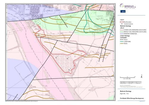
Legend H T1 H Site Boundary Turbine locations Bedrock Geology LEX_D LOWER COAL MEASURES (SCOTLAND) MIDDLE COAL MEASURES (SCOTLAND) PASSAGE FORMATION Linear Geology CATEGORY FAULT LANDFORM ROCK H T2 H T3 H T4 ± 0 0.2 0.4km Scale: 1:10,000 @A3 Date: 23.09.10 Scale: 1:10,000 Rev: Job No: SAE1871 Drawn: kag Checked: db Data source - BGS_DigMapGB-50. Reproduced from Ordnance Survey digital map data ©Crown copyright, All rights reserved. 2010. Licence number 0100031673 Bedrock Geology Figure No. 13.4 Forthbank Wind Energy Development Project Ref: W:\1871sae - Forthbank\Technical\Graphics\CAD\1871sae_057 - Bedrock Geology.mxd rpsgroup.com
- Page 47 and 48: North Greenknowes (2) East Drawing
- Page 49 and 50: North Braes of Doune (1) East Forth
- Page 51 and 52: North East Forthbank Drawing ref: W
- Page 53 and 54: North Forthbank East Drawing ref: W
- Page 55 and 56: North Rosehill (25) Asda Depot (5)
- Page 57 and 58: North Earlsburn North (13) Craigeng
- Page 60 and 61: Legend Site boundary Scheduled Anci
- Page 62 and 63: Legend Site boundary 1.5km Search A
- Page 64 and 65: Legend Site boundary Category A Lis
- Page 66: Legend Site Boundary Grass Land and
- Page 69 and 70: Existing View Photomontage 1 3 2 4
- Page 71: Existing View Photomontage 1 2 3 4
- Page 74 and 75: ") Legend Site Boundary !? Turbine
- Page 76 and 77: Legend Site Boundary H Turbine loca
- Page 78 and 79: Legend Site Boundary 500m buffer Ar
- Page 80 and 81: Legend Site boundary !? Turbine loc
- Page 82 and 83: Legend Site boundary Turbine locati
- Page 84 and 85: Firth of Forth SPA, SSSI and Ramsar
- Page 86 and 87: GB HG Legend !( !( LB !( Site Bound
- Page 88 and 89: Legend Site Boundary !? !? #* SU !?
- Page 90 and 91: Legend Site Boundary Vantage point
- Page 92 and 93: Legend Site Boundary Vantage point
- Page 95 and 96: 30 30 Legend 10 Site Boundary !H Tu
- Page 97: Legend H Site Boundary Turbine loca
- Page 104: Clackmannan Ward Ochil Parliamentar
Legend<br />
H<br />
T1<br />
H<br />
Site Boundary<br />
Turbine locations<br />
Bedrock Geology<br />
LEX_D<br />
LOWER COAL MEASURES (SCOTLAND)<br />
MIDDLE COAL MEASURES (SCOTLAND)<br />
PASSAGE FORMATION<br />
Linear Geology<br />
CATEGORY<br />
FAULT<br />
LANDFORM<br />
ROCK<br />
H<br />
T2<br />
H<br />
T3<br />
H T4<br />
±<br />
0 0.2 0.4km Scale: 1:10,000 @A3<br />
Date: 23.09.10 Scale: 1:10,000 Rev:<br />
Job No: SAE1871 Drawn: kag Checked: db<br />
Data source - BGS_DigMapGB-50.<br />
Reproduced from Ordnance Survey digital map data<br />
©Crown copyright, All rights reserved. 2010. Licence number 0100031673<br />
Bedrock Geology<br />
Figure No. 13.4<br />
<strong>Forthbank</strong> <strong>Wind</strong> <strong>Energy</strong> <strong>Development</strong><br />
Project Ref: W:\1871sae - <strong>Forthbank</strong>\Technical\Graphics\CAD\1871sae_057 - Bedrock Geology.mxd<br />
rpsgroup.com


