Forthbank Wind Energy Development - Partnerships for Renewables
Forthbank Wind Energy Development - Partnerships for Renewables Forthbank Wind Energy Development - Partnerships for Renewables
") Legend Site Boundary !? Turbine locations ^_^_ #0 #0 ^_ !? ^_ ") #0 Anabat locations ^_ ^_ ") Preliminary view points (April scoping visit) Final view points Car Transect Points !? !? Walked Transect Routes April 2010 !? May 2010 June 2010 July 2010 " !? " " #0 ^_ " " ^_ " " ") August 2010 September 2010 Driven Transect Routes May, June, August and September 2010 " " ") Walked Transect Point Counts " Point Count Locations ± 0 0.35 0.7km ^_ ^_ #0 " Scale: 1:20,000 @A3 " " !? " !? ") Date: 21/09/10 Scale: 1:20,000 Rev: 3 Job No: SGP6483 Drawn: JEF Checked: CR Reproduced from Ordnance Survey digital map data ©Crown copyright, All rights reserved. Licence number AL100018329 " Bat Survey Methodology Figure 11.2 " !? " Forthbank Wind Energy Development Drawing ref: J:\SGP 6483 PFR Forthbank Bat Survey\GIS\Figures\ES figures_20100916\SGP6483_fig11.2_bat_methodology.pdf rpsgroup.com
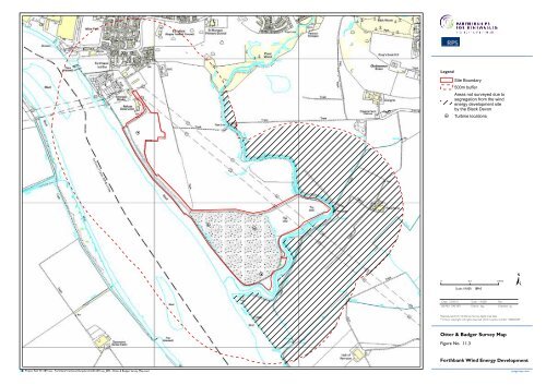
Legend Site Boundary 500m buffer Areas not surveyed due to segregation from the wind energy development site by the Black Devon H Turbine locations H H H H ± 0 0.2 0.4km Scale: 1:9,000 @A3 Date: 23.09.10 Scale: 1:9,000 Rev: Job No: SAE1871 Drawn: kag Checked: tg Reproduced from Ordnance Survey digital map data ©Crown copyright, All rights reserved. 2010. Licence number 100020449 Otter & Badger Survey Map Figure No. 11.3 Forthbank Wind Energy Development rpsgroup.com Project Ref: W:\1871sae - Forthbank\Technical\Graphics\CAD\1871sae_089 - Otter & Badger Survey Map.mxd
- Page 23 and 24: North Braes of Doune (1) East FMC T
- Page 25 and 26: North Braes of Doune (1) East Forth
- Page 27 and 28: North Braes of Doune (1) East Forth
- Page 29 and 30: North Forthbank East Grangemouth (2
- Page 31 and 32: North Forthbank East Drawing ref: W
- Page 33 and 34: North Forthbank East Grangemouth (2
- Page 35 and 36: North Forthbank East Grangemouth (2
- Page 37 and 38: North Greenknowes (2) East Little R
- Page 39 and 40: North Standingfauld (21) Burnfoot (
- Page 41 and 42: North Torwood (30) Rosehill (25) Fo
- Page 43 and 44: North Torwood (30) Braes of Doune (
- Page 45 and 46: North Braes of Doune (1) East FMC t
- Page 47 and 48: North Greenknowes (2) East Drawing
- Page 49 and 50: North Braes of Doune (1) East Forth
- Page 51 and 52: North East Forthbank Drawing ref: W
- Page 53 and 54: North Forthbank East Drawing ref: W
- Page 55 and 56: North Rosehill (25) Asda Depot (5)
- Page 57 and 58: North Earlsburn North (13) Craigeng
- Page 60 and 61: Legend Site boundary Scheduled Anci
- Page 62 and 63: Legend Site boundary 1.5km Search A
- Page 64 and 65: Legend Site boundary Category A Lis
- Page 66: Legend Site Boundary Grass Land and
- Page 69 and 70: Existing View Photomontage 1 3 2 4
- Page 71: Existing View Photomontage 1 2 3 4
- Page 76 and 77: Legend Site Boundary H Turbine loca
- Page 78 and 79: Legend Site Boundary 500m buffer Ar
- Page 80 and 81: Legend Site boundary !? Turbine loc
- Page 82 and 83: Legend Site boundary Turbine locati
- Page 84 and 85: Firth of Forth SPA, SSSI and Ramsar
- Page 86 and 87: GB HG Legend !( !( LB !( Site Bound
- Page 88 and 89: Legend Site Boundary !? !? #* SU !?
- Page 90 and 91: Legend Site Boundary Vantage point
- Page 92 and 93: Legend Site Boundary Vantage point
- Page 95 and 96: 30 30 Legend 10 Site Boundary !H Tu
- Page 97 and 98: Legend H Site Boundary Turbine loca
- Page 102: Legend H15 H13 H2 H3 H4 H14 H6 H7 H
- Page 106: P Station House 12 Melcombe Place L
Legend<br />
Site Boundary<br />
500m buffer<br />
Areas not surveyed due to<br />
segregation from the wind<br />
energy development site<br />
by the Black Devon<br />
H Turbine locations<br />
H<br />
H<br />
H<br />
H<br />
±<br />
0 0.2 0.4km Scale: 1:9,000 @A3<br />
Date: 23.09.10 Scale: 1:9,000 Rev:<br />
Job No: SAE1871 Drawn: kag Checked: tg<br />
Reproduced from Ordnance Survey digital map data<br />
©Crown copyright, All rights reserved. 2010. Licence number 100020449<br />
Otter & Badger Survey Map<br />
Figure No. 11.3<br />
<strong>Forthbank</strong> <strong>Wind</strong> <strong>Energy</strong> <strong>Development</strong><br />
rpsgroup.com<br />
Project Ref: W:\1871sae - <strong>Forthbank</strong>\Technical\Graphics\CAD\1871sae_089 - Otter & Badger Survey Map.mxd


