Mersey Ports Master Plan Executive Summary - peelports
Mersey Ports Master Plan Executive Summary - peelports
Mersey Ports Master Plan Executive Summary - peelports

Create successful ePaper yourself
Turn your PDF publications into a flip-book with our unique Google optimized e-Paper software.
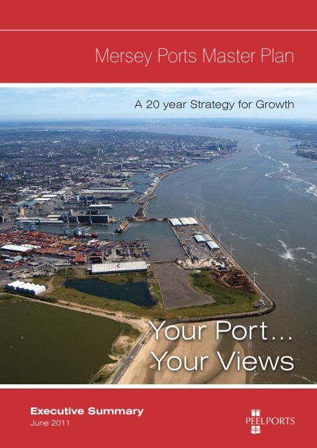
<strong>Mersey</strong> <strong>Ports</strong> <strong>Master</strong> <strong>Plan</strong><br />
A 20 year Strategy for Growth<br />
Your Port...<br />
Your Views<br />
<strong>Executive</strong> <strong>Summary</strong><br />
June 2011
<strong>Executive</strong> <strong>Summary</strong><br />
<strong>Executive</strong> <strong>Summary</strong><br />
Welcome to the <strong>Executive</strong> <strong>Summary</strong> of the <strong>Mersey</strong> <strong>Ports</strong> <strong>Master</strong><br />
<strong>Plan</strong> – a 20 Year strategy for growth for the Port of Liverpool and<br />
The Manchester Ship Canal. It is important that you have your<br />
say upon the Consultation Draft by submitting your comments<br />
either electronically or in writing to our address or by completing<br />
and returning the enclosed questionnaire. A number of local<br />
events are also being held to inform interested parties of our<br />
growth aspirations. All views will be carefully considered and<br />
will help to shape the final version of the <strong>Master</strong> <strong>Plan</strong>.<br />
Gary Hodgson - Managing Director, <strong>Mersey</strong> <strong>Ports</strong><br />
About Peel <strong>Ports</strong><br />
For more than a century, the Port of Liverpool and The<br />
Manchester Ship Canal were arch rivals competing<br />
with each other for cargo going to, and arriving from,<br />
every corner of the globe. The Port of Liverpool<br />
celebrated its 800th Anniversary in 2007, with The<br />
Manchester Ship Canal a relative newcomer which<br />
celebrated its 100th Anniversary in 1994.<br />
In September 2005 these two great undertakings were<br />
brought together “as one” under the banner of Peel<br />
<strong>Ports</strong>. The acquisition of <strong>Mersey</strong> Docks and Harbour<br />
Company<br />
transformed<br />
Peel's ports<br />
sector from a<br />
group handling<br />
20 million tonnes<br />
of cargo a year<br />
into the UK's<br />
second largest port<br />
operator handling<br />
65 million tonnes.<br />
With some 40<br />
million tonnes of<br />
freight a year<br />
moved through<br />
its docks,<br />
Figure 2.1 – Peel <strong>Ports</strong><br />
<strong>Mersey</strong> <strong>Ports</strong> represents almost two-thirds of Peel<br />
<strong>Ports</strong>’ trade. The other ports in the Group are<br />
Clydeport in Scotland, the Lancashire Port of<br />
Heysham and Medway <strong>Ports</strong> in the South East of<br />
England.<br />
About Port <strong>Master</strong> <strong>Plan</strong>ning<br />
As part of the Government’s Interim <strong>Ports</strong> Policy<br />
Report of July 2007, it was recommended that all<br />
major ports produce Port <strong>Master</strong> <strong>Plan</strong>s, and consult<br />
upon these with local stakeholders, including planning<br />
authorities, in order to help co-ordinate medium-term<br />
planning. The subsequent “Guidance on the<br />
Preparation of Port <strong>Master</strong> <strong>Plan</strong>s”, published in<br />
December 2008, indicated the threshold for<br />
preparation of such plans to be those ports handling<br />
at least a million tonnes throughput per annum. The<br />
Port of Liverpool and The Manchester Ship Canal both<br />
exceed this threshold, handling 32.2 million tonnes<br />
and 7.4 million tonnes respectively in 2008.<br />
The Guidance sets out the main purposes of<br />
Port <strong>Master</strong> <strong>Plan</strong>s, which are to:<br />
n<br />
n<br />
n<br />
Clarify the port’s own strategic planning<br />
for the medium to long term.<br />
Assist regional and local planning<br />
bodies and transport network providers<br />
in preparing and revising their own<br />
development strategies.<br />
Inform port users, employees and<br />
local communities as to how they can<br />
expect to see the port develop over<br />
the coming years.<br />
2 <strong>Mersey</strong> <strong>Ports</strong> <strong>Master</strong> <strong>Plan</strong> <strong>Executive</strong> <strong>Summary</strong>
<strong>Executive</strong> <strong>Summary</strong><br />
Strategy Overview<br />
Our location at the heart of the British Isles is a key<br />
driver of our growth strategy. The integration of the Port<br />
of Liverpool and The Manchester Ship Canal means<br />
that we can offer a unique opportunity to drive<br />
transformational shift in the behaviour of supply chains<br />
that trade beyond the UK, by developing a key<br />
logistics platform allied to the development of water<br />
freight solutions.<br />
The strategic development of <strong>Mersey</strong> <strong>Ports</strong> is focused<br />
upon driving growth across all our sectors, as diversity<br />
in the products we handle continues to be a core part<br />
of our plans and we see real opportunities to add value.<br />
<strong>Ports</strong> have the unique advantage of “seeing” the whole<br />
supply chain from end to end, and by utilising this<br />
knowledge of the total chain we believe we can add<br />
significant value to our customers and partners.<br />
The days of a port being a simple transit point are now<br />
firmly in the past. To survive and drive economic<br />
development we need to encourage more “added<br />
value” business to our facilities through a number of<br />
initiatives which include:<br />
n<br />
n<br />
Development of single and multi user port centric<br />
warehousing.<br />
Development of new processing facilities for<br />
imported commodities.<br />
n Development of more customer-focused operating<br />
practices.<br />
In addition to driving more added value activities<br />
across the Port, there are a number of key strategic<br />
business drivers within the period of this <strong>Master</strong> <strong>Plan</strong>,<br />
including:<br />
n<br />
n<br />
n<br />
The planned Seaforth River Terminal a deepwater<br />
container port expansion planned for 2014.<br />
The development of a number of multi-modal<br />
inland ports upon The Manchester Ship Canal –<br />
Port Wirral, Port Bridgewater, Port Ince, Port<br />
Warrington and Port Salford.<br />
The wide diversity of Port operations both now and<br />
into the future.<br />
n Entry into new sectors – including biomass energy,<br />
offshore wind, waste to energy and recycling.<br />
The 44 miles of the combined Port of Liverpool and<br />
The Manchester Ship Canal will incorporate over 10<br />
rail-linked terminals and with 10 motorways within 10<br />
miles of our operational port assets.<br />
The North West is already home to many distribution<br />
<strong>Mersey</strong> <strong>Ports</strong> <strong>Master</strong> <strong>Plan</strong> <strong>Executive</strong> <strong>Summary</strong><br />
Area closer to Liverpool<br />
compared to UK South<br />
coast ports<br />
Population 30 Million<br />
Ireland<br />
Population 5 Million<br />
South England<br />
Population 27 Million<br />
Container services<br />
to Dublin, Belfast<br />
and Greenock<br />
centres for large high street multiples, online retailers<br />
and home delivery companies who recognise the<br />
region as being ideally placed to serve all parts of the<br />
UK on a next-day basis.<br />
Policy Context<br />
Miles<br />
125<br />
Miles<br />
100<br />
The ports sector operates within an extensive policy<br />
framework encompassing planning, transport and<br />
marine matters at a national, regional, and local level.<br />
The policy context is critically important to the ongoing<br />
operation and future expansion plans of <strong>Mersey</strong> <strong>Ports</strong>,<br />
as policies set the framework against which specific<br />
development projects are evaluated, and the funding<br />
decisions in respect of surface access transport<br />
improvements are made.<br />
The Government published a draft National Policy<br />
Statement (NPS) for <strong>Ports</strong> for consultation in<br />
November 2009 and it is anticipated an approved<br />
version will be adopted during 2011. A Marine Policy<br />
Statement was published in March 2011. With respect<br />
to <strong>Ports</strong> and Shipping Para. 3.4.1 states:<br />
“<strong>Ports</strong> and shipping play an important role in the<br />
activities taking place within the marine environment.<br />
They are an essential part of the UK economy,<br />
providing the major conduit for the country’s imports<br />
and exports. <strong>Ports</strong> also provide key transport<br />
infrastructure between land and sea. <strong>Ports</strong> and<br />
shipping are critical to the effective movement of<br />
cargo and people, both within the UK and in the<br />
context of the global economy”.<br />
Miles<br />
75<br />
Miles<br />
50 Figure 2.2 – <strong>Mersey</strong> <strong>Ports</strong> Hinterland<br />
3
<strong>Executive</strong> <strong>Summary</strong><br />
matter for the Local Authorities particularly within their<br />
emerging Local Development Frameworks (LDF’s).<br />
Port Forecasts (2020 and 2030)<br />
The <strong>Mersey</strong> <strong>Ports</strong> serve several key sectors, including<br />
bulk liquids, such as liquids for food manufacturing<br />
and petrochemicals, grains and animal feeds,<br />
general cargo, such as steel and unitised traffic –<br />
including containers that are lifted on and lifted off<br />
ships (lo-lo) and trailers that are driven on and off<br />
vessels (ro-ro).<br />
Forecasts for the <strong>Mersey</strong> <strong>Ports</strong> indicate a growth in<br />
tonnage in excess of 70% from 39.64 million tonnes<br />
(2008 base year) to 68.58 million tonnes (by 2030).<br />
This represents a Compound Annual Growth Rate<br />
(CAGR) of 2.52% - when compared with a 1.1%<br />
CAGR within the Government’s national ports<br />
forecasts. (SeeTable 4.3)<br />
Figure 3.1 Strategic National Corridors<br />
The <strong>Mersey</strong> <strong>Ports</strong> form one of the ten largest port<br />
complexes in the UK and are linked by a number of<br />
strategic national corridors.<br />
At a local level the relevant policy context for the<br />
consideration of ports and their future expansion is a<br />
This outperformance related to Government forecasts<br />
is allied particularly to a stronger anticipated growth<br />
in the unitised lo-lo and ro-ro sectors, the<br />
opportunities associated with handling biomass,<br />
palm oil and other dry bulks, and a redistribution of<br />
market share to the <strong>Mersey</strong> <strong>Ports</strong> particularly<br />
associated with steel and metals, forest products,<br />
and trade cars.<br />
These forecasts will inevitably impact upon existing<br />
physical infrastructure and in this context such<br />
implications are explored under the headings of “Land<br />
Strategy & Areas of Change” and “Transportation”.<br />
Commodity 2008 2020 2030 CAGR (%)<br />
Containers 4.85 14.43 21.65 7.04<br />
(Teu) (672,000) (2,000,000) (3,000,000)<br />
Ro-Ro 6.82 10.07 13.92 3.30<br />
(Units) (513,000) (757,000) (1,047,700)<br />
Trade Cars 0.036 0.20 0.20 8.11<br />
(Units) (36,000) (200,000) (200,000)<br />
Grain 1.25 1.25 1.25 0.00<br />
AFS & Biomass 1.34 2.40 2.90 3.60<br />
Coal 2.38 2.38 2.38 0.00<br />
Other Dry Bulks 3.85 4.57 5.28 1.45<br />
Steel, Metals and General Cargo 0.80 1.00 1.35 2.41<br />
Forest Products 0.26 0.60 0.75 4.93<br />
Petrochemicals 15.80 15.80 15.80 0.00<br />
Other Bulk Liquids 2.26 2.70 3.10 1.45<br />
Total (Million Tonnes) 39.64 55.40 68.58 2.52<br />
Table 4.3 <strong>Mersey</strong> <strong>Ports</strong> – <strong>Summary</strong> Port Forecasts 2020 & 2030<br />
4 <strong>Mersey</strong> <strong>Ports</strong> <strong>Master</strong> <strong>Plan</strong> <strong>Executive</strong> <strong>Summary</strong>
<strong>Executive</strong> <strong>Summary</strong><br />
Land Strategy & ‘Areas of Change’<br />
The methodology for producing forecasts for <strong>Mersey</strong><br />
<strong>Ports</strong> potential land requirements is based firstly on<br />
forecasting the growth in various traffics handled at<br />
the <strong>Ports</strong> and then estimating future land requirements<br />
based on key assumptions with respect to the amount<br />
of land required for any particular trade or traffic. In<br />
addition, the development of other complementary or<br />
other Port-related activities will create further demand<br />
for land.<br />
Three aspects to the future land requirements have<br />
been considered:<br />
n<br />
n<br />
Amount of land needed to serve the Port’s traffic<br />
growth;<br />
Amount of land required to serve the needs of<br />
port centric distribution;<br />
n Amount of land required to serve complimentary<br />
sectors (energy, waste, off-shore wind sector,<br />
processing activities).<br />
Our calculations indicate the delivery of a forward land<br />
requirement of 851 acres to support our 20 year<br />
growth strategy. Whilst some 746 acres can be<br />
identified not all of this land is readily available and/or<br />
deliverable without further activity, notably consenting<br />
and in some cases site acquisition. A further land<br />
requirement of 105 acres relates to as yet to be<br />
identified land parcels. (See Table 5.1)<br />
A series of future land use plans have been drawn up<br />
for Liverpool Docks, Birkenhead Docks and The<br />
Manchester Ship Canal, and which are noted within<br />
the Appendices.<br />
The land strategy includes the utilisation of existing<br />
Port Warrington (Formerly Acton Grange)<br />
<strong>Mersey</strong> <strong>Ports</strong> <strong>Master</strong> <strong>Plan</strong> <strong>Executive</strong> <strong>Summary</strong><br />
Port Traffic 2020 2030<br />
Containers 40 90<br />
Ro-Ro 40 45<br />
Trade Cars 30 0<br />
Grain 3 3<br />
AFS & Biomass 8 0<br />
Coal 0 0<br />
Other Dry Bulks 5 5<br />
Steel, Metals & General Cargo 5 5<br />
Forest Products 10 10<br />
Petrochemicals 0 0<br />
Other Bulk Liquids 6 6<br />
Port Centric Warehousing 140 140<br />
Complementary Sectors:<br />
Off-Shore Wind Farms 75 0<br />
Biomass Energy 45 0<br />
Processing & Valued Added 70 70<br />
Total (Ac) 477 374<br />
Table 5.1: <strong>Mersey</strong> <strong>Ports</strong> – <strong>Summary</strong> Land Requirements<br />
2020 & 2030<br />
Code Site Description Area (Acres)<br />
L1 Seaforth River Terminal 42<br />
L2 Seaforth Area B 78<br />
L3 Hornby/Alexandra Dock 24<br />
L4 LIFT Zone Phase 2 19<br />
L5 Regent Road/Derby Road 92<br />
L6 N3 Canada 10<br />
L7 Huskisson Dock Complex 20<br />
B1 Twelve Quays 4<br />
B2 Beaufort Road 27<br />
B3 Former Mobil Site 23<br />
B4 Cammell Laird 34<br />
M1 Land at QEII Dock 17<br />
M2 Port Wirral 146<br />
M3 Former Bridgewater Paper Mill 46<br />
M4 Port Ince 10<br />
M5 Wigg Wharf 2<br />
M6 Port Warrington Phase 1 11<br />
M7 Port Warrington Phase 2 24<br />
M8 Irlam Container Terminal 6<br />
M9 Port Salford 111<br />
Total Land Identified 746<br />
Unidentified land 105<br />
Overall Land Requirement 851<br />
Table 5.2: <strong>Mersey</strong> <strong>Ports</strong> - Land Availability<br />
5
<strong>Executive</strong> <strong>Summary</strong><br />
land and premises, safeguarding, and those areas of<br />
the Port most likely to see change over the requisite<br />
20 year period. In circumstances where the Port<br />
boundaries are likely to change, we have<br />
demonstrated the effective utilisation of existing<br />
assets. In considering major development upon<br />
environmentally protected sites, it is acknowledged<br />
we will have to demonstrate what alternative ways of<br />
meeting demand have been considered in the<br />
context of the Habitats Directive.<br />
10% 5%<br />
15%<br />
70%<br />
Rail Freight<br />
Inland Barge<br />
Coastal Shipping<br />
Road Freight<br />
Transportation<br />
The success or otherwise of a port is inextricably<br />
linked to the ability for freight to be moved in or out in<br />
a congestion free and efficient manner and therefore<br />
port access routes (be they road and rail links or<br />
inland waterway) are of paramount importance. The<br />
choice of transport mode is principally driven by<br />
commercial factors however there are other<br />
determinants for some supply chains that include<br />
reliability and speed and minimising carbon<br />
emissions as some transport modes are more<br />
sustainable than others.<br />
Pipelines/Conveyors<br />
Water Freight<br />
Rail Freight<br />
Road Freight<br />
Figure 6.1: The Hierarchy of Sustainable Transport<br />
(linked to carbon emissions/km)<br />
The <strong>Mersey</strong> <strong>Ports</strong> neither own freight nor take<br />
decisions on the mode of transport to be employed.<br />
However our strategy is to promote choice for our<br />
customers, and hence it is vital that the necessary<br />
infrastructure is available to effect modal shift where<br />
required.<br />
We are prepared to invest in this infrastructure to<br />
allow the movement of containers and other<br />
commodities by different means, and our growth<br />
strategy is about encouraging shippers and logistics<br />
operators to look at the full “Ship-to-Door” supply<br />
chain costs, identifying the value that the <strong>Mersey</strong><br />
<strong>Ports</strong>’ location can deliver to all.<br />
Figure 6.3 – Modal Shift for Containers 2020 & 2030<br />
Supply chain professionals already face many<br />
challenges – including higher fuel costs, control of<br />
emissions and increasing congestion when using<br />
Southern ports as an entry point for goods destined<br />
for end users in the North. Water provides both a<br />
cheaper and cleaner mode of transport than road<br />
and rail, so it makes sense to use ships and then<br />
barges to get goods as close as possible to the<br />
ultimate consumer of those goods as well as<br />
providing access to world markets for exporters.<br />
Socio Economic Considerations<br />
Studies show the <strong>Mersey</strong>side maritime sector has a<br />
significant impact on the regional economy, directly<br />
employing circa 20,550 people and another 5,900<br />
indirectly, totalling 26,450. The sector contributes<br />
some £700m to the local economy much of which will<br />
be spent with businesses in the area.<br />
But there is more to come. Table 7.2 summerise the<br />
net additional employment and GVA which will accrue<br />
over the 20 years of this <strong>Master</strong> <strong>Plan</strong>, under the remit<br />
of the <strong>Mersey</strong> <strong>Ports</strong> investment decisions such as the<br />
Seaforth River Terminal and the Langton River<br />
Terminal.<br />
The contributory investments of the <strong>Mersey</strong> <strong>Ports</strong> to<br />
the wider SuperPort initiative can be summarised as<br />
generating some 6,000 new jobs and an additional<br />
£1.6 billion GVA by 2020 and some further 1,500 jobs<br />
and an additional £3.3 billion GVA by 2030. In excess<br />
of 4,000 jobs are anticipated to be created as part of<br />
the Low Carbon Economy – Off-Shore Wind, Biomass<br />
Energy, and Tidal Power.<br />
There are other gains for North-West businesses<br />
through their increased ability to secure access to<br />
6 <strong>Mersey</strong> <strong>Ports</strong> <strong>Master</strong> <strong>Plan</strong> <strong>Executive</strong> <strong>Summary</strong>
<strong>Executive</strong> <strong>Summary</strong><br />
supply chains and raw materials via the <strong>Mersey</strong> <strong>Ports</strong><br />
international gateway. For example, for firms in the<br />
Liverpool City Region we have estimated the benefit<br />
in reduced transport costs as circa £16 million per<br />
annum, or in excess of £150 million over the <strong>Master</strong><br />
<strong>Plan</strong> period.<br />
The range and diversity of environmental matters<br />
applicable to <strong>Mersey</strong> <strong>Ports</strong> are illustrated below. The<br />
purpose of the <strong>Master</strong> <strong>Plan</strong> is not to go into the same<br />
degree of detail that would be necessary for an<br />
Environmental Statement accompanying either a<br />
planning or harbour application, but to signpost the<br />
key considerations.<br />
Net Additional 2011 2021<br />
Employment Impact - 2020 - 2030 Total<br />
Seaforth River Terminal 4,270 1,586 5,856<br />
Langton River Terminal 147 0 147<br />
Manchester Ship Canal (Logistics Sites) 1,689 0 1,689<br />
Total 6,106 1,586 7,692<br />
Air Quality<br />
Climate Change<br />
Dredging<br />
Flooding<br />
Odour<br />
Visual Impact<br />
Water Quality<br />
Biodiversity<br />
Contaminated Land<br />
Energy Efficiency<br />
Heritage<br />
Noise<br />
Waste Management<br />
Net Additional GVA (Million) £M £M £M<br />
Seaforth River Terminal 1,128 2,451 3,579<br />
Langton River Terminal 43 70 113<br />
Manchester Ship Canal (Logistics Sites) 432 805 1,237<br />
Total 1,603 3,326 4,929<br />
Table 7.2 - Net Additional Employment & GVA<br />
Environmental Considerations<br />
The <strong>Mersey</strong> <strong>Ports</strong> are monitored, inspected and<br />
vetted by the relevant statutory authorities. In<br />
recognition of the importance of environmental and<br />
emergency response matters there is regular<br />
dialogue with a number of key agencies. Such liaison<br />
seeks to ensure that the <strong>Mersey</strong> <strong>Ports</strong> are complying<br />
with all relevant environmental and safety legislation<br />
and carrying out our duties responsibly.<br />
The <strong>Mersey</strong> <strong>Ports</strong> are committed to continuing<br />
compliance with all applicable environmental<br />
legislation and other relevant requirements in the<br />
pursuit of its duties and powers and will take these<br />
fully into account in all of its actions and decisions,<br />
alongside its pursuit of the sustainability objectives<br />
established by the Government.<br />
In addition to these statutory requirements, as a<br />
Company we will always seek to improve the<br />
environment for our staff, customers and neighbours.<br />
We are currently working towards ISO 14001<br />
accreditation, and as development projects come<br />
forward we will always pay attention to our<br />
environmental obligations.<br />
<strong>Mersey</strong> <strong>Ports</strong> <strong>Master</strong> <strong>Plan</strong> <strong>Executive</strong> <strong>Summary</strong><br />
Stakeholder Engagement<br />
“Guidance on the Preparation of Port <strong>Master</strong> <strong>Plan</strong>s”<br />
(December 2008) advises that an essential aspect of<br />
the development of an effective master plan is<br />
achieved through engagement with interested parties<br />
including local and regional planning bodies and<br />
transport network providers, both during the master<br />
planning process and once the master plan has been<br />
published.<br />
As an overarching principle we welcome active liaison<br />
and discussion with all stakeholders, and are mindful<br />
that there can sometimes be differences of opinion or<br />
approach that this should not be to the detriment of<br />
continual and open dialogue.<br />
Implementation & Review<br />
The <strong>Master</strong> <strong>Plan</strong> is not an application for planning<br />
permission and will not of itself grant approval for any<br />
works, rather it provides a framework for setting out<br />
the Port’s aspirations, including for the medium and<br />
long term, and will assist in informing the<br />
consideration of projects and planning applications<br />
made as and when necessary.<br />
The ports industry is a dynamic sector and hence<br />
whilst the Port <strong>Master</strong> <strong>Plan</strong> looks at longer term time<br />
horizons to 2020 and 2030, it is a working document<br />
and hence it is imperative to undertake reviews of its<br />
contents. The <strong>Master</strong> <strong>Plan</strong> will be subject to regular<br />
monitoring and a formal review every five years,<br />
which will entail further public consultation.<br />
7
R<br />
C<br />
<strong>Executive</strong> <strong>Summary</strong><br />
<strong>Mersey</strong> <strong>Ports</strong> <strong>Master</strong> <strong>Plan</strong><br />
L5<br />
Royal Seaforth<br />
Dock Gate<br />
L5<br />
L4<br />
Strand Road<br />
Gate<br />
L4<br />
L5<br />
L3<br />
CONTAINER<br />
TERMINAL<br />
Grain<br />
Terminal<br />
Steel<br />
Terminal<br />
Gladstone<br />
Dock<br />
Coal<br />
Terminal<br />
Coal<br />
Terminal<br />
Alexandra<br />
Dock<br />
L<br />
L2<br />
AFS<br />
Store<br />
Seaforth<br />
Dock<br />
L1<br />
Steel<br />
Terminal<br />
Potential Rail<br />
Freight Connection<br />
North<br />
River <strong>Mersey</strong><br />
North<br />
Seacombe<br />
Ferry Terminal<br />
River <strong>Mersey</strong><br />
To Liverpool<br />
B1<br />
Woodside<br />
Ferry Terminal<br />
Kingsway<br />
Tunnel<br />
Twelve<br />
Quays<br />
East<br />
Float<br />
Cammell<br />
Laird<br />
B4<br />
Tranmere Oil<br />
Terminal<br />
Wirral Waters<br />
West<br />
Float<br />
B2<br />
B3<br />
Potential Rail Freight Connection<br />
8 <strong>Mersey</strong> <strong>Ports</strong> <strong>Master</strong> <strong>Plan</strong> <strong>Executive</strong> <strong>Summary</strong>
<strong>Executive</strong> <strong>Summary</strong><br />
Liverpool Docks and Birkenhead<br />
Existing<br />
ail Freight<br />
onnection<br />
Potential<br />
Rail Freight<br />
Connection<br />
L4<br />
L5<br />
L5<br />
L5<br />
angton<br />
Dock<br />
L6<br />
Brocklebank<br />
Dock<br />
Canada Dock<br />
Huskisson<br />
Dock Gate<br />
L7<br />
L5<br />
Liverpool<br />
City Centre<br />
Langton River<br />
Berth (Proposed)<br />
Huskisson<br />
Dock<br />
Sandon Half<br />
Tide Dock<br />
Liverpool<br />
Waters<br />
River <strong>Mersey</strong><br />
Isle of Man Steam Packet<br />
North<br />
Pier Head Landing Stages<br />
Code Site Description Area (Acres)<br />
L1 Seaforth River Terminal 42<br />
L2 Seaforth Area B 78<br />
L3 Hornby/Alexandra Dock 24<br />
L4 LIFT Zone Phase 2 19<br />
L5 Regent Road/Derby Road 92<br />
L6 N3 Canada 10<br />
L7 Huskisson Dock Complex 20<br />
B1 Twelve Quays 4<br />
B2 Beaufort Road 27<br />
B3 Former Mobil Site 23<br />
B4 Cammell Laird 34<br />
KEY:<br />
KEY:<br />
Areas of Port Estate Unchanged<br />
Areas of Change (refer to Table 5.2)<br />
Rail Freight Connection (Existing/Potential)<br />
Potential In River Capability<br />
Areas of Port Estate Unchanged<br />
Areas of Change (refer to Table 5.2)<br />
Rail Freight Connection (Existing/Potential)<br />
Potential In River Capability<br />
<strong>Mersey</strong> <strong>Ports</strong> <strong>Master</strong> <strong>Plan</strong> <strong>Executive</strong> <strong>Summary</strong><br />
9
<strong>Executive</strong> <strong>Summary</strong><br />
<strong>Mersey</strong> <strong>Ports</strong> <strong>Master</strong> <strong>Plan</strong><br />
M62<br />
RRAL<br />
North<br />
LIMIT OF HARBOUR AND MANCHESTER PORT<br />
Eastham<br />
Queen Elizabeth<br />
II Dock<br />
Port<br />
Wirral<br />
Eastham Locks<br />
Tidal<br />
6 Miles (9.66Kms) to Liverpool<br />
25 Miles (40.23Kms) to Bar Light Ship<br />
36 Miles (57.94Kms) to Manchester<br />
POOL HALL<br />
Sheerlegs Berth<br />
1 Mile (1.61Kms)<br />
Liverpool<br />
Liverpool<br />
John Lennon<br />
Airport<br />
MERSEYSIDE<br />
Widnes<br />
WA<br />
BAY EMBANKMENT<br />
Port<br />
Bridgewater<br />
M53<br />
Manisty Wharf<br />
2 Miles (3.22Kms)<br />
RIVER<br />
MERSEY<br />
Runcorn Lay-by<br />
11 Miles (17.70Kms)<br />
Runcorn Docks<br />
12 Miles (19.01Kms)<br />
Runcorn &<br />
Widnes Bridge<br />
Tying-up Berth<br />
13 Miles (20.92Kms)<br />
OLD QUAY LOCK<br />
(DISUSED)<br />
RIVER MERSEYEY<br />
Wigg Wharf<br />
15 Miles (24.14Kms)<br />
Norton<br />
Marsh<br />
Moore Lane Lay-by<br />
17 Miles<br />
(27.36Kms)<br />
Port<br />
Acton Warrington Grange<br />
Ellesmere<br />
Port<br />
ELLESMERE PORT EMBANKMENT<br />
Ellesmere Port Docks<br />
3 Miles (4.83Kms)<br />
Innospec Berth<br />
Stanlow Chemical Berth<br />
Calor<br />
Gas Co<br />
4 Miles (6.44Kms) Stanlow No.2 Oil Dock<br />
Van Leer<br />
Turning Basin<br />
(UK) Ltd<br />
Innospec Co Ltd<br />
Stanlow No.1 Oil Dock<br />
Stanlow Lay-by<br />
Ince Coaster Berth<br />
Shell Chemicals UK Ltd<br />
5 Miles (8.05Kms)<br />
Ince Oil Berth<br />
INCE TYING-UP BERTH<br />
Ince<br />
Banks<br />
6 Miles (9.66Kms)<br />
Ince<br />
Ince B Berth<br />
7 Miles (11.27Kms)<br />
Port<br />
Ince<br />
Salt Works Berth<br />
Frodsham Dredger 9 Miles (14.48Kms)<br />
Berth<br />
8 Miles (12.87Kms)<br />
No.2 No.1<br />
No.3<br />
No.4<br />
Frodsham Deposit Grounds<br />
No.5<br />
No.6<br />
Ince Marshes<br />
FRODSHAM SCORE<br />
Lordship Marshes<br />
WESTON MERSEY<br />
LOCK (DISUSED)<br />
10 Miles (16.09Kms)<br />
Weaver Sluices<br />
DELAMERE<br />
DOCK<br />
Weston Point Docks<br />
Ineos<br />
Group of<br />
Companies<br />
WEAVER<br />
NAVIGATION<br />
M56<br />
Runcorn<br />
BRIDGE<br />
14 Miles (22.53Kms)<br />
HALTON<br />
16 Miles (25.75Kms)<br />
M56<br />
BRIDGE<br />
18 Miles (28.97Kms)<br />
Solvay<br />
BRIDGE<br />
19 Miles (30<br />
Kemira Growhow<br />
Helsby Marsh<br />
M56<br />
M56<br />
QEII Dock and Port Wirral<br />
Port Bridgewater Port Ince Wigg Wharf<br />
10 <strong>Mersey</strong> <strong>Ports</strong> <strong>Master</strong> <strong>Plan</strong> <strong>Executive</strong> <strong>Summary</strong>
<strong>Executive</strong> <strong>Summary</strong><br />
Manchester Ship Canal<br />
M60<br />
M602<br />
Eccles<br />
RRINGTON<br />
M6<br />
27 Miles (43.45Kms)<br />
Univar<br />
M62<br />
Irlam<br />
Irlam<br />
Container<br />
Terminal<br />
29 Miles (46.67Kms)<br />
Lay-by<br />
IRLAM LOCKS<br />
Rise 16’ (4.9m)<br />
28 Miles (45.06Kms)<br />
30 Miles (48.28Kms)<br />
Port<br />
Salford<br />
BARTON LOCKS<br />
Rise 15’ (4.6m)<br />
Urmston<br />
Barton High<br />
Level Bridge<br />
Barton High<br />
32 Miles (51.50Kms)<br />
31 Miles (49.89Kms)<br />
M60<br />
Trafford<br />
Centre<br />
Irwell Park Wharf<br />
Cerestar Wharf<br />
CENTENARY BRIDGE<br />
MODE WHEEL LOCK<br />
Rise 13’ (4.0m)<br />
Dry Docks<br />
33 Miles (53.11Kms)<br />
Weaste<br />
Imperial War<br />
Museum North<br />
Lowry Foot Bridge<br />
Stretford<br />
Weaste Wharf<br />
Blue Circle Cement<br />
34 Miles<br />
(54.72Kms)<br />
The Lowry<br />
Limits for Upper<br />
Reach Cruising<br />
Salford Quays<br />
35 Miles<br />
(56.33Kms)<br />
Pomona<br />
Link Lock<br />
36 Miles<br />
(57.94Kms)<br />
Partington Basin<br />
20 Miles (32.19Kms)<br />
Walton Lock<br />
(Disused) Latchford Locks<br />
Rise 12’6” (3.8m)<br />
58Kms)<br />
BRIDGE<br />
Woolston<br />
Deposit<br />
Ground<br />
No.4<br />
21 Miles (33.80Kms)<br />
Woolston<br />
Deposit<br />
Ground<br />
No.3<br />
Woolston Dredger<br />
Berth<br />
Woolston<br />
Deposit<br />
Ground No.2<br />
22 Miles (35.41Kms)<br />
Thelwa l<br />
Viaduct<br />
Woolston<br />
Deposit Ground No.1<br />
23 Miles (37.01Kms)<br />
24 Miles (38.62Kms)<br />
25 Miles (40.23Kms)<br />
Warburton High<br />
Level Bridge<br />
26 Miles (41.84Kms)<br />
Partington<br />
Trafford<br />
M60<br />
CHESHIRE<br />
M6<br />
Lymm<br />
GREATER<br />
MANCHESTER<br />
M<br />
Area of Change<br />
(refer to Table 5.2)<br />
M56<br />
Port Warrington<br />
Irlam Container Terminal Port Salford Code Site Description Area (Acres)<br />
M1 Land at QEII Dock 17<br />
M2 Port Wirral 146<br />
M3 Former Bridgewater Paper Mill 46<br />
M4 Port Ince 10<br />
M5 Wigg Wharf 2<br />
M6 Port Warrington Phase 1 11<br />
M7 Port Warrington Phase 2 24<br />
M8 Irlam Container Terminal 6<br />
M9 Port Salford 111<br />
<strong>Mersey</strong> <strong>Ports</strong> <strong>Master</strong> <strong>Plan</strong> <strong>Executive</strong> <strong>Summary</strong><br />
11
Public Consultation<br />
“Guidance on the Preparation of Port <strong>Master</strong> <strong>Plan</strong>s” advises that an essential aspect of the development of an<br />
effective master plan is achieved through engagement with interested parties including local and regional<br />
planning bodies and transport network providers, both during the master planning process and once the<br />
master plan has been published.<br />
In this respect consultation upon the <strong>Mersey</strong> <strong>Ports</strong> <strong>Master</strong> <strong>Plan</strong> is taking place during a 13 week period from<br />
Monday 6th June – Monday 5th September 2011.<br />
The <strong>Master</strong> <strong>Plan</strong> is published on-line at www.portofliverpool.co.uk or www.manchestershipcanal.co.uk and is<br />
available for download. Copies will be made available for inspection at the offices of the local planning authorities.<br />
Local Events<br />
A series of exhibitions to publicise and raise awareness of the <strong>Master</strong> <strong>Plan</strong> are being held throughout the<br />
geographical area as follows:<br />
n Wednesday 15th June - Crowne Plaza, Pier Head, Liverpool, L3 1QW<br />
n Thursday 16th June - Halton Stadium, Widnes, WA8 7DZ<br />
n Tuesday 21st June - Crosby Civic Hall, Crosby Road North, L22 0LQ<br />
n Thursday 23rd June - Pyramid, Palmyra Square South, Warrington, WA1 1BL<br />
n Tuesday 5th July - Wallasey Town Hall, Brighton Street, Wallasey, CH44 8ED<br />
n Thursday 7th July - Boat Museum, South Pier Road, Ellesmere Port, CH65 4FW<br />
n Tuesday 12th July - Eastham Lodge Golf Club, Ferry Road, Eastham, CH62 0AP<br />
n Thursday 14th July - Digital World Centre (opp. The Lowry), Salford Quays, M50 3UB<br />
n Thursday 21st July - Bootle Town Hall, Oriel Road, Bootle, L20 7AE<br />
All events will take place between 3.30pm and 7.30pm.<br />
How to Respond<br />
Stakeholders are invited to provide feedback in writing<br />
or electronically to: <strong>Mersey</strong> <strong>Ports</strong> <strong>Master</strong> <strong>Plan</strong><br />
Consultation, Maritime Centre, Port of Liverpool L21 1LA<br />
or merseymasterplan@<strong>peelports</strong>.co.uk<br />
or alternatively by completing and returning our<br />
questionnaire and comments form.<br />
Next Steps<br />
All written responses submitted will be collated and<br />
assessed and will be summarised within a<br />
Consultation Report. Appropriate comments and<br />
amendments will be incorporated within the final<br />
master plan which we intend to publish for adoption<br />
by December 2011.<br />
<strong>Mersey</strong> <strong>Ports</strong> <strong>Master</strong> <strong>Plan</strong> Consultation<br />
Maritime Centre, Port of Liverpool L21 1LA<br />
Tel: +44 (0)151 949 6000 Fax: +44 (0)151 949 6300