Workshop Notes - March 24, 2010 - Orlando International Airport
Workshop Notes - March 24, 2010 - Orlando International Airport
Workshop Notes - March 24, 2010 - Orlando International Airport

Create successful ePaper yourself
Turn your PDF publications into a flip-book with our unique Google optimized e-Paper software.
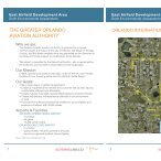
Poitras Property <strong>Workshop</strong><br />
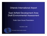
<strong>Orlando</strong> <strong>International</strong> <strong>Airport</strong><br />
<strong>March</strong> <strong>24</strong>, <strong>2010</strong><br />
Meeting <strong>Notes</strong><br />
Rob Brancheau presented three (3) portions of the slideshow presentation – Current<br />
Status, Purpose & Methodology, and Regional Context.<br />
Dykes Everett briefly spoke about the purpose of today’s meeting and asked if there<br />
were any questions.<br />
Jason McGlashan presented the Transportation portion of the slideshow.<br />
Dykes asked if there were any questions or comments.<br />
Dean Grandin, City of <strong>Orlando</strong>, asked if there were any thoughts as to how the high<br />
speed rail might leave the airport property – going south or southeast, for example.<br />
Rob responded that high speed rail will enter the airport from the south and stop at the<br />
South Terminal station. This station is planned to accommodate four types of rail: high<br />
speed, commuter, light rail and the ITS. From the ST station, HSR could go south along<br />
a turnpike alignment but most likely will continue north to the beeline and then east<br />
following a 528 type corridor. When it gets to I-95 it could go south to Miami or north to<br />
Jacksonville.<br />
Dean asked, is that the airport’s preferred route or is this what’s being presented by<br />
FDOT?<br />
Marcos responded that this is the best discussed potential approach to date. The<br />
analysis has not been done for it to go to Miami. There is another alternative – instead<br />
of going north, to go south by the 417, then back up to 528 if too expensive to navigate<br />
through the airport; still go east and down to Miami and also north to Jacksonville.<br />
Rob added that the Florida Rail Enterprise is preparing to start the PD&E study for the<br />
extension from OIA to Miami. They have hired Parsons. This is about a thirty million<br />
dollar effort and they will be looking at the alternatives.<br />
Dykes also commented that in looking at the south terminal, the design is so all four<br />
forms of rail can converge into one place and that starts to drive some other rail options,<br />
from Poitras, for example.<br />
LA Griffin, OOCEA, asked if trip generation for Poitras has been done to determine what<br />
needs there are and also asked what about collaborating with Lake Nona.<br />
Rob responded that we have been working closely with Lake Nona and have entered<br />
into some agreements but other ideas are just now being discussed such as; the<br />
potential extension of Boggy Creek Road – to the southeast – an idea Lake Nona talked<br />
about – the boggy creek extension can go down through the medical city area and
continue down into poitras and then tie into the southeast road network or the Osceola<br />
parkway. Another idea is to have a limited access facility spur from the SR 417<br />
Southern Extension across Poitras and tie into the SR 417 Boggy Creek systems level<br />
interchange. This was examined by OOCEA when they did the SR 417 Southern<br />
Extension study several years ago.<br />
L.A. Griffin, questioned if we knew the number of trips this would generate.<br />
Jason responded that there would be more discussion about that topic with the land<br />
development portion of the presentation. He added that there is the GMP approved<br />
land use plan and we have an idea what kind of trips that would generate. Based on<br />
the roadway network we have currently, we don’t think there is a sufficient network.<br />
But first, we have to determine what we need because there’s a good amount of access<br />
planned to Lake Nona with the three access points shown in the GMP Plan. Also there<br />
is the Boggy Creek Road extension, there’s an existing interchange at 417and there<br />
are plans for 417, south access , boggy creek road becoming a bigger footprint with<br />
limited access – Nona has talked about an interchange as being part of that – may not<br />
be feasible – there’s access happening at several places. We still need to look at the<br />
potential of all of these projects based on our needs.<br />
Dean referring to the 417 extension that was mentioned, asked how much discussion<br />
has there been on that alignment – is the idea to widen Narcoossee further and make it<br />
limited access?<br />
Jason responded that they are looking at a number of corridors. Based on demand and<br />
other factors, they were able to rule some of those out. Referring to a slide, he stated<br />
that these corridors are the ones that are recommended by the Expressway Authority.<br />
There is planning for some north or south limited access roadway that is going to be an<br />
influence on our trip making process.<br />
Rob commented that when the early map was looked at, there was no real land use out<br />
to the east – this was prepared before the northeast district was developed. There were<br />
no trips so really no justification for looking at something that went west to east.<br />
F.J. Flynn with the City of <strong>Orlando</strong> asked about the different SR 417 corridors.<br />
Rob responded that one may be more near-term, and another may be more long-term<br />
oriented.<br />
F.J. said the Narcoossee Road corridor is 120 feet, unless you do an overhead, it’s<br />
probably not going to be a feasible.<br />
Dean asked if a final decision has been made on the SR 417 corridor.<br />
Jason responded: we don’t think there is a final decision – this is one of the plans that<br />
are out there<br />
Tiffany Homler of Osceola County commented that the northeast district has preserved<br />
an area for the “Northport connector”. We have looked for any flaws on the Osceola
County side and we have some potential alignments. The PD&E process would be the<br />
next step.<br />
Dykes referring back to the traffic counts and modeling, commented that the challenge<br />
with the Poitras property is we are not a private land owner – we are an agency and a<br />
city. We are charged with more of a regional perspective and we have to plan long-term<br />
for the Poitras property along with the airport. If you look back five years at the<br />
modeling, much of it did not anticipate the medical city and that growth, and the<br />
acceleration of high speed rail, etc. Since that is where people are working, building,<br />
and developing now – in the medical city area – we want to look at that as well as our<br />
long-term mission.<br />
F.J. Flynn commented that Orange County has done planning for Innovation Way transit<br />
and asked if any of that is incorporated into our plans.<br />
Jason responded that some of that has been incorporated as well as what Lake Nona<br />
has planned. There is a tendency for plans to become fractured and we are trying to<br />
pull all these plans together.<br />
Dean agreed and commented that the site has the potential to be a great economic<br />
generator for the airport and the city. He also added that historically the airport has not<br />
sold property – they have leased long-term – and asked if there is any idea how to<br />
develop this property?<br />
Marcos responded that there is no idea currently – that everything will be on the table,<br />
and that we want to get everything ready to go.<br />
Dean asked if we saw the airport as being a master developer.<br />
Marcos responded that we would be either doing that or looking for partners that might<br />
be willing to bring money to the table. The options are open.<br />
Jason Burton with the City of <strong>Orlando</strong> asked if we have addressed anything in regards<br />
to water concurrency.<br />
Dykes agreed that this is an issue that has to be dealt with and fixed and we will look at<br />
that down the road.<br />
Jason Burton stated this was the time to talk about the water.<br />
Dykes responded that we need to decide what the land use is, where we think ultimately<br />
things will be, before getting with OUC to determine how to deliver water. He added<br />
that much of our preplanning discussions have focused on water. We talked about that<br />
a few weeks back – that’s as important as anything else – again, we feel like that’s<br />
something to sort out and plan after we know our vision.<br />
Jason Burton also asked what are the precedents that OIA has looked at regarding<br />
other airports around the world that have this type of transportation, and how do they
function, and how do they have the lines of transportation going off of it; for example,<br />
Munich, London - those types of systems where they work successfully.<br />
Dykes responded that much of this drove this being a multimodal hub with the site to be<br />
a collector of all four forms of rail and the ground transportation that will also be<br />
available.<br />
Marcos reminded everyone that while we talk about these issues, to keep in mind for<br />
today that the focal point is not the rail connectivity at the airport, but rather the Poitras<br />
property.<br />
Andrea Arcos commented that the presentation to the GOAA Board last week was an<br />
in-depth presentation regarding how this interacts and will be made available on the<br />
GOAA website for anyone to review.<br />
Jeff Rapson presented the Land Use portion of the slideshow.<br />
Catherine Howard with Orange County asked what is being planned on the western<br />
edge of the property that extends out to Boggy Creek Road.<br />
Jeff responded that the area is airport-support related.<br />
Phil Laurien with the East Central Florida Regional Planning Council (ECFRPC) asked<br />
where are the rail corridors – where are the rail transit pieces?<br />
Jeff responded that it will be on the next slides – the red lines that just came on are the<br />
anticipated transit corridors from the airport.<br />
Phil asked why we don’t have more land use intensity along the transit corridors – why<br />
are we pushing it out onto Narcoossee Road?<br />
Jeff explained about there being three centers, referring to another slide. in order to<br />
connect it to the transit site –– an area that has high intensity – mixed use – anchored<br />
on a strong water element – those kinds of environments – again, centering around the<br />
neighborhood This is our first pass at drilling this down – you can see the lakes have<br />
been connected and how this pulls together with this being an intense area – to the<br />
degree the market will allow, we’ll push the intensity and density as much as we can – if<br />
the market and the world evolves with all these uses – to drive these uses even farther<br />
than it is today.<br />
Phil asked, when talking about positioning – is this going to be built around a transit<br />
spine from the outset – is it going to be transit-oriented? He also asked what are your<br />
density ranged – for non-residential and for residential?<br />
Paul Lewis responded that this was a density plan we established at the city. In the<br />
Southeast Sector Plan, there are different types of uses – residential, primary<br />
conservation, airport support district high and medium intensity. High intensity, closer to<br />
the airport, has a FAR of 1.5 but no residential component – because of proximity to<br />
airport. The airport support med intensity does include residential as part of a PD – up
to 25 units per acre in that range – can support transit at those density levels – other<br />
categories include – hierarchy of mixed use centers – high intensity version, the town<br />
center, then village and neighborhood – can give you the density levels for those – this<br />
would allow up to ten story buildings – very intense – the village centers, can be auto or<br />
transit oriented, depending on how much program you are trying to do – below village<br />
center are neighborhood center – max 100k square feet for non residential use.<br />
Phil asked Paul Lewis if he thought their southeast sector plan will change to<br />
accommodate more intense uses that would relate to this transit design?<br />
Paul responded that he was a little concerned with the airport support district. He is not<br />
sure what intensity is intended and there is a density cap that may be problematic.<br />
F.J. Flynn asked what FAR ranges are on the airport medium intensity.<br />
Jeff said 0.7 maximum.<br />
Dean said they are going to go through a PD process.<br />
Paul - A maximum of 25 and that worries him a little bit – if you are trying to get more<br />
density – might need more than .7 FAR to do urban development for a mixed use<br />
precinct.<br />
Phil added that if we do a light rail line that feeds over and is part of the hub, you should<br />
be talking about minimum density – to build ridership and to create a sense of place, in<br />
order to make it a true work/play corridor. You shouldn’t negotiate what you think the<br />
market can support. With Eagle Creek being across the road, there is almost no<br />
connectivity through there east to west. Not sure that will work – a village center –<br />
location would be better if more centrally located.<br />
Catherine Howard – asked if we know if the OIA / Convention Center Light Rail study is<br />
going to kick off soon.<br />
Rob stated as we looked at the high speed and commuter and light rail coming into the<br />
airport – one question came to mind – if the high speed stops at the airport and the<br />
convention center – is a light rail is that same path as the convention center and airport,<br />
going to be the logical next piece – or looked at going in a different direction maybe to<br />
south to the medical city or other areas – because it would seem to be a duplicative<br />
service – as that regional picture is looked at – that questions would be answered.<br />
Jason Burton asked if the commuter rail is going to be the connector?<br />
Rob responded by extending commuter rail to the airport it could be the connector. The<br />
high speed rail comes up I-4, goes to the convention center and goes east into the<br />
airport from the south into the station. The commuter rail corridor follows orange<br />
avenue and when it gets down into Taft , what is suggested is to peel off and (follow the<br />
OUC rail line along the southern boundary of OIA and then onto the airport to meet<br />
HSR at the same point - so if you were coming from the south – you could come into<br />
the airport and transfer to high speed rail or to light rail going in different directions –
that station would be built on a second level so on first floor would be an entire ground<br />
trans center – lynx, taxi, rental cars, etc – up to 20k spaces of parking right there on that<br />
facility – in long term, a very large multi modal center here – by bringing commuter rail –<br />
provides the connection between high speed rail – other thing is it gives the other<br />
commuter rail customers to make a transfer to other things the airport has to offer<br />
Jason Burton commented that it makes sense and it would make it easier to go<br />
downtown, etc. – a better direct connection.<br />
Rob commented that this starts to give you a lot of options.<br />
Marcos added that if you’re able to bring commuter rail into the south terminal, the<br />
concept is commuter rail could leave and go south to the medical city or Poitras or an<br />
LRT system.<br />
Dykes stated it makes sense that by creating the Sand Lake station by 2015, we believe<br />
the least expensive option if that can be accomplished, is a real start to fire up the idea<br />
of connectivity between the south terminal and Poitras, and the medical city, etc.<br />
Dykes commented that we’re going to have to figure out what is the multi-modal<br />
circulator and how does it work to collect people to put them into the south terminal<br />
station.<br />
FJFlynn – if you have a main spur that runs into the Poitras property somewhere, then<br />
you could have a mini circulator – that feeds the spur.<br />
Jason Burton - if you’re thinking about a secondary alignment – and you see your auto<br />
corridor east west with the dotted lines – it might be that it is a transit corridor – but<br />
when you do have a light rail corridor – they tend to work best when they can be evenly<br />
loaded from both sides – you may want to consider the transit corridor where the green<br />
lines are(linier park) – so it goes into the heart of the town center to load on both sides –<br />
what Phil wants is more transit… - without the detriment of the auto traffic –<br />
Jason (HDR) – one of our thoughts related to the need to maintain the separation from<br />
the transit corridor and the roadways is there are two corridors – one more transit<br />
oriented – the other work horse roadway corridor – trying to provide some separation<br />
between the corridors –<br />
Jason Burton – Imagine how would I put a light rail in Baldwin Park – where would I put<br />
it – that type of discussion<br />
Jason (HDR) you wouldn’t put it on colonial drive as an example – L.A. talked about<br />
traffic – you will see traffic levels on roads like boggy creek road and narcoossee rd<br />
which are difficult to imagine – more than 100k a day<br />
Jason Burton – when you do set up a dual system network it tends to work out better<br />
with circulators.
Greg Kern with RS&H - … – we don’t have a rep from lynx – we are looking at different<br />
BRT systems – between sand lake and lake Nona area – those types of short term and<br />
long term – building on Phil’s comment – when I see the separation of the corridors –<br />
we have to be sensitive to the need for land use access. There’s going to be transit<br />
modeling done – I think we have to be aware that the modeling needs to be<br />
incorporated into that land use – we need to be looking at the necessary infrastructure<br />
necessary to support that – the land use is going to have to have the infrastructure in<br />
place in the right format.<br />
(Ten Minute Break)<br />
Dykes presented the Planning Strategy portion of the slideshow.<br />
Phil Laurien commented that all bullet points are correct – the need for flexibility re<br />
timing and uses, etc – had occasion to work with connect? global – rep several largest<br />
relocation managers – one of the fellows located in Atlanta – strong interest in opening<br />
office in central fl – made trip here to talk about opportunities- what keeps the top<br />
companies is a reliable transit system – they love the growth and the area and the<br />
climate – great airport but nothing connects to it – we have a tremendous opportunity to<br />
connect to the airport – it is a center – if we can connect to these other systems I think<br />
you do have a world class asset.<br />
Dean Grandin thanked everyone for having this session – not sure of timeline – it is<br />
important to understand where transit fits into this picture – nail down where the transit<br />
lines are going to be and make sure feasible for riders and build your land use around<br />
that – because you are the airport authority and have the potential of all these lines –<br />
this site could be great – you are also competing with lake Nona – we want both areas<br />
to succeed – we have to figure out how transit serves both those properties – maybe we<br />
need to bring together you and lake Nona and whoever the other regional partners are –<br />
Dykes stated we agree – you have the Nona circulation plans and the orange county<br />
partners plans – we need to all discus our options– the only way transit will work is if all<br />
the partners are maximizing the ridership –<br />
(Greg Kerns consultant for Osceola County stated, in terms of partners, the northeast<br />
district in Osceola County - that would be a key area to connect the rail.<br />
Dykes agreed.<br />
Andrea stated we will send the notes to everyone with a link to the presentation on the<br />
GOAA website. Someone also asked for a link to the presentation provided today as<br />
well as the sign-in sheet.