Park Management Plan - Ontario Parks
Park Management Plan - Ontario Parks
Park Management Plan - Ontario Parks

You also want an ePaper? Increase the reach of your titles
YUMPU automatically turns print PDFs into web optimized ePapers that Google loves.
Aaron<br />
<strong>Park</strong> <strong>Management</strong> <strong>Plan</strong>
©2012, Queen’s Printer for <strong>Ontario</strong><br />
Printed in <strong>Ontario</strong>, Canada<br />
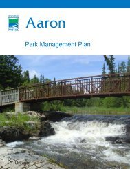
Cover photo: Bridge over Thunder Creek<br />
Photo taken by: <strong>Ontario</strong> <strong>Park</strong>s<br />
Additional copies of this publication are available from the Ministry of Natural<br />
Resources at the following locations:<br />
Aaron Provincial <strong>Park</strong><br />
c/o <strong>Ontario</strong> <strong>Park</strong>s<br />
Northwest Zone<br />
Suite 221d 435 James St. S. Thunder<br />
Bay, <strong>Ontario</strong><br />
P7E 6S8<br />
(807) 475-1321<br />
Aaron Provincial <strong>Park</strong><br />
c/o Ministry of Natural Resources<br />
479 Government Road<br />
P.O. Box 730<br />
Dryden, <strong>Ontario</strong><br />
P8N 2Z4<br />
(807) 223-7535<br />
Cette publication hautement spécialisée Aaron <strong>Park</strong> <strong>Management</strong> <strong>Plan</strong> n’est disponible qu’en<br />
anglais en vertu du Règlement 411/97 qui en exempte l’application de la Loi sur les services<br />
en français. Pour obtenir de l’aide en français, veuillez communiquer avec Michèle Proulx au<br />
ministère des Richesses naturelles au michele.proulx@ontario.ca).<br />
62796<br />
0.75k P.R. 05-09-12<br />
ISBN 978-1-4435-9954-2 (PDF)
Table of Contents<br />
CONTEXT<br />
Provincial <strong>Park</strong>s and Conservation Reserves Act 4<br />
Statement of Environmental Values and the Environmental Bill of Rights 4<br />
<strong>Plan</strong>ning Context 4<br />
Aboriginal Context 5<br />
1.0 INTRODUCTION 6<br />
2.0 CLASSIFICATION 8<br />
3.0 GOAL 8<br />
4.0 OBJECTIVES 8<br />
4.1 Protection Objective 8<br />
4.1.1 Life Sciences 8<br />
4.1.2 Earth Sciences 9<br />
4.1.3 Cultural Resources 9<br />
4.2 Recreation Objective 9<br />
4.3 Heritage Appreciation Objective 10<br />
4.4 Scientific Research Objective 10<br />
5.0 BOUNDARY 11<br />
6.0 ZONING 11<br />
6.1 Development Zone 13<br />
6.2 Access Zones 13<br />
6.3 Natural Environment Zone 13<br />
7.0 RESOURCE STEWARDSHIP POLICIES 13<br />
7.1 Aboriginal uses of Natural Resources 15<br />
7.2 Industrial / Commercial Uses 15<br />
7.3 Land <strong>Management</strong> 16<br />
7.4 Water <strong>Management</strong> 16<br />
7.5 Forest Fire <strong>Management</strong> 16<br />
7.6 Species at Risk 16<br />
7.7 Vegetation 16<br />
7.8 Wildlife 17<br />
7.9 Fisheries 17<br />
7.10 Cultural Heritage Resource <strong>Management</strong> 17<br />
7.11 Research 18<br />
7.12 Inventory and Monitoring 18<br />
8.0 OPERATIONS POLICIES 18<br />
8.1 Natural Heritage Education 19<br />
8.1.1 Information 19<br />
8.1.2 <strong>Park</strong> Interpretation 19<br />
8.1.3 Outdoor Recreation 19<br />
8.2 Recreation <strong>Management</strong> 20<br />
8.2.1 Day-Use Areas 20<br />
8.2.2 Campgrounds 20<br />
8.2.3 Services for Visitors 20<br />
8.2.4 Trails 21<br />
8.2.5 Mechanized Travel 21
8.3 Partnerships 21<br />
9.0 MARKETING AND COMMUNICATIONS 21<br />
9.1 Marketing 21<br />
9.2 Communications 21<br />
10.0 DEVELOPMENT POLICIES 21<br />
10.1 Campgrounds / Campsites 22<br />
10.2 Roads 22<br />
10.3 Day Use Area 22<br />
10.4 Trails 22<br />
10.5 Maintenance and Administrative Areas 22<br />
11.0 IMPLEMENTATION PRIORITIES 22<br />
12.0 SUMMARY OF ABORIGINAL, STAKEHOLDER AND PUBLIC INVOLVEMENT 22<br />
13.0 PLAN AMENDMENT and REVIEW 23<br />
14.0 REFERENCES 23<br />
Appendix I SCIENTIFIC NAMES OF PLANTS AND ANIMALS REFERENCED IN<br />
THE DOCUMENT 26<br />
List of Figures<br />
Figure 1: REGIONAL SETTING 7<br />
Figure 2: ADJACENT LAND USE 12<br />
Figure 3: PARK ZONING 14<br />
Figure 4: ADAPTIVE MANAGEMENT PROCESS 15
CONTEXT<br />
Provincial <strong>Park</strong>s and Conservation Reserves Act, 2006<br />
The Provincial <strong>Park</strong>s and Conservation Reserves Act, 2006 (PPCRA) is the legislation that<br />
guides the planning and management of the protected areas system. The PPCRA has two<br />
specific principles that guide all aspects of planning and management of <strong>Ontario</strong>’s system of<br />
provincial parks and conservation reserves:<br />
Maintenance of ecological integrity shall be the first priority, and the restoration of<br />
ecological integrity shall be considered<br />
Opportunities for consultation shall be provided. 2006, c. 12, s. 3<br />
Statement of Environmental Values and the Environmental Bill of Rights<br />
The Ministry of Natural Resources’ Statement of Environmental Values (SEV) under the<br />
Environmental Bill of Rights, 1993 (EBR) describes how the purposes of the EBR are to be<br />
considered, whenever decisions are made in the ministry that might significantly affect the<br />
environment. This includes decisions made as a result of preparing management direction for<br />
a protected area.<br />
The ministry’s SEV has been considered throughout the planning process. The management<br />
direction for Aaron Provincial <strong>Park</strong> will further the objectives of managing <strong>Ontario</strong>’s resources<br />
on an environmentally sustainable basis.<br />
<strong>Plan</strong>ning Context<br />
This park management plan has been prepared consistent with direction contained in Our<br />
Sustainable Future, Ministry of Natural Resources Strategic Directions (OMNR 2005a). The<br />
Ministry’s vision is “sustainable development” and the mission is “ecological sustainability”.<br />
The <strong>Ontario</strong> <strong>Park</strong>s’ program contributes mainly to the goal of: “Healthy Natural Environment<br />
for Ontarians”. The mandate of the ministry for <strong>Ontario</strong> <strong>Park</strong>s is to deliver <strong>Ontario</strong>’s parks and<br />
protected areas program, which includes: the protection and management of provincially<br />
significant natural, cultural, and recreational environments; provincial park operations;<br />
provision of tourism opportunities, natural heritage education; planning and management of<br />
provincial parks; monitoring, auditing, and public reporting on <strong>Ontario</strong>’s parks and protected<br />
areas.<br />
This document has also been prepared consistent with direction contained in Protecting What<br />
Sustains Us: <strong>Ontario</strong>’s Biodiversity Strategy (OMNR 2005b). <strong>Ontario</strong>’s parks and protected<br />
areas contribute to the achievement of the first goal “Protect the genetic, species and<br />
ecosystem diversity of <strong>Ontario</strong>”, and the second goal “Use and develop the biological assets<br />
of <strong>Ontario</strong> sustainably, and capture benefits from such use for Ontarians”.<br />
Aaron <strong>Park</strong> <strong>Management</strong> <strong>Plan</strong><br />
4
Aboriginal Context<br />
Wabigoon Lake, Wabauskang, Grassy Narrows (English River), Eagle Lake, Ojibway Nation<br />
of Saugeen and Lac Seul First Nations are all within the boundary described by the Treaty #3<br />
(Figure 1). Aaron Provincial <strong>Park</strong> overlaps traditional lands and waters of these six First<br />
Nations.<br />
Aaron Provincial <strong>Park</strong> is located near two Métis Nation of <strong>Ontario</strong> (MNO) asserted harvesting<br />
territories; lake of the Woods/Lac Seul and Rainy Lake/Rainy River. The closest community<br />
councils that may have an interest include Northwest (Dryden), Kenora, Sunset Country (Fort<br />
Frances), and Atikokan Métis Councils. The Aboriginal Peoples of Wabigoon are also located<br />
in the area.<br />
Aboriginal communities use the area for hunting, trapping, fishing, gathering and travel.<br />
Aaron <strong>Park</strong> <strong>Management</strong> <strong>Plan</strong><br />
5
1.0 INTRODUCTION<br />
Aaron Provincial <strong>Park</strong>, established in 1958<br />
under <strong>Ontario</strong> regulation 251/58, is a<br />
recreation class park of 117 hectares. The<br />
park is located in Zealand Township, on the<br />
TransCanada Highway (Hwy 17) east of<br />
Dryden (Figure 1). The park is located<br />
within Ecodistrict 4S-4 and the Dryden<br />
Administrative District of the Ministry of<br />
Natural Resources (MNR).<br />
In the 1880s, the Canadian Pacific Railway<br />
was constructed adjacent to the present day<br />
location of Aaron Provincial <strong>Park</strong> and the<br />
area was opened up for settlement. The<br />
park was originally a homestead sold to<br />
John D. Aaron in 1906, which eventually<br />
reverted to the Crown. The recreational<br />
value of the site was recognized and the<br />
Department of Northern Development<br />
established it as a roadside camping park in<br />
1935 for travellers and local residents.<br />
Aaron Provincial <strong>Park</strong> is comprised of three<br />
parcels of land (<strong>Park</strong> Zoning - Figure 3).<br />
Highway 17 divides the park into two main<br />
parcels.<br />
The park is on the south shore of Thunder<br />
Lake, a remnant of the ancient glaciers that<br />
covered <strong>Ontario</strong> tens of thousands of years<br />
ago. As these massive moving fields of ice<br />
shifted and melted, they left behind a huge<br />
lake called glacial Lake Agassiz. Over the<br />
years, Lake Agassiz receded, creating<br />
hundreds of smaller lakes. The park’s mixed<br />
forests of aspen, jack pine, white cedar and<br />
balsam fir, are typical of the boreal region.<br />
The forest is home to moose, white-tailed<br />
deer and black bear.<br />
Aaron Provincial <strong>Park</strong> is an operating park<br />
with 98 campsites, 39 of which have<br />
electrical hook-ups. Aaron is a destination<br />
for local residents from Dryden and a<br />
stopover for travellers on Highway 17.<br />
Two sandy beaches, playground<br />
equipment and the clear, shallow waters<br />
of Thunder Lake make Aaron ideal for<br />
water based activities, such as,<br />
swimming, boating and fishing.<br />
The approved park management plan will<br />
guide the stewardship, operation and<br />
development of Aaron over the next 20<br />
years. Amendments may be considered<br />
as the need arises. The plan will be<br />
examined every 10 years to determine the<br />
need for further review or amendments,<br />
as described in Section 13.<br />
The park management plan has evolved<br />
from the comments received from the<br />
public review of the terms of reference<br />
during the autumn of 2006, and the review<br />
of the preliminary park management plan<br />
during the winter of 2009/10. Aaron<br />
Provincial <strong>Park</strong> <strong>Management</strong> <strong>Plan</strong> has<br />
been developed in accordance with the<br />
<strong>Ontario</strong> Provincial <strong>Park</strong>s <strong>Plan</strong>ning and<br />
<strong>Management</strong> Policies (OMNR 1992),<br />
<strong>Ontario</strong>’s Living Legacy Land Use<br />
Strategy (OMNR 1999), <strong>Ontario</strong>’s<br />
Protected Areas <strong>Plan</strong>ning Manual and the<br />
PPCRA. In accordance with this plan, the<br />
MNR will amend affected area-specific<br />
land use policies and mapping found in<br />
the Crown Land Use Policy Atlas. 1<br />
1 The Crown Land Use Policy Atlas can be found at the<br />
following: http://crownlanduseatlas.mnr.gov.on.ca/.<br />
Aaron <strong>Park</strong> <strong>Management</strong> <strong>Plan</strong><br />
6
Figure 1<br />
Regional Setting<br />
Aaron<br />
Legend<br />
Major Municipality<br />
First Nation Community<br />
Aaron Provincial <strong>Park</strong><br />
Provincial <strong>Park</strong><br />
Conservation Reserve<br />
Base data derived from the Natural<br />
Resources and Values Information System<br />
(NRVIS) compiled at a scale of 1:20000.<br />
© 2010, Queen's Printer for <strong>Ontario</strong>.<br />
0 12.5 25 50 km<br />
1:1,700,000<br />
Highway<br />
Railway<br />
Lake<br />
US State <strong>Park</strong><br />
This map is illustrative only. Do not rely<br />
on it as being a precise indicator of<br />
routes, locations or features, nor as a<br />
guide to navigation.<br />
International Border<br />
U.S.A.<br />
Projection: UTM Zone 15, NAD83<br />
Name: <strong>Ontario</strong> <strong>Park</strong>s NWZone<br />
Date: July 2010<br />
Carroll<br />
Lake<br />
WOODLAND<br />
CARIBOU<br />
EAGLE - SNOWSHOE<br />
Umfreville<br />
Lake<br />
Wabaseemoong<br />
17<br />
Northwest<br />
Angle<br />
#33<br />
Northwest<br />
Angle #37<br />
Dalles<br />
Washagamis<br />
Bay<br />
LAKE OF<br />
THE WOODS<br />
AGASSIZ<br />
PEATLANDS<br />
Lake of the<br />
Woods (lac<br />
des Bois)<br />
LAKE<br />
OF THE<br />
WOODS<br />
SABLE<br />
ISLANDS<br />
Rainy<br />
River<br />
Sydney<br />
Lake<br />
Separation<br />
Lake<br />
Anishinabe<br />
of Wauzhushk<br />
Onigum<br />
Kenora<br />
Morson<br />
SCENIC<br />
LAKE<br />
Sioux<br />
Narrows<br />
CRANBERRY<br />
LAKE<br />
SPRUCE<br />
ISLANDS<br />
EAGLE<br />
DOGTOOTH<br />
SIOUX<br />
NARROWS<br />
Big Island<br />
Big Grassy<br />
HAMMELL<br />
LAKE<br />
Barwick<br />
Red Lake<br />
Longlegged<br />
Lake<br />
CAMPFIRE<br />
RIVER<br />
SCOTTY<br />
LAKE<br />
Little<br />
Vermilion<br />
Lake<br />
WEST<br />
ENGLISH<br />
RIVER<br />
Maynard<br />
Lake<br />
PAKWASH<br />
Grassy<br />
NarrowsWabigoon<br />
River<br />
DRYBERRY<br />
71 LAKE<br />
Dryberry Lake<br />
11<br />
Whitefish<br />
Bay<br />
BLUE<br />
LAKE<br />
WINNANGE<br />
LAKE<br />
Kakagi<br />
Lake Ojibways of<br />
Onegaming<br />
Rainy<br />
River<br />
Emo<br />
Red Lake<br />
Gullrock<br />
Lake<br />
Pakwash<br />
Lake<br />
TROUT<br />
LAKE<br />
WEST<br />
WABIGOON<br />
Vermilion Bay RIVER<br />
Caviar<br />
Lake<br />
105<br />
Oak Lake<br />
Atikwa<br />
Lake<br />
Rowan<br />
Lake<br />
Anishinabi<br />
Lake<br />
Nestor Falls<br />
Pipestone Lake<br />
PIPESTONE<br />
CALIPER<br />
LAKE<br />
Trout TROUT<br />
Lake<br />
LAKE<br />
Naicatchewenin<br />
Little<br />
Trout<br />
Lake<br />
BRUCE<br />
LAKE<br />
Ear<br />
Falls<br />
Wabaskang<br />
Lake<br />
105<br />
EAGLE LAKE<br />
ISLANDS<br />
Eagle<br />
Lake<br />
LAWRENCE<br />
LAKE<br />
Rainy Lake<br />
(lac à<br />
la Pluie)<br />
Stanjikoming<br />
Couchiching<br />
Fort<br />
Frances<br />
Wabauskang<br />
Perrault<br />
Lake<br />
Cedar<br />
Lake<br />
MANITOU<br />
Eagle<br />
Lake<br />
Wabigoon<br />
Lake<br />
BUTLER<br />
LAKE<br />
Lower<br />
Manitou<br />
Lake<br />
Otukamamoan<br />
Lake<br />
SANDPOINT<br />
ISLAND<br />
Dryden<br />
WINDIGO<br />
POINT<br />
LOLA<br />
LAKE<br />
Big<br />
Vermilion<br />
Lake<br />
OJIBWAY<br />
Lac Seul<br />
MELGUND<br />
Dinorwic LAKE ADAIR<br />
Lake<br />
Wabigoon EAST LAKE<br />
Lake OjibwayWABIGOON<br />
PYATT LAKE<br />
Nation<br />
Upper<br />
Manitou<br />
Lake<br />
Lac Seul<br />
LAC SEUL<br />
ISLANDS<br />
Nicickousemenecaning<br />
Mine<br />
Centre<br />
Birch Lake<br />
WHITEMUD<br />
Aaron<br />
Provincial <strong>Park</strong><br />
502<br />
Whitefish<br />
Lake<br />
Lost<br />
Lake<br />
72<br />
Big<br />
Sandy<br />
Lake<br />
TURTLE<br />
RIVER-WHITE<br />
OTTER LAKE<br />
Seine<br />
River<br />
Hudson<br />
Stormy<br />
Lake<br />
STORMY LAKE<br />
Gull<br />
Lake<br />
GULL-CHRISTINA<br />
BROKENMOUTH<br />
RIVER<br />
HARTH<br />
LAKE<br />
Minnitaki<br />
Lake<br />
Sioux<br />
Lookout<br />
MINNITAKI<br />
KAMES Kukukus<br />
Lake<br />
Basket<br />
Lake<br />
Mameigwess<br />
Lake<br />
17<br />
Clearwater<br />
West Lake<br />
Ignace<br />
White<br />
Otter Lake<br />
Kezik<br />
Lake<br />
Slate<br />
Falls<br />
Indian<br />
Lake<br />
SANDBAR<br />
LAKE<br />
CAMPUS<br />
LAKE<br />
Atikokan<br />
Bamaji<br />
Lake<br />
516<br />
Churchill<br />
Lake<br />
Lake of<br />
Bays<br />
Press<br />
Lake<br />
EAST<br />
ENGLISH<br />
RIVER<br />
GULLIVER<br />
RIVER<br />
Seine<br />
River<br />
Sowden<br />
Lake<br />
ST.<br />
RAPHAELDe Lesseps<br />
Lake<br />
599<br />
Sturgeon<br />
Lake<br />
Silver Bell<br />
Lake<br />
Dollar<br />
BONHEUR<br />
RIVER<br />
KAME<br />
Miniss<br />
Lake<br />
Lake St.<br />
Joseph<br />
Ojibway<br />
Nation of<br />
Saugeen<br />
Mishkeegogamang<br />
Savant<br />
Lake<br />
TREWARTHA<br />
CREEK<br />
Pashkokogan<br />
Lake<br />
Savant<br />
Lake<br />
McCrea<br />
Lake<br />
WABAKIMI<br />
Seseganaga<br />
Lake<br />
UPPER<br />
ENGLISH<br />
RIVER<br />
BRIGHTSAND<br />
RIVER<br />
11<br />
Upsala<br />
Lac Des<br />
Mille Lacs<br />
Lac des<br />
Mille Lacs<br />
U.S.A.<br />
Lac La<br />
Croix<br />
Boundary Waters<br />
QUETICO<br />
ARROWHEAD<br />
PENINSULA<br />
LA VERENDRYE<br />
Canoe Area Wilderness
2.0 CLASSIFICATION<br />
Through park classification, <strong>Ontario</strong>’s<br />
provincial parks are organized into broad<br />
categories, each of which has particular<br />
purposes and characteristics.<br />
Aaron is classified as a recreational park.<br />
Recreational class parks support a wide<br />
variety of compatible outdoor recreation<br />
opportunities in attractive natural<br />
surroundings. The target for recreational<br />
class parks is to provide residents and outof-province<br />
visitors with appropriate levels<br />
of day use and facility-based camping<br />
opportunities. The selection (and operation)<br />
of recreational class parks and the provision<br />
of compatible outdoor recreation<br />
opportunities is related to regional<br />
population distribution and demands.<br />
3.0 GOAL<br />
To provide a variety of opportunities for<br />
compatible heritage appreciation,<br />
outdoor recreation, and scientific<br />
research activities in attractive<br />
surroundings, while protecting the<br />
park’s earth and life science features.<br />
In fulfilling this goal, the park contributes to<br />
the achievement of recreation and<br />
protection objectives for the protected areas<br />
system.<br />
4.0 OBJECTIVES<br />
There are four objectives for <strong>Ontario</strong>’s<br />
parks: protection, recreation, heritage<br />
appreciation and scientific research.<br />
4.1 Protection Objective<br />
To permanently protect the park’s<br />
biodiversity and elements of the natural<br />
and cultural landscape of <strong>Ontario</strong> and<br />
to manage these to ensure that<br />
ecological integrity is maintained.<br />
<strong>Ontario</strong>’s protected areas play an<br />
important role in representing and<br />
conserving the diversity of the province’s<br />
natural features and ecosystems.<br />
Protected areas include representative<br />
examples of life and earth science<br />
features, and cultural heritage features<br />
within ecologically or geologically defined<br />
regions. <strong>Ontario</strong>’s ecological land<br />
classification system provides the basis<br />
for the life science feature assessment,<br />
and the geological themes provide the<br />
basis for earth science assessment.<br />
4.1.1 Life Sciences<br />
Aaron is located on the eastern boundary<br />
of Ecodistrict 4S-4 near the southern<br />
margin of the boreal forest region. This<br />
section is described as marking a<br />
transition between the Great Lakes-St.<br />
Lawrence Forest to the south and the<br />
boreal forest to the north.<br />
Although the park is in a transitional<br />
ecodistrict, the vegetation in the park is<br />
largely characteristic of the boreal forest.<br />
The vegetation found in the park reflects<br />
the park’s transitional position between<br />
the two forest regions. Forest cover within<br />
the park consists of mature to old jack<br />
pine, on coarse, well-drained sand<br />
deposits, with trembling aspen as an<br />
associate in areas where soil moisture is<br />
higher. Mixedwoods occupy sites with<br />
fine-textured materials; balsam fir, jack<br />
pine, trembling aspen, white birch, and<br />
black spruce. Shoreline vegetation<br />
includes white cedar and black ash, tree<br />
Aaron <strong>Park</strong> <strong>Management</strong> <strong>Plan</strong><br />
8
species that are found near the dam on the<br />
Thunder River (Noble 1977).<br />
The wildlife of Aaron is representative of the<br />
boreal forest region. Mammals include<br />
moose, white-tailed deer, black bear and<br />
gray wolf, as well as Canada lynx, pine<br />
marten, red fox, snowshoe hare, river otter,<br />
and beaver.<br />
The birds of the park are typical of the<br />
boreal forest and include a wide variety of<br />
songbirds, raptors, shorebirds and<br />
waterfowl.<br />
The life science features of Aaron Provincial<br />
<strong>Park</strong> are not considered to contribute to any<br />
life science themes due to the small size<br />
and high degree of disturbance of the park.<br />
4.1.2 Earth Sciences<br />
Aaron is located within the Canadian Shield<br />
and the terrain is generally rolling with some<br />
exposed bedrock. Aaron is underlain<br />
directly by Precambrian bedrock, consisting<br />
of highly foliated Keewatin sedimentary<br />
rocks (arkose, greywacke and quartzite)<br />
and volcanic rocks (intermediate to basic<br />
lavas) of the Wabigoon subprovince,<br />
Superior Province. The bedrock, exposed<br />
intermittently throughout the park, occurs as<br />
gentle knolls, often severely weathered or<br />
poorly exposed. Shoreline outcrops are<br />
abrupt and broken but generally low.<br />
Surface deposits are of intermediate<br />
thickness (several metres), covering most of<br />
the park. The deposits consist<br />
predominantly of fine sand and silt with hard<br />
clay in drainage depressions and bedrock<br />
basins. The sands form a gently sloping to<br />
flat plain on which the campgrounds are<br />
built. What may be a tombolo (spit) joins the<br />
bedrock exposures on the peninsula to the<br />
main sand/silt plain. The surface deposits<br />
were produced predominantly during the<br />
Timiskaming Interstadial and represent<br />
glacial lake Agassiz and the Hartman<br />
Phase (10,000 years ago) of the retreating<br />
ice mass.<br />
The earth science features of Aaron<br />
Provincial <strong>Park</strong> are not considered to<br />
contribute to any earth science themes<br />
due to their small size and high degree of<br />
disturbance (Kor 1977).<br />
4.1.3 Cultural Resources<br />
Cultural resources include any significant<br />
resource or feature of archaeological,<br />
historical, cultural, or traditional use. This<br />
may include archaeological resources,<br />
built heritage or cultural heritage<br />
landscapes (See Section 7.10). No<br />
cultural resources have been found in<br />
Aaron Provincial <strong>Park</strong>.<br />
4.2 Recreation Objective<br />
To provide visitors with opportunities for<br />
car camping and day-use with ecologically<br />
sustainable land and water based<br />
recreation and to encourage associated<br />
economic benefits.<br />
Aaron offers opportunities for car camping<br />
in the campground. The park provides<br />
campers and day-visitors with<br />
opportunities for hiking, swimming,<br />
picnicking, fishing and boating. The<br />
majority of visitors to Aaron (64%) are<br />
drawn from travellers on the Highway 17,<br />
who use the park as a stopover en route.<br />
Local and regional residents also use the<br />
park as a camping and day-use<br />
destination.<br />
Most visitors to northwest zone parks are<br />
from northwestern <strong>Ontario</strong> (51.5%), from<br />
Aaron <strong>Park</strong> <strong>Management</strong> <strong>Plan</strong><br />
9
other provinces (western Canada) (36.6%)<br />
and from the United States (11.9%),<br />
specifically Minnesota, Wisconsin and<br />
Michigan (<strong>Ontario</strong> <strong>Park</strong>s 2006). This is in<br />
contrast to the origins of park users on a<br />
province-wide basis where the majority of<br />
park visitors came from southwestern<br />
<strong>Ontario</strong> (20.6%), central <strong>Ontario</strong> (37.4%),<br />
Metro Toronto (11.3%) and eastern <strong>Ontario</strong><br />
(16.4%), 5.4% originated in other provinces<br />
and 3.6% of visitors came from the United<br />
States (<strong>Ontario</strong> <strong>Park</strong>s 2006).<br />
The 2005 <strong>Park</strong> User Survey indicates that,<br />
in general, most visitors to Aaron engage in<br />
resting/ relaxing (94%), followed by<br />
swimming/wading (81%), trail hiking (62%),<br />
viewing/ photographing nature (47%),<br />
picnicking (44%), and visiting<br />
viewpoints/lookouts (41%) (<strong>Ontario</strong> <strong>Park</strong>s<br />
2006).<br />
In 2007, the average length of stay for<br />
campers was 1.6 nights. The average party<br />
size was three and the July/August<br />
occupancy rate averaged 55% (<strong>Ontario</strong><br />
<strong>Park</strong>s 2008).<br />
Day-users (approximately 20% of users) are<br />
local residents, mostly from the Dryden area<br />
(<strong>Ontario</strong> <strong>Park</strong>s 2008). Some of the dayusers<br />
visiting Aaron are tourists travelling<br />
the TransCanada Highway, who visit as one<br />
of several destinations, or as an unplanned<br />
stopover en route. Day-users visiting Aaron<br />
are members of family groups participating<br />
in picnicking, relaxing, walking on the<br />
beach, swimming or wading.<br />
Winter day-use for Aaron is moderate; with<br />
cross-country skiing on park trails and some<br />
use of motorized snow vehicles. Winter dayuse<br />
is local in origin.<br />
4.3 Heritage Appreciation<br />
To provide opportunities for residents<br />
of <strong>Ontario</strong> and visitors, to increase<br />
their knowledge and appreciation of<br />
<strong>Ontario</strong>’s natural and cultural heritage.<br />
Aaron is designated as a self-use activity<br />
park. Self-use parks provide<br />
comprehensive information / orientation<br />
services as well as self-use facilities such<br />
as trails. <strong>Ontario</strong> <strong>Park</strong>s’ staff maintain<br />
these facilities. Additional public programs<br />
are offered at the discretion of the park<br />
superintendent.<br />
Based on the region’s natural features<br />
and history, interpretive themes have<br />
been identified for Aaron Provincial <strong>Park</strong>.<br />
These themes include:<br />
• ecology of the Canadian Shield and<br />
the boreal forest<br />
• settlement and tourism history of the<br />
park area<br />
4.4 Scientific Research<br />
Objective<br />
To facilitate scientific research and to<br />
provide benchmarks to support<br />
monitoring of ecological change on the<br />
broader landscape.<br />
<strong>Ontario</strong> <strong>Park</strong>s plays an important role in<br />
the provision of places to undertake<br />
research activities to: provide a better<br />
understanding of park environments,<br />
contribute to appropriate park<br />
management practices and actions, and<br />
provide baseline ecological information<br />
that can be used to support ecological<br />
monitoring on the broader landscape.<br />
For example, in many parks in the<br />
northwest zone, staff establishes <strong>Ontario</strong><br />
Aaron <strong>Park</strong> <strong>Management</strong> <strong>Plan</strong><br />
10
<strong>Park</strong>s Inventory and Monitoring plots<br />
(OPIAM), although none have been<br />
established in Aaron to date. Baseline<br />
information is collected on vegetation, soil,<br />
and ecosite types, as well as incidental<br />
floral and faunal observations.<br />
5.0 BOUNDARY<br />
Aaron Provincial <strong>Park</strong>, established in 1958<br />
under <strong>Ontario</strong> regulation 251/58, is a<br />
recreation class park of 117 hectares. The<br />
park consists entirely of Crown land (Figure<br />
2).<br />
The following is a brief description of land<br />
tenure in the park and surrounding area:<br />
• Aaron Provincial <strong>Park</strong> is divided by the<br />
TransCanada Highway (Hwy 17).<br />
• The park boundary extends<br />
approximately 91 metres into Thunder<br />
Lake<br />
• TransCanada has natural gas pipeline<br />
under Crown easement through Aaron<br />
on the south side of Highway 17.<br />
• Hydro One has an electricity<br />
transmission corridor under the authority<br />
of a Land Use Permit (LUP #9999-11,<br />
file #RR-LM-6) through the park.<br />
• Canadian Pacific Railway has a patent<br />
right-of-way that divides the southwest<br />
corner of the park.<br />
• Lands along the shores of Thunder<br />
Lake, adjacent to the park, are used for<br />
private residences, seasonal residences<br />
and commercial tourism.<br />
<strong>Ontario</strong> <strong>Park</strong>s is committed to an ecosystem<br />
approach to park planning and<br />
management. An ecosystem approach<br />
allows park management to consider the<br />
relationship between the park and the<br />
surrounding environment. <strong>Park</strong> managers<br />
may consider potential impacts on park<br />
values and features from activities occurring<br />
on adjacent lands, and potential impacts<br />
from park activities on land uses in<br />
adjacent areas.<br />
Within the park boundary, the protection<br />
of park values and features will be<br />
achieved through appropriate zoning,<br />
management of land use and activities,<br />
education, and monitoring of ecological<br />
impacts.<br />
<strong>Ontario</strong> <strong>Park</strong>s will support in principle the<br />
acquisition of property for addition to<br />
Aaron Provincial <strong>Park</strong>, if the acquisition<br />
will enhance the values of the park.<br />
Acquisition or securement will be subject<br />
to funding and willingness of the owners<br />
to sell or lease their properties or enter<br />
into a conservation easement.<br />
If any lands within, nearby or adjacent to<br />
the park become available for acquisition,<br />
they will be evaluated with regard to their<br />
contribution to park objectives and<br />
available funding.<br />
6.0 ZONING<br />
Lands within Aaron Provincial <strong>Park</strong> are<br />
zoned in accordance with their<br />
environmental and cultural features and<br />
values, and their sensitivity to<br />
development. Aaron will be managed with<br />
three types of zones: natural environment,<br />
access and development, based on the<br />
<strong>Ontario</strong> Provincial <strong>Park</strong>s: <strong>Plan</strong>ning and<br />
<strong>Management</strong> Policies (Figure 3). The<br />
zones consider the sensitivity of the<br />
natural and cultural values, the<br />
permissible degree of development,<br />
recreational uses, and management<br />
practices within the park.<br />
Aaron <strong>Park</strong> <strong>Management</strong> <strong>Plan</strong><br />
11
Figure 2<br />
DR-<br />
08-032<br />
DR-08-<br />
031<br />
Wabigoon<br />
River<br />
DR-<br />
AIRPORT<br />
DR004<br />
DR- 08-044<br />
DR-09A-<br />
1:750,000 08-045<br />
017<br />
ROAD<br />
1:750,000<br />
Mavis<br />
Lake<br />
DR-08-<br />
028<br />
Beaver<br />
Lake<br />
Zealand<br />
Lake<br />
Pronger Lake<br />
Rice<br />
Lake<br />
DR-<br />
BEAR 08-033 MANAGMENT<br />
DR-08-<br />
DR-05-<br />
037<br />
065<br />
AREAS<br />
17<br />
DR-08-<br />
050<br />
DR-08-<br />
048<br />
DR-05-<br />
067<br />
DR-05-<br />
069<br />
DR-05-<br />
081<br />
IG-05-<br />
084<br />
A<br />
DR-05-<br />
068<br />
DR-<br />
05-070<br />
DR-05-<br />
071<br />
601<br />
Ghost<br />
Lake<br />
Rafter<br />
Lake<br />
LOLA<br />
LAKE<br />
DR043<br />
Beartrack<br />
Lake<br />
DR029<br />
DR030<br />
Gardnar<br />
Lake<br />
DR013 DR020<br />
DR044<br />
TRAPLINE AREAS<br />
DR028<br />
Troutfly<br />
Lake<br />
DR021<br />
DR027<br />
DR012<br />
DR011<br />
Laval<br />
Lake<br />
DR022<br />
DR026<br />
B<br />
IG221<br />
DR025<br />
DR024<br />
DR023<br />
Adjacent Land Use<br />
105<br />
17<br />
EAGLE<br />
DOGTOOTH<br />
1:2,000,000<br />
Aaron<br />
Aaron<br />
Provincial <strong>Park</strong><br />
Dryden<br />
BUTLER<br />
LAKE<br />
LOLA<br />
LAKE<br />
OJIBWAY<br />
72<br />
TURTLE RIVER-<br />
WHITE OTTER LAKE<br />
17<br />
17<br />
Big<br />
Sandy<br />
Lake<br />
Legend<br />
<strong>Park</strong> and Adjacent Feature<br />
Community<br />
Aaron Provincial <strong>Park</strong><br />
Thunder<br />
Lake<br />
Provincial <strong>Park</strong><br />
594<br />
Dryden<br />
72<br />
Conservation Reserve<br />
First Nation Reserve<br />
Priviate Land<br />
AARON<br />
Bear <strong>Management</strong> Area<br />
Baitfish Harvest Area<br />
Hartman<br />
Lake<br />
Trapline Area<br />
Mining Claim<br />
Utilitie<br />
Wabigoon<br />
Lake<br />
Hydro Line<br />
Natural Gas Pipeline<br />
Transportation / Road<br />
Wabigoon<br />
Railway<br />
Primary Road<br />
Secondary Road<br />
Tertiary Road<br />
Base Feature<br />
River /Stream<br />
DR0021<br />
BAITFISH HARVEST<br />
AREAS<br />
DR0032<br />
C<br />
BUTLER<br />
LAKE<br />
CANADIAN PACIFIC<br />
D<br />
Lake<br />
Wetland<br />
DR0020<br />
DR0019<br />
DR0018<br />
1:750,000<br />
Burr<br />
Lake<br />
DR0028<br />
DR0031<br />
DR0030<br />
DR0029<br />
Doré<br />
Lake<br />
DR0041<br />
DR0040<br />
DR0039<br />
Trap<br />
Lake<br />
Mile<br />
Lake<br />
Butler<br />
Lake<br />
Olsen<br />
Lake<br />
Larson Lake<br />
Wabigoon<br />
Lake 27<br />
Dinorwic<br />
Lake<br />
Dinorwic<br />
17<br />
1:250,000 MINING CLAIMS<br />
0 1 2 4 km<br />
1:100,000<br />
Base data derived from the Natural<br />
Resources and Values Information System<br />
(NRVIS) compiled at a scale of 1:20000.<br />
© 2010, Queen's Printer for <strong>Ontario</strong>.<br />
This map is illustrative only. Do not rely<br />
on it as being a precise indicator of<br />
routes, locations or features, nor as a<br />
guide to navigation.<br />
Projection: UTM, Zone 15N, NAD83<br />
<strong>Ontario</strong> <strong>Park</strong>s NW Zone<br />
Date: July 2010
6.1 Development Zone<br />
Development zones contain areas of the<br />
park geared towards the support of<br />
intensive day-use and car camping<br />
activities. They constitute a relatively small<br />
portion of most parks. Development may<br />
include roads, visitor control structures,<br />
beaches, picnic areas, car campgrounds,<br />
commercial service facilities, maintenance<br />
facilities, park office and orientation,<br />
interpretive, educational, research and<br />
management facilities (Figure 3).<br />
D1: Campground and Day-use, 51<br />
hectares<br />
User activity and facility development is<br />
concentrated in D1 (campground and dayuse<br />
development zone) which is located in<br />
the central portion of the park. Existing<br />
development in D1 consists of<br />
campgrounds, day-use areas, the Aspen<br />
Hiking Trail and the park administrative<br />
complex.<br />
6.2 Access Zones<br />
Access zones serve as staging areas for<br />
people, a means of both providing and<br />
regulating use in areas of a park geared<br />
towards extensive recreation. Generally<br />
development is limited to roads, visitor<br />
control structures and group campgrounds.<br />
Provisions may be made for limited<br />
orientation, interpretive or educational<br />
facilities for self-use, rather than through<br />
structured personal service. Limited facilities<br />
for research and park management may<br />
also be present (Figure 3).<br />
A1: Hydro corridor, 3 hectares<br />
A1 includes the hydro corridor that runs<br />
through the park campground from the<br />
hydro corridor on the north side of<br />
Highway 17 and includes a 10-metre-wide<br />
corridor, measured from the midpoint of<br />
the hydro right-of-way.<br />
A2: Pipeline corridor, 10 hectares<br />
A2 includes a 30-metre-wide corridor that<br />
includes the pipeline and access road that<br />
divides the southern parcels of the park.<br />
6.3 Natural Environment Zone<br />
Natural environment zones include natural<br />
landscapes which permit the minimum<br />
level of development required to support<br />
low-intensity recreational activities. This<br />
minimum level of development is<br />
generally limited to back-country<br />
campsites, portages, necessary signage<br />
and minimal interpretive facilities (Figure<br />
3).<br />
NE1: Natural Environment, 53 hectares<br />
The NE1 zone constitutes the balance<br />
(45%) of the park area that is not included<br />
in the development zone or the access<br />
zones, including where the park extends<br />
into Thunder Lake. The Eastern White<br />
Cedar Trail is located in this zone.<br />
7.0 RESOURCE STEWARDSHIP<br />
POLICIES<br />
The stewardship of Aaron Provincial <strong>Park</strong>’s<br />
natural and cultural resources will conform<br />
to the policies identified for recreational<br />
class parks in <strong>Ontario</strong> Provincial <strong>Park</strong>s:<br />
<strong>Plan</strong>ning and <strong>Management</strong> Policies<br />
(OMNR 1992) and <strong>Ontario</strong>’s Living Legacy<br />
Land Use Strategy (OMNR 1999).<br />
Additional policy direction is provided in the<br />
following section. <strong>Plan</strong>ning and<br />
Aaron <strong>Park</strong> <strong>Management</strong> <strong>Plan</strong><br />
13
Figure 3<br />
Zoning and Development<br />
0 50 100 200 m<br />
1:10,000<br />
Aaron<br />
Legend<br />
Nature Trail<br />
<strong>Park</strong> Road<br />
Snowmobile Trail<br />
Major Highway<br />
Secondary Road<br />
Tertiary Road<br />
Canadian Pacific Railway<br />
Trans Canada Pipeline<br />
Local Hydro Lines<br />
River/Stream<br />
Lake<br />
<strong>Park</strong> Zone<br />
Development<br />
Natural Environment (Lake Bed)<br />
Natural Environment<br />
Access<br />
Base data derived from the Natural<br />
Resources and Values Information System<br />
(NRVIS) compiled at a scale of 1:20000.<br />
© 2011, Queen's Printer for <strong>Ontario</strong>.<br />
This map is illustrative only. Do not rely<br />
on it as being a precise indicator of<br />
routes, locations or features, nor as a<br />
guide to navigation.<br />
Projection: UTM Zone 15, NAD83<br />
Name: <strong>Ontario</strong> <strong>Park</strong>s NWZone<br />
Date: December 2011<br />
Thunder<br />
Lake<br />
NE1<br />
Cedar<br />
Trail<br />
17<br />
NE1<br />
NE1<br />
A1<br />
A2<br />
D1<br />
Bonny Bay Road<br />
CANADIAN PACIFIC RAILWAY<br />
Wabigoon<br />
Lake<br />
A2<br />
Aspen<br />
Trail<br />
East Thunder Lake Road<br />
17
management is intended to contribute to the<br />
maintenance or enhancement of the<br />
ecological integrity of the park, a guiding<br />
principle of the act.<br />
Resource stewardship initiatives may be<br />
accomplished through partnerships and<br />
sponsorships. All resource stewardship<br />
activities will be undertaken in accordance<br />
with requirements under the PPCRA,<br />
Environmental Assessment Act (EAA), A<br />
Class Environmental Assessment for<br />
Provincial <strong>Park</strong>s and Conservation<br />
Reserves (Class EA-PPCR), and any other<br />
applicable legislation and policies.<br />
An adaptive management approach (Figure<br />
4) will be applied to resource management<br />
activities within Aaron Provincial <strong>Park</strong>.<br />
Adaptive management allows management<br />
strategies to be changed, as required, in<br />
response to monitoring and analysis of the<br />
results of past actions and experiences.<br />
Adjust<br />
Evaluate<br />
<strong>Plan</strong><br />
Adaptive<br />
<strong>Management</strong><br />
Process<br />
(adapted from MacDonald et al,1999)<br />
Implement<br />
Monitor<br />
Figure 4: Adaptive management process<br />
7.1 Aboriginal Uses of Natural<br />
Resources<br />
Wabigoon Lake, Wabauskang, Grassy<br />
Narrows (English River), Eagle Lake,<br />
Ojibway Nation of Saugeen, and Lac Seul<br />
These communities are all within the<br />
boundary described by Treaty #3. Aaron<br />
Provincial <strong>Park</strong> overlaps the traditional<br />
lands and waters of these six First<br />
Nations, which use the area for hunting,<br />
trapping, fishing, wild rice harvesting,<br />
other gathering, and travel.<br />
Aaron Provincial <strong>Park</strong> overlaps two Métis<br />
Nation of <strong>Ontario</strong> (MNO) asserted<br />
harvesting territories; Lake of the<br />
Woods/Lac Seul and Rainy Lake/Rainy<br />
River. The closest community councils<br />
that may have an interest include<br />
Northwest (Dryden), Kenora, Sunset<br />
Country (Fort Frances), Kenora and<br />
Atikokan Métis Councils. The Aboriginal<br />
Peoples of Wabigoon are also located in<br />
the area.<br />
This plan recognizes the inherent rights of<br />
the First Nations and Aboriginal<br />
communities and acknowledges that their<br />
traditional activities in Aaron Provincial<br />
<strong>Park</strong> will not be affected by park policies,<br />
provided that safety and conservation<br />
concerns are not compromised.<br />
7.2 Industrial / Commercial Uses<br />
The following uses are not permitted in<br />
the park:<br />
• Commercial timber harvest,<br />
• Prospecting, staking, mining claims,<br />
developing mineral interests, working<br />
mines,<br />
• Extraction of sand, gravel, topsoil or<br />
peat,<br />
Aaron <strong>Park</strong> <strong>Management</strong> <strong>Plan</strong><br />
15
• Generation of electricity (except for inpark<br />
use).<br />
• Other industrial uses<br />
7.3 Land <strong>Management</strong><br />
<strong>Management</strong> of the park's land base will be<br />
directed toward maintaining the natural<br />
landscape. The land uses/developments<br />
adjacent to the park (Section 5.0) will be<br />
considered in the management of the park.<br />
No land disposition for private use is<br />
permitted.<br />
7.4 Water <strong>Management</strong><br />
Water management in the park will maintain<br />
water quality and quantity for fisheries<br />
habitat and recreational purposes. The park<br />
water system is supplied by surface water.<br />
Water quality will be monitored on a regular<br />
basis in the development zone, in<br />
accordance with current <strong>Ontario</strong> Safe<br />
Drinking Water Regulations and the <strong>Ontario</strong><br />
Beach <strong>Management</strong> Protocol.<br />
Surrounding land use does not currently<br />
have a direct impact on recreational water<br />
quality.<br />
7.5 Forest Fire <strong>Management</strong><br />
Aaron Provincial <strong>Park</strong> is located in the<br />
Boreal Forest Fire <strong>Management</strong> Zone under<br />
the Forest Fire <strong>Management</strong> Strategy for<br />
<strong>Ontario</strong> (OMNR 2004). The MNR<br />
recognizes fire as an essential ecosystem<br />
process, fundamental to restoring and<br />
maintaining the ecological integrity of<br />
protected areas in the boreal forest region.<br />
The fire management objectives for Aaron<br />
Provincial <strong>Park</strong> are to prevent loss of life,<br />
personal injury and socio-economic<br />
disruption, and to minimize loss or<br />
damage to park property and<br />
infrastructure. Given the capital<br />
investment in facilities within the park, and<br />
the amount of adjacent development (e.g.<br />
the City of Dryden, Highway 17, the CP<br />
rail line, the TransCanada Pipeline, hydro<br />
transmission corridors, private residences<br />
on Thunder Lake), fires in all zones will<br />
receive full response and sustained action<br />
until extinguished.<br />
Prescribed burning is the deliberate,<br />
planned and knowledgeable application of<br />
fire by authorized personnel, to a specific<br />
land area, to accomplish pre-determined<br />
objectives. Prescribed burning to achieve<br />
ecological or hazard reduction objectives<br />
may be considered. <strong>Plan</strong>s for any<br />
prescribed burning will be developed in<br />
accordance with the MNR policy.<br />
7.6 Species at Risk<br />
There are no known species at risk in the<br />
park.<br />
If found in the park, species at risk and<br />
their habitat will be protected consistent<br />
with the Endangered Species Act, 2007,<br />
and its regulations.<br />
7.7 Vegetation<br />
<strong>Management</strong> of vegetation within the park<br />
will be directed toward maintaining the<br />
natural succession of vegetation.<br />
Infestations of forest insects and diseases<br />
will be monitored and assessed. Nonnative<br />
species may be controlled in all<br />
zones, and native species may be<br />
controlled only in the development and<br />
access zones, subject to applicable<br />
legislation. If control measures are<br />
Aaron <strong>Park</strong> <strong>Management</strong> <strong>Plan</strong><br />
16
undertaken, they will be applied to minimize<br />
effects on the park ecosystems, or for<br />
human health and safety purposes in<br />
access and development zones.<br />
The removal of hazard trees will be permitted<br />
in all zones where safety is a concern (e.g.,<br />
trails, campgrounds). Areas that are<br />
adversely affected by use will be rehabilitated<br />
using plant species native to the park<br />
whenever possible. Landscaping will be<br />
permitted in the development zones; effort will<br />
be made to incorporate natural features and<br />
exclusive use of native species to restore<br />
vegetation.<br />
Brushing along primary and secondary roads<br />
as well as along hiking trails will be permitted<br />
to improve sight lines and/or traffic flow.<br />
Herbicide applications will be discouraged.<br />
Mechanized or hand tending of the Hydro<br />
One corridor and the TransCanada pipeline<br />
corridor will be encouraged.<br />
Any development that requires the removal of<br />
vegetation will be supported by a vegetation<br />
inventory, in accordance with approved site<br />
plans.<br />
7.8 Wildlife<br />
Hunting is not permitted in Aaron Provincial<br />
<strong>Park</strong>.<br />
Wildlife population(s), mortally-wounded<br />
animals or individual animals may be<br />
controlled when essential human health or<br />
safety risks arise, or when the values for<br />
which the park has been established are in<br />
jeopardy. Control must be consistent with<br />
existing provincial policy direction for wildlife<br />
species. Where control is necessary,<br />
techniques that have minimal effects on<br />
other components of the park’s environment<br />
will be used. Appropriate methods of<br />
population control for wildlife under the<br />
mandate of the Fish and Wildlife<br />
Conservation Act, 1997 (FWCA), may be<br />
undertaken directly by <strong>Ontario</strong> <strong>Park</strong>s, or<br />
through partnership with <strong>Ontario</strong> <strong>Park</strong>s.<br />
7.9 Fisheries<br />
Sport fishing occurs on Thunder Lake,<br />
adjacent to the park. All fishing activities are<br />
subject to provincial and federal fisheries<br />
regulations (e.g., FWCA and the Fisheries<br />
Act (Canada)) as set out in the <strong>Ontario</strong><br />
Recreational Fishing Regulations<br />
Summary.<br />
Thunder Lake is a popular fishing lake,<br />
supporting lake trout, walleye and<br />
northern pike. Fishing for alternative<br />
species will be encouraged, as specified<br />
in the Dryden District Fisheries<br />
<strong>Management</strong> <strong>Plan</strong> (OMNR 1987).<br />
7.10 Cultural Heritage Resource<br />
<strong>Management</strong><br />
The management of cultural heritage<br />
resources in Aaron Provincial <strong>Park</strong> will be<br />
directed towards protection, heritage<br />
appreciation and research. Cultural<br />
heritage resources that may be impacted<br />
by any park projects or activities will be<br />
identified and managed (i.e. protected,<br />
maintained, used and disposed of) in<br />
accordance with the Standards and<br />
Guidelines for Conservation of Provincial<br />
Heritage Properties (<strong>Ontario</strong> Heritage Act,<br />
Part III.1). Staff will also consult MNR’s<br />
Technical Guideline for Cultural Heritage<br />
Resources.<br />
No known cultural heritage or<br />
archaeological features exist within the<br />
park boundaries.<br />
Aaron <strong>Park</strong> <strong>Management</strong> <strong>Plan</strong><br />
17
In the event of a discovery of an<br />
archaeological site, <strong>Ontario</strong> <strong>Park</strong>s will work<br />
with the <strong>Ontario</strong> Ministry of Tourism to<br />
identify and assess the significance of the<br />
site.<br />
<strong>Ontario</strong> <strong>Park</strong>s will involve nearby Aboriginal<br />
communities on matters pertaining to<br />
Aboriginal history, any sites found within the<br />
park associated with Aboriginal culture,<br />
interpretation of Aboriginal history, and<br />
appropriate use of cultural artefacts. The<br />
precise location of any found Aboriginal<br />
cultural sites, including burial sites, will not<br />
be disclosed to the public.<br />
The removal of artefacts or destruction of<br />
historical features is illegal and is prohibited<br />
by the PPCRA.<br />
7.11 Research<br />
<strong>Ontario</strong> <strong>Park</strong>s encourages scientific<br />
research by qualified individuals who can<br />
contribute to the knowledge of natural and<br />
cultural history and to environmental<br />
management in provincial parks. All<br />
research at Aaron Provincial <strong>Park</strong> will be<br />
conducted by, or authorized by, <strong>Ontario</strong><br />
<strong>Park</strong>s. Research projects will be<br />
administered through the park and require a<br />
research permit. Research must also meet<br />
all requirements under applicable provincial<br />
and federal legislation. Approved research<br />
and monitoring activities must be consistent<br />
with <strong>Ontario</strong> <strong>Park</strong>s’ Research and<br />
Information Strategy (<strong>Ontario</strong> <strong>Park</strong>s 1997).<br />
Temporary facilities in support of approved<br />
research and monitoring activities may be<br />
considered.<br />
Approved research activities and facilities<br />
will be compatible with protection values<br />
and/or recreational uses in the park, and will<br />
be subject to development and<br />
stewardship policies associated with the<br />
park’s classification, unless special<br />
permission is given. Sites altered by<br />
research activities will be rehabilitated as<br />
closely as possible to their previous<br />
condition.<br />
7.12 Inventory and Monitoring<br />
<strong>Plan</strong>ning and management decisions are<br />
intended to contribute to the maintenance<br />
or enhancement of the ecological integrity<br />
of the park. Considerations will be given<br />
to allow ecological, social and economic<br />
inventory and monitoring, to assess<br />
affects of use and management. <strong>Ontario</strong><br />
<strong>Park</strong>s will ensure that decisions are made<br />
with the best available information. Where<br />
this information is lacking, <strong>Ontario</strong> <strong>Park</strong>s<br />
may conduct inventories and monitoring to<br />
gather data. Such efforts will be<br />
undertaken based on established<br />
methodologies and best practices. This<br />
will foster an adaptive management<br />
approach to protected areas<br />
management. The following are broad<br />
approaches to identifying inventory and<br />
monitoring needs: management actions<br />
identified in this management plan, public<br />
input, routine park maintenance activities,<br />
staff knowledge and experiences, and<br />
environmental scans.<br />
8.0 OPERATIONS POLICIES<br />
A park operations plan will be prepared to<br />
provide park staff with the necessary<br />
direction required to operate the park on a<br />
day-to-day basis. In addition to addressing<br />
the operations policies, the plan will<br />
include such topics as budget, staffing,<br />
maintenance schedules, enforcement,<br />
and emergency services. The provisions<br />
of the plan will be consistent with the<br />
Aaron <strong>Park</strong> <strong>Management</strong> <strong>Plan</strong><br />
18
approved <strong>Ontario</strong> Provincial <strong>Park</strong>s Minimum<br />
Operating Standards, and will be reviewed<br />
annually and updated as required.<br />
8.1 Natural Heritage Education<br />
As outlined in the Strategic <strong>Plan</strong> for Natural<br />
Heritage Education in <strong>Ontario</strong> <strong>Park</strong>s 2005 –<br />
2010 (<strong>Ontario</strong> <strong>Park</strong>s 2005), the goal of the<br />
Natural Heritage Education (NHE) program<br />
is to develop visitor awareness and<br />
appreciation of <strong>Ontario</strong> <strong>Park</strong>s’ natural and<br />
cultural heritage, fostering a commitment to<br />
its protection for all generations.<br />
Opportunities to do so will be educational<br />
and recreational, formal and informal, and<br />
accessible to all people.<br />
The objectives of the NHE program are to<br />
provide basic information in all parks,<br />
interpretation of <strong>Ontario</strong>’s natural and<br />
cultural heritage in provincial parks, and<br />
outdoor recreation in representative<br />
landscapes in <strong>Ontario</strong>. There are three<br />
levels of NHE service in the <strong>Ontario</strong> <strong>Park</strong>’s<br />
system: self-use, seasonal activity and<br />
major activity. Aaron offers a self-use level<br />
of programming. Self-use facility parks<br />
provide comprehensive information /<br />
orientation services as well as self-use<br />
services, such as trails. <strong>Park</strong> staff maintains<br />
these facilities.<br />
A NHE plan and an annual NHE operating<br />
plan will be prepared for the park. Direction<br />
will be taken from provincial policy, the<br />
Northwest Zone Natural Heritage Education<br />
<strong>Plan</strong>, and the park management plan. The<br />
Aaron NHE plan will be reviewed and<br />
updated as required. The scope and intent<br />
of all NHE activities will be carefully defined<br />
to ensure their compatibility with park<br />
features.<br />
8.1.1 Information<br />
The public information program will provide<br />
visitors with information about the park, its<br />
resources, environment and facilities, the<br />
park system and local attractions. This<br />
information emphasizes the visitor's role in<br />
maintaining the natural environment of the<br />
park, appropriate behaviour in the park,<br />
safety in the outdoors and dealing with<br />
problem wildlife. <strong>Park</strong> literature will also<br />
advise visitors about commercial services<br />
and attractions in the local area and other<br />
<strong>Ontario</strong> <strong>Park</strong>s.<br />
8.1.2 <strong>Park</strong> Interpretation<br />
Self use interpretive facilities will provide<br />
park visitors with a greater appreciation for<br />
and understanding of the natural features<br />
of Aaron Provincial <strong>Park</strong>. Printed material,<br />
self-use facilities and informal personal<br />
contact will be the primary means of<br />
interpretation. Formal NHE programs are<br />
not typically provided in self use parks.<br />
Additional public programs and special<br />
events are offered at the discretion of the<br />
park superintendent. Aaron has a park<br />
amphitheatre which is used for special<br />
events.<br />
Aaron’s primary interpretive themes are:<br />
• ecology of the Canadian Shield and<br />
the boreal forest<br />
• settlement and tourism history of the<br />
Aaron park area<br />
8.1.3 Outdoor Recreation<br />
<strong>Park</strong> visitors will be informed about the<br />
opportunities for recreation offered in the<br />
park and in the local area. Visitors will be<br />
encouraged to use safe boating practices,<br />
through the park’s information program.<br />
Aaron <strong>Park</strong> <strong>Management</strong> <strong>Plan</strong><br />
19
Outdoor recreation skills programs that may<br />
be offered will be compatible with maintaining<br />
the ecological integrity of the park and the<br />
park’s interpretive themes, and may include<br />
hiking, cross-country skiing, snowshoeing,<br />
canoeing, camping and orienteering.<br />
8.2 Recreation <strong>Management</strong><br />
Recreation management provides a variety<br />
of recreational opportunities while aspiring<br />
to minimize negative environmental<br />
impacts. Recreational activities that are<br />
incompatible with the park goal or with<br />
specific zones, or the maintenance or<br />
restoration of ecological integrity, are<br />
prohibited or restricted. Prevention and<br />
control of such activities will be achieved<br />
through enforcement, facility design,<br />
compliance, and education of park visitors<br />
concerning appropriate activities in the park<br />
in general and within specific zones.<br />
8.2.1 Day-Use Area<br />
Aaron Provincial <strong>Park</strong> is a destination for<br />
local residents from Dryden and a stopover<br />
for travellers on the TransCanada Highway.<br />
Two sandy beaches and playgrounds<br />
appeal to day users. The clear, shallow<br />
waters of Thunder Lake make the park ideal<br />
for swimming, boating and fishing.<br />
Day-users participate in picnicking, relaxing,<br />
walking on the beach, swimming or wading.<br />
The park’s day-use facilities are adjacent to<br />
Thunder Lake. The sites include picnic<br />
tables, a picnic shelter, fireplace grills,<br />
water, vault privies and playground<br />
equipment. The beach areas offer<br />
swimming and beach play. A boat launch is<br />
located at the northernmost day use area.<br />
8.2.2 Campgrounds<br />
Aaron Provincial <strong>Park</strong> has 98 campsites,<br />
39 of which are provided with electrical<br />
hook-ups. Approximately one quarter of<br />
the sites are pull-through, for trailers and<br />
recreational vehicles. There is one group<br />
camping area, which can accommodate<br />
up to 100 people. Refer to Section 10.1<br />
regarding expansion.<br />
Campground amenities include vault<br />
privies, a comfort station with shower and<br />
laundry facilities, trailer service facilities,<br />
water outlets, garbage disposal, recycling<br />
depots and firewood sales.<br />
All campgrounds and campsites will be<br />
monitored to ensure their continued<br />
ecological and economic viability. This<br />
will include necessary improvements to<br />
bring them to <strong>Ontario</strong> <strong>Park</strong>s’ operating<br />
standards.<br />
Aaron offers a designated number of<br />
seasonal leases for sites. These leases<br />
are awarded annually through a draw.<br />
This practice will be reviewed annually to<br />
ensure its continued feasibility to the<br />
operating partner. Leased sites will be<br />
rotated to minimize cumulative impacts to<br />
the sites.<br />
8.2.3 Services for Visitors<br />
Aaron Provincial <strong>Park</strong> is located in the<br />
Sunset Country Travel Area, which spans<br />
northwestern <strong>Ontario</strong>, from Fort Frances<br />
to Upsala and north to Red Lake and<br />
Pickle Lake.<br />
The development of private commercial<br />
tourism operations in <strong>Ontario</strong> <strong>Park</strong>s, such<br />
as food and beverage services, recreation<br />
equipment rental/sales and retail sales, will<br />
Aaron <strong>Park</strong> <strong>Management</strong> <strong>Plan</strong><br />
20
e determined through business planning, in<br />
conjunction with the zone and park marketing<br />
plan.<br />
8.2.4 Trails<br />
There are two interpretive/hiking trails in the<br />
park: the Aspen Trail (development zone,<br />
1.9 kilometres) and the Eastern White<br />
Cedar Trail (natural environment zone, 1.2<br />
kilometres). The Aspen Trail winds through<br />
aspen forests, old blow-down and granite<br />
outcrops. The Eastern White Cedar Trail<br />
meanders through old growth cedar stands,<br />
along the shores of Thunder Lake and<br />
through small wetlands. Hiking trails serve<br />
as ski trails in winter; they are not<br />
mechanically groomed.<br />
8.2.5 Mechanized Travel<br />
Recreational motorized vehicle use,<br />
including all terrain vehicles (ATVs) and<br />
snowmobiles, is prohibited on park<br />
hiking/interpretive trails. A local authorized<br />
trail that is utilized by snowmobiles runs<br />
through the park on specific roads/trails.<br />
This trail avoids a dangerous bridge<br />
crossing on Hwy 17. The trail is closed to<br />
ATVs in summer months (i.e. June, July,<br />
and August).<br />
Mountain bikes are permitted on<br />
campground roads only; they are not<br />
permitted on the park hiking/interpretive<br />
trails.<br />
8.3 Partnerships<br />
<strong>Ontario</strong> <strong>Park</strong>s has been operating Aaron<br />
through a partnership agreement with the<br />
City of Dryden since 1997. <strong>Ontario</strong> <strong>Park</strong>s<br />
will continue to work with the City of Dryden<br />
to provide campground operations, subject<br />
to the regular review and renewal of the<br />
partnership agreement.<br />
9.0 MARKETING AND<br />
COMMUNICATIONS<br />
9.1 Marketing<br />
A marketing plan may be developed for<br />
Aaron Provincial <strong>Park</strong>, in accordance with<br />
the <strong>Ontario</strong> <strong>Park</strong>s Marketing <strong>Plan</strong>, the<br />
Northwest Zone Marketing <strong>Plan</strong> and<br />
<strong>Ontario</strong> <strong>Park</strong>s policy. It will be reviewed<br />
and revised as required. Marketing<br />
activities will be consistent with the zone<br />
and provincial marketing plan.<br />
9.2 Communications<br />
Aaron uses the standard public information<br />
program (e.g. <strong>Ontario</strong> <strong>Park</strong>s’ guide, park<br />
tabloid, park maps and the <strong>Ontario</strong> <strong>Park</strong>s’<br />
website). This public information program<br />
will be continued.<br />
10.0 DEVELOPMENT POLICIES<br />
All development undertaken by <strong>Ontario</strong><br />
<strong>Park</strong>s, or by partners on its behalf, will<br />
comply with Class EA-PPCR, and will be<br />
carried out in accordance with approved<br />
site and development plans that meet<br />
development standards for provincial<br />
parks.<br />
Areas proposed for significant<br />
development will require prior assessment<br />
for significant cultural heritage features<br />
and natural values - such as species at<br />
risk - to ensure these values are identified<br />
and protected at the site.<br />
Aaron <strong>Park</strong> <strong>Management</strong> <strong>Plan</strong><br />
21
10.1 Campgrounds / Campsites<br />
The campground at Aaron may be<br />
expanded by as many as 20 sites, with<br />
associated infrastructure, if the demand for<br />
such facilities becomes evident.<br />
10.2 Roads<br />
The construction of new roads, bridges and<br />
utility corridors for park purposes will be<br />
directed by approved secondary plans. Such<br />
projects will be permitted in the development<br />
zones only. Construction will be closely<br />
monitored.<br />
10.3 Day Use Area<br />
<strong>Ontario</strong> <strong>Park</strong>s will continue to monitor the<br />
quality of the day-use area. Development in<br />
the day-use area will focus on:<br />
• Re-design and re-development to<br />
improve quality and operational<br />
effectiveness,<br />
• A limited amount of new development to<br />
provide additional day-use opportunities<br />
(i.e., picnic shelters).<br />
Where user conflicts or operational<br />
inefficiencies exist, separation of day-use<br />
and camper activity may be undertaken.<br />
10.4 Trails<br />
The construction of any new trails in the<br />
natural environment and development zones<br />
will be subject to approved site plans.<br />
10.5 Maintenance and<br />
Administrative Areas<br />
The park warehouse, office and gatehouse<br />
will be upgraded / replaced as required,<br />
subject to available resources.<br />
11.0 IMPLEMENTATION<br />
PRIORITIES<br />
<strong>Park</strong> development, operations and<br />
resource stewardship will be contingent<br />
upon the availability of funding and<br />
unforeseeable changes in priorities or<br />
policy. Implementation of the<br />
management plan and operation of the<br />
park will meet the requirements of the<br />
EAA, EBR, PPCRA, ESA, 2007 and other<br />
pertinent legislation.<br />
All aspects of park management,<br />
development and operation will be<br />
undertaken in accordance with the<br />
requirements of Class EA-PPCR.<br />
<strong>Park</strong> development proposals will be<br />
phased in as follows:<br />
11.1 Stage One<br />
• Replacement and / or upgrading of<br />
park facilities as required,<br />
• Preparation of a NHE plan,<br />
• Preparation of a park marketing<br />
plan/strategy,<br />
• Annual review of the operating plan,<br />
the business plan.<br />
12.0 SUMMARY OF ABORIGINAL<br />
INVOLVEMENT AND PUBLIC AND<br />
STAKEHOLDER INVOLVEMENT<br />
Involvement with Aboriginal communities<br />
and with the public and stakeholders was<br />
an important part of the Aaron park<br />
management planning process. To date,<br />
public involvement in the development of<br />
the park management plan has included<br />
several opportunities:<br />
‣ Phase 1 - Terms of reference and<br />
invitation to participate<br />
Aaron <strong>Park</strong> <strong>Management</strong> <strong>Plan</strong><br />
22
‣ Phase 2 - Preliminary park management<br />
plan<br />
‣ Phase 3 - Approved park management<br />
<strong>Plan</strong><br />
Phase 1 - Invitation to participate; terms<br />
of reference October 2, 2006 – November<br />
16, 2006<br />
The invitation to participate and opportunity<br />
to review the approved terms of reference<br />
stages included newspaper advertisements,<br />
distribution of a notification letter to the<br />
mandatory contact list and to known<br />
stakeholders, an EBR Environmental<br />
Registry (ER) proposal notice, distribution of<br />
a notification letter to park, zone and district<br />
offices, and the Ministry of Natural<br />
Resources Information Centre in<br />
Peterborough.<br />
Three written comments were received at<br />
the northwest zone office from October 2 to<br />
November 16:<br />
• The Union of <strong>Ontario</strong> Indians<br />
commented on consultation with First<br />
Nations.<br />
• The <strong>Ontario</strong> Archaeological Society<br />
commented regarding archaeological<br />
resources.<br />
• The Ministry of Transportation<br />
commented regarding highway right-ofway<br />
requirements.<br />
Phase 2 - Preliminary management plan<br />
December 10 th 2009 until January 25 th ,<br />
2010<br />
This phase included newspaper<br />
advertisements, and distribution of a<br />
notification letter regarding the release of<br />
the preliminary park management plan to<br />
the mandatory contact list and to known<br />
stakeholders, as well as an update to the<br />
ER notice listed above. The document was<br />
also available on the <strong>Ontario</strong> <strong>Park</strong>s’ website.<br />
Five written comments were received from<br />
individuals and groups including local park<br />
users, <strong>Ontario</strong> Power Generation, and the<br />
Métis Nation of <strong>Ontario</strong>. Concerns and<br />
suggestions included minor corrections to<br />
maps and tenure information, expansion<br />
of the NHE program, improvements to<br />
park facilities (e.g. comfort stations,<br />
playground, amphitheatre) and the<br />
development of new facilities (e.g. day<br />
use area pavilion).<br />
Phase 3 - Approved park management<br />
plan September 5 th - October 17 th , 2012<br />
In Phase 3, a policy decision notice<br />
associated with the approved park<br />
management plan was posted on the ER<br />
and a paid advertisement was inserted in<br />
local and regional newspapers. A<br />
notification letter was mailed to local First<br />
Nations and Aboriginal communities, local<br />
residents, interest groups and others in<br />
September 2012. This allowed interested<br />
participants a final 45-day opportunity to<br />
determine if their concerns had been<br />
adequately considered and addressed,<br />
and to initiate an appeal of the plan<br />
contents where appropriate.<br />
<strong>Ontario</strong> <strong>Park</strong>s will retain on file reference<br />
copies of the terms of reference,<br />
preliminary management plan and the<br />
approved park management plan.<br />
13.0 PLAN AMENDMENT AND<br />
REVIEW<br />
The park management plan can be<br />
reviewed or amended to address changing<br />
issues or conditions. At ten year intervals,<br />
this plan will be examined for the need for<br />
a review or amendment.<br />
Aaron <strong>Park</strong> <strong>Management</strong> <strong>Plan</strong><br />
23
A review may involve a reassessment of all<br />
or part of the plan, including classification,<br />
zoning, goal, objectives and all resource<br />
management, operations and development<br />
policies.<br />
An amendment can be considered to<br />
address specific issues or needs.<br />
14.0 REFERENCES<br />
Crins, W. J. 2002. Ecozones, ecoregions<br />
and ecodistricts of <strong>Ontario</strong>. (OMNR)<br />
Prepared for the ELC Working Group.<br />
Crins, W. J., and Uhlig, P.W.C. 2000.<br />
Ecoregions of <strong>Ontario</strong>: Modifications to<br />
Angus Hills’ Site Regions and Districts:<br />
Revisions and Rationale (<strong>Ontario</strong> Ministry of<br />
Natural Resources).<br />
Kor, P. 1977. Earth Science Inventory<br />
Checklist Aaron Provincial <strong>Park</strong>.<br />
Noble, T. 1977. <strong>Ontario</strong> Nature Reserves<br />
Program – Life Science Inventory Check<br />
sheet Aaron Provincial <strong>Park</strong>.<br />
[OMNR] <strong>Ontario</strong> Ministry of Natural<br />
Resources. 1987. Dryden District<br />
Fisheries <strong>Management</strong> <strong>Plan</strong> 1987-2000<br />
Draft.<br />
[OMNR] <strong>Ontario</strong> Ministry of Natural<br />
Resources. 1992. <strong>Ontario</strong> Provincial<br />
<strong>Park</strong>s: <strong>Plan</strong>ning and <strong>Management</strong> Polices.<br />
<strong>Ontario</strong>.<br />
[OMNR] <strong>Ontario</strong> Ministry of Natural<br />
Resources. 1999. <strong>Ontario</strong>’s Living Legacy<br />
Land Use Strategy. Queen’s Printer for<br />
<strong>Ontario</strong>. Toronto.<br />
[OMNR] <strong>Ontario</strong> Ministry of Natural<br />
Resources. 2004. Forest Fire <strong>Management</strong><br />
Strategy for <strong>Ontario</strong>.<br />
[OMNR] <strong>Ontario</strong> Ministry of Natural<br />
Resources. 2005a. Our Sustainable<br />
Future - Ministry of Natural Resources<br />
Strategic Directions. Natural Resources<br />
Information Centre, Peterborough.<br />
[OMNR] <strong>Ontario</strong> Ministry of Natural<br />
Resources. 2005b. Protecting What<br />
Sustains Us: <strong>Ontario</strong>’s Biodiversity<br />
Strategy. Queen’s Printer for <strong>Ontario</strong>,<br />
Peterborough.<br />
<strong>Ontario</strong> <strong>Park</strong>s. 1992. <strong>Ontario</strong> Provincial<br />
<strong>Park</strong>s Minimum Operating Standards.<br />
<strong>Ontario</strong> <strong>Park</strong>s. 1997. <strong>Ontario</strong> <strong>Park</strong>s’<br />
Research and Information Strategy.<br />
<strong>Ontario</strong> <strong>Park</strong>s. 2005. Strategic <strong>Plan</strong> for<br />
Natural Heritage Education in <strong>Ontario</strong><br />
<strong>Park</strong>s 2005-2010<br />
<strong>Ontario</strong> <strong>Park</strong>s. 2006. <strong>Park</strong> User Survey<br />
Camper Statistical Summary-<br />
2005.Queen’s Printer for <strong>Ontario</strong>.<br />
<strong>Ontario</strong> <strong>Park</strong>s. 2007. <strong>Park</strong> Statistics<br />
2006.Queen’s Printer for <strong>Ontario</strong>.<br />
<strong>Ontario</strong> <strong>Park</strong>s. 2008. <strong>Park</strong> Statistics<br />
2007.Queen’s Printer for <strong>Ontario</strong>.<br />
UCMP 2003 Glossary of Natural History<br />
Terms Volume 5 Ecological terms.<br />
http://www.ucmp.berkeley.edu/glossary/gl<br />
ossary_5.html<br />
Van Wagoner, D. 2000. Tourism: trends<br />
and opportunities in the North of Superior<br />
Region. Ministry of Northern Development<br />
and Mines.<br />
Zoltai, S.C. 1961. Glacial history of part of<br />
northwestern <strong>Ontario</strong>. Proc. Geol. Assoc.<br />
Canada, vol. 13.<br />
Aaron <strong>Park</strong> <strong>Management</strong> <strong>Plan</strong><br />
24
Appendix I Scientific Names of<br />
<strong>Plan</strong>ts and Animals Referenced in the<br />
Document<br />
<strong>Plan</strong>ts:<br />
aspen (Populus tremuloides)<br />
balsam fir (Abies balsamea)<br />
black spruce (Picea mariana)<br />
Canada yew (Taxus canadensis)<br />
jack pine (Pinus banksiana)<br />
nodding trillium (trillium cernuum)<br />
red pine (Pinus resinosa)<br />
white birch (Betula papyrifera)<br />
white spruce (Picea glauca)<br />
wild ginger (Asarum canadense)<br />
Mammals:<br />
beaver (Castor canadensis)<br />
black bear (Ursus americanus)<br />
lynx (Lynx canadensis)<br />
moose (Alces alces)<br />
American marten (Martes americana)<br />
red fox (Vulpes vulpes)<br />
river otter (Lutra canadensis)<br />
snowshoe hare (Lepus americanus)<br />
timber wolf (Canis lupus)<br />
white-tailed deer (Odocoileus virginianus)<br />
Fish:<br />
lake whitefish (Coregonus clupeaformis)<br />
northern pike (Esox lucius)<br />
smallmouth bass (Micropterus dolomieu)<br />
walleye (Stizostedion vitreum vitreum)<br />
Aaron <strong>Park</strong> <strong>Management</strong> <strong>Plan</strong><br />
25