Vegetation Plan - Ontario Parks
Vegetation Plan - Ontario Parks
Vegetation Plan - Ontario Parks

Create successful ePaper yourself
Turn your PDF publications into a flip-book with our unique Google optimized e-Paper software.
Inverhuron<br />
<strong>Vegetation</strong> Management <strong>Plan</strong>
Inverhuron<br />
<strong>Vegetation</strong> Management <strong>Plan</strong><br />
iii
© 2008, Queen’s Printer for <strong>Ontario</strong><br />
Printed in <strong>Ontario</strong>, Canada<br />
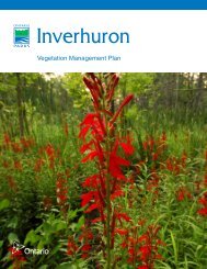
Cover photo: Cardinal Flower, Inverhuron Provincial Park<br />
Photo taken by: Willy Waterton<br />
Additional copies of this publication can be obtained from:<br />
Inverhuron Provincial Park<br />
19 Jordon Road<br />
Tiverton, <strong>Ontario</strong><br />
N0G 2T0<br />
Telephone: (519) 368-1959<br />
Printed on recycled paper.<br />
Recommended Citation:<br />
OMNR. 2008. Inverhuron <strong>Vegetation</strong> Management <strong>Plan</strong>. Queen’s Printer for <strong>Ontario</strong>. 28 pp. + Appendices.<br />
iv
Approval Statement<br />
I am pleased to approve the Inverhuron <strong>Vegetation</strong> Management <strong>Plan</strong>. This plan has been developed to meet<br />
the commitment of the Inverhuron Park Management <strong>Plan</strong> (2001) to prepare a vegetation resource stewardship<br />
strategy for the park. It has also been developed in accordance with A Class Environmental Assessment for<br />
Provincial <strong>Parks</strong> and Conservation Reserves (2005). This document recommends specific management<br />
techniques and provides guidelines for the vegetation issues facing park managers.<br />
This plan will be reviewed periodically to address changing issues or conditions and advances in vegetation<br />
management practices.<br />
I extend my sincere thanks to all those who participated in the consultation process. All comments received were<br />
carefully considered during the preparation of this document.<br />
Yours truly,<br />
February 11, 2008<br />
Date<br />
v
TABLE OF CONTENTS<br />
1.0 INTRODUCTION ............................................................................................................................................... 1<br />
1.1 Location and Site Description ........................................................................................................................1<br />
1.1.1 Regional Ecology ....................................................................................................................................1<br />
1.1.2 Soils and Physiography ..........................................................................................................................1<br />
1.1.3 Ownership and Park History ...................................................................................................................1<br />
1.1.4 Previous <strong>Vegetation</strong> Surveys..................................................................................................................2<br />
1.1.5 Zoning .....................................................................................................................................................3<br />
1.2 Policy Framework...........................................................................................................................................3<br />
1.3 Historic Influence on <strong>Vegetation</strong> Communities ..............................................................................................4<br />
2.0 VEGETATION COMMUNITIES......................................................................................................................... 5<br />
3.0 GOAL AND OBJECTIVES................................................................................................................................. 7<br />
3.1 Goal................................................................................................................................................................7<br />
3.2 Objectives.......................................................................................................................................................7<br />
4.0 MANAGEMENT UNITS AND PRESCRIPTIONS.............................................................................................. 8<br />
4.1 General Management Prescriptions...............................................................................................................8<br />
4.1.1 Dead and Hazardous Trees....................................................................................................................8<br />
4.1.2 Herbicide Use .........................................................................................................................................8<br />
4.1.3 Forest Fire Management.........................................................................................................................9<br />
4.1.4 Forest Insects and Diseases ............................................................................................................... 10<br />
4.1.5 <strong>Plan</strong>ting ................................................................................................................................................ 10<br />
4.1.6 Grass Mowing ...................................................................................................................................... 10<br />
4.1.7 Campgrounds / Trails........................................................................................................................... 10<br />
4.1.8 Transplanting ....................................................................................................................................... 10<br />
4.1.9 Seed Collecting.................................................................................................................................... 10<br />
4.1.10 Pioneer Cemetery.............................................................................................................................. 11<br />
4.2 <strong>Vegetation</strong> Management Units and Prescriptions....................................................................................... 11<br />
4.2.1 <strong>Vegetation</strong> Management Unit A: Beach / Dunes ................................................................................. 11<br />
4.2.2 <strong>Vegetation</strong> Management Unit B: Treed Sand Dunes .......................................................................... 14<br />
4.2.3 <strong>Vegetation</strong> Management Unit C: Coniferous Forest............................................................................ 15<br />
4.2.4 <strong>Vegetation</strong> Management Unit D: Day Use / Campgrounds ................................................................. 15<br />
4.2.5 <strong>Vegetation</strong> Management Unit E: Exclusion Zone ................................................................................ 16<br />
5.0 NON-NATIVE AND INVASIVE SPECIES MANAGEMENT............................................................................. 17<br />
6.0 SPECIES AT RISK .......................................................................................................................................... 18<br />
6.1 Pitcher’s Thistle (Cirsium pitcheri)............................................................................................................... 18<br />
6.2 Dwarf Lake Iris (Iris lacustris)...................................................................................................................... 19<br />
6.3 Ram’s Head Lady’s Slipper (Cypripedium arietinum) ................................................................................. 19<br />
6.4 American Beachgrass (Ammophila breviligulata) ....................................................................................... 19<br />
6.5 Great Lakes Wheat Grass (Elymus lanceolatus ssp. psammophilus) ........................................................ 19<br />
6.6 Sand Reed Grass (Calamovilfa longifolia var. magna) ............................................................................... 20<br />
6.7 Blue-leaf Willow (Salix myricoides var. myricoides).................................................................................... 20<br />
6.8 Low Nutrush (Scleria verticuillata)............................................................................................................... 20<br />
6.9 Puccoon (Lithospermum carolininense var. croceum)................................................................................ 20<br />
6.10 Locally Rare <strong>Plan</strong>ts in Inverhuron Provincial park .................................................................................... 20<br />
6.10 Rare Invertebrates with Dune Association................................................................................................ 21<br />
7.0 REASEARCH AND MONITORING ................................................................................................................. 23<br />
7.1 Scots Pine <strong>Plan</strong>tations ................................................................................................................................ 23<br />
7.2 Pitcher’s Thistle Monitoring ......................................................................................................................... 23<br />
7.3 Campground Monitoring.............................................................................................................................. 23<br />
8.0 IMPLEMENTATION PRIORITIES ................................................................................................................... 24<br />
9.0 SUMMARY OF PUBLIC CONSULTATION AND ENVIRONMENTAL ASSESSMENT REQUIREMENTS FOR<br />
IMPLEMENTATION............................................................................................................................................... 25<br />
10.0 PLAN AMENDMENT AND REVIEW ............................................................................................................. 26<br />
vii
11.0 REFERENCES .............................................................................................................................................. 27<br />
LIST OF APPENDICIES<br />
APPENDIX 1: Site Conditions Documentation Checklist ...................................................................................... 30<br />
APPENDIX 2: Dead and Hazardous Trees Treatments........................................................................................ 31<br />
APPENDIX 3: NHIC Conservation Ranks ............................................................................................................. 32<br />
APPENDIX 4: Use of Sand Fencing...................................................................................................................... 34<br />
APPENDIX 5: American Beachgrass <strong>Plan</strong>ting ...................................................................................................... 35<br />
APPENDIX 6: Invasive <strong>Plan</strong>ts at Inverhuron Provincial Park................................................................................ 36<br />
APPENDIX 7: Invasive Species Control Techniques ............................................................................................ 37<br />
LIST OF FIGURES<br />
Figure 1: Regional and Local Setting ...................................................................................................................... 2<br />
Figure 2: Zoning....................................................................................................................................................... 3<br />
Figure 3: <strong>Vegetation</strong> Communities .......................................................................................................................... 6<br />
Figure 4: <strong>Vegetation</strong> Management Units............................................................................................................... 12<br />
LIST OF TABLES<br />
Table 1. Preliminary ELC <strong>Vegetation</strong> Types in Inverhuron Provincial Park ............................................................ 5<br />
Table 2. Locally rare or uncommon plants in Inverhuron Provincial Park............................................................. 20<br />
Table 3. Rare dune associated arthropods detected in Inverhuron Provincial Park ............................................. 21<br />
viii
1.0 INTRODUCTION<br />
1.1 Location and Site Description<br />
Inverhuron Provincial Park is situated on Lake Huron off Hwy. 21, 14.5 km north-east of the community of<br />
Kincardine and is a historical class park, 288 ha in size (Figure 1) (OMNR 2000). The community of Inverhuron<br />
borders the park. Inverhuron lies within the amalgamated Municipality of Kincardine, County of Bruce (OMNR<br />
2000).<br />
1.1.1 Regional Ecology<br />
Inverhuron Provincial Park is located in Ecoregion 6E, the Lakes Simcoe-Rideau Ecoregion, which closely<br />
corresponds to the Great Lakes-St. Lawrence Forest Region, Huron <strong>Ontario</strong> Section (Hills 1959, Rowe 1972,<br />
Crins and Uhlig 2000, Crins 2002). More specifically, the park is located in Ecodistrict 6E-2 (Kincardine), which<br />
spans along the eastern shore of Lake Huron, from the south end of the Bruce Peninsula to north of Grand Bend<br />
(Hills 1959). Hills (1959) described Ecodistrict 6E-2 as “a plain of lake-laid clay and silt of moderate lime content<br />
with local areas of high lime till and low lime sand”.<br />
1.1.2 Soils and Physiography<br />
Inverhuron is located on a former lake plain associated with Lake Nipissing, which was created following the last<br />
glacial period. The topography is generally flat with some rolling sections. Topographic features include the<br />
former glacial lake shoreline in the form of gravel strands and sand dunes. The park is underlain by Palaeozoic<br />
sedimentary rocks of the Middle Devonian Detroit River Group, which are approximately 370 million years old.<br />
The Little Sauble River crosses the park before emptying into Lake Huron at the park’s southern boundary.<br />
(OMNR 2000, Chapman and Putnam 1984).<br />
The soils in Ecodistrict 6E-2 are grey-brown podsolics except in areas where there is limestone till and limestone<br />
gravel near the surface. Where limestone gravel is near the surface brown forest soils are common. Hills (1959)<br />
indicates that “Bisequia profiles are common: [and] brown podsolics are usually superimposed on grey brown<br />
podsolics under hardwoods and podsols under conifer[s]”. The soil development in the park is shallow, with the<br />
deepest soils being “east of the head of Inverhuron Bay continuing in a broad band to the north-eastern corner of<br />
the park”, and described as being a clay loam (Fitzgerald 2000, Helling et al. 1970). The remainder of the park<br />
consists of sandy soils on dunes and forested dunes in the south-eastern portions of the park (Helling et al.<br />
1970).<br />
1.1.3 Ownership and Park History<br />
The park itself is owned by <strong>Ontario</strong> Power Generation and is on lease to the <strong>Ontario</strong> Ministry of Natural<br />
Resources. As a condition of the operating licence for Bruce Nuclear, <strong>Ontario</strong> Power Generation has retained a<br />
914 m radius exclusion zone in the northwest corner of the park restricting access and use of the area for public<br />
safety (OMNR 2000).<br />
The former park campground was phased out in 1976 because of safety concerns related to the manufacturing<br />
of heavy water at the adjacent Bruce Nuclear Power Development (OMNR 2000). <strong>Ontario</strong> Power Generation no<br />
longer produces heavy water on site, which has allowed for the re-opening of the park campground. Prior to<br />
being phased out, the original campground had been in operation for over 25 years. Camping facilities have<br />
since been re-established following the old campground footprint closely (OMNR 2000).<br />
1
Figure 1: Regional and Local Setting<br />
1.1.4 Previous <strong>Vegetation</strong> Surveys<br />
There have been a number of vegetation surveys conducted at Inverhuron in the past, identifying at least 586<br />
species of vascular plants within the park (See Section 3 <strong>Vegetation</strong> Communities). Past vegetation surveys<br />
include:<br />
• An Annotated Checklist of the Vascular <strong>Plan</strong>ts of Inverhuron Provincial Park (Johnson and Parker 1975).<br />
• Botanical Reconnaissance of the Gunn Point-Holmes Bay Portion of Inverhuron Provincial Park<br />
(Johnson 1998).<br />
• Botanical Inventory of Inverhuron Provincial Park (Johnson 1981).<br />
• Known Bruce County Populations of Pitcher’s Thistle (Cirsium pitcheri) (Johnson 2000).<br />
• International Biological Program, Checksheet for Region 5, Area 224: Inverhuron (Helling et al. 1970).<br />
2
1.1.5 Zoning<br />
The park management plan (OMNR 2000) identifies four zones within the park: Historical Zone (122 ha), Nature<br />
Reserve Zone (28 ha), Development Zone (67 ha), and Natural Environment Zone (71 ha) (Figure 2).<br />
Figure 2: Zoning<br />
1.2 Policy Framework<br />
This plan has been developed to guide vegetation management in the park by providing more detailed direction<br />
based on the vegetation stewardship policies listed in Section 7.2 of the Inverhuron Provincial Park Management<br />
<strong>Plan</strong> (OMNR 2000) and recommendations in the Inverhuron Provincial Park Environmental Study Report (TSH<br />
2003). These policies are:<br />
• Non-native plant species will not be deliberately introduced;<br />
• Where non-native species threaten values, an eradication program may be developed;<br />
• Missing native species may be re-established if biologically feasible and acceptable, and compatible with<br />
the historical values for which the park was established;<br />
• Stabilization of shoreline and backshore sand dunes will be a priority;<br />
• Agricultural practices and commercial forest operations will not be permitted;<br />
• Maintain a natural 35 m buffer between campsites (TSH 2003);<br />
• Protect provincially significant biological resources (TSH 2003).<br />
3
1.3 Historic Influence on <strong>Vegetation</strong> Communities<br />
Most of the vegetation in the park is second-growth forest and in the early stages of succession because of<br />
logging and land clearing prior to park establishment (OMNR 2000). The bulk of the park is coniferous forest of<br />
which Eastern White Cedar (Thuja occidentalis) is the dominant species (TSH 2003). More mature forests are<br />
present along the banks of the Little Sauble River, which are the result of being protected as a timber preserve<br />
from a sawmill that historically operated near the mouth of the river (TSH 2003). Agricultural activities in the<br />
1800s have left remnants of settlers’ attempts to cultivate the land, such as overgrown fields near the park<br />
entrance (NHIC 2005). Other examples include remnants of garden escapees such as Lilacs (Syringa vulgaris)<br />
and irises (Iris sp.) brought by settlers, homesteaders and cottagers (Helling et al. 1970, Fitzgerald 2000, 2001).<br />
From the 1950s to the 1970s some park staff lived in the park and planted non-native garden species in the<br />
areas around their residence and park buildings, as well as trees to stabilize the dunes (N. Toth, Personal<br />
Communication 2006). There were also major fires in the 1880s within the park boundaries, which caused<br />
damage to vegetation and altered the landscape (Fitzgerald 2001). A fire in 1887 is cited as having destroyed<br />
most of the former town of Inverhuron's buildings and vegetation, resulting in the mobilization of exposed sand<br />
(Fitzgerald 2001).<br />
In an effort to stabilize sand dunes, large portions of the dunes have been planted with non-native species such<br />
as Scots Pine (Pinus sylvestris) and Austrian Pine (Pinus nigra) (TSH 2003).<br />
In the vicinity of the new campground development, remnants of the old campground facilities can still be<br />
detected in the form of transitional vegetation (young cedars and Balsam Fir (Abies balsamea)) growing along<br />
old roads and trails (TSH 2003).<br />
4
2.0 VEGETATION COMMUNITIES<br />
To assist with the vegetation management planning process, a preliminary Ecological Land Classification (ELC)<br />
for the park has been prepared (Biscaia and Gurr 2006). The classification was developed using a combination<br />
of past botanical inventories conducted by Helling et al. (1970), Johnson and Parker (1975), Johnson (1981),<br />
Johnson (2000); ortho photo interpretation and a site visit conducted in the fall of 2005. It is recommended that a<br />
full and complete ELC be completed at a later date to assist with vegetation management in the park.<br />
The ELC classifications used are consistent with Lee et al. (1998) and its updates (Lee 2005). A summary of the<br />
ELC communities and descriptions in Inverhuron Provincial Park is provided in Table 1 and Figure 3.<br />
Inverhuron Provincial Park is primarily made up of 10 distinct ELC vegetation community types (Table 1). The<br />
checklist of the vascular plants of Inverhuron Provincial Park by Johnson and Parker (1975), along with updates<br />
by Johnson (1981) and Johnson (unpublished data) identifies at least 586 species of vascular plants including a<br />
number of provincially significant species. The park is home to the provincially and federally endangered<br />
Pitcher’s Thistle (Cirsium pitcheri) (Johnson 2000), Great Lakes Wheat Grass (Elymus lanceolatus ssp.<br />
psammophilus) (G5, S3) (TSH 2003), American Beachgrass (Ammophila breviligulata) (G5, S3), and Sand Reed<br />
Grass (Calamovilfa longifolia var. magna) (G5, S3).There are also reports of the provincially and nationally<br />
threatened Dwarf Lake Iris (Iris lacustris) (G3, S3) and the provincially and nationally threatened Ram’s Head<br />
Lady’s Slipper (Cypripedium arietinum) (G3,S3) that require further verification (TSH 2003).<br />
Table 1. Preliminary ELC <strong>Vegetation</strong> Types in Inverhuron Provincial Park<br />
ELC Code ELC Community Dominant <strong>Vegetation</strong><br />
FOCS3-1 Dry White Cedar Calcareous Bedrock Eastern White Cedar, Balsam Fir<br />
Coniferous Forest Type<br />
SWMM1-1 White Cedar-Hardwood Mineral Mixed<br />
Swamp Type<br />
Eastern White Cedar, Red Ash (Fraxinus<br />
pennsylvanica) and Red Osier Dogwood<br />
(Cornus stolonifera)<br />
Eastern White Cedar, Balsam Fir, Willow<br />
(Salix) and dogwoods<br />
FOCM4-3 Fresh-Moist White Cedar-Balsam Fir<br />
Coniferous Forest Type<br />
CUM1-1 Dry-Moist Old Field Meadow Type White Ash (Fraxinus americana), Eastern<br />
White Cedar, Staghorn Sumac (Rhus<br />
typhina),<br />
SHOR1-1<br />
Shrubby Cinquefoil Calcareous Open<br />
Bedrock Shoreline Type<br />
Cinquefoils (Potentilla), Willow, Grasses<br />
(Gramineae), Asters (Asteraea) and<br />
Goldenrods (Solidago)<br />
SHOM1-2 Sea Rocket Sand Open Shoreline Type Devoid of vegetation<br />
SBOD1-1 Little Bluestem-Switchgrass-Beachgrass<br />
Open Graminoid Sand Dune Type<br />
American Beachgrass, Tall Wormwood<br />
(Artemisia caudata), Sand Reed Grass,<br />
Beach Pea (Lathyrus japonicus) and<br />
Pitcher’s Thistle<br />
SBTD1-2 Balsam Poplar Treed Sand Dune Type Balsam Poplar (Populus balsamifera) and<br />
SBTD1-20<br />
SBOB1-3<br />
White Cedar-Balsam Fir Treed Sand Dune<br />
Type<br />
Dry Bracken Fern Open Forb Sand Barren<br />
Type<br />
Willow<br />
Eastern White Cedar, Balsam Fir, Scots,<br />
Austrian Pine, and Trembling Aspen<br />
(Populus tremuloides)<br />
Eastern White Cedar, Scots Pine, Balsam<br />
Fir, Canada Blue Grass (Poa compressa),<br />
Great Lakes Wheat Grass<br />
5
Figure 3: <strong>Vegetation</strong> Communities<br />
6
3.0 GOAL AND OBJECTIVES<br />
3.1 Goal<br />
The goal of the Inverhuron Provincial Park <strong>Vegetation</strong> Management <strong>Plan</strong> is to:<br />
Provide direction on vegetation management issues within Inverhuron Provincial Park to ensure the persistence<br />
of naturally occurring species and vegetation communities within the park and the natural processes that occur<br />
within them, while protecting significant cultural resources and providing for compatible recreational activities<br />
including camping, day use and heritage appreciation consistent with the park management plan.<br />
3.2 Objectives<br />
The objectives of the Inverhuron Provincial Park <strong>Vegetation</strong> Management <strong>Plan</strong> are to:<br />
• Conserve and, where necessary, restore viable populations of indigenous floral species, with an<br />
emphasis on protecting species at risk and their respective habitats within the park;<br />
• Eliminate or reduce the threat of invasive exotic species where possible, with a particular emphasis on<br />
Scots Pine, while ensuring the protection of significant Aboriginal archaeological features;<br />
• Restore or enhance natural vegetation features where possible, and processes that have been, or are<br />
in danger of being, lost or degraded;<br />
• Provide opportunities for park visitors to appreciate and learn from the diverse floral communities of<br />
the park, in ways that do not threaten existing natural values;<br />
• Reduce park visitor safety hazards associated with vegetation.<br />
7
4.0 MANAGEMENT UNITS AND PRESCRIPTIONS<br />
The Inverhuron Park Management <strong>Plan</strong> outlines general vegetation management policies (See Section 1.2),<br />
which have provided the basis for the more detailed prescriptions outlined here, based on vegetation<br />
management issues and vegetation communities found throughout the park. Section 4.1 outlines general<br />
management prescriptions that may be implemented throughout the entire park, whereas section 4.2 outlines<br />
management prescriptions for specific vegetation management units within the park.<br />
Site conditions prior to the implementation of species and habitat specific management prescriptions should be<br />
well documented (i.e., presence of invasive species or species at risk) (Appendix 1). General management<br />
prescriptions carried out as part of regular park maintenance such as lawn mowing and dead and hazardous<br />
tree removal do not require the same documentation. An adaptive management approach will be taken when<br />
implementing vegetation management prescriptions to allow for modifications as necessary to ensure success.<br />
4.1 General Management Prescriptions<br />
4.1.1 Dead and Hazardous Trees<br />
Safety will be the major deciding factor for when a tree needs to be removed, however, consideration must also<br />
be given to the importance of dead tree material and downed woody debris. Dead trees will be left standing as<br />
wildlife habitat for cavity-nesting birds and mammals in all zones at the superintendent’s discretion except in<br />
instances where they pose a direct threat to public safety (OMNR 2003) and with the exception of situations<br />
where their presence:<br />
• Obstructs efforts to maintain recreational facilities, roads, campsites, trails, day use areas, manicured<br />
lawns and the pioneer cemetery;<br />
• Results in park visitors scavenging wood for camp fires;<br />
• Encourages insect infestations that may be detrimental to the health of the forests.<br />
Material that has been removed from a site can be used as firewood or could be chipped and used to help<br />
reduce erosion, or to build up an organic layer in newly developed areas.<br />
Further guidance on the treatment of dead and hazardous trees is found in Appendix 2.<br />
4.1.2 Herbicide Use<br />
The Inverhuron Park Management <strong>Plan</strong> does not address herbicide use. Herbicides that biodegrade quickly,<br />
have low soil activity and have been tested and shown to have minimal environmental impacts (e.g., glyphosate<br />
and triclopyr) (OMNR 2001) can be used for restoration activities and controlling invasive species. Use of<br />
biological control agents (if available) will be used when feasible. Use of herbicides for restoration activities and<br />
controlling invasive species will be done in consultation with the zone ecologist to determine their<br />
appropriateness. Any person working with herbicides in the park must do so under the requirements of the<br />
Pesticides Act and PM 2.16, Use of Pesticides and Herbicides in Provincial <strong>Parks</strong>.<br />
Species such as Poison Ivy (Rhus radicans) may be controlled in the development zone and in other zones<br />
where park visitors may come into contact with the plant (i.e., trails) as deemed necessary. Glyphosate is<br />
currently the best control for Poison Ivy (OMNR 2001).<br />
8
4.1.3 Forest Fire Management<br />
Studies of the historical role of fire in this region are limited. Though fire did occur occasionally, it was much less<br />
common than in other forest regions (Van Sleeuwen 2006). Fires also help to reduce fuel loads, decreasing the<br />
likelihood of large intense fires that are difficult to control (OMNR 2005 b ).<br />
Forest fire management involves the protection of values and the attainment of resource stewardship objectives<br />
through two main approaches:<br />
• Fire response: The protection of people, property, and natural areas from wildfire; and,<br />
• Fire use: The strategy of maintaining fire as an ecological process or meeting resource management<br />
objectives through the application or management of fire.<br />
The Forest Fire Management Strategy for <strong>Ontario</strong> (OMNR 2004) provides strategic direction for the management<br />
of wildfire across <strong>Ontario</strong>. Inverhuron Provincial Park is located in the Southern <strong>Ontario</strong> Zone according to this<br />
provincial strategy. Within this zone, municipalities are responsible for providing fire response for all forest fires<br />
to protect life, property and infrastructure in accordance with the Fire Protection and Prevention Act (FPPA).<br />
Fire management objectives within Inverhuron Provincial Park will focus on the prevention of personal injury,<br />
value loss, and social disruption; but will allow for the use of fire to help restore and maintain ecological integrity<br />
if deemed appropriate.<br />
To provide detailed direction on achieving these fire management objectives, the Park will commit to writing a<br />
Statement of Fire Intent as directed by Fire management policy for Provincial <strong>Parks</strong> and Conservation Reserves.<br />
This statement will consider and document the role of fire in Inverhuron Provincial Park, scoping fire<br />
management objectives and opportunities. This statement will be developed in consultation between the Park<br />
Superintendent and MNR fire management personnel.<br />
Fire Response<br />
Given the size of the park and adjacent developed areas, unplanned fires could pose a threat to public health<br />
and safety, property and infrastructure. Therefore all forest fires will receive a full response and sustained action.<br />
Inverhuron Provincial Park is within the municipality of Kincardine and fire protection services are provided to the<br />
park by the municipality.<br />
“Light on the land” fire suppression techniques will be used whenever feasible. These minimal impact<br />
suppression techniques do not unduly disturb natural or cultural values. Examples may include limiting the use<br />
of heavy equipment or the felling of trees during fire response.<br />
Fire evacuation procedures will be as outlined in the Emergency and Evacuation <strong>Plan</strong>s for Inverhuron Provincial<br />
Park.<br />
Fire Use<br />
MNR recognizes fire as an essential ecosystem process, fundamental to restoring and maintaining the<br />
ecological integrity of certain ecosystems. Fire use for ecological and vegetation management objectives in the<br />
park will be achieved by exploring opportunities for prescribed burning. Prescribed burning refers to the<br />
deliberate, planned and knowledgeable application of fire by authorized personnel to a specific land area to<br />
accomplish pre-determined objectives.<br />
• Prescribed burning to achieve ecological or hazard reduction objectives may be considered if deemed<br />
appropriate;<br />
• <strong>Plan</strong>s for any prescribed burning will be developed in accordance with the MNR Prescribed Burn Policy,<br />
its associated planning manual, and the Class Environmental Assessment for Provincial <strong>Parks</strong> and<br />
Conservation Reserves, in cooperation with Aviation and Forest Fire Management.<br />
9
4.1.4 Forest Insects and Diseases<br />
Forests will be examined periodically for outbreaks of non-native forest insects and disease that may pose a<br />
threat to forest health or other park values. Control of non-native forest insects and disease will be examined on<br />
a case-by-case basis and will be carried out in consultation with the zone ecologist and OMNR forestry and<br />
entomology staff. Biological controls, such as Bacillus thuringiensis (Bt) will be used whenever feasible to control<br />
insect outbreaks.<br />
4.1.5 <strong>Plan</strong>ting<br />
Species native to the park should be used for restoration or landscape planting (See Johnson and Parker 1975).<br />
If commercial seed mixes are used to re-vegetate disturbed areas (i.e., roadsides, campgrounds, day use areas<br />
and pioneer cemetery), seed mix should be used which contains as many species native to the park as possible.<br />
Where possible plant stock obtained from outside the park for landscape planting and restoration should be from<br />
a local seed source to ensure that they are of a similar genotype and adapted to local growing conditions. <strong>Plan</strong>t<br />
stock derived from park seed may be the preferred option in many cases (see section 4.1.9).<br />
4.1.6 Grass Mowing<br />
Lawns will be mown in the development and historical zones where appropriate to maintain park buildings,<br />
recreational areas, roadways and the pioneer cemetery. In the event that the amount of area to be mowed is<br />
reduced, then careful monitoring should be done to ensure that areas left to natural regeneration are not<br />
colonized by invasive species. Consideration should be given to restoration of these areas using a herbicide to<br />
kill the non-native grasses and then planting with native forest or grassland species (depending on specific<br />
circumstances).<br />
4.1.7 Campgrounds / Trails<br />
The park campgrounds and trails will require general upkeep, including the removal of dead and hazardous<br />
trees and control of Poison Ivy and invasive species, which is permitted under sections 4.1.1, 4.1.2 and 5.0.<br />
4.1.8 Transplanting<br />
Where existing vegetation may be lost due to development, plants may be salvaged and transplanted for<br />
naturalization and restoration purposes within the park. Transplanting vegetation outside the park will be<br />
examined on a case-by-case basis and only be appropriate once park needs have been met. Preference would<br />
be given to local naturalization and restoration projects near the park.<br />
4.1.9 Seed Collecting<br />
Seed Collecting for Use Within the Park<br />
Seed may be collected for use in propagation and planting within the park for restoration and naturalization<br />
purposes. Harvesting effort will be rotated and spread throughout the park. The amount of seed collected will be<br />
limited based on the species and determined in consultation with the zone ecologist (OMNR 2001). Records will<br />
be kept regarding:<br />
10<br />
• The species and amount of seed harvested;<br />
• The location and date of harvesting;<br />
• Where in the park the seed was used.
Seed collecting for Use Outside the Park<br />
Seed collection for use outside the park will be based on the following guidelines until such time that <strong>Ontario</strong><br />
<strong>Parks</strong> develops and approves a seed collection policy. Seed collection for use outside the park will be examined<br />
on a case-by-case basis in consultation with the zone ecologist and under the authority of the Park<br />
Superintendent. Seed collection should be for local conservation purposes only, and not for private use (i.e.,<br />
private gardens) or commercial purposes (i.e., nursery stock) unless done under a partnership agreement with<br />
the park whereby the grower is propagating plant species for the park and selling a negotiated proportion of the<br />
grown stock to recover costs. Agreements for seed collecting for use outside of the park will be authorized<br />
through a memorandum of understanding or a completed Application to Conduct Research in Provincial <strong>Parks</strong><br />
until such time as a specific seed collection policy is implemented. The superintendent will have final discretion<br />
on such authorizations. Approval will be based on the following considerations, guidelines and conditions:<br />
• Where the seed will be used;<br />
• The amount of seed required;<br />
• Availability of seed sources outside the park;<br />
• The harvesting method used;<br />
The location and amount of seed harvested will be determined by park staff and the zone ecologist. The park<br />
reserves the right to request a portion of the seed for park use and the park superintendent reserves the right to<br />
cancel harvesting agreements at any time.<br />
4.1.10 Pioneer Cemetery<br />
The pioneer cemetery will continue to be maintained, including landscape planting and grass mowing as<br />
required (See Sections 4.1.5 – 4.1.6).<br />
4.2 <strong>Vegetation</strong> Management Units and Prescriptions<br />
To facilitate the application of specific vegetation management prescriptions within the different park<br />
management zones, Inverhuron Provincial Park has been divided into vegetation management units (Figure 4).<br />
<strong>Vegetation</strong> management units are defined by vegetation communities (ELC descriptions), property boundaries,<br />
roads, existing trail systems and park zoning. The vegetation communities defined in Section 2 provide<br />
descriptions of the values for which the vegetation management units have been developed, to be consistent<br />
with the park management plan.<br />
4.2.1 <strong>Vegetation</strong> Management Unit A: Beach / Dunes<br />
<strong>Vegetation</strong> management unit A includes vegetation communities SHOR1-1 (shale beach), SHOM1-2 (wet<br />
beach), and SBOD1-1 (beach dunes). This area extends from the northern park boundary, to the southern park<br />
boundary of Inverhuron Bay along the shoreline of Lake Huron from the foredune to the water’s edge, and is<br />
included within the natural environment zone (Figure 4).<br />
Lake Huron Dune Grasslands are considered provincially very rare (S1S2) (Appendix 3: Conservation Ranks)<br />
(Jalava 2004). The dunes at Inverhuron provide significant habitat 1 for the endangered Pitcher’s Thistle, which<br />
has been identified as a candidate for regulation under the provincial Endangered Species Act (ESA).<br />
1 SAR Significant Habitat: “Significant” is defined in the Provincial Policy Statement as follows:<br />
“In regard to the habitat of endangered species and threatened species, [significant] means the habitat, as approved by the OMNR, that is<br />
necessary for the maintenance, survival, and/or the recovery of naturally occurring or reintroduced populations of endangered species or<br />
threatened species and where those areas of occurrence are occupied or habitually occupied by the species during all or any part(s) of its<br />
life cycle” (OMNR, 2006).<br />
11
Figure 4: <strong>Vegetation</strong> Management Units<br />
Provincially rare to uncommon (S3) species, including American Beachgrass, Great Lakes Wheat Grass and<br />
Sand Reed Grass, are also present in the dunes (See SAR Section 6.0).<br />
Dune vegetation plays an important role in the dune-building process by reducing wind velocity and capturing<br />
sand (Peach 2005), and is adapted to living in a harsh environment by being tolerant of low moisture levels,<br />
temperature extremes, burial and erosion (Albert 2000).<br />
The coastal dune environment is dynamic in nature and subject to environmental influences such as wind, wave<br />
action and water levels. As such, it is best to take an adaptive approach to managing these systems. Dunes and<br />
dune vegetation can play an important role in protecting the shoreline from erosion and preventing sand from<br />
encroaching on existing structures and facilities. The development of new facilities in the vicinity of dune<br />
environments should be well thought out. Improper planning can result in increased maintenance costs due to<br />
sand encroachment and burial and can have negative impacts on these fragile ecosystems. It is also important<br />
to consider that “beaches are inextricably linked to dunes and so management of dunes must include the proper<br />
management of beaches” (Peach 2005).<br />
The sand dunes at Inverhuron Provincial Park present a unique challenge for park staff due to the presence of<br />
Pitcher’s Thistle (See SAR Section 6.0). Pitcher’s Thistle requires a certain amount of disturbance to survive and<br />
management prescriptions in this vegetation management unit may have adverse effects on the plant. Any<br />
prescription that is applied in this unit should be monitored and evaluated to determine if it is having detrimental<br />
impacts on populations of this species. (See Research and Monitoring Section 7.0) It is essential that park staff<br />
understand the balance between disturbance and stabilization for its survival.<br />
12
The objectives of the management prescriptions in vegetation management unit A are to conserve and protect<br />
the shoreline and dune ecosystem and continue to support low-intensity recreational activity in the natural<br />
environment zone of the park (OMNR 2000) by pursuing the following targets:<br />
• Conserve and protect the potentially nationally significant dune grasslands;<br />
• Ensure that management prescriptions are consistent or not in conflict with recovery objectives in the<br />
Pitcher’s Thistle – Lake Huron Dune Grasslands Recovery Strategy (Jalava 2004) and other recovery<br />
strategies as they are developed;<br />
• Allow natural dune-building processes to continue by protecting habitat from development, vehicle,<br />
pedestrian and other human impacts (Jalava 2004);<br />
• Ensure populations of critically imperilled dune species are re-established through species-specific<br />
habitat restoration and reintroduction programs (Jalava 2004).<br />
Active management of the vegetation on the shale beach is not anticipated at this time; however, management<br />
prescriptions will be developed, implemented and evaluated on a case-by-case basis as required in consultation<br />
with the zone ecologist.<br />
To the greatest extent possible, it is desirable to allow for natural dune processes to take their course in this<br />
vegetation management unit. Prescriptions for this vegetation management unit include:<br />
Education<br />
Low water levels in recent years have resulted in the establishment of dune vegetation such as American<br />
Beachgrass further out on the mid-beach and in a higher density than in previous years. Dune vegetation can<br />
sometimes be aesthetically unpleasing to those who do not understand its role in dune systems. There is also a<br />
lack of understanding of the sensitivity of these features to human disturbances (Peach 2005).<br />
Education is an essential management tool in raising awareness of the importance of protecting these sensitive<br />
features. Education can take the form of signage, literature and interpretive and outreach programs.<br />
Access<br />
Dune and beach vegetation is sensitive to trampling from pedestrian traffic. It is important to have designated<br />
access for recreational users of the beach in the form of established trails and boardwalks. Access should be<br />
signed and well marked so as to influence human traffic patterns (Bowles and Maun 1982 as cited by Peach<br />
2005).<br />
Boardwalks and pathways should be angled through the foredune to prevent erosion or blowouts in the dune<br />
(Peach 2005). Boardwalks should be constructed in a manner that allows them to be elevated, allowing wind to<br />
blow under them and prevent them from accumulating sand and deal with rising dunes to minimize maintenance<br />
issues.<br />
Recreational Use<br />
Recreational use from beach goers (swimmers, sunbathers etc.) should be promoted in the low/wet beach area<br />
that is devoid of vegetation. Recreational activity in this area reduces disturbance to sensitive dune vegetation<br />
and is less prone to erosion as the moist sand is more adhesive. Recreational users should also be encouraged<br />
to use designated access points to cross the dunes and get to the beach.<br />
Beach clean-ups to maintain portions of the beach for recreational use should be conducted in the wet/low<br />
beach area only, and not encroach on dune vegetation. Cleaning of debris that impedes recreational use should<br />
be limited to hand tools, wheel barrows and small machinery to cart debris away if needed. The use of<br />
machinery on the beach is not an ideal management practice. If machinery is used to cart debris away (i.e.,<br />
small ATV, tractor or gator), it should be operated on the wet beach area only. Designated entry and exit points<br />
should be established to limit the amount of disturbance to the beach and dunes. Consideration should also be<br />
given to the type and amount of debris removed from the beach such as litter vs. natural material. Some natural<br />
material including large woody debris may enhance the appearance of the beach aesthetically and organic<br />
matter washed up on beach provides some of the nutrients for the dune community.<br />
13
Beach and Foredune Management / Maintenance Techniques<br />
Brush, sand fencing and American Beachgrass planting can be used on the beach and foredune to mitigate the<br />
effects of sand migration on facilities where deemed necessary. These management techniques should be kept<br />
to a minimum and caution should be exercised when using these management prescriptions in Pitcher’s Thistle<br />
habitat as there is potential for adverse effects on the species (see Appendix 4: Use of Sand Fencing and<br />
Appendix 5: American Beachgrass <strong>Plan</strong>ting). The advice of the Pitcher’s Thistle – Lake Huron Dune Grassland<br />
Recovery Team will be sought prior to management actions that may impact Pitchers Thistle. Management<br />
prescriptions that may adversely affect Pitcher’s Thistle resulting in dune stabilization or burial will also be<br />
monitored accordingly (See Section 7.0). Sand fencing is the least permanent of the management prescriptions,<br />
allowing for modifications to be made as necessary (Peach 2005).<br />
4.2.2 <strong>Vegetation</strong> Management Unit B: Treed Sand Dunes<br />
<strong>Vegetation</strong> management unit B includes all areas within vegetation communities SBTD1-2 (Balsam Poplar Treed<br />
Sand Dune), SBTD1-20 (White Cedar-Balsam Fire Treed Sand Dune), SBOB1-3 (sand barrens) and CUM1-1<br />
(cultural meadows) plus the southern two polygons defined as SWMM1-1 (cedar swamps). This area takes in<br />
the north-east corner of the park, extending south past the main interior park access road to the eastern park<br />
border. It encompasses portions of the parks historical and development zones (Figure 4).<br />
The objectives of management prescriptions in vegetation management unit B are to preserve the forested<br />
dunes in a manner that protects significant archaeological and historical features, allow for the continued<br />
persistence of Pitcher’s Thistle and promote the re-establishment of native species in conifer plantations by<br />
pursuing the following targets:<br />
• Protect cultural and historical values by stabilizing shoreline and backshore sand dunes where<br />
necessary (OMNR 2000);<br />
• Protect SAR values by allowing open areas to maintain themselves;<br />
• Naturalize the area by removing Scots Pine and planting native species;<br />
• Map Scots Pine plantations within the park.<br />
Scots Pine <strong>Plan</strong>tations<br />
Over time non-native conifers such as Scots Pine and Austrian Pine in this vegetation management unit should<br />
be removed. The park management plan states that stabilization of shoreline and backshore dunes is a priority<br />
(OMNR 2001). As such, the removal of large areas of Scots Pine should be carefully considered and a<br />
precautionary approach taken to reduce concerns with erosion and mobilization of sand.<br />
Scots Pine seed can remain viable in the sand for many years (OMNR 2005 a ) and seedlings have aggressive<br />
root systems that can compete with native vegetation (Burns and Honkala 1990). Because of the seed source<br />
established in the sand at Inverhuron and in-seeding of Scots Pine from outside the park boundary, there will<br />
likely be a need for long-term management of regeneration. The Scots Pine plantations should be managed by:<br />
• Controlling seedling regeneration by clipping seedlings off at ground level (OMNR 2005 a );<br />
• Under-planting with native species (Eastern White Cedar);<br />
• Gradually thinning Scots Pine (cutting and chemical girdling) allowing native species in the understory,<br />
such as Eastern White Cedar, Balsam Poplar and Balsam Fir, to become established (OMNR 2005 a ).<br />
Small openings in the canopy can aid in speeding up the process of natural succession and allow for native<br />
species to become established (OMNR 2005 a ). Thinning of Scots Pine should be considered only in large well<br />
treed stands with good ground cover. Areas that are determined appropriate for thinning should be assessed for:<br />
• The size of the area to be thinned and threat of erosion and blowouts;<br />
• Composition and density of native understory growth (OMNR 2005 a ).<br />
14
Treatments that open too large an area may favour Scots Pine and non-native species regeneration (Burns and<br />
Honkala 1990). General guidelines for thinning are:<br />
• Create canopy gaps of 3-4 trees 6-10 m in height to encourage the growth of shade-tolerant species<br />
such as Eastern White Cedar (OMNR 1996, Burns and Honkala 1990);<br />
• Assess the response of native vegetation to release and under-plant with Eastern White Cedar where<br />
appropriate;<br />
• Leave felled trees on site and do not operate machinery on forested dunes;<br />
• No cutting or thinning in suitable migratory or breeding bird habitat during May 15 – July 23 (TSH 2003);<br />
• Ideally conduct thinning in the winter months when the ground is frozen to reduce the amount of site<br />
damage.<br />
The above management prescription should be carried out with caution in areas where cultural remains have<br />
been repatriated to ensure activities do not disturb Aboriginal burial sites. Less intrusive methods of controlling<br />
Scots Pine in these areas include chemical girdling and under-planting to ensure that sites remain stabilized.<br />
Cultural Values<br />
“In recognition of the significant Aboriginal archaeological features located within Inverhuron Provincial Park [in<br />
relation to the removal of Scots Pine and dune stabilization], <strong>Ontario</strong> <strong>Parks</strong> will have special regard for local First<br />
Nations particular interests. Respect and protection of archaeological and cultural features are a key component<br />
of this park [vegetation management plan]. The Chippewas of Saugeen and Nawash First Nations will be<br />
consulted on related issues of concern during the implementation of this plan” (OMNR 2000).<br />
Motorized Vehicle Use<br />
The Provincial <strong>Parks</strong> and Conservation Reserves Act prohibits the public from using All Terrain Vehicles (ATV)<br />
in provincial parks. Since ATV use is evident in portions of the forested dunes, fencing, signage and<br />
enforcement should be used to mitigate the impacts of these activities.<br />
4.2.3 <strong>Vegetation</strong> Management Unit C: Coniferous Forest<br />
<strong>Vegetation</strong> management unit C includes those portions of the FOCS3-1 (coniferous forest) vegetation<br />
community located outside of the campground, the FOCM4-3 (moist cedar forests) community and the northern<br />
three polygons defined as SWMM1-1 (cedar swamps) adjacent to Holmes Bay. These areas extend south of the<br />
northern park border, taking in the parks natural environment zone and part of the historical zone north of the<br />
interior park access road (Figure 4).<br />
The objective of management prescriptions in vegetation management unit C is to allow for natural processes in<br />
the surrounding coniferous forests to continue. Active management of the coniferous forests is not anticipated at<br />
this time; however management prescriptions will be implemented and evaluated on a case-by-case basis as<br />
required in consultation with the zone ecologist. The targets for this vegetation management unit are to:<br />
• Maintain the area in a forested state;<br />
• Allow for natural processes of the ecosystem to continue.<br />
4.2.4 <strong>Vegetation</strong> Management Unit D: Day Use / Campgrounds<br />
<strong>Vegetation</strong> management unit D includes those portions of vegetation communities SBTD1-2 (Mineral Shoreline),<br />
SBTD1-20 (White Cedar-Balsam Fir Treed Sand Dune), FOCS3-1 (Dry White Cedar Calcareous Bedrock<br />
Coniferous Forest), FOCM4-3 (Fresh-Moist White Cedar-Balsam Fir Coniferous Forest) and SBOD1-1<br />
(Graminoid Sand Dune) within the campground and day use areas in the parks development zone (Figure 4).<br />
15
The objective of management prescriptions in vegetation management unit D is to promote the continued use of<br />
campgrounds and day use facilities for park users, while at the same time minimizing the impacts on the<br />
surrounding communities. The targets of this vegetation management unit are to:<br />
• Maintain campground and day use facilities and implement vegetation management prescriptions on a<br />
case-by-case basis as required;<br />
• Restore natural areas between campsites using native plants derived from park or local seed sources;<br />
• Allow for the expansion of campground facilities (i.e., group camping) (OMNR 2000).<br />
<strong>Vegetation</strong> management prescriptions within this unit are generally covered by the General Management<br />
Prescriptions outlined in section 4.1.<br />
4.2.5 <strong>Vegetation</strong> Management Unit E: Exclusion Zone<br />
<strong>Vegetation</strong> management unit E is represented by the <strong>Ontario</strong> Power Generation’s exclusion zone in the northwest<br />
corner of the park (Figure 4). It includes the entire Nature Reserve Zone and the portion of the Natural<br />
Environment Zone between the Nature Reserve Zone and the shoreline.<br />
This vegetation management unit is maintained by <strong>Ontario</strong> Power Generation (OPG), and no use of the area will<br />
be made without written permission of the Atomic Energy Control Board (OMNR 2000). If access or<br />
management of this area is required, it will be done in full consultation with and with permission of, the above<br />
agencies.<br />
16
5.0 NON-NATIVE AND INVASIVE SPECIES MANAGEMENT<br />
The Inverhuron Park Management <strong>Plan</strong> states that non-native plants will not be deliberately introduced and<br />
allows for an eradication plan to be developed when they threaten a particular park value (OMNR 2000). Where<br />
uncertainties exist as to the threat of non-native species to the park ecosystem, monitoring and research to<br />
investigate the issue should be pursued in all park zones (OMNR 2001).<br />
Non-native garden escapees associated with historic settlements within the park that do not exhibit invasive<br />
tendencies, may be left in place as they are historical resources in an historic class park.<br />
Approximately 27% of the plant species listed as occurring in the park by Johnson and Parker (1975) and<br />
Johnson (1981) are not native to the park. Species such as Scots Pine and Austrian Pine have been deliberately<br />
introduced for purposes of erosion control in the sand dunes and have been addressed in Section 4.2.2. A list of<br />
invasive species in Inverhuron Provincial Park has been adapted from the “Priority Invasive <strong>Plan</strong>ts in Southern<br />
<strong>Ontario</strong>” list developed by the <strong>Ontario</strong> Invasive <strong>Plan</strong>ts Working Group and existing botanical inventories to serve<br />
as a guideline for management decisions (Appendix 6) (Havinga et al. 2000).<br />
Not all non-native species have shown invasive tendencies in the park and it is not realistic to expect that all<br />
invasive species can be removed from the park, as they can be difficult to control. The spread of invasive<br />
species should be monitored within the park and priority species for management should be based on ecological<br />
threat and ease of control, priority being given to those species that pose the greatest threat and are the easiest<br />
to control (OMNR 2001). Actions to prevent further introductions into the park include:<br />
• Using native species in plantings;<br />
• Eradicating invasive species when they first appear (Havinga et al. 2000).<br />
Invasive species of concern in the park include the non-native strain of Common Reed (Phragmites australis)<br />
located on the beach and in the interior wetlands in the natural environment zone, and Mezer’s Daphne (Daphne<br />
mezereum) in the campgrounds. The population of Common Reed within the park is small and control should be<br />
strongly considered as it potentially threatens SAR values in the dunes and can easily be controlled at this time.<br />
Mezer’s Daphne within the campgrounds should be monitored to determine if action is needed, as it has been<br />
known to be invasive in parts of southern <strong>Ontario</strong> (Havinga et al. 2000).<br />
Invasive species management prescriptions for selected species can be seen in Appendix 7. Additional<br />
prescriptions will be appended to the plan as required.<br />
17
6.0 SPECIES AT RISK<br />
<strong>Ontario</strong> <strong>Parks</strong> policy PM 11.03.02 states that the “preservation of species at risk in provincial parks is an inherent<br />
part of the Provincial Park system’s protection objective.” The policy further states that “in certain cases, passive<br />
management (i.e., non-intervention) of species at risk and habitat will not guarantee the perpetuation of that<br />
species. If this is determined, then active management will be prescribed” (OMNR 2001).<br />
Currently there are two records of Committee on the Status of Endangered Wildlife in Canada (COSEWIC) /<br />
OMNR listed plant species at risk in Inverhuron Provincial Park, i.e., Pitcher’s Thistle and Dwarf Lake Iris. Aside<br />
from the COSEWIC listed species, there are also seven provincially rare to uncommon (S1-S3) plants found at<br />
Inverhuron (Johnson and Parker 1975, Johnson 1981). A summary of the communities in the park where each is<br />
found and/or any key biological and management issues of each is provided in sections 6.1 to 6.9. A total of 37<br />
plants are also identified as being locally rare or uncommon in Southern Bruce County (Bruce-Grey <strong>Plan</strong>t<br />
Committee 1997), which are listed in Table 2 in section 6.10.<br />
There are also a number of rare, sand dune-associated invertebrate species within the park that bear<br />
consideration in vegetation management decisions. An outline of these species and management implications<br />
are provided in section 6.11. If additional species at risk are discovered in the park, management prescriptions<br />
will be developed and appended to the plan in consultation with the zone ecologist.<br />
6.1 Pitcher’s Thistle (Cirsium pitcheri)<br />
(G3, S2 Endangered)<br />
Pitcher’s Thistle is a provincially and federally endangered plant species that is a candidate for regulation under<br />
the provincial Endangered Species Act. The presence of Pitcher’s Thistle is well documented at Inverhuron<br />
(Johnson 2000, N. Toth, Personal Communication 2006). It is an Upper Great Lakes endemic and is not found<br />
anywhere else in the world (COSEWIC 2000).<br />
Pitcher’s Thistle grows on the open sandy habitat found on high beaches, foredunes, blowouts and beach<br />
ridges. It is adapted to living in a harsh environment, is somewhat tolerant of burial from sand (2-3 cm annually)<br />
and can withstand high soil temperatures. Prior to flowering, the species goes through three life stages as a<br />
seedling, rosette and adult, taking 3-11 years to reach maturity before dying.<br />
The Pitcher’s Thistle Lake Huron Dune Grasslands Recovery Strategy (Jalava 2004) defines the species’<br />
survival and recovery habitat as follows:<br />
Pitcher’s Thistle Survival Habitat<br />
“Survival habitat for Pitcher’s Thistle must include the area occupied by extant populations as well as a buffer<br />
zone for mitigating potential adverse influences of adjacent land uses. Because natural sand dynamics<br />
(colonization, stabilization and blowout) are critical functions to the dune system on which Pitcher’s Thistle<br />
depends, survival habitat must include such processes. Artificial structures that affect deposition of sand must be<br />
considered in recovery and management. A population viability assessment may be necessary to define<br />
population- and habitat-size thresholds necessary for self-sustaining populations, particularly along southern<br />
Lake Huron” (Jalava 2004).<br />
Pitcher’s Thistle Recovery Habitat<br />
“The recovery habitat of Pitcher’s Thistle should include sufficient lands to maintain self-sustaining populations<br />
and to permit future growth, expansion and migration. It may also include areas where populations formerly<br />
existed, if the habitat is still suitable or recoverable. Further research will be necessary to define the attributes of<br />
optimum habitats. Pitcher’s Thistle recovery habitat should have the characteristics listed above for survival<br />
habitat, and include management plans and strategies to prevent threats. Recovery habitat requires the<br />
complete range of dune zonation, protection of dune processes, low predator populations, un-fragmented areas<br />
of dominant grass species, and lack of threats (or the potential to enact mitigation measures)” (Jalava 2004).<br />
18
Any revisions to the survival and recovery habitat definitions by the recovery team will be incorporated into the<br />
plan.<br />
The population of Pitcher’s Thistle at Inverhuron has been well monitored (Toth, unpublished data). In the early<br />
1990s seed was collected from the park and germinated in greenhouses. One hundred or more seedlings were<br />
transplanted back into the park in an attempt to augment the population (Johnson 2000).<br />
There is a well established recovery team in place for this species, and park or zone staff should continue to<br />
participate on the team. Monitoring of the population should also continue to contribute to recovery efforts and<br />
determine if park activities threaten the species. (See Section 7.0)<br />
6.2 Dwarf Lake Iris (Iris lacustris)<br />
(G3, S3 Threatened)<br />
Dwarf Lake Iris is provincially rare to uncommon (S3) and designated as threatened on the Species at Risk in<br />
<strong>Ontario</strong> list (SARO 2 ). There is an historical observation of the species at Inverhuron from 1979 “among rocks<br />
near forest edge near beach.” This species has not been relocated since 1979, which may be attributed to poor<br />
accuracy associated with the sightings (TSH 2003).<br />
Dwarf Lake Iris is an Upper Great Lakes endemic that grows on sandy gravelly beach ridges or dolostone<br />
bedrock in shallow calcareous soils often associated with Eastern White Cedar and Balsam Fir, preferring semishaded<br />
habitat with the water table close to the surface. It is a small iris (10 cm) that reproduces primarily<br />
vegetatively and flowers from May to mid-June (COSEWIC 2004).<br />
6.3 Ram’s Head Lady’s Slipper (Cypripedium arietinum)<br />
(G3, S3)<br />
There is an historical record (1984) of Ram’s Head Lady’s Slipper that notes the species as being present in the<br />
park. The presence of the species has not since been reconfirmed which may be attributed to poor accuracy<br />
associated with the original sighting (TSH 2003).<br />
Locally Ram’s Head Lady’s Slipper is found in semi-open conifer woods in dry places on bedrock, often near<br />
alvars, less often on sand. (Bruce-Grey <strong>Plan</strong>t Committee 2001).<br />
6.4 American Beachgrass (Ammophila breviligulata)<br />
(G5, S3)<br />
American Beachgrass is common along the shoreline and foredune of the park in the SBOD1-1 Little Bluestem-<br />
Switchgrass-Beachgrass Open Graminoid Sand Dune Type community.<br />
6.5 Great Lakes Wheat Grass (Elymus lanceolatus ssp. psammophilus)<br />
(G5,S3)<br />
Great Lakes Wheat Grass is found on the foredune and blowouts in the park in the SBOD1-1 Little Bluestem-<br />
Switchgrass-Beachgrass Open Graminoid Sand Dune Type community, and has been transplanted from other<br />
areas of the park (N. Toth Personal Communication).<br />
2 SARO: Species at Risk in <strong>Ontario</strong> List – The official list of status designations assigned to native <strong>Ontario</strong> species by the <strong>Ontario</strong> Ministry of<br />
Natural Resources, used in the application of provincial legislation and policy for the protection of species at risk and their habitat.<br />
19
6.6 Sand Reed Grass (Calamovilfa longifolia var. magna)<br />
(G5,S3)<br />
Sand Reed Grass is found on the foredune and blowouts in the park in the SBOD1-1 Little Bluestem-<br />
Switchgrass-Beachgrass Open Graminoid Sand Dune Type community.<br />
6.7 Blue-leaf Willow (Salix myricoides var. myricoides)<br />
(G4T4 S2S3)<br />
Blue-leaf Willow was reported by Johnson (1981) at Inverhuron Bay in the SBOD1-1 Little Bluestem –<br />
Switchgrass – Beachgrass Open Graminoid Sand Dune Type and the SBTD1-20 – White Cedar-Balsam Fir<br />
Treed Sand Dune Type communities.<br />
6.8 Low Nutrush (Scleria verticuillata)<br />
(G5,S3)<br />
Low Nutrush was reported by Johnson (1981) in the exclusion zone.<br />
6.9 Puccoon (Lithospermum carolininense var. croceum)<br />
(G4G5T4T5 S3)<br />
This variety of Plains Puccoon was reported by Johnson (1981) in the SBTD1-2 Balsam Poplar Treed Sand<br />
Dune Type community. It was not noted in 2007, but a search for the plant did not occur until early August.<br />
6.10 Locally Rare <strong>Plan</strong>ts in Inverhuron Provincial park<br />
Table 2. lists 37 species of plants that are rare or uncommon in Southern Bruce County, as noted in A Checklist<br />
of Vascular <strong>Plan</strong>ts for Bruce and Grey Counties (Bruce-Grey <strong>Plan</strong>t Committee 1997).<br />
Table 2. Locally rare or uncommon plants in Inverhuron Provincial Park<br />
Common Name<br />
Scientific Name<br />
Sweet Cicely<br />
Osmorhiza berterii DC. (O. chilensis)<br />
Lindley’s Aster<br />
Aster ciliolatus Lindley<br />
Spurred Stickseed<br />
Hackelia deflexa (Wahlenb.) Opiz<br />
Tower Mustard<br />
Arabis glabra (L.) Bernh.<br />
Common Water Starwort Callitriche palustris L.<br />
Maple-leaved Viburnum Viburnum acerifolium L.<br />
Downy Arrowwood<br />
Viburnum rafinesquianum Schultes<br />
Sleepy Catchfly Silene antirrhina L.<br />
Seaside Spurge<br />
Chamaesyce polygonifolia (L.)<br />
Showy Tick Trefoil<br />
Desmodium canadense (L.) DC.<br />
Beach Pea<br />
Lathyrus japonicus Willd.<br />
Golden Corydalis<br />
Corydalis aurea Willd.<br />
Germander, Wood Sage Teucrium canadense L.<br />
Common Butterwort Pinguicula vulgaris L.<br />
Cut-leaved Anemone<br />
Anemone multifida Poiret ex Lam.<br />
Bristly Buttercup<br />
Ranunculus pensylvanicus L.f.<br />
Showy Mountain Ash<br />
Sorbus decora (Sarg.) Schneider<br />
Blunt-leaved Bedstraw<br />
Galium obtusum Bigelow<br />
American Speedwell<br />
Veronica americana (Raf.) Schwein<br />
Purslane Speedwell Veronica peregrina L.<br />
20
Common Name<br />
Scientific Name<br />
Hoary Vervain<br />
Verbena stricta Vent.<br />
Brown-headed Fox Sedge<br />
Carex alopecoidea Tuckerman<br />
Short Beaked Sedge<br />
Carex brevior (Dewey) Mackenzie<br />
Coniferous Wood Sedge<br />
Carex concinna R.Br.<br />
False Golden Sedge<br />
Carex garberi Fern.<br />
Muhlenberg’s Sedge<br />
Carex muhlenbergii Schk. ex Willd.<br />
Prairie Hummock Sedge<br />
Carex richardsonii R.Br.<br />
Fen Star Sedge<br />
Carex sterilis Willd.<br />
Brook Nut Sedge<br />
Cyperus bipartitus Torrey<br />
Tufted Bulrush Scirpus cespitosus L.<br />
Alaska Orchid<br />
Piperia unalascensis (Sprengel) Rydb.<br />
Round Leaved Orchis<br />
<strong>Plan</strong>tanthera orbiculata (Pursh) Lind. var. orbiculata<br />
Shining Ladies’ Tresses<br />
Spiranthes lucida (Eaton) Ames<br />
Big Bluestem<br />
Andropogon gerardii Vitman<br />
Nodding Fescue<br />
Festuca subverticillata (Pers.) Alexeev<br />
Tall Manna Grass<br />
Glyceria grandis S. Watson<br />
Northern Comandra<br />
Geocaulon lividum (Richardson) Fern.<br />
6.11 Rare Invertebrates with Dune Association<br />
A number of rare, sand dune-associated invertebrate species were detected at Inverhuron during an arthropod<br />
survey of dune ecosystems, which was conducted throughout <strong>Ontario</strong> by the University of Guelph Systematics<br />
Laboratory for the Pitcher’s Thistle Recovery Team (Marshall 2004). Most of these species are either strict dune<br />
indicator species or bear strong preference for lakeshore dunes, and are rare in the province of <strong>Ontario</strong>. S<br />
Ranks are still being developed for most (D. Sutherland, Personal Communication 2007). Table 3 provides a list<br />
of the dune-associated species detected at Inverhuron during the survey.<br />
Since many of these species are dune obligates, they bear consideration during any dune management<br />
activities. Any management activity that would change the normal ecology of the dunes should be reviewed for<br />
consideration of these species, and experts in the field consulted prior to initiation.<br />
Table 3. Rare dune associated arthropods detected in Inverhuron Provincial Park<br />
From Marshall (2004)<br />
Species<br />
Comments<br />
Hymenoptera-<br />
Aculeata<br />
Ammophila cleopatra Very rare at Inverhuron. Only known locality on Lake<br />
Huron and is the most northerly site in <strong>Ontario</strong>.<br />
Ammophila harti<br />
Inverhuron supports a thriving population – may be largest<br />
population in <strong>Ontario</strong><br />
Mimumesa canadensis Threatened by excessive foot traffic on beaches<br />
Mimesa dawsoni<br />
Prefers dune areas with shifting sand and scattered dune<br />
grasses.<br />
Crossocerus maculiclypeus Found in dunes along Lake Huron and Superior.<br />
Especially common at Inverhuron.<br />
Microbembex monodonta Reaches northern limit of its Huron population near<br />
Inverhuron.<br />
Euodynerus auranus Restricted to Lake Huron dunes. Prefers pristine dunes,<br />
and should be considered endangered.<br />
Anoplius apiculatus<br />
autumnalis<br />
May be rarest species of the genus. Inverhuron locality at<br />
the northern limit of its distribution in <strong>Ontario</strong>.<br />
Aporinellus taeniolatus Inverhuron at the northern limit of its distribution<br />
Diptera Phthiria spp. Two or three species found at Inverhuron.<br />
Spirviverpa sp.<br />
Common at Inverhuron.<br />
Proctacanthus hinei<br />
Known from only a few sites in <strong>Ontario</strong> including<br />
Inverhuron.<br />
21
Orthoptera<br />
Coleoptera<br />
Species<br />
Trimerotropis huronia (Lake<br />
Huron Locust)<br />
Cicindela hirticollis (Beach<br />
Dune Tiger Beetle)<br />
Stereopalpus vestitus<br />
Stereopalpus mellyi<br />
Comments<br />
Common further north, but not found south of Inverhuron.<br />
Very abundant in Pitcher’s Thistle sites and undoubtedly<br />
plays a major ecological role.<br />
The only truly shoreline associated tiger beetle. At<br />
Inverhuron the species occurs mostly in a small area<br />
immediately south of the boat launch where it appears to<br />
be in danger of extirpation due to excessive foot traffic.<br />
Common at Inverhuron<br />
Common at Inverhuron<br />
22
7.0 REASEARCH AND MONITORING<br />
Research projects within Inverhuron will be encouraged where they improve knowledge, management practices<br />
and protection objectives of the park. Research activities must be approved and be consistent with <strong>Ontario</strong> <strong>Parks</strong><br />
Policy PM 2.45. <strong>Vegetation</strong> management prescriptions will be monitored to evaluate goals and objectives and to<br />
determine if modifications are necessary. Where possible, park staff will use standardized data forms and<br />
inventory and monitoring protocols to ensure information is collected in a consistent manner. Inventories and<br />
monitoring that should be implemented and continued in the park include:<br />
• Establishing long-term ecological monitoring sites throughout the park, similar to campground<br />
monitoring;<br />
• Evaluating the threat of non-native forest insects and disease as they occur;<br />
• Inventorying and monitoring invasive species with an emphasis on area and extent occupied by<br />
Common Reed and Mezer’s Daphne;<br />
• Monitoring species at risk found in the park.<br />
7.1 Scots Pine <strong>Plan</strong>tations<br />
Scots Pine thinning within the treed sand dunes will be monitored using belt transects (e.g., Brower et al. 1997)<br />
to assess native vegetation and Scots Pine’s response to management prescriptions and to aid in establishing a<br />
time line and the frequency of thinning intervals. Monitoring should be evaluated against vegetation in control<br />
transects and include:<br />
• Tree canopy percentage coverage;<br />
• Regeneration of trees, density and species;<br />
• Height class of Scots Pine encountered (seedling < 1 m, sapling 1-3 m, canopy > 3 m);<br />
• Regeneration of shrubs, density and species;<br />
• Regeneration of herbaceous plants density and species;<br />
• Presence of invasive species;<br />
• Photo monitoring to provide a visual record of results.<br />
7.2 Pitcher’s Thistle Monitoring<br />
Level 2 Pitcher’s Thistle monitoring should continue at Inverhuron, as recommended in the Monitoring Protocol<br />
for Pitcher’s Thistle (Cirsium pitcheri) – Dune Grasslands (Bickerton 2004), established by the Pitcher’s Thistle –<br />
Lake Huron Dune Grasslands Recovery Team. This level of monitoring provides a total count of the population<br />
at all three life stages and allows for population trends to be examined over time. Monitoring should be<br />
conducted in July or early August when adult plants are in flower.<br />
7.3 Campground Monitoring<br />
Post-construction monitoring of campground facilities at six permanent sample plots for forest wildlife habitat will<br />
continue (TSH 2003). Collection of data on downed woody debris, forest canopy, tree cavities, understory<br />
structure, ground vegetation and ground substrate will follow the protocols outlined by Bellhouse et al. (2004). In<br />
addition, forest bird monitoring is conducted at these plots following the protocol outlined by Cadman et al.<br />
(1998).<br />
Other voluntary monitoring programs such as Forest Bird Monitoring and the North American Butterfly<br />
Association (NABA) Butterfly Count will continue. Although not directly related to vegetation, they provide<br />
valuable information as to the habitat within the park (TSH 2003).<br />
23
8.0 IMPLEMENTATION PRIORITIES<br />
Implementation of the vegetation management plan shall occur in an ecologically sustainable manner. All<br />
requirements of the Environmental Assessment Act, Environmental Bill of Rights, Endangered Species Act,<br />
Provincial <strong>Parks</strong> and Conservation Reserves Act and other pertinent legislation will be met. Implementation<br />
and/or site plans will precede any development or resource stewardship initiatives, with an appropriate level of<br />
consultation. <strong>Vegetation</strong> management projects will be contingent upon the availability of funding and<br />
unforeseeable changes in priorities or park policy.<br />
All vegetation management projects will be undertaken in accordance with the requirements of A Class<br />
Environmental Assessment for Provincial <strong>Parks</strong> and Conservation Reserves.<br />
The following are implementation priorities of vegetation management prescriptions at Inverhuron Provincial<br />
Park and will be subject to funding, staffing and available resources:<br />
• Implement Scots Pine under-planting and thinning program;<br />
• Implement dune education and awareness campaign;<br />
• Continue to monitor species at risk;<br />
• Invasive species monitoring and control (i.e., Common Reed);<br />
• Develop, if needed, additional beach access points and better define existing access;<br />
• Continue with campground monitoring;<br />
• Establish long-term ecological monitoring plots;<br />
• Evaluate forest insects and disease as they occur.<br />
24
9.0 SUMMARY OF CONSULTATION AND ENVIRONMENTAL ASSESSMENT<br />
REQUIREMENTS FOR IMPLEMENTATION<br />
<strong>Ontario</strong> <strong>Parks</strong> announced its intention to undertake a vegetation management planning project for<br />
Inverhuron Provincial Park in early March 2007. The initial notice was mailed to 344 individuals and<br />
interest groups inviting public participation.<br />
In late March 2007, a paid advertisement and notice were prepared highlighting the release of the Draft<br />
Inverhuron <strong>Vegetation</strong> Management <strong>Plan</strong>. The notice was mailed to 344 individuals and interest<br />
groups. Copies of the draft plan were made available by download from the <strong>Ontario</strong> <strong>Parks</strong>’ website,<br />
http://www.ontarioparks.com/english/invit.html, or by request for printed copies. <strong>Ontario</strong> <strong>Parks</strong>’ staff<br />
considered all comments received during the 45-day consultation period.<br />
The public release of the approved Inverhuron <strong>Vegetation</strong> Management <strong>Plan</strong> was announced in March,<br />
2008. A paid advertisement was placed in area newspapers and a notice was mailed to 292 individuals<br />
and interest groups that participated in the planning process. The approved plan was made available by<br />
download from the <strong>Ontario</strong> <strong>Parks</strong>’ website: http://www.ontarioparks.com/english/invit.html, or by<br />
request for printed copies. Implementation of the plan can proceed within 45 days following release of<br />
the approved plan.<br />
25
10.0 PLAN AMENDMENT AND REVIEW<br />
The Inverhuron <strong>Vegetation</strong> Management <strong>Plan</strong> for Inverhuron Provincial Park may be reviewed as required to<br />
address changing issues or conditions. Additional species-specific or ecosystem-specific management<br />
prescriptions may be added to the document at a later date.<br />
26
11.0 REFERENCES<br />
Albert, D.A. 2000. Born of the Wind. An Introduction to the Ecology of Michigan’s Sand Dunes. Michigan Natural<br />
Features Inventory. 63p.<br />
Bellhouse, T., D. Phoenix, G. Holborn, N. Dawson, A. Sugar, M. McLaren, and J. Hayden. 2004. Field Manual<br />
for Establishing and Measuring Permanent Sample Sites for Monitoring Forest Wildlife. Working Draft Version<br />
9.1. May 7, 2004. <strong>Ontario</strong> Ministry of Natural Resources, Wildlife Assessment Program.<br />
Bickerton, H. 2004. Monitoring Protocol for Pitcher’s Thistle (Cirsium pitcheri) – Dune Grasslands. Prepared for<br />
the Pitcher’s Thistle – Lake Huron Dune Grasslands Recovery Team. (June, 2004).<br />
Biscaia, P. and M. Gurr. 2006. Inverhuron Provincial Park Preliminary Ecological Land Classification (ELC)<br />
(Draft). Internal document. <strong>Ontario</strong> <strong>Parks</strong>, <strong>Ontario</strong> Ministry of Natural Resources.<br />
Brower, J.E., J.H. Zar, and C. N. von Ende. 1997. Field and Laboratory Methods for General Ecology. Fourth<br />
Edition. WCB McGraw–Hill.<br />
Bruce-Grey <strong>Plan</strong>t Committee. 1997. A Checklist of Vascular <strong>Plan</strong>ts for Bruce and Grey Counties. 2 nd . Ed.<br />
Bruce-Grey <strong>Plan</strong>t Committee. 2001. Rare and Endangered Species of Grey and Bruce Counties. Stan Brown<br />
Printers Limited. Owen Sound, <strong>Ontario</strong>.<br />
Burns, R.M. and B.H. Honkala. Tech cords. 1990. Silvics of North America: 1. Conifers; 2. Hardwoods.<br />
Agriculture Handbook 654. U.S. Department of Agriculture, Forest Service, Washington, DC. Vol. 2, 877p.<br />
http://www.na.fs.fed.us/spfo/pubs/silvics_manual/table_of_contents.htm<br />
Cadman, M.D., H.J. Dewar, and D.A. Welsh. 1998. The <strong>Ontario</strong> Forest Bird Monitoring Program (1987 – 1997):<br />
Goals, Methods and Species Trends Observed. Technical Report Series No. 325, Canadian Wildlife Service.<br />
Chapman, L.J. and D.F. Putnam. 1984. The Physiography of Southern <strong>Ontario</strong>. 3 rd Edition. <strong>Ontario</strong> Geological<br />
Survey. 270 pp.<br />
COSEWIC. 2000. COSEWIC Assessment and Update Status Report on Pitcher’s Thistle Cirsium pitcheri in<br />
Canada. Committee on the Status of Endangered Wildlife in Canada. Ottawa vi + 14 pp.<br />
COSEWIC. 2004. COSEWIC Assessment and Status Report on the Dwarf Lake Iris Iris lacustris in Canada.<br />
Committee on the Status of Endangered Wildlife in Canada. Ottawa. Vi + 18 pp.<br />
Crins, W.J. 2002. Ecozones, Ecoregions and Ecodistricts of <strong>Ontario</strong>. Queens Printer for <strong>Ontario</strong>.<br />
Crins, W.J. and W.C. Uhlig. 2000. Ecoregions of <strong>Ontario</strong>: Modifications to Angus Hills’ Site Regions and Districts<br />
Revisions and Rationale. Queens Printer for <strong>Ontario</strong>. 7 pp.<br />
Dobbyn, S. 2006. Personal Communication. <strong>Ontario</strong> <strong>Parks</strong> Southwest Zone Ecologist.<br />
Fitzgerald, W.R. April, 2000. A Stage 2 Archaeological Assessment of Area 1 (Development Area). Inverhuron<br />
Provincial Park, Bruce Township, Bruce County. Prepared for <strong>Ontario</strong> <strong>Parks</strong>, <strong>Ontario</strong> Ministry of Natural<br />
Resources, MacGregor Point Provincial Park.<br />
Fitzgerald, W.R. March, 2001. A Stage 2 Archaeological Assessment of Area 2 (Dune-Swale Complex),<br />
Inverhuron Provincial Park, Municipality of Kincardine, Bruce County. Prepared for <strong>Ontario</strong> <strong>Parks</strong>, <strong>Ontario</strong><br />
Ministry of Natural Resources, MacGregor Point Provincial Park.<br />
Havinga, D. and <strong>Ontario</strong> Invasive <strong>Plan</strong>ts Working Group. 2000. Sustaining Biodiversity. A Strategic <strong>Plan</strong> for<br />
Managing Invasive <strong>Plan</strong>ts in Southern <strong>Ontario</strong>.<br />
27
Helling, N., D. Lichtenfeld, and L. Harvey. 1970. International Biological Program, Checksheet for Region 5, Area<br />
224: Inverhuron. <strong>Parks</strong> <strong>Plan</strong>ning Branch, Ministry of Natural Resources, Whitney Block, Queens Park.<br />
Hills, G.A. 1959. A Ready Reference to the Description of the Lands of <strong>Ontario</strong> and its Productivity. <strong>Ontario</strong><br />
Department of Lands and Forests, Division of Research, Maple, <strong>Ontario</strong>. 142 pp.<br />
Jalava, J.V. April, 2004. Draft. Pitcher’s Thistle – Lake Huron Dune Grasslands Recovery Strategy. Prepared for<br />
Pitcher’s Thistle - Lake Huron Dune Grasslands Recovery Team.<br />
Johnson, J. 1981. Botanical Inventory of Inverhuron Provincial Park. Ministry of Natural Resources. Owen<br />
Sound.<br />
Johnson, 1998. Botanical Reconnaissance of the Gunn Point-Holmes Bay Portion of Inverhuron Provincial Park.<br />
For <strong>Ontario</strong> Ministry of Natural Resources.<br />
Johnson, J. 2000. Known Bruce County Populations of Pitcher’s Thistle (Cirsium pitcheri) (endangered in<br />
Canada, rare in <strong>Ontario</strong> – S2) that were checked 2000. for <strong>Ontario</strong> Ministry of Natural Resources.<br />
Johnson, J.W. and M. Parker. 1975. An Annotated Checklist of the Vascular <strong>Plan</strong>ts of Inverhuron Provincial<br />
Park. <strong>Ontario</strong> Ministry of Natural Resources.<br />
Lee, H.T. 2005. Ecological Land Classification Catalogue, Version 8. Unpublished Database of the <strong>Ontario</strong><br />
Ministry of Natural Resources.<br />
Lee, H.T., W.D. Bakowsky, J. Riley, J. Bowles, M. Puddister, P. Uhlig, and S. McMurray. 1998. Ecological Land<br />
Classification for Southern <strong>Ontario</strong>: First Approximation and Its Application. OMNR. Southcentral Science<br />
Section, Science Development and Transfer Branch. SCSS Field Guide FG-02.<br />
Mal. T.K. and L. Narine. 2003. The biology of Canadian weeds. 129. Phragmites australis (CAV.) Trin ex Steud.<br />
Can. J. <strong>Plan</strong>t Sci. 84: 365-396.<br />
Marshall, S. 2004. Dune Grasslands Arthropod Report [Draft February 2004]. Draft Report to Pitcher’s Thistle<br />
Recovery Team [February 2004]. 8 pp.<br />
New York Sea Grant. n.d. American Beach Grass <strong>Plan</strong>ting Guide. New York Sea Grant and Cornell Cooperative<br />
Extension of Suffolk County. Marine Program. Extension Program<br />
NHIC. 2005. Natural Heritage Information Center Database. Natural Areas Report. Inverhuron Provincial Park.<br />
Queens Printer for <strong>Ontario</strong>. Modified 06-05-2005.<br />
http://nhic.mnr.gov.on.ca/MNR/nhic/areas/areasearch.cfm?requesttimeout=2000<br />
OMNR. 1996. Managing Regeneration in Conifer <strong>Plan</strong>tations to Restore a Mixed Hardwood Forest. OMNR<br />
Extension Note, produced by the Land Owner Resource Center and the <strong>Ontario</strong> Ministry of Natural Resources.<br />
OMNR. 2000. Inverhuron Park Management <strong>Plan</strong>. <strong>Ontario</strong> Ministry of Natural Resources.<br />
OMNR. 2001. Rondeau <strong>Vegetation</strong> Management <strong>Plan</strong>. <strong>Ontario</strong> Ministry of Natural Resources.<br />
OMNR. 2003. Beattie Pinery <strong>Vegetation</strong> Stewardship <strong>Plan</strong>. <strong>Ontario</strong> Ministry of Natural Resources.<br />
OMNR. 2004. Forest Fire Management Strategy for <strong>Ontario</strong>. <strong>Ontario</strong> Ministry of Natural Resources. Queens<br />
Printer for <strong>Ontario</strong>, Toronto. 64 p.<br />
OMNR. 2005 a . Scots Pine in <strong>Ontario</strong>. OMNR Extension Note, produced by the Land Owner Resource Center<br />
and <strong>Ontario</strong> Ministry of Natural Resources.<br />
OMNR. 2005 b . Springwater <strong>Vegetation</strong> Stewardship <strong>Plan</strong>. <strong>Ontario</strong> Ministry of Natural Resources.<br />
28
OMNR. 2006. MNR, Class EAs: Resources Stewardship and Facility and Development and Provincial <strong>Parks</strong> and<br />
Conservation Reserves General Definitions for the Class EA Screening Criteria: Table 3.1 in RSFD and 4.1 in<br />
PPCR. Draft January 17, 2006.<br />
Peach, G. 2005. Draft. Beach and Dune Guidance Manual for Providence Bay, Manitoulin Island. Prepared by<br />
The Lake Huron Centre for Coastal Conservation.<br />
Rodger, L. 1998.Tallgrass Communities of Southern <strong>Ontario</strong>: A Recovery <strong>Plan</strong> Report prepared for World<br />
Wildlife Fund Canada and the <strong>Ontario</strong> Ministry of Natural Resources.<br />
Rowe, J.S. 1972. Forest Regions of Canada. Department of the Environment, Canadian Forestry Service,<br />
Publication No. 1300. 172 pp.<br />
Toth, N. Personal Communication. 2006. Natural Heritage Education Specialist. MacGregor Point Provincial<br />
Park.<br />
Toth, N. Unpublished Data. Pitcher’s Thistle Monitoring. Natural Heritage Education Specialist. MacGregor Point<br />
Provincial Park.<br />
Totten Sims Hubicki (TSH). 2003. Inverhuron Provincial Park, Environmental Study Report (Revised). TSH<br />
Engineers Architects <strong>Plan</strong>ners. For <strong>Ontario</strong> <strong>Parks</strong>.<br />
Van Sleeuwen, M. 2006. Natural fire regimes in <strong>Ontario</strong>. <strong>Ontario</strong> Ministry of Natural Resources Queen’s Printer<br />
for <strong>Ontario</strong>, Toronto. 143p.<br />
Wilcox, K.L. and S. A. Petrie. 1999. Monitoring Phragmites australis at Long Point, <strong>Ontario</strong>: Past, Present and<br />
Future. Long Point Waterfowl and Wetlands Research Fund.<br />
29
APPENDIX 1: Site Conditions Documentation Checklist<br />
Site conditions should be well documented before the implementation of management prescriptions and should<br />
include the following as a minimum (Rodger 1998). (N.B. All projects should be screened against the projects in<br />
Appendix 2 of the Class EA-PPCR to determine if the project falls within Category A, or if the project requires<br />
further screening and EA requirements.)<br />
o<br />
o<br />
o<br />
o<br />
o<br />
o<br />
o<br />
o<br />
o<br />
o<br />
o<br />
o<br />
o<br />
o<br />
o<br />
o<br />
Date<br />
Photographs (before and after)<br />
GPS Co-ordinates / mapping and site sketch<br />
Size and location<br />
Physical features<br />
Human – made features<br />
Soils<br />
Significant cultural features<br />
Species inventories / composition and density<br />
Presence of SAR<br />
Presence of invasive species<br />
Adjacent land uses<br />
Current threats<br />
Official park zoning<br />
Management constraints and opportunities<br />
Timing restrictions<br />
Management prescriptions should be monitored and evaluated to determine if management actions are<br />
obtaining desired results. Staff carrying out site documentation and monitoring should be given the proper level<br />
of training. Because each of the management prescriptions presents its own unique challenges, the zone<br />
ecologist should be consulted in the development of monitoring protocols.<br />
30
APPENDIX 2: Dead and Hazardous Trees Treatments<br />
The following serve as guidelines for actions to be taken for the removal of dead and hazardous trees (OMNR<br />
2001):<br />
1. No Action Required<br />
No action is required for trees under the following circumstances:<br />
2. Felling<br />
• Dead or living trees which are leaning away from trails and facilities, providing that the turned up<br />
root mass will not cause damage to the trails or roads;<br />
• Standing dead trees of species resistant to rot which have a sound trunk and limbs and are not<br />
leaning towards trails, roadways or facilities, or located within the campground;<br />
• Trees within naturalized areas which do not pose a risk to facilities, trails or roads outside of the<br />
area.<br />
Felling of a hazardous tree is the recourse to assure safety of the park users and facilities. Complete removal is<br />
necessary only when:<br />
• The butt or roots will not provide support to a bare trunk;<br />
• The tree is leaning such that complete failure of the root system is imminent, or such that a<br />
hazard is created by the uplifted roots;<br />
• There is substantial cracking in the trunk, indicating that the tree will likely fall with wind or ice<br />
accumulation;<br />
• Soil is too thin to support the tree.<br />
Felled trees will be left in place or removed at the superintendents discretion (See Section 4.1.1), provided that<br />
they do not impede pedestrian or vehicular traffic, or create a safety hazard. Felling and cutting will be carried<br />
out by staff with proper training.<br />
31
APPENDIX 3: NHIC Conservation Ranks<br />
Global (G) and Provincial (S) conservation ranks are determined by the number of known and extant sites of a<br />
species and the degree to which they are considered to be threatened with destruction. Other criteria include<br />
number of known protected populations, population size and the ability of the species to persist at the site (NHIC<br />
2005).<br />
Global Ranks<br />
GRank Definition<br />
G1<br />
Extremely rare; usually 5 or fewer occurrences in the overall range or very few remaining<br />
individuals; or because of some factor(s) making it especially vulnerable to extinction.<br />
G2<br />
Very rare; usually between 5 and 20 occurrences in the overall range or with many individuals<br />
in fewer occurrences; or because of some factor(s) making it vulnerable to extinction.<br />
G3<br />
Rare to uncommon; usually between 20 and 100 occurrences; may have fewer occurrences,<br />
but with a large number of individuals in some populations; may be susceptible to large-scale<br />
disturbances.<br />
G4<br />
Common; usually more than 100 occurrences; usually not susceptible to immediate threats.<br />
G5<br />
Very common; demonstrably secure under present conditions.<br />
GH<br />
Historic; no records in the past 20 years.<br />
GU<br />
Status uncertain, often because of low search effort or cryptic nature of the species; more data<br />
needed.<br />
GX<br />
Globally extinct; no recent records despite specific searches.<br />
? Denotes inexact numeric rank (i.e., G4?).<br />
G<br />
A "G" (or "T") followed by a blank space means that the NHIC has not yet obtained the Global<br />
Rank from The Nature Conservancy.<br />
G? Unranked, or, if following a ranking, rank tentatively assigned (e.g., G3?).<br />
Q<br />
Denotes that the taxonomic status of the species, subspecies, or variety is questionable.<br />
T<br />
Denotes that the rank applies to a subspecies or variety.<br />
Provincial Ranks<br />
Pranks Definition<br />
S1<br />
Extremely rare in <strong>Ontario</strong>; usually 5 or fewer occurrences in the province or very few remaining<br />
individuals; often especially vulnerable to extirpation.<br />
S2<br />
Very rare in <strong>Ontario</strong>; usually between 5 and 20 occurrences in the province or with many<br />
individuals in fewer occurrences; often susceptible to extirpation.<br />
S3<br />
Rare to uncommon in <strong>Ontario</strong>; usually between 20 and 100 occurrences in the province; may<br />
have fewer occurrences, but with a large number of individuals in some populations; may be<br />
susceptible to large-scale disturbances. Most species with an S3 rank are assigned to the watch<br />
list, unless they have a relatively high global rank.<br />
S4<br />
Common and apparently secure in <strong>Ontario</strong>; usually with more than 100 occurrences in the<br />
province.<br />
S5<br />
Very common and demonstrably secure in <strong>Ontario</strong>.<br />
SH<br />
Historically known from <strong>Ontario</strong>, but not verified recently (typically not recorded in the province<br />
in the last 20 years); however, suitable habitat is thought to be still present in the province and<br />
there is reasonable expectation that the species may be rediscovered.<br />
C<br />
Captive/Cultivated; existing in the province only in a cultivated state; introduced population not<br />
yet fully established and self-sustaining.<br />
S? Not ranked yet; or if following a ranking, rank uncertain (e.g., S3?). S? species have not had a<br />
rank assigned.<br />
SA<br />
Accidental; of accidental or casual occurrence in the province; far outside its normal range;<br />
some species may occasionally breed in the province.<br />
SAB<br />
Breeding accidental.<br />
SAN<br />
Non-breeding accidental.<br />
SE<br />
Exotic; not believed to be a native component of <strong>Ontario</strong>'s flora.<br />
SR<br />
Reported for <strong>Ontario</strong>, but without persuasive documentation which would provide a basis for<br />
either accepting or rejecting the report.<br />
32
SRF<br />
SU<br />
SX<br />
SZ<br />
SZB<br />
SZN<br />
Reported falsely from <strong>Ontario</strong>.<br />
Unrankable, often because of low search effort or cryptic nature of the species; there is<br />
insufficient information available to assign a more accurate rank; more data is needed.<br />
Apparently extirpated from <strong>Ontario</strong>, with little likelihood of rediscovery; typically not seen in the<br />
province for many decades, despite searches at known historic sites.<br />
Not of practical conservation concern inasmuch as there are no clearly definable occurrences;<br />
applies to long-distance migrants, winter vagrants, and eruptive species, which are too transitory<br />
and/or dispersed in their occurrence(s) to be reliably mapped; most such species are nonbreeders;<br />
however, some may occasionally breed.<br />
Breeding migrants/vagrants.<br />
Non-breeding migrants/vagrants.<br />
The above are not legal status designations and the species at risk in <strong>Ontario</strong> List (SARO) should be consulted<br />
for official status designations used in the application of provincial legislation and policy.<br />
Status Categories and Definitions for <strong>Ontario</strong> Species at Risk on SARO List<br />
OMNR Status<br />
Definition<br />
EXT Extinct A species that no longer exists anywhere.<br />
EXP Extirpated A species that no longer exists in the wild in <strong>Ontario</strong><br />
but still occurs elsewhere.<br />
END-R Endangered (Regulated) A species facing imminent extinction or extirpation in<br />
<strong>Ontario</strong> which has been regulated under <strong>Ontario</strong>’s<br />
Endangered Species Act (ESA).<br />
END Endangered (Not<br />
Regulated)<br />
A species facing imminent extinction or extirpation in<br />
<strong>Ontario</strong> which is a candidate for regulation under<br />
<strong>Ontario</strong>’s ESA.<br />
THR Threatened A species that is at risk of becoming endangered in<br />
<strong>Ontario</strong> if limiting factors are not reversed.<br />
SC Special Concern [Formerly<br />
Vulnerable]<br />
A species with characteristics that make it sensitive<br />
to human activities or natural events.<br />
NAR Not at Risk A species that has been evaluated and found not to<br />
be at risk.<br />
DD Data Deficient [Formerly<br />
Intermediate]<br />
A species for which there is insufficient information<br />
for a provincial status recommendation.<br />
33
APPENDIX 4: Use of Sand Fencing<br />
Sand fencing can be used in the beach and foredune to help stop sand from accumulating in undesirable areas.<br />
The following guidelines are taken from Peach (2005).<br />
• Fencing requires 40% - 50% porosity for optimum sand accumulation;<br />
• Wood slat snow fencing is preferable; plastic fencing is prone to decay from ultraviolet radiation;<br />
• Fencing is used to slow the onshore wind speeds, allowing sand to accumulate behind the<br />
fence;<br />
• The rule of thumb for sand fencing placement is, “Significant sand deposition will occur in an<br />
area behind the fence measuring about eight times the height of the fence.” (i.e., a one-metrehigh<br />
fence will have significant accumulations eight metres behind it);<br />
• Fencing can be placed during the fall before Thanksgiving weekend and removed in the spring<br />
prior to peak tourist season. It can be used all year as well;<br />
• When water levels are low, multiple rows of fencing can be used;<br />
• Note: In areas with Pitcher’s Thistle where this management technique is used, sand<br />
accumulation should be monitored as Pitcher’s Thistle is tolerant of sand accumulations of only<br />
2-3 cm per year;<br />
• It will also be important to monitor sand accumulations and adjust fences accordingly;<br />
• Newly accumulated sand will be loose and susceptible to erosion, and consideration may be<br />
given to using this technique in combination with planting to give the accumulated sand stability;<br />
(See Appendix 5)<br />
• Sand fencing is generally used for the first 2-3 years of the project until vegetation has been<br />
established sufficiently to act as the primary sand-trapping mechanism.<br />
34
APPENDIX 5: American Beachgrass <strong>Plan</strong>ting<br />
American Beachgrass planting can be used in the beach and foredune to help stabilize the dune and stop sand<br />
from accumulating in undesirable areas. The following guidelines are taken from Peach (2005).<br />
• Caution should be used when using this technique in areas with Pitcher’s Thistle as this species may be<br />
intolerant of crowding from Beachgrass and it may be more difficult to reverse the effects of this<br />
treatment than the use of sand fencing;<br />
• <strong>Vegetation</strong> provides a longer-term solution to stabilizing beach sand;<br />
• <strong>Vegetation</strong> provides the same function as sand fencing, by reducing wind speed;<br />
• American Beachgrass, also called Marram Grass, (Ammophila breviligulata) is most commonly used;<br />
• “Its applicability is limited to areas where large amounts of sand are expected (e.g., beach and<br />
foredune)” (Peach 2005);<br />
• <strong>Plan</strong>t growth is stimulated by burial from sand;<br />
• <strong>Plan</strong>ting should take place in the fall, when plants are in a dormant state, increasing chances of survival<br />
in the spring;<br />
• Success drops by 25% with spring planting;<br />
• Three to four years are generally required for Ammophila to fill in a planted area.<br />
American Beachgrass can be easily transplanted from existing populations at Inverhuron by using the following<br />
techniques:<br />
• <strong>Plan</strong>t beach grass parallel to the waterline;<br />
• Keep plant roots moist before planting;<br />
• <strong>Plan</strong>t 18- 24 stems per hole, 17-22 cm deep, 30 cm apart;<br />
• Stagger rows 45 cm apart;<br />
• Compact sand firmly around the plants;<br />
• Protect newly planted area from trampling (New York Sea Grant n.d.)<br />
35
APPENDIX 6: Invasive <strong>Plan</strong>ts at Inverhuron Provincial Park<br />
Adapted from (Havinga et al. 2000) and (Johnson and Parker 1975)<br />
Scientific Name Common Name Effect on Natural Area<br />
Category 1 – Species that exclude all other species and dominate sites indefinitely. They may be difficult to<br />
control and tend to disperse widely.<br />
Alliaria petiolata Garlic Mustard Dominates forest herb layer<br />
Cirsium arvense Canada Thistle Dominates meadows, prairies and forest edges<br />
Phragmites australis Common Reed Dominates wetlands and wet meadows<br />
Rhamnus cathartica Common<br />
Dominates forest understory, meadows and prairies<br />
Buckthorn<br />
Category 2 – Species that are highly invasive and tend to dominate certain niches.<br />
Melilotus alba White Sweet Clover Dominates meadows and prairies<br />
Populus alba<br />
European White Invades meadows<br />
Poplar<br />
Vinca minor Periwinkle Dominates forest understory<br />
Galium mollugo Wild Madder Invades meadows<br />
Category 3 – Moderately invasive, but can become locally dominant.<br />
Dactylis glomerata Orchard Grass Invades meadows and prairies<br />
Salix alba White Willow Invades wetlands, displaces native Salix spp.<br />
Salix fragilis Crack Willow Invades wetlands, displaces native Salix spp.<br />
Ranunculus repens Creeping Buttercup Invades meadows<br />
Berberis vulgaris Common Barberry Invades forests<br />
Barbarea vulgaris Yellow Rocket Invades meadows<br />
(Winter Cress)<br />
Euphorbia cyparissias Cypress Spurge Invades meadows<br />
Pastinaca sativa Wild Parsnip Invades meadows<br />
Convolvulus arvensis Field Bindweed Dominates meadows<br />
Solanum dulcamara Bittersweet Invades forests and wetlands<br />
Nightshade<br />
Carduus nutans Nodding Thistle Invades meadows and prairies<br />
Centaurea jacea Brown Knapweed Invades meadows and prairies<br />
Hieracium aurantiacum Orange Hawkweed Invades meadows<br />
Onopordum acanthium Scotch Thistle Invades meadows and disturbed open areas<br />
Category 4 – Can compete with native vegetation and become difficult to eradicate.<br />
Bromus inermis<br />
Smooth Brome Resists conversion to native meadow and prairie<br />
Grass<br />
Lolium perenne<br />
Perennial Rye Competes with prairie species<br />
Grass<br />
Setaria spp Foxtail grasses Invade prairies<br />
Salix purpurea Purple Osier Willow Invades wetlands, displaces native Salix spp.<br />
Rumex acetosella Sheep Sorrel Invades Meadows<br />
Euphorbia esula Leafy Spurge Can dominate prairies<br />
Hypericum perforatum Common St. Johns Can dominate meadows<br />
Wort<br />
Nepeta cataria Catnip Invades meadows<br />
Mentha Xpiperita Peppermint Invades meadows<br />
Linaria vulgaris Butter and Eggs Invades meadows<br />
Campanula<br />
Creeping Bellflower Invades forest edges and meadows<br />
rapunculoides<br />
Tussilago farfara Coltsfoot Invades wet meadows and riverbanks<br />
Potentially Invasive Species to Monitor<br />
Daphne mezereum Mezer’s Daphne Has invaded moist forests in S. <strong>Ontario</strong><br />
Verbascum thapsus Common Mullein Invades meadows and open forests<br />
36
APPENDIX 7: Invasive Species Control Techniques<br />
Species Habitat Reproduction and<br />
Dispersal<br />
Phragmites /<br />
Common Reed<br />
(Phragmites<br />
australis)<br />
Low-lying wet areas<br />
including marshes,<br />
drainage ditches,<br />
shallow lake edges,<br />
sandy banks, roadsides<br />
and woodlands (Mal and<br />
Narine 2003)<br />
- Primarily vegetative through<br />
rhizomes and some seed<br />
dispersal (OMNR 2001)<br />
- A single plant can spread 1-<br />
2 m per year (Wilcox and<br />
Petrie 1999)<br />
Control Methods<br />
Cutting (OMNR 2001)<br />
- Cutting and removal of plants has been effective in some cases. Cutting must be done when maximum<br />
nutrient and energy stores are in the above ground shoots.<br />
- This treatment may increase the stem density if not conducted properly.<br />
- Cutting has resulted in some stands being eradicated and only prevented spread in others.<br />
Burning (Dobbyn 2006)<br />
- Burn only in the summer in fire-dependent communities.<br />
- Spring and winter burns may increase stem density and below ground biomass.<br />
Herbicide Application<br />
- Using backpack sprayer, apply two applications of weathermax 2 weeks apart.<br />
Garlic Mustard<br />
(Alliaria petiolata)<br />
Common<br />
Buckthorn<br />
(Rhamnus<br />
cathartica)<br />
Canada Thistle<br />
(Cirsium arvense)<br />
River floodplains,<br />
forests, roadsides,<br />
wooded edges and<br />
forest openings<br />
(Havinga et al. 2000).<br />
Open areas, disturbed<br />
forest edges, ravines,<br />
forests and wetlands.<br />
Shade-tolerant, needs<br />
light to be released in<br />
the canopy (Havinga et<br />
al. 2000).<br />
Disturbed areas,<br />
cultivated fields,<br />
pastures, roadsides,<br />
shorelines, forest<br />
openings; savannahs<br />
and prairies (Havinga et<br />
- Biennial (living two years)<br />
rosette and leaves are<br />
formed during first half of twoyear<br />
cycle.<br />
- In second spring rosettes<br />
develop into mature plants<br />
that flower, produce seed and<br />
die by late June.<br />
- A single plant produces<br />
thousands of seeds.<br />
- Dispersal of seed can be<br />
several metres away from<br />
plants.<br />
- Spreads rapidly, and can<br />
displace native plants within<br />
10 yrs (Havinga et al. 2000).<br />
- Will germinate in the shade<br />
or sunshine.<br />
- Primarily vegetative from<br />
roots.<br />
-Prolific seed production;<br />
seed dispersed by birds.<br />
- Produces seed from a<br />
young age and is able to form<br />
a persistent seed bank.<br />
- Root suckers vigorously<br />
from cut stumps (Havinga et<br />
al. 2000).<br />
- Primarily vegetative from<br />
root system.<br />
- Root suckers reproduce<br />
vigorously from cut plants.<br />
- Reproduces from root stem<br />
fragments.<br />
Black Plastic (OMNR 2001)<br />
- Place plastic over Phragmites in mid-to late summer for 1-2 months. Ideal for small areas.<br />
Cutting (Havinga et al. 2000)<br />
- Cut before flowering to prevent seed production.<br />
- 2-5 yr treatments required to eliminate seed production.<br />
- Cutting can be used on small infestations.<br />
Burning<br />
- Stimulates germination of stored seeds and seedling growth.<br />
- Must be used annually for 3-5 years to control growth.<br />
Herbicide Application<br />
- Glyphosate can be used for large infestations.<br />
- Apply glyphosate in mid-spring.<br />
- Glyphosate can be applied in mid-spring and fall to rosettes as long as temperature is above 10 o C.<br />
Cutting (Havinga et al. 2000)<br />
- Cut after peak flowering (May-July).<br />
- Follow up with glyphosate application (30%) solution to cut stumps immediately after cutting.<br />
- Re-sprouts can be treated 6 weeks after cutting with wick applicator.<br />
- Basal bark application with 8% triclopyr.<br />
Herbicide<br />
- EZ Ject Lance.<br />
(Havinga et al. 2000)<br />
- One or more methods of control are often required.<br />
- Target killing established clones, targeting seed set is a secondary consideration.<br />
Cutting (Havinga et al. 2000)<br />
- Mowing plants can be effective but often takes several years.<br />
37
al. 2000).<br />
- Patches can spread 1-2 m<br />
per year.<br />
- Vertical roots can grow as<br />
deep as 6.8 m.<br />
- Horizontal roots can spread<br />
as much as 6 m in one<br />
season (Havinga et al. 2000).<br />
Burning<br />
- Burn in late spring; often requires several years to control.<br />
Herbicide Application<br />
- Deep roots make herbicide control with glyphosate difficult<br />
(Havinga et al. 2000).<br />
38
Printed on<br />
Recycled Paper<br />
Imprimé sue du<br />
papier recyclé