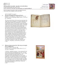
Cosmography facsimiles - OMI - Old Manuscripts & Incunabula
Cosmography facsimiles - OMI - Old Manuscripts & Incunabula
Cosmography facsimiles - OMI - Old Manuscripts & Incunabula

Create successful ePaper yourself
Turn your PDF publications into a flip-book with our unique Google optimized e-Paper software.
<strong>Old</strong> <strong>Manuscripts</strong> & <strong>Incunabula</strong> - Specialists in Facsimile Editions<br />
PO Box 6019 FDR Station, New York NY 10150<br />
tel 212/ 758-1946 • fax 593-6186 • www.omi<strong>facsimiles</strong>.com • immels@earthlink.net<br />
<strong>Manuscripts</strong> arranged by library location. Please inquire about availability of titles with no price.<br />
<strong>Cosmography</strong>,<br />
Geography, Maps<br />
& Calculation<br />
Facsimile Editions<br />
Nov 22, 2013<br />
MANUSCRIPTS (by location)<br />
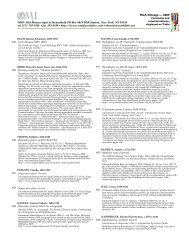
9th c. The Tollemache Orosius. British Museum Additional Manuscript 47967.<br />
Edited by Alistair Campbell.<br />
[London, British Library, Add. 47967]<br />
Early English <strong>Manuscripts</strong> in Facsimile, 3. Copenhagen, 1953. 28 x 31 cm, 27, 174 pp.<br />
Collotype. The vernacular prose version of Orosius’ “History of the World” was one of the<br />
main productions of the literary circle associated with the court of King Alfred. It is<br />
perhaps best known for its striking original additions, including its account of the<br />
geography of northern Europe and the famous accounts of the voyages of Ohthere and<br />
Wulfstan. Half-morocco binding.<br />
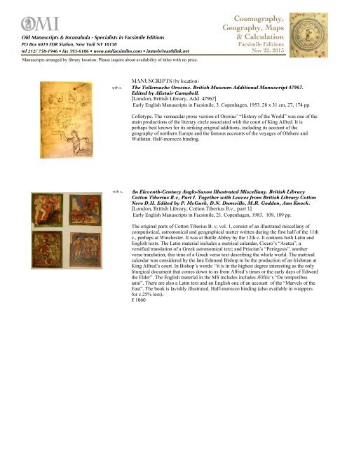
11th c.<br />
An Eleventh-Century Anglo-Saxon Illustrated Miscellany. British Library<br />
Cotton Tiberius B.v, Part I. Together with Leaves from British Library Cotton<br />
Nero D.II. Edited by P. McGurk, D.N. Dumville, M.R. Godden, Ann Knock.<br />
[London, British Library, Cotton Tiberius B.v., part 1]<br />
Early English <strong>Manuscripts</strong> in Facsimile, 21. Copenhagen, 1983. 109, 189 pp.<br />
The original parts of Cotton Tiberius B. v, vol. 1, consist of an illustrated miscellany of<br />
computistical, astromonical and geographical matter written during the first half of the 11th<br />
c., perhaps at Winchester. It was at Battle Abbey by the 12th c. It contains both Latin and<br />
English texts. The Latin material includes a metrical calendar, Cicero’s “Aratea”, a<br />
versified translation of a Greek astronomical text; and Priscian’s “Periegesis”, another<br />
verse translation, this time of a Greek verse text describing the whole world. The metrical<br />
calendar was considered by the late Edmund Bishop to be the production of an Irishman at<br />
King Alfred’s court. In Bishop’s words: “it is in the highest degree interesting as the only<br />
liturgical document that comes down to us from Alfred’s times or the early days of Edward<br />
the Elder”. The English material in the MS includes includes Ælfric’s “De temporibus<br />
anni”. There are also a Latin text and an English one of an account of the “Marvels of the<br />
East”. The book is lavishly illustrated. Half-morocco binding (also available in wrappers<br />
for c.25% less).<br />
€ 1060
<strong>OMI</strong> - <strong>Old</strong> <strong>Manuscripts</strong> & <strong>Incunabula</strong> • tel 212/ 758-1946 • fax 593-6186 • www.omi<strong>facsimiles</strong>.com • immels@earthlink.net <strong>Cosmography</strong>, p.2<br />
11th c.<br />
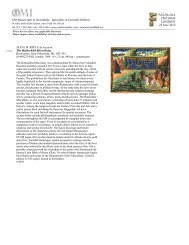
Rabanus Maurus. De universo. Casin, 132, secolo XI. Archivio dell’Abbazia<br />
dei Montecassino.<br />
[Montecassino, Archivio dell’Abbazia, casin, 132]<br />
Scarmagno, 1996. 35 x 49 cm, 530, 216 pp<br />
The archive of the Montecassino Abbey, the religious community founded by St. Benedict<br />
in the 6th century that was the hub of medieval monastic life, boasts the invaluable<br />
Rabanus Maurus Cassinese MS, which was produced at Montecassino during the time of<br />
Abbot Theobald (1022-35) and contains the great encyclopedic dictionary De Universo, or<br />
De rerum naturis, which Rabanus Maurus (780-865), a monk from Fulda who became<br />
Bishop of Mainz, wrote in the 9th century, at the zenith of the Carolingian epoch. This<br />
large-format codex consists of 530 pages in Beneventan script, splendidly illustrated with<br />
over 360 miniatures with lively figures and colors. The true importance of the codex goes<br />
beyond its artistic merit, since De Universo is one of the leading medieval encylopedias<br />
and the first one compiled after two centuries of silence, that is, after St. Isidore of Seville's<br />
Etymologies. And although Rabanus drew inspiration from this latter work, De Universo<br />
surpasses it for the grandiosity of its concepts and its noble aim of spreading knowledge.<br />
The work is like an immense library of knowledge that covers the entire Middle Ages, a<br />
combination and cross-section of various aspects: the historical and biblical tradition of the<br />
Church, books and culture, the animal and plant worlds, descriptions of human life, the<br />
nature of the soul and body, monsters and miracles, celestial phenomena and the<br />
calculation of time, weights and measures, minerals and metals, the organisation of states,<br />
music, medicine, agriculture, the science of war, manual labour, diet, everyday tools and<br />
objects. There is no facet of the Middle Ages that is not discussed in this encyclopedia,<br />
which mirrors the entire civilisation of the time. Furthermore, the miniatures, which<br />
illustrate every subject in marvellous scenes, faithfully follow the style and aim of the text,<br />
making the codex a grand fresco of the universal order. Commentary (It-Eng), edited by<br />
Guglielmo Cavallo. Limited edition of 500 copies. bound in quarter brown calfskin, with<br />
wooden boards and tie-strings.<br />
€ 8450<br />
15th c.<br />
Le petit Ptolomeo. Cosmografía de Claudio Ptolomeo.<br />
[Paris, Bibliothèque Nationale]<br />
Burgos, 2005. 14.5 x 26.7 cm, 600 pp.<br />
Deluxe facsimile of the only Ptolomeo easy to hold in the hands. Limited edition of 898<br />
copies.
<strong>OMI</strong> - <strong>Old</strong> <strong>Manuscripts</strong> & <strong>Incunabula</strong> • tel 212/ 758-1946 • fax 593-6186 • www.omi<strong>facsimiles</strong>.com • immels@earthlink.net <strong>Cosmography</strong>, p.3<br />
15th c.<br />
Marco Polo: The Book of Wonders. Ms. fr. 2810, Bibliothèque Nationale in<br />
Paris.<br />
[Paris, Bibliothèque Nationale, fr. 2810]<br />
Luzern, 1994. 30 x 42 cm, 192 pp + commentary.<br />
“One must certainly know that no human has ever seen so many and so powerful things as<br />
Marco Polo”–Rusticello von Pisa, 1298. One of the most fascinating illuminated MSS ever<br />
produced; here are the fabulous experiences of the most important European discoverer,<br />
Marco Polo (1254-1324). His accounts are the first Western documents of the peoples and<br />
lands of the Orient. It was natural that such a special book, where fantasy and reality are so<br />
closely interwoven, was illustrated by artists like the Master of Boucicaut. He painted the<br />
cycle of Marco Polo’s trips with beautiful figures and luminous colors; his miniatures show<br />
his predilection for pure, geometric forms and his sharp sense of linear perspective as seen<br />
in his rendering of lands and skies. These paintings and text are full of information and like<br />
mirrors reflect a world and time that has not yet ceased to amaze us. Limited edition of 980<br />
copies, leather bound.<br />
12th c.<br />
Il libro del Maestro - Piacenza, Biblioteca Capitolare, C.65.<br />
[Piacenza, Biblioteca Capitolare, 65]<br />
Piacenza, 1997. 34 x 51 cm, 2 vols, 904, 273 pp.<br />
Fine color halftone of a rare 12th-c. manuscript from the Cathedral of Piacenza. One of the<br />
first ”encyclopedias” of Western Europe, with great historic, paleographic, liturgical and<br />
artistic significance, touching the history of music, theater, miniature production, medicine,<br />
agriculture and the esoteric sciences. The codex consists of a calendar, psalter, divine<br />
office, gradual (with troper-sequentiary), antiphonary, and obiturary. With commentary by<br />
Brian Møller Jensen and congress proceeding edited by Pierre Racine. Deluxe binding in<br />
full leather, with tooling and brass bosses.<br />
$ 3995<br />
15th c.<br />
Libro de los medicamentos simples.<br />
[St. Petersburg, Russian National Library, ФP.Fv.VI #1]<br />
[84-88526-69-5] Barcelona, 2000. 27 x 37 cm, 340 pp + commentary.<br />
One of the most celebrated medieval treatises on medicine by Mattheus Platearius. It<br />
consists of 220 pages divided into five parts: herbs and flowers, trees and their gums and<br />
resins, metals and minerals, animal products and other matters. It is followed by a splendid,<br />
116-page atlas with 386 figures. Its illuminations have been attributed to Robinet Testard,<br />
the miniaturist active at court of Charles of Angoulême. The manuscript entered the<br />
Imperial Library in 1805. Commentary by José María López Piñero, Natacha Elaguina &<br />
María Luz López Terrada. Bound in brown leather with gold tooling, with leather case.
<strong>OMI</strong> - <strong>Old</strong> <strong>Manuscripts</strong> & <strong>Incunabula</strong> • tel 212/ 758-1946 • fax 593-6186 • www.omi<strong>facsimiles</strong>.com • immels@earthlink.net <strong>Cosmography</strong>, p.4<br />
c.1508 The Codex Hammer of Leonardo da Vinci. Translated into English and<br />
Annotated by Carlo Pedretti.<br />
[Seattle, Seattle Art Museum, Codex “Leicester”, ex “Hammer” (deposit, Bill Gates<br />
Collection)]<br />
[16148-W] Florence, 1987 34 x 48 cm, 72, 282 pp.<br />
Codex “Hammer” (formerly “Leicester”), compiled about 1508-1510, is a synthesis of<br />
Leonardo’s views on nature as given visual shape in the backgrounds of this paintings,<br />
from “St. Anne” to the “Mona Lisa”. It deals with hydrostatics, hydroldynamics, and then<br />
with river regulation and hydraulic engineering, encompassing every aspect of cosmology,<br />
from geology to paleontology and from astronomy to meteorlogy. Their are also items of<br />
autobiographical interest, the record of his work on the “great horse of Milan”, the<br />
spectacular vision of a wind storm over Lake Maggiore, the vivid observations on the<br />
numerous localities of his wanderings in Tuscany and Lombardy. The 18 bibfolios of<br />
Leonardo’s dense compilation characterized by more than 350 marginal and textual<br />
illustrations are accurately reproduced in this facsimile, accompanied by a volume with the<br />
critical and diplomatic transcription edited by Carlo Pedretti. Limited edition of 998 copies<br />
supplied with leather covered clamshell case. (only available with the purchase of the<br />
complete set of the Edizione Nazionale dei Manoscritti e dei disegni di Leonardo da Vinci)<br />
13th c. Tabula Peutingeriana (Codex vindobonensis 324).<br />
[Vienna, Österreichische Nationalbibliothek, 324]<br />
[3-201-00975-X] Graz, 1976. 11 sections, 675 x 34 cm,
<strong>OMI</strong> - <strong>Old</strong> <strong>Manuscripts</strong> & <strong>Incunabula</strong> • tel 212/ 758-1946 • fax 593-6186 • www.omi<strong>facsimiles</strong>.com • immels@earthlink.net <strong>Cosmography</strong>, p.5<br />
1476 Jean de Mandeville. Reisebeschreibung. Deutsch von Otto von Diemeringen. /<br />
Der Antichrist und die 15 Zeichen vor dem Jüngsten Gericht.<br />
Farbmikrofiche-Edition der Handschrift Wien, Österreichische<br />
Nationalbibliothek, Cod. 2838. Einführung und Beschreibung von Klaus<br />
Ridder.<br />
[Vienna, Österreichische Nationalbibliothek, 2838]<br />
[3-89219-024-0] Codices Illuminati Medii Aevi, 24. Munich, 1992. 17 x 25 cm, 35 pp, 4<br />
fiches (x98).<br />
Lake Constance region, 1476. Paper, 180 fols., 2 cols., 252 tinted pen drawings. This work,<br />
from 1356, was originally composed in French and translated to German at the end of the<br />
14th c. It was conceived as a pilgrims' guide to Jerusalem, starting at Constantinople, and<br />
mentioning historical places as Troja or Babylonia, and proceeding to the Near East. In the<br />
second part the traveling starts at Trapezus and continues to India, finally proceeding to<br />
China by passing north African and Middle Eastern countries. Biblical, legendary,<br />
miraculous, or historical events at different periods are reported according to the locality<br />
where they took place. The unframed drawings are spread very curiously about the pages,<br />
often occupying half a page, or the site borders, or in a stripe with simultaneous scenes over<br />
two facing pages. The presentation of illustrated events does not follow the chronological<br />
order as usual. Intentionally added by the same scribe is the “Life of Antichrist” and the<br />
“Fifteen Signs of Doomsday”, with 66 illustrations in a different style. Linen.<br />
€ 320<br />
16th c.<br />
INCUNABULA, PRINTS, MAPS & DOCUMENTS<br />
Libro copiador de Cristóbal Colón. [Archivo General de Indias, Seville].<br />
[Age of Discovery, misc. documents]<br />
[84-86290-20-1] Colección Tabula Americae, 8-9. Madrid, 1989. 23 x 33 cm, 72, 424, 176<br />
pp.<br />
Facsimile of a MS of 38 folios recently acquired by the Archivo General de Indias de<br />
Sevilla. It comprises six navigational maps and personal maps of the Catholic Monarchs,<br />
the first of which is dated 1493. Commentary (2 vols) by Antonio Rumeu de Armas.<br />
Limited edition of 980 copies, bound in full leather.<br />
€ 1150<br />
15th c.<br />
Libro de la primera navegación. [Biblioteca Nacional, Madrid].<br />
[Age of Discovery, misc. documents]<br />
[84-86290-00-7] Colección Tabula Americae, 1. Madrid, 1984. 20 x 32 cm, 150, 282 pp.<br />
This is the famous account by Fray Bartolomé de las Casas (in manuscript), reproducing<br />
Columbus' own account; the original is perserved in the National Library in Madrid. It<br />
provides details of the voyage of discovery which began on 3 August 1492 and ended on 15<br />
March 1493 with stops in the Canary Islands, the Bahamas, Hispaniola, the Azores, and<br />
Lisbon. Transcription and commentary (in Spanish) by Manuel Alvar and Francisco<br />
Morales Padrón. Limited edition of 980 numbered certified copies, bound in full leather.<br />
€ 1150
<strong>OMI</strong> - <strong>Old</strong> <strong>Manuscripts</strong> & <strong>Incunabula</strong> • tel 212/ 758-1946 • fax 593-6186 • www.omi<strong>facsimiles</strong>.com • immels@earthlink.net <strong>Cosmography</strong>, p.6<br />
16th c.<br />
La primera vuelta al mundo protagonistas, génesis y dessarrollo a través de<br />
los documentos. [Archivo General de Indias, Seville; Archivo General,<br />
Simancas; Archivo in Torre do Tombo, Lisbon].<br />
[Age of Discovery, misc. documents]<br />
[84-88829-55-8] Colección Carlos V, 2. Madrid, 1998. 2 vols.<br />
It was the Portuguese who first sailed around Africa and realised Columbus' dream of<br />
reaching the Far East by sea. But this route was forbidden to the Spanish as stipulated in the<br />
famous Treaty of Tordesillas, limiting them to Cape Bojador. Starting at the beginning of<br />
the 16th c., the Spanish monarchy intensified efforts to find a strait dividing the continent<br />
of America which would allow passage to what would be called the Pacific and further<br />
east, the Moluccas, or Spice Islands. The Crown assembled a flotilla of five vessels to<br />
pursue this goal under the command the Portuguese Ferdinand Magellan; it was he who<br />
persuaded Spain that the project was feasible, and to discover the strait at the southern tip<br />
of America (which would subsequently bear his name), and carry on to the Moluccas,<br />
where he in fact died. It was Juan Sebastian Elcano, who with just one ship, went on around<br />
the world for the first time, returning to Spain along the Portuguese route. It is proof<br />
enough of the exceptional difficulty of this crossing that only 18 men out of the 285 who<br />
had set out came back in the "Victoria". This facsimile edition consists of all the key<br />
documents regarding the preparation and progress of the Magellan-Elcano voyage allowing<br />
the reader to follow all the stages of the expedition: the agreements between Magellan and<br />
Faleiro and the Crown, the discussions with an official of the Casa de Contratación,<br />
appointments of the officers of the fleet, incidents arising during the launch of the ships,<br />
peace treaties with the kings of Molucca, statements by survivors about incidents during the<br />
voyage, etc. Of special scientific interest is the log kept by Francisco de Albo, recording<br />
daily the number of leagues covered, the direction and position (latitude and longitude) of<br />
the ships. Also included is later document but a very pertinent one: the will of Juan<br />
Sebastián Elcano, which was actually written during his second passage over the Pacific,<br />
shortly before the death. Limited edition of 980 copies.<br />
€ 1550<br />
15th c.<br />
Imago mundi. [Seville, Biblioteca Capitular y Colombina].<br />
[Ailly, Pierre d’]<br />
[84-86290-15-5 Colección Tabula Americae, 11. Madrid, 1991. 21 x 28 cm, 288 pp.<br />
Published in Louvain in 1480 by Pierre d'Ailly, "Imago Mundi" is a résumé of known<br />
cosmographies of the period especially those in the tradition of Ptolemy. The incunabulum<br />
comprises 18 tracts including beautiful illustrations, colored in the style of the last decades<br />
of the 15th c. This facsimile reproduces the exemplar formerly owned by Columbus and it<br />
contains 898 manuscript notes by Almirante and Columbus' son Hernando. Translation and<br />
commentary (in Spanish) by Antonio Ramírez de Verger and Juan Pérez de Tudela.<br />
Limited edition of 1480 copies, bound in full leather in Mudéjar style. (Winner of the<br />
Ministerio de Cultura Prize for best publication, 1991).<br />
€ 2150
<strong>OMI</strong> - <strong>Old</strong> <strong>Manuscripts</strong> & <strong>Incunabula</strong> • tel 212/ 758-1946 • fax 593-6186 • www.omi<strong>facsimiles</strong>.com • immels@earthlink.net <strong>Cosmography</strong>, p.7<br />
16th-<br />
17th c.<br />
Beschreibung und Contrafactur der vornemster Stät der Welt. Vollständige<br />
farbige Fakimile-Ausgabe der Städtetopographie in sechs Bänden (deutsche<br />
Ausgabe 1574-1618).<br />
Braun, Georg, & Franz Hogenberg.<br />
Stuttgart, c.1975. 28 x 42 cm, 6 vols, c.1600 pp.<br />
Bound in full leather.<br />
€ 4510<br />
19th c.<br />
La Toscane. Album pittoresque et archéologique.<br />
Durand, André.<br />
Florence. 45 x 63.5 cm 118 lithographs.<br />
The magnificent monumental album of lithographs created by the French André Durand in<br />
about 1862 is one of the most refined works among those that represent Tuscany. Nobody<br />
could have geen more suited to portray them than Durand, a highly-regarded sketcher and<br />
lithographer, also versed in archeology. Spurred on by the enthusiasm of the Russian prince<br />
Anatole Demidoff, Durand first produced an album with 18 lithographs of picturesque<br />
views of the Isle of Elba (in collaboration with Eugène Ciceri). They are evocative works<br />
showing a wild and partly unexplored island. Among them are outsanding views of<br />
Portoferraio, Rio Marina, Marciana and also of the Imperial Villa of San Martino with the<br />
Napoleonic Museum founded by Prince Demidoff. Later the work was enriched with<br />
another 100 plates of the most important Tuscan cities, also including bewitching artistic<br />
country landscapes. Half leather.
<strong>OMI</strong> - <strong>Old</strong> <strong>Manuscripts</strong> & <strong>Incunabula</strong> • tel 212/ 758-1946 • fax 593-6186 • www.omi<strong>facsimiles</strong>.com • immels@earthlink.net <strong>Cosmography</strong>, p.8<br />
16th c.<br />
Portolan-Atlas des Battista Agnese von 1546. [St. Petersburg, Russian National<br />
Library].<br />
[maps, Agnese]<br />
[3-201-01599-8] Graz, 1993. 28.7 x 42.5 cm, 40, 32 pp.<br />
Battista Agnese, born in Genoa, but based in Venice where he owned a drawing workshop,<br />
is considered one of the most important and prolific chart makers in the 16th century. We<br />
know of 80 to 100 navigational charts (portolans) from his pen, of which the Atlas of 1546<br />
is one of the finest. Typical of works from his workshop, the Atlas of 1546 constitutes a<br />
sumptuous de luxe codex produced by several hands and representing the latest state of<br />
geographical knowledge. Very special and atypical features of this Atlas are three<br />
mythological paintings in a highly inventive manner. They depict famous episodes from<br />
Greco-Roman mythology, illustrating them in the context of navigation and cartography:<br />
the departure of Jason with his Argonauts, the storm on the sea in which Aeneas’ fleet<br />
perished, and Atlas carrying the globe, as well as mathematician and astronomer. In<br />
addition the Portolan Atlas contains a table of the declinations of the Sun, an armillary<br />
sphere, a representation of the Ptolemaic-Aristotelian system of the world, a text with<br />
cosmographic and astronomic details, as well as 13 charts (double pages) documenting the<br />
most recent knowledge in geography: the New World and the Pacific Ocean, the Atlantic<br />
Ocean with Africa and parts of Europe, the Indian Ocean including the coasts of Africa and<br />
Southern Asia, Europe (without Spain and Southern Italy), Spain and Northern Africa with<br />
the Canaries, the Mediterranean, the Black Sea, a very detailed map of Italy which may be<br />
considered the best map of its time, the Aegean Sea, the Holy Land, and a world map in<br />
oval projection showing the sea route chosen by Magellan for his circumnavigation of the<br />
globe. It is not known who commissioned the work, however, the patron must have been a<br />
person of high-rank and great wealth. The decoration with cosmographic and astronomic<br />
data, the table of the declinations of the sun and an armillary sphere as well as a compass in<br />
the form of a wind rose, suggest that it was destined for fundamental studies in<br />
cosmography and geography in theory rather than in practice. Commentary: Tamara P.<br />
Woronowa and Arthur Dürs. Limited edition of 700 numbered copies, bound in red brown<br />
patent leather with gold and blind embossing, a faithful reproduction of the original<br />
binding.<br />
€ 2580<br />
12th-<br />
19th c.<br />
Asien auf Karten vom 12. Jahrhundert bis zur Mitte des 19. Jahrhundert.<br />
Herausgegeben und kommentiert von Egon Klemp.<br />
[maps, Asia]<br />
Leipzig, 1989. 35 x 51 cm, 300, 56 pp.<br />
Linen, with deluxe slipcase.
<strong>OMI</strong> - <strong>Old</strong> <strong>Manuscripts</strong> & <strong>Incunabula</strong> • tel 212/ 758-1946 • fax 593-6186 • www.omi<strong>facsimiles</strong>.com • immels@earthlink.net <strong>Cosmography</strong>, p.9<br />
1519 Atlas Miller. [Bibliothèque Nationale, Paris].<br />
[maps, “Atlas Miller”]<br />
[84-88526-88-1] Barcelona, 2004. 59 x 41.5 cm & 117 x 61 cm, 6 leaves (10 maps) +<br />
commentary.<br />
Maps by Pedro and Jorge Reinel, Lopo Homem and António de Holandra (miniaturist),<br />
covering the North Atlantic Ocean, Northern Europe, the Azores Archipelago, Madagascar,<br />
Indian Ocean, Insulindia, China Sea, the Moluccas, Brazil, Atlantic Ocean and<br />
Mediterranean Sea. It is one of the wonders of Portuguese cartography; from an artistic<br />
point of view the atlas is peerless and the most lavish work of its genre. Commentary by<br />
Luís Filipe F.R. Thomaz.<br />
1508 Seekarte des Andrea Benincasa. Borg. VIII. [Vatican, Biblioteca Apostolica,<br />
Borg. VIII].<br />
[maps, Benincasa]<br />
[5605] Codices e Vaticanis Selecti, LXVIII. Zürich, 1984. 64 x 99 cm, 1 roll.<br />
One of the finest maps of the Vatican Library, reproduced in 6 colors plus gold leaf and<br />
fashioned in the exact size on a material that approximates the original animal skin in<br />
weight and texture. Benincasa’s map from 1508 is richly decorated with highlights of gold<br />
and couples scientific information with medieval legend. Commentary by A. Dürst.<br />
16th c.<br />
Mapas de Heinrich Bünting.<br />
[maps, Bünting]<br />
Burgos, 220 pp.<br />
Limited edition of 898 copies.
<strong>OMI</strong> - <strong>Old</strong> <strong>Manuscripts</strong> & <strong>Incunabula</strong> • tel 212/ 758-1946 • fax 593-6186 • www.omi<strong>facsimiles</strong>.com • immels@earthlink.net <strong>Cosmography</strong>, p.10<br />
1472 Carta del Cantino. Charta del navichare per le isole novament trovate in la<br />
parte de l’India.<br />
[maps, Cantino]<br />
Ars Illuminandi. Modena, 2004. 105 x 220 cm.<br />
Manufactured and illuminated in Portugal in 1502, this is one of the most beautiful<br />
geographical maps created in the Renaissance bearing witness to the discovery of America.<br />
The original consists of 6 sheets of vellum joined to make up a single 105 x 220 cm sheet.<br />
Limited edition of 750 exemplars, numbered and certified, presented in a handsome<br />
archival box covered in blue linen.<br />
€ 1500<br />
1525 Planisfero Castiglioni. Carta del navegare universalissima et diligentissima.<br />
[maps, Castiglioni]<br />
[88-86251-46-7] Ars Illuminandi. Modena, 1998. 815 x 2140 cm.<br />
The Castiglioni World Map is a large nautical map dated 1525, drawn on four sheets of<br />
vellum joined together to make up a single 81.5 x 214 cm sheet. Originally titled “Carta del<br />
navegare universalissima et diligentissima” (the most universal and accurate navigational<br />
map), the word “universalissima” refers to the whole hitherto-known world, and<br />
“diligentissima” the particular technical care employed by the cartographer. The map,<br />
crossed by lines defining nautical routes and forming rhombic patterns, is considered to be<br />
of great historical and cartographic interest in that it gives visual and documentary support<br />
to the theories of the curvature of the Earth. It has been attributed to Diego Ribeiro, head<br />
cartographer (‘piloto maior’) of the Casa de Contratacion in Seville (the government office<br />
of the Spanish royal family authorised to compile innovations in official nautical maps<br />
deriving from geographic discoveries). The Castiglioni World Map displays the world<br />
immediately after the discoveries made by Magellan and Pigafetta, during their<br />
circumnavigation of the globe, and from the explorations of the North American coast by<br />
Estevan Gomez. Presented in a display box.<br />
€ 1000
<strong>OMI</strong> - <strong>Old</strong> <strong>Manuscripts</strong> & <strong>Incunabula</strong> • tel 212/ 758-1946 • fax 593-6186 • www.omi<strong>facsimiles</strong>.com • immels@earthlink.net <strong>Cosmography</strong>, p.11<br />
c.1450 Mapamundi Catalán Estense. Escuela Cartográfica Mallorquina. Comentario:<br />
Ernesto Milano. Transcripción del texto original: Annalisa Batini. [Modena,<br />
Bibl. Estense, C.G.A.1].<br />
[maps, Catalán]<br />
[84-88526-22-9] Barcelona, n.d.. 30 x 56 cm, 1 map; 125 pp + 1 foldout plate +<br />
commentary.<br />
In the 14th c. the Catalonia-Valencia-Majorca region was a flourishing centre of trade and<br />
culture where Arab and Jewish elements blended with Christian culture. Countless maps by<br />
this cartographic school have survived including the Estense World Map featuring<br />
characteristics typical of portulans—rhumb lines, and flags and coats of arms to identify<br />
kingdoms and cities—but this map was obviously not made as a navigation aid. It can be<br />
considered to be a paradigm of the artist’s technique, logical extensions of his vision<br />
extending beyond the Mediterranean to the frontiers of the known world. The anonymous<br />
artist of the Estense World Map combined details from literature of certain regions of the<br />
world with empirical facts about the Mediterranean area, the zone he knew best. This map<br />
is of interest because of its uncertain and eclectic identity. Circular in shape, with different<br />
religious and legendary motifs along with certain Arab influences, it retains the rigor of<br />
portulans. Maps by Pedro and Jorge Reinel and António de Holandra (miniaturist).<br />
Commentary by Luis Filipe F.R. Thomaz.<br />
18th c.<br />
Paisajes urbanos y arquitectura en el Chile colonial.<br />
[maps, Chile]<br />
Mapas. Madrid, 2001.<br />
Urban drawings of La Serena de Coquimbo (1743), drawing of Concepcion de Chile<br />
(1752), and views of the Church and Convent of the Carmelitas de la Cañadillas de<br />
Santiago de Chile (1763). Accampanying text by María Antonia Colomar. Portfolio.<br />
€ 350<br />
c.1492 La carta de Cristóbal Colón, Mapamundi c.1492. [Res. GE. AA. 562,<br />
Bibliothèque Nationale, Paris]<br />
[maps, Columbus]<br />
[84-88526-16-4] Barcelona, 1995. 68 x 110 cm, 1 map; 236 pp + 1 foldout plate.<br />
A portulan navigation chart attributed to Christopher Columbus. The navigation chart<br />
shows the classical design of the Mediterranean area with the addition of the Atlantic<br />
coastlines stretching from the south of Scandinavia to the mouth of the Congo river. It<br />
features a particularly comprehensive nomenclature of the entire African coast—an area<br />
where Columbus is believed to have undertaken at least one voyage with the Portuguese.<br />
To the East it encompasses the Black Sea and the Red Sea, and to the West, a series of<br />
islands, some real and some imaginary, stretching from the Artic to the Gulf of Guinea.<br />
Commentary by José Luis Comelias.
<strong>OMI</strong> - <strong>Old</strong> <strong>Manuscripts</strong> & <strong>Incunabula</strong> • tel 212/ 758-1946 • fax 593-6186 • www.omi<strong>facsimiles</strong>.com • immels@earthlink.net <strong>Cosmography</strong>, p.12<br />
16th c.<br />
Cartas de relación de la conquista de la Nueva España. Escritas por Hernán<br />
Cortés al Emperador Carlos V, y otros documentos relativos a la conquista,<br />
años de 1519-1527. [Vienna, Österreichische Nationalbibliothek, ser.nov.1600]<br />
[maps, Cortez]<br />
[3-201-00742-0] Codices Selecti, II. Graz, 1960. 27 x 37 cm, 706 pp.<br />
Contains the 5 relaciones of Hernán Cortés, 2 relaciones by Pedro Alvarado, the relación of<br />
Diego de Godoy, the relación of the journey of Francisco Pizarro and Diego Almagro, the<br />
message carried by Antonio Giral to Alvaro de Saavedra Ceron, and the patent authorizing<br />
the original 12 Franciscan friars to come to Mexico. Introduction and bibliography (in<br />
English) by Charles Gibson, and by a description of the manuscript by Dr. Franz<br />
Unterkircher.<br />
16th c.<br />
Mapa de Juan de la Cosa. [Madrid, Museo Naval].<br />
[maps, Cosa]<br />
[84-86290-56-2] Colección Tabula Americae, 19. Madrid, 1992. 133 x 70 cm, one map, 32<br />
pp.<br />
Juan de la Cosa was a mariner and cartographer who made seven voyages to America, two<br />
of them with Columbus. On his return from Columbus' third voyage, he drew this famous<br />
map which showed the discoveries of Columbus' first three voyages; executed in 1510 it is<br />
considered to be the first representation of the American continent. Accompanying text by<br />
José Luis Comellas. Limited edition of 600 copies. Portolio. (reproduced 75% of original).<br />
16th c.<br />
Costa Rica testimonios gráficos.<br />
[maps, Costa Rica]<br />
Mapas. Madrid, 2001.<br />
Drawings of the Province of Nicaragua (1716), Rio Mantina (1738-55), and Province of<br />
Telemanca (1781). Commentary by Purificatión Medina Encina. Portfolio.<br />
€ 350
<strong>OMI</strong> - <strong>Old</strong> <strong>Manuscripts</strong> & <strong>Incunabula</strong> • tel 212/ 758-1946 • fax 593-6186 • www.omi<strong>facsimiles</strong>.com • immels@earthlink.net <strong>Cosmography</strong>, p.13<br />
1593 Carta dell’Europa di Gerard e Cornelio de Jode 1593.<br />
[maps, De Jode]<br />
Scarmagno, c.2004. 330 x 440 mm.<br />
Limited edition of 999 copies.<br />
€ 290<br />
1564 “Atlas Universal” Diego Homem. [St. Petersburg, Russian National Library,<br />
fonds 342].<br />
[maps, Homem]<br />
[84-88526-62-8] Barcelona, 2000. 45.1 x 29.4 cm, 40 pp + commentary.<br />
These charts by the celebrated Portuguese cartographer Diogo Homem, consisting of 19<br />
doubled page openings, are the most emblematic and priceless example of the navigation<br />
charts produced in Portugal in the 16th century. Commentary by Alfredo Pinheiro Marques<br />
& Ludmilla Kildushevskaya.<br />
1595 Gerardus Mercator Atlas 1595. Faksimile nach dem kolorierten Original in<br />
der Fürstlich Fürstenbergischen Hofbibliothek in Donaueschingen.<br />
[maps, Mercator]<br />
Lachen am Zürichsee, c.1985. 32 x 44 cm, 258, 32 pp.<br />
In 1569 the Flemish geographer Gerard Mercator devised the "Mercator projection", a<br />
world map in which the parallels of latitude and meridians of longitude appeared as straight<br />
lines, intersected at right angles. This allowed a navigator to plot his course on a straight<br />
line rather than a curved one. The main disadvantage of Mercator's projection proved to be<br />
the distortion of land areas to the far north and south of the equator. Mercator also prepared<br />
a collection of country maps, intended for a volume called Atlas Sive Cosmographicae<br />
Meditationes, but he died before its completion. This atlas, from which this facsimile<br />
edition is based, was finally published in 1595 by his son Rumold.
<strong>OMI</strong> - <strong>Old</strong> <strong>Manuscripts</strong> & <strong>Incunabula</strong> • tel 212/ 758-1946 • fax 593-6186 • www.omi<strong>facsimiles</strong>.com • immels@earthlink.net <strong>Cosmography</strong>, p.14<br />
1593 Carta tolemaica dell’Italia di Gerardo Mercatore 1578.<br />
[maps, Mercator]<br />
Scarmagno, 2004.<br />
Limited edition of 1999 copies.<br />
€ 290<br />
16th c.<br />
Mapa de Mexico.<br />
[maps, Mexico]<br />
Mapas. Madrid, 2002.<br />
€ 500<br />
1629 Mapa Mississippi.<br />
[maps, Mississippi River basin]<br />
Mapas. Madrid, 2001. 74.5 x 52.5 1 map.<br />
Map produced between 1682 and 1684 showing the basin of the Mississippi River and its<br />
tributary, and all the Indian village settlements. It was dedicated to the Duque de Jovenazo<br />
by Armando Arce, Baron de Lohantan. Accompanying text by María Concepción Contel<br />
Barea. Portfolio.<br />
€ 140
<strong>OMI</strong> - <strong>Old</strong> <strong>Manuscripts</strong> & <strong>Incunabula</strong> • tel 212/ 758-1946 • fax 593-6186 • www.omi<strong>facsimiles</strong>.com • immels@earthlink.net <strong>Cosmography</strong>, p.15<br />
1472 Collezione Portolani. Antiche carte nautiche della Biblioteca Estense<br />
Universitaria. [deluxe version].<br />
[maps, Modena, Bibl. Estense]<br />
Ars Illuminandi. Modena, 2004.<br />
A collection of 3 portulans perserved in the Biblioteca Estense in Modena (maps CGA5b,<br />
CGA5c, CGA5d). These ancient nautical maps, provided with a wealth of geographical<br />
coastal names, were conceived for being used by seafarers. Map “b”: Mediterraneo a<br />
dell’Europa nord-occidentale, 1460; Map “c”: Atlantiche, 1472; Map “d”: Mediterraneo a<br />
dell’Atlantico occidentale, 1450-60. With commentary and certificate of authenticity.<br />
Presented in a walnut showcase, sized 67 x 45 x 14 cm.<br />
€ 2400<br />
1472 Collezione Portolani, Antiche carte nautiche della Biblioteca Estense<br />
Universitaria. [standard version].<br />
[maps, Modena, Bibl. Estense]<br />
Ars Illuminandi. Modena, 2004.<br />
(Each portulan of this version is stored in a tube with commentary and certificate of<br />
authenticity).<br />
€ 1400<br />
1460 Portolano CGA5b. Carta nautica del Mediterraneo a dell’Europa<br />
nord-occidentale, 1460.<br />
[maps, Modena, Bibl. Estense]<br />
Ars Illuminandi. Modena, 2003. 90 x 61 cm.<br />
Stored in a tube with commentary and certificate of authenticity.<br />
€ 520
<strong>OMI</strong> - <strong>Old</strong> <strong>Manuscripts</strong> & <strong>Incunabula</strong> • tel 212/ 758-1946 • fax 593-6186 • www.omi<strong>facsimiles</strong>.com • immels@earthlink.net <strong>Cosmography</strong>, p.16<br />
1472 Portolano CGA5c. Carta nautica della atlantiche, 1472.<br />
[maps, Modena, Bibl. Estense]<br />
Ars Illuminandi. Modena, 2004. 60 x 73 cm.<br />
Stored in a tube with commentary and certificate of authenticity.<br />
€ 520<br />
1450-<br />
1456<br />
Portolano CGA5d. Carta nautica del Mediterraneo a dell’Atlantico<br />
occidentale, 1450-60.<br />
[maps, Modena, Bibl. Estense]<br />
Ars Illuminandi. Modena, 2003. 90 x 61 cm.<br />
Stored in a tube with commentary and certificate of authenticity.<br />
€ 520<br />
17th c.<br />
Der Atlas des Prinzen Eugen. Originalgetreue Faksimile-Reproduktionen aus<br />
dem Atlas Blaeu-Van der Hem. [Vienna, Österreichische Nationalbibliothek].<br />
[maps, Prince Eugen]<br />
[3-201-01098-7] Graz, 1979. 38 x 57 cm, 35 vues & 8 maps.<br />
€ 1315
<strong>OMI</strong> - <strong>Old</strong> <strong>Manuscripts</strong> & <strong>Incunabula</strong> • tel 212/ 758-1946 • fax 593-6186 • www.omi<strong>facsimiles</strong>.com • immels@earthlink.net <strong>Cosmography</strong>, p.17<br />
13-<br />
15th c.<br />
Geographia (Facsimile Edition). [Vatopaidion (Greece), Holy Maximal<br />
Monastery; Venice, Biblioteca Marciana].<br />
[maps, Ptolemy, Geographia]<br />
Athens, 1998. 28 x 38.5 & 44 x 58.5 cm. 152, 232 pp + commentary.<br />
Full-color facsimile of two copies of “Geographia”, the first from the end of 13th century,<br />
the second from the 15th c. Bibliophile edition of 3000 copies. Clamshell case.<br />
€ 1000<br />
1466 La cosmografia di Claudio Tolomeo (Atlante di Borso d’Este). [Modena,<br />
Estense Univ., alpha.X.1.3]<br />
[maps, Ptolemy, Modena]<br />
Ars Illuminandi. Modena, 2005. 31 x 45 cm, 256 pp + commentary.<br />
This illuminated MS is one of masterpieces of the Biblioteca Estense, purchased in 1466<br />
for 100 gold florins by duke Borso d'Este (to whom it is dedicated) directly from the<br />
author, the German humanist Nicholas "Germanico". This new Latin version of Ptolemy's<br />
"Cosmographia" by Jacopo Angelo da Scarperia was accompanied by the 27 traditional<br />
maps re-elaborated by the author by using trapezoid projections. The text, written in two<br />
columns, is in humanistic characters, with the headings in gold capital letters underlined in<br />
red and illuminated initial letters. The text is divided into eight books; the first deals with<br />
theoretical subjects and representation of the globe while the others cover the regions of the<br />
earth. The double paged maps are framed by a gold border. The first plate shows the<br />
planisphere of the world while the other plates, preceded by an explanatory text, show the<br />
individual regions of the earth as they were then known. Commentary (in Italian) by<br />
Ernesto Milano, with transcriptions of the maps. Limited edition of 499 copies, bound in<br />
full leather with decorations.<br />
€ 4500<br />
15th c.<br />
Atlas de Claudio Ptolomeo. [Valencia, Biblioteca General e Histórica de la<br />
Universidad].<br />
[maps, Ptolemy, Valencia]<br />
Valencia, 1983. 30.5 x 44.1 cm, 228, 208 pp.<br />
This atlas was copied and illustrated by Alphonse the Magnanimous from the library<br />
owned by the King in Castel Nuovo of Naples and was passed on to the library of San<br />
Miguel de los Reyes. The University of Valencia’s MS—copied on vellum, with borders<br />
illuminated in gold and color, with an angel holding a crown with a space for a coat of<br />
arms, capital letters in gold and color, red titles and catchwords every ten leaves—is of<br />
special beauty. Its 216 pages are arranged, with one exception, in 2 columns and 57 lines<br />
and it contains the geographic and mathematical study of Ptolemy's observations,<br />
twenty-seven maps, of which 26 are on two pages and the last on 1 page. Commentary in<br />
Eng-Sp by Víctor Navarro Brotons. Limited edition of 3000 copies, bound in patterned<br />
leather on wooden boards and with gilt edges, after the original.
<strong>OMI</strong> - <strong>Old</strong> <strong>Manuscripts</strong> & <strong>Incunabula</strong> • tel 212/ 758-1946 • fax 593-6186 • www.omi<strong>facsimiles</strong>.com • immels@earthlink.net <strong>Cosmography</strong>, p.18<br />
15th-<br />
16th c.<br />
Tolomeo Vaticano. [Biblioteca Apostolica Vaticana, Urb. lat 174].<br />
[maps, Ptolemy, Vatican]<br />
Colección Scriptorium. Madrid, 2006. 29.9 x 44.4 cm 266 pp + commentary.<br />
This splendid MS preserved in the Biblioteca Apostolica Vaticana once belonged to Pope<br />
Alexander VII, whose coat of arms appears embossed in gold on the binding. The codex,<br />
written in round humanist script and executed in Florence during the 15th c., belongs to<br />
that genre of geographical works called "Ptolemys"—a series of maps encompassing the<br />
whole known world (named after the famous Egyptian geographer Claudius Ptolemaeus),<br />
and is a product of a period when maps were particularly vital for travel and trade. It is a<br />
masterpiece in every regard, ranging fron the quality of the text, the accuracy of the maps,<br />
to the highest quality of dyed parchment—done in a variety of colors—and lavish use of<br />
gold leaf for titles, frames and the representation of winds using human and other faces. It<br />
includes altogether 30 maps: 1 of the <strong>Old</strong> World, 13 of Europe (including modern Spain,<br />
Northern Europe, modern Italy), 4 of Africa and 12 of Asia, with maps often covering<br />
several pages. Sometime in the 16th c. the codex was enlarged with a second map of the<br />
world which included the recently discovered continent of America. Deluxe facsimile<br />
edition, bound in tooled leather with accompanying commentary.<br />
€ 4850<br />
1471 Die Cosmographia des Claudius Ptolemaeus. Urb. lat. 277. [Vatican,<br />
Biblioteca Apostolica, Urb. lat. 277]. [deluxe edition].<br />
[maps, Ptolemy, MS Vatican]<br />
[5002] Codices e Vaticanis Selecti, LIII. Zürich, 1983. 44 x 59 cm, 2 vols, 268; 89 pp.<br />
In the early Italian Renaissance the papyrus scrolls of the <strong>Cosmography</strong> were rediscovered<br />
after being “lost” for more than a thousand years. This world atlas of the Alexandrian<br />
scholar Claudius Ptolemaeus, known as Ptolemy, depicted the known world in 2nd century<br />
A.D. and established the concept of latitute and longitude. His extraordinary mathematical<br />
calculations shattered the prevailing vision of the Renaissance world. Federigo da<br />
Montefeltro, Duke of Urbino, commissioned a new copy in 1471. This volume is<br />
considered a masterpiece of Italian Renaissance art, illumination, and bookmaking. Masters<br />
of every field contributed their artistry to the work. It is organized into 8 “books”,<br />
corresponding to the 8 rolls of the lost papyrus original. 44 maps including 29 double page<br />
spreads and numerous illustrations and decorative borders reproduced in 8 colors plus gold.<br />
Hand bound in calfskin over fine grained hardwood. Commentary by A. Dürst. Limited<br />
edition of 500 copies, with binding that duplicates the original.<br />
16th c.<br />
Atlas de Oliva de Juan Riczo. [Madrid, Biblioteca del Palacio].<br />
[maps, Riczo]<br />
[84-86290-15-5] Colección Tabula Americae, 6-7. Madrid, 1987. 43 x 29 cm, 38, 96 pp.<br />
Published in Naples in 1580, this famous atlas by Juan Riczo comprises 19 portulans on<br />
parchment, each measuring approximately 43 x 29 cm. It is a perfect and beautiful<br />
illustration of the geographical knowledge known up to that time. With accompanying<br />
study by María Luisa Martín-Merás (available in Spanish or French). Limited edition of<br />
980 copies. Portfolio. (Winner of Ministerio de Cultura Prize for best publication, 1987).<br />
€ 1650
<strong>OMI</strong> - <strong>Old</strong> <strong>Manuscripts</strong> & <strong>Incunabula</strong> • tel 212/ 758-1946 • fax 593-6186 • www.omi<strong>facsimiles</strong>.com • immels@earthlink.net <strong>Cosmography</strong>, p.19<br />
17th c.<br />
Mapa de Santo Domingo.<br />
[maps, Santo Domingo]<br />
Mapas. Madrid, 2000. 81 x 41 cm. 1 map.<br />
Drawing of the 16th-c. Spanish fortification of the city of Santo Domingo, part of a series<br />
of drawings and maps of the island that are conserved in the General Indies Archive. The<br />
presence of enemy English and French corsairs in Caribbean waters forced the Spanish<br />
monachy to embark on an expensive fortification project to protect their population.<br />
Portfolio, with accompanying text.<br />
€ 225<br />
16th c.<br />
Heinrich Schweickher. Atlas von Württemberg 1575. Vollständiges Faksimile<br />
des Cod. hist. 4º 102 der Württembergischen Landesbibliothek Stuttgart.<br />
Einführung von Wolfgang Irtenkauf.<br />
[maps, Schhweicher]<br />
Stuttgart, 197?. 26 x 38 cm, 2 vols, 114, 48 pp.<br />
€ 398<br />
1634 Atlas de Pedro Texeira. [Österreiche Nationalbibliothek, cod. min. 46]<br />
[maps, Texeira]<br />
978-84-932294-9-8 Burgos, 2004. 34.8 x 44.6 cm, 200 pp.<br />
Limited edition of 898 copies.
<strong>OMI</strong> - <strong>Old</strong> <strong>Manuscripts</strong> & <strong>Incunabula</strong> • tel 212/ 758-1946 • fax 593-6186 • www.omi<strong>facsimiles</strong>.com • immels@earthlink.net <strong>Cosmography</strong>, p.20<br />
1547 Vallard Atlas. [San Marino (CA), The Huntington Library, HM 29].<br />
[maps, Vallard]<br />
Barcelona, [in prep]. 39 x 28 cm, 68 pp + commentary.<br />
World atlas, consisting of 15 nautical charts, copied on parchment, probably in Dieppe,<br />
France, either by a Portuguese cartographer or based on a Portuguese prototype, judging<br />
from the Portuguese influence on the geographical names. Charts 14 and 15 seem to be<br />
made by a second person since they differ in cartographic technique and artistic style. On<br />
title page, f. 1, under an armillary sphere is written “Nicolas Vallard de Dieppe, 1547.”<br />
Vallard was probably not the cartographer, but the first owner, whose coat of arms may be<br />
those in the center of the border illustrations on chart 11. The charts are lavishly illustrated<br />
with varying scenes, including ships, sea-beasts and sovereigns. The nomenclature, in a<br />
minuscule script, appears in black and red ink, while area names are executed in gold. Each<br />
chart has numerous compass roses with the usual 32 rhumb line network in black, red and<br />
green ink for the principal directions; the maps are oriented with south at the top. Limited<br />
edition of 987 copies bound in red leather with gold tooling.<br />
1439 The 1439 Portolan Chart by Gabriel de Vallseca.<br />
[maps, Vallseca]<br />
Barcelona, 2010. 75 x 112 cm + 355 pp.<br />
Gabriel de Vallseca, was the most important cartographer of the first half of the fifteenth<br />
century and his chart, The 1439 Portolan Chart by Gabriel de Vallseca, is now unanimously<br />
regarded as a historic monument of Mediterranean culture. Critical study (Cast-Eng) by<br />
Ramon J Pujades. Limited numbered edition of 950 copies.<br />
€ 958<br />
16th c.<br />
Rheinkarte von 1555. Faksimile nach dem einzigen bekannten Exemplar der<br />
Herzog August Bibliothek in Wolfenbüttel. Einführung von Traudl Seifert.<br />
[maps, Vopelius]<br />
Stuttgart, 197?. 55 x 155 cm, 1 pp.<br />
€ 102
<strong>OMI</strong> - <strong>Old</strong> <strong>Manuscripts</strong> & <strong>Incunabula</strong> • tel 212/ 758-1946 • fax 593-6186 • www.omi<strong>facsimiles</strong>.com • immels@earthlink.net <strong>Cosmography</strong>, p.21<br />
1448 Weltkarte des Andreas Walsperger. Pal. lat. 1362 B.<br />
[maps, Walsperger]<br />
[5601] Codices e Vaticanis Selecti, LII. Zürich, 1981. 60 x 74 cm, 1 roll.<br />
One of the finest maps of the Vatican Library, reproduced in 6 colors plus gold leaf and<br />
fashioned in the exact size on a material that approximates the original animal skin in<br />
weight and texture. Andreas Walsperger’s map portrays a medieval monk’s view of the<br />
world in 1448 when the world was thought to be flat with Jerusalem at its hub. Heavenly<br />
spheres and signs of the zodiac decorate the borders.<br />
1497 Seekarte des Iehuda Ben Zara. Borgiano VII. [Vatican, Biblioteca Apostolica,<br />
Borg. VII].<br />
[maps, Zara]<br />
[5603] Codices e Vaticanis Selecti, LV. Zürich, 1983. 67 x 106 cm, 1 (roll) pp.<br />
One of the finest maps of the Vatican Library, reproduced in 6 colors plus gold leaf and<br />
fashioned in the exact size on a material that approximates the original animal skin in<br />
weight and texture. Jehuda Ben Zara’s map depicts with incredible accuracy the known<br />
world in 1497. This rare map is one of the largest known portulans and was drawn on an<br />
entire animal skin. Commentary by A. Dürst.<br />
15th c.<br />
Libro de Marco Polo o libro de las maravillas del mundo. [Biblioteca<br />
Capiturlar y Colombiana, Seville].<br />
[Marco Polo]<br />
[84-86290-09-0] Colección Tabula Americae, 5. Madrid, 1986. 15 x 20 cm. 148, 472 pp.<br />
Marco Pollo's "Book of Wonders", first appearing in 1298, was one of the works which<br />
inspired Columbus to set out on his voyages. This facsimile is based on the copy perserved<br />
in the Biblioteca Capitular y Colombina, Seville; printed in Antwerp in 1485, it bears<br />
Columbus' own handwritten annotations. Commentary by Juan Gil Fernández (available in<br />
Spanish or English). Limited edition of 980 certified copies, bound in full leather.<br />
€ 1150
<strong>OMI</strong> - <strong>Old</strong> <strong>Manuscripts</strong> & <strong>Incunabula</strong> • tel 212/ 758-1946 • fax 593-6186 • www.omi<strong>facsimiles</strong>.com • immels@earthlink.net <strong>Cosmography</strong>, p.22<br />
1535 Abraham Ortelius. Theatrum orbis terrarum (1595). [Istituto Geografico<br />
Militare, Florence].<br />
[Ortelius, Abraham]<br />
[16157-P] Florence, 1991. 29.5 x 45 cm, 656 pp.<br />
Ortelius (1527-1598), the great Dutch cartographer and geographer, published his great<br />
“Theatrum orbis Terrarum” in 1570 with the prestigious Plantin printing house in Antwerp.<br />
Taking advantage of all the geographic and map-making knowledge of his day the work<br />
captures with its 147 spectacularly engraved tables the faithful image of the world as it was<br />
known. To this Ortelius added some remarkable “historic maps”, showing districts and<br />
itineraries from literature, mythology and tradition. It met with great editorial success, not<br />
only due to the plates, but also to the text which is an authentic geographic and<br />
cartographic encyclopedia including technical information regarding the methods of<br />
projection and names of the distinguished map makers. Limited edition of 998 numbered<br />
copies, hardbound, with slipcase.<br />
15th c.<br />
Historium rerum ubique gestarum.<br />
[Piccolomini, Eneas Silvio]<br />
[84-86290-41-4] Colección Tabula Americae, 15. Madrid, 1991. 20 x 30 cm, 300, 386 pp.<br />
Written by Aeneas Silvio Piccolomini, later Pope Pius II, and published in Venice in 1477,<br />
this work is a compendium of the scientific and geographical knowledge of the time. This<br />
facsimile is based the exemplar used personally and annotated by Columbus for the<br />
preparation of his voyages; it is now kept in the Columbian and Chapter Library in Seville<br />
Cathedral. Two accompanying text volumes by Antonio Ramírez de Verger and Juan Pérez<br />
de Tudela provide respectively a translation (into Spanish) and a study. Limited edition of<br />
980 copies, bound in full leather. Winner of the Ministerio de Cultura Prize for best<br />
publication, 1991.<br />
€ 1900<br />
16th-<br />
19th c.<br />
The Northpart of America.<br />
[Verner, Coolie & Basil Stuart-Stubbs]<br />
New York, c.1985.<br />
An atlas of printed maps from the beginning of the 16th c. to the third quarter of the 19th c.,<br />
the great age of North American exploration. Limited numbered edition of 1500 copies.