The Prince's Foundation Report 2010 - North West Leicestershire ...
The Prince's Foundation Report 2010 - North West Leicestershire ...
The Prince's Foundation Report 2010 - North West Leicestershire ...

Create successful ePaper yourself
Turn your PDF publications into a flip-book with our unique Google optimized e-Paper software.
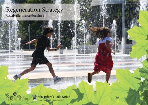
Regeneration Strategy<br />
Coalville, <strong>Leicestershire</strong>
“This kind of public transport-oriented<br />
development is fundamental to achieving<br />
the ultimate goal of a ‘low carbon<br />
community’, and it is very likely that such<br />
communities, far from being austere, will<br />
actually become the sought-after places<br />
where people will choose to live and spend<br />
their time.”<br />
“It is hardly an exercise in nostalgia to recognize that<br />
traditional architecture, particularly our unrivalled<br />
domestic vernacular, represents a pragmatic response to<br />
limited resources and limited energy reserves from which<br />
we can still learn today, even as we incorporate the best<br />
of appropriate and contemporary ‘green’ technology.<br />
Equally, the traditional town was entirely walkable,<br />
while early suburbs were served by trams and trains,<br />
an example of science contributing to cohesive society.<br />
<strong>The</strong> present domination of the car over the pedestrian,<br />
in planning and engineering terms, is of course a<br />
complicating factor. We must surely be able to organize<br />
ourselves — as the Victorians did — in ways in which<br />
we are not dependent on it to such a great extent for<br />
our daily needs. This kind of public transport-oriented<br />
development is fundamental to achieving the ultimate<br />
goal of a ‘low carbon community’, and it is very likely<br />
that such communities, far from being austere, will<br />
actually become the sought-after places where people<br />
will choose to live and spend their time. This principle<br />
has been implemented in practice at Poundbury and it<br />
is heartening to see the real community that has now<br />
emerged as a well-mannered extension of Dorchester,<br />
one of our great English towns. I can only hope its lessons<br />
are emulated for the benefit of generations yet to come.”<br />
HRH <strong>The</strong> Prince of Wales on<br />
low carbon communities
Foreword<br />
councillor matthew blain,<br />
deputy leader of north west leicestershire district council.<br />
“a simple, yet effective concept of<br />
developing the town around four<br />
squares, linked by vibrant streets”<br />
<strong>The</strong> publication of this Regeneration<br />
Strategy is the culmination of two years<br />
work. Last year we published ‘Imagining<br />
our Future’ which achieved its purpose of<br />
stimulating local discussion about the town’s<br />
future and helped us to secure funding from<br />
the East Midlands Development Agency for<br />
this Strategy.<br />
I have been thoroughly impressed with the approach of<br />
<strong>The</strong> Prince’s <strong>Foundation</strong> for the Built Environment to the<br />
challenges our town is facing. <strong>The</strong> ‘Enquiry by Design’<br />
process engaged a broad range of stakeholders and<br />
began with an ‘open shop’ consultation day in the town<br />
centre where representatives from both the <strong>Foundation</strong><br />
and the Council listened to our residents’ thoughts and<br />
aspirations.<br />
Whilst there were many comments relating to what<br />
the town does not offer, we were pleasantly surprised to<br />
hear that many residents have a strong sense of pride in<br />
the town, but feel frustrated that it is not realising its full<br />
potential.<br />
We know that Coalville is failing to fully meet the<br />
needs of residents and visitors and that many residents<br />
choose to shop further afield. <strong>The</strong> town needs to offer a<br />
high quality, pleasant town centre experience appropriate<br />
to its size, re-building itself as a distinctive, contemporary<br />
market town. Coalville should be retaining a much greater<br />
percentage of local spend, not only for economic and social<br />
but also environmental reasons.<br />
As we become increasingly aware of the impact of our<br />
lifestyle and travel choices on the environment we must<br />
ensure that where possible we reduce the need for people<br />
to travel (particularly by car which will become increasingly<br />
expensive) by offering quality goods and services close to<br />
Imaging our future document cover<br />
where our residents live. <strong>The</strong> regeneration of our town<br />
will in turn become an exemplar of the lifestyle principles<br />
we encourage through our ‘Green Footprints Challenge’<br />
initiative.<br />
To achieve this, we need to make the town centre an<br />
attractive and pleasant place to be, with well designed<br />
buildings, streets and squares. We need to build a town<br />
with a stronger sense of identity, rooted in the town’s rich<br />
heritage and capitalising on its location at the heart of the<br />
National Forest.
Our Regeneration Strategy is based upon a simple,<br />
yet effective concept of developing the town around four<br />
squares, linked by vibrant streets. Two of these squares,<br />
Memorial and Marlborough, already exist, with two<br />
additional squares proposed. <strong>The</strong> street network to link<br />
these four squares exists in places, but needs to be either<br />
repaired or created in others.<br />
It is essential that we now focus on realising this<br />
strategy, ensuring that each scheme we undertake as a<br />
Council and every planning consent we grant helps us to<br />
deliver the four squares and the vibrant street network<br />
that will connect them. I am confident that if we all commit<br />
ourselves to realising this concept we can, step by step,<br />
change Coalville into the place we all want it to become.<br />
Councillor Matthew Blain, Deputy Leader of<br />
<strong>North</strong> <strong>West</strong> <strong>Leicestershire</strong> District Council.<br />
Councillor Blain is also Coalville Champion<br />
and a Design Ambassador<br />
Councillor Blain is pictured<br />
beside the former art deco<br />
Rex Cinema in Marlborough<br />
Square, originally opened in<br />
1938 and described by the<br />
Prince’s <strong>Foundation</strong> as one<br />
of the town’s ‘hidden gems’.<br />
THE PRINCE’S FOUNDATION FOR THE BUILT ENVIRONMENT<br />
5
Contents<br />
Introduction<br />
Community Consultation<br />
Examination and Diagnosis<br />
Recommendations for Change<br />
A Brief Introduction to Coalville 2<br />
<strong>The</strong> Prince’s <strong>Foundation</strong>’s Core Design Principles 4<br />
Process 10<br />
Coalville’s Hidden Gems 13<br />
History and Development 17<br />
Overview 22<br />
Five Regeneration Principles 23<br />
A Series of Linked Villages 24<br />
Green Infrastructure 26<br />
Framework Plan 28<br />
Four Squares Plan Linked by Vibrant Streets 30<br />
Development Opportunity Areas and Development Briefs 34<br />
1 A New Heart for the Town 36<br />
2 High Street 38<br />
3 Bridge Road 40<br />
4 Emporium 42<br />
5 Ford Garage Site and Council Offices 44<br />
6 Marlborough Square 46
7 Memorial Square and Mitchell Grieves 48<br />
8 Snibston Discovery Park Greenway 50<br />
9 Ashby Road South 52<br />
Next Steps 54<br />
Appendices<br />
History and Development of Coalville 58<br />
<strong>The</strong> National Forest 60<br />
Community Consultation Mapping Exercise 62<br />
Advanced Spatial Analysis of Coalville 64<br />
Brand Identity for Coalville 76<br />
How to Improve Coalville’s Shopfronts 78<br />
Involving Young People 84
Introduction<br />
1
15<br />
A brief introduction to Coalville<br />
7<br />
10<br />
5<br />
Coalville is located in the centre of England,<br />
within easy reach of the region’s three cities:<br />
Leicester, Derby and Nottingham. Coalville<br />
is the administrative centre for <strong>North</strong> <strong>West</strong><br />
<strong>Leicestershire</strong> and is located within the East<br />
Midlands, with strong road connections<br />
afforded by the M1 and the A42. <strong>The</strong> District<br />
is also home to East Midlands Airport,<br />
Donington Park and is located at the heart<br />
of the National Forest.<br />
◆<br />
◆<br />
◆<br />
◆<br />
◆<br />
◆<br />
◆<br />
<strong>The</strong> population of the Greater Coalville Area is 33,011.<br />
<strong>The</strong> Regional Plan has allocated a target of 12,200<br />
new homes for the District by 2026, with the majority<br />
of growth expected to be centred around the Greater<br />
Coalville area.<br />
41% of <strong>North</strong> <strong>West</strong> <strong>Leicestershire</strong>’s residents are CACI<br />
(a marketing and informations systems company)<br />
classified as either ‘secure’ or ‘flourishing’ families<br />
(compared to a GB average of 24%), offering a strong<br />
base on which the economic growth of the town can<br />
be based.<br />
Mean annual household income is £31,730 for <strong>North</strong><br />
<strong>West</strong> <strong>Leicestershire</strong>, above the wider County average.<br />
Visitor attendance to the town’s main<br />
attraction — Snibston Discovery Park is increasing year<br />
on year, with the attendance during 2008/9 reaching<br />
98,043 visitors (up from 71,221 in 2005/6). Peak<br />
attendance is during July and August.<br />
Coalville Library attracts over 3000 visits per week,<br />
and is a major generator of pedestrian footfall within<br />
the town.<br />
<strong>The</strong> town centre’s last major investment was the<br />
construction of the Belvoir Shopping Centre in the<br />
1960s/70s.<br />
◆ <strong>The</strong> number of events hosted in the town centre<br />
has doubled in 2009, with a series of major events<br />
encouraging higher levels of footfall.<br />
◆ Annual shop vacancy rates have remained below the<br />
national average between 2007 –2009<br />
Data sources: Coalville Town Centre Key Performance<br />
Indicators 2008-9 and bdp/Donaldsons.<br />
Nature Alive Site, Coalville
THE PRINCE’S FOUNDATION FOR THE BUILT ENVIRONMENT 3<br />
Introduction
FAST<br />
Fashion<br />
Commerce<br />
Infrastructure<br />
Governance<br />
Culture<br />
Nature<br />
Absorb<br />
Accommodation<br />
Shape<br />
Manage<br />
Sustain<br />
Steward<br />
<strong>The</strong> Prince’s <strong>Foundation</strong>’s Core Design Principles<br />
SLOW<br />
Three compounding factors are changing<br />
our lives: by the year 2050, the global<br />
population will have risen from six to nine<br />
billion; the average temperature will have<br />
risen by between 2 and 6ºC; and, without<br />
a technological breakthrough, depletion<br />
of oil and gas will have brought an end to<br />
cheap energy. Buildings and transportation<br />
make up more than half of carbon emissions,<br />
so finding practical solutions to this<br />
global catastrophe through sustainable<br />
development is essential.<br />
<strong>The</strong> Prince’s <strong>Foundation</strong> for the Built Environ ment (pfbe)<br />
fundamentally believes, that by structuring towns in a<br />
logical and simple manner, many of these challenges may<br />
be overcome.<br />
This section presents pfbe’s core principles which<br />
have informed the team’s examination and diagnosis of<br />
the town centre.<br />
PFBE believes in Sustainable Growth<br />
Twentieth-century cities suffer from various forms of<br />
growth composed of single uses (i.e. large housing areas,<br />
offi ce parks, etc). <strong>The</strong>se zones are often over-expanded<br />
to become monotonous zones devoid of activities which<br />
support life. This creates chaos in terms of their structure,<br />
use and appearance. <strong>The</strong>se over-expansions cause serious<br />
imbalances between town centres and outlying residential<br />
areas, forcing many to rely heavily upon the car as the<br />
major mode of transport. This is highly unsustainable.<br />
pfbe has developed an idealised town structure<br />
diagram which shows how towns can grow as self sustaining<br />
neighbhourhoods (please refer to Idealised Town Structure<br />
Diagram, opposite page). This includes:<br />
◆ For a neighbourhood to be walkable, many daily<br />
needs should be supplied within a five-minute<br />
walk.<br />
◆ Towns and neighbourhoods should have clearly<br />
identifiable centres.<br />
◆ Residents of these towns should have easy access<br />
to greenways which are natural landscaped<br />
corridors used for sustainable modes of<br />
transport (i.e. for pedestrians, bicyclists, etc) and<br />
recreational purposes.<br />
PFBE believes that Towns Should Stand the<br />
Test of Time<br />
Nearly all traditional and sustainable urban settlements<br />
exhibit similar characteristics in terms of both their<br />
form and growth. One of the ways in which towns were<br />
formed, was at a crossroads or intersection of two principal<br />
thoroughfares - this was how Coalville was established and<br />
grew.<br />
FOOTFALL AND THE HIGH STREET<br />
To capitalize on the footfall at this intersection, streets<br />
were formed by the linear arrangement of buildings on<br />
both sides of these streets which sold goods to people<br />
moving through the area; one of which became the town’s<br />
high street. At the intersection, where there was the<br />
highest level of footfall, it is usual to see a market space<br />
or square. Streets then turned corners to create blocks and
...if we are to create places that are<br />
designed to stand the test of time,<br />
activities that sit on faster changing<br />
frequencies do not dictate the form<br />
of slower changing frequencies such<br />
as a town’s streets and spaces<br />
Introduction<br />
logical secondary arteries for movement.<br />
Most English and other European towns follow the<br />
same evolutionary principles. Healthy towns therefore<br />
consist of a logical network of streets, squares and blocks<br />
which shape spaces to create the public realm. However,<br />
towns need to accommodate change and growth over time<br />
while maintaining their underlying structure.<br />
From the ‘Rates of Change’ diagram (see previous page)<br />
it is important to understand that fast changing trends such<br />
as retail which might have a 10—15 year cycle should not<br />
affect the road infrastructure which might be on a longer<br />
500-year cycle. For example, a development by a single<br />
or multiple retailers would sit on the ‘fashion frequency’<br />
on the ‘Rates of Change’ diagram. This therefore sits on<br />
a more rapidly changing frequency than ‘infrastructure’,<br />
with the infrastructure being a town’s streets and spaces.<br />
It is therefore important to ensure that if we are to create<br />
places that are designed to stand the test of time, activities<br />
that sit on faster changing frequencies do not dictate the<br />
form of slower changing frequencies such as a town’s<br />
streets and spaces.<br />
A Logical Network of Streets<br />
A logical network of streets makes it easy for people to find<br />
their way through town by foot. A permeable network of<br />
previous page: Rates of<br />
Change Diagram adapted<br />
from Stewart Brand’s book<br />
How Buildings Learn<br />
right: Idealised Town<br />
Structure: composed of<br />
walkable neighbourhoods<br />
, identifiable centres<br />
and access to green<br />
infrastructure.<br />
THE PRINCE’S FOUNDATION FOR THE BUILT ENVIRONMENT<br />
5
streets also makes it easier for cars to move around town<br />
by dispersing traffi c rather than congesting it at major<br />
intersections.<br />
Additionally, all towns should have a variety of street types<br />
to cope with the different movement patterns in a town. A<br />
high street has traditionally been the highest receptor of<br />
movement, which is why one would find the most amount<br />
of retail activity here to capture local spending.<br />
Healthy towns therefore consist of a logical<br />
network of streets, squares and blocks which<br />
shape spaces to create the public realm.<br />
Clearly Defined Blocks<br />
Clearly defi ned blocks create a distinction between the<br />
public and private realm. This is achieved when buildings<br />
conform to a building line which fronts onto a public space.<br />
This can be described as ‘place-making’.<br />
Squares<br />
A town square is an open area commonly found in the<br />
heart of a traditional town used for community gatherings.<br />
Squares may take on different functions in relation to each<br />
other. For example, some squares may act as civic hubs and<br />
other as market spaces. In all cases they should be activated<br />
by the uses of the buildings which surround them.<br />
Sustainable Urbanism<br />
<strong>The</strong> model of ‘Sustainable Urbanism’ is typified by places<br />
with a mix of uses, where within a short walking distance<br />
of people’s homes there are educational, employment,<br />
shopping, leisure and cultural opportunities. <strong>The</strong> pfbe<br />
has created a town where such opportunities exist at<br />
Poundbury in Dorset.<br />
<strong>The</strong> ‘Contemporary Suburban Model’ is characterised<br />
by single use areas, with residential estates geographically<br />
separated from educational, employment, shopping, leisure<br />
and cultural areas.
WHERE CAN I SEE AN EXAMPLE OF<br />
SUSTAINABLE URBANISM?<br />
<strong>The</strong> older parts of many settlements exhibit the qualities<br />
of Sustainable Urbanism, although in many cases, the local<br />
shops, schools and public houses have closed. Coalville<br />
historic core is an example of Sustainable Urbanism, as are<br />
the surrounding villages such as Whitwick and Ravenstone<br />
(albeit at a smaller scale). Another local example is the<br />
historic core of Ashby de la Zouch.<br />
WHERE CAN I SEE AN EXAMPLE OF THE<br />
CONTEMPORARY SUBURBAN MODEL?<br />
Coalville’s growth (and that of Ashby de la Zouch) towards<br />
the latter half of the 20th century and early 21st century<br />
feature characteristics of the contemporary suburban<br />
model, with out of town retail developments and business<br />
parks such as Bardon 22, Nottingham Road Retail Park and<br />
Flagstaff Park off the A42.<br />
Whilst the circumstances that created such places<br />
are symptomatic of the changes in national Government<br />
planning policy over the years, it is envisioned that as cost<br />
of travel increases the principles of sustainable urbanism<br />
will become more important to people.<br />
As cost of travel increases the<br />
principles of sustainable urbanism<br />
will become more important<br />
to people.<br />
Introduction<br />
<strong>The</strong> lower half is a more efficient<br />
model for energy and infrastructure<br />
and makes better public spaces.<br />
LiDL in Coalville which is an example of an out of town retail<br />
development<br />
Halfords on Thornborough Road<br />
An example of an out of town retail development<br />
THE PRINCE’S FOUNDATION FOR THE BUILT ENVIRONMENT<br />
7
Community Consultation<br />
9
Community Consultation Process<br />
<strong>The</strong> first thing we did was listen<br />
<strong>The</strong> Community Consultation process was<br />
a vital tool used to gather and understand<br />
key information related to the town centre.<br />
<strong>The</strong> process played an essential part in<br />
developing the Regeneration Strategy.<br />
A key component of our consultation was<br />
the Enquiry by Design (EbD).<br />
<strong>The</strong> EbD process is one of the pfbe’s key planning tools,<br />
and the framework by which our values are disseminated<br />
to influence future development of the built environment.<br />
A collaborative planning approach devised and promoted<br />
by pfbe, the EbD process is often used for substantial<br />
sites. A single event held over several days assesses a<br />
complex series of design requirements of a new or revived<br />
community.<br />
<strong>The</strong> process brings key stakeholders together around<br />
the same table, where problems can be aired as they arise<br />
and every issue tested by being drawn. It can be used for<br />
the regeneration of existing communities or the planning<br />
of wholly new developments. <strong>The</strong> EbD process also has<br />
an educational component, introducing the participants<br />
to the concepts of traditional urbanism and helping to<br />
ensure that the project is not only sustainable but relates<br />
well to the locality.<br />
By its nature, the EbD process approaches each<br />
brief as a new design problem, and tailors a response<br />
appropriate to the dialogue between stakeholders. pfbe<br />
is a leading exponent of this aspect of practice, and has<br />
successfully brought into a single forum a broad spectrum<br />
of participants, to include, critically, the local community,<br />
engaging them at the heart of the design process.<br />
SCOPING WORKSHOP<br />
In May 2009, the pfbe team and <strong>North</strong> <strong>West</strong> <strong>Leicestershire</strong><br />
District Council (nwldc) held a scoping workshop at Christ<br />
Church Hall in Coalville. A number of individuals and<br />
stakeholders took part, ranging from elected members,<br />
representatives from the National Forest Company,<br />
the Coalville Heritage Society, Coalville Town Centre<br />
Partnership, Snibston Discovery Park and <strong>Leicestershire</strong><br />
County Council. <strong>The</strong> purpose of the scoping workshop was<br />
in effect a ‘fact-finding’ exercise and was used to gather a<br />
broad range of information and detailed insight into the<br />
town’s history, evolution and current situation within a<br />
short space of time.<br />
<strong>The</strong> scoping day also offered the pfbe team the<br />
opportunity to explore the town on foot and start to<br />
understand the place. <strong>The</strong> pfbe team was comprised of<br />
Ben Bolgar leading the staff for the Prince’s <strong>Foundation</strong>,<br />
supported by specialists in retail, highways design, brand<br />
identity and spatial analysis. <strong>The</strong> pfbe team was also joined<br />
by Noel Isherwood, Poundbury representative. Poundbury<br />
is recognised as a national exemplar of sustainable<br />
urbanism (refer to the Sustainable Urbanism Diagram on<br />
page 6).
‘OPEN SHOP’ CONSULTATION<br />
Following the scoping workshop, representatives from<br />
the pfbe and nwldc held an Open Shop Consultation<br />
Day at the Belvoir Shopping Centre. Over 100 residents<br />
from Coalville and its surrounding villages participated<br />
in the consultation. <strong>The</strong> day was extremely valuable in<br />
gathering people’s thoughts and aspirations for the town.<br />
<strong>The</strong>se thoughts and aspirations have been reflected in the<br />
‘Recommendations for Change’ section of the Regeneration<br />
Strategy. Full details of the consultation event are offered<br />
within Appendix: Community Consultation (page 62).<br />
THREE DAY ENQUIRY BY DESIGN (EBD)<br />
In June 2009, the pfbe team returned to Coalville and held<br />
a three day EbD workshop with representatives from nwldc<br />
and the various individuals and specialised consultants in<br />
highway design, brand identity and spatial analysis.<br />
Over the course of these three intensive days, the<br />
pfbe team identified, explored and developed a series of<br />
proposals for the town whilst also considering the town’s<br />
future growth. <strong>The</strong> pfbe team also met with stakeholders<br />
in the town centre to identify buildings and places of<br />
value which could be built upon in shaping Coalville’s<br />
identity. <strong>The</strong> fi nal recommendations were presented on<br />
the evening of the third day at Christ Church. <strong>The</strong> public<br />
presentation was extremely well attended by over 100<br />
residents. <strong>The</strong> contents of the presentation are reflected in<br />
the Regeneration Strategy. To view the presentation visit:<br />
www.coalvilleschanging.com<br />
Involving Young People<br />
With support from <strong>Leicestershire</strong> County Council’s Youth<br />
Development Team, pfbe met with younger Coalville<br />
residents. <strong>The</strong> opportunity to meet younger people was<br />
extremely valuable in capturing their aspirations for their<br />
town. Key aspirations were for more entertainment venues<br />
such as a cinema, bowling alley, etc.<br />
Further details of the consultation are offered within<br />
the Appendix: Community Consultation (page 62).<br />
Memorial Square<br />
Community Consultation<br />
Right: <strong>The</strong> EbD workshop<br />
was a hands-on exercise<br />
involving PFBE staff, elected<br />
members, Council officers<br />
and other stakeholders. All<br />
those participating were<br />
actively encouraged to<br />
explore, test and develop<br />
ideas<br />
Far right: result from one<br />
of the mapping<br />
exercises which<br />
shows where people<br />
feel the centre of<br />
Coalville is<br />
THE PRINCE’S FOUNDATION FOR THE BUILT ENVIRONMENT<br />
11
What was discovered?<br />
By taking the time to listen to the public we discovered<br />
an enormous amount about people’s thoughts of and<br />
aspirations for the town.<br />
PRIDE<br />
Many people expressed a sense of pride in the town, in<br />
particular its history and features such as the Memorial<br />
Tower, Marlborough Square and the Council Offices<br />
building facing London Road.<br />
CULTURAL AND LEISURE OPPORTUNITIES<br />
It was clear that people wanted more cultural and leisure<br />
opportunities for all ages in the town centre. Comments<br />
ranged from a cinema to more simple suggestions, such as<br />
improving the town’s public spaces with places to sit where<br />
you could watch the world go by.<br />
POTENTIAL<br />
People expressed a frustration that the town was not<br />
realising its full potential, with plenty of opportunities to<br />
create a place that would not only encourage visitors but<br />
attract local residents to shop and spend their leisure time<br />
in the town centre - and stop for longer.<br />
IDENTITY<br />
Many residents who participated in the consultation were<br />
from the villages surrounding Coalville and it was clear<br />
that they were passionate about keeping their villages’<br />
identities as the town grows.<br />
Coalville’s Hidden Gems are<br />
symbolic of a series of principles by<br />
which the town grew. <strong>The</strong>y are also<br />
places which need enhancement<br />
and building upon as each element<br />
of the Regeneration Strategy occurs.<br />
HIDDEN GEMS<br />
People identified a number of ‘hidden gems’ in the town<br />
that could be improved and enhanced; these included<br />
buildings and spaces such as the former Rex cinema, a<br />
good example of an Art Deco styled building.<br />
KEEPING MORE MONEY LOCAL<br />
Many residents expressed concerns about people travelling<br />
further afi eld to shop. Whilst many recognised that the<br />
town could never attract some of the retailers that are<br />
based in the city centres within the region, people did<br />
feel that by improving the town centre ‘offer’ more people<br />
could be encouraged to shop locally more often.
1. Civic Pride & ambition:<br />
Clock Tower<br />
2. Memory & settling: <strong>The</strong><br />
Red House<br />
9. Hard work together for<br />
change: Coal Miner Statue<br />
3. Community: Margaret Street 4. Entertainment & gathering: Rex Cinema 5. Connecting beyond: town<br />
centre greenway<br />
Community Consultation<br />
1<br />
2<br />
6. Leadership & promotion: NWLDC’s offices<br />
3<br />
4<br />
5<br />
9<br />
7<br />
6<br />
8<br />
7. Opportunities for change:<br />
Belvoir Shopping Centre<br />
8. Inspiration & Inventiveness:<br />
Christ Church<br />
THE PRINCE’S FOUNDATION FOR THE BUILT ENVIRONMENT<br />
13
Examination & Diagnosis<br />
15
Examination & Diagnosis<br />
Using the Enquiry by Design (EbD) Process<br />
History and Development<br />
FROM SMALL ACORNS DO OAK TREES GROW<br />
Coalville was established in the mid 1820’s when William<br />
Stenson sank what was to become the town’s fi rst<br />
mine. This was a pivotal moment in the growth of what<br />
was to become Coalville. As Denis Baker of the Coalville<br />
Heritage Society explains “this act sparked the evolution<br />
of the Victorian town of Coalville on a desolate area of<br />
land comprised of the four distant corners of adjoining<br />
parishes of Whitwick, Hugglescote, Snibston and Swannington”<br />
(see Appendix: History and Development of<br />
Coalville, page 58).<br />
Whitwick Colliery<br />
THE MAKING OF A TOWN<br />
With the need to house colliery workers and support new<br />
trade in the area, workers terraced houses were built<br />
along present day High Street and Margaret Street (more<br />
housing followed). Later, an irregular network of streets<br />
formed around industries in town.<br />
A CENTURY OF CHANGE<br />
By the mid 1950s Coalville’s mining industry was rapidly<br />
declining. <strong>The</strong> closure of its rail station (on the Leicester<br />
to Burton line) in the 1960s and the growth of private<br />
historic urban centre<br />
FROM TOP: Historic centre of Coalville Mantle Lane and Long<br />
Lane; Historic map of Coalville, 1901: Whitwick Colliery and<br />
the urban centre marked
Clockwise from top left:<br />
Historic photo of Hotel<br />
Street before redevelopment<br />
of its northern side;<br />
Existing High Street with<br />
only one-sided retail and<br />
no parking; Pedestrianised<br />
Memorial Square<br />
car ownership (encouraged by the Government’s road<br />
building and rail closure programmes) influenced a more<br />
dispersed form of town growth, resulting in the expansion<br />
of suburban areas. This trend continued through to the<br />
end of the 20th century, and together with the growth of<br />
out of town centre retail developments, Coalville began<br />
to move away from ‘Sustainable Urbanism’ towards a<br />
‘Contemporary Suburban Model’.<br />
As previously discussed in the Prince’s <strong>Foundation</strong>’s<br />
Core Design Principles Section (page 4), the model of<br />
‘Sustainable Urbanism’ is typified by places with a mix of<br />
uses, where within a short walking distance of people’s<br />
homes there are educational, employment, shopping,<br />
leisure and cultural opportunities.<br />
Examination & Diagnosis<br />
Coalville in the 21st century<br />
As fuel prices continue to rise and fossil fuels become more<br />
scarce it is conceivable that places that are developed<br />
consistent with the Sustainable Urbanism model will<br />
become more desirable. As Coalville enters the 21st century,<br />
the planning framework for the District (called the Local<br />
Development Framework) is seeking to establish how best<br />
the town should grow and where new housing should and<br />
could be located. How this can be done, whilst still retaining<br />
the special characteristics of the place, such as the separate<br />
and distinctive villages that surround the town?<br />
THE PRINCE’S FOUNDATION FOR THE BUILT ENVIRONMENT<br />
17
A FAILING TOWN CENTRE<br />
As the retail offer has increased around the edge of the<br />
town, and as car usage increased the town began to<br />
struggle as a result of decreasing footfall and increased<br />
congestion. <strong>The</strong> town’s original High Street still features<br />
many independent businesses, such as a butchers, toy store<br />
and specialist cake shop, however increased levels of traffic<br />
have resulted in an unpleasant shopping environment. <strong>The</strong><br />
lack of on street parking provision (as seen in Ashby de la<br />
Zouch) makes it harder for people to do ‘quick’ visits to the<br />
town centre which would be of significant benefit to High<br />
Street traders.<br />
<strong>The</strong> rebuilding of the northern side of High Street and<br />
the creation of a stand alone library building has not only<br />
weakened the enclosure of the street but created a High<br />
Street with a ‘one sided’ retail offer.<br />
Walkable neighbourhoods are<br />
those that are easy to get around on<br />
foot and where the places you need<br />
to get to are ideally a five minute<br />
walk away – or at most, a ten<br />
minute walk away.<br />
Potential walkable<br />
neighbourhoods study from<br />
the EbD design workshop<br />
LOSING SPACES TO THE CAR<br />
Over the years, more space has been afforded to the car,<br />
with spaces such as Memorial Square becoming dominated<br />
by traffic despite efforts to part pedestrianise the space.<br />
LOSS OF MARKET SQUARE<br />
Memorial Square was once a bustling market place which<br />
hosted a wide variety of activities including concerts by the<br />
town’s brass bands, an open air market, and other events<br />
which celebrated the town’s civic pride. In 1926 the Clock<br />
Tower was built as a war memorial in memory of Coalville<br />
residents who gave their lives in World War I. <strong>The</strong> names<br />
of those who died in World War II were subsequently<br />
added. Unfortunately, the square has suffered as a result<br />
of the loss of the town’s industries and has also struggled<br />
with properly regulating increased traffic flows into<br />
town; by developing a roundabout with an overburdened<br />
Snibston<br />
Discovery Park<br />
High<br />
Belvoir Centre<br />
Coalville Park<br />
Right: Space Syntax model<br />
of existing accessibilty<br />
within the town centre.<br />
Red shows good<br />
accessibility<br />
<br />
Low
intersection. <strong>The</strong> pedestrianisation of one side of the<br />
square has been useful in creating a safe shelter for people<br />
on foot, however it has not been properly designed for<br />
people who wish to use the space for leisure. <strong>The</strong> square<br />
lacks proper enclosure and no active frontages or uses on<br />
the north and west side.<br />
Movement<br />
STREETS ARE CRUCIAL TO THE SUCCESS OF A PLACE<br />
A healthy town needs of network of streets and spaces that<br />
allow people to easily get around the town. At the heart<br />
of the town where most of the movement takes place,<br />
Mantle Lane<br />
there need to be more streets to allow people to get to<br />
the places they want to get to quickly and easily.<br />
A ‘Space Syntax’ model of the town has been developed.<br />
Space Syntax conducts space modelling analyses which<br />
allow road engineers and urban designers to understand<br />
transport related problems. Routes highlighted in red have<br />
a good level of accessibility, with routes highlighted in blue<br />
having the weakest level of accessibility. A healthy town<br />
centre needs not only a network of routes, but a network<br />
of red coloured routes (see Appendix: Advanced Spatial<br />
Analysis of Coalville, page 64).<br />
Stephenson Way<br />
“Coalville<br />
suffers from<br />
‘blocked<br />
arteries’<br />
(streets)”<br />
BLOCKED ARTERIES – COALVILLE NEEDS ‘SURGERY’<br />
We can look at the health of a town as we do a human<br />
body. If we were to consider the streets of a town to be its<br />
arteries, we can see on the opposite page that Coalville not<br />
only suffers from blocked arteries (i.e. routes that do not<br />
connect to one another) but has a number of places where<br />
arteries are needed but do not yet exist.<br />
In terms of both pedestrian and vehicular access<br />
within this is not only problematic for people who live in<br />
Coalville but also for those from the surrounding villages<br />
who experience traffic congestion when entering the<br />
town centre. Residents of these villages should support<br />
a strategy that remedies the blocked arteries in the town<br />
centre but also promotes the growth of Greater Coalville<br />
as composed of sustainable, walkable neighbourhoods and<br />
villages. <strong>The</strong> potential walkable neighourhoods study on<br />
the previous page, identifies existing centres and potential<br />
new centres for growth structured around fi ve minute<br />
walkable neighbourhoods (Refer to pfbe’s Idealised Town<br />
Structure diagram on page 5).<br />
pfbe therefore encourages both nwldc and local<br />
residents to adopt the principles of Sustainable Urbanism<br />
as a way of not only creating more environmentally<br />
friendly ways of living, but creating places with distinctive<br />
identities that are highly desirable places to live, work and<br />
spend leisure time.<br />
Examination & Diagnosis<br />
N<br />
Belvoir Centre<br />
Belvoir Road<br />
Council Offices<br />
PARKING<br />
To address the need to support a large number of cars<br />
which enter Coalville during peak hours, an effective<br />
parking strategy must be developed which will not have an<br />
impact on the quality of public space in the town centre.<br />
This can be achieved most effectively with structured<br />
parking and surface parking on the periphery of the Town<br />
Centre, from which, people can easily walk into town.<br />
<strong>The</strong> existing street network<br />
is severely fragmented<br />
THE PRINCE’S FOUNDATION FOR THE BUILT ENVIRONMENT<br />
19
Recommendations for Change<br />
21
Overview<br />
<strong>The</strong> preliminary work in the development of<br />
a Regeneration Strategy is contained within<br />
the preceding four sections of this document.<br />
This section of the Regeneration Strategy<br />
is composed of six parts: a set of Principles<br />
for the development of the town centre, a<br />
recommendation for growth in the Greater<br />
Coalville Area, a framework for development<br />
of the town centre, a place-making concept<br />
for the town centre, and development briefs<br />
for specific areas in the town centre.<br />
Five Regeneration Principles<br />
Ensures that the new development will be in accordance<br />
with the town’s vision.<br />
A Series of Linked Villages<br />
Recommendation for the sustainable growth of Greater<br />
Coalville as a whole including the surrounding villages.<br />
Green Infrastructure<br />
Establishes a complete network of greenways and green<br />
spaces through the town centre which connect the town<br />
to its wider environment.<br />
<strong>The</strong> Framework Plan<br />
Sets an overall context for new development with the<br />
establishment of new building lines.<br />
Development Opportunity Areas<br />
& Development Briefs<br />
<strong>The</strong> framework plan is divided into nine areas. This will<br />
allow nwldc to refer to specific design recommendations<br />
for key areas in the town centre when development<br />
opportunities arise. At this time nwldc will also be able to<br />
expand upon these recommendations in further detail.<br />
Four Squares Linked by Vibrant Streets<br />
<strong>The</strong> principal design concept for the town centre’s<br />
regeneration.
Five Regeneration Principles<br />
Five fundamental regeneration principles<br />
will ensure that new development will be<br />
in accordance with the town’s vision.<br />
<strong>The</strong>se principles represent a set of values<br />
that decision-makers in Coalville will be<br />
able to refer back to in order to take the<br />
necessary actions to obtain the town<br />
centre vision.<br />
◆<br />
◆<br />
◆<br />
◆<br />
◆<br />
Coalville must maximise its strategic advantage<br />
as a sub-regional centre for <strong>North</strong> <strong>West</strong><br />
<strong>Leicestershire</strong> in the heart of the National Forest.<br />
Coalville should grow in a way that enhances<br />
existing historic centres while providing new<br />
communities on a coherent movement network.<br />
Coalville must repair its main movement arteries<br />
in the town centre to attract inward investment<br />
and capture global spend.<br />
<strong>The</strong> community must actively encourage<br />
development compliant with a series of<br />
development briefs.<br />
New development must contribute to physical<br />
and social enhancement as well as have economic<br />
benefit for the town as a whole not just within<br />
the individual plot.<br />
Recommendations for change<br />
THE PRINCE’S FOUNDATION FOR THE BUILT ENVIRONMENT<br />
23
A Series of Linked Villages<br />
Green infrastructure & growth plan<br />
<strong>The</strong> Urban Design Compendium was<br />
published by English Partnerships (now<br />
the Homes & Communities Agency) in<br />
2000 to “inform and assist all those involved<br />
in new development and regeneration and<br />
contribute to the improvement of housing-led<br />
regeneration and the promotion of sustainable<br />
new developments.” It should therefore be<br />
used as a guide for the implementation of<br />
new development<br />
in Coalville.<br />
<strong>The</strong> Compendium proposes a growth diagram at the scale<br />
of the neighbourhood unit, with the city core as the central<br />
unit of growth and minor neighbourhood units separated<br />
by green corridors. It recommends that both the city core<br />
and individual neighbourhoods should provide a mix of<br />
uses with daily goods and services being located within<br />
walking distance for all residents of any given community.<br />
This distance is typically measured at 400—500 metres<br />
from urban edge to urban centre and comprises a<br />
development density of around 55 units per hectare to<br />
maximise location and energy efficiency.<br />
During pfbe’s initial ‘Open Shop Consultation’, which is<br />
expanded upon in the Community Consultation Section<br />
(page 10), a common theme which emerged was that<br />
residents of the surrounding villages would like to retain<br />
their existing identities. In addition, they stated that they<br />
would not like to see new growth in the Greater Coalville<br />
Area merge existing distinct villages into one urban<br />
conglomeration. This aspiration can be achieved if green<br />
corridors are coherently structured to physically separate<br />
Coalville’s surrounding villages from each other and from<br />
Coalville Town centre; like the Idealised Town Structure<br />
diagram on page 5.
A Settlement Structure Plan was therefore drawn during<br />
the workshop to reinforce the centres of Thringstone,<br />
Whitwick, Swannington, Ravenstone, and Ellistown with<br />
new centres also proposed based on an existing and<br />
proposed network of streets. A growth boundary around<br />
Coalville and each of these villages was then drawn with a<br />
greenways network woven throughout, connecting places<br />
to each other and the countryside beyond.<br />
In some instances, where greater distinction is<br />
desirable, greenways can be designed as separators (such<br />
as new woodlands) and in other instances where adjacent<br />
communities can benefit from a shared heritage, greenways<br />
can be designed as integrators (such as parks, allotments<br />
and playing fields).<br />
pfbe recommends that when considering Coalville’s<br />
development as part of the revised Core Strategy, nwldc;<br />
◆ identifies clear neighbourhood structures for<br />
existing and proposed neighbourhoods<br />
◆ plans for a greenway network<br />
◆ considers the physical distance between people’s<br />
homes, village centres and Coalville town centre<br />
◆ plans for a series of ‘integrators’ and ‘separators’,<br />
such as:<br />
– New woodlands<br />
– Parks<br />
– Playing fields<br />
– Allotments<br />
– Nature reserves<br />
– Heathland<br />
Whilst pfbe is not currently commissioned to advise on<br />
such issues, the team undertook an initial assessment of<br />
how existing settlements might be developed and where<br />
new settlements may be located and formed in order to<br />
maximise efficiency of movement and walkability. A clear<br />
understanding of the opportunities and possible form of<br />
growth is essential in understanding the importance of<br />
links in and out of the town centre.<br />
SETTLEMENT STRUCTURE PLAN<br />
Recommendations for change<br />
THE PRINCE’S FOUNDATION FOR THE BUILT ENVIRONMENT<br />
25
Green Infrastructure<br />
<strong>The</strong> provision of high quality accessible<br />
green infrastructure within a town has the<br />
ability to relieve the problems associated<br />
with increased urbanisation. It does so by<br />
providing shared leisure and relaxation areas<br />
where people often want to spend their<br />
time. Well-designed green infrastructure<br />
can enhance the quality of urban living<br />
and thereby attract investment in terms of<br />
housing, jobs, and skills.<br />
Sustrans, the UK’s leading sustainable transport charity,<br />
have been pro-actively implementing a number of<br />
greenways and trails in Coalville; however the network<br />
is not complete. During the EbD the team studied the<br />
town centre to make connections to repair the gaps in<br />
the network. <strong>The</strong> team also began to understand how<br />
the network could be designed to enhance specific public<br />
spaces and in turn add value to nearby properties.<br />
Open Space Network<br />
During the EbD, an Open Space Network was proposed<br />
primarily to increase pedestrian and bicycle accessibility<br />
within the town centre and out to the countryside, thereby<br />
linking up with district wide greenways and trails. <strong>The</strong><br />
network was also proposed as a way to build upon the<br />
vision of Coalville as a market town set within the context<br />
of the National Forest. One of the ideas discussed was to<br />
use some of the existing rail lines to create greenways<br />
linking to larger open spaces like Snibston Discovery Park,<br />
the open countryside and future new settlements.<br />
Below is a list of potential new greenways and spaces<br />
which can connect to the existing green network. <strong>The</strong> list<br />
below comprises the complete network which will complete<br />
the greenways corridors throughout the town centre.<br />
GREENWAY/CORRIDOR<br />
1. Snibston Greenway<br />
2. Whitwick Boulevard<br />
3. Snibston Discovery Park<br />
4. Bardon Grange Scenic Way<br />
5. Stephenson Way<br />
6. Coalville Park<br />
7. Memorial Square<br />
8. Stenson Green
GREEN INFRASTRUCTURE PLAN<br />
1<br />
7<br />
2<br />
8<br />
5<br />
6<br />
Recommendations for change<br />
3<br />
N<br />
4<br />
THE PRINCE’S FOUNDATION FOR THE BUILT ENVIRONMENT<br />
27
Framework Plan<br />
Improving Spatial Accessibility<br />
<strong>The</strong> Framework Plan used by the PFBE sets<br />
out urban blocks to define the framework<br />
of a town, with streets and squares linking<br />
and separating the blocks. A new series of<br />
pedestrian and vehicular links is proposed<br />
in order to improve the overall movement<br />
network within the town. <strong>The</strong> drastic<br />
improvement in localised access can be<br />
seen from the ‘before and after’ diagrams<br />
to the right.<br />
Repairing blocks<br />
Top: Before; Space<br />
Syntax model of existing<br />
accessibility Below: After;<br />
Space Syntax model<br />
accessibility with the<br />
Framework Plan, note the<br />
increase in red and orange<br />
routes.<br />
Overleaf: <strong>The</strong> Framework<br />
Plan shows the urban block<br />
structure with buildings<br />
creating public frontages<br />
to streets and squares<br />
and private rear courts for<br />
servicing<br />
<strong>The</strong> Framework Plan was developed to ensure that new<br />
buildings in the town centre create a uniform building<br />
alignment for each street and square to clearly define public<br />
spaces. It establishes a clear physical framework through<br />
which strategic initiatives may be carried forward when<br />
funding arises. <strong>The</strong> Plan was developed from the Hidden<br />
Gems exercise which formed part of the EbD process. <strong>The</strong><br />
Plan ensures that each new development will contribute<br />
to the physical and social enhancement of the town centre<br />
as well as have economic benefits for the town as a whole<br />
and not just within each development opportunity area<br />
(see Development Opportunity Areas and Development<br />
Briefs, page. 34)<br />
High<br />
Low
FRAMEWORK PLAN<br />
Ashby Road<br />
High Street<br />
Recommendations for change<br />
Belvoir Road<br />
N<br />
Existing buildings<br />
Proposed new development sites<br />
Proposed Public Parking Areas<br />
THE PRINCE’S FOUNDATION FOR THE BUILT ENVIRONMENT<br />
29
Four Squares Linked by Vibrant Streets<br />
<strong>The</strong> Four Squares Proposal:<br />
Two improved squares and two new ones<br />
<strong>The</strong> Four Squares Linked by Vibrant Streets<br />
Concept addresses, within the context of the<br />
Framework Plan, the need for a more defined<br />
legibility of public spaces within the town<br />
centre. Two of the squares already exist and<br />
simply require, in some cases, refurbishment<br />
of existing buildings and, in other cases,<br />
a clearer definition and containment of<br />
space through the construction of entirely<br />
new buildings and improvements to<br />
infrastructure.<br />
<strong>The</strong> variety of public spaces within the town centre will<br />
be enhanced through the implementation of four distinct<br />
squares, each with their own specifi c role in relation to<br />
the others.<br />
Each of the squares must have a pedestrian bias to<br />
work successfully, with the prominence of highways and<br />
vehicles both reduced and as discreet as possible. It is<br />
essential that the buildings forming the spatial enclosure<br />
of the square have the opportunity to positively contribute<br />
to the social life of these spaces, with active ground floor<br />
uses and the ability for human activity generated by these<br />
uses to permeate across the space. It is therefore imperative<br />
that when planning for vehicle access to and movement<br />
through these spaces, the impact of highways support<br />
the creation of these social spaces. It is encouraged that<br />
in the case of Stenson Square and Memorial Square that<br />
if necessary alternative streets are created to relieve the<br />
vehicle pressure on these spaces.<br />
1. Market Place (new)<br />
Stakeholder and community feedback revealed that<br />
residents of Coalville desire more modern shops including<br />
a new cinema, a bowling alley, an arcade, and larger<br />
retailers. <strong>The</strong> footfall generated from these uses warrants<br />
the creation of a new square, marking the anchor between<br />
new vehicular links through the town centre.<br />
2. Memorial Square<br />
In 1974 Coalville’s strategic role in the Region changed<br />
when it became the seat of <strong>North</strong> <strong>West</strong> <strong>Leicestershire</strong><br />
District Council. During the EbD, it was proposed to utilise<br />
Memorial Square as the foreground for the creation of a<br />
civic hub which would include the Council’s Offices and a<br />
new library. Another idea proposed was to build or provide<br />
space for a tourist information centre and museum which<br />
would inform those interested in visiting nearby attractions<br />
like the National Forest and Snibston Discovery Centre.<br />
3. Marlborough Square<br />
Marlborough Square hosts a number of restaurants<br />
and pubs alongside the Emporium, the town’s club, and<br />
the Rex Cinema, the town’s former cinema. Given the<br />
relatively small scale of the square, its intimate setting,<br />
tucked away off Belvoir Road, and clues from its existing<br />
and former businesses, it seems appropriate to utilise<br />
Marlborough Square as the town’s entertainment area. To<br />
do so, some existing shop fronts must be repaired, Rex
Cinema refurbished, and the public realm tidied up by<br />
providing more space for outdoor seating and regulating<br />
traffic through the replacement of the roundabout with a<br />
signalled light.<br />
4. Stenson Square (new)<br />
To support and enhance the public space network, a<br />
further fourth square should be created. However this is<br />
conceived as a more modest and passive space, offering<br />
a new gateway to the town (located at a key intersection<br />
between London Road, Hotel Street and Whitwick Road)<br />
and a sense of spatial relief within the townscape.<br />
Improvements should be focused on both hard and<br />
soft landscaping, pedestrian access (in particular crossing<br />
points across Whitwick Road, Hotel Street and London<br />
Road) and the opportunity to explore creating a new<br />
(residential) building on the current London Road car park<br />
site. As the ‘lowest order’ square within the town, activity is<br />
focused and directed to the ‘higher’ order squares.<br />
Such a square would be dependent on the redevelopment<br />
of the Council Offi ces site. <strong>The</strong> old Council Offi ce<br />
building is a building worthy of retention and any future<br />
development on this site should seek to reinstate the<br />
main entrance as a point of public entry, in order to help<br />
enliven the space and reinstate the building’s traditional<br />
entrance.<br />
FOUR SQUARES PLAN<br />
Belvoir Road<br />
2<br />
Mantle Lane<br />
High Street<br />
1<br />
4<br />
Whitwick Road<br />
Recommendations for change<br />
3<br />
THE PRINCE’S FOUNDATION FOR THE BUILT ENVIRONMENT<br />
31
Making Vibrant Streets<br />
<strong>The</strong> Framework Plan, in response to the Examination and<br />
Diagnosis section (page 18) also proposes an initiative to<br />
create improved vehicular and pedestrian links throughout<br />
the town centre whilst building upon existing “hidden<br />
gems”. New streets are proposed to free up some of the<br />
“blocked arteries” as a way to improve the accessibility<br />
within and to the town centre.<br />
Some streets, like Hotel Street will need a clearer definition<br />
of public space by setting buildings back from the<br />
street at a distance to give the feeling of an oudoor room.<br />
For other streets, like Whitwick Road, a more legible green<br />
link connecting to Stephenson Way and the wider natural<br />
landscape will require public realm and infrastructure<br />
improvements.<br />
1. HIGH ST: NEW SIDE — CIVIC HUB & RETAIL<br />
<strong>The</strong> creation of a proper high street will require the<br />
construction of new mixed use retail and civic functions to<br />
the north side of what is currently called the High Street.<br />
<strong>The</strong> street itself will need to be widened to make way for<br />
on-street parking, widened pavements, and landscape<br />
features. Existing buildings south of High Street should<br />
refer to Appendix ‘How to improve Coalville’s shopfronts’<br />
(page 78) to enhance their appearance.<br />
2. UNLOCKING THE BELVOIR CENTRE<br />
Delivering new vehicular and improved pedestrian<br />
links through the Belvoir Centre will alleviate most of<br />
the problems associated with traffi c congestion, poor<br />
accessibility within the town centre, and public safety at<br />
night (providing that the scheme is mixed use, preferably<br />
with residential accommodation).<br />
This will require the construction of new medium<br />
size shops, the opening up of the centre for a new street,<br />
the provision of retail space for larger chain stores, the<br />
reconfiguration of the existing pedestrian area for vehicular<br />
movement and on-street parking, and the replacement of<br />
lost car park spaces to be moved further east into a multistorey<br />
car park off Bridge Road.<br />
3. NEW BRIDGE<br />
A new vehicular crossing over the freight rail line, through<br />
the extension of Bridge Road connecting with Hotel Street<br />
will require permission from Network Rail to upgrade the<br />
pedestrian bridge.<br />
A new link will increase town centre accessibility both<br />
by foot and by car. <strong>The</strong> design of any new bridge should<br />
be carefully considered with opportunities to improve the<br />
crossing experience, particularly after dark. Due to changes<br />
in level from north to south, it will be necessary to ensure<br />
that any future development of the Belvoir Centre offers<br />
pedestrians easy and inviting access down to lower levels<br />
of the site.<br />
It is strongly recommended that a key test of any<br />
proposals is to design for the most vulnerable and least<br />
mobile in the community. For example, how would a<br />
mother with a pushchair and two children negotiate the<br />
changes in level after dark — would access be easy, inviting,<br />
safe and direct? It is strongly recommended that access is<br />
designed ‘open air’, i.e. without resorting to ‘urban’ lifts or<br />
isolated ramps.<br />
4. MARLBOROUGH WAY<br />
As a way of breaking down the large block structure and<br />
improving vehicular and pedestrian movement within the<br />
town centre, the existing pavement, north of Emporium,<br />
should be reconfigured and widened to create a new street<br />
with car access. Another possible connection, pending<br />
negotiations with property owners, might also be made<br />
just south of Emporium.<br />
5. WHITWICK BOULEVARD<br />
With the potential construction of new development<br />
alongside the west of Whitwick Road and the opportunity<br />
to build on the existing landscaped area on the east side,<br />
Whitwick Road must be enhanced to improve the quality of<br />
the pedestrian and cyclist experience, reinforce its spatial<br />
enclosure and strengthen the prominence of this route into<br />
and out of the town.<br />
Key areas of focus should to ensure that building<br />
setbacks and building heights serve to spatially enclose<br />
the street. Improved pavements and crossings and street<br />
lighting are recommended to enhance the pedestrian<br />
experience.<br />
6. GEORGE SMITH WAY<br />
With potential new development on the current Mitchell<br />
Grieves site, Market Street now has the potential to become<br />
a proper vehicular link west and south back to Ashby Road<br />
which will create a legible block and open up development<br />
opportunities to the north.<br />
7. SNIBSTON GREENWAY<br />
Whilst the Heritage Trail Line has opened up new links<br />
from the town centre to Snibston Discovery Centre, it is<br />
infrequent and cannot be considered as either a mode of<br />
public transport or a pedestrian link to the countryside.<br />
<strong>The</strong> construction of a safe pedestrian walk way along the<br />
rail line to Snibston and the reconfiguration of the existing<br />
greenway behind the Belvoir Centre to open to vehicular<br />
traffic will improve accessibility from the new Market Place<br />
out to the countryside. It is also proposed that the current<br />
gates to the rail link are set back to form a small space<br />
adjacent to the existing Da Vinci’s restaurant. This space<br />
would be able to accommodate some outdoor space for<br />
the restaurant.
Recommendations for change<br />
Whitwick Road<br />
6<br />
7b<br />
7a<br />
1<br />
2<br />
4a<br />
4b<br />
5<br />
High Street<br />
3<br />
Bridge Road<br />
THE PRINCE’S FOUNDATION FOR THE BUILT ENVIRONMENT<br />
Mantle Lane<br />
Belvoir Road<br />
VIBRANT STREETS<br />
33
Development Opportunity Areas<br />
& Development Briefs<br />
<strong>The</strong> team established nine development<br />
parcels within the town centre, each with<br />
its own design brief/code to guide future<br />
development and public realm enhancement<br />
as funding comes forward.<br />
When the opportunity for a development arises within a<br />
parcel, the stakeholders in the area should be convened by<br />
nwldc to refine the development brief in more detail. This<br />
can happen in two ways.<br />
◆ When proactively approached by the workstream<br />
leads<br />
◆ Or by an approach from a developer/3rd party.<br />
It is proposed that a one to two day design workshop is<br />
convened to develop the plan based on the development<br />
opportunity area using the pertinent development brief<br />
included in the following pages. Detailed planning<br />
applications would then be considered in the context of<br />
the refined development brief.<br />
Development Opportunity Areas<br />
1. A New Heart for the Town<br />
2. High Street<br />
3. Bridge Road<br />
4. Emporium<br />
5. Ford Garage Site and Council Offices<br />
6. Marlborough Square<br />
7. Memorial Square and Mitchell Grieves<br />
8. Snibston Discovery Park Greenway<br />
9. Ashby Road South
DEVELOPMENT OPPORTUNITY AREAS<br />
9<br />
7b<br />
8<br />
7a<br />
2b<br />
2a<br />
1<br />
5a<br />
5b<br />
Recommendations for change<br />
6<br />
4<br />
3a<br />
3b<br />
THE PRINCE’S FOUNDATION FOR THE BUILT ENVIRONMENT<br />
35
1 A New Heart for the Town<br />
Belvoir Centre<br />
Key Observations<br />
<strong>The</strong> lack of vehicular movement through the Belvoir Centre<br />
is putting increased pressure on Belvoir Road to move<br />
traffic through the area to High Street.<br />
<strong>The</strong>re is not a public meeting point in the town’s main<br />
shopping area. <strong>The</strong> existing space is not clearly defined as<br />
a square to differentiate it from the pedestrian area.<br />
<strong>The</strong> space is cluttered because of poor shop front<br />
designs which are distracting.<br />
<strong>The</strong> area is dead at night because it is closed to both<br />
pedestrians and cars. It is closed because it is impossible<br />
to monitor by police in patrol cars.<br />
◆<br />
◆<br />
Design a proper square for the gathering of<br />
people in the town’s new Market Place.<br />
Refer to the Appendix: How to Improve Coalville’s<br />
Shopfronts section (page 78) of the document to<br />
repair existing shop fronts.<br />
Specific Measures<br />
◆ Open the pedestrianised zone to allow access for<br />
vehicular movement east-west and north-south<br />
to High Street. This will involve creating space for<br />
a small carriageway and parallel parking on both<br />
sides of the street.<br />
◆ Demolish the building currently occupied by<br />
Wilkinsons to make way for a new through street.<br />
◆ Remove steel colonnade to make way for traffic.<br />
Aerial perspective of<br />
proposed Market Place;<br />
from the west looking<br />
towards the Snibston<br />
Discovery Park
Development Parcel<br />
Circulation Strategy Street Hierarchy Secondary<br />
Surface Treatment cobbled road with flagged pavement<br />
Street Furniture benches, rubbish bins, street lights, street trees<br />
Block Structure Block Size 70×100m recommended if possible<br />
Access<br />
pedestrian to front, vehicular to rear<br />
Parking<br />
street parking/ rear car park<br />
arrangements<br />
Servicing<br />
Rear<br />
Setbacks<br />
None<br />
Grain Structure Plot Width varies<br />
Plot Depth<br />
varies<br />
Building Types Public Buildings N/A<br />
& Massing<br />
Residential Mix Mixed-use scheme preferred<br />
Scale<br />
2–4 storeys<br />
Height Eave height: 7–15m<br />
Typologies<br />
Uses<br />
Mixed use<br />
Recommendations for change<br />
N<br />
Belvoir Road<br />
New Market<br />
Square<br />
Entrance to Belvoir Centre<br />
Existing buildings<br />
Proposed new development sites<br />
THE PRINCE’S FOUNDATION FOR THE BUILT ENVIRONMENT<br />
37
2 High Street<br />
Key Observations<br />
2A High Street <strong>North</strong> Measures<br />
◆<br />
◆<br />
◆<br />
◆<br />
◆<br />
◆<br />
One-sided High Street creates weakened sense of<br />
space and retail experience.<br />
Poorly designed library and nursery.<br />
Poorly designed shop fronts are distracting to<br />
streetscape.<br />
No on-street parking.<br />
Few pedestrian crossings make it difficult to cross<br />
street.<br />
Small pavement on both sides of street creating<br />
uncomfortable pedestrian environment.<br />
◆<br />
◆<br />
◆<br />
Build new 2 to 3 storey mixed use/civic buildings<br />
with active uses on the ground floor, fronting<br />
High Street will create sense of place.<br />
Build new mixed use or civic building wrapping<br />
the Red House will create a better sense of<br />
enclosure along High Street whilst allowing the<br />
Red House pub to remain a prominent building<br />
within the town.<br />
Widen right of way to provide space for a larger<br />
carriageway including space for increased traffic,<br />
parking, and widened pavements.<br />
Memorial<br />
Square<br />
2a<br />
2B High Street South Measures<br />
◆ Improve shop fronts of existing buildings.<br />
Refer to Appendix: How to Improve Coalville’s<br />
Shopfronts (page 78) for more information.<br />
N<br />
2b<br />
High Street<br />
High Street <strong>North</strong> and<br />
South Development Parcel<br />
Existing buildings<br />
Proposed new development sites
Development Parcel 2A 2B<br />
Circulation Strategy Street Hierarchy Primary Primary<br />
Surface Treatment cobbled road with flagged pavement cobbled road with flagged pavement<br />
Street Furniture benches, street lights, flower boxes,<br />
litter bins, street trees<br />
benches, street lights, flower boxes, litter<br />
bins, street trees<br />
Block Structure Block Size 300m × full depth 150×75m<br />
Access<br />
Pedestrian to front and vehicular to Pedestrian to front and vehicular to rear<br />
rear<br />
Parking arrangements On street parking and rear car park On street parking and rear car park<br />
Servicing Rear Rear<br />
Setbacks None None<br />
Grain Structure Plot Width 5–30m 4.5–10m<br />
Plot Depth full depth 15m<br />
Building Types<br />
& Massing<br />
Public Buildings potential council offices and police N/A<br />
station near Memorial square<br />
Residential Mix Mixed Use scheme Mixed Use<br />
Scale 2–3 storeys 2 storeys<br />
Height Eave height: 6–10m Eave height: 5.5–10m<br />
Typologies<br />
Uses Mixed Use Mixed Use<br />
Recommendations for change<br />
Above top: Development<br />
Parcel Locator Plan;<br />
Above: Existing High Street<br />
looking east from Memorial<br />
Square.<br />
Right: Perspective of<br />
proposed High Street with<br />
new development on the<br />
<strong>North</strong> Side of the street.<br />
THE PRINCE’S FOUNDATION FOR THE BUILT ENVIRONMENT<br />
39
3 Bridge Road<br />
Key Observations<br />
Specific Measures<br />
◆<br />
◆<br />
◆<br />
◆<br />
Area is dominated by a massive car park turning<br />
the space into a place for youth to pursue<br />
unwanted activities at night.<br />
<strong>The</strong> large Co-op building is not integrated into<br />
the urban network and is dominated by a car<br />
park in front.<br />
Significant changes in grade have the potential to<br />
make for an interesting development of the site.<br />
Site is a vehicular barrier between Bridge Street<br />
and High Street.<br />
3A<br />
3B<br />
◆<br />
◆<br />
◆<br />
Re-develop site of Coalville Market to make way<br />
for new mixed-use buildings. New Market can<br />
provide space for all the activities which occur in<br />
the existing Market.<br />
Build a new vehicular and pedestrian bridge over<br />
train tracks in place of the existing pedestrian<br />
bridge.<br />
Re-develop site of Co-op building into a multistorey<br />
parking building with mixed-use buildings<br />
around the perimeter to activate the street with<br />
people during all hours of the day. .<br />
3a<br />
Melbourne Street<br />
High Street<br />
3b<br />
Berrisford Street<br />
Existing buildings<br />
Proposed new development sites
Development Parcel 3A 3B<br />
Circulation Strategy Street Hierarchy Secondary Secondary<br />
Surface Treatment tarmac with stone flagged pavement Tarmac with stone flagged pavement<br />
Street Furniture street lights, street trees, rubbish street lights, street trees, rubbish bins<br />
bins<br />
Block Structure Block Size 80×150m (south block large enough varies<br />
for large retail)<br />
Access pedestrian in front, vehicular in rear pedestrian in front, vehicular in rear<br />
London Road<br />
Parking arrangements<br />
on street parking with potential<br />
structured parking in rear<br />
Servicing Rear Rear<br />
Setbacks 0–2m 0–2m<br />
Grain Structure Plot Width varies varies<br />
Plot Depth varies varies<br />
Building Types<br />
& Massing<br />
on street parking with potential structured<br />
parking in rear<br />
Public Buildings N/A N/A<br />
Residential Mix residential units (terraces, paired<br />
villas, detached)<br />
residential units and possible Mixed Use<br />
scheme<br />
Scale 1.5–2 storeys 2–3 storeys<br />
Height Eave height: 3.5–7m 6–8m<br />
Typologies<br />
Uses Residential Residential/Mixed Use<br />
Recommendations for change<br />
Above Top; Development<br />
Parcel Locator Plan;<br />
Above: Coalville Market<br />
which is not integrated into<br />
the urban fabric;<br />
Right: Photo of pedestrian<br />
bridge to Bridge Street<br />
which could become a<br />
vehicular bridge<br />
THE PRINCE’S FOUNDATION FOR THE BUILT ENVIRONMENT<br />
41
4 Emporium<br />
Key Observations<br />
Specific Measures<br />
◆<br />
◆<br />
◆<br />
◆<br />
◆<br />
Existing greenway is pleasant to walk along,<br />
however it dead ends into a car park to the east<br />
and Belvoir Road to the west.<br />
<strong>The</strong> area can become quite dangerous in the<br />
evenings. This is due to the orientation of the<br />
buildings which have their backs to the space.<br />
<strong>The</strong>re are no residents to keep an eye on the<br />
space.<br />
<strong>The</strong> service area for the Belvoir Centre dead<br />
ends before it reaches Belvoir Road. Not allowing<br />
traffic through this area, especially at night,<br />
causes more problems related to youth loitering<br />
and delinquent activities.<br />
As a pedestrian, it is inconvenient to walk northeast<br />
from Marlborough Square.<br />
◆<br />
◆<br />
◆<br />
◆<br />
◆<br />
Connect the service road to Belvoir Road.<br />
Move the road slightly south to make way for a<br />
landscaped green.<br />
Connect the greenway to the proposed New<br />
Market. This new link is intended to connect to a<br />
proposed greenway along the freight line through<br />
town.<br />
Build residential terraced or duplex houses on<br />
the southern edge of the space facing the new<br />
landscaped green to make it safer.<br />
Make a new street north of the Emporium from<br />
Belvoir Road to link pedestrians moving from<br />
Marlborough Square north-east to the New<br />
Market.<br />
A new pedestrian or vehicular link just south of<br />
the Emporium should also be considered as a<br />
second option for making this same connection.<br />
Belvoir Road<br />
N<br />
Melbourne Street<br />
Existing buildings<br />
Proposed new development sites
Above Top: Development<br />
Parcel Locator Plan:<br />
Above: Existing greenway;<br />
Top Right: Perspective<br />
showing greenway as a lane<br />
with housing to the south<br />
to act as a natural security<br />
measure at night<br />
Development Parcel<br />
Circulation Strategy Street Hierarchy Primary, secondary and tertiary<br />
Surface Treatment tarmac with stone flagged pavement (cobbled preferred on tertiary street)<br />
Street Furniture Street trees, street lights<br />
Block Structure Block Size 40–70m/varies<br />
Access<br />
pedestrian to front and vehicular to rear<br />
Parking arrangements on street parking allowed on secondary street and rear parking for retail and<br />
residential units<br />
Servicing<br />
rear<br />
Setbacks<br />
Primary street: none, secondary street: 1–2m, tertiary street: 0m<br />
Grain Structure Plot Width 5–10m<br />
Plot Depth<br />
maximum of 30m<br />
Building Types<br />
& Massing<br />
Uses<br />
Public Buildings<br />
Residential Mix<br />
Scale<br />
Height<br />
Typologies<br />
N/A<br />
Residential units to rear of Belvoir Centre, Mixed Use along<br />
New Market<br />
1.5–2 storeys for residential and 2-4 storeys for Mixed se<br />
Residential eave height<br />
Residential and Mixed Use<br />
Recommendations for change<br />
THE PRINCE’S FOUNDATION FOR THE BUILT ENVIRONMENT<br />
43
5 Ford Garage Site & Council Offices<br />
Key Observations<br />
◆ Ford Car Dealership is an eye-sore at one of the<br />
key entrances into the town centre.<br />
◆ NWLDC’s office building is of high architectural<br />
value to the town centre. <strong>The</strong> public space in<br />
front of the building could be enhanced to be<br />
more than just a car park drop off.<br />
◆ <strong>The</strong> landscaping along Whitwick Road is not<br />
cohesive or clear as to what the green space is<br />
used for.<br />
◆ <strong>The</strong> pavement along Whitwick Road could be<br />
enhanced to become a proper greenway linking<br />
to Stephenson Way’s greenway link.<br />
◆ <strong>The</strong>re are poor pedestrian links across London<br />
Rd, making it difficult to develop a green network<br />
through Coalville north to south.<br />
Specific Measures<br />
5A<br />
◆ Develop the Ford Car Dealership as an anchor<br />
store at the end of the high street with<br />
residential flats or offices above. <strong>The</strong> character of<br />
this building should be in keeping with the scale<br />
and character of the other buildings in the town<br />
centre.<br />
5B<br />
◆<br />
◆<br />
◆<br />
◆<br />
Redevelop NWLDC’s offices into a Hotel and<br />
residential flats or apartments. If Memorial<br />
Square will house the town’s public services<br />
buildings, then this site could become a<br />
residential square with a retail anchor building on<br />
the site of the Ford Car Dealership.<br />
Develop a cohesive shared space for both 5A and<br />
5B to unify the space into a proper square to<br />
create Stenson Green.<br />
Make a landscaped vehicular and pedestrian<br />
connection to the existing pedestrian bridge to<br />
give legibility to the greenway proposed for the<br />
town centre.<br />
Build residential flats to the east of the existing<br />
Council Office building to frame the space of the<br />
proposed square and to hide the entrance to the<br />
car park.<br />
left: Whitwick Road looking<br />
towards Hotel Street; right:<br />
Development Parcel Locator<br />
Plan;<br />
Top right: Perspective of<br />
propo0sed Stenson Green
Whitwick Streets<br />
Development Parcel 5A 5B<br />
Circulation Strategy Street Hierarchy secondary secondary<br />
Surface Treatment cobble road with flag stone or<br />
softscape pavement<br />
cobble road with flag stone or softscape<br />
pavement<br />
Street Furniture<br />
benches, street lights, rubbish bins,<br />
street trees<br />
Block Structure Block Size 80×150m 80×150m<br />
benches, street lights, rubbish bins, street<br />
trees, bus shelter<br />
Recommendations for change<br />
5a<br />
Access pedestrian to front, vehicular to rear pedestrian to front, vehicular to rear<br />
Parking arrangements on street parking with rear car park on street parking with rear car park<br />
or structured parking<br />
5b<br />
Servicing rear rear<br />
Setbacks 0–2m minimum of 15m<br />
Grain Structure Plot Width varies varies<br />
N<br />
Stenson Green<br />
Building Types<br />
& Massing<br />
Plot Depth varies varies<br />
Public Buildings N/A Possibly retain Council Offices<br />
Residential Mix Mixed Use scheme conversion of council offices to flats and<br />
bed and breakfast<br />
London Road<br />
Height eave height: 6–15m eave height: 18 maximum<br />
Scale 2–3 storeys N/A<br />
Existing buildings<br />
Proposed new development sites<br />
Typologies<br />
Uses Mixed Use residential and possible civic uses<br />
THE PRINCE’S FOUNDATION FOR THE BUILT ENVIRONMENT<br />
45
6 Marlborough Square<br />
Key Observations<br />
Measures<br />
◆<br />
◆<br />
◆<br />
◆<br />
◆<br />
Space is cluttered by poor shop front signage.<br />
Space is not conducive to public gathering due<br />
to the amount of vehicular activity which has<br />
been packed into a relatively small space. This<br />
includes; a taxi waiting area, bus drop offs and<br />
turn-around movements, and a large amount of<br />
parking.<br />
It is difficult for pedestrians to move from one<br />
side of the Square to the other during peak<br />
hours.<br />
It is difficult to cross Belvoir Road into the<br />
Square.<br />
<strong>The</strong> round-a-bout does very little to slow traffic<br />
along Belvoir Road.<br />
Refer to the Appendix: How to Improve Coalville’s<br />
Shopfronts (page 78) of the document to repair existing<br />
shop fronts.<br />
◆ Create new pedestrian walks across the square<br />
(north-south).<br />
◆ Move diagonal parking to the edge of Square as<br />
parallel parking on both sides to create a buffer<br />
between vehicular movement and pedestrians.<br />
Only a few parking spaces will be lost.<br />
◆ Plant trees on edge of pavement to act as<br />
another buffer between pedestrians and cars.<br />
◆ Integrate the bus shelter with the taxi loading<br />
zone to de-clutter space. A new bus shelter could<br />
act as a visual focal point and unify the space.<br />
◆ Move the Coal Mining Statue in front of the<br />
Coalville Library to eastern edge of Square<br />
to give more visual prominence to the town’s<br />
heritage. Marlborough square is an appropriate<br />
space to relocate this statue.<br />
Proposed Bus and<br />
Taxi<br />
Shelter<br />
N<br />
Proposed site<br />
for Coal Miner<br />
Statue<br />
Owen Street<br />
Belvoir Road<br />
Existing buildings<br />
Proposed new development sites
above top: Development<br />
Parcel Locator Plan;<br />
Above: Marlborough Square<br />
which is cluttered with<br />
distracting signage.<br />
Top right: Perspective of<br />
uncluttered Marlborough<br />
Square<br />
Development Parcel<br />
Circulation Strategy Street Hierarchy primary and tertiary<br />
Surface Treatment cobbled road with flagged pavement<br />
Street Furniture benches, rubbish bins, bus/ taxi shelter, street lights, street trees<br />
Block Structure Block Size varies<br />
Access<br />
pedestrian to front and vehicular to rear<br />
Parking arrangements on street and rear employee parking<br />
Servicing<br />
Rear<br />
Setbacks<br />
None<br />
Grain Structure Plot Width 5–15m<br />
Plot Depth<br />
varies<br />
Building Types Public Buildings bus/taxi shelter<br />
& Massing<br />
Residential Mix Mixed Mse scheme<br />
Scale<br />
2–3 storeys<br />
Height Eave height: 6–10m<br />
Typologies<br />
Uses<br />
Mixed Use<br />
THE PRINCE’S FOUNDATION FOR THE BUILT ENVIRONMENT<br />
Recommendations for change<br />
47
7 Memorial Square & Mitchell Grieves<br />
Key Observations<br />
◆ Overburdened intersection due to increased<br />
traffic flow at town’s main intersection.<br />
◆ Poorly designed pedestrianised area of Square<br />
does not create shelter or leisure areas within<br />
square.<br />
◆ Poorly defined space from lack of enclosure of<br />
buildings at the perimeter.<br />
◆ Town’s main Square is not activated due to lack<br />
of retail and civic amenities/facilities.<br />
◆ Dangerous pedestrian environment with poor or<br />
non-existent cross walks.<br />
◆ Lack of civic presence within Square with<br />
exception of Clock Tower.<br />
◆ Under-utilized Mitchell Grieves Factory site.<br />
◆ Dangerous vehicular and pedestrian underpass<br />
of train tracks.<br />
◆ Poor bus hub shelter.<br />
◆ <strong>The</strong> community consulation mapping exercise<br />
revealed that the centre of Coalville is Memorial<br />
Square (see page 11).<br />
7A Memorial Square Measures<br />
◆ Make into a civic hub by enclosing the poorly<br />
defined space with prominent civic buildings<br />
◆ New civic building immediately north of Clock<br />
Tower will create a sense of enclosure within the<br />
Square.<br />
◆ New civic building on existing health care facility<br />
site with a more civic presence will also create a<br />
better sense of enclosure and enliven the use of<br />
the space.<br />
◆ New mixed use or civic building wrapping the<br />
Red House will create a better sense of enclosure<br />
within Square whilst allowing the Red House to<br />
remain a prominent building within the town.<br />
◆ New or improved crossings at intersection of<br />
High street, Belvoir Road, and Ashby Road.<br />
◆ New street furniture and light posts<br />
◆ New landscaped green within Square to give<br />
National Forest a heart within the town.<br />
◆ New paving within Square to calm traffic.<br />
Above: Development Parcel<br />
Locator Plan;<br />
Right: Clock Tower in<br />
Memorial Square
Ashby Road<br />
N<br />
7b<br />
Existing buildings<br />
Proposed new development sites<br />
7B Mitchell Grieves Measures<br />
◆ A new road north of site linking Mantle Lane<br />
with Ashby Road, behind Mitchell Grieves Factory<br />
will alleviate traffic burden at Memorial Square<br />
intersection.<br />
◆ New active frontage along Mantle Road on<br />
existing Mitchell Grieves site will enliven the<br />
entrance into town.<br />
◆ Enhanced pedestrian and cycle link along eastern<br />
side of Mantle Lane.<br />
◆ New road link off Market Street to Ashby Road.<br />
◆ New bus shelter with more civic presence.<br />
Mantle Lane<br />
7a<br />
Development Parcel 7A 7B<br />
Circulation<br />
Strategy<br />
Street Hierarchy Primary Primary<br />
Surface Treatment Cobbled road & stone flagged<br />
Tarmac streets, softscape pavement<br />
pavement<br />
Street Furniture benches, street lights, litter bins, touristic<br />
information, street trees, bus shelter<br />
benches, street lights, litter bins, street<br />
trees<br />
Block Structure Block Size approx. 30×70m approx. 130×110m<br />
Access pedestrian to front & vehicular to rear pedestrian to front and vehicular to rear<br />
Parking arrangements on street parking and<br />
rear car park<br />
rear employee parking<br />
Servicing rear rear<br />
Setbacks none 0–3m<br />
Grain Structure Plot Width 6–20m up to full width<br />
Plot Depth 10–20m up to full depth<br />
Building Types Public Buildings police Station, council offices, library N/A<br />
& Massing<br />
Residential Mix potential for mixed-use scheme potential for mixed use scheme<br />
Scale 2–3 storey/civic scale 1–3 storey<br />
Height eave height up to 15m eave height up to 12m<br />
Typologies<br />
Uses<br />
Uses<br />
Mixed Use with recommended civic/<br />
cultural uses<br />
Mixed Use with recommended civic/<br />
cultural uses<br />
Commercial with recommended Mixed<br />
Use<br />
Commercial with recommended Mixed<br />
Uses<br />
Right: Perspective of<br />
possible<br />
re-design of Memorial<br />
Square activated as a new<br />
civic hub. An information<br />
centre immediately north of<br />
the Clock Tower will frame<br />
the square to give a sense<br />
of enclosure<br />
Recommendations for change<br />
THE PRINCE’S FOUNDATION FOR THE BUILT ENVIRONMENT<br />
49
8 Snibston Discovery Park Greenway<br />
Aerial perspective of<br />
proposed Snibston<br />
Greenway with outdoor<br />
seating north of Da Vinci’s<br />
Key Observations<br />
◆ Non-existent pedestrian link along train tracks to<br />
Snibston Discovery Park.<br />
◆ Under-utilized public space next to Da Vinci’s<br />
Italian pizzeria.<br />
◆ Poorly designed shop fronts are distracting to<br />
streetscape.<br />
Specific Measures<br />
◆ Create an elevated pedestrian walk along train<br />
tracks to connect town centre with Snibston<br />
Discovery Park.<br />
◆ Build a train shelter for train service to Snibston<br />
Discovery Park.<br />
◆ Improve shop fronts of existing buildings. Refer<br />
to How to Improve Coalville’s Shop Fronts in the<br />
Appendices.<br />
◆ Create new crossings across Belvoir Road
Development Parcel<br />
Circulation Strategy Street Hierarchy Secondary<br />
Surface Treatment tarmac with flagged paving<br />
Street Furniture benches, street lights, litter bins<br />
Block Structure Block Size part of existing block<br />
Access<br />
pedestrian to front parking to rear<br />
Parking arrangements rear car park<br />
Servicing<br />
rear<br />
Setbacks<br />
none<br />
Grain Structure Plot Width 5–8m<br />
Plot Depth<br />
up to 25m<br />
Building Types Public Buildings Heritage Trail Shelter<br />
& Massing<br />
Residential Mix Mixed Use/ terraced houses<br />
Scale<br />
2–3 storeys<br />
Height eave height: 5-8m<br />
Typologies<br />
Uses<br />
residential, mixed use, civic<br />
Recommendations for change<br />
N<br />
Above Top Development Parcel Locator Plan ;<br />
Above: High Street <strong>North</strong> and South Development Parcel;<br />
Existing Snibston Greenway; better use of the area at the<br />
end of the train; line from Snibston could be made through<br />
outdoor seating and al fresco dining<br />
Existing buildings<br />
Proposed new development sites<br />
THE PRINCE’S FOUNDATION FOR THE BUILT ENVIRONMENT<br />
51
9 Ashby Road South<br />
Key Observations<br />
◆ Frontage along Ashby Road is weak due to<br />
irregular urban edge.<br />
◆ Space should be simplified by moving buildings<br />
closer to street and pushing parking to the rear<br />
◆ Some shop fronts in need of repair<br />
Ashby Road<br />
Memorial<br />
Square<br />
Measures<br />
◆ New active mixed-use frontage along Ashby<br />
Road to create sense of place along one of<br />
town’s main thoroughfares.<br />
◆ Create new vehicular and pedestrian bridge<br />
at existing pedestrian bridge to link Margaret<br />
Street with Ashby Road (which will alleviate<br />
traffic congestion at High Street/Belvoir Road<br />
intersection. Bridge will be greenway link to<br />
the town.<br />
N<br />
Margaret Street<br />
Belvoir Road<br />
Ashby Road South<br />
Development Parcel<br />
Existing buildings<br />
Proposed new development sites
Below: Development Parcel<br />
Locator Plan;<br />
Bottom Right: Ashby Road<br />
looking west from Memorial<br />
Square<br />
Development Parcel<br />
Circulation Strategy Street Hierarchy Primary<br />
Surface Treatment cobbled road with flagged pavement preferred/<br />
tarmac optional<br />
Street Furniture benches, street lights, rubbish bins, street trees<br />
Block Structure Block Size full width and depth with breaks for parking access<br />
Access<br />
Pedestrian to front parking to rear<br />
Parking arrangements on street parking and rear car park<br />
Servicing<br />
Rear<br />
Setbacks 0–2m<br />
Grain Structure Plot Width 5–40m<br />
Plot Depth<br />
full depth<br />
Building Types Public Buildings retain police station<br />
& Massing<br />
Residential Mix Mixed Use scheme/ residential flats<br />
Scale<br />
2–3 storeys<br />
Height<br />
Eave height: 5.5–10m<br />
Typologies<br />
Uses<br />
police station, mixed-use<br />
Recommendations for change<br />
THE PRINCE’S FOUNDATION FOR THE BUILT ENVIRONMENT<br />
53
Next Steps<br />
Realising the vision for Coalville town centre will require<br />
investment of considerable time and resources, and both<br />
public and private sector involvement.<br />
<strong>The</strong> Prince’s <strong>Foundation</strong> hopes to continue to support<br />
the regeneration of the town centre, acting within an<br />
advisory capacity to the Council.<br />
Since the adoption of this Regeneration Strategy by the<br />
Council, the Council has also produced and adopted<br />
a ‘Four Squares and Streets Investment Plan’. This<br />
document adds further detail to suggestions made within<br />
this Regeneration Strategy and highlights Marlborough<br />
Square as a priority project, with a view to securing<br />
capital funding for works to commence 2011.<br />
<strong>The</strong> current economic climate, in particular the pressures<br />
on public sector finances will present challenges for<br />
the realisation of those elements of the project (such<br />
as public realm investment) that are heavily reliant on<br />
public sector resources. However, the Council is seeking<br />
to secure external sources of funding, principally Section<br />
106 contributions.<br />
Prince’s <strong>Foundation</strong> for the Built Environment, July <strong>2010</strong>
Recommendations for change<br />
THE PRINCE’S FOUNDATION FOR THE BUILT ENVIRONMENT 55
Appendices<br />
57
History & Development of Coalville<br />
denis baker, coalville heritage society, 2009<br />
In the mid 1820s mine engineer William<br />
Stenson returned to <strong>Leicestershire</strong> to sink<br />
a mine into previously unexploited coal<br />
measures and to arrange for one of the<br />
world’s earliest railways to be built to carry<br />
the coal. This sparked the evolution of the<br />
Victorian town of Coalville on a desolate<br />
area of land comprised of the four distant<br />
corners of adjoining parishes of Whitwick,<br />
Hugglescote, Snibston and Swannington.<br />
<strong>The</strong>se were separated by two ancient road<br />
tracks; one called Long Lane (or more<br />
descriptively Ditching Lane), gave its name<br />
initially to Stenson’s mine and to the<br />
emerging settlement.<br />
Agriculture provided most employment in the area but<br />
Whitwick also had its framework knitting and Swannington<br />
its coal mining.<br />
Mining to the north west of Swannington had<br />
developed over six centuries, first in seams at or near the<br />
surface but then deeper as technology evolved. South<br />
east of Swannington coal, which Stenson had successfully<br />
proved was deeper and overlaid by bedded clay<br />
Prior to 1830 the undeveloped land was crossed from<br />
south to north and east to west by two country tracks,<br />
which were unsuitable for transportation of coal in bulk<br />
but by 1833 Stenson had persuaded George and Robert<br />
Stephenson to build the Leicester and Swannington Railway.<br />
While doing this George recognised the business potential<br />
and, together with Liverpool to Manchester Railway<br />
associates, founded the Snibston Colliery Company.<br />
Miners from the local coalfi eld supplied Stenson’s<br />
workforce but there was none available for Snibston Colliery<br />
Company which had to recruit its labour from more distant<br />
mining areas. Since both mines used advanced technology,<br />
specialists from other coalfields had to be recruited.<br />
In order to house these newcomers each pit erected its<br />
own settlement adjacent to the mines: Long Lane Colliery<br />
providing 34 cottages in two rows, later called “Coalville<br />
Place”, and Snibston Colliery building a small village of<br />
about 120 cottages in seven rows. <strong>The</strong>se settlements were<br />
separated by the L&S Railway, which had branches to each<br />
mine and a “Station Hotel” sited on Long Lane. Entrepreneurs<br />
quickly built additional rows in the embryonic town for the<br />
railway workers and other artisans.<br />
<strong>The</strong> first residents came from many of the country’s<br />
coalfields and brought with them their own dialects,<br />
traditions, problems and values. Unusually their children<br />
were not employed in the mines and were given free,<br />
education at either Stenson’s Baptist chapel and dayschool<br />
or at the Snibston Company’s school, which was<br />
used by Methodists on Sundays.<br />
<strong>The</strong> industrial growth of the town was quite rapid.<br />
Support industries for the mines, the wagon works and the<br />
railway were quickly established and brick and tile yards<br />
opened to exploit the local good quality clay. In 1846 the<br />
new Midland Railway Co. took over the railway operation,<br />
erected a new Station and significantly expanded its<br />
locomotive workshops. A large wagon works developed and<br />
by 1900 employed 1000 men and boys to become a world<br />
leader making oil tankers for sale around the world.<br />
<strong>The</strong> brick yards provided welcome second family<br />
incomes by taking on children and young females but<br />
“George Smith of Coalville”, disturbed by the terrible<br />
conditions in which small children and young women
were forced to work, gained fame as a Victorian social<br />
reformer, who as a private individual successfully fought<br />
to bring children and women of the brick and tile yards<br />
under the protection of his Brickyard Act of 1884. His<br />
success initially put children and women out of work but<br />
they soon found better employment with the consequent<br />
opening of factories making shoes, shirts and particularly<br />
narrow elastic web fabric. <strong>The</strong> widening of the employment<br />
base gave a massive push to the further development of<br />
Coalville.<br />
<strong>The</strong> skills and experience gained in manufacturing<br />
elastic web fabric encouraged two companies to invent<br />
cutting edge technological improvements and they became<br />
world leaders in the business.<br />
An iron foundry producing modular brick making<br />
systems gained world acclaim for quality and service. <strong>The</strong>n<br />
Cascelloid, utilising World War 1 surplus nitrocellulose to<br />
produce thermoplastics, successfully manufactured toys<br />
and eventually the “Action Man” range. During World War<br />
2, Coalville’s factories reportedly produced every piece of<br />
landing suspension gear for “Spitfires” and “Seafires”.<br />
<strong>The</strong>se developments led a progressive need for<br />
housing for the new comers. By the mid-century the town<br />
had developed mainly on or close to Long Lane, but then<br />
housing was introduced first in the Hugglescote part, then<br />
the Snibston part and finally the Whitwick part. Much of<br />
this was carried out by local entrepreneurs in response to<br />
industrial need: e.g. James Gutteridge, an early general<br />
dealer, constructed an estate of excellent rows of cottages<br />
at the end of the century.<br />
From the earliest days general dealers were supplying<br />
all the goods needed, from butter and bread to black powder<br />
and shovels. It became easy to travel to Leicester by train<br />
on market days until Coalville’s own market developed so<br />
well that customers came by rail from Leicester.<br />
<strong>The</strong> front rooms of houses on the main roads were<br />
converted into a variety of shops, which supplied almost<br />
everything one needed. Several of these developed into<br />
high quality suppliers of goods for the better off.<br />
However miners’ and labourers’ wages were never<br />
high and during the depression years they were often on<br />
short time or out of work. To meet their needs Coalville<br />
Working Mens’ Cooperative Society was inaugurated in<br />
1884 and continued to develop impressively, providing a<br />
firm financial base for the town’s trade, which was owned<br />
by the people. Even in the dark days of the Battle of the<br />
Somme members had suffi cient confi dence to erect a<br />
modern Department store and 25 years later to build a<br />
state of the art bakery to supply its 19 branches. By 1930 it<br />
had 14.000 shareholder members, capital and investment<br />
reserves of £700K and an annual turnover of £500K.<br />
Many of the town’s entrepreneurs emerged from its<br />
hard working population and a number of these repeatedly<br />
earned and reinvested their resources in the town. <strong>The</strong><br />
chapels provided excellent early education and a musical<br />
tradition. Up to 15 competent choirs, seven brass bands,<br />
two full size orchestras, and an operatic society provided<br />
excellent training and entertainment. <strong>The</strong> Co-op strongly<br />
supported further education of it member’s families.<br />
Towards the end of the mining era the workers were for<br />
the first time well rewarded for the hazardous conditions<br />
in which they worked but the closure of the mines came<br />
as a tragedy in which they laboured. <strong>The</strong> peculiar sense of<br />
humour and comradeship of those workers still prevails.<br />
<strong>The</strong> benefi cial gifts to the town of the Miners’ Welfare<br />
Organization in the form of the Public baths, Snibston<br />
Miners’ Welfare Centre and the Technical Institute have<br />
been demolished and with the exception of the Snibston<br />
Museum almost all evidence of our once famous mining<br />
and engineering heritage has been erased.<br />
Coalville was perhaps fortunate in having one of the<br />
first coalfields to close for it benefitted from government<br />
funding to encourage the arrival of new and varied hi-tech<br />
industries and some redevelopment resources. Coalville<br />
even benefited from investment with the arrival of a new<br />
shopping centre, Belvoir Centre. Sadly the promised arrival<br />
of major chain stores was never fulfi lled and the town’s<br />
infrastructure and shopping base was critically affected by<br />
the closure of a number and variety of small and medium<br />
shops.<br />
<strong>The</strong> town was noted for its real sense of friendly human<br />
support throughout its community. This began to disappear<br />
both when the early rows of cottages and shops were<br />
demolished taking disparate groups on to new housing<br />
estates on the town’s outskirts and when the town began<br />
to lose its successful historical structure. <strong>The</strong> cinemas,<br />
theatres, skating rink, some working men’s clubs and many<br />
sports grounds have disappeared leaving an apparently<br />
exhausted town which seriously needs revival. Hopefully<br />
this is about to happen.<br />
<strong>The</strong> District Council must be commended in having<br />
the courage to give careful consideration to the future<br />
total regeneration needs of the proud town of Coalville.<br />
<strong>The</strong> community awaits the expected signs to show that<br />
a fi ner town fi t for the twenty fi rst century will evolve<br />
unhindered by outside pressures of any kind.<br />
Many residents remember the hard but good times<br />
of the past but can look hopefully forward to a future 175<br />
years of progress being as good as or better than the last<br />
for their descendents.<br />
Appendices<br />
THE PRINCE’S FOUNDATION FOR THE BUILT ENVIRONMENT<br />
59
<strong>The</strong> National Forest<br />
sophie churchill, chief executive, the national forest company<br />
Coalville in <strong>The</strong> National Forest: iconic<br />
buildings, pathways from the front door<br />
to woodland, well-loved forest sites and<br />
a healthy population.<br />
Coalville is not so much surrounded by <strong>The</strong> National Forest<br />
as a vital part of it. 200,000 people live in <strong>The</strong> National<br />
Forest, many in its main towns, including Coalville. How<br />
those towns develop to reflect the sustainability and<br />
beauty of a growing forest is crucial for them and for the<br />
forest itself.<br />
<strong>The</strong> National Forest was an exciting idea for England<br />
in the late 1980s: to demonstrate on a large scale all the<br />
benefits that forestry can bring to the country. Planting<br />
began in the mid 1990s and forest cover is now at 18%<br />
across its 200 square miles, compared with around 6%<br />
at the outset. Almost 8 million trees have been planted;<br />
recovery from the loss of major coal extraction has been<br />
accelerated and a new economy based on land and forestry<br />
management can now emerge. Tourism across the forest is<br />
now worth around £270m a year, with the yha National<br />
Forest at Moira a recent addition to the visitor’s options.<br />
<strong>The</strong> forest remains to be completed: the aim is to<br />
achieve around a third forest cover across the whole area.<br />
Increasingly, woods will be linked up and there will be a<br />
focus on making the forest accessible to where people live.<br />
Alongside further planting, a key priority is to make the<br />
most of what has been created already.<br />
Coalville, with its industrial heritage, a traditional<br />
retail offer, potential new investment and an increasingly<br />
aspirational population, refl ects many of the qualities<br />
of the forest as a whole. It is well situated, modestly<br />
disposed, full of assets and opportunity and on the cusp of a<br />
new era.<br />
A strong partnership has been forged between the<br />
National Forest Company and <strong>North</strong> <strong>West</strong> <strong>Leicestershire</strong><br />
District Council to achieve maximum synergy between<br />
<strong>The</strong> National Forest and the District. We share a similar<br />
understanding that the forest is not just about trees and<br />
Coalville is not just about the built environment. We share<br />
also an ambition for national standards to be met, and even<br />
surpassed, in the quality of everything we do. Christine<br />
Fisher (Chief Executive, <strong>North</strong> <strong>West</strong> <strong>Leicestershire</strong> District<br />
Council) and I were both on the platform to receive the<br />
Sustainable Development UK award for the transformation<br />
of Ashby Woulds, in 2008.<br />
<strong>The</strong>refore the National Forest Company is delighted<br />
to see the vision being developed for Coalville, taking into<br />
the 21st century what is good from the past and giving<br />
the strong message that Coalville will be there, thriving,<br />
in the 22nd century: robust economically, socially and<br />
environmentally; a town understanding and loving its<br />
setting in the maturing forest, demonstrating a high quality<br />
of life, a low carbon economy, an attractive, functioning and<br />
green centre and uniformly desirable residential areas.<br />
Having been engaged in the Prince’s <strong>Foundation</strong> work<br />
and having strong links with colleagues and leaders in the
Council, the National Forest Company asks its partners to<br />
take imaginative town centre masterplanning forward into<br />
an integrated long-term plan to secure the future of the<br />
town within <strong>The</strong> National Forest. In particular, we have<br />
these priorities, offered as questions to our partners:<br />
Can we build one iconic public building within Coalville,<br />
expressing the highest standards in sustainability and the<br />
use of forest-appropriate materials, efficiently providing<br />
services and leading the way in low carbon performance?<br />
This will be a building to sing out that Coalville has a new<br />
and proud identity as a high quality, sustainable place in<br />
the heart of <strong>The</strong> National Forest. It should be followed as<br />
a standard by many further buildings.<br />
A route into <strong>The</strong> National Forest’s sites for every<br />
resident: when a resident opens the front door, how does he<br />
or she know they live in this major green asset; how can they<br />
find their way from the house progressively to forest sites for<br />
adventure, tranquillity and health?<br />
Housing growth and green infrastructure: can we<br />
continue to work together to make sure that development<br />
gain supports the continuing creation of <strong>The</strong> National<br />
Forest, making the District an exemplar of how to have<br />
growth without a loss of quality of life, green space and<br />
sustainable living? We are confi dent that the Council<br />
will continue to be a lead authority in enacting green<br />
infrastructure guidelines for <strong>The</strong> National Forest.<br />
<strong>The</strong> A511 is the spine of <strong>The</strong> National Forest: how can it<br />
express this better through the District and be traversed<br />
more easily in Coalville, so that green sites are used more,<br />
either side of it?<br />
Young people: what activities and learning<br />
opportunities for them can be developed through having<br />
<strong>The</strong> National Forest on their doorstep? As with all similar<br />
towns, Coalville needs to work hard to offer enough to the<br />
next generation.<br />
All sites beautiful, all looked after: given that Coalville<br />
has a good amount of green space near its centre, how can<br />
the sites be made more accessible? How can the long-term<br />
upkeep of green space and Forest sites be built into budgets<br />
and Section 106 agreements from the outset and the right<br />
organisations, including residents’ and community groups,<br />
be engaged to maintain sites to the highest standards?<br />
It is my pleasure to have been invited to contribute<br />
to this publication. I look forward, with colleagues and<br />
partners from the Council and beyond to the implementation<br />
of the leadership’s inspiring vision for Coalville in <strong>The</strong><br />
National Forest.<br />
www.nationalforest.org<br />
Appendices<br />
THE PRINCE’S FOUNDATION FOR THE BUILT ENVIRONMENT<br />
61
Community Consultation<br />
Mapping Exercise and Questionnaire Results<br />
Most Common Responses<br />
from the Questionnaire<br />
GOOD QUALITIES<br />
History, location, affordability, transport<br />
PRIDE<br />
Clock tower, council offices, none, Snibston<br />
CHALLENGE<br />
Attitude, transport, jobs, affordability<br />
Change<br />
Belvoir Centre, Memorial Square, vacancies, parking<br />
IMPROVE<br />
Belvoir Centre, Mitchell Grieves Factory, Memorial/Clock<br />
Tower, shop fronts, library<br />
WOULD LIKE<br />
Cinema, modern shops, more green areas<br />
CHARACTER<br />
History (mining), forest, countryside, friendly<br />
IN 20 YEARS<br />
A town with easy access to the countryside, Memorial<br />
Square (improved).<br />
Following the scoping workshop, representatives from<br />
pfbe and nwldc held on Open Shop Consultation Day<br />
at the Belvoir Shopping Centre. Over 100 residents from<br />
Coalville and its surrounding villages participated in the<br />
consultation.<br />
<strong>The</strong> pfbe team helped residents with a mapping<br />
exercise. <strong>The</strong> results from which indicate information which<br />
was useful in formulating the Regeneration Strategy.
Memorial Square<br />
Memorial Square<br />
Belvoir Centre and<br />
Coalville Market<br />
Appendices<br />
Marlborough Square<br />
Memorial Square<br />
Memorial Square<br />
Coalville Library<br />
Marlborough Square<br />
THE PRINCE’S FOUNDATION FOR THE BUILT ENVIRONMENT<br />
63
Advanced Spatial Analysis of Coalville<br />
space syntax
Appendices<br />
<br />
<br />
<br />
<br />
THE PRINCE’S FOUNDATION FOR THE BUILT ENVIRONMENT<br />
65
Appendices<br />
<br />
<br />
<br />
<br />
THE PRINCE’S FOUNDATION FOR THE BUILT ENVIRONMENT<br />
65
Swadlincote<br />
<br />
Loughborough<br />
Appendices<br />
<br />
Whitwick<br />
Ashby-de-la-Zouch<br />
<br />
Coalville<br />
<br />
<br />
<br />
<br />
<br />
<br />
<br />
<br />
<br />
<br />
<br />
THE PRINCE’S FOUNDATION FOR THE BUILT ENVIRONMENT<br />
67
Swadlincote<br />
<br />
Loughborough<br />
Appendices<br />
<br />
Whitwick<br />
Ashby-de-la-Zouch<br />
<br />
Coalville<br />
<br />
<br />
<br />
<br />
<br />
<br />
<br />
<br />
<br />
<br />
<br />
THE PRINCE’S FOUNDATION FOR THE BUILT ENVIRONMENT<br />
67
Appendices<br />
<br />
<br />
<br />
<br />
<br />
<br />
<br />
<br />
<br />
<br />
<br />
<br />
<br />
THE PRINCE’S FOUNDATION FOR THE BUILT ENVIRONMENT<br />
69
Appendices<br />
<br />
<br />
<br />
<br />
<br />
<br />
<br />
<br />
<br />
<br />
<br />
<br />
<br />
THE PRINCE’S FOUNDATION FOR THE BUILT ENVIRONMENT<br />
69
Appendices<br />
<br />
<br />
<br />
<br />
<br />
<br />
<br />
<br />
<br />
<br />
<br />
<br />
<br />
<br />
<br />
<br />
<br />
<br />
<br />
<br />
<br />
<br />
<br />
<br />
<br />
THE PRINCE’S FOUNDATION FOR THE BUILT ENVIRONMENT<br />
71
Appendices<br />
<br />
<br />
<br />
<br />
<br />
<br />
<br />
<br />
<br />
<br />
<br />
<br />
<br />
<br />
<br />
<br />
<br />
<br />
<br />
<br />
<br />
<br />
<br />
<br />
<br />
THE PRINCE’S FOUNDATION FOR THE BUILT ENVIRONMENT<br />
71
Appendices<br />
<br />
<br />
<br />
<br />
<br />
<br />
<br />
<br />
<br />
<br />
<br />
<br />
<br />
<br />
<br />
<br />
<br />
<br />
<br />
<br />
<br />
<br />
THE PRINCE’S FOUNDATION FOR THE BUILT ENVIRONMENT<br />
73
Appendices<br />
<br />
<br />
<br />
<br />
<br />
<br />
<br />
<br />
<br />
<br />
<br />
<br />
<br />
<br />
<br />
<br />
<br />
<br />
<br />
<br />
<br />
<br />
THE PRINCE’S FOUNDATION FOR THE BUILT ENVIRONMENT<br />
73
Appendices<br />
<br />
<br />
<br />
<br />
<br />
<br />
<br />
<br />
<br />
<br />
<br />
<br />
<br />
<br />
<br />
<br />
<br />
<br />
<br />
<br />
<br />
<br />
<br />
<br />
<br />
<br />
<br />
<br />
<br />
<br />
THE PRINCE’S FOUNDATION FOR THE BUILT ENVIRONMENT<br />
75
1 Introduction<br />
Brand Identity for Coalville<br />
small back room<br />
Creating an effective brand identity for Coalville is an important part of regenerating the<br />
place. Recent research carried out by Small Back Room and LGcommunications<br />
concluded that place branding was a critical part of place shaping. A place brand that<br />
genuinely engages, inspires and involves the people of that place is more likely to<br />
support successful place shaping. And getting the place brand right in the first instance<br />
will provide a competitive framework for future marketing and communications activities.<br />
In developing a brand for Coalville it is also important to recognise the difference<br />
between the Coalville place brand and the brand of <strong>North</strong> <strong>West</strong> <strong>Leicestershire</strong> District<br />
Council (NWLDC). Whilst NWDLC will be a stakeholder in the place brand for Coalville, it<br />
will be a brand for the place, and not for the council.<br />
This means, for example, that ownership and stewardship of the brand is an important<br />
factor in the brand’s development and application. <strong>The</strong>re will be a close relationship<br />
between the place brand and promoting Coalville through marketing and<br />
communications activity. <strong>The</strong> Coalville Town Partnership, for example, might be<br />
considered as a candidate for being the ‘owner’ of the Coalville place brand; as an<br />
organisation that brings together key partners which will actively promote the place to<br />
residents, visitors and businesses.<br />
<strong>Report</strong><br />
2 Background<br />
As the Council’s ‘Coalville Champion’ and Deputy Leader, Councillor Matthew Blain has<br />
set out a vision for Coalville as a place where people and businesses feel they belong<br />
and are proud to call home.<br />
Ben Bolgar, Director of Design <strong>The</strong>ory and Networks,<br />
Who is this report for?<br />
<strong>The</strong> Prince’s <strong>Foundation</strong> for the Built Environment<br />
What is the subject of the<br />
report?<br />
Who prepared it?<br />
Contact details?<br />
Version No.<br />
Place branding for Coalville, <strong>Leicestershire</strong><br />
Michael Dunmore<br />
Director of Strategic Communications<br />
T: +44 (0)20 7902 7600<br />
E: m.dunmore@smallbackroom.co.uk<br />
Date? 18 th June 2009<br />
V1<br />
One of NWLDC’s corporate priorities is the revitalisation of Coalville through the<br />
sustainable:<br />
Realisation of its economic potential<br />
Attraction of inward investment<br />
Setting of high benchmarks in design and environmental performance<br />
Creation of a town with a clear identity drawing on the National Forest<br />
As set out by Steve Bambrick, Director of the Environment, NWLDC, related to these aims<br />
is the need improve the town centre; leading to a considerable increase in footfall,<br />
business turnover, profitability and public perception.<br />
Further considerations are halting the spending or wealth leakage from Coalville to other<br />
places including Leicester, Derby and Nottingham, and an increase in housing with over<br />
12,000 new homes by 2026.<br />
All of these factors and aims are important influences on developing a brand for Coalville.<br />
Place branding for Coalville Page 3 of 5 © 2009 small back room<br />
Place branding for Coalville Page 1 of 5 © 2008 Small Back Room
3 Developing a place brand for Coalville<br />
3.1 Our place brand model<br />
An important factor when creating place brands is discovering the truths of a place. We<br />
speak of ‘ownable’ truths and ‘competitive’ truths – the things that can be evidenced<br />
about a place and its people. Ownable truths define and unite the people of the place.<br />
Competitive truths are used to build a brand that projects and attracts a place to external<br />
audiences.<br />
When developing a place brand we draw on multiple sources of information and data<br />
and distil and filter that information to find the insights and truths that provide the basis<br />
for the brand model. Typically we create a brand model that has three components, with<br />
the aim of articulating that place in a clear and direct way. <strong>The</strong> agreed brand model then<br />
drives the creation of the brand identity, and subsequently, marketing and<br />
communications strategy.<br />
With the time available it has not been possible to fully develop a brand model for<br />
Coalville, but there are aspects that can be proposed as a ‘first draft’.<br />
3.2 Some truths about Coalville<br />
Coalville’s development has been based on a synergistic relationship between the<br />
place’s location and its people. <strong>The</strong> town’s location combined with entrepreneurial<br />
activity has enabled several phases of exploitation of natural or man-made resources:<br />
coal; clay; rock for quarrying; motorways and the availability of land for business<br />
development; and particularly building warehouses.<br />
Coalville has successfully rejuvenated itself following the closure of the coal mines – a<br />
major achievement. <strong>The</strong> communities that comprise Coalville remain proud of their<br />
mining heritage and a character that embodies pride, strength and being hard working.<br />
<strong>The</strong> area does not currently have a truly competitive edge. It has factors that could be<br />
combined and developed to create a more defined identity for the place that would be<br />
more attractive to visitors, residents and businesses. <strong>The</strong>se factors include the town’s<br />
location in the National Forest, proximity to road links and Snibston Discovery Park.<br />
A revitalisation of the retail offer and creating new public spaces in the town centre is<br />
core to making the area more attractive for current and future residents and businesses,<br />
housing development, providing a closer link between Snibston and the town centre and<br />
‘uncovering’ the ‘architectural gems’ in the town.<br />
Issues related to achieving this include overcoming public cynicism following previous<br />
consultations on development and reconciling existing residents with growth in housing<br />
in the area.<br />
An ambition for the place would be one of proud communities living around a vibrant and<br />
historic centre in an expanding forest.<br />
4 A draft brand model for Coalville<br />
Any brand model for Coalville would need consultation with key partners and<br />
representatives of the community for agreement. Agreement on a brand model should<br />
precede the development of a brand identity<br />
Based on our understanding of the vision for Coalville, drivers for change and some of<br />
the place’s ‘truths’, the following give shape to a brand model for Coalville:<br />
<strong>The</strong> Organising Principle – the single unifying idea which defines the brand. <strong>The</strong><br />
overarching principle governing how the brand thinks, behaves and acts.<br />
Discovery.<br />
Discovery would underpin a building of the brand from the inside, encouraging people to<br />
discover more about the town and its assets: its heritage; its architectural gems;<br />
Snibston; the National Forest; it’s local industries; future opportunities, etc. It also<br />
supports messaging for inward investment and attracting new residents<br />
Competitive Proposition – What the brand delivers to its customers. <strong>The</strong> key factor which<br />
gives differentiation against competitors, and attracts client and market needs.<br />
Rejuvenation.<br />
Coalville has been through several significant changes as it has adjusted to or exploited<br />
new relationships between its people and its location / resources. <strong>The</strong> town needs to do<br />
this once again. This requires rejuvenation to build competitiveness against other local<br />
towns, and more widely. Rejuvenation means to give back youth or vitality. <strong>The</strong> town<br />
needs both vitality and a greater role for its young people in its future.<br />
Living character – How the personality of the brand is expressed through all<br />
communications and activity.<br />
Pride. Ambition. Illumination. Resourcefulness.<br />
This draft model support the encouragement of change in Coalville in a way that<br />
recognises and links the strengths of the town’s heritage and its vision for the future.<br />
It would also support engaging people in discovering and illuminating aspects of<br />
Coalville as a way of beginning to build the brand from the inside out.<br />
Appendices<br />
Place branding for Coalville Page 4 of 5 © 2009 small back room<br />
Place branding for Coalville Page 5 of 5 © 2009 small back room<br />
THE PRINCE’S FOUNDATION FOR THE BUILT ENVIRONMENT<br />
77
SHOPFRONT<br />
One element of the mixed-use building’s<br />
composition<br />
How to Improve Coalville’s Shopfronts<br />
A return to the unique and crafted character<br />
of traditional towns is the future of the built<br />
environment. A first step towards restoring<br />
culture into the places we live is to carefully<br />
shape the centres and high streets back into<br />
places that local residents can be proud<br />
of, as well as places they can walk to. <strong>The</strong><br />
necessary tools are at hand to rebuild the<br />
tradition of the shopfront, which is vital to<br />
walking culture, and therefore to towns in<br />
general. By cultivating beauty at eye-level<br />
where the people naturally pass-by, the<br />
resulting character is shared by the local<br />
population and adds cultural value and<br />
lasting beauty to the place.<br />
A shopfront is first an element of a building’s composition.<br />
Although often made of different materi-<br />
Not all is lost. A return to the unique and crafted character<br />
of traditional towns is the future of the built environment.<br />
als than the other stories, subtleties of detailing<br />
Towns who desire to preserve and re-establish their cores<br />
and proportion should be in-tune. This is especially<br />
have tools at hand to rebuild high streets, where added<br />
important when considering re-modelling or<br />
value is shared by the local culture and the public realm.<br />
re-building the shopfront of a historic building.<br />
Shopfronts & mixed-use buildings<br />
Every traditional town in the U.K. has a high street, and<br />
every high street is made up of mixed-use buildings.<br />
It is important to design these buildings carefully, so<br />
they can be most effective and therefore serve the town as<br />
well as possible. Shopfronts occupy the ground floor and<br />
present the first impression of a building to pedestrians as<br />
This shopfront fits its building well<br />
they walk along the street. <strong>The</strong>y deserve the most carefully<br />
designed proportions and detailing of the whole building,<br />
as they literally relate to people on the street through a<br />
kind of experiential ergonomics. Directly opposite these<br />
notions lives the modern system of separate uses and<br />
signage; whereby a business only addresses cars as they<br />
speed past on their way to a different use. This relies on<br />
giant signs which contend with the surrounding urban<br />
environment. Giant panes of glass display larger and more<br />
distracting This shopfront ads, and abuses desperate its building signs sprawl across their<br />
buildings; a futile effort to be noticed. If allowed to run
BEAM<br />
<strong>The</strong> shop’s first impression and finest advertisement<br />
COLUMN<br />
Provides visual strength and definition of shopfront<br />
WINDOWS<br />
Proportions and glazing size are key<br />
Appendices<br />
<strong>The</strong> uppermost and crowning element of a<br />
shopfront marks the edge of the public realm, and<br />
should reflect the highest level of refinement. This<br />
‘shopfront beam’ area is an ideal place for elegant<br />
lettering and lights, as it is the largest horizontallyoriented<br />
element in a good shopfront.<br />
<strong>The</strong> edge of a shopfront is vitally important to get<br />
right. Made of masonry, wood, or shaped metal,<br />
columns can provide literal and aesthetic structure<br />
to the shopfront. <strong>The</strong> shopfront column holds up the<br />
shopfront beam, and is a good place to put lights,<br />
signs, and information.<br />
A good composition of shopfront windows is perhaps<br />
the element most commonly missed. Instead of<br />
using gigantic single-plane surfaces, add texture<br />
and compose windows with smaller glazings and<br />
good muntins. Proportions are key, and should be<br />
vertically-oriented like a person.<br />
An elegantly detailed shopfront beam<br />
Massive edge complements finer muntins<br />
People are drawn to small glazings<br />
Doomed from the start: no beam to use<br />
Poor beam-to-edge ratio: signs too big<br />
Wide sheets of glass, not enough frame<br />
THE PRINCE’S FOUNDATION FOR THE BUILT ENVIRONMENT<br />
79
Good shopfronts<br />
A good shopfront has properties which can be understood<br />
and designed to be pleasing to pedestrians. From general<br />
to specifi c, large and alienating surfaces on buildings<br />
must be broken down. This includes wall spans of glass<br />
or concrete that vastly out-scale a human, and shortcut<br />
factory-made signs and materials. An orderly composition<br />
with elements that harmonize with the needs and desires<br />
of people inhabiting the street will make a successful and<br />
beautiful shopfront.<br />
SIGNS<br />
Should be placed so as to compliment shopfront<br />
architecture<br />
Signs can be attached to the structure of a shopfront;<br />
flush with the wall or elegantly hung from above. Care<br />
must be taken to reflect the architecture and craft<br />
of the building in the sign’s makeup, using artistic<br />
representation instead of flashy marketing. Lettering<br />
can be tactfully placed on glazings.<br />
Textured, complimentary character<br />
Desperate colour, disparate with its use
LIGHTS<br />
coordinate with shop elements like signs and<br />
architecture<br />
STREET PRESENCE<br />
Take steps to engage pedestrians before they enter<br />
AWNINGS<br />
Protect pedestrians with elegant compliments to the<br />
shopfront<br />
Appendices<br />
Lights can be a perfect complement to a well-made<br />
shopfront, highlighting the important character<br />
elements and revealing where to enter. Don’t ruin a<br />
good storefront by using cold or utilitarian lights, or by<br />
ignoring where they are placed. <strong>The</strong>y should accentuate<br />
and compliment architecture.<br />
Shops and cafes should step outside when possible,<br />
engaging people on the street. Honest advertising is<br />
the display of actual products that shoppers can see<br />
up-close. At the very least place goods in beautifully<br />
composed display areas so that they are easily<br />
viewed, even accidentally when walking past.<br />
Awnings are pieces of architecture. <strong>The</strong>y should<br />
always be sensitive to context, proportion, and<br />
material. For movable awnings, use natural materials<br />
and quality mechanisms. For permanent ones, avoid<br />
unshapely aluminium frames and bright graphics.<br />
Crafted glass and metal is exemplar.<br />
Light should splash onto sign & building<br />
Proudly presented wares attract<br />
Be sure to get solid awnings right<br />
Bad colour, brightness, and placement<br />
Even when open, this building rejects<br />
This awning is clunky and insensitive<br />
THE PRINCE’S FOUNDATION FOR THE BUILT ENVIRONMENT<br />
81
Special elements<br />
Most town centres share a common problem in their<br />
general makeup; the public realm is specifically arranged<br />
for automobile convenience, disregarding pedestrians. In<br />
order to be seen by speeding vehicles, shopfronts must use<br />
signs that are gratuitously large, with screaming colours<br />
and giant imagery.<br />
<strong>The</strong> solution to this town-cluttering is to create<br />
fi ne-grained urban fabric that not only is comfortable<br />
for people to live in, but one that entices visitors to stop<br />
and spend time. Fill streets with well-made and crafted<br />
materials with an appropriate amount of detail and spatial<br />
depth to interest pedestrians.<br />
WALLS<br />
Use choice materials sensibly, so they are easiest to<br />
sustain<br />
It is sensible to reserve the finest-grain wall materials<br />
for the front. This is practical, in that small brick<br />
and tile or even wood members are easiest to repair<br />
and maintain (at the point of highest use and wear).<br />
This contrasts with the use of larger spans of material<br />
like concrete (ugly & unsustainable).<br />
Lasting material, consistent throughout<br />
Cracked marble slab: expensive repair
GLAZING<br />
Avoid tinting and single, big members; use muntins<br />
to divide<br />
FRAMEWORK<br />
Use structural hierarchy to provide practical, lasting<br />
support<br />
ENTRY<br />
Graceful details transform an entry into the jewel of<br />
the storefront<br />
Appendices<br />
<strong>The</strong> fine-grain principle applies to glazing too; small<br />
panes are easier and cheaper to replace, and are<br />
more appealing to the senses. A fine pattern of glass<br />
and dividing muntins, with an hierarchy of sizes<br />
(usually smaller transoms at top) will produce a more<br />
pleasing daylighting experience.<br />
<strong>The</strong>re must be a smooth hierarchy in place concerning<br />
the integration of structural members and the glazing<br />
they hold in place. Moving parts like doors should get<br />
the strongest framing members, while small glazings<br />
should have dainty muntins. With this in place, an<br />
elegant composition emerges.<br />
<strong>The</strong> storefront entry is important because it is used and<br />
viewed more often than any other part of the whole<br />
composition. It is also the element of a storefront that<br />
people will be closest to and touch the most. <strong>The</strong>refore<br />
if any extra flourish or expense is to made in the whole<br />
design, it should be here.<br />
Good hierarchy of glazing & muntins<br />
Mass allocated as framing members<br />
Place quality at the door, to attract<br />
Used as structure, high-tint, low payoff<br />
All members are ubiquitous and flat<br />
Cheap details are off-putting<br />
THE PRINCE’S FOUNDATION FOR THE BUILT ENVIRONMENT<br />
83
Involving Young People<br />
Meeting with Helen Bakewell<br />
A return to the unique and crafted character<br />
of traditional towns is the future of the built<br />
environment. A first step towards restoring<br />
culture into the places we live is to carefully<br />
shape the centres and high streets back into<br />
places that local residents can be proud<br />
of, as well as places they can walk to. <strong>The</strong><br />
necessary tools are at hand to rebuild the<br />
tradition of the shopfront, which is vital to<br />
walking culture, and therefore to towns in<br />
general. By cultivating beauty at eye-level<br />
where the people naturally pass-by, the<br />
resulting character is shared by the local<br />
population and adds cultural value and<br />
lasting beauty to the place.<br />
Youth Development<br />
BACKGROUND<br />
In any community there must be a desire to create a positive<br />
‘public idea’ about youth — challenging negative attitudes<br />
towards young people and replacing them with a vision<br />
for young people as thriving members of communities.<br />
Understanding adolescent development is crucial in<br />
informing the design and structure of ‘developmentally<br />
appropriate’ programmes, activities and settings for work<br />
with young people.<br />
It is generally understood that young people require<br />
places in which they can actively challenge themselves;<br />
either physically or mentally in their development. Youth<br />
services hosted by youth centres or high schools with<br />
structured programmes geared toward enhancing youth<br />
development include after school swimming, ice-skating,<br />
football, cricket, dancing, painting, and drama courses. Of<br />
course, there exist many other programmes which fulfi ll<br />
the same purpose.<br />
In addition, it is also understood that young people<br />
must develop socially to become active members of the<br />
community. Social development tends to occur more<br />
passively in the sense that it takes place naturally, either<br />
through playing games, chatting, gossiping, or dating. Any<br />
community should recognize that there must be places<br />
or spaces in which this form of passive development can<br />
occur and in a safe and appropriate manner.<br />
Youth development is a combination of all of the<br />
people, places, supports, opportunities and services that<br />
most of us inherently understand that young people need<br />
to be happy, healthy and successful. Youth development<br />
currently exists in a variety of different places, forms and<br />
under all sorts of different names.<br />
WHAT IS WORKING? YOUTH INPUT<br />
QUESTIONNAIRE<br />
On July 10th, 2009 pfbe met with Helen Bakewell, from<br />
Youth Development, to visit Coalville’s youth as a way of<br />
fi nding out, beyond the structured programmes already<br />
in place in Coalville, what opportunities might exist<br />
for improving youth facilities and “hang out” places in<br />
Coalville which would contribute to young people’s social<br />
development. pfbe met with teenagers on their last day of<br />
classes before summer break at Coalville Park and visited<br />
Green Hill Youth Centre. In addition, Helen handed out<br />
over 120 questionnaires at Newbridge High School and to<br />
students on Friday evenings at Coalville Park. <strong>The</strong> findings<br />
revealed the following:
What is Working?<br />
Coalville’s “structured” programmes, aimed at active youth<br />
development, are well planned and sufficient in scope. For<br />
example, the Hermitage Leisure Centres facilities and<br />
courses are well attended and most are happy with their<br />
recreational experience there. <strong>The</strong> Newbridge Junior Youth<br />
Club caters to developing students in sports, and the arts &<br />
crafts and is generally well received. <strong>The</strong> Green Hill Youth<br />
Centre is also well attended and provides a safe place for<br />
young people to play games and sports after school.<br />
What are the Challenges & Opportunities?<br />
It is generally perceived by Coalville’s youth, that there<br />
is nothing to do in town. It was revealed that most young<br />
people spend much of their time at home playing video<br />
games when they are out of school and on the weekends<br />
many young people travel to Leicester or Loughborough<br />
to shop, attend the cinema, or go bowling; all the more<br />
re-enforcing the spending leakage to neighbouring cities.<br />
When young people do venture out of their home<br />
to “hang out” with each other, they will go to Coalville<br />
Park, walk the streets, loiter in the town’s car parks, meet<br />
at Snibston woods or Scotland Fields. In nearly every<br />
instance, policing of these areas will eventually occur. With<br />
few people living in the Town Centre, no houses facing<br />
Coalville Park, Snibston Woods or Scotland Fields, there<br />
does not exist any form of self-regulating community<br />
enforcement.<br />
be located in the existing Coalville Park or located closer to<br />
the Town Centre; or both. Memorial Square seems a likely<br />
candidate for such a space.<br />
Appendices<br />
What is Needed?<br />
Coalville needs entertainment venues. <strong>The</strong> most popular<br />
responses from the questionnaire revealed that Coalville<br />
needs a cinema, an improved retail experience, a bowling<br />
alley, a night club for teens, and an ice skating rink.<br />
When asked what a gathering place might look like,<br />
most agreed that the space should be landscaped and<br />
green. In addition, there should be places for people to<br />
sit, relax, and find shelter. Others suggested an ice-skating<br />
rink, food stands, play areas, a football and cricket pitch,<br />
and a bike track. Most agreed that this space should either<br />
THE PRINCE’S FOUNDATION FOR THE BUILT ENVIRONMENT<br />
85
This Regeneration Strategy for Coalville town centre has<br />
been produced in partnership with local residents and<br />
stakeholders.<br />
<strong>The</strong> Strategy sets out a vision for the future creating a<br />
town that better meets the needs and aspirations of<br />
residents of the town and its neighbouring villages.<br />
Green<br />
footprints<br />
challenge<br />
An innovative initiative that seeks to<br />
encourage more environmentally<br />
responsible lifestyles. <strong>The</strong> initiative<br />
secured a national Green Apple<br />
Award for Environmental Best Practice<br />
and Sustainable Development in 2009.<br />
Ourplace seeks to encourage and<br />
inspire people to create and expect<br />
places that contribute positively to<br />
our everyday lives and support our<br />
natural, built and social environment.<br />
<strong>The</strong> Prince’s <strong>Foundation</strong> for the Built Environment<br />
is an educational charity which exists to improve<br />
the quality of people’s lives by teaching and<br />
practising timeless and ecological ways of<br />
planning, designing and building.<br />
We believe that if we can understand and apply<br />
time-tested principles, building once more in<br />
a sustainable way, we will reap improvements<br />
in public health, in livelier and safer streets and<br />
in a more affordable lifestyle for families and<br />
individuals.<br />
<strong>The</strong> Prince’s <strong>Foundation</strong> for the Built Environment<br />
believes that building in a sustainable way will<br />
reap benefits for communities and result in<br />
neighbourhoods that accrue higher value over<br />
time.<br />
<strong>North</strong> <strong>West</strong> <strong>Leicestershire</strong> District Council<br />
Council Offices<br />
Coalvile<br />
<strong>Leicestershire</strong><br />
LE67 3FJ<br />
www.nwleics.gov.uk