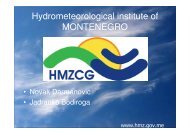
Hydrometeorological institute of MONTENEGRO - NVE
Hydrometeorological institute of MONTENEGRO - NVE
Hydrometeorological institute of MONTENEGRO - NVE

Create successful ePaper yourself
Turn your PDF publications into a flip-book with our unique Google optimized e-Paper software.
<strong>Hydrometeorological</strong> <strong>institute</strong> <strong>of</strong><br />
<strong>MONTENEGRO</strong><br />
• Novak Darmanovic<br />
• Jadranko Bodiroga<br />
www.hmz.gov.me
www.hmz.gov.me<br />
CURRENT STATUS AND<br />
MODERNISATION OF HYDROLOGICAL<br />
NETWORK STATIONS<br />
IN <strong>MONTENEGRO</strong>
<strong>MONTENEGRO</strong><br />
Land border<br />
~ 614 km<br />
Length <strong>of</strong> border<br />
~ 316 km<br />
Avarage above sea height<br />
~ 1050 mnm<br />
with a yearly run<strong>of</strong>f <strong>of</strong> water:<br />
19.5km3/god<br />
Is a country with a hight<br />
avarage run<strong>of</strong>f in a world
ADRIATIC AREA :<br />
Adriatic area is covering<br />
abouth :<br />
6560 km2<br />
At this direction is flowing river<br />
MORACA with its confluents<br />
rivers: ZETA, CIJEVNA, RIJEKA<br />
CRNOJEVICA I ORAHOVSTICA.<br />
These rivers are flowing into<br />
lake Skadarsko and afther<br />
that with a river Bojana are<br />
flowing in the ADRIATIC<br />
sea. (45.4 % <strong>of</strong> all run-<strong>of</strong>f<br />
water in country)
BLACK SEA AREA :<br />
The BLACK SEA area is<br />
covering 7260 km2.<br />
River Ibar is flowing out into<br />
the river Zapadna Morava.<br />
From river Drina these rivers<br />
are flowing out :<br />
Lim,Cehotina,Tara,Komarnica<br />
and Piva (54.6 % <strong>of</strong> all run<strong>of</strong>f<br />
water)
Hydrological department is now installing an automatic<br />
hydrological stations with a real-time data management.All our<br />
equipment are unique from OTT productor . Until today we<br />
have been installed 20 stations and in this moment they are all<br />
operating in a s<strong>of</strong>tware HYDRAS.<br />
In SAVA river basin until today we have 10 automatic stations.For<br />
this basin we are planing to install 20 more automatic stations.<br />
In considiration with a Master Plan <strong>of</strong> developing our station<br />
network in cooperation and assistance with NWE we planed to<br />
install 31 more in our future work and these stations will be<br />
finish at 2012.<br />
These stations are fully operational and connected on-line to our<br />
centar in Podgorica.
When we defined station network we take care for<br />
hydrological, ecological and energetic<br />
characheristics <strong>of</strong> flow.<br />
All main flows are covered with at least 2 stations.<br />
All output pr<strong>of</strong>iles are covered with automatic<br />
measure equipment and cableway.<br />
Water level <strong>of</strong> all important lakes will be monitor<br />
with at least 1 station.<br />
Almost 4 times is surpassed our standard , who<br />
say that on area <strong>of</strong> 1000 km 2 has to be<br />
plased at least one station.
List <strong>of</strong> automatic operational hydrologic<br />
stations today<br />
ADRIATIC BASIN :<br />
1. H.S. PODGORICA RIVER MORAČA<br />
2. H.S. PERNICA RIVER MORAČA<br />
3. H.S. ZLATICA RIVER MORAČA<br />
4. H.S. CKLA SKADARSKO LAKE<br />
5. H.S. DONJA PLAVNICA SKADARSKO LAKE<br />
6. H.S. DUKLOV MOST RIVER ZETA<br />
7. H.S. FRASKANJEL RIVER BOJANA<br />
8. H.S. MEĐURIJEČJE RIVER MRTVICA<br />
9. H.S. RIJEKA CRNOJEVIĆA RIVER CRNOJEVIĆA<br />
10.H.S. MAREOGRAF BAR ADRIATIC SEA
List <strong>of</strong> automatic operational<br />
hydrologic stations today<br />
BLACKSEA BASIN :<br />
1. H.S. BIJELO POLJE RIVER LIM<br />
2. H.S. CRNA POLJANA RIVER TARA<br />
3. H.S. GUBAVACA RIVER BISTRICA<br />
4. H.S. RAVNA RIJEKA RIJEKA LJUBOVIĐA<br />
5. H.S. RIBNJAK RIVER VRBNICA<br />
6. H.S. TIMAR RIVER BUKOVICA<br />
7. H.S. TREBALJEVO RIVER TARA<br />
8. H.S. GORNJA BIJELA RIVER BIJELA<br />
9. H.S. DONJE VUSANJE RIVER GRLJA<br />
10. H.S. ANDRIJEVICA RIVER ZLOREČICA
List <strong>of</strong> equipment that we planed to instal in these stations<br />
Adriatic basin : Blacksea basin:<br />
3 automatic (data loger) 16 automatic (real time)<br />
8 automatic (real time) 16 cableway+automatic(real time)<br />
8 cableway+automatic(real time)
POSITONS OF AUTOMATIC STATIONS IN <strong>MONTENEGRO</strong> ON A MAP :
PICTURES OF OLD STATION<br />
FRASKANJEL ON RIVER BOJANA
PICTURES OF NEW HYDROLOGICAL<br />
STATION FRASKANJEL ON RIVER BOJANA<br />
• OUTSIDE LOOK :
PICTURES OF HYDROLOGICAL STATION<br />
FRASKANJEL ON RIVER BOJANA<br />
• INSIDE LOOK :
PICTURES OF NEW HYDROLOGICAL<br />
STATION RIBNJAK ON RIVER VRBNICA<br />
Outside look :
PICTURES OF NEW HYDROLOGICAL<br />
STATION RIBNJAK ON RIVER VRBNICA<br />
Inside look :
PICTURE OF STATION ON RIVER WITH A SECOND<br />
BIGGEST FLOW ,MORACA IN PODGORICA
Tok hidroloških podataka<br />
Mreža stanica<br />
i hidrometrijska<br />
mjerenja<br />
Bilans voda<br />
Mjerenja<br />
na terenu<br />
Statistička obrada<br />
podataka,<br />
izrada krivih i tabela<br />
za<br />
Primarna obrada<br />
podataka<br />
redovne izlaze<br />
(godišnjaci i dr.)<br />
druge<br />
hidrološke analize
PRODUCT REPORT FROM HYDRAS
On-line data are<br />
absolutely available all the<br />
time on the internet on<br />
address below , and<br />
anyone can get these<br />
information from our<br />
automatic stations.<br />
(stations are red points on<br />
a map)<br />
www.hmz.gov.me
We implemented a s<strong>of</strong>twer tool WISKI<br />
and we are now in a training process <strong>of</strong><br />
using this tool.
FUTURE WORK :<br />
• -Modernisation <strong>of</strong> our station network is<br />
goinge to implement an alarm system for<br />
forecasting <strong>of</strong> flooding and warning<br />
sustem.<br />
• -At this time we do not have a department<br />
for forecasting, but in our furute work we<br />
are planing to establish service for that.