compulsory purchase order 2007 the highways ... - Dorsetforyou.com
compulsory purchase order 2007 the highways ... - Dorsetforyou.com
compulsory purchase order 2007 the highways ... - Dorsetforyou.com

You also want an ePaper? Increase the reach of your titles
YUMPU automatically turns print PDFs into web optimized ePapers that Google loves.
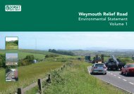
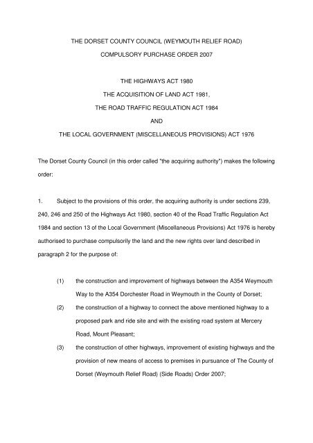
THE DORSET COUNTY COUNCIL (WEYMOUTH RELIEF ROAD)<br />
COMPULSORY PURCHASE ORDER <strong>2007</strong><br />
THE HIGHWAYS ACT 1980<br />
THE ACQUISITION OF LAND ACT 1981,<br />
THE ROAD TRAFFIC REGULATION ACT 1984<br />
AND<br />
THE LOCAL GOVERNMENT (MISCELLANEOUS PROVISIONS) ACT 1976<br />
The Dorset County Council (in this <strong>order</strong> called "<strong>the</strong> acquiring authority") makes <strong>the</strong> following<br />
<strong>order</strong>:<br />
1. Subject to <strong>the</strong> provisions of this <strong>order</strong>, <strong>the</strong> acquiring authority is under sections 239,<br />
240, 246 and 250 of <strong>the</strong> Highways Act 1980, section 40 of <strong>the</strong> Road Traffic Regulation Act<br />
1984 and section 13 of <strong>the</strong> Local Government (Miscellaneous Provisions) Act 1976 is hereby<br />
authorised to <strong>purchase</strong> <strong>com</strong>pulsorily <strong>the</strong> land and <strong>the</strong> new rights over land described in<br />
paragraph 2 for <strong>the</strong> purpose of:<br />
(1) <strong>the</strong> construction and improvement of <strong>highways</strong> between <strong>the</strong> A354 Weymouth<br />
Way to <strong>the</strong> A354 Dorchester Road in Weymouth in <strong>the</strong> County of Dorset;<br />
(2) <strong>the</strong> construction of a highway to connect <strong>the</strong> above mentioned highway to a<br />
proposed park and ride site and with <strong>the</strong> existing road system at Mercery<br />
Road, Mount Pleasant;<br />
(3) <strong>the</strong> construction of o<strong>the</strong>r <strong>highways</strong>, improvement of existing <strong>highways</strong> and <strong>the</strong><br />
provision of new means of access to premises in pursuance of The County of<br />
Dorset (Weymouth Relief Road) (Side Roads) Order <strong>2007</strong>;
(4) use by <strong>the</strong> acquiring authority in connection with <strong>the</strong> construction and<br />
improvement of <strong>highways</strong> and <strong>the</strong> provision of new means of access to<br />
premises as aforesaid;<br />
(5) mitigating <strong>the</strong> adverse effect which <strong>the</strong> existence or use of <strong>the</strong> <strong>highways</strong><br />
proposed to be constructed or improved will have on <strong>the</strong> surroundings<br />
<strong>the</strong>reof; and<br />
(6) <strong>the</strong> carrying out of works on watercourses in connection with <strong>the</strong> construction<br />
and improvement of <strong>highways</strong> as aforesaid;<br />
(7) <strong>the</strong> provision of off-street parking place, including means of access <strong>the</strong>reto<br />
and <strong>the</strong>refrom and buildings or o<strong>the</strong>r facilities necessary to <strong>the</strong>ir use.<br />
2. (1) The land authorised to be <strong>purchase</strong>d <strong>com</strong>pulsorily over land under this <strong>order</strong> are<br />
described in <strong>the</strong> Schedule and delineated and shown coloured pink prepared in duplicate,<br />
sealed with <strong>the</strong> <strong>com</strong>mon seal of <strong>the</strong> acquiring authority and marked "Map referred to in The<br />
Dorset County Council (Weymouth Relief Road) Compulsory Purchase Order <strong>2007</strong>" on <strong>the</strong><br />
said map which consists of nine sheets numbered DC 2372/494/1A, DC 2372/494/2A, DC<br />
2372/494/3A, DC 2372/494/4A, DC 2372/494/5A, DC 2372/494/6A, DC 2372/494/7B, DC<br />
2372/494/8A, DC 2372/494/9A respectively.<br />
2. (2) The new rights to be <strong>purchase</strong>d <strong>com</strong>pulsorily over land under this <strong>order</strong> are<br />
described in <strong>the</strong> Schedule and <strong>the</strong> land is shown coloured blue on <strong>the</strong> said map.<br />
3. Parts 2 and 3 of Schedule 2 to <strong>the</strong> Acquisition of Land Act 1981 are hereby<br />
incorporated with this <strong>order</strong> subject to <strong>the</strong> modifications that references to <strong>the</strong><br />
said Parts of <strong>the</strong> said Schedule to <strong>the</strong> undertaking shall be construed as<br />
references to any building or work constructed or to be constructed on that part of<br />
<strong>the</strong> land authorised to be <strong>purchase</strong>d on <strong>the</strong> said map or, as <strong>the</strong> case may be, on<br />
<strong>the</strong> land over which new rights are authorised to be acquired.
SCHEDULE<br />
Number<br />
on map<br />
Extent, description and situation of<br />
<strong>the</strong> land<br />
Table 1<br />
Qualifying persons under section 12(2)(a) of <strong>the</strong> Acquisition of Land Act 1981 - name and<br />
address<br />
Owners or reputed owners<br />
Lessees or reputed<br />
lessees<br />
Tenants or reputed<br />
tenants (o<strong>the</strong>r than<br />
lessees)<br />
Occupiers<br />
Plot 1<br />
All interests in 179,699 square metres of<br />
Lodmoor North Landfill Site located to<br />
<strong>the</strong> east of Mercery Road in <strong>the</strong> Mount<br />
Pleasant Business Park, DT3 5HN and<br />
north of St Andrews Ave/Monmouth<br />
Avenue, and including Weymouth<br />
Rugby Club playing fields and <strong>the</strong><br />
access track from Monmouth Avenue.<br />
Chief Executive Weymouth &<br />
Portland Borough Council<br />
Municipal Offices North Quay<br />
Weymouth DT4 8TA<br />
Weymouth Rugby Club,<br />
c/o John Lloyd, 43<br />
Over<strong>com</strong>be Drive,<br />
Weymouth, Dorset<br />
- -<br />
Plot 2<br />
All interests in 2,694 square metres of<br />
highway known as Mercery Road,<br />
Mount Pleasant Business Park, DT3<br />
5HN and vacant land to <strong>the</strong> north, all on<br />
<strong>the</strong> east side of New Look House car<br />
park.<br />
Mr Flower KWF Investments<br />
(Poole) Ltd Unit 5 Mitchell<br />
Road Fernside Park<br />
Ferndown Industrial Estate<br />
Ferndown Dorset BH21 7SG<br />
- - -<br />
Plot 3<br />
All interests in 23,065 square metres of<br />
<strong>highways</strong> known as Manor Roundabout<br />
and its approach roads A354 Dorchester<br />
Road, C920 Dorchester Road and A354<br />
Weymouth Way including an adjacent<br />
footpath from <strong>the</strong> Roundabout to Mount<br />
Pleasant Avenue South, and <strong>the</strong><br />
unnamed eastern approach road,<br />
embankment, parts of Bridleway<br />
S1/BR30 and vacant land (reserved for<br />
a future highway) between <strong>the</strong><br />
Roundabout and <strong>the</strong> Weymouth to<br />
Dorchester railway line, except interests<br />
owned by Dorset County Council.<br />
Chief Executive Dorset<br />
County Council County Hall<br />
Colliton Park Dorchester DT1<br />
1XJ<br />
- - -<br />
Plot 4<br />
All interests in 647 square metres of<br />
embankment slope to <strong>the</strong> north and<br />
west of Morrison’s supermarket, 244<br />
Dorchester Road, DT3 5AX and to <strong>the</strong><br />
south east and east of Manor<br />
Roundabout and abutting <strong>the</strong> store car<br />
park and delivery area.<br />
Safeway Limited Hilimore<br />
House Gain Lane Bradford<br />
BD3 7DL, c/o Simeon<br />
Hinchlliffe WM Morrison<br />
Supermarkets PLC, Property<br />
and Development Division,<br />
Hilimore House, Gain Lane,<br />
Bradford, BD7 3DL<br />
Scottish & Sou<strong>the</strong>rn<br />
Electric plc Mr Ken<br />
Hayward Legal<br />
Department 55 Vastern<br />
Road Reading RG1 8BU<br />
Wessex Water Services<br />
Limited Wessex House<br />
Passage Street Bristol<br />
BS2 0JQ<br />
- -<br />
Plot 5<br />
All interests in 43,456 square metres of<br />
grassland south of Two Mile Coppice,<br />
east of <strong>the</strong> Weymouth to Dorchester<br />
railway line, west of Lodmoor North<br />
Landfill Site and north of New Look<br />
House car park, including bridleway<br />
S1/BR30 and its margins between<br />
Greenway Road, eastwards under <strong>the</strong><br />
railway to a point approx 180 metres<br />
north east of <strong>the</strong> railway bridge.<br />
Mr Flower KWF Investments<br />
(Poole) Ltd Unit 5 Mitchell<br />
Road Fernside Park<br />
Ferndown Industrial Estate<br />
Ferndown Dorset BH21 7SG<br />
- - -
Number<br />
on map<br />
Extent, description and situation of<br />
<strong>the</strong> land<br />
Table 1<br />
Qualifying persons under section 12(2)(a) of <strong>the</strong> Acquisition of Land Act 1981 - name and<br />
address<br />
Owners or reputed owners<br />
Lessees or reputed<br />
lessees<br />
Tenants or reputed<br />
tenants (o<strong>the</strong>r than<br />
lessees)<br />
Occupiers<br />
Plot 6<br />
All interests in 5 square metres of land<br />
south of and abutting bridleway<br />
S1/BR30, approx 36 metres east of <strong>the</strong><br />
railway bridge over this path.<br />
Scottish & Sou<strong>the</strong>rn Electric<br />
plc Mr Ken Hayward Legal<br />
Department 55 Vastern Road<br />
Reading RG1 8BU<br />
- - -<br />
Plot 7<br />
Plot 8<br />
All interests in 68,742 square metres of<br />
pasture land abutting <strong>the</strong> north and east<br />
side of Horselynch Plantation, abutting<br />
Lodmoor Nature Reserve in <strong>the</strong> south<br />
and approx 100 metres north west of<br />
Southdown Avenue.<br />
All interests in 171,483 square metres of<br />
Horselynch Plantation woodland and<br />
arable, scrub and grassland to <strong>the</strong> north<br />
west, and abutting Lodmoor Nature<br />
Reserve in <strong>the</strong> south and extending<br />
north north-eastwards for approx 470<br />
metres.<br />
Mary Elizabeth Cake Flat 4<br />
The Chimes 18 McKinley<br />
Road Westcliffe Bournemouth<br />
BH4 8AP<br />
Edward Albert Whettam<br />
Littlewood Farm Frampton<br />
Dorchester DT2 9NJ<br />
Susan Valerie Thornton<br />
Eastwood House Stroudley<br />
Crescent Preston Weymouth<br />
DT3 6NT<br />
Michael Jones<br />
7 Kent Close Granby<br />
Industrial Estate Weymouth<br />
Dorset DT4 9TF<br />
- - -<br />
- - -<br />
Plot 9<br />
Plot 10<br />
All interests in 3,457 square metres of<br />
woodland and scrub on and near <strong>the</strong><br />
eastern embankment of <strong>the</strong> Weymouth<br />
to Dorchester railway line from bridleway<br />
S1/BR30 in <strong>the</strong> south west corner of<br />
Two Mile Coppice to a point approx 161<br />
metres north of <strong>the</strong> north west corner of<br />
<strong>the</strong> Coppice.<br />
All interests in 5,688 square metres of<br />
woodland along <strong>the</strong> western edge of<br />
Two Mile Coppice and abutting <strong>the</strong><br />
Weymouth to Dorchester railway land<br />
between <strong>the</strong> south western corner of <strong>the</strong><br />
Coppice and <strong>the</strong> north western corner.<br />
Network Rail Infrastructure<br />
Limited 40 Melton Street<br />
London NW1 2EE c/o Tom<br />
Higginson 10 th Floor 1<br />
Eversholt Green London NW1<br />
2DN<br />
Julian Purvis Woodland Trust<br />
Autumn Park Dysart Road<br />
Grantham Lincolnshire NG31<br />
6LL<br />
- - -<br />
- - -<br />
Plot 11<br />
All interests in 68,131 square metres of<br />
scrub and grassland ei<strong>the</strong>r side of<br />
bridleway S1/BR33 north east of its<br />
junction with bridleway S1/BR30, and<br />
including footpath S1/FP32 to <strong>the</strong><br />
northwest and b<strong>order</strong>ed by drains to <strong>the</strong><br />
sou<strong>the</strong>ast and southwest.<br />
Mark Balchin Fairbriar<br />
Projects Ltd Ashton House 64<br />
High Street Walton-on-<br />
Thames Surrey KT12 1BW<br />
- - -
Number<br />
on map<br />
Extent, description and situation of<br />
<strong>the</strong> land<br />
Table 1<br />
Qualifying persons under section 12(2)(a) of <strong>the</strong> Acquisition of Land Act 1981 - name and<br />
address<br />
Plot 12<br />
All interests in 46,643 square metres of<br />
grassland, scrub and Lorton<br />
Lane/footpath S1/FP31, including part of<br />
a local nature reserve abutting <strong>the</strong><br />
Weymouth to Dorchester railway from<br />
<strong>the</strong> north western corner of Two Mile<br />
Coppice to and including Lorton<br />
Lane/footpath S1/FP31, and to <strong>the</strong> west<br />
and south of Lorton Barn (Dorset<br />
Wildlife Trust Visitors Centre).<br />
Owners or reputed owners<br />
Mr Scupholme Dorset Trust<br />
for Nature Conservation<br />
Limited Brooklands Farm<br />
Forston Dorchester DT2 7AA<br />
Lessees or reputed<br />
lessees<br />
Tenants or reputed<br />
tenants (o<strong>the</strong>r than<br />
lessees)<br />
- - -<br />
Occupiers<br />
Plot 13<br />
All interests in 11,392 square metres of<br />
land forming part of <strong>the</strong> eastern edge of<br />
<strong>the</strong> highway A354 Dorchester to<br />
Weymouth road, part of <strong>the</strong> highway<br />
known as C54 Broadmayne Road from<br />
Down Farm westwards, and land<br />
between and adjacent to <strong>the</strong>se two<br />
<strong>highways</strong> and abutting bridleway<br />
S7/BR20, except interests owned by<br />
Dorset County Council.<br />
Chief Executive Dorset<br />
County Council County Hall<br />
Colliton Park Dorchester DT1<br />
1XJ<br />
- - -<br />
Plot 14<br />
All interests in 26,257 square metres of<br />
pasture land east of <strong>the</strong> Weymouth to<br />
Dorchester railway, west of Lorton<br />
House, south of and including footpath<br />
S1/FP29 and north of Lorton Lane,<br />
including part of <strong>the</strong> driveway to Lorton<br />
House and part of <strong>the</strong> woodland<br />
b<strong>order</strong>ing <strong>the</strong> north side of Lorton Lane.<br />
Mrs Delia M McLaggan Lorton<br />
House Broadwey Weymouth<br />
Dorset DT3 5QH<br />
- - -<br />
Plot 15<br />
All interests in 20,220 square metres of<br />
grassland being part of Southdown<br />
Ridge and bridleway S1/BR21, from<br />
north of footpath S1/FP29 to <strong>the</strong><br />
sou<strong>the</strong>rn boundary of properties in The<br />
Finches and Kestrel View, Littlemoor,<br />
DT3 5QZ, and located to <strong>the</strong> east of <strong>the</strong><br />
electricity pylon near <strong>the</strong> summit of <strong>the</strong><br />
Ridge.<br />
Mr AH Fletcher Ridgecross<br />
Limited c/o P&O Properties 16<br />
Palace Street London SW1E<br />
5JQ<br />
Stephen Bailey Heron Homes<br />
Thornbury Office Park Midland<br />
Way Thombury BS35 2BS<br />
- - -<br />
Plot 16<br />
All interests in 1,483 square metres of<br />
grassland and highway being part of<br />
Southdown Ridge north and north east<br />
of <strong>the</strong> electricity pylon near <strong>the</strong> summit<br />
of <strong>the</strong> Ridge to and including part of <strong>the</strong><br />
sou<strong>the</strong>rn cul-de-sac of The Finches,<br />
Littlemoor, DT3 5QN.<br />
Unknown - - -<br />
Plot 17<br />
All interests in 623 square metres of<br />
grassland and part of a footpath being<br />
part of open land between No 122<br />
Kestrel View, Littlemoor, DT3 QZ and<br />
Nos. 91 to 107 (odds) Beverley Road,<br />
Littlemoor, DT3 6SE.<br />
Chief Executive Weymouth &<br />
Portland Borough Council<br />
Municipal Offices North Quay<br />
Weymouth DT4 8TA<br />
- - -
Number<br />
on map<br />
Extent, description and situation of<br />
<strong>the</strong> land<br />
Table 1<br />
Qualifying persons under section 12(2)(a) of <strong>the</strong> Acquisition of Land Act 1981 - name and<br />
address<br />
Plot 18<br />
All interests in 9,333 square metres of<br />
grassland and scrub between properties<br />
in The Finches and Kestrel View,<br />
Littlemoor, and including part of highway<br />
known as Goldcrest Close and parts of<br />
<strong>the</strong> Broadwey Stream, except interests<br />
owned by Dorset County Council.<br />
Owners or reputed owners<br />
Chief Executive Dorset<br />
County Council County Hall<br />
Colliton Park Dorchester DT1<br />
1XJ<br />
Lessees or reputed<br />
lessees<br />
Tenants or reputed<br />
tenants (o<strong>the</strong>r than<br />
lessees)<br />
- - -<br />
Occupiers<br />
Plot 19<br />
All interests in 528 square metres of<br />
scrub and grassland abutting <strong>the</strong><br />
nor<strong>the</strong>rn and eastern boundaries of <strong>the</strong><br />
car park to New Look House, Mount<br />
Pleasant Business Park.<br />
Mr Flower KWF Investments<br />
(Poole) Ltd Unit 5 Mitchell<br />
Road Fernside Park<br />
Ferndown Industrial Estate<br />
Ferndown Dorset BH21 7SG<br />
- - -<br />
Plot 20<br />
All interests in 560 square metres of<br />
grassland being part of open land<br />
between No 67 and 78 Reedling Close,<br />
Littlemoor, DT3 5RX and south west of<br />
<strong>the</strong> Reedling Close turning head.<br />
Paul Bedford Persimmon<br />
Homes South Coast Limited<br />
Park View House Fareham<br />
PO16 7HT<br />
- - -<br />
Plot 21<br />
All interests in 469 square metres of<br />
land in <strong>the</strong> south west corner of <strong>the</strong><br />
property Icen Farm (D.J. Contracts),<br />
Icen Lane, DT3 5PX including part of <strong>the</strong><br />
frontage land used for storage and <strong>the</strong><br />
verge and entrances of Icen Lane<br />
(including half width of highway).<br />
Michael Jones<br />
7 Kent Close Granby<br />
Industrial Estate Weymouth<br />
Dorset DT4 9TF<br />
- - -<br />
Plot 22<br />
All interests in 779 square metres of<br />
drainage ditch and Broadwey Stream<br />
with surrounding scrub and grassland<br />
abutting No 31 The Finches and <strong>the</strong><br />
parking area to <strong>the</strong> north east, from<br />
south of Goldcrest Close to The<br />
Finches, Littlemoor between Nos. 25<br />
and 33.<br />
Ryan Homes Ashby House<br />
Walton on Thames Surrey<br />
KT12 1BW<br />
- - -<br />
Plot 23<br />
All interests in 471 square metres of<br />
grassland and scrub to <strong>the</strong> north and<br />
west of Goldcrest Close, Littlemoor, DT3<br />
5QS and abutting Nos. 435/437<br />
Littlemoor Road and <strong>the</strong> parking area to<br />
<strong>the</strong> south.<br />
Ryan Homes Ashby House<br />
Walton on Thames Surrey<br />
KT12 1BW<br />
- - -<br />
Plot 24<br />
All interests in 146 square metres of<br />
highway known as The Finches,<br />
Littlemoor, DT3 5QN, and including <strong>the</strong><br />
footpath to <strong>the</strong> north of and between<br />
Nos. 453 and 467 (odds) Littlemoor<br />
Road, except interests owned by Dorset<br />
County Council.<br />
Chief Executive Dorset<br />
County Council County Hall<br />
Colliton Park Dorchester DT1<br />
1XJ<br />
- - -
Number<br />
on map<br />
Extent, description and situation of<br />
<strong>the</strong> land<br />
Table 1<br />
Qualifying persons under section 12(2)(a) of <strong>the</strong> Acquisition of Land Act 1981 - name and<br />
address<br />
Owners or reputed owners<br />
Lessees or reputed<br />
lessees<br />
Tenants or reputed<br />
tenants (o<strong>the</strong>r than<br />
lessees)<br />
Occupiers<br />
Plot 25<br />
All interests in 40,691 square metres of<br />
pasture land and part of Chalbury<br />
Stream abutting and to <strong>the</strong> south of<br />
Littlemoor Road, from and abutting No<br />
47 Littlemoor Road, DT3 6AB<br />
westwards for approx 397 metres to a<br />
point opposite Gould’s Garden Centre,<br />
(but excluding approx 16 square metres<br />
of land opposite No 80 Littlemoor Road).<br />
Ms J S List Little Wyke Stoke<br />
Farthing Broadchalke,<br />
Salisbury SP5 5ED<br />
Wendy Louisa List Little Wyke<br />
Stoke Farthing Broadchalke<br />
Salisbury SP5 5ED<br />
Simon Paul List Little Wyke<br />
Stoke Farthing Broadchalke,<br />
Salisbury SP5 5ED<br />
- Mr B R and Mrs A<br />
Barnes Wyke Oliver<br />
Farm Chickerell<br />
Weymouth DT3 6BW<br />
-<br />
Ms A M Scutt 36 Morland<br />
Close Hampton Middlesex<br />
TW12 3YY<br />
Plot 26<br />
All interests in 192 square metres of<br />
land <strong>com</strong>prising part of <strong>the</strong> entrance to<br />
<strong>the</strong> Westfield Technical College and St.<br />
Andrews C. of E. Primary School on <strong>the</strong><br />
north side of Littlemoor Road and<br />
including visibility splays adjacent to<br />
Nos. 66 and 76 Littlemoor Road, DT3<br />
6AD, except interests owned by Dorset<br />
County Council.<br />
Chief Executive Dorset<br />
County Council County Hall<br />
Colliton Park Dorchester DT1<br />
1XJ<br />
- - -<br />
Plot 27<br />
All interests in 5,036 square metres of<br />
pasture land abutting and to <strong>the</strong> south of<br />
Littlemoor Road opposite Gould’s<br />
Garden Centre, from and abutting <strong>the</strong><br />
nor<strong>the</strong>rn end of bridleway S1/BR21<br />
eastwards for approx 210 metres.<br />
Mr M Cummings, F H<br />
Cummings Unlimited Unit C<br />
Acorn Business Park Tower<br />
Park Poole BH12 4NZ<br />
- Mr B R and Mrs A<br />
Barnes Wyke Oliver<br />
Farm Chickerell<br />
Weymouth DT3 6BW<br />
-<br />
Plot 28<br />
All interests in 1,853 square metres of<br />
track, bridleway S1/BR21 and grassland<br />
being part of Southdown Ridge abutting<br />
<strong>the</strong> Weymouth to Dorchester railway<br />
embankment north and east of <strong>the</strong><br />
railway arch that leads to <strong>the</strong> Upwey and<br />
Broadwey Station approach road, and<br />
south of Nos. 51 to 78 Reedling Close,<br />
Littlemoor.<br />
Mr AH Fletcher Ridgecross<br />
Limited c/o P&O Properties 16<br />
Palace Street London SW1E<br />
5JQ<br />
Stephen Bailey Heron Homes<br />
Thornbury Office Park Midland<br />
Way Thombury BS35 2BS<br />
- - -<br />
Plot 29<br />
All interests in 1,246 square metres of<br />
land being part of <strong>the</strong> entrance and<br />
landscaped frontage to Gould’s Garden<br />
Centre, Littlemoor Road, DT3 6AD<br />
(including half width of highway).<br />
Mr RJ Gould, Goulds<br />
(Dorchester) Ltd 22-23 South<br />
Street Dorchester Dorset DT1<br />
1DA<br />
- Dorset Trust for Nature<br />
Conservation Limited<br />
Brooklands Farm<br />
Forston Dorchester<br />
Dorset DT2 7AA<br />
-
Number<br />
on map<br />
Extent, description and situation of<br />
<strong>the</strong> land<br />
Table 1<br />
Qualifying persons under section 12(2)(a) of <strong>the</strong> Acquisition of Land Act 1981 - name and<br />
address<br />
Plot 30<br />
All interests in 3,297 square metres of<br />
arable land abutting <strong>the</strong> nor<strong>the</strong>rn<br />
boundary of Littlemoor Road and <strong>the</strong><br />
western boundary of Gould’s Garden<br />
Centre, Littlemoor, DT3 6AD, and to <strong>the</strong><br />
north of <strong>the</strong> Louviers Road (east<br />
end)/Littlemoor Road junction.<br />
Owners or reputed owners<br />
Hugh Alan Diment Fairview<br />
Ashmore Salisbury SP5 5AB<br />
(1/6th)<br />
Peter Henry Diment Well<br />
Cottage Nettle<strong>com</strong>be Bridport<br />
DT6 3SP (1/6th)<br />
Lessees or reputed<br />
lessees<br />
Tenants or reputed<br />
tenants (o<strong>the</strong>r than<br />
lessees)<br />
- Mr Charles Foot Higher<br />
Ashton Farm Dorchester<br />
DT2 9EZ<br />
Occupiers<br />
-<br />
Mrs Bridget Lewis Rhiw<br />
House Craig Penllyn<br />
Cowbridge Vale of Glamorgan<br />
CF71 7RS (1/6th)<br />
FA Diment 3 Anchor Cottages<br />
Weald Sevenoaks TN14 6LS<br />
(1/6th)<br />
DN Diment 3 Anchor Cottages<br />
Weald Sevenoaks TN14 6LS<br />
(1/6th)<br />
William Hatton Wingfield-<br />
Digby 1 West Park Farm<br />
Cottages Coos Lane<br />
Handcross West Sussex<br />
RH17 6AD (1/18th)<br />
Alexander Osborne Wingfield-<br />
Digby The Coach House<br />
Gregories Farm Lane<br />
Beaconsfield<br />
Buckinghamshire HP9 1HJ<br />
(1/18th)<br />
Mrs Claire Louise<br />
O'Donoghue 6 Morgan Street<br />
London E3 5AB (1/18th)<br />
Plot 31<br />
All interests in 3,431 square metres of<br />
grassland and scrub abutting <strong>the</strong><br />
nor<strong>the</strong>rn boundary of Littlemoor Road<br />
opposite Nos. 135 to 139b (odds) and 1<br />
to 7 Park Court, Littlemoor Road, DT3<br />
6AE.<br />
Mrs H C Stainer 28 Lynch<br />
Avenue Weymouth DT4 9DL<br />
- Mr D Dominey 63<br />
Culliford Way Littlemoor<br />
Weymouth DT3 6AW<br />
-
Number<br />
on map<br />
Extent, description and situation of<br />
<strong>the</strong> land<br />
Table 1<br />
Qualifying persons under section 12(2)(a) of <strong>the</strong> Acquisition of Land Act 1981 - name and<br />
address<br />
Owners or reputed owners<br />
Lessees or reputed<br />
lessees<br />
Tenants or reputed<br />
tenants (o<strong>the</strong>r than<br />
lessees)<br />
Occupiers<br />
Plot 32<br />
All interests in 2,718 square metres of<br />
grassland and scrub abutting <strong>the</strong><br />
nor<strong>the</strong>rn boundary of Littlemoor Road<br />
opposite Nos. 4 to 7 Park Court and<br />
Nos.143 to 153 (odds) Littlemoor Road,<br />
DT3 6AF.<br />
Mr G Maynard, 69 Greenway<br />
Road Weymouth Dorset DT3<br />
5BD<br />
Mr Richard Maynard<br />
69 Greenway Road<br />
Weymouth Dorset DT3 5BD<br />
Scottish & Sou<strong>the</strong>rn<br />
Electric plc Mr Ken<br />
Hayward Legal<br />
Department 55 Vastern<br />
Road Reading RG1 8BU<br />
Mr S Barnes Dorset<br />
Tree Care 11<br />
Underhedge Gardens<br />
Southwell Portland<br />
Dorset DT5 2DX<br />
-<br />
Mr John Maynard<br />
69 Greenway Road<br />
Weymouth Dorset DT3 5BD<br />
Mrs Barbara Ellis 86 Camp<br />
Road, Weymouth DT4 9HG<br />
Mrs Ca<strong>the</strong>rine Ellis 86 Camp<br />
Road, Weymouth DT4 9HG<br />
Plot 33<br />
All interests in 21,929 square metres of<br />
arable land abutting <strong>the</strong> nor<strong>the</strong>rn<br />
boundary of Littlemoor Road from<br />
opposite No 153 Littlemoor Road, DT3<br />
6AF to opposite <strong>the</strong> junction of Canberra<br />
Crescent (west end)/Littlemoor Road,<br />
and including part of a ditch and <strong>the</strong><br />
access to Bin<strong>com</strong>be Marsh Dairy and<br />
<strong>the</strong> nor<strong>the</strong>rn half width of Littlemoor<br />
Road highway opposite Nos. 153 to 209<br />
(odds).<br />
Mrs J Davis<br />
69 Greenway Road<br />
Weymouth Dorset DT3 5BD<br />
The Master & Fellows of<br />
Gonville & Caius College in<br />
<strong>the</strong> University of Cambridge<br />
c/o Brian Down Bidwells<br />
Trumpington Road Cambridge<br />
CB2 2LD<br />
- Mr Charles Foot Higher<br />
Ashton Farm Dorchester<br />
DT2 9EZ<br />
-<br />
Plot 34<br />
All interests in 108,472 square metres of<br />
pasture land, grassland, scrub,<br />
entrances, tracks, parts of footpath<br />
S7/FP9, ditches, drains, ponds and<br />
balancing ponds abutting and between<br />
Icen Lane and Littlemoor Road,<br />
(including half width of parts of <strong>the</strong>se<br />
<strong>highways</strong>) from south east of ‘Kingsam’,<br />
Icen Lane, to opposite <strong>the</strong> junction of<br />
Canberra Crescent (west<br />
end)/Littlemoor Road.<br />
Mr C Morgan Neejam 165 Ltd<br />
Beechwood House Lambridge<br />
Lane Badgemore Henley on<br />
Thames Oxon RG9 4NR<br />
- Michael Jones<br />
7 Kent Close Granby<br />
Industrial Estate<br />
Weymouth Dorset DT4<br />
9TF<br />
-<br />
Plot 35<br />
All interests in 33,280 square metres of<br />
pasture land, grassland, scrub,<br />
entrances, parts of footpath S7/FP9,<br />
ditches, drains and balancing ponds<br />
abutting <strong>the</strong> nor<strong>the</strong>rn boundary of<br />
Littlemoor Road, Littlemoor Roundabout<br />
and Brambling Close, from approx 212<br />
metres west of <strong>the</strong> Roundabout to 140<br />
metres east of <strong>the</strong> Roundabout.<br />
Chief Executive Weymouth &<br />
Portland Borough Council<br />
Municipal Offices North Quay<br />
Weymouth DT4 8TA<br />
- - -
Number<br />
on map<br />
Extent, description and situation of<br />
<strong>the</strong> land<br />
Table 1<br />
Qualifying persons under section 12(2)(a) of <strong>the</strong> Acquisition of Land Act 1981 - name and<br />
address<br />
Plot 36<br />
Plot 37<br />
The right to divert and maintain a ditch<br />
11 metres long in 24 square metres of<br />
land on <strong>the</strong> east-west boundary between<br />
pasture fields south of Icen Lane and<br />
east south-east of ‘The Willows’, Icen<br />
Lane, DT3 5PY.<br />
All interests in 580 square metres of<br />
grass verge, scrub, drain and ditch on<br />
<strong>the</strong> sou<strong>the</strong>rn side of Icen Lane (including<br />
half width of highway) from approx 70<br />
metres west, to 41 metres east, of<br />
‘Kingsam’, Icen Lane, DT3 5PY.<br />
Owners or reputed owners<br />
Lessees or reputed<br />
lessees<br />
Tenants or reputed<br />
tenants (o<strong>the</strong>r than<br />
lessees)<br />
Unknown - - -<br />
Unknown - - -<br />
Occupiers<br />
Plot 38<br />
All interests in 399 square metres of<br />
track and arable land to <strong>the</strong> north,<br />
between <strong>the</strong> A354 Dorchester Road also<br />
known as Ridgeway Hill, westwards to<br />
<strong>the</strong> unclassified unpaved Roman Road,<br />
all south west of <strong>the</strong> Bin<strong>com</strong>be Railway<br />
Tunnel sou<strong>the</strong>rn portal.<br />
The Master & Fellows of<br />
Gonville & Caius College in<br />
<strong>the</strong> University of Cambridge<br />
c/o Brian Down Bidwells<br />
Trumpington Road Cambridge<br />
CB2 2LD<br />
Anthony John Paschen<br />
Middle Farm Bin<strong>com</strong>be<br />
Weymouth Dorset DT3<br />
5PT<br />
Mr Charles Foot Higher<br />
Ashton Farm Dorchester<br />
DT2 9EZ<br />
-<br />
Plot 39 - - - - -<br />
Plot 40<br />
All interests in 2,807 square metres of<br />
pasture land, scrub, ponds, drains,<br />
ditches abutting and to <strong>the</strong> south of Icen<br />
Lane, from opposite <strong>the</strong> entrance to<br />
‘Kingsam’, Icen Lane, DT3 5PY<br />
eastwards for approx 53 metres.<br />
Mr A A Bennett<br />
19 Ilchester Road Weymouth<br />
Dorset<br />
- - -<br />
Plot 41<br />
All interests in 14,276 square metres of<br />
Weyside Farm, Icen Lane, DT3 5PY<br />
including part of <strong>the</strong> frontage land used<br />
for storage, <strong>the</strong> entrance and nor<strong>the</strong>rn<br />
verge of Icen Lane (including half width<br />
of highway), and pasture land, drains,<br />
ditches and track to <strong>the</strong> west and north<br />
west of <strong>the</strong> farm buildings, to <strong>the</strong> north<br />
of Icen Lane and to <strong>the</strong> east and north of<br />
‘Kingsam’, Icen Lane.<br />
J H C Bazell Weyside Farm<br />
Icen Lane Upwey Weymouth<br />
DT3 5PY<br />
- - -<br />
Plot 42<br />
All interests in 101 square metres of<br />
woodland and scrub on and near <strong>the</strong><br />
railway embankment north east of <strong>the</strong><br />
railway arch that leads from Southdown<br />
Ridge to <strong>the</strong> Upwey and Broadwey<br />
Station approach road.<br />
Network Rail Infrastructure<br />
Limited 40 Melton Street<br />
London NW1 2EE c/o Tom<br />
Higginson 10 th Floor 1<br />
Eversholt Green London NW1<br />
2DN<br />
- - -<br />
Plot 43<br />
All interests in 25,884 square metres of<br />
pasture land to <strong>the</strong> south of Footpath<br />
S7/FP11 near Coombe Farm east of<br />
Chapel Lane, Broadwey, and extending<br />
southwards to and abutting ‘Kingsam’,<br />
Icen Lane.<br />
Mrs Ca<strong>the</strong>rine Patricia<br />
Phillips, 48 Cirrus Gardens<br />
Hamble Southampton SO31<br />
4RH<br />
- Mr D Loveridge Holwell<br />
Farm Buckland Ripers<br />
Weymouth Dorset DT3<br />
4BP<br />
-
Number<br />
on map<br />
Extent, description and situation of<br />
<strong>the</strong> land<br />
Table 1<br />
Qualifying persons under section 12(2)(a) of <strong>the</strong> Acquisition of Land Act 1981 - name and<br />
address<br />
Plot 44<br />
Plot 45<br />
All interests in 107 square metres of<br />
grassland being part of Southdown<br />
Ridge and bridleway S1/BR21 south of<br />
Nos. 98 to 122 (evens) Kestrel View,<br />
Littlemoor and abutting <strong>the</strong> field<br />
boundary running south south-west from<br />
No 122 Kestrel View.<br />
The right to extinguish part of statutory<br />
footpath S7/FP11 and create a statutory<br />
bridleway on 2,083 square metres of<br />
arable land and stream margins,<br />
abutting and to <strong>the</strong> south west of Icen<br />
Lane between Broadwey and Bin<strong>com</strong>be<br />
and south of <strong>the</strong> stream flowing southwest<br />
from Bin<strong>com</strong>be.<br />
Owners or reputed owners<br />
Mr AH Fletcher Ridgecross<br />
Limited c/o P&O Properties 16<br />
Palace Street London SW1E<br />
5JQ<br />
Stephen Bailey Heron Homes<br />
Thornbury Office Park Midland<br />
Way Thombury BS35 2BS<br />
The Master & Fellows of<br />
Gonville & Caius College in<br />
<strong>the</strong> University of Cambridge<br />
c/o Brian Down Bidwells<br />
Trumpington Road Cambridge<br />
CB2 2LD<br />
Lessees or reputed<br />
lessees<br />
Tenants or reputed<br />
tenants (o<strong>the</strong>r than<br />
lessees)<br />
- - -<br />
Anthony John Paschen<br />
Middle Farm Bin<strong>com</strong>be<br />
Weymouth Dorset DT3<br />
5PT<br />
Mr Charles Foot Higher<br />
Ashton Farm Dorchester<br />
DT2 9EZ<br />
Occupiers<br />
-<br />
Plot 46a All interests in 59,351 square metres of<br />
arable land east of <strong>the</strong> Weymouth to<br />
Dorchester railway, west of The Knoll<br />
and north of and including part of <strong>the</strong><br />
track and footpath S7/FP11 running<br />
eastwards from Chapel Lane,<br />
Broadwey, and including farm buildings,<br />
structures and storage buildings at<br />
Coombe Farm.<br />
Kenneth John Virgin Coombe<br />
Farm Chapel Lane Upwey<br />
Weymouth DT3 5PB<br />
- David Foot Ltd East<br />
Farm Bin<strong>com</strong>be<br />
Weymouth Dorset<br />
-<br />
Plot 46b All interests in 1,960 square metres of<br />
farm track to <strong>the</strong> south west of arable<br />
land south of The Knoll and north of<br />
footpath S7/FP11.<br />
Kenneth John Virgin Coombe<br />
Farm Chapel Lane Upwey,<br />
Weymouth DT3 5PB<br />
- David Foot Ltd East<br />
Farm Bin<strong>com</strong>be<br />
Weymouth Dorset<br />
-<br />
Plot 46c The right to extinguish part of statutory<br />
footpath S7/FP11 and create a statutory<br />
bridleway and cycle track on 155 square<br />
metres of track from <strong>the</strong> gate approx 8<br />
metres east of <strong>the</strong> eastern boundary of<br />
Coombe Farm house eastwards for<br />
approx 14 metres.<br />
Kenneth John Virgin Coombe<br />
Farm Chapel Lane Upwey<br />
Weymouth DT3 5PB<br />
- David Foot Ltd East<br />
Farm Bin<strong>com</strong>be<br />
Weymouth Dorset<br />
-<br />
Plot 46d The right to extinguish part of statutory<br />
footpath S7/FP11 and create a statutory<br />
bridleway on 3,377 square metres of<br />
track, farmyard structures and arable<br />
land from Coombe Farm buildings<br />
eastwards for approx 422 metres to<br />
south of The Knoll.<br />
Kenneth John Virgin Coombe<br />
Farm Chapel Lane Upwey<br />
Weymouth DT3 5PB<br />
- David Foot Ltd East<br />
Farm Bin<strong>com</strong>be<br />
Weymouth Dorset<br />
-
Number<br />
on map<br />
Extent, description and situation of<br />
<strong>the</strong> land<br />
Table 1<br />
Qualifying persons under section 12(2)(a) of <strong>the</strong> Acquisition of Land Act 1981 - name and<br />
address<br />
Owners or reputed owners<br />
Lessees or reputed<br />
lessees<br />
Tenants or reputed<br />
tenants (o<strong>the</strong>r than<br />
lessees)<br />
Occupiers<br />
Plot 47<br />
All interests in 171,555 square metres of<br />
pasture and arable land, <strong>the</strong> house at<br />
West Farm, Bin<strong>com</strong>be Lane, DT3 5PS<br />
and part of <strong>the</strong> garden, driveway and<br />
adjacent woodland, part of <strong>the</strong> frontage<br />
and gardens opposite of Nos. 1, 2 and 3<br />
West Farm Cottages and adjacent<br />
farmyard, approx 349 metres of <strong>the</strong><br />
A354 Dorchester Road east of <strong>the</strong><br />
railway (Ridgeway hill and hairpin bend)<br />
and approx 254 metres of Bin<strong>com</strong>be<br />
Lane, part of bridleways S7/BR12 and<br />
S1/BR47, farm tracks and including a<br />
stream, a silage clamp structure, a<br />
scheduled monument, and land over <strong>the</strong><br />
Bin<strong>com</strong>be Railway Tunnel, from south of<br />
<strong>the</strong> Lower Bin<strong>com</strong>be valley northwards<br />
to approx 3 metres south of bridleway<br />
S7/BR20 and <strong>the</strong> road known as <strong>the</strong><br />
C54 Broadmayne Road on Ridgeway.<br />
The Master & Fellows of<br />
Gonville & Caius College in<br />
<strong>the</strong> University of Cambridge<br />
c/o Brian Down Bidwells<br />
Trumpington Road Cambridge<br />
CB2 2LD<br />
Anthony John Paschen<br />
Middle Farm Bin<strong>com</strong>be<br />
Weymouth Dorset DT3<br />
5PT<br />
David Foot Ltd East<br />
Farm Bin<strong>com</strong>be<br />
Weymouth Dorset<br />
Mrs J Paschen<br />
Middle Farm<br />
Bin<strong>com</strong>be<br />
Weymouth<br />
Dorset DT3<br />
5PT<br />
Plot 48<br />
All interests in 2,058 square metres of<br />
highway being <strong>the</strong> eastern part of <strong>the</strong><br />
A354 Dorchester Road (Ridgeway hill)<br />
from its junction with bridleway S1/BR47<br />
southwards to near <strong>the</strong> top of <strong>the</strong><br />
western cutting of <strong>the</strong> Weymouth to<br />
Dorchester railway, west of <strong>the</strong> road<br />
bridge over <strong>the</strong> railway, except interests<br />
owned by Dorset County Council.<br />
Chief Executive Dorset<br />
County Council County Hall<br />
Colliton Park Dorchester DT1<br />
1XJ<br />
- - -<br />
Plot 49<br />
The right to re-grade <strong>the</strong> levels of a<br />
private access on 22 square metres of<br />
residential property known as ‘Swallows<br />
Rest’, The Ridgeway, Weymouth, DT3<br />
5QQ (fronting onto <strong>the</strong> A354).<br />
William & Margaret Bradley,<br />
Swallows Rest, Ridgeway,<br />
Weymouth, Dorset, DT3 5PZ<br />
- - -<br />
Plot 50<br />
All interests in 29,243 square metres of<br />
arable land abutting and to <strong>the</strong> east of<br />
<strong>the</strong> A354 Dorchester to Weymouth road<br />
(including half width of highway in part)<br />
from <strong>the</strong> nor<strong>the</strong>rn boundary of ‘Swallows<br />
Rest’, The Ridgeway, Weymouth DT3<br />
5QQ southwards to <strong>the</strong> road known as<br />
<strong>the</strong> C54 Broadmayne Road, and also<br />
abutting and to <strong>the</strong> east and north of <strong>the</strong><br />
C54 road and abutting and to <strong>the</strong> west<br />
of Down Farm, including land above <strong>the</strong><br />
Bin<strong>com</strong>be Railway Tunnel.<br />
The Master & Fellows of<br />
Gonville & Caius College in<br />
<strong>the</strong> University of Cambridge<br />
c/o Brian Down Bidwells<br />
Trumpington Road Cambridge<br />
CB2 2LD<br />
Anthony John Paschen<br />
Middle Farm Bin<strong>com</strong>be<br />
Weymouth Dorset DT3<br />
5PT<br />
Mr Charles Foot Higher<br />
Ashton Farm Dorchester<br />
DT2 9EZ<br />
-<br />
Plot 51<br />
All interests in 12,612 square metres of<br />
arable land and farm track to <strong>the</strong> north<br />
west of <strong>the</strong> A354 Dorchester to<br />
Weymouth road and <strong>the</strong> unclassified<br />
unpaved road leading to Roman Road,<br />
from Gypsies Corner south westwards<br />
to bridleway S7/BR14 at its junction with<br />
Roman Road, except interests owned by<br />
Dorset County Council.<br />
Chief Executive Dorset<br />
County Council County Hall<br />
Colliton Park Dorchester DT1<br />
1XJ<br />
- - -
Number<br />
on map<br />
Extent, description and situation of<br />
<strong>the</strong> land<br />
Table 1<br />
Qualifying persons under section 12(2)(a) of <strong>the</strong> Acquisition of Land Act 1981 - name and<br />
address<br />
Plot 52<br />
All interests in 3,277 square metres of<br />
grassland being part of Southdown<br />
Ridge to <strong>the</strong> south of Nos. 82 to 122<br />
(evens) Kestrel View, Littlemoor,<br />
abutting <strong>the</strong> rear of Nos. 82 and 84<br />
Kestrel View and <strong>the</strong> footpath between<br />
Nos. 96 and 98 Kestrel View, and north<br />
of bridleway S1/BR21.<br />
Owners or reputed owners<br />
Mr AH Fletcher Ridgecross<br />
Limited c/o P&O Properties 16<br />
Palace Street London SW1E<br />
5JQ<br />
Stephen Bailey Heron Homes<br />
Thornbury Office Park Midland<br />
Way Thombury BS35 2BS<br />
Lessees or reputed<br />
lessees<br />
Tenants or reputed<br />
tenants (o<strong>the</strong>r than<br />
lessees)<br />
- - -<br />
Occupiers<br />
Plot 53<br />
All interests in 12,208 square metres of<br />
arable land abutting and to <strong>the</strong> south<br />
east of <strong>the</strong> A354 Dorchester to<br />
Weymouth road (including half width of<br />
highway) from and abutting <strong>the</strong> nor<strong>the</strong>rn<br />
boundary of ‘Swallows Rest’, The<br />
Ridgeway, Weymouth DT3 5QQ,<br />
northwards to a field boundary approx<br />
42 metres north of Gypsies Corner.<br />
The Master & Fellows of<br />
Gonville & Caius College in<br />
<strong>the</strong> University of Cambridge<br />
c/o Brian Down Bidwells<br />
Trumpington Road Cambridge<br />
CB2 2LD<br />
Anthony John Paschen<br />
Middle Farm Bin<strong>com</strong>be<br />
Weymouth Dorset DT3<br />
5PT<br />
Mr Charles Foot Higher<br />
Ashton Farm Dorchester<br />
DT2 9EZ<br />
-<br />
Plot 54<br />
All interests in 31,174 square metres of<br />
arable land, laybys, tracks, drains,<br />
ditches and culverts abutting and to <strong>the</strong><br />
east of <strong>the</strong> A354 Dorchester to<br />
Weymouth road (including half width of<br />
highway) from <strong>the</strong> field boundary approx<br />
42 metres north of Gypsies Corner to<br />
<strong>the</strong> junction of <strong>the</strong> A354 and C21201<br />
(Winterborne Herringston road), and<br />
arable land and layby abutting and to<br />
<strong>the</strong> west of <strong>the</strong> A354 (including half<br />
width of highway) from Gypsies Corner<br />
northwards for approx 49 metres.<br />
The Hon William B E<br />
Robertson & Lady Celia Jane<br />
Robertson of Oakridge 30<br />
Grosvenor Road Dorchester<br />
DT1 2BD<br />
Charles William John Norman<br />
The Manor House<br />
Winterborne Monkton<br />
Dorchester DT2 9PT<br />
- Messrs Elworthys The<br />
Manor House<br />
Winterborne Monkton<br />
Dorchester DT2 9PT<br />
-<br />
Plot 55<br />
All interests in 10,520 square metres of<br />
grass verge, footway and boundary<br />
vegetation on <strong>the</strong> east side of <strong>the</strong> A354<br />
Dorchester to Weymouth road and <strong>the</strong><br />
south side of <strong>the</strong> A35 (including half<br />
width of <strong>highways</strong>), from its junction with<br />
<strong>the</strong> C21201 Winterborne Herringston<br />
road northwards to and including <strong>the</strong><br />
A35/A354 Stadium Roundabout<br />
junction.<br />
Unknown - - -<br />
Plot 56<br />
All interests in 785 square metres of<br />
drains, ditches, field entrances and<br />
highway known as Icen Lane from <strong>the</strong><br />
eastern entrance to Icen Farm (D.J.<br />
Contracts), eastwards to a point approx<br />
10 metres east of <strong>the</strong> entrance to ‘The<br />
Willows’, Icen Lane, DT3 5PY.<br />
Unknown - - -
Number<br />
on map<br />
Extent, description and situation of<br />
<strong>the</strong> land<br />
Table 1<br />
Qualifying persons under section 12(2)(a) of <strong>the</strong> Acquisition of Land Act 1981 - name and<br />
address<br />
Plot 57<br />
All interests in 1,141 square metres of<br />
highway being <strong>the</strong> sou<strong>the</strong>rn part of <strong>the</strong><br />
C905 Littlemoor Road from a point<br />
approx 50 metres west of Louviers Road<br />
(western end) to its junction with<br />
Canberra Crescent (west end) (including<br />
half width of highway), and Canberra<br />
Crescent (western end) for approx 8<br />
metres from its junction with Littlemoor<br />
Road (including full width of highway),<br />
except interests owned by Dorset<br />
County Council.<br />
Owners or reputed owners<br />
Chief Executive Dorset<br />
County Council County Hall<br />
Colliton Park Dorchester DT1<br />
1XJ<br />
Lessees or reputed<br />
lessees<br />
Tenants or reputed<br />
tenants (o<strong>the</strong>r than<br />
lessees)<br />
- - -<br />
Occupiers<br />
Plot 58<br />
All interests in 2,254 square metres of<br />
highway being <strong>the</strong> C905 Littlemoor<br />
Road from its junction with Canberra<br />
Crescent (western end), Littlemoor to a<br />
point approx 10 metres east of its<br />
junction with Bin<strong>com</strong>be Rise and<br />
including a lay-by at <strong>the</strong> rear of Nos. 16<br />
to 22 (evens) Canberra Crescent,<br />
except interests owned by Dorset<br />
County Council.<br />
Chief Executive Dorset<br />
County Council County Hall<br />
Colliton Park Dorchester DT1<br />
1XJ<br />
- - -<br />
Plot 59<br />
All interests in 8,925 square metres of<br />
<strong>the</strong> highway being <strong>the</strong> western part of<br />
<strong>the</strong> A354 Dorchester Road (Ridgeway<br />
hill) from its junction with bridleway<br />
S7/BR14 near <strong>the</strong> summit of Ridgeway,<br />
southwards to near <strong>the</strong> top of <strong>the</strong><br />
western cutting of <strong>the</strong> Weymouth to<br />
Dorchester railway, west of <strong>the</strong> road<br />
bridge over <strong>the</strong> railway (including half<br />
width of highway over part of this<br />
length), except interests owned by<br />
Dorset County Council.<br />
Chief Executive Dorset<br />
County Council County Hall<br />
Colliton Park Dorchester DT1<br />
1XJ<br />
- - -<br />
Plot 60<br />
All interests in 4,180 square metres of<br />
arable land abutting and to <strong>the</strong> south of<br />
bridleway S7/BR14, southwards for<br />
approx 121 metres, and also abutting<br />
and to <strong>the</strong> west of <strong>the</strong> A354 Dorchester<br />
to Weymouth road, and including a<br />
scheduled monument and approx 70<br />
metres of Roman Road, an unpaved<br />
unclassified road, to <strong>the</strong> south of its<br />
junction with Bridleway S7/BR14.<br />
The Master & Fellows of<br />
Gonville & Caius College in<br />
<strong>the</strong> University of Cambridge<br />
c/o Brian Down Bidwells<br />
Trumpington Road Cambridge<br />
CB2 2LD<br />
Anthony John Paschen<br />
Middle Farm Bin<strong>com</strong>be<br />
Weymouth Dorset DT3<br />
5PT<br />
Mr Charles Foot Higher<br />
Ashton Farm Dorchester<br />
DT2 9EZ<br />
-
Number<br />
on map<br />
Extent, description and situation of<br />
<strong>the</strong> land<br />
Table 1<br />
Qualifying persons under section 12(2)(a) of <strong>the</strong> Acquisition of Land Act 1981 - name and<br />
address<br />
Plot 61<br />
All interests in 24,357 square metres of<br />
<strong>the</strong> highway, grassland, scrub, earth<br />
banks and vacant land, being <strong>the</strong> C905<br />
Littlemoor Road and Littlemoor<br />
Roundabout from approx 123 metres<br />
east of its junction with Turnstone Close<br />
to 16 metres east of its junction with<br />
Nightingale Drive, and being Goldcrest<br />
Close and Brambling Close for approx<br />
40 and 109 metres respectively from <strong>the</strong><br />
Roundabout including part of footpath<br />
S1/FP121, and being land north east of<br />
properties between No 9 Brambling<br />
Close and No 14 Redpoll Close and<br />
which abuts Icen Lane, except interests<br />
owned by Dorset County Council.<br />
Owners or reputed owners<br />
Chief Executive Dorset<br />
County Council County Hall<br />
Colliton Park Dorchester DT1<br />
1XJ<br />
Lessees or reputed<br />
lessees<br />
Tenants or reputed<br />
tenants (o<strong>the</strong>r than<br />
lessees)<br />
- - -<br />
Occupiers<br />
Plot 62<br />
All interests in 3,302 square metres of<br />
highway being <strong>the</strong> eastern part of <strong>the</strong><br />
A354 Dorchester Road (Ridgeway hill)<br />
from its junction with bridleway S1/BR47<br />
northwards for approx 227 metres<br />
(including half width of highway).<br />
The Master & Fellows of<br />
Gonville & Caius College in<br />
<strong>the</strong> University of Cambridge<br />
c/o Brian Down Bidwells<br />
Trumpington Road Cambridge<br />
CB2 2LD<br />
Anthony John Paschen<br />
Middle Farm Bin<strong>com</strong>be<br />
Weymouth Dorset DT3<br />
5PT<br />
David Foot Ltd East<br />
Farm Bin<strong>com</strong>be<br />
Weymouth Dorset<br />
Mrs J Paschen<br />
Middle Farm<br />
Bin<strong>com</strong>be<br />
Weymouth<br />
Dorset DT3<br />
5PT<br />
Plot 63<br />
All interests in 2,946 square metres of<br />
pasture land being part of two fields<br />
north east of footpath S7/FP11 and<br />
south east of The Knoll, running<br />
eastwards along <strong>the</strong> nor<strong>the</strong>rn boundary<br />
and <strong>the</strong>n <strong>the</strong> eastern boundary west of<br />
<strong>the</strong> stream to where <strong>the</strong> footpath<br />
crosses <strong>the</strong> stream, all west of Icen<br />
Lane.<br />
Mrs Bye 43 Southdown Road<br />
Rodwell Weymouth Dorset<br />
DT4 9LL<br />
Mrs Peters 27 Ullswater<br />
Crescent Radipole Weymouth<br />
DT3 5HF<br />
- - -<br />
Plot 64<br />
All interests in 1,213 square metres of<br />
ditch and scrub east of Nos. 1 to 6<br />
Chandler Close, Mount Pleasant<br />
Business Park and north east of <strong>the</strong><br />
Ambulance Station, Chandler Close and<br />
west of <strong>the</strong> Lodmoor North Landfill Site.<br />
Geometry Properties Limited<br />
New Look House Mercery<br />
Road Mount Pleasant,<br />
Weymouth Dorset DT3 5HJ<br />
- - -<br />
Plot 65<br />
All interests in 268 square metres of<br />
scrub and grassland abutting <strong>the</strong><br />
nor<strong>the</strong>rn boundary of <strong>the</strong> car park to<br />
New Look House, Mount Pleasant<br />
Business Park.<br />
Unknown - - -<br />
Plot 66<br />
All interests in 110 square metres of<br />
grassland and scrub abutting <strong>the</strong><br />
western footway of Mercery Road and<br />
<strong>the</strong> car park access road of New Look<br />
House, Mount Pleasant Business Park.<br />
Geometry Properties Limited<br />
New Look House Mercery<br />
Road Mount Pleasant,<br />
Weymouth Dorset DT3 5HJ<br />
- New Look Retailers Ltd<br />
Mercery Road<br />
Weymouth DT3 5HJ<br />
-<br />
Plot 67a All interests in 193 square metres of<br />
railway embankment, grassland and<br />
scrub on <strong>the</strong> western side of <strong>the</strong><br />
Weymouth to Dorchester railway approx<br />
97 metres south of <strong>the</strong> railway bridge<br />
over bridleway S1/BR30.<br />
Network Rail Infrastructure<br />
Limited 40 Melton Street<br />
London NW1 2EE c/o Tom<br />
Higginson 10 th Floor 1<br />
Eversholt Green London NW1<br />
2DN<br />
- - -
Number<br />
on map<br />
Extent, description and situation of<br />
<strong>the</strong> land<br />
Table 1<br />
Qualifying persons under section 12(2)(a) of <strong>the</strong> Acquisition of Land Act 1981 - name and<br />
address<br />
Plot 67b All interests in 1,473 square metres of<br />
railway embankment, grassland and<br />
scrub on <strong>the</strong> eastern side of <strong>the</strong><br />
Weymouth to Dorchester railway from<br />
and abutting bridleway S1/B30 east of<br />
<strong>the</strong> railway bridge, to a point approx 156<br />
metres to <strong>the</strong> south, north west of <strong>the</strong><br />
New Look House car park.<br />
Owners or reputed owners<br />
Network Rail Infrastructure<br />
Limited 40 Melton Street<br />
London NW1 2EE c/o Tom<br />
Higginson 10 th Floor 1<br />
Eversholt Green London NW1<br />
2DN<br />
Lessees or reputed<br />
lessees<br />
Tenants or reputed<br />
tenants (o<strong>the</strong>r than<br />
lessees)<br />
- - -<br />
Occupiers<br />
Plot 67c The right to construct and maintain a<br />
bridge to carry <strong>the</strong> Weymouth Relief<br />
Road over 383 square metres of railway<br />
track on <strong>the</strong> Weymouth to Dorchester<br />
railway approx 130 metres south of <strong>the</strong><br />
railway bridge over bridleway S1/BR30.<br />
Network Rail Infrastructure<br />
Limited 40 Melton Street<br />
London NW1 2EE c/o Tom<br />
Higginson 10 th Floor 1<br />
Eversholt Green London NW1<br />
2DN<br />
- - -<br />
Plot 68<br />
Plot 69<br />
All interests in 994 square metres of<br />
footpath, grass areas and highway being<br />
<strong>the</strong> C905 Littlemoor Road, abutting No<br />
36 Nuthatch Close, Littlemoor and <strong>the</strong> St<br />
Francis of Assisi church, Merredin<br />
Close, and south east of <strong>the</strong> Turnstone<br />
Close/Littlemoor Road junction.<br />
All interests in 287 square metres of<br />
highway being <strong>the</strong> sou<strong>the</strong>rn and eastern<br />
part of Greenway Road, DT3 5BE<br />
(including half width of highway),<br />
eastwards from its junction with <strong>the</strong><br />
A354 Dorchester Road and including <strong>the</strong><br />
western end of bridleway S1/BR30, all<br />
north west of Manor Roundabout.<br />
Unknown - - -<br />
Unknown - - -<br />
Plot 70<br />
All interests in 8 square metres of <strong>the</strong><br />
driveway to Lorton House, abutting and<br />
to <strong>the</strong> north of Lorton Lane.<br />
Unknown - - -<br />
Plot 71<br />
All interests in 134 square metres of<br />
woodland, scrub and field access on <strong>the</strong><br />
nor<strong>the</strong>rn side of Lorton Lane from <strong>the</strong><br />
railway bridge north eastern parapet<br />
wall, south eastwards for approx 46<br />
metres to and including <strong>the</strong> field<br />
entrance.<br />
Unknown - - -<br />
Plot 72<br />
All interests in 37 square metres of track<br />
and bridleway S1/BR21 between <strong>the</strong><br />
eastern wing walls of <strong>the</strong> railway bridge<br />
linking <strong>the</strong> approach road to Upwey and<br />
Broadwey Station and Southdown<br />
Ridge/Littlemoor housing estate.<br />
Unknown - - -<br />
Plot 73<br />
All interests in 966 square metres of<br />
earth bank, scrub and grassland on <strong>the</strong><br />
south east side of Littlemoor<br />
Roundabout, abutting Nos. 16 to 27, and<br />
to <strong>the</strong> rear of Nos. 28 and 29, The<br />
Woodpeckers, Littlemoor, DT3 5RS.<br />
Ryan of Wimborne Ltd 75<br />
High Street Wimborne Dorset<br />
- - -
Number<br />
on map<br />
Extent, description and situation of<br />
<strong>the</strong> land<br />
Table 1<br />
Qualifying persons under section 12(2)(a) of <strong>the</strong> Acquisition of Land Act 1981 - name and<br />
address<br />
Plot 74<br />
Plot 75<br />
All interests in 2,334 square metres of<br />
highway, grass areas, earth banks and<br />
footpaths being <strong>the</strong> C905 Littlemoor<br />
Road, from approx 12 metres west of its<br />
junction with Nightingale Drive,<br />
eastwards and south eastwards to <strong>the</strong><br />
western boundary of Nos. 5/7 Kestrel<br />
View, Littlemoor, near <strong>the</strong> western end<br />
of Turnstone Close, and including<br />
approx 15 metres of Goldcrest Close<br />
southwards from a point approx 39<br />
metres south of Littlemoor Roundabout.<br />
All interests in 138 square metres of<br />
highway, grassland and earth banks<br />
being part of Brambling Close,<br />
Littlemoor and abutting <strong>the</strong> boundaries<br />
of Nos. 9 and 34 Brambling Close.<br />
Owners or reputed owners<br />
Mrs S Mat<strong>the</strong>ws Freehold<br />
Managers PLC PO Box 2098<br />
London SE1 1WY<br />
Ryan of Wimborne Ltd 75<br />
High Street Wimborne Dorset<br />
Lessees or reputed<br />
lessees<br />
Miss Carole Sandra<br />
Downton 7 Turnstone<br />
Close Weymouth DT3 5PL<br />
Shanzi Yin 11 Turnstone<br />
Close Weymouth DT3 5PL<br />
Phillip Richard O'Brien 9<br />
Turnstone Close<br />
Weymouth DT3 5PL<br />
Mr AR Nineham 5<br />
Turnstone Close<br />
Weymouth DT3 5PL<br />
Tenants or reputed<br />
tenants (o<strong>the</strong>r than<br />
lessees)<br />
- -<br />
- - -<br />
Occupiers<br />
Plot 76 - - - - -<br />
Plot 77<br />
All interests in 1,138 square metres of<br />
grassland and scrub abutting and to <strong>the</strong><br />
south of Icen Lane from opposite <strong>the</strong><br />
entrance to ‘Kingsam’, Icen Lane,<br />
westwards for approx 57 metres.<br />
Ryan of Wimborne Ltd 75<br />
High Street Wimborne Dorset<br />
- - -<br />
Plot 78<br />
All interests in 816 square metres of<br />
highway being <strong>the</strong> sou<strong>the</strong>rn side of <strong>the</strong><br />
C905 Littlemoor Road from approx 73<br />
metres west to approx 38 metres east of<br />
Louviers Road (western end), and <strong>the</strong><br />
full width of Louviers Road for approx 24<br />
metres southwards from its junction with<br />
Littlemoor Road.<br />
Chief Executive Weymouth &<br />
Portland Borough Council<br />
Municipal Offices North Quay<br />
Weymouth DT4 8TA<br />
- - -<br />
Plot 79<br />
The right to extinguish part of statutory<br />
footpath S7/FP11 and create a statutory<br />
bridleway and cycle track on 1,104<br />
square metres of track from <strong>the</strong> eastern<br />
end of Chapel Lane, Broadwey,<br />
eastwards to <strong>the</strong> gate approx 8 metres<br />
east of <strong>the</strong> eastern boundary of Coombe<br />
Farm house, including <strong>the</strong> section of<br />
path beneath <strong>the</strong> Weymouth to<br />
Dorchester railway bridge.<br />
Unknown - - -<br />
Plot 80 - - - - -
Number<br />
on map<br />
Extent, description and situation of<br />
<strong>the</strong> land<br />
Table 1<br />
Qualifying persons under section 12(2)(a) of <strong>the</strong> Acquisition of Land Act 1981 - name and<br />
address<br />
Plot 81<br />
All interests in 1,463 square metres of<br />
highway, earth banks, grassland and<br />
scrub being <strong>the</strong> sou<strong>the</strong>rn part of <strong>the</strong> C54<br />
Broadmayne Road and bridleway<br />
S7/BR20 and <strong>the</strong> eastern part of <strong>the</strong><br />
A354 Dorchester Road (Ridgeway hill),<br />
from opposite <strong>the</strong> western boundary of<br />
Down Farm, westwards to <strong>the</strong> A354 and<br />
<strong>the</strong>n southwards for approx 127 metres<br />
and including land above <strong>the</strong> Bin<strong>com</strong>be<br />
Railway Tunnel, except interests owned<br />
by Dorset County Council.<br />
Owners or reputed owners<br />
Chief Executive Dorset<br />
County Council County Hall<br />
Colliton Park Dorchester DT1<br />
1XJ<br />
Lessees or reputed<br />
lessees<br />
Tenants or reputed<br />
tenants (o<strong>the</strong>r than<br />
lessees)<br />
- - -<br />
Plot 82 - - - - -<br />
Plot 83 - - - - -<br />
Occupiers<br />
Plot 84<br />
All interests in 19 square metres of<br />
hedge and pasture land south of <strong>the</strong><br />
C905 Littlemoor Road and opposite <strong>the</strong><br />
access road to Nos. 80 and 82<br />
Littlemoor Road, DT3 6AD.<br />
RS Williams National Grid 1 st<br />
Floor Lambourne House<br />
Cardiff Business Park Cardiff<br />
CF14 5GI<br />
- - -<br />
Plot 85<br />
All interests in 1,018 square metres of<br />
grassland and scrub abutting <strong>the</strong><br />
nor<strong>the</strong>rn boundary of Littlemoor Road,<br />
opposite Nos. 135 and 137 Littlemoor<br />
Road, DT3 6AE and Nos. 5 to 8 and 14<br />
to 17 Caswell Court, Louviers Road,<br />
DT3 6AY, and north west of <strong>the</strong><br />
Littlemoor Road/Louviers Road (east<br />
end) junction.<br />
Mrs H C Stainer 28 Lynch<br />
Avenue Weymouth DT4 9DL<br />
- - -<br />
Plot 86<br />
All interests in 528 square metres of<br />
grassland and scrub abutting <strong>the</strong><br />
nor<strong>the</strong>rn boundary of Littlemoor Road,<br />
opposite No. 135 Littlemoor Road, DT3<br />
6AE and Nos. 5 to 8 and 14 to 18<br />
Caswell Court, Louviers Road, DT3<br />
6AY, and to <strong>the</strong> north west of <strong>the</strong><br />
Littlemoor Road/Louviers Road (east<br />
end) junction.<br />
Mrs H C Stainer 28 Lynch<br />
Avenue Weymouth DT4 9DL<br />
- - -<br />
Plot 87 - - - - -<br />
Plot 88<br />
All interests in 542 square metres of<br />
scrub and drains abutting <strong>the</strong> north<br />
eastern corner of <strong>the</strong> Lodmoor North<br />
Landfill Site and <strong>the</strong> nor<strong>the</strong>rn corner of<br />
<strong>the</strong> Lodmoor Nature Reserve.<br />
Chief Executive Weymouth &<br />
Portland Borough Council<br />
Municipal Offices North Quay<br />
Weymouth DT4 8TA<br />
- Andrew Dodd<br />
RSPB The Lodge<br />
Sandy Bedfordshire<br />
SG19 2DL<br />
-<br />
Plot 89<br />
All interests in 35 square metres of<br />
highway being Goldcrest Close,<br />
Littlemoor from a point approx 34 metres<br />
east of its junction with The Finches<br />
eastwards for approx 6 metres, except<br />
interests owned by Dorset County<br />
Council.<br />
Chief Executive Dorset<br />
County Council County Hall<br />
Colliton Park Dorchester DT1<br />
1XJ<br />
- - -
Number<br />
on map<br />
Extent, description and situation of<br />
<strong>the</strong> land<br />
Table 1<br />
Qualifying persons under section 12(2)(a) of <strong>the</strong> Acquisition of Land Act 1981 - name and<br />
address<br />
Plot 90<br />
All interests in 11,863 square metres of<br />
highway, earth bank, grassland and<br />
scrub being part of <strong>the</strong> A354 Dorchester<br />
to Weymouth road and land to <strong>the</strong> east<br />
from approx 173 metres south of<br />
bridleway S7/BR20 northwards to<br />
Gypsies Corner, and part of bridleway<br />
S7/BR20 and <strong>the</strong> highway known as <strong>the</strong><br />
C54 Broadmayne Road from <strong>the</strong> A354<br />
to <strong>the</strong> western boundary of Down Farm<br />
including land above <strong>the</strong> Bin<strong>com</strong>be<br />
Railway Tunnel, and part of bridleway<br />
S7/BR14 and <strong>the</strong> unclassified unpaved<br />
road between Roman Road and <strong>the</strong><br />
A354.<br />
Owners or reputed owners<br />
Chief Executive Dorset<br />
County Council County Hall<br />
Colliton Park Dorchester DT1<br />
1XJ<br />
Lessees or reputed<br />
lessees<br />
Tenants or reputed<br />
tenants (o<strong>the</strong>r than<br />
lessees)<br />
- - -<br />
Occupiers<br />
Plot 91<br />
All interests in 202 square metres of<br />
earth bank and scrub on <strong>the</strong> west side of<br />
<strong>the</strong> A354 Dorchester to Weymouth road<br />
and north of and abutting <strong>the</strong> bridleway<br />
S7/BR14 near <strong>the</strong> point where <strong>the</strong> two<br />
meet.<br />
Chief Executive Dorset<br />
County Council County Hall<br />
Colliton Park Dorchester DT1<br />
1XJ<br />
- - -<br />
Plot 92<br />
All interests in 11,023 square metres of<br />
highway being part of <strong>the</strong> C905<br />
Littlemoor Road from Nos. 153/155<br />
Littlemoor Road, DT3 6AF, eastwards to<br />
No 45 Littlemoor Road, DT3 6AB, and<br />
part of Louviers Road (eastern end)<br />
from its junction with Littlemoor Road<br />
southwards for approx 37 metres,<br />
except interests owned by Dorset<br />
County Council.<br />
Chief Executive Dorset<br />
County Council County Hall<br />
Colliton Park Dorchester DT1<br />
1XJ<br />
- - -<br />
Plot 93 - - - - -<br />
Plot 94 - - - - -<br />
Plot 95 - - - - -<br />
Plot 96<br />
All interests in 3,784 square metres of<br />
highway being part of <strong>the</strong> A354<br />
Dorchester Road (Ridgeway hill) from its<br />
junction with bridleway S1/BR47<br />
southwards to <strong>the</strong> top of <strong>the</strong> eastern<br />
cutting of <strong>the</strong> Weymouth to Dorchester<br />
railway, and including <strong>the</strong> eastern lay-by<br />
and land on <strong>the</strong> railway bridge, except<br />
interests owned by Dorset County<br />
Council.<br />
Chief Executive Dorset<br />
County Council County Hall<br />
Colliton Park Dorchester DT1<br />
1XJ<br />
- - -<br />
Plot 97 - - - - -
Number<br />
on map<br />
O<strong>the</strong>r qualifying persons under section 12(2A)(a) of <strong>the</strong><br />
Acquisition of Land Act<br />
1981<br />
Table 2<br />
O<strong>the</strong>r qualifying persons under section 12(2A)(b) of <strong>the</strong><br />
Acquisition of Land Act 1981 - not<br />
o<strong>the</strong>rwise shown in Tables 1 & 2<br />
Name and Address<br />
Description of interest to be<br />
acquired<br />
Name and Address<br />
Description of <strong>the</strong> land for<br />
which <strong>the</strong> person in adjoining<br />
column is likely to make a<br />
claim<br />
Plot 29<br />
HSBC Bank 15 Cornhill,<br />
Dorchester Dorset<br />
Mortgager<br />
This <strong>order</strong> includes land falling within special categories to which section 19 of <strong>the</strong> Acquisition of Land Act 1981 applies, namely<br />
Plot 91 (less than 250 square yards)<br />
Common Land