The Forest of Nisene Marks - California State Parks
The Forest of Nisene Marks - California State Parks
The Forest of Nisene Marks - California State Parks

Create successful ePaper yourself
Turn your PDF publications into a flip-book with our unique Google optimized e-Paper software.
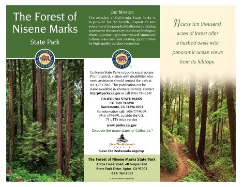
<strong>The</strong> <strong>Forest</strong> <strong>of</strong><br />
<strong>Nisene</strong> <strong>Marks</strong><br />
<strong>State</strong> Park<br />
Our Mission<br />
<strong>The</strong> mission <strong>of</strong> <strong>California</strong> <strong>State</strong> <strong>Parks</strong> is<br />
to provide for the health, inspiration and<br />
education <strong>of</strong> the people <strong>of</strong> <strong>California</strong> by helping<br />
to preserve the state’s extraordinary biological<br />
diversity, protecting its most valued natural and<br />
cultural resources, and creating opportunities<br />
for high-quality outdoor recreation.<br />
Nearly ten thousand<br />
acres <strong>of</strong> forest <strong>of</strong>fer<br />
a hushed oasis with<br />
panoramic ocean views<br />
from its hilltops.<br />
<strong>California</strong> <strong>State</strong> <strong>Parks</strong> supports equal access.<br />
Prior to arrival, visitors with disabilities who<br />
need assistance should contact the park at<br />
(831) 763-7062. This publication can be<br />
made available in alternate formats. Contact<br />
interp@parks.ca.gov or call (916) 654-2249.<br />
CALIFORNIA STATE PARKS<br />
P.O. Box 942896<br />
Sacramento, CA 94296-0001<br />
For information call: (800) 777-0369.<br />
(916) 653-6995, outside the U.S.<br />
711, TTY relay service<br />
www.parks.ca.gov<br />
Discover the many states <strong>of</strong> <strong>California</strong>.<br />
Save<strong>The</strong>Redwoods.org/csp<br />
<strong>The</strong> <strong>Forest</strong> <strong>of</strong> <strong>Nisene</strong> <strong>Marks</strong> <strong>State</strong> Park<br />
Aptos Creek Road, <strong>of</strong>f Soquel and<br />
<strong>State</strong> Park Drive, Aptos, CA 95003<br />
(831) 763-7062<br />
© 2012 <strong>California</strong> <strong>State</strong> <strong>Parks</strong>
T<br />
he serene trails within <strong>The</strong> <strong>Forest</strong> <strong>of</strong> <strong>Nisene</strong> <strong>Marks</strong> <strong>State</strong> Park give scant hint <strong>of</strong> the<br />
redwood forest’s turbulent natural and human history. For centuries, the jagged terrain <strong>of</strong><br />
these 10,000 acres saved the original trees from loggers and settlers. Today the second- and<br />
third-growth forest canopy in earthquake country shades a recreational oasis with 30 miles <strong>of</strong><br />
maintained trails and roads for hiking, biking and running.<br />
PARK HISTORY<br />
<strong>The</strong> local first people were the Costanoans<br />
(now known as Ohlone). <strong>The</strong> native people<br />
harvested resources on<br />
the edges <strong>of</strong> the forest,<br />
but little evidence exists<br />
that they ever lived among<br />
these deep redwoods. Two<br />
Mexican land grants to the<br />
Castro family in 1833 and<br />
1844 partially form the<br />
boundaries <strong>of</strong> today’s park.<br />
Shortly after <strong>California</strong><br />
became a state in 1850,<br />
loggers built wooden skids and used oxen<br />
teams to drag smaller harvested trees<br />
for “split stuff” and tanbark. <strong>The</strong> forest’s<br />
more reachable redwoods were milled<br />
during the Gold Rush building boom, but<br />
lumber interests found the steep canyons<br />
impenetrable for<br />
logging giant redwoods.<br />
In 1880, however, the<br />
Southern Pacific Railway<br />
(SP) arrived in nearby<br />
Monterey. SP financed<br />
the purchase <strong>of</strong> treefilled<br />
Upper Aptos<br />
Canyon, the Loma<br />
Prieta Lumber Company<br />
and the Loma Prieta<br />
Railway. Chinese laborers cut and graded the<br />
rail line seven miles up the canyon. By 1883,<br />
standard-gauge railway tracks had been built<br />
to haul the huge redwood logs to mills.<br />
Loggers on platform supported<br />
by springboards, ca. 1895<br />
Photo courtesy <strong>of</strong> the Santa Cruz Museum <strong>of</strong> Art and History<br />
<strong>The</strong> 1880s cost <strong>of</strong> building this railroad,<br />
part <strong>of</strong> today’s main Fire Road, was<br />
estimated at $50,000 per mile. <strong>The</strong><br />
Loma Prieta Mill became the largest in<br />
the 19th-century Santa Cruz Mountains<br />
until disastrous landslides during San<br />
Francisco’s 1906 earthquake paused<br />
logging efforts.<br />
Reforestation began when the lumber<br />
company planted 50 acres <strong>of</strong> redwood and<br />
non-native eucalyptus seedlings. Logging<br />
resumed from 1909 until 1924, when most<br />
<strong>of</strong> Loma Prieta’s mill was dismantled and<br />
abandoned—after processing 140 million<br />
board feet <strong>of</strong> redwood.<br />
<strong>The</strong> <strong>Marks</strong> family <strong>of</strong> Salinas deeded more<br />
than 9,000 acres to the <strong>State</strong> for use as a<br />
public park in 1963. Named for matriarch<br />
<strong>Nisene</strong> (a Danish name) <strong>Marks</strong>, the gift<br />
deed specified that the “natural preserve”<br />
be used for camping, hiking and nature<br />
study. Other donations have increased park<br />
acreage to nearly 10,000 acres. <strong>The</strong> <strong>Forest</strong><br />
<strong>of</strong> <strong>Nisene</strong> <strong>Marks</strong> honors forest regeneration<br />
and preservation efforts.<br />
Historic logger’s cabin (lost in 1982 flood)
geology<br />
Three earthquake<br />
faults—San<br />
Andreas, San<br />
Gregorio and<br />
Zayante—<br />
influence the<br />
park’s geology.<br />
<strong>The</strong> San Gregorio<br />
Fault runs slightly<br />
southeast <strong>of</strong> park<br />
boundaries. <strong>The</strong><br />
Zayante Fault<br />
crosses the park’s<br />
Aptos Creek<br />
Canyon while<br />
the San Andreas<br />
Fault, extending<br />
Trees shifted by the<br />
nearly the entire<br />
Loma Prieta quake<br />
length <strong>of</strong> the state,<br />
twist as they grow to<br />
self correct.<br />
parallels the park’s<br />
northeastern<br />
border below Santa Rosalia Ridge.<br />
<strong>The</strong> San Andreas Fault’s devastating 6.9<br />
magnitude earthquake caused upheaval<br />
throughout Northern <strong>California</strong> in 1989.<br />
That quake was named after Loma Prieta<br />
(“dark hill”), the mountain near the<br />
quake’s epicenter in the park.<br />
Ancient sea floor sedimentary rocks—<br />
mostly sandstone, chert and siltstone with<br />
embedded marine fossils—are found in<br />
the Aptos and Bridge creekbeds. For most<br />
<strong>of</strong> the park’s history, it was a shallow inland<br />
sea. <strong>The</strong> park’s unstable sandy and loamy<br />
soil is susceptible to landslides.<br />
habitats<br />
In the cool and quiet semi-wilderness <strong>of</strong> the<br />
park, tall trees shelter creeks and canyons.<br />
Park elevation ranges from sea level to more<br />
than 2,600 feet. <strong>The</strong> park contains grassland,<br />
scrub, chaparral, woodland and forest<br />
riparian communities.<br />
Eighty percent <strong>of</strong> the hilly park<br />
is covered in coast redwood<br />
(Sequoia sempervirens) forest,<br />
with trees ranging in age<br />
from 80 to 120 years old and<br />
reaching 125 feet tall. <strong>The</strong>se<br />
second- and third-growth<br />
redwoods <strong>of</strong>ten sprout<br />
from the collar surrounding<br />
cut stumps; the sprouts are<br />
usually genetically identical<br />
to the parent tree. A few<br />
old-growth redwoods still<br />
survive within the park.<br />
Redwood species<br />
once grew throughout<br />
Asia, Europe and North<br />
America. <strong>The</strong> remaining<br />
range <strong>of</strong> coast redwood is<br />
limited to the Pacific Coast<br />
fog belt between Oregon and<br />
the Big Sur coast.<br />
Scientists fear that climate<br />
change, with decreasing fog<br />
and increasing temperatures,<br />
will result in even more<br />
redwood habitat loss.<br />
Sequoia sempervirens<br />
Fetid adder’s tongue, a disagreeablesmelling<br />
plant, grows among the redwoods<br />
along the Buggy Trail.<br />
Five percent <strong>of</strong> the park is covered in<br />
Northern maritime chaparral containing<br />
coyote brush and woolyleaf manzanita.<br />
Other habitats include a purple<br />
needlegrass grassland and a red alder<br />
riparian forest.<br />
<strong>The</strong> <strong>Forest</strong>’s<br />
diverse<br />
topography,<br />
abundant water,<br />
and varied plant<br />
life support many<br />
species <strong>of</strong> wildlife,<br />
including raccoons,<br />
cougar, deer,<br />
yellow-legged frogs<br />
Fetid adder’s tongue<br />
and the popular<br />
banana slug. Native<br />
birds include the<br />
American dipper,<br />
winter wren, and<br />
saw-whet owl.<br />
Coho salmon and<br />
steelhead spawn<br />
in the Bridge and<br />
Banana slug<br />
Aptos creeks.<br />
ACCESSIBLE INFORMATION<br />
Accessibility is continually improving,<br />
but there are currently no wheelchairaccessible<br />
activities at the park. For<br />
updates, visit http://access.parks.ca.gov.
RECREATION<br />
<strong>The</strong> park lies north <strong>of</strong><br />
Aptos Village on Aptos<br />
Creek Road in Santa Cruz<br />
County. Weather can be<br />
changeable year round.<br />
Picnic tables and<br />
barbecue pits are<br />
available. Trail campsites<br />
are located six miles from<br />
the trail camp parking<br />
lot at the West Ridge<br />
Trailhead. <strong>The</strong> trail camp<br />
has no water, and fires are prohibited. To<br />
reserve, call the Sunset <strong>State</strong> Beach kiosk<br />
at (831) 763-7063.<br />
<strong>The</strong> 2,700-acre Soquel<br />
Demonstration <strong>State</strong> <strong>Forest</strong><br />
north <strong>of</strong> the park is managed<br />
by the <strong>California</strong> Department<br />
<strong>of</strong> <strong>Forest</strong>ry and Fire Protection.<br />
Advanced mountain bikers can<br />
ride the loops within the demo<br />
forest by entering on Ridge<br />
Trail at the end <strong>of</strong> the Aptos<br />
Creek Fire Road.<br />
Trails<br />
Loma Prieta Grade Trail follows a steam<br />
railway bed from the mill to H<strong>of</strong>fman’s<br />
Historic Site, named after a logging<br />
superintendent. This site was a camp that<br />
once housed 100 loggers and mill workers.<br />
Maple Falls at end <strong>of</strong> Bridge Creek Trail<br />
PLEASE REMEMBER<br />
• All natural and cultural features are<br />
protected by law and may not be<br />
disturbed or removed.<br />
• To prevent erosion <strong>of</strong> the slopes, stay on<br />
marked trails; observe all trail postings.<br />
• By law, bicycling and mountain biking are<br />
allowed only on the Aptos Creek Fire Road<br />
and four single-track trails below its steel<br />
bridge. Cyclists may use the Aptos Rancho<br />
Trail, the Split Stuff Trail, the Terrace<br />
Trail and the Vienna Woods Trail.<br />
• Except for service animals, dogs are<br />
allowed only on Aptos Creek Fire Road<br />
and four single-track trails (named<br />
above) below the steel bridge. Dogs<br />
are prohibited beyond the gate at the<br />
Porter picnic area parking lot. Animals<br />
must be attended and on leashes no<br />
longer than six feet at all times.
NEARBY STATE PARKS<br />
• Seacliff <strong>State</strong> Beach<br />
<strong>State</strong> Park Drive, Aptos 95001<br />
(831) 685-6442<br />
• New Brighton <strong>State</strong> Beach<br />
1500 Park Ave., Hwy 1, Capitola 95010<br />
(831) 763-7062<br />
• Sunset <strong>State</strong> Beach<br />
201 Sunset Beach Rd., Watsonville 95076<br />
(831) 763-7063<br />
This park receives support in part from a nonpr<strong>of</strong>it organization. For information, contact the<br />
Friends <strong>of</strong> Santa Cruz <strong>State</strong> <strong>Parks</strong> at (831) 429-1840 or www.thatsmypark.org