thesis.pdf - Knowledge Based Systems Group - TU Delft
thesis.pdf - Knowledge Based Systems Group - TU Delft
thesis.pdf - Knowledge Based Systems Group - TU Delft

You also want an ePaper? Increase the reach of your titles
YUMPU automatically turns print PDFs into web optimized ePapers that Google loves.
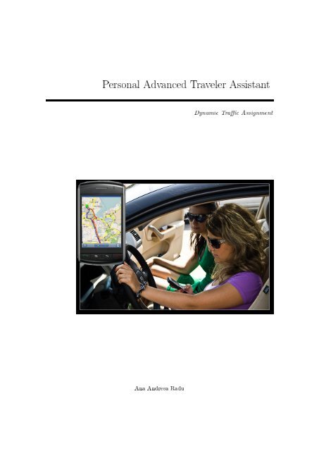
Personal Advanced Traveler Assistant<br />
Dynamic Trac Assignment<br />
Ana Andreea Radu
Personal Advanced Traveler Assistant<br />
THESIS<br />
submitted in partial fulllment of the<br />
requirements for the degree of<br />
MASTER OF SCIENCE<br />
in<br />
MEDIA AND KNOWLEDGE ENGINEERING<br />
by<br />
Ana Andreea Radu<br />
born in Brasov, Romania<br />
Man-Machine Interaction <strong>Group</strong><br />
Faculty of Electrical Engineering, Mathematics, and Computer Science (EEMCS)<br />
<strong>Delft</strong>, The Netherlands<br />
www.ewi.tudelft.nl
©2010 Ana Andreea Radu . All rights reserved.
Personal Advanced Traveler Assistant<br />
Author: Ana Andreea Radu<br />
Student id: 1391917<br />
Email: radu.andreea30@gmail.com<br />
Abstract<br />
In spite of numerous road management schemes and developed infrastructure the society<br />
nowadays still faces the problem of highly congested roads due to the increasing trac demand.<br />
The focus of this <strong>thesis</strong> is to develop a complex and integrated system that addresses the<br />
challenges of dynamic trac assignment in modern times. To reach this goal we had to study<br />
the theory behind such systems, come with new ideas and implement them into a real world<br />
human-centered traveler information system. Taking into account state of the art systems<br />
in this eld we built a design for a Personal Advanced Traveler Assistant (PTA). The main<br />
purpose of PTA is to give routing advices depending on the users preferences and the available<br />
capacity in the network. The system incorporates a dynamic trac algorithm that employs a<br />
prediction model. The prediction model should use current trac updates and the routes of<br />
the guided cars in order to achieve an accurate prediction of the future traveling times.<br />
Next step was to implement a prototype. This is available through multiple interfaces like<br />
smart phones or desktop applications.<br />
The prediction model that the algorithm uses is based on historical data. Given the<br />
time constraints the prototype uses now only historical data but it can be easily extended to<br />
include live updates. This allowed us to build a prediction model that considers typical trac<br />
dynamics in order to estimate the traveling time.<br />
The performance measure of the trac assignment algorithm is the shortest traveling<br />
time. The algorithm that we implemented is a time dimensional-extended version of the<br />
Dijkstra algorithm. The algorithm is tested on real data collected from the highways in The<br />
Netherlands. We evaluate the performance of the algorithm by comparing it to two versions<br />
of the static Dijkstra algorithm.<br />
To conclude, we successfully implemented a working prototype that uses various technologies<br />
such as Java, the Open Street Map API for rendering the map or J2ME for the mobile<br />
phone client. The prototype that we have built represents a working proof of concept for a<br />
dynamic routing assistant. One advantage of the structure that we chose to implement is<br />
that each component can be further on extended independently. In this way we showed that<br />
such a system is feasible but we also left the possibility for dierent parts of the system to be<br />
extended into more advanced applications.<br />
Thesis Committee:<br />
Supervisor:<br />
Committee Member:<br />
Committee Member:<br />
Committee Member:<br />
Prof. Dr. Drs. L.J.M. Rothkrantz, Faculty EEMCS, <strong>TU</strong> <strong>Delft</strong><br />
Dr. Ir. P. Wiggers, Faculty EEMCS, <strong>TU</strong> <strong>Delft</strong><br />
Ir. H.J.A.M. Geers, Faculty EEMCS, <strong>TU</strong> <strong>Delft</strong><br />
Dr. Ir. D. Datcu, The Netherlands Defence Academy, <strong>TU</strong> <strong>Delft</strong>
Preface<br />
The master <strong>thesis</strong> that you are reading represents my graduation project as a Master student at<br />
<strong>Delft</strong> University of Technology. I would like to take this opportunity and thank those who helped<br />
and supported me during the last 2 years. I thank especially to Prof. L.J.M. Rothkrantz for<br />
guiding my steps to successfully accomplish this master <strong>thesis</strong>. I am grateful to him for all the<br />
support he oered me, the eorts he invested in this research project, for giving me new ideas<br />
whenever I though I reached a dead end and not only. I would also like to thank him for trusting<br />
me and for making me feel more condent. I consider myself lucky to have met him and especially<br />
for having him the supervisor of my master <strong>thesis</strong>.<br />
Special thanks go also to my family, my mother, my father, my sister and my grandparents<br />
who always supported and encouraged me to follow my dreams. In spite of the distance between<br />
us they always helped me to remain optimistic.<br />
Because work seems easier when you are surrounded by friends I use this occasion to thank all<br />
my friends I met during my stay in The Netherlands, for their advices and for the nice moments<br />
that we spent together. Special thanks go to my collegues and to the teachers from the MMI<br />
department but also to the people from the lab, for all the good times and for the Dutch lessons,<br />
of course. In this way I would also like to show my appreciation for all the Romanian students at<br />
<strong>TU</strong><strong>Delft</strong>.<br />
Finally, I thank Vlad Mihai Sima for supporting and always encouraging me that everything<br />
can be achieved if you invest the eort. I am thankful for all the hints and advices that he gave<br />
me during these 2 years and for keeping me optimistic.<br />
Ana Andreea Radu<br />
<strong>Delft</strong>, The Netherlands<br />
August 17, 2010<br />
iii
Contents<br />
Preface<br />
Contents<br />
List of Figures<br />
List of Tables<br />
iii<br />
v<br />
ix<br />
xi<br />
1 Introduction 1<br />
1.1 Problem denition . . . . . . . . . . . . . . . . . . . . . . . . . . . . . . . . . . . . 1<br />
1.2 Dynamic Trac Assignment . . . . . . . . . . . . . . . . . . . . . . . . . . . . . . . 3<br />
1.3 Personal advanced Traveler Assistant (PTA) . . . . . . . . . . . . . . . . . . . . . . 4<br />
1.4 PTA - travel server system . . . . . . . . . . . . . . . . . . . . . . . . . . . . . . . 5<br />
1.5 Scientic challenges . . . . . . . . . . . . . . . . . . . . . . . . . . . . . . . . . . . 6<br />
1.6 Goals of the <strong>thesis</strong> . . . . . . . . . . . . . . . . . . . . . . . . . . . . . . . . . . . . 8<br />
1.7 Methodology . . . . . . . . . . . . . . . . . . . . . . . . . . . . . . . . . . . . . . . 11<br />
1.8 Economical and societal relevance . . . . . . . . . . . . . . . . . . . . . . . . . . . . 12<br />
1.8.1 Economical . . . . . . . . . . . . . . . . . . . . . . . . . . . . . . . . . . . . 12<br />
1.8.2 Societal . . . . . . . . . . . . . . . . . . . . . . . . . . . . . . . . . . . . . . 13<br />
1.9 Thesis Structure . . . . . . . . . . . . . . . . . . . . . . . . . . . . . . . . . . . . . 14<br />
2 Literature Survey 17<br />
2.1 Trac Assignment . . . . . . . . . . . . . . . . . . . . . . . . . . . . . . . . . . . . 17<br />
2.1.1 User Equilibrium (UE) vs. System Optimum (SO) . . . . . . . . . . . . . . 17<br />
2.1.2 Non-equilibrium trac assignment methods . . . . . . . . . . . . . . . . . 18<br />
2.1.3 Classication of non-equilibrium assignment models . . . . . . . . . . . . . 19<br />
2.1.4 Equilibrium methods . . . . . . . . . . . . . . . . . . . . . . . . . . . . . . 20<br />
2.2 Dynamic Trac Assignment (DTA) . . . . . . . . . . . . . . . . . . . . . . . . . . 20<br />
2.2.1 Analytical based approach - Mathematical Programming Models . . . . . . 21<br />
2.2.2 Optimal control formulations . . . . . . . . . . . . . . . . . . . . . . . . . . 23<br />
2.2.3 Simulation-based approach models . . . . . . . . . . . . . . . . . . . . . . . 23<br />
2.3 Dynamic travel time estimation . . . . . . . . . . . . . . . . . . . . . . . . . . . . 24<br />
2.3.1 Factors that inuence the estimation of the travel time . . . . . . . . . . . 24<br />
2.3.2 Measurements and analysis of the travel time . . . . . . . . . . . . . . . . 25<br />
2.3.3 Methodologies of forecasting the travel time . . . . . . . . . . . . . . . . . 26<br />
2.4 Incident eects on trac congestion . . . . . . . . . . . . . . . . . . . . . . . . . . 28<br />
2.4.1 Incident delays prediction variables . . . . . . . . . . . . . . . . . . . . . . 28<br />
2.4.2 Statistical models used to predict incident delays . . . . . . . . . . . . . . 29<br />
2.5 Summary . . . . . . . . . . . . . . . . . . . . . . . . . . . . . . . . . . . . . . . . . 31<br />
v
CONTENTS<br />
CONTENTS<br />
3 Industrial products 33<br />
3.1 PITA . . . . . . . . . . . . . . . . . . . . . . . . . . . . . . . . . . . . . . . . . . . 33<br />
3.2 Intelligent vehicles (IV) trac management frameworks . . . . . . . . . . . . . . . 35<br />
3.2.1 Relevant features of Intelligent Vehicles . . . . . . . . . . . . . . . . . . . . 35<br />
3.2.2 Platoon-based trac models . . . . . . . . . . . . . . . . . . . . . . . . . . 36<br />
3.2.3 Intelligent Vehicles frameworks . . . . . . . . . . . . . . . . . . . . . . . . . 36<br />
3.2.4 Drawbacks of Automated Highway <strong>Systems</strong> and Intelligent Transportation<br />
<strong>Systems</strong> . . . . . . . . . . . . . . . . . . . . . . . . . . . . . . . . . . . . . . 38<br />
3.3 Mobile Century Project . . . . . . . . . . . . . . . . . . . . . . . . . . . . . . . . . 38<br />
3.4 TomTom . . . . . . . . . . . . . . . . . . . . . . . . . . . . . . . . . . . . . . . . . 39<br />
3.5 Trac management schemes in The Netherlands . . . . . . . . . . . . . . . . . . . 40<br />
4 Trac Data 43<br />
4.1 Historical Trac Data . . . . . . . . . . . . . . . . . . . . . . . . . . . . . . . . . . 43<br />
4.2 Inductive loop detectors . . . . . . . . . . . . . . . . . . . . . . . . . . . . . . . . . 45<br />
4.3 MoniCa Data and MoniGraph . . . . . . . . . . . . . . . . . . . . . . . . . . . . . 46<br />
4.4 RegioLab <strong>Delft</strong> . . . . . . . . . . . . . . . . . . . . . . . . . . . . . . . . . . . . . . 47<br />
4.5 ANWB . . . . . . . . . . . . . . . . . . . . . . . . . . . . . . . . . . . . . . . . . . 48<br />
4.6 Trac data in our model . . . . . . . . . . . . . . . . . . . . . . . . . . . . . . . . 49<br />
4.6.1 Initial historical data acquisition . . . . . . . . . . . . . . . . . . . . . . . . 49<br />
4.6.2 Data structures . . . . . . . . . . . . . . . . . . . . . . . . . . . . . . . . . . 50<br />
5 Open Source Tools 51<br />
5.1 GIS framework - Open Street Map (OSM) . . . . . . . . . . . . . . . . . . . . . . . 51<br />
5.2 Programming language (Java) . . . . . . . . . . . . . . . . . . . . . . . . . . . . . 54<br />
5.3 Development environment (NetBeans IDE) . . . . . . . . . . . . . . . . . . . . . . 54<br />
5.4 Java 2 Micro Edition (J2ME) . . . . . . . . . . . . . . . . . . . . . . . . . . . . . . 55<br />
6 Conceptual Design 57<br />
6.1 Personal advanced Traveling Assistant (PTA) . . . . . . . . . . . . . . . . . . . . 57<br />
6.2 Human-Centered Design . . . . . . . . . . . . . . . . . . . . . . . . . . . . . . . . 60<br />
6.3 User Survey . . . . . . . . . . . . . . . . . . . . . . . . . . . . . . . . . . . . . . . . 61<br />
6.3.1 Results . . . . . . . . . . . . . . . . . . . . . . . . . . . . . . . . . . . . . . 62<br />
6.4 Detailed Design . . . . . . . . . . . . . . . . . . . . . . . . . . . . . . . . . . . . . 66<br />
6.4.1 Client-Server Communication . . . . . . . . . . . . . . . . . . . . . . . . . 67<br />
6.4.2 Central Server (OO Model) . . . . . . . . . . . . . . . . . . . . . . . . . . . 68<br />
6.4.3 Clients interface . . . . . . . . . . . . . . . . . . . . . . . . . . . . . . . . . 70<br />
6.4.4 Database Schema . . . . . . . . . . . . . . . . . . . . . . . . . . . . . . . . 72<br />
7 Dynamic Trac Model Development 75<br />
7.1 Dynamic Travel Time Prediction model . . . . . . . . . . . . . . . . . . . . . . . . 75<br />
7.2 Static model . . . . . . . . . . . . . . . . . . . . . . . . . . . . . . . . . . . . . . . 76<br />
7.3 Speed variance model based on empirical experience . . . . . . . . . . . . . . . . . 77<br />
7.4 Integrate historical data in the model . . . . . . . . . . . . . . . . . . . . . . . . . 77<br />
7.5 Travel time prediction in the algorithm . . . . . . . . . . . . . . . . . . . . . . . . 79<br />
7.5.1 Trac models based on real time updates . . . . . . . . . . . . . . . . . . . 80<br />
7.5.2 Incidents model . . . . . . . . . . . . . . . . . . . . . . . . . . . . . . . . . 80<br />
8 DDTA (Dynamic Dijkstra Trac Assignment) algorithm 83<br />
8.1 The algorithm . . . . . . . . . . . . . . . . . . . . . . . . . . . . . . . . . . . . . . 83<br />
8.1.1 Inputs to the algorithm . . . . . . . . . . . . . . . . . . . . . . . . . . . . . 83<br />
8.1.2 Processing of the algorithm . . . . . . . . . . . . . . . . . . . . . . . . . . . 85<br />
8.1.3 Outputs of the algorithm . . . . . . . . . . . . . . . . . . . . . . . . . . . . 86<br />
8.1.4 Strengths and Weaknesses . . . . . . . . . . . . . . . . . . . . . . . . . . . . 86<br />
vi
CONTENTS<br />
CONTENTS<br />
8.2 Results . . . . . . . . . . . . . . . . . . . . . . . . . . . . . . . . . . . . . . . . . . 87<br />
9 Implementation 93<br />
9.1 Prototype . . . . . . . . . . . . . . . . . . . . . . . . . . . . . . . . . . . . . . . . . 93<br />
9.2 System architecture . . . . . . . . . . . . . . . . . . . . . . . . . . . . . . . . . . . 94<br />
9.3 Data structures . . . . . . . . . . . . . . . . . . . . . . . . . . . . . . . . . . . . . 96<br />
9.4 Database Object Relational Mapping - using JPA . . . . . . . . . . . . . . . . . . . 98<br />
9.4.1 Database - Derby . . . . . . . . . . . . . . . . . . . . . . . . . . . . . . . . . 99<br />
9.5 Client-Sever communication protocol . . . . . . . . . . . . . . . . . . . . . . . . . . 99<br />
9.6 Desktop Client User Interface . . . . . . . . . . . . . . . . . . . . . . . . . . . . . 100<br />
9.6.1 Routing GUI . . . . . . . . . . . . . . . . . . . . . . . . . . . . . . . . . . . 101<br />
9.7 Open Street Map API . . . . . . . . . . . . . . . . . . . . . . . . . . . . . . . . . . 102<br />
9.8 Mobile application . . . . . . . . . . . . . . . . . . . . . . . . . . . . . . . . . . . . 102<br />
9.8.1 GUI . . . . . . . . . . . . . . . . . . . . . . . . . . . . . . . . . . . . . . . . 102<br />
9.8.2 Data . . . . . . . . . . . . . . . . . . . . . . . . . . . . . . . . . . . . . . . . 104<br />
10 Conclusions and future work 107<br />
10.1 Conclusions . . . . . . . . . . . . . . . . . . . . . . . . . . . . . . . . . . . . . . . . 107<br />
10.1.1 Dynamic Trac Assignment . . . . . . . . . . . . . . . . . . . . . . . . . . 107<br />
10.1.2 Build a human-centered design . . . . . . . . . . . . . . . . . . . . . . . . . 108<br />
10.1.3 Implement a prototype . . . . . . . . . . . . . . . . . . . . . . . . . . . . . . 108<br />
10.1.4 Tests of the algorithm . . . . . . . . . . . . . . . . . . . . . . . . . . . . . . 108<br />
10.1.5 Discussion . . . . . . . . . . . . . . . . . . . . . . . . . . . . . . . . . . . . . 109<br />
10.2 Future research . . . . . . . . . . . . . . . . . . . . . . . . . . . . . . . . . . . . . 109<br />
10.2.1 Incidents Model . . . . . . . . . . . . . . . . . . . . . . . . . . . . . . . . . 109<br />
Bibliography 111<br />
vii
List of Figures<br />
1.1 Fifty years of trac growth by mode in The Netherlands . . . . . . . . . . . . . . . . 2<br />
1.2 Examples of trac management measures in The Netherlands . . . . . . . . . . . . . 3<br />
1.3 Causes of congestion . . . . . . . . . . . . . . . . . . . . . . . . . . . . . . . . . . . . 3<br />
1.4 Use of a personal traveler assistant . . . . . . . . . . . . . . . . . . . . . . . . . . . . 4<br />
1.5 Variables scheme for trac prediction . . . . . . . . . . . . . . . . . . . . . . . . . . . 9<br />
1.6 Schema of an advanced traveling information system . . . . . . . . . . . . . . . . . . 10<br />
2.1 Schematic structure of the trac assignment . . . . . . . . . . . . . . . . . . . . . . . 19<br />
2.2 Eect of the congestion index on the prediction error . . . . . . . . . . . . . . . . . . 28<br />
2.3 Framework for incident management . . . . . . . . . . . . . . . . . . . . . . . . . . . 29<br />
2.4 Flow chart of incident modeling procedure . . . . . . . . . . . . . . . . . . . . . . . . . 30<br />
3.1 Dierent communication networks involved in PITA . . . . . . . . . . . . . . . . . . . 34<br />
3.2 PITA system design . . . . . . . . . . . . . . . . . . . . . . . . . . . . . . . . . . . . . 35<br />
3.3 Test cars - Mobile Century . . . . . . . . . . . . . . . . . . . . . . . . . . . . . . . . . 38<br />
3.4 Demo of Mobile Century at UC Berkeley . . . . . . . . . . . . . . . . . . . . . . . . . 39<br />
3.5 TomTom with live trac update . . . . . . . . . . . . . . . . . . . . . . . . . . . . . . 40<br />
3.6 Dynamic speed panels in The Netherlands . . . . . . . . . . . . . . . . . . . . . . . . 41<br />
3.7 Dynamic route information . . . . . . . . . . . . . . . . . . . . . . . . . . . . . . . . . 41<br />
4.1 Example of travel times in The Netherlands from the MoniCa data . . . . . . . . . . 44<br />
4.2 Paired loop detectors wired in the pavement . . . . . . . . . . . . . . . . . . . . . . . 45<br />
4.3 Analysis of data - Speed contour plot . . . . . . . . . . . . . . . . . . . . . . . . . . . 46<br />
4.4 RegioLab <strong>Delft</strong> . . . . . . . . . . . . . . . . . . . . . . . . . . . . . . . . . . . . . . . . 47<br />
4.5 Exploring shock waves from RegioLab . . . . . . . . . . . . . . . . . . . . . . . . . . . 48<br />
4.6 Screen shot from ANWB . . . . . . . . . . . . . . . . . . . . . . . . . . . . . . . . . . 49<br />
5.1 Trac network displayed in Google Map . . . . . . . . . . . . . . . . . . . . . . . . . 52<br />
5.2 Open Street Map . . . . . . . . . . . . . . . . . . . . . . . . . . . . . . . . . . . . . . 52<br />
5.3 Roads and intersections displayed in OSM for the highways in The Netherlands . . . 53<br />
6.1 Environment of PTA . . . . . . . . . . . . . . . . . . . . . . . . . . . . . . . . . . . . 59<br />
6.2 Human-centered design circle . . . . . . . . . . . . . . . . . . . . . . . . . . . . . . . . 61<br />
6.3 Importance of interaction modalities with PTA for the respondents . . . . . . . . . . . 62<br />
6.4 Modality to announce an accident on the route . . . . . . . . . . . . . . . . . . . . . . 63<br />
6.5 Preferred modality to communicate the destination to PTA . . . . . . . . . . . . . . . 63<br />
6.6 Most essential for a route request . . . . . . . . . . . . . . . . . . . . . . . . . . . . . 64<br />
6.7 Assessment of important features for the GUI of PTA . . . . . . . . . . . . . . . . . . 65<br />
6.8 Detailed design of PTA . . . . . . . . . . . . . . . . . . . . . . . . . . . . . . . . . . . 66<br />
6.9 UML class diagram for the OO server application . . . . . . . . . . . . . . . . . . . . 69<br />
ix
LIST OF FIGURES<br />
LIST OF FIGURES<br />
6.10 Desktop Client GUI Mock-up . . . . . . . . . . . . . . . . . . . . . . . . . . . . . . . 70<br />
6.11 Desktop client routing GUI mock-up . . . . . . . . . . . . . . . . . . . . . . . . . . . 71<br />
6.12 Mobile phone - GUI mock-up . . . . . . . . . . . . . . . . . . . . . . . . . . . . . . . . 72<br />
6.13 SQL database schema . . . . . . . . . . . . . . . . . . . . . . . . . . . . . . . . . . . . 73<br />
7.1 Example of a speed graph . . . . . . . . . . . . . . . . . . . . . . . . . . . . . . . . . 77<br />
7.2 Average of the speed variation during four days . . . . . . . . . . . . . . . . . . . . . 78<br />
7.3 Route in the southeast of Amsterdam . . . . . . . . . . . . . . . . . . . . . . . . . . . 79<br />
7.4 Dierences between static and dynamic algorithm with regard to travel time estimation 81<br />
8.1 Example of a time extended network . . . . . . . . . . . . . . . . . . . . . . . . . . . 84<br />
9.1 Implemented architecture . . . . . . . . . . . . . . . . . . . . . . . . . . . . . . . . . . 94<br />
9.2 Sequence diagram . . . . . . . . . . . . . . . . . . . . . . . . . . . . . . . . . . . . . . 95<br />
9.3 UML Class Diagram of the main data structures . . . . . . . . . . . . . . . . . . . . . 97<br />
9.4 Interface - Main Page . . . . . . . . . . . . . . . . . . . . . . . . . . . . . . . . . . . . 100<br />
9.5 Interface - Routing Page . . . . . . . . . . . . . . . . . . . . . . . . . . . . . . . . . . 101<br />
9.6 JMapViewer - UML class diagram . . . . . . . . . . . . . . . . . . . . . . . . . . . . . 103<br />
9.7 Mobile phone J2ME emulator - The process of rendering a map . . . . . . . . . . . . 104<br />
x
List of Tables<br />
1.1 Methodology summary . . . . . . . . . . . . . . . . . . . . . . . . . . . . . . . . . . . 13<br />
2.1 Mean Speed performance . . . . . . . . . . . . . . . . . . . . . . . . . . . . . . . . . . 27<br />
6.1 Advantages and disadvantages of a distributed system . . . . . . . . . . . . . . . . . . 60<br />
6.2 Advantages and Disadvantages of a client-server communication . . . . . . . . . . . . 67<br />
8.1 Average traveling times for DDTA, SDA and IDA (at morning peak) . . . . . . . . . 88<br />
8.2 Average traveling times for DDTA, SDA and IDA (at afternoon peak) . . . . . . . . . 89<br />
8.3 DDTA compared to SDA and IDA - Maximum dierences (morning peak hours) . . . 90<br />
8.4 DDTA compared to SDA and IDA - Maximum dierences (afternoon peak hours) . . 91<br />
xi
Chapter 1<br />
Introduction<br />
Every morning commuters and drivers traveling in urban areas all over the world suer from delays<br />
due to congestion in trac. This leads to increased costs as vehicles consume more fuel and people<br />
arrive too late at the working place. So, they are not able to use their time eciently. They<br />
generally try to minimize their traveling costs as much as possible. Nevertheless, the repercussions<br />
of congestions are rstly economical but also environmental.<br />
In spite of well-planned road management schemes, developed infrastructures, modern tracking<br />
technologies and trac rules for safe driving, society nowadays faces the problem of trac congestion<br />
due to the ever increasing trac demand. Building new roads can be a solution but not a<br />
feasible one due to costs and environmental concerns.<br />
Especially nowadays, time is an important resource. Not only do people lose much time because<br />
of congestions but they also get angry or frustrated because they are late for an important meeting,<br />
at their job or other events in their lives. Let us follow a short story in the following paragraph<br />
that could have a dierent outcome.<br />
Imagine that you just nished a business meeting and you have to arrive at another one at<br />
10 o'clock. You see that your GPS suggests that you will arrive there in 40 minutes and that is<br />
plausible as long as that is not a peak hour. However, you hurry up and leave one hour before.<br />
Everything goes ne and after 35 minutes you see that there are only 15 more km to go. You<br />
exit the highway and you notice that there is a temporally closed road on your route. You turn<br />
and try to reach your destination somehow although the GPS insists you go on the same closed<br />
road as it is seen to be the shortest path. After you manage to \persuade" it to choose another<br />
route by getting further away from that point, you already see that are only 20 minutes left to the<br />
meeting. However, probably enough time for a few kilometers and nding a park place. Next the<br />
GPS chooses an arterial road for a couple of kilometers but there was an accident. You cannot do<br />
anything else than wait and feel angry and frustrated because this could have been avoided. You feel<br />
unlucky, but still hope for a miracle to happen and get to the meeting. Finally, you get all sweaty<br />
to the meeting being 40 minutes too late. You apologize for being late while the others assure you<br />
that they are also sorry but they bought the product from the competitor of your company.<br />
1.1 Problem denition<br />
The Netherlands has around 16.6 million inhabitants and in January 2003 there were 8.3 million<br />
vehicles registered and more than 250 million vehicle-kilometers each day across its entire highway<br />
network. It is a densely populated country with almost 200 cars per square km.<br />
In July 2007 the Federal Highway Administration and National Cooperative Highway Research<br />
Program in US sponsored a scanning study to examine congestion management programs and<br />
policies in Europe [1]. This program included four countries: Denmark, England, The Netherlands<br />
and Germany. The focus was on the trac parameters and on the measures for the deployment<br />
of congestion. Figure 1.1 [1] shows a graph from this study which indicates the trac growth in<br />
The Netherlands in the last fty years with a continuing trend of about 3 percent per year. In<br />
1
1.1 Problem denition Introduction<br />
order to show some statistics, The Netherlands reports congestion costs of 0.8 M¿per year. The<br />
accessibility of main ports is also aected [2]. The threads cited in the same ocial report refer<br />
to the distribution function of trac, jobs and economy, environment and safety. This shows a<br />
critical need for trac congestion management.<br />
Figure 1.1: Fifty years of trac growth by mode in The Netherlands<br />
2<br />
In The Netherlands trac management measures started to be taken already from 1989 [1, 3].<br />
The trac policy relies heavily on trac management. Only building new roads would be too<br />
expensive or dicult because of spatial and environment conditions. Therefore, the eorts were<br />
turned towards trac management. From 1989 onwards, various trac management measures<br />
were implemented, starting from motorway trac management systems to overtaking prohibitions<br />
for trucks and special police teams for rush hours. The eorts undertaken so far to improve the<br />
existing trac network through trac management schemes by the government in The Netherlands<br />
are the following (see Figure 1.2 [3] ):<br />
ˆ Queue warning.<br />
ˆ Speed Harmonization.<br />
ˆ Temporary Shoulder Lane use.<br />
ˆ Dynamic Lane Marking.<br />
Besides these measures that are applied on the roads in order to alleviate congestions, an alternative<br />
is to make more ecient use of the infrastructure. This has lead to a great development in the<br />
area of personal intelligent traveling systems. These systems are researched in order to improve<br />
the trac parameters.<br />
How congested are the arterial roads at peak hours? What is the travel time to certain destinations<br />
at dierent times of the day? Which are the chances to run into a highly congested road?<br />
Which are the factors that determine trac congestions? All these questions arise every day in the<br />
minds of millions. Because of this it is hard to estimate when people should begin their journey<br />
in order to arrive at the destination in due time and without waiting too much in trac.<br />
The dynamic nature of trac can be observed in both temporal and spatial changes in the<br />
trac demand, roadways capacity and trac control parameters. The trac demand increases<br />
over time until peak periods, it varies stochastic during the peak hours and decays at the end of<br />
peaks.<br />
A great part of the congestions are regular and recurring at certain locations of the freeway<br />
network and also at certain hours. These add up with the incidents, the road maintenance elds,<br />
the weather conditions and special events that inuence trac.
Introduction<br />
1.2 Dynamic Trac Assignment<br />
Figure 1.2: Examples of trac management measures in The Netherlands<br />
Most GPS devices that people own, when requested a route, provide a solution based on the<br />
minimum distance. People usually hear on the radio if there is an incident or if there is something<br />
special happening on the motorways. But then they have to estimate themselves which alternative<br />
route they should choose, how much extra time they have to spend, whether a certain alternative<br />
is the most convenient one and so on.<br />
We conclude that congestions can inuence our lives in many ways. And even if there were a<br />
lot of approaches meant to bring an equilibrium in the trac or to search an optimum for each<br />
individual driver (by minimizing his costs) there is a great need for more improvements.<br />
1.2 Dynamic Trac Assignment<br />
How can we best dene the dynamic trac assignment? It can be described by the process of<br />
dynamically selecting a path made out of roadway segments from a trip origin to a trip destination<br />
depending on a cost function. The cost function is usually the traveling time.<br />
The complexity of trac management is due to the interaction of three main processes [4]:<br />
ˆ The traveler's decision behavior, as the decisions of drivers inuence the outcome of the<br />
trac network;<br />
ˆ The dynamic trac assignment in a trac network;<br />
ˆ The trac ow behavior, in particular when incidents and accidents occur in the network.<br />
Figure 1.3: Causes of congestion<br />
3
1.3 Personal advanced Traveler Assistant (PTA) Introduction<br />
All these trac factors interact with each other and change the trac ow behavior and the<br />
trac assignment. The empirical trac patterns and their predictions are an interesting eld of<br />
complex systems because of all these change. The physics of trac ows with all these processes<br />
are a great challenge for the trac prediction approaches. There are recurrent patterns that can<br />
be noticed in the trac data, not only for peak hours but also for the days of the week. There are<br />
usually great dierences between Sundays and Mondays for example.<br />
Furthermore, incidents are a frequent source of disturbance in the trac but there are more<br />
factors leading to congestions such as the weather conditions, the drivers behavior, special events<br />
(such as Christmas or an important football match), the road maintenance elds etc.<br />
Figure 1.3 [1] shows a classication example of the non-recurrent (55%) and recurrent congestion<br />
(45%) in the United States. For the rst one trac incidents have the greatest contribution (25%)<br />
followed up by bad weather conditions (15%), work zones (10%) and special events (5%). For<br />
the recurrent congestions bottlenecks have the greatest contribution (40%) followed up by poor<br />
signaling time (5%). This classication indicates that long term predictions based on historical<br />
data and short term predictions that are based on current updates from trac have to complement<br />
each other in order to succeed to correctly estimate the traveling time.<br />
Trac predictions are important for the drivers as they would be able to realistically asses the<br />
time they need to get to the destination. Moreover, correct trac predictions may also be used<br />
for safety and also to improve intelligent applications of the vehicles, such as the adaptive cruise<br />
control.<br />
1.3 Personal advanced Traveler Assistant (PTA)<br />
Figure 1.4: Use of a personal traveler assistant<br />
4<br />
One approach to solve the congestion issues and though to reduce the travel time for individuals<br />
is to develop a route planner that incorporates current and future trac information when searching<br />
for the best route. When congestions or incidents occur on this route the planner has to compute<br />
the best alternative solution which may lead the driver on dierent roads or to a train station.<br />
The main purpose is to minimize the traveling time by taking into account the changes and the<br />
future situation in the trac network. In this area the personal advanced traveling assistants play<br />
a crucial role. Such an assistant has multiple functions including that it computes the shortest<br />
traveling time-routes based on current information received from trac.<br />
Within the research program \Seamless Multimodal Mobility" at <strong>Delft</strong> University a Personal<br />
Intelligent Traveler Assistant (PITA) has been designed. A more detailed description of PITA is<br />
presented in Chapter 3, Section 3.1.
Introduction<br />
1.4 PTA - travel server system<br />
Our purpose is to continue the work from PITA and develop our own dynamic trac assignment<br />
integrated in a system that will be called Personal advanced Traveling Assistant (PTA). In the<br />
remaining of this section we will synthesize the main features of PTA.<br />
PTA is a smart traveling assistant that gives the user routing advices during his trip. PTA<br />
benets of current updates of the trac states. This means that it suggests the best route at<br />
departure and it oers alternative solutions in case of congestion or unexpected events. PTA is<br />
smart because it is able to manage trac information, analyze dierent possibilities and conclude<br />
which is the best alternative route. Moreover, when it chooses a route it takes into account the<br />
driver's preferences.<br />
PTA connects to the user through a hand held device, such as in Figure 1.4. The mobile phone<br />
stands as an interface between the system and the driver. It connects to the network in order to<br />
obtain the necessary information.<br />
PTA also benets of a smart interface: it is able to oer the user dierent input and output<br />
data modalities depending on the situation. Thus, it has a multi modal user interface that may<br />
include speech, speech recognition and a graphical interface.<br />
1.4 PTA - travel server system<br />
PTA represents a distributed system that connects the main server to the users. The clients of the<br />
server can be either desktop computers or mobile devices.<br />
We may assume that in the next future many/all car drivers will have a hand held device/routing<br />
device. It can be either a TomTom-like or a smart phone with an implemented routing system<br />
(GPS).<br />
As aforementioned, we design a system which is able to route car drivers taking as input the<br />
origin, the destination and the departure time. Usually the origin of the trip is known by the GPS<br />
receiver in the device. The system provides a solution and supervises the drivers.<br />
During the trip, at regular time intervals, the car driver provides his position using the GPS<br />
device or a smart phone (this is actually done automatically). In this way the system will get real<br />
time information on the current trac ow. This information will be used to update the routing<br />
tables on the server.<br />
At this moment we assume that the routing software has to be implemented on a central server<br />
and that every hand held device has regular contact to the server. These devices represent clients<br />
of the central servers. The software for the clients could be downloaded but the dynamic trac<br />
information would be available just at central points, and could be also downloaded. But this is<br />
currently beyond the network capacity and computational capacity of the hand held devices.<br />
Travel time update<br />
For our routing algorithm we start with a database of historical trac data. This means that we<br />
know the travel time t Nj on a segment N with the time intervals i Nj ; j 2 (0 : 00; 24 : 00): The<br />
important part is that as soon as real time information of tracked travelers becomes available, the<br />
database may be lled with additional new data, so that we update all travel times t Nj . Because<br />
we know the position of the vehicles at regular time intervals and their destination, we can compute<br />
current time t 0 N along a segment N. Then the updated travel time t N jnew can be computed as<br />
follows (Equation 1.1):<br />
t Njnew = t Njold + wt 0 N : (1.1)<br />
In this way we have a real time updated database of travel times. But the main problem is not<br />
to have real time travel information but also reliable predictions of future. In our case, we have<br />
the destination as input data and our system provides a travel advice. Let us assume that the<br />
traveler takes this advice seriously and then we know which is the expected travel stream in the<br />
future for a representative group of travelers using our PTA system. Given the historical travel<br />
5
1.5 Scientic challenges Introduction<br />
stream we are able to make predictions about the relation between future travel streams and the<br />
corresponding travel times.<br />
So, we could train an ANN with the relation between the travel stream and the travel time.<br />
Given predicted travel stream density we can compute future travel times which will be continuously<br />
adjusted by as real time trac information becomes available.<br />
To conclude, we are able to compute the time of trips/routes not only based on current real<br />
time information but also based on reliable predictions of future travel time.<br />
In this <strong>thesis</strong> only part of this challenging approach could be implemented and tested.<br />
1.5 Scientic challenges<br />
Smart traveling assistants aim to improve the trac ow. Our challenge is to build an integrated<br />
dynamic trac planner for individual travelers. An important component of this planner is a<br />
trac prediction model.<br />
Our trac assignment model will use a cost function determined by an established performance<br />
measure. The performance measures considered in literature [5] are the traveling time, the fuel<br />
consumption, the price of the trip, the safety on the roadways, the reliability of the guidance system,<br />
the robustness of the guidance system etc. There are many parameters that have to be considered.<br />
The driver's behavior can be another example. Most drivers are interested in the shortest traveling<br />
time whereas others are interested in the smallest toll charge. However, there are also other aspects<br />
related to drivers: if some wish to drive with a low constant speed in order to consume fewer fuel,<br />
they might delay the others. And in case of the zipper eect many drivers may not be fair, overtake<br />
others and then place in front. Fuel consumption and congestions also inuence the trac ow.<br />
Moreover, incidents, unexpected events or weather forecasts are other parameters to be considered.<br />
How could we approximate a model that considers all these variables? One possibility is to<br />
resolve a regression model (Equation 1.2) for the trac ow.<br />
M i = 1 x i1 + ::: + i x ip + " i = X x i + " i ; (1.2)<br />
where M represents the measured variable, namely the expected cost of the trip model and x i<br />
stand for the whole multitude of input variables. We realize that the trac model that we have<br />
to achieve is a multi-parameter problem. This represented a scientic challenge for the research in<br />
the eld of trac assignment ( Section 2.3).<br />
The performance measure that we consider for our prediction model is to minimize the traveling<br />
time. Further on, the trac prediction model has to be integrated in a smart traveling system.<br />
First, we have to establish a design of a smart traveler assistant and then implement a prototype.<br />
6<br />
Designing a smart traveler assistant. Our rst target is to design a smart traveler assistant.<br />
This involves various factors. A prediction model for the traveling time and a dynamic trac<br />
assignment algorithm have to be incorporated in the system. The estimation of the traveling<br />
time should be done based on current trac information and prediction models. The system is<br />
developed in a network and it relates to the user through a hand held device. The data processing<br />
and the route computation are done on a server that is connected to the users devices. The server<br />
is linked to the trac network database and to the incidents database.<br />
We aim to design a multi modal route planner that continuously benets of real life trac<br />
data. First, we need to gure out how to model a multi modal dialog manager in the network<br />
between server, users, trac data, incidents and even other means of transport. Further on, we<br />
also attempt to have a human-centered design. People usually have various preferences and the<br />
target users of such a system are very diverse. <strong>Based</strong> on the preferences PTA assigns each user<br />
a prole. In order to detect important aspects related to the interface or the routing preferences<br />
a user test has to be done. However, it is not trivial to establish which are the key factors for a<br />
human-centered design with regard to the PTA.
Introduction<br />
1.5 Scientic challenges<br />
Build a trac model. It is a challenge to develop a dynamic trac assignment model that<br />
describes as close as possible the real life trac situation. The model should estimate the traveling<br />
time with a low prediction error. First, it is debatable what would be ideal: a model which guides<br />
individual travelers or groups of individuals? As it is quite complex to have a network in which<br />
groups can be guided we will resume at routing individuals. In this way we aim to assign each user<br />
the best possible route. But how does this aect the other participants at the trac?<br />
Furthermore, the behavior of the trac ow and the trac network have to be introduced in<br />
our model. Developing a model that stands for the real one is a great challenge for researchers<br />
in this eld. Why is it generally hard to simulate/test a trac model from real life? Because for<br />
example, not all cars are controlled by the same system. Some drivers might even use paper maps,<br />
some might rely on their own (incomplete) knowledge or use GPS devices that do not belong to a<br />
network. Because of such issues trac models in research come along with assumptions.<br />
The approach for our trac model is inuenced by the assumptions that we established. For<br />
the implementation of our system we assume roads to be straight lines. For the highways of The<br />
Netherlands this assumption will not inuence much the outcomes. The length of the vehicles will<br />
not be considered because we implement the routing at a \macro-level". This means that we will<br />
not concentrate on intersections, the number of lanes or the capacity of each highway but we will<br />
focus on the relationship between the trac ow, density and speed.<br />
The algorithm. Our trac model needs a simple and scalable algorithm that assigns the<br />
shortest path in time for a trip. In other words, the algorithm has to solve the dynamic trac<br />
assignment problem. An approach for solving this is to divide the time horizon in steady-state<br />
time intervals and apply a shortest path algorithm to each time interval depending on the average<br />
speed of the vehicles.<br />
Testing the algorithm in real life would be very hard at this moment because neither can't we<br />
access the devices for tracking nor can't we route real individuals. Therefore, the algorithm will<br />
be tested in a simulated environment and a comparison to a static trac assignment will be done<br />
and assessed.<br />
Prediction models. Trac prediction models demand a good understanding of the trac patterns<br />
and their occurrence in order to achieve a low prediction error. Trac predictions use<br />
historical information on trac variables. Due to the progress done in the trac data measurement<br />
and acquisition the variety and complexity of the available data is increasing. There is a lot<br />
of acquired data and it is complex to handle all this data in an ecient manner.<br />
Our system needs reliable data to make long term predictions. The prediction model of our<br />
prototype is based on historical data. However, a reconstruction of the current trac state for<br />
short term predictions is considered. Incidents or special events which change the current state<br />
of the trac network are also important. Incidents can be of many types and may have various<br />
outcomes. An advanced traveler assistant should rst detect the type of the incident and then<br />
manage the situation. In our model we aim to develop an incident management model. The delays<br />
prediction in case of incidents is a state of the art research subject. The decrease in speed and<br />
the length of the queue that forms have to be studied. The delays determined also have to be<br />
estimated. Then, users who were assigned that road (or an aected one) have to be re-routed.<br />
But a balance should be maintained between the roads in the neighborhood. Cars cannot be all<br />
redirected to another single road close to the closed one. But how to manage a redistribution of<br />
the coming trac in such cases?<br />
The management of incidents assumes a close inspection of the number of aected lanes, current<br />
trac, the distance between the vehicles, drivers behavior, the time that authorities need to remove<br />
the incident and so on. However, it is dicult to manage incidents without a method that takes<br />
into account lanes, the vehicles width or the driver behavior.<br />
Implement an integrated system. The implementation of a prototype is not a scientic<br />
challenge but it is a challenge because it has to be an integrated system and it should use various<br />
7
1.6 Goals of the <strong>thesis</strong> Introduction<br />
8<br />
open source technologies for each component. An integrated system refers to a network application<br />
that can be accessed by the users. The users requests are sent through the network to the central<br />
server which sends back an answer. The interface between the system and the user is represented<br />
by a hand held device. Current trac information should be processed by using the position of<br />
the vehicles which are already sent.<br />
Integrating many dierent technologies made by dierent companies is a big challenge not<br />
addressed today.<br />
Trac models should be also considered in the system. There can be various trac models<br />
applied to each situation. These models can represent the days of the week, dierent weather<br />
forecasts, events or national celebrations.<br />
Human-centered interface design. PTA has to be an interactive system that people nd<br />
easy and enjoyable to use. Because of this, the usability of the system has to be taken into account<br />
at design and implementation. The questions that arise with respect to the design of a user-center<br />
interface are the following: which are the key factors for a human-centered interface of such a<br />
system? What should a multi modal interface comprise, how to display it and how to switch<br />
between dierent modalities?<br />
Although we aim to run a user test with regard to these issues the diversity of the users and<br />
the lack of time or of a larger sample of subjects for tests the design and the interface of the PTA<br />
represent a challenge.<br />
1.6 Goals of the <strong>thesis</strong><br />
Our goal is to develop a complex system to address the challenges of car routing in modern times<br />
as presented in Section 1.5. To reach this goal we have to study the theory behind such systems<br />
as abstract models and implement these ideas into a real world user oriented advanced traveler<br />
information system.<br />
In the following paragraphs the main goals of this <strong>thesis</strong> are going to be presented.<br />
Develop a trac prediction model. One important step for the system is the development<br />
of a dynamic trac assignment model. A crucial component of the model is the prediction of<br />
the traveling time. Figure 1.5 shows a scheme for the variables of the trac prediction model.<br />
The main variables are the historical time series such as the average speed at particular times on<br />
segments of roads or the travel time along with the current status. These represent the input data<br />
for the trac predictions [6].<br />
With respect to the trac model, we will consider a reduced model for the highways and cars.<br />
We will ignore the spatial characteristics of the car as length and width. We will also not consider<br />
lorries and the number of lanes. For highways we will capture the number of lanes by using just<br />
the abstract number of the average speed. So, we will not be concerned with the number of lanes,<br />
width of lanes or any other related issue. These assumptions of our trac model will be explained<br />
and motivated.<br />
Develop a routing algorithm based on the prediction model. The algorithm that we<br />
develop has to take into account the changes that occur in the network through time and not just to<br />
consider some given states. In order to build up the algorithm a non-equilibrium method is chosen.<br />
This assumes that trac requests between two zones are assigned the path which has the minimum<br />
cost. Moreover, the purpose of the algorithm is to route individual users. The algorithm will be<br />
tested on a trac network that is actually a replica of the highways network of The Netherlands.<br />
Identify a metric with which we'll evaluate the algorithm. The underlying objective<br />
of the algorithm is to reduce the traveling time. The cost function in the algorithm is associated<br />
with the traveling time. Minimum path algorithms include the models developed by Danzig and<br />
Dijkstra. Therefore, the proposed algorithm is a dynamical adapted version of the minimum path
Introduction<br />
1.6 Goals of the <strong>thesis</strong><br />
Historical Time Series:<br />
speed, flow rate, occupancy,<br />
travel time etc.<br />
Reconstruction of current<br />
traffic state<br />
Methods of prediction<br />
<strong>Based</strong> on “traffic physics”<br />
or<br />
“data mining”<br />
Traffic prediction<br />
Figure 1.5: Variables scheme for trac prediction<br />
assignment of Dijkstra - Dynamic Dijkstra Trac Assignment (DDTA). DDTA is required to<br />
provide a trip request with the shortest route in time. But the trac states change during the day<br />
and this means that we deal with a varying speed during a day. In order to integrate the variations<br />
of the trac, DDTA would use for the moment historical data collected from the highways.<br />
The algorithm will be tested by comparing it to the static minimum path Dijkstra algorithm.<br />
Given the same input data, the resulted traveling times will be compared and analyzed.<br />
Build a design for a personal advanced traveler assistant (PTA). Figure 1.6 synthesizes<br />
the main components of an advanced traveling information system. An important part is the<br />
DDTA algorithm which computes the travel time and predicts the next state of the network over<br />
a short period of time. The DDTA needs as input data the route demand and the historical data<br />
which contains the trac ow-average speed relation. The algorithm connects to the databases in<br />
order to access the trac network, the historical data, information on the current trac or the<br />
incidents. The user interface plays as well a crucial role in such a system. The design which we<br />
propose for the PTA is a human-centered approach. An important thing is that we need a system<br />
that is easy to learn, easy to use and user friendly. PTA will link to the users by using mobile<br />
phones but also a desktop application. The mobile phones will be used also as tracking devices.<br />
Although this may rise a privacy issue, it is not the case because we intend to keep track of the<br />
cars by simply using ids in order to compute the average speed-trac ow relationship at dierent<br />
points on the highways. This information contributes at the trac predictions on the short term.<br />
Briey, the system that we design has the following requirements :<br />
ˆ The rst requirement is the need of an integrated system that allows running the algorithm<br />
separately and connecting to the users through a hand held device and a desktop application;<br />
ˆ Design and implement a network which links each component of the system. The algorithm<br />
will work on a server to which both the mobile and the desktop client are connected;<br />
ˆ Design a multi modal user oriented interface;<br />
ˆ Implement an interactive graphical user friendly interface.<br />
Implement a prototype. Following the design of PTA our next goal is to implement a<br />
prototype that has various functions. Why do we implement this prototype? Because this can<br />
be a testbench for algorithms and multi modal interfaces. We need an open system that allows<br />
9
1.6 Goals of the <strong>thesis</strong> Introduction<br />
USER<br />
UI<br />
Requests<br />
DDTA<br />
Historical data<br />
Long term<br />
Update<br />
Traffic<br />
Model<br />
Traffic<br />
Router<br />
Feedback<br />
Routes<br />
Tracking Devices<br />
Real world<br />
Figure 1.6: Schema of an advanced traveling information system<br />
simulations and tests. Thus, the purpose is to provide a workbench. For the prototype each main<br />
component of the proposed architecture has to be implemented.<br />
The server will connect to a database that provides historical trac data in order to compute<br />
the travel time. The system will be modeled in such a way that it does not depend on the type of<br />
the data. First, historical data will be considered in order to develop and test the prototype. Next,<br />
it will be updated based on the live trac information. In this way, dierent trac models can be<br />
also formed: for dierent types of day, forecasts or events. However, we aim to have a system that<br />
allows a continuously updated database.<br />
In the following the most important goals for each component of the system will be briey<br />
emphasized.<br />
Due to the requirements aforementioned our system has to rely on a client-server communication.<br />
The server receives a route request, connects to the database (to retrieve the roads, the<br />
intersections and the historical data), applies the algorithm and returns the minimum path along<br />
with other details. The server connects to a mobile and to a desktop client. The client-server approach<br />
fullls the requirements on modularity (client and server, dierent modules) and scalability<br />
(we can add multiple servers for example).<br />
The UI has to be a user friendly interface that enables the user to learn and use the system<br />
quickly. It has to oer relevant and important information. With regard to the UI of the desktop<br />
client, this should also allow administrators of the system edit the data from the database.<br />
The UI of PTA should be attractive also to non-technical users as the target group of a GPS<br />
application is really diverse. Because the design envisions a user-centered application the interface<br />
of the mobile phone and the interface of the desktop application will be developed after analyzing<br />
a user survey. This involves running a survey among possible subjects in order to detect what is<br />
10
Introduction<br />
1.7 Methodology<br />
actually important to people. So, the purpose of the survey is to emphasize aspects that we should<br />
include in the UI of PTA. However, due to time and computational constraints we aim to make a<br />
selection of these. Nevertheless, we will motivate the reasons of our choices.<br />
As mentioned already, the mobile client of the system is represented by a mobile phone. Our<br />
goal is to implement an application on the mobile phone which is able to send the route requests<br />
from the user to the server. Next, receive the route that minimizes the traveling time along with<br />
the other details. So, the mobile phone has to send the departure, the destination point and the<br />
departure time to the server. The GUI of the mobile phone provides the user an interactive map<br />
on which the route will be drawn. Due to time constraints and to the novelty of programming a<br />
mobile device the GUI will display the map, the roads, the roads, the route and will benet of one<br />
modality to make a request. The GUI of the desktop and mobile device have to be both eventually<br />
tested in order to get feedback from potential users of the system.<br />
Generic requirements of the system. For the system that we implement we have requirements<br />
which are generic for a project of this complexity and size. These are the following:<br />
ˆ Portability: the software of the application has to be portable; this feature allows moving<br />
the application to dierent environments without modifying the code/structure.<br />
ˆ Scalability: it should not matter that the available data is just a subset of a larger dataset<br />
which might include all the roads in The Netherlands. The architecture and the algorithm<br />
have to be designed in such a way that replacing the current data source with real life data<br />
will be an easy task.<br />
ˆ Expandability: it should be easy to expand the system, to incorporate new information, new<br />
input or output modalities, or ways of getting the data.<br />
ˆ Modularity: all the modules should have clear interfaces and all modules should be independent.<br />
Evaluate the design, the implementation and motivate our choices. Besides the scientic<br />
challenges of the research, our methodology and the dynamic trac assignment description,<br />
part of this <strong>thesis</strong> is dedicated to the design of PTA and the description of the architecture that we<br />
chose to implement. Our prototype aims to prove the concept and develop a conducive environment<br />
for test research.<br />
Equal eorts are invested in the scientic sphere of this <strong>thesis</strong> as in the implementation of the<br />
application.<br />
Test the algorithm on real data. Testing the system on real data is important in order to<br />
validate the algorithm of the application. The algorithm will use real data collected from ANWB<br />
for all highways in The Netherlands along with some national roads. This data can be used with<br />
various purposes but it is needed for the prediction of the traveling time.<br />
The distances between nodes on the map are also real. In this way, we wish to compare clear<br />
situations that people experiment every day.<br />
1.7 Methodology<br />
First, a literature survey was conducted starting with research papers, journals, reviews and ending<br />
with state of the art trac simulations and designed intelligent traveling assistant systems. This<br />
helped to better understand trac assignment models and to get more insight in GPS devices<br />
features.<br />
Because our rst target is to build a design for PTA we had to get acquainted with state<br />
of the art designed or tested industrial and academic systems (presented at Section 3). We did<br />
11
1.8 Economical and societal relevance Introduction<br />
study various types of current trac data as well. This resulted in a thorough inspection of trac<br />
management schemes in The Netherlands (presented in Section 3.5).<br />
Next we developed the design of PTA that includes a multi modal user-centered interface. This<br />
signies that the user can interact in various ways with the system. Depending on the situation for<br />
example he might use a graphical interface or the speech recognition. There is a great diversity of<br />
users and not all of them prefer the same interaction modality with a device. Or not all interaction<br />
modalities t to any situation. In order to design the system and the multi-modal interface we<br />
evaluated potential users of the system. Further on, we read about new systems, ideas, applications<br />
and state of the art approaches and models that aim at a human-centered design. And all these<br />
inuenced our design.<br />
When the design of the system was achieved we focused on the implementation of a prototype<br />
that was based on a client-server network. The algorithm that we implemented for the prototype<br />
is the DDTA (Dynamic Dijkstra Trac Assignment) algorithm. Initially the system used random<br />
data for simulating the speed variance during a day. Next, historical data taken from ANWB was<br />
incorporated in the prototype for more realistic trac predictions. The results of the algorithm<br />
were analyzed based on the comparison to the static Dijkstra algorithm. With this purpose we<br />
had a static Dijkstra solution built on shortest distance and one on shortest time (assuming the<br />
general maximum speeds on the roads).<br />
Finally, the considered extensions of the prototype include trac models for various days/situations<br />
created by using current data reported from the mobile phones. Delays predictions in case of incidents<br />
along with re-routing the vehicles should also be included.<br />
A summary of our actions along with the main goals is displayed in Table 1.1.<br />
1.8 Economical and societal relevance<br />
Building a personal intelligent traveling assistant for people has rst of all many societal and<br />
economical reasons. In this section we will point part of the economical reasons for using a traveler<br />
assistant and the improvements in people's lives that it might bring.<br />
PTA is aiming at the individual traveler benet. PTA always returns the best route for the<br />
traveler and in this case an issue that is dicult to evaluate is whether it may happen that a user is<br />
favored on the expenses of another one. But, when each vehicle benets of the ideal route it means<br />
that it cannot choose a better option. The system may address the benet of individuals but the<br />
model assumes a permanent knowledge of the trac ow in the network. Thus, theoretically, it<br />
cannot happen that some people are disadvantaged.<br />
12<br />
1.8.1 Economical<br />
In the society nowadays there are multiple costs associated with congestions in trac. The rst one<br />
to mention is the time delay which can lead to multiple losses/problems for most of the travelers.<br />
Some of them might not be able to reach their job/meeting in due time. And this usually causes<br />
people a lot of stress. In other circumstances, people can lose half a free day in the weekend because<br />
of an incident on the highway instead of reaching a nice place that they'd enjoy.<br />
There are also lorries delivering special merchandise that expires in a few days. Shipments of<br />
owers or milk products usually need to be fast delivered. Although they have dierent traveling<br />
rules, lorries are a serious problem as the largest part of the merchandise transport is done on the<br />
highways.<br />
Another issue is that congestions lead to increased fuel consumption and even more, increased<br />
volume of emissions from vehicles. Under congested conditions, there are two additional inuences<br />
on the vehicle fuel consumption [7]:<br />
ˆ there will be a change in the vehicle speed which aects the aerodynamic and rolling resistance<br />
fuel consumptions;<br />
ˆ there will be decelerations and accelerations, which inuence the inertial fuel consumption.
Introduction<br />
1.8 Economical and societal relevance<br />
Action<br />
Table 1.1: Methodology summary<br />
Goal<br />
1. Literature survey Get acquainted with state of the art trac models,<br />
systems and developed projects in the academic<br />
environment and industry.<br />
2. User survey Get more insight in users preferences with regard to<br />
the multi modal UI, routing and incidents<br />
management.<br />
3. Design the PTA Design an intelligent personal traveler assistant.<br />
4. Develop a dynamic trac<br />
assignment model<br />
Dene a trac model that would underpin our<br />
traveling assistant. We developed various models,<br />
by augmenting each of them with more and more<br />
advanced processings. The last model is the most<br />
advanced.<br />
5. Study the available trac data Get acquainted with trac measurements in The<br />
Netherlands, existing trac data and databases,<br />
study the trac parameters and eventually<br />
integrate a historical trac database into the<br />
prototype.<br />
6. Implement a prototype Develop a client-server application. Provide a<br />
workbench for algorithms and multi modal<br />
interfaces; an open system that allows simulations<br />
and tests.<br />
7. Test the algorithm Analyze a comparison to other algorithm with<br />
regard to the traveling time, distance, most relevant<br />
dierences and fuel consumption.<br />
8. Insert incidents in the trac The same comparisons should be analyzed but on<br />
network and test the algorithm<br />
routes where incidents occur.<br />
9. Test the system Test the system in dierent scenarios.<br />
The most signicant component of the two is the inertial fuel consumption, particularly for heavy<br />
vehicles or those with high acceleration rates.<br />
The vehicle operating costs are also increased and here we can think of tires and other components.<br />
If all these costs decrease it is possible to increase the trade and even decrease prices. A<br />
continuous increase of the roads number in the infrastructure would alleviate these problems. As<br />
building new roads is not always feasible, a cost-eective method to improve the situation that<br />
we have nowadays would be the implementation of real-time trac prediction systems. <strong>Systems</strong><br />
dedicated to travelers for both pre-trip plannings or en-route usage would improve the vehicles<br />
distribution in the network.<br />
1.8.2 Societal<br />
The reduction of congestions leads to a stronger economy because of improved accessibility. It<br />
would also enable a trac and transport growth.<br />
Moreover, if we consider the facts aforementioned we can also conclude that if people would<br />
all use an advanced traveler information system they can be eventually happier and more ecient.<br />
The daily stress load would be diminished. Less congestions also lead to less pollution and this<br />
means that in time we would live in a healthier environment. Especially for The Netherlands which<br />
has a very dense population and more than 250 million vehicle-kilometers each day across its entire<br />
highway network (as we already stated in Chapter 1). Commuter trac to and from major cities<br />
13
1.9 Thesis Structure Introduction<br />
such as Amsterdam, Rotterdam, The Hague, Utrecht, Eindhoven, Zwolle, Enschede and Groningen<br />
causes congestion. Congestion in The Netherlands is dicult to resolve because there is rather<br />
little room for expansion. Proposals for a "pay per distance traveled" is thought to discourage car<br />
driving but has not been implemented yet due to car owner resistance. This measure would bring<br />
some advantages but it doesn't aim at the individual's preferences or conform.<br />
14<br />
1.9 Thesis Structure<br />
The <strong>thesis</strong> is organized as follows. The problem denition along with our research goals and the<br />
societal relevance of the subject were stated in the Introduction chapter. The concepts of dynamic<br />
trac assignment and personal advanced traveler assistant were also introduced to the reader in<br />
the same chapter.<br />
The second chapter oers a review of the related work in the eld. It starts by an introduction<br />
to trac assignment methods and algorithms where the User Equilibrium and System Optimum<br />
assignments are presented. The trac assignment algorithms developed in the last half century<br />
can be broadly divided into equilibrium and non-equilibrium methods. These are also described by<br />
referring dierent journals in which researchers developed a certain method. The dynamic trac<br />
algorithms dier from their static counterparts by using a third dimension, namely the temporal<br />
dimension. The most popular approaches for solving the dynamic trac assignment problem are<br />
the analytical-based approach model and the simulations. Literature within this research area is<br />
extensive. Nevertheless, we studied the approaches of various researchers for both modalities and<br />
present their novelties or drawbacks. The estimation of the traveling time is a very important part<br />
in dynamic trac assignment. That is why we dedicate it a section that studies the factors which<br />
inuence it, the types of measurements and eventually methodologies of forecasting it. The last<br />
subject discussed at this chapter is the eect of incidents on congestions. We end the chapter with<br />
a summary which discusses our conclusions on the literature survey.<br />
We continue in chapter three with a presentation of state of the art industrial or academic<br />
products which relate to our research. We discuss the PITA project developed at <strong>Delft</strong> University,<br />
at the Man-Machine Interaction department which represented the design for a personal advanced<br />
traveling assistant. Further on, intelligent vehicles trac management frameworks are presented<br />
along with examples. We emphasize their advantages but also the impediments of their use in real<br />
life. We present as well a short description of the project developed by Nokia in collaboration with<br />
Berkely University: they aimed to use drivers with GPS equipped mobile phones for collecting real<br />
life data. This was a really new onset for the use of mobile phones with this purpose. We end the<br />
chapter by presenting the latest feature of TomTom - a Dutch product, that assumes a real life<br />
trac service for a monthly cost. Trac management schemes used in The Netherlands during<br />
the last 10 years are also briey presented.<br />
Once the main topics in transportation research were covered, it is time to focus more on the<br />
topic of our research. Chapter 4 discusses the resources of our project. It presents an introduction<br />
on historical trac data and the main corporations in charge with collecting and analyzing it in<br />
The Netherlands. This represented an important part in our research as we used real historical<br />
data to predict the traveling time. The management of historical data along with the network is<br />
also presented.<br />
The open source tools that we used to develop our application are stated in Chapter 5. We<br />
motivate our choices and present the main functionalities that we implemented by using them.<br />
Further on, Chapter 6 describes the design that we propose for the Personal Traveler Assistant.<br />
We start by presenting the features of PTA and then we motivate the human-centered design of<br />
PTA. The environment of PTA and the concepts which underlie the system are also described. In<br />
order to detect the users preferences we did a user survey and we represent and discuss graphically<br />
the most relevant results. PTA is based on client-server communication in order to connect the<br />
users who can either use a desktop computer and a mobile phone to the dynamic routing algorithm.<br />
We assume that the interface to the user is separate from the processings of the algorithm and<br />
connection to databases. The model of the central server is presented through a UML class diagram.
Introduction<br />
1.9 Thesis Structure<br />
The chapter ends with the description of both clients, desktop and mobile. Here we provide a<br />
mock-up of the user interface in both cases.<br />
Until chapter 7 we designed a full featured system for PTA, taking into account all the needed<br />
features and functionalities. From Chapter 7 onwards we will focus on the subset of the system<br />
that we choose to implement given the time and data availability constraints. Thus, chapter 7<br />
presents the proposed dynamic trac assignment model which was developed in more steps. We<br />
created more models, by augmenting each model with more and more advanced processings. The<br />
last model is the most advanced one.<br />
Moving on, the algorithm that we implemented is described in Chapter 8. We present the<br />
main characteristics and explain it on a synthetic network in order to give more insight. Next, we<br />
compare the algorithm with two versions of the static Dijkstra algorithm and analyze the results.<br />
The most interesting parts from the implementation of PTA are presented in Chapter 9. Details<br />
about the integration of a database or the Open Street Map API in order to render the map are<br />
presented. Moreover, the client-server communication is described and the user interface for both<br />
clients are presented.<br />
Our conclusions along with the proposed incidents management model which is considered<br />
future work are emphasized in Chapter 10. At the conclusions section we discuss the achievements<br />
that we had with regard to the goals we stated in the Introduction.<br />
15
Chapter 2<br />
Literature Survey<br />
This chapter aims to synthesize important approaches in literature which discuss and give various<br />
solutions to trac assignment problems. We start by discussing two important notions, User<br />
Equilibrium and System Optimum assignment. For these two we present and classify various<br />
assignment models in Sections 2.1.1 and 2.1.2. We present the advantages and disadvantages of<br />
each in the context of the referred work. One important development in the eld was adding<br />
a third dimension to the assignment problems, the time. The methods which rely on this third<br />
dimension are presented in Section 2.2. They can be further divided in analytical methods (based<br />
on a complex mathematical model) and simulation models.<br />
One important component of a trac assignment algorithm is the travel time estimation. We<br />
dedicate Section 2.3 to these travel time estimation models, by discussing factors that inuence<br />
them, how measurements are done and the methodologies for forecasting the travel time.<br />
We conclude the chapter by giving some insights into incidents and how they are treated in<br />
such a complex system. This is usually done using a statistical model of incidents, so we present<br />
such a model in Section 2.4.2.<br />
2.1 Trac Assignment<br />
Trac assignment is dened as the problem of nding trac ows given an origin-destination trip<br />
matrix and a set of costs associated to the links. One solution for this problem is either that the<br />
driver drives on the optimum path according to his preferences, known as the User Equilibrium<br />
(UE) assignment or alternatively the path that minimizes the overall network's traveling time,<br />
known as the System Optimum (SO) assignment. Various researchers proved that there is a<br />
dierence between these approaches. The fact that a model assigns the best route for an individual<br />
does not imply that it ensures a global optimum. Handling the capacity of the network optimally<br />
is a big challenge. Both notions of UE and SO along with a famous example are presented in<br />
Section 2.1.1.<br />
The trac assignment algorithms developed in the last half century can be broadly divided<br />
into non-equilibrium and equilibrium methods which are described in Section 2.1.2 and 2.1.4. A<br />
classication of the non-equilibrium methods is presented in Section 2.1.3.<br />
2.1.1 User Equilibrium (UE) vs. System Optimum (SO)<br />
Wardrop [8] was the rst one to dierentiate the two methods. His rst basic principle referred to<br />
the spread of trips over alternate routes due to congested conditions. He said that \The journey<br />
times in all routes actually used are equal and less than those which would be experienced by a<br />
single vehicle on any unused route." The trac ows that satisfy this principle are usually referred<br />
to as "User Equilibrium" (UE) ows. The essence of this principle is that travelers would strive to<br />
nd the path which minimizes their costs from origin to destination and the network equilibrium<br />
occurs when no traveler can decrease travel eort by shifting to a new path. These conditions are<br />
17
2.1 Trac Assignment Literature Survey<br />
called user optimal conditions, as no user will gain from changing travel paths once the system is<br />
in equilibrium.<br />
His second principle said that \At equilibrium the average journey time is minimum" and this<br />
implies that each user behaves cooperatively in choosing his own route to ensure the most ecient<br />
use of the whole system. But this principle implicitly assumes that drivers perceive costs in the<br />
same manner.<br />
A spectacular example that actually shows that the UE assignment is in general dierent<br />
from the SO solution is the Braess network. The mathematician Dietrich Braess obtained the<br />
paradoxical result that the addition of an arc to the network can result in increased origin to<br />
destination and overall travel cost. Caroline Fisk [9] studied the Braess paradox more in detail.<br />
She presented the sensitivity of travel costs to changes in the input ows while they are in a<br />
Wardropian equilibrium. Examples which state the fact that an increased capacity of the input<br />
ow can decrease the traveling time are presented.<br />
Smith [10] reported another example of this phenomena. But he chooses a particular network<br />
with a certain shape and a reasonably natural mathematical model. He relates his research to<br />
network shapes that are very common, such as radials and two ring roads obtained by identifying<br />
all points on each ring. Even if the networks that were used for showing these concepts were small<br />
and simple, they could form parts of larger networks.<br />
Steward [11] also emphasized three important aspects while using a simple two-link network<br />
and the example of Braess. First, the equilibrium ow does not necessarily minimize the total cost.<br />
This implies that sometimes it might be advantageous to restrict the use of a part of the network.<br />
Second, by adding a new arc to the network the total cost at equilibrium may increase. And this<br />
may also increase the equilibrium travel cost for each individual user.<br />
18<br />
2.1.2 Non-equilibrium trac assignment methods<br />
Non-equilibrium methods assign trac to a single minimum path between two zones. The minimum<br />
path infers the minimum travel time. Minimum path algorithms include for example the models<br />
developed by Dantzig [12] and Dijkstra [13]. Other non-equilibrium methods include diversion<br />
models, multipath assignments and eventually combined methods.<br />
The factors which inuence the formulation of the road assignment models and the criteria by<br />
which dierent techniques may be compared and evaluated are presented by Dirck Van Vliet [14].<br />
There are three basic parameters of networks and model characteristics that are referred, namely<br />
the degree of mathematical convergence achieved by the network (), the degree of variations in<br />
the travel costs (" 1 ), the relative travel cost average changes due to congestion (" 2 ) and the overall<br />
objectives. A specic model may be appropriate for a certain situation and inappropriate for a<br />
dierent case. Whether a model is suitable or not is expressed by using the parameters presented<br />
above. Dierent methods can be compared using " 1 or " 2 . When a \cost-ow" relationship with<br />
a trip matrix is used, the total cost along each O-D route has to be computed. Nevertheless, the<br />
cost might dier among drivers: some might prefer the shortest or cheapest route while others<br />
the fastest if there are congestions. Thus, dierent sets of drivers \perceive" their travel costs<br />
dierently.<br />
The trac model becomes very often a compromise between a large number of competing forces.<br />
Van Vliet [14] suggests a schematic presentation of the trac assignment in order to illustrate the<br />
sort of decisions that need to be taken in order to set up an assignment model (Figure 2.1).<br />
The input includes the route demands (that is the trip matrix) and the network input (links,<br />
intersections, capacity, links length, number of lanes etc.). The denition of the generalized travel<br />
cost is also perceived as input. The rules refer to the set of principles by which drivers are presumed<br />
to select their route. The procedure refers to the mathematical model or the routing algorithm that<br />
uses the given input and satises the rules. The output consists of the link ows, route choices or<br />
turning movements given by the solution of the algorithm. The output should satisfy the overall<br />
objectives and requirements of the assignment model.
Literature Survey<br />
2.1 Trac Assignment<br />
Input<br />
(Supply&<br />
Demand)<br />
Rules<br />
Procedure<br />
Output<br />
Objectives<br />
Figure 2.1: Schematic structure of the trac assignment<br />
2.1.3 Classication of non-equilibrium assignment models<br />
Non-equilibrium models are classied into: (1) all-or-nothing assignments, (2) capacity restrained<br />
assignments, (3) diversion models, (5) multipath assignments and (6) combined models. They<br />
rather use non-optimal heuristics or other approximation solution techniques. Well known algorithms<br />
from the rst category belong to Dijkstra [13] or Dantzig [12] for example. Their algorithms<br />
enjoy popularity and are preferred in engineering studies due to their simplicity and macroscopic<br />
nature.<br />
These models make use of an incremental trac assignment technique [15, 16]. The total trac<br />
demand in the network is split into a number of increments that are loaded into the network in<br />
turns. Each increment is loaded into the shortest route, after all the previous increments have<br />
been loaded. The link travel times are then recalculated in order to compute which is the fastest<br />
route for the next step. In case that more than one route has to be used for the O-D trip, the<br />
increments are automatically assigned alternatively to each route. The route becomes faster again<br />
after previous increments have been oriented to another route.<br />
Van Aerde and Rakha [5] show that the SO trac assignment can be solved by considering an<br />
incremental trac assignment. In this paper they study the impact on the trac network when<br />
dierent percentages of drivers benet of route guidance. A highway, ramps and an arterial road<br />
represent the network. Each of these have a speed limit. The simulation results showed that the<br />
availability of route guidance systems to drivers in a congested network reduced the total travel<br />
time up to 20%. The majority of the benets could be achieved for the short incidents scenarios<br />
if only 20% of the drivers were equipped with routing guidance.<br />
Results when more than 20% of the drivers were guided were not signicantly better. These<br />
results are explained by the fact that many of these drivers could have been routed on the same<br />
road as they would choose themselves. However, in case of longer incidents the incremental benets<br />
of providing route guidance to more than the rst 20% of the drivers yield signicant reductions<br />
in travel time. This can be explained by the fact that the incident caused a disturbance in the<br />
equilibrium which requires the re-routing of more than 20% of the drivers.<br />
19
2.2 Dynamic Trac Assignment (DTA) Literature Survey<br />
2.1.4 Equilibrium methods<br />
Equilibrium methods are algorithmic approaches which assume equal travel times. They are optimal<br />
assignments since they are formulated on the basis of linear or nonlinear mathematical<br />
programming [15]. The user optimum equilibrium can be found by solving the following nonlinear<br />
programming problem:<br />
¢ va<br />
with the following constraints:<br />
min X a<br />
v a = X i<br />
0<br />
XX<br />
j<br />
S a (x)dx; (2.1)<br />
r<br />
ar<br />
ij x r ij: (2.2)<br />
v a > 0; x r ij > 0: (2.3)<br />
In Equation 2.2 v a represents the volume of trac on time unit, ij<br />
ar = 1 if link a is on the<br />
path r from i to j and x r ij is the number of vehicles on link a. In Equation 2.1 S a(x) is the average<br />
travel time on link a.<br />
E. C. Matsoukis [17] classied the equilibrium assignment methods into: assignments with xed<br />
demands, assignments with elastic demands and combined models.<br />
In this study we aim to focus on the rst category and review algorithmic approaches for<br />
predicting the resulting ow patterns in a network with an equilibrium assignment and xed<br />
demands. As we already mentioned, equilibrium exists when a driver cannot choose another route<br />
to optimize his costs. Thus we wish to determine how trac between the pairs of zones of a city<br />
would be distributed at equilibrium.<br />
The equilibrium assignment algorithm is a weighted combination of a sequence of all-or-nothing<br />
assignments (i.e in each step minimum path trees are traced from each origin to all destinations).<br />
All trips are assigned to these minimum path trees until convergence is achieved. But this produces<br />
a NLP(non-linear programming) problem which is hard to solve, in compare to simulation<br />
models for example. Moreover, the approach seems useless for realistically sized equilibrium trac<br />
assignment problems. But this problem can be reduced to a much simpler linear approximation<br />
and solved using the Frank-Wolfe [18] algorithm where are less requirements. But this iterative<br />
linearization procedure still involves longer computational times than the iterative procedure.<br />
Leblank et al. [19] developed an iterative procedure to solve one-dimensional searches and<br />
LP problems whose solution proved to converge each time and close in on the equilibrium ows<br />
without excessive computational requirements. This model was tested on a network of 76 arcs<br />
and 24 nodes. However, a serious drawback of the models mentioned so far is that they do not<br />
consider explicit capacity constraints imposed on individual links and this is quite unrealistic from<br />
a transportation engineering point of view.<br />
2.2 Dynamic Trac Assignment (DTA)<br />
When a time dimension is added at the models previously described then the DTA is obtained.<br />
Thus, by including temporal dimensions we can represent the real life trac situation and compute<br />
the traveling time. Literature surveys in this eld generally mention two main approaches for DTA:<br />
the analytical-based models and the simulations.<br />
The rst approach which is the analytical-based approach model considers two time indices:<br />
the time at which the path ow leaves its origin and the time at which it is observed on a link.<br />
In other words, the approach assumes that the whole time is divided in intervals. Then, static<br />
mathematical analytical control models are applied to each interval, on the assumption that one<br />
interval is long enough so that drivers can complete the trip within that certain time interval. These<br />
models are heuristic approaches attempting to solve the mathematical formations of an ideal model<br />
that would optimize the travel time for the whole network. But this approach is mostly purely<br />
20
Literature Survey<br />
2.2 Dynamic Trac Assignment (DTA)<br />
theoretical and aims at controlling the whole network in order to optimize the total travel time.<br />
But to what extend do these models realistically capture all complexities? And, to what extend<br />
can more complex models be resolved? Because if more aspects are included then more variables<br />
are needed. Moreover, in practice, drivers so far cannot attain such an equilibrium state in the<br />
network.<br />
Literature within this area of research is extensive. DTA has evolved a lot since the work of<br />
Merchant and Nemhauser [20] who considered a discrete time model for dynamic trac assignment<br />
with a single destination. The model they assumed was nonlinear and nonconvex.<br />
Meantime, researchers became aware that DTA theory was still undeveloped and necessitated<br />
new approaches to account for the challenges from the application domain. DTA comes across a<br />
large set of problems depending on various decision variables, possessing varying data requirements<br />
and capabilities of control.<br />
The second approach is the simulation-based model. This approach simulates the behavior of<br />
the drivers in dierent trac settings. Due to their capability of better representing the real world<br />
they increased their popularity. Simulations usually try to replicate the complex dynamics of the<br />
trac. Although that this is considered a dierent approach, the mathematical abstraction of the<br />
problem is a typical analytical formulation.<br />
Section 2.2.1 describes the analytical based approaches whereas Section 2.2.3 presents some<br />
famous simulation environments in literature.<br />
2.2.1 Analytical based approach - Mathematical Programming Models<br />
This section aims to exemplify some analytical-based approaches and mathematical programming<br />
models for DTA from literature. These models were studied because of their complexity and<br />
manner of expressing the trac ow in order to achieve a DTA. More insight was gained with<br />
regard to the variables and models that can describe DTA. One model is presented more in detail<br />
in order to emphasize the basics of this approach.<br />
Mathematical programming models of time-varying trac ows consist basically of three parts:<br />
ˆ Conservation of the ow;<br />
ˆ Route choice criteria (usually UE or SO);<br />
ˆ A model of ow behavior/propagation - which is crucial for determining the temporal dynamics.<br />
Peeta and Ziliaskopoulus [21] split the analytical models from literature in four broad methodological<br />
groups where the rst ones are the mathematical programming formulations. Within this<br />
approach ow equations are deducted and a nonlinear mathematical programming problem has to<br />
be solved. Merchant and Nemhauser [20] and Ho [22] studied such models. Due to the complexity<br />
of a nonlinear problem, a linear version of the model with additional constraints can be created<br />
and solved for a global optimum using a simplex algorithm. The linear program has a staircase<br />
structure and can be solved by decomposition techniques.<br />
Birge and Ho [23] presented an approach to nd optimal ows in a dynamic network with<br />
random inputs into the system and congestions on the ows. The settings of the model were<br />
deterministic. Their purpose was to build a globally optimum solution on the deterministic results,<br />
in the stochastic problem, by a sequence of linear optimizations. A decomposition algorithm<br />
is presented for this purpose. The model is based on classic trac assignment methods. An<br />
assumption was the control of the whole network in order to achieve the SO. Their algorithm<br />
was rather computational demanding although using small networks (thousands of constrains and<br />
much more variables).<br />
Seven years later, Ziliaskopoulus [21] uses the cell transmission model in order to formulate<br />
single destination optimum solution DTA as a LP. However, the model is limited to one destination<br />
and although it takes into account trac realities (captured by the transmission model) it is not<br />
21
2.2 Dynamic Trac Assignment (DTA) Literature Survey<br />
feasible for actual applications. The purpose of the article was to show that DTA can be modeled<br />
as a LP, a fact that opened new horizons.<br />
At the same time, Carey and Subrahmanian [24] try to model link ows more exible, so that<br />
the travel time for a vehicle is determined by:<br />
ˆ The ow rate when the vehicle enters the link;<br />
ˆ The ow rate when it exits the link;<br />
ˆ The speed of the trac ahead.<br />
In this article the ow links are determined depending on time. The model relies on speed and<br />
density on the links and congestion is considered only in terms of ow-dependent travel times. A<br />
mathematical model for time varying ows should ensure the principle of FIFO (rst in, rst out).<br />
The model of Carey and Subrahmanian [24] satises the principle in some simple cases but if there<br />
is a sharp rise in the ow followed by a sharp fall then FIFO is violated. This can be explained<br />
also in a dierent way: if fast trac is following slow trac and there is a gap ahead of the slow<br />
trac and the speed dierence is suciently large then the present model may allow the fast trac<br />
to \jump" over the slow trac into the gap ahead it. There would be a few solutions to these<br />
violations (namely by ensuring that there are no time-space links in the network that cross each<br />
other) but the authors chose to ignore them if they are not in critical parts of the network.<br />
In the following subsection more details are going to be presented about this model. First, a<br />
single-destination model is build up, taking into account the necessary variables and the constraints<br />
for the LP.<br />
22<br />
A single destination model<br />
The network is represented by a graph G = fN; Ag where A is the set of directed links and N<br />
the set of nodes. The time horizon is divided in xed parts and for each spatial link we have<br />
time-expanded links (jt); = 1; :::T; t = 1; :::T .<br />
The ow that enters link j in time period t and exists from it in period is x jt . The number<br />
of vehicles on a spacial link at a certain time gives the trac volume. And this is equal to the sum<br />
of the ows that entered before t and have not yet exited at t. The inow at node k in period t is<br />
E kt .<br />
Flow conservation over space and time<br />
Conservation of ow is one constraint and requires that for each node k at time t the total inow<br />
should equal the outow. Thus, the ow conservation states that,<br />
Travel time/ Cost<br />
X<br />
tX<br />
j2in(k) =1<br />
x jt + E kt =<br />
X<br />
tX<br />
j2out(k) =1<br />
x jt ; k 2 N; t = 1; :::::T: (2.4)<br />
The total travel time for all trac entering the network withing the time span of the model is the<br />
following:<br />
z = X j2A<br />
TX<br />
TX<br />
t=1 t=1<br />
x jt ( t): (2.5)<br />
It is considered that s = f(x) represents the travel time function. It is assumed that this is<br />
a linear function in time since that allows placing breakpoints of f(x) on the links of the timeexpanded<br />
network. The capacity of a link is x i = f<br />
1 (i):
Literature Survey<br />
2.2 Dynamic Trac Assignment (DTA)<br />
An LP formulation of the system optimum DTA<br />
A program can be written to minimize all the travel costs (Equation 2.5) by taking into account<br />
the conservation equation 2.4 and the linear trip time functions:<br />
P a : minimize(zfa jt g = XXX a jt x jt ( T )); (2.6)<br />
where x t = a t x<br />
t can be interpreted as the ow on the time space link (t). The main issue is<br />
to minimize the total travel time:<br />
c(x) = (link flow) ¢ (link trip time) = xf(x): (2.7)<br />
Inconveniences<br />
The SO solution of this model tends to delay some users on earlier links by forcing them to arrive<br />
at later links when congestion is lower. But the model can be extended to multiple destinations<br />
and to solutions that converge to UE. Although the number of variables increases only linearly<br />
in this model, for bigger networks the size of the LP P x , P a and M (which we consider for the<br />
total number of variables), can quickly run into tens of thousands of variables and constraints.<br />
Moreover, the model is focused on congestions that produce delays whereas queues at the start or<br />
at the end of the exits should be considered as well. A possibility to solve this would be that each<br />
link is divided into two parts: a travel and a queuing link.<br />
As a conclusion, the substantial research in mathematical programming based DTA approaches<br />
usually meets its limitations when trying to develop models for general networks.<br />
2.2.2 Optimal control formulations<br />
In optimal control theory the routes are assumed to be known functions of time and the link<br />
ows are considered continuous functions of time. The constraints are similar to the ones at the<br />
mathematical programming formulation, but dened in continuous-time setting. This results in a<br />
continuous control formulation and not in a discrete-time mathematical program.<br />
Friesz et al. [25] discuss two continuous link-based time formulations of the DTA for both<br />
the SO and UE objectives considering the single destination case. The model assumes that the<br />
adjustments of the system from one state to another may occur while the network conditions are<br />
changing. The routing is done based on the current condition of the network but it is continuously<br />
modied as conditions change. The SO model is a temporal extension of the static SO model and<br />
proves that at the optimal solution the costs for the O-D used paths are identical to the ones on<br />
the unused paths. They established as well a dynamic generalization of Beckmann's equivalent<br />
optimization problem.<br />
Although this approach seems successful for describing dynamic systems the optimal control<br />
formulations for DTA suer of limitations such as the lack of consistent constraints to ensure the<br />
FIFO principle or to avoid holding the cars at nodes. Even more, it lacks a solution model for<br />
general networks.<br />
2.2.3 Simulation-based approach models<br />
Simulation environments address key issues of the trac assignment, such as the ow's propagation<br />
in time and the spatio-temporal interactions. Contemporary DTA models were developed using<br />
dierent simulators (such as CONTRAM (CONtinous TRac Assignment Model), DYNASMART<br />
or SA<strong>TU</strong>RN etc.).<br />
SA<strong>TU</strong>RN [26] is an early DTA simulation tool that uses an equilibrium technique. It takes<br />
into account delays from the vehicles on the same road, the shape of the vehicle platoons, the<br />
eect of trac signals and the capacity of the lanes. The model treats rather platoons of cars than<br />
individual cars and it mostly studies the delays at intersections. It consists out of two parts: a<br />
23
2.3 Dynamic travel time estimation Literature Survey<br />
simulation component and a trac assignment one. This model has been used a lot in studies but<br />
it is less suitable for simulations of highways as it focuses a lot on the the delays at intersections.<br />
CONTRAM [27] also has a simulation and an assignment component. It is an approach that<br />
treats packets of cars as a single car to which a minimum path is assigned. It takes as input the<br />
network and the route demands between a set of origin and destination zones and it outputs the<br />
resulting network ows, routes and travel times. Trac conditions are simulated by dividing the<br />
simulation period in intervals. The packets of cars are routed based on the travel time of the<br />
previous ones. This is considered an advantage of this model, because the eect of packets leaving<br />
later on packets leaving earlier are considered.<br />
The CONTRAM simulation environment is more dynamic than the previous ones as it allows<br />
the re-routing of cars if trac conditions worsen. However, it does not consider a maximum storage<br />
capacity for roads and it assigns cars only based on the Wardropian principle.<br />
DYNASMART is a contemporary DTA model which uses the basic CONTRAM concept. Abdelfatah<br />
and Mahmasanni [28] show an example of a DTA model developed by the DYNASMART<br />
approach. It is a heuristic simulation-based procedure to obtain time-varying assignment of O-<br />
D demands. They present a numerical experiment for a simulation-based algorithm. A realistic<br />
network for a part of a region and a hypothetical network are used to show the potential of an<br />
additional improvement by the joint consideration of signal control and route assignment compared<br />
to either one of these decisions alone. Regarding the signal optimization a local area is dened<br />
for each intersection that comprises other neighborhood intersections which aect/are aected by<br />
the delay at the intersection of interest. Results pointed that the joint optimization can lead to<br />
a better network performance but the improvement oered by signal optimization decreases with<br />
higher congestion levels. Moreover, the application reected that the algorithm was likely to nd<br />
some local optimum which could thus oer better performance than the base solution.<br />
A limitation of the simulation-based DTA assignment is the inability to derive the associated<br />
mathematical properties. Trac simulation models are also rather computational expensive. The<br />
use of a simulator as part of a project to predict the future may also be operationally restrictive.<br />
This is why many recent simulation models treat the accuracy of the solution with the computational<br />
eciency.<br />
2.3 Dynamic travel time estimation<br />
DTA requires the evaluation of the traveling time for each road in the network in order to assign<br />
minimum paths to the requests. So far, there are few commercially distributed systems which provide<br />
an approximation of the traveling time based on current trac information. The information<br />
they use derives from the measurements achieved along the highways for the trac ow. These<br />
spot-speed measurements enable the estimation of the traveling time based on the average speed.<br />
But the prediction in this case is done based only on the present situation.<br />
Various techniques that attempted to estimate the traveling time were used in research. This<br />
problem has been a great challenge because of the multitude of factors that inuence the trac<br />
ow, especially the future trac ow. Factors that inuence the estimation of the travel time<br />
are presented in Section 2.3.1. Various measurement techniques along with possible approaches<br />
to compute the traveling time by using each of them are described in Section 2.3.2. Section 2.3.3<br />
presents some approaches to forecast the travel time which use historical data, current data, time<br />
series of trac variables etc. along with their improvements or impediments.<br />
24<br />
2.3.1 Factors that inuence the estimation of the travel time<br />
Vehicles, drivers and road conditions are the main components of the trac environment. All<br />
factors that inuence these elements aect the traveling time as well. Diversied drivers and road<br />
conditions could cause large dierences in the travel times as well. Even in the same time interval<br />
and on the same road dierent drivers end up with dierent travel times. Drivers may have their<br />
own traveling speed. For example, most people do not want to exceed the limit but there are
Literature Survey<br />
2.3 Dynamic travel time estimation<br />
others who travel with a lower speed because it is cheaper. This free ow speed aects the travel<br />
time.<br />
Lum at al. [29] showed that the average speed depends on the road's geometry, on the trac<br />
ow characteristics and on the trac signal coordination. A new travel time-density model was<br />
formulated by incorporating the minimum-delay per intersection and the frequency of intersections<br />
as parameters. The traveling time and the trac volume are two main eld items that have to be<br />
considered for the speed-ow study along arterial roads. The traveling time can be observed in<br />
two ways [29]:<br />
ˆ The stationary-observer method which implies that xed observers are placed at xed locations<br />
along the way;<br />
ˆ The moving observer method which includes the oating car technique and the chasing car<br />
technique.<br />
Most inuencing factors that have been cited in literature are the special incidents and holidays,<br />
signal delays, weather conditions and the level of congestion.<br />
The prediction error might be also directly proportional with the length of the forecasting<br />
period [30]. In this article the authors did some data collection and analysis. Then, they used this<br />
data for modular neural networks (MNN). The purpose was to forecast multiple periods trac<br />
features such as speed, occupancy and volume based on previous trac information. The next<br />
step was to determine the expected travel times based on the predicted values. The analysis of the<br />
data showed the following:<br />
ˆ Knowing what happened in the near past could be useful to predict what will happen in the<br />
near future for a given place;<br />
ˆ Knowing what has happened upstream and downstream of a given detector location could<br />
be useful for predicting near term future conditions.<br />
2.3.2 Measurements and analysis of the travel time<br />
Travel time can be measured as aforementioned, in two modalities: by using site-based measurements<br />
(car plates registration, AVI tracking, remote tracking) or by using moving observation<br />
platforms (a oating car, volunteer driver or a probe vehicle). More details along with some examples<br />
on these modalities and the processings of the data which is obtained are presented in the<br />
remaining of this section.<br />
Car plates registration<br />
This method assumes the registration of the cars plates and the arrival time. The travel time is<br />
computed by matching the characters of the vehicles plates.<br />
Coifman and Cassidy [31] present an algorithm that matches individual vehicles measured at<br />
a freeway detector with previous measurements taken at another one. A problem is that detectors<br />
do not measure the vehicles length as well. Moreover, there can be also plenty of errors in the<br />
measurements. Because of the drivers tendency of driving in platoons, the algorithm tries to<br />
match the platoons of cars rather than individual ones. When an individual car is matched then<br />
its traveling time on the interval between the two detectors is measured.<br />
Alternatively, approaches that match cars lengths and restrict to small platoons of cars (2, 3<br />
vehicles) have been developed [32, 33].<br />
Automatic Vehicle Identication (AVI) tracking<br />
Dion and Rakha [34] use a low-pass adaptive ltering algorithm designed for real time estimation<br />
of the mean travel time. They use automatic vehicle identication (AVI) recorded data. The<br />
algorithm has two important particularities: it can handle both stable and unstable conditions<br />
25
2.3 Dynamic travel time estimation Literature Survey<br />
and it is suitable for both signalized arterial roads and highways. Their approach is evaluated<br />
on observed freeway travel times from San Antonio. The system has much lower sampling rates<br />
compared to previous ltering algorithms. This is why it can better track sudden changes in trac<br />
conditions. The average travel times are determined for each read from the AVI data. Duplicates<br />
and invalid observations are ignored. The expected variance in the average travel time between<br />
samples and the number of consecutive data points that are above or below the validity range are<br />
used in the process. Moreover, the variability in the travel times along an interval is also used. The<br />
approach was successful when using two dierent datasets. But further investigations should be<br />
done, by using historical data as an additional validation criterion in order to validate the resulted<br />
estimations.<br />
Remote and indirect tracking<br />
This method uses the vantage points to observe vehicles movements. Mobile phones can be included<br />
in this category. They are a really promising technique for computing the travel time as long as<br />
studies showed that more than 80% of the drivers have a mobile phone.<br />
The oating car is also a popular technique which consists out of specially dispatched vehicles<br />
to drive with the trac streams in order to collect data. Probe vehicles can be indeed an ecient<br />
way to estimate the current traveling time based on their speed prole.<br />
2.3.3 Methodologies of forecasting the travel time<br />
Most of the short-term forecasting methods that were used in literature can be divided in two<br />
categories, namely regression methods and time series estimation methods. A third category can<br />
be described as combining these two. Relevant forecasting techniques examples which belong to<br />
previous research studies are presented in the following paragraphs. The type of trac data that<br />
was used along with possible inconveniences that we detected are included.<br />
26<br />
Historical Data<br />
Hobeika and Kim [35] constructed three models for short-term trac prediction by combining<br />
the current trac, the average historical data and the upstream trac. Thy used the following<br />
combinations: historical average data and upstream trac, a combination of current trac and<br />
upstream trac and a combination of all three variables. Current information is important to<br />
infer the trac trend. The historical average represents the time of the day-pattern and is used in<br />
order to smooth the sharp changes in the current trac ow and thus to avoid extreme forecasts.<br />
The upstream trac is introduced in order to reect the dynamic nature of the trac ow. The<br />
quality of the prediction model is actually dependent on the way these variables are combined. The<br />
models were evaluated with a regression analysis. They were applied to 15 minutes freeway data<br />
obtained by regular ILPs (Inductive Loop Detectors). The prediction models did forecast more<br />
accurate trac data for intervals like 15 minutes than for intervals of 30-45 minutes. Furthermore,<br />
the model performed better for congested trac whereas it showed no improvement for non-peak<br />
hours trac. In this case, historical averages used for travel time predictions would have the same<br />
performance. Besides that, they use plenty of non-optimal heuristics in order to reach a prediction<br />
model. Another assumption that was used can also be debatable, namely if the current travel time<br />
along the network is 25% longer than the monthly average travel time then the second model has<br />
to be used and otherwise, the third model.<br />
Li and McDonald [36] use GPS equipped probe vehicles and determine mean speed values in<br />
order to develop a fuzzy mathematical travel time estimation model. The method associates a<br />
driving pattern with the dierence between the travel time of the probe vehicles and the average<br />
travel time from historical data. Travel time is computed by using the corresponding equations for<br />
dierent driving patterns. The driving patterns are derived from the speed prole of the vehicle<br />
and classied by the dierence between travel time of probe vehicles and the mean travel time as
Literature Survey<br />
2.3 Dynamic travel time estimation<br />
Table 2.1: Mean Speed performance<br />
Mean speed types J cal % E TTS %<br />
space mean speed 42.5 100 6.0 100<br />
time mean speed 38.9 91.5 5.5 91.4<br />
estimated space speed mean 42.0 98.8 5.6 93.1<br />
geometric mean speed 39.4 92.7 5.1 85.4<br />
estimated space speed mean ' 38.3 90.1 5.5 91.0<br />
estimated space speed mean " 42.3 99.5 6.5 107.9<br />
fast, medium or slow. However, the model is inaccurate for highly congested roads and the authors<br />
claim that a greater number of probe vehicles would improve it.<br />
Burger et al. [37] study the eects of using dierent approximations of the space mean speed<br />
in order to use it with a control predictive model. Six mean speed types are discussed, together<br />
with the time mean speed and geometric mean speed. The suitability of these mean speeds is<br />
tested with a microscopic simulation. Next, the three most suitable mean speeds are used with the<br />
predictive model and the time mean speed leads to the best result regarding the total spent time.<br />
In Table 2.1 [37] the mean values J cal and E TTS are calculated for ve data sets. The rst column<br />
shows the average calibration errors, the second column shows the calibration errors as a percentage<br />
of the referred value (a lower percentage represents a better t of the model to the measured data).<br />
The third column represents the average error between the measured and predicted TTS (total<br />
spent time). The forth column shows the relative error based on the reference value, where a lower<br />
percentage means a better prediction of the total TTS.<br />
The three best results are given by the geometric mean speed, estimated space mean speed and<br />
the time mean speed.<br />
When tested on the A12 freeway in The Netherlands the use of the control predictive model<br />
showed improvements up to 15% compared to an uncontrolled situation [37]. Reducing the shock<br />
waves also slightly improved the traveling time. Thus, this article infers a model that controls the<br />
speed of the vehicles. The tests on the highway showed a slight improvement.<br />
Time series models<br />
Time series analysis are as well a popular method to infer the travel time prediction due to their<br />
strong potential for on-line implementation.<br />
Ishak et al. [38] describe a short-term prediction model for speed that follows a nonlinear time<br />
series approach and uses a single variable. The variable represents the most recent speed prole<br />
at each loop detector station. The model is described as follows: given a time series of V 1 :::V n it<br />
is required to predict the value for V n+1 by using data that was collected from point 1 to n. The<br />
model has the form:<br />
Depending on the value of there are 3 cases distinguished:<br />
V n+1 = (3 n 1)V n V n 1 : (2.8)<br />
ˆ when = 1; there is a stable situation and the future speed will be similar to the previous<br />
two;<br />
ˆ when < 1; then the forecasted speed will be calculated as a fraction from the current speed<br />
added to the dierence between the current and previous speed;<br />
ˆ when > 1; the opposite holds.<br />
It is not necessary that the value of is always connected to the type of data (stable, concave or<br />
convex). The factor that proved to inuence the short-term predictions the most was the congestion<br />
index (Figure 2.2 [38]).<br />
27
2.4 Incident eects on trac congestion Literature Survey<br />
Figure 2.2: Eect of the congestion index on the prediction error<br />
Articial Intelligence<br />
Articial Intelligence (AI) gained a great attention also in the trac assignment. One popular<br />
technique in AI applied also for the estimation of the traveling time are Neural Networks. Articial<br />
Neural Networks (ANN) have been applied in a lot of elds and thus for trac issues as well [30].<br />
Researchers used ANNs with dierent variables such as speed and volume in order to predict travel<br />
time. Due to the fact that we benet of current trac information and we should predict a future<br />
situation of the trac the ANNs can be a promising approach.<br />
In review of literature, researchers have used parametric models in order to forecast the travel<br />
time, such as regression models or time series and nonparametric models that include ANN models<br />
[39, 40, 41]. Studies have shown that ANNs (including modular neural network model and statespace<br />
neural network model) are a powerful tool to predict travel time on freeways [41, 40].<br />
Yu et. al. [39] proposed a travel time prediction model which comprised two parts: a base travel<br />
time and a travel time variation. The rst term is computed by using a fuzzy membership value<br />
average of the clustered historical data that reects the trac pattern. The variation is predicted<br />
through a cluster-based ANN in order to capture the trac uctuation. The model was tested<br />
using simulated data. The approach proved to be reliable. However, the model should be also<br />
tested with eld data under more complex trac conditions.<br />
An important fact would be that a mixed-structure neural network is able to predict the travel<br />
time for segments of roads where there are no detectors and this is based on the data from segments<br />
with detectors.<br />
2.4 Incident eects on trac congestion<br />
The prediction of delays in case of incidents is a challenging problem to solve [42]. Most of the<br />
researchers developed macroscopic dynamic models in order to estimate the basic variables in<br />
trac, such as the trac ow, the speed and the density. Still, abstract models of the real life<br />
situation are used and most of the approaches do not take into account the eect of queuing and<br />
lane changing.<br />
Section 2.4.1 briey emphasizes the important delays prediction variables while Section 2.4.2<br />
gives more insight into statistical models used to predict incident delays.<br />
28<br />
2.4.1 Incident delays prediction variables<br />
There are two signicant variables related to incidents, namely the prediction of the delays and<br />
the length of the queues.
Literature Survey<br />
2.4 Incident eects on trac congestion<br />
Traffic data collection<br />
Incident detection<br />
Incident<br />
occurs<br />
no<br />
yes<br />
Congestion prediction<br />
Incident Management<br />
Control<br />
Figure 2.3: Framework for incident management<br />
Sheu et al. [42] infer a stochastic model for the estimation of these two and for lane-changing<br />
fractions. In order to test their approach they used the data from a simulator (Corsim) where they<br />
simulated dierent types of incidents.<br />
Figure 2.3 [42] roughly presents the layout for an incident management framework. This involves<br />
three main parts:<br />
ˆ Incident detection;<br />
ˆ Delays prediction;<br />
ˆ Prediction of the congestion in time;<br />
ˆ The incident-responsive trac management and control.<br />
The changing of lanes at incidents and their combination with the acceleration and velocity<br />
decrease process delay the vehicles [42]. The variables supposed to characterize the congestion in<br />
real time in case of an incident are the following:<br />
ˆ Lane trac state variables (which can be estimated on raw data collected);<br />
ˆ Number of moving vehicles on the road;<br />
ˆ Queues length;<br />
ˆ Delays.<br />
Dierent types of equations compose the discrete-time nonlinear stochastic trac model, such<br />
as: recursive, measurement equations, delay equations and boundary constraints. The dierences<br />
between the mean of the estimated and simulated values proved to be acceptable according to the<br />
authors [42]. The estimation error with regard to the lane-changing fractions was also studied.<br />
The results showed that there is potential in the approach but further studies have to be done.<br />
2.4.2 Statistical models used to predict incident delays<br />
Incident delay models proposed by Garib [43] showed that 74% of the variation in incidents delay<br />
is determined by: the duration of the incident, the number of cars that are involved, number of<br />
lanes that are occupied and the trac demand before the accident happened.<br />
Garib et al. [43] proposed two statistical models (regression analysis) to estimate the incident<br />
delay and a model to predict the duration of the incident. The duration prediction model showed<br />
29
2.4 Incident eects on trac congestion Literature Survey<br />
that 85% of the variation in the incident duration is determined by how many lanes are stuck,<br />
whether there is a truck involved, the time of the day, the response of the police and the weather<br />
conditions.<br />
In the article of Hounsell and Ishtiaq [44] an incident database was compiled from a simulator<br />
(CONTRAM) on a range of networks, trac and incident scenarios. The approach considers<br />
statistical models for predicting the number of aected links including the one with the incident.<br />
Another inferred issue is the change of the traveling time on the incident's link and on the aected<br />
links. An algorithm was constructed that computed a backward tree in order to obtain the aected<br />
links. Models were developed that would forecast the journey time in the new conditions, after<br />
being supplied with the severity of the incident (meaning the reduction in the capacity of the road)<br />
and the location in the network.<br />
Stage 1<br />
Incident detection, location, duration, severity<br />
Stage 2<br />
Prediction of number of links affected<br />
Stage 3<br />
Prediction of location of links affected<br />
Stage 4<br />
Prediction of journey time for the<br />
affected links<br />
Is network back<br />
to normal?<br />
New data<br />
End<br />
Figure 2.4: Flow chart of incident modeling procedure<br />
The simulation database<br />
Two networks of 150 and 190 links with 55 and respectively 71 junctions were used for simulating<br />
various scenarios [44]. Two links from each network were used to place the incidents. The scenarios<br />
depended on the location, the incident severity and on the incident's duration. For the compilation<br />
of the database it was assumed that drivers have xed routes, without being capable of diverging<br />
from the routes.<br />
Trac modeling in the neighborhood of the incident<br />
A ow chart of the main stages for incident modeling is presented in Figure 2.4 [44]. In the rst<br />
stage, the incident is located together with the severity and duration. In the second one, the<br />
30
Literature Survey<br />
2.5 Summary<br />
number of aected links is predicted. The third step involves nding the aected links. Finally,<br />
the new travel times for these links are predicted.<br />
The severity of the incident proves to be a dominant parameter with regard to the number of<br />
aected links, by using multivariate statistical analysis. In order to detect the location of these<br />
links in the network the nearest upstream links to the incident link are rst considered. Then, the<br />
propagation continues in the same manner until the maximum number of links is reached. When<br />
the incident ends the number of aected links will decrease following the reversed process.<br />
The obtained results were compared to the data generated by the simulator [44]. The rst issue<br />
was the lack of update. The eects of the incident were predicted at the start of it for the rest of<br />
the aected periods. For real time applications on-street information would be necessary.<br />
2.5 Summary<br />
After we presented a classication of methods approached in literature for trac assignment it<br />
is time to get back to the main problems that we want to discuss, presented in the introduction<br />
chapter of the <strong>thesis</strong>. We studied various proposed models and frameworks in order to gain more<br />
insight into the main factors that inuence the trac assignment. While doing this, we highlighted<br />
the various scientic challenges of the development of a trac model. The advantages and the<br />
disadvantages of various methods were described and analyzed.<br />
As we can notice already in the rst section of this chapter, a complex problem is to satisfy<br />
the users preferences while using the capacity of the trac network eciently. This means that<br />
usually there is a trade-o between the two. We discussed many equilibrium and non-equilibrium<br />
methods and showed, from examples, that a User Equilibrium solution does not include a System<br />
Optimum. So, a big challenge is how to develop a model which would satisfy both of them. But<br />
given the proves that the rst one does not necessarily include also the second one, which remains<br />
the optimum choice?<br />
Researchers added a third dimension to the trac models and obtained the dynamic assignment.<br />
Most popular methods that we discussed in this chapter are either analytical formulations<br />
or simulation based models. The mathematical programming models usually proved to be computational<br />
demanding due to their complexity. That is why there is always a trade-o between<br />
accuracy and tractability.<br />
Furthermore, we were interested in the research regarding the estimation of the traveling time.<br />
We read articles/journals that focused on future predictions. The most successful methods estimated<br />
the traveling time by using historical data as baseline and real time information. But<br />
results were improving when adding a potential prediction of the upstream trac. There are<br />
various approaches in order to asses the latter one, such as ANNs, statistical methods etc.<br />
Moreover, we studied the factors that inuence trac congestions besides the recurring ones<br />
at peak hours. The main factor is represented by incidents. But the weather conditions, the day<br />
of the week, the time of the year or special events can inuence trac congestions as well. With<br />
regard to incidents management we discussed some statistical approaches and presented the most<br />
relevant variables of an incident management model.<br />
Some simulation based models were also described because simulators are important in order<br />
to better understand the trac and measures that can improve the traveling time. They are also<br />
used to test and evaluate prototypes or in order to generate data.<br />
State of the art research showed that nowadays a lot of eort is invested in developing intelligent<br />
highway systems that would satisfy the needs of the future society. Such a generalized system that<br />
handles the vehicles and combines this with roads sensors and dynamic routing is still beyond the<br />
possibilities that we have nowadays.<br />
However, as we can experience ourselves, trac management still needs to be improved. And<br />
this may demand a centralized routing service that supervises the vehicles which are in the network.<br />
31
Chapter 3<br />
Industrial products<br />
Studying the state of the art industrial products represented a necessary step in our research.<br />
Due to the fact that we aimed to design our own personal advanced traveler assistant that would<br />
ideally be used by a large group of people, we were interested in the latest systems that have similar<br />
purposes/intentions.<br />
We start the chapter with PITA, in Section 3.1, which is an academic concept developed at<br />
Delt University of Technology. As we partially based our work on the research results of PITA<br />
we wanted to present their ideas. We continue with intelligent vehicles frameworks which are an<br />
ambitious approach to solve the trac issues. However, most of their assumptions are far beyond<br />
the possibilities which are available nowadays. The description of dierent projects in this area<br />
can be read in Section 3.2. Section 3.3 presents the \Mobile Century Project" recently developed<br />
by Nokia and Berkeley University, which uses cell phones as trac sensors. Moving on, the latest<br />
feature released by TomTom is presented in Section 3.4.<br />
Trac management schemes used in The Netherlands for the last 10 years are presented in<br />
Section 3.5. We emphasize the most interesting aspects related to each measure.<br />
3.1 PITA<br />
Within the SMM (Seamless Multimodal Mobility) research program of TRAIL (Netherlands Research<br />
School for TRAnsport, Infrastructure and Logistics) at <strong>Delft</strong> University of Technology<br />
research was conducted for PITA (Personal Intelligent Traveler Assistant) project [45]. This<br />
project aims to develop new public transport services for the 21st century.<br />
PITA represents an integrated system that links information services in order to plan a trip<br />
schedule by using dierent transport modalities, inform the user of unexpected delays and oer<br />
alternative route solutions.<br />
PITA assumes the existence of a handheld device that provides ubiquitous communication<br />
between users and services like the Dutch railways, other public transport and routing services.<br />
Research into PITA focused on the development of a multi modal dialog manager between users<br />
and information systems. More precisely, on how multi modal interaction can be modeled in a<br />
single dialog manager. This is presented in Figure 3.2 [45].<br />
PITA is a person-linked mobile travel information service that gives the traveler updated information<br />
on travel options, also during the journey itself. The environment of PITA is depicted<br />
in Figure 3.1 [45]. The services would be developed on the concept of chain mobility where a<br />
chain manager would be responsible for the connection between dierent transports. The traveler<br />
would be door to door transported without having to worry about delays or transport connections.<br />
One important aspect about PITA is that it relieves the user from nding the best route to his<br />
destination. After determining the position of the user by GPS or other techniques the system is<br />
able to give an optimal route and update the advice as the user travels and new information about<br />
delays or congestions becomes available.<br />
33
3.1 PITA Industrial products<br />
Figure 3.1: Dierent communication networks involved in PITA<br />
34<br />
PITA should provide the user with a multi modal interface. This means that the communication<br />
can be done in more ways such as by text, speech, by using icons or a graphical interface. In order<br />
to optimally t to the user's desires the system keeps track of several preferences of the user.<br />
In order to oer a synthesized description of PITA's properties we present the following list:<br />
ˆ Traveling Assistant. PITA would continuously update the user with the best route to his<br />
destination depending on his current location, on the available delays information and his<br />
preferences.<br />
ˆ Intelligent Assistant. PITA is capable to determine the delays in the network and their<br />
consequences on the user's route. The consequences are determined by longer traveling time<br />
or unexpected incidents on the way. The system should generate alternative routes, estimate<br />
the new traveling times for them and compute the risks of changing to other routes. Then,<br />
it oers the user a solution. Moreover, it is possible to communicate with PITA in a multi<br />
modal fashion: by speech, text or graphically. Depending on the situation, PITA or the user<br />
can choose the most convenient route.<br />
ˆ Personal Assistant. PITA runs on a personal handheld device. It is capable of learning the<br />
user preferences and act accordingly. This device is envisioned to be similar to a digital copy<br />
of the user's preferences, that manifests in order to compute the best route.<br />
ˆ Determines the user's location and the delays. Essentially for PITA is the retrieval of real<br />
life delays information. But the possession of such information is not straightforward. There
Industrial products<br />
3.2 Intelligent vehicles (IV) trac management frameworks<br />
Figure 3.2: PITA system design<br />
are various trac information sources but PITA should rely on the GPS equipped devices,<br />
on the ad-hoc networks among these and the main server.<br />
3.2 Intelligent vehicles (IV) trac management frameworks<br />
Automated Highway <strong>Systems</strong> (AHS) and Intelligent Transportation <strong>Systems</strong> (ITS) are state of the<br />
art in the eld of trac management. The need of such systems appeared due to reasons like the<br />
high number of accidents that occur, injuries and deaths that result from these, congestions and<br />
loss of time in queues [46].<br />
Intelligent vehicles (IV) is a concept that sums the features oered by AHS and ITS. IV eld<br />
includes various control mechanisms such as automatic cruise control, speed adaptation, dynamic<br />
route planning and other feature discussed in Section 3.2.1. While discussing IV another concept<br />
that appears is the concept of \platoon" , which will be described later in Section 3.2.2.<br />
Developed trac management architectures such as PATH, Dolphin, etc are discussed and an<br />
IV-based trac control framework that combines the strong points of these is presented. A guiding<br />
survey on trac management and control frameworks that are based on IVs is presented in [47]<br />
by L.D. Baskar et al.<br />
Even if the work is promising there are several drawbacks in this approach like introducing<br />
more accidents due to failure. A discussion of these drawbacks is presented in Section 3.2.4.<br />
3.2.1 Relevant features of Intelligent Vehicles<br />
The IV applications are divided by Baskar et. al. in three main categories [47]:<br />
1. advisory systems (optic / acoustic) which can warn the driver;<br />
2. semi-autonomous systems that use dierent measures to take partial control of the vehicle<br />
(e.g. the \active accelerator" which interfere when the driver excels the speed limit so that<br />
he has to exert more pressure on the pedal in order to attain a higher speed);<br />
3. and fully autonomous systems that take over the control of the vehicle.<br />
With regard to the IV control measures, the main components are the ACC (Cooperative Adaptive<br />
Cruise Control), the ISA (Intelligent speed adaptation) and the dynamic route planning. The ACC<br />
controls the longitudinal motion of the vehicle and maintains a minimum gap between vehicles.<br />
The ISA assures that the driver does not exceed the maximum allowed speed, being capable to<br />
gure out which are the restrictions. Dynamic route planning includes trac conditions such as<br />
35
3.2 Intelligent vehicles (IV) trac management frameworks Industrial products<br />
trac jams, dynamic speed limits and frequent updates of the travel times based on real time<br />
trac data.<br />
3.2.2 Platoon-based trac models<br />
Arranging cars in platoons is a functionality that allows \hands free" operations in trac [46].<br />
Using the platooning concept, high speeds and short distances among vehicles can be maintained<br />
[46, 48].<br />
Broucke and Varaiya [46] presented an architecture that would allow an increase of the vehicles<br />
capacity on roads, that would reduce the travel time and assure collision-free operations (if there<br />
are no malfunctions). They also claim that such an architecture would reduce emissions and<br />
thus the pollution. \Platooning" here assumes smooth merging, lane changing and splitting. The<br />
architecture is a ve level hierarchy containing:<br />
ˆ the network which determines the route of the trip from the origin to the destination after<br />
estimating the highways state based on sensors;<br />
speed, ow control at en-<br />
ˆ the link layer which manages the roadway's parameters (e.g.<br />
trances/exits);<br />
ˆ the coordinator layer which does the management of cars (e.g. lane changing);<br />
ˆ the regulation layer which executes the cars maneuvers by control laws for lane keeping, lane<br />
change etc;<br />
ˆ and the physical layer which represents the vehicle dynamics which are controlled by the<br />
regulation layer.<br />
The performance of the system is analyzed with regard to the trac capacity increase (four times<br />
the manual capacity), with regard to safety, the coordination level and emissions (which roughly<br />
doubled improved).<br />
Kun Li and Petros Ioannou [48] mention that a feature like the Intelligent Cruise Control (ICC)<br />
allows vehicles to longitudinally follow each other. A trac model for such cars is relevant in order<br />
to assess the eects of vehicle automation and to detect control strategies to improve eciency.<br />
A mesoscopic model in this paper describes the speed and density continuous in time and the<br />
microscopic characteristics of the trac ow. The macroscopic model describes the average speed<br />
and density at each point in time for dierent lane sections. Some simulations are run in order to<br />
analyze the eectiveness of these models for trac ows regarding two scenarios on one lane for an<br />
8 kilometers highway. The speed uctuations are analyzed. Once the number of cars increased the<br />
complexity of both microscopic and mesoscopic models increased signicantly and this determined<br />
the need of a macroscopic model that considers the average speed and average density generated<br />
by the mesoscopic model over sections of the lane. The model obtained in this way is far simpler<br />
computationally.<br />
3.2.3 Intelligent Vehicles frameworks<br />
In the following paragraphs we aim to briey describe some of the most popular examples of IV<br />
trac models.<br />
Dolphin Framework<br />
The Japanese Dolphin framework developed in 2000 [49] is mainly interested in studying the<br />
communication between vehicles and in controlling the platoon maneuvers without incorporating<br />
intelligence in the road side. It is made out of three layers: the trac control layer, the vehicle<br />
management layer and the vehicle control layer.<br />
36
Industrial products<br />
3.2 Intelligent vehicles (IV) trac management frameworks<br />
PATH framework<br />
The PATH framework proposed by the University of Berkeley in 2005 assumes vehicles are in<br />
platoons in order to increase the roadways capacity and safety [46, 48]. It assumes a network of<br />
interconnected highways which are divided in links of approximately 5 km and links divided in<br />
sections. The architecture's network is similar to the one mentioned in Section 3.2.2.<br />
The Collaborative Driving System<br />
The Collaborative Driving System mainly inspired by the previously mentioned architectures uses<br />
ACC technologies to support platoon-based driving. The framework aims to use an inter-vehicle<br />
coordination system that ensures the stability among platoons of cars. The architecture contains<br />
three layers:<br />
ˆ Trac control layer which gets the information about the trac situation.<br />
ˆ Management layer which is responsible for the movements of each vehicle, for the trac control<br />
and for the inter-vehicle communication (which does the coordination and the planning).<br />
ˆ A guidance layer which senses the states of the cars and transmits to the management control<br />
the vehicles parameters such as steering, breaking, accelerating etc. .<br />
CarTalk2000<br />
CarTalk2000 [50] is an European project that focuses on driver assistance systems based on intervehicle<br />
communication. Its main objectives are the development of cooperative driver assistance<br />
systems and the development of an ad-hoc radio network as communication basis.<br />
SAFESPOT<br />
SAFESPOT, another European project aims at improving safety on roads using intelligent vehicles<br />
and intelligent roads. Its safety allowance can detect dangerous situations in advance and can<br />
provide awareness about the surrounding environment. It is based on vehicle to vehicle and vehicle<br />
to infrastructure communication.<br />
Transumo<br />
Transumo (TRANsition SUstainable MObility) is a Dutch platform for over 150 companies, governments<br />
and knowledge institutes that cooperate in the development of knowledge with regard<br />
to sustainable mobility. Using this platform Baskar et. al. [47] propose an improved framework<br />
that extends the existing architectures in several directions, with the objective of integrating the<br />
intelligence of roadside infrastructure and IV systems with automation. Vehicles are assigned to<br />
platoons rather than segments. The main improvements of this framework are the following:<br />
ˆ Vehicles communicate with each other and the infrastructure in an integrated way.<br />
ˆ Both IV-based trac control measures (such as ACC, ISA etc) and roadside trac control<br />
measures (such as ramp metering, variable speed limits, dynamic route guidance etc) are<br />
used in an integrated way.<br />
ˆ The platoon size is one variable that is optimized and it can vary from 1 to a large number<br />
depending on the trac condition and the given trac performance criterion.<br />
ˆ The framework is integrated with a control model that permits optimal trac control measures.<br />
ˆ The framework is suited for both inter-urban and intra-urban networks.<br />
In order to deal with larger networks the framework consisted out of several layers with controllers:<br />
37
3.3 Mobile Century Project Industrial products<br />
Figure 3.3: Test cars - Mobile Century<br />
1. Higher level controllers - which refers to regional controllers or controllers for a group of<br />
areas.<br />
2. Roadside controller - which uses IV-based control measures like ISA for assigning the desired<br />
speed to the platoon etc.<br />
3. Platoon controller - which is responsible for the coordination inside the platoon, it receives<br />
commands from the roadside controllers and it mainly executes the maneuvers inside the<br />
platoon.<br />
4. Vehicle controller - which is present in each vehicle and receives commands from the platoon<br />
controllers. Once the framework was developed an implementation on a small scale setup is<br />
mentioned for the future work.<br />
However, although these trac modeling frameworks are state of the art approaches to solve the<br />
trac issues there are also a few drawbacks, which are presented in the next section.<br />
3.2.4 Drawbacks of Automated Highway <strong>Systems</strong> and Intelligent<br />
Transportation <strong>Systems</strong><br />
Although researchers view AHS in a very optimistic light there are serious matters that have to<br />
be considered such as the inuence of AHS in road safety, which can be compromised due to<br />
hardware/software failure. These issues limit the use of such systems in practice. Because safety<br />
is a crucial requirement and also because the large investment needed for ITS implementation in a<br />
real scenario, society nowadays cannot benet of these systems. There are lot of precautions to be<br />
taken before using such an application on the freeways. As no such system is fully implemented<br />
most research is evaluated through simulations.<br />
Even if AHS along with ITS are deemed to decrease the number of accidents what happens if<br />
drivers get less alert in time? The chance of committing errors increases after they leave the AHS,<br />
and this is a problem as most automated systems are and will be placed on highways or arterial<br />
roads and not in all the network. There are many aspects that still remain unknown [46].<br />
The nancial issues are also a problem: who would pay for the road side systems? Who would<br />
pay for the necessary car upgrades? Is there a real need? Will there be enough demand to cover<br />
R&D costs? All these questions make funding and developing these systems a hard task.<br />
38<br />
3.3 Mobile Century Project<br />
Initiated in 2008 by Nokia in collaboration with the UC Berkeley College of Engineering, Navteq,<br />
California Center for Innovative Transportation and The California Department of Transportation
Industrial products<br />
3.4 TomTom<br />
Figure 3.4: Demo of Mobile Century at UC Berkeley<br />
(Caltrans) the Mobile Century project aimed to design and test a state of the art system that<br />
collects GPS data from GPS-equipped mobile phones and estimates trac conditions in real time.<br />
This is done in a way that allows the system to preserve the privacy of the users, while still giving<br />
enough data to make good estimations.<br />
This was the rst demonstration of a real-time permanent monitoring system capable of using<br />
GPS data from thousands of vehicles in the trac to construct velocity elds and travel time<br />
estimates. The system was designed to monitor highways and arterials.<br />
One of the rst goals was to test this system and to collect data on the eld. Therefore 100<br />
vehicles were equipped with special GPS enabled mobile phones (specically Nokia N73 phone)<br />
and were sent out in the trac. They drove along 10 miles on a highway at dierent times between<br />
9:30am to 6:30pm (see Figure 3.3). The phones stored vehicle speed and position information every<br />
3 seconds. These measurements were sent wirelessly to a server for real-time processing, which<br />
include the estimation of speed along the freeways.<br />
3.4 TomTom<br />
The latest feature developed by TomTom is a life trac update. This is a service that TomTom<br />
provides for a monthly cost. In the following paragraphs we will we briey present how it works<br />
and what are the basic ideas.<br />
Trac updates are transmitted through radio using the RDS-TMC (Radio Data System-Trac<br />
Message Channel) protocol. This is a radio service that delivers real-time trac information to<br />
the navigation device. An RDS-TMC receiver (an accessory available for all TomToms) receives<br />
the trac data, decodes it and translates it into visual or audible trac alerts. Warning symbols<br />
appear on the screen, so that people could see where the congestion is. As the data is directly<br />
integrated in the device, an alternative route is oered.<br />
Theoretically, the data related to trac ows, incidents, weather etc. can be gathered from<br />
a variety of sources (trac monitoring systems, emergency services, motorists calls, etc), then<br />
collated at a central information center and passed on to a TMC information service provider.<br />
TMC messages contain a considerable amount of information, such as:<br />
ˆ Identication: what is causing the trac problem and how serious it is;<br />
ˆ Location: the area, the road or a specic location that is aected;<br />
ˆ Direction: the trac directions aected;<br />
ˆ Extent: how far the problem stretches back in each direction;<br />
ˆ Duration: how long the problem is expected to aect trac ow;<br />
39
3.5 Trac management schemes in The Netherlands Industrial products<br />
(a)<br />
(b)<br />
Figure 3.5: TomTom with live trac update<br />
ˆ Diversion advice: alternative routes to avoid the congestion.<br />
The service provider encodes the message and sends it to FM radio broadcasters, who transmit it<br />
as an RDS signal within normal FM radio transmissions. The TMC decoder inside the TomTom<br />
then decodes the message and presents it as a visual or spoken message.<br />
Some critics state that because of the implementation details of the whole system, accuracy<br />
can be low for individual receivers, and even misleading due to the fact that the location sent in a<br />
message is only an approximate location.<br />
40<br />
3.5 Trac management schemes in The Netherlands<br />
Queue Warning<br />
In The Netherlands travelers are alerted about congestion, queues, incidents, bad road conditions<br />
by ashing lights and speed signs activated on variable speed limit signs, as shown in Figure 3.6.<br />
This warning system deployed in 1981, with lane control and speed limit signs generally situated<br />
every 500 m on dense roads is also referred to as a motorway control and signaling system [2]. Queue<br />
warnings intend to reduce the occurrence of secondary incidents and also to provide protection in<br />
known zones for bottlenecks. The standard speed limit on highways in The Netherlands is 120<br />
km/h but it can drop to 80 km/h, 70 km/h or to 50 km/h if a sudden shock wave is detected. The<br />
speed signs also drop the speed in case of bad driving conditions due to snow, icy roads, heavy<br />
rain or fog. The functions of the signalizing system are to provide road services to travelers or to<br />
mark closed lanes in case of accidents or work zones. After the installation of the system a 10%<br />
drop of the number of accidents on the highways was observed [2].<br />
Ramp Metering<br />
Since 1998, the main functions of this measure are: to alleviate congestion, to lead to a better<br />
merging with the trac stream and to discourage the \rat running" [2]. A \rat" is the name given<br />
to a car that speeds on the ramp and wants to get on the highway. This can have adverse eects<br />
if the other cars in trac will not allow it to enter the ow. Assessment studies showed that using<br />
ramp metering led to an increased speed on the highways, reduction of shock waves and a decrease<br />
of the accidents.<br />
Dynamic route information panels along the highways<br />
The notion of dynamic routing rstly appeared in 1990. In The Netherlands the term Dynamic<br />
Route Information Panel (DRIP) stands for electronic information panels. These panels on the<br />
highways are intended to provide en-route information on queues, length of queues, major incidents
Industrial products<br />
3.5 Trac management schemes in The Netherlands<br />
Figure 3.6: Dynamic speed panels in The Netherlands<br />
and possible, appropriate alternatives. On certain locations, especially in the neighborhood of<br />
large cities DRIPs give an estimate of the travel time along the ring of the city. The intention is<br />
to inuence the route choice and thus improve the trac ow. DRIPs are supposed to provide the<br />
users with a more successful trip. These panels are primarily useful for people with knowledge of<br />
the road network. The other ones might get confused if they have to change their route without<br />
having further guidance. Anyway, they can anticipate better on queues and obstructions.<br />
(a)<br />
(b)<br />
Figure 3.7: Dynamic route information<br />
In Figure 3.7 we have both a graphical and a text DRIP.<br />
However, when it was implemented it was expected that DRIPs will be replaced by personal<br />
routing systems in the vehicles. Nevertheless, in the last two decades these panels have been the<br />
most reliable source of en-route trac information for the Dutch drivers.<br />
The Dutch law does not require the government to provide traveler information directly to<br />
users. Instead, information is sold or provided to independent information service providers who<br />
repackage that information and disseminate it through various sources [1].<br />
We conclude that DRIPs improve the trac ow and they have met their expectations although<br />
they determine a maximum of 6% of the drivers to change indeed their route choice.<br />
41
Chapter 4<br />
Trac Data<br />
Day by day the complexity and volume of acquired trac data is increasing. This is due to the<br />
progress that has been achieved in highway based measurements and to the multitude of trac<br />
sensors.<br />
The raw data collected from the highways indicates the average speed of the vehicles at xed<br />
time intervals and the number of vehicles that pass. After an initial processing and analysis it is<br />
used either in statistics, for research or for other purposes. More details about historical data can<br />
be found in Section 4.1.<br />
In order to measure traveling time there are various modalities, such as AVI tracking, car<br />
plates registration or inductive loop detectors. In The Netherlands the information used in trac<br />
management is mostly obtained from inductive loop detectors (ILD) placed in the pavement of the<br />
highways. Section 4.2 presents how the trac data can be collected by ILD. Section 4.3 explains<br />
how this data in analyzed at the large centers in The Netherlands. The live trac information<br />
service from ANWB is presented in Section 4.5. Moving on, Section 4.4 presents the RegioLab<br />
<strong>Delft</strong> project where trac data is acquired and analyzed from the South Holland region.<br />
But the main trac databases that are formed from the monitoring systems are not open<br />
source. That is why, the historical data that we used was extracted from ANWB. We present this<br />
process in Section 4.6.1 along with a brief description of the main data structures that we'll use in<br />
our database.<br />
4.1 Historical Trac Data<br />
Historical data may consist of single vehicles trajectories or it may be in the form of databases<br />
of trac variables measurements recorded at spots on the roadways. The broadcasters along the<br />
roadways identify and report the traveling speed of vehicles at xed time intervals, the number<br />
of vehicles or the congestion level. But most of the trac measurements infer the traveling speed<br />
which is most important for detecting the traveling time.<br />
Historical trac data is mostly used for trac statistics and research as the evaluation of trac<br />
has always been an important subject. A lot of trac management measures were evaluated<br />
by using historical data. These studies result in numerous evaluation reports, describing large<br />
measurement programs and thorough statistical analysis. But the initial use of historical trac<br />
data was in research where people used it in order to understand the dynamics of trac and<br />
develop dynamic trac assignment models. The main purpose was to ensure an ecient use of<br />
the roadways network capacity. The traveling time is usually the most important parameter used<br />
in research from the historical data. For research in trac eld the traveling time is usually the<br />
most important parameter that is studied from historical data. The traveling time depends on the<br />
vehicles average speed, on the number of vehicles and lanes of the roadways. In other words, when<br />
the speed decreases, the time increases.<br />
The raw data is processed in order to obtain trac indicators, such as the average speed or the<br />
congestion level on the roads at xed intervals. Missing data is usually computed by interpolation<br />
43
4.1 Historical Trac Data Trac Data<br />
from the surrounding data (if it does not exceed a certain interval). Other problems might come<br />
up at the analysis stage because if the recordings are not done for each lane there are dierences<br />
between trucks (which have a dierent speed limit) and cars.<br />
Figure 4.1: Example of travel times in The Netherlands from the MoniCa data<br />
44<br />
An example of a travel time plot obtained from historical data on highway A9 on the 25th of<br />
March 2003 is given in Figure 4.1 [3]. The traveling time expressed in seconds is outlined between<br />
6 and 10 o'clock in the morning. We notice a longer traveling time for the cars starting before 7<br />
and ending after 8 o'clock. Nonetheless, the traveling time seems to increase also before 10 o'clock<br />
even if that hour does not represent a rush hour anymore.<br />
The future predictions can be classied into short term and long term predictions. In the long<br />
term trac patterns are recurrent (such as the rush hour in the afternoon). The patterns comprised<br />
in historical data make the long term time series based trac predictions possible. On the other<br />
hand, current data represents a basis for short term predictions. For example, by employing<br />
information about the current trac state we can to predict the next couple of minutes. The<br />
methods used with this purpose are the fuzzy mathematical travel time estimation models, ANN,<br />
Bayesian networks etc. If we consider the attempts in literature to predict the future states on<br />
the short term (Section 2.3) we notice that this is still a big challenge. Results are more successful<br />
for short interval predictions, such as 10 minutes but for longer intervals it gets more complex. A<br />
solution for this would be to know at least a part of the vehicles routes in the network.<br />
The biggest problem is not how to gather current data but how to manage it. Given that<br />
nowadays we have huge databases of data, a straightforward question is how to use historical data<br />
eciently. Another problem is how to combine all sources of information in order to develop a<br />
successful travel time prediction. Moreover, there are many other factors to be considered besides<br />
the actual traveling time when trying to predict the future ( incidents, bad forecast, events etc).<br />
For example, in order to predict trac for a sunny Monday, a possibility would be to average and<br />
use the data for all sunny Mondays from a period in the past. Hence, a challenge is also to detect<br />
the best t of the historical data, depending on the objectives of the research.<br />
The algorithm that we use in our model needs traveling time in order to compute the solution<br />
of a route request, based on historical data. Thus, the data that we integrated in our model uses<br />
the average speed on the roadways collected in 4 days. The traveling times were assessed using
Trac Data<br />
4.2 Inductive loop detectors<br />
the average speed for each road and interval of the day. The use of real historical data allowed<br />
us to have a realistic experience with the dynamic behavior of trac. Moreover, we could use it<br />
in order to test the algorithms, design an intelligent traveling assistant and implement and test a<br />
prototype of the assistant.<br />
4.2 Inductive loop detectors<br />
Trac data can be collected by a variety of data sensors, such as inductive loop detectors (ILD),<br />
videos, oating cars, remote trac microware sensors etc. The latter represent a relatively new<br />
technology for collecting trac data. But since it is still in the testing stage, only a limited<br />
number of such sensors have been installed in the United States. Therefore, it cannot be used<br />
for wide-area data collection. Video imaging systems have interested transportation researchers<br />
in the past decade, but due to their limitations under unfavorable weather conditions, such as<br />
bad lighting conditions, they cannot collect good trac data continuously. Even under favorable<br />
lighting conditions, the video imaging technology has not advanced enough to accurately collect<br />
vehicle-classication and speed data. Therefore, the inductive loop detection system remains the<br />
main trac data source.<br />
Figure 4.2: Paired loop detectors wired in the pavement<br />
In The Netherlands due to the increasing congestion the trac management measures proved to<br />
be an important direction. That is why since 1980 the monitoring system which includes inductive<br />
loop detectors (ILD) succeeded to cover 1000 kilometers of the motorway network [3].<br />
ILDs are the most common technology used nowadays on highways and arterial roadways to<br />
collect real time data on vehicles presence, average speed or cars length. Thus, the ILD system is<br />
the main trac data source. As one of the most popular automated trac data collection methods,<br />
ILD technology was rst introduced for detection of vehicles in the early 1960s, and today, after a<br />
40-year evolution, it has become a ubiquitous mean for collecting trac data.<br />
Loop data is generally used to update trac management measure systems such as queues<br />
warning or dynamic route information panels on highways. It is also used to determine the level<br />
of congestion or to detect incidents. The ILDs are already used in more than thousand of places<br />
along the roadways network in The Netherlands for developing trac management schemes.<br />
How does an ILD work? An ILD consists of a loop which is several meters wide made of<br />
twisted, insulated wire in the pavement. Loops may take a big variety of shapes like circles,<br />
diamonds, squares, rectangles and they work by detecting the change of inductance. They detect<br />
a vehicle as it passes over the loop by measuring the vehicle's magnetic eld.<br />
Figure 4.2 [3] shows an example of paired loops detector used on the highways in The Netherlands<br />
for trac monitoring. Loops are placed at about 500 meters apart on busy roads and less<br />
45
4.3 MoniCa Data and MoniGraph Trac Data<br />
dense on others. These loops detect the passages of cars and send this to the detection stations<br />
that calculate speeds, ows and vehicles classication. The monitoring system gives a continuous<br />
view of the actual conditions on the roads network.<br />
ILDs are frequently deployed as single detectors, as one loop per lane, or as speed traps (also<br />
called dual-loop detectors or dual loops) formed by two consecutive single-loop detectors placed<br />
several meters apart. Single-loop detectors are used to measure volume and lane occupancy, while<br />
dual-loop detectors measure speed and vehicle length.<br />
In The Netherlands since 2005 detectors detect the passage of cars and send the information<br />
to the detector stations for each lane. Before that, the data was always available per cross-section<br />
and sometimes per lane. The measurements are converted into data per minute and sent to the<br />
regional trac control centers. They are typically done for a certain minute and les have special<br />
names that indicate the location of the measurement, the date, the speed, the congestion indicator<br />
and the ow [3].<br />
As aforementioned, the monitoring system served rstly for queue warning, incident detection<br />
or as a tool for supporting the road works in case of closed lanes. Besides this it is also available<br />
for other purposes, such as research or statistics. At the control centers the data obtained from<br />
monitoring is organized in les and databases.<br />
The trac data which is collected from the IDLs belongs to the Ministry of Transport and<br />
Water Management and it does not represent a public source of data.<br />
4.3 MoniCa Data and MoniGraph<br />
The trac control centers in The Netherlands collect the trac data from the detector stations in<br />
their region. The country is divided in 5 regions. In the control centers the data in organized in<br />
les and databases. Each le contains the data in ASCII format for every measurement location<br />
in the region for a certain minute. The name and extension of the le represents the date, time<br />
and the region. This is called the MoniCa data.<br />
Figure 4.3: Analysis of data - Speed contour plot<br />
46<br />
The tool used recently by the Dutch for processing the trac data into trac indicators is<br />
called the MoniGraph. This tool processes, visualizes and analyzes the monitoring data. The<br />
input consists of the day and time period for which the analyze is done, the location and other<br />
analysis parameters. The output consists of graphs on speed, ows and travel times along with
Trac Data<br />
4.4 RegioLab <strong>Delft</strong><br />
information about the quality of the data and the network indicators. These may be the total<br />
distance traveled, total delay, total congestion, etc.<br />
Processing of data for visualization<br />
First, a user should select the region and the time interval for inspection. First, the les which<br />
belong to this selection are chosen. It may happen that one or more les are missing or within a<br />
le the minute data to be missing. In such case if it is possible the missing data is estimated from<br />
the surrounding data with a limit of 5 minutes.<br />
Data visualization<br />
After processing the data, the next step is the visualization of speed, travel time or congestion<br />
in dierent plots, such as: ow contour or speed contour plot (see Figure 4.3 [3]), travel time<br />
plot, travel speed plot, etc. The visualization in Figure 4.3 shows that the bottleneck is situated<br />
around the km 82-84 although a shock wave is coming from a downstream section around 17:30.<br />
Apparently it can be also noticed that between km 71.8 and 77.1 there was no data and the<br />
interpolation is not smooth. Moreover, at km 68.8 the speed is far too high and this means that<br />
recordings are wrong for that interval.<br />
4.4 RegioLab <strong>Delft</strong><br />
(a)<br />
Figure 4.4: RegioLab <strong>Delft</strong><br />
(b)<br />
RegioLab <strong>Delft</strong> stores and analyzes trac information from the surrounding area (South Holland).<br />
The trac data which they collect is primarily intended for trac research. They have a<br />
very large database that contains minute trac data from the ILDs and variable message signs<br />
on the highways from South Holland. The access to this data is restricted to members from the<br />
RegioLab <strong>Delft</strong> project.<br />
Every minute of the day the number of cars passing are registered and their average speed is<br />
calculated (at the ILDs). This information with the date and the time of the measurement is stored<br />
in a database and available through, at RegioLab. The reliability of the data is also registered.<br />
This parameter usually indicates if the measurements can be trusted.<br />
The information displayed on the website from RegioLab is only accessible for authorized users.<br />
The data that the site includes has the following parameters:<br />
ˆ The hexadecimal code of the measurement instrument (HC).<br />
ˆ The place of the instrument (PL) in meters.<br />
47
4.5 ANWB Trac Data<br />
ˆ The direction (DI) (R for right and L for left).<br />
ˆ The number of road lanes (NL).<br />
ˆ The measurement date (MD) in the format yyyymmdd.<br />
ˆ The measurement time (MT) in hh:mm.<br />
ˆ Indication of the reliability of the data (IR) (where \y" stands for yes and \n" for no).<br />
ˆ The number of cars (NC).<br />
ˆ The average speed (AS) in kilometers/hour.<br />
Figure 4.5: Exploring shock waves from RegioLab<br />
One application that the RegioLab website oers the users to explore is a plot of the shock<br />
waves from the trac in the surrounding area. It is a time, distance and speed graph. The users<br />
can select a highway in the neighborhood of <strong>Delft</strong> and a date. After fetching the data from the<br />
server (which may take up to 60 seconds) the plot appears as showed in Figure 4.5. The vertical<br />
axis in this example corresponds to distance from The Hague to Rotterdam on A13R (1 pixel is<br />
100m). The driving direction is towards Rotterdam. The horizontal axis corresponds to the time<br />
of day, 1 pixel is 1 minute and the right of the image corresponds to 23:59. The color of the pixels<br />
indicates observed speed (averaged over all lanes of the roadway). Clever interpolation by using a<br />
reasonable estimation for the shock wave speed is applied for points between the detectors. Low<br />
speeds are indicated in red, high speeds in green. Shock waves are nicely visible in the morning<br />
peak and even more pronounced in the afternoon peak. The 80 km/hour zone along the last few<br />
km of this highway is nicely visible as a yellow band along the bottom of the graph. Missing data<br />
values that could not be estimated are shown in black.<br />
The black dot marked on the graph in Figure 4.5 corresponds to an average speed of 37 km/h,<br />
at 16:00 while the vehicles ow is 1200 vehicles/hr and the density 32 veh/km.<br />
48<br />
4.5 ANWB<br />
ANWB is one of the services which attempts to oer a live trac update for the highways network<br />
in The Netherlands. The application is using data from the monitoring system. It shows real life<br />
graphical information about the bottlenecks on the highway network by giving an estimate of the
Trac Data<br />
4.6 Trac data in our model<br />
Figure 4.6: Screen shot from ANWB<br />
current average speeds (see Figure 4.6). This trac information is available 24 hours a day on<br />
their website and is free.<br />
ANWB is used by people who want to estimate which would be the best road to take given a<br />
certain time of the day but it is also used with research purposes. The main output from ANWB<br />
is represented by a map which is colored depending on the traveling speed. If there is a congestion<br />
along a road this will appear to be closer to red. The roads are shown in colors ranging from<br />
from completely white to completely red. The colors indicate the congestion level on all lanes<br />
in one direction. The legend standing by the map shows an estimated current speed for dierent<br />
intervals of colors. <strong>Based</strong> on the legend users can judge which the estimated speed. Along with this<br />
map there also some text les provided which give for congested roads the number of congested<br />
kilometers and an estimate of the average speed.<br />
Figure 4.6 shows an example of the ANWB trac model at 17:15 on Wednesday for the Randstad<br />
region.<br />
4.6 Trac data in our model<br />
In order to develop the prediction model of our system and eventually to test the routing algorithm,<br />
we used real trac data. This section aims to describe the source of the data that was needed.<br />
4.6.1 Initial historical data acquisition<br />
The historical data that we integrated in the developed prototype was collected from the ANWB<br />
website. Why did we choose this source? The main databases collected by the Ministry of Transport<br />
in The Netherlands are not open source. It is rather complex to obtain such a database just for<br />
academic purposes such as a master <strong>thesis</strong>. In order to develop our system we also want to use<br />
just open source tools/databases and avoid the violance of copyrights. But this not the only<br />
reason, because such a database has a considerable complexity and size. Nonetheless, due to legal<br />
issues, increased complexity and time constraints we chose to use data collected in our academic<br />
environment in order to develop a proof of the concept.<br />
49
4.6 Trac data in our model Trac Data<br />
The le that we used to ll in our database was built by collecting data from the ANWB<br />
website by R. Sondak [51]. The trac data was collected each 10 minutes for a couple of weeks for<br />
a roadway network that comprised the highways and a few national roads from the country. For<br />
each road the traveling time was extracted from the text les that are oered by ANWB.<br />
All data was organized in an Excel le. For each road the following informa-<br />
Data structure.<br />
tion was stored:<br />
ˆ Name of the road (such as A1, A2, etc.);<br />
ˆ Names of the intersections bounding the road;<br />
ˆ Length of the road in kilometers;<br />
ˆ Maximum speed allowed on the road;<br />
ˆ Associated traveling time computed based on the maximum speed;<br />
ˆ Starting from 0:00 to 23:50 for each 10 minutes interval the added traveling time in case of<br />
congestion.<br />
The missing data in some cases was computed by interpolation from the surrounding data. After<br />
the processing and analysis of the collected data, 4 Thursdays were chosen in order to be further<br />
used. The le in Excel needed further processings in order to be integrated in our application.<br />
4.6.2 Data structures<br />
In order to model a dynamic trac assignment the rst data that we need is the trac network.<br />
The fact that the average speed varies on the roads during the day determines the use of the time<br />
intervals. Time intervals are assigned to each road and are used to estimate the traveling time for<br />
a requested route. The rest of the database is concerned with the anonymous storage of cars that<br />
are routed together with the routes. This is important from various reasons such as in case of an<br />
incident when cars that were routed on the aected link should be given an alternative.<br />
Our prototype provides also another way to ll in the database. The map can be edited by<br />
adding nodes, roads and intervals. The nodes would have a latitude, a longitude and an id. The<br />
API from the Open Street Map allowed the retrieval of latitude and longitude for each node. This<br />
can be a useful thing in case we just want to do some tests on a smaller network.<br />
In order to test the algorithm we integrated the data which was provided together with the<br />
historical data. This was also because the historical data was collected for a certain collection of<br />
nodes and roads. These were listed in the Excel le that provided the time intervals. The data<br />
from this le was loaded in Java in the database. More details are presented at the implementation,<br />
Chapter 9.<br />
50
Chapter 5<br />
Open Source Tools<br />
The choice of the correct tools sometimes makes the dierence between a successful and a failed<br />
project. Because of this, great care must be exercised when choosing the needed tools during the<br />
development of the project. We had to make several decisions about what tools to use for dierent<br />
purposes: the programming language, the GIS framework, database technology, targeted platforms<br />
and development environment.<br />
For each of these we considered various options, and we will describe in the following sections<br />
the advantages and disadvantages of each option. From this we decide which is the best solution<br />
for each topic.<br />
Section 5.1 presents the Open Street Map infrastructure together with the reasons which determined<br />
us to choose it for the GIS framework. We also describe briey Google Maps which<br />
represented an alternative to OSM and mention the inconveniences of using it in our prototype.<br />
The programming language that we chose is Java and Section 5.2 describes the main aspects<br />
that we took into account when choosing the programming language. We also present the features<br />
of Java which determined us to choose it. Moving on, we present the development environment that<br />
we used, namely NetBeans, in Section 5.3. We emphasize which were the most relevant features<br />
of NetBeans that we used in our project.<br />
The last section presents the J2ME technology that we used in order to develop the mobile<br />
client.<br />
5.1 GIS framework - Open Street Map (OSM)<br />
When choosing a GIS framework several aspects had to be taken into account:<br />
ˆ Data availability - as this is a master <strong>thesis</strong> project, complex/proprietary solutions would be<br />
inadequate as companies are really protective with their products;<br />
ˆ Ease of modication;<br />
ˆ Multiple programming language libraries for various environments.<br />
Considering these requirements we focused on two major frameworks that allow the developers to<br />
interact with the framework.<br />
Google Maps<br />
The advantage is that it is very easy to integrate within a web application. This means desktop<br />
computers but also smart phones. Still, this can be considered also a disadvantage as because of the<br />
easiness, the modication possibilities are rather limited and to obtain signicant improvements,<br />
hacks have to be developed around the core possibilities.<br />
Also, the data is proprietary, so any further extension is more dicult to be make.<br />
51
5.1 GIS framework - Open Street Map (OSM) Open Source Tools<br />
Figure 5.1: Trac network displayed in Google Map<br />
The main programming language used for Google Maps is Javascript, which is a bit more<br />
dicult in debugging and controlling the execution.<br />
These ideas were gathered while working on a rst prototype for this project. A picture with<br />
the interface of the prototype is presented in Figure 5.1.<br />
Open Street Map<br />
(a) OSM Logo<br />
Figure 5.2: Open Street Map<br />
(b) Map of Rotterdam<br />
OpenStreetMap (OSM) is a collaborative project to create a free editable map of the world.<br />
OSM follows a similar concept as Wikipedia does, but for maps and other geographical facts. An<br />
important fact is that the OSM data does not resume to streets and roads. Anybody can gather<br />
location data across the globe from a variety of sources such as recordings from GPS devices,<br />
from free satellite imagery or simply from knowing an area very well, for example because they<br />
live there. This information then gets uploaded to OSM's central database from where it can be<br />
further modied, corrected and enriched by anyone who notices missing facts or errors about the<br />
area.<br />
OSM creates and provides free geographic data such as street maps to anyone who wants to<br />
use them. The OSM project was started because most maps that people think of as free actually<br />
52
Open Source Tools<br />
5.1 GIS framework - Open Street Map (OSM)<br />
Figure 5.3: Roads and intersections displayed in OSM for the highways in The Netherlands<br />
have legal or technical restrictions on their use, holding back people from using them in creative,<br />
productive, or unexpected ways.<br />
Libraries to access the resources provided by the project are available for multiple languages<br />
and purposes. As an example, several rendering libraries exist (in Javascript, Python, C and Java)<br />
and also several editing clients that allow to interact with the data.<br />
Usage of Open Street Map in our project<br />
In order to implement the graphical user interface of the system and to construct an initial database<br />
out of intersections and highways from The Netherlands, we embedded an OpenStreetMap map<br />
viewer in the application. This was a Java panel which allowed several listeners and functions to<br />
be redened. Due to the modular design of Swing component library, the integration was an easy<br />
task.<br />
The API of the OSM viewer provides a number of utilities for manipulating maps, allowing us<br />
to construct a robust user interface for our system. We were able to:<br />
ˆ Create the intersections for the trac network graph by clicking on the map.<br />
ˆ Create directed links between two nodes - and we assume that all the roads are straight.<br />
ˆ Calculate distances in kilometers between nodes by using their latitude and longitude.<br />
ˆ Relate geographical coordinates to plane coordinates on the map.<br />
ˆ Design (in dierent colors) paths on the map, parallel to the main roads in order to display<br />
a requested route.<br />
53
5.2 Programming language (Java) Open Source Tools<br />
An example of the OSM integrated in our application is presented in Figure 5.3. The intersections<br />
and the roads from the database are displayed on the map.<br />
5.2 Programming language (Java)<br />
When choosing the programming language the following aspects were considered:<br />
ˆ Portability of the application: one important requirement of the project is to develop an application<br />
which can be easily used on dierent computer architectures and operating systems<br />
and mobile phones.<br />
ˆ Simple, yet expressive: a relative simple object oriented programming language was desired,<br />
given the time constraints and the purpose of the project.<br />
ˆ Programming experience: important because of the complexity and multitude of components<br />
in the application.<br />
Any of the main stream programming languages could have been chosen to implement the prototype.<br />
In this section we will present the features that made Java the language that was chosen. In<br />
short, we choose Java due to the fact that relies on very well known concepts like object oriented<br />
programming and we had good programming experience in Java.<br />
Java enables developers to write software on one platform and run it on another one. "Write<br />
once, run anywhere" (WORA) is a slogan created by Sun Microsystems to illustrate the crossplatform<br />
benets of the Java language. This means that it is platform independent, thus it has a<br />
good portability.<br />
It is also possible to develop server side applications using exactly the same code as in a client<br />
application. Combining applications and services using the Java language in order to create highly<br />
customized applications or services is a much easier task as all components will use the same<br />
language.<br />
Java also allows writing powerful and ecient applications for mobile phones or any other<br />
device with a digital heartbeat.<br />
Another advantage is that Java is a quite simple object-oriented programming language. It was<br />
designed to be easy to use, debug, compile and learn in compare to other programming languages.<br />
It is a robust and reliable language as Java compilers are able to detect many problems that would<br />
rst show up at runtime in other languages.<br />
Moreover, Java is multithreaded, a necessary thing especially in visual and networking applications.<br />
In the project this was used for displaying the map tiles in both clients, desktop and mobile<br />
while running other processes.<br />
The alternative to Java was C#, due to previous programming experience with it. The goal<br />
of C# and the .NET platform was to shorten development time by freeing the developer from<br />
worrying about several low level plumbing issues such as memory management, type safety issues,<br />
building low level libraries, etc. thus allowing developers to actually spend their time and energy<br />
working on their application and business logic instead. Still, it works on less platforms (ex: mobile<br />
platforms) than the Java language.<br />
54<br />
5.3 Development environment (NetBeans IDE)<br />
In order to develop Java applications for desktops, we had various possibilities for an Integrated<br />
Development Environment (IDE). The main things which inuenced the choice of an IDE were the<br />
following:<br />
ˆ Suitability with the requirements of the project. By this we refer to the GUI development.<br />
The IDE should facilitate GUI development. Also managing a database from the IDE was<br />
considered a plus.
Open Source Tools<br />
5.4 Java 2 Micro Edition (J2ME)<br />
ˆ Experience with various IDE.<br />
Given these aspects and the proposed architecture and design of our system we chose NetBeans<br />
as development environment. NetBeans facilitates the development of an interactive GUI, server<br />
applications, manages databases, allows building of mobile application and desktop applications<br />
in an integrated way. Most relevant features of NetBeans that we used in our project are the<br />
following:<br />
ˆ It has a powerful GUI builder.<br />
ˆ Database Integration: NetBeans provides a CRUD (create, read, update, delete) application<br />
shell and it facilitates the integration of a database in the application.<br />
ˆ Provides a visual design editor with end-to-end support for enterprise applications and J2ME<br />
development.<br />
An alternative represented the use of Eclipse. But NetBeans has a GUI builder which was extremely<br />
helpful for rapidly creating the Java application. Also the plugin system of Eclipse makes more<br />
dicult to have a working environment 'out-of-the-box'.<br />
5.4 Java 2 Micro Edition (J2ME)<br />
In order to develop the mobile client of our prototype we considered important the following:<br />
ˆ Portability.<br />
ˆ Support in multiple devices. Given the lack of experience for programming a mobile application,<br />
a popular environment for development would assure the fact that it has a strong<br />
background and plenty of feedback.<br />
ˆ Basic GUI library.<br />
Java 2 Micro Edition (J2ME) provides a robust and exible environment for applications running<br />
on mobile or other embedded devices such as mobile phones, or personal digital assistants (PDAs).<br />
J2ME includes exible user interfaces and built-in network protocols. An important advantage of<br />
the applications developed with J2Me is that they are portable across many devices and supported<br />
by the major phone manufacturers such as Motorola, Nokia, Samsung, Sony Ericsson, Blackberry<br />
and others.<br />
J2ME combines a resource-constrained JVM and a set of Java APIs for developing applications<br />
for mobile devices.<br />
We will provide some information about creating J2ME applications, also known as MIDlets.<br />
Due to the limited size of mobile devices with regard to memory and resource availability, J2ME<br />
denes a limited version of the JVM as well. Therefore, J2ME combines a resource constrained<br />
JVM and a set of Java APIs for developing applications for mobile devices.<br />
The most popular prole and conguration that Sun provides are the Mobile Information Device<br />
Prole (MIDP) and Connected Limited Device Conguration (CLDC), respectively. As the name<br />
suggests, CLDC is for devices with limited congurations. Consequently, the JVM that it provides<br />
is very limited and supports only a small number of traditional Java classes. The MID prole<br />
complements the CLDC conguration very well because it minimizes both the memory and power<br />
required for limited devices. It provides the basic API that is used for creating application for<br />
these devices.<br />
Smart, usability-focused design and the Java platform's built-in execution model give J2ME<br />
applications signicant performance and security advantages over other similar applications.<br />
J2ME is still the most popular mobile development platform. This is a great advantage because<br />
many applications have been done by using the J2ME developing tool and there is a strong<br />
background. Besides this, we had more reasons to choose J2ME for developing our mobile client:<br />
55
5.4 Java 2 Micro Edition (J2ME) Open Source Tools<br />
ˆ It standardizes the use of Java for small or memory constrained devices and Java is available<br />
on most mobile phones (excluding iPhone).<br />
ˆ Portable applications.<br />
ˆ J2ME has graphical user interfaces.<br />
ˆ J2ME has the ability to function o-line out of wireless coverage, peer-to-peer networking.<br />
ˆ HTTP connections facilitate the phone-to-server communications;<br />
ˆ There are no licensing expenses needed for the SDK, which means that anyone can create an<br />
application and market it.<br />
56
Chapter 6<br />
Conceptual Design<br />
An important step in this <strong>thesis</strong> was to build the conceptual design of the Personal Advanced<br />
Traveler Assistant (PTA). In this chapter we aim to describe the main features of PTA together<br />
with its main components.<br />
In Section 6.1 we begin by presenting the main characteristics of PTA. A relevant feature is<br />
that PTA would rst assure a user equilibrium solution determined by the available capacity of<br />
the network. Moreover, PTA is an intelligent agent because it detects the user's prole, combines<br />
it with his schedule and suggests him the best route.<br />
In order to develop a usable system for everybody, that has an easy and user-friendly interface<br />
we aim to have a human-centered approach in the design of PTA. The rst step in this direction<br />
was to survey the preferences of potential users regarding various types of interfaces and routing<br />
preferences. Thus, Section 6.3 presents the user survey that we did in order to get more insight<br />
into users expectations from a PTA. More details about the features underlying a human-centered<br />
design of PTA are presented in Section 6.2.<br />
In Section 6.4 we present the detailed design of the system. Due to the fact that it connects<br />
multiple servers and clients through the network, it is a distributed system. The components of<br />
the system are described along with a detailed presentation of the object-orientated model for the<br />
central server that we aim to implement, the database schema and a mock-up for the GUI of the<br />
desktop application and mobile phone clients.<br />
6.1 Personal advanced Traveling Assistant (PTA)<br />
PTA gives the traveler routing advices during his trip starting from departure to destination. The<br />
traveler will benet of the best available solution according to his preferences at the departure<br />
time. If unexpected events occur, modications during the trip.<br />
PTA should distribute the trac in the network so that it satises the preferences of the users<br />
by taking into account the availability in the network. The system will use continuously updated<br />
trac ow information. This information would be available from the GPS-equipped mobile phones<br />
of the users. Given that the system knows which are the route requests and the routes assigned<br />
already to drivers it can give a prediction of the traveling times on the roads in the future. This<br />
can be done by training a neural network on the relation between various trac parameters such<br />
as the trac stream and the traveling time.<br />
If we return to the individual routes assignment, in case of an incident/road work the system<br />
informs the traveler on the delays and best alternative solutions. The driver will be also informed<br />
on the traveling time associated to the recommended alternative, the types of roads and eventually<br />
the advantages/disadvantages.<br />
As we already mentioned, PTA connects to the users by a hand held device. This can be a<br />
smart phone, a routing device or a PDA.<br />
57
6.1 Personal advanced Traveling Assistant (PTA) Conceptual Design<br />
58<br />
Agent with Learning Capability<br />
PTA is addressed to a large variety of persons. People usually have dierent preferences regarding<br />
the route they want to travel or the types of roads etc. Some would like to travel on the fastest or<br />
cheapest roads while others might prefer to drive on shorter distances but with lower speed.<br />
The driver's behavior is an important issue that PTA has to consider.<br />
In time, PTA will have the learning capability to detect the user prole and use it accordingly.<br />
This can be achieved by using various features (such as timetable, agenda, habits, preferred route<br />
prole) and a supervised learning method which would analyze them and recognize patterns. For<br />
example, based on the user's agenda PTA can rst recommend the route that ts to his schedule.<br />
Let us consider a user with a busy life who always chooses the shortest time for his trip regardless<br />
of the cost or distance he needs to travel. PTA will distinguish this pattern and assign him a<br />
specic prole. Other people may enjoy a relaxed trip, especially retired persons who do not have<br />
to hurry and would rather avoid the turbulence of the highways. Or students who might prefer a<br />
low budget trip (avoid toll charges).<br />
However, an important thing is that it connects to the agenda of the user so that it knows his<br />
schedule. For example, it learns the route home every day after work. When switched on at the<br />
appropriate hour, it would rstly recommend the best route for going home. In this way PTA<br />
prevents people from wasting unnecessary time. If the roads are highly congested it can include<br />
restaurants suggestions, shops or even propose an attraction park (knowing that there is nothing<br />
important in his agenda). If the user has a meeting PTA shows him at which hour he should leave<br />
his current location in order to arrive in time, depending on the congestions in the network. It<br />
would also check for a parking place and if applicable, mention how much it costs.<br />
Intelligent Traveling Assistant<br />
PTA is an intelligent traveling assistant because it continuously advice the traveler about the<br />
best route to follow until destination. Depending on the delays that might occur on the route<br />
it computes alternatives and suggests best solution in accordance with the user's prole and his<br />
schedule. Alternative routes can be also generated when requested by the users.<br />
We name PTA an intelligent assistant also because it collects and computes a future estimation<br />
of the traveling time.<br />
The system would interact with the user in a multi modal modality depending on the place and<br />
situation. For example, in a noisy environment it would preferably use the graphical interface for<br />
data input whereas in a dierent setting it would use the speech recognition. So, PTA has a smart<br />
interface integrated in a human-centered design. Mode details about the multi-modal interaction<br />
and the smart interface are presented in Section 6.1, along with users preferences detected in a<br />
user survey primarily related to the UI.<br />
PTA Environment<br />
PTA is a distributed system that links the users to the central server. All components are connected<br />
through Internet. Users are connected to the server but they can also communicate among<br />
themselves by using ad hoc wireless networks. A possibility to do this is by using the wireless network<br />
between light poles on the highways. In Table 6.1 we list the advantages and disadvantages<br />
of a distributes system. <strong>Based</strong> on this and on the fact that we wanted to have the data processings<br />
separated from the interface to the users we chose PTA to be a distributes system.<br />
The advantages of PTA is that if the system becomes a centralized one (because of network<br />
problems) it still manages by connecting to the other cars in order to get the information it needs.<br />
Figure 6.1 depicts the environment of PTA. The main server has to be connected to the roads<br />
and nodes database, to the historical database and to an incidents database. As we already<br />
mentioned, it is important for PTA to benet of live trac information. The system is designed in<br />
such a way that it uses the information from the vehicles that already exist in the network. The<br />
GPS-equipped mobile phones report their positions at xed time intervals. Moreover, the routes<br />
of the vehicles are supervised, meaning that the system knows the origin, the destination and the
Conceptual Design<br />
6.1 Personal advanced Traveling Assistant (PTA)<br />
Network<br />
DB<br />
Central<br />
Server<br />
GPS<br />
Satelite<br />
Historical<br />
DB<br />
Incidents<br />
DB<br />
Ad hoc<br />
network<br />
Ad hoc<br />
network<br />
Road sensors<br />
Figure 6.1: Environment of PTA<br />
59
6.2 Human-Centered Design Conceptual Design<br />
Table 6.1: Advantages and disadvantages of a distributed system<br />
Advantages<br />
Scalability<br />
Inherent distribution<br />
Reliability: If one machine crashes, the<br />
system as a whole can still survive. Higher<br />
availability and improved reliability.<br />
Incremental growth: Computing power can<br />
be added in small increments. Modular<br />
expandability<br />
Disadvantages<br />
Dicult to keep all system components<br />
updated<br />
Network saturation, loss of transmissions<br />
Security: easy access also applies to secret<br />
data<br />
departure time of each route. In this way the traveling time of the trac ow in the future can be<br />
estimated.<br />
6.2 Human-Centered Design<br />
We aim to develop a system that is a usable system, by everybody, as the potential users of PTA<br />
would be really diverse. Why is this feature that important? Usability is now widely recognized<br />
as critical to the success of an interactive system or product [52]. There are many poorly designed<br />
and unusable systems on the market that people either nd dicult to use or use them wrong.<br />
They can even get frustrated and stop using them. The outcome is harmful to the reputation<br />
of the company who deployed the system. Even more, the system would not fulll his purpose,<br />
namely to improve peoples lives.<br />
We need a human-centered approach as we attempt to have a system that would be used easily<br />
and with condence by most of the people. Key principles of the human-centered design (HCD)<br />
that we integrate in our design are the following:<br />
ˆ An active involvement of the users. For our system we collected suggestions from potential<br />
users in order to develop the design of PTA and especially the interface. With this scope<br />
we did a user survey that is presented in Section 6.3. We also informed on state of the art<br />
features of such applications with respect to features, guidelines, design and user tests. There<br />
was as well a demo session of our prototype which allowed us to receive feedback about the<br />
system from a wide diversity of persons.<br />
ˆ Allow both the user and the system to take decisions without giving any one of these entities<br />
the ultimate control over the result. This is a sensitive issue because on the one hand, most<br />
users wish to have a PTA which does everything by himself, oers the best solution, that is<br />
very simple to use and never crashes. On the other hand, it is undesirable that PTA gives a<br />
vary bad solution. This can happen because of various issues, like a malfunctioning sensor or<br />
a bad weather forecast. That is why it is desired to let both the user and PTA take decisions<br />
without leaving any of these two entities the ultimate control.<br />
ˆ Clearly state the requirements of the system and evaluate the system. Most important requirements<br />
of the system we plan to develop, the design we modeled and the prototype we<br />
implemented were presented at Section 1.6. In the end, we aim to evaluate the system based<br />
on these requirements (Figure 6.2).<br />
Following Figure 6.2 we see that a crucial aspect is to understand the context of use. This was<br />
our rst step towards designing a smart interface. Main questions that raised are the following:<br />
why do we develop the system, which are the objectives, who are the users and what they need<br />
from the system, which are the technical constraints, what type of device will be used and what<br />
GUI (graphical user interface) should be designed.<br />
60
Conceptual Design<br />
6.3 User Survey<br />
Does it meet<br />
requirements?<br />
Understand the<br />
Context of use<br />
Evaluate design<br />
against requirements<br />
Specify requirements<br />
Produce design<br />
sollutions<br />
Figure 6.2: Human-centered design circle<br />
An important part of our system with regard to the human-centered approach is the interface to<br />
the users. We aim to design a smart interface that allows the user to interact in dierent manners<br />
with the system, depending on the case. More specically, we refer to various possible input and<br />
output modalities (presented next) of the system.<br />
Input and output modalities for the interface<br />
The system interacts with the user depending on his prole or the situation in which it is used. The<br />
user has to be able to choose among several modalities the one that ts him best. He should also be<br />
able to switch them. In the following list we present some input-output communication modalities<br />
between the user and the PTA along with their description and advantages or disadvantages:<br />
ˆ Speech recognition. This modality assumes that the PTA has a speech recognition module<br />
integrated. On highly dense roads the PTA should interact with the user through speech.<br />
In this type of situations or in the cities the PTA has to be as concise as possible in order<br />
to not disturb the driver too much. The user should be able to communicate the PTA by<br />
saying the destination address. The system would use a solution that ts user's preferences.<br />
ˆ Graphical Interface. PTA oers a graphical interface for both desktop and mobile clients.<br />
We assume that the user is most of the time connected to the system through his mobile<br />
phone but he might use the system also at home on his desktop. The GUI of the mobile<br />
phone should allow the user to point on the map for showing his destination. He may also<br />
insert the address or postal code of his destination. The map would allow him to check his<br />
route, to zoom in and out or to move it. With regard to the map orientation we aim to let<br />
the driver choose the one which suits him best. Some GPS devices present the map having<br />
the north in front. This may confuse some drivers.<br />
ˆ Use of the driver prole. The PTA may use the driver's prole as input modality by an<br />
association of his trips to his agenda.<br />
6.3 User Survey<br />
The user survey is an approach to better understand which are the expectations of people from<br />
a personal traveling assistant. For this project it represents an important step towards a humancentered<br />
design. The usability of the system depends on how easy is for people to interact with<br />
the system. This has to be done in an intuitive way, so that users like the interaction and nd it<br />
natural. We informed ourselves on state of the art applications, systems and demands so that we<br />
61
6.3 User Survey Conceptual Design<br />
gured out which could be the important features for a PTA. Therefore, the survey shouldn't be<br />
only a way to discover new ideas but also a way to conrm or not our expectations.<br />
In this section we aim to present the dimensions of the survey (what we surveyed), the features<br />
of the users who participated at the survey, an assessment of the results and the extent to which<br />
answers met or not our expectations.<br />
The concept of PTA was introduced at the beginning of the survey through a short summary<br />
so that people understand which are its features and capabilities.<br />
90.00%<br />
80.00%<br />
70.00%<br />
Interaction modalities<br />
77.42%<br />
60.00%<br />
50.00%<br />
40.00%<br />
30.00%<br />
20.00%<br />
10.00%<br />
0.00%<br />
53.13%<br />
34.38%<br />
12.50%<br />
0.00%<br />
41.94%<br />
41.94%<br />
29.03%<br />
29.03%<br />
25.81%<br />
22.58%<br />
16.13%<br />
6.45%<br />
3.20%<br />
3.20%<br />
3.20%<br />
Touch screen Keypad GUI Speech<br />
Insignificant<br />
Neutral<br />
Important<br />
Significant<br />
Figure 6.3: Importance of interaction modalities with PTA for the respondents<br />
The main things that were surveyed are the interaction modalities with PTA but also the<br />
routing possibilities in case of unexpected events. The interaction modalities refer to the input,<br />
output interface but also to the ways in which PTA would alert the user and change the route in<br />
case of incidents. Besides this we also ask the users which is their opinion on certain features of<br />
the GUI of PTA.<br />
We used a sample of 32 potential users of PTA with an average age of 25 years, starting from<br />
19 up to 35. All of them are regular drivers. Within the group there was a female percentage of<br />
31.3% and a male percentage of 68.8%.<br />
6.3.1 Results<br />
Interaction modalities<br />
With regard to the interaction modalities the survey checked which modalities would be of greater<br />
importance for the users. Moreover, there were also questions on which modality they prefer to<br />
use when entering their destination. Other questions related to the modality in which PTA can<br />
announce a route change or transmit an information.<br />
The rst question referred to the interaction modalities that we consider important for the<br />
interface of PTA. The respondents had to mention on a scale varying from 1 to 4 (Insignicant,<br />
Neutral, Important, Really signicant) how signicant they nd each of the following: a touch<br />
screen, a keypad, a GUI and the speech recognition. Figure 6.3 shows a graphical representation of<br />
the users preferences towards the 4 modalities aforementioned. As a conclusion, a GUI was found<br />
really signicant by 76.67% of the subjects, a touch screen was also very important for 51.61%<br />
whereas speech recognition was signicant for 40% of the users and a keypad was seen neutral by<br />
43.3% but important for 22.5%.<br />
In case an accident happens on the route, PTA computes the alternatives and changes the<br />
route. With regard to this situation, subjects had to answer whether they would like PTA to write<br />
62
Conceptual Design<br />
6.3 User Survey<br />
Say it in case it<br />
exceeds a delay<br />
larger than 30<br />
minutes. , 8.00%<br />
Incident announcement modality<br />
Display on the screen.<br />
Display on the<br />
screen., 34.00%<br />
Tell it to you.<br />
Tell it to you. ,<br />
58.00%<br />
Say it in case it exceeds a<br />
delay larger than 30<br />
minutes.<br />
Figure 6.4: Modality to announce an accident on the route<br />
90.00%<br />
80.00%<br />
70.00%<br />
60.00%<br />
50.00%<br />
40.00%<br />
30.00%<br />
20.00%<br />
10.00%<br />
0.00%<br />
Preferred destination input modality<br />
By pointing<br />
on the<br />
screen.<br />
By speech<br />
(saying the<br />
address).<br />
By writing<br />
the postal<br />
code.<br />
By writing<br />
the address.<br />
Percentage for preferred<br />
destination input modality<br />
Figure 6.5: Preferred modality to communicate the destination to PTA<br />
it on the screen, say it or say it only if the delay exceeds 30 minutes. It may be annoying to have<br />
your traveling assistant always announcing which is the situation. Figure 6.4 shows a pie-chart<br />
representing users options. We notice that most of the users, that is 58% would like to hear from<br />
their PTA if anything changes. Nevertheless, 34% would like just to see it displayed in the screen.<br />
When asked how many times PTA should repeat the route change, 60% of the subject would<br />
prefer to hear it twice while 31.25% three times. This feature should depend on the noise level<br />
as only sometimes it might be necessary to hear the same information more times. However, in<br />
the same survey people complained about their current GPS device repeating too many times the<br />
direction changes.<br />
When PTA has to transmit information 60% of the subjects prefer the speech modality instead<br />
of the graphical interface (displaying on the map, showing on the screen etc.).<br />
In order to enter the destination location for PTA we proposed several modalities such as:<br />
pointing on the screen, by using speech (saying the address), by writing the postal code or by<br />
63
6.3 User Survey Conceptual Design<br />
Cost associated with traveling<br />
2%<br />
21%<br />
To have the shortest traveling<br />
time.<br />
To benefit of the cheapest route.<br />
14%<br />
63%<br />
To drive on the shortest distance,<br />
even if there are congestions.<br />
To drive through the nicest<br />
sights.<br />
Figure 6.6: Most essential for a route request<br />
writing the address. For this question the subjects could choose more than one modality. As we<br />
can see in Figure 6.5 most users are in favor of writing the address, almost 80% while 61% would<br />
like to point on the screen. There were less persons choosing the speech recognition modality. A<br />
reason for this could be that people do not trust a speech recognition system because if there is<br />
any noise around it gets more dicult to transmit the right information.<br />
Moreover, in order to ease the search of a destination, in case the user does not know the<br />
complete address, an important thing would be a generalized search button. In this way people<br />
would easily nd places like a specic supermarket, cinema, restaurant, etc. without having to<br />
follow a special menu. This is not the case of current GPS devices and it is another drawback.<br />
Routing preferences<br />
With respect to the users routing preferences we were mostly interested in how the users would<br />
like PTA to announce a route change and what is the cost that they usually associate with their<br />
trips. We also wanted to nd out whether people would like to have a prole done by the PTA and<br />
that their route request is assigned based on their prole and agenda. With respect to the latter<br />
issue 87.5% of the surveyed persons had a positive answer.<br />
The cost people usually associate with their trips refers to what is most essential for them when<br />
requesting a route. With respect to this issue the subjects could choose between the following: the<br />
shortest traveling time, the cheapest route, the shortest distance (even if there are congestions)<br />
or to drive through the nicest sights. As expected, most people prefer the shortest time (63%)<br />
whereas just 2% prefer the shortest distance. A pie-chart of the percentage of people who rated<br />
one of the 4 associated costs is depicted in Figure 6.6.<br />
In case of accidents and long delays most of the subjects would like to be guided on an alternative<br />
route (87.5%) instead of another activity recommended. Nevertheless, in case of delays that exceed<br />
one hour, 57% of the subjects would like to have a dierent activity suggested.<br />
GUI<br />
With regard to the GUI of PTA some of the improvements that we suggested are the following:<br />
ˆ The possibility to show the level of congestion on the roads by dierent colors;<br />
64
Conceptual Design<br />
6.3 User Survey<br />
90,00%<br />
80,00%<br />
70,00%<br />
60,00%<br />
50,00%<br />
40,00%<br />
30,00%<br />
20,00%<br />
10,00%<br />
0,00%<br />
81,25% 81,25%<br />
65,63%<br />
62,50%<br />
28,13%<br />
21,88%<br />
Percentage<br />
A 3D map.<br />
The orientation of the map.<br />
To have congested roads colored<br />
differently.<br />
Additional information (max.<br />
speed, distance to<br />
destination, average current speed for<br />
the next road etc.).<br />
Figure 6.7: Assessment of important features for the GUI of PTA<br />
ˆ Show the actual average traveling speed for the next roads on the route;<br />
ˆ Display a 3D map (this would help people recognize the place where they are easier);<br />
ˆ The possibility to select the map orientation (some current GPS devices always show the<br />
north in front and this might confuse the users);<br />
ˆ The possibility to visualize additional information such as the remaining time or distance,<br />
speed cameras etc.<br />
When asked whether PTA should mark the accidents and the congestions on the map, 90.6% of<br />
the subjects had a positive answer, as we already expected.<br />
Further on, an assessment of some features that might be comprised in the GUI of PTA was<br />
done. Figure 6.7 shows which are the options that the subject could choose. Multiple answers were<br />
possible. We notice that people would like to have the congested roads colored dierently (81.25%)<br />
but showing the speed cameras would be also important for 61.6% of the interviewed persons.<br />
Users recommendations for PTA<br />
Besides the characteristics that PTA already has we asked the subjects to give a suggestion that<br />
they have for a personal traveling assistant. Some of the most interesting suggestions are the<br />
following:<br />
ˆ Simplicity: people would like PTA to be as simple as possible and route them from point A<br />
to B with the shortest traveling time. Still, they would like to be aware of where they are<br />
and if anything changes.<br />
ˆ Correlation with their agenda.<br />
ˆ Automatic maps and software updates.<br />
ˆ Possibility to call the ambulance or the police.<br />
ˆ Compute the complete cost of the journey including fuel, toll charges, etc.<br />
ˆ Correlate with the radio so that the sounds does not overlap.<br />
ˆ Possibility to mark things like speed cameras. If there are more users reporting one at the<br />
same location then it should be displayed for everybody.<br />
65
6.4 Detailed Design Conceptual Design<br />
Personal Advanced Traveling Assistant<br />
Pos. reporter<br />
Multimodal UI Database External Sys. Our system Network com.<br />
LEGEND<br />
Traveler<br />
Multimodal<br />
UI<br />
AHS<br />
(Automated<br />
Highway<br />
<strong>Systems</strong>)<br />
Update<br />
incidents<br />
GPS<br />
Communication<br />
Incidents<br />
Database<br />
Client 3<br />
(PDA)<br />
Live Traffic data<br />
management<br />
P2P<br />
network<br />
Data from GPS<br />
Acquire<br />
delays<br />
Traveler<br />
Network Database<br />
Historical Database<br />
Multimodal<br />
UI<br />
GPS<br />
Communication<br />
Client 2<br />
(Mobile)<br />
Data for<br />
algorithm<br />
Send<br />
response<br />
Travel time<br />
Estimation<br />
Model<br />
ALGORITHM<br />
Compute Travel<br />
Time<br />
Traveler<br />
Send<br />
response<br />
Apply<br />
DTA<br />
Desktop<br />
UI<br />
GPS<br />
Communication<br />
Dynamic<br />
Traffic<br />
Assignment<br />
Model<br />
Client 1<br />
(Desktop)<br />
Distributed System<br />
Figure 6.8: Detailed design of PTA<br />
6.4 Detailed Design<br />
The application that we designed represents a distributed system that connects multiple clients and<br />
servers through the network. We assume the existence of multiple clients that interact through<br />
a wireless network. All interact with each other in order to achieve the same goal. The main<br />
components of the system, as we can see in Figure 6.8 are the following:<br />
ˆ Data Providers. The data providers represent the trac network database (roads and intersections<br />
along with all the information), the historical and current trac information along<br />
66
Conceptual Design<br />
6.4 Detailed Design<br />
Table 6.2: Advantages and Disadvantages of a client-server communication<br />
Advantages<br />
Centralization - access, resources and data<br />
security are controlled through the server<br />
Scalability - any element can be upgraded if<br />
needed<br />
Flexibility - new technology can be easily<br />
integrated in the system if needed<br />
Inter-operability - all components (clients,<br />
network, server) work together<br />
Accessibility - server can be accessed<br />
remotely and across multiple platforms<br />
Ease of application development<br />
Theoretical disadvantages<br />
Dependability - when the main<br />
server goes down, operations<br />
cease<br />
Need to implement a<br />
communication between client<br />
and server<br />
with the incidents database.<br />
ˆ Central Server. The central server is connected to the data providers and applies the dynamic<br />
trac assignment model. It is also connected to the AHS (Automated Highway <strong>Systems</strong>) in<br />
order to collect trac data. But live trac data is gathered also from the GPS equipped<br />
mobile phones that are participating at the trac.<br />
ˆ Mobile Clients. These are the mobile phones of the users. Routing requests from the mobile<br />
phones are processed on the server and the routes are sent back. Mobile phones communicate<br />
also between each other in order to have trac updates transmitted. The mobile phones<br />
report their position at xed time intervals so that the trac ow can be detected.<br />
ˆ Desktop Clients. The desktop applications can be used by oine travelers who just inform<br />
on the trac state.<br />
ˆ Connection to AHS. These are represented by the sensors in the roads which compute locally<br />
the ow and send information like average speed and number of vehicles.<br />
ˆ Trac data management. The GPS equipped mobile phones send their position at xed<br />
intervals. The trac data management combines this current data with historical data. The<br />
travel time prediction model uses this data in order to estimate the traveling time that is<br />
sent to the algorithm.<br />
ˆ Smart UI. It links the user to the mobile and desktop clients.<br />
The architecture of PTA was designed to satisfy our requirements and fulll our goals. This<br />
design allows us to have the data providers separated from the trac assignment and travel time<br />
estimation models from the processings of the algorithm and the UI.<br />
This design has the advantage of exibility because each side can be implemented using dierent<br />
technologies. We are also able to extend any of these components later on independently.<br />
6.4.1 Client-Server Communication<br />
The communication between clients and the central server is done through a client-server protocol.<br />
A server side implementation of the algorithms was chosen instead of a client side implementation<br />
due to the fact that is allows parallel requests and it is much faster.<br />
Table 6.2 describes the advantages and the theoretical disadvantages of a client-server communication.<br />
The disadvantages listed here are mostly theoretical because from the point of view<br />
67
6.4 Detailed Design Conceptual Design<br />
of dependability, the application would depend anyhow on communication with peers, and any<br />
medium could be seen as unreliable. In case of a centralized server, multiple solutions exist to<br />
increase the reliability, such as:<br />
ˆ Multiple backup servers that can take the load if the main server goes down;<br />
ˆ Clients can allow the server to be unreachable for a period of time, and cache locally results.<br />
68<br />
6.4.2 Central Server (OO Model)<br />
As the technology chosen for the server is Java we will use an UML class diagram to describe our<br />
object system. We nd this an appropriate way because the class diagram is generally used to<br />
dene a more detailed design of a system. The relationship or the association between the classes<br />
can be represented. Each class in the class diagram provides certain functionalities (methods). A<br />
class diagram can also be used in order to analyze the requirements in the form of a conceptual<br />
model. But at this stage we mostly use it to depict the detailed design of the OO server application<br />
of the system.<br />
Some of the advantages of using an UML class diagram are the following:<br />
ˆ UML is a language used to model systems and make them readable;<br />
ˆ UML is a standardized language for representing the design of a system which can be easily<br />
applied across the board for all object-oriented system;<br />
ˆ The class diagram can be used to illustrate the classes of the system, the relationship between<br />
the objects and the attributes and operations of the classes.<br />
Figure 6.9 represents the class diagram of the main server application. The diagram aims to<br />
represent the most relevant objects for the server that we will implement in Java. One purpose<br />
of the diagram is to show the procedures that stand between a route request from the user and<br />
the result, which is a route response. Moreover, the relationship between the data structures, the<br />
algorithm and the trac model are presented. Because we want to represent a readable diagram<br />
it does not present all methods that would be eventually necessary.<br />
The data structures which we use are nodes, roads, time intervals, cars and routes. A node<br />
represents an intersection and it has the following private attributes: the geographical coordinates<br />
like latitude and longitude and a name. An important method in this class is the retrieval of a<br />
node's neighbors which is needed in the algorithm. Other methods could be the retrieval of roads<br />
that come or leave from a node etc.<br />
Roads have as private members the edges (a from and to node), a name, the length and a speed<br />
limit. The length of the road can be computed by using the coordinates of the edges. The speed<br />
measurement unit is in km/h. An important method of this object is the retrieval of time intervals<br />
for a certain time range. This is necessary for the estimation of the traveling time. Between roads<br />
and time intervals we have an aggregation relationship. Each road has time intervals assigned<br />
which represent the variation of speed during the day. An interval is dened by a time range<br />
(start time and end time) for which an average speed is assigned. This assembly represents the<br />
integration of historical data in the system. Because of the fact that we would like to extend<br />
the model and use historical data for dierent types of days the intervals are also dened by the<br />
interval type.<br />
Routes have a car, an origin and destination, a departure and an arrival time associated.<br />
Methods that can be assigned to this object are the following: the retrieval of routes for a car or<br />
for a specic time interval. These can be used in order to detect the number of cars which are<br />
in the network or to re-route cars in case of incidents. The result of the routing algorithm is a<br />
route. That is why another important method is the computation of the route length and the fuel<br />
consumption. The route will be transmitted through the network to the user by using a vector of<br />
nodes, the traveling time and the distance along with other details.
Conceptual Design<br />
6.4 Detailed Design<br />
Figure 6.9: UML class diagram for the OO server application<br />
69
6.4 Detailed Design Conceptual Design<br />
Current date and time: 2010-02-01 17:01:23<br />
Search<br />
Within<br />
km<br />
Change time<br />
hh:mm<br />
Set the trip origin<br />
Set the trip destination<br />
Compute route<br />
Figure 6.10: Desktop Client GUI Mock-up<br />
A route request consists of source, destination and departure time. The input from the user<br />
may be in the form of postal code or point on the map. This is sent to the server through the<br />
network. The server will identify the closest nodes and assign the source and destination a node in<br />
the roadways network. The departure time is entered in the form hh:mm and sent to the network<br />
where this String is parsed. Although the type associated for it in the diagram is Time an Integer<br />
value will be used as we parse the String and compute the number of minutes.<br />
The route request calls the algorithm. Because we aim to compare more algorithms and compute<br />
more solutions we create an interface for the algorithm. This interface will be implemented by<br />
any class that provides a routing service. The private members of this class are the source and<br />
destination nodes along with the time. The static routing algorithm uses just the origin and<br />
destination and computes the shortest route. The dynamic algorithm applies the dynamic trac<br />
assignment model which estimates the traveling time. This is done by using the time intervals<br />
associated to roads. The travel time is dynamically computed by taking into account the time at<br />
which the car would arrive in each intersection.<br />
6.4.3 Clients interface<br />
In this section we aim to describe the design of the GUI that we aim to implement for the desktop<br />
and mobile client. For each client we will develop a mock-up interface based on the requirements,<br />
user survey (Section 6.3) and the user input.<br />
Desktop Client<br />
Given the requirements and the user survey results the interface of the desktop has to be an<br />
interactive interface that provides the user the possibility to make a route request and receive an<br />
answer based on his prole. In order to show a possibility to use the proling feature we will use<br />
a set of proles such as: the shortest route, the shortest traveling time, no highways, avoidance of<br />
toll charges etc. These categories should be anyway related to the user's agenda, so that the rst<br />
assigned route is the one which suits best the situation. Nevertheless, in this prototype we use a<br />
prole option that stands for this.<br />
70
Conceptual Design<br />
6.4 Detailed Design<br />
Current date and time: 2010-02-01 17:01:23<br />
Profile: Shortest<br />
traveling time<br />
Distance to<br />
destination:<br />
km<br />
Time to<br />
destination:<br />
hh:mm<br />
Change route profile<br />
Add interm. point<br />
Enter 3D map Change Destination Change Destination<br />
Show the map<br />
Figure 6.11: Desktop client routing GUI mock-up<br />
In Figure 6.10 we present a mock-up of the graphical user interface of the desktop client. We<br />
aim to create an interface that is easy to use and transmits the essential information.<br />
An indispensable component of the interface is the map. The user has be able to easily zoom<br />
in and out or move the map. In the top right corner we have a general \Search" button and a<br />
eld to ll in within how many kilometers the search should extend. This should allow users to<br />
search a supermarket, or a specic parking place etc. Results might appear as dots on the map so<br />
that the user can click and set one as destination if he'd like to. In order to insert the destination<br />
the user should click on the map and press \Set Destination". The same procedure is valid for<br />
the origin of the trip, in case it is dierent than the current location. Next, the user has to press<br />
\Compute Route" in order to send his request. However, we assume the desktop application is<br />
used by people who are not already participating at the trac but who want to check the trac<br />
states at their departure. That is why it is possible to enter also a dierent time and origin than<br />
the current ones.<br />
The server sends the solution which suits most to the user prole but he/she is also able to<br />
change the trip prole by using the \Change route prole" button. Figure 6.11 depicts the most<br />
important components of the routing GUI: we have the map with the route and the possibilities<br />
to change the map orientation, or to enter a 3D map. Most important information about the trip<br />
such as remaining time and distance to destination are also shown. The user is also able to insert<br />
an intermediate point.<br />
Mobile Client<br />
In order to describe the mobile client we present a mock-up of the graphical interface that we aim<br />
to implement in order to access the application from a mobile phone.<br />
The rst requirement of the GUI from the mobile phone is to display an interactive map which<br />
means that it should give the possibility to zoom in/out or to move it. Following this, it should<br />
be possible to enter a route request by pointing on the map for a destination location. This can<br />
be done with a touch screen or by using the keypad (entering the address or postal code). The<br />
71
6.4 Detailed Design Conceptual Design<br />
Figure 6.12: Mobile phone - GUI mock-up<br />
request is sent to the server through the network where the trac assignment model is applied.<br />
The answer from the server consists out of a route solution that can be displayed in a graphical<br />
and in a text mode. Figure 6.12 shows a possibility to display the route received from the server<br />
on the map. Next, the user should be able to access a routing menu that would allow him to add<br />
an intermediate point, search for a new place or change the route prole.<br />
With regard to the graphical interface while driving we aim to use the natural orientation of the<br />
map, zoom in for each route and mention each direction change. Moreover, if an incident occurs<br />
on the route the device should announce the driver and re-route him.<br />
72<br />
6.4.4 Database Schema<br />
In order to manage the data structures in our application we choose to store the data in a normalized<br />
relational database system. Figure 6.13 shows the database schema that is employed by our system.<br />
The relational database schema denes the tables, the elds in each table, and the relationships<br />
between elds and tables.<br />
The nodes table corresponds to the intersections in the network. It has a primary key which<br />
identies each node, of type Integer and the latitude and longitude which are Float and for which<br />
up to 4 decimals are considered. A node has also a name that is a Char of maximum 30 characters<br />
(such as \KnooppuntDiemen").<br />
The roads table have a primary key which identies each road and two foreign keys that<br />
represent the edges of a road. Other attributes are the name which is a Char of maximum 20<br />
characters (such \A16"), a speed limit which is an Integer and is given in kilometers per hour<br />
(km/h) and the length, which is Float and used in kilometers.<br />
Each road has a list of intervals and this determines that the intervals table has a foreign key<br />
pointing to the corresponding road. Other attributes of an interval are the starting and the ending<br />
time which will be considered Integer values, counting for the minutes. Another eld is the average<br />
speed of the ow, a Float that represents km/h.
Conceptual Design<br />
6.4 Detailed Design<br />
Figure 6.13: SQL database schema<br />
The routes table has a primary key and three foreign keys: two that represent the origin and<br />
destination node and one for the car. The other two attributes correspond to departure and arrival<br />
time.<br />
The cars table has a primary key, a fuel consumption that is given in liters for 100 kilometers<br />
and a maximum speed given in km/h.<br />
73
Chapter 7<br />
Dynamic Trac Model Development<br />
In this chapter we will describe our Dynamic Trac Assignment (DTA) model and the steps that<br />
we followed to develop it. The development of a DTA model represented a basis for this <strong>thesis</strong>.<br />
The DTA model is employed by the algorithm in order to compute the routes.<br />
We developed various models, by augmenting each model with more and more advanced processings.<br />
The last model is the most advanced but we gained valuable insight during the development<br />
process, so we will present in this chapter all models.<br />
We discuss the things that we found most relevant for our DTA model in Section 7.1. Following<br />
this, we present the steps which we followed in order to develop a dynamic trac assignment model.<br />
First we considered a simple model that applied a static algorithm in order to nd the solution for<br />
a route request. This is presented in Section 7.2. Following that, in Section 7.3, we develop a model<br />
that uses the variation of the speed associated to each road. At this stage we simulate the dynamics<br />
of trac by using trac data based on our empirical experience. Moving on, Section 7.4 explains<br />
how we integrated real historical data in the model in order to have a better approximation of<br />
real life situations. Finally, in Section 7.5.2 we introduce a simple model for dealing with incidents<br />
in the network. Section 7.5.1 presents the method which we propose for creating historical trac<br />
models for dierent days, forecasts etc.<br />
7.1 Dynamic Travel Time Prediction model<br />
The trac prediction has to rely on a model of the reality. As we cannot model all the details<br />
due to the extensive complexity of all factors which inuence trac assignment, we will build<br />
an abstract model. This model will omit certain factors that we consider not to aect the nal<br />
outcome. Where appropriate we will give arguments why those factors are omitted. Primarily, we<br />
focus on the prediction of the shortest traveling time. There can be also other metrics to evaluate<br />
trac assignment, depending on the user's preferences. Users can be interested for example in the<br />
cheapest route but not the shortest in time. However, in our model we focus to obtain the shortest<br />
route in time based on the historical data and eventually current trac stream updates.<br />
We will deal with the trac ow and traveling time from the network but we will not take into<br />
account the actual capacity of the roads or the number of lanes. With regard to incident models<br />
for instance we currently consider just a simple model. We estimate the queue that forms along<br />
and compute alternative routes.<br />
We will also not consider for the moment the drivers behavior in our model. The drivers<br />
behavior can inuence a lot the realization of trac. There might be drivers who do not like<br />
driving with the highest speed allowed. Some might also avoid the fastest lane. However, in our<br />
model we assume that all vehicles travel with the average speed.<br />
Dynamic models dier from their static counterparts because they represent the trac variations<br />
over time. That is why including the temporal dimension in our trac prediction model is<br />
necessary to represent a realistic behavior of the trac ow. In order to develop a dynamic travel<br />
time prediction model for our system we established and followed the following steps:<br />
75
7.2 Static model Dynamic Trac Model Development<br />
76<br />
ˆ Step 1. Given the network graph and a route request we provide the shortest path from<br />
origin to destination. At this step we aim to develop a model which computes the traveling<br />
time by using the maximum speed allowed on the roads. This is also associated with the<br />
notion of a static trac assignment model. This model is described at Section 7.2.<br />
ˆ Step 2. In real life trac has a dynamic behavior. The speed on a road is usually associated<br />
with a variable graph. At this phase the variance of speed in time on the roads is integrated in<br />
the model. We develop a dynamic travel time prediction model that uses empirical databased<br />
on our experience. This model is described at Section 7.3.<br />
ˆ Step 3. Historical data is integrated in the model for a more eective approximation of real<br />
life situations. At this step a proof of the dynamic assignment concept is conceived. This<br />
is presented in Section 7.4 along with the modality in which the algorithm computes the<br />
traveling time.<br />
ˆ Step 4. At this stage we aim to develop an incidents model prototype. Due to time constraints<br />
and the complexity implied by the development of such a model we stick to a simple<br />
model, that can be later on improved, in order to show that it could be easily included in<br />
the system. More details are described at Section 7.5.2.<br />
ˆ Step 5. At this stage we consider to extend the model by including various historical trac<br />
models for certain types of days. In order to do this we aim to use real trac data in order<br />
to update the historical data. In this way the estimation of the traveling time depending on<br />
specic days, becomes more accurate. This is presented at Section 7.5.1.<br />
7.2 Static model<br />
Given the weighted graph G = fE; V g that represents the trac network we have E links, which<br />
are the roads in real life and V which stands for the set of nodes in the graph, which represent the<br />
intersections in real life. For each road in the graph we have associated<br />
ˆ d i;j - the distance between node i and j.<br />
ˆ S i;j - the maximum speed.<br />
We assume that we have a route request from node O (origin) to node D (destination) and the<br />
minimum O-D path has to be assigned. We dene the subgrapf G 0 = fE 0 ; V 0 g which represents<br />
the set of roads and nodes forming the OD trip path. For each edge of G 0 we have the weights w i<br />
that represent the shortest distance.<br />
Given the graph G 0 , we have A the adjacency matrix which is an n ¢ n matrix where n is the<br />
number of nodes. If there is an edge from some node x to a node y, then the element a x;y is 1 (or<br />
in general the number of xy edges), otherwise it is 0.<br />
We apply the Dijkstra shortest path algorithm and we obtain a route p - a sequence of nodes<br />
such that<br />
where n 1 = v O , n m = v D and @p 0 such that<br />
nX<br />
i=1<br />
p = fn 1 ; ::::n m g; (7.1)<br />
d P<br />
0<br />
i ;P 0 i+1 <<br />
nX<br />
i=1<br />
d Pi;P i+1<br />
: (7.2)<br />
The traveling time is computed based on the maximum speed allowed (Equation 7.3). This<br />
approach is also known as static routing. Most GPS devices used nowadays oer this solution for<br />
a route request.<br />
T =<br />
nX<br />
i=1<br />
d Pi;P i+1<br />
S Pi;P i+1<br />
: (7.3)
Dynamic Trac Model Development<br />
7.3 Speed variance model based on empirical experience<br />
7.3 Speed variance model based on empirical experience<br />
100<br />
95<br />
Speed<br />
Average speed (km/h)<br />
90<br />
85<br />
80<br />
75<br />
1:00 8:30 16:30 24:00<br />
Time of the day<br />
Figure 7.1: Example of a speed graph<br />
At this stage we consider that one requirement of the dynamic assignment is the estimation<br />
of the traveling time with a low prediction error. The estimation of the traveling time in real life<br />
cannot be done based on the maximum speed because of congestions. Thus, our next step was to<br />
consider that the traveling time during a day in real life changes.<br />
For this model the weights of the graph w i for each road change during a day. Due to the<br />
dynamic behavior of trac we shall consider the variance of the vehicles speed in order to determine<br />
the traveling time. In this case, the variance of speed during a day becomes a function of time.<br />
This means that the speed S is no longer a function just of i and j but we have S(i; j; time). An<br />
example for such a speed graph is displayed in Figure 7.1.<br />
At this step we used data which was created based on our empirical experience. Dierent speed<br />
averages were assigned to highly dense roads for the morning and evening peaks. We used time<br />
intervals for each road. The attributed variations of speed t between 80 and 120 km/h. The<br />
traveling time was computed based on these intervals.<br />
7.4 Integrate historical data in the model<br />
In this phase historical trac data was integrated in the model. The model uses historical data<br />
as the basic data for estimating the traveling time. Recurring trac patterns such as jams in the<br />
trac network during rush hours can be foreseen by using historical data collected in a similar day.<br />
The use of this data allowed a better approximation of the varying speed graphs. We found this<br />
an appropriate choice and an important step as it represents a baseline for our research, namely<br />
for the dynamic assignment. By using this input data new and dierent algorithms can be tested<br />
and compared.<br />
The historical data is obtained after processing the eld data, as explained in Section 4.6.1.<br />
Generally, trac data refers to the average speed or average traveling time of vehicles at dierent<br />
locations in the network. In Section 4.5 the source of the historical data that we use is described.<br />
The data from ANWB was collected during 2 months and then analyzed in order to detect analogies<br />
and dierences between days. There are many factors which can inuence the trac: whether it<br />
is a working or a weekend day, the weather conditions, events and incidents. And all these factors<br />
inuence the trac assessment as well.<br />
We chose to average the trac data collected in four Thursdays for all roads in our database.<br />
This data allows us to demonstrate the concept of dynamic assignment for a common working<br />
day day without any major incidents, events or bad weather. The chosen data was found relevant<br />
for a working day. In Figure 7.2 we notice for example that even if there four averaged days the<br />
77
7.4 Integrate historical data in the model Dynamic Trac Model Development<br />
100<br />
90<br />
Average speed (km/h)<br />
80<br />
70<br />
60<br />
50<br />
40<br />
1:00 8:30 16:30 24:00<br />
Time of the day<br />
(a) Knp. DeHoek to Knp. Badhoevedorp (7 km)<br />
100<br />
90<br />
80<br />
Average speed (km/h)<br />
70<br />
60<br />
50<br />
40<br />
30<br />
20<br />
1:00 8:30 16:30 24:00<br />
Time of the day<br />
(b) Knp. Badhoevedorp to Knp. DeNieuweMeer (3 km)<br />
Figure 7.2: Average of the speed variation during four days<br />
78
Dynamic Trac Model Development<br />
7.5 Travel time prediction in the algorithm<br />
trac ow has very similar trends for each of them. Thus, at the moment our system estimates<br />
the traveling time for a casual working day.<br />
The format of the historical data<br />
First, for each road we computed the traveling time determined by the maximum speed allowed.<br />
Next, for each road the the day is divided in 10 minutes intervals. For each interval the extra<br />
traveling time obtained from trac data is added. Missing data was lled in by interpolation<br />
using surrounding data. In our system we did not use the xed time intervals (of 10 minutes)<br />
because there were cases in which the interval could be larger. If there is no congestion the<br />
traveling time remains constant for longer periods. During night for examples the traveling time<br />
was always the same. Hence, consecutive intervals with constant traveling time were added in the<br />
database as one interval.<br />
The graphs in Figure 7.2 use the historical data employed also by our algorithm. The graphs<br />
show the speed on two highways in The Netherlands close to the ring of Amsterdam. This data<br />
was collected on four Thursdays. The graphs use data collected on the two roads at intervals of<br />
10 minutes. In order to represent it in Mat lab we used a cubic interpolation.<br />
Figure 7.2a shows that on the road from Knp. DeHoek to Knp. Badhoeverdorp the lowest<br />
trac ow was detected at around 9:12 having around 49 km/h. The maximum allowed speed for<br />
both roads is 100 km/h.<br />
Figure 7.2b shows as well that the highest level of congestion between Knp. Badhoevedorp and<br />
Knp. DeNieuweMeer is reached at around 17:40 with an average speed of just 22 km/h.<br />
The algorithm uses such data for each road in order to estimate the traveling time at future<br />
states of the network. It has to return the minimum path in time for a request. In the algorithm<br />
the traveling time is calculated dynamically on each road by taking into account the hour at which<br />
the vehicle arrives at each intersection. This does not depend on the length of the time intervals<br />
associated to each road. More details about how the algorithm implements the dynamics of trac<br />
and calculates the traveling time are presented in the next Section, 7.5.<br />
Further, we can update the historical data by using real trac information and create trac<br />
models which are presented in the Section 7.5.1.<br />
Figure 7.3: Route in the southeast of Amsterdam<br />
7.5 Travel time prediction in the algorithm<br />
In the prototype that we implemented we use a dynamic version of the Dijkstra shortest path.<br />
The algorithm is called DDTA (Dynamic Dijkstra Trac Assignment). The performance of this<br />
79
7.5 Travel time prediction in the algorithm Dynamic Trac Model Development<br />
algorithm is evaluated in comparison to the static Dijkstra algorithm with regard to the prediction<br />
of the traveling time. The algorithm is presented more in detail in Chapter 8.<br />
In this Section we aim to show that the DDTA algorithm selects the speed dierently. We will<br />
choose a route in the southeast of Amsterdam and exemplify the way both algorithms behave.<br />
Figure 7.3 emphasizes the route that we study: starting from Knp. De Hoek to Watergraafsmeer<br />
on a distance of almost 21 kilometers. We assume that the route request is done in the afternoon<br />
at 17:30. The static algorithm computes the traveling time at that hour by using the maximum<br />
speed allowed. The dynamic algorithm checks for each road from the route the trac ow at the<br />
current time. This dierence is displayed in Figure 7.4.<br />
Figure 7.4b represents a 3D view of the speed in time along the distance of the route. The<br />
graph was plotted in Matlab and it uses the historical data to compute the traveling time for the<br />
dynamic approach. We notice that the red line which stands for the dynamic algorithm is more<br />
accurate with regard to the estimation of the travel time. We can conclude that the two algorithms<br />
use dierent speeds, dependent on the departure time (the dynamic algorithm) or independent of<br />
the departure time (the static algorithm).<br />
7.5.1 Trac models based on real time updates<br />
The historical data that our model uses represents an average of 4 Thursdays. These days were<br />
found most appropriate for dening the historical data for a casual day of the week. We can notice<br />
in the graphs that display the speed graph that the trac trends were quite similar as we clearly<br />
distinguish the peak hours (Figure 7.2). Current trac updates can be used in order to update<br />
the historical data that we already have in order to dene other types of days. As we already<br />
mentioned in the literature review, there are many factors that inuence the distribution of the<br />
trac in the network.<br />
Thus, we consider using live trac data (such as the average speed of the ow, the number of<br />
vehicles that are in the network etc.) obtained from the position reporters of the GPS-equipped<br />
mobile phones in order to build various trac models. These models can represent dierent days<br />
of the week or they can be specic to the weather conditions (like rainy, snowy days etc.). A<br />
modality to dene this in our model is to keep dierent intervals for each type.<br />
7.5.2 Incidents model<br />
80<br />
In order to have the possibility to introduce incidents in our model we will develop a simple model<br />
as this was not the goal of this <strong>thesis</strong>. Moreover, due to time constraints we will describe a more<br />
advanced approach for an incidents management model in the future work section of this <strong>thesis</strong>.<br />
However, there are two essential stages for developing an incident management model: we rst<br />
have to detect incidents and then to manage them. In order to detect an incident we currently<br />
use the live trac data and if the average speed decreases with more than a pre-dened threshold<br />
value, we will increase the traveling time for that road for an interval of one hour. The traveling<br />
time increases directly proportional with the trac stream that was on the road at the moment of<br />
the incident. This is because if there were a lot of cars, the delay that is produced is longer. Then,<br />
the algorithm has to re-route the vehicles on an alternative path.
Dynamic Trac Model Development<br />
7.5 Travel time prediction in the algorithm<br />
120<br />
Average speed (km/h)<br />
100<br />
80<br />
60<br />
40<br />
Dynamic algorithm<br />
Static algorithm<br />
20<br />
0 km 5 km 8 km 10 km 12 km 15 km 17 km 20 km<br />
Distance on route<br />
(a) Details of the read data. The static algorithm uses just the maximum speed while the dynamic<br />
algorithm has a better accuracy<br />
120<br />
110<br />
Average speed<br />
110 km/h<br />
70 km/h<br />
50 km/h<br />
0<br />
0<br />
100<br />
90<br />
80<br />
70<br />
4:00<br />
7:30<br />
10:30<br />
Time<br />
14:00<br />
17:30<br />
20:00 0 km 3 km 5 km 8 km 10 km 13 km 16 km 19 km<br />
Distance<br />
60<br />
50<br />
21 km<br />
40<br />
30<br />
(b) Graph showing the collected data for speed and the data used by the algorithms<br />
Figure 7.4: Dierences between static and dynamic algorithm with regard to travel time estimation<br />
81
Chapter 8<br />
DDTA (Dynamic Dijkstra Trac<br />
Assignment) algorithm<br />
The starting point of the implementation for a dynamic trac assignment is to build the trac<br />
network as a time expanded graph. Given the trac model that we presented in the previous<br />
chapter we need to implement the algorithm on a graph that is extended in time. This is determined<br />
by the time varying speed graphs, which we also presented in the previous chapter. Using this<br />
representation we can then apply known mathematical algorithms to solve our problem. As for<br />
general routing problems, the Dijkstra's shortest path algorithm could be applied. The main<br />
dierence to a classic trac assignment, in representing the network graph is that the cost varies<br />
in time.<br />
For our model, the nodes in the graph stand for the intersections in real life but the cost on<br />
the links of the graph stand for the traveling time which varies depending on the time of the day.<br />
In order to solve this dynamic assignment a routing algorithm can be applied on the graph propagated<br />
in time. Thus, we implemented a dynamic version of the shortest path Dijkstra algorithm<br />
that we named DDTA (Dynamic Dijkstra Trac Assignment).<br />
The inputs to DDTA, the processings and the output of the algorithm are presented in Section<br />
8.1. Along with these we will present the strengths and the weaknesses of our algorithm. A<br />
graphical representation of a time expanded graph is presented in Section 8.1.1. The pseudocode,<br />
together with a discussion about the dierences to the classic Dijkstra algorithm are presented<br />
in Section 8.1.2. In that section we also give an example, to show on a synthetic network why a<br />
dynamic approach is more appropriate than a static one in the conditions of a time varying ow.<br />
We conclude the chapter with results obtained on the real graph that uses real historical data in<br />
Section 8.2.<br />
8.1 The algorithm<br />
8.1.1 Inputs to the algorithm<br />
The input to the algorithm is represented by a route request. A route request consists of an O-D<br />
(origin-destination) trip demand at a specic time. The algorithm will be applied on the network<br />
graph and it uses the nodes, the roads and the estimation of the traveling time based on the varying<br />
average speed associated to each road.<br />
The network. The network is represented by a graph G = fN; Ag where A is the set of directed<br />
links and N a set of nodes. G represents the spatial network, meaning the network of nodes and<br />
roads.<br />
In order to represent the dynamic travel time we will use a time extended network. The time<br />
expanded network can be constructed in the following way: the planning horizon is divided into<br />
variable time periods (t = 1; ::T ) and each node is \copied" for each period t so that for each node<br />
k there are now T time-space nodes denoted kt. For each link j in the spatial network consider<br />
83
8.1 The algorithm DDTA (Dynamic Dijkstra Trac Assignment) algorithm<br />
Figure 8.1: Example of a time extended network<br />
84<br />
time-spaced links, jt joining the entry node of link j at each time t to the exit nodes of link<br />
j at latter times, = t + 1; t + 2; :::. Thus for each spatial link we have time-expanded links<br />
(jt); = 1; :::T; t = 1; :::T .<br />
This approach brings one constraint: the travel time has to be discretized to intervals. If we use<br />
a very high sample rate then an enormous graph is required whereas a lower sample rate results<br />
in loss of information.<br />
An example of a space time extended graph constructed in the modality that we just described<br />
is presented in Figure 8.1. The space graph represented by the nodes fA, B, C, D, Eg is repeated<br />
for three time intervals (t 1 at 09:00, t 2 at 09:05 and t 3 at 09:10). The edges that connect the nodes<br />
from A to E, colored in red represent the initial connections in the graph. For clarity these edges<br />
were kept similar also for the other layers. But the edges in dotted lines are the real connections<br />
of the time expanded graph. They show the evolution in time of the speed ow along with the<br />
traveling time in the network. Their length, between the layers, represents the traveling time<br />
associated to the corresponding edge when starting at each layer. It should be noticed, however,<br />
that not all edges were represented in the gure in order to keep it readable. For example, the<br />
traveling time from B to D is 5 minutes at 09:00 and 20 minutes at 09:05.
DDTA (Dynamic Dijkstra Trac Assignment) algorithm<br />
8.1 The algorithm<br />
Algorithm 2 Estimation of the traveling time<br />
1.function Double computeTime(double currentTime, Intervals i, Roads r)<br />
2.double crtTime = currentTime;<br />
3.double roadLen = r.getLength();<br />
// How much we need to do from the segment to cover the interval i<br />
4.WHILE (roadLen > 0)<br />
5. IF ((crtTime + i.getAvgspeed() * roadLen / r.getLength())%1430 > i.getEndtime()) THEN<br />
6. // We see how much we can cover before the interval nishes<br />
7. roadLen -= (i.getEndtime() - crtTime) / i.getAvgspeed() * r.getLength();<br />
8. crtTime = i.getEndtime();<br />
9. i = db.intervals.ndIntervalsEntitiesByRoadAndTime(r.getId(), (crtTime + 1)%1430);<br />
10.ELSE<br />
11. currentTime = crtTime + i.getAvgspeed() * roadLen / r.getLength();<br />
12. roadLen = 0;<br />
13. ENDIF<br />
14.ENDWHILE<br />
15.return currentTime;<br />
Algorithm 1 Pseudocode for DDTA<br />
1. public void applyDDTA(Graph, Intersection source, Intersection dest, Double departureTime):<br />
2. FOR each intersection in G; i 2 N: // Initializations<br />
3. arrivalTime[i] := 1; // Unknown arrival time from source intersection to i<br />
4. predecesors[i] := undened ; // Previous node in optimal path from source<br />
5. ENDFOR<br />
6. arrivalTime[source] := departureTime ;<br />
7. Q := N ; // Q represents the set of unvisited nodes<br />
9. WHILE Q is not empty:<br />
10. extract a node u from Q for which we have the earliest arrival time so far<br />
11. IF (u = destination) THEN<br />
12. break ;<br />
13. ENDIF<br />
14. neighbourNodes := getNeighbours(u) ;<br />
15. FOR each intersection n; n 2 neighbourIntersections AND n =2 Q<br />
16. newArrivalTime := 0;<br />
17. r= edge between u and n ;<br />
18. interval := time interval entity corresponding to r at time arrivalTime[u] ;<br />
19. newArrivalTime := computeTime (Intervals interval, arrivalTime[u], Roads r);<br />
20. IF (newArrivalTime < arrivalTime[n]) THEN<br />
21. arrivalTime[n] := newArrivalTime ;<br />
22. predecesors[n] := u ;<br />
23. ENDIF<br />
24. remove u from Q ;<br />
25. ENDWHILE<br />
26. return predecesors[].<br />
A more detailed example will be presented in the next section using the same graph in order<br />
to illustrate the processings of the algorithm.<br />
8.1.2 Processing of the algorithm<br />
In order to describe the main steps of the DDTA algorithm we will present the pseudocode of<br />
the algorithm and illustrate the steps using an example. The pseudocode of the algorithm is<br />
presented at Figure 1. The algorithm uses a function computeTime() that is presented in Figure<br />
2. The function estimates the traveling time that is necessary in order to traverse the road which<br />
is received as parameter.<br />
An example of a time extended graph was illustrated in the previous section at Figure 8.1. We<br />
will use the same graph in order to demonstrate an example of how the algorithm processes the<br />
input data and returns a route. Let us assume that we have a route request from A to D at 09:00.<br />
85
8.1 The algorithm DDTA (Dynamic Dijkstra Trac Assignment) algorithm<br />
The solution for the static routing algorithm that does not include the variation over time is the<br />
path A-B-D as it has the smallest cost at 9:00.<br />
The rst step represents the initialization of the traveling time (t[]) and the predecesors (p[])<br />
vectors. The set of unvisited nodes gets initialized with the set of nodes, Q = fA, B, C, D, Eg<br />
and the t[] = [09 : 00; 1; 1; 1; 1]. At the rst step we extract A out of Q as it has the smallest<br />
time. The neighbors of A are B; C; E for which the arrival time is computed as 09:05 for B, 9:10<br />
for C and 9:10 also for E as the traveling times on these edges at 09:00 is 5, 10 and again 10. The<br />
values in the travelTime vector change only if the new arrival times are earlier. Thus, t[] =[09:00,<br />
9:05, 9:10, 1, 9:10] and p[] =[undened, A, A, undened, A].<br />
At next step, B is extracted from Q as it has the earliest arrival time from Q. Its neighbors are<br />
fA,Dg and the traveling time is computed just for D as A has already been visited. So, the arrival<br />
time to D through B would be 9:25, as we add 20 minutes to 9:05. Here we already consider the<br />
second layer of the time extended graph.<br />
Next, C will be extracted from Q and its neighbors will be fA, Dg. As both have already<br />
been visited we extract the next node from Q with the earliest arrival time, that is E. Again,<br />
his neighbors are fA, Dg which have been already visited. The last node that remains in Q is<br />
D which happens to be the destination. At this point we have t[] = [9:00, 9:05, 9:10, 9:15, 9:10]<br />
and p[] =[undened, A, A, C, A]. In order to see which is the path we use p[] where each element<br />
represents the predecessor of the node corresponding to the position in the vector: p[D] = C and<br />
p[C] = A which is the source. The car would reach its destination at 09:15.<br />
As we can notice, the main dierence between DDTA algorithm and the static version, is that<br />
DDTA knows the arrival time at each node and computes the traveling time on the next connection<br />
corresponding to this.<br />
8.1.3 Outputs of the algorithm<br />
86<br />
Algorithm 3 Composition of the route solution<br />
1. public Route getDDTASolution(Node source, Node destination, double departureTime):<br />
2. S := routeSolution ;<br />
3. u := destination ;<br />
4. predecesors[] := applyDDTA(source, target, departureTime) ;<br />
5. WHILE predecesors[u] is dened<br />
6. insert u at the beginning of S ;<br />
7. u := predecesors[u] ;<br />
8. ENDWHILE<br />
9. return S.<br />
DDTA is applied on the network graph along with the traveling time which varies during the<br />
day. The result of this is mainly represented by a vector of predecessor nodes which are used<br />
to rebuild the path. This is shown in the Pseudocode 3. Another output of the algorithm is<br />
represented by the arrival time at the destination.<br />
The output of the algorithm is stored in a new object that represents a route solution. We<br />
need this object in order to do some further processings which are needed for the information that<br />
we want to show in the interface to the user. Here we show which are the time dierences in<br />
compare to the static algorithm. These dierences refer to the estimated traveling time of both<br />
algorithms and the traveling time computed using the historical data (which is more realistic).<br />
Other procedures which are implemented refer to the computation of the fuel consumption for the<br />
route or the length of the route.<br />
8.1.4 Strengths and Weaknesses<br />
When discussing strength and weaknesses we will focus on the most important ones, considering<br />
our use cases. Given the trac in The Netherlands is very dynamic as the conditions change fast<br />
and unexpected events occur one of the biggest advantages of DDTA is that it can adapt fast to<br />
the new situations. This is mainly due to the fact that the trac model relies on collected data
DDTA (Dynamic Dijkstra Trac Assignment) algorithm<br />
8.2 Results<br />
and it is not xed. The only requirement is that the data is updated in real time from one of the<br />
sources described in previous chapters.<br />
One disadvantage of DDTA is that the computation can take long if the number of nodes will<br />
increase to include also less important roads. This could be xed by extending it with an heuristic<br />
that would make the search a guided search.<br />
8.2 Results<br />
In order to illustrate the dierences between the output of DDTA and a classic routing algorithm<br />
we will choose some routes between important cities in The Netherlands and we compute travel<br />
time between them. We do this for various times of day, to illustrate that our algorithm performs<br />
better during rush hours.<br />
We test the algorithms on routes that start and end on the rings of the major cities like<br />
Amsterdam, Rotterdam, The Hague, Utrecht, Eindhoven, Nijmegen, or Groningen. We will group<br />
these routes by the pair of cities from which they start/end such as Amsterdam-Rotterdam, The<br />
Hague-Eindhoven etc. These cities were chosen so that the resulting routes cover a large part of<br />
the map. The roads used by the algorithm are mostly highways and a few national roads from The<br />
Netherlands.<br />
We will initially present the results of our algorithm compared to the Static Dijkstra algorithm<br />
(SDA). SDA uses as a cost metric the distance between intersections. Thus, this algorithm uses<br />
a completely dierent assessment of the performance measure. That is why we also implemented<br />
a version of the Dijkstra algorithm that has as a cost measure traveling time. The dierence<br />
to DDTA is that this algorithm checks and computes the shortest traveling time by using the<br />
maximum speed on the roads. In other words, it does not check the average speeds during the<br />
trip, in time. We will call this algorithm Improved Dijkstra Algorithm (IDA).<br />
The steps that we took in order to generate the results are the following:<br />
ˆ Select intersections around the major cities. For example, in case of Amsterdam we have<br />
7 intersections: Knooppunt Coenplein, Knooppunt De Nieuwe Meer, Knooppunt Amstel,<br />
Knooppunt Watergraafsmeer and the intersections between fA10, N247g, fA10, N200g,<br />
fA10, S112g. Next, we generate all possible routes between each pair of cities (such as<br />
Amsterdam-Rotterdam).<br />
ˆ Apply DDTA for the roads between each 2 cities at each 30 minutes during the whole day.<br />
The other 2 algorithms (STA and IDA) are also applied.<br />
ˆ Compute an average traveling time between routes at the same hours for each pair of cities<br />
using the result of DDTA.<br />
ˆ Compute an average traveling time in the same conditions after applying the STA.<br />
ˆ Compute the average dierence in traveling times associated to DDTA and the ones to STA.<br />
ˆ Show the maximum dierence that appears between the algorithms, when applied on the<br />
routes between a pair of cities.<br />
Average traveling time<br />
In order to show the dierences in the traveling time we chose to apply all three algorithms (DDTA,<br />
STA and IDA) for the same routes. We selected the intersections around the cities and connected<br />
them. In this way, we obtained a couple of routes linking 2 cities. The algorithms are applied at<br />
each 30 minutes during the day but we choose to illustrate the results just for the peak hours. In<br />
the night or in the evening when there are no congestions the results are usually similar.<br />
Thus, we averaged the traveling times that belong to the routes between 2 cities. For the<br />
morning peak we chose to request the routes at 06:30, 07:00, 07:30, 08:00, 08:30, 09:00 and 09:30.<br />
These results are illustrated in Table 8.1. In order to be more clear we will explain the dierences<br />
87
8.2 Results DDTA (Dynamic Dijkstra Trac Assignment) algorithm<br />
Table 8.1: Average traveling times for DDTA, SDA and IDA (at morning peak)<br />
DDTA<br />
06:30 07:00 07:30 08:00 08:30 09:00 09:30<br />
Amsterdam Rotterdam 47,72 47,74 50,33 55,23 57,11 57,24 57,88<br />
Rotterdam Amsterdam 50,08 56,59 60,56 62,97 64,91 62,79 58,11<br />
Eindhoven Den Haag 79,59 81,61 83,3 83,22 81,72 79,84 77,96<br />
Den Haag Eindhoven 79,59 81,61 83,3 83,22 81,72 79,84 77,96<br />
Eindhoven Amsterdam 76,31 81,19 84,76 86,99 84,68 82,87 79,67<br />
Amsterdam Eindhoven 67,33 67,99 76,76 82,26 85,47 82 81,35<br />
Utrecht Amsterdam 23,91 26,69 27,14 32,92 33,53 29,93 26,27<br />
Amsterdam Utrecht 23,72 23,76 24,28 28,61 35,52 36,12 35,82<br />
Amsterdam Nijmegen 63,25 67,47 69,53 71,21 77,25 74,86 67,95<br />
Nijmegen Amsterdam 69,26 67,41 76,81 81,22 72,77 71,69 67,09<br />
SDA<br />
06:30 07:00 07:30 08:00 08:30 09:00 09:30<br />
Amsterdam Rotterdam 51,11 51,12 53,95 57,41 60,01 63,81 62,66<br />
Rotterdam Amsterdam 55,67 59,75 62,34 73 72,75 66,44 61,95<br />
Eindhoven Den Haag 84,28 84,9 85,17 85,93 85,75 84,64 83,47<br />
Den Haag Eindhoven 84,28 84,9 85,17 85,93 85,75 84,64 83,47<br />
Eindhoven Amsterdam 77,08 82 85,65 88,15 85,77 84,21 81,41<br />
Amsterdam Eindhoven 68,15 68,95 77,34 82,97 86,02 83,02 82,56<br />
Utrecht Amsterdam 24,75 27,21 28,38 34,17 34,18 31,88 27,41<br />
Amsterdam Utrecht 24,73 24,73 24,81 29 35,87 36,85 37,64<br />
Amsterdam Nijmegen 63,25 69,22 72,2 71,72 78,8 74,96 71,19<br />
Nijmegen Amsterdam 70,11 70,61 77,68 81,93 73,83 71,69 68,45<br />
IDA<br />
06:30 07:00 07:30 08:00 08:30 09:00 09:30<br />
Amsterdam Rotterdam 47,97 47,99 50,69 55,4 59,04 61,88 59,75<br />
Rotterdam Amsterdam 50,57 57,07 67,06 71,94 72,23 65,63 60,45<br />
Eindhoven Den Haag 79,72 83,72 94,27 97,61 93,83 84,7 82,32<br />
Den Haag Eindhoven 79,72 83,72 94,27 97,61 93,83 84,7 82,32<br />
Eindhoven Amsterdam 76,57 81,44 85,02 87,33 84,94 83,29 80,4<br />
Amsterdam Eindhoven 67,59 68,3 77,26 82,46 85,47 82 81,9<br />
Utrecht Amsterdam 24,5 26,95 28,13 33,87 33,79 31,44 26,53<br />
Amsterdam Utrecht 24,47 24,47 24,54 28,8 35,52 36,12 37,25<br />
Amsterdam Nijmegen 63,25 69,22 72,2 71,72 78,8 74,96 71,19<br />
Nijmegen Amsterdam 70,11 70,61 77,68 81,93 73,83 71,69 68,45<br />
for the 3 algorithms on one example. Let us take the routes between Amsterdam and Rotterdam.<br />
At 09:00, for the same routes the average traveling time given by DDTA is 57,24 minutes while<br />
the STA gives an average of 63,81 minutes.<br />
Table 8.2 illustrates the same results but for the afternoon time.<br />
88<br />
Average dierence of traveling time and maximum dierences<br />
In order to show more clearly which are the dierences between the DDTA and STA averages of<br />
the traveling time we use Table 8.3. In this table the rst part shows the average time that DDTA<br />
gains compared to STA in minutes. Some values here may appear to be lower than expected but<br />
these are the averages. It is worth mentioning that in the worst case DDTA gives a result with<br />
the same traveling time as the other algorithms, but never worse. This is the case of the 0 values<br />
in the second part of the table. In this part we show at each hour the route with greatest gain
DDTA (Dynamic Dijkstra Trac Assignment) algorithm<br />
8.2 Results<br />
Table 8.2: Average traveling times for DDTA, SDA and IDA (at afternoon peak)<br />
DDTA<br />
13:00 13:30 14:00 14:30 15:00 15:30 16:00 16:30 17:00 17:30 18:00 18:30 19:00<br />
Amsterdam Rotterdam 47,64 47,64 47,64 47,94 50,54 56,7 62,87 66,5 73,92 74,68 68,19 60,68 56,51<br />
Rotterdam Amsterdam 47,64 48,48 49,22 48,76 48,65 52,66 56,57 62,82 64,91 63,62 62,64 57,96 52,61<br />
Eindhoven Den Haag 71,89 71,79 71,79 71,79 71,81 78,6 81,19 81,95 86,54 85,55 84,62 81,07 75,96<br />
Den Haag Eindhoven 71,89 71,79 71,79 71,79 71,81 78,6 81,19 81,95 86,54 85,55 84,62 81,07 75,96<br />
Eindhoven Amsterdam 67,43 67,33 67,34 67,4 68,99 72,8 73,71 80,31 85,51 88,63 88,63 76,02 68,03<br />
Amsterdam Eindhoven 67,33 67,33 67,33 68,4 74,36 96,99 112,58 118,51 115,42 105,11 102,2 92,09 83,81<br />
Utrecht Amsterdam 23,72 23,72 23,72 23,84 23,73 24,27 27,58 29,96 29,68 29,92 31,7 28,67 29,89<br />
Amsterdam Utrecht 23,72 23,72 23,72 23,75 25,78 32,7 40,01 42,39 44,33 36,88 37,1 34,58 32,97<br />
Amsterdam Nijmegen 63,25 63,25 63,25 63,62 68,94 85,47 100,66 104,65 103,78 95,22 95,53 82,43 77,54<br />
Nijmegen Amsterdam 63,25 63,25 63,25 63,34 63,57 67,68 67,73 70,48 72,66 76,55 79,21 69,38 64,76<br />
SDA<br />
13:00 13:30 14:00 14:30 15:00 15:30 16:00 16:30 17:00 17:30 18:00 18:30 19:00<br />
Amsterdam Rotterdam 51,11 51,11 51,11 52,04 56,19 61,99 68,66 76,11 82,66 82,87 76,14 66,33 59,91<br />
Rotterdam Amsterdam 51,33 51,76 52,16 53,39 54,74 59,63 65,13 73,35 73,51 69,88 67,07 62,6 54,78<br />
Eindhoven Den Haag 83,47 83,47 83,47 83,47 83,63 85,22 85,04 86,13 89,61 89,2 89,38 86,28 83,47<br />
Den Haag Eindhoven 83,47 83,47 83,47 83,47 83,63 85,22 85,04 86,13 89,61 89,2 89,38 86,28 83,47<br />
Eindhoven Amsterdam 68,53 68,47 68,47 68,88 70,88 75,08 78,6 84,3 88,56 90,57 90,4 76,78 68,93<br />
Amsterdam Eindhoven 68,15 68,15 68,18 69,32 75,67 98,13 116,09 121,91 121,91 109,87 102,63 92,5 84,23<br />
Utrecht Amsterdam 24,73 24,93 25,05 25,19 25,26 26,28 30,02 34,64 32,18 33,93 34,65 29,84 30,35<br />
Amsterdam Utrecht 24,73 24,73 24,73 24,8 26,59 34,51 41,35 45,44 46,53 38,35 37,68 34,72 33,15<br />
Amsterdam Nijmegen 63,25 63,25 63,25 63,62 69,24 85,5 107,97 108,52 111,82 101,43 96,13 83,1 77,54<br />
Nijmegen Amsterdam 63,25 63,25 63,25 63,34 63,94 67,91 69,14 70,96 78,93 82,68 83,23 69,59 64,76<br />
IDA<br />
13:00 13:30 14:00 14:30 15:00 15:30 16:00 16:30 17:00 17:30 18:00 18:30 19:00<br />
Amsterdam Rotterdam 47,9 47,9 47,9 48,26 50,84 58,96 70,28 77,58 84,17 80,35 73,33 64,54 58,96<br />
Rotterdam Amsterdam 47,95 48,77 49,85 49,45 49,49 55,13 62,55 68,72 73,81 67,1 63,6 60,56 55,77<br />
Eindhoven Den Haag 71,89 71,79 71,79 71,79 71,81 80,05 85,05 98,81 101,1 103,69 99,29 87,11 76,36<br />
Den Haag Eindhoven 71,89 71,79 71,79 71,79 71,81 80,05 85,05 98,81 101,1 103,69 99,29 87,11 76,36<br />
Eindhoven Amsterdam 67,68 67,59 67,59 67,66 69,01 73,00 74,66 81,26 86,55 90,21 91,24 76,88 68,29<br />
Amsterdam Eindhoven 67,59 67,59 67,6 68,7 74,44 97,36 115,22 120,72 121,4 109,04 102,22 92,09 83,81<br />
Utrecht Amsterdam 24,47 24,47 24,47 24,59 24,48 24,9 28,5 32,3 30,18 30,84 32,3 28,71 29,92<br />
Amsterdam Utrecht 24,47 24,47 24,47 24,52 26,06 33,94 40,78 44,64 46,31 37,68 37,55 34,58 32,97<br />
Amsterdam Nijmegen 63,25 63,25 63,25 63,62 69,24 85,5 107,97 108,52 111,82 101,43 96,13 83,1 77,54<br />
Nijmegen Amsterdam 63,25 63,25 63,25 63,34 63,94 67,91 69,14 70,96 78,93 82,68 83,23 69,59 64,76<br />
89
8.2 Results DDTA (Dynamic Dijkstra Trac Assignment) algorithm<br />
in time for DDTA. We notice for example that from Rotterdam to Amsterdam we have a gain of<br />
16,78 minutes at 8 o'clock.<br />
The last part of Table 8.3 shows the routes for which DDTA had the greatest gain in time, compared<br />
to IDA. As we already mentioned IDA searches for the shortest traveling time at departure.<br />
Here we notice a dierence of almost 25 minutes from Rotterdam to Amsterdam at 8 o'clock.<br />
The same results for the afternoon peak hours are presented in Table 8.4.<br />
Table 8.3: DDTA compared to SDA and IDA - Maximum dierences (morning peak hours)<br />
Average travel times dierence (DDTA to<br />
SDA)<br />
06:30 07:00 07:30 08:00 08:30 09:00 09:30<br />
Amsterdam Rotterdam 3,39 3,38 3,62 2,19 2,9 6,57 4,78<br />
Rotterdam Amsterdam 5,6 3,16 1,78 10,04 7,84 3,65 3,84<br />
Eindhoven Den Haag 4,7 3,29 1,87 2,7 4,03 4,8 5,51<br />
Den Haag Eindhoven 4,7 3,29 1,87 2,7 4,03 4,8 5,51<br />
Eindhoven Amsterdam 0,78 0,81 0,9 1,16 1,09 1,34 1,75<br />
Amsterdam Eindhoven 0,82 0,96 0,58 0,71 0,55 1,02 1,22<br />
Utrecht Amsterdam 0,84 0,51 1,25 1,25 0,65 1,96 1,14<br />
Amsterdam Utrecht 1,01 0,96 0,53 0,38 0,34 0,72 1,82<br />
Amsterdam Nijmegen 0 1,74 2,67 0,51 1,55 0,09 3,24<br />
Nijmegen Amsterdam 0,85 3,21 0,86 0,72 1,07 0 1,36<br />
Maximum travel time dierence when comparing DDTA to SDA<br />
06:30 07:00 07:30 08:00 08:30 09:00 09:30<br />
Amsterdam Rotterdam 12,55 12,47 12,84 8,23 6,36 11,14 11,96<br />
Rotterdam Amsterdam 15,83 11,74 8,42 16,73 13,26 9,41 13,87<br />
Eindhoven Den Haag 7,18 6,22 4,6 2,85 4,86 5,76 5,51<br />
Den Haag Eindhoven 7,18 6,22 4,6 2,85 4,86 5,76 5,51<br />
Eindhoven Amsterdam 3,97 4,09 4,71 6,00 7,15 9,99 10,96<br />
Amsterdam Eindhoven 4,25 5,09 2,86 3,71 3,57 6,8 5,55<br />
Utrecht Amsterdam 4,53 2,4 5,97 6,05 3,56 8,77 7,15<br />
Amsterdam Utrecht 5,00 4,75 2,49 1,86 2,41 5,06 7,5<br />
Amsterdam Nijmegen 0 5,3 7,46 2,38 4,06 0,46 9,42<br />
Nijmegen Amsterdam 2,28 8,12 4,05 3,36 5,21 0,07 7,06<br />
Maximum travel time dierence when comparing DDTA to IDA<br />
06:30 07:00 07:30 08:00 08:30 09:00 09:30<br />
Amsterdam Rotterdam 1,08 0,9 0,94 0,6 4,13 9,44 4,12<br />
Rotterdam Amsterdam 3,05 3,59 16,93 24,85 18,59 12,9 12,94<br />
Eindhoven Den Haag 1,56 5,63 15,56 18,67 17,97 8,58 7,95<br />
Den Haag Eindhoven 1,56 5,63 15,56 18,67 17,97 8,58 7,95<br />
Eindhoven Amsterdam 0,6 0,6 0,6 1,14 0,6 1,52 2,96<br />
Amsterdam Eindhoven 0,6 0,9 2,25 0,85 0 0 1,38<br />
Utrecht Amsterdam 2,73 0,6 4,17 4 0,6 5,38 0,6<br />
Amsterdam Utrecht 3,2 3,12 0,62 0,47 0 0 4,77<br />
Amsterdam Nijmegen 0 5,3 7,46 2,38 4,06 0,46 9,42<br />
Nijmegen Amsterdam 2,28 8,12 4,05 3,36 5,21 0,07 7,06<br />
90
DDTA (Dynamic Dijkstra Trac Assignment) algorithm<br />
8.2 Results<br />
Table 8.4: DDTA compared to SDA and IDA - Maximum dierences (afternoon peak hours)<br />
Average travel times dierence (DDTA to SDA)<br />
13:00 13:30 14:00 14:30 15:00 15:30 16:00 16:30 17:00 17:30 18:00 18:30 19:00<br />
Amsterdam Rotterdam 3,47 3,47 3,47 4,1 5,65 5,29 5,79 9,61 8,75 8,2 7,95 5,65 3,41<br />
Rotterdam Amsterdam 3,69 3,28 2,94 4,63 6,09 6,96 8,56 10,53 8,6 6,26 4,43 4,64 2,16<br />
Eindhoven Den Haag 11,58 11,68 11,68 11,68 11,82 6,62 3,85 4,19 3,07 3,65 4,76 5,21 7,51<br />
Den Haag Eindhoven 11,58 11,68 11,68 11,68 11,82 6,62 3,85 4,19 3,07 3,65 4,76 5,21 7,51<br />
Eindhoven Amsterdam 1,11 1,14 1,14 1,47 1,89 2,28 4,89 3,99 3,05 1,94 1,77 0,76 0,9<br />
Amsterdam Eindhoven 0,82 0,82 0,84 0,93 1,31 1,14 3,51 3,4 6,5 4,76 0,43 0,41 0,42<br />
Utrecht Amsterdam 1,01 1,2 1,33 1,35 1,53 2,01 2,44 4,68 2,5 4,01 2,95 1,18 0,46<br />
Amsterdam Utrecht 1,01 1,01 1,01 1,05 0,81 1,8 1,34 3,04 2,2 1,47 0,59 0,14 0,18<br />
Amsterdam Nijmegen 0 0 0 0 0,3 0,03 7,31 3,87 8,05 6,2 0,6 0,67 0<br />
Nijmegen Amsterdam 0 0 0 0 0,37 0,23 1,41 0,48 6,27 6,13 4,02 0,21 0<br />
Maximum travel time dierence when comparing DDTA to SDA<br />
13:00 13:30 14:00 14:30 15:00 15:30 16:00 16:30 17:00 17:30 18:00 18:30 19:00<br />
Amsterdam Rotterdam 12,55 12,55 12,55 14,06 15,87 12,95 11,79 17,62 21,51 15,62 17,63 13,63 8,13<br />
Rotterdam Amsterdam 12,55 11,36 10,05 14,15 18,54 16,75 20,52 21,82 21,94 13,74 10,42 10,69 9,26<br />
Eindhoven Den Haag 13,91 13,91 13,91 13,91 13,91 9,35 4,85 4,49 3,75 5,09 5,43 5,55 9,19<br />
Den Haag Eindhoven 13,91 13,91 13,91 13,91 13,91 9,35 4,85 4,49 3,75 5,09 5,43 5,55 9,19<br />
Eindhoven Amsterdam 6,37 6,5 6,5 8,92 14,02 14,32 26,99 22,95 17,98 9,8 6,28 4,01 4,77<br />
Amsterdam Eindhoven 4,25 4,25 4,38 4,79 8,51 7,12 7,74 9,93 10,96 8,75 2,55 2,59 2,61<br />
Utrecht Amsterdam 5 6,34 7,25 7,57 9,11 13,78 13,88 24,75 21,5 22,89 17,14 10,68 3,3<br />
Amsterdam Utrecht 5 5 5 5,33 5,07 9,81 5,44 10,46 8,27 10,67 3,78 1 1,63<br />
Amsterdam Nijmegen 0 0 0 0 2,24 0,64 12,21 7,32 10,64 11,07 2,58 2,56 0<br />
Nijmegen Amsterdam 0 0 0 0 2,87 1,94 9,99 2,59 12,27 13,28 10,6 1,47 0<br />
Maximum travel time dierence when comparing DDTA to IDA<br />
13:00 13:30 14:00 14:30 15:00 15:30 16:00 16:30 17:00 17:30 18:00 18:30 19:00<br />
Amsterdam Rotterdam 1,15 1,15 1,15 2,52 3,76 10,97 15,14 32,1 28,84 18,04 13,7 12,55 9,22<br />
Rotterdam Amsterdam 2,65 1,05 3,03 5,77 9,31 10,81 16,64 17,68 21,32 14,08 4,04 9,83 6,4<br />
Eindhoven Den Haag 0 0 0 0 0 7,04 11,92 25,1 20,53 20,46 20,62 10,25 3,34<br />
Den Haag Eindhoven 0 0 0 0 0 7,04 11,92 25,1 20,53 20,46 20,62 10,25 3,34<br />
Eindhoven Amsterdam 0,6 0,6 0,6 0,6 0,69 2,61 8,64 7,63 6,98 4,64 7,98 3,02 0,6<br />
Amsterdam Eindhoven 0,6 0,6 0,63 0,74 0,21 1,41 4,13 6,98 9,11 4,88 0,09 0 0<br />
Utrecht Amsterdam 3,2 3,2 3,2 3,2 3,2 3,27 3,25 9,8 3,85 7,59 4,45 1,6 0,6<br />
Amsterdam Utrecht 3,2 3,2 3,2 3,39 1,71 5,83 2,67 10,21 8,27 4,52 3,78 0 0<br />
Amsterdam Nijmegen 0 0 0 0 2,24 0,64 12,21 7,32 10,64 11,07 2,58 2,56 0<br />
Nijmegen Amsterdam 0 0 0 0 2,87 1,94 9,99 2,59 12,27 13,28 10,6 1,47 0<br />
91
Chapter 9<br />
Implementation<br />
In this chapter the implementation of PTA will be discussed. A detailed description of the way<br />
we implemented and connected the components of the system that we presented at the conceptual<br />
design of PTA will be presented. We aim to highlight the most interesting aspects of what we<br />
implemented.<br />
Section 9.1 presents which parts from the conceptual design of the system were implemented in<br />
our prototype following that the key components of the system to be presented in Section 9.2. Here<br />
we introduce a broad description of the system's architecture and environment. We also describe<br />
the interaction modality between the components.<br />
Section 9.3 emphasizes the description of the main data structures that were used in the implementation.<br />
We stress the description of the objects used in the OO model associated to each<br />
data structure. Moving on, we present more details about the database object relational mapping<br />
in Section 9.4.<br />
A short description of the client-server communication protocol that we use is presented in<br />
Section 9.5. Section 9.6 describes the implementation and the layout of the GUI for the desktop<br />
application. It mainly emphasizes the basic functionalities such as the map editing, historical data<br />
overview and routing. The routing interface will be given more attention as it represents the main<br />
part of the GUI from the desktop application. Thus, Section 9.7 explains how the OSM API was<br />
used in order to have an embedded OSM map in the system. It mostly describes the procedure<br />
that is used in order to render the map in the GUI.<br />
Finally, we present some details on the map tiles rendering for the GUI of the mobile phone and<br />
we discuss how we store the data on the mobile in Section 9.8.<br />
9.1 Prototype<br />
<strong>Based</strong> on the design of PTA that we presented in Chapter 6 we implemented a prototype. The<br />
prototype develops just certain parts of the design that we described. Due to time constraints and<br />
complexity of such a system we chose to implement the most important components in order to<br />
obtain a feasible working prototype.<br />
So, we focus to implement all the most important parts from the design we presented in Figure<br />
6.8. By comparing this gure to Figure 9.1 (that shows the architecture of the implemented application)<br />
we notice which are the dierences or in other words, how far we succeeded to implement.<br />
No need to mention, there were certain aspects that were beyond the scope of this <strong>thesis</strong>. In the<br />
remaining of this section we will briey present the main parts that we implemented.<br />
Thus, the prototype is based on a client-server communication. That is why we implemented a<br />
central server and two clients which are the desktop application and the mobile phone. The user<br />
can use any of these clients in order to ask for a route request and receive an answer.<br />
The server implements the dynamic trac algorithm that uses a prediction model based on<br />
historical data. The prediction model that we implemented is presented in Chapter 7 whereas the<br />
93
9.2 System architecture Implementation<br />
Clients<br />
Central Server<br />
Personal Advanced Traveling Assistant<br />
Traveler<br />
Traveler<br />
GUI<br />
Client 1<br />
(Desktop)<br />
Desktop<br />
GUI<br />
Client 2 (Mobile<br />
phone)<br />
GPS<br />
Communication<br />
Communication<br />
Data for<br />
algorithm<br />
Data for<br />
algorithm<br />
Data from GPS<br />
Send<br />
response<br />
Send<br />
response<br />
DDTA<br />
Algorithm<br />
Network Database<br />
Historical Database<br />
Real-time updates<br />
Acquire<br />
delays<br />
GPS Position<br />
Reporter<br />
Apply<br />
DTA<br />
Dynamic<br />
Traffic<br />
Assignment<br />
Model<br />
Compute Travel<br />
Time<br />
Travel time<br />
Estimation<br />
Model<br />
Build traffic<br />
models<br />
LEGEND<br />
Pos. reporter<br />
GUI Database Our system Network com.<br />
Figure 9.1: Implemented architecture<br />
implemented algorithm is discussed in Chapter 8. The algorithm was tested on real trac data<br />
collected from the highways in The Netherlands.<br />
The prototype uses now only historical data but it can be easily extended to include the live<br />
updates. These can be collected from the GPS-equipped mobile phones which regularly send their<br />
position. The prediction model can be extended to perform future predictions by combining the<br />
current updates with the knowledge about the routes of the guided cars. These would be the most<br />
important parameters in order to determine a relation between the trac ow and future traveling<br />
time, train a classier like an ANN and obtain an accurate future trac prediction.<br />
With regard to the interfaces of PTA to the users, which are the mobile phone and the desktop<br />
application we focused our eorts into developing a graphical user interface (GUI). Even if we<br />
mentioned that an ideal PTA would integrate input modalities like the speech recognition, this<br />
was considered far beyond the scope of this <strong>thesis</strong>.<br />
In order to develop the GUI of both clients we closely followed the mock-ups that we presented<br />
in Chapter 6.<br />
9.2 System architecture<br />
In this section we will introduce the architecture of the prototype and discuss the interaction<br />
between the components. The choice of the components that we implemented was determined by<br />
94
Implementation<br />
9.2 System architecture<br />
Figure 9.2: Sequence diagram<br />
the environment of PTA presented in Chapter 6. Figure 9.1 shows actually the parts which were<br />
implemented. Thus, the system uses a client-server communication whose main components are<br />
the following:<br />
ˆ Central server : the clients send route requests to the server by using the GUI of the desktop<br />
application or the mobile phone. The parameters of the request like the origin, the destination<br />
of the trip and the departure time are sent through a TCP/IP protocol to the server. On the<br />
server the algorithm is applied on the input. This employs the trac prediction model that<br />
is based on real historical data collected from the highways in The Netherlands. In order<br />
to retrieve all the necessary information, such as the nodes, the roads or the time intervals<br />
(associated to each road) the algorithm connects to the database. When the solution is<br />
computed, it is sent to the client who requested it.<br />
ˆ Desktop Client: communicates a route request to the server by giving the origin, the destination<br />
of the trip and the departure time. The user asks for a route request by using the<br />
GUI of the application. This client has also got graphical editing possibilities for the map.<br />
But the access to modify the map would be restricted to the authorized users.<br />
ˆ Mobile Client: communicates his destination by clicking on the map or by entering the<br />
name. The departure time will be considered the current time. The server receives the<br />
request, computes the solution and sends back a route.<br />
In order to present the communication ow in the system we choose to use an UML sequence<br />
diagram. Sequence diagrams are usually useful to illustrate the interactions because it is easy to<br />
see the call-ow sequence by reading it from top to bottom. Thus, the UML sequence diagram<br />
depicted in Figure 9.2 gives more insight into the dynamics of our system. We would like to<br />
mention that the ow of messages and actions is highly synthesized in order to show just the main<br />
relations between the components.<br />
95
9.3 Data structures Implementation<br />
The vertical time lines show the sequence of intersections between the header elements: the<br />
user, the GPS receiver, the GUI, the central server and the database. The user sends a route<br />
request by using one of the clients. This calls the algorithm on the server which connects to the<br />
database. Next, the server communicates the path and the user is supervised in order to gather<br />
current information from the trac. In case of unexpected events, such as an incident (if conditions<br />
change) the server re-routes the client.<br />
9.3 Data structures<br />
The main data structures that are used by the algorithm are: the network graph, the time intervals<br />
associated to each road, the cars and the routes. For all these classes the elds are private and we<br />
provided accessor methods for each.<br />
Network: intersections and roads. The network is represented by a directed graph. We will<br />
call the nodes of the graph intersections and create a Java class named Intersections that will store<br />
the attributes of the nodes. For the edges we create a Java class named Roads.<br />
The Intersections class contains the following elds:<br />
ˆ id: Integer. This eld is needed as we have to serialize these information to a database, and<br />
Integers are very good as primary keys.<br />
ˆ name: String. To be able to manage more easily the nodes, a human readable identication<br />
is needed, and we stored this identication in the Name eld.<br />
ˆ lat, long1: Double. These are the main elds, as they encode the position of the intersection<br />
on the map. They will be used for graphical representation mostly, as we can't rely on them<br />
for length computation. The length of the roads between intersections may vary a lot from<br />
the straight line as in real life highways take turns. Note: We didn't named longitude just<br />
'long' as this would interfere with the 'long' keyword which describes a Java primitive type.<br />
All the intersections that we use were initially contained in an Excel le. Each node was provided<br />
with an associated name. For each location the coordinates had to be separately extracted from<br />
the Open Street Map server. Next, each of these nodes was inserted in the database.<br />
The class Road has the following elds:<br />
ˆ fromi: Integer. The id of the intersection from which this road 'leaves'.<br />
ˆ toi: Integer. The id of the intersection to which this road 'arrives'.<br />
ˆ name: String. The name given by the authorities to this road. There will be multiple roads<br />
with the same name.<br />
96<br />
ˆ llength: Double. The length of the road taken from an external database (as we already<br />
discussed we can't use the coordinates of the nodes to compute this length). Note: The<br />
additional 'l' is not a spelling mistake. The reason is linked to the fact that 'length' is a SQL<br />
keyword. More explanations will be given in next section.<br />
ˆ speedlimit: Integer. The ocial speed limit of that road.<br />
As a convenience method we provided the method getDuration() which returned the time needed<br />
for a car to travel from the beginning to the end of the road with a speed equal to the speed limit.<br />
The roads were also extracted from the Excel le and inserted into the DB by using the keys<br />
of the intersections.
Implementation<br />
9.3 Data structures<br />
Figure 9.3: UML Class Diagram of the main data structures<br />
97
9.4 Database Object Relational Mapping - using JPA Implementation<br />
Algorithm 4 Example of JPA annotation<br />
@Entity<br />
@Table(name = "INTERSECTIONS")<br />
.......................................<br />
public class Intersections implements Serializable f<br />
private static nal long serialVersionUID = 1L;<br />
@Id<br />
@GeneratedValue(strategy = GenerationType.IDENTITY)<br />
@Basic(optional = false)<br />
@Column(name = "ID", nullable = false)<br />
private Integer id;<br />
@Column(name = "NAME", length = 255)<br />
private String name;<br />
@Column(name = "LONG", precision = 52)<br />
private Double long1;<br />
.......................................<br />
98<br />
Time Intervals. The initial time intervals comprised in the historical data had a xed sampling<br />
rate. More specically, the day was split in intervals of 10 minutes. In our database we merged<br />
the intervals which had the same traveling time in longer intervals. This would eventually improve<br />
the search of an interval or the estimation of the traveling time in the application. The intervals<br />
for a road depend on the historical data or on the trac model that can be applied to a particular<br />
day/situation.<br />
The Intervals class has the following elds:<br />
ˆ IdRoad: Integer. The id of the road to which this time interval is associated.<br />
ˆ StartTime: Integer. Represents the time at which this interval starts in minutes.<br />
ˆ EndTime: Integer. Represents the time at which this interval ends, also in minutes.<br />
ˆ AverageSpeed: Double. Represents the average speed observed on the road at that time.<br />
The UML class diagram presented in Figure 9.3 shows the database, the historical data retrieval<br />
and the most relevant data structures related to it. In the following paragraphs more details related<br />
to each main data structure are going to be presented.<br />
9.4 Database Object Relational Mapping - using JPA<br />
To ease the development we choose to use an object-relational mapping framework. Such a framework<br />
provides an easy way of dening the SQL tables, to add/remove data and to retrieve complex<br />
sets of data. As this is a very useful tool, it was standardized by JCP under the name of JSR<br />
317. Java Community Process is a formalized process in which interested parties add standardized<br />
extensions to the Java language.<br />
JPA provides a set of annotations to Java classes that are interpreted by external tools and<br />
provide the needed functionality. As an example for the class Intersections the annotations are<br />
presented in the piece of code at Algorithm 4. We can see many interesting aspects of the automatic<br />
mapping. We will explain some of these.<br />
The 'Table' annotation species what is the name of the table which will store this class.<br />
The 'Id' annotation, together with the 'GeneratedValue' and 'Basic' specify that the next<br />
eld (id in our case) is an ID to the database (primary key in database language), which will be<br />
automatically generated and is compulsory.<br />
Then 'normal' elds are mapped to columns using 'Column' annotation. For each an SQL type<br />
is specied.<br />
The most complex part is the annotation that species the queries that can be executed for<br />
this class.<br />
Besides this class another class named Controller is generated to help the loading of objects of<br />
this type. This class will use JPA's query language which is a simplied version of SQL to retrieve
Implementation<br />
9.5 Client-Sever communication protocol<br />
Algorithm 5 Example of JPA query<br />
Query q = em.createQuery("select object(o) from Intervals as o where o.idr=" + idr + " and o.starttime" + time);<br />
q.setHint("org.hibernate.cacheable", true);<br />
return (Intervals) q.getSingleResult();<br />
objects from the database. An example can be seen in the code at Algorithm 5. We can see a<br />
special notation to identify the objects to be returned - \object o". The rest of the command is<br />
valid SQL.<br />
The framework implementing JPA standard used in this project is Hibernate. Taking advantage<br />
of the integration between Netbeans, JPA and Hibernate, most of the operations were done automatically<br />
or through a graphical interface (like conguring the connection settings from Hibernate<br />
to the database).<br />
9.4.1 Database - Derby<br />
The database that is associated to the application is a Java embedded DB. The Java DB is Sun's<br />
supported distribution of Apache Derby. Java DB is a fully transactional, secure, standardsbased<br />
database server, written entirely in Java, and fully supports SQL, JDBC API, and Java EE<br />
technology. The Java DB database is packaged with the GlassFish application server.<br />
The alternative to constructing a DB connected to the application was the data serialization.<br />
This approach has been used for the rst prototype. However, there are certain disadvantages<br />
when using data serialization: it should ideally not be used with large-sized objects as it oers<br />
signicant overhead and the Serializable interface does not oer ne-grained control over object<br />
access. Nevertheless, it is easy to use and can be customized.<br />
Some of the advantages of having a DB are the following: reduced data redundancy, reduced<br />
updating errors and increased consistency, improved data security and improved data access to<br />
users through the use of host and query languages.<br />
The DB contains the following tables: intersections, roads, intervals, cars and routes.<br />
9.5 Client-Sever communication protocol<br />
All the data that we need to display the roads will be kept in all the clients. This will allow the<br />
mobile clients to work even if the Internet connection is temporally lost. Still, the server has the<br />
most up to date trac information. So if a route is needed this request has to be sent to the server<br />
and the response must be taken back.<br />
As we need a simple communication we will use for this a simple TCP point to point connection.<br />
The client sends two type of messages:<br />
ˆ A status message reporting the position and the speed, so that the server can update the<br />
historical database. The message will be formatted as following: \pos,1,2,3.". \pos" is a<br />
xed string which shows that a status message will follow. 1 and 2 represent the latitude<br />
and longitude (1 and 2 are given as examples). 3 represents the current speed in km/h (of<br />
course we would expect in a real situation to be a bit more than 3). The last point denotes<br />
the message has ended. The server doesn't give any response to this message.<br />
ˆ A query message, which asks for a route. The message is formatted as following: \req,1,2,600.".<br />
This message is composed of the source node id (1) the destination node id (2) and the departing<br />
hour in minutes from 0:00 (600 in our example). The server will then compute the<br />
route and respond with a message formatted as: \rou,1,4,5,6,2,700.". This encodes the route<br />
as a sequence of intersections and nishes with the time at which the algorithm estimates<br />
the traveler will arrive at destination.<br />
99
9.6 Desktop Client User Interface Implementation<br />
We choose to use characters as this will avoid problems related to data type sizes and endianess<br />
on dierent devices. Also it helps a lot when developing the application to be able to read the<br />
messages.<br />
9.6 Desktop Client User Interface<br />
The GUI of the desktop client was implemented with the Swing GUI Builder (Matisse) in Netbeans.<br />
Initially, we developed a GUI that contained the basic functionalities of an interactive map. In<br />
order to do this we used the Open Street Maps API (discussed in Section 9.7) which allowed us to<br />
integrate a map and dene various events. As we needed to select and draw our Intersections on<br />
the map rendered by OSM, we extended the component with the necessary functionality.<br />
Therefore, the interface of the desktop client has multiple functionalities such as editing or<br />
requesting a route for both static and dynamic assignments. It also has options for inspecting the<br />
historical data.<br />
The application starts with the main page which shows a large display of the map with an<br />
appropriate zoom level so that the whole country can be observed. On the map, the roads and<br />
the intersections contained in the database are graphically displayed (see Figure 9.4). The current<br />
date and time are also displayed in the left upper corner.<br />
Figure 9.4: Interface - Main Page<br />
100<br />
The \File" Menu allows the user to choose between several options:<br />
ˆ Login: this option was created in order to be able to dierentiate normal users from administrators<br />
of the application because of the editing option.<br />
ˆ Edit Data: this option leads the authenticated user to a new window which allows him to<br />
create new intersections and roads by linking the intersections. Moreover, a node or a road<br />
can be selected and/or deleted.<br />
ˆ View Historical Data: this option opens a new window which allows the user to get more<br />
insight into the historical data associated to each road. The purpose of this part is to oer<br />
an example on the variation of the average speed for a chosen road during a typical working<br />
day. Nevertheless, this part could be trivially extended to show an updated trac model<br />
corresponding to the current day. In this way the roads on the map might be colored in a<br />
dierent color depending on the congestion level.
Implementation<br />
9.6 Desktop Client User Interface<br />
Figure 9.5: Interface - Routing Page<br />
ˆ Start Routing: this option allows the user to access the core part of the application, where<br />
he can ask for a route. We will describe the routing interface more in detail in Section 9.6.1.<br />
9.6.1 Routing GUI<br />
The routing GUI represents the most important functionality of the interface to the user. The user<br />
is requested to provide an origin, a destination and (optionally) a departure time for his trip. The<br />
default departure time considered by the algorithm would be the current time. Following this, a<br />
route is displayed on the map along with other details. In order to show which is the gain of the<br />
dynamic algorithm with regard to the travel time the static solution is also presented.<br />
More in detail, the user can select a destination and a source node on the map by using the<br />
\Select" option from the menu. The selection of the node is done by clicking in the neighborhood of<br />
an Intersection on the map. This is implemented for example in the DefaultMapController object<br />
at the mouse clicked event. If x and y represent the map plane coordinates, N = fiIntersectionsg;<br />
and d[i] is the distance from the clicked point to the intersection. We also assume a threshold value<br />
for the distance between an intersection and a clicked node, . All intersections are retrieved from<br />
the DB in N and the intersection for which the distance to the clicked point is smaller than is<br />
considered selected. The procedure is presented in the piece of code in Algorithm 6.<br />
The point selection on the map is more complex because there are also other cases in the<br />
interface where the click event is used so that we had to dierentiate these cases. Such as the<br />
intersections selections in order to create a road is, or the intersection delete.<br />
Algorithm 6 Intersection detection in mouse clicked event<br />
For each iN<br />
y 0 = OsmMercator:LatT oY (i:getLat(); zoom);<br />
x 0 = OsmMercator:LongT oX(i:getLong(); zoom);<br />
y 0 = map:center:y map:getHeight()=2;<br />
x 0 = map:center:x p map:getW idth()=2;<br />
d[i] = (y 0 y) 2 + (x 0 x) 2 ;<br />
if (d[i] 6 ) then Intersection i is selected.<br />
The names of the selected intersections are then displayed in the top right panel as source and<br />
destination. Both static and dynamic solutions are displayed in the right side panel along with<br />
the distance to be traveled, estimated travel time by the algorithms and the real traveling times,<br />
predicted based on the historical data.<br />
101
9.7 Open Street Map API Implementation<br />
Once the request for a road is transmitted the path is painted on the map. This is implemented<br />
in the JmapViewer object. Given the roads which are already painted on the map both the static<br />
and dynamic routes, in dierent colors are drawn at a precise distance parallel to the road on<br />
both sides (see Figure 9.5).<br />
Both pats (lists of intersections) are transmitted to the JmapViewer object. Here the plane map<br />
coordinates are computer for each two intersections along the route, belonging to a road by using<br />
the latitude and the longitude of the nodes. Given these coordinates, the plane coordinates of the<br />
new points for the parallel \roads" are computed as presented in the Equation 9.1 and Equation<br />
9.2. Because a road is determined by a \from" and a \to" intersection these equations were used<br />
to determine the intersection from which the parallel road should start. These equations are used<br />
only for determining the bounding points for an edge contained in one of the parallel paths.<br />
y 0 F = =(1 + (yT yF ) £ (yT yF )=(xT xF ) £ (xT xF )) (9.1)<br />
102<br />
x 0 F = y 0 F £ (yT yF )=(xT xF ) (9.2)<br />
where y 0 F and x 0 F are the plane coordinates of the new point where from the edge starts; yT and<br />
xT are the plane coordinates of the ending intersection of the road belonging to the route; xF and<br />
yF are the plane coordinates of the starting intersection of the same road.<br />
9.7 Open Street Map API<br />
At the beginning several graph open source representation libraries (like JGraph etc) were studied<br />
because a solution that would provide the map was desired. But mostly none of these solutions<br />
provided a suciently permissive environment for building the Dutch highways network as similar<br />
as possible to the real one. For an interactive user interface the system required also a map such<br />
as other GPS systems have (TomTom, Garmin, Mio etc).<br />
As OSM has a public available API that allows the necessary operations, this was studied<br />
further. The OSM API provides a number of utilities for manipulating maps (just like on the<br />
http://www.openstreetmap.org web page) and adding content to the map through a variety of<br />
services, allowing us to create robust map applications for our system. Thus, the OSM API<br />
allowed us embed an Open Street Map. In the remaining of the section we will briey describe the<br />
implementation of the OSM map in our application.<br />
JMapViewer is a Java component which allows to easily integrate an OSM map view into the<br />
desktop client. The UML class diagram of the JMapViewer is depicted in Figure 9.6. JMapViewer<br />
browses map tiles similar to the Slippy Map. Slippy Map is a term that refers to the main OSM<br />
map display, a web interface for browsing rendered OpenStreetMap data. It can cache tiles in the<br />
hard disk as well but our system renders the map tiles directly from the OSM server every time<br />
the application starts. So, JmapViewer came along with a lot of incorporated functionalities which<br />
were used in order to build up the user interface, for both the desktop and mobile client. For the<br />
mobile client we had to display the map dierently but this is described in next section, Section<br />
9.8.1. It also oered the possibility to write our own events and to add own graphical aspects such<br />
as the intersections, the roads or the routes on the map.<br />
9.8 Mobile application<br />
In this section we aim to present the way we rendered the map for the GUI of the mobile phone<br />
and to describe the use of the data structures at this level.<br />
9.8.1 GUI<br />
The mobile application is implemented using J2ME technologies. The main advantage is that as<br />
they use Java the transition was quite easy. Of course several components had to be simplied<br />
because of the limited resources available on such a device.
Implementation<br />
9.8 Mobile application<br />
Figure 9.6: JMapViewer - UML class diagram<br />
103
9.8 Mobile application Implementation<br />
Algorithm 7 Connection to OSM server to render a map tile<br />
public static int getXTile(double lon, int zoom)<br />
f return ((int) Math.oor((lon + 180) / 360 * (1
Implementation<br />
9.8 Mobile application<br />
JVM we didn't use the full database that was used on the server. We just exported some of the<br />
data in text format, and reloaded it on the mobile.<br />
Using this, after an initial connection to the server, the mobile can display the route. Even in<br />
extreme cases it can propose alternatives to the initial route, if there is no Internet connection to<br />
obtain a new, updated route from the server.<br />
The full size of the network stored as text is 11kb.<br />
105
Chapter 10<br />
Conclusions and future work<br />
The future work that we consider for this <strong>thesis</strong> mainly comprises the development of the incidents<br />
model. Ideas related to such an incidents management model are presented in Section 10.2.<br />
Section 10.1 presents our conclusions about the main components that we developed in this<br />
<strong>thesis</strong>, by looking at the goals which we stated in the Introduction and the results which were<br />
obtained.<br />
10.1 Conclusions<br />
The research conducted in this <strong>thesis</strong> aimed to develop and implement a personal advanced traveling<br />
assistant software that guides the traveler from the start of his journey to the end oering him/her<br />
the most appropriate solutions. We started this ambitious project with many ideas that we intended<br />
to include and integrate in a successful application. This implied building a conceptual design and<br />
based on that we implemented a prototype. The rst step was to perform a literature review that<br />
brought into light classical trac models developed for dynamic trac assignment. We examined<br />
state of the art personal traveling systems with a critical eye and tried to gather the best aspects and<br />
combine them into our project. We also tried to bring some new contribution for the transportation<br />
research eld.<br />
These were the generic steps that we followed in order to start the project but let's turn back<br />
to our goals stated in the introduction of this document and draw some conclusions.<br />
10.1.1 Dynamic Trac Assignment<br />
As we mentioned in the introduction of this <strong>thesis</strong>, our main purpose was to build a dynamic<br />
trac assignment system. An important component of this is the prediction of the traveling time.<br />
This prediction model is employed by a routing algorithm when computing the solution to a route<br />
request.<br />
Prediction Model<br />
In the <strong>thesis</strong> we proposed a prediction method that would update the historical data based on<br />
supervising the routes in the network together with the real time trac information.<br />
In order to develop the prediction model in our <strong>thesis</strong> we performed incremental improvements<br />
by building various models and adding to each model more and more advanced processings. By<br />
using this method, we could see the improvements of the results while the model was getting more<br />
advanced.<br />
The prototype that we developed relies on real historical data. Because of the fact that sending<br />
out a great number of vehicles with a mobile phone that would report the position was not so<br />
feasible and also due to time constraints we chose to use just historical data for our prediction<br />
model. However, this gave a lot of insight into the dynamics of trac and into the performance of<br />
the algorithm when using real variable trac ows.<br />
107
10.1 Conclusions Conclusions and future work<br />
108<br />
Dynamic algorithm<br />
Our prototype implements an algorithm that is a time dimensional extended version of Dijkstra<br />
shortest path algorithm. The main dierence is that our algorithm takes into account the trac<br />
variations in time. The cost function in the algorithm is associated with the traveling time. As<br />
prediction model we used the one previously described, still any other prediction model could be<br />
easily used.<br />
Because of the fact that the algorithm gives the route with the shortest time to each user we<br />
categorize it as a user equilibrium assignment. However, we assume that just a part of the drivers<br />
in the network are connected to the system. If we deal with the whole network the situation would<br />
change. A more detailed discussion on this subject is presented in Section 10.1.5.<br />
The results of the algorithm were compared to the results of two versions of the static Dijkstra<br />
algorithm, one that computes the shortest path and one that uses the fastest roads given their<br />
maximum speed limit. Conclusions about the results of the algorithm are presented in Section<br />
10.1.4.<br />
10.1.2 Build a human-centered design<br />
We developed a complex design for an advanced traveler information system that relies on the<br />
concept of a distributed systems. The system that we designed integrates the use of live trac<br />
information that derives from tracking the individuals and use of the highway sensors. Travelers<br />
are routed through hand held devices which can be their mobile phones. An important feature of<br />
the system is that it is usable by everybody, without any special training or knowledge needed. In<br />
order to get more insight into users preferences with regard to such a system we did a user survey<br />
that mostly conrmed our expectations but also brought new ideas.<br />
The system is also seen as a intelligent assistant as it has the capability to detect, learn the<br />
user's prole and associate it with his schedule. It combines this information with the trac data<br />
and advises him about the best route to take.<br />
Building the design of such a system was a challenging experience as there are numerous<br />
aspects to be taken into account. For each feature that we included in the design we also presented<br />
a possible manner to achieve it.<br />
Given the huge complexity of the system we chose to implement the most important components<br />
with their basic characteristics.<br />
10.1.3 Implement a prototype<br />
We implemented an open system that includes the main functionalities assumed in the design.<br />
The purpose of the prototype was to oer a test bench for dierent algorithms, multimodal user<br />
interfaces, trac data and eventually live trac data.<br />
We used open source tools for each component of the project and this has more advantages:<br />
we developed a portable application that can also be easily extended.<br />
The prototype that we have built represents a working proof of concept for a dynamic routing<br />
assistant.<br />
10.1.4 Tests of the algorithm<br />
The algorithm was tested on real data collected from the highways of The Netherlands during 4<br />
days. The results of the algorithm along with its strengths and weaknesses are presented in Chapter<br />
8, Tables 8.1, 8.2, 8.3 and 8.4. We compared the results of our algorithm, DDTA (Dynamic Dijkstra<br />
Trac Assignment) with the results of other two versions of the static Dijkstra algorithm, as we<br />
already mentioned.<br />
To test the algorithms we chose to form routes between some major cities in The Netherlands.<br />
In order to create the routes we chose as origin and destination intersections on the ring of each<br />
city. The routes were requested at each 30 minutes during the whole day. Next, an average of the<br />
traveling time for all the routes connecting each pair of cities at every 30 minutes was computed.
Conclusions and future work<br />
10.2 Future research<br />
The most interesting results were found, as expected, around the peak hours because otherwise<br />
the algorithm had either identical or similar solutions to the other algorithms. Following the<br />
computation of the traveling time we chose to show the average gains of DDTA in traveling time<br />
when compared to the shortest path static algorithm. But the most interesting part is the one<br />
that shows the dierence that DDTA makes. This is represented by the maximum traveling time<br />
dierence of DDTA when compared to the other algorithms. For each pair or cities, at every<br />
30 minutes, we show which was the maximum dierence in the traveling time. In this case for<br />
example we notice dierences of even 25 minutes when traveling at 8 o'clock from Rotterdam to<br />
Amsterdam.<br />
10.1.5 Discussion<br />
In our experiments we proved by examples and results that dynamic routing makes a dierence.<br />
Especially for peak congested hours we showed a signicant reduction in the traveling time (Tables<br />
8.4, Chapter 8). However, in the prediction model we did assumed that only some car drivers<br />
use our system, so that the ow of travelers and the corresponding travel speed along trajectories<br />
will be as dened in the historic data le. If many car drivers use our system this assumption<br />
will not hold. Then our dynamic trac assignment system will impact the trac streams, so that<br />
the travel speeds computed by historical data are not valid anymore. But for this we can use<br />
another experimental design, namely to track individuals. From the historic data le we are able<br />
to compute the trac streams, that is to say for every traveler we are able to nd out his starting<br />
and destination position. Moreover, when travelers use the mobile phone to get routes they input<br />
the starting and destination position. With this purpose we also integrated a position reporter in<br />
the mobile client that shall be used in order to get current updates on the trac.<br />
If we consider every traveler as an agent we get routed and non-routed travelers and we are<br />
able to compute the congestion by developing new models. We are able to attach storage capacity<br />
to every trajectory which will be dynamically lled. Next we can develop models computing the<br />
travel speed given the rest capacity. From the complexity of the proposed alternative it may be<br />
clear that this is beyond the scope of this <strong>thesis</strong>.<br />
10.2 Future research<br />
An incidents detection and management model is an important feature for the advanced highway<br />
trac management systems.That is why we propose in this section a description of the model that<br />
we considered to integrate but due to time constraints and due to the complexity of each issue<br />
that we had to deal with, we let this for future work. The model is presented in Section 10.2.1.<br />
10.2.1 Incidents Model<br />
Nonrecurring congestion cannot be managed without real-time prediction. Incidents can create<br />
huge delays and form queues along the highways. They cause bottlenecks and sometimes even<br />
secondary incidents. In order to achieve a real-time incident congestion prediction it is necessary<br />
to both properly detect and manage incidents in real time.<br />
The detection of incidents can be achieved by computing an average of the spped of the vehicles<br />
which send their position. If this average drops down unexpectedly, there is a problem. The<br />
incidents detection is a complex issue because there can be more factors to determine a sudden<br />
drop in the average speed. Moreover, incidents can be of dierent types: car collisions, a lorry<br />
block etc. We have to analyze the trac parameters and assign the problem to a certain category.<br />
In order to classify the incident we propose a supervised learning method which analyzes the data<br />
and recognizes patterns, such as a neural network classier or a SVM (Support Vector Machine)<br />
classier. The classier can be trained on associating trac parameters to a certain type of incident.<br />
The management of incidents assumes the estimation of the delay on the aected links and the<br />
computation of new routes for the vehicles heading in that direction. Thus, in order to detect the<br />
delay we need to compute the size of the queue that forms by taking into account the distance<br />
109
10.2 Future research Conclusions and future work<br />
between cars. The speed drops down directly proportional to the distance until the queue. It<br />
decreases abruptly close to the incident and then the impact is transmitted.<br />
In the remaining of this section we will describe which are the incidents variables that the<br />
incidents model should take into account.<br />
Incidents Variables<br />
Incident Type. The type of the incident determines signicantly the drop of the speed and<br />
the queue. It is essential to know whether all road is blocked or just some lanes. The evolution of<br />
trac after an incident is dependent on how many lanes are aected. Moreover, it is important to<br />
know the duration of the incident. Roughly we can categorize incidents in the following cases:<br />
ˆ Cars collisions.The number of cars involved usually determine the number of lanes that are<br />
aected.<br />
ˆ An overturned lorry. This usually blocks the whole road.<br />
ˆ Temporary road maintenance elds. Although these are not incidents, if they are not planned<br />
from before they have similar consequences.<br />
ˆ Heavy weather conditions.<br />
Vehicles density. The vehicles density change the outcome of incidents: there is a big dierence<br />
if an incident happens during the day when there is a large volume of trac or in the night when<br />
there are few cars.<br />
Distance between cars. Distance between cars on highways is mainly dependent on the speed<br />
and weather conditions. During daylight with good, dry roads and normal trac volume a recommended<br />
safe distance between cars is of 2 seconds (or the length of 4 cars). But this distance<br />
changes at dierent speeds. If cars enter a zone in which the average speed decreases the distance<br />
will also decrease because of the possibility of safely instantly breaking without hitting the next<br />
car. In heavy trac, during night or when weather conditions are not ideal (eg. light rain, light fog<br />
or light snow) the recommended distance doubles at 4 seconds. Keeping a safe distance is important<br />
as most of the accidents on highways are determined by the vehicle in the back following too<br />
closely. If the speed is limited to 50 km/h then we may assume that there can be approximately<br />
1 second between cars (or a two cars length).<br />
This is an important variable that we would consider in our model in order to predict the<br />
decrease of the speed in time caused by the incident.<br />
110
Bibliography<br />
[1] M. Mirshahi, J. Obenberger, C. A. Fuhs, C. E. Howard, D. R. A. Krammes, D. B. T. Kuhn,<br />
R. M. Mayhew, M. A. Moore, K. Sahebjam, C. J. Stone, and J. L. Yung, \Active trac<br />
management: The next step in congestion management," Tech. Rep. FHWA-PL-07-012, Oce<br />
of International Programs and Oce of Policy and Federal Highway Administration and U.S.<br />
Department of Transportation American Association of State Highway and Transportation<br />
Ocials, July 2007.<br />
[2] F. Middelham, \Dynamic trac management," tech. rep., Ministry of Transport and Public<br />
Works and Water Management, and AVV Transport Research Centre, Rotterdam, Netherlands,<br />
June 2006.<br />
[3] A. Henk Taale, \Analysing loop data for quick evaluation of trac management measures,"<br />
2006.<br />
[4] B. S. Kerner, The Physics of Trac. Springer, 2004.<br />
[5] H. Rakha, M. Van Aerde, E. Case, and A. Ugge, \Evaluating the benets and interactions<br />
of route guidance and trac control strategies using simulation," Vehicle Navigation and<br />
Information <strong>Systems</strong> Conference, 1989. Conference Record, pp. 296 {303, sep 1989.<br />
[6] H. Rakha and A. Tawk, \Trac networks: Dynamic trac routing, assignment, and assessment,"<br />
in Encyclopedia of Complexity and <strong>Systems</strong> Science, pp. 9429{9470, 2009.<br />
[7] I. D. Greenwood and C. R. Bennett, \The eects of trac congestion on fuel consumption,"<br />
Road and Transport Research, vol. 5, no. 2, pp. 28{61, 1996.<br />
[8] J. Wardrop, \Some theoretical aspects of road trac research," Proceedings of the Institution<br />
of Civil Engineers, Part II, vol. 1, no. 36, pp. 352{362, 1952.<br />
[9] C. Fisk, \More paradoxes in the equilibrium assignment problem," Transportation Research<br />
Part B: Methodological, vol. 13, no. 4, pp. 305 { 309, 1979.<br />
[10] M. J. Smith, \In a road network, increasing delay locally can reduce delay globally," Transportation<br />
Research, vol. 12, no. 6, pp. 419 { 422, 1978.<br />
[11] N. F. Stewart, \Equilibrium vs system-optimal ow: Some examples," Transportation Research<br />
Part A: General, vol. 14, no. 2, pp. 81 { 84, 1980.<br />
[12] G. B. Dantzig, \Discrete-variable extremum problems," Operations Res., vol. 5, pp. 266{277,<br />
1957.<br />
[13] E. W. Dijkstra, \A note on two problems in connexion with graphs," Numer. Math., vol. 1,<br />
pp. 269{271, 1959.<br />
111
BIBLIOGRAPHY<br />
BIBLIOGRAPHY<br />
[14] D. V. Vliet, \Road assignment 1 : Principles and parameters of model formulation," Transportation<br />
Research, vol. 10, no. 3, pp. 137 { 143, 1976.<br />
[15] E. C. Matsoukis, \Road trac assignment, a review, part 1: non-equilibrium methods,"<br />
Transportation Planning and Technology, vol. 11, no. 1, pp. 69{79, 1986.<br />
[16] M. V. Aerde and S. Yagar, \Dynamic integrated freeway/trac signal networks: A routingbased<br />
modelling approach," Transportation Research Part A: General, vol. 22, no. 6, pp. 445<br />
{ 453, 1988.<br />
[17] E. C. Matsoukis and P. C. Michalopoulos, \Road trac assignment, a review, part 2: equilibrium<br />
methods," Transportation Planning and Technology, vol. 11, no. 2, pp. 117{135, 1986.<br />
[18] M. Frank and P. Wolfe, \An algorithm for quadratic programming," Naval Research Logistics<br />
Quarterly, vol. 3, pp. 95{110, 1956.<br />
[19] L. J. LeBlanc, E. K. Morlok, and W. P. Pierskalla, \An ecient approach to solving the<br />
road network equilibrium trac assignment problem," Transportation Research, vol. 9, no. 5,<br />
pp. 309 { 318, 1975.<br />
[20] D. K. Merchant and G. L. Nemhauser, \A model and an algorithm for the dynamic trac<br />
assignment problems," Transportation Science, vol. 12, no. 3, pp. 183{199, 1978.<br />
[21] A. K. Ziliaskopoulos, \A linear programming model for the single destination system optimum<br />
dynamic trac assignment problem," Transportation Science, vol. 34, no. 1, pp. 37{49, 2000.<br />
[22] J. K. Ho, \A successive linear optimization approach to the dynamic trac assignment problem,"<br />
TRANSPORTATION SCIENCE, vol. 14, no. 4, pp. 295{305, 1980.<br />
[23] J. R. Birge and J. K. Ho, \Optimal ows in stochastic dynamic networks with congestion,"<br />
Operations Research, vol. 41, no. 1, pp. 203{216, 1993.<br />
[24] M. Carey and E. Subrahmanian, \An approach to modelling time-varying ows on congested<br />
networks," Transportation Research Part B: Methodological, vol. 34, no. 3, pp. 157 { 183, 2000.<br />
[25] T. L. Friesz, J. Luque, R. L. Tobin, and B.-W. Wie, \Dynamic network trac assignment<br />
considered as a continuous time optimal control problem," Operations Research, vol. 37, no. 6,<br />
pp. 893{901, 1989.<br />
[26] Hall, M. V. Vliet, and D. Willumsen, \Saturn - a simulation assignment model for the evaluation<br />
of trac management schemes.," Trac Engineering and Control, vol. 21, no. 4, pp. 168{<br />
176, 1980.<br />
[27] N. B. Taylor, \The contram dynamic trac assignment model," in Networks and Spatial<br />
Economics, 3:297{322, 2003.<br />
[28] A. Abdelfatah and H. Mahmassani, \A simulation-based signal optimization algorithm within<br />
a dynamic trac assignment framework," in Intelligent Transportation <strong>Systems</strong>, 2001. Proceedings.<br />
2001 IEEE, pp. 428 {433, 2001.<br />
[29] K. M. Lum, H. S. L. Fan, S. H. Lam, and P. Olszewski, \Speed-ow modeling of arterial roads<br />
in singapore," Journal of Transportation Engineering, vol. 124, no. 3, pp. 213{222, 1998.<br />
[30] L. Kisgyorgy and L. R. Rilett, \Travel time prediction by advanced neural network," Periodica<br />
Polytechnica Ser. Civ. Eng, vol. 46, p. 2002, 2002.<br />
[31] B. Coifman and M. Cassidy, \Vehicle reidentication and travel time measurement on congested<br />
freeways," Transportation Research Part A: Policy and Practice, vol. 36, no. 10, pp. 899<br />
{ 917, 2002.<br />
112
BIBLIOGRAPHY<br />
BIBLIOGRAPHY<br />
[32] B. Coifman, \A new algorithm for vehicle reidentication and travel time measurement on<br />
freeways," pp. 167{174, 1998.<br />
[33] B. Coifman and E. Ergueta, \Improved vehicle reidentication and travel time measurement<br />
on congested freeways," Journal of Transportation Engineering, vol. 129, no. 5, pp. 475{483,<br />
2003.<br />
[34] F. Dion and H. Rakha, \Estimating dynamic roadway travel times using automatic vehicle<br />
identication data for low sampling rates," Transportation Research Part B: Methodological,<br />
vol. 40, no. 9, pp. 745 { 766, 2006.<br />
[35] A. Hobeika and C. K. Kim, \Trac-ow-prediction systems based on upstream trac," pp. 345<br />
{350, aug-2 sep 1994.<br />
[36] Y. Li and M. McDonald, \Link travel time estimation using single gps equipped probe vehicle,"<br />
pp. 932 { 937, 2002.<br />
[37] M. Burger, A. Hegyi, and B. De Schutter, \Suitability of dierent mean speeds for model-based<br />
trac control," in Proceedings of the 87th Annual Meeting of the Transportation Research<br />
Board, (Washington, DC), Jan. 2008. Paper 08-2010.<br />
[38] S. Ishak and H. Al-Deek, \Performance evaluation of short-term time-series trac prediction<br />
model," Journal of Transportation Engineering, vol. 128, no. 6, pp. 490{498, 2002.<br />
[39] J. Yu, G.-L. Chang, H. Ho, and Y. Liu, \Variation based online travel time prediction using<br />
clustered neural networks," pp. 85 {90, 12-15 2008.<br />
[40] J. W. C. van Lint, \Reliable real-time framework for short-term freeway travel time prediction,"<br />
Journal of Transportation Engineering, vol. 132, no. 12, pp. 921{932, 2006.<br />
[41] J. van Lint, S. Hoogendoorn, and H. van Zuylen, \Accurate freeway travel time prediction with<br />
state-space neural networks under missing data," Transportation Research Part C: Emerging<br />
Technologies, vol. 13, no. 5-6, pp. 347 { 369, 2005.<br />
[42] J.-B. Sheu, Y.-H. Chou, and L.-J. Shen, \A stochastic estimation approach to real-time prediction<br />
of incident eects on freeway trac congestion," Transportation Research Part B:<br />
Methodological, vol. 35, no. 6, pp. 575 { 592, 2001.<br />
[43] A. Garib, A. E. Radwan, and H. Al-Deek, \Estimating magnitude and duration of incident<br />
delays," Journal of Transportation Engineering, vol. 123, no. 6, pp. 459{466, 1997.<br />
[44] N. B. Hounsell and S. Ishtiaq, \Journey time forecasting for dynamic route guidance systems<br />
in incident conditions," International Journal of Forecasting, vol. 13, no. 1, pp. 33 { 42, 1997.<br />
[45] L. Rothkrantz, D. Datcu, and M. Beelen, \Personal intelligent travel assistant, a distributed<br />
approach," in ICAI 2005, 2005 June.<br />
[46] M. Broucke and P. Varaiya, \The automated highway system: A transportation technology<br />
for the 21st century," Control Engineering Practice, vol. 5, no. 11, pp. 1583 { 1590, 1997.<br />
[47] L. Baskar, B. De Schutter, and H. Hellendoorn, \Hierarchical trac control and management<br />
with intelligent vehicles," in Proceedings of the 2007 IEEE Intelligent Vehicles Symposium<br />
(IV'07), (Istanbul, Turkey), pp. 834{839, June 2007.<br />
[48] K. Li and P. Ioannou, \Modeling of trac ow of automated vehicles," vol. 5, pp. 99{113,<br />
June 2004.<br />
[49] S. Tsugawa, S. Kato, T. Matsui, H. Naganawa, and H. Fujii, \An architecture for cooperative<br />
driving of automated vehicles," Intelligent Transportation <strong>Systems</strong>, 2000. Proceedings. 2000<br />
IEEE, pp. 422 {427, 2000.<br />
113
BIBLIOGRAPHY<br />
BIBLIOGRAPHY<br />
[50] D. Reichardt, M. Miglietta, L. Moretti, P. Morsink, and W. Schulz, \Cartalk 2000: safe and<br />
comfortable driving based upon inter-vehicle-communication," Intelligent Vehicle Symposium,<br />
2002. IEEE, vol. 2, pp. 545 { 550 vol.2, june 2002.<br />
[51] R. C. Sondak, \Dynamic intelligent algorithm for navigation," Master's <strong>thesis</strong>, <strong>Delft</strong> University<br />
of Technology, Man-Machine Interaction <strong>Group</strong>.<br />
[52] M. Maguire, \Methods to support human-centred design," International Journal Human-<br />
Computer Studies, vol. 55, pp. 587{634, 2001.<br />
114