1 Inledning 3 - Nexus Marine
1 Inledning 3 - Nexus Marine 1 Inledning 3 - Nexus Marine
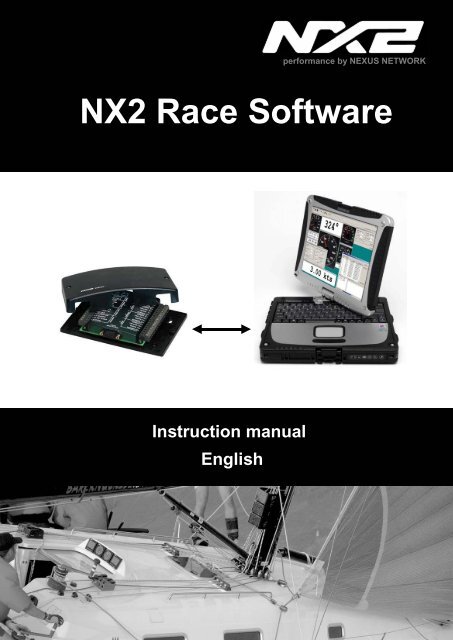
performance by NEXUS NETWORK NX2 Race Software Instruction manual English
- Page 2 and 3: NX2 Race Software English 1-1
- Page 4 and 5: NX2 Race Software English 6.3 Corre
- Page 6 and 7: NX2 Race Software English Welcome a
- Page 8 and 9: NX2 Race Software English 2 Install
- Page 10 and 11: NX2 Race Software English 4 Use the
- Page 12 and 13: NX2 Race Software English Select th
- Page 14 and 15: NX2 Race Software English 4.4 Displ
- Page 16 and 17: NX2 Race Software English 4.6.1 Set
- Page 18 and 19: NX2 Race Software English 4.8 Enabl
- Page 20 and 21: NX2 Race Software English Waypoints
- Page 22 and 23: NX2 Race Software English This Sail
- Page 24 and 25: NX2 Race Software English 5.2.3 Com
- Page 26 and 27: NX2 Race Software English Tick the
- Page 28 and 29: NX2 Race Software English 5.3.2 Ste
- Page 30 and 31: NX2 Race Software English Then clic
- Page 32 and 33: NX2 Race Software English 5.4 Polar
- Page 34 and 35: NX2 Race Software English Use NMEA
- Page 36 and 37: NX2 Race Software English Custom An
- Page 38 and 39: NX2 Race Software English 3. WATER
- Page 40 and 41: NX2 Race Software English The T.R.U
- Page 42 and 43: NX2 Race Software English Use the T
- Page 44 and 45: NX2 Race Software English 1-43
performance by NEXUS NETWORK<br />
NX2 Race Software<br />
Instruction manual<br />
English
NX2 Race Software<br />
English<br />
1-1
English<br />
NX2 Race Software<br />
1 Introduction.......................................................................................................4<br />
2 Installation.........................................................................................................7<br />
3 Installation of the NX2 Race Software.............................................................7<br />
3.1.1 General ...................................................................................................7<br />
3.1.2 Installing the Software.............................................................................7<br />
3.1.3 Register...................................................................................................7<br />
3.1.4 Use the NX2 Race SW with a FDX Server..............................................8<br />
3.1.5 Connect to a pre-recorded FDX binary file..............................................8<br />
4 Use the NX2 Race SW.......................................................................................9<br />
4.1 How to use the NX2 Race SW..........................................................................9<br />
4.1.1 Monitoring ...............................................................................................9<br />
4.2 Setup your own monitor layout .......................................................................10<br />
4.3 Set-up the Monitor displays ............................................................................11<br />
4.4 Display Polar Diagram ....................................................................................13<br />
4.5 Save a layout..................................................................................................14<br />
4.6 Load a layout ..................................................................................................14<br />
4.6.1 Setup options ........................................................................................15<br />
4.7 Change connection.........................................................................................16<br />
4.8 Enable secondary connection.........................................................................17<br />
4.8.1 Allow NMEA Navigation Data input .......................................................17<br />
4.8.2 Autoconnect at startup ..........................................................................17<br />
4.8.3 Navigation .............................................................................................18<br />
4.8.4 Waypoint ...............................................................................................18<br />
4.8.5 Import waypoints from a NMEA Navigation SW ....................................18<br />
5 Tools ................................................................................................................21<br />
5.1 Calibration ......................................................................................................21<br />
5.2 Manual calibration ..........................................................................................21<br />
5.2.1 Log calibration.......................................................................................21<br />
5.2.2 Depth calibration ...................................................................................22<br />
5.2.3 Compass calibration..............................................................................23<br />
5.2.4 Wind calibration ....................................................................................24<br />
5.2.5 Automatic Calibration............................................................................25<br />
5.3 Controls ..........................................................................................................26<br />
5.3.1 Timer.....................................................................................................26<br />
5.3.2 Steer Pilot .............................................................................................27<br />
5.3.3 Trim.......................................................................................................27<br />
5.3.4 Reset Trip Counter................................................................................30<br />
5.3.5 Man Over Board....................................................................................30<br />
5.3.6 Reinitialize <strong>Nexus</strong> Network....................................................................30<br />
5.4 Polar table ......................................................................................................31<br />
5.5 Settings ..........................................................................................................32<br />
5.5.1 NX2 Server settings ..............................................................................32<br />
5.5.2 NMEA....................................................................................................33<br />
5.5.3 Advanced ..............................................................................................34<br />
6 Automatic Calibration.....................................................................................36<br />
6.1 The NX2 Race SW calibration process:..........................................................36<br />
6.2 The 3-step calibration process........................................................................36<br />
1-2
NX2 Race Software<br />
English<br />
6.3 Correction of the wind-speed, down-wind....................................................... 38<br />
6.4 The "TRUE" process ...................................................................................... 38<br />
6.5 Wind Sheer ....................................................................................................40<br />
6.6 Polar and Target Boat Speed......................................................................... 41<br />
6.7 Steer Pilot and Polar data .............................................................................. 41<br />
1-3
English<br />
NX2 Race Software<br />
1 Introduction<br />
The NX2 Race SW is a PC Software developed for Windows XP and 2000. It will have<br />
limited functionality on other operating systems like Windows 95 and 98.<br />
The NX2 Race SW will enable to communicate at network speed with your NX2<br />
instrument system. That will give you the possibility to monitor all data at network<br />
speed, log all data to a file for post race analyze, Set-up the system and calibrate it.<br />
The NX2 Race Software will only work together with a FDX Server. A FDX Server has<br />
the following label on the cover:<br />
The Nx2 Race software supplied on this CD is a fully functional version. However, you<br />
need to register at www.silva.se in order to use the Software without limitations.<br />
Up-dated versions of NX2 Race SW is always available for download at www.silva.se<br />
Even if you do not have a NX2 FDX Server you are able to test and evaluate this NX2<br />
Race Software. A logged file from a Race in Sweden is supplied on this CD and the<br />
NX2 Race SW will automatically start to display data from that file. However, you are<br />
not able to calibrate data and make changes to settings etc without a Server.<br />
NMEA<br />
The NX2 Race SW is utilizing the FDX protocol between the Server and the PC. In<br />
order to be able to run your favourite Navigation Software simultaneously, the NX2<br />
Race SW creates a virtual port within the PC which sends and receives NMEA data<br />
from that. The virtual port may have different number on different PC’s depending on<br />
the configuration. When playing back a logged file, the information is also send out on<br />
this virtual port, enabling you to monitor your race on a cart in your Navigation Software.<br />
1-4
NX2 Race Software<br />
English<br />
Welcome aboard the <strong>Nexus</strong> Network!<br />
Through this manual we would like to help you install, operate and understand your<br />
new NX2 Race SW.<br />
The Server is the ”heart” of your <strong>Nexus</strong> Network, to which transducers for speed,<br />
depth, heading, wind and navigation (GPS) are connected.<br />
From the Server the single <strong>Nexus</strong> Network cable transmits power and data to the<br />
instruments, which repeat the information, sent from the Server, or other NX2<br />
transducers.<br />
The <strong>Nexus</strong> Network is designed with the industry standard RS 485 data bus, which<br />
allows you to connect up to 32 <strong>Nexus</strong> instrument units on the single <strong>Nexus</strong> Network<br />
cable, thereby allowing you the flexibility to easily develop your system. The <strong>Nexus</strong><br />
Network is capable of carrying data 10 times faster than NMEA 0183.<br />
The connection system, with a single 5 mm (1/5") cable and 4-pole jack plugs with<br />
cable protectors, makes the installation easy. No need to drill big holes and the cable<br />
can be cut to exact lengths. The connections at the Server are colour coded and<br />
marked with a number for easy reference.<br />
NX2 Multi Control is a multi function instrument that displays a main and a sub-function<br />
together. You can easily”customise” your favourite combination of functions, by using<br />
the unique method to move, copy and lock a sub-function.<br />
The instruments large display gives you very good viewing possibilities from any angle,<br />
even in bright sunlight. The display and the five push-buttons have red back lighting<br />
which you can set to three different lighting levels.<br />
A large selection of optional analogue repeaters and accessories are available. The<br />
analogue steer pilot instrument particularly offers unique functions. When used<br />
together with the steer reference function (AWA), you can actually steer after the wind<br />
and ”expand” the tacking or down wind angle.<br />
These <strong>Nexus</strong> instruments carry a two year warranty, which gives you as our customer,<br />
confidence to trust <strong>Nexus</strong> and our commitment to quality.<br />
The Server has a built in PC port for RS-232 Serial data but also<br />
comes with a Serial to USB converter.<br />
Good luck and happy boating!<br />
1-5
English<br />
NX2 Race Software<br />
Typical NX2 system:<br />
1-6
NX2 Race Software<br />
English<br />
2 Installation<br />
3 Installation of the NX2 Race Software<br />
3.1.1 General<br />
The NX2 Race Software is a shareware that only fully works together with a FDX Server<br />
after registration at www.silva.se.<br />
3.1.2 Installing the Software<br />
• Insert the CD to your computer<br />
• Open Run Software<br />
• Brows to your CD (normally D:) and click on NX2 Race SW<br />
• Click on Setup<br />
• Follow the instructions on your screen<br />
Now run the NX2 Race Software.<br />
3.1.3 Register<br />
The NX2 Race software requires a registration at www.silva.se for full functionality.<br />
When you enter our homepage and register, you have to enter your name, e-mail<br />
address and a username. After registration, an e-mail will be send to the address you<br />
stated with you entry code. At first start of the NX2 Race SW, enter your User name<br />
and Code.<br />
If you do not enter the code, NX2 Race SW will be switched off after 20min.<br />
1-7
English<br />
NX2 Race Software<br />
3.1.4 Use the NX2 Race SW with a FDX Server<br />
Note navigation from a PC NMEA SW is only possible for Servers of version 5.3<br />
or later<br />
Click on the connector symbol in the top left corner<br />
Select the Communication port where the cable to the Server is connected<br />
Click OK<br />
A green light will be turned on in the top right corner when communication is<br />
established.’<br />
3.1.5 Connect to a pre-recorded FDX binary file<br />
Instead of connecting the NX2 Race SW to a hardware communication port, you may<br />
connect to a previously recorded file (an example of a pre-recorded file is found under<br />
NX2 Race/data/recorded)<br />
The software may then be used in the same way as if it was connected to the Server.<br />
However, it is not possible to edit waypoints, change calibration values etc.<br />
The virtual NMEA port (see 4.8) will be fully functioning even when connected to a prerecorded<br />
file. That means you can output your data to a Navigation NMEA SW while<br />
checking your data. The NX2 Race SW will output all data that was available during the<br />
logging. The NMEA Navigation SW will get data such as position, speed, course etc.<br />
1-8
NX2 Race Software<br />
English<br />
4 Use the NX2 Race SW<br />
4.1 How to use the NX2 Race SW<br />
When the Software is started and connected to the supplied previously logged file, you<br />
can start to use the Software:<br />
4.1.1 Monitoring<br />
A pre-selected layout will appear on the screen (you may customize 5 layouts)<br />
In the bottom right corner the play-back dialog box will be displayed (if connected to a<br />
pre-recorded file).<br />
Rate<br />
Rate is the speed of which you want to play-back the recorded file. You may select with<br />
1/2, 1/1, double speed or Turbo. The up-date rate in Turbo mode depends on the<br />
performance of your PC and what other Software’s you are running simultaneously.<br />
Note it is not the speed of the boat you are changing only the speed of data rate.<br />
Position in File<br />
By moving the bar, you can jump to other positions in the recorded file.<br />
Wrap around<br />
If the tick box, wrap around is ticked, the file starts over from the beginning when it<br />
comes to its end.<br />
Previous Mark<br />
When data is logged to a file, you may record a comment at any time. As an example,<br />
you may want to make a note of when you changed sails or made other interesting<br />
changes. A click on Previous Mark will jump to the previous comment.<br />
Next Mark<br />
A click on Next Mark will jump to the next comment<br />
1-9
English<br />
NX2 Race Software<br />
Close<br />
Close will only close the dialog box, not the logged file. If you want to open the playback<br />
dialog box again, click file and then click Open Playback dialog.<br />
4.2 Setup your own monitor layout<br />
Click on the instrument symbol in the top left corner or the text Monitor a list of functions<br />
appear.<br />
1-10
NX2 Race Software<br />
English<br />
Select the function from the list. Some functions may be displayed digital, analog or as<br />
Strip Charts, some only digital. Select the type of display you want by double clicking on<br />
the corresponding icon to the right.<br />
Now the display appears on the screen. You may now move or change the window with<br />
the mouse control.<br />
You may open as many windows as you want.<br />
Most data may be displayed as Digital boxes, Analog instruments or strip-charts.<br />
Digital<br />
Analogue<br />
Strip Chart<br />
4.3 Set-up the Monitor displays<br />
You may Set-up each Monitor as follows. Right click on the Monitor display you want to<br />
set-up.<br />
Digital:<br />
Close: click to close this Monitor<br />
display<br />
Night view: Will turn this Monitor<br />
Display into night view<br />
Dampening: Select the dampening of<br />
this Monitor Display<br />
Measured Unit: Select which measurement<br />
unit you require.<br />
1-11
English<br />
NX2 Race Software<br />
Analogue:<br />
Close:<br />
Dampening:<br />
click to close this Monitor<br />
display<br />
Select the dampening of<br />
this Monitor Display<br />
Analogue:<br />
Close:<br />
Night view:<br />
Timespan:<br />
Average:<br />
Grid:<br />
click to close this Monitor display<br />
Will turn this Monitor Display into night view<br />
Select the time span for this strip<br />
Will display the average both numerical and<br />
as a line in the strip<br />
Will add a grid to the strip chart<br />
1-12
NX2 Race Software<br />
English<br />
4.4 Display Polar Diagram<br />
For how to enter your Polar table, see 5.4.<br />
To view the actual Polar Diagram, click on Monitor and select Polar Diagram. Now you<br />
have to load the Polar Table, click on Tools, Control, Load polar Diagram and brows to<br />
the Polar table file (filename.nxp) and select.<br />
The NX2 Race SW will continuously update the Polar Diagram with regards to wind<br />
angle, Wind Speed, Boat Speed and TBS (Target Boat Speed)<br />
To switch the polar table calculations on/off. Click<br />
The Polar Diagram<br />
The yellow line represents the optimum speed for the corresponding wind angle. The<br />
white line is representing the current Boat speed and wind angle. The length of the line<br />
is the speed. If the boat speed exceeds the TBS, it will turn red.<br />
1-13
English<br />
NX2 Race Software<br />
4.5 Save a layout<br />
When you have created a new layout that you want to save for later use, click on tools<br />
and the Save layout.<br />
Click on the first “empty” layout or on any other if you want to overwrite an existing<br />
layout. Up to five personal layouts may be stored<br />
4.6 Load a layout<br />
If you want to load an existing layout, click on Tools and then on Load Layout. Select<br />
the layout you want to load and press load.<br />
1-14
NX2 Race Software<br />
English<br />
4.6.1 Setup options<br />
Under tools and options, you may set-up the Software.<br />
Autoconnect<br />
If the Autoconnect tick box is ticked, the NX2 Race SW will automatically connect to the<br />
port or file it was connected to last time it was run.<br />
Record automatically to file<br />
If this box is ticked the NX2 Race SW will automatically start to log data in to a file.<br />
Note, when you start the NX2 Race SW you must enter a new file name.<br />
Auto-hide<br />
If the Auto-hide is ticked, the top-bar will be hidden after the number of seconds<br />
selected in the box to the right. Note, it is only the top-bar that will be hidden, the<br />
monitors will still be displayed. To get back the top-bar, move the mouse cursor at the<br />
top of the screen.<br />
Keep always on top<br />
If this box is ticked, The NX2 Race SW will always be on top of other applications on<br />
the screen. This is very useful if you want to run the NX2 Race SW together with a<br />
Navigation Software. You may have the chart and the Monitors shown at the same<br />
time.<br />
To hide NX2 Race SW you simply click the minimize button at the top right corner.<br />
1-15
English<br />
NX2 Race Software<br />
4.7 Change connection<br />
If you want to change connection, either use another communication port or change<br />
between a port and a logged file, press file and Close connection. Click yes to proceed.<br />
Then click File and Open Source:<br />
Now you can select if you want to connect to a COM port (select which) or to a prerecorded<br />
FDX binary data file.<br />
1-16
NX2 Race Software<br />
English<br />
4.8 Enable secondary connection<br />
Tick the box Enable secondary connection and select on which port you want to write<br />
and read NMEA data. This port is a virtual port within the PC and is no Hardware port.<br />
Now you can open up any other NMEA application and connect that to the same port.<br />
All data that are available on the FDX input port or stored in the pre-recorded file will be<br />
send out on the virtual port.<br />
Note: The virtual port will only run on Windows 2000 or Windows XP.<br />
4.8.1 Allow NMEA Navigation Data input<br />
You may choose if you want to navigate from your NX2 GPA Navigator or if you want<br />
your PC Navigation software to navigate. If the PC software is navigating, the data such<br />
as Bearing and distance to Waypoint, XTE, TTG etc. will be send from the PC Software<br />
via NMEA into the NX2 Race SW who converts the data into FDX and sends it out on<br />
the <strong>Nexus</strong> Network. All instruments on the Network may then display all<br />
Navigation Data. The drawback of this is that the PC has to powered all the time.<br />
The other solution is to just transfer Waypoints from the PC Navigation software and<br />
then create your own Sailplans and routes in the NX2 GPS Navigator. Then you may<br />
switch of the PC at any time and the NX2 GPS Navigator will carry on with the<br />
Navigation.<br />
4.8.2 Autoconnect at startup<br />
If this box is ticked, the SW will connect to the same com-port or file as it was<br />
connected to last time.<br />
1-17
English<br />
NX2 Race Software<br />
4.8.3 Navigation<br />
If you have a NX2 or <strong>Nexus</strong> navigator (GPS Navigator or Multi Center) you can create<br />
and edit waypoints and routes from your NX2 Race SW Software. All Waypoints and<br />
routes are stored directly in your instrument.<br />
This function will only work if you have a NX2 GPS Navigator connected since all<br />
waypoints and routes are stored in that instrument.<br />
4.8.4 Waypoint<br />
The waypoints showed in the top box are stored in the GPS Navigator. When you edit<br />
them, you are working direct in the memory of the GPS Navigator. Also the Sail Plan<br />
and Routes are stored direct in the GPS Navigator memory. The big advantage with<br />
this is that you only work with one waypoint memory and there are no confusions of<br />
which waypoints you are working with. Another benefit is that once you have entered a<br />
Sail Plan, you may switch of your PC and the NX2 system will carry on with the<br />
navigation. When you switch on the PC again, the remaining part of the Sail Plan will<br />
pop up in the navigation window. This is what we call NIN (Non Interrupted Navigation)<br />
and enable you to switch of your PC once you have created a Sail Plan and save<br />
power.<br />
4.8.5 Import waypoints from a NMEA Navigation SW<br />
Most NMEA navigation Software’s are able to export waypoints and routes. If the NMEA<br />
Navigation SW sends out waypoints according to the NMEA standard in a WPL<br />
sentence, the NX2 Race SW will read them and list them as NMEA waypoints. Note<br />
that these waypoints are only stored in the PC.<br />
1-18
NX2 Race Software<br />
English<br />
Waypoints received via NMEA will get the pre-fix NMEA. To convert them into NX2<br />
waypoints (and store them in the NX2 GPS Navigator) right click on a waypoint and edit<br />
it. You may now give the waypoint a new number and name.<br />
You may also select all waypoints and select edit. The waypoints will then be given<br />
numbers in sequence order starting from the number you give the first waypoint.<br />
Example:<br />
In this example, the NMEA Navigation SW SeaClear is used (most software’s work in a<br />
similar way)<br />
Create a route in the NMEA Navigation SW, close the editor and go to: File, Route,<br />
export NMEA<br />
In this example a route consisting of 7 waypoints where exported. These waypoints will<br />
appear in the waypoint editor as NMEA waypoints. Mark all 7 waypoints and right click<br />
(or click the editor icon).<br />
Give the first waypoint the number you want to start with.<br />
1-19
English<br />
NX2 Race Software<br />
In this example we mark the 7 waypoints and give the first no 301.<br />
Then press OK<br />
The NMEA Waypoint 1-7 will now become NX2 Waypoint 301-307.<br />
If you want to create this route in the NX2 GPS Navigator, mark all 7 waypoints, drag<br />
and drop them into the Sailplan.<br />
1-20
NX2 Race Software<br />
English<br />
This Sailplan is now active in your GPS Navigator and you may switch off the PC and<br />
carry on the navigation.<br />
Hint: Use the waypoints over 300 as route waypoints. Every time you want to import a<br />
route, make sure all waypoints above 300 are deleted. Then use waypoints above 300<br />
as temporary waypoints.<br />
Note: If you want to store the Sailplan as a Route for use in the future, you have to<br />
store it before you start. The waypoints in the<br />
5 Tools<br />
5.1 Calibration<br />
The Calibration only works when the PC is connected to the FDX Server. All calibration<br />
values are stored in the Server.<br />
The calibration may be done manually or automatic. In order to achieve an automatic<br />
calibration some minimum system requirements has to be fulfilled (see more under<br />
automatic calibration)<br />
5.2 Manual calibration<br />
5.2.1 Log calibration<br />
Offset<br />
Offset is the start value for the log and it could be described as slip or friction. Normally<br />
this value is about 0.4 knots and it will be constant at all speeds.<br />
Correction<br />
1-21
English<br />
NX2 Race Software<br />
Correction is the calibration value for the log and has to do with the shape of the hull<br />
and the position of the transducer. The percentage is the value measured speed will be<br />
increased with. As an example: measured speed is 10 knots and the Correction is 30%,<br />
the corrected speed will be 13 knots (10 x 1.30)<br />
Advanced corrections<br />
If the log transducer is mounted on one side of the hull, it is likely you will have different<br />
readings on port and starboard. If you tick the use advanced correction box, the system<br />
will use these calibration values for port and starboard. This require a wind transducer<br />
to determine on which tack you are.<br />
Temperature offset<br />
If the temperature is read too high or too low, you may adjust that up or down.<br />
5.2.2 Depth calibration<br />
Transducer offset<br />
The transducer offset is the distance from the transducer to the water surface. The<br />
value entered in this box will be added to the measured depth. If you want to display the<br />
depth from the keel, set a negative value for the distance from the transducer to the<br />
keel. I.e. if the draft of the boat is 1.6m and the transducer is mounted 0,4m below the<br />
surface, the distance from the transducer to the keel is 1,2m Enter the value -1,2m to<br />
get the reading from the keel.<br />
Suppression filter<br />
This function is not yet implemented.<br />
1-22
NX2 Race Software<br />
English<br />
5.2.3 Compass calibration<br />
Magnetic variation, VAR<br />
Set the deviation direction first, i.e. [+] for East or [-] for West, then enter the magnetic<br />
value in 1/10 of a degree.<br />
Auto deviation<br />
This function is used to auto deviate your Compass. Take the boat into a turn, in calm<br />
sea, when steady, press start.<br />
When you have taken the boat through the minimum 360° turn, press Stop. If you want<br />
to pause (if waves comes up during deviation) press Pause and continue again when<br />
the waves have disappeared.<br />
Check the Auto deviation<br />
This function is used to check your Auto deviation. Make a new Auto deviation in calm<br />
sea (during the evening) as described in above.<br />
Clear the Auto deviation<br />
If you by any reason prefer to reset the deviation created by the Auto deviation function,<br />
press Clear<br />
Magnetic variation, VAR<br />
Set the deviation direction first, i.e. [+] for East or [-] for West, then enter the magnetic<br />
value in 1/10 of a degree.<br />
1-23
English<br />
NX2 Race Software<br />
Adjust the Compass alignment<br />
This function is used when the Compass is giving a constant course error, i.e. it is not<br />
mounted exactly aligned as the boat (there is no need to mount the transducer at the<br />
boats centreline). Make sure that the local magnetic variation is entered before you<br />
make the alignment adjustment. Otherwise you are unable to see the difference<br />
between local magnetic variation and alignment error. The Compass may be installed<br />
reversed 180° , but never at perpendicular, or 90° relative the centreline.<br />
5.2.4 Wind calibration<br />
Offset<br />
Offset is the start value for the wind speed and it could be described as the friction.<br />
Normally this value is about 0.5 m/s and it will be constant at all wind speeds.<br />
Gain<br />
Gain is the calibration value for the wind speed and has to do with the shape of the<br />
propeller. The percentage is the value the measured wind speed will increase with. As<br />
an example: measured speed is 10m/s and the Correction is 70%, the corrected speed<br />
will be 17 m/s (10 x 1.70)<br />
For two blade propellers, the calibration value is 50%<br />
For three blade propellers, the calibration value is 70%<br />
Down wind correction<br />
Normally the apparent wind speed increases when you are sailing downwind. That has<br />
to do with the fact that the wind has to pass the sails which the wind see as an obstacle.<br />
If you enter 15% the wind speed will be decreased with 15% at 180 degree and half of it<br />
(7.5%) at 135 degree. At 90 degree there will be no downwind correction.<br />
1-24
NX2 Race Software<br />
English<br />
Tick the box and enter the value for down wind correction.<br />
Note: a mast head rigged boat requires more down wind correction than a<br />
fractional rig.<br />
When you are tacking the apparent wind angle will be distorted due to mast twist, upwash<br />
and the fact that the boat is heeling. All this together will give an error on the<br />
apparent wind angle and also on the true wind angle. In order to get correct values for<br />
Polar tables etc. it is very important that the wind angle and wind speed is correct.<br />
The up-wash correction in these boxes is the values for port and starboard. They will<br />
only be used when tacking and the you may set the window for when you want to use it<br />
(see Settings – Advanced)<br />
Factory calibration<br />
Each transducer is calibrated from factory. Each transducer comes with calibration<br />
certificate. Enter the values on the certificate for 000, 045, 090,135 etc. This is essential<br />
to get correct values.<br />
Installation offset and wind shear<br />
If the transducer is mounted of-set to the boat, you may enter the misalignment here.<br />
This is also the value used in the automatic calibration to correct for wind share.<br />
5.2.5 Automatic Calibration<br />
Some functions may be automatically calibrated. In order to do so, there are some<br />
minimum system requirements. If you have the following parts in your system:<br />
Compass transducer, Log transducer, “Twin Fin” wind transducer, GPS Position<br />
(Antenna) GPS navigator.<br />
You may calibrate the following:<br />
1-25
English<br />
NX2 Race Software<br />
Compass<br />
Boat Speed<br />
Up-Wind Sailing<br />
Down Wind Sailing<br />
Tick the boxes for the transducer you have in your system and then select what you<br />
want to calibrate.<br />
Follow the instructions on the screen!<br />
Reed more in chapter Fel! Hittar inte referenskälla.!<br />
5.3 Controls<br />
5.3.1 Timer<br />
Here you may start the Race timer at 5 or 10 minuet count down. This is only possible if<br />
a Server is connected. The information will be send out on the <strong>Nexus</strong> Network to all<br />
instruments.<br />
1-26
NX2 Race Software<br />
English<br />
5.3.2 Steer Pilot<br />
Here you may select the reference and the value for the Steer Pilot to refer to.<br />
5.3.3 Trim<br />
Here you may select the reference and the value for the Speed trim instrument to refer<br />
to.<br />
This is to set the reference, to trim the speed trim instrument, click the trim icon on the<br />
control bar.<br />
Remote control<br />
All digital instruments connected to the <strong>Nexus</strong> Network may be remotely controlled from<br />
the NX2 Race SW.<br />
1-27
English<br />
NX2 Race Software<br />
To add instruments in the list, click Add. Then enter the ID number for that instrument<br />
(displayed at each power up of the system) and give it any name you want.<br />
You may enter all instruments on the Network or only those you would like to be able to<br />
remote control. Then click OK<br />
1-28
NX2 Race Software<br />
English<br />
Then click on the instrument that you want to control and use the corresponding push<br />
buttons<br />
1-29
English<br />
NX2 Race Software<br />
5.3.4 Reset Trip Counter<br />
Here you may reset the trip distance. The command is broadcasted to all instruments<br />
on the Network and all instruments Trip distance will be cleared simultaneously.<br />
5.3.5 Man Over Board<br />
Here you may start the Man Over Board function. The command is broadcasted to all<br />
instruments on the Network and all instruments start the Man Over Board function<br />
simultaneously.<br />
You May Also click the Man Over Board button on the control bar<br />
5.3.6 Reinitialize <strong>Nexus</strong> Network<br />
This function will reinitialize the whole network and all instruments connected to it. A<br />
message Press Key will appear on all instruments and the order you press the keys is<br />
the order the Instruments will get their unique ID-numbers.<br />
1-30
NX2 Race Software<br />
English<br />
5.4 Polar table<br />
The NX2 system together with the NX2 Race SW is able to calculate target Boat Speed<br />
from a Polar Table. The polar tables looks different for different boats.<br />
The polar table is a tab- or comma-separated-values text file containing target<br />
boat speeds for specific true wind angles and speeds.<br />
Every row represents data for a specific true wind speed (except first row,<br />
Which contains the headings of the table and is ignored)?<br />
First column contains true wind speeds in knots, then, the following columns<br />
are pairs of target boat-speeds for a specific true-wind angle.<br />
The first and last pair of TBS-TWA columns are the best case up-wind and<br />
down-wind, respectively, and these columns are used to compute optimum<br />
course up- or down-wind, respectively.<br />
NX2 Race SW interpolates and extrapolates the data to give continuous<br />
TBS and steering course. To achieve that, the file must contain a minimum of<br />
5 column-pairs of TBS-TWA, but no more than 20, and a minimum of 3 data lines,<br />
but no more than 20.<br />
So, including the column with wind speeds, the polar table should have a<br />
total of minimum 11 columns, but not more than 41.<br />
The format of a polar table is:<br />
TWS TBS1 TWA1 TBSn TWAn
English<br />
NX2 Race Software<br />
5.5 Settings<br />
5.5.1 NX2 Server settings<br />
Here you set up the Server configuration<br />
Use NMEA Boat Speed<br />
If you want to use a NMEA transducer (connected to the NMEA input, you have to tick<br />
this box. The Server will then transmit this information on the <strong>Nexus</strong> Network to all<br />
connected instruments.<br />
After you have changed this setting, you have to restart the system<br />
Use NMEA Depth<br />
If you want to use a NMEA transducer (connected to the NMEA input, you have to tick<br />
this box. The Server will then transmit this information on the <strong>Nexus</strong> Network to all<br />
connected instruments.<br />
After you have changed this setting, you have to restart the system<br />
Use NMEA Compass<br />
If you want to use a NMEA transducer (connected to the NMEA input, you have to tick<br />
this box. The Server will then transmit this information on the <strong>Nexus</strong> Network to all<br />
connected instruments.<br />
After you have changed this setting, you have to restart the system<br />
Use NMEA Wind<br />
If you want to use a NMEA transducer (connected to the NMEA input), you have to tick<br />
this box. The Server will then transmit this information on the <strong>Nexus</strong> Network to all<br />
connected instruments.<br />
After you have changed this setting, you have to restart the system<br />
1-32
NX2 Race Software<br />
English<br />
Use NMEA Navigation<br />
If you want to use a NMEA navigation (connected to the NMEA input), you have to tick<br />
this box. The navigation data (Bearing and Distance to WP, XTE etc.) will then<br />
transmitted by the Server on the <strong>Nexus</strong> Network to all connected instruments.<br />
After you have changed this setting, you have to restart the system<br />
Allow WPL (Waypoint Location) in<br />
If this box is ticked, waypoints transmitted from the Navigator will be received by the<br />
system<br />
Send WPR (Waypoint Location)<br />
If this box is ticked, waypoints will be transmitted via NMEA out<br />
5.5.2 NMEA<br />
This setting is controlling the NMEA out-put from the Server. Note, it will not affect what<br />
is transmitted on the NX2 Race SW virtual port. The Server is able to transmit 16<br />
sentences which will take about 2 second. You may select which NMEA sentences to<br />
send in each box. If you want one type of data to be send more often than 2 sec, select<br />
it twice.<br />
1-33
English<br />
NX2 Race Software<br />
5.5.3 Advanced<br />
Automatic tack compensation<br />
Here you set the window (within which angles) the automatic tack compensation should<br />
be used. In the example, the Tack compensation will be used when the Apparent wind<br />
angle is between 30° and 40°. For more information about Tack Compensation, see 6.4<br />
Automatic Polar steering<br />
Here you set the window (within which angles) the automatic Polar steering should be<br />
used. For more information about Automatic Polar Steering, see 6.6 and 0<br />
Dampening for computed TBS<br />
Set the dampening for input data of TWA/TWS<br />
Set the dampening for output data of TBS<br />
Estimated leeway index<br />
The Leeway is estimated form a formula. The higher the index value is the more leeway<br />
is added to the calculations. The index number you should use depends on hull-shape,<br />
rudder and keel shape. The Leeway index to be used, has to be detected empiric. For<br />
more information, see 6.2<br />
Dampening of ground wind<br />
Set the dampening for output data of Ground Wind<br />
Ground wind is a function calculated in the NX2 Sail Performance and is the<br />
Geographical True Wind Direction, compensated for Leeway and Tides. To display<br />
Ground Wind, see Custom Angular Data sent to <strong>Nexus</strong><br />
1-34
NX2 Race Software<br />
English<br />
Custom Angular Data sent to <strong>Nexus</strong><br />
NX2 Multi Control and Multi XL instruments are able to display Custom Angular Data. In<br />
the NX2 Sail Race SW, you may select if that data should be Ground Wind ore the<br />
Leeway in degrees.<br />
Set-up the Multi Control and Multi XL to display CAD<br />
To access sub-function [CAD], select NAVIGATE page and the ”empty” sub-function.<br />
Then press PAGE and SET together, followed by PLUS and MINUS together.<br />
Do not show <strong>Nexus</strong> messages<br />
1-35
English<br />
NX2 Race Software<br />
6 Automatic Calibration<br />
6.1 The NX2 Race SW calibration process:<br />
There are 3 basic transducer calibrations that must be done before the instruments<br />
can provide you with accurate data, and they are;<br />
-The Compass auto-deviation procedure.<br />
-The water-speed calibration procedure.<br />
-The water-speed (advanced) calibration for port and starboard procedure.<br />
Calibrate when any of the following conditions occur:<br />
• After a new installation.<br />
• At the beginning of a season.<br />
• After a log transducer check.<br />
• If the compass has been moved.<br />
• If the mast or rig is serviced in such a way that the wind transducer might be<br />
offset.<br />
• On a regular basis depending on any other condition that might influence the<br />
measurement.<br />
6.2 The 3-step calibration process<br />
Start with either the compass (1) or the water speed (2) calibration.<br />
1. COMPASS<br />
Enter the local magnetic variation in the compass calibration setup, or on the<br />
NX2 instruments. The Auto deviation of the compass must be made in calm<br />
water with small waves, preferably late evenings. The Auto-deviation can be<br />
made in current water and you may do it clockwise or counter clockwise. After<br />
the Auto deviation, also run the Auto-check in the reverse direction.<br />
You may control that the HDT course is equal with COG by motoring the boat in<br />
different directions where there is no current water. If there is current water, you<br />
may only check that HDT = COG by going with the current, then turn 180<br />
degrees and check again by going in the opposite direction. If there is a<br />
misalignment, enter the offset value in the compass calibration dialogue box.<br />
Watch up for placing magnetic parts close to the sensor, put up a warning sign!<br />
2. WATER SPEED Basic.<br />
Make the water-speed calibration<br />
by motoring at a normal speed.<br />
Make two runs, out and back for at<br />
least 1 minute each at a fairly<br />
constant speed. The basic water<br />
speed calibration will later be used<br />
to determine the port and starboard<br />
calibration in step 3.<br />
Avoid this calibration if you are in a<br />
particularly strong tide.<br />
1-36
NX2 Race Software<br />
English<br />
3. WATER SPEED Advanced.<br />
Do not run the advanced Port<br />
and Starboard water speed<br />
calibration before you have<br />
completed step 1 and 2!<br />
Prepare for the up wind sailing.<br />
Use the Auto measurement<br />
(default) with the proposed sail<br />
time of 1 minute (settable), or use<br />
the manual option where you<br />
advance to next step manually.<br />
Sail up-wind on the first tack (starboard or port), when boat-speed and sail trim is<br />
ok.<br />
Press Next in the Auto-calibration dialogue box.<br />
When the starboard (or port) tack is done, make the tack and trim to speed.<br />
The NX2 Race will automatically detect your tack and then wait 1 minute (pre-set<br />
time) before it starts to measure.<br />
When the second leg is done, turn the boat for a down wind sailing without<br />
spinnaker.<br />
The measurement for down wind will start when the AWA has reached 180<br />
degree at one occasion (the trigger condition).<br />
Try then to sail safely with the wind as flat (180 degree wind) as possible. When<br />
measurements are done (1 minute), NX2 Race will show you the result in the<br />
dialogue box.<br />
If calibration is accepted, press Apply.<br />
To abort the calibration, press Cancel.<br />
NOTE;<br />
CDOP (Calibration Dilution Of Precision) in the calibration-result dialogue box is<br />
a measure of reliability of the calibration process where 1.00 represents the<br />
highest reliability. There are small errors from several sources that can be hard<br />
to adjust for, but you may try to adjust the leeway index for your boat. The index<br />
represents mainly the efficiency of the boats keel. The leeway is constantly<br />
calculated from a model where wind speed, boat speed and wind angles are<br />
variables.<br />
Leeway index 0 = "no leeway" and index 10 is "maximum leeway"<br />
Leeway is preset to 5, but it can be changed according to a tuning trial to reduce<br />
CDOP.<br />
1-37
English<br />
NX2 Race Software<br />
6.3 Correction of the wind-speed, down-wind<br />
When sailing down wind with spinnaker, the wind will accelerate over the mast top<br />
and give a higher indicated wind-speed than it actually is. This "over-reading" can be<br />
set through the NX2 Race SW in the Server. This calibration must however be<br />
adjusted manually since there are some considerations to include in the decision to<br />
change this WS correction.<br />
1. This over-reading down wind is not<br />
linear, so in light winds, with a<br />
forward pointing wind transducer,<br />
the over reading will be low. With<br />
increased wind speed, the<br />
difference between air speed and<br />
boat speed will increase and also<br />
the over reading.<br />
2. The magnitude of the over-reading<br />
is higher on a mast head rig<br />
relative to a fractional rig. This<br />
over-reading can mean a reduction<br />
of up to 15% of measured wind<br />
speed.<br />
3. When the 1m Twin Fin Racing transducer is used, the over-reading effect is<br />
mainly eliminated.<br />
This over reading compensation is also gradually reduced relative the actual AWA.<br />
When you have a 90 degree AWA, the WS reduction is 0% and at 180 degree AWA<br />
the WS correction is 100% of the maximum compensation. As an example, if 15%<br />
was set, the WS correction at 135 degree AWA would be 7.5%.<br />
The magnitude of the WS correction must be individually corrected for the boat, rig<br />
and sail settings depending on the above conditions. The NX2 Server must be turned<br />
off and on again to activate the new correction value.<br />
6.4 The "TRUE" process<br />
T.R.U.E is short for "Temporary Reference-Update Estimation"<br />
When the 3-step calibration is done, the T.R.U.E. up-wind sailing procedure can be<br />
made to correct wind angles and measure wind shear. The Temporary Reference-<br />
Update will include errors created by the heel angle, mast twist and change in upwash<br />
due to either stronger winds or when re-calibrating from a strong to a weaker<br />
wind condition. The weather conditions will change and wind shear will be different,<br />
so each T.R.U.E. process must be considered as a "temporary" reference for the day<br />
or during a race.<br />
That is why it is easy to recalibrate by use of the T.R.U.E. process!<br />
1-38
NX2 Race Software<br />
English<br />
The T.R.U.E. process can be done during the race. If the 1-3 calibration has been<br />
properly carried out, you may use the T.R.U.E. process even during steady current<br />
water.<br />
Avoid the T.R.U.E. process if the answer is No on one of the following questions:<br />
• Is there free wind during the complete up-wind calibration?<br />
Avoid close competitors, obstacles or influence from land during the calibration<br />
process.<br />
• Is the wind condition steady enough for a calibration?<br />
Very large variation in wind speed and direction might degrade the calibration<br />
efficiency.<br />
• Is the up-wind sailing going through an area where the current will vary?<br />
It is recommended to avoid calibration where current appears inconsistent from<br />
one leg to another.<br />
Activate the T.R.U.E. process when you are sailing steady on port or starboard. The<br />
minimum measure time is 1 minute, then, whenever you are ready, tack!<br />
The T.R.U.E. process will then wait 1 minute before it start to measure again. When<br />
the minimum 1 minute measurement has been completed, you must apply the result<br />
found in the dialogue box. You have two options, either include or exclude the wind<br />
shear offset from the tick box.<br />
If you choose to add wind shear and offset, you will get equal AWA and TWA wind<br />
angles on port and starboard.<br />
Or, you may choose to avoid adding this offset to the wind angle, and instead take<br />
advantage of it as information on the wind instrument.<br />
Read the section about Wind Shear and make your decision.<br />
1-39
English<br />
NX2 Race Software<br />
6.5 Wind Sheer<br />
When there is wind-speed, there is wind shear!<br />
What is wind shear?<br />
The main reason for wind shear<br />
is due to the Coriolis force. The<br />
wind will rotate counter clockwise<br />
on the North Hemisphere around<br />
the centre of the low pressure.<br />
Then, there is a friction between<br />
the sea surface and the free air<br />
above. This friction will slow<br />
down the airspeed at sea level<br />
and gradually up into the free air<br />
above. This friction will also<br />
decrease the effect of the Coriolis<br />
force, so the wind will shear (to<br />
the right) from sea level up to the mast top (and above). The wind transducer will only<br />
measure at one altitude, so you need to understand and consider this sheared angle<br />
to adjust the sail accordingly down to deck level.<br />
Note!<br />
Several meteorological effects will have impact on the size of the sheared wind.<br />
When cold and warm air is mixed with faster winds from higher levels, gradients and<br />
sheared winds may locally change very fast.<br />
Generally, by applying sail trim according to the size of wind shear, you can get more<br />
power out of the wind on starboard by adding more twist to match the shear (on<br />
starboard only). This will reduce the top force from the wind, move the pressure<br />
centre downwards and allow for a more forward pointing and efficient wind force.<br />
The wind instrument will "show you" that you are sailing lower than port side, but it is<br />
only a relative illusion since the reference is from your average attack angle and sail<br />
trim including wind shear.<br />
On port side, the sheared wind is "negative", and it requires more flat sail trim. The<br />
instruments will tell you that you are sailing high and fast on port tack, but this is also<br />
a relative illusion, but opposite from starboard tack. You have less wind force in the<br />
top of the sail, so the efficient wind pressure centre is moved downwards. Then, for a<br />
given heel angle, you will have a wider wind angle, which mean that you are actually<br />
not sailing as high as the instrument says!<br />
At open sea, where wind direction is stabilized, the waves will follow the wind<br />
direction that occurs at the surface. Since this wind-speed is reduced by the friction, it<br />
will therefore point towards the low pressure. This means that you will hit the waves<br />
slightly harder on starboard then port side (on the North hemisphere). This is also a<br />
reason for adding more twist and power on starboard tack!<br />
1-40
NX2 Race Software<br />
English<br />
Use the T.R.U.E. process in the NX2 Race software to calibrate the wind angle<br />
difference between port and starboard tack. This represents the actual wind shear as<br />
an offset angle relative to the sail pressure centre.<br />
Note; The wind shear angle will include a possible mechanical installation offset on<br />
the Twin Fin transducer. This offset can be noted by running the boat at a time when<br />
there is no wind!<br />
This offset is added in the wind calibration dialogue box (see the manual).<br />
By using the knowledge of wind shear when trimming the sail asymmetrically, you will<br />
be able to use the force in the wind more efficiently on port and starboard tack, reach<br />
and down-wind.<br />
Also, remember that the Ground Wind will be referenced either with or without the<br />
wind shear and only at the top of the mast. This will also mean that you will have<br />
different lay line angles on port and starboard.<br />
Asymmetric Sailing is faster for those who know and understand this principle too.<br />
6.6 Polar and Target Boat Speed<br />
The NX2 Race SW integrates polar data with the NX2 instrument system. The<br />
enclosed polar data table is for an X332 boat, but you may create your own data from<br />
IMS to be used in the NX2 Race SW. If you have data for your boat, please send it to<br />
Silva support and it will be available for other users.<br />
How to activate:<br />
Activate the Polar by pressing the Polar symbol. First time you are asked to load the<br />
polar table file. Enclosed is the X332.nxp Polar, but you may create your own.<br />
The TBS (Target Boat Speed) is sent to the Multi Control and Multi XL instrument,<br />
(see manual).<br />
Create your own IMS specific Polar Data and place in the Polar File. Read the<br />
readme.txt file under NX2 Race folder. Use a text editor like Notepad.<br />
To open your new Polar data, go to Tools, Control, Load Polar table (select<br />
your polar data file).<br />
6.7 Steer Pilot and Polar data<br />
This unique function can be used both up wind and<br />
down wind, but the best use and efficiency is mainly<br />
when sailing down wind.<br />
This is how it works:<br />
The true wind-speed and true-wind angle are<br />
calculated and updated 3 times/s. This data are then<br />
used to calculate TBS (Target Boat Speed) and<br />
POC (Predicted Optimum Course) from the polar<br />
data.<br />
The POC (Compass heading to steer relative the<br />
1-41
English<br />
NX2 Race Software<br />
actual TWA) is sent to the Steer Pilot as a new steer reference 3 times/s.<br />
This means, when you are sailing down wind, your course to steer are instantly<br />
related to the True Wind Angle that will give the fastest speed from the actual True<br />
Wind Speed found in the Polar data.<br />
Activate and Deactivate the POC function.<br />
Press the Icon with Polar symbol to activate<br />
or deactivate TBS and POC.<br />
If you change the Steer reference to the<br />
Steer Pilot from any NX2 instrument, the<br />
POC function is cancelled and the new<br />
reference is activated (MEM, BTW, AWA or<br />
CTS).<br />
To activate POC again, press the Icon with<br />
Polar OFF and ON again.<br />
You can see this function as a real time VMG<br />
(velocity Made Good) from Polar table<br />
displayed on the Steer Pilot, where you steer<br />
to keep the needle strait up!<br />
This will give you the fastest speed from the<br />
wind according to the polar data,<br />
independent on wind speed!<br />
Can it be easier?<br />
1-42
NX2 Race Software<br />
English<br />
1-43
English<br />
NX2 Race Software<br />
Copyright ©:<br />
Silva Sweden AB<br />
Kuskvägen 4, 191 62 Sollentuna, Sweden<br />
Tel: +46 -(0) 8 - 623 43 00. Fax: +46 -(0) 8 - 92 76 01<br />
www.silva.se<br />
1-44<br />
22547-1 Edition 4


