


Create successful ePaper yourself
Turn your PDF publications into a flip-book with our unique Google optimized e-Paper software.
tonneri (sandstone-limestone formations) that extend into the granitic<br />
group of the Sette Fratelli (Seven Brothers), and eventually plunge into the<br />
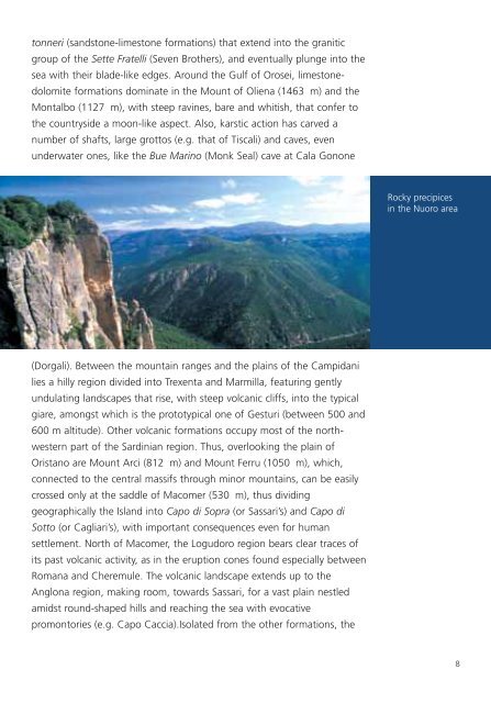
sea with their blade-like edges. Around the Gulf of Orosei, limestonedolomite<br />
formations dominate in the Mount of Oliena (1463 m) and the<br />
Montalbo (1127 m), with steep ravines, bare and whitish, that confer to<br />
the countryside a moon-like aspect. Also, karstic action has carved a<br />
number of shafts, large grottos (e.g. that of Tiscali) and caves, even<br />
underwater ones, like the Bue Marino (Monk Seal) cave at Cala Gonone<br />
Rocky precipices<br />
in the Nuoro area<br />
(Dorgali). Between the mountain ranges and the plains of the Campidani<br />
lies a hilly region divided into Trexenta and Marmilla, featuring gently<br />
undulating landscapes that rise, with steep volcanic cliffs, into the typical<br />
giare, amongst which is the prototypical one of Gesturi (between 500 and<br />
600 m altitude). Other volcanic formations occupy most of the northwestern<br />
part of the Sardinian region. Thus, overlooking the plain of<br />
Oristano are Mount Arci (812 m) and Mount Ferru (1050 m), which,<br />
connected to the central massifs through minor mountains, can be easily<br />
crossed only at the saddle of Macomer (530 m), thus dividing<br />
geographically the Island into Capo di Sopra (or Sassari’s) and Capo di<br />
Sotto (or Cagliari’s), with important consequences even for human<br />
settlement. North of Macomer, the Logudoro region bears clear traces of<br />
its past volcanic activity, as in the eruption cones found especially between<br />
Romana and Cheremule. The volcanic landscape extends up to the<br />
Anglona region, making room, towards Sassari, for a vast plain nestled<br />
amidst round-shaped hills and reaching the sea with evocative<br />
promontories (e.g. Capo Caccia).Isolated from the other formations, the<br />
8


