
Create successful ePaper yourself
Turn your PDF publications into a flip-book with our unique Google optimized e-Paper software.
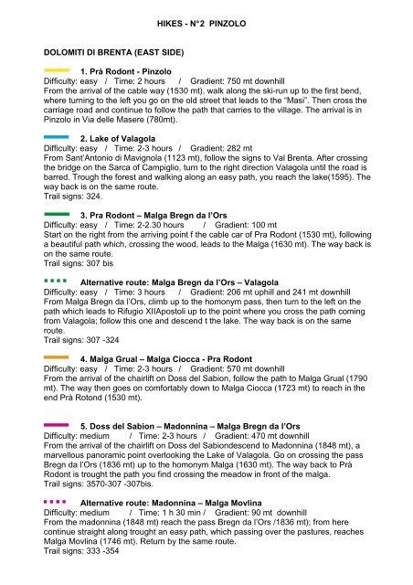
HIKES - N° 2 <strong>PINZOLO</strong><br />
DOLOMITI DI BRENTA (EAST SIDE)<br />
1. Prà Rodont - Pinzolo<br />
Difficulty: easy / Time: 2 hours / Gradient: 750 mt downhill<br />
From the arrival of the cable way (1530 mt), walk along the ski-run up to the first bend,<br />
where turning to the left you go on the old street that leads to the “Masi”. Then cross the<br />
carriage road and continue to follow the path that carries to the village. The arrival is in<br />
Pinzolo in Via delle Masere (780mt).<br />
2. Lake of Valagola<br />
Difficulty: easy / Time: 2-3 hours / Gradient: 282 mt<br />
From Sant’Antonio di Mavignola (1123 mt), follow the signs to Val Brenta. After crossing<br />
the bridge on the Sarca of Campiglio, turn to the right direction Valagola until the road is<br />
barred. Trough the forest and walking along an easy path, you reach the lake(1595). The<br />
way back is on the same route.<br />
Trail signs: 324.<br />
3. Pra Rodont – Malga Bregn da l’Ors<br />
Difficulty: easy / Time: 2-2.30 hours / Gradient: 100 mt<br />
Start on the right from the arriving point f the cable car of Pra Rodont (1530 mt), following<br />
a beautiful path which, crossing the wood, leads to the Malga (1630 mt). The way back is<br />
on the same route.<br />
Trail signs: 307 bis<br />
Alternative route: Malga Bregn da l’Ors – Valagola<br />
Difficulty: easy / Time: 3 hours / Gradient: 206 mt uphill and 241 mt downhill<br />
From Malga Bregn da l’Ors, climb up to the homonym pass, then turn to the left on the<br />
path which leads to Rifugio XIIApostoli up to the point where you cross the path coming<br />
from Valagola; follow this one and descend t the lake. The way back is on the same<br />
route.<br />
Trail signs: 307 -324<br />
4. Malga Grual – Malga Ciocca - Pra Rodont<br />
Difficulty: easy / Time: 2-3 hours / Gradient: 570 mt downhill<br />
From the arrival of the chairlift on Doss del Sabion, follow the path to Malga Grual (1790<br />
mt). The way then goes on comfortably down to Malga Ciocca (1723 mt) to reach in the<br />
end Prà Rotond (1530 mt).<br />
5. Doss del Sabion – Madonnina – Malga Bregn da l’Ors<br />
Difficulty: medium / Time: 2-3 hours / Gradient: 470 mt downhill<br />
From the arrival of the chairlift on Doss del Sabiondescend to Madonnina (1848 mt), a<br />
marvellous panoramic point overlooking the Lake of Valagola. Go on crossing the pass<br />
Bregn da l’Ors (1836 mt) up to the homonym Malga (1630 mt). The way back to Prà<br />
Rodont is trought the path you find crossing the meadow in front of the malga.<br />
Trail signs: 3570-307 -307bis.<br />
Alternative route: Madonnina – Malga Movlina<br />
Difficulty: medium / Time: 1 h 30 min / Gradient: 90 mt downhill<br />
From the madonnina (1848 mt) reach the pass Bregn da l’Ors /1836 mt); from here<br />
continue straight along trought an easy path, which passing over the pastures, reaches<br />
Malga Movlina (1746 mt). Return by the same route.<br />
Trail signs: 333 -354
ADAMELLO – PRESANELLA (WEST SIDE)<br />
6. Sentiero delle Cascate<br />
Difficulty: easy / Time: 8-9 hours / Gradient: 800 mt<br />
Start from Ponte verde (900 mt), where you can find an info point of the Adamello –<br />
Brenta natural Park (gadgets shop, toilets), cross the bridge on the Sarca river and follow<br />
the path, going up the valley along the orografic right side of the rivere up to the Nardis<br />
Fall. It is pssible to start the walk 2 km before, at Carisolo “Antica Vetreria”.<br />
Going on, you reach the cnfluence of the Sarca river with the stream descending from Val<br />
Seniciaga; go slightly up t the first crossing and then turn to he right on the path which<br />
leads t an ample clearing (Malga genova) from where you can see the Lares Fall. The<br />
path ends to the head of the valley (15 km) shortly before Bedle Refuge. Many<br />
possibilities of leaving the path nearby the many refuges scattered along the valley<br />
( Cascate Nardis, Chalet da Gino, Fontanabona, Stella Alpina, bedole ).<br />
The way back is on the same path.<br />
Trail signs: “Sentier delle Cascate”<br />
7. Val di Genova – Malga Seniciaga Bassa<br />
Difficulty: medium / Time: 4-5 hours / Gradient: 653 mt<br />
Starting from Nardis Falls (927 mt) and climbing up along the road you find, on the left of<br />
the main road, a small way. Go on this road that after a while changes in path, cross the<br />
bridge on the Sarca river and follow the path which in this part is a little bit fatiguing.<br />
Then, overcome the first terrace, get out in the clearing of Malga of Malga Seniciaga<br />
bassa (1580 mt). Return by the same route.<br />
Trail signs: 215<br />
8. Val di Genova (Ponte Rsso) – Malga Lares<br />
Difficulty: medium-difficult / Time: 4-5 hours / Gradient: 770 mt<br />
From Ponte Rosso (1117 mt ) follow the path which climbs to along the Lares’ Fall and<br />
which reaches the summit. From here go on up to Malga Lares (1887 mt) crossing the<br />
bridge n the stream.<br />
Return by the same route.<br />
Trail signs: 215<br />
9. Val di Genova – Malga Nardis<br />
Difficulty: medium-difficult / Time: 4 hours / Gradient: 550 mt<br />
Start from the beginning of Val di Genova (Ponte Verde, 921 mt) for a path near the<br />
parking after the basin of Enel which climbs up quickly with bends and arrives at the<br />
clearing of Malga nardis (1471 mt).<br />
Return by the same route.<br />
Trail signs: 210<br />
10. Rifugio Bedole – Malga Matarot Bassa<br />
Difficulty: easy / Time: 2 hours / Gradient: 150 mt<br />
Frm Rifugio Bedole (1641 mt), follow the small road up to the clearing where the path<br />
climbs to Malga matarot Bassa (1790 mt). Here you enjoy a beautiful sight on the rock<br />
buttresses of the Lobbie.<br />
The way back is on the same route.<br />
Trail signs: 241
11. Lakes San Giuliano<br />
Difficulty: easy / Time: 4-5 hours / Gradient: 500 mt<br />
From Caderzone by car follw the signs to “Laghi di San Giuliano” and to Malga Diaga<br />
(1413 mt) trough a paved and steep road. Park the car and follow the path that leads to<br />
Malga Campo and then, going along the same path, you arrive at Lago San Giuliano and<br />
at Lago Garzonè (1942 mt).<br />
The way back is on the same way.<br />
Trail signs: 230.<br />
Alternative route: Laghi di San Giuliano – Lago di VAcarsa – Pozza delle<br />
Vacche<br />
Difficulty: medium / Time: 5-6 h / Gradient: 250 mt<br />
From the Lakes of San Giulian (1942 mt) proceed towards the homonym pass (2184 mt)<br />
and then descend to the lake below,Lago di Vacarsa. Go always downhill towards Malga<br />
Campostril and the Malga overcome, after 10 minutes,turn aside from the path which<br />
leads to Caderzone, following the signs for Pozza delle Vacche.<br />
Here you find the forest road and descending along it, yu find the signs t return to Mlaga<br />
Diaga.<br />
Trail signs: 221<br />
12. Malghe di Cima Lancia<br />
Difficulty: medium - easy / Time: 3 hours / Gradient: 650 mt<br />
From Carisolo follow the the road for Val di Genova, then turn to the right for Campolo<br />
(1286 mt) and go on for a steep road until it is barred. Walk along the frest road on the<br />
left up to Malga Geridolo (1714 mt); to the right starts the path which, getting on the<br />
meadows and climbing for a while, reaches Malga Serodole (1936 mt). Return by the<br />
same route.<br />
Trail signs: 229.<br />
13. Eremo di San Martino<br />
Difficulty: medium / Time: 2 hours / Gradient: 400 mt<br />
From Carisolo follow the the road for Val di Genova, then turn to the right for Campolo; at<br />
the first curve go on the path which enters the wood (826 mt). Climbing up a steep path,<br />
pass the “Gola del Re” (part of way equipped with fixed rope) and reach the hermitage of<br />
San Martino (1226 mt). The way back is on the same route.<br />
Trail signs: 228.<br />
14. Rifugio di Cornisello – Lago Nero<br />
Difficulty: medium / Time: 1 hour / Gradient: 120 mt<br />
From Rifugio Cornisello (2120 mt) follow the small road that ends in a clearing, from here<br />
starts the path which climbs up to Lago Nero (2236 mt).<br />
The way back is on the same route.<br />
Trail signs: 238.<br />
15. Masi di Mavignola – Claemp – Milegna - Valchestria<br />
Difficulty: medium / Time: 4-5 hours / Gradient: 800 mt<br />
From Sant’ Antonio di Mavignola (1123 mt) climb up for a steep path to the top of the<br />
mountain reaching a panoramic point in Claemp (1540 mt).<br />
Here are still visible the rests of a fortification of the first World War. Turning to the left, go<br />
on to Valchestria (1888 mt) and then downhill t Milegna (1637 mt). The way back is<br />
possible, coming from Milegna and going to the right, passing through Claemp on the<br />
same route, or turning to the left down to Mistrin, reaching the main road leading to<br />
Madonna di Campiglio.<br />
Trail signs: 17 - 259.